Gei wai - WWF
Gei wai - WWF
Gei wai - WWF

Create successful ePaper yourself
Turn your PDF publications into a flip-book with our unique Google optimized e-Paper software.
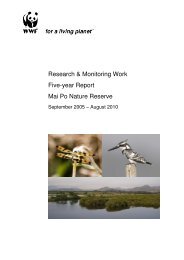
Trial on Improvements to theHigh-tide Roosting Habitatfor Migratory Waterbirds at<strong>Gei</strong> <strong>wai</strong> #16/17 Mai PoNature Reserve 2005/06FINAL REPORT : AFCD/SQ/21/05
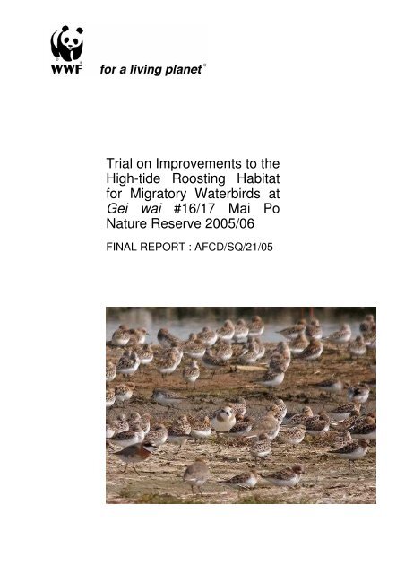
ChapterEXECUTIVE SUMMARYCONTENTSPageii1. INTRODUCTION 11.11.21.3BackgroundAimsApproach1222. METHODS 32.12.22.32.4Study AreaEarthmoving WorksWaterbird MonitoringIndicator of Success33573. RESULTS 73.13.2Earthmoving WorksWaterbird Monitoring784. DISCUSSION 114.14.24.34.44.5Waterbird Monitoring ResultsEffectiveness of Enhancement WorksEffectiveness of Waterbird MonitoringTimetabling and ResourcesIndicator of Success11121313135. RECOMMENDATIONS 135.15.2Habitat ManagementMonitoring13146. CONCLUSION 157. REFERENCES & BIBLIOGRAPHY 17IIIIII1.2.3.4.5.6.7.AppendicesProject PhotographsDesign Sketches of the Reprofiled and Newly Created IslandsData TablesTablesWinter Anatidae Count Dates, Times and Associated Tidal Conditions : Winter 2005/06.Survey Dates, Times and Associated Tidal and Waterlevel Conditions for the Waterbird Area Use Study.Final Dimensions of the Reprofiled Island and New Islands.Winter Anatidae Count Summary : Winter 2005/06.Comparison of the Anatidae Count Data between <strong>Gei</strong> <strong>wai</strong> #16/17 and the Ramsar Site : Winter 2005/06.Abundance of Waterbird Groups and Species on <strong>Gei</strong> <strong>wai</strong> #16/17 during Spring 2006.Comparison of Shorebird Groups (Waterbird Groups 3 & 6-11 Only) on <strong>Gei</strong> <strong>wai</strong> #16/17 and the Ramsar Site atHigh Tide during Spring 2005 & Spring 2006.1922236679910111.2.3.4.5.6.7.FiguresLocation of <strong>Gei</strong> <strong>wai</strong> #16/17.Location of Enhancement Works in <strong>Gei</strong> <strong>wai</strong> #16/17.Cross-section Sketch of the Embankment, Ditch and Vegetation Removal Works.Zonation of Islands and Open Water Habitat in <strong>Gei</strong> <strong>wai</strong> #16/17.Earthmoving Works in <strong>Gei</strong> <strong>wai</strong> #16/17 and Land Area Changes.Peak Monthly Winter Anatidae Counts in <strong>Gei</strong> <strong>wai</strong> #16/17 : Winter 2005/06.Individual Anatidae Species Trends in <strong>Gei</strong> <strong>wai</strong> #16/17 : Winter 2005/06.This publication should be cited as:Anon, 2006. Trial on Improvements to the High-tide Roosting Habitat for Migratory Waterbirds at <strong>Gei</strong> <strong>wai</strong> #16/17Mai Po Nature Reserve 2005-06 : Final Report. Report by World Wide Fund For Nature Hong Kong to the Agriculture,Fisheries and Conservation Department, Hong Kong Special Administrative Region Government.[Cover photo: Flock of Red-necked Stint Calidris ruficollis with a Greater and Lesser Sand Plover. Photo by: Neil Fifer)]i4457899
World Wide Fund For Nature Hong KongEXECUTIVE SUMMARYiiiiiiivThe Mai Po Inner Deep Bay Ramsar Site is listed as a Shorebirds Network Site in theEast Asian – Australian Flyway and supports between 20,000-30,000 shorebirdsduring the spring migration period. Under periods of low tide in the Bay, these birdsprimarily feed and roost on the extensive inter-tidal mudflat areas. When tide heightsexceed 2.1m the majority of birds fly inland to find areas of shallow water or mud toroost safely (known as high-tide roosts) before flying back out to Deep Bay to feed asthe tide recedes.The World Wide Fund For Nature Hong Kong has since 1986 successfully managedtwo high-tide roosts (gei <strong>wai</strong> #11 and gei <strong>wai</strong> #16/17) inside Mai Po Nature Reserve.The larger of these, gei <strong>wai</strong> #16/17, is an 18.22 ha area of shallow open watercontaining twenty-eight islands. Since 1999, a rolling annual programme ofearthmoving works has been carried out to enhance the key features of the gei <strong>wai</strong> inorder to attract more waterbirds.A precursory study upon the high-tide roost area in 2005 (Anon, 2005a) identified theneed for further enhancement works. In particular the reprofiling of one of the largeearth islands, measures to reduce visual and noise disturbance from vehicles usingthe Education Centre access track, and the reinstatement of former open water areaswhich had been lost to vegetation encroachment. Data from the study also accuratelypinpointed under-utilised locations for the possible establishment of small islands.Therefore in late summer 2005, landscaping and habitat creation works wereundertaken, but on a trial basis to investigate potential methods to improve the gei <strong>wai</strong>for the benefit of waterbirds (primarily shorebirds).The aims of the project are:• To investigate waterbird usage of different areas within the gei <strong>wai</strong> #16/17 high-tideroost during spring migration.• To determine if the reprofiling of Island no.1 and creation of 3 new small islandscan create conditions that attract a greater number of spring shorebirds.• To reduce disturbance to waterbirds inside gei <strong>wai</strong> #16/17 caused by vehiclesusing the Education Centre access track.• To better understand wintering Anatidae use of gei <strong>wai</strong> #16/17 to inform futurehabitat management decisions.Earthmoving WorksvA 10-week period of enhancement works created several new features and enhancedothers. The main physical outputs being:• A successful reprofile of the large Island (known as ‘no. 1’) - an increase in feedingedge by 19.7m (+12.7%), reduction in mean height above the gei <strong>wai</strong> operationalwaterline from 45.3cm to 8.0cm and an increase in the feeding edge:surface arearatio by +35.0%.• The creation of 3 new small islands of varying dimensions and designs - surfaceareas ranging between 12.6-80.8m 2 , mean heights above the operational waterlineranging from 8.4-12.1cm and a mixture of conventional bay and kidney designs.• The reinstatement of a 1.6 hectare area of former open water gei <strong>wai</strong> along thenorthern boundary to shallow water at a mean depth of 28.3cm (range 22.8-37.3cm) below the operational waterline.• The construction of a 570m long by 1m high embankment between the gei <strong>wai</strong> andadjacent Education Centre access track to reduce visual and noise disturbancefrom nearby vehicles.• The excavation of a 570m long by 1m deep ditch along the outermost edge of thenorthern gei <strong>wai</strong> water boundary to prevent re-encroachment of vegetation.ii
World Wide Fund For Nature Hong Kong• The creation of a grass barrier (‘soft screen’) along the entire length of the 570membankment to further reduce visual and noise disturbance from nearby vehicles.Waterbird Monitoringvi In spring 2006, all waterbirds using the gei <strong>wai</strong> were counted and mapped on 12occasions. A comparison of the results against the 2005 baseline data set showswaterbird numbers increased on gei <strong>wai</strong> #16/17 by +13.2% and the number of speciesrecorded with a mean count >5.0 increased by +27.8%. The number of springshorebirds increased by +13.8% which is significant because shorebird numbers onthe Ramsar Site increased only by +8.6% during the same period. This suggests thatcollectively all of the enhancement works undertaken on the gei <strong>wai</strong> in late summer2005 had a beneficial effect upon waterbirds.viiviiiA Waterbird Area Use Study before and after treatment (i.e. spring 2005 and spring2006) revealed a greater density of birds within the newly enhanced areas of the gei<strong>wai</strong>. In area Zone 6, containing the 3 new small islands, waterbird groups benefitingmost were ‘Ardeidae’ (+300.0%), ‘Avocets and Stilts’ (>+4000%), ‘Calidrids’(+444.4%), ‘Godwits and Dowitchers’ (+2500%), and ‘Plovers’ (+472.0%). In areaZone 7 containing the reprofiled Island no. 1, waterbird groups showing large changesinclude ‘Avocets and Stilts’ (>+2000%), ‘Calidrids’ (-90.8%) and ‘Plovers (+191.2%).Also new waterbirds belonging to the ‘Curlews and Whimbrels’ and ‘Godwits andDowitchers’ groups were attracted to this zone (i.e. not previously recorded in 2005).Collectively, the total number of shorebirds increased by +499.4% in Zone 6 and+36.8% in Zone 7.Between October 2005 and April 2006, fifteen bi-weekly roosting Anatidae counts werecompleted on gei <strong>wai</strong> #16/17 to better understand the importance of the high-tide roostto this group of birds. Results show that up to 5% of the known Ramsar Site winteringAnatidae utilised gei <strong>wai</strong> #16/17 with usage noticeably confined to the first half ofwinter (before mid January). Peak counts occurred in February (1,309 individuals) andDecember (1,005 individuals) with 5 species recorded of which Common Teal (meancount =116.5, peak count 594) and Northern Pintail (mean = 113.1, peak = 980) werethe two most abundant.Discussion/RecommendationixxxixiiThe 10-week period of enhancement works successfully created several new high-tideroost features and reprofiled an existing one. Waterbird numbers (including allshorebird groups) are shown to react positively to the treatment and therefore thechosen indicator of success attained, and the earthmoving works deemed successful.The 1999-2005 enhancement programme changed the interior of the gei <strong>wai</strong>substantially and no additional major earthmoving works are considered necessary inthe near future. Focus should now be upon fine-tuning the existing managementoperations such as waterlevel manipulation (Calidrids are identified as a potentialfocus bird group) and vegetation control (particularly island grasses and surroundingtrees).Usage of the gei <strong>wai</strong> by wintering Anatidae is now better understood and a baselinedata set obtained for future reference. The preliminary finding that Anatidae usagemay be related to availability of fodder in early winter, if verified through furthermonitoring, could be valuable for habitat management of the gei <strong>wai</strong> to improve itsattractiveness to Anatidae.Technical expertise gleaned from this trial and the previous 5 years work can now beapplied to the proposed conversion of gei <strong>wai</strong> #21 into a high-tide roost in 2008. Thisserves to maximise the potential and primary function of the new high-tide roost.iii
World Wide Fund For Nature Hong Kong1. INTRODUCTION1.1 Background1.1.1 The Mai Po Inner Deep Bay Ramsar Site is an important wetland for migratorywaterbirds being listed as a Shorebirds Network Site and an Anatidae Network Site inthe East Asian – Australasian Flyway (1996). The Ramsar Site can support20,000-30,000 shorebirds on their northward migration and is a key staging post alongthe flyway. The principal feeding habitat for these birds during their stop over is theinter-tidal mudflat of Deep Bay providing abundant benthic food during low tide.However under high tide conditions (> 2.1m) the littoral mudflat areas are inundated andthe majority of birds, particularly those with shorter legs fly inland to find areas of shallowwater or soft mud to roost safely (known as high-tide roosts) before flying back out toDeep Bay to feed as the tide recedes.1.1.2 Since 1986, <strong>WWF</strong> Hong Kong has successfully managed two high-tide roosts (gei <strong>wai</strong>#11 and gei <strong>wai</strong> #16/17) at the Mai Po Nature Reserve (MPNR). The largest of these isgei <strong>wai</strong> #16/17 (18.22ha), also known as the ‘scrape’. This roost was created in the mid1980s by removing the earth bund separating gei <strong>wai</strong> #16 and #17 thus creating a largecontiguous expanse of open water. Removal of grasses and other interior vegetationfrom within the gei <strong>wai</strong> enlarged the area and created shallow water/wet mud areas forroosting shorebirds (and other waterbirds). The bund material was piled up andlandscaped to form three large independent islands in the centre of the gei <strong>wai</strong>, alongthe former line of the dismantled bund.1.1.3 <strong>WWF</strong> Hong Kong currently manages the gei <strong>wai</strong> #16/17 high-tide roost in accordancewith the prescriptions set out in the 2006-2010 Mai Po Marshes Wildlife EducationCentre and Nature Reserve Management Plan (<strong>WWF</strong>-HK, 2006); careful manipulationof water levels (sluice gate control), regular flushing (temporary or partial draindown andrefilling) and vegetation control (cutting and occasional herbicide treatment) on theislands and boundary areas. Such management ensures favourable conditions -shallow open water areas, good standard of water quality and non-vegetated islands -for waterbirds.1.1.4 In the late 1990s, local birdwatchers, overseas conservation experts and <strong>WWF</strong> HongKong staff collectively observed a low usage of the three large earth islands byshorebirds. It was hypothesised that the islands were too high above the waterline (up to1.5m), hence their land surface had low moisture content and thus was often dry andhard. Such conditions are generally unsuitable for shorebirds because (1) they can notpenetrate (probe) the surface for food and (2) the surface is often invaded by terrestrialgrasses making it inaccessible and thus unusuable for roosting. Therefore, since 1999,significant landscaping work has been undertaken upon two of the large islands topromote their attractiveness to waterbirds. Work upon the remaining island (known as‘no. 1’) was partially completed in 2003.1.1.5 A study upon spring waterbird distribution inside gei <strong>wai</strong> #16/17 (Anon, 2005b and Anon,2005c) highlighted a comparative low bird usage of Island no. 1 and the immediatesurrounding areas. The same study also recognised (1) the need to reduce visualdisturbance and noise levels from the nearby Education Centre access track for thebenefit of waterbirds inside gei <strong>wai</strong> #16/17, and (2) the loss of a1.60 hectare area ofopen water inside the gei <strong>wai</strong> since 1986 to vegetation encroachment along the northernmost boundary, which may be creating ‘enclosed conditions’ undesirable for somewaterbird species i.e. contributing to potential disturbance from predatory birds throughconcealment.1.1.6 The current hydrological regime being operated at the gei <strong>wai</strong> provides in all-year-roundshallow water, which is favourable for shorebird roosting. However, because shorebirddependency upon the gei <strong>wai</strong> is greatest during migration periods (mid-March to1Tender AFCD/SQ/21/05
World Wide Fund For Nature Hong Konglate-May and mid-August to late-October), low water levels outside these dates may notbe necessary. In December 2005, MPNR supported at least 5,500 wintering Anatidaeinside Ponds #15a-b, #20a-f and #24f-g (Data combined from Anon, 2005d & <strong>WWF</strong>-HK,2005b). In respect of the site’s importance to this group of waterbirds, higher waterlevels inside gei <strong>wai</strong> #16/17 during the winter period could attract even more Anatidaeinto MPNR. However contemporary winter usage of the waterbody is not known.1.1.7 Based upon previous management activities and a desire to maximise the waterbirdpotential of the gei <strong>wai</strong>, <strong>WWF</strong> Hong Kong commenced a series of enhancement worksin August 2005 including the reprofiling of the unfinished large earth island no. 1.1.1.8 High-tide roost design has received reasonable scientific research attention, but specificwaterbird requirements for island habitats (i.e. dimensions, orientation, etc.) areunder-researched. Existing knowledge tends to concern breeding activity on high-tideroosts rather than roosting needs (a safe place to preen, digest and assimilate their foodand rest). However the following design principles are applicable to island reprofilingworks:1.2 Aimsa) Certain bird species show preference for particular shaped islands, i.e. long,narrow islands are thought to attract Avocet but are avoided by Black-headedGull (RSPB, 2002a).b) Making the island margins crenellated provides sheltered bays and increasesthe length of edge for feeding birds (RSPB, 2002a).c) The creation of a series of smaller islands can attract a greater number of birds(RSPB, 2002a).d) Set-back distances from sources of disturbance are important considerations.For breeding waders a minimum distance of 100m is required (Rodgers & Smith,1995) although screens/barriers can reduce the minimum distance.e) Islands less than 500mm in height are used more regularly by roosting waders(RSPB, 2002a & U.S. Fish and Wildlife Service, 2004).f) Shorebirds generally prefer to use areas of soft mud surrounded by water at adepth of less than 4cm (Isola et al. 2000).g) Newly created roost features should simulate characteristics of natural roostareas where possible (Lawler, 1995).h) A small shelf or raised earth mound can provide shelter from wind and rain(Lawler, 1995).1.2.1 The aims of the project are:• To investigate waterbird usage of different areas within the gei <strong>wai</strong> #16/17 high-tideroost during spring migration.• To determine if the reprofiling of Island no.1 and creation of 3 new small islands cancreate conditions that attract a greater number of spring shorebirds.• To reduce disturbance to waterbirds inside gei <strong>wai</strong> #16/17 caused by vehicles usingthe Education Centre access track.• To better understand wintering Anatidae use of gei <strong>wai</strong> #16/17 to inform futurehabitat management decisions.1.3 Approach1.3.1 The project involved three distinct work phases:• Phase I. A 10-week period of earthmoving works using heavy machinery and trucksto carry out:(1) Reprofiling work to lower the height of Island no.1 to be within 20cm of theoperational waterline. The target height (
World Wide Fund For Nature Hong Kongenhancement work experience, which is shown to maintain a saturatedmud surface.(2) Reshaping the perimeter margins on Island no. 1 according to designprinciple b).(3) Creation of 3 smaller islands (design principle c)) in close proximity toIsland no. 1.(4) Removal of boundary vegetation/silt to reinstate former areas of the gei<strong>wai</strong> and increase the total area of open water available to waterbirds.(5) Excavation of a 1m deep ditch along the northern boundary of the gei <strong>wai</strong>to limit vegetation re-encroachment.(6) Creation of a 1m high earth embankment along the northern boundary ofthe gei <strong>wai</strong>.(7) Grass planting along the earth embankment to create a soft screen andreduce disturbance from vehicles using the abutting access track.• Phase II. Ornithological monitoring during spring migration period (to assess theefficacy of the earthmoving works) and winter period (to better understand Anatidaeusage):(1) Waterbird counts and area use observations inside gei <strong>wai</strong> #16/17 duringspring 2006.(2) Anatidae counts inside gei <strong>wai</strong> #16/17 during winter 2005/06.• Phase III. Production of project reports – Waterbird Report (Anon, 2006b) and FinalReport.1.3.2 Phase I work was carried out in late summer and autumn 2005 because MPNR is asensitive wildlife area and subsequently all major work operations are restricted toparticular seasons or months. Wintering Anatidae arrive in Hong Kong from late Octoberand remain until early April the following year. This is immediately followed by the springmigration period, which normally finishes in early June. Therefore to minimisedisturbance to migratory waterbirds, enhancement works proceeded between Augustand late October2. METHODS2.1 Study Area2.1.1 The project boundary encompasses the entire 18.22 ha high-tide roost at gei <strong>wai</strong> #16/17(Figure 1) and includes all of the existing three large and twenty-five small islands (Figure2). The western boundary abuts a single-lane tarmac road (occasionally used by BorderPolice, the Agriculture, Fisheries and Conservation Department and <strong>WWF</strong> Hong Kongvehicles) and the northern boundary runs parallel to a narrow stone-surfaced accesstrack leading to the <strong>WWF</strong> Education Centre. Other boundaries join natural vegetation orgei <strong>wai</strong>.2.2 Earthmoving Works2.2.1 Prior to the commencement of earthmoving works, both seaward end sluice gates wereopened during a low tide and the gei <strong>wai</strong> partially drained. A 7-day period of dryingfollowed, whereby any remaining water (collected in low-lying areas) evaporated andthe exposed gei <strong>wai</strong> substrate of the work area hardened through sun and windexposure.2.2.2 Three grade 1 workman and a contractor, operating 2 backhoe, 2 bulldozers and 2 tippertrucks, commenced a 10-week period of earthmoving work at the end of August 2005(Appendix I). The locations of all work activities are shown in Figure 2.3Tender AFCD/SQ/21/05
World Wide Fund For Nature Hong KongFigure 1. Location of <strong>Gei</strong> <strong>wai</strong> #16/17.Figure 2. Location of Enhancement Works in <strong>Gei</strong> <strong>wai</strong> #16/17.2.2.3 To allow heavy machinery and vehicles safe access onto Island no. 1, the existing accessbund had to be widened to 2m and strengthened by placing and compacting spoil fromnearby locations.2.2.4 The proposed new shape of Island no. 1 was marked out (Appendix II) and all earthoutside the markers removed. Using an automatic level and staff, the island’s surfaceheight was lowered close to the operational waterline. The operational waterline refers tothe 46.0cm mark on the former gei <strong>wai</strong> #16 sluice gate fixed gauge board (the ‘46.0cm’level does not relate to any other level outside the gei <strong>wai</strong> and therefore has nosignificance to Chart Datum).2.2.5 Excess spoil from reprofiling work on Island no. 1 was reused to construct three smallislands (Appendix II) in the enhancement zone (Figure 2) by tipping spoil at the selectedlocation and landscaping with a small bulldozer. Use of an automatic level ensuredaccurate attainment of the desired heights above the operational waterline. The locationof each island was chosen by identifying the most under-utilised areas within the zone asshown by the 2005 spring Waterbird Area Use data set (Anon, 2005b).2.2.6 After heavy machinery had finished work upon the islands, the outermost edge of eachisland was reprofiled using handheld spades (Appendix I). This replaced the ‘hard edge’(acute angle) left by the bulldozer with a gentler shallow margin more suitable forfeeding shorebirds.4Tender AFCD/SQ/21/05
World Wide Fund For Nature Hong Kong2.2.7 Tipper trucks transported all remaining spoil from the gei <strong>wai</strong> to the proposedembankment location. Two backhoes and a bulldozer used the spoil to construct a 1mhigh x 2m (minimum) wide embankment along the interface between the track and gei <strong>wai</strong>(design shown in Figure 3).Figure 3. Cross-section Sketch of the Embankment, Ditch and Vegetation Removal Works.EmbankmentDesignDitch ProfileVegetationRemoved to30cmBelowWaterline2.2.8 To reinstate former areas of open water rank vegetation and silt had to be removed fromthe northern boundary of the gei <strong>wai</strong> (Figures 2 and 3). A combination of backhoe (using agentle scraping action) and bulldozer moved the material to the outer edges of the gei<strong>wai</strong>. Cleared areas were set at 30cm below the operational waterline using an automaticlevel.2.2.9 To prevent vegetation re-encroaching onto the cleared areas, a 1m deep ditch wasexcavated along the outer edge of the water body (Figures 2 and 3).2.2.10 Upon completion of the earthmoving works in late October, all machinery and equipmentwithdrew from the work site. Then the gei <strong>wai</strong> reflooded and flushed over the followingdays as a precautionary measure to reduce any potential oxidation impact caused bysun-baking on the substrate.2.2.11 In June 2006, two species of grass; Panicum spp. and Pennisetum purpureum (NapierGrass), were transplanted to the newly created embankment (Appendix I). Rows ofgrasses spaced approximately 30cm apart were planted to create a natural barrier andprovide an additional food source for seed-eating birds.2.3 Waterbird Monitoring2.3.1 Two waterbird counts were undertaken to (1) assess the effectiveness of the works forspring waterbirds and (2) assess Anatidae usage of the gei <strong>wai</strong>. Reference to Anon2006b should be made for a comprehensive account of the monitoring activities andpresentation of full data sets.Anatidae Count2.3.2 Between late October 2005 and late April 2006, fifteen bi-weekly Anatidae counts werecompleted on gei <strong>wai</strong> #16/17 (Table 1). Each one being undertaken during high tides(where possible) and within 1-2 days of the Hong Kong Bird Watching Society MonthlyRamsar Site Waterbird count to facilitate better data interpretation (as recommended inAnon, 2005d). During January and February, two extra counts were completed tocoincide with the expected peak influx of Anatidae.5Tender AFCD/SQ/21/05
World Wide Fund For Nature Hong KongTable 1. Winter Anatidae Count Dates, Times and Associated Tidal Conditions : Winter 2005/06.Tide 1Date Sunset 1 Observation Preceding Height 2 Condition 3(Time) Period Condition31 October 2005 17:47 17:02 – 18:02 0.8m@15:57 1.3m ↑14 November 2005 4 17:40 16:55 – 17:55 0.8m@15:32 1.7m ↑30 November 2005 17:38 16:53 – 17:53 1.1m@15:26 1.8m ↑19 December 2005 4 17:43 16:58 – 17:58 1.3m@17:24 1.7m ↑29 December 2005 17:49 17:04 – 18:04 1.2m@14:34 1.8m ↑09 January 2006 17:56 17:11 – 18:11 1.0m@11:51 2.1m ↑15 January 2006 18:00 17:15 – 18:15 1.1m@16:03 1.2m ↑23 January 2006 4 18:06 17:21 – 18:21 2.0m@16:14 1.8m ↓07 February 2006 18:15 17:30 – 18:30 2.1m@17:10 2.0m ↓20 February 2006 4 18:23 17:38 – 18:38 2.1m@14:05 1.4m ↓27 February 2006 18:26 17:41 – 18:41 0.9m@16:21 1.5m ↑09 March 2006 18:30 17:45 – 18:45 0.5m@01:56 2.1m ↔22 March 2006 4 18:35 17:50 – 18:50 2.4m@13:57 1.4m ↓18 April 2006 4 18:44 17:59 – 18:59 2.7m@12:07 0.8m ↓25 April 2006 18:47 18:02 – 19:02 0.7m@15:18 1.4m ↑1 – Data from the HK Observatory (tide data relates to Tsim Bei Tsui tidal station)2 – At mid-point of observation period3 – General tidal condition during observation period (↑ = Rising, ↓ = Falling, ↔ = coincides with max or min tide)4 – Dates selected to be within 1-2 days of the HKBWS Monthly Ramsar Site Waterbird Count.Waterbird Count and Area Use Study2.3.3 During April and May 2006, the location and number of all waterbirds (classificationprovided in Anon, 2006b) using gei <strong>wai</strong> #16/17 was recorded on 12 separate occasions(Table 2) and mapped using a grid system (Figure 4). Survey dates had to be selected to(1) coincide with the expected peak shorebird migration period in Hong Kong (April andMay), (2) be conducted during high Deep Bay daytime tides (greater than or equal to2.5m) because these are known to increase the number of waterbirds inside MPNR(Anon, 2002 & Anon, 2005d) and (3) mimic (where possible) the 2005 survey datesused for the baseline data set (Anon, 2005b).Table 2. Survey Dates, Times and Associated Tidal and Waterlevel Conditionsfor the Waterbird Area Use Study.Date Water depth 1at start (cm)Count 1(Time)High Tide 2 Water depth 1at start (cm)Count 2(Time)01 April 2006 44.5 10:14 – 10:14 2.5m @ 11:44 46.0 12:14 – 13:1415 April 2006 46.0 09:13 – 10:13 2.5m @ 10:47 46.5 11:17 – 12:1716 April 2006 45.5 08:40 – 09:40 2.6m @ 11:10 47.0 11:40 – 12:4017 April 2006 46.5 09:06 – 10:06 2.7m @ 11:36 47.5 12:06 – 13:0602 May 2006 43.0 09:25 – 10:25 2.6m @ 11:55 41.0 12:25 – 13:2513 May 2006 42.0 08:09 – 09:09 2.6m @ 09:39 44.0 10:09 – 11:0914 May 2006 44.0 07:36 – 08:36 2.8m @ 10:06 45.0 10:36 – 11:3616 May 2006 44.0 08:40 – 09:40 2.9m @ 11:10 46.0 11:40 – 12:4017 May 2006 42.0 09:19 – 10:19 2.8m @ 11:49 44.5 12:19 – 13:1919 May 2006 42.0 11:06 – 12:06 2.5m @ 13:36 43.5 14:06 – 15:0626 May 2006 41.0 07:25 – 08:25 2.6m @ 08:55 41.5 09:25 – 10:2527 May 2006 39.0 07:53 – 08:53 2.7m @ 09:23 43.5 09:53 – 10:531 – Fixed gauge board located at the former gei <strong>wai</strong> #16 sluice gate. 46.0cm is regarded as the normal operational water line.2 – Data from HK Observatory (relates to Tsim Bei Tsui tidal station).6Tender AFCD/SQ/21/05
World Wide Fund For Nature Hong KongFigure 4. Zonation of Islands and Open Water Habitat in <strong>Gei</strong> <strong>wai</strong> #16/17.2.4 Indicator of Success(Shaded = island areas exposed at the operational waterline)2.4.1 Success will be assessed according to the following indicator – ‘A higher number ofspring waterbirds utilising the newly reprofiled island, newly created smaller islands andreinstated area of open water, than compared with the number using the respectivehabitats before earthmoving works began’.3. RESULTS3.1 Earthmoving Works3.1.1 Enhancement work on Island no. 1 successfully reprofiled the island (Figure 5 andAppendix II) in accordance with the original design specifications. The main outputsbeing:• Crenulated edges with 7 ‘headlands’.• Reduction in the mean height above the operational waterline from 45.3cm to 8.0cm(Table 3).• Increased feeding edge (margin) by 19.7m (+12.7%).• An increase in the feeding edge to surface area ratio by +35.0%.Table 3. Final Dimensions of the Reprofiled Island and New Islands.Island No.1Before After Island A Island B Island CSurface Area (m 2 ) 480 401 80.0 12.6 36.6Mean Height* (cm) 45.3 8.0 11.8 12.1 8.4Maximum Length (m) 59.2 58.0 36.1 5.3 20.75Maximum Width (m) 38.8 25.1 4.6 4.0 6.4Margin Length (m) 154.6 174.3 72.8 18.4 42.7* - Above the operational waterline3.1.2 Three new small islands were successfully created in the enhancement zone, each ofdiffering size and shape (Appendix II). The largest, Island A, is a traditional elongated‘bay’ design with a surface area of 80.0m 2 set at a mean height above the operationalwaterline of 11.8cm. It is purposely located in close proximity to Bird-watching Hide No.3 and intended to include a leeward side for sheltered feeding/roosting. Island B, aconventional ‘kidney’ design of 12.6m 2 area is set at 12.1cm (mean height) above theoperational waterline. Island C is a mixed ‘kidney’ and ‘bay’ design created at a meanheight of 8.4cm and 36.6m 2 in area.7Tender AFCD/SQ/21/05
World Wide Fund For Nature Hong KongFigure 5. <strong>Gei</strong> Wai #16/17 Before and After Earthmoving Works.Spring 2005 (Before)Spring 2006 (After)3.1.3 A 570m long by 1m high embankment was constructed along the intended alignmentbetween the Education Centre access track and gei <strong>wai</strong>. Width varied between 2-5m,being widest in sections nearer to other earthmoving works, that generated largervolumes of spoil i.e. Island no. 1.3.1.4 A 1.6ha area of former gei <strong>wai</strong> was reinstated along the northern boundary. Mean depthbelow the waterline was 28.3cm ranging between 22.8-37.3cm, being shallower in areasclosest to the northern boundary.3.1.5 A 570m long by 1m deep ditch was excavated along the outermost edge of the northerngei <strong>wai</strong> water boundary as per the original design specifications.3.1.6 Grasses were successfully planted on top of the newly created embankment in rows of3-6 individuals (Appendix I) dependant upon embankment width (section 3.1.3).Approximately 5% of the grasses died after transplanting and had to be replaced 4weeks later.3.2 Waterbird Monitoring3.2.1 Winter Anatidae Count DataOver the winter period the highest peak monthly counts occurred in February (1,309)and December (1,005) (Table 4 & Figure 6). Peak monthly counts greater than 350 birdsoccurred in each of the 4 months between October and February. In the remainingmonths - March and April - peak counts were less than 50 individuals.3.2.2 In total, 6 Anatidae species were recorded. However a single male Falcated Duck(recorded on 18th April 2006) is considered to be of ‘uncertain origin’ and thereforeomitted from the data set (refer Anon, 2006b). Common Teal, with a mean count of8Tender AFCD/SQ/21/05
World Wide Fund For Nature Hong Kong116.5 individuals and high count of 594 (29 December) and Northern Pintail (mean =113.1, peak = 980 on 07 February) were the two most abundant species. Collectivelythese two species comprise 74.5% of the entire Anatidae winter data set. Of theremaining species, a count of 310 Garganey (31 October 2005) is among the highest inHong Kong in recent years (refer Anon, 2006b).Table 4. Winter Anatidae Count Summary : Winter 2005/06.Count Date31-Oct-0514-Nov-0530-Nov-0519-Dec-0529-Dec-0509-Jan-06SpeciesCommon Teal 11 61 376 140 594 223 0 0 312 0 0 30 0 0 0Eurasian Wigeon 42 69 82 55 21 62 8 0 8 3 0 7 4 0 0Garganey 310 0 8 0 5 0 0 0 0 0 0 5 0 0 0Northern Pintail 43 123 160 80 175 61 14 0 980 0 61 0 0 0 0Northern Shoveler 0 149 51 30 210 5 8 0 9 0 28 3 0 1 0TOTAL *406 402 *677 305 *1005 *351 30 0 *1309 3 89 *45 4 *1 0Numbers in bold = Highest species or total count in gei <strong>wai</strong> #16/17 during the winter period.* = Taken as the monthly peak count.15-Jan-0623-Jan-0607-Feb-0620-Feb-0627-Feb-0609-Mar-0622-Mar-0618-Apr-0625-Apr-06Figure 6. Peak Monthly Winter Anatidae Countsin <strong>Gei</strong> <strong>wai</strong> #16/17 : Winter 2005/06.Figure 7. Individual Anatidae Species Trends in<strong>Gei</strong> <strong>wai</strong> #16/17 : Winter 2005/06.3.2.3 Winter count trends (Figure 7) show that, with the exception of the 7 th February 2006count, Anatidae generally ceased using the gei <strong>wai</strong> for roosting after early January.Also, use of the gei <strong>wai</strong> by Garganey was almost entirely confined to October.3.2.4 A comparison between the Ramsar Site Anatidae and gei <strong>wai</strong> #16/17 Anatidae countdata sets (Table 5) shows that ~ 5% of the Ramsar birds utilised the gei <strong>wai</strong> for roostingin November and December 2005.Table 5. Comparison of the Anatidae Count Data between <strong>Gei</strong> <strong>wai</strong> #16/17 and the Ramsar Site : Winter 2005/06.<strong>Gei</strong> <strong>wai</strong> #16/17Ramsar Site*<strong>WWF</strong>-HKCount DateTotal no. ofAnatidaeHKBWSCount DateTotal no. ofAnatidae<strong>Gei</strong> <strong>wai</strong> #16/17/Ramsar (%)14-Nov-05 402 13-Nov-05 7355 5.5%19-Dec-05 305 18-Dec-05 6150 5.0%23-Jan-06 0 22-Jan-06 3241 0%19-Feb-06 3 19-Feb-06 9571
World Wide Fund For Nature Hong KongWaterbird Counts : Spring 20063.2.5 In 2006, the total number of waterbirds counted on gei <strong>wai</strong> #16/17 varied between 613(27 th May) and 5,971 (17 th April) individuals (mean = 2,471.2). The total number of speciesrecorded from all 12 counts was 56 (mean = 30.8) with a peak species count of 38 on 17 thApril.3.2.6 The most abundant waterbird groups were ‘Tringa’ (mean = 1045.0) and ‘Avocets andStilts’ (mean = 695.8) (Table 6) accounting for 70.4% of the entire spring data set. PiedAvocet (mean = 654.1), Common Redshank (mean = 318.5), Common Greenshank(mean = 316.7) and Marsh Sandpiper (Mean = 287.7) (Table 6) were the four mostabundant species in 2006. Twenty-three species had mean counts >5.0 individuals. Thecounts of Nordmann’s Greenshank (max count 5 – 19 th May), Swinhoe’s Egret (maxcount 1 – 4 dates in May) and Black-faced Spoonbill (max count 27 – 15 th April) are ofconservation interest (Birdlife International, 2000).Table 6. Abundance of Waterbird Groups and Species on <strong>Gei</strong> <strong>wai</strong> #16/17 during Spring 2006.2006 2006Mean Count Waterbird Group Mean Count Species*Range Value Range Value>100 1045.0 9 (Tringa) >250 654.1 Pied Avocet695.8 3 (Avocets & Stilts) 318.5 Common Redshank322.6 6 (Calidrids) 316.7 Common Greenshank106.2 10 (Scolopacidae other) 287.7 Marsh Sandpiper50-100 90.1 7 (Godwits and Dowitchers) 100-250 237.7 Red-necked Stint88.5 11 (Plovers) 112.5 Spotted Redshank25-50 49.0 8 (Curlews and Whimbrels) 100.8 Terek Sandpiper35.7 4 (Gulls & Terns) 50-100 86.3 Black-tailed Godwit26.2 1 (Ardeidae) 25-50 42.4 Greater Sand Plover0-25 9.5 2 (Black-faced Spoonbill) 41.9 Black-winged Stilt1.9 12 (Waterbirds other) 41.8 Curlew Sandpiper0.8 5 (Anatidae) 40.3 Eurasian Curlew35.3 Grey Plover32.3 Gull-billed Tern*Species
World Wide Fund For Nature Hong KongTable 7. Comparison of Shorebird Groups (Waterbird Groups 3 & 6-11 Only) on <strong>Gei</strong> <strong>wai</strong> #16/17 andthe Ramsar Site at High Tide during Spring 2005 & Spring 2006.2005 2006Waterbird Group Mean Count Mean CountA - 16/17 1 B – Ramsar 1 A:B A - 16/17 1 B – Ramsar 1 A:B3 (Avocets and stilts) 90.3 968.2 9.3% 695.8 1501.9 46.3%6 (Calidrids) 615.9 582.5 ~100% 322.6 649.9 49.6%7 (Godwits and dowitchers) 92.2 246.6 37.4% 90.1 236.8 38.0%8 (Curlews and whimbrels) 28.6 24.8 ~100% 49.0 60.3 81.3%9 (Tringa) 1133.7 1966.9 57.6% 1045.0 2243.6 46.6%10 (Scolopacidae other) 44.1 115.4 38.2% 106.2 150.8 70.4%11 (Plovers) 102.3 121.1 84.5% 88.5 140.6 62.9%1 – Data from Anon 2006bWaterbird Area Use Data3.2.10 The mean waterbird density (per hectare) inside gei <strong>wai</strong> #16/17 increased between yearsfrom 178.7 to 187.1 (+4.7%). Waterbird density increased in four zones (1, 5, 6 and 7) anddeclined in the other three zones between the two periods (refer to Appendix III for datatables). Zone 6 (+419.6%), Zone 1 (+101.8%), Zone 3 (-77.3%) and Zones 2 & 4 (both ~-50%) witnessed significant changes.3.2.11 Notable bird group results include:• An increase in ‘Avocets and Stilts’ in all zones except Zone 3.• ‘Ardeids’ increased considerably in Zones 3 and 6, but declined in Zones 2 and 1.• ‘Curlews and Whimbrels’ showed a spatial redistribution between years and astrong preference for Zones 3, 4 and 7 in 2006.• ‘Tringa’ showed a strong preference in 2006 for Zone 1, whilst Zones 2, 3 and 4 alldeclined significantly.• ‘Plovers’ showed a clear preference for Zones 6 and 7 (containing the newly profiledisland and 3 islands) in 2006 and moved away from their more generaliseddistribution in 2005 (Zones 2-5).• The distribution of ‘Gulls and Terns’ remained unchanged between years with Zone3 being preferred.• The density of shorebirds (groups 3 & 6-11) increased by +499.4% in Zone 6 and+36.8% in Zone 7.4. DISCUSSION4.1 Waterbird Monitoring ResultsAnatidae4.1.1 Up to 5% of the known Ramsar Site wintering Anatidae utilised gei <strong>wai</strong> #16/17 withusage noticeably confined to the first half of winter (before mid January). Availability ofsuitable fodder may be responsible for the observed cessation of usage. For exampleobservations noted Anatidae feeding upon internal grassy vegetation which hadflourished whilst the gei <strong>wai</strong> was temporarily drained for earthmoving works (late Augustto late October). Once this vegetation disappeared from the gei <strong>wai</strong> (grazed or diedback), Anatidae numbers declined, creating a distinctly biased negative skew favouringthe pre-January period. This phenomenon is not witnessed in other ponds or gei <strong>wai</strong>inside MPNR which adhere to a classic bell-shaped data distribution between Octoberto April (refer to Anon, 2006c). There were no habitat management operationsundertaken at the gei <strong>wai</strong> during the study period (other than the routine water exchangeundertaken for every gei <strong>wai</strong>) and no known disturbance events which could haveinfluenced Anatidae behaviour in such a way as to explain their uncharacteristic low11Tender AFCD/SQ/21/05
World Wide Fund For Nature Hong Kongusage (near absence) from January onwards. This suggests the availability of foddermay be the dominant factor influencing Anatidae usage. This ‘unplanned’, butpotentially beneficial side effect of the earthmoving activities (i.e. not a directconsequence of the enhancement works) may have implications for futuremanagement.Waterbirds4.1.2 Post enhancement works, the mean no. of waterbirds using gei <strong>wai</strong> #16/17 increased by+13.2% and the number of waterbird species with mean counts >5.0 increased by+27.8%. These findings suggest that in 2006, the gei <strong>wai</strong> attracted higher numbers ofthe more common waterbird species than in 2005 and may now be providing moreuniversal/generic conditions for waterbirds.4.1.3 The Waterbird Area Use study showed waterbirds to be more spatially widespreadwithin the gei <strong>wai</strong> in 2006. In general, waterbirds reduced their dependency upon thecentralised areas of the gei <strong>wai</strong>.Shorebirds (waterbird groups 3 & 6-11)4.1.4 The mean number of shorebirds increased by +13.8% on gei <strong>wai</strong> #16/17 from 301.0 inspring 2005 to 342.5 in spring 2006. Data from Anon 2005a and Anon 2006a shows themean number of shorebirds recorded from the Ramsar Site during the equivalent surveyperiod (31 st Mar – 25 th May), increased from 4,949 to 5,375. This represents a +8.6%natural variation in shorebird numbers between years. Therefore, the increase on gei<strong>wai</strong> #16/17 being considerably greater than the natural variation, is of significance.4.1.5 Shorebird densities in the enhancement zones are shown to increase after treatment. InZone 6, containing the 3 new smaller islands, shorebird density increased by +499.4%.Attributing this solely to the new islands is problematic, but the enhancement worksincreased the total number of islands in this zone from 8 to 11, a measure which isknown to attract greater numbers of birds (RSPB, 2002a). For each island, theirlocations were chosen based upon the 2005 data results which showed their footprintareas to be associated with very low shorebird densities. During the 2006 study the landsurface areas of Islands B and C regularly attracted good numbers of shorebirds (IslandA to a lesser extent). In Zone 7, containing the reprofiled Island no. 1, shorebird densityincreased by +36.8%. Similarly such a change is difficult to assign to the reprofilingworks, but the new design adheres to the basic principles (Section 1.1.8) and a positivereaction is therefore a likely outcome. Interestingly, Island no. 3, which received majorenhancement works in 2004, was far more attractive to shorebirds in the second springperiod after completion (i.e. 18 months later).4.1.6 The two-year data set (spring 2005 and spring 2006 combined) shows that 58.7% ofshorebirds recorded from within the Ramsar Site, roost inside gei <strong>wai</strong> #16/17 duringhigh tide. The importance of which is furthered by the fact that the gei <strong>wai</strong> occupies only1.3% of the total Ramsar Site area.4.2 Effectiveness of Enhancement Works4.2.1 All components of the island earthmoving works were successfully completed inaccordance with the original project intentions and design. The main outputs being (1) atotal addition of 153.6m feeding edge and (2) the creation of 530.2m 2 of island surfacearea within the desired height range, and (3) the creation of 3 small islands (each
World Wide Fund For Nature Hong Kong4.2.3 Both the embankment and ditch were constructed in accordance to the designspecifications. The embankment width varied between 2-5m, creating a non-linearalignment (i.e. more natural) along the water interface, increasing the total length offeeding edge for waterbirds.4.2.4 Planting works along the entire length of embankment created a suitable density ofgrasses to form a natural screen. The effectiveness of the screen will not be known untilspring 2007 when the grasses are more mature and better established.4.2.5 Unlike previous earthmoving work years since 1999, it was not necessary to fully drain thehigh-tide roost because the main work area, being located at the landward end of the gei<strong>wai</strong>, is more elevated. This provided waterbirds, particularly those breeding, withcontinued use of ~50% of the gei <strong>wai</strong> during the work period. It is noted that thepredominant species breeding on gei <strong>wai</strong> #16/17 over the previous 3 summer seasonshas been the Black-winged Stilt and the earthmoving works commenced at the end thebreeding season for this species when all new birds had fledged.4.2.6 The use of an automatic level and staff greatly improved the precision of setting heightsfor the embankment, new islands, reprofiled island and also correct depths for the ditchand gei <strong>wai</strong> substrate below the reinstated area.4.3 Effectiveness of Waterbird Monitoring4.3.1 The twelve waterbird counts (and mapping work), produced a large and sufficient dataset suitable for comparing waterbird usage of the enhanced areas and assessing theindicator of success (section 4.5.1). It proved necessary to change several of the countdates from those originally planned because of unusual tidal conditions in Deep Bay.Also several counts dates were rescheduled by a 1-2 day margin to take advantage ofmore suitable tide conditions.4.3.2 The fifteen Anatidae counts provided extremely useful data upon bird usage of the gei<strong>wai</strong> in a season not normally associated with it’s primary function. The information nowprovides a baseline for future study and has identified a potential managementprescription for further consideration.4.4 Timetabling and Resources4.4.1 Phase I and Phase II were both completed on schedule. Phase III being completedseveral months after that stipulated in the agreed contract. The original project costingfor all works proved accurate and all assigned resources consumed. Three additionalman-days proved necessary to complete Phase III of the project.4.5 Indicator of Success4.5.1 Results show that waterbird density in the area containing the newly reprofiled Islandno. 1 (Zone 7), increased by +38.1% after enhancement works. Waterbird density alsoincreased by +419.3% in the area containing the three new islands (Zone 6). As per theprevious discussion in Section 4.1.5 these changes are likely to arise from theenhancement works and therefore the indicator is deemed to have been successfullyachieved.5. RECOMMENDATIONS5.1 Habitat Management5.1.1 The newly planted natural grass screen along the top of the embankment should be cutat least once a year to prevent growth of unwanted woody vegetation. A one-off cut inearly June (only during Deep Bay low tides) is recommended to avoid disturbance to13Tender AFCD/SQ/21/05
World Wide Fund For Nature Hong Kongwaterbirds and ensure the grasses are able to produce seed in late summer. Thismanagement would promote the continuation of a grass dominated sward, ensure thebarrier remains low enough to not create ‘enclosed’ conditions and provide food forseed-eating birds.5.1.2 It is known that tall trees in close proximity to a high-tide roost can lead to a reduction inthe number of shorebirds nearby because of a threat of ambush by birds of prey (Lawler,1995). Therefore consideration should be given to maintaining trees (and othervegetation) to create a low profile landscape surrounding the gei <strong>wai</strong>. Guidance isprovided by Lawler (1995) such that at a distance of 30m from the roost area, visualbarriers (i.e. trees) should be no more than 2m in height.5.1.3 The current gei <strong>wai</strong> #16/17 water level regime being operated during spring passagecould, if fine-tuned, be more suitable for smaller Calidrid shorebirds, particularly Calidrisruficollis (Red-necked Stint). Peak passage for these birds extends from the end ofMarch to the first week of May (Carey, et al. 2000) and water levels could be lowered byup to 5cm between these dates to attract greater numbers into the gei <strong>wai</strong>. Howevermany of the island surfaces would subsequently dry out and become unfavourable formost shorebird species. To overcome this problem numerous shallow runnels (~10cm)could be dug across each of the affected islands to irrigate water into the centralisedareas of each island.5.1.4 Since becoming operational in the mid-1980s, the high-tide roost’s constant demand forshallow water has negatively impacted upon those areas situated at the landward end ofthe gei <strong>wai</strong>. In particular Sub-pond #17b, now unrecognisable as a pond, is overgrownwith terrestrial vegetation including climbers. It is recommended to sever hydrologicallinks between gei <strong>wai</strong> #16/17 and Sub-pond #17b by blocking the two connectingchannels at the northwest and southwest corners of Sub-pond #17b. This will helpachieve the management intention for the sub-pond which is to ‘adjust conditions infavour of creating an open freshwater roosting area…’ (<strong>WWF</strong>-HK, 2006).5.1.5 In recent years, gei <strong>wai</strong> #16/17 attracted breeding pairs of Black-winged Stilt (sixteen in2006) and Greater-painted Snipe (two in 2005), both of which are of local conservationinterest and therefore worthy of management attention. In particular grasses on many ofthe islands flourish during the summer season, reducing the availability of suitablebreeding areas. In respect of the increasing number of birds nesting on the islands, avegetation management regime should be considered to maintain a balance betweenthe area of suitable island surface available, frequency and duration of humandisturbance caused by each cutting operation and the retention of some cover toescape disturbance from predatory birds.5.2 Monitoring5.2.1 Should further Anatidae monitoring be required at MPNR, recommendations to improvethe quality of data collection and interpretation include:• Conduct counts at other ponds or gei <strong>wai</strong> to provide a more comprehensiveunderstanding of wintering Anatidae within MPNR. In particular all freshwater ponds(#20a-f, #24a-g, #15a-b) and gei <strong>wai</strong> #8.• Continue to coincide one count per month with the HKBWS monthly Ramsar Sitewaterbird count to facilitate a better understanding of wintering Anatidae importanceof MPNR in a Deep Bay context.• Continue to conduct counts at periods of high tide in Deep Bay (it is noted that veryfew tides over 1.8m coincide with evening count times during October, November orDecember).• Record all Spot-billed Duck sightings to taxa/race level to provide information for acurrently under-researched area of ornithology in Hong Kong.14Tender AFCD/SQ/21/05
World Wide Fund For Nature Hong Kong5.2.2 If resources are available, it is recommended to further study winter Anatidae usage of thegei <strong>wai</strong> to inform management decisions by (1) investigating if the observed early winterAnatidae use of gei <strong>wai</strong> #16/17 is related to the establishment of grassy vegetation in latesummer whilst temporarily drained down and (2) varying water depth to determine anoptimal winter regime.5.2.3 Spring shorebird data relating to gei <strong>wai</strong> #16/17 should be extracted from the HKBWSRamsar Site shorebird counts (under a service contract funded by AFCD) and analysedevery five years to determine the percentage of shorebirds utilising the gei <strong>wai</strong>. Thereforeit is not necessary to continue direct counting.5.2.4 Further enhancement of the existing MPNR high-tide roosts or the construction of newhigh-tide roosts, such as the proposed conversion of gei <strong>wai</strong> #21 (<strong>WWF</strong>-HK, 2006),should consider the current level of provisions available to shorebirds and the demandfor them. In particular, it is noted that despite the extensive earthmoving works between1999 and 2005 several shorebird groups remain under-represented on gei <strong>wai</strong> #16/17.Plausible explanations are know for ‘Godwits and Dowitchers’ and ‘Tringa’ which areknown to congregate at the gei <strong>wai</strong> #11 high-tide roost and similarly the absence of‘Avocets and Stilts’ can probably be attributed to sizeable numbers of Pied Avocetremaining on the flooded inter-tidal mudflats at high tide. Conversely, ‘Plovers’ areunder-represented and no other suitable high-tide roost is known inside or in closeproximity to MPNR. The information needed to address this issue could be gleaned fromthe existing HKBWS spring shorebird monitoring programme if the current recordingmethodology is slightly revised.5.2.5 Waterlevel readings should continue to be collected from gei <strong>wai</strong> #16/17 each spring.Levels can then be correlated with the HKBWS shorebird count data to provide moreinformation for the calculation of an optimal water regime.6. CONCLUSION6.1 The 10-week period of enhancement works successfully reprofiled and created thehigh-tide roost features according to the original intentions of the project. Waterbirdmonitoring before and after treatment revealed a greater density of birds to beassociated with the enhanced areas of the gei <strong>wai</strong>. Waterbird groups ‘Ardeidae’(+300.0%), ‘Avocets and Stilts’ (>+4000%), ‘Calidrids’ (+444.4%), ‘Godwits andDowitchers’ (+2500%), and ‘Plovers’ (+472.0%), benefited most in the zone whichincludes the 3 new small islands. ‘Avocets and Stilts’ (>+2000%), ‘Calidrids’ (-90.8%)and ‘Plovers (+191.2%) showed large changes in the zone which includes the reprofiledIsland no. 1. Also new waterbirds belonging to the ‘Curlews and Whimbrels’ and‘Godwits and Dowitchers’ groups were attracted to this zone (i.e. not previouslyrecorded in 2005).6.2 Usage of the gei <strong>wai</strong> by wintering Anatidae is now better understood and a baseline dataset obtained for future reference. The preliminary findings, if verified through furthermonitoring, could have a valuable input into habitat management of the gei <strong>wai</strong> toimprove its attractiveness to Anatidae.6.3 A comparison between spring 2005 and spring 2006 waterbird data on gei <strong>wai</strong> #16/17showed a total number increase of +13.2%. Also the number of species recorded with amean count >5.0 increased by +27.8%. The number of spring shorebirds increased by+13.8%, which is significant because shorebird numbers on the Ramsar Site increasedonly by +8.6% during the same period. This suggests that collectively all of theenhancement works undertaken on the gei <strong>wai</strong>, not just island related works, had abeneficial effect upon waterbirds.6.4 The continuous 6-year enhancement programme has undoubtedly improved thehigh-tide roost’s key features for waterbirds and no additional major earthmoving works15Tender AFCD/SQ/21/05
World Wide Fund For Nature Hong Konginside the gei <strong>wai</strong> are considered necessary in the near future. Focus should now beupon fine-tuning the existing management operations such as waterlevel andvegetation control.6.5 The various technical procedures employed, decisions made and study findings, serveto increase the overall management experience and knowledge of high-tide roosts. Thisexpertise can now be applied to the proposed conversion of gei <strong>wai</strong> #21 into a high-tideroost in 2008 to ensure it’s primary function and potential is fully maximised.16Tender AFCD/SQ/21/05
World Wide Fund For Nature Hong Kong7. REFERENCES (*) & BIBLIOGRAPHY* Anon. 2002. Field Study of the Wintering Ecology of Anatidae Species in the Mai Po Inner Deep BayArea, Hong Kong. Tender ref. AFD/SQ/34/01. Agriculture, Fisheries and Conservation Department,HKSAR Government (Unpublished).Anon. 2005a. Shorebird Monitoring at the Mai Po Inner Deep bay Ramsar Site: 2004-05. Report byHong Kong Bird Watching Society to the Agriculture, Fisheries and Conservation Department, Hong KongSpecial Administrative Region Government.* Anon. 2005b. Trial on Improvements to the High-tide Roosting Habitat for Migratory Waterbirds at<strong>Gei</strong> <strong>wai</strong> #16/17, Mai Po Nature Reserve : Final Report. (Tender ref. AFCD/SQ/27/04). Report by theWorld Wide Fund for Nature to the Agriculture, Fisheries and Conservation Department, Hong KongSpecial Administrative Region Government.* Anon. 2005c. Trial on Improvements to the High-tide Roosting Habitat for Migratory Waterbirds at<strong>Gei</strong> Wai #16/17, Mai Po Nature Reserve : Shorebird Report. (Tender ref. AFCD/SQ/27/04). Report bythe World Wide Fund for Nature to the Agriculture, Fisheries and Conservation Department. HKSARGovernment.* Anon. 2005d. Trial on Improving the Roosting Habitat for Wintering Waterfowl in Ponds #20 and #24,Mai Po Nature Reserve : Final Report. (Tender ref. AFCD/SQ/34/04). Report by the World Wide Fund forNature to the Agriculture, Fisheries and Conservation Department, Hong Kong Special Administrative RegionGovernment.* Anon. 2006a. Shorebird Monitoring at the Mai Po Inner Deep Bay Ramsar Site: 2005-06. Report byHong Kong Bird Watching Society to the Agriculture, Fisheries and Conservation Department, Hong KongSpecial Administrative Region Government (In prep).* Anon. 2006b. Trial on Improvements to the High-tide Roosting Habitat for Migratory Waterbirds at<strong>Gei</strong> <strong>wai</strong> #16/17, Mai Po Nature Reserve : Waterbird Report. (Tender ref. AFCD/SQ/21/05). Report bythe World Wide Fund for Nature to the Agriculture, Fisheries and Conservation Department, Hong KongSpecial Administrative Region Government.* Anon. 2006c. Trials to Improve the Roosting Habitat for Wintering Waterfowl in Ponds #20 and #24at Mai Po Nature Reserve 2005-06 : Waterfowl Report. AFCD/SQ/20/05. Report by World Wide Fundfor Nature Hong Kong to the Agriculture, Fisheries and Conservation Department, Hong Kong SpecialAdministrative Region Government.Anon. 2006d. Winter 2005-06 Report on Waterbird Monitoring at the Mai Po Inner Deep Bay RamsarSite. Report by Hong Kong Bird Watching Society to the Agriculture, Fisheries and ConservationDepartment, Hong Kong Special Administrative Region Government (In prep).* BirdLife International. 2000. Threatened Birds of the World. Lynx Editions and BirdLife International,Barcelona and Cambridge.Carey, G.J. 2002. Waterbird Count Handbook. A Guide for Participants in Waterbird Counts in HongKong. Hong Kong Bird Watching Society, Hong Kong.Carey, G.J. and Young, L. 1999. The Importance to Waterfowl of the Mai Po Marshes and Inner DeepBay Ramsar Site. Hong Kong Bird Report 1997: 141-149.Carey, G.J., Chalmers, M.L., Diskin, D.A., Kennerley, P.R., Leader, P.J., Leven, M.R., Lewth<strong>wai</strong>te, R.W.,Melville, D.S., Turnbull, M. and Young, L. 2001. The Avifauna of Hong Kong. Hong Kong BirdwatchingSociety, Hong Kong.Fellowes, J.R., Lau, M.W.N., Dudgeon, D., Reels, G., Ades, G.W.J., Carey, G.J., Chan, B.P.L., Kendrick,R.C., Lee, K.S., Leven, M.R., Wilson, K.D.P. & Yu, Y.T. (2002). Wild Animals to Watch: Terrestrial andFreshwater Fauna of Conservation Concern in Hong Kong. Memoirs of the Hong Kong Natural HistorySociety 25: 123-159.Fowler, J., Cohen, L. and Jarvis, P. 1998. Practical Statistics for Field Biology. 2nd Ed. Wiley, Chichester.Hayman, P., Marchant, J. and Prater, T. 1986. Shorebirds – An Identification Guide to the Waders of theWorld. Helm London.Hotker, H., Lebedeva, E., Tomkovich, P.S., Gromadzka, J., Davidson, N.C., Evans, J., Stroud, D.A. & West,R.B. 1998. Migration and International Conservation of Waders : Research and Conservation onNorth Asian, African and European Flyways. International Wader Studies Group, UK.17Tender AFCD/SQ/21/05
World Wide Fund For Nature Hong KongHowes, J. & Bakewll, D. 1989. Shorebird Studies Manual. AWB Publication No. 55. Kuala Lumpar.International Waterfowl Research Bureau (IWRB). 1982. Managing Wetlands and their Birds : AManual of Wetland and Waterfowl Management. IWRB, Slimbridge, England.Isola, C. R., M. A. Colwell, O. W. Taft and R. J. Safran. 2000. Interspecific Differences in Habitat Use ofShorebirds and Waterfowl Foraging in Managed Wetlands of California's San Joaquin Valley.Waterbirds 23: 196-203.* Lawler, W. 1995. Wader Roost Construction in Moreton Bay – A Feasibility Study into theConstruction of Migratory Wader (Shorebird) High Tide Roosts in Moreton Bay, Queensland, UsingRaby Bay as a Case Study. Report prepared by the Queensland Wader Study Group for QueenslandDepartment of Lands.Madge, S. & Burn, H. 1989. Wildfowl : An Identification Guide to the Ducks, Geese and Swans of theWorld. Helm London.Payne, N. F. 1992. Techniques for Wildlife Habitat Management of Wetlands. Donnelley & SonsCompany, USA.Rodgers, J. A., Jr., and H. T. Smith. 1995. Set-back Distances to Protect Nesting Bird Colonies fromHuman Disturbance. Conservation Biology 9: 89-99.* RSPB. 2002a. Design and Management of Islands Wildlife Information Factsheet (4/02). RoyalSociety for the Protection of Birds, UK.U.S. Fish and Wildlife Service. 2004. Summary of Inquires and Responses Posted on the ShorebirdManagement ListServe — January 2003 to December 2004 Shorebird Conservation Plan. Arlington,USA.Van de Kam, J., Ens, Bruno, Piersma, T. & Zwarts, L. 2004. Shorebirds : An Illustrated BehaviouralEcology. KNNV Publishers, Netherlands.Warnock, N. Undated. Synthesis of Scientific Knowledge for Managing Salt Ponds to Protect BirdPopulations: South Bay Salt Pond Restoration Project. Prbo conservation science, USA.White, C.L., Frederick, P.C., Main, M.B. and Rodgers, J.A. 2005. Nesting Island Creation for WadingBirds. Circular 1473. Wildlife Ecology and Conservation Department, University of Florida.<strong>WWF</strong>-HK. 2004. Mai Po Nature Reserve Monthly Bird Count Data. The World Wide Fund for NatureHong Kong, Hong Kong (unpublished).<strong>WWF</strong>-HK. 2005a. Mai Po Nature Reserve Monthly Bird Count Data. The World Wide Fund for NatureHong Kong, Hong Kong (unpublished).* <strong>WWF</strong>-HK. 2005b. Winter 2005/06 Anatidae Data: Ponds 15a and 15b. The World Wide Fund for NatureHong Kong, Hong Kong (unpublished).* <strong>WWF</strong>-HK. 2006. Management Plan for Mai Po Marshes Wildlife Education Centre and NatureReserve 2006-2010. The World Wide Fund for Nature Hong Kong. Hong Kong.Yu, Y.T., Carey, G.J. and Ying, H.K. 2004. Shorebird Monitoring at the Mai Po Marshes and Inner DeepBay Ramsar Site: 2003-2004. Hong Kong Bird Watching Society. Hong Kong.18Tender AFCD/SQ/21/05
World Wide Fund For Nature Hong KongAPPENDIX I – Project PhotographsPage 1 of 31231. Work commencing on Island no. 12. New Island B3. Bulldozer shaping Island A19Tender AFCD/SQ/21/05
World Wide Fund For Nature Hong KongAPPENDIX I – Project PhotographsPage 2 of 341564. Bulldozer removing silt to reinstateareas of open water5. View of the 1m deep ditch, reinstatedarea and embankment (partial)6. Completed embankment showing Ardeidaeroosting20Tender AFCD/SQ/21/05
World Wide Fund For Nature Hong KongAPPENDIX I – Project PhotographsPage 3 of 317 897. Example of leveling (reinstated area works)8. Transplanted grasses along the embankment9. Reducing the ‘hard edge’ on Island A21Tender AFCD/SQ/21/05
World Wide Fund For Nature Hong KongAPPENDIX II. Design Sketches of the Reprofiled and Newly Created IslandsISLAND No. 1ISLAND A(NOT TO SCALE)ISLAND BISLAND C22Tender AFCD/SQ/21/05
World Wide Fund For Nature Hong KongAPPENDIX III. Data TablesTable a. Abundance of Waterbird Groups and Species on <strong>Gei</strong> <strong>wai</strong> #16/17 during Spring 2005.2005 2005Mean Count Waterbird Group Mean Count Species*Range Value Range Value>100 1133.7 9 (Tringa) >250 496.7 Marsh Sandpiper615.9 6 (Calidrids) 424.5 Red-necked Stint102.3 11 (Plovers) 323.8 Spotted Redshank50-100 92.2 7 (Godwits and Dowitchers) 100-250 186.4 Common Greenshank90.3 3 (Avocets & Stilts) 164.8 Curlew Sandpiper25-50 44.1 10 (Scolopacidae other) 122.6 Common Redshank31.2 4 (Gulls & Terns) 50-100 90.9 Greater Sand Plover28.6 8 (Curlews and Whimbrels) 89.5 Black-tailed Godwit27.7 1 (Ardeidae) 68.2 Pied Avocet0-25 12.4 2 (Black-faced Spoonbill) 25-50 36.2 Terek Sandpiper5.1 5 (Anatidae) 27.5 Gull-billed Tern0.4 12 (Waterbirds other) 5-25 22.1 Black-winged Stilt19.4 Eurasian Curlew17.5 Little Egret*Species