Fall - Saskatchewan Land Surveyors Association
Fall - Saskatchewan Land Surveyors Association
Fall - Saskatchewan Land Surveyors Association
- No tags were found...

Create successful ePaper yourself
Turn your PDF publications into a flip-book with our unique Google optimized e-Paper software.
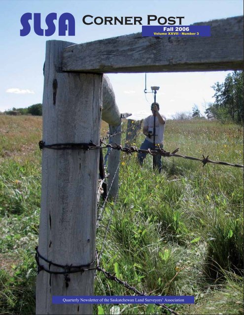
SLSACorner Post<strong>Fall</strong> 2006Volume XXVII - Number 3Quarterly Newsletter of the <strong>Saskatchewan</strong> <strong>Land</strong> <strong>Surveyors</strong>’ <strong>Association</strong>
“Your Partner in the Field”Leica GPS900All-on-the-pole GPS900 RTK rover consisting ofan RX900 Controller and a Leica ATX900 GPS AntennaBIG AMBITIONSon a budgetOne person,one case, one systemThe GPS900 is ideal for one-personstakeout and survey work. Everything thatis needed for a days work can be easilytransported and set up.Rugged roverBuilt to military specifications the GPS900RTK rover is incredibly robust. The cablefreeall-on-the-pole rover is ideal fordemanding workplaces.New!Best antenna performanceGPS900 provides the best RTK GPSperformance with high accuracymeasurements and fast satellite acquisition.Software SpecificationsEasy to useGPS900 is easy to use. Controlthe large graphic display usingthe touch screen or keyboard.The familiar operating conceptprovides instant productivity.Graphical viewLarge graphical map-views giveeasy access to data.Immediately see what has beenmeasured, what has been stakedout and what still needs to bedone.Data managementAll points, measurements and codesare stored in the internal memory.View, edit, delete and search data.Directly export from GPS900 intovarious data formats.Status iconsEasily access status informationusing the status icons. Currentcoordinates, RTK status,Bluetooth ® , battery, memory, etc.can be viewed by tapping on theicons.Calgary1-800-661-1129Edmonton1-800-661-8816Richmond1-800-667-5944www.butlersurvey.comRegina(306) 525-6422Prince George(250) 961-9664
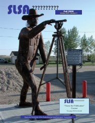
SLSACorner Post<strong>Fall</strong> 2006Volume XXVII, Number 3In this IssueSLSA Corner Post is published by the<strong>Saskatchewan</strong> <strong>Land</strong> <strong>Surveyors</strong>’ <strong>Association</strong>for circulation to its members.Deadlines for articles are the last Fridayin December, March, June and September.The opinions of the contributing writersmay not be consistent with those ofthe Council of the <strong>Saskatchewan</strong> <strong>Land</strong><strong>Surveyors</strong>’ <strong>Association</strong>. Articles may bereprinted with appropriate credit givento the authors, unless it is under copyright.Address all correspondence to:Doug Bouck, SLS (Ret.) - Editor408 Broad Street #230Regina, <strong>Saskatchewan</strong> S4R 1X3Phone: 306-352-8999Fax: 306-352-8366e-mail: slsa@sasktel.netweb site: www.slsa.sk.caIn This IssueWhen Is A Bank Not A Bank? - Gord Olsson ...................................259Canadian Spatial Reference System - Robert Duval .......................262The Engagement - Malcolm Vanstone .............................................264Self Governance - Victor Hut ...........................................................266The New (Alberta) Boundary Resolution Process ...........................271The Image of A Surveyor - Lesley Ewoniak .....................................275Increasing Revenue at No Cost - F.C. Hutchinson ...........................276Growing Through Entrepreneurship - Eric A. Morse........................278Scrutinizing Survey Monuments - Fred Chang ................................280You Own Your License, Not Your Employer - Dave Dediluke ..........283Surveying For Profi ts - Wayne Newell ..............................................286Regular FeaturesPresident’s Message - Bob Webster ................................................250Council Highlights - Carl Shiels ........................................................252Councillor’s Corner - Tom Sansom ..................................................254Biography - Jack Webb (H.S. Carpenter #011) ................................256Looking Back (1980) - Wayne Stockton ...........................................258Cover Story2006/2007 CouncilPresident R. A. (Bob) WebsterVice President R. Dale RosnesPast President Peter F. UngerPublic Member Lloyd GilliesCouncillorsRon J. EichelTom W. SansomE. H. (Gene) SeisRavi B. ShrivastavaAdministrationExecutive Director A. Carl ShielsOffice HoursOffi ce hours are:9:00 a.m. to 12:00 p.m.1:00 p.m. to 4:00 p.m.on all regular business days.Jill Cheverie, SLSIT was quick to respond when the call wentout for a cover photo for this edition of the Corner Post. AsJill noted with her submission, the photo certainly “ ... fi ts thecorner post motif.”Jill also made a major contribution to the association’s effortsto recruit students to careers in the survey industry, having representedthe SLSA - along with Ron Eichel and Wayne Stockton- at the career fairs in Swift Current on September 27 andAssiniboia on September 28.Jill’s original intention to pursue a career as a teacher was redirectedinto the Geomatics Engineering stream at UNB and,upon graduation, to <strong>Saskatchewan</strong> with Midwest Surveys. Sheis now the fi rst ever woman to pursue a commission with theSLSA.Although we are a long way from having an all-female surveycrew as described in Lesley Ewoniak’s article “The Image ofWhat A Surveyor Looks Like is Changing” on page 275, it isa start - and for that we should be immensely proud.SLSA Corner Post <strong>Fall</strong> 2006 249
President’sMessageBob Webster,SLS, P. Surv., P. Eng., CLSPresidentUpcoming EventsOct 12 - 14Oct 15 - 16Jan 18 - 19Jan 30Jan 31ANSLS AGMWolfville, NSCCLS AG-Wolfville, NSANBLS AGM(T.B.A.)U. of C. “Beefon a Bun”ReceptionMARLS/LSAW AGM’sJan 31 - Feb 2 ABCLS AGMFort St. JohnRing---Ring---Ring“Hello, Crosshair Surveys.”Voice on the other end of the phone:“Hello, I am looking to speak to the surveyorin charge of the Overhill Project.”“I’m Homer Pocus SLS, perhaps I can helpyou.”“Something is wrong with your survey, theAutoCAD fi le does not fi t into our GIS database.”“Who did you say was calling?”“I’m Joe the geo-technician from City HallMapping.”“What AutoCAD fi le are you talkingabout?”“The one that was e-mailed over from AjaxConsulting Engineers.”“Well, all I remember sending them wasa preliminary concept plan last year, buteverything has changed and anything theyhad was on a local grid. If you are havingproblems with their drawings, why don’tyou talk to them?”“Well they said to talk to you.”“We would be please to create a digital fi lethat fi ts your data base for a reasonablefee.”“What fee? The information is there on yourhard drive, just e-mail it to me.”“No, the information is not just on my harddrive,we would have to create it for you.”“Well, my boss said that if we do not get aplan that fi ts from you there won’t be anymore plan approvals coming from us.”Is this a conversation that we have all had?All levels of government would like their geographicdata to seamlessly integrate intotheir database with a minimum of effort.My initial reaction was, “Why would I want togo to the added expense of geo-referencingmy data and then providing it to the municipalityfor free?” I thought about it for a whileand I realized that we do not do anything forfree as <strong>Land</strong> <strong>Surveyors</strong>, our clients pay forit. We are all using GPS and AutoCAD sothe technical requirements to position oursurveys exist today.We have the technology, but do we have thedesire to integrate our surveys in the future?I would be willing to support the initiative ofthe regulatory authorities it they meet us halfway and open their database for us to freelyuse. If we don’t do it, some other entity willcreate the business model to extract theGIS data from our surveys, if it isn’t alreadyhappening. Are we willing as a professionto make this leap into the future? Feb 21 - 23Apr 26 - 28AOLS AGMOttawaALSA AGMLake LouiseMay 24 - 26 SLSA AGMManitou Springs,WatrousThank you to ISC for their generous contribution to the <strong>Surveyors</strong>’School Resource Kit project. With commitments fromthe ABCLS and the ACLS, the project outlined at the 2006AGM is much closer to becoming a reality.250 SLSA Corner Post <strong>Fall</strong> 2006
MobileMapperBENEFITSMore efficient asset/resource management,emergency planningand environmental/agriculture controlImmediately increasesyour productivity inthe fieldSpending too much onGIS/GPS data collection?MobileMapper: Industrial Strength Mapping SolutionsNow you can have an affordable, easy-to-use and rugged GPSsolution for collecting and maintaining GIS data in the field.MobileMapper enables you to equip, train and deploy your fieldpersonnel for less than ever before. Our user-friendly softwareand easy-to-read full-color screen makes MobileMapper anindispensable tool for your company’s mobile GIS workforce.For more information about MobileMapper, contactyour local Thales Navigation dealer or visitwww.thalesnavigation.comMobileMapper Office software makes it easyto transfer data to andfrom the field andyour officePost-processing optionprovides sub-meteraccuracyGemini Positioning Systems Ltd.611 71 Ave SECalgary, Alberta T2H 0S7Phone: (800) 361-0978, (403) 252-5007Email: sales@gps1.comWeb: www.gps1.comwww.thalesnavigation.com© 2004 Thales Navigation, Inc. All rights reserved. MobileMapper and MobileMapper Office are trademarks of Thales Navigation.
CouncilHighlightsCarl Shiels, M. Sc., P. Eng.Executive Director2006-07 Meeting #3 - Sept. 11, 2006Committee chairmen B.G. Clark (Practiceand Convention) and J.H. McLeod (Education)joined Council for the annual CommitteeWorkshop. The CCLS web site washighlighted as a valuable source of informationfor Council and committee chairmen.There had been no presidential travel sincethe last meeting but the president wouldbe attending the AMLS AGM later in theweek.G.D. Craig’s appointment as SLSA representativeto the CCLS was extended foranother three year term.The regulatory bylaws, approved by themembership at the 2006 AGM, had receivedthe approval of the Ministers responsiblefor the LSPS Act and are in effect.The Ministers also confi rmed that theamendment to the LSPS Act – the repealof section 19(2) clause (a) – as approved atthe 2006 AGM, would be presented to thelegislature at the spring, 2007 session.In response to letters from the Controllerof Surveys and President Webster expressingconcern about the destruction ofsurvey monuments by city work crews, arepresentative of the City of Regina EngineeringDepartment had contacted the executivedirector for details of the complaint.A formal written response is expected fromthe engineering department and it is hopedthat this will lead to an ongoing dialogue onthe matter.The president had sent a letter to the Sask.Law Society expressing concern about lawyersmaking illegal copies of Real PropertyReports. The letter was expected to bediscussed at the next Law Society Councilmeeting and a formal response would beforthcoming. Council was also advised thata lawyer with Korven Legal Services waspreparing a paper on the illegal copying ofReal Property Reports by lawyers, for submissionto the Law Society. The executivedirector was asked to investigate the possibilityof having an article published in theSask. Law Society newsletter.Most of the executive directors with thevarious land survey associations in Canadamet by telephone conference on August16. Much of the meeting had been takenup reviewing the CCLS web site and howit can be accessed and used by associationexecutives, councils and committeemembers. One of the topics discussed wasthe problem of budgetary pressures due toincreasing costs for presidential travel andthe amount of time that presidents mustspend attending all of the other associationAGM’s. Out of that discussion came thesuggestion that these problems might bealleviated if each association were to hostall other presidents every second year andthat one AGM per year was attended byexecutive directors. This suggestion wasto be presented to the next Presidents’ Forumthrough the CCLS president. Councilconsidered this option but rejected it. Althoughthe amount of time spent by presidentstravelling can be signifi cant, and particularlyproblematic for one-person surveyoffi ces, the “once-in-a-lifetime” experiencewas considered to be well worth the time,expense and effort involved.Council approved a <strong>Land</strong> Surveyor inTraining Agreement signed between R.P.Maloney and P.M. Maloney.On the recommendation of M.E. Putnam,Council appointed J.H. McLeod chairmanof the Education Committee.It was agreed that vice-president Rosnesand the executive director would representthe SLSA at the 2006 Political Form sponsoredby the <strong>Saskatchewan</strong> Chamber ofCommerce (SCC). One of the issues thatSLSA representatives might raise is thechallenges that most survey companiesare having in fi nding and keeping skilledlabour.At the request of the Board of Examiners,Council prepared a short list of memberswho would be invited to sit on the Board, eitheron a temporary basis to replace memberswho require a temporary leave, or on alonger term basis to replace members whowould like to step down. Some period ofoverlap was considered to be highly desirable.The next meetings were tentatively scheduledfor Monday, October 30 and Thursday,November 30. 252 SLSA Corner Post <strong>Fall</strong> 2006
New SLSA Display Being Put to Good UseAs approved at the 2006 AGM, the SLSA is now the proud owner of a 3.1m x 2.3m professional-qualityportable display for use at career fairs and exhibitions. It consists of a popupfolding frame with four fabric-covered panels onto which any number of Velcro-backeddisplay posters can be mounted. The entire display breaks down into components that canbe stowed in two rugged shipping cases equipped with wheels and carrying handles. Thereis even a case-to-counter conversion that allows the shipping cases to serve as an attractive,matching counter for displaying additional posters and brochure holders. A full descriptionof the display can be found at www.jilca.com/products.php?ProductID=8The display was barely in the office before it was shipped off to Swift Current for career fairsin that city and Assiniboia on September 27 & 28. It is booked for city-wide high school careerfairs in Regina and Saskatoon on October 30 & 31 and in Weyburn on November 15.A PowerPoint presentation, originally developed by the ABCLS, is being adapted with theirgenerous permission, to fit the needs of the SLSA. It can be used as an unattended, continuousrunning show in conjunction with the display or in a classroom setting with live commentaryby one of our members.All that remains is to make sure it is used to the greatest possible advantage. Please checkwith the high schools in your area to see if and when there are career fairs or other eventsthat we should be attending. Our ultimate goal is to make sure there is a strong and viableGeomatics Technology Program at SIAST and that we attract an average of at least four newmembers to the profession each year for the next ten years.Wanted ! ! !We need your photosfor the front page oftheSLSACorner PostSLSA Corner Post <strong>Fall</strong> 2006 253
Councillor’sCornerTom Sansom SLS, P. Surv.,P. Eng.Councillor, Year 1“Things ThatHaven’t Changed”Procrastinator! I don’t even know how tospell the word.It is Saturday, September 23rd, I’m sittingin a hotel room in Regina and I haveto have a report for “Councillor’s Corner”to Carl by Monday. This time I am startingearly!My last stint on council was about 10years ago. I thought I might write a profoundreport about the relentless advanceof technology since I started mysurveying career, but other people havealready done that.Instead, I will share a few thoughts aboutthings that haven’t changed that much.Helicopters - they haven’t changedmuch.A few years ago, my wife Martha and Ispent some time touring the U.S. southwestand spent two days at the GrandCanyon. I have a fear of heights andcould not get within 10 feet of the canyonedge. She was, therefore, quite surprisedwhen I suggested we take a helicoptertour. The tour was quite spectacular withthe helicopter fl ying just above tree toplevel, and then fl ying over the canyon’sedge. Martha almost had a heart attack.It didn’t bother me a bit.Earlier in my career, I did a lot of workusing helicopters. Sometimes it was exhilarating.Most of the time it wasn’t. Myfi rst helicopter job was in the southernfoothills of Alberta while I was still in university.One day while fl ying back to thehotel at which we were based, the youngrodman (we called them that then) workingwith me asked the pilot if the helicoptercould fl y upside down. The pilotsaid, “I don’t know - let’s try it”. He camevery close to accomplishing this feat.This same pilot also liked fl ying straightat hills, clearing them at the last second,and chasing coyotes. I don’t know wherehe is now.The rodman was a replacement for afellow I had worked with for about threeweeks. One night, he broke into a cardealership, stole a truck and drove toCalgary to see his girlfriend. It turnedout he was on a day-parole when thecompany hired him.A few days ago, one of our crew chiefscame back to the offi ce in the morningwithout his survey assistant. It turnedout his assistant got another job in theparking lot of Tim Horton’s while thecrew chief was inside getting a coffee.(Labour shortage, that hasn’t changedmuch.)One thing that has changed dramaticallyis the safety culture we all deal with on adaily basis.Canoes - they haven’t changedmuch.As part of a job in Fort Simpson, N.W.T.,some years ago, I and two assistantswere running a traverse along the bankof the Liard River. We had rented a 20’freighter canoe with a 20 hp. motor toleap frog along the bank. I rememberwatching in horror as the two assistantsmotored past the station I was manningand struck a log. The log lodged in themotor and the canoe was spinning 360’smadly for what seemed like an eternity.(The middle of nowhere, no cell phones,no radios, no means of communicationexcept for a big red fl ag.) Luckily, the logdislodged and we carried on.No incident report was ever fi led.Plumbobs - they haven’t changedmuch. The only problem is no one knowswhat they are anymore.My wife - she hasn’t changed much.She’s still married to the crazy guy.The last time I was on council, Bob Websterwas president, and the <strong>Saskatchewan</strong>Roughriders hadn’t won a GreyCup since 1989.September 23, 2006. Bob Webster ispresident and the <strong>Saskatchewan</strong> Roughridershaven’t won a Grey Cup since1989.Next time I’ll write something profound.Or maybe not. 254 SLSA Corner Post <strong>Fall</strong> 2006
Leica SmartRoverTravel LightIntroducing the Leica SmartRover:The world’s lightest cable-free RTK GPS System.Now the world’s best-performing GPS system is also theworld’s lightest. Less weight reduces operator fatigue — andboosts productivity. Best of all, we’ve dropped weight withoutreducing performance. You still get the powerful SmartTrackmeasurement engine that out-performs every GPS system onthe market. Count on heavyweight performance from thisamazingly lightweight system. Only from Leica Geosystems.Leica SmartRover• SmartTrack and SmartCheck for best GPS results• All-on-the-pole convenience• WinCE and Bluetooth/MIL spec ruggedness• Fully compatible with Leica TPS1200 and SmartStation• To schedule a demo, contact your local Leica Geosystemsrep or call 1-800-746-3607.Grant Beach • Leica Geosystems Ltd. • 1-866-623-8206
BiographyBy J. H. Webb, SLS (Life Member), ALS, MLS, CLSHenry Stanley Carpenter(1874 - 1950)OLS, DLS, SLS (#011), MEIC, P.Eng., B.A.Sc.Henry Stanley Carpenter was Deputy Minister of Highwaysand Transportation, Province of <strong>Saskatchewan</strong>,from 1916 to 1939 when he retired in Regina.A dedicated public servant who was well versed in Engineeringand Surveying before coming west in 1905. Bornin Collingwood, Ontario he was the fifth child in a familyof nine and received his initial schooling in Ontario. Whileattending the University of Toronto he spent his summersin engineering and survey work prior to his graduation inPractical Science. He was a graduate of the University ofToronto in 1898, with a B.A. in Science. He soon obtainedhis commissions as an Ontario <strong>Land</strong> Surveyor in 1899 andhis Dominion <strong>Land</strong> <strong>Surveyors</strong> in 1901. From 1900 to 1905,as a Professional engineer and surveyor, he worked for theDepartment of Railways and Canals in Ottawa, Ontario, onreconnaissance surveys. He was the assistant engineer onconstruction of the Trent Canal in Ontario along with spendingtime in exploration work on the Yukon Railway.Mr. Carpenter joined the <strong>Saskatchewan</strong> Government servicein 1905, as a District Surveyor and Engineer out of Regina.Due to his diligence, he was made Deputy Minister, Departmentof Public works from 1910 to 1912. He was then appointedSuperintendent of Highways until 1914. While withhighways, he held the position of Chairman, Board of HighwaysCommission until 1916, when he was again appointeda Deputy Minister under the Highways and TransportationDepartment. This position he held until he retired in 1939.An interesting side note about Mr. H.S.Carpenter is that henever owned a car while he held the position of Deputy Minister.We can only assume that he used public transportationto attend functions throughout Regina and in the Province.On May 27, 1909, a meeting of district surveyors of the Departmentof Public Works was held to discuss the formationof a <strong>Saskatchewan</strong> <strong>Land</strong> Surveyor’s association. Mr. Carpenterwas a member of that committee. The first official meetingto organize our association was in 1910 and was held inthe office of the district Surveyor in Regina. Mr. Carpenterwas elected chair of that meeting.He was the <strong>Saskatchewan</strong>Government Director of Surveysfrom 1908 to 1910. At thetime of the passing of the <strong>Land</strong><strong>Surveyors</strong> Act of 1909, he became the first Secretary of theBoard of Examiners, <strong>Saskatchewan</strong> <strong>Land</strong> <strong>Surveyors</strong> <strong>Association</strong>.He held this position until 1913.In private life Mr.Carpenter married Jessie Ross Cameron in1903 and they had five children. Their first born was Stan,who became a Civil Engineer, then Paul who became an investmentofficer. The third son Jack was a philatelist withthe Federal Government in Ottawa, then daughter Alison(Mrs. Brown), and daughter Nancy (Mrs. Wooley) a visualartist and teacher. Mr. H.S.Carpenter was a member of theWascana Lodge #2 A.F. & A.M, the Regina Curling Club,the Regina Golf Club and a member of the 1st PresbyterianChurch in Regina.He was a past president of the <strong>Saskatchewan</strong> Branch of theEngineering Institute and held executive offices with theCanadian Institute of Civil Engineers and the <strong>Saskatchewan</strong><strong>Land</strong> <strong>Surveyors</strong> <strong>Association</strong>.Mr. Carpenter has an island named in his honour shown onmap 63L9 at Latitude 54 degrees, 41 minutes and Longitude102 degrees, 06 minutes which is situated near DenareBeach, <strong>Saskatchewan</strong>. He was also honoured by having asmall community named after him, “Carpenter”. It was situatedon the Aberdeen-Melfort line half way between Alvenaand Wakaw just west of the present highway number41. Since Mr. Carpenter was responsible for the Provincialadministration of railways in the Province, the Canadian NationalRailways saw fit to honour him with the naming of thesmall village of “Carpenter”.Quoting from his obituary in 1950:Photo Courtesy of Sask. ArchivesBoard - Photo # R-A3598The man who was <strong>Saskatchewan</strong>’s Deputy Minister ofHighways from the time of the highway system consistedof little more than winding roads until it became a complexnetwork, H.S.Carpenter died suddenly at the age of256 SLSA Corner Post <strong>Fall</strong> 2006
seventy-six. He had been in <strong>Saskatchewan</strong> Governmentservice since the formation of the Province in 1905.The adjacent photograph shows Mr. Paul Carpenter, son ofH.S.Carpenter, running levels in 1925 with a Dumpy leveland standing beside a 1923 style-year model “T” Ford Touringcar.Paul Carpenter’s son, David Carpenter, lives in Saskatoonand is a teacher and writer. He has written various books poetryand articles. Information on David can be found on hiswebsite www.dcarpenter.com covering his life and books. Acknowledgements;- David Carpenter- “<strong>Saskatchewan</strong> and It’s People”, book by John Hawkes, Leg. Librarian- Biography, Ontario <strong>Land</strong> <strong>Surveyors</strong> Assoc.- <strong>Saskatchewan</strong> Archives (T.Crump)- Canadian Geographic – Atlas- S.L.S. fi les- People Places”, book by Bill BarryH.S. Carpenter’s son Paul with Dumpy level and 1923 Model “T” FordGreat TruthsGREAT TRUTHS THAT LITTLE CHILDRENHAVE LEARNED:1) No matter how hard you try, you can‛t baptizecats.2) When your Mom is mad at your Dad, don‛t let herbrush your hair.3) If your sister hits you, don‛t hit her back. Theyalways catch the second person.4) Never ask your 3-year old brother to hold a tomato.5) You can‛t trust dogs to watch your food.6) Don‛t sneeze when someone is cutting your hair.7) Never hold a Dust-Buster and a cat at the sametime.8) You can‛t hide a piece of broccoli in a glass ofmilk.9) Don‛t wear polka-dot underwear under whiteshorts.10) The best place to be when you‛re sad is Grandpa‛slap.GREAT TRUTHS THAT ADULTS HAVELEARNED:1) Raising teenagers is like nailing Jell-O to a tree.2) Wrinkles don‛t hurt.3) Families are like fudge . . . mostly sweet, with afew nuts.4) Today‛s mighty oak is just yesterday‛s nut thatheld its ground.5) Laughing is good exercise. It‛s like jogging on theinside.6) Middle age is when you choose your cereal for thefibre, not the toy.GREAT TRUTHS ABOUT GROWING OLD:1) Growing old is mandatory; growing up is optional.2) Forget the health food. I need all the preservativesI can get.3) When you fall down, you wonder what else you cando while you‛re down there.4) You‛re getting old when you get the same sensationfrom a rocking chair that you once got froma roller coaster.5) It‛s frustrating when you know all the answersbut nobody bothers to ask you the questions.6) Time may be a great healer, but it‛s a lousy beautician.7) Wisdom comes with age, but sometimes agecomes alone.SLSA Corner Post <strong>Fall</strong> 2006 257
In January 1980 we were hired by SaskTel to establish theposition for a microwave dish on the roof of their buildingat Lorne Street and 12th Avenue in Regina. Up on the roofwe took a series of sun shots for azimuth and set permanentreference points. A few days later I ran into Bill Schwartzand was telling him about our survey. During our conversationI mentioned that it would be interesting to take a starshot to verify our work. That peaked Bill’s interest and hesaid, ”Let’s do it this afternoon.” Showing my inexperienceI replied, “You can’t do a star shot in broad daylight.”“Sure you can,” said Bill, “Let’s do it.”That afternoon was cool and clear without a cloud in the sky.On the roof we set up the transit on our reference line. Billchecked the time, did a quick calculation on his Sharp pocketcomputer and turned the horizontal andvertical angle to Polaris. He fiddledwith the focus for about 5 minutes andsuddenly said, “There it is, take a look.”I peered through the scope and couldn’tbelieve it. Just to the right of the verticalcross hair was a tiny pinprick of light.We took a series of star observationsand then compared the result with themean of our sun shots. They differedby only 4 seconds of angle. Pretty goodI thought.In late April of the same year, theS.L.S.A. hosted the annual meeting ofthe Canadian Institute of Surveying inRegina. It was a great convention organizedby convention chairman TomCrump.Looking Back - 1980By: W.W. (Wayne) Stockton, S.L.S., C.L.S.Kojak - Telly Savalas and Stavros - George Savalasfromwww.sitcomsonline.com/photopost/showphoto.php/photo/27995There were two things in particular I remember about theconvention. The first was that I had to take an afternoon offto set the foot plates for the SaskTel satellite dish. The basehad been constructed on our reference line. It was a steelframe and platform approximately 2.5 metres in height. Weset the transit up on the platform and from our reference linemarked the locations for the large bolts that were to anchorthe dish.As for the second memorable incident, one of the social activitiesfor the convention was a special afternoon presentationof a Stage West play starring George Savalos. Georgehad enjoyed a long and successful career on stage and screenbut was less well known than his more famous brother Telly.They were also quite opposite in appearance. While Tellywas completely bald, George sported ahead of thick, curly hair.In the course of organizing the specialStage West presentation, the ladies onthe convention committee got to knowGeorge fairly well. One afternoon, a ladies’bus tour to Fort Qu’Appelle and theQu’Appelle Valley had been arranged.Since George had a free afternoon heasked if he could go along. George piledinto Barb Bennett’s car with a couple ofother ladies and followed the bus tourout to the valley. It was reported thathe had a great time that afternoon as theonly male accompanied by 40 femaleson the scenic tour and lunch. Familiar Sayings From Past Annual Meetings Of The SLSA“Can’t hear you, speak up” “Turn up your hearing aid”“Stand up, can’t see you”“Use the mike”“Point of order, out of order”“Question”“Time to vote, ask for the question”“First time I ever agreed with you”“Nobody ever read that book”“Well I might as well speak once more”258 SLSA Corner Post <strong>Fall</strong> 2006
When Is A Bank Not A Bank?By Gord Olsson, ALS, CLSReprinted from “ALS News” June 2006The following is a synopsis of the written reasons forjudgment of Andriet v. County of Strathcona No. 20, 2005ABQB 848.The case should be of interest and concern to land surveyors.Not only were there several issues dealing withriparian rights, but the various decisions were not whatone would expect. Most of the issues dealt with rights toaccretion in Grandview Bay, a bay in Cooking Lake, Alberta.The plaintiffs included Douglas B. Andrietand Jacqueline M. Andriet. The defendantsincluded the County of Strathcona No. 20,Peter Brian Todd, Lynn Francis Forsythe,Gary Alexander McGowan, Kenneth Schley,Patricia Schley, Brian Allan Dawson,Judy Loraine Dawson, William Johansson,Frances Johausson, Donald Mills, SheilaMills and Her Majesty the Queen in theRight of the Province of Alberta. It was heldbefore the Honourable Mr. Justice D.W.Perras.In order to determine the extent of the accretionin Grandview Bay all the partiesengaged Alberta <strong>Land</strong> Surveyor WayneWesolowsky to conduct a survey of the locationof the current bank. As well, Alberta<strong>Land</strong> Surveyor Ken Allred gave evidenceon behalf of the defendants and Alberta<strong>Land</strong> Surveyor Duncan Gillmore (Sr.) gaveevidence on behalf of the plaintiffs.Accretion in NW1/4 of Section 13-51-22-W4MThere were several claims for accretion in Grandview Bayin the NW1/4 of Section 13-51-22-W4M.1. The Andriet ClaimThe plaintiffs, the Andriets, claimed, as riparian owners ofland certain lands that they alleged have accreted to theirland as a result of the water of Cooking Lake recedingover a number of years. Their land is the remaining portionof the NW1/4 of Section 13-51-22-W4M. The descriptioncontains the words “not covered by any of the watersof Cooking Lake..... which lies north of the north boundaryof the land subdivided under plan 2611ET, and east of theeasterly limit of the road as shown on road plan 5255CL...”There are also several exceptions. The boundary relevantto the accretion is the bank of Cooking Lake located byR.W. Lendrum in 1902, which is shown on a 1903 town-ship plan referred to in Andriet’s certifi cate of title. Withregard to Andriet’s claim, the Justice states:[14] In my view the Andriets are entitled to the landas set out in their Certifi cate of Title which, whenread carefully, fi xes the easterly boundary as set outin plan 2611ET, which adopts the easterly boundaryas found by R.W. Lendrum in 1902. The descriptionon the title to the property has been consistentthroughout its history since plan 2611ET, whichin my view must be given substantial weight whenaddressing a boundary issue since the title givesa clear picture of the properties within the boundaries.I therefore fi nd that the Andriets are limited bythe boundaries set out in their title and are thereforenot entitled to any accreted land as they are notriparian owners.2. County of Strathcona #20One of the exceptions in Andriet’s certifi cate of title was aparcel sold to the County of Strathcona for road wideningpurposes. The parcel is shown on the 1980 Plan 802-1713and was purchased from the Lerbekmos in 1979 out ofthe land that they subsequently sold to the Andriets. Theboundary relevant to the accretion was adopted from a1967 plan, Plan 5231 NY, and is shown on Plan 802-1713as “Bank according to C.H. Weir in 1967.” Justice Perrasstates that this boundary is in keeping with what the Ler-SLSA Corner Post <strong>Fall</strong> 2006 259
ekmos intended to sell to Strathcona in 1979. With regardto this issue. the Justice states:[15] I fi nd that Strathcona is limited to the boundariesset out in the two plans and is therefore not entitledto any accreted land related to the parcel delineatedin plan 5231NY and plan 8021713, both of which,in my view, must be given substantial weight in determiningthe disputed boundaries as the plans arequite precise so that proper dimensions can easilybe ascertained.The County also owned lots 1 and 13 shown on SubdivisionPlan 5611ET surveyed in 1936. The boundary relevantto the accretion is shown on this plan as “Bank ofLake according to traverse notes of R.W. Lendrum DLS in1902.” With regard to this issue, the Justice states:[161 The easterly boundary was fi xed by subdivisionsurvey where the survey adopted the easterlyboundary that coincided at the time with what hadbeen the bank of Cooking Lake as found in 1936.3. Other Lot Owners in Subdivision Plan 2611 ETThe other defendants (except for McGowan) also ownedvarious lots shown on Subdivision Plan 5611ET. Theboundary relevant to the accretion is also shown as “Bankof Lake according to traverse notes of R.W. Lendrum DLSin 1902.” With regard to this issue, the Justice states:[20] In my view then the lot owners have no riparianclaim to accreted land as their easterly boundaryis fi xed and not subject to movement and they aretherefore not riparian owners.The Justice provides some context for his decisions by, inhis introduction of the reasons for judgment, stating:[4] The various claims of all the parties overlap extensively,such that none of the usual survey techniquescan offer up a rational solution to the competingclaims.And in the very last sentence of the reasons for judgmentstating:[39] Invariably the context in the reported decisionsinvolved several parties claiming the same land,however, either the common law rights of riparianland owners offered up an answer, or resorting tothe integrity of the survey system coupled with theTorrens system of registering title offered up ananswer, and occasionally disputes could be settledby having regard to various survey techniques.However, in the peculiar circumstances of this casenone of the usual methods for determining disputedboundaries brought about a fair and equitable conclusion,hence my resort to giving signifi cant weightto the various plans to establish boundaries.McGowan Claim1. Accretion in Section 24-51-22-W4MThe defendant McGowan claimed as a riparian owneraccreted land to Lot 2, Block 3, Plan 862-2863 which islocated in Section 24 adjacent to the NW1/4 Section 13-51-22-W4M. Accreted lands had previously been addedto the title of that lot by Plan 867-2863. With regard toMcGowan’s claim, the Justice states:[23] There is no contention to the McGowan claimfor accretion to Lot 2, Block 3 and accordingly therewill be a fi nding that Gary McGowan is entitled asriparian owner to title to all accreted lands to theeast of his property; even though the potential accretionfrom 1986 to present does not appear to begreat, nevertheless, it is conceded that such hasslowly and imperceptibly increased over the last 19years.2. Decision Regarding Adverse PossessionThe second claim by McGowan, for land that is south ofhis lot and that lies in the NW1/4 13-51-22-W4M, is basedon the concept of adverse possession.The Justice adopted the test for adverse possession asused by Justice Dea in Edwards v. Edmonton Beach ResortsLtd. (1992), 130 A.R. 375. He found the element ofexclusive possession required for adverse possession, ona balance of probabilities, was not proven and denied thataspect of the McGowan’s claim.Miscellaneous Matters1. Lease between Her Majesty the Queen and Countyof StrathconaThere was a 21-year lease issued in 1980 between HerMajesty the Queen and the County of Strathcona that coveredall those portions of legal subdivisions 13 and 14 ofSection 13-51-22-W4M which comprised the exposed bedand shore of Cooking Lake, 18.67 acres more or less.With regard to this lease the Justice states the following:If indeed the Crown claims to be able to lease Section13 which comprises the exposed bed and shoreof Cooking Lake, then perhaps the land sought asaccreted land by the land owners in and aroundGrandview Bay is indeed Crown land. In my view itis Crown land to deal with as the Crown sees fi t.2. A Claim for TrespassA claim by the Plaintiff Andriets in trespass as against thedefendants Peter Brian Todd and Lynn Francis Forsythewas dismissed.260 SLSA Corner Post <strong>Fall</strong> 2006
Tenants in CommonThe Justice discussed a proposal made by counsel forMcGowan that would recognize everyone’s claim to someextent. He stated that it is too early to invoke such a processand that the parties themselves could arrive at a solutionsimilar to the tenants in common proposal, but itwould have to be voluntary and ultimately registerable. Hestated:[35] Lastly all counsel agreed that whatever decisionwas reached by the Court with respect to thevarious claims that consultation would be undertakenwith counsel for the Crown, who took no part inthe trial, with a view to working out a plan for registrationwith all parties agreeing to use the Wesolowskyreport and his 2005 survey as a springboardto a registerable plan.Comments on the Case1. The contention amongst the parties on how the accretionshould be apportioned and the Justice’s diffi cultyin determining a fair and equitable solution to dividingup the accretion appear to be signifi cant factors in thedecisions.2. It is agreed that methods of dividing accreted land suchas projecting side lines (normally only used for smallamounts of accretion) or using lines laid out perpendicularto the shore line may produce overlap wherethere is a large amount of accretion. However, thereare other methods that would result in a more equitabledivision of the accreted land. Apportionment of the accretedlands made by proportioning the frontage alongthe new bank in the same ratio as the frontage alongthe old bank is a well-accepted method that would appearto offer a fair and equitable solution in this caseand is a solution based on the law regarding accretionand apportionment of accreted lands. 13. It is acknowledged that entitlement to accreted landswhere a boundary of a parcel is described as a bankcannot always be assumed. There can be situations inwhich a bank having been adopted as boundary maynot, in fact, be a riparian boundary. For example, thiscould occur in situations where there are a number ofbanks (by the popular defi nition of the word) and thebank shown on the plan as the boundary is one ofthese and not the legal “riparian” bank. In such a situation,it would also make sense that the landowner’sright to the accretion may be further weakened if, infact, over the years, the owner had not used or occupiedthe accreted lands. However, if these were factorsin the Justice’s decision they were not mentioned.4. Would the decision have been different if, instead ofadopting the position of the banks as previously surveyed,the surveyors for plans 5611ET and for 802-1713 had surveyed the natural boundary as it existedon the ground at the time of survey? The Justice’s decisionwith regard to McGowan claim to accreted landin the adjoining Section 24 indicates that the answer isprobably yes. The only apparent difference betweenMcGowan’s claim for accretion and the claims of theother parties in Section 13-51-22-W4M is that accretedlands had previously been added to McGowan’s landand there was no contention.5. Should the fact that the surveyors adopted the locationof previously surveyed banks instead of surveying thenatural boundary as it existed on the ground at the timeof survey result in the banks not being riparian boundaries?While the answer no doubt would depend on anumber of factors I believe most surveyors would saythat it still should be a riparian boundary. On the otherhand, not surveying the natural boundary as it existedon the ground at the time of survey certainly weakensthe case.6. The decision with regard to the 1980 lease betweenHer Majesty the Queen and the County of Strathconais perplexing. It appears to not make a distinction betweenthe bed and shore (the lands dealt within thelease) and the accreted lands. One would be hardpressed to see how being able lease the bed and shorewould result in the accreted lands being determined tobe Crown <strong>Land</strong>s.7. McGowan’s claim for adverse possession is interesting.As a result of Johnson v. Alberta (Minister of PublicWorks Supply and Services), it is well establishedin Alberta that accretion is not allowed to be added toone’s title where it expands beyond the boundaries of asection, quarter section, or legal subdivision of a planreferred to in a certifi cate of title. However, the fact thatthe Justice considered a claim for adverse possessionin such a situation is noteworthy. It will be interesting tosee if an adverse possession approach is successful infuture case law.8. The Justice’s comments with regard to the tenantsin common proposal is revealing. By giving his viewthat all the accreted land is Crown land, the Justiceis leaving the door at least partly open to a solutionwhere the accreted lands could be used for commonpurposes. Such a solution could very well be an acceptablesolution to the defendants. However, it is lesslikely to be acceptable to the plaintiffs, the Andriets, asthe area of the accreted land in front of the Andriet’sland is substantial and much more useful than that ofthe defendants who would only gain long narrow stripsof land. While the Justice’s decision may satisfy someof the parties, it is a challenge to see how it could havebeen based on the law regarding accretion and apportionmentof accreted lands. Nevertheless, there arelessons to be learned. For the land surveyor, it doesindicate the pitfalls of adopting the surveyed location265 SLSA Corner Post <strong>Fall</strong> 2006 261
CANADIAN SPATIAL REFERENCE SYSTEMINTRODUCTIONBy Robert Duval, Geodetic Survey Division, Natural Resources CanadaFrom "Geomatica" Volume 60, Number 2, 2006Ever wanted to be in two places at once? We all know itisn’t possible and we can hardly believe that we couldbe misled to think so. But in this modern world, wherespatial geo-referencing using coordinates (latitude, longitude,and height) is becoming ubiquitous, the likelihoodof being confused by different coordinates being associatedto a same location is increasing. Obviously, mergingor integration of geospatial or georeferenced informationworks best when a point or an object can be associated toa single coordinate.Nowadays, GPS receivers are finding their way to almosteverywhere and expanding geo-referencing capabilitiesfar beyond the traditional geomatics community: transportand taxi companies use them to track vehicle locations;they are used in farming and forestry operations for autonomousplatform guidance for crop harvesting and otherrobotic field operations; and cars use them for navigation,with some systems even able to alert emergency servicesto your exact location if you’ve been involved in an accident!GPS technology is making positioning easier thanever before and consequently impacting how we organizeinformation, coordinate activities, and manage assets. Tobe useful though, positions must be compatible with oneanother, otherwise their utility is compromised and confusionfollows. It is a bit like time! Imagine the chaos withina city, a province, or nation if we all operated with differenttime “systems” and had no means of reconciling them?A standard time system used by all ultimately ensures thatthe activities of a society are synchronized and organizedin a way that allows it to function coherently.Today, the Canadian Spatial Reference System (CSRS)provided by the Earth Sciences Sector (ESS) of NaturalResources Canada (NRCan) continues to respond to theOrder in Council that created the Geodetic Survey of Canadain 1909 and tasked the then Minister of Interior “todetermine with the highest attainable accuracy the positionsof points throughout the country... which may formthe basis of surveys for all purposes, topographical, engineeringor cadastral, and thereby assist in the survey workcarried on by other departments of the Dominion Government,by Provincial Governments, and by municipalities,private persons or corporations.” This statement, thoughnearly 100 years old, continues to capture the essence ofthe fundamental role played by the CSRS today. Not unlikethe time standard analogy, the CSRS provides thefundamental reference values (or the starting coordinates)to ensure that positions anywhere in Canada can be determineduniquely and remain compatible with one anotherregardless of when they were determined or their originators.The resulting frames of reference, propagated throughprovincial and municipal networks as well as other governmentalservices, serve as standards which ensure thecompatibility of Canadian geo-referenced information.Over the last 20 years, in order to respond to the needs ofdiverse user groups and to adapt to technological changes,several new geodetic (or spatial) reference systems haveemerged, each time introducing a new reference frame [a“geodetic reference system” is a theoretical concept andconsist of a collection of prescribed principles, fundamentalparameters, and specifications to quantitatively describethe positions of points in space; in contrast, a “referenceframe” is much easier to relate to, as it is the materializationor `realization’ of such a prescription]. In addition,although the theoretical definition of these reference systemsdid not change, new realizations were introduced asmeasurement accuracy improved. This adds to the potentialfor some confusion within the user community as towhat the basis for their coordinates should be.Traditionally, a reference frame consisted of ground-basedgeodetic control monuments with adopted coordinates. InCanada, to ensure nationwide coordination and consistency,the establishment of primary horizontal and verticalnetworks of geodetic control points has traditionallybeen a federal responsibility. To facilitate downstreamuser access, provincial, municipal, and other governmentalagencies have further densified the network “fabric,”establishing a hierarchical structure. For most of the lastcentury, surveyors “connected” to these control points usingclassical techniques to integrate their surveys withinthe adopted reference frame, the standard ensuring thecompatibility of Canadian geo-referenced information.Today, with the advent of Global Navigation Satellite Systems,and currently GPS in particular, the means for connectingto the reference frames have evolved significantly.A variety of tools and data products are now available to262 SLSA Corner Post <strong>Fall</strong> 2006
maximize the efficiency and the benefits of these moderntechnologies. Additionally the widespread availability oflow-cost GPS equipment in the consumer market is rapidlyincreasing the user base for geo-referenced information.Along with these changes comes the increased potentialfor incompatible coordinates due to the diversity of referenceframes available. It is therefore important not only tofacilitate the user’s access to these reference frames butalso to provide information about them, including theirtime-evolution and the related impacts on their geo-referencedinformation. This is an objective of this SpecialIssue of Geomatica.In concert with these new developments, the possibility ofintegrating directly into a stable global reference frame isalso becoming reality through applications such as PrecisePoint Positioning. Although this new ability is appealing,the requirement to maintain consistency with the adoptedreference systems for Canada, the North American Datumof 1983 (NAD83) and the Canadian Geodetic Vertical Datumof 1928 (CGVD28), continues to be a priority. Thelegacy left by the monumented geodetic infrastructurestill requires that relationships between old and new referenceframe realizations be clearly established to maintaincoordinate traceability over time. Additionally, the desireto maintain stable coordinates for control points that aremonumented on the surface of our “restless planet” requiresthat reference frame options be available to minimizedisruption to the general users while also meeting theneeds of more demanding user communities.Another fundamental role also played by the CSRS is itscontribution to the determination of underlying dynamicparameters of the Earth such as its orientation and rotationrate in space as well as its gravity field. These parameters,determined from the collective effort of the internationalgeodetic community, are not only critical to the efficientexploitation of modern space-based technology for positioningand navigation but are also enablers behind thetechnology itself. Furthermore, monitoring variations inboth the Earth’s geometry and its gravity field, essentialto the maintenance of the reference frames, also contributesto a better understanding of regional and global geophysicalprocesses linked to natural hazards and globalchange.The use of reference frames provided through the CanadianSpatial Reference System has extended from traditionalapplications in mapping and cadastral surveys to monitoringsea level rise, rectifying remote sensing imagery,measuring crustal uplift and subsidence, and interpretingseismic disturbances. However, the fundamental role theCSRS plays has not changed much over the years, and todayit continues to provide the means to ensure we can onlybe “in one place at one time!” In this Special Issue, papersauthored mainly by personnel from NRCan address differentaspects regarding the evolution of geodetic referencesystems in Canada as well as provide a look forward.Space Geodetic Techniques and the CSRS - Evolution,Status and Possibilities looks at the evolution of technologyover the past century, with particular emphasis on theadvent of navigation satellites during the past decades, andthe impact this technology has had on reference frame accuracyand access. Now that the positions (or, in a generalsense, the orbits) of navigation satellites are continuouslyestimated with centimetre accuracy and subsequentlymade publicly available through the Internet, a geodeticcontrol network has in essence been created in the sky. Asa result, our dependence on an infrastructure of groundbasedmonuments is increasingly being lessened. This newcapability is also giving rise to the development of newmethodologies for end users to achieve greater efficiencyand enhanced accuracy of their positioning informationwith respect to a common reference system.In The Evolution of NAD83 in Canada, the reader will beprovided insights into our national horizontal referencesystem including: the evolution of NAD83 from a horizontalto a three-dimensional reference frame, how it isnow linked to the dynamic International Terrestrial ReferenceFrame (ITRF), and how it is maintained using activecontrol points and episodic measurements of the CanadianBase Network. The improvement in NAD83 accuracy thatcame along with GPS is shown. Crustal movements drivenby geophysical processes, observed at regional and nationalscales and capable of affecting reference frame stability,are now apparent and their impacts are also discussed.A Gravimetric Geoid Model as a Vertical Datum in Canadagives readers a glimpse of how the vertical controlnetwork has developed nationally over time and how theadvent of space geodesy has led the Earth Science Sectorto initiate the “Height Modernization” project towards theadoption of a gravimetric geoid model as the new verticaldatum in Canada. The improvements in geoid modelling,in part attributable to the availability of data from recentlylaunched (CHAMP and GRACE) and upcoming (GOCE)satellite gravimetry missions, as well as the centimetre accuracyavailable for ellipsoidal height determination fromprecisely processed signals from navigation satellites, arethe major enablers behind this new direction. The anticipatedoperational benefits that stem from not having tophysically connect to a benchmark for precise height determinationare appealing from the perspective of both theuser and the provider of height information.284 SLSA Corner Post <strong>Fall</strong> 2006 263
The EngagementBy Malcolm Vanstone, SLSITThis is just a brief story behind the photo you see here.This is how I proposed to my girlfriend, Sara Parsons, of3 ½ years on September 23, 2006. The photo was taken nearthe farm that I grew up on south of Carnduff, SK. The messagewas cultivated into the SE. ¼ Sec.9-2-33-1. I startedwith the design in AutoCAD then scaled it to make the widthof the letters be 33’ (the width of the cultivator that I plannedon using). An air photo of the section was obtained fromISC and geodetic coordinates of the section corners werecalculated. The air photo was geo-referenced to the theoreticallat’s and long’s and the design was positioned over theair photo to fit between the row of trees that is at the top ofthe heart (east) and the bluff of trees to the right (south) of theheart. 185 points were created in AutoCAD and uploaded toSARA WILL YOU MARRY ME?my GPS controller, all of which were then staked in the field.A design plan was plotted on paper which was used whencultivating around the sticks to determine which sticks wentwith which letter. A friend of the family, Denis Day of FastTruck Ltd in Carnduff, had purchased a helicopter recently.A quick phone call to him ensured that we had a bird’s eyeview of the message. The photo was taken from the helicopterhovering at roughly 1000’. It was an exciting day, onethat we will remember forever.I would like to thank my parents, Merlin and Carol Vanstone,the Condon Survey Group and Fast Trucking Ltd. forhelping to make this all come together. 264 SLSA Corner Post <strong>Fall</strong> 2006
The Engagement – The lighter sideBy Malcolm Vanstone, SLSITAll the activity that went into the creation and the actualproposal sparked quite a bit of interest from the locals.First the staking of the design which was done on a Thursdayand Friday after work had many people talking about theprospect of the oil boom moving back into the area. Thisis a region that has had oil activity since about the 1950’s.However, in recent years the patch in this particular area hasslowed down, while only a few townships away it is prosperinglike never before. Quite a few local farmers werevery interested in just what was being surveyed on MerlinVanstone’s land. To see only a cultivator being towed acrossthe land caused even more curiosity and ignited even morerumours. A few short years ago this would have been a commonsite on the prairies but in today’s farming era of zerotillageand minimum disturbance the thought of doing “fallwork” has gone the way of the small town elevator. It wasenough to cause one good natured fellow to stop by and quizmy mom.“I didn’t think Merlin did fall work” said the inquiringchap.“Oh no, he’s not,” replied my Mom with a muffled grin.“Oh … Well .. Merlin getting a oil well?” asked the man.“Hmmm, No…” my mom slow-played her reaction, but bythis time the excitement was too much for her to hold in.“More like a daughter-in-law,” boasted my proud mother.“What?” exclaimed the neighbour who was by now thoroughlyconfused.“You better just go up to the house and talk to Merlin yourself.”I wasn’t present for the conversation at the house, but I amsure that it went something like this.Merlin: “Gooday Neighbor. Time for a coffee?”Neighbor: “Certainly. Thought you were getting an oil well.Carol says a daughter-in-law though… too bad.”Merlin: “Well, I never asked. Maybe she comes with an oilwell.”Neighbor: “Ya - good luck, mine never did. Anyhow, sowhat the heck’s going on?”Merlin: “Oh I don’t know, something to do with surveying,well you know that GPS stuff, that’s what it is. He’s been outthere walking around for two days now. Then he’s going tocultivate a message and fly over it in Denis’s helicopter. Canyou believe that?”Neighbor: “Oh, I see. So what if she says ‘No?”Merlin: “Well, then I guess Malcolm’s got to cultivate therest of that field out there!”The design is still cultivated in the field and will remain visibleuntil the snow flys. If anyone is an avid flyer and wishesto see the design for themselves, it is located 4 miles southand 2 miles west of the town of Carnduff. A warning goesout that if you have a girlfriend named Sara and you are notready to be engaged, then either make it painfully apparentbefore the flight or leave her at home. I am not responsiblefor any unwanted marriages. Malcolm was born and raised in Carnduff, SK. Upon graduation from HighSchool in 1999 he enrolled in the Geomatics program at SIAST in Moose Jaw,SK. Malcolm began working for the Condon Survey Group in Weyburn, SKon his fi rst work-term during the summer of 2000. He returned for his secondwork-term during the fall and winter of 2001. After graduating in 2002 Malcolmaccepted a position with the Condon Survey Group in Regina, SK. Heworked there until the fall of 2004 when he moved to Burnaby, BC to attendBCIT and work towards a Geomatics B.Tech degree. Upon completion of theGeomatics program in BC he returned to work in Regina with the CondonSurvey Group. Malcolm received his certifi cate of completion from the WesternBoard in May of 2006 and is currently articling under Dave Gurnsey,CLS, SLS, of the Condon Survey Group in Regina.261 - “ When Is A Bank Not A Bank?”of banks from previous surveys. For landownerswith land that has accreted to their property, it’sprobably a good idea to periodically update the titledescription to include the accreted land.The full text of the decision is on line at:www.albertacourts.ab.ca/jdb/2003-/qb/civil/2005/2005abqb0848.pdf Footnotes1 See: James F. Doig, Settlement of Boundary Uncertainties, SurveyLaw in Canada (Carswell, 1989) Sections 8.54 to 8.57; and the Manualof Instructions for the Survey of Public <strong>Land</strong>s of the United States1973 (U.S. Department of the Interior, Bureau of <strong>Land</strong> Management,Technical Bulletin 6) Section 7-66. A frequently cited case is Johnstonv. Jones, 66 U.S. 209 (1861)SLSA Corner Post <strong>Fall</strong> 2006 265
Self GovernanceBy Victor Hut, ALSReprinted from “ALS News” - June 2006Like many of you, I found Justice Cote’s speech at our AGMin April, very thought-provoking and rather unsettling.His overview of what has transpired in parts of the UnitedStates with respect to professions losing elements of their selfgoverningstatus is a sober reminder that we must not assumewe are immune to such possibilities within our own profession.Maintaining the public’s confidence and trust is paramount ifland surveying is to remain a respected profession.This threat, as most of us well know, is not a new one. A CriticalProfessions Act was theorized by the Manitoba Law Societyback in the early nineties and is brought up now and againby those who feel professions have grown beyond their originalpurpose. The perception exists that professions are nowdriven by self-serving interests rather than satisfying a publicneed, with many being more of an occupational profession, ortrade rather than a critical profession akin to doctors, lawyers,and architects. As far as I can tell, what they propose is standardsthat are determined virtually entirely by the marketplacein which they exist.In a recent Calgary Herald article featuring Dr. Elizabeth Cannon,the Alberta <strong>Land</strong> Surveyor supply situation was quotedas being “critical.” Contrary to this sensationalized headline,our <strong>Association</strong> continues to outpace other provinces withincreasing numbers of new articling students and commissions.In fact, Alberta enjoys roughly three times the numberof articling students than British Columbia, <strong>Saskatchewan</strong>,and Manitoba, combined. However, even though we are doingrelatively better than our counterparts, we do have a supplyissue. It just isn’t as bad as that news article alluded.Our high entrance standards can be viewed by some as beingsomewhat elitist and built around protecting an exclusivefield of practice. Potentially qualified geomatics graduatesfrom universities and polytechnic institutions from around theworld are often afforded only a portion of the exemptions allottedas compared to Canadian geomatics program. Unfortunatelyfor these potential candidates, the content of the foreigngeomatics programs are not as well known as the Canadianprograms. As well, it is very difficult to determine the equivalencyof each program as they differ dramatically from countryto country. Just because the course has the same name andsyllabus does not necessarily mean it covers the same materialas we would expect. The only option we are currently left withis to prove their equivalency by examination.I can tell you from my personal experience on the formerWestern Canadian Board of Examiners for <strong>Land</strong> <strong>Surveyors</strong>(WCBE), and now the Canadian Board of Examiners for Professional<strong>Surveyors</strong> (CBEPS), that each foreign candidate isevaluated fairly and without prejudice against the standard wehave set for like graduates from Canadian programs. Fulfillingthe supply need that currently exists out there is simply goingto take time. To do it any other way will lower the bar and bean obvious disservice to all in Alberta who enjoy a defined andwell maintained legal survey fabric. Good boundaries makegood neighbors, and no one wants to see that compromised.But what about the perceptions of elitism and entitlement thatthe public can have when professional rates skyrocket to thepoint where only the “haves” can afford the service? I am sureI am not alone in feeling that if you want a good lawyer, youneed to pay top dollar, thereby reserving the best service foronly those that can afford it. I think the public would say thatis not serving their best interests, but rather the professional’sinterests.Personally, I feel that the better we do our job, in general, themore that everyone affected benefits from our specializedservices. It’s not just the paying client who deserves accuratespatial determination and depiction of what is on the land, orin an area. It’s all who have a vested interest in how land andits surrounding area is enjoyed and used. The non-clients, ifyou will.In order to maintain the public’s confidence, we must continueto strive to be deserving of their faith in us. Practice review,continuing professional development, public relations, registration,standards, discipline, all our committees exist to preservethese confidences and do our due diligence to keep ourprofession current, viable, and relevant. To do any less wouldbe of mutual detriment.I honestly believe that our right to self-governance is of paramountbenefit to the public at large. However, it needs constantattention and action on our part to be ultimately surethat we are doing enough. To ignore this need and spend ourdays looking only at the next job or project we have to do willresult in the deterioration of our profession. This requires usto maintain a high level of involvement in our <strong>Association</strong> andcapitalize on opportunities to share our knowledge and expertisewith the public. It ultimately requires action on all ourparts.If we are to treat Justice Cote as Odysseus did the seer Cassandrain Homer’s Odyssey, then his prophetic warnings will beproven true by virtue of our own inaction. His comments area timely wake-up call for us and should not be taken lightly.I encourage all of you who are not already involved on committeesor volunteering in some other capacity to find a way ofdoing so. The future may depend on it. 266 SLSA Corner Post <strong>Fall</strong> 2006
SLSA Corner Post <strong>Fall</strong> 2006 267
Make your nextdecision with confi dence.AccuMap ® sets the industry standard in oil and gas mapping, querying and browsingsoftware. With its reliable, comprehensive data sets, ease of use and fl exible modules,AccuMap gives energy sector decision makers the power to reduce risk and increasethe confi dence of their plays.In today’s competitive, time-pressured oil and gas environment, AccuMap remainsyour quickest, easiest opportunity generator in the industry.www.ihs.com/products/accumapCall toll free 1-877-495-4473
GPT-9000 SeriesSMALLER • LIGHTER • FASTER • LONGER• 2000 meter reflectorless range• X-TRAC technology with instantaneousre-acquisition of target lock• Completely cable-free design all components• Large color touch-screen interface, runningoff Windows Mobile OS• New, ultra-fast robotic servo technology• Integrated 2.4 GHz interference-free spreadspectrum radio• Field scan imaging ready for the job siteCST Optima Prism• 0/-30mm offset• 2-1/2” (62.5mm) polycarbonate prism• Aluminum holder, target and yoke• 5/8” x 11 bayonet adapter• Lifetime warranty150-0065 . . . . . . . . . . . . . $195.00SECO Aluminum Prism Polew/TwistLocThe SECO TwistLoc and TwistLoc with Vial (TLV) arewear resistant for long life. The soft rubber knob is easyto tighten or loosen, even wearing gloves.Heavy-Duty Quick ClampWood/FiberglassTripod . . . . . . . . . . $165.00150-0413 8.5’ foot (2.5m) TLV . . . . . . . . . . . $155.00150-0836 12’ foot (3.65m) TLV . . . . . . . . . . $190.00150-0835 15.5’ foot (4.7m) TLV . . . . . . . . . . $225.00Surveyor’sCruiser VestAvailable in S,M,L,XL, XXLStarting at $99.95DUTCH HILL 1200 TRIPODS . . . . . . . . . . $299.95--- COMPLETE LINE OF SUPPLIES & ACCESSORIES ------ ON-SITE WARRANTY SERVICE FACILITY ---<strong>Land</strong> Measurement Systems Ltd.1.877.291.7503www.lmssurvey.comManitoba / SK .........Northern AB ...........Southern AB ..........British Columbia .....1420 Clarence Ave., Winnipeg, MB R3T 1T6 .........................17319 - 107 Ave., Edmonton, AB T5S 1E5 ..............................Bay 1, 1435 - 40th Ave NE, Calgary, AB T2E 8N6 ...................203, 20285 Stewart Crescent, Maple Ridge, BC V2X 8G1.....204.231.0613780.444.8819403.291.9575604.460.9575
One small bump in technology,one giant leap for surveyors.Trimble ® R8 GNSS SystemUpgraded. Advanced. Perfected.And still able to fit under that shinywhite dome. Designed to maximizeflexibility and minimize initializationtime, the Trimble R8 GNSS Systemkeeps you on top of signal innovationsfor improved accuracy and fieldproductivity. Combining a tested andproven system design with advancedreceiver technology, the Trimble R8GNSS is a major step forward for thesurvey industry. In other words, thebest just got better.GNSS SupportTrimble R-Track technology lets youutilize both the modernized GPSL2C and L5 signals and GLONASSL1/L2 signals. More satellite trackingmeans increased productivity nowand into the future.Proven System DesignIt’s from Trimble, so you’ll alwayshave proven technology, lightweight,flexible communications and ruggedconstruction. As a base or a rover, itoffers simple, cable-free operation.Get ConnectedCreate a complete Trimble I.S. Roversolution by adding a prism to yourrover pole. And, like every Trimbleproduct, the R8 GNSS System fitsseamlessly into the TrimbleConnected Survey Site.To discover how far we’ve come,and how far you can go, visitwww.trimble.com/gnssTRIMBLE NAVIGATION LTD.Tel: 1.800.563.7184 Fax: 1.416.252.8635Email; info_trimble_canada@trimble.com©2006, Trimble Navigation Limited. All rights reserved.Trimble and the Globe & Triangle logo are trademarksof Trimble Navigation Limited registered in theUnited States Patent and Trademark Office. SUR-085
The New (Alberta) Boundary Resolution ProcessReprinted from "ALS News" - March 2005ALSA Editor’s Note: On January 27, 2005, the Council of the Alberta <strong>Land</strong><strong>Surveyors</strong>’ <strong>Association</strong> approved the Boundary Resolution Process as a pilotproject with a budget of $10,000 for the 2005-2006 fi scal year.What is the overall intent of the recommendation?For several years the Alberta <strong>Land</strong> <strong>Surveyors</strong>’ <strong>Association</strong>has been attempting to develop a system for resolvingboundary problems in the Province.The Section 9 of the Surveys Act Ad Hoc Committee (the“Committee”) is recommending a process at this time thatwill show leadership in protecting the public use and enjoymentof land by assisting Alberta <strong>Land</strong> <strong>Surveyors</strong> to findsolutions to boundary problems.Section 9 of the Surveys Act has been used very rarely toresolve boundary problems. A number of reasons have beenoffered for this limited application of a powerful tool. It maybe that the limited scope of Section 9 is a hindrance, or itmay be that Alberta <strong>Land</strong> <strong>Surveyors</strong> have not been aggressiveenough in pursuing this remedy. Alternately it may bedue to the limited number of parties that are eligible to bringproblems forward. A number of theories exist, and havebeen discussed at length by the Committee. The Committeeis aware that some of these boundary problem are beingcompounded over time by the completion of subsequent relatedsurveys.Therefore, the Committee decided to bring forward a processthat will allow the ALSA to learn more about the natureof the problems, the solutions for these and ultimately if it isnecessary to amend the Surveys Act or other statutes. At thesame time, this process should assist in solving many of theexisting problems currently lying dormant. The Committeeis not prepared to recommend legislative changes until a betterunderstanding is formed.The process that is proposed has two components: firstly mediation,and secondly a boundary panel. The mediation facilitywould be established by the ALSA to assist two or moreactive Alberta <strong>Land</strong> <strong>Surveyors</strong> to resolve differences of professionalopinion. It is intended that this facility be used onlywhen the affected Alberta <strong>Land</strong> <strong>Surveyors</strong> cannot agree onsolutions through direct discussions.The Committee anticipates that some Alberta <strong>Land</strong> <strong>Surveyors</strong>will refuse to participate in mediation. On the other handmediation may not result in a solution, or be applicable tothe problem in the first place. If mediation does not occur,fails or is not applicable, the matter will be forwarded to aboundary panel.The Boundary Panel will consist of experienced Alberta<strong>Land</strong> <strong>Surveyors</strong> and may include a public member, all appointedby Council of the Alberta <strong>Land</strong> <strong>Surveyors</strong>’ <strong>Association</strong>.This panel will have no legislated powers at this timebut will be responsible to investigate circumstances andrecommend solutions. The Boundary Panel may decide thatSection 9 of the Surveys Act should be applied in certaincases (based on an updated intent and application documentthat has been developed by the Committee), in others it maysuggest alternates such as court order or resurvey. If Section9 is proposed for a particular case, the panel must bring arecommendation to Council of the ALSA for further actionin accordance with the Surveys Act.What is the problem to be addressed?The problem is that boundary uncertainties or alleged errorsin surveys exist in Alberta and that there is no clearlydefined process to resolve them. As a result, there are manyunresolved boundary uncertainties or alleged errors in surveyslying dormant.At the 2004 annual general meeting, the Director of Surveysstated that his office is contacted 6 - 12 times by surveyorslooking for help or additional information in any givenyear.How does the recommendation solve the problem?This recommendation establishes a process to help Alberta<strong>Land</strong> <strong>Surveyors</strong> resolve boundary uncertainties or allegederrors in surveys.The Section 9 Ad Hoc Committee is aware that other jurisdictionshave procedures to deal with boundary uncertaintyissues. Ken Allred’s 2001 paper to Council, reviewed by theCommittee, identified similar processes in other jurisdictions.At the 2004 annual general meeting, Dr. Mike Barryspoke of the South African experience and Francois Dionspoke about bornage in Quebec.What is the genesis for the recommendation?At the 2000 AGM, under new business, the membershiprecommended that Council consider establishing a committeecharged with preparing a white paper for presentationto the Government of Alberta with respect to establishing astatutory boundary tribunal to provide an avenue to resolveboundary uncertainties and disputes as an alternative to resortingto the court process.Following the 2000 AGM, then vice-president Ken Allredwas asked to do some research on this issue and prepare aSLSA Corner Post <strong>Fall</strong> 2006 271
paper. In early 2001, Mr. Allred submitted his paper to theALSA Council. He concluded that the current Section 9 ofthe Surveys Act is likely the only process for the resolution ofboundary type problems outside the court system. He wenton to say that it is clear that the breadth of this remedy wasseverely limited in the discussions that led up to the passingof the new Surveys Act. “It is also clear that ‘survey errors’are only a minor cause of boundary uncertainties and theprovisions of Section 9 of the Surveys Act do not extend farenough to resolve the majority of boundary problems. “In the 2001-2002 <strong>Association</strong> year, Council established aStatutory Boundary Tribunal committee. The Committeewas asked to analyze Mr. Allred’s report, conduct additionalresearch (research court cases, discipline files, speak with<strong>Land</strong> Titles and the Director of Surveys), and identify optionsfor change including revisions to the <strong>Land</strong> Titles Actand the Surveys Act.In December 2001, Mike Michaud, the Director of Surveys,and Tim Grusie, from <strong>Land</strong> Titles, had a meeting with Council.The Director of Surveys had written a letter to Councilon October 19, 2001 that the “need to develop a process fordealing with boundary problems is paramount.” Councilpassed a motion requesting that the Executive Committeedevelop a process for dealing with boundary problems.The Statutory Boundary Tribunal Committee struggled; ithad a difficult time focusing on what exactly the issues wereand how significant the issues were. In the end, the StatutoryBoundary Tribunal Committee passed a motion that theCommittee recommend to Council that Section 9 in principle,is suitable for dealing with boundary uncertaintiesas a result of survey errors. The Executive Committee alsostruggled with the issue. With all of its regular discussionsin advance of a Council meeting, it was impossible to focuson identifying the scope of the issue and then developing aprocess.In September 2002, Council disbanded the Statutory BoundaryTribunal and removed the action item from the ExecutiveCommittee’s terms of reference. Council established theSection 9 of the Surveys Act Ad Hoc Committee (Councilmotion 2002.09.010) with the following specific terms of reference:1. To review Section 9 to determine the legislated scope ofits powers and articulate what types of boundary uncertaintiesSection 9 is designed to resolve.2. Define the term “error in a survey.”3. To review the “Intent and Application of Section 9 of theSurveys Act” document, as published in the January 1991issue of ALS News to determine if it covers the entirescope of resolution of boundary uncertainties authorizedby Section 9.4. If it is determined that the “Intent and Application” documentdoes not cover the entire scope of resolution ofboundary uncertainties contemplated by Section 9, thendraft a new “Intent and Application” document.5. To investigate and review the current working applicationof Section 9 to determine if it is consistent with the“Intent and Application” document.6. If Section 9 is not sufficiently broad enough to deal withthe resolution of boundary uncertainties, to draft amendmentsto Section 9.7. Make recommendations back to Council.At the 2004 AGM, the concept of the Boundary ResolutionProcess was put to the membership in a straw vote. Therewas overwhelming support for the concept.How is the recommendation in the public interest?At its October 1 st and 2nd, 2003 strategic planning session,Council identified “resolving boundary uncertainties” as itstop priority and consistent with the mandate to protect thepublic interest.This recommendation by the Ad Hoc Committee establishesa process to help Alberta <strong>Land</strong> <strong>Surveyors</strong> resolve boundaryuncertainties. These uncertainties have an adverse effect onland owners now and in the future, and can present significantimpediments to the use and enjoyment of land. Moreover,failure to resolve boundary uncertainties may lead to acompounding of the seriousness and expense of resolution inthe future. A practical process for resolution of uncertaintieswill be of direct benefit to land owners and the public.The proposed process in this recommendation should meanthat boundary uncertainties will be resolved quicker.It means that the more serious boundary uncertainty or allegederror in survey cases will have been reviewed by agroup of the Alberta <strong>Land</strong> <strong>Surveyors</strong>’ peers who may be ableto recommend a method of resolving the matter.What is the Resolution Process?The Boundary Resolution Process has been developed to assistAlberta <strong>Land</strong> <strong>Surveyors</strong> to address boundary uncertaintiesand alleged errors in surveys that have been identifiedthrough their daily activities. There are two components tothe Boundary Resolution Process. First, if the involved Alberta<strong>Land</strong> <strong>Surveyors</strong> cannot informally resolve the situationthemselves, the Alberta <strong>Land</strong> <strong>Surveyors</strong>’ <strong>Association</strong>may assist with mediation. Second, if mediation has failed ordoes not apply, there is a referral from the Executive Directorto the Boundary Panel who would convene to determineif the boundary uncertainty is best resolved by Section 9 ofthe Surveys Act or some other means.272 SLSA Corner Post <strong>Fall</strong> 2006
For the purposes of this document the following shall apply:• An alleged error in survey exists when a corner or boundaryof property of record on a plan registered in a <strong>Land</strong>Titles Offi ce or the Metis Settlements <strong>Land</strong> Registry hasbeen formally brought into question by an Alberta <strong>Land</strong>Surveyor.• Boundary uncertainty occurs when the opinions of twoor more Alberta <strong>Land</strong> <strong>Surveyors</strong> are in confl ict as to theposition of a corner or boundary of property whether theAlberta <strong>Land</strong> <strong>Surveyors</strong> are active or not.When is the Boundary Resolution Process Initiated?The Boundary Resolution Process may be initiated when:• there is a boundary uncertainty in a survey to which theSurveys Act applies and which is represented by a plan ofrecord in the <strong>Land</strong> Titles Office or the Metis Settlements<strong>Land</strong> Registry, or• there is a boundary uncertainty as a result of reestablishingthe position of a lost governing monument of a previoussurvey of record in the <strong>Land</strong> Titles Office or theMetis Settlements <strong>Land</strong> Registry, or• there is a boundary uncertainty as a result of placing amonument (or computing a coordinate) to govern aboundary shown on a plan of record in the <strong>Land</strong> TitlesOffice or the Metis Settlements <strong>Land</strong> Registry, or• there is a boundary uncertainty as a result of an allegederror in a measurement made to show the position of amonument, placed to govern a boundary shown on a planof record in the <strong>Land</strong> Titles Office or Metis Settlements<strong>Land</strong> Registry, relative to an existing boundary, and• there is a boundary uncertainty of a magnitude, which isin excess of the accepted limits of accuracy prevailing atthe date of survey.• the Boundary Resolution Process does not apply to naturalboundaries.PART 1What is the first step in the Boundary Resolution Process?The first step in the Boundary Resolution Process is for theinvolved Alberta <strong>Land</strong> <strong>Surveyors</strong> to communicate with oneanother to try to resolve the situation before the initiationof any formal process.If there is a continuing difference ofopinion, the Alberta <strong>Land</strong> <strong>Surveyors</strong>’<strong>Association</strong> may assistwith mediation. The intent is to mediate a resolution to aboundary uncertainty or an alleged error in survey.What is Mediation?Mediation is a process of dispute resolution where a mediatoror trained negotiator assists parties in a dispute, who haveeach agreed to mediate, in negotiating a settlement.The process takes place on a confidential, without prejudicebasis and is entirely voluntary. A mediator is usually chosenwho has experience with, and an understanding of the areaof dispute. Settlements can often be reached within a fewhours when mediation is used, saving much time and money(excerpt from the Alberta Arbitration and Mediation Society- www.aams.ab.ca). The mediator does not render an opinionas to who is right, where the boundary is, or whether therehas been professional misconduct.The mediator does not render an opinion as towho is right, where the boundary is, or whetherthere has been professional misconduct.When would mediation apply?• When there is a boundary uncertainty.• When the Alberta <strong>Land</strong> <strong>Surveyors</strong> involved are still activeor retired or honorary life members or former membersand agree to the mediation.Who can request mediation?• Mediation is between two or more Alberta <strong>Land</strong> <strong>Surveyors</strong>that have identified a boundary uncertainty. However,anyone knowing of that boundary uncertainty being anyaffected land owner, any Alberta <strong>Land</strong> Surveyor, anyCouncil of a municipality, the Director of Surveys, aregistrar to a <strong>Land</strong> Titles Office or the Metis Settlements<strong>Land</strong> Registry may request mediation as well.Where is the request for mediation sent?• The request for mediation is sent to the Alberta <strong>Land</strong><strong>Surveyors</strong>’ <strong>Association</strong> office.• The Executive Director of the ALSA shall take the leadon the file. Because of concerns regarding conflict withthe discipline process, the Registrar shall not be responsiblefor the file. The Executive Director shall not file acomplaint on a file brought forward for mediation.Who can mediate?• The mediator could be an Alberta <strong>Land</strong> Surveyor and/ora member of the Alberta Arbitration and Mediation Society.• The mediator must be impartial and independent with noprior involvement in the dispute. If a bias or perception ofbias develops at some point during the mediation, eitherthe mediator or one of the parties may terminate the mediation.• Mediation can be conducted with either one or a numberof mediators. A panel of two or more mediators is generallyutilized where the dispute is more complex, involvinga number of areas of expertise, or where the disputeSLSA Corner Post <strong>Fall</strong> 2006 273
involves more than two parties. Where more than onemediator is utilized, it is important to ensure that the mediatorscan work together effectively. (excerpt from thewebsite of the Alberta Arbitration and Mediation Society- www. Aams.ab.ca)What are the <strong>Association</strong> costs?• Mediator fees and expenses.• Administrative costs.Who selects the mediator?• The Executive Director or any other party involved canput forward the name, or names, of possible mediators.• Parties must unanimously agree to the mediator.What if mediation does work?For the mediation process to work, it must end in a formalwritten agreement ratified by the practitioners and an undertakingto resolve all issues for affected parties. There shallbe documented confirmation, in general terms, of the outcomeof the mediation submitted to the Executive Directorand the parties. The Executive Director will be responsibleto follow up with the parties on the outcome. If the agreedupon outcome has not occurred within a reasonable amountof time, the case will be directed to Part II of the BoundaryResolution Process.What if mediation does not work or does not apply?The Executive Director must refer the matter to the BoundaryPanel.PART IIWhat is the intent of the Boundary Panel?To determine if a boundary uncertainty is best resolvedthrough section 9 of the Surveys Act or some other means.When would the Boundary Panel convene?The Boundary Panel would convene when mediation hasfailed, does not apply, or there is a referral from the ExecutiveDirector. If one or more parties do not participate theBoundary Panel may still convene. If there is an outstandingcomplaint against any of the parties relative to the matter inquestion, the Panel shall not deliberate on the issue.Who is on the Boundary Panel?Council shall appoint, by motion, members of the BoundaryPanel from which it shall appoint a chairman and/or one ormore vice-chairmen.The Panel shall have at least six members, one of whom maybe a public member and the others shall be Alberta <strong>Land</strong><strong>Surveyors</strong>. Three members shall constitute a quorum of thePanel. The term of appointment for Panel members is fiveyears.Appointments to be made to ensure a balance of expertise inareas such as urban land development, resource industries,general practice, RPR/construction, control surveying/ GPS.Appointments to be made to ensure a reasonable geographicbalance.What are the terms of reference of the Boundary Panel?1. Parties involved in the boundary uncertainty or allegederror in survey shall provide all of their research, fieldnotes, and any other documentation to the Panel in advanceof the meeting. The Panel may do any investigationthat it deems necessary.2. The Panel shall encourage a resolution that best ensuresthat a boundary uncertainty or alleged error in survey isresolved and may recommend solution by Section 9 orsome other means. The Panel may ask for additional surveywork to be performed by the surveyors involved.3. The Boundary Panel may recommend how the Alberta<strong>Land</strong> Surveyor(s) may resolve the boundary uncertaintyor alleged survey error but not express an opinion onwhere the boundary is.4. If the Boundary Panel recommends a Section 9, it shallmake such recommendation to Council so as to presentthe case advocating a Section 9 to the Director of Surveyson behalf of Council without providing Council withnames, facts, or specific information.5. Any sitting of the Boundary Panel may be recorded. Theextent of the record keeping of the Boundary Panel wouldbe determined by the Chairman.6. Subsequent to convening of the Boundary Panel, theChairman shall prepare a written report of the findings offact along with any recommendations made by the paneland keep the report on record for subsequent follow-up.7. <strong>Land</strong> owners, the Council of a Municipality, the Councilof the Alberta <strong>Land</strong> <strong>Surveyors</strong>’ <strong>Association</strong> or a Registrarof a <strong>Land</strong> Titles Office or the Metis Settlements<strong>Land</strong> Registry shall retain their right to request a Section9 Board of Investigation directly to the Director of Surveys.8. The Panel shall not award damages or costs.What are the <strong>Association</strong> costs?• The <strong>Association</strong> would be responsible for the expenses ofthe Panel members, including the public member.• The <strong>Association</strong> would be responsible for providing ameans of keeping accurate records.• Administrative costs. 274 SLSA Corner Post <strong>Fall</strong> 2006
The Image Of What a Surveyor Looks Like Is Changingby Lesley Ewoniak, ALSReprinted from “ALS News” June 2006It seems as though all we ever hear about these days isthe shortage of labour. Where can we fi nd all the peopleto fi ll the gaps of all of the fi eld crews that we need tosatisfy our client’s demands? Let me suggest a possibility... women.Yes of course, I know the diffi culties that may arise fromhiring a female in the oil and gas industry. Many of theconsultants are hesitant in having a “girl” come out to dothe survey for them. However, I found that I had more successin dealing with them than not.Let me give you some statistics concerning the currentstanding of the make-up of the market place. Womenmake up an estimated 47% of the labour market (StatisticsCanada 2005), which is consistent with the Universityof Calgary Geomatics Engineering program having approximately50% of students being female. The increasingnumber of women in geomatics in both BC and Albertashow promise that the under-representation of womenin geomatics is fading. However, women commissionedor registered as articling students with the Alberta <strong>Land</strong><strong>Surveyors</strong> <strong>Association</strong> account for only 11.5% of the totalmembership and only 2% of the <strong>Association</strong> of British Columbia<strong>Land</strong> <strong>Surveyors</strong>’ membership.To raise awareness of a career in land surveying, LesleyAnne Sick, (articling ALS), Shauna Goertzen (BCLS), andI held a presentation at the University of Calgary GeomaticsCareer Day on February 2, 2006. The objectives of thepresentation were to increase the level of understandingof how to obtain a commission, as well as the role of aland surveyor. Topics of the discussion specifi c to womenwere the physical demands, safety, and work/ life balancethat come with having a career in land surveying.I fi nd that the main concern of women entering our workforce are the physical demands of the job.Hiding the fact that land surveying is physically demandingwill not make the industry more attractive to females,instead it will give them a false sense of what it is like.However, there are many ways to work around the tasksto decrease the amount of intensity that a job appears tohave. Here are some examples:• Use the buddy systemHaving a female chainperson for most of my party chiefingtime, we had to use the strength of two people ratherthan one.• Be smartLook for alternatives to the “brute force” method.• Use equipment that makes tasks easierInstead of lifting a quad out of the mud, use a winch.• Maintain your equipment.Chopping down a tree with a sharp axe is much easierthan with an axe that is dull.Women in the land surveying profession do not have to beamongst the strongest women in the world, they just needto be smart about how the tasks can be accomplished.Having the knowledge and physical capabilities are important,but attitude is a huge success factor.Sugar coating things is not really my strong suit so I’mnot going to tell the women out there that this professionis fully accepting of women. However, I will say that it isgetting much better. The number of women encounteredin the fi eld is continually increasing, reducing the shock toconsultants when a female crew arrives to survey a pipeline.I found that in the majority of cases, the female presenceis welcomed. If it isn’t, it doesn’t take a long time forthem to discover that the job can get done regardless ofwho is completing it.Safety has changed the way we conduct ourselves inthe fi eld. When I speak to females wanting to enter theprofession, they are not only concerned with safe workprocedures, they are more concerned about the possibleharassment that they may encounter in the fi eld. Your personalityand the way you conduct yourself will have themost impact on what you will have to deal with. I found thatthe majority of the time the situations that you encounterare under your control.Work/life balance is a very important consideration whenselecting a career. <strong>Land</strong> surveying is similar to other professionsand one cannot always expect to enjoy regularhours. The hours that a land surveyor works can rangefrom 40 to 80 hours a week. This will depend on the chosenregion and sector serviced.In the current job force, more employers are being fl exiblewith work schedules, hours, and vacations where familycommitments are concerned. Many land surveyors fi ndthat their own clients dictate their workload. They have thefreedom and fl exibility to manage their projects and thenumber of hours they work.Unfortunately, there is a lack of manpower and a largevolume of work and fi nding the “work-life balance” can bea challenge. Having said that, employers are willing to accommodateprofessionals and other employees, to ensurethat the career they have chosen is a satisfying one. As a277 SLSA Corner Post <strong>Fall</strong> 2006 275
Increase Revenue at No Costby F. C. Hutchinson, BA, NSLS, CISReprinted from "The Nova Scotian Surveyor" - Summer 2006, N0. 177Customer ServicePeople love to shop, but most of all they appreciate customerservice and value for the money spent. No matter what abusiness is selling, the client expects to have to pay for theproduct. The product might be a new lamp, auto repairs or aprofessional service. The price of lamps can vary from a fewdollars for a small table lamp to several thousands of dollarsfor a Tiffany lamp at an estate auction. Auto repairs can alsofluctuate based on repairs requested, age of vehicle and suggestedpreventative maintenance. Surveying services alsovary depending on the nature of the job and time required toprovide the service. Now remember, people love to shop andtheir phone call is the opportunity for the surveyor to get thecustomer to buy something. The shopper may have visitedthe survey store before and is well aware of the items forsale or the shopper may be new to the store and just browsing.It is the salesperson’s job to be a pleasant “greeter” andask how they can help the caller. The caller may not knowwhat they want to buy, but they do know that they have tobuy something from someone before the end of the week. Atleast this is what they were told and thus the reason for thecall.Caller: “Hi, I would like to have my property surveyed.”Surveyor: “So ...why do you want a survey?”Caller: “Well, I am building a fence and I need to knowwhere to build it.”Surveyor: “Is there an existing fence?”Caller: “Yes, but it is in poor condition and my neighborsays that it is not on the boundary.”Surveyor: “Do you and your neighbor get along?” (Hopingthe answer will be yes.)This is typical of calls, but how the surveyor or office managerdeals with the caller is critical in determining if the clientwill buy anything. The caller may want time to thinkabout the day’s shopping experience and come back the nextday to kick a few tires. Remember that the caller wants serviceevery bit as much as you would if you were shopping fora new car. The product is one thing but how you are treatedduring and after the sale is what a professional is really selling.Word-of-mouth can be a very effective promotional tool butit can be both positive and negative in its results. Withoutdevoted service to your clientele, you will constantly besearching for new clients. Following are a few questions toask of your business:* Do you return messages?* Do you greet clients in a pleasant manner?* Do you keep appointments?* Do you let clients know if you will be late for a meeting?* Do you call ahead to confirm a meeting or appointment?* Do you advise clients of potential problems or delays?* Do you advise a client what you will be charging for yourservices?* Do you use contracts?* Do you confirm work orders by email or fax?* Do you follow-up on a service or product a few weeksafter delivery?* Do you ask if the customer is satisfied?* Do you handle a customer complaint in a professionalmanner?Most people have a high degree of respect for the land surveyor.Some will never consult with a surveyor in their lifetimewhile others will use the services of a land surveyor ona regular basis. Those shoppers who do call on the servicesof the land surveyor do so because they have to. They eitherhope to turn a profit through development, are havingboundary problems or a regulation of some kind has forcedthem to get a survey. I am not aware of too many people whohave to flip a coin to decide if they will buy a survey or awide screen TV. Surveying services are generally considereda need, not a want.FeesOnce the surveyor has taken on a surveying project, thereshould be a project file created so that any work done canbe properly documented for billing. A retainer is certainlysomething to ask for if the project is of any length. No senseacting as both banker and land surveyor. If the client is reluctantto provide a retainer then you do not start the projectand advise accordingly.However, if you do accept the job, then you need to makesure that the services and payment method are clearly documentedand provided to the client. This can be by contractor a summary of the agreement provided by fax or email.This is good for both parties in that it spells out what will bedone, when it will be done, how much it will cost and whenpayment is due.Most professional businesses have set hourly fees or providefixed fees for various established services. The other aspect276 SLSA Corner Post <strong>Fall</strong> 2006
of an invoice deals with disbursements or miscellaneous expenses.To get an idea of what might be considered a miscellaneousexpense, you should look at an auto repair bill. Suchthings as bolts, clamps and washers add up over the run ofa year if you give them away. I recently had an occasion toreview an invoice for legal services and found the experienceenlightening.When was the last time a surveyor charged an hourly ratefor reviewing case law on adverse possession or statute lawconcerning priority of title? Such activities can be chargedto a project. I was surprised that an incoming fax was billedat $0.25 per page while an outgoing fax was charged at$0.50 per page. Consulting with client by phone and reviewof email was also charged at an hourly rate, while onlineresearch was billed as units of time. The invoice that I reviewedalso charged for over 2000 photocopies at $0.25 perpage. Such things as wood stakes, survey markers, paint,chainsaw gas and oil add up and should be billed separatelyfrom your hourly rate. Now that you have determined how toapply some cost recovery techniques to your billing practiceyou need to look for conventions to attend in exotic placeswith the extra revenue. Who says that you can’t mix businesswith pleasure? Fred Hutchinson is the Executive Director of the <strong>Association</strong> of Nova Scotia<strong>Land</strong> <strong>Surveyors</strong>. He has been a professional land surveyor for 35 years withexperience in both the private and public service sector.275 - “ The Image of A Surveyor”professional, your value to your employer will be substantial,and thus fi nding a routine which meets yourneeds is a priority.I strongly encourage women to enter into land surveying.I fi nd that every day presents itself with a newchallenge, and with the rate of change in technologythe amount that one can learn is unlimited.Do you ever remember reading this riddle and beingstumped?A young boy and his father were out playing footballwhen they were caught at the bottom of a giant pileup.Both were injured and rushed to the hospital. Theywere wheeled into separate operating rooms and twodoctors prepped up to work on them, one doctor foreach patient. The doctor operating on the father gotstarted right away, but the doctor assigned to theyoung boy stared at him in surprise. “I can’t operateon him!” the doctor exclaimed to the staff. “That childis my son!”How can that be? Until more women got into medicine,the answer was not as easily thought of as it istoday.The image of what a surveyor looks like is changing. SLSA Corner Post <strong>Fall</strong> 2006 277
Growing Through EntrepreneurshipThe Innovation ImperativeBy Eric A. Morse, PhD.From “Ontario Professional Surveyor” Summer, 2006 - Volume 49, No. 3‘Here is Edward Bear, coming downstairs now,bump, bump, bump, on the back of his head, behindChristopher Robin. It is, as far as he knows,the only way of coming downstairs, but sometimeshe feels that there really is another way,if only he could stop bumping for a moment andthink of it.“A.A. MilneEntrepreneurship has been defi ned as the pursuit of opportunitywithout regard to resources currently controlled,but A.A. Milne’s quote captures its essence. If EdwardBear were a true entrepreneur, he would fi nd a better wayto come downstairs, probably by stepping back, lookingat the whole of the situation and deciding his problem isbeing dragged down by convention. Entrepreneurship isabout recognizing, creating, and exploiting new opportunitiesthat uproot convention and lead to growth, or higherprofi tability.Like other forms of discovery, entrepreneurship has oftenbeen seen as a mystery. Traditionally we have tended tofocus on the basics of business, like fi nance and marketing,assuming that entrepreneurship was something youwere born with or could only acquire through the schoolof hard knocks, but now we are taking another look, andthere are compelling reasons why. In the past two decades,entrepreneurial fi rms have created the bulk of thejob growth in the economy, and have produced most ofthe innovation. Recent studies also show that large fi rmswith an entrepreneurial approach have outperformed themarket average.Most people now believe that entrepreneurship. is morethan starting businesses. It’s a particular, way of thinkingabout business - being creative and innovative, managingwith few resources, and managing risk. These are skillsthat are important in a large corporation or a small one.Anyone can learn to think more entrepreneurially, butmany must fi rst push through some myths about entrepreneurshipthat hold them back.Myth one is that you have to be born an entrepreneur. Weknow from research that’s just not the case. In fact, there’sas much trait differentiation between entrepreneurs asthere is between entrepreneurs and non-entrepreneurs.People often point to characteristics common to successfulentrepreneurs, but what we fi nd is that these charac-teristics are common to all successful people, no matterwhat their vocation. They are motivated to succeed, theyknow it is possible, and they are willing to work very hardat it.Myth two is that entrepreneurship is all about luck, or beingin the right place at the right time. What is really interestingis that when you look very carefully you can see thatthere were thousands of people in the same place at thesame time, so why did one individual recognize the opportunity,and decide to act on it? We fi nd that the recognitionof opportunity and the ability to exploit it are knowledgesets that can be learned through experience.Myth three is that it’s all about risk, but entrepreneursaren’t so much risk takers as they are risk distributors.For example, research in the fi eld shows that if you takean entrepreneur out of a known context, they’re no morelikely to take risk than the next person. Another study hasshown that entrepreneurs are less likely to play the lotteryor to gamble than the general population. The point is thatentrepreneurs like knowable and controllable risk.In fact we should note that the real problem with risk is thatmost managers do not evaluate it very effectively. Managersfocus on sink the boat risk to the exclusion of miss theboat risk. Entrepreneurs have a good handle on both: theyassess the potential downside of a particular opportunityand fi gure out ingenious ways to limit it as much as possible;entrepreneurs also assess the potential upside ofan opportunity and fi gure out creative ways to maximizeit as much as possible. Only at this point do they make anevaluation as to the best decision to make and action totake.Myth four is that entrepreneurship cannot be learned. Infact it can be learned, but like everything else it takes hardwork, practice and time. This is why you talk to so manyentrepreneurs who can recount the number of failures ornear failures they had prior to becoming successful. Thekey for aspiring entrepreneurs is to fi nd a good mentor(s),someone who has been there and done that, who can helpyou to limit the number of mistakes made and help you togain the experiences and contacts you need to succeed.278 SLSA Corner Post <strong>Fall</strong> 2006
Experience and learning make entrepreneurs better atpattern (opportunity) recognition than the rest of us, butthis level of expertise takes time to accumulate. Most estimatesplace the time required at nearly ten years of workwithin a particular fi eld or at a particular endeavor. Therecognition of patterns (opportunities) in the environmentis often the ability to look at the same set of circumstancesas everyone else from a slightly different perspective. Thisis not another exhortation to think outside, the box, this isan inherently diffi cult thing to do (contrary to popular belief),but rather an exhortation to bring new voices into yourcurrent conversations, to start conversations with peoplewith different passions, who may see the world just a littledifferently than you do, and to try new experiments in themargins of your business. All of these things can bringyou a new perspective on your business, your market andyour industry.“Face it: out there in some garage, an entrepreneuris forging a bullet with your company’sname on it. You have only one option: you haveto shoot first.”Gary HamelHow do you shoot fi rst in a competition when it is not evenclear what the rules of the game are? The short answeris you out innovate the competition. Innovation is the specific function of entrepreneurship; it is the means by whichthe entrepreneur either creates new wealth-producingresources or endows existing resources with enhancedpotential for creating wealth. The problem is that mostfi rms leave innovation to chance - this is a gamble mostentrepreneurs would not take. Innovation is hard work thatrequires total commitment. First and foremost it requiresvision: who you are as a business and who you want tobecome. This is not a trivial question left to some plaquein the hallway, this is a compelling statement that defi nesthe hopes and dreams of the people with whom you work.It must be alive and it must guide you and your employee’sdecision making toward some more attractive futurestate. You can see how defi ning your fi rm as a “Great regionalsurveying company” would create a very differentfi rm than if you defi ned your fi rm as “the provider of choicefor geographic information.” To create something that ismeaningful takes time and effort, but once we know wherewe want to go we can begin the process of searching forthe innovations that will carry us to that state.Many creative ideas come from challenging long held assumptionsabout our day to day work. We make assumptionsabout the service we perform, the market we serveand the industry in which we work. The problem is thatthese assumptions are not always true.“It ain’t what you don’t know that gets you intotrouble. Its what you know for sure that just ain’tso.”Mark TwainTake the time to step back from the day-to-day fi res thatyou are dealing with and work on how you do businessand how you go to market. Challenge what you believeabout the product or service that you deliver to your customersand ask your self how you could dramatically improvethe value equation. Think big 500-1000%, becausethis will force you to think about new ways of doing things.Ask yourself whether it is possible to separate the informationyou provide your clients from the standard process ofgathering that information. When you do this can you thinkof other uses for the information provided or the processused to gather that information? Lastly, ask yourself howyou can dramatically change the way your customer interactswith your fi rm. Can you elevate the interaction to thepoint where your customer doesn’t just think that you’vedone a great job but rather fi nds the interaction fun andlooks forward to the next encounter?Challenge what you believe about the market you serve,and ask yourself if you are focusing on the total imaginablemarket. Challenge yourself as to the accessibility ofyour product or service. Who else could use your productor services if it was just packaged or delivered a little differently?Challenge what you believe about the industryin which you work, and ask yourself if you have skills thatwould allow you to play in different markets or industries.Are there different parts of the supply chain that you couldbe serving or can you drive convergence across industryboundaries?’Growth, innovation and entrepreneurship - none of it iseasy. We need to commit to a process of innovation andentrepreneurship that will protect the future of our organizationsand make them the places that we and our employeeswant to practice our profession. We do this byproviding a compelling vision, encouraging new and differentvoices, passions, and perspectives in our conversationsabout how we do business and how we go to market.Most of all we do this by taking action that doesn’t leave itall to chance. Eric A. Morse, Ph.D. is the JR Shaw Professor of Entrepreneurship and FamilyOwned Business, and the Director of the Institute for Entrepreneurship atthe Richard Ivey School of Business. Eric is the Academic Director for Ivey’sQuantum Shift Executive Program for High Potential Entrepreneurs, and heteaches in several other custom executive programs.SLSA Corner Post <strong>Fall</strong> 2006 279
Scrutinizing Survey MonumentsBy Fred Chang, ALS, Director of Practice ReviewReprinted from “ALS News” June 2006The purpose of this article is purely educational. No names or identifyinglegal descriptions are included. Opinions expressed herein are those of theauthor.have, on occasion, received telephone calls from practitionersinquiring what recourse an Alberta <strong>Land</strong> SurveyorIcould have when encountering a situation where a landownerhas moved or removed a statutory iron post. At other times, Ihave been asked to comment on the status of bent iron posts,and disturbed monuments.Fundamental PrinciplesOnce statutory iron posts, or any other statutory surveymonuments as specified under section 1(p) of the SurveysAct, are placed by an Alberta <strong>Land</strong> Surveyor and are shownon registered plans of survey at a <strong>Land</strong> Titles Office, for thepurposes of defining property corners and property boundaries,nobody has the legislative right to move or remove themwithout the application of the current legislation with respectto boundary adjustments, plan corrections, or resolution ofsurvey errors.Without the proper application of the legislation that dealswith the above-mentioned situations, one would not haveknowledge of whether or not other landowners have reliedupon the monuments to construct physical structures, suchas fence lines on their homesteads. Other Alberta <strong>Land</strong> <strong>Surveyors</strong>might have related their surveys to the original monumentsor other stakeholders might have relied upon the statutorymonuments to create other physical improvements ordocuments relating to the location of the monuments.These statutory monuments govern the position of theboundaries created, even when found and compared to havemathematical anomalies against their registered plans. Thisis supported by provisions of the current surveying legislationin Alberta. Wherein sections 36 and 37 (Part Two) of theSurveys Act states:36 All boundary lines of a survey in accordance withsection 29 or 32 are determined by monumentsplaced for that purpose as shown on the offi cialplan, whether or not the dimensions between themor the areas expressed on the offi cial plan arefound by remeasurement to be different.37 Every parcel surveyed in accordance with section29 or 32 shall consist of all the land included betweenthe several monuments placed to determinethe boundary lines, and no more and no less, notwithstandingany quantity or measure expressedon the offi cial plan, certifi cate of title, grant orother instrument.In addition, Section 45(4) of the Surveys Act also providesthat statutory monuments govern the position of propertycorners once placed and plans of survey reflecting their positionsthereon are registered at a <strong>Land</strong> Titles Office or filedat the Metis Settlements <strong>Land</strong> Registry.Section 45(4) (Part Three) of the Survey Act states:45(4) All the boundary lines surveyed and established inaccordance with subsection (1) shall be defi ned bythe monuments placed for that purpose as shownon the plan of survey registered at the <strong>Land</strong> TitlesOffi ce or fi led at the Metis Settlements <strong>Land</strong>Registry, whether or not the dimensions or areasexpressed on the plan are found by re-measurementto be different.With reference to the above provisions, once the statutorymonuments are placed in the ground and upon registrationof the plan showing the monuments placed, they govern theposition of the property corners and property boundariesthat are created for that purpose. It is important that they beprotected and not be removed.Current Provisions Within the Surveys Act DealingWith Moving/Removal of MonumentsAt present, the following provisions within the current SurveysAct [RSA 2000 Chapter S-26] deal with inspectionsurveys, resolution of alleged survey errors, and boundaryadjustments, in terms of re-surveys, could all relate to themoving (or removal) of statutory survey monuments.Section 6(5) (Part Two) of the Survey Act deals with inspectionof surveys wherein it states:6(5) The Director (Director of Surveys) may take stepsthat the Director considers advisable to correctany errors and omissions in a plan of survey beforeit is registered at a <strong>Land</strong> Titles Offi ce or fi ledat the Metis Settlements <strong>Land</strong> Registry.The above Surveys Act provision suggests that a land surveyormay, during the course of their operation, move or removesurvey monuments that were placed prior to the plan of surveybeing registered at <strong>Land</strong> Titles. However, caution mustbe taken to record which monuments have been removed,and ensure that these monuments were not used by otherstakeholders such as land surveyors, landowners or other280 SLSA Corner Post <strong>Fall</strong> 2006
third parties for the purpose of their surveys and constructionof physical improvements respectively.Section 9 (Part Two) of the Surveys Act provides the Ministerresponsible for the Surveys Act to appoint a board to investigatealleged survey errors. Section 9(11) confers the boardwith the powers and duties to make necessary changes tothe surveys and plans which would, by implication, includemoving monuments and boundaries associated thereto uponcompleting their investigation. Section 9(11) herein states:9(11) The Board, on completing the investigation, may:(a) order that surveys and survey plans be varied, alteredor amended in the manner that it directs;(b) order that any descriptions, registers, certifi catesof title or plans of survey deposited, fi led, or registeredin a <strong>Land</strong> Titles Offi ce or in the Metis Settlements<strong>Land</strong> Registry be varied, amended or alteredas may be necessary to refl ect the true position ofmonuments or boundaries, or the accuracy of dimensionsor areas;Sections 34 and 35 of the Surveys Act deal with re-survey ofPart Two surveys. In addition, sections 39(6), 40, 41, 42, 43and 48 of the Survey Act deal with re-survey of Part Threesurveys.It is interesting to note the provisions of Section 41, whereinit states:41 The order of the Minister confi rming the re-surveyis fi nal and conclusive and shall not be questionedin any court, whether or not the monuments markingthe original survey are subsequently found ortheir positions proved by other evidence.Section 50(3) (Part Three) of the Surveys Act prohibits anyindividual to remove statutory survey monuments and surveycontrol markers, wherein it states:50(3) A person who, without the written permission ofthe Director, pulls down, alters, defaces or removesany monument or survey control marker placed bya surveyor in carrying out the surveyor’s dutiesunder this Act is guilty of an offence and liable to afi ne up to $10,000.As such, it is important that Alberta <strong>Land</strong> <strong>Surveyors</strong>, whohave concerns about any persons moving or removing surveymonuments, explain this to these persons and makethem understand that statutory iron posts or any other surveymonuments, including Alberta Survey Control Markers,are not to be tampered with.Other Legislation With Respect to Moving/Removal ofMonumentsSections 91 and 92 of the current <strong>Land</strong> Titles Act [RSA 2000Chapter L-4] provide the following legislative process towardsamending errors or making changes to plans of surveyregistered at <strong>Land</strong> Titles caused by clerical errors, omissions,or other defects.Section 91 of the <strong>Land</strong> Titles Act states:91(1) A court may, on application and on hearing thepersons to whom notice of the application wasgiven,(a) order a plan to be cancelled, in whole or in part,amended, altered or corrected, and(b) make any order with respect to the vesting orrevesting of any land included in the plan, on anyterms or conditions as to costs and otherwise asthe court considers proper.(2) An application for an order under subsection (1)may be made by(a) a person who caused a plan to be registered,(b) a person deriving title to or some other interest inany land shown on a plan,(c) an Alberta <strong>Land</strong> Surveyor who signed a plan, or(d) the Registrar.(3) Notice of the application referred to in subsection(2) shall be served on those persons and in anymanner that the court directs.Section 92 of the <strong>Land</strong> Titles Act states:92 When there is an omission, clerical error or otherdefect in a registered plan, the Registrar may correctthe plan if(a) the Registrar is satisfi ed that the correction willnot adversely affect any person, or(b) where the correction may adversely affect a person,that person has consented to the correction,and the Alberta <strong>Land</strong> Surveyor who signed theplan or, if the Alberta <strong>Land</strong> Surveyor is not available,the Director of Surveys has consented to thecorrection.When carrying out sections 91 and 92 of the <strong>Land</strong> Titles Act,it is strongly recommended that the <strong>Land</strong> Titles Office personnelbe consulted and procedures governing these provisionswithin the <strong>Land</strong> Titles Procedures Manual be adheredto. In particular, the court may direct the removal of statutorymonuments or provide boundary adjustments upon applicationof the above mentioned Section 91 of the <strong>Land</strong> TitlesAct. It is imperative that all stakeholder consents be obtainedand the prescribed legislative procedures are carried out accordingly.SLSA Corner Post <strong>Fall</strong> 2006 281
A Message to Property Owners Who Moved/RemovedSurvey MonumentsThe physical movement of a survey monument or boundarymarker does not necessarily mean that a boundary is movedwithout the application of the above-mentioned legislativeprocess towards boundary adjustments. An Alberta <strong>Land</strong>Surveyor is trained to detect these movements and be able tore-establish the property corners and boundary positions attheir correct locations with confidence.Alberta <strong>Land</strong> <strong>Surveyors</strong> are the only persons permitted bylaw to survey land, and determine or establish propertyboundaries. This is supported by Section 3 of the <strong>Land</strong> <strong>Surveyors</strong>Act [RSA 2000 Chapter L-3] wherein Section 3(1)states:3(1) No person except an Alberta land surveyor, surveyor’scorporation or surveyor’s partnershipshall engage in the practice of land surveying.As stated in the <strong>Land</strong> <strong>Surveyors</strong> Act, no persons other thanAlberta <strong>Land</strong> <strong>Surveyors</strong> are allowed to render opinions onproperty corners and boundary issues in accordance withsurveying and related legislation in Alberta. Even Alberta<strong>Land</strong> <strong>Surveyors</strong> are not allowed to adjust boundaries andmove or remove survey monuments without application tothe legislative processes as specified by the Surveys Act and<strong>Land</strong> Titles Act as mentioned in the preceding sections.While removal of survey monuments is an offence subject tomonetary punishment, as stated in Section 50 of the SurveysAct, it is also costly to have the monuments replaced at thecorrect positions.In addition to the above Section 50 of the Surveys Act, sections428, 430(1)(b), 430(1)(c), 430(1)(d), 430(3), and 430(4)of the current Criminal Code of Canada [RS 1985, ChapterC-46] also suggest that one who wilfully alters or removes aboundary marker lawfully placed by a land surveyor to marka boundary of a parcel of land is considered to be an act ofmischief. This act, if found guilty of an indictable offence, isliable to imprisonment for a specific term or punishable onsummary conviction [additional reference: Sections 398, 399of the Criminal Code of Canada [RSC 1970, Chapter C-34].<strong>Land</strong>owners having knowledge and/or witnessed a third partyother than an Alberta <strong>Land</strong> Surveyor moving or removingsurvey monuments should report this activity to the law enforcementauthority with proper supporting information.Is the Moved/Removed Monument Considered “Disturbed”or “Destroyed?”The current Manual of Standard Practice provides the followingdefinitions for disturbed, obliterated, and lost monuments.Disturbed monument - A disturbed monument is one thathas been moved by someone other than an Alberta <strong>Land</strong>Surveyor in the course of his duty and that can be provedbeyond reasonable doubt to have been moved from its originalposition.Obliterated monument - An obliterated monument is onethat can be restored with confidence from traces remainingon the ground of the original monument or from other physicalevidence of the position of the original monument.Lost Monument - A lost monument is one whose positioncan be re-established only by its bearing and distance fromsome other monument or monuments to which it had previouslybeen connected by survey.<strong>Land</strong> surveyors are required to exercise their professionaljudgement in determining the true original position of a foundmonument. When an Alberta <strong>Land</strong> Surveyor concludes thata survey monument has been moved, while in the process ofconducting a survey, it is suggested that the original monumentshould be placed back in its original position, givingdue weight and consideration to the best available evidenceand circumstances of the situation provided.In the event that an Alberta <strong>Land</strong> Surveyor concludes thata survey monument has been removed, while in the processof conducting a survey and the original monument cannotbe found, it is suggested that the land surveyor should placea new monument in its original position giving due weightand consideration to all best available evidence and circumstancesof the situation provided.In either of the above situations, additional informationshould be noted on the plan of survey providing future planreaders with sufficient documentary information such thatthe position of the monument and its original position couldbe discerned with confidence.Sections 44(3) and 46(3) of the Surveys Act and the provisionswithin Part C Section 3.8 of the Manual of StandardPractice should also be adhered to in terms of the time framerequired to register a plan of survey for these purposes.Food for thoughtI have been informed that some practitioners suggest thatbent iron posts were “disturbed” and a new iron post wasplaced at a supposedly better-fit mathematical position accordingto the numerical bearings and distances as shownon the registered plan. This practice is not supported by sections36, 37 and 45(4) of the Surveys Act. In one instance, apractitioner had to make a plan correction, within the confinesof the legislative process, due to our SPR finding ofa restorable (bent) post adjacent to the re-established postplaced by the practitioner.It seems we are becoming hung up on mathematics (precision)rather than exercising our professional discretion as tothe original position of found evidence prescribed by law.284 282 SLSA Corner Post <strong>Fall</strong> 2006
You Own Your License, Not Your EmployerBy Dave Dediluke, BCLSReprinted from “The Link” Volume 29 - Number 3, September 2006Recently I was present during a conversation between anexperienced Aircraft Maintenance Engineer and a newgraduate that was entering his career. During the discussionabout work experience and opportunities, the veteran,of about thirty years in the profession, said: “Always rememberthat you own your license, not your employer. Neversign anything that says you did something under regulationsthat you did not despite your employer or coworker sayingthat everyone else does”.This sage advice applies to everyone working under statutoryregulations, especially those with legislated professionalstatus. Regulations specify the way important tasks shouldbe done and who is qualifi ed to do them. Believing, or advising,that it is “common practice” to circumvent or ignorewhat is clearly written in a regulation is naive at best. Ourlegal system interprets the meanings of words and phrasesas what would be understood by an ordinary person with anordinary command of the language. An understanding of aregulation based on some abstract defi nition of the wordscomposing it, or a rationalization of meanings to circumventthe intent understood by an ordinary person, would be inappropriate.This has been continually reaffi rmed in judicialdecisions.Advice from employers, colleagues or clients to ignore aclearly stated regulation, in favour of some nebulous interpretationof it, or incorporating a “common practice” argumentshould be rejected. Aside from protecting one’s licenseto practice, reasons for rejecting the “common practice”argument include safety, security of life and property andintegrity of public trust, as well as to maintain and expanda profession. Most circumventions of regulation, usually rationalizedby some esoteric arguments, are consciously, orunconsciously, made for selfi sh reasons such as increasingprofi t and keeping work away from competing fi rms.Circumvention of a regulation generally requires less workfor those licensed and entrusted to follow it. This will affectthe supply and demand equation pertaining to the applicableprofession. If certain work is done by someone notlicensed, or someone licensed is not doing the work thatshould be done, demand for the applicable license holdersis reduced. This, in turn, will reduce the overall collectiveremuneration, notwithstanding a potential for those circumventingcertain regulations to increase their individual profitsat the expense of others. The attractiveness of enteringa profession, as well as the attractiveness of purchasing anexisting practice from someone abiding by the regulations,will therefore be decreased. In addition to the monetaryconsiderations, when a perception exists that it is “commonpractice” for members of a profession to circumvent regulations,the resulting loss of respect will reduce the attractivenessof entering a profession or using it when alternativesare available.The more attractive a profession is the greater the rangeof skills and interests that will be held by the people willingto endure the work necessary to become qualifi ed members.The result will be a broadening of collective expertise.This can soften the negative effects of technologicalchange and economic downturns by opening up new andexpanded opportunities. The less attractive a profession is,the more likely those with desirable skills and interests willfi nd homes in other organizations that could evolve into paralleland competing professional groups.Unfortunately, regulatory bodies cannot simply rely oneveryone under their jurisdictions to follow ethical behaviorso they are usually given the responsibility of addressingtransgressions and promoting ethical behavior throughboards and tribunals. Those that stray from the rules andmake false statements can be brought into line or barredfrom further practice. An excuse that such a transgressionwas made because it is “common practice” clearly cannotbe accepted.If a statement that it is “common practice” for members tocircumvent regulations is accurate, it is a manifestation ofdecay within the regulatory body itself. If this is the case,cynicism will replace pride of membership, the supply anddemand equation will be adversely affected, those that circumventthe rules will have economic advantage over thosethat do not, confi dence of the public including those who areconsidering entering the profession will decline and the professionwill atrophy rather than expand. A regulatory bodyitself is not immune to political or legal assault if it knowinglyallows false statements to become “common practice”.This erosion of a profession, caused by acceptance, orcomplacency, with regard to circumventing regulations maybe slow and imperceptible but, if allowed to continue, willeventually change the focus of the organization from thestrength of core values to appearance and fl uff under thedirection of outside consultants and public relation gurus.These corporate and political fashion consultants, perhapsunaware of the underlying decay, will focus on appearancesand trendy cliches. A facade will be presented but the decaywill continue until the professional entity is overtaken byparallel and competing entities or simply fades into oblivion.The facade may be so effective that members will believeeverything is fi ne without recognizing the erosion due to theregulatory body’s acquiescence to inappropriate behaviorby calling it “common practice”.An employer that encourages, or tacitly expects, an employeeto sign a document that is not true, in the commonsense of the words, should be challenged. There is probablyno better advice for a professional than to always rememberthat he or she owns the license to practice and toreject the “everyone else does it” argument . This advice notonly protects the practitioner; it protects the profession. TheAircraft Maintenance Engineer gave the new member somevery wise advice that all professionals should follow. SLSA Corner Post <strong>Fall</strong> 2006 283
263 - “Canadian Spatial Reference System” 282 - “ Scrutinizing Survey Monuments”While geodetic reference frames underpin the measurementsof the motions and slow deformations of theEarth’s crust, these geophysical processes also systematicallyaffect the reference frames provided as standardsfor geodetic surveys. In Crustal Motion and DeformationMonitoring of the Canadian <strong>Land</strong>mass, some of NRCan’sefforts to monitor contemporary crustal dynamics acrossCanada are reported. Progressing from continental tosmaller regional scales, the rationale, techniques, andresults are outlined in this paper. While the required observationaldata and interpretations are fundamentallydependent on the Canadian Spatial Reference System,they in turn also contribute to the incremental improvementof its definition and maintenance.In this era of global technologies, modern referenceframes require alignment with a global “standard.” Collectivelyrealized by geodetic agencies around the worldunder the auspice of the International <strong>Association</strong> ofGeodesy (IAG), the International Terrestrial ReferenceFrame provides this foundation. Recognizing the needfor better coordination of international efforts to satisfylong-term requirements, the IAG has initiated the GlobalGeodetic Observing System (GGOS) project and has specificallytasked a working group to develop a strategy tofurther integrate and maintain the fundamental geodeticnetwork of instruments and supporting infrastructurein a sustainable manner. In Global Geodetic ObservingSystem - Considerations for the Geodetic Network Infrastructure,a global integration process is proposed thatincludes the development of a network of fundamentalstations with co-located geodetic techniques and preciselydetermined inter-system relationships. The designof this network would exploit the strengths of each techniqueand minimize the weaknesses where possible. Thepaper summarizes the present state of the infrastructureand provides a road map to future global geodetic networks,services, and products.In closing, I would like to thank all contributing authors,including those whose papers were not selected for publicationin this Special Issue. For the papers not presentedhere, I look forward to their possible publication in futureissues of Geomatica. Special thanks to Pierre Herouxwho has taken on the coordination of this effort withinthe Geodetic Survey Division and without whom this issuewould have not materialized. Finally. I would like toextend my thanks to Kelly Dean, Editor, Geomatica andCarol Railer, Production and Advertising Manager, forfacilitating the publication of this special issue and, despitea very tight schedule, for being so accommodatingat the final editing stages of this production. Let us be mindful of the two fundamental conditionswhen it comes to scrutinizing survey monuments andassessing of evidence:(1) the monument is the original monument placed bythe original land surveyor for the specific purpose;and(2) the monument is where the original land surveyorplaced it.If both conditions are met, the monument governs theboundary at its original position. The monument canstill govern the corner, even if it may appear that a blunderhas been made in placing a monument for an originalsurvey. No amount of discrepancy between measurementsand the physical location of the monumentchanges the fact that the monument governs, providedthat the two mentioned conditions are met.A bent statutory iron post does not necessarily mean itis disturbed, destroyed, or lost when traces or remnantsof the original monument are still there, perhaps hiddenaway. Look thoroughly, research deeply and ask questions,for the evidence you are overlooking today willstill be there tomorrow. Today is the time to think abouthow you want to be remembered tomorrow! December 23. 1898Christmas dinner on the plainsA.F. Martin, D.L.S., who is subdividing intp. 21, Gilbert Plains, expects to be throughin that vicinity by Christmas time, and thencommence work in the Riding Mountain intp. 23. r. 18, southwest of the Ochre.At the completion of his work at the Ochrehe will then proceed to the Swan decisionwith its party. Mr. Martin says the land ofGilbert Plains is unsurpassed in quality andthat new settlers were on {his} heels to locateas fast as the land was surveyed.A special and pleasant feature on Mr. Martin’strip to town was to procure supplies forhis camp for Christmas with which he intendedto give the boys a right royal feast.“There is no place,” said the veteran surveyor,“where a man enjoys his Christmasdinner like on the open plain with the broadcanopy of heaven for his roof.”Gleaned from the fi les of J.H. Webb, SLS, Life Member284 SLSA Corner Post <strong>Fall</strong> 2006
lewis instruments ltd.1438 ERIN STREET, WINNIPEG, MB R3E 2S8PH. (204) 772-0366 FAX. (204) 783-20491-800-883-9984For over 50 years, proudly servingsurveying & engineering communitiesGPS SOLUTIONS FOR ALL ACCURACIESREFLECTORLESS TOTAL STATIONSLEICA GPS OCE COPIERS HEWLETT PACKARD PLOTTERS• •SCANNERS FILING SOLUTIONS FIELD SUPPLIES DRAFTING• • •REPRESENTING• Océ• Garmin• CST• Planhold• Staedtler Mars• Schonstedt• Sokkia• Lufkin• Mayline• Kohinoor• Leica• Rolatape• Aervoe Pacific• Eslon• Hewlett PackardYour complete survey repair facilitySURVEYING• GPS • ENGINEERING • LASERS • REPAIRS • RENTALSSLSA Corner Post <strong>Fall</strong> 2006 285
SURVEYING FOR PROFITSBy Wayne Newell, C.M.A.Reprinted From “Ontario Professional Surveyor” Volume 49, No. 3, Summer 2006The Continuing Education Committee of the AOLS hostedApril seminars in London, Toronto, Ottawa and Sudburyfor the express purpose of assisting its members to increaseprofits and improve cash flow. This article will highlight thekey strategies discussed at each four-hour course.Two components of profits, risk and return on investmentwould be mandated if I was your financial manager.Risk: the return you get for securing your assets and investmentsto ensure the success of your business. You are entitledto earn some recognition for these risks and that comesin the form of profits. Consider that employees take few orno risks and therefore do not share in this profit component.Return: the return you get for investing your assets in yourbusiness; these come in the form of start-up capital, shareholderloans and re-invested profits. When you invest assetsin other businesses you expect a good rate of return - ensureyou make a good return on your invested assets in yourfirm.When bidding new work, owners are prone to let their entrepreneurialemotions dictate their bid prices. While I understandthis rationale, I suggest that all identifiable costsbe included in each estimate and then a “BUY” amount bedetermined to set the final price. With this identification theactual results of the job can be compared to the original estimatedcosts, a necessary tool to discover the reasons behindgood and poor results on a job. Your price must include ALLcosts of the job. Simply defined, they are costs that would notbe incurred if you were not awarded the job.One of the problems in any business is labour productivity.We certainly cannot arbitrarily reduce the size of our workforceby laying off employees but we can implement proceduresand controls that increase productivity in 15-minutesegments. Look for 15-minute time savers each day. Theresults will be significant. You have no doubt heard of Murphy’sLaw but have you heard of Parkinson’s Law, “Workexpands to fill the time available.”I particularly enjoy discussing negotiation techniques withthe key strategy being to “flinch” when prices are offered toyou even though they may meet your planned prices. Flinchingvery subtly sends the message that you wish to enter intonegotiations. Remember, that by negotiating with a given offer,you can only improve your position.The subject of contract extras must be raised with a PreEngagementUnderstanding. Prior to signing a new contract, apre-job meeting should be held with the owner and professionalsurveyor. You should assure them that your firm willfully abide by the contractual agreement, but that it is anabsolute necessity that all parties to the contract completelyagree upon how changes and additions to the work will behandled. Gross profit is defined as revenue earned from aproject less the direct costs incurred to complete that project.It is prior to any overhead expenses such as managementsalaries, professional fees, marketing, utilities, etc.Determining your gross profit factorRevenue 3,000 4,000 5,000Cost of sales 2,000 3,000 4,000Gross margin 1,000 1,000 1,000% 33% 25% 20%Factor 3 4 5Consider that your company determines it needs to hire aclerical assistant for your office at an annual cost of $24,000.At a gross profit factor of 3, you must increase your annualrevenues by $72,000 to maintain your current level of profits.You now have the opportunity to reinforce your decisionwith an additional factor - the need to increase revenue by$72,000. Will the addition of this assistant lead to the salesrequired to cover the additional cost?GrossmarginFactorNew ExpenseRevenueIncreaseMonthlyRevenueIncreaseAnnually33% 3 2,000 6,000 72,00025% 4 2,000 8,000 96,00020% 5 2,000 10,000 120,00010% 10 2,000 20,000 240,000I suggest you take the time to review your administrationexpenses from your last financial statement. Apply your GPfactor to these expenses for a realization of what revenues areneeded to cover these expenses. Such an exercise allows youto re-examine the need for all your expenses. When facedwith the monthly or annual revenues necessary to pay theseexpenses, you may have good cause to review and perhapsreduce some of them.286 SLSA Corner Post <strong>Fall</strong> 2006
Expense Annual Factor RevenueRequiredFactor RevenueRequiredSalaries 50,000 3 150,000 4 200,000Phone 2,000 3 6,000 4 8,000Office 2,000 3 6,000 4 8,000Auto lease 6,000 3 18,000 4 24,000Insurance 4,000 3 12,000 4 16,000Interest 2,000 3 6,000 4 8,000Prof. fees 2,000 3 6,000 4 8,000Rent 9,000 3 27,000 4 36,000Depreciation 2,000 3 6,000 4 8,00079,000 237,000 316,000With three numbers you can develop your profit plan andrevenue requirements for a year. Let’s make a basic assumption- you could get a stress free, 40 hour a week job witha land surveying firm in your area with annual salary andperks around $70,000. However, for various reasons - independence,community standing, and desire to earn more -you are determined to own your own firm.Forecasting profits and revenueAnnual overhead expenses 100,000 100,000Profit goal 50,000 50,000150,000 150,000Gross profit factor 3 4Revenue required 450,000 600,000When your annual overhead is $100,000 and your profit planis to make $50,000 AFTER your salary, your annual revenueis quickly identified.Discussions with many of the participants convinced me thatyour prices are too low - and most recognized that fact. Reluctanceto charge a price that includes all costs plus a contributionto overhead costs plus a planned profit is mandatoryto stay in business. If you charge only enough to make areasonable salary your path is clear - get a job and eliminateyour risk, your headaches and your sleepless nights.I demonstrated that a 10% across the board increase in priceswith a 40% decrease in revenue would leave you a bit betteroff. So why not raise prices, reduce your workload and maintainyour same profits? Consider the bottom line increases ifyou don’t lose 40% of your business - it will be significant.On every $100,000 you improve profitability by $10,000!Are you willing to cut your prices to increase your volumeand thus earn more profit? Charts showed an extraordinarycase where you double your volume, reduce your price by50% and actually lose money. Price cutting does not work.Everyone learned the basic procedures required to develop a4-week cash flow forecast, the potential problems that couldbe revealed and the decisions to be made to avert those problems.The courses concluded with my thoughts on how I wouldmanage your business.. . . I would ensure the following key strategies were implementedand used in order to maintain and improve your profits:an aggressive revenue drive, timely billings, assertive accountcollections, determined negotiating skills, timely costreports, cash flow forecasts, practical internal controls, andpostcompletion job reviews.. . . I would look at your billable hours and billing rates toensure that they were adequate to achieve your profit expectations.. . . I would ensure that all billings were prepared and deliveredin a timely manner - after I had reviewed each one todetermine if all costs were included. When I reviewed thecontracts for extras I would ask, “Is it free to me?” If not, itmust be billed.. . . I would ensure billings are monitored for timely paymentsand would aggressively pursue all accounts past theirdue dates. Emphasis would be placed on Unbilled Revenue.. . . I would ensure that we negotiated all major material andequipment purchases for best price and delivery dates. Negotiatingskills take time and practice but I am certain thatjob profits will improve by employing the Flinch, Refer to aHigher Authority, Split the Difference, Low Ball, Show noEmotion and Know Strengths and Weaknesses techniques.. . . I would insist on employees recording their daily time bycost code and then prepare timely, effective cost reports thatwould guide me to corrective action prior to the job completion.. . . I would forecast weekly cash flows for the next eightweeks and the following three months, since cash flows arecritical to every business. These forecasts will serve as usefulguides to cash shortfalls and surpluses.. . . I would implement internal controls to safeguard yourassets with the most notable being: signing all cheques afterviewing supporting documentation, reviewing all billings,open and view all bank statements and review gross profitsand cash flows on bids prior to their submission.. . . I would conduct post-mortems on completed jobs todiscover what went wrong, what caused the problems andhow the company will avoid those issues during the next job.If a job went well, we would use this time to identify whatwent right and ways to recreate that experience on the nextproject.. . . I would accept that my primary responsibility as yourmanager is to earn a profit. By following these strategies, Iwill meet that responsibility.Wayne Newell, C.M.A. has held senior fi nancial roles with small to mediumsized companies during his 30-year management career. He can be reachedby email at: waynenewell@eastlink.ca. He will be setting up a special page forprofessional surveyors on the following website: www.contractingworkshop.com.SLSA Corner Post <strong>Fall</strong> 2006 287
You Might be Married to a Surveyor ... If©Written by Curt SumnerEVERYONE KNOWS ABOUT JEFF FOXWORTHYS, “YOU MIGHT BE A REDNECK ... IF”To honor those who are married to surveyors (especially to us guys), it can be said that, “YouMight be Married to a Surveyor ... If: “- You‛ve cooked a hot meal that goes cold before it is eaten!- Your family‛s primary vehicle is a suburban!- Family outings often include looking for survey monuments!- You have held the “zero end/dumb end” of a measuring tape in public!- You‛ve paid a credit card bill for surveying equipment when you really needed a new washer anddryer!- You know what business your husband is in, but have no idea what he does!- Your husband can use complicated equipment and computers, but gets lost while just drivingaround!- You‛ve been driven through a snowstorm, or on a really hot day, to get to a meeting you care nothingabout!- You have spent all day learning arts & crafts that you will never use again!- Your husband‛s friends are more eccentric than he is!- You have waited all afternoon in a hotel lobby, after check-out, until your husband‛s meeting isover!- You have sat through endless awards ceremonies and boring after-dinner speeches!- If the luggage with the pink flagging tape on it coming along the baggage claim carousel belongsto you!- You have received field boots as a Christmas gift!YOU MIGHT BE MARRIED TO A SURVEYOR!!!!There may a couple of things among those above with which surveyors‛ wives can relate.On the other hand, I‛ll bet they can also relate to being married to a surveyor if:- You think your husband is the most caring person you know!- Your husband cares more about getting it right and not being perceived to have cheated anyone,than about how much money he makes!- Your husband respects his peers, even when he thinks they are wrong!- Your husband cares about what happens to his profession, even after he is gone from it!- Your husband feels a responsibility for the lives of his employees and their families!Yes! if you are married to someone with integrity, you might be married to a surveyor!Curtis W. Sumner is Executive Director of the American Congress of Surveying and Mapping (ACSM) - www.acsm.net288 SLSA Corner Post <strong>Fall</strong> 2006