01. Newcasle West Local Area Plan ( pdf file - 3593 kb in size)
01. Newcasle West Local Area Plan ( pdf file - 3593 kb in size)
01. Newcasle West Local Area Plan ( pdf file - 3593 kb in size)
- No tags were found...

Create successful ePaper yourself
Turn your PDF publications into a flip-book with our unique Google optimized e-Paper software.
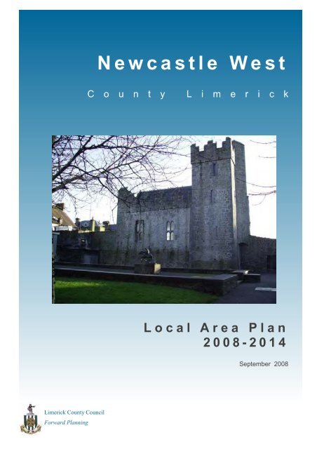
NEWCASTLE WEST <strong>Local</strong> <strong>Area</strong> <strong>Plan</strong> 2008This <strong>Local</strong> <strong>Area</strong> <strong>Plan</strong> for Newcastle <strong>West</strong> was deemed to be made onthe 25 th of September 2008.Limerick County CouncilForward <strong>Plan</strong>n<strong>in</strong>g49 O’Connell Street, LimerickT: 061 409694 F: 061 409695E: office@ndj.ie
1. INTRODUCTION1.1 How to Use this <strong>Plan</strong>1.2 The Basis and Purpose of the <strong>Local</strong> <strong>Area</strong> <strong>Plan</strong>1.3 The <strong>Plan</strong> <strong>Area</strong>1.4 Relationship with other <strong>Plan</strong>s and Strategies1.5 Other Relevant Issues
NEWCASTLE WEST <strong>Local</strong> <strong>Area</strong> <strong>Plan</strong> 20081.1 How to Use this <strong>Plan</strong>This <strong>Local</strong> <strong>Area</strong> <strong>Plan</strong> (LAP) for Newcastle <strong>West</strong> puts forwardideas and proposals to guide the physical land usedevelopment of your town over the next six years. It is animportant statutory document and will affect all those wholive <strong>in</strong> Newcastle <strong>West</strong> or have an <strong>in</strong>terest <strong>in</strong> itsdevelopment.This <strong>Plan</strong> is the ma<strong>in</strong> public statement of local plann<strong>in</strong>gpolicies for Newcastle <strong>West</strong> and from it you will be able tof<strong>in</strong>d out:• Where certa<strong>in</strong> types of development should take placewith<strong>in</strong> the town;• The standards that are required for such development;• Illustrative ideas for the appropriate form of newdevelopment;• Which areas are zoned/suitable for the different uses;and• Which build<strong>in</strong>gs and / or sites are protected and/ orproposed to be protected.The LAP is prepared under a number of Section head<strong>in</strong>gs asfollows:Section 1 identifies the <strong>Plan</strong> area and considers therelationship between this LAP and other relevant plans andstrategies.Section 2 sets out the Context of the Town <strong>in</strong> terms of itsgeographical location, its physical sett<strong>in</strong>g and function, andthe pr<strong>in</strong>cipal socio-economic factors <strong>in</strong>fluenc<strong>in</strong>g its futuredevelopment.Section 3 presents an analysis of the historical backgroundof the town and exist<strong>in</strong>g land use activities <strong>in</strong>clud<strong>in</strong>g thesettlement structure, access and movement, communityservices, amenities and recreation, and the resultantplann<strong>in</strong>g issues.Section 4 sets out a ’vision’ for Newcastle <strong>West</strong> based onthe analysis of issues identified <strong>in</strong> the previous Sections anda number of core development strategies, which aim toachieve the consolidation of the urban area, encourage adiverse and vibrant local economy, respond to a strongsense of community, and facilitate an easily accessible townand a susta<strong>in</strong>able community.Section 5 provides detailed development managementpolicies which aim to achieve the aspirations set out <strong>in</strong> theCore Strategy and Objectives described <strong>in</strong> Section 4, underthe ma<strong>in</strong> head<strong>in</strong>gs of – Hous<strong>in</strong>g; Built Environment andHeritage; <strong>Local</strong> Economic Development; Community andEducation; Recreation and Natural Environment; Transportand Accessibility; Water Services; Flood Risk Management;Waste Management; and Energy Consumption andEfficiency.Section 6 <strong>in</strong>troduces the Urban Development Frameworkand the pr<strong>in</strong>ciples of development promoted for the town,and sets out general guidel<strong>in</strong>es for key development areas.This section also <strong>in</strong>troduces specific site development briefswhere opportunities for urban renewal or strategicdevelopment opportunities have been identified through theconsultation and plan review process.Section 7 sets out how the plan will be implemented over itssix-year period.The Appendix conta<strong>in</strong>s the Land Use Zon<strong>in</strong>g Map.1.2 The Basis and Purpose of the<strong>Local</strong> <strong>Area</strong> <strong>Plan</strong>This LAP for Newcastle <strong>West</strong> is a statutory document thathas been prepared <strong>in</strong> accordance with the requirements ofSection 18 of the <strong>Plan</strong>n<strong>in</strong>g and Development Act 2000 (asamended) and the <strong>Plan</strong>n<strong>in</strong>g and Development Regulations20<strong>01.</strong>The policies and objectives set out <strong>in</strong> the LAP rema<strong>in</strong> <strong>in</strong>effect for a six year period but can be subject to amendmentor review dur<strong>in</strong>g this time where Limerick County Councilconsider relevant <strong>in</strong> the <strong>in</strong>terests of proper plann<strong>in</strong>g andsusta<strong>in</strong>able development of the town.The purpose of the LAP is to take a long-term view of thefuture development of Newcastle <strong>West</strong> <strong>in</strong> order to managechange <strong>in</strong> the physical environment and provide for newdevelopment <strong>in</strong> a comprehensive and coord<strong>in</strong>ated manner.Although the development policies and objectives set out <strong>in</strong>this LAP are for the next six years, the DevelopmentStrategy is also <strong>in</strong>tended to provide the foundation that willshape the future development of Newcastle <strong>West</strong> beyond2014.The LAP therefore sets out plann<strong>in</strong>g policies and objectivesthat also articulate the vision for the future of the town.These objectives have regard to national, regional andcounty policy and guidance, as well as the aspirations andSection 1: INTRODUCTION1
NEWCASTLE WEST <strong>Local</strong> <strong>Area</strong> <strong>Plan</strong> 2008Limerick County Development <strong>Plan</strong> 2005The County Development <strong>Plan</strong> classifies Newcastle <strong>West</strong> asa ‘Key Town’ with<strong>in</strong> the County act<strong>in</strong>g as the key servicecentre <strong>in</strong> <strong>West</strong> Limerick. As a ‘Key town’ Newcastle <strong>West</strong>should act as a driver of development and a significantprovider of services <strong>in</strong> <strong>West</strong> Limerick, as well ascompliment<strong>in</strong>g the development of the Limerick / Ennis /Shannon Gateway and act<strong>in</strong>g as a base for high qualitytransport l<strong>in</strong>ks to the core area of the region.The County Development <strong>Plan</strong> acknowledges the effects ofurban generated rural hous<strong>in</strong>g and <strong>in</strong>dicates that smalltowns and villages have a key role for cater<strong>in</strong>g for much ofthis demand. The <strong>Plan</strong> therefore seeks to promote ruraltowns and villages as the most suitable locations forproposals for multiple dwell<strong>in</strong>gs.The Settlement Strategy for the County stresses that thedevelopment of settlements will be promoted <strong>in</strong> a plannedand susta<strong>in</strong>able manner. Urban sprawl on the edges oftowns and villages will be avoided and a clear characterdist<strong>in</strong>ction between the built-up areas and the opencountryside ma<strong>in</strong>ta<strong>in</strong>ed through the provision of <strong>Local</strong> <strong>Area</strong><strong>Plan</strong>s <strong>in</strong> the ma<strong>in</strong> settlements and development boundarieselsewhere. The plan stresses that the strengthen<strong>in</strong>g of ruralcommunities can only be achieved <strong>in</strong> the long term throughmak<strong>in</strong>g settlements more attractive places to live andprovid<strong>in</strong>g employment opportunities.The Development <strong>Plan</strong> sets out an important agenda onCommunity and Rural Development. It highlights thetradition of liv<strong>in</strong>g <strong>in</strong> towns and villages and how the generaldecl<strong>in</strong>e of these settlements has been reflected <strong>in</strong> thechange <strong>in</strong> physical character of the areas. Traditionallycompact villages and towns have grown <strong>in</strong> a manner thathas tended to take the form of either ribbon development orloosely scattered development. The <strong>Plan</strong> recognises theimportance of the commercial and social aspects of townsand villages to their surround<strong>in</strong>g h<strong>in</strong>terland hence thesignificance of their development to ensure long-termviability.The LAP seeks to implement the strategic objectives of theDevelopment <strong>Plan</strong> by recognis<strong>in</strong>g the potential toaccommodate new development suitable <strong>in</strong> scale andcharacter to its position <strong>in</strong> the settlement hierarchy whileprovid<strong>in</strong>g for the planned expansion to facilitate that growth.urban fabric, supports local development groups’<strong>in</strong>volvement <strong>in</strong> regeneration, and its commitment to apartnership approach to community issues.Mid <strong>West</strong> <strong>Plan</strong>n<strong>in</strong>g Guidel<strong>in</strong>esThis document provides a regional framework for theformulation of the policies and strategy <strong>in</strong> the CountyDevelopment <strong>Plan</strong> and is <strong>in</strong>tended to ensure the properbalance between the different settlements <strong>in</strong> the region withregard to development, population and services.It demonstrates that the region features a strong centralcore, embrac<strong>in</strong>g Limerick City and the nearby centres ofShannon and Ennis. Together they create an urbanagglomeration that is centrally located with<strong>in</strong> the region andthat has the potential to be accessed from all its parts. Thisarea has also experienced considerable development andpopulation growth dur<strong>in</strong>g the past twenty years, with newfacilities and services be<strong>in</strong>g provided dur<strong>in</strong>g this period.The Regional <strong>Plan</strong>n<strong>in</strong>g Guidel<strong>in</strong>es set out the likelymaximum population growth that can be anticipated, with theMid <strong>West</strong> population potentially grow<strong>in</strong>g from 340,000 <strong>in</strong>2002 to almost 380,000 by 2020. However, the addedimpact of the National Spatial Strategy has suggested apopulation target for the Region of 400,000. Most of thegrowth would be accounted for by natural <strong>in</strong>crease of birthsm<strong>in</strong>us deaths, with some small level of <strong>in</strong>-migration.Future population distribution targets are proposed withseveral goals <strong>in</strong> m<strong>in</strong>d - to ensure the creation of a regionalcore area with sufficient mass to act as a development node;facilitate the creation of other service centres; ma<strong>in</strong>ta<strong>in</strong>susta<strong>in</strong>able rural communities; ensure environmental quality;and provide public transport l<strong>in</strong>ks to the ma<strong>in</strong> centres.Newcastle <strong>West</strong> lies with<strong>in</strong> Zone 5, which covers the <strong>West</strong>Limerick area as def<strong>in</strong>ed <strong>in</strong> the Mid <strong>West</strong> Draft RegionalGuidel<strong>in</strong>es. The current distribution of population with<strong>in</strong> thiszone <strong>in</strong> 2002 was 32,000. The strategy states that there ispotential with<strong>in</strong> the zone for the development of a largescale<strong>in</strong>dustrial centre as well as a high quality residentiallocation for those work<strong>in</strong>g <strong>in</strong> Limerick/Ennis/Shannon. Itrecognises a need, however, for settlements to expand theirrole as residential zones of high quality.This LAP further supports the <strong>Plan</strong>n<strong>in</strong>g Authority’s strategythat encourages development <strong>in</strong>to the exist<strong>in</strong>g settlements,promotes the redevelopment of derelict areas with<strong>in</strong> theSection 1: INTRODUCTION3
NEWCASTLE WEST <strong>Local</strong> <strong>Area</strong> <strong>Plan</strong> 2008Limerick County Development Board - Strategy forEconomic, Social and Cultural Development 2002 – 2011The vision of this document prepared by the CountyDevelopment Board is to ensure that Limerick County will bean attractive place for people to live and work with access toquality services, where the collaborative focus ofcommunities and service providers can facilitate a goodquality of life.Quality of life is a key issue aris<strong>in</strong>g from this document and itis considered that the long-term development of Newcastle<strong>West</strong> can satisfactorily achieve this through the provision ofhigh quality, well-designed houses, <strong>in</strong> an attractive sett<strong>in</strong>gwith<strong>in</strong> the boundary of a rural town at an affordable price.In an attempt to achieve balanced geographic development,the County Development Board has divided the county <strong>in</strong>tofour ma<strong>in</strong> areas, with Newcastle <strong>West</strong> fall<strong>in</strong>g with<strong>in</strong> the‘Large Towns’ category.The goal for this category is to ‘develop the four large towns<strong>in</strong> the County to become stronger centres for residential,commercial and <strong>in</strong>dustrial development’.development of Newcastle <strong>West</strong> which, comes underObjective A of the strategy, seeks ‘to strengthen Newcastle<strong>West</strong> as a viable <strong>in</strong>dustrial location and also as an attractiveplace to live’. A list of specific actions to achieve thisobjective is given <strong>in</strong> the Table 1.Limerick County Development Board Review OfStrategy For Economic, Social & Cultural Development:Prioritisation Of Actions For 2006-2008This document has been prepared by the Limerick CountyDevelopment Board to review what progress has been madeto date on the exist<strong>in</strong>g strategy. The report outl<strong>in</strong>es a rangeof actions that have been prioritised by the Board as a resultof the review.The report <strong>in</strong>dicates progress has been made <strong>in</strong> establish<strong>in</strong>ga Metropolitan <strong>Area</strong> Broadband Network <strong>in</strong> Newcastle <strong>West</strong>with construction commenc<strong>in</strong>g <strong>in</strong> 2006. Progress on theother actions proposed is also underway.The three other towns <strong>in</strong>cluded <strong>in</strong> this designation areRathkeale, Abbeyfeale and Kilmallock. The long-termShannon DevelopmentLimerick Co.Co.Table 1: Extract from Limerick County Development Board - Strategy for Economic, Social and Cultural Development 2002 – 20114 Section 1: INTRODUCTION
NEWCASTLE WEST <strong>Local</strong> <strong>Area</strong> <strong>Plan</strong> 2008The Limerick County Hous<strong>in</strong>g StrategyThe Hous<strong>in</strong>g Strategy 2006-2011 sets out current and futurehous<strong>in</strong>g requirements with<strong>in</strong> the County and the requirementfor social and affordable hous<strong>in</strong>g. It is a requirement underSection 95 (1) (b) of the <strong>Plan</strong>n<strong>in</strong>g and Development Act2000 that a plann<strong>in</strong>g authority shall <strong>in</strong>clude objectives <strong>in</strong> thedevelopment plan to secure the implementation of the‘Hous<strong>in</strong>g Strategy’. An objective of the Strategy is to have aland-use zon<strong>in</strong>g plan prepared for Newcastle <strong>West</strong>.1.5 Other Relevant IssuesLimerick County Council Accommodation Programmefor the Traveller Community 2009-2013This document outl<strong>in</strong>es Limerick County Council’s hous<strong>in</strong>gpolicy for the Traveller Community which is required underthe 1998 Hous<strong>in</strong>g (Traveller Accommodation) Act. The ma<strong>in</strong>brief of the document aims to provide appropriateaccommodation for <strong>in</strong>digenous Traveller families whorequest it, and who, pursuant to generic Hous<strong>in</strong>g legislationand the Hous<strong>in</strong>g Act 1998 are considered to be <strong>in</strong> need ofaccommodation.Section 1: INTRODUCTION5
2. TOWN CONTEXT2.1 Location2.2 Physical Sett<strong>in</strong>g2.3 Function2.4 Pr<strong>in</strong>ciple Demographics
NEWCASTLE WEST <strong>Local</strong> <strong>Area</strong> <strong>Plan</strong> 20082.1 Location2.3 FunctionNewcastle <strong>West</strong> is located 43.6 kilometres southwest ofLimerick City on the N21 National Limerick - Killarney Road,which is the ma<strong>in</strong> tourist and traffic route serv<strong>in</strong>g thesouthwest (refer Figure 2). Regional roads extendnorthwards to Ardagh and Foynes (R521), eastwards toBall<strong>in</strong>garry (R520), and southwards to Dromcolliher (R522).2.2 Physical Sett<strong>in</strong>gNewcastle <strong>West</strong> occupies a relatively flat pla<strong>in</strong> with<strong>in</strong> a largeagricultural h<strong>in</strong>terland. The foothills of the MullaghreirkMounta<strong>in</strong>s lie approximately 8km to the south. The ma<strong>in</strong>roads through the town converge on the Square, whichforms a focal po<strong>in</strong>t with its f<strong>in</strong>e architectural structures and16 th century Desmond Castle Complex at the south end.The extensive Castle Demesne (29.45ha), a public park <strong>in</strong>Council ownership, adjo<strong>in</strong>s the western edge of the Square.The River Arra, the Castle Demesne, and the Square with itsradiat<strong>in</strong>g traditional streets, are all dist<strong>in</strong>ctive elements thatcontribute to the special character of the town.Newcastle <strong>West</strong> is the County Town and the largestsettlement <strong>in</strong> County Limerick. It is def<strong>in</strong>ed <strong>in</strong> the LimerickCounty Development <strong>Plan</strong> Settlement Strategy (2005) as aKey Service Centre for <strong>West</strong> Limerick, given the range oflocal commercial and community services, and the transportl<strong>in</strong>kages to the Limerick / Shannon gateway and through toCounty Kerry.The considerable range of shopp<strong>in</strong>g, amenity, cultural andeducational facilities, together with local employmentopportunities, has established Newcastle <strong>West</strong>’s position asthe Key Service Centre for <strong>West</strong> Limerick. The high levels ofaccessibility to Limerick and County Kerry provided by theN21 has further enhanced the attraction of the town as aconvenient place to live. But this has <strong>in</strong> turn led to <strong>in</strong>creas<strong>in</strong>gconcerns <strong>in</strong> relation to traffic congestion through Newcastle<strong>West</strong> and the urgent need for a National Route Bypass, aswell as the consideration of alternative distributor roadl<strong>in</strong>kages to enable the cont<strong>in</strong>ued expansion of the town.The rapid growth of Newcastle <strong>West</strong> has made the provisionof retail, employment and community facilities of particularimportance.Figure 2: Newcastle <strong>West</strong> LocationOrd<strong>in</strong>ance Survey Ireland: Discovery Series Map 64Section 2: TOWN CONTEXT7
NEWCASTLE WEST <strong>Local</strong> <strong>Area</strong> <strong>Plan</strong> 2008Panoramic town view from north (Gortboy) to south2.4 Pr<strong>in</strong>ciple DemographicsPopulationThe 2006 Census figures re<strong>in</strong>force Newcastle <strong>West</strong> as thelargest town <strong>in</strong> County Limerick. Dur<strong>in</strong>g the last <strong>in</strong>ter-censusperiod (2002-2006), Newcastle <strong>West</strong> had one of the fastestgrow<strong>in</strong>g populations <strong>in</strong> County Limerick (from 3,495 to 3,922persons), represent<strong>in</strong>g a 12.2% <strong>in</strong>crease which exceededthe County Growth rate of 8.3% for the same period.As <strong>in</strong>dicated <strong>in</strong> Table 2, between 1991 and 1996 thepopulation of the Urban ED was static, while the populationof the Rural ED <strong>in</strong>creased by 6.5%. Between 1996 and 2002the Urban ED population <strong>in</strong>creased by around 6%, and theRural ED population by 20%. The highest population growthoccurred between 2002 and 2006, with 12.2% <strong>in</strong>crease <strong>in</strong>the Urban ED and an unprecedented 50.3% <strong>in</strong> the Rural ED.The population growth dur<strong>in</strong>g 2002-2006 <strong>in</strong> the Urban EDexceeded the Limerick County Growth rate of 8.3%, whilethe Rural ED experienced one of the highest growth rates <strong>in</strong>Ireland for the same period. Whereas this LAP is primarilyconcerned with the population of the Newcastle <strong>West</strong> TownED, the Rural ED population is recognised as hav<strong>in</strong>g asignificant <strong>in</strong>fluence on the future development of the town.YearUrban EDPersonsRural EDTotals19913,2871,0194,30619963,288 (+1)1,085 (+66)4,37320023,495 (+207)1,305 (+220)4,80020063,922 (+427)1,961 (+656)5,883Table 2: Change <strong>in</strong> Population from 1991 - 2006(source: Census of Ireland)8 Section 2: TOWN CONTEXT
NEWCASTLE WEST <strong>Local</strong> <strong>Area</strong> <strong>Plan</strong> 2008Age and Households Pro<strong>file</strong>The 2006 age pro<strong>file</strong> of Newcastle <strong>West</strong> ED (Figure 3)identifies a high representation of persons <strong>in</strong> the 25–44years age bracket, <strong>in</strong>dicative of a large majority of thepopulation that are likely to be <strong>in</strong> full-time employment andthe cont<strong>in</strong>ued popularity of Newcastle <strong>West</strong> as a place tolive, work and raise a family.Private household <strong>in</strong>formation <strong>in</strong>dicates that 51% of allhouseholds are made up of husband and wife (17%) orhusband and wife with one or more children (34%).Figure 4: Employment Sectors, Census 2006Figure 3: Age Pro<strong>file</strong>, Census 2006EmploymentApproximately 53% of Newcastle <strong>West</strong>’s population wasemployed at the time of the 2006 Census, with only 4%unemployed and 32% either <strong>in</strong> a family care-giver role,retired or disability situation. As shown <strong>in</strong> Table 4, thehighest proportion of employment was <strong>in</strong> Manufactur<strong>in</strong>g(23%), followed by Healthcare / Education Sectors (18%).Given the recent closures of some local manufactur<strong>in</strong>g<strong>in</strong>dustries, such as Castlemahon Poultry Process<strong>in</strong>g <strong>Plan</strong>t,Kantoher Kerry Foods (Poultry), S&S Foods and O’ReillyFoods, the number of jobs <strong>in</strong> this sector has beensignificantly reduced. There is a need to ensure that theemployment opportunities <strong>in</strong> Newcastle <strong>West</strong> match thepopulation growth of the Town.Section 2: TOWN CONTEXT9
3. CHARACTER AND LANDUSE APPRAISAL3.1 Historical Background3.2 Settlement Structure3.3 Community Structure3.4 Economy and Tourism3.5 Access and Movement3.6 Service Infrastructure3.7 Natural Environment3.8 Population Projections3.9 Future Hous<strong>in</strong>g Requirement3.10 Ma<strong>in</strong> <strong>Plan</strong>n<strong>in</strong>g Issues3.11 SWOT Analysis
NEWCASTLE WEST <strong>Local</strong> <strong>Area</strong> <strong>Plan</strong> 20083.1 Historical BackgroundNewcastle <strong>West</strong> was once known as ‘Castle-Roe’, after acastle built there by the Knights Templars <strong>in</strong> 1184. Situatedbetween the towns of Rathkeale and Abbeyfeale, Newcastle<strong>West</strong> is at the heart of Desmond Country. The town wasfounded <strong>in</strong> the 13th century on the River Arra, a tributary ofthe Deel, by the Norman Fitzgerald family as part of theterritory of the Earls of Desmond.Desmond Castle rema<strong>in</strong>s the most significant historic feature<strong>in</strong> the town and commands a prom<strong>in</strong>ent location at the southof the Square. Dur<strong>in</strong>g the reign of Elizabeth I, three battleswere fought <strong>in</strong> the locality. The town was sacked <strong>in</strong> 1302and destroyed <strong>in</strong> 1315. Two of the Earls of Desmond died <strong>in</strong>the town - Garrett (better known as Gearóid Iarla) <strong>in</strong> 1399,and James (the 8th earl) <strong>in</strong> 1462.By the 16th and 17th centuries, The Square and MarketPlace had been developed and Newcastle <strong>West</strong> became anestablished adm<strong>in</strong>istrative centre for the counties ofLimerick, Clare and Kerry. By 1862 the town had beenconnected with Limerick and Abbeyfeale by railway.In 1980 Newcastle <strong>West</strong> received a coat of arms, with themotto "As Dúchas Dóchas" - translated as 'Our Hopespr<strong>in</strong>gs from our Traditions'.NEWCASTLE WEST“A market and post-town, and a parish, <strong>in</strong> the Glenqu<strong>in</strong>Division of the barony of Upper Connello, 20 miles (S.W.)from Limerick, on the mail road to Killarney and Tralee, and114 (S.W.) from Dubl<strong>in</strong>; conta<strong>in</strong><strong>in</strong>g 4436 <strong>in</strong>habitants, ofwhich number, 2908 are <strong>in</strong> the town. This place, ancientlycalled Castle-Roe, derived both its orig<strong>in</strong> and name from theerection of a castle here by the Knights Templars, <strong>in</strong> 1184,round which, <strong>in</strong> process of time, a town was formed that wasfortified, and ultimately obta<strong>in</strong>ed a charter of <strong>in</strong>corporation.The town is situated on a small stream called the Arra, whichfalls <strong>in</strong>to the Deel about a mile eastward. It comprises fourpr<strong>in</strong>cipal streets and a spacious square, the north side ofwhich is chiefly occupied by an <strong>in</strong>fantry barrack; on the southare the parish church and the castle, and the east and westsides are formed by l<strong>in</strong>es of large and handsome houses.On the south side of the river, which here separates theparish from that of Monegay, are the shambles, a neat andcommodious structure.The land is <strong>in</strong> a high state of cultivation, produc<strong>in</strong>g abundantcrops chiefly of wheat, oats, and potatoes, with some barleyand clover: much of it is occupied <strong>in</strong> dairy farms and <strong>in</strong> thepastur<strong>in</strong>g of large numbers of cattle. The scenerythroughout the parish is rich, varied, extremely picturesque,and embellished with numerous elegant mansions and villas.Newcastle <strong>West</strong> 18 th Century.Newcastle <strong>West</strong> 18 th Century.The ru<strong>in</strong>s of the old castle are very extensive, and two of itstowers, one square, the other round, are <strong>in</strong> a good state ofpreservation, as are the tower and banquet<strong>in</strong>g-house nearthe church; many parts of its extensive range of archedvaults are also perfect. In the Castle demesne is achalybeate spr<strong>in</strong>g, formerly <strong>in</strong> considerable repute, andprotected by a covered build<strong>in</strong>g which still exists”.‘A Topographical Dictionary of Limerick City andCounty’, by Samuel LewisOrig<strong>in</strong>ally published <strong>in</strong> 1837 as part of ‘A TopographicalDictionary of Ireland’Figure 5: Newcastle <strong>West</strong> 18th century Historical MapSection 3: CHARACTER and LAND USE APPRAISAL11
NEWCASTLE WEST <strong>Local</strong> <strong>Area</strong> <strong>Plan</strong> 2008Figure 6: Newcastle <strong>West</strong> Historical Map 1829-18413.2 Settlement StructureThe town centre reta<strong>in</strong>s much of its heritage character,<strong>in</strong>clud<strong>in</strong>g several f<strong>in</strong>e 19th century build<strong>in</strong>gs clusteredaround the Square and with the castle complex and parishchurch def<strong>in</strong><strong>in</strong>g its southern end. The streets radiat<strong>in</strong>g fromthe Square - Church Lane to the north, Maiden Street to theeast, and Bridge Street to the south, which crosses the AraRiver to l<strong>in</strong>k with Goat Street (the N21) - for the most partcomprise cont<strong>in</strong>uous facades of traditional 2 and 3-storeyterraced commercial build<strong>in</strong>gs. The river and the easternterrace of build<strong>in</strong>gs on Maiden Street signify the southernedge of the historic core.Build<strong>in</strong>gs of particular <strong>in</strong>terest <strong>in</strong>clude the Courthouse (1842)and the Church of the Immaculate Conception (1828).Opposite the church is the monument commemorat<strong>in</strong>g 17volunteers killed <strong>in</strong> the War of Independence and the CivilWar. Other build<strong>in</strong>gs of note <strong>in</strong>clude the old Railway Station(1867), St. Ita’s Hospital, the Parish Hall, the CarnegieLibrary and the Courtenay Boy’s School. The CatholicChurch on South Quay forms a prom<strong>in</strong>ent reference po<strong>in</strong>t <strong>in</strong>an elevated position when approach<strong>in</strong>g the town on the N21.The condition of the public realm with<strong>in</strong> the Square isgenerally good, with recently re-surfaced footpaths, treeplant<strong>in</strong>g and new street furniture.Desmond Castle and the Square12 Section 3: CHARACTER and LAND USE APPRAISAL
NEWCASTLE WEST <strong>Local</strong> <strong>Area</strong> <strong>Plan</strong> 2008Figure 7: Orthographic Photograph show<strong>in</strong>g rural context of Newcastle <strong>West</strong>.Section 3: CHARACTER and LAND USE APPRAISAL13
NEWCASTLE WEST <strong>Local</strong> <strong>Area</strong> <strong>Plan</strong> 2008As evident from the 1841 Historic Map (Figure 5), the earlyexpansion of the town occurred to the east and south of thecentre, along the ma<strong>in</strong> radial routes. In the last 20 years orso, Newcastle <strong>West</strong> has been subject to major newdevelopment, particularly to the north of the town.More recently, dur<strong>in</strong>g the lifetime of the 2001 LAP, there hasbeen further substantial growth <strong>in</strong> hous<strong>in</strong>g developmentthroughout Newcastle <strong>West</strong>, but especially <strong>in</strong> the south/southeast at Killel<strong>in</strong>e and Rathnaneane, and <strong>in</strong> the north/northeast at Gortboy and Churchtown. Much of this hous<strong>in</strong>gis similar <strong>in</strong> character, compris<strong>in</strong>g medium density semidetacheddwell<strong>in</strong>gs.GortboyLonger established hous<strong>in</strong>g areas occur near the towncentre at Assumpta Park, Castleview and SharwoodEstates.3.3 Community StructureNewcastle <strong>West</strong> has a wide range of local communityservices and benefits from various sports clubs and facilities<strong>in</strong>clud<strong>in</strong>g GAA, rugby soccer, tennis and athletics. Althoughrecreational sport<strong>in</strong>g facilities are well catered for, expansionof these facilities can be expected to cont<strong>in</strong>ue.ChurchtownThe town has an excellent Community Park, children’splayground and play<strong>in</strong>g fields at the Castle Demesne <strong>in</strong>public ownership. This facility is well utilised by thecommunity and has been subject to community plant<strong>in</strong>g andimprovement schemes <strong>in</strong> recent years. Elsewhere <strong>in</strong> thetown, and with<strong>in</strong> the new hous<strong>in</strong>g areas <strong>in</strong> particular, publicrecreational space is limited.With<strong>in</strong> the town there are 5 primary schools (Monogay NS,Scoil Iosaf (St Joseph’s Convent), Scoil O Cura<strong>in</strong> B, SN CillLachta<strong>in</strong>, and Gaelscoil O Doghair), and 2 secondaryschools (Scoil Mhuire & Ide and Desmond College) with<strong>in</strong>Newcastle <strong>West</strong>.RathnaneaneKillel<strong>in</strong>eRecent Hous<strong>in</strong>g Developments <strong>in</strong> Newcastle <strong>West</strong>14 Section 3: CHARACTER and LAND USE APPRAISAL
NEWCASTLE WEST <strong>Local</strong> <strong>Area</strong> <strong>Plan</strong> 20083.4 Economy and TourismWith<strong>in</strong> the shopp<strong>in</strong>g hierarchy of County Limerick, Newcastle<strong>West</strong> is def<strong>in</strong>ed as the only Level 2 Tier 2 Major TownCentre, serv<strong>in</strong>g a large rural h<strong>in</strong>terland. At this level, apopulation of between 1,500-5,000 is served by a retailsector offer<strong>in</strong>g essential convenience shopp<strong>in</strong>g,supermarkets and lower order comparison shopp<strong>in</strong>g such ashardware, pharmaceutical, foods and clothes.The core of commercial activity is centred around theSquare, extend<strong>in</strong>g along Maiden Street, Bishop Street andBridge Street. Surveys undertaken <strong>in</strong> 2003 1 <strong>in</strong>dicate theRetail Floorspace <strong>in</strong> Newcastle <strong>West</strong> accounts for 23.9% ofthe total <strong>in</strong> County Limerick, at 11,822sq.m. (Castletroy andDooradoyle Crescent shopp<strong>in</strong>g centers = 45%). Thiscomprises 30% convenience shopp<strong>in</strong>g, 44% comparisonretail<strong>in</strong>g and 18% retail warehous<strong>in</strong>g.A major issue for retailers <strong>in</strong> the core retail area is theongo<strong>in</strong>g viability of the town centre due to the perceived lackof car park<strong>in</strong>g and <strong>in</strong>creased traffic circulation problems.The Limerick County Retail Strategy (2003) recognises that‘Newcastle <strong>West</strong> is underperform<strong>in</strong>g <strong>in</strong> the quality andnature of its retail floorspace and needs to susta<strong>in</strong> and growits role with<strong>in</strong> the County and region’s shopp<strong>in</strong>g patterns’. Inl<strong>in</strong>e with Policy RS11 of the Retail Strategy, ‘Newcastle <strong>West</strong>will be promoted and encouraged to undergo majorenhancement of its retail provision and develop and harnessits heritage importance.’It is recognised, therefore, that the retail pro<strong>file</strong> of the townneeds to cont<strong>in</strong>ue to improve, aim<strong>in</strong>g to become more selfsusta<strong>in</strong><strong>in</strong>gfor convenience shopp<strong>in</strong>g, and to re<strong>in</strong>force its roleas a visitor dest<strong>in</strong>ation.Newcastle <strong>West</strong> has many f<strong>in</strong>e tourist attractions, mostnotably the Desmond Castle complex on the banks of theRiver Arra. The castle and its grounds were the subject of anextensive restoration programme <strong>in</strong> the 1990s and are opento the public. Other visitor attractions <strong>in</strong>clude the historictownscape, a fam<strong>in</strong>e cemetery, and the Civil Warmonument. The River Arra also offers renowned trout andsalmon fish<strong>in</strong>g.Although a reasonable range of shops and services areavailable, the town has experienced a significant lack ofnational retailers, until the recent arrival of Lidl and Tesco.Town Centre commercial coreSection 3: CHARACTER and LAND USE APPRAISAL15
NEWCASTLE WEST <strong>Local</strong> <strong>Area</strong> <strong>Plan</strong> 2008Manufactur<strong>in</strong>g has played a major role <strong>in</strong> the localemployment sector <strong>in</strong> Newcastle <strong>West</strong>. The largestmanufactur<strong>in</strong>g <strong>in</strong>dustry is Ballygowan Water Ltd. Recentclosures of other manufactur<strong>in</strong>g plants, <strong>in</strong>clud<strong>in</strong>gCastlemahon Poultry Process<strong>in</strong>g <strong>Plan</strong>t, Kantoher KerryFoods (Poultry), S&S Foods and O’Reilly Foods have raisedconcerns <strong>in</strong> the community <strong>in</strong> relation to the retention ofemployment <strong>in</strong> the area.Public Sector services such as St. Ita’s Hospital, schoolsand Council <strong>Area</strong> Offices provide other large employmentbases.The Shannon Development Lands to the north of Newcastle<strong>West</strong>, zoned Industrial with<strong>in</strong> the 2001 <strong>Plan</strong>, rema<strong>in</strong> mostlyundeveloped to date. This represents a large land bank <strong>in</strong> asuitable location to expand <strong>in</strong>dustrial enterprise with<strong>in</strong> thetown.3.5 Access and MovementVehicle CirculationThe N21 Limerick to Killarney Road pass<strong>in</strong>g throughNewcastle <strong>West</strong> causes major traffic congestion issuesthroughout the year, but particular <strong>in</strong> the summer monthswith tourist traffic travell<strong>in</strong>g to and from County Kerry. TheRegional and <strong>Local</strong> roads converg<strong>in</strong>g on the Squarecontribute to the congestion experienced <strong>in</strong> the core retailarea, which has been recognised through communityconsultation as one of the key issues fac<strong>in</strong>g the town. Theneed for a town bypass is considered essential tosignificantly improve the town centre environment forpedestrians and ease of movement for local motorists.<strong>Local</strong> Distributor RoadIn October of 2006 the Council sought a variation to theexist<strong>in</strong>g LAP to <strong>in</strong>troduce a new ‘Southern Distributor Road’,<strong>in</strong>tended to serve local transport needs and to facilitatefuture development with<strong>in</strong> the town.The alignment as proposed <strong>in</strong> this document extends aroundthe southern boundary of this plan.N21 BypassThe proposed N21 Bypass for Newcastle <strong>West</strong> is currentlyat the prelim<strong>in</strong>ary design phase only. To date it isunderstood that NRA fund<strong>in</strong>g has been allocated for aconstra<strong>in</strong>ts and feasibility study for N21 improvementsbypass<strong>in</strong>g both Newcastle <strong>West</strong> and Abbeyfeale to theCounty Boundary. A broad constra<strong>in</strong>ts corridor has beenestablished and the Prelim<strong>in</strong>ary Design work will identifypreferred route corridors and options, estimated to bepresented for public consultation <strong>in</strong> 2008 at the earliest.Park<strong>in</strong>gA high proportion of park<strong>in</strong>g <strong>in</strong> the commercial core is onstreet<strong>in</strong> Market Place, with a private car park at Supervaluand an adjo<strong>in</strong><strong>in</strong>g public car park <strong>in</strong> Church Street. Theexist<strong>in</strong>g on-street park<strong>in</strong>g is at a premium and can contributeto haphazard traffic movements. A limited number of privatecar parks exist outside the central area, <strong>in</strong>clud<strong>in</strong>g Tesco, Lidland the Council <strong>Area</strong> office.At peak times, traffic congestion can be heavy around theBoher Bui and other school locations.Public TransportAn hourly Bus Eireann Service operates between Newcastle<strong>West</strong> and Limerick (journey time 50 m<strong>in</strong>s.) and to Tralee(journey time 1 hour 20 m<strong>in</strong>s.), runn<strong>in</strong>g from 9.00am to8.00pm.The Limerick – Tralee Railway L<strong>in</strong>e to the north of the townwas closed <strong>in</strong> 1963, and there are no known plans forpassenger services to be resumed <strong>in</strong> the foreseeable future.3.6 Service InfrastructureWater SupplyThe Newcastle <strong>West</strong> water supply is sourced from the watertreatment works located to the southeast of the town atCastlemahon. General Water usage of the town is currently600,000 gallons per day approximately, and the system isoperat<strong>in</strong>g at almost 100% capacity.The Council presently has a project underway to supplementthe exist<strong>in</strong>g town water supply, due to recent growth <strong>in</strong>hous<strong>in</strong>g, through a bored well at Tobergal, southwest ofNewcastle <strong>West</strong>, which is <strong>in</strong>tended to provide asupplementary supply for the summer months.The upgrad<strong>in</strong>g of the exist<strong>in</strong>g water treatment plant is thema<strong>in</strong> priority on capital projects schedule to <strong>in</strong>crease theoverall capacity of the plant, extract<strong>in</strong>g from River Deel atCastlemahon to ensure adequate supply for most of theyear, supplemented by the Tobergal Well.16 Section 3: CHARACTER and LAND USE APPRAISAL
NEWCASTLE WEST <strong>Local</strong> <strong>Area</strong> <strong>Plan</strong> 2008Sewerage Ma<strong>in</strong>s Infrastructure and Treatment WorksThe Wastewater Treatment <strong>Plan</strong>t is located on thesoutheastern edge of Newcastle <strong>West</strong> <strong>in</strong> the townland ofCloonyscrehane, discharg<strong>in</strong>g treated effluent <strong>in</strong>to the RiverDeel. The plant has a design capacity of 6,000 populationequivalent (PE). At present the capacity of the plant isestimated to be at 5,500. The upgrade of the Waste WaterTreatment <strong>Plan</strong>t is the second priority on the capital projectsschedule.A comb<strong>in</strong>ed system is <strong>in</strong> place for Foul and Storm waterwith<strong>in</strong> the town. This has major implications for the capacityof the exist<strong>in</strong>g sewerage network, particularly at times oflarge return period storms, where overflow of untreatedwastewater <strong>in</strong>to waterways has occurred when stormwaterdom<strong>in</strong>ates the system.3.7 Natural EnvironmentThe Rivers Arra and Daar are the ma<strong>in</strong> amenity features ofNewcastle <strong>West</strong> and have had a strong <strong>in</strong>fluence on thehistoric development of the town. The River Daar, a tributaryof the Deel, forms a natural boundary to the northeasternedge of the town. Both the Arra and Daar offer considerablepotential for contribut<strong>in</strong>g more positively to the generalamenity of the town.The Castle Demesne provides a valuable amenity resourceat the centre of the town, compris<strong>in</strong>g stands of mature treesand large open grassland areas reserved <strong>in</strong> publicownership. This facility is well utilised by the local communityand has been subject of tree plant<strong>in</strong>g and improvementschemes <strong>in</strong> recent years.River Arra through the town centreCastle Demesne Community ParklandSection 3: CHARACTER and LAND USE APPRAISAL17
NEWCASTLE WEST <strong>Local</strong> <strong>Area</strong> <strong>Plan</strong> 20083.8 Population ProjectionsFor the purposes of this LAP, consideration has been givento the strategic assessment of population distributionthroughout the region, as well as current population trendsand projections <strong>in</strong>cluded <strong>in</strong> the County Development <strong>Plan</strong>(2005).As described <strong>in</strong> Section 1.4 of this LAP, Newcastle <strong>West</strong> islocated with<strong>in</strong> ‘Zone 5: <strong>West</strong> Limerick <strong>Area</strong>’ of the Mid <strong>West</strong>Regional <strong>Plan</strong>n<strong>in</strong>g Guidel<strong>in</strong>es. This Zone is geographicallycentred around Newcastle <strong>West</strong> as the Key town, and hadan overall population <strong>in</strong> 2002 of 32,000 persons. Thepopulation projections for the Mid <strong>West</strong> <strong>in</strong>dicate that anadditional 10,000 persons may need to be allocated to ruralareas and settlements outside Zones 1 and 2, andspecifically allocates 3,983 persons for Zone 5 up until theyear 2020.The distribution of this new population is <strong>in</strong>tended to bedirected primarily toward exist<strong>in</strong>g settlements <strong>in</strong> order tosupport a critical mass to provide for development nodesand to support a range of economic and social services.Accord<strong>in</strong>gly, exist<strong>in</strong>g settlements such as Newcastle <strong>West</strong>need to be responsive to support an <strong>in</strong>creased populationand economic base <strong>in</strong> order to safeguard and provide for anexpanded range of services and facilities.Whilst Limerick County has experienced a population<strong>in</strong>crease of 8.3% over the last <strong>in</strong>ter-census period, theCounty Development <strong>Plan</strong> (2005) <strong>in</strong>dicates that thepopulation of the County is likely to grow by 11% over theplan period (to 2011). The results of the 2002 and 2006Census have therefore been taken together with the Countypopulation predictions to help assess the likely population<strong>in</strong>crease <strong>in</strong> Newcastle <strong>West</strong> for the <strong>Plan</strong> period (2008-2014)and also beyond to 2026.The County Development <strong>Plan</strong> also identifies a decl<strong>in</strong>e <strong>in</strong>household <strong>size</strong> from 3.04 persons per household <strong>in</strong> 2006 to2.66 persons per household <strong>in</strong> 2011. The predictedpopulation <strong>in</strong>crease comb<strong>in</strong>ed with decreas<strong>in</strong>g household<strong>size</strong> implies a need to add substantially to the hous<strong>in</strong>g stock<strong>in</strong> the county.The Limerick County Hous<strong>in</strong>g Strategy 2006-2011 providesfurther background data on the likely demand for hous<strong>in</strong>gwith<strong>in</strong> the County, and <strong>in</strong> particular the demand for socialand affordable hous<strong>in</strong>g.Based on a cont<strong>in</strong>ued optimum growth rate of 12.2% everyfour years, the population of Newcastle <strong>West</strong> by 2014 (thelifetime of the LAP) is predicted to be approximately 6,300persons.YEAR Urban ED Adjusted TownPopulation(<strong>in</strong>clud<strong>in</strong>g part ofRural ED)1996 3,2882002 3,4952006 3,922 4,9952010 4,438 5,6292014 5,001 6,3332018 5,636 7,1372022 6,351 8,0432026 7,158 9,064Table 3: Population projection for Newcastle <strong>West</strong> based onhigh growth rate of 12.2% every 4 years3.9 Future Hous<strong>in</strong>g RequirementsWith<strong>in</strong> the Lifetime of the <strong>Plan</strong>In addition to population predictions, other factors that<strong>in</strong>fluence future hous<strong>in</strong>g requirements <strong>in</strong>clude householdformation, sub-division of exist<strong>in</strong>g households, ‘trad<strong>in</strong>g-up’,<strong>in</strong>vestment buy<strong>in</strong>g, an <strong>in</strong>creas<strong>in</strong>g younger population com<strong>in</strong>g<strong>in</strong>to the hous<strong>in</strong>g market, and more recent <strong>in</strong>-migration to thearea (which may not necessarily be reflected <strong>in</strong> the latestcensus figures). Based on the cont<strong>in</strong>ued high growthscenario to the year 2014, and the average household <strong>size</strong>of 2.66 persons as predicted <strong>in</strong> the County Development<strong>Plan</strong>, it is estimated that an additional 490 dwell<strong>in</strong>g units willbe required with<strong>in</strong> the plan period. As it is the policy of theCouncil to promote lower density residential development onsuitable edge-of-town sites to facilitate a greater element ofchoice <strong>in</strong> the hous<strong>in</strong>g market than previously available, andto help regulate sporadic development <strong>in</strong> the rural areas, it isestimated that approximately 25% of the dwell<strong>in</strong>g unitswould be accommodated on ‘serviced sites’ with<strong>in</strong> the LAPDevelopment Boundary.Accord<strong>in</strong>gly, the estimated approximate residential landrequirement with<strong>in</strong> the lifetime of the <strong>Plan</strong> would be asfollows:295 dwell<strong>in</strong>gs (75%) @ 25 units/ha = 11.8ha195 serviced sites (25%) @ 10 units/ha = 19.5ha18 Section 3: CHARACTER and LAND USE APPRAISAL
NEWCASTLE WEST <strong>Local</strong> <strong>Area</strong> <strong>Plan</strong> 2008Total land requirement 31.3ha x 2 (to allow for lands thatmay not come forward for development and to provide forlocational choice) = 62.6ha.It is estimated that there are approximately 39ha ofuncommitted residentially zoned sites allocated from theNewcastle <strong>West</strong> <strong>Local</strong> <strong>Area</strong> <strong>Plan</strong> 20<strong>01.</strong>The lands currently zoned are therefore not quite sufficient(given the estimated demand for low-density serviced sites)to meet the hous<strong>in</strong>g requirements of the town dur<strong>in</strong>g thelifetime of this LAP.Land Requirements for a 9-year periodBased on a cont<strong>in</strong>ued high population growth scenario to theyear 2017, it is estimated that a further 555 (approximately)hous<strong>in</strong>g units will be required beyond 2014. Consequently,the estimated approximate residential land requirement forthe follow<strong>in</strong>g 3 years would be as follows:330 dwell<strong>in</strong>gs (75%) @ 25 units/ha = 13ha110 serviced sites (25%) @ 10 units/ha = 11haTotal additional land requirement 24ha x 2 (to allow for landsthat may not come forward for development and to providefor locational choice) = 48haShould the population of the town cont<strong>in</strong>ue to expand toaround 5,500 persons, therefore, it is likely that additionallands beyond the current Development Boundary wouldneed to be zoned for further residential development to meetthe estimated demand.3.10 Ma<strong>in</strong> <strong>Plan</strong>n<strong>in</strong>g IssuesThe <strong>in</strong>itial Newcastle <strong>West</strong> Ma<strong>in</strong> Issues Report (June 2007)sets out the responses to the extensive consultation thatwas undertaken at the start of the LAP process andsummarises the submissions received. The ma<strong>in</strong> issuesexpressed by the community have been summarised <strong>in</strong>tothe follow<strong>in</strong>g broad categories.This LAP seeks to address these issues by direct<strong>in</strong>g andco-ord<strong>in</strong>at<strong>in</strong>g new development through the formulation ofCore Strategy Objectives and Policies, DevelopmentManagement Policies and the Urban DevelopmentFramework.Town Centre / Economy• Congestion and lack of on-street car park<strong>in</strong>g a strongconcern for residents, difficult to access local convenienceshops, perceived loss of bus<strong>in</strong>ess for smaller retailers.• ACA <strong>in</strong> place, but concerns regard<strong>in</strong>g loss of heritagecharacter through <strong>in</strong>appropriate shop fronts and signage;• A larger car park is needed <strong>in</strong> closer proximity to the towncentre.• Encourage more residential accommodation andcommercial activity <strong>in</strong> the town centre to ma<strong>in</strong>ta<strong>in</strong> vibrancy,NCW becom<strong>in</strong>g ‘Suburbia’.• Encourage enterprise development on suitably zoned land.• Encourage tourism development on suitably zoned land.Community• Large demand for better facilities for youth <strong>in</strong> the town -possible reuse of exist<strong>in</strong>g disused build<strong>in</strong>gs for this purpose.• More public green space near residential areas.• Lack of Cemetery space a concern.• Growth <strong>in</strong> anti-social behaviour.• Improvements to recreational sport<strong>in</strong>g facilities desired butconstra<strong>in</strong>ts recognised to <strong>in</strong>clude pressure for redevelopment,dra<strong>in</strong>age and amenity impacts on neighbours.Environment• Demesne park well utilised public facility although morerecreational play<strong>in</strong>g fields, green spaces and footpath l<strong>in</strong>ksrequired.• Riverside park well utilised public facility although calls for betterriver walkway l<strong>in</strong>ks <strong>in</strong>to the town.• Exist<strong>in</strong>g mature trees should be preserved dur<strong>in</strong>g development.Residential• Rapid development of town has led to concern over monotonyof new estates.• New hous<strong>in</strong>g needs to be balanced with new provision of openspace and employment opportunities• Lack of hous<strong>in</strong>g choice and limited provision of ‘starter homes’.• Renovations and extensions to established venerable hous<strong>in</strong>gstock will be subject to strict design controls.Transportation and Infrastructure:• N21 Bypass and Southern Distributor Road are crucialissues for the future development and prosperity of thetown.• Traffic congestion and road safety issues are of particularconcern.• General desire to improve connectivity around the townthrough upgrad<strong>in</strong>g exist<strong>in</strong>g roads.• Concern over capacity of Wastewater Treatment plant.Population• Census Town ED considered to be us<strong>in</strong>g very small referencearea for NCW urban that does not <strong>in</strong>clude all built up areas.Section 3: CHARACTER and LAND USE APPRAISAL19
NEWCASTLE WEST <strong>Local</strong> <strong>Area</strong> <strong>Plan</strong> 20083.11 SWOT AnalysisThe follow<strong>in</strong>g table sets out the ma<strong>in</strong> strengths,weaknesses, opportunities and threats as identified throughpublic consultation and the site appraisals undertaken aspart of the LAP preparation process.To ensure the susta<strong>in</strong>able development of Newcastle <strong>West</strong>,these strengths and opportunities need to be encouraged,protected and developed, while the weaknesses and threatsneed to be addressed as an <strong>in</strong>tegral part of the policies andobjectives of this LAP.StrengthsWeaknessesOpportunitiesThreats• Newcastle <strong>West</strong> is thekey Urban Centre for<strong>West</strong> Limerick.• Arra River and CastleDemesne near thecore of the town.• Well located on N21Limerick to KillarneyRoad.• Good range of localservices (i.e. pubs,petrol station,convenience stores,post office, Gardastation, banks).• Good accessibility toLimerick and CountyKerry with strongTourist Potential.• Compact and dist<strong>in</strong>ctivetown centre.• High traffic congestionthrough town on N21.• <strong>Local</strong> roads oftencongested.• Lack of adequate off-streetpark<strong>in</strong>g.• Some haphazard on-streetpark<strong>in</strong>g.• Limited retail andemployment opportunities <strong>in</strong>Town Centre• Poor public realm (apartfrom core area), <strong>in</strong>adequatepublic open space, restrictedaccessibility to River Arra.• Limited <strong>in</strong>frastructurecapacity.• Inadequate footpaths <strong>in</strong>some locations and limitedprovision for cyclists.• Adequate land available foremployment and hous<strong>in</strong>guses.• Tourist potential from thoseon route to County Kerry,through <strong>in</strong>creased visitorfacilities.• Suitable land available closeto town centre for mixed usedevelopment purposes.• Exist<strong>in</strong>g private sector<strong>in</strong>terest for new hous<strong>in</strong>g andemployment development.• More susta<strong>in</strong>able pattern ofdevelopment.• Town centre enhancements,regeneration of derelictbuild<strong>in</strong>gs and sites and offstreetpark<strong>in</strong>g.• Protection and enhancementof the river corridors.• Provision of DistributorRoad.• Worsen<strong>in</strong>g trafficcongestion.• Unplanned ad-hocdevelopment with fewfacilities, poor urban formand monotonous design.• Lack of employment andhous<strong>in</strong>g opportunities forlocal community.• Fragmented urban structurewith cont<strong>in</strong>u<strong>in</strong>g ribbondevelopment on approachroads or <strong>in</strong> high visualamenity areas.• Loss of natural features thatcontribute to townscapecharacter.• Inadequate regard to naturalqualities of rivers.• Inaccessibility of backlands.• Deteriorat<strong>in</strong>g environmentand natural amenity.Table 4: SWOT Analysis20 Section 3: CHARACTER and LAND USE APPRAISAL
4. CORE STRATEGY4.1 Core Strategy Content4.2 The Vision for Newcastle <strong>West</strong>4.3 Strategic Objectives4.4 Core Policies4.5 Land Use Zon<strong>in</strong>g4.6 Land Use Zon<strong>in</strong>g Matrix
NEWCASTLE WEST <strong>Local</strong> <strong>Area</strong> <strong>Plan</strong> 20084.1 Core Strategy ContentThe Core Strategy sets out the vision, strategic objectivesand core policies for the future development of Newcastle<strong>West</strong>. The Development Framework (Section 6) translatesthe objectives and policies <strong>in</strong>to a Spatial Strategy thatidentifies the key elements of the approach to change andgrowth <strong>in</strong> the town dur<strong>in</strong>g the period of the LAP, as well asprovid<strong>in</strong>g the foundation that will shape the futuredevelopment of Newcastle <strong>West</strong> beyond 2014.4.2 The Vision for Newcastle <strong>West</strong>The County Council has an ambitious vision for the future ofNewcastle <strong>West</strong>, based on the community consultationexercise undertaken <strong>in</strong> December 2006 and the subsequentsubmissions received on the issues raised at the publicworkshop. The overall goal is the creation of a clean andsafe, susta<strong>in</strong>able environment, <strong>in</strong> communities where peoplewant to live, work or visit, and where residents have accessto local job opportunities. The town should cont<strong>in</strong>ue todevelop as a good place to live, with high quality hous<strong>in</strong>gwhich meets local needs and with a good quality of life, andwhere leisure and recreational activities are available to all.The Council is committed to deliver<strong>in</strong>g the vision throughwork<strong>in</strong>g <strong>in</strong> partnership with local people and organisations,and through promot<strong>in</strong>g the objectives and policies conta<strong>in</strong>edwith<strong>in</strong> this LAP.LAP Vision:To build upon the strengths of Newcastle <strong>West</strong> bycont<strong>in</strong>uously improv<strong>in</strong>g the quality of life for people, bothnow and <strong>in</strong> future generations, who live <strong>in</strong>, work <strong>in</strong>, and visitthe town, by promot<strong>in</strong>g:• A compact settlement of adequate <strong>size</strong> or critical mass;• A walkable and pedestrian-friendly environment;• A good mix of uses and opportunities for employment;• A varied architecture and a susta<strong>in</strong>able urban form;• Co-location for both hous<strong>in</strong>g and employment uses;• Provision of basic shopp<strong>in</strong>g, health and educationalneeds; and• A degree of self-sufficiency.4.3 Strategic ObjectivesThe County Development <strong>Plan</strong> (March 2005) emphasisesthat the development of settlements must be promoted <strong>in</strong> aplanned and susta<strong>in</strong>able manner. Urban sprawl on the edgeof towns and villages should be avoided and a cleardist<strong>in</strong>ction between the built up areas and the opencountryside ma<strong>in</strong>ta<strong>in</strong>ed. The long term viability ofsettlements <strong>in</strong> rural areas should also be supported bystrengthen<strong>in</strong>g the fabric of towns and villages through publicprivate collaboration and encourag<strong>in</strong>g the regeneration ofderelict and obsolete areas. In particular it is acknowledgedthat the proliferation of one-off rural houses does notstrengthen rural communities <strong>in</strong> the long term. This can onlybe achieved through mak<strong>in</strong>g settlements more attractiveplaces to live and provid<strong>in</strong>g employment opportunities.This LAP builds upon the strategy of the CountyDevelopment <strong>Plan</strong> by support<strong>in</strong>g and promot<strong>in</strong>g thesusta<strong>in</strong>able development of Newcastle <strong>West</strong> as a selfsupport<strong>in</strong>gcommunity, enjoy<strong>in</strong>g a good standard of life <strong>in</strong>terms of hous<strong>in</strong>g, jobs, amenities, transport and naturalenvironment. The County Council recognise that the townmust offer liv<strong>in</strong>g and work<strong>in</strong>g conditions, educational,recreational and community opportunities of the highestquality <strong>in</strong> an attractive urban environment.Views across Newcastle <strong>West</strong> from north to southIn order to achieve these aims, the follow<strong>in</strong>g StrategicObjectives have been established to underp<strong>in</strong> the LAP,based on the requirements of the town as identified by thelocal community dur<strong>in</strong>g consultation and build<strong>in</strong>g upon thestrengths of Newcastle <strong>West</strong> as recognised through theassessment.Section 4: CORE STRATEGY21
NEWCASTLE WEST <strong>Local</strong> <strong>Area</strong> <strong>Plan</strong> 2008Objective 1:A POSITIVE PHYSICAL ENVIRONMENTi. To ensure sufficient land is zoned for development to allowfor appropriate levels of growth over the plan period, so asto strengthen and consolidate the exist<strong>in</strong>g urban form andsupport the long term viability of the town;ii.iii.iv.To establish a clear development boundary as a physicaland visual edge to the town <strong>in</strong> accordance with the needsof the town, that re<strong>in</strong>forces the dist<strong>in</strong>ction between thebuilt-up area and the open countryside based wherepossible on recognisable physical features;To identify adequate land for recreational (active) publicopen space and facilities;To facilitate land designations where necessary to protectimportant structures, areas of architectural significance,and archaeological remnants.Objective 2:A VIBRANT AND BALANCED URBAN FORMi. To ensure the susta<strong>in</strong>able development of the town bypromot<strong>in</strong>g a range of house types and <strong>size</strong>s to cater for allages, household <strong>size</strong>s and <strong>in</strong>come groups;ii. To co-ord<strong>in</strong>ate the delivery of new residential developmentwhilst address<strong>in</strong>g physical constra<strong>in</strong>ts, and <strong>in</strong>frastructuralcapacities but ma<strong>in</strong>ta<strong>in</strong><strong>in</strong>g the critical mass to support newemployment and services;iii. To establish<strong>in</strong>g a robust urban framework to guide futuredevelopment which respects the established character andidentity of the town while follow<strong>in</strong>g strong urban designpr<strong>in</strong>ciples;iv. To formulate a set of design and density guidel<strong>in</strong>es toencourage development that will re<strong>in</strong>force the physicalqualities of the town;v. To ensure that a high level of local services and amenities<strong>in</strong> terms of sports / recreational play facilities, educational,community, childcare and retail provision are provided <strong>in</strong>tandem with new hous<strong>in</strong>g development.Objective 3:A HEALTHY COMMUNITY & NATURAL ENVIRONMENTv. To encourage the reduction, reuse and recycl<strong>in</strong>g of wasteand improve energy efficiency to reduce the impact ofclimate change.Objective 4:A STRONG LOCAL ECONOMYi. To ensure appropriate areas of suitable land are zoned toencourage enterprise and to provide a range of retail<strong>in</strong>gand service opportunities for residents <strong>in</strong> the town;ii.iii.iv.To encourage the regeneration of the town centre tosupport exist<strong>in</strong>g local bus<strong>in</strong>esses address<strong>in</strong>g pedestrianaccessibility and traffic movements;To encourage tourism related development through theidentification of <strong>in</strong>itiatives for specific locations;To protect exist<strong>in</strong>g tourist related uses where necessarythrough zon<strong>in</strong>g designations.Objective 5:STRONG LOCAL SERVICES AND AMENITIESi. To designate specific sites for additional services andfacilities to cater for the current and future needs of thepopulation;ii. To support the provision of new community andeducational facilities <strong>in</strong> the town;iii.iv.To encourage the role of Newcastle <strong>West</strong> as the CountyTown of Limerick and the key Urban Centre for westLimerick and its surround<strong>in</strong>g rural h<strong>in</strong>terland;To reserve land for public open space, recreational andsports facilities and parks/walkways.Objective 6:AN ACCESSIBLE AND LEGIBLE TOWNi. To establish a safe and user-friendly movement framework toimprove permeability and accessibility with<strong>in</strong> the centre of thetown and between the various land uses outside the towncore;ii.To ensure that the local road network provides ease of accessfor residents between the various residential and employmentareas;i. To identify lands with high natural amenity values as openspace for passive recreation use;iii.To manage levels of traffic and reduce vehicle speeds with<strong>in</strong>the town;ii.To protect and enhance the Rivers Arra and Daar and theirriparian marg<strong>in</strong>s, encourag<strong>in</strong>g public access wherepossible;iv.To provide for a more pedestrian and cyclist friendlyenvironment <strong>in</strong> the town which reduces conflict between theneeds of pedestrian and motorist;iii.iv.To <strong>in</strong>troduce land designations where necessary to protectimportant natural features, areas of high visual amenity,and important views;To protect water quality and enhance biodiversity;v. To promote the provision of amenity walks with<strong>in</strong> and throughthe town and l<strong>in</strong>k<strong>in</strong>g the various natural and heritage features.22 Section 4: CORE STRATEGY
NEWCASTLE WEST <strong>Local</strong> <strong>Area</strong> <strong>Plan</strong> 20084.4 Core PoliciesSusta<strong>in</strong>able DevelopmentAchiev<strong>in</strong>g good susta<strong>in</strong>able design <strong>in</strong> new development is a key objective of CentralGovernment and the County Council. The core strategy for the Newcastle <strong>West</strong> LAP istherefore based on the need to ensure the susta<strong>in</strong>able plann<strong>in</strong>g and development of the townas a balanced community with high quality standards <strong>in</strong> the provision of hous<strong>in</strong>g, employmentsocial and community facilities, recreation and amenities, transport and the naturalenvironment.It is the policy of the Council to promote development that makes a positive contribution tosusta<strong>in</strong>ability with<strong>in</strong> Newcastle <strong>West</strong> by recognis<strong>in</strong>g the importance of conserv<strong>in</strong>g andenhanc<strong>in</strong>g the quality of the built and natural environment, as well as the needs of all sectionsof the local community, <strong>in</strong> its decisions on the use of land and on other strategies that havean impact on the use of space.Core Policy 1:Susta<strong>in</strong>able DevelopmentExplanation:To achieve susta<strong>in</strong>ability it is considered that new development should be conta<strong>in</strong>ed with<strong>in</strong>the settlement boundary, with an emphasis on high quality design. This will ensure that thetown can develop as a positive and balanced community with<strong>in</strong> a coherent physicalframework that encourages an efficient and susta<strong>in</strong>able use of land. This strategic objective isdef<strong>in</strong>ed through a range of policies and land use designations that seek to control, guide andencourage forms and types of development at appropriate locations with<strong>in</strong> the town. Thetown expansion areas are the areas with<strong>in</strong> the settlement boundary where the LAP will seekto direct the future development of the town.Development UsesFuture development with<strong>in</strong> Newcastle <strong>West</strong> is mostly concerned with new residentialallocations on lands throughout the town, and other community and employment uses with<strong>in</strong>the town centre and other selected sites.The Land-use Zon<strong>in</strong>g <strong>Plan</strong> (refer Appendix 1) encourages a variety of uses <strong>in</strong> a manner thatpromotes the concept of a balanced residential community with appropriate services andfacilities, while ensur<strong>in</strong>g that the town reta<strong>in</strong>s its character and cont<strong>in</strong>ues to functioneffectively as a compact physical place with good accessibility and high quality public spaces.The development of residential land will be carefully monitored by the Council to ensure thatthe overall requirements are be<strong>in</strong>g delivered and the Strategy will be modified if necessary.It is the policy of the Council to facilitate a variety of land uses with<strong>in</strong> the settlement boundarythat can cater for exist<strong>in</strong>g and future needs of the population over the next six years andbeyond. New development uses will have regard to the proper plann<strong>in</strong>g and susta<strong>in</strong>abledevelopment of Newcastle <strong>West</strong> and respect the amenities of the neighbour<strong>in</strong>g properties aswell as the character and visual appearance of the town. All new and proposed uses will alsohave to conform to the permissible uses as detailed <strong>in</strong> the Land Use Zon<strong>in</strong>g Matrix (Table 5).Core Policy 2:Development UsesExplanation:The Land-use Zon<strong>in</strong>g Matrix provides an <strong>in</strong>dication of the permissible uses under each landuse zon<strong>in</strong>g and the types of uses that may be open for consideration.Section 4: CORE STRATEGY23
NEWCASTLE WEST <strong>Local</strong> <strong>Area</strong> <strong>Plan</strong> 2008Development Proposals GenerallyThe LAP <strong>in</strong>cludes an Urban Development Framework that sets out the broad approach topromot<strong>in</strong>g development <strong>in</strong> a way that is consistent with the strategic development objectivesand these core development policies. In order to achieve these objectives, the qualities ofnew development layout, design and architectural treatment are fundamental considerationsof the development process. The Development Framework identifies the key elements of theapproach to change and growth <strong>in</strong> the town for the next six years and is also <strong>in</strong>tended toprovide the foundation that will shape the future development of Newcastle <strong>West</strong> beyond2014.It is the policy of the Council that development proposals will be considered wherethey:a. Are located with<strong>in</strong> the settlement boundary as def<strong>in</strong>ed <strong>in</strong> the Urban DevelopmentFramework and areas zoned for development use on the Land Use Zon<strong>in</strong>g Map;b. Do not conflict with the pr<strong>in</strong>ciples of proper plann<strong>in</strong>g and susta<strong>in</strong>able development of thearea;b. Protect and enhance the town’s physical character, and built and natural environment;c. Do not adversely affect neighbour<strong>in</strong>g properties’ residential amenities and those of thesurround<strong>in</strong>g area;d. Do not create traffic hazards or congestion;e. Promote the development of Newcastle <strong>West</strong> as a compact settlement with a pedestrianfriendly environment, a legible and coherent physical form and a variety of land usesand activities.Core Policy 3:Development ProposalsGenerallyExplanation:High quality design can have a significant positive impact on the character and vitality ofareas where it is achieved, but it needs to be developed from an understand<strong>in</strong>g of the natureand character of its location and the elements that will contribute to susta<strong>in</strong>able development.This policy will ensure that the strategic objectives and the key design pr<strong>in</strong>ciples describedelsewhere <strong>in</strong> this <strong>Plan</strong> are <strong>in</strong>corporated <strong>in</strong>to the consideration of all plann<strong>in</strong>g applications.In particular, the Urban Development Framework sets out a spatial strategy for the town andprovides guidance on the preferred access and hous<strong>in</strong>g density of new development. Itthereby constitutes an essential tool for assess<strong>in</strong>g new development proposals with<strong>in</strong> thetown. It is the policy of the County Council to favourably consider forms of development onlywhere it accords with the Urban Development Framework, Land Use Zon<strong>in</strong>g Map and allother architectural and design guidance set out <strong>in</strong> the LAP.Any significant divergence from the guidance must adequately demonstrate how suchdivergence would be of greater benefit <strong>in</strong> achiev<strong>in</strong>g the strategic development objectives forNewcastle <strong>West</strong> as set out <strong>in</strong> this <strong>Plan</strong>.To achieve susta<strong>in</strong>ability, applications for development also need to demonstrate that theycontribute to the revitalisation of the town <strong>in</strong> a manner that is sympathetic to its character andsurround<strong>in</strong>gs, through:• Promot<strong>in</strong>g the redevelopment of derelict, obsolete and brownfield sites;• Encourag<strong>in</strong>g the development of backlands where this strengthens the streetscape and24 Section 4: CORE STRATEGY
NEWCASTLE WEST <strong>Local</strong> <strong>Area</strong> <strong>Plan</strong> 2008cont<strong>in</strong>uity of the urban gra<strong>in</strong>;• Support<strong>in</strong>g the role of the town centre as the pr<strong>in</strong>cipal commercial area;• Encourag<strong>in</strong>g a mix of uses <strong>in</strong> the town centre;• Enhanc<strong>in</strong>g the town centre through the promotion of appropriate <strong>in</strong>fill development and<strong>in</strong>creased densities subject to high standard of layout, design and f<strong>in</strong>ish and hav<strong>in</strong>g regardto the town vernacular, location and heritage;• Ensur<strong>in</strong>g that there is a sufficient mix of commercial and residential development <strong>in</strong> the<strong>in</strong>terest of commercial and residential vitality.4.5 Land Use Zon<strong>in</strong>gZon<strong>in</strong>g GenerallyThis LAP zones certa<strong>in</strong> land for specific uses, such as residential, mixed use, educational /community, open space and <strong>in</strong>dustrial. These zon<strong>in</strong>gs will be used to guide development toappropriate locations and should be read <strong>in</strong> conjunction with both the Zon<strong>in</strong>g Matrix and theUrban Design Framework.The purpose of land use zon<strong>in</strong>g is to <strong>in</strong>dicate to property owners, developers and the generalpublic, the types of development that are considered most appropriate <strong>in</strong> each zone. In thiscontext, the zon<strong>in</strong>g objectives allow the developer to plan development proposals with somedegree of certa<strong>in</strong>ty, subject to other conditions and requirements as set out <strong>in</strong> the <strong>Plan</strong>. In themanagement of development, zon<strong>in</strong>g seeks to delimit compet<strong>in</strong>g and <strong>in</strong>compatible uses so asto promote greater environmental quality and thereby rationalise the land use pattern of thetown.It is the policy of the Council to determ<strong>in</strong>e applications for development <strong>in</strong> accordance withthe Land Use Zon<strong>in</strong>g Map and Zon<strong>in</strong>g Matrix and other guidel<strong>in</strong>es set out <strong>in</strong> the <strong>Plan</strong> <strong>in</strong> orderto:Core Policy 4:Land Use Zon<strong>in</strong>ga. Endeavour to promote development and direct compatible land uses to the areasreserved for such purposes;b. Ensure that that the environmental quality of land use zones are protected from <strong>in</strong>trusionby compet<strong>in</strong>g or <strong>in</strong>compatible uses;c. Endeavour to rationalise land use patterns with<strong>in</strong> the town by encourag<strong>in</strong>g nonconform<strong>in</strong>guses to relocate away from the primary use zone.Explanation:The land use zon<strong>in</strong>g policy is <strong>in</strong>tended as a general guide to assess<strong>in</strong>g the acceptability orotherwise of development proposals, although the listed uses are not exhaustive. The variousland use designations have been formulated on the follow<strong>in</strong>g pr<strong>in</strong>ciples:• Ensur<strong>in</strong>g that land use designations will accommodate the anticipated population andgrowth needs of Newcastle <strong>West</strong> with<strong>in</strong> and beyond the lifetime of the <strong>Plan</strong>;• Encourag<strong>in</strong>g the development and re-development of the town centre as a compact andcoherent settlement;• Ensur<strong>in</strong>g an acceptable balance of land uses <strong>in</strong> proximity to one another and theappropriate <strong>in</strong>teraction of land use activities with<strong>in</strong> the town;• Support<strong>in</strong>g the pr<strong>in</strong>ciples of proper plann<strong>in</strong>g and development of the area;Section 4: CORE STRATEGY25
NEWCASTLE WEST <strong>Local</strong> <strong>Area</strong> <strong>Plan</strong> 2008• Identify<strong>in</strong>g the characteristics of various primary landuse categories <strong>in</strong> order to provide a broad plann<strong>in</strong>gframework, which guides development to appropriatelocations.Land Use Zon<strong>in</strong>g CategoriesThe various categories of zon<strong>in</strong>g <strong>in</strong>corporated on the LandUse Zon<strong>in</strong>g Map and the Zon<strong>in</strong>g Matrix are def<strong>in</strong>ed asfollows:Established Development (Residential )The purpose of this zon<strong>in</strong>g is to ensure that newdevelopment is compatible with adjo<strong>in</strong><strong>in</strong>g uses and toprotect the amenity of exist<strong>in</strong>g development areas. It is thepolicy of the Council to:• Conserve and enhance the quality and character of theestablished residential areas;• Accommodate a range of other uses that support theoverall residential function of the area where anacceptable standard of amenity can be ma<strong>in</strong>ta<strong>in</strong>ed andwhere the amenities of exist<strong>in</strong>g residents/occupiers areprotected;• Encourage a high standard of residential design <strong>in</strong> newresidential areas and to improve permeability andaccessibility;• Discourage the expansion or <strong>in</strong>tensification of exist<strong>in</strong>guses that are <strong>in</strong>compatible with residential amenity;• Have regard to the Urban Development Framework <strong>in</strong>proposed new developments and appropriate densitiesas set out <strong>in</strong> the DoEHLG ‘Susta<strong>in</strong>able ResidentialDevelopment <strong>in</strong> Urban <strong>Area</strong>s’ 2008.New ResidentialThis zon<strong>in</strong>g provides for new residential development andother services <strong>in</strong>cidental to residential development. Whilehous<strong>in</strong>g is the primary use <strong>in</strong> this zone, recreation,education, creche/playschool, cl<strong>in</strong>ic/surgery uses, shelteredhous<strong>in</strong>g and small corner shops are also envisaged, subjectto the preservation of neighbour<strong>in</strong>g residential amenity.Permission may also be granted for home based economicactivity with<strong>in</strong> this zone, subject to the preservation ofresidential amenity and traffic considerations. NewResidential Phase 1 consists of lands which willaccommodate hous<strong>in</strong>g needs dur<strong>in</strong>g the lifetime of the plan(to 2014). Development on New Residential Future Phaseswill not be permitted until 50% of phase 1 is fully developed.It is the policy of the Council to:• Encourage development on land zoned for newresidential (Phase 1) development ma<strong>in</strong>ly for hous<strong>in</strong>g,associated open space, community uses;• Protect residential amenity and allow for developmentappropriate to the susta<strong>in</strong>able growth of the area;• Promote the provision of community and other facilitiessuch as childcare as an <strong>in</strong>tegral part of establishedresidential areas subject to overall residential amenity;• Provide for a range of house types and <strong>size</strong>s to meet thevarious hous<strong>in</strong>g needs of exist<strong>in</strong>g and future residents;• Facilitate the expansion of the town <strong>in</strong> a balanced andsusta<strong>in</strong>able way;• Ensure that new residential developments conform to theprovisions of the Urban Development Framework andfacilitate permeability and legibility with<strong>in</strong> the town.Serviced Residential SitesResidential serviced sites are <strong>in</strong>tended to offer a realalternative to the <strong>in</strong>dividuals wish<strong>in</strong>g to build and design theirown houses <strong>in</strong> an urban sett<strong>in</strong>g with established servicesrather than the open countryside. Suitable edge-of-town landshave been identified with<strong>in</strong> the LAP boundary that wouldprovide the opportunity to cater for these lower densities, soas to help regulate sporadic development <strong>in</strong> the rural areas.Serviced Residential Phase 1 consists of lands which willaccommodate hous<strong>in</strong>g needs dur<strong>in</strong>g the lifetime of the plan (to2014). Development on Serviced Residential Future Phaseswill not be permitted until 50% of phase 1 is fully developed. Itis the policy of the Council to:• Promote Lower Density Residential Development <strong>in</strong>Serviced Residential Phase 1 lands <strong>in</strong> outer settlementedge locations, where plot <strong>size</strong>s have a m<strong>in</strong>imum sitearea of 1000m² and conta<strong>in</strong> detached houses of vary<strong>in</strong>gdesign;• Encourage a high standard of urban design <strong>in</strong> newresidential serviced sites areas lead by a design brief /Masterplan approach;• Have regard to the Urban Development Framework <strong>in</strong>proposed new developments.Town Centre / Mixed UseThe purpose of these zon<strong>in</strong>gs is to protect and enhance thecharacter of Newcastle <strong>West</strong> town centre and to provide forand improve retail<strong>in</strong>g, residential, commercial, office, culturaland other uses appropriate to the centre of a develop<strong>in</strong>g town.26 Section 4: CORE STRATEGY
NEWCASTLE WEST <strong>Local</strong> <strong>Area</strong> <strong>Plan</strong> 2008With<strong>in</strong> the town centre it will be an objective of the Council toencourage the re-use of build<strong>in</strong>gs and backlands andespecially the full use of upper floors. For <strong>in</strong>filldevelopments, generally two/three storey build<strong>in</strong>gs will bepreferred, depend<strong>in</strong>g on the character of the surround<strong>in</strong>gurban form. Warehous<strong>in</strong>g and other <strong>in</strong>dustrial uses will notbe permitted <strong>in</strong> the town centre. It is the policy of the Councilto:• Support the development of Newcastle <strong>West</strong>’s towncentre as the pr<strong>in</strong>cipal location for retail and commercialuses that provide goods or services;• Ma<strong>in</strong>ta<strong>in</strong> the mixed use character of the town centre bysupport<strong>in</strong>g the variety of uses particularly around TheSquare, Market Place, and along Maiden Street, BridgeStreet and South Quay:• Encourage a mix of compatible uses that will contributeto an enhanced provision of a range of town centre usesand which will consolidate the retail core around theSquare as the primary activity and bus<strong>in</strong>ess centre forthe town;• Encourage the <strong>in</strong>tegration of residential areas with<strong>in</strong> thetown centre;• Discourage the development of land uses that areconsidered particularly important to the viability andvitality of town centres such as retail<strong>in</strong>g and generaloffices <strong>in</strong> less appropriate locations other than identifiedneighbourhood centres;• Provide for anticipated car park<strong>in</strong>g and commercialdelivery demands with<strong>in</strong> the town centre;• Improve the quality of public realm generally with<strong>in</strong> thetown centre and along the River Arra <strong>in</strong>clud<strong>in</strong>g hard andsoft landscap<strong>in</strong>g;• Promote improved pedestrian accessibility, permeabilityand safety throughout the town.Mixed Use zon<strong>in</strong>g is <strong>in</strong>tended to further strengthen thefunction of the town centre as the pr<strong>in</strong>cipal location for retailand commercial uses. With<strong>in</strong> Mixed Use zon<strong>in</strong>gs a widerange of uses may be accommodated subject to otherpolicies of this plan. Such Mixed Use zon<strong>in</strong>gs can provide forsmaller neighbourhood centre type services (e.g. localshops/convenience retail), and for other uses that wouldcomplement as opposed to unduly compete with the vitalityand viability of the town centre. In accordance with ‘Retail<strong>Plan</strong>n<strong>in</strong>g Guidel<strong>in</strong>es for <strong>Plan</strong>n<strong>in</strong>g Authorities’, the Councilwill seek to encourage the economic and environmentaldevelopment of the town by focus<strong>in</strong>g new retail/commercialuses <strong>in</strong> the town centre with<strong>in</strong> the Mixed Use/Town Centrezon<strong>in</strong>g areas, and by restrict<strong>in</strong>g developments <strong>in</strong> out-of-townlocations to those which would not affect the viability of thetown centre.Open SpaceThe areas <strong>in</strong>cluded <strong>in</strong> this zon<strong>in</strong>g objective cover bothprivate and public open space and are dispersed throughoutthe town. The LAP has <strong>in</strong>cluded designations for bothexist<strong>in</strong>g and planned new open spaces. Open Spaces <strong>in</strong>Newcastle <strong>West</strong> <strong>in</strong>clude the Castle Demesne CommunityPark, the disused railway l<strong>in</strong>e, walkways and other localamenity areas.The Council will not normally permit development that wouldresult <strong>in</strong> a loss of open space with<strong>in</strong> the town except wherespecifically provided for <strong>in</strong> this <strong>Plan</strong>. Exist<strong>in</strong>g agriculturaluses <strong>in</strong> open space areas will cont<strong>in</strong>ue to be permitted, andreasonable development proposals <strong>in</strong> relation to this use willbe considered on their merits. The Council will support theprovision of development for playgrounds, parks, other areasfor outdoor activities, sports centres, sports pitches, outdoorrecreation tra<strong>in</strong><strong>in</strong>g centres and landscaped areas. The aimsof this land use zon<strong>in</strong>g objective <strong>in</strong>clude;• To protect, improve and provide for recreation, openspace and amenity provision through the preservationof green space to be dedicated to active or passiverecreation, i.e. sports fields, playgrounds, local areasof play;• To identify and preserve areas of high ecologicalvalue where not identified under the Semi-NaturalOpen Space landuse zon<strong>in</strong>g, where green corridorscan be ma<strong>in</strong>ta<strong>in</strong>ed to enhance biodiversity with<strong>in</strong> thetown, <strong>in</strong> particular along exist<strong>in</strong>g watercourses.• To acknowledge the potential risks of flood hazardand to preserve natural flood pla<strong>in</strong>s free fromdevelopment.AgriculturalLands reserved for agricultural activities.Community / EducationThis zon<strong>in</strong>g objective provides for local civic, community,educational and religious facilities to serve the immediateneighbourhood. The objective of this land use zon<strong>in</strong>g will beto ensure the provision of adequate community andeducation facilities <strong>in</strong>clud<strong>in</strong>g health centre/cl<strong>in</strong>ics; places ofworship; cultural uses; schools; nurs<strong>in</strong>g homes; communityhalls; sports clubs; recreational build<strong>in</strong>gs and parks /playgrounds.Section 4: CORE STRATEGY27
NEWCASTLE WEST <strong>Local</strong> <strong>Area</strong> <strong>Plan</strong> 2008Open Space / EducationThese lands have specifically been identified adjo<strong>in</strong><strong>in</strong>g theSouthern Distributor Road to be reserved for futureeducation uses with<strong>in</strong> the town or as a strategic open spaceopportunity.TourismIndustrial 2The purpose of this zon<strong>in</strong>g is to facilitate the developmentand expansion of exist<strong>in</strong>g and new commercial / <strong>in</strong>dustrialuses with<strong>in</strong> Newcastle <strong>West</strong> whilst provid<strong>in</strong>g a location formore general <strong>in</strong>dustry. A large land bank of undevelopedIndustrial land is located to the north of the town mostly <strong>in</strong>the ownership of Shannon Development.These lands are zoned to facilitate the provision of a hoteland other tourism facilities.Industrial 1The purpose of this zon<strong>in</strong>g is to facilitate the developmentand expansion of exist<strong>in</strong>g and new commercial / <strong>in</strong>dustrialuses with<strong>in</strong> Newcastle <strong>West</strong>. An area of land has beenzoned for new Industrial uses to the northeast approach ofthe town. This designation is <strong>in</strong>tended to facilitate bus<strong>in</strong>esspark / light <strong>in</strong>dustry / bulk retail<strong>in</strong>g / transport / logistics typeuses, thereby secur<strong>in</strong>g an important employment growtharea with<strong>in</strong> the town. However, some restrictions which mayapply <strong>in</strong> this area ensure the viability of retail <strong>in</strong> the towncentre is not compromised. The aims of this land use zon<strong>in</strong>gobjective <strong>in</strong>clude:• To provide sufficient lands to encourage newenterprise with<strong>in</strong> Newcastle <strong>West</strong>;• To ensure any retail provision is compliant with theRetail <strong>Plan</strong>n<strong>in</strong>g Guidel<strong>in</strong>es and does not detract fromthe viability of the town centre Core Retail <strong>Area</strong>.Shannon Development Lands to the north of Town Centre on the Churchtown Road28 Section 4: CORE STRATEGY
NEWCASTLE WEST <strong>Local</strong> <strong>Area</strong> <strong>Plan</strong> 20084.6 Land Use Zon<strong>in</strong>g MatrixAdvertis<strong>in</strong>g Panel X X O O O O X X X X XAgricultural Mach<strong>in</strong>ery Sales X X X O O X X X X XAmusement Arcade, C<strong>in</strong>ema, X X O O X X X X X ODance HallBank O O O X X X X X OCar Repair X X O O O X X X X XCar Sales X X O O X X X X XChurch / Community / Leisure O O O X ORecreational CentreDwell<strong>in</strong>g O X X X X X X XEducational / Childcare O X O X XFacilitiesFlat / Duplex O X X X X X X XGroup Hous<strong>in</strong>g, Permanent & O O O O O O X X X X XTemporary Halt<strong>in</strong>g Sites &Transient Sites for TravellersGuesthouse / B&B O O O O X X X X X OGarden Centre O O O O O O X X X X XHair Dress<strong>in</strong>g Salon O O O O X X X X X OHealth Centre/ Cl<strong>in</strong>ic O O O O X X O O X XHospital X X O O O X X O O X XHotel / Conference Facility O O O O X X X X X Industry: General (Heavy) X X X X O X X X X XIndustry: Light O O O O X X X X X<strong>Local</strong> Shops / Convenience O O O O X X X X X XRetailNurs<strong>in</strong>g Home / Retirement O O O O X X O O X XComplexOffice O O O O X X X X XPetrol Station X X O O X X X X XPub / Bar / Nightclub X X O O O X X X X ORecycl<strong>in</strong>g Centre Small O (e.g. bottle banks)Recycl<strong>in</strong>g Centre: Amenity X X O X O X X O Xsites / ELV storageRestaurant / Cafe O O O X X X X X Retail Warehous<strong>in</strong>g / Bulk X X O O X X X X X XRetailSupermarket 900sqm X X O X X X X X X XTake-away X X O O O X X X X XTable 5: Land Use Zon<strong>in</strong>g MatrixEstablished andNew ResidentialResidentialServiced SitesTown CentreMixed UseIndustrial 1Industrial 2Open SpaceEducation /CommunityOpen Space /EducationAgriculturalTourismExplanation:Generally PermittedOpen For ConsiderationGenerally Not PermittedΟΧSection 4: CORE STRATEGY29
5. DEVELOPMENTMANAGEMENT POLICIES5.1 Content5.2 Hous<strong>in</strong>g5.3 Built Environment and Heritage5.4 <strong>Local</strong> Economic Development5.5 Community and Education5.6 Recreation and Natural Environment5.7 Transport and Accessibility5.8 Water Services5.9 Flood Risk Management5.10 Waste Management5.11 Energy Consumption and Efficiency
NEWCASTLE WEST <strong>Local</strong> <strong>Area</strong> <strong>Plan</strong> 20085.1 ContentThe Core Strategy (Section 4) of the Newcastle <strong>West</strong> LAP isbased on the need to ensure the susta<strong>in</strong>able plann<strong>in</strong>g anddevelopment of the town as a balanced community. Thissection of the LAP conta<strong>in</strong>s more detailed developmentmanagement policies cover<strong>in</strong>g Hous<strong>in</strong>g, Built Environmentand Heritage, <strong>Local</strong> Economic Development, Communityand Education, Recreation and Natural Environment,Transport and Accessibility, and Services, Flood RiskManagement, Water Services, Flood Risk Management,Waste Management and Energy Consumption andEfficiency. The policies together with the Core Strategy andthe Urban Development Framework will be used to makeconsistent decisions on plann<strong>in</strong>g applications.a. Facilitate the anticipated levels of growth of the town <strong>in</strong>the long term;b. Provide for a range of house types, <strong>size</strong>s and tenuresto meet vary<strong>in</strong>g hous<strong>in</strong>g needs;c. Provide well designed, attractive, functional andsupervised amenity public open spaces;d. Co-ord<strong>in</strong>ate the provision of road, cycle and pedestriannetworks and other services to new residential areas;c. Provide high quality residential layouts <strong>in</strong> accordancewith the Urban Development Framework of this <strong>Plan</strong>;d. Conform with the DoEHLG ‘Susta<strong>in</strong>able ResidentialDevelopment <strong>in</strong> Urban <strong>Area</strong>s 2008’; ande. To promote the phased development of residential landoutward from the town centre, whereby Phase 1allocations are 50% fully developed beforedevelopment on land <strong>in</strong> Future Phases is permitted.5.2 Hous<strong>in</strong>gNew Hous<strong>in</strong>g DevelopmentAs described <strong>in</strong> Section 3.9 of this LAP, the demand forlands to be available for residential development over thenext 6-years and <strong>in</strong> the longer term has been determ<strong>in</strong>ed byassess<strong>in</strong>g projected demographic changes withunderstand<strong>in</strong>g the chang<strong>in</strong>g role of the town with<strong>in</strong> theCounty Limerick. The lifestyle offered with<strong>in</strong> the towncomb<strong>in</strong>ed with the range of community / educationalfacilities, employment opportunities, natural sett<strong>in</strong>g and highquality environment will cont<strong>in</strong>ue to contribute to Newcastle<strong>West</strong>’s popularity as a residential settlement. Landrequirement calculations are based on an average density of25 units per hectare (75%) and 10 units per hectare (25%) toaccommodate for lower densities where appropriate. Afactor of 2 has been applied to acknowledge that not alllands identified for development will become available overthe plan period and to allow for an element of choice <strong>in</strong>location.Account<strong>in</strong>g for all lands to be re-zoned from Residential toother uses, and with 39ha of uncommitted residential landswith<strong>in</strong> the Newcastle <strong>West</strong> LAP 2001, it is estimated that atotal of 23.6ha of additional residentially zoned lands will berequired for new hous<strong>in</strong>g to cater for the predictedpopulation growth of the town dur<strong>in</strong>g the lifetime of this plan,and a further 48ha of residentially zoned lands over thefollow<strong>in</strong>g 3 years.Policy H1: New Hous<strong>in</strong>g DevelopmentIt is the policy of the County Council to ensure that all newhous<strong>in</strong>g developments:Explanation:It is a core objective of this LAP to provide for exist<strong>in</strong>g andfuture hous<strong>in</strong>g requirements by facilitat<strong>in</strong>g residential growth<strong>in</strong> a way that balances future hous<strong>in</strong>g needs with the need toprotect the town’s specific physical and natural qualities.This <strong>in</strong>cludes accommodat<strong>in</strong>g the various hous<strong>in</strong>g needs ofthe exist<strong>in</strong>g and future populations that reflect the role of thetown as a local service centre. Therefore, it is considered apriority to provide for sufficient hous<strong>in</strong>g units <strong>in</strong> Newcastle<strong>West</strong> that reflect the vary<strong>in</strong>g <strong>in</strong>comes, household <strong>size</strong>s,house types and tenures for all hous<strong>in</strong>g markets. Thepurpose of phas<strong>in</strong>g is to ensure that the physical and social<strong>in</strong>frastructure required is provided <strong>in</strong> tandem with theresidential development.Serviced SitesAlthough still predom<strong>in</strong>antly agricultural <strong>in</strong> character, it isrecognised that the rural areas surround<strong>in</strong>g Newcastle <strong>West</strong>are com<strong>in</strong>g under cont<strong>in</strong>u<strong>in</strong>g pressure for one-off urbangenerated hous<strong>in</strong>g, <strong>in</strong>clud<strong>in</strong>g ribbon development along theapproach roads, that can detract from the rural sett<strong>in</strong>g of thetown.To help strengthen and consolidate the settlement structureand reverse the decl<strong>in</strong>e <strong>in</strong> the smaller towns and villages <strong>in</strong>the County, residential serviced sites will be promoted <strong>in</strong> thesettlements where services already exist. Residentialserviced sites are also recognised as offer<strong>in</strong>g a realalternative to the <strong>in</strong>dividuals wish<strong>in</strong>g to build and design theirown houses <strong>in</strong> small towns and villages rather than the opencountryside. Land has been zoned for such purposes with<strong>in</strong>this LAP, <strong>in</strong> areas located towards the outer edge of thetown boundary.Section 5: DEVELOPMENT MANAGEMENT POLICIES31
NEWCASTLE WEST <strong>Local</strong> <strong>Area</strong> <strong>Plan</strong> 2008Policy H2: Serviced SitesIn recognition of the demand for one-off urban generatedrural hous<strong>in</strong>g, the County Council have identified suitableedge-of-town lands with<strong>in</strong> the LAP boundary that wouldprovide the opportunity to cater for ‘serviced sites’, so as tofacilitate the optimum choice <strong>in</strong> hous<strong>in</strong>g type and location.Any serviced sites shall not be less than 0.10 hectares (0.25acres) where a Master <strong>Plan</strong> should be produced by thedeveloper show<strong>in</strong>g the overall layout, <strong>in</strong>frastructure, servicesand landscap<strong>in</strong>g for the whole of the serviced sitedevelopment.It is the policy of the County Council to promote the phaseddevelopment of residential land outward from the towncentre, whereby Phase 1 allocations are 50% fullydeveloped before development on land <strong>in</strong> Future Phases ispermitted.Explanation:It is desirable that serviced sites of not less than 0.10hectares (0.25 acres) are provided, except <strong>in</strong> exceptionalcircumstances. Larger sites will be required for hous<strong>in</strong>gexceed<strong>in</strong>g 250 sq.m. to allow for sufficient private amenityspace, park<strong>in</strong>g and landscap<strong>in</strong>g.Whilst <strong>in</strong>dividual house design on the serviced sites isencouraged the overall design of the scheme must beconsistent, <strong>in</strong> terms of scale, proportions and material f<strong>in</strong>ish.Traditional forms and materials appropriate to the sett<strong>in</strong>gshould be used. A Master <strong>Plan</strong> should be produced by thedeveloper show<strong>in</strong>g the overall layout, <strong>in</strong>frastructure, servicesand landscap<strong>in</strong>g for the whole of the serviced sitedevelopment dur<strong>in</strong>g the plann<strong>in</strong>g application stage. Allfuture development should be constructed thereafter <strong>in</strong>accordance with the Master <strong>Plan</strong>, unless otherwise agreedwith the <strong>Plan</strong>n<strong>in</strong>g Authority. The purpose of phas<strong>in</strong>g is toensure that the physical and social <strong>in</strong>frastructure required isprovided <strong>in</strong> tandem with the residential development.Hous<strong>in</strong>g Density and Infill DevelopmentIn order to ensure susta<strong>in</strong>able development, the expansionof Newcastle <strong>West</strong> needs to take advantage of the exist<strong>in</strong>g<strong>in</strong>frastructure and to address the various opportunities andconstra<strong>in</strong>ts presented by the exist<strong>in</strong>g settlement pattern, thenatural environment, <strong>in</strong>frastructure and service provision, theprojected population change for the settlement and itslocation with<strong>in</strong> the local and regional context.The <strong>Plan</strong>n<strong>in</strong>g Authority shall take <strong>in</strong>to account the follow<strong>in</strong>gguidel<strong>in</strong>es when consider<strong>in</strong>g any proposal for an <strong>in</strong>filldevelopment <strong>in</strong> street locations:(i) The site density, coverage and open spacerequirements will be considered on a site specific basisto ensure that new development <strong>in</strong>tegrates withexist<strong>in</strong>g;(ii) The development management standards set out fornew residential developments may be relaxed <strong>in</strong> thecase of <strong>in</strong>fill developments;(iii) Design, height, scale, materials used and f<strong>in</strong>ishesshould be compatible with exist<strong>in</strong>g adjacent properties;(iv) The height of build<strong>in</strong>g should be broadly similar toadjo<strong>in</strong><strong>in</strong>g properties particularly <strong>in</strong> relation to eaves andridge roof levels;(v) Boundary treatment should ensure an effective screenbetween proposed and exist<strong>in</strong>g development;(vi) Private open space should provide space for b<strong>in</strong> andfuel storage areas; and(vii) Car park<strong>in</strong>g provision <strong>in</strong> accordance with standardsoutl<strong>in</strong>ed <strong>in</strong> section 5.7, or <strong>in</strong> cases where this is notpossible a contribution to the <strong>Plan</strong>n<strong>in</strong>g Authoritytowards the provision or improvement of alternative carpark<strong>in</strong>g <strong>in</strong> the area.Policy H3: Hous<strong>in</strong>g Density and Infill DevelopmentIt is the policy of the County Council to:a. Promote the concept of a ‘compact town’ byencourag<strong>in</strong>g appropriate forms of development <strong>in</strong>suitable locations and by resist<strong>in</strong>g sporadic isolateddevelopments;b. Conform with the DoEHLG ‘Susta<strong>in</strong>able ResidentialDevelopment <strong>in</strong> Urban <strong>Area</strong>s’ 2008;c. Encourage the development of backlands with thecreation of new vehicular and pedestrian l<strong>in</strong>kages whilefacilitat<strong>in</strong>g the fill<strong>in</strong>g of gap and <strong>in</strong>fill sites along thema<strong>in</strong> roads;d. Encourage forms of development with<strong>in</strong> the towncentre that respects the exist<strong>in</strong>g streetscape, build<strong>in</strong>gforms and historic context;e. Promote the redevelopment of derelict sites <strong>in</strong>Newcastle <strong>West</strong>, <strong>in</strong> a sensitive and appropriate waythat reflects exist<strong>in</strong>g physical attributes, local characterand historic urban form; andf. Co-ord<strong>in</strong>ate the provision of road, cycle and pedestriannetworks and other services to new residential areas.Explanation:Guidel<strong>in</strong>es provided relate to the provision of residentialdevelopments with<strong>in</strong> exist<strong>in</strong>g residential or mixed-usedevelopments. The <strong>Plan</strong>n<strong>in</strong>g Authority particularly32 Section 5: DEVELOPMENT MANAGEMENT POLICIES
NEWCASTLE WEST <strong>Local</strong> <strong>Area</strong> <strong>Plan</strong> 2008encourages these where they elim<strong>in</strong>ate a derelict structureor vacant site.Together with the Urban Development Framework , thispolicy is <strong>in</strong>tended to encourage forms of development thatrespect the established character and identity of the town byadopt<strong>in</strong>g strong urban design pr<strong>in</strong>ciples. Applications will beassessed with<strong>in</strong> the context of the Urban DevelopmentFramework and the way <strong>in</strong> which the proposed residential ormixed-use schemes contribute to the quality of the town’sphysical character <strong>in</strong> relation to layouts, public open spaceprovision, access arrangements and architecturaltreatments. The appropriate density and general form ofproposed development will be assessed <strong>in</strong> relation to itsproximity to the town centre, impact on the neighbour<strong>in</strong>gproperties, efficient use of the site and availability of publicutilities.Social and Affordable Hous<strong>in</strong>gHigh priority will be given to the provision of affordable socialand low cost market hous<strong>in</strong>g to meet the needs identified <strong>in</strong>the County Council’s Hous<strong>in</strong>g Strategy (2006-2011). Alllands identified on the Land Use Zon<strong>in</strong>g Map as Residential,Town Centre Mixed Use or Established Development <strong>Area</strong>swill be subject to the requirements of Part V of the <strong>Plan</strong>n<strong>in</strong>gand Development Act 2000 <strong>in</strong> relation to the provision ofsocial and affordable hous<strong>in</strong>g.The Council will reserve 20% of all lands with<strong>in</strong> the town forsocial and affordable hous<strong>in</strong>g where the proposal is relatedto residential or an element of residential development. TheCouncil will engage <strong>in</strong> discussions with developers prior tothe formal plann<strong>in</strong>g process to negotiate details of theoperation of Part V of the 2000 Act, as amended, <strong>in</strong> relationto specific development.Policy H4: Social and Affordable Hous<strong>in</strong>gIt is the policy of the County Council to ensure that hous<strong>in</strong>gdevelopment of five or more units on lands or sites greaterthan 0.1ha conform with the provisions of the Hous<strong>in</strong>gStrategy and Part V of the <strong>Plan</strong>n<strong>in</strong>g and Development Act2000 (Amended) <strong>in</strong> respect of social and affordable hous<strong>in</strong>gprovision.Applicants may reach an agreement with the Council andeither reserve land or sites or units with<strong>in</strong> the proposeddevelopment or the functional area of Limerick CountyCouncil and / or make a f<strong>in</strong>ancial contribution equivalent to20% of the permitted development for the provision of socialand affordable hous<strong>in</strong>g, <strong>in</strong> accordance with the Hous<strong>in</strong>gStrategy.Explanation:Hous<strong>in</strong>g affordability has become an <strong>in</strong>creas<strong>in</strong>g problem <strong>in</strong>Newcastle <strong>West</strong> and elsewhere <strong>in</strong> the County. This policy<strong>in</strong>tends to secure affordable hous<strong>in</strong>g <strong>in</strong> accordance with theCounty Hous<strong>in</strong>g Strategy based on a ratio of 3:1 affordable(15%) / Social (5%). In calculat<strong>in</strong>g the required number ofsocial and affordable dwell<strong>in</strong>gs required on any developmentsite, the total number of proposed dwell<strong>in</strong>gs will be multipliedby 0.2 and the result rounded up or down to the nearestwhole dwell<strong>in</strong>g (0.5 and above rounded up). For example, asite of 24 dwell<strong>in</strong>gs will require 5 social / affordable units.Special NeedsThe County Council will seek to ensure that adequateprovision for people with special needs is <strong>in</strong>corporated with<strong>in</strong>new hous<strong>in</strong>g development <strong>in</strong> the town.Policy H5: Special NeedsIt is a policy of the County Council to facilitate the provisionof hous<strong>in</strong>g for those with special needs, such as elderlypeople and those with disabilities, <strong>in</strong>clud<strong>in</strong>g shelteredhous<strong>in</strong>g. The <strong>in</strong>tegration of such hous<strong>in</strong>g <strong>in</strong>to developmentslocated near services and community facilities will beencouraged.Explanation:The provision of accommodation targeted at people withspecific hous<strong>in</strong>g requirements will require co-operationbetween Limerick County Council and the various serviceproviders and between the <strong>Plan</strong>n<strong>in</strong>g and Hous<strong>in</strong>gDepartments with<strong>in</strong> the Council. The Council will strive toprovide the necessary accommodation facilities <strong>in</strong> suitablelocations <strong>in</strong> proximity to the town centre.Childcare FacilitiesThe County Council will also seek to ensure the adequateprovision of childcare places and facilities <strong>in</strong> Newcastle <strong>West</strong>through the plann<strong>in</strong>g system and to improve the quality ofchildcare services with<strong>in</strong> the community. Childcare is takento mean full day-care and drop-<strong>in</strong> facilities and services forpre-school children and school-go<strong>in</strong>g children out of hours.Policy H6: Childcare FacilitiesIt is the policy of the County Council to require the provisionof appropriate purpose built childcare facilities as an <strong>in</strong>tegralpart of the proposals for new residential development. Directprovision on site will normally be required where proposals<strong>in</strong>volve the provision of 75no. or more dwell<strong>in</strong>gs <strong>in</strong>accordance with the Childcare Facilities; Guidel<strong>in</strong>es for<strong>Plan</strong>n<strong>in</strong>g Authorities (DoELG 2001).Section 5: DEVELOPMENT MANAGEMENT POLICIES33
NEWCASTLE WEST <strong>Local</strong> <strong>Area</strong> <strong>Plan</strong> 2008materials for conservation or enhancement works;f. By protect<strong>in</strong>g and enhanc<strong>in</strong>g natural areas with<strong>in</strong> thetown and creat<strong>in</strong>g l<strong>in</strong>kages where developmentopportunities arise.Explanation:A key objective of the LAP is to atta<strong>in</strong> a balance between theneed to protect and conserve the important physicalcharacteristics of the town with the social and economicaspirations of a settlement that is likely to experiencegrowth. This policy is <strong>in</strong>tended to ensure that the builtenvironment of Newcastle <strong>West</strong> is given adequate protectionand to encourage forms of development which respect thetown’s specific physical qualities.Newcastle <strong>West</strong> is characterised by the important civicspace of the Square. The preservation of the streetscape ofthe ma<strong>in</strong> streets stemm<strong>in</strong>g from the Square, <strong>in</strong>clud<strong>in</strong>gBishop Street, Bridge Street, Maiden Street andChurchtown Road, is an important objective of the plan. Anynew development will therefore be expected to contribute toand enhance the townscape quality of the area.Heritage Build<strong>in</strong>gsThis LAP <strong>in</strong>cludes a number of specific measures that willprovide statutory protection for the heritage of the town. Thedesignations on the Land Use Zon<strong>in</strong>g Map and the pr<strong>in</strong>ciplesof the Urban Development Framework provide a generalstructure for the protection and enhancement of the builtenvironment.In addition, under the provisions of the <strong>Plan</strong>n<strong>in</strong>g andDevelopment Act (2000-2004), the County Council has aduty to compile a Record of Protected Structures, <strong>in</strong>clud<strong>in</strong>gevery structure which <strong>in</strong> its op<strong>in</strong>ion is of special architectural,historical, archaeological, artistic, cultural, scientific, social ortechnical <strong>in</strong>terest with<strong>in</strong> its functional area.This obligation imposes a responsibility on the plann<strong>in</strong>gauthority to review the structures <strong>in</strong> its area and to form anop<strong>in</strong>ion whether or not they are of such special <strong>in</strong>terest as towarrant <strong>in</strong>clusion <strong>in</strong> the Record. The compilation andma<strong>in</strong>tenance of the Record is central to the effectiveprotection of the architectural heritage. The formal mak<strong>in</strong>gof an addition to or deletion from the Record is a functionthat is reserved to the elected representatives.Policy B2: Protected StructuresIt is the policy of the County Council to protect structuresentered onto the Record of Protected Structures, or listedto be entered onto the Record and to encourage theirappropriate use/re-use and restoration. The Council willaccord<strong>in</strong>gly, <strong>in</strong> its development management function,have regard to this objective. Exempted developmentregulations shall not be applicable to such structureswhere proposed development / use would materially affectthe character of the structure or any element of thestructure which contributes to the architectural heritage.The Council will resist:a. Demolition of protected structures, <strong>in</strong> whole or <strong>in</strong> part;b. Removal or modification of features of architecturalimportance;c. Development that would adversely effect the sett<strong>in</strong>g ofthe protected structure.Explanation:The town already possesses a number of importantProtected Structures, as previously identified <strong>in</strong> the CountyDevelopment <strong>Plan</strong>.The Record of Protected Structures is set out <strong>in</strong> the CountyDevelopment <strong>Plan</strong>. The list<strong>in</strong>g of these items forpreservation denotes their <strong>in</strong>herent value to the community.This value is recognised by the Council and to this end, theCouncil will draw attention to the heritage value theyrepresent and will offer such expert advice on conservationas is available to it. It is also an objective to develop thetourist and recreational potential of the items listed wherepossible and appropriate.The Council will actively pursue fund<strong>in</strong>g for build<strong>in</strong>gconservation under the Conservation Grants scheme run bythe Department of Environment and <strong>Local</strong> Government.Under the <strong>Plan</strong>n<strong>in</strong>g and Development Act 2000 the entirebuild<strong>in</strong>g and curtilage of a protected structure is protected.Property owners are entitled to a ‘Declaration’ from the<strong>Plan</strong>n<strong>in</strong>g Authority outl<strong>in</strong><strong>in</strong>g the nature and scale ofdevelopment which may be acceptable to a particularprotected structure. Exempted development regulations willnot be applicable to such structures where proposeddevelopment/use would materially affect the character of thestructure or any element of the structure which contributes tothe architectural heritage.Section 5: DEVELOPMENT MANAGEMENT POLICIES35
NEWCASTLE WEST <strong>Local</strong> <strong>Area</strong> <strong>Plan</strong> 2008<strong>Area</strong> of Archaeological Potential and ArchaeologicalRecorded MonumentsNewcastle <strong>West</strong> also conta<strong>in</strong>s numerous features ofarchaeological <strong>in</strong>terest that contribute to its dist<strong>in</strong>ctivecharacter. The archaeological heritage significance isre<strong>in</strong>forced by the Zone of Archaeological Potential thatcovers a large proportion of the town centre (see Figure 8).Policy EH4: Preservation of Archaeological HeritageIt is the policy of the Council to safeguard the value andsett<strong>in</strong>g of archaeological sites and monuments <strong>in</strong> andaround the town of Newcastle <strong>West</strong> and seek thepreservation (<strong>in</strong>-situ, or at a m<strong>in</strong>imum, preservation byrecord) of all sites and monuments of archaeological andhistorical <strong>in</strong>terest.Explanation:Applicants are advised to consult the archaeological maps(available <strong>in</strong> the <strong>Plan</strong>n<strong>in</strong>g Office) <strong>in</strong> order to ascerta<strong>in</strong>whether their development is located <strong>in</strong> an area ofarchaeological potential (see Figure 8). Where adevelopment site co<strong>in</strong>cides with an area of archaeologicalpotential the plann<strong>in</strong>g application will be referred to theDOEHLG for their recommendations. Their views togetherwith the views and concerns of other <strong>in</strong>terested bodies willbe taken <strong>in</strong>to account when assess<strong>in</strong>g the plann<strong>in</strong>gapplication.In cases where it is deemed that the Archaeological Heritagewould be affected by a proposed development (due to theirlocation, <strong>size</strong> or nature), the <strong>Plan</strong>n<strong>in</strong>g Authority will requirean archaeological assessment. The applicant will be formallyrequested, as part of the plann<strong>in</strong>g process to have a reportprepared by an archaeologist on the archaeologicalimplications, if any, of the proposed development either priorto a decision on a plann<strong>in</strong>g application or prior tocommencement of development on site.sett<strong>in</strong>g and visual amenity of the site. The area of themonument and buffer should not be <strong>in</strong>cluded as part of theopen space requirement demanded of specificdevelopments but should be additional to the required openspaces. Developers are also advised of additionalrequirements under the National Monuments (Amendment)Act, 1994.5.4 <strong>Local</strong> Economic DevelopmentEmployment and Economic ActivityThe development of Newcastle <strong>West</strong> as an <strong>in</strong>dustrial andemployment centre is a key objective of this LAP. The role ofthe town as a service provider and employment locationwith<strong>in</strong> the <strong>West</strong> Limerick <strong>Area</strong>, its central location with<strong>in</strong> theCounty as a whole and its proximity to Limerick provides asignificant opportunity for further <strong>in</strong>ward <strong>in</strong>vestment.Apart from the ma<strong>in</strong> commercial core, employment locationsare scattered throughout the town. Ma<strong>in</strong> employment bases<strong>in</strong>clude the Ballygowan Water Extraction <strong>Plan</strong>t to thesouthwest of the town centre, that has a significant role <strong>in</strong>terms of local economic activity. Also of significance to thetown is the decentralisation programme of the RevenueCommissioners, which has to date provided for 51 localemployment posts. Other Public sector services such as theHospital, numerous schools, County Council Offices, Fireand Garda Station are all important employment bases.It is recognised that appropriate new employment usesshould cont<strong>in</strong>ue to be encouraged through the identificationof well located and serviceable lands with<strong>in</strong> the developmentboundary.In relation to development proposals the plann<strong>in</strong>g authoritywill adopt a policy of archaeological monitor<strong>in</strong>g which will berequired on developments where the scale and nature ofsuch developments may, <strong>in</strong> the op<strong>in</strong>ion of the plann<strong>in</strong>gauthority, have a negative impact on previously unknownarchaeological features/artefacts. In areas of residentialzon<strong>in</strong>g, consideration will be given to applicant monitor<strong>in</strong>gthe entire area rather than consider<strong>in</strong>g <strong>in</strong>dividualapplications with<strong>in</strong> this zoned area on it’s merits.In relation to archaeological assessment of sites, applicantswill also be required to def<strong>in</strong>e the buffer area or areacontiguous with any monument which will preserve theSection 5: DEVELOPMENT MANAGEMENT POLICIES37
NEWCASTLE WEST <strong>Local</strong> <strong>Area</strong> <strong>Plan</strong> 2008Policy LE1: Employment and Economic ActivityPOLICY LE2: Retail DevelopmentThe County Council will actively encourage futureemployment provision with<strong>in</strong> the town and stimulate activityto support the development of Newcastle <strong>West</strong> as a thriv<strong>in</strong>gand economically susta<strong>in</strong>able key urban centre <strong>in</strong> <strong>West</strong>Limerick. The Council will seek to;(a)(b)(c)(d)(e)Explanation:The LAP has generally reta<strong>in</strong>ed the <strong>in</strong>dustrial land zon<strong>in</strong>gfrom the previous 2001 LAP and designates further lands for<strong>in</strong>dustrial . The Council will ensure the achievement of a highstandard of design and layout for all new commercial /<strong>in</strong>dustrial development <strong>in</strong> accordance with other policies ofthe plan.The Council will also facilitate enterprise <strong>in</strong>vestment <strong>in</strong> thetown and will work <strong>in</strong> co-operation with all concerneddevelopment and employment agencies, <strong>in</strong>clud<strong>in</strong>g theCounty Enterprise Board, IDA, Shannon Development, FÁS,Forbairt, Forfás, <strong>West</strong> Limerick Resources Ltd and localcommunity groups. The ma<strong>in</strong> objective of this co-operation isto encourage the provision of employment, develop<strong>in</strong>g localresources and promot<strong>in</strong>g Newcastle <strong>West</strong> as an <strong>in</strong>vestmentlocation. The town centre area will be consolidated as amixed use area <strong>in</strong>clud<strong>in</strong>g residential, commercial, leisureand tourist related facilities.Retail<strong>in</strong>gEnsure that sufficient land is available to encouragenew enterprise to locate with<strong>in</strong> the town;Cont<strong>in</strong>ue to co-operate with all concerneddevelopment and employment agencies <strong>in</strong>promot<strong>in</strong>g Newcastle <strong>West</strong> as a location foremployment activities;Facilitate the development of local enterprise centresso that local and <strong>in</strong>digenous <strong>in</strong>dustries have theopportunity to develop;Facilitate the cont<strong>in</strong>uity and encourage theexpansion of exist<strong>in</strong>g enterprises, hav<strong>in</strong>g regard tothe protection of the amenity value of neighbour<strong>in</strong>gproperties; andEnsure that future commercial / <strong>in</strong>dustrialdevelopment of does not compromise the viability ofexist<strong>in</strong>g facilities particularly those with<strong>in</strong> the towncentre.Promot<strong>in</strong>g the provision of a diverse range of local shopp<strong>in</strong>gand commercial facilities will cont<strong>in</strong>ue to play an importantrole <strong>in</strong> re<strong>in</strong>forc<strong>in</strong>g the viability and vitality of the town centre,whilst also reduc<strong>in</strong>g the need to travel.It is a policy of the County Council to enhance the vitalityand viability of Newcastle <strong>West</strong> as a the Key Retail Centreof <strong>West</strong> Limerick and to improve the quantity and quality ofretail provision <strong>in</strong> the town by:(a)(b)(c)(d)(e)(f)Ensur<strong>in</strong>g that land use zon<strong>in</strong>gs and otherdesignations and development managementmeasures encourage the development of further retailprovision <strong>in</strong> Newcastle <strong>West</strong>;Encourag<strong>in</strong>g the upgrad<strong>in</strong>g and expansion of exist<strong>in</strong>gretail outlets and the development of new outletswith<strong>in</strong> the town centre;Ensur<strong>in</strong>g that proposals at ground floor level <strong>in</strong> thecore retail area with<strong>in</strong> the town centre are restrictedto shopp<strong>in</strong>g and service activities. Storage use willnot be permitted as the primary use <strong>in</strong> this location;Encourag<strong>in</strong>g the use of upper floors <strong>in</strong> retail premisesfor commercial or residential use;Enhanc<strong>in</strong>g the physical environment of the towncentre as a location for shopp<strong>in</strong>g and bus<strong>in</strong>essthrough measures aimed at improv<strong>in</strong>g conditions forpedestrians.Ensur<strong>in</strong>g adequate car park<strong>in</strong>g is available <strong>in</strong>accordance with Park<strong>in</strong>g Standards as def<strong>in</strong>ed <strong>in</strong> thisplan.The location of new Retail with<strong>in</strong> Newcastle <strong>West</strong> shall beconsidered <strong>in</strong> a susta<strong>in</strong>able manner by:(g)(h)Proposals with significant retail developmentelements should comply with the provisions of theCounty Retail Strategy and the Retail <strong>Plan</strong>n<strong>in</strong>gGuidel<strong>in</strong>es;Restrict<strong>in</strong>g the retail provisions <strong>in</strong> ‘out of centre’locations to goods generally sold <strong>in</strong> bulk, as to notcreate an adverse impact on the viability ofconvenience and comparison retail goods <strong>in</strong> thetown centre.Explanation:Newcastle <strong>West</strong> has a relatively good range of retailservices that provide for the basic needs of the town andsurround<strong>in</strong>g catchment area. The enhancement of the localshopp<strong>in</strong>g facilities specifically but not exclusively <strong>in</strong>convenience shopp<strong>in</strong>g, is a key <strong>in</strong>gredient <strong>in</strong> ma<strong>in</strong>ta<strong>in</strong><strong>in</strong>g thevitality of the town.In accordance with ‘Retail <strong>Plan</strong>n<strong>in</strong>g Guidel<strong>in</strong>es for <strong>Plan</strong>n<strong>in</strong>gAuthorities’, the Council will seek to encourage the economicand environmental development of the town by focus<strong>in</strong>g new38 Section 5: DEVELOPMENT MANAGEMENT POLICIES
NEWCASTLE WEST <strong>Local</strong> <strong>Area</strong> <strong>Plan</strong> 2008retail/commercial uses <strong>in</strong> the town centre with<strong>in</strong> the mixeduse zon<strong>in</strong>g areas, and by restrict<strong>in</strong>g developments <strong>in</strong> out oftown locations to bulky goods only, where appropriate.5.5 Community and EducationThe provision of adequate community facilities is anessential element of susta<strong>in</strong>able and balanced development.Community facilities <strong>in</strong>clude educational, religious, health,recreational and sport<strong>in</strong>g needs and activities. Newcastle<strong>West</strong> conta<strong>in</strong>s a wide range of community facilities andservices as outl<strong>in</strong>ed <strong>in</strong> Section 3. A key objective of the LAPis to ensure that the education and community needs ofresidents, both new and exist<strong>in</strong>g, can be provided and thatexpansion of the town will be accompanied by acorrespond<strong>in</strong>g expansion of essential facilities.Policy C1: Community and Education FacilitiesFigure 9: Core Retail <strong>Area</strong>Limerick County Retail Strategy (2003)Tourism EnhancementIt is the policy of the County Council to promote thedevelopment of tourism <strong>in</strong> the County, while simultaneouslyprotect<strong>in</strong>g and conserv<strong>in</strong>g those natural, built and culturalheritage features that form the resource on which thecounty’s tourist <strong>in</strong>dustry is based.The Council will cont<strong>in</strong>ue to encourage the provision ofsuitable visitor facilities <strong>in</strong> Newcastle <strong>West</strong> so as to enhancethe role of the town both as a visitor dest<strong>in</strong>ation and as abase for tourism for the wider <strong>West</strong> Limerick <strong>Area</strong>.Policy LE3: Tourism EnhancementIt is the policy of the Council to:(a)(b)(c)Enhance the tourism potential of the town, <strong>in</strong>clud<strong>in</strong>gthe promotion of new environmentally susta<strong>in</strong>abletourism products and visitor accommodation <strong>in</strong>clud<strong>in</strong>gco-operation with the relevant bodies <strong>in</strong> the market<strong>in</strong>gand promotion of tourism <strong>in</strong> the town;Encourage new development for the tourist <strong>in</strong>dustry tobe located near exist<strong>in</strong>g services and <strong>in</strong>frastructure tosupport the general economic vitality of thesettlement;Protect the natural, built or cultural heritage featuresthat form the basis of local attractions such as theDesmond Castle Complex. There will be presumptionaga<strong>in</strong>st any development that would adversely affectthe views and prospects towards these features.It is the policy of the County Council to:(a) Establish and implement, <strong>in</strong> partnership with otherproviders of public services and with the participationof the local community, strategies to enhance andsupport the development of exist<strong>in</strong>g and newcommunity facilities to counter disadvantage andsocial exclusion and improve the quality of life;(b) Seek, where practicable and appropriate, to ensurethat all major community facilities are located with<strong>in</strong>the town centre area;(c) Assist <strong>in</strong> develop<strong>in</strong>g and facilitat<strong>in</strong>g communityorganisations to ensure effective action, participationand representation <strong>in</strong> the community;(d) Review from time to time the educational needs of thetown <strong>in</strong> the light of Department of Education policyand population changes to ensure sufficient land,<strong>in</strong>clud<strong>in</strong>g space for recreational facilities, is reservedfor future educational needs.(e) Co-operate with all statutory bodies and communitygroups responsible for the provision of community andcivic facilities.Explanation:The LAP will provide for the future social, cultural andeducational needs of the community through appropriateland use designations that will cater for any additionalrequirements <strong>in</strong> respect of the exist<strong>in</strong>g and futurepopulations. Many facilities are provided by the communitythemselves, particularly <strong>in</strong> relation to services for the youthand elderly, sport<strong>in</strong>g and leisure facilities, whilst the publicsector bodies provide educational, religious and healthfacilities.Section 5: DEVELOPMENT MANAGEMENT POLICIES39
NEWCASTLE WEST <strong>Local</strong> <strong>Area</strong> <strong>Plan</strong> 20085.6 Recreation and NaturalEnvironmentActive and Passive RecreationUnder this LAP, a total of 72 hectares is zoned as Openspace <strong>in</strong> Newcastle <strong>West</strong> to facilitate both active andpassive recreational uses.Dur<strong>in</strong>g public consultation, the lack of <strong>in</strong>door sport facilities,teenage recreation areas and designated children’s playareas were perceived as key issues that needed to beaddressed. The Council recognises the need to provide arange of amenities and recreational facilities throughout thetown to meet the needs of all residents. In new residentialdevelopments, the Council will seek to ensure that adequateprovisions are made for recreational facilities, where this isappropriate, concurrent with the development.POLICY C2: Recreational Facilities and Amenity<strong>Area</strong>sIt is the policy of County Council to:(a) Ensure that exist<strong>in</strong>g and proposed public openspaces identified with<strong>in</strong> the Land Use Zon<strong>in</strong>gMap are protected and / or developedappropriately for recreational purposes to servethe local needs of the residents of Newcastle<strong>West</strong>;(b) Co-operate with sports clubs, schools andcommunity organisations <strong>in</strong> the provision ofsports and recreational facilities to serve theresidents of Newcastle <strong>West</strong>;(c) Co-operate with appropriate local groups tofacilitate the provision of playgrounds <strong>in</strong> anagreed suitable locations;(d) Seek to improve the exist<strong>in</strong>g public open spaceswith<strong>in</strong> the town; Ensure that all newdevelopments enhance the recreational andamenity value of the town;(e) Seek a contribution towards the landscap<strong>in</strong>g ofpublic open space and creation of recreationalfacilities <strong>in</strong> association with the development ofnearby residential, <strong>in</strong>dustrial or commercialdevelopments.Explanation:The policy is <strong>in</strong>tended to provide adequate protection to theexist<strong>in</strong>g amenity and recreational facilities with<strong>in</strong> Newcastle<strong>West</strong>. In addition, it is directed towards the need toaccommodate new open spaces with<strong>in</strong> the town as thesettlement expands.It will be important for all new developments to identify theneed for adequate open space, recreational and children’splay facilities as an <strong>in</strong>tegral part of development proposalsand accord<strong>in</strong>g to the guidel<strong>in</strong>es set out <strong>in</strong> the UrbanDevelopment Framework.Enhancement of the Natural EnvironmentThe LAP is concerned with the protection and enhancementof Newcastle <strong>West</strong>’s natural environment, which representsan important part of the town’s quality as a place to live andwork. It will be important to ensure that exist<strong>in</strong>g naturalspaces and features are protected and improved and thatfuture development does not underm<strong>in</strong>e the town’s naturalenvironment.Whist there are no NHA’s or SAC’s with<strong>in</strong> the vic<strong>in</strong>ity of thetown, there are several features of ecological and amenityvalue (such as the Castle Demesne, the Arra and Daar rivercorridors, mature trees, and exist<strong>in</strong>g and future walkways). Itis an objective of the LAP to protect and improve thesefeatures as the town cont<strong>in</strong>ues to develop. Consideration willalso be given to the preparation of Tree Preservation Orderswhere these are deemed necessary.Policy C3: Amenity Strategy & EnvironmentalImprovementsIt is the policy of the Council to:(a) Ensure that features of ecological and amenityvalue are protected from loss or degradationthrough redevelopment;(b) Seek to strengthen the edges of the town byre<strong>in</strong>forc<strong>in</strong>g the environmental quality of the Arraand Daar river corridors;(d) Co-operate with appropriate local groups tofacilitate the environmental improvement projects<strong>in</strong> identified locations. Specific priority shall begiven to proposals for environmentalimprovements of the follow<strong>in</strong>g amenity areas:(i) The Arra River through the town centre;(ii) The Deel River to the south east of thetown;(iii) The Great Southern Walkway L<strong>in</strong>k (follow<strong>in</strong>gthe disused railway l<strong>in</strong>e to the north of thetown); and(iv) The Castle Demesne Community Park.Explanation:A key part of the strategy for improv<strong>in</strong>g the town’senvironment will be preserv<strong>in</strong>g open spaces around thema<strong>in</strong> rivers adjo<strong>in</strong><strong>in</strong>g the town, and provid<strong>in</strong>g for recreationand leisure opportunities alongside these natural features.40 Section 5: DEVELOPMENT MANAGEMENT POLICIES
NEWCASTLE WEST <strong>Local</strong> <strong>Area</strong> <strong>Plan</strong> 2008Policy C4: Protected Views, Landscapes, Trees,and HedgerowsIt is the policy of the Council to safeguard specialscenic views and prospects by controll<strong>in</strong>g any possibledevelopment that may occur with<strong>in</strong> the view l<strong>in</strong>es of theRiver Arra and across other open spaces with<strong>in</strong> thebuilt-up area that contribute to the sett<strong>in</strong>gs of protectedbuild<strong>in</strong>gs or monuments.It is also the Policy of the Council to seek thepreservation of trees and groups of trees whereappropriate from redevelopment or other proposals.The Council may seek preservation through the use ofTree Protection Orders (TPO’s). Removal of identifiedtrees shall not be permitted unless it has beendemonstrated that the tree(s) are of poor condition and /or are of no significant landscape value, supported by atree survey by a suitably qualified arboriculturist.Explanation:With<strong>in</strong> the <strong>Plan</strong> area there are a number of mature treestands and hedgerows that will be protected wheredevelopment is proposed. The numerous mature trees forma valuable part of the urban environment by contribut<strong>in</strong>g tothe dist<strong>in</strong>ctiveness of the area. Mature trees and hedgerowsare also capable of add<strong>in</strong>g a sense of permanence, amenityand completion to development sites, and wherever possiblewill be <strong>in</strong>corporated <strong>in</strong>to development proposals and suitablyprotected.5.7 Transport and AccessibilityIt is the policy of the council to ensure that adequate facilitiesand access provision are provided for those with disabilities<strong>in</strong> the community. The council will strive to ensure that theprovision of such facilities will be <strong>in</strong> l<strong>in</strong>e with current goodpractice <strong>in</strong> relation to such issues.A key theme of the County Council’s Transport andInfrastructure policy is the promotion of an <strong>in</strong>tegratedtransport system throughout the County that is safe,efficient, competitive, accessible and socially andenvironmentally friendly, with an <strong>in</strong>creased emphasis on theuse of alternative modes of transport <strong>in</strong>clud<strong>in</strong>g publictransport, cycl<strong>in</strong>g and walk<strong>in</strong>g. This LAP adopts a similarpolicy and aims to explore ways for manag<strong>in</strong>g levels of trafficand reduce vehicle dom<strong>in</strong>ance <strong>in</strong> the town as an essentialstrategic objective.POLICY T1: Strategic Accessibility and RoadImprovementsIt is the policy of the County Council to encourage thedevelopment of a safe and efficient movement andaccessibility network throughout Newcastle <strong>West</strong>.Improvements to the network shall cater for the needsof all users and to encourage priority for town centreaccess, walk<strong>in</strong>g and cycl<strong>in</strong>g, public transport provisionand accident reduction. Priority shall be given to thefacilitation of proposed N21 Bypass wherever possibleto ensure timely delivery of crucial road improvement.Explanation:The viability and vitality of the town centre requires improvedlocal access and an improved park<strong>in</strong>g and pedestrianenvironment, such that the core retail, bus<strong>in</strong>ess/commercial,residential and recreational/cultural facilities can best attractand reta<strong>in</strong> those visit<strong>in</strong>g and us<strong>in</strong>g the town. Both strategicand local accessibility issues are important, <strong>in</strong> terms ofgett<strong>in</strong>g to Newcastle <strong>West</strong> and mov<strong>in</strong>g around the town,whilst the demands for through traffic need to be catered for<strong>in</strong> an efficient and safe manner that reduces congestion.Southern Distributor RoadThe potential of a Southern Distributor Road could presentsignificant environmental, social and economic benefits tothe town, and a suitable route needs to be further<strong>in</strong>vestigated <strong>in</strong> terms of optimum alignment, open<strong>in</strong>g-uppresently land-locked areas to new development, creat<strong>in</strong>g anew urban edge, and likely environmental impacts (<strong>in</strong>clud<strong>in</strong>gvisual and natural environment).POLICY T2: Southern Distributor RoadIt is the policy of the County Council to promote thedelivery of a Southern Distributor Road to allow forimproved accessibility and a more efficient local roadnetwork.The phas<strong>in</strong>g of development of zoned lands adjo<strong>in</strong><strong>in</strong>g theproposed route will be concurrent with the construction ofthe road and the junctions as shown on the LanduseZon<strong>in</strong>g <strong>Plan</strong>.Explanation:The Council is committed to secur<strong>in</strong>g the SouthernDistributor Road <strong>in</strong> partnership with the private sectorthrough identification of a preferred route option andassociated land use zon<strong>in</strong>gs.However, it should be noted that the route alignment asSection 5: DEVELOPMENT MANAGEMENT POLICIES41
NEWCASTLE WEST <strong>Local</strong> <strong>Area</strong> <strong>Plan</strong> 2008shown on the Land Use Zon<strong>in</strong>g Map is <strong>in</strong>dicative and needsto be further <strong>in</strong>vestigated as part of the developmentmanagement process for the area. Although a timeframecannot be determ<strong>in</strong>ed at this stage, it is anticipated that theroute would be implemented <strong>in</strong>crementally as adjo<strong>in</strong><strong>in</strong>g sitescome forward for development on a phased basis.Park<strong>in</strong>g and Town Centre AccessibilityImproved vehicle and pedestrian access and park<strong>in</strong>gprovision is recognised as be<strong>in</strong>g essential to the cont<strong>in</strong>ueddevelopment of the town.POLICY T3: Park<strong>in</strong>g and AccessThe County Council will seek to;(a) Improve pedestrian and vehicular access and safetythrough the implementation of traffic managementmeasures that achieve a more acceptable balancebetween the needs of motorists and pedestrians;(b) Encourage new off-street park<strong>in</strong>g wherever practicableand facilitate improvements to exist<strong>in</strong>g off-streetpark<strong>in</strong>g <strong>in</strong> the core retail area;(c) Ensure that new developments provide for adequateoff-street park<strong>in</strong>g <strong>in</strong> accordance with the park<strong>in</strong>gstandards conta<strong>in</strong>ed <strong>in</strong> this LAP; and(d) Promote local access routes and pedestrian movementcorridors that encourage a strong network of l<strong>in</strong>kages.Explanation:It is the policy of the Council to seek to improve pedestrianand vehicular access and safety throughout the town.Convenient pedestrian and vehicular that enhances thegeneral permeability of the town will be encouraged as an<strong>in</strong>tegral part of all new development proposals.Susta<strong>in</strong>able TransportThe Council recognises that <strong>in</strong>tegrated land use andtransportation policies need to be pursued so that thecont<strong>in</strong>u<strong>in</strong>g <strong>in</strong>crease <strong>in</strong> car dependence and the projectedpopulation growth do not have adverse effects on theenvironment of Newcastle <strong>West</strong>. Alternative forms oftransport (walk<strong>in</strong>g, cycl<strong>in</strong>g and public transport) will thereforebe supported and encouraged by the Council <strong>in</strong> order to helpreduce car usage and support the pr<strong>in</strong>ciples of susta<strong>in</strong>ability.POLICY T4: Susta<strong>in</strong>able Transport 1It is the Policy of the County Council to ensure thatnew developments provide for:i. Successful <strong>in</strong>corporation of safe and efficientpedestrian routes and cycleways (connect<strong>in</strong>g withexist<strong>in</strong>g networks wherever suitable);ii. A choice of transport modes and maximis<strong>in</strong>g theuse of exist<strong>in</strong>g public transport services and<strong>in</strong>frastructure;Iii. Appropriate provision for safe access, <strong>in</strong>ternalmanoeuvr<strong>in</strong>g, adequate park<strong>in</strong>g, and attractivelandscap<strong>in</strong>g without adversely affect<strong>in</strong>g exist<strong>in</strong>gpedestrian, cycl<strong>in</strong>g and other transport facilities.POLICY T5: Susta<strong>in</strong>able Transport 2It is the policy of the County Council to support andfacilitate where possible measures to encourage thedevelopment and expansion of public transportation<strong>in</strong>frastructure with<strong>in</strong> Newcastle <strong>West</strong> and networks toadjo<strong>in</strong><strong>in</strong>g settlements and Limerick City.Explanation:In the long term, cycle-ways and walkways with<strong>in</strong> Newcastle<strong>West</strong> should be <strong>in</strong>terconnected to form a network. This willmake it possible to take a variety of routes to get to aparticular dest<strong>in</strong>ation and help to reduce dependence onthe car.This policy seeks to promote the development of walk<strong>in</strong>gand cycl<strong>in</strong>g as viable alternatives to the private car, bycreat<strong>in</strong>g more permeability through the construction ofadditional footpaths and cycle lanes.42 Section 5: DEVELOPMENT MANAGEMENT POLICIES
NEWCASTLE WEST <strong>Local</strong> <strong>Area</strong> <strong>Plan</strong> 2008LAND USERetail (Class 1)*Offices / Banks / F<strong>in</strong>ancial<strong>in</strong>stitutions (Class 2)*(i.e. where services providedpr<strong>in</strong>cipally to visit<strong>in</strong>g membersof the public)UNITCore Retail <strong>Area</strong>s(See <strong>Plan</strong> next page)All other <strong>Area</strong>s1 per 50sqm (gross) 1 per 20sqm(gross) up to1000 sqm1 per 12sqm(gross) over1000 sqmOffices (Class 3)* 1 per 70sqm (gross) 1 per 35sqm(gross)TakeawaysRestaurantBar lounges, function roomsDwell<strong>in</strong>gVisitor Park<strong>in</strong>gFlat/ApartmentVisitor Park<strong>in</strong>g1 per 50 sqm publicfloor area1 per 16sqm publicfloor area1 per 8 sqm net publicspace2 bedroom or less3 bedrooms or morePer 3 dwell<strong>in</strong>gs2 bedroom or less3 bedroom or morePer 2 apartments1 per 25 sqmpublic floor area1 per 8sqmpublic floor area1 per 4 sqm netpublic spacePARKING SPACESPER UNITBed & Breakfast Accomm. per bedroom 1Retail Warehouse per 20sqm gross floor area 1Library per 25 sq. gross floor area 1Churches Per 3 seats 1Schools -PrimarySecondaryPer ClassroomPer ClassroomHospitals Per bed 1.5Cl<strong>in</strong>ics/surgeriesper staff member1per consult<strong>in</strong>g room2Nurs<strong>in</strong>g Homes per 4 residents 1Hotel/Motel/Guesthouses. Per bedroom 1Light/General <strong>in</strong>dustry per 35sqm of Gross floor area 1Warehous<strong>in</strong>g per 100sqm of gross floor area 1Conference Facilities per 35sqm of Gross floor area 1Ballroom, Dance Clubs,Community Halls etc.per 10sqm of dance floor and sitt<strong>in</strong>gdown space3Crèches/Playschools/NurseriesPer staff memberPer 5 childrenC<strong>in</strong>ema/Theatre Per 3 seats 1Leisure centre Per 25sqm of gross floor area 1Golf /Pitch and Putt Courses Per Hole 3Play<strong>in</strong>g Pitches Per Pitch25Table 6: Park<strong>in</strong>g Standards12**11212311Notes:* See Schedule 2 (Part 4) of the<strong>Plan</strong>n<strong>in</strong>g & DevelopmentRegulations 20<strong>01.</strong>** One of the Park<strong>in</strong>g spacesrequired for dwell<strong>in</strong>gs with 3bedrooms or more may beprovided <strong>in</strong> group or communalpark<strong>in</strong>g areas <strong>in</strong> the immediatevic<strong>in</strong>ity of the site.The standards may be relaxed /reduced <strong>in</strong> the follow<strong>in</strong>g cases:(1)Where public car park<strong>in</strong>g is available<strong>in</strong> the vic<strong>in</strong>ity of thedevelopment which is adequate bothto serve the development and toperform its orig<strong>in</strong>al purpose, or wheresuch park<strong>in</strong>g provision is proposed.(2)Where adequate on-street park<strong>in</strong>g isavailable and is likely to beavailable <strong>in</strong> the foreseeable futureand where the car park<strong>in</strong>g activityassociated with the development isnot likely to give rise to a loss ofamenity or to traffic congestion.(3)Where on the particular plann<strong>in</strong>gmerits of the case or <strong>in</strong> centralurban areas, it would beunreasonable to require fullprovision. Where public car park<strong>in</strong>gfacilities have been provided or are tobe provided which facilitate thedevelopment, <strong>in</strong> these cases, the<strong>Plan</strong>n<strong>in</strong>g Authority will require thepayment of a contribution towards theprovision of such car-park<strong>in</strong>g space.The amount of thecontribution will be related to the <strong>size</strong>and the nature of the development.(4)Where a Transport Assessmentprovided with a proposeddevelopment demonstratesappropriate measures andcontributions to reduce car usage and<strong>in</strong>crease access by other forms ofsusta<strong>in</strong>able transport (publictransport, cycl<strong>in</strong>g andwalk<strong>in</strong>g) to the satisfaction of the<strong>Plan</strong>n<strong>in</strong>g Authority.Increased car park<strong>in</strong>g may be required <strong>in</strong> the follow<strong>in</strong>g <strong>in</strong>stance:Where schools are used for nighttime activities such as night classes additional spaces for buses and cars may be required. The exactrequirements will be determ<strong>in</strong>ed <strong>in</strong> each case. In some cases the use of hard surfaced recreational areas may be acceptable.Section 5: DEVELOPMENT MANAGEMENT POLICIES43
NEWCASTLE WEST <strong>Local</strong> <strong>Area</strong> <strong>Plan</strong> 20085.8 Water ServicesWater Supply and Waste Water TreatmentThe provision of adequate water supply and waste watertreatment utilities to serve the anticipated level of populationgrowth of Newcastle <strong>West</strong> requires the co-ord<strong>in</strong>ation ofservice provision and ongo<strong>in</strong>g monitor<strong>in</strong>g of exist<strong>in</strong>gfacilities.It is recognised that there is an urgent need for acomprehensive management plan for exist<strong>in</strong>g and futureservices <strong>in</strong> Newcastle <strong>West</strong>. Therefore, a Strategic ServicesMaster <strong>Plan</strong> is proposed <strong>in</strong> which the newly designeddistributor road network will be coord<strong>in</strong>ated with the supplyof services for the area. The Master <strong>Plan</strong> is <strong>in</strong>tended toprovide a framework for coord<strong>in</strong>ated service provision <strong>in</strong> thearea.POLICY W1: Strategic Co-ord<strong>in</strong>ation ofWastewater InfrastructureIt is the policy of the County Council to:(a) Develop a Strategic Services Master <strong>Plan</strong> forsections of Newcastle <strong>West</strong>, which will provide aframework for coord<strong>in</strong>ated service provision forareas newly zoned for development.(b) To use development levies as a contribution tothe upgrad<strong>in</strong>g or provision of facilities andservices, where such services have facilitated orwill facilitate development.Explanation:The Council considers that the provision of a high qualitywater supply and sewerage system is a critical element ofprovid<strong>in</strong>g for the susta<strong>in</strong>able development of the town <strong>in</strong> theshort and longer terms. Development proposals thatfacilitate improved water and wastewater <strong>in</strong>frastructure maybe considered favourably if these have sufficient capacity toaccommodate the development objectives with<strong>in</strong> the townover the <strong>Plan</strong> period. Any such proposals shall be prepared<strong>in</strong> consultation with the <strong>Plan</strong>n<strong>in</strong>g Department and WaterServices Section of the Council.POLICY W2: Services Infrastructureseparate the disposal of foul and surface waterthrough the provision of separate seweragenetworks;(b) Facilitate improvements to the exist<strong>in</strong>g watersupply system to cater for the needs of anexpand<strong>in</strong>g population and to ensure sufficientquality and quantity <strong>in</strong> terms of exist<strong>in</strong>gprovision;(c) Ensure that development proposals provideadequate water and wastewater <strong>in</strong>frastructure tofacilitate the proposed development, and that willcontribute to an improved water/wastewater<strong>in</strong>frastructure;(d) Ensure that proposals for development fullydemonstrate the suitability of proposed surfacewater outfalls to accommodate the proposedsurface water discharge;(e) Have regard to the capacity of exist<strong>in</strong>g dra<strong>in</strong>agesystems <strong>in</strong> the area dur<strong>in</strong>g the assessment ofplann<strong>in</strong>g applications;(f) Use development levies as a contribution to theupgrad<strong>in</strong>g or provision of facilities and services,where such services have facilitated or willfacilitate development.5.9 Flood Risk ManagementLarge areas of land along the banks of the River Arra, andthe Dooally River on the north-western edge of the town, areidentified by the Office of Public Works as compris<strong>in</strong>g ’areasliable to flood<strong>in</strong>g’ (refer Figure 8 and Land Use Zon<strong>in</strong>g Map).Generally development will not be encouraged <strong>in</strong> suchareas.Where development proposals are made for areas prone toflood<strong>in</strong>g or likely to flood the Council will require that asuitably qualified eng<strong>in</strong>eer carry out a flood risk / catchmentanalysis for the development. The nature of the developmentwill be considered and high risk developments – def<strong>in</strong>ed asthose where the flood<strong>in</strong>g would cause an unacceptable riskto public safety or are likely to cause unacceptable levels ofpollution or contam<strong>in</strong>ation – will be restricted.The DoEHLG “The <strong>Plan</strong>n<strong>in</strong>g System and Flood RiskManagement - Consultation Draft Guidel<strong>in</strong>es for <strong>Plan</strong>n<strong>in</strong>gAuthorities 2008” require the plann<strong>in</strong>g system at national,regional and local levels to:It is the policy of the County Council to endeavour to:(a) Ensure that the necessary dra<strong>in</strong>age facilities toserve the needs of all development with<strong>in</strong> thetown and to prevent pollution are provided and toaAvoid development <strong>in</strong> areas at risk of flood<strong>in</strong>g by notpermitt<strong>in</strong>g development <strong>in</strong> flood risk areas, particularlyfloodpla<strong>in</strong>s, unless where it is fully justified that there arewider susta<strong>in</strong>ability grounds for appropriate44 Section 5: DEVELOPMENT MANAGEMENT POLICIES
NEWCASTLE WEST <strong>Local</strong> <strong>Area</strong> <strong>Plan</strong> 2008Figure 10: Office of Public Works Ma<strong>in</strong>ta<strong>in</strong>able Works: Deel CatchmentLands Identified as Liable to Flood<strong>in</strong>gbcdevelopment and unless the flood risk can be managedto an acceptable level without <strong>in</strong>creas<strong>in</strong>g flood riskelsewhere and where possible, reduc<strong>in</strong>g flood riskoverall;Adopt a sequential approach to flood risk managementbased on avoidance, reduction and then mitigation offlood risk as the overall framework for assess<strong>in</strong>g thelocation of new development <strong>in</strong> the developmentplann<strong>in</strong>g processes; andIncorporate flood risk assessment <strong>in</strong>to the process ofmak<strong>in</strong>g decisions on plann<strong>in</strong>g applications and plann<strong>in</strong>gappeals.<strong>in</strong>creas<strong>in</strong>g the risk of flood<strong>in</strong>g elsewhere, restrictflow across floodpla<strong>in</strong>s, where compensatorystorage / stormwater retention measures shall beprovided on site.d) Proposals should have provision to reduce the rateand quantity of runoff i.e. m<strong>in</strong>imisation of concretesurfaces and use of semi permeable materials and<strong>in</strong>clude adequate measures to cope with the floodrisk, e.g. susta<strong>in</strong>able dra<strong>in</strong>age systems.It is a policy of the Council to:e) Have regard to the DoEHLG ‘The <strong>Plan</strong>n<strong>in</strong>g Systemand Flood Risk Management Consultation DraftGuidel<strong>in</strong>es for <strong>Plan</strong>n<strong>in</strong>g Authorities 2008.POLICY W3: Flood Risk ManagementIt is the policy of the County Council to assess the likelyrisk of flood hazard on any new development <strong>in</strong> areashistorically prone to flood waters directly adjacent to theArra, Dooally and Deel Rivers. The Council shall requireany development proposal <strong>in</strong> a location identified asbe<strong>in</strong>g subject to flood<strong>in</strong>g to:a) Carry out a flood risk / catchment analysis for thedevelopment to assess the likely level of floodhazard that may affect the site to the satisfaction ofthe Council;b) Design the development to avoid m<strong>in</strong>imum floodlevels, <strong>in</strong>corporat<strong>in</strong>g build<strong>in</strong>g design measures andmaterials to assist evacuation and m<strong>in</strong>imisedamage to property from flood waters;c) Demonstrate that the proposal will not result <strong>in</strong>Explanation:The policy on flood risk management is <strong>in</strong>tended to protectthe amenity and property of the town’s residents by ensur<strong>in</strong>gthat future development does not have a negative impact onthe town’s flood<strong>in</strong>g environment. In addition, the policy isaimed at safeguard<strong>in</strong>g the environmental resources ofNewcastle <strong>West</strong> and <strong>in</strong> particular the low-ly<strong>in</strong>g banks of theRiver Arra and Deel represents a significant natural amenitythat will be protected from <strong>in</strong>appropriate development for thelong-term benefit of the town.Appropriately designed development, which is not sensitiveto the effects of flood<strong>in</strong>g may be permissible <strong>in</strong> flood pla<strong>in</strong>s,provided it does not significantly reduce the flood pla<strong>in</strong> areaor otherwise restrict flow across floodpla<strong>in</strong>s.High-risk developments are those that would represent anSection 5: DEVELOPMENT MANAGEMENT POLICIES45
NEWCASTLE WEST <strong>Local</strong> <strong>Area</strong> <strong>Plan</strong> 2008unacceptable threat to public safety or are likely to causeunacceptable levels of pollution or contam<strong>in</strong>ation of floodedwaters if <strong>in</strong>undated. Examples <strong>in</strong>clude hospital/medical andemergency services, special residential care developmentsfor the elderly or physically impaired, or commercial5.10 Waste ManagementThe Council has recently opened a new Civic AmenityCentre <strong>in</strong> Newcastle <strong>West</strong> to the North of the town adjo<strong>in</strong><strong>in</strong>gthe disused railway l<strong>in</strong>e opposite Gaelscoil O Doghair. Atthis centre glass, cans, plastic bottles, newspapers andtextiles can be recycled. Recent years have seen dramaticchange <strong>in</strong> the approach to waste management – both controland disposal. There is now greater emphasis on wastemanagement i.e. waste m<strong>in</strong>imisation, re-use and recycl<strong>in</strong>g.The anticipated <strong>in</strong>crease <strong>in</strong> population will exert furtherpressures on waste recycl<strong>in</strong>g facilities <strong>in</strong> the area. It istherefore necessary to encourage the promotion of wasteprevention and m<strong>in</strong>imisation as part of the local plann<strong>in</strong>gprocess. It is also necessary for all new residential andcommercial developments adequately consider wastemanagement with<strong>in</strong> the overall site design.POLICY WM1: Waste ManagementIt is the policy of the County Council to:(a) Require the provision of recycl<strong>in</strong>g facilities andadequately screened waste storage areas fornew residential and commercial developments;(b) Cont<strong>in</strong>ue to promote recycl<strong>in</strong>g and them<strong>in</strong>imisation of waste and work with thecommunity <strong>in</strong> the ma<strong>in</strong>tenance and provision ofrefuse disposal services and recycl<strong>in</strong>g facilities;(c) Encourage the recycl<strong>in</strong>g of materials from allwaste sources and promote the pr<strong>in</strong>ciples ofwaste prevention and m<strong>in</strong>imisation with localbus<strong>in</strong>esses, schools and residents’ associations(d) Ensure the implementation of waste recycl<strong>in</strong>gsystems on all construction, <strong>in</strong>frastructure anddemolition schemes of five or more hous<strong>in</strong>g unitsor commercial or <strong>in</strong>dustrial development on sites<strong>in</strong> excess of 0.5 hectares through provision ofwaste management plans as part of the plann<strong>in</strong>gapplications.(e) Seek to m<strong>in</strong>imise the possibility of any soilcontam<strong>in</strong>ation with<strong>in</strong> the boundary of the plan.Best practice <strong>in</strong> relation to the prevention of soilcontam<strong>in</strong>ation will be expected from workssubject to regulation by the plann<strong>in</strong>g authority.Explanation:Further development <strong>in</strong> Newcastle <strong>West</strong> will <strong>in</strong>crease thepressures on waste cycl<strong>in</strong>g facilities <strong>in</strong> the area and it will beimportant to encourage the promotion of waste preventionand m<strong>in</strong>imisation as part of the plann<strong>in</strong>g process. This canbe achieved through development management byaccommodat<strong>in</strong>g recycl<strong>in</strong>g facilities for new residential andcommercial developments as well as through promotion andeducation.This policy is supported by the Regional Waste Management<strong>Plan</strong> prepared by Limerick, Clare and Kerry whichencourages an approach to waste management based onthe core pr<strong>in</strong>ciples of prevention, m<strong>in</strong>imisation, reuse andrecycl<strong>in</strong>g of waste, and the application of the ‘polluter pays’pr<strong>in</strong>ciple.5.11 Energy Consumption andEfficiencyTable 11: County Limerick Composition of HouseholdWaste- Almost 70% of the contents of a household b<strong>in</strong>can be recycledEnergy EfficiencyIreland is committed to reduc<strong>in</strong>g dependency on carbonfossil fuel consumption, and is required under the Kyoto46 Section 5: DEVELOPMENT MANAGEMENT POLICIES
NEWCASTLE WEST <strong>Local</strong> <strong>Area</strong> <strong>Plan</strong> 2008Protocol and EU Directive, to have at least 13% of its energygenerated from renewable energy sources by 2010 and, assuch, the Council will support renewable energy projects thatcan reasonably be provided.The Council also recognises that renewable energyprovides and opportunity for the match<strong>in</strong>g of local energyneeds to local energy sources and has the potential forboth local employment creation and economicdevelopment and for <strong>in</strong>creas<strong>in</strong>g local competitiveness.POLICY E1: Renewable EnergyThe provision of renewable energy schemes, particularlyfrom w<strong>in</strong>d, solar and biomass resources, will beencouraged by the Council. Proposals will be consideredaga<strong>in</strong>st the follow<strong>in</strong>g criteria, accord<strong>in</strong>g to the scale andnature of the scheme:(a) The proposed development would not have adetrimental effect on the environment and characterof the <strong>Plan</strong> area, <strong>in</strong>clud<strong>in</strong>g visual impact andgeneration of emissions;(b) The development is located and designed <strong>in</strong> amanner which would be sensitive to the character ofany build<strong>in</strong>gs or landscapes affected;(c) The location of the scheme does not imp<strong>in</strong>ge ontransport routes; and(d) The scheme does not cause unreasonable adverseeffect on exist<strong>in</strong>g dwell<strong>in</strong>gs and bus<strong>in</strong>ess premises.Adequate support<strong>in</strong>g <strong>in</strong>formation, which assesses theextent of possible environmental effects and how they canbe satisfactorily mitigated, will be required to accompanyany plann<strong>in</strong>g application for this form of development.Domestic scale Renewable Energy proposals will beencouraged by the Council where appropriate.not be depleted by the pressures that the human race placesupon them. Accord<strong>in</strong>gly the Council is committed tom<strong>in</strong>imis<strong>in</strong>g the use of all forms of non-renewable resources.POLICY E2: Protection of Irreplaceable ResourcesAll development with<strong>in</strong> the <strong>Plan</strong> area will be expected tom<strong>in</strong>imise the depletion of irreplaceable resources, such asenergy, surface and ground water, soils, habitats andhistoric features. A thorough assessment ofproposals will be carried out to determ<strong>in</strong>e:(a) The extent to which such resources are affected;(b) The availability of appropriate alternative sites forthe proposed form of development which wouldhave a lesser effect on such resources;(c) The scope to m<strong>in</strong>imise impact through the designof development and to mitigate any proven impact;(d) The opportunity to compensate effectively for anyapparent loss of resources.Explanation:Any development proposal, even one which conforms to thegeneral provisions of this LAP and is thereby acceptable <strong>in</strong>pr<strong>in</strong>ciple, could cause a degree of harm on local resources<strong>in</strong> some way. The Council will therefore wish to consider theentire ‘package’ of the scheme to ensure that any negativeimpact is m<strong>in</strong>imised as far as possible. There may also bepotential to <strong>in</strong>corporate measures <strong>in</strong>to a scheme, whichpositively manage or enhance valuable features with<strong>in</strong> ordirectly associated with the site. Where appropriate,measures will be sought to compensate for features lost ordim<strong>in</strong>ished as a result of a development proposal.Explanation:Increased development of renewable energy, together withpolicies on energy efficiency, is essential for facilitat<strong>in</strong>g thedelivery of the Government’s commitment on both climatechange and renewable energy. Where appropriate, theCouncil will explore the full range of renewable energyresources, their differ<strong>in</strong>g characteristics, locationalrequirements and the potential for exploit<strong>in</strong>g them, subject tonecessary environmental safeguards.Depletion of Non-renewable ResourcesOne of the fundamental pr<strong>in</strong>ciples of susta<strong>in</strong>abledevelopment is that the earth’s resources are f<strong>in</strong>ite and willSection 5: DEVELOPMENT MANAGEMENT POLICIES47
6. URBAN DEVELOPMENTFRAMEWORK6.1 Purpose of the Development Framework6.2 General Pr<strong>in</strong>ciples of Development6.3 Development Framework Concept6.4 New Residential Zon<strong>in</strong>gs6.5 Residential Site Briefs6.6 Opportunity Sites
NEWCASTLE WEST <strong>Local</strong> <strong>Area</strong> <strong>Plan</strong> 20086.1 Purpose of the DevelopmentFrameworkThis Development Framework sets out the vision and spatialstrategy for the future development of Newcastle <strong>West</strong>. Itidentifies the key elements of the approach to change andgrowth <strong>in</strong> the town for the next six years and is also <strong>in</strong>tendedto provide the foundation that will shape the futuredevelopment of Newcastle <strong>West</strong> beyond 2014. Theframework can be subject to amendment or review dur<strong>in</strong>gthis time where Limerick County Council consider relevant <strong>in</strong>the <strong>in</strong>terests of proper plann<strong>in</strong>g and susta<strong>in</strong>abledevelopment.The Development Framework is the broad approach topromot<strong>in</strong>g development <strong>in</strong> a way that is consistent with thestrategic development objectives and the core developmentpolicies as set out <strong>in</strong> Sections 4 and 5 of this LAP. Toachieve susta<strong>in</strong>ability it is considered that new developmentshould be focussed with<strong>in</strong> the def<strong>in</strong>ed developmentboundary of the town, with an emphasis on high qualitydesign. The Framework recognises that people who live <strong>in</strong>the town value its quality of environment. This <strong>in</strong>cludes thehistoric and built environment and the countryside, <strong>in</strong>clud<strong>in</strong>gareas that are valuable as natural habitats and as landscape(e.g. the Castle Demesne and the Rivers Arra, Deel andDaar). The spatial strategy seeks to protect this environmentbut also to promote habitat creation and better managementof the natural environment and the heritage resource.The Development Framework (refer Map 2) is <strong>in</strong>tended toillustrate how the expansion of Newcastle <strong>West</strong> can berealised <strong>in</strong> a manner that meets the Strategic Objectives ofthe LAP and the pr<strong>in</strong>ciples of development as set out <strong>in</strong> thefollow<strong>in</strong>g section.6.2 General Pr<strong>in</strong>ciples ofDevelopmentThe development form promoted for Newcastle <strong>West</strong> isbased on the pr<strong>in</strong>ciples of a ‘Compact Town’, aimed atreduc<strong>in</strong>g dependence on the car. High quality public realm,town squares, key community focal po<strong>in</strong>ts, pedestrian andcycle l<strong>in</strong>kages, and generous green spaces are essentialcomponents.Facilities with<strong>in</strong> the compact town are <strong>in</strong>tended to encouragethe pr<strong>in</strong>ciples of susta<strong>in</strong>ability and <strong>in</strong>clude for shopp<strong>in</strong>g,basic health, schools, recreation and cultural facilities,employment and social facilities. The urban form of thetown encourages walk<strong>in</strong>g through the layout of streets andbuild<strong>in</strong>gs. The block layout reflects exist<strong>in</strong>g naturalfeatures, contours and exist<strong>in</strong>g build<strong>in</strong>g patterns. Publicspaces should account for 25-35% of the total area, withparks, sports and recreation fields form<strong>in</strong>g an <strong>in</strong>tegral partof the settlement. High quality public spaces provide thefocus for the community, def<strong>in</strong>ed by build<strong>in</strong>gs ofarchitectural dist<strong>in</strong>ction and variety.On all roads with<strong>in</strong> the town speeds should be constra<strong>in</strong>edand a pedestrian-friendly environment created that<strong>in</strong>creases the feel<strong>in</strong>g of safety. Horizontal alignmentconstra<strong>in</strong>ts comb<strong>in</strong>ed with the careful position<strong>in</strong>g ofbuild<strong>in</strong>gs, landscap<strong>in</strong>g and the use of different materialsshould be used to help reduce speed and dom<strong>in</strong>ance ofmotor vehicles. Traffic generat<strong>in</strong>g development shouldusually be located towards the edges, <strong>in</strong>corporated <strong>in</strong>to thegreen landscape structure of the outer areas.Development FormThe ma<strong>in</strong> objective for new residential development <strong>in</strong>Newcastle <strong>West</strong> is to achieve high quality liv<strong>in</strong>genvironments that are more susta<strong>in</strong>able than manyprevious examples and can be enjoyed by all who usethem. In the majority of cases, recent hous<strong>in</strong>gdevelopments have tended to be repetitive and uniform. Asimilar mix of houses arranged to a standardised layoutaround a rigid road hierarchy results <strong>in</strong> sameness thatlacks any local identity.Generic Development LayoutsThe traditional build<strong>in</strong>g form of Newcastle <strong>West</strong> is reflected<strong>in</strong> the historic core, where the majority of build<strong>in</strong>gs areeither two or three-storey and arranged as cont<strong>in</strong>uousterraces at back of footpath. Variety is provided by<strong>in</strong>dividual architectural detail<strong>in</strong>g and the bold use of colour.Vitality is ensured by different build<strong>in</strong>g uses comb<strong>in</strong>edwith<strong>in</strong> s<strong>in</strong>gle terraces and by front entrances and activeuses fac<strong>in</strong>g directly onto the street.Although such a built form def<strong>in</strong>es the character of thetown centre, and is highly appropriate given the date andfunction of the street, it is not necessarily an appropriatemodel on which new development should be replicated. Asresidential areas have particular requirements <strong>in</strong> terms ofbuild<strong>in</strong>g types, access and privacy, a new built form isrequired that avoids the monotony of earlier hous<strong>in</strong>gschemes but delivers an attractive environment with a localidentity. Whereas some of the details of traditional designSection 6: URBAN DEVELOPMENT FRAMEWORK49
NEWCASTLE WEST <strong>Local</strong> <strong>Area</strong> <strong>Plan</strong> 2008General Development Objectives for Greenfield Sites:• To achieve a dist<strong>in</strong>ct sense of place - related to the exist<strong>in</strong>gtown but with separate identity;• To create a hierarchy of legible urban forms <strong>in</strong>clud<strong>in</strong>g dist<strong>in</strong>ctneighbourhoods, focal centres and landmark build<strong>in</strong>gs;• To provide for a variety of house types and densities, <strong>in</strong>clud<strong>in</strong>gprovision of private, social, affordable and sheltered hous<strong>in</strong>g;• To create a variety of functional and secure public spaces that<strong>in</strong>terconnect with movement through the site, <strong>in</strong>clud<strong>in</strong>g formalsquares, new streets, <strong>in</strong>cidental open spaces and urbangardens;• To promote clear views and easy orientation, <strong>in</strong>clud<strong>in</strong>g l<strong>in</strong>kageswith adjacent sites;• To secure a significant open space that provides both arecreational resource and a dist<strong>in</strong>ctive sett<strong>in</strong>g for newdevelopment.can be <strong>in</strong>corporated <strong>in</strong>to development, it is more the case of<strong>in</strong>terpret<strong>in</strong>g the pr<strong>in</strong>ciples <strong>in</strong> a manner that is appropriate tothe new requirements.This LAP does not seek to prescribe the form andappearance of every parcel of identified development landwith<strong>in</strong> Newcastle <strong>West</strong>, but <strong>in</strong>stead sets out guid<strong>in</strong>gpr<strong>in</strong>ciples that the County Council wish to see embodied <strong>in</strong>new development. The Generic Development Formsillustrated <strong>in</strong> Figure 12 embody the type of built form thatcould be considered suitable, accord<strong>in</strong>g to location, and thePrelim<strong>in</strong>ary Design Briefs that follow illustrate thesepr<strong>in</strong>ciples <strong>in</strong> further detail.A fundamental requirement will be the need to <strong>in</strong>tegrate allnew development <strong>in</strong>to the landscape sett<strong>in</strong>g, therebyreduc<strong>in</strong>g its impact on the local environment and re<strong>in</strong>forc<strong>in</strong>glocal dist<strong>in</strong>ctiveness. This can be achieved by reta<strong>in</strong><strong>in</strong>gexist<strong>in</strong>g site features (such as trees, hedgerows, ponds, rockoutcrops, etc) and by us<strong>in</strong>g strong structure plant<strong>in</strong>g thatcomplements and re<strong>in</strong>forces the exist<strong>in</strong>g vegetation pattern.A key requirement <strong>in</strong> structur<strong>in</strong>g built form with<strong>in</strong>development blocks will be the need to achieve a cleardist<strong>in</strong>ction between public fronts and private backs. Build<strong>in</strong>gsthat front streets, squares and parks present their public faceto the outside world and give life to it. Public fronts andprivate backs are made more dist<strong>in</strong>ct when primary accessis from the street, the pr<strong>in</strong>cipal frontage.Figure 12: Generic Development FormsThe visual presence of vehicles should be m<strong>in</strong>imised andprivate park<strong>in</strong>g accommodated towards the rear ofproperties where possible, <strong>in</strong> attractive courts that overlookedby houses and connected to the network ofpedestrian routes.The scale, mass<strong>in</strong>g and height of proposed developmentneeds to be considered <strong>in</strong> relation to that of adjo<strong>in</strong><strong>in</strong>gbuild<strong>in</strong>gs, the local topography, the general pattern ofheights <strong>in</strong> the area, and views and landmarks. In themajority of cases, successful development is achieved bydef<strong>in</strong><strong>in</strong>g and enclos<strong>in</strong>g space by build<strong>in</strong>gs, structures andlandscape. Build<strong>in</strong>gs that follow a cont<strong>in</strong>uous build<strong>in</strong>g l<strong>in</strong>earound a street block and conta<strong>in</strong> the private space with<strong>in</strong>rear gardens or courtyards are usually more successful than<strong>in</strong>dividual build<strong>in</strong>gs that stand <strong>in</strong> the middle of a plot.The build<strong>in</strong>g forms should be arranged to def<strong>in</strong>e a variety ofpublic spaces, such as squares, streets, parks, and other<strong>in</strong>cidental areas, with the height of build<strong>in</strong>gs related to thewidth and importance of the space. A cont<strong>in</strong>uous but variedbuild<strong>in</strong>g l<strong>in</strong>e can be created with a mix of dwell<strong>in</strong>g frontages,garden and garage walls. At key locations, such as streetcorners and other focal po<strong>in</strong>ts, the build<strong>in</strong>g form should bearticulated to re<strong>in</strong>force the legibility of the layout (e.g. byvary<strong>in</strong>g the build<strong>in</strong>g height and/or architectural treatment).50 Section 6: URBAN DEVELOPMENT FRAMEWORK
NEWCASTLE WEST <strong>Local</strong> <strong>Area</strong> <strong>Plan</strong> 2008Applications for new development will therefore be assessedby the County Council accord<strong>in</strong>g to the DoEHLG“Susta<strong>in</strong>able Residential Development <strong>in</strong> Urban <strong>Area</strong>s” 2008and to how well they respond to these guidel<strong>in</strong>es and to thefollow<strong>in</strong>g general pr<strong>in</strong>ciples:• Build<strong>in</strong>gs should be two or three-storeys, terraced orsemi-detached;• Detached build<strong>in</strong>gs may be appropriate at key locationswhere they can be <strong>in</strong>corporated <strong>in</strong> the general form ofthe street through the use of boundary walls andlandscap<strong>in</strong>g;• The built form should be arranged <strong>in</strong> simple blocks asshown <strong>in</strong> the Development Guidel<strong>in</strong>es, <strong>in</strong>terpretedaccord<strong>in</strong>g to the build<strong>in</strong>g type and required density;• Park<strong>in</strong>g should be provided discreetly, <strong>in</strong> <strong>in</strong>dented baysand park<strong>in</strong>g courts wherever possible;• Rear courtyard areas should be arranged to be overlookedby active frontages;• The corners and other key focal po<strong>in</strong>ts of blocks shouldbe articulated through height and/or architecturaltreatment;• Generally the plot ratio of development should bearound 2:1 (i.e. the total amount of floorspace should beno more than double the total plot area);• The plot width for <strong>in</strong>dividual units should vary (frombetween 4 to 8 metres) <strong>in</strong> order to reduce repetition;• Occasional non-domestic build<strong>in</strong>gs will be encouragedwith<strong>in</strong> residential areas at suitable locations as a meansof encourag<strong>in</strong>g mixed-use development.Roads and AccessIt is generally acknowledged that cars have come todom<strong>in</strong>ate most streets <strong>in</strong> urban areas. This has onlyoccurred <strong>in</strong> the last few decades and the imbalance needs tobe reversed if urban communities are to revive and prosper.Streets should be as much liv<strong>in</strong>g places as they are routesfor cars, an <strong>in</strong>tegral part of the community and the focus ofmany activities that l<strong>in</strong>k together people’s lives. While certa<strong>in</strong>levels of traffic for access and serviceability should beaccommodated, <strong>in</strong>creas<strong>in</strong>g pressures for park<strong>in</strong>g and themovement of large vehicles at the expense of other (usuallymore vulnerable) road users has reduced the vitality andattractiveness of many areas.The rigidity and standardisation of most recent hous<strong>in</strong>glayouts are partly the result of the dom<strong>in</strong>ance of motorvehicles. Layouts have been based on the geometry ofvehicle movement, with the natural result that residents f<strong>in</strong>dit easier to use their car than any other form of travel. Asimportantly it also leads to the creation of areas that areuniform <strong>in</strong> appearance and lack their own sense of localidentity.It is a strategic objective of this LAP to manage levels oftraffic and reduce vehicle speeds with<strong>in</strong> the town, byensur<strong>in</strong>g that the road <strong>in</strong>frastructure meets the needs ofresidents by provid<strong>in</strong>g a safe and high quality pedestrian andcycle environment. New residential developments shouldtherefore seek to create high quality areas where the designand layout of roads are <strong>in</strong>tegrated <strong>in</strong> a way that is sensitiveto the local environment, rather than to dom<strong>in</strong>ate it.All new developments should therefore encourage walk<strong>in</strong>g,cycl<strong>in</strong>g and easy access to exist<strong>in</strong>g or improved publictransport l<strong>in</strong>ks (through developer contribution whereappropriate). Pedestrian and cycle only l<strong>in</strong>ks should connectthe various parts of development together and to otherdevelopments and key community facilities. These shouldprovide safe and direct routes and offer more convenientmovement around and between areas than by motor vehicle.For larger residential developments (100 dwell<strong>in</strong>gs or more)developers will be required to submit prelim<strong>in</strong>ary designproposals that demonstrate the way <strong>in</strong> which thedevelopment is <strong>in</strong>tegrated <strong>in</strong>to the surround<strong>in</strong>g area and thatthe road layout is safe for pedestrians and cyclists as well asvehicles.For exist<strong>in</strong>g roads there are a wide range of traffic calm<strong>in</strong>gtechniques that could be considered for implementation,both on the ma<strong>in</strong> streets and adjo<strong>in</strong><strong>in</strong>g residential areas.Generally traffic calm<strong>in</strong>g measures can be <strong>in</strong>tegrated withlandscap<strong>in</strong>g to change the appearance and feel of a street.This can alter the way drivers perceive the road and achievea reduction <strong>in</strong> speed without creat<strong>in</strong>g resentment about thetraffic calm<strong>in</strong>g features themselves. Techniques that couldbe considered, accord<strong>in</strong>g to location and <strong>in</strong>tended purpose,could <strong>in</strong>clude entry treatments, shared surfaces,carriageway narrow<strong>in</strong>g and chicanes, speed reductionbends, speed control islands, and change of priority atjunctions.Public RealmThe quality of the public realm depends on the arrangementof its pav<strong>in</strong>g, plant<strong>in</strong>g, light<strong>in</strong>g, shelter, signage, streetfurniture, and the way it is over-looked, as well as the routespass<strong>in</strong>g through it and the uses next to it. To be effective,public space needs to designed with a purpose <strong>in</strong> m<strong>in</strong>d.Section 6: URBAN DEVELOPMENT FRAMEWORK51
NEWCASTLE WEST <strong>Local</strong> <strong>Area</strong> <strong>Plan</strong> 2008Space left over after development, without a function, is awasted resource and will detract from the area’s sense ofidentity. In particular, the specifications of materials andma<strong>in</strong>tenance should demonstrate high standards of visualattractiveness, durability and environmental performance.Such considerations will be essential requirements of newdevelopment <strong>in</strong> Newcastle <strong>West</strong> and applicants will need todemonstrate that the quality of the public realm has beenfully taken <strong>in</strong>to account as an <strong>in</strong>tegral part of any submittedschemes.Prelim<strong>in</strong>ary Design requirements for new residentialdevelopments should <strong>in</strong>clude:• Consideration of the ma<strong>in</strong> po<strong>in</strong>ts of access forpedestrians, cyclists, emergency vehicles, publictransport, service vehicles and private motorists;• Walk<strong>in</strong>g and cycl<strong>in</strong>g routes to local facilities such asshops, schools, health centres, etc.;• Consideration of provision for low design speed(<strong>in</strong>clud<strong>in</strong>g 30-50 km/h) and facilities for pedestrians andcyclists;• Any off-site road improvement works, public transport,cycl<strong>in</strong>g and walk<strong>in</strong>g <strong>in</strong>frastructure that will be required;• Impact on the exist<strong>in</strong>g road network <strong>in</strong> terms ofenvironmental and travel issues;• Light<strong>in</strong>g and landscap<strong>in</strong>g for walk<strong>in</strong>g and cycl<strong>in</strong>g routes;• The location, amount and impact of car park<strong>in</strong>g; and• Visitor park<strong>in</strong>g for cars and for bicycles.6.3 Development Framework ConceptThe total settlement area of Newcastle <strong>West</strong> desigantedunder this LAP extends to around 564ha (1,391 acres),which is made up of the follow<strong>in</strong>g exist<strong>in</strong>g and new landuses:Land Use Hectares Acres PercentageEstablished Residential 137.78 340.5 24.4%New Residential Phase 1 32.5 80.3 10.1%Residential Serviced 17 41.8 3%Phase 1New Residential Future 18.8 46.4 7.2%PhasesResidential Serviced Future13.8 34.1 2.5%PhasesTown Centre 11.58 28.6 2.1%Mixed Use 38.34 94.7 5.8%Community / Education 20.2 50.0 3.6%Open Space / Education 8.0 19.7 1.4%Industrial 1 41.7 103.04 7.4%Industrial 2 32.9 81.3 8.2%Open Space 80.54 197.68 14.3%Agricultural 8.3 20.5 1.5%Green Networks 7.0 17.3 1.3%Tourism Related Development2.48 6.13 0.4%Miscellaneous (Roads, Riv-47.07 117.6 8.3%ers, Utility)Totals: 564 1391 100%Table 7: Newcastle <strong>West</strong> LAP Land Use BreakdownThe planned expansion of the town will require a newstructure of streets and spaces to open up further land fordevelopment. Although the condition of build<strong>in</strong>gs <strong>in</strong> the towncentre is generally good, there are a few under-utilised areasthat have been identified <strong>in</strong> this LAP as Opportunity Sites(refer Section 6.5).The priority for development <strong>in</strong> the historic area should be onrefurbishment and sensitive redevelopment whereappropriate. Protected structures will be subject to statutoryprotection, and the emphasis will be on preserv<strong>in</strong>g thephysical <strong>in</strong>tegrity and sett<strong>in</strong>g of these build<strong>in</strong>gs.The majority of future development will therefore take placeon ‘greenfield’ land where special attention needs to be paidto the character of the exist<strong>in</strong>g area, the need to achievenew development with its own identity, and to the amenity ofadjo<strong>in</strong><strong>in</strong>g residential areas. As the available developmentareas are distributed around the town, l<strong>in</strong>kage between themtogether with a strong open space structure are essentialelements of the Framework.52 Section 6: URBAN DEVELOPMENT FRAMEWORK
NEWCASTLE WEST <strong>Local</strong> <strong>Area</strong> <strong>Plan</strong> 2008A network of open spaces compris<strong>in</strong>g both exist<strong>in</strong>g play<strong>in</strong>gfields and new amenity areas, <strong>in</strong>terconnected wherepossible by pedestrian and cycle routes (sp<strong>in</strong>e routes),forms an <strong>in</strong>tegral part of the concept, thereby l<strong>in</strong>k<strong>in</strong>g the newresidential areas to each other and to the exist<strong>in</strong>g andproposed amenities and facilities of the town (<strong>in</strong>clud<strong>in</strong>gschools, recreation areas, churches, shopp<strong>in</strong>g andemployment areas).6.4 New Residential Zon<strong>in</strong>gsAs <strong>in</strong>dicated <strong>in</strong> Section 3.9 Future Hous<strong>in</strong>g Requirement, theresidential land requirement up to 2014 is estimated atapproximately 62.6ha (tak<strong>in</strong>g account of serviced sites andchoice of location), while the total land requirement for thelonger 9-year framework is approximately 110.6ha.This LAP proposes new residential Phase 1 zon<strong>in</strong>g ofapproximately 49.35ha, compris<strong>in</strong>g 32.5ha (75% of dwell<strong>in</strong>gunits) residential and 16.85ha (25%) serviced sites (asshown <strong>in</strong> the Figure below). In addition, it is estimated thatthere are approximately 39ha of uncommitted residentiallyzoned sites carried over from the Newcastle <strong>West</strong> LAP20<strong>01.</strong>In consider<strong>in</strong>g development applications for residentialdevelopment on these lands, emphasis will also be placedon environmental and transport considerations, cover<strong>in</strong>g theoverall impact of new development on the character of thesurround<strong>in</strong>g area and the need to reduce the use of theprivate car.For each development area, Prelim<strong>in</strong>ary Development Briefs(refer Section 6.5) have been prepared that reflect theCounty Council’s strategic objectives for the town. The Briefsare not <strong>in</strong>tended to be overly prescriptive, as it is recognisedthat future development also needs to respond to currentmarket trends, but <strong>in</strong>stead are <strong>in</strong>tended to guide prospectivedevelopment applications on an appropriate form ofdevelopment and the required high standards of associatedurban design.In addition to the new residential zon<strong>in</strong>gs a number ofopportunity sites have been identified as described <strong>in</strong>Section 6.6.In order to regulate the population growth and expansion ofNewcastle <strong>West</strong> <strong>in</strong> a susta<strong>in</strong>able manner, the location ofhous<strong>in</strong>g take up and development will be closely monitoredthroughout this <strong>Plan</strong> period. This policy will be monitoredover the next two years and reviewed as necessary.1 Lands at Cullenagh Residential Phase 1 : 4.5haResidential Serviced Sites Phase 1 :2.1ha2 Lands at Shangarry /KnockaneResidential Phase 1 : 17.8haResidential Serviced Sites Phase 1 :5.2ha3 Lands at Ballymackesy Residential Phase 1 : 10.2 haResidential Serviced Sites Phase 1 :1.5haResidential future phases : 7 haResidential Serviced Sites futurephases : 4.5ha74 Lands at Killel<strong>in</strong>e /CloonyscrehaneResidential Serviced Sites Futurephases : 4.3ha165 Lands atCloonyscrehaneResidential Serviced Sites FuturePhases : 4.97haResidential Future Phases : 5.33ha6 Lands at Drom<strong>in</strong> Residential Serviced Sites Phase 1 :4.25haResidential Future Phases : 6.46ha7 Lands at Churchtown /Ball<strong>in</strong>templeResidential Serviced Sites Phase 1 :3.8ha243Figure 13: New Residential Development <strong>Area</strong>s5Section 6: URBAN DEVELOPMENT FRAMEWORK53
NEWCASTLE WEST <strong>Local</strong> <strong>Area</strong> <strong>Plan</strong> 20086.5 Residential SitesR1: LANDS AT CULLENAGHSITE AREA / ZONING:Residential Phase 1 4.5haResidential Serviced Sites Phase 1 2.1haLOCATION: The lands lie on the northern side of the N21National Primary Road on the southwestern outskirts of thetown.SITE DESCRIPTION / CHARACTERISTICS:The site is reasonably flat with a gentle slope towards thenortheast. The site dra<strong>in</strong>s towards the River Arra, whichflows from the upland area to the west and <strong>in</strong>to the DooallyRiver just outside the town. The site is presently <strong>in</strong>Agricultural use and conta<strong>in</strong>s a large r<strong>in</strong>g fort surrounded bymature trees. The Ballygowan Water Process<strong>in</strong>g <strong>Plan</strong>t islocated to the east of the site and the Castle Demesne landsdirectly adjo<strong>in</strong> the site to the north on the opposite side ofthe Arra River. Flood <strong>in</strong>formation supplied by the Office ofPublic Works shows a large proportion of the northern partof the site to be affected by flood<strong>in</strong>g.Figure 14: Residential Site 1ACCESS / ROAD NETWORKS:The site has frontage onto the N21 National Road but alsohas access onto a local road.DEVELOPMENT POTENTIAL:<strong>Plan</strong>n<strong>in</strong>g Applications have already been lodged forresidential development on the site (20 units—<strong>file</strong> ref:06/2587 and 168 units, <strong>file</strong> ref: 06/2574 presently on a 2yrtime extension). Any development of the land shall take <strong>in</strong>toaccount of exist<strong>in</strong>g natural features <strong>in</strong> particular protection ofthe circular r<strong>in</strong>g fort. Adequate setback provisions shall beprovided on site to take account of any flood risk attributedto the Arra River and allow for improved access to andenjoyment of the riparian marg<strong>in</strong> which has been zoned forOpen Space purposes on the northern boundary.Figure 15: Aerial photo of Residential Site 1DEVELOPMENT INTEREST: LAP Pre-Draft Submission.Figure 16: Submitted Proposed Layout54 Section 6: URBAN DEVELOPMENT FRAMEWORK
NEWCASTLE WEST <strong>Local</strong> <strong>Area</strong> <strong>Plan</strong> 2008R2: LANDS AT SHANGARRY/KNOCKANESITE AREA / ZONING:Residential Phase 1 17.8haResidential Serviced Sites Phase 1 5.2haLOCATION:This large land hold<strong>in</strong>g extends from land adjo<strong>in</strong><strong>in</strong>g BoherBui and lands front<strong>in</strong>g onto the N21 National Road near thetown centre to the LAP Development Boundary def<strong>in</strong>ed bythe Southern Distributor Road corridor to the south. It isbound to the west by the Arra Stream the southern ma<strong>in</strong>tributary lead<strong>in</strong>g <strong>in</strong>to the Arra River. The lands have frontageonto the Knockane Road to the east.DENSITY:Residential: MediumResidential Serviced Sites: Low (see Policy H2)DEVELOPMENT POTENTIAL:A comprehensive Masterplan will be required to demonstratea planned and <strong>in</strong>tegrated scheme.DEVELOPMENT INTEREST: LAP Pre-Draft SubmissionReceived on parts of the overall hold<strong>in</strong>g.SITE DESCRIPTION / CHARACTERISTICS:This extensive area of potentially developable lands is <strong>in</strong>agricultural use extensively divided by established hedgerowpatterns, dra<strong>in</strong>age ditches and small streams. Much of thelandhold<strong>in</strong>g is low-ly<strong>in</strong>g and may require extensive dra<strong>in</strong>ageworks and storm-water management prior to development.As the area is low ly<strong>in</strong>g, there may be significant constra<strong>in</strong>ts<strong>in</strong> serv<strong>in</strong>g the area by gravity feed sewerage ma<strong>in</strong>s, as suchpump<strong>in</strong>g may be required.Given the extensive pattern of streams and rivers throughthe greater site, and extensive areas of the site be<strong>in</strong>gidentified by OPW <strong>in</strong>formation as be<strong>in</strong>g subject to floodhazard, large areas of Open Spaces are zoned. This willalso assist <strong>in</strong> the creation of green networks through thearea to facilitate pedestrian accessibility and enhancementof natural amenities.ACCESS / ROAD NETWORKS:Provid<strong>in</strong>g adequate vehicular access to serve the greatersite will be a key challenge for this LAP. Exist<strong>in</strong>g roadnetworks surround<strong>in</strong>g the site are <strong>in</strong>adequate and reachcarry<strong>in</strong>g capacity at peak times (Boher Bui, KnockaneRoad). Creation of access po<strong>in</strong>ts onto the N21 throughestablished Residential properties shall be given thoroughconsideration to ensure any potential impact on traffic flowand any potential <strong>in</strong>creased traffic hazard is avoided.Figure 17: Residential Site 2PHASING REQUIREMENTS:Development of the entire R2 hold<strong>in</strong>g will not be permitteduntil construction of the south western portion of theSouthern Distributor Road is constructed, unless alternativeproposals for access can be negotiated with the Ma<strong>in</strong> RoadsDepartment <strong>in</strong> consultation with the National RoadsAuthority. This is to ensure that additional traffic load<strong>in</strong>gs donot exacerbate the exist<strong>in</strong>g congestion on the KnockaneRoad and Boher Bui.Figure 18: Aerial Photo of Residential Site 2Section 6: URBAN DEVELOPMENT FRAMEWORK55
NEWCASTLE WEST <strong>Local</strong> <strong>Area</strong> <strong>Plan</strong> 2008R3: Lands at BallymackesySITE AREA / ZONING:Residential Phase 1 10.2haResidential Future Phases 7haResidential Serviced Sites Phase 1 1.5haResidential Serviced Sites Future Phases 4.5haLOCATION: This large land hold<strong>in</strong>g extends from the Y-Junction where the Knockane Road and Gardenfield Roaddivide <strong>in</strong> the north to the LAP Development Boundarydef<strong>in</strong>ed by the Southern Distributor Road corridor to theSouth. The Newcastle <strong>West</strong> Rugby Club adjo<strong>in</strong>s the easternportion of the greater site accessed from Garden Road.Figure 19: Aerial photo of Residential Site 3SITE DESCRIPTION / CHARACTERISTICS: These landsare <strong>in</strong> agricultural use and conta<strong>in</strong> def<strong>in</strong>ed hedgerowpatterns and scattered mature vegetation. The lands areACCESS / ROAD NETWORKS:Provid<strong>in</strong>g adequate vehicular access to serve the greatersite will be a key challenge for this LAP. Exist<strong>in</strong>g roadnetworks surround<strong>in</strong>g the site are <strong>in</strong>adequate and reachcarry<strong>in</strong>g capacity at peak times (Boher Bui, Knockane Road,Gardenfield Road where is meets Knockane Road).PHASING REQUIREMENTS:Future Phase lands to the south will not be permitted dur<strong>in</strong>gthis plan period (unless 50% of Phase 1 lands <strong>in</strong> the townare developed).Figure 20: Residential Site 3DENSITY:Residential: Medium.DEVELOPMENT POTENTIAL:A comprehensive Masterplan will be required to demonstratea planned and <strong>in</strong>tegrated scheme.DEVELOPMENT INTEREST: Pre-LAP Draft Submissionreceived.56 Section 6: URBAN DEVELOPMENT FRAMEWORK
NEWCASTLE WEST <strong>Local</strong> <strong>Area</strong> <strong>Plan</strong> 2008R4: Lands at Killel<strong>in</strong>e / CloonyscrehaneSITE AREA / ZONING:Residential Serviced Sites Future Phases 4.3haLOCATION: This land hold<strong>in</strong>g adjo<strong>in</strong>s the SouthernDistributor Road corridor to the south and forms thebacklands to properties front<strong>in</strong>g onto the Dromcollier Road.The site also adjo<strong>in</strong>s an exist<strong>in</strong>g area of committedresidential lands under construction to the north.SITE DESCRIPTION / CHARACTERISTICS: These landsare <strong>in</strong> agricultural use and conta<strong>in</strong> def<strong>in</strong>ed hedgerowpatterns and scattered mature vegetation.ACCESS / ROAD NETWORKS:Access will be obta<strong>in</strong>ed from the proposed SouthernDistributor Road with a s<strong>in</strong>gle access to serve thedevelopment.Figure 21: Residential Site 4PHASING REQUIREMENTS:Future Phase lands will not be permitted dur<strong>in</strong>g this planperiod (unless 50% of Phase 1 lands <strong>in</strong> the town aredeveloped).DENSITY:Residential Serviced Sites: Low (see Policy H2)DEVELOPMENT POTENTIAL:A comprehensive Masterplan will be required to demonstratea planned and <strong>in</strong>tegrated scheme.DEVELOPMENT INTEREST:To be determ<strong>in</strong>ed.Figure 22: Aerial photo of Residential Site 4Section 6: URBAN DEVELOPMENT FRAMEWORK57
NEWCASTLE WEST <strong>Local</strong> <strong>Area</strong> <strong>Plan</strong> 2008R5: Lands at Cloonyscrehane,Dromcolliher and Kilmallock RoadsSITE AREA / ZONING:Residential Serviced Sites Future Phases 4.97hasResidential Future Phases5.33hasLOCATION: The site is located between the DromcollierRegional Road (R522) and Kilmallock Regional Road (R520)on the south eastern outer areas of the town.SITE DESCRIPTION / CHARACTERISTICS:This is <strong>in</strong> agricultural use and is divided by three establishedhedgerows form<strong>in</strong>g three fields. The site adjo<strong>in</strong>s theNewcastle <strong>West</strong> Wastewater Treatment <strong>Plan</strong>t to thesoutheast. The Deel River is located directly to the east onthe opposite side of the Kilmallock Road. OPW <strong>in</strong>formation<strong>in</strong>dicates the majority of the site is be<strong>in</strong>g subject to floodhazard.ACCESS / ROAD NETWORKS / OPEN SPACE: The sitemay obta<strong>in</strong> access from the Dromcolliher Road (R522)Kilmallock Road (R520) of Southern Distributor Road, to bedeterm<strong>in</strong>ed <strong>in</strong> negotiation with the Ma<strong>in</strong> Roads Section.Figure 23: Residential Site 5PHASING REQUIREMENTS:Future Phase lands will not be permitted dur<strong>in</strong>g this planperiod (unless 50% of Phase 1 lands <strong>in</strong> the town aredeveloped).DENSITY: Residential Serviced Sites: Low (see Policy H2).DEVELOPMENT POTENTIAL:A comprehensive Masterplan will be required to demonstratea planned and <strong>in</strong>tegrated scheme. The scheme will ensure<strong>in</strong>dividual sites are built above the identified flood level onthe site and provide for a green l<strong>in</strong>kage from the open spacearea zoned on the southeastern corner of the site. are Thiswill also assist <strong>in</strong> the creation of green networks through thearea to facilitate pedestrian accessibility and enhancementof natural amenities.DEVELOPMENT INTEREST: To be determ<strong>in</strong>ed.Figure 24: Aerial of Residential Site 558 Section 6: URBAN DEVELOPMENT FRAMEWORK
NEWCASTLE WEST <strong>Local</strong> <strong>Area</strong> <strong>Plan</strong> 2008R6: Lands at Drom<strong>in</strong>SITE AREA / ZONING:Residential Serviced Sites Phase 1 4.25hasResidential Future Phases 6.46hasLOCATION: The site is located to the north of the RiverDeel between the Kilmallock Road (R520) to the south and asubstandard <strong>Local</strong> Road to the north.SITE DESCRIPTION / CHARACTERISTICS: These landsare <strong>in</strong> agricultural use and conta<strong>in</strong> def<strong>in</strong>ed hedgerowpatterns and scattered mature vegetation. The site adjo<strong>in</strong>s alarge area of land reserved for Open Space due to theamenity values of the Deel River and significant maturevegetation <strong>in</strong> the vic<strong>in</strong>ity.ACCESS / ROAD NETWORKS / PHASINGREQUIREMENTS:Development of the southern section of the R6 hold<strong>in</strong>g willnot be permitted until construction of the adjo<strong>in</strong><strong>in</strong>g section ofthe Southern Distributor Road is constructed. TDENSITY: MediumDEVELOPMENT INTEREST: Pre-Draft LAP submissionsreceived.Figure 25: Residential Site 6PHASING REQUIREMENTS:Future Phase lands will not be permitted dur<strong>in</strong>g this planperiod (unless 50% of Phase 1 lands <strong>in</strong> the town aredeveloped).Figure 26: Aerial photo of Residential Site 6Section 6: URBAN DEVELOPMENT FRAMEWORK59
NEWCASTLE WEST <strong>Local</strong> <strong>Area</strong> <strong>Plan</strong> 2008R7: Lands at ChurchtownSITE AREA / ZONING:Residential Serviced Sites Phase 1: 3.8haLOCATION:The site is located to the north of the town directly adjo<strong>in</strong><strong>in</strong>gthe 29ha Castle Demesne Community Park and the towngraveyard to the east of the site.SITE DESCRIPTION / CHARACTERISTICS:The site is vacant <strong>in</strong> agricultural use.ACCESS / ROAD NETWORKS: Access to the site can beobta<strong>in</strong>ed from the Dooally <strong>Local</strong> Road which provides localroad access to both portions of the overall site.DENSITY: Residential Serviced Sites: Low (see Policy H2)DEVELOPMENT INTEREST: To be determ<strong>in</strong>ed.Figure 27: Residential Site 7Figure 28: Aerial photo of Residential Site 760 Section 6: URBAN DEVELOPMENT FRAMEWORK
NEWCASTLE WEST <strong>Local</strong> <strong>Area</strong> <strong>Plan</strong> 20086.6 Opportunity SitesOpportunity Site 1Lands to rear of Church Road / BishopStreetLOCATION/SITE CHARACTERISTICS:This backland site is located with<strong>in</strong> the town core approx.100m north of the Square. It is bounded to the north andeast by the Council Public Carpark, to the south by a newMixed Use Development.The site is presently <strong>in</strong> use as a Stonemason Bus<strong>in</strong>ess andassociated storage yards. It is probable that the area isdivided among several different owners. The illustrativeproposals may therefore need to be adapted to suit thespecific circumstances. Reta<strong>in</strong><strong>in</strong>g private open space andassociated privacy for adjacent dwell<strong>in</strong>g units will berequired.DEVELOPMENT POTENTIAL:The site presents considerable opportunity for secur<strong>in</strong>g asensitive, high density residential scheme on backlands <strong>in</strong>close proximity to The Square that are presently underutiltised.Vehicular access may be obta<strong>in</strong>ed either throughthe redevelopment of the present archway front<strong>in</strong>g to ChurchRoad, or through the adjo<strong>in</strong><strong>in</strong>g Council Carpark.As Exist<strong>in</strong>gGENERAL REQUIREMENTS:Possible 2-storey apartment terrace complex withbuild<strong>in</strong>gs centered around a courtyard. Specialconsideration will be required for compatibility of <strong>in</strong>-depthdesign with exist<strong>in</strong>g residences and commercialactivities.Figure 29: Opportunity Site 1 Location <strong>Plan</strong>Section 6: URBAN DEVELOPMENT FRAMEWORK61
NEWCASTLE WEST <strong>Local</strong> <strong>Area</strong> <strong>Plan</strong> 2008Opportunity Site 2Brewery Lane/Maiden StreetInfill Development and LanewayImprovementsLOCATION/SITE CHARACTERISTICS:This site, commonly known as Brewery Lane, presently actsas a formal thoroughfare l<strong>in</strong>k<strong>in</strong>g Super Value Supermarket <strong>in</strong>Market Place to Maiden Street. It is located approx. 100meast of the Square and with<strong>in</strong> the town core ACA cover<strong>in</strong>gMaiden Street.The frontage onto Maiden Street conta<strong>in</strong>s two retail unitswith residential above. These build<strong>in</strong>gs represent a break <strong>in</strong>cont<strong>in</strong>uation of the 3-storey terrace build<strong>in</strong>g l<strong>in</strong>e cont<strong>in</strong>uedfrom the Square. There is one small retail unit (a shoe shop)on the laneway served by foot traffic, and a derelict 2-storeystone build<strong>in</strong>g.It is probable that the area is divided among several differentowners, although it is apparent that pedestrian right of way isa long-stand<strong>in</strong>g historical access.DEVELOPMENT POTENTIAL:The site presents considerable opportunity for <strong>in</strong>fillredevelopment of the Maiden Street frontage to 3-stories.The derelict stone build<strong>in</strong>g could also be renovated <strong>in</strong>toretail/office units. Public realm improvements would furtherenhance the character of the area.As Exist<strong>in</strong>gFigure 30: Opportunity Site 2 Location <strong>Plan</strong>62 Section 6: URBAN DEVELOPMENT FRAMEWORK
NEWCASTLE WEST <strong>Local</strong> <strong>Area</strong> <strong>Plan</strong> 2008Opportunity Site 3Corner of Sheehans Road & AssumptaPark - Olympic BallroomLOCATION / SITE CHARACTERISTICS:The site conta<strong>in</strong>s a dated build<strong>in</strong>g previously known as theOlympic Ballroom, now utilised as a cash and carry, bulkretail store. The build<strong>in</strong>g is strategically located at a V-junction formed by Sheeran’s Road and Assumpta ParkRoad. The build<strong>in</strong>g is surrounded by under-utilised spaceand two thirds of the site boundaries adjo<strong>in</strong> road frontage.DEVELOPMENT POTENTIAL:The site presents an excellent redevelopment opportunity fora Mixed Use, retail and residential complex. Opportunity tomaximise on focal position and create a landmark featurewith active retail frontages on two sides. References to theorig<strong>in</strong>al stepped build<strong>in</strong>g façade could be <strong>in</strong>corporated <strong>in</strong>tothe redevelopment proposal.Figure 31: Opportunity Site 3 Location <strong>Plan</strong>As Exist<strong>in</strong>gSection 6: URBAN DEVELOPMENT FRAMEWORK63
NEWCASTLE WEST <strong>Local</strong> <strong>Area</strong> <strong>Plan</strong> 2008Opportunity Site 4Sheehans Road - Greenfield SiteMixed Use DevelopmentLOCATION / SITE CHARACTERISTICS:This site is a vacant greenfield site on Sheehans Roadwith<strong>in</strong> close proximity to the town centre. It adjo<strong>in</strong>s theShannon Development Industrial Park, with a large <strong>in</strong>dustrialmanufactur<strong>in</strong>g enterprise (Steel components) to the northand a Cha<strong>in</strong> Store Retailer to the south.DEVELOPMENT POTENTIAL:This site represents a large vacant site surrounded by otherlarge scale commercial <strong>in</strong>dustries and adjo<strong>in</strong><strong>in</strong>g residentialnear the town centre. Given the nature of landuse activities itis considered that a mixed use retail scheme could beappropriate.As Exist<strong>in</strong>gGENERAL REQUIREMENTS:Special consideration needs to be given to car park<strong>in</strong>gprovision, attractive landscape design and compatibility withadjo<strong>in</strong><strong>in</strong>g landuses.Figure 32: Opportunity Site 4 Location <strong>Plan</strong>64 Section 6: URBAN DEVELOPMENT FRAMEWORK
NEWCASTLE WEST <strong>Local</strong> <strong>Area</strong> <strong>Plan</strong> 2008Opportunity Site 5:River Arra Environmental ImprovementsLOCATION / SITE CHARACTERISTICS:This site adjo<strong>in</strong>s the southern bank of the Arra River andfaces the build<strong>in</strong>gs on North Quay. The area presentlyconta<strong>in</strong>s numerous mature trees and some public seat<strong>in</strong>g.IMPROVEMENT POTENTIAL:• Improved seat<strong>in</strong>g, hard landscap<strong>in</strong>g and light<strong>in</strong>g• Public art / sculpture• Fish<strong>in</strong>g platforms / improved access / terraces toriver.As Exist<strong>in</strong>gGENERAL REQUIREMENTS:The Council could facilitate improvement of this key focalpublic space though a suitable urban renewal <strong>in</strong>itiative.Figure 33: Opportunity Site 5 Location <strong>Plan</strong>Section 6: URBAN DEVELOPMENT FRAMEWORK65
NEWCASTLE WEST <strong>Local</strong> <strong>Area</strong> <strong>Plan</strong> 2008Opportunity Site 6Great Southern Walkway L<strong>in</strong>ksLOCATION / SITE CHARACTERISTICS:This site forms the route of the disused Newcastle <strong>West</strong> /Limerick / Tralee Railway L<strong>in</strong>e, now act<strong>in</strong>g as the ‘GreatSouthern Walkway’. The walkway extends from theresidential area of Bishop Court, through to the Churchtown(R521) Road and beyond to the north of the town. Thedisused railway then cont<strong>in</strong>ues west towards Abbeyfeale(23km) Tralee (65km) and to the East towards Ardagh(4km), Rathkeale (13km) Ball<strong>in</strong>rane (16km). It is a well-usedrecreational route for walk<strong>in</strong>g and cycl<strong>in</strong>g l<strong>in</strong>k<strong>in</strong>g northwardsto open countryside. Presently there is only <strong>in</strong>formaldirectional signage illustrat<strong>in</strong>g the presence of this walkwayl<strong>in</strong>kage.IMPROVEMENT POTENTIAL:• Improved <strong>in</strong>terpretative / directional signage.• Seat<strong>in</strong>g shelter for walk<strong>in</strong>g gather<strong>in</strong>g po<strong>in</strong>t.GENERAL REQUIREMENTS:The Council could facilitate improvement of this importantrecreational amenity area through a suitable environmentalimprovement <strong>in</strong>itiative <strong>in</strong> conjunction with the localcommunity.As Exist<strong>in</strong>gFigure 34: Opportunity Site 6 Location <strong>Plan</strong>66 Section 6: URBAN DEVELOPMENT FRAMEWORK
NEWCASTLE WEST <strong>Local</strong> <strong>Area</strong> <strong>Plan</strong> 2008Opportunity <strong>Area</strong> 7Richard Nash Backlands, The SquareandCastle Demesne Backlands, The SquareLOCATION:The Richard Nash backlands site is located directly to thewest of the Square, with access from a passageway besideNash’s Build<strong>in</strong>g (Protected Structure). Access to site isshown by <strong>in</strong>dicative access arrow on zon<strong>in</strong>g map which<strong>in</strong>dicates possible river cross<strong>in</strong>g. The site also has roadfrontage onto the street serv<strong>in</strong>g Ballygowan WaterProduction <strong>Plan</strong>t and the Castle Demesne. The southernedge is def<strong>in</strong>ed by the River Arra open space and SouthQuay.Figure 35: Castle Demesne Site (south)SITE CHARACTERISTICS:This large under-utilised area occupies land adjo<strong>in</strong><strong>in</strong>g theretail core of the town centre and between the importantfocal area of The Square and the Demesne.It conta<strong>in</strong>s of variety of exist<strong>in</strong>g yards used for storage andlarge ancillary build<strong>in</strong>gs <strong>in</strong> light <strong>in</strong>dustrial / storage use.DEVELOPMENT POTENTIAL:The site is zoned for Town Centre purposes <strong>in</strong> this LAP.Given its strategic location <strong>in</strong> relation to the retail core, andits considerable <strong>size</strong>, the site presents significant potentialfor re<strong>in</strong>forc<strong>in</strong>g the use, function and character of the towncentre. The site would provide an opportunity for significantretail<strong>in</strong>g opportunities, as identified <strong>in</strong> the County RetailStrategy. A comprehensive masterplan would be required todemonstrate the sensitive development of the site and, <strong>in</strong>particular, an appropriate mix and density of build<strong>in</strong>g uses;the means of vehicle access; the provision of substantial carpark<strong>in</strong>g to serve the development, the town centre, andvisitors; trees to be reta<strong>in</strong>ed so as to protect the historicsett<strong>in</strong>g of the area; pedestrian l<strong>in</strong>kage with the town centreand the River Arra; and the approach to archaeologicalconstra<strong>in</strong>ts.Submission received conta<strong>in</strong>s proposal to de-list Nash’sBuild<strong>in</strong>g front<strong>in</strong>g onto The Square to allow greater width ofaccess to site for large shopp<strong>in</strong>g centre complex.Conceptual sketches <strong>in</strong>cluded as part of submission.Figure 36: Nash’s Build<strong>in</strong>g Site (south)As Exist<strong>in</strong>gGENERAL REQUIREMENTS / CONSTRAINTS:De-list<strong>in</strong>g of Protected Structure to facilitate developmentwould NOT be acceptable.Site constra<strong>in</strong>ts <strong>in</strong>clude numerous mature trees; protectedstructures associated with Desmond Castle Complex; and aZone of Archeological potential.Section 6: URBAN DEVELOPMENT FRAMEWORK67
7. IMPLEMENTATION7.1 The Process7.2 How the LAP will be Implemented7.3 Development Contribution Scheme7.4 Monitor<strong>in</strong>g7.5 Community Participation7.6 Pre-<strong>Plan</strong>n<strong>in</strong>g Advice
NEWCASTLE WEST <strong>Local</strong> <strong>Area</strong> <strong>Plan</strong> 20087.1 The ProcessThe benefits of the LAP will only be achieved if its policiesare translated <strong>in</strong>to action. The implementation of the <strong>Plan</strong>will be through:• The development management process;• Develop<strong>in</strong>g partnerships with other agencies;• Ongo<strong>in</strong>g management of the plan; and• Monitor<strong>in</strong>g and review<strong>in</strong>g the plan regularly.This LAP sets out certa<strong>in</strong> policies and objectives <strong>in</strong> anattempt to promote, facilitate and guide development <strong>in</strong> thetown of Newcastle <strong>West</strong>. It also seeks to make Newcastle<strong>West</strong> a more attractive place to live and recreate <strong>in</strong> andseeks to enhance quality of life. This <strong>Plan</strong> puts forward manyideas and it is important that it is implemented on theground. Once adopted, the LAP will be used as a basis forguid<strong>in</strong>g <strong>in</strong>vestment decisions for the public and privatesector.If Newcastle <strong>West</strong> is to grow and expand it will needadditional support services such as shops, employmentprovision and recreational facilities. The provision of suchfacilities rests as much with the general public, bus<strong>in</strong>essesand other organisations as it does with Limerick CountyCouncil.It must be remembered that this LAP is not only a <strong>Plan</strong> forthe <strong>Plan</strong>n<strong>in</strong>g Authority, but it is more importantly a <strong>Plan</strong> forthe people of Newcastle <strong>West</strong>. The local communitycontributed to the contents of the LAP through thesubmission of comment sheets and attendance at the publicconsultation events.7.2 How the LAP will be Implementedorganisations and <strong>in</strong>dividuals.Furthermore, there is a need to comb<strong>in</strong>e the statutorypowers of the Council with proactive and voluntary sector<strong>in</strong>vestment.7.3 Development ContributionSchemeThe <strong>Plan</strong>n<strong>in</strong>g and Development Act 2000 provides for theadoption of a development contribution scheme and Section48 (1) of the <strong>Plan</strong>n<strong>in</strong>g and Development Act 2000 outl<strong>in</strong>esthat a plann<strong>in</strong>g authority, when mak<strong>in</strong>g a grant of permissionmay <strong>in</strong>clude a condition requir<strong>in</strong>g the payment of acontribution <strong>in</strong> respect of public <strong>in</strong>frastructure and facilitiesthroughout the County. Some exceptions apply to certa<strong>in</strong>development under the contribution scheme and contributioncannot be levied, for example, <strong>in</strong> regard to exist<strong>in</strong>gproperties and <strong>in</strong> respect of residential units which areprovided <strong>in</strong> accordance with an agreement made under PartV of the <strong>Plan</strong>n<strong>in</strong>g and Development Act 2000, or thoseprovided by approved hous<strong>in</strong>g bodies.7.4 Monitor<strong>in</strong>gThe Council will keep all matters which affect developmentand the plann<strong>in</strong>g of development under regular review.Monitor<strong>in</strong>g is an essential part of the overall developmentLAP process. There is a requirement therefore, to identifythe extent to which the LAP is be<strong>in</strong>g implemented and theeffectiveness of its policies and proposals, particularly <strong>in</strong>relation to susta<strong>in</strong>ability. In addition, the assumptions andforecasts, which underp<strong>in</strong> the LAP, will require cont<strong>in</strong>uedassessment to detect any fundamental changes whichimpact upon the policies with<strong>in</strong> the plan.There are some proposals set out <strong>in</strong> this LAP over which theCouncil would have no direct responsibility or control. Theexpansion of primary and post-primary schools, for example,are essentially the responsibility of the Department ofEducation, whilst the provision of health services falls underthe auspices of the Department of Health. Whilst the Councilwill use whatever it can to facilitate the provision of socialcommunity and transport <strong>in</strong>frastructure, it is not <strong>in</strong> all<strong>in</strong>stances the direct provider of such services.The Council is also constra<strong>in</strong>ed <strong>in</strong> its implementation effortsby limited resources. This factor underlies the need tomaximise both f<strong>in</strong>ancial and human resources <strong>in</strong>consultation with Government and Non-GovernmentSection 7: IMPLEMENTATION69
NEWCASTLE WEST <strong>Local</strong> <strong>Area</strong> <strong>Plan</strong> 20087.5 Community ParticipationPublic confidence <strong>in</strong> the development plann<strong>in</strong>g system reliesheavily on the <strong>in</strong>volvement of community participation and <strong>in</strong>transparency of the system itself. Public and regulatorybodies must be kept <strong>in</strong>formed of public op<strong>in</strong>ion <strong>in</strong> as muchas the public are adequately <strong>in</strong>formed of the roles andactions of the regulatory bodies.The Council engaged the community at the <strong>in</strong>itial stages <strong>in</strong>the LAP process with a very successful communityconsultation event <strong>in</strong> November 2006. It is necessary tocont<strong>in</strong>ue to promote community participation <strong>in</strong> all aspects ofthe <strong>Plan</strong> implementation process and the Council promotesthe active <strong>in</strong>volvement of the Community CouncilDevelopment Association and other parties <strong>in</strong> theimplementation of specific objectives and policies <strong>in</strong> theLAP.7.6 Pre-<strong>Plan</strong>n<strong>in</strong>g AdviceLimerick County Council offers an advisory service topotential developers <strong>in</strong> the form of pre-plann<strong>in</strong>g advice. The<strong>Area</strong> <strong>Plan</strong>ner is available for consultation by appo<strong>in</strong>tment forany prospective developments <strong>in</strong> the town of Newcastle<strong>West</strong>. Advice is given on design and the ability of exist<strong>in</strong>gservices to accommodate the proposed development. Thisadvice is given subject to the stipulations of Section 247 ofthe <strong>Plan</strong>n<strong>in</strong>g and Development Act 2000, where the carry<strong>in</strong>gout of consultations shall not prejudice the performance of aplann<strong>in</strong>g authority or any of its functions.This service is available from the earliest stage of a projectand <strong>in</strong>tend<strong>in</strong>g developers are recommended to avail of theservice and to r<strong>in</strong>g the County Council for <strong>in</strong>formation and anappo<strong>in</strong>tment.70 Section 7: IMPLEMENTATION
APPENDIX 11AMap 1: Land Use Zon<strong>in</strong>g <strong>Plan</strong>