

cascade range forest reserve. oregon, from township 28 south to ...
cascade range forest reserve. oregon, from township 28 south to ...
cascade range forest reserve. oregon, from township 28 south to ...

Create successful ePaper yourself
Turn your PDF publications into a flip-book with our unique Google optimized e-Paper software.
CASCADE RANGE FOREST RESERVE. OREGON, FROM TOWNSHIP <strong>28</strong> SOUTHTO TOWNSHIP 37 SOUTH, INCLUSIVE; TOGETHER WITH THE ASH-LAND FOREST RESERVE AND ADJACENT FOREST REGIONSFROM TOWNSHIP <strong>28</strong> SOUTH TO TOWNSHIP 41 SOUTH.INCLUSIVE, AND FROM RANGE 2 WEST TO RANGE14 EAST, W ILLAMETTE MERIDIAN, INCLUSIVEBYJOHN B. LEIBERGT2096) 1 n p ", 5 a 14
1190g ----------------------------------- 4sa I euel'~i 'q41os 6 is30--------------------------------------------------------- llta tllIt"Z ~--------------------------------------------------- TOT~au ptlitttilltSZ1 S£7 ----------------------------------------------------- u d a~j putptn3s,o13i3()174--411 7£--- otg ---------------------------------------- ------------- lflad l"lM'la------------- ----------------------------- S ltp O).ltUI874. ----------------------- 4---4--------------- Jo 888111)1110 4 o is1a uol)'Z4 ZZ (-, -------------------- ------------------------ s u l . IIUno V P. tbd uKg ---------------------------------- s u pulunOic uo°XINSIs,6fZ; ------------------------------------------- sap us.3ss ) calljo Isaw u l-- -t111-------------------------------J1ll uo10 J lo 0 o( SO4d481p uBJiud~uudoj-S8IL1 1N 0adI If 8d
212 CONTENTS.Cascade Range Forest Reserve and adjacent regions-Continued.Detailed descriptions-Continued.PageTownship 29 <strong>south</strong>, <strong>range</strong> 8 east - 306Township 30 <strong>south</strong>, <strong>range</strong> 2 west -307Township 30 <strong>south</strong>, <strong>range</strong> 1 west -307Township 30 <strong>south</strong>, <strong>range</strong> 1 east -308Township 30 <strong>south</strong>, <strong>range</strong> 2 east -309Township 30 <strong>south</strong>, <strong>range</strong> 3 east -312Township 3(0 <strong>south</strong>, <strong>range</strong> 4 east -314Township 30 <strong>south</strong>, <strong>range</strong> 5 east -315Township 30 <strong>south</strong>, <strong>range</strong> 6 east -317Township 30 <strong>south</strong>, <strong>range</strong> 61 east- 318Township 30 <strong>south</strong>, <strong>range</strong> 7 east :320Township 30 <strong>south</strong>, <strong>range</strong> 8 east -321Township 30 <strong>south</strong>, <strong>range</strong> 9 east --- 321Township 30 <strong>south</strong>, <strong>range</strong> 10 east -322Township 30 <strong>south</strong>, <strong>range</strong> 11 east - 323Township 30 <strong>south</strong>, <strong>range</strong> 12 east ,323Township 30 <strong>south</strong>, <strong>range</strong> 13 east -324Township 30 <strong>south</strong>, <strong>range</strong> 14 east -324Township 31 <strong>south</strong>, <strong>range</strong> 2 west -325Township 31 <strong>south</strong>, <strong>range</strong> 1 west - 325Township 31 <strong>south</strong>, <strong>range</strong> I east -326Township 31 <strong>south</strong>, <strong>range</strong> 2 east -3<strong>28</strong>Township 31 <strong>south</strong>, <strong>range</strong> 3 east -329Township 31 <strong>south</strong>, <strong>range</strong> 4 east- :331Township 31 <strong>south</strong>, <strong>range</strong> 5 east -333Township 31 <strong>south</strong>, <strong>range</strong> 6 east -3:35Township 31 <strong>south</strong>, <strong>range</strong> 61 east -336Township 31 <strong>south</strong>, <strong>range</strong> 7 east :-337Township 31 <strong>south</strong>, <strong>range</strong> 8 east 338Township 31 <strong>south</strong>, <strong>range</strong> 9 east -338Township 31 <strong>south</strong>, <strong>range</strong> 10 east - . 339Township 31 <strong>south</strong>, <strong>range</strong> 11 east -339Township 31 <strong>south</strong>, <strong>range</strong> 12 east -340Township 31 <strong>south</strong>, <strong>range</strong> 13 east -341Township 31 <strong>south</strong>, <strong>range</strong> 14 east - . 341Township :32 <strong>south</strong>, <strong>range</strong> 2 west -342Township 32 <strong>south</strong>, <strong>range</strong> 1 west - 342Townslip 32 <strong>south</strong>, <strong>range</strong> 1 east -343Township 32 <strong>south</strong>, <strong>range</strong> 2 east -344Township 32 <strong>south</strong>, <strong>range</strong> 3 east - 345Township 32 <strong>south</strong>, <strong>range</strong> 4 east -346Township 32 <strong>south</strong>, <strong>range</strong> 5 east -347Township 32 <strong>south</strong>, <strong>range</strong> 6 east - 349ToN nsliip 32 <strong>south</strong>, <strong>range</strong> 71 east -351Township 32 <strong>south</strong>, <strong>range</strong> 7 east -3 52Township 32 <strong>south</strong>, <strong>range</strong> 8 east -. 353Township 32 <strong>south</strong>, <strong>range</strong> 9 east -:3.53Township .32 <strong>south</strong>, <strong>range</strong> 10 east- 3)4Township 32 <strong>south</strong>, <strong>range</strong> 11 cast -355Township 32 <strong>south</strong>, <strong>range</strong> 12 east -35 5Township 32 <strong>south</strong>, <strong>range</strong> 1:3 east- 356Township 32 <strong>south</strong>, <strong>range</strong> 14 east -357Township :33 <strong>south</strong>, <strong>range</strong> 2 we-t -- 357
CONTENTS. 213Cascade Range Forest Reserve and adjacent regions-Continue(l.Detailed descriptions-Continued.Page.TownIihip 33 <strong>south</strong>, <strong>range</strong> 1 west- 358Township 33 <strong>south</strong>, <strong>range</strong> I east -358Township 33 <strong>south</strong>, <strong>range</strong> 2 east -359Township 33 <strong>south</strong>, <strong>range</strong> 3 east -360Township 33 <strong>south</strong>, <strong>range</strong> 4 east -361Tow nship 33 <strong>south</strong>, <strong>range</strong> 5 east -362Township 33 <strong>south</strong>, <strong>range</strong> 6 east- 364Tow nship 33 <strong>south</strong>, <strong>range</strong> 74 east -366Tow uship 33 <strong>south</strong>, <strong>range</strong> 7 east -367Township 33 <strong>south</strong>, <strong>range</strong> 8 east -368Tow nslip 33 <strong>south</strong>, <strong>range</strong> 9 east -369Tow uship 33 <strong>south</strong>, <strong>range</strong> 10 east -369Towns-hip 33 <strong>south</strong>, <strong>range</strong> II east 370Tow nship 33 <strong>south</strong>, <strong>range</strong> 12 east- 371Township 33 <strong>south</strong>, <strong>range</strong> 13 east -371Tow nsliji 33 <strong>south</strong>, <strong>range</strong> 14 east- 372Tow nship 34 <strong>south</strong>, <strong>range</strong> 2 west -372Townuship 34 <strong>south</strong>, <strong>range</strong> 1 vest- 373Tow nship 34 <strong>south</strong>, <strong>range</strong> 1 cast- 374Tow nship 34 <strong>south</strong>, <strong>range</strong> 2 east- 375Tow nship 34 <strong>south</strong>, <strong>range</strong> 3 east- 376Tow nship 34 <strong>south</strong>, <strong>range</strong> 4 east - 376Township 34 <strong>south</strong>, <strong>range</strong> 5 east- 378Tow nship 34 <strong>south</strong>, <strong>range</strong> 6 east -381Township 34 <strong>south</strong>, <strong>range</strong> 74 east -33Township 34 <strong>south</strong>, <strong>range</strong> 7 east- 383Township 34 <strong>south</strong>, <strong>range</strong> 8 east -384Tow nship 34 <strong>south</strong>, <strong>range</strong> 9 east- 385Townvhip 34 <strong>south</strong>, <strong>range</strong> 10 east- 385Township 34 <strong>south</strong>, <strong>range</strong> 11 east -3s(;Township 34 <strong>south</strong>, <strong>range</strong> 12 east- 387Tow nship 34 <strong>south</strong>, <strong>range</strong> 13 east -387Township 34 <strong>south</strong>, <strong>range</strong> 14 east -388Township 35 <strong>south</strong>, <strong>range</strong> 2 west- 389Township 35 <strong>south</strong>, <strong>range</strong> I west- 389Township 35 <strong>south</strong>, <strong>range</strong> 1 east -390Township 35 <strong>south</strong>, <strong>range</strong> 2 east -391Township 35 <strong>south</strong>, <strong>range</strong> 3 east -391Township 35 <strong>south</strong>, <strong>range</strong> 4 east -392Township 35 <strong>south</strong>, <strong>range</strong> 5 east -394Tow nship 35 <strong>south</strong>, <strong>range</strong> (6 east -396Township 35 <strong>south</strong>, <strong>range</strong> 71 east -398Township 35 <strong>south</strong>, <strong>range</strong> 7 east -398Township 35 <strong>south</strong>, <strong>range</strong> 8 east -398Township 35 <strong>south</strong>, <strong>range</strong> 9 east -399Township 35 <strong>south</strong>, <strong>range</strong> 10 east- 400Township 35 <strong>south</strong>, <strong>range</strong> 11 east -401Township 35 <strong>south</strong>, <strong>range</strong> 12 east -401Township 35 <strong>south</strong>, <strong>range</strong> 13 east ---- 402Tow-nship 35 <strong>south</strong>, <strong>range</strong> 14 east 403Township 36 <strong>south</strong>, <strong>range</strong> 2 west -403Tow-nship 36 <strong>south</strong>, <strong>range</strong> 1 west -404Township 36 <strong>south</strong>, <strong>range</strong> 1 east -- 404
214 CONTENTS.Cascade Range Forest Reserve and adjacent regions-Continued.Detailed descriptions-Continued.PageTownship 36 <strong>south</strong>, <strong>range</strong> 2 east -. - - - 405Township 36 <strong>south</strong>, <strong>range</strong> 3 east -406Township 36 <strong>south</strong>, <strong>range</strong> 4 east -407Township 36 <strong>south</strong>, <strong>range</strong> 5 east -409Township 36 <strong>south</strong>, <strong>range</strong> 6 east -411Township 36 <strong>south</strong>, <strong>range</strong> 7 a east- 413Township 36 <strong>south</strong>, <strong>range</strong> 7 h east -414Township 36 <strong>south</strong>, <strong>range</strong> 8 east -414Township 36 <strong>south</strong>, <strong>range</strong> 9 east -415Township 36 <strong>south</strong>, <strong>range</strong> 10 east -416Township 36 <strong>south</strong>, <strong>range</strong> 11 east -416Township 36 <strong>south</strong>, <strong>range</strong> 12 east -417Township 36 <strong>south</strong>, <strong>range</strong> 13 east -418Township 36 <strong>south</strong>, <strong>range</strong> 14 east -418Township 37 <strong>south</strong>, <strong>range</strong> 2 west -418Township 37 <strong>south</strong>, <strong>range</strong> I west -419Township 37 <strong>south</strong>, <strong>range</strong> l east -420Township 37 <strong>south</strong>, <strong>range</strong> 2 east 420Township 37 <strong>south</strong>, <strong>range</strong> 3 east - - 421Township 37 <strong>south</strong>, <strong>range</strong> 4 east - -- -422Township 37 <strong>south</strong>, <strong>range</strong> 5 east - -423Township 37 <strong>south</strong>, <strong>range</strong> 6 east - -425Township 37 <strong>south</strong>, <strong>range</strong> 7 east - -426Township 37 <strong>south</strong>, <strong>range</strong> 8 east - -427Township 37 <strong>south</strong>, <strong>range</strong> 9 east - -4<strong>28</strong>Township 37 <strong>south</strong>, <strong>range</strong> 10 east - -4<strong>28</strong>Township .37 <strong>south</strong>, raige 119 east - -429Township 37 <strong>south</strong>, <strong>range</strong> 11 east - -430Township 37 soutth, <strong>range</strong> 12 east - -430Township 37 <strong>south</strong>, <strong>range</strong> 13 east - ---- 430Township 37 <strong>south</strong>, <strong>range</strong> 14 east - - 431Township 38 <strong>south</strong>, <strong>range</strong> 2 west - -431Township 38 <strong>south</strong>, <strong>range</strong> I west - -432Township 38 <strong>south</strong>, <strong>range</strong> l east - - 432Township 38 <strong>south</strong>, <strong>range</strong> 2 east - -432Township 38 <strong>south</strong>, <strong>range</strong> 3 east - - 4:33Township 38 <strong>south</strong>, <strong>range</strong> 4 east - -434Township .38 <strong>south</strong>, <strong>range</strong> 5 cast - -435Township 38 <strong>south</strong>, <strong>range</strong> 0 east - -436Township 38 <strong>south</strong>, <strong>range</strong> 7 east - -437Township 38 <strong>south</strong>, <strong>range</strong> 8 east - -438Township 38 <strong>south</strong>, <strong>range</strong> 9 east - - 4:39Township 38 <strong>south</strong>, <strong>range</strong> 10 east - -439Township 38 <strong>south</strong>, <strong>range</strong> 11j east - -440Township 38 <strong>south</strong>, <strong>range</strong> 11 east - -440Township 38 <strong>south</strong>, <strong>range</strong> 12 east - -441Township 38 <strong>south</strong>, <strong>range</strong> 13 east - -441Township 38 <strong>south</strong>, <strong>range</strong> 14 east - -442Township 39 <strong>south</strong>, <strong>range</strong> 2 west - ---- 442Township 39 <strong>south</strong>, <strong>range</strong> 1 west - -443Township 39 <strong>south</strong>, <strong>range</strong> l east -.---443Township 39 <strong>south</strong>, <strong>range</strong> 2 east - -444Township 39 <strong>south</strong>, <strong>range</strong> 3 east - -445
CONTENTS. 215Cascade Range Forest Reserve and adjacent regions-Continued.Detailed descriptions-Continued.Pagu.Tow nship 39 <strong>south</strong>, <strong>range</strong> 4 east -445Township 39 <strong>south</strong>, <strong>range</strong> 5 east -446Township 39 <strong>south</strong>, <strong>range</strong> 6 east -447Township 39 <strong>south</strong>, <strong>range</strong> 7 east -448Township 39 <strong>south</strong>, <strong>range</strong> 8 east -449Tow nship 39 <strong>south</strong>, <strong>range</strong> 9 east -449Township 39 <strong>south</strong>, <strong>range</strong> 10 east -449Township 39' <strong>south</strong>, <strong>range</strong> 112 east --- 450Township 39 <strong>south</strong>, <strong>range</strong> 11 east -450Townsliip 39 <strong>south</strong>, <strong>range</strong> 12 east -450Towniship 39 <strong>south</strong>, <strong>range</strong> 13 east -451Township 39 <strong>south</strong>, <strong>range</strong> 14 east -451Township 40 <strong>south</strong>, <strong>range</strong> 2 west -451Township 40 <strong>south</strong>, <strong>range</strong> 1 west- 452Township 40 <strong>south</strong>, <strong>range</strong> I east- 453Township 40 <strong>south</strong>, <strong>range</strong> 2 east -454Township 40 <strong>south</strong>, <strong>range</strong> 3 east -455Township 40 <strong>south</strong>, <strong>range</strong> 4 east -456Township 40 <strong>south</strong>, <strong>range</strong> 5 east -457Towns-hip 40 <strong>south</strong>, <strong>range</strong> (i east -458Township 40 <strong>south</strong>, <strong>range</strong> 7 east -459Townslhip 40 <strong>south</strong>, <strong>range</strong> 8 east - 459Township 40 <strong>south</strong>, <strong>range</strong> 9 east -460Township 40 <strong>south</strong>, <strong>range</strong> 10 east -460Township 40 <strong>south</strong>, <strong>range</strong> I1 east -460Townicship 40 <strong>south</strong>, <strong>range</strong> 12 east -461'Township 40 <strong>south</strong>, <strong>range</strong> 13 east- 461Township 40 <strong>south</strong>, <strong>range</strong> 14 east- 462Towinship 40 <strong>south</strong>, <strong>range</strong> 142 east -462Township 41 sonth, <strong>range</strong> 2 west- 4(2Townsliip 41 <strong>south</strong>, <strong>range</strong> 1 west- 463Township 41 <strong>south</strong>, <strong>range</strong> 1 east- 44Township 41 <strong>south</strong>, <strong>range</strong> 2 east -465Township 41 <strong>south</strong>, <strong>range</strong> 3 east -466Township 41 <strong>south</strong>, <strong>range</strong> 4 east -466Towniship 41 <strong>south</strong>, <strong>range</strong> 5 east -467Towinship 41 <strong>south</strong>, <strong>range</strong> 6 east- 468Township 41 <strong>south</strong>, <strong>range</strong> 7 east- 469Township 41 <strong>south</strong>, <strong>range</strong> 8 east -469Township 41 <strong>south</strong>, <strong>range</strong> 9 east- 470Township 41 <strong>south</strong>, <strong>range</strong> 10 east -470Township 41 <strong>south</strong>, <strong>range</strong> I t east -470Towniiship 41 <strong>south</strong>, <strong>range</strong> 12 east -47t)Township 41 <strong>south</strong>, <strong>range</strong> 13 east -470Township 41 <strong>south</strong>, <strong>range</strong> 14 east -471Township 41 <strong>south</strong>, <strong>range</strong> 142 east -471Ashland Forest Reserve -472Boundaries ------ 472General description -472Summary of areal and timber estimates -474Summary for Cascade Range Forest Reserve -474Summnary for entire region examined -478Recapitulation -496
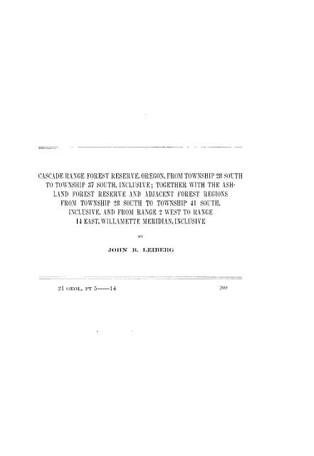
ILL UST Pt AT IONS.PLATE LXXI. Ashland sheet, Oregon, showing classification of lands - In atlas.LXXII Klamath sheet, Oregon, showing classification of lands ---- In atlas.LXXIII A, Summit of Siskiyou 3Mountains, near Sterling Peak. 1,Summit of Unmpqua divides, looking northeast <strong>from</strong> AbbotsButte -2216LX XIV. Map of part of <strong>south</strong>ern Oregon, showing distribution of sugarpine, noble fir, western hemlock, and incense cedar -24(LXXV. 1 and B, Yellow-pine type of <strong>forest</strong> near Johnson Prairie,western slope of Cascades -246LXXVI. Map of part of <strong>south</strong>ern Oregon, showing distribution of red firand alpine hemlock -248LXXVII A, Yellow-pine type of <strong>forest</strong>, east side of Williamson River,LTpper Klamath River Basin. B, Burned yellow pine, RogueRiver Valley, above Mill Creek -250LXXVIII. Group of red firs, Rogue River Valley, near Mill Creek -256LXX1X. A and B, Burned alpine hemlock, noble fir, and lodgepolepine, near head of North Fork of Rogue River- 276LXXX. Map of part of <strong>south</strong>ern Oregon, showing distribution of whitefir- <strong>28</strong>4LXXXI. A, Logging tracks and load near Snow, T. 40 S., R. 5 E. B,Method used in hauling logs <strong>to</strong> the logging railroad at Snow,T. 40SR. 5E ------------------------------------------ 296LXXXII. Map of part of <strong>south</strong>ern Oregon, showing distribution of yellowpine and white-bark pine -320LXXXIII. 1, Mount Pitt as seen <strong>from</strong> west end of Pelican Bay, Upper KlamathLake. B, Mount Pitt as seen <strong>from</strong> Fish Lake -406LXXXIV. Map of part of <strong>south</strong>ern Oregon, showina distribution of lodgepolepine ----------------------------------------------- 440217
CASCADE RANGE AND ASHLAND FOREST RE-SERVES AND ADJACENT REGIONS.Biv JOHN 1.LEIBERG.TOPOGRAPI1CAL FEATURES.The region discussed in this report consists of a tract of country inthe <strong>south</strong>ern portion of the State of Oregon, between longitude 1210and 123° west, and between latitude 420 and 433 45' north. It contains4,676,360 acres. It comprises the central and upper areas of theRogue and Klamath river basins, <strong>to</strong>gether with a small portion ofthe watershed of the Upper South Umpqua River.The region is divided in<strong>to</strong> two nearly equal portions by the main<strong>range</strong> of the Cascades, which strikes through it in an almost due north<strong>south</strong>direction. The two regions thus formed, the western and theeastern slope, present many very dissimilar characteristics in theirorographical and general <strong>to</strong>pographical features.REGION WEST OF THE CASCADES.The orographical features of the region west of the Cascade Rangeare the backbone and lateral ridges of that <strong>range</strong> chiefly, supplementedin the <strong>south</strong>ern areas by portions of the Siskiyou Mountains and theirnorthward-projecting spurs, and in the northern districts by the RogueRiver-Umpqua divide and its system of <strong>south</strong>erlv laterals.The Cascade Range is the principal mountain system. If we mayjudge <strong>from</strong> rock exposures in the region of the Upper Umpquaforks, the central core of the <strong>range</strong> is a broad, massive axis composedmainly of porphyry. It is, in most localities, overlain andcapped by immense deposits of volcanic rocks, lava of various ages,pumice detritus, lapilli, and the like. Its summit <strong>from</strong> Diamond Lake,the northernmost point of the region included in this report, <strong>to</strong> theCalifornia line is, broadly speaking, a plateau-like area with a meanelevation of 6,000 feet. Its width varies <strong>from</strong> nearly 10 miles in theregion <strong>south</strong> of Diamond Lake <strong>to</strong> 2 miles at the head of the MiddleFork of Rogue River, and <strong>to</strong> 4 miles a short distance north of KlamathGap. The summit plateau is capped in many localities by rocky219
220 FOREST RESERVES.combs, or is broken by short, steep escarpments, while here and thererise <strong>from</strong> it volcanic cones whose fires have long since become extinct.The slope stretching westward <strong>from</strong> the summit consists of a regionwith a mean elevation of 4,000 feet. Like the summit plateau of the<strong>range</strong>, it is covered mostly with volcanic rocks. It is not, however, alava-covered region throughout, as is commonly believed. The westernsections present many exposures of magnesian rocks and alongthe central areas of Dead Indian Creek these rocks are onlv verythinly covered by lava. The western slope is widely furrowed by thenumerous canyons which form the Rogue River drainage system.The slopes of the canyons are usually steep and rocky, but, with theexception of the tipper portions of the main Rogue River forks, thecanyons are of no great depth. Irregular crests and ridges, generallyof low elevation. separate the various canyons, which occasionallyexpand in<strong>to</strong> flats. All of these flats have the appearance ofhaving at sonie period been lake bot<strong>to</strong>ms formed by lava streamswhich temporarily dammed the different drainage channels.The entire tract here termed "the western slope of the main <strong>range</strong>of the Cascades" has a width of 35 miles. It rises abruptly, with asteep, bold front in the <strong>south</strong>ern portion, and not so steep in thenorthern, <strong>from</strong> a depression which forms a sort of dividing linebetween the eastern terminations of the Coast Ranges and the Cascades.The depression is in the form of a valley 4 <strong>to</strong> 5 miles widealong Bear Creek, an affluent of Rogue River.In the region under consideration the Cascade Range is cut in twoby Klamath Gap. The gap is a narrow canyon through which thewaters of the Upper Klamath region find their way <strong>to</strong> the ocean.In its canyon form the gap commences on the eastern side of the<strong>range</strong> at the point where Klamath River emerges <strong>from</strong> the marshesat the foot of Upper Klamath Lake. The upper portion of the canyon,which is all that comes within the scope of this examination,consists of a narrow trough varying <strong>from</strong> one-third <strong>to</strong> 14 miles inwidth and is excavated through a lava formation which evidently hereis of very great thickness. The slopes of the canyon are steep androcky, and the bot<strong>to</strong>m, in the upper portion of its course, is lut littlewider than the breadth of the stream. A few miles below the pointwhere the canyon crosses the <strong>south</strong>ern border of Oregon and entersCalifornia it attains a width of 2 miles or more. Klamath Gap issupposed <strong>to</strong> have been at some time a powerful fac<strong>to</strong>r in modifyingthe extensions of the flora of the Cascades and the Sierra, butthe upper portions of the gap are much <strong>to</strong>o narrow in many placesever <strong>to</strong> have formed an effectual barrier against floral migrations orextensions.Orographically Klamath Gap separates the Cascade Range <strong>from</strong> thenorthward extensions of the Sierra Nevada. If the gap did not exist
222 FOREST RESERVES.is in '. 84 S., R. 5 E. It consists of five craters grouped around acommon center and covering an area of 18 square miles. Its igneousactivity ceased ages ago, but while in operation there were emitted<strong>from</strong> its craters vast masses of a homogeneous type of lava whichflowed in all directions. It is one of the most ancient igneous centersin this portion of the <strong>range</strong>.Several of the extinct volcanoes now contain lakes in the formercraters. Such is the case in the locality mentioned above, but famousai)ove all others in this respect stands Crater Lake. This lake occupiesa deep depression on the summit of the <strong>range</strong>, nearly circular inoutline, hence crateriform. The depression is supposed <strong>to</strong> be due <strong>to</strong>the subsidence of a large peak or cone which formerly existed here,or <strong>to</strong> the rending asunder and subsequent violent depression of thepeak hy volcanic eruptions of great energy.The ejecta <strong>from</strong> the volcanoes have been of three general classes,namielv, lava of various compositions, pumice, and lapilli or smallfragments of rock which lack the coarsely cellular structure of thepumice. Much of the lava has apparentlyv come <strong>from</strong> fissures, butthe pumice and lapilli have been forced out through crateriform openings.In the categorv of ejecta must also be classed the laige quantitiesof brecciated lava which occur plentifully throughout the volcanicareas of the western slope. This material can not be traced <strong>to</strong> anycrater, but appears <strong>to</strong> have been forced out through fissures in athick plastic state. In its course <strong>to</strong> the surface angular fragments ofrock were <strong>to</strong>rn froni the fissured strata through which it was forced.These angular pieces of hard rock projecting <strong>from</strong> the surface of thelava by reason of unequal weathering make these brecciated masses conspicuousl-rough and uneven on their surfaces. While nowhere Cornprisinga very large area thev occur in so many localities that theiraggregate acreage is considerable. Remarkably hard and barren, andusually entirely devoid of soil covering, these breccias do much <strong>to</strong>wardthinning the average <strong>forest</strong> stands in the regions where they occur.The character of the lava ejected by the proper volcanic, vents va riesgreatly. The older lavas usually are hard and massive, but in somelocalities exhibit a short, irregular, thin slaty cleavage. The morerecent lavas, on the other hand, are extremely rough and vesicular.Between the two extremes are found innumerable modifications.The surface of the pumice deposit varies <strong>from</strong> a tine, almost ash-likedetritus, <strong>to</strong> coarse angular fragments a foot or more in diameter.Enormous quantities were ejected <strong>from</strong> every vent on the <strong>range</strong> northof the <strong>south</strong>ern boundary of <strong><strong>to</strong>wnship</strong> 34, bury ing- deeply the summitand immediate slopes. The pumice deposit extends westward aboutIS miles <strong>from</strong> the summit of the iange. It is, aiid has been, of importancein man- ways. It has filled tip the crevices and smoothed outthe asperities of many of the lava fields. It has filled the bot<strong>to</strong>ms
L.LIBEB(.. I CASCADE RANGE AND ASHLAND RESERVES. 223of many of the valleys, and has made large. level, and comparativelvfertile flats where otherwise would have been a narrow, rockytrough. As a water sponge its present importance is very great.South of Union Peak the pumice is more or less mixed with lapilli,consisting of porphvritic rocks. These lapilli appear <strong>to</strong> have beenblown out partly through the vent in that peak, and partly througha number of smaller cones situated between Union Peak and the headof the Middle Fork of Rogue River. Many of these lapilli are solittle altered by their passage through the throat of a volcano, that theiron sulphides, which they contain in great abundance, have not evenbeen desulphurized. The lapilli are exactly similar <strong>to</strong> the porphyrydikes which are found, uncapped by lava, throughout the region ofthe headwaters of the South Umpqua River, 30 <strong>to</strong> 40 miles northward.South of the Middle Fork of Rogue River the pumice deposits ceaseor become very thin and scattering. The crest of the <strong>range</strong> is a massof rough. uneven lava flows, in some places slightly smoothed over bydeposits of lapilli, which take here the place of the pumice detritusfarther north. The part played by the pumice in smoothing theasperities of the lava can nowhere be seen <strong>to</strong> better advantage than inthe marked contrast offered by the Cascades summit outside and withinthe pumice-covered area.Almost the entire drainage of the western slope finds its way in<strong>to</strong>Rogue River. The exceptions consist of a few small streams, merecreeks, in the <strong>south</strong>ern areas, which flow in<strong>to</strong> Klamath River.The chief forks of Rogue River are the North, the Middle, and theSouth. rI'he affluents which form the North Fork head partly in theRogue River-lImpqua divide and partly in the Cascades betweenMount Thielsen and Union Peak. The tributaries of the Middle Forkhead in the region between Union Peak and Klamath Point, while thosewhich form the South Fork rise on the slopes of the broad platformwhich skirts the base of Mount Pitt on the north, west, and <strong>south</strong>. Alarge portion of the drainage <strong>from</strong> the extreme <strong>south</strong>ern areas findsits wav in<strong>to</strong> the main river direct through Bear Creek, Indian Creek,the Big Butte Creek systems, and various lesser tributaries.The canyons of the North Fork which head in the Cascades rise inridges deeply covered with pumice and in flats which are sometimesgrassy and marshy. Many of the canyons are deeply excavated in thesoft an(leasily transported pumieeous material. In late years extensive<strong>forest</strong> fires have greatly accelerated the cutting process, which in timewill doubtless transfer most of the pumice covering of the western slopeof the <strong>range</strong> <strong>to</strong> lower levels. Although composed of such soft and loosematerial the slopes of the canyons in the pumice belt stand at a remarkab)lvhigh angle, so much so that in many localities they offer an impassablebarrier. The main stream of the North Fork runs through a
LEIBERG ] CASCADE RANGE AND ASHLAND RESERVES. 225deeply sunk between steep, rough lava flows. Near its head the canyonwidens in a few places and contains several lakelets. one of whichis 1i miles in length and 350 <strong>to</strong> 400 yards in width.Among the streams which flow directly in<strong>to</strong> the main channel ofRogue River the Big Butte and the Little Butte are the most noteworth.vThe former heads in the western and <strong>south</strong>ern areas of thebase of Mount Pitt. Its various tributaries are fed by large springswhich issue <strong>from</strong> beneath the lava fields that surround the peak. Itscourse lies partly through canyons which here, as elsewhere in theregion, are fashioned, as <strong>to</strong> their depth and character of slope, moreby the configuration of the inclosing lava flows than by the effectsproduced by stream erosion, and partly through series of broad flats,which furnish good grazing and agricultural facilities.Little Butte Creek heads partly in the <strong>south</strong>ern base of Mount Pitt,and partly in a series of large flats in T. 37 S., It. 3 E. The largest ofthe northern affluents has as its reservoir Fish Lake, a shallow sheet ofclear, cold water 4 <strong>to</strong> 5 feet in depth, 2 miles in length, and 400 <strong>to</strong> 500yards in width. Its water level, apparently not subject <strong>to</strong> much variation,is maintained by huge springs in the northeast corner, whichissue <strong>from</strong> under the mass of recent lava between Mount Pitt andMount Brown. The outlet of Fish Lake is through a narrow bot<strong>to</strong>minclosed bv banks 75 <strong>to</strong> 80 feet in height. It could readily be transformedin<strong>to</strong> a large reservoir. Little Butte Creek, although a smallstream, is of importance <strong>from</strong> the circumstance that its waters arelargely diverted for purposes of irrigation in the Rogue River Plain.The drainage which reaches Klamath River <strong>from</strong> the <strong>south</strong>ern areasflows mostly by way of Spencer and Jenny creeks, both small streamsof little importance.Portions of the summit of the <strong>range</strong> and the western slope owesome of their <strong>to</strong>pographic features <strong>to</strong> glacial erosion. In the pumnicecoveredareas glacial action was either feeble or al<strong>to</strong>gether wanting,except on the highest summits, or the effects of glaciation, if it didoccur, are hidden under the pumice. Where the pumice thins out, afew miles <strong>south</strong> of Klamath Point, the evidence of glacial action ismore apparent. The summit of the <strong>range</strong> and the eastern slope presenthere the most conspicuous evidences of the presence of glaciers.On the western slope the evidence is much more apparent. The ice<strong>to</strong>re out the rims of many of the craters and scooped out many littledepressions in the broad lava field which lies between Mount Pitt andthe head of Cherry Creek, on the eastern side of the <strong>range</strong>. Thesedepressions have filled with water and now are lakes. In other placesthe ice flowing down <strong>from</strong> the summit of the <strong>range</strong> excavated deepchannels on the eastern side and spilled its load of drift blocks andgravel at the mouths of the canyons opening on the edges of UpperKlamath Lake. But, on the whole, with the exception of the region21 GEOL, PT 5 15
226 FOREST RESERVES.centering around the group of five craters previously described, glacialerosion was feeble throughout the Cascades in this region. It is difficult<strong>to</strong> understand why glaciation was so much more active in theregion contiguous <strong>to</strong> this group of craters than elsewhere. Thethickness of the ice sheet here must have been manv hundreds offeet, and it must have existed for a long time. In its descent <strong>to</strong> lowerlevels it excavated a channel 1,000 feet in depth, which now forms thecanyon of Cherry Creek. All of the rocks over which it passed aredeeply marked with straight, broad grooves.SISKIYOU NIMOUNTAINS.The area of the Siskiyou Mountains described in this report comprises400 square miles, the greater portion of the <strong>range</strong> lying outsidethe limits of the present examination.Orographically the <strong>range</strong> forms a connecting link between the CoastRanges and the Cascades. In T. 40 S., R. 3 E., it swings out <strong>from</strong> theCascades in a westerly direction with a narrow, sharp curve, its porphyriesand serpentine rocks coming <strong>to</strong> the surface <strong>from</strong> beneath thelavas of the western slope of the Cascades. The inner or northerlycurve of the <strong>range</strong> presents a bold, steep, terraced front. The outeror <strong>south</strong>erly curve slopes away with a more gradual descent <strong>to</strong>wardthe Klamath Valley.Where it leaves the Cascades, the crest line has an elevation of5,200 feet. It is here a narrow backbone flanked by regions ofextremely irregular surface. Sharp, narrow ridges set off by conicalelevations and alternating deep saddles, with numerous intersectingravines and canyons, constitute the relief of the upper slopes of the<strong>range</strong> in this locality. In T. 40 S., R. I E., the crest line rises <strong>to</strong> aheight of 7,662 feet in a rocky elevation known as Siskivou Peak orAshland Butte, a prominent landmark for the surrounding region.From Siskiyou Peak westward the summit of the <strong>range</strong> is narrow,seldom widening <strong>to</strong> 400 yards, often a mnere hogback a few feet inwidth. The northern slope for the first 2,000 or 3,000 feet froni thesummit is steep and abrupt, and the <strong>south</strong>ern slope differs but littlein its gradients. The central miass of the <strong>range</strong> here, as where itleaves the Cascades, is composed of old eruptive and metamorphosedrocks, porphyries, serpentine, and granites. The lowest northernslopes are largely made up of talcose slates having a thinly laminatedstructure and resting on granites and porphyries. The volcanic conesand vents and the great lava flows and pumice deposits which are thepredominant features in the geology of the Cascades in this regionare absent <strong>from</strong> the Siskiyou AIountains.The streams flowing <strong>from</strong> the <strong>range</strong> lie in deep canyons whose originappears <strong>to</strong> be due chiefly <strong>to</strong> the erosive powers of water and ice.
U. S. OEOLOGICAL SURVEY TWENTY-FIRST ANNUAL REPORT PART V PL. LXXIIIA. SUMMIT OF SISKIYOU MOUNTAINS, NEAR STERLING PEAKBI. SUMMIT OF UMPQUA DIVIDES, LOOKING NORTHEAST FROM ABBOTS BUTTE.Ii
LEIBERG.] CASCADE RANGE AND ASHLAND RESERVES. 227Most of the larger canyons present clear evidences of the formerexistence of glaciers. Especially is this the case with the upper portionof the canvons which head in Sterling Peak, where the streamshave not yet removed or smoothed out the lateral and terminalmoraines which roughen the bot<strong>to</strong>ms of the valleys (P1. LXXIII, A).The streams usually rise in grassy glades; at least such is the rulewith those that head in the main <strong>range</strong>. Most of the glades are smallin extent; but a few of those which form the heads of the larger afluentsof Beaver and Humbug creeks, on the <strong>south</strong>ern slope, each containseveral hundred acres.The canyons which drain the northern slopes occasionally widen intheir lower portions and afford considerable tracts of agricultural andmeadow land.In this region the northern spurs of the Siskiyous stretch northward<strong>to</strong> a distance of 20 miles <strong>from</strong> the main <strong>range</strong>. They parallelthe steep front of the western slope of the Cascades, <strong>from</strong> which theyare separated by a strip of semiarid valley consisting of the basin ofBear Creek, a tributary of Rogue River.UMPQUA MOUNTAINS.The Umpqua Mountains comprise a wide strip of rough and ruggedcountry between the Rogue and Willamette rivers, and form the drainagebasin of Umpqua River. The examination extended only <strong>to</strong> aportion of the system which forms the divide between the upperreaches of the Rogue and South Umpqua rivers, comprising 350 squaremiles.The divide, so far as the examination went, consists of a porphyryaxis branching out <strong>from</strong> the Cascades in T. <strong>28</strong> S., R. 5 E., a littlenorth of the <strong>south</strong> end of Diamond Lake, an extinct volcanic coneknown as Old Bailey Mountain marking the point of departure. Itscourse is in a general westerly direction. Here and there, along thecrest and flanks of the divide, the porphyries, more or less altered byvolcanic heat, come <strong>to</strong> the surface. Generally, however, the moreancient rocks are covered up by deposits of the more recent Cascadelavas, but the blanket of lava is not so thick as along the western slopeof the Cascades, except near the angle of junction with this <strong>range</strong>.Most of the deposits of lava appear <strong>to</strong> have flowed <strong>from</strong> local fissures,except where the divide joins the Cascades. At this point volcaniccones, similar <strong>to</strong> those which occur elsewhere in that <strong>range</strong>, make theirappearance.The summit of the divide is in most places a narrow crest, a merehogback a few feet in width. Abbots Butte is, however, an exception.This elevation is situated directly on the main divide, but insteadof being a narrow crest it is a broad, terraced volcanic mass level
2<strong>28</strong> FOREST RESERVES.on its summit. Alternating deep saddles, where streams head andflow in opposite directions, and high, rocky, precipi<strong>to</strong>us elevationsmake up the crest line (P1. LXXIII, B).The streams flowing <strong>from</strong> the ranoe lie in deep canvonis. Near theirsources the slopes are steep and frequently nearly perpendicular. Atthe heads of the larger streams usually are small glades, while narrowstretches of level land exist here and there along the lower courses ofthe canyons, particularly along those which flow in<strong>to</strong> Rogue River.Tie general basin of the South Unmpqua is a broad east-west depression, with its bot<strong>to</strong>m consistinlg of a multitude of small canyons andcomparatively low rido'es the whole inclosed between high, roughdividing <strong>range</strong>s. The landscape is remarkably different <strong>from</strong> thatwhich characterizes the drainage basins elsewhere on either slopeof the Cascades in this region. On viewingo it in its entirety onereceives the impression that the area constitutes one of the prinialdrainage basins in the Cascades, one which was not affected by volcanicoutl)llrsts <strong>to</strong> the same extent as were the other adjacent areas, butremained comparatively free <strong>from</strong> the great outpourings of lava whichso often in the past changed the aspect of other areas on the westernslopes of the Cascade Range.REGION EAST OF THE CASCADES.The eastern slope of the Cascades presents a sharp contrast <strong>to</strong> thefeatures which disting'uish the western deelivities of the <strong>range</strong>. Thisis mostly due <strong>to</strong> the abrupt rise of the mountains and consequent shortnessof slope. Front F. 36 S. northward <strong>to</strong> the extent of the presentexaminatioii the distance <strong>from</strong> base <strong>to</strong> suimnit of the <strong>range</strong> in an airline is <strong>from</strong> 6 <strong>to</strong> 10 miles, as compared with a general average of 30miles on the western side. South of <strong><strong>to</strong>wnship</strong> 35 the main <strong>range</strong> issepairatedl <strong>from</strong> the plains' level by a short intermediate mountain massof voleanic origin, which fills rs. 37, 38, and 39 S., R. 6 E.. with agreat number of rough and rocky ridges.Thie decli-ities of the eastern slope are generally steep, rocky, andirregular, or somewhat terraced lava flows. North of T. 36 S. pum1icedeposits have smoothed out a great many of the lesser asperities. InT. <strong>28</strong> S., Is. 6 and 62 E., there is a broad, very gentle slope <strong>from</strong> theplains' level <strong>to</strong> the summit of the Cascades at the <strong>south</strong> end of D)iamondLake. forming one of the easiest passes in the ranie. The pass leads<strong>to</strong> the head of the North Fork of Rogue River.The canyons on the eastern slope are of two general classes: (1) shortand straight canyons, with abrupt slopes and descents; (2) longer canyonswith an oblique direction in their relation <strong>to</strong> the course of themain <strong>range</strong>, where they possess a more easy and gentle gradient. Theshort and straight canyons are chiefly eanyons of erosion. At theiropeninog. there is couinionly piled up a mass of bowider drift. The
LEIBERG.] CASCADE RANGE AND ASHLAND RESERVES. 229other variety consists of depressions due <strong>to</strong> the position and coursetaken by the inclosing lava masses in which the streams sometimeshave cut deep secondary canyons and gorges. Anna Creek, in Ts. 31and 32, R. 6 E., furnishes an example of the latter kind; while Threemile.Cherry, and Rock creeks, in Ts. 34 and 35, It. 6 E., are of theformer type.The region <strong>to</strong> the east of the Cascades forms, so far as our limitsgo, the upper drainage basin of Klamath River. The orographicalfeatures of the region consist of: (1) the Klamath-Deschutes divide;(2) many volcanic ridges of varving altitude, which are more or lessconnected, some of which intersect the basin in a north-<strong>south</strong> direction,while others intersect in an east-west direction.The Klamath-Deschutes divide branches out <strong>from</strong> the Cascadesapproximately in T. 26 S.. R. 7 E. It swings around <strong>to</strong> the <strong>south</strong>wvardand constitutes a span bridging Klamath Gap. The ridge is ofvolcanic origin, is extremely ancient, and may at some past time havebeen of much greater altitude. If so it would constitute a sort ofhighwav for migrations of animals and plants <strong>from</strong> the northernSierras <strong>to</strong> the Cascades, and vice versa.The volcanic character of the ridges which intersect the Klamathdrainaoe basin in this region has already been alluded <strong>to</strong>. Some ofthese ridges have been built up around volcanic vents, others arei rretrular masses whose origin perhaps is <strong>to</strong> be sought in earth fissures.Trhe entire basin seems originally <strong>to</strong> have been a plateau area. Thelava outflows inclosed manv flats, which in time became lakes. Mos<strong>to</strong>f these lakes have been drained bv their waters cutting channelsthrough the lava dams. Others are in various stages <strong>from</strong> marshes<strong>to</strong> shallow lakes.Extinct craiters abound. Some formed parts of long <strong>range</strong>s, orrather were the centers <strong>from</strong> which flowed long streams of lava. Suchare Yamsay Peak, Swan Lake Point, Fuego Mountain, Yainax Butte,and various unnamed craters in the Black Hills. Others occur asisolated conical hills scattered throughout the region. Some of thelava flows which came <strong>from</strong> these vents spread out over the region invast, flat sheets, others are heaped up in ridged and terraced masses.The io'neous activity in the basin is not yet al<strong>to</strong>gether quenched. Thehot springs in the <strong>south</strong>ern areas, which frequently lie in long lines,indicate that there are many pressure lines and fissures which are notvet closed.r'l'e northern area and much of the central are covered with a laverof pumlice. Some of the pumice came <strong>from</strong> vents in the Cascades,much of it was ejected <strong>from</strong> craters in the basin, notably <strong>from</strong>those in the Yamsay Range. Near the Cascades the pumice depositundoubtedly is very thick. In the eastern and <strong>south</strong>eastern areas ofthe basini it is thin, in some places not more than 4 <strong>to</strong> 8 feet in thickness,imuch of it evidently having been washed awav.t~~~~
230 FOREST RESERVES.The plain or depression which stretches along the base of the Cascadesin this region is comparatively narrow, varying <strong>from</strong> 10 <strong>to</strong> 15miles in width. It consists of two distinct terraces, a northern and a<strong>south</strong>ern, the former elevated about 400 feet above the latter. Theterraces connect through the valleys of Williamson and Sprague riverswith the terrace or plain which borders the central areas of SpragueRiver. Through the valley of Sycan River the Sprague River terraceconnects with the lesser level areas which form Sycan Marsh andadjacent regions. The connection between each of these terraces isinvariably through a stretch of narrow canyon which represents a cutthrough a lava flow.The <strong>south</strong>ern terrace in front of the Cascades comprises the basinsof Upper Klamath Lake with the adjoining marshes, <strong>to</strong>gether with aportion of Lower Klamath Lake and a level valley area along thelower portion of Lost River. This terrace contains 450 square milesand extends <strong>from</strong> the northern line of T. 33 S. <strong>to</strong> the Oregon-Californialine.Upper Klamath Lake is mostly a shallow body of water. It is alake chiefly because the lava flows at its foot and at the point nearPlevina where Klamath River leaves the marshy areas have not beencut down sufficiently <strong>to</strong> drain the lake. If the falls in Klamath Riverwere lowered a few feet the greater portion of Upper Klamath Lakewould become dry.The upper terrace is separated <strong>from</strong> the lower by a broad, thicklava flow, which stretches <strong>from</strong> northwest <strong>to</strong> <strong>south</strong>east, and possiblymay have come <strong>from</strong> Mount Scott or adjacent craters. The lava flowcreated a large lake, of which all that remains is Klamath Marsh, mos<strong>to</strong>f its area having been drained by the Williamson River cutting acanyon through the lava flow at a point 8 miles east of Fort Klamnath.The tipper terrace stretches northward <strong>to</strong> the Klamath-Deschutesdivide. Eastward it extends <strong>to</strong> the foot of the Yamsav Range, whichit follows <strong>south</strong>ward along the western base <strong>to</strong> the head of WilliamsonRiver.Tlme pumice covering both on the upper and on the lower of these terrtaceswas deposited when they were deeply covered with water. Thepresent smoothness of their surface, only roughened by ancient beachlines along higher levels and by the courses of modern streams, provesthis. Some of the pumlhice appears <strong>to</strong> have been thrown out as fineparticles. Much of it came as large, coarse fragmv-ents or bowlders afoot or more in diameter.The Sycan terrace is situated east of the Yamsav Range and has anelevation of 5,000 feet. It likewise was a lake in past geologic times.It was formed bv a lava flow which cattle <strong>from</strong> a crater, now extinct,situate(l in the Fuego Range. Sycan River has cut through theobstruction, the lake has been drained, and a swampy tract known asSycan Mlarsh now remains.
LEIBIRGU.] CASCADE RANGE AND ASHLAND RESERVES. 2:31The Sprague River terrace consists of an area bordering SpragueRiver westward <strong>from</strong> the junction of its main forks. It coversan area of 260 square miles. As in the case of the other terraces, theSprague River area was once a lake bot<strong>to</strong>m. The lake owed its origin<strong>to</strong> a lava flow <strong>from</strong> the volcanic centers near Swan Lake Point. Muchof this terrace has been denuded of its pumnice covering and the underlyingrough lava is brought <strong>to</strong> view or it is covered with gravel andsmall bowlders. The terrace is a semiarid region.Here and there throughout the entire Upper Klamath Basin arescattered smaller terraces or flats more or less completely surroundedby thick lava flows. One of the larger is Swan Lake Valley. This isa level tract inclosed by lava flows which came <strong>from</strong> Swan Lake Point.It is remarkable for a thick deposit of dia<strong>to</strong>maceous earth, whichunderlies the entire flat at a depth of a few feet.The higher points in the region show marks of light glaciation, butthe terraces and flats show no clear evidences of the scoring or wearingeffects of ice. Here, as in the Cascades, the smoothness of thepumice deposits proves either that glaciation preceded their depositionor that the region has not at any time been subject <strong>to</strong> the actionof ice. The removal of the pumice down <strong>to</strong> the underlving lava onthe Sprague and Sycan terraces is due <strong>to</strong> local effects of drainage.The streams in the region flow mostly in shallow canyons. Theexceptions are at the points where they have cut their way throughlava flows stretching across their courses. Some of the streams, suchas Sprague River, have excavated their beds <strong>to</strong> a depth of 20 <strong>to</strong> 80feet below the general level of the terrace through which thev flow,and have one or two narrow benches in their troughs <strong>to</strong> mark thestages of the erosive process. Owing <strong>to</strong> the volcanic nature of theregion and the numerous fissures in the lava bed rock a great manyof the streams flow irregularly. Many of them sink and disappear,only <strong>to</strong> be forced <strong>to</strong> the surface at some other point. WillianmsonRiver and, in part, Svcan River head in large springs which suddenlyburst out with great force <strong>from</strong> under thick masses of lava of theYamsav Range. Such is also the case with Crooked River and FortCreek, streams near Fort Klamath, and with many other lesser creeks.CLIMIATIC COND [lIONS.Broadly stated, the general climatic features, as regards precipitation,may be referred <strong>to</strong> two classes: first, areas with an abundance ofprecipitation; and, second, areas characterized lv semiariditv. or alow ratio of rainfall. The former are characteristic of the westernslope of the Cascades, the latter of the eastern, but the <strong>range</strong> isby no means a strict dividing line in all cases, as areas possessingeither feature are found on both sides of the <strong>range</strong>.
232 FOREST RESERVES.Local conditions modifv the precipitation. The chief of these existsin the relief of the region, and altitude is the more prominent fac<strong>to</strong>rhere. We thus have on the western slope true semiarid conditions inthe low-lking vallevs, and on the eastern slope, at high elevations,decidedly humid ones. Both the western and eastern slopes mav,therefore, be divided in<strong>to</strong> semiarid, subhumid, and humid belts.WESTERN SLOPE.SEMIARID REGION.Areas of this character occur here under two aspects: first, thosenaturally semiarid; and, second, such as have assumed this conditionthrough the agency of man.The first of these have their origin in the relief of the country, andpossibly in slow climatic changes taking place over the entire westernslope of the Cascades and connecting <strong>range</strong>s along the coast. Theyare permanently semiarid, and, if the climatic hypothesis be true, theyare gradually enlarging their area.The second, induced through conditions created by the agency ofman, probably are only of temporary duration.The larger naturally and permanently semiarid tracts on the westernslopes of the Cascades in this region consist of: (1) the area of depressionsituated between the spurs projecting northward <strong>from</strong> the regionaround Siskivou Peak and the terminations of the western spurs of theCascades; (2) the areas embraced in the lower and middle slopes onthe western spurs of the Cascades, where they front on the above-Idescribed depression; (3) a considerable tract among the Siskiyouspurs fronting on North Fork of Applegate Creek; and (4) areasbordering Rogue River in Ts. 35 and 36 S., Is. 2 and 1 W. and I E.The annual precipitation on these tracts probably does not exceed15 inches. They are all characterized by having a small amount ofarboreal vegetation. mostly confined <strong>to</strong> the banks of the water courses.Thev carry scattered copses of black oak (Qaercas cal;fOr i(ca) andwhite oak ((Q. /uti/Cya na), interspersed here and there by stands offrutescent or, rarely, arborescent madrofla (- 2 rbutms menezicesi), andwith dense thickets of brush largely composed of chaparral ( Ceancot/ius(HctlR~tits/.).The lowest elevation of the semiarid tracts is approximately 1,600feet. From this level the curve of semiaridity rises <strong>to</strong> a height of4,000 feet on the terminal declivities of some of the western spursof the Cascades, as, for example, on the <strong>south</strong>western slopes of theGrizzl- Range north-northeast <strong>from</strong> Ashland, and <strong>to</strong> 4,800 feet onvarious of the Siskiyou spurs borderinlg Applegate Creek. Wherethe curve of semiaridity crosses the Siskivons main <strong>range</strong> and connects
LEIBERG.] CASCADE RANGE AND ASHLAND RESERVES. 233with the semiarid region northwest of Mount Shasta. through canyonsand over low ridges east of Pilot Knot), it rises <strong>to</strong> altitudes of 6(,00feet.There are no points in this region where the semiarid tracts west ofthe Cascades join those situated east of the <strong>range</strong>. Not even throughKlamath Gap is there a wholly uninterrupted connection: for KlamathGap, where the river breaks through the orographic backboneof the Cascades, lies in a region that must be classed as subhumid atleast.The tracts on which a condition of temporary semiaridity has beenartificially induced consist chiefly of old or recent burns in the <strong>forest</strong>edsubhumid areas. They are scattered over the entire slope, butare most numerous and of largest extent in Ts. 31, 32, 33, 34, and 35 S.,E. 4 E., where they collectively cover an area of 50,000 acres. It isimpossil)le <strong>to</strong> say with absolute certainty that the tracts just mentionedare semiarid as a temporary condition only. They are slopes andsummits denuded of their <strong>forest</strong> covering forty or forty-five vears agothrough the medium of severe fires. They are now covered withbrush growths composed of species characteristic of semiarid lands,and their aspect is exactly like that of the semiarid chaparral slopesof California. Areas having similar characters, but not so large, occurin Ts. 38 and 39 S., Rs. 4 and 5 E. There is at least an even chancethat such tracts will not again re<strong>forest</strong>, in which event they will onstituteevidence proving the northward advance of the arid conditionsprevalent in the regions farther <strong>south</strong>.SUBHUMID REGION.ualThe subhumid region includes the slopes and summits of the Siskiyou,Umpqua, and Cascade <strong>range</strong>s, between elevations of 3,000 and6,000 feet, with the exceptions detailed under semiarid tracts. Theprecipitation is unknown <strong>to</strong> me, and there are probably no dataavailable as <strong>to</strong> the quantity. The <strong>forest</strong> growth indicates <strong>from</strong> 35<strong>to</strong> 50 inches, according <strong>to</strong> elevation. The region is characterizedthroughout by <strong>forest</strong>ed areas with stands of timber varying <strong>from</strong>moderately heavy <strong>to</strong> dense.HUMID REGION.The humid region comprises slopes and summits above the 6,000-foot con<strong>to</strong>ur. The annual precipitation is unknown <strong>to</strong> me, but itcertainly reaches considerably above 50 inches. The lower portionscarry- <strong>forest</strong>s similar <strong>to</strong> those which occur on the higher tracts of thesubhulmid slopes; the higher bear subalpine growths of trees andother vegetation, with here and there a peak projecting above thelimit of trees.a~~~~~~~~~~~~~~~~~~~~~~~~~~~~~~~~~~~~~~~~~~~~~~~~~~~~~~~~~~~~~~~~~~~~~~~~~~
234 FOREST RESERVES.EASTERN SLOPE.SEMIARID REGION.The semiarid lands east of the Cascades in this region occur ehieflyin the interior of the Klamath Basin. They just <strong>to</strong>uch the easternbase of the <strong>range</strong> in Ts. 39 and 40 S., Its. 8 and 9 E. They stand inintimate relationship with areas of like character <strong>south</strong> beyond theeastern Oregon border through various valleys and depressions, suchas Lost River and its tributaries. Their extension northward ceaseson the Sprague River terrace. They are characterized by the growthof various desert shrubs and bv the occurrence of scattered smallstands of western juniper.With the exception of the tracts mentioned as occurring in <strong><strong>to</strong>wnship</strong>s39 and 40, none of the areas at the immediate base of the Cascadescall nowv be considered as truly semiarid. But the region comprisedwithin the limits of the Klamath Marsh terrace shows decided tendenciesin that direction. The leaning <strong>to</strong>ward semiarid conditions isthere shown by deficient re<strong>forest</strong>ation of burned tracts in the lodgepolepinestands, and the evident tendency of such places <strong>to</strong> become coveredwith a growth of desert shrubs or grasses in place of the former<strong>forest</strong>.The semiarid tracts of the Klamath Basin east of the Cascades coinprisein the aggregate, so far as they come within this region, 800square miles. The annual precipitation is about 15 inches.SUBHIUMID REGION.The larger portion of the area in the Upper Klamath Basin is distin(tlva subhumid one. Without knowing the actual precipitationin the region, its actual status on this point is therefore more orless guesswork, but, judging <strong>from</strong> the density of <strong>forest</strong> growth. Iwould place it at the same horizon as in the areas between the :3.000-anid 4,200-foot con<strong>to</strong>urs along the fronts of the western spurs of theCascadcs--that is, i.5 <strong>to</strong> 35 inches per annum. The subhumid conditionbecomes possible only by reason of the numerous ridg'es scatteredthroughout the basin, which give <strong>to</strong> much of it a mean altitude ofbetwveen 5,000 and 6j,00 feet.The areas are Characterized by extensive stands of <strong>forest</strong> of mediumd(ensitv with a vigor of growth not inferior <strong>to</strong> that possessed 1wy sImilarstands wvest of the Cascades.HUMID REGION.TPle strictly humid areas are of small extent. They are limited <strong>to</strong>tracts along the main <strong>range</strong> of the Cascades and <strong>to</strong> the high peaks ofthe Yamisav and Geauhart <strong>range</strong>s in the interior regions of the basin.
LEIBERG] CASCADE RANGE AND ASHLAND RESERVES. 235Thev are characterized bv moderate, light, or very thin stands of <strong>forest</strong>of subalpine types and bv the low, shrubbv, and herbaceous vegetationbelonging <strong>to</strong> tracts of high altitude in this region.I have no temperature data for any portion of the region either wes<strong>to</strong>r east of the Cascades. None of the high peaks have a permanentsnow line on all sides. On the summit of Mounts Pitt and Scott thereis conllmonlv some snow on the northern slopes throughout the year.Occasionally, deep drifts in shady ravines on the other slopes persistthrough the summer, but the rule is that <strong>south</strong>ern and western exposureson even the highest peaks are free of snow during a portion ofthe year.FOREST CONDITIONS.SPECIES.The <strong>forest</strong> is overwhelmingly coniferous. This is especially thecase on the areas east of the Cascades, where broad-leaved speciesof trees form but a fraction of 1 per cent of the <strong>forest</strong> stands, andwhere two conifers, the yellow and the lodgepole pine, <strong>to</strong>gether constitute88 per cent. West of the Cascades broad-leaved trees occurmore plentifully, forming, on a numerical basis, about 6 per cent ofthe entire <strong>forest</strong>; and while among the conifers two species. theyellow pine and the red fir, particularly predominate, there is also awider <strong>range</strong> of ratios among the balance than is found on the easternside of the <strong>range</strong>.The following species of coniferous trees form the sylvan elements,and in many and varied ratios and groupings make up the <strong>forest</strong>s andits component types:Coniferous trees in C'ascade Range Reserve and ad~jacdnt terri<strong>to</strong>ry, Oregon2.N'ellow pine-Pinus ponderosa.Sugar pine-Pinus lambertiana.White pine-Pinns mnonticola.White-bark pint -Pinusalbicaulis.Lodgepole pine-Pinus inurrayana.White firAbies concolor, including transitionalforms <strong>to</strong> the northern Abiesgrandis.Amnabilis fir-Abies ainabilis.Noble fir-Abies noltilis.Alpine fir -Abieslasiocarpa.Red fir -Pseudotsugamnicronata.Incense cedar -Libocedrusdecurrens.Alaska cedar -Chanocvyparisnootkatensis.Western hemlock -Tsugainertensiaia.Alpine hemnlock -Tsugapat<strong>to</strong>nii.Engelmanin spruce -- Picea engelinanni.Pacific yew -TaxusbrevTifolia.Western juniper -Juniperusoccidentalis.
23$ FOREST RESERVES.Amnong the various species of broad-leaved trees the following areabundant enough <strong>to</strong> become conspicuous fac<strong>to</strong>rs in the <strong>forest</strong>:Browel-lea red trees in Cascade Range Reserre awdl adjacent terri<strong>to</strong>ry, O9regon.California black oak - - Quercus californica.Pacific post oak -Quercus garryana.Madroia -Arbutusmienziesu.Oregon ash -Fraxihus<strong>oregon</strong>a.Oregal-n maple-Acer macrophyllum.Red alder -- inus <strong>oregon</strong>a.Mountain mahogany-Cercocarpus ledifolius.Birch-leaf mahogany --ercocarpus betuloides.Goldeni-leaf chinquapin -astanopsischrysophylla.Oreron crab -Malusrivnlaris.Aspen- -Populus treimuloides.Balsam -Populusbalsamifera.Black cot<strong>to</strong>nwood -'opulustrichocarpa.Pale elder -Sainbuctusglauca.In addition <strong>to</strong> the species enumerated there occur various kinds ofwillow, hawthorn, plum, and cherry.In the svlva of the eastern and western side of the Cascades collectivelv,the broad-leaved trees constitute 6.5 per cent, on a numericalbasis, including individuals with basal diameters of 4 inches andupward. On the western side, the oaks, madrofla, and chinquapin,when estimated on a similar i)asis, form a per cent.Although the broad-leaved trees show an appreciable percentage ofthe <strong>forest</strong> when estimated by their numbers, they sink in<strong>to</strong> utter insignificancewhen the relative timber volume is compared with the coniferousgrowth. Owing <strong>to</strong> the circumstance that timber estimateshave so far been made only on the basis of diameters and lengthssuitable for mill timbers expressed in feet board measure instead ofcubic contents. the broad-leaved species have been excluded <strong>from</strong> theestimates. It is, therefore, not possible <strong>to</strong> state in any but the mostgeneral figures the relative proportion in volume between the broadleavedand the coniferous growths. From various data obtained inthe cruisings during the current year I should place the relative proportionof the two divisions of the sylva in the ratio of 1 <strong>to</strong> 0.001, or,in other words, for every cubic foot of timber derived <strong>from</strong> broadleavedspecies there are 1,000 cubic feet of timber of coniferous species.Were it not for the considerable oak and madrofia growth on thelow-lWing semiarid and contiguous regions in the Middle Rogrue RiverBasin the broad-leaved species would not show anywhere near so largea ratio. On areas situated within the middle and upper elevations andthroughout the <strong>forest</strong>ed regions east of the Cascades the timber volunieof species other than conifers is excessively small.The followingtables give the ratios between the different componentswhich compose the coniferous <strong>forest</strong>. They arc based upon
LEIBERG.] CASCADE RANGE AND ASHLAND RESERVES. 237numerical proportions and not upon the timber volume, and includetrees with basal diameters of 4 inches and upward. Thie tables arecompiled for the purpose of indicating the proportions of the elementsforming the established <strong>forest</strong> growth at the present time, within thedimensions specified. The numerical status of a species in the earlystages of growth is determined in this region by its environments asregards shade, and by the multitudinous modifications and departures<strong>from</strong> the composition of the original growth on areas undergoingre<strong>forest</strong>ations after fires. The numerical proportion of the <strong>forest</strong>components is never, in this region, a fixed matter. The older thestands, the less change there is in their composition up <strong>to</strong> a certainage limit, which varies with the life fac<strong>to</strong>r in the general duration ofthe species. For this reason were we <strong>to</strong> adopt a higher or a lowerstandard than 4 inches it would very materially change the proportionsof the different species.Reletive proportions of coniferous species foroing the <strong>forest</strong> on the wvestern slope qf the(Coscades.Per cent.Icr clt.Yellow pine- 27. 5 Noble fir - 5. SSugar pine - 2.8 Alpine fir - 2White pine - 36 Western hemlock -1White-bark pine - - 03 Alpine hemlock -6. 5Lodgepole pine -6.3 Engelinann spruce . 6RIted fir -44. Incense cedar- .41White fir- 5.4Ainabilis fir and Alaska cedar are two species which occur in thereoion, but are so few in numbers that they are quite inappreciable inthe bulk of the <strong>forest</strong>.From the above table it will be seen that two species, vellow pineand red fir, <strong>to</strong>gether constitute 71.5 per cent of the coniferous <strong>forest</strong>.It is generally supposed that the red fir is greatly the superior of allother species in this region. The contrary, however, is the case, theexcess over the yellow-pine component being only 16.5 per cent. Thecause lies entirely in the oft-repeated <strong>forest</strong> fires which sweep throughthese wooded areas. The seedlings and young trees possessing thegreatest fire resistance survive, the others die. In its capacity <strong>to</strong>endure fire and survive the yellow pine is greatly the superior of allthe other conifers in this region.The large ratio of lodgepole pine is wholly owing <strong>to</strong> extensive firesin the subalpine areas, which have destroyed large and dense growthsof alpine hemlock and noble fir, and have induced soil conditionsexceptionally favorable <strong>to</strong> re<strong>forest</strong>ation by lodgepole pine.Sugar pine, white pine, Engelmann spruce, and incense cedar arespecies which have an extensive <strong>range</strong>, but do not reproduce themselves abundantly; hence the low ratio.White-bark pine, alpine fir, and western hemlock are trees whose-~~~~~~
238 FOREST RESERVES.<strong>range</strong> is circumscribed. The two former belong <strong>to</strong> the upper limit ofthe subalpine areas; the latter is of scattered occurrence in a few favorablelocalities, apparently, in this region, being near its <strong>south</strong>ernlimits.Relative proportions of coniferous species forming the <strong>forest</strong> on the eastern slope of theCascades.Per cent.Per cent.Yellow pine..............- 68. Noble fir -.-.-.- 5Sugar pine - 9 Alpine fir - 02White pine ------ 05 Western hemlock - Lacking.White-bark pine - ..... 01 Alpine hemlock - 1.Lodgepole pine - 22. 6 Engelmann spruce - 25Red fir -.--------------- 1.22 Incense cedar .-75White fir 3. 7 Western juniper -1.It will be noticed that the yellow pine easily ranks above all of theother species either singly or combined. The reason for this lieschiefly in the smaller annual precipitation on the subhumid areas ofthe western slope. The large proportion of lodgepole pine is chieflydue <strong>to</strong> <strong>forest</strong> fires. At least 90 per cent of the species owes its growth<strong>to</strong> this cause. The remainder occurs as the first <strong>forest</strong> covering onareas gradually being laid bare along margins of marshes and lakesby the lowering of their waters.GEOGRAPHICAL DISTRIBUTION OF SPECIES.With the exception of amabilis fir and Alaska cedar all of the conifersof the western slope are also represented on the eastern side ofthe Cascades; nor are they confined <strong>to</strong> the immediate eastern declivitiesof the <strong>range</strong>. With the exception of alpine hemlock, westernhemlock, noble fir, and Engelmann spruce, they are found at manyintermediate points between the Cascades and the Klamath-Deschutesdivide, and it is not at all unlikely that further explorations may discoverthe four missing species on some of the subalpine elevationsalong that divide.T'lie yellow pine is the most widely distributed of the species. Occurringeverywhere throughout the western slope within its altitudinallimit, it crosses the Cascades in a broad belt through Klamath Gap inTs. 39 and 40 S. and in narrow scattered groves or in thin lines <strong>south</strong>of Lake of the Woods, in Ts. 38 and 37 S., following <strong>to</strong> Pelican Bayof Upper Klamath Lake the depression which exists between theCascades main <strong>range</strong> and the group of high mountains west of AspenLake. Having reached the eastern base of the Cascades, the speciesfollows the foot of the <strong>range</strong> northward <strong>to</strong> the <strong>south</strong>ern boundary ofthe Klamath Marsh terrace, whence in a broad sheet it spreads ou<strong>to</strong>ver the entire Upper Klamath Basin.The sugar pine is more restricted in its <strong>range</strong>.Confined on the
LEIBERG.] CASCADE RANGE AND ASHLAND RESERVES. 239western slope within narrower limits than the yellow pine, it crossesthe Cascades through Klamath (Gap. The distance between its easternand western extensions in the Lake of the Woods depression is notmore than 10 miles, and it is not impossible that scattered trees mayoccur in the short interval that separates the two. From where thesugar pine enters the Upper Klamath Basin through the gap it continues<strong>to</strong> entend northward, following closely the foot of the <strong>range</strong>and the lower edges of its middle elevations. In T. 33 S. it meets a<strong>south</strong>ward extension coming <strong>from</strong> the Deschutes Basin. Headingthe terrace of the Klamath lakes in T. 32 S., the sugar pine turns<strong>to</strong>ward the <strong>south</strong> and follows the broken lava plateau which joins thevolcanic areas around Swan Lake Point with those in the Cascades<strong>south</strong>east of Mount Scott. A few miles <strong>south</strong>east of Swan Lake Pointthe sugar pine thins out and disappears. Its next appearance in theKlamath Basin, within this region, is on the slopes of the YamsayRange. It is here an offshoot <strong>from</strong> the mass of sugar pine whichclosely hugs the Klamath-Deschutes divide <strong>from</strong> its junction with theCascades <strong>to</strong> some point in northern California outside of the areaunder consideration. From the Yamsay Range the species takes a<strong>south</strong>erly course <strong>to</strong> the region around Fuego Mountain in T. 33 S., andturning <strong>to</strong>ward the east it becomes abundant enough <strong>to</strong> be reckoned asa fac<strong>to</strong>r in the mill-timber supply on the areas around the Black Hillsin T. 34 S., Rs. 12 and 13 E. Continuing eastward it joins the standsof the species on the Klamath-Deschutes divide in the region of GearhartMountains.The white pine is not a tree of plentiful occurrence on the westside of the Cascades. Beginning with the Siskiyou Mountains, it isfound here and there on the higher slopes between Siskivou Peak andSterling Peak. Between its habitat here and its <strong>range</strong> in the <strong>south</strong>ernareas of the Cascades is a wide gap. In the upper region of the basinof the South Umpqua the species is relatively abundant. From hereit continues <strong>south</strong>ward along the flanks of the Cascades, rarely extendingmore than 14 miles west <strong>from</strong> the sunmit, <strong>to</strong> the northernboundary of T. 39 S., R. 5 E., where it thins out and disappears. Itcrosses the Cascades in inanv localities between Diamond Lake and its<strong>south</strong>ern limit in <strong><strong>to</strong>wnship</strong> 39, and extends down the eastern slope <strong>to</strong>the 5,000-foot con<strong>to</strong>ur line in many places. It is not found in theregion of the Upper Klamath Basin within this area, but a few miles<strong>to</strong> the east in the Gearhart Mountains the species again appears.The white-bark pine, being strictly a species of the upper limits ofthe subalpine areas, has a wide <strong>range</strong>. but is confined within narrowaltitudinal limits. In the Siskivou Mountains the species is nearlyabsent. A few score individuals in a group between Siskiyou Peakand Sterling Peak constitute all that were seen. Along the Ump(qua-
240 FOREST RESERVES.Rogue River divide a few individuals were observed on the highestsummnits. The region of its greatest density is along the summit ofthe Cascades, where it forms the true timber-line tree on peaks likeMounts Pitt and Scott at elevations of 9.400 <strong>to</strong> ),500 feet. In theinterior of the Upper Klamath Basin it occurs Oin YamIsav Range andon high ridges in the Klamath-Deschutes divide.The lodgepole pine is a species with a <strong>range</strong> which extends throughoutthe entire region examined. St<strong>range</strong>ly enough, it is not very plentifuleither in the Siskiyou or in the Umnpqua Mountains except wherethe latter ransge joins the Cascades. Its chief habitats are on thehigher and summit areas of the Cascades, where it forms a very laroeproportion of areas re<strong>forest</strong>ed after fires, and evervwhere in the interiorof the Upper Klamath Basin. except on distinctly semiarid tracts.rrhe red fir is abundant on the western slopes of the Cascades, in theSiskivou Mountains, and in the Unmpquas between elevations of 2,500and 6,200 feet. Below the 2,500-foot con<strong>to</strong>ur the growth is thin andscattering, but the species is never wholly lacking over any (considerablearea outside the distinctly semiarid, low-lvina tracts. Itcrosses the Cascades thro'ugh Klamath Gap and through the depression<strong>south</strong> of Mount Pitt in T. 36 S. On the eastern side of the Casca(lesit follows the foot and lower slopes of the <strong>range</strong> northward <strong>to</strong>the <strong>south</strong>ern edge of the Klamath Marsh terrace. Here the growthis thin. the species occurring as low, gnarled individuals widely dispersedamong the masses of yellow pine. The species does not extendnorthward <strong>from</strong> this point, but heading the north end of Upper KlainathLake and turning eastward it follows the higher lava flows <strong>south</strong>ward<strong>to</strong> the region around Swan Lake Point. On the eastern slopes of thispeak the tree is fairly abundant. but of small dimensions. It thins(lout and disappears completely 4 miles <strong>south</strong> <strong>from</strong> Swan Lake Point,but reappears on the divides at the head of Lost River. It is notfound elsewhere in the interior of the Klamath Basin, nor do I knowof its occurrence on the Klamath-Deschutes divide.rvhc white fir occurs throughout all of the areas examined west ofthe Cascades below the 64000-foot con<strong>to</strong>ur line. It crosses the <strong>range</strong>in miany places between the canyon of Klamath River and Mount Pitt,but scarcely north of this peak. On the eastern slope it follows the<strong>range</strong> <strong>to</strong>ward the north, and beyond the head of Upper Klamath Lakeit spreads out over the entire <strong>forest</strong>ed area of the UTpper KlamathBasin above elevations of 5,000 feet.The noble fir is a species with its home chiefly among the higherelevations. It reaches its greatest dimensions at the lower levels ofthe subalpine <strong>forest</strong>. Within its proper altitudinal limits the speciesoccurs everywhere on the areas west of the Cascades. It crosses the<strong>range</strong> freely, except in Klamath Gap, and on the eastern slope extends<strong>from</strong> 2 <strong>to</strong> 6 miles <strong>from</strong> the summit. The species is absent <strong>from</strong> the<strong>range</strong>s in the interior of the Upper Klamath Basin.
U.S. GEOLOGICAL SURVEYPART OF SOUTHERN OREGON SHOWINNO DIST! UBUTION OF SJGAR PINE, N.......11[1i_ I ;,P zdSi*ar, pineNoble firPrepared underL_ LS .-the direction of Ieinry GanneuGeoBy f JOE1B. LEER* I Scale2 y ~ ~ B W 32 1~CoiAourinterval- 18990O feet7
LEIBER(G.] CASCADE RANGE AND ASHLAND RESERVES. 241The alpine fir is a tree of the high altitudes, and therefore is echieflycontined <strong>to</strong> subalpine areas. It occurs plentifully everywhere on thesummit of the Cascades, less so on the tlnpqua-Rogue Rivcr divide,while on the Siskiyou Mountains, so far as examined, it is nearlyabsent. I have no knowledge of its occurrence cast of the Cascadesin this region, except on the immediate declivities of the main <strong>range</strong>.The western hemlock is found on the western side of the Cascadesin scattered localities <strong>from</strong> Mount Pitt <strong>to</strong> Mount Thielsen, but nowhereverv abundant. It is more plentiful on the northern slopes of theUmnpqua-Rogue River divide than elsewhere. It is absent <strong>from</strong> theSiskiyou Aountains. In the region around the <strong>south</strong>ern base of MountPitt scattering trees of the species cross over <strong>to</strong> the eastern side ofthe Cascades and form a small percentage of the <strong>forest</strong> at the <strong>south</strong>end of Lake of the Woods. The species is lacking in the UpperKlamath Basin.The alpine hemlock is extremely abundant along the higher elevationsof the Cascades and on the Umpqua-Rogue River divide. Itfreelv crosses <strong>to</strong> the eastern side of the Cascades except through KlamathGap, where the elevation dips below its altitudinal <strong>range</strong>. It isabsent <strong>from</strong> the Siskiyou Mlountains, so far as explored, with theexception of the northern slopes of Siskiyou Peak, where a few scoreindividuals of the species wei'e noticed. I have no knowledge of itsoccurrence anywhere in the interior of the Upper Klamath Basin, butthere is a probabilitv, at least, that it may be found along the highestpoints of the Klanmath-Desehutes divide when that region shall havebeen explored.Of the spruces, the only species represented in this region is Engelmanmspruce. The tree is found in scattered b)odies, mixed with otherspecies, along the summit and in the canyons of the Cascades, both onthe eastern and western slopes of the <strong>range</strong>. It is lacking in KlanlathGap for no apparent reason, as its altitudinal limit omi the easternside of the <strong>range</strong> is several hundred feet below the highest point inthe gap. The species is lacking in the Siski ou Mountains and on theUimpqua-Rogue River divide.The incense cedar occurs ill moderate abundance throug)hout theregion of middle elevations on the western side of the Cascades, in theSiskivou Mountains, and on the Umpqua-Rogue River divide. Itcrosses the Cascades through Klamath Gap, extends northward alongthe foot of the <strong>range</strong> <strong>to</strong> the Klamath Marsh terrace, whence e it spreadsout over the entire <strong>forest</strong>ed region of the Upper Klamath Basin.The western juniper is of rare occurrence west of the Cascade>( inthe Rogue River Basin. It is lacking on the Unip(qua-Rogue Riverdivide, likewise on the northern slopes of the Siskivou Mountains, butis fairlv common at low elevations on the <strong>south</strong>ern declivities. Eas<strong>to</strong>f the Cascades it occurs throughout the semiarid region counprised in21 GEOL, PT 5 16
242 FOREST RESERVES.the Sprague River terrace, on the thinly wooded tracts at the easterntermnination of Klamath Gap, throughout the semiarid regions of theLost iRiver drainage, and, in general, where the annual precipitationfalls below subhumid ratios.Among the broad-leaved species of the <strong>forest</strong> the most conspicuousare oak, niadrofla, and chinquapin. The two former are confined <strong>to</strong>the western slope of the Cascades; the latter occurs on both the easteriand western declivities, crossing the <strong>range</strong> in the region <strong>south</strong> ofMount Pitt. It is present along the Klamath-Deschutes divide, bu<strong>to</strong>nly in a shrubbv form or variety.In the geographical distribution of the coniferous sylva as outlinedabove, Klamath Gap apparently is a prominent fac<strong>to</strong>r in the interchantreof species between the western and the eastern sides of the Cascades.It is not <strong>to</strong> be inferred <strong>from</strong> this that the gap is the onlyavenue through which species <strong>from</strong> the west found their way east, orvice versa. There are several other gateways through the Cascadesin T's. 37 and 38 KS.; nor is it at all certain that the red fir, sugar pine,and other species of the Upper Klamath Basin originally came frontthe west through any of these gaps.ALTITUDINAL DISTRIBUTION OF SPECIES.Below (1,800 feet on the western slope and 7,000 feet on the easternslope, including the Klamath Basin, there are no sharply drawn linesseparating the altitudinal <strong>range</strong> of the various species. Above thoseelevations the elements of the sylva are chiefly subalpine and theliinits of their downward and upward extensions become more closelydrawti.The lower altitudinal limit for species on the eastern side of theCascades is uniforlyiv at a (reater elevation than for correspondingspecies onl the western side. This is due <strong>to</strong> the fact that isohvetallines drawn <strong>from</strong> west <strong>to</strong> east through the Cascades will lie at a higheraltitude on the eastern side than thev do on the western. As the easternslope hats undoubtedly a lower mean annual temperature than thewestern it follows that the <strong>range</strong> of the species of coniferous treesindigenouts <strong>to</strong> this region depends here more on moisture conditionsthan on temperature fac<strong>to</strong>rs.'IThe p1ilicipal limits in the attitudinal extensions of the variouscolifers are exhibited in the following table:(it I UdO I/i m ( O/t of conlifcrs;t il( o lsc( le ]?<strong>to</strong>ye Je serie 0w? a elncic t regioni, Oreglon.WEST OF 'THKEtASCADIES.Yellow pin--eBetween 1,300 and 6,000 feet, reachingits B'est development between4,000 and 5,500 feet.
LEIBEB(i.]CASCADE RANGE AND ASHLAND RESERVES.243Sugar pine -Between3,000 and 5,000 feet, withgreatest development between3,500 and 4,500 feet.AWhite pine-Between 5,000 and 7,500 feet, reachingits best development along theline of the lower elevation.White-bark pine -Between6,000 feet and tinnber line,or 9,300 feet.Lodgepole pine -Between3,500 and 8,000 feet, sonievarieties reaching their best dievelopmentat 4,500 feet, others at7,500 feet.Red fir -Between 2,500 and 6,800 feet, attainingits best and most abnndantdevelopment between 4,000 and5,800 feet.White fir -Between3,000 and 6,000 feet, itsbest developmnent being between4,500 and 5,500 feet.Noble fir -Between5,200 and 8,800 feet, withits greatest dimensions between5,800 and 6,800 feet.Alpine fir -Between5,800 and 7,800 feet.Western hemlock -Between5,200 and 6,000 feet.Alpine hemlock -Between6,200 and 9,200 feet, or veryclose <strong>to</strong> timber line, its best developmentboth as <strong>to</strong> numbersand dimensions oceurrina I etween5,900 and 7,000 feet.Incense cedarBetween 2,500 anl 5,000 feet.EIngelinaniii spruce -Between5,800 and 8,000 feet.Western juniper . -..... Between 1,600 and 5,200 feet.EAST OFT THE CASCADES.Yellow pine-Sugar pine ---White pineWVhite-bark pineL.odgepole piubeBetweeni 4,000 and 7,000 feet, reachingits best development between5,000 and 6,200 feet.Between 4,800 and 6,000 feet, withits best development along the5,200-foot con<strong>to</strong>ur.Confined <strong>to</strong> the inimiiediate deelivitiesof the main <strong>range</strong> at elevationsvarying froni 5,500 <strong>to</strong> 6,000feet.)n the Cascade slopes and suimmitsbetween 6,000 an(d 9,30( feet; inthe interior of the Upper KlamoathBasin between 7,800and 8,500 feet,or <strong>to</strong> the <strong>to</strong>p of the highest sllmnitsin that region.Between 4,200 and 8,500 feet, miostplentiful anmd of largest dimensminsalong time 5,200 and 5,800-footcon<strong>to</strong>urs.
244 FOREST RESERVES.Red fir.White fir:Noble 1i rAlpine fir -----------Alpine heinlockIncense cedar .Engelmann spruceWestern juniperBetween 4,300 and 7,000 feet, in theinterior of the Upper KilamathBasin not below 6,000 feet.Between 4,000 and 7,500 feet, attainin,its best developmrent near the0,000-foot con<strong>to</strong>ur.Between 6,000 and 8,800 feet, (onfinedin its <strong>range</strong> <strong>to</strong> the imonrediateslopes of the main <strong>range</strong> of theCascades.Between 5,880 and 7,800 feet, its<strong>range</strong> not extending beyond thedeclivities of the Cascades.Between 6,000 andl 9,200 feet, confined<strong>to</strong> the Cascades.Between 5,000 and 6,60t) feet.Between 5,600 and 8,000 feet, limitedin its <strong>range</strong> <strong>to</strong> a few of the largercanyons and wetter slopes of theCascades main <strong>range</strong>.From the lowest elevations <strong>to</strong> altitudesof 6,000 feet.In the interior of the Klamath Basin none of the elevations reachtimber line. In the Cascades Mount Thielsen. AMount Scott, andMount Pitt have a true timber line irrespective of point of exposurealong their slopes. The timber line on the <strong>south</strong>ern slopes, where itis highest, is between the 9,300- and the 9,400-foot con<strong>to</strong>ur lines.The timber-line tree is the white-bark pine. A hundred feet or sobelow its upper limit the alpine hemlock conies in, soon joined by thenoble fir and alpine fir, with lodgepole pine and an Engelmnarn sprucehere and there. White pine, red fir, white fir, incense cedar, and yellowpine in descending order complete the scale of coniferous growth,which on the western side of the Cascades ends in a fringe of oak andmadrofia, and on the eastern side in stands of western juniper.If the interior of the Upper Klamath Basin possessed elevationsof sufficient altitude <strong>to</strong> reach the timber-line limit there is scarcelvany doubt but that the white-bark pine would form the timber-linetree here as well as in the Cascades. None of the Siskiyou peaks inthe region explored reach timber line. nor were any found on theUmpqua-Rogue River divide west of its junction with the Cascades.FOREST TYPES.The elements or species which compose the <strong>forest</strong> are grouped andassembled in many different aggregations. These groupings may beconsidered under two aspects, viz, general or zonal aggregations, andlimited or species groupings. The former is designated here as types,the latter as subtypes.
LIBEIR~ll..] CASCADE RANGE AND ASHLAND RESERVES. 245ruhe term <strong>forest</strong> tvpe, as here employed, is used <strong>to</strong> define largeaggregations of one or many species of trees, usually comprised withindefinable terri<strong>to</strong>rial limitations.rThe term subtype is applied <strong>to</strong> a multitude of lesser goroupings ofthe species which form the type. Collectively they give <strong>to</strong> each typeits characteristic features.The composition of the <strong>forest</strong> types of any particular region isdetermined by the species of trees which form its sylva. As our<strong>forest</strong>ed regions consist of mountainous country the types have anupward as well as a downward and lateral extension. Climatic features,as developed by varying altitudes, are the dominant fac<strong>to</strong>rs in limitingthese extensions.The subtypes being formed <strong>from</strong> the elements which compose thetypes are more or less repetitions of the larger and more general typeson a smaller scale. The differences which make them definable assubtypes and serve as their dividing lines consist of varving percentagesor ratios of the type species.The composition of any particular subtype depends on many differcntfac<strong>to</strong>rs. Some are natural processes, such as climatic and soilconditions, altitudinal endurance of the species, or its vegetativecapacities. These are the fundamental ones. Through the agencyof man the relative intensity of these fac<strong>to</strong>rs often are changedtemporarily over large areas, affecting the composition of the sul)-types on such tracts. Through it all, however, there runs one generalcause, operative at all times and in all places. This is the fac<strong>to</strong>r ofmean annual. seasonal, or monthly soil humidity. It can be expressedin this way: Within isothermal and isohyetal lines the composition ofthe <strong>forest</strong> subtypes is determined by the ratio of mean annual soilhumidity of the particular tract.The duration of the <strong>forest</strong> type is indefinite. While undoubtedlysubject <strong>to</strong> evolutionary changes, its modifications or transitions <strong>to</strong>other types are so slow as <strong>to</strong> be quite imperceptible <strong>to</strong> us. Not sowith subtypes. They frequently change, sometimes two or threetimes in a generation. Forest fires are fertile causes for inducingsuch rapid changes. But even when left undisturbed a subtype rarelvpersists in any particular locality for more than 250 or 300 years.Such at least is the rule on the eastern and immediate western slopeof the Cascades and in the basins between the Cascades and the RockyMountains. The only exception <strong>to</strong> this rule in the region namedthat is known <strong>to</strong> mei occurs in pure vellow-pine and western-junipergrowths.In the region described in this report there exist three general <strong>forest</strong>types, viz, the vellow pine, the red fir, and the alpine hemlock.
246 FOREST RESERVES.YELLOW-PINE TYPE.With reference <strong>to</strong> annual precipitation and mean ratio of soilhumiditv the vellow-pine type occupies the lowest position of all the<strong>forest</strong> types in the region. It is the dominant type throughout theUpper Klamath Basin. On the western side of the Cascades the typeis not so well developed. Here it is chiefly found in the areas situatedin Klamath (lap or adjacent <strong>to</strong> it, where the dry winds <strong>from</strong>the eastern side of the Cascades have free traverse and maintain theproper degree of soil humidity. West of the Cascades its altitudinallimits lie between 2,000 and 5,500 feet; east of the <strong>range</strong> they liebetween 4,500 and 6,000 feet.It is rarely an absolutely pure type: west of the Cascades it is neverso; cast of the <strong>range</strong> it sometimes runs pure <strong>to</strong> the extent of 99 percent. Generallv it is more or less mixed with varying percentages ofwhite and red fir, incense cedar, and sugar and lodgepole pine. Whenthe <strong>forest</strong> contains yellow pine <strong>to</strong> the extent of 50 per cent, it is hereconsidlered as belonging <strong>to</strong> the yellow-pine type (Pi. ILXXV, 1 and B).Illustrative examples of nearly pure yellow-pine types of <strong>forest</strong> eas<strong>to</strong>f the Cascades are T. 31 S., Rs. 10 and 11 E., where the <strong>forest</strong> is ofthe following composition:(1Jm)OSitiU sOtt<strong>forest</strong> 1'. Si., Is.< 10 foca 11 E., (Orqoro.IPer ceolt.Yellow pine. -.- .- 93Lotgepole p111 - ----------------------- - - - -- -. 4W hite hir .-.. . ----------------------- 1 IAnother example where the percentage of vellow pine is lower, butyet high enough <strong>to</strong> give the aspect of a nearly pure growth of vellowpine <strong>to</strong> the <strong>forest</strong> stands, occurs in T. 33 S., R. 10 E. The compositionhere is as follows:(Compusttiox of <strong>forest</strong> w 7..33 ,S., I., 10 P., Oregon.Per e nt.Yellow pillne-....... - - - - 90.Lodgepole pine- - 9.5White fir -. 5The largest admixture of other species in the examples quoted aboveconsists of lodgepole pine. This growth here represents thin standsaround marshy places or fringes along creeks and seepy spots wherethe soil humidity is <strong>to</strong>o high for a yellow-pine growth. Near theedges of the semiarid terrace of Sprague River in T. 34 S., R. 10 E.,and in T. 35 S., R. 11 K., we find the purest expressions of thetype. The composition of the <strong>forest</strong> in the first-named <strong><strong>to</strong>wnship</strong> is:yellow pine 98 per cent, lodgepole pine 2 per cent. In <strong><strong>to</strong>wnship</strong> 35it is: yellow pine 99 per cent, western juniper 1 per cent. Thesmall percentage of lodgepole pine in the former, and the nearly
U. 6. GOGICAL -U..V... TWENTY-FIRST ANNUAL REPORT PART V PL. LXXVUA.iI'ii_ __IB.YELLOW-PINE TYPE OF FOREST, NEAR JOHNSON PRAIRIE, WESTERN SLOPE OF CASCADES,
IEIBI3RO.] CASCADE RANGE AND ASHLAND RESERVES. 247entire absence of associate conifers of any species in the latter is duewholly <strong>to</strong> a low ratio of soil humidity, the soil in both of these <strong><strong>to</strong>wnship</strong>sbeing loose and porous and a poor conserva<strong>to</strong>r of precipitation.The vcellow-pine type west of the Cascades, as already remarked,averages a smaller percentage of yellow pine in its composition thanis the case east of the <strong>range</strong>. Rarely is it as high as 70, more often it is60, and more frequently it falls below the standard here considered asrepresenting the type. The following examples xvill serve <strong>to</strong> show thestatus of t*he yellow-pine type with reference <strong>to</strong> the percentage of thespecies and its associates:(Composition offorn eixt in 7 At., 1R. 1 I., Oregqon.Per (,lit.Yellow pine- -.----.....--------..----.----......---------.-- 70Red fir -Oak -IMadrona -'5This <strong><strong>to</strong>wnship</strong> is situated at the lowest <strong>forest</strong>ed levels on the edgeof the semiarid portions of Rogue River Valley. Oak and mnadroflabeing able <strong>to</strong> endure a smaller ratio of soil humidity than the yellowpine, form, as will be noticed, a large percentage of the arboreseentgrowth. T. 40 s., I. 3 E.; T. 40S., 1t.4 E.; and T. 40 S., R. 6 E. aresituate(l within the influence of the drv-air currents drawing throughKlamath Gap. All three of the <strong><strong>to</strong>wnship</strong>s carry a <strong>forest</strong> of the yellowpinetape. The composition is as follows:Coiopositioo (f <strong>forest</strong> in 2'. 41lRI. . E., Oreqonl.Yellow pine---60Red fir - - 35Sugar pin--Oak --Incense ced-ar-,,,- -C(omposition of foret in T. 40 Rt, 1'. 4 .t, Oregon.Yellow pine -- 60Sugar pine - - 8Red fir -30White fir-- - --Incense tcedar - 2Oak -----------lCoimiposition ojfoirest iJ T. 40 S., A. 6 Ett, OregonItt -cnt.Yellow pine ---- - - -- 60Sugar pine --------------------- 15Red fir - -22Incense cedar -White fir - 3
248 FOREST RESERVES.The composition of the <strong>forest</strong> in these three <strong><strong>to</strong>wnship</strong>s is a fair representationof the mixed character of the yellow-pine type west of theCascades.A comparison with the best examples of composite yellow-pinetype east of the Cascades will show how completely the yellow-pineelement dominates the type there. In the following two examplesthere are present the same component species that form the type inthe two <strong><strong>to</strong>wnship</strong>s last quoted, with the exception of the small pereentageof oak in F. 40 S., It. 4 E.. which is lacking, and an additionof lodgepole pine.Composition of <strong>forest</strong> ll 7'. S., R. 9I? , Orerloo.Per cent.Yellow pine - 88-Sugar pine - 3Lodgepole pille -4.White fir -3.5Red fir- 3Incense ee(lar-C'omposition o <strong>to</strong>rest 0 ilt '113,'., I, 9 1, (reyoo.Per ((atYellow pine- 85Sugar pine-25Lodgepole pine -12White fir -74Red fir- 2Incense cedar -Trace.If we now compare the acreage occupied by the vellow-pine typeeast and west of the Cascades the difference is no less striking, as maybe seen <strong>from</strong> the following comparisons:Cnomparison of a reas area])Piesl by yellowr-pine type east andeest of tie Cascadles.East of theCasaldes.West of theCaseldes.Total acreage of <strong>forest</strong>ed areas examined -1, -592, 700 1, 405, 740Total acreage covered with <strong>forest</strong> of the yellow-pine type 1, 450, 420 330, 0401 Per entage of acreage bearing yellow-pine type of <strong>forest</strong> - 94. 2 23. 5TIhe aspect of the type is that of an open <strong>forest</strong> with a minimum ofunderg-rowth and seedling or sapling growth. The <strong>forest</strong> on the easternside of the Cascades is more conspicuous in this respect than the<strong>forest</strong> on the western, owing <strong>to</strong> less variety in the frutescent floraof the former and, in general, <strong>to</strong> a smaller precipitation. But theopen character of the yellow-pine type of <strong>forest</strong> anywhere in theregion examined is due <strong>to</strong> frequently repeated <strong>forest</strong> fires more than<strong>to</strong> any other cause (PI. LXXV1I, A).
.PART OF SOUTHERN OREGON SHOWING DISJThII31iTION OF REDPrepared under the direction of Henry (Gannett,Geographer inBY JOIN }X LEIBERoScalePMRed fir 1890Conuyurbierva feet- Ir I r I r I r I r I r I r I r I r I r I r I r I r I r I r I r I r I r I r I r I
LEIBERO.] CASCADE RANGE AND ASHLAND RESERVES. 249The <strong>forest</strong> floor in the type is covered with a thin layer of humus,consisting entirely of decaving pine needles, or it is entirely bare.The latter condition is very prevalent east of the Cascades, where largeareas are annually overrun bv fire. But even on the western side ofthe <strong>range</strong>, where the humus covering is most conspicuous, it is nevermore than a fraction of an inch in thickness, just enough <strong>to</strong> supplythe requisite material for the spread of <strong>forest</strong> fires.For lumbering purposes the type is the most valuable in the region,for the reason that it occurs in the most accessible situations and containsa maximum of the species commonly sawed, viz, vellow pine andsugar pine.Freedom <strong>from</strong> fires insures a good and abundant reproduction ofthe <strong>forest</strong> type, whether east or west of the <strong>range</strong>. East of the Cascadesits area is steadily increasing at the expense of tracts covered bythe lodgepole pine. The process is slow, owing <strong>to</strong> fires. Were theykept down most of the lodgepole-pine areas on high ground wouldgive way <strong>to</strong> pure or nearly pure growths of yellow pine. West of theCascades the yellow-pine tracts in some places barely hold their own.Along their upper and higher limits there is occasionally a decidedtendency <strong>to</strong>ward a larger proportion of red fir as the coming <strong>forest</strong>.In the middle elevations of its <strong>range</strong> yellow pine is often found <strong>to</strong>have supplanted tracts of nearly pure red-fir stands. This shiftingabout is due chiefly <strong>to</strong> <strong>forest</strong> fires. On areas where yellow pine hasreplaced red fir there has been a decrease in the ratio of soil humiditynecessarv <strong>to</strong> the maintenance of the red-fir preponderance. The samecondition has existed along the upper limits of the type where nowred fir shows a cominig ascendancy over the yellow-pine element, due<strong>to</strong> a return <strong>to</strong> higher soil-moisture ratios. Cases of yellow pinereplacing red fir are comumon enough in the heavy red-fir growth inTs. 30, 31, 32, and 33 S., R. 3 E., while the reverse is observable onall of the higher tracts in the vellow-pine <strong><strong>to</strong>wnship</strong>s situated in KilamathGap.YELLOWV-PINESUBTYPES.Of the lesser and individual groupings or aggregations of the species which form the yellow-pine type, but one east of the Cascadesdeserves notice. The other subtvypes are so thinly scattered among apreponderance of yellow pine that they are wholly lost sight of.The subtype referred <strong>to</strong> is formed by pure or nearly pure growthsof lodgepolc pine. It might well be named the lodgepole-pine subtype.It occurs under two aspects. First, in the con<strong>to</strong>rta form of thespecies; secondly, in the miurrayana form. The aspect of the con<strong>to</strong>rtaform is that of dense masses of small, scraggy, limby trees forming athick fringe along edges of marshes, creeks, or springy localities, orcovering low, level areas, occurring in every case where the ratio of soil
250 FOREST RESERVES.humidity is <strong>to</strong>o high <strong>to</strong> permit the growth of any other coniferous speciesindigenous <strong>to</strong> the region. The aspect of the m urragaa form, in itsultimate development, is that of close or moderately open stands of tall,straight, slender trees covering well-drained uplands. This form of thesubtype is in every case a re<strong>forest</strong>ation after fires, in this region afterstands of yellow pine. Between the two forms there are many gradations.The characteristic feature of the subtype is its habit of formingpure growths. In this respect it stands preeminent among the coniferousspecies which make up the sylva west of the Rocky Mountainsand north of the California line. In this region these growths oftencover large areas. rhe miost conspicuous examiiples ocetr in Ts. 3t and31 S., Rs. 7 and S E., where lodgepole-pine stands cover 40,000 acresout of a <strong>to</strong>tal of 48.000 <strong>forest</strong>ed, with a growth that averages 99 percent pure.rhe vellow-pine subtypes west of the Cascades consist of puregrowths of the Y/ioturtwa form of lodgepole pine, aggregations of redfir and white fir in varying ratios, and groups of hroad-leaved speciesmostly oaks and niadrofia.The madrofla rarely forms groups by itself. Usually it is scatteredthroughout otherwise nearly pure stands of yellow pine, where it formsa sort of undergrowth. Pure stands of small extent are met with inT. 39 S., R. 2 Wi'., occupying the outer edge of the vellow-pine growthwhere it abuts upon semiarid areas. Frequently it forms a small percentagein oak copses scattered throughout the yellow-pine tracts.The two species of oak peculiar <strong>to</strong> the region often constitute thelarger percentage of arborescent growth on the lower areas of theyellow-pine <strong>forest</strong>. They form open growths, sometimes with a greatdeal of underbrush composed of (anotl ct./s ceeaatus and other ceanothi,service berry, hawthorn, and the like; at other times the oak standsare entirely free of undergrowth of any sort. The more open oakgrowths, where they form a fringe between the yellow pine and thenon<strong>forest</strong>ed semiarid tracts of Rogue River Valley are <strong>from</strong> 95 <strong>to</strong> 100pyer cent pure growths. At higher elevations with greater ratios ofprecipitation and soil moisture they run <strong>from</strong> 40 <strong>to</strong> G0 per cent oak,the balance consisting of pine and fir or of madroila and other speciesof broad-leaved trees.The lodgepole-pine subtype is infrequent in the strictly yellow-pinetype of <strong>forest</strong>. It is lacking in the Siskiyou Mountains, so far as examined,but occurs in the Umpqua Range and along the upper limit ofthe yellow-pine type on the Cascades slopes. As before remarked, itis invariably of the con <strong>to</strong>rta form, and, like its pro<strong>to</strong>type east of theCascades, it is always found as a fringe of arborescent growth alongthe edges of marshy or springy places.The subtypes formed bv aggregations of red and white fir are more
U. S. GEOLOGICAL SURVEY TWENTY-FIRST ANNUAL REPORT PART V PL. LXXVIIA. YELLOW-PINE TYPE OF FOREST, EAST SIDE OF WILLIAMSON RIVER, UPPER KLAMATHRIVER BASIN.t 1 . i1W -, l - I 11L ~B. BURNT YELLOW PINE, ROGUE RIVER VALLEY, NEAR MILL CREEK.0
IBEIRRG ] CASCADE RANGE AND ASHLAND RESERVES. 251common and characteristic than any of the others. They are scatteredalmost everywhere throughout the stands of the type. They are neversingly of large extent, <strong>from</strong> a half acre <strong>to</strong> one acre being an averagesize. The ratios in which the species occur are greatlY varied, butthe following proportions predominate in the majority of instances:Proportiono{f eijetXs (Usm)OS i /U I-, U' xe/itype effords/.Per cefit1. ,i"r cenit.Red fir--- Reil fir -- 50White fir-- 35 hjite lir pYellow pinl-- 5-. l-&Rel fir -80Ref fir --- >5 hitelir l-i-------------------- ------ 20White fir ------- 4Yellow pine -20The development of subtypes with these compositions in the generalyellow-pine type of <strong>forest</strong>, and their capacity <strong>to</strong> maintain their relativespecies ratio until maturity is due solely <strong>to</strong> the presence of therequired degree of soil humidity on the particular tracts that theyoccupy throughout the seasonal changes of the year. The subtypesoccur, as a rule, in or along hollows or depressions in the general level,on northern slopes, or on low inequalities of the ground, in short, wherethe required degree of soil moisture exists. Neither the presence norabsence nor relative abundance of seed trees of the species on adjacentareas has any influence upon the formation of these subtypes oraggregations. Nor do the <strong>to</strong>lerance ratios of the different elementsthat compose them operate in any way <strong>to</strong> change their compositionbetween the sapling and the veteran stage.Of the other elements which constitute the yellow-pine type themost prominent are the sugar pine and the incense cedar. They rarelyform any considerable groups or aggregations <strong>to</strong>gether or singly,being found mostly as scattered trees among the other species. Thereproductive capacities of the two species appear <strong>to</strong> be much inferior<strong>to</strong> those of the other conifers that make up the yellow-pine <strong>forest</strong> type,which partly accounts for their relative scarcity, but in addition somecauses not unders<strong>to</strong>od undoubtedly operate in limiting the increase involume and numbers of these species.RED-Flt 'rTYPE.The red-fir type of <strong>forest</strong> occupies areas generally situated at higherelevations than those of the yellow-pine type, hence these areas haveconsiderably greater precipitation and soil humidity. The lowerlimits of the type adjoin the upper boundaries of the yellow pine; theupper limits encroach upon <strong>forest</strong> conditions belonging <strong>to</strong> subalpinetypes.
252 FOREST RESERVES.The red-fir type is not well represented on the eastern side of theCascades, although it is by no means whollv absent. On the western sideit is the dominant type. Its altitudinal limits on this side of the <strong>range</strong>lie between the 3,800- and 6,200-foot con<strong>to</strong>urs. Its altitudinal <strong>range</strong>on the eastern side is between 5,500 and 6,500 feet, and it is confined <strong>to</strong>the immediate slopes of the main <strong>range</strong> of the Cascades and <strong>to</strong> thoseof the secondary <strong>range</strong> between UTpper Klamath Lake and the Cascades.The red-fir type is never a pure type here. In not a single place inthe entire region were as miuch as 200 acres carrying a pure growthof red fir found in one body. While the red-fir component oftenoverwhelmingly outnumbers all the other elements in any particularstand there always is a sufficient quantity of the other species present<strong>to</strong> make the admixture conspicuous. The small pure growths of yellowpine so frequent and noticeable in the yellow-pine type are missing<strong>from</strong> the red-fir <strong>forest</strong>.The component elements of the red-fir type of <strong>forest</strong> are: Yellow,sugar, white, and lodgepole pine; red, white, and noble fir; westernhemlock; Engelinann spruce; and Pacific yew. The ratios in whichthese species occur vary with altitude. Along and between the 5,300-and 5,900-foot con<strong>to</strong>urs the red fir predominates. Below these lineare found greater quantities of the species characteristic of the yellowpinetype, while above occur species more or less closely identifiedwith the alpine-hemlock type.The percentage of red fir iii stands of the type varies <strong>from</strong> S0 percent, which here is considered the lowest ratio for stands representativeof the type, <strong>to</strong> 75 and in some cases <strong>to</strong> 85 per cent. A characteristicstand, and one which is typical of much of the red-fir <strong>forest</strong>sof the region, contains about 60 per cent of red fir, the balance beingmade up of varying ratios of white fir, sugar pine, yellow pine, andoccasional trees of incense cedar.As exhibiting the composition of the red-fir <strong>forest</strong> type the followingexamples may be cited:C(nopositioi Elf forcxt i 7122.,' R9., 1 I1., (rcflnl.IP r ecilt.Red fir - 70White fir -SYellow pine -20Sugar pie-2Incen>e cedar -- 2This <strong><strong>to</strong>wnship</strong> is situated along the summit and higher slopes of theUnmp(lua-IRogue River divide, in a region where the red-fir <strong>forest</strong> isgenerally heavy and of <strong>to</strong>lerably uniform composition. It is a re<strong>forest</strong>ationafter an extensive fire which burned about one hundred andtwenty years ago, and the red-fir component is as yet below standardwith reference <strong>to</strong> its average height and diameter.Coming nearer <strong>to</strong> the main <strong>range</strong> of the Cascades we find a few <strong>to</strong>wn-
LEIBERG.] CASCADE RANGE AND ASHLAND RESERVES. 253ships covered with a massive red-fir growth of great age, and fairlyrepresentative of the best and ultimate development of the type inthis region. Thev have suffered comparatively little <strong>from</strong> modernfires anld the <strong>forest</strong> has been permitted <strong>to</strong> adjust its composition withoutthe interference of man. The <strong><strong>to</strong>wnship</strong>s referred <strong>to</strong> and the compositionsof their <strong>forest</strong>s are as follows:tOtpOsition oqf <strong>forest</strong> ,o 7'. 2 S., I:. 3 1E., (regon.Per cent.Yellow pine -.- - - -9-------- - 9Sugar pine . 22White pilC ---------------------------------------------- ILodgepole piie -IRed fir -(O0AWhite fir - .Western hemlock -...... ..5(Cotposvtion oJf<strong>forest</strong> m ['. 22 S?. ItS E., Oregow.Per centYellow pine - 2Sugar pine - 12W\ hite pine -.---- 2Red fir -.- - - - 75White fir -10.W estern hlemlock -2--------------------------- 2| Incense cedar .........- . . ................ 1.............. ICopopiostion of <strong>forest</strong> in T. 3S41., R. 3 E., Oregon.Per (cent.Yellow pinc - . 15Sugar pine -- .--5]Red fir- (0White fir -1.IWestern hemnlock - 5Incense cedar -1As exhibiting the composition of the red-fir type at lower elevations,or where humidity econditions approach those which determine theyellowv-pine type, the following may' be taken as representative:coomposit<strong>to</strong>n oqf <strong>forest</strong> in T. 5 S.i, I. 2 1., Oregon.Per centYellow pin- - - - 3Sugar pine -IRed fir--.-White fir -o . iTIncense cedar -. .---- 2Oak - 7Cnomposition of <strong>forest</strong> ol T. 40 S., If. I Tl , Oregon.Icr (c(enlt.Yellow pine - 25Sugar pine -.--...-- - 5Red fir -55White fir - . 5Incense cedar ------------ . 2Oak and madrofia -.- S..-- 8
254 FOREST RESERVES.Along the upper altitudinal limits of the type are found small percentagesof trees belonging <strong>to</strong> the alpine-hemlock type. They replace,in a large degree, the yellow and sugar pine components of the middleand lower elevations. Examples of this aspect of the type occur,among others, in the following <strong><strong>to</strong>wnship</strong>s:Composition of f;biut ini T 37 ,S., 1,. 4 K, Orego)n.Per cent.Yellow pine- 2WVhite pine -Lodgepole pine -. 8Red fir- 64White fir -ISNoble fir -10Engelmaun spruce -. 8Compositiol of <strong>forest</strong> in i. 30,9., R.? W., Oregoii.Per cent.Yellow pin -------------------------------- 10Sugar pine- 3White pine- 2Red fir -68White fir- 6Noble fir -11Examples of this kind are not common in this region. The tendencyof the red-fir type here is always <strong>to</strong>ward added or greater ratios of thespecies requiring less moisture for their growth. In other words,throughout the region examined west of the Cascades there is everywherea clearly marked extension of the Yellow-pine type elementsin<strong>to</strong> the areas of the red-fir type, where they are slowly but surelysupplanting the species that need a high degree of soil and atmospherichumidity with species which require a smaller ratio of these fac<strong>to</strong>rsof growth.As already mentioned, the red-fir type is not common east of theCascades in the Utpper Klamath Basin. The only localities where itis at all well developed are the Lake of the Woods depression andsome of the areas draining in<strong>to</strong> Klamath Gap. The <strong><strong>to</strong>wnship</strong>s notedbelow are examples of the aspect which the type assumes here:Compomstion olf borest in T'. 40 AS., 1?. 7 Et, Oregon.Per cent.Yellow pine -40Sugarpine -5Red fir- 55Gnq)osiltion of <strong>forest</strong> in T 39 8S., 1R. 6 Ei., Oregon.Per cent.Yellow pine -------------------------- 31Sugar pine --- -------------------------------- £----------- 7Red fir -50White fir -10Incense cedar -1
LEIBEtGt] CASCADE RANGE AND ASHLAND RESERVES. 255If the yellow-pine type is the dominant one east of the Cascades, thered-fir type is no less so west of the <strong>range</strong>. The following statementexhibits the comparative status of the type in the two sections:Cotmptrisont of reao.s Of redel-r type' castst eW vest of the ' C tsttdes.East of the West ii thei'esttds caseseldes.Total acreage of <strong>forest</strong>ed areas examined -I,- 592, 700 1,405,740Total acreage covered with <strong>forest</strong> of the red-fir type --- 55, 580 817, 840Percentage of acreage bearing red-fir type of <strong>forest</strong> ---- 3 58From the foregoing' it will be seen that the red-fir type, while thedominant one west of the Cascades, is very far <strong>from</strong> assumting the proportionsthat the vellow-pine type does on the eastern side of the<strong>range</strong>.In the red-fir type the <strong>forest</strong>s in these regions reach their maximumdensity. This holds good for the mature timnber as well as for theseedling and sapling growth. The type never has the open aspectwhich characterizes stands belonging <strong>to</strong> the vellow-pine type. Excep<strong>to</strong>n areas where heavy stands of mature timber effectually shade theground there is a good undergrowth of many species of shrubs.Humus and litter in stands of the type are moderately abundant.On ground where fires have not run for one hundred <strong>to</strong> two hundredyears humus covers the <strong>forest</strong> floor <strong>to</strong> a depth which varies <strong>from</strong> .3 <strong>to</strong>5 inches. The litter consists of broken trees and branches. It isenormously increased in quantity when a fire, even of low intensity,sweeps through the <strong>forest</strong>.Reproduction of the red-fir type is good, but the relative ratio of thevarious species which coittpose it are subject <strong>to</strong> imall changes. Ishould say that the red-fir species is, on the whole, assuming' minorproportions in the general composition of the type, giving way chiefly<strong>to</strong> increasing percentages of yellow pine and white fit'. The changeis slow and gradual, but is steadily progressi<strong>to</strong>g, at least on areas oflow elevation along the upper limits of the yellow-pine type. AWhileit may not be possible <strong>to</strong> prove in a conclusive manner that climaticchanges are responsible for the gradual restriction of the red fir, it isat least clear enough that the gradual deepening of the numerousdrainage channels which intersect the red-fir areas lessens the soilmoisture in the intervening blocks of ground by a more thorough andgreatly accelerated outflow, and thus prepares the way for species ofmore subhttmnid tendencies than the red fir. This phenomenon isplainly visible everywhere throughout the stands of the type. Changesof this sort are <strong>to</strong>o slow, however, <strong>to</strong> affect the present status of thetype. We mav therefore say that on areas undisturbed by <strong>forest</strong> firesthe red-fir type practically holds its own, with the red-fir species as
256 FOREST RESERVES.the leading component. Where fires have ravaged the stands, the redfir will cone again as the primary and principal seedling growth, providedthe fire was one of low or moderate intensity. Where the standshave been <strong>to</strong>tally destroyed or the destruction amounts <strong>to</strong> 75 per centand upward red fir mnav come as the chief growth if the local seepageis sufficient <strong>to</strong> maiiitain the requisite degree of soil humidity. If thisis not the case, we have re<strong>forest</strong>ations where the chief components areyellow pine or white fir, or sometimes lodgepole pine of the itwirayanaform.There are cases observable in many localities along the upper limitsof the yellow-pine type where stands of red fir are slowly replacingyellow pine. These are not due <strong>to</strong> extensions of red-fir areas, but aremerely cases in which the red fir is again asserting its supremacy ontracts whence it was driven by <strong>forest</strong> fires long ago (PI. LXXVIII).RED-FIR SUBTYPES.The lesser groupings of the species which form the general red-firtype are very numerous, but mostly of small areal extent in any onelocality. The most common subtype in our region is one in whichwhite fir forms the chief component. In every case the ascendancyof this species can be traced <strong>to</strong> the effect of <strong>forest</strong> fires. The mostconspicuous cxaimiple of the white-fir subtype occurs in T. 37 S., R. aE., where the composition of a <strong>forest</strong> of undoubted red-fir type is asfollows:( C p, oxi,.wit ',m ( f ol. 7 S., '1.,X JX' Orcf -, tiuI 'r ,nlt.Yellow pin( -1ILodgepole pine- 3Red fir- 8White fir -88This white-fir growth is a re<strong>forest</strong>ation after a fire which a hundredyears ago destroyed a <strong>forest</strong> where red fir largely predominated, as isseen in the number of very aged trees of this species remaininog in thelater growth of white fir.Small groupings in which the white fir forms fully as large ratios asin the locality cited above are found in many places throughout thered-fir type. It is rare, however, <strong>to</strong> find the white-fir stands maintainingtheir numerical superiority in<strong>to</strong> maturity. It is more oftenthe case that a white-fir stand or re<strong>forest</strong>ation which starts in theseedling stage with a ratio of To <strong>to</strong> 80 per cent has dwindled by thetime it has reached a well-advanced sapling stage <strong>to</strong> a ratio of 20 <strong>to</strong> 35per cent of white fir, the balance being red fir principally. Were itnot so two or three generations (of successive <strong>forest</strong> fires would havewiped out of existence most of the red fir in this region. The standsof the white-fir subtype furnish in their numbers, extent, and ratios
U. S. GEOLOGICAL SURVEY TWENTY-FIRST ANNUAL REPORT PAR0: GGROUP OF RED FIRS, ROGIJE RIVER VALLEY, NEAR MILL CREEK.
I EIBER(, ] CASCADE RANGE AND ASHLAND RESERVES. 25 r)7of comllposition u1nfailinfl olii(les <strong>to</strong>r the e-stimation of the extent andage of tires in the red-fir type before the advent of the white man.The yellow piim occasionally forms stands and becomes a sull)tpe.We may consider it a subtypet onl the grounds that oln the areas heretin view it is a temporarv re<strong>forest</strong>ation after fires, and while the particularstand mayv rrow <strong>to</strong> a sort of nuimnatnre" maturity it will notreproduce itself in a preponderating ratio. Subtypes consisting of 010<strong>to</strong> 80 per cent vellow pine surrounded with dense red-fir growths onthe same level are found in mnanly places. Good examples oceur in themafassive, veteran red-fir growths in the Rocrue River Vallev, in Ts. 81and 32 S., R. 3 E. Here vellow-pine re<strong>forest</strong>ations have reachedmaturity, are in at state of decay, and are gradually being replaced byred fir, which a(dvances <strong>from</strong> the surroundino' <strong>forest</strong> <strong>to</strong> close the gap.The sugar pine never forms stands of pure growth, nor does it everexist among other groups in preponderating or large ratios. It is atree that, whatever may have been the case in past times, is nowdecidedly deficient in reproductive capacitv in this riegion. It thereforeexists as scattered trees among the mass of red fir and other speciesof that type.The lodgepole-pine subtype occurs only in the con<strong>to</strong>rta form of thespecies. It is common on the slopes of the Caseades, less so on1 theUmpqua-Rogue River divide, while on the Siskiyou Mountains it israre or wholly lacking in most places. Its habitat is around the edgresof swamps and generally on ground <strong>to</strong>o wet <strong>to</strong> permit other speciesof conifers <strong>to</strong> flourish, but not <strong>to</strong>o wet for arborescent growth. Theproportion of the species always runs high in stands of this character,seldom less than 95 per cent, the remainder consisting of poplar andcot<strong>to</strong>nw-ood or species of willow and thorn.The white pine rarely occurs in sufficient numbers <strong>to</strong> form standisdistingruishable as subt-pes. It is mostly found scattered throluh(rhoutmixtures of red and white fir in the iniddle and upper areas of the redfirtype. Exceptions occur, however. In 1. 87 S., R. .5 FE., in thespace between Mount Pitt and Mount 11roxwn,. is a tract of about 2, 0iacres on1 which white pine forms 7(0 per cent of the <strong>forest</strong>. It is aigrowth o) or 80 years old-a re<strong>forest</strong>ation after <strong>forest</strong> fires. Bunt asa rule the white pine forms a proportion varying <strong>from</strong> 2 per cent down<strong>to</strong> scattered trees in standls of composite med-fir tvipe. It is all open(uestion whether the species is maintaininog its present gemneral ratioit. the <strong>forest</strong>s of red-fir type in the region. I should sav that <strong>south</strong> ofthe Utlpqua-Rogue River divide, where the stress of adyvancing semniaridand subhuniicl conditions is more marked thaii north thereof, thespecies is losing ground. Its reproductive capacity here is certainlypoor. The number of veterans and standards throughout the <strong>forest</strong>is greater than the sapling growth of the species. North of the(TmpqlLa-RLogule River divide the species becomnes more abuiidaiit. and21 (.EOL. PT 5 17
258 FOREST RESERVES.its upper altitudinal limits, with mill-tiniber dimensions, is, for somereason, considerably increased. We find it, for example, in T. <strong>28</strong> S.,R. 5 E., at altitudes of 7,000 feet, in the subalpine <strong>forest</strong>, with diametersup <strong>to</strong> 30 inches and 150 <strong>to</strong> 175 feet in height, rivaling the bestgrowth of the species at elevations of 5,500 feet in the central areasof the Rogue River Basin.The noble fir is plentiful in numerous localities along the upperareas occupied by the red-fir type. Occasionally its ratio is sufficientlylarge <strong>to</strong> mark it as a subtype. In such cases the composition of thestands of which it forms the preponderating element are as follows:Red fir, 6 per cent; white fir, 10 per cent; noble fir, 83 per cent. Anexample like this is an extreme case, however, and is only found wherethe red fir has been burned out and the noble fir has come in as are<strong>forest</strong>ation. More frequently the percentages of the different speciesstand as follows: Red fir, 25 per cent; white fir, 20 per cent; noblefir, 55 per cent.The best specimens of the noble-fir subtype in <strong>forest</strong>s of red-fir typeare found in T. 37 S., R. 5 E.; in Ts. 34, 35, and 36 S., R. 4 E., alongthe 5,400-foot con<strong>to</strong>ur line. There also are excellent examples of thesubtype in T. 34 S., R. 6 E., east of the Cascades, on the glaciatedplateau <strong>south</strong> of Cherry Creek; a habitat where the species existsunder the stress of the subhumid conditions prevalent east of the <strong>range</strong>.The average ratio of the species in its relation <strong>to</strong> the entire mass ofthe red-fir type is, approximately, 0.001 per cent. Apparently itmaintains this ratio, but there is no clear evidence of its extensions inthe red-fir type beyond these figures.The western hemlock occurs sparingly in the red-fir type, and chieflyas scattered individuals in the wetter and shadier localities in the habitatsof the type. Occasionally small areas are covered with nearlypure aggregations of the species and a stand with subtype characteristicsis formed. In Ts. 30 and 31 S., R. 4 E., are found such aggregations.They are limited <strong>to</strong> the trough of Union Creek, and compriseal<strong>to</strong>gether but 500 or 600 acres. The percentage of western henilockin these stands varies <strong>from</strong> 60 <strong>to</strong> 80 per cent. Similar standsoccur on the banks of the North Fork of Rogue River in T. 30 S.,R. 3 E., and north of the Umpqua-Rogue River divide, in Ts. 29 and30 S., It. 2 E. The species is clearly diminishing in numbers in thisregion so far as its ratio as an integer in the red-fir type is in question.Nor is there anv evidence of its extension in<strong>to</strong> the subalpine <strong>forest</strong>type.The Engelmann spruce is of rare occurrence as a fac<strong>to</strong>r in the redfirtype. Only occasional trees, scattered here and there along theupper limits of the type, are met with. This species also is one whosecomplete elimination <strong>from</strong> the red-fir type is here only a matter ofa comparatively short period of time.
LEIBERG.] CASCADE RANGE AND ASHLAND RESERVES. 259In its arborescent form the Pacific vew occurs as scattered trees onlv,forming an insignificant portion of the type. In its semiarboiescentaspect, which is its usual mode of occurrence in this region, it somletimesis exceedingly abundant. The most remarkable example of thiskind which came under my observation occurs in T. 388 S., R. 4 F.,where, in a mixed growth of veteran red fir, white fir, and white pine,the Pacific vew, in a subarborescent form, constitutes an almost inpenietrableundergrowth, and, nurherically, is far ahead of the strictlvarborescent components of the <strong>forest</strong> stand.ALPINE-HEMLOCK TYPE.The subalpine areas of the region-that is, such as generally lieabove6.2u0 feet on the western slope of the Cascades and above 6.5;()feet on the eastern-are covered with <strong>forest</strong>s of the alpine-hemolocktype. It thus occupies the areas having the highest ratios of preeipitationand soil humidity within limits of like conditions of seepage.While the elevation boundaries for the type given above ale thegeneral and governing ones in this region, it is not aabsolutely confinedwithin those lines. On northern slopes the type sometimes dips belowthe 5,800-foot con<strong>to</strong>ur line, and it may occasionally follow the deepand shady canyons of streams even lower.The type occurs throughout the entire length of the main <strong>range</strong>of the Cascades on both slopes, at intermittent points along the sui-Imit of the Siskivou Mountains, and at man!- points on the crest andhighest slopes of the Umpqua-Rogue River divide. In its <strong>south</strong>wardextension <strong>to</strong> the Sierra Nevada there is a gap, about 12 or 14 mileswide, where Klamath River breaks through the Cascades, in whicharea the type is lacking. East of the Cascades, in the Upper KlamathBasin, the type occurs on the summit of the Yamisav Range, on theGearhart Mountains, and doubtless at other points along the highestelevations of the Klamath-Desehutes divide.On small areas the alpine-hemlock type is frequently piire-that is<strong>to</strong> say, composed entirely of alpine hemlock. On larger areas the typeforms stands in which the same species prevails <strong>to</strong> the extent of 75<strong>to</strong> 85 per cent. The few species of conifers which thrive at the usualaltitudes of the type make the chances for stands of pure growthsfar more numerous and certain than is the case among the lower altitudetypes with their more complex composition.The species which form the integral parts of the alpine-henmlocktype of <strong>forest</strong> are: Lodgepole, white, and white-bark pine; noble andalpine fir; alpine hemlock; and Engelmann spruce. With the exceptionof the white and white-bark pine and Engrelmann spruce. theratio in which the species exist in the type is largely a matter ofchance. Forest fires of modern date have so thoroughly destroyedthe old <strong>forest</strong> that most of the growths of the type are merely refor-
260 FOREST RESERVES.estations of no great age. What the relhtive ratio of the speciesbelonginog <strong>to</strong> the type would be on any large area undisturbed Iy firefor a centurV Or' more, there are no means of knowinog, althoutgoh it ishardlyv <strong>to</strong> be doubted that the alpine hemlock would show- a preponderatingtratio.The general ratio of alpine hemlock in the composition of the typeis approximately 50 per cent as regards numbers of individuals, andGo per cent if reference be had <strong>to</strong> the timber volume. Thie specieswhich crowds it most closely as <strong>to</strong> numbers is the lodgepole pine,iut it is much inferior <strong>to</strong> the hemlock in timber volumne. Typicalalpine-hemlock <strong>forest</strong>s contain 60 <strong>to</strong> 80 per cent of the species. Suchgrowths are especially plentiful in the region between Crater Lakeand Mount Pitt. The following examples are fair specimenls of thealpine-heemlock type of <strong>forest</strong>:Composition of <strong>forest</strong> in T. 32 S., h'. 5 F., Oregon.Per vent.Lodgepole pine - 15Noble fir - 12Alpine fir- 2Alpine henl-ock-70Composition of <strong>forest</strong> in T. 31 ., It. 5 11., Oregon.Ier celt.Lodgepole pine --------------------------------------------- 40Nolue fir- 3Alpine hemlock -56Compositionl offoreot in T .33 8., 1. 5 15. Oregon.Lodgepole pine -3Noldletir-12Alpine hemlock -85Per rent.These ratios are for areas comprising entire <strong><strong>to</strong>wnship</strong>s situated alongthe summ-uit and highest slopes of the main <strong>range</strong> of the Cascades.For comparison the central portion of T. 30 S., R. 1 E., situated onthe Umpqua-Rogue River divide is cited. Its composition is as folloxvs:Noble fir, 20 per cent; alpine hemnlock, 79 pet cent.Along the lowest altitudes of its <strong>range</strong> the tv pe is of a inore oimpositecharacter, as may he seen <strong>from</strong> the following example, whichcomprises areas situated almost whollyl below b 800 feet:(Conposit;ofl of n<strong>forest</strong> in T. 34 ., . O.r4 Ogon. eP'er celnt.Lodgepolc pine -INoble fir -21Alpine fir- 2Alpine henlock -50Engelntaun spruce 16
lIVln] CASCADE RANGE AND ASHLAND RESERVES. 261The higest limits for the alpine-hemnlock type are the tilmlber line s,varying <strong>from</strong> S,000 feet on northern slopes of the hig}hest peaks <strong>to</strong>9,5)00 feet on <strong>south</strong>ern declivities. Aloncg the edge of extreme timberline alpine hemlock is wanitino' and wvhite-hark pine reigns supreme,but 100 feet below the upper limit of this species alpine hemnlockcomes in and soon gains the ascendancy. The following examnples,all taken <strong>from</strong> <strong>south</strong>ern declivities, are illuwtrative:C onpo)stion offJoe 1 st art l P/rioos o bid les oil i1oe Aot Pitt, Ore(/oio.Timber line:White-bark pine -100300 feet below timber lineWhite-bark piole--Alpine hemlock -oi't r (cilt800 feet below timber line:White-bark pine- 2Alpine hemlock -88Noble fir -10East of the Cascades, in the Upper Klatnath Basin, the alpine-hemilocktype of <strong>forest</strong> is poorly developed. Almost its only constituentspecies is the vhite-bark pine, and the acreage covered by it is small.At the present time the type is losing ground, in so far as the preponderanceof the alpine-hemlock is in question. This is wholly due <strong>to</strong><strong>forest</strong> fires which. wherever they burn in the subalpine elevationsbelow 7,s00 feet, are followed by re<strong>forest</strong>ations in which the lodgepole-pineelement prevails <strong>from</strong> a ratio as high as 60 per cent <strong>to</strong> <strong>to</strong>tal.The suppression of the hemlock through this cause is doubtless onlytemporary, although a century or two may elapse before it completelyre-covers the lost ground.The areas occupied by <strong>forest</strong>s of the alpine-hemflock type in theregion examined are of much greater extent on the western side of theCascades than on the eastern. The following comparative statementexhibits the acreage of each of the two slopes:(ComRparison of oreas of alpe(e-lien(1oke tb/))e o0 the east ailqs'e.t soes of the t(jseadeae.East of the Wett of the 1C(asctdes. Cal(ad-esTotal acreage of <strong>forest</strong>ed areas examined - - 1,592,700 1,405, 740Total acreage covered with <strong>forest</strong>s of the alpine-hemlocktype -83, 700 257, 860Percentage of acreage bearing alpine-hemnlock typeof <strong>forest</strong> - - -. .0. 18 3By comparing these figures with the ratio of acreage covered withyellow-pine type of <strong>forest</strong> it will be noticed that on the western side
262 FOREST RESERVES.of the Cascades the areal differences between the two types amounts <strong>to</strong>onlvy>.2 per cent in favor of the yellow-pine type. While these ratiosapply only <strong>to</strong> the Rogue River Basin in the Cascades, and <strong>to</strong> the UpperSouth Umpqua Basin, I have little doubt thev will be found <strong>to</strong> applyequally well <strong>to</strong> the western slope of the Cascades as far north as theMcKenzie Fork of the Willamette.The aspect and density of the alpine-hemlock type of <strong>forest</strong> varyexceedingly according <strong>to</strong> age and altitude, far more so than either thered-fir or the yellow-pine types. At high elevations a mature <strong>forest</strong>of the type consists of low, stunted individuals, set well apart. Atmiddle altitudes the txpe is usually open and park-like when welladvanced in age, the alpine-he1inlock( component being most frequentlycollected in groups with individuals of white pine and noble fir seattere(lthroughout. At its lower altitudinal limits well-p<strong>reserve</strong>dexamples of the type often present magnificent examples of <strong>forest</strong>growth but little inferior in timber volume <strong>to</strong> the best stands of thered-fir type. In such cases the type is almost wholly composed ofalpine hemlock and noble fir; the trees stand 20 <strong>to</strong> 30 feet apart withlong columnar trunks, and run <strong>from</strong> 100 <strong>to</strong> 200 mature trees <strong>to</strong> theacre. Stands of this kind occur on the northern slopes of the Umpqua-Rog ue River divide, and in the Cascades at the head of the Middle Forkof Rogue River. They are nexver of any very large extent, most ofthem having been ruined by fire long since.Stands of seedling, sapling, and middle-aged growth of the type areoften exceedingly close set. From 4,000 <strong>to</strong> 10.000 trees <strong>to</strong> the acre instan(ls 20 <strong>to</strong> 40 vears old are of coummon occurrence. Younger growthsare set even closer.The quantity of humus and litter in <strong>forest</strong>s of the type dependslargely upon the fac<strong>to</strong>r of <strong>forest</strong> fire. In old stands at middle elevationsthat have long enjoyed immunity <strong>from</strong> fire there is very littlelitter. If the situation is in the bot<strong>to</strong>m of a valley there will be anaccumulation of humus 3 inches <strong>to</strong> 4 inches in depth, but on thepumice-covered slopes and summits of the Cascades, even in the bestp<strong>reserve</strong>dstands, there is never much humus on the <strong>forest</strong> floor. Instands that have been exposed <strong>to</strong> devastation by fire the litter is usuallyabundatut, consisting of the coniumon d6bris of a partially burned<strong>forest</strong>, broken and charred trunks and limbs, dead trees still standing,and great numbers of them overthrown by wind and snow. There is nohumuns in such places, the deposit having been burned up in the fire.Reproduction of the type in a broad way is good, but if examined ina special manner, with reference <strong>to</strong> its component species, the stabilityof the type on the ratio here adopted as its distinctive character is notpromising. Neither the alpine hemlock nor the noble fir are holdingtheir ground against the overwhelmingly great increase in the lodgepole-pinecomponent following fires. If this species continues <strong>to</strong>
LEIBERG I CASCADE RANGE AND ASHLAND 'RESERVES. 9263extend its limits and ratios for the next fortv vears as it haS done inthe last fortv or fiftv years the alpine-hemlock type of <strong>forest</strong> in thisreoion will be transformed in<strong>to</strong> one consisting exclusively of pturelodgepole pine.Al l'INE-IIEILOt K SUBTYPES.Aniong the aggregations or subtype groupings of the ciomponentspecies which form the alpine-hemilock type there are three frequentenoughl and covering areas sufficientlv large <strong>to</strong> assume especial prominence.Thcr are groupings in which the alpine hemlock, the lodgepolepine, and the white-bark pine each constitute 90 per cent or moreof the <strong>to</strong>tal member of individuals in the association.The lodgepole-pine, subtype is the most conspicuous. It is composedof the m)e eilavyana form of the species, and i nvariably is a re<strong>forest</strong>ationafter fires. Its great development after fires indicates that, teillporarilvat least, the ratio of soil moistnre has been reduced below- thepoint wvhere the (growth of alpine henmlock and noble fir ii any greatnumlbers is possible. The subtvpe occurs in inany localities onl thesumnit and along the upper slopes of the Cascades on both sides ofthe ran)(ge; it is especially coninlon throughout the pumiiice-coveredtracts, because the upper foot or two of soil mlade up of thismaterial parts quickly with its nioisture when exposed <strong>to</strong> the SUn1, andseed of other species of conifers than the lodgepole pile fail <strong>to</strong> gernlinateon the drv soil. In the Siskivou MIountains the subtype is lackin°g,ancd along' the U[npqua-Rogue River divide, except where it joinsthe Cascades, it is of small extent. In the Cascades the miost conspicuIousexamples of the subtype occur in the reoio hbetwveeln MountThielsen a'nd Union Peak. The following examples will serve <strong>to</strong> showits extent and conipositioni in that region:Cwopl/ostdioll ot'.for'l't in 1. T '2' .s.. 7s ; 1. /E yslJhr elnt.Lodgepole pine ---------- 5Noble fir - - 3Alpine hemlock -2Com/ox~i<strong>to</strong>a ofjorcy 6o t 7.9 ) ., P .15 j, ()((-olw.Lodgepole pine -- 92Noble fir - - 2Alpine hemlock -- 6These tracts are situated on the sutinmit auid high slope, of the uiainbackbone of the Cascades anid comlprise two entire <strong><strong>to</strong>wnship</strong>s. Southof Crater Lake and extending <strong>to</strong> the northern base of Union Peak arescattered tracts aggregating thousands of acres on which lodgepolepine has replaced alpine hemlock and noble fir with stands running iM9per cent lodgepole pine.hrernt.
204 FOREST RESERVES.Thi goroups of this species in the alpine-hemnlock type are dlestined<strong>to</strong> vallisl it) tine, provided <strong>forest</strong> fires are absolutely kept dowln.At the preseent time they are on the intcrease, partly owing' <strong>to</strong> recurringfires nowV ill lodgepole stands, now ii pI reviolusly unbtunrnedi alpinehemlockand noble-tir g(r-owths. anl palrtly owing <strong>to</strong> re<strong>forest</strong>ations ofgrassed-over tracts which long ap'o were denuded of their fore.t coverby tire. At high altitudes in the Cascades a return <strong>to</strong> <strong>forest</strong> conditionsof such areas is nearly alwavs aecomplished by an initial growthof lod(gepole pine.Subtvpe groupings of the white-bark pine are infrequent anld ofsmall extent. They occur chiefly at, or a short distance below, thetimber line on a few of the highest peaks in the region. As a rulethe species is thinly scattered through mixed stands of alpinle hemnlockand noble fir above 7,000 feet.Subtype groupings or pure-growth stands of alpine hemlock are notinfrequent along all the higher elevations of the Cascades. On theSiskivou Mountains they are lacking, and on the Iimpqua-RogueRiver divide thev are, collectively, of limited extent. Thei are especiallvcharacteristic of stands in which the species has attained middleage or maturity. The pure growths of alpine hemlock are distinguikhedalso by another peculiarity, that of forminig associations often <strong>to</strong> twenty--five individuals which stand so close that apparentlythev all spring' fioim a common root. These small aggregations areextrenmelv characteristic of the habit of the species at the middle andupper altitudilal limnits of its growths. Numiibers of these associationis,more or less closely grouped <strong>to</strong>gether, form a shade so dense that theother component species of the alpine-hemnlock type stand little chanceof growth in such places. We have, therefore, pure growths of thealpine hemlock. At lower elevations, or in re<strong>forest</strong>atioiis after fires,the alpine hemlock rarely forms these small associations, and in consequetncethe growth is inuch mixed with other species.The cause of the small, close groupings of the species which are sonoticeable and striking is not wholly clear. Apparently nmanly individuals(I have counted as high as thirty-five) spring <strong>from</strong> a comIImonroot. At low elevations-that is, at the lower limits of the altitudinial<strong>range</strong> of the species the phenomenon is extremely rare, but bevonld acertain point in elevation the bulk of the species occurs ill these closeassociatioiis. My observations lead tue <strong>to</strong> the econclusion that thismethod of growth is due primarily <strong>to</strong> somec peculiarit' in the dispersionof the 5 eed of the species at high elevations which does not exist at lowerlevels. According <strong>to</strong> this theory each association represenlts the gem'-inititlng seeds in one cone, <strong>to</strong>rn off' before seed dispersion had takellplice and more or less deeply burietd in the soil where it fell. Theyounig seedling s, crowdlin o' each other closely, have 1 neollle unuitedthiloug'h a pro(ess of natuial 'uraftagve w-here the crowdiing anll ab)ra-
LIBE11LR( CASCADE RANGE AND ASIhLAkND RESERVNES. 265sion of the bark and cambl)ium first beranl, rialnelv, at the root croWnor short distances al)ove it.On the mpi)(qtua-Ro(gue River divide and on the slopes of the Cascadesthe noble fir does not often form groupings in which it occupiesthe dominant ratio, but on the crest anti high <strong>south</strong>ern slopes in theSiskivou Mountains, <strong>from</strong> SiskivoU Peak as far west as my examinationextended, the species covers large areas with stantis in which itsratio runs <strong>from</strong> 90 <strong>to</strong> 95 per cent. In these mountains it is the dominantspecies in the alpine-hemlock type of <strong>forest</strong>.White pine, alpine fir, and Engelmaun spruce mostly occur as scatteredindividuals or small aggregations in mixed stands of alpinehemlock and noble fir. Occasionally, in the high country betweenMount Pitt and Klaniath Point, the spruce in some of the canyon bot<strong>to</strong>msis present in as high ratio as 75 per cent. An example of thiskind exists in '. 34 S., RI. a E., in the upper portions of the canyon ofthe South Fork of Rogue River. The <strong>forest</strong> is an old growth notvisited by fire for perhaps three hundred vears. The soil is exceptionallydeep and is swampy or watersoaked. The composition of thestand is as follows:Ciomiposition of<strong>forest</strong> in 1'. 4 8., l.. 5 E., Oregon.Per ( elt.Engelmnann spruce ------------------------------------ 75Lodgepole pine -0---------------------------------- 20Noble fir -------------------- 4.5White pine. -.--........... .5TIHE FOItEST AS A COMMIIERCIAL FACTOR.The <strong>forest</strong> in this region possesses a twofold value: First, as acommercial fac<strong>to</strong>r in its relation <strong>to</strong> the demand and supply of lumberproducts and fuel; second, in its more or less obvious effects uponstreams. It will here be considered in its commercial aspect.AMOUNT AND DISTRIBUTION OF COMMERCIALLY VALUABLETIMBER.Commercially valuable timber is, strictly speaking, any kind oftimber having sufficient dimensions <strong>to</strong> make it available for use eitherin the manufacture of the various lumber products entering in<strong>to</strong> tradeor in the coarser stuffs utilized as fuel. Obviously, therefore, if wedesire <strong>to</strong> know the ultimate and actual timber resources of any particulararea the standard employed in their estimation must be sufficientlybroad <strong>to</strong> cover all classes and dimensions of the standing timber andthe unit of volume must be the cubic foot.In the <strong>forest</strong>ed regions of the W1'est the cubic foot as a unit ofvolume is never employed in estimating timber on root. There arevarious reasons for this practice. First, timber is cruised and
2 (1) FOREST RESERVES.estimated chiefly for sawmnill purposes. where the unit of volumne is thefoot 13. A., and, second, actcuate estimates based on the cubic footunit are extremely difficult in the Western <strong>forest</strong>s with their tallgrowing trees and the ever varying ratios between the perimetricaland longitudinal dimensions of the tree cone, and would involve muchtiue and outlay without any particular benefit <strong>to</strong> the lumberman.For these and other minor reasons our estimates of the timber capacitiesof the Western <strong>forest</strong>s are based on the board-foot measure, asvsteni which falls very far short of expressing the true value of the<strong>forest</strong> in these regions. The difference between estinmates based oncubic measurements and on hoard-foot measurements in the timbervolumes of the Western <strong>forest</strong>s is largely a matter of speculation.All cubic estimates that have (comeC <strong>to</strong> my notice are clearlv mereguesswork. They all show the salme defect, that of a gross underestimnaition.My observations in Idaho, Oregon, and Washinmm<strong>to</strong>n hareconclusivelv established in nmy minti the fact that estimates based onthe board-foot unit do not show the entire timber volume bv ratiosvaryinlg <strong>from</strong> 300 <strong>to</strong> 2,000 per cent. In other words, the ultimatevolume of timber on anv given area is <strong>from</strong> three <strong>to</strong> twenty timesgreater than that shown in board-measure estimates.The standard of estimates in vogue anmonmigsavmill men and cruisersis subject <strong>to</strong> a great deal of variation depending); on positions of the<strong>forest</strong>ed tracts with reference <strong>to</strong> transportation facilities, the local orexpoi t requirements, and the general scarcity or abundance of timber.The same holds good with reference <strong>to</strong> the species of trees which areconsidered fit for mill timber. Thus, where timber is abundant thelodlgepole pine is regarded as unfit for lumber, while in localitieswhere timber is scarce the species is found <strong>to</strong> serve very well. Suchis also the ease with the white fir and other less common species.In the region where the following estimates were made there aremany local standards or practices of estimate and cutting imi vogue.It was found <strong>to</strong> be impossible <strong>to</strong> reconcile these widely differin g practices,and a standard wa5 adopted designed <strong>to</strong> show the amount oftimber available under fair and judicious lumbering methotis. Thesmallest admissible dimensions were fixed at 8 inches basal diameterat 18 inches <strong>from</strong> the ground, and 10 feet of clear trunk. But it wasfound that in most cases these two specifications did not exist in thesame individual. For this reason most of the timber estimates in thisreport are based upon butt diameters of 11 inches.The species of trees generally sawn in this region are limited <strong>to</strong>three, viz, yellow and sugar pine and red fir. In sonie localities theincense cedar is sawn in<strong>to</strong> shingles, but its use for this purpose is notcommon. For fencing material yellow pine, sugar pine, red fir, andincense cedar are utilized on both sides of the Cascades, and, on theeastern side in addition <strong>to</strong> the species enumerated, lodgepole pine andwestern juniper. As fuel the following species are made use of:
LEIBERG ] CASCADE RANGE AND ASHLAND RESERVES. 267Yellow pine, sugar pine, red fir, western jUnipt'r, oak, and madrofia.West of the Cascades the various oaks and the niadrolia are preferredfor fuel purposes. Little or none of the timber is ( lt for railroadcross-ties or for telegraph poles.In the estimates are included the following species of coniferoustrees: Yellow pine, sugar pine, white pine, red fir, white fir, noble fir,incense ce(dar, western hemlock, alpine hemlock, and Engelmann spruce.In the local eruisings made in the region the above-enunerated speciesare usuallv taken in<strong>to</strong> account, with the exception of white fir andalpine hemlock, which are excluded.rhe <strong>to</strong>tal quantitv of timber, with sufficient diametrical and longitudinaldimensions <strong>to</strong> inake it available for sawmill purposes, growingin the region under examination was 19,981,209,20i) feet I. A. in theyear 1899, estimated on the basis indicated above. It was dividedamong the various species as follows:Sa wm ill 1ti er ;In Cascade R 'alif ?&r'r 00(1 (tdffjfla'c t (eJ/tim , ()reqfl.SpeCies.East of the C(aselce iVc4t Of the (qvh td, . 'T' taYellow pinee.... ......Sugar pinee.............-WN'hite pilne .---------Red fir ....--......White fir --N oble fir .-------..Tncense cedar .........Alpine hemlock ...Western hemlock.Enegelmaun spruceTotal .lit B Mt Ft B. 1! It- B. Jt6, 519, 896, 600 2, 957, 623, 800 9, 477, 520, 4008, 754, 800 735, 147, 300 813, 002, l0016, 840, 000 113, 630, 500 1 30, 4,70, 500310, 476, 200 6, 327, 788, 600 6, 6:38. 264, 80O555, 092, 400 660, 433, 600 1, 215, 526, 000116,480, 000 769, 344, 400 85, S24, 40012, 670, 000 78, 723, 600 91 l, :89:8, (0072, 930, 000 536, 689, 800 609, (19, 800.-- 46, 718, 200 46, 718, 20021, 620, 000 50, 349, 400 71, l69, 4007, 704, 760,000 12, 276, 449, 200 19, 981, 209, 200in the above table the summit of the Cascades is taken as a divisionalline between the eastern and wvestern sections of the region.Takinog in<strong>to</strong> account the acreage of the two sections the averagestand per acre is as followsStawd of tirdr coast aned au-t of the Ocmvades.East of theCascatdes.West of theCaseade,.Wooded anld <strong>forest</strong>ed area ........... acres 1, 592, 700 1,405, 740Average stand of timber per acre -. fh. B. 3M.. 4, 837 8, 733
268 FOREST RESERVES.A c onmparison of this kind is valuiable on] v in a (teneral way. It doesnot convey a true idea of the actual density of the mill timber on smalltracts on either side of the <strong>range</strong>. The reason for this lies in thegreatlv varyincg age and composition of the different <strong>forest</strong> types.}or example, on the eastern side of the Cascades the yellow-pine<strong>forest</strong> is frequently cut tip by extensive growths of lodg'epole pine. insome places 80,000 <strong>to</strong> 40,000) acres in a body or scattered in smallerbodies through a number of <strong><strong>to</strong>wnship</strong>s but connected bl narrow linesof the same kind of growth. These lodgepole-pine stands carr, nomill timber, or small quantities onlv, but in a classification of the landin<strong>to</strong> <strong>forest</strong>ed and non<strong>forest</strong>ed areas they obviously belong in the <strong>forest</strong>edclass. Thi actual vol unie of timb)er per acre measured bv theculbic-foot unit is often very much greater in these noncommnerciallyvaluable stands than in pure yellow-pine growths sealing 10,000 feetB. ?1\ and upward. But whatever their volume may be their presenceonly serves <strong>to</strong> lower the average acreage stand of mill timber onthe <strong>forest</strong>ed areas where they occur. Much of the region under exam-aIination is composed of high subalpine regions which naturally carrylight stands of timber. Extensive fires have devastated them at varioustimes. Re<strong>forest</strong>ations of all ages and differing in composition coverthem. These re<strong>forest</strong>ations are <strong>forest</strong> <strong>to</strong> all intents and purposes.Their timber volumes are often considerable, but the dimensions are<strong>to</strong>o low <strong>to</strong> comne within mill-timber classifications. In other placesfires have destroyed a certain percentage of the <strong>forest</strong>. The damagemay vary <strong>from</strong> 10 <strong>to</strong> 60 per cent or higher. The destruction has notbeen all in one place or body. The fire has run through the <strong>forest</strong> formiles. burning a tree or a group of trees here and there. All thesefac<strong>to</strong>rs become apparent enough when any large tract of <strong>forest</strong> in thisregion is cruised, and they lower the average stand of mill timber,where a large area is in question, with surprising rapidity. It is onlywhen tracts of comparatively limited size are examined that a correctidea of the actual and possible stand of mill timber in this region canbe formed. The following examples of mill-timber stands in different<strong><strong>to</strong>wnship</strong>s will give a better view of the density of the <strong>forest</strong> in variousportions of the regions than can be obtained <strong>from</strong> the figures based ona general average:Stamn of mill timber in T. 32 ,., Is. 1 I?., Oregon.Forested area -.- -- acres- 23, 040Mill timber -ta feet B. 31. 247, 240, 000Average per acre . do 10, 730This <strong><strong>to</strong>wnship</strong> is situated on the <strong>south</strong>ern slopes of the Umpqua-Rogue River divide, and carries a <strong>forest</strong> composed chiefly of red-firtype. Owing <strong>to</strong> the rocky and broken character of the region thestand is rather below the medium density for the red-fir type.
LEIlE/P(. 3 CASCADE RANGE AND ASHLAND RESERVES. 209>t0wt (1 of mi ill tiwboo l i, 71 an
270 FOREST RESERVES.Stawlq if n1in ti/whi ill 7T1 S., 9 . (C Ai., Orcgo)n.Forested area -acres 21,440Mill timber -feet B. M1- 50, 520, 000Average per acre -(lo-- 2, 315This <strong><strong>to</strong>wnship</strong> also occupies summit and high slopes of the Cascades.It is a good example of the capacity in mill timber of the better classof the alpine-hemlock tvpe of <strong>forest</strong> as it commonly occurs.East of the Cascades the <strong>forest</strong> does not show as great variations inthe density and amount of mill timber per acre as are met with wes<strong>to</strong>f the <strong>range</strong>. The following <strong><strong>to</strong>wnship</strong>s furnish typical examples ofthe different grades:49Y,,,,1of o,,ill tiinher9, i,, 7'. .,1 "9., Rs. 1o E'.., f1-(gonl.Forested area -acres 23, 040Mill timber feet B. M.1 220, 800, 000Average per acred (lo. 9,583This <strong><strong>to</strong>wnship</strong> is covered with a <strong>forest</strong> of yellow pine running 95per cent pure. It is typical of the heaviest <strong>forest</strong> growth in the UpperKlamath Basin so far as this examination extended.,S7Ind of mi/il tiwhee in T. 34 ,., I:. 11 1
LEIBFRN] CASCADE RANGE AND ASHLAND RESERVES. 271Dtfweitctt itt sn tt/ls ,,f {}ill timbe ii (ii Catd' secuic ony/ Jiest'tce ((itt 1pir(twafli the stlitte conditions.itn/join itty iy/'itnts tiltIN TilE REDI-FIR TYP't.Feet B. VM.T. 33 S., R. S E -. - - - - - -, 8680,000T. 32 S., 1. 34 ]52.- - ---------------- , 240,000Difference -35------ - 354, 640, 000IN TE Ai.l'INE-IHEML(t('iC TYP'E.T. 36 S., R. 5 1- .- .-. 13.'1, 1700,000T. 32 S., R. 5 I F-- . iS, 900, 000Difference -0-------------------X-°, 740, 0(00These examples are of the better classes of stands on the westernside of the Cascades. Among the <strong><strong>to</strong>wnship</strong>s carlrving lesser amountsthe relative differences are mu(ch larger. On the eastern side, withits large areas of exclusive vellow-pifle type, the variations aresmaller, but nevertheless great enough <strong>to</strong> become conspicuous.The question arises, If all the <strong>forest</strong>ed areas carried mill timber <strong>to</strong>their ultimate capacity, what amount, as the gross <strong>to</strong>tal, would theregion contain To deduce a fair average for each of the three <strong>forest</strong>types it is necessary <strong>to</strong> consider the natural conditions under whichthe <strong>forest</strong> grows.The region west of the Cascades in the Rogue River Basin is subject<strong>to</strong> semiarid pressure <strong>from</strong> three directions, viz, <strong>from</strong> the east throughKlarnath Gap, <strong>from</strong> the <strong>south</strong> over the Siskivou Mountains, and <strong>from</strong>the west by extensions in<strong>to</strong> higher elevations of the low-lvi ng, almostwholly non<strong>forest</strong>ed depression at the western base of the Cascades.In the Umpqua Basin the semiarid and subbumtid conditions of stressprevalent throughout the Rogue River Basin are absent, at least so faras the region examined is in question. The vellow-pine tIpe is theportion of the <strong>forest</strong> which comes in closest contact with these semiaridpressures. Along the lower and middle limits of the red-fir ty peare seen the effects of the semiarid and subhumid conditions advallcingthrough the vellow-pine type in a diminished density of standsand smaller dimensions of the trees. There is in consequence a broadbelt of red-fir type lying adjacent <strong>to</strong> the yellow pine which naturallycould not produce a <strong>forest</strong> of any l)ut a medium density. The heaviestgrowths of this type in our region are found in a north-<strong>south</strong> belt6 <strong>to</strong> 12 miles wide lying just <strong>to</strong> the west of the last declivities of theupper or Summit terrace of the Cascade Range.
272 FOREST rESERVES.The alpine-hemnlock type of <strong>forest</strong> suffers hut little as yet <strong>from</strong> thEupward extensions of semiaitdl and subbumid conditions. Its wiowthalong- the ttppere limits of its altitudinal <strong>range</strong> is nn(Ier more or lessacute stress of low mv10eall annual temperatures, depending on the varying.slolpe of exposurle.On the eastern side of the Cascades in the Upper Klainath, Basinmnost of the tracts are under semiarid pressure, advancing <strong>from</strong> the<strong>south</strong> and east, and everywhere the character of the growth of the<strong>forest</strong> shows unin istakable evidence of this fact.Considering these fac<strong>to</strong>rs and the extent of the areas upon whichthey are in operation, I woul(l place the natural average ultimatecapacity of the different <strong>forest</strong> types in mill timber at the followingamounts:Ultinmte twre cnpuoty of <strong>forest</strong> types in inill timber in (asseade ?aoyge Reserre alnd wJdjt centregyons, Oregow.TypeL~~~~~East of the West of theCascades. Cascades.Be;!t B. lr. Beet B. I.JYellow-pilne typeS .-- IX, 000 3o0, 000lIed-fir typ--5 25, 000 60, 000Alpine-heldoCk type -12, 000 25, 000Assuming that the average age of stands of first-class mill timberis 175.) years (in reality, I think it may be somewhat higher) the abovecomputations would mean that a <strong>forest</strong> in this region left <strong>to</strong> a naturalcourse of growth for a period of 175 years \would carry the amountsspecified above.It remains <strong>to</strong> compare the present quantity of mill timber with thepossible quantity which the region could carry under ordinary naturalconditions. For this purpose the area logged clean will have <strong>to</strong> bededucted <strong>from</strong> the <strong>to</strong>tal <strong>forest</strong>ed areas, as it does not enter in<strong>to</strong> theestimates of the present available timber, and a suitable deductionmade for the areas partly logged. lReducinog this latter fac<strong>to</strong>r <strong>to</strong> aratio which will express its areas iii acres lo-aed, the <strong>to</strong>tal acreage isas follows:
LEIBERG] CASCADE RANGE AND ASHLAND RESERVES. 273Area caeredbydi l fferent<strong>forest</strong> types in Cascade Range ]?eserce(f 1 odpwoit regioos, Oregon.iVest of theCGsedes.EBant of thoCoes.Yellow-pine type-Forest area examined -330, 040 1, 450, 420Logged- -'- 60, 20() 33, 700Net- 263, 8401 1, 41ti, 720Red-fir type-Forest area examined - 817, 840 58, 580Logge- -<strong>28</strong>,300) 0Net - 89, 540Alpine-hemlock type-Forest area examined- 257, S00 81, 70 |Logged-0 00-----------------------Applying the estimates of ultimate capacity <strong>to</strong> the nonloggetd areas,the results are as follows:Ultilo ate <strong>to</strong>tal cosIpacity offoreaf tytes inW (§bscole oaye 1?esee 0 ,ol od~aeet eqos,() -, ,/sa.WEST OF THE CASCAIDES.Feet B. M.Yellow-pine type- 263, 840 by 30, 000= 7, 915, 2)0,1) 000Red-fir type -789, 540 by 6), 000=47, :372, 400, 000Alpine-hemlock type -257, 860 by 25, 000= 6, 446, 500, 000Total- 61, 734, 100, 000EAST OF THE CASCADIES.Yellow-pine type -1,410,720 by 18,000=25,500,960,000Red-fir type -58,580 by 25,000= 1,464,500,000Alpine-henlock type -83,700 by 12,000= 1,004,400,000Total - . 27,969,8f60,(0(0IEast and west section collectively .- . 89,703,960,00021 GEOL, PT .5 18
274 FOREST RESERVES.The estimates give 19,981,209,200 feet B. M. as the present availabletimber supply under fair logging practice. Subtracting this amount<strong>from</strong> the estimates of ultimate capacity there remains in favor of thelatter the vast sumn of 69,722,750,800 feet B. M., which represents theamiount of mill timber the <strong>forest</strong> has fallen behind in producingcapacity within the past 175 years. These estimates are conservativeand (1o not take in<strong>to</strong> account the great quantities of sapling growthwhich also would be present. Under practical, close, scientific maniagement,I do not doubt the producing capacity of the <strong>forest</strong> in thisregion would greatly exceed the figures given above.If we now divide the amount of mill timber representing the ultimatecapaicitv over and beyond the present amount by the time required <strong>to</strong>produce it, viz, 175 years, the yearly increment is found <strong>to</strong> be nearly400 million feet per year. At the lowest stumpage value this increasewould mean a value at the present time of $200,000 for each year ofgrowth over the entire region. In point of fact it would mean atleast 30 per cent more, for certain species and dimensions command ahigher stumpage than 50 cents per thousand, and the sapling andyoung growth generally would be a fac<strong>to</strong>r of no little value. Toaccomplish this result would merely have required a complete suppressionof <strong>forest</strong> fires, for <strong>to</strong> this cause, and <strong>to</strong> no other, is due theimpoverishment of the present <strong>forest</strong> in this region.AGE, DIMENSIONS, AND SOUNDNESS OF TREES.The age of the timber utilized in sawmill consumption varies <strong>from</strong>100 <strong>to</strong> 350 years. Most of the yellow pine falls below 175 years; thehigher limit is reached chiefly in the sugar pine. Most of the sugarpine in the region is of great and mature age. Comparatively littlered fir is sawn. It varies in age <strong>from</strong> 100 <strong>to</strong> 500 years, and some ofthe very large individuals seen were doubtless even older. Thenoble fir and white pine of mill-timiber size varies in age <strong>from</strong> 100 <strong>to</strong>350 years, most of it falling below 180 years. The alpine hemlockof mill size runs <strong>from</strong> 80 <strong>to</strong> 250 years, 120 <strong>to</strong> 140 years representingthe age of the bulk of the standard growth. The white fir, withsufficielnt clear trunk development <strong>to</strong> come within the limit of theseestimates, varies in age fronm 75 <strong>to</strong> 120 years.The most common defects in the timber consist of fire scars in theyellow pine and sugar pine, usually occurring as spots in the lowerthird of the trunk denuded of bark and with the wood charred orburned more or less deeply. These defects are extremely common inthe yellow pine east of the Cascades, where the wood of the species ismore highly resiniferous than west of the <strong>range</strong> and where, in consequence,injuries of this nature are apt <strong>to</strong> extend over a larger proportionof the trunk. This defect often diminishes the lumber contentsof the trunk in scaling by 10 <strong>to</strong> 20 per cent.
LEIBERO ] CASCADE RANGE AND ASHLAND RESERVES. 275Most of the very aged sugar pine and red fir have rotten cores orgum cracks in their trunks. The incense cedar, on both sides of theCascades, rarely has a sound center. It is seldom sawn except forshingles. The alpine hemlock is usually sound, even where the individualshave attained a great age, provided fire has not swept throughthe stands. Where such has been the case most of the trees will befound <strong>to</strong> have dead and decaying streaks through the trunk.The dimensions of the various species run as follows:Dimensions of species in Cascade Range Reserre ((
276 FOREST RESERVES.LOGGING OPERATIONS.West of the Cascades 145,460 acres have been logged; east of theCascades 57,000 acres. These operations involve the removal of all theway <strong>from</strong> 100 per cent <strong>to</strong> culling of the sugar pine alone. The mostextensive operations have been in proximity <strong>to</strong> the Rogue River Valleysettlements and the placer diggings <strong>south</strong>west of the valley in thespurs of the Siskiyou Mountains. Sawmills have been erected atmany places. They were small plants, sawing a while in the adjacent<strong>forest</strong>, then pulled down and moved elsewhere. The most extensivelogging) operations are now carried on in T. 40 S., Rs. 4 and 5 E.Large amounts of the logged areas have been culled over by shakemakers and iiuch of the sugar pine has been cut for such purpose,involving the waste of a vast amount of valuable timber. As a rulebut 10 or 12 feet or even less of the large growth sugar pine splitsstraight and easy enough <strong>to</strong> furnish shake material; the balance isrejected. It is not always possible <strong>to</strong> tell by a superficial examinationwhether the grain of a standing tree is straight or more or less twisted.The <strong>forest</strong>s in the sugar-pine areas of Ts. 34, 35, 36, and 37 S., R. 3 anda part of R. 2 E., are littered with many millions of feet of rottingsugar pine rejected by the shake maker on account of slight imperfectionsof grain.Consumption of timber for fencing material is not large. On thewestern side of the <strong>range</strong> firewood is mostly cut <strong>from</strong> the oak copseswhich grow at lower and more accessible elevations than most of theconiferous species.Owing <strong>to</strong> the intermittent character of the smaller logging operations,it is impossible <strong>to</strong> state with any degree of certainty the yearlyconsumption of mill timber. The probability is that it amounts <strong>to</strong>something in the neighborhood of 100 million feet B. M. per year,including the areas east and west of the Cascades and taking in<strong>to</strong>account the quantities used by shake and shingle makers. The loggingoperations have been confined <strong>to</strong> areas of vellow-pine and red-fir<strong>forest</strong> types. No logging or lumbering has been done in stands of thealpine-hemlock type, owing in part <strong>to</strong> the high elevations at which thetype grows, which renders access <strong>to</strong> its stands difficult and expensive,and in part <strong>to</strong> the circumstance that, with the exception of the whitepineand portions of the noble-fir growth, the species which composeit are generally considered undesirable and unsaleable.FOREST FIRES.EXTENT OF FIRES.Fires have widely ravaged the region examined. There is not a single<strong>forest</strong>ed <strong><strong>to</strong>wnship</strong> either on the west side or on the east side of the<strong>range</strong> in which the timber is not more or less fire marked. Without
U. S. GEOLOGICAL SURVEYTWENTY-FIRST ANNUAL REPORT PART V PL. LXXIXAv&.-A,B.BURNT ALPINE HEMLOCK, NOBLE FIR, AND LODGEPOLE PINE, NEAR HEAD OF NORTHFORK OF ROGUE RIVER.
LEIBERG.] CASCADE RANGE AND ASHLAND RESERVES. 277much doubt the present agricultural areas, once grass covered andcarry ing scattered stands of oak, were burned over quite as extensivelyas the timbered tracts; at least there are few oaks that do not show firemarks. The only tracts that have escaped are the swampy sedge- andtule-covered areas bordering the Klamath lakes and marsh, and suchspots at the higher elevations where bare lava or pumice fields madethe spread of fires impossible.Of the <strong>forest</strong>ed area examined, comprising in round numbers3,000,000 acres, a <strong>to</strong>tal of 2,975,000 acres, or 99.992 per cent, are firemarked. The remaining 25,000 acres which have escaped are dividedmostly in small tracts between the swampy bot<strong>to</strong>mis of the UpperRogue River forks and isolated tracts along the higher summits of theCascades main <strong>range</strong> (Pls. LXXVII, B, and LXXIX).TIME OF FIRES.The aspect of the <strong>forest</strong>, its composition, the absence of any largetracts of solid old growth of the species less capable of resisting fire,and the occurrence of veteran trees of red fir, noble fir, white pine,alpine hemlock, etc., singly or in small groups scattered throughstands of very different species, indicate without any doubt the prevalenceof widespread fires throughout this region long before the comingof the white man. But, on the other hand, the great diversity inthe age of such. stands as show clearly their origin as re<strong>forest</strong>ationsafter fires, proves that the fires during the Indian occupancy were no<strong>to</strong>f such frequent occurrence nor of such magnitude as they have beensince the advent of the white man.The fires were more nuumerous and devastated much larger areas inthe early days of the settlements than they have done in later years.Aluch the larger percentage of what may be classed as modern burnsdate back twentv-five <strong>to</strong> forty years. As time has passed, the frequenevof <strong>forest</strong> fires in the region has mucth diminished. This is owing<strong>to</strong> a variety of causes, chief of which are the numerous fire breakscaused by the earlier burns; the gradual extinction of the gamie andconsequent diminished number of hunting parties and lessened riskfront unextinguished camp fires; the acquisition of valuable timberclaims by private parties throughout the heavily <strong>forest</strong>ed sections andthe measure of protection, prompted by self-interest, bes<strong>to</strong>wed on theirproperty and incidentally on adjoining areas, and, lastlv, the destructionof the humus layer, the chief fac<strong>to</strong>r in the spread of <strong>forest</strong> firesin this region, by the earlier conflagrations and the insufficient accumulationsof this material since then <strong>to</strong> support hot, large, anddestructive fires.While, as already remarked, the number of fires has much diminishedin recent years, they have not by any means entirely ceased.Every year certain areas are burned over. None of the regional
278 FOREST RESERVES.divisions are exempt. The eastern slope of the Cascades, the summitand middle elevations of the <strong>range</strong>, the western slope, the slopes andsummits of the Siskiyous with the country intervening between this<strong>range</strong> and the Cascades, all suffer more or less <strong>from</strong> this needless infliction.And there is little prospect that it will be otherwise for manyyears <strong>to</strong> come.The age of the burns chargeable <strong>to</strong> the era of Indian occupancycan not in most cases be traced back more than one hundred and fiftyyears. Between that time and the time of the white man's ascendency,or, between the years 1750 and 1855, small and circumnscribed firesevidcnetly were of frequent occurrence. There were some large ones.Thus, in T. 37 S., R. 5 E., oecurs a growth of white fir nearly 75 percent pure covering between 4,000 and 5,000 acres. It is an even-agoedstand 100 years old and is clearly a re<strong>forest</strong>ation after a fire whichdestroyed aln old growth of red fir one hundred and five or one hundredand ten vears ago. A similar tract occurs in T. 36 S., R. 5 F.,onlv that here the re<strong>forest</strong>ation is white pine instead of white fir.The largest burns directly chargeable <strong>to</strong> the Indian occupancy arein Ts. 30 and 31 S., Its. S and '3 E. In addition <strong>to</strong> being the largest,they are likewise the most ancient. The burns cover upward of 60,000acres, all but 1.000 or 1,l00 acres being in a solid block. This tractappears <strong>to</strong> have been systematically burned by the Indianis during thepast three centuries. Remains of three <strong>forest</strong>s are distinctly traceablein the charred fragments of timber which here and there litter theground. Two of these were composed of lodgepole pine. The mostancient one appears <strong>to</strong> have consisted of yellow pine, which would bethe ultimate <strong>forest</strong> growth on this area following a long period offreedom <strong>from</strong> fire.Along the summits of the Cascades <strong>from</strong> Crater Lake <strong>to</strong> MountPitt are very many even-aged stands of alpine hemlock 200 <strong>to</strong> 300years old. These even-aged stands may represent re<strong>forest</strong>ations afterancient fires dating back two hundred and fifty <strong>to</strong> four hundred years,but there is no certainty on this point.ORIGIN OF FIRES.It is not possible <strong>to</strong> state with any degree of certainty the Indian'sreasons for firing the <strong>forest</strong>. Their object in burning the <strong>forest</strong> athigh elevations on the Cascades may have been <strong>to</strong> provide a growth ofgrass near their favorite camping places, or <strong>to</strong> promote the growth ofhuckleberry brush and blackberry brambles, which often, after fires,cover the ground with a luxuriant and, <strong>to</strong> the Indian, very valuableand desirable growth. The chief purpose of the fires at middle elevationsand on the plains or levels probably was <strong>to</strong> keep down the underbrushin the <strong>forest</strong> and facilitate hunting.The white man's reasons for firing the <strong>forest</strong> in this region are much
LEIBERG.] CASCADE RANGE AND ASHLAND RESERVES. 279clearer. The earliest settlers found that burned-over tracts in the timberattracted game; hence the <strong>forest</strong> was fired. Many of the conflagrationsspread <strong>from</strong> camp fires, which the settlers rarely <strong>to</strong>ok the trouble <strong>to</strong>extinguish when breaking camp. They also set many fires for thepurpose of destroying the underbrush <strong>to</strong> facilitate trav eling throughthe <strong>forest</strong>. Where roads or trails were constructed fires were set <strong>to</strong>help clear the way. The builders of a road up the North Fork of theRogue River and across the Cascades <strong>to</strong> the Deschutes River, known asthe John Day road, are responsible for large tracts burned on eitherside of the road.With the advent of the s<strong>to</strong>ckman came the burning of the <strong>forest</strong> forthe purpose of promoting grass growth. This practice still survives,and outside the patrolled areas of the Cascade Range Forest Reservetracts of <strong>forest</strong>ed lands are burned everv vear with this object in view.As a rule grass growths after <strong>forest</strong> fires come only along the highestslopes and plateaus of the Cascades. Fires in the middle and lowerelevations usually stimulate brush growths. Some of these brushgrowths, consisting of hazel, mountain mahogany, scrub) oak. june orservice berry, and various species of ceanothi are relished by cattle,and for the purpose of providing the s<strong>to</strong>ck with this sort of browsethe timber is frequently burned. In certain of the <strong>forest</strong>ed districtsa new industry is springing up, that of raising Angora goats. Theseanimals are essentially browsers and eat almost any sort of brush.A number of places were noticed along the Rogue River where thetimber had been burned apparently with the sole object of providinggoat browse.Fires are often set <strong>to</strong> attract game. The larger varieties of game arenow becoming scarce in the region <strong>south</strong> of the Umpqua watershed.During the fall and late summer fires are started <strong>to</strong> attract ganlie <strong>to</strong>the smoke and save the trouble of hunting it very far <strong>from</strong> home.Deer, for example, are readily attracted <strong>to</strong> the proximity of fire andsmoke. They stand in the smoke <strong>to</strong> escape the attack of flies andgnats, which are very troublesome at certain seasons of the year.Several fires started for the purpose of luring deer were observed duringthe summer. One in T. 33 S., R. 3 F., burned for a month in avery heavy stand of mixed red fir and sugar pine, destroying 15 or 20million feet B. M. of merchantable mill timber before the fall raiis put i<strong>to</strong>ut. It is not probable that more than a half dozen deer weere obtainLe(din return for this waste of timber. For similar reasons-<strong>to</strong> drive awayflies and gnats-fires are often started where the <strong>forest</strong> is used for purposesof cattle and horse <strong>range</strong>. These fires are rarely tended, and theyfrequently spread over considerable tracts. Cases of this sort wereobserved in Ts. 36 and 37 S., Rs. 6 and 7 E. In the former <strong><strong>to</strong>wnship</strong>,at one place near Pelican Bay, a half dozen huge fires had been builtin a row in the midst of a pile of inflammable <strong>forest</strong> litter. At the
<strong>28</strong>0 FOREST RESERVES.time of passing it had spread in<strong>to</strong> the adjoining <strong>forest</strong> and had burnedover between 300 and 400 acres. The fire in <strong><strong>to</strong>wnship</strong> 37 had started<strong>from</strong> a similar origin. When observed there was a solid line of firefor a distance of 2 miles in<strong>to</strong> the adjacent <strong>forest</strong>.Fires are not infrequently set <strong>to</strong> burn away windfalls across atraveled road. This is done <strong>to</strong> avoid the severe labor of fifteen minutes'work with the ax. By this method it often costs the public$10,000 or $15,0u0 <strong>to</strong> remove a rotten old log which could easily bethrown out of the road by bes<strong>to</strong>wing the work of a quarter of an houron it. A case of this kind came under my observation in T. 40 S.,R. 4 E. In an attempt <strong>to</strong> remove a windfall <strong>from</strong> across a little-usedroad the fire in the log had spread in<strong>to</strong> the adjoining <strong>forest</strong>, and at thetime when I saw it had burned over about 3,000 acres.AFTER-EFFECTS OF FIRES.The after-effects of <strong>forest</strong> fires in this region are of two generalclasses. First, there are those which are due <strong>to</strong> a freer action ofvarious atmospheric agencies on the denuded <strong>forest</strong> floor. These maybe exhibited either in the form of a very decided desiccation of previouslvhumid or subhuimid areas, as regards the quantity of moistureretained in the upper lavers of the soil throughout the growing season,or they may take the form of a rapid transfer of soil and rockdebris <strong>from</strong> higher <strong>to</strong> lower levels. In the latter of these cases anaccelerated and unimpeded drainaoe is the chief fac<strong>to</strong>r.The second class of the goeneral after-effects of fires (consists in changesin the <strong>forest</strong> growth. These changes are of all degrees and are oftenexceedingly complicated. They depend upon the more or less coinplete destrtiction of the previously existing <strong>forest</strong> and very largelyupon1 changes in the average annllual soil humidity of the <strong>forest</strong> floor.The average annual soil humidity is, along isothermal and isohyetallines. the most important fac<strong>to</strong>r in determnining the composition of the<strong>forest</strong> in any particular district. It is subject <strong>to</strong> almost infinite variations,which as often depend on the chemical and mechanical coinpositionof the soil as on the annual precipitation. Any interference withthe annual ratio of soil humidity bevond certain points gives rise <strong>to</strong>variations in the composition of the <strong>forest</strong> on tracts where the interferencehas taken place. It is precisely what happens in the ditchingand draining of a piece of low ground, for example, where, as thedesiccation progresses, new plants <strong>to</strong>lerant of drier soil conditionscome in and supplant the lowland or marsh forms of vegetation whichformerly flourished there.Widespread and intense <strong>forest</strong> fires powerfully affect the annualratio of soil humidity on the areas burned over. To this fact is duethe often st<strong>range</strong> anid otherwise inexplicable changes in vegetationwhich occur on such tracts. The supplanting of humid <strong>forest</strong> types
LEIBERG.] CASCADE RANGE AND ASHLAND RESERVES. <strong>28</strong>1with subhumid ones or the change of <strong>forest</strong> <strong>to</strong> brush growth is thereforenot always <strong>to</strong> be sought in climatic changes, but is often due <strong>to</strong>local disturbances in the soil moisture ratio. Such changes may beeither evanescent or permanent. When permanent they are probablvdue <strong>to</strong> climatic changes involving aridic tendencies. W1e may in suchcases suppose that the balance between <strong>forest</strong> and brush or betweenbrush and herbaceous vegetation had reached an equilibrium wherethe slightest push <strong>to</strong>ward arid or semiarid or subhumid types ofgrowth was sufficient <strong>to</strong> tilt the balance beyond recovery <strong>to</strong> those conditions.In the region under consideration, as well as in many otherplaces on the Pacific slope, it is evident that <strong>forest</strong> fires have suppliedthe requisite push.On certain of the areas discussed in this report a special effec<strong>to</strong>f <strong>forest</strong> fires is noticeable. It consists in the <strong>to</strong>tal destruction ofevery particle of soil composing the <strong>forest</strong> floor down <strong>to</strong> the hard,undecomposed lava rock. Examples of this occur in the region justSouth of Mount Pitt, where much of the bed rock consists of lava flowsof no great age. The soil which covers these recent lava streams oftenis wholly composed of decayed vegetable d6bris with no admixture ofdecomposed or comminuted rock. When fire sweeps over a tract ofthis kind there is nothing left behind but the bare lava rock; the soil,which has required centuries for its formation and accumulation, isburned away completely. Cases of this kind are found in manyti pltcesalong the summit of the main <strong>range</strong> of the Cascades. They are especiallyvnumerous and conspicuous in the region between Mloun1t Pittand Mlonat Brown, the latter an extinct volcanic eone a few miles <strong>south</strong>of Pitt: on the <strong>south</strong>ern slopes of Unioii Peak; on the lava ridges atthe head of Cherrv Creek in T. 34 S., R. 5 E., and on the lava plateau<strong>to</strong> the west of Lost Peak in T. 35 S., IR. 5 E. Alanv of the lava flowson thes~e areas have adwavs been bare and devoid of vegetation sincethey were ejected <strong>from</strong> the now extinct craters which (lot the rerion,but by far the greater number were covered with a laver of humussoil when the white man came in<strong>to</strong> the counttry. Stripped of soil,brush, and <strong>forest</strong> cover they present an extremely rouoh and desolateaspect. and many centuries must necessarily pass before sufficient soilcan accumulate again <strong>to</strong> support a brush or tree growth.The effects of <strong>forest</strong> fires in their relation <strong>to</strong> the accelerated transferof soil and rock debris <strong>from</strong> higher <strong>to</strong> lower levels are noticeableeverywhere throughout the region, but are not very conspicuous outsidethe pumice-covered areas. Owing <strong>to</strong> the extremely light, loose,and porous nature of this material, but little force is required <strong>to</strong> movegreat quantities long distances in a brief period of time. At thesources of the North Fork of Rogue River, in the main <strong>range</strong> of theCascades, where the pumice d6bris is many hundreds of feet in thicknessand where the <strong>forest</strong> has been burned awav <strong>to</strong> the extent of 60 <strong>to</strong>
<strong>28</strong>2 FOREST RESERVES.T0 per cent, the increase in the ratio of surface degradation due <strong>to</strong> <strong>forest</strong>fires is conspicuous enough <strong>to</strong> arrest the attention of any observer.The numerous small affluents which form the main fork of the riverlie here, for portions of their length., in deep canyons wholly excavatedin the loose, fine pumice. The timber and brush which formerlygrew on the canyon slopes and protected them against <strong>to</strong>o rapid wastageare burned away. As a consequence, great masses of pumice are constantlysliding in<strong>to</strong> the streams, the current in the river is at all times,except in winter, loaded with vast quantities of pumice, and theterminations of the canvons are rapidly extending eastward in<strong>to</strong> thebroad pumice plateau which forms the crest of the main <strong>range</strong> ofthe Cascades between Union Peak and Diamond Lake. The transportation<strong>to</strong> the lowlands and the deposition there of the fine pumice isnot especially detrimental <strong>to</strong> any interest, but the destruction andremoval froiu the upper slopes of the Cascades of the enormous watersponge of absorbent pumice sand, hundreds of feet in thickness, andthe exposure of the underlying hard and often impervious lava c an notfail <strong>to</strong> exert a deleterious influence upon the regimen of the streamsheading in the region.A remarkable and striking example of surface denudation in a levelregion, dIiue <strong>to</strong> the destruction of the protective covering of brush andtimnber, and extending over a long period of time, occurs in T. 33 S.,R. 13 E. The country here is a level or gently rolling region borderingSycan River, and originally was evidently covered with a deep,uniform deposit of fine pumice, resting on rough, hard, imperviouslava. The aspect of the region at the present time is that of narrowbelts of timber stretching across areas of rough. barren, or thinlygrassed lava fields. The belts of <strong>forest</strong> represent tracts that haveescaped destruction by fire, and where, in consequence, the pumfice,which is the chief soil component of the region, still remains. Therocky and barren areas are due <strong>to</strong> the burning of the <strong>forest</strong> andthe subsequent exposure <strong>to</strong> unimpeded action of the various naturaldenuding agencies. At the present time fires occasionally runand destroy sections of the timber belts in this locality. Wheresuch destruction takes place, there is a comparatively rapid wastage ofthe pumice, with the unavoidable change <strong>to</strong> a hard, sterile surfaceof rough lava. The rock which here underlies the pumice is a poorretainer or absorber of water. The water <strong>from</strong> the melting snow inspring and what falls as rain at other times throughout the year runsoff with extreme rapidity, and but for the surrounding mountains theregion would be a desert during a larger portion of the year, so faras regards the water supply.There is little doubt that a very large proportion of the many rocky,level tracts which occur east of the Cascades in the region under considerationare wholly due, as <strong>to</strong> the character of their present surface,
LEIBERG.] CASCADE RANGE AND ASHLAND RESERVES. <strong>28</strong>3<strong>to</strong> frequently repeated fires. The pumice originally laid down at thebot<strong>to</strong>ms of shallow lakes would be evenly spread out. As the lakeswere being gradually drained thick masses of marsh vegetation wouldp<strong>reserve</strong> the pumice surface <strong>from</strong> wastage. The marsh vegetationwas finally supplanted by <strong>forest</strong>; then man came on the scene and withfire as an ally made some profound changes. The entire series ofphenomena here detailed, not omitting the part played by fire, are infull operation at the present time in the region bordering KlamathMarsh, and in various other localities, such as Svcan -Marsh and tractsbordering the Klamath lakes.The pumice-covered region which is situated on the summits, slopes,and in the canyons of the Cascades, <strong>to</strong>gether with the level tracts cas<strong>to</strong>f the <strong>range</strong>, which likewise bear a surface deposit of the samematerial, comprise in the aggregate a very large area. Here thepumice not alone fulfills the office of soil; it is, besides, a huge watersponge, possessing enormous absorptive powers. Much of it exists ina finely comminuted state, and unless held in place by spreading rootsof strong growing vegetation, or protected by a dense, <strong>to</strong>ugh turf, itsdenudation down <strong>to</strong> the underlying bed rock by rains and the water<strong>from</strong> melting snows is certain. On steep slopes the action is rapid; onlevel plains it is slow, but no less sure. Its action as an absorbent andretainer of precipitation is, perhaps, of little importance in the plainsregion east of the Cascades, so far as it relates <strong>to</strong> the regimien of the fewstreams that head in those tracts, but it is of great importance <strong>to</strong> theflow of the streams which head on the slopes and on the summit of theCascades, in the region where this deposit attains its greatest thickness.Any agency, such as <strong>forest</strong> fires, much grazing, or trampling ofs<strong>to</strong>ck, that destrovs the stability of the pumice slope or level, acceleratesin a high degree the ratio of pumice denudation. Evidenceproving this <strong>to</strong> be true exists everywhere at the head of the streamsin the pumice belt along the tracks of the great fires, and throughoutthe more extensively pastured sheep <strong>range</strong>s and runs. The remedymust be sought in protecting the <strong>forest</strong> cover <strong>from</strong> fire and in regulations<strong>to</strong> restrict the unlimited pasturing' of s<strong>to</strong>ck on the pumice-coveredareas.The second class of the general after-effects which follow <strong>forest</strong> firesconsist in the more or less complete permanent or temporary changeswhich take place in the composition of the <strong>forest</strong>. There are a numberof conditions created by the fires which combine <strong>to</strong> cause suchchanges, but my observations confirm mv belief that <strong>to</strong> changes inthe ratio of soil humiditv must be ascribed most of the variationsobserved in re<strong>forest</strong>ations after fires. As a rule, destruction of the<strong>forest</strong> upon any area by fire, no matter what the direction of exposuremay be, tends <strong>to</strong> the production of drier soil conditions (1) by inducingincreased evaporation and (2) by accelerating the surface drainage.
<strong>28</strong>4 FOREST RESERVES.The result is that species of trees, or in fact any kind of vegetationwhich call exist on the diminished ratio of soil humidity, will, on suchtracts, prevail in numbers -and volume over forms of vegetationrequiring more soil moisture for their growth.In the region under consideration the proposition outlined aboveholds good in every case where any considerable area has been coinpletelyor nearly denuded by fire. Thus, on the summit and on thehigher slopes of the Cascades <strong>from</strong> Diamond Lake <strong>south</strong>ward <strong>to</strong> thenorth end of Lake of the Woods are very large re<strong>forest</strong>ations of lodgepolepine, 80 <strong>to</strong> 9.5 per cent pure. The lodgepole pine has replaced aformer <strong>forest</strong> of alpine heniilock and noble fir destroyed by fire. Butaithougih a great many seed trees of these species escaped destructionthev have failed <strong>to</strong> reproduce themselves on the burned-over areas forno other reason than failure of their seeds <strong>to</strong> germinate on the driedout<strong>forest</strong> floor. On adjacent areas in these same districts. where thenatural seepage or soil moisture was not seriously interfered with,there are abundant re<strong>forest</strong>ations of alpine hemlock and noble fir.Re<strong>forest</strong>ations of lodgepole pine are of a transient character at highelevations in the <strong>south</strong>ern Cascades. After a longer or shorter periodof timle the soil in stands of lodgepole pine regains its former ratio ofmoisture. This is proved by the occurrence of re<strong>forest</strong>ations of lodgepolepine, which are giving way <strong>to</strong> species requiring a higher ratio ofsoil huniiditv. The more common species which replace lodgepolepile stands at the higher elevations are alpine hemlock and noble fir;at lower levels white and red fir, while in the upper canontis of theSouth Fork of Rogue River, Engelmainn spruce is sometimes foundreplacing old. and decaying gnature growths. On the levels as well ason the mountain areas east of the Cascades, where the normal <strong>forest</strong>growth is chieflY vellow pine with small admixtures of sugar pine andwhite fir. re<strong>forest</strong>ations after fires are nearly always pure growths oflodgepole pille. But in the yellowv-pine areas of is. 41, 40, and 39 S.,its. 4 <strong>to</strong> l E.,. iniclusiv-e, re<strong>forest</strong>ations after fires are not composed oflodgepole pineo. Re<strong>forest</strong>ations here are yellow pine, red and whitefir, sugar pillne, atl incense cedar; in short, the same species again comein which Ilourished before the fire. The reason for the differencebetween the two ldcalities lies chiefly in the fact that east of theCascades the soil is largely pumice or has considerable pumnice in itscomposition, a soil which, when freely exposed <strong>to</strong> the direct rays ofthe sun, rapidly parts with its moisture <strong>to</strong> a depth of 2 or 3 feet, whilethe soil in the <strong><strong>to</strong>wnship</strong>s enumerated is of a different quality and istenaciously retentive of moisture.Re<strong>forest</strong>ations after fires at middle elevations on the western slopesof the Cascades and in the more humid sections on the eastern slope,between 5,000 and 6,0(00 feet, are extremely varied and complex.But, although we call not express the determining fac<strong>to</strong>r of these
PART OF SOUTHERN OREGON SHOWING DTISTUIPrepared under the directi6n of Henry GaimeuGeogBY JOINJ a lEIBERG-n 9Is -t tscale_t- ]-- t .!Gowtxrioter50O feet3')9White fir 1894)
L'IEBERG.I] CASCADE RANGE AND ASHLAND RESERVES. <strong>28</strong>5changes in definite figures and terms, for want of sufficient observations,there can be little doubt that all the modifications and variationsin the <strong>forest</strong> composition after fires are due here as elsewhere <strong>to</strong>changes in the annual ratio of soil humidity. At least this explanationwill suffice <strong>to</strong> account for much the larger proportion of thephenomena involved in re<strong>forest</strong>ations in this region.Fires in the mixed growth or in timber stands where the red fir predominatesare frequently followed by great masses of white-fir seedlings,which develop in<strong>to</strong> heavy andi dense <strong>forest</strong> stands, ancd occupythe ground for a century or more. An example of this kind occurs inT. 37 S., It. 5 E. We here have a <strong>forest</strong> composed alnmost wholly ofwhite fir, in the midst of which rise here and there huge veteransof red fir 4s0) <strong>to</strong> 500 years old. The white fir is a re<strong>forest</strong>ation, ahundred years old, foliowing a burn which destroyed a mixed growthin which red fir largely predominated. Notwithstanding the fact thatlarge numbers of seed trees of red fir escaped destruction, this specieswtas quite unable again <strong>to</strong> occupy the ground as the first <strong>forest</strong> growthafter the fire.In the region around the eastern base of Mount Pitt, along the upperlimit of the growth of the red fir, re<strong>forest</strong>ations sometimes come inwhich are almost wholly composed of white pine. This species, whilea normal component of the mixed growth in the upper subhumid andthe lower humid areas of this region, occurs only as scattered treesbarely holding their own among the surrounding nmasses of red, noble,and white firs. Its sudden ascendancy on certain burned-over tractsis wholly inexplicable. It is not owing <strong>to</strong> a preponderance of seedtrees, for seed trees of the various firs are always miuch more numerous.Nor is it owing <strong>to</strong> <strong>to</strong>lerance, for there are niany other burned-overplaces just as open and free <strong>from</strong> shade, where adjacent seed treesof the white pine are quite as plentiful. In the <strong>south</strong>-central areas ofT. 33 S., R. 3 E., occur similar re<strong>forest</strong>ations of white pine followingburned stands of red and white firs. Here as elsewhere the white-pineseed trees were in the minority, white and red firs predominating.The central areas of Ts. 31 and 32 S., R. 3 E., carry dense stands ofold-growth <strong>forest</strong>, normally composed of a preponderance of red firwith varying percentages of white fir, western hemlock, white pine,sugar pine, and vellow pine forming the remainder. The soil is apumice detritus resting on vesicular, much fissured lava; hence in acondition <strong>to</strong> part with its moisture readily and quickly. The solidityof this old growth is broken in many places by old burns more or lesscompletely re<strong>forest</strong>ed. The re<strong>forest</strong>ations are mostly, and sometimeswholly, composed of yellow pine, although this species forms undernormal conditions the smallest percentage of any of the trees in thesurrounding old-growth <strong>forest</strong>. Where the vellow-pine re<strong>forest</strong>ationshave reached an age of 200 years and upward, the yellow pine is
<strong>28</strong>6 FOREST RESERVES.giving way <strong>to</strong> the encroaching red-fir growth. Where fires of moderndate have burned away the vellow-pine re<strong>forest</strong>ations in these places,lodgepole pine or brush growths have taken possession.While no absolute rule can be formulated <strong>to</strong> cover all the variousphenomena in re<strong>forest</strong>ations after fires, it can nevertheless be said thatas a general and broad rule the following is applicable <strong>to</strong> the <strong>forest</strong>conditions in this region outside the pure vellow-pine growths on theeastern side of the Cascades: The tendency of all re<strong>forest</strong>ations afterfires in the humid and subhumlid <strong>forest</strong> types is <strong>to</strong> formipure-growthstands of the species naturally occurring in the region, the conditionor ratio of soil humidity, an ever-varying fac<strong>to</strong>r, determining the particularspecies. The abundance or scarcity of seed trees and the degreeof <strong>to</strong>lerance possessed by the various species are fac<strong>to</strong>rs of triflingimportance.Growths after fires on the eastern side of the Cascades in pure vellowpine<strong>forest</strong> may either be brush or timber. When timber, the re<strong>forest</strong>ationlsare usually lodgepole pine. Sometimes the growth is a nearlypure stand of white fir. This happens oln slopes and flats so situatedthat they become the recipients of an extra amount of seepage due <strong>to</strong>accelerated drainage <strong>from</strong> burned-over tracts at higher levels. Brushgrowths after fires are due <strong>to</strong> induced semiarid conditions. Many ofthe yellow-pine stands east of the Cascades abut upon areas wheresemiarid or almost true arid conditions obtain. The balance betweensublumid and semiarid states often is so nicely adjusted that but aslight change of equilibriumn is necessary <strong>to</strong> effect a permanent change.Where, in such places. fire has lessened the ratio of soil humidity, permanentbrush growths usually take the place of the <strong>forest</strong>. In the biglodgepole-pine re<strong>forest</strong>ations bordering Sycan and Klamath marshes,fires usually leave permanent open areas on which a scant grass growth orscattered brush of semiarid types of vegetation maintains a precariousexistence .On the western side of the Cascades there are comparatively few areascarrying pure stands of yellow pine. Most of the vellow-pine growthis more or less mixed with varying proportions of red fir. Fires in thelower and drier areas of this type of <strong>forest</strong> are commonly followed byincreased growth of various kinds of ceanothus, manzanita, and brushlikeor truly arborescent forms of madrofia (Arbutus menzies&i). Sometimesin the upper areas of the subhumlid and in the lower portions ofthe humid tracts fires, instead of being followed by re<strong>forest</strong>ations, giverise <strong>to</strong> enormously dense brush growths. Tracts of this sort are foundin scattered patches everywhere along the middle elevations on thewestern side of the Cascades, and throughout the Siskiyou Range inthe region examined. The most conspicuous examples occur <strong>from</strong>Mount Pitt northward, in Ts. 36, 35. 34, 33, 32, 31, and 30 S., R. 4 E.The <strong>forest</strong>, previous <strong>to</strong> the burns, which are of recent origin, consisted
LEIBERG ] CASCADE RANGE AND ASHLAND RESERVES. <strong>28</strong>7chiefly of red, white, and noble firs. On a nearly continuous areacomprising 58,600 acres the <strong>forest</strong> has been burned <strong>to</strong> the extent of 98per cent, and has been supplanted by brush growths which have everyappearance of permanency on the larger proportion of the area. The<strong>south</strong>ern half of the burned district carries the densest stands of brush;in the northern the growths are more scattered. In the former thebrush is composed of shrubby chinquapin, service berry, manzanita,scrub oaks, vellum-leaved ceanothus, Garrya, and willow. In the latterof huckleberry, blackberry, and various species of ceanothus. Thenorthern areas contain a patch here and there which shows feeble signsof re<strong>forest</strong>ation. The <strong>south</strong>ern tracts present solid masses of brush,comparable <strong>to</strong> the chaparral slopes in <strong>south</strong>ern California, but evenmore impassable than they. The brush growths are mostly on slopesfacing the west or the <strong>south</strong>; exactly the situations in which thelowering of soil humidity would be most severely felt.In T. 40 S., R. 3 E., are large brush-covered tracts following thedestruction of a nearly pure growth of red fir. The brush is largelycomposed of Ceanothus sangquineas.It is, of course, impossible <strong>to</strong> say with absolute certainty that <strong>forest</strong>will never again replace such brush growths. Situated as they are,within zones of medium precipitation, the chances are naturally favorablefor a return of the <strong>forest</strong>. But these brush growths are at least30 years old, and as yet exhibit no evidence of change. We may thereforeconclude with a great deal of certainty, that although a return<strong>to</strong> <strong>forest</strong> may be the ultimate destiny of these firmly established brushgrowths the event will be very long delayed. In T. 33 S., It. 3 E.,occurs a number of stands of verv old madrofia scattered among a massiveold-growth <strong>forest</strong> chiefly composed of red fir, with smaller proportionsof white pine, sugar pine, western hemlock, and Pacific yew.The madrofia is not a <strong>to</strong>lerant tree. Its chief place is among open yellow-pineand red-fir stands, or alone in thickets of manzanita or mixedwith oak copses. Yet in this locality we find it growing in companywith such trees as the Pacific yew, the most <strong>to</strong>lerant tree in the arborealflora of the north Pacific slope. The only explanation which suggestsitself is this: That ages ago the present growth of red fir was precededby brush growths or scattered stands of yellow pine, supposedly due<strong>to</strong> fires changing the soil humidity. During this period of subhumiditvor semiaridity the madrofia may have come in<strong>to</strong> the flora in this locality,persisting throughout the changes involving a return <strong>to</strong> greater ratiosof soil humidity. The madrofia in this locality is composed of old trees.Several were observed 75 feet in height and 2 feet in diameter. Thereproduction of it here has practically ceased. If the supposition nowadvanced <strong>to</strong> account for the presence of the madrofla in such an incongruousplace of growth be the true one, there is at least a basis for thefurther supposition that the vast and densely brush-covered tracts
<strong>28</strong>8 FOREST RESERVES.stretching northward <strong>from</strong> Mount Pitt along the higher flanks of theCascades may likewise again recover their former <strong>forest</strong>ed condition.Another after-effect of fires consists in the substitution of grasscoveredtracts for the former <strong>forest</strong> cover. This feature may beobserved everywhere along the upper slopes and summits of the Cascadesand the Siskivous in this region. The growth is often grass,but mnuch more commonly it is low-growing mountain sedges or a mixtureof both. Where soil humidity permits, the growth becomesmatted and forms a more or less continuous turf. More often it isscattered either in circumscribed patches or in isolated tufts. Thesedges usually form the turfy places while the grasses occur in isolatedbunches, or both sedges and grasses grow in tufts, depending on whatspecies make up the growth. These grassed-over places are, and havebeen, of commercial importance since the upper plateaus and summitsof the Cascades began <strong>to</strong> be utilized for sheep pastures. All of thesepastures and meadows which owe their origin <strong>to</strong> fires are merely temporaryaffairs. If suffered <strong>to</strong> remain undisturbed by further fires theywill return <strong>to</strong> <strong>forest</strong> cover. Around Diamond and Crater lakes thegrassy places are slowly giving way <strong>to</strong> stands of lodgepole pine as theprimary re<strong>forest</strong>ation. On the lava plateaus flanking the crest of the<strong>range</strong> in Ts. 34 and 35 S., R. 5 E., grassy places created by firesbefore the advent of the white man have, in course of time, becomecovered with thick stands of lodgepole pine, now mature and givingway <strong>to</strong> stands of noble fir and alpine hemlock. During the firstre<strong>forest</strong>ation of lodgepole pine the grass and sedge may persist untilthe crop of this species matures and gives way <strong>to</strong> other kinds of trees,but with the advent of the noble fir and the alpine hemlock the grassand sedge growth commonly disappears.A noticeable feature in connection with the after-effects of <strong>forest</strong>fires in the vellow-pine type of <strong>forest</strong> is the suppression of undergrowthand of seedling trees. The yellow pine is by all odds the bestfire-resisting tree in the svlvy of the North Pacific slope. Repeatedconflagrations may run through stands of the yellow-pine type withoutserious damage <strong>to</strong> the older trees of this species, providedthe litter and humus be not <strong>to</strong>o great. But the fires, even should.they be of no great force or intensity, work irreparable injury <strong>to</strong>the seedling trees. On the eastern side of the Cascades, especially,fires have run through the yellow-pine timber many times. Theabsence or relative scarcity of X<strong>to</strong>ung growth and underbrush is herevery noticeable and striking. Much of the region examined east ofthe Cascades is included within the boundaries of the Klamnath IndianReservation, and the red man has therefore been under no particularrestraint in the matter of burning his timber. In late years it seems<strong>to</strong> have dawned on his intelligence that good yellow pine may havesome value after all, and in consequence fires are set much less
LEIBERG ] CASCADE RANGE AND ASHLAND RESERVES. 2Q89frequently than formerly, with the result that where the <strong>forest</strong> hasenjoved freedom <strong>from</strong> fire for a number of vears seedling and saplingtrees of the yellow pine are springing up in the greatest abundance.Having traced the more salient effects of fires, so far as they areconnected with the reproduction and composition of the <strong>forest</strong>, thereremains <strong>to</strong> be noticed the results of fires as affecting the value of thetiml)er for comnmercial purposes on tracts which have been subjected<strong>to</strong> a more or less intense and destructive conflaoration.rThe amount of damage <strong>to</strong> the mill timber in a <strong>forest</strong> stand in thisregion which may be wrought by a fire varies considerably. It mayrun as low as I per cent in stands of yellow pine, or it inay rise so higrhin stands of mixed growth that it practically amounts <strong>to</strong> <strong>to</strong>tal de strUction.In this report a certain area has been segregated under the termbadly" burned. It comprises the tracts upon which the mill timberhas been burned awav entirely or <strong>to</strong> the extent of 75 per ecent. Ou<strong>to</strong>f a <strong>to</strong>tal of 2,975,000 acres fire marked in this region 19.5 per cent, or58,000() acres, are badly burned.It is, of course, impossible <strong>to</strong> say with absolute certainty that so andso many niillion feet were destroved in these fires, because we can notnow ascertain the original denlitv of the <strong>forest</strong> on the burned-overareas. Especially is this the case on the tracts terumed badly burned.But assuming that the fire-swept areas were timbered as heavy proportionatelvas those that remain, it is safe <strong>to</strong> reckon the destruction asequal <strong>to</strong> 35 per cent of the standing timber, as estimated by the standaidof "Michigan practice." Expressed in feet B. MI. it amounts <strong>to</strong>7,(000 million in round numbers. This estimate is conservative, anderns, if at all, in placing, it <strong>to</strong>o low. As a rule, the areas upon whichthe destruction has been <strong>to</strong>tal, or approximately so, are situated in theheaviest timber, or are in localities where the heaviest timbeir wouldbe expected <strong>to</strong> occur. Thus along the upper and middle slopes of theUimpqua ridges are many tracts which, before the fires, carried 60,000<strong>to</strong> 70,000 feet of mill timiber per acre. On some the timber is all dead,or practically so; on others there are 10,000 <strong>to</strong> 15,000 feet remaining.The dead timber still stands and can readily be estimated. On theother hand, in the yellow-pine stands the damage has not been so great.In this type of <strong>forest</strong> much red fir has undoubtedly been destroyed onthe western side of the Cascades and much white fir on the easternside of the <strong>range</strong>, if we may judge by the non<strong>forest</strong>ed brush-coveredspots so common throughout the yellow-pine stands in many localities,but the chief damage consists in the extensive searing and scarring ofthe yellow pine in the lower half of the trunk, the nost valuable portionof the tree.Of the 7X,000 million feet of mill timber destroyed, 5 per cent, or 350million feet, can clearly be traced as the work of Indians-at least mos<strong>to</strong>f it has been burned on the areas embraced within the boundaries of21 (GEOL, PT 5 19
29t0FOREST RESERVES.the Klamath Reservation, and the inference that fires in this regionwere set by the Indians is fully warranted. The balance, or 6,500million feet, can safely be charged against the white man.To sumiiiarize the fire destruction in the region under consideration,it may be said that, not including clearings for purposes of settlements,the timber on 3 million acres, a <strong>to</strong>tal of 7,000 million feet ofmerchantable mill timber, has been destroyed within the past thirtyfiveor fortv vears.The amount of damage inflicted on growing timber by a fire dependschiefly on the three following fac<strong>to</strong>rs: (1) T[he time of the year inwhich the fire burns; (2) the quantity of litter or humus on the <strong>forest</strong>floor; (3) the fire-resisting capacity of the different species of trees. Inthe region under consideration the comparative lack of the second ofthese fac<strong>to</strong>rs plays the chief role. 1-umius, as applied <strong>to</strong> a layer ofdecaying vegetable d6bris on the <strong>forest</strong> floor, is not, as a rule, of anygreat depth in the <strong>forest</strong>s of these regions. In stands of the yellowpinetype it is an mere thin sprinksling of pine needles. In stands ofred fir or mixed growth it is <strong>from</strong> 2 inches <strong>to</strong> 3, or, rarely, 4 inches indepth, but is reinforced by a more or less abundant litter of brokentrees and branches, naturally shed or <strong>to</strong>rn off by snow or wind. Tothe light humus layer and the small quantity of litter, more than <strong>to</strong>any other cause, is due the preservation of the <strong>forest</strong> <strong>from</strong> <strong>to</strong>taldestruction on these areas. Had there been, for example, the samedepth of humus and an equal quantity of litter as in the timbered areasof northern Idaho the region would have been practically de<strong>forest</strong>edbv this time. It is not due <strong>to</strong> lack of fires that any timber remains.The manner in which fire affects the individual tree varies with thefire-resisting capacity of the species. Here, as elsewhere, the yellowpine both as in individual and as a species stands at the head of thelist. A fire in stands of this species runs rapidly, burns low, and with1o great intensity owing <strong>to</strong> the extremely light humus cover. Solong as the thick bark, which is a characteristic feature of the species,remains intact, the tree is <strong>to</strong>lerably safe, but sooner or later, eitherthrough the effects of repeated fires or through some accidental injuryopening the bark and causing an exudation of resin, fire finds its wayin<strong>to</strong> the trunk and produces a fire sear or scar. Each subsequent fireenlarges the burned spot until the tree finally succumbs. The yellowpine in the stands cast of the Cascades is much more resinous thain onthe western slopes, and is therefore much more exposed <strong>to</strong> destructionby fire. The cus<strong>to</strong>m of the Indians of peeling the yellow pine atcertain seasons of the vear <strong>to</strong> obtain the cambium laxer which thevuse for food, is iii some localities a fruitful contribu<strong>to</strong>ry cause <strong>to</strong>Narddestruction of the yellow pine by fire. They do not carry the peelingprocess far enough <strong>to</strong> girdle the tree, but they remove a large enough
LEIMERG.] CASCADE RANGE AND ASHLAND RESERVES. 291piece of bark <strong>to</strong> make a gaping wound which never heals over andwhich furnishes an excellent entrance for fire. Trhroughoult the<strong>forest</strong>s on the Klamath Reservation trees barked in this manner arev'eiv conmmion. Along the eastern margin of Klamath Marsh theyare found by the thousands.rihe stands of yellow pine which occur so plentifully along themiddle elevations on the western slopes of the Cascades are rarelypure growths, but are more or less mixed with other species, amongwhich red and white firs form a large percentage. These kinds (ommonlyoccur in scattered aggregations and have not nearly the fireresistingcapacity which distinguishes the vellow pine. When a firecomes along such aggregations become centers for very hot fires,vwhiich easily wipe out the adjacent yellow pine. The greatest menace<strong>to</strong> the vellow-pine <strong>forest</strong> west of the Cascades, outside of loggingpractices, is found in these scattered aggregations of poor fire-resistin,'trees.The sugar pine has not the fire endurance possessed by the yellowpine. Its usual habitat among masses of red and white fir contrilbutes<strong>to</strong> its destruction. The root system and the lower portion of thetrunk are far more resinous than the balance of the tree and aretherefore the most vulnerable. In stands of sugar pine swept by fireone always finds large numbers of trees of this species prostrate onthe ground, the lower 6 or 8 feet of the trunk burned away and greatgapin holes in the ground where the fire has followed the root system.Often only the heartwood burns out in the lower 8 or 10 feet and onesees huge trees 6 <strong>to</strong> 8 feet in diameter standing on a few thin stilts ofsapwood. Forest fires are especially destructive <strong>to</strong> this species, notalone in the burning of the large and mature growth, but also becausethe tree appears incapable of reproducing itself <strong>to</strong> any great exten<strong>to</strong>n burned-over areas, if one may judge <strong>from</strong> the few seedlings growingon such tracts.The white pine is easily destroyed by fire. Its bark is thin, its fireendurance is low, and it always grows where the stands of otherspecies are dense and where the <strong>forest</strong> floor is covered with a niaximiumof humius and litter. There is but little of the species in theregion. Freedom <strong>from</strong> fires will enlarge its <strong>range</strong> <strong>to</strong> some extent;the reverse will contract it with the result that the species will ultimatelvbecome extinct in this region.The lodgepole pine resists fire poorly. The variety which has itshabitat on dry ground is the worst in this respect; the swamp varietyhas greater endurance, but neither of them possesses it in any considerabledegree. The bark is thin and in the upland variety plentifullysupplied with small resin particles. Fires most generally kill the treeby burning the bark and the foliage. The trunk remains standinguntil wind and snow throw it down.
292 FOREST RESERVES.The red fir endures fire <strong>to</strong> a moderate degree. The mature tree hasa greater power in this respect than has the sapling or middle-agedindividual. This is due, as much as <strong>to</strong> anv other cause, <strong>to</strong> the circumistancethat in the young and middle-aged tree the resin vesicles inthe bark are surficial or nearly so, while in the veterans the resinvesicles have become obliterated or are sunk so deeply in the bark onthe lower portion of the trunk that the heat of an ordinary <strong>forest</strong> fireis not sufficient <strong>to</strong> flame them. The red fir has suffered severely <strong>from</strong>both ancient and modern fires. While at the present time it covers alarger area on the western side of the Cascades than anV other singlespecies, it formerly was even more abundant. The restriction of itsarea is partly due <strong>to</strong> <strong>forest</strong> fires, which have promoted the growth ofother species, chiefly the white fir, at the expense of the former ried-firtracts. Its reproduction, while abundant enough on certain areas, isyet, on the whole, indefinite. A burned-over red-fir tract is almost aslikely <strong>to</strong> grow up <strong>to</strong> a stand of white fir as <strong>to</strong> the other.The white fir resists fire poorly, being in this respect on a par withthe great silver fir of the regions farther northward. As a matter offact there are no essential differences between the great silver fir andthe white fir as it growS here, either botanically or in the timberqualities or in its general vegetative behavior. Like the red fir, theyoung white fir is more susceptible <strong>to</strong> fire than are the veterans, andfor the verv same reason, namely, the relative position of the resinvesicles of the bark. The white fir has been badly burned both onthe eastern and on the western slopes of the <strong>range</strong>. In fires amongstands of timber where it forms an- considerable percentage of thegrowth it is sure <strong>to</strong> suffer more damage in proportion <strong>to</strong> its numbersthan any of the other species. Its reproduction is generally good, butin some localities on the eastern side of the <strong>range</strong>, as T. 32 S.. 6 E.,brush growths are replacing burned or partially burned stands of thewhite fir.The noble fir holds an intermediate position between the red andwhite firs as regards its fire-resisting capacity. Its tendency is <strong>to</strong>wardsmall aggregations in the midst of mixed growths of other species;but occasionally one mneets with considerable stands of nearly puregrowth, as along the higher elevations of the Siskiyou Mountains, inT. 41 S..R 1. 2W. <strong>to</strong> 1 E., inclusive. The habit of the species of growingin such clumps or dense aggregations invites more certain destructionby fire than would be the case if it grew singly or scattered. Itsreproduction after fires is moderate or below the average of the otherspecies of firs.The alpine hemlock succumbs easily <strong>to</strong> fire. Except in very oldindividuals the bark is thin and is easily scorched bevond recovery.Its habit of growth inclines strongly <strong>to</strong>ward stands and groupings ofpure growth or nearly so. Often, however, it forms a mixed growth,
I EIBERG J CASCADE RANGE AND ASHLAND RESERVES. 293with the noble fir as the other chief component. These groupingsand mixtures aid in its destruction hv fire. Trees of the species havethe remarkable habit, after being fire killed, of first decayinog half waybetween the <strong>to</strong>p and the ground. This causes the upper portion ofthe tree <strong>to</strong> break ofl with the first strong owind, and there soon pilestip a vast quantity of highly inflainmable litter, which insures thecomplete destruction of all <strong>forest</strong> on that area when firec reaches it.The destruction that has been wrought in the mixed stands of noble firand alpine hemlock has been enormous. Especially has this b)en theease on the upper slopes of the Rogue River- il'ipqua divide, whereheavy growths of such mixed stands frequently carry as much as70,000 feet B. M. merchantable timber per acre. Many such tractson the Umpqua ridges have been laid waste by conflagrations of moderntimes, which have left nothing of the former <strong>forest</strong> but dead andblackened stumps.The western hemlock and Engelmann spruce are both thin-barkedtrees and stand fire poorly. They are not abundant in the region,and as their reproductive powers are not very good the area occupiedby them is continually being restricted by successive fires.The incense cedar is deficient in fire-resisting qualities. The largerand even the younger trees of the species are almost always rotten atthe core. If fire gains entrance <strong>to</strong> the dry. punkv interior the tree isdestroyed.The madrofia succumbs easily <strong>to</strong> fire. It, however, springs uipagain <strong>from</strong> the root.The oaks in the region resist fire well, notwithstanding the fact thatmore than 50 per cent have a rotten and hollow interior. Their ability<strong>to</strong> withstand fire is, however, more largely due <strong>to</strong> env-ironment than <strong>to</strong>inherent qualities. Their growth is always open and scattered andtheir habitat is along the lowest elevations, where there is a minimumof conibustible material on the ground <strong>to</strong> support a hot and lasting fire.CASCADE RANGE FOREST RESERV-E ANT) ADJACENTREGIONS.BOUNDARIES OF CASCADE RANGE FOREST RESERVE.Beginning at the meander corner at the intersection of the <strong>range</strong> line between<strong>range</strong>s six (6) and seven (7) east, <strong><strong>to</strong>wnship</strong> two (2) north, Willamette nteridlian,Oregon, with the mean high-water mnark on the <strong>south</strong> bank of the Columnbia Riverin said State; thence northeasterlyalong said mneanl high-water mlark <strong>to</strong> its intersectionN ith the <strong><strong>to</strong>wnship</strong> line between <strong><strong>to</strong>wnship</strong>s two (2) and three (3) north; thenceeasterly along said <strong><strong>to</strong>wnship</strong> line <strong>to</strong> the northeast corner of <strong><strong>to</strong>wnship</strong> two (2) north,<strong>range</strong> eight (8) east; thence <strong>south</strong>erly along the <strong>range</strong> line between <strong>range</strong>s eight (8)and nine (9) east, <strong>to</strong> the <strong>south</strong>west corner of <strong><strong>to</strong>wnship</strong> two (2) north, <strong>range</strong> nine ('i)east; thence westerly along the <strong><strong>to</strong>wnship</strong> line between <strong><strong>to</strong>wnship</strong>s one (1) anil two(2) north, <strong>to</strong> the northwest corner of <strong><strong>to</strong>wnship</strong> one (1) north, <strong>range</strong> nine (9) east;thence <strong>south</strong>erly along the <strong>range</strong> line between <strong>range</strong>s eight (8) and nine (9) east, <strong>to</strong>
294 FOREST RESERVES.the <strong>south</strong>west corner of <strong><strong>to</strong>wnship</strong> one (1) north, <strong>range</strong> nine (9) east; thence easterlyalong the base line <strong>to</strong> the northeast corner of <strong><strong>to</strong>wnship</strong> one (1) <strong>south</strong>, <strong>range</strong> ten (10)east; thence <strong>south</strong>erly along the <strong>range</strong> line between <strong>range</strong>s ten (10) and eleven (II)east, <strong>to</strong> the <strong>south</strong>east corner of <strong><strong>to</strong>wnship</strong> four (4) <strong>south</strong>, <strong>range</strong> ten (10) east; thencewesterly along the <strong><strong>to</strong>wnship</strong> line between <strong><strong>to</strong>wnship</strong>s four (4) and five (5) <strong>south</strong>, <strong>to</strong>the <strong>south</strong>west corner of <strong><strong>to</strong>wnship</strong> four (4) <strong>south</strong>, <strong>range</strong> nine (9) east; thence <strong>south</strong>erlyalong the west boundary of <strong><strong>to</strong>wnship</strong> five (5) <strong>south</strong>, <strong>range</strong> nine (9) east, <strong>to</strong> itsintersection with the west boundary of the Warm Springs Indian Reservation;thence <strong>south</strong>westerly along said Indian reservation boundary <strong>to</strong> the <strong>south</strong>west cornerof said reservation; thence <strong>south</strong>easterly along the <strong>south</strong> boundary of said Indianreservation <strong>to</strong> a point on the north line of section three (3), <strong><strong>to</strong>wnship</strong> twelve (12)<strong>south</strong>, <strong>range</strong> nine (9) east, where said boundary crosses the <strong><strong>to</strong>wnship</strong> line between<strong><strong>to</strong>wnship</strong>s eleven (II) and twelve (12) <strong>south</strong>, <strong>range</strong> nine (9) east; thence easterly <strong>to</strong>the northeast corner of <strong><strong>to</strong>wnship</strong> twelve (12) <strong>south</strong>, <strong>range</strong> nine (9) east; thence<strong>south</strong>erly along the <strong>range</strong> line between <strong>range</strong>s nine (9) and ten (10) east, <strong>to</strong> the <strong>south</strong>eastcorner of <strong><strong>to</strong>wnship</strong> thirteen (13) <strong>south</strong>, <strong>range</strong> nine (9) east; thence westerlyalong the third (3rd) standard parallel <strong>south</strong>, <strong>to</strong> the northeast corner of <strong><strong>to</strong>wnship</strong>fourteen (14) <strong>south</strong>, <strong>range</strong> nine (9) east; thence <strong>south</strong>erly along the <strong>range</strong> linebetween <strong>range</strong>s nine (9) and ten (10) east, <strong>to</strong> the <strong>south</strong>east corner of <strong><strong>to</strong>wnship</strong>fifteen (15) <strong>south</strong>, <strong>range</strong> nine (9) east; thence easterly along the third (3rd) standardparallel <strong>south</strong>, <strong>to</strong> the northeast corner of <strong><strong>to</strong>wnship</strong> sixteen (16) <strong>south</strong>, <strong>range</strong> nine (9)east; thence <strong>south</strong>erly along the <strong>range</strong> line between <strong>range</strong>s nine (9) and ten (10) cast,<strong>to</strong> the <strong>south</strong>east corner of <strong><strong>to</strong>wnship</strong> twenty (20) <strong>south</strong>, <strong>range</strong> nine (9) east; thenceeasterly along the fourth (4th) standard parallel <strong>south</strong>, <strong>to</strong> the northeast cornerof <strong><strong>to</strong>wnship</strong> twenty-one (21) <strong>south</strong>, <strong>range</strong> nine (9) east; thence <strong>south</strong>erly alongthe <strong>range</strong> line between <strong>range</strong>s nine (9) and ten (10) east, <strong>to</strong> the <strong>south</strong>east corner of<strong><strong>to</strong>wnship</strong> twenty-three (23) <strong>south</strong>, <strong>range</strong> nine (9) east; thence westerly along the<strong><strong>to</strong>wnship</strong> line between <strong><strong>to</strong>wnship</strong>s twenty-three (23) and twenty-four (24) <strong>south</strong>, <strong>to</strong>the <strong>south</strong>east corner of <strong><strong>to</strong>wnship</strong> twenty-three (23) <strong>south</strong>, <strong>range</strong> six (6) east; thence<strong>south</strong>erly along the <strong>range</strong> line between <strong>range</strong>s six (6) and seven (7) east, <strong>to</strong> the<strong>south</strong>west corner of <strong><strong>to</strong>wnship</strong> twenty-five (25) <strong>south</strong>, <strong>range</strong> seven (7) east; thencewesterly along the fifth (5th) standard parallel <strong>south</strong>, <strong>to</strong> the point for the northwestcorner of <strong><strong>to</strong>wnship</strong> twenty-six (26) <strong>south</strong>, <strong>range</strong> seven (7) east; thence <strong>south</strong>erlyalong the surveyed and unsurveyed west boundaries of <strong><strong>to</strong>wnship</strong>s twenty-six (26),twenty-seven (27), twenty-eight (<strong>28</strong>), twenty-nine (29), and thirty (30) <strong>south</strong>, <strong>to</strong> the<strong>south</strong>west corner of <strong><strong>to</strong>wnship</strong> thirty (30) <strong>south</strong>, <strong>range</strong> seven (7) east; thence westerlyalong the unsurveyed sixth (6th) standard parallel <strong>south</strong>, <strong>to</strong> the point for'the northwestcorner of <strong><strong>to</strong>wnship</strong> thirty-one (31) <strong>south</strong>, <strong>range</strong> seven and one-half (7%1) east;thence <strong>south</strong>erly along the surveyed and unsurveved west boundaries of <strong><strong>to</strong>wnship</strong>sthirty-one (31), thirty-two (32), and thirty-three (33) <strong>south</strong>, <strong>range</strong> seven and onehalf(7a) east, <strong>to</strong> the <strong>south</strong>west corner of <strong><strong>to</strong>wnship</strong> thirty-three (33) <strong>south</strong>, <strong>range</strong>seven and one-half (74) east; thence easterly along the <strong><strong>to</strong>wnship</strong> line between <strong><strong>to</strong>wnship</strong>sthirty-three (33) and thirty-four (34) <strong>south</strong>, <strong>to</strong> the northeast corner of <strong><strong>to</strong>wnship</strong>thirty-four (34) <strong>south</strong>, <strong>range</strong> six (6) east; thence <strong>south</strong>erly along the eastboundaries of <strong><strong>to</strong>wnship</strong>s thirty-four (34) and thirty-five (35) <strong>south</strong>, <strong>range</strong> six (6)east, <strong>to</strong> the point of intersection of the east boundary of <strong><strong>to</strong>wnship</strong> thirty-five (35)<strong>south</strong>, <strong>range</strong> six (6) east, with the west shore of Upper Klamnath Lake; thence alongsaid shore of said lake <strong>to</strong> its intersection with the <strong>range</strong> line between <strong>range</strong>s six (6)and seven (7) east, in <strong><strong>to</strong>wnship</strong> thirty-six (36) <strong>south</strong>; thence <strong>south</strong>erly along the<strong>range</strong> line between <strong>range</strong>s six (6) and seven (7) east, <strong>to</strong> the <strong>south</strong>east corner of<strong><strong>to</strong>wnship</strong> thirty-seven (37) <strong>south</strong>, <strong>range</strong> six (6) east; thence westerly along the <strong><strong>to</strong>wnship</strong>line between <strong><strong>to</strong>wnship</strong>s thirty-seven (37) and thirty-eight (38) <strong>south</strong>, <strong>to</strong> the<strong>south</strong>west corner of <strong><strong>to</strong>wnship</strong> thirty-seven (37) <strong>south</strong>, <strong>range</strong> four (4) east; thencenortherly along the <strong>range</strong> line between <strong>range</strong>s three (3) and four (4) east, <strong>to</strong> the
LEIBERG ] CASCADE RANGE AND ASHLAND RESERVES. 295northwest corner of <strong><strong>to</strong>wnship</strong> thirty-six (30) <strong>south</strong>, <strong>range</strong> four (4) east; thenceeasterly along the eighth (Sty) standard parallel <strong>south</strong>, <strong>to</strong> the <strong>south</strong>west corner of<strong><strong>to</strong>wnship</strong> thirty-five (35) <strong>south</strong>, <strong>range</strong> four (4) east: thence northerly along the <strong>range</strong>line between <strong>range</strong>s three (3) and four (4) east, <strong>to</strong> the <strong>south</strong>west corner of <strong>to</strong>witshipthirty-one (31) <strong>south</strong>, <strong>range</strong> four (4) east; thence westerly along the <strong>to</strong>xvnsliipline between <strong><strong>to</strong>wnship</strong>s thirty-one (31) and thirty-two (32) <strong>south</strong>, <strong>to</strong> the <strong>south</strong>westcorner of <strong><strong>to</strong>wnship</strong> thirty-one (31) <strong>south</strong>, <strong>range</strong> one (1) east; thence norther]y alotngthe surveyed and unsurVeyetd Willainette itteritlian <strong>to</strong> the northwest corner of tOtVtwshiptwenty (20) <strong>south</strong>, <strong>range</strong> one (1) east, thence easterly along the <strong><strong>to</strong>wnship</strong> linebetween <strong><strong>to</strong>wnship</strong>s nineteen (19) and twenty (20) <strong>south</strong>, <strong>to</strong> the northeast c ornert of<strong><strong>to</strong>wnship</strong> twenty (20) <strong>south</strong>, <strong>range</strong> one (I) east; thence northerly along the <strong>range</strong>line between <strong>range</strong>s one (1 ) and two (2) east, <strong>to</strong> the northwest corner of <strong><strong>to</strong>wnship</strong>eighteen (18) <strong>south</strong>, <strong>range</strong> twio (2) east; thence easterly along the <strong><strong>to</strong>wnship</strong> linebetween <strong><strong>to</strong>wnship</strong>s seventeen (17) anti eighteen (18) <strong>south</strong>, <strong>to</strong> the <strong>south</strong>east cornerof <strong>to</strong>twnship seventeen (17) <strong>south</strong>, <strong>range</strong> two (2) cast; thence northerly along the<strong>range</strong> line between <strong>range</strong>s tw(o (2) antI three (3) east, <strong>to</strong> the <strong>south</strong>west corner of<strong><strong>to</strong>wnship</strong> seventeen (17) <strong>south</strong>, <strong>range</strong> three (3) east; thence easterly along the stirveyedand unsurveved <strong><strong>to</strong>wnship</strong> line between <strong><strong>to</strong>wnship</strong>s seventeen (17) anti eighteen(18) <strong>south</strong>, <strong>to</strong> the point for the <strong>south</strong>east corner of <strong>to</strong>twnship seventeen (17) <strong>south</strong>,<strong>range</strong> four (4) east; thence northerly along the surveyed antl unsurveyetd <strong>range</strong>line between <strong>range</strong>s four (4) and five (5) east, subject <strong>to</strong> the proper easterly Iorwesterly offsets on the third (3rd), secondl (2nd), and first (Ist) stan(lar(i patallels<strong>south</strong>, <strong>to</strong> the northwest corner of <strong><strong>to</strong>wnship</strong> five (5) <strong>south</strong>, <strong>range</strong> five (5) east; thenCeeasterly along the <strong><strong>to</strong>wnship</strong> line between <strong><strong>to</strong>wnship</strong>s four (4) antI five (5) <strong>south</strong>, <strong>to</strong>the <strong>south</strong>east corner of <strong><strong>to</strong>wnship</strong> four (4) <strong>south</strong>, <strong>range</strong> six (6) east; thence northerlyalong the <strong>range</strong> line between <strong>range</strong>s six (6) and seven (7) east, <strong>to</strong> the northwestcorner of <strong><strong>to</strong>wnship</strong> four (4) <strong>south</strong>, <strong>range</strong> seven (7) east; thente easterly along the<strong>to</strong>twinshilt line between <strong><strong>to</strong>wnship</strong>s three (3) anti four (4) <strong>south</strong>, <strong>to</strong> the <strong>south</strong>twestcorner of section thirty-four (34), <strong>to</strong>xvwnship three (:3) <strong>south</strong>, <strong>range</strong> seven (7) east;thence northerly along the surveyed anti unsurveyedl section line between sectionsthirty-three (33) and thirty-four (34), twenty-seven (27) and twentv-eiglht (<strong>28</strong>),twenty-one (21) anti twentty-two (22), tifteen (15) anti sixteen (1l), nine (9) antiten (10),and three (3) and four (4), <strong>to</strong> the north vest (corner of section three (3) ofsaid <strong><strong>to</strong>wnship</strong> and <strong>range</strong>; thence easterly along the surveyed anti unsurveveti <strong><strong>to</strong>wnship</strong>line between <strong><strong>to</strong>wnship</strong>s two (2) and three (3) <strong>south</strong>, <strong>to</strong> the point for the <strong>south</strong>easte<strong>to</strong>rner of <strong><strong>to</strong>wnship</strong> two (2) <strong>south</strong>, <strong>range</strong> eight (8) east; thence northerly alongthe unsurveyed <strong>range</strong> line between <strong>range</strong>s eight (8) and nine (9) east, <strong>to</strong> the <strong>south</strong>eastcorner of <strong><strong>to</strong>wnship</strong> one (I) <strong>south</strong>, <strong>range</strong> eight (8) east; then(ce westerly alongthe <strong><strong>to</strong>wnship</strong> line between <strong><strong>to</strong>wnship</strong>s one (I 1) and two (2) <strong>south</strong>, <strong>to</strong> the <strong>south</strong>eastcorner of settion thirty-four (34), <strong>to</strong>wvitshipt one (1) <strong>south</strong>, <strong>range</strong> eight (S) east;thence northerly along the section line between sections thirty-foir (34) and thirtyfive(35), twenty-six (26) antI twenty-seven (27), anti twenty-two (22) anti twentythree(23), <strong>to</strong> the northeast corner of section twenty-two (22); thence w esterlyal<strong>to</strong>tgthe section line between sections fifteen (15) anti twenty-two (22), <strong>to</strong> the<strong>south</strong>eastcorner of section sixteen (16); thence northerly Oin the section line between sectionsfifteen (15) and sixteen (16), <strong>to</strong> the point for the northeast corner of section sixteen(16); thence westerly along the section line betwreen sections nine (9) and sixteen(16) <strong>to</strong> the <strong>south</strong>east corner of section eight (8) ; thence northerly along the, sectionline between sections eight (8) and nine (9) and four (4) and five (5) <strong>to</strong> the 1iorthwestcorner of section four (4), <strong><strong>to</strong>wnship</strong> one (1) <strong>south</strong>, <strong>range</strong> eight (8) east; thenceeasterly along the base line <strong>to</strong> the <strong>south</strong>east corner of section thirty-three (33), <strong>to</strong>tiwshipone (1) north, <strong>range</strong> eight (8) east; thence along the unsurveyeti section linesnortherly <strong>to</strong> the point for the northeast corner of section thirty-three (33), westerly<strong>to</strong> the point for the northeast corner of section thirty-two (32), northerly <strong>to</strong> the
296 FOREST RESERVES.point for the northeast corner of section eight (8), westerly <strong>to</strong> the point for the <strong>south</strong>westcorner of section six (6); thence northerly along the unsurveyed <strong>range</strong> linebetween <strong>range</strong>s seven (7) and eight (8) east, <strong>to</strong> the point for the northwest cornerof <strong><strong>to</strong>wnship</strong> one (1) north, <strong>range</strong> eight (8) east; thence westerly along the lunsurveyed<strong><strong>to</strong>wnship</strong> blne between <strong><strong>to</strong>wnship</strong>s one (1) and two (2) north, <strong>to</strong> the northwestcorner of <strong><strong>to</strong>wnship</strong> one (l) north, <strong>range</strong> seven (7) east; thence northerly alongthe surveyed and uusurveyed <strong>range</strong> line hetween <strong>range</strong>s six (6) and seven (7) east.<strong>to</strong> the mneander corner at its intersection with the mlean high-water mark on the <strong>south</strong>bank of the Columbia River, the place of beginning.CHARACTER OF REGION.The area embraced in this examination covers 838,400 acres, situatedwithin the boundaries of the Cascade Range Forest Reserve. It comprisesmost of the <strong>reserve</strong> <strong>south</strong> of the north line of T. <strong>28</strong> S., theexceptions being T. <strong>28</strong> S., Rs. 1, 2, and 3 E., and T. 20 S., Rs. I and 2 E.From the north line of T. 38 S., which forms the <strong>south</strong> boundarv ofthe <strong>reserve</strong>, <strong>to</strong> the <strong>south</strong> line of T. 31 S. the <strong>reserve</strong> has a width of ISmiles, comprising three <strong>range</strong>s of <strong><strong>to</strong>wnship</strong>s, namely, 4, 5, and 6 E.,with the crest line of the Cascade Range nearly in the center of thearea. North of the <strong>south</strong> line of T. 31 S. the boundaries of the <strong>reserve</strong>are extended westward <strong>to</strong> the Willamette meridian line and eastwarda distance of about 4 miles, the westward enlargement covering thedrainage <strong>from</strong> the Umpqua-Rogue River divide <strong>from</strong> the west line ofT. 31 S. <strong>to</strong> the junction of the divide with the Cascade Range.The <strong>reserve</strong> in this region consists of rocky and mountainous tracts,with altitudes varving <strong>from</strong> 4,500 <strong>to</strong> nearlv 10.000 feet above sealevel. [he Cascades and a portion of the Umpqua-Rogue River divide,near its jtnction with the former <strong>range</strong>, are of volcanic origin, thecrest lines studded at frequent intervals with extinct volcanic conesand peaks, the slopes covered with thick deposits of lava, some veryancient, sonme comparatively recent, and in many localities overlain byvast sheets of fine or coarse pumice ejected <strong>from</strong> nearby vents. In thecentral and <strong>south</strong>ern portions the Umpqlua-Rogue River divide is ofvolcanic nature only in places, much of it being made up of the moreancient porphyry core which lies at the base of the Cascades.Most of the water flowing <strong>from</strong> the region finds its way in<strong>to</strong> RogueRiver. On the northern siopes of the Uinpqua-Rogue River dividea small quantity empties in<strong>to</strong> the South Umpqtua. The western boundariesof the <strong>reserve</strong> are so ar<strong>range</strong>d that they very accurately coverthe heads of all the more important affluents of the Rogue Riversystem. South of T. 33 S. most of the streams head in vcry largesprings, which suddenly burst out <strong>from</strong> tinder thick lava flows; northof that <strong><strong>to</strong>wnship</strong> the stream heads lie in marshv areas or originatein small and scattered springs. The canyons are generallv narrowand rocky. The larger ones have repeatedly been damnmed bvlava flows, through which the streams have cut fresh channels, withresultant gorges and falls. In the ptmmice-covered areas many of the
U-.~ 8. GELGIA IURV-A. LOGGING TRACKS AND LOAD, NEAR SNOW, T. 40 S., R 5 E,_Wl~~~~~mnS6111; 5 - t - 06 Ir A d m< jIB. METHOD USED IN HAULING LOGS TO THE LOGGING RAILROAD AT SNOW, T. 40 S.,R. 5 E.t.'..
LEIBERG..] CASCADE RANGE AND ASHLAND RESERVES. 2937streams lie in narrow canvons, sunk 400 <strong>to</strong> 500 feet in loose punliceousmaterial.On the eastern side of the Cascades the <strong>reserve</strong> boundaries cover theheads of a number of small creeks. With the exception of Anna Creekand WAood River, none of them are of any importance. The waters ofthese two streams are utilized for irrigation purposes.The region is essentially a <strong>forest</strong>ed one. It contains a few heavilytimbered tracts, a considerable area. in the aggregate, lightly <strong>forest</strong>ed,and large tracts that carrv only thin and scattered groups of trees.With the exception of rockv tracts naturally without soil, areas abovetimber line, lake. and marshes, not a large area collectively, the thinlywooded and non<strong>forest</strong>ed tracts owe their origin in ninety-nine casesout of a hundred <strong>to</strong> <strong>forest</strong> fires.All of the three general <strong>forest</strong> types previously described in thisreport are found in the <strong>reserve</strong>. The yellow-pine type is sparinglyrepresented. The red-fir and the alpine-hemlock types are abundantand of characteristic composition.The Cascade Range Forest Reserve in its entirety possesses extremelyvaried features of <strong>to</strong>pography and <strong>forest</strong> conditions. Until moreextended examinations shall have been made it can not be treated ina manner <strong>to</strong> satisfac<strong>to</strong>rily show the correlation of its various portions.Pending such examination, the region covered in the field work duringthe season of 1899 is here described by minor subdivisions, the<strong><strong>to</strong>wnship</strong> having been chosen as the unit of area.In the tabulations of areal and timber estimates accompanying each<strong><strong>to</strong>wnship</strong> is <strong>to</strong> be noted that the term '"<strong>forest</strong>ed areas" includes alltracts carrying an arborescent growth, which, in many places wherefires have badly burned the <strong>forest</strong>, is often very thin or scattering, orat subalpine elevations, where rockv soil and severe climatic conditionsnegative the existence of a continuous <strong>forest</strong>, consists of trees set farapart, with bare ground between. In the term "non<strong>forest</strong>ed " it hasbeen the aim <strong>to</strong> include all tracts containing 20 acres and upwardwholly bare of arborescent growth. Tracts with less than 20 acres areincluded under " <strong>forest</strong>ed areas" (PI. LXXXI, A and B).DETAILED DESCRIPTIONS.TOWNSHIP 2S SOUTH, RANGE I EAST.This <strong><strong>to</strong>wnship</strong> ib situated on the summit of the main <strong>range</strong> of theCascades. Its <strong>south</strong>ern and central portions consist of an almost levelpumice plain. The northern sections comprise high ridges. whichhere and there rise in<strong>to</strong> prominent peaks, all of which are extinct volcaniccones. These ridges and peaks constitute the junction point ofthe main <strong>range</strong> of the Cascades and the Umpqua-Rogue River divide.The <strong>south</strong>ern areas have no visible run-oft. The northern dischargelimited quantities of water partly by way of tributaries <strong>to</strong>
298 FOREST RESERVES.the South Umpqua, partly in<strong>to</strong> Diamond Lake, whence it finds itsway <strong>to</strong> the North Iimpqtta.There are no agricultural lands, and no mineral-bearing areas areknown in the <strong><strong>to</strong>wnship</strong>.The grazing lands consist of fire glades along the west shore ofDiamond Lake, whose <strong>south</strong>ern end barelv <strong>to</strong>uches the <strong><strong>to</strong>wnship</strong>. Theglades constitute in part the great sheep <strong>range</strong>s of the high Cascades,which extend northward <strong>from</strong> this and the next <strong><strong>to</strong>wnship</strong> on the east.The <strong>forest</strong> is of the alpine-hemlock type. The <strong>south</strong>ern and centralportions are covered with stands of lodgepole pine, all re<strong>forest</strong>ationsafter fires and represer ative of all ages of burns <strong>from</strong> one hundredand fifty years ago up <strong>to</strong> the present time. There is no portionof these or of the heavier stands of alpine hemlock and noble firin the northern sections of the <strong><strong>to</strong>wnship</strong> that have not been visitedby fire within the past forty-five years. Re<strong>forest</strong>ations consistwholly of lodgepole pine as the first growth. In some places onwarm <strong>south</strong>ern declivities brush growth ecomes in after fires. Inother localities a grass and sedge sward covers the ground. It isclearly evident that many of the fires have been set for the purposeof promoting these grass growths and enlarging the possiblesheep <strong>range</strong>. It is also noticeable that wherever fires have been keptdown for four or live years there is a gradual return <strong>to</strong> <strong>forest</strong> anda disappearance of the grass. As before remarked, it is essential <strong>to</strong>the naintenance of the stability of the waterheads in the punidecoveredregions of the high Cascades that the pumice cover be disturbedas little as possible. To this end re<strong>forest</strong>ations should beencouraged in every possible manner, even at the expense of destrovingthe grass and sedge swards by allowing the <strong>forest</strong> <strong>to</strong> regain possession.The mill timber is of poor quality and is confined <strong>to</strong> the northernsections of the <strong><strong>to</strong>wnship</strong>, where it is inaccessible for logging operations.Tiiiberedl and other areas in T. <strong>28</strong> 'K, E'. LX, Orego)n.AcresForested area - 23, 040Badly burned area -i, 000Logged area -None.Total stand of timber inl T. <strong>28</strong> 8., R. 5 EX, Oregon.[________________Speeies. Local practiec. Michigan pracr~~~~~ice.Per cernt. Fret B J1 Feet B JLWhite pine -.....- _---------. 16. 7 5, 000, 000 5, 000, 000Noble fir -00...... 66. 7 20, 000, 000 25, 000, 000Alpine hemlock 16. 6 5, 000, 000 10, 000, 000Total -- - 30, 000, 000 40, 000,000
L.EIBER{.] CASCADE RAN}GE AND ASHLAND RESERVES. 299Comnposition of <strong>forest</strong> in 1. 4 S ., R. 5 E., Oregon, including (all species qwith diameters of4 inches and upward.Per cent.Lodgepole pine -SONoble fir - 10Alpine hemlock -9.2White pine- .8TOWNSHIP <strong>28</strong> SOUTH, RAxGE 6 EAST.The areas comprised within the lines of this <strong><strong>to</strong>wnship</strong> are situatedon the summit of the main <strong>range</strong> of the Cascades. The <strong>south</strong>ern andcentral areas consist of a nearly level pumice-covered region. Thenorthern sections are rocky with numerous ridges stretching westward<strong>from</strong> Mount Thielsen, an extinct volcanic center occupying the northeastcorner of the <strong><strong>to</strong>wnship</strong>. About two sections in the northeastcorner are comprised in J)iamond Lake, and an additional two sectionsin a series of swamps at its <strong>south</strong>ern extremity. There is practicallyno visible drainage originating in the <strong><strong>to</strong>wnship</strong>. A large stream headingin T. <strong>28</strong> S., R. 4 E., flows through it and empties in<strong>to</strong> DiamondLake.There are no agricultural and no mineral lands in the <strong><strong>to</strong>wnship</strong>.There is a large amount of grazing land, consisting in part of fire gladesand in part of 1,200 acres of marsh and overflowed land at the <strong>south</strong>end of Dianiond Lake. The dry tracts are all used for sheep <strong>range</strong>.The <strong>forest</strong> consists of stands of alpine-hemrlock type. Ninety percent of it is composed of lodgepole-pine re<strong>forest</strong>ations. Some of thesestands date back <strong>to</strong> the Indian occupancy, others are the result of firesse by the white man. All of the <strong>forest</strong> is fire marked. Re<strong>forest</strong>ationsafter fires are invariably composed of lodgepole pine. Repeatedconflagrations and <strong>to</strong>tal destruction of the <strong>forest</strong> bring grass and sedgegrowths. Fires in the <strong><strong>to</strong>wnship</strong> have been fewer during the past fouror five years than formnerly, and most of the grassy tracts are slowlyre<strong>forest</strong>ing.The mill timbier is of poor quality and is confined <strong>to</strong> the spurs ofMount Thielsen. It exists in small scattered bodies and is inaccessiblefor logging operations.Forested and oat/er lands in 1'. 8n S., II. 6 E., Oregon.AcresForested area ........................................................... 18, 000Badly burned area ........................................-......-.-.. . 15, 000Non<strong>forest</strong>ed area (lake, swamps, bare rocks, etc) -5, 040Logged area ------------------------------------------------------------. None.
300 FOREST RESERVES.Total scowl of limber in T 2' S., 1'.HR , Oregon.Species. I Local practice Michigan practics.hFcc ecati Flat B. If Feet B. i.Noble fi- 60 3, 000, 000 3. 000, 000Alpinte bleniloek - ----------- 40 2, 000, 000 2,000, 000Total - 5, 000, 000 5, 000, 000(b1iipo.sitioin of <strong>forest</strong> in T 2. S., P. 6 E., Oregon, it/ cldiia tlee's of all species itt/ basaldiameters of '4 ac/hes aiid apicard.Per centtLodgepole pyine-.. 95Noble fir- 3Alpine hemlock------------------------------------------------------------- 2TOWNSHIP <strong>28</strong> SOUTH. RANGE CiEAST.This <strong><strong>to</strong>wnship</strong> is situated wholly on the eastern slope of the Cascades.The northwestern portion consists of steep spurs radiating<strong>from</strong> Mount Thielsen; the central and <strong>south</strong>ern tracts comprise a longgradual slope <strong>from</strong> the summit of the <strong>range</strong> <strong>to</strong> its eastern foot. The<strong><strong>to</strong>wnship</strong> is only partly included in the <strong>forest</strong> <strong>reserve</strong>, the area outsidethe <strong>reserve</strong> containing about 16,000 acres, but included in the estimatesis a narrow strip adjoining the Klamath Indian Reservation, whichbrings the acreage up <strong>to</strong> that of a full <strong><strong>to</strong>wnship</strong>.The <strong><strong>to</strong>wnship</strong> is drained by three small creeks rising in springs andmarshy places at the foot of the <strong>range</strong> and sinking in the pumicedeposit in the adjoining <strong><strong>to</strong>wnship</strong> <strong>to</strong> the east.No agricultural, grazing, or mineral lands occur on the tract.'The <strong>forest</strong> consists of stands of yellow-pine and alpine-hemlocktypes. The alpine-hemlock type here is composed almost entirely oflodgepole-pine stands, which are re<strong>forest</strong>ations after fires, and occupythe western half of the <strong><strong>to</strong>wnship</strong>. The eastern half is covered withyellow pine of mature age, running <strong>from</strong> 5.000 <strong>to</strong> 10,u00 feet B. WI.per acre.The <strong>forest</strong> is fire marked evervwhere in the <strong><strong>to</strong>wnship</strong>. Seventy-fiveper cent of the yellow pine is fire seared in the lower 3 or 4 feet ofthe trunk. Re<strong>forest</strong>ations are moderate, but the burned tracts in theyellow pine show a tendency <strong>to</strong> grow up <strong>to</strong> lodgepole pine.The region carrying the mill timber is easy of access for loggingin any direction except over the <strong>range</strong> <strong>from</strong> the west.The areal and timber estimates are as follows:Boredste lod otite/ iireits in iN <strong>28</strong> ,S I'. 62 E., Oregon.Acres.Forested area --- -- - -- - -- -- - - 23, 040Badly 1urned area -. 12, 000Logged area -Nonie.
LEIBERG.]CASCADE RANGE AND ASHLAND RESERVES.Total stand of timber in T. <strong>28</strong> ., l?. 6l F., Oregon.301I __ _ 1Species Local 1practice.MichigaTl practiceSPec cent.Det IS. I.LYellow pine -100 140, 000, 000seet B -lf.161,<strong>28</strong>0,000 'Composition of <strong>forest</strong> in T. <strong>28</strong> S., R. 6' Bf., Oregon, including trees of all speciets with basaldiameters of 4 inches and opirard.Per cent.Lodgepole pine - 75Yellow pine - . 25TowNsHip <strong>28</strong> SOUTH, RANGE 7 EAST.This <strong><strong>to</strong>wnship</strong> is situated east of the main <strong>range</strong> of the Cascades,and consists chiefly of easy slopes or nearly level tracts. The surfaceis covered with a soil of pumice detritus.The entire <strong><strong>to</strong>wnship</strong> is fire marked. The complexion of the present<strong>forest</strong> growth is largely owing <strong>to</strong> fires during the exclusive Indianoccupancy. Result of fires is lodgepole-pine growths where sufficientsoil moisture exists; in other localities growths of scattered desertshrubs, tufts of grass, or small and insignificant weeds.The mill timber is mostly confined <strong>to</strong> the <strong>south</strong>western areas. It ismostly fire scarred on the lower one-quarter of the trunk. It otherwiseis fair in quality and is easy of access. Owing <strong>to</strong> suppression ofyoung growth by repeated fires it is largely composed of standardsand veterans.Forested and other areas in T. <strong>28</strong> S., R. 7 E
302 FOREST RESERVES.TOWNSHIP <strong>28</strong> SOUTH, RANGE 8 EAST.This <strong><strong>to</strong>wnship</strong> is situated east of the Cascades, and comprises a nearlylevel tract of country. The general flatness is relieved here and there bylow benclhes, marking the recedence of what now constitutes KlamathMarsh. The soil is uniformly a pumice detritus, fine on the surfaceas a rule, but composed of irregular blocks and fragments below.The <strong>forest</strong> is chiefly lodgepole pine. The mill timber, which isall yellow pine, occurs singly or in very small groups scatteredthroughout the body of lodgepole pine. It is poor in quality, and iscomposed wholly of standards and veterans. It clearly is a remnan<strong>to</strong>f a much more extensive stand which covered the region anterior <strong>to</strong>the lodgepole growths. The preponderance of the latter species iswhollv due <strong>to</strong> <strong>forest</strong> fires during the Indian occupancy, that is <strong>to</strong> say,before the coming of the white man, as this <strong><strong>to</strong>wnship</strong> lies within theKlamath Indian Reservation, in part.The lodgepole-pine growth has been reburned here and there withinrecent times. The result of such reburning is, almost invariably, thecreation of sparsely grassed, absolutely non<strong>forest</strong>ed areas.Forested areas in T. <strong>28</strong> S., It. 8 E., Oregon.Acres.Forested area - 23, 040Logged area -None.Total stand of timber in T. <strong>28</strong> S., I. 8 E., Oregon.Species. Local practice lichigan prac-Per cent. |ist Bit Feet B. if.Yellow pine -100 1, 500, 000 1, 500, 000Compos-ition of the <strong>forest</strong> in T. <strong>28</strong> S., Pi. 8 F., Oregon, including trees of all species withbasal diameters of 4 inches and upward.Per cent.Lodgepole pine -99. 9Yellow pine- .TOWNsHIP 29 SOUTH, RANGE 3 EAST.The northern and central portions of this <strong><strong>to</strong>wnship</strong> consist of highridges, belonging <strong>to</strong> the northern slopes of the Umpqua-Rogue Riverdivide. The <strong>south</strong>ern areas comprise tracts with comparatively lowrelief, constituting parts of the upper drainage basin of the NorthFork of Rogue River. A deposit of pumice covers the <strong>south</strong>ern sections.while the northern have only a light covering of this materialor. in m1anx-v places, are entirely free of it.The volumne of ruln-off <strong>from</strong> the <strong><strong>to</strong>wnship</strong> is very large. Most ofit is discharged in<strong>to</strong> the South Ulnpotia, a smaller portion going'
LEIBEEG] CASCADE RANGE AND ASHLAND RESERVES. 303in<strong>to</strong> Rogue River through the north fork of this stream. The Ulnipqua-RogueRiver divide that here supplies most of the run-off is not ofthe samie volcanic formation as the Cascades. It evidently is nmuchless fissured and therefore sheds a great deal more of the precipitationas visible drainawe.The <strong><strong>to</strong>wnship</strong> contains no agricultural land. Mineral-bearing groundhas been discovered in various localities along the crest and slopes ofthe Umpqua-Rogue River divide. Along the summits and flanks ofthe higher ridges is a considerable quantity of grazing' land which isutilized for sheep <strong>range</strong>. The grazing areas consist wholly of fireglades or of rocky slopes which have not re<strong>forest</strong>ed after fires.The <strong>forest</strong> consists of stands of red-fir and alpine-hemlock types.It is fire marked throughout.Re<strong>forest</strong>ations are composed chiefly of lodgepole pine, in the standsof which the grass and sedge swards that came in after the fires persistfor a long time. In some localities, especially where fires hav-ebeen particularly destructive, brush growths, composed of the vellumleavedceanothus, occupy the ground.The mill timber is of poor quality and is generally defective, owing<strong>to</strong> the numerous fires that have swept through the <strong><strong>to</strong>wnship</strong> duringthe past 40 or 45 years. Most of it is inaccessible for logging operations;but a small quantity in the <strong>south</strong>ern sections can be reachedby way of the valley of the North Fork of Rogue River.Forested and other areas in T. 29 8., R'. 3 E., Oregon.Acres.Forested area -- - - - - - - 23, 040Badly burned area -- - - - - - - 10, 000Logged area ............-..........................None.Total stand of timber in. v29 SL, I'. 3 E., Oregon.Species. Local practice Ictige.Pa cel. Feet B. 1[. flt 1m B. if.White pine -10 4, 000, 000 4, 000, 000Red fir- 62. 5 25, 000,000 40, 000, 000White fir - 12. 5 5, 000, 000 10, 000, 000Alpine hemlock -15 ,0(00, 000 11, 000, 000Total -40, 000, 000 05, 000, 000Conmposition of <strong>forest</strong> in T. 29 ,9., 1'. 3 E., Oregon, inctldiny trees of all species uitril basalc/diameters of 4 inhhes fnd f palr(d.Per cent.Red fir - -50White fir -.-.-.-.-.-.-.-.-.-.-.-.-.-.-.-.-.-.--- 10White pine -- -a------------------------------------------------- 5Alpine hemlock 30Lodgepole pine- 5
304 FOREST RESERVES.TOWNSHIP 29 SOUTH, RANGE 4 EAST.The northern half of this <strong><strong>to</strong>wnship</strong> is situated on the northern slopesof the Umpqua-Rogue River divide, and consists of high, rocky ridges.The <strong>south</strong>ern half comprises pumice-covered levels intersected by lowridges of lava and furrowed by numerous small deep canyons, whichform the upper heads of the eastern tributaries of the North Fork ofRogue River.The run-off <strong>from</strong> the northern half of the <strong><strong>to</strong>wnship</strong> is large in volume,and flows in<strong>to</strong> the South Utmpqua. The quantity originating inthe other half is of moderate volunme, and empties in<strong>to</strong> Rogue Riverthrough the North Fork.There are no agricultural lands in the <strong><strong>to</strong>wnship</strong>. Mineral-bearingareas have been discovered along the northern slopes of the Umpqua-Rogue River divide, and some claims have been located. The region,in common with other mineral ground along this divide, carries valuesonly in gold. The thinly wooded areas on the summits of the LTimpqularidges constitute the grazing lands of the <strong><strong>to</strong>wnship</strong>. Some of themare naturally thinly <strong>forest</strong>ed or wooded; others are grassed over as theresult of fires.The <strong>forest</strong> consists of red-fir and of alpine-hemlock stands. Most ofthe stands are re<strong>forest</strong>ations; some after fires since the white man soccupancy; others after fires that burned while the Indians were inpossession. Sixty per cent of the re<strong>forest</strong>ations are composed oflodgepole pine; the balance of alpine hemlock and white pine.The mill timber is poor in quality and of small dimensions throughout.It is inaccessible for logging operations.The areal and timber estimates for the <strong><strong>to</strong>wnship</strong> are as follows:Forested and other areas in T. 29 S., R. 4 E., Oregon.Acres.Forested area - 23, 040Badly burned area- 18, 000Logged area -None.Total stand of timber in T. 29 ,S.,R. 4 E., Oregon.Species. Local practice M ic-P'er *eit. 1e II. AL Fret BAT.White pine . -31.3 -.. .5, 000, 000 5, 000, 000Red fir ------------------------. 50 8, 000, 000 10, 000, (00White fir-15. ----- . ----- 18. 7 3, 000, 000 10, 000, 000Total ............... .......... 1, 0...... 000, 000 25, 000, 000
LEIBERG.] CASCADE RANGE AND ASHLAND RESERVES. 305Composition of <strong>forest</strong> in T. 29 S., R. 4 E., Oregon, including trees of all species with basaldiameters of 4 inches and upward.Pvrveicit.Lodgepole pine( ------------------------------------ SoRed fir ................. .............. . .............. . ... 8White fir -------------------------------------------- 5White pine --- 3------- 3Alpine hemnlock -4-- - --- - -- . --. 4TowNSHIIP 29 SOUTi,RANGE 5 EAST.This <strong><strong>to</strong>wnship</strong> comprises areas situated on the summit and immediatewestern slopes of the main <strong>range</strong> of the Cascades. Most of thetract consists of level or gently sloping areas, all very deeply pumicecovered. In the northern portion of the <strong><strong>to</strong>wnship</strong> there are four orfive sections of high, mountainous ridges belonging <strong>to</strong> the Ump(qua-Rogue River divide.The water supply of this <strong><strong>to</strong>wnship</strong> is trifling in amount.. Most ofthe precipitation sinks in the immense sheet of pumice and disappears.The heads of two of the lesser tributaries of the North Fork of RogueRiver lie in the central portions of the <strong><strong>to</strong>wnship</strong>. Each has cut out adeep but nar row canyon in the pumice. It is evident that in late yearsthese streams have cut in<strong>to</strong> the pumice at at more rapid rate than theyformerly did. The widespread destruction of the growing <strong>forest</strong> byfire has no doubt contributed <strong>to</strong> this acceleration. If it be desirable<strong>to</strong> prevent the vast blanket of pumice along the summit and higherslopes of the Cascades <strong>from</strong> transfer <strong>to</strong> the low-lying valleys of theagricultural districts, it is necessary that everything tending <strong>to</strong>wardthe loosening of the pumice surface should be avoided.The <strong>forest</strong> is of the alpine-hemlock type. It consists of lodgepolepine with small groups of alpine hemlock and noble fir scattered hereand there among the lodgepole. The species represent re<strong>forest</strong>ationafter fires. This region was burned periodically during the Indianoccupancy, as the many different ages represented in the lodgepolepinestands prove. But when the white mran caine in<strong>to</strong> the region theareas in this particular <strong><strong>to</strong>wnship</strong> were covered with a uniform standof the species. During the past forty or forty-five years the timberhas been burned in manv localities and the subsequent re<strong>forest</strong>ationshave again been burned. The region is <strong>to</strong>o high in altitude <strong>to</strong> permitthe growth of much brush. After a fire one of three things happens;either lodgepole pine comes as the first <strong>forest</strong> growth, or grasses andsedges form a thin, interrupted sward, or the ground remnaills bare ofall vegetation. It is impossible <strong>to</strong> predict beforehand which one ofthe three phases will appear. It all depends on the extent <strong>to</strong> whichthe ratio of soil moisture has been disturbed and changed.The <strong><strong>to</strong>wnship</strong> contains no mill timber. There are no agricultural,grazing, or mineral lands in the <strong><strong>to</strong>wnship</strong>.21 GEOL, PT 5 20
30(3 FOREST RESERVES.The areal estimates are as follows:Foresteo (11idt othrr eoe(ts ot 7L 29 ,9., R. 5 E., Oregon.Acres.Forested area -2-------------- - 23, 040Babliv burne(l area -18, 000Logged area -None.TowNsinp 2'3 SOITII, RANGEEAST.This <strong><strong>to</strong>wnship</strong> is situated on the eastern side of the Cascades anf(consists of nearly level plains in the eastern portions and of gentleslopes, rising <strong>to</strong>ward the Cascades, in the western. The soil is uInliformlyI pumice sand.The <strong>forest</strong> in the eastern areas consists of lodgepole pine, lre<strong>forest</strong>ationsafter ancient fires. In the western sections of the <strong><strong>to</strong>wnship</strong> thetimber is yellow pine mixed with lodgepole. The western areas arefire marked throughout. The lodgepole in the eastern portions doesnot form a solid stand. It is everywhere broken by small, scantilygrassed tracts, which for some reason, possibly lack of soil humidity,do not re<strong>forest</strong>.The mill timber is of fair quality, and is mostly composed of standardsand veterans. Reproduction in the yellow-pine stands is (goodwhere fire has not run for a number of vears.ore~sted aind other (aeas in T. 29 8., P. 7 E, Oregon.Acres.Forested area - ......... 23, 040Badly bvurned area -N,, None.Logged area - ----- None.Total stand of timnher in T. 29RS., I. 7 E, Oregon.Spe ie>. Local practice tice.Per cent. Fcct B. ff. Fet B lrLYellow pine-- 100 68, 540, 000 80, 640, 000(`oninposition ofj<strong>forest</strong> ii T. .9 S2 , R 7 1. Oregon, ioclnding trees of all spoecies wth tihasaidiameters of 4 inches anid npward.IPer (entLodgepole pine-90Yellow pine - 10TOWNSHIP 29 SOUTH, RANGE 8 EAST.This <strong><strong>to</strong>wnship</strong> consists of nearly level, pumice-covered plains, situatedbetween the eastern foot of the Cascades and the northern end ofKlamath Marsh.
LEiBERG ] CASCADE RANGE AND ASHLAND RESERVES. 307The <strong>forest</strong> is almost exclusively a lodgepole-pine growth, here, as inmost places along the eastern base of the Cascades, representing are<strong>forest</strong>ation after ancient fires. The non<strong>forest</strong>ed tracts are sparselygrassed areas that have failed <strong>to</strong> re<strong>forest</strong>.The mill timber consists mostly of single trees or of groups of adozen or two scattered among the lodgepole. It is inferior in quality,and is practically worthless for commercial purposes.Forested and other areas in T .9 i,9 R. 8 F., Oregon.AcreForested area - ------------ -------------------------------- 20 000Non<strong>forest</strong>ed area (meadows) ------ ------ 3, 040Badly burned area -- Nole.Logged area -- None.Total stand of timber in T. 29 8., Pi. 8 E., Oregon.Species. Local practice. nl.chigln praceIPer cent Fect B. if. Feet B. f.11Yellow pine -100 6, 000, 000 6, 000, 000( otapllosition of <strong>forest</strong> in F' 29 S., 12. 8 E., Oregon, including trees of all species with basaldiameters of 4 inches and supward.Per centLodgepole pine -- - - - - - - - - .------ 99. 9Yellow pine -.... -----. 1TowNSHiP 30 SOUTH, RANGE 2 WEST.This <strong><strong>to</strong>wnship</strong> is estimated <strong>from</strong> information, as it was not personallyexamined.Acres.Area <strong>forest</strong>ed and wooded -23, 040Total stand of timber in 21 30 S., -R. 2) I1, Oregon.Feet B. M.Yellow pine -.... 45,000,000Red r-60, 000, 000Sugar pine-------------------------------~~~~~~~~~~~~~~~~~I18, 000, 000ilncense cedar-iTotal -123, 000, 000TOWNSHIP 30 SOUTH. RANGE 1 WEST.Tj'his <strong><strong>to</strong>wnship</strong> is estimated <strong>from</strong> information, as it was not personallyexamined.Acres.Area <strong>forest</strong>ed and wooded -23, 040
308 FOREST RESERVES.Total stand of timber in T fOS., P. 1 TI, Oregon.Feet B. M.Yellow pine -25,000,000Red fir - 165,000,000Sugar pine -------Incense cedar }--------- 10, 000, 000Total -... 200,000,000TOWNSHIP 30 SOUTH, RANGE 1 EAST.This <strong><strong>to</strong>wnship</strong> is mostly on the northern slopes of the Umpqua-RogueRiver divide, a small portion in the northwest corner covering spursprojecting <strong>south</strong>ward <strong>from</strong> the ridges between the North Umpqua andSouth Umpqua excepted. In some places the <strong><strong>to</strong>wnship</strong> consists of longsteep spurs; in others, especially in the <strong>south</strong>east corner, the ridgeshave broad summits and easy slopes.The region contains no grazing or agricultural lands. It is more orless mineral bearing throughout most of its areas, but as yet there areno mines or prospects in process of development.This <strong><strong>to</strong>wnship</strong> has a large run-off. It originates in numerous smallcreeks that empty in<strong>to</strong> the South Umpqua, which flows through thenorthwest corner of the <strong><strong>to</strong>wnship</strong>.The <strong>forest</strong> consists of stands of yellow-pine, red-fir, and alpinehemlocktypes. The yellow-pine type occurs on ridges of low elevationbordering the South Umpqua; the alpine-henmlock type on summitsand high slopes along the Umpqua-Rogue River divide; theretd-fir type in the canyons and on all of the areas situated at middleelevations.The stand of timber is heavy throughout, especially along the flanksof the summit of the Umpqua-Rogue River divide, notwithstandingthe fact that 50 per cent of all the timber has been visited by fire.Re<strong>forest</strong>ations are abundant and are chiefly composed of red fir.The mill timber is of good quality. The red-fir, noble-fir, andalpine-hemnlock stands are largely composed of standards and veterans.The last two species form very heavy stands on the broad summitsand spurs in the <strong>south</strong>eastern sections of the <strong><strong>to</strong>wnship</strong>. With theexception of the main valley of the South Umpqua, the <strong>forest</strong> is inaccessiblefor logging operations.Forested area -23,040Badly burned area -2,500Logged area -..Forested (Iipl at/her area i inSa 90 ., l&. 1 E., (Sr/aonAcres.None.
LEIBERC.] CASCADE RANGE AND ASHLAND RESERVES. 30t3Total stand of timber in T. 0 . R'., .1 F., Oregon.Species. L cal practice. MSicligaln lraf tlrePcr relt 1ift ifJ. ll0tlB. CuYellow pine - .--..-.- 19.1 45, 000, 000 59, 6(85, 000Sugar pine ------------.. 2.8 6, 000, 000 7, 958, 000Redl fir - 59. 7 131, 000, 000 250, 677, 000White fir ---------- 1. 5 3, 000, 000 7, 958, 000Noble fir - 10 20, 000, 000 39, 790, 000A-1pinle henlock ------- . ... 6.9 15, 000, 000 I 31,832, 000Total-- 220,000,000 397, 900, 000Comtposition qf<strong>forest</strong> in T. 30 Si, W. I S., Oregon, uie/tding trees o.f ct/l spetes trith bas(tldiamneters of 4 incites o(nttti/t art .Yellow pine - 20Sugar pine -. 4Red fir -- 0White fir -3Noble fir - 10Alpine hemlock -. 6 5TowxsHip 30 SOUTH, RANGE 2 EAST.This <strong><strong>to</strong>wnship</strong> is situated partly on the northern and partly on the<strong>south</strong>ern slopes of the tUiepqua-Rogue River divide, which almostbisects the <strong><strong>to</strong>wnship</strong>, entering near the northeast corner and leavingnear the <strong>south</strong>west. The portion of the crest of the divide whichlies within the <strong><strong>to</strong>wnship</strong> generally is rocky, narrow, and very <strong>to</strong>rtuous,and slopes abruptly on either side <strong>to</strong> canvons of great depth.About midway in the <strong><strong>to</strong>wnship</strong> the crest expands in<strong>to</strong> Abbots Butte,a mass of volcanic rock with an elevation of 6.500 feet. The summi<strong>to</strong>f the butte is flattened, with a projecting central, rocky boss. It isabout three-fourths of a mile in width and breaks off on all sides,except at one point in the northwest corner, with a precipi<strong>to</strong>us wallof rock 400 <strong>to</strong> 1,500 feet in height. The sections of the <strong><strong>to</strong>wnship</strong> sittatedon either side of the Unmpqua-Rogue River divide are filled with.teep, precipi<strong>to</strong>us spurs.The volume of water discharged by the stream in the <strong>south</strong>ernportionls of the <strong><strong>to</strong>wnship</strong> is small and empties in<strong>to</strong> the North Fork ofRogue River. The outflow <strong>from</strong> the northern areas is ltrge and entersthe South Umpqua. The areas draining in<strong>to</strong> this stream are copiouslysupplied with large, springy, marshy tracts, situated on the slopinghillsides and at the heads of the various creeks.The <strong><strong>to</strong>wnship</strong> has no aogricultural land. Most of its areas are known<strong>to</strong> be mineralized. and four or five mineral claims are located on the
310 FOREST RESERVES.Umpqua-Rogue River divide a mile west of Abbots Butte. There isno development work in progress on these claims or on anv others inthe <strong><strong>to</strong>wnship</strong>.The grazing lands consist of glades scattered throughout the sum--mit areas and higher slopes of the Umpqua-Rogue RiN-er divide.These glades are mostly due <strong>to</strong> <strong>forest</strong> fires burning off the timber. Asmall n unibe of cattle occasionally stray up here <strong>from</strong> the lowlands ofthe Rogue River Valley in late summer. The summit of Abbots Butteand most of the high slopes of the divide east and north of this pointare used for pasturing sheep.The <strong>forest</strong> consists of stands belonging <strong>to</strong> the three types of theregion. The yellow-pine type occurs chiefly in the <strong>south</strong>westernareas. In the northern sections there also are considerable quantitiesof vellow pine, but it scarcely forms a type, the species and its associatesexisting1 as scattered trees or in small groups among the red-firstands. The alpine hemlock is the <strong>forest</strong> along the summit and higherslopes of the Uinpqua-Rogue River divide. It also extends downwardon the northern declivities of the divide <strong>to</strong> the 4,000-foot con<strong>to</strong>ur line,following the numerous wet canyon bot<strong>to</strong>ms and slopes. The standsof the type are often of great density, reaching 50,000 <strong>to</strong> 75,000 feetB. AI. per acre. The red fir is c hieflv composed of standards, much ofit running above 3 feet basal diameter and having clear trunks 60 <strong>to</strong> 90feet in length. There are mixed with the red-fir type, and sometimeswith the alpine-hemlock type as well, scattered trees and small aggregationsof sugar and white pine, the individuals averaging 2 <strong>to</strong> 6 feetin diameter at the base and 40 <strong>to</strong> 90 feet in length in the clear trunk.The region around Abbots Butte is noteworthy because it is themost <strong>south</strong>erly station known in the Cascades for the Alaskan cedar.The species occurs in a few localities on the slopes of and adjoiningthe butte as scattered individuals in the mass of alpine-hemlock <strong>forest</strong>,occasionally forming aggregations with 300 <strong>to</strong> 400 individuals in aclose growth. The species is a small tree or large shrub as it growshere, an(i is of no comm ercial value whatever.The <strong>forest</strong> is fire marked throughout the <strong><strong>to</strong>wnship</strong> and 15 per cen<strong>to</strong>f the standing mill timber has been consumed or killed. It is worthyof note that although the <strong>forest</strong> on the northern slopes of the Umnp(qua-Rogue River divide in this and the preceding <strong><strong>to</strong>wnship</strong> has been overrun1by fire almost everywhere, the actual quantity of timber consumedis not nearly as large as might be expected considering the extent ofthe fires. It is doubtless due <strong>to</strong> the generally wet condition of thehumus and litter that more has not been destroyed. The fires havebeen more severe and widespread along the summit of the divide,where the sheep pastures are found, than elsewhere. As fires in theselocalities decidedly encourage grass growth at the expense of the<strong>forest</strong>, there probablv is some connection between the sheep campsand the fires that have ravaged the timber in their neighborhood.
LEIBERG.] CASCADE RANGE AND ASHLAND RESERVES. 311The burned-over areas in the <strong><strong>to</strong>wnship</strong> do not re<strong>forest</strong> rapidly orwell. The tendency is <strong>to</strong>ward grassy glades rather than <strong>to</strong> <strong>forest</strong> atall the higher elevations, and <strong>to</strong> dense brush growths at the lower andmiddle altitudes. Some of the slopes covered with pumice, or withsmall lapilli, are being denuded of their soil down <strong>to</strong> the lava bed rockas a result of the fires and the consequent loosening of the <strong>forest</strong> floor.The portion of the <strong><strong>to</strong>wnship</strong> <strong>south</strong> of the Umpqua-Rogue Riverdivide, about one-third of its entire area, can be logged <strong>from</strong> theRogue River Valley, although with some difficulty. The balance ofthe <strong><strong>to</strong>wnship</strong> is inaccessible for logging operations.Jrcstewd and other areas in T. S0 S., 1 . 1, Oregonl. r.Acres.Forested area -..--........--------..-- 21, 040Non<strong>forest</strong>ed area (burned)- . 2, 000Logged area-None.Badly burned area -----------.----------- 3, 500Total stand of timber in T. So S., R. 2 E., Oregon.Species.Local practice.Michigan practiceYellow pine ..................Sugar pine .- -- -White pine ....- -.Red fir .....................White fir .-- .....Noble fir ....Incense cedar - .- .Alpine hemlock .Western hemlock . -.Per cenTt. Peet B.M. Jr d B. j[11. 2 20, 000, 000 25, 654, 4005.6 10,000,000 16, 890, 000.9 2,000,000 3, :379, 20061. 2 110, 000, 000 209, 889, 00........ .... l3,39,20010 18, 000, 000 41,550,400.......--- --------------- 1 ,689, 60011. 1 20, 000, 000 33, 792, 0001,, 1689, 600Total180, 000, 000 3:37, 920, 000Coniposition of<strong>forest</strong> in 7. 30 S., R. 2 17., Oregon, includin 2 trees of ait/ species cit/il basaldiameters of 4 inches afnd upward.Pu prc it.Yellow pine -10Sugar pine -3White pine -.In-considerable.Incense cedar … .Inconsitlerable.Wtestern henlock -Inconsideh.rable.Alpine bendock -13Red fir -G0\hliite fir -.- 2Noble fir -10Alpine fir -Inconsiderable.Pacific yewIn- ollnsiderable.Yellow cedar -.-Tncnsidlerable.
312 FOREST RESERVES.TOWNSHIP 30 SOUTH, RANGEI3 EAST.The western sections of this <strong><strong>to</strong>wnship</strong> are situated on the <strong>south</strong>ernsloles of the lnipqua-Rogue River divide. The eastern areas eomprisein pirt the valley bot<strong>to</strong>ms of the North Fork of Rogue Riverand in part low broad spurs projecting westward <strong>from</strong> the main <strong>range</strong>of the Cascades, which form a sort of plateau region.The ridges extending <strong>from</strong> the U'mpqua divide in the western portionof the <strong><strong>to</strong>wnship</strong> are steep and rocky and inclose broad terracedcreek bot<strong>to</strong>ms at frequent intervals. The valley of the North Fork ofRogue River is a depression about 2 miles wide and 000 <strong>to</strong> 800 feet indepth. The valley, so far as it lies in this <strong><strong>to</strong>wnship</strong>, has been scoopedout through aln inmmense deposit of pumice and exhibits <strong>from</strong> 4 <strong>to</strong> 6distinct terraces. The terraces on the eastern side of the stream aregenerally wider than those on the west. In the <strong>south</strong>ern portions ofthe <strong><strong>to</strong>wnship</strong> the streami has in some places cut through the pumicedeposit <strong>to</strong> the underlying lava bed rock, causing narrows and rapids<strong>to</strong> form in the channel, which elsewhere is broad and smooth.'I'he streams orioinatino' in the <strong><strong>to</strong>wnship</strong> are of small volume. Theyare chiefly springs which break out along the slopes of the differentterraces west of the river. The springs represent a portion of theseepage coming <strong>from</strong> the slopes of the Umpqua-Rogue River divide.Although these springs discharge but a trifling amount of water, theyvhave nevertheless succeeded in excavating deep channels through thepumice terraces between the points of issue and their entrance in<strong>to</strong>the river. Sonic of these channels are 200 feet in depth. In time theentire pumice deposit on the west side of the river will be transportedin<strong>to</strong> the bed of the stream through the ageney of these springs andthe rivulets originating <strong>from</strong> them.There are no agricultural lands in the <strong><strong>to</strong>wnship</strong>. Mineral-bearingareas are known <strong>to</strong> occur in the ridges of the Umpqua-Rogue Riverdivide.The orazine' areas consist of mnarshv flats and fire glades borderingRogue River. Tilev occur in the <strong>south</strong>-central areas of the <strong><strong>to</strong>wnship</strong>and( cover in the agorecrate 500 or 600 acres.The <strong>forest</strong> consists of three types. The yellow-pine type is notwell developed, and exists chiefly as scattered groups among the red-firstan(ls and on the lower ridges in the <strong>south</strong>west ecorner of the <strong><strong>to</strong>wnship</strong>.Most of the heavv <strong>forest</strong> is on the terraces in the bot<strong>to</strong>nms of theNorth Fork. It is Chieilv stands of red-fir type econtaining an unusullyvlarge percentage of noble fir. Maost of the mill timber consists offstandards and veterans averaging front 2 <strong>to</strong> 4 feet in diameter withelear trunks 4.5 <strong>to</strong> 75 feet in len(rth. The alpine-hemlock type occursin the extreme eastern areas. It is of small dimensions throughout.
LFIBERG.] CASCADE RANGE AND ASHLAND RESERVES. 313The mountainous sections of the western tracts of the <strong><strong>to</strong>wnship</strong> areinaccessible for logging operations. The valley portions can easily belogged, but owing <strong>to</strong> obstructions in the river bed by ancient lavaflows, which come <strong>to</strong> the surface near the junction with Union Creek,the North Fork can not be used for driving. Above the obstructionsthe channel is free, broad, and 5 <strong>to</strong> 6 feet in depth during three orfour months of the vear.With the exception of isolated patches of <strong>forest</strong> along the lowervalley terraces, the timber is fire marked throughout the entire <strong><strong>to</strong>wnship</strong>.The damage has been iminnense. Sixty per cent of the standingmill timber has been consumed, or has been so badly damaged withinthe past forty-five years that it is unfit for conmnercial purposes.This involves a loss of 250 million feet B. M. in this one <strong><strong>to</strong>wnship</strong>.Much of the burned-over tracts has re<strong>forest</strong>ed with lodgepole pine,which in its turn has been burned of late years <strong>to</strong> the extent of 25per cent. As a rule, re<strong>forest</strong>ations are abundant on the valley lands,blut are composed of thee worthless lodgepole pine. On the slopes andhighest terraces it is deficient, immensely dense brush growth of thevellum-leaved ceanothus almost invariably replacing the <strong>forest</strong> in suchlocalities.Tianbered and other areas in T. 30 8., P. i ,.Acres.Forested area - 19, 680Non<strong>forest</strong>ed area (bare rocks and glades, 1,500; burned area, 1,860) -3, 360Badly burned area -6, 000Logged area -None.Total stand of timber ia T. 30 A., I3. E. FSpecies. Local practice. ATEi~t Iro( riga tive.Pa Cod. Fec i. . I,, c B. IfYellow pine -I 5. 3 8, 000, 000 9, 348, 600Sugar pine -6.6 10, (00, 000 I1, 686,000Avhite pine -2 3, 000, 000 4, 674, 000lied fir- 73.4 110, 000, 000 140,232,000White fir -3. 4 5, 000, 000 23 3,72, 00)-Noble fir -8 12, 000, 000 35,058, 000ncenlse cedar-- -,00,000Western hemlock --- ----------- - 1,168, 600Alpine hemlock -1. 3 2,000,000 7,012,00(1Engelmann spruce-- 469, 400Total - 150, 000, 000 233, 720, 000
314 FOREST RESERVES.(Coliposita oqffeorest ii T80 S, ?. 3 E., including trees of al/ispecies withiof 4 inchtes and upwvrd.asal dlametersI'er cent.Sugar pin… 5Wh'lite pi)ile --------------------------------------- ----------- -- ------ ILodgepole opie -10Roel fir- 45White fir- 15)Noble fir -10Incense cedar -. 1WAestern hemdlock -2Alpine heinlock --- 5Engelmnann spruce- .TowNSHIP 30 SOUTH, RANGE 4 EAST.The northern and central portions consist of flats and terraces stretchingwestward <strong>from</strong> the main <strong>range</strong> of the Cascades. They are intersectedby lava ridges of low relief and furrowed by canyons 300 <strong>to</strong>400 feet in depth cut through the pumice deposit, which deeply coversthe entire <strong><strong>to</strong>wnship</strong>. The <strong>south</strong>ern sections comprise a fiat tract 2miles in width stretching across the <strong><strong>to</strong>wnship</strong> <strong>from</strong> east <strong>to</strong> west.The <strong><strong>to</strong>wnship</strong> has scarcely any run-off. The streams that flowthrough it all have their heads in adjoining <strong><strong>to</strong>wnship</strong>s. Thesestreams carry large volumes of water and empty in<strong>to</strong> the North Forkof Rogue River, which cuts the extreme northwest corner of the<strong><strong>to</strong>wnship</strong>.There are no grazing, agricultural, or mineral-bearing areas.The <strong>forest</strong> consists of stands of yellow-pine, red-fir, and alpinehemlocktypes. The yellow pine is of poor quality and occurs as sinall,scattered groups in the western areas of the <strong><strong>to</strong>wnship</strong>. The red firis composed largely of standards and veterans, generally of the sameclass and dimensions as those in the preceding <strong><strong>to</strong>wnship</strong>. Much of thealpine-hemlock type is of small dimensions, being re<strong>forest</strong>ations afterfires which burned 90 <strong>to</strong> 100 years ago. The heaviest stands of <strong>forest</strong>occur in the northwest sections of the <strong><strong>to</strong>wnship</strong>, on terraces belonging<strong>to</strong> the valley of the North Fork of Rogue River.'1'hc <strong><strong>to</strong>wnship</strong> is easy of access for logging operations. The streams,however. lie in <strong>to</strong>o deep and narrow canvons and are <strong>to</strong>o muchobstructed by rocks <strong>to</strong> be utilized for driving purposes.Practically all of the <strong>forest</strong> is fire marked. One-sixth of the entireareae has been burned clean of timb:)er, save for an occasional tree, andthe remainder has lost 40 per cent of its inill timber through the samecause. The <strong>south</strong>ern areas have suffered the most, but no traet has beenentirely exempt. Brush growths of the vellumi-leaved ceanothus followthe fires. In a few localities lodgepole-pine re<strong>forest</strong>ations arebe'iinning <strong>to</strong> supplant the bruslh.
LEIBERG.] CASCADE RANGE AND ASHLAND RESERVES. 315Tiatebred and other areas in 2. 30 S., li. 4 F., Oregon.Acres.Forested area 19, 740Non<strong>forest</strong>ed area (burned) -- 3, 300Badly burned area -- - -- 3, 300Logged area ----None.Total stand of timber in T. 30 S., 1. 4 1;..Oregon.Species.Local practiceMichigani practiec.Yellow pine .....Sugar pine ..--....White pine ......-----..Red firAWhite firNoble fir .- -Alpine hemlock .Total-IPe) Celt.B(t /. -If. F'c(t 11. I!.2 2, 000, 000 4, 309, 2009 1, 000, 000 1, 077,3001 1, 000, 000 1,077, 30078. 5 80, 00(, 000 1.50, 822, 0004.9 5, 000,000 30, 164,4009.8 10, 000, 000 21, 546, 0002. 9 3, 000,000 6, 463, 800=------ 102, 000, 000 215, 460, 000C'omposition of<strong>forest</strong> in T. 3O S., R. 4 E., Oregon, iacludoigS trees of all species with <strong>to</strong>sotdiameters of 4 iarhes and npeoard.Yellow pine -3.- ---------------------------------- 3Sugar pine -1-------------------------White pine --- . - - - -ILodgepole pine -- - - - - - 25Redl fir -- 60White fir .-5a-----------Noble fir - 4. 8Alpine hemlock-- 2TOWNSIIP 30 SOUTH, RANGE , EAST.This <strong><strong>to</strong>wnship</strong> is situated on the western slope of the Cascades.The erest of the <strong>range</strong> occupies the eastern areas. It consists of therockv western rim of Crater Lake, which attains elevations of SJ500feet above sea level. The crest is narrow, seldom nlore than S <strong>to</strong> 10rods in width. On the east it breaks ofi by precipices 1,2Ž00 <strong>to</strong> 2,00Ofeet in height <strong>to</strong> the depression holding Crater Lake. On the westthe crest sinks, through a series of steep escarpments, none of greatheioht, <strong>to</strong> a terraced region, mostly of low relief, which occupies thecentral and western sections of the <strong><strong>to</strong>wnship</strong>. The entire region,except the peaks and prominent rocky elevations and escarpmentsalong the crest of the <strong>range</strong>, is deeply buried under a mass of finepurnice.A large quantity of water flows out of the <strong><strong>to</strong>wnship</strong>. It originatesat the base of the crest of the <strong>range</strong> in a series of springs and marshy
316 FOREST RESERVES.tracts. The stream channels in their course westward through the<strong><strong>to</strong>wnship</strong> deepen rapidly and soon form canyons 200 <strong>to</strong> 300 feet indepth.There are no agricultural lands in the <strong><strong>to</strong>wnship</strong>. Some of the volctanicscoria, lapilli, and pumice in the western sections of the <strong>to</strong>wnsnipare said <strong>to</strong> hate yielded colors of gold; otherwise there are no minerallands.rI'he grazing llds consist wholly of fire glades. For many yearsthe areas below the crest were periodically burned by sheep herders,hunters, and campers. As the region is mostlv above the line ofheany brush growths, grass and sedge came in and covered theburned-over tracts with a more or less thick sward. Neither cattle norshlep are pastured in this <strong><strong>to</strong>wnship</strong> at the present time.Stands of red-fir and alpine-hemlock type form the <strong>forest</strong>. The redfirtype is the principal growth in th'2 western areas. It is mixed with,small percentages of vellow and sugar pine. The central and easternareas are covered with stands of pure alpine-hemnlock type, in whichthe alpine hemlock occurs as the principal component. The <strong>forest</strong>along the crest is thin. Aluch of it exists as small groups separated lybiare pumice flats or as scattered trees, in which case such areas alightperhaps be more properly classed as wooded than as <strong>forest</strong>ed. Elevaturnsabove 7,500 feet along the crest are rocky and nearly devoid ofarhorescent growth, stunted indviduals of the white-bark pine beingalmost the only denizens of such tracts.The mill timber is of poor quality except in the western areas,where the red fir forms the principal species in the stands. It can belogged with little difficulty except such as is naturally encountered in aregion of high elevation, heavy snowfalls, and severe winters. It isaccessible either <strong>from</strong> the valley of the North Fork of Rooue River or<strong>from</strong> the Klaniath-Crater Lake wagon road, in the <strong>south</strong>eastern sectionsof the <strong><strong>to</strong>wnship</strong>.Most of the <strong><strong>to</strong>wnship</strong> is marked by fire. The stands of alpinehemlock which occur on the crest have been burned only here andthere, owing <strong>to</strong> the surrounding non<strong>forest</strong>ed purmice flats which haveacted as fire breaks. Below the crest the <strong>forest</strong> has been extensivelvburned. The largest burns of modern date run back 35 or 40 years,but for the last lo() years the <strong>forest</strong> on the terraces west of CraterLake has been periodically- burned. This is proved by the age of thelodgepole-pin e stands. Re<strong>forest</strong>ations of lodgepole pine follow firesat these elevations, and in the present stands of this species groupsof all ages Il) <strong>to</strong> loO or 110 years are represented, while decayingremains of the stands burned 35 or 44) rears ago show trees of stillhigher age. In the last three or four years the region has enjoyedcomparative immunity .<strong>from</strong> this scourge and the glades are fast re<strong>forest</strong>ingyexcept in a few of the mnarshy tracts <strong>to</strong>o wet for <strong>forest</strong> growth.
LEIBERG.] CASCADE RANGE AND ASHLAND RESERVES 317Forested and other areas in T. 30 S., R. 5 I1., Oregon.Acres.Forested area -12, 860Non<strong>forest</strong>ed area (rocks and lake, 6,000; burned area, 4,180) -10,180Badl- burned area -- 0----------------------------, 500Logged area -None.Total stand of timber in T. SOS., R. 5 B., Oregon.Species. Local practice. M icanrPer cent. Feet B. }1. eet 11. f.Yellow pine - 11. 1 1, 000, 000 1, 300, 000Sugar pine 7. 8 700, 000 700, 000Red fir -44.4 4, 000, 000 5, 000, 000Noble fir -11. 1 1, 000, 000 4, 000, 000Alpine hemlock-25. 5 2, 300, 000 14, 040, 000Total -9,000, 000 25, 040, 000Composition of <strong>forest</strong> in, 7'. 30 S., B. 5 E., Oregoo, including trees of all species edthbasal diameters of 4 inches end upward.Per celnt.Yellow pine -01Sugar pine -01White pine - . 001White-l)ark pine- (001Lodgepole pine -14Red fir -------------------- ------------------------------------------- 8White fir --Noble fir -...--................... ---------- . 11.5Alpine hemlock -65Enlgelnlann spruce -.--...........- .0001TOWNsHiP 30 SOUTH, RANGE (C EAST.Most of this <strong><strong>to</strong>wnship</strong> is occupied hy the well-known Crater Lake,being situated on the summit of the Cascades. The waters originatingalong the eastern and <strong>south</strong>ern rim of the lake flow in<strong>to</strong> theKlamath drainage, while that which rises in the west and north goesin<strong>to</strong> Rogue River. The region is rocky and precipi<strong>to</strong>us, with a meanelevation of nearly 7,000 feet, exclusive of the depression holding thelake. With thie exception of a few insignificant springs in the <strong>south</strong>ernareas, there is no visible run-off <strong>from</strong> the <strong><strong>to</strong>wnship</strong>.There are no agricultural, grazing, or mineral lands.The <strong>forest</strong> is entirely of the alpine-hemlock type. Half of thearea is merely wooded, scattered trees or groups of trees separatedby pumice flats and rocky combs forming the arborescent growth.
318 FOREST RESERVES.'he mill timniber is mostly confined <strong>to</strong> the northern areas of the<strong><strong>to</strong>wnship</strong> and is inferior ill quality. A few scattered groves of alpinehemflock occur on the <strong>south</strong>ern tracts. Some of the alpine hemlocksin these stands are of large size, occasional individuals reaching 6 <strong>to</strong>7 fe et iii diameiter.There are fire marks on most of the <strong>forest</strong> in the <strong>south</strong>ern part ofthe <strong><strong>to</strong>wnship</strong>. Elsewhere the stands of timber are so thin and scatteredthat fires have never succeeded in obtaining any sort of a start.Jorietec /l t /ot /trea5 sin T. T0,.'., P. 6 T., (D/-egon.Acres.Forested area ----------------------------------------------------------- 5, 080Non<strong>forest</strong>ed area (rocks and lake) ---------------------------- 17,960Badlyvlmrned area -------------------------------------------------------. 2,500Crater Lake ------------------------------------------------------- ----- 12, 800Logged area -N-None.Totai 1stawl of timw ber in T. T30 ,9., E. 6 E., Oregon.0 1(s. sp~eieLocail practice. mi/lg/ti/c|Per cent. Feet B. -ll. Feet B. -ifNoblefir - 33.3 1,000,000 3,000,000Alpine hemlock -.. 66. 7 2, 000, 000 10, 000, 000E.ngelmlaun spruce - .-........- 440, 000Total -3, 000, 000 13, 440, 000Coo)/position offijrest i/i T. S0 A5., R. 6 12.., Oregon, includiiql (tees of all species eith Sbasaldi(/meters of 4 incites and upew(wd.Per cent.Lodgepole pine ------------------------ --------- - 2------- 2Wlhite j pine ------------------------------------------------------------. 0001White-bark pine -------------------------------------------------------- 2Noble fir ------------------------------------------ .o5Alpine fir ------------------------------------.- 1Alpine elock ---------------------------------------------------- -95Engelnuaunm spruce- -..-- ....-----..................... . 001TOWNxSIP 30 SOUTH, RANGE 60 EAST.This <strong><strong>to</strong>wnship</strong> is situated on the eastern slopes of the Cascades.The western sections consist of broken, rocky tracks with a meanelevation of 7,000 feet, and contain in the <strong>south</strong>ern areas Mount Scott,an extinct volcanic cone, with an elevation of 9,100 feet. The centraland eastern portions comprise a mass of steep, broken ridges and spurssloping sharply <strong>to</strong> the levels bordering Klamath Marsh at the foot ofthe ranoe. The region is volcanic throughout, as is the case with thepreceding <strong><strong>to</strong>wnship</strong>s.
LEIBERG.] CASCADE RANGE AND ASHLAND RESERVES. 319A small strip of undetermined width along the eastern edge of the<strong>to</strong>wniship lies outside the <strong>reserve</strong> boundar ies. If the western b <strong>to</strong>undaryof the Klamnath Indian Reservation, which here nearly adjoins the<strong>forest</strong> <strong>reserve</strong>, should be found <strong>to</strong> pass along the true east linee of the<strong><strong>to</strong>wnship</strong>, the tract now excluded ought <strong>to</strong> be annexed <strong>to</strong> the <strong>reserve</strong>.With the exception of a few small springs, the region has no visibledrainage system.Ther care no agricultural. grazing, or mineral lands in the <strong><strong>to</strong>wnship</strong>.The <strong>forest</strong> at the lower elevations consists of yellow pine. Thestand is of good quality and easy of access <strong>from</strong> all directions, except<strong>from</strong> the west.At the upper edge of the yellow-pine <strong>forest</strong> along the 5,800-footeon<strong>to</strong>ur line begins the alpine-hemlock type. The stands of the typeat their lower <strong>range</strong> are composed of lodgepole pine; at middlealtitudes alpine hemlock and noble fir form the <strong>forest</strong>; while at thehighest elevations the tracts are merely wooded with sparse, scatteredgrowth of white-bark pine, alpine fir, and alpine hemlock. MountScott projects 6300 or 700 feet above timber line.A great deal of the <strong>forest</strong> shows fire marks. The entire body ofvel'ow-pine growth has been seared repeatedly. Large fires burnedthere the past summer. The lodgepole-pine stands at middle elevations are the result of fires which burned before the advent of thewhite man. Re<strong>forest</strong>ations are nearly always lodgepole pine at allelevations. Brush growths are not common.IForested and other areas in T. SO S., -R. 621.,Oregon.AcresForested area - . . 21, 040Non<strong>forest</strong>ed area (bare rocks) - 2, 000Badly burned area -5, 000Logged area-N\one.Total stand of timber in T. 30 S.,]?. 6± 7, Oregon.Species. Local lractice. M.ichligan Jprac-tie-P|e cent Feet B.Al. Pal B. ef.Yellow pine - - 72 18, 000, 000 52,000, 000* Noble fir - 12 3, 000, 000 5,600, 000Alpine hemlock -16 4, 000, 000 7, 000, 000X White fir - - - 3, 000, 000Total- 25, 000, 000 67, 600, 000
320 FOREST RESERVES.Co('aiposition of <strong>forest</strong> in T .30 S., R. 6j FB., Oregon, including trees of all species withbasal diameters of 4 inches and upward.PercentYellow pine .-------..----........----------.--- 60White pine ---------------------------------------------------------- Scattered.White-bark pine ----------------------------------------------------------- 1Lodgepole pine ----------------------------------------- 15Whiteiir r------------------------1Noble fir - - 5Alpine fir ---------------------------------------Scattered.Alp)ine hemlock .----..--------......---- -- - 17. 8TOWNSHIP 30 SOUTH, RANGE 7 EAST.This <strong><strong>to</strong>wnship</strong> is situated east of the main <strong>range</strong> of the Cascadlesand consists of level tracts deeply covered with pumice deposits andof small areas of slope in the western portions which are also pumicecovered.The <strong>forest</strong> on the level areas is composed of solid lodgepole-pinestands, re<strong>forest</strong>ations after ancient fires; the slopes bear stands ofyellow pine with small groups of lodgepole pine and scattered trees ofwhite fir. Fires of recent times have run through the lodgepole-pinestands, and in a lesser degree through the yellow-pine growths. Tendencyof fires in the lodgepole pine is <strong>to</strong> produce scantily grassed, non<strong>forest</strong>edtracts; in the yellow-pine <strong>to</strong> favor growths of lodgepole pine.Mill timber is moderately easy of access, of medi uas quality, at dlargely composed of standards and veterans owing <strong>to</strong> suppression ofyoung growth bv the numerous fires.Forested and other areas in T. .,0 8. 1-. 7 E., Ore(-ool.Acres.Forested area ----------------------------------------------------------- 23, 040Badly burned area- 4, 500Covered with solid stands of noncommercial timber - 18, 560Logged area --------- - None.Total stand of tinmber in T. 30dS., R. 7 E., Oregon.Species Local practice. Ifschipin prao- IPer crst. Feet B. Jr. I it l. lYellow phi( -------------- -- l 100 25,000, 000 33, 600, 000Cbiyl)osition of <strong>forest</strong> in T. 30 S., R. 7 T., Oregon, including trees of all species eithl basoldiamneters of 4 inches and upward.I'Per cit.Yellow pine ---------------------------------------------------------------- 12Lodgepole pine -------------------------------------......-------..----------- 85White fit i.------------------------------------------------------Occasional trees.
S --g \. A/ oft ..a/ merX .f }1f SS .zlslers jef3 / / .. !4K14p.---...11- " If94-111 4Ia,D-wk;4i.f1a4;., gA1 36K)I.v. t4 00 04heIv-. H0..X~a,.5tRwU1)CN
LEIBERG.] CASCADE RANGE AND ASHLAND RESERVES. 321TowNsmIP 30 SOUTH, RANGE S EAST.This <strong><strong>to</strong>wnship</strong> is situated east of the Cascades, the extreme easternareas being covered by portions of Klamath Marsh, the western tractsconsisting of a nearly level pumice-covered plain.The <strong>forest</strong> is almost wholly a lodgepole-pine growth, re<strong>forest</strong>ationafter ancient fires, except along the edge of the marsh where the lodgepole-pinestands mark the receding line of the wet and swampy groundand constitute the primary <strong>forest</strong> growth on the emerging land.Recent fires have marked the lodgepole-pine growths here and there,and in such places there is a decided tendency <strong>to</strong>ward grassy tractsrather than re<strong>forest</strong>ations.The small quantity of mill timber is scattered through the lodgepolepine. It is of very poor quality, being chiefly remnants of an old<strong>forest</strong> long since burned.Forested and other areas in T. 30 8., 1. 8 E., Oregon.Forested area -.----------------------------- 17, <strong>28</strong>0Non<strong>forest</strong>ed area (KIamath Marsh) -- ......----.-;,.5-------------760Logged area- - None.Total stand of timber in T. T 30S., -R. 8SE., Oregon.AcresSpecies. Local practice. tMihiganl t praclPFeot B JfYellow pine - . ---------- . 2, 240 000Composition of <strong>forest</strong> in T. 30 S., R. 8 F., Oregon, including trees of all species with teasaldiameters of /inches 4 and upward.Per cent.Yellow pine -0.0001Lodgepole pine -. 99. 9999TowNsnIP 30 SOUTH, RANGE 9 EAST.This <strong><strong>to</strong>wnship</strong> is situated east of the Cascades and consists chietly oftule- and sedge-covered areas belonging <strong>to</strong> Klamath Marsh. Theextreme 6astern areas are formed by a projecting spur of lava andbear the <strong>forest</strong>. Soil is uniformly a pumice deposit.All of the timber in the <strong><strong>to</strong>wnship</strong> is fire marked. Result of fires isthe suppression of young growth, fire scarring of the older, withtwisting and bending of the smaller trunks. There is little brushgrowth throughout. There is no humus, the <strong>forest</strong> floor being bare,sharp, pumice sand.Mill timber is easy of access, but poor in quality, and mostly ofsmall dimensions.21 GEOL, PT 5 21
322 FCOREST RESERVES.Forested alnd other areas in T. 30 S., R. 9 E., Oregon.Acres.Forested area -.------------------... 6, 400Non<strong>forest</strong>ed area (Klamath Mlarsh) - 16, 640Logged area'-None.Thotl stand, of timber in T. 30 S., I. 9 E., Oregon.Species. Local practice. Michiganr prae-Pee cciii. Fecf B. 31 IWt B. JrYellow pine ---------...... 100 13, 000, 000 26, 240,000Cbllposi<strong>to</strong>n of.tirest in T. 30 S., IL. 9 E., Oregon, including trees of all species writh basaldiameters of 4 inchses and upward.Per cent.Yellow pine -- - --------------------------- 99.5Lodgepole pine- -....-------.......................--------------------- . 5TOwNSIiIP 30 SOUTH, RANGE 10 EAST.This <strong><strong>to</strong>wnship</strong> is situated east of the Cascades. Its northern portionconsists of grassy. non<strong>forest</strong>ed bot<strong>to</strong>m lands bordering the WilliamsonRiver, while the <strong>south</strong>ern areas are formed of low lava hills, as a ruledeeply covered by a fine pumice deposit.Thle<strong>forest</strong> int the <strong>to</strong>winshipis tire marked throughout. Inlate yearsthere has been fewer tires than formerly and the young growth, formnerlymostly suppressed, is asserting itself everywhere. The young.growth is yellow pine with a few scattered individuals of white tir.The lodgepole pine is found along the swales of the Williamson Riverbot<strong>to</strong>mis.Mill timber is very good in quality, being largely composed ofstandards and veterans with fair, clear trunks. It is easy of access<strong>from</strong> the Williamsoim River bot<strong>to</strong>mis and forms, as a whole, a valuablestand of timber.Forested and other areas in T. 30 ., R. 10 E., Oregon.Acres.Forested area -------- ---- .. ------ 11, 800Non<strong>forest</strong>ed area (marsh and meadows)- ---------------------------------- 11, 210Logged area .............................................................None.Total stand of timber in T. 30 S.,R. 10 E., Oregon.r Species. Local practice. Michig.n prac-Ier ccilt. | en B .11. te t B fT.Yellow pine ---- --- 100 100, 700, 000 122, 700, 000
LEIBERG.] CASCADE RANGE AND ASHLAND RESERVES. 323('onjpoit<strong>to</strong>it hof <strong>forest</strong> in T. 30 S., R. 10 E., Oregon, including trees of all species withi basaldiameters of 4 iicches and upvntrd.ePtuc centtYellow pine --------------------------------------------------------------- 99. 5Lodgepole pine --White fir -.-.TowxNsirP 30 SOUTH, RANGE 11 EAST.--.----.- ... j---------------------..--...--...0-'This <strong><strong>to</strong>wnship</strong>, situated east of the Cascades, consists in the westernareas of non<strong>forest</strong>ed bot<strong>to</strong>m lands bordering the Williamson River,and in the eastern portions of pumice-covered lava slopes which form,in part, the western declivities of the Yamsay Range.The lower and intermediate slopes carry good stands of yellow pinebordered along the marshy areas of the Williamson bot<strong>to</strong>ms by narrowfringes of lodgepole pine. The upper slopes of the <strong>range</strong> bearchiefly lodgepole pine and white fir. Fires have marked the <strong>forest</strong>everywhere throughout the <strong><strong>to</strong>wnship</strong>.The mill timber is easy of access and is of good, clear body, largelyc omposed of standards and veterans.Foresl/ed acoln oier lands inl T 30 ,N., 1.. i1 1s9., Oregon.Forested area --------------------------------- - 15), 840Non<strong>forest</strong>ed area (glades and meadows) 7.. 7, 700Logged area -N-Aone.Total stand of timber in 2. 30 S., A11 t'., Oregol.Species. Local practice. Michigan pro-1tice.grelst I 'oet B. L Fast B. ll.Yellow pine ----- - 100 80, 000,000 93, 700, 000White fir ------ - ----- --- -------------- 3, 740, 000Total - .-- - -, 000, 000 97, 440, 000C(Uoiposition of <strong>forest</strong> in '1. 30 S., }I. 11 I., Oregon, iocluding trees of all species ii ilthbasal diameters of 4 inches and upoard.Yellow pine-- -70----------------------------- - -°Lodgepole pine -.. . 20White fir -.----.--.....---- 10TowNsHIw 30 SOUITH, RANGE 12 EAST.This <strong><strong>to</strong>wnship</strong> forms the eastern slopes of the Yamsav Range, anancient volcanic center. The areas are rockv and broken, and alongthe upper slope the <strong>forest</strong> has largely been burned and replaced byblush growths. This <strong><strong>to</strong>wnship</strong> was not examined personally, but wasestimated <strong>from</strong> information.
324 FOREST RESERVES.Forested and other areas in T. 30 S., R. 12 F., Oregon.AcresForested area - 11,040Non<strong>forest</strong>ed area (rocks and glades 5,000, burned 7,000) -12, 000Logged area -None.Badly burned area - 8,000Total staod of timber in T 30 S., R. 1Ž E., Oregon.5 Iptci le. Local practice. Michigan practiceIPer cold. Feel B. M. Fed B IlYellow pile - 100 20, 000, 000 35, 000, 000Compogsit;on of<strong>forest</strong> in [' 30 ., 1. 12 IF., (reflon, incladnely trees of all species writh beasaldiaetneters of 4 inches aa d stpwe ard.Per cent.Yellow pine ---Lodgepole pine -25Tows-snip 30 SOUTH, RANGE 13 EAST.This <strong><strong>to</strong>wnship</strong> was not examined personally, but was estimated <strong>from</strong>information.Forested and other areas in T. 30 ,S., R. 3 I., Oreg7oni.Acres.Forested area - 8, 040Non<strong>forest</strong>ed area -15, 000Logged area -None.bo<strong>to</strong>l statnd of timber in. T. 30 S., R. 13 E., Oregon.Species. Local practice. ichigan prae -Per cest. Fret B Nr. Fel B -I.Yellow pine - 100 8, 000, 000 10, 000, 000TowNSHIP 30 SOUnTH RAN-GE 14 EAST.This <strong><strong>to</strong>wnship</strong> was not examined personally, but was estimated <strong>from</strong>i uformation.,9., R. 14 1T, Oregonl.ln-ewsteld a tdl other arceas in T. i30Acres.Forestedl area - 10, 040-Non<strong>forest</strong>ed area ---Logged area -None.1, 0Q0
LEIBERG.] CASCADE RANGE AND ASHLAND RESERVES. 3257Ttal stunl of timber in T. 30 S., 1i. 14 1, Oregon.Speelc. Local prac tice Mihegae tae. I'lu cent./ P'u(ct If. F. But It 3fYellow pine-100 , 00)0, 000 S, 000, 00(ToWN\SHIP 31 SOUT1, RAN-(;E.) W EST.Area <strong>forest</strong>ed and woodle(l - ac res - 23,,000Total staod of timbel i Y'. 31 S., P. 2 TW, O(regol.Feet B. Al.Yellow pine ----- -------------- 50,000,000Red fir - 100,000,000Sugarpine - -------- 1 ,---------------------------------------s10, 000Incee ce e(lar. - --. J 'Total 108, 160, 000TowNSNniu 31 SOUTl, RANGE 1 NVEST.This <strong><strong>to</strong>wnship</strong> consists of portions of the limp(ua-Ro(ue Riverdivide. It is filled with a mass of north-<strong>south</strong> spurs, projectingo <strong>from</strong>this divide as a backbone, and is in consequneice a steep and, on thewhole, inaccessible region for lumbering operations.The <strong>forest</strong> is fire marked throughout, having- been badly htrnedalong the higher slopes.Mill timber is mostly confined <strong>to</strong> the canyon bot<strong>to</strong>ms and the middleelevations. Much of the red fir is of small dimensions and badly firescarred.Forenyted aon othoerareasit 7'. t S., I. 1 11 W., (Ireo/.Acres.Forested area --- - ------- 2---------------- 23,040Badlv Ir-ne(l area-- - -- - 8500Logged area .-------- e.Total stand of timber in T. 31 I.,1?. 1 IF, (biw/ot.Speeie- loCal I Ipractict. I chig' all pract icePu'I u,"t. I"t 1t 1. JeTA, I 1IYello W pix eSugar pille - - ---------------v--9. 34.275, 00(, 0(08, ((0, (0(85, 000, 0001(, 000, 00Red tir ----------------------- 52. 3 100,000, 000 175, 000,000Whitt fir -2 6 5, 000, 000 25, 000, 000Ince-n se cedar -- I 3, 000, 00() 0 , 00(, 000Total 191, 000, 000 300, 000, 000
326 FOREST RESERVES.TowNsiIP 31 SOUTH, RANGE 1 EAST.This <strong><strong>to</strong>wnship</strong> is situated on slopes of the Umpqua-Rogue Riverdivide, a ridge separating the drainage basin of Rogue River <strong>from</strong>that of the South Umpqua River. The divide enters the <strong><strong>to</strong>wnship</strong>in the northeast corner and strikes through it in a direction a trifle<strong>south</strong> of west. The position of the <strong><strong>to</strong>wnship</strong> is thus partly on thenorthern, partly on the <strong>south</strong>ern slopes of the divide. The crest ofthe ridge is a narrow, rocky hogback, 40 <strong>to</strong> 50 yards wide in someplaces, in other localities not more than 3 or 4 yards. In its coursethrough the <strong><strong>to</strong>wnship</strong> it varies in altitude <strong>from</strong> 4,000 <strong>to</strong> 5,500 feet.It slopes off very sharply, both on the northern and on the <strong>south</strong>erndeclivities. The <strong>south</strong>ern slopes, which form the central and <strong>south</strong>ernareas of the <strong><strong>to</strong>wnship</strong>, consist of a large number of narrow, <strong>to</strong>rtuousridges, inclosing deep canyons. In general all the canyons in theseportions of the <strong><strong>to</strong>wnship</strong> head sharply in the steep slopes of the divide,have narrow bot<strong>to</strong>ms 2 <strong>to</strong> 4 rods wide, and very steep, often rockysides. The northern declivities of the divide are similar <strong>to</strong> the <strong>south</strong>ern,but the canyon bot<strong>to</strong>ms are generally Wider.The run-off of the <strong><strong>to</strong>wnship</strong> is large, and flows away in two directions,namely, northward <strong>to</strong> South Umpqua River, <strong>south</strong>ward <strong>to</strong> RogueRiver bv way of Elk Creek.There are no agricultural lands in the <strong><strong>to</strong>wnship</strong>. The central portionscontain a few hundred acres of grazing lands. They consist ofopen, park-like ridges, covered with yellow pine, where the scatteredtimber permits a thin growth of grass <strong>to</strong> exist. Cattle <strong>range</strong> on thesetracts, but no sheep.The <strong><strong>to</strong>wnship</strong> adjoins known mineral-bearing areas on the east, north,and west. While, so far, no mineral deposits have been discoveredhere, it is very probable that prospecting will eventually disclose themon both sides of the divide.All three of the <strong>forest</strong> types which occur on the nearby slopes of theCascades are represented in the <strong><strong>to</strong>wnship</strong>. The yellow-pine type is theprevailing <strong>forest</strong> at low altitudes on the <strong>south</strong>ern and western slopes ofthe ridges. The red-fir type occupies the canvon bot<strong>to</strong>ms and moistnorthern and eastern declivities, while the alpine-hemlock type is limited<strong>to</strong> the summit and highest slopes of the Umpqua-Rogue River divide.The yellow-pine type is not abundant or well developed. Its standsare thin and scattering, and the component trees, yellow and sugarpine, arc only of mnedium dimensions-20 <strong>to</strong> 30 inches in basal diameters,15 <strong>to</strong> 20 feet clear trunks. Occasionally, however, there occurveteran sugar pines, remnants of a very old growth, whose diametersvary <strong>from</strong> 6 <strong>to</strong> 10 feet. These giants are not very conuIIIIoIn, and almostevery one of them is in a state of decay, due <strong>to</strong> sears and basal burnsof modern times. The red-fir type is abundant and well developed. I<strong>to</strong>ccurs of three ages-veterans, standards, and young growth. The
LFIBLHR CASCADE RANGE AND ASHLAND RESERVES. 327veterans are mixed with sugar pine, vellow pine, and white fir. andhav-e dimensions varving <strong>from</strong> 5 <strong>to</strong> 9 feet in diameter at the base, withdear trunks 40 <strong>to</strong> 80 feet in height. The standards occur in extensivebodies throughout the canyon bot<strong>to</strong>ms. The trees average 2 <strong>to</strong> 3 feetin basal diameters with clear trunks tO <strong>to</strong> 60 feet in length. Thevon ng growth represents re<strong>forest</strong>ations after fires which burned the<strong>forest</strong> one hundred years ago. Stands of this kind are chieflY confined<strong>to</strong> the northern slopes of the divide, where they appear <strong>to</strong> havereplaced growths of alpine-hemnlock t pe.The alpine-hemilock type is composed mostly of noble fir and alpinehemlock in almost equal proportions. Previous <strong>to</strong> fires, originatingsince the white man's oocupancv of the region, the stands of this typewere of magnificent proportions. To judge <strong>from</strong> the renmiais therewere large areas which carried more than 100,000 feet 13. AI. per acre.The best stands were composed of large veteran trees 2j <strong>to</strong> 32 feet indiameter at the base, with long columnar trunks 50 <strong>to</strong> 6)0 feet in theclear. Little remains now but the fire-killed trunks.Ninety per cent of the <strong>forest</strong> in the <strong><strong>to</strong>wnship</strong> is fire marked. Fortyper cent of the standing timber has been consumed by fire within thepast forty--five years, but no area has been burned conmpletelv off; thereis always some little timber left. Most of the burned-over areas arere<strong>forest</strong>ingr, principally with red fir. A few of the <strong>south</strong>ern slopesare becoming brush covered, dense thickets of rhododendron and ofvellum-leaved ceanothus occupy-ing the ground.The <strong>south</strong>ern areas of the <strong><strong>to</strong>wnship</strong> are readily accessible <strong>to</strong> loggingoperations by way of the various canyon bot<strong>to</strong>ms. The central portionscan be reached onlv with difficulty, while the summit and higherslopes are practically inaccessible.Forested and other areas in F 31 S., R. 1 Et., Oregon.Acres.Forested area - 23, 040Badly burned area --- ----- 7, 000Logged area -one.Total stand of timber in ' 11. A., I-. I 1., Oregon.Species Local praetice. A liia t ji pr -JPer rcen. Jot I). M. Pot I) .JIYellow pine - 8. 10, 000, 000 16, 500, 000Sugar pine -2. 7 3, 000, 000 -1, 000, O(0Red ir -70. 80, 000, 000 160, 000. (104Noble fir - 7.1 8, 000, 000 I1, 0(00, OWhite tir-S 000,0.(Incense cedar --- - 0,)- ()(Alpine hemlock -10. 6 ! 12, 000, 000 14, 000, 000Total - 118,000,000 213, 120, 000
3<strong>28</strong> FOREST RESERVES.CEobposition oqf <strong>forest</strong> in7 T. 31 S., P. I F., Oregon, incladiny trees of all species withbasal diameters of 4 inchtes and fpnward.Per Cent.Yellow pline -10Sugar pine -IWlhite pil-e-0-----05-------------------------- 005Lodgepolpine .----Incense cedlar- .00Oaks,et( -1Redlfir- 60Whitefir -(Nolde fir -10Alpine fir-- .0005Alpine hemnlock -10TOwNSHIP 31 SOUTH. RANGE 2 EAST.This <strong><strong>to</strong>wnship</strong> mostly comprises areas on the <strong>south</strong>ern declivities ofthe (mnipqua-Rogue River divide. a small portion in the northwestcorner overlapping on the northern side of the ridg-e. The entiretract consists of a mass of rough. steep, rocky ridges radiating frontthe liTmpqua-Rogue River divide. and inclosizig narrow withprecipi<strong>to</strong>us slopes. The <strong>south</strong>ern and portions of the central areasconsist of volcanic rocks of the same composition as like formationsin the Cascades. The northern sections consist chiefly of porphvriesand similar ancient eruptive rocks.The run-off <strong>from</strong> the <strong><strong>to</strong>wnship</strong> is of small volume. That <strong>from</strong> thecentral and western areas reaches Rogue Riv-er by way of Elk Creek,while that which originates in the eastern sections flows in<strong>to</strong> NorthFork of Rogue River through a number of small creeks.There are no agricultural lands in the <strong><strong>to</strong>wnship</strong>. The grazing landsconsist of small inarshv g lades at the heads of various streams. Fewof the glades are really open or meadow-like; most of themr carryingscattered groups of trees. Cattle <strong>range</strong> throughout the <strong><strong>to</strong>wnship</strong>,subsisting on browse and on the trifling amount of grass the gladesare capable of SUpplVilln. rJ'here are no sheep regularly pastured. hu<strong>to</strong>ccasionally nanids are driven across the <strong><strong>to</strong>wnship</strong> <strong>to</strong> grazing groundsin the adjoining- <strong><strong>to</strong>wnship</strong> on the north, T. 30 S., it. 2 E.The northwesterni portion of the <strong><strong>to</strong>wnship</strong> is mineral bearing, anda ntumbler of claimis, said <strong>to</strong> be of promisingllg appearance, have therebeen lately opened.The <strong>forest</strong> consists of stands belonging <strong>to</strong> the vellow-pine, red-fir,and alpine-hemnlock types. The latter type inhabits the region in thenorthern portion of the <strong><strong>to</strong>wnship</strong> along the summit and upper slopes ofthe Unmpqua-logue River divide. The vellow-pille and red-fir typesoccur on the lower slopes and in the hot<strong>to</strong>is of canyons.The western anted somIe of the central portions of the <strong><strong>to</strong>wnship</strong> have
LFIBEJEIR CASCADE RANGE AND ASHLAND RESERVES. 329been badly burned. No tracts have been swept completely clean, thinstands or scattered trees occurrin(g on all of the fire-marked areas.The eastern sectionls contain large (quantities of good nill timber, redfir in standard dinmensions 1eing the prevailing species.'he western and (central sections are difficult of access-: the easterncan jie loo''edl <strong>from</strong> the Rogue River bot<strong>to</strong>nms on the east.1'or(este(1 (d(1 o/ter s tflters in 7. .1R., ]'.2 A'., Ore yen.Atrc9.Forested area - 23, 040Bally burned area -8,500Logged area --Yotal staoel qf timoer in 71.31 7., R. Ž A., Oreqoo.None.ISpecices. Local racoticello w i- l ( ----------- -.-Sugar pine ---------------Red fir11';i. -t 1.9. S4. 9(6.5Ff 0 t Bf. .1 S, 00(, 0009), 00(, 00(1120, 000,000Michigan prcltI1;. f23, 407, 2009, 850, 000205, 33s;, 1)1)1it it~iil tutulNoble fir -5. 4 10, 000, 000 14, 00lo, 900Ilncense cedar -. t 1, 000, 000 1, /ihh4, 000Alpine hemlock-13. 7 25, 000, 000 :3, 00'0, 000Total- 18i, 000. 000 293,33_.---- ----), 200Cotutpouoti o/l /f <strong>to</strong>rc( t l7' ."'., R'. 2 I., Oregon, inclOding trrmes ofttll (I oeciea ith/ /uodadliametrices of 4 iaC/tes ant ? (rort.Per ccnttYellow pine - 10Sugar pine -2Redl ir .-- .)Wt hite fir -.Noble( ir -. -Alpinhelnock---------------------- I)Inceetse cedar- .01TowNsImP 31 SOUTH. RANGE 3 LAST.The western sections of this <strong><strong>to</strong>wnship</strong> consist of low. rocky terniinationsof spurs radiating fronm the Unmpqua-Rogue River divide.The central sections comprise a strip of terraced bot<strong>to</strong>m land 2 mileswide, stretehing through the <strong><strong>to</strong>wnship</strong> <strong>from</strong> north <strong>to</strong> <strong>south</strong>. deeplycovereid with pumice debris, and constituting the valleŽ-, in part, of theNorth Fork of Rogue River. The eastern areas consist of a steep,rocky escarpment falling away <strong>to</strong> the west <strong>from</strong> the surmmit of Huckle-
330 FOREST RESERVES.berry Mountain, a volcanic plateau-like tract in some of its portionsand connected with the main <strong>range</strong> of the Cascades in its <strong>south</strong>easterncorner.The run-off <strong>from</strong> the <strong><strong>to</strong>wnship</strong> is small and is carried by the NorthFork of Rogue River. The bed of the stream lies betwecn low banks4 or 5 yards in height. Its current is rapid, but is interrupted inseveral localities by dikes of lava, through which the stream has cutnarrow rocky channels.There are small tracts of grazing and hay lands bordering the river,500 or 600 acres in all; otherwise there are no clear lands in the<strong><strong>to</strong>wnship</strong>. The Rogue River bot<strong>to</strong>ms, now heavily <strong>forest</strong>ed, wouldprobably become agricultural in character were the timber cleared off.This would give 4,000 or 4,500 acres of such land <strong>to</strong> the <strong><strong>to</strong>wnship</strong>.The <strong>forest</strong> is made up of all the types in the region. The yellowpinetype occurs in the western portions chiefly, and in detachedpatches mixed with red-fir type in the Rogue River bot<strong>to</strong>ms, where itexists as re<strong>forest</strong>ations after fires, and in the natural course of eventswill be supplanted by red fir. The chief stands of the red-hir typeoccur on the bot<strong>to</strong>m lands. It is a massive <strong>forest</strong>, composed almostwholly of veterans and standards. Much of it is of large dimensions.The red fir averages 2 <strong>to</strong> 4 feet in diameter, with clear trunks 50 <strong>to</strong>100 feet iln height; the sugar pine is about the same size for standards,while veterans are often found that are 7 <strong>to</strong> 8 feet in diameter, withclear trunks 40 <strong>to</strong> 60 feet in length. Unfortunately there is not agreat deal of this sort of <strong>forest</strong>, which only occurs on the lowest terracesof the bot<strong>to</strong>m lands. The tract can be logged with the greatestfacility, and appears <strong>to</strong> be held wholly by private owners who longsince acquired title <strong>to</strong> it. The alpine-hemlock type occurs on theslopes leadingl up <strong>to</strong> the summit of Huckleberry Mountain. It is ofpoor quality and practically inaccessible for logging operations.With the exception of red-fir stands on bot<strong>to</strong>m lands the <strong>forest</strong> hasbeen marked by fire throughout the <strong><strong>to</strong>wnship</strong>. The slopes of HuckleberryMountain have especially suffered severely.Re<strong>forest</strong>ation is scanty everywhere; it is practically lacking onHuckleberry Mountain, where hea~v brush growths flourish on all thefire-swept areas.There are no inineral-bearing areas in the <strong><strong>to</strong>wnship</strong>.J1nested an1d(( othe(4 p(1 et ill 7T. 1 S ., II.E F., (flrqon.AcresForested area --- -- -- -- -- -- 1(0,880Non<strong>forest</strong>ed area (glades and meadows, 4,000; burned, 8,160) - 12,160Badly burned area- 15,000Logged area -Nolle.
LEIBERG I CASCADE RANGE AND ASHLAND RESERVES. 331Total stand of timber in T31 '. AS., W. 3 E., Oregon.1Species. Local practice. Michigan prac-Per cent. Feet Bl. 3!. Feet B. r1.Yellow pine - 3. 3 5, 000, 000 8,000, 000Sugar pine- - .. 5. 2 8, 000, 000 9, 000, 000White pine -- -- 1,000, 000Red fir - 88. 8 135, 000,000 150, 000, 000White fir -2.6 4,000, 000 12,000, 000Noble fir - - - [ 2,000, 000-Western hemlock - - - -480, 000Alpine hemlock - - -1, 200, 000Total -152, 000,000 183, 680,000Composition of <strong>forest</strong> in T 31 8., R. 3 E., Oregon, including trees of alt s)ecie.s tith bucsaldiameters of 4 inches and supward.Per cent.Yellow pine --------------------------------- - 6Sugar pine--White pine -1Lodgepole pine ------------- - -Red fir -- - -White fir -12Noble fir -Alpine fir- .25Western hemlock- .01Alpine hemlock- .5TowNSHIP 31 SOUTH, RANGE 4 EAST.Most of this <strong><strong>to</strong>wnship</strong> consists of tracts comprised within the linesof Huckleberry Mountain, a volcanic mass rising <strong>to</strong> a height of 6,000feet, and connected with the main <strong>range</strong> of the Cascades by a narrowridge in the <strong>south</strong>eastern angle of the <strong><strong>to</strong>wnship</strong>. The summit ofHuckleberry forms a sort of plateau broken by a few minor depressionsand low combs. On its <strong>south</strong>ern side the mountain slopesgradually in<strong>to</strong> Red Blanket Canyon. On the north it presents a boldand steep front <strong>to</strong> the Rogue River Valley, while on the east there is asteep descent <strong>to</strong> the narrow bot<strong>to</strong>m of Union Creek. The region iscovered with a blanket of fine pumice, which is not very thick onHuckleberry Mountain, but is of unknown depth in the northern portionsof the <strong><strong>to</strong>wnship</strong> at the base of the mountain. The drainage discharged<strong>from</strong> the <strong><strong>to</strong>wnship</strong> is large in volume and flows out by way ofUnion Creek in<strong>to</strong> the North Fork of Rogue lRiver.The <strong><strong>to</strong>wnship</strong> contains no agricultural lands. The grazing areasconsist of fire glades on the <strong>to</strong>p of the mountain. There is a thin andsparse growth of grass and sedge everywhere on the burned tracts.In the center of the <strong><strong>to</strong>wnship</strong> the glades originated centuries ago andcarry a close, thick sward of grass.
332 FOREST RESERVES.No mineral-bearing lands occur in the <strong><strong>to</strong>wnship</strong>.Fire has marked all of the <strong>forest</strong>. Almost one-half of the entirearea in the <strong><strong>to</strong>wnship</strong> has had all its <strong>forest</strong> swept off clean. Some ofthe burns are very old; many are of quite recent origin. In the latterthere is a vast accumulation of litter ready for fresh conflagrations.Re<strong>forest</strong>ation is scanty, in most places entirelv absent. The burnedtracts are (covered with thin growths of grass or overrun with blackberrYbrambles and huckleberry brush. The burns constitute thefamious huckleberry patch of the Klamath Indians. When berries areripe. Tn(lians and white men, women and children, <strong>from</strong> within a radiusof 1io noiles congJregate here <strong>to</strong> pick berries. As re<strong>forest</strong>ations wouldinevitablv spoil the berry patch the incentive <strong>to</strong> fire setting is greatwith the se people.Most of the <strong>forest</strong> is composed of stands belonging <strong>to</strong> the alpinehemlocktype. The heaviest growth occurs adjacent <strong>to</strong> and in thecanyon of Union Creek. Anterior <strong>to</strong> the fires set by the white manthe larger portion of the mountain contained many heavy stands ofnoble fir and white pine. The timiber that is un<strong>to</strong>uched by fire is offair qinality, but most of it is inaccessible <strong>to</strong> loggers. In Union CreekCan von occurs the largest and purest growth of western hemlock <strong>to</strong> befoutnd in the <strong>south</strong>ern part of the Cascade Range Forest Reserve. Thetrees are small, however, averaging 18 <strong>to</strong> 22 inches in diameter at thebane, with clear trunks 20 <strong>to</strong> 30 feet in length. Yellow pine, red fir,and incense cedar occur in small quantities in the northern portion ofthe <strong><strong>to</strong>wnship</strong> at the base of the mountain.Forrsted otd other arteas in t. .31 A'., II. 4 I+., Oregon.Acres.Forested area -.------------......------.--- 14, 720Non<strong>forest</strong>ed area (burned)-- 8,320Burned-out area -------- 8,320Logged area -.- --------- None.Total stand of timber io T. 3 S., R). 4 F., Oregon.Speeiu>.octl practice. I tichiga.n pamYellow pine . -Sugar pine -White pineRed fir . --Noble fir -----------------------Incense cedarWestern hel oek .. .Alpine hemlock .TotalPer cent Fut B. Jr. Feet B. MI1,000, 000. ------ 1, 000,0006. 6 5, 000, 000 6, 000, 000....------ ...---..------- 4, 200, 00079 60,000,000 9X,000,000.--------- -------------- 600, 0004 3,000,000 8, 000, o0O10. 4 8,000, 000 13,400,0(0076, 000, 000 132 900, 000
LEIBERG.] CASCADE RANGE AND ASHLAND RESERVES. 333Oomposition of <strong>forest</strong> i0 T. 3l S., Is. 4 E., Oregon, including trees of all specie.s nvith basaldiameters of 4 inches and upward.Per c( nt.Yellow pine - 01Sugar pine -01W hite pine - ------------------------------------- :----------------CLodgepole pine -1- --- - l5-----------------Incense cedar- .001Red fir- .White fir- .Noble fir -70Western hemlock --Alpine hemlock -4TOWNSHIP 31 SOUTH, RANGE 5 EAST.\With the exception of its <strong>south</strong>east corner this <strong><strong>to</strong>wnship</strong> is situatedon the western slope of the main <strong>range</strong> of the Cascades. Two-thirdsof the area included within its limits consist of tracts nearly level orwith very gentle slopes <strong>to</strong>ward the east. In the eastern sections rockycombs and low volcanic cones break tip the level surface, while nearthe <strong>south</strong>ern boundary, Union Peak, surrounded by rough lava mlasses,rises <strong>to</strong> a height of 7,881 feet above sea level. The northern portionsof the <strong><strong>to</strong>wnship</strong> consist of a low <strong>range</strong> of lava hills with an east-westdirection. Pumice debris, mostly fine, but occasionally in bowiderlikemasses, covers all of the <strong><strong>to</strong>wnship</strong> excepting the summits of theextinct volcanoes and a number of rocky escarpment <strong>to</strong>o steep <strong>to</strong> holdthe pumice in place.The visible run-off originating in the <strong><strong>to</strong>wnship</strong> is small and flowsin<strong>to</strong> Rogue River by way of Castle Creek. The channel of this streamis sunk in a canyon 300 <strong>to</strong> 350 feet in depth excavated in the loosepumice.There are no agricultural or mineral lands in the <strong><strong>to</strong>wnship</strong>. Thegrazing area embraces the entire tract, exclusive of Union Peak, andconsists wholly of areas on which the <strong>forest</strong> has been burned, therebeing no natural meadows in the region. The grass growth is sparseand scattered. In former vears sheep were pastured everywhere inthe <strong><strong>to</strong>wnship</strong>, but during the last two years none have been there.Exclusive of a few stands of red fir and vellow pine in the northwestcorner of the <strong><strong>to</strong>wnship</strong>, the <strong>forest</strong> is of the alpine-hemilock type.Eight 3 per cent of the timber has been burned since the white man'soccupancv, and the burned-over tracts, which originally carried standsof noble fir and alpine hemlock, have re<strong>forest</strong>ed with thin and scatteredstands of lodgepole pine or are without <strong>forest</strong> cover. Mlodt ofthe present <strong>forest</strong> consists of this species. Fires within recent yearshave destroved considerable quantities of these re<strong>forest</strong>ations. Owing<strong>to</strong> the altitude of the <strong>to</strong>wvnship, 6,000 feet in the mean, brush growthsdo not flourish. Hence fires are followed by a thin sward of coarsegrass and sedge, which after a lapse of some years becomes covered
334 FOREST RESERVES.with stands of lodgepole pine, the forerunner of the alpine-hemlocktype proper, of noble fir and alpine hemlock. Sixty per cent of thearea of the <strong><strong>to</strong>wnship</strong> is covered with this transition type of <strong>forest</strong>.The glades due <strong>to</strong> rccent fires are not re<strong>forest</strong>ing <strong>to</strong> any great extent,but bear prelimninary grass growth or are devoid of vegetation, savefor a few scattered weeds and high altitude plants.The imill timber is of poor quality and is widely scattered, mostly inlocalities where barren, rocky ground prevented the spread of fires.To the <strong>south</strong> and east of Union Peak are a few heavy stands of alpineheniloek and noble fir. Most of the <strong><strong>to</strong>wnship</strong> is accessible for loggingoperations by way of the present Fort Klamath-Rogue River wagonroad.Forested alled other areas in T. 31 S., ?. 5 E., Oregon.Aeres.Forested area -20, 480Non<strong>forest</strong>ed area (bare rocks) -2,5()0Badly lurued area -4, 000Logged area ----------None.To<strong>to</strong>l stand of timb7er in Y. 31 8., R. 5 E., Oregon.Species. Local practice. lic pre -Per cerlt. Fedt B. M. lFet B il.Yellow pine - - - 200, 000lied fir - - - 80,000Noble fir -50 10, 000, 000 20, 000), 000Apillpne hlock -50 1), 000, 000 36, 000, 000Total -20, 000, 000 56, 880, 000Con) ansitioi of the <strong>forest</strong> in T. 31 R., ].. Er., Oregon, including trees of all specues withdiameters of 4 inches and tupirard.Per rent.Yellowv pine -Scatteredtrees in Union Creek Canyon.Sugar pine -Scatteredtrees in IUnion Creek Canyon.White pine -Scatteredtrees in Union Creek Canyon.Lodgepole pin( -40Red fir -Scatteredtrees in Union Creek Canyon.White fir -Scatteredtrees in Union Creek Canyon.Noble fir- 3Alpine fir -Scattered.Alpine hemlock -56
LEIBERO.] CASCADE RANGE AND ASHLAND RESERVES. 335TowxsmiP 31 SOUTH, RANGE 0 EAST.This <strong><strong>to</strong>wnship</strong> is situated mostly on the eastern slopes of the Cascades,a hundred acres in the northwest corner extending over on theWestern slope.Almost the entire <strong><strong>to</strong>wnship</strong> consists of high, rocky, lava ridgesvarving in elevation <strong>from</strong> 6,000 <strong>to</strong> 7,000 feet, with occasional flatsbetwveen them and on their summits. Most of the region is pumiceCovered.A large volume of water flows out of the <strong><strong>to</strong>wnship</strong>. It is carriedbv Anna and Sun creeks; which head in large springs near CraterLake. The streams lie in deep canyons, the one containing AnnaCreek being noteworthy on account of its gorge-like character.The <strong><strong>to</strong>wnship</strong> contains no agricultural lands. There are small tractsof grazing land consisting of fire glades now in process of re<strong>forest</strong>ation.Sheep were pastured in the western sections of the <strong><strong>to</strong>wnship</strong> informier years. There have been none in the last two or three years.The <strong>forest</strong> consists of stands of alpine-hemlock type. It is firemarked throughout. Fifty per cent of the timber has been burnedby fires originating since the coming of the white man, but long beforehis advent the region was periodically burned over. Most of the <strong>forest</strong>econsists of re<strong>forest</strong>ations of lodgepole pine, or of small-growthalpine hemlock, white pine, and noble fir, which are gradually supplantingthe lodgepolc pine. Sonic of these re<strong>forest</strong>ations are in afair state of preservation; others have been badly burned in recentyears. Much of the area here termed <strong>forest</strong>ed contains only scatteredtrees and inight, perhaps, be more appropriately classed as wooded.This is the case with all the areas in the northern sections adjoiningCrater L ake, which naturally are barren and rocky and carry onlismall .amounts of arborescent vegetation in thin, widely scatteredstands.The mill timber is of poor quality throughout. Most of it occurson rough lava ridges situated between the canyons of Anna and Suncreeks in the central portions of the <strong><strong>to</strong>wnship</strong>. The crest of the Cascades.a narrow comb of lava in the western areas, carries a few heavystands of alpine hemlock and noble fir. The region is inaccessible forlogging operations.Forested and other areas in T. 81 S., B. 6 F., Oregon.Acres.Forested area - 21, 440Non<strong>forest</strong>ed area (bare rocks) - 1, 600Badly burned area ------------------------------------------------------ 4, 000Logged area ----------------------------------------------------------. -one.
3 3 6 FOREST RESERVES.Total standl of timber ulT S.X 1, 1. 6 E., Oregon.Species. Local practice. Michignprac-Perceit. PaF¢t/B. if. Feet B. MlWhite pine - -.-.-.. -5, 000, 000White fir - . . 5, .. 000, 000Noble fir-40 10, 000,000 15, 000, 000Alpine hemlock - 60 15, 000, 000 25,000,000Engelmann spruce -520, 000OTotal -..... ---------- 25, 000, 000 50, 520, 000I(Coposition fi j;rest in T'.S 3S'., -R. 6 E., Oregon, including trees of all species with basaldiameters of 4 inches and npward.Per cent.Yellow pin- -Occasional trees.Sugar pine -Occasionaltrees.White pine -0 . . 5White-bark pine-. Occasional trees.Lodgepole pine - 30White fir -3-Noble fir -10Alpine fir -Occasionaltrees.Alpine hemlock -56Engelmanu spruce- .001TowNSHIP 31 SOUTH, RANGE 6& EAST.This <strong><strong>to</strong>wnship</strong> is situated on the eastern slope of the main <strong>range</strong> ofthe Cascades, and comprises a mass of rocky spurs and ancient lavaflows radiating <strong>from</strong> Mount Scott and the volcanic vents in the regionof Crater Lake as their focus.The <strong>forest</strong> on the higher slopes is subalpine in character. Fireshave ravaged it in all directions. The burned tracts are either slowlyre<strong>forest</strong>ing with lodgepole pine and alpine hemlock or are coveredwith dense brush growths.Mill timber is confined <strong>to</strong> the lower slopes of the ridges radiating<strong>from</strong> Alount Scott and <strong>to</strong> the middle elevations on the areas <strong>south</strong>eas<strong>to</strong>f Crater Lake. The subalpine varieties are of poor quality; theyellow pine on the lowest slopes is fair in character and not especiallydiflicult of access.<strong>forest</strong>ed cad other areas in A'1 ,I, P. 61' E., Oregon. AForested area -.--------...........----------- 21, 040Non<strong>forest</strong>ed area (bare rocks and glades) -.-..-.----------- 2, 000Balo bursied area -0----------------------------------------.-... -... -- , 000Log'ed area .- . None.
I CASCADE RANGE AND ASHLAND RESERVES. 337Totalst and of timber in 71 .1/R., 1.. 6) 7E., Oregon.Species. Local practice. M Iichigan prac-Pee cent. I i -tMB 131. 1F-1 /f 1B. lr. PYellow pine -77. 0 50,000, 0(0 35, 000, 000White fir - 1,0,0, )((,Noble fir 7 . 35, 000, 000 ., 000, 000Al pine hemlock- 15. 3 10, 000, 000 27, 920, 000Total 0-- 5, 000,000 J8, 920 00)1)(ilipocoition if <strong>forest</strong> in T. 31 ,S R. 62 Ett, Oregon. in-luding trees of all sprceex a with Iia.tliFdiameters of 4 inches and upwaord.Ir(i-ililt.Yellow pilne --Sugar pine- -- -------------------------------------------------------White pine - - .- 1White-bark pin(e -Lodgepole pine -20\hite fir - 1Noble fir--Alpinie hemlock-20Engelnann spruce - .1ToWNSHIP 31 SOUTH, RANGE 7 EAST.This <strong><strong>to</strong>wnship</strong> consists of level, pumice-covered areas along' theeastern blase of the Cascades.rrhe <strong>forest</strong> in the central and eastern portions is chiefly a lodgepolegrowth, re<strong>forest</strong>ations after fires which burned and destroyed the timberthirty or forty years ago. Before these fires the <strong>forest</strong> was lodgepolealso, made so by fires during the exclusive Indian occupancy.The mill timber is yellow pine, and occurs in the western and <strong>south</strong>westernareas, with small stands of it scattered among the lodgepolepinegrowth. it is of medium quality, being knotty and fire seared.lioresteid and other areas in T. .31 iS., R?. 7 E., Oregon.Ac res.Forested area --- 20, 000Nonferested area (rocks and glades) -:, 040lIogged area -- None.Total statnd of timber in T .31 S., R. 7 E., Oregon.species. Local practice. M ichgnpaPee, Cral. Flet It. . 1-ct 1B. Jr.Yellow pine 100 40, 000, 000 71, 500, 000White fir . --- . - 500, 000Total - -40, 000, 000 72, 000, 00021 GEOL, PT 5 22
338 FOREST RESERVES.Composition of <strong>forest</strong> ia T. 31 M'., P. 7 E., Oregon, including trees of all species Uith bosaldiameters of 4 inches and upward.lPer trcot.Yellow pine -24LotIgepole pine- 7White ir -Ineensetetlar ------------------------------------------------------- A- 1TOWNSHIP 31 SOUTH, RANGE 8 EAST.This <strong><strong>to</strong>wnship</strong> is situated east of the Cascade Range. The northwesternand the <strong>south</strong>eastern areas consist of low, pumice-coveredlevels but slightly elevated above Klamath M arsh which carry a <strong>forest</strong>of lodgepole pine, which marks the lines of comparatively recent recessionsof the marsh. The balance of the lands in the <strong><strong>to</strong>wnship</strong> comprisemarsh and tule lands, permanently or intermittingly covered withwater derived <strong>from</strong> the Williamson River and <strong>from</strong> local drainage.The <strong>forest</strong> is composed entirely of lodgepole pine, with no mill timberat all.Forested and other areas in T. 3! Si, R. 8 A'., Oregon.AcresForested area -- , 640Non<strong>forest</strong>ed1 area (KIarnath Marsh) -17, 400TOwNsHIP 31 SoUTH, RANGE 9 EAST.This <strong><strong>to</strong>wnship</strong> is situated east of the Cascades. It comprises in itswestern areas chiefly permanently water-covered tracts of KlamathMarsh; in its eastern portions low, pumice-covered lava ridges andslopes, which are intersected by or inclose small grassy glades.The hills and higher levels carry yellow pine, while lodgepole pinefringes the marshy areas and the small glades. Fires have runthrough all the <strong>forest</strong> stands in the <strong><strong>to</strong>wnship</strong>, badly searing much ofthe vellow pine.The mill timber is easy of access, is of medium quality. but containsa large percentage of dimensions below standards, 45 per cent runningbelow 22 inches basal diameter.Forested and other areas in T. 31 S., 1. 9 E., Oregon.Acrey.Forested area - 14, 740Noo<strong>forest</strong>ed area (marsh anti meadow) - 8,300Logged area -None.Total stand of timber in. T. 31 S, R. 9 E., Oregon.specires Local practice. Michigan prac-Per cor tFact r B. 11.Feet B. MYellow pill- - 100 35, 000, 000 76, 160, 000
LEIBERG ] CASCADE RANGE AND ASHLAND RESERVES. 339Composition of <strong>forest</strong> in T. 31 S., R. 9 E., Oregon, including trees of all species with basaldiameters of 4 inches and uptard.Per cent.Yellow pine- 80Lodgepole pine -19White fir -. - -1TOwNsHIP 31 SOUTH, RANGE 10 EAST.This <strong><strong>to</strong>wnship</strong>, situated east of the Cascade Range, consists of low,rolling hills, volcanic in their origin, covered with a fine, light, ashygraypumice detritus and furrowed by shallow gullies which occasionallvwiden in<strong>to</strong> small garassv glades or flats covered with lodgepole pine.Most of the timber is fire marked, but the damage has been light.Fires have not run much in later years and the young growth of yellowpine is therefore abundant.The mill timber is mostly composed of standards and veterans withexceptionally long, clear trunks. The stand of timber in the <strong><strong>to</strong>wnship</strong>is as a whole a most valuable one. It is readily accessible <strong>from</strong> thevallev of the Williamson River.Forested an? other areas in T. 31 S., R. 10 1., Oregon.Acres.]Forested area- 23, 040Logged area -one.Total stand of timber in 71 31 S., BY. 10 1., Oregon.Ls~pie( Ual practie TdMicbigan pnra-Per cent Feet B M Met. B. Jr.Yellow pine -100 200, 000,000 220, 800, 000Composition of <strong>forest</strong> in T 31 S., R. 10 E., Oregon, including trees of nollspecies with basaldiameters of 4 inches and upward.Pcr cent.Yellow pine -95Lodgepole pine - 4White fir - 1TowNsHiP 31 SOUTH, RANGE 11 EAST.This <strong><strong>to</strong>wnship</strong> is 4 situated east of the Cascade Range. The lands inthis <strong><strong>to</strong>wnship</strong> consist in the eastern areas of lava slopes and ridgesradiating <strong>from</strong> the Yamsay Range; in the western areas partly of drymeadow lands bordering the Williamson River, and in part of lowpumice-covered lava slopes bordering the west bank of the WilliamsonRiver.
340 FOREST RESERVES.The <strong>forest</strong> is fire marked throughout; the damage has been light.Lodgepole-pine stands fringe the meadow lands along the Williamson,yellow-pine timber covers the slopes.The mill timber is of good quality, largely composed of standards,and is readily accessible <strong>from</strong> the Williamson River bot<strong>to</strong>ms.Faorested and other areas in T. 31 K, R. 11 E., Oregon.Acres.Forested area - 19,140Non<strong>forest</strong>ed area (meadows and glades) - 3,900Logged area-None.Total stand of timber in T. 31 R, P. 11 F., Oregon.Species. Local practice. Michigan prai--Per ncet. 1 t B. 1. U Met B. 31.Yellow pine -100 140, 000,000 200, 000, 000White fir - 2,900,000Total -140, 000, 000 202, 900, 000Composition of <strong>forest</strong> in T. 31 8., R. 11 E., Oregon, including trees of all species ot/.ithbasal diameters of 4 inahles a nd upward.Per cent.Yellow pine-95Lodgepole pine- 4White fir -1TOWNSHIP 31 SOUTH, RANGE 12 EAST.This <strong><strong>to</strong>wnship</strong> is situated on the eastern slopes of the YanisavRange, a pumice-covered lava region. The area was not examined personally,but was estimated <strong>from</strong> information.1'erested anud other areas in T1 31 S, R. 13 Jet., (regon.Acres.Forested area- 1.5, 040Non<strong>forest</strong>ed area -8, 000Logged area -None.Total stand of timber in 7' 31 8., 7]. 12 A1,., Oregon.Species. T.ocal mnteiic M tice.Per cent. Feet B. 1. Fet B. IW.Yellow pine -100 17,000,000 25, 000,0 0_ _ _ , _ _ _ ~ ~0
LEIBERG.] CASCADE RANGE AND ASHLAND RESERVES. 341Coumposition of <strong>forest</strong> in 2. 31 S., R. 12 .., Oregon, includi-g trees of all specieo 'Withbasal diameters of 4 inches and apvarel.Ier cent.Yellow pine -40------------------------- -Lodgepole pine --------- 0TOWNSHIP 31 SOUTH, RANGE 13 EAST.This <strong><strong>to</strong>wnship</strong> consists of low hills bordering Sycan Marsh on thewest. It was not examined personally, but was estimated <strong>from</strong>information.Forested and other areas in X 31 S., P. 13 F., Oregon.Acres.Forested area -1,040Non<strong>forest</strong>ed area -12, 000Logged area -- ----------------------------------------------------- None.Total stand of tine her in T. 31 5, R. 13 F., Oregon.[ - - - -ISpecies. Dw ail prat ice.P -1Ier cciiiI Yellow pine - 00 !Feet B. Jr Feet B. J.8, 000, 000 12, 000, 000Coipo-sition of <strong>forest</strong> i . 3.1 «8., R?. 13 E., Oregon, including trees of all sjpecies with basaldiameters of 4 inches and apward.I'cr -Cent.Yellow pine -20Lodgepole pine ---------- -- 80TowNsHip 31 SOUTH, RANGE 14 EAST.The lands in this <strong><strong>to</strong>wnship</strong> consist chiefly of areas adjoining SycanMarsh. They were not examined personally, but were estimated frontinformation.Forested and other areas in 5' 31 S., R. 14 E., Oregon.AcresForested area -11, 040Non<strong>forest</strong>ed area -12, 000Logged area- -.-None.Total stand of timber in T. 31 S., R. 14 R., Oregon.Species. X Local practiceMic-higan prIntice.Per cent. Fcet B. A1.Yellow pine -100 24, 000, 000Feet B. Ar48,000,000 1
342 FOREST RESERVES.Composition of<strong>forest</strong> in T. 31 S., R. 14 E., Oregon, including trees of all species with basaldiameters of 4 inches and upward.Per cent.Yellow pine- 10Lodgepole pine -90TOwNSHIP 32 SOUTH, RANGE 2 WEST.This <strong><strong>to</strong>wnship</strong> is situated on both slopes of the Umpqua-RogueRiver divide, which strikes through the <strong><strong>to</strong>wnship</strong> <strong>from</strong> west <strong>to</strong> east.It is a very rocky and broken region and difficult of access for lumberingoperations. It was examined in part personally and the balanceestimated <strong>from</strong> information.1'brested and other areas in T. 32 8., R. 2 TW, Oregon.Acres.Forested area - 22,440Non<strong>forest</strong>ed area (naturally non<strong>forest</strong>ed) - 600Badly bursied area - 3, 500Logged area -None.Total stand of timber in P 32S., R. 2 TV.,Oregon.Species. Local-practice.chigan pi-Per cent. Fect B. Jr Fnt B. f.LYellow pine( - 7. 4 10, 000, 000 15, 000, 000Sugar pine -3.7 5, 000, 000 0, 000, 000Red fir -86.3 116,.500, 000 175, 000, 000White fir - 2.2 3,000, 000 12, 000, 000Incense cedar-- 4 500, 000 1, ()0i, 000Total - 135, 000, 000 209, 0(0, 000Towx sniii 32 SOUTH, RANGE I WEST.This <strong><strong>to</strong>wnship</strong> consists of a broken and rugged region sloping northand <strong>south</strong> <strong>from</strong> the Umpqua-Rogue River divide, which traverses the<strong><strong>to</strong>wnship</strong> in an cast-west direction. It is difficult of access for lumberingoperations.The <strong>forest</strong> is fire-marked throughout. Result of fires is brushgrowths on the <strong>south</strong>ern slopes; re<strong>forest</strong>ations of red fir on the stummitsand north slopes of the ridges.The mill timber is of inferior quality, being largely composed ofred fir, tall in growth, but of small diameters. Mlost of the sugarpine is made up of standards and veterans, badly burned on the lowerthird of the trunk.
LEIBERG.] CASCADE RANGE AND ASHLAND RESERVES. 343Forested and other areas in T. 3? ,., R. I W1, Oregon.k eras.Forested area - . 21, 840Non<strong>forest</strong>ed area (burnedl) -1, 200Badly burned area -- 000Logged area-None.Total stand of timber ill 7 32 ,S.,-. 1 IT, Oregon.Species. Local ractiec. Aichigan practice.Per cedt. J'( et B1 ilL. ',,t . ilL.Yellow pine ------------. . 13. 9 20, 000,000 o 0, 000, 0O0Sugar pine- 4. 9 7, 000, 000 8, 0(0, 000lied fir - 75 108, 0(0, 000 105, 0((, 000White fir-. 15 S, 00O, 000 1:3, 000, 000Incense cedar-. 7 1, 000, 0(0 2, 000, 000Total - 1 144, O00, 000 24S, 000, 000Composition of<strong>forest</strong> in T. 32 8., -R. 1 Il-, Oregon, including trees of all species 'te lb bnaldiameters of 4 inches (aad itpward.r c( ,IltS.Yellow pine-20Su'ar pine -01Red fir ----------------------------------------------------------------- 70White fir -Incense cedar -- t 01Oaks, etc- 1. 9TowNsiIp 32 SOUTH, RANGE I EAST.This <strong><strong>to</strong>wnship</strong> is situated on the <strong>south</strong>ern slopes of the Inip(lua-Rogue River divide, and chiefly forms the upper drainage basin of ElkCreek. It is a verv broken region with steep slopes and narrow canyonsbetween the ridges.The <strong>forest</strong> is heavy along the upper slopes where fires have sparedit, but is of thin and scattering growth on the lower declivities frontingon the Rogue River Valley. The <strong>forest</strong> is fire-marked throughoutand exhibits large areas covered with brush and with but s(atteredtrees as the result.The mill timber is of inferior quality, being ladly fire-seared asregards the red fir, which is generally of small dimensions.Forested stend other areas in 1 32?., P. 1 E., Oregon.Forested area -23, 040Badly burned area -S 000Logged area (culled and eut over for mining purposes) -200Acres
344 FOREST RESERVES.Total stanld of tii,,er in 7'..32 S., R. 1 h, ' rtgon.species. Local prectice. Michigan praTl'rcent. Feet B. 31. I ,,t B. M.Yelloiw p~ine - 16.6 30, 000, 000 48, 000, 000Sugar pine . - . 5 800, 000 800, 000lRed fir .. . .81.6 147, 000, 000 190, 000, 000White fir -- - 1. 1 2,000, 000 8,000, 000Incense ceidar -- - .2 200, 000 440, 000Total j. 180,000,000 247, 240, 000Coiposi<strong>to</strong>ii if <strong>forest</strong> in T1 32 S., 1. 1 L., Oregon, iscludinq trees of alI Species with basaldiameters of 4 inches and vpicard.Icle centYellow pine - 22Sugar pin(e . .2Red fir .-------- 70White fir . 5Oaks, etc 2. 8roWNSHIP I32 SOUTH, RANGE 2 EAST.This <strong><strong>to</strong>wnship</strong> comprises a mass of high, often rocky, spurs projecting<strong>south</strong>ward <strong>from</strong> the Umpqua-Rogue River divide.Fires have run throughout the <strong><strong>to</strong>wnship</strong>, causing large de<strong>forest</strong>edareas now covered with brush growths. The slopes fronting on theRogue River Valley are mostly rocky, with sparse <strong>forest</strong> stands ofyellow pine and small red fir.The mill timber is generally of poor quality, and much of it isinaccessible.I orested acol other areas in T. 32 .S, Il. 2, Oregon.Forested area .-- 18,540Non<strong>forest</strong>ed area (burned, 2,000; agricultural, etc., 2,500). . 4, 500Badly burned area 7, 500Logged area (culled over) 2,000Total stand of timber in T. 32 S., R. 2 E., Oregon.Sp(eeies. Local practice. chi pralircecit. Feet B. Jf. Fect B. .l1.Yellow pine .- .5.. . 8. 8 40, 000, 000 54, 000, 000Sugar pine .----------- 7. 3 5, 000, 000 6, 000, 000Red fir .--------- 29.4 20, 000, 000 110, 000, 000White fir .......... ----..- 3. 7 2, 500,000 10,000,000Incense cedar. .7 500,000 1,120,000Total . =------ 68,000,000 181, 120,000
LEIBERGO] CASCADE RANGE AND ASHLAND RESERVES. 345C()oiposition o¢f <strong>forest</strong> in T. 3S9., 1?. 2 E., Oregon, including trees of all species ni/l basaldiameters of 4 inchies and spward.Yellow pine -- - ------------------------ 3-Sugar pine ----- -1Red fir --oWhite fir ------------------------------------------------Incense cedar -.- ----------------- -3Oaks, etc - 2.7TOWNSHIP 32 SOUTH, RANGE 3 EAST.This <strong><strong>to</strong>wnship</strong> consists of level bot<strong>to</strong>m lands in the Rogue RiverValley, with portions of the Mill Creek and Red Blanket bot<strong>to</strong>ms andbenches.The <strong>forest</strong> is of massive proportions, but its uniformity is brokenby numerous patches of young red-fir, yellow-pine, and lodgepole-pinestands, which are re<strong>forest</strong>ations after ancient fires-that is, of fireswhich burned within the last eighty or one hundred years. Settlementsalong the Mill Creek bot<strong>to</strong>ms have made inroads in the <strong>forest</strong>.Modern fires have burned chiefly along Red Blanket Creek.The mill timber is excellent and easy of access. Much of the red firand sugar pine run <strong>from</strong> 5 <strong>to</strong> 7 feet basal diametets, with clear trunks70 feet in length.Reproduction is good; soil is chiefly a pumice sand.Forested and oilier areas in T. 32 S., 1. 3 E., Oregon.Acres.Forested area ------- .--------------------------.---------------- 17, 940Non<strong>forest</strong>ed area (burned 4,000; meadows and glades, 1,100) -5,100Badly lburne(d area -------------------------------- - 3,000Logged area (culled over) -2,500Total stand of timber in T' 22 S., 1'.3 E., Oregon.Species.Local practice.MichigaTl prcatie,Per Cred. fet B. -If. I rit B .fMrYellow pine - 5. 7 20,000,000 45, 00(0 000Sugar pine -<strong>28</strong>.5 100, 000,000 100,000,000White pine -...... 1. 4 5,000,000 06,000,000Red fir ...-.. . 63 220,000,000 <strong>28</strong>6,000,000White fir -1.4 5,000,000 12,240,000Western hemlock - 3,000,000Total - . 350,000,000 452,240,000
346 FOREST RESERVES.Composition of <strong>forest</strong> in T. .X2 8., R. 3 E., Oregon, including trees of all species with basaldiameters of 4 inches and upward.Per cent.Yellow Pine-------------------------------- 9Sugar pin( e---- 22White pine -1Lodgepole pine -1Western hemlock- .Red fir -60White fir -6Noble fir -Scatteredtrees.Oaks, et( - . 5TowNsHir 32 NORTH, RANGE 4 EAST.The position of this <strong><strong>to</strong>wnship</strong> is well over on the western declivitiesof the Cascades. It comprises rocky and mountainous slopes drainingpartly in<strong>to</strong> Red Blanket Canyon and partly in<strong>to</strong> the canyon of theMiddle Fork of Rogue River. The <strong>south</strong>ern areas are especially rockyand broken, a point named Bessie Rock being the nucleus for a systemof deeply sculptured ridges and canyons. In the extreme <strong>south</strong>ernpart of the <strong><strong>to</strong>wnship</strong>, where the ridges that center in Bessie Rockbreak off <strong>to</strong> the canyon of the Middle Fork, they present a front 2,800feet in height. The soil everywhere is thin and mostly composed ofpumice. Much of it appears <strong>to</strong> have been washed away as a result of<strong>forest</strong> fires.The drainage channels consist of the middle portions of Red BlanketCreek and a 4 or 5 mile section of the Middle Fork of Rogue River.Red Blanket is a small stream and carries a moderate volume of water.The <strong><strong>to</strong>wnship</strong> contains no grazing or agricultural lands and no knownnineral-bearino areas.The <strong>forest</strong> belongs wholly <strong>to</strong> the alpine-hemlock type. Formerlymatnry of the stands of noble fir and alpine hemlock must have been ofSine proportions. Within the last forty years fires have laid low mos<strong>to</strong>f the timber and damaged that which still stands on root. The fireshate been hot and have covered a largre area. On the slopes facing theMiddle Fork Canyon one may look up and down for miles and notsee many trees. On most of the burned-over area there is practicallyno re<strong>forest</strong>ation. Brush has taken the place of the <strong>forest</strong> and apparentlyis in permanent possession.Most of the mill timber is of small dimensions and is damaged byfire. Much of it consists of noble fir. On the <strong>south</strong> side of RedBlanket there is now and then a stand where this species averages 30inches in diameter at the base, with clear trunks 30 <strong>to</strong> 40 feet in length.With the exception of limited tracts in the extreme western sectionsthe areas of the <strong><strong>to</strong>wnship</strong> are inaccessible for logging operations.
LEIBERG.] CASCADE RANGE AND ASHLAND RESERVES. 347Forested and other areas in T. 2 S., R. 4 £., Oregon.Acres.Forested area - . 10, 040Non<strong>forest</strong>ed area (burned) - 13, 000Badly burned area- 13, 000Logged area -- None.I- Total stand of timber in T. 32 S., R. 4 E., Oregon.Species. Local paractiee. Mieb igan prac-Perresct. F'ct B. X. Fet B. M.White pine - 5.8 3, 000, 000 5, 000, 000Noble fir -88. 3 45,000,000 90, (00, 000Western hemlock -2. 1, 000, 000 3, 000, 000Alpine henlaok -3.9 2, 000, 000 7, 900, 000Total -51, 000, 000 105, 960, 000Coimposition of<strong>forest</strong> in T. 82 S., R. 4 F., Oregon, including trees of (oll .speiexs uwith brwddiameters of 4 inchees aod upward.Per rent.White pine - ... 2led fir -In-consi(lerable.Alpine fir -Inconsidlerable.Noble fir -. 88Westera bednlock -3Alpine henilock -5TOWNSHIP 32 SO-UTHl, RANGE 5 EAST.This <strong><strong>to</strong>wnship</strong> occupies areas on the summit and western slopes ofthe Cascades with the exception of a few hundred acres in the niorthcastand <strong>south</strong>east angles, which overlap on the eastern side of therlange. The summit of the Cascades strikes throuhl the <strong><strong>to</strong>wnship</strong><strong>from</strong>t north <strong>to</strong> <strong>south</strong> along its east line. In the northern and in the<strong>south</strong>ern portions the summit is a broad, pumice-covered level in sOellplaces a mile in width with only a few low Colubs interruptinog the flatsurface. In the central portions manyv cross ridgres and isolatedrockv buttes break up the summit level of the <strong>range</strong> in<strong>to</strong> an irregular,comparatively narrow crest. Most of the <strong><strong>to</strong>wnship</strong> consists of a basinliketract hemmed in on the north, east, and <strong>south</strong> bv terraced lavaflows which had their origin partly in Union Peak, a volcanic (enter i nthe next <strong><strong>to</strong>wnship</strong> north, partly in various vents along the mainsummit in the central and <strong>south</strong>western areas of the <strong><strong>to</strong>wnship</strong>.The drainage <strong>from</strong> the <strong><strong>to</strong>wnship</strong> is small in volume. Most of it iscarried by Red Blanket Creek, which has its rise in the eastern sections. An insignificant quantity finds its way in<strong>to</strong> the Middle Fork of
348 FOREST RESERVES.Rogue River. Evidently the laroe r portion of the annual precipitationwhich falls on the areas of the <strong><strong>to</strong>wnship</strong> sinks in the loose pumiceand fissured lava and is lost <strong>to</strong> view.No aoricultural lands exist in the <strong><strong>to</strong>wnship</strong>. The grazing areascontain in the aggregate 1,500 acres and consist exclusively of fireglades which are re<strong>forest</strong>ing more or less rapidly. Cattle and sheepwere pastured in the <strong><strong>to</strong>wnship</strong> in former years. None have been therein recent years.The <strong>forest</strong> is of the alpine-hemlock type throughout. It occurs instands of manyvdifferent ages, each group or aggregation occupyingsmall areas surrounded and separated by extensive tracts of burnedoverground. Fires of modern times have destroyed (60 per cent ofthe <strong>forest</strong>. Not all of the fire glades and burned-over tracts are due<strong>to</strong> the white man. Verv matny date back <strong>to</strong> the Indian occupancy.The <strong><strong>to</strong>wnship</strong> appears <strong>to</strong> have been peculiarly exposed <strong>to</strong> <strong>forest</strong> fires<strong>from</strong> as far back as it is possible <strong>to</strong> trace the his<strong>to</strong>ry of the present<strong>forest</strong>. Re<strong>forest</strong>ations consist of lodgepole pine and alpine hemlock,the former species predominating. Owing <strong>to</strong> the altitude at whichthe <strong><strong>to</strong>wnship</strong> is situated, (1,000 feet in the mean, brush growths afterfires are lacking. If a return <strong>to</strong> <strong>forest</strong> cover does not take place, thenthe ground either remains bare of vegetation or a thin interruptedsward of sedge antId grass comes in.Most of the mill timber is of inferior quality. besides being composedof species of no value <strong>from</strong> the lumberman's point of view.The altitude of the region averages <strong>to</strong>o great for extensive stands oflarge timber in this latitude, but occasional stands of alpine hemlock,200 <strong>to</strong> 3X)0 years old, exhibit fine proportions. At this elevation thespecies usually grows in close groups, composed of 10 or 20 individualscollected <strong>to</strong>gether on what appears <strong>to</strong> be a common root. Suchclose growth develops clear trunks, although not commonly of largediameters. Stands of this character sometimes run as high as 25,000feet B. Al. per acre. Their extent is, however, quite limited.The areas of the <strong><strong>to</strong>wnship</strong> are inaccessible for logging operations,and no mineral-bearing ground is there known <strong>to</strong> occur.Iorested, and other areas in T 33 S., 1?. 5 A., Oregon.Acrer.Forested area - 11,440Badly urinie{l area (non<strong>forest</strong>ed, de<strong>forest</strong>ed by fires) -1 I 1, 600Logged area- --------------------------------------------------------- -Noiie.
LEIBERG.J CASCADE RANGE AND ASHLAND RESERVES. 349Totaloanod of timber hi [1 32 S., W. J E., (1reyon.Species. Local practict. Mi c rhiaIcr Cnat Pert BM11. 1 i,,t I; ItWhite pine -3. 5 1, 300, 000 1, 900, 0((Noble fir- 26.8 10, (000, 14,000, 0(JI)Western hemlock I ----- 0i0o, 000Alpine hemlock -09- 7 9t-- 000), 00(0 5) 000 001Engelmann spruce-- - - - 40, 000Total -- 37,300,000 (i,90, 0(0C'omnpoittiot of <strong>forest</strong> in 7'. 32 S., R. 5 ht, Orcgon, inclodiolg ora of all .sprr'rS icd/i bas(aidltineler of 4 incihes and apcacrd.White pine- - 1Noble fir - 12Alpine fir - 2Lodgepole pine ---- -51-5------------Alpine hermllock - .- 6SOther species - 2TowNsmIr 32 SOUTH, RANGE 0) EAST.The position of this <strong><strong>to</strong>wnship</strong> is on the eastern ,lope of the Cascades.The western portion consists of a strip of the summit of the lange.It is pumice covered throughout, level in some places, while in othersit is made up of lava combs, with one conspicuous truncate volcaniccone locallv known as " Goose Nest."The central portions consist of many lava terraces aniid low ridges,the whole constituting a long gradual slope <strong>to</strong> the foot of the <strong>range</strong>.The eastern sections comprise flat, level tracts but slightly elevatedabove the marshy tracts at the north end of Upper Klamnath Lake,which barely reach bevond the lines of the <strong><strong>to</strong>wnship</strong> in the <strong>south</strong>eastan-ole.With the exception of a few insignificant springs, the <strong><strong>to</strong>wnship</strong>possesses no visible stream within its boundaries. The northeasternportions are intersected by Anna Creek, a stream heading in the <strong><strong>to</strong>wnship</strong>adjoining on the north. Where the stream enters the <strong><strong>to</strong>wnship</strong>its bed is sunk in a canyon 350 <strong>to</strong> 400 feet in depth, with nearly perpendicularwalls, and having a width of about 100 vards at its brink.After emerging <strong>from</strong> the lava flows and terraces in which the canvonis sunk, the stream flows the balance of the way through the <strong><strong>to</strong>wnship</strong>in a channel with banks 10 <strong>to</strong> 15 feet in height. Its water is used bysettlers in the adjoining <strong><strong>to</strong>wnship</strong> on the east for purposes of irrigation.The <strong><strong>to</strong>wnship</strong> has a small amount of land which, when cleared and
350 FOREST RESERVES.irrigated, can be used for grazing and agricultural purposes. The<strong>to</strong>tal amount is in the neighborhood of 1,000 acres. At present thetract carries an open and scattered growth of yellow and lodgepolepine. There is a thin sward of grass and sedge among the trees, andthe land is at present utilized for a cattle <strong>range</strong>.No minieral-bearing areas are known <strong>to</strong> occur.The <strong>forest</strong> consists of stands of yellow-pine and alpine-hemlocktspes. It is fire marked throughout. Most of the old and standardgrowth of alpinc-hemlock type has long since been burned, andre<strong>forest</strong>ations, made up of lodgepole pine, white pine, and alpine hemlock,of small size and in dense, thick stands, have taken the place ofthe former <strong>forest</strong>. The stands of yellow-pine type have been grievouslythinned bv the fires, and dense masses of underbrush, composedalmost exclusively of the vellum-leaved ecanothus, have occupied theplace of the burned <strong>forest</strong>.The only mill timber in the <strong><strong>to</strong>wnship</strong> of any commercial value atthe present time is the yellow pine. It is only of medium quality,being defective <strong>from</strong> fire sears and unusually knotty in the trunk. Itis easy of access, as it grows only on the lowest levels. lThe white firis generally <strong>to</strong>o knotty and short of trunk <strong>to</strong> be of any value; besidesa large proportion, full 50 per cent, is defective, owing <strong>to</strong> rot inducedby fire. The logging operations have been confined <strong>to</strong> culling thesugar pine for the use of settlers in adjoining <strong><strong>to</strong>wnship</strong>s <strong>to</strong> the cast.The areal and timber estimates for the <strong><strong>to</strong>wnship</strong> are as follows:i'dore.sed s1( other nrees in T. -32 8., R. 6 it., Oregon.Acre-Forested area -20, 440Non<strong>forest</strong>ed area (meadows, glades, and agricultural) -2, 600Badlv burned area -5, 000Logged area (culle(d over) -1, 000Total statil of timber in 7. 32 S., 1I. 6 E., Oregon.Species. Local practice. Michigan prac-JPer cent. Feet B. M. Feet B 1f.Yellow pine -.... 76.3 I 42, 000, 000 65, 000, 000White pine - ......-------- 3, 000,000\yhite fir -18. 2 10,000,000 30, 000, 000Noble fir - - - .............. 1,480,000Alpine hemlock - - 5. 4 3,000, 000 1 10, 000, 000Total - 55, 000, 000 109, 480, 000
LEIBERG I CASCADE RANGE AND ASHLAND RESERVES. 351Composition of <strong>forest</strong> in T 32 S., Pi. 6 l, Oregon, including trees of all species vithS basaldiameters of 4 inches and upseard.Per cent.Yellow pine - 24Sugar pine -Scatteredtrees.White pine- 2Lodgepole pine- 30Engelmanin spruce-Scattered trees.(ot<strong>to</strong>uwooels, etc-I!1ed fir-Scattered treesNoble fir - ]White fir -0Alpine fir -.Alpiie hemlock -3TOwNSHIP 32 SOUTH, RANGE 70EAST.This <strong><strong>to</strong>wnship</strong> is situated east of the Cascade main <strong>range</strong>. It consistsof low pumice-covered lava slopes and ridges in the western areasand of marshy tracts in the central portions, which rise in<strong>to</strong> low lavaplateaus or ridges in the eastern sections.Fires have run everywhere throughout the <strong>forest</strong> stands in the <strong>to</strong>witship,producing lodgepole-pine and brush growths.The mill timber occurs as a fairly solid body in the eastern sections,and as scattered aggregations intermixed with much lodgepole pineelsewhere. It is of medium quality and easy of access.Forestedl (1<strong>to</strong> other areas in T 32 S, . 72 A., Oregon.Acres.Forested area-- I, 6i40Non<strong>forest</strong>ed area (marsh, meadow, and agricultural) 6, 40)0Badlv burned area - 7,500Logged area -800Total stand of timber in 1' 3? S., W. 72 E., Oregon.Species. Local practice. Michigan prac-'er cent ' eet x. J/ [ Fct B. M.Yellow pine -83. 3 50, 000, 000 65, 000, 000Sugar pine -8.3 5, 000, 000 5, 000, 000White fir -- 3 5, 000,000 15, 000, 000Incense cedar - 300,000Total -60, 0CC, 000 85, 300, 000
352 FOREST RESERVES.Composition of<strong>forest</strong> in T. .12 S., R. 74 F., Oregon, including trees of all species with tsialdiameters of-4 inches aint tpward.P er c en LYellow pine -70Sugar piine -White pine -Scatteredtrees along Anna Creek.Lodgepole pine - 15Red fir -Scatteredtrees along Anna Creek.White fir -13.5Ilntense cedar - 5Cot<strong>to</strong>iwondS -------------------------------ITOWNSHIP 32 SOUTH, RANGE 7 EAST.This <strong><strong>to</strong>wnship</strong> is situated east of the Cascade Range, and consists ofa rolling plateau, pumice covered, furrowed by shallow ravines, andridged here and there by low spurs extending froni the Cascades.The <strong>forest</strong> is fire marked throughout. Result of the fires is suppressionof undergrowth and seedling and sapling growth, with formnationof lodgepole-pine stands along the slopes and in the bot<strong>to</strong>ms ofthe ravines.The iuill timber is chiefly yellow pine. Except for the fire marksthe pine is fair in appearance, but the timber when sawed is found <strong>to</strong>be knottv with twisted grain. This is a common defect inherent inall vellow pine east of the Cascades in this region, and is due <strong>to</strong> thevery open growth caused by the frequently repeated fires of the pastand present tiues.l'orestedl olt otther oIr, 5 is / 1 ,S., 1R. 7 E•., (reyon.Forested area -20,540Non<strong>forest</strong>ed area (meadows ani Oglades, 1,000; burned, 1,000) -2,000Acres.Badly burned area - 1, 000Logged area-None.Total stifit otf timber ic 71 32 S., -. 7 1., Oreoon.Species. L cal practice. i gam pPer (Celt. Frct B. .1. Fc t B. ILYellow pine -..--... 94. 0 140, 000, 000 i 160,480,000Sugar pine -- - 5.4 8, 000, 000 9,440,000White fir - S 1, 8S0, 000Total ................... ....... . 148, 000, 000 188, 800, 000
LEIBFRG.] CASCADE RANGE AND ASHLAND RESERVES. 353Composition of <strong>forest</strong> in T. 32 S., R. 7 E., Oregon, including trees of all species with basaldiameters of 4 inches and upward.Per cent.Yellow pine - 64Sugar pine - 5Lodgepole pine. -.-- ----------. 5White fir ------------------------ --- 30Deciduous species - . - 5TOWNSHIP 32 SOUTH, RANGE 8 EAST.This <strong><strong>to</strong>wnship</strong> is situated east of the Cascade Range. It comprisesmarsh lands, non<strong>forest</strong>ed, wet and swampy areas, and broad flats in thenorthern and central areas; volcanic buttes and slopes covered withpumice in the <strong>south</strong>ern sections.The low lands carry stands of almost pure lodgepole-pine growths;the areas at higher levels carry stands of yellow pine. The yellowpine<strong>forest</strong> is fire marked throughout with resultant suppression ofunderbrush and young <strong>forest</strong> growth, and extensive fire searing of thelarger trees. The lodgepole pine is here not the result of fires, but isthe primary coniferous growth on land <strong>to</strong>o wet <strong>to</strong> bear any other.The mill timber is of poor quality and occurs on the hills andslopes in the <strong>south</strong>ern sections. It is easy of access <strong>from</strong> KlamathMarsh.Forested and other areas in T. 32 8., R. 8 E., Ore qon.Acres.Forested area ----------------------------------------------------------- 18, 240-Non<strong>forest</strong>ed area (marsh and meadow) ------------------------------- 4, 800Logged area ..---------------- None.Total stand of timber in T. 32 S., P. 8 E., Oregon.Species. Local practice. tichtgan unl-Per cent. Feet B. A. Fed B. M.Xellow pine - 100 22, 000, 000 34, 500 000Composi<strong>to</strong>n of <strong>forest</strong> in T. 32 S., R. 8 E., Oregon, including trees of all species with basaldiameters of 4 inches and upward.Per cent.Yellow pine -15Lodgepole pine - 85TOwNsHi' 32 SOUTH, RANGE 9 EAST.This <strong><strong>to</strong>wnship</strong> is situated east of the Cascades and comprises in thewestern and central areas wet or swampy lands, in some places permanentlycovered with water, in others intermittently wet and dry. Itcarries stands of small-growth lodgepole pine or, where <strong>to</strong>o wet, producesmarsh grass, sedge, rush or tule.21 GEOL, PT 5 23
354 FOREST RESERVES.The eastern areas consist of low, pumice-covered hills and slopes,volcanic in their origin, carrying moderately heavy stands of yellowpine of medium quality, short bodied and with diameters, for the milltimber, of <strong>from</strong> 20 <strong>to</strong> 30 inches; 26 per cent of the stand is worthlessin the lower 6 feet of trunk owing <strong>to</strong> fire sears.The mill timber is easy of access.Forested and other areas in T. 32 S., R. 9 F., Oregon.AcresForested area ---------------------------------------------------------- 14, 000Non<strong>forest</strong>ed area (marsh and meadow) -. 9, 040Logged area ---------------------------------None.Total stand of timber in T. 32 S., R. 9 E., Oregon.Species. -Local practice. |Michigan pracPer cent. Feet B.M. FeetB IVlYellow pine -100 50, 000,000 98, 000, 000Composition of <strong>forest</strong> in T. 82 S., B. 9 E., Oregon, including trees of all species with basaldiameters of 4 inches and upward.Per cent.Yellow pine ---------- 40Lodgepole pine- ....----.. --.------ 60TowNSHIP 32 SOUTH, RANGE 10 EAST.This <strong><strong>to</strong>wnship</strong> is situated east of the Cascade Range, and consists oflow, pumice-covered hills of volcanic origin, lying between KlamathMarsh and Williamson River.The <strong>forest</strong> is fire marked throughout. The eastern areas containareas of grassy swales, branching out <strong>from</strong> the Williamson River bot<strong>to</strong>ms,thinly covered with scattered stands of lodgepole pine. Thehigher levels carry good stands of a fair quality of yellow pine, easyof access.Forested and other areas in T. 32 S., R. 10 E., Oregon.Acres.Forested area ---------------------------------------- 23, 040Non<strong>forest</strong>ed area (thin stands of lodgepole pine) ------------------------- 3, 000Logged area ...................-..........-........I -None.Total stand of timber in T. 32 S., B. 10 E., Oregon.Species. Local practice. Michigan prac-Per cent. Feet B. M. Feet B. 1ALYellow pine ------------------ 100 120, 000, 000 154, 800, 000
LEIBERG.] CASCADE RANGE AND ASHLAND RESERVES. 355Composition of <strong>forest</strong> in T. 32 S., R. 10 E., Oregon, including trees of all species with basaldiameters of 4 inches and upward.Per cent.Yellow pine - 90Lodgepole pine -. 10TowNsHIP 32 SOUTH, RANGE 11 EAST.This <strong><strong>to</strong>wnship</strong> is situated east of the Cascades, and comprises in thewestern and <strong>south</strong>ern areas flat, pumice-covered bot<strong>to</strong>m lands borderingthe Williamson River, non<strong>forest</strong>ed, and producing large quantitiesof forage. The eastern portions of the <strong><strong>to</strong>wnship</strong> are formed ofrolling, pumice-covered lava hills, radiating <strong>from</strong> the Yamsay Range,and bear stands of yellow pine, easy of access, of medium quality,much cut up, and intersected by stands of lodgepole pine, which arere<strong>forest</strong>ations after fires. These lodgepole growths have been badlyburned in recent years. The yellow pine is fire marked throughout.Forested and other areas in T. 32 S., B. 11 I., Oregon.Acres.Forested area -15, 340Non<strong>forest</strong>ed area (burned, 2,000; marsh and meadow, 5,700) -7, 700Badly burned area -4,000Logged area -None.Total stand of timber in T. 32 S., R. 11 X, Oregon.Species. Local practice. Michigan practice.Per cent. Feet B. 31. Feet B. H.Yellow pine - .. 100 70, 000, 000 88, 000, 000Composition of<strong>forest</strong> in T. 32 S., B. 11 E., Oregon, including trees of all species with basaldiameters of 4 inches and upward.Per cent.Yellow pine ---------------------------------- 75Lodgepole pine -25TowNSHIP 32 SOUTH, RANGE 12 EAST.The lands in this <strong><strong>to</strong>wnship</strong> comprise low, rolling, pumice-coveredslopes situated on the eastern declivities of the Yamsay Range.The mill timber is exclusively yellow pine, fire marked throughout,easy of access <strong>from</strong> the Sycan, hence <strong>from</strong> the Sprague River Valley;of medium quality, much intersected by lodgepole-pine re<strong>forest</strong>ationsafter fires; the lodgepole stands extensively invaded by recent fireswhich have utterly destroyed them in many places, giving rise <strong>to</strong> fireglades chiefly covered with brush.
356 FOREST RESERVES.Forested and other areas in T. 32 S., R. 12 E., Oregon.Acres.Forested area - 23, 040Badly burned area -5, 000Logged area-None.Total stand of timber in T. 32 S., R. 12 E., Oregon.Species. Local practice. Michigan practice.Per cent. Feet B. M. Feet B. i/.Yellow pine -100 175, 000, 000 197, 800, 000Composition of <strong>forest</strong> in T. 32 S., R. 12 E., Oregon, including trees of all species with basaldiameters of 4 inches and upward.Per cent.Yellow pine -85Lodgepole pine - 14. 5White fir, etc -Scatteredtrees.TOWNSHIP 32 SOUTH, RANGE 13 EAST.This <strong><strong>to</strong>wnship</strong> consists of low, pumice-covered lava slopes in itswestern areas belonging <strong>to</strong> the Yamsay Range. The central portionscomprise flat or gently rolling, pumice-covered levels, while the easternsections consist of marshy tracts belonging <strong>to</strong> Sycan Marsh.The higher levels of the Yamsay Range carry stands of yellow pineof medium quality; the intermediate levels bear lodgepole-pinegrowths which are mostly re<strong>forest</strong>ations after ancient fires, but areextensively invaded by fires of modern origin.Forested and other areas in T. 32 S., R. 13 E., Oregon.Acres.Forested area . 14, 040Non<strong>forest</strong>ed area (marsh) -..--...----.--....--- 9, 000Bad]\- burne(l area 2, 600Logged areaNone.Total stand of timber in T. 32 S., IR. 13 E., Oregon.Coomposition of <strong>forest</strong> in T. 32 AS., R. 13 E., Oregon, including trees of all species with basaldiameters of 4 inches and upward.Per cenit.Yellow pine-Lodgepole pine 65
LEIBERG.] CASCADE RANGE AND ASHLAND RESERVES. 357TOwNsHIP 32 SOUTH, RANGE 14 EAST.This <strong><strong>to</strong>wnship</strong> comprises chiefly marsh lands belonging <strong>to</strong> the Sycan,and is situate east of the Yamsay Range. It was not personally examined,but was estimated <strong>from</strong> information.Forested and other areas in T. 32 S., R. 14 E., Oregon.Acres.Forested area - 13, 040Non<strong>forest</strong>ed area (marsh) -10, 000Logged area ------------------None.Total stand of timber in T. 32 S., R. 14 E., Oregon.Species. Local practice. Michigan practice.Per cent. Feet B. M. Feet B. V.Yellowv pine -----------------. 100 | 18, 000, 000 32,000,000Composition of the <strong>forest</strong> in T. 32 S., R. 14 E., Oregon, including trees of all species withbasal diameters of 4 inches and upward.Per cent.Yellow pine -... ..------------..-.-...- 10Lodgepole pine ----------------------------------------- 90TOWNSHIP 33 SOUTH, RANGE 2 WEST.This <strong><strong>to</strong>wnship</strong> was not examined personally, but was estimated <strong>from</strong>information.Ibrested and other areas in T. 33 S., R. 2 W., Oregon.Acres.Forested area - 22, 040Non<strong>forest</strong>ed area -------------- 1, 000Logged area (culled) -. 3, 000Badly burned area- 6,000Total stand of timber in T. 33 S., R. 2 IV., Oregon.Species. Local practice. Michigan prac-Per cent. | Feet B. M. Feet B. M.Yellow pine -77 20, 000, 000 40, 000, 000Red fir -23 6, 000, 000 11, 000, 000Total -26, 000, 000 51, 000, 000
358 FOREST RESERVES.TowNSHIP 33 SOUTH, RANGE 1 WEST.This <strong><strong>to</strong>wnship</strong> comprises chiefly terminations of spurs coming in<strong>to</strong>the Rogue River Valley <strong>from</strong> the Umpqua-Rogue River divide.Near the Rogue River the ridges and slopes are low and rocky, withlight stands of timber much mixed with many oak copses. Fartherback <strong>from</strong> the river the ridges grow higher, with less oak and heavierstands of pine and fir. Along the creeks and on the benches near theriver are settlements in clearings. Fires have run throughout, and 20per cent of the timber has been culled and cut for domestic and sawmilluses.The mill timber remaining is of medium quality. Most of the redfir is of small diameters and the yellow pine is usually short bodied.Forested and other areas in T. 33 8., B. I WF, Oregon.Acres.Forested area ----------------------------------------------------- ...... 20, 240Non<strong>forest</strong>ed area (glades and agricultural) ------------------------------- 2, 800Badly burned area ---------------------------------------..----... 3, 500Logged area (culled) ---------------------------------..-------...... 7, 000Total stand of timber in T. 33 S., R. 1 I., Oregon.Species. Species. \ Local practice. Michigan ~~~~~~~~~~~~~~~~tice.prac-Per cent. Feet B. M. Feet B. M.Yellow pine - 59. 4 38, 00000000 60,000, 000Sugar pine --- - - - 4. 7 3, 000, 000 3, 000, 000Red fir - 35.9 23, 000, 000 47, 000, 000Total - . 64, 000, 000 110, 000, 000Composition of<strong>forest</strong> in T. 33 S., R. 1 TV., Oregon, including trees of all species with basaldiameters of 4 inches and upward.Per cent.Yellow pine ---- -40--.--Sugar pine -4----------------------------------------- .4Red fir --------------------------------------------------------------- 53Oak, madrona, etc ------------------------------------------... 6. 6TOWNSHIP 33 SOUTH, RANGE 1 EAST.Rogue River runs through this <strong><strong>to</strong>wnship</strong> in a <strong>south</strong>westerly direction,and the region comprises chiefly rocky and steep slopes on both sidesof the river.The <strong>forest</strong> has been extensively burned in recent times, and largeareas are brush covered in consequence.The mill timber is badly fire marked and is of inferior quality as awhole.
LELBERG.] CASCADE RANGE AND ASHLAND RESERVES. 359Forested and other areas in T. 33 S., R. 1 E., Oregon.Acres.Forested area - 18, 640Non<strong>forest</strong>ed area (agricultural and meadow, 3,000; burned, 1,400) . -. 4,400Badly burned area -9, 600Logged area (culled) -2, 600Total stand of timber in T. 33 S., R. 1 F., Oregon.Species. Local practice. Michigan prac-Per cent. Feet B. M. Feet B. M.] Yellow pine -34.1 15, 000, 000 20, 520, 000Sugar pine -6. 8 3, 000, 000 3, 000, 000Red fir -59.1 26, 000, 000 33, 000, 000White fir - - -1, 500, 000Incense cedar - 500, 000Total -44,000,000 58,520,000Composition of <strong>forest</strong> in T. 33 S., R. I E., Oregon, including trees of all species with basaldiameters of 4 inches and upward.Per cent.Yellow pine ------------------------------ 30Sugar pine - , , 5Red fir ------------------------------------------------------------------- 64.White fir -,-------------------Incense cedar ----------------------------------5I5Oak -,--,,----,,-- ,,,,--,,--, --,,,,Madrofa -,.-----.--.TowNsHrP 33 SOUTH, RANGE 2 EAST.The northern areas of the <strong><strong>to</strong>wnship</strong> consist of rocky, bare, orsparsely timbered slopes draining <strong>south</strong>ward in<strong>to</strong> Rogue River. The<strong>south</strong>ern portions comprise moderately high and steep slopes drainingpartly in<strong>to</strong> Rogue River, partly in<strong>to</strong> Big Butte Creek.Half of the <strong><strong>to</strong>wnship</strong> is fire marked, the destruction having beenthe greatest in the northern portion. The timber on these tracts issmall and of little value. The <strong>south</strong>ern sections contain heavy bodiesof red fir of large growth with intermixed patches of sugar pine, mos<strong>to</strong>f which are veterans.Forested and other areas in T. 33 S., R. 2 E., Oregon.Acres.Forested area -. 20, 540Non<strong>forest</strong>ed area (glades and agricultural) -2, 500Badly burned area -1, 800Logged area - 500
360 FOREST RESERVES.Total stand of timber in T. 33 8., R. 2 E., Oregon.Species. Local practice. Michigan prac-LPer cent. Feet B. M. Feet B. M.Yellow pine -.--....----. 12 18, 000, 000 24, 000, 000Sugar pine -- 2.7 4,000,000 4, 600, 000Red fir -- 80. 6 121,000,000 156, 000, 000White fir -3. 3 5, 000, 000 16, 000, 000Incense cedar .... .4 500, 000 800, 000Western hemlock -1 1, 500, 000 2, 400, 000_ Total - 150, 000, 000 203, 800,000Composition of <strong>forest</strong> in T. 33 S., R. 2 E., Oregon, including trees of all species with basaldiameters of 4 inches and upward.Per cent.Yellow pine - 12Sugar pine -.--- -- 2Red fir -75White fir -...--.........------------....--------...-----....---------.--- 8Incense cedar -]--Western hemlock -.------ -- 3Yew-Oak, madrofia-jTOWNSHIP 33 SOUTH, RANGE 3 EAST.This <strong><strong>to</strong>wnship</strong> consists of a plateau region bordering the South andthe Middle Fork of Rogue River and the nearly level country betweenthese two forks, <strong>to</strong>gether with a broken region in the <strong>south</strong>ern areasdraining in<strong>to</strong> the waters of Big Butte Creek.The northern and central areas bear a <strong>forest</strong> of very massive proportions;the <strong>south</strong>ern sections carry stands which are comparativelylight and much broken by grassy glades and brush growths after firesin recent times. Red fir predominates. It is largely composed ofstandards, with here and there a group of veterans, frequently withdiameters up <strong>to</strong> 8 feet. The sugar pine occurs throughout and ischiefly composed of veteran stands. Re<strong>forest</strong>ations in the <strong>south</strong>ernareas show a remarkably large percentage of white pine, which, however,is limby and knotty.The <strong>forest</strong> in this <strong><strong>to</strong>wnship</strong> is much the heaviest in all the countrycovered by this report, and shows <strong>to</strong> some extent the capacity of theregion in the line of <strong>forest</strong> growth where reasonably free <strong>from</strong> destructivefires. But heavy as is the <strong>forest</strong> it can not be considered asrepresenting a " fully s<strong>to</strong>cked " area. Fires burned here last summer,destroying much timber. They owed their origin <strong>to</strong> deer hunters.
LEIBERG.J CASCADE RANGE AND ASHLAND RESERVES. 361To obtain a hundred or two hundred pounds of venison several millionsof feet of timber were destroyed.Forested and other areas in T. 33 8., R. 3 E., Oregon.Acres.Forested area -.-------------------------------------- 19, 840Non<strong>forest</strong>ed area (burned, 2,500; glades, 700) - 3, 200Badly burned area - 4, 200Logged area (culled for domestic purposes) . 600Total stand of timber in T. 33 S., P. 3 F., Oregon.Species. Local practice. jMichigan practice.Per cent. Feet B. Ml. Feet B. M!.Yellow pine -- -- ---- 1. 7 10, 000, 000 16, 000, 000Sugar pine -15. 6 90, 000, 000 99, 500, 000White pine -.- * 5 3, 000, 000 6,000, 000Red fir -77. 5 450, 000, 000 610, 500, 000White fir -3. 5 20, 000, 000 65, 000, 000Incense cedar - .5 2, 000, 000 3, 000, 000Western hemlock- .6 3, 000, 000 6, 880, 000Total -578, 000, 000 806, 880, 000Composition of <strong>forest</strong> in T. 33 S., R. 3 E., Oregon, including trees of all species with basaldiameters of 4 inches and upward.Per cent.Yellow pine ------------------------------------ 2White pine- .2Sugar pine -12Red fir- 75White fir -10Incense cedar- .1Western hemlock- .2Yew and madrofla -5TOWNSHIP 33 SOUTH, RANGE 4 EAST.This <strong><strong>to</strong>wnship</strong> is situated wholly on the western slope of the Cascades,its areas consisting almost entirely of a series of broad, flatterraces between the Middle Fork and South Fork of Rogue River.The canyons of these streams are sunk 300 or 400 feet below theterrace levels, but where the terraces end on the north side of theMiddle Fork a lava rim rises <strong>to</strong> a height of 2,000 feet above thebot<strong>to</strong>m of the canyon.There are no agricultural or grazing lands in the <strong><strong>to</strong>wnship</strong>.The run-off flows out by way of the two Rogue River forks. Thereare no other streams. They carry a large volume of water, have a
362 FOREST RESERVES.swift current, and their beds are littered with large bowiders. TheSouth Fork is much the worse in this respect, as it heads in regionsthat have been subjected <strong>to</strong> intense glaciation.The <strong>forest</strong> belongs <strong>to</strong> the red-fir type. It has been terribly devastatedby fires of modern origin and contains but a fraction of the milltimber that it formerly did. Owing <strong>to</strong> its location between the twoforks of Rogue River access <strong>to</strong> it for purposes of logging is extremelydifficult.Forested and other areas in T. 33 S., R. 4 E., Oregon.Acres.Forested area 13,140Non<strong>forest</strong>ed area (chiefly burns) - 9,900Badly burned area -....... 11,000Logged area -.None.Total stand of timber in T. 33 S., R. 4 E., Oregon.Species.Local practice.Michigan tice. prac-Per cent. Feet B. M. Feet B. M.Yellow pine . .----------- 1, 000, 000Sugar pine -.......-------- 5 4, 000, 000 6, 500, 000Red fir -.------ -- 95 76, 000,000 108, 000, 000White fir . ------ - 12, 480, 000Total -. 80, 000, 000 127, 980,000Composition of <strong>forest</strong> in T. 33 S., R. 4 E., Oregon, including trees of all species with basaldiameters of 4 inches and upward.Per cent.Yellow pine ----------------------------------------------... Scattered trees.Sugar pine -. - 5White pine ---------------------------------------------.-... Scattered trees.Red fir - 80.8White fir -10. 2Incense cedar, yew, etc ---------------------------------------------------- 4TowNSHIP 33 SOUTH, RANGE 5 EAST.Twenty thousand acres of this <strong><strong>to</strong>wnship</strong> are situated on the westslopes of the Cascades and about 3,000 acres on the eastern declivities.The crest line of the <strong>range</strong> lies along the east line of the <strong><strong>to</strong>wnship</strong>,except in the northeast and <strong>south</strong>east corners, where a slight deviation<strong>to</strong> the west places portions of the <strong><strong>to</strong>wnship</strong> on the eastern slopes of the<strong>range</strong>.The western and central areas consist of rocky and precipi<strong>to</strong>ustracts. Especially noteworthy in this respect is the canyon of theMiddle Fork of Rogue River. This stream heads in the <strong>south</strong>-centralareas, with three main branches. The northern one lies in a broad
LEIBERG.] CASCADE RANGE AND ASHLAND RESERVES. 363shallow canyon not particularly remarkable, but the <strong>south</strong>ern branchruns in a canyon that has for its west or <strong>south</strong>west wall a bluff of lavanearly 2,000 feet in thickness or height. This great mass appears <strong>to</strong>have issued <strong>from</strong> two of the craters belonging <strong>to</strong> the group of fivementioned as occurring in T. 34 S., R. 5 E. The wall of lava presentsan immense front <strong>to</strong> the east, its slopes are extremely steep and rockyand sparsely covered with timber. The opposite or eastern side ofthe canyon, the course of the stream being northerly in this <strong><strong>to</strong>wnship</strong>,consists of broken terraces and spurs having a moderately easy gradient<strong>to</strong> the summit of the <strong>range</strong>. In the northwest corner of the <strong><strong>to</strong>wnship</strong>the stream bends abruptly <strong>to</strong> the west. The north wall of thecanyon is here formed by the front of a mass of lava projected <strong>south</strong>ward<strong>from</strong> the volcanic area around Union Peak 10 or 12 miles <strong>to</strong> thenorth. The front of this lava flow has a thickness <strong>from</strong> the bot<strong>to</strong>m ofthe canyon <strong>to</strong> its summit of nearly 2,800 feet. The eastern portionsof the <strong><strong>to</strong>wnship</strong> are formed by the summit of the Cascades. In the<strong>south</strong>ern sections the summit consists of a steep, narrow ridge of lavawhich ends in the central sections, where the crest is either a successionof narrow lava terraces or a level expanse, in some places fully a milein width. In the <strong>south</strong>ern portions of the <strong><strong>to</strong>wnship</strong> begins the pumicedeposit, which <strong>from</strong> now on northward covers most of the summit andhigher slopes of the <strong>range</strong>.The run-off <strong>from</strong> this <strong><strong>to</strong>wnship</strong> is large. It is probably greater involume than all the visible drainage <strong>from</strong> the twelve <strong><strong>to</strong>wnship</strong>s in the<strong>reserve</strong> <strong>south</strong> of this one. The outflow is all by way of the MiddleFork of Rogue River. Two of the chief affluents of the fork headdirectly against the crest of the Cascades. The <strong>south</strong>ern of the twobranches has its head in a number of small lakes which are sunk inthe hollows of various extinct craters. The northern branch originatesin a series of springs, hundreds in number, many of them with alarge volume of water. They issue <strong>from</strong> cracks in a <strong>to</strong>wering bluffof lava, and form a good-sized river in the space of a quarter mile.In addition <strong>to</strong> these chief branches there are many smaller creeks inthe <strong><strong>to</strong>wnship</strong> which feed the volume of the Middle Fork.No land fit for agriculture exists in the <strong><strong>to</strong>wnship</strong> nor anything thatcan properly be classed as grazing lands. Some of the fire gladesbear scant growth of grass, and sedgy margins border many of thelittle creeks near the summit of the <strong>range</strong>. No cattle or sheep arepastured in the <strong><strong>to</strong>wnship</strong>. None of the areas are mineral bearing.The <strong>forest</strong> is strictly of the alpine-hemlock type. It has been badlyburned and is fire marked throughout. More than half of it is burned<strong>to</strong> the extent of 50 per cent and over and 25 per cent has been <strong>to</strong>tallydestroyed. I doubt if there is a tract of <strong>forest</strong> as large as 100 acresnot fire marked. Re<strong>forest</strong>ation is extremely scanty. Where the <strong>forest</strong>has not been completely destroyed a thin, sparse growth of lodgepole
364 FOREST RESERVES.pine and alpine hemlock is struggling <strong>to</strong> maintain itself against heavysnows and winds. Where the timber has suffered <strong>to</strong>tal destructionlow brush growths are covering the ground. The most prominent andabundant species of brush in these growths is the thin-leaved huckleberrv-thecommon huckleberry of all this region. About 2,500 or3,000 acres of the <strong><strong>to</strong>wnship</strong> have been transformed <strong>from</strong> <strong>forest</strong> in<strong>to</strong>a huckleberry patch.The mill timber is generally of small stature and diameter. Anexception is the alpine hemlock in the canyon of the North Branch ofthe Middle Fork. The growth is remarkably large, but is overinatureand in a state of decay. Miuch of the stand is <strong>from</strong> 80 <strong>to</strong> 100 feet inheight, 2 <strong>to</strong> 3 feet in diameter at the base, with clear trunks 30 <strong>to</strong> 60feet long. Throughout all of its parts the <strong><strong>to</strong>wnship</strong> is entirely inaccessiblefor logging operations.Forested and other areas in T. 33,9., R. 5 E., Oregon.Acres.Forested area - 16, 540Non<strong>forest</strong>ed area (bare rocks 700; burned 5,800) -6, 500Badly burned area -9, 500Logged area -None.Tota/ stand of timber in T. 33 S., R. 5 E., Oregon.Species. Local practice. tMchigan prac-Per cent. Feet B. M. Feet B. M1.Alpine hemlock -84. 4 65, 000, 000 108, 000, 000Noble fir -13 10, 000, 000 14, 300, 000Engelmann spruce- 2. 6 2, 000, 000 2, 000, 000Total -77, 000,000 124, 300,000Composition of <strong>forest</strong> in T. 33 S., P. 5 E., Oregon, including trees of all species with basaldiameters of 4 inches and upward.Per cent.Alpine hemlock ---------------------------------- 85Noble fir -12Lodgepole pine -------------Alpine fir- 3Engelmanr spruce.TOwNSHIP 33 SOUTH, RANGE 6 EAST.This <strong><strong>to</strong>wnship</strong> lies almost entirely on the eastern slope of the Cascades,a small area in the western sections, which are situated on thesummit of the <strong>range</strong>, overlapping on the western slope. The summi<strong>to</strong>f the Cascades here consists of a broad pumice-covered tract, quitelevel in some places, in other localities intersected with low combs of
LETBERG.] CASCADE RANGE AND ASHLAND RESERVES. 365lava sloping off <strong>to</strong>ward the eastern foot of the <strong>range</strong> in a successionof narrow terraces. Dotting the summit here and there are a numberof small, flat-<strong>to</strong>pped volcanic cones long extinct, but geologically ofrecent origin. With the exception of steep breaks of the terracesand ridges along the summit the region is deeply covered with amantle of pumice d6bris. The central portions of the <strong><strong>to</strong>wnship</strong> consistin part of terraced lava flows <strong>from</strong> the main <strong>range</strong>, and in par<strong>to</strong>f great spurs of volcanic rock ejected <strong>from</strong> vents along the slopes ofthe <strong>range</strong>. The eastern portions comprise flat, muddy, and partlyoverflowed lands bordering the swampy areas which fringe the northend of Upper Klamath Lake.The run-off <strong>from</strong> the <strong><strong>to</strong>wnship</strong> is mostly carried by SevenmiileCreek, a stream heading exactly on the summit of the Cascades in alow, broad, flat saddle <strong>to</strong> the northwest of Klamath Point. Its headlies close up against the headwaters of the middle of the three branchesof the Middle Fork of Rogue River. The <strong>to</strong>pographical ar<strong>range</strong>men<strong>to</strong>f the region is such that it would be an easy matter <strong>to</strong> cause a considerablevolume of the water now going in<strong>to</strong> the Middle Fork <strong>to</strong> flowin<strong>to</strong> the canyon of the Sevenmile, and a cut 50 or 75 feet in depththrough the pumice crest of the <strong>range</strong> would divert most of the upperdrainage of this branch of the Middle Fork over <strong>to</strong> the eastern slope.None of the streams in the <strong><strong>to</strong>wnship</strong> is utilized for irrigation purposes.About 1,000 acres in the northeast sections of the <strong><strong>to</strong>wnship</strong> can beput <strong>to</strong> grazing and agricultural use. Most of this tract is coveredwith lodgepole pine, and portions are periodically subject <strong>to</strong> overflow<strong>from</strong> Sevenmile Creek. This area is already occupied by settlers.Outside of this there are no grazing or agricultural lands in the<strong><strong>to</strong>wnship</strong>.All three of the <strong>forest</strong> types belonging <strong>to</strong> the region are represented.The yellow-pine type is the prevailing one at the lowest andmiddle elevations. The red-fir type occurs as small stands interspersedamong the yellow pine. At all the higher altitudes alpine hemlock isthe prevailing <strong>forest</strong> type. Fires have marked the entire <strong>forest</strong>edarea in the <strong><strong>to</strong>wnship</strong>, and have swept clean of living timber largetracts. At high elevations there is a slow re<strong>forest</strong>ation process settingin, with lodgepole pine as the leading component. At middle and lowelevations brush growths are in the ascendancy on the burned-overtracts.The mill timber is of poor quality throughout. Most of it is inaccessiblefor logging operations.Forested and other areas in 7'. 33 S., R. 6 E., Oregon.Forested area -12, 940Non<strong>forest</strong>ed area (chiefly the result of fires) -10,100Badly burned area -8, 000Logged area -None.
366 FOREST RESERVES.Total stand of timber in T. 33 S., R. 6 F., Oregon.Species. Local practice. Michigan practice.Per cent. Feet B. M. Feet B. M.Yellow pine -14.8 4, 000, 000 8, 000,000Sugar pine - 11. 1 3,000, 000 3, 000, 000White pine - 7. 4 2, 000, 000 2, 000, 000Red fir - - -1,000,000White fir - - -10, 000,000Noble fir -11.1 3, 000, 000 5, 000, 000Alpine hemlock -55. 5 15, 000, 000 23, 000, 000Engelmann spruce - - -400, 000Total -27, 000, 000 52,400, 000Composition of <strong>forest</strong> in T. 33 S., R. 6 E., Oregon, including trees of all species with basaldiameters of 4 inches and upward.Per cent.Yellow pine- 3Sugar pine -1White pine - 8Lodgepole pine -30Red fir -1White fir -15Noble fir -10Alpine fir -03Alpine hemlock -39Engelmann spruce- .1TOWNSHIP 33 SOUTH, RANGE 7J EAST.This <strong><strong>to</strong>wnship</strong> is situated east of the Cascade main <strong>range</strong>. The easternareas of the <strong><strong>to</strong>wnship</strong> consist of a level or slightly rolling lavaplateau elevated 600 or 700 feet above the level of the nearby UpperKlamath Lake. This tract bears a moderately heavy stand of fairquality yellow pine.The western and central portions of the <strong><strong>to</strong>wnship</strong> comprise level,marshy, or lodgepole-pine covered tracts, carrying stands of yellowpine where they join the plateau sections in the eastern areas, withthe mill timber long since cut away and used in the building of FortKlamath.Forested and other areas in T. 33 S., R. 7J E., Oregon.Acres.Forested area - 9, 040Non<strong>forest</strong>ed area (meadow, marsh, and agricultural) -14, 000Logged area (culled 95 per cent) ..... 1, 000
LEIBERG.] CASCADE RANGE AND ASHLAND RESERVES. 3647Total stand of timber in T. 33 S., R. 7j E., Oregon.Species. Local practice. Michigan prac-Per cent. Feet B. M. Feet B. M31.Yellow pine -- - 80 20,000,000 29,000,060| Sugar pine-.. --.- __- 20 5, 000,000 5, 000, 000Red fir . . ---- --100, 000White fir --- -- 7,450, 000Incense cedar - - - - 850, 000Total - 25, 000, 000 42, 400, 000Compo-sition of <strong>forest</strong> in T. 33 S., R. 7' E., Oregon, including trees of all species withbasal diameters of 4 inches and upward.Per cent.Yellow pine -34Sugar pine --------------------------- ---- 1. 2---r---------------------2Lodgepole pine -60Red fir -Scatteredtrees in the eastern areas.White fir -. 4. 6Incense cedar- . 2TOWNSHIP 33 SOUTH, RANGE 7 EAST.The western and central areas of this <strong><strong>to</strong>wnship</strong> consist of a level or,in a few places, broken lava plateau lying between the WilliamsonRiver and the marshes at the north end of Upper Klamath Lake. Theeastern portions of the <strong><strong>to</strong>wnship</strong> comprise the canyon-like valley of theWilliamson River, with small tracts of the uplands east thereof.The areas west of the Williamson River carry most of the mill timber.It is principally composed of open yellow-pine stands, of fairquality and easily logged. The eastern areas are much less timbered.The <strong>forest</strong> is thin and is broken by numerous grassy glades along theWilliamson River. It is fringed with thin stands of lodgepole pine.The <strong>forest</strong> is fire marked throughout. Young growth is scanty, andthere is but little underbrush in the <strong>forest</strong>.The soil is a fine pumice detritus.Forested and other areas in T. 33 S., R. 7 -. , Oregon.Acres.Forested area ----------------------------------------------------------- 21, 440Non<strong>forest</strong>ed area (meadow, glade, and rocks) -1--------------------------- ., 600Badly burned area ------------------------------------- 2, 000Logged area -None
368 FOREST RESERVES.Total stand of timber in T. 33 S., R. 7 E., Oregon.Species. Local practice. Michigan practice.Per cent. Feet B. Jf. Feet B. i.Yellow pine -i 98.9 180,000,000 197,820,000Sugar pine -1.1 2, 000, 000 2, 000, 000White fir - - - 4, 000, 000Incense cedar - - -500, 000Total - 182, 000, 000 204, 320, 000Composition of<strong>forest</strong> in §133Pi, B. 7 E., Oregon, including trees of all species with basaldiameters of 4 inches and upwcard.Per cent.Yellow pine-75Sugar pine - .1Lodgepocle pine -20White fir- 2Incense cedar-Cot<strong>to</strong>nwood, etc - 2TOWNSHIP 33 SOUTH, RANGE 8 EAST.This <strong><strong>to</strong>wnship</strong> consists of pumice-covered lava ridges and slopes situatedeast of the Williamson River.The <strong>forest</strong> is fire marked throughout. The stand of timber is openand is second rate in quality, the larger proportion being composed ofsmall standards much damaged by the numerous fires which have sweptthrough the <strong>forest</strong> both in recent and in past times.Forested and other areas in 71 33 A., R. 8 F., Oregon.Acres.Forested area - 22, 440Non<strong>forest</strong>ed area (meadow and agricultural) -600Badly burned area -3, 500Logged area -None.Total stand of timber in 1'. 33 A., -R. 8 E., Oregon.Composition of<strong>forest</strong> in T. 33 1., R. 8 E., Oregon, including trees of all species with basaldiameters of 4 inches and upward.Per cent.Yellow pine-95Lodgepole pine - .-- 5
LLIBLA V, CASCA)DE EANGE ANI) ASHLAND RESERVES. :3 0lT(oWSIIIl' 32 SIlOUT11,RANGE ( EAST!.This <strong><strong>to</strong>wnship</strong> is ituated t('Zlst ot the Cascade Rangle, al(d coai.its oflow, pumice-covered lava ridges rising. <strong>from</strong> elevat iols of GiOO) fteet <strong>to</strong>clevatiomis of 1_001(1 feet above the adjacent areas of Klianathi ManI.'II'he iorthern portions of the <strong>to</strong>wnhip conlitailn miliunerOlua alades,formlled b)A- solithltwa(l extensions of Kiatititthi Marsh, ionfore.ite
370 FOREST RESERVES.Total stand qf timber in 12 .3 3,'.,R. it T., Oregoa.Species. Local practice tichigan pram-Pe ecof. Fect B. JL. Feet B. M.Yellow pine -- ----- - 100 200, 000, 000 250, 600, 000Co(imnpositmmm oft flmm't is Y. 3.3 M S., IR. 10 E., (regon, inclading trees of all species withbasal diameters of 4 inches and upward.Per cent.Ym-low pine -0------------------------------ ------ ILodgepole pine --. 5AWiite fir-. 5TOWNSHIP 33 SOUTH, RANGE 1IEAST.The northern portions of this <strong><strong>to</strong>wnship</strong> consist, in part, of low,level grass-covered slopes bordering the Williamson River, and, inpart, of low putmice slopes which help form the Willianison-Svcandivide. The <strong>south</strong>ern areas comprise 1)roken, rockv, or pumicecoveredridges with a central nucleus ilt Fuego Mountain, an extinctvolcano.The <strong>forest</strong> along the Williamson River bot<strong>to</strong>ms consists chiefly ofstands of small lodgepole pine of various ages. The slopes and ridgescarry yellow-pine stands which have been much eaten in<strong>to</strong> by ancientfires whose paths now carry lodgepole-pine re<strong>forest</strong>ations. in theirturn ravaged by fires of recent times <strong>to</strong> the extent of So per cent.The mill timber is of fair quality. but contains a large proportionunder standards in size.F1"rested and other area8 o 1T. 33 N'., 1R. 11 I.., Oreyon.Acres.Forested area-- 21, 740Non<strong>forest</strong>ed area (marsh and glade) -- 1,300Badly burned area -- 5, 000Logged areaX--one.Total stand of tioblmer inR Y'. 33RS., 11. i1., Orego)n.specie-. Iocal practice. Mcign. prac-I, () {lt Feet B. il. Fht B B'.Yellow pilie -.. 100 02, 000,000 131, 800, 000C.oinposition of <strong>forest</strong> in 12Y 33 8., Pi. 11 *E., Oregon?, including trees of all species with basaldiameters of 4 inches amat supward.Per cenit.Yellow pine -- 60Lodgepole pine -39Whitefir -....-----. 1 I
LEIBERG.] CASCADE RANGE AND ASHLAND RESERVES. 371TOWNSHTP 33 SOUT'i,RANGE 12 EAST.This <strong><strong>to</strong>wnship</strong> consists chiefly of nearly level areas deeply coveredwith pumice and cut by numerous grassy glades along small creeks.The <strong><strong>to</strong>wnship</strong> contains a small bunch of yellow-pine stands ofpoor quality in the northwest corner. The balance of the <strong><strong>to</strong>wnship</strong>is covered with stands of lodgepole pine burned <strong>to</strong> the extent of 65 percent by fires in recent times, and carrying here and there small scatteredstands of yellow pine of little or no commercial value.Forested and other eareas in T. .. , I... 12 AF., Oregon.Forested area -2Acres.21, 040Non<strong>forest</strong>ed area (glades) - .- - -- 2. 000Badly burned area - 11,500Logged area -None.Total stand of fininer in T. 33 S, RI. 1. H, Oregon.Specie> Local practice. Moc ganpin-Per Scet. Fect P. IL 1Fet B. Jr1.Yellow pine . 100 25 000, 000 53, 000, 0)0Coniposition of <strong>forest</strong> in T. 33 S., P. 12 E., Oregon, including trees of all species nithbasal diaineters of4 inaelis and upared.Per cent.Yellow pine -------------------------------------------- 10Lodgepole pine -------------------------------- 90TowNSHIP 33 SOUTH,RANGE 13 EAST.This <strong><strong>to</strong>wnship</strong> consists of a lava plateau <strong>to</strong> the <strong>south</strong> of SvcanMarsh. It is in part covered with many narrow, low, and irregularridges of pumice detritus; in part, through surface denudation andremoval of the pumice covering, it consists of large areas with a surfaceof the rough, underlying lava.The <strong>forest</strong> consists of thin stands of yellow and lodgepole pine. Therockv flats between the pumice ridges carry mostly scattered trees.The mill timber occurs on and follows the pumice dunes. It is ofpoor quality throughout.Forested and other areas in T. 33 S., -R. 13 E., Oregon.Acres.Forested area -16-- . I ., 040Non<strong>forest</strong>ed area (meadow, marsh, and glade) ---.----.-.-..--- 7, 000Badly burned area - - 2, 200Logged area -.----------------...----.--...---None.
372 FOREST RESERVES.Total stanel of timber T, 3. S., I. 1l E., Oregon.C Specl.,. L~ocall prette. re1', "tt.Fc| ( B if. 1Uel B. iM.YelloNw pille ..- 100 10, 000, 000 24, 000, 000Comiositia offorst i T 3. ,S., 11. 1.J 1., Oregon, licludilly tIri *f ( II species w'ithbaoal diameters of 4 inches and uppraid.1Pr cent.Yellow pine . -- - - ------------------------------ - t-P-)-- 65Lodgepole pine .-. .35TOWNSHIP 3.3 SOUTH, RANGE 4 ELAST.situate <strong>south</strong>ward <strong>from</strong>t Sycan Marsh and com-Trhe <strong><strong>to</strong>wnship</strong> isprises mostly flats covered with lodgepole pine. The <strong>forest</strong> is chieflycomposed of lodgepole pine. This <strong><strong>to</strong>wnship</strong> was not examined personally,but estimated <strong>from</strong> information.'ioSrRtedl <strong>to</strong>ad oth.l- ((,eas 1in T. ,. 1.., Ore go H.Acres.Forested area -13, 040Nonfnreste(d area (Kiiar-lh)-. 1, 000Logged area -None.olt .stald ,tm 4l er ,, 1'7 .3.3 S., Ii. 1 12., (reqyo.1P, jet ietI B. .1 Fu 1i ItYello w 1 n--l -I)t) 4, Ot<strong>to</strong>, 000 )00, it), 0)00fTIOwNmmIP 34 SOUTII, RANGE 2 AW EsFI.The easternt areas of this <strong><strong>to</strong>wnship</strong>) e<strong>to</strong>nsist of 1)enth lands borderingRogle Riv-er. The are thinly forcsted or quite bare of timber. T'Ihewestern portions cotnsist of low spuls projecting <strong>south</strong>ward <strong>from</strong> theUTnIp(lmt-Rlogue River divide, an2d Ieal' Ilmost of thle <strong>forest</strong>.The re(-ion is fire ima-rked througo'hout. The( nill timber is scatteredand of pool' quality, having largely beeni culled dluring many years fordomestic plttlpose0s.i1,`opM~t_, 1 )e I (( o ,t, I- op )i (.s, ,, 7'. s,1. P, 2 1 J' , O)i * gjml.Fore,-t(e(iva ----------------------------------------------------------- 21,040Noitfr('eStcdl are-a (agricultnral Z-ig)…2, - -l -- - --t0tOjla(lhv l irniel a rea…------------------------------------------------------_ 3,( )()0Lo(>ggeil area 21(lle-l(-)…_____ _ -__- _.-__--__-__-_-,000
LEIBERG ICASCADE RANGE AND ASHLAND RESERVES3 73'Io<strong>to</strong>lslu<strong>to</strong>l o!f ti;,ll,,] i7'. *N-S,9' 1. IIlV., OrcI 0, I1I r t h ft 1,, f. Ji> t I. i fYellow pille -- - - G. ( 6 , 000, 000 1I, 0(0, (00Sug-ar p10-i I l, ,50 (,000TRedl ip- :':,. 4 :,, 000, 000 I 000 00onn()Tneense cedar - - - 500, O)T tal - -- --------------- 9, 000, 000( ",. 00, 00Copuo•s<strong>to</strong>n of 1
374 FOREST RESERVES.Compostioi, of ,<strong>forest</strong> in T. 34 S., R. I IV., Oregon, including trees of all species with basaldiameters of 4 inches and upward.Per cent.Yellow pine -.----....----...------.....----------- 85Red fir -.............. 10White fir -..---Oak…-Cot<strong>to</strong>nwood ............-----------...............--------------------TOWNSHIP 34 SOUTH, RANGE I EAST.This <strong><strong>to</strong>wnship</strong> consists of low, rocky, broken slopes and ridges drainingin<strong>to</strong> Big Butte Creek, which nearly bisects the <strong><strong>to</strong>wnship</strong>.The <strong>forest</strong> is thin and scantv. The western half of the <strong><strong>to</strong>wnship</strong> ismostly covered with copses of low scrub oaks. The eastern areas,which formerly bore good stands of timber, have been largely loggedclean, or rather closely culled.Forested and other arees in 1'. 34 S, s. 1 F., Oregon.rAcres.Forested area ----------------------------------------------------------. 16, 640Non<strong>forest</strong>ed area (agricultural and rocks, 5,000; burned, 1,400) ------------- 6, 400Badly burned area ----------------------------------------------------. 2, 000Culled area (20 <strong>to</strong> 60 per cent) -------------------------------------------. 6, 000Logged area -.----.--------....- --- 6, 000Total staned of timber iii T' 34 S?., P. 1 E., Oregon.Sflchigatn prac-Species. Local practice tice.Pee coit. Flct 13. 11. Dci B. if.Yellow pine .------------. 38. 1 8, 000, 000 12, 000, 000Sugar pine- - 14. 3 3, 000, 000 3, 480, 000Red fir ----- _------------------. 47. 6 10, 000, 000 15, 410, 000White fir - -- - - -- --..-.-.- ...3, 910, 000Total -2 . 21, 000, 000 34, 800, 000Composition, of<strong>forest</strong> in F. 34 S., P. 1 E., Oregoi, including trees of all species With, basaldiameters of 4 inches aind apwird.Per ccnt.Y ellow pine . ------------..........----- ------------------.....---- 38Sugar puine -- - - -- ..................... 8Red fir -.. 50W hite fir . ............. ---------------------------------------------Incense cedar ---------- -- 4Oak, etc -..--.--------..--........-------
LEIBERG.1 CASCADE RANGE AND ASHLAND RESERVES. 3 75TowNsIIm, 34 SOUTH, RAN-GE 2 LAsT.The central portion of this <strong><strong>to</strong>wnship</strong> is formed 1y the dividebetween the Big Butte Creek and its northern fork. The westernand eastern sections consist of the west and east slopes of this ridge.The upper western slopes, the summit, and the eastern slopes of theridge carry heavy stands of an excellent quality of mill timber wherenot burned. The lower slopes on the western side are mostly barrenor rocky, and are lightly timbered or have had their <strong>forest</strong> logged off.Fires have run through about one-half of the <strong><strong>to</strong>wnship</strong>, badly burningportions of the western slope. The results have been brushcoveredareas, slowly re<strong>forest</strong>ing with red fir.Forested (and otler areas in 7 4 ., R. 2 E. (reqorn.Acres.Forested area -1', 240Non<strong>forest</strong>ed area (agricultural and grazing) -3, 800Badly burned area 2, 800Logged area -3, 000Total st(ad of timen ,r in T. 34 S., R. 2 E., Ce-ego,.I~eie >.LocaI., ,cl1 IcrB e (r -e e.-1'P ult. Ffld It. if 5'd B /1. IM.Yellow pine …2) <strong>28</strong>, 000, 000 4, 000, 000Sugar pine - 8 I1, 000, 00( 12, 000, 000Red hir -(i. 9 95, 000, 000 118,(00, 000White fir-2. 3 3, 000, 000 10, 000, 0(0Incense cedar-- - - 1, 000, 00) 1, 690, 000Western henilock -...--. -- .-- .... -- 1, 000, 000Total-138,000,000 M690, 17, 000Composition of <strong>forest</strong> inl T. 34 S., 1?. 2 E., Oregoni, ;nelndinog teres of all species zeitli l,(.saldiaenters of 4 inclus and uspanrd.Per celt.Yellow pine ----------- -- - - 20Sugar pine--- 8Red fir --- 65W hite fir -- ------------------------- -- ---------------------- - 5Incense cedar -Western henlock -- 2Oaks, yew ------- -J
371 FOREST RESERVES.TowNsIIL' 4.4 S(UrTr. RANG;E :A EAXST.Tlhis <strong>to</strong>wvnviup is situiated on slopes draining partly in<strong>to</strong> the NorthForlv of lBig Butte Creek anid partly' in<strong>to</strong> the Middle Fork of RoglieRi vr. The r0','iO1 is Iuueh eut up ly numerous low ridgoes an(l narrowoillY on S.Fires have lltln throuiholiut the <strong>to</strong>wniship in reeent timIes; there beingflov tracts not fire marked. Re<strong>forest</strong>ation is good in the westernand central areas, hut deticiernt in the ea4erni, where brush growthsare apt <strong>to</strong> prealai after tiritS. Most of the mill timber occurs in thewestern areas. It is of fair qualitv. but continit a laiwe alioutit ofmaterial wvithi defioienit clear trunk development. It is comparativelyeasv of access.7Fo.re,1sted (0,d ,,fwhrc ro-'u. o ,ii 7 2 R. .'. E . 0,, (rpo.Acre .Forested area -20,.540Nonforerted area (gladles, 500; 1)nrne(l, 2,000) -2, 500Badl 1 (mrlled area -- 3, 20(Loggedt area (cullled for domestic purpose) -500Total/.st)Ol of <strong>to</strong>ldwr) ;) 7. 24 N., R. .2 A., Ore!Ioo.Sellow pille) -S,-ar nine --------119. 11. {Locsl practueF,.cZ B. 11o0, 000, o0020. 000. 000Red fir -- 0- 7 175, 000,0000White fir- 4. 12, 000, 000Western hem1loc(kIncense cedar- 1. 5 4, 000, 000Total - -2-1, 000, 000icihignin prae-I'',,rl..lii t BmiJr.90, 000, 00024, 000, 0002:34, 000,00035. 000, 0001,((O, O(()'5, :300, 00(392,3160, 000Co0p),mltio, , of fore.st i0 7'. 34 S., A. 3 E., Oregoo , iochliog trees of all spec) es llItuh osoal(lia)ete'8 o)f 4 inch/e-s (d I)))ard.T'er vent.Yellow pine- 15.Sugar piane-5.Red fir -0.Whitefir- 18.5W'esterui hemlock -05Incenese cedar - 1.TowNs1IP 34 SOUTH, RANGE 4 EAST.The position of this <strong><strong>to</strong>wnship</strong> is west of the main <strong>range</strong> of the Cascades.It is separated <strong>from</strong>t the slopes leading directly <strong>to</strong> the summni<strong>to</strong>f the rainne bv the intervening canyon of South Fork of Rogue River.This canyon enters the <strong><strong>to</strong>wnship</strong> at its <strong>south</strong>eastern corner and cuts
LE!R[I-, I rCASCADE RANGE AND ASHLAND RESERVES. :S7 '377across it in a northwesterlv (lire(ction. About two-t)irP(t of lhe <strong><strong>to</strong>wnship</strong>areas are comprised in the b ot<strong>to</strong>mn an(l slopes of this X canyon. T'Iheremainder, the weiern sections, consists (f NN5t(eri (leclivities of thedivide between South Forkf of Rogtme River and North Fork of BigButitte Creek. Almost the entire area of the <strong><strong>to</strong>wnship</strong> is rockY andabounds in pre(ipi<strong>to</strong>n, slopes. Where these have a gent Iore V a-dient they are strewn wvith bowlders anld smaller frauiiieints of glaciatedlava. The ridoe which bounds the South Fork C(anvon onl the west isespecially rockv and bowlder trewn. The bot<strong>to</strong>mn of the caiivon islittered with -lacial dlebris, such as lava blocks <strong>to</strong>rn off the inclosinrCanyVon walls or transp)orted <strong>from</strong> the base of Mount Pitt. There arealso g-ravel terraces, which mark the former existence of lateral andterini nal moraines.The drainage of the <strong><strong>to</strong>wnship</strong> flows in<strong>to</strong> Rogue River. most of it hywav of the South Fork of this stream, onlv an inconsiderable quantityby way of North Fork of Big Butte Creek. The volumn of water inthe Rooue River Fork is small until near its point of exit froni the<strong><strong>to</strong>wnship</strong>. where it is greatly augmented by the entrance of a largetributary <strong>from</strong> the east and by the quantity received <strong>from</strong> numerousl)ig springs issuing <strong>from</strong> under the lava.The <strong><strong>to</strong>wnship</strong> contains no agricultural land. The grazing areas consis<strong>to</strong>f iire glades in the western portions-slopes which were burnedover thirty or forty years ago and have neither become re<strong>forest</strong>ed norgrownl up <strong>to</strong> brush, but are covered with a scanty sward of coarsegrass or sedge. Cattle in smnall numbers <strong>range</strong> on these fire ulades.No sheep are pastured in the <strong><strong>to</strong>wnship</strong>. None of the lands are mineralbearing so far as known.The <strong>forest</strong> in the <strong><strong>to</strong>wnship</strong> consists mainly of stands belonging <strong>to</strong>the alpine-hemnlock type. Smnall tracts bearing stands of red-fir typeoccur in the <strong>south</strong>west corner. M ost of the timber is of small size,avera-ing less than 18 inches in basal diameter, and is defective <strong>from</strong>various forms of rot due <strong>to</strong> severe and often recurring fires.Forest fires have ravaged large areas of the <strong><strong>to</strong>wnship</strong>. The largerportions of the central regions have beenl utterly laid waste throughthis cause, the burns being northward extensions of the great firesweptareas in <strong><strong>to</strong>wnship</strong> 35 adjoining on the <strong>south</strong>. On slopes facingwest brush growths are covering the burned-over land with almostimpenetrable thickets of chaparral. On eastern deelivities leadinig in<strong>to</strong>the South Fork of Roogue River Canvon are larg-e tracts on whichneither tree nor brush has as vet obtained a lodorm ent, nothing buta scant growth of weeds marking the site of the burned <strong>forest</strong>.Forested anid1 otth aream ) T. 7' .4 , R?. 4 E., (Oreoe.Acres.Forested area- 1), 340Non<strong>forest</strong>ed area (chiefly burned eclean) -7, 700Badlv burned area -S 000Logged area-None.
378 FOREST RESERVES.Total stand of timber in [. 34 s., },. 4 I, Oregon.Species.L.ocai practice.Michigan prayltieeYellow pine .Red firW1"hite fir1 Noble fir.Alpine hemlockEngelmnann spruce ..-.Per cent. I Feet B. ]e(at B. ILr14. 9 3, 000, 000 6, 500, 00013. 1 S. 000, 000 1, 000, 00032. 5 '20, 000, 00032. 20, 000, 00010. 4 10, 000, 0002, 800, 00025, 000, 00040, 000, 000'1, 000, 000LTotal ........---------61l,-U0() 000, ((0108, 300, 00Composition of <strong>forest</strong> it [F 34 S., P. 4 -E., Oregon, includiny trees of all speieo s wit/i basaldiameters of 4 inches and sp noardel.Per cent.Yellow pine-3Sugar pine -Scatteredtrees.White pine. -Scatteredtrees.Lodgepole pin-e- 10Red fir ------------ 4White fir- 2Noble fir -20Alpine fir .------------- 1Alpine, hemlock ------------------------ 40Engelinann spruce -.--..........------------ 20TOWNSHIP 34 SOUTI, RANGE 5 EAST.The lines of this <strong><strong>to</strong>wnship</strong> include areas situated on both sides of thecrest of the main <strong>range</strong> of the Cascades. The summit of the <strong>range</strong>strikes through the central sections. almost in a straigoht north-<strong>south</strong>line. The crest of the <strong>range</strong> in this <strong><strong>to</strong>wnship</strong> consists of an old lavaflow about three-fourths of a mile in width which appears <strong>to</strong> have come<strong>from</strong> a group of now extinct craters situated near the northernboundary. This lava stream shows marks of past glaciation; it isthinly covered with soil and in some places is extremely roughwith loose blocks and bowlder accumulations. 'J'he western sectionsof the <strong><strong>to</strong>wnship</strong> consist of rough, rocky slopes descending in<strong>to</strong> thecanvon of the South Fork of Rogue River. A glaciated lava plateauabounding in low, intersecting morainic ridges of rough lava blockscomprises the <strong>south</strong>ern portion of the eastern sections. Scatteredover the surface of the plateau are scores of lakelets stink in shallowdepressions or held between ridges of glacial origin. Most of theselakelets have no visible outlet. The northern portion of the easternareas of the <strong><strong>to</strong>wnship</strong> consists, in part, of the upper portion of CherryCreek Canyon, a drainage channel largely owing its existence <strong>to</strong> glacialerosion, its bot<strong>to</strong>m sunk a thousand feet below the level of the plateau
LEIBER0.] CASCADE RANGE AND ASHLAND RESERVES. 3 79through which it has been cut, and opening in<strong>to</strong> the marshy areas ofUpper Klamath Lake. The remainder of the <strong><strong>to</strong>wnship</strong> (comprisesrough lava fields and high ridges which represent the remains of (eraterrims and interiors of a huge group of extinct volcanic vents. Thegroup of craters here referred <strong>to</strong>, situated in the north-central portionsof the <strong><strong>to</strong>wnship</strong>, forms one of the most interesting and remarkableof all the volcanic centers in this part of the Cascade Range,Originally it consisted of five craters grouped around a nucleus of veryancient lava which undoubtedly was ejected <strong>from</strong> still older craters.The diameters of the entire svstemi were 3 miles north and <strong>south</strong> bv 5miles east and west, and the mountain around which the craters aregrouped, now appearing as a narrow, jagged, sharp-crested ridge. rises<strong>to</strong> a height of about 7,200 feet above sea level. AMost of the rims ofthe craters have long since been blown awav bv volcanic eruptions orcut out by glaciers which appear <strong>to</strong> have filled the craters <strong>to</strong> a depthof 1 ,0(0( or 1,500 feet. When these volcanoes were active they ejectedvast streams of lava on all sides. Two of these streams, one <strong>south</strong>, theother northeast of the group, now constitute the crest of the Cascadesin this localitv.The run-off <strong>from</strong> the <strong><strong>to</strong>wnship</strong> in part flows in<strong>to</strong> Rogue River byway of its South Fork, in part empties in<strong>to</strong> lUpper Klainath Lakethrough Cherry Creek. Apparently, less of the precipitation sinksand more runs away as visible drainage than is the case in the <strong>to</strong>winship<strong>south</strong>, for both of the streams mentioned carry a large voltume ofwater in their courses through the <strong><strong>to</strong>wnship</strong>. Alost of the water inChlerry ('reek is derived <strong>from</strong> two large creeks heading in the gladiatedplateau area <strong>to</strong> which allusion has previously been made. Thesecreeks probably are fed by leakage <strong>from</strong> the many lakes which dotthe plateau surface. Numerous lakelets and pools are found amongthe group of five craters. Some of them are situated in depressionsin the ancient vents, others are perched higrh up in little niches or onnarrow benches and terraces which have been excavated in the precipi<strong>to</strong>uswalls of the cliffs by glacial agencies. The upper portion ofCherrv Creek Canyon discloses in great perfection evidences whichprove the former existence of moving masses of ice in this valley.They consist of numerous narrow ledges of rock, having their longaxis parallel with the direction of the canyon. In some localities theseridges of rock have been smoothly polished by the moving ice masses;in other places they are deeply scored by long, straight groves <strong>from</strong>west <strong>to</strong> east, proving that the ice slid <strong>to</strong>ward the basin now coveredwith Upper Klamath Lake.There are no agricultural or grazing lands in the <strong><strong>to</strong>wnship</strong>.The <strong>forest</strong> belongs <strong>to</strong> the alpine-hemlock type. Fires have everywhereravaged it. The upper portion of the Cherry Creek drainagebasin and the areas adjacent <strong>to</strong> the base of the group of extinct volcanoespreviously mentioned have been burned very near clean of their
3$(1) FOREST RESERVES.<strong>forest</strong> cover. Most 1 f the stanlinio tinoer is of smiall -lize. beingchiefly re<strong>forest</strong>ationis after firesC which diended the reoioli a deeade ortwo aiterior <strong>to</strong> the advent of the white lnaim .Al htroe proportion islo(dgepole pine. SI uime co(ils;ts of small scragg, alpine hemlock andwhite pine.The mill timber is of poor quality throno-hout. The soil is <strong>to</strong>o thin<strong>to</strong> -row h)ier tid)ber and the InumLerous fires which have devastated thereiio n have 1 adl v dalnaged what thev have not consumed. Morethan t5 per oenit of the stands are composed of tree- wvith basal dliametersbelow 18 inches.The reoion is u-eneralyv inaceessihle for lo-ogingo operations. Theonlv areas that cani be reaehed are the Cherry Creek bot<strong>to</strong>ms alonorthe eastern e(dLe of the <strong><strong>to</strong>wnship</strong>, but the tract does not carry enoughtinber <strong>to</strong> pay the cost of construeting' roads <strong>to</strong> reach it.At tihe present time no mineral bearin-- areas are known in the<strong><strong>to</strong>wnship</strong>, hut it is not unlikely that grouid of this kinltld may be discoverediii the region adjoinilng the. group of anlcielit voleaiioes.Lavas of the kind found in that loeality have elsewhere beeii known<strong>to</strong> (arrv uold.The are'al aiild timber estimates for the <strong><strong>to</strong>wnship</strong> are as folloWs:ot'1 (he, (o-e((.~ ii 14 i R. 3 . O ro on.Aeres.Forested area 19,140N on<strong>forest</strong>ed area (balre roeks 2,000, burned 1 ,900) -3, 900Bally Iltrned ara --- 8,500Logged area-None.Tofif.4lu0l( ot t,,,a,, i; 7. .4S. , R. 5 E., 0qe!1wo,spci '. D.wal practice. alhigan) Praecf 1. t I; Jf Fdt I ir.Noble fir -41. 5, 000, 000 10, 0(0 o000Alpine hemlock- 50 6, 000, 000 17, 000, 00(0Engehilain spruce -. 4 1, 000, 000 4, <strong>28</strong>0, 000Total - 12, 000 :1, <strong>28</strong>0, 0(\0Cbmpwsnti;) o f rt est o 7. 4 NS., ii. 3 E'., Orego, in/olding pltreca 4 n/if asp(WIs 1rith lwloaldiah eter ora 'i 4 ;)w (01(O le/I)d l (I .Prr cent.Lodgepole pine -- 70Noble fir - - 10Alpine firEngleniamii spruce-. ---.----- 31------------Yew - -. .- 2White pille -.- - - --Alpine hemlock -- 15
I.EIBERG.] CASCADE RANGE AND ASHLANI) RESERVES. 381Tow1MNSI' 34 SOUTH, RANGE j IAST.The rerion comtprised within the linits of this <strong><strong>to</strong>wnship</strong> is situatedon the eastern slope of the Cascades. AMost of it is a rockvy, lbarrell,desolate tract of country. The woe-tern and cenitral portion>s of the<strong><strong>to</strong>wnship</strong> consist of broad, (laciated terraces of lava flanking, the maincrest of the atscades. Along the eastern edge of this terraced region,where it brea's off <strong>to</strong> the slopes wvhich lead down <strong>to</strong> the levels at thefoot of the rang'e, ar' ratnges of broken. irregular combs an(1 hills,perhaps the IrelmaillS Otf ancietnt crater rims. 'I'h(' easterii sectionscomprise a narrow, level, bovIder-strewn terrace at the foot of the<strong>range</strong> and a strip of inarshy meadow fringing U'pper Klamnath Lake.The reo'ioi is drained lv Threemile and Cherry creeks; of the latteronly the lower portion lies within the lihes of this <strong>to</strong>wn-nship. Therealso are a few insigniticant rivulets and sinall springs. Cherr- Creekcarries 'a large volume of water dluring sprinig an(l early SUe1111(lr, butlater diminishes very inuch in size; Threemile Creek is a stream oftrifling proportiolns. The waters of both creeks are utilized for irrigatiollpurposes ill a small way y ranchers in the vicinity. It is1self-evident that most of the rai n water falling on the areas of this<strong><strong>to</strong>wnship</strong> sinks ill crevices of the lava and is lost, for Cherry Creek,the largest stream in the <strong><strong>to</strong>wnship</strong>. glots 1(ost of its wVater froni thenext <strong><strong>to</strong>wnship</strong> west and <strong>south</strong>, and the outtlow in other localities istritlilmi in amount.The~rc are a fewv hundred acres of land that 1y a stretch of imaginationicall he classed as agricultural. It is all contained in the narrowbowlde r terrace at the( foot of the rul-g,. rlrhei( are no gYraziiio lJandsin the mounltain aieas. 'I'he lara ridpoes andteloaces ity those poetionsof the <strong>to</strong> hesyip are mostly <strong>to</strong>o faie i alitd roaky <strong>to</strong> stut xll (V'lle ai iuss or sedse -rowtll. sI'iC <strong>forest</strong> eonsists of Cherryf red-eir alod of vill' v-ill v vlns atlor elovationis. ithile o at iw h aititpe es and in the tlet al(ll tNalle slottOllISof tiodle th trem Ireek the1 alpille-helllclte 1 ttp( is tle nlpvill(, one. TIhc vellowv pinel is of fair (111:11itV allel is o0l!- n110dllatelydi lli(ult of acceess. Th'le grleatest q;uanltity all(l the la .tdimlenlsiotisa((lt}tt the( illoltll of Cherryl'x Creel. AI(It of t~ll(' 1-0:111V VOwllMIA0l(n~iiil tinilher inl the <strong>to</strong>wnushlip exists in the h~ot<strong>to</strong>ills alldl Oil thle slopes:i(h acen(lt <strong>to</strong> tlllt streamll. I it oltle( phlle'- (AvXIzlen( the( b~ot<strong>to</strong>llis are>s\valipyli lore are neavy stands of ELnp iitnann sprlice av rag(ilw 'i / <strong>to</strong> Il D feetili heioht. with diainleters 3 <strong>to</strong> 4 feet. 2 ieet if 1on1 th' goril)ind, al(i clh'artmillnks front 4) <strong>to</strong> 60 feet in lICentil. Alixe(l \vith the spr)o1cee ar'e u1tuinlcrislf vetelran red firs of ]acroe size: sonie w cit seeni vith diamtetersof, feet. In tll'e western polrtions of the <strong>to</strong>Nvilshill 11ost of tile <strong>forest</strong>is of small dillInsiolns and is chiefly composed of lodgepole pilne,alpiun' henlock, and noble fir.
382 FOREST RESERVES.Fire has marked the <strong>forest</strong> in all portions of the <strong><strong>to</strong>wnship</strong>. Thedaniage dInc <strong>to</strong> this cause has been especially severe and extensive inthe, western areas, where most of the destruction has been done sincethe white mnan's occupancy of the country. In late years big fires inCherry Creek Canyon have destroyed 30 per cent of the only reallyvaluable inill timber in the <strong><strong>to</strong>wnship</strong>. About midway up that canyonare large salt or alkali licks that have <strong>from</strong> time immemorial been thegathering p~lace, for all the deer in the surrounding country. A goodmany hunting parties also come here <strong>to</strong> slay the deer at. the licks; firesare the inevitable result.Re<strong>forest</strong>ations of the burned-over areas are few and thin. ~Most ofthe young <strong>forest</strong> ontside the yellow-pine areas consists of lodgepolepine. \Yhere. (the ye-llow-pine stanidslhave been destro yed heavy brushgoowths of the vellumt-leaved ceanothus have followed. On a few ofthe hi(,'hcr elevations faeing east and <strong>south</strong> the <strong>forest</strong> has been replacedwith a thin sward of grass. Iii the burns which have occurred in thealpine-hemlock type, large, tracts are entirely bare of vegetation.No mnineral-bearinou' areas are known in the <strong><strong>to</strong>wnship</strong>.iborcl(st(im ,O1 th,,r ocrcoa in T. 34 N~., II. 6 1E., Orerjoo.Acres.Forested area ------------------------------ 1:,440Non<strong>forest</strong>ed area (mnarsh and rocks, 6,000; burned, 3,600) ---------- 9,600Badlyv burn~ed area ---------------------------- 4,000Logged area--------------------------------None.Total stand of timber io T. 34 S., P. 6 F., Oregon.SpecieS. Local practi,,- M1khigan pratwcQ1crcen. Fed B.-If Pet . Mf.Yellow p~ine ---------- 20 10, 000, 000 20, 000, 000White pine----------- 2 1, 000, 000 1, 540, 0OOlied fir------------- 10 5, 000, 000 8, 500, 000White fir---------16 8, 000, 000 38, 000, 000-Noble fir ------------ 34 17, 000, 000 25,000,000Alpine hemlock--------- 6 3, 000, 000 9,0,00Enigefimann spruce ------- 12 6, 000, 000 8, 000,000Total ---------------- 50, 000, 000 110, 040, 000
LEIBEP.G.] CASCADE RANGE AND ASHLAND RESERVES. 383(owmposition of <strong>forest</strong> in T. 34 S., P. 6 E., Oregon, includintg trees of all species with b)asalhiaumeters of 4 inches andl up/vard.I'cr cent.Yellow pine ------------- 20--------------White pine ------------ ---------Lodgepole pine -.- 2Red fir- 8Noble fir- 25Whiteir -30Alpine hemlock -10Engehluann spruce ---------------- 5TowNsIIP 34 SOUTI, RANGE /9 EAST.This <strong><strong>to</strong>wnship</strong> consists chiefly of wet, swampy, and overflowed landsadjoining Upper Klamath Lake, with small areas of higher land in theeastern portions, which bear thin stands of yellow pine of little comnercialvalue. Lodgepole pine fringes all the marshy tracts, withhere and there willow and poplar groves.loresteul anl otlher (reasin Tf11 4 ,S., I. 71- El., Oregon.AcresForested area -------------- _------------- 1, 200Noii<strong>forest</strong>ed area (marsh and lake) -------------------------- 21, 840Logged area --------------------------None.Total staid of tNibee in T. 34 8., Ii. 74 r.., Oregon.2tichigilcn pMCespeciesLocal prcictice. wec.per c iat. Ft ct B. l1. 1F cI J. 1[lellowie ii---- 00, 000Coiccpositcoo of jorest ii 7T. 34 8., 1t. 74 lE., Oregoni, including trees of all species vith b)asaldiameters qf 4 inichies and upward.Per cent.Yellow pine ------------------------------------ 30Lodgepole pine ----------------------------------- 0TowsNSIII1 34 SOUTH, RANGE 7 EAST.This <strong><strong>to</strong>wnship</strong> consists of a lava plateau situated between UpperKlamath Lake and Williamson River, with portions of a similar plateaueast of the Williamson in the eastern sections of the <strong><strong>to</strong>wnship</strong>.The <strong>forest</strong> is fire marked throughout. The fire glades in the easternareas are covered with brush or lodgepole pine. In the western portionsthev are re<strong>forest</strong>ing with yellow pine.The mill timber is of medium quality, being knotty in the log,although clear in exterior appearance. It is easy of access. The<strong>south</strong>ern areas of the <strong><strong>to</strong>wnship</strong> have practically been logged clean forIndian uses at and around Klainath Agency. The northern portionsstill carrv considerable timber.
384 FOREST RESERVES.Prrie/rtrl (mart? rh//it1 (ierls i, 7' .14 8 ., . 7 E ., Oregon.Acres.Fore-te(l anre-i-1 . 7, <strong>28</strong>0No'iforette(l t area (Ii arsh ar d lake) .. . 5-7-0 ,Badly bunte(d area -. 1,000Loggerl area (95 pr cenit) - .-.- 5,0007f1 ¢al s/ (t (i oi/, ). il; 7'. 44 5., 1R. 7 E., 0errgaor.0Speei"'.rL
LEIBERG] CASCADE RANGE AND ASHLAND RESERVES. 385Composition of forcst in T. 34 S., P. 8 F., Oregon, including frees of all species with basaldiameters of 4 ;inhes and upward.Per cenit.Yellow pine - 85Lodgepole pine - 14Sugar pine - ---------------- - I IWhite fir -TowNSHIP 34 SOUTHi, RANGE 9 EAST.The central and <strong>south</strong>western areas of this <strong><strong>to</strong>wnship</strong> consist of a,nearly level, semiarid lava plateau, bordering portions of the SpragueRiver throughout. With the exception of scattered trees of yellowDine, the tracts are devoid of <strong>forest</strong>.The northern and eastern sections of the <strong><strong>to</strong>wnship</strong> comprise lowridges and hills, and bear thin stands of yellow pine of inferior quality.Forested and other areas in T. 34 S., R. 9 E., Oregon.Acres.Forested area -------------------------------------------------------- 12, 800Non<strong>forest</strong>ed area (meadow, agricultural, and semiarid) ---...--- 10, 240Logged area -...None.Total stand of timber in T 34 S., P. 9 E,., Oregon.specie>. Local practice. ti rc]1_r, i,,dt I'(,t P. 3! It 1;B.MrYellow pine o- 100 12, 000, 000 0, 0()0, 000Composition of<strong>forest</strong> in T 3'4 S., R. 9 E,., Oregon, including trees of all species with basaldiameters of 4 inches and upward.Per ceiit.Yellow- pine - -------- .98Lodgepole pin-e-- - 2TowNsHiP 34 SOUTHn,RANGE 10 EAST.This <strong><strong>to</strong>wnship</strong> consists of rocky lava slopes of the divide betweenthe Williamson and the Sprague rivers.The <strong>forest</strong> is open, and the growth is thin and mostly of small dimensions,except in the extreme northern areas, where heavy stands ofyellow pine of fair quality occur.Forested and other areas in T. 34 ,., R. 10 if., Oregon.Acres.Forested area --------------......---------------------- 2:3, 040Logged area -------------------.-.----- - - None.21 GEOL, PT 5 25
386 FOREST RESERVES.Total stand of timber in 7. 34 S., 1P. 10 E., Oregon.I-crR~. Local practice. Michigan prac-Speiefs. Local practice. tice.Per Ceit. J Cet B Mf. J'('t B .fYellow pine----- -- 100 38, 000, 000 70,000,000Comiposition of <strong>forest</strong> in T. 34 S., R. 10 E., Oregon, including trees of all species with basaldiameters of 4 inches anid up ward.Per Ceeii.Yellow pine -98Lodgepole piiie -2TowNsHip 34 SOUTH, RANGE 11 EAST.The <strong>south</strong>western areas of this <strong><strong>to</strong>wnship</strong> are covered with an opengrowth of yellow pine, and consist mostly of rocky hillsides. The<strong>south</strong>eastern sections are formed of a comparatively flat, rocky, lavaplateau bordering Sycan River, and are nearly devoid of timber. Thenorthern areas comprise slopes of Fuego Mountain, and are coveredwith medium dense stands of yellow pine of fair quality, but difficul<strong>to</strong>f access. The yellow pine is fire marked throughout, and is mixedwith stands of lodgepole pine and scattered trees of white fir.Forested and other areas in T. 34 S., R. 11 E., Oregon.Acres.Forested area - 5, 040Non<strong>forest</strong>ed area (grazing and semiarid) -8, 000Badly burneid area -2,100Logged area -None.Total stand of <strong>to</strong>tmer in T. 34 S., R. 11 E., Oregon.Spceies. Local practice. Michigan per.-iPr Cent. Fert B. f1. Feet B. 3f.Yellow pine ---------- 100 48,000,000 77,300,000White fir-1, 700, 000Total --- - ---- 48,000,000 79,000,000C(oipo.sition off;)ret4 in T. .34 S., B. 11 1E., Oregon, including trees of all species nvith basaldiameters if 4 inches and upward.Per vent.Yellow piie -90Lodgepole pin-e-9 ,White fir 1
LEIBERIG.] CASCADE RANGE AND ASHLAND RESERVES. 387TOwNsInP 34 SOUTH, RANGE 12 EAST.This <strong><strong>to</strong>wnship</strong> consists of rocky lava slopes on the western declivitiesof a <strong>range</strong> of hills known as the Black Hills.Fires have run throughout the <strong><strong>to</strong>wnship</strong>. The timber is chiefly madeup of stands of yellow pine of medium density and quality, difficult ofaccess, and interspersed with scattered trees of sugar pine, white fir,small incense cedar, and thin stands of lodgepole pine.Forested end other ereas in 1. 4 K,. 1.? 1E., Oregon.Acres.Forested area ........................-........ ]13, . ....... ..... 840Non<strong>forest</strong>ed area (grazing and semiarid, 8,000; burned, 1,200) -------------- 9, 200Badlv burned area ------------------------------------------------------ 3, 000Logged area -N...5-one..o/e tsetnd of tenoher in 7' 34 S., K. 1' E., Oreqoo.Sjeeic~s1.o~~Local pratctlcMichigan prie-Per cedt. ut B. -ll. Peds 1. ifYellow pine .................... . 75, 000, 000 94, 000, 000Sugar pine ------ --- 1 700, 000 700, 000White fir . .l-- ..... - - - 1, 200, 000I aiccuse cedar -.------------- ----------------100, 000Total-i. . ........ 700, , 000 90, 000, 000'Coniposition of jorest in T. 34 S., P. 12 K., Oregon, iwcleding trees of all speeies sitl beisaldiameters of 4 inchtes and upward.Per cent.Yellow pine ------------------------------------- 85Sugar pine- . 5Lodgepole pine -14White fir --------- .-- .4Incense cedar - . Scattered trees.W\Testern juniper - . Scattered trees.TOwNSHIP 34 SOUTH, RANGE 13 EAST.This <strong><strong>to</strong>wnship</strong> consists of a rolling, hilly region of little elevationabove the near-by Sprague River Valley, formed by the eastwardextending spurs of the Black Hills.The <strong>forest</strong> is everywhere fire marked; the greatest damage has beendone on the immediate eastern slopes of the Black Hills, where in manylocalities the timber has been <strong>to</strong>tally destroyed and brush growths havetaken its place.The mill timber forms good stands, excellent in quality, and readilyaccessible <strong>from</strong> the Sprague River Valley.
388 FOREST RESERVES.Forested aidi other areas in T. 34 S., 1. i3 E., Oregon.Acres.Forested area -23, 040Badly burned area -1, 200Logged area -None.Total starnd of timber in T. 34 9.,13 TI, Oregoln.Species.Local practice.Michigan practice.Per cen t.Yello w pine -93.7Sugarr pine ---- 2.1Whitie fir- 3 6Incense cedar -. 6Total.Feet B. I.l130, 000, 0003, 000, 0005, 000, 000800,000138, 800, 000Feet B. M.147, 000, 0003, 000, 00017, 000, 0001, 000, 000168, 000, 000Composition of <strong>forest</strong> in T. 34 R, R. 13 BF., Oregon, including trees of all species with basaldiameters of 4 inches and npward.- Per cent.Yellow pine -85Sugar pine -25Lodgepole pine- 5White fir ---------------------------------------------------------- 9Incense cedar -75TowNsHIP 34 SOUTH, RANGE 14 EAST.This <strong><strong>to</strong>wnship</strong> was not examined personally, but was estimated f rominformation.Forested and other areas in T. 34 S., R. 14 IX, Oregon.Acres.Forested area -15, 040Non<strong>forest</strong>ed area -8,000Logged area ------------------------None.Total stand of timber in T 348., P. 14 E., Oregon.Species.Local practice.-Michigan practice.Yellow pine.Sugar pineWhite firIncense cedarPer cent.83. 31051.6Feet B. .l.25, 000, 0001, 500, 0003, 000, 000500, 000Feet B. IL40, 000, 0001, 500, 0008, 000, 000500, 000Total30, 000, 00050, 000, 000
LEIBERG.] CASCADE RANGE AND ASHLAND RESERVES. 389Tow(Nsi1m35 SOUTH, RANGE 2 WEST.This <strong><strong>to</strong>wnship</strong> consists of low ridges with open, rolling valleysietween, mostly devoid of <strong>forest</strong> and covered with thick growths ofchaparral (Caunot/ots ctmcatls) where not uinder cultivation. The<strong>forest</strong>ed areas carry thin stands and lines of vellow pine, with scatteredtrees of red fir and numerous copses of low-growing oaks.The hilly portions were formerly more heavily wooded. but havebeen swept by fires and transformed in<strong>to</strong> chaparral-covered slopes.loe'steil ned other o7res ian T. 35 S., 1. 2 1., Oregon., 2 ,; e ~~~~Ares.Forested arca - -3, 000Nou<strong>forest</strong>ed area (neadow, agricultural, aisl grazing) - 20, 040Logged area (culled of its mill uniber)-All.Inj<strong>to</strong> Ilstnid o0im/nIII 7i 2'. 2 S., P. 2 Wi, Oregooi.Ji,i'i,,,t l ',,t 1N 11 J il, t 1if1elli Vltila- tO, 000(t>Total-''<strong>28</strong>00, F(0 -1 B F "I / 0(5)| PitY ellb\ p i ll -- - -- _-_ - -- - -- _--__--- -- - -- -,.--_--__--__--__Qo}inpofitioiiJ int'Joreestal I1 2:5 S., 1/. 2 TT', Oreyon, seeledulnsg trees of oill --pecies withi 1bosddininoetees< of 4- inlc/ics ana7 sipierril.Red fir . -Oak, cot<strong>to</strong>nw~sood, etc-11.8'I'(flVNSltl' 35 SOI-TI, RANGrE 1 WVEST.[hlis <strong>to</strong>wnIshlip &onlsists of low ridges taM~ semiaridl fiats. inostlv-( Itilliiingin<strong>to</strong> Rleese C a -reek, tribut-tary of Ro--u- Rv-er.Th(' foriest iS princtipally scatterRed oak 'copsesn withs sall arp(ces ofwell-culled x-ellow- pine and- red- fir in thc eastern- section-s.The mill timbier is small and unrimaiportant.]o'slt@ 1g 0od ea)tiier iii '1 2. I, 1?. 1 IL7, Oregoni.AiresForested area -. 5,000Non<strong>forest</strong>ed area (inenallow, agricultural, and grazing)- 18, 040Badly burnedarea ------------------------------------------------------ 800Logged area ((ailled) -.- .. . All.
390 FOREST RESERVES.Total stand of timber in T. 35 S., R. 1 TV,Oregon.Species. Local practice. Michigan practice.Yellow pine ..........Red ei li..Total --.-----------PeC cent, h' t B. IF. Fret B. M.- 3, 000, 0001, 000, 000 I- 4, 000, 000Co(btposition of <strong>forest</strong> in T. 35) ., R. 1 Tl, Oregon, includinfg tree.s of all spoecies nitfi basaldiamieters of 4 inches and vpiwarid.Per cent.Yellow pine ...-- 2Red fir -Oak -- 98TOWNsHIP 35 SOUTH, ]RANGE I LAST.This <strong><strong>to</strong>wnship</strong> consists of slopes draining west in<strong>to</strong> Rogue River andeast in<strong>to</strong> Big Butte Creek. The western slopes are terraced, rockybenches, thinly <strong>forest</strong>ed. The eastern portions of the <strong><strong>to</strong>wnship</strong> slopegradually in<strong>to</strong> Big Butte Valley, and are covered with moderate standsof yellow pine and red fir of inferior quality along the upper levels.The <strong>forest</strong> is everywhere fire marked.1'oregeted isod ot71er iereas in T. 35 8., II. 1 E., Oregon.Acres.Forested area - 10,240Non<strong>forest</strong>ed area (agricultural and grazing, 11,000; Ibnrned, 1,800) -12,800Badly hurned area -1,500Logged area -- ------------------------ ---------------------- 4,800Total /tand cftiin?'er in Y'. 35 ,S., R. 1 E., Oregon.Species.Local practice.Michigan practice.I ee eat. Feet B 1I.Yello, xv pine- -72.Red fir- 727.38, 5 000, 0003, 000, 000IWhiteTotal - 11, 000, 000Feet B. MT.14, 000, 0008, 000, 0002, 000, 00024,000,000C>ownposition qf <strong>forest</strong> in T. 35 8., IP. 1 -P., Oregon, inclatding trees of all species uith basaleliaineters of 4 inaches arid sspnard.Per cent.Yellow pine --------------------------------------------------------------- 50Sugar pine-Scattered trees.Red fir -30White fir- 5Incense cedar -Scatteredtrees.Oak -15
LEIBERG.] CASCADE RANGE AND ASHLAND RESERVES. 39;1TowNSHIP 35 SouTH, RANGE 2 EAST.This <strong><strong>to</strong>wnship</strong> comprises a mass of steep and broken ridges, situatedbetween the North Fork of Little Butte and the South Fork ofBig Butte creeks.The central and <strong>south</strong>eastern areas contain the best and heaviest milltirnler. It is of fair quality and easy of access.A large proportion of the <strong><strong>to</strong>wnship</strong> is settled and much of the <strong>forest</strong>has either been cleared away for agricultural purposes or logged forsawmill and domestic uses. The sugar pine has suffered severely frontthe shake makers. Millions of feet have been cut down and, provingdifficult <strong>to</strong> split, have been allowed <strong>to</strong> lie where they fell unused.Fires have marked the <strong>forest</strong> everywhere in the <strong><strong>to</strong>wnship</strong>.FIea.ted onl ot/er areas in T 35,' 5., 1. 2 E1., Oreoou.Acreq.Forested area-:- 19,840Non<strong>forest</strong>ed area (agricultural and grazing) -3,200Badly burned area --- ----------------- 4,700Logged area (culled) -- ,000Iotel' stt ti 4 tiU ter ill [ 3 A' . 11. 2 12. ()eet/t .Stpeete Local practice. ill iligiiiI Jtrw-1Pe (tstd. Tcct 1B. (S FJ / 13).Yellow p…illt… __-_-.-_-.-__- 21. 5 20,000,000 <strong>28</strong>,000,000Sugar tie- 3. 2 3, 000, 000 4, 500,000Red fir-75.3 70, 000, 000 98, 000, 00(White fit -- - -11, 000, 000Incense (cedar - - -3,600,000Total - . 93,000,000 145, 100, 000C(omposithoii uf<strong>forest</strong> it; [T. d5 ,5., R. 2 12., P-Oreqoo, ibcluding trees of all species at/ith blsaodi(itmoers of m ttreies oati opwardt.('cr tent.Yellow pine -30Sugar pine -1Red fir -55AXhite fir - ------------------------------------------------- 5Incense ce(lar- 2Oak-7TOWNSHIP 35 SOUTHn, RANGE 3 EAST.This <strong><strong>to</strong>wnship</strong> is situated on the headwaters of the South Fork ofBig Butte Creek, and consists of level areas traversed by occasionallow ridges; the entire region of volcanic origin.The central areas contain a large quantity of agricultural and grazingland, most of it settled upon. The balance is covered with a
392 FOREST RESERVES.moderately uniform, heavy <strong>forest</strong> stand, in whieh yellow pine largelypredominates. The mill timber is of good (ldimensions and quality.The <strong>forest</strong> is fire marked throughout.The sugar pine in the <strong><strong>to</strong>wnship</strong> has been badly called by shakemakers. Agricultural elains have been entered in the heavy timber.the sugar pine fit for shakes cut off, and the entry abandoned. Greatquantities of large sugar pine lie rotting on the ground-cut down,found <strong>to</strong> split hard, and rejected. Almost every sugar pine of anyconsiderable size in the <strong><strong>to</strong>wnship</strong> is ax marked, <strong>to</strong> try its splittingqualities.Fore.sted and otheir trious in 7' 35 S., IR. 3 FE., Oryolt.Acres.IFrested area - 20, 040ŽNon<strong>forest</strong>ed area (glades anl meadow, 1,500; burned, I,500) -3,000Badly burned area -500Logged area (the sugar pine culled 10 per cent)- 12, 000To/lo s<strong>to</strong>od of tiwier iiT 7'. 858., 1/. 3 7E., Oregon.s1cic. Loi-al t;c.t ic,.Michigal prac-Yellow p-54. ill(8 125, 000, 000 ltio, 000, 000Sugar p~ine-4.4 10, 000, 000 11, 0)00,000Red fil -- -37. 85, 000, 000 19, 000 00(White fir-2 - - - - - - .0 0, 000, 000 12, 0)0,000lIiicii se cedar -- - - - -- - - - 0 20000 000 . "' , 1,1,1TItll _-…2<strong>28</strong>,000,000 295,0 00(0)0(C7iilpisitill if firest ; [/ '.1 S., I'. .1 I7.. oreflon, hicldiii ti s of (oil s1ce"'x', withl b1,s,dimpiidii.• (ii( ;I?-me, oli , pic-ard.S uga ro p ille -- - - - - - - -- - - - - - - - -- - - - - - - - -- - - - - - - )Sug(iir pi) -WVltit fir ---TowNs 1i' 3. SOUTI, RANGEI 4 EAST.I'his <strong><strong>to</strong>wnship</strong> lies well over on the western slopes of the mnain <strong>range</strong>of the (ascalles, owino <strong>to</strong> a curve in the crest line <strong>to</strong>ward the eastafter leavingr MIount Pitt.The western portion of the <strong><strong>to</strong>wnship</strong> consists of a series of low,t narrowterraces parallel <strong>to</strong> the crest of the <strong>range</strong>, each terrace appearing<strong>to</strong> mark the outer rim of successive lava flows. The centrtl and easternareas comprise bowilder-strewn slopes rising with an easy gradient<strong>to</strong>ward the crest.
LEIBERG.] CASCADE RANGE AND ASHLAND RESERVES. 393The drainage <strong>from</strong> the <strong><strong>to</strong>wnship</strong> is small in amount and is mostlycontained in Clark Fork and Fournnile Creek, which head in the <strong><strong>to</strong>wnship</strong>.Eventually it finds its way in<strong>to</strong> Rooue River through Big ButteCreek. The waters of the streams flowing <strong>from</strong> the <strong><strong>to</strong>wnship</strong> atre' uisedlocallv, in a small way, for irrigation purposes.The <strong><strong>to</strong>wnship</strong> has been heavily <strong>forest</strong>ed. All the heavy stands havebeen burned in recent times; that is <strong>to</strong> savy since the advent of thewhite man. The <strong>south</strong>ern boundary of the <strong><strong>to</strong>wnship</strong> marks thebeginning of the immense burns, which stretch northward alono thelsunumit and the immediate western declivities of the main <strong>range</strong> for adistance of at least 40 miles. Throughout the central and westernareas of the <strong><strong>to</strong>wnship</strong> and almost through the next one north, a distanceof about It miles with a width of 5 miles, there is one solid burn,where scarcely a tree is <strong>to</strong> be seen outside of the swampy or wetslopes of a few of the larger canyons. It is the most thorough andcomplete sweep of a standing <strong>forest</strong> bv fire that T have ever seen.The burned areas have become covered with brush composed of huckleberry,manzanita, garrya, service berry, and vellum-leaved ceanothus,the latter being the most abundant and conspicuous species.No re<strong>forest</strong>ations are visible, as vet, on these tracts. The westernareas have suffered comnparatively little <strong>from</strong> fire.The <strong>forest</strong> is mostly of the yellow-pine type, small stands of red-firtype occur here and there, and thin lines of alpine-hemlock typefollow the upper courses of some of the canyons which supply ClarkFork and Four Bit Creek. The stands of vellow-pine type are ofconsiderable value and easy of access. Thev are found in the westernportion of the <strong><strong>to</strong>wnship</strong> on the different terraces. The trees areremarkably thick set. Sometimes there are SO trees per acre of loggingsize, a large number for stands of the yellow-pine type. Anotherremarkable feature of these stands is the short clear trunk and lowstature of most of the trees. The greater number will not averagenmuch over 18 feet in clear trunk and 20 inches in diamieter. Theseyellow-pine stands are much mixed with California black oak andPacific post oak. I know of no place in this region where the oaksapproach the crest line of the Cascades so closely in their <strong>range</strong> as inthis <strong><strong>to</strong>wnship</strong>. In a straiglit line their farthest easterlv station is notmore than 8 miles <strong>from</strong> the summit.All of the commercially valuable timber can easily be loggeld <strong>from</strong>the west via the Rancheria-Fort Klamath wagon road.No mineral-bearing areas are known <strong>to</strong> occur in the <strong><strong>to</strong>wnship</strong>.There is neither agricultural nor grazing land in the <strong><strong>to</strong>wnship</strong>. The<strong>forest</strong> floor in the yellow-pine stands is covered with a thin growth ofgrass, which is occasionally visited by bands of s<strong>to</strong>ck. Its value isunimportant.
394 FOREST RESERVES.Jorested and other areas in 1'. 35 S., R. 4 Pu., Oregon.Acres.Forested area --- - 12, 240Non<strong>forest</strong>ed area (chiefly burned) -- 10, 800Badly burned area-- - - -- - 12,000Logged area ----------- .one.,Totd s<strong>to</strong>od of timber in T. 35 S., I. 4 E., Oregon.Species. Local practice. Michigain practice.Per lent. Fcet B. 11. B eet BI JIYellow pine - 57. 8 52,000,000 69. 000,000Red fir -27.7 25,000,000 42,000,000White fir -2 . , 750, 000Noble fir -11. 1 10, 000, 000 15, 000, 000Alpine hemlock -. 3. 3 , 000, 000 ", 000, 000Total -90,000,000 134,750,000Composition of forext in T. 35 S., R. 4 E., Oregon, incladiag trees of all species cVith basaldiameters of 4 inches and apqoard.Per cent.Yellow pinw- 48Snugar pine -Scatteredtrees.White pine -Scatteredtrees.Lodlgepole pine -Scatteredtrees.Red fir -30Wliite fir -INoble fir -14. 5Alpine hemlock -5Oak - 1. 5TOwNSHIP 35 SOUTH, RANGE 5 EAST.This <strong><strong>to</strong>wnship</strong> is situated in part on the western slopes and in par<strong>to</strong>n the eastern declivities of the Cascades, the crest line of the <strong>range</strong>passing through it <strong>from</strong> north <strong>to</strong> <strong>south</strong>, a little west of the center.The summit of the <strong>range</strong> consists of a plateau-like area having a meanelevation of 6,000 feet. A narrow, low ridge of lava along the westernedge of the plateau forms the crest. A low ridge of lava stretchesacross <strong>from</strong> east <strong>to</strong> west, connecting the extinct volcanic cone, LostPeak, with the volcanic areas along the crest. The plateau extendseastward and covers all of the eastern sections of the <strong><strong>to</strong>wnship</strong>. Ithas been extensively glaciated, and as a result low ridges consisting ofblocks of lava are heaped up and surround shallow depressions whichhold small lakelets, most of which have no visible outlet.The western portion of the <strong><strong>to</strong>wnship</strong> consists of areas slopingin<strong>to</strong> the canyon of South Fork of Rogue River, which heads nearthe <strong>south</strong>ern line of the <strong><strong>to</strong>wnship</strong>. Near its head the stream liesmostly in a narrow, rocky valley, immlense crags and cliffs forming
LEIBERG.] CASCADE RANGE AND ASHLAND RESERVES. '395the western wall of its canyon. The eastern side slopes back moregradually.The headwaters of South Fork of Rogue River drain the western par<strong>to</strong>f the <strong><strong>to</strong>wnship</strong>. The stream heads in a number of lakes, the larges<strong>to</strong>f which is 1+ miles in length and 350 or 400 yards in width. rrheselakes are situated in the bot<strong>to</strong>m of the canvon and are known as BlueCanyvon lakes. Within the <strong><strong>to</strong>wnship</strong> the South Fork of Rogue Riveris a small rivulet; its canyon, while narrow, is entirely out of proportion<strong>to</strong> the small volume of water now flowing through it. As with manyother streams in the region, the amount of water in its upper portionsdoes not anywhere near account for the quantities which must be shed<strong>from</strong> the adjacent slopes. The <strong>south</strong>ern areas of the eastern sectionsof the <strong><strong>to</strong>wnship</strong> drain in<strong>to</strong> tributaries of Fourmile Creek, whichempties in<strong>to</strong> Pelican Bay. The northern portions have no definitevisible drainage. The precipitation either sinks directly in<strong>to</strong> fissuresin the lava or accumulates in small lakelets which may possess undergroundoutlets.The <strong><strong>to</strong>wnship</strong> contains no agricultural lands. Marshy places aroundthe edges of Blue Canyon lakes and the lakelets in the eastern areasof the <strong><strong>to</strong>wnship</strong> would supply small quantities of pasturage, but thetracts are all difficult of access.The <strong>forest</strong> is of the alpine-hemlock type throughout. Fires ofmodern origin have ravaged it extensively. The great burns whichcover the eastern areas of the adjoining <strong><strong>to</strong>wnship</strong> on the west extendedin<strong>to</strong> the western portion of this <strong><strong>to</strong>wnship</strong> and wrought great havocamong what must once have been heavy stands of noble fir. Tiw <strong>forest</strong>in the eastern areas has suffered no less, and there are scant signsof re<strong>forest</strong>ation. Most of the young growth now standing is overwhelrninglycomposed of lodgepole pine. The bot<strong>to</strong>m and easternslopes of the South Fork Canyon have escaped fairly well and carrya <strong>forest</strong> in a state of <strong>to</strong>lerably good preservation. Much of it has notexperienced a fire for 300 or 400 years, and in consequence it containsa vast amount of litter, consisting chiefly of the original lodgepolepinegrowth which followed a fire that occurred between three andfour centuries ago. The lodgepole pine has had time <strong>to</strong> mature, die,and fall down, and a new <strong>forest</strong> 150 years old has taken its place sincethat time. The soil having had time <strong>to</strong> regain its normal moistureratio, the last <strong>forest</strong> on this tract is not lodgepole pine, but is composedof Engelmann spruce, alpine hemlock, noble fir, and alpine fir.The mill timber throughout the <strong><strong>to</strong>wnship</strong> is of poor quality, besidesbeing composed of undesirable species <strong>from</strong> a lumbermanl's point ofview. With the exception of the <strong>south</strong>ern portion of the easternareas, the timbered tracts in the <strong><strong>to</strong>wnship</strong> are practically inaccessibleso far as logging operations are in question, or, in other words, 90 percent of the <strong>forest</strong>ed area can not be logged.No mineral-bearing ground has been discovered in the <strong><strong>to</strong>wnship</strong>.
3 9t 6FOREST RESERVES.Forcsteei (tal ot/or oreas in T. 35 S., IL 5 1E., Or(rgeoi.Aeres.Forested area -1 6, 3;40Non<strong>forest</strong>ed area (chiefly burns) -6,400Badly burned area -S ,000Logged are-a -Noie.Totil S(.od of <strong>to</strong>aloer o t 73. 4 , 1R. 3 E2., (Oceqon.Spcei , Local piractice Michigan praeIler cent. Feet B. 3 I Feet B. J.Noble fir - 29. 2 7,000, 000 14,000, 000White fir -6,450, 000Mlpinie lheriloek -25 6,000,000 15, 000, 000Engelnann slpruce -45. 8 11,000, 000 17, 000, 00(Total-24,000,000 52, 450,000Composition o <strong>forest</strong> inl T. 35 ,S., ]'. 5 1,., Oregon, wcladiwlg tries qf all isteeibeq ?itih baseldioiiiamters 0f4 i/nces a4 dopward.l'er cent.White pine -Scatteredtrees.Lodgepole pine -10White fir- 2Noble fir -- 0Alpine hendock -30Engeliuann spruc-e----------------- <strong>28</strong>TOWNSHIPr 3,5 SOUTH. RAN(GE 6 EAST.This <strong><strong>to</strong>wnship</strong> is situated whollv on the eastern side of the nain<strong>range</strong> of the Cascades and consists in part of the northern. eastern, andsotithern slopes of Lost Peak, an extinct volcanic cone situated in thewestern edicre of the <strong><strong>to</strong>wnship</strong> and <strong>to</strong>a hisilg height of 8,00( feet abovesea level, anid in part in the eastern sections of inarshY and swamnplands on the margins of IU-ppere Klatmath Lake. The mountainousportions of the <strong><strong>to</strong>wnship</strong> are uniformlv rockv and barrett at all of thehigher elevations and throughout, at all altitudes, on the northern anidwestern slopes of Lost Peak.The visible water suppplv is in a few smiall springs and insignificanutrivulets. The large precipitation which must fall oni a mountain ofthe size and elevation of Lost Peak sinks in the crevices of its lava andis lost <strong>to</strong> view.There are no agrienltural lands in the <strong><strong>to</strong>wnship</strong>. The marshy areasin the eastern sections produce heavy growths of sedge and tule, butthe lands are <strong>to</strong>o wet and nmuckY <strong>to</strong> pertluit of their use for pasture orhay.The <strong>forest</strong> consists of the three chief types common <strong>to</strong> the slopes ofthe Cascades in this region. The red fir and the yellow-pine types arenot closely differentiated, the red and white fir components in the
1EI~l~mERO ] CASCADE RANGE AND ASHLAND RESERVES. 397first-mientioned type forming' more nearly subtype aggr'eg'ati(onts in thestands of yellow-pine type. The mill tiiiiber at the lowest and inilddleelevations on the <strong>south</strong>ern and eastern slopes of Lost Peak is of fairquality and moderately easy of a 'eess. btut is generally of small dimeinsions.Elsewhere and at high altitudes it is of poor quality andinaccessil )le.Fires have marked nearly all of the <strong>forest</strong> throughout the <strong>to</strong>-wnship.Mlost of the danaore has beeni on the northern and westernslopes of Lost Peak. Re<strong>forest</strong>ation is scanty, most of it being eontpobedof scattered stands of lodgepole pine. Many of the burnedovertracts are covered with dense brush growth of various species ofshrubs, the vellumn-leaved ceanothus being the most comnion andprominent species.None of the lands are mineral in character.Fhe areal and timber estimates are as follows:'Forested aotd othier r(I'Is in ['. 36 S., R?. 6 I., Oregon.Acres.Forested area ------------------------------------ -- 16, 740Kon<strong>forest</strong>ed area (bare rocks and mar,,h 5,500; biurned, S00) . 6, i-- 300Badly burned area-- - - -- 5, 200Logged area -- None.Toinstbld of tioloer in T. 3,S., h'. 6 E. , Oregon.Species Loc l practice Michigan pra-oPe rcent Fret B. Jl. Ftf B .1JYellow pine 44. 2 25, 000, 000 38, 000, 000Sugar pine -3.5 2, 000, 000 2,0650,000White pine- . 9 500, 000 500, 000Red fir 17.7 10, (((, (00 20, 000, 000White fir ----------.-.-.----- 8. 9 ,,, 00(, (0( 30, 0(), 00o-Noble fir -17.7 10, 000, 000 15, 000, 000Alpine hemlock -[ 7 4, 000, 000 6, 000, 000Engelinann sprin5e 5(0, 0 000'fTotal 5(' 5,,500, 000 112, 650, 000(,nlpositiol of <strong>forest</strong> in 2Y3.5 ,S., 11. 6 ]., Oregon, including trees of anl species wit asaldiameters of 4 inches and upirard.Per cent.Yellow pine - 20Sugar pine -SWhite pine -1White-bark pine - 01Red fir -30White fir- 26Noble fir -14Alpine hemlock- 7. 3Engelmann spruce -
FOREST RESERVES.TowNsnwr 35 SOUTHu,RANGE 7+1 EAST.This <strong><strong>to</strong>wnship</strong> is situated in Upper Klamath Lake and containsoverflowed lands producing sedge and tule and lands deeply coveredby the waters of the lake. It has no <strong>forest</strong>ed areas. In some placeson the overflowed mnarshes semidry hummocks covered with willowbrush aire beginning <strong>to</strong> appear, which is evidence of a gradual loweringor drying lip of the lake through natural causes.TOWNSHIP 35 SOUTH, RANGE 7 EAST.The western areas of this <strong><strong>to</strong>wnship</strong> consist of marshy and grasscoveredtracts bordering Upper Klaiath Lake. The eastern sectionsinclude steep ridges of volcanie origin rising abruptly <strong>from</strong> the nvarshyeastern areas. oThe steep western front of the hilly section is sparsely timbered;the balance bears a <strong>forest</strong> of yellow pine of light stands and inferiorquality. It is all fire marked.ForteritU!ng other freos in 2'. 355., R. 7. 1., Oregon.Acres.Forested area-15,360Non<strong>forest</strong>ed area (marsh and meadow)- ----------------------------- -7,680Thin stand of timber is 1. 3S5 8, . 7 i, Oregon.Specccs Local practie Michigan praceticePrT era!/ fitcctt e B. JfYellow Pin(e - ----------------- 100 25, 000, 000 40, 320, 000Ooinposi<strong>to</strong>ns of <strong>forest</strong> in 2'. 35 S., R5. 7 E5., Oregon, ioeloding trees of all species with basaldiameters epaoa of 4 inches and7,6.0Per cent.Yellow pine --------------------------------- 95Lodgepole pine- -TowNsrnp 35 SOrTi,RANGE 8 EAST.This <strong><strong>to</strong>wnship</strong> is situated east of the main <strong>range</strong> of the Cascades andconsists of ough, broken ridges and slopes radiating froi Swan LakePoint.The <strong>forest</strong> is chiefly yellow pine of medium quality, fire markedthroughout, and difficult of access. Small grassy swales occur andare fringed with stands of lodgepole pine.
LEIBERG.] CASCADE RANGE AND ASHLAND RESERVES. 399Forested and other areas in T. 5 S., R. 8 E., Oregon.Acres.Forested area -23, 040Logged area -None.Total stand of timber in F' 35 S., J.. 8 EC., Oregon.Michigan pracspecies.Local practice. ti e.Per Crlt. 13 B. M.L ret B. JLYellow pine ------- - 87 40, 000, 000 59, 290, 600Sugar pine -4. 3 2, 000, 000 2, 704, 800lRed fir 8. 7 4, 000, 000 5, 776, 200White fir 1, 382, 400Total -4-0---------------- 4ts, 000, 000 69, 220, 000Composition of <strong>forest</strong> in T. 35 S., R. 8 E., Oregon, including trees of all species wnith basaldiameters of 4 inches and npwvard.Per cent.Yellow pine.90Sugar pine 1Lodgepole pine 6White fir 1Red fir 2TOWNSHIP 35 SOUTi, RANGE '3 EAST.The northern portion of this <strong><strong>to</strong>wnship</strong> consists of flats and low hillsof rough lava. It is sparsely or not at all timbered, the <strong>forest</strong>, whenpresent, being composed of scattered trees of yellow pine, or of thinlines of yellow pine, lodgepole pine, cot<strong>to</strong>nwoods, and aspen fringingthe streams. The central and <strong>south</strong>ern areas consist of slopes andspurs projecting <strong>from</strong> Saddle Mountain, a volcanic peak. Theseridges are well timbered along their summits and intermediate slopes,sparsely at their base. The yellow pine, which forms the principalmill timber, is mostly of small growth, rarely exceeding 24 inches atthe base; 60 per cent falling below 20 inches basal diameter. It isdifficult of access except at the lowest elevations and is fire markedthroughout.Forested and other areas in 7 35 S., I. 9 E., Oregon.Acres.Forested area .-------------------------------------------- 15, 340Non<strong>forest</strong>ed area (grazing and semiarid). .-.- .. 7,700Badly burned area .-- 1, 200Logged area .............................................................None.
400 FOREST RESERVES.Tot[ l staod of tint ber in T. 35 S., R. 9 T,, Oregon.Ledin __ Jkt- prLal practice. icg ,racrccitf. Jetd B. iJ. Fet B 3f.Yellow pine I 92 8 65, 000, 000 73, 000, 000Sugar pine 5 7 4, 000, 000 1, 000, 000Red fir - - 1 5 1, 000, 000 4, 000, 000White fir - 2, 000, 000Total -70, 000, 000 80, 000, 000Conmpositt<strong>to</strong> ofJrest in Y'. 35 S., R .9 E., Oregon, including trees of oil qpecie.' taitl bosaldiameters of 4 incites and tpword.P'er cent.Yellow pine -- 5Lodgepole pine -12Sugar pint - 25Ret fir- 2White fir .-. 75TowNSIIP 35 SOUTH, RANGE 10 EAST.This <strong><strong>to</strong>wnship</strong> consists of a semiarid lava plateau bordering andextending north of the Sprague River Valley. In the extreme northernportion of the <strong><strong>to</strong>wnship</strong> the plateau rises in<strong>to</strong> steep, rocky hills.The reo-ion i \] very sparselv- timbered, the <strong>forest</strong> consisting ofscattered trees of low, scraggy growth.JForestedl at]d at7ter arcas in 1. 35 S., IR. 10 F., Oregon.Acres.Forested area- f 12,160Non<strong>forest</strong>ed area (meadow and semiarid grazing lanl) -10, 880Logged area -None.Total stand of timber in B. 35 8., 1'. 10 E., Oregon.Species. Local practice Michigan prac-Feet B. MI. Feet B. If.Yellow pine - - 6, 000, 000Composition of<strong>forest</strong> in T. 35 S., R. 10 E., Oregon, including trees of all species with basaldiameters of 4 inches and upweard.Per *>entY Lodgepole ellow pine-.. pine . . . . . . --------------------- . . . . . . . .. . . . . . . ---------- . . . . . . . .-.999-UW ester juniper .. ,..................... ......... ,,.............,.,,,,..
LEIBERG.] CASCADE RANGE AND ASHLAND RESERVES. 401TOWNSHIP 35 SOUTH, RANGE 11 EAST.This <strong><strong>to</strong>wnship</strong> comprises a rocky lava plateau stretching northward<strong>from</strong> the Sprague River Valley.Light stands of yellow pine and western juniper are scattered overthe plateau and along the intersecting shallow ravines.FIorested and other areas in 1 35 S., R. 11 E., Oregon.Acres.Forested area -6, 340Non<strong>forest</strong>ed area (meadow and semiarid grazing land) -16, 700Logged area -None.Total stand of timber in T' 35 S., W. 11 E., Oregon.Species. Local practice. Michigan practice.Per cent. Feet B. 1f. Feet B. .11.Yellow pine- 3, 200, 000Composition of<strong>forest</strong> in T. 35 S., R. 11 F., Oregon, including trees of all species with basaldiameters of 4 inches and upward.Per cent.Yellow pine-99Western juniper--C ot<strong>to</strong>nw ood -- - - - - - - - - - - - - - - - - - - - - - - - - - - - - - - - IAspen -rowNsHIP 35 SOUTH, RANGE 12 EAST.This <strong><strong>to</strong>wnship</strong> consists chiefly of a s<strong>to</strong>ny lava plateau stretchingnorthward <strong>from</strong> Sprague River Valley and bordering on the west thelower reaches of the Sycan River. The northeast corner contains ahilly area coming in<strong>to</strong> the <strong><strong>to</strong>wnship</strong> <strong>from</strong> the Black Hills.The plateau portion of the <strong><strong>to</strong>wnship</strong> is nearly treeless. The hillyareas bear light stands of yellow pine of inferior quality, fire marked,and more or less difficult of access.Forested and other areas in T. 35 ,., IV. 12 f., Oregon.Acres.Forested area -4, 240Non<strong>forest</strong>ed area (meadow and semiarid grazing land) -18, 800Logged area (culled 50 per cent) 1, 000Total stand of timber in 7'. 355., B. 12 7., Oregon.Species. Local practice. Michigan prae-Percent. eet B.. Feet B. Jf.Yellow pine -100 8, 000,000 17,300, 00021_GPT_5_26 _ _21 GEOL, PT 5- 26
402 I'OREST RESERVES.( ,ositio;t of <strong>forest</strong> in 7. 35 S., R. 1? E., Oregon, including trees of all s)ecies with basaldiaaneters of 4 inches and upward.Per cent.Yellow pille - 99Whitefir- ----------------------------------------------------- l--Weestern juniper ------Lolgepole pine - .- ICot<strong>to</strong>nwood ------Aspen -Tow.NSHIP 35 SOUTH, RANGE 13 EAST.The northwestern areas of this <strong><strong>to</strong>wnship</strong> consist of <strong>south</strong>ward-projectingspurs <strong>from</strong> the Black Hills Range. The central and <strong>south</strong>ernportions consist of broad slopes and low ridges which are intersectedby many small streams fringed with grassy, non<strong>forest</strong>ed glades. Inthe extreme <strong>south</strong>ern area is a nucleus of rocky ledges around anextinct crater.The central and northern areas are timbered with stands of yellowpine of moderate density and of medium quality. The <strong>south</strong>ern sectionsare very thinly <strong>forest</strong>ed, and the stands are separated by largegrassy or sagebrush-covered flats.The region is easy of access.Forested and other areas in T. 35 S., R. 13 E., Oregon.Acres.Forested area -- - - - - - - 16, 940Non<strong>forest</strong>ed area (burned, 1,500; grazing, etc., 4,600)- 6,100Badlv burned area -2, 200Logged area -None.Total stand of timber in 71 35 S., R. 13 E., Oregon.Species. Local practice Michigan practice.Per cent. Feet B. M1. Feet B. J.Yellow pine -. 88. 3 40, 000, 000 48, 000, 000Sugar pine ------------ l 6. 6 3, 000, 000 3, 000, 000White fir - 4. 4 2,000, 000 6, 000, 000Incense cedar-- 6 300, 000 600, 000Total -45, 300, 000 57, 600, 000Composition of <strong>forest</strong> in T. 35 S., R. 13 E., Oregon, including trees of all species with basaldiameters of 4 inches and upward.Per cent.Yellow pine -90Sugar pine --- 5------------------------------5Lodgepole pine ----- 8White fir -1.4Incense cedar ---Western juniper --. 1--
L~~~~~~~~~~~~~~~~~~~~~LEIBERG.] CASCADE RANGE AND ASHLAND RESERVES. 403TOWNSHIP 35 SOUTH, RANGE 14 EAST.This <strong><strong>to</strong>wnship</strong> was estimated <strong>from</strong> information, and was not examinedpersonally.Forested and other areas in T. 35 ,S., R. 14 E., Oregon.Acres.Forested area - 8,040Non<strong>forest</strong>ed area - 15,000Total stand of timber in T. 35 S., R. 14 F., Oregon.Species. Local practice. Michigan praetice.Per cent. Feet B. M. Feet B. A.LYellow pine -100 16, 000, 000 22,000, 000White fir - 6, 000, 000Total -- 16, 000, 000 <strong>28</strong>,000,000TowNsHIP 36 SOUTH, RANGE 2 WEST.This <strong><strong>to</strong>wnship</strong> consists chiefly of agricultural and grazing landsbordering Rogue River and its tributary, Bear Creek.The timber occurs along the streams and on the slopes of TableRock, where it is scattered in thin stands among masses of brush. Itis of no commercial importance.Forested and other areas in T. 36 8., R. 2 W., Oregon.Acres.Forested area - 4, 200Non<strong>forest</strong>ed area -18, 840Total stand of timber in T. 36 S., R. 2 It,Oregon.L Species. Local practice. Michigan prac-Per cent. Feet B. M. Feet B. AlYellow pine -2, 300, 000Red fir - 200, 000Total -- . . 2, 500, 000Composition of<strong>forest</strong> in T. 36 S., B. 2 W., Oregon, including trees of all species with basaldiameters of 4 inches and upward.Per cent.Yellow pine -30-------------------------- -Red fir - 2Oak . 68
404 FOREST RESERVES.Tow NsHip 36 SOUTH, RANGE 1 WEST.The lands in this <strong><strong>to</strong>wnship</strong> are mostly level valley lands of thesemiarid type, supporting a scant growth of grass, and utilized foragricultural purposes where water for irrigation is available.The coniferous growth is confined <strong>to</strong> a few hilly areas in the <strong>south</strong>ernsections. It has no commercial value. The region outside the cultivatedareas is dotted with copses of low-growing oaks and numerouspatches of the common chaparral of the region ( Ceanothus cuneathm).Forested and other areas in7 T 36 S., R. 1 lIT, Oregon.Acres.Forested area -5, 000N on<strong>forest</strong>ed area -18, 040Logged area (culled, 90 per (cent)--All.Total stand of timber in T 36 S., Is'. 1 Jr., Oregon.Species. Local practice. Michigan practice.Per ceet. Feet B M. Peet B. .fYellow pine- 2, 700, 000Red fir -300, 000Total - 3,000,000Composition of <strong>forest</strong> in T. 36 S., R. 1 W., Oregon, including trees of all species with basaldiameters of 4 inches and upward.Per i-ent.Yellow line -58Red fir- 2Oak -40TOwNsHIP 36 SOUTH, RANGE 1 EAST.The <strong><strong>to</strong>wnship</strong> consists of low hills and level areas along Little Butteand Antelope creeks. The tracts are all of the semiarid type, and areunder cultivation where irrigation is possible and practicable.Fires have run throughout the <strong><strong>to</strong>wnship</strong>, and large areas of theslopes are covered with dense stands of mountain mahogany and othervarieties of scrub vegetation.The mill timber has long ago been closely culled and what is left isof little commercial value.Forested and other areas in 7. 36 S., II. 1 E., Oregon.AcresForested area -9, 400N onf<strong>to</strong>rested area -13,640Logged area (culled, 75 per cent) -All.
LE11BERG.]CASCADE RANGE AND ASHLAND RESERVES.405Total stand of tinber in T'. 36 ,9, R. 1 1.., Oregon.ISpec ie.Yellow pine -----Red fir -.--- ..Per , et.Local practiec.F/ I C B iMichigani prtctice.Fec(t ]. Mr.4, 800, 000500, (000Total , -5, 300, 000Composition of<strong>forest</strong> in F 36 S., R. I E., Oregon, including trees of all species a/it basealdiameters of 4 inches and upward.Per cent.Yellow pine - ------ 0----------------Red fir- 5White fir - . Scattered trees.Oak -25Madrona -Scatteredtrees.TOWNsHIP 36 SOUTH, RANGE 2 EAST.This <strong><strong>to</strong>wnship</strong> comprises a hilly region, with many steep and rockyridges draining in<strong>to</strong> the tributaries of Little Butte Creek.The <strong>forest</strong> is scanty and mostly of inferior quality, the best portionshaving long since been cut out.Fires have marked it all, and have induced extensive brush growthsthroughout the timbered areas.Forested and other areas in ' 86 3S., R. 2 E., Oregon.Acres.Forested area - 16,040Non<strong>forest</strong>ed area -, 7, 000Logged area (culled, 30 per cent) -10, 000F___lTotal stand of timber in T. 36 S., . 2 F., Oregon.Species.Per cent.Yellow pine -,,, 35. 7Sugar pine - .--------- 7.1Red fir - 57.1White fir. ........ . .Incense cedar .,Local practice.Michigan practice.Feet B. Jf. Feet B. Jr.5, 000, 000 12, 000, 0001, 000, 000 3, 000, 0008, 000, 000 22, 000, 000,,- -,, 3, 000, 0001, 000, 000Total. -,,.-.---14, 000, 000 41, 000, 000
406 FOREST RESERVES.Cotnposition of <strong>forest</strong> in T. 36 S.R e. 2 E., Oregon, including trees of all species pith baSaldiameters of 4 inches and upwrard.Per cent.Yellow pine ---------------------- 5Sugar pine -1Red fir -50White fir- 8License cedar- 2Oak -5. 8TowNSHiP 36 SOUTH, RANGE 3 EAST.This <strong><strong>to</strong>wnship</strong> is situated in part within the watershed of LittleButte Creek and in part within the watershed of the South Forkof Big Butte Creek. The eastern areas consist of long, easy slopesstretching westward <strong>from</strong> the base of Mount Pitt; the western portionsare a mass of steep, broken ridges and slopes with broad valleysin the north-central areas of the <strong><strong>to</strong>wnship</strong>.The central and, in part, the eastern areas contain a very massive<strong>forest</strong> in which the yellow pine, largely composed of standards andveterans, is of excellent quality and easy of access. A large proportionof the red fir is composed of small standards. The noble fir entersthe <strong><strong>to</strong>wnship</strong> in the extreme eastern areas. The white pine occurs inthe <strong>south</strong>east areas. Fires have run through most of the <strong><strong>to</strong>wnship</strong>,burning 10 per cent of the timber. Brush growths with scanty re<strong>forest</strong>ationsare the results of the fires.F orested and other areas in 7. 36 81, R. 3 F., Oregon.Acres.Forested area -19, 440Non<strong>forest</strong>ed area (meadows, glades, etc.) -3, 600Badly burned area -1, 500Logged area -600Total stand of timnber in T. 36 S.R. 3 Ea, Oregon.Sptecit Local practice. Mitchigan practice.Per cent. Feet B. 31. Feet B. fl.Yellow pine -22. 4 35, 000, 000 50, 000, 000Sugar pine -1 . 3 2, 000, 000 4, 500, 000White pine -3. 2 5, 000, 000 6, 000, 000Red fir -64.1 100,000, 000 160, 000,000White fir -3. 2 .5, 000, 000 25,000,000Noble fir -5.2 8, 000, 000 10, 500, 000Incense cedar -. 6 1, 000, 000 2, 500, 000Total- 156, 000, 000 258,500,000
U. S. GEOLOGICAL SURVEY ItWENTY-FiRST ANUAL Rti6Rt PAAT V PL. LXXXIIIU. S. GOLOICAL SURVSY IWENtY-FRSt ANNUAL REPORT PARi V Pt.. LXXXIIIA. MOUNT PITT, FROM WEST END OF PELICAN BAY, UPPER KLAMATH LAKE.Bl. MOUNT PITT, AS SEEN FROM FISH LAKE.
LEIBERG.] CASCADE RANGE AND ASHLAND RESERVES. 407Composition of <strong>forest</strong> in T 36 £., R. 3 E., Oregon, iacluding trees of all species a1 ith basaldiameters of 4 inches and atpard.Per centYellow pine --.. 2-.--.----------------23Sugar pine -o----------------- -------------White pine -a-------------------aLodgepole pine -- --------------.-.-- .2Red fir -.---------------------..--...----...----...------ 60White fir -.----...--...........------------....-----...------ 10Noble fir -. - - - 3Incense cedar -------------------------------------------------------------. 2Yew and cot<strong>to</strong>nwood - 8TowNsHIP 36 SOUTH, RANGE 4 EAST.This <strong><strong>to</strong>wnship</strong> in part is situated on the western slope of the Cascades.In part it covers the summit, while the extreme eastern sectionslie on the eastern declivities of the <strong>range</strong>. The crest line of the Cascadesenters the <strong><strong>to</strong>wnship</strong> near the northeast corner, forming a westcurvingarch <strong>to</strong>ward the <strong>south</strong>east corner, where it leaves the <strong><strong>to</strong>wnship</strong>.The western areas of the <strong><strong>to</strong>wnship</strong> consist of a series of narrow, flatterraces encircling the base of Mount Pitt. The central and easternsections contain Mount Pitt in the northern portions and have the<strong>south</strong>ern and intermediate areas filled with vast lava flows <strong>from</strong> thevolcanic vents which anciently existed around this peak.Mount Pitt, seen <strong>from</strong> any direction, appears as a huge, symmetrical,sharp-pointed cone. In reality it is a narrow hogback whichoriginally formed the western and <strong>south</strong>ern segments of the peripheryof a huge crater. Most of this crater has been blown away by ancienteruptions, leaving standing the sharp-crested ridge now known asMount Pitt. At the northwestern termination the ridge falls sharplyand precipi<strong>to</strong>usly away, which, <strong>to</strong>gether with the steep slopes on allsides, give it the characteristic conical aspect. The mountain has analtitude of 9,760 feet. It stands on a nearly circular platform of lavaabout 6 miles in diameter. A great deal of this lava is of the mostvesicular type and is indescribably rough. It has issued <strong>from</strong> fissuresat the base of the mountain and is of comparatively recent formation,much of it not having the slightest soil covering, or supporting anyvegetation except mosses and lichens in the crevices (PI. LXXXIII,A and B).The crest line of the Cascades passes directly through the mountainand continues <strong>south</strong>ward <strong>to</strong> Mount Brown, being formed, in part,between the two peaks of a rough lava flow which apparently welledout <strong>from</strong> a fissure that opened <strong>south</strong>ward <strong>from</strong> Mount Pitt, and, inpart, <strong>from</strong> lava flows ejected northward <strong>from</strong> Mount Brown.With the exception of a few unimportant rivulets the entire visibledrainage of the <strong><strong>to</strong>wnship</strong> is concentrated in the North Fork of LittleButte (Creek. This stream and its water supply is of some importance,
408 FOREST RESERVES.inasinuch as it is drawn upon for a large portion of the irrigation waterutilized on the semiarid tracts in the region of Eagle Point and Brownsboroin the Rogue River Valley. The stream first issues <strong>from</strong> undera mass of rough, heaped-tip lava which forms the crest of the Cascadesbetween Mounts Pitt and Brown. It does not come forth as smallsprings, but flows out in a sheet 40 or 50 feet wide and 3 <strong>to</strong> 4 feet indepth, with a strong, steady current of ice-cold water. Immediatelyafter issuing <strong>from</strong> under the lava it enters a sort of reservoir namedFish Lake, which in reality is only a widening of the stream. Thelake is about a mile in length, one-third of a mile in width, and 4 <strong>to</strong> 5feet in depth. The creek leaves the lake at the west end through agap one-fourth of a mile in width, which soon narrows <strong>to</strong> 150 yards.It is cut through a mass of lava and is 50 <strong>to</strong> 60 feet in depth. FishLake is excellently situated for water-s<strong>to</strong>rage purposes.There are no agricultural lands in the <strong><strong>to</strong>wnship</strong>. On the <strong>south</strong> sideand at the west end Fish Lake is bordered b)v 200 <strong>to</strong> 250 acres ofmiiarshv meadow land, partly dry during a portion of each year, overflowedat high water, and covered with a coarse growth of <strong>to</strong>ugh andwiry sedge.Cattle <strong>range</strong> through the <strong>forest</strong>, and both cattle and horses are occasionallydriven <strong>to</strong> the marshy ground around the lake for summerpasture. In past years sheep were pastured at the lake, but none havebeen there in recent years.All of the <strong>forest</strong> types occurring on the western slopes of the Cascadesin the Rogue River Basin are represented in the <strong><strong>to</strong>wnship</strong>, bu<strong>to</strong>f the vellow-pine type there is but a small quantity. Most of the<strong><strong>to</strong>wnship</strong> is covered with stands of the red-fir type. The alpinehemlocktype occurs on the slopes of Mount Pitt and on the adjacenthigh-altitude areas. The summit of Pitt projects about 350 feet abovethe timber line on the <strong>south</strong>ern declivities and 800 feet above the lineon the northern slopes.Forest fires have ravaged all of the timbered tracts, consuming anenormous quantity of mill timber, if one may judge <strong>from</strong> the densityof a few of the surviving veteran stands on the northern side of FishLake, which in some localities will cut 90,000 feet B. M. per acre.Especially have the fires been severe in the timbered tracts below theMount Pitt platform <strong>to</strong> the west of the mountain. In almost everycase the burned-over areas have grown up <strong>to</strong> brush, with scant signs ofre<strong>forest</strong>ation. In the burns a mile or two north of Fish Lake fires ofrecent origin have burned out even the soil down <strong>to</strong> the rough lavafoundation. This has been possible because the soil on the youngerlava flows, when there is any at all, is wholly composed of decayingwoody matter.The timber is of fair quality in the <strong>south</strong>western and west-centralareas, but elsewhere is much damaged by rot due <strong>to</strong> fire sears and
LEIBERG.] CASCADE RANGE AND ASHLAND RESERVES. 409scars. It can be logged on all areas below subalpine elevations byway of the old Rancheria-Fort Klamath wagon road, which runsthrough the center of the next <strong><strong>to</strong>wnship</strong> north, and, over a road witheasy gradients, which affords an outlet <strong>to</strong> the Rogue River Valleysettlements.Forested and other areas in 7' 36 '., R. 4 F., Oregon.Aeres.Forested area -.- 16, 040Non<strong>forest</strong>ed area (naturally non<strong>forest</strong>ed, 4,500; burned, 2,500) -7, 000Logged area -one.Total stand of timber in 7 36 S., RE., O)regoo.Spceies.Local practice.Michigan pra&tiece.Per celnt Feet 11. 11.Yellow pine -3.1 5, 000, 000Sugar pine -1.3 2, 000, 000White pine -3. 7 6, 000, 000Red fir--- 75 120, 000,000Noble fir- 11.9 19, 000,000White fir -5 8,000,000Alpine hemlock-Western hemlock .Engelmann spruce.•'edt B. .L10, 000, 0002, 000, 0008, 500, 000148, 000, 00037,000,00027, 000, 00013, 000, 0001, 500, 0001, 000, 000Total 160,000,000 248, 000,000Composition of <strong>forest</strong> in T 36 5., R. 4 E., Oregon, including trees of all species with diaanetersof 4 inches at the base and upward.Per cent.Yellow pine.Sugar pine --------- . ---------------------------W hite pine -- ---------------------White-bark pineLodgepole pine -- - - - - - -- - -R d fir -.- ..- - . - - - -White firNoble fir ..--..Alpine firAlpine hemlock.Western hemlockEugelmann spruce.TowNsHIP 36 SOUTH, RANGE 5 EAST.5.252.0011601410.001This <strong><strong>to</strong>wnship</strong> is situated wholly on the eastern slope of the Cascades.The western areas consist of high, rough lava flows ejectedpartly <strong>from</strong> Mount Pitt, partly <strong>from</strong> Mount Brown; the central por-.I.3
410 FOREST RESERVES.tions consist of glaciated lava flows with numerous depressions holdingsmall lake and marshes, while the eastern sections are flat and marshywith intersecting low combs and ridges of volcanic rock.The drainage of the <strong><strong>to</strong>wnship</strong> flows in<strong>to</strong> Pelican Bay of Upper KlamathLake through a number of small creeks heading near MountPitt, and mostly dry in the summer time. In the north-central regionsof the <strong><strong>to</strong>wnship</strong> is Fourmile Lake, 24 miles in length by one-half orthree-fourths mile in width. East and <strong>south</strong> of the lake there area dozen or more shallow lakelets scattered about in the depressionsexisting in the lava sheet along the northeast foot of Mount Pitt. Thepaucity of visible drainage <strong>from</strong> this and the foregoing <strong><strong>to</strong>wnship</strong>s,and in general <strong>from</strong> the entire region of high and middle altitude in theCascades <strong>south</strong> of <strong><strong>to</strong>wnship</strong> 34, is noteworthy. Evidently most of thewater sinks in the lava, which must be widely fissured. It is not clearwhere it again comes <strong>to</strong> the surface. Possibly the large and numeroussprings rising in the bot<strong>to</strong>m of Pelican Bay in Upper Klanmath Lakeaccount for some, but most of it is lost, or at least does not come <strong>to</strong>the surface anywhere in the immediate region of the Cascades.There are no agricultural lands in the <strong><strong>to</strong>wnship</strong>. Nearly all of thecreeks in the central and eastern portions are bordered by marshysedge meadows which could be utilized for pasturage.The <strong>forest</strong> is chiefly of the red-fir type. Areas near Mount Pittcarry stands of alpine-hemlock type and tracts in the eastern sectionscontain small quantities of yellow-pine type.Forest fires have ravaged the <strong><strong>to</strong>wnship</strong> everywhere. Recurrentfires in the central and eastern areas have laid waste large tracts oflodgepole-pine re<strong>forest</strong>ations after earlier fires. In the western portionsheavy stands of veteran noble fir have been destroyed, leavingbehind only lone trees here and there. The re<strong>forest</strong>ations have beenconfined mostly <strong>to</strong> low-lying areas with plenty of seepage and soilmoisture. On the slopes, brush growths have replaced the <strong>forest</strong> inalmost every instance. Al<strong>to</strong>gether 40 per cent of the standing timberhas been destroyed by fire within the last forty or forty-five years, andat least 50 per cent of the ensuing re<strong>forest</strong>ations of lodgepole pine. Theold military road between Fort Klamath and the Rogue River Valleypassed through the center of the <strong><strong>to</strong>wnship</strong> in an east-west direction.The travel over this road was, doubtless, responsible for many of thedevastating fires which have demolished its <strong>forest</strong>s.The quality of the timber is poor, owing <strong>to</strong> the frequent fires. Thewhite pine occurs chiefly in the <strong>south</strong>-central portions of the <strong><strong>to</strong>wnship</strong>.It is of small growth, seldom exceeding 20 inches basal diameterand 30 feet clear trunk. The <strong><strong>to</strong>wnship</strong> can be logged <strong>from</strong> thePelican Bay region, but none of its areas are readily accessible.No mineral deposits are known <strong>to</strong> occur in the <strong><strong>to</strong>wnship</strong>.
LEIBERG.] CASCADE RANGE AND ASHLAND RESERVES. 411Forested and olier areas in T. 35S., R. 5 I., Oregon.Acres.Forested area -12, 840Non<strong>forest</strong>ed area (meadows, etc., 5,000, burned clean, 5,200) -10, 200Badly burned area -12, 000Logged area -None.Total stand of timber in T. 36 S., II. S E., Oregon.Michigan prac-Species. Local practice. tire.Per crt. Feet 1 M. iFeetB. Jri.Yellow pine- 5,3 3, 000, 000 3, 000, 000White pine -14. 8, 000, 000 12, 000, 000Red fir -35. 20, 000, 000 36, 000, 000White fir -17.6 10, 000, 000 60,700,000Noble fir - 17. 6 10, 000, 000 13, 000, 000Alpine hemlock- 8. 8 5, 000, 000 10, 000, 000Western hemlock -2, 000, 000Engelmann spruce -1. 7 1, 000, 000 3, 000, 000Total------------ . .57, 000, 000 139, 700, 000C(omposition of <strong>forest</strong> in T. 36 8., . 5. E., Oregon, including trees of oil species nithbasal diameters of 4 inches a(lol vpvarrd.Per icunt.Yellow pine --------------------------------------- 2White pine- 8Lodgepole pine- 8Red fir - 20White fir -45Noble fir -10Alpine hemlock- 5Western hemlock -IEngelmann spruce -1TOWNSHIP 36 SOUTH, RANGE 6 EAST.This <strong><strong>to</strong>wnship</strong> is situated wholly east of the Cascades, and comprisesin the western and <strong>south</strong>ern areas low rocky terminations of the volcanicmountain masses of the adjacent <strong><strong>to</strong>wnship</strong>s on the <strong>south</strong> and west.The central portions consist of low marshv flats, extending eastwardand connecting with marshy tracts bordering Pelican Bay, which,<strong>to</strong>gether with a small portion of the bay, cover the eastern sections ofthe <strong><strong>to</strong>wnship</strong>.Almost the entire visible water supply flows in<strong>to</strong> Fourmile Creek,through which it finds its way in<strong>to</strong> Pelican Bay. Exception shouldbe made in the case of the large and numerous springs which rise inthe bot<strong>to</strong>m of that bay, and whose origin undoubtedly is in themountains in the western portion of the <strong><strong>to</strong>wnship</strong>. The volume of
412 FOREST RESERVES.water in Fourmile Creek is small until about 2 miles above its outlet,where it is suddenly augmented.The lands which can be utilized for purposes of agriculture comprise2,000 acres; the grazing lands about 2,000 more. The tracts of grazingand agricultural lands are situated along Fourmile Creek, in thecentral areas of the <strong><strong>to</strong>wnship</strong>, extending westward about 3 miles<strong>from</strong> the marshy areas bordering Pelican Bav, and in the <strong>south</strong>easternsections of the <strong><strong>to</strong>wnship</strong> bordering the bay. With few exceptionsthev are wet and liable <strong>to</strong> overflow, but are capable of yielding largequantities of coarse wild hav. The marshy areas bordering PelicanBay are very wet and muddy, and can be pastured only in late summerand fall. Almost all of the grazing and agricultural land is held byresidents or nonresident private owners. Some of the land hereclassed as agricultural is covered with half-burned growths of lodgepolepine, requiring clearing. The grazing lands are naturally non<strong>forest</strong>ed,and must so remain, owing <strong>to</strong> their wet and swampy nature.Lying directly in the track of the draftage <strong>from</strong> the permanentlysnow-covered northeastern slopes of Pitt, the region is frosty, or atleast liable <strong>to</strong> summer frosts. It is doubtless for this reason that noagricultural improvements of much value or permanency have beenmade.The <strong>forest</strong> is wholly of vellow-pine type. Fires have ravaged itin all directions, and have been followed by lodgepole-pine re<strong>forest</strong>ationson low-lying areas, and by brush growths on the higher and drier.The best timber is found on the <strong>south</strong>ern slopes of Lost Peak, in thenorth-central areas of the <strong><strong>to</strong>wnship</strong>, along the bot<strong>to</strong>ms of FourmileCreek, on tracts elevated sufficiently <strong>to</strong> be permanently above highwater, where occur heavy and very valuable stands of nearly puregrowth yellow pine, and in the <strong>south</strong>eastern sections of the <strong><strong>to</strong>wnship</strong>,where the <strong>forest</strong> is thickest, but the timber of inferior quality.The <strong><strong>to</strong>wnship</strong> can easily be logged <strong>from</strong> Pelican Bay. The loggingso far done consists of cuttings <strong>to</strong> supply local demands of settlers, andhas been carried on for many years. The cutting in the extreme<strong>south</strong>east corner of the <strong><strong>to</strong>wnship</strong> has been for export <strong>to</strong> the mills atthe foot of Upper Klamath Lake.No mineral-bearing areas have been discovered in the <strong><strong>to</strong>wnship</strong>.Forested (and otier areas in T. 36 S., R. 6 E., Oregon.AcresForested area - . 15, 840Non<strong>forest</strong>ed area (meadows, marsh, etc.) - 7, 200Badly burned -5, 500Logged area (98 per cent then burned over) -.-.-..-.-....-- 2, 000
LEIBERG.JCASCADE RANGE AND ASHLAND RESERVES.Total stand of timber in T. 36 S., R. 6 -E., Oregon.413Species.Local practice.Michigan practice.Yellow pineSugar pineRed firWhite fir.Incense cedar .Per cent.73. 76. 219. 3I .8Feet B. iX.95, 000, 0008,000,00025,000,0001,000,000lPeet B 11.110, 000, 0008, 300, 00035,000,00020,000,0002,100,000Total129,000,000175,400,000C0omiposition of <strong>forest</strong> in T. 36 S., R. 6 E., Oregon, including trees of all species with basaldiameters of 4 inches and upward.Per c en-t.Yellow pine -------------------------------------------------------- 0Sugar pine-1Lodgepole pine -20Red fir -20White fir -18Incense cedar- 1TowNSHIP 36 SOUTH, RANGE TA EAST.This <strong><strong>to</strong>wnship</strong> comprises areas mostly covered by the waters of UpperKlamath Lake.A few of the points projecting in<strong>to</strong> the lake bear a light <strong>forest</strong> oflittle or no commercial value.Forested and other areas in T. 36 S., R. 7a E., Oregon.Acres.Forested area --------------------------- 3,000Non<strong>forest</strong>ed area (marshes and lake) -20,040Logged area -None.Total stand of timber in T. 36 S., R. 7a F., Oregon.Species.Local practice.Michigan practice.fYellow pine ----Red fir.Total.Per cent. Feet B. if. Feet B. 1f..--------- -------------- 2,500,000.--------- ------------ .500, - 000..- -------------- 3,000,000Composition of <strong>forest</strong> in T. 36 S., R. 7a E., Oregon, including trees of all species with basaldiameters of 4 inches and upward.P'er cent.Yellow pine -80Lodgepole pine -10Red fir -10
414 FOREST RESERVES.TOWNSHIP 36 SOUTH, RANGE 7B EAST.This <strong><strong>to</strong>wnship</strong> is mostly covered by the waters of Upper KlamathLake, or comprises lands intermittently overflowed <strong>from</strong> that source.The northeastern portions of the <strong><strong>to</strong>wnship</strong> are formed by a projectingpoint of the lava plateau which stretches northward <strong>from</strong> SwanLake Point. The front of this plateau, where it breaks off <strong>to</strong> the lake,is of semiarid character, and is either bare or in spots covered withclumps of mountain mahogany or scrubby western juniper. The summitbears thin stands of yellow pine of inferior quality, mixed withsmall quantities of red fir and western juniper.Forested and other areas in T. 36 S., R. 7A E., Oregon.Acres.Forested area -7, <strong>28</strong>0Non<strong>forest</strong>ed area -15, 760Logged area -None.Total stand of timber in T. 36 S., R. 7b E., Oregon.Species. Local practice. Michigan practice.I_Yellow pine.Per cent.100Feet B. Jf.15, 000, 000Feet B. V.21, 640, 000TowNSHIP 36 SOUTH, RANGE 8 EAST.This <strong><strong>to</strong>wnship</strong> consists of a mass of broken ridges and spurs radiating<strong>from</strong> Swan Lake Point.The ridges are timbered with a <strong>forest</strong> of yellow pine, most of whichis of small dimensions and difficult of access. Grassy glades occurhere and there among the ridges and are fringed with thin stands oflodgepole pine.Forested and other areas in T. 36 R. RS, 8 E., Oregon.Acres.Forested area -23, 040Logged area -None.Total stand of timber in T. 36 S., 1. 8 F., Oregon.Species.Local practice.Michigan practice.IIYellow pineSugar pineRed fir.White fir.Incense cedar.TotalPer cent.92. 32. 65. 1- --- --- ---Feet B. M. Feet B. M.36, 000, 000 72, 000, 0001, 000, 000 2, 000, 0002,000,000 4, 000.0005, 000, 0001,<strong>28</strong>0,00039,000,000 1 84,<strong>28</strong>0,000
_~~~~~~~~~~~~~~~~~~~~~~~~~~~~~~~~~~~~~~~~~~~~~~~~~~LEIBERG.] CASCADE RANGE AND ASHLAND RESERVES. 415Cotropositiono of <strong>forest</strong> in 7: 36 8., P. 8 E., Oregon, including trees of all species vitlt basaldiameters of 4 inches and upward.Per (elt.Yellow pine -3Sugar pine - 2Lodgepole pine -- --- I2Red fir - - IWhite fir - - 3Incense cedar -Western juniper -f---TowNsHIr36 SOUTH, RANGE 9 EAST.This <strong><strong>to</strong>wnship</strong> consists chiefly of steep slopes extending in an easteriydirection <strong>from</strong> Swan Lake Point.The region is well timbered except in the northeast corner of the<strong><strong>to</strong>wnship</strong>, where the stands are thin and are much broken by grassyglades. The timber is of medium quality, the yellow pine beinglargely composed of standards. It is fire marked throughout.Forested and other areas in 7'. 36 S., R. 9 E, Oregon.Acres.Forested area -21, 840Non<strong>forest</strong>ed area - 1, 200Badly burned area ---------------------- 3, 300Logged area -None.Total stand of timber in T. 36 8., R. 9 E., Oregon.Species. Local practice, Michigan prae.Per cent. Feet B. M. Feet B 11LYellow pine -88 95, 000, 000 110, 500, 000Sugar pine .9 1, 000, 000 I 1, 300, 000Red fir 7.3 8, 000, 000 12, 200, 000White fir - 1.9 2,000, 000 9, 500, 000Incense cedar -1.9 2,000, 000 2, 500,000Total-.- - --------- 108, 000, 000 136, 000, 000Composition of <strong>forest</strong> in T. 36 S., R. 9 E., Oregon, including trees of all species swith basaldiameters of 4 inches and upward.Per cent.Yellow pine -- 88Sugar pine - ..---------------------------------------------- 3Lodgepole pine -- 4. 7Red fir- - 3White fir -- 4Incense cedar . ..-..................-.-...............
416 FOREST RESERVES.TOWNSHIP 36 SOUTH, RANGE 10 EAST.The northern sections of this <strong><strong>to</strong>wnship</strong> consist of bot<strong>to</strong>m lands,mostly grass covered, bordering Sprague River, with small areas ofsteep lava bluffs north of the stream. The central and <strong>south</strong>ern portionsare hilly, and bear an open growth of vellow pine of small dimensions,mixed with small quantities of white fir and incense cedar alongthe higher elevations. The timbered areas are intersected by de<strong>forest</strong>edtracts, which consist, in part, of grassy glades, wet in the springtime,dry during the balance of the year; in part, of s<strong>to</strong>ny tracts, withscattered junipers or growths of sagebrush.The logging and culling has been done by the Klamath Indians.Forested and other areas in T 36 S., R. 10 F., Oregon.Acres.Forested area -. 10, 240Non<strong>forest</strong>ed area -12, 800Logged area (culled, 2 per cent) -Throughout.Total stand of timber in T. 36 S., R. 10 F., Oregon.Species. Local practice. Michigan practice.Per cent. Feet B. AL. Feet B. J.Yellow pine -100 30, 000, 000 ^8, 000, 000White fir - 2, 000, 000Incense cedar -- 500,000Total --- - ------- 30, 000, 000 40, 500, 000Composition of <strong>forest</strong> in T. 36 S., R. 10 E., Oregon, including trees of all species with lbasaldiameters of 4 inches and upward.Per cent.Yellow pine -99Lodgepole pine -------------------------------------------- 1White fir -1Incense cedar----TOWNSHIP 36 SOUTH, RANGE 11 EAST.This <strong><strong>to</strong>wnship</strong> consists chiefly of agricultural and grazing areas borderingSprague River. The <strong>south</strong>ern portion of the <strong><strong>to</strong>wnship</strong> comprisesa hilly area, which, in part, forms the divide between the SpragueRiver and the Lost River drainage. The lower slopes of this dividebear an open growth of yellow pine of fair quality, mixed with thinstands of western juniper. The higher and intermediate slopes bear adenser growth of yellow pine, mixed with a small percentage of whitefir and incense cedar.These stands of timber supply the Indians around the Yainax subagencywith their timber and lumber.
.EL
418 FOREST RESERVES.C(bosnst;o2 o(ftjaiet- io 7. 36 8., R. 12 E., Oregon, including trees o/f ill speciesittih basaidiamneters of 4 inches and upward.Per cent.Yellow pill(-e--- ---------------------------------- ----- 99Whitefir -Incense cedar ]--Western juniper -roWNNsIJP 36 SOUTH. RANGE 13 EAST.'rhis <strong><strong>to</strong>wnship</strong> was not personally examined, but was estimated <strong>from</strong>informationf.Forest1ed aind ot/ier ar(ias n 71. 6 ,S., RI. 131E., Orego).AcresForested area -16, 040Non<strong>forest</strong>ed area - , 000Logged area --------------------------None.Totl stanld of hatier in T. 36 S., R. 13 E., Oregon.Spece Lcal practice. tlie.P-c tesnt Fect B IL. Fedt B. [1Yellow pijne - 100 100, 000, 000 113, 000, 000TowNSHiP 36 SOUITH, RANGE 14 EAST.'This <strong><strong>to</strong>wnship</strong> was not personally examined, but estimated <strong>from</strong>information.Porested awtld otlier¢ arcats in 71 36 ,., R. 14 IE., Oregon.Aires.Forested area -8, 040Non<strong>forest</strong>ed area - 15, 000Totaltsin mla of timier iii T. 36 ,.,R. 14 E., Oregon..SPe (e]c Loc al1 pracetic e. AlMichigan prnc- -7'¢sr rezst /Fet B. .V. Fet B. -11Yellow pillne - __ _ 100 .5, 000, 000 8, 000, 000IOWNSHIP 37 SOUTH, RANGE 2 WEST.This <strong><strong>to</strong>wnship</strong> comprises chiefly farming land in the Rogue RiverValley. 'he timbered portions are confined <strong>to</strong> a low hilly region in thewestern sections. 'I he timber is small and worthless for mill purposes.For(ested anwl iother areas i 7h 3, ,., R. W., H Orejon.AcresForeteil area ----------------- 2,400Non<strong>forest</strong>ed area -2 20, 640Logged area -All.
iEIBEIii,.] CASCADE RANGE AND ASHLAND RESERVES. 419Totalstain? of timbhernl Y..7 7 S.. . IT., Oregon.Species Local practice. tichigan pir -Per cciii. leet B. J[ Feet B. l/Yellow pine -. .-.--- 800, 000Red fir -- - 400, 000Total - . - 1, 200, 000Compui/ositionifin<strong>forest</strong> in 7. 37X, R. 2 IT., Oregon, including rees of oll specevs with blasaldiamneters cf 4 inches and upward.I'er cent.Yellow pine - 65Red fir -30White fir, incense cedlar, oak, ete -5TOWNSHIP 37 SOUTH, RANGE 1I WEST.The western and central portions of this <strong><strong>to</strong>wnship</strong> comprise agriculturaland grazing lands of various character. The agriculturallands are in Bear Creek Valley and grazing lands on the slopes ofGrizzly Range. These lands carry in some places oak copses andscattered trees of vellow pine.The summit of the <strong>range</strong> and the eastern slope are timbered withlight stands of yellow pine and red fir, mostly of small growth. The<strong>forest</strong> is much intersected with grassy glades, all badlv overpastured.Forestel and other oareas in T. 37 9, 7.. 1 TT., Oregon.Acres.Forested area - ------ 9------------------------------------9,540Non<strong>forest</strong>ed area (meadows, agricultural, and rocky glades) -13, 500Logged area -3, 600Total stanoe of timler in T. 37 s., 1R. 1 I., Oreyot.Species. Local practice. Michigan jci-Pe1r coet. Feet B. . | Iet B. ll.Yellow pine -37. 5 6, 000, 000 9, 0(0, 000Sugar pine - .. 1,000, 000Red fir -62. 5 ]0, 000 15, 000, 000White fir - 5, 000, 000Incense cedar -400, 000Total - . l16, 000, 000 30, 400, 000
420 FOREST RESERVES.Composition of <strong>forest</strong> il T. .7 P., I. IV., Oregon, incltdedi trees of afl species wlith basaldliameters of 4 inches and upwared.I'crcecntYellow pine- 32Sugar pine --- - - - - - -- - - - - Scattered trees.Red fir -50Whitefir -14Oak -. 4Incense cedar -Scattered trees.TowNsitP 37 SOUTH, RANGE I EAST.This <strong><strong>to</strong>wnship</strong> consists of eastern slopes of the Grizzly Ranoge anda broken and hilly region forming portions of Antelope and LittleButte creeks watershed.The <strong>forest</strong> is much scattered, forming thin stands surrounded withbroad strips of brush growth throughout the <strong><strong>to</strong>wnship</strong>. It is of smallgrowth and mostly of inferior quality.Forested, and other areas in. T. 37 S., R. I E., Oregon.Acres.Forested area - . 21,140Non<strong>forest</strong>ed area (glades, etc.) -. 1, 900Badlv hurned area -2,300Logged area -.Throughout <strong>to</strong> the extent of 35 per cent.Total stand of tint her in 1'. 37 5S, R?. 1 E2., Oregon.Local pactice. Michigan prac-Species, Localpracte. tire.Per cent Fret B. Jf. ret B. .1.Yellow pine -62. 5 10, 000, 000 18, 000, 000Sugar pine - - -500,000Red fir-37.5 6,000,000 12,000,000AWhite fir - - -1,500.000Total -16,000,000 32,000,000Composition of <strong>forest</strong> in 1227 8., I?. 1 E., Oregon, ineteding trees of all speeies with basaletianmeters of 4 inches andt upwrard.I'er cent.Yellow pine -- -5-----Sugar pine -Scatteredtrees.Red fir -50White fir -- ,Oak- 10TowNslItP 37 SOUTH, RANGE 2 EAST.This <strong><strong>to</strong>wnship</strong> comprises a much broken region in the watershed ofLittle Butte Creek. The northern areas are lightly timbered; the<strong>south</strong>ern bear good stands of <strong>forest</strong>. Red fir of small growth is theprincipal component.
LEIBERG.J CASCADE RANGE AND ASHLAND RESERVES. 421Forested aar other areas ia T 37 S., I. 2 J., Oregow.A(res.Forested area -- 20, 040Non<strong>forest</strong>ed area (naturally non<strong>forest</strong>ed) - - 3, 000Badly burned area-- - - -- - 2, 00Logged area -- SOOTo<strong>to</strong>l .400(m of tim ber in T 37 I. -. 2 E., Oregon.Spec ies---- ----- IYellow pin.e --------------Sugar pine --------Red firWhite fir .Total.'tIC, nLt<strong>28</strong>. 571.5I- -- - -Local practice.Afichigan practice.F et 1B. .L Feet B. AL20, 000, 000 35, 000, 0001, 700, 00050, 000, 000 60, 000, 0004, 000, 00070, 000, 000 1 100, 700, 000C(otj<strong>to</strong>Sthom of <strong>forest</strong> it, T. 37 ,S., R. 2 F., Oregon, including trees of all species with basotdiameters of 4 hiches and utpward.Per ecetYellow pine- 35Sugar pine --Red fir- 58White fir -a -TOWNSHIP 37 SOUTH, RANGE 3 EAST.The <strong><strong>to</strong>wnship</strong> consists chiefly of steep, rocky areas at the headwatersof Little Butte Creek. The <strong>forest</strong> is of medium density, andis intersected by great numbers of small rocky glades.Forested and other areas in Y. 37 S., R. 3 E., Oregon.Acres.Forested area -19, 540Non<strong>forest</strong>ed area (rocky glades and agricultural) -3, 500Badly burned area -800Logged area (culled 25 per cent) -1,500Total stantd of timber il T37. 27 S R. 3 A, Oregon.Species.Loteal practie.I Michigan praclice.Yellow pine .Sugar pine .Red fir.White firTotal .Pep petit.273. 5681.4ret B. Ll'ect B. AL38, 000, 000 54,000,0005, 000, 000 5, 600, 00095, 000, 000 130, 000, 0002, 000, 000 4, 000, 000140,000,000 1 193, 600, 000
422 FOREST RESERVES.Conmposition ot <strong>forest</strong> in 7'. 57 ,S2,R. S E., Oregon, ineluding trees of all preciens ieith basollianeters of 4 inches and upoard.Per cent.Yellow pine --Sugarpi - -- ---.Red fir --- 56White fir - -5Incense *edar-Pacific yew - ---TOWNSHIP 37 SOUTH, RANGE 4 EAST.rrhis <strong><strong>to</strong>wnship</strong> forms the <strong>south</strong>west corner of the <strong>reserve</strong> and is situatedwholly on the western declivities of the Cascades. It consistsof rough and rocky areas, the eastern sections covered with lava flows<strong>from</strong> an extinct cone in the <strong><strong>to</strong>wnship</strong> <strong>to</strong> the east, locally known asMount Brown. Most of these lava flows are of comparatively recen<strong>to</strong>rigin, so much so that no soil has as yet covered them.The <strong>forest</strong> is of red-fir type, light and irregular in the eastern halfof the <strong><strong>to</strong>wnship</strong>, but comprising some exceedingly heavy stands in thewestern areas.The <strong><strong>to</strong>wnship</strong> contains no agricultural lands, but along North Forkof Little Butte Creek, which drains the western half of the <strong><strong>to</strong>wnship</strong>,are narrow swales of grazing lands, marshy or merely wet duringstages of low water, submerged during flood seasons. Cattle <strong>range</strong>throughout the <strong><strong>to</strong>wnship</strong>, and considerable tracts of <strong>forest</strong> have beenburned within recent years, apparently <strong>to</strong> provide browse for thes<strong>to</strong>ck. ruhere are no signs <strong>to</strong> indicate that sheep have been pasturedin the <strong><strong>to</strong>wnship</strong> in recent years.In the aggregate there are only 1,000 or 1,500 acres in the <strong><strong>to</strong>wnship</strong>not <strong>to</strong>uched by fires of modern origin. These tracts exist as small,detached spots, everywhere surrounded by a network of fire lanes.where the destruction varies <strong>from</strong> 10 per cent <strong>to</strong> <strong>to</strong>tal.The density of the <strong>forest</strong> varies much. On the lava flows <strong>from</strong>Mount Brown it is less than 2,000 feet B. M. per acre. In the westernsections of the <strong><strong>to</strong>wnship</strong> the best stands average 17,000 feet B. A1. peracre, while small areas here and there in the same sections run as highas 80,0o0 feet B. M1. per acre.With the exception of the lava tracts in the eastern portions of the<strong><strong>to</strong>wnship</strong>, which are wholly inaccessible, the timbered areas can belogged <strong>from</strong> the <strong>south</strong> by way of the Ashland-Pelican Bay wagon road.No mineral deposits arc known <strong>to</strong> exist in the <strong><strong>to</strong>wnship</strong>.Forested and other areas in. T. 7 8., R. 4 F., Oregon.Acres .Forested area -18, 940Non<strong>forest</strong>ed area (bare rocks, mea(ld)ows, glades, etc., 3,100; )urned c lean 1,000) 4,1100Badly murned area- 4,500Logged area ------------------None.
LEIBERI.] CASCADE RANGE AND ASHLAND RESERVES. 423Total .til tf t;tii) er ,T Y. 37 ,t., -R.; /1,., Ocr miu.Spec ies. ; w,,,l1 prac tice. r ij.Z praw(-1 ,r i 1Cent ¾t B. f.19
424 FOREST RESERVES.most of the water sinks in the muich-fissured lava <strong>to</strong> reappear somewhereoutside the <strong><strong>to</strong>wnship</strong> boundaries. The Lake of the Woods,which forms a Sort of reservoir for the entire visible drainage of the<strong><strong>to</strong>wnship</strong>, empties in<strong>to</strong> Upper Klamath Lake through an insignificantcreek, which is drv throughout most of the year. It is not unlikelythat the lake has an underground outlet.The <strong><strong>to</strong>wnship</strong> contains no agricultural lands. The northern and the<strong>south</strong>ern ends of Lake of the Woods terminate in marshes containingin the aggregate about 1,200 acres. They produce heavy growths ofcoalrse marsh sedges and species of rush, and are covered with water<strong>to</strong> a depth of 2 <strong>to</strong> 4 feet during portions of the year.The <strong>forest</strong> is chiefly of the red-fir type. It contains a small percentageof yellow pine, which species here crosses the Cascades, oneline coming north <strong>from</strong> the yellow-pine areas in the Klamath Gap,another coming <strong>from</strong> the <strong>south</strong>west through low gaps in the crest lineof the <strong>range</strong> <strong>from</strong> the headwaters of Jenny and Dead Indian creeks.The red and white firs also cross the <strong>range</strong> in this <strong><strong>to</strong>wnship</strong>.Fires have ravaged the entire <strong><strong>to</strong>wnship</strong>. With the exception of thethinkl <strong>forest</strong>ed lava flows on the slopes of Mount Brown, I did not seea patch of <strong>forest</strong> as large as 20 acres which did not show the marks offire within the past forty years. In many localities the fires havemade a clean sweep of the timber, and the areas have grown up <strong>to</strong>brush: in other places they have been of low intensity, burning 40per cent of a stand here, 5 per cent there, or merely destroying individualtrees, but consuming the humus and killing the undergrowth.The areas <strong>to</strong> the west and at the <strong>south</strong> end of Lake of the Woods havebeen exceptionally badly damaged by recent fires. The entire <strong><strong>to</strong>wnship</strong>seems <strong>to</strong> have been peculiarly exposed <strong>to</strong> destructive <strong>forest</strong> firesfor ages. Most of its <strong>forest</strong> consists of re<strong>forest</strong>ations less than 120years of age, which in some places contain scattered trees of veteranred fir 400 or more years old. One of the noteworthy features of there<strong>forest</strong>ations is the very large quantity of white fir in their conmposition.Mlost of the timber in the <strong><strong>to</strong>wnship</strong> can be logged <strong>from</strong> the easternside of the <strong>range</strong> via the Ashland-Pelican Bay wagon road. The areasaround Mount Brown are inaccessible, so far as logging operationsare inl question. The timber is generally of inferior quality throughout.having been <strong>to</strong>o often exposed <strong>to</strong> <strong>forest</strong> fires.No mineral deposits are known <strong>to</strong> occur in the <strong><strong>to</strong>wnship</strong>.For-ested( a
LEIBER6.] CASCADE RANGE AND ASHLAND RESERVES. 425Total stimd of timber i/ 71 37 S., P. 5 E., Oregon.Local practie. M iehlnllYePer, co( . IFeet B. Jf. Ecd B 3T.Yellow pine -3. 9 2, 000, 000 2, 000, 000White pine -11.6 6, 000, 000 12, 000, 000lReu fir - --- 39. 20, 000, 000 30, 000, 000White fir -1 9. 4 10, 000, 000 120, 000, 000Noble fir -. - 23.2 12, 000, 000 16, 000, 000Alpine hemlock - 2.9 1, 600, 000 3, 000, 000Western hemlock - - -2, 500, 000Engelintan spruce ----- -- -4--------400, 000Total - 51,500, 000 185,900,000Cpoins;tlion offaoast in T. 37 8., P. 5 19., Oregon, inchldi'iuig trees of all species wvith basaldiaeneters of 4 inches and u1pward.Yellow pille -1White pine -.------..--. 5Lodgepole pine -3 .Red fir -. . 15Noble fir -.--.--.--....--SWhite fir -- -4Engelmann sprnce -Scattered trees.Alpine hemlock - ---Western hell ock- ---.- 2rTow\NSHII37 SOUTH, RANGE 6 EAST.This <strong><strong>to</strong>wnship</strong> constitutes the <strong>south</strong>west corner of the <strong>reserve</strong> andis situated east of the main <strong>range</strong> of the Cascades. Almost the entire<strong><strong>to</strong>wnship</strong> is filled with the mass of a high, craggy mountain <strong>range</strong> ofvolcanic origin, connecting with the Cascades through a level plateauarea in the northern portion of T. 38 S., R. 5 E.The <strong><strong>to</strong>wnship</strong> has no agricultural or grazing lands. There are smallgrassy glades scattered throughout the mountain areas, but they arepractically inaccessible.The <strong>forest</strong> is a mixture of vellow-pine, red-fir, and alpine-hemlocktypes. On the eastern and northern slopes there are small tracts atthe lowest elevations carrying stands of <strong>forest</strong> in which yellow pinepredominates. At higher elevations occurs the red-fir type, while thegreat body of the mountain mass bears only stands of alpine-hemlocktype of low, scraggy growth scattered among rocky peaks and canyonsor on lava slopes where large, bare areas separate the thin linesand groups of trees.Fires have run throughout the entire <strong><strong>to</strong>wnship</strong>, consuming 25 percent of the timber and badlv damaging the remainder. Brush growthst~~~~~~~~~~~~~~~~~~~~~
426 FOREST RESERVES.composed chiefly of the vellum-leaved ccanothus (Cemnot/uts ha rliits8)have covered the burned areas in place of re<strong>forest</strong>ations. The <strong>south</strong>easternsections especially have suffered severely.Most of the drainage of the <strong><strong>to</strong>wnship</strong> sinks through the fissured lavarocks and is lost. The superficial flow is small and inconsequential.Small portions of the northern and eastern areas can be logged <strong>from</strong>the levels bordering Upper Klamath Lake, but the <strong>forest</strong> in the largerportion of the <strong><strong>to</strong>wnship</strong> can not be reached.1'orestel anelotho/e areas in T.378, R?. 6;., (oIreqjon.Forested area ---- 14, 040Non<strong>forest</strong>ed area (bare rocks, etc., 5, 000; burned clean, 4, 000) - 9, o00Badly burnced area -- ------ ¢, 000Logged area -N_ __one.-Total .s'rtanl of timber in2 T. 37 8., Ri. 6 EC., Oregoo.-Speries. Local prrrtiee. Michigni pcr-P'er rent. Fret B. -r. lid it, ITYellow pine -12. 6 7, 000, 000 11, 000, 000Sugar pine -1.8 1, 000, 000 1, 000, 00(White pine . 9 500, 000 S00, 000Reri fir-7. 2 4, 000, 000 4, 000, 000White fir-18 10, 000, 000 40,000,000Noble fir -39. 9 22, 000, 000 33, 000, 000Alpine hemlock -14. 4 8, 000, 000 15, 000, 000Elngelmann spruce -5. 4 3, 000, 000 6, 000, 000Total -5-------- - ' =55, 500, 000 110,800,000C(nrpoxition ofo brext Tr 2'. 37. , 1. 6 EC., (refloni, ieicludiney leer of all ospeeb rrrt/ In, raIt,liarneters of 4 areln8 errtid vp 00 cr1.Yellow pill . 10rtSugar piiie - 6White pine -9--------------------- -------------------------- -Lnrlgepole pine 22-------------------------------------Red fir -Wihite fir -20N o b ~le fi r - - - - - - - - - - - - - - - - - - - - - - - - - - - - - - - -- I SNerll~lc fir-Ilo kAlprinelhemrlock- ----------------------------- 20Engelinaiin spruc -..TowV7smri37 SOUTH, RANGE 7 EAST.The eastern areas of this <strong><strong>to</strong>wnship</strong> comprise a broken lava >lope,with ridges of low elevation rising here and there, bordering the westernshore of Upper Klamath Lake. 'he central areas comprise-a portionof Aspen Lake, with various marshy tracts adjoining, while thewestern sections rise in<strong>to</strong> a <strong>range</strong> of high and steep mountains.
LEIBERI.]. CASCADE RANGE AND ASHLAND RESERVES. 427The areas fronting on Upper Klamath Lake are thinly <strong>forest</strong>ed withscattered trees of yellow pine, lodgepole pine, and white fir. Thewestern and the higher ground of the central areas bear mitch exeellentyellow pine, standards and veterans, with good, clear body.rThe <strong>forest</strong> is everywhere in the <strong><strong>to</strong>wnship</strong> badly fire marked, tiad inthe western areas are many tracts where 50 per cent of the standingtinmber is dead <strong>from</strong> this cause.Forested and other areas in 7 37 ,S, R. 7 F., (regon.Aceres.Forested area -9, 140Non<strong>forest</strong>ed area (marsh and lake) -3, 900Badly burned area ----- a--------------------300 0,Logged area (culled 10 per cent) -1, 000Total staerd of timaber in T'. 37 ,S R. 7 ih., Oregon).ctpcitc'. Local practice. Mieigbgit pric-Pet red. Fec? B. - l{. ted B. -if.Yellow pine -91. 7 110, 000, 000 135, 800, 000Red fir -5 6, 000, 000 10, 000, 000White fir - 3 4, 000, 000 24, 000, 000Total -120, 000,000 19), sloo, 000Cootp)osio ott4 <strong>forest</strong> in T. 37,S., R. 7 F., Oregon, incllndng trits o ti/./pdiameters of 4 inchies and tlpUtird.ci# tith 1st.lYellowp sillu----------------Lodgepole pine ------------------------------------- 5Red fir- 2Wlhit/ fir -18Western juniper -Scatteredl tries.ToWNSHIr 37 SOUTH, RANGE 8 EIAST.jThis <strong><strong>to</strong>wnship</strong> lies mostly in Upper Klamath Lake, onlk in in-onsiderablearea in the western portion carrying thin stands of yellow~~~~~~pine.pIne. Forested and other areas in T .37,., P. E., O(rein.Acres.Forcstel area -700Non<strong>forest</strong>ed area (marsh and lake) -2, 700Toti / c/stand of tionter int T. 37 ,., . Y. Y ., Oregeo.SIp((i-s 1,ovii pr1 u-tw( l (. Mich..... tpae'(r cdit. Fut B. 11. Fit? B. Ar.Yellow pine - - - 1, 400, 0)0
4<strong>28</strong> FOREST RESERVES.TOWNSHIP 37 SOUTH, RANGE 9 EAST.The eastern areas of this <strong><strong>to</strong>wnship</strong> consist of marshy grass, or drieragricultural lands forming the western portion of Swan Lake Valley.The western sections comprise rough semiarid hills; the eastern sidesare sparsely timbered with small-growth yellow pine; the western arebare or with scattered trees; the intervening valleys are mostly coveredwith sage or with rabbit brush where water for irrigation is notavailable.Forested a(td other areas in T. 37 8., -. 9 E., Oregon.Acres.Forested area- 10,880Non<strong>forest</strong>ed area (brush-covered semiarid tracts, meadows, etc.) -12, 160Logged area -..------------------------------------None.Total stand of tinmber in T. 37 S., R. 9 E., Oregon.F}Local practice. Michigan pine-Per celt. Feet B. 1f. T B. 31.Yellow pine ---------- 100 20, 000, 000 40, 320, 000Conpnsitioil offybrest ill T 37 8., R. 9 E., Oregon, including trees of all species writh basaldiameters of 4 inches and upward.Per ceit.Yellow pine - ------ 99Other species -.-------- 1TowNsHip 3 7 SOUTH, RANGE 10 EAST.The central, western, and <strong>south</strong>ern areas of this <strong><strong>to</strong>wnship</strong> consist ofgrazing and agricultural lands in Swan Lake Valley, which is a flat,dried-utp lake bot<strong>to</strong>m bounded on the east by a remarkably steep andprecipi<strong>to</strong>us, very thinly-<strong>forest</strong>ed mass of lava. The northern andwestern sides of the valley are inclosed by broken ridges and slopes,while the <strong>south</strong>ern end connects with the treeless areas of Alkali Flat.The northeastern portions of the <strong><strong>to</strong>wnship</strong> consist of the terracedeastern slope of Swan Lake Point and bear the <strong>forest</strong>. This is chieflycomposed of scattered stands of medium quality yellow pine mixedwith
LEIBERe; 1 CASCADE RANGE AND ASHLAND RESERVES. 429TIotald sehd ,of ti/ber in T.37 3 ., 1. 10 E., (regoio.Speiee, Dt-)i pralctiir, Al'icihigaxi pr -1tile'Per rcet. i Ftt B. If. I-t B. IL.Yellow pill(- 83. 2 25, 000,o000 2, 000. 00(Sugar pine - 400, 000Red fir -l 8 5, 000, 000 5, 000. 00White fir - - -5,000, o00Incense cedar - - - -, 00(Total -[ 30, 000, 000 4:3,100, 000Compositi oof ft;rr.8t i/i 7I'.37 ',5 1. 10 E., Orrgeni, in)ec/tdiog trres of (all peciet w ritl1 wsalihiawtiere s f 4 , tie/twitl7 ti(jtirdl.Yellow pine -SSugar pine - 2Lodgepole pine -.-SRed fir -. (WVhite fir --Incense cedar -Western juniper -TowNsHIP 37 SOUTHI, RANGE U1+ EAST.The central and <strong>south</strong>ern areas of this <strong><strong>to</strong>wnship</strong> consist of semiaridlands with scattered poplar groves around the springs, or with thinstands of western juniper, or covered with bowlders and naked massesof rock and wholly non<strong>forest</strong>ed. The northwestern and northeasternportions carry thin stands of inferior quality yellow pine. The timberis easy of access, but of little commercial value.Iorested arnd other (oreas in T. 37 S., R. 111 O., (iregon.tCres.Forested area -S 320Non<strong>forest</strong>ed area (bare rocks, semiarid tracts, grazing and agricultural)- t4, 720Logged area-None.Totral etrnd of tiladler i1t T. 37 S., P. 11' E., Oregon.itir vlit.Speciecs. Local praetiei twLii'ligan trite-]Per cent. Fret B. M. Feet B ill.Yellow pinle - 100 12, 000,000 18,.500, 000Coiipotditin of l<strong>to</strong>rest ;e T. 37 S., R. lit E., (Oeteqai, ill cluadin ahitetil w itiddiaeters °t 4 i)Oc/crs iiamtl tipociird.trees of till specire i/thPer ccint.Yellow pine --------------- - ----------Lodgepole pine -AV, estern julniper- 1Poplar - 1
430 FOREST RESERVES.TOWNSIIP 37 SOUTH, RANGE 11 EAST.This <strong><strong>to</strong>wnship</strong> vwas not personally examined, but was estimated <strong>from</strong>informnation.Iis<strong>to</strong>t,'le onl othea teraos .ii 7' 37 ,S., 1'. 11 K., OrC
LEIBERG] CASCADE RANGE AND ASHLAND RESERVES. 431TowNsHIP 37 SOUTII, RANGE 14 EAST.This <strong><strong>to</strong>wnship</strong> was not personally examined. but was estimatedfrorm information.F'orested (anI other areats in T. 37 8., -. 14 E., Oregon.Ac(resForested area .....- ------------------------------- 17... l7, 040Non<strong>forest</strong>ed area -- - -000--- -------------- - 00°Total stand of timber inl 7 37 ,8., :R. 14 h,Oregoa.Mlichigan prnespecies.Local practicc. tice.Pec ceC2t. Feet B .V Fcet B. Jr.Yellow pine -- ---------- - 94 30, 000, 000 42, 000, 00(White fir -6 2,000, 000 10, 000, 000Total -32, 000, 000 52, 000, 000TowAsHip 38 SOUTH, RANGE 2 WEST.This <strong><strong>to</strong>wnship</strong> covers a region of low but steep hills west of BearCreek Valley. The valuable timber on these tracts has long ag<strong>to</strong> beencut or burned, leaving nothing but a trace of the <strong>forest</strong>.Botresteel onol other oreas in 7. 38 8., 1R. 2 W., Oregon.Acres.Forested area - 17, 840Notn<strong>forest</strong>ed area - .5, 2()0Badly burined area -/,o50T,ogge(l area (60 per eent) -Throughout.To<strong>to</strong>l staod of timber in Y'. 38.i., R. 2 T., Oregon.Species Local pratic. Michigan pra-Pe.erceut. | Feet B. U Feet Bt M.Yellow pine -100 12, 000, 000 30, 000, 000Comp)osition n/f<strong>forest</strong> in 7Y 38 S., R. 2 TIV., Oregon, itcluding trees of oill species oditlb hasoldliameters of 4 inches o od upraord.i'Pe (l"atYellowu pie -------------------------------------- 7Rel fir - <strong>28</strong>Oak, muadrofla -2 ....---.-.---
432 FOREST RESERVES.TOWNSHIP 38 SOUTH, RANGE 1 WEST.This <strong><strong>to</strong>wnship</strong> consists of grazing and agricultural lands in BearCreek Valley. The tree growth is composed of orchard stands and ofthin fringes of willows, cot<strong>to</strong>nwoods, Oregon ash, and maple alongthe banks of the stream.Forested and other areas in T. 38 S., R. 1 TIE, Oregon..Acres.Forested area -Nonse.Non<strong>forest</strong>ed area -2 . 3, 040TOWNSHIP 38 SOUTH, RANGE I EAST.The western and central areas of this <strong><strong>to</strong>wnship</strong> are situated in BearCreek Vallev and consist of grazing and agricultural lands. The easternportions comprise slopes of Grizzly Range. The western declivitiesof the <strong>range</strong> are very sparsely timbered with scattered groupsof yellow pine. The summit and eastern slopes bear light stands ofyellow pine and red fir of small growth.Porested and other areas in F' 388., R. 1 E., Oregon.Acres.Forested area - 11,440Non<strong>forest</strong>ed area (grazing and agricultural) - 11, 600Logged area (culled, 65 per cent) -4. 600Tiotl stand of timber in T. 38 S., R. 1 F.. Oregon.Species Local practnc Michigan pra-ePer Cent. Fret BM. Frct B IfYellow pine-100 10, 000, 000 22, 000, 000Red fir -1, 600, 000Total -10, 000, 000 23, 600, 000Gonipnaition of <strong>forest</strong> in T. 38 8., R. 1 E., Oregon, including trees of all species rith, tmasaddiameters of 4 inches and siepard.Per rentYellow pine-- 8Red fir -1Oak-1TowNSimP 38 SOUTH, RANGE 2 FEAST.The western portion of this <strong><strong>to</strong>wnship</strong> comprises Grizzly Peak andradiating ridges, rocky and lightly timbered with small red fir, noblefir. ald white fir, badly burned throughout.The central and eastern areas consist of steep escarpments, rising
LEIBERG.] CASCADE RANGE AND ASHLAND RESERVES. 433abruptly <strong>to</strong> the upper plateau of the Cascades, and bear scatteredstands of small-growth mill timber, culled of its best portions, in theneighborhood of the various settlements east of Grizzly Range.F'orestedl a ad ot/ie, are(os io 7'. 38 ,S., J?. 2 A'., Oregont.AcresForested area - 12, 040Non<strong>forest</strong>ed area (burned, 3,000; glades, etc., 8,000) -11,0((OBadly burned area -5, 800Logged area (culled 40 per cenit)- 6, 000Total strol/ of tiundo(r 1 ' .18 S., IR. .2 Ei. , Oregon.Slice e,~~~. bunLwI practice. Michigani piricspecieS ,(11Ir.(t(e tice.|cc o nt. PrcOt B. Ml. Fet B. if.Yellow pione -- -- -2 5, 000, 000 11, 000, 000Red fir - 75 15, 000, 000 33, 000, 000W\hite fir -3, 000,000-Noble fir -1,000,000Total - 20,000,000 48, 000, 000(C'ouiipo-sion of<strong>forest</strong> hin 7' £., R. 2 E., Oregon, includitg trees of all species Titl basaldiameters of 4 inches and uptward.P'er ceiit.Yellow pine -- --------- 0Sugar pmne ---- I-----------------------------------IRed fir - 70White fir- 6Noble fir -9Oak, tuountainnialogany -3TOWNSIPI38 SOUTH, RANGE 3 EAST.The central sections of this <strong><strong>to</strong>wnship</strong> consist of a series of open,grassy glades, used for grazing and agriculture. The northern and<strong>south</strong>ern areas comprise low <strong>range</strong>s of hills bearing excellent standsof yellow pine and red fir.Fires have ravaged much of the timbered sections, destroying 25perl cent of the timber. The burned tracts do not re<strong>forest</strong> readily,but instead become covered with dense brush growths. Here, aseverywhere else in the region Iving on the western plateau of theCascades, cattle <strong>range</strong> through the <strong>forest</strong>. Every glade or grasspatch is badly overgrazed, and the trampling by s<strong>to</strong>ck when theground is wet in spring or autumn prevents the small glades <strong>from</strong>becoming <strong>forest</strong>ed, as they would otherwise do, in most cases.21 GEOL, PT 5 <strong>28</strong>
434 FOREST RESERVES.Forested and other areas in T. 38 S., R. 3 E., Oregon.Acres.Forested area -17,340Non<strong>forest</strong>ed area (meadows and glades) -5,700Badly burned area 5,800Logged area (culled, 75 per cent) 2,000Total stand of timber in T. 38 «S., I. 3 E., Oregon.Species. Local practice. Micehigan.praePer cent. Feet B. J. Feet B. if.Yellow pine -33. 3 42, 000, 000 55, 000, 000Sugar pine- 2. 4 3, 000, 000 3, 000, 000Red fir -63.5 80,000,000 92,000,000White fir - - -4, 880, 000Incense cedar -. 8 1, 000, 000 2, 000, 000Total -126,000,000 156, 880,000Composition of <strong>forest</strong> in T. 38 S., R. 3 E., Oregon, including trees of all species with basaldiameters of 4 inches and upward.Per cent.Yellow pine.40Sugar pine 6Red fir 55White fir 3. 7Incense cedar 1Pacific yew .1TOWNSHIP 38 SOUTH, RANGE 4 EAST.The <strong>south</strong>eastern portions of this <strong><strong>to</strong>wnship</strong> comprise a series ofhigh, steep ridges forming the crest of the main <strong>range</strong> of the Cascades.The balance of the <strong><strong>to</strong>wnship</strong> consists of a plateau-like tractintersected by low ridges and numerous small grassy glades. The<strong>forest</strong> stands are extremely uneven. In the <strong>south</strong>ern and centralareas occur large burned-over tracts covered with brush and alternatingwith stands of small-growth white fir. In the northeastern corneris a low, swampy tract bearing a <strong>forest</strong> stand of massive proportioncomposed of white, red, and noble fir. The trees here are often asmuch as 8 feet in diameter and 200 feet in height. The yellow pineis of good quality and size. Most of the timber is easy of access <strong>from</strong>the west.Forested and other areas in T.8 AS., -R. 4 E., Oregon.Acres.Forested area . 17, 340Non<strong>forest</strong>ed area (burned, 2,800; glades, etc., 2,900) .5, 700Badly burned area .7,000Logged area .........None.
LEIBERG.]CASCADE RANGE AND ASHLAND RESERVES.Total stand of timber in Tf 388., R. 4 E., Oregon.435Species.Per cent.Yellow pine ----- 9Sugar pine -- ------- 3. 5White pine -2. 5Red fir -60White fir- 5Noble fir -10Local practice.Feet B. 31.38, 000, 0007, 000, 0005, 000, 000120, 000, 00010, 000, 00020, 000, 000Michigan prae-| tice_ ~IFeet B. AL44, 000, 0008, 000, 0005, 900, 000145, 000, 00020, 000, 00025, 000, 000Total200, 000, 000247,, 900, 000Composition of <strong>forest</strong> in T. 388., R. 4 E., Oregon, including trees of all species, with basaldiameters of 4 inches and upward:Per cent.Yellow pine -20Sugar pine- 3White pine- 2Red fir -55White fir -10Noble fir -9. 2Yew, etc- . 8TOWNSHIP 38 SOUTH, RANGE 5 EAST.The western and central areas of this <strong><strong>to</strong>wnship</strong> comprise high, rockyridges which here form the backbone of the main <strong>range</strong> of the Cascades.They have been heavily timbered, but are now badly burnedand covered with wide, dense brush growths surrounding irregularstands of red, white, and noble fir. The eastern portions consist of amarshy area called Buck Lake, a level flat north thereof, burned inrecent times and now re<strong>forest</strong>ed with a thin growth of lodgepole pine,and an area of rocky slopes east of Buck Lake bearing scattered standsof medium quality yellow pine and much brush, the result of fires.Forested and other areas in T. 38 S., R. 5 E., Oregon.Acres.Forested area -.-------------------------------------------------------- 17, 040Non<strong>forest</strong>ed area (burned, 3,000; meadows, etc., 3,000) 6,000Badly burned area- .. -.. .. .. .... 4, 000Logged area ..-............................... None.
436 FOREST RESERVES.Total stand qf timber ine T' 38 S., R. 5 F., Oregon.Species. Local practice. Mican pracce.Per cent. Feet B. r. FeetYellow pine -40 36,000,000 45,0Sugar pine- 2. 2 2, 000, 000 2, 000, 000White pine -1.1 1, 000, 000 1, 200, 000Red fir -56. 7 51, 000, 000 90, 000, 000 ;White fir - - - 4,0 00, 000Noble fir -I-- 13, 000, 000 IIncense cedar- - - 300, 000XW'estern hemlock- - -aB1. l00, 00000, 000 jTotal -90s, - 00, 000 156, 000, 000Composition of <strong>forest</strong> in T. 38 ,S., R. 5 E., Oregon, including trees of all species wVith basaldiameters of 4 inches and upward:Per cent.Yellow pin -25Sugar pine -1White pine-Occasional trees.Lodgepole pine- 6Red fir -55White fir- 5Noble fir -S ..--- 8Incense cedar -Scatteredtrees.Western hemlock -Scatteredtrees.TOWNSHIP 38 SOUTH, RANGE 6 EAST.The central and <strong>south</strong>ern portions of the <strong><strong>to</strong>wnship</strong> comprise welltimberedridges and slopes bordering Spencer Creek-a continuationof the heavy <strong>forest</strong> in T. 39 S., R. 6 E.The northern areas consist of marshy tracts at the <strong>south</strong> end ofBuck Lake and burned and brushed over slopes.Forested and other areas in 71' 38 S., K. 6 F., Oregon.Acres.Forested area -19, 440Non<strong>forest</strong>ed area (burned) -3,600Badly burned area - 5, 000Logged area -.None.
LEIBERG.] CASCADE RANGE AND ASHLAND RESERVES. 437Total staed of timber in T. 38S., R. 6 E., Oregon.Species.Local practiceMichigan practice.Per cent Feet B. 31.Yellow pine ----- - <strong>28</strong>. 6 40, 000, 000Sugar pine -14.3 20,000,000White pine -23, 000, 0t'0Red fir -------------------- - 46 65, 000, 000White firNoble fir - 7.2 | 10, 000, 000Alpine hemlock .Engelmann spruce - 1. 4 2, 000, 000Total - 140,000,000Felt B. 3164, 000,00022, 000, 0003, 000, 000103,000,0006,000,00015, 000, 0002, 000, 0003,000,000218,000,000IComposition of<strong>forest</strong> in T. 38 S., R. 6 E., Oregon, including trees of all species vwith basaldiameters of 4 inches and upward.Per cent.N ellow pine-30Sugar pine -6White pine- . 8Red fir -45White fir - 5Noble fir 10Alpine hemlock - 2Western hemlock- .2Engelmann spruce -1TOWNSHIP 38 SOUTH, RANGE 7 EAST.The western areas of the <strong><strong>to</strong>wnship</strong> comprise a portion of AspenLake, a shallow sheet of water, and steep, rocky slopes forming thedivide between Aspen Lake and Spencer Creek. The eastern portionof the <strong><strong>to</strong>wnship</strong> consists of a rolling lava plateau with low ridges inthe eastern sections. The plateau portion is covered with a nearly uniformstandof <strong>forest</strong>of good quality, yellow pine largely predominating.The <strong>forest</strong> is fire marked throughout.Forested and other areas in T. 388., R. 7 E., Oregon.Acres.Forested area - 18, 540Non<strong>forest</strong>ed area (lakes, marshes, and glades) -4, 500Badly burned area -3,200Logged area -None.
438 FOREST RESERVES.Total stand of timber in T. 38 8., R. 7 E., Oregon.Species. Local practice. Michigan prac-Per cent. Feet B. r1 Feet B. f.Yellow pine - 86.5 160,000, 000 118,000,000Red fir- . 13.5 25, 000, 000 57, 000, 000White fir - . .--.-.-.- 15, 700, 000I Total - 185,000,000 190,700,000Comp osition of <strong>forest</strong> in T. 38 S., R. 7 E., Oregon, including trees of all species with basaldiameters of 4 inches and upward.Per cent.Yellow pine -60Red fir -30White fir- 8Western juniper-- 2TOWNSHIP 38 SOUTH, RANGE 8 EAST.The eastern and central areas of this <strong><strong>to</strong>wnship</strong> consist chiefly ofmarsh, bordering Upper Klamath Lake, and areas covered with thewaters of this lake. The western tracts carry thin stands of yellowpine and small-growth red and white fir scattered over low lava ridges.Fires have run throughout, and in the vicinity of Long Lake Valley, amarshy meadow, have burned 85 per cent of the <strong>forest</strong>.Forested and other areas in T. 38 S., R. 8 T,., Oregon.Acres.Forested area - 5, 760Non<strong>forest</strong>ed area (marsh and lake) -17, <strong>28</strong>0Badly burned area -1, 500Logged area (culled for domestic use, 30 per cent) -None.Total stand of timber in T 38RS., . 8 E., Oregon.Species. Local practice. ice.Per cent. Feet B. .1[. Feet B. Jr.Yellow pine -100 8, 000, 000 14, 300, 000Red fir ---- ---- ...-......... 3, 500, 000White fir -.- -- ------------. 3, 960, 000Total.-, 000, 00 21, 760, 000
LEIBERG.] CASCADE RANGE AND ASHLAND RESERVES. 439Composition of<strong>forest</strong> in T. 38 S., R. 8 E., Oregon, including trees of all species with 7basaldiameters of 4 inches and upward.Per cenlt.Yellow pine ---- --------------------------- - 74Red fir - -10White fir - -15Sugar pine ---------------------------------------Lodgepole pine-- - - ----------------- ---I--------------Incense cedar --Western juniper - ,TowNsHiP 38 SOUTH, RANGE 9 EAST.The western portions of the <strong><strong>to</strong>wnship</strong> comprise meadow, marsh, andsagebrush-covered semiarid tracts. The central and eastern sectionsare hilly regions, the ridges mostly non<strong>forest</strong>ed on the western slopesand timbered on the summits and eastern sides with a thin, light <strong>forest</strong>mostly valuable for fuel purposes.Forested and other areas in T. 38 S., R. 9 F., Oregon.Acres.Forested area - , 5, 760Non<strong>forest</strong>ed area (lake, marsh, and semiarid tracts) -17, <strong>28</strong>0Badly burned area -8 00Total stand of timber in T. 38 S., R. 9 E., Oregon.Speciesi Local practice. tMichigan prac/Per cent. Feet B. 11. | Feet B. If.Yellow pine - - 100 4, 500, 000 11, 520, 000Composition of<strong>forest</strong> in T. 38 S., R. 9 E., Oregon, including trees of all species with basaldiameters of 4 inches and upward.Per cent.Yellow pine .- 99--,-.--------Western juniper -.. ,.1TowNsHIP 38 SOUTH, RANGE 10 EAST.The eastern and central areas of the <strong><strong>to</strong>wnship</strong> consist of grassy andmarshy tracts around Swan Lake; the western part consists of low<strong>range</strong>s of hills which bear thin stands of yellow pine of smalldimensions.Forested and other areas in T. 38 S., R. 10 F., Oregon.Acres.Forested area -10, 880Non<strong>forest</strong>ed area (meadow and agricultural lands) -12,160Logged area (culled 30 per cent) - 1,100
440 FOREST RESERVES.Total stand of timber in T. 38 S., R. 10 E., Oregon.Species.I Species.LocalLocal.racticepractietMichigan practice.Per Cent. Feet B. ifr. F cel B J.1Yellow pine 100 11, 000, 000 22,000,000Comtposition of<strong>forest</strong> in 7l 38 8., R. 10 E., Oregon, including trees of all species with basaldiameters of 4 inches and upward.Per cent.Yellow pine -.- 95Western juniper- 4Poplar, etc ------------------------- I1------------TOWNSHIP 38 SOUTH, RANGE 11EAST.This <strong><strong>to</strong>wnship</strong> consists chiefly of non<strong>forest</strong>ed areas in and adjoiningAlkali Flat, a semiarid, sagebrush-covered region.In the <strong>south</strong>western areas are low hills, which carry a scatteredgrowth of western juniper, with now and then a yellow pine.Forested and other areas in 7. 38 S., R. 11' E., Oregon.Acres.Forested area -1, 640Non<strong>forest</strong>ed area (grazing, agricultural, and semiarid lands) - 21, 400Total stand of timber in T. 38 S., R. 14 E., Oregon.Species. Species. Local practice. ~~M ichigan K prac- 'tice.Per cent. FeBet B. Hll. Feet B. I.Yellowpine - - -2, 240, 000C(omposition of <strong>forest</strong> in T. 38 S., R. 11 E., Oregon, including trees of all species withbasal diameters of 4 inches and upward.Per cent.Yellow pine ---- ----------- --------------------Western juniper ------------------------------------ 95TowNSHIP 38 SOUTH, RANGE 11 EAST.This <strong><strong>to</strong>wnship</strong> was not personally examined, but was estimated <strong>from</strong>information.Forested and other areas in T. 38 S., R. 11 E., Oregon.Acres.Forested area -14, 040Non<strong>forest</strong>ed area-.. 9., 000
Ie; (:enUM00~rOV)am4-iwUSI0ItIV j p.hl I / I I -(F_-4P1z-I'1-l4z zc0-4
LEIBERG.] CASCADE RANGE AND ASHLAND RESERVES. 441Total stand of timber in T. 38 S., R. 11 F., Oregon.Species. Local practice. ice. pPer cent. Feet B. ,1. Feet B. Mf.Yellow pine -100 38, 000, 000 53,000, 000Red fir 5, 000, 000White fir -4, 000, 000Total -38,000,00062,000, 000 JTOWNSHIP 38 SOUTH, RANGE 12 EAST.This <strong><strong>to</strong>wnship</strong> was not personally examined, but was estimated <strong>from</strong>information.Forested and other areas in T. 38 S., R. 12 E., Oregon.Acres.Forested area -17, 240Non<strong>forest</strong>ed area -6-, 800Total stand of timber in T. 38 S., R. 12 E., Oregon.Species. Local practice. Michigan prac-Per cent. Feet B. A. Feet B. Af.Yellow pine - 100 40, 000, 000 84, 000,000White fir - 2, 000, 000Incense cedar… .. . . 500, 000Total -40, 000, 000 86, 500, 000TOWNSHIP 38 SOUTH, RANGE 13 EAST.This <strong><strong>to</strong>wnship</strong> was not personally examined, but was estimated <strong>from</strong>information.Forested and other areas in T. 38 S., R. 13 E., Oregon.Acres.Forested area -13,140N on<strong>forest</strong>ed area .--................ ................. .... -.-.-.-.-. -- 9, 900Total stand of timber in T. 38 S., R. 13 E., Oregon.Species. Local practice Michigan pracPer cent. Feet B. Al. Feet B. A.Yellow pine 100 <strong>28</strong>, 000, 000 38, 000,000White fir -4, 000, 000Incense cedar - 2, 000,000Total- . ... <strong>28</strong>, 000, 000 44, 000, 000
442 FOREST RESERVES.TOWNSHIP 38 SOUTH, RANGE 14 EAST.This <strong><strong>to</strong>wnship</strong> was not personally examined, but was estimated <strong>from</strong>information.Forested and other areas in T. 38 S., R. 14 K., Oregon.Acres.Forested area -.--.----..--.......-------.- 9, 040Non<strong>forest</strong>ed area -14, 000Total stand of timber in T. 38A., 11. 14 E., Oregon.Species. Local practice. Michigan prac-Per cent. Feet B. 2. Feet B. M1.Yellow pine - 100 5, 500, 000 8, 000,000ToWNSHIP 39 SOUTH, RANGE 2 WEST.This <strong><strong>to</strong>wnship</strong> is largely made up of areas semiarid in character, supportingextensive brush growths, but little timber.The once <strong>forest</strong>ed tracts have been badly burned, and in place ofthe <strong>forest</strong> have come oak copses, madroila, and thickets of " chaparral."The <strong>forest</strong> has been pretty well culled of its dimension stuff longago, and what remains is mostly small growth and of little commercialvalue.Forested and other areas in T. 39 S., R. 2 IR., Oregon.Acres.Forested area ----------------------------------------------------------- 9, 040Non<strong>forest</strong>ed area (burned, 2,500; naturally non<strong>forest</strong>ed, 11,500) ------...- 14, 000Badly burned area - 2, 500Logged area (culled 50 per cent) -.--------------------------------. All.Total stand of timber in T. 39 S., R 2 IF., Oregon.I Species. Local practice. Michigan prac-Per cent. Feet B. 211. Feet B. M.Yellow pine- 81. 3 13, 000, 000 29, 000, 000Red fir .-... 18. 7 3, 000, 000 6, 000, 000Total -.... .... 16, 000,000 35,000,000Composition of <strong>forest</strong> in T. 39 S., R. 2 TV., Oregon, including trees of all species withbasal diameters of 4 inches and upward.Per cent.Yellow pine ------- - 80Red fir - 10Oak, madrofa - 10
LEIBERG.] CASCADE RANGE AND ASHLAND RESERVES. 443TOWNSHIP 39 SOUTH, RANGE 1 WEST.This <strong><strong>to</strong>wnship</strong> comprises steep rocky slopes, draining partly in<strong>to</strong>Applegate Creek, partly in<strong>to</strong> Bear Creek.Originally of good proportion, the <strong>forest</strong> has been culled duringmany years and stripped of its best timber, only a trace remaining.Fires have wrought great havoc and have transformed many of theslopes in<strong>to</strong> great brush heaps with thin lines of half-dead trees intheir midst.Forested and other areas in T. 39 S., R. 1 W1, Oregon.Acres.Forested area -17, 240Non<strong>forest</strong>ed area (rocky slopes, agricultural, etc.) 5, 800Badly burned area - 3, 100Logged area (culled throughout 45 per cent) -All.Total stand of timber in T 39 S., R. 1 lE, Oregon.Species. Local practice. Mice. XPer cent. Feet B M. Feet B. 3IYellow pine 70 35, 000,000 73, 000, 000Sugar pine. 8 4, 000, 000 9, 000, 000Red fir . 22 11, 000, 000 21, 000, 000Total .0 -, 000,000 103,000,000Composition of <strong>forest</strong> in T. 39 S., R. 1 IT, Oregon, including trees of all species with basaldiameters of 4 inches and upward.Per cent.Yellow pine . 0Sugar pine 8Red fir .20 .Oak, madrofa .2TowNSHIP 39 SOUTH, RANGE 1 EAST.The extreme western portions of this <strong><strong>to</strong>wnship</strong> consist of low,sparsely timbered slopes, with heavier stands in the ravines; the centralportions comprise agricultural and grazing lands while the easternmainly include semiarid, rocky, non<strong>forest</strong>ed slopes.The <strong>forest</strong> is of poor quality throughout. Since the first settlemen<strong>to</strong>f the region it has been culled and burned repeatedly. Private holdingshave conserved some of the better portions. In general the timberis of little commercial value.Forested and other areas in T. 39 S., R. 1 F., Oregon.Acres.Forested area. 8,040Non<strong>forest</strong>ed area 15, 000Logged area (culled 50 per cent) . All.
444 FOREST RESERVES.Tottl standl of timber in T. 39 S., R. 1 R,Oregon.Species. Local practice. Michigan prac-Per cent.: Feet B. f. Feet B. Mf.Yellow pine ------------ | 68. 7 11, 000, 000 22, 000, 000Sugar pine -18. 7 3,000,000 7, 000, 000Red fir- 12. 5 , 0(), 000 6,000,000Total- 16,000,000 35,000,000Copopsition eof<strong>forest</strong> in T. 39 S., R. 1 E., Oregon, including trees of all species trith beasaldiameters of 4 inches and upward.Per cent.Yellow pine -60Sugar pine -15Red fir -20Oak, madroha -5TOWNSHIP 39 SOUTH, RANGE 2 EAST.This <strong><strong>to</strong>wnship</strong> consists mostly of steep rocky breaks rising abruptly<strong>from</strong> Bear Creek Valley <strong>to</strong>ward the Siskiyou-Cascades junction in theeast.A large proportion of the region is naturally non<strong>forest</strong>ed. The <strong>forest</strong>edareas bear thin stands of scattered yellow pine and red fir mixedwith copses of oak. The timber is all of poor quality.Forested and other areas in T. 39 S., R. 2 E., Oregon.AcresForested area 10, 540Non<strong>forest</strong>ed area (mostly rocky lbeaks naturally con<strong>forest</strong>ed) -12,500Badly burned area -, 200Logged areaCulled throughout.Total stand of timber in T. 39S., R. 2 E., Oregon.Species. Local practiec. MichigaPer cent. Feet B. M. Feet B. M1.Yellow pine -100 6, 000, 000 7, 000, 000Red fir -3,000,000Total0 6,-000,-000 J-10, 000, 000Composition of<strong>forest</strong> in T. 39 S., R. 2 F., Oregon, including trees of all species with basaldiameters of 4 inches and upward.Per cent.Yellow pine 62Red fir -35Oak, etc ..... 3................3
LEIBERG.] CASCADE RANGE AND ASHLAND RESERVES. 445TOwNsHIP 39 SOUT'r,RANGE 3 EAST.This <strong><strong>to</strong>wnship</strong> covers the areas at the junction of the Siskiyou andthe Cascade <strong>range</strong>s, and consists of rocky flats and ridges forming theupper drainage basin of Jenny Creek.The <strong>forest</strong> contains a large quantity of red fir, small in growth andbadly damaged by the numerous fires which have overrun the <strong><strong>to</strong>wnship</strong>in recent times. The yellow pine is short bodied, as is the usualcondition on the rocky areas of this region.Where fires have burned all the timber, brush growths are the rule.Forested and other areas in T 39 S., R. 3 E., Oregon.Acres.Forested area- 19,140Non<strong>forest</strong>ed area, (2,000 burned clean of timber) -3, 900Badly burned area -3 3, 000Logged area -None.Total stand of timber in T. 39 S., R. 3 E., Oregon.Species. Local practice. Michigan practice.Per cclt. FRet B. 1f. Pert B JfYellow pine -51.3 40, 000, 000 65, 000, 000Sugar pine -10.2 8, 000, 000 10, 000, 000Red fir -38.5 30,000, 000 55, 000, 000White fir -6, 300, 000Total - = 78,000,000 136, 300, 000Composition of<strong>forest</strong> in T. 39 «S., R. 3 E., Oregon, including trees of all species inith basaldiameters of 4 inches and upward.Per cent.Yellow pine 60Sugar pine-3Red fir -32White fir 5TowNsHiP 39 SOUTH, RANGE 4 EAST.This <strong><strong>to</strong>wnship</strong> comprises most of the eastern areas of the JennyCreek watershed and consists, in its eastern portion, of a level orgently rolling plateau region; in its western sections of hilly andbroken ground. Its central areas contain Johnson Prairie, a largeglade with many small ramifications. Fires have run throughout theentire extent of the <strong><strong>to</strong>wnship</strong>. The northern areas are very badlyburned, extensive tracts being completely covered with brush growthas a result. The central and <strong>south</strong>ern portions carry a heavy <strong>forest</strong> ofyellow pine, excellent in quality and easy of access. The red fir isinferior in growth and quality, due <strong>to</strong> the many fires in the region.
446 FOREST RESERVES.Forested and other areas in T. 39 S., R. 4 E., Oregon.Acres.Forested area -18, 040Non<strong>forest</strong>ed area (glades and meadows, 2,000; burned 3,000) -5, 000Badly burned area -5, 600Logged area -None.Tolat stand of timber in T. 39 8., K. 4 E., Oregon.Species.Local practctie. Local pactice.Michigan prac-Per cent. Feet B. 3f. Feet B. M.Yellow pine -57. 5 100, 000, 000 122, 000, 000Sugar pine -14.3 25,000,000 31, 000, 000Red fir - 25. 8 45,000, 000 80, 000, 000White fir -1.2 2, 000, 000 4,000, 000Incense cedar - 1. 2 2, 000, 000 2, 850, 000Total -174, 000, 000 239, 850, 000Composition of <strong>forest</strong> in T. 39 ., R. 4 E., Oregon, including trees of all species with basaldiameters of 4 inches and upward.Per veot.Yellow pine --------------- -O---------- -Sugar pine- 8Red fir - - 40W hite fir - ------- - --------- 2-------------- 2Incense cedar -..--..----.------ .-TOWNSHIP 39 SOUTH, RANGE 5 EAST.This <strong><strong>to</strong>wnship</strong> consists of a plateau region which forms portions ofthe summit of the main <strong>range</strong> of the Cascades in this region.The northwestern areas are chiefly meadow lands, glades belonging<strong>to</strong> the Johnson Prairie tracts. The balance of the <strong><strong>to</strong>wnship</strong> carries a<strong>to</strong>lerably compact body of excellent yellow pine, largely composed ofstandards.Fires have run everywhere in the <strong>forest</strong> stands, suppressing theyoung growth, burning great quantities of the firs, and filling the <strong>forest</strong>with a great many small brushed-over tracts in place of the consumedtimber.Forested and other areas in T. 39 S., R. 5 E., Oregon.Acres.Forested area - 21,140Non<strong>forest</strong>ed area (meadows and glades) -1,900Badly burned area ----- .....------------- .-...-..-.-.-6, 000Logged area ............... .......... ..... None.
LEIBERG.] CASCADE RANGE AND ASHLAND RESERVES. 447Total stand of timber in 7. 398., R. 5 E., Oregon.Species. Local practice. Mtichin piePer cent. Feet B. ,11. Feet B. If.Yellow pine -61. 5 160, 000, 000 188, 000, 000Sugar pine -10.6 <strong>28</strong>,000,000 <strong>28</strong>, 000,000Red fir - 25 65,000,000 95, 000, 000White fir - 1.5 3, 000, 000 10,000,000Noble fir -. 7 2, 000, 000 4, 000, 000Incense cedar -. .7 2, 000, 000 3, 000, 000Total -260, 000,000 3<strong>28</strong>,000,000Composition of<strong>forest</strong> in T. 39 S., R. 5 E., Oregon, including trees of all species with basaldiameters of 4 inches and upward.Per cenit.Yellow pine -- --------------------------Lodgepole pine-White fir ....----..----- 2. 9Incense cedar ..........----------..------ .1Sugar pine --------- ---------------- 4Red fir - -30Noble fir - - 2TOWNSHIP 39 SOUTH, RANGE 6 EAST.This <strong><strong>to</strong>wnship</strong> in part consists of areas along the summit of the Cascades,and has not elevation sufficient <strong>to</strong> produce a true subalpine <strong>forest</strong>.In part it consists of slopes on the eastern side of the <strong>range</strong>draining in<strong>to</strong> Spencer Creek.The <strong>forest</strong> has been severely burned in places, followed by theinevitable brush growths. The western areas and the slopes nearSpencer Creek bear good stands of mill timber.Forested and other areas in T 39A., R. 6 F., Oregon. -Acres.Forested area 8--, 840Non<strong>forest</strong>ed area (burned, 2,000; glades and nieadows, 2,200) - -4, 200Badly burned area--- _ 5,400Logged area -- None.
448 FOREST RESERVES.Total stand of timber in T. 39 S., R. 6 E,., Oregon.Species.Michiganl pra-Local practice. tice._~~ _ ~ ~ j ~ ~~~~~~~~~~_____________________Per cent. Feet B. . Feet B Jrl.Yellow pine -32. 6 50,000,000 60,000,000Sugar pine- 9. 8 15,000,000 15, 000, 000Red fir -53. 7 82,000,000 105,000,000White fir- - - 3. 9 6,000,000 15,000,000Incense cedar- - -800, 000Total - -153,000,000 195,800,00CXiootpo.stion of<strong>forest</strong> in 7. 39 AS., R. 6 E., Oregon, including trees of all species weith basaldiameters of 4 inches and upwcard.Per cent.Yellow pine . 31Sugar pine.Red fir .50White fir .10Incense cedar .1Lodgepole pine .1TOWNSHIP 39 SOUTH, RANGE 7 EAST.This <strong><strong>to</strong>wnship</strong> is situated on the eastern slope of the main <strong>range</strong> ofthe Cascades. Its western areas contain stands of <strong>forest</strong> of mediumdensity and quality; its <strong>south</strong>ern areas have thin growths of <strong>forest</strong>,largely western juniper; its eastern areas adjoin the non<strong>forest</strong>ed semiaridtracts west of Upper Klamath Lake and carry scattered stands of<strong>forest</strong> of small commercial value.Forested and other areas in T. 39 R.,7 E., Oregon.Acres.Forested area .18, 040Naonforcsted area (naturally non<strong>forest</strong>ed). 5,0(0(Bad1vy burned area 1, 850Logged area (culled 35 per cent) 2, 000Total stand of timber in T. 39 A., R. 7 F., Oregon.Species. Local practice.. Michigan pra -Per real. Feet B. M P Feet B. r11.Yellow pine 76. 4 42,000, 000 70, 000, 000Sugar pine 5.4 3,000,000 3 000,000Red fir 18. 2 10, 000, 000 15,000, 000White fir 7, 000, 000Incense cedar 900, 000Total . 55,000,000 95,900,000
JEIBERG] CASCADE RANGE AND ASHLAND RESERVES. 449Gol,,oosjtion of <strong>forest</strong> in o9 S., P K. 7 E., Oregotn, scluading trees of all speciestvith basaldiameters of 4 inches and sspward.Per cent.Yellow pine -73Sugar pine- 3Red fir -13White fir -------- -------------------------------------- 7Incense cedar -WeAstern juniper- 3.TowNSHiP 39 SOUTH, RANGE 8 EAST.The western sections of the <strong><strong>to</strong>wnship</strong> consist of low lava hills sparselytimbered, inclosing marshy or sagebrush-covered flats. The easternareas comprise sagebrush-covered, non<strong>forest</strong>ed semiarid flats and lowhills. The <strong>forest</strong> is of poor quality owing <strong>to</strong> proximity of arid climaticconditions and <strong>to</strong> frequent fires.Forested and other areas in T. 39 A., R. 8 I., Oregon.Acres.Forested area - . 8, 320Nun<strong>forest</strong>ed area (meadows and semiarid areas) -14, 720Badly burned area -4, 600Total stand of timaber in F' 39 S., IR. 8 K., Oregon.Speeies.' Loeal praretiee. Michigan prac-Species. Local ~~~~~~~~~~~~~~tice.Per rent. Feet B. M. ht B. M.Yellow pile -- - -100 l>, 000, 00)0 10, 880, 000('onlopltin of forfYt in T. .39,S., R. 8 E., Oregon, including trees of ll specie a-ith hasddasneters of 4 insches and uptnard.aner cent.Yellow pine--7Western juniper- 3TowNsHip 39 SOU'TI,RANGE 9 EAST.This <strong><strong>to</strong>wnship</strong> is situated east of the Cascades and consists of marshand sagebrush flats and hills. The area of the <strong><strong>to</strong>wnship</strong> is 23,040 acresand it contains no <strong>forest</strong>ed tracts.TOWNsHIP 39 SOUTH, RANGE 10 EAST.This <strong><strong>to</strong>wnship</strong> was estimated front information and was not personallyexamined.Forested antd other areas in T. 39 S., R. 0o E., Oregon.Acres.Forested area -- 4,540Non<strong>forest</strong>ed area -- 18,50021 GEOL, PT 5 29
450 FOREST RESERVES.Total stand of timber in T. 39 8., R. 10 E., Oregon.Species. Local practice. Michigan prac-Per cent. Feet B. .f. Feet B. .Yellow pin- - ---- - 100 6,000,000 10,000,000TOWNSHIP 39 SOUTH, RANGE 11f EAST.This <strong><strong>to</strong>wnship</strong> was not personally examined, but was estimated <strong>from</strong>information.Forested and other areas in T. 39 S., P. 11i E., Oregon.Acres.Forested area - 7,680Non<strong>forest</strong>ed area -15, 360T-otal stand of timber in T. 39 8., RI.111 h., Oregon.Specics Local practice tichigan prac-Per cent. Feet B. M I Feet B. f.Yellow pille . 100 16, 000 000 92, 500, 000TowxsHiP 39 SOUTH, RANGE 11 EAsT.This <strong><strong>to</strong>wnship</strong> was not personally examined, but was estimated <strong>from</strong>information.Borelsted and other areas in T. 39 P., R. 11 E., Oregon.Acres.Forested area - 15, 440Non<strong>forest</strong>ed area -7,600lotal .stand of timber in Y'. 39 ,., 11. 11 E., Oregonl.Species. - Local-practi;e. Michigan prac-Per "ent. Feet B. It. Feet B. If.Yellow pill(t' -. 100 55, 000, 000 85, 000, 000White fir- 5, 000, 000Total -- 55,000,000 0, 000, 000TOwNSip' 39 SOUTH, RANGE 12 EAST.This <strong><strong>to</strong>wnship</strong> was not personally exa mined, but was estimated <strong>from</strong>information.IOerestedl (mod othiee (t ee(ts ini T. 398., I3 . 1? L., Oregoi.Acres.IForested area - 7, 640Noin<strong>forest</strong>ed area -. 15, 400
LEIBERG.] CASCADE RANGE AND ASHLAND RESERVES. 451Total stand of timber in T. 39 S., R. 12 E., Oregon.Species. Local practice. Michigal standard.Per cent. Feet B. if. /eet B. ifYellow pine - 100 30, 000, 000 42, 000, 00(White fir -4, 000,000Total- 30,000,000 46,000,000TowNsliP 39 SOUTH, RANGE 13 EAST.This <strong><strong>to</strong>wnship</strong> was not personally examined, but was estimated <strong>from</strong>information.F'orested and other areas in '. 39 5'., R. 13 E., Oregon.Acres.Forested area -4, 440Non<strong>forest</strong>ed area -18, 600Total stand of timber in T. 39 Al, R. 13 E., Oregon.[_ Speaies loaal practice. Michigan pra- IPer rent Feet B. . Feet B. M.Yellow pine - 100 16, 000, 000 22, 000, (00TOWNSHIP 39 SOUTH,RANGE 14 EAST.This <strong><strong>to</strong>wnship</strong> was not personally examined, but was estimated <strong>from</strong>information.Forested and other areas in T. 39 S., R. 14 F., Oregon.Akcrcs.Forested area - 8, 040Non<strong>forest</strong>ed area -.----.....-- - --- 15,000Total staidl of timber in T 39 ,.,14 1., (Oregon.Specier Loeal practice. Michigan prac-Pe- cit. Pcbt B. M i FPt BS. if.Yellow pine-100 5, 000, 000 8, 000, (100TowNSHIP 40 SOUTH, RANGE 2 WEST..The northern areas of this <strong><strong>to</strong>wnship</strong> consist of low broken spursand ridges; the <strong>south</strong>ern comprise high steep slopes, all of whichare formed by northward projecting ridges <strong>from</strong> the Siskiyou Mountains;the whole constituting the different divides between the variousApplegate forks.
452 FOREST RESERVES.The <strong>forest</strong> in the <strong>south</strong>ern areas consists mostly of noble fir at thehigher elevations; at lower levels it changes <strong>to</strong> a growth in which redfir forms 60 per cent of the stand. The <strong>south</strong>ern tracts of the <strong><strong>to</strong>wnship</strong>have been burned clean <strong>to</strong> the extent of 30 per cent in recenttimes, and are now re<strong>forest</strong>ing with a nearly pure growth of red fir.The northern portions carry stands of yellow pine, much culled andextensively mixed with oak copses and madrofia of large growth.Forested acid tther areas irn7 T. 40 1., R'. 2 112', Oregoni.AcresForested area 19, 240Non<strong>forest</strong>ed area (rocks and glades) -3, 800Badly burned area --------------------- - 4, 300Logged area (culled 65 per cent) -1, 800Total stand of timber in 7' 40 ,9., R. 2 TV, Oregon.Species. Lnoal practice. Michigan practicePer ceit. Feet B. .lL. Feet B. ifYellow pine -56. 42, 000, 000 60, 000, 000Sugar pine -6.6 5, 000, 000 .5, 000, ((0Red fir -29.3 22,000,000 45,000,000Noble fir -6.6 5, 000, 000 7, 000, 000Incense cedar-1. 4 1, 000, 000 2, 000, 000Total -m-,000000 119,000,000Compcositiono if <strong>forest</strong> in T. 40 $.2, II. 2 TVr , Oregon, including trees of ac species oit/c basaldiameters of 4 inches and upward.iPr ceeCt.Yellow pine- 40.Sugar pine -2.Red fir- 45Noble fir- 3.Incense cedar -Madirofla ----------------------------------------------------------------- IOak-frOwNsIIP 40 SOUTH, RANGE 1 WEST.This <strong><strong>to</strong>wnship</strong> consists of high slopes and summits of the SiskivouRange. The highest slopes are largely non<strong>forest</strong>ed, either bare, rockyexpanses or grassy glades predominating. The lower elevations bearmoderately heavy stands of fair quality. The <strong>forest</strong> is seared by firein all of its parts, and is generally difficult of access.A portion of the <strong><strong>to</strong>wnship</strong> forms part of the Ashland Forest Reserve.
_ __-LBIBERG.] CASCADE RANGE AND ASHLAND RESERVES. 453Forested and other areas in T. 40 t S., 1'. I TV,Oregon.Acres.Forested area- 17, 040Non<strong>forest</strong>ed area ~hare, rocky sunnuitS, etc., 4,200; burned clean, 2,800)- 6, 000Badly burned area -6, 200Logged ----------------------------------------None.Total stand oftimber in T. 40 S., -s. 1 Il., Oregoin.Species.Pei centYellow pine - <strong>28</strong>. i)ILocal practice-_-Feet l20, 000, 000Sugar pine -11.4 8, 000, 000WRite r-40 pine-----------------Red fie-- 40 <strong>28</strong>, 000, 000White firNoble fir -17.2 12,000,000Incense cedar -2. 9 2, 000, 000S. f.Total -- -------- -- 70,000,000 0----- ,.,l ichigan practice.set B. f.2'", 000, 000S, 000, 0001, 000, 00055, 000,0003, 000, 00014, 000, 0003, 000, 000110, 000, 000C'onmposition of<strong>forest</strong> in T 40 S., 1?. 1 TV', Oregon, including trees of oill species nd/ith basaldiameters of 4 inches and upward.I'P r celil.Yellow pine -20Sugar pine --- 3--------------White pine-Scattered trees.Red fir -50White fir- 3Noble fir -12Incense cedar- 3Oak, madrofa -9TowNsHIP 40 SOUTH, RANGE 1 EAST.This <strong><strong>to</strong>wnship</strong> consists chiefly of high rocky combs and ridgesculminating in Siskiyou Peak. It forms the larger portion of theAshland Forest Reserve. Along the higher slopes the <strong>forest</strong> occursin scattered stands, largely composed of noble fir. The lower areasbear good stands of yellow and sugar pine. The red fir is mostly ofsmall growth. Fires have run throughout the <strong>forest</strong> in the <strong><strong>to</strong>wnship</strong>.The summit of the ridge near Siskiyou Peak has been burned <strong>to</strong> theextent of 75 per cent within the last two or three years. Although a<strong>forest</strong> <strong>reserve</strong> for the purpose of supplying the <strong>to</strong>wn of Ashland withpure water, sheep are permitted <strong>to</strong> graze on the high slopes, defilingthe water.
454 FOREST RESERVES.Forested o(d other areas ia T. 40 S., R. I E., Orgfyon.Acres.Forested area - 18, 540Non<strong>forest</strong>ed area (glades, etc., 4,000; burned clean, 500) -4, 500Badly burned area -2, 200Logged area -500To<strong>to</strong>t st/und of t imo ter in ' 40 ,S., R. IE., )rrgen.Mspceies. Locil pmrtce A i\ichigau PrcC-Per CCnt. F|et B. Jr. I¢et B. MfYellow pine - 21: 8 21, 000, 000 36, 000,000Sugar pine - 12. 12,000,000 12, 000, 000Red fir-26 25,000,000 .50, 000, 00(Noble fir -36. 4 35, 000, 000 50, 000, 000White fir -, 000,000Incens ecedar -3. 2 3, 000, 000 4, 000, 000Total -- ------- - 96, 000, 000 164, 000, 000Composition of .<strong>forest</strong> in, T. 40 S., 1R. 1 E., Oregon, including trees of all species qhitS basaldiameters of 4 inches and upward.Per (Cnt.Yellow pine - 23Sugar pine -10White pin -Scatteredtrees.White-bark pine ----- ------------------------------------------ Scattered trees.Red fir -30White fir- 5Noble fir -30Incense cedar- 2Oak, madrofia -5ToWNSIlM40 SOUTH, RANGE 2 EAST.This <strong><strong>to</strong>wnship</strong> is situated on the northern slopes of the SiskiyouMountains and consists of rocky, broken hills rising in the east and<strong>south</strong> <strong>to</strong> join the main <strong>range</strong>.Fires have run through the <strong>forest</strong> in recent times, burning 30 percent of the timber and badly searing the remainder. The stands arelight and scattered among bare, rocky flats and glades and densebrush growths.The larger portion of the timber consists of small-growth red fir oflittle commercial value.Forested and otlher areas in T 40 S., R. 2 E., Oregon.Acres.Forested area - 13, 540Non<strong>forest</strong>ed area (burned, 3,000) -6,500Badly burned area -6, 300Logged area (culled 15 per cent) - 1,200
LEIBEROG.] CASCADE RANGE AND ASHLAND RESERVES. 455Total stand of timber in T. 40 S., R. 2 F., Oregon.Species. Local practice. Michigan prlc-[ Per cent. Feet B. l. Feet 13 1.Yellow pine -20 8 5, 000, 000 15, 000, 000Sugar pine ---- - 4. 2 1, 000, 000 2, 000, 000Red fir - 75 18, 000, 000 45,000, ()00White fir - 2,000, 000Noble fir -4,000, 000Total - 24, 000, 000 68, 00)0, 00)0'Composition of <strong>forest</strong> in T. 40 S., R. 2 E., Oregon, including trees of all specir'n eithbasal diameters of 4 inches and upward.'Car cent.Y ellow pine -- - - - - - - - - - - - - - - - - - - - - - - - - - - - - - - 25Sugar pine -2Red fir -58White fir- 4Noble fir- 6Incense cedar -, .Oak, madrofia -6.7TowNsimP 40 SOUTH, RANGE 3 EAST.This <strong><strong>to</strong>wnship</strong> consists of ridges and canyons projecting eastward<strong>from</strong> the Siskiyou Mountains, and forms portion of the Jenny Creekdrainage basin.It is a very broken region, with the <strong>forest</strong> mostly burned up longago and in its place dense brush growths or here and there grassedoverslopes.The mill timber is of small growth and of little value.Forested and other areas in T. 40 8., R. 3 KE, Oregonc.Acres.Forested area -12, 040Non<strong>forest</strong>ed area (fire glades 5,200) -11,000Badly burned area -8, 200Logged area -None.Total stand of timber in T. 40 S., R. 3 E., Oregon.Species. Local practice. Michigan prac-Per cenlt. Feet B. 1. Feet B. M.Yellow pine -22. 2 10, 000, 000 16,000,000Sugar pine- 4. 4 2,000,000 2,000,000Red fir - 73.4 33,000, 000 51,200,000Incense ce(lar-400,000Total 45, 000, 000 69,600,000_
456 FOREST RESERVES.Couupoustion of<strong>forest</strong> in 4 J0 S., R. 3 E., Oregon, including trees of all species with basaldiameters of 4 inches and upward.Per cent.Yellow pine -25Sugar pine- 1White fir -1Red fir - ,70Incense cedar -1Oak -4. 7TowNSHIP 40 SOUTH, RANGE 4 EAST.The eastern areas of this <strong><strong>to</strong>wnship</strong> consist of portions of the largelava plateau which flanks the main summit of the Cascade Range northof the Klamath River. The western portions of the <strong><strong>to</strong>wnship</strong> comprisebroken, unevenly <strong>forest</strong>ed ridges draining in<strong>to</strong> Jenny Creek.The mill timber in the eastern sections forms heavy stands, is excellentin quality, and easy of access. Fires have marked the entire<strong>forest</strong> stand in the <strong><strong>to</strong>wnship</strong>, and have mostly suppressed the younggrowth; hence the <strong>forest</strong> is of an open character, with but littleundergrowth.Fo rested and other areas in 2' 40 S., Ii. 4 E., Oregon.Acres.Forested area -19, 740Non<strong>forest</strong>ed area (naturally non<strong>to</strong>rested) -3, 300Logged area -None.Total stand of timber in 7' 40 8., Ii. 4 F., Oregon.Species. Local practice. Mihea pPer ced. Fect B. r. Feet It. M.Yellow ine . .- .56.5 120, 000,000 132, 000, 000Sugar pine.14.2 30, 000, 000 35, 000, 000Red fir <strong>28</strong>. 3 60, 000, 000 70, 000, 000White fir .9 2, 000, 000 10, 000, 000Incense cedar |- ------.-----.-.-.-- - 1, 000, 000Total .... - 212, 000,000 248, 000, 000Composition of <strong>forest</strong> in T 40 S., R. 4 E., Oregon, including trees of all species ttwith basaldiameters of 4 inches and upward.Per cent.Yellow pine 60Sugar pine.- 8Red fir .30White fir 1Oak, incense cedar 1
LEIBERG.] CASCADE RANGE AND ASHLAND RESERVES. 457ToWNSHIP 40 SOnTH, RANGE DEAST.This <strong><strong>to</strong>wnship</strong> consists of a gently rolling lava plateau, a few lowridges here and there flanking and including portions of the mainsummit of the Cascade Range north of the Klamath River Canyon.It bears a <strong>forest</strong> of noble proportions, ideally situated for lumberingoperations. The most valuable components of the <strong>forest</strong> here areyellow and sugar pine. The growth of these two species is symmetricaland large, the sugar pine reaching basal diameters of 9 feet, andthe yellow pine of 5 <strong>to</strong> 6 feet, with clear trunks 30 <strong>to</strong> 65 feet in length.Fires have run through this stand of timber very many times, andthere are not many trees not fire seared. The greatest damage hasbeen done <strong>to</strong> the firs, both red and white, which therefore are largelydefective and are not much cut for lumber. The young growth hasalso been destroyed, and reproduction is therefore defective.The Pokegama Lumber Company operates here, sending the logs <strong>to</strong>their mills at Klamathon, on the Southern Pacific Railroad, by way ofthe Klamath River. They cut pine exclusively, and cut all pine cleanas they go, leaving great accumulations of debris behind them forfuture fires. They take all trees far in<strong>to</strong> the crown, trimming off thelimbs and making the last cut on a basis of 7 <strong>to</strong> 8 inches in diameter atthe small end. In consequence they realize about 40 per cent higheryield than the cus<strong>to</strong>mary cruisers' estimates provide for.Forested and other areas in T. 40 S., Pi. 5 E., Oregon.Acres.Forested area - 20,440Non<strong>forest</strong>ed area -2, 600Logged area -1, 600Total stand of timsber in T. 40 S., PI. 5 E., Oregon.Speci s.Local lra(l t(tpN I1 ,log an pra--Jo) cent. Wt B. J] t 11. MYellow pine -50 150, 000, 000 1 170, 000, 000Sugar pine - 17. 7 53, 000, 000 60, 000, 000RIed fir-30 - -90,-000, 000 100, 000, 000White fir -1. 7 5,000,000 17,000,000Incense cedar-- 6 2,000,000 3, 620, 000Total-300, 000, 000 350, 620, 000Total stand of timber as per actual cutting practice, 600,000,000 feet B. A1.
458 FOREST RESERVES.Composition of<strong>forest</strong> in T. 40 S., R. 5 E., Oregon, including trees of all species with basaldiameters of 4 inches and vpsward.Per cent.Yellow pine -50Sugar pine -15Red fir -30White fir- 4.5Incense cedar- .5ToWNsHiP 40 SOUTH, RANGE 6 EAST.The western and central areas of this <strong><strong>to</strong>wnship</strong> consist of a continuationof the lava plateau referred <strong>to</strong> under T. 41 S., R. 5 E., andthe <strong>forest</strong> is of similar character. The canyon of the Klamath Rivercuts the eastern portion of the <strong><strong>to</strong>wnship</strong> in two. It is a rocky andprecipi<strong>to</strong>us gorge, the slopes and bot<strong>to</strong>m timbered with scattered treesand the <strong>forest</strong> along the north bluff badly burned.East of the river we have heavy stands of yellow pine, logged inplaces by small local concerns.Forested area -21,240Non<strong>forest</strong>ed area (glades) -1,800Badly burned area -2,200Logged area -1,800Ir'rested and other areas in T. 40 S., A. 6 E.,Oregon.Acres.Total stand of timber in T. 40 S., R. 6 E., Oregon.Species. Lacal practice. Michigan practice.Per cent. Feet B. if. -Feet B. -N.Yellow pipe-63. 7 165,000,000 190, 000,000Sugar pine - 15. 4 40,000,000 45, 000,000Red fir - 19.3 50,000,000 75, 000,000White fir - 1. 6 4, 000,000 9, 000,000Incense cedar - 1,000,000 ]--Total- 259, 000, 000 320, 000, 000Composition of <strong>forest</strong> in T. 40 S., R. 6 E., Oregon, including trees of all species with basaldiameters of 4 inches and upward.cenlt.Yellow pine -60Sugar pine - 15Red fir -22W hite fir -- --------------------------------------------------------------- 3Incense cedar -l ~~~~~~~~~~~~~~~~~~
LEIBERG.] CASCADE RANGE AND ASHLAND RESERVES. 459TowNsHIP 40 SOUTH, RANGE 7 EAST.The western areas of the <strong><strong>to</strong>wnship</strong> consist of plateau tracts; theeastern comprise rocky and craggy declivities sloping <strong>to</strong>ward LowerKlamath Lake.The western portions of the <strong><strong>to</strong>wnship</strong> contain stands of yellow pineof excellent quality and easy of access. The growth is much mixedwith a great quantity of red fir of dimensions unfit for mill timber;and is intersected in all directions by narrow, non<strong>forest</strong>ed, rocky orgrassy glades.Forested and other areas in ''. 40 ,S., R. 7 F., Oregon.Acres.Forested area -21, 740Non<strong>forest</strong>ed area (glades and clearings) -1, 300Badly burned area -2, 400Logged area -1, 500Total stand of timber in T. 408«S., R. 7 E., Oregon.Species. Local practice. Michigal prac-Pee cent. Feet B. Mf. Fct B. J.Yellow pine. . 777 140,000,000 175, 000,000Sugar pine3. 3 4 6, 000, 000 8, 000, 000lied fir . 18. 9 34,000,000 65,000,000Total -180, 000, 000 248, 000, 000Composition of <strong>forest</strong> in T. 40 S., R. 7 B., Oregon, including trees of alt species with basaldiameters of 4 inches and upward.Per cent.Yellow pine - 40Sugar pine - 5Red fir --- 55Incense cedar -Scatteredtrees.ToWNSHiP 40 SOUTH, RANGE 8 EAST.The eastern areas of this <strong><strong>to</strong>wnship</strong> consist of marsh and tule landsbordering Lower Klamath Lake. The western portions comprise rockyslopes carrying stands of yellow pine, mostly of inferior quality.Forested and other areas in T. 40 S., R. 8 E., Oregon.Acres.Forested area-------------------------------6, 140Non<strong>forest</strong>ed area (rocky glades, marsh, and agricultural land) -16, 900Badly burned area -, 000Logged area -1,600
460 FOREST RESERVES.Total stand of timber in T. 40 S., R. 8 E., Oregon.Species. Local practice. Michigan practice.lPer cent. Fet B. i Fe B. JrYellow pine-87 20, 000, 000 40, 000, 000TRed fir -.-------- 13 3, 000, 000 9, 000, 000White fir - -- 3 , 980, 000Total -- - . 23, 000, 000 52, 980,000Composition of <strong>forest</strong> in 7: 40 8., P. 8 F., Oregon, including trees of all species with basaldiameters of 4 inches and upward.Per cent.Yellow pine -.... 85Red fir --- 10White fir, etc -.- -..- 5TowNsHIP 40 SOUTH, RANGE 9 EAST.The <strong><strong>to</strong>wnship</strong> consists of marsh lands, and in the eastern areas ofsagebrush-covered tracts which bear, here and there, scattered treesof western juniper. The area of the <strong><strong>to</strong>wnship</strong> is 23,040 acres, none ofwhich are <strong>forest</strong>ed.TowNSHiP 40 SOUTH, RANGE 10 EAST.This <strong><strong>to</strong>wnship</strong> was not personally examined, but was estimated <strong>from</strong>information.Forested and other areas in T. 40 S., R. 10 E., Oregon.Acres.Forested area -.... 7, 040Non<strong>forest</strong>ed area -........... 16, 000Total stand of timber in T. 40 S., R. 10 R., Oregon.V Species. | Local practice. Michigan prac-Yellow pine ------Pee cent. Feet B. MJ. Feet B. LW.100 o 30, 000,000 42,000,000TOWNSHIP 40 SOUTH, RANGE 11 EAST.This <strong><strong>to</strong>wnship</strong> was not personally examined, but was estimated <strong>from</strong>information.Forested and other areas in T. 40 S., R. 11 E., Oregon.Acres.Forested area .- --- ..----- -------- 5, 040Non<strong>forest</strong>ed area ................................................. .. 18, 000
LEIBERG.]CASCADE RANGE AND ASHLAND RESERVES.Total stand of timber in T. 40 S., R. 11 E., Oregon.461jr Species. 0 N ~ Local practice. Michigan pracPer cent. Feet B. M1. Fect B. 31.Yellow pine .--- - 5, 000, 000TOWNSHIP 40 SOUTH, RANGE 12 EAST.This <strong><strong>to</strong>wnship</strong> was not personally examined, but was estimated <strong>from</strong>information.Forested and other areas in T. 40 S., R. 12 E., Oregon.Acres.Forested area -11, 040Non<strong>forest</strong>ed urea - 12, 000Total stand of timber in T 40 S., R. 12 E., Oregon.Species. Local practice. Michigan prac-Per cent. Feet B. MI. Feet B. M.Yellow pine -100 36, 000, 000 50, 000, 000TOWNSHIP 40 SOUTH, RANGE 13 EAST.This <strong><strong>to</strong>wnship</strong> was not personally examined, but was estimated <strong>from</strong>information.Forested and other areas in T 40 S., R. 13 E., Oregon.Acres.Forested area - 10, 240Non<strong>forest</strong>ed area -12, 800Total stand of timber in T. 40 S., R. 13 E., Oregon.Species.Local practice.Michigan praclice.Yellow pine - .Red fir -.. .-White fir .--........Incense cedar .Total -- .-- ....Per cent. Feet B. M. Feet B. M.95. 2 40,000, 000 50, 000, 0004. 8 2, 000, 000 5, 000, 0006, 000, 000.--------- -------------- 1, 000, 000, 42, 000, 000 62, 000, 000
462 FOREST RESERVES.TOWNSHIP 40 SOUTH, RANGE 14 EAST.This <strong><strong>to</strong>wnship</strong> was not personally examined, but was estimated <strong>from</strong>information.Forested and other areas in T. 40 S., 1R. 14 E., Oregon.Acres.Forested area ... ............................ .... 3, 240Non<strong>forest</strong>ed area - -------------------------------------. 19, 800Total stand of timber in T. 40 S., R. 14 E., Oregon.It- Species. Local practice. Michigan practice.Percent. Feet B. 1. Feet B. Mt.Yellow pine ---- --- 100 10, 000, 000 15, 000, 000TOWNSHIP 40 SOUTH, RANGE 14kEAST.This <strong><strong>to</strong>wnship</strong> was not personally examined, but was estimated <strong>from</strong>information.Forested and other areas in T. 40 S., R. 14' E., Oregon.Area.Forested ....-...............-...........-......-............... 13, 040Non<strong>forest</strong>ed -.......------...........-----------..--.........------- 10, 000Total stand of tinmber in T. 40 A5., R. 141 I., Oregon.Species. Local practice. Michigan prac-Per cent. | Feet B. J1r. Feet B ,1.Yellow pine ----------....-- 100 39, 000, 000 45, 000, 000FRACTIONAL TOWNSHIP 41 SOUTH, RANGE 2 WEST.This fractional <strong><strong>to</strong>wnship</strong> comprises a portion of the summit of theSiskiyou Range near Sterling Peak, and the <strong>south</strong>ern slopes there<strong>from</strong>.It includes a large amount of bare rocky summits and slopesnaturally de<strong>forest</strong>ed.The timber along the higher slopes is mostly composed of noble firof large dimensions and often of very close stand. It is mixed withsmall percentages of white pine and red fir. The lower slopes carryyellow and sugar pine of medium quality. The larger proportion ofthe timber in the <strong><strong>to</strong>wnship</strong> is very difficult of access, and fire hasmarked it all.
LEIBERG.] CASCADE RANGE AND ASHLAND RESERVES. 463Forested and other areas in 1 41 S., R. 2 W., Oregon.Acres.Forested area -, 200Non<strong>forest</strong>ed area (rocks and glades) -3, 000Badly burned area -2, 000Logged area-None.Total stand of timber in T. 41 S., R. 2 V.,Oregon.Species. Local practice. Michigan practice.Per cent. Feet B. . Feet B. S .Yellow pine -22. 5 i 14, 000, 000 16, 000,000Sugar pine.- 8 1 5, 000, 000 5, 000,000White pine - 3, 000, 000Red fir - 19.2 12, 000, 000 22, 000,000White fir - 1, 600,000Noble fir -48. 1 30,000, 000 40,000,000Incense cedar -2.1 1, 300, 000 1, 500,000Total - 62, 300,000 89,100, 000Composition of<strong>forest</strong> in T. 41 S., R. 2 W., Oregon, including trees of all species with basaleters of 4 inches and upward. Per cent.Yellow pine - 20Sugar pine --------------------------------------- 5White pine-3Red fir -25White fir- 5Noble fir -40Incense cedar- 2FRACTIONAL ToWNSHIP 41 SOUTH, RANGE 1 WEST.This fractional <strong><strong>to</strong>wnship</strong> comprises spurs and canyons projecting<strong>south</strong>ward <strong>from</strong> the Siskiyou Range.Along the higher slopes the region is rocky and in part covered withlight brush growth, in part with thin stands of <strong>forest</strong>.The lower and intermediate slopes carry stands of good timber, theyellow pine and the sugar pine largely composed of veterans in goodpreservation. Fires have run throughout the <strong><strong>to</strong>wnship</strong>.Forested and otiler areas in T. 41 S., R. 1 W., Oregon.Acres.Forested area 9, 000Non<strong>forest</strong>ed area (rocky summits, glades, etc.) -1, 200Badly burned area - 1, 000Logged area -None.
464 FOREST RESERVES.Total stand of timber in T. 41 S., R. 1 TV., Oregon.Species. Local practice. Michigan practice.Per cent. Feet B. L. Feet B. Mf.Yellow pine -0- 65. 7 50, 000, 000 60, 000, 000Sugar pine ---- - 13.1 10, 000, 000 12, 000, 000Red fir ------------- 19. 9 15, 000, 000 <strong>28</strong>, 000, 000White fir --------------------.---.-- ------ - 3, 000, 000Noble fir . --- ----- - 5, 000, 000Incense cedar - 1.3 | 1, 000, 000 1, 700, 000Total ----- --- ------ -- I-- |-76, 000, 000 109, 700, 000Composition of <strong>forest</strong> in T. 41 S., B. 1 TV., Oregon, including trees of all species with basaldiamaters of 4 inches and upward.Per cent.Yellow pine --------- -- . 52 .........Sugar pine ---------------- 10White pine -Scatteredtrees.Red fir ----- . <strong>28</strong>White fir -......------- 1Noble fir --- - -- 5Incense cedar- 5Oak- 3. 5FRACTIONAL TowNSIIiP 41 SOUTH, RANGE 1 EAST.This fractional <strong><strong>to</strong>wnship</strong> consists of spurs and canyons projecting<strong>south</strong>ward <strong>from</strong> the Siskiyou Range.The <strong>forest</strong> along the lower slopes is of excellent quality and proportion,and is remarkable for the large percentage of incense cedar oflarge growth which it contains.The upper slopes have been badly overrun by fires in recent times,and are thinly covered with <strong>forest</strong> in the midst of dense brush growths.Forested and other areas in T. 41 S., R. 1 F., Oregon.Acres.Forested area - . -- ------ .. , 900Non<strong>forest</strong>ed area -.------------------------------....-------.-..-.-. 300Badly burned area --------------------------------------- 1, 500Logged area (culled 80 per cent) . 1,200
LEIBERG.j CASCADE RANGE AND ASHLAND RESERVES. 465Total stand of timber in 7' 41 S., R. I F., Oregon.Species. Local practice. Michigan practice.Yellow pine ...........Sugar pine .-Red fir .--...White fir ..........Incense cedar .Total .Per cent. Feet B. M1. Feet B. M1.44 22, 000, 000 40, 000, 00030 15, 000, 000 15, 000, 0006 3,000, 000 4, 240, 0006 3, 000, 000 10, 000, 00014 7, 000, 000 8, 000, 000. 50,000,000 77,240,000Composition of <strong>forest</strong> in T. 41 S., R. 1 E., Oregon, including trees of all species with basaldiameters of 4 inches and upward.Per cent.Yellow pine -- 65Sugar pine - -14Red fir- 5White fir - -10Incense cedar -- 3Oak-- 3FRACTIONAL TOWNSHIP 41 SOUTH, RANGE 2 EAST.The central and <strong>south</strong>ern portions of this <strong><strong>to</strong>wnship</strong> are situated onthe summit and <strong>south</strong>ern slopes of the Siskiyou Range. The <strong><strong>to</strong>wnship</strong>is very thinly <strong>forest</strong>ed, consisting largely of grassy or brushy semiaridslopes. The northern portion of the <strong><strong>to</strong>wnship</strong> contains scatteredstands of timber much damaged by fires and of little commercial value.Forested and other areas in T. 41 S., R. ? F., Oregon.Acres.Forested area -8, 200Non<strong>forest</strong>ed area (rocks, semiarid tracts, etc. )-2, 000Badly b)urned area -4, 000Logged area-None.Total stand of timber in T. 41 S., R. 2 E., Oregon.Species. Local practice. Michigan praetice.Per cent. Feet B. .Il. Feet B. M1.Yellow pine ....... -..... 20 1, 000, 000 3, 000, 000Sugar pine -.--. - --- 40 2, 000, 000 2, 000, 000Red fir .----------------- 40 2, 000, 000 4, 600, 000White fir -1, 000, 000Total - ---- 5, 000, 000 10600 00021 GEOL, PT 5 30
466 FOREST RESERVES.Composition of<strong>forest</strong> in T. 41 S., R. 2 E., Oregon, including trees of all species with basaldiameters of 4 inches and upward.Per cent.Yellow pine -------------------------------- 30Sugar pine- 2Red fir -55White fir -10FRACTIONAL TOWNSHIP 41 SOUTH, RANGE 3 EAST.This <strong><strong>to</strong>wnship</strong> consists of steep hills very sparsely <strong>forest</strong>ed, but coveredwith dense brush growths as the result of fires. Most of thetimber was burned in recent times. There is no re<strong>forest</strong>ation. Themill timber, scattered among the brush heaps, is of poor quality andpractically inaccessible.Forested and other areas in T 41 S., R. 3 E., Oregon.Acres.Forested area -7, 000Non<strong>forest</strong>ed area (due <strong>to</strong> fires, 2,000) -3, 200Badly burned area -4, 200Logged area --one.Total stand of timber in T. 41 S., R. 3 E., Oregon.Species. Local practice. Michigan prae-F _ I 'Local practice.I tice.Per cent. I Feet B. 31. Feet B. 31.Yellow pine -66. 6 2, 000,000 6,000, 000Red fir -33. 4 1, 000, 000 4, 000, 000Total 3,000,000 10,000,000Composition of <strong>forest</strong> in T. 41 5., R. S E., Oregon, including trees of all species with basaldiameters of 4 inches and upward.Per cent.Yellow pine -- 60Red fir - -35Sugar pine --Incense cedar -- 5Oak.FRACTIONAL TOWNSHIP 41 SOUTH, RANGE 4 EAST.The greater portion of this <strong><strong>to</strong>wnship</strong> consists of steep ridges borderingJenny Creek, with a plateau-like tract in the northeastern area.The <strong>south</strong>ern areas of the <strong><strong>to</strong>wnship</strong> are timbered with light, openstands interspersed with many oak copses. The northern portionsbear a <strong>forest</strong> of moderate density, easy of access, with stands of timberof good quality and body.
LEIBERG.] CASCADE RANGE AND ASHLAND RESERVES. 467Forested and other areas in T. 41 S., R. 4 E., Oregon.Acres.Forested area - 7, 800Non<strong>forest</strong>ed area (glades, meadows, rocks) - 2, 400Badly burned area- 800Logged area-None.Total stand of timber in T. 41 S., R. 4 E., Oregon.Michigan prac-Species. Local practice. tice.Per cent. Feet B. f. Feet B. 31.Yellow pine -66 33, 000,000 42, 000, 000Sugar pine- 8 4, 000, 000 4, 800, 000Red fir -24 12, 000, 000 17, 800, 000White fir - . . 400, 000Incense cedar -2 1, 000, 000 2, 000, 000Total -50, 000, 000 67, 000,000Comrzposition of<strong>forest</strong> in T. 41 S., 1. 4 E., Oregon, including trees of all species With basaldiameters of 4 inches and upward.Per cent.Yellow pine ------------------------------------ - 50Sugar pine -5- -Red fir -30Incense cedar- 2White fir---------- 1Western juniper .----------Oak -- 12FRACTIONAL TOWNSHIP 41 SOUTH. RANGE 5 EAST.This <strong><strong>to</strong>wnship</strong> consists of portion of the large lava plateau lyingimmediately north of the Klamath River and stretching northerly<strong>to</strong>ward the volcanic areas <strong>south</strong> of Mount Pitt.The region is well timbered with a massive, though open, <strong>forest</strong>.The pine is of excellent quality, long bodied, and composed mostlyof large standards. Undergrowth is scanty and young growth is deficient,owing <strong>to</strong> frequently repeated fires. The Pokegama LumberCompany has here extensive logging camps.Forested and other areas in T. 41 S., R. 5 F., Oregon.Acres.Forested area -10, 200Logged area (culled 80 per cent) - 2, 000
468 FOREST RESERVES.Total stand of timber in 2' 41 8., R. S E., Oregon.Species. Local practice. Michigan prac-Per cent. Feet B. Jr. Feet B. if.Yellow pine 51. 2 40, 000, 000 50, 000, 000Sugar pine ... 16. 6 13, 000, 000 15, 000, 000Red fir - ,,-- ,,,,,,,,,,,, 32. 2 25,000, 000 30, 000, 000White fir -4, 000, 000Incense cedar - 1, 000, 000Total -,,,,,,, - 78, 000,000 100,000,000Coinpoeition of <strong>forest</strong> in T 41 S., R. 5 E., Oregon, including trees of all species with basaldiameters of 4 inches and upward.Per cent.Yellow pine -50Sugar pine - 10Red fir -36White fir ,,--,,,,,,,,,,------ 4Incense cedar -- -JFRACTIONAL TowNsHIP 41 SOUTH, RANGE 6 EAST.The northern and western areas of the <strong><strong>to</strong>wnship</strong> consist chiefly ofrocky and precipi<strong>to</strong>us bluffs inclosing Klamath River Canyon. Theeastern sections comprise portions of a plateau-like tract bordering thecanyon on the <strong>south</strong>.The bot<strong>to</strong>m of the canyon is sparsely timbered, as are the slopesleading down in<strong>to</strong> it. The plateau portion carries a heavy <strong>forest</strong> stand,which is broken by numerous small non<strong>forest</strong>ed glades. The principalmill timber is yellow pine which is here of excellent quality and size.The red fir is mostly of small growth. Fire has marked the timberthroughout the <strong><strong>to</strong>wnship</strong>.Forested and other areas in 2. 41 S., R. 6 E., Oregon.Acres.Forested area- -,,,,,, ,, 9, 000Non<strong>forest</strong>ed area (rocky bluffs, glades, meadows) 1, 200Logged area - 1,200Total stand of timber in T. 41 8., R. 6 E., Oregon.Species. Local practice Michigan prae-Per cent. Feet B. if. Feet B .31.Yellow pine-87 50, 000, 000 58, 000, 000Red fir --- ,,,, 13 8, 000, 000 29, 500, 000Total -58, 000,000 87, 500, 000
LEIBERG.] CASCADE RANGE AND ASHLAND RESERVES. 469Comnposition of <strong>forest</strong> in [. 41 iK, R. 6 E., Oregon, including trees of all species irithbasal diameters oif 4 inches and upwardl.Per cent.Yellow pine - 45Red fir -55FRACTIONAL TOWNSHIP 41 SOUTH, RANGE 7 EAST.This <strong><strong>to</strong>wnship</strong> comprises slopes of the divide which separates inpart the waters of the Klamath River and those of Lower KlamathLake. It is generally a steep and rocky region.The yellow pine on the lower slopes is of good quality. Along thehioher elevations it is largely replaced with red fir of small growth.The <strong>forest</strong> is fire seared throughout.Forested and other areas in T. 41 S., '. 7 J.A, Oregon.Acres.Forested area -0. 200Non<strong>forest</strong>ed area (bare rocks and glades) --- 1----------------I, 000Badly burned area -10--------------- I, 300Logged area -one.Toa/l s/and of timber in T. 41 S., R. 7 IE., Oregon.Species. Local practice. Miebigan prc--_______ ____________ ____ ___ ____ _ - tice.Per cent. Feet B. i. Fect B M.Yellow pine -88. 6 62, 000, 000 78, 000, 000Red fir -11.4 8, 000, 000 17, 000, 000Total -70, 000, 000 95, 000, 000CGonposition qf <strong>forest</strong> in T. 41 S., R. 7 E., Oregon, including trees of all specie-s with basaldiameters of 4 inches and npward.Per cent.Yellow pine7 -75----------- ---- -Red fir --------------------------------- 25FRACTIONAL TOwNsHIP 41 SOUTH, RANGE 8 EAST.The eastern areas of the <strong><strong>to</strong>wnship</strong> consist of marshy tracts alongLower Klamath Lake. The western portions comprise rocky slopes<strong>forest</strong>ed with thin stands of yellow pine of inferior quality.Forested and other areas in T. 41 ., R. 8 E., Oregon.Acres.Forested area -2, 800Non<strong>forest</strong>ed area (marsh) S. 320Badly burned area- 600Logged area -one.
470 FOREST RESERVES.Total stand of timber in T. 41 S., R. S E., Oregon.~~~~~~~~~~~tice.X Species. Sl~~~~~~ccies. Local practice. Michigan prac-Per cent. Feet B. 3. Feet B. M.Yellow pine - 100 6, 000, 000 i 12, 000, 000Red fir --- -- 2, 000, 000Total ---- ------- ------ 6, 000, 000 14, 000, 000Composition of <strong>forest</strong> in T. 41 8., R. 8 Fa, Oregon, including trees of all species with basaldiameters of 4 inches and upward.Per cent.Yellow pine - 98Red fir- 2FRACTIONAL TOWNSHIP 41 SOUTH, RANGE 9t EAST.This <strong><strong>to</strong>wnship</strong> is situated in Lower Klamath Lake and comprisesmarsh and lake areas. Its area is 11,520 acres, none of which is<strong>forest</strong>ed.FRACTIONAL TOWNSHIP 41 SOUTH, RANGE 10 EAST.The area of this <strong><strong>to</strong>wnship</strong> is 11,520 acres, none of which is <strong>forest</strong>ed.FRACTIONAL TOWNSHIP 41 SOUTH, RANGE 11 EAST.This <strong><strong>to</strong>wnship</strong> was not personally examined, but was estimated <strong>from</strong>information.Forested and other areas in T. 41 S., -'. 11 E., Oregon.Acres.Forested area -. -- 800Non<strong>forest</strong>ed area -10, 720Total stand of timber in T. 41 S., R. 11 E., Oregon.Species. Local practice. Michigan par-Per cent. Feet B. 1. Fect B. M.Y ellow pine -------------------- - -------- ----------... 4, 500, 000FRACTIONAL TOWNSHIP 41 SOUTH, RANGE 12 EAST.The area of the <strong>to</strong>wn-There are no <strong>forest</strong> areas in this <strong><strong>to</strong>wnship</strong>.ship is 11,520 acres.FRACTIONAL TOWNSHIP 41 SOUTH, RANGE 13 EAST.This <strong><strong>to</strong>wnship</strong> was not personally examined, but was estimated <strong>from</strong>information.
LEIBERG.] CASCADE RANGE AND ASHLAND RESERVES. 471Forested and other areas in T. 41 IS., 1R. 1I ., Oregon.Acres.Forested area --------- -- 8, 520Non<strong>forest</strong>ed area ----------- . 3, 000Total stand of timber in T. 41 S., R. 13 F., Oregon.Species. Local practice. tichiean pracPer ceiit. Feet B. M1. Feet B. M.Yellow pine -87. 5 <strong>28</strong>, 000, 000 34,000, 000Red fir - 1 12.5 4, 000, 000 7,000, 000White pine - 3, 000, 000Incense cedar -1, 000, 000Total -32, 000,000 45, 000, 000FRACTIONAL TOWNSHIP 41 SOUTH, RANGE 14 EAST.This <strong><strong>to</strong>wnship</strong> was not examined personally, but was estimated <strong>from</strong>information.Acres.Forested area - 11, 520Total stand of timber in T. 41 S., R. 14 F., Oregon.Species. Local practice. Michigan prac-Per cent. Feet B. I. Feet B. M.lYellow pine ................... 100 45,000, 000 55, 000, 000FRACTIONAL TOWNSHIP 41 SOUTH, RANGE 14J EAST.The <strong>forest</strong> in this <strong><strong>to</strong>wnship</strong> consists chiefly of scattered stands ofwestern juniper. The <strong><strong>to</strong>wnship</strong> was not personally examined, butwas estimated <strong>from</strong> information.Forested and other areas in T. 41 S., R. 142' E., Oregon.Acres.Forested area- --------------------------------- - 3, 500Non<strong>forest</strong>ed areas -8, 020Total stand of tinber in T. 41 S., R. 14i F., Oregon.Species. Local prictice. tice.Per cent. Feet B 1. Feet B M1.Yellow pine . . - - - 3,000, 000
472 FOREST RESERVES.ASHLAND FOREST RESERVE, OREGON.BOUNDARIES.Beginning at the northeast corner of section twenty-seven (27), <strong><strong>to</strong>wnship</strong> thirtynine(39) <strong>south</strong>, <strong>range</strong> one (1) east, Willamette meridian; thence westerly along thesurveyed and unsurveyed section line <strong>to</strong> the northwest corner of section twenty-five(25), <strong><strong>to</strong>wnship</strong> thirty-nine (39) <strong>south</strong>, <strong>range</strong> one (1) west; thence <strong>south</strong>erly alongthe section line <strong>to</strong> the <strong>south</strong>west corner of section thirty-six (36), said <strong><strong>to</strong>wnship</strong> and<strong>range</strong>; thence westerly along the ninth (9th) standard parallel <strong>south</strong> <strong>to</strong> the northwestcorner of section one (1), <strong><strong>to</strong>wnship</strong> forty (40) <strong>south</strong>, <strong>range</strong> one (1) west;thence <strong>south</strong>erly along the section line <strong>to</strong> the <strong>south</strong>west corner of section thirteen(13), said <strong><strong>to</strong>wnship</strong> and <strong>range</strong>; thence easterly along the surveyed and unsurveyedsection line <strong>to</strong> the point for the <strong>south</strong>east corner of section fourteen (14), <strong><strong>to</strong>wnship</strong>forty (40) <strong>south</strong>, <strong>range</strong> one (1) east; thence northerly along the surveyed and unsurveyedsection line <strong>to</strong> the northeast corner of section thirty-five (35), <strong><strong>to</strong>wnship</strong> thirtynine(39) <strong>south</strong>, <strong>range</strong> one (1) east; thence westerly <strong>to</strong> the northwest corner of saidsection thirty-five (35); thence northerly <strong>to</strong> the northeast corner of section twentyseven(27), said <strong><strong>to</strong>wnship</strong> and <strong>range</strong>, the place of beginning.DESCRIPTION OF RESERVE.This <strong>reserve</strong> is carved out of T. 39 S., Rs. 1 W. and 1 E., and T. 40S., Rs. I W. and I E. It contains between 22,000 and 23,000 acres,hence does not quite cover the area of one <strong><strong>to</strong>wnship</strong>. The object ofthis <strong>reserve</strong> is <strong>to</strong> maintain the stability of the water heads and <strong>to</strong> p<strong>reserve</strong>the volume and purity of Ashland Creek, which furnishes thewater supply <strong>to</strong> the <strong>to</strong>wn of Ashland, Oregon.The <strong>reserve</strong> consists of Siskiyou Peak, or Ashland Butte, as themountain is locally called, and spurs radiating <strong>from</strong> it. The peak isan elevation rising <strong>from</strong> the crest of the Siskiyou Range, and attainsa height of nearly 8,000 feet above sea level. The actual peak risesabout 800 feet above the general crest line of the <strong>range</strong> in this locality.The eastern and western slopes of the peak have an easy descent andblend gradually with the crest line. The <strong>south</strong>ern declivities slopesharply <strong>to</strong>ward the Klamath Valley. The northern slopes breakaway in precipi<strong>to</strong>us escarpments <strong>to</strong> form the head of the AshlandCreek Basin. Long spurs stretch away <strong>from</strong> the peak <strong>to</strong>ward thenorth. The spurs on the <strong>south</strong> side are short. One of the northernspurs, on which is situated Mount Wagner, maintains an altitude forthe first 3 miles but slightly below that of the main Siskiyou Range.The others drop off in elevation very soon after leaving the vicinityof the peak.A large amount of water flows out of the <strong>reserve</strong>. Most of itflows in<strong>to</strong> Rogue River through Applegate, Wagner, and Ashlandcreeks. Another and smaller portion finds its way in<strong>to</strong> KlamathRiver through various small creeks on the <strong>south</strong>ern slope of the peak.Ashland Creek heads directly on the northern slopes of Siskiyou Peak.Snow lies at its head throughout the year. It empties in<strong>to</strong> Bear
LEIBERG.] CASCADE RANGE AND ASHLAND RESERVES. 473Creek one-half mile east of the <strong>to</strong>wn of Ashland. In addition <strong>to</strong>supplying water <strong>to</strong> this <strong>to</strong>wn, it furnishes irrigation for a number offruit ranches, supplies motive power <strong>to</strong> one sawmill and one electriclightplant located above the <strong>to</strong>wn, one gristmill, one woollen mill,and a 5-stamp quartz mill located in the city, besides water for acyanide reduction plant. It serves also in part as the <strong>to</strong>wn sewer.All in all, the stream is very important <strong>to</strong> the <strong>to</strong>wn.The <strong>reserve</strong> contains no proper agricultural lands; the summits ofthe low spurs in the eastern areas might possibly be utilized fororchard purposes if cleared. Most if not the entire area is gold bearing.Quartz ledges occur in many places on the slopes of SiskiyouPeak and placer deposits exist, in all probability, near the head of thecreeks. No mining is carried on inside the <strong>reserve</strong> area. The summitand slopes of Siskiyou Peak and the high northern Mount Wagner spurare grassy in many places. Sheep <strong>range</strong> here, or did the year beforelast. True, most of their runs had been on the slopes shedding waterin<strong>to</strong> Applegate Creek and Klamath River, but some had left theirmarks on the Ashland side. If the purity and stability of the watervolume in Ashland Creek is worthy of consideration, the prohibitionof sheep grazing within the <strong>reserve</strong> area should be absolute. A bandof sheep confined <strong>to</strong> such a limited tract as the grazing area in AshlandReserve soon makes the ground reek with most pestiferous exhalations,whichcan not but find their way in<strong>to</strong> the running water.The <strong>forest</strong> consists of stands of alpine-hemlock, red-fir, and yellowpinetypes. The alpine-hemlock type occurs on the summit of thepeak, and is composed almost wholly of noble fir. The others havethe ordinary composition of their respective types elsewhere.Fires have marked most of the <strong>forest</strong>, but have not burned in the<strong>reserve</strong> within the last ten or twelve years <strong>to</strong> any great extent, excep<strong>to</strong>n the summit of the <strong>range</strong>, at the base of the peak, where the timberon 300 or 400 acres has been almost <strong>to</strong>tally destroyed.The mill timber in the <strong>reserve</strong> is of good quality, except in the easternportion, where fires, years ago, badly seared the most of it. It isgenerally difficult of access for logging operations. But whether easyor difficult of access, it is obvious that the maintenance of the AshlandCreek water volume is prohibitive <strong>to</strong> lumbering operations in the<strong>reserve</strong>.The areal and timber estimates are as follows:Forested and other areas in Ashland Forest Reserve, Oregon.Acres.Area <strong>forest</strong>ed -20, 000Area naturally non<strong>forest</strong>ed -1, 700Area de<strong>forest</strong>ed by fires of modern date - 300
474 FOREST RESERVES.Total stand of mill timber in Ashland Forest Reserre, Oregon.Yellow pine -30,000,000Feet B. Ž.Sugar pine -12, 000, 000Red fir -100, 000, 000W hite fir -- - - - - - - - - - - - - - - - - - - - - - - - - - - - - 6, 000, 000Noble fir- 50,000,000Incense cedar -2,000, 000200, 000, 000SUMMARY OFEAREAL AND TIMBER ESTIMATES.SUMMARY OF CASCADE RANGE FOREST RESERVE, OREGON.Area examined in the Cascade Range Forest Reserve, Oregon.Acres.Area non<strong>forest</strong>ed - 210, 780Area <strong>forest</strong>ed -627, 620Total -838, 400Area badly burned ---------------------------- 305, 120Total stand of mill timber in Cascade Range Forest Reserve, Oregon.Feet B. M.Yellow pine -625, 903, 800Sugar pine - 84,617,300White pine -100, 370, 500Red fir -1,952,338,600White fir -567, 553,600Noble fir -692, 324, 400Incense cedar -7, 393, 600Alpine hemlock -590, 699, 800Western hemlock -20, 938, 200Engelinann spruce -68,969,400Total -4, 711, 109, 200Average stand of mill timber per <strong>forest</strong>ed acre, 7, 506.Areas classed as "badly burned" consist of tracts on which the<strong>forest</strong> has been burned <strong>from</strong> 75 per cent and upward by fires whoseorigin lie within the time of the white man's occupancy of the region.Seventy per cent of the areas thus devastated by fire are covered withbrush growths or, <strong>to</strong> a lesser extent, with low-growing mountainsedges, the "grass" of the sheep <strong>range</strong>s, of low nutritive value. Thelatter tracts are slowly re<strong>forest</strong>ing; the former are not. The tractsmarked by fires during the past forty or forty-five years comprise inthe aggregate 820,000 acres.Non<strong>forest</strong>ed tracts include areas naturally non<strong>forest</strong>ed and such ashave been de<strong>forest</strong>ed by fire. Forested areas include veteran, standard,and young growth stands, <strong>to</strong>gether with re<strong>forest</strong>ations advanced<strong>to</strong> sapling stage and thinly wooded subalpine areas.
LEIBERG.] CASCADE RANGE AND ASHLAND RESERVES. 4'75Areal and timber estimates of the Cascade Range Forest Reserve, Oregon.T. R. <strong>forest</strong>ed Forested. Badly i Yellow pine. Sugar pine. White pine.Acres. Acres. Acres. Feet B. M. Feet B. A. Feet B M.<strong>28</strong> S 5 E - 23, 040 18, 000 -5 , 000, 000<strong>28</strong> S.. 6 E.. 5, 040 18, 000 15, 000.<strong>28</strong> S. 6 E -16, 000 8, 500 80,000,000 .29 S.. 3 E - 23, 040 10, 000 -4, 000, 00029 S. 4 E - 23,040 18, 000 -5, 000, 00029 S. 5 E -23, 040 18, 00030 S- 1 E 23, 040 2, 500 59, 685,000 7, 958, 00030 S [ 912 E 2.0 A, 01 tflJU ~ 040 ~ 3 500 ~ 2.5 0~ 654 I 400 AIO 16 10 896 O n000 Q70 2N0I0, O1 0, -30 S30 S..30 S.3 E-4 E-5 E-3, 3603, 30010, 18019, 68019, 74012, 8606,0003,3006, 5009,348,0004,309,2001, 300, 00011, 686, 0001, 077, 300700, 0004, 674, 0001, 077, 30030 S.1 6 E. - 17,960 5, 080 2,500 .------------6~E30 S.2, 000 21, 040 o, 000 52, 000, 00031 S-31 S-31 S-31 S.31 S.31 S-32 S.-1 E.2 E. -3 E-4 E-5 E..6 E-,4 E12, 1608, 3202, 5601, 60013, 00023, 04023, 04010, 88014, 72020, 48021,44010,0407, 0008, 50015, 0008,3204,0004,000 -13, 000.16, 500, 00023,467, 2008, 000, 0001,000,000200,000-.3, 000, 0009, 850, 0009, 000, 0001,000,0001, 000,0006, 000, 0005, 000, 0005,000, 00032 S..32 S..33 S.33 S.33 S.34 S.34 S-34 S.35 S.35 S.35 S-36 S.36 S.36 S-37 S..37 S.-37 S..5 E..6 E-4 E-5 E..6 E..4 E-5 E.6 E-4 E.E. -6 E.4 E..oE..6 E..4 E..5 E. -6 E-.11, 6002, 6009, 9006, 50010,1007, 7003, 9009, 60010, 8006, 4006, 3007,00010, 2007, 2004,1006, 4009, 00011,44020, 44013, 14016, 54012, 94015, 34019, 14013, 44012, 24016, 64016, 74016, 04012,84015, 84018,94016,64014, 04011,000 -------------5,000 65,000,00011,000 1,000,0009,500.8, 000 8, 000, 0008, 000 6, 500, 0008,500 .4, 000 20, 000, 00012, 000 69, 000, 0008,000 -------------5,000 38,000,0003, 500 10, 000, 00012,000 3,000,0005,500 110,000,0004, 500 940, 0007,000 2,000,0006,000 11,000,0006, 500, 0003, 000, 000I2, 630,0002,000,0008, 300, 0001, 000, 0001, 900, 0003, 000, 0002, 000, 0001,540, 000500, 0008, 500, 00012, 000, 00018, 000, 0(012, 000, 000800, 000
476 FOREST RESERVES.A1rea! and timber estimates of the Cascade Range Forest Reserve, Oregon-Continued.'' R.Red fir.White fir.Noble fir.Incense cedar.z"i,--<strong>28</strong> S.--o Il. -6 E..<strong>28</strong> 5.- 61' E-29 S-- 3E--29 S--29 5..30 S.--30 5..30 S..30 S--30 S..30 S..-30 S.--31 S--31 S..31 S.--31 S.--31 5.-31 5..32 S..4 E.-5 E- -1 E.2 E- -.3EF- -4EF- -6Eh--S E..-612E-1 E. -2 E. -3 E.-4 E-.5 E. -6F.--4 E.-Feet B Mf.40, 000, 00010, 000, 000250, 677, 000209, 889, 600140,232,000150, 822, 0005, 000, 000160, 000, 000205, 338, 000150, 000, 0004, 200, 000680, 000Feet B. M.Feet B. .11.25, 000, 0003, 000, 000Feet B. if.10,000,000 I- - - - - -- - -- - - - - - -10,000,000 - -- -- - - -- - -- - - - - - -7, 958, 0003, 379, 20023, 372, 00030, 164, 4003, 000, 0008, 000, 0006, 000, 00012, 000, 0005, 000, 00032 S- -I S E. ~----------------32 S.-1 6 E.-- - - - - - - -33 S.--33 5..33 5..34 5..34 5.-34 5..35 5..35 S.-35 S..- 6 F..-36 5.-36 S-.36 S--37 5..37 5..37 5.-4 E-.SE.--6 E --4EF- -SE- -6 E.-4 F..5 E-.4 E..5E.--6 E..4 E. -S E..6 E.-108, 000, 0001,000, 00013, 000, 0008,5OO, 00042, 000, 00020, 000, 000148, 000, 00036, 000, 00035, 000, 000180, 000, 00030, 000, 0004, 000, 00030, 000, 00012,480, 00010, 000, 0002, 800, 00038, 000, 0002, 750, 0006, 450, 00030, 000, OOC27, 000, 00060, 700, 00020, 000, 00048, 500, 000120, 000, 00040, 000, 00039,790,000 1--- -- --41, 550,400 1, 689, 60035, 058, 00021, 546, 0004, 000, 0003, 000, 0005, 600, 00011, 000, 00014, 000, 0002, 000, 00098, 000, 00020, 000, 00015, 000, 00090, 000, 00014, 000, 0001, 480, 00014, 300, 0005, 000, 00025, 000, 00010, 000, 00025, 000, 00015, OQO, 00014, 000, 00015, 000, 00037, 000, 00013, 000, 00026,000,000...16, 000, 00033,000,000I 700, 000620, 0001, 684, 000600, 0002, 100, 000--- --- - 7- 21-
LEIBERG.] CASCADE RANGE AND ASHLAND RESERVES. 477A real and timber estimates of the Cascade Range Forest Reserve, Oregon-Continued.T. R.Alpine hemlock.Western hemlock.Engelmannspruce.Total.<strong>28</strong> S 5E.<strong>28</strong> S.. 6E.<strong>28</strong> S. 6 E29 S. 3E.-29 S. 4E.29 S 5E..30 S. 1E.30 S.-30 S.-30 S.-30 S.-30 S..30 S.-31 S..31 S.-31 S.-31 S..31 S.31 S.32 S..32 S..32 S.-2 E. -3 E. -4 E.5 E. -6 E.6S E.I E..2 E_3 E_4 E_5 E..6 E..4 E.5E_.6 E_33 S. 4E_33 S.: 5E.33 S. 6E_34 S. 4E__34 S. 5E..34 S.. 6E_35 S. 4E.35 S. SE..35 S. 6E_36 S. 4E..36 S --5E..36 S.-37 S.37 S.37 S..6E4E .Feet B. M.10, 000, 0002, 000, 00011,000,00031,832,00033,792,0007,012,0006,463,80014,040,00010,000,0007,000,00014,000,00033,000,0001,200,00013,400,00036,000,00025,000,0007,960,00052,000,00010, 000, 000108,000,00023,000,00040,000,00017,000,0009, 000, 0006,000,00015,000,0006,000,00013,000,00010, 000, 0005E.. 3,000,0006 E.. 15, 000, 000Feet B. M...... ...... .. ...1,689,6001,168,600.. ..... ........................ ..480,0008,000,000. .. . ... . ..3,000,000600,000..... .....1,500, 0002, 000, 0002, 500,000Feet B. JL..... . . . . . . . . . .~~~~~~~~~~~~~. . - -- -- -469,400440,000520, 000460, 0002, 000, 000400, 00021,000,0004,<strong>28</strong>0,0005, 000, 00017, 000, 000600, 0001, 000, 0003,000,0003, 500, 000400, 0006, 000, 000Feet B. Jf.40,000,0005, 000, 00080,000,00065,000,00025,000,000397,900,000337,920,000233,720,000215,460,00025,040,00013,440,00067,600,000213,120,000293,339,200183,680,000132,200,00056,880,00050,520,000105,960,00068, 960, 000109,480,000127,980,000124,300,00052,400,000108,300,00031,<strong>28</strong>0,000110,040,000134,750,00052,450,000112,650,000248,000,000139,700,000175,400,000276,940,00018i,900,000110,800,000.
478 FOREST RESERVES.SUMMARY OF AREAL AND TIMBER ESTIMATES FOR ENTIREREGION EXAMINED.Forested and other areas in regiow examined.Acres.Forested area - 2, 998, 440Non<strong>forest</strong>ed area - 1, 677, 920Total - 4,676,360Amomot of timber examined and estimated.Feet B. MI.Yellow pine -9, 477, 520, 400Sugar pine -813, 902, 100White pine -130, 470, 500Red fir - 6,638, 264,800White fir -1, 215, 526, 000Noble fir -885, 824, 400Incense cedar -91, 393, 600Alpine hemlock . 609, 619, 800Western hemlock - 46, 718, 200Engelmann spruce ..-....... 71, 969,400Total 19, 981, 209, 200Average of mill timber per <strong>forest</strong>ed acre, 6,664.These estimates are based upon dimensions down <strong>to</strong> 8 inches basaldiameter and 10 feet of clear trunk. Close and economical lumberingmethods utilizing portions of the crown would add 15 per cent <strong>to</strong>above timber estimates.The rather low average per <strong>forest</strong>ed acre is due <strong>to</strong> the occurrenceon the summit and eastern slope of the Cascades of large <strong>forest</strong>edareas covered with a nearly pure growth of lodgepole pine or in somelocalities at high elevations of tracts with stands of scrubby alpinehemlock. Areas of these kinds carry no mill timber.The large tracts of non<strong>forest</strong>ed lands in the region are due <strong>to</strong>: (1)semiarid valleys occurring not only on the eastern slope of the Cascadeswhere the annual precipitation is low, but also on the westerndeclivities of the <strong>range</strong>; (2) large brush-covered areas on the summitand western slopes of the Cascades and on the summit and northernand <strong>south</strong>ern slopes of the Siskiyous. They are the result of extensivefires destroying the timber and nonre<strong>forest</strong>ation. Considerabletracts also are covered by the large Klamath lakes and their bordersof grass and tule lands.
LEIBERG.] CASCADE RANGE AND ASHLAND RESERVES. 479Areal and timber estimates, by <strong><strong>to</strong>wnship</strong>s, of region examined.T. R. Nonfor- Forested. Yellow pine. Suigtr pine.ested. IXWhite pie |<strong>28</strong>g....<strong>28</strong> S<strong>28</strong> S<strong>28</strong> S<strong>28</strong> S29 S....29 S..-29 S.29 S --.29 S30 S.30 S....30 S----30 S ---30 S ---30 S ---30 S----30 S.--30 S --30 S ---30 S --30 S ---30 S....30 S. ---30 S..--31 S ---31 S--..31 S ---31 S.--.31 S--31 S--31 S...31 S ---31 S ---31 S ---31 S ---31 S.-.--31 S.5 E...6 E--61 E-7 E--8E.-Acres.Acres.-------- 23, 0405,040 18,000-------- 23, 040-------- 23, 040-------- 23, 040q392 nlin- -------- .- ._ -- AWT4 E23, 0405 E7 E8 E1 E2 E3E4 E5Th E --- 10,1806 E7 E--5, 7609 E..16, 64011 3TE 4Th E-----11, 240125 E-- E.137Th E... --- 15, 0008Th --- 13, 0001 W--2 E --61T E- -6 E...6E...7 E--9 E--10 E --11E...3, 0402, 0003, 3603, 30017, 9602, 00018, 5607, 70012, 00012,1608, 3202, 5601, 6002, 0003, 04017,4008, 3003, 90023, 04023, 04020, 00023, 04021, 04019, 68019, 74012, 8605, 08021, 0404, 48017, <strong>28</strong>06,40011, 80015, 34011,0408, 04010, 04023, 04023, 04023, 04010, 88014, 72020,48021,44021, 04020, 0005, 64014, 74023, 04019, 140Feet B. M.161, <strong>28</strong>0, 00026, 880, 0001, 500, 00080,640,000.6, 000, 00059, 685, 00025, 654, 4009, 348, 0004, 309, 2001, 300, 00052, 000, 00033, 600, 0002, 240, 00026, 240, 000122, 700, 00093, 700, 00035, 000, 00016, 000, 0008, 000, 00085, 000, 00016,500, 00023, 467, 2008, 000, 0001, 000, 000200, 000............Feet B. .M7, 958, 00016, 896,00011,686,0001,077,300700, 00010, 000, 0003, 000, 0009, 850, 0009, 000, 0001, 000, 000Feet 1. ,11,5, 000, 0004, 000, 0005, 000, 0003, 379, 2004, 674, 0001, 00, ,00-- -- -- -- --- - - -- - ----- ------~~~~~~~~~~~~~~----------~~~~~~~~~-- -- -- -- -1, 000, 000---- 6,-000,-0()0--- --------- 1-- ----- ----- --- 5' °°°' °0()(6~~~~~~~~5, 000, 00065,000,000.-- - - - - --- - - - - -71, 500, 000.76, 160, 000 -------------- --------------8 E..-220,800,000'-200,000,000.
480 FOREST RESERVES.Areal and tinber estimates, by <strong><strong>to</strong>wnship</strong>s, of region examined-Continued.T. R. Red fir. White fir. Noble fir. Incense cedar.Feet B i1. Feet B. M. Feet B. M. Feet B. M.<strong>28</strong> S-. 5- E .-- .-- .--- - 25,000,000<strong>28</strong> S 6E --- 3,000,000<strong>28</strong> S-- 61 E<strong>28</strong> 8 ... 7E --------------------------------<strong>28</strong> S. SE-<strong>28</strong> S . . 8 E -- - - - -- - - - -- - - - - - - - - - - - - - . - - - - - - -29 S.- 3 E .- 40,000,000 10,000,000 .29 S--- 4TE - 10,000,000 10,000,00029 S 5E.29 S-- 7E-29 S 8E-30 S --- 1 E - 250,677,000 7,958,000 39, 790,000 .30 S-.. 2E l. 209,889,600 3,379,200 41,550,400 1,689,60030 S-. . 3E --- 140,232,000 23,372,000 35,058,000 700, 00030 S -.- 4E -E 150,822,000 30,164,400 21,546,000 ---- .--30 S---. 5 E -- 5,000,000 ------ 4,000,000 ..30 S. 6E - - -3,000,000 -30 S 66- E --------------- 3,000,000 5,600,000 i - -30 S. 7E ----30S 8 E .30 S- 9 E -30 S. 10 E -30 S-- 11 E 3,740,00030 S. 12 E -30 S 13 E30 S--- 14 E - ---------------------31S 1 W.- 175,0000,000 25,000,000 -5, 000, 00031 S.--- 1 E - 160,000,000 8,000,000 11,000,000 620, 00031 S-- 2E -E 205,338,000 6,000, 000 14,000,000 1,684,00031 S- 3 E- 150,000,000 12,900,000 2,000,00031 S.. 4 E 4,200,000- 98,000,000 600,00031 S 5E -20,000,000 -31 S. 6 E -5,000,000 15,000,00031 -S 61 E - 1,000,000 5,000,00031 S 7 E -500,00031 S 8 E-31 S 9 E-31 S 10 E-31 S. 11 E -j 2,900,000 ---.-------------------
LEIBERIi1 CASCADE RANGE AND ASHLAND RIVFSYES. 4$ 48 1A rea I ,z,,, dt~imb7/ rst~imote1s,I, i t i<strong>to</strong>,,bipxlvs "j, plq'!/i1 1 '1X1111- ( )I) II lell(l.T . R. .Upmile h1emlock. We'tei Elligulllillmll25 S 5 L --Fcut BI. 3l. FIt B J31 Fet I ... 11 FPut R -1110, 000(,(0 ((0 40, 000.000<strong>28</strong>X S. (i E - 2, 000, 000 5, 000 )000<strong>28</strong>S- - S6...( EJ -- - - - - - - -- - - -- - - -- -- -- -- - . .l, 2SO,<strong>28</strong> S . 6...-1 1 ],............2;s0,I7 t)))<strong>28</strong> .. . 7I -- - - - - - - - - - - - - - - - - -- - - - - -- 26, 880<strong>28</strong>S S.. SE - - - 1, 50029S). 3 E 11, 000, 000 .. .. 5, 000 00029 S 41 25, 000 00()2. ) 5 E1 -- - - - -- - - - -- - -- - -- - -0602!) S. E L. .0, 640.00029 8 E---- (i 00(10 1s- 11 - 31, 832, 000 .....-- 8-)97, 97,000830S 2 E - 38,792, 000 1, 68!), 600 I87,-20. 3 !2()81() 8 1 -,- 7, 012, 000 1, 18, 000 469, 400 <strong>28</strong>8, 720.30 S. 4 E 6 G, 463, 80 - - -215, 460:30 S- .5 El 14, 040, ,0000- - -- 25, 040.30 S. ti E 10, 000, 000 - -440, 000 183, 440.iM --- 6 L- - 7, 000, 000 …67, 600. ()():.0 S ,7E -- - - - -- - - - -- - - -- - - .,:33 , ;()(80 7 K -~ -- ~ ~ ~ ~ ~ ~ ---- ---- --- ---)oo)808--1<strong>28</strong> ------------------- - ------- 2,203() -1 - ---- 26, 240,830S lOE -- . 122, 700,80 S 11 1… (…7, 440,808 ____ ---------------------- - ---- ,00-,.80 5 -2 18 ... ……… .… 16, 000), 060380S-- 14 ' - - - - 8, 0(0, 000),) (no()( )())831 S 9 1 ---- :( 0()00,81 I 11- 14 000, 000 - - -213,121),0), 0oo)) 10(00031 S-- 2 1E> --3:3, 000, o ------ - 298339,81 -- 1 E,--- 1, 200, 000 480, 000 18 X-- 680,.31 S..r 4 1. 1?3, 400, 000 8, 000, 000 - I-- 12, 200,31 S. 5 ],6- 3, , 000, 000 - --- .-- 5-, 8), ),000 20081 61 I --- 2.5 000, 000 - - 52, 0()0 50 52),)),0t)) 000'1 S 62' 1'- 27, 920, 000 -.----------8, 92),00)):31 7 E - - . -------------- - 72, 000,00))(00; 1 8 . E F --- . . …… . ..-- ---.--- ----.. … 70, 160,31 S--- 10 E - .----- - 220, SOO,31S-- 111E--------- -------------- - - 2)12,1)))),1 (GEOL. -r 5 31
z 462FOREST RESERVES.- ( ' oi /for 1,! I,,il I i,,; 1 I ' c ii, I'WS, uti nue t pd.| I1 N. Ctefdr- Festvd. z,11,oN pine. S!lugmr pine Wh it,-:31 S.--- 12 E- 5, 000:31 S-. 13E 12, (10)31 S -- , 14 E___ 12, 0(032 S--| 2 A : t000:32 S- I 1N 1, 200:,2S~ 1E32 S---- 21. 4, 500:, .00I:,2 4- 1:, 000:1-'2 S- 5-. 11, (0)32 S --- t E, , 60032'S ., 6, +,40032 S - 7 1 >- 2, 00))32 S.- SI, 4, Sl3()32 S 9 E ' ),04032 S- _ -- I ( IF' 3, 00032 ~S __ ] I .E_ 7 , /700:,'2 S12E:32 S 1:31 I. | 0003-2 S*- 14 E 10, 0003:3 S 2 A 1 000I AN'I - 11 I ".." I2 X 800I S. -1E 4, 40):;:3 2 E1, 2, .5()(; E- , 2, :,200:; S 4 E-- 1 ",' 00:;:; I- E,. - ,,-.500:;:; - S tE-|. 10,1003:3 S - 7,., E ]4,000 13:3 S-- 7 E .. 1,t;00:,:3 S. S 1E 6003 ,,:i _S () 1e, I; ]003:3 :s-S 10 1 20033 S- 11. 1 ,, 30033 ~ S l f l '700 :33 S- 14 E 10, 000:34 S--- 2A 2, 000:34 S -- - I\ 2, 50015, 04011,(04011, 04022, 44021,84023, 04018, 5401 7, 94010, 04011,44020, 440C)i, 640)20, 54018, 24014, 00023:, 04015, 34023, 04014, 04013, 04022, 040)20, 24o)1S, 340)), 540)19, 8401:3, 140lt, 54012, 9409, 04021, 44022, 4401);, '4022, 84021, 74021,04016, 04013, (04021, 04020, 540Fsct B .11. 1', B. I , 1' , B. Jl.25,000,000.12, 000,(0.048,000,0001.5, ()(0,00( 6,000,000 -:3(), 0)0), ))0 8, 000, 00048,000,000 8()0,0()054, 000, 000 (), 0()0, 0()()45,100(1,00)0 100, (100,000 6, 000, 0))).5,0005 (,))0))] ,----)(),0)()()(65, 000, 000 -:3, 000, OuGt,5, (0(0,000 (,) (( , o( ) I -- -- -- -- -1)30,480,000 '),440) 00( --------------34.5,60,000.83 00(, 000154, 800,000 )-88, 000, 000 . . -.197, ,S(00 ,0())-- -- --.-.91, .5()0, ( -)) - - - -32,00)),00( ;--40,0001),00)0- ---(,), ()(), ()1) :3, 000, (1 1) -------------20, 520, 0())) 3,)000,000)124,000.,000) 1 ) 3 , 0 ) 01 0 0 4, , 50O)1,, 1 ( ) -)-1 1 )), (()1, 000o, (100 "9, 500, 00() ( 0)10, (1)1(1, 000. 0w 0 ,,500,X,000,0l)0 .3, 000, 000 *',000,0l0029,000,000 5,000,000-197, 820)000 2,00)0,000)147, 980, 000 .---....101,800,000 -25,0, (0)), 081)1:31, 800, 000-. .5:3, 000, (10024, 000, 00() ----10,000,000 -16,00)0,000 1,5--0,01-012,00(), (300.. . . . . .
J.EIBEI
484 FOREST RESERVES.| 1. It~~~1. Alpin, liel(l,ckl. W c.tcr-.i 1lgelmil~llinl .l ill.14c' B.. 1t 1 ,. 1t B. If Pt, I l. 1,. 19 Il31 S ---- 12 ] 25,000,00031 1 , 18:3],-- 12,000,00081 8 1413 48,000,000.83> S 2 A -- .-----.-..- 209, 000,000.32 I NV- - -----.------ 248, 000,000:32 S. 1 13 ..... .. . .. 247,240,00032 S 2 -- 181,120,000:32 S. 3 1-' . --- .-.-. 3,000,000 .-. -. 452, 240,00022--- - 4 E - 7, 9(0, 000 3,000,000 105, 9(0, 000:32 S --- 5 E -- 52, 000, 00() 000,000 400, 000 68, 960, 000:32---- S 0 --- 10, 000,000 - - -100,480, 000:3 2 S - 7 E 188, f(),003_-) -- .34, .560, 00032 S- 9 11- - 98 000,000.32 --- 31E .. 154, 800, 000:32 S -- 1113 - -- . .------- , )000,0((082SK- --- 12 E~--- 1197, 800, 00032KS---.3 1-- E- -- 91,500,000.3-> S 141-- - -- 32,000,0003:3 S--- 2W - - - 51,000,000:3:3 s--- . - - - -110,000,00( -- -.,:3 S -- - - , 520, 0003 232 1 - -2,400,000 -203, 800,000:-: --3 31i---, E880, 000 -800, 880, 000.:lS 4 F - - -127, 980, 000.3:3 S- SF6E 108, 000, 000 - - 2,000,000 124,300(,000:3:3 S--- 0 i - 23,000,000 - -400,000 52,400,00033 S--- 7 E - - -42,400,000:8 S E - - -204,320,000 -3:3 8 1 - -- 147,980,000:3:3 S 91. ]. 101,80(, (0033 S 1 - -2E 250, 600,00033 S -E - - - 131,800,000:3:3 S-121E - - -53,000,00033 1813- ]-- - - - -- 24,000,0003:3 S 141 3- 10,000,00034'S,- 2 -- - 2:3,000,00034 S 1 -10, -- -- loi,000, (0(1, _ _ I I
LEBEw( CASCADE RANGE AND ASHLAND) RESERVES. 485 I rof I (m, Itim In I. c4mmtcs bY fowo,41ip", ( () I'll(,) I (I (I jji m"l-Co II ti III led.T 11. Nonfor- Forestedl._td.Yello,piiiic [ . sugar pinc. Wh'ite p1111.-,4 S)4 S.34 S34 S.34 S34 S3434 S34 S:34 S..34 S:34 S~348S.348S34 S35.,3.,35 S35 S35 S:35.S35 s1C) S..0 S35 35sI .. S.35 8.s3XS3(1 S36 S368S2I . --4 L - --1----6 1' --- " --7 Ei -8 F_ _ _9 IE ---I 0 1 - -- -1lOE11 1 ---I -) 1213 V14 I2 AV.I A\VI F,----2 E---4 E_I-----74E--E ---9 1'. ,10 W --3E---- 2 AV__12 E --13 E --I -1,1 A4 E ...E---AcI(.I0,400 16, 6403, 800 19,2402, 500 20, 5407, 700 15,3403, 900 19, 1400, 600 13,44021,840 1,2005, 760 17,<strong>28</strong>010, 880 12, 16010,240 12,80023,0408,000 15,0409, 200 13,8402:3,0408.000 l5, 04020,040 3,00018,040 5,00012 800 10,2403,200 19, 8403,0000 20,04010,800 12,2406,400 16, 6406.300 1(. 74023, 040 -7,680 15, 3607, 700(10, 88016, 70018, 8(06, 10015, 0(018, 840IS, 04013, (,407, 00(13, 6007, 00010, 20023, 04015, 34012, 160(, 3404, 24016, 9408, 041)4, 2005, 0009, 40016, 04019, 44016,04012,8401Fcf 131. 1 Itft lAM. .11 /, /3 .12, 000, 000 3, 480, 00(:)34,000,00090, 0(10, (((6, 500, 00020,000, 0003, 600,(00048,000,000<strong>28</strong>, 400, 00030,0(00, f(f070,000, ((0(077,300,00094,000,000147,000,00040,000, 0001,600,0003,00(, (0(14,000,000<strong>28</strong>,000,0(1(160,000,000(9, 000, 0003S,000,0()40,320,00059'3296, 60073,00(0, ()00(6, 000, 0003,200,00017,300,00048, 000,00022,0000,0002,300,0002, 700,0004, 800,00012 000, 00050,000,00010, 000, 0003, 000, 01)012, 000, 000.)24,000,000 .3, 000, 000-------:3,00(, ------- 000 .1,500, 0001,541), ((00700,1)1 0- - -- --700, 0004, 5.(0, 000()(I 1, 000, ((( 0.02, 650, 000 500, ((o((12, 764, 800 .-1,0((,000 .3, 000,000 .3, 000, 00(04,5(0(0, 000 (i,000.00()2,0011, n() 8,5()(1, (0(o--- --- -- 12,00()(,1(00
-486; 8 FOREST RESERVES.Aref Ia'9l feil mi,1II8M,' ('.Rti;,a(lt/, II /Io 'flffl/fl. , reygi(on ,'.Ihl i~eul-( ,ntinue, 1.r . -it. Red fir White firNoble fir.lien,-iie cedar.1-cet B. M. Ihct B Mf.34 I l -E 15,410,000 3,910,00034 S. -- 2 E -- 118,000,000 10, 000,00034 S- 31-. 234,000,000 38,000,00034 S---- 4E- 13,000,000 2,800,000:14 S 5 E34 S.-- 6 E 8,500,000 38,000,00034 S - E-:,4 S - E ,--- 000,000:34 S. S , -1, 300, 00034 S:34 S34 S .34 S----.34 S34 S35 S.:3.5 S- -35 S-...358.".33 8.....33 5...3.5S3;. SI') 1]101]>.--Ii1 1 ---12] ---13 IF. --14 1E.2 W- -1 EW ---2 F- --3 F-.-.-41E->-.-,700(, 0001, 000, 0005,00)0, 000"S, 000, 000()1 09, 000, 00042, 000, 00020,000,0001, 700, 0001,200,00017, 000, 000S.()()O,()O()", 000(, 001)2,000,00011, 000. 00(12,000,0002, 5 0, 0006, 430, 000:30, o00. 000Fret 1B. 3r Pect B. I.25, 000.0001(,000,00025,000,0001,690,0005,360,000-------------- 240,09001 00, 0001, 000, 0(036500,00(.-------------- :,, :3, C)~3. 0(t)0,O()() 00, 0)0015, 000,n 000|14,000,000 3015, 000,00-)3.8...S 3.,535 S...., 3 -.---33 S --35 S ---35 S .--36 S8---36 S....363 ----36 S---36 S --36 S---36 S- - .71 8 , E- --- -9 E],---E__1 () 1-]1 E,-I ], F13 1,14 I3, 773, 2004,000,0002 A\'. 200, 0001 W- :o300, 00(I E.- - .00, 0002 E .- 22,000,0003 E -F- 160,000,0004 E -F- 148,000,0005 E . 36, 000, 0001,382,4002,000, ((06,000,0006,000,0003, 000, 00(2", 000, (0027,000,00060, 700,00013,000, °°° --- -- -- -- -- -- -- ---147 , 000 -, 00013,000,000
LEIBER(G.] CASCADE RANGE AND ASHLAND RESERVES. 487,I r,-,-7 , timb er '4stiha tO , 1,,I t,,, s, ip.s, qf re y(.11 yam tt 1- ofliflIlSI.| T'. 11 Atlpine hemll wk. I mlete. : Engehnaiie Tontardt ,B. -If. F c B 1 F/,ct Bil-. J IltIJ . If34 S- 1 1 -- --- - 34, 800, 00034 S--- 2 -- - -1, 000, 000 - I- 70, 6()0, 00034 S- 3 E- -1 . I, 000, 000- - :392, 300, 00034 S---- 4 1-. 40, 000, 000 - - 21, 000, 000 I 0, 300, 00034 S-- 5 E--- 17,000,000 -- - 4, <strong>28</strong>0, 000 :1, 2S(1, 0N03.4 S 6 F -- - , 000, 000… 000.------,110, 040,100:34 S- - 72F… E- -.-. 3,00 ;--,000.34 S - 7… ],- …53, 241), 000434 S…SE S 30, 400, 00134 s - 1. -- - - - - - -- - - - - - -- - - - - - - -- - - 3(), 0((e, ow()34 S--- - O I… -- 0, 000, 00)34 S ]0 ] . , 000, 000:34 S --- 12E .- -- - - ------- ------ 0 ((( 1 1111 o 1.34 S 1:,E |…- -1- IfoO34 S 14 1… -- i-… --- --- --- -- - - - - - - - - - - - ooo, (0(" ooo5 Is --- 2 AV - - - - - - - - - - - - - - - - - - -- -- - 2 :3)00, 000¢.3 S 11 AN' 4,100,000N.) S l1 . .2_4, -000, 000:3,,;)5 S- -4E, E--- 1 -;,0((-000……00,')(----------)tt134,,, 5,())) 4.,0,7150,000000:35 S-…- 5 V ... 15, 000,1)0)-------- 17.01)0,1)1)1 52, 450, 1)1)1:35 S- -- 7, 1-.35 S - S- I .-- , -- 0 ,-- ,3: 3 S ---- .. ' 7 1--.-- -- 40., 32o, 1(1):3-, S, I F)Ie, -- - - - - - - -- - - - - - - - -- - - -- - - 69 220 0035 S 111 ---- , 11----- 1-111,3) S. - _1.I,:)I" ))305 1W --- ~~~~~~~~-3,000,000--:3) 5 1S'… _ 99,.) ,1111 1 1(:3i,2 :, (OO, nnn)33 S 1 1 -- ------- -------------- 5------0-0-----,3(200, 00036 S-- 12 E 41, 3000, 0003 3 E ---- 25, 500, ()0036 S 4 E -- 13, 000, 000 1, .500, 0- ) 1, 0-)0, 000- 248, 010, 00030 .S 4 E- 1-- 10, 000oo, 1 -, 000, 000 .3000, 0o0 1:39, 701,000(n
488 FOREST RESERVES.. cl-,-,, , l , i id,,ib,,- .d/ bsi,,t )<strong>to</strong> til8l Is18i/s, ,!f regimi ( ro i wol, i ,-(collti II IIedl36 S.:3(i S.36 S.:"(; S .36 S.:36 s.:;o S.' I37 S37 S:`7 S:)7:;7 S37 S3 S:;, S:,Ž, S:,, S,:'SS:;s :NS S':;'S S':;8 S11. NmlNfor- Foreted. rellom pine Suiga r hie WNhiteilleCNtd..Acrev.1ee(x cl 11 1?. MI 13', B If /3 (1 B.M.6 E--- 7, 20) 15, 840 110,000,0(0 8, >00, 0()017a , 20,040 :3,000 3,500, 000.7blE 15. 7(0 7,<strong>28</strong>0 21, 040, 000.S E- - 23, 040 72,000,000 2,000,0 0 0 .-.E- 1, 200 21,840 110,500,000 1,300,000 ------------10E-- 12,800 10,240 38,000,000 .II 1 -- 15,360 7,6080 64,000,000.12 -. 20, 540 2,500 2,500,000 .1 3 E -- 7,000 16, f04(40 113,000,000 .-.-. . --14 E1 15,000 8,040 8,000,000 .....-----......9z 1X 01 n (I 1 m( In QOO nnnv_ . --3 1-45 ,4-- ----5------SE -.-E. .-10E¾-111 -1__142 F_ A \24 E' --1 1. -3 El ---..E; - ---9 1-, ---101.--13, 5001,900:3, 000.3, 5004,1000 ,4009) 000:I, 90022, 34012,1601(),16014, 7203, 8402, 900 20,1402, 6000 20,4406 000 17,043)5,200 17,8402:3, 04011, 6000(;N(10)o11, 0006, 0003i, 0004,50017, <strong>28</strong>017., <strong>28</strong>012, 1009,54021,14020, 04019, 54018,94010, 64014, 04019,14070010, 880(, 8808 320(19_%20011,44012, 04017. :34017, 34017, 04019, 44018, 3405, 7605, 76010, 88(9, ()00, (3001S, 000, 00035,000,00054,00(0,000940, 0002, 00(, 00011, 000, 000135, 800,0001,4()0,00()40, :320, 00032,000,0001,000, 000 .500,000 .1, 700, 000 .- -5,600,000 .. . . ] 18, S.---- 00(, (30012, 000, 00(1, (300, 000 800, 0(303400. 0()0 --.--18,5 (3)0, ()00(57, 600, 00O .94,000, 000. . .95,00((0, (00022,000.000.-- - - - - - - - - - - - -11,000,00()(-1I5.5, (((),0()0 .3,((( -,-00(1 .--. - .-44, 000, 00(3 ! , 00, (o0(1 ., 590, ((0o45, 0(10, ()(31 2, (0(0,(000 I, 2(), (0((04, 000,2(1 '92,00(0,000 3, ((0, 0(30118,00(0, ()()(.14, 300,000 . ----11,52(3, ( -(-(-22,000) (30(3 000--- ----
IEIER( I CASCADE RANGE AND ASHLAND RESERVES. 489esti / .IfIt s, by! Iou w .ish , 4 f IO w ll I('I ( m I H, / -( II mti Ill I e .j I t i'I.iRedl fir. White fil Noble fir IIlleellU'C ,cdlrI31)S-- ,a E.3tii I ,bE36 :3 S. - S--- S8E ..36 S .36(; Si3t S36 S.37 S:37S~ S. -37 :3, S j3 737 S37 8. .37 S.37 S.37 S.37 S37 '3, S.3, S.37 S.9 E --IOE - -11 E---'12 E...13 E--14 I -- 1--2 AV. -1 '7i' II E ---2E -43E --4E Fti E ...I -1,I Vt . .Fct B J1. F,1 I ,l I, ut B M. lcl, l. if35, 0(0, 000 20, 000,0000 -2,-100-, 2 10 (500, 0004, 000, 000 5, 0(0,000-1-(, <strong>28</strong>0, 00012, 200, 000 9, 500, (00 -2, 500, 000400, 0002, 000,000---00, 000i 2, 2 2(0, (00 - 300, 0008300, 000)15, 000, 000 5, 000, 000 - -4(0, 00012, 000,000) 1,500,0(1)11(;0, 000, 000 4, 000, ()00130, 000,000 4,00)0,000 -180, 000, 000 48, ,00, 000 26, 000, 00030, 000), 000 120,()00,1(0() 16, (0(, 0)004, 000, 000 40. 000, 000 33, 000, 0001 -A I i i , U tI r U , U IUI.Jt~ .10 u utO 0 Z4f, VW, Wuu8 E -- --- --- ---9 E -- . ....... " J",10E ... 5, 000, 000]Ut E -- - - - - - - -12 l.1.3E141E38 S S 2 N-.88 S-3S S.- --38 3S 5.---38 ',- ---3s S---38 S.38 s----388 s---- I'l I WV -.I E--2 E--3 E---4 E...5 , .--G E' ---7 ,E..S 1, --9 I - -10 1E --10, 000, 0001,600,00033, 000,00092, 00)1), 000145, 00(), 00090, 000, 000103, 000, 00057, 000, 0003, 500, (1005, 000, 000 - 00,(1(1()6, 000, 00010, 000, 000 . .3, 000, 000 1, 000, 0004, 880,000 - - 2, 000, 00020, 000, 000 25, 000,0004, 000, 000 13, 000,1)00 :300, 01())6, 000, 000 15, 0()0, 00015, 700, 01-()3, 9o0, 0()0--- ---- -- - - - - - - - - - - - - - --- ----- -- -- - - -- - - - - -- - - - -
490 FOREST RESERVES;A -rea'l 7 ,(1 tim(be1 r ,'((tima<strong>to</strong>.(, hy oI'wS7)hips, 1f re'qion , ,iam'(1-Continlued.|t. Alpine 1 ,i,,k.hem~locWeslterk.Engslipui T.,tal.fl,,t P. 11. IFI B. 31. 3', IJ B. 31. Fed B. 3136 S ---- - . - 16 175,400,00036 S a E - - - -3, 000, 00036 S- 7bE - 21, 640, 00036 S- S -4,2S0,000S--36 S F E 136, 000, 00036S lOF E ---- - -------------- --- - 40,500,00036 S 11FE - - (6, 6----------------------------6---500,00036 S- 12 --.--- - --- 00, 00036 S- :13 E --- - -- ---- - --------------- 13 ,(0( 00037 8 S 14 - - - - 8 0(0, 00O37 2 -- - - 1, 200, 00037 8S 1 W -- - -30400,00037 -- I I .- 32, 000, 60037 S 2 - - - -0(, (0,0(0)(0 7037 S -- 3 .- - - - -0. 1, ]--:3, (w 000:7 8 4 1.---------------- - ----------- 3. 00?, 00(0l 276, 4, 040037 S- 5 .- 3, 000, 000 2,5 00,000 400, 000 IS-. 900. 00037 S ---- 0 E- 15,000,000 ------ - .0)0, 0 110,8(8,00(:-37. S ---- I, .-- I S)), 0,00., 0-I 037 S 81 - - - - 1,400.000:0, 37 S 11 1 .,1 - --- --- - - -43,100,-I40_ S~ . u~)),(Oo 00037 S- 111 F. ------- - -- - 0, (00(3 1 -- r------------------------ - - 57,600,.000,:3, S 11. 100.000t~t, 00037 ~ 131' …………------------- 95, 000, 000: 3, S 14 E, -------------- - 52, 000,38 S 2 - - - :300, 00(, )038 S~ 1 IV:3S S ]. ---- 2, 181t).000)(:,S S :3], 1………156, 8S0, 000)(38 S~ 4F---247, 900,.00038S S~ SF -- 5 ;00,000()156,--000, 000:38 S . 6E ]. 2, 000,001) -- :,218(,())) .00.0 , 000)(, 000)38 - - S 2 -- - - - - - - - - - -- - - - - - - - - - - - 4 , 0 ,':38 S~ 7Jl----190,70t0, 000:3S8 S S ---.- 21,700;(,000o38 S~ )F --- _.1 ', _) )00038 S 1 E -- - - -22, t00, 000
LEIBERG; ]CASCADE RANGE AND ASHLAND RESERVES.491I rea'((l a af (1i7tan hr1,'.Stmaii/tt., it t<strong>to</strong>w.'a8h, af rcqhw e aha'd-('o1t titie,)it.. I Nonfor- F rt d|R sted. Fore ted.Yellow pill1,911ga11' pilll' Whi<strong>to</strong> p~ine(. |3SS.---lIE...38 S -- - lL--38 S--- 12 E...38 S--- 13 E--38 S--- 14 E-.39) S - 2 IV39. S I W__3 9 S 1 E--39 S -2 E--39 S ---- 31 --39 S 4 E--.39 S .5 E-39 S-. - (61E39 S 7 I .-39 S 8E-39 S- 9 E-- .39 S--.. 1(1) -39 S-.-. 11] E -.39 S--- lRE.-.39 S... 12E.--39 S--- o ,l .T.39) S- -. 141 >.,40( S . 2 I40 S 1 A__40 S I E-40 S 2E40 S 3E--40 S 41.40 S 1E.40( S () IF.40 S 7 E .40 S 8SE..40 S 9E--40 S .... l E - .40 S-... 11 E ...40 S---. 12E -..40 S.... 13E.--40 S--- 14E.--40 S=--. 142 E..t crc e ~ t'1c r".21,400 1,6409, 000 14,0405,800 17,2409,900 1 3, 14014,000 9, 04014, 0(0 9, 0405, 800 17_ 240153,000 5,04012,.500 10, 3403, 900 i13 1405,000 j 18, 0401, 900 21, 1404,200 18, 8403,000 18, 04014, 720 8,32023,040 .18,300 4,54015, 300 7, 0()807,600 13,44015, 400 7, 64018, 000 4,44015, 00(0 8, 0403,800 10 .2400, 000 17, 0404,350 IS, 5409, 390 0 13, 54011, 000 12, (403, 300 1 9, 7402, (00 20, 4401,800 21, 2401,300 21, 74016,900 6,14023, 040 .16, 000 7, 04018,000 5,04012, 000 11,04012,800 10,24019, 800 3, 24010, 000 13, 040Fule B .lf2, 240, 00053, 000, 00084, 000, ((00038, 000, ((0(8, 000, ((029, 0(0, (007:3, 000, 00022, 000,0007. 000, 09)003, 000, 000122, 000,000188,000,000,00, (0( , 0(070, 000, 00010, 880, 00(1(, 000, 00022, 300, 00083, (00, 00(342, 000, 00022, 000, 000(8. 000, 0000, ()( 0, O ((((20, 0((0, 0001.,, 0(30, ((0 1 ( 0 (10( (. .135, 000. 0(((3I(;, 0(0 , 0O(3', 000, 000 .132, 000,0(1(001 0(3 (300,~ (((30.I370, (000,19(0, 0(0, 0001 5, 0(00, 00040,000, 00042,000,0003, 000, (0050, 00(3(3, 9950,000, 0015, 00(,00043,, 000, 0(3D,/ I . xr /i/t /, 2!-- - -- - - - I - - - - ----10, (300, 00( - - - -3, 000, ((00 - -<strong>28</strong>, 0(30, (30(. , -I1331, 000, 00.( ---------- ---23,000,000 - -S. 0(3((, ()(((0 1, ()(0(3, 0)(30)------- ------ --------~~~~~~~~~~~~~~~~~~~~~~~~~~~~~-- - - -- - -- - - -- - --- - - -- - -- - - -- - --- - - :::::::----- - - --- -43.,001), 0((.Sx (300t~ 990(i
492 ~~~FOREST RESERVES.- ,"( (ir! timbr 1, extH~ ifmr, b,19 t(,ir9!l i)).,o~rfj~~!ioa , vaOW ined-Contiinitd.Redf fl rWh ir<strong>to</strong>. fi r. Noble fir. hrncel,!e ved;ar.]'1'J B. B, ill I B 31 h4, e B JLIi,! B If38 ii 8..~ F~9 5,000,000 4, 000, 000 -------38 5 - 12 E - ---- 00 0 -500, 000Is 13 13 8..~~~~. -- ~~ 4, 000, 000 --- -2,000,0038 S- 23 W. 20,000,00039 S - - 2 AN' 21,000, 000 ---------- -------------39 s-; ---- I EL--- 6, 000, 000 -- - - - - - -- - - - - - - - - - - - - - -39 S--- 2 E>-. 3, 000, 000 -- - - - - - -- - - - - - - - - - - - - -39 S---. 3 E ... 53, 000, 000 6, 300, 000 -- - - - - - - -- - - - -39 ---- 4 EL --- 80, 000, 000 4, 000, 000....... . 2, 830,00039 S --- 5 Eh --- 9,5, 000, 000 10, 000, 000 4,000, 000 3, 000, 000.39 s--L--- .. 10 Io5, 000, 000 15, 000,000--------- 800, 00039 ... 7 E- -- 15, 000, 000 7,000,000 ------- - 900, (0039 -- ---------3') -~- 1- - - -- - -- - - -- - -- -- -- - - -- - - - -- - -- - -39 S--- 11 E ------ ---- 5,000,000 ------- -------3' 9 S -- 121E2---I-- 4,000,000 ------- -------39 S--- 14 E - - - - - - - -40 ---- 2 WV 45, 000, 000 --------- 7, 000, 000 -2, 000, (00040 S.- --- I W -- 55, 000,1)1)0 3, 000, 001) 14,000, 000 3,000k, 00040 S--- - I IL - 0, 000, 000 8,000,000 50,000,0(00 4, 000, 00040 S---. 2 F- 45, 000, 000 2, 000,00)0 4,000, 000 --------40 S---- 3 E---~ 51, 200, 0)00-------- ------ - 400, 00040 S---41'~ E 70, 001),000 10, 000,1000----- --- 1,000, 00040 5.~i5 IL --- 100,001),000 17,0)00,)0001 ------ - 3,62V0,00040) S- -- 61E --- 75, 000,000 9),1100,000--------- 1,000,00040 S--- 7T E- . 95, 000, 000 - - - - - - - - - - - - - - - - - - - - -41) S --- 8 1S -- 9000, 000 3,980,000 ------ --- -- --40 S'- I I'E'40)K I 131' 5,)1)1, 01)0 ,000,01)0 -------- - 1, 000, 00040 ~ 14 E40 S--- 14) i
000 000 t 31 tl S 01000 '000 -i ---- -. - 1:1 --- - Ott~~~~t- 00 t)-- --0 0 --- -- 0 --- 0> -- ---- ---------- - -- .L1- t)-) ---- S 01!['' O ..lSO000 0i-. 0'000000 '1--A( i.S .. .-- --------------- -0---0000 "
494 FOREST RESERVES.Atretl Ltn dl timb,, , estim us, by t,,o ln, sijs, (,, ft/gion exarinet 1-Contilue(l.IT. R Nonlior- Forested. Yello w pinee'ted.Sugar pini.White pine.41 S----41 S.41 S--..41 S----41 S.--2 W--1 E---2E--3 E--Aircs.3, 0001, 2003002, 0003,200Acres.7, 2009, 0009, 9005, 2007,000Bect B. 11.16, 000, 0000O, 000, 00040,000,0003, 000, 0006, 000, 000Feet B 31.5, 000, 00012, 000, 00015, 000, 0002, 000, 000I'eet B. Jl.3, 000, 00041 S.-- 4 ... 2, 400 7,800 42,000,000 4,8800,00041 S.--- 5 E---10,200 50,000,000 15,000,00041 S.--- 6 E-- 1,200 9, 000 58, 0((, (00-------------41 S.---41 S..--7 E---8 E...1, 0008, 3209,2002, 8007S,000,00012, 000. 000411 S 9 EF 11, 520 ---------------------------------41S --- 101E. 11,520.411 ---- ll E. 10, 70 S00 4,500,000.41 ---- 12 E- 11,520.41 S-- 13 ,... 3,000 S,520 34,000,000.41 S-- 14 E. 11,520 55, 000,000.41= .. 142'. 8, 020 3,.500 3,000, 000 ...-.-.
LEIBEO] CASCADE RANGE AND ASHLAND RESERVES. 495'I R Re1 Er NN lite ir NoIle fir letil - 'larFdt B. If Fect 7,. Jf. Fedt B. J. 1Fdt i 3.41 S --- 2 AN' 22,00(,000 1, 600, 000 40,000, 000 1, 5 00, 0(041 S -- - 1 N- ' <strong>28</strong>. 000,000 3, 000,000 5 ,000,o00 1, 70, 00041 | 1 E -- 4, 240, 000 10, 000,000-- . S0), 000,004 l 2E-: 4, 600, 000 1, 000, 00041 S.. '3 E 4, 000, 000 I41 S. 4 E I, 80, ()000 400, 000 - - 2, 000, 00041 S - .5 .,0, 3 0, 000 4, 000, )00-1, 000, 00041 S-- -- I .- 29, 500), 000 - - -4 l S - - 7E 17, 000, 00041 S X- 8 ; 2, 000, 00041 S - -l. .4 1 - 10 11.41 S- 11 1 -41 S 12 E - - -------------- .- ---------.--- --41 S -- - 13 --- 7 , °°°, °°° :1,. O()(, ))( -- -- -- -- -- -- -- 1. ))>n((4 I S 1 - - - - - - - - -- - - -- - - - - - -4 1 S -- - -- - I --- -- - - -- - - -- - - -- - - -- - -- - -- -
40')FOREST RESERVES.1rod ,' m i, It'! ,j , ,.iti,,)tIW,', 1,/t t,,,',f',l p/,S, 4( , It) i ,,-Cofltiflued.-Itl. AIpmile lienilm> k A s(r(s~iee' t_____ w. _ nh,,k 0c1 lIck. pru,B', IB. -1. 1l B 1, . lit 1,. JM. I;,t B 3f4 1 S. 2 XNV 80,1,0() oo00o41 S I W -- ------------ ------------- ------------- 100, 700,00041 S. E- ,7,240(000 )41 S, - 2 10, 0O0, 0004t S 3 E -- - -- 10, n00, 00041 S-- 4 1- (;7, 00, 000n41 s; - SE - -0-- - -- ,(((O,((O41 s-- 6 E 87,500,00041 x-- 7 E -…- -,000,-- -000-41 S S E -14, 000, 00041 s - - 9. E - - -- - - - - - -.-- - - - - - - - - - - - - - - - - - - -41 S~. 10 E.4I S-41 S 12 1,IP- -4,,5I00,00041 S 131. 3 - - - - -- . 45, 0O , 00041 S---- 141 F--,( 000-,()00041 S. 141 E - .-.--. (I()tl,()0o ,-RECAPITULATION.Tol,/1 S/lumil of1 timbo.."SJ, ((iC >.A1clligall pract lCeL0(oc arl( pctice.Yellmv pil--t' .W II ite piIItelutt'- fir .WNhite fir .'-ol)lc fir -Iin(t-ilem cedar--------Atlpine -lot----Wcse teran he1lo1rekEii.-cigtaimiil sp~ruceli, 1B 11. o it 1 Jf.I),( 177,320, 400 0, 97'3, 740, 000S1:,'002, 100 712,400, 000130, 470, )00t 88, (3(0, 000',1i.38,204, 500 4,3587,500, 00015,32, 000 242,5)00,0 000S85, 824, 400 5<strong>28</strong>, 000, 00001, 3093. (00 44, /00, 000300.,(il010, 0 3(0S, 800.000(40, 718, 200 8,((,((0(71, 000, 400 37, 000, 000Pa, t J B Jr2, 50: , 780,400101, 3502, 10042, 1 70, 5002, 279, 704, 800073 0 G, (000.3., S24. 400(40, 7/:3, 000300. S))X,X00-,8, 21S, 200:)4, 000, 400Total - - , 'I1,09, 20 00 1. 302 340, 0006, 678. SaIM, 200This makes a difference of 33.4 per tcent between the two estimateson the amloIlllt of timber under the Alichigani practi(e.There is an;other' practice "which ' could he used ill estilnatilng thetinmber in this region. That i, the cutting practice of the PokeganlaLumber C(ompany, the largest c(oncern operating( in the region. This
LEIBERG.] CASCADE RANGE AND ASHLAND RESERVES. 497" practice " aims <strong>to</strong> make so thorough a clean up that there shall neverbe occasion again <strong>to</strong> log on the tracts they have passed over, at leastso far as regards the pine component of the <strong>forest</strong>. Applying theirmethod <strong>to</strong> the <strong>forest</strong> everywhere in the region covered by this statementand including all species of trees fit <strong>to</strong> manufacture in<strong>to</strong> lumber, Iestimate as indicated in the table below, the estimates as reached byMichigan practice being multiplied by the fac<strong>to</strong>rs given:Fac<strong>to</strong>r.Yellow pine -........ 1.35Sugar pine-1 ... l. 02White pine -- - - - - 1. 03Red fir -.-White fir -3.70Noble fir -1.04Incense cedar - 1.001Alpine hemlock - 1.002Western hemlock - 1.001Engelmann spruc - 1. 1Applying these fac<strong>to</strong>rs <strong>to</strong> our Michigan practice estimates we obtainresults as follows:Feet B. M1.Yellow pine -...--...-------.-----...-- 12, 794, 652, 540Sugar pine - 830, 180, 142White pine - 134,384, 615Red fir -13,276,529,600White fitr - 4,497, 446, 200Noble fir -921, 257, 376Incense cedar -91,484, 993Alpine hendock -610, 839, 039Western hemlock - 46,764,918Engelinann spruce -79, 166, 340Total - 33,<strong>28</strong>2,705,763These <strong>to</strong>tals would then represent the ultimate quantity of milltimber the region would yield if logged <strong>to</strong> its utmost capacity. Butno one here estimates timber that way, nor do the sawmills ever cutso close unless there be exceptional circumstances making such a practicecompulsory. The estimates here named Michigan practice" areon the basis of a fair, judicious use of the <strong>forest</strong>.No attempt has been made <strong>to</strong> estimate the <strong>forest</strong> in cubic feet. Allsuch estimates would be the merest guesswork. In a calculation ofthat sort would naturally enter the immense quantities of small growthlodgepole pine and alpine hemlock that occur on the summit and onthe eastern slopes of the Cascades. To estimate the cubic contents ofthe <strong>forest</strong> in the region covered by me during the past summer wouldrequire at least ten years, provided a reasonable degree of accuracywas demanded.21 GEOL, PT 5 32
498 FOREST RESERVES.The fac<strong>to</strong>rs employed in estimating per " cutting practice" dependchiefly upon the relative proportion that the crown of the tree bears<strong>to</strong> the trunk; that is <strong>to</strong> say, upon that portion of the crown which isnot <strong>to</strong>o branchy or knotty when trimmed up <strong>to</strong> be absolutely unavailablefor mill use. There is in this respect a good deal of differencebetween the timber on the west and east sides of the Cascades. Thewestern side grows much longer timber, all through, than does theeastern. The fac<strong>to</strong>rs are compiled <strong>to</strong> represent a general average.


