Geology and Resource Assessment of the Venezuelan ... - USGS
Geology and Resource Assessment of the Venezuelan ... - USGS
Geology and Resource Assessment of the Venezuelan ... - USGS
You also want an ePaper? Increase the reach of your titles
YUMPU automatically turns print PDFs into web optimized ePapers that Google loves.
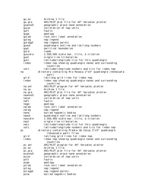
gu.av ArcView 1 file<br />
gu.gra ARC/PLOT plot file for 44" Versatec plotter<br />
guanno5 geographic place name annotation<br />
gucor correlation <strong>of</strong> map units<br />
guft faults<br />
guge geology<br />
gulab rock unit label annotation<br />
guleg map legend<br />
gulegpt map legend points<br />
guout quadrangle outline <strong>and</strong> lat/long numbers<br />
gupl political boundaries<br />
gurd roads<br />
guscale 1:500,000 scale bar, title, & citation<br />
gust single-line tributaries<br />
gutc latitude/longitude tics for this quadrangle<br />
index index map showing quadrangle names <strong>and</strong> surrounding<br />
countries<br />
vztc latitude/longitude numbers <strong>and</strong> tics for index map<br />
ma directory containing Río Mavaca 2°x3° quadrangle (Venezuela<br />
part)<br />
grid lat/long grid lines for index map<br />
index index map showing quadrangle names <strong>and</strong> surrounding<br />
countries<br />
ma.aml ARC/PLOT program for 44" Versatec plotter<br />
ma.av ArcView 1 file<br />
ma.gra ARC/PLOT plot file for 44" Versatec plotter<br />
maanno5 geographic place name annotation<br />
macor correlation <strong>of</strong> map units<br />
maft faults<br />
mage geology<br />
malab rock unit label annotation<br />
maleg map legend<br />
mama buried magnetic bodies<br />
maout quadrangle outline <strong>and</strong> lat/long numbers<br />
mascale 1:500,000 scale bar, title, & citation<br />
mast single-line tributaries<br />
matc latitude/longitude tics for this quadrangle<br />
vztc latitude/longitude numbers <strong>and</strong> tics for index map<br />
pc directory containing Piedra de Cocuy 2°x3° quadrangle<br />
(Venezuela part) files<br />
grid lat/long grid lines for index map<br />
index index map showing quadrangle names <strong>and</strong> surrounding<br />
countries<br />
pc.aml ARC/PLOT program for 44" Versatec plotter<br />
pc.av ArcView 1 file<br />
pc.gra ARC/PLOT plot file for 44" Versatec plotter<br />
pcanno5 geographic place name annotation<br />
pccor correlation <strong>of</strong> map units<br />
pcft faults<br />
pcge geology<br />
pclab rock unit label annotation<br />
pcleg map legend<br />
pclegpt map legend points<br />
pcma buried magnetic bodies


