Water for people.pdf - WHO Thailand Digital Repository
Water for people.pdf - WHO Thailand Digital Repository
Water for people.pdf - WHO Thailand Digital Repository

You also want an ePaper? Increase the reach of your titles
YUMPU automatically turns print PDFs into web optimized ePapers that Google loves.
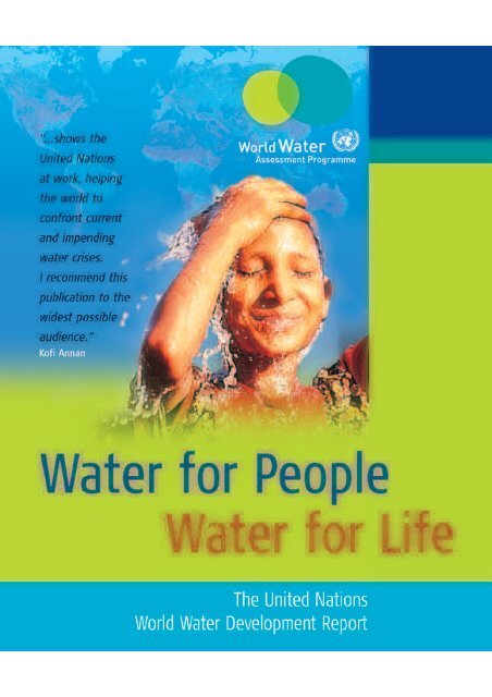
A joint report by thetwenty three UN agenciesconcerned with freshwater<strong>Water</strong> <strong>for</strong> People<strong>Water</strong> <strong>for</strong> LifeUNESCO PublishingBERGHAHN BOOKSThe United NationsWorld <strong>Water</strong> Development Report
Published in 2003 jointly by the United Nations Educational, Scientificand Cultural Organization (UNESCO), and Berghahn Books.Library of Congress Cataloging-in-Publication DataA catalogue record <strong>for</strong> this book is available from the Library of CongressThis Report has been elaborated on behalf of the partners of the UnitedNations World <strong>Water</strong> Assessment Programme (WWAP) with support fromthe following countries:Bolivia; Estonia; France; Germany; Guinea; Hungary; Japan; Mali; Mauritania;Netherlands; Peru; Russian Federation; Senegal; Sri Lanka; <strong>Thailand</strong>; Turkey;United Kingdom.United Nations Funds and ProgrammesUnited Nations Centre <strong>for</strong> Human Settlements (Habitat)United Nations Children’s Fund (UNICEF)United Nations Department of Economic and Social Affairs (UNDESA)United Nations Development Programme (UNDP)United Nations Environment Programme (UNEP)United Nations High Commissioner <strong>for</strong> Refugees (UNHCR)United Nations University (UNU)United Nations Regional CommissionsEconomic and Social Commission <strong>for</strong> Asia and the Pacific (ESCAP)Economic Commission <strong>for</strong> Africa (ECA)Economic Commission <strong>for</strong> Europe (ECE)Economic Commission <strong>for</strong> Latin America and the Caribbean (ECLAC)Economic Commission <strong>for</strong> Western Asia (ESCWA)British Library Cataloguing in Publication DataA catalogue record <strong>for</strong> this book is available from the British LibraryISBN UNESCO: 92-3-103881-8ISBN Berghahn: 1-57181-627-5 (cloth), 1-57181-628-3 (paperback)The designations employed and the representation of material throughoutthis publication do not imply the expression of any opinion whatsoever onthe part of WWAP concerning the legal status of any country, territory, cityor areas or of its authorities, or concerning the delimitation of its frontiersor boundaries.UNESCO Publishing: http://upo.unesco.org/Berghahn Books: www.berghahnbooks.comPrinted in BarcelonaDesign & productionInside cover montages: Emmanuel Labard and Estelle Martin,Atelier Takavoir, Paris.Design and production: Andrew Esson, Baseline Arts Ltd, Ox<strong>for</strong>d.Index: Paul Nash, Perth.Secretariat of United Nations Conventions and DecadesSecretariat of the Convention on Biological Diversity (CBD)Secretariat of the Convention to Combat Desertification (CCD)Secretariat of the International Strategy <strong>for</strong> Disaster Reduction (ISDR)Secretariat of the United Nations Framework Convention onClimate Change (CCC)Specialized UN AgenciesFood and Agriculture Organization (FAO)International Atomic Energy Agency (IAEA)International Bank <strong>for</strong> Reconstruction and Development (World Bank)United Nations Educational, Scientific and Cultural Organization (UNESCO)United Nations Industrial Development Organization (UNIDO)World Health Organization (<strong>WHO</strong>)World Meteorological Organization (WMO)© UNESCO-WWAP 2003All rights reserved. Except <strong>for</strong> the quotation of short passages <strong>for</strong> thepurpose of criticism and review, no part of this publication may bereproduced in any <strong>for</strong>m or by any means, electronic or mechanical, includingphotocopying, recording, or any in<strong>for</strong>mation storage and retrieval systemnow known or to be invented, without written permission of UNESCO-WWAPand Berghahn Books.
Lists of Figures, Maps, Boxes & TablesivAcknowledgementsxvForewordxixProloguexxPrefacexxiiPart I: Setting the Scene 1Chapter 1: THE WORLD’S WATER CRISIS 3Chapter 2: MILESTONES 23Chapter 3: SIGNING PROGRESS: INDICATORS MARK THE WAY 29Part II: A Look at the World’s Freshwater Resources 61Chapter 4: THE NATURAL WATER CYCLE 63ContentsPart III: Challenges to Life and Well-Being 97Chapter 5: BASIC NEEDS AND THE RIGHT TO HEALTH 99Chapter 6: PROTECTING ECOSYSTEMS FOR PEOPLE AND PLANET 127Chapter 7: CITIES: COMPETING NEEDS IN AN URBAN ENVIRONMENT 157Chapter 8: SECURING FOOD FOR A GROWING WORLD POPULATION 189Chapter 9: PROMOTING CLEANER INDUSTRY FOR EVERYONE’S BENEFIT 225Chapter 10: DEVELOPING ENERGY TO MEET DEVELOPMENT NEEDS 247Part IV: Management Challenges: Stewardship and Governance 267Chapter 11: MITIGATING RISK AND COPING WITH UNCERTAINTY 269Chapter 12: SHARING WATER: DEFINING A COMMON INTEREST 291Chapter 13: RECOGNIZING AND VALUING THE MANY FACES OF WATER 323Chapter 14: ENSURING THE KNOWLEDGE BASE: A COLLECTIVE RESPONSIBILITY 345Chapter 15: GOVERNING WATER WISELY FOR SUSTAINABLE DEVELOPMENT 367Part V: Pilot Case Studies: A Focus on Real-World Examples 385Chapter 16: CHAO PHRAYA RIVER BASIN, <strong>Thailand</strong> 387Chapter 17: LAKE PEIPSI/CHUDSKOE-PSKOVSKOE, Estonia and the Russian Federation 401Chapter 18: RUHUNA BASINS, Sri Lanka 415Chapter 19: SEINE-NORMANDY RIVER BASIN, France 429Chapter 20: SENEGAL RIVER BASIN, Guinea, Mali, Mauritania, Senegal 447Chapter 21: LAKE TITICACA BASIN, Bolivia and Peru 463Chapter 22: GREATER TOKYO, Japan 481Part VI: Fitting the Pieces Together 499Chapter 23: THE WORLD’S WATER CRISIS: FITTING THE PIECES TOGETHER 501Annexes 537Acronyms 537Other Global Assessment Publications 540Index 544
IV / P R E L I M I N A R YFigures, Maps, Boxes & TablesFigures1.1: World population and freshwater use 131.2: World population prospects 131.3: Actual and projected urban population in different regions of the world in 1950, 2000 and 2030 141.4: Urban and rural populations, less developed countries, 1950 to 2030 143.1: Translation of an in<strong>for</strong>mation need into policy-oriented in<strong>for</strong>mation using variables, indicators and indices 343.2: Calculated available water resources, water demand, internal renewable water resources and water supply 353.3: Development of consumable fish as a percentage of the minimum biomass needed <strong>for</strong> a sustainable renewalof the fish population 363.4: Annual freshwater demand in different regions of the world <strong>for</strong> the current situation and <strong>for</strong> two alternativeprojections <strong>for</strong> the year 2025 363.5: Overview of the history and development of sustainability indicators 383.6: Schematic representation of a guideline <strong>for</strong> indicator development 413.7: Values of the <strong>Water</strong> Stress Index (WSI) presented on four different spatial scales: country, grid cell, region and watershed 533.8: A time series of the oxygen concentration and living organisms in the Rhine River since 1900 543.9: Nile basin map showing climactic moisture index 563.10: Nile basin map showing indicator on <strong>people</strong> with drought stress threshold 564.1: The global hydrological network by type 684.2: <strong>Water</strong> availability versus population 694.3: Typical groundwater flow regimes and residence times under semi-arid climatic conditions 805.1. Transmission pathways of faecal-oral diseases 1055.2: <strong>Water</strong> supply, distribution of unserved populations 1095.3: Sanitation, distribution of unserved populations 1095.4. Actual and target water supply coverage 1115.5: Actual and target sanitation coverage 1116.1: Emissions of water pollutants by sector 1346.2: Biological quality of United Kingdom rivers, 1990-2000 1366.3: Proportion of United States species at risk or extinct, by taxonomic grouping 1426.4: Living Planet index 1999: inland waters 1436.5: Changes in lake condition 1960s-1990s 1437.1: Examples of causes <strong>for</strong> the prevalence of diarrhoeal diseases in a squatter settlement 1697.2: The proportion of households in major cities connected to piped water and sewers 1738.1: Food prices and investment in irrigation and drainage 1948.2: Per capita food consumption from 1965 to 2030 2008.3: Yields and water requirements of irrigated and non-irrigated agriculture 2058.4: Competing uses of water in the Zhanghe irrigation district, China 2058.5: Irrigated area as proportion of irrigation potential in developing countries 2068.6: Irrigation and water resources: actual (1999) and predicted (2030) withdrawals 2078.7: Progress towards the World Food Summit target 2118.8: Proportion of undernourished <strong>people</strong> in developing countries, 1990-1992 and 1997-1998 212
F I G U R E S / V9.1: Competing water uses <strong>for</strong> main income groups of countries 2289.2: Contribution of main industrial sectors to the production of organic water pollutant 2299.3: Industrial Value Added from water use <strong>for</strong> main income classes of countries 23710.1: World’s electricity production 25510.2: Installed hydro capacity (all schemes) at the end of 1996 – regional distribution 25611.1: Types and distribution of water-related natural disasters, 1990–2001 27211.2: Trends in major natural catastrophes, 1950-2000 27311.3: Framework <strong>for</strong> risk assessment 28111.4: Trends in food emergencies, 1981–2001 28612.1: Power and authority of different institutional mechanisms 29912.2: Events related to transboundary water basins 31313.1: Value of water 32914.1: Gross enrolment ratio in primary education 35014.2: Estimated illiteracy rates: total <strong>for</strong> male and female aged 15 years and older 35114.3: Number of scientists and engineers per 100,000 inhabitants, GDP per capita (PPP in US$), Human Development Indexvalue and R&D expenditure 35914.4: Institutes offering water-related subjects in higher education 36114.5: Communications (television, radio, newspapers) per 1,000 inhabitants 36314.6: Main telephone lines and Internet users per 1,000 inhabitants 36414.7: ICT expenditure as percentage of GDP 26515.1: Framework <strong>for</strong> moving towards IWRM 37617.1: Unemployment and average income per month in Estonian counties bordering Lake Peipsi 40617.2: Unemployment in the Pskov region between 1997–2001 40617.3: Land use in the Lake Peipsi basin 40717.4: Ratio of phosphorus pollution load by country and source 40917.5: Ratio of nitrogen pollution load by country and source 40917.6: Comparison of annual phosphorus loads by source between 1989 and 1998 40917.7: Comparison of annual nitrogen loads by source between 1989 and 1998 40919.1: Evolution in water quality 43719.2: <strong>Water</strong> legislation in France 44021.1: Distribution of the active working population of Bolivia and Peru 46921.2: ALT structure 47521.3: Chain of causality 47922.1: Variation in river water quality – biological oxygen demand (BOD) levels 48722.2: Variation in the chemical oxygen demand (COD) discharge load by sector in Tokyo bay 48722.3: Rate of ground subsidence in cm/year 48822.4: Revision of the River Law 49222.5: Expression of the safety degree 494
VI / P R E L I M I N A R YFigures, Maps, Boxes & Tables22.6: Expression of the safety degree with a time variable 49422.7: Effect of hazard maps on public safety 49623.1: Multiple burdens of water poverty 50423.2: Regional environmental trends 51023.3: Comparison of progress in implementing Chapter 18 of Agenda 21 by region 520Maps1.1: Internal renewable water resources generated within a country, on a per capita basis, circa 1995 114.1: The long-term average water resources according to drainage basins 754.2: Mean annual precipitation 774.3: Groundwater resources of the world 794.4: Long-term average runoff on a global grid 844.5: Sediment load by basin 886.1: Relative naturalness of land in major world river basins 1397.1: <strong>Water</strong> stress in regions around megacities 1608.1: Area equipped <strong>for</strong> irrigation as percentage of cultivated land by country (1998) 2078.2: Agricultural water withdrawals as percentage of renewable water resources (1998) 2088.3: Percentage of undernourished <strong>people</strong> by country (1998) 2129.1: <strong>Water</strong> withdrawals <strong>for</strong> manufacturing industries according to drainage basins 23810.1: Proportion of hydropower electricity generation per country 25612.1: Drainage basins under high or medium stress and the sector that uses the most water 29512.2: Country dependence on water resources inflow from neighbouring countries 31212.3: Transboundary basins of the world and the number of associated treaties 31312.4: Transboundary aquifers in northern Africa 31712.5: Status of cooperation in transboundary river basins 32016.1: Chao Phraya River basin: locator map 39016.2: Chao Phraya River basin map 39117.1: Lake Peipsi/Chudskoe-Pskovskoe: locator map 40417.2: Lake Peipsi/Chudskoe-Pskovskoe: basin map 40518.1: Ruhuna basins: locator map 41818.2: Ruhuna basins map 41918.3: Major land covers and uses in the Ruhuna basins 419
B O X E S / VII19.1: Seine-Normandy basin: locator map 43219.2: Seine-Normandy basin map 43319.1: <strong>Water</strong> quality in the Seine-Normandy basin 43520.1: Senegal River basin: locator map 45020.2: Senegal River basin map 45121.1: Lake Titicaca basin: locator map 46621.2: Lake Titicaca basin map 46621.3: Distribution of groundwater in the TDPS system 47021.3: Incidence of extreme events: frost 47221.4: Incidence of extreme events: precipitation during perionds of drought 47222.1: Greater Tokyo: locator map 48422.2: Greater Tokyo map 48422.5: Proposed new water quality indicator <strong>for</strong> recreational use 495Boxes1.1: Vision 21 – water supply and sanitation targets 83.1: The <strong>Water</strong> Poverty Index as an illustration of the difference between variables, indicators and index 343.2: Use of species as indicators <strong>for</strong> ecosystems quality 363.3: Overview of major indicator development ef<strong>for</strong>ts 423.4: Indicators <strong>for</strong> flood risk and water quality in Greater Tokyo 433.5: Achievements 585.1: Cholera in 2001 1025.2: The compounded malaria impact of microdams in Ethiopia 1075.3: The role of improved water supply in the eradication of Guinea worm infection 1145.4: Effects of improved water supply and sanitation on global problem of blindness 1155.5: Freshwater cyanobacterial toxins – an emerging dam-related health issue 1185.6: Human rights to water 1216.1: Draining wetlands <strong>for</strong> malaria control: a conflict of interests? 1336.2: Non-native species 1386.3: Protecting ecosystems in the Lake Pskovkoe watershed 1456.4: Lake Titicaca – a transboundary Ramsar site of vulnerable ecosystems and ancient cultures 1476.5: International instruments <strong>for</strong> protecting ecosystems 1486.6: Taking hidden costs and benefits into account 1496.7: The ‘Green Corridor’ – floodplain restoration along the Danube Valley 1506.8: The Edwards dam 1507.1: Singapore Public Utilities Board: reducing Unaccounted-<strong>for</strong>-<strong>Water</strong> 1687.2: Deficiencies in provision <strong>for</strong> water and sanitation in cities in Bangladesh and Pakistan 1717.3: Inadequacies in provision <strong>for</strong> water and sanitation in selected cities in Kenya and the United Republic of Tanzania 1727.4: New York City – maximizing public participation while protecting water quality 178
VIII / P R E L I M I N A R YFigures, Maps, Boxes & Tables7.5: Community toilets in Pune and other Indian cities 1797.6: Karachi, Pakistan – Orangi Pilot Project: when the community takes charge 1807.7: Urban sanitation micro-enterprises: the UN-Habitat Vacutug development project 1818.1: The right to food 1938.2: Assessing freshwater needs <strong>for</strong> global food production 2038.3: Potential <strong>for</strong> improvements in agricultural water use efficiency 2098.4: Libya: the Great Man-Made River Project 2108.5: Food security and its indicators 2118.6: <strong>Water</strong> and food security in the Senegal River basin 2148.7: Rice-fish farming in Lao People’s Democratic Republic 2158.8: Land ownership and economic independence 2178.9: Use of wastewater <strong>for</strong> irrigation 2198.10: Integrating irrigation, nutrition and health 2209.1: Industrial water pollution control in the Gulf of Guinea basin (western Africa) 2319.2: Environmental management and pollution control in the Tisza River basin (eastern Europe) 2329.3: Convention on cooperation <strong>for</strong> the protection and sustainable use of the Danube River (central-eastern Europe) 2399.4: Regional African leather and footwear industry scheme 2419.5: Impressive gains from cleaner food production in Viet Nam 2429.6: Removal of barriers <strong>for</strong> cleaner artisanal gold mining 24310.1: World Commission on Dams (WCD) – of risks, rights and negotiated agreements 25710.2: Large-scale hydropower in Asia 25810.3: GAP – a paradigm shift in water resources development 25910.4: Advantages and disadvantages of small-scale hydropower projects 26010.5: Hydropower and social problems in the Ruhuna basins (Sri Lanka) 26110.6: Hydropower in Nepal 26210.7: Progress since Rio at a glance 26511.1: The Rhine Action Plan 27411.2: Methodology and terminology adopted by the ISDR 27911.3: Initiatives coping with water-related risks 28011.4: Political economy 28211.5: Comprehensive flood control measures in Japan 28311.6: Evolution of responsibility <strong>for</strong> risk-based water resource management 28511.7: Shared regional water resources in economies in transition 28712.1: Competition <strong>for</strong> water in Valle Province, Colombia 29612.2: Drought conciliation in Japan 29812.3: New technology helps share the resource in Saudi Arabia 29812.4: Sharing water resources in the Seine-Normandy basin 30012.5: Expanded freshwater programmes 30112.6: International public law related to the non-navigational uses of shared water resources 30212.7: Sharing water in the Senegal River basin 31412.8: <strong>Water</strong> sharing as an instrument of regional integration – the Nile basin 315
X/ P R E L I M I N A R YFigures, Maps, Boxes & TablesBoxes by RegionAfrica5.2: The compounded malaria impact of microdams in Ethiopia 1076.1: Draining wetlands <strong>for</strong> malaria control: a conflict of interests? 1337.3: Inadequacies in provision <strong>for</strong> water and sanitation in selected cities in Kenya and the United Republic of Tanzania 1728.4: Libya: the Great Man-Made River Project 2108.6: <strong>Water</strong> and food security in the Senegal River basin 2148.8: Land ownership and economic independence 2178.10: Integrating irrigation, nutrition and health 2209.1: Industrial water pollution control in the Gulf of Guinea basin (western Africa) 2319.4: Regional African leather and footwear industry scheme 24112.7: Sharing water in the Senegal River basin 31412.8: <strong>Water</strong> sharing as an instrument of regional integration: the Nile basin 31513.7: African Development Bank: policy statements on social issues 33614.2: Guinea-Bissau – with training, women ‘man’ the pumps 35314.3: The bushmen’s loss is everyone’s loss 35414.7: Senegal River Basin – in<strong>for</strong>mation <strong>for</strong> sustainable management 35815.5: <strong>Water</strong> re<strong>for</strong>m in South Africa 37815.8: Financing water development in Africa 38220.1: Development of Indicators in the Senegal River basin 461Asia3.4: Indicators <strong>for</strong> flood risk and water quality in Greater Tokyo 436.2: Non-native species 1387.1: Singapore Public Utilities Board: reducing Unaccounted-<strong>for</strong>-<strong>Water</strong> 1687.2: Deficiencies in provision <strong>for</strong> water and sanitation in cities in Bangladesh and Pakistan 1717.5: Community toilets in Pune and other Indian cities 1797.6: Karachi, Pakistan – Orangi Pilot Project: when the community takes charge 1808.7: Rice-fish farming in Lao People’s Democratic Republic 2159.5: Impressive gains from cleaner food production in Viet Nam 24210.2: Large-scale hydropower in Asia 25810.5: Hydropower and social problems in the Ruhuna basins (Sri Lanka) 26110.6: Hydropower in Nepal 26211.5: Comprehensive flood control measures in Japan 28312.2: Drought conciliation in Japan 29812.3: New technology helps share the resource in Saudi Arabia 29813.5: <strong>Water</strong> rights: valuing water and historical background in Japan 33213.6: Valuing water in Sri Lanka 33414.6: New tools <strong>for</strong> the Mekong 35715.2: Japan promotes public participation 37415.6: Taiz water management planning – possibilities <strong>for</strong> rural/urban conflict resolution 37916.1: Development of indicators in the Chao Phraya River basin 40018.1: Development of indicators in the Ruhuna basins 42522.1: Development of indicators in Greater Tokyo 497
B O X E S / IX13.1: <strong>Water</strong> valuation and Agenda 21 32613.2: Dreamtime and water in Aboriginal Australia 32713.3: Key recommendations <strong>for</strong> an integrated approach to freshwater resource management 32813.4: Value of groundwater as a ‘common property’ resource 33113.5: <strong>Water</strong> rights – valuing water and historical background in Japan 33213.6: Valuing water in Sri Lanka 33413.7: African Development Bank – policy statements on social issues 33613.8: <strong>Water</strong> pricing in Croatia 33713.9: The cost recovery approach in the Seine-Normandy basin 33914.1: Pointers from the 1992 Earth Summit 34914.2: Guinea-Bissau – with training, women ‘man’ the pumps 35314.3: The bushmen’s loss is everyone’s loss 35414.4: Power to society – water laws in Brazil and Sri Lanka 35414.5: CapNet – the virtues of networking 35514.6: New tools <strong>for</strong> the Mekong 35714.7: Senegal River basin – in<strong>for</strong>mation <strong>for</strong> sustainable management 35814.8: Joint monitoring on Lake Peipsi 35814.9: UNESCO-IHE – a partnership in water education 36114.10: The World <strong>Water</strong> Portal – a model <strong>for</strong> water in<strong>for</strong>mation sharing and cooperation 36315.1: Examples of water governance issues 37215.2: Japan promotes public participation 37415.3: Property rights 37515.4: Governing water wisely – a Russian basin-level approach 37615.5: <strong>Water</strong> re<strong>for</strong>m in South Africa 37815.6: Taiz water management planning – possibilities <strong>for</strong> rural/urban conflict resolution 37915.7: Public-private water partnership in France 38015.8. Financing water development in Africa 38216.1: Development of indicators in the Chao Phraya River basin 40018.1: Development of indicators in the Ruhuna basins 42519.1: Development of indicators in the Seine-Normandy basin 44320.1: Development of indicators in the Senegal River basin 46121.1: Development of indicators in the Lake Titicaca basin 48022.1: Development of indicators in Greater Tokyo 49723.1: Frameworks arising from international conferences – Millennium Development Goals, Bonn Action Plan and WEHAB 50623.2: Other frameworks – poverty and action, sustainable livelihoods, business management 50723.3: Generic content of water supply and sanitation sector country profiles 514
B O X E S B Y R E G I O N S / X IEurope6.3: Protecting ecosystems in the Lake Pskovskoe watershed 1456.7: The ‘Green Corridor’ – floodplain restoration along the Danube Valley (central-eastern Europe) 1509.2: Environmental management and pollution control in the Tisza River basin (eastern Europe) 2329.3: Convention on cooperation <strong>for</strong> the protection and sustainable use of the Danube River 23910.3: GAP – a paradigm shift in water resources development 25911.1: The Rhine Action Plan 27412.4: Sharing water in the Seine-Normandy basin 30013.8: <strong>Water</strong> pricing in Croatia 33713.9: The cost recovery approach in the Seine-Normandy basin 33914.8: Joint monitoring on Lake Peipsi 35815.4: Governing water wisely – a Russian basin-level approach 37615.7: Public-private water partnership in France 38019.1: Development of indicators in the Seine-Normandy basin 461Latin America and the Caribbean5.5: Freshwater cyanobacterial toxins – an emerging dam-related health issue 1186.5: Lake Titicaca: a transboundary Ramsar site of vulnerable ecosystems and ancient cultures 14812.1: Competition <strong>for</strong> water in Valle Province, Colombia 29614.4: Power to society – water laws in Brazil and Sri Lanka 35421.1: Development of indicators in the Lake Titicaca basin 497North America6.8. The Edwards dam 1507.4: New York City – maximizing public participation while protecting water quality 178Oceania13.2: Dreamtime and water in Aboriginal Australia 327Global1.1: Vision 21 – water supply and sanitation targets 83.1: The <strong>Water</strong> Poverty Index as an illustration of the difference between variables, indicators and index 343.2: Use of species as indicators <strong>for</strong> ecosystems quality 363.3: Overview of major indicator development exercises 423.5: Achievements 585.1: Cholera in 2001 1025.3: The role of improved water supply in the eradication of Guinea worm infection 1145.4: Effects of improved water supply and sanitation on global problem of blindness 1155.6: Human rights to water 1216.5: International instruments <strong>for</strong> protecting ecosystems 1486.6: Taking hidden costs and benefits into account 1497.7: Urban sanitation micro-enterprises: the UN-Habitat Vacutug development project 1818.1: The right to food 1938.2: Assessing freshwater needs <strong>for</strong> global food production 2038.3: Potential <strong>for</strong> improvements in agricultural water use efficiency 2098.5: Food security and its indicators 2118.9: Use of wastewater <strong>for</strong> irrigation 2199.6: Removal of barriers <strong>for</strong> cleaner artisanal gold mining 243
XII / P R E L I M I N A R YFigures, Maps, Boxes & Tables10.1: World Commission on Dams (WCD) – of risks, rights, and negotiated agreements 25710.4: Advantages and objections to small-scale hydropower projects 26011.2: Methodology and terminology adopted by the ISDR 27911.3: Initiatives coping with water-related risks 28011.4: Political economy 28211.6: Evolution of responsibility <strong>for</strong> risk-based water resource management 28511.7: Shared regional water resources in economies in transition 28712.5: Expanded freshwater programmes 30112.6: International public law related to the non-navigational uses of shared water resources 30213.1: <strong>Water</strong> valuation and Agenda 21 32613.3: Key recommendations <strong>for</strong> an integrated approach to freshwater resource management 32813.4: Value of groundwater as a ‘common property’ resource 33114.1: Pointers from the 1992 Earth Summit 34914.5: CapNet – the virtues of networking 35514.9: UNESCO-IHE – a partnership in water education 36114.10: The World <strong>Water</strong> Portal – a model <strong>for</strong> water in<strong>for</strong>mation sharing and cooperation 36315.1: Examples of water governance issues 37215.3: Property rights 37523.1: Frameworks arising from international conferences – Millennium Development Goals, Bonn Action Plan and WEHAB 50623.2: Other frameworks – poverty and action, sustainable livelihoods, business management 50723.3: Generic content of water supply and sanitation sector country profiles 514Tables1.1: <strong>Water</strong>, poverty and the Millennium Development Goals 91.2: <strong>Water</strong> pollutants by industrial sector 153.1: Draft Logical Framework of the Global <strong>Water</strong> Partnership Framework <strong>for</strong> Action 393.2: Example of the use of the DPSIR framework on the basis of components of the <strong>Water</strong> Poverty Index (WPI) 453.3: Criteria <strong>for</strong> the selection of indicators 453.4: List of indicators used in the first edition of the WWDR and indicators that will be developed in the future 473.5: Sample of indicator values per country on water supply and sanitation 523.6: Overview of a number of indicators, their aims and the correct spatial scale of their use 524.1: The distribution of water across the globe 684.2: <strong>Water</strong> availability per person per year 704.3: Some large aquifers of the world 794.4: Groundwater use <strong>for</strong> agricultural irrigation in selected nations 804.5: Groundwater exploitation and associated problems 814.6: The world’s largest reservoirs 834.7: The largest rivers in the world by mean annual discharge with their loads 854.8: The chemical composition of average river water (concentration in milligrams/litre) 854.9: The world’s major water quality issues 865.1: Some water-associated diseases by cause and sex, estimates <strong>for</strong> 2001 1045.2: Six scenarios of exposure to environmental faecal-oral pathogens 106
T A B L E S / XIII5.3: Africa, Asia, Latin America and the Caribbean: access to water supply and sanitation services bylevel of services – evolution during the last decade 1095.4: Improved versus non-improved water supply and sanitation 1136.1: Simplified classification of services provided by water ecosystems 1326.2: Pressures on freshwater ecosystems 1336.3: Types of pollutants affecting freshwater ecosystems 1346.4: Quality indicators <strong>for</strong> classifying the ecological status of rivers 1376.5: <strong>Water</strong> quality indicator values in selected countries 1406.6: Numbers of threatened freshwater fish in selected countries 1416.7: Threatened inland water species: a selection of species assessed by IUCN as Critically Endangered in 2000 1426.8: Example of wetlands loss in arid Eurasia 1446.9: Review of National Reports submitted to the Convention on Biological Diversity (CBD) 1517.1: Distribution of urban population in more and less developed regions in 1975, 2000 and 2015 1617.2: The world’s largest cities in 2000 1627.3: The proportion of urban populations with access to ‘improved’ water supply and sanitation, 2000 1707.4: Comparing different approaches to demand-side water management in the household sector 1838.1: National values of key indicators in securing the food supply 1958.2: Per capita food consumption from 1965 to 2030 (kcal/person/day) 2008.3: <strong>Water</strong> requirement equivalent of main food products 2038.4: <strong>Water</strong> use efficiency in 1998 and 2030 (predicted) in ninety-three developing countries 2089.1: Industrial water efficiency 23510.1: Distribution of households with access to electricity in <strong>for</strong>ty-three developing countries (in percentages) 25310.2: End-use of energy <strong>for</strong> cooking and heating in rural Mexico (in percentages) 25410.3: Deployment of hydropower 25510.4: Advantages and disadvantages of hydropower 25810.5: Advantages and disadvantages of various <strong>for</strong>ms of energy 26311.1: Major drought events and their consequences in the last <strong>for</strong>ty years 27511.2: Severe natural disasters and their effects since 1994 27611.3: Risk linkages and integration 27711.4: Examples of low-cost indicators focused on risk losses and progress of risk reduction 28712.1: Transboundary river basins 30413.1: Value of aquatic ecosystem water services 33013.2: Yearly funding requirements <strong>for</strong> water supply and sanitation 33413.3: Yearly future funding requirements by the entire water and sanitation sector (in billion US$) 33413.4: Situation of cost recovery in irrigation <strong>for</strong> selected countries 33613.5: Comparison of water pricing in developed countries 33813.6: The poor pay more 34114.1: Increases and decreases in the number of hydrological observing stations in the world between 1974 and 1997 356
XIV / P R E L I M I N A R YFigures, Maps, Boxes & Tables16.1: Hydrological characteristics of the Chao Phraya River basin 39016.2: Population, per capita income and Gross Provincial Product (GDP) in the sub-basins in 1996 39216.3: Annual average runoff in the sub-basins 39316.4: Characteristics of major reservoirs 39316.5: Groundwater storage and renewable water resource in the sub-basins 39417.1: Hydrological characteristics of the Lake Peipsi basin 40417.2: Morphometric data on Lake Peipsi 40418.1: Hydrological characteristics of the Ruhuna basins 41818.2: Comparison of basic hydrological parameters of sub-basins over a thirty-year time span 42019.1: Hydrological characteristics of the Seine-Normandy basin 43220.1: Hydrological characteristics of the Senegal River basin 45020.2: Summary of physical data 45020.3: Summary of socio-economic data in the OMVS member states 45120.4: <strong>Water</strong> use by sector within the OMVS area (in millions m 3 ) 45320.5: Seasonal changes in Senegal River discharge since 1951 45321.1: Hydrological characteristics of the Lake Titicaca basin 46621.2: TDPS system size 46721.3: TDPS population data 46821.4: Population in main cities 46821.5: Health data 46821.6: Annual flow in ten control stations of Lake Titicaca and Desaguadero River 47021.7: <strong>Water</strong> use in the TDPS system 47322.1: Hydrological characteristics of five river basins in Greater Tokyo 48522.2: <strong>Water</strong> governance in Japan 49023.1: National reports submitted by member states through the UN CSD system 51523.2: Summary of regional progress in implementation of Chapter 18 of Agenda 21 52123.3: Summary of regional progress towards attaining Millennium Development Goal 7 52623.4: Summary of regional progress towards attaining Millennium Development Goal 4 52723.5: Summary of regional progress towards attaining Millennium Development Goal 1 52823.7: Summary of national progress towards attainment of relevant Millennium Development Goals 529
A C K N O W L E D G E M E N T S / XVAcknowledgementsThe World <strong>Water</strong> Assessment Programme would like to thank the following <strong>people</strong> <strong>for</strong> their gracious help and support in preparing theWorld <strong>Water</strong> Development Report. All those whom we have inadvertently omitted from this list, please accept our heartfelt apologies,along with our thanks.Abdelsalam Ahmed,AbdallaAbderrahman, WalidAbdulrazzak, MohamedAbegunawardane, M.H.Abewickrema, NandaAbeysinghe, A.M.H.Abrams, LenAdebayo, YinkaAdeel, ZafarAdriaanse, MartinAekaraj, SukonthaAffeltranger, BastienAggarwal, PradeepAhamed, AzizAlabaster, Graham.Alcamo, JosephAliakseyeva, NatalliaAlmeida, GeorginaAlpan Atamer, SemaAl-Rashed, MuhammadAl-Weshah, RadwanAmarasinghe, UpaliAmunugama, SarathAmarathunga, A.P.Amdur, RichardAmezal-Benureau,AîchaAndersson, IngvarAparicio, JavierAppelgren, BoAranya, FuangawasdiArata, AkioAratani, KeitaArico, SalvatoreAriyabandu, R. de S.Ariyaratne, B.RArulvijitkul, PongsakAsai, TakashiAshley, SaraAskew, ArthurAtannon, MedardAtapattu, N.K.Athukorala, KusumAureli, AliceBaba, ToshioBaer, A.Bailey, ArianeBaker, F.W.G.Ballayan, DominicBandusena, S. B.Barg, UweBarker, RandyBaron, J.Barraqué, BernardBarret, PhilippeBartram, JamieBasoberry, AntonioBattikha, VeronicaBauer, PeterBazza, MohamedBeano, J.E.Belhadi, AhmedBelin, SolangeBerbalk, DagmaraBernardt, CristophBerghahn, MarionBhattarai, MadhusadanBjörklund, GunillaBlix, BozenaBloch, JuliaBloxham, MartinBlyth, SimonBoedeker, GeroldBogardi, JanosBommelaer, OlivierBonell, MikeBories, JacquesBos, RobertBosnjakovic, BrankoBoulharouf, RajebBourg, Anna-KayBowen, ThomasBresser, TonBrewster, MarciaBriceño, SalvanoBridgewater, PeterBriffault, RobiniaBriscoe, JohnBruck, StephanBruinsma, JelleBruno, RudolfBudarin, Vladimir F.Burapatanin, SomboonBurchi, StefanoBurke, JacobBurke, NiamhCarmovas, AlvaroCarr, RichardCasal, FrançoisCasman, ElizabethCastelein, SaskiaChadwick, MatthewChane, BayouChantanintorn, SanongChantrel, PierreCharriet, BertrandCheret, IvanCheriez, Jean-FrancisClua, AlexandraCofino, William PeterColes, PeterCollins, TerryCosgrove, William J.Courtecuisse, ArnaudCowan, DonaldCrespo Milliet, AlbertoCurtin, FionaCurtis, IanDaler, DagDaley, RalphDas Gupta, AshimDavy, ThierryDayaratne, W.J.M.De Fraiture, CharlotteDe La Rocque, JacquesDe Santis, GiorgiaDe Sherbinin, AlexDe Silva, K.S.R.De Silva, VijithaDe Vaulx, MauriceDelli Priscolli, JeromeDemissie Yadeta,MeseretDengo, ManuelDenzer, Ralf A.Dharmaratne, G.H.P.Diagne, BabacarDiop, SalifDissanayake, I.Dissanayake, J.B.Dodge, TerryDonkor, StephenMaxwellDonzier, Jean-FrançoisDorn, RonaldDowlatabadi, H.Drammeh, HalifaDroogers, PeterDukhovny, VictorDzikus, AndreEdwards, MarkElakanda, D.C.S.Eliasson, ÅseEnderlein, RainerFacon, ThierryFadjouwin, GrégoireFahmi, AhmedFahmy, HussamFaurès, Jean-MarcFekete, BalazsFekri, HassanFelici, EleanaFernando, M.J.J.Feuillette, SarahFlörke, MartinaFlorin, RetoFoster, StephenFournier, FredFraser, AndrewFrijters, IneFrithsen, JeffFritsch, Jean-MarieFrogé, EricFugl, JensFukumoto, ShinobuFukushima, TamiyaGajanayake, P.S.Galbraith, HectorGalloni, SusannaGangopadhyay,SubuhrenduGarnier, OliviaGertman, IsaacGilbrich, WilfredGiordano, MeredithGleick, PeterGlidden, StanleyGoitia, Julio SanjinezGourcy, LaurenceGoya, YoshiyukiGrabs, WolfgangGreen, PamelaGroombridge, BrianGuettier, Philippe
XVI / P R E L I M I N A R YAcknowledgementsGuinchard, FrançoiseGupta, RajivGurkok, CahitGuttman, CynthiaHaddadin, MuntherHaenel, JeanetteHall, AlanHall, DavidHaller, LaurenceHallifax, PeterHandawela, JamesHansen, EggretHarding, JohnHartvelt, FrankHashizumi, HirokiHassan, FekriHattori, TsukasaHeller, L.Hellmuth, MollyHemakumara, H.M.Henderson, MarkHenrichs, ThomasHenry, RosamundHerrod, SusanHipel, KeithHirai, YasuyukiHiroki, KenzoHislop, LawrenceHolaas, OlveHolt McCluskey, AlyssaHong, EunkyoungHoogeveen, JippeHoque, Azm FazlulHuber-Lee, AnnetteHueb, JoseHuidobro, PabloIglesias, AnaIijima, IkukoIkebuchi, ShuichiImbulana, K.A.U.S.Imura, TakashiInoki, HiromasaInoue, TomooIntrawityanunt, PitakIto, SeijiIwasaki, YoshihisaJansky, LiborJaskiewicz, E.Jayasekara, A.M.Jayasekara, H.B.Jayasinghe, AnandaJayasinghe, U.G.Jayasundera, B.K.Jayatillake, H.M.Jayatissa, W.Jayawardane, D.S.Jayaweera, UpaliJezeph, DavidJinadasa, W.P.Jinapala, K.Jingu, MakotoJonch-Clausen, TorkilJones, PatriciaJorgensen, DortheKaewkulaya, JesdaKalyan, RayKaneki, MakotoKaram, RosannaKarunaratne, A.D.M.Karunaratne, G.R.R.Karunatilake, W.A.K.Kasiwatta, RuwanKatavetin, ParichartKavvas, LeventKawaguchi, DaijiKawasaki, HideakiKawashima, TadaoKaysavawong, PavichKemp-Benedict, E.Kemper, KarinKendrick, ShawnKikuchi, RyosukeKimura, MasayoshiKirshen, PaulKite, JefferyKlohn, Wulf E.Kobayashi, TakanobuKobori, IwaoKoda, KazuhisaKodituwakku, K.A.W.Koga, KatsutoshiKonaka, TakayukiKonradsen, FlemmingKoreeda, NobukazuKorsjukov, MargusKoshinaga, KenjiKoujo, FriedrichKovacs, YvesKularatne, GaminiKulkarni, K. M.Kulshreshtha, SurenKuylenstierna, JohanLaje, CristinaLantagne, D.Larsen, HenrikLawrence, J. GaryLe Marechal,DominiqueLemaire Drinkwater,VanessaLenton, RobertoLentvaar, JanLeogardo, VincentLiiv, HarryLisbjerg, DennisLoh, EloiseLopez, AlexanderLord, MarciaLorenz, Carolin M.Lorenz, Frederick M.MacDevette, DavidMacQueen, AnnaMacomber, MarciaMärker, MichaelMajor, DavidMakin, Ian W.Mandalia, LaljiMarques, MarciaMatoba, YasunobuMatsuda, WakakoMatsukawa, NoriyukiMatsuura, TadashiMatthews, GeoffreyMaurer, ThomasMawere, GilbertMayfield, ColinMcDonald, DavidMedagama, JaliyaMedrano, Juan CarlosMeigh, JeremyMendis, B.P.NMerzoug, MohamedSalem OMilburn, AnthonyMiller, JohnMillward, MichaelMin, QingwenMirabzadeh, ParastuMisaki, TakahitoMissoten, RobertMitsuhashi, HisashiMitchell, BruceMiwa, JunjiMmayi, PatrickMohammed, Waleed A.Mokuoane, E.M.Molden, DavidMolle, FrançoiseMoller, BirgitteMoore, RogerMorris, NeilMostert, EricMuckleston, KeithMulongoy, JoMurakashi, ManamiMurase, MasahikoMushiake, KatsumiMutagamba, MariaLubegaMuthukuda, P.S.Mutuwatte, LalNakamura, T.Nakashima, DouglasNakayasu, MasaakiNandalal, K.D.W.Natchtnebel, PeterNdiaye, TamsirNeto, FredNelson, H.G.P.New, JamesNewton, AdrianNicol, AlanNiida, HiroshiNishida, YujiNiyangoda, S.M.S.B.Noguchi, HiroshiO’Connell, Patrick EndaObes de Lussich,AngelicaOda, HideakiOgawa, MamikoOjima, SatoshiOkazumi, ToshioOki, TaikanOlivera, FanciscoOngchotiyakul,PachareeOtchet, AmyOtte, AlexanderOuezzin Coulibaby,JeannetteOuriaghli, CatherineOzbilen, VedatPacheco, AnibalPacini, NicolaPanabokke, C.R.Panyachatraksa, PrapatPasztor, JanosPathirana, P.P.S.R.K.Pattanee, SurapolPerera, AsokaPerera, GaminiJayawickremaPilon, PaulPimpunchat, NarongsakPiper, DavidPizarro, RobertoPoinsot, ClairePoulisse, JanPrasad, K.Pregassame, RadjaPrice, RolandPriest, JohnPropersi, FedericoProussevitch,AlexanderPruess, AnnettePuri, ShammyRapport, DavidRatnayake, RanjithRatwatte, AnuruddhaRay, KalyanRees, JudithReichert, PeterRenault, MarieReuss, MartinRichmond, MarkRichts, AndreaRijsberman, FrankRobarts, Richard
A C K N O W L E D G E M E N T S / XVIIRobertson Vernhes,JaneRoche, Pierre-AlainRodda, John C.Rogers, PeterRoll, GulnaraRomero, RicardoRosegrant, MarkRosen, DovRubasinghe, SirisomaRudolf, BrunoSaad, BahaaSafar-Zitoun, MahamedSalih, AbdinSamarasekara,MahindaSamarasinghe, S.A.P.Samaraweera, P.Samir Farid, M.Samsoen, NicolasSanders, SylvieSatterthwaite, DavidSchaff, ThomasScheraga, JoelSchneegans, SusanSelvarajah, S.Senaratne, P.C.Senaratne, SunidhaSeneviratne, LakshmanSeneviratne, P.W.Seta, MasaakiSethaputra , SachaShahin, MamdouhShamir, UriShamir, YonaShanahan, PeterShanmugarajah, C.KShiklomanov, IgorShindo, SojiShirai, MinoruShrestha, Dinesh LalSieber, JackSighomnou, DanielSimachaya, WijarnSimonovic, SlobodanSinou, D.Siripornpibul, ChaipornSiriwardane, NihalSkinner, AndrewSmith, DavidSokolov, VadimSolanes, MiguelSomaratne, P.G.Somatilaka, H.S.Sonoda, ToshihiroSora, ShuichiSorenson, PerSoussan, JohnSprey, MelvinSreenath, NarasingaraoSreenath, SreeStephan, RayaMarinaStorm, BorgeStruckmeier, WilhelmStrzepek, KennethSullivan, CarolineSuzuki, MotoyukiSwayne, DavidSzentmartoni, ErzsebetSzöllösi-Nagy, AndrasTakahashi, TeijiTakara, KaoruTakashima, HatsuhisaTakeuchi, KuniyoshiTalayssat, CamilleTan-Torres Edjer, T.Tanaka, MichikoTaylor, RichardTejada-Guibert, AlbertoThaikar, PipatThanalerdsomboon,PrakitTi, LehuuTiard, FerlineTimmerman, Jos G.Tobin, VanessaTolb, RichardTollan, ArneToyama, MasatoTreves-Habar, JanineTromp, DikTrongkarndee, NitiphanTropp, HakanTrottier, JulieTsujisaka, GinkoTsukamoto, ShigemitsuTsuneyama, ShujiTsutsui, SeijiTurrel, HughUematsu, RyujiUnt, PeeterVallée, DomitilleVan Beek, EelcoVan Koppen, P.Van Vierssen, WimVandeweerd, VeerleVander Zaag, PieterVenkat, RaoVasilenko, OlgaVassolo, SaraVinogradov, SergeiVlachos, EvanVogel, Richard M.Vörösmarty, CharlesVrba, JaruslavWallace, JimWallace, PamelaWallin, B.G.K.Wang, JinxiaWarnakulasooriya, H.V.Watanabe, YukioWeerakoon, D.W.R.Weerasinghe , K.D.N.Wiberg, DavidWickramage, M.Wickramanayake,MangalaWickramaratne, RohithWickremarachchi, M.S.Wijesinghe, M.W.P.Wilkinson, ChristineWilliams, RobertWilliams, SueWirasinha, RanjithWitharana, PrabathWitt, RonaldWolf, AaronWolter, HansWood, RohanWoodward, AlistairWouters, PatrriciaWright, AlbertWu, JisongYamada, YasuyukiYamaguchi, HiroshiYamauchi, HiroshiYasuda, GoroYates, DavidYohe, GaryYokota, TaekoYoneyama, KenYoshida, HitoshiYoshinaga, KenjiYoshitani, JunichiZacharopoulou,CatherineZatlokal, BarbaraZhu, ZhonpingZimmer, Dani
F O R E W O R D / X I XForewordTHE CENTRALITY OF FRESHWATER IN OUR LIVES CANNOT BE OVERESTIMATED. <strong>Water</strong> has been a major factor in the riseand fall of civilizations. It has been a source of tensions and fierce competition between nations that could becomeeven worse if present trends continue. Lack of access to water <strong>for</strong> meeting basic needs such as health, hygiene andfood security undermines development and inflicts enormous hardship on more than a billion members of the human family.And its quality reveals everything, right or wrong, that we do in safeguarding the global environment.But if the water problems facing our world are sometimes a cause of tension and concern, they can also be a catalyst <strong>for</strong>cooperation. Two thirds of the world’s major rivers are shared by several states. More than 300 rivers cross national boundaries.Increasingly, countries with expertise in the management of watersheds and flood plains, or with experience in efficientirrigation, are sharing that knowledge and technology with others. Scientists from many nations and disciplines are pooling theiref<strong>for</strong>ts, assessing risks and working to bring about a much-needed ‘blue revolution’ in agricultural productivity. Policy-makerscan and should draw on these experiences, which have generated a rich inventory of lessons and ‘best practices’.With these issues in mind, the nations of the world have established a comprehensive and demanding water resourcesagenda. In the Millennium Declaration adopted by the General Assembly in 2000, world leaders resolved ‘to halve, by the year2015, the proportion of the world’s <strong>people</strong> who are unable to reach, or to af<strong>for</strong>d, safe drinking water’, and ‘to stop theunsustainable exploitation of water resources’. <strong>Water</strong> resources also figured prominently at the World Summit on SustainableDevelopment in Johannesburg in 2002. The Plan of Implementation adopted there reiterated the Millennium Development Goalon water, set a new target of halving the proportion of <strong>people</strong> who do not have access to basic sanitation by 2015, andrecognized the key role of water in combating poverty and in the realms of agriculture, energy, health, biodiversity andecosystems.This first edition of the World <strong>Water</strong> Development Report, <strong>Water</strong> <strong>for</strong> People, <strong>Water</strong> <strong>for</strong> Life, is the main outcome of theWorld <strong>Water</strong> Assessment Programme, a long-term project started in response to decisions of the General Assembly and theCommission on Sustainable Development. A joint project involving twenty-three United Nations specialized agencies and otherentities, it provides a comprehensive view of today’s water problems and offers wide-ranging recommendations <strong>for</strong> meetingfuture water demand. This coincides with the International Year of Freshwater, which is being observed throughout 2003.Finally, it shows the United Nations at work, helping the world to confront current and impending water crises. I recommendthis publication to the widest possible audience.Kofi AnnanSecretary General, United Nations
X X/ P R E L I M I N A R YProloguePrologueIT GIVES ME GREAT PLEASURE TO INTRODUCE this first edition of the World <strong>Water</strong> Development Report, <strong>Water</strong> <strong>for</strong> People,<strong>Water</strong> <strong>for</strong> Life, which, like the World <strong>Water</strong> Assessment Programme itself, is a product of many hands working in closecollaboration. The Report emphasizes the critical importance of freshwater in every region of the world. It shows howhuman development is stifled without an adequate supply of water of suitable quality. It shows how peace and harmonybetween and within nations are threatened where, <strong>for</strong> whatever reason, there is insufficient water to meet human andenvironmental needs. And it shows how the value of freshwater exceeds narrow economic calculations by encompassing awhole range of social, cultural and ethical considerations.<strong>Water</strong> is a common element in the lives of all <strong>people</strong>s and societies. <strong>Water</strong> has been the foundation, and sometimes theundoing, of many great civilizations and today is essential <strong>for</strong> the agricultural, economic and industrial activity that helpssocieties to develop.As a drop of water makes its way from the mountain top to the sea, it can be used many times over: to alleviate thirst,sustain crops, facilitate industry, help generate electricity, remove wastes and, at the same time, support the naturalenvironment. As an element with multiple uses, water links activities together and, in so doing, it links <strong>people</strong> together. Forthese reasons, it must be managed wisely through an integrated approach that takes account of all uses and users.The achievement of an integrated management of freshwater resources places a premium on cooperation. Within in anyone country, this requires the many ministries involved in water management to come together in common purpose, especiallywhen demand <strong>for</strong> the resource outstrips supply. When freshwater is subject to several national jurisdictions, as is often the casewith major river systems and lakes, the need <strong>for</strong> integrated international approaches and well-designed mechanisms <strong>for</strong> theamicable resolution of disputes is imperative.Through the World <strong>Water</strong> Assessment Programme, many United Nations agencies and other entities concerned withfreshwater issues have come together in common ef<strong>for</strong>t to monitor and assess this vital resource. I am proud that UNESCO hasbeen playing the role of coordinator and catalyst <strong>for</strong> this system-wide process by hosting the Secretariat of the World <strong>Water</strong>Assessment Programme. As a key outcome of this collaborative work, the Report is an important contribution to theInternational Year of Freshwater and the Third World <strong>Water</strong> Forum in Kyoto in March.I commend and welcome the World <strong>Water</strong> Development Report as a basis <strong>for</strong> in<strong>for</strong>med discussion on freshwater issues. Iam sure that its findings and analyses will be invaluable <strong>for</strong> placing public debate, policy <strong>for</strong>mation and decision-making on asound footing, grounded upon evidence and cogent argumentation.The world is full of uncertainty and it is difficult to predict the future. By working together, however, we can help to shapethe world and make it a better place – <strong>for</strong> <strong>people</strong>, <strong>for</strong> life.Koïchiro MatsuuraDirector-General, UNESCO
X X I I/ P R E L I M I N A R YPrefacePrefaceAS WE ENTER THE TWENTY-FIRST CENTURY A GLOBAL WATER CRISIS IS THREATENING the security, stability and environmentalsustainability of all nations, particularly those in the developing world. Millions die each year from water-related diseases, whilewater pollution and ecosystem destruction grow. Again, those in developing countries are hardest hit. In its Millennium Declaration,the United Nations (UN) called on the nations of the world to ‘halve by 2015 the proportion of <strong>people</strong> who are unable to reach, or to af<strong>for</strong>d,safe drinking water’, and to ‘stop the unsustainable exploitation of water resources by developing water management strategies at theregional, national and local levels, which promote both equitable access and adequate supplies’.Action Now!Current thinking accepts that the management of water resources must be undertaken using an integrated approach, that assessment of theresource is of fundamental importance as the basis <strong>for</strong> rational decision-making and that national capacities to undertake such assessmentsmust be fully supported. Management decisions to alleviate poverty, to allow <strong>for</strong> economic development, to ensure food security and thehealth of human populations as well as to preserve vital ecosystems, must be based on our best possible understanding of all relevantsystems. Hence the need <strong>for</strong> comprehensive assessments.The World Summit on Sustainable Development held in Johannesburg in August/September 2002 suggested that there are five priority areas thatneed immediate action: water and sanitation, energy, health, agriculture and biodiversity. <strong>Water</strong> is at the heart of sustainable human development.There have been many assessments in the past, but up until now there has been no global system in place to produce a systematic,continuing, integrated and comprehensive global picture of freshwater and its management.The United Nations Response: The World <strong>Water</strong> Assessment ProgrammeThe need <strong>for</strong> a more <strong>people</strong>-oriented and integrated approach to water management and development has been more fully accepted as aresult of a number of major conferences and international events. The UN has responded by undertaking a collective system-wide continuingassessment process, the World <strong>Water</strong> Assessment Programme (WWAP).The UN system has the mandate, credibility and capacity to take on the task of systematically marshalling global water knowledge andexpertise to develop, over time, the necessary assessment of the global water situation, as the basis <strong>for</strong> action to resolve water crises.Building on the achievements of the many previous endeavours, WWAP focuses on the evolving freshwater situation throughout the world.The results of this assessment are to be published at regular intervals in the World <strong>Water</strong> Development Report (WWDR). The programme willevolve with the WWDR at its core. There is thus a need to include data compilation (geo-referenced meta-databases), interpretation anddissemination, in<strong>for</strong>mation technologies, comparative trend analyses, methodology development and modelling. The recommendations from theWWDR include capacity-building to improve country-level assessment, with emphasis on developing countries. This includes the capacitybuildingin education and training, in monitoring and database science and technology. The programme identifies situations of water crisis andthus provides guidance <strong>for</strong> donor agencies. It develops knowledge and understanding necessary <strong>for</strong> further action.WWAP focuses on terrestrial freshwater, but links with the marine near-shore environments and coastal zone regions as principal sinks <strong>for</strong>land-based sources of pollution and sedimentation; these are areas where the threat of flooding and the potential impact of sea-level rise isparticularly acute.WWAP is undertaken by the concerned UN agencies, aided by a Trust Fund, donors providing support in cash and in kind. The generosityand <strong>for</strong>esight of the government of Japan initiated the programme and allowed production of the first edition of the WWDR. The UnitedNations Educational, Scientific and Cultural Organization (UNESCO) currently provides and manages the Trust Fund and hosts the WWAPSecretariat at its headquarters in Paris.The programme serves as an ‘umbrella’ <strong>for</strong> coordinating existing UN initiatives within the freshwater assessment sphere. In this regard it will linkstrongly with the data and in<strong>for</strong>mation systems of UN agencies.
P R E F A C E / X X I I IWWAP consists of the following coordinated elements:■ the WWDR component, involving the preparation of the triennial report and resultant advice, when requested, to governments;■ a <strong>Water</strong> In<strong>for</strong>mation Network and <strong>Water</strong> Portal comprising a global-scale meta-database, knowledge management systems to facilitate theassessment and dissemination of in<strong>for</strong>mation, an online library, web site and newsletter. The network will allow communication withgovernments and water-related non-government groups, facilitate capacity-building and raise awareness about water;■ a capacity-building component, the prime purpose of which is to promote the ability of governments to conduct their own assessmentsthrough human resource development, education and training, provision of methodologies, institution and infrastructure development anddevelopment of data and in<strong>for</strong>mation networks; and■ a series of specific applications (<strong>for</strong> example on conflict resolution).The World <strong>Water</strong> Development ReportThe report is a periodic review, continuously updated, designed to give an authoritative picture of the state of the world’s freshwaterresources and our stewardship of them. The WWDR builds upon past assessments and will constitute a continuing series of assessments in thefuture.The WWDR is targeted to all those involved in the <strong>for</strong>mulation and implementation of water-related policies and investments, and aims toinfluence strategies and practices at the local, national and international levels. While a broad, global picture is given, particular emphasis isplaced on developing-country situations, where management capacities are likely to be weaker, with the intention of identifying areas inparticular need of attention. It lays the foundations <strong>for</strong> efficient and effective capacity-building in areas where stewardship challenges aregreatest.The involvement of national governments, as the prime beneficiaries of the process, is actively sought. This is considered a precondition<strong>for</strong> high-quality and continuity of data collection and analysis, and <strong>for</strong> the subsequent credibility and sustainability ofthe report.As a UN-led exercise, the preparation of the WWDR is a joint ef<strong>for</strong>t of the UN and its member states to collect and prepare reliable datain a harmonized and meaningful manner. Data and in<strong>for</strong>mation used in the report are from official sources such as national authorities andbasin agencies, or equivalents. National and local governments, institutions and universities, user associations, the private sector, nongovernmentalorganizations and national consultants are also involved.The first edition of the WWDR offers an inaugural assessment of progress since the Rio Summit. Using seven pilot case studies, itsuggests some possible directions <strong>for</strong> developing appropriate assessment methodologies, to be further explored in subsequent reports. In thisway there will be a progressive build-up of knowledge and understanding.This report represents an action-oriented and <strong>people</strong>-centred product. If we are to address the water crisis, we must act now!Gordon YoungCoordinator of WWAP
‘The world is full of uncertainty and it isdifficult to predict the future.By working together, however, we canhelp to shape the world and make it a betterplace – <strong>for</strong> <strong>people</strong>, <strong>for</strong> life.’
i<strong>Water</strong> is an essential element of daily life <strong>for</strong>each and every one of us. Throughout thisPart I: Setting the Scenebook, it is explored in all its facets.Part I presents the background, startingwith an introduction to the water crisis in itsmany shapes and <strong>for</strong>ms. It then provides aglimpse of the milestones on the long policyroad that has brought us to where we standtoday. Finally, the chapter on indicatorsproposes some tools to help us assess ourprogress towards building a better future.
1The World’s <strong>Water</strong> CrisisTable of contents<strong>Water</strong>, People and Sustainable Development 5Health, hygiene and social development 6<strong>Water</strong> and poverty reduction 6International targets and the Millennium Development Goals 7Box 1.1: Vision 21 – water supply and sanitation targets 8Table 1.1: <strong>Water</strong>, poverty and the Millennium Development Goals 9<strong>Water</strong> and economic development 8Biodiversity, environmental sustainability and regeneration 8<strong>Water</strong> Resources in Crisis 10<strong>Water</strong> scarcity 10Map 1.1: Internal renewable water resources generated withina country, on a per capita basis, circa 1995 11<strong>Water</strong> quality 10<strong>Water</strong>-related disasters 12Changes Affecting <strong>Water</strong> 12Geopolitical changes 12Population growth 12Figure 1.1: World population and freshwater use 13Figure 1.2: World population prospects 13Agricultural demand 13Energy requirements 13Urbanization 14Figure 1.3: Actual and projected urban population in different regionsof the world, 1950, 2000 and 2030 14Figure 1.4: Urban and rural population, less developed countries, 1950–2030 14Economic growth and industry 15Table 1.2: <strong>Water</strong> pollutants by industrial sector 15Globalization 15Technological changes 16Lifestyle 16Recreation and tourism 16Climate change 17The Development of International <strong>Water</strong> Policies 17References 22
4 / S E T T I N G T H E S C E N EWhen the planet herself sings to us in our dreams,will we be able to wake ourselves, and act?Gary Lawless, Earth Prayers from around the WorldWE ARE IN THE MIDST OF A WATER CRISIS THAT HAS MANY FACES.Whether concerning issues of health or sanitation, environmentor cities, food, industry or energy production, the twenty-firstcentury is the century in which the overriding problem is one of waterquality and management. <strong>Water</strong> management has evolved, but in 2003some 25,000 <strong>people</strong> are still dying every day from malnutrition and 6,000<strong>people</strong>, mostly children under the age of five, are dying from water-relateddiseases. It is a real-world crisis that numbers alone can dehumanize. Themonths of writing this text have seen headlines of millions facingmalnutrition in southern Africa, millions affected by floods in Bangladesh,floods throughout central and eastern Europe, and hundreds killed by Nilefever. But the silent deaths of millions of others do not make dailyheadlines, nor does the plight of those poor and powerless <strong>people</strong> who arestill deprived of a basic human right. Yet these terrible losses, with thewaste and suffering they represent, are preventable.We know the problem: it is one of management, and we have agreedon targets <strong>for</strong> improvements to be made by 2015. But will we honour thesecommitments? Will we muster the political will to meet our goals? To do sowe must provide more than a quarter of a million individual <strong>people</strong> withimproved water supply and hygiene each and every day. We must act now.In this chapter we look at the general context in which these events andhuman dramas are unfolding. What are the <strong>for</strong>ces at work? Who are themajor actors? What are the stakes? And how do the complex and oftensubtle interactions between the different actors and their environmentsaffect the water situation?
T H E W O R L D ’ S W A T E R C R I S I S / 5THE FACT THAT THE WORLD FACES A WATER CRISIS has become increasingly clear in recent years. Challenges remainwidespread and reflect severe problems in the management of water resources in many parts of the world. Theseproblems will intensify unless effective and concerted actions are taken, as is made clear in the World <strong>Water</strong>Vision (Cosgrove and Rijsberman, 2000, p. xxi):This increase in water withdrawals implies that water stress will increase significantly in 60% of the world,including large parts of Africa, Asia and Latin America. Will this lead to more frequent and more seriouswater crises? Assuming business as usual: yes.<strong>Water</strong>, People and Sustainable DevelopmentThe ‘business as usual’ qualification is important. We cannot carry onas we do, and many aspects of water resources management mustchange. This is recognized in the United Nations (UN) MillenniumDeclaration (2000), which again called upon all members of the UNto stop the unsustainable exploitation of water resourcesby developing water management strategies at theregional, national and local levels which promote bothequitable access and adequate supplies.<strong>Water</strong> is essential <strong>for</strong> life. We are all aware of its necessity, <strong>for</strong>drinking, <strong>for</strong> producing food, <strong>for</strong> washing – in essence <strong>for</strong> maintainingour health and dignity. <strong>Water</strong> is also required <strong>for</strong> producing manyindustrial products, <strong>for</strong> generating power, and <strong>for</strong> moving <strong>people</strong> andgoods – all of which are important <strong>for</strong> the functioning of a modern,developed society. In addition, water is essential <strong>for</strong> ensuring theintegrity and sustainability of the Earth’s ecosystems.None of these facts are in dispute. And yet, we all too oftentake the availability of water <strong>for</strong> granted, as if there existed anabundance of the resource. This assumption has now beenchallenged and found to be untenable. In recent years theavailability of and access to freshwater have been highlighted asamong the most critical natural resource issues facing the world. TheUN environmental report GEO 2000 states that global water shortagerepresents a full-scale emergency, where ‘the world water cycleseems unlikely to be able to adapt to the demands that will be madeof it in the coming decades’ (UNEP, 1999). Similarly, the World WideFund <strong>for</strong> Nature (WWF) emphasizes that ‘freshwater is essential tohuman health, agriculture, industry and natural ecosystems, but isnow running scarce in many regions of the world’ (WWF, 1998).Complacency is not an option. <strong>Water</strong> consumption has almostdoubled in the last fifty years. A child born in the developed worldconsumes thirty to fifty times the water resources of one in thedeveloping world (UNFPA, 2002). Meanwhile, water qualitycontinues to worsen. The number of <strong>people</strong> dying from diarrhoealdiseases is equivalent to twenty fully-loaded jumbo jets crashingevery day, with no survivors. These statistics illustrate the enormityof the problems facing the world with respect to its water resources,and the startling disparities that exist in its utilization.This book assesses the world’s water situation. The water crisisthat exists is set to worsen despite continuing debate over the veryexistence of such a crisis. For many years over the past decades,6,000 <strong>people</strong>, and mainly children under five, have died every day.Descriptions more severe than ‘a crisis’ have been associated withevents in which 3,000 <strong>people</strong> have lost their lives in a single day.What phrase can be used <strong>for</strong> the recurrence of higher loss of lifeevery day of every year over decades? That the world is in a watercrisis is undeniable, and the time to take action is now.What are the <strong>for</strong>ms of this water crisis, what difference will itmake to <strong>people</strong>’s lives, what <strong>for</strong>ces are causing it and what can wedo about it? This chapter paints the picture: it examines theimportance of water in <strong>people</strong>’s lives, identifies main concerns andtrends in water resources and their uses, and discusses the mainfactors that are causing changes to the availability and use of thismost vital of resources. It is certain that the water crisis is a crisisthat manifests itself in the everyday lives of billions of <strong>people</strong>. Indifferent ways and in different places, the nature of the water crisisis a crisis of lost lives and lost livelihoods.Chapter 18 of Agenda 21 (UN, 1992, p. 275), adopted at theEarth Summit in Rio de Janeiro, defined the overall goal of waterpolicy developments:<strong>Water</strong> is needed in all aspects of life. The generalobjective is to make certain that adequate supplies ofwater of good quality are maintained <strong>for</strong> the entirepopulation of this planet, while preserving thehydrological, biological and chemical functions ofecosystems, adapting human activities within thecapacity limits of nature and combating vectors of waterrelateddiseases.The task <strong>for</strong> water policy-makers thus becomes a part of the widerchallenge of achieving sustainable development. We must keep afocus on the first principle of the Rio Declaration:
6 / S E T T I N G T H E S C E N EThe World’s <strong>Water</strong> CrisisHuman beings are at the centre of concerns <strong>for</strong>sustainable development. They are entitled to a healthyand productive life in harmony with nature.It is clear that water is integral to sustainable development, and isrelated in some way to each of the five theme areas elaborated atthe World Summit on Sustainable Development (WSSD) inJohannesburg, August/September 2002. These include water andsanitation, energy, health, agriculture and biodiversity. Furthermore,as discussed below, water is relevant to all three strands ofdevelopment – social, economic and environmental.Health, hygiene and social development<strong>Water</strong> is most obviously related to the issue of social developmentthrough its impacts on health. Without safe drinking water, humans– not to mention animals and plant life – cannot survive. <strong>Water</strong>relateddiseases are amongst the most common causes of illnessand death, and the majority of <strong>people</strong> affected by them live indeveloping countries. Good sanitation facilities and hygienicpractices can significantly reduce diarrhoeal and infectious diseasesand prevent worm infections. <strong>Water</strong> <strong>for</strong> washing prevents scabiesand trachoma. One important aspect of water quality is theavoidance of changes in its chemical composition. <strong>Water</strong> resourcemanagement also has an impact on malarial infection rates bypreventing mosquito breeding grounds. Furthermore, since adequatewater resources are essential <strong>for</strong> food production, they have animpact on <strong>people</strong>’s health through the prevention of malnutrition,thus enabling <strong>people</strong> to more readily recover from illness and leadhealthier lives.Improved sanitation facilities can impact remarkably on <strong>people</strong>’slives, in terms of safety, privacy, convenience and dignity, especiallywith regard to the lives of women. In fact, the provision of waterschemes often has a greater impact on the lives of women as inmost societies the responsibility <strong>for</strong> domestic water and sanitation istheirs. However, most decisions affecting communities are taken bymen. Well-planned water and sanitation schemes have been shownto be a good way of breaking this gender demarcation, allowingwomen to exercise authority within a community and empoweringthem to make decisions affecting the community and beyond. Therehas been a trend in recent years towards local management ofwater supply schemes and water resources. This is empoweringcommunities to work together <strong>for</strong> the betterment of their societies.<strong>Water</strong> is often an initial starting point <strong>for</strong> community initiatives,as the essential nature of the issues means they are widelyunderstood. Many communities, once empowered in this way,continue to work together on subsequent initiatives. Sanitation isalso a good starting point <strong>for</strong> addressing long-term poverty issuesin a community. Often this can be done by focusing on children asthey are the ones to suffer most immediately from ill-health and areprimary agents of change, increasing the pace at which necessarybehavioural changes are adopted by communities.<strong>Water</strong> and poverty reductionMuch of sustainable development is focused on getting <strong>people</strong> outof poverty. People privileged enough to live in more prosperous partsof the world, along with the better-off in many developing countries,rarely have to confront the consequences of water scarcity. For manyof the world’s poor however, the story is very different. Inadequateaccess to water <strong>for</strong>ms a central part of <strong>people</strong>’s poverty, affectingtheir basic needs, health, food security and basic livelihoods.Improving the access of poor <strong>people</strong> to water has the potential tomake a major contribution towards poverty eradication.Poverty is no longer seen as a simple lack of income or, at thenational level, low per capita Gross National Product (GNP). It istoday recognized to be a complex, multifaceted situation thatinvolves both the material and non-material conditions of life. Manyinternational organizations have put <strong>for</strong>ward new approaches topoverty reduction in recent years, which have important implications<strong>for</strong> the development of all aspects of life, including key areas ofnatural resource management such as water. These approaches areleading to a rethinking of many water policies and laws, with theemphasis on new institutional and management frameworks thatmore explicitly target the needs and opportunities of poor <strong>people</strong>.One of the earliest new approaches springs from the United NationsDevelopment Programme’s (UNDP) ‘Human Poverty Index’introduced in the 1997 Human Development Report, which viewspoverty in terms of a lack of basic human capabilities. The indexconsists of five key indicators: literacy, life expectancy, access tosafe water, availability of health services and the proportion ofunderweight children aged five and under. Income poverty is alsorecognized, with extreme poverty defined as the lack of incomeneeded to satisfy basic food needs, and overall poverty as the lackof income needed to satisfy a range of basic needs including food,shelter, energy and others.The World Bank initiated a broad electronic debate on themeaning of poverty through their web site, which gave fruit to the2000 World Development Report. Key elements of poverty aregiven, such as the inability to satisfy basic needs, lack of controlover resources, lack of education and skills, poor health,malnutrition, lack of shelter and lack of access to water supply andsanitation, vulnerability to shocks and a lack of political freedomand voice. As self-evident as the statement that ‘poverty is asituation <strong>people</strong> want to escape’ may seem, it reflects theimportant and often underestimated point that poverty is dynamicand <strong>people</strong> move into and out of poverty as the conditions of theirlives change. This approach is reflected in the World Bank/
T H E W O R L D ’ S W A T E R C R I S I S / 7International Monetary Fund (IMF) Poverty Reduction StrategyPapers (PRSPs), which call <strong>for</strong> multidimensional assessments ofpoverty that reflect specific local conditions. Other internationalfinancial institutions, such as the Asian Development Bank, havealso developed new poverty-based policies in recent years that areguiding major changes in their approach to the assistance providedto developing countries.The Organization <strong>for</strong> Economic Cooperation and Development(OECD) Development Assistance Committee (DAC) has producedPoverty Guidelines (2001) that recognize the need <strong>for</strong> a sharperand more explicit focus on poverty reduction. In these, ‘poverty,gender and environment are mutually rein<strong>for</strong>cing, complementaryand cross-cutting facets of sustainable development’, so that anypoverty reduction strategy must focus on gender and environmentalissues. Poverty itself is defined as being rooted in the lack ofeconomic, human, political, socio-cultural and protective capabilities.In a joint contribution to the WSSD preparatory process onlinking poverty and environmental management, the government ofthe United Kingdom, the European Commission, UNDP and theWorld Bank also emphasized the material and non-material aspectsof poverty including lack of income and material means, poor accessto services, poor physical security and the lack of empowerment toengage in political processes and decisions that affect one’s life.They focused on livelihoods, health and vulnerability as three keydimensions of poverty reduction.The ‘livelihoods approach’, a complex and dynamic model, hasbeen developed by UNDP and others (Carney, 1998; Rennie andSingh, 1996). The core of this approach is that poverty reflects pooraccess to livelihood assets (natural, social, human, financial andphysical capital in the Department <strong>for</strong> International Development[DFID] model) and vulnerability to external shocks and trends insociety, the economy and the environment such as market pricemovements, natural disasters and political change. All of these newapproaches are based on a far more explicit poverty reduction agendathan has been evident in the past. They reflect the internationalconsensus that other needs and priorities, including environmentalprotection and peace and stability, are unlikely to be realized in aworld in which the poverty of so many is found alongside theaffluence of so few.One of the main characteristics of poverty is now seen asvulnerability: the extent to which <strong>people</strong> are vulnerable to theharmful impacts of factors that disrupt their lives and which arebeyond their immediate control. This includes both shocks (suddenchanges such as natural disasters, war or collapsing market prices)and trends (<strong>for</strong> example, gradual environmental degradation,oppressive political systems or deteriorating terms of trade). Manysuch vulnerabilities related to water resources (<strong>for</strong> example, healththreats, droughts or floods, cyclones and pollution). The need tointegrate vulnerability reduction into water policies (and in particularthe links between water policies, disaster mitigation and climatechange) is being increasingly considered. Recognition ofvulnerability as a key issue is also expressed in the growing interestin impact assessment as a way of identifying vulnerable individualsor communities who may carry a disproportionate negative burdenresulting from development, including water resource development.Early determination of possible environmental, social and healthimpacts of water resources development provides ampleopportunities <strong>for</strong> environmental management plans, healthpromotion and protection and social safeguards to be implementedto optimum effect.The idea of Integrated <strong>Water</strong> Resources Management (IWRM) iswidely accepted as the starting point <strong>for</strong> water policies, but alongwith it there is the increasing recognition of the need to adaptIWRM to the specific needs of the poor. There is also a need toensure that developing integration is not done at the expense ofmeeting such pressing needs that may arise in one particular aspectof water management such as drinking water supply, improvedirrigation or protection of threatened ecosystem functions. Effectiveand immediate actions to meet these needs are important if wateris to be prioritized over other areas of policy.Partnerships between different stakeholders at all levels(international, national and local) are stressed in most new policyapproaches, with the recognition that solutions to water problemscannot be achieved by one organization or even one segment ofsociety. In particular, the inclusion of civil society organizations andof local community groups is emphasized in most new approachesand policies. Indeed, changing institutional mandates is central tonew water policies and laws around the world.International targets and the Millennium Development GoalsThe integral role of water in international development has beenrecognized over the last two decades, with several internationalagreements specifying targets on water supply and sanitation datingback to the United Nations Children’s Fund’s (UNICEF) 1980International <strong>Water</strong> Supply and Sanitation Decade (IWSSD), whichestablished the target of universal coverage of a safe water supply andsanitation by 1990. While significant numbers of <strong>people</strong> gained accessto improved drinking water and better sanitation over the decade, thetarget was not met due to population growth. It was, however,readopted as a target <strong>for</strong> the year 2000 at the World Summit <strong>for</strong>Children in 1990. More recently targets have been established by the<strong>Water</strong> Supply and Sanitation Collaborative Council (WSSCC) as part ofthe process leading up to the Second World <strong>Water</strong> Forum in The Haguein March 2000. The targets were presented in the report Vision 21: AShared Vision <strong>for</strong> Hygiene, Sanitation and <strong>Water</strong> Supply and aFramework <strong>for</strong> Action (see box 1.1, WSSCC, 2000).
8 / S E T T I N G T H E S C E N EThe World’s <strong>Water</strong> CrisisBox 1.1: Vision 21 – water supply andsanitation targets■ To reduce by 2015 by one-half the proportion of<strong>people</strong> without access to hygienic sanitation facilities.■ To reduce by 2015 by one-half the proportion of<strong>people</strong> without sustainable access to adequatequantities of af<strong>for</strong>dable and safe water, which was alsoendorsed by the United Nations Millennium Declaration.■ To provide water, sanitation and hygiene <strong>for</strong> all by 2025.Source: WSSCC, 2000.Upon review of the events of the IWSSD, the use of such globaltargets was criticized as failing to focus on the changes thatcontribute progressively to health and development, and targetswere held to be too simplistic, dividing the world into those who‘have’ and those who ‘have not’. The Vision 21 report stressed theindicative nature of these targets and the need to consider them ina local context. However, it is still the view of many that suchtargets remain helpful in assessing the magnitude of the task aheadin meeting the water and sanitation needs of the poor.In this wider context, the United Nations General AssemblyMillennium meeting in the year 2000 established a number ofMillennium Development Goals that have become the key internationaldevelopment targets of the modern era. Only one directly relates towater (the Millennium Development Goal on environmentalsustainability) but improved water management can make a significantcontribution to achieving all of the goals. The relationships, both directand indirect, between the Millennium Development Goals and waterare listed in table 1.1. The Millennium Development Goals provide acontext within which wider issues linking water, sustainabledevelopment and poverty reduction can be understood. Table 1.1illustrates the importance of thinking about water in relation to a widercontext: the ways in which it can contribute to the overall reduction ofpoverty and the development of <strong>people</strong> and nations.<strong>Water</strong> and economic developmentThe economic well-being of society has so far exerted the greatestdemand on the world’s water resources. The major economic role ofwater lies in its relationship with agriculture. This is certainly true at anational level, where food security issues and national economicper<strong>for</strong>mance are related, albeit in a complex way. But it is certain thatirrigation and the control of crop timing can equally affect the macroeconomicsof a country or region. At a local level, agriculture is themainstay of many rural communities, and the availability ofadequate water allows production of food <strong>for</strong> household nutritionand <strong>for</strong> sale at local markets. In addition, the availability ofirrigation water enables more crops to be grown per year, and theeconomics involved in the selling of produce, in irrigation and inyear-round farming increases employment opportunities, which hasdirect economic benefits on a local community.<strong>Water</strong> is an essential raw material in many industries that have amajor influence on economic per<strong>for</strong>mance at the national level, butalso at local and household levels. <strong>Water</strong> also plays a large role inpower generation in many countries whether through cooling, ordirectly through hydroelectricity generation. <strong>Water</strong> transport is alsoimportant in many parts of the world, allowing access to markets aswell as generating its own economy.Improved access to water and sanitation plays a huge indirectrole in local communities, insofar as the time taken <strong>for</strong> these basictasks is time made unavailable <strong>for</strong> economic activity. It can takesome <strong>people</strong> hours to collect water, and, in areas without sanitationfacilities, seeking privacy <strong>for</strong> defecation can also be timeconsuming.In addition, illness as a result of a water-relateddisease, not to mention the expense of medication or looking aftersomeone who is ill, prevents many <strong>people</strong> from carrying outeconomically active work. The time, energy and resources saved byimproved water and sanitation can very often be used on productiveeconomic activity.Many poor <strong>people</strong> in urban areas buy their water from privatevendors, often at a rate well in excess of piped water supply. Thismeans that a significant proportion of household expenditure isspent on water. Reduced water prices would have a major impact onthe economic status of such <strong>people</strong>, and, with money beingavailable <strong>for</strong> other things, may effect economic growth.Biodiversity, environmental sustainability and regeneration<strong>Water</strong> is an essential part of any ecosystem, in terms of both itsquantity and quality. Reducing the availability of water <strong>for</strong> thenatural environment will have devastating effects, as will thepollution from domestic, industrial and agricultural wastewaters. Justas the environment is integrally tied up with the social, health andeconomic impacts of water use, ensuring environmental sustainabilityand regeneration will also have positive effects on these areas.Damage to the environment is causing a greater number ofnatural disasters. Flooding occurs in areas where de<strong>for</strong>estation andsoil erosion prevent the attenuation of flood waters. Climatechange, which, it is suggested, is fueled both by emissions and bydegradation of the world’s natural environment, is blamed <strong>for</strong> theincreasing number of floods and droughts. The environment is alsoa source of many resources – food (agriculture, fisheries andlivestock) and raw materials from <strong>for</strong>ests.
T H E W O R L D ’ S W A T E R C R I S I S / 9Table 1.1: <strong>Water</strong>, poverty and the Millennium Development GoalsMillennium GoalsHow water management contributes to achieving goalsDirectly contributesIndirectly contributesPoverty: to halve by 2015 the proportion • <strong>Water</strong> as a factor of production in agriculture, • Reduced vulnerability to water-related hazardsof the world’s <strong>people</strong> whose industry and other types of economic activity reduces risks in investments and productionincome is less than $1/day • Investments in water infrastructure and services • Reduced ecosystems degradation boosts local-levelact as a catalyst <strong>for</strong> local and regional development sustainable development• Improved health from better quality water increasesproductive capacitiesHunger: to halve by 2015 the proportion • <strong>Water</strong> as a direct input into irrigation, including • Ensure ecosystems integrity to maintain water flowsof the world’s <strong>people</strong> who supplementary irrigation, <strong>for</strong> expanded grain to food productionsuffer from hunger production • Reduced urban hunger by cheaper food grains from• Reliable water <strong>for</strong> subsistence agriculture, home more reliable water suppliesgardens, livestock, tree crops• Sustainable production of fish, tree crops and otherfoods gathered in common property resourcesUniversal to ensure that, by 2015, children • Improved school attendance from improved healthprimary everywhere will be able to complete and reduced water-carrying burdens, especially <strong>for</strong>education: a full course of primary schooling girlsGender progress towards gender equality • Community-based organizations <strong>for</strong> waterequality: and the empowerment of women management improve social capital of womenshould be demonstrated by• Reduced time and health burdens from improvedensuring that girls and boys havewater services lead to more balanced gender rolesequal access to primary andsecondary educationChild to reduce by two thirds, between • Improved quantities and quality of domestic • Improved nutrition and food security reducesmortality: 1990 and 2015, the death rate <strong>for</strong> water and sanitation reduce main morbidity and susceptibility to diseaseschildren under the age of five years mortality factor <strong>for</strong> young childrenMaternal to reduce by three quarters, • Improved health and reduced labour burdens • Improved health and nutrition reduce susceptibilitymortality: between 1990 and 2015, the from water portage reduce mortality risks to anaemia and other conditions that affect maternalrate of maternal mortalitymortalityMajor to halve, by 2015, halt and begin • Better water management reduces mosquito • Improved health and nutrition reduce susceptibilitydiseases: to reverse the spread of HIV/AIDS, habitats and malaria incidence to HIV/AIDS and other major diseasesthe scourge of malaria, the • Reduced incidence of range of diseases wherescourge of other major diseases poor water management is a vectorthat affect humanityEnvironmental to stop the unsustainable • Improved water management, including pollution • Development of integrated management withinsustainability: exploitation of natural resources control and sustainable levels of abstraction, are key river basins creates conditions where sustainableand to halve, by 2015, the factors in maintaining ecosystems integrity ecosystems management is possible andproportion of <strong>people</strong> who are • Actions to ensure access to adequate and safe water upstream-downstream impacts are mitigatedunable to reach or to af<strong>for</strong>d safe <strong>for</strong> poor and poorly serviced communitiesdrinking waterThis table shows that improving water management can make a significant contribution to achieving all of the Millennium Development Goals established by the UN General Assembly Millenniummeeting in 2000.Source: Soussan, 2002.
1 0 / S E T T I N G T H E S C E N EThe World’s <strong>Water</strong> CrisisWhile the environment does have the capacity to cope withcertain kinds of pollution, where exceeded, pollution can result inwatercourse contamination beyond use, which can in turn result incostly treatment procedures as well as the loss of <strong>people</strong>’slivelihoods (e.g. loss of fish stocks and other aquatic life).Another aspect of environmental sustainability is its ‘unfair’effect on the poor. It is the poor <strong>people</strong> who often have to live in‘undesirable’, marginal areas, more at risk from floods, etc.Furthermore, the poor often live in closer relationship with theenvironment, and do not have an alternative open to them as dothe wealthy, when, <strong>for</strong> example, a fish stock is depleted. Theworld’s poor suffer disproportionately as a result. These aspects andmore are further explored throughout this chapter.<strong>Water</strong> Resources in Crisis<strong>Water</strong> resources can only be understood within the context of thedynamics of the water cycle. These resources are renewable (except<strong>for</strong> some groundwater), but only within clear limits, as in mostcases water flows through catchments that are more or less selfcontained.<strong>Water</strong> resources are also variable, over both space andtime, with huge differences in availability in different parts of theworld and wide variations in seasonal and annual precipitation inmany places. This variability of water availability is one of the mostessential characteristics of water resource management. Most ef<strong>for</strong>tsare intended to overcome the variability and to reduce theunpredictability of water resource flows.Both the availability and use of water are changing. Thereasons <strong>for</strong> concern over the world’s water resources can besummarized within three key areas: water scarcity, water quality andwater-related disasters. Each is discussed briefly here and expandedon throughout this report.<strong>Water</strong> scarcityThe precipitation that falls on land surfaces is the predominant sourceof water required <strong>for</strong> human consumption, agriculture and foodproduction, industrial waste disposal processes and <strong>for</strong> support ofnatural and semi-natural ecosystems. The fate of this water is either tobe ‘taken up’ by plants and the soil and then eventually returned tothe atmosphere by evapotranspiration, or to drain from the land intothe sea via rivers, lakes and wetlands. Our primary source of water isrunoff diverted by humans <strong>for</strong> use in irrigated agriculture, in industryand in homes (rural and urban); <strong>for</strong> consumption of various kinds; and<strong>for</strong> waste disposal. It is the water of evapotranspiration that mainlysupports <strong>for</strong>ests, rainfed cultivated and grazing land, and a variety ofecosystems. Despite a withdrawal of only 8 percent of total annualrenewable freshwater resources, it has been estimated that 26 percentof annual evapotranspiration and 54 percent of accessible runoff isnow appropriated by humans (Shiklomanov, 1997). As the per capitause increases due to changes in lifestyle (leisure and domesticpractices) and as population increases, the proportion of appropriatedwater is increasing. This, coupled with spatial and temporal variationsin water availability, means that the water to produce food <strong>for</strong> humanconsumption, industrial processes and all the other uses describedabove is becoming scarce.It has been estimated that today more than 2 billion <strong>people</strong> areaffected by water shortages in over <strong>for</strong>ty countries: 1.1 billion do nothave sufficient drinking water and 2.4 billion have no provision <strong>for</strong>sanitation (<strong>WHO</strong>/UNICEF, 2000). The outcome can mean increases indisease, poorer food security, conflicts between different users andlimitations on many livelihood and productive activities. Currentpredictions are that by 2050 at least one in four <strong>people</strong> is likely tolive in countries affected by chronic or recurring shortages offreshwater (Gardner-Outlaw and Engelman, 1997). At present manydeveloping countries have difficulty in supplying the minimum annualper capita water requirement of 1,700 cubic metres (m 3 ) of drinkingwater necessary <strong>for</strong> active and healthy life <strong>for</strong> their <strong>people</strong> (see map1.1). The situation is particularly grave in many of the cities of thedeveloping world. This is worrying given predictions of a 60 percentworld urban population by 2020. At present, half the population ofdeveloping countries live in water poverty.Flows of water are also essential to the viability of allecosystems. Unsustainable levels of extraction of water <strong>for</strong> otheruses diminish the total available to maintain ecosystems integrity.As land is cleared and water demand grows <strong>for</strong> agriculture andother human uses at the expense of natural ecosystems, theappropriation of evapotranspiration moisture by humans looks set tocontinue. This will inevitably lead to the further disturbance anddegradation of ‘natural’ systems and will have profound impactsupon the future availability of water resources. Actions to ensurethat the needs of the environment are taken into account as acentral part of water management are critical if present trends areto be reversed.This situation is aggravated by the fact that many waterresources are shared by two or more countries. Currently there are263 river basins that are shared by two or more nations and thatare home <strong>for</strong> roughly 40 percent of the global population. In themajority of cases, the institutional arrangements needed to regulateequity of resource use are weak or missing.<strong>Water</strong> qualityEven where there is enough water to meet current needs, manyrivers, lakes and groundwater resources are becomingincreasingly polluted. The most frequent sources of pollution arehuman waste (with 2 million tons a day disposed of in
T H E W O R L D ’ S W A T E R C R I S I S / 1 1Map 1.1: Internal renewable water resources generated within a country on a per capita basis, circa 1995
1 2 / S E T T I N G T H E S C E N EThe World’s <strong>Water</strong> CrisisThe destruction of fish and their habitats through pollution canhave devastating impacts upon these poor communities.<strong>Water</strong>-related disastersBetween 1991 and 2000 over 665,000 <strong>people</strong> died in 2,557 naturaldisasters, of which 90 percent were water-related events. The vastmajority of victims (97 percent) were from developing countries (IFRC,2001). Growing concentrations of <strong>people</strong> and increased infrastructurein vulnerable areas such as coasts and floodplains and on marginallands mean that more <strong>people</strong> are at risk (Abramovitz, 2001). Whilepoor countries are more vulnerable, in every country it is the verypoor, the elderly, and women and children who are especially hard hitduring and after disasters. After such events national statistics ofinfrastructural damage and loss of life are available but rarely is itpossible to determine the effect on the livelihood systems of thepopulation. The ‘failure to focus on [the impact of] disasters onlivelihoods indicates and perpetuates misplaced aid priorities’ (IFRC,2001, p. 35). Asia has fared particularly badly, with roughly 40 percentof all disasters taking place on the continent. Each event frequentlyleaves thousands of communities more vulnerable to the next disaster,with both individual and state barely able to recover from one disasterbe<strong>for</strong>e the next catastrophe strikes. Worldwide, floods were the mostreported disaster event; the year 2000 saw 153 flood events alone,some of the worst taking place in Mozambique and along the lengthof the Mekong River (South-East Asia), while in terms of loss of life,droughts claimed the greatest number of victims. Such events can andmust drive policy changes. For example, in Bangladesh, the 1988 floodand 1991 cyclone brought with them a determination from disasterrelatedinstitutions that they would not meet a similar threatunprepared again. As a result, Bangladesh initiated changes that,while painful to develop, have now provided it with robust cyclone andflood preparedness and management strategies, all of which havebeen severely tested since. Consequently, the significance of disastersas a driver of water resource management should not beunderestimated. What is important is thus not just the specific impactof disasters, but the way in which they interact with other aspects ofwater management, and the ways in which vulnerable <strong>people</strong> adjusttheir resource management to take account of the risks.Changes Affecting <strong>Water</strong>It is important to set the issues surrounding water in a globalcontext. The world is changing at an ever increasing rate. Many ofthese changes are having an impact on how we, as humans, utilizethe world’s water. This section recaps and describes a number ofthe changes that have taken and are taking place, and the effectthese are having on the water situation. Of course, none of theseissues are isolated and most are interdependent. Nevertheless,focusing on the reasons why the world is now facing a water crisisis helpful in understanding what factors will worsen the crisis, andwhere developments outside of the water sector can be brought tobear to improve the situation.Geopolitical changesThe last half-century has seen major changes in the political make-upof many countries. While this provides a backdrop <strong>for</strong> many of thefollowing issues, a number of specific issues do arise from thechanging political scene. Many countries that were once colonies havegained independence, and have assumed the ability <strong>for</strong>, andresponsibilities of, self-governance. The rise of communism after theSecond World War, and the Cold War that followed, impacted on howwater resources were managed. The command economies that focusedon agriculture resulted in the construction of many large irrigationschemes, some with severe environmental implications (e.g. the AralSea in central Asia, which has been desiccated due to intensification ofirrigation in the region). The fall of communism and the rise ofdemocracy across the world, both in previous communist states andmilitary dictatorships, has changed the way water resources aremanaged. This has allowed a greater public awareness of water issues,and enabled local groups to take care of their local water resources.However, many of these new democracies are having to deal withinherited, old ways of working and past environmental impacts. Thechanging economic structure in many countries has resulted in therebeing less money available <strong>for</strong> investment in water management.Population growthRapid growth of the world’s population has been one of the mostvisible and dramatic changes to the world over the last hundredyears. Population growth has huge implications <strong>for</strong> all aspects ofresource use, including water. Although water is a renewableresource, it is only renewable within limits; the extent to whichincreasing demands can be met is finite. As population increases,freshwater demand increases (see figure 1.1) and supplies perperson inevitably decline.Per capita water supplies decreased by a third between 1970and 1990 and there is little doubt that population growth has beenand will continue to be one of the main drivers of changes topatterns of water resource use. Future projections of worldwidepopulation growth have been revised downward in recent years,primarily as a result of significant declines in birth rates. Althoughthere are differences of opinion, most projections expect this slowdownof growth rates to continue and <strong>for</strong> the world’s population tostabilize at about 9.3 billion <strong>people</strong> (still over 50 percent higherthan the 2001 population of 6.1 billion) somewhere in the middleof the twenty-first century (UNFPA, 2002).
T H E W O R L D ’ S W A T E R C R I S I S / 1 3Figure 1.1: World population and freshwater useFigure 1.2: World population prospectsPopulation in millions and annualcubic kilometres of water withdrawn7,0006,0005,0004,0003,0002,0001,0000Population<strong>Water</strong> withdrawals1900 1910 1920 1930 1940 1950 1960 1970 1980 1990 2000Millions7,0006,0005,0004,0003,0002,0001,0000Population mid-2001 (millions)Rate of natural increase (%)WorldMoredevelopedLessdevelopedLessdeveloped(excl. China)AfricaSub-SaharanAfrica% per annum32.521.510.50YearProjected population (millions) 2025Projected population (millions) 2050There is a direct correlation between population growth and the increase infreshwater consumption.Source: Gardner-Outlaw and Engelman, 1997.World7,818Moredeveloped1,242Lessdeveloped6,570World9,036Moredeveloped1,242Lessdeveloped7,794Source: UN, 2002.Although population growth rates are reducing and globalpopulation will eventually stabilize, the increase in numbers of<strong>people</strong> will still be a major driver of water resource management <strong>for</strong>at least another fifty years. A number of scenarios have beendeveloped based on the most recent UN population projections (seefigure 1.2). Based on these projections, the future <strong>for</strong> many parts ofthe world looks bleak. The most alarming projection suggests thatnearly 7 billion <strong>people</strong> in sixty countries will live water-scarce livesby 2050. Even under the lowest projection, just under 2 billion<strong>people</strong> in <strong>for</strong>ty-eight countries will struggle against water scarcity in2050 (Gardner-Outlaw and Engelman, 1997).Agricultural demandPopulation growth not only leads to greater demand <strong>for</strong> water <strong>for</strong>domestic supply but also impacts on the majority of other uses <strong>for</strong>water. The demand <strong>for</strong> food increases with population, and hencedoes the water required <strong>for</strong> agricultural production. The area ofirrigated land more than doubled in the twentieth century.In some parts of the world, such as South Asia, most of therecent expansion in irrigated areas has been in wells through privateinvestments to exploit groundwater. This has allowed countries suchas Bangladesh and many states in India to expand dry-seasonagriculture. There are worrying signs in some areas thatgroundwater resources are being over-exploited, with groundwaterlevels falling, which could develop into a crisis as the situation isnot sustainable and threatens the food security, not to mention thewater supply, of millions of <strong>people</strong>.However much irrigation expands, most of the world’s farmlandswill continue to be watered through rainfall in the future. <strong>Water</strong>management is particularly at issue <strong>for</strong> rainfed areas where therainfall is limited or erratic (and consequently a constraint uponproduction) and the communities do not have the means tosupplement it by storage, groundwater use or other sources.Energy requirementsIn addition to rising agricultural demand, increasing population alsonecessitates increased energy demand. The most obvious use ofwater <strong>for</strong> energy production is through the operation ofhydroelectricity facilities. The storage required may have serioushealth implications <strong>for</strong> the surrounding human population in termsof the incidence of water-related diseases such as malaria, denguefever and bilharzia. Interestingly, evaporation from the surface ofreservoirs represents the greatest consumptive use of water fromhydroelectricity generation.However, hydropower has <strong>for</strong>med the basis <strong>for</strong> major nationaland regional development with large benefits <strong>for</strong> all, including thepoor, in many countries. While industrialized nations have tappedmost of their economically feasible hydropower (about 70 percent<strong>for</strong> Europe and North America), developing countries as a wholehave vast untapped hydro resources (with only about 15 percentcurrently developed overall). These opportunities <strong>for</strong> hydro-baseddevelopment are particularly important <strong>for</strong> a group of the world’spoorest nations (such as Nepal, Lesotho, Lao and Tajikistan) <strong>for</strong>whom water and terrain represent their greatest natural resources.
1 4 / S E T T I N G T H E S C E N EThe World’s <strong>Water</strong> CrisisAdditionally, modern hydropower plants increasingly provide majorbenefits to local populations. Hydro is also, relative to other <strong>for</strong>msof major energy production, environmentally benign. As waterscarcity increases these facilities will increasingly become the focusof attention.Substantial amounts of water are used <strong>for</strong> cooling and inchemical processes. The majority is returned to the watershed, withrelatively little loss to contamination or evaporation, though thechange of temperature can have important ecological consequences,which are discussed in chapter 10.UrbanizationIn addition to general population growth, the changingdemographics are affecting how water resources are managed. Atthe beginning of the twentieth century, only a small percentage ofthe population lived in cities in most regions of the world, but asthe world population has increased, so has the proportion that livein urban areas. The urban population rose greatly throughout thetwentieth century and is projected to reach 58 percent of the worldpopulation by 2025 (UNFPA, 2002). In the next thirty years, thegreatest urban growth will occur in Asia (see figure 1.3). UN (2002)estimates show that in real terms the urban population of the lessdeveloped world is expected to nearly double in size between 2000and 2030 from a little under 2 billion to nearly 4 billion <strong>people</strong> (seefigure 1.4). Between 2015 and 2020, urban population will exceedrural <strong>for</strong> the first time, and will continue to escalate sharply whilerural numbers remain more or less static.As the population in these centres grow, so do their demands<strong>for</strong> resources; reflecting both the high concentrations of <strong>people</strong> andthe very different lifestyles and aspirations of city dwellers. Amongthe consequences of this urban influx are the overloading of watersupply and sanitation infrastructure – a situation made worse by thegeographical location of some of these cities. The problems ofwater supply have <strong>for</strong>ced many urban authorities to over-exploitfragile sources, such as aquifers, and there are many examples offalling water levels in many cities (e.g. in Manila in the Philippines).Deterioration of water supplies and sanitation leads to a progressivedecline in urban living conditions – water shortages, pollution andunsanitary water conditions all of which contribute to an urbanwater and health crisis. Many poor <strong>people</strong> in cities also pay veryhigh prices <strong>for</strong> their water from private vendors, and agitation andeven riots over poor water supplies (especially during droughts) arefar from unknown. Inadequate coverage and decline in urbaninfrastructure hits the poorest hardest as wealthier households tendto have access to urban water supplies or can af<strong>for</strong>d tubewells ifthe supply is unreliable or of poor quality.Figure 1.3: Actual and projected urban population in differentregions of the world in 1950, 2000 and 2030PopulationMillions1,0008006004002000East AsiaNorth AmericaSource: UN, 2000.Figure 1.4: Urban and rural population, less developedcountries, 1950–20304,000,0003,500,0003,000,0002,500,0002,000,0001,500,0001,000,000500,00001950 1960 1970 1980 1990 2000 2010 2020 2030YearUrbanRuralThe urban population rose greatly throughout the twentieth century and is projectedto reach 58 percent of the world population by 2025. Meanwhile, the ruralpopulation is expected to stabilize from 2010.Source: UN, 2000.West EuropeEast EuropeSouth-central AsiaNorth EuropeSouth AmericaSouth EuropeSouth-eastern Asia195020002030Central AmericaWest AsiaNorth AfricaAustralia/N. ZealandWest AfricaCaribbeanSouthern AfricaMid-AfricaEastern AfricaMela, Poly, & Micronesia
T H E W O R L D ’ S W A T E R C R I S I S / 1 5Economic growth and industryThe twentieth century saw unprecedented economic growth. Muchof this growth, which has provided the wealth enjoyed by so many<strong>people</strong> in the Western world, was dependant on water consumption,as industries (and their demand <strong>for</strong> water) have been growing at avery fast rate.Besides the pressure exerted on water resources by increasingdemand, industrialization poses a great threat to water quality(table 1.2). This is often centred around major urban centres thatserve as foci <strong>for</strong> industrial development. Like urban populationgrowth, many of these industries are growing at a rapid rate. Forexample, the paper and steel industries, which rank as some of themost important industrial sources of water pollution in LatinAmerica, have been growing twice as fast as the economy of thesecountries as a whole (Gleick, 1993).Industrial wastewater, like municipal sewage, often containssuspended solids that silt up waterways, suffocate bottom dwellingorganisms and impede fish spawning. Wastes such as organicmaterial use up oxygen, limiting its availability <strong>for</strong> other aquaticorganisms, while others pose a direct threat to human health.Cadmium, lead and mercury are particularly dangerous because theycan interfere with hormones and reproduction. Copper and zinc areless dangerous to humans but are toxic to aquatic life (Stauffer,1998; Gleick, 1993).The threat of pollution of water resources comes not only fromthe regular operation of the industries but also from the risk ofaccidents. For example, the disastrous fire in the Schweizerhalle(Switzerland) pesticide chemical plant in 1986 led to a seriouspollution of the Rhine, which, <strong>for</strong> several days, caused fishing activityand drinking water supplies to be stopped even 1,000 kilometres (km)downstream, in the Netherlands. In the United Kingdom in 1988, theaccidental dumping of 20 tons of concentrated aluminium sulphatesolution into the water treatment plant at Camel<strong>for</strong>d, Cornwall,resulted in a drop in the pH level from 7–8 to 3.5–4.2 in the CamelRiver, resulting in the death of most of the fish in the river. Consumerswere exposed <strong>for</strong> three days to drinking water of pH levels 3.9 to 5.0,raising fears over health impacts among the local community.GlobalizationGlobalization is related to the economic growth experienced in recentyears, and is a growing feature of almost every aspect of our world.We are frequently reminded that we live in an increasinglyinterconnected world. Many global brands advertise that newlifestyles are changing demands and aspirations around the world.Changes to production technologies and transport opportunities havecreated an increasingly international market. Policy decisions on oneside of the world can affect <strong>people</strong> on the other.Many developing countries have to deal with the morehazardous industries, such as those producing dyes, asbestos andpesticides. For example in Bangladesh, Sri Lanka and Pakistan,textile manufacturers and tanneries are located in peri-urban areaswhere they place tremendous pressures on local water resources,both through the demand required <strong>for</strong> production and pollutionfrom waste disposal. Chemical and pharmaceutical productionaround Indian cities, such as New Delhi and Ahmedabad, are leadingto pollution so severe that it is contaminating groundwater aquifers.It is not just industrial production that is responding to theglobalized economy, but also the agricultural sector. Many areaswithin easy reach of airports in cities such as Nairobi, Kenya,produce large quantities of vegetables, fruit and flowers (often ingreenhouses) that are air-freighted to markets in Europe, Japan andNorth America, placing great demands on limited water resources.Clearly, under such conditions, special measures need to be taken.Understanding the full impacts of globalization on the world’s waterresources is challenging, but what is clear is that the world isirrevocably changing, with tremendous implications (good and bad)<strong>for</strong> the management of water resources, as <strong>for</strong> every other aspectof life.Table 1.2: <strong>Water</strong> pollutants by industrial sectorSectorIron and steelTextiles and leatherPulp and paperPetrochemicals and refineriesChemicalsNon-ferrous metalsMicro-electronicsMiningPollutantOrganic residues, oil, metals, acids, phenols and cyanideOrganic residues, suspended solids, sulphates and chromiumOrganic residues, solids, chlorinated organic compoundsOrganic residues, mineral oils, phenols and chromiumOrganic chemicals, heavy metals, suspended solids and cyanideFluorine, suspended solidsOrganic residues, organic chemicalsSuspended solids, metals, heavy metals, acids, saltsIndustries and their demand <strong>for</strong> water have grown at a very fast rate from the twentieth century up to the present, posing a great threat to water quality.Source: Stauffer, 1998.
1 6 / S E T T I N G T H E S C E N EThe World’s <strong>Water</strong> CrisisTechnological changesThe last century and in particular the last few decades havewitnessed an acceleration of major and highly significanttechnological changes, many of which have had direct impact onwater resources and their management. However, the application ofthese advances has not been uni<strong>for</strong>m and thus the benefits havebeen biased towards the more prosperous nations. A few illustrativeexamples are given here.Surveillance and monitoring of the resource itself have beengreatly affected by advances in remote sensing, giving us muchbetter appreciation of spatial and temporal variation in many aspectsof the resource. New instrumentation allows more precise, moreefficient and more effective monitoring of precipitation, energybalances, river flows and water quality. Advances in data andin<strong>for</strong>mation transmission, coupled with great increases in the abilityto store in<strong>for</strong>mation have allowed in<strong>for</strong>mation systems to expandexponentially. Data and in<strong>for</strong>mation can be shared more easily,increasing our knowledge base, which can be made more readilyavailable to all. Systems of analysis allowing better diagnosis ofproblems and prediction and <strong>for</strong>ecasting of future scenarios arebeing developed apace.Exploitation and use of the resource is being made moreeffective by technological changes such as more efficient ways ofboring wells and extracting groundwater, better systems of watertransmission, from piped systems to tanker transport, and bettersystems <strong>for</strong> producing freshwater through desalination techniques.Management of demand is also benefiting from technologicaladvances. More efficient systems of irrigation – drip irrigationinstead of spray irrigation – more efficient toilets and shower-heads,recycling techniques and new wastewater technologies are allowingwater to be conserved more effectively.However, while of potential benefit to all humankind, thesetechniques are being preferentially applied within the more affluentcountries and sections of societies. Cultural backgrounds andpolitical situations as well as ability to pay affect the rate at whichnew technologies are applied. The applications and thus thebenefits are not even and it is the aspiration of many organizationsto help redress this imbalance.LifestyleBecause water is so integral to many of life’s needs and behaviours,increasing prosperity heightens pressures on all resources, includingwater resources. <strong>Water</strong> is often viewed as a right, and many,particularly in the Western world, believe that they can use it inunlimited quantities. For example, we expect to be able to havefood crops all year round, requiring irrigation. The water required <strong>for</strong>the production of many consumable goods is significant. Acquiring arefrigerator or a television requires electricity, and more electricityplaces demands on water. While this issue is often difficult toquantify due to its diverse nature, its impact on the changing faceof the global water resources should not be underestimated.Recreation and tourismOne such change in lifestyle that deserves special mention is theexplosive increase in tourism in the last three decades. During the1970s, only one person in thirteen from industrial countries hadtravelled to a developing country as an international tourist. By theend of the 1990s it was one in five (Honey, 1999). Cuba has seen afivefold increase in tourists since 1990 (Figueras, 2001 quoted inMastny, 2002a). For Saint Lucia, and Antigua and Barbuda, tourismreceipts now account <strong>for</strong> nearly 50 percent of the GDP; <strong>for</strong> theMaldives it is nearly 90 percent. Tourism is the only sector in whichdeveloping countries consistently run a trade surplus.This boom in tourism has multiple impacts. There are undoubtedlyeconomic benefits at a national level due to the increased revenueavailable, but the development also requires the use ofdisproportionate shares of local natural resources, of which water isoften the most crucial. Much of this water, when used, is disposed ofwithout adequate treatment in ways that impact irrevocably on thesurrounding water resources and their ecosystems. In a 1994 study <strong>for</strong>the Caribbean Tourist Organization, it was disclosed that 80 to90 percent of sewage from hotels and associated facilities wasreleased in coastal waters and was thought to have adverse effects oncoral reefs and mangrove swamps. Hotels and their guests consumevast quantities of water. In Israel, water use by hotels along the RiverJordan is thought to be contributing to the drying up of the Dead Seawhere the water level has dropped 16.4 metres since 1977 (Gertmanand Hecht, 2002). Golf tourism has an enormous impact on waterwithdrawals – an eighteen-hole golf course can consume more than2.3 million litres a day. In the Philippines, water use <strong>for</strong> tourismthreatens paddy cultivation. Tourists in Grenada generally use seventimes more water than local <strong>people</strong> and this discrepancy is common inmany developing tourist areas (Mastny, 2002b). Tourism is, however,vital to the economic well-being and the reduction of poverty in manydeveloping countries. Since natural resources are a powerful part ofthe attraction of this industry, it provides added incentive <strong>for</strong> resourcepreservation. In many cases though, tourism leaves an undeniableecological footprint. Countries that depend on tourism are makingmajor ef<strong>for</strong>ts to simultaneously maintain their tourism industries andreduce the environmental impact (including water use) of the industry.Recreation is a major use of and a major issue in the planning ofwater resources in all parts of the world. The use of lakes andreservoirs <strong>for</strong> sailing, fishing and water skiing is an importantconsideration even in the prosperous countries of Europe and NorthAmerica. It can add significant economic benefits to these resources,but also has implications <strong>for</strong> water quality in ecological terms.
T H E W O R L D ’ S W A T E R C R I S I S / 1 7Climate changeThe previous discussion has identified water scarcity, water quality andwater-related disasters as the main challenges facing the modernworld. As if these were not bad enough, the news is that things arelikely to get worse. Global circulation models of the atmospheresuggest that the increased carbon dioxide and other greenhousesgases are likely to cause changes to the global climate. It is generallyagreed that more precipitation can be expected from 30° North and30° South because of increased evapotranspiration. In contrast, manytropical and subtropical regions are expected to receive lower andmore erratic precipitation in the future. Indeed, the 2001 IntergovernmentalPanel on Climate Change report suggests that this mayalready be happening, and that ‘natural systems are vulnerable toclimate change, and some will be irreversibly damaged’ (McCarthyet al., 2001, p. 4). The effect of climate change on streamflow andgroundwater recharge varies regionally, but generally follows projectedchanges in precipitation. Impacts on ecosystems and on the availabilityof water resources <strong>for</strong> ecological and human needs will follow thesetrends.That there will be climate change in the future is no longer indoubt. What is far from clear is exactly what changes will takeplace, and the pace of change. All projections of future trends atregional and subregional levels carry strong warnings with respectto the uncertainties that lie ahead. Despite this, there is a generalconsensus that the many parts of the world already experiencingwater stresses (and likely to experience greater stress in the futureeven if rainfall patterns do not change) are the very ones whererainfall will be lower and more variable as climate change reallytakes hold. These include arid and semi-arid regions of thedeveloping world that are already poor and already have greatproblems in water resource management. The impact of climatechange is likely to make all of these problems worse.Climate change is also likely to lead to increased magnitude andfrequency of precipitation-related disasters – floods, droughts,mudslides, typhoons and cyclones. The 1990s saw a string of‘natural’ disasters. The 1998 monsoon season in South-East Asiabrought with it the worst flood in living memory to Bangladesh,placing some 65 percent of the country underwater, while HurricaneMitch wreaked devastation across Central America in the same year.In Venezuela in December 1999, following torrential rain that sawtwo years’ worth of rainfall in just two days, 15 million metres ofmud, rocks and trees detached themselves from the mountain sideand descended into the urban areas below killing 30,000 <strong>people</strong>. Theevent also caused approximately US$2 billion in damage (IFRC,2001). The same year saw the coast of Orissa in India devastated byone of the worst cyclones ever recorded, while early 2000 witnesseddevastating floods in Mozambique. These headline-catching eventsare just the tip of the iceberg: ‘The total number of disasters (notjust “great” ones) has also been on the rise, with the year 2000setting a new record’ (Abramovitz, 2001, p. 8).Flows in rivers and streams in many places are likely to decreaseat low flow periods as a result of increased evaporation. It is alsopredicted that climate change will degrade water quality throughincreased pollutant concentrations and loads from runoff andoverflows of waste facilities and due to increased watertemperatures. A recent study estimates that climate change actuallyaccounts <strong>for</strong> about 20 percent of the global increase in waterscarcity, the remaining 80 percent accounted <strong>for</strong> by populationgrowth and economic development. Countries that already sufferfrom water shortages, such as Pakistan, India, Mexico, northernChina and the countries of the Middle East and sub-Saharan Africawill be hardest hit (Vörösmarty et al., 2000).Interestingly, climate change has focused attention on the useof energy, and the intensity with which various <strong>for</strong>ms of energygeneration emit greenhouse gases. Hydropower is able to make asignificant contribution to reducing the emission of such gases inenergy production. Currently, about 19 percent of the world’selectricity is produced from hydropower.The Development of International<strong>Water</strong> PoliciesThe issues discussed in the previous sections have been graduallycoming into prominence over the past number of years, andattention has been given to them in the international debates onwater policies and management issues that have taken place overthe last decade or so, particularly since the Earth Summit in Rio deJaneiro. The history could even go back further, to the Mar del PlataAction Plan of 1977, but perhaps the best starting point is theDublin Conference of 1992, from which emerged the DublinStatement on <strong>Water</strong> and Sustainable Development that was acontribution to the preparation of the Earth Summit in Rio. Thisstatement contains much of merit, including the four DublinPrinciples that have become the cornerstone of much debate oninternational approaches to water policies:■ Freshwater is a finite and vulnerable resource, essential tosustain life, development and the environment.■ <strong>Water</strong> development and management should be based on aparticipatory approach, involving users, planners and policymakersat all levels.■ Women play a central part in the provision, management andsafeguarding of water.
1 8 / S E T T I N G T H E S C E N EThe World’s <strong>Water</strong> Crisis■ <strong>Water</strong> has an economic value in all its competing uses andshould be recognized as an economic good.The focus of these principles, and of the action plan, on issues ofenvironment, gender, governance and sustainability are still relevanttoday. They are taken up in Chapter 18 of Agenda 21, prepared atRio, which states that:The holistic management of freshwater as a finite andvulnerable resource, and the integration of sectoralwater plans and programmes within the framework ofnational economic and social policy, are of paramountimportance <strong>for</strong> action in the 1990s and beyond.This same document approved seven programme areas <strong>for</strong> action atthe national and international levels:1. Integrated water resources development and management.2. <strong>Water</strong> resources assessment.3. Protection of water resources, water quality and aquaticecosystems.4. Drinking water supply and sanitation.5. <strong>Water</strong> and sustainable urban development.6. <strong>Water</strong> <strong>for</strong> sustainable food production and rural development.7. Impacts of climate change on water resources.Despite the content of Chapter 18, water resources were not aparticularly prominent issue at Rio, with issues such as <strong>for</strong>ests, climatechange and biodiversity having a far higher profile. The balance has,to a great extent, been redressed since then through the importancegiven to freshwater issues by the Commission on SustainableDevelopment (CSD) in its second (1994), sixth (1998) and eighth(2000) sessions and in the 1997 UN General Assembly SpecialSession. All contained a call <strong>for</strong> a concerted ef<strong>for</strong>t to develop moreintegrated approaches to water management and <strong>for</strong> a stronger focuson the needs of poor <strong>people</strong> and poor nations. Actions to protectecosystems and to ensure better participation by women, the poorand other marginalized groups in the governance of water wereidentified as specific priorities. The importance of policies that createan enabling environment, protect the weak and create bettergovernance conditions were particularly recognized.The CSD 2 meeting in May 1994 set the tone. It emphasizedthat, if existing trends continued, 35 percent of the world’spopulation would be living in conditions of water scarcity or stressby the year 2025, up from 6 percent in 1990. Problems with waterquality, the threat of water-related disasters and water-relatedhealth, food security and environmental deterioration wereidentified as deepening this acute situation:‘While in the past there was a tendency to regard waterproblems as being local or regional in nature, there is agrowing recognition that their increasingly widespreadoccurrence is quickly adding up to a crisis of globalimportance’ (CSD, 1994, p. 3).This statement reflects the increasing prominence given to waterresource issues in international policy processes on environment andsustainable development in the period following Rio in 1992. TheCSD 2 report on freshwater also drew out the strong link betweenwater resources and poverty.The CSD 6 session was of particular importance in thedevelopment of international approaches to water policies, buildingon the detailed discussions held in an expert group meeting onstrategic approaches to freshwater management held in Harare(Zimbabwe) in January 1998. The Harare meeting represented agathering of key stakeholders in international water policydevelopment and concluded that water stresses were of globalsignificance and that water was a key resource in sustainabledevelopment. The need <strong>for</strong> fundamental changes in the dominantapproaches to water management was recognized, with a move awayfrom technical and sectoral approaches and towards integratedapproaches in which the social dimension of water management wascentral. This is reflected in the overall CSD 6 report (CSD, 1998, p. 5):it is important that consideration of equitable andresponsible use of water become an integral part in the<strong>for</strong>mulation of strategic approaches to integrated watermanagement at all levels, in particular addressing theproblems of <strong>people</strong> living in poverty.A growing trend in international policy debates is emphasized here:that IWRM on its own is not enough; it must be focused on thespecific causes of water stress and the needs of those <strong>people</strong>without water security.The report of the Harare expert group meeting goes moredeeply into the rationale <strong>for</strong> this policy refocusing. While progresshad been made in some areas,overall progress has been neither sufficient norcomprehensive enough to reduce general trends ofincreasing water shortages, deteriorating water qualityand growing stresses on freshwater ecosystems. There isa compelling case <strong>for</strong> integrating these approaches tofreshwater management into national economicframeworks as key elements in policies <strong>for</strong> sustainabledevelopment and poverty alleviation (CSD, 1998, p. 5).
T H E W O R L D ’ S W A T E R C R I S I S / 1 9This statement is important in that it further qualifies the conceptof IWRM: integration is not just between different parts of watermanagement, it also relates to how water is integrated into widerprocesses of sustainable development, environmental managementand poverty reduction. The Harare meeting recommended thefollowing issues as keys to policies <strong>for</strong> water management:sustainability, capacity-building, in<strong>for</strong>mation management,environment and development, economics and finance, participationand institutions and, finally, international cooperation.CSD 8 met in the spring of 2000. The overall focus wasparticularly on issues of rural development and sustainableagriculture. Links between agriculture, land and water wereconsidered within this context, emphasizing that agriculture was theoverwhelmingly dominant water user in most parts of the world.Natural limits to water availability and deficiencies in many aspectsof water management were highlighted and the need to realizepotential increases in the productivity of water use in both rainfedand irrigated agriculture were recognized as key policy priorities.This represents a further move away from supply-side policies(where the key was seen to be to increased water availability) andtowards demand management approaches. Again this theme hasparallels in other areas and has been further emphasized since.The year 2000 saw several of these policy trends come togetherthrough a number of international events. These included the MillenniumSession of the United Nations General Assembly. The UN MillenniumDeclaration specifically states in the targets set <strong>for</strong> 2015 (paragraph 19):We resolve further to halve, by the year 2015, theproportion of the world’s <strong>people</strong> whose income is lessthan one dollar a day and the proportion of <strong>people</strong> whosuffer from hunger and, by the same date, to halve theproportion of <strong>people</strong> who are unable to reach or toaf<strong>for</strong>d safe drinking water.This resolution is quoted in full because it demonstrates the link, inone paragraph, between poverty, hunger and water security. This linkis significant in policy terms, as it defines, <strong>for</strong> the global community,the overriding policy priority <strong>for</strong> water resource management. Theprincipal crisis is one of the governance barriers that prevent thepoor from having sustainable access to water resources. This meansthat the global community must first and <strong>for</strong>emost ensure thatnational and international water resources policies prioritize thereduction and eventual eradication of poverty. Through thesustainable use of water resources we can begin to meet basicneeds, reduce vulnerabilities, improve access and empower poor<strong>people</strong> to control the water resources upon which they depend.These links were demonstrated in table 1.1, which looked at thecontribution that improved water management can make to each ofthe different Millennium Development Goals. Progress in realizing thesegoals is extremely hard to measure, and separating out the specificcontribution of water management to the progress made is difficult,but essential to action. The available indications suggest that therehave been some notable achievements in many parts of the world andprospects <strong>for</strong> achieving many of the goals are good. This is particularlytrue in South America and parts of Asia. The picture <strong>for</strong> Africa and, toa lesser extent, South Asia is not as encouraging. If we focus on theworld’s prospects <strong>for</strong> achieving the Millennium Development Goalconcerned with water supply, a similar picture emerges with theexception that South Asia is on track <strong>for</strong> achieving the target ahead ofschedule. Prospects <strong>for</strong> Africa and parts of East Asia and the Pacific areagain, less optimistic, with some progress made but from a low base,and little hope <strong>for</strong> achieving the 2015 goal if present trends continue.There has, in consequence, been active development towardsrefining the approach to water resources within the CSD and in theUN system in the years since Rio. There have also been paralleldevelopments of great significance, perhaps the most important ofwhich was the preparation of the World <strong>Water</strong> Vision, launched at theWorld <strong>Water</strong> Forum in The Hague in March 2000, and the MinisterialDeclaration on <strong>Water</strong> Security in the 21st Century, affirmed by therepresentatives at the parallel Ministerial Conference in The Hague.The World <strong>Water</strong> Vision’s subtitle, ‘making water everybody’sbusiness’, sums up the intention and need to build a consensus onthe importance of water and the ways <strong>for</strong>ward in the future ratherthan coming up with radically new approaches. The Vision itself wasbuilt around a series of scenarios. The ‘business as usual’ scenariowas proved not to be a viable option, as the projection into the futureof present trends in water use and resource degradation would rapidlybecome unsustainable in many parts of the world, greatly deepeningemerging crises in these regions. The Vision did define a sustainablescenario in which the key needs of all <strong>people</strong> were met and ecologicalintegrity was maintained. It emphasized that realizing this sustainablefuture would require ‘that <strong>people</strong>’s roles and behaviours must changeto achieve sustainable water resources use and development’(Cosgrove and Rijsberman, 2000, p. xiii).The Hague Ministerial Declaration represented the politicalresponse to the Vision and the emergence of an internationalconsensus on the importance of water in sustainable development.It identified seven challenges <strong>for</strong> the global community, challengesthat provide the basis <strong>for</strong> the policy issues discussed below andthat make up the thematic chapters of this report.1. Meeting basic needs: recognizing that access to safe andsufficient water and sanitation are basic human needs and areessential to health and well-being, and to empower <strong>people</strong>,especially women, through a participatory process of watermanagement.
2 0 / S E T T I N G T H E S C E N EThe World’s <strong>Water</strong> Crisis2. Securing the food supply: enhancing food security,particularly of the poor and vulnerable, through the moreefficient mobilization and use of water and the more equitableallocation of water <strong>for</strong> food production.3. Protecting ecosystems: ensuring the integrity ofecosystems through sustainable water resources management.4. Managing risks: providing security from floods, droughts,pollution and other water-related hazards.5. Sharing water resources: promoting peaceful cooperationand developing synergies between different uses of water at alllevels, whenever possible, within and – in the case of boundaryand transboundary water resources – between concernedstates, through sustainable river basin management or otherappropriate approaches.6. Valuing water: managing water in a way that reflects itseconomic, social, environmental and cultural values in all uses,with a move towards pricing water services to reflect the costof their provision. This approach should account <strong>for</strong> the need<strong>for</strong> equity and the basic needs of the poor and the vulnerable.7. Governing water wisely: ensuring good governance, so thatthe involvement of the public and the interests of all stakeholdersare included in the management of water resources.The seven challenges from The Hague represent a major turning pointin the development of water policies, but they are not the final word.Indeed, work has continued since The Hague in further defining thekey challenges that face water policy-makers, and will continue overthe coming years. Work undertaken within the preparation of thisreport has identified a further four challenges <strong>for</strong> the future.8. <strong>Water</strong> and cities: acknowledging that urban areas areincreasingly the focus of human settlements and economicactivities, and that they present distinctive challenges to watermanagers.9. <strong>Water</strong> and industry: focusing on industry needs and theresponsibility to respect water quality and take account of theneeds of competing sectors.10. <strong>Water</strong> and energy: recognizing that water is vital <strong>for</strong> all<strong>for</strong>ms of energy production, and that there is a need to ensurethat energy requirements are met in a sustainable manner.11. Ensuring the knowledge base: reflecting that good waterpolicies and management depend upon the quality ofknowledge available to decision-makers.The report does not follow the order of these challenges, insteadopting to concentrate on two main issues in the water arena – ‘needs,uses and demands’, and ‘management’. The challenges are reorganizedwithin these two parts. Taken together, the eleven challenges highlightthe elements essential to defining a compelling policy agenda. Now it iseverybody’s business to turn these challenges into specific policies andactions that reflect their differing needs and priorities, and the potentialavailable to them in different places at different times.There has been active development of these basic principlessince the meeting in The Hague in March 2000. The Germangovernment hosted an International Conference on Freshwater inDecember 2001, again with widespread participation and activedebates on key water issues. The Ministerial Declaration produced atthis meeting stressed the contribution that water management canmake to reaching the Millennium Development Goals. Issues offinance, governance, gender and capacity development wereemphasized. The Conference as a whole identified five ‘keys’: actionsthat were seen as essential to moving the water debate <strong>for</strong>ward.These keys relate to the water security of the poor, decentralization,partnerships, sharing water and governance. The MinisterialDeclaration also emphasized the importance of mainstreaming waterrelatedissues in the preparation of the 2002 WSSD in Johannesburg.This theme was again taken up during the preparations <strong>for</strong> theSummit. Kofi Annan, the Secretary General of the United Nations,stated his conviction that water should be one of the key issuesdebated at the Summit. The Netherlands Crown Prince, WillemAlexander, an influential voice in the debate on water, produced apaper called ‘No <strong>Water</strong>, No Future’ as his contribution to the WSSD.The Prince’s introductory statement underscores the links betweenwater resources and sustainable development:The World Summit on Sustainable Development shouldreaffirm the importance of achieving water security andadopt targets and actions that will allow us to meet thischallenge jointly. In this context, I would even daresaythat if nations cannot manage their water resources,Sustainable Development remains a faraway dream.The Fourth Prepcom <strong>for</strong> the WSSD in Bali in May–June 2002 definedthe context within which issues such as water management mustbe considered:Poverty eradication, changing unsustainable patterns ofproduction and consumption and protecting andmanaging the natural resource base of economic andsocial development are overarching objectives of, andessential requirements <strong>for</strong>, sustainable development.(CSD, 2002, p. 1)The WSSD reaffirmed the existing Millennium Development Goal onwater provision and agreed on a new goal on improved sanitation.This is of great significance, as it is the first time that the key issue
T H E W O R L D ’ S W A T E R C R I S I S / 2 1of sanitation has been specifically recognized as a focal point <strong>for</strong>international action. The WSSD Plan of Implementation alsoreaffirmed the links between water resources, poverty reduction,disaster management and other issues such as health and foodsecurity. As such, it reflected the emerging international consensusdemonstrated in the Hague and Bonn Declarations and elsewhere.Similar conclusions are being reached elsewhere. The World Bankhas drafted a new <strong>Water</strong> Resources Sector Strategy (World Bank,2002) that emphasizes the strong links between water developmentand poverty reduction, the need <strong>for</strong> both better managementdevelopment of water resources in most developing countries, andthe importance of the global community supporting these developingnations by sharing the risks of water investment, using bothinvestment and guarantee instruments. The Global EnvironmentFacility (GEF) summarized discussions at the Ministerial Roundtableon Financing Environment and Sustainable Development held inMonterrey and Bali at the preparatory conference <strong>for</strong> the WSSD (GEF,2002).The prominence of water issues at the Monterrey meetingreflects the increasing recognition of the importance of financinginvestments in water management. Many water investments, andespecially large-scale infrastructure, are expensive and risky, withuncertain rates of return and long pay-back periods. Some, such aslarge dams, are also very controversial and can have high associatedsocial and environmental costs. Others, including many water supplyschemes built by governments <strong>for</strong> low-income communities, areunlikely to ever recover their costs. But the need <strong>for</strong> suchinvestments is clear if many water-related problems are to beovercome. There are uncertainties over exactly how much money isneeded to provide all the world’s <strong>people</strong> with a minimum level ofwater security, but the costs undoubtedly run into many billions ayear. The issue of how to finance these investments is emerging asa major policy issue <strong>for</strong> the future.At the regional level, key statements have been made by groupsof ministers in both Asia and Africa. A joint statement by ministerialdelegations from ten Asian countries (Cambodia, Indonesia, LaoPDR, Malaysia, Myanmar, Nepal, Philippines, Sri Lanka, <strong>Thailand</strong> andViet Nam) in May 2002 agreed upon the vital importance ofsustainable water management <strong>for</strong> their countries. The statementrecognized water as a basic human need that should be given aspecial social valuation and called on governments to ensure that all<strong>people</strong> have af<strong>for</strong>dable access to safe water <strong>for</strong> basic needs. Thestatement also recognized the importance of water <strong>for</strong> foodsecurity, the need <strong>for</strong> participation in water management and thelinks between good governance and good water management.The context <strong>for</strong> discussion of water issues in Africa has beenredefined by the development of the New Partnership <strong>for</strong> Africa’sDevelopment (NEPAD), the launching of the African MinisterialConference on <strong>Water</strong> and the <strong>for</strong>mation of a consensus on waterthrough meetings of the majority of African countries in Accra andAbuja in April 2002. NEPAD is a vision <strong>for</strong> a new approach todevelopment in Africa based on partnership between Africa and therest of the world. It calls <strong>for</strong> a programme of action to buildintegrated development that balances social, economic and politicalissues. It is recognized that water will play a key role in manyaspects of this new development trajectory, a conclusion reflected inthe Accra Declaration on <strong>Water</strong> and Sustainable Development. Thiscalled <strong>for</strong> policies, strategies and real commitments toimplementation in six key areas, with all undertaken in a mannerdesigned to protect the environment:■ improved access to potable water services and sanitation;■ water use to address food security and income generation;■ IWRM in national and shared water basins;■ water-related disaster prevention, mitigation and management;■ empowerment and capacity-building focuses on improving equityand gender sensitivity; and■ pro-poor water governance and water policies.These key statements from ministers from Africa and Asia reflect theintegration of new approaches based on the social andenvironmental values of water into mainstream policy development.Links to poverty reduction are particularly notable in both, as arethe role that water management plays in disaster mitigation andenvironmental sustainability.It is consequently clear that there is a strong momentum in theinternational community to recognize the importance of watermanagement in the wider processes of poverty reduction andsustainable development. But to do so necessitates changes topolicies and laws as well as new management practices. Suchchanges are happening in many places, though this is a long-termprocess and conservative <strong>for</strong>ces often resist them. Actions tosupport future re<strong>for</strong>m through enhanced international cooperationin particular will be a key issue <strong>for</strong> future water management. Thereare a number of good examples of re<strong>for</strong>m, some of which areconsidered later in this book. The future is likely to see acontinuation of the types of changes to policy approaches thathave emerged in the years since Rio, with in particular a consensuson the need <strong>for</strong> more integrated approaches, stronger partnershipsand a more effective focus on poverty reduction and sustainabledevelopment in water policy processes.
2 2 / S E T T I N G T H E S C E N EThe World’s <strong>Water</strong> CrisisReferencesAbramovitz, J. 2001. Unnatural Disasters. Washington DC, Worldwatch Paper 158,Worldwatch Institute.Abu-Zeid, M. and Abdel-Dayem, S. 1989. Egypt programmes and policy options <strong>for</strong>facing the low Nile flows. Cairo. Proceedings of the International Seminar onClimatic Fluctuations and <strong>Water</strong> Management, 11 December.Carney, D., ed. 1998. Sustainable Rural Livelihoods: What Contribution Can We Make?London, Department <strong>for</strong> International Development.Clarke, R. 1993. <strong>Water</strong>: The International Crisis. London, Earthscan Publications.Cosgrove, B. and Rijsberman, F.-R. 2000. World <strong>Water</strong> Vision: Making <strong>Water</strong>Everybody’s Business. London, World <strong>Water</strong> Council, Earthscan Publications Ltd.CSD (Commission on Sustainable Development) 2nd Session, 1994. p. 3.———. 6th Session, 1998. p. 5.———. 10th Session, 2002. p. 1.CSE (Centre <strong>for</strong> Science and the Environment). 1999. The Citizen’s Fifth Report p. 58.Delhi.Drakakis-Smith, D. 1997. Third World Cities. London, Routledge.Dublin Statement. 1992. Official outcome of the International Conference on <strong>Water</strong> andthe Environment: Development Issues <strong>for</strong> the 21st Century, 26–31 January 1992,Dublin. Geneva, World Meteorological Organization.EEC (European Economic Community). 2000. Framework Directive in the Field of <strong>Water</strong>Policy (<strong>Water</strong> Framework). Directive 2000/60/EC of the European Parliament and ofthe Council of 23 October 2000, establishing a framework <strong>for</strong> Community action inthe field of water policy [Official Journal L 327, 22.12.2001].EIA (Environmental Impact Assessment). 1992. International Energy Annual 1990.Washington DC, Department of Energy.Federal Ministry <strong>for</strong> the Environment, Nature Conservation and Nuclear Safety, AndFederal Ministry <strong>for</strong> Economic Co-operation and Development. 2001. MinisterialDeclaration, Bonn Keys, and Bonn Recommendation <strong>for</strong> Action. Official outcomesof the International Conference on Freshwater, 3–7 December 2001, Bonn.Gardner-Outlaw, T. and Engelman, R. 1997. Sustaining <strong>Water</strong>, Easing Scarcity: A SecondUpdate. Washington DC, Population Action International.Gertman, I. and Hecht, A. 2002. The Dead Sea Hydrography from 1992 to 2000. Journalof Marine Systems, vol. 39/3–4, pp. 169–81.Gleick, P.-H. 1993. <strong>Water</strong> in Crisis: A Guide to the World’s Fresh <strong>Water</strong> Resources. NewYork, Ox<strong>for</strong>d University Press.Honey, M. 1999. Ecotourism and Sustainable Development: Who Owns Paradise?Washington DC, Island Press.IFRC (International Federation of Red Cross and Red Crescent Societies). 2001. WorldDisasters Report 2001. Geneva.IPCC (Intergovernmental Panel on Climate Change). 2000. Emissions Scenarios – ASpecial Report of Working Group III of the Intergovernmental Panel on ClimateChange. Cambridge, Cambridge University Press.———. 2001. Third Assessment Report. Cambridge, Cambridge University Press.Lohmar, B.; Wang, J.; Rozelle, S.; Huang, J.; Dawe, D. 2001. ‘Investments, Conflicts andIncentives: The Role of Institutions and Policies in China’s Agricultural <strong>Water</strong>Management’. In: E. Biltonen, and I. Hussain (eds.), Managing <strong>Water</strong> <strong>for</strong> the Poor.Colombo, International <strong>Water</strong> Management Institute.Mastny, L. 2002a. Travelling Light: New Paths <strong>for</strong> International Tourism. WashingtonDC, Worldwatch Paper 159.Mastny, L. 2002b. ‘Redirecting International Tourism’. In: L. Starke (ed.), State of theWorld 2002. New York, Norton.McCarthy, J.J.; Canziani, O.F.; Leary, N.A.; Dokken, D.J.; White, K.S. 2001. ClimateChange 2001: Impacts, Adaptation, and Vulnerability. Cambridge, CambridgeUniversity Press.Mehta, L. 2000. <strong>Water</strong> <strong>for</strong> the twenty-first century: challenges and misconceptions.Working paper 111, Brighton, Institute of Development Studies.Ministerial Declaration of The Hague on <strong>Water</strong> Security in the 21st Century. 2000.Official outcome of the Second World <strong>Water</strong> Forum, 3–7 December 2001, TheHague.Molden, D. and Rijsberman, F. 2002. Assuring <strong>Water</strong> <strong>for</strong> Food and EnvironmentalSecurity. Colombo, International <strong>Water</strong> Management Institute.Ohlsson, L. 1996. Hydropolitics. London, Zed Books.Petrella, R. 2001. The <strong>Water</strong> Manifesto. London, Zed Books.Postel, S. 1993. ‘<strong>Water</strong> and Agriculture’. In: P.H. Gleick (ed.), <strong>Water</strong> in Crisis: A Guide tothe World’s Fresh <strong>Water</strong> Resources. New York, Ox<strong>for</strong>d University Press.Rennie, J. and Singh, N. 1996. Participatory Research <strong>for</strong> Sustainable Livelihoods: AGuidebook <strong>for</strong> Field Projects. Manitoba, International Institute <strong>for</strong> SustainableDevelopment.Rogers, P. and Aitchinson, J. 1998. Towards Sustainable Tourism in the Everest Regionof Nepal. Kathmandu, The World Conservation Union.Seabright, P. 1997. <strong>Water</strong>: Commodity or Social Institution? Stockholm, StockholmEnvironment Institute.Shiklomanov, I.-A. (ed.) 1997. Comprehensive Assessment of the Freshwater Resourcesof the World. Stockholm, Stockholm Environment Institute.Soussan, J.-G. 2002. ‘Poverty and <strong>Water</strong> Security’. Concept paper prepared <strong>for</strong> the<strong>Water</strong> and Poverty Initiative, Asian Development Bank Manila.Stauffer, J. 1998. The <strong>Water</strong> Crisis: Constructing Solutions to Freshwater Pollution.London, Earthscan Publications.UN (United Nations). 2002. World Population Prospects: The 2000 Revision. New York,Population Division, Department of Economic and Social Affairs.———. 2000. World Urbanization Prospects: The 1999 Revision. New York.———. 1992. Agenda 21. Programme of Action <strong>for</strong> Sustainable Development. Officialoutcome of the United Nations Conference on Environment and Development(UNCED), 3–14 June 1992, Rio de Janeiro.UNEP (United Nations Environment Programme). 1999. Global Environmental Outlook2000. London, Earthscan Publications.UNFPA (United Nations Population Fund). 2002. The State of the World Population2001. New York.UN-Habitat. 2001. The State of the World’s Cities Report 2001. Nairobi.Vörösmarty, C.-J.; Green, P.; Salisbury, J.; Lammers, R.-B. 2000. ‘Global <strong>Water</strong> Resources:Vulnerability from Climate Change and Population Growth’. Science 289.Whittington, D. and Choe, K. 1992. Economic Benefits Available <strong>for</strong> the Provision ofImproved Potable <strong>Water</strong> Supplies. WASH (<strong>Water</strong>, Sanitation and Hygiene <strong>for</strong> All)Technical Report no. 77, Washington D.C, The United States Agency <strong>for</strong>International Development (USAID).<strong>WHO</strong>/UNICEF (World Health Organization/United Nations Children’s Fund). 2000. Global<strong>Water</strong> Supply and Sanitation Assessment 2000 Report. Geneva.WRI (World Resources Institute). 1986. <strong>Water</strong> Resources 1986. New York, Basic Books.WSSCC (<strong>Water</strong> Supply and Sanitation Collaborative Council). 2000. Vision 21: <strong>Water</strong> <strong>for</strong>People – A Shared Vision <strong>for</strong> Hygiene, Sanitation and <strong>Water</strong> Supply and AFramework <strong>for</strong> Action. Geneva.WWF (World Wide Fund <strong>for</strong> Nature). 1998. Living Planet Report 1998: Overconsumptionis Driving the Rapid Decline of the World’s Natural Environments.Gland, Switzerland.
2 Studythe past if you would divine the future.ConfuciusMilestonesThe road to sustainable management ofwater resources has been paved with thirtyyears of international conferences anddecisions. This chapter gives the highlightsof these major worldwide ef<strong>for</strong>ts.
2 4 / S E T T I N G T H E S C E N EMilestonesThis table is available on the WWAP web site, with hyperlinks to the full text of the outcomes: http://www.unesco.org/water/wwap/milestonesDates Events Outcomes Quotations1972 UN Conference on the Declaration of the UN ‘A point has been reached in history when weHuman Environment, Conference on the must shape our actions throughout the worldStockholm Human Environment with a more prudent care <strong>for</strong> their environmentalMain issues: preservation andconsequences.’ (6. Declaration of the UNenhancement of the humanConference on the Human Environment)environment1977 UN Conference on <strong>Water</strong>, Mar del Plata Action Plan ‘relatively little importance has been attachedMar del Platato water resources systematic measurement.Main issues: assessment ofThe processing and compilation of data have alsowater resources, water use been seriously neglected.’ (Recommendation A:and efficiencyAssessment of water resources, Mar del Plata ActionPlan)1981–1990 International Drinking <strong>Water</strong> ‘The goal of the Decade was that, by the end ofand Sanitation Decade1990, all <strong>people</strong> should possess an adequate watersupply and satisfactory means of excrete andsullage disposal. This was indeed an ambitioustarget as it has been estimated that it would haveinvolved the provision of water and sanitationservices to over 650,000 <strong>people</strong> per day <strong>for</strong> theentire ten year period. Although major ef<strong>for</strong>ts weremade by government and international organisationsto meet this target, it was not achieved.’ (Choguill,C.; Francys, R.; Cotton, A. 1993. Planning <strong>for</strong> <strong>Water</strong>and Sanitation.)1990 Global Consultation on Safe New Delhi Statement: ‘Safe water and proper means of waste<strong>Water</strong> and Sanitation <strong>for</strong> the ‘Some <strong>for</strong> all rather than disposal … must be at the center of integrated1990s, New Delhi more <strong>for</strong> some’ water resources management’ (EnvironmentMain issues: safe drinkingand health, New Delhi Statement)water, environmental sanitationWorld Summit <strong>for</strong> Children, World Declaration on the ‘We will promote the provision of clean waterNew York Survival, Protection and in all communities <strong>for</strong> all their children, as wellMain issues: health, food supply Development of Children as universal access to sanitation.’(18. World Declaration on the Survival, Protectionand Development of Children)Beginning of the International Recognition of the increased ‘to reduce through concerted international action,Decade <strong>for</strong> Natural Disaster general vulnerability of <strong>people</strong> especially in developing countries, the loss of life,Reduction (1990–2000) and property to natural disasters property damage and social and economic disruptioncaused by natural disasters...’ (Resolution 44/236 ofthe UN General Assembly)
M I L E S T O N E S / 2 5Dates Events Outcomes Quotations1992 International Conference on Dublin Statement on <strong>Water</strong> Principle 1: ‘Fresh water is a finite and<strong>Water</strong> and the Environment, and Sustainable vulnerable resource, essential to sustain life,Dublin Development development and the environment’Main issues: economic value ofPrinciple 2: ‘<strong>Water</strong> development and managementwater, women, poverty, resolvingshould be based on a participatory approach,conflicts, natural disasters,involving users, planners and policy-makersawarenessat all levels’Principle 3: ‘Women play a central part in theprovision, management and safeguarding of water’Principle 4: ‘<strong>Water</strong> has an economic value in all itscompeting uses and should be recognized as aneconomic good’ (Guiding principles. The DublinStatement on <strong>Water</strong> and Sustainable Development)UN Conference on Environment Rio Declaration on Environment ‘establishing a new and equitable globaland Development (UNCED and Development partnership through the creation of new levelsEarth Summit), Rio de Janeiroof cooperation among States, key sector societiesMain issues: cooperation andand <strong>people</strong>’ (Rio Declaration)participation, water economics,drinking water and sanitation, Agenda 21 ‘The holistic management of freshwater … andhuman settlements, sustainablethe integration of sectoral water plans anddevelopment, food production,programmes within the framework of nationalclimate changeeconomic and social policy, are of paramountimportance <strong>for</strong> action in the 1990s and beyond.’(Section 2, Chapter 18, Agenda 21)1994 Ministerial Conference on Programme of Action ‘To assign high priority to programmes designedDrinking <strong>Water</strong> Supply andto provide basic sanitation and excreta disposalEnvironmental Sanitation,systems to urban and rural areas.’ (ActionNoordwijkProgramme)Main issues: drinking water supplyand sanitationUN International Conference on Programme of Action ‘To ensure that population, environmental andPopulation and Development,poverty eradication factors are integrated inCairosustainable development policies, plans andprogrammes.’ (Chapter III – Interrelationshipsbetween population, sustained economic growthand sustainable development, C- Population andEnvironment, Programme of Action)
2 6 / S E T T I N G T H E S C E N EMilestonesDates Events Outcomes Quotations1995 World Summit <strong>for</strong> Social Copenhagen Declaration on ‘To focus our ef<strong>for</strong>ts and policies to address theDevelopment, Copenhagen Social Development root causes of poverty and to provide <strong>for</strong> the basicMain issues: poverty, water supplyneeds of all. These ef<strong>for</strong>ts should include theand sanitationprovision of … safe drinking water andsanitation.’ (Chapter I – Resolutions adopted by theSummit, Commitment 2.b., CopenhagenDeclaration)UN Fourth World Conference on Beijing Declaration and ‘Ensure the availability of and universal accessWomen, Beijing Plat<strong>for</strong>m <strong>for</strong> Action to safe drinking water and sanitation and putMain issues: gender issues,in place effective public distribution systems aswater supply and sanitationsoon as possible.’ (106 x, Beijing Declaration)1996 UN Conference on Human The Habitat Agenda ‘We shall also promote healthy living environments,Settlements (Habitat II), Istanbulespecially through the provision of adequateSustainable human settlementsquantities of safe water and effective managementdevelopment in an urbanizing worldof waste.’ (10. The Habitat Agenda, IstanbulDeclaration on Human Settlements)World Food Summit, Rome Rome Declaration on World ‘To combat environmental threats to food security,Main issues: food, health, water Food Security in particular, drought and desertification … restoreand sanitationand rehabilitate the natural resource base, includingwater and watersheds, in depleted and overexploitedareas to achieve greater production.’ (Plan of Action,Objective 3.2, Rome Declaration)1997 First World <strong>Water</strong> Forum, Marrakech Declaration ‘to recognize the basic human needs to haveMarrakechaccess to clean water and sanitation, toMain issues: water and sanitation,establish an effective mechanism <strong>for</strong>management of shared waters,management of shared waters, to support andpreserving ecosystems, gender equity,preserve ecosystems, to encourage the efficientefficient use of wateruse of water.’ (Marrakech Declaration)1998 International Conference on Paris Declaration on <strong>Water</strong> and ‘to improve co-ordination between UN<strong>Water</strong> and Sustainable Sustainable Development Agencies and Programmes and other internationalDevelopment, Parisorganizations, to ensure periodic consideration withinthe UN system … [To] emphasize the need <strong>for</strong>continuous political commitment and broad-basedpublic support to ensure the achievement ofsustainable development, management and protection,and equitable use of freshwater resources, and theimportance of civil society to support thiscommitment.’ (Paris Declaration)
M I L E S T O N E S / 2 7Dates Events Outcomes Quotations2000 Second World <strong>Water</strong> Forum, World <strong>Water</strong> Vision: Making • ‘Involve all stakeholders in integrated management;The Hague <strong>Water</strong> Everybody’s Business • Move to full-cost pricing of water services;Main issues: water <strong>for</strong> <strong>people</strong>,• Increase public funding <strong>for</strong> research and innovation;water <strong>for</strong> food, water and nature,• Increase cooperation in international water basins;water in rivers, sovereignty,• Massively increase investments in water’interbasin tranfer, water education(Vision Statement and Key Messages, World <strong>Water</strong>Vision)7 challenges: Meeting basic needs, Ministerial Conference on ‘We will continue to support the UN system toSecuring the food supply, Protecting <strong>Water</strong> Security in the 21st re-assess periodically the state of freshwaterecosystems, Sharing water resources, Century resources and related ecosystems, to assist countriesManaging risks, Valuing water,where appropriate, to develop systems to measureGoverning water wiselyprogress towards the realization of targets and toreport in the biennial World <strong>Water</strong> DevelopmentReport as part of the overall monitoring of Agenda21.’ (7.B, Ministerial Declaration)UN Millennium Declaration‘We resolve … to halve, by the year 2015 … theproportion of <strong>people</strong> who are unable to reach or toaf<strong>for</strong>d safe drinking water.’ (19, UN MillenniumDeclaration)End of the International Decade<strong>for</strong> Natural Disaster Reduction(1990–2000)2001 International Conference on Ministerial Declaration ‘Combating poverty is the main challenge <strong>for</strong>Freshwater, Bonnachieving equitable and sustainable<strong>Water</strong> – key to sustainabledevelopment, and water plays a vital role indevelopmentrelation to human health, livelihood, economicgrowth as well as sustaining ecosystems.’Main issues: governance, mobilizing(Ministerial Declaration)financial resources, capacity-building,sharing knowledge Recommendations <strong>for</strong> action ‘The conference recommends priority actions underthe following three headings:• Governance• Mobilising financial resources• Capacity building and sharing knowledge’(Bonn Recommendations <strong>for</strong> Action)
2 8 / S E T T I N G T H E S C E N EMilestonesDates Events Outcomes Quotations2002 World Summit on Sustainable Johannesburg Declaration on ‘We recognize that poverty eradication,Development, Rio+10, Sustainable Development changing consumption and production patterns,Johannesburgand protecting and managing the natural resourcebase <strong>for</strong> economic and social development areoverarching objectives of, and essentialrequirements <strong>for</strong> sustainable development.’(Para. 11, Declaration on Sustainable Development)Plan of Implementation‘The provision of clean drinking water and adequatesanitation is necessary to protect human health andthe environment. In this respect, we agree to halve,by the year 2015, the proportion of <strong>people</strong> who areunable to reach or to af<strong>for</strong>d safe drinking water (asoutlined in the Millennium Declaration) and theproportion of <strong>people</strong> who do not have access to basicsanitation …’ (II.7, Plan of Implementation)‘Develop integrated water resources managementand water efficiency plans by 2005, with support todeveloping countries, through actions at all levels to:a) Develop and implement national/regionalstrategies, plans and programmes with regard tointegrated river basin management,b) Employ the full range of policy instruments,including regulation, monitoring, voluntarymeasures, market and in<strong>for</strong>mation-based tools.c) Improve the efficient use of water resources.’(IV.24, Plan of Implementation)2003 International Year of ‘<strong>Water</strong> is likely to become a growing source ofFreshwatertension and fierce competition between nations, ifpresent trends continue, but it can also be a catalyst<strong>for</strong> co-operation. The International Year ofFreshwater can play a vital role in generating theaction needed – not only by governments but alsoby civil society, communities, the business sector andindividuals all over the world.’ (UN Secretary-General, Kofi Annan)Third World <strong>Water</strong> Forum, Kyoto
3Table of contentsThe Challenge 32Laying the foundation: the first edition of the WWDR 32Introduction to Indicators 33Indicator criteria 33Signing Progress:Indicators Mark the WayBy: UNECE (United NationsEconomic Commission <strong>for</strong> EuropeFigure 3.1: Translation of an in<strong>for</strong>mation need into policy-orientedin<strong>for</strong>mation using variables, indicators and indices 34Box 3.1: The <strong>Water</strong> Poverty Index as an illustration of the differencebetween variables, indicators and index 34Purpose and use of indicators 34Figure 3.2: Calculated available water resources, water demand, internalrenewable water resources and water supply 35Figure 3.3: Development of consumable fish as a percentage of theminimum biomass needed <strong>for</strong> a sustainable renewal of the fish population 36Figure 3.4: Annual freshwater demand in different regions of the world<strong>for</strong> the current situation and <strong>for</strong> two alternative projections <strong>for</strong> 2025 36Box 3.2: Use of species as indicators <strong>for</strong> ecosystem quality 36Indicators and Sustainable Development 37Integrated <strong>Water</strong> Resources Management (IWRM) 37Indicator development models 37Figure 3.5: Overview of the history and development of sustainabilityindicators 38Table 3.1: Draft Logical Framework of the Global <strong>Water</strong> PartnershipFramework <strong>for</strong> Action 39Box 3.3: Overview of major indicator development ef<strong>for</strong>ts 42WWDR Indicator Development 41Figure 3.6: Schematic representation of a guideline <strong>for</strong> indicator development 41Box 3.4: Indicators <strong>for</strong> flood risk and water quality in Greater Tokyo 43Step 1: Defining the in<strong>for</strong>mation need 43Step 2: Developing a conceptual model 44Table 3.2: Example of the use of the DPSIR framework on the basis ofcomponents of the <strong>Water</strong> Poverty Index (WPI) 45Step 3: Formulating potential indicators 44Step 4: Evaluation of potential indicators on the basis of selection criteria 44Table 3.3: Criteria <strong>for</strong> the selection of indicators 45Table 3.4: List of indicators used in the first edition of the WWDR andindicators that will be developed in the future 47
3 0 / S E T T I N G T H E S C E N ESigning Progress: Indicators Mark the WayStep 5: Assessing data availability 44Step 6: Developing indicators 46Observational Challenges <strong>for</strong> Indicator Development 50Hydrologic in<strong>for</strong>mation base 50In<strong>for</strong>mation based on human impacts and stewardship 51Limitations, Caveats and Discussion Points 51The issue of the right scale 51Table 3.5: Sample of indicator values per country on water supply andsanitation 52Table 3.6: Overview of a number of indicators, their aims and the correctspatial scale of their use 52Figure 3.7: Values of the <strong>Water</strong> Stress Index presented on four differentspatial scales: country, grid cell, regional and watershed 53Figure 3.8: A time series of the oxygen concentration and living oganismsin the Rhine River since 1900 54Geospatial presentation of indicators 55Figure 3.9: Nile basin map showing climactic moisture index 56Figure 3.10: Nile basin map showing indicator on <strong>people</strong> with droughtstress threshold 56Implications <strong>for</strong> tracking changes through time 55Misin<strong>for</strong>mation and misinterpretation 55Data availability and implications 57Conclusions 58Box 3.5: Achievements 58References 58
S I G N I N G P R O G R E S S : I N D I C A T O R S M A R K T H E W A Y / 3 1The woods are lovely, dark and deep,But I have promises to keep,And miles to go be<strong>for</strong>e I sleep,And miles to go be<strong>for</strong>e I sleep.Robert Frost, Stopping by Woods on a Snowy EveningTHE EXPRESSION ‘EVERYTHING IS RELATIVE’ is often heard, but isdifficult to counter as there is some truth to the argument.Indicators, however, change this status quo and establish a commonground, enabling us to compare and draw conclusions from areas as vast asentire regions to the smallest drainage basins. They are the tools that allowus to know where we are, to measure what we have accomplished, andwhat yet needs to be achieved.The importance of indicators cannot be overestimated, as it is they thatwill allow <strong>for</strong> in<strong>for</strong>med, rational decisions and actions to be taken. Indicatorsare thus at the heart of our book’s mission – taking stock <strong>for</strong> <strong>people</strong> andplanet.This chapter offers an overview of the concept of indicators and of theWorld <strong>Water</strong> Assessment Programme’s (WWAP’s) construction of a base uponwhich future indicators can be further developed. We are, however, only in theinitial stages of this important project – the journey of a thousand milesbegins with a single step.
3 2 / S E T T I N G T H E S C E N ESigning Progress: Indicators Mark the WayINTERNATIONALLY ACCEPTED INDICATORS on different aspects of water management need to be developed. Theseshould include indicators <strong>for</strong> the relevant targets in the UN Millennium Declaration and <strong>for</strong> other relevant nationaland international goals. These indicators should be developed through participatory processes, includingstakeholders from different levels and around the world. The World <strong>Water</strong> Assessment Programme [WWAP] should take alead role in the development of these indicators (Bonn Freshwater Conference, 2001).The ChallengeDevelopment of indicators goes hand-in-hand with WWAP’s mandateto monitor progress towards meeting the targets and goals set out inAgenda 21, Commission on Sustainable Development (CSD) processes,and other important intergovernmental <strong>for</strong>ums, such as the MinisterialMeeting of the Second World <strong>Water</strong> Forum. It was resolved in theplanning stages of the World <strong>Water</strong> Development Report (WWDR)that to measure progress – or the lack of it – specific tools wouldhave to be developed. As a result, one of WWAP’s tasks is thedevelopment and implementation of a comprehensive set ofindicators, which would structure and provide the in<strong>for</strong>mation required<strong>for</strong> assessing the state of water resources and help in monitoringprogress towards sustainable management.Indicators are used to simplify, quantify, communicate and createorder within complex data. They provide in<strong>for</strong>mation in such a waythat both policy-makers and the public can understand and relate toit. They help us to monitor progress and trends in the use andmanagement of water resources over time and space. Similarly,indicators can help us to compare results in different areas orcountries and examine potential links between changing conditions,human behaviour and policy choices. Because ‘good’ indicators areeasy to understand, they offer a tool <strong>for</strong> raising awareness aboutwater issues that cuts across every social and political group.Developing ‘good’ indicators is not an easy task, however, andinvolves collection, collation and systematization of data. The need <strong>for</strong>clarity and ease of understanding means that indicators often condenselarge volumes of data into brief overviews and reduce the complexitiesof the world into simple and unambiguous messages. The need <strong>for</strong>scientific validity, on the other hand, requires that indicators mustsimplify without distorting the underlying patterns or losing the vitalconnections and interdependencies that govern the real world. Theymust there<strong>for</strong>e also be transparent, testable and scientifically sound.According to the World Health Organization (<strong>WHO</strong>), indicatorshave to meet a whole set of criteria, which both ‘condition and limitthe types of indicators that can be developed and the ways in whichthey may be constructed and used’ (<strong>WHO</strong>, 1999). Because the sameindicator has to satisfy often conflicting but equally important social,political, financial and scientific objectives, deriving indicatorsbecomes an objective maximization exercise constrained by availabletime, resources and partnership arrangements.The solution lies in identifying or developing denominatorscommon to as many cases as possible, so that comparisons may bemade. If data can be gathered according to commonly agreed orstandardized norms, then lessons can be drawn that may betransposable from one case to another.Laying the foundation: the first edition of the WWDRAttempts to develop indicators are not new. Since the early 1960s,ef<strong>for</strong>ts have been underway to develop a meaningful set ofindicators and indices <strong>for</strong> water resources. Against this backdrop,the WWDR has been mandated to develop indicators and adopt amethodology <strong>for</strong> their development by learning from previousinitiatives. This has proven to be a slow process in which eachmilestone provides the way – or ways – <strong>for</strong>ward. Amidst suchcomplexity and trade-offs, the WWAP secretariat agreed on amethodological approach, identified some indicators, carried outlimited testing and developed a better understanding andappreciation of the problems inherent to indicator development.These are significant achievements and they move the WWDR, as areporting mechanism, towards where it aims to be in the future.In this book, indicators are much in evidence. In each of theeleven challenge chapters that make up parts III and IV, <strong>for</strong> example,various figures and statistics are presented. These are indicators –tools <strong>for</strong> monitoring changes through time and space. A comparisonof the ‘be<strong>for</strong>e’ and ‘after’ pictures allows us to assess progress, asdoes a comparison of the present state of things with the desired‘target’. What are the major drivers exacerbating freshwateravailability in the world? How many <strong>people</strong> have access to drinkingwater? What are the signs and markers of malnutrition, decliningbiodiversity, and transboundary water as a medium <strong>for</strong> cooperation?These are a few of the major questions surrounding freshwatermanagement issues. The report offers numerous such indicators thatmight help us to assess issues and better tackle them in the future.The seven pilot case studies that make up part V also presentindicators <strong>for</strong> measuring progress against targets. In a few instances,the indicators developed in one river basin are the same, or at leastsimilar, to those in another basin. But on average, differences fromone case study to the next outweigh the similarities. This lack ofcommon measurement is one of the great challenges <strong>for</strong> the WWDR.
S I G N I N G P R O G R E S S : I N D I C A T O R S M A R K T H E W A Y / 3 3Bangkok and Tokyo are both urban basins, but are not subject tothe same pressures and do not occupy similar natural environmentsor enjoy the same socio-economic status. The Senegal River basin,Lake Titicaca and Lake Peipsi are all transboundary water bodies,but they are not comparable. This book highlights such variabilitywhile reporting on existing commonalities.Nonetheless, the task at hand is far from complete. Gatheringharmonized data and developing indicators that are universallyapplicable are complex and delicate tasks, not best done in a hurry.Introduction to IndicatorsIndicators are our link to the world (IISD, 1999).Indicators help to reflect and communicate a complex idea. They areeverywhere and are part of our everyday lives. We use them toobserve, describe, and evaluate actual states, to <strong>for</strong>mulate desiredstates or to compare an actual with a desired state. These simplenumbers, descriptive or normative statements can condense theenormous complexity of the world around us into a manageableamount of meaningful in<strong>for</strong>mation. For example, a farmer in NorthIndia can determine the suitability of field preparation to sow wheatbased on the soil’s ability to <strong>for</strong>m a ball when pressed, while hercounterpart in Canadian prairies would need to take a moisturemeter reading of the soil. Although the purpose of both acts is thesame, the <strong>for</strong>mer relies on the soil’s ability to <strong>for</strong>m a ball as anindicator and the latter on the value in her moisture meter.Indicators can there<strong>for</strong>e be either descriptive or normative; theymay indicate quantitative or qualitative in<strong>for</strong>mation and they may (ormay not) be applicable to varying temporal and spatial dimensions.Probably the most essential criterion <strong>for</strong> an indicator is that it shouldenlighten its user and provide a sense of the issue being examined.An indicator can be a simple data point or variable, or can be asimplified value derived using a complex mathematical algorithm.Indicator criteriaThe usefulness of an indicator is most important; and <strong>for</strong> an indicatorto be useful the complexity employed in developing indicators seldommatters. What matters is that the selection of the variable or themathematical aggregation of several variables gives a clear picture ofthe issue being assessed, referenced or monitored. An E-coli bacteriacount in a water source may be accurate but it will be of no use to amother portering water from an improvised Johad (well) in the TharDesert in India. However, a photograph or an image of a child sufferingfrom disease after drinking contaminated water can provide her with aconcept of better protection of water during its collection and storage.Indicators can tell a different story or message according tospecific contexts, <strong>for</strong> particular purposes and <strong>for</strong> specified targetgroups, and there<strong>for</strong>e resist universal application. Both the design andthe use of indicators involve many personal and negotiated decisions,explicit and implicit assumptions, normative and subjective judgement,disciplinary and method-specific rules. They are based on beliefs,internalized values and norms and on one’s perception of ‘reality’. Forexample, the grey cloud may bring happiness to a rice farmer in SriLanka, but the same can mean disaster to a potter in Viet Nam. Inessence, if we have learned to watch the relevant indicators, we canunderstand and cope with our dynamic environment.To indicate, according to the dictionary, is ‘to point out, toannounce, to give notice to, to determine or to estimate’. Manydefinitions of indicator and index can be found in literature, but thefollowing are used in this report.■ An indicator, comprising a single data (a variable) or an outputvalue from a set of data (aggregation of variables), describes asystem or process such that it has significance beyond the facevalue of its components. It aims to communicate in<strong>for</strong>mation onthe system or process. The dominant criterion behind anindicator’s specification is scientific knowledge and judgement.■ An index is a mathematical aggregation of variables or indicators,often across different measurement units so that the result isdimensionless. An index aims to provide compact and targetedin<strong>for</strong>mation <strong>for</strong> management and policy development. The problemof combining the individual components is overcome by scalingand weighting processes, which will reflect societal preferences.■ The aggregation of variables into an indicator may be likened tocombining the annual withdrawal of surface and groundwater intothe total annual withdrawal. An index combines <strong>for</strong> example, thewithdrawal with the availability of water to indicate water stress.The emphasis in an index is not on scientific justification, but onresponding to the societal needs. Figure 3.1 shows the differencebetween variables, indicators and indices.■ A variable is an observed datum derived by using basic statisticsor monitoring, such as amount of rainfall or runoff, or number ofdiarrhoeal cases. Indicators are derived when the basic variablesor observed data are aggregated using objective and scientificmethods; <strong>for</strong> example mathematical aggregation of evaporationand transpiration data provide an indicator on evapotranspiration.When such core indicators are lumped together we get an index,<strong>for</strong> example, the aridity index of an area, which can beconstructed by aggregating different indicators on wateravailability and use (see box 3.1).
3 4 / S E T T I N G T H E S C E N ESigning Progress: Indicators Mark the WayThe main functions of indicators are thus simplification,quantification, communication and ordering. Indicators can relateand integrate in<strong>for</strong>mation and allow comparison of different regionsand different aspects. Most significantly, indicators:■ provide in<strong>for</strong>mation on the system or process underconsideration in an understandable way and are there<strong>for</strong>e ameans of communication to policy-makers and the public;■ evaluate the effect of per<strong>for</strong>med policy actions and plans (after thefact) and help to develop effective, new actions (be<strong>for</strong>ehand); and■ help to translate in<strong>for</strong>mation need into data that have to becollected and to translate collected data into policy relevantin<strong>for</strong>mation.Purpose and use of indicatorsClearly, the growing interest in the use of indicators and indices isclosely connected to the increasing complexity of policy problemsand the large amount of available data. In the water sector, beyondtheir face value, indicators can provide various types of in<strong>for</strong>mation,as listed below.■ Descriptive: describing the state of the resource is the mostcommon use of indicators. An example of the descriptive use ofindicators is given by figure 3.2, presenting the values of fourindicators, namely available water resources, water demand,internal renewable water resources, and water supply on a globalscale. These maps clearly show global differences in resources,demand and supply of water. However, without reference to aspecific location and context, they cannot be used to makemanagement decisions.Figure 3.1: Translation of an in<strong>for</strong>mation need into policy-orientedin<strong>for</strong>mation using variables, indicators and indicesIn<strong>for</strong>mationneedStatistics ormonitoringAggregation versus in<strong>for</strong>mation lossObjective, scientificallybasedaggregation basedSubjective, policy-aggregationVariables Indicator IndexabcdefABCFrom science to policy-makingPolicy-orientatedin<strong>for</strong>mationThis figure shows the difference between variables, indicators and indices, which allrepresent different stages of in<strong>for</strong>mation collation. Indicators take variables andcondense them into manageable in<strong>for</strong>mation sets, which are then furthercondensed by indices. These can then be translated into policy-orientedin<strong>for</strong>mation.Source: Lorenz, 1999.Box 3.1: The <strong>Water</strong> Poverty Indexas an illustration of the differencebetween variables, indicators and indexThe purpose of the WPI is to provide decision-makers with ‘anevaluation tool <strong>for</strong> assessing poverty in relation to waterresource availability’. The occurrence of poverty reflects theconditions of life upon which a person depends and theexistence of a combination of circumstances or ‘functioning’which gives rise to capabilities upon which an individual canbuild. The five key components of the WPI are:I■ Showing trends: regular measurement of indicators provides timeseries, which can show trends that may provide in<strong>for</strong>mation on thesystem’s functioning or its response to management. Figure 3.3presents the development of consumable fish as a percentage ofthe minimum biomass needed <strong>for</strong> a sustainable renewal of the fishpopulation. The indicator gives in<strong>for</strong>mation on both the aquaticecosystem and the long-term viability of the fisheries sector.■ Communication: indicators can be an instrument tocommunicate policy objectives and results to the public. Suchindicators help promote action. The United Nations’ Children’s Fund(UNICEF) offers an example to illustrate the use of simple healthrelatedindicators to communicate the relationship betweeninadequate access to water and sanitation and the health ofchildren of the world. A commonly asked policy question is: whyare children most vulnerable to unsafe water and environmental1. resource: physical availability of surface and groundwater;2. access: the extent of access to this water <strong>for</strong> human use;3. capacity: the effectiveness of <strong>people</strong>’s ability tomanage water;4. use: the ways in which water is used <strong>for</strong> differentpurposes; and5. environment: the need to allocate water <strong>for</strong> ecologicalservices.In the calculation of the WPI, these components (indicators)are each made up of a collection of subcomponents(variables).Source: Sullivan. Prepared <strong>for</strong> the World <strong>Water</strong> Assessment Programme(WWAP), 2002.
Figure 3.2: Calculated available water resources, water demand, internal renewable water resources and water supplyAvailable water resourcesInternal renewable water resources0–50 50–100 100–150 150–200 200–250 250–300 300–350 350–400 400–450 450–500 >500 mm/year<strong>Water</strong> supply<strong>Water</strong> demand0–5 5–10 10–15 15–20 20–25 25–30 30–35 35–40 40–45 45–50 >50 mm/yearThe four indicators represented in the above maps clearly show differences in global water resources, supply and demand. However, they are not usable as indicators at a local levelbecause the scale is too large.Source: <strong>Water</strong>model, presented at the Second World <strong>Water</strong> Forum.3 5 / S E T T I N G T H E S C E N E
3 6 / S E T T I N G T H E S C E N ESigning Progress: Indicators Mark the Wayrisks? A simple indicator-based response to this question is that in1998, 2.2 million <strong>people</strong> died from diarrhoeal diseases of which1.8 million were children under five years of age. The statementclearly demonstrates that poor access to water and sanitationprimarily affects children under five years of age since this agegroup represents almost 85 percent of total deaths. The indicatorresponse also demonstrates, however, the risks of simplification,because it overlooks the fact that a large proportion of diarrhoealdiseases are food-borne rather than linked to contaminateddrinking water.■ Assessment: an indicator value can also be compared to areference condition that represents some desired state. Specificationof a reference condition depends strongly on the purpose of theindicator, its users, and the issue being reflected. Referenceconditions include policy targets, sustainability criteria and historicalstates. Box 3.2 demonstrates that existence of a certain mammal,fish or bird species can be a simple reference indicator to assess thequality of the ecosystem.■ Predicting the future: when models are linked to indicators, atime series can be extended into an (estimated) future.Alternative scenarios can be assessed in terms of how well eachone moves the system towards a desired state. Figure 3.4 showsan example of this use.Box 3.2: Use of species as indicators <strong>for</strong>ecosystem qualitySpecies can be very good indicators <strong>for</strong> ecosystem quality. Inthe first place, the presence of a certain species providesin<strong>for</strong>mation on ecological processes. For example, theoccurrence of migrating fish indicates that a river can besafely navigated by fish. Mammals are species from thehigher levels of the food chain. Their presence indicates thatthe underlying food web is functioning well enough toprovide the mammal with sufficient food. Furthermore, theyneed relatively large areas of suitable habitat. There<strong>for</strong>e, thepresence of mammals is an indicator <strong>for</strong> the quality and sizeof an ecosystem.Beyond their face value, species serve a function ofcommunication as well, particularly species of the highertrophic levels, such as fish, mammals and birds that appeal tothe public. There<strong>for</strong>e, the return of a popular species is oftenstated as an objective of ecological restoration measures toincrease social acceptance of these measures (e.g. salmon inthe Rhine, beaver in the Elbe).Figure 3.3: Development of consumable fish as a percentage of theminimum biomass needed <strong>for</strong> a sustainable renewal of the fish populationFigure 3.4: Annual freshwater demand in different regions of the world <strong>for</strong>the current situation and <strong>for</strong> two alternative projections <strong>for</strong> the year 20251.81.61.41.21.00.80.60.40.20Safe biological minimumPlaiceHerring198719881989199019911992199319941995199619971998199920002001This indicator gives in<strong>for</strong>mation on both the condition of the aquatic ecosystem and thelong-term viability of the fisheries sector. There was a trend of rapid decline in thedevelopment of consumable fish in the early 1990s, but their populations have beensteadily increasing again since 1997.Source: CIW, 2000.Cod1,000 m 3 /cap/year2.521.510.50WorldCanadaUnited StatesCentral AmericaCurrent situationProjection (2025a)Projection (2025b)South AmericaAfricaOECDEEUEx-USSRMiddle East AsiaSouth AsiaEast AsiaSouth-East AsiaOceaniaJapanThis graph represents the indicator of future annual freshwater demand. Projectionsshow that demand is likely to rise in most areas of the world, excluding Africa.Indicators can there<strong>for</strong>e be used to make projections into a possible future.Source: <strong>Water</strong>model, presented at the Second World <strong>Water</strong> Forum.
S I G N I N G P R O G R E S S : I N D I C A T O R S M A R K T H E W A Y / 3 7Indicators and SustainableDevelopmentIntegrated <strong>Water</strong> Resources Management (IWRM)Indicators <strong>for</strong> monitoring progress towards sustainabledevelopment are needed in order to assist decision-makersand policy-makers at all levels and to increase focus onsustainable development (UN Sustainable Developmentweb site). 1The sustainable development, management, protection and use offreshwater resources act as guiding principles <strong>for</strong> indicatordevelopment and assessments. Sustainable development in particularhas received much attention since its position at the <strong>for</strong>efront of theWorld Commission on Environment and Development (WCED) in 1987.The WCED defined sustainable development as ‘the development thatmeets the needs of the present without compromising the ability offuture generations to meet their own needs’. A key factor in theelaboration of sustainable development is the integral view taken ofthe central concepts: that the interests of <strong>people</strong>, society, economyand environment need to be seen as an interconnected whole andtrade-offs respecting all interests need to be made. Economicdevelopment has to be viable from a social and environmental point ofview, social development has to be viable in the light of economy, andenvironment and environmental policies have to be attuned to socialand economic development. The trade-offs are ultimately a societaland political choice.Integrated <strong>Water</strong> Resources Management (IWRM) can beregarded as the vehicle that makes the general concept ofsustainable development operational <strong>for</strong> the management offreshwater resources. IWRM adopts a holistic approach, whichimplies that in<strong>for</strong>mation is needed on the state of the economy,society and water resources, and their mutual relationships. It alsoinvokes the need <strong>for</strong> greater participation, which means that theremust be tools <strong>for</strong> effective communication between different groupsof stakeholders – e.g. policy-makers, the public and scientists.Indicators can help simplify in<strong>for</strong>mation on IWRM and establisheffective communication between various stakeholders.1. Citation taken from http://www.un.org/esa/sustdev/isd.htm posted circa 2000.Indicator development modelsThe search <strong>for</strong> indicators is evolutionary. The mostimportant process is one of learning (<strong>WHO</strong>, 1999).Two main issues stand out as the main drivers <strong>for</strong> indicatordevelopment: the need to present complex phenomena inmeaningful, understandable, comparable and objective numbers todecision-makers and the public, and the need to establish objectivebenchmarks to analyse changes over time and space. Althoughtracking weather, rainfall and other hydrological variables has beencarried out <strong>for</strong> a long time, focused indicator development workappears to have begun only in the early 1980s, when the needarose <strong>for</strong> combining different variables to produce an aggregatevalue (Spreng and Wils, 2000). The ef<strong>for</strong>t gained additional impetusduring the late 1980s, when sustainable development became aglobal issue. This necessitated the development of indices, conceptsand frameworks that enabled putting these indicators and indicesinto cause-effect relationships, thereby integrating theenvironmental, economic and social domains of development.Considerable progress seems to have been made since the early1990s. Figure 3.5 summarizes the history of indicator development.In the literature, different approaches exist on how an indicatoror a set of indicators can be built (Bossel, 1999; Meadows, 1998;Van Harten et al., 1995). The major indicator development modelsappear to have been shaped by four approaches, namely thebottom-up approach where the logic goes from data to parametersto indicators, the top-down approach, which follows the logic downfrom vision to themes to actions to indicators, the systems approach,which bases indicators on a comprehensive analysis of system inflowsand outputs, and the cause-effect approach (commonly known asthe Pressure-State-Response [PSR] approach or the Driving <strong>for</strong>ce-Pressure–State-Impact-Resource [DPSIR] or the Driving Force-Pressure-State-Exposure-Effect-Action [DPSEEA]), which subscribes tothe logic of indicators denoting various causes and effects.1. The bottom-up approach uses an in<strong>for</strong>mation pyramid,wherein the logic is to aggregate available primary data alongseveral hierarchical levels into indicators using intuitive andmathematical approaches. <strong>Water</strong> resource specialists tend to becritical of this approach as being too reductionist. It is reasonedthat the lumping of in<strong>for</strong>mation not only reduces the ‘internalvariability’ of the system, but also loses the relational issues toother resources and processes. Finding data alone withoutbuilding models to test hypotheses in a real environment is oflittle use. Once data are available, very often in abundance, thereis some danger that the bottom-up approach has to go through abureaucratic compression process. With such compression,
3 8 / S E T T I N G T H E S C E N ESigning Progress: Indicators Mark the WayFigure 3.5: Overview of the history and development of sustainability indicatorsLCA: Life Cycle Analysis, GHG: Global Hydrological Gauging, IEEA: Integrated Environmental and Economic Accounting.Source: Spreng and Wils, 2000.1960TechnicalindicatorsEquipment1970 Energyaccounting19801990SystemsSocialindicatorsStudiesTheory anddata gatheringMonitoring andreporting systemsRoutine statisticsin developedcountriesHealth indicatorsgloballycreative ideas may be abandoned. It is essential to understandwhether one piece of data is of significance beyond themeasured quantity and beyond their immediate first use and canbe used as an indicator. This approach is widely used in data-richsituations.2. The top-down approach draws from the Logical Framework(log frame) approach, which is a programme management toolthat serves purposes in both design and monitoring withinprogramme cycle management. A log frame follows a generalizedstructure where the goal of an intervention is structuredaccording to its purpose, outputs and specific activities. Ageneralized log frame approach would commence with definingan overarching goal (typically the attainment of an institutionalor organizational outcome in the real world). Recognizing thebreadth of such goals, many different interventions may berequired to attain the goal, each with a unique and clearlydefined purpose. Achieving this purpose requires interventions toaccomplish outputs, through a particular set of activities. Risksand assumptions – those externalities that could undermineoutputs securing the purpose or the goal – need to beinternalized during design and implementation.The Logical Framework approach, in contrast to some otherapproaches that employ indicators, is essentially a ‘top-down’approach. The starting point is the definition of a real-worldLCAEnergyefficiencyreportingEnvironmentalindicatorsSilent Spring:BiodiversityExamplesLimits toGrowth:Resourcesand pollutionEmissionImmission(Global) ModelsGHG, Globalenvironmentaldata reportingTechnicalEconomicEarly studiesMonetary valueof landscapeMonetary valueof silence andclean airValuation bymarket withpollution rightsUN handbookon IEEASustainabilityindicatorsNeighbourhoodindicatorsRio ConferenceBig rush tocome up withsomething?outcome to be attained – the goal – backed by an objectivelyverifiable indicator. Action is then designed around theinterventions needed to attain the goal. The distinction betweenpurpose, output and activity often varies, but is a valuable stepin distinguishing between different levels of intervention. Forexample, ‘reduce the number of lives lost to floods by 2010’ ismost appropriate as a purpose, backed by outputs such as‘regular cyclone warning received by national disastermanagement agencies by 2005’, an output <strong>for</strong> which anynumber of activities may be needed.Indicators, whether quantitative, qualitative or time-based,are in all cases set at all levels of the log frame from goal downto activity. Because of the diversity of starting points <strong>for</strong> action,purposes to be attained, and types of intervention, unanimity onuniversal indicators assumes much less importance at lowerlevels of the Logical Framework.Unanimity is vital, however, at the upper levels whereagreement is needed on a common goal and on how attainmentof that goal is to be measured. With goals in water having beenset at an international level, <strong>for</strong> example the MillenniumDevelopment Goals, the indicators of these goals have becomeaccepted as international development targets. These targetsthere<strong>for</strong>e represent a unique set of high-profile indicators.Table 3.1 presents a draft version of the Logical Frameworkof the Global <strong>Water</strong> Partnership (GWP) Framework <strong>for</strong> Action
S I G N I N G P R O G R E S S : I N D I C A T O R S M A R K T H E W A Y / 3 9Table 3.1: Draft Logical Framework of the Global <strong>Water</strong> Partnership Framework <strong>for</strong> ActionIntervention logicTargetsGoal:International development targets met, in particular:Economic well-being and social 1. The proportion of <strong>people</strong> living in extreme poverty in developing countries should be reduced by at least one-half by 2015development under environmental (Copenhagen)sustainability and regeneration 2. The death rate <strong>for</strong> infants and children under the age of five years should be reduced in each country by two thirds of the 1990improvedlevel by 2015 (Cairo)3. There should be a current national strategy <strong>for</strong> sustainable development in the process of implementation in every country by2005, so as to ensure that current trends in the loss of environmental resources are effectively reversed at both global andnational levels by 2015 (Rio)4. Reduce by half the number of undernourished <strong>people</strong> on the earth by 2015 (Rome).Purpose:Global water security targets achieved:Global water security provided 1. Comprehensive policies and strategies <strong>for</strong> IWRM in process of implementation in 75% of countries by 2005 and in all countriesthrough efficient, equitable and by 2015sustainable management and use 2. Proportion of <strong>people</strong> not having access to hygienic sanitation facilities reduced by half by 2015of water 3. Proportion of <strong>people</strong> not having sustainable access to adequate quantities of af<strong>for</strong>dable and safe water reduced by half by 20154. Increase water productivity <strong>for</strong> food production from rainfed and irrigate farming by 30% by 20155. Reduce the risk from floods <strong>for</strong> 50% of the <strong>people</strong> living in floodplains by 20156. National standards to ensure the health of freshwater ecosystems, established in all countries by 2005, and programmes toimprove the health of freshwater ecosystems implemented by 2015Outputs: 1.1 Complete targets and log-frame <strong>for</strong> water security by August 2000Political will to mobilize <strong>people</strong>, 1.2 Regional and National Programmes <strong>for</strong> Action completed by August 2001and resources secured 1.3 Programmes <strong>for</strong> Action discussed at the Bonn Conference (Dublin+10)1.4 Programmes <strong>for</strong> Action and national targets prepared by governments be<strong>for</strong>e Rio+10 meeting in mid 20021.5 Third World <strong>Water</strong> Forum (on major water issue arising from Second World <strong>Water</strong> Forum) held in March 20031.6 First edition of World <strong>Water</strong> Development Report published March 2003Effective water governance 2.1 IWRM mainstreamed in policy and strategy implementation processes in all countries by 2005<strong>for</strong> IWRM realized 2.2 Cooperation mechanisms between riparian states in all major river basins developed and strengthened by 2005, and sharedwaters agreements <strong>for</strong>mulated by 20152.3 The economic value of water recognized and reflected in national policies and strategies by 2005, and mechanismsestablished by 2015 to facilitate full cost pricing <strong>for</strong> water services2.4 GWP Toolbox of options <strong>for</strong> water management developed by 2001Effective water wisdom 3.1 <strong>Water</strong> Awareness initiatives instigated in all countries by August 2001generated 3.2 Capacity <strong>for</strong> in<strong>for</strong>med decision-making at all levels and across all stakeholders increased by 20053.3 Investment in research on water issues increased by August 20013.4 Hygiene education in 80% of all schools by 2010Solutions to urgent water priorities 4.1 Programmes to tackle urgent priorities <strong>for</strong>mulated, resourced and under implementation in all countries by 2005prepared: protecting the resource, 4.2 Action programmes to protect surface and groundwater resources prepared and in process of implementation by 2003, andenhancing crop productivity per defined standards achieved by 2010drop, improving sanitation, urban 4.3 Task <strong>for</strong>ce on food-water security reports by end 2001 and action programmes <strong>for</strong> enhancing crop per drop prepared and inupgrading, improved flood process of implementation by 2003management 4.4 Action programmes <strong>for</strong> sanitation <strong>for</strong>mulated and in process of implementation, and knowledge/in<strong>for</strong>mation about goodhygiene practices made universal by 20034.5 Action programmes to integrate water needs (supply and waste) with spatial planning and social and economic needsprepared and in process of implementation by 20034.6 Action programmes <strong>for</strong> flood preparedness and protection <strong>for</strong>mulated and under process of implementation by 2003Investment needs <strong>for</strong> water security 5.1 Investment needs <strong>for</strong> closing the resources gaps identified and (indicative) investment plans developed in all countries byidentified and agreed upon 20025.2 Mechanisms <strong>for</strong> mobilizing new financial resources identified and under process of implementation by 20035.3 Investments committed to the water domain doubled by 20055.4 Private sector-led International Research Foundation established by 2002Source: Based on GWP, 2000.Activities:Detailed activities will be developed as part of the continuing work to complete the framework <strong>for</strong> action.
4 0 / S E T T I N G T H E S C E N ESigning Progress: Indicators Mark the Way(2000), with indicators at goal level reflecting internationaltargets, the purpose reflecting the outcome of the World <strong>Water</strong>Vision, and outputs reflecting the future products of theFramework <strong>for</strong> Action process.3. The systems approach completely analyses the inflows, stockand outflows of an issue be<strong>for</strong>e defining indicators. It drawsfrom the concept of system dynamics and offers a way <strong>for</strong>wardin understanding the behaviour of the system over time. Theapproach adheres to the notion that ‘all systems depend to somedegree on the resource-providing and waste-absorbing capacitiesof their environment, and argues that■ most systems interact with other systems that are essential totheir viability;■ many interactions are hierarchical, with subsystemscontributing to the functioning of a system, which contributesto the functioning of a suprasystem, and so on; and■ ‘The viability of the total system depends on the viability ofmany but not necessarily all of its subsystems’ (IISD, 1999).The systems approach has been applied in developingsustainability indicators and relies on specific indicators dealingwith human systems (including social and individual developmentand governance), support systems (including economics andinfrastructure) and natural systems (including resources andenvironment). Although the approach is seen as very promising,it is complex and often considered at a stage of developmentwhere it still is ‘too academic’ to solve real-world problems.Similarly, the core definition of the system itself tends to be toovague to allow development into a meaningful indicatordevelopment exercise.4. The cause-effect approach is the most widely used approachto indicator development. Also considered a milestone, thepressure-state-response (PSR) conceptual framework was firstintroduced by the Organization <strong>for</strong> Economic Cooperation andDevelopment (OECD) in 1994. This enabled trade-offs and thelinking of environmental, economic and social indicators (OECD,1994). Following the PSR framework of the OECD, several causeeffectclassifications have been developed:■ The Driving <strong>for</strong>ce-Pressure-State-Impact-Response (DPSIR)framework was used by the European Environmental Agency(Hettelingh et al., 1998), United Nations Environment Programme(UNEP) (Swart and Bakkes, 1995; Bakkes et al., 1994) and theWorld Resource Institute (Hammond et al., 1995).■ The Driving <strong>for</strong>ce-State-Response (DSR) framework of theUnited Nations Commission on Sustainable Development wasused <strong>for</strong> the indicators of Agenda 21 (DPCSD, 1996).■ The Pressure-State-Impact-Response (PSIR) framework is mostlyused in the Netherlands (Hoekstra 1998; Van Harten et al.,1995; Rotmans et al., 1994; Van Adriaanse, 1993).■ The Driving <strong>for</strong>ce-Pressure-State-Exposure-Effects-Action(DPSEEA) framework is used in the burden of disease studiesof the <strong>WHO</strong>.Although this is the most applied approach and offers a verypromising guideline <strong>for</strong> indicator development, it all too often fails totake the entire system into consideration because of the subjectivityinvolved in understanding the pressure, state and responses.Similarly, although the policy concerns are nested within thepressure, state and responses, the approach also appears to lack anyexplicit linkage to policy in the development of indicators.Assessment of the previous approaches in relation to indicatordevelopment shows that a substantive ef<strong>for</strong>t is currently being madeto derive indicators to measure success or failure of ef<strong>for</strong>ts towardssustainable development. Ef<strong>for</strong>ts such as developing the GenuineProgress Indicator, or achieving IISD indicators appear to have beeninitiated to provide a better measure <strong>for</strong> development than thoseprovided by Gross Domestic Product/Gross National Product(GDP/GNP) and, more recently, by the Human Development Index(HDI). These ef<strong>for</strong>ts aim to derive an index similar to the HDI but withadded environmental indicator/index values. Most of these ef<strong>for</strong>ts arestill to be recognized. Since 1997 (Rio+5), the United NationsDevelopment Programme (UNDP) has also been trying to integrateenvironmental indicators into the broad framework of the HDI.Several other approaches have also been initiated to assessecosystem integrity or health. The ecological footprint evaluation andenvironmental sustainability indicators have been developed exclusivelyto measure the quality of an area’s environment. There are also a fewwater resource indicators being developed and used. The most utilizedthus far are the fifteen basin scale indicators developed and applied bythe <strong>Water</strong> Resources Institute (WRI) in 1998.There are several UN-agency-led initiatives that report progresson water resource development, such as the Aquastat and FAOSTATinitiative of FAO, and the Global Resource In<strong>for</strong>mation Database(GRID) and Global International <strong>Water</strong>s Assessment (GIWA) initiativesof UNEP. While a few of these are developed and maintained to fulfilsectoral objectives, others try to fulfil a broader objective. <strong>WHO</strong>’sef<strong>for</strong>ts to estimate global burden of disease, expressed in Disability-Adjusted Life Years (DALY), are not limited to water-related diseases.This indicator aims not only to measure the health status of
S I G N I N G P R O G R E S S : I N D I C A T O R S M A R K T H E W A Y / 4 1populations, but also to provide an approach to analysing the costeffectivenessof different health interventions and, in a revisedversion, the quality of the health services in member states. Initiallyit was developed as a tool <strong>for</strong> use in the health sector, but with thedevelopment of comparative risk assessment methods, it is rapidlybecoming an indicator <strong>for</strong> cross-sectoral health issues.The most significant and inclusive initiative could prove to bethe CSD-led initiative on sustainability indicators, which aims toreport progress on the implementation of the recommendations ofAgenda 21. However, these indicators have yet to be applied. Box3.3 lists a few major indicator development exercises which usedone of the above approaches.WWDR Indicator DevelopmentObviously, there are strengths and weaknesses to each approach. Oneof the WWDR’s tasks is to evaluate these and to learn from them. Themost common way <strong>for</strong>ward is to clearly identify from the outset withineach approach the aim and intended uses of the indicators. Allapproaches recommend that the development of indicators be basedon a thorough understanding of the system or process underconsideration and preferably on a conceptual model. More importantly,they urge that a participatory approach be taken in order to gatherdifferent, often contradicting, viewpoints, both to legitimize the resultand to enhance learning.Clearly, development of indicators requires a commonunderstanding of the issues at hand between the UN agenciesresponsible <strong>for</strong> the assessments and those in<strong>for</strong>mation users whohave asked <strong>for</strong> the indicator-based report. Such a processnecessitates a large number of choices that unavoidably reflect theknowledge and values of their developers (Bossel, 1999).Involvement of the right institutions and <strong>people</strong> is there<strong>for</strong>eessential (see the United Nations Economic Commission <strong>for</strong> Europe[UNECE] guidelines on monitoring and assessment of transboundaryrivers, 2000).In developing indicators <strong>for</strong> the first WWDR, the Secretariat hastried not only to combine the four approaches reviewed, but also totake into consideration the lessons learnt by other indicatordevelopment ef<strong>for</strong>ts. The process was as inclusive as possible,representing both in<strong>for</strong>mation providers and users, such asrepresentatives of the pilot case studies, experts from the UNagencies, scientists, representatives from major water-related nongovernmentalorganizations (NGOs) and a few members of theinterested public. As outlined in chapter 15 on governing waterwisely, the WWDR must provide:■ decision-makers with a means to understand the importance ofwater issues so as to involve them in promoting effective watergovernance;■ water specialists with a way to step ‘outside the water box’, sothey learn to take into account broader, social, political andeconomic issues into the water equation, which would thenrequire■ transparent and mutually communicable strategies <strong>for</strong> decisionmakersand water specialists, in such a way that both have aclear understanding of the state of progress in terms of a globaldesire to achieve water-related goals and targets througheffective implementation of policies and related actions.Thus, an essential part of WWDR indicator development is ensuringparticipation of different stakeholders, particularly the member statesinvolved in the WWAP process. This important element is illustrated inbox 3.4, which depicts the ef<strong>for</strong>ts made by the Greater Tokyo casestudy in developing indicators of flood risks and water quality. Theapproach taken <strong>for</strong> the development of indicators in this issue of theWWDR can be summarized in six steps as outlined in figure 3.6.Figure 3.6: Schematic representation of a guideline <strong>for</strong> indicatordevelopment1 definition of in<strong>for</strong>mation need and vision2 development of conceptual model and log frame3 <strong>for</strong>mulation of potential indicatorsevaluation of potential indicators on the basis of:– scientific basis– policy relevance– measurability5 comparison of potential indicatorswith data availabilityinsufficient datasufficient data6 indicator developed indicator developedbut data collection needed and calculatedsocio-economicstatisticsenvironmentaldataThis scheme shows the different steps to achieving developed and calculated indicatorsfrom the definitions of needs.Source: Based on Lorenz, 1999.
4 2 / S E T T I N G T H E S C E N ESigning Progress: Indicators Mark the WayBox 3.3: Overview of major indicator development ef<strong>for</strong>ts■ Human Development Index of the United NationsDevelopment Programme (UNDP – 1990): a composite index,which combines indices on gender-related development, agender empowerment measure and human poverty.■ Human Poverty Index (HPI) of UNDP: measures the levelof deprivation in three essential elements of human life –longevity, knowledge and decent living standards.■ Indicators of Sustainable Development of the United NationsCommission on Sustainable Development (CSD – 1997): aims atassisting decision-makers to track progress towards sustainabledevelopment. A total of seven water-related indicators aredrawn, based on Chapter 18 of Agenda 21.■ Environmental Indicators of the Organization <strong>for</strong> EconomicCooperation and Development (OECD – 1994): developmentof key environmental indicators endorsed by OECDEnvironment Ministers and the broader OECD core set ofenvironmental indicators.■ European System of Environmental Pressure Indices (EPI):the EPI initiative is financed by the European Commission’sEnvironment Directorate and aims at a comprehensivedescription of the most important human activities that have anegative impact on the environment. The EPI is based on theDriving <strong>for</strong>ce-Pressure-State-Impact-Response (DPSIR) model,and water-related indicators are included in the initiative.■ Environmental Sustainability Index (ESI) and EnvironmentalPer<strong>for</strong>mance Index (EPI): the ESI combines measures ofcurrent conditions, pressures on those conditions, humanimpacts and social response, and is a measure of overallprogress towards environmental sustainability. The ESI scoresare based on a set of twenty core ‘indicators’, each of whichcombines two to eight variables. The EPI permits nationalcomparisons of various ef<strong>for</strong>ts made to manage some commonpolicy objectives, primarily air and water quality, climatechange and ecosystem protection.■ Genuine Progress Indicator (GPI): developed in 1994 as anew measuring tool <strong>for</strong> the per<strong>for</strong>mance of the economy as itactually affects <strong>people</strong>’s lives. The GPI draws from the GrossDomestic Product (GDP) the financial transactions that arerelevant to the well-being of households and adjusts them <strong>for</strong>aspects of the economy that the GDP ignores. Access to watersupply, sanitation and health benefits are considered in the GPI.■ International Institute <strong>for</strong> Sustainable Development (IISD)Measurement and Indicators: has conceptually definedindicators. Pilot indicators and indices to assess sustainabilityhave been calculated(http://www.iisd.org/measure/default.htm).■ Ecological Footprint: developed by Earth Day Network, itmeasures the amount of nature’s resources that an individual,a community or a country consumes in a given year. <strong>Water</strong>resources is one of the core indicators in the accounting.■ Capital Theory of the World Bank (Serageldin and Steer,1994): illustrates sustainable development with four types ofcapital – natural capital, human-made capital, human capital,and social capital. For sustainable development, the totalamount of capital in a society should be non-declining at anytime. Flows between these capitals will change the amountof each capital. Sustainability indicators should describe theamount of each capital and the flows between capitals.■ UN System <strong>Water</strong> Resource Indicator-Based ReportingSystem: UN agencies are involved in publishing sectoralindicators that provide in<strong>for</strong>mation on the state of the world’swater. A few notable ones are those elaborated <strong>for</strong> the burdenof disease led by <strong>WHO</strong>, UNICEF and WSSCC. Other ef<strong>for</strong>tsinclude the FAO’s publications based on FAOSTAT and Aquastat,and UNEP’s publications based on GRID statistics.■ Specific <strong>Water</strong> Availability: water stress indicator based onspecific water availability, which is the water per capita thatis left after agricultural, domestic and industry uses(Shiklomanov, 1997).■ Standard Indicator: deals with water availability in acountry based on the <strong>people</strong> living in that country(Falkenmark et al., 1989). The indicator assumes it is likelythat there will be fewer problems because of watershortages if more water is available per capita.■ <strong>Water</strong> Indicators developed by the World Resources Institute(WRI – 1998): indicator-based assessment of watersheds andfreshwater systems on the basis of fifteen global indicatorsthat characterize watersheds according to their value, currentcondition and vulnerability to potential degradation.■ UN/ECE Task Force on Monitoring and AssessmentGuidelines (2000): development of guidelines <strong>for</strong>monitoring and assessment that integrate indicatordevelopment in the monitoring cycle.
S I G N I N G P R O G R E S S : I N D I C A T O R S M A R K T H E W A Y / 4 3Box 3.4: Indicators <strong>for</strong> flood risk and water quality in Greater Tokyo<strong>Water</strong> quality indicatorsAs <strong>people</strong> become more concerned with improving theenvironment and more involved in the management process,this process must be made as transparent and understandableas possible. New water quality indicators have there<strong>for</strong>e beendeveloped, based on the increased and more diverse needs inwater management. In 1998, a study was conducted in thefive rivers of Greater Tokyo to develop easily understandableindicators to monitor water quality conditions. The riveradministrator proposed indicators through the Internet andcollected opinions from the public. In this study,comprehensibility of indicators is considered important. Thestudy emphasized and proposed indicators based on threeaspects: recreation, biodiversity and drinking water (Source:Kanto Regional Development Bureau, MLIT 2002).Flood risk indicatorsAs a countermeasure to the high flood damage in GreaterTokyo, an easily comprehensible indicator was developed andintroduced to the public, showing the degree of flooddamage risk. The degree of safety from flood damage can beexpressed by the combination of flood frequency andinundation level. Each of these criteria can be expressed by acolour and a height, respectively. In the accompanyingdiagram developed <strong>for</strong> Greater Tokyo, the green representslow flood frequency, the red, high flood frequency.Six criteria <strong>for</strong> indicatorsIn establishing indicators, the criteria must be absolutelyclear. The following six criteria are proposed in theGreater Tokyo case study (Yasuda and Murase, 2002):■ Relevance: the numerical value of an indicatorshould represent the degree of ‘what should bemeasured’ directly.■ Clarity: ambiguity and arbitrariness should beexcluded from measuring with an indicator.■ Cost: the cost of the evaluation by an indicatorshould be af<strong>for</strong>dably low.■ Continuity: availability of coherent data both inhistorical and regional scope should be respected.■ Comprehensibility: definition/expression of anindicator should be intuitively/easily comprehensibleto users.■ Social benefit: net social benefit that an indicatoryields, as it is applied, should be maximized.(Source: Yasuda and Murase, 2002).Step 1: Defining the in<strong>for</strong>mation needTo define the in<strong>for</strong>mation need it is important to distinguish possibleuses of in<strong>for</strong>mation.■ In<strong>for</strong>mation used <strong>for</strong> policy development;■ in<strong>for</strong>mation used <strong>for</strong> policy implementation and evaluation;■ In<strong>for</strong>mation used <strong>for</strong> planning water resources development;■ In<strong>for</strong>mation used <strong>for</strong> operational water management; and■ In<strong>for</strong>mation used <strong>for</strong> communication with the public.As outlined earlier in this chapter, the WWAP and WWDR have toassess the success of strategic approaches to the sustainabledevelopment, management, protection and use of freshwater resourcesin achieving the goals described in Chapter 18 of Agenda 21.Within this context, the aims of indicators in the WWDR are:■ to provide a simple yet meaningful description of the complexwater resource phenomena and management issues as a basis<strong>for</strong> action by decision-makers and the public;■ to provide insight into problems and potentials <strong>for</strong> integratedwater resources management on a global scale;■ to keep track of developments regarding the state of the waterresources and the effectiveness of the global response insolving problems;■ to assess the impact of water resources development oneconomic, social, health and environmental conditions; and■ to keep track of progress in meeting the set targets and goals.
4 4 / S E T T I N G T H E S C E N ESigning Progress: Indicators Mark the WayThe WWDR is centred around the eleven challenge areas (chapters5–15), each of which requires appropriate in<strong>for</strong>mation. For eachchallenge area, one UN agency or a group of agencies has takenthe lead in supervising the preparation of a position paperdescribing the issues at stake. These position papers specify thein<strong>for</strong>mation need required in each case and have driven thedevelopment of the appropriate indicators.Step 2: Developing a conceptual modelA conceptual model is a verbal or visual abstraction of a part of theworld from a certain point of view. In<strong>for</strong>mation on the system, itsspatial and temporal scales and the cause and effect chain can beput into the conceptual model, representing the problem to besolved. The theory or concept that is important to a subject and thatneeds to be described in the conceptual model is not an objectivefact, but depends on cultural background. In the conceptual model,values are expressed, worldviews are at play and theories on systemfunctioning are developed and shared (implicitly or explicitly).Development of a conceptual model implies that a minimum amountof knowledge is available on the systems under consideration.Integrated water resources management requires trade-offsbetween society, economy and the environment. There<strong>for</strong>e,in<strong>for</strong>mation is needed on cause-effect relationships and socioeconomicand environmental effects of policy measures. In this firstedition of the WWDR, a combination of log frame and DPSIR concepthas been chosen as a working model. In this framework, the log-frame(as presented in table 3.1) provided a conceptual basis reflecting thepolicy needs, and the DPSIR provided the cause-effect relationshipsbetween human activity, environmental effect and societal response.These were manifested as indicators representing driving <strong>for</strong>ces,pressure, state, impact and response (Hettelingh et al., 1998;Hammonds et al., 1995; Swart and Bakkes, 1995; Bakkes et al., 1994).■ Driving <strong>for</strong>ce indicators describe the driving <strong>for</strong>ces of water use,such as those listed in chapter 1 on the world’s water crisis:poverty, population growth, urbanization, globalization, industrialexpansion, agricultural development, energy production and use,recreation and tourism.■ Pressure indicators describe the pressure on water systems as aresult of human activities (e.g. use of natural resources,discharges of waste).■ State indicators describe the quality/quantity change in the‘state’ of water as a result of the pressure.■ Impact indicators describe the impacts on ecosystems, resources,human health, social conditions, materials and amenities causedby the change in state.■ Response indicators describe the societal response to thesechanges and coping mechanisms, which are reflected ininstitutions, environmental, economic and sectoral policies. Theresponse can be directed at different parts of the cause-effectchain (e.g. driving <strong>for</strong>ce, pressure, state or impact).To give a practical example of the use of the DPSIR framework, wehave tried to relate it to the components of the <strong>Water</strong> Poverty Index(see table 3.2).Step 3: Formulating potential indicatorsThe potential indicators are the variables that describe dominantprocesses and characteristics in the conceptual model. For the WWDR,the process adopted mostly sectoral strategies and a list of indicatorswas selected <strong>for</strong> initial evaluation.Step 4: Evaluation of potential indicators on the basis ofselection criteriaThe selection criteria relate to the scientific and policy requirementsthat indicators should fulfil. A list of commonly used criteria is includedin table 3.3. Certain criteria are contradictory as they are linked todifferent in<strong>for</strong>mation needs, there<strong>for</strong>e a potential indicator cannot fulfilall of the criteria listed in the table (e.g. ‘specific <strong>for</strong> a certain stress oreffect’ and ‘broadly applicable to many stressors and sites, usable indifferent regions’). For the in<strong>for</strong>mation needed, a selection of criterianeeds to be made. For example, the concentration of chlorophyll in thewater is a generally accepted and scientifically robust indicator <strong>for</strong> thealgal biomass. If communication is the major aim of the indicators, theselection criterion ‘simple, easily interpretable and appealing to society’is more important than strong scientific robustness. This holds, <strong>for</strong>example, <strong>for</strong> indicators developed in interaction with the localcommunity within the framework of the local Agenda 21.Table 3.3 thus presents a list of the important criteria <strong>for</strong> theWWDR indicators. In general terms, they are well established andgive meaningful and accurate in<strong>for</strong>mation on the state or quality ofthe subject and are adequately documented. The pilot case studieshave these adopted criteria and attuned them to their regionalneeds and conditions.The lead UN agencies have used this preliminary set ofindicators to establish the state of the resource and report progressagainst the set targets in various challenge areas. The wish lists ofindicators have also been included, and will be developed andincluded in subsequent editions of the WWDR (see table 3.4).Step 5: Assessing data availabilityThe potential indicators need to be assessed with regard toavailability of data. Data have to be available in order to constructthe indicator. If the data are not available, they have to be collected.
S I G N I N G P R O G R E S S : I N D I C A T O R S M A R K T H E W A Y / 4 5Table 3.2: Example of the use of the DPSIR framework on the basis of the components of the <strong>Water</strong> Poverty Index (WPI)DPSIR WPI indicator WPI componentDriving <strong>for</strong>ce % of households receiving a pension/remittance or wage capacity(e.g. population density, poverty) expenditure measured by ownership of durable items capacityPressure domestic water consumption rate useagricultural water useusewater use <strong>for</strong> livestockuseindustrial water useuseState surface water assessment resourcegroundwater assessmentresourcereliability of resourcesresourcewater quality assessmentresourceImpact on <strong>people</strong>’s use of natural resources environmentenvironment crop loss environment% of households reporting erosion of land environmentImpact on <strong>people</strong> access to clean water accessreports of conflict over water useaccessaccess to sanitationaccess% of water carried by women accesstime spent in water collectionaccessaccess to irrigation coverageaccessunder-five mortality ratecapacity% of households reporting illness due to water supplies capacityResponse education level of population capacitymembership in water users associationscapacitySource: WWAP Secretariat, based on in<strong>for</strong>mation from WPI, Sullivan et al., 2002a.Table 3.3: Criteria <strong>for</strong> the selection of indicatorsScientific requirements• robust, well-founded basis in scientific knowledge• representativeness, describing the state or quality of an issue or subject,giving significant and precise in<strong>for</strong>mation• clearly and consistently defined, so as to be unambiguous or lendthemselves to various interpretations, or to give inconsistent results indifferent situations• be developed within an agreed-upon conceptual and operational framework• quantitative expression• be sensitive insofar as a small change to be measured should result in ameasurable change in the indicator• anticipatory, early warning, capable of indicating of degradation or riskbe<strong>for</strong>e serious harm has occurred• stability, low natural variability in order to separate stress caused effectsfrom random fluctuations• specific <strong>for</strong> a certain stress or effect• broadly applicable to many stresses and sites, usable in different regions• uncertainties need to be specified• trans<strong>for</strong>mable (intelligent)Policy requirements• tailored to the needs of the primary users• have ownership by users• problem has to be manageable, thus cause-effect chain of indicator has tobe known to enable tackling of the problem• having a target or threshold against which to compare or an explicit scaleranging from undesirable states to desirable states (along with specificweightings) in order to assess the significance of the in<strong>for</strong>mation• recording either changes in the means recommended by policy or changes inthe development impact attributable to policy• lend itself to be linked to models, <strong>for</strong>ecasting and in<strong>for</strong>mation systems• simple, easily interpretable and appealing to society in order to easecommunication between policy makers and society• matching with national and international policy plans and indicating theprogress of policy• availability of historical data in order to show trends over time• data should be readily collectable and, thereby, lowering the technical andcollection costs• normalized to make things comparable and providing a basis <strong>for</strong> regional,national and international comparisonSources: In<strong>for</strong>mation collected from the WWDR indicator workshop; Hoon et al., 1997; Van Harten et al. 1995; De Zwart 1995; Hendriks, 1995; Swart and Bakkes, 1995; OECD, 1994; Kuik and Verbruggen, 1991; Liverman et al., 1988.
4 6 / S E T T I N G T H E S C E N ESigning Progress: Indicators Mark the WayIn that case, the investment in data collection should be in balancewith the in<strong>for</strong>mation gained by the indicator. Data on socio-economicactivities can be found in socio-economic databases and statistics.Data on the quantity and quality of resources may be obtained fromliterature, monitoring programmes, surveys and special projects.For an integrated use of socio-economic and environmentalindicators, the data have to be converted to the appropriate spatiallevel. Socio-economic statistics tend to be collected <strong>for</strong> administrativeregions and aggregated to larger spatial levels (e.g. the nationallevel), whereas environmental data are collected at the level of awater body or river basin. These differences in scale complicated theintegrated use of the different indicators in the adopted framework.More discussion on data is provided in the next section of this chapter.Step 6: Developing indicatorsIn the last step the indicators are developed. If sufficient data areavailable, an indicator can be calculated. If not, the data should becollected by means of monitoring or surveys. If data collection is notpossible, new or alternative indicators will need to be considered byreturning to the step of <strong>for</strong>mulating potential indicators.It should be noted that indicator development is an ongoingprocess, which requires adherence to the notion of learning bydoing. This means that a set of indicators is never definite and theselected list of indicators is no exception. With time, the indicatorswill be adapted and improved on the basis of changing in<strong>for</strong>mationneeds, progress in policy development and scientific insights andexperiences gleaned from the use of the indicators. The countriesinvolved in the process of developing and proposing indicators musthave full ownership of those indicators, and not be restricted to apreconceived list. The seven pilot case studies of this first WWDRare a good example of the broadening of indicator horizons.
S I G N I N G P R O G R E S S : I N D I C A T O R S M A R K T H E W A Y / 4 7Table 3.4: List of indicators used in the first edition of WWDR and indicators that will be developed in the futureChallenge area Indicators used Future indicatorsDrivers • Consumption: developing vs. developed world • National and subnational indicators of major drivers• Incidence of worms, scabies, trachoma, diarrhoea• Human Poverty Index: 5 indicators• Withdrawals: % of total annual renewable freshwater• Evapotranspiration: % used by humans• Runoff: % used by humans• <strong>Water</strong> shortages: no. of <strong>people</strong> and countries affected, no. countriesunable to supply minimum drinking water• Wetlands: % threatened• Transboundary rivers: % population dependent on Internal renewablewater resources• Polluted water: % of population exposed to pollution indicators:coli<strong>for</strong>ms, industrial substances, acid, heavy metals, ammonia,nitrates, pesticides, sediments, salinization• Natural disasters: deaths from water-related causes, number of floods• Lifestyle indicator: summer watering of gardens, availability ofcertain foods year round• Precipitation changes in north and south• Precipitation-related disasters: death and property damage• Mentions of water in international agenda, WB, GEF, WSSD• Ministerial statements mentioning water<strong>Water</strong> cycle • Long-term average water resources • Use/yield {Yield = f(Q, variability in both space and time,(chapter 4) • Global hydrological network storage)}• Country data on water resources• PDSI or aridity index (moisture index)• <strong>Water</strong> availability versus population• Organic pollutants load• Mean annual precipitation• Biological contaminants (E. coli/thermo-tolerant coli<strong>for</strong>m)• World maximum point rainfalls <strong>for</strong> different durations• UNESCO/IAEA/IAH/ECE Groundwater Index• World’s largest groundwater systems• <strong>Water</strong> stress threshold map• Groundwater use <strong>for</strong> agricultural irrigation• Naturally occurring inorganic contaminants fluor and arsenic• Annual flows to the world’s oceans• Largest rivers in the world by mean annual discharge with their loads• Countries using the largest quantities of desalinatedwater and treated wastewaterPromoting health • Distribution of unserved <strong>people</strong> – water supply • Burden of water-associated diseases (expressed in DALYs)(chapter 5) • Distribution of unserved <strong>people</strong> – sanitation with Comparative Risk Assessment• Actual and total water supply coverage, global, urban and• Fraction of the burden of ill-health resulting from nutritionalrural breakdowndeficiencies, attributable to water scarcity impacts on food supply• Actual and total sanitation coverage, global, urban and rural • Access to improved drinking water sources and extension of pipedbreakdownwater supply• Incidence of cholera in the world• Investment in drinking water supply and sanitation• Percentage of Health Impact Assessments (HIA) of water resourcesdevelopment and compliance with HIA recommendationsProtecting • Degree of river fragmentation • Uptake of strategies/legislation uptake <strong>for</strong> environmental protectionecosystems • Terrestrial Wilderness Index • Reporting procedures in place at national level(chapter 6) • Land converted to agriculture • Sites/species af<strong>for</strong>ded protection by legislation• Area of wetland drained• Restoration schemes• Hydrological indicators (flow, etc.)• Formation and empowerment of regulatory or other institutions• Emissions of water pollutants by sector• Compliance with water quality standards <strong>for</strong> key pollutants• Biological water quality (based on community response)• Biological assessment (perturbation from reference condition)
4 8 / S E T T I N G T H E S C E N ESigning Progress: Indicators Mark the WayTable 3.4: continuedChallenge area Indicators used Future indicatorsProtectingecosystems(chapter 6... cont’d)• Numbers or presence/absence of non-native (alien) species• Levels of endemism• Rapid Biodiversity Inventory – Conservation International/FieldMuseum AquaRAP• Numbers/proportion of threatened species (critically endangered)• Living Planet Index• Commercial or other fisheries catch• Food production trends<strong>Water</strong> and cities • Megacities around the world • Regional and country level breakdown of values(chapter 7) • Proportion of urban populations with access to ‘improved’ • Access to ‘safe, sufficient’ water supply – %water supply and sanitation • Access to ‘safe, convenient’ sanitation – %• <strong>Water</strong> supply: access to ‘improved’ water supply – %, type • Urban ecological footprintby %; house connection, yard tap, public tap, unserved• <strong>Water</strong> supply cost per litre• <strong>Water</strong> supply: unaccounted <strong>for</strong> water – % of distributioninput, community-supported upgrading programmes:numbers of <strong>people</strong>/households in programme• <strong>Water</strong> consumption levels: Domestic: litres per capita per day (lpcpd),water metre tariff (punitive structure aimed at reducing undueconsumption), % of water recycled, type of water source(groundwater, river, mix, etc.)• Industry and commercial: m 3 per day• Child mortality rates: deaths per 1,000 live births• Children < 5 years: diarrhoeal diseases linked to inadequatewater and sanitation• Sanitation: access to ‘improved’ sanitation – %, sanitation:sewer connections – %, solid waste collection – %• <strong>Water</strong> source (river) distance from demand centre: % > 8 km,inter-basin transfer: %• <strong>Water</strong> impounding reservoirs (dams): supply volume m 3 per yearSecuring the food • Average food price (whole world) • <strong>Water</strong> used <strong>for</strong> irrigation (net and gross, groundwater and surfacesupply • Average per capita food consumption (whole world and regions) water), in<strong>for</strong>mal (supplemental, spate, local water harvesting),(chapter 8) • Lending <strong>for</strong> irrigation and drainage (whole world) surface irrigation, sprinkler irrigation, drip irrigation• Area equipped <strong>for</strong> irrigation vs. total arable land by country • Productivity: $ or vol./m 3 , efficiency, jobs per drop• Irrigated area (regions)• Proportion of crops marketed at government controlled prices• Agricultural water use by country• Agricultural subsidies• Number of chronically hungry <strong>people</strong> by country• Breakdown of food consumption broken down into cereals, oil crops,• Average grain yields (whole world)livestock and fish• Area of arable land (whole world)• Total investment (private, state, development agencies) in irrigation• Cropping intensity (whole world)and drainage• Consumption of livestock products (regions)• Food imports/exports between regions• Fish consumption (marine, inland and aquaculture, whole world)• <strong>Water</strong> used <strong>for</strong> irrigation (net and gross, whole world)Industry • Economic value (in US$) obtained annually by industry per • Industrial use of water per capita by total developed water(chapter 9) cubic metre of water used per capita• Competing water uses <strong>for</strong> main income groups of countries • Reuse/recycling• Contribution of main industrial sectors to BOD production• Pollution from industryin high income OECD countries and in low income countries• Industrial water efficiency
S I G N I N G P R O G R E S S : I N D I C A T O R S M A R K T H E W A Y / 4 9Table 3.4: continuedChallenge area Indicators used Future indicatorsEnergy • Distribution of households with access to electricity in • Efficiency/Productivity (output per m 3 )(chapter 10) <strong>for</strong>ty-three developing countries • Use of water in thermal towers and competition with other uses• World’s electricity production• Access to electricity rural and urban coverage <strong>for</strong> the whole world• Deployment of hydropower• Per unit cost of renewable and non-renewable energy sources• Installed hyrdocapacityRisks • List of severe natural disasters since 1994 • Losses – country and basin level data, by region and globally, in(chapter 11) • Major drought events and their consequences in the last century human life (number/yr), in real and relative social and economic values• Trends in causes of food emergencies, 1981–99(total losses, % of GNP, growth, investments and development benefits)• Trends in great natural catastrophes• Population exposed to water-related risk (number of <strong>people</strong>/yr,income groups)• Other than water-related risks (% of losses from seismic, fire,industrial and civil stability risk)• Number of <strong>people</strong> living with 100–year flood. Vulnerability map basedon the proportion of land within 1 km of river with slope of less than1 degree• Legal and institutional provisions <strong>for</strong> risk-based management(established/not established)• Budget allocation <strong>for</strong> water risk mitigation (total and % of totalbudgets/yr)• Risk reduction in flood plains (% of total flood plain populations)• Risk reduction and preparedness action plans <strong>for</strong>mulated(% of total number of countries)• Risk-based resource allocation (country, international organizations,[yes/no])Sharing water • Basins of high/medium water stress (abstraction as • Demand changes (sectoral) and distribution(chapter 12) proportion of river flow) • Mechanisms <strong>for</strong> sharing within country (allocations/priorities)• Dependence of country’s water resources on inflow fromboth routinely and at times of resource shortageneighbouring countries (inflow as ratio of total water availability) • Proportion of water use by industry, agriculture and domestic sector• Number of international basins• Existence of law <strong>for</strong> judicious distribution of water• Number of treaties/cooperative events <strong>for</strong> international rivers • <strong>Water</strong> Policy accounts and statements• Shared aquifers – number/resource volume/conflicts relating tochanges that might suggest international basins where there is arequirement <strong>for</strong> greater cooperation. Indicators of these types ofchanges are:1. Newly internationalized basins2. Basins with unilateral projects and lack of institutional capacity(treaties/bodies/positive relations)3. International basins where non-water related hostility existsbetween statesValuing water • Annual investment in water <strong>for</strong> agriculture, water supply • Price of water charged to farmers <strong>for</strong> irrigation(chapter 13) and sanitation and environment and industry • Average price of water in rural water supply systems• Sources of investment funds• Sewerage charges• Annual investment in urban and rural sanitation• Level of cost recovery <strong>for</strong> water supplies <strong>for</strong> agriculture• Level of cost recovery <strong>for</strong> urban water supplies• Price of water from municipal water supply systems• Comparison of the price of water from the public utilitiesand in<strong>for</strong>mal water vendors
5 0 / S E T T I N G T H E S C E N ESigning Process: Indicators Mark the WayTable 3.4: continuedChallenge area Indicators used Future indicatorsEnsuring knowledge • Gross primary school enrolment • No. of water resource institutions(chapter 14) • Illiteracy rate • No. of water resource scientists• Density hydrological monitoring stations worldwide, by region • Newspaper circulation, per 1,000 inhabitants• Research and Development expenditure <strong>for</strong> selected countries • <strong>Water</strong> topics in school curriculum• Number of television sets and radio receivers per 1,000 <strong>people</strong> • Number of web sites with available water resource countries• Number of telephone lines per headin<strong>for</strong>mation• Expenditure on ICT• Number of hydrological monitoring stations, by WorldMeteorological Organization (WMO) regionsGoverning wisely • Existence of institutions (water resources authorities) responsible • <strong>Water</strong> quality in rivers, lakes etc.(chapter 15) <strong>for</strong> management (including issuing abstraction and discharge • Numbers of instances when water service providers experience a rawlicences), which are independent of water users. Percentage of water shortageland area covered by such institutions. Number of water authorities • Existence of legislation advocating Dublin principlesand average area covered by each• Institutional strengthening and re<strong>for</strong>m (post-1992)• Existence of water quality standards, <strong>for</strong> effluent discharges, • Defined roles of government (central and local)minimum river water quality targets• Existence of participatory framework and operational guidelines• Existence of defined water rights• Private sector involvement and stakeholders’ responsibilityestablished and implemented• Asset ownership properly defined• Financial commitment <strong>for</strong> IWRM adoptionThis list of indicators gives only major indicators used in the report. An appropriate database system is being developed under the guidance of the Data Advisory Committee. Similarly, ef<strong>for</strong>ts arealready underway to further develop ‘proto-indicators’.Observational Challenges <strong>for</strong>Indicator DevelopmentAfter decades of intensive experimental and modelling studies, ourunderstanding of hydrology at the local scale is arguably well inhand. In contrast, knowledge of the complex function of drainagebasins, especially in relation to anthropogenic challenges, is far lessdeveloped. The indicators developed <strong>for</strong> the WWDR must be able totrack the sources, transport, and fates of water as well aswaterborne constituents through large heterogeneous watersheds.On the one hand, there is the challenge of quantifying elements ofthe land-based hydrological cycle and moving progressively towardsthese larger scales; on the other hand, the dynamism associatedwith human-water interactions are all too often difficult tounderstand. The <strong>for</strong>mer has been the focus of major internationalobservational and scientific coordinating programmes (e.g. WMO-HYCOS, Coordinated Enhanced Observing Period [CEOP], Committeeon Earth Observation Satellites [CEOS], Global Terrestrial Network onHydrology [GTN-H], UNESCO-HELP [Hydrology, Environment, Life andPolicy]), but <strong>for</strong> the latter there are only a few monitoring systemsin place (CSD process through inputs from the United NationsAdministrative Committee on Coordination Subcommittee on <strong>Water</strong>Resources [UN ACC/SCWR] now reconstituted as UN-<strong>Water</strong>, GWP,World <strong>Water</strong> Council [WWC]). Similarly, while the deteriorating stateof current monitoring networks has been noted in the <strong>for</strong>mer case,a substantial build-up is also required to make them capable ofcapturing the system’s dynamism. In both, substantial improvementsare needed to overcome the observational challenges.Hydrologic in<strong>for</strong>mation baseThe need <strong>for</strong> hydrologic in<strong>for</strong>mation that can be used to developindicators has never been more timely. With the advent of highquality biophysical data sets, including those from remote sensingand operational weather <strong>for</strong>ecasts, the scientific community israpidly approaching a situation in which the hydrological cycle canbe monitored over large regions and in near-real time. Paradoxically,the trend of reduction in stations that routinely monitorhydrographic variables may greatly limit the usefulness of theseemerging high technology tools, since they ultimately requirecalibration against known ground-based standards in order to provetheir reliability.Our ability to monitor the terrestrial water cycle using traditionaldischarge-gauging stations – the mainstay of water resourceassessment – continues to deteriorate rapidly across much of theworld. A time series plot (made in 1999 but little different today)
S I G N I N G P R O G R E S S : I N D I C A T O R S M A R K T H E W A Y / 5 1showing global station holdings from the WMO Global Runoff DataCentre (GRDC) and earlier UNESCO hydrologic data banks amplydemonstrates the difficulty at hand. Declines can be found all overthe world, even in otherwise well-monitored countries such as theUnited States and Canada. Marked declines are most dramatic in thedeveloping world. Insofar as these regions are, by their very nature,subject to the direct and immediate effects of rapid anthropogenicchange, it is of great concern that the infrastructure to adequatelymonitor water resources is substantially lacking. A major ef<strong>for</strong>t will berequired to rehabilitate these atrophied monitoring systems. Without asustained international commitment to baseline monitoring, WWAP’sindicator development will suffer a major setback.Several factors contribute to the loss of hydrologic reporting (AdHoc Group on Global <strong>Water</strong> Data Sets, 2001; NRC, 1999; Kanciruk,1997). Data collection is now highly project-oriented, yielding poorlyintegrated time series of short duration, restricted spatial coverage,and limited availability. In addition, there has been a legal assault onthe open access to basic hydrometeorological data sets, aided in largemeasure by commercialization and fears surrounding the piracy ofintellectual property. Delays in data reduction and release (up toseveral years in some places) are also prevalent.Ironically, global analysis of hydraulic engineering is limited bya shortage of water data. Existing dam registries give noin<strong>for</strong>mation on river discharge, either into or out of impoundments.The registries also fail to give complete in<strong>for</strong>mation on storagevolumes and area. Relationships linking water level to surface areaand volume are not supplied, yet such in<strong>for</strong>mation is essential <strong>for</strong>computing accurate impoundment residence times and in predictinghydrograph distortion. The volume of groundwater seepage loss isalso not documented, even <strong>for</strong> the largest reservoirs, and thehydrology of millions of farm ponds and rice paddies is, at best,educated guesswork.In<strong>for</strong>mation based on human impacts and stewardshipA critical requirement <strong>for</strong> water resource assessment across all scalesincludes a broad set of socio-economic variables to help quantify theutilization of water. The conjunction of these variables can producetwo fundamental quantities, that is, the rate of water withdrawaland/or consumption which can then be compared to water supply.This comparison produces the important indicator of relative wateruse, which is a measure of the capacity of the water resourcesystem to provide services to a community of local and regionalusers. However, the situations are not that simple to observe. Ethnoengineeringsolutions to water conveyance in the Gilgit area ofPakistan and in arid Egypt have proved common understanding ofhydraulics to be wrong. Similarly, while the total contribution of<strong>people</strong>’s participation may have been guessed at and accounted <strong>for</strong>,calculating losses due to declining sources of traditional wisdom havenever been attempted. Such issues are important and need to becaptured in indicators, and were visible even in the pilot-case-studycountries where the national governments worked with the WWAPsecretariat to produce reports.These are some of the problems that WWAP has had to confront.There has been a steady realization that these challenges must beexamined as part of an integrated set of problems, where everythingis linked to everything else (though some links are of greaterstrategic importance than others). While the combination of DPSIRand policy-driven log frames (upon endorsement of lead UNagencies) can structure the desired indicators, this process must belooked upon as switching on the engine be<strong>for</strong>e putting the car ingear and placing one’s foot on the pedals. There is a whole chain ofrequired actions: identification and development of global water datasets, in-country capacity-building and technology transfer, statisticalanalysis, modelling, data interpretation, comparative trend analysis,and rapid data dissemination. Although in this report a large numberof indicators have been presented, the longer-term aim of theWWDR is to present most indicators in a geospatial <strong>for</strong>mat.Limitations, Caveats andDiscussion PointsThe previous section introduced the approach adopted in developingindicators both used and proposed through the WWDR process. Inthis section, some of their major limitations are highlighted.The issue of the right scaleScale is an important aspect in indicator development and use. Thisparagraph discusses four issues of scale. Firstly, indicators are oftentargeted to a certain spatial scale. As the in<strong>for</strong>mation needs maydiffer at local, regional and global levels, indicators developed <strong>for</strong> acertain spatial scale may not be useful <strong>for</strong> another. For instance,data <strong>for</strong> an indicator at a high spatial level cannot always beobtained by aggregating the data of a lower spatial level. Thishampers the calculation of indicator values on the global level. Forexample, the <strong>WHO</strong>/UNICEF Joint Monitoring Programme (JMP)publicizes indicator values on water supply and sanitation at aglobal scale as the percentage of <strong>people</strong> with access to improveddrinking water resources and access to improved sanitation facilities(see table 3.5 <strong>for</strong> a selection of countries). The aim of the indicatoris to compare water supply and sanitation over the world. Thein<strong>for</strong>mation need at the regional level, however, will be different; atthat scale the distribution of access over the regions or the type oftechnology in a certain region are more interesting factors. Theregional data can only be aggregated to a national indicator value ifthe indicators and data collection are the same between the
5 2 / S E T T I N G T H E S C E N ESigning Progress: Indicators Mark the WayTable 3.5: Sample of indicator values per country on water supply and sanitation% of population with access to improved % of population with access to improveddrinking water sources in the year 2000 sanitation facilities in the year 2000Total Urban Rural Total Urban RuralAfghanistan 13 19 11 12 25 8Algeria 94 88 94 73 90 47American Samoa 100 100 100 – – –Andorra 100 100 100 100 100 100Angola 38 34 40 44 70 30Argentina 79 85 30 85 89 48Australia 100 100 100 100 100 100Austria 100 100 100 100 100 100Source: <strong>WHO</strong>/UNICEF, 2000.different regions of a country, one of the challenges the JMP isworking on.The problem of different in<strong>for</strong>mation needs hinders the use ofavailable regional data <strong>for</strong> comparison at a global scale, such as inthe WWDR. A second example is GNP, which is an indicator <strong>for</strong>economic activity measuring the total monetary value of all finalgoods and services produced <strong>for</strong> consumption in society during aparticular time period. GNP as an average national number is notrepresentative of regional variations between communities within acountry. However, although GNP is useful to compare the economicactivity between different countries at a global scale, it cannot bedirectly related to welfare as in large countries there may be greatinternal variations, in most cases, however, certainly whenconsidering health, the economic indicators go hand-in-hand withwelfare (rural poverty normally equals rural ill-health). Recentstudies have shown that if economic indicators are linked to societalequity indicators, the association between economy and welfarebecomes much more solid. However, the welfare aspects (e.g.health, education, security, environmental quality) cannot bedirectly related to the GNP of a country. In table 3.6 an overview isgiven of a number of indicators, their aim and the correct spatialscale of their use.A second important issue is selecting the optimal spatial scale toaggregate and present the values of the indicator or index. Thisscale depends on the in<strong>for</strong>mation need and aim of the indicator.Figure 3.7 shows how the spatial scale modifies the in<strong>for</strong>mationprovided by an indicator. The <strong>Water</strong> Stress Index (WSI) calculates thepercentage of water demand that cannot be satisfied without takingmeasures. The figure’s four spatial scales present different scores ofthe <strong>Water</strong> Stress Index <strong>for</strong> almost each part of the world. Forexample, Brazil scores white (WSI 0–25 percent) on a grid cell scale,mostly yellow on a watershed scale (WSI 25–50 percent), white onTable 3.6: Overview of a number of indicators, their aims and the correct spatial scale of their useIndicator In<strong>for</strong>mation provided Aim Spatial scaleGross National Product Economic activity per country Comparison of economic activity Globalbetween countries<strong>Water</strong> Stress Index % of water demand that Indication of areas suffering from Low spatial scale: grid cell orcannot be satisfied without taking water stress watershedmeasures<strong>Water</strong> Poverty Index Index based on five components: Providing in<strong>for</strong>mation on water and Different scales possible dependingresource availability, access to poverty-related issues on the aim: communities and regionswater, capacity of <strong>people</strong> to<strong>for</strong> comparison within a country ormanage water, use of water,countries <strong>for</strong> comparison on a globalenvironmentscaleIndicator species Presence or abundance of the species Indication of the ecosystem quality The scale of one ecosystem orcomparable ecosystems located in thesame climate range
Figure 3.7: Values of the <strong>Water</strong> Stress Index (WSI) presented on four different spatial scales: country, grid cell, regional and watershedWSI country scaleWSI grid cell scale (0.5*0.5 degree)0–25 25–50 50–75 >75 %WSI regional scale0–25 25–50 50–75 >75 %The grid cell is the optimal and most reliable scale to point out water-stressed areas. Comparison of the four different types of spatial scales used in the above maps shows thataggregation of the <strong>Water</strong> Stress Index on a large scale leads to in<strong>for</strong>mation loss.Source: Second World <strong>Water</strong> Forum, 2000.WSI watershed scaleS I G N I N G P R O G R E S S : I N D I C A T O R S M A R K T H E W A Y / 5 3
5 4 / S E T T I N G T H E S C E N ESigning Process: Indicators Mark the Waya country scale and orange on a regional scale (WSI 50–75percent). The hot spot of red colour (WSI >75 percent) in the WestCoast of the United States in the figure on grid cell scale has turnedinto an orange colour in the figures on country and regional scales.Comparison of the four spatial scales leads to the conclusion thatlarge-scale aggregations of the WSI result in too much in<strong>for</strong>mationloss. The grid cell is the optimal scale to detect the areas of waterstress in the world because it allows more detailed data to beshown rather than grouping all data together to produce anaverage.Thirdly, selection of the right temporal scale is important <strong>for</strong>indicator aggregation and presentation as well. For example, theavailability of water depends strongly on the seasons. A mean valuecalculated over one year can hide a shortage of water in dry periodsand floods during wet times. In this case a seasonal-based mean ora minimum and maximum value over a year will provide morerelevant in<strong>for</strong>mation. The temporal scale of an indicator is alsodependent on the point in time and the period of data collection.For example, water-quality monitoring is often based on ameasurement frequency of once a month. Consequently,in<strong>for</strong>mation on the minimum oxygen concentration in a water bodywill not be provided accurately by this measurement frequency. Theminimum oxygen level is however important <strong>for</strong> the survival anddevelopment of aquatic fauna.The last scale-related discussion point is the level ofaggregation of the data. During the process of indicator or indexdevelopment a trade-off has to be made between aggregationversus loss of detail. Which trade-off is made in a certain situationdepends on the aim, the user, the system under consideration,knowledge of the system, data availability and the availablefinancial resources. Too much detail can even lead to in<strong>for</strong>mationloss, as the overall picture fades and becomes less clear. The initialselection of indicators is scientifically based, but if the need ispolicy-driven, a trade-off between scientific completeness andsimplification <strong>for</strong> management will be inevitable.Figure 3.8 provides an interesting example (EEA, 2001) basedon an extensive knowledge and in<strong>for</strong>mation base encompassingdifferent institutes and scientists in countries bordering the RhineRiver. Scientists have carried out studies in different regions onvarious time scales, looking into patterns, trends and datadistribution profiles in order to understand and monitor theprocesses taking place. Other scientists are undoubtedly interestedin the detailed in<strong>for</strong>mation and in data interpretation. All thisin<strong>for</strong>mation has been aggregated into just two indicators,representing the entire river basin, completely discarding spatialfeatures. The figure provides, however, a clear message todecision-makers and the public: oxygen content and biodiversitywere poor in the 1970s, but have greatly improved since. Scientistshave responsibility to ensure that the conclusions drawn from thefigure are correct, despite the simplifications and need to provideadditional in<strong>for</strong>mation (e.g. benchmarks) which enable both decisionmakersand the public to classify the present condition in terms of‘good’, ‘acceptable ’or ‘poor’. In general, the search <strong>for</strong> the rightbalance between the policy aim of indicators and their scientificfoundation requires an ongoing dialogue between scientists andpolicy-makers in order to improve and focus the indicator set. Properdocumentation of the aggregation procedure and the original dataenables retrospective testing, verification of the approach andincreased transparency. While aggregation aims to reducemultidimensional in<strong>for</strong>mation to a single dimension, visualization maypresent multidimensional in<strong>for</strong>mation at a glance. Depending onwhat is to be visualized a specific design can be chosen (e.g. tables,diagrams, line charts and maps). Visualization techniques offerpowerful means <strong>for</strong> knowledge transfer and communication.It is essential to note that scale is a critical issue but it is verymuch linked to the issue of boundaries. Discrepancies betweennatural and administrative boundaries make indicator interpretationdifficult, especially since rivers may often serve as administrativeboundaries between countries or between provinces/states withincountries. So collecting water-associated data in two administrativeareas separated by a river often covers up the impact of the aquaticenvironment on health and risks, unless the data collected aresegregated <strong>for</strong> respective distances from the river.Figure 3.8: A time series of the oxygen concentration and living organismsin the Rhine River since 1900Number of species Oxygen concentration %180101900-160 19201989- 91995Porifeta1408Tricladida712010080604020Oxygenconcentration1955197119781986-1988001900 1955 1965 1975 1985 1995654321HirudineaCrustaceaMolluscaInsectaBryozoaThis figure provides a clear message to policy-makers and to the public. Althoughoxygen content and biodiversity were poor in the 1970s, they have since thenstrongly improved. This conclusion has been drawn from extensive data, which werethen aggregated into easily understandable indicators.Source: EEA, 2001.
S I G N I N G P R O G R E S S : I N D I C A T O R S M A R K T H E W A Y / 5 5Geospatial presentation of indicatorsA related issue is the visual presentation of indicators to users. Witha wide spectrum of users <strong>for</strong>eseen, calculated indicators must bepresented as simply as possible while retaining their scientific rigour.In order to achieve this objective, offset the scale and aggregationproblems and respect spatial variability in socio-economic andhydrological situations, WWAP is working towards presentation ofindicators using geospatial tools. Although the difficulties treatedabove have a practical implication <strong>for</strong> water resource assessments atregional, continental, and global scales, existing monitoringmechanisms can be aligned to produce basic datasets to calculatevarious indicators.WWAP has noted these concerns and has already undertaken,on a pilot basis, spatial representation of a set of water resourcedata from Africa. The Data Synthesis System (DSS) <strong>for</strong> Africa is anoperational, digital in<strong>for</strong>mation system <strong>for</strong> water resourceassessment cast within a geographic in<strong>for</strong>mation system frameworkaccessible via the World Wide Web. The system includes a broadsuite of spatial and statistical data encompassing point scale andgridded socio-economic and biogeophysical products <strong>for</strong> dataexploration and download. This data is organized according to waterindicator themes and is presented in the spatial context of the riverbasin to analyse the changing nature of water in relation to humanneeds and activities at the global, regional and case study scales.Figures 3.9 and 3.10 provide examples of how indicators are beingsynthesized and presented <strong>for</strong> the Nile basin.Implications <strong>for</strong> tracking changes through timeIndicator time series show trends, which may provide in<strong>for</strong>mation onthe system’s functioning or its response to management practices.The availability of extended time series can provide in<strong>for</strong>mation onconditions throughout history, which could be used to derive ahistorically based reference condition. A comparison in time requiresconsistency in data collection and indicator construction. Changingindicators and data collection resulting from changing in<strong>for</strong>mationneeds means disruption of time series. While upgrading isnecessary, it is a balance between better in<strong>for</strong>mation to be gainedat that moment or in<strong>for</strong>mation gained on trends from extended timeseries of data (being less than perfect). For example, in figure 3.8the number of species and the distribution over the species groupsbetween 1900 and 1920 could be used as a historical reference,showing that the present number of species is approaching thehistorical reference.Misin<strong>for</strong>mation and misinterpretationIndicators can voluntarily misin<strong>for</strong>m or involuntarily be misinterpreteddue to subjective elements inside the indicator or index, inadequatedefinition of the indicator, mathematical problems in the process ofaggregation or the use of unreliable data.1. Aggregating a number of indicators to one index involves thevarious steps of selection, scaling (trans<strong>for</strong>ming indicators intodimensionless measures), weighting (valuation), aggregation andpresentation. These steps will require some combination of expertjudgement, multicriteria analysis, public opinion polls, value-baseddecisions and modelling experiments. As they are greatlydependent on subjective perceptions and subject to change,these steps must be taken with caution. To avoid the problem ofmisin<strong>for</strong>mation and misinterpretation, a clear description of thesubjective elements in the indicators and indices should be given,such as the reference condition, the measuring rod, theweighting factors and the aggregation method.2. Indicators can also misin<strong>for</strong>m due to imprecise description, and itis there<strong>for</strong>e necessary to have a mechanism <strong>for</strong> cross-referencingand validating them. It may be useful <strong>for</strong> a proposed indicator tobe broad enough to allow it to be deconstructed to its rootvariables so that distortions, if any, can be properly traced.3. In most cases, the mean or median of a dataset has to becalculated in some step of the aggregation process. Thedistribution of data underlying the indicator or index may be verycomplex, that is, may contain outlying observations, have aheavy tailing or otherwise be heavily skewed, or be multimodalin nature. The straight<strong>for</strong>ward calculation of mean or medianmay be misleading in such cases – expert judgement and properdocumentation are required.4. A fourth possibility of misin<strong>for</strong>mation by indicators is the use ofunreliable data. If the data collection or processing has beencarried out in an inadequate manner, the indicators based onthese data can provide wrong in<strong>for</strong>mation. Measuring hydrologicaland environmental variables needs to be conducted applying theprinciples of quality assurance in the field (sampling, fieldmeasurements) and in laboratories. Methodology needs to bewell validated, taking into consideration aspects such as suitabilityof purpose (are the per<strong>for</strong>mance characteristics, e.g.measurement uncertainty, suitable <strong>for</strong> the objectives at hand),robustness and traceability. Also the collection of socio-economicstatistics needs to be quality assured (e.g. getting arepresentative random sample, asking the right questions in asurvey). Most indicator reports do not provide detailed
5 6 / S E T T I N G T H E S C E N ESigning Progress: Indicators Mark the WayFigure 3.9: Nile basin map showing climatic moisture indexThe method of Willmott and Feddema (1992) was applied relating potentialevaporation (PET) to precipitation (PPT) to generate a mapping of relativewater scarcity from a climatic perspective. Climatic Moisture Index iscalculated as follows:If PPT < PET then CMI = PPT/PET - 1If PPT > PET then CMI = 1 - PET/PPTIf PPT = PET then CMI = 0Figure 3.10: Nile basin map showing indicator on <strong>people</strong> with droughtstress thresholdThousands of <strong>people</strong> above (red) and below (blue) the 0.4 Demand perDischarge Stress Threshold <strong>for</strong> 30-year recurrence drought.These two figures provide examples of how indicators are beingsynthesized and presented.Negative values (shown in red on map) depict areas where the ecologicaldemand <strong>for</strong> water (PET) exceeds the amount of available water in the <strong>for</strong>mof precipitation (PPT). Positive values (shown in blue on map) depict areaswhere the amount of available water in the <strong>for</strong>m of precipitation (PPT) issufficient to meet the ecological demand <strong>for</strong> water (PET).Source: Data Synthesis System <strong>for</strong> World <strong>Water</strong> Resources, UNESCO/IHP Contribution to the World<strong>Water</strong> Assessment Programme (WWAP), University of New Hampshire/UNESCO, 2002.
S I G N I N G P R O G R E S S : I N D I C A T O R S M A R K T H E W A Y / 5 7in<strong>for</strong>mation on the quality of data. Reliable in<strong>for</strong>mation is,however, necessary <strong>for</strong> proper assessment, especially when farreachingdecisions have to be made on the basis of indicators.Data availability and implicationsThe dependence of indicator development on data can lead to thesituation in which data availability drives the selection of indicators,which, in turn, rein<strong>for</strong>ces the collection of the same data. <strong>Water</strong> qualitymonitoring systems have in the past been an example of the ‘data-rich,but in<strong>for</strong>mation-poor syndrome’, in which plenty of data are producedbut not tailored to in<strong>for</strong>mation needs (Ward et al., 1986). Comparisonwith data availability may lead to modifying the indicator set, butshould also feedback to more precise specification of data needs withmore efficient design of monitoring programmes. An important elementof the latter is coordinating socio-economic and environmental datacollection and harmonizing associated spatial and temporal scales.Developing indicators and measuring them by monitoring programmes isa continuous, dynamic process, as in<strong>for</strong>mation needs and measurementtechniques can change over time (Cofino, 1995). Our ef<strong>for</strong>ts thus farhave provided us with the following critical observations.■ Although ef<strong>for</strong>ts have been made, the adoption of earth systemsmodelling data into water resource assessment has been slow.The usefulness of doing so is nicely exemplified by studies aimedat understanding the impact of greenhouse warming on regionalwater systems.■ The capacity of the earth systems science community to generatedata sets from high technology observing systems and modellingis enormous and growing. These products emerge as eitherremote sensing data sets or value-added products from climate,numerical weather prediction, or ecosystem simulations. It hasbeen estimated that by 2010 the constellation of <strong>for</strong>ty-five majorplanned satellite systems will provide 52 billion remotely sensedobservations per day of the continental land mass, oceans, andatmosphere, up four orders of magnitude from year 2000 (Lord,2001). Major ef<strong>for</strong>ts need to be initiated to effectively ‘drink fromthe fire hose’ in order to sensibly exploit in<strong>for</strong>mation contained inthese data streams. Collectively, these represent an enormouslyimportant contribution to the water resources community, acontribution that has yet to be productively tapped.■ With the recent advent of these spatially discrete and highresolutionearth systems data sets, the community finds itselfpoised to assemble a truly global picture of progressive changesto inland water systems and a potential means to monitor wateravailability worldwide. These newly developed digital productsare often global in domain, are spatially and temporally coherent,and provide a consistent, political ‘boundary-free’ view of majorelements defining the terrestrial water cycle. The UN agencieshave already constituted an expert panel to assess the relevancyof all such potentially useful data sets. In the next phase,merging these data resources into integrated water assessmentframeworks will pose a central challenge <strong>for</strong> WWAP.■ A coherent view of the contemporary state of global waterresources will be impossible without a more fruitful interchangebetween the physical science and socio-economic communities(Young et al., 1994). The review in earlier sections of thischapter point to the explicit need <strong>for</strong> a common language inorder to bridge the conceptual and practical gaps now separatingthese disciplines. Indeed, a more interdisciplinary approach isrequired, merging knowledge gained from years of case studyexperience with a growing technical capacity to monitor thechanging state of the global hydrosphere. A systematicassessment of required data sets and a <strong>for</strong>mal programme tocollect this in<strong>for</strong>mation worldwide is critically needed.■ There is a fundamental need to more fully document the rolethat humans play in the terrestrial water cycle. The science ofhydrology is distinct from engineering hydraulics, but in somesense drainage basin dynamics are now more closely tied to thecharacter of water engineering than to the behaviour of naturalfluvial systems, at least in heavily managed part of the world.The important, yet crude, back-of-the-envelope calculation ofPostel et al. (1996) showing a 54 percent control of the 35percent of global runoff to which we have access is surely anunderstatement <strong>for</strong> many regions of the world. Humans are nowan intrinsic part of the water cycle and strongly determine theavailability of water resources. Feedbacks to the atmosphere andchanges in runoff associated with widespread land conversionand management also are critical. At the same time that theirinfluence on water supplies will grow, humans will increasinglybe placed into competition <strong>for</strong> scarce water supplies and exposedto flood and drought, pollution, public health problems andeconomic stress, many such problems of our own making.■ The continental and global scales are also an important organizingframework, testing the capacity of state-of-the-art monitoringtechnologies to gain a synoptic view of the state of the terrestrialhydrosphere. A move towards a near real-time and operationalcapacity is sought. This capacity is important since the conditionof water availability – from drought through flood – changes sorapidly. Not only is this important <strong>for</strong> preparedness in the face ofweather-related vulnerability but also <strong>for</strong> securing a more accuratepicture of the temporal and spatial aspects of chronic water stress.
5 8 / S E T T I N G T H E S C E N ESigning Progress: Indicators Mark the WayBox 3.5: AchievementsThe following methodological sketch has been agreed uponto further develop the indicators used and reported by UNagencies across the different chapters and case studies:■ Data and databases are important aspects of theexercise. For this, a conceptual framework on datacollection and metadata preparation has been agreedupon, and major databases have been identified.■ The role of member countries in the process has beenduly recognized. There is an understanding that the■ A logical coupling of global-regional-local scale is a must. Whilethe ef<strong>for</strong>t of the WWDR will focus on presenting a globaloutlook, such understanding will build upwards from criticaltesting of methodologies at the regional and local scale first.■ World Wide Web-based technologies (including modelling, GIS,World Wide Web and metadata search engines) are essential tothe provision of timely biogeophysical data. At the behest ofUN agencies involved in WWAP’s Data Advisory Committee,the programme has already received guidance on the way<strong>for</strong>ward in terms of how these technologies may be used <strong>for</strong>data management.Much work is there<strong>for</strong>e required to collect and prepare thebiogeophysical and socio-economic data sets <strong>for</strong> use in future waterresource assessments. In addition to the geography of water supply,issues of economic and technological capacity to provide waterservices, along with population growth, levels of environmentalprotection and health services, investment in water infrastructure,including irrigation and other hydraulic engineering works, must beincluded in future such analyses.ConclusionsIndicators are thus vital instruments <strong>for</strong> the assessments embodied inthe WWDR. The publication of this first edition is just the beginningof a long-term ef<strong>for</strong>t to develop a comprehensive set of indicatorsand their ‘most friendly’ presentation. In the years to come, we willbe building upon the material presented in this chapter. We will haveto improve the indicator development process (see box. 3.5) andindicators will have the participation and thus theownership of involved countries and UN systemagencies.■ Based on the conceptual framework on in<strong>for</strong>mationnetwork ef<strong>for</strong>ts <strong>for</strong> data improvement, activities havebeen devised <strong>for</strong> implementation.■ Indicator development will be an inclusive exercise inwhich other major ef<strong>for</strong>ts will play a role inmethodological refinement. WWAP will simply be taking alead in the exercise.involve more stakeholders from wider cultural backgrounds. Indicatorsidentified and used in this report must be qualified using bothscientific and political processes. While the scientific issues underlinedin this chapter would have to be carefully taken into consideration,the more important point is to offer a suitable plat<strong>for</strong>m <strong>for</strong> themember states to become more involved in developing the scientificbasis and the resulting indicators. It is essential that both theconceptual framework <strong>for</strong> indicator development and data gatheringbe subject to further scrutiny. We look <strong>for</strong>ward to being able todemonstrate the progress that has been achieved in the secondedition of the World <strong>Water</strong> Development Report.ReferencesAd Hoc Group on Global <strong>Water</strong> Data Sets. 2001. ‘Global <strong>Water</strong> Data: A NewlyEndangered Species’. Co-authored by Vörösmarty, C. (lead); Askew, A.; Barry, R.;Birkett, C.; Döll, P.; Grabs, W.; Hall, A.; Jenne, R.; Kitaev, L.; Landwehr, J.; Keeler, M.;Leavesley, G.; Schaake, J.; Strzepek, K.; Sundarvel, S.-S.; Takeuchi, K.; Webster, F. Anop-ed piece to EOS Transactions American Geophysical Union, Vol. 82, pp. 54, 56.Ahmad, Y.J.; El Serafy, S.; Lutz, E., eds. 1989. Environmental Accounting <strong>for</strong> SustainableDevelopment. Washington DC, World Bank.Alcamo, J.; Heinrichs, T.; Rösch, T. 2000. World <strong>Water</strong> in 2025. World <strong>Water</strong> SeriesReport #2. Kassel, Centre <strong>for</strong> Environmental Systems Research, University of Kassel.Bakkes, J.-A.; Van Den Born; G.-J.; Helder, J.-C.; Swart, R.-J.; Hope, C.-W.; Parker, J.-D.1994. An Overview of Environmental Indicators: State of the Art andPerspectives. UNEP/EATR.94-01; RIVM/402001001. Nairobi EnvironmentalAssessment Sub-Programme, United Nations Environment Programme.Bosch, P. 2001. Guidelines <strong>for</strong> the Data Collection of the Kiev Report. Technical report66, European Environment Agency.Bossel, H. 1999. Indicators <strong>for</strong> Sustainable Development: Theory, Method, Applications.A report to the Balaton group. Winnipeg, International Institute <strong>for</strong> SustainableDevelopment.
S I G N I N G P R O G R E S S : I N D I C A T O R S M A R K T H E W A Y / 5 9Bouni, C.; Narcy, J.-P. 2001. The French Model <strong>for</strong> <strong>Water</strong> Management Examined inTerms of Governance: the Example of the Seine-Normandy Basin. Summary.Seine Normandy <strong>Water</strong> Agency.CIW (Commissie Integraal <strong>Water</strong>beheer). 2000. <strong>Water</strong> in beeld 2000:Voortgangsrapportage over het waterbeheer in Nederland. The Hague, CommissieIntegraal <strong>Water</strong>beheer (Commission of Integrated <strong>Water</strong> Management).Cobb, C.; Glickman, M.; Cheslog, C. 2001. ‘The Genuine Progress Indicator 2000Update’. In: Redefining Progress Issue Brief.Corvalán, C.; Briggs, D.; Zielhuis, G., eds. 2000. Decision Makingin Environmental Health: From Evidence to Action. London, E&FN, Spon.Corvalán, C.; Kjellstrom, T.; Smith, K. 1999. ‘Health, environment and sustainabledevelopment: identifying links and indicators to promote action’. Epidemiology Vol.10, pp. 656–60.Cofino, W.-P. 1995. ‘Quality Management of Monitoring Programmes’. In: M Adriaanse; J.Van der Kraats; P.-G. Stoks; R.-C. Ward (eds.), Proceedings of the InternationalWorkshop Monitoring Tailor-made I, 20–23 September 1994. Beekbergen.CSD (Commission on Sustainable Development) 1998. Official Records of the Economicand Social Council, 22 December 1997 and 20 April 1 May 1998, Supplement No.9. New York, UN (United Nations).DPCSD (Department <strong>for</strong> Policy Coordination and Sustainable Development). 1996.Indicators of Sustainable Development: Framework and methodologies.De Zwart, D. 1995. ‘Biomonitoring’. Monitoring <strong>Water</strong> Quality in the Future. Vol. 3.National Institute of public health and the Environment. Bilthoven.Desai, M. 1995. Poverty, Famine and Economic Development. Aldershot, Edward Elgar.EEA (European Environment Agency). 2001. Environmental Signals 2001. Copenhagen,European Environment Agency regular indicator report.Esty, D.; Peter, C. 2002. Environmental Per<strong>for</strong>mance Measurement: The Global Report2001–2002. New York, Ox<strong>for</strong>d University Press.Falkenmark, M.; Lundqvist, J.; Widstrand, C. 1989 (November). ‘Macro-scale <strong>Water</strong>Scarcity Requires Micro-scale Approaches: Aspects of Vulnerability in Semi-aridDevelopment’. Natural Resources Forum. Vol. 13, No. 3, pp. 258–67.Falkenmark, M. 1998. ‘Dilemma when Entering the 21st Century – Rapid Change butLack of a Sense of Urgency’. <strong>Water</strong> Policy, Vol. 1, pp. 421–36.Federal Ministry <strong>for</strong> the Environment, Nature Conservation and Nuclear Safety, And FederalMinistry <strong>for</strong> Economic Cooperation and Development. 2001. Ministerial Declaration,Bonn Keys, and Bonn Recommendation <strong>for</strong> Action. Official outcomes of theInternational Conference on Freshwater, 3–7 December 2001, Bonn.Gleick, P.-H. 2000a. ‘<strong>Water</strong> Futures: A Review of Global <strong>Water</strong> Resources Projections’. In:F.-R. Rijsberman (ed.), World <strong>Water</strong> Scenario. London, Earthscan Publications.———. 2000b. <strong>Water</strong>: The Potential Consequences of Climate Variability and Change <strong>for</strong><strong>Water</strong> Resources of the United States. Pacific Institute <strong>for</strong> Studies in Development,Environment, and Security. Oakland, CA, Pacific Institute.———. 1998. The World’s <strong>Water</strong>: 1998–1999: The Biennial Report of FreshwaterResources. Washington DC, Island Press.GWP (Global <strong>Water</strong> Partnership). 2000. Towards <strong>Water</strong> Security: A Framework <strong>for</strong>Action. Sweden, Global <strong>Water</strong> Partnership Secretariat.Hammond, A.; Adriaanse, A.; Rodenburg, E.; Bryant, D.; Woodward, R. 1995.Environmental Indicators: a Systematic Approach to Measuring and Reporting onEnvironmental Policy Per<strong>for</strong>mance in the Context of Sustainable Development.Washington DC. World Resource Institute.Hendriks, J. 1995. Concentration of Microcontaminants and Response of Organisms inLaboratory Experiments and Rhine Delta Field Surveys. RIZA nota 95.035. Lelystad,the Netherlands, Institute <strong>for</strong> Inland <strong>Water</strong> Management and Waste <strong>Water</strong> Treatment.Hettelingh, J.P.; De Hann, B.J.; Strengers, B.J.; Klein Goldewijk, C.G.M.; Van Woerden, J.W.;Pearce, D.W.; Howarth, A.; Ozdemiroglu, E.; Hett, T.; Capros, P.; Georgakopolous, T.;Cofala, J.; Amann, A. 1998. Integrated Environmental Assessment of the baselinescenario <strong>for</strong> the EU State of the Environment. 1998 Report. The Netherlands,RijksInstituut voor Volksgezondheid en Milieu, or the National Institute of PublicHealth and the Environment.Hoekstra, A.Y. 1998. ‘Perspectives on <strong>Water</strong>’. Thesis, Technical University of Delft.Hoon, P.; Singh, N.; Wanmali, S.S. 1997. ‘Sustainable Livelihoods: Concepts, Principlesand Approaches to Indicator Development, A Draft Discussion Paper’. Poverty andSustainable Livelihoods, Social Development and Poverty Eradication Division,Bureau <strong>for</strong> Development Policy, United Nations Development Programme (prepared<strong>for</strong> the Workshop on Sustainable Livelihoods Indicators, UNDP. New York, 21August 1997).ICOLD (International Commission on Large Dams). 1994. Dams and the Environment:<strong>Water</strong> Quality and Climate. Paris.IISD (International Institute <strong>for</strong> Sustainable Development). 1999. ‘Beyond Delusion: A Scienceand Policy Dialogue on Designing Effective Indicators <strong>for</strong> Sustainable Development’.Workshop Report.Kanciruk, P. 1997. ‘Pricing Policy <strong>for</strong> Federal Research Data’. Bull. Am. Meteor. Soc. Vol.78, pp. 691–2.Kanto Regional Development Bureau. 2002. The Proposal of New <strong>Water</strong> QualityIndicators. (Atarashi Suishitsu Sihyo no Tei-an). Japan, Ministry of Land,Infrastructure and Transport.Kjellstrom, T.; Corvalán, C. 1995. ‘Framework <strong>for</strong> the Development of EnvironmentalHealth Indicators’. World Health Statistics Quarterly, Vol. 48, p. 2.Kuik, O. and Verbruggen, H. 1991. In search of indicators <strong>for</strong> sustainable development.Dordrecht, Kluwer Academic Publishers.Lenoir, T. and Gumbrecht, H.-U., eds. 1996. ‘Writing Science’. In: P. Galison and D.-J.Stump (eds.), The Disunity of Science: Boundaries, Contexts, and Power. Stan<strong>for</strong>d,CA, Stan<strong>for</strong>d University Press.Levy, M.-A. 2002. ‘Measuring Nations Environmental Sustainability’. In: C. Daniel and P.Esty (eds.), Environmental Per<strong>for</strong>mance Measurement: The Global Report2001–2002. New York, Ox<strong>for</strong>d University Press.Liverman, D.; Hanson, M.E.; Brown, B.-J.; Meredith, R.-W. 1988. ‘Global Sustainability:Towards Measurement’. Environmental Management. Vol. 12, No. 2, pp. 133–43.Liverman, D.; Moran, E.-F.; Rindfuss, R.-R.; Stern, P.-C. eds. 1998. People and Pixels:Linking Remote Sensing and Social Science. Washington DC, National ResearchCouncil.Lord, S. 2001. ‘NOAA Data Assimilation Activities’. Presented at the Coordinated EnhancedObservation Program International Workshop. February. Greenbelt MD, NASA/GoddardSpace Flight Center.Lorenz C.M. 1999. Indicators <strong>for</strong> Sustainable Management of Rivers. Thesis. VrijeUniversiteit Amsterdam.Meadows, D. 1998. ‘Indicators and In<strong>for</strong>mation Systems <strong>for</strong> Sustainable Development’.In: ‘A report to the Balaton group’. Hartland Four Corners, the SustainabilityInstitute.NRC (National Research Council). 1999. A Question of Balance: Private Rights and thePublic Interest in Scientific and Technical Databases. Washington DC, NationalAcademy Press.OECD (Organization <strong>for</strong> Economic Cooperation and Development). 1994. Environmentalindicators: OECD core set. Paris.Pereira-Ramos, L. 2002. The SEQ-EAU – the French System <strong>for</strong> Evaluating <strong>Water</strong>Quality in Rivers. Paris, Seine Normandy <strong>Water</strong> Agency.Pigou. 1920. The Economics of Welfare. Ox<strong>for</strong>d, Transaction Publishing.Postel, S. 1997. Last Oasis: Facing <strong>Water</strong> Scarcity. New York, W.W. Norton.Postel, S.-L.; Daily, G.-C.; Ehrlich, P.R. 1996. ‘Human appropriation of renewable freshwater’. Science, Vol. 271, pp. 785–8.Rotmans, J.; Van Asselt, M.B.A.; De Bruin, A.J.; Den Elzen, M.J.G.; De Greef, J.; Hilderink,H.; Hoekstra, A.Y.; Janssen, M.A.; Koester, H.W.; Martens, W.J.M.; Niessen, L.W.; DeVries, H.J.M. 1994. Global Change and Sustainable Development, a ModellingPerspective <strong>for</strong> the Next Decade. Global Dynamics and Sustainable Development
6 0 / S E T T I N G T H E S C E N ESigning Progress: Indicators Mark the WayProgramme GLOBO Report Series no. 4. Bilthoven, National Institute of PublicHealth and Environmental Protection.Scheller, A. 1999. Researchers‘ Use of Indicators. Interim Report of The IndicatorProject supported by the Alliance <strong>for</strong> Global Sustainability Centre <strong>for</strong> Energy Policyand Economics. Zurich, Swiss Federal Institute of Technology.Seine-Normandy <strong>Water</strong> Agency. 2002. Wetlands in the Seine-Normandy Basin:Situation and <strong>Water</strong> Agency Policy. Paris.Sen, A.-K. 1999. Development as Freedom. Ox<strong>for</strong>d, Ox<strong>for</strong>d University Press.———. 1995. Mortality as an Indicator of Economic Success and Failure. Discussionpaper 66, London School of Economics and Political Science.———. 1981. Poor, Relatively Speaking. Ox<strong>for</strong>d Economic Papers, No. 35.Serageldin, I. and Steer, A. 1994. ‘Epilogue: expanding the capital stock’. In: I.Serageldin and A. Steer (eds.), Making Development Sustainable: from conceptsto actions Environmentally Sustainable Development Occasional Paper Series N°2.Washington DC, The World Bank.Shiklomanov, I.-A. (ed.) 1997. ‘Assessment of <strong>Water</strong> Resources and <strong>Water</strong> Availability inthe World’. In: Comprehensive Assessment of the Freshwater Resources of theWorld. Stockholm, Stockholm Environment Institute.———. 1996. Assessment of <strong>Water</strong> Resources and <strong>Water</strong> Availability in the World:Scientific and Technical Report. St. Petersburg, Russia, State Hydrological Institute.Spreng, D. and Wils, A. 2000 [1996]. Indicators of Sustainability: Indicators in VariousScientific Disciplines, Alliance <strong>for</strong> Global Sustainability. AGS Report.Sullivan, C.-A.; Meigh, J.-R.; Fediw, T. S. 2002a (May). Derivation and Testing of the<strong>Water</strong> Poverty Index, Phase 1. Final Report. Walling<strong>for</strong>d UK, Center <strong>for</strong> Ecology andHydrology.Sullivan, C.A.; Meigh, J.R.; O’Regan, D. 2002b. Evaluating Your <strong>Water</strong>, a ManagementPrimer <strong>for</strong> the <strong>Water</strong> Poverty Index. Walling<strong>for</strong>d, Center <strong>for</strong> Ecology and Hydrology.Swart, R.-J and Bakkes, J.-A., eds. 1995. Scanning the Global Environment: AFramework and Methodology <strong>for</strong> Integrated Environmental Reporting andAssessment. UNEP/EATR.95-01; RIVM 402001002 Environmental Assessment Sub-Programme. Nairobi, United Nations Environment Programme.Townsend, P. 1979. Poverty in the UK. Harmondsworth, Penguin.UNCSD (United Nations Common Supply Database). 2002. Indicators of SustainableDevelopment.UNECE (United Nations Economic Commission <strong>for</strong> Europe). 2000 (March). Guidelines onMonitoring and Assessment of Transboundary Rivers. UNECE Task Force onmonitoring and assessment. Lelystad, Rijksinstituut voor Integraal Zoetwaterbeheeren Afvalwaterbehandeling (Institute <strong>for</strong> Inland <strong>Water</strong> Management and Waste<strong>Water</strong> Treatment)USEPA (United States Environmental Protection Agency). 1996. Environmental Indicatorsof <strong>Water</strong> Quality in the United States. EPA 841-R-96-002. Office of <strong>Water</strong>, 4503F.United States.Van Adriaanse, A. 1993. Environmental Policy Per<strong>for</strong>mance Indicators. Amsterdam,SDU Publishers.Van Dreicht, G. and Knoop, J.-M. (in prep.). <strong>Water</strong> Stress Assessment and Forecast atthe Global Scale. Development of a computer programme <strong>for</strong> simulation of waterdemand and water availability <strong>for</strong> global-scale analysis of water stress. ARiBaS1.07. Rapport No. 402001016. Bilthoven, RijksInstituut voor Volksgezondheid enMilieu (National Institute of Public Health and the Environment).Van Harten, H-.A-.J.; Van Dijk, G.-M.; De Kruijf, H.-A.-M. 1995. <strong>Water</strong>kwaliteitsindicatoren: overzicht, methodologie ontwikkeling en toepassing. RIVM report733004001. Bilthoven, Rijksinstituut voor Volksgezondheid en Milieuhygiëne(National Institute <strong>for</strong> Public Health and Environment Hygiene).Vörösmarty, C. 2002. Global <strong>Water</strong> Assessment: Potential Contributions from EarthSystems Science. Prepared <strong>for</strong> the WWAP.Vörösmarty, C. and Sahagian, D. 2000. ‘Anthropogenic Disturbance of the Terrestrial<strong>Water</strong> Cycle’. BioScience, Vol. 50, pp. 753–65.Vörösmarty, C.; Fekete, B.-M.; Tucker.; B.A. 1996. River Discharge Database, Version1.0 (RivDIS v1.0), Volumes 0 through 6. A contribution to IHP-V Theme 1.Technical Documents in Hydrology Series. Paris, United Nations Educational,Scientific and Cultural Organization.Vörösmarty, C.; Fekete, B.-M.; Meybeck, M;. Lammers, R. 2000. ‘A Simulated TopologicalNetwork Representing the Global System of Rivers at 30-minute Spatial Resolution(STN-30)’. Global Biogeochemical Cycles, Vol. 14, pp. 599–621.Ward, R.-C.; Loftis, J.-C.; Bride, G.-B. 1986. ‘The ‘Data-rich But In<strong>for</strong>mation-poor’Syndrome in <strong>Water</strong> Quality Monitoring’. Environmental Management Vol. 10 No. 3,pp. 291–7.<strong>WHO</strong> (World Health Organization). 1999. Environmental Health Indicators: Framework andMethodologies. Prepared by David Briggs. University College Northampton, NeneCentre <strong>for</strong> Research.———. 1996. Linkage Methods <strong>for</strong> Environment and Health Analysis – GeneralGuidelines. Document <strong>WHO</strong>/EHG/95.26. Geneva.<strong>WHO</strong>/UNICEF (World Health Organization/United Nations Children’s Fund). 2000. Global<strong>Water</strong> Supply and Sanitation Assessment 2000 Report. Geneva, World HealthOrganization/New York, United Nations Children’s Fund.Willmott, C.-J. and Feddema, J.-J. 1992. ‘A more rational climatic moisture index’.Professional Geographer, Vol. 44, No. 1. pp. 84–88.World Bank. 2002. World Development Report 2002: Building Institutions <strong>for</strong> Markets.Washington DC.———. 2001a. African Development Indicators 2001. Washington DC.———. 2001b. World Development Report 2001. Washington DC.World Economic Forum. 2002a. 2002 Environmental Sustainability Index. An Initiative ofthe Global Leaders of Tomorrow Environment Task Force, Annual Meeting 2002.Yale Center <strong>for</strong> Environmental Law and Policy, Yale University, Center <strong>for</strong>International Earth Science In<strong>for</strong>mation Network, Columbia University.———. 2002b. Pilot Environmental Per<strong>for</strong>mance Index. An Initiative of the Global Leadersof Tomorrow Environment Task Force, Annual Meeting 2002. Yale Center <strong>for</strong>Environmental Law and Policy. Yale University, Center <strong>for</strong> International Earth ScienceIn<strong>for</strong>mation Network, Columbia University.WRI (World Resource Institute). 1998. <strong>Water</strong>sheds of the World: An Assessment of theEcological Value and Vulnerability of the World’s <strong>Water</strong>sheds. Washington DC.Yasuda, G. and Murase, M. 2002 (February). ‘Flood Risk Indicators’. Paper presented atthe workshop on indicator development <strong>for</strong> the World <strong>Water</strong> Development Report.Rome.Young, G.-J.; Dooge, J.-C.-I.; Rodda, J.-C. 1994. Global <strong>Water</strong> Resource Issues.Cambridge, Cambridge University Press.
iiWe all depend on the same vital element:water. Diverse by its very nature, it is solid,Part II: A Look at the World’sFreshwater Resourcesvapour and liquid; it is in the air, on theEarth’s surface and within its ground –ever-changing, and giving shape to a dramaticrange of natural ecosystems.For the Earth’s inhabitants, diversity of theresource also means great disparities in wellbeingand development. As we degrade thequality of our water and modify the naturalecosystems on which <strong>people</strong> and life depend,we also threaten our own survival.Be<strong>for</strong>e we further explore the complexrelationship linking water and <strong>people</strong>, thispart provides a brief look at the current stateof the finite but dynamic and wonderfulresource that is freshwater.
4Table of contentsMeasuring <strong>Water</strong> Resources 67Table 4.1: The distribution of water across the globe 68Figure 4.1: The global hydrological network by type 68Figure 4.2: <strong>Water</strong> availability versus population 69Table 4.2: <strong>Water</strong> availability per person per year 70The Natural <strong>Water</strong> CycleBy: UNESCO (United NationsEducational, Scientificand Cultural Organization) /WMO (World MeteorologicalOrganization)Global Hydrology and <strong>Water</strong> Resources 75Map 4.1: Long-term average water resources according to drainage basins 75Climate change 76Precipitation 76Map 4.2: Mean annual precipitation 77Evaporation 77Soil moisture 77Groundwater 78The science base: from maps to models 78A vast reservoir of freshwater 78Table 4.3: Some large aquifers of the world 79Map 4.3: Groundwater resources of the world 79The boom in groundwater resource exploitation 78Table 4.4: Groundwater use <strong>for</strong> agricultural irrigation in selected nations 80Aquifer replenishment – controls and uncertainties 80Figure 4.3: Typical groundwater flow regimes and residence times undersemi-arid climatic conditions 80Groundwater development: the risk of unsustainability 80Table 4.5: Groundwater exploitation and associated problems 81Natural groundwater quality problems 81Vulnerability of aquifers to pollution 81The future: management and monitoring needs 82Glaciers and ice sheets 82Lakes and reservoirs 82Table 4.6: The world’s largest reservoirs 83River flows 83Map 4.4: Long-term average runoff on a global grid 84Table 4.7: The largest rivers in the world by mean annual discharge withtheir loads 85
6 4 / A L O O K A T T H E W O R L D ’ S F R E S H W A T E R R E S O U R C E SThe Natural <strong>Water</strong> Cycle<strong>Water</strong> quality 85Table 4.8: The chemical composition of average river water(concentration in milligrams/litre) 85Table 4.9: The world’s major water quality issues 86Human impacts on water resources 87Map 4.5: Sediment load by basin 88Desalinated water resources 89The Regional Dimension 90Africa 90Asia 90Europe 90Latin America and the Caribbean 91North America 91Oceania 92Conclusions 92References 93Some Useful Web Sites 95
T H E N A T U R A L W A T E R C Y C L E / 6 5We made from water every living thing.The Koran (Sura 21:30)WATER IS THE MOST WIDELY OCCURRING SUBSTANCE on thisplanet. Globally distributed by the hydrological cycle, drivenby the energy cycle, the circulation of water powers most ofthe other natural cycles and conditions the weather and climate. <strong>Water</strong>has shaped the Earth’s evolution (Dooge, 1983) and continues to fashionits progress, in marked contrast to those bodies in the solar systemwithout water. While the greater part of the water within the Earth’shydrological cycle is saline, it is the lesser volume of freshwater withinthe land-based phase which provides a catalyst <strong>for</strong> civilization. This isthe water precipitated from the atmosphere onto land, where it may bestored in liquid or solid <strong>for</strong>m, and can move laterally and vertically andbetween one phase and another, by evaporation, condensation, freezingand thawing. On the land surface, this water can travel at widelydiffering velocities usually by predictable pathways (Young et al., 1994)which can slowly change with time. These pathways combine to <strong>for</strong>mstream networks and rivers within river basins, the water flowing bygravity from the headwaters to the sea. Some basins, such as theAmazon, are massive, others minute. Depending on the nature of thegeology, soils and land cover within the basin, a varying proportion ofthis water may infiltrate to recharge the underlying aquifers, somerecharge re-emerging later to sustain river flows.
6 6 / A L O O K A T T H E W O R L D ’ S F R E S H W A T E R R E S O U R C E SThe Natural <strong>Water</strong> CycleThis groundwater combined with surface water <strong>for</strong>ms the world’sfreshwater resource; renewable but also finite and vital not only tohuman systems but also to the terrestrial environment.The existence of springs and other sources of water have playeda major role in determining human settlement. Rivers and lakesprovided routes <strong>for</strong> transport of goods and <strong>people</strong>, later supplementedby canals. Falling water provided and continues to provide power <strong>for</strong>industry. Today, water is employed <strong>for</strong> a wide variety of differentpurposes: desalination, recycling and reuse of wastewater, rainwaterharvesting and similar non-conventional methods provide or add to theresource in certain localities. The value of water, its cost, competitionbetween different uses including its cultural and aesthetic aspects, alladd further dimensions to the consideration of water resources.
T H E N A T U R A L W A T E R C Y C L E / 6 7STUDIES OF THE WORLD WATER BALANCE commenced in the late nineteenth century, and examples of these andlater studies are listed by Lvovitch (1970) and Baumgartner and Reichel (1970). Korzun (1978) and more recentlyShiklomanov (<strong>for</strong>thcoming) refined estimates of the global budget and its regional variations. Table 4.1 showsthe approximate volumes <strong>for</strong> the globe in the different phases of the hydrological cycle, the annual volumes recycledwith their average replacement periods. This table highlights the enormous disparity between the huge volume ofsaltwater and the tiny fraction of freshwater and, in addition, the long residence time of polar ice and groundwater, asopposed to the brief period <strong>for</strong> which water remains in the atmosphere. Some 96.5 percent of the total volume of theworld’s water is estimated to exist in the oceans and only 2.5 percent as freshwater, but these and similar estimates lackprecision. Nearly 70 percent of this freshwater is considered to occur in the ice sheets and glaciers in the Antarctic,Greenland and in mountainous areas, while a little less than 30 percent is calculated to be stored as groundwater in theworld’s aquifers. Again there is the disparity between these large volumes and the much smaller estimated volumes ofwater stored in rivers, lakes and reservoirs and in the soil, together with the water in plants and the atmosphere.Measuring <strong>Water</strong> ResourcesEven more important are the wide variations in the distribution ofwater in time and space across the globe and the problems suchvariations pose <strong>for</strong> the reliability of assessments of water resources.These assessments depend largely on hydrological data obtained frommeasurements made by ground-based networks of instruments andsurveys, from sensors in satellites and from a number of othersources. These assessments are essential prerequisites <strong>for</strong> successfulwater resource development and management (WMO/UNESCO, 1997).Although hydrological measurements have been made in Egyptand China <strong>for</strong> several thousand years, networks of hydrologicalinstruments, as we know them, were started in Europe and NorthAmerica in the eighteenth and nineteenth centuries. Today, mostnational networks consist of stations where variables such asprecipitation, evaporation, soil moisture, ice, sediment, waterquality, groundwater level and river water level and discharge aremeasured, continuously in some cases, or daily, monthly or lessfrequently in others (WMO, 1994). There have been majorimprovements in monitoring groundwater and in knowledge ofgroundwater as a result of the extension of geological mappingacross the world and the hydrogeological interpretation of thesemaps. In some countries, ground-based weather radar systems areemployed <strong>for</strong> determining the distribution of precipitation, whileremotely sensed data from satellites are used <strong>for</strong> estimating theextent of lying snow, precipitation, soil moisture and certain othervariables. However, many national networks are still composed ofinstruments and sensors that were first introduced in the nineteenthcentury. Many of these devices suffer from inherent errors; theylack maintenance and they are not calibrated regularly. Thecharacteristics of the network and of its development vary fromcountry to country: in some there are measurements of the wholerange of hydrological variables and systems <strong>for</strong> accessing remotelysensed data, in others there are only rudimentary networkssampling just a few of the variables. Figure 4.1 shows the numberof monitoring stations that make up the global hydrologicalnetwork, by type and percentage of the total (WMO, 1995). Ofcourse, these networks are not only used <strong>for</strong> assessing waterresources, but also <strong>for</strong> flood and drought <strong>for</strong>ecasting and prediction,<strong>for</strong> pollution protection, water conservation, groundwater protection,inland navigation and <strong>for</strong> a host of other purposes.Knowledge of water resources is only as good as the availabledata, but the various assessments of water resources that havebeen conducted, together with other surveys, invariably indicatethat hydrological data, including hydrogeological data, are lacking inmany parts of the world. Indeed, it is a twin paradox that thoseareas with most water resources, namely mountains, have the leastdata and that the nations of Africa, where the demand <strong>for</strong> water isgrowing fastest, have the worst capabilities <strong>for</strong> acquiring andmanaging water data. This lack of data applies to surface water andgroundwater, and to quantity and quality. Indeed, with theexception of Latin America, the reliability and availability of datahave declined sharply since the mid-1980s particularly in Africa, ineastern Europe (Rodda, 1998) and around the Arctic (Shiklomanovet al., 2002), largely because national hydrological and alliednetworks have been degraded by lack of investment. There aremany countries with no data on water chemistry, productivity,biodiversity, temporal changes and similar biological expressions ofthe state of the aquatic environment. Systems <strong>for</strong> storing,processing and managing these data and using them <strong>for</strong> assessingwater resources and other purposes, such as flood <strong>for</strong>ecasting, areoften rudimentary.Since the 1960s, both the United Nations Educational, Scientificand Cultural Organization (UNESCO) and the World MeteorologicalOrganization (WMO) have been pursuing collaborative programmesthat are designed to improve national hydrological capabilities,particularly <strong>for</strong> nations in need. These are the International
6 8 / A L O O K A T T H E W O R L D ’ S F R E S H W A T E R R E S O U R C E SThe Natural <strong>Water</strong> CycleTable 4.1: The distribution of water across the globeVolume, % of total volume % of Volume recycled RenewalLocation (10 3 km 3 ) in hydrosphere freshwater annually (km 3 ) period yearsOcean 1,338,000 96.5 – 505,000 2,500Groundwater (gravity and capillary) 23,400 1 1.7 16,700 1,400Predominantly fresh groundwater 10,530 0.76 30.1Soil moisture 16.5 0.001 0.05 16,500 1Glaciers and permanent snow cover: 24,064 1.74 68.7Antarctica 21,600 1.56 61.7Greenland 2,340 0.17 6.68 2,477 9,700Arctic Islands 83.5 0.006 0.24Mountainous regions 40.6 0.003 0.12 25 1,600Ground ice (permafrost) 300 0.022 0.86 30 10,000<strong>Water</strong> in lakes: 176.4 0.013 – 10,376 17Fresh 91.0 0.007 0.26Salt 85.4 0.006 –Marshes and swamps 11.5 0.0008 0.03 2,294 5River water 2.12 0.0002 0.006 43,000 16 daysBiological water 1.12 0.0001 0.003 –<strong>Water</strong> in the atmosphere 12.9 0.001 0.04 600,000 8 daysTotal volume in the hydrosphere 1,386,000 100 –Total freshwater 35,029.2 2.53 1001 Excluding groundwater in the Antarctic estimated at 2 million km 3 , including predominantly freshwater of about 1 million km 3 .This table shows great disparities: between the huge volume of saltwater and the tiny fraction of freshwater; between the large volumes of water contained by the glaciers and the water stored in the aquifers;and between the amount of groundwater and the small volumes of water in rivers, lakes and reservoirs.Source: Shiklomanov, <strong>for</strong>thcoming.Figure 4.1: The global hydrological network by typeDischarge64,000 (11%)Evaporation4,000 (2%)Sediment discharge18,000 (3%)<strong>Water</strong> quality102,000 (17%)Observationwell level146,000 (25%)Precipitation198,000 (34%)Groundwater192,000 (32%)Observationwell quality44,000 (8%)This figure shows the number of monitoring stations that make up the global hydrological network.Source: WMO, 1995.
T H E N A T U R A L W A T E R C Y C L E / 6 9Hydrological Programme (IHP) and the Hydrology and <strong>Water</strong>Resources Programme (HWRP). On the global scale, WMO’s WorldHydrological Observing System (WHYCOS) aims to stimulatehydrological data collection and management in near real-time in anumber of data-poor regions. Starting from a European base andprogressing region by region, the UNESCO Flow Regimes fromInternational Experimental and Network Data (FRIEND) Project(Gustard and Cole, 2002; van Lanen and Demuth 2002; Gustard,1997) continues to improve the archiving of data and its use <strong>for</strong>assessing water resources, flood prediction and many otherpurposes in Europe, Africa, Asia and Latin America. FRIEND alsoinvolves the International Association of Hydrological Sciences(IAHS), which has been a partner in the IHP since it started in 1965.Hydrogeological interpretation of geological maps and other areasof hydrogeology have been stimulated by the IHP throughcooperation with the International Association of Hydrogeologists(IAH) (Struckmeier and Margat, 1995). Another example of acollaborative programme is the UNEP/<strong>WHO</strong>/UNESCO/WMO GlobalEnvironment Monitoring Systems (<strong>WHO</strong>, 1991) 1 which isendeavouring to improve global water quality data. The GEMSarchive contains some 1.6 million data points, but coverage is poor<strong>for</strong> Africa, Central Asia and <strong>for</strong> river mouths. Un<strong>for</strong>tunately similarbiological equivalents seem to be lacking. However, there are otherinternational initiatives, such as the Global Terrestrial ObservingSystem (GTOS, 2002), which are likely to generate improvedmonitoring of aquatic ecosystems. UNESCO and WMO and otherUnited Nations (UN) bodies have mounted a series of national andbasin-wide technical assistance projects since the 1960s, to helpdeveloping countries assess and manage their water resources moreeffectively.There are also a number of advances stemming from the use ofremote sensing that provide increasing potential <strong>for</strong> monitoring agrowing number of hydrological variables and overcoming thedifficulties of determining meaningful spatial patterns from groundbasedobservations (Schultz and Engman, 2001). Data provided byGeographical In<strong>for</strong>mation Systems (GIS) along with digital terrainmodels are also becoming very important. For example, Food andAgriculture Organization (FAO)/UNESCO prepared exercises intended<strong>for</strong> self-learning in the application of GIS to hydrologic issues in WestAfrica using Arcview (Maidment and Reed, 1996). Data produced bytracer techniques are also proving very useful in quantifying sourcesof streamflow, residence times and exploring flow paths. The adventof global data centres, such as the Global Runoff Data Centre (GRDC),has eased the problem of access to world and national datasets. TheGlobal Precipitation Climatology Centre (GPCC) collects precipitationdata and there are proposals <strong>for</strong> a centre <strong>for</strong> world groundwater to be1. GEMS <strong>Water</strong>, a combined ef<strong>for</strong>t of the United Nations Environment Programme, World HealthOrganization, World Meterological Organization.established in the Netherlands, under the auspices of UNESCO andWMO. Another example is the World Glacier Monitoring Service(WGMS) that collects data on the fluctuations of selected glaciers andhas been publishing these data since 1967 (Kasser, 1967). Now theapplication of Landsat imagery, GIS and digital terrain modelling incertain parts of the world allows <strong>for</strong> the rapid analysis of glacierchanges (Paul, 2002). The International Geosphere BiosphereProgramme (IGBP) of the International Council <strong>for</strong> Science (ICSU) hasalso stimulated several initiatives involving the collection of globaldatasets, some concerned with hydrology, and it has assisted ongoingprogrammes such as the Global Network <strong>for</strong> Isotopes in Precipitation(GNIP) (Gat and Oeschger, 1995), which has, since 1961, providedmonthly time series of isotope data from over 550 stations managedby the International Atomic Energy Agency (IAEA) and WMO. Indeed,IAEA has spearheaded ef<strong>for</strong>ts <strong>for</strong> the application of isotopes inhydrology, such as by improving the understanding of aquifers inmany developing countries by collecting and analysing data on rates,sources of recharge and the age of groundwater. Unninayar andSchiffer (1997) provided a compendium of the systems designed toobserve the globe’s atmosphere, hydrosphere and land surface, whilethe IAHS Global Databases Metadata System gives a metadata listingof key water-related datasets. The Internet is a prime tool inaccessing these data, such as by FAO’s AQUASTAT or UNESCO’s LatinAmerican and Caribbean Hydrological Cycle and <strong>Water</strong> ResourcesActivities In<strong>for</strong>mation System (LACHYCIS). Table 4.2 and figure 4.2present an overview of the world’s available water resources.Progress in understanding water resources has developedconsiderably over the last twenty to thirty years, particularlythrough advances in modelling. Now a very wide range of modelsFigure 4.2: <strong>Water</strong> availability versus populationNorth & CentralAmerica15% 8%South America26%6%Europe8% 13%Africa11% 13%Asia36%60%Australia& Oceania5%
The Natural <strong>Water</strong> CycleTable 4.2: <strong>Water</strong> availability per person per year<strong>Water</strong> resources Land PopulationRanking Continent Country Total Groundwater: Surface Overlap: <strong>Water</strong> <strong>Water</strong> Dependency Land area Population Populationinternal produced water: Surface resources: resources: ratio (%) (km 2 ) in 2000 densityrenewable internally produced and total total (1000 inh) in 2000water (km 3 /year) 2 internally groundwater renewable renewable (inh/km 2 )resources (km 3 /year) 3 (km 3 /year) 4 (km 3 /year)* per capita(km 3 /year) 1(m 3 /capitayear)1 N C America Greenland 603.00 – – – 603.00 10,767,857 0 341,700 56 02 N C America United States, Alaska 800.00 – – – 980.00 1,563,168 18 1,481,353 627 0.43 South America French Guiana 134.00 – – – 134.00 812,121 0 88,150 165 24 Europe Iceland 170.00 24.00 166.00 20.00 170.00 609,319 0 100,250 279 35 South America Guyana 241.00 103.00 241.00 103.00 241.00 316,689 0 196,850 761 46 South America Suriname 88.00 80.00 88.00 80.00 122.00 292,566 28 156,000 417 37 Africa Congo 222.00 198.00 222.00 198.00 832.00 275,679 73 341,500 3,018 98 Asia Papua New Guinea 801.00 – 801.00 – 801.00 166,563 0 452,860 4,809 119 Africa Gabon 164.00 62.00 162.00 60.00 164.00 133,333 0 257,670 1,230 510 Oceania Solomon Islands 44.70 – – – 44.70 100,000 0 27,990 447 1611 N C America Canada 2,850.00 370.00 2,840.00 360.00 2,902.00 94,353 2 9,220,970 30,757 312 Oceania New Zealand 327.00 – – – 327.00 86,554 0 267,990 3,778 1413 Europe Norway 382.00 96.00 376.00 90.00 382.00 85,478 0 306,830 4,469 1514 N C America Belize 16.00 – – – 18.56 82,102 14 22,800 226 1015 Africa Liberia 200.00 60.00 200.00 60.00 232.00 79,643 14 96,320 2,913 3016 South America Bolivia 303.53 130.00 277.41 103.88 622.53 74,743 51 1,084,380 8,329 817 South America Peru 1,616.00 303.00 1,616.00 303.00 1,913.00 74,546 16 1,280,000 25,662 2018 Asia Laos 190.42 37.90 190.42 37.90 333.55 63,184 43 230,800 5,279 2319 South America Paraguay 94.00 41.00 94.00 41.00 336.00 61,135 72 397,300 5,496 1420 South America Chile 884.00 140.00 884.00 140.00 922.00 60,614 4 748,800 15,211 2021 Africa Equatorial Guinea 26.00 10.00 25.00 9.00 26.00 56,893 0 28,050 457 1622 N C America Panama 147.42 21.00 144.11 17.69 147.98 51,814 0 74,430 2,856 3823 South America Venezuela 722.45 227.00 700.14 204.69 1,233.17 51,021 41 882,050 24,170 2724 South America Colombia 2,112.00 510.00 2,112.00 510.00 2,132.00 50,635 1 1,038,700 42,105 4125 South America Brazil 5,418.00 1,874.00 5,418.00 1,874.00 8,233.00 48,314 34 8,456,510 170,406 2026 Asia Bhutan 95.00 – 95.00 – 95.00 45,564 0 47,000 2,085 4427 South America Uruguay 59.00 23.00 59.00 23.00 139.00 41,654 58 175,020 3,337 1928 Africa Central African Rep. 141.00 56.00 141.00 56.00 144.40 38,849 2 622,980 3,717 629 N C America Nicaragua 189.74 59.00 185.74 55.00 196.69 38,787 4 121,400 5,071 4230 Asia Cambodia 120.57 17.60 115.97 13.00 476.11 36,333 75 176,520 13,104 7431 Africa Sierra Leone 160.00 50.00 150.00 40.00 160.00 36,322 0 71,620 4,405 6232 Oceania Fiji 28.55 – – – 28.55 35,074 0 18,270 814 4533 South America Ecuador 432.00 134.00 432.00 134.00 432.00 34,161 0 276,840 12,646 4634 Europe Russian Federation 4,312.70 788.00 4,036.70 512.00 4,507.25 30,980 4 16,888,500 145,491 97 0 / A L O O K A T T H E W O R L D ’ S F R E S H W A T E R R E S O U R C E S
Table 4.2: continued35 N C America Costa Rica 112.40 37.30 75.10 0.00 112.40 27,932 0 51,060 4,024 7936 Africa Guinea 226.00 38.00 226.00 38.00 226.00 27,716 0 245,720 8,154 3337 Asia Malaysia 580.00 64.00 566.00 50.00 580.00 26,105 0 328,550 22,218 6838 Asia Brunei Darussalam 8.50 0.10 8.50 0.10 8.50 25,915 0 5,270 328 6239 Africa Guinea-Bissau 16.00 14.00 12.00 10.00 31.00 25,855 48 28,120 1,199 4340 Oceania Australia 492.00 72.00 440.00 20.00 492.00 25,708 0 7,682,300 19,138 241 Africa Congo, Dem. Rep. 900.00 421.00 899.00 420.00 1,283.00 25,183 30 2,267,050 50,948 2242 Europe Croatia 37.70 11.00 27.20 0.50 105.50 22,669 64 55,920 4,654 8343 South America Argentina 276.00 128.00 276.00 128.00 814.00 21,981 66 2,736,690 37,032 1444 Asia Myanmar 880.60 156.00 874.60 150.00 1,045.60 21,898 16 657,550 47,749 7345 Europe Finland 107.00 2.20 106.80 2.00 110.00 21,268 3 304,590 5,172 1746 Africa Madagascar 337.00 55.00 332.00 50.00 337.00 21,102 0 581,540 15,970 2747 Europe Yugoslavia 44.00 3.00 42.40 1.40 208.50 19,759 79 102,000 10,552 10348 Europe Sweden 171.00 20.00 170.00 19.00 174.00 19,679 2 411,620 8,842 2149 Africa Cameroon 273.00 100.00 268.00 95.00 285.50 19,192 4 465,400 14,876 3250 Europe Slovenia 18.67 13.50 18.52 13.35 31.87 16,031 41 20,120 1,988 9951 Africa Sao Tome and Principe 2.18 – – – 2.18 15,797 0 960 138 14452 N C America United States, Hawaii 18.40 13.20 5.20 0.00 18.40 15,187 0 16,636 1,212 7353 N C America Honduras 95.93 39.00 86.92 29.99 95.93 14,949 0 111,890 6,417 5754 Europe Latvia 16.74 2.20 16.54 2.00 35.45 14,642 53 62,050 2,421 3955 Africa Angola 184.00 72.00 182.00 70.00 184.00 14,009 0 1,246,700 13,134 1156 Asia Mongolia 34.80 6.10 32.70 4.00 34.80 13,739 0 1,566,500 2,533 257 Europe Ireland 49.00 10.80 48.20 10.00 52.00 13,673 6 68,890 3,803 5558 Asia Indonesia 2,838.00 455.00 2,793.00 410.00 2,838.00 13,381 0 1,811,570 212,092 11759 Europe Albania 26.90 6.20 23.05 2.35 41.70 13,306 35 27,400 3,134 11460 Asia Georgia 58.13 17.23 56.90 16.00 63.33 12,035 8 69,700 5,262 7561 Africa Mozambique 99.00 17.00 97.00 15.00 216.11 11,814 54 784,090 18,292 2362 Asia Viet Nam 366.50 48.00 353.50 35.00 891.21 11,406 59 325,490 78,137 24063 N C America United States 2,818.40 – – – 3,069.40 10,837 – 9,158,960 283,230 3164 Europe Hungary 6.00 6.00 6.00 6.00 104.00 10,433 94 92,340 9,968 10865 Africa Namibia 6.16 2.10 4.10 0.04 17.94 10,211 66 823,290 1,757 266 Africa Zambia 80.20 47.00 80.20 47.00 105.20 10,095 24 743,390 10,421 1467 N C America Guatemala 109.20 33.70 100.70 25.20 111.27 9,773 2 108,430 11,385 10568 Europe Austria 55.00 6.00 55.00 6.00 77.70 9,616 29 82,730 8,080 9869 Europe Romania 42.30 8.30 42.00 8.00 211.93 9,445 80 230,340 22,438 9770 Europe Bosnia and Herzegovina 35.50 – – – 37.50 9,429 5 51,000 3,977 7871 Africa Botswana 2.90 1.70 1.70 0.50 14.40 9,345 80 566,730 1,541 372 Europe Slovakia 12.60 1.73 12.60 1.73 50.10 9,279 75 48,080 5,399 11273 Europe Estonia 12.71 4.00 11.71 3.00 12.81 9,195 1 42,270 1,393 3374 Asia Nepal 198.20 20.00 198.20 20.00 210.20 9,122 6 143,000 23,043 16175 Africa Mali 60.00 20.00 50.00 10.00 100.00 8,810 40 1,220,190 11,351 976 Asia Bangladesh 105.00 21.09 83.91 0.00 1,210.64 8,809 91 130,170 137,439 1,05677 Europe Switzerland 40.40 2.50 40.40 2.50 53.50 7,462 24 39,550 7,170 181T H E N A T U R A L W A T E R C Y C L E / 7 1
The Natural <strong>Water</strong> CycleTable 4.2: continued<strong>Water</strong> resources Land PopulationRanking Continent Country Total Groundwater: Surface Overlap: <strong>Water</strong> <strong>Water</strong> Dependency Land area Population Populationinternal produced water: Surface resources: resources: ratio (%) (km 2 ) in 2000 densityrenewable internally produced and total total (1000 inh) in 2000water (km 3 /year) 2 internally groundwater renewable renewable (inh/km 2 )resources (km 3 /year) 3 (km 3 /year) 4 (km 3 /year)* per capita(km 3 /year) 1(m 3 /capitayear)78 N C America United States,Conterminous 2,000.00 1,300.00 1,862.00 1,162.00 2,071.00 7,407 3 7,663,984 279,583 3679 Europe Luxembourg 1.00 0.08 1.00 0.08 3.10 7,094 68 2,586 437 16980 Europe Greece 58.00 10.30 55.50 7.80 74.25 6,998 22 128,900 10,610 8281 Africa Reunion 5.00 2.80 4.50 2.30 5.00 6,935 0 2,500 721 28882 Europe Portugal 38.00 4.00 38.00 4.00 68.70 6,859 45 91,500 10,016 10983 Asia Kazakhstan 75.42 6.10 69.32 0.00 109.61 6,778 31 2,699,700 16,172 684 Europe Lithuania 15.56 1.20 15.36 1.00 24.90 6,737 38 64,800 3,696 5785 Asia <strong>Thailand</strong> 210.00 41.90 198.79 30.69 409.94 6,527 49 510,890 62,806 12386 Asia Philippines 479.00 180.00 444.00 145.00 479.00 6,332 0 298,170 75,653 25487 Africa Gambia 3.00 0.50 3.00 0.50 8.00 6,140 63 10,000 1,303 13088 Europe Netherlands 11.00 4.50 11.00 4.50 91.00 5,736 88 33,880 15,864 46889 Europe Belarus 37.20 18.00 37.20 18.00 58.00 5,694 36 207,480 10,187 4990 Africa Chad 15.00 11.50 13.50 10.00 43.00 5,453 65 1,259,200 7,885 691 Asia Turkmenistan 1.36 0.36 1.00 0.00 24.72 5,218 97 469,930 4,737 1092 Africa Côte d’Ivoire 76.70 37.70 74.00 35.00 81.00 5,058 5 318,000 16,013 5093 Africa Swaziland 2.64 – – – 4.51 4,876 41 17,200 925 5494 N C America Mexico 409.00 139.00 361.00 91.00 457.22 4,624 11 1,908,690 98,872 5295 Africa Mauritania 0.40 0.30 0.10 0.00 11.40 4,278 96 1,025,220 2,665 396 Africa Senegal 26.40 7.60 23.80 5.00 39.40 4,182 33 192,530 9,421 4997 Asia Kyrgyzstan 46.45 13.60 44.05 11.20 20.58 4,182 0 191,800 4,921 2698 N C America El Salvador 17.78 6.15 17.60 5.97 25.26 4,024 30 20,720 6,278 30399 Africa Benin 10.30 1.80 10.00 1.50 24.80 3,954 58 110 620 6,272 57100 Asia Azerbaijan 8.12 6.51 5.96 4.35 30.28 3,765 73 86 600 8,041 93101 N C America Jamaica 9.40 3.89 5.51 0.00 9.40 3,651 0 10,830 2,576 238102 Asia Korea, Dem. People’s 67.00 13.00 66.00 12.00 77.14 3,464 13 120,410 22,268 185103 Asia Turkey 227.00 69.00 186.00 28.00 229.30 3,439 1 769,630 66,668 87104 Europe France 178.50 100.00 176.50 98.00 203.70 3,439 12 550,100 59,238 108105 N C America Cuba 38.12 6.48 31.64 0.00 38.12 3,404 0 109,820 11,199 102106 Asia Japan 430.00 27.00 420.00 17.00 430.00 3,383 0 364,500 127,096 349107 Europe Italy 182.50 43.00 170.50 31.00 191.30 3,325 5 294,110 57,530 196108 Asia Iraq 35.20 1.20 34.00 0.00 75.42 3,287 53 437,370 22,946 52109 Africa Togo 11.50 5.70 10.80 5.00 14.70 3,247 22 54,390 4,527 83110 Europe Macedonia, The Fmr Y. 5.40 – 5.40 – 6.40 3,147 16 25,430 2,034 807 2 / A L O O K A T T H E W O R L D ’ S F R E S H W A T E R R E S O U R C E S
Table 4.2: continued111 Africa Niger 3.50 2.50 1.00 0.00 33.65 3,107 90 1,266,700 10,832 9112 Asia Afghanistan 55.00 – – – 65.00 2,986 15 652,090 21,765 33113 N C America Trinidad and Tobago 3.84 – – – 3.84 2,968 0 5,130 1,294 252114 Asia Pakistan 248.00 55.00 243.00 50.00 418.27 2,961 41 770,880 141,256 183115 Africa Uganda 39.00 29.00 39.00 29.00 66.00 2,833 41 197,100 23,300 118116 Europe Ukraine 53.10 20.00 50.10 17.00 139.55 2,815 62 579,350 49,568 86117 Europe Spain 111.20 29.90 109.50 28.20 111.50 2,794 0 499,440 39,910 80118 Asia Armenia 9.07 4.20 6.27 1.40 10.53 2,780 14 28,200 3,787 134119 Africa Ghana 30.30 26.30 29.00 25.00 53.20 2,756 43 227,540 19,306 85120 Europe Moldova, Republic of 1.00 0.40 1.00 0.40 11.65 2,712 91 32,910 4,295 131121 Europe Bulgaria 21.00 6.40 20.10 5.50 21.30 2,680 1 110,550 7,949 72122 Asia Sri Lanka 50.00 7.80 49.20 7.00 50.00 2,642 0 64,630 18,924 293123 Asia Tajikistan 66.30 6.00 63.30 3.00 15.98 2,625 17 140,600 6,087 43124 Africa Tanzania,United Rep. of 82.00 30.00 80.00 28.00 91.00 2,591 10 883,590 35,119 40125 Africa Nigeria 221.00 87.00 214.00 80.00 286.20 2,514 23 910,770 113,862 125126 N C America Dominican Republic 21.00 11.70 21.00 11.70 21.00 2,507 0 48,380 8,373 173127 Europe United Kingdom 145.00 9.80 144.20 9.00 147.00 2,465 1 240,880 59,634 248128 Asia China 2,879.40 891.80 2,715.50 727.90 2,896.57 2,259 1 9,327,420 1,282,437 137129 Africa Sudan 30.00 7.00 28.00 5.00 64.50 2,074 77 2,376,000 31,095 13130 Asia Uzbekistan 16.34 8.80 9.54 3.00 50.41 2,026 77 414,240 24,881 60131 Asia Iran, Islamic Rep. of 128.50 49.30 97.30 18.10 137.51 1,955 7 1,622,000 70,330 43132 Africa Mauritius 2.21 0.68 2.03 0.50 2.21 1,904 0 2,030 1,161 572133 Asia India 1,260.54 418.54 1,222.00 380.00 1,896.66 1,880 34 2,973,190 1,008,937 339134 Europe Germany 107.00 45.70 106.30 45.00 154.00 1,878 31 356,680 82,017 230135 N C America Puerto Rico 3.40 – – – 7.10 1,814 0 8,870 3,915 441136 Europe Belgium 12.00 0.90 12.00 0.90 18.30 1,786 34 30,230 10,249 339137 Africa Ethiopia 110.00 40.00 110.00 40.00 110.00 1,749 0 1,000,000 62,908 63138 N C America Haiti 13.01 2.16 10.85 0.00 14.03 1,723 7 27,560 8,142 295139 Africa Eritrea 2.80 – – – 6.30 1,722 56 101,000 3,659 36140 Africa Comoros 1.20 1.00 0.20 0.00 1.20 1,700 0 2,230 706 317141 Asia Syrian Arab Republic 7.00 4.20 4.80 2.00 26.26 1,622 80 183,780 16,189 88142 Europe Poland 53.60 12.50 53.10 12.00 61.60 1,596 13 304,420 38,605 127143 Africa Zimbabwe 14.10 5.00 13.10 4.00 20.00 1,584 30 386,850 12,627 33144 Africa Somalia 6.00 3.30 5.70 3.00 13.50 1,538 56 627,340 8,778 14145 Africa Malawi 16.14 1.40 16.14 1.40 17.28 1,528 7 94,080 11,308 120146 Asia Korea, Republic of 64.85 13.30 62.25 10.70 69.70 1,491 7 98,730 46,740 473147 Africa Lesotho 5.23 0.50 5.23 0.50 3.02 1,485 0 30,350 2,035 67148 Europe Czech Rep. 13.15 1.43 13.15 1.43 13.15 1,280 0 77,280 10,272 133149 Asia Lebanon 4.80 3.20 4.10 2.50 4.41 1,261 1 10,230 3,496 342150 Africa South Africa 44.80 4.80 43.00 3.00 50.00 1,154 10 1,221,040 43,309 35151 Europe Denmark 6.00 4.30 3.70 2.00 6.00 1,128 0 42,430 5,320 125152 Africa Burkina Faso 12.50 9.50 8.00 5.00 12.50 1,084 0 273,600 11,535 42T H E N A T U R A L W A T E R C Y C L E / 7 3
The Natural <strong>Water</strong> CycleTable 4.2: continued<strong>Water</strong> Resources Land PopulationRanking Continent Country Total Groundwater: Surface Overlap: <strong>Water</strong> <strong>Water</strong> Dependency Land area Population Populationinternal produced water: Surface resources: resources: ratio (%) (km 2 ) in 2000 densityrenewable internally produced and total total (1000 inh) in 2000water (km 3 /year) 2 internally groundwater renewable renewable (inh/km 2 )resources (km 3 /year) 3 (km 3 /year) 4 (km 3 /year)* per capita(km 3 /year) 1(m 3 /capitayear)153 Asia Cyprus 0.78 0.41 0.56 0.19 0.78 995 0 9,240 784 85154 Africa Kenya 20.20 3.00 17.20 0.00 30.20 985 33 569,140 30,669 54155 Africa Morocco 29.00 10.00 22.00 3.00 29.00 971 0 446,300 29,878 67156 Africa Egypt 1.80 1.30 0.50 0.00 58.30 859 97 995,450 67,884 68157 N C America Antigua and Barbuda 0.05 – – – 0.05 800 0 440 65 148158 Africa Cape Verde 0.30 0.12 0.18 0.00 0.30 703 0 4,030 427 106159 Africa Rwanda 5.20 3.60 5.20 3.60 5.20 683 0 24,670 7,609 308160 N C America Saint Kitts Nevis 0.02 0.02 0.004 0.00 0.02 621 0 360 38 106161 Africa Burundi 3.60 2.10 3.50 2.00 3.60 566 0 25,680 6,356 248162 Africa Tunisia 4.15 1.45 3.10 0.40 4.56 482 9 155,360 9,459 61163 Africa Algeria 13.90 1.70 13.20 1.00 14.49 478 4 2,381,740 30,291 13164 Africa Djibouti 0.30 0.02 0.30 0.02 0.30 475 0 23,180 632 27165 Asia Oman 0.99 0.96 0.93 0.90 0.99 388 0 212,460 2,538 12166 N C America Barbados 0.08 0.07 0.01 0.002 0.08 307 0 430 267 621167 Asia Israel 0.75 0.50 0.25 0.00 1.67 276 55 20,620 6,040 293168 Asia Yemen 4.10 1.50 4.00 1.40 4.10 223 0 527,970 18,349 35169 Asia Bahrain 0.004 0.00 0.004 0.00 0.12 181 97 690 640 928170 Asia Jordan 0.68 0.50 0.40 0.22 0.88 179 23 88,930 4,913 55171 Asia Singapore 0.60 – – – 0.60 149 – 610 4,018 6,587172 Europe Malta 0.05 0.05 0.00 0.00 0.05 129 0 320 390 1,219173 Asia Saudi Arabia 2.40 2.20 2.20 2.00 2.40 118 0 2,149,690 20,346 9174 Africa Libyan Arab Jamahiriya 0.60 0.50 0.20 0.10 0.60 113 0 1,759,540 5,290 3175 Asia Maldives 0.03 0.03 0.00 0.00 0.03 103 0 300 291 970176 Asia Qatar 0.05 0.05 0.001 0.00 0.05 94 4 11,000 565 51177 N C America Bahamas 0.02 – – – 0.02 66 0 10,010 304 30178 Asia United Arab Emirates 0.15 0.12 0.15 0.12 0.15 58 0 83,600 2,606 31179 Asia Gaza Strip (Palestine) 0.05 0.05 0.00 0.00 0.06 52 18 380 1,077 2,834180 Asia Kuwait 0.00 0.00 0.00 0.00 0.02 10 100 17,820 1,914 107181 Africa Seychelles – – – – – – 0 450 80 178182 Asia West Bank 0.75 0.68 0.07 0.00 0.75 – 0 5,800 – –7 4 / A L O O K A T T H E W O R L D ’ S F R E S H W A T E R R E S O U R C E S1 2+3-4* Aggregation of data can only be done <strong>for</strong> internal renewable water resources and not the total renewable water resources, as that would result in double counting of shared water resources.(–) No data availableSources: <strong>Water</strong> resources: FAO: AQUASTAT 2002; land and population: FAOSTAT, except <strong>for</strong> the United States (Conterminous, Alaska and Hawaii): US Census Bureau.
T H E N A T U R A L W A T E R C Y C L E / 7 5exists and more are being developed including: rainfall-runoffmodels, aquifer models, ecosystem models and catchment models,many including monitoring of water quality. There are processmodels, hydroecological models and management models backed upby decision support systems and expert systems. There arestochastic and deterministic models with a complexity that rangesfrom simple lumped and black-box models to very sophisticatedphysically-based models with a high resolution of the land surface,including the surface-soil-vegetation-atmosphere interface and theprocesses operating there. Satellite data are being employed in anumber of different types of models and they are proving valuablein assessing the water quality of large basins.However, there are also studies which demonstrate that thesophistication and likeness to reality of a model are no guide to itspredictive success (Naef, 1981). The additional problem of scale existswhen the results of a limited experiment carried out over distances oftens of metres have to be extrapolated to kilometres by modelling.Scale is also a problem that has to be addressed when different typesof models are to be coupled, meteorological and hydrological models<strong>for</strong> example, but the increase in computing power is one of the factorseasing this difficulty. Some of these techniques have been employedto estimate water resources on a global or continental scale grid,producing maps showing variations with time (McKinney et al., 1998).Improving knowledge of hydrological processes is essential tothe understanding that permits water resources to be safeguardedand managed. The physical processes operating at the surface ofthe ground where the atmosphere, soil and vegetation meet areimportant to runoff generation and infiltration and also to theclimate models developed <strong>for</strong> atmospheric studies, such as <strong>for</strong> workon climate change. Likewise, studies of the interaction of water withthe biotic environment are necessary <strong>for</strong> a number of practicalapplications, the control of algal blooms and the maintenance offish stocks, <strong>for</strong> example. Hydrological processes operating in bodiesof surface water are a major factor in the complex and seasonallydynamic groundwater flow fields associated with them;consequently the representation of these processes has to beadequately captured in models which aim to portray these systems.Global Hydrology and <strong>Water</strong> ResourcesVariability over a wide range of scales in space and time is the mostobvious feature of the global pattern of the hydrological cycle and ofits component parts which determine water resources (see map 4.1).Map 4.1: The long-term average water resources according to drainage basins(in mm/year)0 10 50 100 200 300 500 1,000 [max 6,160]The long-term average of water resources by drainage basin is used as an indicator of water available to the populations in the basin. The use of the drainage basin as thebasic unit sharpens the contrast between adjacent water-rich and water-poor countries, compared to map 4.4, based on a grid scale.Source: Map prepared <strong>for</strong> the World <strong>Water</strong> Assessment Programme (WWAP) by the Centre <strong>for</strong> Environmental Research, University of Kassel, based on <strong>Water</strong> Gap Version 2.1.D, 2002.
7 6 / A L O O K A T T H E W O R L D ’ S F R E S H W A T E R R E S O U R C E SThe Natural <strong>Water</strong> CycleBut space and time deal very unfairly with certain parts of the world:while some regions and periods experience water scarcity, others arereplete with water resources. In addition to the variations from yearto year and beyond, there is the progress of the seasons whichgives a regular rhythm to a number of these patterns andconsequently to water resources over much of the globe outsidethe tropics. Precipitation provides the input to the land phase of thecycle. Evaporation, transpiration and sublimation return a large partof this water to the atmosphere, while much of the remainder istemporarily stored in the soil and in aquifers, glaciers and icesheets. What is left runs off to the sea over a much shorter timespan, with lakes and reservoirs holding some of the flow. Riverstransport most of this runoff from the land but some groundwaterreaches the sea directly.Climate changeClimate change is a natural, ongoing process. Thanks to theprogress made in a number of techniques, the variability of theclimate during the last 500,000 years has been well documented.Analysis tells us that a difference of a few degrees in annualaverage temperature of the earth can lead to massive impacts onglacier extension, sea level, precipitation regimes and distribution,and patterns of biodiversity.The different assessments carried out by the IntergovernmentalPanel on Climate Change (IPCC) have shown with increasingevidence that the emissions of greenhouse gases released in theatmosphere since the nineteenth century – which will continue <strong>for</strong>the coming decades, even if the rate is reduced or stabilized – willlead to a ‘global warming’ of the earth over the period 1990–2100,with an expected increase of the average annual temperature in therange of 1.4°C to 5.8°C. The projected rate of warming is very likelyto be without precedent during at least the last 10,000 years.Among the associated effects are rises in the ocean level (in therange of 0.09 to 0.88 metres <strong>for</strong> the same period) and, as aconsequence of the availability of more energy in the climatesystem, an intensification of the global hydrological cycle. In someareas, this will lead to changes in the total amount of precipitation,in its seasonal distribution pattern and in its frequency andintensity. Together with changes in evapotranspiration, these newconditions may directly affect the magnitude and timing of runoff,the intensity of floods and drought and have significant impacts onregional water resources, affecting both surface water andgroundwater supply <strong>for</strong> domestic and industrial uses, irrigation,hydropower generation, navigation, in-stream ecosystems andwater-based recreation. Hydrological sciences have underscored‘non-linearity’ and ‘threshold effects’ in hydrological processes,which means that the terrestrial component of the hydrologicalcycle amplifies climate inputs. The regional drought that struck theAfrican Sahel during the 1970s and the 1980s provides anillustration of these concepts: while the decrease in precipitationover this region during the two mentioned decades was in themagnitude of 25 percent compared to the 1950–69 period, themajor rivers flowing through the region have experienced reductionsin annual flows of a magnitude of 50 percent (Servat et al., 1998).In others words, what can be considered as a minor change in thetotal or in the temporal pattern of precipitation may neverthelesshave tangible effects on water resources.As a consequence of sea level rise, a calculable effect on watertables is that the interface between freshwater and brackish water willmove inland, which may have significant impacts on the developmentand the life of <strong>people</strong> in coastal regions and in small islands.Most numerical simulations have shown that an intensificationof the hydrological cycle will not simply result in a smooth drifttowards new conditions, but will most probably be associated withan increased variability of rainfall patterns at different time scales(interannual, seasonal, individual storm event). Thus, climate changewill have to be taken into account in managing the temporalvariability of water resources, and in managing the risks of waterrelateddisasters (floods and droughts).For water resource managers, the impacts of climate change arestill considered as minor compared to the problems they are facingwith the present climate variability. However, as it is likely that thevariability may increase due to climate change, the impacts of thelatter might become a real concern <strong>for</strong> water managers. In fact,coping with present-day climate variability while applying principlesof Integrated <strong>Water</strong> Resources Management (IWRM) that take dueaccount of risk, is certainly the most sound option <strong>for</strong> coping withclimate change in the future.PrecipitationThe world pattern of precipitation (see map 4.2) shows largeannual totals in the tropics (2,400 millimetres [mm] and more), inthe mid-latitudes and where there are high mountain ranges(Jones, 1997).The monsoon, tropical cyclones and mid-latitude frontal andconvective storm systems are important mechanisms controllingprecipitation, while orographic lifting is another. Towards the polesand with increasing altitude, a greater proportion of theprecipitation occurs as snow. The annual snowfall over the earth isestimated to be about 1.7x10 13 tons (Shiklomanov et al., 2002),covering an area that varies from year to year between 100 and126 million km 2 .Small annual precipitation totals (200 mm and less) occur in thesubtropics, the polar regions and in areas furthest from the oceans.There are also rain shadows in the lee of mountains, such as in thevalleys east of the Sierra Nevada in the western United States
T H E N A T U R A L W A T E R C Y C L E / 7 7Map 4.2: Mean annual precipitation0 50 250 500 750 1,000 2,000 and more(in mm/year)The world pattern of precipitation shows strong disparities between large annual rainfall in the tropics (some areas get in excess of 10,000 mm), and semi-arid and aridregions (such as the Sahara Desert). Differences within the African continent are particularly significant.Source: Map prepared <strong>for</strong> the World <strong>Water</strong> Assessment Programme (WWAP) by the Centre <strong>for</strong> Environmental Research, University of Kassel, based on an Analysis by the Global Precipitation ClimatologyCentre (GPCC) (data extracted from the GPCC website in 2002 and Rudolf et al., 1994).where totals are small. The world’s deserts and semi-deserts arelocated in these areas, some vast such as the Sahara Desert, othersvery local in nature. In certain arid regions there may be no rain <strong>for</strong>several years, in marked contrast to locations where heavyprecipitation occurs virtually every day and annual totals areenormous, <strong>for</strong> example in Hawaii, United States (11,000 mm). Suchextremes in precipitation give rise to floods on the one hand anddroughts on the other, with few parts of the globe left immune: infact, deserts can experience flash floods, while humid areas maysuffer from prolonged droughts.Shiklomanov (1998a) estimates the total precipitation on theland surface to be 119,000 cubic kilometres (km 3 ) per year withother estimates ranging from 107,000 to 119,000 km 3 .EvaporationThe pattern of evaporation is conditioned by the availability ofwater to evaporate. Where water is readily available, such as in anopen water surface, evaporation is at the potential rate and onlyrestricted by atmospheric conditions. Where water is in limitedsupply, in an arid area <strong>for</strong> example, the actual rate of evaporationfrom the land surface is much lower than the potential. In generalterms, potential evaporation rates are highest in the arid subtropics(more than 2,000 mm per annum), decreasing poleward to about500 mm at latitude 50° and also decreasing with altitude. Actualrates are highest in the tropics and in mid-latitudes where largeprecipitation totals ensure a plentiful supply of soil moisture.Evaporation from the land surface is estimated by Shiklomanov(1998a) to be 74,200 km 3 a year, with the lowest of otherestimates being 70,000 km 3 .Soil moistureThe soil acts as a significant reservoir when it is well developed,partitioning precipitation between runoff and infiltration andreleasing water <strong>for</strong> plant growth. Soil moisture storage is dependenton a number of factors in addition to precipitation and evaporation:factors such as soil type, soil depth, vegetation cover and slope. Theconsequence is that even within a small basin, the pattern of soilmoisture can be very heterogeneous. Consequently, the best guideto the global distribution of soil moisture storage may be thebalance between precipitation and evaporation. This balance has amarked seasonal pattern over much of the world within the top partof the soil profile. This dries during the summer and returns to a
7 8 / A L O O K A T T H E W O R L D ’ S F R E S H W A T E R R E S O U R C E SThe Natural <strong>Water</strong> Cyclewet state in the winter. Korzun (1974) postulated that the activesoil water occurs mainly in the top two metres of the soil – withinthe rooting depth of most vegetation. On this basis he estimatedthe globe’s total volume of soil moisture to be approximately16,500 km 3 . This figure assumes that soil moisture is 10 percent ofthe two-metre layer, and that the area of soil containing moisturecovers 55 percent of the land area or 82 million km 2 .GroundwaterSince earliest antiquity, the human race has obtained much of itsbasic requirement <strong>for</strong> good-quality water from subterraneansources. Springs, the surface manifestation of underground water,have played a fundamental role in human settlement and socialdevelopment. But <strong>for</strong> many millennia, capability to abstract this vitalfluid was tiny in comparison to the available resource.Heavy exploitation followed major advances in geologicalknowledge, well drilling, pump technology and power development,which <strong>for</strong> most regions dates from the 1950s (Foster et al., 2000).Today, with a global withdrawal rate of 600–700 km 3 /year (Zektserand Margat, <strong>for</strong>thcoming), groundwater is the world’s mostextracted raw material, and, <strong>for</strong> example, <strong>for</strong>ms a cornerstone of theAsian ‘green agricultural revolution’, provides about 70 percent ofpiped water supply in the European Union, and supports rurallivelihoods across extensive areas of sub-Saharan Africa.The science base: from maps to modelsThe surface extension of aquifers is now reasonably well known inmost parts of the world, as a result of major improvements ingeological mapping and hydrogeological interpretation over the pastten to thirty years, which have been stimulated by the IHP andfacilitated by IAH (Struckmeier and Margat, 1995).Hydrogeological interpretation involves building up a conceptualmodel of how the groundwater system functions, throughidentification of recharge processes, three-dimensional flow regime,discharge areas and the relationship with surface water. This <strong>for</strong>msthe essential scientific basis <strong>for</strong> water resource management andprotection, increasingly via numerical modelling of aquifers. But,especially in the developing world, conceptual (and thus numerical)models of the groundwater flow system <strong>for</strong> mapped aquifers cannotalways be established with sufficient confidence or in adequatedetail as a result of:■ lack of knowledge of three-dimensional geology;■ inadequate monitoring of groundwater levels; and■ insufficient data on hydraulic head variations with depth, thatcontrol flow patterns from recharge to discharge areas.A vast reservoir of freshwaterGroundwater systems (aquifers and in some cases interbeddedaquitards) unquestionably constitute the predominant reservoir andstrategic reserve of freshwater storage on planet Earth – probablyabout 30 percent of the global total and as much as 98 percent of thefraction in liquid <strong>for</strong>m (Shiklomanov, 1998a). Certain aquifers (such asthose in table 4.3 and map 4.3) extend quite uni<strong>for</strong>mly over very largeland areas and have much more storage than all the world’s surfacereservoirs and lakes. In sharp contrast to surface water bodies, theyhardly lose any of their stored water by direct evaporation.Nonetheless, calculation of the total volume of globalgroundwater storage is by no means straight<strong>for</strong>ward, and theprecision and usefulness of any calculation will inevitably be open toquestion. Actual estimates, which are always massive, range from7,000,000 km 3 (Nace, 1971) to 23.4 million km 3 (Korzun, 1974),but all are subject to major assumptions about the effective depthand porosity of the freshwater zone.The boom in groundwater resource exploitationRapid expansion in groundwater exploitation occurred between 1950and 1975 in many industrialized nations, and between 1970 and 1990 inmost parts of the developing world. Systematic statistics on abstractionand use are not available, but globally groundwater is estimated toprovide about 50 percent of current potable water supplies, 40 percentof the demand of self-supplied industry and 20 percent of water use inirrigated agriculture (Zektser and Margat, <strong>for</strong>thcoming). Theseproportions, however, vary widely from one country to another.Moreover, the value of groundwater to society should not be gaugedsolely in terms of relative volumetric abstraction. Compared to surfacewater, groundwater use often brings large economic benefits per unitvolume, because of ready local availability, drought reliability and goodquality requiring minimal treatment (Burke and Moench, 2000).The list of major cities with considerable dependence on thisresource is long (Foster et al., 1997; Burke and Moench, 2000). Itassumes even greater importance <strong>for</strong> the supply of innumerablemedium-sized towns: it is believed that more than 1.2 billion urbandwellers worldwide depend on well, borehole and spring sources. Asregards groundwater use <strong>for</strong> irrigated agriculture, FAO has certaincountry-level data on its AQUASTAT Database <strong>for</strong> the 1990s (table4.4 provides some data <strong>for</strong> selected countries).The case of India is worthy of specific mention, since groundwaterdirectly supplies about 80 percent of domestic water supply in ruralareas, with some 2.8 to 3.0 million hand-pump boreholes having beenconstructed over the past thirty years. Further, some 244 km 3 /year arecurrently estimated to be pumped <strong>for</strong> irrigation from about15–17 million motorized dugwells and tubewells, with as much as 70percent of national agricultural production being supported bygroundwater (Burke and Moench, 2000; Foster et al., 2000).
T H E N A T U R A L W A T E R C Y C L E / 7 9Table 4.3: Some large aquifers of the worldArea Volume ReplenishmentNo. Name (million km 2 ) (billion m 3 ) time (years) Continent1 Nubian Sandstone Aquifer System 2.0 75,000 75,000 Africa2 North Sahara Aquifer System 0.78 60,000 70,000 Africa3 High Plains Aquifer System 0.45 15,000 2,000 North America4 Guarani Aquifer System 1.2 30,000 3,000 South America5 North China Plain Aquifer Systems 0.14 5,000 300 Asia6 Great Artesian Basin 1.7 20,000 20,000 AustraliaThe largest aquifers occur in Africa, where they represent a very precious resource, since rainfall is almost non-existent. However, a wise exploitation of this resource is necessary.Sources: Margat, 1990a, 1990b.Map 4.3: Groundwater resources of the worldmajor groundwater basin with highly-productive aquifersarea with complex structure including some important aquifersarea with generally poor aquifers, locally overlain by river-bed aquiferspermanent icelarge freshwater lakeThe map clearly shows that the conditions of groundwater storage vary from area to area. While some regions are underlined by aquifers extending over large areas, othershave no groundwater, except <strong>for</strong> the floodplain alluvial deposits usually accompanying the largest rivers. In mountainous regions, groundwater generally occurs in complexesof jointed hard rocks.This global map is based on important hydrogeological mapping programmes that have been carried out on all continents except Antarctica. It <strong>for</strong>ms thefirst step of a worldwide hydrogeological mapping and assessment programme (WHYMAP) recently started by UNESCO, IAH, the Commission <strong>for</strong> the Geological Map of theWorld (CGMW), the International Atomic Energy Agency (IAEA) and the German Federal Institute <strong>for</strong> Geosciences and Natural Resources (BGR). In this programme, a series ofgroundwater-related global maps will be produced and provided in digital <strong>for</strong>mat.Source: Map prepared <strong>for</strong> the World <strong>Water</strong> Assessment Programme (WWAP) by the Federal Institute <strong>for</strong> Geosciences and Natural Resources (BGR)/Commission <strong>for</strong> the Geological Map of the World(CGMW)/International Association of Hydrogeologists (IAH)/United Nations Educational, Scientific and Cultural Organization (UNESCO), 2002.
8 0 / A L O O K A T T H E W O R L D ’ S F R E S H W A T E R R E S O U R C E SThe Natural <strong>Water</strong> CycleTable 4.4: Groundwater use <strong>for</strong> agricultural irrigation inselected nationsCountry Irrigated Irrigation % ofarea (M ha) use (km 3 /year) groundwaterIndia 50.1 460 53China 48.0 408 18Pakistan 14.3 151 34Iran 7.3 64 50Mexico 5.4 61 27Bangladesh 3.8 13 69Argentina 1.6 19 25Morocco 1.1 10 31Groundwater is more widely used <strong>for</strong> irrigation than surface water in countries such as India,Bangladesh and Iran. Note that arid countries such as Saudi Arabia are not listed in the table despitetheir using almost 100 percent groundwater from irrigation.Sources: Burke and Moench, 2000; Foster et al., 2000.Aquifer replenishment – controls and uncertaintiesGroundwater is in slow motion from areas of aquifer recharge(which favour the infiltration of excess rainfall and/or surfacerunoff) to areas of aquifer discharge as springs and seepages towatercourses, wetlands and coastal zones (Zektser, 1999). The largestorage capacity of many aquifers over long time periods (see table4.3) trans<strong>for</strong>ms a highly variable recharge regime into a much moreconstant discharge regime.The contemporary rate of aquifer recharge (replenishmentthrough deep infiltration) is often used as an indicator ofgroundwater resource availability. However, average aquiferrecharge rate is not necessarily a constant parameter, and is alsoFigure 4.3: Typical groundwater flow regimes and residence times undersemi-arid climatic conditionsAs a result of the very large storage capacity and very low flow velocity ofgroundwater systems, aquifer residence times can often be counted in decades orcenturies, and sometimes in millennia.Source: British Geological Survey.frequently subject to considerable uncertainty (Foster et al., 2000),since it varies considerably with:■ changes in land use and vegetation cover, notably introductionof irrigated agriculture with imported surface water, but alsowith natural vegetation clearance, soil compaction, etc.;■ changes in surface water regime, especially diversion of river flow;■ lowering of the water table, by groundwater abstraction and/orland drainage, leading to increased infiltration; and■ longer-term climatic cycles, with considerable uncertaintyremaining over the impacts on groundwater systems of thecurrent global warming trend.These variations mean that groundwater recharge estimates havealways to be treated with caution.As a result of the very large storage of groundwater systems,aquifer residence times can often be counted in decades orcenturies and sometimes in millennia (figure 4.3). Evidence of this,and the major influence on aquifer recharge of climate changeduring Quaternary history, has been revealed through analyses ofenvironmental isotopes.Development and application of these techniques, promoted bythe IAEA-Isotope Hydrology Section, has demonstrated that much ofthe deeper groundwater in large geological basins and thick coastaldeposits originated as recharge infiltrating during wetter epochs,often 10,000 or more years ago. In some more arid regions this‘fossil groundwater’ may be the only resource, and thus should beused judiciously.Groundwater development: the risk of unsustainabilityThe rapid expansion in groundwater exploitation has led to majorsocial and economic benefits, but is also encountering significantproblems (see table 4.5). For example, it has been estimated thatmining of groundwater storage is occurring at a rate of about10 km 3 /year on the North China Plain within the Hai He basin, andabout 5 km 3 /year in the 100 or so recognized Mexican aquifers.This abstraction is not physically sustainable in the longer term.In both cases most of the consumptive use of the pumpedgroundwater is by irrigated agriculture, but there is also competitionwith urban water supply abstraction coupled with inadequateattention to wastewater in general and to opportunities thatintegrated planning could provide.A significant fraction of total aquifer replenishment is commonlyrequired to maintain dry-weather river flows and/or to sustain sometypes of aquatic and terrestrial ecosystems (Foster et al., 2000;Alley, 1999). Groundwater abstraction reduces (in some cases
T H E N A T U R A L W A T E R C Y C L E / 8 1Table 4.5: Groundwater exploitation and associated problemsSocio-economic benefits• economical provision of good-quality urban water supply• low-cost development of drought-reliable rural water supplies• accessible and reliable water supply <strong>for</strong> irrigated crop cultivation• improved drainage and salinity alleviation in some areasSustainability problems• inefficient resource utilization on a very widespread basis• growing social inequity in the access to groundwater in some regions• physically unsustainable abstraction rates in more arid regions• reduction in dry weather baseflow in some downstream watercourses• irreversible aquifer damage locally due to saline intrusion/upconing• localized land subsidence due to aquitard compaction• damage to some groundwater-dependent ecosystemsSources: Alley, 1999; Foster et al., 2000.seriously) natural aquifer discharge to the aquatic environment, andresource development involving consumptive use of groundwater (orexport from the sub-basin concerned) has the greatest impact. Thisshould be an important consideration in resource planning andenvironmental management, but it is one that has been all toowidely overlooked in the past.The integrity of the soil layer overlying aquifers plays a key role inallowing groundwater recharge to take place. Anthropogenicinfluences can be highly significant in this context. For example, thereis mounting evidence from across the African Shield that clearance ofnatural vegetation has led to soil erosion and compaction. As aconsequence, infiltration and aquifer recharge and discharge havebeen reduced, leading to the fall of dry-weather flow in many smallerrivers which are vital to human survival and livelihood.Natural groundwater quality problemsWhile the quality of unpolluted groundwater is generally good,some groundwater naturally contains trace elements, dissolved fromthe aquifer matrix, which limit its fitness <strong>for</strong> use (Edmunds andSmedley, 1996). These elements can be troublesome <strong>for</strong> domesticuse (iron) or pose a public health hazard (fluoride, arsenic). Withthe introduction of more systematic and comprehensive analysis ofgroundwater supplies, supported by hydrogeochemical research,detailed knowledge of their origin and distribution is steadilyincreasing with the hope that associated problems can either beavoided or treated on a sound footing in the future.There are significant areas of the globe where serious soil andgroundwater salinization are present or have developed as a result of:■ rising groundwater table, associated with the introduction ofinefficient irrigation with imported surface water in areas ofinadequate natural drainage;■ natural salinity having been mobilized from the landscape,consequent upon vegetation clearing <strong>for</strong> farming developmentwith, in these cases, increased rates of groundwater recharge; and■ excessive disturbance of natural groundwater salinitystratification in the ground through uncontrolled wellconstruction and pumping.Such situations always prove costly to remedy (Foster et al., 2000).Vulnerability of aquifers to pollutionAquifers are much less vulnerable to anthropogenic pollution thansurface water bodies, being naturally protected by the soil andunderlying vadose (unsaturated) zone or confining strata. But, as aresult of large storage and long residence times when aquifersbecome polluted (see figure 4.4), contamination is persistent anddifficult to reverse (Clarke et al., 1996).Some aquifers are more vulnerable than others, and can beaffected by a wide range of pollutants discharged or leached at theland surface. Moreover, most aquifers will (sooner or later) beaffected by relatively persistent contaminants (such as nitrate,salinity and certain synthetic organics), if widely leached intogroundwater in aquifer recharge areas.The more spectacular groundwater pollution incidents, withlarge plumes of high concentration, are associated with industrialpoint sources from accidental spillage or casual discharge invulnerable areas. However, more insidious and persistent problemsare associated with diffuse pollution sources generated throughintensification of agricultural cultivation or from unsewered urbanand industrial development. The compilation of maps of aquifervulnerability provides land use managers with a valuable tool <strong>for</strong> theestablishment of preventive and protective measures (Vrba andZaporozec, 1994).Certain clear tendencies, including widespread qualitydeterioration of shallow aquifers in areas of rapid urbanization andagricultural intensification, have been identified (Foster andLawrence, 1995). However, it is not possible to make reliableestimates of the proportion of active replenishment or ofgroundwater storage affected by pollution, because few nationshave adequate groundwater quality monitoring networks set up <strong>for</strong>
8 2 / A L O O K A T T H E W O R L D ’ S F R E S H W A T E R R E S O U R C E SThe Natural <strong>Water</strong> Cyclethis purpose. This will, however, be a major thrust of the recentlylaunched European Union <strong>Water</strong> Framework Directive.The future: management and monitoring needsA major challenge <strong>for</strong> the future is to stabilize aquifers exhibitingserious hydraulic imbalance and, where feasible, reinstate somedischarge to the surface water environment. This can be achievedonly by implementing realistic balance-of-demand managementmeasures and supply or recharge enhancement. This variouslyrequires (Foster et al., 2000):■ an institutional framework of appropriate style and scale;■ a sound system of groundwater abstraction and use rights;■ adequate financial investment in water-saving technology;■ active groundwater user and broader stakeholder participation;■ economic instruments to encourage reduced water consumption;and■ incentives to increase water harvesting and aquifer recharge.Groundwater recharge enhancement requires good planning, designand operation, with appropriate monitoring to ensure that theselected method is effective and sustainable. A range of potentiallycost-effective methods is available <strong>for</strong> ‘banking’ excess rainwater,surface runoff and reclaimed wastewater in aquifers (Bouwer,2002).The principal problems that have arisen in relation togroundwater in urban development (Foster et al., 1997) result fromthe common failure by urban water and environmental managers toidentify and manage potentially negative interactions betweenwastewater elimination and groundwater supply, and to recognizethe association between groundwater abstraction and urbandrainage and infrastructure in low-lying cities.In relation to groundwater pollution threats, the majormanagement task is one of protection. This requires sustainedinstitutional action to identify ‘hazardous activities’ and ‘vulnerableareas’, broadcasting the latter so as to ‘make groundwater morevisible’ to stakeholders and the broader public, and therebymobilizing their participation in pollution control.A key requirement in many countries will be to trans<strong>for</strong>m therole of the national or local government departments responsible<strong>for</strong> groundwater from exclusively ‘supply’ development to primarily‘resource-custodian’ and ‘in<strong>for</strong>mation-provider’ development (Fosteret al., 2000).For the most part, monitoring of aquifer abstraction and use,water level fluctuation and recharge quality is far from adequate <strong>for</strong>water-resource management needs. This deficiency has also reducedthe current ability to present a comprehensive and wellsubstantiatedstatement on the global status of groundwaterresources and the role of groundwater in some processes of globalchange.Glaciers and ice sheetsThe world’s largest volume of freshwater is stored within the icecaps and glaciers, about 90 percent of it in the Antarctic and muchof the remainder in Greenland (see table 4.1). Despite plans <strong>for</strong>towing icebergs to coastal locations in lower latitudes, this water isconsidered inaccessible and not available <strong>for</strong> use. Most of theavailable water contributing to water resources drains from thesmaller ice sheets and glaciers in North and South America, Europeand Asia. The present glaciation is estimated to cover an area ofabout 16.2 million km 2 and the total water volume of ice acrossthe globe is considered to exceed 24 million km 3 (Korzun, 1974).This smaller volume that is distributed across the continents andfrom which melt water is released sustains river flows andcontributes to seasonal peaks. Without further precipitation, the74 km 3 of water stored within Swiss glaciers is estimated to besufficient to maintain river flows <strong>for</strong> about five years(Bandyopadhyay et al., 1997).In addition, underground ice resides in the areas of permafrostextending over north-east Europe, northern Asia, including theArctic islands, northern Canada and the fringes of Greenland andAntarctica, as well as in the higher parts of South America. Thetotal area of permafrost is about 21 million km 2 , some 14 percentof the land area. The depth of permafrost ranges from 400 to 650metres. Korzun (1974) has estimated the volume of ice to be300,000 km 3 . However, this water makes a very limited contributionto water resources.Lakes and reservoirsThere are 145 large lakes across the globe with an area of at least100 km 2 , holding some 168,000 km 3 of water (Korzun, 1974). Thisis estimated to be about 95 percent of the total volume of all theworld’s lakes, which number some 15 million, giving a total volumeof lake water of 176,400 km 3 (see table 4.1). Of this total, about91,000 km 3 is freshwater and 85,400 km 3 is saline. However, thesefigures should be treated with caution, as the hydrology of about40 percent of the world’s large lakes has not been studied and theirvolumes are approximations (Shiklomanov, <strong>for</strong>thcoming). Most of theworld’s lakes are situated in the Northern Hemisphere and locatedin glaciated areas: <strong>for</strong> example, Lakes Superior, Huron, Michigan,Erie and Ontario in the United States lie behind moraines left by thereceding ice. Some lakes are found in large tectonic depressions(Baikal in the Russian Federation, Victoria and Nyassa in easternAfrica), others in valleys blocked by landslides (Teletskoye in theAltai Mountains, Russian Federation). There are also some lakes ofvolcanic origin, some created by wind action and those resulting
T H E N A T U R A L W A T E R C Y C L E / 8 3from the collapse of particular strata. The world’s major lakesinclude the Caspian Sea, which contains some 91 percent of theworld’s inland saline waters and Lake Baikal, which represents27 percent of the world’s lake freshwater.According to the World Commission on Dams (WCD, 2000)there was a world total of 47,655 large dams in 1998 and anestimated 800,000 smaller ones (Hoeg, 2000). A large dam by thedefinition of the International Commission on Large Dams (ICOLD)has a height of more than 15 metres, or has a dam of above5 metres holding a reservoir volume of more than 3 million cubicmetres (Mm 3 ). These include some dams that have beenconstructed to increase the capacity of existing lakes, <strong>for</strong> examplethe Owen Falls Dam on the Nile below Lake Victoria. Dams havebeen built across river valleys to create reservoirs and some createcascades of reservoirs, <strong>for</strong> example, on the Nile and Colorado.Reservoirs have been constructed alongside rivers and are filled bypumping. Together these dams hold back a large volume of waterand contribute a significant amount of storage globally (see table4.6).The first dams were constructed some 5,000 years ago, but thecommissioning of large dams peaked between the 1960s and the1980s particularly in China, the United States, the <strong>for</strong>mer USSR andIndia. However, some 300 dams over 60 metres high were listed asunder construction in 1999, and authorities are claiming that manymore will be needed in the future to meet the burgeoning demand<strong>for</strong> water. Cosgrove and Rijsberman (2000) maintain that a further150 km 3 of storage will be required by 2025 to support irrigationalone and 200 km 3 more to replace the current overconsumption ofgroundwater. Of course, reservoirs are also built to satisfy variousneeds: flood control, drinking water supply, recreation and so on.Vörösmarty et al. (1997) estimated that there are 633 largereservoirs with capacities of over 0.5 km 3 storing a total volume ofnearly 5,000 km 3 . It is considered that this represents 60 percent ofthe total global capacity which can then be calculated as a figure inexcess of 8,000 km 3 . These large reservoirs regulate about40 percent of the earth’s total runoff, increasing residence times bynearly fifty days and retaining about 30 percent of the sedimenttransported by the rivers where they are located. These reservoirsalso cause increased evaporation – since they create a larger totalsurface area exposed to evaporation – representing some 200 km 3 ayear, according to Cosgrove and Rijbersman (2000).River flowsAlthough the volume of water in rivers and streams is very small bycomparison with those in the other components of the world waterbalance (see table 4.1), in many parts of the world this waterconstitutes the most accessible and important resource.Map 4.4 shows how the pattern of river flows reflects theglobal distribution of precipitation, with zones of large flow in thetropics and middle latitudes and small flows over much of theremainder. In fact about 40 percent of the total runoff enters theworld’s oceans between 10° N and 10° S. But not all rivers reachthe ocean; there are a number of areas of inland drainage whichare not connected to it including: the Caspian Sea basin, most ofmiddle and central Asia, the Arabian Peninsula, much of north Africaand central Australia. Together they cover about 30 million km 2(20 percent of the total land area), but they produce only 2.3 percent(about 1,000 km 3 per year) of the runoff (UNESCO, 1993). In theseareas, groundwater is particularly important, although it is very difficultto assess its contribution to the resource. In one study <strong>for</strong> Africa, FAO(1995) estimated the renewable groundwater resource to be 188 km 3 /year<strong>for</strong> the continent as a whole, or 5 percent of the volume of runoff.There is also the water lost by evaporation from the large rivers thatcross these arid and semi-arid areas and from the reservoirs andTable 4.6: The world’s largest reservoirsReservoir Continent Country Basin Year of filling Dam height (m) Full volume (km 3 )Owen Falls Africa Uganda, Kenya, Victoria-Nile 1954 31 204(Lake Victoria)United Republic of TanzaniaBratskoye Asia Russian Federation Angara 1967 106 169Nasser Africa Egypt Nile 1970 95 169Kariba Africa Zambia, Zimbabwe Zambezi 1959 100 160Volta Africa Ghana Volta 1965 70 148Daniel Johnson North America Canada Manicouagan 1968 214 141Guri South America Venezuela Caroni 1986 162 136Krasnoyarskoye Asia Russian Federation Yenisey 1967 100 73Vadi-Tartar Asia Iraq Tigris 1956–1976 – 72WAC Bennett North America Canada Peace 1967 183 7Source: Shiklomanov, <strong>for</strong>thcoming.
8 4 / A L O O K A T T H E W O R L D ’ S F R E S H W A T E R R E S O U R C E SThe Natural <strong>Water</strong> CycleMap 4.4: Long-term average runoff on a global grid(in mm/year)< 0 0 10 50 100 200 300 500 1,000 [max 6,160]The enormous variation in climate around the Earth leads to great variability in the streamflow, which is in line with the rainfall. This map shows similar patterns to map 4.1.Source: Map prepared <strong>for</strong> the World <strong>Water</strong> Assessment Programme (WWAP) by the Centre <strong>for</strong> Environmental Research, University of Kassel, based on <strong>Water</strong> Gap Version 2.1.D, 2002.swamps associated with them, <strong>for</strong> example from the Indus (Pakistan),the Niger (West Africa), the Nile (eastern Africa) and the Colorado(Argentina). About 1,100 km 3 of runoff per year is lost in this way(Shiklomanov, <strong>for</strong>thcoming). For the large number of rivers with agroundwater component, this is included in the determination of flow,even though some groundwater flows to the oceans directly.The world’s largest river, the Amazon in Latin America, contributessome 16 percent of the global total annual runoff, while the fivelargest river systems (Amazon, Ganges with the Brahmaputra in India,Congo in Central Africa, Yangtze in China and Orinoco in Venezuela)together account <strong>for</strong> 27 percent (see table 4.7).These figures are derived from the <strong>for</strong>thcoming study byShiklomanov who collected and analysed flow records from the worldhydrological network divided between twenty-six homogeneous andcomparable regions covering the globe (Shiklomanov, 1998a). The2,500 most suitable records were selected from this network andadjusted to the period 1921 to 1985. This adjustment was necessarybecause although a few of the records were <strong>for</strong> longer periods ofobservation, many were <strong>for</strong> shorter periods, many records had gaps andsome had to be estimated from precipitation totals. From this study, theaverage total flow per year from the land surface to the ocean wasestimated to be 42,800 km 3 with slight variations from year to year.There are groups of wet years and dry years, but no trend over thesixty-five-year period. In terms of water resources the variability fromone year to the next is very important but this variability is masked bythe averaged data. This distorted view pertains particularly to arid andsemi-arid regions, where the coefficient of variation (C v) of annualdischarges is in excess of 0.7 and where the driest years can experiencea discharge of less than 10 percent of the long-term average. For wetregions (with average annual rainfall greater than 1,000 mm), annualvariability is benign and the coefficients of variation are smaller (typicallybetween 0.15 and 0.3) and the driest year is rarely less than 40 percentof the long-term average. So, where river flows are lowest around theworld, the year-to-year variability is highest. Smaller rivers show greaterannual variability than larger rivers. Runoff is unevenly distributedthrough the year <strong>for</strong> most regions of the globe with 60 to 70 percentoccurring in the spring and early summer and 2 to 10 percent in thethree driest months. For example, in Russia and Canada between 55to 70 percent of the runoff occurs between May and August, while47 to 65 percent of the runoff in India and China is between July andSeptember. Floods contribute a large proportion of the flows duringthese periods when they transport the major part of the annual loadof sediment and of materials in solution (see table 4.8). A number ofsevere floods have occurred in recent years, <strong>for</strong> example those on the
T H E N A T U R A L W A T E R C Y C L E / 8 5Table 4.7: The largest rivers in the world by mean annual discharge with their loadsSuspended DissolvedMean annual Maximum Minimum solids solidsBasin area discharge discharge discharge Runoff Volume (million (millionRiver (km 2 ) (m 3 /sec) (m 3 /sec) (m 3 /sec) (mm/year) (km 3 ) tons/year) tons/year)Amazon 4,640,300 155,432 176,067 133,267 3,653 4,901 275 1,200(South America)Congo 3,475,000 40,250 54,963 32,873 1,056 1,296 41 43(Central Africa)Orinoco 836,000 31,061 37,593 21,540 1,172 980 32 150(Venezuela)Yangtze 1,705,383 25,032 28,882 21,377 463 789 247 478(China)Brahmaputra 636,130 19,674 21,753 18,147 975 620 61 540(India)Yenisei 2,440,000 17,847 20,966 15,543 231 563 68 13(Russian Federation)Lena 2,430,000 16,622 19,978 13,234 216 524 49 18(Russian Federation)Parana 1,950,000 16,595 54,500 4,092 265 516(Argentina)Mississippi 3,923,799 14,703 20,420 10,202 118 464 125 210(United States)Ob 2,949,998 12,504 17,812 8,791 134 394(Russian Federation)The world’s largest river, the Amazon, contributes by itself some 16 percent of the global total annual stream water flow, and the Amazon and the other four largest river systems (Congo, Orinoco,Yangtze, Brahmaputra) combined account <strong>for</strong> 27 percent.Sources: GRDC, 1996; Berner and Berner, 1987.Oder (Germany) in July 1997, those generated by the supercyclone inOrissa (India) in October 1999 and those from cyclone Eline, whichaffected Mozambique and neighbouring countries in February 2000(Corn<strong>for</strong>d, 2001).<strong>Water</strong> qualityThe quality of natural water in rivers, lakes and reservoirs and belowthe ground surface depends on a number of interrelated factors.These factors include geology, climate, topography, biologicalprocesses and land use, together with the time the water has been inresidence. However, over the last 200 years human activities havedeveloped to such an extent that there are now few examples ofnatural water bodies. This is largely due to urban and industrialdevelopment and intensification of agricultural practices, combinedwith the transport of the waste products from these activities bysurface water and groundwater and by the atmosphere. The scale andintensity of this pollution varies considerably. Table 4.8 shows someof the chemical determinants of the world’s average rivers, bothnatural and polluted.There are global problems such as heavy metals, regional problemslike acid rain and much more localized ones – groundwatercontamination, <strong>for</strong> example. In many places groundwater has becomeTable 4.8: The chemical composition of average river water (concentration in milligrams/litre)Silicon TotalCalcium Magnesium Sodium Potassium Chlorine Sulphate Bicarbonate dioxide Dissolved(Ca ++ ) (Mg ++ ) (Na + ) (K + ) (Cl) (SO 4 ) (HCO 3 ) (SiO 2 ) Solids (TDS)Actual 14.7 3.7 7.2 1.4 8.3 11.5 53.0 10.4 110.1Natural 13.4 3.4 5.2 1.3 5.8 8.3 52.0 10.4 99.6The difference shown in this table between the natural and the actual chemical composition of river water highlights the importance of the water pollution all over the world.Source: Meybeck, 1979.
8 6 / A L O O K A T T H E W O R L D ’ S F R E S H W A T E R R E S O U R C E SThe Natural <strong>Water</strong> CycleTable 4.9: The world’s major water quality issuesIssue scale <strong>Water</strong> bodies polluted Sector affected Time lag between cause and effect Effects extentOrganic pollution rivers ++ aquatic environment 10 years district to regionlakes ++aquatic environmentgroundwater +Eutrophication lakes ++ aquatic environment >10 years localrivers +most usesocean fluxesSediment load rivers + aquatic environment 1–10 years regional(increase and decrease) lakes most usesocean fluxesDiversions, dams rivers ++ aquatic environment 1–10 years district to regionlakes +most usesgroundwater +++ Serious issue on a global scale++ Very serious issue on a global scalePollutants of many kinds eventually find their way into water bodies at all levels. Although it may take some years <strong>for</strong> problems to become evident, poor water quality affects both human health and ecosystemhealth.Source: <strong>WHO</strong>/UNEP, 1991.contaminated as a result of leakage from storage tanks, mine tailingsand accidental spillages (Herbert and Kovar, 1998). This contaminationhighlights the dimension of time; because groundwater systems arealmost impossible to cleanse and many contaminants are persistentand remain a hazard <strong>for</strong> long periods even at low concentrations.There are also parts of the world where naturally occurring traceelements are present in groundwater, the most prevalent being arsenicand fluoride. These cause serious health effects. Indeed, health is animportant factor in many of the world’s major water quality problemslisted by <strong>WHO</strong>/UNEP (1991) (see table 4.9).Arsenic is widely distributed throughout the earth’s crust: itoccurs in groundwater through the dissolution of minerals and ores.Long-term exposure to arsenic via drinking water causes cancer ofthe skin, lungs, urinary bladder and kidney, as well as other effects onskin such as pigmentation changes and thickening. Cancer is a lateexpression of this exposure and usually takes more than ten years todevelop. A recent study (BGS and DPHE, 2001) suggests thatBangladesh is grappling with the largest mass ‘poisoning’ in history,potentially affecting between 35 and 77 million of the country’s130 million inhabitants. Similar problems with excessiveconcentrations of arsenic in drinking water occur in a number ofother countries. Excessive amounts of fluoride in drinking water canalso be toxic. Discoloration of teeth occurs worldwide, but cripplingskeletal effects caused by long-term ingestion of large amounts areprominent in at least eight countries, including China where 30 million<strong>people</strong> suffer from chronic fluorosis. The preferred remedy is to find
T H E N A T U R A L W A T E R C Y C L E / 8 7a supply of drinking water with safe levels of arsenic and fluoridebut removal of the concentrations may be the only solution.Organic material from domestic sewage, municipal waste andagro-industrial effluent is the most widespread pollutant globally(UNEP, 1991). It is discharged untreated into rivers, lakes andaquifers, particularly in the more densely populated parts of Asia,Africa and South America and to a varying extent around certainurban centres over the remainder of the world. Its volume has risenover the last hundred years and this rise is likely to continue into thefuture as the pace of development accelerates. It contains faecalmaterials, some infected by pathogens, which lead to increased ratesof morbidity and mortality among populations using the water.This organic material also has high concentrations of nutrients,particularly nitrogen and phosphorus, which cause eutrophication oflakes and reservoirs, promoting abnormal plant growth and depletingoxygen. Nitrogen levels have also risen because of the increased useof nitrogenous fertilizers in agriculture, in both developed anddeveloping countries. There is concern because nitrate concentrationsin large numbers of sources of surface water and groundwater exceedthe <strong>WHO</strong> guideline of 10 milligrams per litre. In many parts of theworld trends in many heavy metal concentrations in river water haverisen due to leaching from waste dumps, mine drainage and melting,to the extent that they can reach five to ten times the naturalbackground level (Meybeck, 1998). Concentrations of organicmicropollutants from the use of pesticides, industrial solvents and likematerials have also increased. There is anxiety about the healtheffects of these and other pollutants, but the consequences ofexposure to these substances is often not clear.For the developed world, acidification of surface water was aserious problem in the 1960s and 1970s, particularly in Scandinavia,western and central Europe and in the north-east of North America,but since then sulphur emissions have decreased and the acid rainproblem has diminished. The main impact was on aquatic life whichgenerally cannot survive with pH levels below 5, but there are alsohealth problems because higher acidity raises concentrations ofmetals in drinking water. Acidification is likely to continue incountries and regions with increasing industrialization, such as Indiaand China.For the developing world, increasing salinity is a serious <strong>for</strong>m ofwater pollution. Poor drainage, fine grain size and high evaporationrates tend to concentrate salts in the soils of irrigated areas in aridand semi-arid regions. Salinity affects large areas, some to a limitedextent, others more severely. In some cases natural salinity ismobilized from the landscape by the clearance of vegetation <strong>for</strong>agriculture and the increased infiltration this may cause.Shiklomanov (<strong>for</strong>thcoming) estimates that some 30 percent of theworld’s irrigated area suffers from salinity problems and remediationis seen to be very costly (Foster et al., 2000).Most rivers carry sediment in the <strong>for</strong>m of suspended load andbed load, in some cases the latter is charged with metals and othertoxic materials (see map 4.5). This sediment load is adjusted to theflow regime of the river over time, and changes to this regimeaccompanied by increases or decreases in the load can causeproblems downstream. These include the progressive reduction ofreservoir volumes by siltation, the scouring of river channels andthe deposition of sediment in them, threatening flood protectionmeasures, fisheries and other <strong>for</strong>ms of aquatic life. River diversions,including dams, can produce some of these effects on sediment, butin addition they may alter the chemical and biological characteristicsof rivers, to the detriment of native species. The world total ofsuspended sediment transported to the oceans is reported to be ashigh as 51.1 billion tons per year (Walling and Webb, 1996).Despite regional and global ef<strong>for</strong>ts to improve the situationsince the 1970s, knowledge of water quality is still incomplete,particularly <strong>for</strong> toxic substances and heavy metals (Meybeck, 1998).In addition, there appear to be no estimates of the world totalvolume of polluted surface water and groundwater, nor the severityof this pollution. Shiklomanov (<strong>for</strong>thcoming) provides estimates ofthe volume of wastewater produced by each continent, whichtogether gave a global total in excess of 1,500 km 3 <strong>for</strong> 1995. Thenthere is the contention that each litre of wastewater pollutes atleast 8 litres of freshwater, so that on this basis some 12,000 km 3of the globe’s water resources is not available <strong>for</strong> use. If this figurekeeps pace with population growth, then with an anticipatedpopulation of 9 billion by 2050, the world’s water resources wouldbe reduced by some 18,000 km 3 .Human impacts on water resourcesPreceding paragraphs have discussed various aspects of theinfluence of human activities on the hydrological cycle and on waterresources. In turn there are also those aspects of land use whichinfluence the hydrological cycle. Wetlands, <strong>for</strong> example, can haveprofound effects, many beneficial to humankind, including floodstorage, low flow maintenance, nutrient cycling and pollutanttrapping (Acreman, 2000). This view <strong>for</strong>ms a key component of thepolicies stemming from the Convention on Wetlands (Davis, 1993)and those of many national initiatives, some concerned with theeconomic value of wetlands (Laurans et al., 1996).Studies of the hydrological impacts of changing land use have along and well documented history (Swanson et al., 1987; Blackie etal., 1980; Rodda, 1976; Sopper and Lull, 1967). The techniquescomprising the paired basin approach were developed in Switzerlandin the 1890s, with subsequent research following in Japan and theUnited States between 1910 and 1930. Similar basins, usually smalland contiguous with the same land use, were instrumented in orderto measure their water balances to quantify the effects of change,
8 8 / A L O O K A T T H E W O R L D ’ S F R E S H W A T E R R E S O U R C E SThe Natural <strong>Water</strong> CycleMap 4.5: Sediment load by basin400(in million tons/year)Changes in sediment yield reflect changes in basin conditions, including climate, soils, erosion rates, vegetation, topography and land use. It is influenced strongly by human actions,such as in the construction of dams and levees (see high sediment load in China and the Amazon basin, where large dams have been implemented), <strong>for</strong>est harvesting and farmingin drainage basins.Source: Syvitski and Morehead, 1999.particularly with respect to runoff. After a calibration period, landuse was altered in one basin and the differences in the hydrologicalbehaviour of the pair were quantified during the ensuing period.Clear-cutting of <strong>for</strong>est, the effects of fire, different croppingpractices, grazing and af<strong>for</strong>estation were among the changesstudied. Coweeta in the United States, Valdai in Russia andJonkershoek in South Africa were among those locations wherethese experiments were launched in the 1920s and 1930s.A large number of studies of this type were started in differentparts of the world in the 1950s and 1960s and the majoritycontributed to the programme on representative and experimentalbasins, which <strong>for</strong>med a prominent part of the InternationalHydrological Decade (IHD, 1965–74) of UNESCO. Research practicewas strengthened (Toebes and Ouryvaev, 1970) and resultscompared (IAHS/UNESCO, 1970) and as time went on, greaterinterest was given to water quality matters. The results from manyrepresentative and experimental basins were harnessed to theFRIEND Programme, to gain better knowledge of the effects ofhuman activities on the hydrological cycle on a regional scale and toupgrade the assessment of water resources. The European Networkof Experimental and Representative Basins (ERB), which waslaunched in 1986, developed a study of methods of hydrologicalbasin comparison (Robinson, 1993). Maksimovic (1996) provided areview of methods <strong>for</strong> investigating urban hydrology. At the start ofthe twenty-first century with the IHP broadened towards the social,political and environmental dimensions of water and waterresources, it is fitting that the Hydrology, Environment, Life andPolicy Programme (HELP) is returning to a network of selected riverbasins across the world as the basis <strong>for</strong> their study.There are some global overviews of the results from thesevarious studies of representative and experimental basins, <strong>for</strong>example in Falkenmark and Chapman (1989), but few recentpublications. One reason may be that conditions vary to such anextent that the conclusions from one set of basin studies may nothold in another set sited in a different climatic zone. There is alsothe problem that there are many results <strong>for</strong> temperate latitudes andrelatively few <strong>for</strong> other regions of the globe, despite increasedattention to key regions such as the humid tropics (Bonell et al.,1993). Nevertheless, Ellis (1999) summarized the findings of fiftytwostudies mainly concerned with the impact of urban areas on thehydrological cycle. He concluded that:
T H E N A T U R A L W A T E R C Y C L E / 8 9■ infiltration and recharge to aquifer systems are reduced andsurface runoff is increased in both volume and rate due togrowth in the impermeable surface areas leading to increaseddownstream flooding;■ declining water levels and land subsidence may occur due togroundwater mining;■ pollutant loads to water courses and surface water bodiesincrease from surface runoff and sewage outfalls especiallyduring storms in urban areas;■ leakage to groundwater occurs from old and poorly maintainedsewers;■ extensive soil and groundwater are contaminated by industrialleakages, spills of hazardous industrial chemicals and poorlyplanned solid and liquid waste disposal practices;■ increased artificial surface water infiltration and recharge fromsource control devices lead to poor groundwater quality; and■ habitats and the diversity of species are reduced in receiving waters.Hibbert (1967) surveyed the results from thirty-nine studies, mainlyin the United States, on the effects of altering the <strong>for</strong>est cover onbasin water yield. He showed, in general, that reduction in <strong>for</strong>estarea increases yield and that re<strong>for</strong>estation decreases yield. Theincrease was a maximum in the first year of complete felling, withan upper limit equivalent to a depth of 4.5 mm a year <strong>for</strong> eachpercent reduction in <strong>for</strong>est cover. As the <strong>for</strong>est regrows, theincreased streamflow declines in proportion to the rate of <strong>for</strong>estrecovery. Dunne and Leopold (1978) reached similar conclusionsfrom these and other findings and added that the effect of reducing<strong>for</strong>est cover may be far less important in arid regions. Results fromninety-four paired basin studies in different parts of the world werereported by Bosch and Hewlett (1982). They found that <strong>for</strong> pineand eucalyptus <strong>for</strong>est there was an average of 40 mm change inyield per 10 percent change in cover, while the correspondingfigures <strong>for</strong> hardwood and scrub were 25 and 10 percent. Laterresearch has generally agreed with these results, but the emphasishas switched from relatively simple studies of water quantity tothose of the processes involved (Kirby et al., 1991), including basinhydrobiogeochemistry, in attempts to understand the mechanisms inoperation. But it seems that the further the functioning of a basinis unravelled, the more complex and detailed the processes appearand the greater the number of questions and uncertaintiesgenerated (Neal, 1997).Desalinated water resourcesWith population growth and concerns about water scarcity growing,several countries, especially in the Near East region, are developingdesalination plants to convert saline water (e.g. sea-water, brackishwater or treated wastewater) into freshwater.The deterioration of existing groundwater resources, combinedwith the dramatic decline in costs, has given new impetus to thisold technology, once considered an expensive luxury. The globalmarket <strong>for</strong> desalination currently stands at about US$35 billionannually, and could double over the next fifteen years.The process of desalting has a great deal to contribute torelatively small-scale plants providing high-cost water <strong>for</strong> domesticconsumption in water-deficient regions. For irrigation, however,costs do constitute a major constraint. There<strong>for</strong>e, except in extremesituations, desalinated seawater has not been used <strong>for</strong> irrigation,and the contribution of desalinated seawater on a global scale tototal resource availability is very small.In 2002 there were about 12,500 desalination plants around theworld in 120 countries. They produce some 14 million m 3 /day offreshwater, which is less than 1 percent of total world consumption.The most important users are in the Near East (about 70 percent ofworldwide capacity) – mainly Saudi Arabia, Kuwait, the United ArabEmirates, Qatar and Bahrain – and North Africa (6 percent), mainlyLibya and Algeria. Among industrialized countries, the United States(6.5 percent) is a big user (in Cali<strong>for</strong>nia and parts of Florida). Mostof the other countries have less than 1 percent of worldwidecapacity. It is expected that the demand <strong>for</strong> desalinated seawater willincrease in those countries that already apply this option, and willalso appear in other regions and countries as their less expensivesupply alternatives become exhausted. However, safe disposal ofgenerally toxic chemical by-product of desalination is still a concern.Among the various desalination processes, the following are themost interesting <strong>for</strong> large-scale water production: Reverse Osmosis(RO), Multi-Effect Distillation (MED) and Multi-stage Flash Distillation(MSF). The latter is used mainly in the oil producing countries of theMiddle East. Currently, RO offers the most favourable prospects, as itrequires less energy and investment than other technologies. A lot ofenergy is needed to desalinate water, although the <strong>for</strong>m and amountof energy input depends on the process used. For RO, <strong>for</strong> example,about 6 kilowatts per hour (kWh) of electricity is required <strong>for</strong> each m 3of drinking water produced. For distillation processes such as MEDand MSF, the energy input is mainly in the <strong>for</strong>m of heat (70°C to130°C hot water or steam). For MED, specific heat consumption is inthe range of 25–200 KWh/m 3 and <strong>for</strong> MSF, 80–150 kWh/m 3 .Gulf States such as Saudi Arabia, the United Arab Emirates andKuwait use dual-purpose power and desalination plants on a grandscale. Jordan, Israel and the Palestinian Authority are increasinglyseeing a viable and economic solution to ensuring future water
9 0 / A L O O K A T T H E W O R L D ’ S F R E S H W A T E R R E S O U R C E SThe Natural <strong>Water</strong> Cyclesupplies in desalted water. The North African sea resort of Tunis isinvestigating this alternative to major water transport schemes.Despite the costs, desalination plants are currently underway inItaly, Spain, Cyprus, Malta, South Africa, Algeria, Morocco, theCanary Islands, the Republic of Korea and the Philippines. In westernAmerica, where drought and water shortages are commonoccurrences, cities such as Santa Barbara in Cali<strong>for</strong>nia are investingalongside water utilities to supplement their drinking water supplywith desalinated water.The Regional Dimension 2An examination of the state of freshwater resources at thecontinental level reveals clear disparities that a global examinationcan hide, since it is based on averages. In order to get an unbiasedview of the global state of freshwater resources, it is there<strong>for</strong>eimportant to address this regional dimension of the overall picture.In turn, this regional and global appreciation is not completewithout being in<strong>for</strong>med by data from the local level, such as thoseprovided in the case studies section of this report.AfricaThe African continent occupies an area of 30.1 million km 2 spanning theequator. It has a rapidly growing population of well over 700 million,many living in some of the world’s least developed countries. Thehydrological network is also the world’s least developed with sparsecoverage and short fragmentary records, except <strong>for</strong> the Nile Basin andin certain countries in the north and south of the continent. Most ofAfrica is composed of hard Precambrian rocks <strong>for</strong>ming a plat<strong>for</strong>m withsome mountainous areas, mainly on the fringes of the continent andwhere the rift valley crosses east Africa. The climate is much morevaried than the relief with the hottest of deserts and the most humidof jungles – the amount and distribution of precipitation in space andtime being paramount. Annual totals vary from 20 mm a year overmuch of the vastness of the Sahara to 5,000 mm towards the mouthof the Niger (see map 4.2 showing mean annual precipitation). Withlarge amounts of solar radiation and high temperatures, Africanevaporation rates are high. The deserts that cover about one third ofthe continent in the north and south have little surface water but largevolumes of groundwater. The Congo (central Africa) is the world’ssecond largest river and the Nile the longest (6,670 km), but theOrange (South Africa), Zambesi (southern Africa), Niger and Senegal(West Africa) rivers are also important. The average annual flow fromAfrica <strong>for</strong> the 1921–1985 period was about 4,000 km 3 . Many of the2. This section draws heavily on Shiklomanov (<strong>for</strong>thcoming) and on the expertise of theUNESCO Regional Hydrology Advisers.rivers have a considerable hydropower potential that is alreadyexploited by certain dams and power plants such as those at Kariba(Zambia) and Aswan (Egypt). These schemes have aided developmentbut some have serious hydroecological and social effects. Parts of thelarge areas under irrigation suffer from high water tables andincreased salinity. Over the past ten years, Africa has experiencednearly one-third of all water-related disaster events (in this case,floods and droughts) that have occurred worldwide, with nearly 135million <strong>people</strong> affected (80 percent by drought).AsiaThe Asian continent has an area of 43.5 million km 2 occupying onethird of the land surface of the globe and supports a population of3,445 million <strong>people</strong>. It is a continent of great contrasts – contrastsin relief, climate, water resources, population density and standardof living, <strong>for</strong> example. There are also contrasts in the hydrologicalnetwork: countries fringing the Pacific and Indian Oceans, such asJapan and Malaysia, have networks with high levels of capability andthey contrast with those towards the centre of the continent wherenetworks are generally deficient. Asia’s geology and relief are verycomplicated and the climate is extremely varied, the monsoondominating the south and east. Climatic differences are intensifiedby high mountain chains and plateaux, disrupting the pattern ofprecipitation that, in general, decreases from south to north andfrom east to west (see map 4.2 on mean annual precipitation).High rates of evaporation occur across the southern half of thecontinent with areas of desert in the west and centre. Some of theworld’s largest rivers drain Asia to the Arctic, Pacific and IndianOceans (see table 4.7): the Ganges and the Brahmaputra (India);Yangtze (China); Yenisey, Lena, Ob, Amur (Russian Federation); andMekong (South-East Asia) <strong>for</strong> example, but there are large areasdraining to the Aral and Caspian Seas and further areas of inlanddrainage in western China. The mean annual runoff from Asia <strong>for</strong> theperiod 1921 to 1985 is estimated to be 13,500 km 3 , about half ofwhich originated in South-East Asia, in contrast to the ArabianPeninsula with an estimated 7 km 3 . There are large aquifers and manylakes in Asia, such as Lake Baikal in the Russian Federation. China,India, Russia and Pakistan have a large number of reservoirs, primarilyused <strong>for</strong> irrigation. The continent faces serious flood problems andsedimentation problems, particularly in China, as well as pollution ofsurface water and groundwater in densely populated areas. However,the water problems of the basin of the Aral Sea are the most acute.EuropeOccupying an area of 10.46 million km 2 , Europe is one of the world’smost densely populated and developed regions. It has a densehydrological network containing a number of stations with 200 yearsor more of records. This network is best developed in the west and
T H E N A T U R A L W A T E R C Y C L E / 9 1least in the east of the continent. Precipitation, in general, increaseswestwards to the Atlantic rim from about 400 mm in Russia andPoland to over 4,000 mm a year in Norway and Scotland (see map 4.2on mean annual precipitation). It also increases with altitude such asin the Alps. However, parts of the south, Spain and Italy, <strong>for</strong> example,receive low rainfall amounts and experience high rates of evaporationthat cause water resource problems. Although there are some largerivers, such as the Volga (250 km 3 ), the Danube (225 km 3 ) and theRhine (86 km 3 ), the majority are relatively small, many with steepcourses. The mean annual runoff from Europe, <strong>for</strong> the period of 1921to 1985, is estimated at 2,900 km 3 per year, most from northernEurope and least from the southern part of eastern Europe. Thenumber of lakes and reservoirs is large and there are extensiveaquifers. Over the last 200 years, industry, energy generation,agriculture and urban development have changed the pattern of runofffrom the continent and altered its quality characteristics. Many riversand lakes were badly polluted by discharges of untreated sewage,mine wastes and agricultural effluents.Latin America and the CaribbeanSouth America has an area of 17.9 million km 2 and a population ofless than 400 million, about 6 percent of the world total, but producesabout 26 percent of the world’s water resources. It has a modernhydrological network with 6,000 or so stations, some with recordslonger than fifty years. Precipitation averages over South America areabout 1,600 mm a year, with a mean of about 2,400 mm across theAmazon basin. Totals can be as low as 20 mm a year in the AtacamaDesert and over 4,000 mm in the Andes in southern Chile. Evaporationrates are high across much of the continent, and with the variability ofthe precipitation in certain areas, such as north-east Brazil, droughtcan be a frequent problem. The Amazon is the world’s largest river,but the Rio de la Plata, Orinoco, San Francisco and Paranaiba rivers arealso very important. The average runoff from South America <strong>for</strong> the1921–1985 period was calculated to be about 12,000 km 3 per year.There are large and productive aquifers, lakes and reservoirs, but thehigh density of population in certain areas and the untreated sewageresulting causes water pollution problems and there are similarproblems due to agricultural effluents and mine wastes in some parts.Central America has a surface area of 807,000 km 2 and apopulation of 35 million. Various factors have put substantialpressure on the water resources, in spite of their abundance. Theannual per capita water availability exceeds 3,000 m 3 /year, butonly 42 percent of the rural population and 87 percent of theurban population have access to drinking water. Two thirds of thepopulation live in areas with drainage to the Pacific ocean, while30 percent of its water discharges into this water body. The otherthird of the population is located in the Caribbean basin, whichgenerates 70 percent of the ‘isthmus’ water. This unevendistribution puts stress on the region’s water resources.The Caribbean has a surface area of 269,000 km 2 . Countriesdiffer in size, population and economic conditions. The temperaturevaries between 24°C in February and 31°C in August, alsopresenting a wide rainfall variation throughout the region, from500 mm/year in the Netherlands Antilles to 7,700 mm/year in theDominican Republic.The region has sufficient water but the availability of safe wateris becoming a major socio-economic issue. Population growth hasnotably increased water demand. <strong>Water</strong> quality is a generalizedissue in the region due to the degradation caused by agriculturaltoxic substances and the mismanagement of solid waste as well asmining and industrial activities.North AmericaNorth America, including its adjacent islands to the north and south,has an area of 24.25 million km 2 and a population of some450 million, more than half living in the highly developed UnitedStates and Canada. These countries have the most advancedhydrological networks of the world, with routine use made of radarand satellite data. The relatively simple structure of the continent, withhigh mountains in the western third and vast plains extending to theeast towards lower mountains, allows the arctic and the tropics toinfluence the climate through their weather extremes – the hurricanes,<strong>for</strong> example, which track across the south. Precipitation roughly followsthe same pattern as the relief. Along the Pacific rim rainfall can reach3,000 mm and more at higher altitudes; considerable variations occurwithin the western mountains and plateaux, while annual totals ofbetween 500 and 1,500 mm occur eastwards. To the south there arevery dry areas shared by Mexico and the United States. The north isdominated by the Great Lakes and a large number of others, whilethere are many reservoirs and extensive aquifers over much of thecontinent. The Mississippi-Missouri is the principal river systemfollowed by the St. Lawrence, Mackenzie, Columbia and Colorado.These rivers and the multitude of smaller ones carried an annualaverage of runoff of about 7,900 km 3 to the surrounding seas overthe period from 1921 to 1985. Throughout the nineteenth andtwentieth centuries, human activities considerably changed the naturalpattern of runoff in the majority of drainage basins and the position ofthe water table in many aquifers. The flow in most rivers is regulated,while numerous abstractions and discharges are made <strong>for</strong> a variety ofdifferent purposes. Large interbasin transfers take place in Canada toassist power generation. Agriculture, particularly irrigated agriculture inthe west, causes resource problems and pollution arises from industryand mine wastes. There have been serious flood problems in theMississippi basin in recent years and there are recurring floods incountries fringing the Caribbean in the wake of hurricanes.
9 2 / A L O O K A T T H E W O R L D ’ S F R E S H W A T E R R E S O U R C E SThe Natural <strong>Water</strong> CycleOceaniaAustralia is the smallest continent with an area of 7.6 million km 2and a population approaching 20 million. However, the islands ofTasmania and New Guinea, those of New Zealand and thosecomprising the remainder of Oceania add a further 1.27 million km 2and some 10 million additional <strong>people</strong>. Australia and New Zealandare developed countries with advanced hydrological networks butthey are less advanced over the rest of the region. Australia is alarge ancient plateau, raised along its eastern fringe, but thestructure and geology of much of the remainder of Oceania is morevaried and recent. Australia is the driest continent with a meanannual precipitation of 200 to 300 mm over much of the country,with totals rising to 1,200 mm and more along the eastern fringeand to 1,000 mm in the south-west corner. By way of contrast,many of the islands have much higher rainfalls: <strong>for</strong> example alongthe west coast of New Zealand’s South Island 5,000 mm a year isrecorded. Evaporation rates are high over Australia and over the restof the region. The rivers of Oceania are short and fast-flowing andproduce an average annual runoff of about 2,000 km 3 . The averagerunoff from Australia is only some 350 km 3 a year: except <strong>for</strong> theMurray Darling, most of the rivers are short and drain the easterncoast. There are considerable quantities of groundwater, but thereare problems of salinity, some induced by irrigation. There arerelatively few lakes in Australia and many of them are ephemeral.ConclusionsThe natural water cycle is spatially and temporally complex. Humansrequire a stable water supply and have developed water engineeringstrategies dating back several thousands of years. Anthropogeniccontrol of continental runoff is now global in scope. Increasingly,humans are a significant actor in the global hydrological cycle, definingthe nature of both the physics and chemistry of hydrosystems. Runoffdistortion through water engineering and land management willcomplicate our ability to identify climate change impacts on watersystems and, hence, seriously affect water supplies. Pressure on inlandwater systems is likely to increase, together with population growth,economic development and potential climate change. Criticalchallenges lie ahead in coping with progressive water shortages, waterpollution and our slow movement <strong>for</strong>ward in providing universalsupplies of clean water and sanitation. The situation is paradoxical:although we have succeeded in meeting certain challenges, thesolutions have, in most cases, also created new problems.Significant progress has been made in establishing the natureof water in its interaction with the biotic and abiotic environment.Eco-hydrology, dealing with ecologically sound water managementand the functioning of ecosystems, is rapidly becoming a very activediscipline. The results gained from understanding the basichydrological processes have played a considerable part to date inthe successful harnessing of water resources to the needs ofhumankind, reducing risks from extremes and so on. Our modellingcapability has significantly improved with the rapid advances incomputing and GIS technologies. As a result, estimates of climatechange impacts on water resources are improving.However, there are still many uncontrolled or unknownelements that hinder understanding, such as the following.■ Variability in space and time:● On the surface and on large spatial scales, there are hugecontrasts between the very dry deserts and the rain <strong>for</strong>ests;on smaller spatial scales, contrasts exist between one side ofa mountain range and the other, e.g. the south and northflanks of the Himalayan mountains. There is variability too inthe availability of groundwater, some areas having readyaccess to plentiful supplies, other areas being almost devoidof easily accessible and renewable groundwater resources.● On time scales from hours to decades, there is often highvariability, from high-intensity precipitation events of shortduration, through marked differences between seasons inprecipitation to interannual and interdecadal variation. Theevidence is that all these types of variability are becomingmore intense as climate changes.■ Lack of adequate database and data collection in various parts ofthe world is now well established since Agenda 21. In spite ofprogress in some national water data infrastructure, our ability todescribe status and trends of global water resources is declining.We still do not know the behaviour of some of the hydrologicalparameters in the humid tropics, highlands and flatlands, so theneed <strong>for</strong> research and capacity-building is both relevant andimportant.
T H E N A T U R A L W A T E R C Y C L E / 9 3ReferencesAcreman, M. 2000. ‘Wetlands and Hydrology’. Conservation of Mediterranean Wetlands,No. 10. Arles, MedWet, Tour du Valat.Alley, W.-A. 1999. Sustainability of Groundwater Resources. US Geological SurveyCircular 1186.Bandyopadhyay, J.; Rodda, J.-C.; Kattlemann, R.; Kundzewicz, Z.W.; Kraemer, D. 1997.‘Highland <strong>Water</strong>s: A Resource of Global Significance’. In: B. Messerli and J.-D. Ives(eds.), Mountains of the World: A Global Priority. London and New York,Parthenon Publishing.Baumgartner, A. and Reichel, E. 1970. Preliminary Results from a New Investigation ofWorld’s <strong>Water</strong> Balance, Symposium on the World <strong>Water</strong> Balance. Vol. 3, No. 93.International Association of Hydrological Sciences.Berner, E.-K. and Berner, R.-A. 1987. The Global <strong>Water</strong> Cycle: Geochemistry andEnvironment. Englewood Cliffs, Prentice Hall.BGS (British Geological Survey) and DPHE (Department of Public Health Engineering).2001. Arsenic contamination of groundwater in Bangladesh. Four volumes. BGSTechnical Report WC/00/19. Keyworth, British Geological Survey.Blackie, J.-R.; Ford, E.-D.; Horne, J.-E.-M.; Kinsman, D.-J.-J.; Last, F.-T.; Moorhouse, P.1980. Environmental Effects of De<strong>for</strong>estation: An Annotated Bibliography.Occasional Publication No. 10. Cumbria, Freshwater Biological Association.Bonell, M.; Hufschmidt, M.-M.; Gladwell, J.-S. (eds.). 1993. Hydrology and <strong>Water</strong> HumidTropics. Cambridge, United Nations Scientific, Educational and CulturalOrganization, Cambridge University Press.Bosch, J.-M. and Hewlett, J.-D. 1982. ‘A review of catchment experiments to determinethe effect of vegetation changes on water yield and evapotranspiration’. Journal ofHydrology, Vol. 55, pp. 3–23.Bouwer, H. 2002. ‘Artificial recharge of groundwater: hydrogeology and engineering’.Hydrogeology Journal, Vol. 10, pp. 121–42.Burke, J.-J. and Moench, M.-H. 2000. Groundwater and society: resources, tensions andopportunities. United Nations Publication ST/ESA/205.Clarke, R.; Lawrence, A.-R.; Foster, S.-D.-D. 1996. Groundwater – a threatenedresource. Nairobi, United Nations Environmental Programme Environment Library15.Corn<strong>for</strong>d, S.-G. 2001. ‘Human and Economic Impacts of Weather Events in 2000’. WMOBulletin, Vol. 50, pp. 284–300.Cosgrove, W.-J. and Rijsberman, F.-R. 2000. World <strong>Water</strong> Vision: Making <strong>Water</strong>Everybody’s Business. London, World <strong>Water</strong> Council, Earthscan Publications Ltd.Davis, T.-J. 1993. The Ramsar Convention Handbook. Gland, Ramsar.Dooge, J.-C.-I. 1984. ‘The <strong>Water</strong>s of the Earth’. Hydrological Sciences Journal, Vol. 29,pp. 149–76.———. 1983. ‘On the Study of <strong>Water</strong>’. Hydrological Sciences Journal, Vol. 28.Dunne, T. and Leopold, L.-B. 1978. <strong>Water</strong> in Environmental Planning. New York,Freeman and Company.Edmunds, W.-M. and Smedley, P.-L. 1996. ‘Groundwater, Geochemistry and Health’. In:J.D. Appleton, R. Fuge and G.J.H McCall (eds.), Environmental Geochemistry andHealth with Special Reference to Developing Countries. London, The GeologicalSociety Publishing House.Ellis, J.-B. 1999. ‘Preface’. In: B.-J. Ellis (ed.), Impacts of Urban Growth on Surface<strong>Water</strong> and Groundwater Quality. International Association of HydrologicalSciences. Pub. No. 259.Falkenmark, M. and Chapman, T. (eds.) 1989. Comparative Hydrology: An EcologicalApproach to Land and <strong>Water</strong> Resources. Paris, United Nations Educational andCultural Organization.FAO (Food and Agriculture Organization). 1997. <strong>Water</strong> Resources of the Near EastRegion: A Review. Rome.———. 1995. <strong>Water</strong> Resources of African Countries: A Review. Rome.Foster, S.-D.-D.; Lawrence, A.-R.; Morris, B.-L. 1997. Groundwater in UrbanDevelopment: Assessing Management Needs and Formulating Policy Strategies.New York, World Bank Technical Paper 390.Foster, S.-D.-D.; Chilton, P.-J.; Moench, M.; Cardy, W.-F.; Schiffler, M. 2000. Groundwaterin Rural Development: Facing the Challenges of Supply and ResourceSustainability. New York, World Bank Technical Paper 463.Foster S.-D.-D. and Lawrence, A.-R. 1995. ‘Groundwater Quality in Asia: An Overview ofTrends and Concerns’. UNESCAP <strong>Water</strong> Resources Journal. Series C, 184, pp.97–110.Garmonov, I.-V.; Konplyantsev, A.-A.; Lushnikova, N.-P. 1974. ‘<strong>Water</strong> Storage in theUpper Part of the Earth’s Crust’. In: V.V. Korzun (ed.), The World <strong>Water</strong> Balanceand <strong>Water</strong> Resources of the Earth. St Petersburg, Gidrometeoizdat.Gat, J. and Oeschger, H. 1995. GNIP: Global Network <strong>for</strong> Isotopes in Precipitation.International Atomic Energy Agency, PAGES, World Meteorological Organization,International Association of Hydrological Sciences.GEMS (Global Environment Monitoring System). 1992. UNEP/<strong>WHO</strong>/UNESCO/WMO GEMS<strong>Water</strong> Operational Guide. Nairobi, United Nations Environment Programme.GRDC (Global Runoff Data Centre). 1996. Freshwater Fluxes from Continents into WorldOceans. Report No. 10. Koblenz, Federal Institute of Hydrology.GTOS (Global Terrestrial Observing System). 2002. Biennial Report 2000–2001. Rome.Gustard, A. and Cole, G.-A. 2002. FRIEND – A Global Perspective 1998–2002.Walling<strong>for</strong>d, United Nations Educational, Scientific and CulturalOrganization/International Hydrological Programme V, Centre <strong>for</strong> Ecology andHydrology.Gustard, A. (ed.). 1997. FRIEND’97 – Regional Hydrology: Concepts and Models <strong>for</strong>Sustainable <strong>Water</strong> Resource, Proceedings of the Postojna, Slovenia Conference,September–October. International Association of Hydrological Sciences PublicationNo. 246.Herbert, M. and Kovar, K. (eds.). 1998. Groundwater Quality: Remediation andProtection. International Association of Hydrological Sciences Publication. No. 250.Hibbert, A.-R. 1967. ‘Forest Treatment Effects on <strong>Water</strong> Yield’. In: W.E. Sopper and H.W.Lull. 1976. Proceedings of the International Symposium on Forest Hydrology. NewYork, Pergamon Press.Hoëg, K. 2000. ‘Dams: Essential Infrastructure <strong>for</strong> Future <strong>Water</strong> Management’. Paperpresented at the Second World <strong>Water</strong> Forum <strong>for</strong> the International Commission onLarge Dams, 17–22 March 2000, The Hague.Horne, R.-A. 1978. The Chemistry of Our Environment. New York, John Wiley and Sons.IAH (International Association of Hydrogeologists). 2002. The State of the Resource –Groundwater. Kenilworth.IAHS/UNESCO (International Association of Hydrological Sciences/United NationsEducational, Scientific and Cultural Organization). 1970. Symposium on the Results ofResearch on Representative and Experimental Basins. IAHS Pub. No. 96, Vols. I and II.Walling<strong>for</strong>d.IJHD (International Journal of Hydropower and Dams). 2000. ‘World Atlas and IndustryGuide 2000’. pp. 37–8.Jones, J.-A.-A. 1997. Global Hydrology: Processes, Resources and EnvironmentalManagement. London, Longman.Kasser, P. 1967. Fluctuation of Glaciers 1959–1965. Paris, International Association ofHydrological Sciences, United Nations Educational, Scientific and Cultural
9 4 / A L O O K A T T H E W O R L D ’ S F R E S H W A T E R R E S O U R C E SThe Natural <strong>Water</strong> CycleOrganization, Series on Snow and Ice, Vol. 1.Kirby, C.; Newson, M.-D.; Gilman, K. (eds.). 1991. Plynlimon Research: The First TwoDecades. Walling<strong>for</strong>d, Centre <strong>for</strong> Ecology and Hydrology, Report No. 109.Korzun, V.-I. 1978. World <strong>Water</strong> Balance and <strong>Water</strong> Resources of the Earth. Vol. 25 ofStudies and Reports in Hydrology. Paris, United Nations Educational, Scientific andCultural Organization.Korzun, V.-I. et al. 1974. Atlas of the World <strong>Water</strong> Balance. USSR National Committee<strong>for</strong> the IHD (International Hydrological Decade). Gidromet. English translation:1977. Paris, United Nations Educational, Scientific and Cultural Organization.Laurans, Y.; Cattan, A.; Dubien, I. 1996. Les Services Rendus par les Zones Humides àla Gestion des Eaux. Evaluation Economique pour le Bassin Seine-Normandie.Paris, Seine-Normandy <strong>Water</strong> Agency-ASCA.Llamas, M.-R. and Custodio, E. In press. Intensive Use of Groundwater: Challenges andOpportunities. Rotterdam, Balkema.Lvovitch, M.-I. 1986. <strong>Water</strong> and life. Moscow, Mysl.———. 1970. World <strong>Water</strong> Balance (General Report). Symposium on the World <strong>Water</strong>Balance. Walling<strong>for</strong>d, International Association of Hydrological Sciences, Pub. No.93, Vol. II, pp. 401–15.Maidment, D. and Reed, S. 1996. ‘<strong>Water</strong> Balance in Africa’. Exercises prepared <strong>for</strong> acourse on GIS in <strong>Water</strong> Resources <strong>for</strong> Africa, 12–14 November 1996, Rabat,Direction Générale de l’Hydraulique. Food and Agricultural Organization and UnitedNations Educational, Scientific and Cultural Organization.Maksimovic, C. (ed.). 1996. Rain and Floods in Our Cities: Gauging the Problem.Geneva, WMO (World Meteorological Organization) Technical Reports in Hydrologyand <strong>Water</strong> Resources. No. 53.Margat, J. 1990a. Les Eaux Souterraines dans le Monde. Orléans, Bureau de recherchesgéologiques et minières [BRGM], Département eau.Margat, J. 1990b. ‘Les Gisement d’Eau Souterraine’. La Recherche, No. 221.McKinney, D.-C; Maidment, D.-R.; Reed, S.-M.; Akmansoy, S.; Olivera, F.; Ye, Z. 1998.‘<strong>Digital</strong> Atlas of the World <strong>Water</strong> Balance’. In: H. Zebedi (ed.), <strong>Water</strong>: A LoomingCrisis? Proceedings of the International Conference on World <strong>Water</strong> Resources atthe Beginning of the 21st Century. Paris, United Nations Educational, Scientific andCultural Organization/International Hydrological Programme.Meybeck, M. 1998. ‘Surface <strong>Water</strong> Quality: Global Assessment and Perspectives’. In: H.Zebedi (ed.), <strong>Water</strong>: A Looming Crisis? Proceedings of the International Conferenceon World <strong>Water</strong> Resources at the Beginning of the 21st Century. Paris, UnitedNations Educational, Scientific and Cultural Organization/International HydrologicalProgramme.———. 1979. ‘Concentration des Eaux Fluviales en Eléments Majeurs et Apports enSolution aux Océans’. Revue de Géologie Dynamique et de Géographie Physique,Vol. 21, pp. 215–46.Nace, R.-L. 1971. Scientific Framework of the World <strong>Water</strong> Balance. Paris, UnitedNations Educational, Scientific and Cultural Organization, Technical Papers inHydrology, No. 7.Naef, F. 1981. ‘Can We Model the Rainfall-Runoff Process Today?’ Hydrological SciencesBulletin, Vol. 26, pp. 281–89.Neal, C. (ed.) 1997. <strong>Water</strong> Quality of the Plynlimon Catchments. United Kingdom,Hydrology and Earth System Sciences Special Issue, Vol. 1, pp. 381–763.Paul, F. 2002. ‘Combined Technologies Allow Rapid Analysis of Glacier Changes’. EOS,Transactions of the American Geophysical Union, Vol. 83, pp. 253 and 261.Pieyns, S.-A. and Kraemer, D. 1997. ‘WHYCOS, a Programme Supporting Regional and GlobalHydrology’. In: A. Gustard, S. Blazkova, M. Brilly, S. Demuth, J. Dixon, H. van Lanen, C.Llasat, S. Mkhandi and E. Servat (eds.), Friend ‘97 —Regional Hydrology Concepts andModels <strong>for</strong> Sustainable <strong>Water</strong> Resources Management. Walling<strong>for</strong>d, InternationalAssociation of Hydrological Sciences, Pub. No. 247.Postel, S. 1992. Last Oasis: Facing <strong>Water</strong> Scarcity. The Worldwatch Environmental AlertSeries. New York, W.W. Norton & Co.Robinson, M. 1993. Methods of Hydrological Basin Comparison. Walling<strong>for</strong>d, Centre <strong>for</strong>Ecology and Hydrology, Report No. 120.Rodda, J.-C. 1998. ‘Hydrological Networks Need Improving!’ In: H. Zebedi (ed.), <strong>Water</strong>: ALooming Crisis? Proceedings of the International Conference on World <strong>Water</strong> Resourcesat the Beginning of the 21st Century. Paris, United Nations Educational, Scientific andCultural Organization/International Hydrological Programme.———. 1976. ‘Basin Studies’. In: J.-C. Rodda (ed.), Facets of Hydrology. New York, JohnWiley and Sons.Rodda, J.-C.; Pieyns, S.-A.; Sehmi, N.-S.; Matthews, G. 1993. ‘Towards a WorldHydrological Cycle Observing System’. Hydrological Sciences Journal, Vol. 38, pp.373–8Schultz, G.-A. and Engman, E.-T. 2001. ‘Present Use and Future Perspectives of RemoteSensing in Hydrology and <strong>Water</strong> Management’. In: M. Owe, K. Brubaker, J. Ritchieand A. Rango (eds.), Remote Sensing and Hydrology 2000. Walling<strong>for</strong>d,International Association of Hydrological Sciences, Pub. No. 267.Servat, E.; Hughes, D.; Fritsch, J.-M.; Hulme, M. (eds.). 1998. <strong>Water</strong> ResourcesVariability in Africa During the Twentieth Century. Walling<strong>for</strong>d, InternationalAssociation of Hydrological Sciences, Pub. No. 252.Shiklomanov, I.-A. Forthcoming. World <strong>Water</strong> Resources at the Beginning of the 21stCentury. Cambridge, Cambridge University Press.———. 1998a. ‘Global Renewable <strong>Water</strong> Resources’. In: H. Zebedi (ed.), <strong>Water</strong>: ALooming Crisis? Proceedings of the International Conference on World <strong>Water</strong>Resources at the Beginning of the 21st Century. Paris, United Nations Educational,Scientific and Cultural Organization/International Hydrological Programme.———. 1998b. World <strong>Water</strong> Resources – a New Appraisal and Assessment <strong>for</strong> the 21stCentury. Paris, United Nations Educational, Scientific and CulturalOrganization/International Hydrological Programme.———(ed.). 1997. Comprehensive Assessment of the Freshwater Resources of theWorld. Stockholm, Stockholm Environment Institute.Shiklomanov, I.-A.; Lammers, R.-B.; Vörösmarty, C.-J. 2002. ‘Widespread Decline inHydrological Monitoring Threatens Pan-Arctic Research’. EOS, Transactions of theAmerican Geophysical Union, Vol. 83, pp. 13–16.Snoeyink, V.-L. and Jenkins, D. 1980. <strong>Water</strong> Chemistry. New York, John Wiley and Sons.Sopper, W.-E. and Lull, H.-W. 1967. Proceedings of the International Symposium onForest Hydrology. New York, Pergamon Press.Struckmeier, W. and Margat, J. 1995. Hydrogeological Maps – a Guide and a StandardLegend. International Association of Hydrogeologists, International Contributions toHydrology, Vol. 17.Swanson, R.-H.; Bernier, P.Y.; Woodward P.-D. (eds.). 1987. Forest Hydrology and<strong>Water</strong>shed Management. Walling<strong>for</strong>d, International Association of HydrologicalSciences, Pub. No. 187.Syvitski, J.-P. and Morehead, M.-D. 1999. ‘Estimating River-Sediment Discharge to theOcean: Application to the Eel Margin, Northern Cali<strong>for</strong>nia’. Marine Geology, Vol.154, pp. 13–28Toebes, C. and Ouryvaev, V. 1970. Representative and Experimental Basins: AnInternational Guide <strong>for</strong> Research and Practice. Paris, United Nations Educational,Scientific and Cultural Organization Studies and Reports in Hydrology 4.UN (United Nations). 1992. Agenda 21. Programme of Action <strong>for</strong> SustainableDevelopment. Official outcome of the United Nations Conference on Environmentand Development (UNCED), 3-14 June 1992, Rio de Janeiro.UNEP (United Nations Environment Programme). 1991. Freshwater Pollution. Nairobi,United Nations Environment Programme/Global Environment Monitoring SystemEnvironment.Unninayar, S. and Schiffer, R.-A. 1997. In-situ Observations <strong>for</strong> the Global ObservingSystems: A Compendium of Requirements and Systems. Office of the Mission toPlanet Earth. NASA.UNESCO (United Nations Educational, Scientific and Cultural Organization). 1993.
T H E N A T U R A L W A T E R C Y C L E / 9 5Discharge of Selected Rivers in the World: Mean Monthly and Extreme Discharges(1980–1984). Vol. III. Paris, United Nations Educational, Scientific and CulturalOrganization/International Hydrological Programme.UNESCO/IHP (United Nations Educational, Scientific and Cultural Organization/InternationalHydrological Programme). 2001. Balance hídrico superficial de América latina y elCaribe. Montevideo.———. 1996. Mapa hidrogeológico de Sud America. Montevideo.Van Lanen H.-A.-J. and Demuth, S. 2002. FRIEND 2002 – Regional Hydrology: Bridgingthe Gap between Research and Practice. Walling<strong>for</strong>d, International Association ofHydrological Sciences, Pub. No. 274.Vörösmarty, C.-J.; Meybeck, M.; Fekete, B.; Sharma, K. 1997. ‘The Potential Impact ofNeo-Catorisation on Sediment Transport by the Global Network of Rivers’. In: D.-EWalling and J.-L. Probst (eds.), Human Impact on Erosion and Sedimentation.Walling<strong>for</strong>d, International Association of Hydrological Sciences, Pub. No. 245.Vrba, J. and Zaporozec, A. 1994. Guidebook on Mapping Groundwater Vulnerability.International Contributions to Hydrogeology. Walling<strong>for</strong>d, International Associationof Hydrological Sciences.Wallace, J. 1996. ‘Hydrological Processes’. In: Institute of Hydrology Annual Report1994–95. Walling<strong>for</strong>d, International Association of Hydrological Sciences.Walling, D.-E. and Webb, B.-W. 1996. ‘Erosion and Sediment Yield: A Global View’. In: D.-E. Walling and B.-W. Webb (eds.), Erosion and Sediment Yield: Global and RegionalPerspectives. Walling<strong>for</strong>d, International Association of Hydrological Sciences, Pub.No. 236.<strong>WHO</strong> (World Health Organization). 1991. GEMS/<strong>Water</strong> 1990–2000. The ChallengeAhead. UNEP/<strong>WHO</strong>/UNESCO/WMO Programme on Global <strong>Water</strong> Quality Monitoringand Assessment. Geneva.<strong>WHO</strong>/UNEP (World Health Organization/United Nations Environment Programme). 1991.<strong>Water</strong> Quality: Progress in the Implementation of the Mar del Plata Action Planand a Strategy <strong>for</strong> the 1990s. Nairobi, Earthwatch Global Environment MonitoringSystem, World Health Organization, United Nations Environment Programme.WMO (World Meteorological Organization). 1995. ‘Infohydro Manual’. OperationalHydrology Report, No. 28. Geneva.———. 1994. Guide to Hydrological Practices. Fifth edition. Geneva.WMO/UNESCO (World Meteorological Organization/United Nations Educational, Scientificand Cultural Organization). 1997. <strong>Water</strong> Resources Assessment: Handbook <strong>for</strong>Review of National Capabilities.WCD (World Commission on Dams). 2000. Dams and Development: A New Framework<strong>for</strong> Decision-Making. London, Earthscan Publications Ltd.Wright, J.-F.; Sutcliffe, D.-W.; Furse, M.-T. (eds.). 1997. Assessing the Biological Qualityof Fresh <strong>Water</strong>s. Proceedings of the International Workshop. Ambleside, Cumbria,Freshwater Biological Association.Young, G.-J.; Dooge, J.-C.-I.; Rodda, J.-C. 1994. Global <strong>Water</strong> Resource Issues.Cambridge, Cambridge University Press.Zektser, I. 1999. World Map of Hydrogeological Conditions and Groundwater Flow.Paris, United Nations Educational, Scientific and Cultural Organization.Zektser, I. and Margat, J. Forthcoming. Groundwater Resources of the World and TheirUse. Paris, United Nations Educational, Scientific and CulturalOrganization/International Hydrological Programme Monograph.Some Useful Web Sites 3Global Precipitation Climatology Centre (GPCC)http://www.dwd.de/research/gpcc/Global precipitation analyses <strong>for</strong> investigation of the earth’s climate.United Nations Educational, Scientific and Cultural Organization (UNESCO): International Hydrological Programme (IHP)http://www.unesco.org/water/ihp/UNESCO intergovernmental scientific programme in water resources.United Nations Environment Programme (UNEP): Freshwater Portalhttp://freshwater.unep.netIn<strong>for</strong>mation on key issues of the water situation.United Nations Environment Programme (UNEP): Global Environment Monitoring System (GEMS/WATER)http://www.cciw.ca/gems/gems-e.htmlA multifaceted water science programme oriented towards understanding freshwater quality issues throughout the world. Major activitiesinclude monitoring, assessment and capacity-building.3. These sites were last accessed on 19 December 2002.
9 6 / A L O O K A T T H E W O R L D ’ S F R E S H W A T E R R E S O U R C E SThe Natural <strong>Water</strong> CycleWorld Meteorological Organization (WMO): Global Runoff Data Centre (GRDC)http://www.bafg.de/grdc.htmCollection and dissemination of river discharge data on a global scale.World Meteorological Organization (WMO): Hydrology and <strong>Water</strong> resources Programmehttp://www.wmo.ch/web/homs/Collection and analysis of hydrological data as a basis <strong>for</strong> assessing and managing freshwater resources.World Meteorological Organization (WMO): World Climate research Programme (WCRP)http://www.wmo.ch/web/wcrp/wcrp-home.htmlStudies of the global atmosphere, oceans, sea and land ice, and the land surface which together constitute the earth’s physical climate system.World Meteorological Organization (WMO): World Hydrological Observing System (WHYCOS)http://www.wmo.ch/web/homs/projects/whycos.htmlGlobal network of national hydrological observatories.World <strong>Water</strong> Assessment Programme / United Nations Educational, Scientific and Cultural Organization(WWAP/UNESCO): <strong>Water</strong> Portalhttp://www.unesco.org/water/A new initiative <strong>for</strong> accessing and sharing water data and in<strong>for</strong>mation from all over the world.
iiiIt is in the context of a global water crisis,in<strong>for</strong>med by the intricate nature of the watercycle, that we begin our assessment of thechallenge areas. Just as our definitions of whatPart III: Challenges to Lifeand Well-Beingconstitute basic needs have expanded toencompass a fuller understanding of humandevelopment and the natural environment, somust our evaluation reflect these changingexpectations.This section explores the ways in which weuse water and the increasing demands we areplacing on the resource. Signs of stress andstrain are apparent across every sector: health,ecosystems, cities, food, industry and energy.As the following chapters show, withpopulation growth and continuing pollution,these pressures are likely to increase. Our onlyhope is to learn to accommodate thecompeting uses and users in an equitable andresponsible manner.
5Table of contentsThe Burden of <strong>Water</strong>-Associated Ill-Health 102Box 5.1: Cholera in 2001 102The burden of disease concept 103<strong>Water</strong> and health: an intricate relationship 103Basic Needs andthe Right to HealthTable 5.1: Some water-associated diseases by cause and sex, estimates<strong>for</strong> 2001 104Diseases: status and trends 105Diseases related to the lack of safe drinking water, sanitation and/orhygiene 105Figure 5.1. Transmission pathways of faecal-oral diseases 105Table 5.2: Six scenarios of exposure to environmental faecal-oral pathogens 106Vector-borne diseases 106Malaria 107Box 5.2: The compounded malaria impact of microdams in Ethiopia 107Schistosomiasis 107Lymphatic filariasis 108Arboviral infections 108<strong>Water</strong> Management <strong>for</strong> Health 108Drinking water supply and sanitation 108Figure 5.2: <strong>Water</strong> supply, distribution of unserved populations 109Figure 5.3: Sanitation, distribution of unserved populations 109Table 5.3: Africa, Asia, Latin America and the Caribbean:access to water supply and sanitation services by level of services– evolution during the last decade 109The United Nations Millennium Development Goals 110Figure 5.4. Actual and target water supply coverage 111Figure 5.5: Actual and target sanitation coverage 111<strong>Water</strong> supply and sanitation monitoring 112By: World HealthOrganization (<strong>WHO</strong>)Collaborating agency:United Nations Children’sFund (UNICEF)Table 5.4: Improved versus non-improved water supply and sanitation 113Box 5.3: The role of improved water supply in the eradication of Guineaworm infection 114Box 5.4: Effect of improved water supply and sanitation on globalproblem of blindness 115
1 0 0 / C H A L L E N G E S T O L I F E A N D W E L L - B E I N GBasic Needs and the Right to Health<strong>Water</strong> management practices 115Box 5.5: Freshwater cyanobacterial toxins – an emerging dam-relatedhealth issue 118The cost-effectiveness of water interventions 118Health Sector Issues Associated with <strong>Water</strong> 120From basic needs to human rights 120Box 5.6: Human rights to water 121Decentralization 122Medical and public health constraints and opportunities 122Conclusions 123Progress since Rio at a glance 124References 124Some Useful Web Sites 125
B A S I C N E E D S A N D T H E R I G H T T O H E A LT H / 1 0 1He who has health has hope.He who has hope has everything.Arabic proverbIN WEALTHIER PARTS OF THE WORLD, the connection betweenwater, hygiene and health is taken <strong>for</strong> granted. But <strong>for</strong> the less<strong>for</strong>tunate majority, access to clean and adequate water is a dailystruggle. This chapter describes why water supply and sanitation areessential <strong>for</strong> meeting basic needs, yet also underlines the terrible coststo society if broader conditions of physical, mental and social wellbeingare not factored into the health and human developmentequation as well. The importance of promoting and protecting healthhas risen to the top of the political agenda and much progress has beenmade. However, millions are still deprived of a basic human right andhuge challenges remain in fulfilling the numerous promises made.
1 0 2 / C H A L L E N G E S T O L I F E A N D W E L L - B E I N GBasic Needs and the Right to HealthThe Burden of <strong>Water</strong>-Associated Ill-HealthEvery day, diarrhoeal diseases cause an estimated 5,483 deaths, mostly among children under five. The World HealthOrganization (<strong>WHO</strong>) global estimate of the number of deaths from infectious diarrhoeas in the year 2001 amountsto 2 million <strong>for</strong> all age groups, with a heavy toll among children under five: an estimated 1.4 million deaths.Similar <strong>WHO</strong> estimates indicate that malaria kills over a million<strong>people</strong> every year, and a large percentage of them are under five aswell, mainly in Africa south of the Sahara. Worldwide, over 2 billion<strong>people</strong> are infected with schistosomes and soil-transmittedhelminths and 300 million of these suffer serious illness as a result.In Bangladesh alone, some 35 million <strong>people</strong> are exposed, on a dailybasis, to elevated levels of arsenic in their drinking water, which willultimately threaten their health and shorten their life expectancy.These absolute numbers are dramatic in their own right. Theystand out against a much larger cluster of water-associated illhealth;<strong>for</strong> example, certain malignant tumours with a suspectedlink to long-term exposure to pollutants in water, <strong>for</strong> which thefractional attribution to specific determinants still needs to be firmlyestablished. The cluster of ill-health is even more insidious in itsimpact on the economics of countries and on livelihoods at thehousehold level. <strong>Water</strong>-associated diseases hit the poor in adisproportionate way and this burden of ill-health maintains thevicious cycle in which poverty leads to more ill-health, and more illhealthimplies further impoverishment.<strong>Water</strong>, sanitation and hygiene are three intertwined determinantsof the water/ill-health/poverty spectrum, with hygiene to beconsidered in its broadest sense, including environmental as well aspersonal hygiene. The associated burden of disease is not only felt inthe world today, it also affects the potential of future generations. Themost important category of personal hygiene-related diseases affectingschool-age children is intestinal helminth infections. These parasitesconsume nutrients, aggravate malnutrition, retard children’s physicaldevelopment and result in poor school attendance and per<strong>for</strong>mance.The outlook is bleak. Helminth infections destroy the well-being andlearning potential of millions of children. Each year 19.5 million <strong>people</strong>are infected with roundworm and whipworm alone, with the highestrate of infection among school-age children. Schistosomiasis (bilharzia)is also a young <strong>people</strong>’s disease; an estimated 118.9 million childrenunder fifteen years are infected.The full picture of water-associated ill-health is complex <strong>for</strong> anumber of reasons. As stated, the burden of several disease groupscan only partly be attributed to water determinants. This holds trueeven <strong>for</strong> diseases whose link to water at first sight may seemobvious and exclusive. Infectious diarrhoeas <strong>for</strong> example, are in partfood-borne. For the part that is water-borne, there may benumerous exposure routes, operating in combinations that are oftenlocation specific and may change over time. These multipletransmission pathways may be synergistically or antagonisticallylinked. Where water plays an essential role in the ecology ofdiseases, it may be hard to pinpoint the relative importance ofaquatic components of the local ecosystem. And, when it comes todisease prevention and control, there are methodological obstaclesto a cost-effectiveness analysis of health sector versus watermanagement interventions that will satisfy all parties concerned.The diseases and conditions of ill-health directly associated withwater, sanitation and hygiene include infectious diarrhoea (which, inturn, includes cholera [see box 5.1], salmonellosis, shigellosis,Box 5.1: Cholera in 2001Cholera, caused by a variety of strains of the bacterium Vibriocholerae, remains a global threat and a challenge to countrieswhere access to safe drinking water and basic sanitationcannot be ensured <strong>for</strong> all. In 2001, fifty-eight countries from allregions of the world officially reported to the <strong>WHO</strong> a total of184,311 cases and 27,728 deaths. Compared to the year 2000the case fatality rate (CFR) dropped from 3.6 to 1.48 percent.This drop can be attributed almost entirely to the extremely lowCFR of 0.22 percent in the cholera outbreak in South Africawhich accounted <strong>for</strong> 58 percent of the global total of reportedcases. Leaving aside the South African outbreak, the CFRdiminished only slightly to 3.21 percent from 3.9 percent in2000. With a total of 173,359 cases, Africa accounted <strong>for</strong>94 percent of the global total of cholera cases. Case numbersreported from Asia remained stable (around 10,000), while animportant decline was observed in the Americas.Despite ef<strong>for</strong>ts by many countries to contain the spreadof cholera, the disease is once more on the rise worldwide.Officially notified cases do not reflect the overall burden ofthe disease, because of underreporting, trade-relatedsanctions and other limitations in the surveillance andreporting system.Source: <strong>WHO</strong>, 2002c.
B A S I C N E E D S A N D T H E R I G H T T O H E A LT H / 1 0 3amoebiasis and a number of other protozoal and viral infections),typhoid and paratyphoid fevers, acute hepatitis A, acute hepatitis Eand F, fluorosis, arsenicosis, legionellosis, methaemoglobinaemia,schistosomiasis, trachoma, intestinal helminth infections (includingascariasis, trichuriasis and hookworm infection), dracunculiasis,scabies, dengue, the filariases (including lymphatic filariasis andonchocerciasis), malaria, Japanese encephalitis, West Nile virusinfection, yellow fever and impetigo.Yet there are also indications of water quality, quantity and/orhygiene links to conditions as diverse as ischemic heart disease ormalignant bladder tumours. Unintentional drowning is a major causeof death in the category of accidents and injuries, and that samecategory also includes the permanent skeletal damage caused towomen from carrying heavy loads of water over long distances dayafter day.The burden of disease conceptAn extensive debate took place in the 1980s on the issuessurrounding the economic impact of ill-health, the ways in whichthe health sector should let economics influence decision-makingand the use of its limited resources <strong>for</strong> interventions, and thetransfer of hidden costs to the health sector resulting fromdevelopment projects with adverse health impacts. This healtheconomicsdebate led to the development of a number of newindicators linking the costs of interventions to health outcomes interms of quality of life and well-being, while striving <strong>for</strong> greaterequity. The 1993 World Development Report, with the themeInvesting in Health (World Bank, 1993) <strong>for</strong>mally introduced a newindicator of population health, the Disability-Adjusted Life Year(DALY).The DALY is a summary measure of population health. One DALYrepresents a lost year of healthy life and is used to estimate thegap between the current health of a population and an idealsituation where everyone in that population would live into old agein full health. For each disease DALYs are calculated, on apopulation scale, as the sum of years lost due to prematuremortality (YLL) and the healthy years lost due to disability (YLD) <strong>for</strong>incident cases of the ill-health condition (<strong>WHO</strong>, 2002e).Within the context of the health sector, DALYs are used to estimatethe burden caused by specific diseases, injuries and risk factors.Burden of disease estimates are used as a decision-making criterion tochoose between the deployment of such disparate interventions as, <strong>for</strong>example, a measles vaccination campaign and indoor residual spraying<strong>for</strong> malaria control. Now that the effect of interventions can beexpressed in fully comparable units it has become possible to establishthe relative cost-effectiveness of each intervention. The <strong>WHO</strong> reportson the status of world health every year with global burden of diseaseestimates as the main statistics.The mortality and burden of disease estimates <strong>for</strong> the year 2001<strong>for</strong> some water-associated infectious diseases and <strong>for</strong> drowning arepresented in table 5.1. The causes of death have been estimatedbased on data from national vital registration systems that captureabout 17 million deaths annually. In addition, in<strong>for</strong>mation from sampleregistration systems, population laboratories and epidemiologicalanalyses of specific conditions has been used to improve theestimates. These figures illustrate how the extended debilitatingnature of some diseases reflects in the burden they cause (e.g.lymphatic filariasis); they also indicate where major reductions indisease burden can be achieved beyond a strict reduction in mortality.<strong>Water</strong> and health: an intricate relationshipThe definition of health as contained in the 1948 Constitution of<strong>WHO</strong> has withstood the ravages of time: ‘Health is a complete stateof physical, mental and social well-being, and not merely theabsence of disease and infirmity.’ Certainly, having one’s basicneeds in terms of water met and being able to rely on a sustainablelivelihood are crucial elements of social well-being, and contributesubstantially to physical and mental well-being as well. From hereon, however, the issue becomes more complex. <strong>Water</strong> and healthare intricately linked. A workable public health perspective of allwater issues requires a clear definition of the nature and magnitudeof the links between the two.There are basically two types of links, which facilitate theelucidation of cause-effect relationships between water managementissues and impacts on health: water as the conveyance medium ofpathogens (disease-causing organisms), and water providing thehabitat <strong>for</strong> vectors and intermediate hosts of pathogens (<strong>for</strong> speciesthat produce or maintain pathogens). <strong>Water</strong> plays a conveyance role<strong>for</strong> micro-organisms, chemical pollutants and sources of radiologicalrisks. The importance of this role <strong>for</strong> health relates mainly to drinkingwater, but also indirectly to water applied to food crops andlivestock, and through aerosols generated by air conditioningsystems. This role alters to a health-promoting mechanism whenwater is used <strong>for</strong> purposes of hygiene: from this perspective,quantity is a more important determining factor than quality.Aquatic ecosystems serve as breeding habitats <strong>for</strong> insect vectorsof diseases and <strong>for</strong> snails that serve as intermediate hosts in thetransmission cycle of certain parasitic diseases. These ecosystemscan be permanent, with wetland areas as the most obviousexample, or seasonal, linked to local weather patterns.Lack of adequate sanitation is the most critical determinant ofcontamination of drinking water with micro-organisms. Pollutionfrom urban and industrial waste and runoff of agrochemicals is byand large responsible <strong>for</strong> chemical contamination, although naturallyoccurring anorganic pollutants (fluor and arsenic) may alsocontribute substantially. Wastewater use in agricultural production
1 0 4 / C H A L L E N G E S T O L I F E A N D W E L L - B E I N GBasic Needs and the Right to HealthTable 5.1: Some water-associated diseases by cause and sex, estimates <strong>for</strong> 2001Deaths (in thousands)Burden of disease (in thousands)Both sexes Males Females Both sexes Males Femalesnumber % number % number % number % number % number %Total burden of 1,467,183 100 768,064 100 699,119 100disease (000s of DALYs)Total deaths (000s) 56,552 100 29,626 100 26,926 100Communicable 18,374 32.5 9,529 32.2 8,846 32.9 615,737 42.0 304,269 39.6 311.468 44.6diseases, maternaland perinatalconditions andnutritionaldeficiencies overallInfectious and 10,937 19.3 5,875 19.8 5,063 18.8 359,377 24.5 184,997 24.1 174,380 24.9parasitic diseasesaltogetherDiarrhoeal diseases 2,001 3.5 1,035 3.5 966 3.6 62,451 4.3 31,633 4.1 30,818 4.4Malaria 1,123 2.0 532 1.8 591 2.2 42,280 2.9 20,024 2.6 22,256 3.2Schistosomiasis 15 0.0 11 0.0 5 0.0 1,760 0.1 1,081 0.1 678 0.1Lymphatic filariasis 0 0.0 0 0.0 0 0.0 5,644 0.4 4,316 0.6 1,327 0.2Onchocerciasis 0 0.0 0 0.0 0 0.0 987 0.1 571 0.1 416 0.1Dengue 21 0.0 10 0.0 11 0.0 653 0.0 287 0.0 365 0.0Japanese encephalitis 15 0.0 8 0.0 8 0.0 767 0.1 367 0.0 400 0.1Trachoma 0 0.0 0 0.0 0 0.0 3,997 0.3 1,082 0.1 2,915 0.4Intestinal nematode 12 0.0 6 0.0 5 0.0 4,706 0.3 2,410 0.3 2,296 0.3infectionsAscariasis 4 0.0 2 0.0 2 0.0 1,181 0.1 604 0.1 577 0.1Trichuriasis 2 0.0 1 0.0 1 0.0 1,649 0.1 849 0.1 800 0.1Hookworm infection 4 0.0 2 0.0 2 0.0 1,825 0.1 932 0.1 893 0.1Unintentional injuries 3,508 6.2 2,251 7.6 1,256 4.7 129,853 8.9 82,378 10.7 47,475 6.8overallDrowning 402 0.7 276 1.0 126 0.5 11,778 0.8 8,150 1.1 3,628 0.5The burden of disease is calculated through an indicator of population health, the DALY: a DALY represents a lost year of healthy life and is the unit used to estimate the gap between the currenthealth of a population and an ideal situation in which everyone in that population would live into old age in full health. This table shows the total deaths and burden of disease caused bycommunicable diseases, maternal and perinatal conditions and nutritional deficiencies, non-communicable diseases and injuries related to water.Source: <strong>WHO</strong>, 2002e.systems carries specific risks of contamination, both with pathogenicorganisms (e.g. intestinal helminths) and chemicals (e.g. heavymetals) through concentration and amplification. More sophisticatedwater conveyance and treatment systems may become the source ofpathogens that are released into the environment as aerosols, as isthe case <strong>for</strong> Legionella ssp (Legionnaire’s disease) in associationwith air conditioning.A number of diseases caused by bacteria or parasites, <strong>for</strong>example, trachoma and intestinal helminth infections, will proliferatebecause of lack of sufficient quantities of water <strong>for</strong> basic hygiene.These are traditionally referred to as the water-washed (as opposedto the water-borne) diseases. Behavioural changes, such as handwashingand regular bathing, will only be effective if the requiredminimum amounts of water are available, but evidence-basedstandards and norms are still lacking.A range of aquatic ecosystems supports the breeding of a greatnumber of species that play a role in the transmission of diseases;these species are known as vectors. Biological diversity is a mainfeature of vectors and the diseases they transmit, making itnecessary to consider epidemiological situations in the specific localcontext in which they occur. In different parts of the world theaccepted knowledge bases related to the diversity of all thesewater-related organisms vary a great deal. Frequently, our potentialto deal with these health problems in a sustainable way is limited bythe lack of sufficient knowledge of local pathogen and vectorecologies. New knowledge continues to be generated, however,
B A S I C N E E D S A N D T H E R I G H T T O H E A LT H / 1 0 5particularly at the molecular genetics level, together with newopportunities <strong>for</strong> improving public health.The significance of this collective knowledge base linking waterand health lies in the options provided on effective ways to preventill-health and disease, and to promote the health status ofcommunities. Access to a supply of safe drinking water, combinedwith sanitation that prevents contaminants from reaching sources ofdrinking water, and hygiene behaviour such as hand-washing andproper food handling, supported by sufficient quantities of water,are the main tools in the fight against gastrointestinal infections.<strong>Water</strong> management practices that reduce the environment’sreceptivity to the propagation of disease vectors and intermediatehosts can, in specific settings, be the main contributor to reducingtransmission risks of such diseases as malaria and schistosomiasis.In places where transmission levels are intense, such practices atleast add sustainability and resilience to medical approachesdelivered by the health services. All measures when combined, i.e.the supply of safe drinking water and adequate sanitation, improvedhygiene behaviour and environmental management aimed at diseasevectors, translate into a considerable reduction of the costs of thedelivery of health services incurred to governments, and the costsincurred to households, directly and indirectly, as a result of illhealthor, worse, death of family members.Diseases: status and trendsDiseases related to the lack of safe drinking water, sanitationand/or hygieneA recent analysis based on health statistics <strong>for</strong> the year 2000 (Prüsset al., 2002) shows that globally between 1,085,000 and 2,187,000deaths due to diarrhoeal diseases can be attributed to the ‘water,sanitation and hygiene’ risk factor, 90 percent of them amongchildren under five. In terms of burden of disease, the attributablefraction ranges between 37,923,000 and 76,340,000 DALYs, aburden that can be up to 240 times higher in developing countriescompared to industrialized countries.This analysis tackles the various complexities in a consistentway, starting by mapping out the transmission pathways of faecaloraldiseases (see figure 5.1). It then continues by offsetting thefourteen regions distinguished in the <strong>WHO</strong> burden of diseasestatistics against six globally important exposure scenarios,indicating population percentages <strong>for</strong> each combination. Thefourteen regions consist of the six <strong>WHO</strong> regions (Africa, theAmericas, Eastern Mediterranean, Europe, South-East Asia, WesternPacific), subdivided on the basis of child and adult mortality levelsas criteria. The six exposure scenarios were constructed using the<strong>WHO</strong>/UNICEF Joint Monitoring Programme’s (JMP) database asshown in table 5.2.Rather than following an attribution procedure based on experts,the analysis assessed exposure risks as derived from literature-basedintervention reports, to arrive at relative risks <strong>for</strong> the differentscenarios. The standard burden of disease methodology was applied,but to account <strong>for</strong> uncertainty a sensitivity analysis was includedbased on the assumptions <strong>for</strong> the most critical transition, namelyfrom scenario IV to scenario II. By applying two different values tothe relative risks comparing these scenarios, so-called minimal andrealistic estimates were obtained (as reflected in the overall rangespresented earlier <strong>for</strong> the global figures).To the global estimates <strong>for</strong> the number of deaths and burden ofdisease due to water/sanitation/hygiene-attributed infectiousdiarrhoeas were added the estimates of a number of other waterassociateddiseases (schistosomiasis, trachoma and intestinalhelminth infections). The grand total of this first and incompleteestimate of water-, sanitation- and hygiene-associated ill-healthamounted to 2,213,000 deaths and 82,196,000 DALYs per year.In addition to the major methodological improvements achievedthrough this analysis, it also:■ confirms, with a stronger evidence base than be<strong>for</strong>e, that water,sanitation and hygiene are key determinants of health, withsubstantial mortality and morbidity occurring as a result of thelack of access to water and sanitation and of inadequatehygiene behaviour;■ underlines how diseases related to water, sanitation and hygienedisproportionately affect the poor; andFigure 5.1: Transmission pathways of faecal-oral diseasesPathogen source Medium Environment InterfaceHumanexcretaAnimalexcretaDry sanitationinvolving reuseHands<strong>Water</strong>-bornesewageNon-recyclinglatrinesFliesSoilSurfacewaterGroundwaterFoodDrinkingwaterMost of the transmission pathways of faecal-oral diseases are related to water.Source: Prüss et al., 2002.Humans
1 0 6 / C H A L L E N G E S T O L I F E A N D W E L L - B E I N GBasic Needs and the Right to HealthTable 5.2: Six scenarios of exposure to environmental faecal-oral pathogensEnvironmental faecal-Scenario Description oral pathogen loadVI No improved water supply and no basic sanitation in a country that is not extensively covered by those services, Very highand where water supply is not routinely controlledVb Improved water supply and no basic sanitation in a country that is not extensively covered by those services, Very highand where water supply is not routinely controlledVa Basic sanitation but no improved water supply in a country that is not extensively covered by those services, Highand where water supply is not routinely controlledIV Improved water supply and basic sanitation in a country that is not extensively covered by those services, Highand where water supply is not routinely controlledIIIc IV and improved access to drinking water (generally piped to household) HighIIIb IV and improved personal hygiene HighIIIa IV and drinking water disinfected at point of use HighII Regulated water supply and full sanitation coverage, with partial treatment <strong>for</strong> sewage, corresponding to a Medium to lowsituation typically occurring in developed countriesI Ideal situation, corresponding to the absence of transmission of diarrhoeal diseases through water, sanitation Lowand hygieneThis figure shows how the risks of human contamination from faecal-oral diseases vary according to different levels of provision <strong>for</strong> water, sanitation and hygiene. An obvious link is to be observedbetween health gains and improved service levels.Source: Based on table 2 and figure 2 in Prüss et al., 2002, pp. 539–40.■ illustrates the high potential <strong>for</strong> disease reduction by simplemethods such as safe drinking water storage and disinfection atthe household level.The paucity of data from the field continues to be a constraint, asillustrated in the box on cholera earlier.<strong>WHO</strong> is currently embarking on analyses to clarify theattributable fraction of the burden of disease to ecosystemcomponents of water resource development projects, <strong>for</strong> malaria,schistosomiasis, filariasis and Japanese encephalitis.Chemical water quality parameters are partly responsible <strong>for</strong> theill-health related to drinking water supply. These chemicals include theinorganic compounds fluor, arsenic, cadmium and uranium which mayoccur naturally in aquifers used <strong>for</strong> drinking water withdrawals.Because of the arsenic crisis in Bangladesh (35 million <strong>people</strong> exposedthrough drinking water supply boreholes) attention has recently beenfocused on this compound, but it is estimated that the health impactof naturally occurring fluor is more widespread. The health conditionresulting from exposure to fluor over and above a certain threshold isknown as fluorosis and affects the skeletal tissues. The heavierelements cadmium and uranium cause kidney damage with resorptionof minerals from the bone as a secondary effect.Industrial waste and agricultural runoff are the major sources o<strong>for</strong>ganic pollution, and the impact of exposure to these compoundsand their residues may be characterized as one or more of thefollowing: mutagenic, carcinogenic, teratogenic, toxic to the embryoor causing reproductive toxicity; details are provided in theGuidelines <strong>for</strong> Drinking <strong>Water</strong> Quality (<strong>WHO</strong>, 1996). Of growingconcern are the endocrine disrupting chemicals (EDCs), exposure towhich may modulate the endocrine system. While drinking water is apotential source of human exposure to EDCs, it is not considered amajor exposure pathway unless unusual contamination has occurred(<strong>WHO</strong>, 2002d).Vector-borne diseasesTwo characteristics distinguish the water-related vector-bornediseases from the water-borne diseases: their transmission mode andthe nature of their association with water. Insects, essentiallybloodsucking species, play a key role in the transmission of diseasessuch as malaria, filariasis and various infections of a viral etiology(e.g. yellow fever, West Nile virus, Japanese encephalitis anddengue). This role is not simply a mechanical one of takingpathogens from an infected to a not-infected person. Usually, thevector itself provides conditions required <strong>for</strong> the development of partof a parasite lifecycle. Aquatic and amphibious snails that serve asintermediate hosts <strong>for</strong> the Schistosoma parasites equally provide acrucial habitat <strong>for</strong> the development of their infective larvae, but theydo not actually play an active role in the transmission from oneperson to another. In the case of schistosomiasis (bilharzia),transmission is a passive process initiated by the contamination ofwater with excreta containing parasite eggs, and ending with thepenetration by the infective larvae (cercariae) of the skin of <strong>people</strong>in contact with that water. From a disease control perspective,however, the term vector is used generously to include all species
B A S I C N E E D S A N D T H E R I G H T T O H E A LT H / 1 0 7(true vectors, intermediate hosts and rodent reservoirs of pathogens)whose elimination will interrupt disease transmission.These diseases are linked to water through the ecologicalrequirements of the vector species. Mosquito vectors all have an aquaticlarval stage. The distribution of the diseases reflects the differencesbetween genera and individual species. Lymphatic filariasis and malariaprovide an example. The Culex mosquitoes transmitting filariasis breedin organically polluted water and distribution of the disease is there<strong>for</strong>elinked to the urban environment, particularly where open sewers andtreatment ponds provide the required breeding habitat. On the otherhand, Anopheline species of mosquitoes transmitting malaria generallyrequire standing or slowly running clean freshwater, a habitat often notavailable in cities. In fact, in many African cities a downward gradient inmalaria transmission intensity can be seen when moving from theoutskirts to the city centre, considered to reflect the increasingpollution of water collections.MalariaMalaria is a life-threatening parasitic disease transmitted from oneperson to another through the bite of female Anophelesmosquitoes. The disease exerts its heaviest toll in Africa south ofthe Sahara, where about 90 percent of the annual global rate ofover 1 million deaths from malaria occur. It is the leading cause ofdeaths in young children.In 2001, the estimated global burden of malaria amounted to42.3 million DALYs out of 359.4 million DALYs <strong>for</strong> all infectious andparasitic diseases, and 1,467.2 million DALYs <strong>for</strong> the overall globalburden of disease. The malaria burden constitutes 10 percent ofAfrica’s overall disease burden. Malaria causes at least 396.8 millioncases of acute illness each year. Pregnant women are the mainadult risk group in most endemic areas of the world. As one of themajor public health problems in tropical countries, malariacontributes substantially to the erosion of developmentachievements and hampers poverty alleviation ef<strong>for</strong>ts in the world’spoorest countries. It has been claimed that the disease has reducedeconomic growth in African countries by 1.3 percent each year overthe past thirty years (Sachs and Malaney, 2002).There are some 422 species of Anopheles mosquitoes in theworld, but only seventy are vectors of malaria under naturalconditions and of these some <strong>for</strong>ty are of major public healthimportance. A wide range of aquatic ecologies provides the context<strong>for</strong> malaria transmission, including shaded and sunny pools andstreams, rooftop drinking water tanks (in south Asia), rainwaterpools of a certain duration, mangroves and brackish water lagoons,and the canals, ditches, night storage tanks and other componentsof irrigation schemes and hydraulic infrastructure.There is no vaccine available to protect against infection withthe Plasmodium parasites causing malaria. Parasite resistanceagainst prophylactic and curative drugs is a permanent concern, asis poor <strong>people</strong>’s access to drugs and health services constrained bymany factors. Insecticide-impregnated mosquito nets are effective asa means of personal protection, particularly <strong>for</strong> children under five,but only where mosquito biting patterns overlap with the use ofnets. Chemical vector control is faced with insecticide resistance aswell as increasing regulations concerning the use of insecticides.The 2001 Stockholm Convention on Persistent Organic Pollutantsrestricts production and use of DDT, with an exemption <strong>for</strong> thereportable application of this pesticide in disease vector control,while it aims to promote the development and testing ofalternatives to manage vector populations (UNEP, 2001).Depending on the species, malaria vector mosquitoes can relyon a range of aquatic ecologies to propagate. The example below(box 5.2) illustrates the impact of one type of water resourcedevelopment in the Ethiopian highlands.SchistosomiasisSchistosomiasis, also known as bilharzia, is a disease caused byparasitic flatworms called trematodes of the genus Schistosoma <strong>for</strong>which aquatic (Africa and the Americas) or amphibious (westernPacific) snails serve as intermediate hosts. An estimated 246.7million <strong>people</strong> worldwide are infected, and of these, 20 millionsuffer severe consequences of the infection, while 120 million suffermilder symptoms. An estimated 80 percent of transmission takesplace in Africa south of the Sahara.The estimated global burden of schistosomiasis was establishedas 1.8 million DALYs in 2001, but the parameters and assumptionsused to arrive at this estimate are currently under review.Box 5.2: The compounded malariaimpact of microdams in EthiopiaRecent studies in Ethiopia using community-basedincidence surveys revealed a 7.3-fold increase of malariaincidence associated with the presence of microdams. Thestudy sites were all at altitudes where malaria transmissionis seasonal (in association with the rains). The increasewas more pronounced <strong>for</strong> dams below 1,900 metres ofaltitude, and less above that altitude. In addition,observed trends in incidence suggest that dams increasethe established pattern of transmission throughout theyear, which leads to greatly increased levels of malaria atthe end of the transmission season.Source: Ghebreyesus et al., 1999.
1 0 8 / C H A L L E N G E S T O L I F E A N D W E L L - B E I N GBasic Needs and the Right to HealthThere is no vaccine against schistosomes, which infect mainlychildren and adolescents, as well as those in frequent and closetouch with contaminated water <strong>for</strong> occupational reasons, such asirrigation farmers. There is, however, an effective drug, Praziquantl,whose price has come down considerably in recent years.Nevertheless use of the drug has not succeeded in breakingthrough the cycle of water contamination and reinfection. Theremaining prevalence of infection following various rounds of massdrug treatment reflects the state of sanitation facilities, hygienebehaviour and environmental receptivity. Without addressing thesedeterminants through improved irrigation water management, <strong>for</strong>example, the economic feasibility of maintaining results of massdrug treatment campaigns is low.Lymphatic filariasisLymphatic filariasis is a mosquito-borne parasitic worm infection,which in its most dramatic <strong>for</strong>m is expressed in the symptoms ofelephantiasis, the accumulation of lymph, usually in the legs. It isnot a killer disease, but causes severe debilitation and social stigma.So while the number of deaths from filariasis is close to zero, theburden of disease value is relatively high, globally estimated at5.6 million DALYs in 2001. Urban populations in Africa and southand South-East Asia are most affected, although some rural cottageindustries also provide conditions that favour the Culex vectors: inSri Lanka, coconut husk pits, where coconut shells are left to rot toharvest the fibre, are notorious breeding places and communitiesengaging in this practice tend to have high infection rates.International ef<strong>for</strong>ts are underway to eliminate filariasis as aglobal public health problem. These have become possible thanks togreatly improved diagnostic techniques and dramatic advances intreatment methods – both <strong>for</strong> controlling the spread of thisinfection and <strong>for</strong> alleviating its symptoms. Partnerships with thepharmaceutical industry ensure that drugs are available whereverthey are needed.Improvements in urban water management will provide a solidbasis <strong>for</strong> the progress that is being made through these health sectoref<strong>for</strong>ts. The improvements should focus on the infrastructure <strong>for</strong>sewage and stormwater drainage and <strong>for</strong> collection of wastewaterbe<strong>for</strong>e its treatment and possible reuse. Two parasite species causelymphatic filariasis and the one of lesser public health importance(Brughia malayi) is transmitted by mosquitoes of the genus Mansoniawhose breeding is associated with aquatic weeds. Proper managementof reservoirs, i.e. the harvesting or elimination of aquatic weeds, meetsdual objectives: reduced evapotranspiration from the reservoir and aneffective interruption of transmission of this parasite.Arboviral infectionsArboviral infections are acute and have high mortality rates; infectionoutbreaks occur in a cyclical way, and as a result, burden of diseaseestimates vary greatly from one year to another. In 2001, theestimate of the burden of two arboviral diseases (dengue andJapanese encephalitis) combined amounted to about 1.4 millionDALYs.The association with water is disease-specific. The distribution ofJapanese encephalitis is from east to south Asia, with a strong link toflooded rice ecosystems, where the main vectors of the Culextritaeniorrhynchus/gelidus group breed. The Aedes vectors ofdengue breed in small, domestic collections of water (flower vases,dumped car tyres and standing water in solid waste dumps). Thewater management practices to prevent arbovirus transmission andoutbreaks of arboviral diseases are similarly disease- and sitespecific.In some countries, <strong>for</strong> example India, the provision ofdrinking water supplies in rural areas has contributed to increaseddengue risks. In instances where there is an unreliable supply, <strong>people</strong>tend to collect water when it is available and store it in their house.Such domestic water storage may become a prime source of Aedesmosquitoes.<strong>Water</strong> Management <strong>for</strong> HealthDrinking water supply and sanitation<strong>Water</strong> supply, sanitation and hygiene improvements have a longhistory as public health interventions, and the rationale <strong>for</strong> theirpromotion has mainly relied on the substantial reductions inmorbidity and mortality they can achieve, especially in thedeveloping world. Yet the Global <strong>Water</strong> Supply and Sanitation 2000Assessment (<strong>WHO</strong>/UNICEF, 2000) shows that 1.1 billion <strong>people</strong> lackaccess to improved water supply and 2.4 billion to improvedsanitation. In the vicious poverty-ill-health cycle, inadequate watersupply and sanitation are both the underlying cause and theoutcome: invariably, those who lack adequate and af<strong>for</strong>dable watersupplies are the poorest in society. If improved water supply andbasic sanitation were extended to the present-day ‘unserved’, it isestimated that the burden of infectious diarrhoeas would bereduced by some 17 percent; if universal piped, well-regulatedwater supply and full sanitation were achieved, this would reducethe burden by some 70 percent. Improvements such as these wouldalso lead to reductions in other water-, sanitation- and hygienerelateddiseases, such as schistosomiasis, trachoma and infectioushepatitis.The 2000 Assessment established that most of the unservedpopulations are in Asia and Africa. In absolute terms, Asia has thehighest number of underserved, but proportionally this group is bigger
B A S I C N E E D S A N D T H E R I G H T T O H E A LT H / 1 0 9Figure 5.2: <strong>Water</strong> supply, distribution of unserved populationsFigure 5.3: Sanitation, distribution of unserved populationsEurope2%Latin Americaand the Caribbean6%Africa27%EuropeLatin America2%and the Caribbean5%Africa13%Asia65%Asia80%Total unserved: 1.1 billionTotal unserved: 2.4 billionAsia shows the highest number of <strong>people</strong> unserved by either water supply or sanitation; yet it is important to note that proportionally, this group is bigger in Africa becauseof the difference of population size between the two continents.Source: <strong>WHO</strong>/UNICEF Joint Monitoring Programme, 2002. Updated in September 2002.Table 5.3: Africa, Asia, Latin America and the Caribbean: access to water supply and sanitation services by level of services– evolution during the last decade<strong>Water</strong> supplySanitationAccess toAccess toimproved Access through improved Access throughwater supply household sanitation house connectionsfacilities connections Not served facilities to sewer systems Not served(%) (%) (%) (%) (%) (%)Africa 1990 59 17 41 59 11 412000 64 24 36 60 13 40Asia 1990 73 43 27 29 13 712000 81 49 19 47 18 53Latin America 1990 82 60 18 72 42 28and the Caribbean 2000 87 66 13 78 49 22Total 1990 72 41 28 38 16 622000 79 47 21 52 20 48This table shows a global improving trend of <strong>people</strong> having access to water supply and sanitation during the last decade. Asia has made the most visible progress, yet 53 percent of its populationstill does not have access to water and sanitation. The African trend is more worrying, since it shows no clear progress, especially concerning water and sanitation.Source: <strong>WHO</strong>/UNICEF Joint Monitoring Programme, 2002. Updated in September 2002.
1 1 0 / C H A L L E N G E S T O L I F E A N D W E L L - B E I N GBasic Needs and the Right to Healthin Africa. The regional breakdown is presented in figures 5.2 and 5.3.Levels of service are an important parameter to consider,because of their relevance <strong>for</strong> health. In Latin America and theCaribbean, an estimated 66 percent of the population has access topiped water through household connections, while these figures areonly 49 percent and 24 percent <strong>for</strong> Asia and Africa, respectively.With regard to sanitation linked to a sewage system, theseproportions are 66 percent <strong>for</strong> Latin America and the Caribbean,18 percent <strong>for</strong> Asia and 13 percent <strong>for</strong> Africa. Table 5.3 reviews thetrend over the last decade in these coverage figures and comparesthem with figures <strong>for</strong> access to improved water sources andsanitation and no access at all.The United Nations Millennium Development GoalsOne of the goals set by the United Nations (UN) MillenniumDeclaration, adopted by all UN member states in September 2000, isto ensure environmental sustainability. Significantly, one of threekey targets defined to achieve this goal is to halve, by 2015, theproportion of <strong>people</strong> without sustainable access to safe drinkingwater. This target was originally a Vision 21 recommendation andwas as such adopted by the Ministerial Conference of the SecondWorld <strong>Water</strong> Forum in The Hague (WSSCC, 2000). The accompanyingindicator (proportion of population with sustainable access to animproved water source) is one of the indicators that will continue tobe covered by JMP. Moreover, the next target in the MillenniumDeclaration (‘by 2020 to have achieved a significant improvement inthe lives of at least 100 million slum dwellers’) uses as one of itsindicators the proportion of <strong>people</strong> with access to improvedsanitation, another JMP-covered statistic.Taking into account the projected growth of the world population,these targets imply that an additional 1.5 billion <strong>people</strong> will requireaccess to some <strong>for</strong>m of improved water supply by 2015 and, adaptingthe sanitation target to similar terms <strong>for</strong> rural and urban dwellerscombined, about 1.9 billion <strong>people</strong> are required to gain access toimproved sanitation. The in<strong>for</strong>mation on actual and target globalwater supply and sanitation coverage, overall and broken down <strong>for</strong>rural and urban settings, is presented in figures 5.4 and 5.5.While there has been massive investment in the extension ofdrinking water supplies since 1980, poor progress in the managementof human excreta has become the limiting factor when it comes torealizing the full potential of the health benefits. Attitudes, culturalbeliefs and taboos with respect to human excreta are among thechallenges to be faced when proposing possible sanitation solutionsto a community. Education to successfully improve the sanitationconditions should be participatory and should link the value of excreta(faeces and urine) to ecology and health protection.At the 2002 World Summit <strong>for</strong> Sustainable Development(WSSD), the UN Millennium Development Goal <strong>for</strong> access to drinkingwater was reconfirmed. In addition, the Summit set the target <strong>for</strong>access to sanitation, i.e. halving, by 2015, the proportion of <strong>people</strong>who do not have access to basic sanitation, with the followingelaboration on action needed:■ develop and implement efficient household sanitation systems;■ improve sanitation in public institutions, especially schools;■ promote safe hygiene practices;■ promote education and outreach focused on children, as agentsof behavioural changes;■ promote af<strong>for</strong>dable and socially and culturally acceptabletechnologies and practices;■ develop innovative financing and partnership mechanisms; and■ integrate sanitation into water resources management strategies.The coverage target most likely to be achieved by 2015 is that ofrural water supply. Rural populations are projected to decline innumber, and existing levels of rural water supply coverage arerelatively high compared to rural sanitation coverage. Urbanservices, on the other hand, face the greatest challenge: more thana billion additional <strong>people</strong> will need access to both water supply andsanitation over the next fifteen years in order to meet the targets.Even to maintain the year 2000 proportional level of coverage inurban areas until 2015 will require an estimated 953 million <strong>people</strong>to gain access to water supply and an additional 838 million tosanitation; an ef<strong>for</strong>t equivalent to water supply and sanitationinfrastructure development <strong>for</strong> a population three times the size ofthat of North America. All these projections are made on theassumption that existing services will be sustained. This may beoverly optimistic as water supply and sanitation services continue toface major constraints, including limited financial resources,insufficient cost recovery of services provided and inadequateoperation and maintenance capacity.Extrapolating past experience into future trends, offset againstthe 2015 targets, resulted in the following conclusions:■ Meeting the 2015 target of halving the fraction of the populationwithout sustainable access to drinking water globally meansproviding services <strong>for</strong> an additional 100 million <strong>people</strong> each year(274,000/day) from 2000 to 2015. By comparison, during thedecade of the 1990s an estimated total of only 901 million<strong>people</strong> gained access to water supply. With the exception ofAfrica south of Sahara, all regions will have achieved or will beclose to achieving this target, provided the level of investment ofthe 1990s is maintained over the period 2000–2015.■ The challenge <strong>for</strong> sanitation is more daunting: the pace thatallowed about 1 billion <strong>people</strong> to gain access to improvedsanitation during the 1990s, will need to be accelerated to allow<strong>for</strong> sanitation provision of 125 million <strong>people</strong> each year
B A S I C N E E D S A N D T H E R I G H T T O H E A LT H / 1 1 1Figure 5.4: Actual and target supply coverageFigure 5.5: Actual and target sanitation coverageGlobal water supply coveragePopulation (billions)87654321Global sanitation coveragePopulation (billions)87654321Still unservedTarget servedUnservedServed01990 1995 2000 2005 2010 2015 2020 202501990 1995 2000 2005 2010 2015 2020 2025Urban water supply coveragePopulation (billions)5432Urban sanitation coveragePopulation (billions)5432Still unservedTarget servedUnservedServed1101990 1995 2000 2005 2010 2015 2020 202501990 1995 2000 2005 2010 2015 2020 2025Rural water supply coveragePopulation (billions)3.532.521.510.5Rural sanitation coveragePopulation (billions)3.53.02.52.01.51.00.5Still unservedTarget servedUnservedServed01990 1995 2000 2005 2010 2015 2020 20250.01990 1995 2000 2005 2010 2015 2020 2025Taking into account the projected growth of the world population, Millennium targetsimply that an additional 1.5 billion <strong>people</strong> will require access to some <strong>for</strong>m ofimproved water supply by 2015, in other words 100 million <strong>people</strong> each year (or274,000 <strong>people</strong> each day).Source: <strong>WHO</strong>/UNICEF Joint Monitoring Programme, 2002. Updated in September 2002.The 2002 World Summit <strong>for</strong> Sustainable Development (WSSD) set the target ofhalving, by 2015, the proportion of <strong>people</strong> who do not have access to basicsanitation. Given the projected growth of the world population, this target impliesthat an additional 1.9 billion <strong>people</strong> will require access to improved sanitation by 2015(in other words 125 million <strong>people</strong> each year, or 342,000 <strong>people</strong> each day).Source: <strong>WHO</strong>/UNICEF Joint Monitoring Programme, 2002. Updated in September 2002.
1 1 2 / C H A L L E N G E S T O L I F E A N D W E L L - B E I N GBasic Needs and the Right to Health(342,000/day) until 2015. Again, it is expected that all regionswith the exception of Africa south of the Sahara will havereached or will be close to reaching this target by 2015,provided the current level of investment is maintained.■ In absolute terms, the investment needs of Asia outstrip those ofAfrica, Latin America and the Caribbean combined.Putting aside the overriding constraints imposed by the lack ofsufficient resources, the challenges faced in achieving the statedgoals circle around the issues of institutional strengthening andfinancial and economic arrangements <strong>for</strong> drinking water supply, andthose of demand management and marketing <strong>for</strong> sanitationextension. Institution-building, either with a traditional public sectororientation or through more innovative public-private partnerships,is critical both to attract initial investments as well as to ensure thelong-term sustainability of infrastructure and services once theyhave been established.The extension of basic sanitation is mainly a household concern,as sophisticated piped sewage systems require an unrealistic level ofinvestment to meet the needs of the poor. Unlike water supply,sanitation suffers from a lack of natural demand, and to overcomethis, a marketing approach has been proposed, backed up byeffective health and hygiene education, geared to the capabilities ofoften illiterate community groups. <strong>WHO</strong> has developed andpromoted a methodology to change community hygiene behaviourand to improve water supply and sanitation facilities, the so-calledPHAST (Participatory Hygiene and Sanitation Trans<strong>for</strong>mation)methodology (Sawyer et al., 1998). It aims to enable communityworkers to assist communities in improving hygiene behaviours,preventing diarrhoeal diseases and encourages communitymanagement of water and sanitation facilities. Critical steps in thisprocess include demonstrating the relationship between sanitationand health, increasing the self-esteem of community members andempowering the community to plan environmental improvementsand to own and operate water and sanitation facilities.Recently, hygiene has made a comeback based on the rapidlyexpanding evidence that relatively small changes in hygienebehaviour will have large impacts in protecting individuals at thehousehold level. While access to improved water sources and basicsanitation are crucial preconditions to hygiene behavioural change,access alone will not bring about these changes automatically. Assuch, the water-sanitation-hygiene conglomerate may be a publicgood when it comes to enabling infrastructure, but in itsimplementation it operates at the household level. The householdfocus is critical in the extension of sanitation coverage and thisextension will often be achieved through community action withoutdirect involvement of the <strong>for</strong>mal service providers.The sustainability of established water supply and sanitationsystems can be broken down into two aspects: functionalsustainability relates to the conditions upon which systems cancontinue to operate, with resources and capacities as the keyconstraints. Environmental sustainability takes into account, from across-generational perspective, both the environmental and healthimpacts of systems’ operation and the impact of outside changes onthe long-term viability of the system. In connection to the latter,there are worrying trends both in terms of water quantity (recedinggroundwater levels in different parts of the world) and quality(increased pollution levels and the further discovery of naturalcontaminants such as fluor and arsenic).<strong>Water</strong> supply and sanitation monitoringFor the International Decade <strong>for</strong> Drinking <strong>Water</strong> Supply andSanitation (IDWSSD), <strong>WHO</strong> was mandated by the UN system tomonitor progress in water supply and sanitation coverage. The <strong>WHO</strong>monitoring relied exclusively on data and in<strong>for</strong>mation provided bygovernments of its member states. These data were based on criteriathat varied from one country to another and within individualcountries over time. The data were frequently inaccurate and thein<strong>for</strong>mation derived from them inconsistent and not representative ofthe situation on the ground. The statistics reflected the biases andsometimes interests of the agencies responsible <strong>for</strong> the supply ofdrinking water, not the real or perceived needs of the users.Following the Decade, <strong>WHO</strong> and UNICEF decided to combinetheir experience and resources in the JMP. Since then, fourassessments have been carried out. The objective of this endeavourhas been broadened from a simple monitoring task to a capacitybuildingef<strong>for</strong>t, with countries improving their institutional andhuman-resource capacities to plan and manage monitoring, throughtheir active participation in the programme. The first three reportsof the JMP (published in 1991, 1993 and 1996) still followed theconventional approach: coverage data linked to reporting onprogress in national monitoring capacities. The Global <strong>Water</strong> Supplyand Sanitation 2000 Assessment, presented in JMP’s fourth report(<strong>WHO</strong>/UNICEF, 2000), marked a departure from the earliermethodology in several ways.The 2000 Assessment used broader and better verifiable datasources, including in<strong>for</strong>mation from national surveys, linked to amore comprehensive analysis beyond strict coverage. Specifically, itdiffered from previous assessments in three important ways.■ The assessment covers the entire world through presentation ofdata from six regions: Africa, Asia, Europe, Latin America and theCaribbean, North America and Oceania as defined by the UnitedNations Population Division; previous assessments were limited todeveloping countries.
B A S I C N E E D S A N D T H E R I G H T T O H E A LT H / 1 1 3■ Household survey data have been used extensively to estimatecoverage figures. Assessment questionnaires were sent to all<strong>WHO</strong> representations in member states, and local <strong>WHO</strong> andUNICEF staff worked jointly with relevant national agencies tocomplete the questionnaires, following detailed instructions. Afirst step in this task was the preparation of an inventory ofexisting population-based datasets on access to water supplyand sanitation, which could include national census reports,Demographic Health Surveys (DHS) and UNICEF’s MultipleIndicator Cluster Surveys (MICS).■ The JMP report presents a more comprehensive package ofin<strong>for</strong>mation beyond strict coverage. This includes general planningand management, with a focus on target setting, investmentpatterns and trends, financial aspects, including urban waterservices’ tariffs and costs, quality of services and constraints.Table 5.4: Improved versus non-improved water supply and sanitationImprovedNon-improved<strong>Water</strong> supply Household connection Unprotected wellPublic standpipeUnprotected springBoreholeVendor-provided waterProtected dug well Bottled water 1Protected spring water Tanker-truck providedRainwater collectionSanitation Connection to a public sewer Service or bucket latrines 2Connection to a septic system Public latrinesPour-flush latrineLatrines with an open pitSimple pit latrineVentilated improved pit latrine1 Considered as ‘non-improved’ because of quantity rather than quality of supplied water.2 Latrines from where excreta are manually removed.Source: <strong>WHO</strong>, 2002. Prepared <strong>for</strong> the World <strong>Water</strong> Assessment Programme (WWAP).Any assessment will need to apply clearly defined criteria in order toachieve consistency and comparability over time and betweenlocations. The definitions below applied to the criteria used in the2000 Assessment.■ ‘Access to water supply and sanitation’ was defined in terms oftypes of technology and service af<strong>for</strong>ded. For water supply,access included house connections, public standpipes, boreholeswith hand pumps, protected dug wells, protected springs andrainwater collections. Allowance was made <strong>for</strong> other, locallydefined technologies.■ ‘Reasonable access’ was defined as the availability of at least20 litres per person per day from a source within 1 kilometre ofthe user’s dwelling. Tanker trucks, bottled water and othersource types not giving reasonable access to water <strong>for</strong> domestichygiene purposes were not included.■ ‘Sanitation’ was defined to include connection to a sewer orseptic tank system, pour-flush latrine, simple pit or ventilatedimproved pit latrine, again with allowance <strong>for</strong> acceptable localtechnologies. The excreta disposal system was consideredadequate if it was private or shared (but not public) and if ithygienically separated human excreta from human contact.By introducing the concept of ‘improved’ technologies, an attempt ismade to establish a simple classification reflecting a high likelihoodthat water supply and safe sanitation are adequate. Ongoing studiesaim to strengthen the evidence base <strong>for</strong> the designation criteria. Thedesignation ‘improved’ versus ‘non-improved’ was applied to watersupply and sanitation technologies as shown in table 5.4.A number of caveats need attention when considering the JMPassessment results. Access to improved water and sanitation does notimply that the level of service or quality is ‘safe’ or ‘adequate’,terminology previously used. It merely indicates the likelihood that itis safe or adequate. Coverage figures have not been discounted <strong>for</strong>intermittence or poor quality of the water supplies. Instructionsstated, however, that piped systems should not be considered asfunctioning unless they were operating at over 50 percent of capacityon a daily basis; hand pumps should not be considered as functioningunless they were operating at least 70 percent of the time, with a lagbetween breakdown and repair not exceeding two weeks. Theseaspects were taken into consideration only when estimating coverage<strong>for</strong> countries where national surveys had not been conducted. In mostcases, however, national survey data were available.Monitoring the state of water supply, sanitation and hygienebehaviour remains critical to ensure progress and an acceleratedcoverage, together with greater and more active householdparticipation. Several new developments in the concepts of monitoringhave been noted (Shordt, 2000) and the four most important are:■ More groups and stakeholders have been brought into theprocess of data collection, analysis, interpretation and use;■ There is an increased emphasis on monitoring behavioural change;■ With the development of participatory appraisal and qualitativeresearch techniques, a wider range of strategies andmeasurement tools to support the strategies, has emerged;■ There is increased emphasis on the timely use of monitoring andevaluation results.
1 1 4 / C H A L L E N G E S T O L I F E A N D W E L L - B E I N GBasic Needs and the Right to HealthThe relative importance of water in adequate quantities, as comparedto water quality, sanitation and hygiene, has been the subject ofdebate <strong>for</strong> many years, yet so far, no international norms <strong>for</strong>minimum domestic water quantities have been <strong>for</strong>mally proposed.International targets, including the Millennium Development Goals,tend to omit this aspect. Domestic water is defined as water used <strong>for</strong>all usual household purposes including consumption, bathing andcooking, yet it must be borne in mind when interpreting andapplying minimum values <strong>for</strong> water quantity, that some of these usesoccur at home, while others (<strong>for</strong> example, laundry and bathing)occur away from the home. Some household-level use may also gobeyond the conventional concept of what is domestic, and enter inthe productive sphere: horticulture, livestock watering, constructionand wholesale preparation of food and beverages. These homeproducts may be essential <strong>for</strong> the livelihood of poor households.It has been suggested that poor hygiene may, in part, be tracedback to lack of water in sufficient quantity (Cairncross and Feachem,1993), but reviews of numerous studies on various different singleand multiple water and sanitation interventions have beeninconclusive on the relative contribution of water quantity, and havesometimes detected contradictory results. Early studies seem tosuggest that increased water quantity has an edge over waterquality in its effectiveness to reduce diarrhoeal disease incidence, butlater studies contradict this and in fact seem to indicate that neitherquality nor quantity improvements result in significant health gainswithout concomitant sanitation improvement. From the variability andinconsistencies observed, the most tenable conclusion is that allinterventions potentially have a significant impact and that the scaleand relative impact of a single intervention depends strongly on theexposure route that is predominant under local conditions at aspecific point in time. The complex exposure routes of most faecaloralinfections (see figure 5.1) make it hard to predict whichintervention, whether single or a combination of measures, will bemost effective. For some infections, however, the exposure pathwayis simple. This is the case of the Guinea worm infection (see box 5.3)<strong>for</strong> which the exposure pathway is singular (although biologicallycomplex) and has permitted the success of the Guinea wormeradication programme. In this case, however, interruptingtransmission is not a matter of quantity but of quality.There is evidence that the public health gains derived from useof increased volumes of water typically occur in two majorincrements. The first increment occurs when the total lack of basicaccess is overcome, leading to the availability of volumes adequateto support basic personal hygiene. A further significant health gainoccurs when water supply becomes available at the household level(Howard and Bartram, in prep.). Some studies indicate that thehealth gains of increased water quantities are greater <strong>for</strong> some agegroups than <strong>for</strong> others. Studies from India suggest that waterquality is more critical <strong>for</strong> the health of children under three, whilewater quantity becomes a crucial health determinant above the age ofBox 5.3: The role of improved water supply in the eradication of Guinea worm infectionGuinea worm (Dracunculus medinensis) is a parasiticworm that causes an infection called dracunculiasis orGuinea worm disease. The disease eradication ef<strong>for</strong>ts ofthe past decade or so dramatically demonstrate the powerof water supply interventions.<strong>Water</strong> is fundamental in the dracunculiasis transmissioncycle. People get the infection from drinking water withinfected intermediate hosts of the genus Cyclops. Thelarvae develop into long parasitic worms that lodge in thejoints, particularly the knees, where they cause a blister.From the blister, eggs are released, develop into larvae andcomplete the cycle in the Cyclops intermediate host.Dracunculiasis is a disabling disease with a seasonalpattern, often peaking at times in the agricultural yearwhen labour is in maximum demand. For this reasondracunculiasis is also known as the ‘empty granary’ disease.The unique ecology of the Drancunculus parasitemake the provision of an improved water supply asingular, critical intervention to interrupt transmission. Theevidence <strong>for</strong> the impact of improved water supplies ondracunculiasis is clear in, <strong>for</strong> example, India, where it wasresponsible <strong>for</strong> a 80 to 98 percent reduction in annualincidence (adapted from Cairncross et al., 2002).The Guinea worm eradication campaign started in 1989and it is lead primarily by <strong>WHO</strong>, UNICEF and the CarterCenter. Be<strong>for</strong>e the beginning of the campaign more thanthree million cases were estimated worldwide (Watts,1987). Since then, <strong>WHO</strong> has certified 151 countries asGuinea worm disease-free and five more are in precertificationphase. Among the certified countries, Indiaand Pakistan achieved interruption of transmission after thebeginning of the global eradication campaign in the 1980s.Nowadays only thirteen nations still have the disease andreported a total of 60,000 cases in 2001 (<strong>WHO</strong>, 2002a).Sources: Cairncross et al., 2002; Watts, 1987; <strong>WHO</strong>, 2002a.
B A S I C N E E D S A N D T H E R I G H T T O H E A LT H / 1 1 5Box 5.4: Effect of improved water supply and sanitation on global problem of blindnessTrachoma is an eye infection caused by Chlamydiatrachomatis which can lead to blindness after repeatedreinfections. It spreads easily from one family member toanother by ocular and respiratory secretions. Flies can alsotransmit the infection. <strong>WHO</strong> estimates that roughly146 million <strong>people</strong> presently suffer from trachoma andassociated infections, primarily among the poorest ruralcommunities in developing countries. Roughly 6 million<strong>people</strong> are blind or severely visually disabled because oftrachoma, making it one of the leading causes ofpreventable blindness worldwide. Central to controllingtrachoma is easy access to sufficient quantities of water,facilitating the frequent washing of children’s faces andimproved environmental hygiene.The <strong>WHO</strong> Global Alliance <strong>for</strong> the Elimination ofTrachoma by 2020 has adopted the ‘SAFE’ strategy,consisting of four components: Surgery, Antibiotictreatment, promotion of Facial cleanliness and theinitiation of Environmental changes. Recent reviews haveemphasized the importance of the F and E components ofthe ‘SAFE’ strategy, concluding that improved personal andcommunity hygiene has great potential <strong>for</strong> a sustainablereduction of trachoma transmission. They also concludedthat there is likely to be a long-term beneficial effect of acombination of improved water supplies, provision oflatrines, facial hygiene promotion and control of eyeseekingflies. Trachoma is a just one example of a numberof human eye and skin infections that can be reducedthrough improvements in water supply, sanitation andhygiene promotion.Sources: Prüss and Mariotti, 2000 and Emerson et al., 2000.three. A reduction in the time required to collect water may translatenot only into greater net water availability but also into more time <strong>for</strong>mothers to engage in childcare activities, including feeding andhygiene. Studies by Prost and Négrel (1989) point out that a twentyfoldreduction in time used <strong>for</strong> water collection resulted in thirty timesmore water used <strong>for</strong> child hygiene. The impact of such a considerableincrease on diarrhoeal disease is hard to quantify, but it certainly playsa key role in the reduction of trachoma (see box 5.4).<strong>Water</strong> management practicesManagement decisions on water resources and water services will allpotentially have an impact on human health, yet they are made byactors in many different public sectors as well as in the private sector,often with little awareness of the nature and magnitude of theseimplications. In many countries, institutional arrangements and othermechanisms <strong>for</strong> intersectoral coordination are rudimentary at best. Asa result, considerable opportunities are lost to protect and promotehealth in the management process. As long as water policies andprogrammes remain fragmented, it will continue to be a challenge toaddress water-associated health issues in a cross-cutting way.The World <strong>Water</strong> Assessment Programme (WWAP) Secretariattook note of these concerns; as a result, irrigation watermanagement <strong>for</strong> health, <strong>for</strong> example, is covered in chapter 8, whileample coverage of urban water supply and sanitation can be foundin chapter 7.For drinking water supply services, water quality management iscritical. A wide range of both chemical and microbial constituents ofdrinking water can cause adverse human health effects. Thedetection of these constituents in both raw water and waterdelivered to consumers is often slow, complex and costly, whichlimits early warning capability and af<strong>for</strong>dability. Reliance on waterquality determination alone is insufficient to protect public health.The most effective and protective means of consistently assuringa supply of acceptably safe drinking water is the application of apreventive ‘quality assurance’ framework. A preventive framework,developed to manage drinking water quality, works in an iterativecycle encompassing assessment of public health concerns, riskassessment, establishing health-based water quality targets and riskmanagement. Feeding into this cycle are the determination ofenvironmental exposure levels and the estimation of whatconstitutes a tolerable risk (Davison et al., 2002).Drinking water quality management may be established througha combination of protection of water sources, control of treatmentprocesses and management of the distribution and handling ofwater. It has five key components:1. water quality targets based on critical evaluation of health concerns;2. system assessment to determine whether the water supply chain(up to the point of consumption) as a whole can deliver water ofa quality that meets the above targets;
1 1 6 / C H A L L E N G E S T O L I F E A N D W E L L - B E I N GBasic Needs and the Right to Health3. monitoring of the control points in the supply chain that are ofparticular importance in securing drinking water safety;4. management plans documenting the system assessment andmonitoring; and describing actions to be taken under normal andincident conditions. This includes documentation andcommunication; and5. a system of independent surveillance that verifies that the aboveare operating properly.It is important that water quality targets, defined by the relevantnational health authority, be realistic under local operatingconditions and set to protect and improve public health. Formalwater supply agencies have a basic responsibility to provide safewater and would be expected to develop and implementmanagement plans to address points 2 through 4 above.The management plans, or <strong>Water</strong> Safety Plans (WSPs), developedby water suppliers, should address all aspects of the water supplyand focus on the control of water production, treatment and deliveryof drinking water. The control of microbial and chemical quality ofdrinking water requires the development of WSPs which, whenimplemented, provide the basis <strong>for</strong> process control to ensure thatpathogen and chemical loads are acceptable. Implicit within thisprocess is the acceptance that a tolerable disease burden has beendefined at national and local levels and that water quality targets,which have been established to improve public health, areachievable.<strong>Water</strong> resource development projects offer a range of options<strong>for</strong> water management practices that will contribute to a reductionof risks to human health. The earliest possible opportunity in theplanning of water resource development needs to be seized toinitiate the process of Health Impact Assessment (HIA).HIA is a combination of procedures, methods and tools by whicha policy, programme or project may be judged as to its potentialeffects on the health of a population, and the distribution of thoseeffects within the population. It presents evidence, infers changesand recommends actions to safeguard, mitigate and enhance humanhealth with the ultimate goal of providing decision-makers withsound in<strong>for</strong>mation on the health implications of any given policy orproject. By their nature, water resource development projects implychanges in landscape and in demography, which will in turn have animpact on both environmental and social health determinants.There is an imperative need to integrate HIA into the<strong>for</strong>mulation and planning of water resource development policies,and into the planning of water resource development programmesand projects, because it:■ improves the quality of development outcomes through decisionmakingand recommendations that help minimize negative healthimpacts and make maximum use of health opportunities;■ addresses the determinants of health in an integrated way ratherthan concentrating on single risk factors. While vertical diseasecontrol programmes tend to ignore environment anddevelopment links, HIA provides a logical plat<strong>for</strong>m <strong>for</strong> theprocess of decentralization and integration of health services;■ is conducive to intersectoral cooperation: systematic assessmentsof health effects are needed to in<strong>for</strong>m decision-makers in thevarious sectors responsible <strong>for</strong> water resource management oftheir responsibility <strong>for</strong> the impact of their actions on health; and■ keeps additional, and usually more costly, burdens on the healthsector limited to a minimum. There<strong>for</strong>e taking human health intoconsideration at the planning stage makes good economic sense,by eliminating the transfer of hidden costs of water resourcedevelopment to the health sector.The key principles of HIA (equity, democracy, sustainability andethical use of evidence) ensure full compatibility with moreestablished Environmental Impact Assessment (EIA) practices.Routinely, EIAs tend to assess health issues only superficially andrecommend health-sector-confined measures. When they doconsider the health impacts of water resource development, EIAsusually focus on physical aspects of the environment and onpollution-related health hazards or communicable diseases, butoften fail to address social determinants of health, includingpoverty, cultural alienation and community disruption.The creation of a separate and parallel procedure <strong>for</strong> HIA isdesirable. There should be effective links to EIA procedures and theassessments should draw on in<strong>for</strong>mation collected <strong>for</strong> the feasibilitystudy on development of water resources. Local conditions willdictate a specific balance between integration and maintaining aseparate profile <strong>for</strong> health in the overall impact-assessment picture.As an example, a proposed small-scale irrigation and medium-sizedam project in the northern part of Zimbabwe was submitted to aHIA. The results clearly showed potential threats to health such asincreased incidence of malaria and schistosomiasis and ofincreasing sexually transmitted infections due to an influx ofmigrant workers, but it also indicated improved nutrition throughgreater agricultural output. The cost of enhancing the positive andmitigating the negative was estimated at about 1.8 percent of thetotal project cost – not too high a price <strong>for</strong> health.National authorities cannot use such instruments as HIA to theirfull potential until there is a body of trained personnel, and this is
B A S I C N E E D S A N D T H E R I G H T T O H E A LT H / 1 1 7clearly lacking throughout the world at the present time. A favourablepolicy climate is essential <strong>for</strong> this body of trained personnel to functionproperly, with special attention to policies in all water-associatedsectors, conducive to intersectoral cooperation. Health sector personnelwill benefit from training in impact assessment procedures andmethods, and will be better placed to appreciate the concerns of theother sectors responsible <strong>for</strong> water projects. The health sector structurealso needs renewal to allow <strong>for</strong> a better response to the needs incurredby HIA, i.e. contributing to terms of reference, HIA appraisal, monitoringhealth determinants and of compliance with recommended measures. Inturn, water resources and water user sectors should work towardsdeveloping an understanding of the association between their decisionsand human health. Where lacking, all groups should develop skills inintersectoral communication, collaboration and community participation.A course manual on developing such skills in support of HIA will bepublished in 2003 (Bos et al., 2003).<strong>Water</strong> management practice options to protect or promotehealth range from canal lining in irrigation schemes to speciallydesigned reservoir management programmes in dam projects. Damsoften illustrate these issues in a clear, admittedly sometimesextreme way. The following best practice list was compiled as part of<strong>WHO</strong>’s input into the work of the World Commission on Dams.There are a number of fully or partially validated options thatcan mitigate the adverse effects of dam construction on humanhealth. Examples of such health safeguards relating to operationalwater management include (<strong>WHO</strong>, 2000):1. Design options■ Multiple depth off-takes that allow the release of first flushinflows that may contain high levels of contaminants andnutrients, and allow a high level of control of fluctuation inreservoir water level (which can be advantageous in thecontrol of disease vectors such as snails and mosquitoes).■ Double spillways in areas where onchocerciasis (riverblindness) is endemic. Spillways have been shown to providean appropriate habitat <strong>for</strong> the breeding of blackflies(Simulium ssp.), the vectors of the Onchocerca parasite; theiralternate use will prevent such breeding.■ At all potential sites, ensuring careful examination of reservoirbathymetry so as to avoid dam sites that have extensiveshallow areas conducive to insect and snail breeding. Whileshallow margins can never be totally avoided, catchmenttopographies that give rise to large reservoirs of low averagedepth (and there<strong>for</strong>e large wetted perimeters) should beavoided. Such reservoirs will also be undesirable from anevaporative-loss point of view.■ Provision of simple infrastructure (jetties, <strong>for</strong> example) atcritical places along the reservoir shore to reduce water contact<strong>for</strong> specific target groups (fishermen, women, children).■ A greater than standard diameter of off-takes will allow the rapiddraw-down of reservoirs, allowing a rapid drop in shoreline waterlevels, stranding and killing mosquito vectors (provided no pool<strong>for</strong>mation occurs) and intermediate host snails of schistosomiasis.This will also allow an artificial flood downstream that will flushout any vector breeding places in rock pools.■ Careful settlement planning that ensures that, whereverpossible, and in balance with other planning and socialneeds, population settlement occurs away from areas ofimpounded and slow-flowing water. This will minimize humanexposure to disease-carrying vectors.■ Adequate planning <strong>for</strong>, and design of, community watersupply and sanitation, including careful management ofsewage and waste. This will reduce the rate of reservoireutrophication and the occurrence and severity of toxiccyanobacterial blooms, as well as reducing water pollutiongenerally.2. Reservoir options■ In-reservoir management to prevent eutrophication andexcessive growth of problematic organisms such as toxiccyanobacteria and aquatic weeds. The development of massiveblooms of toxic cyanobacteria is an area of increasing concern,especially in poorer countries where drinking water treatmentmay be less common or absent, and where exposure to toxicblooms may go unmanaged or unreported (see box 5.5).■ Well-<strong>for</strong>mulated dam environmental management plans thatwill support sustainable fisheries practices, sustainpopulations of natural predators of disease vectors andminimize excessive growth of aquatic weeds.■ Catchment management to minimize negative impacts on theimpoundment, including those from population growth andagricultural development in the upper catchment.■ Adequate in-flow <strong>for</strong>ecasting <strong>for</strong> disaster prevention in case ofincreased settlement on the downstream floodplain and heavylivelihood dependence on new agricultural production system.■ <strong>Water</strong> release regimes that minimize impacts on downstreamecology and productivity especially in regions where there is
1 1 8 / C H A L L E N G E S T O L I F E A N D W E L L - B E I N GBasic Needs and the Right to HealthBox 5.5: Freshwater cyanobacterial toxins – an emerging dam-related health issueIn tropical, subtropical and arid regions of the world it isinevitable that new dams will become eutrophied(nutrient-enriched) rather quickly, often within the firstfew years of filling and operation. Eutrophication bringswith it problems of excessive aquatic weed growth or‘blooms’ of toxic cyanobacteria (a type of microscopicalgae). Arid zones of the world are particularly at risk,where the artificial impoundment of water in hot climatecreates the perfect ecological environment <strong>for</strong> the growthof toxic cyanobacteria. Added to this natural climatic effectis the enhanced rate of nutrient input that accompaniesthe growth of towns and the development of agriculturein the catchment around a dam, often with inadequateeffluent collection and treatment facilities.Blooms of freshwater algae and cyanobacteria havealways occurred in eutrophied waterways, but the toxicityof these organisms has only been elucidated in recentyears. There are several types of cyanobacterial toxinsfound throughout the world, all of which are potentiallylethal to humans and animals if consumed in sufficientquantities. Additionally, some cyanobacterial toxins canpromote liver cancer during chronic low-level exposure,and most cyanobacteria can cause a range ofgastrointestinal and allergenic illnesses in humans exposedto toxins in drinking water, food or during swimming. Anorm <strong>for</strong> drinking water concentrations <strong>for</strong> the commoncyanobacterial toxin microcystin has recently beendeveloped by <strong>WHO</strong>.The most severe and well-documented case of humanpoisoning due to cyanobacterial toxins occurred in theBrazilian city of Curaru in 1996. Inadequately treatedwater from a local reservoir was used <strong>for</strong> patients in alocal kidney dialysis clinic. As a consequence, more thanfifty <strong>people</strong> died due to direct exposure of thecyanobacterial toxin to their blood stream during dialysis.Elsewhere in South America, in 1988, more than eightydeaths and 2,000 illnesses due to severe gastro-enteritishave also been directly linked with toxic cyanobacteria in anewly constructed dam. In China, a high incidence ofprimary liver cancer has been linked to the presence ofcyanobacterial toxins in drinking water.Source: Chorus and Bartram, 1999.a significant nutritional reliance on traditional productionmethods such as recession agriculture.■ Sensitive management of flood plains and water resources toensure wetland conservation, while at the same timeminimizing excessive propagation of water-borne and waterrelatedvector-borne diseases. As with irrigated agriculturalproduction systems, natural seasonal wetting and drying cycleswill be an important management tool. Conventional irrigationand drainage practices often lead to permanent inundation andwetting of previously ephemeral wetlands. The outcome of thisis both degradation of the wetland and increased health risks.3. Design and management options in irrigation schemes■ Minimizing low flow zones in artificial channel networks toeliminate habitats <strong>for</strong> the propagation of disease vectors.■ Concrete lining of irrigation canals to reduce seepage andprevent pools of standing water where mosquito vectorspropagate. This also has water-saving benefits <strong>for</strong> irrigation.■ Management of irrigated cropping systems to maintainwetting and drying cycles (while ensuring efficiency in wateruse), crop diversification and synchronization of croppingpatterns. Regular wetting and drying of flooded rice fieldsprovides an important tool to control water-associated vectorbornediseases such as malaria and Japanese encephalitis. Inparticular, there should be no advocacy of excessive multiplecropping within a single production year, and synchronizationof cropping cycles is recommended.■ Management plans <strong>for</strong> irrigated areas that minimize long-termsalination and water logging and there<strong>for</strong>e impact on foodsecurity and scheme viability.The cost-effectiveness of water interventionsIn order to allow in<strong>for</strong>med decision-making on interventionsaimed at disease prevention and control, it is crucial to carry outa sound economic evaluation of the various options available inspecific settings. This will permit the selection of an option orcombination of options ensuring maximum health benefits within
B A S I C N E E D S A N D T H E R I G H T T O H E A LT H / 1 1 9the constraints of a limited budget, or the achievement ofdefined goals at the lowest possible costs. The evaluation methodof choice is cost-effectiveness analysis, with the reduction inburden of disease as the effectiveness indicator. Even within theconfines of the health sector, analysing the cost-effectiveness ofvarious interventions, such as case detection and treatment,vaccination when a vaccine is available, disease-vector controland health education, is not an easy matter. Expanding the scopeof the economic evaluation to include water supply, watermanagement and sanitation measures adds further complexities.■ The effectiveness indicator <strong>for</strong> health outcomes (reduction of theburden of disease expressed in DALYs) is not only fairly new andthere<strong>for</strong>e relatively unknown outside of the health sector, but itis an indicator that, ultimately, does not express the health gainsin monetary terms. This is a weak point when integrating healtheconomics into the economic evaluation of water resourcedevelopment and management, which operate at the costbenefitlevel with outcomes expressed in monetary units.■ In accordance with the main purpose of water supply, watermanagement and sanitation measures, different types of benefitswill be considered as ‘externalities’. A straight<strong>for</strong>ward example isthe lining of irrigation canals. If canal-lining is done with thepurpose of saving water <strong>for</strong> agricultural production the healthbenefits (reduced malaria transmission risks because of areduction in mosquito breeding potential) will be externalities inthe economic evaluation of water-saving options. If the purposeis reducing malaria transmission risks, then the water-savingbenefits to the agricultural production system will be consideredexternalities. Since these benefits can be expressed in monetaryterms, one possible way of including them into the calculation isby deducting them from the cost of the measures.■ Many health sector interventions are of the recurrent type, whilea substantial part of water and sanitation measures require acapital investment in infrastructure development. As a result, theeconomic evaluation of water and sanitation measures strictly <strong>for</strong>public health purposes will be disadvantaged in comparison torecurrent medical and other public health interventions wheneverthe discount rate is elevated.The definition of types of water supply and sanitation followsthat established <strong>for</strong> the <strong>WHO</strong>/UNICEF 2000 Assessment <strong>for</strong>improved water sources and improved sanitation. The interventionsreflect steps between the exposure scenarios described in thebeginning of this section and are linked to achieving specifictargets. The six interventions included in the model are:■ achieving the Millennium target of halving the proportion of<strong>people</strong> who do not have sustainable access to safe drinkingwater, with priority given to those who already have access toimproved sanitation (i.e. moving from scenario VI to Vb and fromVa to IV in table 5.2);■ halving the proportion of <strong>people</strong> without access to bothimproved water sources and basic sanitation facilities, essentiallygiving priority to populations living in scenarios Va and Vb overthose in scenario VI;■ achieving disinfection at point-of-use through chlorine treatmentand safe storage vessels combined with limited hygiene educationto <strong>people</strong> currently without access to improved water sources;■ providing improved water supply and basic sanitation to <strong>people</strong>currently without access, to reach a total coverage of 98 percent(moving from scenarios VI, Va and Vb to IV);■ providing improved water supply and sanitation plus householdtreatment, safe storage and limited hygiene education to <strong>people</strong>currently without access, to reach a total coverage of 98 percent(moving from scenarios VI, Va and Vb to III);■ providing piped water to houses, with treatment to removepathogens, quality monitoring and pollution control as well assewage connection with partial treatment of wastewater, toreach a total coverage of 98 percent (moving from scenarios VI,Va and Vb, IV to II);■ judging the effectiveness of different interventions depending onthe amount of exposure reduction in the population and theexisting levels of overall morbidity and mortality within a given<strong>WHO</strong> subregion; and<strong>WHO</strong> is currently supporting modelling studies that apply theseconcepts and principles in a cost-effectiveness analysis of drinkingwater supply and sanitation options in relation to diarrhoeal diseasescontrol, estimating the costs, the health benefits and the non-healthbenefits of selected interventions <strong>for</strong> each of the fourteensubregions considered in <strong>WHO</strong>’s burden of disease estimates.■ judging interventions with the assumption being that they willrun <strong>for</strong> a period of ten years.For the cost aspects of the equation, in<strong>for</strong>mation was collected frommember states through the mechanisms of the <strong>WHO</strong>/UNICEF JMP.The analysis of the attributable fraction of burden of disease
1 2 0 / C H A L L E N G E S T O L I F E A N D W E L L - B E I N GBasic Needs and the Right to Healthreduction associated with different interventions was presented inthe paragraph on ‘the burden disease concept’. The incrementalanalysis of non-health benefits addressed three issues: the avoideddirect expenditures due to a reduced diarrhoeal disease burden,both <strong>for</strong> the collective health sector and at the household level, theavoided days lost, whether affecting <strong>for</strong>mal or in<strong>for</strong>mal employment,other productive activities or school attendance, and reducedopportunity costs related to the location of water supply andsanitation facilities.Preliminary results of this modelling study present thefollowing picture.■ In absolute terms, the first interventions at a global cost ofUS$12.6 billion, with a global gain of 30.2 million DALYs avoided.■ Disinfection at point-of-use through chlorine treatment and safestorage vessels combined with limited hygiene education wouldresult in 122.2 million DALYs avoided at a relatively lowincremental cost (total cost US$11.4 billion).■ Disinfection at point-of-use proved consistently to be the mostcost-effective intervention across all subregions and would beclassified as very cost-effective in all areas where it was evaluated.■ Interventions targeted at key behaviours such as improving handwashing would also provide a highly cost-effective way ofachieving substantial health gains.■ In many developing countries, these cost-effectiveness datawarrant a policy shift, towards better household water qualitymanagement (together with improved individual hygiene) tocomplement the continued expansion of coverage and upgradingof services, with a greater emphasis on achieving health gainsassociated with access to drinking water at the household level.As a reticulated water supply piped into individual homes remainsa long-term aim <strong>for</strong> most developing countries, a focus on lowcostsolutions with a great impact on health per unit ofinvestment is desirable.Health Sector Issues Associatedwith <strong>Water</strong>From basic needs to human rightsSince the 1970s, the basic needs concept has been a dominatingelement in the development debate. It comes as no surprise thatwater was first among the issues addressed in the ef<strong>for</strong>ts to meetbasic needs and to support a decent minimum standard of living andan acceptable level of human livelihood. The Mar del PlataConference in 1977 focused almost exclusively on the drinking watersupply and sanitation needs of the poor and vulnerable. Thisresulted in the designation of the period from 1981 to 1990 as theInternational Drinking <strong>Water</strong> Supply and Sanitation Decade (IDWSSD).The focus of this period certainly resulted in the mobilization ofconsiderable additional resources. It also facilitated the accelerateddevelopment of a more functional policy framework <strong>for</strong> drinkingwater supply and sanitation in many countries, and supportedinstitutional strengthening and the establishment of arrangementsbetween institutions <strong>for</strong>merly working without proper coordination.Great progress was made, certainly more than would ever have beenachieved had the 1980s not been designated as IDWSSD. In thecase of provision of safe drinking water, substantial progress wasmade towards the goal of universal coverage. Provision of access tosanitation, however, only managed to keep pace with populationgrowth and started trailing access to safe drinking water in anincreasingly disproportionate way.At the beginning of the 1990s, the concept of water as a basicneed became more differentiated. Sustainable development hadappeared on the scene (WCED, 1987) and water was among thenatural resources that needed to be used wisely to serve the needsof the present generation without jeopardizing the needs of futuregenerations. Poverty and excessive consumption patterns wereidentified as the key driving <strong>for</strong>ces behind an unsustainable use ofnatural resources. Poverty was also increasingly recognized as thekey driving <strong>for</strong>ce <strong>for</strong> ill-health, in a vicious circle where ill-health ledto a further deepening of poverty at the household and communitylevel. The concept of sustainable livelihoods became complementaryto that of basic needs. It translated into issues such as the judiciousstewardship of water resources as well as personal hygiene andwater security at the household level.In the basic needs approach it had always been taken <strong>for</strong>granted that the promotion and protection of human health was theimplicit goal of the provision of safe water and adequate sanitation.The results of the IDWSSD and the new concept of sustainablelivelihoods raised new questions about the nature and scope of thelinks between water and health. As Integrated <strong>Water</strong> ResourcesManagement (IWRM) entered the development arena after the UN
B A S I C N E E D S A N D T H E R I G H T T O H E A LT H / 1 2 1Conference on Environment and Development (UNCED) in Rio, themultiple health dimensions of water, <strong>for</strong> <strong>people</strong>, <strong>for</strong> food, <strong>for</strong> theenvironment required a new logical framework. These changes alsotook drinking water supply and sanitation out of their subsectoralconfinement and placed them firmly on the broader agenda ofhuman development, with a key role of the provision of theseservices in the fight against poverty.From a strictly physiological perspective, the basic water need <strong>for</strong>each individual human being amounts to an intake of about 5 litres aday. Unlike food <strong>for</strong> proper nutrition, the other basic need <strong>for</strong> survival,mortality due to an acute lack of water has a low profile, except innatural disaster events of extreme drought. While an estimated 25,000<strong>people</strong> die each day of hunger, records on the number of <strong>people</strong> dyingfrom thirst are not apparent. So basic is the need <strong>for</strong> water, that, aslong as they are physically able, <strong>people</strong> will leave areas of drought insearch <strong>for</strong> water to survive, and emergency and humanitarian aidprogrammes will always give the provision of drinking water firstpriority. The true nature of water as a basic need there<strong>for</strong>e lies in thesafety of the water available <strong>for</strong> drinking and other domestic purposes,and the adequacy of sanitation, considering that human excreta arethe major source of contamination of water intended <strong>for</strong> domesticpurposes. Beyond that, our knowledge of the health risks associatedwith aquatic ecosystems provides a handle on water managementpractices to reduce the burden of disease that results from them.The enjoyment of the highest attainable standard of health is afundamental right of every human being, enshrined in the Constitutionof <strong>WHO</strong> of 1948. The reduction of vulnerability and the impact of illhealthsit among the several complex linkages between health andother human rights and steps must be taken to respect, protect andfulfil human rights (<strong>WHO</strong>, 2002b). In May 2000, the Committee onEconomic, Social and Cultural Rights, which monitors the covenant of thesame name, adopted a General Comment on the right to health. Thelatter states inter alia: ‘<strong>Water</strong> is fundamental <strong>for</strong> life in human dignity. Itis a pre-requisite to the realization of all other human rights.’Box 5.6: Human rights to waterThe General Comment on the right to water, adopted by theCovenant on Economic, Social and Cultural Rights (CESCR) inNovember 2002, is a milestone in the history of humanrights. For the first time water is explicitly recognized as afundamental human right and the 145 countries which haveratified the International CESCR will now be compelled toprogressively ensure that everyone has access to safe andsecure drinking water, equitably and without discrimination.The General Comment states that ‘the human right towater entitles everyone to sufficient, af<strong>for</strong>dable, physicallyaccessible, safe and acceptable water <strong>for</strong> personal anddomestic uses’. It requires governments to adopt nationalstrategies and plans of action which will allow them to‘move expeditiously and effectively towards the fullrealization of the right to water’. These strategies should bebased on human rights law and principles, cover all aspectsof the right to water and the corresponding obligations ofcountries, define clear objectives, set targets or goals to beachieved and the time-frame <strong>for</strong> their achievement, and<strong>for</strong>mulate adequate policies and corresponding indicators.Generally, governmental obligations towards the rightto drinking water under human rights law broadly fallunder the principles: respect, protect and fulfil. Theobligation to respect the right requires Parties to theCovenant to refrain from engaging in any conduct thatinterferes with the enjoyment of the right, such aspractices which, <strong>for</strong> example, deny equal access toadequate drinking water or unlawfully pollute waterthrough waste from state-owned facilities. Parties areobligated to protect human rights by preventing thirdparties from interfering in any way with the enjoyment ofthe right to drinking water. The obligation to fulfil requiresParties to adopt the necessary measures directed towardsthe full realization of the right to drinking water.The General Comment is important because it provides atool <strong>for</strong> civil society to hold governments accountable <strong>for</strong>ensuring equitable access to water. It also provides aframework to assist governments in establishing effectivepolicies and strategies that yield real benefits <strong>for</strong> healthand society. An important aspect of the value it provides isin focusing attention and activities on those most adverselyaffected including the poor and vulnerable.Be<strong>for</strong>e the adoption of the General Comment, the rightto water had been more or less implicitly recognized in theGeneral Comment on the right to health, 2000, in theConvention on the Rights of the Child (CRC), 1989, and inthe Convention on the Elimination of All Forms ofDiscrimination Against Women (CEDAW), 1979.
1 2 2 / C H A L L E N G E S T O L I F E A N D W E L L - B E I N GBasic Needs and the Right to HealthThe <strong>WHO</strong> Programme on <strong>Water</strong>, Sanitation and Health fullysupports the right to water, which, as indicated above, is inextricablylinked to the right of all humans to attain the highest possiblestandard of health. To achieve the goal of ensuring access <strong>for</strong> all toan adequate supply of safe drinking water, <strong>WHO</strong> proposes standardsand regulations <strong>for</strong> drinking water quality, through its Guidelines <strong>for</strong>Drinking <strong>Water</strong> Quality (<strong>WHO</strong>, 1997, 1996, 1993). Among thesubstantive elements of a rights-based approach to health, payingattention to those population groups considered most vulnerable insociety is a critical one. In this context, the principle of equity, i.e. thefact that the distribution of opportunities <strong>for</strong> well-being is guided by<strong>people</strong>’s needs rather than through their social privileges, isincreasingly serving as an important, non-legal generic policy concept.At the core of <strong>WHO</strong>’s work is the estimation of the burden ofwater-related ill-health, which reflects the link between the right towater and the right to health, and the promotion of safe watersupply and safe water management practices to affirm these rights.Basic needs, sustainable livelihoods and the human rights approachwill continue to be the guiding principles in water supply andmanagement. An update on the status of the human right to waterissue is presented in box 5.6.DecentralizationIntegration of health services and decentralization of their operationshas been going on <strong>for</strong> the past ten years as part of the ongoing publicsector restructuring. The goal is a more efficient health service that ismore responsive to health issues as they arise and better targeted atthe needs of vulnerable groups in society. The integration aims toreduce the disproportionate costs of so-called vertical programmes(malaria control programmes are among the examples) that were onceestablished as time-limited operations, but became entrenched assingular routine operations within the health sector.Decentralization also <strong>for</strong>esees a devolution of planning anddecision-making at the local level, with standard setting, quality controland expert technical cooperation remaining functions at higher levels. Inmany countries, the period of transition is characterized by problemsrelated to lack of adequate capacities at the local level and resistancewithin the system against the change imposed. In some instances, theactual decentralization is hampered by the fact that major resourcedecisions continue to be made at the national level, leaving little room<strong>for</strong> local health centres to adjust their programmes to local needs.This process has a number of implications that are specific towater-associated diseases. On the one hand, a number of thesediseases were covered by vertical programmes in the past, which usedto have strong epidemiological surveillance components (thoughusually at a high price). With integration, it has been observed thatpart of this surveillance capacity disappears, and what at first sightwould seem to be a decline in disease incidence often turns out to bethe result of a reduced surveillance ef<strong>for</strong>t that captures fewer cases.With decentralization, the often specialized knowledge related to thelinks between water parameters and disease situations may lose its‘home’. This hampers the development and design of watermanagement solutions and interventions, and creates a bias towardsmore strictly medical interventions. On the positive side, providedcapacity is present or has been built at local level, decentralizationallows <strong>for</strong> a more detailed epidemiological analysis of local diseasesituations and favours the design of local solutions to replaceuniversal or blanket interventions, such as, <strong>for</strong> example, spraying ofresidual insecticides <strong>for</strong> interrupting the transmission of malaria. Therewill, there<strong>for</strong>e, be greater opportunities as well <strong>for</strong> watermanagement solutions that address local health problems and fit withthe local state of water resources and aquatic environment.Devolution of operations to the local level may implydiscrepancies between the administrative boundaries and the naturalboundaries of watersheds. At the surveillance stage, suchdiscrepancies may create wrong impressions about the links betweenwater-related determinants of health; at the time of implementinginterventions, they may obstruct optimal water managementsolutions, because the site where action is needed lies outside of thejurisdiction of authorities that have to deal with the health problem.Such problems can be overcome, either by dealing with them at ahigher level of government, such as a provincial government, or byestablishing effective institutional arrangements between the healthauthorities and, <strong>for</strong> instance, river basin authorities.Medical and public health constraints and opportunitiesThe health sector is under pressure to control many of the waterassociateddiseases. For a number of diseases, prevention throughvaccination campaigns is not an option, simply because a vaccine doesnot (yet) exist. This is the case <strong>for</strong> malaria, dengue and thegastrointestinal infections. Even the existing cholera vaccine is of toolow an efficacy to contribute significantly to public health ef<strong>for</strong>ts.Insecticides <strong>for</strong> transmission interruption of vector-borne diseasesbecome increasingly less effective because of the development ofresistance in important vector species, while legally binding internationalinstruments such as the Stockholm Convention on Persistent OrganicPollutants are also limiting use in some cases. As soon as a curativeapproach is required, resistance of disease-causing organisms againstantibiotics and drugs becomes a phenomenon of growing importance,undermining the treatment of bacterial as well as of some parasiticinfections. Even where effective tools are still available, they are oftenout of reach of the poor, who either can not af<strong>for</strong>d them or are notadequately covered by resources-strapped health services.It is against this backdrop of health sector constraints that thepotential of access to improved water sources and best watermanagement practice, basic sanitation and improved hygiene
B A S I C N E E D S A N D T H E R I G H T T O H E A LT H / 1 2 3behaviour must be assessed. Major health gains can be achieved atthe household level through personal protection as indicated earlier.Farming communities can be in<strong>for</strong>med about the water managementoptions that both benefit agricultural production and reduce healthrisks. Communities can also be mobilized to work towards improveddrinking water facilities, as well as being taught about drinking watercontamination risks at the household level and safe storage of drinkingwater from unreliable supplies. Health workers operating at the districtlevel can verify the promotion of basic sanitation and hygienebehaviour. In many instances, these local health workers will liaise withthe health sector’s environmental health programme, through sanitaryengineers or environmental health inspectors.The health sector structure is made up of a well-defined core ofhealth services delivery institutions with a more nebulous margin wheremany of the more prevention-oriented programmes reside. Theseinclude environmental health services, which tend to be characterizedby a lack of functional programme structure, poor career opportunitiesand a general lack of resources. Yet the functions of environmentalhealth services are of great health importance in relation to theregulation of environmental and social health risk factors. A number ofthese relate to water resources, water supply and water management.Strengthening of this programmatic weakness in the healthsector of most developing countries requires a number of importantpoints to be addressed, including:■ the identification and definition of essential environmentalhealth functions, combining some of the traditional functions,such as those related to drinking water supply and sanitation,with new functions, such as those related to health-impactassessment of water resources development;■ the readjustment of the balance between operational functionsand regulatory functions, to ensure that sectors responsible <strong>for</strong>water resource development and management decisions areaccountable, within existing public health legislation, <strong>for</strong> adversehealth impacts of their actions;■ from its vantage point on the interface between the health sectorand other sectors, maintaining intersectoral coordination andcooperation between the health sector core (epidemiologicalsurveillance and health services delivery) and those responsible <strong>for</strong>water resource development and management in other sectors.ConclusionsWe all need 20 to 50 litres of water free from harmful contaminantseach and every day. However, the number of <strong>people</strong> who do notbenefit from anywhere near this amount is staggeringly high.Deficiencies in water supply and sanitation coverage significantlyhamper economic opportunities <strong>for</strong> every one of those <strong>people</strong>individually, and decrease the quality of their lives. Two criticalproblems face the sector: first, keeping pace with a net populationgrowth of more than a billion <strong>people</strong> over the next fifteen years;and second, closing the coverage and service gap, with an emphasison sanitation that lags considerably behind water supply.Despite the fact that progress has been made during the pastten years, and despite the fact that the right to water has beeninternationally recognized as a human right, one sixth of the world’spopulation is still without water, and two fifths are withoutsanitation.Even more shocking is the number of deaths, mostly ofchildren, that are largely preventable through water/hygienerelatedmeasures, as well as deaths from water-related vectorbornediseases, such as malaria and schistosomiasis, both ofwhich are rampant. They result in the loss of millions of lifeyears every year, and affect the physical, social and economicwell-being of populations. They rein<strong>for</strong>ce the cycle of povertyand powerlessness that keeps <strong>people</strong> trapped and unfulfilled aswell as slowing the ability of societies to develop. What can bedone?On one level the answer is simple. <strong>Water</strong> management solutionsexist that can make significant inroads in combating both diseaseand poverty. We need only apply them. More difficult, however, isfinding the will to do so. Taking an integrated approach can help,<strong>for</strong> it then becomes clear how water and sanitation and health allfit within a broader context of promoting human development. If weare to meet our goals, we must not rest until the privileges of the<strong>for</strong>tunate have been extended to those millions still deprived ofwater, sanitation and health.■ regular economic evaluations of the hidden costs transferred tothe health sector because of water resource development thatdoes not consider health issues, and cost-effectiveness analysesof water supply and management interventions in comparisonwith conventional health sector ones.
1 2 4 / C H A L L E N G E S T O L I F E A N D W E L L - B E I N GBasic Needs and the Right to HealthProgress since Rio at a glanceAgreed actionProgress since RioEstablish concrete targets on water supply and sanitationProvide better access to potable water supply and sanitation services to rural communities worldwideEnsure international cooperation to improve access to safe water in sufficient quantities and adequate sanitationAssist developing countries in their water treatmentReverse trends of resource degradation and depletionUnsatisfactory Moderate SatisfactoryReferencesBos, R.; Birley, M.-H.; Engel, C.; Furu, P. 2003. Health Opportunities in Development: ACourse Manual on Developing Intersectoral Decision-Making Skills in Support ofHealth Impact Assessment. Geneva, World Health Organization/Danish BilharziasisLaboratory.Cairncross, S. and Feachem, R. 1993. Environmental Health Engineering in the Tropics:An Introductory Text. Second edition. Chichester, John Wiley and Sons.Cairncross, S.; Muller, R.; Zagaria, N. 2002. ‘Dracunculiasis (Guinea Worm Disease) andthe Eradication Initiative’. Clinical Microbiology Reviews, Vol. 15, No. 2, pp. 223–46.Chorus, I. and Bartram, J. 1999. Toxic Cyanobacteria in <strong>Water</strong>: A Guide to Their PublicHealth Consequences, Monitoring and Management. World Health Organization.London, E & FN Spon.Cifuentes, E.; Blumenthal, U.; Ruiz-Palacios, G.; Bennett, S.; Quigley, M. 2000. ‘HealthRisk in Agricultural Villages Practising Wastewater Irrigation in Central Mexico:Perspectives <strong>for</strong> Protection’. In: I. Chorus, U. Ringelband, G. Schlag and O. Schmoll(eds.), <strong>Water</strong> Sanitation and Health. London, International <strong>Water</strong> AssessmentPublishing.Davison, A.; Howard, G.; Stevens, M.; Callan, P.; Kirby, R.; Deere, D.; Bartram, J. 2002.<strong>Water</strong> Safety Plans (working draft). Document <strong>WHO</strong>/SDE/WSH/02.09. Geneva,World Health Organization.Emerson, P.-M.; Cairncross, S.; Bailey R.-L.; Mabey, D.-C. 2000. ‘Review of the EvidenceBase <strong>for</strong> the “F” and “E” Components of the SAFE Strategy <strong>for</strong> Trachoma Control’.Tropical Medicine and International Health, Vol. 5, No. 8, pp. 515–27.Ghebreyesus, T.-A.; Haile, M.; et al. 1999. ‘Incidence of Malaria Among Children Living NearDams in Northern Ethiopia: Community-Based Incidence Survey’. British MedicalJournal, Vol. 319, pp. 663–6.Howard, G. and Bartram, J. (in prep.). Domestic <strong>Water</strong> Quantity, Service Level andHealth: What Should Be the Goal <strong>for</strong> the <strong>Water</strong> and Health Sectors?Mara, D. and Cairncross, S. 1989. Guidelines <strong>for</strong> the Safe Use of Wastewater andExcreta in Agriculture and Aquaculture. Geneva, World Health Organization.Prost, A. and Négrel, A.-D. 1989. ‘<strong>Water</strong>, Trachoma and Conjunctivitis’. Bulletin of the WorldHealth Organization, Vol. 67, No. 1, pp. 9–18.Prüss, A. and Mariotti, S.-P. 2000. ‘Preventing Trachoma through Environmental Sanitation:A Review of the Evidence Base’. Bulletin of the World Health Organization, Vol. 78,No. 2, pp. 258–66.Prüss, A.; Kay, D.; Fewtrell, L.; Bartram, J. 2002. ‘Estimating the Burden of Disease from<strong>Water</strong>, Sanitation and Hygiene at a Global Level’. Environmental HealthPerspectives, Vol. 110, No. 5, pp. 537–42.Sachs, J. and Malaney, P. 2002. ‘The Economic and Social Burden of Malaria’. Nature,Vol. 415, pp. 680–85.Sawyer, R.; Simpson-Hébert, M.; Wood, S. 1998. PHAST Step-by-Step Guide: AParticipatory Approach <strong>for</strong> the Control of Diarrhoeal Disease. Geneva, WorldHealth Organization.Shordt, K. 2000. Trainer’s Manual: Action Monitoring <strong>for</strong> Effectiveness. Delft,International <strong>Water</strong> and Sanitation Centre.UNEP (United Nations Environment Programme). 2001. Stockholm Convention onPersistent Organic Pollutants, Text and Annexes. Geneva, UNEP Chemicals, InterimSecretariat <strong>for</strong> the Stockholm Convention, United Nations Environment Programme.Watts, S.-J. 1987. ‘Dracunculiasis in Africa: Its Geographic Extent, Incidence, and At-RiskPopulation’. The American Journal of Tropical Medicine Hygiene, Vol. 37, pp. 119–25.WCED (World Commission on Environment and Development). 1987. Our Common Future.Report of the World Commission on Environment and Development. New York, Ox<strong>for</strong>dUniversity Press.<strong>WHO</strong> (World Health Organization). 2002a. Report on the Status of the DracunculiasisEradication Campaign in 2001. Document <strong>WHO</strong>/CDS/CPE/CEE/2002.30. Geneva.———. 2002b. Questions and Answers on Health and Human Rights. <strong>WHO</strong> Health andHuman Rights publication series. Geneva.———. 2002c. Weekly Epidemiological Record, Vol. 77, No. 31, pp. 257–64.———. 2002d. Global Assessment of the State-of-the-Science of Endocrine Disruptors.Document <strong>WHO</strong>/PCS/EDC/02.2. Geneva.———. 2002e. World Health Report 2002. Geneva.———. 2000. Human Health and Dams: The World Health Organization’s Submission tothe World Commission on Dams (WCD). Document <strong>WHO</strong>/SDE/WSH/00.01. Geneva.
B A S I C N E E D S A N D T H E R I G H T T O H E A LT H / 1 2 5———. 1997. Guidelines <strong>for</strong> Drinking-<strong>Water</strong> Quality. Second edition. Vol. 3: Surveillanceand Control of Community Supplies. Geneva.———. 1996. Guidelines <strong>for</strong> Drinking-<strong>Water</strong> Quality. Second edition. Vol. 2: Health Criteriaand Other Supporting In<strong>for</strong>mation. Geneva.———. 1993. Guidelines <strong>for</strong> Drinking-<strong>Water</strong> Quality. Second edition. Vol. 1:Recommendations. Geneva.———. 1992. The International Drinking <strong>Water</strong> Supply and Sanitation Decade: End ofDecade Review. Document <strong>WHO</strong>/CWS/92.12. Geneva.<strong>WHO</strong>/UNICEF (World Health Organization/United Nations Children’s Fund). 2000. Global<strong>Water</strong> Supply and Sanitation Assessment 2000 Report. New York.World Bank. 1993. The World Development Report 1993: Investing in Health.Washington DC.WSSCC (World Supply and Sanitation Collaborative Council). 2000. ‘Vision 21: A Shared Vision<strong>for</strong> Hygiene, Sanitation and <strong>Water</strong> Supply and a Framework <strong>for</strong> Action’. In: Proceedingsof the Second World <strong>Water</strong> Forum (The Hague, 17–22 March 2000). Geneva.Some Useful Web Sites 1United Children’s Fund (UNICEF) Statistics: <strong>Water</strong> and Sanitationhttp://www.childinfo.org/eddb/water.htmUNICEF’s key statistical database with detailed country-specific in<strong>for</strong>mation that was used <strong>for</strong> the end-of-decade assessment. Among themain themes: <strong>Water</strong> and Sanitation, Child Survival and Health, Child Nutrition, Maternal Health, Education, Child Rights.World Health Organization (<strong>WHO</strong>): Statistical In<strong>for</strong>mation System (<strong>WHO</strong>SIS)http://www3.who.int/whosis/menu.cfmA guide to health and health-related epidemiological and statistical in<strong>for</strong>mation available from <strong>WHO</strong>, and elsewhere.World Health Organization (<strong>WHO</strong>): <strong>Water</strong>, Sanitation and Health Programmehttp://www.who.int/water_sanitation_healthRegularly updated in<strong>for</strong>mation of the <strong>WHO</strong>’s Programme on <strong>Water</strong> Sanitation and Health, including all publications and documents in PDFand HTML <strong>for</strong>mat files.World Health Organization/Pan-American Health Organization/Pan-American Centre <strong>for</strong> Sanitary Engineering andEnvironmental Sciences (<strong>WHO</strong>/PAHO/CEPIS): Virtual library on health and the environment: Assessment of Drinking<strong>Water</strong> and Sanitation in the Americashttp://www.cepis.ops-oms.org/enwww/eva2000/infopais.htmlData and indicators on Urban and Rural Population, <strong>Water</strong>, Sanitation, General Health and Hygiene.World Health Organization/United Children’s Fund (<strong>WHO</strong>/UNICEF) Joint Monitoring Programme on <strong>Water</strong> Supply andSanitation (JMP)http://www.wssinfo.orgData on access to water supply and sanitation services at the country, regional and global levels.1. These sites were last accessed on 20 December 2002.
6Table of contentsSignificance of Freshwater Ecosystems 131Characteristics of freshwater ecosystems 131Uses and benefits of freshwater ecosystems 131Table 6.1: Simplified classification of services provided by water ecosystems 132ProtectingEcosystems <strong>for</strong>People and PlanetBy: UNEP (United NationsEnvironment Programme)Collaborating agencies:UNECE (United Nations EconomicCommission <strong>for</strong> Europe)/<strong>WHO</strong> (WorldHealth Organization)/UNCBD(United Nations Secretariat of theConvention on BiologicalDiversity)/UNESCO (United NationsEducational, Scientific and CulturalOrganization)/UNDESA (UnitedNations Department of Economic andSocial Affairs)/UNU (United NationsUniversity)Pressures on Freshwater Ecosystems 132Table 6.2: Pressures on freshwater ecosystems 133Box 6.1: Draining wetlands <strong>for</strong> malaria control: a conflict of interests? 133Table 6.3: Types of pollutants affecting freshwater ecosystems 134Figure 6.1: Emissions of water pollutants by sector 134Taking the Measure of Ecosystem Health 135<strong>Water</strong> quality indicators 135Figure 6.2: Biological quality of United Kingdom rivers, 1990–2000 136Hydrological in<strong>for</strong>mation 136Biological assessment 136Table 6.4: Quality indicators <strong>for</strong> classifying the ecological status of rivers 137Box 6.2: Non-native species 138Assessment of Current Ecosystem Condition and Trends 138Global condition of freshwater ecosystems 138Map 6.1: Relative naturalness of land in major world river basins 139Changes in freshwater biodiversity 141Table 6.6: Numbers of threatened freshwater fish in selected countries 141Table 6.7: Threatened inland water species: a selection of species assessedby IUCN as Critically Endangered in 2000 142Figure 6.3: Proportion of United States species at risk or extinct, bytaxonomic grouping 142Figure 6.4: Living Planet index 1999: inland waters 143Lakes 143Figure 6.5: Changes in lake condition, 1960s–1990s 143Wetlands 143Table 6.8: Examples of wetland loss in arid Eurasia 144Box 6.3: Protecting ecosystems in the Lake Pskovkoe watershed 145Rivers 144
1 2 8 / C H A L L E N G E S T O L I F E A N D W E L L - B E I N GProtecting Ecosystems <strong>for</strong> People and PlanetProgress in Managing Freshwater Ecosystems 145Policy, strategies and institutions 145International cooperation 146Environmental education 146Reporting 146Flow maintenance 146Environmental Impact Assessment (EIA) 147Site protection 147Box 6.4: Lake Titicaca: a transboundary Ramsar site of vulnerableecosystems and ancient cultures 147Box 6.5: International instruments <strong>for</strong> protecting ecosystems 148<strong>Water</strong> quality standards 148<strong>Water</strong> source protection 149Species protection plan 149Environmental economics 149Box 6.6: Taking hidden costs and benefits into account 149Restoration of degraded systems 150Box 6.7: The ‘Green Corridor’: floodplain restoration alongthe Danube Valley 150Box 6.8: The Edwards dam 150Summary of progress 151Table 6.9: Review of National Reports submitted to the Convention onBiological Diversity (CBD) 151Conclusions 152Progress since Rio at a glance 153References 153Some Useful Web Sites 155
P R O T E C T I N G E C O S Y S T E M S F O R P E O P L E A N D P L A N E T / 1 2 9If you eat from the river, you must protect it,and if you drink from the river you must conserve it.Saying of the Karen <strong>people</strong>AHEALTHY AND UNPOLLUTED NATURAL ENVIRONMENT isessential to human well-being and sustainable development.Our rivers and wetlands – and the communities of plants, fish,birds, insects and wildlife they support – are an integral part of ourlives and provide the resource base that helps us meet a multitude ofneeds. But as this chapter shows, the world’s freshwater ecosystemsare under great pressure. We use them as dumping grounds <strong>for</strong> waste,we alter their natural flow by building dams, diversions and canals, andwe drain them <strong>for</strong> agriculture and other uses. How extensive is thedamage? Is it reversible? What are the trends? The chapter reports onmany local and national ef<strong>for</strong>ts to clean up and protect our waterresources, but the global picture remains disturbing.
1 3 0 / C H A L L E N G E S T O L I F E A N D W E L L - B E I N GProtecting Ecosystems <strong>for</strong> People and PlanetTHROUGHOUT THE WORLD, <strong>people</strong>’s use of water is exerting pressure on the environment. Many rivers, lakesand groundwater resources are already dried up and polluted. Drinkable water is increasingly scarce. By theyear 2025, it is predicted that water abstraction will increase by 50 percent in developing countries and 18percent in developed countries, as population growth and development drive up water demand. Effects on theworld’s ecosystems have the potential to dramatically worsen the present situation, and current assessmentssuggest that existing practices are not adequate to avert this.The Dublin Statement, emanating from the InternationalConference on <strong>Water</strong> and the Environment of January 1992,stressed that a holistic approach was required if water resourceswere to be managed effectively. This was among the firstattempts to articulate policy goals in which the specific needsidentified by the water supply sector were integrated withrespect to broader issues relating to sustainability andenvironmental conservation. Environmental issues were givenprominence at the United Nations Conference on Environmentand Development (UNCED) held in Rio in 1992 and a number oftargets relating specifically to biodiversity and ecosystemprotection were then incorporated into the Convention onBiological Diversity (CBD).Details were laid out in the freshwater Chapter 18 of Agenda21, which devotes a Programme Area to the Protection of <strong>Water</strong>Resources, <strong>Water</strong> Quality and Aquatic Ecosystems. The chapteroutlines overall direction <strong>for</strong> holistic freshwater management,with supporting objectives in the protection of ecosystemintegrity <strong>for</strong> environmental health, water quality and watersource protection, and of biodiversity protection in its own right.The Programme Area on <strong>Water</strong> and Sustainable Food Productionand Rural Development was underpinned by the sustainability ofthe environment to support rural livelihoods.In 1998, the World <strong>Water</strong> Council set up a commission toproduce a ‘Vision’ <strong>for</strong> the world’s water, towards the end of adecade that had seen rapid growth in awareness of freshwaterresources management as a global environmental issue. Theprimary contribution on environmental aspects was the WorldVision <strong>for</strong> <strong>Water</strong> and Nature (IUCN, 2000), based on theunderstanding that the protection of ecosystems must remaincentral to sustainable development because environmentalsecurity, social well-being and economic security are intricatelyintertwined and fundamentally interdependent. Degradation ofany one will worsen the condition of all three. This requires thattwo basic concepts be acknowledged:■ ecosystems have intrinsic values and provide essential goodsand services;■ sustainability of water resources requires participatoryecosystem-based management.The Vision is supported by targets defined at the Second World<strong>Water</strong> Forum (2000), including:■ setting national strategies <strong>for</strong> sustainable development inevery country by 2005;■ setting national standards to ensure the health of ecosystemsin all countries by 2005, and implementing programmes toimprove the health of freshwater ecosystems by 2015; and■ implementing programmes to protect surface andgroundwater resources by 2003 with defined standardsachieved by 2010.These targets and the new ethic of environmental stewardshipprovide a framework <strong>for</strong> assessing progress towards protectingecosystems <strong>for</strong> environmental health, water quality, naturalresources and biodiversity. This chapter offers an overview of thesignificance and use of freshwater ecosystems, the nature of thepressures to which they are subject and ways to measureecosystem quality. It assesses the current status of a number ofdifferent ecosystem types and discusses progress towardseffective management.
P R O T E C T I N G E C O S Y S T E M S F O R P E O P L E A N D P L A N E T / 1 3 1Significance of FreshwaterEcosystems<strong>Water</strong> has the pivotal role in mediating global ecosystem processes,linking together the atmosphere, lithosphere and biosphere bymoving substances between them and enabling chemical reactionsto take place. Not only is it essential <strong>for</strong> maintaining livingorganisms, but its physical properties allow it to be used by humans<strong>for</strong> energy generation, transport and waste disposal, and in avariety of industrial processes. Access to a sufficient amount ofgood-quality water is essential to human health; productivefreshwater ecosystems are crucial to the livelihood of fishers andother littoral communities; and healthy freshwater systems provide arange of services to <strong>people</strong> worldwide.Characteristics of freshwater ecosystemsThe term ‘ecosystem’ refers to the communities of plants, animals andother organisms, and the physical environment of any given place,these elements being linked by the flow of energy and the circulationof materials from producers to consumers and decomposers. Becausethe term refers primarily to system processes rather than a definedplace, it can be used at a range of spatial scales, so that one mayrefer to aquatic – as opposed to terrestrial – ecosystems, or generic‘lake ecosystems’ or to an individual lake as ‘an ecosystem’.The presence of liquid water is one of the defining features ofplanet Earth, and water is virtually ubiquitous in the globalenvironment. This chapter is concerned only with freshwaterecosystems in the traditional sense, that is surface water includingrivers, streams, lakes, ponds, marshes and other wetlands, togetherwith the ground or soil water to which they are linked and deeperaquifers. 1 These include intrinsically valuable natural or semi-naturalsystems, and also increasingly a number of man-made or artificialaquatic environments. Artificial ecosystems may be very extensiveand retain their own biological value, <strong>for</strong> example the flooded riceagro-ecosystems in Asia, or also be important in terms of thefunction they provide. In a broader sense, however, almost the entireterrestrial environment can be considered a ‘freshwater ecosystem’1. In practice, the terms ‘freshwater ecosystem’ and ‘inland water ecosystem’ (orderivatives) tend to be used interchangeably, although the latter is more inclusive incovering enclosed saline waters and estuaries. In traditional usage, ‘wetland’ refersto areas of waterlogged soil and of land, such as river floodplain, that is seasonallyor permanently covered by relatively shallow water. In the broader usage of theRamsar Convention, wetlands are ‘areas of marsh, fen, peatland or water, whethernatural or artificial, permanent or temporary, with water that is static or flowing,fresh, brackish or salt, including areas of marine water the depth of which at lowtide does not exceed six metres’.because all known life <strong>for</strong>ms depend on water. Almost alllandscapes and microhabitats interact with water during thehydrological cycle and in fact, the evaporative part of thehydrological cycle would constitute by far the greatest ‘use’ ofwater.While surface waters can include biological communities ofconsiderable complexity, with representatives from many differentphyla, or categories of organisms, species in soil water mainlycomprise fungi and other micro-organisms, and deep aquifers aresterile or inhabited by a very few kinds of archaea and bacteria.Cave waters, notably in karst regions, often include specializedrestricted-range species of invertebrates, fish and amphibians. Athigher taxonomic levels, global diversity in freshwaters is lower thanon land or at sea (with only one phylum, Gamophyta, entirelyconfined to freshwaters). At the species level, diversity appears tobe high in relation to habitat extent; <strong>for</strong> example, globally thenumber of fish species per unit volume of water is more than 5,000times greater in freshwaters than in the sea. Terrestrial orhydrological barriers to dispersal promote endemism in freshwaterspecies, and many fish and other inland water species are restrictedto individual water systems, such as river basins, lakes and caves, orto particular stretches of river or lake edge.For many purposes, the catchment (watershed, basin), defined asthe entire land surface from which water flows downhill to a givenpoint, is the principal unit of management. While the catchmentapproach is desirable, it is not alone sufficient to address all issuesrelated to inland water ecosystems. The quantity and quality of waterreaching the coast affects estuarine and coastal waters; catchmentscan be interconnected by infrastructure; aquifers in which groundwateroccurs may bear little relationship to the surface topography thatdetermines the geometry of river catchments; and economic and socialfactors external to a single catchment can exert significant impacts.Uses and benefits of freshwater ecosystemsThe living and the abiotic components of an ecosystem (organisms,sediment, water) interact in many ways, engaging in processes thatmay be biological, physical, chemical or hydrological in nature(organic production, nutrient cycling, carbon storage, waterretention, habitat maintenance). Some ecosystem components maybe regarded in economic terms as ‘goods’ and the functional resultsof ecosystem processes as ‘services’. Humans derive direct andindirect benefits from both aspects of ecosystems, and fromproperties such as ‘biodiversity’ that can be attributed toecosystems. Several different classifications of these benefits havebeen produced as aids to discussion and analysis; one example isgiven in table 6.1. Some benefits depend on the presence ofparticular individual species. Elements of biodiversity thus underliemost of the benefits and functions cited.
1 3 2 / C H A L L E N G E S T O L I F E A N D W E L L - B E I N GProtecting Ecosystems <strong>for</strong> People and PlanetTable 6.1: Simplified classification of services provided by waterecosystemsProduction<strong>Water</strong> (drinking, irrigation)Food (fish, rice)*Raw materials (reeds)*Energy (hydroelectric)Species habitatGenetic resources*RegulationBuffering (storm protection, flood control, storage)*Biogeochemical cycling (oxygen production, carbon storage, methane)*Waste removal (filter-feeding invertebrates, sediment micro-organisms)*Climate (local)Biological control (pest control, pollination)*OtherRecreation and tourism*Cultural uses*Transport* Ecosystem services include all functional results of ecosystem processes. All items marked withan asterisk depend on elements of biodiversity, that is, on the presence of species and communitiesof organisms, and their ecological attributes.Source: Modified from IUCN, 2000.Maintenance of the entire range of goods and services derivedfrom any ecosystem depends on the continued presence of keycomponents (e.g. water, key fishery species, sediment communities,marginal vegetation) and continuation of ecosystem processes (e.g.water retention, removal of pollutants). In the case of naturalfreshwaters – unmodified systems with all components, processes andattributes essentially intact at all relevant scales are generally of thegreatest intrinsic value and can be considered to have high ecologicalintegrity. In different terms, this may be taken as broadly equivalent togood ‘ecosystem health’ status. In artificial systems, however,ecosystem integrity is best reflected by the purpose they are designedto serve and the quality of the specific goods or services derived. Whilepristine natural systems may be of greatest value, particularly in termsof biodiversity and hence their potential use <strong>for</strong> future humangenerations, it is important to note that systems with some degree ofimpact are often also of high significance. Highly modified systems mayhave their own value (<strong>for</strong> example the low-intensity grazing marshes ofsouthern England). Degraded systems may be restorable where this canbe identified as a shared societal goal.Pressures on Freshwater EcosystemsA wide range of human uses and trans<strong>for</strong>mations of freshwater orterrestrial environments has the potential to alter, sometimesirreversibly, the integrity of freshwater ecosystems. Activities and theirpotential impacts on ecosystem health are summarized in table 6.2.It is a familiar observation that human numbers, biomass andtechnological capacity have had enormous impacts on the biosphere,mainly through land conversion, consumptive use of resources anddisposal of waste. Persistence of the human species will, as aconsequence of simple ecological principles, continue to exert suchpressures, leading to a number of challenges:■ potential conflict between the interests of upstream users versusdownstream users, at local, national or international levels; and■ the need to assess and prioritize the range of water uses, inparticular those that can immediately support local humandevelopment (<strong>for</strong> example. drinking water, irrigated agriculture,hydroelectric power, fisheries) in relation to those with benefitsthat may be realized mainly at larger scales or over longerperiods of time such as flood control, recreation, biodiversitymaintenance. An interesting illustration is the historic approachof wetland drainage <strong>for</strong> malaria control (see box 6.1).<strong>Water</strong> is a resource that is not permanently trans<strong>for</strong>med by use inthe same way that many other natural resources (e.g. timber,fisheries, rubber) are. At the global level, essentially the sameamount remains after use as be<strong>for</strong>e; although it can be reused, itsquality is likely to decline progressively without processingthrough industrial or natural biological systems. Regardless of theglobal stock of water, at a local (or catchment) level it is common<strong>for</strong> water to be either in very short supply, or in great excess, atany one time or place, and water uses can be regarded asconsumptive (e.g. irrigation) or non-consumptive (e.g.hydropower). Some uses of water, <strong>for</strong> example <strong>for</strong> irrigation,power generation or industrial cooling, do not have narrow waterquality requirements. Other uses, of which the single mostimportant is human drinking water, require water of a certainquality (in terms of solutes, micro-organism populations, etc.).Potential conflicts of interest arise when any given stock of wateris used <strong>for</strong> different purposes and at different times and places(see chapter 12 on sharing water).From the water quality and human environmental healthperspectives, control of chemical and biological pollution is of keysignificance in protecting ecosystems. Many human activities, fromwater supply and sanitation to transport, mining and the chemicalindustry, have the potential to pollute water. This pollution may
P R O T E C T I N G E C O S Y S T E M S F O R P E O P L E A N D P L A N E T / 1 3 3Table 6.2: Pressures on freshwater ecosystemsHuman activity Potential impact Function at riskPopulation and consumption Increases water abstraction and acquisition of cultivated land Virtually all ecosystem functions including habitat, productiongrowth through wetland drainage. Increases requirement <strong>for</strong> all other and regulation functionsactivities with consequent risksInfrastructure development Loss of integrity alters timing and quantity of river flows, <strong>Water</strong> quantity and quality, habitats, floodplain fertility, fisheries,(dams, dikes, levees, water temperature, nutrient and sediment transport delta economiesdiversions)and thus delta replenishment, blocks fish migrationsLand conversion Eliminates key components of aquatic environment, loss of Natural flood control, habitats <strong>for</strong> fisheries and waterfowl,functions; integrity, habitat and biodiversity, alters runoff recreation, water supply, water quantity and qualitypatterns, inhibits natural recharge, fills water bodies with siltOverharvesting and exploitation Depletes living resources, ecosystem functions and biodiversity Food production, water supply, water quality and water quantity(groundwater depletion, collapse of fisheries)Introduction of exotic species Competition from introduced species alters production and Food production, wildlife habitat, recreationnutrient cycling, and causes loss of biodiversity amongnative speciesRelease of pollutants to land, Pollution of water bodies alters chemistry and ecology of <strong>Water</strong> supply, habitat, water quality, food production. Climateair or water rivers, lakes and wetlands. Greenhouse gas emissions change may also impact hydropower, dilution capacity, transport,produce dramatic changes in runoff and rainfall patterns flood controlA wide range of human uses and trans<strong>for</strong>mations of freshwater or terrestrial environments has the potential to alter, sometimes irreversibly, the integrity of freshwater ecosystems.Source: IUCN, 2000.Box 6.1: Draining wetlands <strong>for</strong> malaria control: a conflict of interests?With the 1898 discovery that anopheline mosquitoes alonetransmitted the malaria parasite (and, about the sametime, the discovery of other mosquito genera and vectorbornediseases) a period of disease control activitiesstarted focusing on ‘source reduction’. By eliminating theaquatic breeding habitats of mosquitoes, their populationdensities were reduced and disease transmissioninterrupted. Anticipating later integrated rural developmentapproaches, malariologists, engineers and agronomistscollaborated to reduce the disease burden and promoteagricultural development at the same time. The drainage ofthe Pontine Marshes near Rome in the 1930s remains themost well-known example, though it remains smallcompared to what colonial governments achieved in, <strong>for</strong>example, India, the Malaysian peninsula and Indonesia. Theadvent of residual insecticides put an end to this approach.From today’s perspective, with the high value given towetlands, such an approach to disease control isinconceivable. Yet the conflict of interest between humanhealth and environmental integrity needs to be assessed<strong>for</strong> each specific location. To start with, wetland drainagewould not, generally, be the practice of choice in Africasouth of the Sahara, where the world’s main malariaburden (90 percent) persists. The local vector species isecologically too versatile and transmission patterns toointense to be influenced by reducing the density ofmosquito population alone. In other parts of the world, thetrade-offs between impacts on the environment of limiteddrainage (or other interventions in the hydrology) and ofthe recurrent use of insecticides as mainstay interventionswill need to be assessed locally. Wetland communities willneed to be protected by specially targeted interventions <strong>for</strong>malaria control such as placing mesh screens in housewindows, doors and eaves, and the intensified use ofmosquito nets. Also, in an environment with an increasedmalaria risk, access to health services, often already moredifficult in wetland areas, will need to be greatly facilitatedto allow <strong>for</strong> early detection and treatment.
1 3 4 / C H A L L E N G E S T O L I F E A N D W E L L - B E I N GProtecting Ecosystems <strong>for</strong> People and Planetarise from point sources, such as discharge pipes, or be morediffuse in nature, arising <strong>for</strong> example from agricultural land use.Pollutants can be classified into a number of classes (table 6.3).The most frequent sources of pollution are human waste (with2 million tons a day disposed of in water courses), industrial wastesand other chemicals including agricultural pesticides and fertilizers.It has been calculated that humans currently use about 26 percentof total terrestrial evapotranspiration and 54 percent of accessiblerunoff (Postel et al., 1996). By some estimates (Tilman et al.,2001), the expansion of agricultural demand <strong>for</strong> food by a wealthierand 50 percent larger global population could drive the conversionof an additional billion hectares of unmodified ecosystems toagriculture by 2050. This could result in nitrogen- and phosphorusdriveneutrophication of terrestrial, freshwater and near-shoremarine ecosystems being more than doubled, with comparableincrease in pesticide use. An example of current and predictedemissions of nitrogen and organic pollutants from different sectorsis shown in figure 6.1.Impacts of water use on quality differ between sectors and arenot symmetrical between uses. Thus, recreational use such asswimming and fishing upstream will have no impact on downstreamwaste disposal; inversely, waste disposal upstream can have animpact on recreational use downstream. <strong>Water</strong> conditions, includingFigure 6.1: Emissions of water pollutants by sectorTable 6.3: Types of pollutants affecting freshwater ecosystemsNutrients such as nitrogen and phosphorus from fertilizers and manuresFaecal and other pathogens from livestock and human wasteSoil particles from farming, upland erosion, <strong>for</strong>estry, urban areas andconstruction and demolition sitesPesticides, veterinary medicines and biocides from industrial, municipal andagricultural useOrganic wastes (slurries, silage liquor, surplus crops, sewage sludge andindustrial wastes)Oil and hydrocarbons from vehicle use and maintenanceChlorinated solvents from industrial areasMetals, including iron, acidifying pollutants and chemicals from atmosphericdeposition, abandoned mines, industrial processesEndocrine-disrupting substances (particularly oestrogenic steroids deriving fromhuman contraceptive pills, linked to feminization of male fish)sediment load and volume of inflow, may also be affected by landuse decisions applied to terrestrial parts of the catchment basin.Many uses of aquatic ecosystems (e.g. fisheries, recreation, waterpurification, biodiversity maintenance, some <strong>for</strong>ms of floodreduction) depend on ecosystems that are at or close to naturalconditions. Other uses (e.g. hydropower, irrigation, transport) areless dependent on ecosystem condition, and often lead to highlyengineered environments.Mega tonsTotal % change 1995-2020BOD loading towaterways by sectorOECDNon-OECDAgricultureHouseholdIndustryAgricultureHouseholdIndustry0AgricultureHouseholdIndustryAgricultureHouseholdIndustry50 100 150 200 0% 100% 200%Nitrogen loadingto waterwaysfrom agricultureOECDNon-OECDOECDNon-OECD0 10 20 30 40 50 0% 100% 200%1995 2010 2020The figures give current and predicted pollutant percentages by sector. In 1995, agriculture was responsible <strong>for</strong> a more or less equivalent amount of biological oxygendemand (BOD) in both OECD (Organization <strong>for</strong> Economic Cooperation and Development) and non-OECD countries; yet this trend is reversing, and agriculture in non-OECDcountries is expected to load two times more BOD in waterways than OECD countries by 2020.Source: OECD, 2001.
P R O T E C T I N G E C O S Y S T E M S F O R P E O P L E A N D P L A N E T / 1 3 5In addition to considerations of water quality, the integrity andhealth of aquatic ecosystems depend on the maintenance ofadequate quantities of water. Increasingly it is clear that the timingof water availability, <strong>for</strong> example flow regime and flooding events, isas important as absolute minimum quantities <strong>for</strong> most naturalsystems. While natural aquatic systems are typically able towithstand seasonal or annual variation in water supply, and hencehave a degree of resilience to artificial perturbations, sustainedreductions in water quantity can dramatically alter ecologicalbalances and degrade the system. A major challenge in waterresource management is there<strong>for</strong>e to identify critical ecosystemrequirements in order to deliver appropriate water quantities <strong>for</strong>human social and economic needs, within the temporal and spatialconstraints of environmental protection. This is the first step torestoring ecosystem health in such circumstances.Taking the Measure of EcosystemHealthAppropriate measures (or indicators) of ecosystem health, whetherdirect or indirect, are a prerequisite of holistic water management.With a key policy focus on environmental protection, measuresmust include tools <strong>for</strong> assessing status or monitoring trends interms of public health, water quality, natural resource productionand biodiversity.To date, much discussion of terrestrial ecosystems has focusedon changes in total area. At a gross level, loss of habitat (<strong>for</strong>example the loss of wetland through drainage) provides a usefulgeneral indicator of global trends in freshwater ecosystemcondition, particularly in the context of natural resource provision.Rivers however are essentially linear systems and area is there<strong>for</strong>einappropriate as an indicator. In addition, it is clear that moresophisticated measures of overall condition are needed, which areable to integrate extent and ‘quality’ of freshwater systems to allowtracking of changes over time. Ecosystem ‘quality’ as discussedearlier is reflected by the overall state of ecosystem processestogether with the relative value of the individual components and/orthe biodiversity of the system as a whole. A range of indicators andmethodologies have been developed towards this goal. Broadlyspeaking, these can be divided into water quality indicators (bothphysico-chemical and biological), hydrological in<strong>for</strong>mation andbiological assessment, including measures of biodiversity. There area few other indirect approaches that are of use in specificsituations. These include evidence of change derived from observedchanging patterns of human use of an aquatic ecosystem: <strong>for</strong>example, a decline in the number of fishers might indicate declinein the availability of target fish species.<strong>Water</strong> quality indicatorsMonitoring physico-chemical water quality has historically been a keymeans of assessing ecosystem health. In providing a direct measureof the concentration of substances known or believed to affecthumans or other species, water quality provides an essential linkbetween ecosystem health and environmental health (in its traditionalsense of public health). <strong>Water</strong> quality monitoring standards have beeneffective in comparing sampled water <strong>for</strong> compliance, and regulatingpoint and non-point source pollution. Other physico-chemicalvariables provide useful indicators of risk to human health, or waterquality issues that might compromise other uses or the needs of aparticular ecosystem component. These indicators include measuringthe amount of faecal coli<strong>for</strong>ms (as an indicator of potentialpathogens from human or animal waste) and biological oxygendemand (BOD), which indicates organic loading and the capacity of ariver system to purify industrial or other effluents.Biological water quality indicators have been adopted, <strong>for</strong>example, by the United States Environmental Protection Agency (USEPA), by Environment Australia, by the United Kingdom EnvironmentAgency and by many other similar national and subnational bodies(see figure 6.2 <strong>for</strong> an example of these indicators taken <strong>for</strong> UnitedKingdom rivers). These provide a complementary measure tochemical water quality and are useful in assessing intermittentpollution or impacts of unknown contaminants. The procedures used<strong>for</strong> analysis can vary significantly, and there is a growing technicalliterature on sampling and related statistical issues (Lillie et al.,2002; Wright et al., 2000; Barbour et al., 1999; TNC, 1999).Community structure indicators (such as the numbers and kinds o<strong>for</strong>ganisms dwelling adjacent to the bottom sediment) rather thanindividual-species indicators, may give greater accuracy and lessuncertainty in detecting water quality change, but may also increaseresources needed <strong>for</strong> data collection and analysis. Similarly,composite indices based on a numerical integration of multipleseparate indicators of a range of ecological attributes can, in somecircumstances, strengthen data interpretation and yield a morerobust assessment of overall biological condition. In the UnitedKingdom, the River Invertebrate Prediction and Classification Scheme(RIVPACS) enables biological indices <strong>for</strong> benthic macro-invertebratesto be predicted, based on unimpacted sites in rivers of similarphysical and chemical characteristics. Significant differences betweenobserved and predicted scores can be used to highlight potentialissues and biological classifications of rivers produced (see table6.4). A similar approach is used in several catchment- and state-levelprogrammes in the United States, <strong>for</strong> example, applying protocolsdeveloped by the US EPA (Barbour et al., 1999).
1 3 6 / C H A L L E N G E S T O L I F E A N D W E L L - B E I N GProtecting Ecosystems <strong>for</strong> People and PlanetFigure 6.2: Biological quality of United Kingdom rivers, 1990–2000Biological quality (% of river length surveyed)35302520151050Hydrological in<strong>for</strong>mationHydrological in<strong>for</strong>mation has also been widely used in determiningthe condition of ecosystems. River flows, water levels in wetlands,extent of flooding, storage capacity of aquifers and recharge rates,lake volumes and rainfall data are hydrological variables that providea useful handle on the existing condition and changes in freshwaterecosystem condition. A long-standing challenge in hydrology, onewhich poses a constraint through its persistence, is thatmeasurements of river flows (or other variables) contain the signalof humanity’s changing impact within long data series. While this isactually of value in detecting climate change impacts, it hinders ourability to quantify the ‘natural condition’ of the hydrological cycle.Much ef<strong>for</strong>t is there<strong>for</strong>e devoted to the ‘naturalization’ of data byoperational hydrological services – adjusting observed but‘unnatural’ river-flow data series (over many years) to a consistentbaseline that is representative of natural conditions. This is aprecursor to many <strong>for</strong>ms of impact assessment.At the global level, there is a large amount of quantitativein<strong>for</strong>mation on hydrological flows, thanks to initiatives such as theGlobal Runoff Data Centre (GRDC), and on several variables relevantto water quality (e.g. the Global Environment Monitoring SystemsFreshwater Programme [GEMS/WATER]). Highly detailed regional andnational data are available in most areas, albeit within theVery good Good Fairly good Fair Poor BadThe biological water quality indicators here applied to United Kingdom rivers show that there are a far greater number of rivers classified as ‘very good’, and there is a decreasing numberof those classified as ‘poor’ or ‘bad’. The indicators there<strong>for</strong>e show the general improvement in water quality in the United Kingdom.Source: Adapted from Environment Agency, UK, 2002.199019952000constraints of the purpose <strong>for</strong> which the monitoring was originallyestablished, which was rarely ecological. Hydrological tools anddatasets <strong>for</strong> water resources assessment are discussed moregenerally in chapter 4.Biological assessmentAlthough no single direct measure of ecosystem condition ispossible, and it is impractical to routinely assess its variouscomponents (resistance, resilience), biological assessments aregenerally held to be potentially indicative of ecosystem condition.Because organisms have a fundamental and integral role inecosystem processes, tracking change in aspects of communityorganization is likely to be an efficient, if indirect way, to trackcausal changes in a wide range of variables that impact onecosystem integrity. In contrast to physico-chemical indicators, thesechanges will be integrated temporally over a scale related to thelifespan of the organisms assessed. Biological criteria can be usedto set the biological quality goal that is reached by implementingappropriate management of chemical and physical variables.Many types of biological assessment aim to set a baselinecorresponding to natural or relatively unmodified conditions,commonly designated as the target condition (e.g. Brink et al.,1991). The common first step then is to collect data on the
P R O T E C T I N G E C O S Y S T E M S F O R P E O P L E A N D P L A N E T / 1 3 7occurrence of taxa of organisms at a range of reference sites. Thisin<strong>for</strong>mation can be used to characterize the communities present inrelatively unmodified natural water bodies of each kind, primarily interms of the spectrum of taxa recorded in a sampling programme(often families, sometimes other taxonomic units and sometimeswith additional data on abundance). This then defines thecommunity expected to occur in other systems of the same kind incomparable regions that have not yet been surveyed. Communitiespresent in these newly surveyed systems are liable to differ fromwhat is expected if the ecosystem has been significantly modified insome way. They are usually less diverse taxonomically (often with anincreased abundance of those species tolerant of changedconditions or of invasive elements), and this provides a measure ofthe degree of degradation in the system. Lowveld rivers of southernZimbabwe, long-regulated by upstream reservoirs to supply thesugar industry, have suffered significant losses of speciescharacteristic of ephemeral and seasonal rivers, and have beeninvaded by species that favour more constant, year-round flow.A good example of the baseline approach is the <strong>Water</strong> FrameworkDirective (WFD) adopted across the European Union in 2000. The basisof the WFD is a requirement <strong>for</strong> member states to develop integratedmanagement in all ‘river basins’ in order to achieve ‘good’ or ‘high’ecological status in all water bodies by 2015. Ecological status isassessed by a series of measures that collectively may be taken asindicating a departure from natural or pristine conditions <strong>for</strong> any givencategory of water body (table 6.4). Data are evaluated against a setof normative definitions of five categories of ecological status. Thecategories range from ‘high’, representing absence of anthropogenicTable 6.4: Quality indicators <strong>for</strong> classifying the ecological status of riversBiological elementscomposition and abundance of aquatic floracomposition and abundance of benthic invertebrate faunacomposition, abundance and age structure of fish faunaHydromorphological elementshydrological regimeriver continuitymorphological conditionsChemical and physico-chemical elements supportingbiological elementsthermaloxygenationsalinityacidificationnutrient statusspecific pollutantsSource: Modified from EEC, 2000.disturbance in all variables, or only very minor alteration, through to‘bad’, reflecting extensive departure from natural conditions. Identifyingthe baseline reference conditions from which this can be defined hasproved to be the key challenge, reflecting the virtual lack of truly‘pristine’ sites in the developed world.A constraint of biological assessment methodologies, particularlyin terms of water quality assessment, is that while they have beenshown to work well within the context of a single country, fewattempts have yet been made to integrate the existing range ofnational measures into a global indicator system. Standard datasetsdo not readily lend themselves to harmonization between countries.It may be possible, however, to adopt a standard classification bywhich to interpret disparate national datasets, and so derive effectivein<strong>for</strong>mation on trends over time at a continental or even a globallevel. The development of the WFD is clearly a step in this direction.A further constraint with many bioassessment approaches(particularly water quality indices) is that it is not yet clear howreadily they can be applied to large and complex tropical freshwaterecosystems. Rather than developing a statistically robust profile ofunmodified biodiversity, the focus in these systems has tended tobe on per<strong>for</strong>ming a rapid inventory of biodiversity. A typical exampleis the AquaRAP joint initiative by Conservation International and theField Museum of Chicago, assessing the biological and conservationvalue of tropical freshwater ecosystems.In all systems, even with the relatively good availability of dataon water quality, there remains a fundamental need <strong>for</strong> betterin<strong>for</strong>mation on biodiversity, in particular because biodiversityunderlies so many of the services provided by freshwaterecosystems. Changes in biodiversity may occur in response to anenormous range of environmental factors including water quality,quantity and periodicity, the individual significance of which may beunclear. While not substituting <strong>for</strong> water quality in<strong>for</strong>mation, whichis essential <strong>for</strong> health-related management goals, biodiversitymeasures do have the potential to provide an integrated measure ofoverall ecosystem condition.Such an approach may there<strong>for</strong>e be the most cost-effectiveoption where the goal is to develop an integrated watermanagement system that achieves ecosystem protection. Themethods are relatively straight<strong>for</strong>ward to implement, and can berepeated systematically in order to provide a strong indicator oftrends in aquatic communities over time. They can also besupported where appropriate by narrower indicators, e.g. nitratelevel, acidification, amenity value, or the presence or abundance ofintroduced species (box 6.2).There is increasing interest in the links between ecosystemhealth and human health. Harvard University, in collaboration withthe World Health Organization (<strong>WHO</strong>) and the United NationsEnvironment Programme (UNEP), is preparing a state-of-our-
1 3 8 / C H A L L E N G E S T O L I F E A N D W E L L - B E I N GProtecting Ecosystems <strong>for</strong> People and PlanetBox 6.2: Non-native speciesThe ‘National Census of River and <strong>Water</strong>side’ in Japan aimsto provide in<strong>for</strong>mation relevant to ecosystem condition,focusing on aquatic species (e.g. fish, molluscs, benthicorganisms, plants) and human water-related activities.Alien species such as black bass Micropterus salmoides andother North American fish are included. The data show thenumber of reservoirs where the species were recordedknowledge publication on biodiversity and its implications <strong>for</strong> humanhealth. Such links are highly complex with many confounding factors,but water is a common theme throughout. So far, it is clear that:■ high levels of biodiversity imply a great deal of diversity inpathogens and vectors, which in part explains the burdens ofhigh infectious disease in the tropics; and■ where ecosystem degradation causes loss of biodiversity, moreoften than not this habitat simplification works in favour ofspecies that play a role in the transmission of human disease.In managing ecosystems, both ecosystem integrity and theenvironmental determinants of human health need to be taken intoaccount. Local communities must be involved and their health (and thehealth of their children) will provide a strong incentive <strong>for</strong> doing so. ThePrimary Health Care approach developed by <strong>WHO</strong> and the United NationsChildren’s Fund (UNICEF) following the 1978 Alma Ata Conference(Declaration of Alma Ata, 1978) and the Primary Environmental Careapproach championed by the World Conservation Union (IUCN) in theearly 1990s should be integrated to serve as a basis <strong>for</strong> communityaction aimed at improving ecosystem and human health.Lake Malawi (southern Africa) is an aquatic system that wasoriginally endowed with a great deal of fish and also freshwater snailbiodiversity. However, loss in fish biodiversity has resulted in thefavouring of certain snail species that play a role in the transmissionof schistosomiasis. The increased health risk has greatly affected thetourist industry of Malawi and the whole economy has declined. TheGlobal Environment Facility (GEF) project <strong>for</strong> Lake Malawi is unique inthat it is the only one combining biodiversity and human health.during two survey periods. This evidence suggests that thedistribution of introduced species is increasing in thecountry (seven additional reservoirs showed introducedspecies during the second survey), and the number of siteswhere they occur provides a useful indicator of ecosystemcondition.1st survey (1991–1995) found not found found not found2nd survey (1996–2000) found found not found not foundNumber of reservoirs 26 7 0 42Source: <strong>Water</strong> Resources Environment Technology Centre (Japan), 2001.Assessment of Current EcosystemCondition and TrendsGlobal condition of freshwater ecosystemsThere is a wealth of data on the condition of freshwater ecosystemsaround the world ranging from quantitative local and global data toanecdotal or unstructured qualitative in<strong>for</strong>mation. A recent attempt tosynthesize available in<strong>for</strong>mation on freshwater ecosystems worldwide(Revenga et al., 2000) reviewed data on the extent of humanmodification, water quantity, water quality, fisheries and biodiversity(some twenty-two measures in all), and suggests that at a globalscale the picture is not encouraging. Among the conclusions:■ 60 percent of the world’s 227 largest rivers are strongly tomoderately fragmented by dams, diversions and canals, and ahigh rate of dam construction in the developing world threatensthe integrity of remaining free-flowing rivers;■ water quality appears to have declined worldwide in almost allregions with intensive agriculture and large urban/industrial areas;■ historical data <strong>for</strong> well-studied commercial fisheries showdramatic declines throughout the twentieth century, mainly fromhabitat degradation, invasive species and overharvesting.Another study aimed at global assessment (Groombridge and Jenkins,1998) used the terrestrial Wilderness Index (a measure of the spatialextent of roads, settlements and other human infrastructure) toestimate the probable degree of anthropogenic disturbance to majorriver basins. Because degradation of freshwater ecosystems is highly
P R O T E C T I N G E C O S Y S T E M S F O R P E O P L E A N D P L A N E T / 1 3 9Map 6.1: Relative naturalness of land in major world river basinslow medium high no dataThis map shows the area of spaces <strong>for</strong>med by the <strong>for</strong>ces of nature, and where humankind’s imprint is not yet significant. Vast regional and continental disparities can benoted, corresponding to a large degree to population density disparities.Source: Map prepared <strong>for</strong> the World <strong>Water</strong> Assessment Programme (WWAP) by the Centre <strong>for</strong> Environmental Research, University of Kassel, Germany, based on data from UNEP-WCMC from 1998.correlated with impacts on land, the results (see map 6.1) provide aguide to the possible condition of aquatic systems within each basin.This measure is indirect and there<strong>for</strong>e somewhat imprecise because,<strong>for</strong> example, pollutants from a point source may significantly impairwater quality while the terrestrial catchment remains relativelyundisturbed (as is the case <strong>for</strong> parts of the Amazon drainage basinin South America). Nonetheless, the impact of social and economicdevelopment on the natural state of the environment is clear, andlack of data <strong>for</strong> key areas is highlighted.A more direct indication of current condition can be derivedfrom the vast amount of global water quality data available. Aglobal assessment (UNEP, 2002), developed with the participation ofnational and regional experts noted inter alia the widespreadoccurrence of poor water quality, the diversion of water fromnatural aquatic ecosystems, and the emerging problems withgroundwater quality and recharge.Pressures are particularly severe in developing countries whereinstitutional and structural arrangements <strong>for</strong> the treatment ofmunicipal, industrial and agricultural are often poor. This is reflected inincreased pollution from industrial organic substances, acidifyingsubstances from mining and atmospheric emissions, heavy metals fromindustry, ammonia, nitrate and phosphate pollution from agriculture,pesticide residues (again from agriculture), sediments from humaninducederosion to rivers, lakes and reservoirs and salinization.In developed countries, waste-treatment facilities have reducedlevels of bacteriological contamination and key issues with regard towater pollution are persistent substances, including pesticides,hydrocarbons and endocrine disruptors. In both developed anddeveloping countries, loss of ecosystem integrity through poorwater quality compromises the use of the resource <strong>for</strong> drinkingwater, food production and other aspects of human health. One ofthe most significant <strong>for</strong>ms of river pollution is nutrients, although inrecent years introduction of tertiary treatment of wastewater hasresulted in improved levels of phosphorus and organic matter (butnot in nitrate levels) in many more developed countries.
Protecting Ecosystems <strong>for</strong> People and Planet1 4 0 / C H A L L E N G E S T O L I F E A N D W E L L - B E I N G
P R O T E C T I N G E C O S Y S T E M S F O R P E O P L E A N D P L A N E T / 1 4 1Changes in freshwater biodiversitySerious concern <strong>for</strong> inland water biodiversity at the global level wasraised in the early 1990s (e.g. Moyle and Leidy, 1992), mainlyreferring to evidence on the conservation status of fish. Most of therelatively few reviews that have attempted a global perspective haveappeared only during the past six years (Revenga et al., 2000;Groombridge and Jenkins, 1998; Revenga et al., 1998; McAllister etal., 1997; Abramovitz, 1996). These still rely heavily on in<strong>for</strong>mationrelating to fishes, but draw on many other case studies of groupswhere in<strong>for</strong>mation is available, e.g. <strong>for</strong> molluscs in United Stateswaters, and also deal in increasing detail with threat factors andtheir sources.Table 6.6 shows data relating to a sample of the relatively fewcountries where the fish fauna is reasonably well-characterized andassessed. The data of interest relate to the number of species thathave been evaluated under the IUCN categorization system anddetermined to be threatened with extinction, and the percent thatthis represents of the national freshwater fish fauna. In ageographically widespread sample of countries, the proportion is20 percent or greater. At a global level, around 24 percent ofmammals and 12 percent of birds (both of which groups have beenTable 6.6: Numbers of threatened freshwater fish in selected countriesTotal Threatened %species species threatenedUnited States 822 120 15Mexico 384 82 21Australia 216 27 13South Africa 94 24 26Croatia 64 22 34Turkey 174 22 13Greece 98 19 19Madagascar 41 13 32Canada 177 12 7Papua New Guinea 195 11 6Romania 87 11 13Italy 45 11 24Bulgaria 72 11 15Hungary 79 10 13Spain 50 10 20Moldova 82 9 11Portugal 28 9 32Sri Lanka 90 9 10Slovakia 62 9 15Japan 150 9 6The countries listed here have the greatest number of globally threatened freshwater fishspecies, and are ordered by threatened species number. The fish faunas of these twentycountries have been evaluated completely, or nearly so.Source: Groombridge and Jenkins, 2002; total species estimates (all approximate) from UNEP-WCMCdatabase; threatened species data from online Red List http://www.redlist.org (4 March 2002).comprehensively assessed) are in threatened categories (Hilton-Taylor, 2000). Only about 10 percent of the world’s fish have beenassessed, the great majority of these being from inland waters, but30 percent of those are listed as threatened. More than 150 turtlespecies worldwide are restricted to, or occur in, freshwaters, andninety-nine were categorized as threatened in 2000, equivalent toabout 60 percent of all the freshwater <strong>for</strong>ms. Excessive exploitationrather than habitat degradation alone is an important pressure onthis group. Table 6.7 provides concise in<strong>for</strong>mation on a smallselection of the more than 3,500 vertebrate and invertebrateanimals associated with freshwater habitats that were assessed asCritically Endangered (the category <strong>for</strong> populations at highest risk ofextinction) in 2000.Some of the most comprehensive national data are from theUnited States, where the Nature Conservancy and Natural HeritageNetwork released an analysis of the conservation status of morethan 20,000 species in 1997. The four groups with the highestproportion of species extinct or at risk – freshwater mussels,crayfish, amphibians and freshwater fish – are all inhabitants of, ordependent on, inland water habitats (Master et al., 1998) (seefigure 6.3). Similarly, in Australia, four (22 percent) of eighteenwaterbird species assessed are listed as threatened, along withtwenty-seven (13 percent) of the frog species and twenty-two(about 10 percent) of freshwater fishes.Many extinctions have taken place in inland waters – at leastthirty-four fish species (six since 1970) and possibly up to eighty,from the late nineteenth century onward – and inland waterecosystems have seen probably the largest known multispeciesextinction episodes of the twentieth century. Lake Victoria, shared byKenya, the United Republic of Tanzania and Uganda, was untilrecently the home of a species population of up to 500haplochromine cichlid fish (not all yet <strong>for</strong>mally described), as well asof a number of other fish species. Following introduction of the Nileperch Lates niloticus – and probably also as a result of heavy fishingpressure, increased sedimentation and oxygen depletion due to theincreased organic and nutrient loading – about half of the nativespecies are now believed extinct or nearly so, with little chance ofrecovery. In the Mobile Bay drainage basin in the United States, damconstruction has had a catastrophic impact on what was probably themost diverse freshwater snail fauna in the world (Bogan et al.,1995). Nine families and about 120 species were known from thedrainage basin. At least thirty-eight species are believed to havebecome extinct in the 1930s and 1940s following extensive damconstruction in the basin: the system now has thirty-three majorhydroelectric dams and many smaller impoundments, as well as locksand flood-control structures. These patterns are likely to have beenrepeated at a smaller scale in many other less well-documented partsof the world.
1 4 2 / C H A L L E N G E S T O L I F E A N D W E L L - B E I N GProtecting Ecosystems <strong>for</strong> People and PlanetTable 6.7: Threatened inland water species: a selection of species assessed by IUCN as Critically Endangered in 2000MammalsBaiji Lipotes vexillifer A freshwater dolphin endemic to the Yangtze River, China. The fewer than 200 remaining individuals arethreatened by entanglement in fishing gear, collisions with boats, pollution and hydroelectric schemes.BirdsBrazilian Merganser Mergus octosetaceus This little-known duck inhabits the shallow, fast-flowing rivers of eastern South America. Occurs in a few widelyscattered populations, threatened by de<strong>for</strong>estation, hydroelectric development and hunting.Lake Junin Grebe Podiceps taczanowskii A small grebe restricted to a single lake in west-central Peru. Abundant in the 1960s but down to about 200 birds bythe 1990s. Nests in flooded reed beds, but water level change <strong>for</strong> hydroelectric plant can cause breeding to fail; alsoaffected by mining sediments and possibly by El Niño events.ReptilesChinese Alligator Alligator sinensis Formerly widespread in the lower Changjiang (China) but declining at a rate of 5% annually because of loss ofnatural wetlands and persecution, and now restricted in the wild to a very small part of Anhui Province, wherearound 130 individuals persist. Large numbers exist in captivity.Striped Narrow- Chitra chitra Restricted to the Mae Klong and the Khwae Noi rivers in <strong>Thailand</strong>. Threatened by collection <strong>for</strong> food and theHeaded Softshell Turtledomestic pet trade.AmphibiansLake Lerma axolotl Ambystoma lermaense Present in the remnants of Lake Lerma, Mexico. At risk because of the restricted range, within the Lerma-Chapalasystem, affected by drainage and declining water quality.Mount Glorious Taudactylus diurnus Known only from a few mountain rain<strong>for</strong>est streams in south-east Queensland, Australia. Not found in recentTorrent Frogsearches, possibly extinct. Reason <strong>for</strong> decline not known.FishCommon Sturgeon Acipenser sturio A large anadromous fish previously widespread in large European river basins. Following habitat loss, pollution andoverfishing the species now spawns only in the Gironde-Garonne-Dordogne basin of France and the Rioni basin of Georgia.Cave Catfish Clarias cavernicola Endemic to Aigamas Cave lake, near Otavi, Namibia. The small population of catfish (
P R O T E C T I N G E C O S Y S T E M S F O R P E O P L E A N D P L A N E T / 1 4 3Figure 6.4: Living Planet Index 1999: inland waters120Index value1008060402001970 1975 1980 1985 1990 1995 1999This figure shows a consistently declining number of inland freshwaterspecies over the last thirty years. The system is based on estimates ofpopulation size of wild species available in the scientific literature. Theindex is calculated as a percentage of the population size estimated at1970; the mean value of the index is calculated as an average of allthe species included in the assessment at each time interval.Vertebrates other than fish (water birds, turtles, crocodilians,amphibians) are disproportionately represented.Source: Loh et al., 1999.The World Wide Fund <strong>for</strong> Nature (WWF) Living Planet Report(Loh et al., 2000, 1999, 1998) provides the overall trend in a largesample of inland water species <strong>for</strong> which indicators of populationchange are available. Some of the species represented had beenassessed as globally threatened while several populations wereactually increasing during the period, sometimes very steeply (manyof these being waterbirds subject to management <strong>for</strong> hunting). Thesample included a large number of wetland and water marginspecies in addition to truly aquatic <strong>for</strong>ms. The method is designedto represent the average change in the size of sampled populationsfrom one five-year interval to the next, starting in 1970. The samplein 1999 represented 194 species of mammals, birds, reptiles andfish associated with inland waters, and the index suggests adeclining trend over the last three decades of the twentieth century(figure 6.4).These global and national data on the status of species providea strong indication that inland water biodiversity is widely in decline,and because in most cases the principal threats arise from habitatdisturbance, rather than excess harvesting or other factors extrinsicto the ecosystem, this can be taken as evidence of decliningecosystem condition.LakesThe changing condition of freshwater lakes since 1970 has beenassessed in a semi-quantitative global study using publishedin<strong>for</strong>mation (Groombridge and Jenkins, 1998; Loh et al., 1998). Abaseline was provided by Project Aqua, initiated by the SocietasInternationalis Limnologiae in 1959, which collated and publishedin<strong>for</strong>mation from local specialists on more than 600 water bodies(Luther and Rzóska, 1971). Many of these lakes were treated inlater in<strong>for</strong>mation sources relating to the 1980s and 1990s, and insome ninety-three cases it was possible to make an assessmentthat may be taken as indicative of changing conditions. Each lakewas scored according to whether its condition appeared to havedeteriorated (or impacts increased), or to have improved or whetherno change was reported. Improvement was reported in a very smallnumber of lakes, but the overwhelming trend was <strong>for</strong> deteriorationin condition (see figure 6.5).WetlandsThe most recent attempt to summarize in<strong>for</strong>mation on wetland areas(Finlayson and Davidson, 1999) concluded that the in<strong>for</strong>mation ispatchy, inconsistent and not adequate to provide a precise picture ofglobal change. Nevertheless it was reported that around 50 percentof the world’s wetlands present in 1900 had been lost by the late1990s, with conversion of land to agriculture being the main causeFigure 6.5: Changes in lake condition, 1960s–1990s100%80%60%40%20%0%Africa Asia Central andSouth AmericaWorseNo changeBetterAustralia Europe TotalThis figure is based on a sample of ninety-three lakes. Although there has beenimprovement of lake water condition in some areas of all regions, theoverwhelming trend illustrated here is deterioration in quality, most notably inCentral and South America where close to 80 percent of sampled lakes deterioratedin the studied period.Source: Data collated <strong>for</strong> Loh et al., 1998.
1 4 4 / C H A L L E N G E S T O L I F E A N D W E L L - B E I N GProtecting Ecosystems <strong>for</strong> People and PlanetTable 6.8: Examples of wetland loss in arid EurasiaWetland Attributed causes Immediate effectsAral SeaArea reduced from more than 65,000 km 2 to about Excess water withdrawals from these rivers, primarily Health status of the human population reduced;28,500 km 2 in 1998. Total volume has fallen by <strong>for</strong> cotton irrigation in latter half of twentieth commercial fishery has collapsed; waterlogging and75 percent, and salinity has greatly increased century salinization have degraded agricultural landMesopotamian wetlandsLoss of about 90 percent of the lakes and Primarily a result of major hydrological engineering Marsh Arab populations have dispersed, andmarshlands in the lower Mesopotamian wetlands works in southern Iraq (Major Outfall Drain diverts biodiversity is at great risk; there are likely to be a rangein the last three decades water to the head of the Gulf) of other hugely significant impactsAzraq OasisMuch of the <strong>for</strong>mer marshland area lost; but Increased groundwater extraction <strong>for</strong> urban needs in Important wetland staging post <strong>for</strong> Eurasia-Africasignificant resupply now underway within Jordan (about 2 million m 3 in 1979 to about 25 million migrant bird populations have been impactedGEF-funded UNDP projectm 3 in 1993) plus increased agricultural irrigationSource: Groombridge and Jenkins, 2002.of loss. Table 6.8 provides an illustration of losses at three globallyimportant wetland regions (in the broader sense of the definition).The wetland areas of Lake Peipsi/Chudskoe are a typical example ofa vulnerable ecosystem under pressure from industrial discharge andpollution (see box 6.3 and chapter 17).RiversReviews of in<strong>for</strong>mation around the world suggest that rivers alsohave become significantly degraded. In connection with the new EUFramework Directive (EEC, 2000), the WWF European FreshwaterProgramme collated and analysed data on fifty-five rivers (sixty-nineriver stretches) in sixteen countries (WWF, 2001). Their key findingsare the following:■ fifty out of sixty-nine river stretches in Europe are found to be inpoor ecological condition due to the impacts of canalization,dams, pollution and altered flow regimes; and■ only five out of fifty-five rivers are considered almost pristine,and only the upper sections of the fourteen largest rivers inEurope retain ‘good ecological status’ as required by the EU WFD.Similarly a recent review (UNESCAP, 2000) of the state of theenvironment in the Asia-Pacific region concluded, <strong>for</strong> example, that:■ the median count of Escherichia coli or thermo-tolerant coli<strong>for</strong>msin rivers of mainland Asia overall is fifty times higher than <strong>WHO</strong>guidelines, and higher still in the South-East Asia subregion;■ around half of the rivers have exceedingly high nutrientconcentrations; many water bodies, particularly in South-EastAsia, contain heavy metals in excess of <strong>WHO</strong> basic water qualitystandards; and■ sedimentation and rising salinity are widespread problems.Levels of suspended solids in rivers in Asia have risen by a factor offour over the last three decades. Asian rivers also have a BOD some1.4 times the global average, along with three times as manybacteria from human waste. They also include rivers that havetwenty times more lead than that in surface waters of theOrganization <strong>for</strong> Economic Cooperation and Development (OECD)countries. A report on the state of India’s rivers concluded thatIndia’s rivers, especially the smaller ones, have all turnedinto toxic streams. And even the big ones like the Gangaare far from pure. The assault on India’s rivers – frompopulation growth, agricultural modernisation,urbanisation and industrialisation – is enormous andgrowing by the day.… Most Indian cities get a large partof their drinking water from rivers. This entire life standsthreatened (CSE, 1999, p. 58).Such a statement holds true <strong>for</strong> many other rivers in Asia andaround the world.In the United States, about 40 percent of streams, lakes andestuaries that were assessed in 1998 (that is about 32 percent ofthe country’s waters) were not clean enough to support uses such
P R O T E C T I N G E C O S Y S T E M S F O R P E O P L E A N D P L A N E T / 1 4 5Box 6.3: Protecting ecosystems in the Lake Pskovskoe watershedThe Lake Peipsi/Chudskoe-Pskovskoe watershed is rich inwetland areas, which can be regarded as very vulnerableecosystems – bogs and marshes occupy about 15 percentof the lake basin, and wet areas in general are spreadacross 35 percent of the territory. There are two mainregions of international importance which are named asRamsar sites: the Emajõe Suursoo Nature Reserve (Estonia)and the Remdovsky Reserve (Russian Federation) included in‘Lake Peipsi lowlands’. These wetlands serve as a restingplace <strong>for</strong> numerous birds migrating between the breedingareas in the tundra and northern taiga, and the winteringplaces in western Europe. In addition several internationallyImportant Bird Areas (IBAs) have been designated along thelake shore. Moreover, these wetlands contain a number ofbirds and plants included in the Russian and Estonian RedLists, which are rare and endangered in western Europe.One of the main problems <strong>for</strong> this region is wastewater,which affects water quality and thereby threatens theseRamsar sites through the deteriorating quality of habitat <strong>for</strong>the endangered species.The emerging need <strong>for</strong> an action plan has caused growingconcern also on the international level. The DanishEnvironmental Protection Agency and Danish Cooperation <strong>for</strong>Environment in eastern Europe are at present financing theproject aimed at developing and implementing a managementplan <strong>for</strong> the designated Ramsar site, Lake Pskovskoe in theRussian Federation. 11. You can refer to the map in chapter 17.Source: Ministry of the Environment of Estonia and Ministry of Natural Resourcesof the Russian Federation, 2002. Prepared <strong>for</strong> the World <strong>Water</strong> Assessment Programme(WWAP).as fishing and swimming. Leading pollutants in impaired watersinclude siltation, bacteria, nutrients and metals. Runoff fromagricultural lands and urban areas are the primary sources of thesepollutants (US EPA, 1998).In New South Wales (Australia), rivers in highly urbanizedcatchments and in catchments where the predominant land use iscropping, showed the most signs of ecosystem stress – over halfthe sites are rated fair or good, but nearly half are rated poor orvery poor (New South Wales EPA, 2000).Progress in Managing FreshwaterEcosystemsThe previous section paints a bleak picture of the current state offreshwater ecosystems and points to a general trend of degradationat the global level. Ideally, environmental protection should not onlybe coordinated with economic and social development, but shouldalso be a tool <strong>for</strong> enhancing them. The absence of global monitoringof such actions limits the extent of conclusions that can be drawn onprogress towards key objectives, or uptake of policy or practicebasedmeasures targeted at environmental protection in all countries.However, at national, regional and local levels, there are also quite anumber of positive actions in motion <strong>for</strong> protecting ecosystems.This section describes some examples of management tools,which provide clear evidence that considerable progress is beingmade in many countries around the world. While these tools are notdirectly linked to any single objective arising from ecosystemprotection, they each contribute through a multidimensionalapproach to the environment’s protection and to its contribution todevelopment. Ecosystem degradation is not an inevitableconsequence of development, and consistent improvements in localecosystem protection should eventually be reflected in globalchanges. The examples are taken mainly from among fifty-ninecountry reports recently submitted to the Commission <strong>for</strong>Sustainable Development (CSD). At this time, assessing progress inecosystem protection relies on individual measures taken in nationalexamples.Policy, strategies and institutionsThe primary group of management measures incorporates nationalenvironmental policies, legislation and strategies as a tool <strong>for</strong>environmental protection. These may set standards and overalltargets, or invest in environmental institutions with regulatory anden<strong>for</strong>cement powers. Promotion of integrated land and watermanagement is revealed as a key concept and has been furtheredthrough legislation and the use of holistic (district/basin/nationallevel) environmental action plans.In Barbados, policy <strong>for</strong> integrated land and water management iscontained in the Environmental Management and Land Use Planning<strong>for</strong> Sustainable Development project plans currently being finalizedand a draft policy framework <strong>for</strong> <strong>Water</strong> Resources Development and
1 4 6 / C H A L L E N G E S T O L I F E A N D W E L L - B E I N GProtecting Ecosystems <strong>for</strong> People and PlanetManagement. Ghana’s National Strategy incorporated in theEnvironment Action Plan adopted in 1991 aims to protect water andthe general environment. This was supported by the EnvironmentalProtection Agency Act passed in 1994, which conferred regulatory anden<strong>for</strong>cement powers on the EPA. In response, the EPA has providedguidelines <strong>for</strong> developments that affect the environment (a framework<strong>for</strong> Environmental Impact Assessment [EIA]). A wide regulatoryframework has been developed in Hungary, including the <strong>Water</strong> Act of1995 with other general provisions under the Act on EnvironmentalProtection (1995). At the end of 1999, the National Assembly ofSlovenia adopted the National Environmental Action Plan (NEAP),which defines objectives and basic guidelines in protection and use ofwaters as a public resource. The NEAP pays special attention tospecific problems of the littoral, rural areas and karst regions, inaccordance with principles of preserving biodiversity. Another mainstrategic goal identified in Slovenia’s NEAP is the construction ofwater supply networks in water-deficient areas. Bringing action to alower level, the government of Malawi has initiated a Programme ofDistrict Environmental Action Plans, emphasizing participatory planningand action. At a local level, the Local Health Inspection Boards ofIceland conduct on-site measurements of water supplies and en<strong>for</strong>cehealth regulations and standards.International cooperationInternational cooperation is an important requirement <strong>for</strong> countriesthat rely on water from shared groundwater or surface watersystems. There are many examples of cooperative sharing,addressed in more detail in chapter 12 on sharing water. TheLithuanian example provided here illustrates the complexity ofagreements required by some countries. Lithuania participates in the1974 Helsinki Convention on the Protection of the MarineEnvironment of the Baltic Sea Area and the 1992 UN EconomicCommission <strong>for</strong> Europe (UNECE) Convention on Protection and Useof Transboundary <strong>Water</strong>courses and International Lakes. TheLithuanian Government has signed bilateral intergovernmentalcooperation agreements in the field of environmental protectionwith the government of Flanders, Latvia, the Russian Federation andSweden. The Ministry of the Environment has signed bilateralagreements with related ministries and other institutions of Austria,Belarus, Denmark, Finland, the Netherlands, Poland, Slovakia andUnited States. A trilateral agreement was also signed between thegovernments of the Republic of Estonia, Latvia and Lithuania.Environmental educationEnvironmental education is essential in achieving goals such asreduction in water usage and also <strong>for</strong> the successful implementationof participatory approaches to environmental management. In SaudiArabia, the Ministry of Agriculture and <strong>Water</strong> has undertaken a hugerange of education activities aimed at all levels of society andsectors. These include:■ publication and distribution of booklets, bulletins and posters;■ education of farmers on optimal agricultural methods such asdrip irrigation;■ rationalization of water consumption through television andradio programmes;■ contracts with advertising companies <strong>for</strong> awareness campaignson water saving based on billboards along most major roads; and■ recruitment of a specialized work <strong>for</strong>ce.The government of Poland has introduced a number of educationcampaigns geared towards sustainable water usage and minimizationof waste, including the ‘Save <strong>Water</strong> Campaign’ promoting economicaland rational water consumption, the ‘Blue Thumb’ – a nationwideprogramme on caring <strong>for</strong> resources, and ‘Now Vistula Time’ <strong>for</strong> theconservation of the natural course of the River Vistula.ReportingReporting at a national level on environmental quality and changes isa prerequisite <strong>for</strong> monitoring trends at a more global level. Manycountries now have the institutions and programmes in place toprovide regular reports. In Austria, the Ministry of Agriculture,Forestry, Environment and <strong>Water</strong> Management is charged withdelivering to Parliament at least triennial, published reports on thestatus of water protection in Austria. South Africa has begunpublication of a regular national report on the state of the nation’swater. The government of Barbados is testing the monitoring ofindicators <strong>for</strong> sustainable development. Management and protectionof aquatic resources in Peru is the responsibility of the GeneralDirectorate of Environmental Health (DIGESA), which is part of theMinistry of Health. DIGESA maintains databases/registers and reportson water quality throughout the country.Flow maintenanceMechanisms used to maintain required water quantities andperiodicity include abstraction management, based on controlledabstraction in the interests of downstream abstractors, dilution ofpollution, ecological river-flow objectives and water levels <strong>for</strong> rivertransport, floodplain/wetland needs and aesthetic values. Reservoircompensation flows are a further measure whereby downstreamflows are maintained (but at lower flow volumes) by deliberate andscheduled release of water from storage.In the United Kingdom, an urgent action programme wasintroduced to deal with over <strong>for</strong>ty cases in which excessiveabstraction has resulted in unacceptably low flows in rivers. Underthe European Community Habitats Directive, all abstraction
P R O T E C T I N G E C O S Y S T E M S F O R P E O P L E A N D P L A N E T / 1 4 7authorizations are being reviewed in the context of their impact oninternationally important sites. A review of reservoir compensationflows has also been carried out as part of a shift from historicallyconstant releases to varied releases that better match seasonalecological requirements. The new National <strong>Water</strong> Act of South Africaembraces strong abstraction management regulations and requiresauthorizations <strong>for</strong> water use activities. The Act provides <strong>for</strong>coordination and joint decision-making across governmentdepartments in terms of water use activities. The Department of<strong>Water</strong> Affairs has focused on the wide set of streamflow reductionactivities and has taken steps to require abstraction permits <strong>for</strong> theconsumptive water use of commercial <strong>for</strong>estry.Environmental Impact Assessment (EIA)EIA has been widely adopted and frameworks are now in place inthe majority of countries, with regard to major developments. Thereis a trend towards more Strategic Impact Assessments (at the policylevel) and towards giving certain aspects (such as health) a higherprofile within the EIA framework. In <strong>Thailand</strong>, all large dams andreservoirs will go through EIA studies and public hearing processes.A compulsory procedure is in place <strong>for</strong> EIA in Kazakhstan.Site protectionSite-based measures typically involve designating protected areas andregulating access or use so as to maintain particular habitat elements,with or without steps to regulate water quality and flowcharacteristics. At the international level, various tools have beendeveloped to protect ecosystems (see box 6.5). The 1971 Conventionon Wetlands of International Importance is dedicated specifically toinland waters and coastal wetlands. More than half of all Ramsar sitesoccur in western Europe and these comprise around 20 percent of thetotal area of all Ramsar sites globally. Many wetlands, with their oftenabundant and highly conspicuous avifauna, have been designated asprotected areas under this Convention: notable examples include theMoremi Game Reserve in the Okavango Delta (Botswana), CamargueNational Reserve (France), Keoladeo (Bharatpur) National Park (India),Doñana National Park (Spain) and Everglades National Park (UnitedStates). The effectiveness of such measures is determined in part bythe type of water bodies involved. Lake Titicaca (shared by Peru andBolivia) provides an interesting example of a transboundary Ramsarsite (see box 6.4 and chapter 21).With awareness of the problems facing many aquatic ecosystemsnow far greater than a decade ago, there are increasing ef<strong>for</strong>ts toBox 6.4: Lake Titicaca: a transboundary Ramsar site of vulnerable ecosystems andancient culturesThe world’s highest navigable freshwater lake, at 3,810metres above sea level, straddles the frontier betweenPeru and Bolivia in the Andean mountains. The siteincludes a whole system of freshwater permanent lakes,brackish lakes, rivers, marshes and peatlands. Theadjoining Lakes Poopó and Uru Uru are also designated asprotected sites under the Ramsar Convention. The sitesharbour many endemic and endangered fauna and flora,such as species of birds, vicuna and pumas, many kinds ofrare flamingos, the cactus Opuntia and Trichocereus andthe world’s largest frog. Algae and floating vegetation areabundant and the dominant emergent species is the ‘totora’Schoenoplectus totora, which can reach up to 7 metres.When the ‘totora’ drifts away from the shore, it <strong>for</strong>msislands that are used by some members of the local Urucommunity to live on. The Lake region is home to two pre-Hispanic cultures, the Aymaras and the Urus. Theindigenous populations live on subsistence agriculture andfishing, and continue to practice a lifestyle that is true totraditional values and resistant to change. Poverty isendemic and like most wetland areas, the freshwaterecosystem is vulnerable to increasing pollution fromnearby cities, untreated waste and mining activities.There are several important initiatives to save thisunique lake. Peru and Bolivia, through the ‘ProyectoEspecial Binacional Lago Titicaca’, are implementing the‘Plan Director Global Binacional’ <strong>for</strong> conservation, floodprevention and use of resources. They are carrying outresearch, environmental management and monitoring,public use, environmental education and fisheriesdevelopment programmes, including the regulation ofwater use <strong>for</strong> agriculture and human consumption. Thereare also ef<strong>for</strong>ts on behalf of soil restoration and recoveryof traditional agriculture techniques that are valuable <strong>for</strong>ecosystem conservation.Source: Prepared <strong>for</strong> the World <strong>Water</strong> Assessment Programme (WWAP)by A. Clayson, 2002.
1 4 8 / C H A L L E N G E S T O L I F E A N D W E L L - B E I N GProtecting Ecosystems <strong>for</strong> People and PlanetBox 6.5: International instruments <strong>for</strong> protecting ecosystemsThe notion of a coordinated, international ef<strong>for</strong>t to protectthe ecosystems of the world probably dates back to the1960s with the beginnings of the environmentalmovement. UNESCO’s Programme on Man and theBiosphere (MAB) in the 1970s specifically initiated a WorldNetwork of Biosphere Reserves with the aim of conservingrepresentative examples of ecosystems based oncommunity participation, rational use of natural resourcesand voluntary scientific cooperation. A zonation pattern isproposed to accommodate the multiple functions ofbiosphere reserves.The Convention on Wetlands of InternationalImportance (Ramsar Convention) was launched in 1971 inrecognition that wetland ecosystems need specialprotective measures due to the multiplicity and magnitudeof pressures bearing upon them to meet the needs of theexpanding world population: this convention enshrined theidea of ‘wise use’ of wetlands areas, again underlining theneed <strong>for</strong> a balanced approach to nature protection,combining rural development, the maintenance of wetlandgoods and services and also socio-economic and culturalfeatures. The biosphere reserves of the MAB Programmeand the sites designated under the Wetlands Conventionthus have many features in common.The protection of biodiversity in general, of whichecosystems are a part, was initially a primary motive <strong>for</strong>preparing a Convention on Biological Diversity (CBD) in thelate 1980s. However, the convention negotiations expandedtheir scope to encompass the aims of the sustainable useof natural resources and the fair and equitable sharing ofbenefits arising out of the utilization of genetic resources.The CBD, first signed at the United Nations Conference onthe Environment and Development (UNCED) in 1992 is thusa framework convention that does not set specific targetsor obligations. To become effective it requiresimplementation at the national level. For this, the CBDcountries have adopted the ‘ecosystem approach’ based ontwelve principles, themselves founded on the application ofscientific methodologies focused on levels of biologicalorganization, and on the recognition that humans, withtheir cultural diversity, are an integral part of manyecosystems.In practice, this means that in fact there is a healthyconvergence of concepts underlying international ef<strong>for</strong>tsto protect ecosystems with special emphasis on waterresources. This general agreement makes it easier <strong>for</strong>countries to contribute to these ef<strong>for</strong>ts.Today, the UNESCO/MAB Biosphere Reserves, serve as‘living laboratories’ <strong>for</strong> testing and demonstrating theecosystem approach. This type of land and waterscapemanagement calls <strong>for</strong> new <strong>for</strong>ms of institutionalcooperation and links between different levels of economicand political decision-making. Today, of the 409 biospherereserves and the 1,107 Ramsar sites, fifty-nine sites inthirty-six countries carry both international designations,thus signalling their significance at the international leveland conferring added protection. A joint work planbetween the Convention on Wetlands and theUNESCO/MAB Programme makes it easier to pool resourcesand streamline national reporting. Such a streamlining ofinternational ef<strong>for</strong>t is of mutual benefit to all parties,whether at the international, national or local level.Source: UNESCO/MAB, 2002. Prepared <strong>for</strong> the World <strong>Water</strong> AssessmentProgramme (WWAP).define priorities on the basis of biodiversity and other criteria (e.g.Duker and Borre, 2001; Groombridge and Jenkins, 1998). Forexample, at global level, WWF has selected fifty-three keyfreshwater eco-regions as a guide to prioritizing conservationinvestment and action (Olson and Dinerstein, 1998). These ecoregionsare catchment-based and take into account biogeographicregion, water body type, biological diversity and representativeness.Since Iran adopted the Ramsar Convention in 1995, a number ofwetlands have been designated under the Ramsar Convention andprogrammes are underway to prepare national reports on status. Inthe Philippines, the Ramsar Convention came into <strong>for</strong>ce in 1994.<strong>Water</strong> quality standardsThe concept of water quality standards as a tool <strong>for</strong> ecosystemprotection encompasses a number of different principles as well as awide variety of operational tools. In the United States, the Clean <strong>Water</strong>Action Plan (1998) is a collaborative intersectoral initiative to build anew framework <strong>for</strong> watershed protection. It focuses on achieving
P R O T E C T I N G E C O S Y S T E M S F O R P E O P L E A N D P L A N E T / 1 4 9cleaner water by strengthening public health protection, targetingwatershed protection ef<strong>for</strong>ts at high priority areas and providingcommunities with new resources to control polluted runoff andenhance natural resource stewardship. States also regulate waterquality through federal programmes such as the National PollutantDischarge Elimination System and the Non-point Source Programme. Inthe United Kingdom, implementation and compliance monitoring <strong>for</strong>European Community Directives provide a comprehensive framework ofwater quality standards. These include the Urban Waste <strong>Water</strong> Directiveand Surface <strong>Water</strong> Abstraction Directive. In Syria, water pollution fromunregulated discharges of industry, agriculture and public sewage arenot yet fully controlled but basic water quality parameters arecontinuously monitored and a database/network <strong>for</strong> seven basins hasbeen established. The Iranian Department of the Environment hasstandard limits <strong>for</strong> all toxic and hazardous substances from effluentsfrom different sectors to maintain water quality standards.<strong>Water</strong> source protectionThe United States Department of Agriculture’s Natural ResourcesConservation Services programme focuses on upland watershedprotection and on improving water management on farms, in ruralareas and in small communities through voluntary ef<strong>for</strong>ts backed inlarge part by financial incentives. To safeguard water resources inIsrael, the state of available resource is continuously monitored bythe Hydrological Service Department of the <strong>Water</strong> Commission andreports are used to influence the planning process. A waterresources conservation map restricting land use in critical areas toactivities that are not harmful to water resources has beenproduced and is used in land use planning.Species protection plansSpecies level initiatives may include regulating persecution andhunting, or developing integrated recovery plans <strong>for</strong> species at riskof extinction. Such approaches are more often concerned with largervertebrates, such as birds of water margins and other wetlands,than with other elements of inland water ecosystems. The WetlandsWorking Group of Namibia was <strong>for</strong>med in 1997 and prioritizes taxaand wetlands <strong>for</strong> research attention, reflecting the importance ofthe Okavango wetlands. The government of Norway has expandedits National Protection Plan and has proposed a plan <strong>for</strong> protectionof the most important salmon rivers and fjords.Environmental economicsEconomic factors tend to carry much weight in environmentaldecision-making. Where a costs/benefit approach to planning istaken, it is important that a comprehensive economic analysis alsobe undertaken, aiming in particular to attach value to environmentalbenefits that may not be routinely valued, and to take into accountcosts that would otherwise be externalized (see box 6.6). Thisapproach appears of special importance in the case of freshwaterecosystems because these systems are assets that underpin such awide range of human activities (e.g. Swanson et al., 1999).Examples presented here include the use of environmentaleconomics in the broader sense as a range of measures that are usedin protecting ecosystems <strong>for</strong> specific aims. This includes pricingstructures, incentives, fines, cost-benefit analysis and the polluter paysprinciple. The water-pricing policy of Singapore is based on costrecovery and support of water conservation objectives (see box 7.1).Measures include fiscal incentives and monetary penalties to discouragewasteful use. The water tariff structure comprises domestic andindustrial/commercial categories and a water conservation tax(percentage of water charges) is imposed. The household tariff is a flatrate, up to 40 m 3 per month at which point a higher charge is imposed.Policy in Saudi Arabia treats water as an economic commodity andpricing has been updated so that unit price increases with consumption.In <strong>Thailand</strong>, the command and control approach, which is based on thepolluter pays principle, has been complemented by economic incentivessuch as taxes and low interest loans from environmental funds. InBelgium, the Flemish Environment Holding Company was created(51 percent public, 49 percent private) to promote investments in theenvironment sector. Through its daughter AQUAFIN, supra-municipalinfrastructure is being developed. In 1996 the government of Denmarkadopted a tax on wastewater <strong>for</strong> discharges of nitrogen, phosphorousand organic substances and this has been complemented withadditional investment in treatment plants.Box 6.6: Taking hidden costs andbenefits into accountAn early partial analysis of a tropical wetland system(Barbier et al., 1991) calculated that agricultural, fuelwoodand fishery benefits of unmodified wetlandamounted to about US$32.00 per 1,000 m 3 of water used,whereas the equivalent value of crops grown underirrigation in the region was about US$0.15. Similarly, acost/benefit analysis was made of the economicconsequences of maintaining four dams on the SnakeRiver (north-west United States) or removing them andrestoring the river and its salmon run. It was calculatedthat the restoration option would save a minimum ofUS$86.6 million annually compared with the costs ofmaintaining the dams.Source: Oregon Natural Resources Council (ONRC, n.d.).
1 5 0 / C H A L L E N G E S T O L I F E A N D W E L L - B E I N GProtecting Ecosystems <strong>for</strong> People and PlanetRestoration of degraded systemsIncreasing recognition of deterioration in a range of ecosystems hasled to a growth of interest in the science and practice of ecologicalrestoration. The main aim is to re-establish the key characteristics ofan ecosystem, such as composition, structure and function, whichwere present prior to degradation.Many restoration projects have now been initiated in differentparts of the world, focusing on a variety of ecosystem types, includingfreshwaters. Many projects are being undertaken by non-governmentalorganizations (NGOs), often as community-based initiatives. It is widelyanticipated that restoration will become a central activity inenvironmental management in the future. Such ef<strong>for</strong>ts are beingsupported by development of national and international policies – <strong>for</strong>example, they are explicitly recommended in Article 8f of the UNConvention on Biological Diversity, which states that parties should‘rehabilitate and restore degraded ecosystems and promote therecovery of threatened species, through the development andimplementation of plans or other management strategies’.Depending on the nature of the disturbance, even heavilymodified waters can in some circumstances recover if the source ofimpact is removed. This applies to river systems in particular,perhaps because of their dynamic nature, with inherent hydrologicalvariability, and the consequent need <strong>for</strong> flexibility and colonizationability among their biological communities (see box 6.7).The term ‘restoration’ may be applied to a range of measures thatdiffer greatly in spatial scale and complexity. Most schemes to datehave involved enhancement of water quality, often by controllingpoint source pollution in rivers or lakes, or enhancing geomorphic orhabitat conditions along a river reach. In principle, a series of smallscaleprojects could be coordinated in order to meet restoration goalswithin an entire catchment, but this would require a wider scientificbase and wider participation than anything yet achieved.Some recent interest has focused on the physical removal ofdams and related engineering structures. In some cases it has beenshown that there is a greater long-term economic benefit to begained from removing a dam and restoring fishery and amenityvalues, than from maintaining the dam, particularly where fishpassage must be provided. However, several high-profile cases showthat agreeing on and implementing a plan <strong>for</strong> dam removal can becontentious. A significant number of dams have recently beenremoved or are likely to be removed soon. Most such events haveoccurred in developed countries, mainly in North America andEurope (see box 6.8), and most of the dams have been small runof-riverimpoundments (not hydroelectric). This phenomenon hasbecome so important that the actual removals may have outpacedgrowth of the scientific understanding needed to manage theconsequent ecological changes.There is a large and increasingly accessible literature availableon restoration of rivers (e.g. Nijland and Cals, 2001) and wetlands(Interagency Workgroup on Wetland Restoration, n.d.). Several worksare in ‘toolkit’ <strong>for</strong>m in order to assist locally based initiatives(Environment Agency, 2001).Box 6.7: The ‘Green Corridor’: floodplainrestoration along the Danube ValleyMore than 80 percent of wetlands along the Danube Riverhave been destroyed since the start of the twentiethcentury. Working with Romania, Bulgaria, Moldova and theUkraine, WWF is developing a series of projects tomaintain existing wetland protected areas, create newones and reconnect the remnant marshlands and otherwetlands. This is the largest international wetlandrestoration and protection initiative in Europe, and isintended to restore the Danube’s natural capacities <strong>for</strong>pollution reduction, flood retention and natureconservation <strong>for</strong> the benefit of local <strong>people</strong> andecosystems of the Danube River and Black Sea.Box 6.8: The Edwards damThe Edwards hydroelectric dam on the Kennebec River,Maine (United States), was removed in 1999 following aruling by the Federal Energy Regulatory Commission thatthe environmental benefits of removal outweighed theeconomic benefits of continued operation andmaintenance. It had been in place <strong>for</strong> more than 160years. A year after removal, migratory fishes includingAtlantic salmon Salmo salar and alewife Alosapseudoharengus had returned to reaches above the damsite. In addition, water quality had improved, and both thebiodiversity of aquatic invertebrates and recreational useof the river increased.Source: WWF at http://www.panda.org/livingwaters/danube/index.cfm.Source: Natural Resources Council of Maine.
P R O T E C T I N G E C O S Y S T E M S F O R P E O P L E A N D P L A N E T / 1 5 1Table 6.9: Review of National Reports submitted to the Convention on Biological Diversity (CBD)Number of CBDQuestion Response Party countriesHas your country included inland water biological diversity considerations in its work with organizations, No 4institutions and conventions affecting or working with inland water? Yes 66Has your country reviewed the programme of work specified in annex 1 to the decision (Decision IV/4), No 20and identified priorities <strong>for</strong> national action in implementing the programme? Under review 29Yes 11Is your country supporting and/or participating in the River Basin Initiative? No 35Yes 34Is your country gathering in<strong>for</strong>mation on the status of inland water biological diversity? No 9Ongoing 56Completed 5Has your country developed national and/or sectoral plans <strong>for</strong> the conservation and sustainable use of No 15inland water ecosystems? Yes 54Source: Seventy-two second National Reports submitted; data retrieved 24 June 2002 from second National Report Analyser at http://www.biodiv.org/reports/nr-02.asp (values have been rounded in two cases where 0.5 wasassigned when a country made two responses to a question).In Ukraine, a number of programmes are designed to restoreand protect ecosystems, including the National Programme ofEcological Improvement of Quality of Drinking <strong>Water</strong> (1999), theNationwide programme of Protection and Reproduction of the Azozand Black Seas Environment, the Programme of Development of<strong>Water</strong>-supply and Sewer Facilities. Incentives <strong>for</strong> Private LandStewardship in the United States have resulted in installation ofabout 1,159,000 km of protective buffers. Also US$1 billion hasbeen allocated to remove sensitive lands from agriculturalproduction and to encourage use of conservation practices.Technical guidance on restoration methods has been produced anddemonstrated in twelve showcase watersheds. Against thebackground of a policy of ‘no net loss of wetlands’, a strategy hasbeen implemented to achieve a net increase of 100,000 wetlandacres per year by 2005. The Rawal Lake has been selected <strong>for</strong>special attention by the government of Pakistan, followingidentification of unsustainable practices such as construction ofseptic tanks/latrines in adjacent settlements. Three restorationprogrammes have been recommended including the development ofa scheme to collect and recycle waste <strong>for</strong> use in irrigation.Summary of progressIt is noted above that Chapter 18 of Agenda 21, arising from UNCED in1992, set out key objectives <strong>for</strong> protection and integrated managementof freshwater resources. Progress towards those objectives made afterfive years was <strong>for</strong>mally reviewed by the UN CSD (1997). As illustrated,this review provided numerous examples of successes and promisingchanges in technical cooperation, participatory planning, and waterquality monitoring, but noted inter alia the continuing global concernover deteriorating water quality, the incomplete knowledge of thepathways and impacts of pollutants, lack of appropriate legislation andfinancing, and the urgency of remedial action.Reporting obligations under the 1992 CBD enable a partialassessment to be made of recent national initiatives. Although only aminority of CBD Parties (seventy-two out of a total 183) havesubmitted second National Reports to the CBD, a review of thesesuggests that significant progress has been made in certain aspectsof biodiversity conservation and use in inland waters (see table 6.9).Most of the seventy-two countries submitting reports indicatethat they are gathering in<strong>for</strong>mation on inland water biodiversity;similarly, most have reportedly developed national plans <strong>for</strong>conservation and sustainable use of inland water ecosystems, andhave implemented relevant capacity-building measures. This suggeststhat a number of countries have already made some progress towardsthe strategic planning and target-setting discussed at The Hague. It isnot yet possible to assess to what extent these measures haveinfluenced the condition of ecosystems in these countries.In addition to general measures <strong>for</strong> the conservation andsustainable use of genes, species and ecosystems, the CBD hasestablished a thematic work programme on inland water biodiversity,and much ef<strong>for</strong>t has been devoted to developing this work,identifying obstacles and priorities, and establishing cooperationamong relevant initiatives and organizations. The programme is beingdeveloped in cooperation with the Ramsar Convention, and nowincludes a catchment-focused River Basin Initiative.However, while several developed countries are implementingsome <strong>for</strong>m of assessment and monitoring programme andundertaking remedial work, less-developed countries are less able toplace these activities among their highest priorities. Protectinginland water ecosystems is there<strong>for</strong>e likely to remain problematic in
1 5 2 / C H A L L E N G E S T O L I F E A N D W E L L - B E I N GProtecting Ecosystems <strong>for</strong> People and Planetareas where both population growth and the likelihood ofagricultural expansion are highest.In recent years, an extension of the holistic approach implied byIntegrated <strong>Water</strong> Resources Management (IWRM) has emerged inwhich ecosystems themselves have become the subject ofconservation ef<strong>for</strong>ts. Instead of restricting ef<strong>for</strong>ts to individualspecies and aquatic sites, planning has now to expand in scope:■ geographically, to a scale appropriate to the size of catchmentbasins; and■ conceptually, aiming to maintain ecosystem processes and thecomponents of these systems, including human communities(the ‘ecosystems approach’, e.g. Reynolds, 1993).In practice, reconciling the many different concerned interests andcoordinating actions has proved difficult and is likely to remain so inmany situations. Maintaining biodiversity and conserving inlandwater capture fisheries (other than some lucrative sports fisheries),<strong>for</strong> example, have not ranked highly among these competinginterests, and it has thus proven difficult to impose catchment-wideregulations or remedial measures <strong>for</strong> their benefit.Although it is difficult to assess the outcome of all theseprocesses, in terms of beneficial effects on ecosystem condition(and results cannot yet be expected in many instances), theevidence reviewed above demonstrates the improving trend incertain variables that is apparent in some countries, and thedetermination of others to reverse recent decline in condition.However, such cases relate mainly to OECD and other developedcountries, and the overall global situation remains very hard toevaluate.ConclusionsProtection of ecosystems must remain central to sustainabledevelopment because environmental security, social well-being andeconomic security are intricately intertwined and fundamentallyinterdependent. Degradation of any one worsens the condition of allthree. We protect our ecosystems and their creatures <strong>for</strong> their inherentvalues and because of the benefits they yield to waste disposal,environmental health, natural resource production, and as water sources.Pressures on ecosystems are reasonably well understood, and a numberof practical tools exist that allow the condition of ecosystems to beassessed and monitored. These clearly show that freshwater ecosystemshave been hit much harder than land or sea ecosystems. In effect, amajority of the world’s largest rivers are substantially fragmented bydams, diversion and canals, and many fall far below accepted ecologicalquality guidelines. This is not only true <strong>for</strong> rivers, but also <strong>for</strong> lakes, theglobal condition of which is steadily deteriorating, and <strong>for</strong> wetlands,which are frequently converted to agricultural lands.In many places, water quality has deteriorated dramatically,particularly in regions with intensive agriculture and largeurban/industrial areas. Pollution from bacteria, human waste, highconcentrations of nutrients, sedimentation and rising salinity, is anever-growing problem throughout the world. Freshwater biodiversityhas been severely affected by this decline in water quality, amongother issues, and many species have become extinct.Although there is evidence of local – and sometimes national –improvement as well as action plans that are being implemented, theseare not yet stemming the global deterioration of ecosystem conditions.The future sum of the local gains will need to add up to much more ifthey are to have effect – and they must also counter the inevitablefuture population growth pressures from improvements in health, food,energy and industry. Thus, protecting ecosystems implies reconciling themany different water interests, through some kind of a global approachlike that claimed by IWRM. If this is not done, the economic and socialdevelopment targets to which the international community is committedwill be jeopardized.
P R O T E C T I N G E C O S Y S T E M S F O R P E O P L E A N D P L A N E T / 1 5 3Progress since Rio at a glanceAgreed actionProgress since RioManage freshwater in a holistic manner, based on catchments and a balance of the needs of <strong>people</strong> and environmentAdopt preventative approach to halt environmental degradationEvaluate the consequences that various users of water have on the environment, support measures controllingwater-related diseases and protect ecosystemsDevelop outlines <strong>for</strong> protection, conservation and rational useEffectively prevent and control pollutionEstablish international water quality programmes and criteriaReduce prevalence of water-associated diseasesEradicate dracunculiasis (Guinea worm disease) and onchocerciasis by 2000Adopt an integrated approach to environmentally sustainable water and ecosystem managementUnsatisfactory Moderate SatisfactoryReferencesAbramovitz, J.-N. 1996. Imperiled <strong>Water</strong>s, Impoverished Future: The Decline ofFreshwater Ecosystems. Washington DC, Worldwatch Paper No. 128.Anon. 2000. Directive 2000/60/EC of the European Parliament and of the Council of 23October 2000, establishing a framework <strong>for</strong> Community action in the field of waterpolicy. Official Journal of the European Commission, L 327/1-72.Barbier, E.-B.; Adams, W.-M.; Kimmage, E. 1991. Economic Valuation of WetlandBenefits: The Hadejia-Jama’are Floodplain, Nigeria. LEEC Discussion Paper,International Institute <strong>for</strong> Environment and Development.Barbour, M.-T.; Gerritsen, J.; Snyder, B.-D.; Stribling, J.-B. 1999. Rapid BioassessmentProtocols <strong>for</strong> Use in Streams and Wadeable Rivers: Periphyton, BenthicMacroinvertebrates, and Fish. Washington DC, Environmental Protection Agency.Bogan, A.-E.; Pierson, J.-M.; Hartfield, P. 1995. ‘Decline in the Freshwater Gastropod Fauna inthe Mobile Bay Basin’. In: E.T. LaRoe, G.S. Farris, C.E. Puckett, P.D. Doran and M.J. Mac(eds.), Our Living Resources: A Report to the Nation on the Distribution, Abundance,and Health of U.S. Plants, Animals, and Ecosystems. Washington, DC, U.S. Departmentof the Interior, National Biological Service.Brink, B.-J.-E.; Hosper, H.; Colijn, F. 1991. ‘A Quantitative Method <strong>for</strong> Description andAssessment of Ecosystems: The AMOEBA-Approach’. Marine Pollution Bulletin, Vol.3, pp. 65–70.CBD (Convention on Biological Diversity). 2001. Global Biodiversity Outlook. Montreal.Cosgrove, B. and Rijsberman, F.-R. 2000. World <strong>Water</strong> Vision: Making <strong>Water</strong>Everybody’s Business. London, World <strong>Water</strong> Council, Earthscan Publications Ltd.CSD (Commission on Sustainable Development). 1997. Overall Progress Achieved since theUnited Nations Conference on Environment and Development. Addendum. Protectionof the Quality and Supply of Freshwater Resources: Application of IntegratedApproaches to the Development, Management and Use of <strong>Water</strong> Resources (Chapter18 of Agenda 21). UN E/CN.17/1997/2/Add.17.CSE (Centre <strong>for</strong> Science and Environment). 1999. The Citizen’s Fifth Report. Delhi.Declaration of Alma Ata. 1978. Official Outcome of the International Conference onPrimary Health Care, 6–12 September 1978. Alma Ata.Doyle, M.-W; Stanley, E.-H.; Luebke, M.-A.; Harbor, J.-M. 2000. Dam Removal: Physical,Biological, and Societal Considerations. American Society of Civil Engineers JointConference on <strong>Water</strong> Resources Engineering and <strong>Water</strong> Resources Planning andManagement. Minneapolis.Duker, L. and Borre, L. 2001. Biodiversity Conservation of the World’s Lakes: APreliminary Framework <strong>for</strong> Identifying Priorities. LakeNet Report Series No. 2.Annapolis, Monitor International.EEC (European Economic Community). 2000. Framework Directive in the Field of <strong>Water</strong>Policy (<strong>Water</strong> Framework). Directive 2000/60/EC of the European Parliament and ofthe Council of 23 October 2000, establishing a framework <strong>for</strong> community action inthe field of water policy [Official Journal L 327, 22.12.2001].Environmental Protection Agency Act. 1994.Environment Agency, UK. 2002. River and Estuaries – a Decade of Improvements.
1 5 4 / C H A L L E N G E S T O L I F E A N D W E L L - B E I N GProtecting Ecosystems <strong>for</strong> People and Planet———. 2001. ‘Manual of Techniques <strong>for</strong> River Restoration – R and D Manual W5A-060/M’.In: A Compilation of Case Studies Undertaken Mainly in the Context of Flood RiskMitigation.Esty, D.-C. and Cornelius, P.-K. (eds.). 2002. Environmental Per<strong>for</strong>mance Measurement:Global Report 2001–2002. New York, Ox<strong>for</strong>d University Press.Finlayson, C-M. and Davidson, N.-C.. (collators). 1999. ‘Global Review of Wetland Resourcesand Priorities <strong>for</strong> Wetland Inventory: Summary Report’. In: C.-M. Finlayson and A.-G.Spiers (eds.), Global Review of Wetland Resources and Priorities <strong>for</strong> WetlandInventory. CD-ROM, Canberra, Australia Supervising Scientist Report 144.Groombridge, B. and Jenkins, M.-D. 2002. World Atlas of Biodiversity: Earth’s LivingResources in the 21st Century. Prepared at the United Nations EnvironmentProgramme-World Conservation Monitoring Centre, University of Cali<strong>for</strong>nia Press.Groombridge, B. and Jenkins, M. 1998. Freshwater Biodiversity: A Preliminary GlobalAssessment. Cambridge, United Nations Environment Programme-WorldConservation Monitoring Centre, World Conservation Press.Hilton-Taylor, C. (compiler). 2000. 2000 IUCN Red List of Threatened Species. Glandand Cambridge, International Union <strong>for</strong> the Conservation of Nature and NaturalResources.Interagency Workgroup on Wetland Restoration. N.d. An Introduction and User’s Guideto Wetland Restoration, Creation, and Enhancement.IUCN (International Union <strong>for</strong> the Conservation of Nature and Natural Resources). 2000.Vision <strong>for</strong> <strong>Water</strong> and Nature. A World Strategy <strong>for</strong> Conservation and SustainableManagement of <strong>Water</strong> Resources in the 21st Century – Compilation of All ProjectDocuments. Cambridge.Lillie, R.-A.; Garrison, P.; Dodson, S.-I., Bautz, R.-A.; LaLiberte, G. 2002. Refinement andExpansion of Wetland Biological Indices <strong>for</strong> Wisconsin. Final Report to the UnitedNations Environment Protection Agency (US EPA) – Region 5. WisconsinDepartment of Natural Resources.Loh, J.; Randers J.; MacGillivray, A.; Kapos, V.; Jenkins, M.; Groombridge, B.; Cox, N.;Warren, B. (ed.). 2000. Living Planet Report 2000. Gland, Switzerland, World WideFund International.———. 1999. Living Planet Report 1999. Gland, World Wide Fund International.———. 1998. Living Planet Report 1998. Gland, Switzerland, World Wide FundInternational.Luther, H. and Rzóska, J. 1971. Project Aqua: A Source Book of Inland <strong>Water</strong>s Proposed<strong>for</strong> Conservation. IBP Handbook No. 21. International Union <strong>for</strong> the Conservation ofNature and Natural Resources (IUCN) Occasional Paper No. 2. International BiologicalProgramme. Ox<strong>for</strong>d and Edinburgh, Blackwell Scientific Publications.Master, L.-L.; Flack, S.-R. and Stein, B.-A. (eds.). 1998. Rivers of Life: Critical<strong>Water</strong>sheds <strong>for</strong> Protecting Freshwater Biodiversity. Arlington, The NatureConservancy.McAllister, D.-E.; Hamilton, A.-L.; Harvey, B.-H. 1997. ‘Global Freshwater Biodiversity: Striving<strong>for</strong> the Integrity of Freshwater Ecosystems’. Sea Wind, Vol. 11, No. 3. Special issue(July–September 1997).Moyle, P.-B. and Leidy, R.-A. 1992. ‘Loss of Biodiversity in Aquatic Ecosystems: Evidencefrom Fish Faunas’. In: P.L. Fielder et al. (eds.), Conservation Biology: The Theoryand Practice of Nature Conservation Preservation and Management. New York andLondon, Chapman and Hall.New South Wales EPA (Environment Protection Agency). 2000. State of theEnvironment 2000. Sydney.Nijland, H.-J. and Cals, M.-J.-R. (eds.). 2001. River Restoration in Europe: PracticalApproaches. Proceedings from the Conference on River Restoration, Wageningen,The Netherlands, 2000. Report nr.2001.023. Lelystad, Institute <strong>for</strong> Inland <strong>Water</strong>Management and Waste <strong>Water</strong> Treatment.OECD (Organization <strong>for</strong> Economic Cooperation and Development). 2001. EnvironmentalOutlook.Olson, D.-M. and Dinerstein, E. 1998. ‘The Global 200: A Representation Approach toConserving the Earth’s Distinctive Ecoregions’. Conservation Biology, Vol. 12, pp.502–15.ONRC (Oregon Natural Resources Council). N.d. Restoring the Lower Snake River:Saving Snake River Salmon and Saving Money. Portland, Oregon.Pirot, J-Y.; Meynell, P-J.; Elder, D. 2000. Ecosystem Management: Lessons from Around theWorld. A Guide <strong>for</strong> Development and Conservation Practitioners. Gland andCambridge, International Union <strong>for</strong> the Conservation of Nature and Natural Resources.Postel, S.-L.; Daily, G.-C.; Ehrlich, P.-R. 1996. ‘Human Appropriation of Renewable Fresh<strong>Water</strong>’. Science, Vol. 271, pp. 785–8.Revenga, C.; Brunner, J.; Henninger N., Kassem K.; Payne, R. 2000. Pilot Analysis ofGlobal Ecosystems: Freshwater Systems. Washington DC, World Resources Institute.Revenga, C.; Murray, S.; Abramovitz, J.; Hammond, A. 1998. <strong>Water</strong>sheds of the World:Ecological Value and Vulnerability. Washington DC, World Resources Institute andWorldwatch Institute.Reynolds, C.-S. 1993. ‘The Ecosystems Approach to <strong>Water</strong> Management: The Main Featuresof the Ecosystem Concept’. Journal of Aquatic Ecosystem Health, Vol. 2, pp. 3–8.Richter, B.-D. et al. 1997. ‘How Much <strong>Water</strong> Does a River Need?’.Freshwater Biology,Vol. 37, pp. 231–49.RIKZ/RIZA (National Institute <strong>for</strong> Coastal and Marine Management /Inland <strong>Water</strong>Management and Waste <strong>Water</strong> Treatment). 1996. ‘Future <strong>for</strong> <strong>Water</strong>’. In: Report onthe Dutch Aquatic Outlook. The Hague, Ministry of Transport and Public Works.Shiklomanov, I.-A. (ed.). 1997. Comprehensive Assessment of the Freshwater Resources ofthe World. Stockholm, Stockholm Environment Institute.Soussan, J. and Harrison, R. 2000. Commitments on <strong>Water</strong> Security in the 21st Century:An Analysis of Pledges and Statements at the Ministerial Conference and World<strong>Water</strong> Forum, The Hague, March 2000.Swanson, T.; Doble, C.; Olsen, N. 1999. Freshwater Ecosystem Management andEconomic Security. Framework paper <strong>for</strong> IUCN workshop at World <strong>Water</strong> Council,Bangkok.Tilman, D.; Fargione, J.; Wolff, B.; D’Antonio, C.; Dobson, A.; Howarth, R.; Schindler, D.;Schlesinger, W.-H.; Simberloff, D.; Swackhamer, D. 2001. ‘Forecasting AgriculturallyDriven Global Environmental Change’. Science, Vol. 292, pp. 281–4.TNC (The Nature Conservancy). 1999. Evaluating Ecological Integrity at FreshwaterSites. Freshwater Initiative Workshop Proceedings.UN (United Nations). 2000. United Nations Millennium Declaration. Resolution adoptedby the General Assembly. A/RES/55/2.UNEP (United Nations Environment Programme). 2002. Global Environmental Outlook 3.London and Stirling, Earthscan Publications Ltd.UNEP/CBD (United Nations Environment Programme/Convention on Biological Diversity).2000. Progress Report on the Implementation of the Programmes of Work on theBiological Diversity of Inland <strong>Water</strong> Ecosystems, Marine and Coastal BiologicalDiversity, and Forest Biological Diversity (Implementation of Decisions iv/4, iv/5,iv/7). Note by the executive secretary. UNEP/CBD/COP/5/10.UNESCAP (United Nations Economic and Social Commission <strong>for</strong> Asia and the Pacific) andADB (Asian Development Bank). 2000. State of the Environment in Asia and thePacific 2000. New York, United Nations.US EPA (United States Environment Protection Agency). 1998. <strong>Water</strong> Quality Conditionsin the United States: A Profile from the 1998 National <strong>Water</strong> Quality InventoryReport to Congress. Washington DC.<strong>Water</strong> Resources Environment Technology Centre. 2001. Damu no Kankyo (DamEnvironment).Wright, J.-F.; Sutcliffe, D.-W.; Furse, M.-T. (eds.). 2000. Assessing the Biological Qualityof Freshwaters – RIVPACS and Other Techniques. Ambleside, Freshwater BiologicalAssociation.WWF (World Wide Fund <strong>for</strong> Nature) European Freshwater Programme. 2001. <strong>Water</strong> andWetland Index: Assessment of 16 European Countries. Phase I Results.Copenhagen.
P R O T E C T I N G E C O S Y S T E M S F O R P E O P L E A N D P L A N E T / 1 5 5Some Useful Web Sites 2United Nations Convention on Biological Diversity (UNCBD)http://www.biodiv.orgPromotes nature and human well-being, focusing on the importance of biological diversity <strong>for</strong> the health of <strong>people</strong> and the planet.United Nations Environment Programme (UNEP): Freshwater Portalhttp://freshwater.unep.net/In<strong>for</strong>mation on the key issues of the global water situation. A section dedicated to water and ecosystems.United Nations Environment Programme (UNEP): Global Environment Monitoring (GEMS/WATER)http://www.cciw.ca/gems/A multifaceted water science programme oriented towards understanding freshwater quality issues throughout the world.World Resources Institute (WRI): EarthTrendshttp://earthtrends.wri.org/Environmental In<strong>for</strong>mation Portal. Among the issues featured: coastal and marine ecosystems, water resources and freshwaterecosystems, human health and well-being, biodiversity and protected areas.World Wide Fund <strong>for</strong> Nature (WWF): The Living Planethttp://www.panda.org/livingplanet/The Living Planet Report is WWF’s periodic update on the state of the world’s ecosystems and the human pressures on them throughthe consumption of renewable natural resources.2. The sites were last accessed on 19 December 2002.
7Table of contentsThe Challenge of <strong>Water</strong> and Cities 160Map 7.1: <strong>Water</strong> stress in regions around megacities 160Table 7.1: Urban population in more and less developed regionsin 1975, 2000 and 2015 161Table 7.2: The world’s largest cities in 2000 162Cities: Competing Needsin an Urban EnvironmentBy: UN-HabitatCollaborative agencies:<strong>WHO</strong> (World Health Organization)/UNDESA (United Nations Departmentof Economic and Social Affairs)<strong>Water</strong>, Sanitation and Hygiene Provision: ‘Improved’ vs.‘Adequate’ Provision 166<strong>Water</strong> and sanitation provision standards 166Box 7.1: Singapore Public Utilities Board: reducing Unaccounted-<strong>for</strong>-<strong>Water</strong> 168The health impacts of inadequate provision 168Urban areas – life-threatening environments 168Human contamination from faecal-oral pathogens 168Child mortality rates 169Diarrhoeal diseases 169Figure 7.1: Examples of causes <strong>for</strong> the prevalence of diarrhoealdiseases in a squatter settlement 169Other health problems 170<strong>Water</strong> provision 170Table 7.3: The proportion of urban populations with access to‘improved’ water supply and sanitation 170Safe and sufficient provision 170Box 7.2: Deficiencies in provision <strong>for</strong> water and sanitation in cities inBangladesh and Pakistan 171Box 7.3: Inadequacies in provision <strong>for</strong> water and sanitation in selectedcities in Kenya and the United Republic of Tanzania 170Sanitation provision 172Safe and convenient sanitation 172Figure 7.2: The proportion of households in major cities connectedto piped water and sewers 173Toilet use 172Public health issues 173Hygiene behaviour 174This chapter draws from a comprehensive review of provision <strong>for</strong> water and sanitation in cities byUN-Habitat published by Earthscan Publications, London, in March 2003. UN-Habitat is particularlygrateful to staff from WWDR, <strong>WHO</strong> and an external reviewer <strong>for</strong> their help in developing thischapter and in their comments and suggested additions to the first draft.
1 5 8 / C H A L L E N G E S T O L I F E A N D W E L L - B E I N GCities: Competing Needs in an Urban EnvironmentUrban Development and <strong>Water</strong> Management 174City-region issues 174Environmental impacts 174<strong>Water</strong> supplies, wastewater and drainage 174Uncontrolled expansion 174<strong>Water</strong> inputs and outputs 175Urban water and sanitation benefits and costs 175<strong>Water</strong> resource availability 175Contamination from wastewater discharges 176Cities and water-related natural disasters 176Cities’ ecological footprints 176A more effective approach to water management 177Box 7.4: New York City – maximizing public participation while protectingwater quality 178Good governance in urban areas 177Box 7.5: Community toilets in Pune and other Indian cities 179Box 7.6: Karachi, Pakistan – Orangi Pilot Project: when the communitytakes charge 180Box 7.7: Urban sanitation micro-enterprises: the UN-Habitat Vacutugdevelopment project 181Community-supported upgrading programmes 180Self-built low-income housing 181Demand-Side <strong>Water</strong> Management and the Urban Poor 181Table 7.4: Comparison of different approaches to demand-side watermanagement in the household sector 183Conclusions 183Progress since Rio at a glance 184References 185Some Useful Web Sites 187
C I T I E S : C O M P E T I N G N E E D S I N A N U R B A N E N V I R O N M E N T / 1 5 9The cities of the world are concentric, isomorphic, synchronic. Only oneexists and you are always in the same one. It’s the effect of their permanentrevolution, their intense circulation, their instantaneous magnetism.J. Baudrillard, Cool MemoriesCITIES SHARE MANY SIMILARITIES WITH NATURAL ECOSYSTEMS.They are dynamic, generating and recycling energy and waste, andresponding to the interrelated cycles of needs, uses and demands ofthe institutions and <strong>people</strong> who live their lives within an urbanenvironment. Cities are the future. The great migrations of <strong>people</strong> fromrural to urban areas all over the world are proof of their power to attractand dazzle with their promise of a better life. Yet in this chapter we learnthat half the urban population in Africa, Asia and Latin America suffers oneor more diseases associated with inadequate water and sanitation. TheWorld Health Organization (<strong>WHO</strong>) has recognized that when infrastructureand services are lacking, cities are among the planet’s most threateningenvironments. Among the urban population of low-income countries, onechild in six dies be<strong>for</strong>e the age of five. Gathering reliable data about waterand sanitation in cities is extremely tricky, but indications are that targetsare far from being met and enormous work remains to be done. Bettermanagement of resources in and around cities is there<strong>for</strong>e a majorchallenge the world over.
1 6 0 / C H A L L E N G E S T O L I F E A N D W E L L - B E I N GCities: Competing Needs in an Urban EnvironmentWith over 60 percent of the world’s population (nearly 5 billion <strong>people</strong>) expected to be living in urban areas by 2030(compared with less than 15 percent in 1990 and 48 percent in 2002), cities are rising to the top of the policy agenda.The Challenge of <strong>Water</strong> and CitiesOne of the most significant urban changes has been the growth ofcities to unprecedented sizes. The average size of the world’s 100largest cities grew from around 0.2 million in 1800 to 0.7 million in1900 to 6.2 million in 2000 (Satterthwaite, 2002). By 2000 therewere 388 cities with 1 million or more inhabitants (UN, 2002). Onlyin the late twentieth century did ‘megacities’ of 10 or more millioninhabitants develop, with sixteen cities becoming ‘megacities’ in2000, concentrating some 4 percent of the world’s population (seetable 7.2). Map 7.1 shows that the majority of these megacities liewithin regions experiencing mild to severe water stress. Meeting thewater needs of fast-growing cities can be extremely challenging.Map 7.1: <strong>Water</strong> stress in regions around megacitiesLos AngelesMexico CityNew YorkParisAlthough rapid urban change is often viewed as an uncontrolledflood of <strong>people</strong>, there is an economic logic underpinning global urbantrends. Most of the world’s urban population and most of its largestcities are concentrated in the world’s largest economies(Satterthwaite, 2002). In addition, the nations that urbanized mostquickly over the last <strong>for</strong>ty years are generally the countries with thegreatest economic expansion (UN-Habitat, 1996). Table 7.1 highlightsthe fast urban growth in the less developed countries: while the mostdeveloped regions still have a much higher percentage of theirpopulation living in urban areas, the 2015 projection shows thebeginning of a reversing trend, with half of the population of the lessCairoKarachiNew DelhiBombayCalcuttaDhakaBeijingTokyoOsakaShanghaiRio de JanieroSao PauloBuenos Aires0 - 0.2 0.2 - 0.4 more than 0.4low water stress medium water stress severe water stressIn 2000, the majority of the sixteen megacities were found along the coasts, within regions experiencing mild to severe water stress; this is particularly true <strong>for</strong> the citieslocated on the Asian continent. ‘<strong>Water</strong> stress’ is a measure of the amount of pressure put on water resources and aquatic ecosystems by the users of these resources,including the various municipalities, industries, power plants and agricultural users that line the world’s rivers. The map uses a conventional measure of water stress, theratio of total annual water withdrawals divided by the estimated total water availability. This map is based on estimated water withdrawals <strong>for</strong> 1995, and water availabilityduring the ‘climate normal’ period (1961–1990).Sources: Map prepared <strong>for</strong> the World <strong>Water</strong> Assessment Programme (WWAP) by the Centre <strong>for</strong> Environmental Research, University of Kassel, 2002. For the water stress calculation: data from <strong>Water</strong>GAPVersion 2.1.D; Cosgrove and Rijsberman, 2000; Raskin et al., 1997. For the megacities: UN, 2002.
C I T I E S : C O M P E T I N G N E E D S I N A N U R B A N E N V I R O N M E N T / 1 6 1Table 7.1: Distribution of urban population in more and less developed regions in 1975, 2000 and 2015Development Area of residence and size class of Population (millions) Percentage distributiongroup urban settlement (number of inhabitants) 1975 2000 2015 1975 2000 2015World Urban area 1,543 2,862 3,869 37.9 47.2 53.7Fewer than 500,000 844 1503 1950 20.8 24.8 27.1500,000 to 1 million 176 290 354 4.3 4.8 4.91 million to 5 million 332 675 960 8.2 11.1 13.35 million to 10 million 122 169 264 3.0 2.8 3.710 million or more 68 225 340 1.7 3.7 4.7Rural area 2,523 3,195 3,338 62.1 52.8 46.3Total 4,066 6,057 7,207 100.0 100.0 100.0More Urban area 734 898 954 70.0 75.4 78.6developed Fewer than 500,000 422 498 522 40.3 41.8 43.0regions 500,000 to 1 million 69 77 74 6.5 6.5 6.11 million to 5 million 145 216 243 13.9 18.1 20.05 million to 10 million 62 39 45 5.9 3.3 3.710 million or more 36 67 71 3.4 5.7 5.8Rural area 314 294 259 30.0 24.6 21.4Total 1,048 1,191 1,214 100.0 100.0 100.0Less Urban area 809 1,964 2,915 26.8 40.4 48.6developed Fewer than 500,000 422 1,005 1,429 14.0 20.7 23.8regions 500,000 to 1 million 108 213 280 3.6 4.4 4.71 million to 5 million 186 458 718 6.2 9.4 12.05 million to 10 million 60 130 218 2.0 2.7 3.610 million or more 32 158 270 1.1 3.2 4.5Rural area 2,209 2,901 3,078 73.2 59.6 51.4Total 3,017 4,865 5,994 100.0 100.0 100.0Fast urban growth is occurring in the less developed regions, reversing the trend that shows the more developed regions having the highest percentage of urban population. In this table, 75 percentof the urban population is <strong>for</strong>eseen to live in the less developed countries by 2015.Source: UN, 2002.developed regions living in urban areas, i.e. 75 percent of the world’surban population.As centres of economic and social activity, cities provide a uniquecritical mass of highly productive skills and opportunities that drivedevelopment <strong>for</strong>ward – but at a cost. Meeting competing demandsfrom commercial, domestic and industrial users puts great pressureson freshwater resources. Many cities have to go ever deeper intogroundwater sources and ever farther to distant surface watersources, at costs that are ultimately unsustainable in both economicand environmental terms. About 1.2 billion urban dwellers rely ongroundwater and 1.8 billion on surface water sources. They areincreasingly in competition with the rising demands <strong>for</strong> water fromperi-urban agriculture and rural regions.Many urban residents, and especially the poor, have onlyintermittent or no water supplies, and no sanitation. For the urbanpoor, this lack of access to safe water and basic sanitation causeswidespread ill-health that further limits their productive capabilities.Ironically, the urban poor have often to buy their water from privatevendors and pay far more per litre than their richer neighbours (seechapter 13 on valuing water).Many urban water systems are poorly maintained, and it is notunusual <strong>for</strong> half the water to be lost in distribution. At the sametime, revenue collection <strong>for</strong> much of the rest is poor, furtherrestricting operation, maintenance and investment funds <strong>for</strong>expansion.New ways of responding to rapid change and making the urbanenvironment sustainable are being explored, especially through bettermanagement and service pricing, greater participation of communitygroups and women, and creative partnerships between public andprivate sector enterprises.However, the success of these initiatives will be dependent oninstituting better urban water governance, otherwise the degradationand depletion of freshwater resources will threaten the very livelihoodof cities and the sustainability of economic and social development.
1 6 2 / C H A L L E N G E S T O L I F E A N D W E L L - B E I N GCities: Competing Needs in an Urban EnvironmentTable 7.2: The world’s largest cities in 2000Size Urban centre Country Population (millions)1 Tokyo Japan 26.4442 Mexico City Mexico 18.0663 Sao Paulo Brazil 17.9624 New York United States of America 16.7325 Mumbai (Bombay) India 16.0866 Los Angeles United States of America 13.2137 Calcutta India 13.0588 Shanghai China 12.8879 Dhaka Bangladesh 12.51910 Delhi India 12.44111 Buenos Aires Argentina 12.02412 Jakarta Indonesia 11.01813 Osaka Japan 11.01314 Beijing China 10.83915 Rio de Janeiro Brazil 10.65216 Karachi Pakistan 10.03217 Manila Philippines 9.95018 Seoul Republic of Korea 9.88819 Paris France 9.63020 Cairo Egypt 9.46221 Tianjin China 9.15622 Istanbul Turkey 8.95323 Lagos Nigeria 8.66524 Moscow Russian Federation 8.36725 London United Kingdom 7.64026 Lima Peru 7.44327 Bangkok <strong>Thailand</strong> 7.37228 Chicago United States of America 6.98929 Teheran Iran (Islamic Republic of) 6.97930 Hong Kong China. Hong Kong SAR 6.86031 Bogota Colombia 6.77132 Rhein-Ruhr North Germany 6.53133 Madras/Chennai India 6.35334 Bangalore India 5.56735 Santiago Chile 5.46736 Lahore Pakistan 5.45237 Hyderabad India 5.44538 Wuhan China 5.16939 Kinshasa Dem. Rep of the Congo 5.05440 Chongqing China 4.90041 Baghdad Iraq 4.86542 Shenyang China 4.82843 Toronto Canada 4.75244 Saint Petersburg Russian Federation 4.63545 Ho Chi Minh Viet Nam 4.61946 Riyadh Saudi Arabia 4.54947 Ahmedabad India 4.42748 Philadelphia United States of America 4.42749 Yangon Myanmar 4.39350 Milan Italy 4.25151 Belo Horizonte Brazil 4.22452 San Francisco-Oakland United States of America 4.07753 Singapore Singapore 4.018Size Urban centre Country Population (millions)54 Madrid Spain 3.97655 Washington. D.C. United States of America 3.95256 Dallas-Fort Worth United States of America 3.93757 Sydney Australia 3.90758 Guangzhou China 3.89359 Lisbon Portugal 3.86160 Pusan Republic of Korea 3.83061 Detroit United States of America 3.80962 Abidjan Côte d’Ivoire 3.79063 Porto Alegre Brazil 3.75764 Hanoi Viet Nam 3.75165 Guadalajara Mexico 3.69766 Rhein-Main Germany 3.68167 Pune India 3.65568 Chittagong Bangladesh 3.65169 Alexandria Egypt 3.50670 Katowice Poland 3.49471 Montreal Canada 3.48072 Bandung Indonesia 3.40973 Houston United States of America 3.38674 Casablanca Morocco 3.35775 Recife Brazil 3.34676 Berlin Germany 3.31977 Chengdu China 3.29478 Monterrey Mexico 3.26779 Guatemala City Guatemala 3.24280 Salvador Brazil 3.23881 Rhein-Ruhr Middle Germany 3.23382 Melbourne Australia 3.23283 Jidda Saudi Arabia 3.19284 Nagoya Japan 3.15785 Ankara Turkey 3.15586 Caracas Venezuela 3.15387 Pyongyang Dem. People’s Republic of Korea 3.12488 Xian China 3.12389 Athens Greece 3.11690 Changchun China 3.09391 Fortaleza Brazil 3.06692 Rhein-Ruhr South Germany 3.05093 Naples Italy 3.01294 San Diego United States of America 3.00295 Johannesburg South Africa 2.95096 Boston United States of America 2.93497 Capetown South Africa 2.93098 Harbin China 2.92899 Inch’on Republic of Korea 2.884100 Medellin Colombia 2.866101 Algiers Algeria 2.761102 Kitakyushu Japan 2.750103 Khartoum Sudan 2.742104 Nanjing China 2.740105 Barcelona Spain 2.729106 Atlanta United States of America 2.706
C I T I E S : C O M P E T I N G N E E D S I N A N U R B A N E N V I R O N M E N T / 1 6 3Table 7.2: continuedSize Urban centre Country Population (millions)107 Surat India 2.699108 Luanda Angola 2.697109 Taegu Republic of Korea 2.675110 Zibo China 2.675111 Stuttgart Germany 2.672112 Hamburg Germany 2.664113 Rome Italy 2.649114 Addis Ababa Ethiopia 2.645115 Kanpur India 2.641116 Dalian China 2.628117 Phoenix United States of America 2.623118 Kabul Afghanistan 2.602119 Jinan China 2.568120 Santo Domingo Dominican Republic 2.563121 Curitiba Brazil 2.562122 Taipei China 2.550123 Guiyang China 2.533124 Kiev Ukraine 2.499125 Linyi China 2.498126 Surabaja Indonesia 2.461127 Taiyuan China 2.415128 Durban South Africa 2.391129 Minneapolis-St Paul United States of America 2.378130 Qingdao China 2.316131 Munich Germany 2.291132 Warsaw Poland 2.274133 Birmingham United Kingdom 2.272134 Jaipur India 2.259135 Havana Cuba 2.256136 Manchester United Kingdom 2.252137 Cali Colombia 2.233138 Nairobi Kenya 2.233139 Aleppo Syrian Arab Republic 2.229140 Miami-Hialeah United States of America 2.224141 Lucknow India 2.221142 Izmir Turkey 2.214143 Tashkent Uzbekistan 2.148144 Damascus Syrian Arab Republic 2.144145 Faisalabad Pakistan 2.142146 Guayaquil Ecuador 2.118147 Dar es Salaam United Rep. of Tanzania 2.115148 Seattle United States of America 2.097149 Nagpur India 2.089150 St Louis United States of America 2.084151 Dakar Senegal 2.078152 Beirut Lebanon 2.070153 Zhengzhou China 2.070154 Vienna Austria 2.065155 Tampa-St. Petersburg- United States of America 2.064Clearwater156 Baltimore United States of America 2.053157 Vancouver Canada 2.049158 Zaozhuang China 2.048Size Urban centre Country Population (millions)159 Liupanshui China 2.023160 Brasilia Brazil 2.016161 Bucharest Romania 2.001162 Tel-Aviv-Yafo Israel 2.001163 Handan China 1.996164 Mashhad Iran (Islamic Republic of) 1.990165 Norfolk-Virginia Beach- United States of America 1.963Newport News166 Baku Azerbaijan 1.948167 Oporto Portugal 1.940168 Maracaibo Venezuela 1.901169 Campinas Brazil 1.895170 Valencia Venezuela 1.893171 Tunis Tunisia 1.892172 Puebla de Zaragoza Mexico 1.888173 Medan Indonesia 1.879174 Accra Ghana 1.868175 Kyoto Japan 1.849176 Jinxi China 1.821177 Budapest Hungary 1.819178 Liuan China 1.818179 Sapporo Japan 1.813180 Harare Zimbabwe 1.791181 Hangzhou China 1.780182 Tianmen China 1.779183 Changsha China 1.775184 Port-au-Prince Haiti 1.769185 Wanxian China 1.759186 Cleveland United States of America 1.735187 Pittsburgh United States of America 1.735188 Tripoli Libyan Arab Jamahiriya 1.733189 Lanzhou China 1.730190 Nanchang China 1.722191 Kunming China 1.701192 Riverside- United States of America 1.699San Bernardino193 Denver United States of America 1.698194 Barranquilla Colombia 1.683195 Yantai China 1.681196 Hai Phong Viet Nam 1.676197 Belgrade Yugoslavia 1.673198 Tangshan China 1.671199 Minsk Belarus 1.667200 Belem Brazil 1.658201 Patna India 1.658202 Lusaka Zambia 1.653203 Douala Cameroon 1.642204 Xuzhou China 1.636205 San Jose United States of America 1.635206 Brisbane Australia 1.622207 Quito Ecuador 1.616208 Rabat Morocco 1.616209 Xiantao China 1.614
1 6 4 / C H A L L E N G E S T O L I F E A N D W E L L - B E I N GCities: Competing Needs in an Urban EnvironmentTable 7.2: continuedSize Urban centre Country Population (millions)210 Stockholm Sweden 1.612211 Rhein-Neckar Germany 1.605212 Antananarivo Madagascar 1.603213 Shijiazhuang China 1.603214 Heze China 1.600215 Indore India 1.597216 Pretoria South Africa 1.590217 Yancheng China 1.562218 Yulin China 1.558219 Xinghua China 1.556220 East Rand South Africa 1.552221 Ibadan Nigeria 1.549222 Taejon Republic of Korea 1.522223 Rawalpindi Pakistan 1.521224 Taian China 1.503225 Pingxiang China 1.502226 Fort Lauderdale- United States of America 1.471Hollywood-PampanoBeach227 Manaus Brazil 1.467228 Vadodara India 1.465229 Kaohsiung China 1.463230 Kansas City United States of America 1.460231 La Paz Bolivia 1.460232 Toluca Mexico 1.455233 Anshan China 1.453234 Luoyang China 1.451235 Khulna Bangladesh 1.442236 Jilin China 1.435237 Qiqihar China 1.435238 Leeds United Kingdom 1.433239 Suining China 1.428240 Bhopal India 1.425241 Palembang Indonesia 1.422242 Coimbatore India 1.420243 Yaounde Cameroon 1.420245 Kharkov Ukraine 1.416246 Wulumuqi China 1.415247 Fushun China 1.413248 Sacramento United States of America 1.408249 Yerevan Armenia 1.407250 Tbilisi Georgia 1.406251 Fuzhou China 1.397252 Neijiang China 1.393253 San Juan Puerto Rico 1.388254 Esfahan Iran (Islamic Republic of) 1.381255 Kuala Lumpur Malaysia 1.379256 Kwangju Republic of Korea 1.379257 Changde China 1.374258 Cordoba Argentina 1.368259 Ludhiana India 1.368260 Zhanjiang China 1.368261 Huainan China 1.354Size Urban centre Country Population (millions)262 Lyon France 1.353263 Songnam Republic of Korea 1.353264 Yiyang China 1.343265 San Salvador El Salvador 1.341266 Kochi (Cochin) India 1.340267 Ulsan Republic of Korea 1.340268 Mecca Saudi Arabia 1.335269 Copenhagen Denmark 1.332270 Nizhni Novgorod Russian Federation 1.332271 Perth Australia 1.329272 Portland-Vancouver United States of America 1.328273 Sana Yemen 1.327274 Gujranwala Pakistan 1.325275 Xintai China 1.325276 Montevideo Uruguay 1.324277 Cincinnati United States of America 1.323278 Novosibirsk Russian Federation 1.321279 Baotou China 1.319280 Dongguan China 1.319281 San Antonio United States of America 1.318282 Nanning China 1.311283 Visakhapatnam India 1.309284 Brazzaville Congo 1.306285 Tijuana Mexico 1.297286 Bielefeld Germany 1.294287 Turin Italy 1.294288 Agra India 1.293289 Leon de los Aldamas Mexico 1.293290 Marseille France 1.290291 Weifang China 1.287292 Milwaukee United States of America 1.285293 Hanover Germany 1.283294 Rosario Argentina 1.279295 Tabriz Iran (Islamic Republic of) 1.274296 Santos Brazil 1.270297 Wenzhou China 1.269298 Multan Pakistan 1.263299 Asuncion Paraguay 1.262300 Hefei China 1.242301 Ciudad Juarez Mexico 1.239302 Conakry Guinea 1.232303 Huaian China 1.232304 Orlando United States of America 1.226305 Hyderabad Pakistan 1.221306 Ekaterinburg Russian Federation 1.218307 Kampala Uganda 1.213308 Yueyang China 1.213309 Prague Czech Republic 1.203310 Varanasi India 1.199311 Nuremberg Germany 1.189312 Suqian China 1.189313 Madurai India 1.187314 Sofia Bulgaria 1.187
C I T I E S : C O M P E T I N G N E E D S I N A N U R B A N E N V I R O N M E N T / 1 6 5Table 7.2: continuedSize Urban centre Country Population (millions)315 Tianshui China 1.187316 Suzhou China 1.183317 Shantou China 1.176318 Omsk Russian Federation 1.174319 Ningbo China 1.173320 Panama City Panama 1.173321 Yuzhou China 1.173322 Bursa Turkey 1.166323 Datong China 1.165324 Mogadishu Somalia 1.157325 Jingmen China 1.153326 Amman Jordan 1.148327 Davao Philippines 1.146328 Meerut India 1.143329 West Palm Beach- United States of America 1.143Boca Raton-Delray Beach330 Leshan China 1.137331 Brussels Belgium 1.135332 Samara Russian Federation 1.132333 Mosul Iraq 1.131334 Shenzhen China 1.131335 Almaty Kazakhstan 1.130336 Wuxi China 1.127337 Shiraz Iran (Islamic Republic of) 1.124338 Xiaoshan China 1.124339 Zaoyang China 1.121340 Goiania Brazil 1.117341 Nashik India 1.117342 Bamako Mali 1.114343 Yixing China 1.108344 Amsterdam Netherlands 1.105345 Auckland New Zealand 1.102346 Ufa Russian Federation 1.102347 Jabalpur India 1.100348 Maracay Venezuela 1.100349 Yongzhou China 1.097350 Maputo Mozambique 1.094351 Adana Turkey 1.091Size Urban centre Country Population (millions)352 Chifeng China 1.087353 Jamshedpur India 1.081354 Ottawa Canada 1.081355 New Orleans United States of America 1.079356 Rotterdam Netherlands 1.078357 Huzhou China 1.077358 Daqing China 1.076359 Zigong China 1.072360 Phnom-Penh Cambodia 1.070361 Dnepropetrovsk Ukraine 1.069362 Columbus United States of America 1.067363 Zagreb Croatia 1.067364 Peshawar Pakistan 1.066365 Asansol India 1.065366 Mianyang China 1.065367 Adelaide Australia 1.064368 Kazan Russian Federation 1.063369 Santa Cruz Bolivia 1.062370 Aachen Germany 1.060371 Nanchong China 1.055372 Lodz Poland 1.053373 Ujung Pandang Indonesia 1.051374 Dhanbad India 1.046375 Chelyabinsk Russian Federation 1.045376 Karaj Iran (Islamic Republic of) 1.044377 Allahabad India 1.035378 Rajshahi Bangladesh 1.035379 Fuyu China 1.025380 Nampo Dem. People’s Republic of Korea 1.022381 Jining China 1.019382 Faridabad India 1.018383 Rostov-On-Don Russian Federation 1.012384 Torreon Mexico 1.012385 Managua Nicaragua 1.009386 Indianapolis United States of America 1.008387 Donetsk Ukraine 1.007388 Port Elizabeth South Africa 1.006389 Volgograd Russian Federation 1.000Source: UN, 2002.Cities rarely develop with careful water and wastewatermanagement and the governance structures these require. Most citiesthat today enjoy good water systems have histories ofmismanagement and crisis, and only developed their water supply andwastewater management systems in response to the water problemsgenerated by growth and accelerated by industrial development.The availability of water has always been an important influenceon where cities grow. Although many other factors have or oncehad importance <strong>for</strong> underpinning urban development in what aretoday large urban centres, cities grow because enterprises chooseto concentrate there and <strong>people</strong> respond to the resultingconcentration of jobs or other economic opportunities by movingthere. City populations also grow through natural increase.Most cities initially expanded with little government attentiongiven to ensuring continued water availability and wastewatermanagement. The process by which water was obtained andwastewater disposed of was (and often still is) a chaotic and poorlymanaged process, with each user seeking the cheapest source ofwater. For instance, it is common <strong>for</strong> users and even water utilitiesto draw on groundwater, with neither regulation nor coordination.
1 6 6 / C H A L L E N G E S T O L I F E A N D W E L L - B E I N GCities: Competing Needs in an Urban EnvironmentThey also seek the cheapest and most convenient means to disposeof wastewater, which often results in their contaminating watersources <strong>for</strong> their ‘downstream’ neighbours or <strong>for</strong> other groundwaterusers. Even where reticulated water supply and sanitation systemsare operational, maintenance may be the last item on the budgetand there<strong>for</strong>e prone to resource cuts. Sewage leakage and pressureirregularities in the water supply system, resulting from insufficientmaintenance, eventually create substantial contamination risks.Good urban water management is complex, and requires not onlywater and wastewater infrastructure but also pollution control(especially from industries), sustainable use of water sources,wastewater management and flood prevention. In addition, it requirescoordination across many sectors and, usually, between different localauthorities as most cities’ water supplies and wastewater are notlimited to water catchments within their boundaries.The importance of ensuring good water quality <strong>for</strong> watersystems used <strong>for</strong> recreation and of limiting ecological damage to thewater systems that receive wastewater, storm and surface runoff hasadded considerably to authorities’ tasks. From a financialperspective, however, management decisions often have a cascadingeffect: the installation of a new or improved sewage system canimply investment in an increased capacity of treatment plants.All these tasks require governance structures that provide asound legal, institutional and financial basis. In cities with rapidlygrowing populations or those with weak economies and limitedpossibilities of raising funds <strong>for</strong> water management, thesestructures must also be adapted to the particular difficulties facinglocal authorities.<strong>Water</strong>, Sanitation and Hygiene:‘Improved’ vs. ‘Adequate’ ProvisionProgress in providing water and sanitation services used to beexpressed in coverage figures originating from national authoritiesand service providers. The Global <strong>Water</strong> Supply and Sanitation 2000Assessment Report (<strong>WHO</strong>/UNICEF, 2000) made a significant step<strong>for</strong>ward by defining access to improved water sources and sanitationin terms of probability of safety, and by basing itself on surveys andcensuses among users. In line with the intention of the <strong>WHO</strong>/UNICEF(United Nations Children’s Fund) Joint Monitoring Programme of<strong>Water</strong> Supply and Sanitation (JMP), it is argued here that themethodology should be further developed so that progress can beassessed by measuring the numbers of <strong>people</strong> with access to ‘safeand sufficient’ water and ‘safe and convenient’ sanitation that meetsbasic welfare and hygiene needs. In this context, adequate waterprovision would refer to the supply of water that meets drinkingwater quality standards (i.e. water that can be safely drunk and used<strong>for</strong> cooking), in sufficient quantity to allow <strong>for</strong> washing and otheraspects of personal hygiene and domestic cleanliness.All city dwellers have access to water in some way since no onecan live without it. The issue is not whether they have access towater but whether the supplies are safe, sufficient <strong>for</strong> their needsand easily accessed at a price they can af<strong>for</strong>d. Similarly, <strong>for</strong> sanitation,all city dwellers have to make some provision <strong>for</strong> defecation, even ifthis is defecating on wasteland. The issue is not whether they haveprovision but whether they have a quality of provision that eliminatestheir (and others’) contact with human excreta and wastewater bymaking available toilets that are convenient, clean, easily accessedand af<strong>for</strong>dable by all. Meeting these basic needs and thus reducingthe burden of disease related to their insufficiency should be thedriving <strong>for</strong>ce, and raising the health status of vulnerable groups theprimary goal, of public action.<strong>Water</strong> and sanitation provision standardsOver time, many cities have acquired governance structures thathave greatly improved water management (including all the nationalor provincial laws, institutions and financial systems to support this).In cities of high-income nations, it is taken <strong>for</strong> granted that eachhome or business has a twenty-four-hours-a-day piped water supplythat can be used <strong>for</strong> drinking, bathing and other domestic purposes,as well as hygienic, easily cleaned toilets available to all. Yet it wasjust over 100 years ago that provision of access to safe, pipedwater supplies, sanitation <strong>for</strong> all city dwellers and governancestructures to ensure that these operations were carried out, beganto be accepted, initially in Europe and North America, as a key partto any city’s water management (Mum<strong>for</strong>d, 1991).This acceptance now seems universal. In 1976, at the UnitedNations (UN) Conference on Human Settlements (Habitat), 132governments <strong>for</strong>mally committed themselves to a recommendationstating that ‘safe water supply and hygienic disposal should receivepriority with a view to achieving measurable qualitative andquantitative targets serving all the population by a certain date’(UN, 1976). In 1977, at the UN <strong>Water</strong> Conference at Mar del Plata,governments agreed that national plans should aim to provide safedrinking water and basic sanitation to all by 1990 if possible, that iswithin the International Drinking <strong>Water</strong> Supply and SanitationDecade (IDWSSD), (UN, 1977). In 1990, at the World Summit <strong>for</strong>Children, the many assembled governments made a commitment toachieving universal access to safe water and adequate sanitation bythe year 2000. However, these targets were not met, and hundredsof millions of urban dwellers still suffer from very poor or nonexistentprovision <strong>for</strong> water and sanitation. There is also the worrythat the targets set within the Millennium Development Goals,which imply improved provision <strong>for</strong> water, sanitation and drainage –i.e. to have achieved, by 2020, a significant improvement in the
C I T I E S : C O M P E T I N G N E E D S I N A N U R B A N E N V I R O N M E N T / 1 6 7lives of at least 100 million slum dwellers – will achieve no morethan previous commitments made by governments and internationalagencies.There is, however, an add-on value of setting such goals on arelatively short-term basis and within a minimalist view ofdevelopment: in retrospect, without the IDWSSD goals, the statusof water and sanitation in the world would have been even worse.In high-income nations, the need <strong>for</strong> all urban households to havesafe, regular piped water supplies to their home, internal plumbing andtheir own sanitary toilet is unquestioned. These can be set as thestandard <strong>for</strong> which universal provision is possible. But in lower-incomenations, where universal provision to such a standard is not possible,other standards have to be set. From a public health perspective, it isbetter to provide a whole city’s population with safe water supplies totaps within 50 metres of their home than to provide only the richest20 percent of households with water piped to their home. The Global<strong>Water</strong> Supply and Sanitation 2000 Assessment Report suggests that‘reasonable access’ <strong>for</strong> water should be broadly defined as ‘theavailability of at least 20 litres per person per day from a source withinone kilometre of the user’s dwelling’. For most urban settings, distancealone does not provide an appropriate standard; population density isa critical modulator. While in a sparsely populated rural area, a onekilometredistance may indeed provide reasonable access, this is mostunlikely to be the case <strong>for</strong> a high-density squatter settlement with apopulation of 100,000. Furthermore, standards <strong>for</strong> water provisionshould also consider the regularity of the supply alongside such issuesas water quality and price. In recognition of the fact that assessmentsat all levels of access to water and sanitation need to account <strong>for</strong>multiple criteria, the <strong>WHO</strong>/UNICEF JMP is constantly refining existingcriteria and developing and testing new ones. Future assessmentsshould be increasingly sensitive and specific, and yield results that willfacilitate in<strong>for</strong>med decision-making.Un<strong>for</strong>tunately, there are few detailed datasets available on thequality of provision <strong>for</strong> water and sanitation in most of the world’scities. Most of the data upon which national or global surveys ofprovision rely are drawn from censuses or household surveys that donot ask most of the critical questions regarding the adequacy ofprovision. In addition, the criteria used in most such censuses orhousehold surveys <strong>for</strong> assessing adequacy do not address importantdifferences between rural and urban contexts. Indeed, health risksfrom using toilets in many urban settings may be more linked to thenumber of <strong>people</strong> sharing each toilet than to the kind of toilet used(Benneh et al., 1993), but data are often not collected on theextent of toilet sharing. This explains why global assessments ofwater and sanitation provision <strong>for</strong> the world’s urban (and rural)populations are not able to measure the proportion of <strong>people</strong> withaccess to ‘safe and sufficient’ water and ‘safe and convenient’sanitation, but only the proportion with access to ‘improved’ sourcesof water and ‘improved’ sanitation. Reviewing the quality of waterand sanitation provision in the world’s cities shows a continuumbetween those with very high quality to those with little or none.Basically, there are three levels of provision.■ In high-income countries, there is more or less universalprovision of advanced water and sanitation facilities and othercity water services, most of which are provided by public sectorutilities, although increasing use is being made of private sectorprovision. The main challenges revolve around prevention ofmicrobial and chemical contamination of water distributionsystems, optimizing the efficiency of utility operation both ineconomic and in ecological terms, dealing with issues of assetrenewal and management of residuals from water treatment, andensuring that the impact of effluents from wastewaterdischarges on receiving waters remains within acceptable levels.■ In middle-income countries, a great deal of water and sanitationinfrastructure exists but it is often in poor condition. The servicedelivery systems are frequently underfunded, poorly managedand in a poor state of maintenance with high levels of waterleakage, and inadequate wastewater treatment. Here the mostpressing issues are usually related to improving efficiency,infrastructure maintenance, renewal and extension, pricing andrevenue collection, and more effective supervision anden<strong>for</strong>cement of regulations on industrial pollutants. Governmentsare beginning to take steps to address these issues, especially inlarger cities (see box 7.1).■ Lower-income countries have particularly difficult problems. Theyhave less water and sanitation infrastructure than high- andmiddle-income countries. Likewise, their institutions andmanagement systems are generally underdeveloped, and theiroverall capacity to deliver a reasonable water and sanitationservice is very low. Big cities generally have some water andsanitation infrastructure in their central areas, and this is, inmany cases, being improved and expanded by the introduction ofprivate concessionaires or improved public utility operations.However, in many peri-urban areas of large cities and in mostsmaller urban centres, water and sanitation infrastructure is verylimited, and there are problems with industrial pollution – oftendifficult to control as they stem from many small-scaleoperations. The overall result is widespread microbial andchemical pollution of water sources in and around the cities.In each of these three situations, cities face the challenges ofdeveloping integrated urban water management systems appropriateto their needs and capacities, but nested within the system of
1 6 8 / C H A L L E N G E S T O L I F E A N D W E L L - B E I N GCities: Competing Needs in an Urban EnvironmentBox 7.1: Singapore Public Utilities Board: reducing Unaccounted-<strong>for</strong>-<strong>Water</strong>With no rivers or lakes to tap <strong>for</strong> freshwater, Singapore relieson rainfall collected in its fourteen reservoirs and on importsfrom Malaysia; in the future it will increasingly depend ondesalination. Because of this dependence on outsidesources, the Public Utilities Board has made an ef<strong>for</strong>t inrecent years to improve efficiency and reduce waste,especially in the area of Unaccounted-<strong>for</strong>-<strong>Water</strong> (UfW).UfW is the difference between the water delivered tothe distribution system and the water sold. It has twobasic components: physical losses, such as water lost frompipes and overflows from tanks, and commercial losses,which include water used but not paid <strong>for</strong>.Through a consistent monitoring programme, Singaporehas achieved a UfW rate of an impressive 6 percent.Singapore’s UfW reduction programme is based onmetering, audits of commercial water use and leakdetection. The metering programme aims to achieveuniversal metering with high accuracy on all meters byreplacing domestic meters every seven years and industrialmeters every four years, and by measuring and billing <strong>for</strong>Integrated <strong>Water</strong> Resources Management (IWRM) of the basin inwhich each city lies.The health impacts of inadequate provisionUrban areas – life-threatening environmentsThere are several common-sense reasons why urban areas should bebetter served than rural areas. The first is that urban areas providesignificant economies of scale and proximity <strong>for</strong> the delivery of pipedwater and provision <strong>for</strong> good-quality sanitation and drainage, so unitcosts are lower. The second is that many cities have a more prosperouseconomic base than rural areas, providing higher average incomes <strong>for</strong>large sections of the population and greater possibilities <strong>for</strong>governments or private utilities to raise revenues <strong>for</strong> such provision.The third reason is that urban areas concentrate not only <strong>people</strong>and enterprises but also their wastes, and as <strong>WHO</strong> has recognized,when infrastructure and services are lacking, urban areas are amongthe world’s most life-threatening environments (<strong>WHO</strong>, 1999a). Thedeficiencies in water and sanitation mean high disease burdens <strong>for</strong>much of the population. In addition, in many cities, insufficiencies inprovision <strong>for</strong> drainage and flood protection expose large sections ofthe population to high levels of risk from flooding and theconsequent spread of disease.water used <strong>for</strong> firefighting. Singapore has implementedprogrammes to identify consumption patterns and notifycustomers of excessive consumption, identify inconsistentmeter readings, replace faulty meters and set averagewater rates close to the marginal cost of water toencourage careful inspection and evaluation ofunaccounted-<strong>for</strong> and inefficient use of water. There are alsosubstantial ef<strong>for</strong>ts to detect and stop leaks: the systems aretested annually and the surface pipes quarterly, and theseare replaced if more than three breaks a year are reported.As a result of this programme, the number of pipe breakshas decreased from twelve per 100 km/year in 1985 toless than four per 100 km/year in 1992 (Yepes, 1995).Although the annual cost of these investments over athirty-year period works out to US$5.8 million, theprogramme has proven to be cost-effective whenconsidering the current and long-term marginal cost ofwater to Singapore.Source: Prepared <strong>for</strong> the World <strong>Water</strong> Assessment Programme (WWAP) by V. Srinivasan,P.-H. Gleick and C. Hunt at the Pacific Institute, 2002.Human contamination from faecal-oral pathogensThe risks of human contamination from faecal-oral diseases vary withdifferent levels of provision <strong>for</strong> water, sanitation and hygiene (seefigure 5.1 in chapter 5). But one difficulty consists in assessing theprovision <strong>for</strong> water and sanitation, since even ignoring the variationat each level, it is unclear where to draw the line between‘adequate’ and ‘inadequate’ provision. What is clear, however, is thatthere are quantum health gains from improved service levels of watersupply and sanitation. The transition from a situation of no servicesat all to one with the most basic of services allows the mostsubstantial health gains, followed by those gained from extendingthe services to the individual household. The best health system incities is water piped into everyone’s home with internal plumbingfeeding into bathrooms and kitchens, and with toilets, baths,showers and sinks connected to sewers. This is an accepted standard<strong>for</strong> cities in high-income nations and may be achieved or achievablein some cities in middle-income nations (see <strong>for</strong> instance levels ofprovision in Porto Alegre in Brazil, described in Menegat, 2002).However, in any city in which large sections of the population havevery inadequate provision <strong>for</strong> water and sanitation and limitedresources, it is inappropriate and not feasible. In this case, thepriority should be to ensure that everyone has ‘improved’ provision,although higher standards can be provided to areas of the city
C I T I E S : C O M P E T I N G N E E D S I N A N U R B A N E N V I R O N M E N T / 1 6 9where the inhabitants are willing and able to pay the full cost of sodoing. This suggests the need <strong>for</strong> assessments of who has access todifferent levels of provision in each settlement – i.e. detailed data <strong>for</strong>each household within each settlement. This in<strong>for</strong>mation would thenallow the authorities to focus on ensuring ‘improved’ provision toeveryone and supporting better quality provision wherever possible.Child mortality ratesIn cities served by piped water, sanitation, drainage, waste removaland a good healthcare system, child mortality rates are generallyaround 10 per 1,000 live births and few child deaths are the result ofwater-related diseases (or other environmental hazards). In cities orneighbourhoods with inadequate provision, it is common <strong>for</strong> the rateto be ten to twenty times this. This is the case in many low-incomecountries, some of whose child mortality rates have increased in recentyears. Many middle-income nations still have urban child mortalityrates of 50 to 100 per 1,000 live births (Montgomery, 2002).These are average figures <strong>for</strong> entire urban populations and as such,they obscure the higher rates within the lower-income settlements. In awell managed city, the difference in mortality rates <strong>for</strong> children betweenthe lowest and highest income areas is not very large; in a badlymanaged city they can vary by a factor of 10, 20 or more. Surveys inseven settlements in Karachi (Pakistan) found that infant mortality ratesvaried from 33 to 209 per 1,000 live births (Hasan, 1999).Diarrhoeal diseasesDiarrhoeal diseases are still a primary cause of infant and child death<strong>for</strong> large sections of the world’s urban population. When provision <strong>for</strong>water and sanitation is poor, diarrhoeal diseases and other diseaseslinked to contaminated water (such as typhoid) or contaminated foodand water (such as cholera and hepatitis A) are among the mostserious health problems within urban populations. Case studies inlow-income settlements have shown the high proportion of childrenwho have debilitating intestinal worms (Bradley et al., 1991). Theprevalence of various skin and eye infections such as scabies andtrachoma associated with a lack of water supplies <strong>for</strong> washing isparticularly high among children living in poor-quality homes andneighbourhoods (see <strong>for</strong> instance Landwehr et al., 1998). Chapter 5on health gives more details on water-related diseases.Unsanitary environments contribute also to malnutrition bychallenging children’s immune systems. Long-term impacts <strong>for</strong> childrenare not restricted to health; research in poor urban settlements inBrazil has related early childhood diarrhoeas to impaired cognitivefunctioning several years later (Guerrant et al., 1999).Factors contributing to the inadequacies in provision <strong>for</strong> water andsanitation exist at every level, from the most local to the international,as illustrated by figure 7.1.Figure 7.1: Examples of causes <strong>for</strong> the prevalence of diarrhoeal diseases in a squatter settlementLow priority givenby internationalagencies toproviding funding<strong>for</strong> urban waterLimited funding <strong>for</strong>investment in waterand sanitationnationally becauseof debt burdens andpoor economicper<strong>for</strong>manceWeak and ineffectivelocal government,lacking funds toinvest in water andsanitationLow transfers of fundsto local government;centralized governmentstructure unwilling tosupport development ofcompetent, effectivelocal governmentIllegal status of thesettlement with localgovernment notwanting to allowwater supply andsewers to 'illegalsquatters'Poor-quality provision<strong>for</strong> water andsanitation in thesettlementUse of water andweaning foodscontaminatedwith humanexcretaUnderlying causes Contributory causes Proximate causesDrawing on the particular example of the causes <strong>for</strong> the prevalence of diarrhoeal diseases, this figure shows that many factors contribute to the inadequacies <strong>for</strong> water andsanitation, from the international to the local level.Source: UNICEF, 2003.
1 7 0 / C H A L L E N G E S T O L I F E A N D W E L L - B E I N GCities: Competing Needs in an Urban EnvironmentOther health problemsPoor water management in cities contributes to many other healthproblems. Malaria, often considered a rural disease, is now among themain causes of illness and death in many urban areas. In south Asia itis related to drinking water storage on rooftops (so-called overheadtanks), to which the Anopheles stephensi mosquito has adapted itsbreeding habits; in Africa and Latin America it is more often associatedwith poorly drained locations where the mosquitoes breed in clearstanding water (<strong>WHO</strong>, 1999a). In some cities, a gradient has beenobserved where malaria transmission declines towards the city centre,with pollution of open water being the key determinant. Aedesmosquitoes that transmit a number of viral diseases, including denguefever, dengue haemorrhagic fever and yellow fever, breed in smallwater collections and containers. These are related to poor drainage orto solid waste (car tyre dumps are notorious) and also include smalldomestic water collections. The latter may be the result of inadequateor intermittent water supplies, which <strong>for</strong>ce <strong>people</strong> to keep drinkingwater containers in their homes (Cairncross and Feachem, 1993).The vectors of lymphatic filariasis breed in organically pollutedwaters, including open sewage canals. Many other disease vectorsthrive where there is poor drainage and inadequate provision <strong>for</strong>Table 7.3: The proportion of urban populations with access to ‘improved’ water supply and sanitationrubbish collection, sanitation and piped water – these include houseflies, fleas, lice and cockroaches (Satterthwaite et al., 1996).<strong>Water</strong> provisionTable 7.3 shows the proportion of the urban population in each of theworld’s regions with access to ‘improved’ water sources and improvedsanitation in 2000. For this assessment, certain types of technologywere designated as ‘improved’ based on the likelihood that the waterand sanitation provided were safe. <strong>WHO</strong> and UNICEF are carrying outpilot studies in a number of countries in an attempt to move from aqualitative designation of access to improved sources, to a quantitativemethod of assessment.Individual city studies and the data collected by the 2000Assessment <strong>for</strong> large cities suggest that if it were possible to widenthe assessment to measure the proportion with access to safe,sufficient supplies, the number of urban dwellers inadequatelyserved would be much higher.Safe and sufficient provisionThe quality and level of detail in the 2000 Assessment was aconsiderable advance on earlier assessments since it recognized thatRegion Urban population % with ‘improved’ Number of <strong>people</strong> % of <strong>people</strong>(millions) provision unserved (millions) unservedGlobalUrban water supply 2,862 95 157 5.5Urban sanitation 83 481 16.8AfricaUrban water supply 295 86 40 13.6Urban sanitation 80 59 20AsiaUrban water supply 1,376 93 90 6.5Urban sanitation 74 360 26Latin America and the CaribbeanUrban water supply 391 94 24 6.1Urban sanitation 86 55 14OceaniaUrban water supply 23 98 0.4 1.7Urban sanitation 99 0.2 0.9EuropeUrban water supply 534 100 2.4 0.4Urban sanitation 99 6.1 1.15North AmericaUrban water supply 243 100 0 0Urban sanitation 100 0 0According to the Global <strong>Water</strong> Supply and Sanitation 2000 Assessment, ‘improved’ water supply and sanitation designate safe water and sanitation, and mostly rely on quality. This table explicitlyshows that most of the unserved populations are in Asia and Africa.Source: <strong>WHO</strong> and UNICEF Joint Monitoring Programme, 2002. Updated in September 2002.
C I T I E S : C O M P E T I N G N E E D S I N A N U R B A N E N V I R O N M E N T / 1 7 1‘the definition of safe or improved water supply and sanitationfacilities sometimes differed not only from one country to another,but also <strong>for</strong> a given country over time.’ It also noted that some ofthe data from individual countries ‘often showed rapid andimplausible changes in level of coverage from one assessment to thenext’. Details of coverage were inevitably limited by the restrictedrange of questions asked about water and sanitation within thesesurveys (see chapter 5 on water and health).Studies of provision <strong>for</strong> water and sanitation in particular citiesreveal a gap between the proportion of <strong>people</strong> with ‘improved’supplies and the proportion that could be considered to have ‘safe,sufficient provision’. For instance, 99 percent of the urban populationof Bangladesh had access to ‘improved’ water supply in 2000(<strong>WHO</strong>/UNICEF, 2000). Studies drawn from individual cities withinBangladesh, however, show that the population proportion with ‘safeand sufficient’ provision is much less (see box 7.2). Similarly, in India,92 percent of the urban population has ‘improved’ water supply, yetdescriptions of water provision in many city case studies suggest thata much smaller proportion has access to safe, sufficient provision(see, <strong>for</strong> instance, Hardoy et al., 2001; Schenck, 2001; Anand,1999; TARU Leading Edge, 1998; Ghosh et al., 1994). In Pakistan,96 percent of the urban population may have ‘improved’ watersupply but descriptions of conditions in Karachi and Faisalabadsuggest that a much lower proportion has safe, sufficient provision(Hasan, 1999). These and many other case studies of large citiesshow that a high proportion of all inhabitants have very inadequateprovision. Analyses drawn from the demographic and health surveysalso suggest that provision <strong>for</strong> water in these same nations is worsein smaller urban centres than in the larger cities (Hewett andMontgomery, 2001).This same gap between the proportion of urban dwellers with‘improved’ provision and ‘safe, sufficient provision’ is evident inmany African nations (see box 7.3). For Kenya, 87 percent of itsurban population had improved water supplies by 2000, yet detailedstudies in Kenya’s two largest cities, Nairobi and Mombasa, show amuch smaller proportion with safe, sufficient provision (Hardoy etal., 2001). This is also evident in many other sub-Saharan Africannations, including the United Republic of Tanzania and Nigeria (UN-Habitat, <strong>for</strong>thcoming).The 2000 Assessment also collected statistics on water supplies<strong>for</strong> large cities. For Africa, this covered <strong>for</strong>ty-three cities andshowed that 31 percent of the population was unserved, with onlyBox 7.2: Deficiencies in provision <strong>for</strong> water and sanitation in cities in Bangladeshand PakistanIn Dhaka, Bangladesh, if ‘access to water’ is defined asthe availability of water within 100 metres, the proportioncounted as having access would be much lower than the99 percent given in official statistics (Islam et al., 1997).In 2002, the head of Dhaka’s water and sewerageauthority estimated that there were 2.5 million <strong>people</strong> inDhaka’s ‘slums’, most with very inadequate provision <strong>for</strong>water and sanitation. 70 percent of the population haveno sewers. Tens of thousands of children die each yearbecause of water-borne diseases and polluted water(Vidal, 2002). A survey by the International Centre <strong>for</strong>Diarrhoeal Disease Research found that <strong>for</strong> half thepopulation in ‘slum’ areas, it takes more than thirtyminutes each time they collect water (UNICEF, 1997). Inaddition, 42 percent of those living in ‘slums’ used a pitor open latrine, while 2 percent had no fixed arrangementand 2.7 percent used an open field (Islam et al., 1997).In Chittagong, about a quarter of the population of1.6 million is served by individual house connections,200,000 by 588 street hydrants, and the rest collect waterfrom other sources such as natural springs, canals, pondsand rainwater catchments (Kaneez Hasna, 1995).A 1993 survey found that nearly three quarters of themetropolitan ‘slum’ population relied on bucket or pitlatrines (Bangladesh Bureau of Statistics, 1996).More than half of Karachi’s (Pakistan) 12 millioninhabitants lives in katchi abadis, squatter camps made ofmud or timber huts. The most recent figures available (<strong>for</strong>1989) show that only half the katchi abadis have pipedwater and only 12 percent have provision <strong>for</strong> sanitation,compared to the planned areas where more than fourfifths have piped water and sanitation. For the whole city,only 40 percent of the population is connected to theofficial sewer system (Hasan, 1999). In Faisalabad, sometwo thirds of the city’s 2 million inhabitants live in largelyunserviced areas; over half have no piped water supplyand less than a third have sewers (Alimuddin et al.,2000).
1 7 2 / C H A L L E N G E S T O L I F E A N D W E L L - B E I N GCities: Competing Needs in an Urban EnvironmentBox 7.3: Inadequacies in provision <strong>for</strong> water and sanitation in cities in Kenya and theUnited Republic of TanzaniaA report in 1994 stated that 55 percent of Nairobi’s (Kenya)population lived in in<strong>for</strong>mal settlements that are squeezedonto less than 6 percent of the city’s land area. Only 12percent of plots in these settlements have piped supplies.Most <strong>people</strong> have to obtain water from kiosks. A surveyfound that 80 percent of households complained of watershortages and pipes running dry. This same surveysuggested that 94 percent of the inhabitants of in<strong>for</strong>malsettlements do not have access to adequate sanitation.Only a minority of dwellings have toilets. Significantproportions of the total population have no access toshowers and baths, and in most areas drainage isinadequate (Alder, 1995). Kibera is the largest low-incomeurban area in Nairobi, covering an area of 225 hectareswith an estimated population of 470,000. Traditional pitlatrines are the only excreta-disposal system available, anda high proportion of households have no toilet within orclose to their home. There are often up to 200 persons perpit latrine. Pits fill up quickly and emptying is a problem due43 percent having a house connection or yard tap and 21 percentrelying on public taps (see figure 7.2). If the definition of ‘adequateprovision <strong>for</strong> water’ were to be set as a house connection or yardtap, then more than half the population in these cities hasinadequate provision (Hewett and Montgomery, 2001).Sanitation provisionSafe and convenient sanitationDetailed city studies show that a large proportion of the populationthat has ‘improved’ sanitation does not have safe, convenientsanitation. The cities listed in boxes 7.2 and 7.3 are among thelargest in each of their countries. However, provision <strong>for</strong> sanitationis worse in smaller urban centres than in the larger cities so the gapbetween those with ‘improved’ sanitation and ‘safe, convenient’sanitation may be even larger here. Many city studies in otherAfrican nations also suggest that the proportion of <strong>people</strong> withsafe, convenient sanitation is much lower than the proportion with‘improved’ sanitation (Hardoy et al., 2001).The 2000 Assessment’s statistics <strong>for</strong> sanitation <strong>for</strong> <strong>for</strong>ty-threeof Africa’s large cities showed that 19 percent of the populationto difficult access. Space to dig new pits is often notavailable (<strong>WHO</strong>, 1996). For the whole of Nairobi, only40 percent of households are connected to sewers (Mosha,2000).In the United Republic of Tanzania, more than60 percent of communities in Dar es Salaam live in areaswith minimal or no infrastructure such as water supply,sanitation and drainage (Mazwile, 2000). Only a smallproportion of the population of the country’s largest citieshave sewage connections (Shayo Temu, 2000). 83 percentof households in Dar es Salaam use pit latrines amongwhich 10 percent have septic tanks and 6 to 7 percenthave sewers; the sewage network covers only the centralpart of the city and a small section outside the centre.The system is old and unreliable, owing to deferredmaintenance (Mosha, 2000). Many Tanzanian cities hadwater available <strong>for</strong> only a few hours a day on average,ranging from Dodoma (7 hours) to Singida (2 hours),(Njau, 2000).remains unserved (see figure 7.2). Among these populations, only18 percent have toilets connected to sewers, a very low proportionas confirmed by an analysis of the Demographic and Health Surveyssuggesting that a mere 25 percent of Africa’s urban population hasaccess to toilets connected to sewers (Hewett and Montgomery,2001). This conclusion is also supported by statistics on theproportion of households with sewer connections in the largest cityin each African nation. In most of these cities, less than 10 percentof the population has sewer connections while in many, includingAbidjan (Côte d’Ivoire), Addis Ababa (Ethiopia), Asmara (Eritrea),Brazzaville (Congo), Cotonou (Benin), Kinshasa (Congo), Libreville(Gabon), Moroni (Comoros), N’Djamena (Republic Of Chad),Ouagadougou (Burkina Faso), and less than 2 percent haveconnections (<strong>WHO</strong>/UNICEF, 2000).Toilet useIn most urban settings, shared toilets and pit latrines are notadequate to fulfil the primary health function of a toilet – to ensurethe safe disposal of human excreta so it does not contaminatehands, clothes, water or food and is inaccessible to flies and otherdisease vectors. If the only available toilets are shared, they will not
C I T I E S : C O M P E T I N G N E E D S I N A N U R B A N E N V I R O N M E N T / 1 7 3PercentageFigure 7.2: The proportion of households in major cities connected topiped water and sewers100806040200GlobalAfricaAsiaLatin America andthe CaribbeanHouse or yard connection <strong>for</strong> waterConnected to sewerOceaniaEuropeNorthern AmericaThese figures are based on in<strong>for</strong>mation provided by 116 cities. In no region wasthere a representative sample of large cities, although the figures <strong>for</strong> each regionare likely to be indicative of average levels of provision <strong>for</strong> major cities in thatregion. If adequate provision <strong>for</strong> sanitation in large cities is taken to mean a toiletconnected to a sewer, then these figures indicate there is a significant lack ofadequate provision in cities throughout Africa, Asia, Latin America, the Caribbeanand Oceania.Source: <strong>WHO</strong>/UNICEF, 2000.be used if they are too distant or not easily available; it is alsodifficult to ensure that shared toilets are kept clean.In urban areas with a high concentration of low-incomehouseholds it is common <strong>for</strong> each toilet to be shared by dozens of<strong>people</strong> or <strong>for</strong> the only toilets available to be public toilets withhundreds of <strong>people</strong> to each toilet. Tens of millions of households inin<strong>for</strong>mal settlements in Africa and Asia have access only tooverused and poorly maintained communal or public toilets. It isalso rare <strong>for</strong> official statistics on communal or public toilets toassess whether the toilets are in use or maintained. In Mumbai(India), as in many other places, official estimates of toiletavailability overlook the fact that many toilets are in fact unusable;in one community, 80 percent of municipally provided seats werefound to be unusable (NSDF et al., 1997).The use of public toilets is particularly problematic <strong>for</strong> youngchildren. Taking a small child any distance to a toilet or having toqueue to use it is impractical. Women and adolescent girls may bereluctant to use public toilets because these facilities offer littleprivacy and the lack of security increases the risk of sexual abuse orviolence. Public latrines can also be expensive: in Kumasi (Ghana)the use of public toilets once a day by each family member can useup 10 to 15 percent of the main income-earner’s wages (Korboe etal., 2000). In many Indian cities as well, low-income householdscannot af<strong>for</strong>d to use public toilets.Provision <strong>for</strong> sanitation is so poor in many cities that significantproportions of their population resort to open defecation or todefecation in some waste material (such as waste paper or a plasticbag) – what is termed ‘wrap and throw’ in Cebu (Philippines) or ‘flyingtoilets’ in Accra (Ghana), (Etemadi, 2000). Studies of many individualcities, including Addis Ababa, Bangalore (India), Colombo (Sri Lanka),Dhaka (Bangladesh), Kingston (Jamaica), and Ouagadougou, havefound open defecation to be a serious problem (Hardoy et al., 2001).Public health issuesThe absence of provision <strong>for</strong> drainage and <strong>for</strong> the collection ofhousehold wastes within low-income settlements also contributes tothe likelihood of faecal contamination and the large disease burdenthis brings. Most in<strong>for</strong>mal settlements have no service to collect solidwaste. In many African cities, only 10 to 30 percent of all urbanhouseholds’ solid wastes are collected, and services are inevitablymost deficient <strong>for</strong> in<strong>for</strong>mal settlements (Hardoy et al., 2001).Uncollected garbage, along with excreta, is often disposed of indrainage ditches, which can become quickly clogged. Also, inovercrowded city settings where space is particularly problematic, itis difficult to ensure regular and safe sludge removal from latrines orseptic tanks. When wastewater and stormwater cannot be easilydrained, flooding spreads waste and excreta through the surroundingarea. Standing water can also be contaminated by blocked sewersand overflowing septic tanks, and pathogens are then quicklydisseminated. Organically polluted water also becomes a breedingplace <strong>for</strong> certain disease vectors, i.e. the Culex quinquefasciatusmosquito. Drainage is an especially serious concern <strong>for</strong> the manyurban communities on steep or swampy land (Cairncross and Ouano,1990).If adequate provision <strong>for</strong> sanitation in large cities is taken tomean a toilet connected to a sewer, then figure 7.2 indicates thatthere is a significant lack of adequate provision in cities throughoutAfrica, Asia, Latin America and the Caribbean. While this overstatesthe case, since a large proportion of the population of many largecities is adequately served, it does highlight how the scale of the‘sanitation gap’ is very dependent on the criteria used with respectto what is said to be ‘adequate’.
1 7 4 / C H A L L E N G E S T O L I F E A N D W E L L - B E I N GCities: Competing Needs in an Urban EnvironmentHygiene behaviourThere is an apparent contradiction between the increased stressgiven to the role of hygiene behaviour in reducing the incidence ofmany water-related diseases, and the criteria used to define what isadequate <strong>for</strong> water and sanitation. Although it is recognized thatthe role of good hygiene really increases significantly once water ispiped to the home or the yard, many governments still regard wateravailable within 100 or 200 metres as adequate.Similarly, good hygiene depends on young children not defecatingin the open, yet pit latrines are considered as ‘improved sanitation’even when most children will not use them. A survey conducted byUNICEF’s India office found that only 1 percent of children under sixuse latrines, that the stools of an additional 5 percent are thrown intolatrines, and that the remainder end up in drains, streets or yards,furthering the likelihood of contamination (UNICEF, 2000).Hygiene improvements <strong>for</strong> young children depend heavily on thequality of childcare. Care providers face great difficulties whereprovision <strong>for</strong> water and sanitation is inadequate since managingwater supplies, keeping children clean and safe, dealing with wasteand excreta in the absence of adequate services and handling foodand utensils hygienically are very difficult and often compete withmany other tasks (Bartlett, 2002).Urban Development and <strong>Water</strong>ManagementCity-region issues 1Environmental impactsCities trans<strong>for</strong>m the environments and landscapes around them atconsiderable distances, and can have environmental impacts intolarge areas usually defined as rural. Environmental impacts on thiswider region, both positive and negative, arise from:■ the expansion of the built-up area and the trans<strong>for</strong>mationsthis brings – <strong>for</strong> instance as land surfaces are reshaped, valleysand swamps fill, large volumes of mineral resources are extractedand moved, water sources are tapped and rivers andstreams channelled;■ the demand from city-based enterprises, households andinstitutions <strong>for</strong> the products of the region around the city; and■ the solid, liquid and air-borne wastes generated within the cityand transferred to the region around it.1. This section draws on chapter 5 of Hardoy et al., 2001.<strong>Water</strong> supplies, wastewater and drainageCities require a very large input of freshwater (and other naturalresources), and the more populous the city and the richer itsinhabitants, the greater the demand on resources and, in general,the larger the area from which these are drawn. <strong>Water</strong> demand isalso critically influenced by the nature of the city’s economic base.Wastewater is then returned to rivers, lakes or the sea at alower quality than that originally supplied. Storm and surface runoffalso collects large pollution loads as it flows through cities,especially where there is inadequate provision <strong>for</strong> solid wastecollection as much of the uncollected waste generally finds its wayinto water bodies, adding to the pollution. There are also theproblems of pollution surges as urban stormwater can be up to tentimes more polluted than dry-weather wastewater owing to washofffrom roads and open spaces, pollution gathered duringpercolation through the soil and resuspension of depositsaccumulated in sewers and drains.Uncontrolled expansionIn most low- and middle-income nations, in the absence of anyeffective land use plan or other means to guide and control newdevelopments, cities generally expand haphazardly. Uncontrolledphysical growth impacts most on the immediate surrounding area.Within this area, agriculture may disappear or decline as land isbought up by <strong>people</strong> or companies in anticipation of itsurbanization and its resulting increases in land value, as the city’sbuilt-up area and transport system expands. There is usually a lackof effective public control of such changes or on the profits thatcan be made from them, even when public investment (<strong>for</strong> instancethe expansion of road networks) creates much of the increment inland value. Around prosperous cities, expansion is also encouragedby the scale of profits that can be made – and it is difficult todevelop governance structures that prevent powerful vestedinterests from being the prime beneficiaries (Kelly, 1998).There are usually illegal squatter communities, too, whooriginally located to the surrounding area because theinaccessibility, lack of infrastructure and poor quality of the sitereduced the chance of eviction. In many cities, including BuenosAires (Argentina), Delhi (India), Manila (Philippines), Santiago (Chile)and Seoul (Republic of Korea), the surrounding area also containssettlements <strong>for</strong>med when their inhabitants were being evicted fromtheir homes by ‘slum’ or squatter clearance. Low-income groups areoften segregated in the worst located and often the most dangerousareas <strong>for</strong> which it is difficult and expensive to provide water,sanitation and drainage. The haphazard expansion of settlementsgenerally results in greatly increased costs <strong>for</strong> providing basicinfrastructure to developments that need connection to existingwater, sewage and drainage networks some distance away. These
C I T I E S : C O M P E T I N G N E E D S I N A N U R B A N E N V I R O N M E N T / 1 7 5costs are also augmented by the layouts of many illegal settlementsand other site characteristics such as unclear plot boundaries andunstable soils (Roche et al., 2001). However, this is not always thecase and some illegal settlements or illegal subdivisions develop withcareful attention to site layouts that allow <strong>for</strong> future infrastructureinstallation. In addition, the agencies or companies whoseresponsibility it is to provide piped water and provision <strong>for</strong> sanitationand drainage may be reluctant to install the needed infrastructure inillegal settlements or may be prohibited from doing so.Other water problems related to uncontrolled city expansioninclude:■ difficulties in protecting water sources as new urbandevelopments occur within watersheds and surface water sourcesbecome polluted;■ damage to drainage systems, such as land clearance andde<strong>for</strong>estation, which greatly increases silt loads that clogdrainage channels, thus increasing the risks of flooding (Vlachosand Braga, 2001);■ increases in wastewater, storm and surface runoff flows with theexpansion of impermeable surfaces and extraction, use anddisposal of available water sources, which often bring increasedrisks of flooding and reduced infiltration and recharge of aquifers(Ellis, 1999);■ new possibilities <strong>for</strong> disease vectors, as the expansion of thebuilt-up area, water reservoirs and drains, together with landclearance and de<strong>for</strong>estation can drastically change the localecology (natural foci <strong>for</strong> disease vectors may become entrappedwithin the suburban extension, and new ecological niches <strong>for</strong> theanimal reservoirs may be created; within urban conurbations,disease vectors may adapt to new habitats and introduce newinfections among the urban population [see chapter 5 <strong>for</strong> moredetails]); and■ the impact on peri-urban agriculture, as most major cities grewwithin fertile agricultural areas, with the result that expandingcities often cover agricultural land while urban water demand canpre-empt water previously used by farmers.<strong>Water</strong> inputs and outputsUrban water and sanitation benefits and costsIt is difficult to draw up any ‘balance sheet’ regarding the benefitsand costs of urban-based demand <strong>for</strong> water and other ruralresources. This section concentrates on the environmental costs buturban-based demands <strong>for</strong> rural resources is also an important (andin fact often the most important) basis <strong>for</strong> rural incomes andlivelihoods, as the rural incomes produced by urban demand <strong>for</strong>mthe basis <strong>for</strong> prosperous, well-managed farms, fisheries and <strong>for</strong>ests.In discussing cities’ environmental impacts there is a tendency to<strong>for</strong>get the key role of cities in providing lower-income nations withstronger, more robust economies.<strong>Water</strong> resource availabilityMany urban centres face difficulties in obtaining sufficientfreshwater and this is even the case in cities where half or more ofthe population is not adequately served with safe, sufficientsupplies. Many cities have outgrown their capacity to provideadequate water supplies – as all nearby surface water sources havebeen tapped and/or as groundwater resources are being drawn onmuch faster than the natural rate of recharge. Acute problems mayoccur during periods of low rainfall. Problems of water scarcity areparticularly serious in the many urban centres of relatively aridareas.Surface water sources on which cities draw are often of poorquality – <strong>for</strong> instance, saline because of return water from irrigation,contaminated with agricultural chemical and human and livestockwastes, or heavily polluted by urban areas, industries or otherupstream users. Groundwater resources are also often contaminatedfrom wastewater discharges or from overuse resulting in saltwaterintrusion (coastal aquifers). Consequently, cities face problems infinancing the expansion of supplies to keep up with demand, as thecheapest and most easily tapped water sources have been pollutedand drawing on newer sources implies much higher costs per unitvolume of water (Bartone et al., 1994).Historically, Latin American cities have relied on their closestsources of water which in most cases were freshwater streams, lakesor springs, but many large cities such as Bogota (Colombia), Lima(Peru) and Mexico City (Mexico) have had to invest heavily in theconstruction of dams and pipelines to supplement local water supplieswith water from more remote sources (Anton, 1993). By the 1990s,among sixty-seven urban centres in twenty-nine nations in Africa(including most of the continent’s largest cities), 58 percent wereusing rivers 25 or more kilometres away, and just over half of theurban centres that relied on rivers depended on interbasin transfers.Comparisons between the water sources used in thirty-eight of theseurban centres in the 1970s and the 1990s found an increasing
1 7 6 / C H A L L E N G E S T O L I F E A N D W E L L - B E I N GCities: Competing Needs in an Urban Environmentnumber relying on interbasin transfers (Showers, 2002), even thoughprovision <strong>for</strong> water in most of them is still very inadequate.Nations with very limited rainfall such as Algeria have had tomake very large investments in dams and interbasin transfers. In1962, Algeria had ten dams supplying 480 million cubic metres (Mm 3 )a year, by 2002, it had <strong>for</strong>ty-eight dams supplying nearly 2.8 billionm 3 a year. Despite this, most cities in Algeria suffer problems ofinadequate and irregular supplies, in part linked to much-belowaveragerainfall in recent years.Contamination from wastewater dischargesThe contamination of rivers, lakes, seashores and coastal waters isan example both of the impact of city-generated wastes on thewider region and of governments’ negligence in controlling pollutionand managing surface and wastewater flows. This often leads toserious health problems <strong>for</strong> large numbers of <strong>people</strong> whose watersupply is drawn from these water sources. In cities on or close tocoasts, untreated sewage and industrial effluents often flow intothe sea with little or no provision to pipe them far enough out tosea to protect the beaches and inshore waters, thereby posing amajor health risk to bathers.The possibilities <strong>for</strong> improvement vary greatly. In Europe andNorth America, great improvements have been made in reducingwater pollution, mostly through stricter controls on industrialdischarges and more sophisticated and comprehensive treatment ofsewage and stormwater. In most cities in low- and middle-incomenations, the problems are not so easily addressed as they havemuch more serious non-point sources of water pollution because ofthe lack of sewers and drains in many city districts and peripheralareas. Additionally, many uncollected wastes are washed intostreams, rivers and lakes.Liquid wastes from city activities often have far-reachingenvironmental impacts. It is common <strong>for</strong> river and coastal fisheries tobe damaged or destroyed by liquid effluents from city-based industrieswith significant numbers of <strong>people</strong> losing their livelihood as a result.River pollution of this sort can lead to serious health problems insettlements downstream (see <strong>for</strong> instance CSE, 1999), and the sourcemay become unusable <strong>for</strong> agriculture downstream.Cities and water-related natural disastersThe most common <strong>for</strong>m of disaster associated with water is flooding,which is generally linked to storms or periods of unusually highrainfall and, <strong>for</strong> coastal cities, exceptionally high tides and stormsurges (<strong>for</strong> more in<strong>for</strong>mation on risk management, see chapter 11).However, while most floods arise from natural causes, most ofthe deaths, injuries and loss of property they cause in cities are theresult of inadequate attention given to flood warning, floodpreparation and post-disaster response. The ways in which citiesdevelop can exacerbate risk from floods – or lessen them. In wellgovernedcities, flooding risks can be minimized through not onlyprovision and maintenance of drains but also good watershedmanagement (to limit the volume of flood waters and the speedwith which they build up) and land use control (<strong>for</strong> instance to limitthe exposure of soils during construction of new developments).Many cities also use recreational water bodies, parks and otheropen spaces to provide flood storage. Among high-income cities atrisk of flooding, it is now common <strong>for</strong> detailed, sophisticated floodriskmaps to have been developed. These maps make each localauthority aware of the risk within their jurisdiction and help identifyoptimum investment patterns to limit risk (see the Greater Tokyocase study, chapter 22). However, as noted earlier, in poorlygoverned cities, large population concentrations frequently developin locations that are known to be at high risk of flooding. To thehazards inherent in the site are added those linked to a lack ofinvestment in infrastructure and services, especially drainage, andlittle or no watershed management. It is also common <strong>for</strong> suchsettlements to combine high densities, shelters built with flammablematerials and widespread use of open fires and kerosenestoves/lamps which mean high risks of accidental fires with, usually,little provision <strong>for</strong> effective firefighting and emergency treatment <strong>for</strong>those who are burnt.However, even with careful management, urbanization canincrease the consequences of floods. For instance, in Japan, rapidurbanization over the last fifty years has concentrated more <strong>people</strong>in flood-prone areas; today close to half the population and threequarters of the property value are located within the flood-proneareas of rivers. While flood mitigation measures have decreased theoccurrence of major rivers overflowing their banks and ofembankment failures, reducing both the severity and the area offlood damage, the increased concentration of <strong>people</strong> and highvalueproperty in floodplains have increased the costs of flooddamage. Meanwhile, river basins that are being rapidly urbanizedare losing their natural water-retaining and water-retardingfunctions – as can be seen again in the Tokyo case study.Cities’ ecological footprintsThe extent of the environmental changes caused by any city on itssurroundings and the size of the affected area is much influencedby the city’s size and wealth, as well as the nature of its productionbase and of the resource endowments of the region around it. It isalso significantly influenced by the quality of environmentalmanagement both within the city and in the surrounding region.Although much of the literature on the generation and transferof environmental costs from cities concentrates on the surroundingregion, the demands made by larger and wealthier cities <strong>for</strong> food,fuel and raw materials may be increasingly met by imports from
C I T I E S : C O M P E T I N G N E E D S I N A N U R B A N E N V I R O N M E N T / 1 7 7distant ecosystems. This makes it easier to maintain highenvironmental standards in the region and also to preserve <strong>for</strong>estsand water bodies. In addition, the goods whose fabrication involveshigh levels of water use and dirty industrial processes and dischargescan be imported. This capacity of wealthy cities to draw on theproductivity of ‘distant elsewheres’ led to the concept of cities’ecological footprints, which seek to calculate the land area on whoseproduction the inhabitants of any city depend <strong>for</strong> food, otherrenewable resources and the absorption of carbon to compensate <strong>for</strong>the carbon dioxide emitted from fossil-fuel use (Rees, 1992).A more effective approach to water managementIt is difficult to generalize about more effective approaches to watermanagement when considering all the world’s cities. Clearly, there isa very urgent need to improve and extend provision <strong>for</strong> water,sanitation and hygiene in cities in low- and middle-income nations –but in small towns and rural areas, as well. This includes the need<strong>for</strong> financially sound, operationally efficient, consumer-orientedwater and sanitation agencies, regardless of whether these arepublic, private (commercial or non-profit) or community-based. Formost cities, there is a need <strong>for</strong> water governance systems thatimprove watershed management, lessen the ecological disruptioncaused by water withdrawals and wastewater returns and that makebetter use of existing water resources. One interesting example isprovided by New York City (see box 7.4). Most cities also need toinvest in disaster avoidance, as well as disaster-preparedness.Achieving all of this generally includes a need <strong>for</strong> coordinated actionacross different administrative boundaries.Good governance in urban areasPerhaps the only generalization concerning improved watermanagement that is valid across all the world’s cities is the need <strong>for</strong>good local governance, as the most appropriate solutions are alwayssite-specific. The root of the problem in low- and most middleincomenations is that, generally, governance structures have notdeveloped to efficiently and equitably address these problems andresolve the inevitable trade-offs. Good water governance implies notonly frameworks to ensure provision but also regulations (to protectwater sources and to protect and promote health) and revenueraising(to pay <strong>for</strong> the system’s functioning, maintenance andexpansion). This involves more than just effective governmentinstitutions but also more efficient relationships betweengovernment and civil society (McCarney, 1996). Better watergovernance means that all stakeholders’ water needs are consideredand that the institutions responsible <strong>for</strong> water and wastewatermanagement are accountable to them.Good water management in cities also means setting limits onwhere industries can locate and developers can build, as well as onwhat local water sources they can tap and what wastes they candispose of. A basin-wide perspective is required. This is difficult toachieve since political or administrative boundaries were never setto serve water basin management. In most large cities, there aremany different political divisions within the water basin, with localgovernments controlled by different political parties and politiciansrefusing to collaborate with their neighbours to ensure anecologically sound and fair regional water management system.Another contributing factor in some nations is the retention ofpowers and revenues that are needed <strong>for</strong> local governance.In low- and many middle-income nations, there are seriousdifficulties in raising the funds <strong>for</strong> the major investments needed.Large and fast-growing cities face particularly serious problemsgiven a large backlog of households and businesses in need ofbetter provision and the continuing rapid growth of the populationand economic base. But even here, there are many examples oflocal innovation showing how good-quality water provision andmanagement is financially feasible in low-income cities.Inadequate city governance generally has two aspects: localgovernment institutions that are weak, unaccountable to citizensand underfunded (including water and sanitation utilities with littleor no investment capacity), and higher levels of government thatare unwilling to allow local institutions sufficient resources andrevenue-raising powers. Of course, the problem is compounded bythe low incomes of hundreds of millions of urban dwellers – yet thisis not in and of itself sufficient explanation <strong>for</strong> the inadequacies. Itis common <strong>for</strong> low-income groups to be paying two to fifty timesmore per litre of water than higher-income groups because lowincomegroups have to purchase from vendors while higher-incomegroups are being undercharged <strong>for</strong> water piped to their homes(Hardoy et al., 2001; World Bank, 1988). In addition, there areexamples of low-income settlements with good-quality provision <strong>for</strong>water and sanitation and full cost recovery from user charges – orwith users paying enough <strong>for</strong> the overall costs to be af<strong>for</strong>dable toexisting local authorities. For the underserved urban population,there may be insufficient funding <strong>for</strong> conventional utilities to extendpiped water and sewer connections to each home but it is possibleto greatly improve provision through community-municipalpartnerships or support <strong>for</strong> community provision. Similarly, whereprovision <strong>for</strong> water and sanitation has been privatized, effectivedemand in lower-income areas of cities is rarely sufficient tomotivate profit-seeking companies to extend good quality provision<strong>for</strong> water and sanitation (although it can often support water supplyalone). Nonetheless, there are often intermediate solutions thatcombine public, private and community provision in ways thatgreatly improve provision and can recover most or all costs.The inadequacies of urban governance in low- and middle-incomenations have also meant that many issues other than those directly
1 7 8 / C H A L L E N G E S T O L I F E A N D W E L L - B E I N GCities: Competing Needs in an Urban EnvironmentBox 7.4: New York City – maximizing public participation while protecting water qualityNew York City (NYC) has one of the largest public watersupply systems in the world, providing water to over 8 millioncity residents. The water is under the public jurisdiction ofthe city’s Department of Environment. However, as 73 percentof the watershed was privately owned, the NYCDepartment of Environmental Protection (DEP) developed astrategy to integrate private landowners into the planningprocess. As part of this strategy, the city works withfarmers to foster understanding of how their behaviouraffects downstream water quality and to provide incentives<strong>for</strong> implementing protection programmes (DEP, 2001).DEP’s current success in implementing watershed controlhas relied extensively on this kind of public and privateinvolvement in management decisions.NYC has developed an innovative set of economicalternatives <strong>for</strong> protecting water quality <strong>for</strong> one of theworld’s largest public water systems. The DEP’sprogramme includes the following six measures.■ <strong>Water</strong>shed Agricultural Programme: NYC funds thedevelopment and implementation of best managementpractices <strong>for</strong> the watersheds’ farmland, including thedesign, implementation and subsidizing of Whole FarmPlans that address environmental issues on a farm whileupholding farm business.■ Land Acquisition: of the total 480,000 hectares of watershedland, NYC has identified approximately 101,250 as especiallyvital to protecting future water quality. As of 2001, NYC haspurchased more than 3,650 hectares of this land.■ <strong>Water</strong>shed Regulations: a set of stricter standards passedin 1997 regulates development and projects in thewatershed.■ Environmental and Economic Partnership Programmes: NYChas funded partnership programmes to encouragecooperation among watershed stakeholders.■ Wastewater Treatment Plant (WWTP) Upgrades: thirty-fourof the watershed’s total fifty-seven WWTPs are privatelyowned and operated. All have agreed to DEP-approvedupgrades. NYC has also upgraded the city-owned plants.■ Protection of Kensico Reservoir: both the Catskill andDelaware aqueducts drain into the Kensico Reservoir, whichfunnels 90 percent of NYC’s water supply. The DEP isaiming to reduce the local non-point source pollution inthis reservoir.Source: Prepared <strong>for</strong> the World <strong>Water</strong> Assessment Programme (WWAP) by V. Srinivasan,P.-H. Gleick and C. Hunt at the Pacific Institute, 2002.related to water and sanitation provision have been poorlymanaged. Existing freshwater resources remain unprotected and areoften continuously degraded or depleted. Surface water sources areoften polluted; very few cities in Africa, Asia and Latin America haverivers flowing through them that are not heavily contaminated, andmuch the same applies to nearby lakes, estuaries and seas.<strong>Water</strong>sheds are often degraded because of ineffective controls onindustrial and urban developments. Although most nations have theenvironmental legislation in place to limit water pollution, it is rarelyen<strong>for</strong>ced (Hardoy et al., 2001). It is also common <strong>for</strong> urbanexpansion to take place over ecologically important areas such aswetlands and mangroves. Meanwhile, <strong>for</strong> many large cities,powerful industrial and commercial interests, allied to the higherincomegroups that have piped water, can appropriate freshwaterresources from other watersheds, often drawing on them from largedistances with negative consequences <strong>for</strong> the ecology and thewater users in these areas.Although the need <strong>for</strong> additional international funding is oftenstressed, without improved local governance, additional resourcesmay bring few benefits to low-income groups and little improvementin overall water management.Effective monitoring is critical to support an ongoing process ofimproving governance and management. The <strong>WHO</strong>/UNICEF JMP hasmade important quality advances, but is limited by what a globalassessment can achieve. Part of its merit is to assist member statesin the building of local monitoring capacity. There is a need <strong>for</strong>complementary, locally-driven assessments that serve local serviceproviders and reveal the equity issues at the local level.There are many innovations that show more effective approaches,from sophisticated basin-wide water governance systems thatincorporate all stakeholders (see the Seine-Normandy case study,chapter 19) to simple innovations in a particular squatter settlementthat cheapened water costs while greatly improving access. Some aredescribed below. Their relevance is more in the application of ‘good
C I T I E S : C O M P E T I N G N E E D S I N A N U R B A N E N V I R O N M E N T / 1 7 9local governance’ than in their ability to be transferred to other cities.The community toilets built in Pune (India), (see box 7.5) areobviously not the most appropriate solution <strong>for</strong> cities where it ispossible to provide good-quality sanitation to each house orapartment. But what does have wider relevance is the way in whichrepresentative organizations of the urban poor and the local nongovernmentalorganizations (NGOs) that work with them were able towork with local authorities in developing major improvements insanitation that both the users and the government could af<strong>for</strong>d.Various institutional or financial innovations can lessen the gapbetween what low-income households can af<strong>for</strong>d and good-qualityprovision. For instance, the work of the Pakistan NGO Orangi PilotProject has shown how its technical support to communityorganizations can produce sewers where unit costs are so reducedthat even low-income households can af<strong>for</strong>d them. This is no longera ‘pilot project’ but a twenty-year programme through whichhundreds of thousands of low-income groups have obtained goodqualitysanitation in Karachi and in other cities in Pakistan (Hasan,2001), (see box 7.6). This example has also demonstrated analternative way of expanding provision – as the agencies responsible<strong>for</strong> water and sanitation provide the citywide water mains, trunksewers and storm drains into which community organizationsmanage the installation of the piped service to each household.For cities and smaller urban centres within low-income nations withless possibility of good governance, perhaps the most that can behoped <strong>for</strong> in the more deprived neighbourhoods is regular, reasonablypriced, protected water supplies available to each home or yard wherepossible, through enough well-maintained public standpipes to ensurethat there are not excessive queues and long distances to carry water.In addition, one can hope <strong>for</strong> either household or communityinvestment in good-quality toilets or (where densities are high andmany <strong>people</strong> rent) good-quality, accessible public toilets (as in box 7.5).If the most appropriate local solution <strong>for</strong> improved sanitation is pitlatrines, this in turn requires better provision <strong>for</strong> emptying them; box 7.7gives an example of a technology to support this. It is also possible toinstall one of the lower-cost technologies initially and upgrade it as thehouseholds’ capacity to pay <strong>for</strong> and desire more convenient systemsincreases (Kalbermatten et al., 1980).Box 7.5: Community toilets in Pune and other Indian citiesTwo fifths of Pune’s 2.8 million inhabitants live in over 500slums. Although various local government bodies are meantto provide and maintain public toilets in these settlements,provision is insufficient. The quality of toilet construction wasoften poor and the design inappropriate, with limited watersupplies and no access to drainage. The toilets frequentlywent uncleaned and fell into disuse, the space around themused <strong>for</strong> open defecation and garbage dumping.In 1999, Pune’s Municipal Commissioner sought toimprove the situation by inviting NGOs to make bids <strong>for</strong>toilet construction and maintenance. One NGO, the Society<strong>for</strong> the Promotion of Area Resource Centres (SPARC), hada long partnership with the National Slum DwellersFederation and Mahila Milan and became a principalcontractor. This alliance designed and costed the project,the city provided the capital costs and the communitiesdeveloped the capacity <strong>for</strong> management and maintenance.A total of 114 toilet blocks were built, including 2,000adult and 500 children’s seats.In many places, the inhabitants were involved in thedesign and construction of these toilets. Some womencommunity leaders took on contracts and managed thewhole construction process, supported by engineers andarchitects from SPARC. Unlike the previous models, they werebright and well-ventilated, with better-quality construction(which also made cleaning and maintenance easier). Theyhad large storage tanks to ensure there was enough water<strong>for</strong> users to wash after defecation and to keep the toiletsclean. Each toilet block had separate entrances and facilities<strong>for</strong> men and women. A block of specially designed children’stoilets was included and in many blocks there were alsotoilets designed <strong>for</strong> easier use by the elderly and thedisabled. Running costs were lower thanks to the inclusion ofa room where the caretakers and their families could live.Even with these innovations, the cost of the toilet blocks was5 percent less than the municipal corporation’s costing.This programme was also noteworthy in its transparencyand accountability, with constant communication betweengovernment and community, weekly stakeholder meetings,and all aspects of costing and financing made public, thuscurbing petty corruption. Similar programmes are now beingdeveloped in other cities.Source: In<strong>for</strong>mation draws on Patel and Mitlin, 2001; Burra, 2000; SPARC, 2001.
1 8 0 / C H A L L E N G E S T O L I F E A N D W E L L - B E I N GCities: Competing Needs in an Urban EnvironmentGiven the wide array of technologies, and the community-wideimpacts of unhealthy water and sanitation systems, communityinvolvement is important in deciding on the most appropriatetechnologies when truly ‘safe’ options are unaf<strong>for</strong>dable. Given weakand underfinanced utilities and local governments, communityinvolvement can also be important in determining how the chosensystems are to be financed, developed and maintained.Community-supported upgrading programmesFor most cities, the upgrading of programmes has particularimportance <strong>for</strong> water and sanitation <strong>for</strong> two reasons:■ it has been the primary means by which governments andinternational agencies have improved provision <strong>for</strong> water,sanitation and drainage within low-income urban settlementsover the last thirty years; andBox 7.6: Karachi, Pakistan – Orangi Pilot Project: when the community takes chargeThe Orangi Pilot Project (OPP) was initiated in 1980, by arenowned social scientist. At that time, the squattersettlement of Orangi had no access to sanitation. A majorityof the residents used bucket latrines emptied by a scavengerevery four or five days. Wealthier households constructedsoakpits; but these filled up after a few years and did notsolve the wastewater problem. In the absence of anunderground sewer system, open sewers crisscrossed thelanes. The infant mortality rate was high at 137 deaths per1,000 live births.Research by the OPP team revealed that theconnection fee charged by the Karachi <strong>Water</strong> andSewerage Board was extravagantly overpriced and that thiscost could be much reduced, all the while providingtechnical assistance to the residents.For each lane, the process involved overcoming thepsychological and economic concerns of the residents,organizing them into lane organizations, providing technicalsurveys and labour and cost estimates. The residents wouldselect a lane manager who would <strong>for</strong>mally ask the OPP <strong>for</strong>assistance, collect the money and hold meetings. The OPPsupervised the process but at no time handled theresidents’ money.By the year 2000, about 98 percent of Orangi homeshad in-house latrines. The entire construction wasfinanced, supervised and constructed by the localpopulation with no external subsidies.The OPP programmes have also strengthened theposition of women in Orangi society and their participationin community affairs. Infant mortality has dropped to 37per 1,000 live births – far faster that the rest of Karachi.Because less money is spent on medical treatment, incomeis more available <strong>for</strong> other uses.The residents of Orangi were legal landowners with anincentive to invest their own time and money on building asewer system, a situation not commonly found in squattersettlements. Also, the natural slope of Orangi, which madeit possible to dispense with secondary sewer lanes to alarge extent, would not have been possible in flat terrain.However, the successful replication to over 35,000 homeselsewhere in Pakistan where there was no natural slopehas shown that these issues are not insurmountable.Because the community organizations and laneassociations often do not survive once the construction iscomplete, long-term maintenance of the system can be aproblem. Recently there has been a trend towards the<strong>for</strong>mation of ‘community-based organizations’ to addressthis issue.The one-lane-at-a-time, open-ended, exploratoryphilosophy adopted by OPP has been criticized by somedevelopment agencies as lacking a master plan. However,the Orangi model has actually achieved better results inslum areas than conventional target-oriented approaches.Also, the overall project was developed according to amaster plan. As early as 1983, the OPP had preparedCircle Handbooks, identifying the secondary sewersrequired, the disposal points and the slope of the land.To avoid reliance on outside entities, the OPP haspreferred component-sharing rather than cost-sharing, anddonor funding or government subsidies have beenaccepted only <strong>for</strong> construction of trunk sewers.Source: Prepared <strong>for</strong> the World <strong>Water</strong> Assessment Programme (WWAP) by V. Srinivasan;P.-H. Gleick; C. Hunt at the Pacific Institute, 2002.
C I T I E S : C O M P E T I N G N E E D S I N A N U R B A N E N V I R O N M E N T / 1 8 1■ it recognizes the rights of the inhabitants of the area beingupgraded to have basic infrastructure and services, even thoughthey may have occupied or developed the land illegally.While many upgrading programmes have had limitations, e.g.inadequacies in the improvements to water and sanitation and thefailure to ensure adequate provision <strong>for</strong> maintenance, a newgeneration of upgrading programmes has sought to address these(see <strong>for</strong> instance, Stein, 2001; Fiori et al., 2000). Perhaps more tothe point, there is a recognition of the need to shift from support<strong>for</strong> upgrading projects to developing the institutional capacity ofcity and municipal authorities This would allow them to workcontinuously with the inhabitants of low-income settlements to helpupgrade the quality and extent of infrastructure and serviceprovision. Community-supported upgrading programmes provideperhaps the most important means to meet the MillenniumDevelopment Goals.Self-built low-income housingMany nations have developed innovative ways of increasing thepossibilities <strong>for</strong> low-income households to buy or build their ownnew homes, which in turn provide <strong>for</strong> better water, sanitation anddrainage. Support <strong>for</strong> low-income groups’ savings schemes and <strong>for</strong>their acquisition of land with infrastructure on which they canconstruct their own homes is an important part of improvingprovision <strong>for</strong> water and sanitation. This is demonstrated by the largenumber of low-income households that have acquired better-qualityhousing through community-managed schemes in India (within theNational Slum Dwellers Federation and Mahila Milan) (Patel andMitlin, 2001), South Africa (within the Homeless People’sFederation), (Baumann et al., 2001) and <strong>Thailand</strong> (with the supportof the <strong>for</strong>mer Urban Community Development Office, now theCommunity Organizations Development Institute), (UCDO, 2000).This is an approach that has to be ‘demand-driven’ <strong>for</strong> lowincomehouseholds; many government schemes to provide lowincomehouseholds with ‘sites and services’ on which they can buildhave been ‘supply-driven’ with the result that new sites were in thewrong location or were too expensive <strong>for</strong> low-income households.Demand-Side <strong>Water</strong> Management andthe Urban PoorDemand-side water management can be defined as theimplementation of policies or measures that serve to control orinfluence the consumption or waste of water. The benefits fromdemand-side management include:■ reduced water consumption;■ a more cost-effective means of meeting demand, wholly or inpart, compared with investment in new resources;Box 7.7: Urban sanitation micro-enterprises:the UN-Habitat Vacutug development projectIn recent years, the problems associated with the disposal ofhuman waste have escalated with the growth of unplannedsettlements in low- and middle-income countries. In thesesettlements, there are often more than 100 persons to eachpit latrine. Although the latrines are now generallyconstructed of modern materials, the problem of renewingthem when they become full has proved a difficult challenge.Often the settlements have no road access <strong>for</strong> disposaltankers to use so a novel solution is needed. UN-Habitat hasbeen developing the prototype technology that can emptylatrines. This technology, ‘Vacutug’, is being constructed inassociation with a private-sector engineering company and aKenyan water NGO. The micro-enterprise earned overUS$10,000 over a two-year period and employed four <strong>people</strong>.UN-Habitat has now launched the second phase of theproject to expand operations and assess the technology in anumber of different conditions in different countries. TheVacutug is seen as a simple but very effective solution andis currently supported by the governments of the UnitedKingdom, Ireland and Denmark. The programme is shortly tobe extended to many other cities on a partnership basis andpresents an ideal opportunity to greatly improve healthaspects related to excreta disposal while at the same timegenerating much-needed income <strong>for</strong> the urban poor.Source: Prepared <strong>for</strong> the World <strong>Water</strong> Assessment Programme (WWAP) by G.P. Alabaster,UN-Habitat (<strong>for</strong> more details, contact graham.alabaster@unhabitat.org).
1 8 2 / C H A L L E N G E S T O L I F E A N D W E L L - B E I N GCities: Competing Needs in an Urban Environment■ protection of the environment by making the best use of existingwater resources and minimizing wastewater discharges; and■ the responsibility <strong>for</strong> implementing demand management can bespread between the utility and its users, as benefits will be feltby both.Demand-side management options <strong>for</strong> influencing water demand arethe following:■ reducing and controlling leakage from the utility’s mainsnetworks;■ encouraging industrial and commercial users to reduce theirdependency on potable water supplies by increasing the level ofrecycling and implementing waste minimization strategies;■ encouraging domestic users to reduce their usage;■ recycling of rainwater by users;■ recycling of domestic washwater (grey water systems) by users;and■ volumetric charging by revenue metering of users.It should be noted that simple and economic demand-sidemanagement techniques that can be implemented by domestic usersand that do not drastically change their normal water habits, aremore likely to be implemented and maintained than schemes thatwould require a significant capital or time expenditure. Several ofthe more common measures are:■ inserting a brick or similar object in a toilet cistern as a simpleway of reducing the volume of water used to flush a toilet;■ recycling rainwater to reduce dependence on treated watersupplies, and to use <strong>for</strong> watering gardens or other non-potabledomestic purposes. This can be achieved at little or no expenseto the user through the use of appropriate water storagefacilities; and■ installing grey water systems, which involve recycling of bath andshower water <strong>for</strong> toilet flushing, systems which are starting to beconsidered in western Europe and North America. Although this isan ideal solution, it may take some time to filter into common usedue to the cost and inconvenience of having a fitted system.Revenue metering, particularly when combined with a punitive tariffstructure that penalizes consumption above the basic needs levelcan have a large impact on consumption, although the reading andmaintenance of the meters places a burden on the utility provider.Educating all users in the benefits of demand-side managementwill increase the likelihood of success <strong>for</strong> any demand managementscheme. The utility may find greater support by recognizing thatcareful water usage will reduce consumption and personal watercosts, and make available water to meet demand elsewhere.One of the critical shifts in better water governance is that fromsupply-side alone to a mix of supply-side and demand-sideapproaches. For example, supply-side investments in new watersupplies can be undertaken in parallel with more cost-effectiveinvestment to achieve demand-side water savings, thus offering a‘least cost’ approach to meeting water demand. The <strong>for</strong>m of thisshift will vary considerably, depending on local context, as illustratedby table 7.4, and depends on the existing service level.<strong>Water</strong> utilities have been criticized <strong>for</strong> taking a ‘supply-fix’approach by assuming that increasing demands have to be met byincreasing supplies. Advocates of demand-side management arguethat by increasing end-use efficiency and reducing waste, thesedemands could be met, wholly or in part, from the water saved.Demand-side management in low-income cities should not onlyfocus on water conservation but should also give attention to twoissues: securing better access to water <strong>for</strong> the urban poor; andpromoting hygiene.In in<strong>for</strong>mal settlements and other areas with low average percapitaincomes, many households do not consume sufficient waterto meet their basic needs <strong>for</strong> health. It is important to preventconservation-oriented measures from further reducing the waterconsumption of deprived households. This could mean that apunitive tariff structure should consider setting the ‘basic needs’tariff at a level af<strong>for</strong>dable by very poor households with significantlyhigher tariffs imposed <strong>for</strong> consumption above the basic needs level.In conditions of poverty, it is important that demand-sidemanagement recognizes that improved health is one of the majorbenefits water can provide, but that the health outcome dependsupon how the water is used. Users often lack a relevant knowledgeof hygiene, and it is there<strong>for</strong>e important <strong>for</strong> demand-sidemanagement to focus on reducing unnecessary water consumptionin low-income settlements.It is also important to consider the role of utilities. Although theinitial successes of demand-side management relied on certainregulatory or economic restraints, this is no longer the case. In theabsence of restraints, commercially-oriented utilities that get theirrevenue from selling water will favour higher prices: there is, ineffect, no reason to assume that utilities have the economicincentive to engage in demand-side management.
C I T I E S : C O M P E T I N G N E E D S I N A N U R B A N E N V I R O N M E N T / 1 8 3Table 7.4: Comparison of different approaches to demand-side water management in the household sectorThe conservation The hygiene The marginal cost pricing The community actionargument argument argument 1 argumentGuiding concern <strong>Water</strong> stress is a growing <strong>Water</strong>-related diseases still <strong>Water</strong> is a scarce commodity, Adequate water is a basic need,problem in most parts of the constitute a large share of with an economic value in without which <strong>people</strong> cannot liveworld, due to excessive the global burden of disease. numerous alternative uses. healthy and fulfilling lives.water consumption.Key insight There are numerous Achieving health depends on Piped water is typically priced Disorganized (poor) communitiesunexploited opportunities <strong>for</strong> how water is used as well as well below its (marginal) are at a disadvantage in bothsaving water without reducing how much water (of adequate economic value. addressing their own water needsthe services water provides. quality) is provided. and negotiating with outsiders.Contributory Householders using piped Householders cannot discern <strong>Water</strong> is often treated as a <strong>Water</strong> utilities are not responsivefactors water often cannot tell how the health consequences of social good, with provision to the needs and demands ofmuch of their water is going their water use practices, organized as a non-commercial low-income communities,to which purposes, are not and often rely on social norms enterprise. Even commercial especially if they are located inaware when they are wasting which, especially in crowded providers rarely bear the full in<strong>for</strong>mal settlements. Localwater, and do not have the and generally hazardous living (marginal) costs of water organization is often suppressedmeans of judging water- environments, may be withdrawal and in any case do <strong>for</strong> political reasons.conserving technologies. unhealthy. not operate in a competitivemarket.Demand-side Users are unaware and Users often fail to adopt safe Consumers overuse water, Residents receive inappropriateconsequences unconcerned about water water practices, and do not either leading to resource or inadequate water services, orconservation, and there is achieve the potential health problems and/or depriving must rely on in<strong>for</strong>mal and oftenunnecessary water wastage. benefits even when they others of valuable water. costly and inadequate waterreceive piped water.sources.Recommendation Conservation education and Hygiene education and Piped water pricing should be Poor communities should mobilizepromotion should become an promotion should become based on long-run marginal (or be mobilized) around localintegral part of piped water an integral part of water costs, giving users the incentive water issues, and providers shouldprovision. provision. to manage their own demand be responsive to community asefficiently.well as individual demands.1. This column concentrates on the economic arguments <strong>for</strong> marginal cost pricing, and ignores the economic arguments more specific to low-income communities.The limited water management capacity in many cities maymean that adding new management burdens is counterproductive.As such, <strong>for</strong>ms of demand-side management that also ease overallmanagement burdens are far more likely to be successful thaninitiatives that give greater responsibilities to already strugglingutilities and government agencies.There is a danger that, rather than creating a more integrated<strong>for</strong>m of water management, as most proponents hope, demand-sidemanagement will accentuate conflicts between ecological andhuman health and welfare goals. It is one thing to recognize thatwater is often wasted even in poor areas (leakage in particular isoften a serious problem); it is quite another to treat water resourceabuse as the defining environmental problem in areas where waterrelatedhealth problems are pervasive.Thus, there is a case <strong>for</strong> a <strong>for</strong>m of demand-side watermanagement that actively serves both conservation andenvironmental health/welfare goals, recognizing that the relativeimportance of these different goals, and the appropriate strategies<strong>for</strong> pursuing them, is very context dependent.ConclusionsA significant proportion of those living without proper water supplyand sanitation are urban dwellers, mainly in the peri-urban areas.They are <strong>for</strong>ced to draw on water sources that are unsafe, unreliableand often difficult to access. For sanitation, they have poor qualitylatrines – often shared with so many others that access and latrinecleanliness is difficult – or they have no provision <strong>for</strong> sanitation.Virtually all urban dwellers with inadequate provision live in the lowandmiddle-income nations of Africa, Asia and Latin America and theCaribbean. Inadequacies in the provision of water, sanitation andhygiene bring an enormous health burden: half the urbanpopulation in Africa, Asia and Latin America suffer one or more of
1 8 4 / C H A L L E N G E S T O L I F E A N D W E L L - B E I N GCities: Competing Needs in an Urban Environmentthe diseases associated with inadequate water and sanitation, andamong the urban population of low-income countries, one child insix dies be<strong>for</strong>e the age of five.The numbers alone are striking, but when added to currentprojections of a world urban population set to reach 80 percent by2030, they become thoroughly frightening. Ef<strong>for</strong>ts are being madeto provide better water and sanitation services to the world’s cities,but much remains to be done. There is a clear need to broaden anddeepen the coverage of global assessments of the quality ofprovision <strong>for</strong> water, sanitation and hygiene in urban areas so theyshow the proportion of <strong>people</strong> with ‘safe’, ‘sufficient’ and‘convenient’ as well as ‘improved’ provision. If the ultimate goalremains to improve such provision, what is needed are not onlysurveys based on representative samples of rural and urbanProgress since Rio at a glanceAgreed actionEstablish concrete targets on water supply and sanitationpopulations, but also site-specific in<strong>for</strong>mation, which documents thedeficiencies and can be used by water and sanitation providers toplan improvements or by local residents to articulate their demands.There is an equally urgent need to limit the extent to whichuncontrolled urban development impacts on the surrounding areas,and to implement more effective infrastructure and watergovernance systems. A shift from supply-side only to a mix ofsupply- and demand-side initiatives could provide a more costeffectivesolution in many settlements.The situation is becoming increasingly serious, as urbanpopulations continue to grow throughout the world: action must betaken now in order to provide the world’s urban populations,especially the poor, with the safe, clean, accessible water andsanitation that is their right.Progress since RioEstablish targets <strong>for</strong> water-related services such as connection to sewerage, wastewater treatment, stormwater drainageAccord special attention to the growing effects of urbanization on water demands and usageRecognize the critical role played by local and municipal authorities in managing the supplyBy 2000, ensure access <strong>for</strong> all urban residents to at least 40 litres of safe water per day, 75% with onsiteor community sanitationUnsatisfactory Moderate Satisfactory
C I T I E S : C O M P E T I N G N E E D S I N A N U R B A N E N V I R O N M E N T / 1 8 5ReferencesAcho-Chi. 1998. ‘Human Interference and Environmental Instability: Addressing theEnvironmental Consequences of Rapid Urban Growth’. In: Environment andUrbanization, Vol. 10, No. 2, pp. 161–74.Alcamo, J.; Döll, P.; Henrichs, T.; Lehner, B.; Kaspar, F.; Rösch, T.; Siebert, T. Forthcoming.<strong>Water</strong>GAP: Development and Application of a Global Model <strong>for</strong> <strong>Water</strong> Withdrawalsand Availability’. Hydrological Sciences Journal.Alder, G. 1995. ‘Tackling Poverty in Nairobi’s In<strong>for</strong>mal Settlements: Developing anInstitutional Strategy’. Environment and Urbanization, Vol. 7, No. 2, pp. 85–107.Alimuddin, S.; Hasan, A.; Sadiq, A. 2000. The Work of the Anjuman Samaji Behboodand the Larger Faisalabad Context. Working Paper. London, International Institute<strong>for</strong> Environment and Development.Anand, P.-B. 1999. ‘Waste Management in Madras Revisited’. Environment andUrbanization, Vol. 11, No. 2, pp. 161–76.Anton, D.-J. 1993. Thirsty Cities: Urban Environments and <strong>Water</strong> Supply in LatinAmerica. Ottawa, International Development Research Centre.Bangladesh Bureau of Statistics, Ministry of Planning, Government of the People’sRepublic of Bangladesh (with assistance from the United Nations Children’s Fund).1996. Progotir Pathey Achieving the Mid-Decade Goals <strong>for</strong> Children inBangladesh.Bartlett, S. 2002. <strong>Water</strong>, Sanitation and Children. Background paper <strong>for</strong> the UN-HabitatReport on the State of the World’s <strong>Water</strong> and Sanitation in Cities.Bartone, C.; Bernstein. J.; Leitmann, J.; Eigen, J. 1994. Towards Environmental Strategies<strong>for</strong> Cities: Policy Considerations <strong>for</strong> Urban Environmental Management inDeveloping Countries. UNDP/UNCHS/World Bank Urban Management Program, No.18. Washington DC, World Bank.Baumann, T.; Bolnick, J.; Mitlin, D. 2001. The Age of Cities and Organizations of theUrban Poor: The Work of the South African Homeless People’s Federation and thePeople’s Dialogue on Land and Shelter. IIED Working Paper 2 on PovertyReduction in Urban Areas. London, International Institute of Environment andDevelopment.Benneh, G.; Songsore, J.; Nabila, J.-S.; Amuzu, A.-T.; Tutu, K.-A.; Yangyuoro, Y.;McGranahan, G. 1993. Environmental Problems and the Urban Household in theGreater Accra Metropolitan Area (GAMA) Ghana. Stockholm, Stockholm EnvironmentInstitute.Bradley, D.; Stephens, C.; Cairncross, S.; Harpham, T. 1991. A Review of EnvironmentalHealth Impacts in Developing-Country Cities. Urban Management ProgramDiscussion Paper No. 6. Washington DC, The World Bank, United NationsDevelopment Programme and UN-Habitat.Burra, S. and Patel, S. 2002. ‘Community Toilets in Pune and Other Indian Cities’. In:PLA Notes. Special Issue on Participatory Governance. London, InternationalInstitute of Environment and Development.Cairncross, S. and Ouano, E.-A.-R. 1990. Surface <strong>Water</strong> Drainage in Low-IncomeCommunities. Geneva, World Health Organization.Cairncross, S. and Feachem, R.-G. 1993. Environmental Health Engineering in theTropics: An Introductory Text. Second edition. Chichester, John Wiley and Sons.CSE (Centre <strong>for</strong> Science and Environment). 1999. State of India’s Environment: TheCitizens’ Fifth Report. New Delhi.The City of New York Independent Budget Office. 2002. Letter to Cathleen Breen,<strong>Water</strong>shed Protection Coordinator, New York Public Interest Research Group, 18March.Committee to Review the New York City <strong>Water</strong>shed Management Strategy, <strong>Water</strong>Science and Technology Board, Commission on Geosciences, Environment andResources, National Research Council. 1999. ‘<strong>Water</strong>shed Management <strong>for</strong> Potable<strong>Water</strong> Supply: Assessing the New York City Strategy’. Washington DC, NationalAcademy Press.Cosgrove, B. and Rijsberman, F.-R. 2000. World <strong>Water</strong> Vision: Making <strong>Water</strong>Everybody’s Business. London, World <strong>Water</strong> Council, Earthscan Publications Ltd.DEP (Department of Environmental Protection). 2001. ‘New York City’s 2001 <strong>Water</strong>shedProtection Program Summary, Assessment and Long-Term Plan’. New York.Döll, P.; Kaspar, F.; Lehner, B. Forthcoming. ‘A Global Hydrological Model <strong>for</strong> Deriving<strong>Water</strong> Availability Indicators: Model Tuning and Validation’. Journal of Hydrology.Döll, P. and Siebert, S. 2002. Global Modelling of Irrigation <strong>Water</strong> Requirements’. <strong>Water</strong>Resources Research, Vol. 38, No. 4, pp. 8.1–8.10. DOI 10.1029/2001WR000355.———. 1986. ‘Urban Geomorphology’. In: P.-G. Fookes and P.-R. Vaughan (eds.), AHandbook of Engineering Geomorphology. Glasgow, Surrey University Press(Blackie and Son).———. 1983. The Urban Environment. London, Edward Arnold.Ellis, J.-B. 1999. ‘Preface’. In: J.-B. Ellis (ed.), Impacts of Urban Growth on Surface<strong>Water</strong>: Groundwater Quality, International Association of Hydrological SciencesPublication No. 259.Etemadi, F.-U. 2000. ‘Civil Society Participation in City Governance in Cebu City’.Environment and Urbanization, Vol. 12, No. 1, pp. 57–72.Fiori, J.; Riley, L.; Ramirez, R. 2000. Urban Poverty Alleviation through EnvironmentalUpgrading in Rio de Janeiro: Favela Bairro. London, Development Planning Unit,University College London.Ghosh, A.; Ahmad, S.-S.; Maitra, S. 1994. Basic Services <strong>for</strong> Urban Poor: A Study ofBaroda, Bhilwara, Sambalpur and Siliguri. Urban Studies Series No. 3. New Delhi,Institute of Social Sciences and Concept Publishing Company.Guerrant, D.-I.; Moore, S.-R., Lima, A.-A.-M.; Patrick, P.; Schorling, J.-B.; Guerrant, R.-L.1999. ‘Association of Early Childhood Diarrhoea and Cryptosporidiosis withImpaired Physical Fitness and Cognitive Function 4 to 7 Years Later in a Poor UrbanCommunity in Northeast Brazil’. American Journal of Tropical Medicine andHygiene, Vol. 61, No. 5, pp. 707–13.Hardoy, J.-E.; Mitlin, D.; Satterthwaite, D. 2001. Environmental Problems in anUrbanizing World: Finding Solutions <strong>for</strong> Cities in Africa, Asia and Latin America.London, Earthscan Publications Ltd.Hasan, A. 2001. Working with Communities. Karachi, City Press.———. 1999. Understanding Karachi: Planning and Re<strong>for</strong>m <strong>for</strong> the Future. Karachi, CityPress.Hewett, P.-C. and Montgomery, M. 2001. ‘Poverty and Public Services in Developing-Country Cities’. Policy Research Division Working Paper No. 154. New York,Population Council.Islam, N.; Huda, N.; Narayan F.-B.; Rana, P.-B. (eds.). 1997. Addressing the Urban PovertyAgenda in Bangladesh, Critical Issues and the 1995 Survey Findings. Dhaka, TheUniversity Press Limited.Kalbermatten, J.-M.; Julius, D.-S.; Gunnerson, C.-G. 1980. Appropriate Technology <strong>for</strong><strong>Water</strong> Supply and Sanitation: A Review of the Technical and Economic Options.Washington DC, The World Bank.Kaneez Hasna, M. 1995. ‘Street Hydrant Project in Chittagong Low-Income Settlement’.Environment and Urbanization, Vol. 7, No. 2, pp. 207–18.Kelly, P.F. 1998. ‘The Politics of Urban-Rural Relationships: Land Conversion in thePhilippines’. Environment and Urbanization, Vol. 10, No. 1, pp. 35–54.Korboe, D.; Diaw, K.; Devas, N. 2000. ‘Urban Governance, Partnership and Poverty:Kumasi’. In: Urban Governance, Partnership and Poverty Working Paper 10.Birmingham, International Development Department, University of Birmingham.Landwehr, D.; Keita, S.-M.; Ponnighaus, J.-M.; Tounkara, C. 1998. ‘Epidemiological Aspects of
1 8 6 / C H A L L E N G E S T O L I F E A N D W E L L - B E I N GCities: Competing Needs in an Urban EnvironmentScabies in Mali, Malawi, and Cambodia’. International Journal of Dermatology, Vol. 37,No. 8, pp. 588–90.Maksimovic, C. and Tejada-Guibert. J.-A. (eds.). 2002. Frontiers in Urban <strong>Water</strong>Management: Deadlock or Hope. London, United Nations Educational, Scientificand Cultural Organization, International <strong>Water</strong> Association Publishing.Mazwile, M. 2000. ‘Involvement of Women and Community in “Watsan” Activities’.Paper read at the 19th Annual <strong>Water</strong> Experts Conference, Arusha.McCarney, P.-L. 1996. ‘Considerations on the Notion of “Governance” – New Directions<strong>for</strong> Cities in the Developing World’. In: P.-L. McCarney (ed.), Cities andGovernance: New Directions in Latin America, Asia and Africa. Toronto, Centre <strong>for</strong>Urban and Community Studies, University of Toronto.Menegat, R. 2002. ‘Environmental Management in Porto Alegre’. Environment andUrbanization, Vol. 14, No. 2.Montgomery, M. 2002. Analysis of 86 Demographic and Health Surveys Held in 53Different Nations between 1986 and 1998. New York, Population Council.Mosha, J.-P.-N. 2000. ‘Small-Scale Independent Providers in Provision of <strong>Water</strong> andSanitation Services’. Paper read at the 19th Annual <strong>Water</strong> Experts Conference,Arusha.Mum<strong>for</strong>d, L. 1991. The City in History. London, Penguin Books.Ndezi, T.-P. 2000. ‘Willingness and Ability to Pay <strong>for</strong> <strong>Water</strong> and Sanitation within Low-Income Communities in Dar es Salaam’. Paper read at the 19th Annual <strong>Water</strong>Experts Conference, Arusha.Njau, B.-E. 2000. ‘Demand-Management Consideration in Preparation of Urban <strong>Water</strong>Supply Programmes’. Paper read at the 19th Annual <strong>Water</strong> Experts Conference,Arusha.NSDF (National Slum Dwellers Federation); Mahila Milan; SPARC (Society <strong>for</strong> thePromotion of Area Resource Centres). 1997. Toilet Talk. Issue No. 1. Bombay.Patel, S. and Burra, S. circa 2000. A Note on Nirmal Bharat Abhiyan (NBA). Bombay,Society <strong>for</strong> Promotion of Area Resource Centres.Patel, S. and Mitlin, S. 2001. The Work of SPARC and Its Partners Mahila Milan and theNational Slum Dwellers Federation in India. IIED Working Paper 5 on Urban PovertyReduction. London, International Institute <strong>for</strong> Environment and Development.Prüss, A.; Kay. D.; Fewtrell, L.; Bartram, J. 2002. ‘Estimating the Burden of Disease from<strong>Water</strong>, Sanitation and Hygiene at a Global Level’. Environmental HealthPerspectives, Vol. 110, No. 5, pp. 537–42.Raskin, P.; Gleick, P.; Kirshen, P.; Pontius, G.; Strzepek, K. 1997. ComprehensiveAssessment of the Freshwater Resources of the World. <strong>Water</strong> Futures:Assessment of Long-Range Patterns and Problems. Stockholm, StockholmEnvironment Institute, Box 2142. S-103 14.Rees, W.-E. 1992. ‘Ecological Footprints and Appropriated Carrying Capacity’.Environment and Urbanization, Vol. 4, No. 2, pp. 121–30.Rice, A.-L.; Sacco, L.; Hyder, A.; Black, R.-E. 2000. ‘Malnutrition as an Underlying Causeof Childhood Deaths Associated with Infectious Diseases in Developing Countries’.Bulletin of the World Health Organization, Vol. 78, No. 10, pp. 1207–21.Roche, P.-A.; Valiron, F.; Coulomb, R.; Villessot, D. 2001. ‘Infrastructure Integration Issues’.In: C. Maksimovic and J.-A. Tejada-Guibert (eds.), Frontiers in Urban <strong>Water</strong>Management: Deadlock or Hope. London, International <strong>Water</strong> Association Publishers.Satterthwaite, D. 2002. Coping with Rapid Urban Growth. London, RICS InternationalPaper Series, Royal Institution of Chartered Surveyors.Satterthwaite, D.; Hart, R.; Levy, C.; Mitlin, D.; Ross, D.-A., Smit, J.; Stephens, C. 1996.The Environment <strong>for</strong> Children: Understanding and Acting on the EnvironmentalHazards That Threaten Children and Their Parents. London, United NationsChildren’s Fund, Earthscan Publications Ltd.Schenk, H. (ed.). 2001. Living in India’s Slums: A Case Study of Bangalore. Delhi, Indo-Dutch Programme on Alternatives in Development.Shayo Temu, S. 2000. ‘Cost Recovery in Urban <strong>Water</strong> Supply and Sewerage Services’.Paper read at the 19th Annual <strong>Water</strong> Experts Conference, Arusha.Showers, K. 2002. ‘<strong>Water</strong> Scarcity and Urban Africa: An Overview of Urban-Rural <strong>Water</strong>Linkages’. World Development, Vol. 30, No. 4, pp. 621–48.Slum Rehabilitation Authority. 1997. Guidelines <strong>for</strong> the Implementation of SlumRehabilitation Schemes in Greater Mumbai. Bombay.SPARC (Society <strong>for</strong> Promotion of Area Resource Centres). 2001. Video on Pune Toilets.Stein, A. 2001. Participation and Sustainability in Social Projects: The Experience of theLocal Development Programme (PRODEL) in Nicaragua. IIED Working Paper 3 onPoverty Reduction in Urban Areas, International Institute <strong>for</strong> Environment andDevelopment.TARU Leading Edge. 1998. Bangalore <strong>Water</strong> Supply and Sewerage Master Plan: A SituationAnalysis. Prepared <strong>for</strong> AUS AID. New Delhi.UCDO (Urban Community Development Office). 2000. UCDO Update No 2. Bangkok.UN 2002. World Urbanization Prospects: The 2001 Revision. Data Tables and Highlights.New York, Population Division, UN Secretariat, Department of Economic and SocialAffairs.———. 2001. World Urbanization Prospects: The 1999 Revision. New York, PopulationDivision, UN Secretariat, Department of Economic and Social Affairs.———. 2000. United Nations Millennium Declaration. Resolution adopted by the GeneralAssembly. A/RES/55/2.———. 1977. Proceedings of the United Nations <strong>Water</strong> Conference, 14–25 March, Mardel Plata, Argentina.———. 1976. Conference on Human Settlements (Habitat). Recommendation C12 fromThe Recommendations <strong>for</strong> National Action endorsed at the UN Conference onHuman Settlements in 1976.UN-Habitat. Forthcoming. The State of the World’s Cities <strong>for</strong> <strong>Water</strong> and Sanitation.London, Earthscan Publications Ltd.———. 1996. The Habitat Agenda: Istanbul Declaration on Human Settlements. Nairobi.UNICEF (United Nations Children’s Fund). 2003. Poverty and Exclusion Among UrbanChildren. Florence, Innocenti Centre.———. 2000. Multiple Indicator Survey. Delhi.———. 1997. The Dancing Horizon Human Development Prospects <strong>for</strong> Bangladesh.Dhaka, quoting Survey by the International Centre <strong>for</strong> Diarrhoeal Disease Research.Vassolo, S. and Döll, P. 2002. ‘Development of a Global Data Set <strong>for</strong> Industrial <strong>Water</strong>Use’. Unpublished manuscript. Germany, University of Kassel, Center <strong>for</strong>Environmental Systems Research.Vidal, J. 2002. ‘<strong>Water</strong> of Strife’. The Guardian Society. 27 March, pp. 8–9.Vlachos E. and Braga, B. 2001. ‘The Challenge of Urban <strong>Water</strong> Management’. In: C.Maksimovic and J.-A. Tejada-Guibert (eds.), Frontiers in Urban <strong>Water</strong> Management:Deadlock or Hope. London, International <strong>Water</strong> Association Publishing.<strong>WHO</strong> (World Health Organization). 2001. <strong>Water</strong> Supply and Sanitation Sector Assessment2000. Regional Office <strong>for</strong> Africa, Harare.———. 1999a. ‘Creating Healthy Cities in the 21st Century’. In: D. Satterthwaite (ed.),The Earthscan Reader on Sustainable Cities. London, Earthscan Publications Ltd.———. 1999b. World Health Report: 1999 Database. Geneva.———. 1996. ‘Developments in <strong>Water</strong>, Sanitation and Environment’. <strong>Water</strong> Newsletter.No. 245. International <strong>Water</strong> and Sanitation Centre, World Health OrganizationCollaborating Center.———. 1992. Our Planet, Our Health. Report of the <strong>WHO</strong> Commission on Health andEnvironment. Geneva, World Health Organization.<strong>WHO</strong>/UNICEF (World Health Organization/United Children’s Fund). 2000. Global <strong>Water</strong>Supply and Sanitation Assessment, 2000 Report. Geneva.World Bank. 1988. World Development Report 1988. New York, Ox<strong>for</strong>d University Press.Yepes, G. 1995. Reduction of Unaccounted <strong>for</strong> <strong>Water</strong> – the Job Can Be Done.Washington DC, World Bank.
C I T I E S : C O M P E T I N G N E E D S I N A N U R B A N E N V I R O N M E N T / 1 8 7Some Useful Web Sites *European Commission Database on Good Practice in Urban Management and Sustainabilityhttp://europa.eu.int/comm/urban/This database, part of the European Commission’s site, is designed to help authorities work towards sustainable urban managementthrough the dissemination of good practice and policy.Society <strong>for</strong> the Promotion of Area Resource Centres (SPARC)http://www.sparcindia.org/A non-governmental organization devoted to working with the urban poor. The site provides in<strong>for</strong>mation on projects, news events,publications and related links, including in<strong>for</strong>mation on the National Slum Dwellers Federation (NSDF).United Nations Development Programme (UNDP), Public-Private Partnerships <strong>for</strong> the Urban Environment (PPUE)http://www.undp.org/ppp/The PPUE supports the development of public-private partnerships at the local level in order to ensure more sustainable urbanmanagement practices. The aim is to facilitate meeting the challenges faced by cities in providing basic services to populations.UN-Habitat: Global Urban Observatoryhttp://www.unchs.org/programmes/guoPart of the UN-Habitat site, this section provides policy-oriented urban indicators, statistics and other in<strong>for</strong>mation on global urbanconditions and trends.World Bank, Urban Developmenthttp://www.worldbank.org/urban/A site committed to promoting sustainable cities by improving the lives of the poor. This department of the World Bank provides inter aliain<strong>for</strong>mation on a variety of aspects of urban management.World Health Organization (<strong>WHO</strong>), Healthy Cities and Urban Governancehttp://www.who.dk/eprise/main/<strong>WHO</strong>/Progs/HCP/HomeThis site provides in<strong>for</strong>mation on health issues in urban areas, as well as ideas on making cities healthier, news events from around theworld and links to related sites.* These sites were last accessed on 3 January 2003.
8 BoxTable of contents8.1: The right to food 193Table 8.1: National values of key indicators in securing the food supply 195How the World Is Fed 194The world food system: sustained improvement in food availability 194Securing Food <strong>for</strong>a Growing WorldPopulationBy: FAO (Food and AgricultureOrganization)Collaborative agencies: <strong>WHO</strong>(World Health Organization)/UNEP (United Nations EnvironmentProgramme)/ IAEA (InternationalAtomic Energy Agency)Figure 8.1: Food prices and investment in irrigation and drainage 194Table 8.2: Per capita food consumption from 1965 to 2030(kcal/person/day) 200Figure 8.2: Per capita food consumption from 1965 to 2030 200The main sources of food supply 200Major crops 200The prominent role of cereals and oil crops 200Sources of growth in crop production 201Livestock: an increasing role 201Fisheries and the growing importance of aquaculture 202Food trade 202Developing countries increasing their imports 202The concept of virtual water 202The Use of <strong>Water</strong> in Agriculture 203<strong>Water</strong> <strong>for</strong> food production 203Table 8.3: <strong>Water</strong> requirement equivalent of main food products 203Box 8.2: Assessing freshwater needs <strong>for</strong> global food production 203Food production: the dominant role of rainfed agriculture 203Role of irrigation in food production 204Figure 8.3: Yields and water requirements of irrigated and non-irrigatedagriculture 205Figure 8.4: Competing uses of water in the Zhanghe irrigationdistrict, China 205Figure 8.5: Irrigated area as proportion of irrigation potential indeveloping countries 206Map 8.1: Area equipped <strong>for</strong> irrigation as percentage of cultivated landby country (1998) 207Future investments in irrigation 206<strong>Water</strong> use efficiency 206Map 8.2: Agricultural water withdrawals as percentage of renewablewater resources (1998) 208
1 9 0 / C H A L L E N G E S T O L I F E A N D W E L L - B E I N GSecuring Food <strong>for</strong> a Growing World PopulationFigure 8.6: Irrigation and water resources: actual (1999) and predicted(2030) withdrawals 207Table 8.4: <strong>Water</strong> use efficiency in 1998 and 2030 (predicted) inninety-three developing countries 208Box 8.3: Potential <strong>for</strong> improvements in agricultural water use efficiency 209Future water withdrawals <strong>for</strong> irrigation 207The special role of groundwater 209Box 8.4: Libya – the Great Man-Made River Project 210Ensuring Access to Food <strong>for</strong> All 210The markets fail to provide food <strong>for</strong> all 210Figure 8.7: Progress towards the World Food Summit target 211Box 8.5: Food security and its indicators 211The undernourished: where, who and why? 210Figure 8.8: Proportion of undernourished <strong>people</strong> in developing countries,1990–1992 and 1997–1999 212Map 8.3: Percentage of undernourished <strong>people</strong> by country (1998) 212The role of irrigation in alleviating poverty and improving food security 213Box 8.6: <strong>Water</strong> and food security in the Senegal River basin 214Managing agricultural risk <strong>for</strong> sustainable livelihoods 213Irrigation and off-farm employment 213The contribution of fisheries and aquaculture to food security 214Box 8.7: Rice-fish farming in Lao People’s Democratic Republic 215
S E C U R I N G F O O D F O R A G R O W I N G W O R L D P O P U L A T I O N / 1 9 1Forestry and food security 215Trends in Irrigation <strong>Water</strong> Management 215Adapting institutional arrangements 215Increasing private investment in irrigation 216Re<strong>for</strong>ming irrigation: modernization and empowerment 216Equity in the roles of men and women in irrigation 217Box 8.8: Land ownership and economic independence 217Improving water use productivity in agriculture 217Diversifying crops 217Agricultural <strong>Water</strong> Use, Environment and Health 218Environmental aspects 218<strong>Water</strong> quality deterioration 218Box 8.9: Use of wastewater <strong>for</strong> irrigation 219Health and irrigation 219Box 8.10: Integrating irrigation, nutrition and health 220Conclusions 220Progress since Rio at a glance 221References 222Some Useful Web Sites 223
1 9 2 / C H A L L E N G E S T O L I F E A N D W E L L - B E I N GSecuring Food <strong>for</strong> a Growing World PopulationThere are <strong>people</strong> in the world so hungry that God cannot appear tothem except in the <strong>for</strong>m of bread.Mahatma GandhiFOOD AND AGRICULTURE are by far the largest consumers of water.They require perhaps one hundred times more than we use tomeet basic personal needs, with up to 70 percent of the waterwe take from rivers and groundwater going into irrigation. Global foodproduction has kept pace with population growth in recent decades; yetnearly 800 million <strong>people</strong> remain undernourished, and the populationshift from rural to urban environments will certainly increase thepressures and problems associated with food security. A growingpopulation will need more food and thus more water. What is the statusof food production in the world? How can it be made more efficientwithout compromising the environment? What are the contributionsfrom rainfed and irrigated agriculture and from fisheries? What roledoes the market play? What is the connection between food securityand poverty? These questions have answers. Less certain, however, iswhether we shall rise to the challenge of feeding the world’s hungry bybeing more efficient and productive in our use of water while stillrespecting the resource base and demands from competing sectors.
S E C U R I N G F O O D F O R A G R O W I N G W O R L D P O P U L A T I O N / 1 9 3SINCE THE 1960S, THE WORLD FOOD SYSTEM has responded to a doubling of the world population, providing morefood per capita at progressively lower prices. Global nutrition has consistently improved. This per<strong>for</strong>mance waspossible through a combination of high-yielding seeds, irrigation, plant nutrition and pest control. In the process,large quantities of water were appropriated <strong>for</strong> agriculture. As population keeps increasing, albeit at a slower rate, morefood and livestock feed will need to be produced in the future and more water applied <strong>for</strong> this purpose. <strong>Water</strong>withdrawals <strong>for</strong> irrigation in developing countries are expected to increase by an aggregated 14 percent until 2030, whileirrigation water use efficiency is expected to improve by an average 4 percent. <strong>Water</strong> scarcity stress is <strong>for</strong>eseen to growlocally and in some cases regionally and a number of countries will have to rely more on trade <strong>for</strong> their food security.While food production is satisfying market demand at historically lowprices, an estimated 777 million <strong>people</strong> in developing countries donot have access to sufficient and adequate food because they donot have the resources to buy it or, in the case of subsistencefarmers, to produce it. In spite of the overall improvement in thenutritional situation, the absolute number of undernourished <strong>people</strong>is reducing at a much slower rate than has been anticipated. The1996 World Food Summit (see box 8.1) set a target of reducing thenumber of chronically hungry <strong>people</strong> to about 400 million, butcurrent projections indicate that this figure may not be achieveduntil fifteen years later than targeted, i.e. by 2030, unless decisivepolicy and financial action is taken (see figure 8.7 further on).Irrigated agriculture will by necessity claim large quantities ofwater to produce the food required to feed the world. Irrigationwater management has a long way to go to adapt to the newproduction requirements and reconcile competing claims from othereconomic sectors and calls <strong>for</strong> environmental protection. However,water-saving technologies are available and can significantly reducethe waste of water. In addition, the political, legal and institutionalframework to support improved water productivity in irrigatedagriculture also shows signs of adaptation. <strong>Water</strong> managementtrends point to empowering stakeholders, with a priority <strong>for</strong> thepoor and the marginalized. At the same time, the water needs <strong>for</strong>human health and <strong>for</strong> the aquatic environment call <strong>for</strong> closerattention. Overall, the message from agriculture, which will remainglobally the largest water user, is cautiously optimistic.At the start of the twenty-first century, agriculture is using aglobal average of 70 percent of all water withdrawals from rivers,lakes and aquifers. The Food and Agriculture Organization (FAO)anticipates a net expansion of irrigated land of some 45 millionhectares in ninety-three developing countries (to a total of242 million hectares in 2030) and projects that agricultural waterwithdrawals will increase by some 14 percent from 2000 to 2030 tomeet future food production needs. The analysis indicates aprojected annual growth rate of 0.6 percent, compared with the1.9 percent observed in the period from 1963 to 1999.Only a part of agricultural water withdrawals are effectively usedin the production of food or other agricultural commodities; a largeBox 8.1: The right to foodThere is a trend towards recognizing access to food as ahuman right, as highlighted in the 1948 UniversalDeclaration of Human Rights, the 1966 InternationalCovenant on Economic, Social and Cultural Rights and,with regard to armed conflicts, the 1977 Protocols to the1949 Geneva Convention. While the right to food ashumanitarian aid in the case of disaster or war is generallyaccepted, there is growing agreement that no nation hasthe right to starve its <strong>people</strong>. However, few governmentsare prepared, or have the capacity, to secure access tofood <strong>for</strong> poor and undernourished citizens. As stated in1999 by Mary Robinson, <strong>for</strong>mer United Nations HighCommissioner <strong>for</strong> Human Rights, ‘few economic rights areviolated on such a scale as food and nutrition rights’.At the 1996 World Food Summit, some argued thatincreased trade, achieved by cutting the global market freefrom government interventions, would result in greaterfood security, while others reasoned that food is a basichuman right which national governments, not the globalmarket, have a primary responsibility to make accessible.The following statement was included in the RomeDeclaration on World Food Security:We pledge our political will and our common andnational commitment to achieving food security <strong>for</strong>all and to an ongoing ef<strong>for</strong>t to eradicate hunger inall countries, with an immediate view to reducingthe number of undernourished <strong>people</strong> to half theirpresent level no later than 2015.
1 9 4 / C H A L L E N G E S T O L I F E A N D W E L L - B E I N GSecuring Food <strong>for</strong> a Growing World Populationproportion of water may not reach the crop plants because itevaporates or infiltrates during conduction, evaporates from the soil inthe field, or is used by non-productive growth such as weeds.Irrespective of the actual outcomes, it is important to highlight the factthat water allocations <strong>for</strong> agriculture will face increasing competitionfrom other higher utility uses – municipal, industrial uses and calls <strong>for</strong>water to be left in the environment. Under these circumstances it iscrucial that the role of water in securing food be understood and thepotential <strong>for</strong> improving overall agricultural productivity with respect towater be fully realized.In this section, the facts about past, present and future water demandin food production and food security are discussed. In<strong>for</strong>mation has beencollected at the national level – much of this obtained through the Internet.For the purpose of discussion, three groups of countries are identified:developing countries, industrialized countries and countries in transition.Developing countries call <strong>for</strong> special attention because demographic growthrates are high and the potential demand <strong>for</strong> food is not yet satisfied. Thecountries are organized in regional groupings, that is: sub-Saharan Africa,Near East/North Africa, Latin America and the Caribbean, south Asia andeast Asia. It should always be kept in mind that aggregate and averagefigures tend to hide as much as or more than they reveal. <strong>Water</strong> problemsare always local or, at most, regional in nature, and may vary over time.Countries with large territories also have a large diversity of situations,including arid and humid regions and plains as well as mountains.This section is largely based on FAO’s technical report WorldAgriculture: Towards 2015/2030, the most recent edition of FAO’speriodic assessments of likely future developments in world food,nutrition and agriculture. The report provides in<strong>for</strong>mation on a globalbasis, with more detailed emphasis on ninety-three developing countries.The section also relies extensively on the data, in<strong>for</strong>mation andknowledge provided by FAOSTAT, the FAO statistical database, andAQUASTAT, FAO’s in<strong>for</strong>mation system on water and agriculture. Thecontribution of the International <strong>Water</strong> Management Institute (IWMI) inthe preparation of this section is acknowledged with thanks. Nationalvalues of key indicators in 251 countries are presented in table 8.1. Thesignificance of each indicator is highlighted in the relevant part of thediscussion by reference to this table.How the World Is FedThe world food system: sustained improvement in foodavailabilityBetween the early 1960s and the late 1990s, while world populationalmost doubled, the productive potential of global agriculture met thegrowth of effective demand. Figure 8.1 shows that total investment inirrigation and drainage tended to correspond to food prices. But evenwith the observed decline in food prices, the nutritional status of theworld’s population continued to improve. Clearly, some of the earlyinvestment in agriculture paid off and productivity gains were beingmade. Irrigation played an important role in ensuring the needed growthin food production. Today, as the food production issue becomes lesscritical, concern arises over future large-scale irrigation in terms of itsoverall per<strong>for</strong>mance and the political and institutional viability oftransferring the management of public irrigation schemes to users. Thesignificance of non-structural irrigation and water management re<strong>for</strong>mwill grow as world agriculture in general becomes more responsive todemand. These issues are taken up later in the chapter.Figure 8.1: Food prices and investment in irrigation and drainageIndex(1961=100)200180160140120100Million US$3,0002,5002,0001,500Food price (indexed)Food per capita (indexed)Lending <strong>for</strong> irrigationand drainage (million US$)801,0006040500200 01950 1955 1960 1965 1970 1975 1980 1985 1990 1995 2000This figure shows that total investment in irrigation and drainage tendsto correspond with food prices. Lending does not include lending bycommercial banks to private farmers; it only includes lending by theWorld Bank.Source: Thompson, 2001.
Table 8.1: National values of key indicators in securing the food supplyAgriculturalwaterProportion ofwithdrawalNumber of Number of undernourished Proportion of as %<strong>people</strong> <strong>people</strong> in total undernourished Cultivated land Irrigated land Irrigated land Agricultural water Total renewable of totalundernourished undernourished population in total area in 1998 area in 1998 as % withdrawal water resources renewable1990–92 1997–99 1990–92 population (1,000 ha) 2 (1, 000 ha) 2 of cultivated in 1998 (km 3 /year) 3 water resourcesCountry (millions) (millions) (%) 1 (%) 1 land in 1998 (km 3 /year) in 1998Afghanistan 9.3 12.1 64 58 8,054 2,386 30 22.84 65.00 35Albania 0.5 0.3 14 10 699 340 49 1.00 41.70 2Algeria 1.3 1.7 5 6 8,174 560 7 3.94 14.49 27Angola 6.0 6.3 61 51 3,500 75 2 0.21 184.00 0.1Antigua and Barbuda – – – – 8 0 – 0.001 0.05 2Argentina 0.7 0.4 0 0 27,200 1,561 6 21.52 814.00 3Armenia – 1.3 – 35 560 287 51 1.94 10.53 18Aruba – – – – 2 0 – – – –Australia – – 0 0 53,786 2,365 4 6.70 492.00 1Austria – – 0 0 1,479 4 0.3 0.02 77.70 0.03Azerbaijan – 2.9 – 37 1,972 1,455 74 11.65 30.28 38Bahamas – – – – 10 0 – – 0.02 –Bahrain – – – – 6 5 83 0.17 0.12 147Bangladesh 39.2 44.1 35 33 8,332 3,850 46 70.20 1,210.64 6Barbados – – – – 17 1 6 0.02 0.08 23Belarus – 0.1 – 0 6,311 115 2 0.84 58.00 1Belgium – Luxembourg – – 0 0 832 40 5 0.11 21.40 0.5Belize – – – – 89 3 3 0.0002 18.56 0.001Benin 0.9 0.9 19 15 1,850 12 1 0.19 24.80 1Bhutan – – – – 160 40 25 0.40 95.00 0.4Bolivia 1.7 1.7 25 22 2,203 128 6 1.12 622.53 0.2Bosnia and Herzegovina – 0.2 – 4 650 2 0.3 – 37.50 –Botswana 0.2 0.3 17 23 346 1 0.3 0.06 14.40 0.4Brazil 19.3 15.9 13 10 65,200 2,870 4 36.12 8,233.00 0.4Brunei Darussalam – – 0 0 7 1 14 – 8.50 –Bulgaria 0.2 0.9 3 11 4,511 800 18 1.97 21.30 9Burkina Faso 2.8 2.6 31 24 3,450 25 1 0.69 12.50 5Burundi 2.8 4.1 48 66 1100 74 7 0.19 3.60 5Cambodia 4.3 4.6 43 37 3,807 270 7 4.00 476.11 1Cameroon 3.4 3.6 29 25 7160 33 0.5 0.73 285.50 0.3Canada – – 0 0 45,700 720 2 5.41 2,902.00 0.2Cape Verde – – – – 41 3 7 0.02 0.30 8Central African Republic 1.4 1.5 46 43 2,020 0 – 0.001 144.40 0.001Chad 3.5 2.5 58 34 3,550 20 1 0.19 43.00 0.4Chile 1.1 0.6 8 4 2,294 1,800 78 7.97 922.00 1China 192.6 116.3 16 9 135,365 52,878 39 414.76 2,896.00 14S E C U R I N G F O O D F O R A G R O W I N G W O R L D P O P U L A T I O N / 1 9 5
Securing Food <strong>for</strong> a Growing World PopulationTable 8.1: continuedAgriculturalwaterProportion ofwithdrawalNumber of Number of undernourished Proportion of as %<strong>people</strong> <strong>people</strong> in total undernourished Cultivated land Irrigated land Irrigated land Agricultural water Total renewable of totalundernourished undernourished population in total area in 1998 area in 1998 as % withdrawal water resources renewable1990–92 1997–99 1990–92 population (1,000 ha) 2 (1,000 ha) 2 of cultivated in 1998 (km 3 /year) 3 water resourcesCountry (millions) (millions) (%) 1 (%) 1 land in 1998 (km 3 /year) in 1998Colombia 6.1 5.3 17 13 4,115 850 21 4.92 2,132.00 0.2Comoros – – – – 118 0 – – 1.20 –Congo, Dem. Republic of 13.7 31.0 35 64 7,880 11 0.1 0.11 1,283.00 0.01Congo, Republic of 0.8 0.9 35 32 218 1 0.5 0.004 832.00 0.0005Costa Rica 0.2 0.2 6 5 505 105 21 1.39 112.40 1Côte d’Ivoire 2.5 2.4 19 16 7,350 73 1 0.60 81.00 1Croatia – 0.7 – 15 1,587 3 0.2 – 105.50 –Cuba 0.5 1.9 5 17 4,465 870 19 5.64 38.12 15Cyprus – – 0 0 144 40 28 0.17 0.78 22Czech Republic – 0.1 – 0 3,337 24 1 0.06 13.15 0.4Denmark – – 0 0 2,374 460 19 0.55 6.00 9Djibouti – – – – 1 1 100 0.007 0.30 2Dominica – – – – 15 0 – 0 – –Dominican Republic 1.9 2.0 27 25 1,550 265 17 2.16 21.00 10East Timor – – – – 80 0 – – – –Ecuador 0.9 0.6 8 5 3,001 865 29 13.96 432.00 3Egypt 2.6 2.4 5 4 3,300 3,300 100 54.00 58.30 93El Salvador 0.6 0.7 12 12 810 38 5 0.72 25.25 3Equatorial Guinea – – – – 230 0 – 0.001 26.00 0.004Eritrea – 2.0 – 57 500 22 4 0.30 6.30 5Estonia – 0.1 – 4 1,135 4 0.4 0.008 12.81 0.1Ethiopia – 29.6 – 49 10,650 190 2 2.47 110.00 2Fiji Islands – – – – 285 3 1 0.05 28.55 0.2Finland – – 0 0 2,170 64 3 0.066 110.00 0.1France – – 0 0 19,517 2,000 10 3.56 203.70 2French Guiana – – – – 13 2 15 – – –French Polynesia – – – – 21 0 – – – –Gabon 0.1 0.1 11 9 495 15 3 0.05 164.00 0.03Gambia 0.2 0.2 19 15 200 2 1 0.02 8.00 0.3Gaza Strip (Palestine) – – – – 25 12 48 – 0.06 –Georgia – 1.0 – 18 1,062 470 44 2.13 63.33 3Germany – – 0 0 12,107 485 4 9.31 154.00 6Ghana 5.4 2.7 35 15 5,300 11 0.2 0.25 53.20 0.5Greece – – 0 0 3,882 1,422 37 6.12 74.25 8Greenland – – – – 0 0 – – – –Grenada – – – – 11 0 – – – –S E C U R I N G F O O D F O R A G R O W I N G W O R L D P O P U L A T I O N / 1 9 6
Table 8.1: continuedGuadeloupe – – – – 26 3 12 – – –Guam – – – – 12 0 – – – –Guatemala 1.3 2.3 14 22 1,905 130 7 1.61 111.27 1Guinea 2.6 2.7 40 34 1,485 95 6 1.36 226.00 1Guinea–Bissau – – – – 350 17 5 0.10 31.00 0.3Guyana 0.1 0.1 19 14 496 150 30 1.60 241.00 1Haiti 4.5 4.5 63 56 910 75 8 0.93 14.03 7Honduras 1.1 1.3 23 21 1,875 76 4 0.66 95.93 1Hungary 0.0 0.1 0 0 5,045 210 4 2.45 104.00 2Iceland – – 0 0 7 0 – 0.0002 170.00 0.0001India 214.6 225.3 25 23 169,650 57,000 34 580.81 1,896.66 31Indonesia 16.7 12.0 9 6 30,987 4,815 16 75.60 2,838.00 3Iran, Islamic Rep. of 2.7 3.5 4 5 18,803 7,562 40 66.78 137.51 49Iraq 1.2 3.0 7 14 5,540 3,525 64 39.38 75.42 52Ireland – – 0 0 1,088 0 – 0.0002 52.00 0.0004Israel – – 0 0 440 199 45 1.31 1.67 78Italy – – 0 0 11,137 2,698 24 20.00 191.30 10Jamaica 0.3 0.2 12 8 274 25 9 0.20 9.40 2Japan – – 0 0 4,905 2,679 55 56.03 430.00 13Jordan 0.1 0.2 3 5 384 75 20 0.76 0.88 86Kazakhstan – 1.7 – 11 30,135 2,332 8 28.41 109.61 26Kenya 11.5 13.4 47 46 4,520 67 1 1.01 30.20 3Korea, Dem. People’s Rep. 3.4 8.8 17 40 2,000 1,460 73 4.96 77.14 6Korea, Republic of 0.8 0.7 0 0 1,910 1,159 61 8.99 69.70 13Kuwait 0.5 0.1 23 4 7 6 86 0.20 0.02 1,000Kyrgyzstan – 0.5 – 10 1,428 1,072 75 9.45 20.58 46Lao, PDR 1.2 1.4 29 28 940 168 18 2.59 333.55 1Latvia – 0.1 – 4 1,871 20 1 0.04 35.45 0.1Lebanon 0.1 0.1 0 0 308 120 39 1.06 4.41 24Lesotho 0.5 0.5 28 25 325 1 0.3 0.01 3.02 0.3Liberia 0.8 1.0 37 42 390 3 1 0.06 232.00 0.03Libyan Arab Jamahiriya 0.0 0.0 0 0 2,150 470 22 5.13 0.60 854Lithuania – 0.1 – 3 3,004 8 0.3 0.02 24.90 0.1Macedonia, The Fmr. Yug. Rep. – 0.1 – 5 635 55 9 – 6.40 –Madagascar 4.3 6.1 35 40 3,108 1,090 35 14.31 337.00 4Malawi 4.8 3.8 49 35 2,000 28 1 0.81 17.28 5Malaysia 0.6 0.4 3 0 7,605 365 5 5.60 580.00 1Maldives – – – – 3 0 – 0 0.03 0Mali 2.2 3.0 25 28 4,650 138 3 6.87 100.00 7Malta – – – – 9 2 22 0.01 0.05 28Martinique – – – – 23 3 13 – – –Mauritania 0.3 0.3 14 11 500 49 10 1.50 11.40 13Mauritius 0.1 0.1 6 6 106 20 19 0.37 2.21 17Mexico 4.3 5.0 5 5 27,300 6,500 24 60.34 457.22 13S E C U R I N G F O O D F O R A G R O W I N G W O R L D P O P U L A T I O N / 1 9 7
Securing Food <strong>for</strong> a Growing World PopulationTable 8.1: continuedAgriculturalwaterProportion ofwithdrawalNumber of Number of undernourished Proportion of as %<strong>people</strong> <strong>people</strong> in total undernourished Cultivated land Irrigated land Irrigated land Agricultural water Total renewable of totalundernourished undernourished population in total area in 1998 area in 1998 as % withdrawal water resources renewable1990–92 1997–99 1990–92 population (1,000 ha) 2 (1,000 ha) 2 of cultivated in 1998 (km 3 /year) 3 water resourcesCountry (millions) (millions) (%) 1 (%) 1 land in 1998 (km 3 /year) in 1998Moldova, Republic of – 0.4 – 10 2,182 307 14 0.76 11.65 7Mongolia 0.8 1.0 34 42 1,322 84 6 0.23 34.80 1Morocco 1.4 1.8 5 6 9,976 1,291 13 11.36 29.00 39Mozambique 9.6 9.5 69 54 3,350 107 3 0.55 216.11 0.3Myanmar 3.9 3.2 9 7 10,143 1,692 17 27.86 1045.60 3Namibia 0.4 0.6 30 33 820 7 1 0.17 17.94 1Nepal 3.5 5.0 19 23 2,968 1,135 38 9.82 210.20 5Netherlands – – 0 0 941 565 60 2.69 91.00 3New Caledonia – – – – 13 0 – – – –New Zealand – – 0 0 3,280 285 9 0.89 327.00 0.3Nicaragua 1.2 1.4 30 29 2,746 88 3 1.08 196.69 1Niger 3.3 4.2 42 41 5,000 66 1 2.08 33.65 6Nigeria 12.0 7.6 14 7 30,738 233 1 5.51 286.20 2Norway – – – – 903 127 14 0.23 382.00 0.1Oman – – – – 77 62 81 1.23 0.99 125Pakistan 26.5 24.4 24 18 21,970 18,000 82 161.84 418.27 39Panama 0.5 0.4 19 16 655 35 5 0.23 147.98 0.2Papua New Guinea 0.9 1.2 24 26 670 0 – 0.001 801.00 0.0001Paraguay 0.8 0.7 18 13 2,285 67 3 0.35 336.00 0.1Peru 8.9 3.1 41 13 4,170 1,195 29 16.42 1,913.00 1Philippines 16.0 17.2 26 24 10,000 1,550 16 21.10 479.00 4Poland 0.3 0.3 0 0 14,379 100 1 1.35 61.60 2Portugal – – 0 0 2,620 650 25 3.60 68.70 5Puerto Rico – – – – 81 40 49 – 3.40 –Qatar – – – – 21 13 62 0.21 0.05 398Reunion – – – – 38 12 32 – 5.00 –Romania 0.7 0.3 3 0 9,843 2,880 29 14.23 211.85 7Russian Federation – 8.1 – 6 127,959 4,663 4 13.83 4,507.25 0.3Rwanda 2.2 2.6 34 40 1070 4 0.4 0.02 5.20 0.4Samoa – – – – 122 0 – – – –Sao Tome and Principe – – – – 41 10 24 – 2.18 –Saudi Arabia 0.3 0.4 0 0 3,785 1,620 43 15.42 2.40 643Senegal 1.7 2.1 23 24 2,266 71 3 1.43 39.40 4Seychelles – – – – 7 0 – – – –Sierra Leone 1.9 1.7 46 41 540 29 5 0.34 160.00 0.2Singapore – – – – 1 0 – – – –S E C U R I N G F O O D F O R A G R O W I N G W O R L D P O P U L A T I O N / 1 9 8
Table 8.1: continuedSlovakia – 0.1 – 0 1,604 174 11 – 50.10 –Slovenia – 0.0 – 0 203 2 1 – 31.87 –Solomon Islands – – – – 60 0 – – 44.70 –Somalia 4.8 6.0 67 75 1,065 200 19 3.28 13.50 24South Africa 2.7 3.5 4 5 15,750 1,350 9 10.03 50.00 20Spain – – 0 0 18,516 3,652 20 24.22 111.50 22Sri Lanka 5.0 4.3 29 23 1,889 651 34 11.74 50.00 23Saint Helena – – – – 4 0 – – – –Saint Kitts Nevis – – – – 7 0 – – 0.02 –Saint Lucia – – – – 17 3 18 – – –Saint Vincent/Grenadines – – – – 11 1 9 0 – –Sudan 7.9 6.3 31 21 16,900 1,950 12 36.07 64.50 56Suriname 0.0 0.0 12 11 67 51 76 0.62 122.00 1Swaziland 0.1 0.1 10 12 180 69 38 0.75 2.64 28Sweden – – 0 0 2,784 115 4 0.26 174.00 0.2Switzerland – – 0 0 439 25 6 0.05 53.50 0.1Syrian Arab Republic 0.2 0.2 0 0 5,484 1,213 22 18.96 26.26 72Tajikistan – 2.8 – 47 864 719 83 10.96 15.98 69Tanzania, United Republic of 9.1 15.5 34 46 4,650 155 3 1.79 91.00 2<strong>Thailand</strong> 16.9 12.9 30 21 18,297 4,749 26 79.29 409.94 19Togo 0.9 0.7 27 17 2,300 7 0.3 0.08 14.70 1Tonga – – – – 48 0 – – – –Trinidad and Tobago 0.1 0.2 12 13 122 3 2 0.02 3.84 0.4Tunisia 0.1 0.0 0 0 5,100 380 7 2.23 4.46 50Turkey 0.9 1.2 0 0 26,968 4,380 16 27.11 229.30 12Turkmenistan – 0.4 – 9 1,800 1,800 100 24.04 24.72 97Uganda 4.2 6.2 24 28 6810 9 0.1 0.12 66.00 0.2Ukraine – 2.6 – 5 33,821 2,446 7 20.00 139.55 14United Arab Emirates 0.1 0.1 3 0 132 74 56 1.53 0.15 1,021United Kingdom – – 0 0 6,306 108 2 0.28 147.00 0.2United States of America – – 0 0 179,000 22,300 12 209.43 3,069.00 7Uruguay 0.2 0.1 6 3 1,307 180 14 3.03 139.00 2Uzbekistan – 0.9 – 4 4,850 4,281 88 54.37 50.41 108Venezuela 2.3 4.8 11 21 3,490 570 16 3.94 1,233.17 0.3Viet Nam 18.0 14.2 27 19 7,250 3,000 41 48.62 891.21 5West Bank – – – – 209 12 6 – 0.75 –Yemen 4.4 5.7 36 34 1,680 490 29 6.19 4.10 151Yugoslavia, Fed. Rep. of – 0.5 – 5 4,047 57 1 – 208.50 –Zambia 3.6 4.7 43 47 5,279 46 1 1.32 105.20 1Zimbabwe 4.6 4.8 43 39 3,350 117 3 2.24 20.00 11– No data available. (1) Values marked as 0 are < 2.5%. (2) Values marked as 0 are < 1,000 ha. (3) Aggregation of data can not be carried out as it would result in double counting of shared water resources.Source: FAO estimates.S E C U R I N G F O O D F O R A G R O W I N G W O R L D P O P U L A T I O N / 1 9 9
2 0 0 / C H A L L E N G E S T O L I F E A N D W E L L - B E I N GSecuring Food <strong>for</strong> a Growing World PopulationTable 8.2: Per capita food consumption from 1965 to 2030 (kcal/person/day)1965 1975 1985 1998 2015 2030World 2,358 2,435 2,655 2,803 2,940 3,050Developing countries 2,054 2,152 2,450 2,681 2,850 2,980Sub-Saharan Africa 2,058 2,079 2,057 2,195 2,360 2,540Near East/North Africa 2,290 2,591 2,953 3,006 3,090 3,170Latin America/Caribbean 2,393 2,546 2,689 2,826 2,980 3,140South Asia 2,017 1,986 2,205 2,403 2,700 2,900East Asia 1,957 2,105 2,559 2,921 3,060 3,190Industrial countries 2,947 3,065 3,206 3,380 3,440 3,500Transition countries 3,222 3,385 3,379 2,906 3,060 3,180There is a global food security situation that is steadily improving, with a consistentlyincreasing global level of food consumption per capita.Source: FAO, 2002.Per capita food consumption, expressed in kcal/person/day, is used asthe indicator of food intake. The evolution of per capita food consumptionin 1965 and 2030 is given in table 8.2, based on historical data and onFAO projections <strong>for</strong> the years 2015 and 2030.Table 8.2 and figure 8.2 show a global food security situation that isconsistently improving, with a steady increase in per capita foodconsumption at the global level as well as at the level of developingcountries. Demand <strong>for</strong> food tends to saturate at the level of3,500 kcal/person/day. Figure 8.2 and table 8.2 also clearly show thatper capita food consumption in sub-Saharan Africa remaineddisappointingly low over the last <strong>for</strong>ty-five years although recentimprovement trends are expected to continue. It should be noted thatgains in overall food consumption are not necessarily translated intocommensurate declines in the absolute numbers of undernourished<strong>people</strong>, in particular when there is high population growth.The main sources of food supplyThe main source of food <strong>for</strong> the population of the world isagriculture. The term agriculture, as broadly used here, also includeslivestock husbandry, managed fisheries (aquaculture) and <strong>for</strong>estry.The composition of meals changes gradually as demand <strong>for</strong> foodstrengthens and lifestyles change. For those that can af<strong>for</strong>d it, manyproducts that are grown out of season or are exotic now appear ontheir local market. What agriculture produces is driven by consumerdemand, and changes in consumer preferences have an influence onthe water needed <strong>for</strong> food production.It has been estimated that unmanaged natural systems couldprovide food <strong>for</strong> 600 million <strong>people</strong>, one tenth of the current worldpopulation (Mazoyer and Roudart, 1998). Thus, about 90 percent ofthe present world population could not be sustained withoutagriculture. Yet while few <strong>people</strong> live from only fishing, gathering andhunting, these unmanaged, or only loosely managed, natural foodsystems provide a strategically important contribution to the nutritionFood consumption (kcal/person/day)Figure 8.2: Per capita food consumption from 1965 to 20303,5003,0002,5002,000Threshold1,5001965 1970 1975 1980 1985 1990 1995 2000 2005 2010 2015 2020 2025 2030WorldDeveloping countriesSub-Saharan AfricaNear East/North AfricaLatin America & the CaribbeanSouth AsiaEast AsiaIndustrial countriesTransition countriesThis figure shows a global food security situation that is consistently improving, atboth global and developing country levels. The threshold of 2,700 kcal is taken asan indicator of the large proportion of <strong>people</strong> still affected by malnutrition.Source: FAO, 2002.of indigenous <strong>people</strong> as well as to the existence and survival of manydisplaced, poor and marginal <strong>people</strong>. Except <strong>for</strong> marine fisheries,which are monitored, the diffuse reality of food resources directlyobtained from natural ecosystems escapes most data collection and isusually not reflected in agricultural and economic statistics.There<strong>for</strong>e, the bulk of global food production (cereals, oils,livestock and fish) is dependent upon a whole range of agriculturalsystems in which water is a critical factor of production (FAO/WorldBank, 2001).Major cropsThe prominent role of cereals and oil cropsCereals are by far the most important source of total foodconsumption as measured in calories. In developing countries,consumption of cereals thirty years ago was 141 kilograms(kg)/person/year, representing 61 percent of total calories. Atpresent it is 173 kg/person/year and provides 56 percent ofcalories. Thus, cereal use has increased, but less than othercomponents of food intake. The fact that the growth of globaldemand <strong>for</strong> cereals is declining reflects diet diversification, as morecountries achieve higher levels of nutrition. However, it is expectedthat cereals will continue to supply more than 50 percent of thefood consumed in the <strong>for</strong>eseeable future.
S E C U R I N G F O O D F O R A G R O W I N G W O R L D P O P U L A T I O N / 2 0 1To satisfy the cereal demand <strong>for</strong> a growing population usingmore cereals per capita, the annual world production of cerealsgrew by almost a billion tons from 0.94 billion tons in the mid-1960s to 1.89 billion tons in 1998. In the late 1990s, a slow-downin the growth of world consumption of cereals was recorded. It was,however, not caused by production constraints but by slowingdemand. The annual world production of cereals is projected by FAOto increase by another billion tons from the 1998 level, to 2.8billion tons. Within the cereal group, the relative importance of riceis expected to decline slightly, while consumption of wheat willcontinue to grow in per capita terms.A large proportion of cereals are not produced <strong>for</strong> direct humanconsumption. Thus, of the future increment in cereal productionprojected by FAO, just under half will be <strong>for</strong> food, about 44 percent<strong>for</strong> animal feed, with the balance going to other uses, such as seed,industrial non-food and waste.One out of every five calories added to food consumption indeveloping countries in the last two decades originated in the groupof oil crops, which includes palm oil, soybean, sunflower,groundnut, sesame and coconut. In projections towards the future,it is expected that 44 percent of additional calories may come fromthese products. This projection reflects the prospect, in the majorityof developing countries, of only modest further growth in the directconsumption of staples such as cereals, roots and tubers, in favourof non-staples such as vegetable oils. The major driving <strong>for</strong>ce of theworld oil crops economy has been the growth of food demand inthe developing countries, but additional demand growth has beenexperienced in the non-food industrial uses of oil and also in feed<strong>for</strong> the livestock sector. The future growth of aggregate worlddemand <strong>for</strong>, and production of, oil crops is expected to remain wellabove that of total agriculture. In terms of trade, developingcountries have so far been net exporters of oil crops, but thisposition is likely to change as local consumption increases.Sources of growth in crop productionThere are three sources of growth in crop production:■ arable land expansion;■ increase in cropping intensities (multiple cropping and shorterfallow periods); and■ yield growth.Since the early 1960s, land in agricultural use (arable land and landunder permanent crops) in the world has increased by 12 percent toabout 1.5 billion hectares. This amounts to 11 percent of the globe’sland surface. During the same period, the world population nearlydoubled from 3.1 billion to over 5.9 billion in 1998. By implication,arable land per person declined by 40 percent, from 0.43 hectares in1962 to 0.26 hectares in 1998. As the world food system keptproviding enough food <strong>for</strong> a growing population, a secular declinein the real price of food took place and the global situation ofnutrition improved, both in relative terms and in absolute numbers.In the context of low food prices and consequent relatively lowvalue of agricultural land, prime agricultural land is being convertedto higher value urban and industrial uses. Also, irrigated land withinadequate or non-existing drainage infrastructure is being graduallylost to salinization which results in lowering yields. Yield increaseand intensification have more than compensated <strong>for</strong> the reduction inper capita land availability.As an example of growing crop yields, the world average grain yieldsdoubled from 1.4 tons/hectares/crop in 1962 to 2.8 tons/hectares/cropin 1996. The average cropping intensity probably increased by some5 percentage points, so that the arable land required to produce agiven amount of grain declined by some 56 percent. It is expectedthat in the future, 80 percent of increased crop production indeveloping countries will come from intensification through higheryields, increased multiple cropping and shorter fallow periods. Theremaining 20 percent would come from expansion of agriculturalland in those developing countries and regions where the potential<strong>for</strong> expansion exists and where the prevailing farming systems andgeneral demographic and socio-economic conditions favour it.From 1998 to 2030, arable land in developing countries isprojected to increase by 13 percent (120 million hectares). The bulkof the projected expansion is expected to take place in sub-SaharanAfrica and Latin America, with a smaller part in east Asia. The slowdownin the expansion of arable land is mainly a consequence ofthe projected decrease in the growth of crop production.Livestock: an increasing roleFood production from the livestock sector includes meat (beef, pork,poultry), dairy products and eggs. In the last few decades,consumption of meat in developing countries has been growing at arate of about 5 to 6 percent per year, that of milk and dairyproducts at 3 to 4 percent per year. Much of the growth hasoccurred in a small number of countries, including such populouscountries as Brazil and China. Many developing nations and wholeregions, including sub-Saharan Africa and parts of the NearEast/North Africa, where the need to increase protein consumptionis the greatest, have not been participating in the buoyancy of theworld meat sector. Worldwide, the poultry sector has beenexpanding fastest, and its share in the total meat output went from13 percent in the mid-1960s to 28 percent today. The share ofpoultry in meat production is expected to continue in the future.The <strong>for</strong>ces that made <strong>for</strong> the rapid growth of the meat sector in thepast are, however, expected to weaken in the future owing to lowerpopulation growth and the deceleration of growth that follows the
2 0 2 / C H A L L E N G E S T O L I F E A N D W E L L - B E I N GSecuring Food <strong>for</strong> a Growing World Populationattainment of a fairly high level of consumption. Intensive <strong>for</strong>ms oflivestock production have led to a strong demand <strong>for</strong> cereals used asanimal feed and production is rising steadily to meet this demand.Fisheries and the growing importance of aquacultureAverage world per capita consumption of fish reached about 16.3 kgper year in 1999, with large differences ranging from countries withvirtually no fish consumption to countries that reach over 100 kg peryear. Per capita consumption could grow to 19 to 20 kg by 2030,raising total fish use to 150–160 million tons. Of the total worldfisheries and aquaculture production in 2000 (130 million tons), some74 percent (97 million tons) was available <strong>for</strong> direct humanconsumption as food fish. The remainder was reduced into fishmealand fish oil <strong>for</strong> use in animal feeding (livestock and aquaculture) or<strong>for</strong> industrial purposes. Marine capture fisheries production, excludingaquaculture was located in the range of 80 to 85 million tons peryear in the 1990s. The long-term yearly sustainable yield of marinecapture fisheries is estimated at no more than around 100 milliontons per year; overfishing of some species in certain parts of theworlds threatens the resource base. Achieving and sustaining theselevels assume more efficient utilization of stocks, healthier ecosystemsand better conservation of critical habitats. Inland catches (excludingaquaculture) were recorded at about 7 to 8 million tons per year.However, a recent in-depth study of inland fisheries revealed thatactual catches may be double this amount. It is important to notethat fishery resources in many inland water bodies such as rivers andlakes are under increasing environmental threats resulting fromcontinued trends of growing aquatic pollution, habitat degradation,water abstraction and other human-made pressures.The bulk of the future increase of fish supply will have to comefrom aquaculture, which has been growing at a rate of 10 percent peryear during the 1990s and has increased its share in world fishsupplies to about 27 percent. Most aquaculture development tookplace in Asia (some 70 percent of world aquaculture production is inChina). At present, aquaculture production amounts to 35 million tons,of which 21 million is inland and 14 million marine. Over 90 percent oftotal aquaculture food fish production in 1995 came from developingcountries, compared with 51 percent of terrestrial animal meatproduction. Fish exports from developing countries have been growingrapidly and now far exceed earnings from commodities such as coffee,cocoa, bananas or rubber. Strong growth may continue <strong>for</strong> some time,but constraints such as lack of feedstuffs and suitable sites, diseasesand environmental constraints are becoming more binding. Majorfactors affecting both the sustainability of capture fisheries and theexpansion of aquaculture will include improved management in thesector and a better understanding of aquatic ecosystems, as well asprevention and better management of environmental impacts affectingfishery resources and aquatic biodiversity.Food tradeDeveloping countries increasing their importsAt the global level, food production equals consumption. For individualcountries and clusters of countries, however, production andconsumption differ depending on agricultural trade. In general, thegrowth rates of food production in the developing countries have beenbelow growth rates of demand, and food imports of these countrieshave been growing faster than their agricultural exports. For example,the net cereal imports of developing countries increased from 39million tons in the mid-1970s to 103 million tons in 1998.Notwithstanding lower growth in the demand <strong>for</strong> cereals in the future,the dependence of developing countries on cereal imports is expectedto continue to grow owing to limited potential in these countries toincrease production. One production constraint is scarcity of waterresources <strong>for</strong> irrigation, but inadequate access to credit and markets,and poor agricultural policy and management have also hamperedproduction increases. The course towards a widening net trade deficitof the developing countries is projected to continue: net food importsare expected to rise fairly rapidly to 198 million tons in 2015 and 265million tons in 2030. This compares to a projected cereal production indeveloping countries to the order of 1,650 million tons in 2030.Few countries pursue a policy of 100 percent food selfsufficiency,and likewise, few countries depend on imports <strong>for</strong> morethan 20 percent of their food demand. A number of countries witha chronic trade balance deficit and high population growth alreadyhave difficulty in raising the <strong>for</strong>eign exchange needed to satisfy thegrowing demand <strong>for</strong> food imports. While in the past such a <strong>for</strong>eignexchange situation would have called <strong>for</strong> an increase in import taxesand encouragement <strong>for</strong> local food production to supply the localmarket, the structural adjustment programmes and marketliberalization policies implemented in the 1980s and 1990s haveprecluded the adoption of national policies leading in the directionof food self-sufficiency (Stiglitz, 2002). Yet farmers in manydeveloping countries with weak infrastructure and no access tocapital and technology cannot face competition from theinternational market. This is particularly the case when theirproduction competes with that of the heavily subsidized agricultureof industrial countries where the productivity of labour can be1,000 times higher than theirs (Mazoyer and Roudart, 1997).The concept of virtual waterThe term ‘virtual water’ was coined in the 1990s in support of atrade and water policy point: <strong>for</strong> the food security of arid countries,where water is needed <strong>for</strong> domestic use and in support of theservices and industrial sector, it is not necessary to use water <strong>for</strong>local food production, because the easier and economically moreattractive alternative is to import food, in particular the inexpensive
S E C U R I N G F O O D F O R A G R O W I N G W O R L D P O P U L A T I O N / 2 0 3cereal base of the national diet. Thus, using a hydrologic perspective,trade in food was called trade in virtual water, that is the waterconsumed to produce an agricultural commodity. For example, a cropsuch as wheat consumes about 1 to 5 cubic metres (m 3 ) of water toproduce 1 kg of cereal. For poultry with a feed/meat conversionfactor of 4:1, the virtual water content would be 6 m 3 /kg of poultrymeat. For cattle, with a conversion factor of 10:1, the virtual watercontent of 1 kg of beef would be 15 m 3 . The amount of virtualwater imported by a country is a measure of the degree to whichthe country depends on the international market <strong>for</strong> its food supply.Manipulation of the virtual water concept is subject to somecaveats, one of which is that the water actually used by a crop mayhave stemmed partially or totally from rain, which is free of cost,whereas piped water has a cost. In the case of meat, one has tokeep in mind that free-roaming animals are efficient collectors ofvirtual water: in arid areas, the rainfed pasture they consume usuallywould have no other use.The Use of <strong>Water</strong> in Agriculture<strong>Water</strong> <strong>for</strong> food productionFor vegetative growth and development, plants require, within reach oftheir roots, water of adequate quality, in appropriate quantity and atthe right time. Most of the water a plant absorbs per<strong>for</strong>ms thefunction of raising dissolved nutrients from the soil to the aerialorgans; from there it is released to the atmosphere by transpiration:agricultural water use is intrinsically consumptive. Crops have specificwater requirements and these vary depending on local climaticconditions. Whereas an indicative figure <strong>for</strong> producing 1 kg of wheat isabout 1 m 3 of water which in turn is returned to the atmosphere,paddy rice may require twice this amount. The production of meatrequires between six and twenty times more water than <strong>for</strong> cereals,depending on the feed/meat conversion factor. Specific values <strong>for</strong> thewater equivalent of a selection of food products are given in table 8.3.<strong>Water</strong> required <strong>for</strong> human food intake can be derived from thesespecific values in a grossly approximate way, depending on the sizeand composition of the meals (see box 8.2).Food production: the dominant role of rainfed agricultureNon-irrigated (rainfed) agriculture depends entirely on rainfall stored inthe soil profile. This <strong>for</strong>m of agriculture is possible only in regionswhere rainfall distribution ensures continuing availability of soilmoisture during the critical growing periods <strong>for</strong> crops. Non-irrigatedagriculture accounts <strong>for</strong> some 60 percent of production in thedeveloping countries. In rainfed agriculture, land management canhave a significant impact on crop yields: proper land preparationBox 8.2: Assessing freshwater needs <strong>for</strong>global food productionThe amount of water involved in food production issignificant, and most of it is provided directly by rainfall.A rough calculation of global water needs <strong>for</strong> foodproduction can be based on the specific water requirementsto produce food <strong>for</strong> one person. Depending on thecomposition of meals and allowing <strong>for</strong> post-harvest losses,the present average food ingest of 2,800 kcal/person/daymay require roughly 1,000 m 3 per year to be produced.Thus, with a world population of 6 billion, water needed toproduce the necessary food is 6,000 km 3 (excluding anyconveyance losses associated with irrigation systems). Mostwater used by agriculture stems from rainfall stored in thesoil profile and only about 15 percent of water <strong>for</strong> crops isprovided through irrigation. Irrigation there<strong>for</strong>e needs900 km 3 of water per year <strong>for</strong> food crops (to which somewater must be added <strong>for</strong> non-food crops). On average,about 40 percent of water withdrawn from rivers, lakes andaquifers <strong>for</strong> agriculture effectively contribute to cropproduction, the remainder being lost to evaporation, deepinfiltration or the growth of weeds. Consequently, thecurrent global water withdrawals <strong>for</strong> irrigation are estimatedto be about 2,000 to 2,500 km 3 per year.Table 8.3: <strong>Water</strong> requirement equivalent of main food productsProduct Unit Equivalent water inm 3 per unitCattle head 4,000Sheep and goats head 500Fresh beef kg 15Fresh lamb kg 10Fresh poultry kg 6Cereals kg 1.5Citrus fruits kg 1Palm oil kg 2Pulses, roots and tubers kg 1This table gives examples of water required per unit of major food products, includinglivestock, which consume the most water per unit. Cereals, oil crops, and pulses, roots andtubers consume far less water.Source: FAO, 1997a.
2 0 4 / C H A L L E N G E S T O L I F E A N D W E L L - B E I N GSecuring Food <strong>for</strong> a Growing World Populationleading surface runoff to infiltrate close to the roots improves theconservation of moisture in the soil. Various <strong>for</strong>ms of rainwaterharvesting can help to retain water in situ. Rainwater harvesting notonly provides more water <strong>for</strong> the crop but can also add to groundwaterrecharge and help to reduce soil erosion. Other methods are based oncollecting water from the local catchment and rely either on storagewithin the soil profile or else local storage behind bunds or ponds andother structures <strong>for</strong> use during dry periods. Recently, practices such asconservation tillage have proven to be effective in improving soilmoisture conservation.The potential to improve non-irrigated yields is restricted whererainfall is subject to large seasonal and interannual variations. Witha high risk of yield reductions or complete loss of crop from dryspells and droughts, farmers are reluctant to invest in inputs such asplant nutrients, high-yielding seeds and pest management. Forresource-poor farmers in semi-arid regions, the overridingrequirement is to harvest sufficient foodstuff to ensure nutrition ofthe household through to the next harvest. This objective may bereached with robust, drought-resistant varieties associated with lowyields. Genetic engineering has not yet delivered high-yielddrought-resistant varieties, a difficult task to achieve because, <strong>for</strong>most crop plants, drought resistance is associated with low yields.Role of irrigation in food productionIn irrigated agriculture, water taken up by crops is partly or totallyprovided through human intervention. Irrigation water is withdrawnfrom a water source (river, lake or aquifer) and led to the fieldthrough an appropriate conveyance infrastructure. To satisfy theirwater requirements, irrigated crops benefit both from more or lessunreliable natural rainfall and from irrigation water. Irrigationprovides a powerful management tool against the vagaries ofrainfall, and makes it economically attractive to grow high-yield seedvarieties and to apply adequate plant nutrition as well as pestcontrol and other inputs, thus giving room <strong>for</strong> a boost in yields.Figure 8.3 illustrates the typical yield response and waterrequirements in irrigated and non-irrigated agriculture. Irrigation iscrucial to the world’s food supplies. In 1998, irrigated land made upabout one fifth of the total arable area in developing countries butproduced two fifths of all crops and close to three fifths of cerealproduction.The developed countries account <strong>for</strong> a quarter of the world’sirrigated area (67 million hectares). Their annual growth of irrigatedarea reached a peak of 3 percent in the 1970s and dropped to only0.2 percent in the 1990s. The population of this group of countriesis growing only slowly and there<strong>for</strong>e a very slow growth in theirdemand and production of agricultural commodities is <strong>for</strong>eseen.The focus of irrigation development is consequently expected toconcentrate on the group of developing countries wheredemographic growth is strongest. Increasing competition from thehigher valued industrial and domestic sector results in a decrease inthe amount of overall water used <strong>for</strong> irrigation. Figure 8.4 illustratesthe case <strong>for</strong> the Zhanghe irrigation system in China.Map 8.1 shows irrigated land as a percentage of arable land indeveloping countries. A high proportion of irrigated land is usuallyfound in countries and regions with an arid or semi-arid climate.However, low proportions of irrigated land in sub-Saharan Africapoint also to underdeveloped irrigation infrastructure. Data andprojections of irrigated land compared to irrigation potential indeveloping countries are shown in figure 8.5. The irrigation potentialfigure already takes into account the availability of water. The graphshows that a sizeable part of irrigation potential is already used inthe Near East/North Africa region (where water is the limiting factor)and in Asia (where land is often the limiting factor), whereas a largepotential is still unused in sub-Saharan Africa and in Latin America.According to FAO <strong>for</strong>ecasts, the share of irrigation in world cropproduction is expected to increase in the next decades. Especially indeveloping countries, the area equipped <strong>for</strong> irrigation is expected tohave expanded by 20 percent (40 million hectares) by 2030. This meansthat 20 percent of total land with irrigation potential but not yetequipped will be brought under irrigation, and that 60 percent of all landwith irrigation potential (402 million hectares) will be in use by 2030.The net increase in irrigated land (40 million hectares, 0.6 percent peryear) projected to 2030 is less than half the increase over the precedingthirty-six years (99 million hectares, 1.9 percent per year). The projectedslowdown in irrigation development reflects the projected lower growthrate of food demand, combined with the increasing scarcity of suitableareas <strong>for</strong> irrigation and of water resources in some countries, as well asthe rising cost of irrigation investment. The first selection of economicallyattractive irrigation projects has already been implemented, and prices<strong>for</strong> agricultural commodities have not risen to encourage investment in asecond selection of more expensive irrigation projects.Most of the expansion in irrigated land is achieved by convertingland used <strong>for</strong> rainfed agriculture or land with rainfed productionpotential but not yet in use into irrigated land. The expansion ofirrigation is projected to be strongest in south Asia, east Asia andNear East/North Africa. These regions have limited or no potential<strong>for</strong> expansion of non-irrigated agriculture. Arable land expansion willnevertheless remain an important factor in crop production growthin many countries in sub-Saharan Africa, Latin America and somecountries in east Asia, although to a much smaller extent than inthe past. The growth in wheat and rice production in the developingcountries will increasingly come from gains in yield, while expansionof harvested land will continue to be a major contributor to thegrowth in production of maize.
S E C U R I N G F O O D F O R A G R O W I N G W O R L D P O P U L A T I O N / 2 0 5Figure 8.3: Yields and water requirements of irrigated and non-irrigated agricultureCereal production (kg/ha)8,0007,0006,0005,0004,0003,0002,000Irrigated crops,high-yieldingvarieties, highinputsIrrigated crops,low inputsRainfed crops,optimal inputsRainfed crops,low inputs1,00001,000 2,000 3,000 4,000 5,000 6,000 7,000<strong>Water</strong> consumption (m 3 /ha)The graph shows the yield response and water requirements in irrigated and non-irrigated agriculture. Irrigated crops produce better than rainfed crops with high waterconsumption, even if those rainfed crops get optimal inputs. The graphs <strong>for</strong> rainfed agriculture stop at a certain point (5,500 m 3 /ha) as it is impossible <strong>for</strong> ‘typical’ rainfedcrops to consume more water without irrigation.Source: Smith et al., 2001.Figure 8.4: Competing uses of water in the Zhanghe irrigation district, China1,000900800Annual irrigation water supplied<strong>Water</strong> supplied <strong>for</strong> irrigation - 5 year moving averagesOther uses - 5 year moving averages<strong>Water</strong> (m 3 )70060050040030020010001963 1968 1973 1978 1983 1988 1993 1998YearsThis figure illustrates that increasing competition and demand from the industrial and domestic sectors result in the decrease of irrigation’s share of water use.Source: Molden, unpublished.
2 0 6 / C H A L L E N G E S T O L I F E A N D W E L L - B E I N GSecuring Food <strong>for</strong> a Growing World PopulationFigure 8.5: Irrigated area as proportion of irrigation potential in developing countries% of irrigated area1009080706050403020100Sub-SaharanAfricaLatin AmericaNear EastIndiaThis figure shows that a vast share of the irrigation potential is already being used in sub-Saharan Africa and Latin America, as well as in Asia, but there remains a largepotential still untapped in the Near East and India.Source: FAO, 2002.Future investments in irrigationIn many developing countries, investments in irrigated infrastructureshave represented a significant share of the overall agricultural budgetduring the second half of the twentieth century. The unit cost ofirrigation development varies with countries and types of irrigatedinfrastructures, ranging typically from US$1,000 to US$10,000 perhectare, with extreme cases reaching US$25,000 per hectare (thesecosts do not include the cost of water storage as the cost of damconstruction varies on a case-by-case basis). The lowest investmentcosts in irrigation are in Asia, which has the bulk of irrigation and wherescale economies are possible. The most expensive irrigation schemesare found in sub-Saharan Africa, where irrigation systems are usuallysmaller and the development of land and water resources is costly.In the future, the estimates of expansion in land under irrigationwill represent an annual investment of about US$5 billion, but mostinvestment in irrigation — between US$10 and 12 billion per year — willcertainly come from the needed rehabilitation and modernization ofageing irrigated schemes built during the period 1960–80. In the1990s, annual investment in storage <strong>for</strong> irrigation was estimated atabout US$12 billion (WCD, 2000). In the future, the contrasting effectsof reduced demand <strong>for</strong> irrigation expansion and increased unit cost ofwater storage will result in an annual investment estimated betweenUS$4 and 7 billion over the next thirty years.Typically, investment figures in irrigation do not include the portionof investment provided by the farmer as land improvement and onfarmirrigation; this can represent up to 50 percent of the overallinvestment. In total, it is estimated that annual investment in irrigatedSouth AsiaChinaEast AsiaWorld1997/992030agriculture will there<strong>for</strong>e range between US$25 and 30 billion, about15 percent of annual expected investments in the water sector.<strong>Water</strong> use efficiencyAssessing the impact of irrigation on available water resources requiresan estimate of total abstraction <strong>for</strong> the purpose of irrigation fromrivers, lakes and aquifers. The volume extracted is considerably greaterthan the consumptive use <strong>for</strong> irrigation because of conveyance lossesfrom the withdrawal site to the plant root zone. <strong>Water</strong> use efficiency isan indicator often used to express the level of per<strong>for</strong>mance ofirrigation systems from the source to the crop: it is the ratio betweenestimated plant requirements and the actual water withdrawal.On average, it is estimated that overall water use efficiency ofirrigation in developing countries is about 38 percent. Map 8.2shows the importance of agriculture in the countries’ water balance,and figure 8.6 shows the expected growth in water abstraction <strong>for</strong>irrigation from 1999 to 2030. The predictions are based onassumptions about possible improvements in irrigation efficiency ineach region. These assumptions take into account that, from thefarmer’s perspective, wherever water is abundant and its cost low,the incentives to save water are limited. If the cost of water isirrelevant in the financial equation, it may be left flowing unless it iscausing erosion or waterlogging. Conversely, if farmers canprofitably irrigate more land using their allocation in an optimumway, irrigation efficiency may reach high levels.Improving irrigation efficiency is a slow and difficult process thatdepends in large part on the local water scarcity situation. It may
S E C U R I N G F O O D F O R A G R O W I N G W O R L D P O P U L A T I O N / 2 0 7Map 8.1: Area equipped <strong>for</strong> irrigation as percentage of cultivated land by country (1998)0 5 10 20 >40 no data(in %)Expansive irrigated areas can be seen in the Middle East and Asia compared to the significantly under-irrigated arid and semi-arid regions such as sub-Saharan Africa.Developed countries worldwide show a consistently heavy irrigated area.Source: Map produced <strong>for</strong> the World <strong>Water</strong> Assessment Programme (WWAP) by the Centre <strong>for</strong> Environmental Research, University of Kassel. Data source: FAOSTAT, 2002.be expensive and requires willingness, know-how and action atvarious levels. Table 8.4 shows current and expected water useefficiency <strong>for</strong> developing countries in 1998 and 2030, asestimated by FAO. The investment and management decisionsleading to higher irrigation efficiency involve irrigation systemmanagement and the system-dependent farmers. National waterpolicy may encourage water savings in water-scarce areas byproviding incentives and effectively en<strong>for</strong>cing penalties. Whenupstream managers cannot ensure conveyance efficiency, there maybe no incentives <strong>for</strong> downstream water users to make efficiency gains.With groundwater, this caveat may not apply since the incentive isgenerally internalized by the users, and in many cases groundwaterusers show much greater efficiency than those depending on surfaceresources. Box 8.3 provides an overview of different aspects ofpotential improvements in agricultural water use efficiency.Future water withdrawals <strong>for</strong> irrigationIrrigation water withdrawal in developing countries is expected to growby about 14 percent from the current 2,130 km 3 per year toFigure 8.6: Irrigation and water resources: actual (1999) and predicted(2030) withdrawalsLatin AmericaEast AsiaSouth AsiaSub-Saharan AfricaNear East &North AmericaRenewable water and water withdrawal (km 3 )0 2,000 4,000 6,000 8,000 10,000 12 000 14 000(40 > 53)(33 > 37)(44 > 49)In brackets: movement in irrigation efficiency from 1997-99 to 2030.(33 > 35)Renewable water resources<strong>Water</strong> withdrawal, 2030<strong>Water</strong> withdrawal, 1997-99(25 > 25)This figure shows the expected growth in water abstraction <strong>for</strong> irrigation <strong>for</strong> theperiod 1999 to 2030. There is a potential increase in all regions, most notably insouth Asia, whereas the sub-Saharan Africa region is predicted to maintain its verylow level of irrigation water withdrawals.Source: FAO data and projections.
2 0 8 / C H A L L E N G E S T O L I F E A N D W E L L - B E I N GSecuring Food <strong>for</strong> a Growing World PopulationMap 8.2: Agricultural water withdrawals as percentage of renewable water resources (1998)0 5 10 20 >40 no data(%)The importance of agriculture in countries’ water balance is shown here. Whereas agricultural water withdrawals account <strong>for</strong> little of the total renewable water resources inthe majority of countries, certain regions, such as north-east Africa and western Asia, are notable in that their agricultural withdrawals add up to more than 40 percent oftheir total water resources – and in the Near and Middle East, they represent a staggering 1,000 percent.Source: Map produced <strong>for</strong> the World <strong>Water</strong> Assessment Programme (WWAP) by the Centre <strong>for</strong> Environmental Research, University of Kassel. Data source: AQUASTAT, 2002.Table 8.4: <strong>Water</strong> use efficiency in 1998 and 2030 (predicted) in ninety-three developing countriesSub-Saharan Africa Latin America Near East – North Africa South Asia East Asia All countries<strong>Water</strong> use efficiency in irrigation (%)1998 33 25 40 44 33 382030 37 25 53 49 34 42Irrigation water withdrawal as a percentage of renewable water resources (%)1998 2 1 53 36 8 82030 3 2 58 41 8 9The projected rates of water use efficiency show a global potential, although some regions that have already largely tapped into their potential water use efficiency should remain stable, <strong>for</strong>example the Near East. The percentage of renewable water resources used <strong>for</strong> irrigation is set to increase in almost all regions as agriculture will continue to be the major user of water in the<strong>for</strong>eseeable future.Source: FAO, 2002.
S E C U R I N G F O O D F O R A G R O W I N G W O R L D P O P U L A T I O N / 2 0 92,420 km 3 in 2030. This finding is consistent with the one given inbox 8.2 earlier but it is based specifically on individual assessments <strong>for</strong>each developing country. Harvested irrigated area (the cumulated areaof all crops during a year) is expected to increase by 33 percent from257 million hectares in 1998 to 341 million hectares in 2030. Thedisproportionate increase in harvested area is explained by expectedimprovements in irrigation efficiency, which will result in a reduction ingross irrigation water abstraction per hectare of crop. A small part ofthe reduction is due to changes in cropping patterns in China, whereconsumer preference is causing a shift from rice to wheat production.While some countries have reached extreme levels of water use<strong>for</strong> agriculture, irrigation still represents a relatively small part of thetotal water resources of developing countries. The projectedincrease in water withdrawal will not significantly alter the overallpicture. At the local level, however, there are already severe watershortages, in particular in the Near East/North Africa region.Of the ninety-three developing countries surveyed by FAO, tenare already using more than 40 percent of their renewable waterresources <strong>for</strong> irrigation, a threshold used to flag the level at whichcountries are usually <strong>for</strong>ced to make difficult choices between theiragricultural and urban water supply sectors. Another eight countrieswere using more than 20 percent, a threshold that can indicateimpending water scarcity. By 2030, south Asia will have reached the40 percent level, and the Near East and North Africa not less than58 percent. However, the proportion of renewable water resourcesallocated to irrigation in sub-Saharan Africa, Latin America and eastAsia in 2030 is likely to remain far below the critical threshold.The special role of groundwater<strong>Water</strong> contained in shallow underground aquifers has played asignificant role in developing and diversifying agricultural production.This is understandable from a resource management perspective:when groundwater is accessible it offers a primary buffer against thevagaries of climate and surface water delivery. But its advantages arealso quite subtle. Access to groundwater can occasion a large degreeof distributive equity, and <strong>for</strong> many farmers groundwater has provedto be a perfect delivery system. Because groundwater is on demandand just-in-time, farmers have sometimes made private investmentsin groundwater technology as a substitute <strong>for</strong> unreliable orinequitable surface irrigation services. In many senses, groundwaterhas been used by farmers to break out of conventional commandand control irrigation administration. Some of the managementchallenges posed by large surface irrigation schemes are avoided,but the aggregate impact of a large number of individual users canbe damaging, and moderating the ‘race to the pump-house’ hasproved difficult. However, as groundwater pumping involves a directcost to the farmer, the incentives to use groundwater efficiently arehigh. These incentives do not apply so effectively where energy costsBox 8.3: Potential <strong>for</strong> improvements inagricultural water use efficiencyGlobal water strategies tend to focus on the need to increaseagricultural water use efficiency, reduce wastage and freelarge amounts of water <strong>for</strong> other, more productive uses aswell as sustaining the environmental services of rivers andlakes. While there is scope <strong>for</strong> improved use of water inagriculture, these improvements can only be made slowly andare limited by several considerations. First, there are largeareas of irrigated agriculture located in humid tropics wherewater is not scarce and where improved efficiency would notresult in any gain in water productivity. Second, water useefficiency is usually computed at the level of the farm orirrigation scheme, but most of the water that is not used bythe crops returns to the hydrological system and can be usedfurther downstream. In these conditions, any improvement inwater use efficiency at field level translates into limitedimprovement in overall efficiency at the level of the riverbasin. Finally, different cropping systems have differentpotential <strong>for</strong> improvement in water use efficiency. Typically,tree crops and vegetables are well adapted to the use oflocalized, highly efficient irrigation technologies, while suchequipments are not adapted to cereal or other crops.are subsidized; such distortion has arguably accelerated groundwaterdepletion in parts of India and Pakistan.The technical principles involved in sustainable groundwater andaquifer management are well known but practical implementation ofgroundwater management has encountered serious difficulties. This islargely due to groundwater’s traditional legal status as part of landproperty and the competing interests of farmers withdrawing waterfrom common-property aquifers (Burke and Moench, 2000). Abstractioncan result in water levels declining beyond the economic reach ofpumping technology; this may penalize poorer farmers and result inareas being taken out of agricultural production. When near the sea, orin proximity to saline groundwater, overpumped aquifers are prone tosaline intrusion. Groundwater quality is also threatened by theapplication of fertilizers, herbicides and pesticides that percolate intoaquifers. These ‘non-point’ sources of pollution from agriculturalactivity often take time to become apparent, but their effects can belong-lasting, particularly in the case of persistent organic pollutants. Foran example of this, see the Seine-Normandy case study in chapter 19.Fossil groundwater, that is, groundwater contained in aquifersthat are not actively recharged, represents a valuable but
2 1 0 / C H A L L E N G E S T O L I F E A N D W E L L - B E I N GSecuring Food <strong>for</strong> a Growing World Populationexhaustible resource. Thus, <strong>for</strong> example, the large sedimentaryaquifers of North Africa and the Middle East, decoupled fromcontemporary recharge, have already been exploited <strong>for</strong> large-scaleagricultural development in a process of planned depletion. Thedegree to which further abstractions occur will be limited in somecases by the economic limits to pumping, but promoted where strongeconomic demand from agriculture or urban water supply becomeseffective (Schiffle, 1998). Two countries, Libyan Arab Jamahiriya (seebox 8.4) and Saudi Arabia, are already using considerably more water<strong>for</strong> irrigation than their annual renewable resources, by drawing onfossil groundwater reserves. Several other countries rely to a limitedextent on fossil groundwater <strong>for</strong> irrigation. Where groundwaterreserves have a high strategic value in terms of water security, thewisdom of depleting such reserves <strong>for</strong> irrigation is questionable.Ensuring Access to Food <strong>for</strong> AllThe markets fail to provide food <strong>for</strong> allSince the 1960s, market food prices have been low while foodproduction satisfied market demand. However, FAO’s estimates indicatethat in 1998 there were 815 million undernourished <strong>people</strong> in theworld: 777 million in the developing countries, 27 million in countriesin transition and 11 million in the industrialized countries. The world iscapable of producing sufficient food to feed its population until 2030and beyond (actually, a growing part of cereal production is alreadydedicated to animal feed). The 1996 World Food Summit set a targetof reducing the number of undernourished <strong>people</strong> to 400 million by2015. FAO projections indicate that this target may not be achievedbe<strong>for</strong>e 2030. The normative target and the projection of the currentcourse of events are illustrated in figure 8.7.The plight of undernourished <strong>people</strong> needs to be addressedthrough pro-active implementation of food security programmes.Necessary policy adjustment should be tailored to ensure that <strong>people</strong>can apply their initiative and ingenuity to access food and establish alivelihood. Food security programmes should identify the mostvulnerable categories of population and consider their assets andconstraints in order to emerge from poverty. FAO has developedspecific indicators <strong>for</strong> this purpose (see box 8.5). A first level ofsupport is emergency assistance to households that have been hit bynatural or man-made disasters, or by conflicts. Households weakenedby hunger and disease need to be restored to the levels of strengthnecessary to apply themselves to the construction of a viablelivelihood. At this point, <strong>people</strong> may need timely support to realizetheir plans. External support may take a variety of <strong>for</strong>ms, fromprovision of seeds and tools to capacity-building and infrastructuredevelopment. Many poverty alleviation activities bear some relationwith water. The role of irrigation is discussed further on.The undernourished: where, who and why?Figure 8.8 and map 8.3 identify the countries with the highestprevalence of undernourished <strong>people</strong>. Many of these countries havebeen stricken by war and natural disasters, including extended periodsof drought. Within the countries, large numbers of undernourished<strong>people</strong> live in environmentally degraded rural areas and in urbanslums. During the 1990s, the number of undernourished <strong>people</strong> fellsteeply in east Asia. In south Asia, although the proportion fell, thetotal number remained almost constant. In sub-Saharan Africa, theproportion remained virtually unchanged, which meant that thenumber of undernourished <strong>people</strong> rose steeply. Food security actionhas there<strong>for</strong>e a special focus on sub-Saharan Africa.Many undernourished <strong>people</strong> are refugees who have lost theirphysical and social assets in displacement caused by war or naturaldisaster. The cause of displacement can also be unmitigatedexternalities stemming, <strong>for</strong> example, from urban development andconsequent water pollution, as well as construction of dams andBox 8.4: Libya – the Great Man-MadeRiver ProjectLibya is situated in the northern part of the African continent.Despite having an area exceeding 1,750,000 km 2 , only asmall part of the country has escaped the grasp of thedesert. However, cave paintings in the south of the countryindicate that the area once enjoyed considerable rainfall,which raised the question, is it possible that huge quantitiesof high-quality water might still exist in the depths of theLibyan Sahara Desert?Geological surveys revealed that more than 120,000 km 3of pure freshwater had been lying undisturbed beneath thedesert <strong>for</strong> between 14,000 and 38,000 years. In 1984, workbegan on laying a pipeline that would convey 6 million m 3 ofwater per day on a journey of 3,500 km from thegroundwater source in the Sahara to the Mediterranean coastin the north. The pipeline extends over an area roughly thesize of western Europe. The total depth of wells drilled in thedesert <strong>for</strong> the Great Man-Made River Project is over seventytimes the height of Mt. Everest.The pipelines re-emerge at the end and feed into hugecoastal reservoirs. Today there is enough freshwater to supplyeach citizen in the Great Jamahiriya with over 1,000 litres perday and provide irrigation <strong>for</strong> 135,000 hectares of arid land.The water brings new life to the desert and offers a brilliantshowcase of human inventiveness and engineering skill.Source: Prepared <strong>for</strong> the World <strong>Water</strong> Assessment Programme (WWAP) by UNESCO/IHP, 2002.
S E C U R I N G F O O D F O R A G R O W I N G W O R L D P O P U L A T I O N / 2 1 1Figure 8.7: Progress towards the World Food Summit targetMillions of undernourished1,000900800700600TrendFAOprojections500Path to the WorldFood Summit Target400World Food Summitbase period 1990-923001970 1980 1990 2000 2010 2020 2030FAO projections of attainment of the World Summit food security goal are clearly atodds with the targeted goal. According to FAO estimates, the World Summit goalwould not be achieved be<strong>for</strong>e 2030, fifteen years behind schedule.consequent flooding. Some national macropolicies have failed torecognize the importance of agriculture and have also contributed tothe <strong>for</strong>ces pushing rural <strong>people</strong> into poverty. In rural areas, the <strong>people</strong>most affected include smallholders, landless labourers, traditionalherders, fishermen and generally marginalized groups such asrefugees, indigenous <strong>people</strong>s and female-headed households. Childrenare particularly vulnerable to the full impact of hunger, which can leadto permanent impairment of physical and mental development.Undernourishment is a characteristic feature of poverty. Povertyincludes deprivation of health, education, nutrition, safety, and legaland political rights. Hunger is a symptom of poverty and also one ofits causes, these dimensions of deprivation interacting with andrein<strong>for</strong>cing each other. Hunger is a condition produced either byhuman action, or a lack of human action aimed at correcting it. Forexample, in the early 1990s, nearly 80 percent of all malnourishedchildren lived in developing countries that produced food surpluses.Lack of access to water to provide basic health services and supportreliable food production is often a primary cause of undernourishment.To eradicate hunger, abundant food production is a requirement, but inaddition, existing food needs to be accessible to all.Source: FAO, 2002.Box 8.5: Food security and its indicatorsFood security is defined by FAO as physical, social andeconomic access <strong>for</strong> all <strong>people</strong> to sufficient, safe andnutritious food that meets their dietary needs and foodpreferences <strong>for</strong> an active and healthy life. Its converse, foodinsecurity, applies when <strong>people</strong> live with hunger and fear ofstarvation. Food security requires that:■ sufficient quantities of food of appropriate quality beavailable – a production issue;■ individuals and households have access to appropriate foods– a poverty issue; and■ nourishment is taken under good conditions, includingregular meals, safe food, clean water and adequatesanitation – a public health issue.The individual state of health is also relevant <strong>for</strong> foodsecurity as disease-stricken <strong>people</strong> are hampered or unableto contribute to their own and their household’s foodsecurity. By the same token, undernourished <strong>people</strong> aremuch more prone to disease.For regional and global assessments, per capita foodintake per day in kilocalories is used as the indicator <strong>for</strong>food security. This indicator is derived from agriculturalproduction and trade statistics. At the national level, a percapita food intake of less than 2,200 kcal/day is taken asindicative of a very poor level of food security, with alarge proportion of the population affected bymalnutrition. A level of more than 2,700 kcal/day indicatesthat only a small proportion of <strong>people</strong> will be affected byundernourishment. As <strong>people</strong> are enabled to access food,per capita food intake increases rapidly but levels off inthe mid-3,000s. It must be stressed that per capita foodintake in terms of kilocalories is only an indicator of foodsecurity: adequate nutrition requires, in addition tocalories, a balanced diversity of food including allnecessary nutrients.
2 1 2 / C H A L L E N G E S T O L I F E A N D W E L L - B E I N GSecuring Food <strong>for</strong> a Growing World PopulationFigure 8.8: Proportion of undernourished <strong>people</strong> in developing countries, 1990–1992 and 1997–19991990–1992 1997–1999Map 8.3: Percentage of undernourished <strong>people</strong> by country (1998)This graph indicates that levels of malnutrition in developing countries between 1990–92 and 1997–99 tended to decrease, with very few notable exceptions in LatinAmerica and Africa.Source: FAO, 2001b.0 2.5 5 20 35 no data(%)This map shows large regional disparities in the proportion of undernourished <strong>people</strong> throughout the world, and illustrates the typical division between developed andunderdeveloped countries. Whereas western Europe and North America appear to have reasonable food security levels, much of Africa, Latin America and eastern Europe doesnot enjoy the same luxury.Source: Map produced <strong>for</strong> the World <strong>Water</strong> Assessment Programme (WWAP) by the Centre <strong>for</strong> Environmental Research, University of Kassel, based on FAO, 2001b.
S E C U R I N G F O O D F O R A G R O W I N G W O R L D P O P U L A T I O N / 2 1 3The role of irrigation in alleviating poverty and improvingfood securityThere is a positive, albeit complex, link between water services <strong>for</strong>irrigation and other farm use, poverty alleviation and food security(FAO, 2001a; FAO/World Bank, 2001; IFAD, 2001). Many of the ruralpoor work directly in agriculture, as smallholders, farm labourers orherders. The overall impact can be remarkable: in India, <strong>for</strong> example,in non-irrigated districts, 69 percent of <strong>people</strong> are poor, while inirrigated districts, only 26 percent are poor (World Bank, 1991). Inrural areas, income can be boosted by pro-poor measures, such asensuring fair access to land, water and other assets and inputs, andto services, including education and health. Relevant re<strong>for</strong>ms ofagricultural policy and practices can strengthen these measures.The availability of water confers opportunities to individuals andcommunities to boost food production, both in quantity and diversity,to satisfy their own needs and also to generate income fromsurpluses. Irrigation has a land-augmenting effect and can there<strong>for</strong>emean the difference between extreme poverty and the satisfaction ofthe household’s basic needs. It is generally recognized that in orderto have an impact on food security, irrigation projects need to beintegrated with an entire range of complementary measures, rangingfrom credit, marketing and agricultural extension advice toimprovement of communications, health and education infrastructure(see box 8.6 <strong>for</strong> an example from Senegal). Land tenure may alsorepresent a major constraint: irrigation schemes controlled byabsentee landowners and serving distant markets, even when highlyefficient, may fail to improve local food security when bothcommodities and benefits are exported.Irrigation projects are as diverse as the local situations in whichthey are implemented. Generally, small-scale irrigation projects basedon shallow groundwater pumping provide a manageable frameworkthat can give control to the local poor and avoid leaking resources tothe non-poor. Large-scale irrigation, as may be determined by theneed to carry out large-scale engineering works to harness water andconvey it to the fields, can also be made to work <strong>for</strong> the poorprovided that the benefits can be shared equitably, and investment,operation and maintenance costs are efficiently covered.Managing agricultural risk <strong>for</strong> sustainable livelihoodsCommunity-managed small-scale irrigation systems, by improvingyields and cropping intensities, have proved effective in alleviatingrural poverty and eradicating food insecurity. Marketing of agriculturalproduce, both locally and at more distant places when adequatetransport and communication infrastructure is available, can make asignificant contribution to the income of farmers, and especially ofwomen. Bank deposits and credits, as well as crop insurance, can beused to finance agricultural operations and buffer against climatic risk.However, banking services are not usually accessible to <strong>people</strong> whohave no collateral assets, or who are of poor social status. Many ruralcredit systems may also not accommodate pay-back over a period ofyears – the time needed to realize the benefits from investment inirrigation technology. However, non-conventional credit systems basedon trust and social solidarity can support poor farmers. Improvementin poor <strong>people</strong>’s food commodity storage facilities reduces postharvestlosses and can save significant amounts of food, thuscontributing to food security. Similarly, where technically andfinancially possible, storing water in surface reservoirs and aquifers isa strategic means <strong>for</strong> managing agricultural risk. <strong>Water</strong> in thereservoir or the aquifer is, in a way, equivalent to money in the bank.Irrigation and off-farm employmentIrrigation, supported through inputs such as high-yielding varieties,nutrients and pest management, together with a more extendedagricultural season, higher cropping intensity and a more diverse
2 1 4 / C H A L L E N G E S T O L I F E A N D W E L L - B E I N GSecuring Food <strong>for</strong> a Growing World PopulationBox 8.6: <strong>Water</strong> and food security in the Senegal River basinParts of the Senegal River basin in Senegal and Mauritaniaare entirely situated in the arid Sahelian zone with, in thelower valley and the delta, a total annual rainfall that rarelyexceeds 400 mm. Thus, when used in the low-lying areas,the rain-dependent crops of the plateau and flood-recessioncrops barely meet the food needs of farming families. Duringperiods of drought like those of the 1970s, local populationsare drastically affected; <strong>for</strong> this reason one of the fourfundamental tasks <strong>for</strong> the Organization <strong>for</strong> the Developmentof the Senegal River (OMVS) at its founding in 1972 was ‘tocreate food self-sufficiency <strong>for</strong> populations in the SenegalRiver basin and, by extension, <strong>for</strong> the subregion.’To this end the goal set was to develop 375,000 hectaresout of a potential irrigable area of 823,000 hectares, bycombined operation of the Manantali and Diama dams. Thecrops targeted <strong>for</strong> irrigation were rice and wheat, to be addedto sorghum, maize and market gardening – the traditionalrain-dependent and recession crops. With respect to thisgoal, a total of some 100,000 hectares has so far beendeveloped. However, a 1996 study by the InternationalInstitute <strong>for</strong> Environment and Development (IIED) indicatedthat no single type of farming could guarantee the survival ofthe family unit and that crop diversification was essential. Thestudy also pointed out the major issues in optimizing floodplain development as part of the fight <strong>for</strong> food security.These geographical areas are vital <strong>for</strong> agriculture, fishing,livestock pasture and <strong>for</strong>est regeneration.This is why, after the dams were filled in 1986 and 1987,OMVS decided to simultaneously expand the irrigated areas bydelivering artificial flooding that would guarantee between50,000 hectares and 100,000 hectares of recession crops andensure 63,000 ha of pasture and wooded areas <strong>for</strong> 2.7 millioncattle and 4.5 million sheep and goats. Fishing is also aneconomically and socially important activity in the SenegalRiver basin. With annual catches estimated at between 26,000and 47,000 tons, it represents a substantial income <strong>for</strong> thepopulations concerned. The storage lakes of the Diama andManantali dams – 11.5 million m 3 spread over 500 km 2 – haveattracted large fishing communities since the dams becameoperational. The programmes begun by OMVS thus contributeto achieving food security in the area. For this aim to be metas quickly as possible, the OMVS High Commission sees aneed, on the one hand, <strong>for</strong> increased technical, institutionaland financial means so as to accelerate development andensure sound management, and on the other hand, <strong>for</strong>technical improvements permitting more intensive farming,higher yields and a close association between farming,fishing, livestock-raising, <strong>for</strong>estry and the water economy.Source: Prepared <strong>for</strong> the World <strong>Water</strong> Assessment Programme (WWAP), by the Organization<strong>for</strong> the Development of the Senegal River (OMVS), 2002.assortment of crops, can generate rural employment in other nonagriculturalservices. The productivity boost provided by irrigatedagriculture results in increased and sustained rural employment,thereby reducing the hardships experienced by rural populations thatmight otherwise drift to urban areas under economic pressure.Growth in the incomes of farmers and farm labourers createsincreased demand <strong>for</strong> basic non-farm products and services in ruralareas. These goods and services are often difficult to trade over longdistances. They tend to be produced and provided locally, usuallywith labour-intensive methods, and so have great potential to createemployment and alleviate poverty. Studies in many countries haveshown multipliers ranging from two (in Malaysia, India and theUnited States) to six (in Australia), (World Bank, 2002).The contribution of fisheries and aquaculture to food securityFish has a very good nutrient profile and is an excellent source ofhigh-quality animal protein and of highly digestible energy.Refugees and displaced <strong>people</strong> facing food insecurity may turn tofishing <strong>for</strong> survival, where this possibility exists. Staple-food fish,often comprising low-valued fish species, is in high demand in mostdeveloping countries, because of its af<strong>for</strong>dability.Inland fish production provides significant contributions toanimal protein supplies in many rural areas. In some regions,freshwater fish represent an essential, often irreplaceable source ofcheap high-quality animal protein, crucial to a well-balanced diet inmarginally food-secure communities. Most inland fish produce isconsumed locally and marketed domestically, and often contributesto the subsistence and livelihood of poor <strong>people</strong>. The degree ofparticipation in fishing and fish farming is high in many ruralcommunities. Fish production is often undertaken in addition to
S E C U R I N G F O O D F O R A G R O W I N G W O R L D P O P U L A T I O N / 2 1 5Box 8.7: Rice-fish farming in Lao People’s Democratic RepublicLao People’s Democratic Republic has extensive waterresources in the <strong>for</strong>m of rivers, lakes and wetlands.Fisheries and the collection of aquatic animals during therainy season are important activities in the country and fish<strong>for</strong>ms an important part of the national diet. Rice cultivationis widespread in rainfed, irrigated and terraced fields. Rice ismostly cultivated on a one-crop-per-year basis, but inirrigated areas two crops per year are possible.In upland rainfed fields, bunds are often raised toincrease water depth <strong>for</strong> fish cultivation. In some cases, asmall channel is constructed to facilitate fish capture. In theMekong River plain, rice-fish farming is practiced in rainfedrice fields where soils are relatively impermeable as well asin irrigated rice fields, which offer ideal conditions <strong>for</strong> fishcultivation. As elsewhere, there is little reliable dataavailable concerning production levels from rice-fish farmingbut productions of 125 to 240 kg/hectare/year have beenreported <strong>for</strong> upland rice-fish production systems. Carp,tilapia and other species cultured in this system are mostly<strong>for</strong> consumption in the farmer’s home.While rice-fish farming is popular with farmers, thereare some constraints that need to be addressed throughproper support. Integrated pest management practicesshould be applied to reduce pesticide use. Furthermore,fingerlings need to be made available more easily andfarmers’ access to credit should be improved.Source: Dixon et al., 2001.agricultural or other activities. Yields from inland capture fisheries,especially subsistence fisheries, can be very significant, even thoughthey are often greatly underreported. Yields from inland capturefisheries are highest in Asia in terms of total volumes, but are alsoimportant in sub-Saharan Africa. Fishery enhancement techniques,especially stocking of natural and artificial water bodies, are makinga major contribution to the total catch (FAO, 2000a).Rural aquaculture contributes to the alleviation of povertydirectly through small-scale household farming of aquatic organisms<strong>for</strong> domestic consumption and income. It also contributes indirectlythrough employment of the poor as service providers toaquaculture or as workers on aquatic farms. Poor rural and urbanconsumers can greatly benefit from low-cost fish provided byaquaculture. For aquaculture to be effective in alleviating poverty, itshould focus on low-cost products favoured by the poor, andemphasis should be placed on aquatic species feeding low in thefood chain. The potential exists <strong>for</strong> aquaculture production <strong>for</strong> localmarkets and consumers. Combined rice-fish systems are possible andcarry high benefits because they provide cereals and protein at thesame time. These systems have also been shown to have beneficialeffects on the malaria situation, where mosquito vectors breed in ricefields and where the selected fish species feed on the mosquitolarvae. This is the case in parts of South-East Asia (see box 8.7).Forestry and food securityA large number of <strong>for</strong>est products contribute to food security: FAOestimates that about 1.6 billion <strong>people</strong> in the world rely to a certainextent on <strong>for</strong>est resources <strong>for</strong> their livelihoods. For most rural<strong>people</strong> in the world, firewood provides the fuel <strong>for</strong> cooking food, soits availability is an integral part of food security. Furthermore, thebioenergy sector generates employment and income in developingcountries.Most <strong>for</strong>ests and tree plantations subsist on rainwater, or maydevelop around irrigation schemes. Some tree species can use largeamounts of water drawn from water storage in the soil profile andin shallow aquifers. Trees in <strong>for</strong>ests and outside of <strong>for</strong>ests providesignificant benefits to poor <strong>people</strong> and contribute to food security.The benefits from water used by <strong>for</strong>ests are largely seen in terms ofwood and non-wood products, as well as in protecting theenvironment, reducing soil degradation and preserving biodiversity.Trends in Irrigation <strong>Water</strong>ManagementAdapting institutional arrangementsThe institutional arrangements governing irrigation water appropriationand use have been established over the centuries in various countriesunder different environmental and social circumstances. Adapting tonew pressures that call <strong>for</strong> higher water productivity and increaseduser participation and liability in cost recovery has proved difficult.With increasing competition <strong>for</strong> water, both within the irrigatedsubsector (between farmers) and with other economic sectors –principally municipalities, industry and hydropower – it is often thecase that irrigation institutions are not adequately equipped to adaptto changing circumstances and expectations. The competing demands
2 1 6 / C H A L L E N G E S T O L I F E A N D W E L L - B E I N GSecuring Food <strong>for</strong> a Growing World Populationfrom municipalities, industry and the energy sector are <strong>for</strong>cingtransfers from agriculture to higher value uses. Figure 8.4 earliershowed an example of this process at work in one district in China.Irrigated agriculture has played a pivotal role in keeping up withglobal food demands in the twentieth century, but as we enter thetwenty-first century, there is continued evidence of lacklustreper<strong>for</strong>mance in the public sector alongside a frustrated privatesector. In many cases, distorted markets, ill-conceived incentives andinstitutional rigidity plague the irrigation subsector. Producers areseeking financial returns against tight margins <strong>for</strong> foodcommodities, subsidies <strong>for</strong> rainfed agriculture and varying degreesof competition <strong>for</strong> raw water from other sectors, and are alsoexpected to maintain environmental integrity.One troubling aspect is the continued expectation that thephysical endowments of land and water equate to a ‘potential’ thatneeds to be realized, without parallel analysis of economic, financial,institutional and environmental constraints and without a realisticmarket analysis. This has conditioned the approach that manygovernments continue to take in implementing irrigation and waterpolicies, establishing irrigation institutions and in allocating publicsector budgets. There has been a dominance of supply-ledapproaches predicated upon large-scale irrigation infrastructure, andgovernments have shown determination in continuing to play a rolein operating public infrastructure <strong>for</strong> the supply of irrigation services.In many instances, there is a sharp discontinuity in policy,institutional capacity, investment between the provision of irrigationservices and the promotion of agricultural systems. This applies tomany of the key developing economies. It could be argued that ifirrigated agriculture has its failures, it is in a large part because ithas focused mainly on providing water and not enough on theproductivity of the agricultural systems and their responsiveness toagricultural markets.Increasing private investment in irrigationInvestment in large irrigation projects increased in the 1970s andthen fell by more than 50 percent in the 1980s. It further declinedin the 1990s. Most of the water-related infrastructure projects overthe past <strong>for</strong>ty to fifty years were financed by governments withsignificant intervention by the international development banks.Development costs <strong>for</strong> new irrigation lands have increased markedlyin recent years; <strong>for</strong> example, costs have been increasing by morethan 50 percent in the Philippines, 40 percent in <strong>Thailand</strong> and havenearly tripled in Sri Lanka. With declining crop prices, it is difficult tojustify new irrigation development. Financial capability is lacking <strong>for</strong>new infrastructure as well as <strong>for</strong> modernizing present structure andensuring system sustainability.Recently, there has been an increase in the private sectorfinancing of large water sector infrastructure and small-scaleirrigation systems. According to the World Bank, 15 percent of theinfrastructure is currently being financed through private funds, andthis is part of a growing trend. Groundwater development hasproved a particularly attractive target <strong>for</strong> private investment becauseof the private level of control it offers.Re<strong>for</strong>ming irrigation: modernization and empowermentDuring the ‘green revolution’ of the 1960s and 1970s, high prioritywas given to making irrigation water available to farmers.Governments had surface irrigation systems established andmanaged through public sector agencies. Some large-scale systemswere poorly designed, with insufficient provision <strong>for</strong> drainage andconsequent soil degradation. System management often failed torespond to the needs of users, in particular of smallholders andsectors carrying low social and political weight. <strong>Water</strong> use fees werenot collected or not applied to proper system operation andmaintenance. Large rehabilitation needs emerged and asgovernments and international lending institutions found it difficultto raise funds <strong>for</strong> this purpose, it became clear that the economicand social context of large-scale irrigation needed to be re<strong>for</strong>med.Re<strong>for</strong>ming ef<strong>for</strong>ts focused on transferring responsibility <strong>for</strong>operating and maintaining irrigation systems to the farmers,organized in water user associations. This highlighted the need <strong>for</strong>building and developing managerial capacity among stakeholders,while confining irrigation system administration to the role of waterservice provider. Empowerment alone may not be sufficient unlessdeficiencies in design and operation and/or upgrade ofinfrastructures are addressed. Irrigation modernization is a processof change from supply-oriented to service-oriented irrigation. Itinvolves institutional, organizational and technological changes andtrans<strong>for</strong>ms a traditional irrigation scheme from protective toproductive irrigation. The modernization and transfer of somemanagement responsibilities of government-held irrigation systemsto water user associations and service-providing companies havebeen carried out in several countries such as Mexico, China andTurkey and have proved beneficial in certain cases. However,governments have tended to be only half-hearted when enactingcomplementary policies and institutional re<strong>for</strong>ms that are necessaryto provide the appropriate environment <strong>for</strong> effective operation ofthe new irrigation management entities. The process of empoweringmarginalized stakeholders, including smallholders, and removingpolitical influence from irrigation management is as yet notcompleted. Irrigation management transfer is complicated becauseof a number of factors. Firstly, there is a need to help poorstakeholders gain equity with non-poor stakeholders and reconcileconflict between upstream and downstream users. Secondly, thetransaction costs of water user associations may be higher thanunder properly working ‘command and control’ management
S E C U R I N G F O O D F O R A G R O W I N G W O R L D P O P U L A T I O N / 2 1 7establishments. Finally, the apportionment of financial and operationrisk and liability is difficult to make when a large-scale infrastructureis transferred to user associations or service companies not prepared<strong>for</strong> such responsibilities.Equity in the roles of men and women in irrigationGender equity is a case in point. Women are major actors in povertyalleviation, in food production, and in ensuring and dispensingnutrition at the household level. A majority of the poor, estimatedat 70 percent, are rural <strong>people</strong>, and rural poverty has becomefeminized as men of productive age migrate away fromimpoverished rural areas to the more promising urban environment,or are <strong>for</strong>cibly recruited by warring factions, leaving behind thewomen, the elderly, the sick and the children. In rural areassubject to recurrent conflicts, whatever little infrastructure existscollapses or is wantonly destroyed, thus increasing both insecurityand the burden on women. Households headed by women arerecognized among the poorest of the poor. Against a biased viewthat ‘women do not irrigate’, women are now recognized as beingactively involved in irrigation, often demonstrating high levels ofskill (see box 8.8).Improving water use productivity in agricultureImproving water use productivity is often understood in terms ofobtaining as many kilograms of crop as possible per cubic metre ofwater – ‘more crop <strong>for</strong> the drop’. Financially astute farmers mayprefer to target a maximum income per cubic metre – ‘more dollars<strong>for</strong> the drop’, while community leaders and politicians could belooking <strong>for</strong> maximum employment and widespread incomegenerated through the crop and its derivatives – ‘more jobs <strong>for</strong> thedrop’. In a broad sense, increasing productivity in agricultureinvolves deriving more benefit, or achieving more welfare, <strong>for</strong> everyunit of water withdrawn from natural water bodies.Technology permits accurate water application in the optimumquantity and timing <strong>for</strong> crop development. Drip irrigation <strong>for</strong>example can respond to existing soil moisture conditions by leadingthe required quantity of water to the root zone of the plant. Lasersupportedland-levelling devices allow accurate bounded fieldirrigation. When such techniques are applied in water-scarce regionswith high-value outputs, their application results in profit <strong>for</strong> thefarmer. Further research now reaching the application phase hascrops grown in greenhouses in such a way that water transpired bythe plants is not released to the atmosphere but condensed andreused. The application of advanced technology is dependent on alevel of investment and capacity as well as on an economicincentive to make it worthwhile. Most irrigation in the world wasinitially established to take advantage of otherwise unused water. Itshould not be surprising that water use efficiency makes only slowBox 8.8: Land ownership and economicindependenceA recent study in Dakiri, Burkina Faso, shows thatallocating smaller plots to men and women separatelyinstead of allocating larger plots to household heads hasproduced both higher yields and social benefits. When bothmen and women have irrigated plots, the productivity ofirrigated land and labour is higher than in householdswhere only men have plots. Women are equally good oreven better irrigation farmers than men, and those whohave obtained irrigated plots are proud of their increasedability to contribute to the needs of their households.Women prefer to contribute to their households by workingon their own plots rather than providing additional labourto their spouse’s or to the collective plots. As they becomeeconomically less dependent upon their husbands, theycan help support their relatives and increase their ownopportunities <strong>for</strong> individual accumulation of wealth in the<strong>for</strong>m of livestock. The effects of having an individual plotsignificantly improve the bargaining position of a womanwithin a household and are a source of pride in thehousehold and the community.Source: OECD/DAC, 1998.progress wherever water is cheap, either because it has no otheruses and there<strong>for</strong>e a low opportunity value, or because it issubsidized. Actually improving efficiency can be a slow and laboriousprocess that requires system modernization, there<strong>for</strong>e upgrading thetechnological environment and the knowledge and capacity ofirrigation operators.From the perspective of a national economy, a key goal <strong>for</strong> wateruse productivity is to improve net economic returns per dollar investedin water use, favouring investment in the urban and industrial sectors.However, such a view may not adequately recognize the need <strong>for</strong> foodand the social and environmental benefits derived from agriculture.Diversifying cropsCrop diversification, made possible by irrigation, has a beneficialinfluence on local food security in remote rural areas by supportinga longer growing season and providing a healthier, more diversifieddiet including fresh produce. At a medium scale, crop diversificationstrengthens the rural economy and reduces the uncertaintyassociated with the market vagaries that affect monocultures. In1990 in Asia <strong>for</strong> example, cereals, pulses and other crops accounted<strong>for</strong> 66 percent, 8 percent and 26 percent of the total cropped area.
2 1 8 / C H A L L E N G E S T O L I F E A N D W E L L - B E I N GSecuring Food <strong>for</strong> a Growing World PopulationBy 1997, this had changed to 56 percent, 7 percent and 37 percent.Per capita cereal production nevertheless increased owing to higheryields. Irrigation systems designed <strong>for</strong> cereal cultivation often do nothave sufficient regulation and the effective water control structuresrequired <strong>for</strong> crop diversification. Diversification also calls <strong>for</strong> higherlevels of management capacity, as it is not enough to produce avariety of crops: in addition to being produced, these have to bemarketed. Policy and economic factors such as market incentivesand availability of labour influence the crop choice of farmers.Availability of low-cost pumping technology has supported theexpansion, under private initiative and finance, of diversifiedcropping systems.Agricultural <strong>Water</strong> Use, Environmentand HealthEnvironmental aspectsAgriculture may have distinct negative externalities in terms of waterquantity and quality. Pasture and crops take up 37 percent of theearth’s land area. Agriculture is the largest water user and the mainsource of nitrate pollution of ground and surface waters, as well asthe principal source of ammonia pollution. It is also a majorcontributor to the phosphate pollution of waterways and of releaseto the atmosphere of the greenhouse gases methane and nitrousoxide. Land degradation, salinization, overabstraction ofgroundwater and the reduction of genetic diversity in crop andlivestock affect the basis of agriculture’s own future. The vanishingAral Sea is a clear example of the irreversible impacts of excessivewithdrawals. The irrigation sector is coming under increasing publicscrutiny as amenity and ecosystem values are lost while theexpected economic and social benefits of irrigation systems are notfully realized. Competition between urban dwellers and agriculture isalso a growing issue and may worsen environmental pressure. Indeveloped countries, environmental concerns have been a key driver<strong>for</strong> modernizing irrigation systems.Historically, reclamation of wetlands has made a majorcontribution to agricultural growth. Because of the presence of waterduring a large part of the year and in view of the relative fertility oftheir soils, many wetlands have a good potential <strong>for</strong> agricultural use.However, this use leads to serious environmental damage, and theimportance of protecting them has been recognized by the adoptionof the Convention on Wetlands (Ramsar, 1971). The developingcountries still have some 300 million hectares of wetlands that maybe suitable <strong>for</strong> crop production but only a relatively small percentageis currently used to this end. Where no alternative additional landresources are available to exploit, wetlands will inevitably beconverted to crop production. This is the case in many parts of sub-Saharan Africa, where the nutritional situation is bad and wetlandsrepresent an attractive opportunity <strong>for</strong> agricultural development.However, unwise use of wetlands may result in environmentaldegradation. Draining of wetlands has often been carried out underthe wrong assumption that wetlands are useless and worthless.Sustainable use of wetlands can be achieved by selecting cropsadapted to wetland conditions, using appropriate water and soilmanagement technologies and planning wetland development andmanagement carefully within the framework of the watershed area.Wetlands of particular international or national importance onaccount of their significance in terms of ecology, botany, zoology orbiodiversity should be protected from any agricultural use and fromthe influences of agricultural activities in upstream areas.<strong>Water</strong> pollution, habitat degradation and massive waterwithdrawals can deprive fishing communities of their livelihood andpush them into food insecurity. The resulting environmental impactsaffecting fishery resources in inland waters can be devastating. Evenin estuarine and coastal zones at the lower end of river basins,fishery resources are impacted by pollution, habitat degradation andupstream water withdrawal and use. It is increasingly recognized thatagriculture also has positive externalities, including environmentalservices and products. The multifunctional nature of agriculture isincreasingly acknowledged and encouraged, so that farmers are seennot only as commodity-producers but also appreciated as selfemployedcitizens, stewards of the landscape and stakeholders invibrant communities. Trade-offs between food security and theenvironment can be further reduced through already available oremerging technologies and land management practices. By usingmore sustainable production methods, the negative impacts ofagriculture on the environment can be attenuated. Agriculture canplay an important role in reversing negative impacts by, <strong>for</strong> example,environmentally sound water use, biological treatment of waste,enhancing the infiltration of water to reduce flood runoff, preservingagricultural and natural biodiversity, and storing carbon in soils.<strong>Water</strong> quality deteriorationWith rising demands <strong>for</strong> water, concerns over water quality haverisen rapidly. Pollutant loads have increased enormously, and at thesame time, the amounts of water available <strong>for</strong> dilution aredecreasing. The situation is particularly alarming in developingnations while, in developed countries, the en<strong>for</strong>cement of waterquality measures has resulted in improved conditions <strong>for</strong> most rivers.Deterioration of water quality poses a serious threat to thesustainability and the safety of food produced by intensive farmingsystems upon which global food security has become increasinglydependent. Security and stability in food supplies in this century willbe closely linked to success in water quality control. Organic matter,if free of pathogens, can actually be beneficial to irrigated
S E C U R I N G F O O D F O R A G R O W I N G W O R L D P O P U L A T I O N / 2 1 9agriculture (see box 8.9), but water contamination with hazardouschemicals makes it unusable <strong>for</strong> food production.It is estimated that poor drainage and irrigation practices have ledto waterlogging and salinization of about 10 percent of the world’sirrigated lands, thereby reducing productivity. In particular, mobilizationof resident salts is a widely occurring phenomenon in irrigated riverbasins in arid regions. <strong>Water</strong>logging and salinization in large-scaleirrigation projects are often the result of unavailable drainageinfrastructure which was not included in the engineering design inorder to make projects look economically more attractive. Theseproblems are generally associated with large-scale irrigationdevelopment under arid and semi-arid conditions, as in the Indus(Pakistan), the Tigris-Euphrates (Middle East) and the Nile (easternAfrica) river basins. The solutions to these problems are known buttheir implementation is costly.Health and irrigation<strong>Water</strong>-related diseases are described earlier in this book, together withfigures on the burden of disease. The key irrigation-related vectorbornediseases are malaria, schistosomiasis and Japanese encephalitis.Irrigation has in the past sometimes been accompanied byadverse impacts on the health of local communities. The principalcauses are rooted in ecosystem changes that can create conditionsconducive to the transmission of vector-borne diseases, as well asdrinking water supply and sanitation conditions that lead togastrointestinal conditions. The attribution of the burden of each ofthese diseases to irrigation or components thereof in specificsettings is complex. Only where irrigation is introduced in an aridregion where the diseases previously did not occur, is theassociation between the resulting dramatic landscape changes andthe explosive rise of disease incidence and prevalence clear-cut. Inmost cases, there is a complex mixture of contextual determinantsof the diseases, combined with a number of confounding factors.For example, in parts of Africa south of the Sahara, the transmissionof malaria is so intense throughout the year that the additional riskfactors from irrigation development will not add to the diseaseburden. Schistosomiasis, rightly equated with irrigation in Africa, isalso determined by human behaviour and by the state of sanitation.Many vector-borne disease problems in irrigated areas can be tracedto absent or inadequate drainage. The various <strong>for</strong>ms of surface irrigationall impose increased vector-borne disease hazards, while overheadirrigation and drip irrigation are virtually free of such hazards. Cropselection can be important. In that sense, flooded rice and sugarcaneare crops that carry increased vector-borne disease risk. Irrigatedagriculture often requires additional chemical inputs <strong>for</strong> crop protection,and the application of pesticides can disrupt the ecosystem balancefavouring certain disease vectors; it can also contribute to an accelerateddevelopment of resistance to insecticide in disease vector species.Box 8.9: Use of wastewater <strong>for</strong> irrigationThe cost of disposing of urban wastewater is all too oftenexternalized against the aquatic environment anddownstream users in rivers, estuaries and coastal zones andhardly, if ever, appears in the benefit and cost accounts.However, wastewater is recognized as a resource,particularly in water-scarce regions. If the polluter actuallypays, wastewater is free or has only a low cost, is reliable intime and close to urban markets. In addition to directbenefits to farmers who would otherwise have little or nowater <strong>for</strong> irrigation, wastewater improves soil fertility andreduces water contamination downstream. The total landirrigated with raw or partially diluted wastewater isestimated at 20 million hectares in fifty countries, somewhatbelow 10 percent of total irrigated land in developingcountries. For irrigation use, wastewater should be subjectto primary and secondary treatment, but in poor countriesthat is often not the case and raw sewage is applied.Disadvantages and risks related to use of insufficientlytreated wastewater concern the exposure of irrigationworkers and food consumers to bacterial, amoebic, viral andnematode parasites as well as organic, chemical and heavymetal contaminants. In a context of prevailing poverty, suchwater is used in the in<strong>for</strong>mal, unregulated sector, butsanitary concerns preclude the export of the products and,at least partially, the access to local food markets.Governments and the development community promoteef<strong>for</strong>ts to lead wastewater reuse into sustainable channels,but countries and municipalities short of resources are slowin facing the cost of water treatment. Given water scarcityand the relatively high cost of obtaining potable freshwater<strong>for</strong> municipal uses, the use of treated wastewater in theurban context is projected to increase in the future, mostly<strong>for</strong> irrigation of trees in the urban and peri-urbanlandscape, including parks and golf courses.
2 2 0 / C H A L L E N G E S T O L I F E A N D W E L L - B E I N GSecuring Food <strong>for</strong> a Growing World PopulationThere are many opportunities in the planning, design and operationof irrigation schemes to incorporate health safeguards: hydraulicstructures, <strong>for</strong> instance, can be designed so they provide less or nohabitat <strong>for</strong> vector breeding. Improved water management practices suchas alternate wetting and drying of irrigated rice fields, rotational dryingof parallel irrigation canals, flushing of canals with pools of standingwater and clearing canals of aquatic weeds can reduce vector breeding.Moreover, the very infrastructural development that usuallyaccompanies irrigation development and the economic developmentthat follows in its wake imply improvements in access to health servicesand increased buying power to purchase drugs, mosquito nets andother preventative and protective tools and products.Until the 1980s, a drinking water supply component was oftenoverlooked in the context of irrigation development. While thissituation has improved, the two types of water use are occasionallyat odds. Highly increased chemical inputs may pollute groundwater,and local communities have been known to revert to canal waterbecause the quality of water from their pumps had deteriorated.Easy access to large quantities of water in irrigation canals <strong>for</strong>domestic needs other than drinking will contribute positively tooverall hygiene. There are also important overlaps between operationand maintenance tasks <strong>for</strong> irrigation and drainage schemes and <strong>for</strong>drinking water supply and sanitation services that would allowimportant economies of scale to be achieved. A study carried out inthree African countries (see box 8.10) <strong>for</strong> instance, showed thatsmall dams and wells acted as catalysts <strong>for</strong> change, initiating actionsthat generated income and allowed <strong>people</strong> to diversify diets, af<strong>for</strong>dhealth services and better cope with hungry periods of the year.ConclusionsAgriculture will remain the dominant user of water at the globallevel. In many countries, in particular those situated in the arid andsemi-arid regions of the world, this dependency can be expected tointensify. <strong>Water</strong> appropriation by agriculture experienced stronggrowth with the ‘green revolution’. The contribution of irrigatedagriculture to food production is substantial but the rate of growthwill be lower than in the past. However, <strong>for</strong> various reasons thatinclude limited water resources, only about one third of arable landbears irrigation potential. Both irrigated and non-irrigatedagriculture still have scope <strong>for</strong> increasing productivity, includingwater productivity. Arguably, the expansion of irrigated agricultureprotected <strong>people</strong> on the nutritional fringe from premature death,and preserved tracts of land under <strong>for</strong>est and wetlands fromencroachment by hard-pressed farmers. However, pressures toencroach on such lands persist.Within the current demographic context, the global foodsecurity outlook is reasonably good and towards 2050, theincreased world population could enjoy access to food <strong>for</strong> all. Thefact that close to 800 million <strong>people</strong> are at present ravaged bychronic undernourishment in developing countries is not due to alack of capacity of the world to produce the required food, but toglobal and national social, economic and political contexts thatpermit, and sometimes cause, unacceptable levels of poverty toperpetuate. Poverty is being alleviated, albeit slowly, and as theshare of food slips lower in household budgets, the prospects <strong>for</strong>Box 8.10: Integrating irrigation, nutrition and healthFAO assessed the impact of three small-scale irrigationprojects on the health and welfare of villagers in BurkinaFaso, Mali and the United Republic of Tanzania. Theassessment showed that small dams and wells acted ascatalysts <strong>for</strong> change, initiating actions that generated incomeand allowed <strong>people</strong> to better cope with the hungry periodsof the year, diversify diets and af<strong>for</strong>d health services. Theseprojects encouraged production, processing and preparationof a variety of indigenous foods, nutrition education and theparticipation of women’s groups. In all three cases, irrigationincreased food production or income by enough to provideone additional meal per day, even during the ‘hungry season’be<strong>for</strong>e the harvest (FAO, 2001b).In the arid countries of Asia, there are often large areaswhere groundwater is brackish and <strong>people</strong> have to obtainwater from irrigation canals <strong>for</strong> all uses, including domestic. Astudy by the International <strong>Water</strong> Management Institute inPakistan showed that safe use of canal irrigation water ispossible if households have a large water storage tank intheir house and have a continuous water supply <strong>for</strong>sanitation and hygiene. The results also showed that childrenfrom households having a large storage capacity <strong>for</strong> water inthe house had much lower prevalence of stunted growththan children from families lacking such a storage facility.Increasing the quantity of irrigation water available <strong>for</strong>domestic use and providing toilet facilities are the mostimportant interventions to reduce the burden of diarrhoealdisease and malnutrition.
S E C U R I N G F O O D F O R A G R O W I N G W O R L D P O P U L A T I O N / 2 2 1agriculture to internalize its costs will improve. <strong>Water</strong> still has alarge unmet potential to help alleviate poverty andundernourishment. In taking this direction, agricultural watermanagement will continue to require better integration with ruralhousehold water uses, and to make more positive contributions inenvironmental management. Food <strong>for</strong> all could be achieved muchearlier than present projections indicate, provided that thenecessary policies are backed with the necessary resources. Theeconomic, social and environmental cost of continued foodinsecurity <strong>for</strong> hundreds of millions of <strong>people</strong> is high.Agriculture can use water more efficiently than present practicesindicate. Technology <strong>for</strong> efficient transport of water from the site ofabstraction to the field, and <strong>for</strong> delivering it to the crop plants with aminimum of losses, is available and is actually applied wherever water isscarce. Irrigation water use efficiency increases when the right policyand market incentives are in place. As competition <strong>for</strong> limited waterresources and pressure to internalize environmental impacts intensify ina number of countries, agriculture and, in particular, irrigation comesunder growing pressure to review and adapt its policies and institutions,including the water rights and allocation system. Under suchcircumstances as in the Near East/North Africa region, current waterefficiency is relatively high and projected to further increase. Data showan aggregate low water use efficiency in the water-rich Latin Americaregion, and it is not predicted to increase significantly in the future asthere are no other large-scale users in competition with agriculture;locally, however, wherever water is scarce, high efficiency is also morefrequent throughout the region. Agriculture can also increase the useof recycled water and water stemming from non-conventional sources.Progress since Rio at a glanceAgreed actionProgress since RioAgree that population growth has caused great strains on food productionAgree that food security not only involves food production, but also access to food, post-production handling andstorage, and nutritional valueSuitably expand irrigated areaProvide associated inputs such as credit, input supplies, markets, appropriate pricing and transportation to maximizereturns from agricultureImplement water-saving technology and management methods in both rainfed and irrigated agricultureEnable communities to introduce institutions and provide incentives <strong>for</strong> rural populations to adopt new approachesProvide water supplies of suitable quality <strong>for</strong> livestock productionMaximize yield of aquatic food organisms in an environmentally sound mannerUnsatisfactory Moderate Satisfactory
2 2 2 / C H A L L E N G E S T O L I F E A N D W E L L - B E I N GSecuring Food <strong>for</strong> a Growing World PopulationReferencesAlcamo, J.; Döll, P.; Henrichs, T.; Lehner, B.; Kaspar, F.; Rösch, T.; Siebert, T. Forthcoming.‘<strong>Water</strong>GAP: Development and Application of a Global Model <strong>for</strong> <strong>Water</strong> Withdrawalsand Availability’. Hydrological Sciences Journal.Burke, J.-J. and Moench, M. 2000. Groundwater and Society, Resources, Tensions andOpportunities: Themes in Groundwater Management <strong>for</strong> the 21st Century. NewYork, United Nations.Dixon, J., Gulliver, A.; Gibbon, D. 2001. Farming Systems and Poverty: Improving FarmerLivelihoods in a Changing World. Washington DC, Food and AgricultureOrganization / World Bank.Döll, P.; Kaspar, F.; Lehner, B. Forthcoming. ‘A Global Hydrological Model <strong>for</strong> Deriving<strong>Water</strong> Availability Indicators: Model Tuning and Validation’. Journal of Hydrology.Döll, P. and Siebert, S. 2002. ‘Global Modelling of Irrigation <strong>Water</strong> Requirements’. <strong>Water</strong>Resources Research, Vol. 38, No. 4, 8.1–8.10, DOI 10.1029/2001WR000355.FAO (Food and Agriculture Organization). 2002. World Agriculture: Towards 2015/2030,an FAO Study. Rome.———. 2001a. Crops and Drops: Making the Best Use of <strong>Water</strong> <strong>for</strong> Agriculture. Rome.———. 2001b. The State of Food Insecurity in the World. (Annual report issued also in1999 and 2000; see web link <strong>for</strong> the ongoing series of annual reports.) Rome.———. 2000a. The State of World Fisheries and Aquaculture 2000. Rome.———. 2000b. World Agriculture towards 2015/2030, Summary Report. Rome.———. 1999. ‘Integrating Fisheries and Agriculture <strong>for</strong> Enhanced Food Security’. In: TheState of Food and Agriculture in 1998. Rome.———. 1997a. <strong>Water</strong> Resources of the Near East Region: A Review. Rome.———. 1997b. ‘Irrigation Potential in Africa: A Basin Approach’. In: FAO Land and <strong>Water</strong>Bulletin, Vol. 4. Rome.———. 1995. ‘Irrigation in Africa in Figures’. In: FAO <strong>Water</strong> Report No 7. Rome.FAO/World Bank. 2001. Farming System and Poverty: Improving Farmers’ Livelihoods ina Changing World. Rome.IFAD (International Fund <strong>for</strong> Agricultural Development). 2001. Rural Poverty Report2001: The Challenge of Ending Rural Poverty. Ox<strong>for</strong>d, Ox<strong>for</strong>d University Press.IHE (Institute <strong>for</strong> Infrastructural, Hydraulic and Environmental Engineering). 2000. AVision of <strong>Water</strong> <strong>for</strong> Food and Rural Development. Publication <strong>for</strong> the Second World<strong>Water</strong> Forum, The Hague.IUCN (World Conservation Union). 2000. A Vision <strong>for</strong> <strong>Water</strong> and Nature. Publication <strong>for</strong> theSecond World <strong>Water</strong> Forum, The Hague.Mazoyer, M. and Roudart, L. 1998. Histoire des agricultures du Monde, du Néolithique à lacrise contemporaine. Paris, Editions du Seuil.———. 1997. ‘Développement des inégalités agricoles dans le monde et crise despaysanneries comparativement désavantagées’. In: Land Re<strong>for</strong>m, 1997/1. Foodand Agriculture Organization, Rome.Molden, D. Unpublished. ‘Competing Uses of <strong>Water</strong> in the Zhanghe Irrigation District,China’. Colombo, International <strong>Water</strong> Management Institute.OECD/DAC (Organization <strong>for</strong> Economic Cooperation and Development/DevelopmentAssistance Committee). 1998. Guidelines <strong>for</strong> Gender Equality and Women’sEmpowerment in Development Cooperation. Paris.Pitman, G.K. 2002. Bridging Troubled <strong>Water</strong>s: Assessing the World Bank <strong>Water</strong> ResourcesStrategy. A World Bank Operations Evaluation Study. Washington DC, World Bank.Ramsar Convention on Wetlands. 1971. Ramsar, Iran.Schiffle, M. 1998. Economics of Groundwater Management in Arid Countries. London,Frank Cass.Smith, M.; Fereres, E.; Kassam, A. 2001. ‘Crop <strong>Water</strong> Productivity Under Deficient <strong>Water</strong>Supply’. Paper presented on the occasion of the Expert Meeting on Crop <strong>Water</strong>Productivity Under Deficient <strong>Water</strong> Supply, 3–5 December 2001, Rome, Italy.Stiglitz, J. 2002. Globalization and its Discontents. New York, W. W. Norton.Thompson, R.-L. 2001. ‘The World Bank Strategy to Rural Development with SpecialReference to the Role of Irrigation and Drainage’. Keynote address on the occasionof the 52nd IEC meeting of the International Commission on Irrigation andDrainage, 16–21 September 2001, Seoul.Vassolo, S. and Döll, P. 2002. ‘Development of a Global Data Set <strong>for</strong> Industrial <strong>Water</strong>Use’. Unpublished manuscript. University of Kassel, Centre <strong>for</strong> EnvironmentalSystems Research.WCD (World Commission on Dams). 2000. Dams and Development: A New Framework<strong>for</strong> Decision-Making. London, Earthscan Publications.World Bank. 2002. <strong>Water</strong> Resources Sector Strategy (draft). Washington DC.———. 1991. India Irrigation Sector Review, Vols. 1 and 2. Washington DC.
S E C U R I N G F O O D F O R A G R O W I N G W O R L D P O P U L A T I O N / 2 2 3Some Useful Web Sites *Food and Agriculture Organization (FAO), AQUASTAThttp://www.fao.org/ag/agl/aglw/aquastat/main/Provides data on the state of water resources across the world, including an online database on water and agriculture, GIS, maps, etc.Food and Agriculture Organization (FAO), FAOSTAThttp://apps.fao.org/Time series records covering production, trade, food balance sheets, fertilizer and pesticides, land use and irrigation, <strong>for</strong>est and fisheryproducts, population, agricultural machinery, etc.Food and Agriculture Organization (FAO), Fisheries Global In<strong>for</strong>mation System (FIGIS)http://www.fao.org/fi/figis/tseries/index.jspGlobal fishery statistics on production, capture production, aquaculture production, fishery commodity production and trade, and fishingfleets.Food and Agriculture Organization (FAO), Food Insecurityhttp://www.fao.org/SOF/sofi/Provides in<strong>for</strong>mation on the state of food insecurity in the world and on global and national ef<strong>for</strong>ts.International <strong>Water</strong> Management Institute (IWMI), <strong>Water</strong> <strong>for</strong> Agriculturehttp://www.cgiar.org/iwmi/agriculture/Provides in<strong>for</strong>mation on issues related to water <strong>for</strong> agriculture: research activities, list of publications and links. This site is part of a largersite that houses in<strong>for</strong>mation on a plethora of water management-related topics, such as the environment, health, etc.Food and Agriculture Organization (FAO), WAICENThttp://www.fao.org/Waicent/FAO’s in<strong>for</strong>mation portal: this is a programme <strong>for</strong> improving access to documents, statistics, maps and multimedia resources.* These sites were last accessed on 6 January 2003.
9Table of contents<strong>Water</strong> and Sustainable Industrial Development 227<strong>Water</strong> demand and industrial development 229Global impacts on water by industry 229Promoting CleanerIndustry <strong>for</strong>Everyone’s BenefitFigure 9.1: Competing water uses <strong>for</strong> main income groups of countries 228Figure 9.2: Contribution of main industrial sectors to the production o<strong>for</strong>ganic water pollutants 229Box 9.1: Industrial water pollution control in the Gulf of Guinea basin(western Africa) 231Regional impacts on water by industry 230Box 9.2: Environmental management and pollution control in the Tisza Riverbasin (eastern Europe) 232Local impacts on water by industry 232Monitoring industrial development and industrial impacts on water resources 233The State of the Resource and Industry 234<strong>Water</strong> quantity and water quality at the global scale 234Table 9.1: Industrial water efficiency 235Figure 9.3: Industrial Value Added from water use <strong>for</strong> main income classesof countries 235Reducing industry impacts at a basin scale 238Map 9.1: <strong>Water</strong> withdrawals <strong>for</strong> manufacturing industries according todrainage basins 238Box 9.3: Convention on cooperation <strong>for</strong> the protection and sustainable useof the Danube River (central-eastern Europe) 239Regional actions to address the impacts of industry on coastal zones 240Local improvements of industrial practices with global/regional benefits 240Box 9.4: Regional African leather and footwear industry scheme 241Box 9.5: Impressive gains from cleaner food production in Viet Nam 242Box 9.6: Removal of barriers <strong>for</strong> cleaner artisanal gold mining 243By: UNIDO (United Nations IndustrialDevelopment Organization)Collaborating agencies: <strong>WHO</strong> (WorldHealth Organization)/ UNDESA(United Nations Department ofEconomic and Social Affairs)Recommendations <strong>for</strong> Future Development Strategies 244Conclusions 244Progress since Rio at a glance 245References 245Some Useful Web Sites 246
2 2 6 / C H A L L E N G E S T O L I F E A N D W E L L - B E I N GPromoting Cleaner Industry <strong>for</strong> Everyone’s BenefitI’m not sure what solutions we’ll find to deal with all ourenvironmental problems, but I’m sure of this: they will be provided byindustry; they will be products of technology. Where else can theycome from?G.-M. Keller, Nation’s Business, 12 June 1988IT IS DIFFICULT TO IMAGINE ANY TYPE OF INDUSTRY in which water is notused – as an ingredient of the product itself, <strong>for</strong> heating or cooling, or aspart of the manufacturing and cleaning process. Bulk processingindustries need bulk supplies of water, while specialized firms such aspharmaceutical enterprises may require smaller amounts of higher qualitywater. All require water to be available on a regular basis. While the supply ofwater is certainly an important issue, this chapter also draws attention towater and pollution as outputs of industrial activity. Both affect theenvironment and the lives of downstream communities. The chapter providesexamples of various economic and legislative instruments available <strong>for</strong>encouraging industries to exercise responsible citizenship. It suggests thatboth ‘the carrot and the stick’ can play a role in minimizing waste andencouraging good practice.
P R O M O T I N G C L E A N E R I N D U S T R Y F O R E V E R Y O N E ’ S B E N E F I T / 2 2 7INDUSTRY IS AN ESSENTIAL ENGINE OF ECONOMIC GROWTH. As such, it is key to economic and social progress andthus contributes positively to two of the three components that must develop in harmony if sustainabledevelopment is to be achieved. All too often, however, the need to maximize economic output, particularly indeveloping countries and countries with economies in transition, has excluded the careful and balanced considerationof the third component – environmental protection – from the planning process. Adequate water resources of goodquality, <strong>for</strong> example, are not only important <strong>for</strong> sustaining human communities and natural ecosystems but alsorepresent a critical raw material <strong>for</strong> industry. By this approach, short- and medium-term economic gains have beenmortgaged against long-term environmental harm and may ultimately be rendered unsustainable.In recent decades, the large-scale transfer of manufacturingindustry from developed to developing communities hasexacerbated this imbalance. <strong>Water</strong>-intensive industries, such astextiles, originally located to take advantage of abundant andwell-managed water supplies, may now find themselvesrelocated to communities where they compete <strong>for</strong> scarce orunderdeveloped water supplies. In this way, the economicbenefits derived from lower manufacturing costs are achieved inpart by placing additional burdens on local supply-side watermanagement or are offset, at least in part, by additional, andunplanned charges. Changes arise from the need to overcomeinadequate supply and interrupted working, impaired waterquality and increased product spoilage, and, in many cases, toavoid additional capital expenditure as enterprises take directcontrol of their water supply management.<strong>Water</strong> and Sustainable IndustrialDevelopmentThe international community has recognized the important roleplayed by water in the framework of sustainable industrialdevelopment <strong>for</strong> many years. The Dublin International Conferenceon <strong>Water</strong> and the Environment stated in 1992 that ‘humanhealth and welfare, food security, industrial development andthe ecosystems on which they depend, are all at risk, unlesswater and land resources are managed more effectively’.Agenda 21, which was released the same year, gaveconsiderable attention to water and industrial development whilesetting out the necessary framework <strong>for</strong> sustainable development.Chapter 18 implicitly highlights the need to promote cleanerproduction methodologies and ‘innovative technologies … to fullyutilize limited water resources and to safeguard those resourcesagainst pollution’. Chapter 30 is completely dedicated tostrengthening the role of business and industry as crucial drivers ofsocial and economic development, but at the same time itrecognizes that, all too often, industry uses resources inefficientlyand is responsible <strong>for</strong> avoidable spoilage of those resources.Industry impacts on water may be considered two-fold.■ Quantity: <strong>Water</strong>, often in large volumes, is required as a rawmaterial in many industrial processes. In some cases it may be adirect raw material, bound into the manufactured product andthus ‘exported’ and lost from the local water system when theseproducts are sent to market. In other cases, and perhaps morecommonly, water is an indirect raw material, used in washingand cooling, raising steam <strong>for</strong> energy, cooking and processingand so on. In the latter case, the wastewater may be returnedto the local water system through the sewerage system ordirectly to watercourses.■ Quality: Although industry requires water of good quality <strong>for</strong>manufacturing, the water it discharges may not meet the samequality standards. At best, this represents a burden on treatmentplants responsible <strong>for</strong> restoring water quality to appropriatestandards and suitable <strong>for</strong> recycling. At worst, industrial wastewateris discharged without treatment to open watercourses reducing thequality of larger water volumes and, in some cases, infiltratingaquifers and contaminating important groundwater resources. Thisendangers downstream communities that rely on those resources<strong>for</strong> their primary water supply.In many developing countries, industry is effectively taking advantageof weak local water governance; passing liability <strong>for</strong> demand-sideconsiderations either to already overburdened local utilities or tolocal communities and water users. Typically, the additional financialand environmental costs borne by the local water systems, or directlyby other water users, are not taken into account in the preparationof statistics to demonstrate national economic development. Indeed,governments may show the capital costs of water supply andwastewater treatment as development advances rather than as costspassed to government by industry investors.Although both precautionary and the polluter pays principles arewidely adopted by governments, lack of resources within watergovernance means that they are not yet fully implemented. So theprinciples are not providing the protection and benefits originally
2 2 8 / C H A L L E N G E S T O L I F E A N D W E L L - B E I N GPromoting Cleaner Industry <strong>for</strong> Everyone’s Benefitenvisaged and the water industry systems are unsustainable, beingbased on the exploitation of one by the other. In many countriesthis lack of sustainability is becoming increasingly evident. Projectedgrowth in demand <strong>for</strong> water cannot be met from existing finiteresources by supply-side considerations alone.It follows that integrating improved supply-side considerationswith enhanced demand-side management must be invoked both atgovernment and enterprise levels to restore the balance betweeneconomic and environmental objectives.Figure 9.1: Competing water uses <strong>for</strong> main income groups of countriesAgricultural Industrial Domesticuse (%) use (%) use (%)World 70 22 8Low income 87 8 5Middle income 74 13 12Lower middle income 75 15 10Upper middle income 73 10 17Low & middle income 82 10 8East Asia & Pacific 80 14 6Europe & central Asia 63 26 11Latin America & Caribbean 74 9 18Middle East & North Africa 89 4 6South Asia 93 2 4Sub-Saharan Africa 87 4 9High income 30 59 11Europe Economic andMonetary Union (EMU) 21 63 16Demand-side initiatives can play an important role in:■ increasing the efficiency of those industrial processes that placethe greatest demands on water supply through the adoption ofbest available techniques; and■ lowering the pollutant loads of water discharged by industrythrough the recognition that much of this pollutant loadrepresents excess raw materials that should not be discarded byan enterprise but rather captured <strong>for</strong> reuse.These initiatives offer opportunities to break the prevailing paradigmwhereby industrial growth and environmental protection are seen asincompatible alternatives. In existing industry, these demand-sideinitiatives can be driven, at least in part, by economic considerationsat enterprise level. Thus, industry may be attracted to take up suchwork <strong>for</strong> reasons of enhanced competitiveness rather than <strong>for</strong>reasons of compliance with the negative drivers of regulation anden<strong>for</strong>cement. For new industrial investment, ensuring theincorporation of resource-efficient technologies and best-operatingpractices should be a key element of industrial planning by nationalinvestment promotion agencies.Domestic use8%Domestic use11%Industrialuse10%Domestic use8%Industrialuse22%Agriculturaluse70%Industrialuse59%Agriculturaluse30%Agriculturaluse82%WorldHigh-income countriesLow- and middleincomecountriesIndustrial use of water increases with country income, going from 10 percent <strong>for</strong> low- and middle-income countries to 59 percent <strong>for</strong> high-income countries.Source: World Bank, 2001.
P R O M O T I N G C L E A N E R I N D U S T R Y F O R E V E R Y O N E ’ S B E N E F I T / 2 2 9Figure 9.2: Contribution of main industrial sectors to the production of organic water pollutantsMetal10.2%Other8.8%Paper and pulp23.0%Metal6.7%Other2.3%Paper and pulp10.1%Textile14.6%Food39.6%Clay and glass0.2%High-incomeOECD countriesTextile6.6%Wood2.7%Chemical8.8%Food54.0%Low-incomecountriesWood5.0%Chemical7.2%Clay and glass0.3%Industries based on organic raw materials are consistently the most significant contributors to the organic water pollutant load, with the food and beverages sector being themost important polluter.Source: World Bank, 2001.<strong>Water</strong> demand and industrial developmentGlobal impacts on water by industryFreshwater data set out in the World Development Indicators Report(World Bank, 2001) show that water <strong>for</strong> industrial use representsapproximately 22 percent of total global freshwater use. In general,industrial use of water increases with country income, representing59 percent of total water use in high-income countries but only8 percent <strong>for</strong> low-income countries (see figure 9.1). The World<strong>Water</strong> Resources and Their Use database (Shiklomanov, 1999)<strong>for</strong>ecasts that the annual water volume used by industry will rise from752 cubic kilometres (km 3 )/year in 1995 to an estimated 1,170km 3 /year in 2025, at which time the industrial component is expectedto represent about 24 percent of total freshwater withdrawal.One consequence of trade liberalization and the globalization ofindustry has been the migration of manufacturing industries fromhigh-income countries to lower-income countries, sometimes by thesimple relocation of production plants. In this way, industrialtechnologies developed in relatively water-rich regions are inheritedby communities in areas where water may be a more scarcecommodity or where governments are less able to matchinfrastructure growth to increasing demand. In these ways, bothwater stress and conflicts between users are likely to increase. Thepoorest groups in society, who typically have greatest difficulty innegotiating fair access, may be increasingly marginalized as conflictsincrease. It is necessary now to consider precautionary and innovativeapproaches to prevent irreparable loss or damage to water resources.On a global scale, however, industry may not be the mostsignificant source of pollutants responsible <strong>for</strong> reductions in waterquality. The runoff of agricultural inputs and untreated sewage fromhuman communities create more widespread degradation of waterresources (Kroeze and Seitzinger, 1998). In addition, the directdischarge of contaminants into water bodies is not the only vectorby which industry degrades water quality at this scale.Many of the chemicals and compounds discharged by industryas gaseous emissions have the potential <strong>for</strong> long-range transport,dispersal and deposition. This mechanism is recognized as animportant factor in the degradation of fresh and marine waters innon-industrial regions and has stimulated a variety of multinationalenvironmental agreements such as the Convention on Long-RangeTransboundary Air Pollution and the Stockholm Convention onPersistent Organic Pollutants.Global estimates of emissions of organic water pollutants bydifferent industry sector are shown in figure 9.2. Inevitably, thoseindustries based on organic raw materials are consistently the mostsignificant contributors to the organic pollutant load with the foodand beverages sector representing the most important polluter acrossthe income range of the countries surveyed. Wood-based industries,including pulp and paper, and textiles are also important contributors,their respective values being determined by the relative importance
2 3 0 / C H A L L E N G E S T O L I F E A N D W E L L - B E I N GPromoting Cleaner Industry <strong>for</strong> Everyone’s Benefitof different industry sectors in the different country income groups.Nevertheless, the location of industry in human settlementsmeans that the industrial contamination of resources used <strong>for</strong> watersupply is a common feature across the globe. It follows thatconsiderable advances may be possible where successful local andregional initiatives can be shared and replicated. Land-based activitieshave a significant impact on coastal zone and, through long-rangemarine transport, may represent a global problem (see box 9.1).In the high-income country group, it has been estimated thatmore than half of total freshwater abstractions are used <strong>for</strong> coolingin thermoelectric plants (Vassolo and Döll, 2002). Much of this wateris returned without significant quality impacts at global and regionalscales but with a persistent temperature increment that impacts onlocal ecosystems (see chapter 10 on energy <strong>for</strong> more details).Regional impacts on water by industryIn high-income countries, industry has grown up to take advantageof local raw materials, including surface and groundwater resourcesof good quality, so that the regional distribution of industry reflectstheir geographical distribution. Although this pattern has becomeblurred by socio-economic factors, many examples remain. In thesecountries, water management is increasingly based on the holisticassessment of resources, supply and demand at the basin scale (EEC,2000). This incorporates both consideration of potentially conflictingdemands and encouragement of proper valuation of water throughstrict control of abstractions and rewards <strong>for</strong> efficient use. In general,a high proportion of the population has reliable and non-contentiousaccess to good-quality water. In recent years, the real andtransparent valuation of water resources has been encouraged asthe management of the water industry has passed progressively toprivate sector corporations keen to establish ‘bankable’ assessmentsof resources and appropriate charging regimes. In these cases, thelicensing of water enterprises needs to emphasize sustainable supplyand protection of resources as principal objectives rather than shorttermprofit; this is particularly important <strong>for</strong> groundwater whererobust resource estimates may be difficult to determine.The development of integrated approaches to water managementhas coincided with the progressive transfer of manufacturing industryto developing countries and has resulted in the reduction in industrialwater abstraction in high-income countries. <strong>Water</strong> management in<strong>for</strong>merly heavily industrialized regions in these countries now facesthe challenge of rising groundwater levels and flooding. In manycases, this rising groundwater is recharging shallow aquifers lastsaturated many decades ago. Here the quality of this ‘new’ waterresource may be reduced as it encounters contaminants that haveinfiltrated over the years from industrial sources above.In lower-income countries, while primary industries such asmining are located so as to exploit natural resources, manufacturingindustries may not be so dependent. Relatively small andimpoverished local markets mean that much of this industry isexport-led and located to take advantage of low production costs –particularly low labour rates and advantageous taxation regimes –and ease of shipment of products. In these circumstances,responsibility <strong>for</strong> water resource development may be divorced frominvestment or industrial development planning or becomes a‘bargaining chip’ during investment negotiations. In many cases,perceived needs <strong>for</strong> economic and social development drive localgovernments to subsidize or assume supply-side responsibilities,placing additional burdens on local resources and infrastructure.This problem may be exacerbated by the rapid, and oftenin<strong>for</strong>mal, growth of urban centres as <strong>people</strong> move to take up newemployment opportunities. Local water resources and existingsupply and wastewater treatment infrastructure may beoverwhelmed by these changes. In this way, the well-intentionedsustainable development objectives of economic and industrialpolicies are undermined, with the most vulnerable sectors of societysuffering further loss of access to good-quality water resources.The concentration of industry on major transboundary rivers isan important factor in the degradation of regional water quality.Two <strong>for</strong>ms of quality impairment of surface waters can bediscerned:■ chronic quality impairment, whereby industry continuouslydischarges poorly treated or untreated contaminants so thatpollutant loadings increase or high loadings are maintained overa long period of time; and■ acute quality impairment, whereby a catastrophic failure inindustry generates extreme pollutant loadings in an uncontrolledbut relatively short-lived event.Chronic quality impairment is usually the result of a lack ofdedicated treatment plants or because the industrial dischargesare treated communally in municipal facilities unsuited <strong>for</strong> thepurpose. In addition, the overall effectiveness of municipalfacilities may be significantly impaired by the inclusion ofuncontrolled mixed industrial pollutant loads. Different legalinstruments have been <strong>for</strong>mulated to deal with chronic qualityissues (e.g. the Helsinki Convention on the Protection and Use ofTransboundary <strong>Water</strong> Courses and International Lakes) and manyprojects developed by regional governmental groupings and theirdevelopment partners.Acute quality impairment typically results from inadequatesafety management either of production processes or of productionwastes. The failure of a waste impoundment structure at the BaiaMare mine in Romania provides an example (see box 9.2).
P R O M O T I N G C L E A N E R I N D U S T R Y F O R E V E R Y O N E ’ S B E N E F I T / 2 3 1Box 9.1: Industrial water pollution control in the Gulf of Guinea basin (western Africa)The Gulf of Guinea is one of the world’s most productivemarine areas, rich in fishery resources, oil and gasresources, and precious minerals, and an important globalreservoir of marine biological diversity. It is bordered bycountries in West and Central Africa adjacent to theAtlantic Ocean where pollution from residential andindustrial sources has affected its waters and resulted inhabitat degradation, loss of biological diversity andproductivity, and degenerating human health.To reverse this trend the countries of the region haveadopted an integrated and holistic approach, applying thelarge marine ecosystem concept to the sustainablemanagement of the regional environment and its livingresources. Their communal project, ‘<strong>Water</strong> PollutionControl and Biodiversity Conservation in the Gulf of GuineaLarge Marine Ecosystem’, financed by the GlobalEnvironment Facility (GEF), recognized that pollution fromland-based sources contributes most of the pollution fluxto the Gulf and placed high priority on the assessment,prevention and control of this pollution. An initialenvironmental survey used fish, benthic invertebrates andother biological indicator species to measure pollutioneffects on the marine and coastal ecosystems.A major focus of the project was on industrialpollutioncontrol. A rapid, semi-quantitative assessment ofthe land-based sources of pollution in the region wasundertaken in each participating country. Industriessituated within the 30–50 kilometres strip of the shorelinein the countries were assessed in terms of themanufacturing processes employed, the types andquantities of waste generated, and the nature of wastetreatment and discharge practices.The results of the survey demonstrated:■ an absence of pollution abatement infrastructure in theregion leading to uncontrolled discharge of untreatedwastes and effluents;■ an absence of common effluent discharge standards;■ an absence of environmental impact assessment, orenvironmental auditing during operation;■ insufficient human and material resources assigned tomonitoring and en<strong>for</strong>cement;■ inadequate financial resources <strong>for</strong> implementation andcompliance en<strong>for</strong>cement;■ an absence of reliable data and in<strong>for</strong>mation intopographical maps with Global Positioning System(GPS) coordinates of the selected industries; and■ insufficient public awareness of pollution issues.These assessments have provided the basis <strong>for</strong>:■ elaborating suggestions to improve industrialper<strong>for</strong>mance through the adoption of cleanerproduction methodologies and improved productionprocess technology;■ the establishment of national cleaner productioncentres;■ the development of strategies and policies toencourage reduction, recycling, recovery and reuse ofindustrial wastes;■ the <strong>for</strong>mulation of a draft version of the RegionalEffluent and Discharge Standard; and■ collaborative Integrated Coastal Zone Management(ICZM) planning to regulate development in the region.A pilot initiative in Ghana, the Waste Stock ExchangeManagement System, incorporating reuse and recyclingphilosophies to reduce waste input to the coastal andfreshwater environments, was enthusiastically embraced bymanufacturing industries with the slogan ‘one person’swaste, another person’s raw material’. Cleaner productionmethodologies are being transferred to industries basedon coastal lagoons in the Accra and Tema areas via ademonstration project led by the United Nations IndustrialDevelopment Organization (UNIDO).
2 3 2 / C H A L L E N G E S T O L I F E A N D W E L L - B E I N GPromoting Cleaner Industry <strong>for</strong> Everyone’s BenefitBox 9.2: Environmental management and pollution control in the Tisza River basin(eastern Europe)The Baia Mare (Romania) accident that took place inJanuary 2000 drew international attention to the TiszaRiver when an earth dam impounding gold-mine wastesfailed, releasing tons of cyanide-contaminated slurry tothe Szamos River and then through the Tisza River to theDanube and the Black Sea.The transboundary nature of the problem required anintegrated approach to water resource management,based upon consideration of the river basin as an entity,combined with capacity-building, which can serve theneeds of all stakeholders. Continuing protection andenhancement of the environment has to be ensuredthrough the encouragement of a precautionary approachthat requires the consideration of environmental risks inindustrial planning and operation.UNIDO is currently implementing a pilot project topromote an integrated approach to risk management inthe Tisza River basin within the international legalframework of the European Union <strong>Water</strong> FrameworkDirective (EEC, 2000), the Seveso II Directive on thecontrol of major-accident hazards involving dangeroussubstances (EEC, 1996b) and the OECD recommendationon the prevention of, and response to, accidentsinvolving hazardous substance (OECD, 1988).The project aims to support Tisza basin countries in:■ improving emergency preparedness and response toaccidental releases of toxic substances into the environment;■ improving communication between industry, governmentand community stakeholders with regard to risks andemergency systems;■ developing, with industry, practical preventative measuresthat can be implemented quickly; and■ transferring safe technology with hands-on experience.Immediate project objectives are to:■ per<strong>for</strong>m quantitative risk assessment of watercontamination at selected industrial sites;■ assess gaps of the existing monitoring and Early WarningSystem (EWS) with respect to EU regulations;■ identify risk mitigation measures reducing both thefrequency of occurrence of a water-polluting accident andthe magnitude of the associated consequences;■ develop recommendations <strong>for</strong> external emergency plansand communication; and■ applying precautionary principles to industrial waterpollution;■ train identified actors and local communities.Groundwater resources may be irreversibly reduced by both ofthese mechanisms as opportunities to remediate aquifers are morerestricted. Additionally, the draw-down of freshwater levels inshallow aquifers by non-sustainable abstraction <strong>for</strong> coastal centresof population and industry may lead to saltwater intrusion,rendering these resources unsuitable <strong>for</strong> production.Local impacts on water by industryAt the local level, inefficient water use and wastages by enterprisesare the product of:■ the lack of technical capacity within the management of bothgovernment departments and enterprises;■ an understandable unwillingness to hinder industrial andeconomic per<strong>for</strong>mance; and■ the use of obsolete, inefficient or inappropriate technologies.
P R O M O T I N G C L E A N E R I N D U S T R Y F O R E V E R Y O N E ’ S B E N E F I T / 2 3 3In many cases, industrial managers in middle- and lower-incomecountries are unaware of where and why water is being used intheir enterprises. Its consumption may not be measured beyond itsinitial entry point so that management of its use at individualstages in the production process is not possible. For these reasons,water consumption is taken as an ‘inevitable’ cost, rather than asone of the array of manufacturing inputs that can, and should, bemanaged to maximize efficiency and minimize waste.Encouraging change within industry cannot be done effectivelyby government-imposed regulation and licensing alone, particularlyin developing countries where there are limited resources to monitorindustrial per<strong>for</strong>mance. Rather, such policies need to be rein<strong>for</strong>cedby schemes to improve the skills of managers and production staffso they are aware of both the environmental and economicadvantages of using water resources carefully and efficiently. Sucheducation, combined with the introduction of simple systems todetermine water use and distribution, can lead to dramaticreductions in volumes consumed, often with little capital investmentand initially without technological changes.Of course, in many middle- and low-income countries, a largeproportion of total employment and industrial ef<strong>for</strong>t may beconcentrated in small- and medium-scale enterprises drawing waterfrom domestic supplies. It is likely that this water demand is largelyuncontrolled and unmeasured. Schemes to improve the watermanagement skills within enterprises operating at these scales need tobe integrated in general entrepreneurship development and may beparticularly pertinent to women’s groups as these are well representedamongst small-scale entrepreneurs and stand to gain most by releasefrom water-gathering chores or from reductions in water pollution.In a similar way, pollutant loadings of water discharged byenterprises can be significantly reduced by raising awareness of thevalue of raw material inputs being discharged as waste; capturingand recycling dyes from textile rinsing waters will, <strong>for</strong> example,reduce the biological oxygen demand (BOD) of discharged watersand increase the efficiency of dye use within the enterprise –thereby providing both environmental and economic gains.Inevitably, pollutant loads cannot be eliminated by suchmethods. End-of-pipe treatment will remain a requirement. Thecapital investment <strong>for</strong> such plants can be derived, at least in part,from efficiencies made through the introduction of cleanerproduction methodologies and the progressive introduction ofenvironmentally sound technologies and management practices. Inthis manner, industry is positively engaged in approaches to thesustainable use of water and other natural resources.Monitoring industrial development and industrial impactson water resourcesMonitoring and developing indicators can be powerful tools to reviewand benchmark current environmental and economic per<strong>for</strong>mance atglobal, regional and local scales. They need to be able to evaluatetrends and to indicate areas of concern where appropriate policies,assistance and investment strategies need to be developed. Dataavailability and reliability are necessary precursors to the derivationof robust indicators of current patterns of industrial water use.At the global scale, present data relating directly to industryimpacts on water resources may not be adequate <strong>for</strong> this purposeas they:■ are available <strong>for</strong> too few parameters;■ have been collected at different times and by different methods;■ represent estimates derived from a range of indirect data sources;■ do not adequately discriminate between industrial and other uses<strong>for</strong> water; and■ do not adequately discriminate between gross and net waterconsumption, which is particularly important with regard to waterused in cooling thermoelectric plants, the bulk of which may bequickly available <strong>for</strong> reuse.World Development Indicators 2001 tables of freshwater resourcesand industrial water pollution probably represent the most completeset of industry- and water-related data at the global level. The World<strong>Water</strong> Resources and Their Use database provides valuable data onrenewable water resources and water use by region. Within thesedatasets, many of the individual data points require qualification,reducing the value of overall assessments; definitions of industrialuse are inconsistent and vary from country to country while waterquality data, <strong>for</strong> example, may refer to any year from 1993 to 1998and are estimated as the product of estimated sectoral emissions perunit employment and sectoral employment numbers.Other data sources, such as AQUASTAT and data published in TheWorld’s <strong>Water</strong> web site, 1 provide in<strong>for</strong>mation on freshwater andindustrial withdrawals share, but these sources do not significantlychange the global picture of water demand. Industry impacts on waterare not yet adequately discriminated within other systems, such as thatoperated by the World Meteorological Organization (WMO), the GlobalInternational <strong>Water</strong> Assessment (GIWA) and the Global EnvironmentMonitoring System, Freshwater Quality Programme (GEMS/WATER), bothmanaged by the United Nations Environment Programme (UNEP).1. http://www.worldwater.org/
2 3 4 / C H A L L E N G E S T O L I F E A N D W E L L - B E I N GPromoting Cleaner Industry <strong>for</strong> Everyone’s BenefitNevertheless, the available data can be considered as a startingpoint <strong>for</strong> the development of indicators of demand-side per<strong>for</strong>mance.A crude index representing the economic value (in US$) obtained byindustry per cubic metre (m 3 ) of water is obtained by comparing thequantity of freshwater consumed by industry each year and theIndustrial Value Added (IVA) – at constant 1995 US$ (World Bank,2001). 2The trans<strong>for</strong>mation of water quality data into indicators presentsmany of the same difficulties described above. In addition:■ estimation methodologies relate to particular industrialtechnologies and employee productivity rates that may beinappropriate, particularly in developing countries;■ BOD is not a total measure of industrial impacts on water qualityas some contaminants do not affect BOD;■ industrial impacts are not only created from direct discharges tolocal water courses; and■ local and regional variations in water chemistry play a role indetermining the ability of an ecosystem to ‘cope’ at differentBOD levels.Indicators developed <strong>for</strong> the regional or basin scale are mainlyfocused on the identification and evaluation of ‘hot spots’, thepreparation of risk assessments and basin management plans.Indicators are needed to raise awareness and develop consensusamong the different stakeholders and identify priorities <strong>for</strong> action.Many regional indicators are developed from dedicated datasetsobtained by water monitoring networks. To obtain good statisticsand reliable data <strong>for</strong> analysis and planning, it is not only necessaryto establish such networks, but also to maintain them so that longtermchanges in water availability and quality can be detected. Thisimplies that ownership of monitoring initiatives established withinthe context of development agency programmes must besuccessfully passed to national or basin water managers.Although planning may be focused at the regional scale, it is atthe local level that the per<strong>for</strong>mance of individual enterprises can beinfluenced. Hot spots of water stress identified by the regionalmonitoring described above, may be addressed by reference eitherto international benchmarks, set by consideration of best availabletechniques, or, perhaps more likely <strong>for</strong> developing countries, byestablishing local ‘relative’ benchmarks based upon existingper<strong>for</strong>mance. This approach is adopted, <strong>for</strong> example, by the cleanerproduction methodologies used by a number of internationaldevelopment agencies. 3The State of the Resource and Industry<strong>Water</strong> quantity and water quality at the global scaleInitial estimates of the industrial water productivity (industrial valueadded per cubic metre of water used) gained by countries in thedifferent incomes classes of the World Development Indicators 2001are given in table 9.1 and shown graphically in figure 9.3. Althoughthere is considerable variation within each class, not least createdby data difficulties described in the previous section, the differentincome groups fall into overlapping – but distinct – fields,particularly when revalorized on a per capita basis. The followingbroad conclusions may be drawn:■ <strong>for</strong> any given volume of water used by industry, the high-incomeusers derive more value per cubic metre of water used thanlower-income states;■ lower-income states can achieve similar water productivities asdeveloped countries but do so only at significantly smaller totalvolumes of water used by industry;■ as total water consumption by industry increases, waterproductivity appears to fall in each income class; and■ economic growth from ‘low-income’ through ‘lower-middleincome’to ‘upper-middle-income’ countries appears to havebeen achieved largely by additional consumption withoutsignificantly increased water productivity. It may, there<strong>for</strong>e, belimited by the availability of the resource.Clearly, these conclusions must be treated with caution <strong>for</strong> thefollowing reasons:■ There is considerable variation within each country income classwith, in some classes, a small number of countries providing aconsiderable proportion of the total economic value.■ There are significantly different industry profiles across thecountries sampled.■ Industry sectors based upon organic raw materials andaddressing local markets may be heavily dependent on water butmay have only limited opportunities <strong>for</strong> highly geared economicvalue addition.2. Tables 3.5 and 4.2 in World Development Indicators, 2001.3. UNIDO-UNEP National Cleaner Production Centres Programme.
P R O M O T I N G C L E A N E R I N D U S T R Y F O R E V E R Y O N E ’ S B E N E F I T / 2 3 5Table 9.1: Industrial water efficiencyTotal annual freshwater Industrial Value Added IVA/Industrialwithdrawal (IVA), in million Population, annual withdrawalCountry in billion m 3 (1) % <strong>for</strong> industry (2) US$ (3) in millions (4) (US$ /m 3 /capita) (5)Algeria 4.5 15 22,618 30 1.11Angola 0.5 10 4,182 12 7.26Argentina 28.6 9 77,171 37 0.84Armenia 2.9 4 1,029 4 2.14Austria 2.2 60 76,386 8 7.14Azerbaijan 16.5 25 1,213 8 0.04Bangladesh 14.6 2 11,507 128 0.31Belarus 2.7 43 9,543 10 0.81Benin 0.2 10 333 6 3.59Bolivia 1.4 20 1,529 8 0.68Botswana 0.1 20 2,593 2 58.94Brazil 54.9 18 231,442 168 0.14Cameroon 0.4 19 2,360 15 2.07Central African Republic 0.1 6 211 4 13.46Chad 0.2 2 233 7 8.75Chile 21.4 11 24,385 15 0.70China 525.5 18 498,292 1,254 0.00Colombia 8.9 4 23,120 42 1.40Congo, Dem. Rep. 0.0 27 852 3 26.29Costa Rica 5.8 7 4,456 4 2.88Côte d’Ivoire 0.7 11 3,039 16 2.47Croatia 0.1 50 4,995 4 31.22Czech Republic 2.5 57 20,512 10 1.42Denmark 0.9 9 40,142 5 100.23Dominican Republic 8.3 1 5,530 8 16.58Ecuador 17.0 6 6,535 12 0.57Egypt, Arab Rep. 55.1 8 22,221 63 0.08El Salvador 0.7 20 3,158 6 3.57Estonia 0.2 39 1,494 1 23.88Ethiopia 2.2 3 726 63 0.17Finland 2.4 82 48,807 5 4.89Gabon 0.1 22 2,752 1 208.45Gambia 0.0 2 50 1 83.74Georgia 3.5 20 378 5 0.11Germany 46.3 86 760,536 82 0.23Ghana 0.3 13 1,927 19 2.60Guatemala 1.2 17 3,468 11 1.60Guinea 0.7 3 1,431 7 9.21Guinea-Bissau 0.0 4 46 1 63.33Haiti 1.0 1 641 8 13.62Honduras 1.5 5 1,234 6 2.71India 500.0 3 113,041 998 0.01Indonesia 74.3 1 85,633 207 0.56Iran, Islamic Rep. 70.0 2 34,204 63 0.37Italy 57.5 37 323,494 58 0.27Jamaica 0.9 7 1,619 3 8.33Jordan 1.0 3 1,738 5 10.43Kenya 2.0 4 1,325 29 0.57Korea, Rep. 23.7 11 249,268 23 4.16
2 3 6 / C H A L L E N G E S T O L I F E A N D W E L L - B E I N GPromoting Cleaner Industry <strong>for</strong> Everyone’s BenefitTable 9.1: continuedTotal annual freshwater Industrial Value Added IVA/Industrialwithdrawal (IVA), in million Population, annual withdrawalCountry in billion m 3 (1) % <strong>for</strong> industry (2) US$ (3) in millions (4) (US$ /m 3 /capita) (5)Kyrgyzstan 10.1 3 699 5 0.46Latvia 0.3 32 1,627 2 8.71Lithuania 0.3 16 2,156 4 13.56Malawi 0.9 3 288 11 0.82Malaysia 12.7 13 43,503 23 1.14Mali 1.4 1 580 11 3.88Mauritania 16.3 2 284 3 0.32Mauritius 0.4 7 1,419 1 57.13Mexico 77.8 5 96,949 97 0.25Moldova 3.0 65 508 4 0.07Mongolia 0.4 27 362 2 1.56Morocco 11.1 3 12,558 28 1.40Mozambique 0.6 2 1,020 17 4.92Namibia 0.3 3 971 2 57.12Netherlands 7.8 68 116,700 16 1.37New Zealand 2.0 13 15,683 4 15.08Nicaragua 1.3 2 538 5 3.97Niger 0.5 2 376 10 3.76Nigeria 4.0 15 14,918 124 0.20Norway 2.0 68 47,599 4 8.61Pakistan 155.6 2 14,685 135 0.04Panama 1.6 2 1,561 3 19.84Papua New Guinea 0.1 22 1,779 5 16.17Paraguay 0.4 7 2,334 5 15.51Peru 19.0 7 20,714 25 0.61Philippines 55.4 4 26,364 74 0.16Poland 12.1 67 47,846 39 0.15Russian Federation 77.1 62 97,800 146 0.01Rwanda 0.8 1 356 8 4.13Senegal 1.5 3 1,235 9 3.05Sierra Leone 0.4 4 170 5 2.30Slovak Republic 1.4 50 7,036 5 2.01Slovenia 0.5 50 7,337 2 14.67South Africa 13.3 11 49,363 42 0.81Sri Lanka 9.8 2 3,862 19 1.04Sweden 2.7 30 74,703 9 10.07Tanzania, United Republic of 1.2 2 928 33 1.15<strong>Thailand</strong> 33.1 4 64,800 60 0.81Togo 0.1 13 309 5 5.21Tunisia 2.8 2 6,297 9 13.01Turkey 35.5 11 51,575 64 0.20Turkmenistan 23.8 1 2,957 5 2.49Uganda 0.2 8 1,191 21 3.55Ukraine 26.0 52 17,854 50 0.03United Kingdom 9.3 8 330,097 60 7.10Uruguay 4.2 3 5,703 3 15.61Uzbekistan 58.0 2 4,340 24 0.16Venezuela 4.1 10 30,083 24 3.12Viet Nam 54.3 10 9,052 78 0.02
P R O M O T I N G C L E A N E R I N D U S T R Y F O R E V E R Y O N E ’ S B E N E F I T / 2 3 7Table 9.1: continuedTotal annual freshwater Industrial Value Added IVA/Industrialwithdrawal (IVA), in million Population, annual withdrawalCountry in billion m 3 (1) % <strong>for</strong> industry (2) US$ (3) in millions (4) (US$ /m 3 /capita) (5)Yemen 2.9 1 1,683 17 3.07Zambia 1.7 7 996 10 0.84Zimbabwe 1.2 7 2,005 12 1.96(1) Data refer to any year from 1980 to 1999.(2) Withdrawal shares are mostly estimated <strong>for</strong> 1987.(3) US constant dollar 1995, data <strong>for</strong> 1999 .(4) Data estimated <strong>for</strong> 1999.(5) Population is expressed in millions, US constant dollar 1995.The industrial water productivity shows the economic value (in US$) obtained annually by industry per cubic metre of water used. Very high differences can be noted, between high-incomecountries such as the United Kingdom, showing a per capita industrial water efficiency of US$ 7.10/m 3 , and many low-income countries, such as Moldova, with only US$ 0.07/m 3 . Observe,however, that countries having small populations or highly specialized industries (high-value gems, tourism) – such as Gabon, Namibia or Mauritius – have also achieved high productivity.Source: World Bank, 2001.Figure 9.3: Industrial Value Added from water use <strong>for</strong> main income classes of countries1,000High incomeUpper middle incomeLower middle incomeLow incomePer capita industrial water use efficiency(US$ /m 3 )1001010.10.0101 10 100 1,000 10,000 100,000Industrial uses of water (Millions m 3 /year)At any given volume of water withdrawn by industry, the per capita industrial water productivity increases with income class, but in any income class, water efficiency seemsto fall with increasing industrial water withdrawal. Per capita industrial water efficiency is calculated as the ratio between country Industrial Value Added (IVA) and the volumeof water withdrawn by industry and country total population (in millions). While Industrial Value Added data refer to the year 1999, the total annual freshwater withdrawalrefers to any year from 1980 to 1999 and the published industrial shares are mostly estimated <strong>for</strong> 1987. Population data are estimated <strong>for</strong> 1999.Source: World Bank, 2001.
2 3 8 / C H A L L E N G E S T O L I F E A N D W E L L - B E I N GPromoting Cleaner Industry <strong>for</strong> Everyone’s Benefit■ Consumption of water <strong>for</strong> cooling thermoelectric plantsrepresents a considerable proportion of water abstracted in thehigh-income group of countries.■ The data have been measured in different ways, in differentyears or have been estimated from other economic statistics.In<strong>for</strong>mation on the industrial degradation of water quality throughemissions of organic water pollutants is given in section 3.6 of WorldDevelopment Indicators 2001. This provides BOD data, the widest andmost reliably measured indicator, <strong>for</strong> a range of countries togetherwith the estimated shares contributed by various industry sectors.The data also indicate the change in BOD loadings with time.Comparisons of data <strong>for</strong> 1980 and 1996 indicate that while BODloadings <strong>for</strong> high-income countries have been reduced, those inmiddle- and low-income countries have risen substantially. The dataalso indicate that the contributions of two developing countries –India and China – are statistically significant within the overall data,with China contributing 32 percent and India 8 percent of estimatedMap 9.1: <strong>Water</strong> withdrawals <strong>for</strong> manufacturing industries according to drainage basinsglobal emissions of organic water pollutants in 1996.Many actions to restrict inter alia industry impacts on waterhave been undertaken by the international community and have ledto multinational environmental agreements such as the Global Planof Action <strong>for</strong> the Protection of the Marine Environment from LandBased Activities (GPA), the Mediterranean Action Plan (MAP), theBasel Convention and the Stockholm Convention.Reducing industry impacts at a basin scaleMap 9.1 shows the distribution, by river basin, of water withdrawals<strong>for</strong> manufacturing industry. Assessing demand-side concerns in thisway, rather than subdivided by political boundaries, enablestransboundary risks and conflicts to be identified and managed onthe basis of natural hydrological units. The map demonstrates thecorrelation between levels of industry withdrawals and areas of highpopulation density; in particular, parts of India, much of easternChina, the eastern seaboard of the United States and Canada, much ofEurope and central Russia, the Nile basin in Africa, and the Middle East.The water bodies in many of these areas suffer from water stress.(mm/year)0 0.01 0.1 1 10 100 [max 1,340]This map demonstrates the correlation between levels of industry withdrawals and areas of high population density, such as India, eastern China, the eastern seaboard of theUnited States and Canada.Source: Map prepared <strong>for</strong> the World <strong>Water</strong> Assessment Programme (WWAP) by the Centre <strong>for</strong> Environmental Research, University of Kassel, based on data from <strong>Water</strong>GAP, Version 2.1.D.
P R O M O T I N G C L E A N E R I N D U S T R Y F O R E V E R Y O N E ’ S B E N E F I T / 2 3 9Box 9.3: Convention on cooperation <strong>for</strong> the protection and sustainable use of theDanube River (central-eastern Europe)In the Danube River basin, regional agreements in 1991 and1994 have resulted in the Convention on Cooperation <strong>for</strong> theProtection and Sustainable Use of the Danube River, orDanube River Protection Convention (DRPC). This took effect in1998, securing the legal basis <strong>for</strong> protecting water resources.It has been ratified by eleven parties: Austria, Bulgaria,Croatia, Czech Republic, Germany, Hungary, Moldova,Romania, Slovakia, Slovenia and the European Union (EU).The main objective of the convention is cooperation ofthe parties concerned in taking appropriate legal,administrative and technical measures to maintain andimprove the environmental and water quality conditions ofthe Danube River and its catchment. This includes, amongothers:major manufacturing enterprises contributing the bulk oftransboundary pollution, predominantly in the <strong>for</strong>m ofnutrients and/or persistent organic pollutants. Onehundred and thirty such ‘hot spots’ were identified. TheTransfer of Environmentally Sound Technology (TEST)project, begun in 2001, is taking up the challenge ofdemonstrating to selected industries in these countriesthat it is possible to respect environmental standardswhile maintaining or enhancing their competitive position.Eco-efficiency indicators have been developed as:■ a benchmarking tool to help industry to monitor, assessand improve financial and environmental per<strong>for</strong>mance;■ the improvement and rational use of surface water andgroundwater;■ pollution reduction from point and non-point sources;■ the reduction of pollution loads entering the Black Sea;and■ a step towards the introduction of environmentalaccountability and a wider diffusion of environmentalcorporate responsibility; and■ an encouragement towards the development,endorsement and implementation of an EnvironmentalManagement System (EMS).■ the development of accident prevention and responsemeasures.The middle and downstream Danube countries witheconomies in transition (Bulgaria, Croatia, Hungary, Romaniaand Slovakia) are facing serious economic and financialproblems in responding to the objectives of the conventionand in implementing pollution reduction and environmentalprotection measures, such as the <strong>for</strong> European UnionIntegrated Pollution Prevention and Control (IPPC) Directive(EEC, 1996a), required <strong>for</strong> accession to the EU.To assist them, the GEF-funded Pollution ReductionProgramme <strong>for</strong> the Danube River basin identified thoseThe endorsement of such an EMS and, ultimately,ISO14001 registration demonstrates the commitment of anenterprise to take the actions necessary both to complywith legal requirements and to make industryenvironmentally friendly by continued improvements inenvironmental per<strong>for</strong>mance through the responsible use ofenergy, water and raw materials.The sustainability of the TEST programme is assured bytwo capacity-building objectives; transferringenvironmental management skills to industry bothdemonstrates the economic advantages of environmentalcompliance and builds demand <strong>for</strong> environmental services.This demand is satisfied by the locally available skills.
2 4 0 / C H A L L E N G E S T O L I F E A N D W E L L - B E I N GPromoting Cleaner Industry <strong>for</strong> Everyone’s BenefitA successful basin-wide strategy to alleviate industry impacts onthe water environment has been implemented in the Seine-Normandy basin in which 40 percent of France’s national industrialproduction is concentrated (see chapter 19). The integratedmanagement strategy complies with the European <strong>Water</strong> FrameworkDirective (WFD) that requires member states to prepare a watermanagement plan by river basin to protect aquatic ecosystems,drinking water resources and bathing water on the basis of acombined approach that requires both source pollution control andthe setting of water quality targets <strong>for</strong> the receiving environment.International action to address water stress and chronic waterquality issues at the regional scale have resulted in thedevelopment of multinational agreements supporting standingbodies <strong>for</strong> the planning and management of a number oftransboundary basins and river systems. The ratification of theDanube River Protection Convention (DRPC) represents an exampleof this approach (see box 9.3).An example of actions to prevent future acute water qualityconcerns arising from industrial activity is given by work beingundertaken in the catchment of the largest tributary of the Danube,the Tisza River (see box 9.2).Developing countries have the challenge and the opportunity totake advantage of such experiences and instigate integratedapproaches to the management of water resources at the regionalscale. A relevant example of this can be seen in Sri Lanka (seechapter 18), where most water abstraction is used <strong>for</strong> agriculturalpurposes, but where the industrial development proposed to alleviatepoverty will result in rapid socio-economic trans<strong>for</strong>mation andsignificantly higher demand <strong>for</strong> water. <strong>Water</strong> scarcity is currently amajor concern and wastewater effluents have already contaminatedwater bodies and affected domestic water supply. Industrializationand increasing population pressure are expected to worsen currentconditions and threaten ecosystem well-being unless integratedmanagement strategies, that include land planning, infrastructuresenhancements, the development of legal and regulatory frameworks,and capacity-building are planned and put into action.Regional actions to address the impacts of industry oncoastal zonesThe concentration of industry and population in the coastal zones ofmany developing and transitional economy countries, in particulartropical developing countries, has given rise to an alarming rate ofdestruction of critical coastal habitats. Toxic industrial discharges, solidand liquid urban wastes, destructive fishing, sediment inputs from landconstruction activities and dam development, mangrove conversion <strong>for</strong>aquaculture and agriculture development, coral mining, sand filling andcanalization in wetlands, groundwater draw-down and aquifer salination,and so on, are producing long-term changes, especially in coastal waterquality. These affect the ecological efficiency, sustainability, biologicalproductivity and health of the environment and threaten the ability ofcoastal ecosystems to sustain their primary functions.Coastal zones are especially vulnerable as they represent areceiving point <strong>for</strong> the pollution flux transported through the riversystem from land-based activities within the catchment. The particularphysico-chemical conditions operating at the interface of fresh andmarine waters serve to concentrate much of this pollutant load.Nevertheless, coastal ecosystems <strong>for</strong>m a continuum with river basinsso that integrated management of the latter provides important andtangible benefits to coastal systems and the livelihoods of thosedependent on their natural riches (UNEP, MAP, PAP, 1999).UNIDO has recognized the importance of reducing pollutant loadsarriving in coastal zones from industrial sources within river basins, andhas adopted the strategy of preventing or reducing pollution at sourceby facilitating the introduction of best environmental practices to keydeveloping countries industries. UNIDO has also provided technicalassistance to some developing countries in the Gulf of Guinea basin ofWest and Central Africa in the introduction and adoption of policiesand strategies focusing on Integrated River Basin Management (IRBM)and Integrated Coastal Zone Management (ICZM) <strong>for</strong> the protectionand management of coastal and freshwater resources (see box 9.1).Local improvements of industrial practices with global/regional benefitsMany countries have moved to incorporate precautionary and polluterpays principles within water governance. However, a large number ofdeveloping countries lack the resources necessary <strong>for</strong> preventiveplanning or, indeed, <strong>for</strong> regular monitoring and en<strong>for</strong>cement. As aresult, the application of these principles is at best only responsive incharacter, often based on concerns and complaints raised by localcommunities. This situation is inadequate because:■ it does not prevent excessive water use or the impairment ofwater resources;■ only ‘obvious’ pollution is addressed and important but ‘invisible’pollution may be missed;■ considerable delays may occur between pollution events andremediation;■ water authorities may not have the technical capacity to identifyindividual polluters or, in some countries, liability may belong to,or have passed to, government; and■ some communities do not have access to industry, due topolitical boundaries, <strong>for</strong> example.
P R O M O T I N G C L E A N E R I N D U S T R Y F O R E V E R Y O N E ’ S B E N E F I T / 2 4 1For these reasons, actions to use water efficiently and to eliminatecontaminating discharges must be based on precautionary actionspositively engaging industry in the sustainable development agenda.This requires the consideration of water governance issues, andimplies the development of consensus between community, industryand government actors, early on in planning and investmentprocesses. Within industry, a progressive package of environmentallysensitive improvements needs to be incorporated into productionmanagement and combined with the raising of technical capabilitiesat all levels.In high-income countries preventive methodologies have longbeen incorporated into the ‘toolkit’ of the production manager as allmanufacturing inputs and emissions have economic implications.This is less true of developing countries and countries withBox 9.4: Regional African leather and footwear industry schemeLeather-making is a significant source of income in mostAfrican countries but it is also a major cause of industrialpollution. Processes in tanneries are very water intensiveand tannery wastewater carries a large amount of spentchemicals as well as organic matter. Cleaner technologiesand better housekeeping and production practices canhelp reduce water use and chemical consumption as wellas wastewater contamination. Nonetheless, end-of-pipewater treatment is essential in containing the adverseenvironmental impact of the leather industry.UNIDO has been assisting Africa’s leather industriesover the last three decades and, since 1988, has providedassistance in pollution control to some thirty tanneries inEthiopia, Kenya, Malawi, Namibia, Sudan, Uganda, theUnited Republic of Tanzania, Zambia and Zimbabwe. Theseactivities confirm that a mix of waste management and ofcleaner technologies (such as high-exhaustion chrometanning, low sulphide dehairing, carbon dioxide deliming,wet-white processing) makes the tanning industry moreenvironmentally friendly; increases productivity; reducescosts; cuts water, energy and chemical consumption; andstrengthens the manufacturer’s image amongstconsumers. For example, using conventional technologies,up to one-third of the chrome used in tanning ends up inthe effluent; with high-exhaustion chrome tanningtechnology these effluent loads are reduced as 90 percentof the chrome is taken up in the leather. In consequence,less chrome is required.The overall benefits from these projects are expectedto be reduced water consumption and a significantreduction in the main components of the effluent load.Evidence from work to date indicates that chemical oxygendemand (COD) and BOD values can be reduced by up to60 percent while suspended solids, chromium and sulphidecan be reduced by more than 90 percent. The introductionof improved ‘house-keeping’ during production, includingbetter process controls, reduced overall water consumptionby more than 14 percent in an Ethiopian tannery.End-of-pipe water treatment represents a last butimportant mitigation strategy. Improving or installingtreatment facilities and capacity-building <strong>for</strong> monitoring ofthe effluent treatment process are important componentsof most projects.New ways of treating effluents and reducing solidwaste volumes have also been developed. At theZimbabwe Bata Shoe Company, a small-scale anaerobicdigester of tannery sludge has been successfully tested.The results confirmed the feasibility of installing a facilitycapable of handling 150 m 3 of sludge per day resulting inzero solid waste but generating biogas that could be usedas an energy source. The tannery wastewater is collectedin a small pond and from there gradually discharged into alarger pond where Spirulina algae thrive on what is leftof the effluent pollution load and make the pond anatural environment hospitable to fish, frogs and otheraquatic life.In Kenya, increasing human and industrial pollution toLake Nakuru over the past two decades resulted in asignificant deterioration in water quality and a sharpdecline in the flamingo population. Nakuru Tanners,situated in the immediate vicinity of Lake Nakuru NationalPark and a major exporter of wet-blue leather products,joined the pollution control ef<strong>for</strong>ts in the area and cleanerproduction and effluent treatments led to substantialreductions in polluter indicators. In 1998, flamingos beganto return to the lake in large numbers and most scientistsagree that some of the credit is due to the pollutioncontrol ef<strong>for</strong>ts made by the tannery.
2 4 2 / C H A L L E N G E S T O L I F E A N D W E L L - B E I N GPromoting Cleaner Industry <strong>for</strong> Everyone’s Benefiteconomies in transition. Subsidiaries of multinationals may benefitfrom the in-house transfer of skills while local industries linked totransnational supply chains may be contractually obliged to take upsuch improvements. In many countries, these represent a relativelysmall proportion of the national industrial ef<strong>for</strong>t. For this reason,considerable ef<strong>for</strong>ts are made by countries and their internationaldevelopment partners to transfer cleaner production, environmentalmanagement systems, and the application of best available practicesto governments and industry at all scales.Cleaner production methodologies seek to generateimprovements within the manufacturing cycles of industry leading to:■ significant reductions in industry emissions;■ more efficient production providing considerable reductions in theraw materials consumption; and■ improved product quality.Box 9.5: Impressive gains from cleaner food production in Viet NamA tenfold return on an initial investment of US$62,000 hasput the Thien Huong Food Company on a steady, cleanerproduction course that has already yielded impressiveenvironmental and business benefits.The company, one of the largest food manufacturers inHo Chi Minh City, faced a daunting double challenge in1998. The management was under growing pressure toimprove the economic per<strong>for</strong>mance of the company. At thesame time it had been singled out as a major pollutionculprit in a large residential area and been entered into the‘Black Book’ of the city’s environmental authorities.The same year, Thien Huong joined a UNIDO cleanerproduction project carried out in cooperation with the localdepartment of science, technology and environment. A taskteam led by the production manager was established. Assistedby local and international experts, the team conducted athorough analysis of the waste streams generated by thevarious operations entailed by the production of instantnoodles – the company’s most important product. Thepurpose was to find ways of reducing the pollution load bychanging or fine-tuning manufacturing processes.In this way, cleaner production provides a number of key commercialincentives <strong>for</strong> companies to participate in the proactive considerationof environmental benefits even where regulatory drivers are weak.Capacity-building in cleaner production methodologies isdelivered through demonstration, or sector-related projects, often aspart of integrated programmes of industry support to membercountries. A global network of National Cleaner Production Centres(NCPC) has been established jointly by UNIDO and UNEP. Overtwenty such centres are in operation worldwide, with more beingestablished. The centres provide practical technical assistance andtraining to industry managers, supporting service providers and thestaff or regulatory authorities. In addition, trainees benefit fromaccess to in<strong>for</strong>mation and experience gained by other centres of theglobal network and related institutions around the world.An example of the successful promotion and diffusion of cleanertechnologies is proved by the results achieved in Africa by projectswith the leather and footwear industry (see box 9.4). Theimprovements in terms of reduced water demand and of bettereffluent quality confirm that a mix of cleaner technologies andwaste management makes tanning industry more environmentallyThe scrutiny resulted in sixty-two cleaner productionoptions. Twenty-four of them, mostly low-cost or no-costmeasures, were selected <strong>for</strong> immediate implementationand supported by:■ closely monitoring key production inputs, includingmaterials, water and energy; and■ the introduction of a shop-floor incentive system <strong>for</strong>meeting efficient resource utilization targets.By December 1999 the factory wastewater volume hadbeen cut by 68 percent with a concomitant 35 percentreduction in organic pollution as well as a significant dropin gas emissions.At least equally compelling were the business benefits.While the application of the twenty-four options cost thecompany a total of US$62,000 it saved a total ofUS$663,700. In addition to cost savings, the cleanerproduction measures improved product quality andconsistency, lengthened the shelf life of the product, andhelped increase production capacity by 25 percent.
P R O M O T I N G C L E A N E R I N D U S T R Y F O R E V E R Y O N E ’ S B E N E F I T / 2 4 3Box 9.6: Removal of barriers <strong>for</strong> cleaner artisanal gold miningOver the last few decades, artisanal gold mining activitieshave increased steadily and account now <strong>for</strong> approximatelyone-quarter of total world gold output. Despite thecurrent low gold price, this gold rush in the artisanalsector continues. In many developing countries, artisanalgold mining has become a major safety valve, cushioningthe worst effects of structural adjustment, recession anddrought by providing <strong>people</strong> in the rural areas with analternative way of securing a livelihood.However, water siltation resulting from small-scale goldmining along rivers has resulted in a decrease of the fishpopulation and has made water unfit <strong>for</strong> human consumptionin regions where this resource was already scarce.Most small-scale miners use mercury amalgamation toprepare final gold concentrates. Mercury is one of the mosttoxic substances in the world with long-term and farreachingeffects causing significant damage to theenvironment and to the health of <strong>people</strong> who handle it. Themercury released into watercourses travels long distancesand can be trans<strong>for</strong>med by micro-organisms into more toxic<strong>for</strong>ms (methyl-mercury), which then enter the food chain.It is estimated that 2 to 5 grams of mercury arenecessary to produce 1 gram of gold and that, with themethods currently used, all this mercury is lost to theenvironment. In addition to mercury discarded or spilleddirectly into streams and rivers during the amalgamationprocess, a considerable volume of mercury vapour isreleased each year to the atmosphere. Much of thisquickly returns with rain to the river ecosystem.The environmental impacts resulting from mercury useby the artisanal mining sector require concerted andcoordinated global responses. In recent years, UNIDO hasdeveloped projects to address the problem in Ghana, thePhilippines, the United Republic of Tanzania and Zimbabwe.Through training campaigns, miners are in<strong>for</strong>med of thedangers of mercury, are trained in improved mining andprocessing practices, and are made aware of the need toprotect water resources, both <strong>for</strong> their own use and <strong>for</strong> theuse of communities living downstream. Alternative cleanertechniques to amalgamation are demonstrated on-site andthe technology then transferred to local manufacturers.Retorts, which allow the recycling of mercury during theburning process are introduced, thereby reducingenvironmental releases and reducing overall mercuryconsumption. Local laboratory capacities are also enhancedto monitor the environmental and human health impacts ofthe mining activity on the rivers. UNIDO also assistsgovernments in the development of monitoring anden<strong>for</strong>cement programmes.UNIDO has recently won approval <strong>for</strong> GEF funding <strong>for</strong> aglobal project that plans to address mercury pollutioncaused by small-scale mining activities undertaken in Brazil,Indonesia, Lao PDR, Sudan, the United Republic ofTanzania and Zimbabwe as well as seeking to reducemining-related risks to international water bodies such asLake Victoria, the Amazon, Mekong, Nile and ZambeziRivers and the Java Sea. The strength of this global projectlies in the exchange of experience between the countriesand the facilitation of technology transfer. The project willreduce the environmental burden of artisanal gold miningon watercourses and public health while at the same timeimproving the skills and income of small-scale miners.friendly, increases productivity, reduces costs by cutting water,energy and chemical consumption, and strengthens themanufacturer’s image. <strong>Water</strong> savings made in this way may beallocated to other uses while improved water quality restoresecosystem functioning and potable water resources.A similar experience in food-processing enterprises in Viet Namindicates that significant reductions in water consumption inemissions can be achieved by introducing cleaner productionmethodologies, often with little or no capital investment in earlystages (see box 9.5).The introduction of cleaner technologies <strong>for</strong> the artisanal goldmining activities (see box 9.6) provides an example of actions toaddress local water contamination issues where the hazard is lessobvious to industry and affected communities. Improving themanagement of mercury within the gold amalgamation processreduces consumption and significantly reduces mercury releases tothe environment, reducing risks to both human and ecosystem health.
2 4 4 / C H A L L E N G E S T O L I F E A N D W E L L - B E I N GPromoting Cleaner Industry <strong>for</strong> Everyone’s BenefitRecommendations <strong>for</strong> FutureDevelopment StrategiesRequirements and recommendations <strong>for</strong> future actions and initiativesinclude, at the global level:■ developing more robust water consumption indicators based onverifiable statistics to aid the identification of key problem issuesand areas of concern;■ including industrial water efficiency, water reuse and recyclingindicators with those <strong>for</strong> water stress;■ developing more robust water quality indicators includingparameters beyond BOD;■ focusing global action on the improvement of industrialper<strong>for</strong>mance with regard to water in those countries most at riskfrom water scarcity and use conflicts; and■ identifying existing technologies and developing new technologiesof use in improving the water-related per<strong>for</strong>mance of key industrysectors such as food processing, wood-based industries and textiles.At the regional level, future actions and initiatives should focus on:■ developing collaborative and consensual governance schemes andmultinational agreements to protect river basins, transboundarywaters and water bodies isolated from centres of industry;■ mainstreaming water demand management into industry andinvestment planning and regulation;■ focusing industrialization strategies on sectors appropriate toregional water resource availability;At the local level, it is recommended that future actions andinitiatives focus on:■ identifying positive drivers and economic benefits to engageindustry in proactive environmental management;■ developing voluntary and consensus agreements betweenindustry, its regulatory authorities and surrounding communitiesin order to develop balanced dialogues concerning water use;■ identifying data collection needs and developing sensitiveindicators useful to industry and its regulators; and■ developing cleaner production initiatives by adopting new andwater-efficient technologies.ConclusionsSome 20 percent of the world’s freshwater abstraction is currentlyused by industry, corresponding to about 45 litres per day perperson. Globalization, with its accompanying move of labourindustries from high-income to low-income countries, is creating highwater demand outside of its abundant sources, often in urban areas.Furthermore, lower-income states derive less value per cubic metreof water used than high-income states, and economic growth fromlow-income through lower-middle-income to upper-middle-incomecountries appears to have been achieved largely by additionalconsumption without significantly increased water efficiency.In<strong>for</strong>mation on the industrial degradation of water quality isgiven by the emissions of organic water pollutants; comparison ofdata <strong>for</strong> 1980 and 1996 indicating that while BOD loadings <strong>for</strong>high-income countries have been reduced, those in middle- andlow-income have risen substantially.■ establishing sustainable water governance and monitoring toenable the application of precautionary approaches and therecognition of the significant incremental cost penalties ofremediation; and■ diffusing and promoting the precautionary approach to industryas an economic driver <strong>for</strong> change.
P R O M O T I N G C L E A N E R I N D U S T R Y F O R E V E R Y O N E ’ S B E N E F I T / 2 4 5Progress since Rio at a glanceAgreed actionProgress since RioIncrease concern about, and awareness of, the need and effect of industries on water resourcesPromote treatment, recycling and safe reuse of industrial wastewaterDevelop clean technologies, including control of industrial waste dischargesUnsatisfactory Moderate SatisfactoryReferencesAlcamo, J.; Döll, P.; Henrichs, T.; Lehner, B.; Kaspar, F.; Rösch, T.; Siebert, T. Forthcoming.‘<strong>Water</strong>GAP: Development and Application of a Global Model <strong>for</strong> <strong>Water</strong> Withdrawalsand Availability’. Hydrological Sciences Journal.Döll, P.; Kaspar, F.; Lehner, B. Forthcoming. ‘A Global Hydrological Model <strong>for</strong> Deriving<strong>Water</strong> Availability Indicators: Model Tuning and Validation’. Journal of Hydrology.Döll, P. and Siebert, S. 2002. ‘Global Modeling of Irrigation <strong>Water</strong> Requirements’. <strong>Water</strong>Resources Research, Vol. 38, No. 4, pp. 8.1–8.10, DOI 10.1029/2001WR000355.EEC (European Economic Community). 2000. Framework Directive in the Field of <strong>Water</strong>Policy (<strong>Water</strong> Framework). Directive 2000/60/EC of the European Parliament and ofthe Council of 23 October 2000, establishing a framework <strong>for</strong> EEC action in thefield of water policy [Official Journal L 327, 22.12.2001].———. 1996a. Council Directive 96/61/EC on the Integrated Pollution Prevention andControl (IPPC Directive).———. 1996b. Seveso II Directive: Council Directive 96/82/EC on the Control of Major-Accident Hazards Involving Dangerous Substances.Federal Ministry <strong>for</strong> the Environment, Nature Conservation and Nuclear Safety, andFederal Ministry <strong>for</strong> Economic Co-operation and Development. 2001. MinisterialDeclaration, Bonn Keys, and Bonn Recommendation <strong>for</strong> Action. Outcomes of theInternational Conference on Freshwater held in Bonn, 3–7 December 2001.Kroetze, C. and Seitzinger, S.-P. 1998. ‘Nitrogen Inputs to Rivers, Estuaries andContinental Shelves and Related Nitrous Oxide Emissions in 1990 and 2050: AGlobal Model’. Nutrient Cycling in Agroecosystems, Vol. 52, pp. 195–212.OECD (Organization <strong>for</strong> Economic Cooperation and Development). 1988. Decision-Recommendation of the Council Concerning Provision of In<strong>for</strong>mation to the Publicand Public Participation in Decision-Making Processes Related to the Prevention of,and Response to, Accidents Involving Hazardous Substances. C(88)85/Final.Shiklomanov, I.-A. 1999. World <strong>Water</strong> Resources and Their Use. St. Petersburg, StateHydrogeological Institute, part of the International Hydrological Programme of theUnited Nations Educational, Scientific and Cultural Organization. St. Petersburg.UN (United Nations). 1992. Agenda 21: Programme of Action <strong>for</strong> SustainableDevelopment. Official outcome of the United Nations Conference on Environmentand Development (UNCED), 3–14 June 1992. Rio de Janeiro.UNDESA (United Nations Department of Economic and Social Affairs). 1997.‘EarthSummit+5’. Document presented at the Special Session of the GeneralAssembly to Review and Appraise the Implementation of Agenda 21, 23–27 June.New York.UNDP (United Nations Development Programme). 1997. Implementing the RioAgreements: A Guide to UNDP’s Sustainable Energy and Environment Division,section 2.1. New York.UNEP/MAP/PAP (United Nations Environment Programme/Mediterranean ActionPlan/Priority Actions Programme/). 1999. Conceptual Framework and PlanningGuidelines <strong>for</strong> Integrated Coastal Area and River Basin Management. Split, PriorityActions Programme. Nairobi.UNIDO (United Nations Industrial Development Organization). 2002. DevelopingCountries’ Industrial Source Book. First edition. Vienna.———. 2001. Integrated Assessment, Management and Governance in River Basins,Coastal Zones and Large Marine Ecosystems. A UNIDO Strategy Paper. Vienna.Vassolo, S. and Döll, P. Forthcoming. Development of a Global Data Set <strong>for</strong> Industrial<strong>Water</strong> Use. University of Kassel, Centre <strong>for</strong> Environmental Systems Research.———. 2002. Industrial <strong>Water</strong> Use: A New Global Data Set. Poster presented at theEuropean Geophysical Society Conference, April. Nice.World Bank. 2001. World Development Indicators (WDI). Washington DC. Available inCD-ROM.
2 4 6 / C H A L L E N G E S T O L I F E A N D W E L L - B E I N GPromoting Cleaner Industry <strong>for</strong> Everyone’s BenefitSome Useful Web Sites *United Nations Environment Programme (UNEP): Cleaner Production Activitieshttp://www.uneptie.org/pc/cp/In<strong>for</strong>mation on cleaner production and UNEP’s related activities.United Nations Industrial Development Organization (UNIDO): Industrial Development Abstractshttp://www.unido.org/IDA.htmlsSource of in<strong>for</strong>mation on the activities of UNIDO to assist industrialization in developing countries. Indexed abstracts of UNIDOdocumentation and descriptions of major studies and reports.United Nations Industrial Development Organization (UNIDO): Section on Cleaner Productionhttp://www.unido.org/en/doc/5151/Presentation of documents and projects related to cleaner production.United Nations Industrial Development Organization/Organization <strong>for</strong> Economic Cooperation and Development(UNIDO/OECD): Industrial Statisticshttp://www.unido.org/en/doc/3474/Databases, publications, industrial country statistics compiled by UNIDO with the help of OECD.World Bank: New Ideas in Pollution Reduction (NIPR)http://www.worldbank.org/nipr/Primary source <strong>for</strong> materials produced by the World Bank’s Economics of Industrial Pollution Control Research Project.* These sites were last accessed on 6 January 2003.
10 CurrentTable of contentsand Future Energy and <strong>Water</strong> Demands 250Demographic changes 250Developing Energyto Meet DevelopmentNeedsThe Role of Energy in Meeting Development Targets 250Generating income to overcome poverty 250Universal primary education 250Gender equality and women’s empowerment 251Health 251The Challenges <strong>for</strong> Electrification 252Rural and urban energy needs 252Table 10.1: Distribution of households with access to electricityin <strong>for</strong>ty-three developing countries (in percentages) 253Use of energy in rural areas 252Table 10.2: End-use of energy <strong>for</strong> cooking and heating in rural Mexico(in percentages) 254Hydropower <strong>Water</strong> and Energy Generation 254Worldwide electricity production by hydropower 254Figure 10.1: World’s electricity production 255Table 10.3: Deployment of hydropower 255Map 10.1: Proportion of hydropower electricity generation per country 256Figure 10.2: Installed hydro capacity (all schemes) at the end of 1996– regional distribution 256Box 10.1: World Commission on Dams (WCD) – of risks, rights and negotiatedagreements 257Box 10.2: Large-scale hydropower in Asia 258Principal physical requirements 257Characteristic elements of hydropower 257Table 10.4: Advantages and disadvantages of hydropower 258Box 10.3: GAP – a paradigm shift in water resources development 259By: UNIDO(United Nations IndustrialDevelopment Organization)Collaborating agencies:<strong>WHO</strong> (World Health Organization)/UNEP (United Nations EnvironmentProgramme)/Regional Commissions/World BankSmall-scale hydropower 259Grid system/local supply 259Advantages/disadvantages of small-scale hydropower 259Box 10.4: Advantages and disadvantages of small-scale hydropowerprojects 260Environment 259Hydropower implementation 260
2 4 8 / C H A L L E N G E S T O L I F E A N D W E L L - B E I N GDeveloping Energy to Meet Development NeedsBox 10.5: Hydropower and social problems in the Ruhuna basins (Sri Lanka) 261Small hydropower development in industrialized countries: the EU case 261Selected cases <strong>for</strong> small hydropower development in developingcountries 261Box 10.6: Hydropower in Nepal 262Other Forms of <strong>Water</strong>/Energy Generation 262Ocean energy 262Geothermal energy 262Table 10.5: Advantages and disadvantages of various <strong>for</strong>ms of energy 263Conclusions 264Progress since Rio at a glance 265References 265Some Useful Web Sites 266
D E V E L O P I N G E N E R G Y T O M E E T D E V E L O P M E N T N E E D S / 2 4 9It is evident that the <strong>for</strong>tunes of the world’s human population,<strong>for</strong> better or <strong>for</strong> worse, are inextricably interrelated with the usethat is made of energy resources.M. King Hubbert, Resources and ManENERGY, ESPECIALLY IN ITS MOST COMMON FORM of electricity, iscentral to our daily lives and productive capacity. Yet many<strong>people</strong> live their lives without electrical power. As a result, theypay a heavy toll in health, time spent gathering alternative sources offuel <strong>for</strong> cooking, <strong>for</strong> example, and often gruelling labour. <strong>Water</strong> is usedin most means of generating power, and in many countries hydropoweris the only really sustainable source. This chapter assesses thecontribution that water makes to our lives and livelihoods throughenergy, and the impact that the production of energy has on <strong>people</strong>and the environment.
2 5 0 / C H A L L E N G E S T O L I F E A N D W E L L - B E I N GDeveloping Energy to Meet Development NeedsSINCE THE RIO EARTH SUMMIT, the crucial role of energy as a component in sustainable development has beenwidely recognized. Although Agenda 21 did not have a chapter specifically devoted to energy, its comprehensiveprogramme <strong>for</strong> action to achieve sustainable patterns of production and consumption revealed how closely suchaims are linked to the availability of af<strong>for</strong>dable energy. As more energy <strong>for</strong> domestic, industrial and agricultural use isrequired, the demand <strong>for</strong> electricity in particular will be even greater.Current and Future Energy and <strong>Water</strong> DemandsAccording to the United States Energy In<strong>for</strong>mation Administration,world electricity consumption is expected to rise by 73 percentbetween 1999 and 2020, making electricity the fastest-growing<strong>for</strong>m of energy. This growth will be driven mainly by developingcountries.However, according to the United Nations DevelopmentProgramme (UNDP), at present 2 billion <strong>people</strong> have no electricity atall, 1 billion <strong>people</strong> use electricity from uneconomic sources (dry cellbatteries, candles, kerosene) and 2.5 billion <strong>people</strong> in developingcountries, mainly in rural areas, have little access to commercialenergy services (UNDP, 2002).Developing countries with low material resources incur heavydebts in <strong>for</strong>eign currency by having to import fuels <strong>for</strong> powergeneration and transport. Capital invested in the energy sector isone reason <strong>for</strong> the high debts of developing countries. In thesenations, <strong>people</strong> living in poverty often pay a higher price per unit ofenergy services than the rich.When energy and fuel supplies are absent, limited or tooexpensive, overall development aims are thwarted: employmentprospects are poor; women spend a disproportionate amount oftime fetching water and gathering fuel and so cannot participatefully in the community; the poor remain trapped in their poverty;provision of education and health services is hindered and economicgrowth is slowed. Lack of energy supplies can be seen there<strong>for</strong>e asa major threat to economic and social sustainability. However,meeting greater energy requirements to allow <strong>for</strong> the developmentof poorer countries must not be done at the expense of theenvironment: clean, environmentally friendly solutions are needed.While energy is crucial to many development aims, it is still onlyone part of the overall picture. In power generation, energy andwater objectives, concerns and constraints converge.grow by 1 billion in the less developed countries between 2000 and2020, thus overtaking rural population figures (UN, 2000). Ruralelectricity supply in many developing countries is often hampered bylow population densities, the limited purchasing power of rural <strong>people</strong>and the absence of decentralized supply options.The Role of Energy in MeetingDevelopment TargetsGenerating income to overcome povertyElectricity plays an important part in lifting <strong>people</strong> out of poverty. Itis an essential resource <strong>for</strong> the emergence of small-scaleentrepreneurial and industrial initiatives. Off-farm manufacturing cangenerate more income if reliable energy is available <strong>for</strong>mechanization, lighting and heating. Rural electricity services helppromote non-farming and non-timber-based enterprises, thuscreating opportunities <strong>for</strong> cash-generating activities and diversifyingrural economies. Urban, small-scale business and micro-enterprises,in areas where levels of unemployment are very high, are oftenurban dwellers’ only way out of poverty and are dependent onaccess to electricity.Yet sources of electricity are still often costly, both in economic termsand in the levels of environmental pollution they cause. Grid electricityhas the best cost-benefit ratio <strong>for</strong> lighting: a study in Indonesia showedthat it is not only less costly than kerosene (112 rupiahs a month versus218) but it also provides ten times more light (Peskin and Barnes,1994). It is also much cheaper than car batteries <strong>for</strong> powering atelevision or a radio set in a poor rural household. Given the projectedscale of increasing urbanization by 2015, it is clear that grid electricitywill be an essential factor in helping to raise income levels.Demographic changesThe need to increase access to energy and water applies to bothurban and rural areas. Urban and peri-urban needs are of growingimportance because of both the internal expansion of cities with theirhigh birth rates, and the ever-increasing migration of rural <strong>people</strong> totowns in search of improved livelihood prospects. As reported inchapter 7 on water <strong>for</strong> cities, the urban population is expected toUniversal primary educationAvailability of modern energy services frees children’s – andespecially girls’ – time from helping with survival activities(gathering firewood, fetching water). Girls are likely to be kepthome from school to help with household chores when women areoverburdened and this contributes to the perpetuation of femalepoverty. Electricity enables good-quality lighting <strong>for</strong> home study or
D E V E L O P I N G E N E R G Y T O M E E T D E V E L O P M E N T N E E D S / 2 5 1evening classes. It also allows access to educational media andcommunications (In<strong>for</strong>mation and Communication Technologies[ICTs]) in schools and at home, thus increasing educationalopportunities and allowing distance learning. All in all, energy canhelp to create a more child-friendly environment (access to cleanwater, sanitation, lighting and space heating/cooling) thus improvingattendance at school and reducing drop-out rates.Gender equality and women’s empowermentLack of energy services creates particular hardships <strong>for</strong> women sincethey are generally responsible <strong>for</strong> gathering fuels and per<strong>for</strong>minghousehold duties involving energy use such as cooking. Supplies oftraditional fuel sources such as wood are being rapidly diminishedand degraded due to a combination of economic and environmentalpressures. Women often have to spend a great deal of time andphysical energy searching <strong>for</strong> fuel far from home and hauling it backover long distances. This added investment of women’s time andef<strong>for</strong>t is necessary <strong>for</strong> the survival of families, but is not generallytaken into account in calculating national energy needs andexpenditures. These chores often leave little time <strong>for</strong> productiveemployment, education, community involvement or other activitiesbeyond what is necessary <strong>for</strong> survival. There<strong>for</strong>e it is obvious that alack of energy services and infrastructure (water supply systems)limits women’s productive and community development activities.Only a functioning infrastructure including energy and water supplyallows women to escape this vicious circle because it frees up theirtime; having access to lighting in the evening makes it possible <strong>for</strong>them to pursue educational and entrepreneurial opportunities.Women in developing countries have a lot of knowledge abouttraditional fuels, and those who are educated about energyalternatives can also play important roles as educators and activistsin energy efficiency, renewable energy sources and better uses oftraditional fuels within energy projects.Women’s micro-enterprises (an important factor in householdincome as well as in women’s welfare and empowerment) tend tobe either heat-intensive (food processing) or light-intensive (labourintensivehome industries with work in the evenings). Lack ofadequate energy supplies and other coordinated support <strong>for</strong> theseactivities affects women’s ability to operate these micro-enterprisesprofitably and safely (Cecelski, 2000).HealthSome 3 billion <strong>people</strong> worldwide rely on biomass fuels and coal <strong>for</strong>their cooking and heating needs. Of these, about 800 milliondepend on agricultural residues and animal dung as sources of fueldue to severe wood-fuel shortages. Biomass accounts <strong>for</strong> 80 percentof all household fuel consumption in developing countries, most ofit <strong>for</strong> cooking, which is done primarily by women.Traditional low-efficiency cooking stoves produce a number ofpollutants associated with incomplete combustion including fineparticulates, carbon monoxide and carcinogenic compounds such aspolycyclic aromatic hydrocarbons. Exposure to these pollutants canlead to acute respiratory infections, chronic obstructive lungdiseases, lung cancer and eye problems. Exposure to thesepollutants has also been linked with pregnancy-related problemssuch as stillbirths and low birth weight. One study in western Indiafound a 50 percent increase in stillbirths associated with theexposure of pregnant women to indoor air pollution, which mostlikely contributes to excess heart disease as well. Other than thesehealth problems, indoor air pollution is associated with blindnessand changes in the immune system. A 1995 study in eastern Indiafound the immune system of newborns to be depressed due to theindoor air pollution.The official number of deaths among children under five is10.8 million <strong>for</strong> the year 2000, 19.4 percent of which are due toacute respiratory infection. Estimates suggest that as much as 60percent of the global burden of acute respiratory disease isassociated with indoor air pollution and other environmental factors.When fuel is scarce, the health of the whole family suffers asthere is less cooked food prepared and less ability to boil water. Thecontributions of clean energy, particularly electricity, to health canbe summarized as follows.■ It helps provide nutritious cooked food, space heating and boiledwater, contributing to better health.■ It enables pumped clean water and purification.■ It can be safer (less burns, accidents and house fires).■ It helps provide access to better medical facilities <strong>for</strong> maternalcare including medicine refrigeration, sterilization, electronicmedical equipment and access to up-to-date medicalin<strong>for</strong>mation.■ In health centres, it enables night availability, helps retainqualified staff and allows equipment use (e.g. sterilization).■ It allows vaccine and medicine storage <strong>for</strong> preventing andtreating diseases and infections.■ It enables access to health education media through ICT andbroadcasting.
2 5 2 / C H A L L E N G E S T O L I F E A N D W E L L - B E I N GDeveloping Energy to Meet Development NeedsThe Challenges <strong>for</strong> ElectrificationWhile it is clear that access to electricity is a prerequisite <strong>for</strong>economic and social development, it will be difficult to achieve on auniversal scale. At present in many developing countries, rural andurban electrification – whether hydro- or fossil-fuel-based – is oftenhampered by the economies of reticulated grid distribution, byinadequate management and billing practices, by illegal connectionsand by the limited purchasing power of the poorer customers. Theseproblems are even more intense in sparsely populated, remote andisolated areas.To foster sustainable development, it will be necessary to identifythe most suitable means of generating electricity. The requiredservice must be available at the lowest social, environmental andeconomic costs to the population. Yet this must be done rapidly soas not to unduly delay development. Furthermore, different systemswill be required <strong>for</strong> different areas: densely populated urban centreswith manufacturing activities might be well served by a centralized,compact electric system, whereas remote areas might be betterserved by decentralized, off-grid projects.Electrification has to cope with all these economic,environmental, social, institutional and technical issues. Decisionmakersnecessarily have to make trade-offs between costs andbenefits. One key issue is how to respect human rights and aim atsocial justice through a transparent, participative process so that allstakeholders are actively involved in the choices made.Rural and urban energy needsTable 10.1 shows the access to electricity of <strong>for</strong>ty-three developingcountries by region and income situation. It illustrates the strongcorrelation between electricity supply and income.As a symbol of modernity and a basic aspiration <strong>for</strong> the poor,electricity is attractive, but the reality is that it is not always the mostappropriate <strong>for</strong>m of energy <strong>for</strong> the poorest households and villages.In fact, electric lighting has no cost-benefit in a poor rural household,while an efficient stove, fed with a reasonably clean fuel, will becheaper and more readily usable <strong>for</strong> cooking and boiling water thanan electric stove. While electricity is essential <strong>for</strong> conserving vaccinesand medicines in village dispensaries, in the home, pumping water byhand may be more appropriate and cheaper than using an electricpump. These concerns all have to be weighed in the balance, aselectricity, while being a key factor in the fight against poverty, mustnot be seen as providing the answer to all rural problems.Access to electricity in urban and peri-urban areas, on the otherhand, is essential <strong>for</strong> the emergence of entrepreneurial andindustrial initiatives that can lead the way out of poverty. As withrural areas, however, electrification of shantytowns will not be apanacea. Re<strong>for</strong>ms to world-trade barriers giving developingcountries access to world markets are also needed if their increasingindustrialization is to be a real source of development opportunity.In other words, looking at problems in a one-dimensional fashionwill never provide all the solutions. While access to electricityremains an essential tool to improve manufacturing capabilities inurban areas, it needs to be part and parcel of integrated policiesthat tackle all facets of poverty.A key element in electrifying both rural and urban areas is that thechoices made must not aggravate unequal access to such resources,thus intensifying the displacement of rural poor to the cities. Inaddition, innovative billing techniques and foolproof connectionprocedures will be required to counter the massive abuse that occursthrough illegal connections and default in payments.Use of energy in rural areasEnergy use in rural areas can be broken down into household,agricultural and small-scale rural industry subsectors and services.The amount of energy use <strong>for</strong> services (health clinics, schools,street lighting, commerce, transport) is generally quite small in ruralareas, and there<strong>for</strong>e is often included in the rural industries sector.Over 85 percent of energy is consumed by households mainly in the<strong>for</strong>m of traditional energy sources used <strong>for</strong> cooking and heating. Onthe contrary, agricultural activities, depending on levels ofmechanization, consume only about 2 to 8 percent of the totalenergy use, mainly in the <strong>for</strong>m of commercial energy used to powermechanical equipment and irrigation pump-sets. Commercial energy,often kerosene and electricity where available, is mainly used <strong>for</strong>lighting, which on average constitutes about 2 to 10 percent oftotal rural consumption. Small amounts of electricity are used tooperate radios, television sets and small appliances in electrifiedvillages. The energy consumption of rural industries, including bothcottage industries and village level enterprises, amounts to less than10 percent of the rural aggregates in most countries. In a few casesin Asia and Africa, the share of traditional fuels in rural householdenergy rises to more than 95 percent.Household energy consumption patterns are extremely varied inthe rural areas of developing countries. How much is consumed andthe types of energy sources used depend on a variety of factors,which include the availability and costs of energy sources. Amongthe poorest families in most developing countries, cooking andspace heating (depending on the climate) accounts <strong>for</strong> between 90and 100 percent of energy consumption. The remainder of theenergy consumed is <strong>for</strong> lighting, provided either by the cooking fire,kerosene lamps, candles or electric torches. At higher income levels,better lighting is one of the first energy services sought to improveliving standards and, frequently, to extend the working day. At stillhigher incomes, water heating, refrigeration and cooling begin to
D E V E L O P I N G E N E R G Y T O M E E T D E V E L O P M E N T N E E D S / 2 5 3Table 10.1: Distribution of households with access to electricity in <strong>for</strong>ty-three developing countries (in percentages)Wealth quintilesCountry Year Poorest Second Middle Fourth Richest TotalAfricaBenin 1996 0.0 0.3 0.3 4.9 66.0 14.3Burkina Faso 1992/93 0.0 0.0 0.0 40.0 29.9 6.0Cameroon 1991 0.0 0.5 8.4 50.0 98.0 31.0Central African Republic 0.0 0.0 0.0 0.2 25.0 5.0Chad 1996/97 0.0 0.0 0.0 0.5 13.3 2.8Comoros 1996 0.0 1.0 12.1 49.7 89.3 30.4Côte d’Ivoire 1994 0.2 1.2 16.1 75.3 99.2 38.5Ghana 1993 0.0 0.0 0.6 44.6 94.1 27.9Kenya 1998 0.0 0.2 0.1 1.8 56.7 11.7Madagascar 1997 0.0 0.0 0.1 0.4 55.1 11.1Malawi 1992 0.0 0.0 0.0 0.0 18.5 3.7Mali 1995/96 0.0 0.0 0.0 0.4 37.5 7.6Mozambique 1997 0.0 0.0 0.0 2.2 47.5 9.9Namibia 1992 0.0 0.0 0.0 9.2 92.0 20.2Niger 1998 0.0 0.0 0.0 0.5 38.9 7.9Nigeria 1990 0.0 0.2 0.9 31.6 94.9 25.5Senegal 1997 0.0 0.0 3.0 59.2 98.4 32.2Tanzania, United Rep. of 1996 0.0 0.0 0.0 0.8 44.0 8.9Togo 1998 0.0 0.2 0.4 6.2 67.7 14.9Uganda 1995 0.0 0.0 0.0 0.0 34.7 6.9Zambia 1996 0.0 0.0 0.4 10.7 91.0 20.2Zimbabwe 1994 0.0 0.2 0.4 19.3 96.6 23.2Asia/Near East/North AfricaBangladesh 1996/97 0.0 0.0 6.8 37.8 79.8 24.9Egypt 1995/96 80.7 99.0 99.6 99.9 100.0 95.8India 1992/93 0.3 9.4 55.9 92.4 99.7 51.5Indonesia 1997 35.0 76.3 91.9 98.9 99.9 80.4Kazakhstan 1995 99.7 100.0 99.6 100.0 100.0 99.9Kyrgyzstan 1997 98.7 100.0 100.0 100.0 100.0 99.7Morocco 1993 0.3 10.2 33.2 91.2 99.9 46.9Nepal 1996 0.0 0.0 0.6 19.1 70.4 18.0Pakistan 1990/91 1.2 48.9 71.9 92.5 99.8 62.9Philippines 1998 6.9 58.4 94.1 99.8 100.0 71.8Uzbekistan 1996 97.6 100.0 100.0 100.0 100.0 99.5Viet Nam 1997 20.5 78.9 87.9 96.6 99.9 76.7Latin America and the CaribbeanBolivia 1998 3.6 59.5 96.2 99.8 100.0 71.8Brazil 1996 65.3 99.6 99.7 99.8 100.0 92.9Columbia 1995 54.6 99.2 99.8 100.0 100.0 90.7Dominican Republic 1996 40.8 64.6 69.4 77.3 81.8 66.8Guatemala 1995 1.6 22.6 71.8 97.5 99.8 58.7Haiti 1994/95 0.0 0.1 5.3 51.7 98.1 31.0Nicaragua 1997/98 2.4 48.7 92.4 98.5 98.6 68.1Paraguay 1990 0.6 10.3 36.8 95.9 99.9 49.2Peru 1996 2.6 43.7 90.3 99.1 99.9 67.1This table illustrates the strong link between electricity supply and income: in general, higher electricity supply is supported by higher average incomes.Source: Davis, 1995.
2 5 4 / C H A L L E N G E S T O L I F E A N D W E L L - B E I N GDeveloping Energy to Meet Development Needsplay an important role. In addition, at these higher income levels,the need <strong>for</strong> space heating may decline because houses may bebetter constructed.Table 10.2 shows the use of energy <strong>for</strong> cooking and heating inrural Mexico. In each of the three regions, as incomes rise thepercentage shares <strong>for</strong> cooking decline, while those <strong>for</strong> waterheating increase sharply, and those <strong>for</strong> space heating first increaseand then decline.End-use of energy varies between regions. For eastern Africa, ithas been estimated that 55 percent of the biomass fuel is used <strong>for</strong>cooking, 20 percent <strong>for</strong> water heating, 15 percent <strong>for</strong> space heatingand 10 percent <strong>for</strong> ironing and other minor uses. In a survey of sixlow-income villages of southern India, where space heating needsare negligible, little variation in end-use shares was found, withcooking between 76 percent and 81 percent, water heatingbetween 14 and 19 percent, and lighting by kerosene and someelectricity between 2 and 3 percent. In contrast, in Chile’s muchcooler climate, a survey of eight rural villages found that cookingaccounted <strong>for</strong> 42 to 55 percent and space heating <strong>for</strong> 23 to 52percent, while water heating absorbed 14 to 22 percent, except onevillage with 6 percent. Clearly, understanding rural energy demandsrequires closer examination of the major household end-uses,cooking, lighting and space heating.The provision of an adequate modern energy supply <strong>for</strong> waterrelatedactivities in rural areas of developing countries offers manyadvantages, including time saved not having to travel to collectwater, thus increasing productivity; easier access to water throughpumping of drinking water, irrigation water and water <strong>for</strong> animalhusbandry; health benefits (ranging from water purification throughfiltration to reduced medical costs when boiling water <strong>for</strong> sterilizationis unnecessary); and health and environmental benefits through thedischarge of wastewater from canals, septic tanks and latrines.Energy also allows wastewater to be treated through aeration.Hydropower <strong>Water</strong> and EnergyGenerationHydropower is available in a range of sizes from a few hundredwatts to over 10 gigawatts (GW). At the low end of the spectrum,small hydropower can be divided into three categories. Thedefinitions of the categories vary, but are broadly: micro (less than100 kilowatts [kW]), mini (100 kW to 1 megawatt [MW]) and small(1 MW to 10 MW) hydro. Micro- and mini-hydro systems aregenerally stand-alone systems, that is, they are not connected tothe electricity grid.Worldwide electricity production by hydropowerHydropower is already a major contributor to the world’s energybalance, providing, as shown in figure 10.1, 19 percent of totalelectricity production (2,740 terawatts per hour [TWh] in 2001),(IHA, 2002). It is by far the most important and widely usedrenewable source of electricity. According to the IHA, there are377 TWh either under construction or in the planning stage, andthe equivalent of some 4,000 to 7,500 TWh of remaining potential. 1Over the last ten years, the development of new hydropowercapacity has kept pace with the overall generation increase in theelectricity sector (in 1992 the total was 2,105 TWh). In fact,hydropower’s relative contribution of about one fifth has remainedconstant.A major benefit is that the continuing development ofhydroelectric potential will reduce emissions of greenhouse gasesand other air contaminants from thermal power plants. Eachadditional terawatt of hydropower per hour that replaces coalgeneratedelectricity offsets 1 million tons a year of carbon dioxideequivalent. One third of the total carbon dioxide global emissions of22,7 billion in 1995 (WRI et al., 1998) was produced by the energyTable 10.2: End-use of energy <strong>for</strong> cooking and heating in rural Mexico (in percentages)Region 1 incomes Region 2 incomes Region 3 incomesLow Medium High Low Medium High Low Medium HighCooking 82.6 58.5 50.3 85.4 79.7 57.6 83.3 82.6 48.9<strong>Water</strong> heating 2.0 9.1 34.0 10.5 36.7 – 4.3 4.3 –Space heating 6.5 32.4 15.7 9.1 9.8 5.7 7.0 13.1 –Total energy 11.5 10.2 8.3 9.1 7.9 5.9 9.1 7.9 5.9In each of the three regions, there is a direct correlation between income and the end-uses: the higher the income, the lower the share of energy used <strong>for</strong> cooking, but the higher the share <strong>for</strong>water heating. Space heating energy use shows a tendency to rise with incomes, then to decrease.Source: Guzman, 1982.1. The World Energy Council estimates the remaining economically exploitable capability at 7,500 TWh/year: http://www.worldenergy.org/wec-geis/publications/reports/ser/hydro/hydro.asp/
D E V E L O P I N G E N E R G Y T O M E E T D E V E L O P M E N T N E E D S / 2 5 5Figure 10.1: World’s electricity productionGeothermal& various0.5%Hydro19.0%Nuclear17.0%Thermal63.5%Figure 10.2 shows the regional distribution of installedhydropower capacity at the end of 1996. Hydropower supplies atleast 50 percent of electricity production in sixty-six countries, and atleast 90 percent in twenty-four countries. About half of this capacityand generation is in Europe and North America. In Europe inparticular, during the twentieth century, hydropower made a dramaticTable 10.3: Deployment of hydropowerThermal electricity generation accounts <strong>for</strong> two thirds of electricity productionworldwide. The rest is almost equally split between nuclear and hydropower, thelatter of which provides a full 19 percent of the world’s electricity.Source: IHA (International Hydropower Association) web site. Small-scale hydro section:http://europa.eu.int/comm/ energy_transport/atlas/htmlu/hydint.html. Data extracted in May 2002.sector through the combustion of coal, oil and gas. Many of thecountries producing a large percentage of their electricity with coalhave underdeveloped hydropower potential. Hydropower in a mixedsystem enables the more efficient use of less flexible technologies,and reduces not only greenhouse gases but also particulatepollution, which causes respiratory disease, and compounds causingacid rain, thus neutralizing agricultural lands and <strong>for</strong>ests.Against this background of current and future demands <strong>for</strong> energyand water and the growing pressures of increased population andcontinuing urbanization, hydropower, dams and reservoirs, whetherlarge- or small-scale, can make a significant and expanding contributionto satisfying these needs while meeting the criteria <strong>for</strong> sustainabledevelopment. Hydropower is an environmentally and economicallyefficient tool to permanently satisfy rural and urban needs, emittingvirtually no greenhouse gases, air contaminants or wastes. With propermaintenance and renovations, the longevity and resilience of dams andreservoirs make them permanent infrastructures of development.Moreover, hydropower, by making use of local resources, can replaceimported fossil fuels thus reducing <strong>for</strong>eign dependence and nationaltrade deficits. Table 10.3 provides a view of the current and projectedpresence of hydropower around the world by region.Hydroelectric power generation continues to be the mostimportant and economic renewable source of commercial energyworldwide. In many developing countries, such as Afghanistan,Angola, Bhutan, Burundi, Cameroon, Congo, Ethiopia, Georgia, LaoPeople’s Democratic Republic, Mozambique, Namibia, Nepal,Rwanda, Sri Lanka, Uganda and Zaire and in all of Central and SouthAmerica, hydropower is already dominant in electricity production;even so, the potential that still remains economically exploitable ishuge (see map 10.1).Current Estimateddeployment deploymentin 1995 in 2010Location Market area (TWh/year) (TWh/year)World Large hydro 2,265 3,990Small hydro 115 220Total hydro 2,380 4,210EU + EFTA Large hydro 401.5 443Small hydro 40 50Total hydro 441.5 493CEE Large hydro 57.5 83Small hydro 4.5 16Total hydro 62 99CIS Large hydro 160 388Small hydro 4 12Total hydro 164 400NAFTA Large hydro 635 685Small hydro 18 25Total hydro 653 710OECD Pacific Large hydro 131 138Small hydro 0.7 3Total hydro 131.7 141Mediterranean Large hydro 35.5 72Small hydro 0.5 0.7Total hydro 36 72.7Africa Large hydro 65.4 147Small hydro 1,6 3Total hydro 67 150Middle East Large hydro 24.8 49Small hydro 0.2 1Total hydro 25 50Asia Large hydro 291 1,000Small hydro 42 100Total hydro 333 1,100Latin America Large hydro 461.5 990Small hydro 3.5 10Total hydro 465 1,000Key: EU + EFTA = European Union and European Free Trade Association; CEE = Central andEastern Europe; Mediterranean = Turkey, Cyprus, Gibraltar, Malta; CIS = ex-USSRcountries; OECD Pacific = Australia, Japan, New Zealand; NAFTA = United States,Canada, Mexico. Asia = all Asia excluding <strong>for</strong>mer USSR.This table shows the current and projected deployment of hydropower throughout the world. Itis set to expand in all regions, in particular in Africa, Asia and Latin America, where thepotential <strong>for</strong> development is greatest.Sources: <strong>Water</strong> Power and Dam Construction, 1995; International Journal on Hydropower and Dams, 1997.
2 5 6 / C H A L L E N G E S T O L I F E A N D W E L L - B E I N GDeveloping Energy to Meet Development NeedsMap 10.1: Proportion of hydropower electricity generation per country0 1 25 50 100 no data(in %)The map shows the percentage of hydropower in countries’ electricity generation. Many areas, such as Canada, sub-Saharan Africa and Latin America, appear to dependmainly on hydropower <strong>for</strong> their electricity, to a much greater extent than Europe, North America and Asia. There remains, however, much hydro potential as yet untapped.Source: Map produced <strong>for</strong> the World <strong>Water</strong> Assessment Programme (WWAP) by the Centre <strong>for</strong> Environmental Research, University of Kassel, based on data from the International Hydropower Association(IHA) and International Journal on Hydropower and Dams, 2002.Figure 10.2: Installed hydro capacity (all schemes) at the end of 1996 –regional distributionSouthAmerica15.1%Asia23.4%North America23.6%Europe32.1%Middle East0.6%Oceania2.0%Africa3.2%Hydropower schemes are a worldwide phenomenon, but their installation is notevenly spread. There is a noticeable disparity between areas with few hydropowerschemes, such as the Middle East, Oceania and Africa, and the rest of the world,which has developed its hydropower potential to a much greater extent.Source: WEC, 2001.contribution to the development of the electricity sector and most ofthe best sites have been exploited <strong>for</strong> big plants. Not surprisingly,given the country’s large size and population, the United States isthe second largest producer of hydroelectricity in the world, withbetween 10 and 12 percent of the country’s electricity supplied byhydropower. However, this proportion is changing as Asia and LatinAmerica are building large amounts of new hydropower capacity. Forpoor, mountainous countries, such as Lao PDR or Nepal, hydropower<strong>for</strong> export offers one of the few new avenues <strong>for</strong> economic growth.In rich and energy-intensive countries such as Canada, the UnitedStates or Norway, the opponents of new dam projects sometimesargue that what is needed is a reduction in demand rather thanincreases in supply. However, although more energy conservation isrequired, this does not negate the environmental benefits of buildingnew hydropower schemes to replace the use of polluting fossil fuels.In poor, developing countries, where average electricity use perhousehold is less than a few hundred kilowatts per hour (kWh) ayear, the energy conservation potential is much smaller in absoluteterms than in the developed world. It is not an argument <strong>for</strong>depriving developing countries of additional generation capacity.
D E V E L O P I N G E N E R G Y T O M E E T D E V E L O P M E N T N E E D S / 2 5 7Moreover, in developing countries, the need is not only <strong>for</strong>electricity but also water supply to cities and <strong>for</strong> irrigation.Shortcomings in large-scale and centrally controlleddevelopment ef<strong>for</strong>ts in poor and <strong>for</strong>mer socialist countries, havebeen equated with an alleged failure of the large-scale-damoption and the centralized distribution grid (Bello, 2001).However, problems with past large-scale projects should not beallowed to engender disillusionment about future developments.Given that it has proved difficult to remedy the managementproblems of large-scale projects, an alternative development pathhas emerged. Recently, there has been considerable progress ontwo fronts:■ the suggestions by the World Commission on Dams (WCD) <strong>for</strong>improved practice in the planning, construction, operation andde-commissioning of large dams provide useful lessons inevaluating the available options (see boxes 10.1 and 10.2); and■ in many circles, small-scale hydropower and off-grid autonomyare now considered capable of delivering ‘green’ or ‘low-impact’hydro facilities and electrification.In reality each scale of operations has its particular advantages anddisadvantages. The type of project should be chosen according tothe quantity of energy required and with consideration given to theappropriate context.Principal physical requirementsHydropower plants generate electricity or mechanical power byconverting the power available in the flowing water of rivers, canalsor streams. This requires a suitable rainfall catchment area, ahydraulic head, a means of transporting water from the intake tothe turbine, such as a pipe or millrace, a power house containingthe power generation equipment and valve gear needed to regulatethe water supply as well as all primary mechanical and electricalequipment components, and, finally, a tailrace to return the waterto its natural course.Characteristic elements of hydropowerThere is a general view that hydroelectricity is the renewable energysource par excellence, non-exhaustible, non-polluting and moreeconomically attractive than other options. And although the numberof hydropower plants that can be built is finite, only a third of theBox 10.1: World Commission on Dams (WCD) – of risks, rights and negotiated agreementsThe WCD is an independent, international, multistakeholderprocess which addresses the controversial issues associatedwith large dams. It provides a unique opportunity to bringinto focus the many assumptions and paradigms that are atthe centre of the search to reconcile economic growth,social equity, environmental conservation and politicalparticipation in the changing global context. The basicconclusions of the Commission are the following.■ Development choices made on the basis of suchtangible trade-offs as cost and benefit neither capturethe complexity of considerations involved, nor can theyadequately reflect the values societies attach todifferent options in the broader context of sustainabledevelopment. To rectify this, the Commission proposedthat an approach based on recognition of rights andassessment of risks be developed as a tool <strong>for</strong> futureplanning and decision-making.■ Considerable experience and good practice are encounteredin implementing a rights-based approach. It requires a legaland procedural framework that provides <strong>for</strong> a free andin<strong>for</strong>med negotiating process; the framework must provide<strong>for</strong> arbitration, recourse and appeal mechanisms ensuringequitable adjudication in cases where negotiatedsettlements are not achievable. Negotiated agreementsbecome part of the project compliance framework.■ Seven strategic priorities are identified <strong>for</strong> an equitableand sustainable development of water and energyresources. All seven strategic priorities are supported bya key message and policy principles. They <strong>for</strong>m thebasis of the WCD Criteria and Guidelines. The criteriarefer to critical decision-making points: <strong>for</strong> each point adetailed description of the process and its indicators ispresented. This results in a twenty-six-point set ofguidelines <strong>for</strong> good practice under the seven strategicpriorities. Each of the twenty-six points is thenelaborated in detail to serve as guidance to projectproponents, planners and decision-makers.Source: Based on WCD, 2000.
2 5 8 / C H A L L E N G E S T O L I F E A N D W E L L - B E I N GDeveloping Energy to Meet Development NeedsBox 10.2: Large-scale hydropower in AsiaIn 1997, Asia had an installed hydroelectric capacity ofabout 100 GW. Asia is the continent with the fastestgrowinghydroelectric industry, with many Asian countriesstating that hydropower is the main focus <strong>for</strong> thedevelopment of their power sectors. China currently hasthe highest level of hydropower development activity inthe world. The 18.2 GW Three Gorges dam, the 3.3 GWErtan and the 1.8 GW Xiaolangdi hydroelectric projects areall under construction. Hydroelectric schemes with a totalcapacity of 50 GW are currently being built, and this willdouble the existing capacity in the country. Theconstruction of an additional four large-scale projects willcommence shortly: Xiluodo (14.4 GW), Xiangjiaba (6 GW),Longtan (4.2 GW) and Xiaowan (4.2 GW). Implementationof a further 80 GW of hydropower is planned, includingthirteen stations along the upper reaches of the YellowRiver, and ten stations along the Hongshui River.sites quantified as economically feasible are tapped.Hydropower plants emit much less greenhouse gas than thermalplants. Greenhouse gas emissions of hydropower are caused by thedecay of vegetation in flooded areas and by the extensive use ofcement in dam construction (not applicable <strong>for</strong> run-of-the-river type,mini-, micro- and small hydropower plants). Un<strong>for</strong>tunately, there arelocal impacts of the use of rivers, social as well as ecological, andthey are gaining importance as <strong>people</strong> become aware of how thoseaffect living standards. Most renewable sources of hydroelectricitygeneration are capital-intensive but have lower operational costs thanthermal and nuclear options. The high initial cost is a serious barrierA 280 MW hydropower station is being constructed inPaunglaung, Myanmar. In the Philippines, construction hasstarted on the 70 MW Bakun AC scheme, which will be oneof the first private hydropower projects in the country. VietNam has a large number of medium- to large-scalehydropower schemes planned <strong>for</strong> completion by the year2010, including the 3.6 GW Son La scheme. India has 10 GWof hydropower under construction, with a further 28 GWplanned. Indonesia has six large-scale hydro schemesplanned, with a total capacity of 2 GW. In Malaysia however,due to environmental and economic pressures, the 2.4 GWBakun hydroelectric project has been indefinitely delayed.A number of Asian countries have major pumpedstorage development programmes, including Korea(2.3 GW under construction and 800 MW planned),<strong>Thailand</strong> (1 GW under construction and 1.46 GW planned)and Indonesia (1 GW planned).Source: Based on The Australian Greenhouse Office web site, renewable energy section.http://www.greenhouse.gov.au/renewable/. Data extracted in May 2002.<strong>for</strong> its growth in developing countries where most of the untappedeconomic potential is located. It is a point of controversy whetherhydropower is a clean, ecologically beneficial and sustainable <strong>for</strong>m ofenergy generation, or whether the disadvantages associated withhydropower, such as the inundation of land, the associated disruptionand displacement of communities, the adverse health effects <strong>for</strong>vulnerable groups as well as wildlife and fish habitats, arepredominant. A rigorous environmental and health impact assessmentis generally necessary <strong>for</strong> any project involving water storage.Table 10.4 summarizes characteristic elements of hydropower in the<strong>for</strong>m of its technical and environmental advantages and disadvantages.Table 10.4: Advantages and disadvantages of hydropowerAdvantages of hydropowerRenewable energyFree fuel resourceFuel saverFlexible to meet loadEfficient technologyReliable, durable and proven technologyLow operation and maintenance costsFew atmospheric pollutantsDisadvantages of hydropowerHigh investment costsHydrology dependent (precipitation)In some cases, inundation of land and wildlife habitatIn some cases, loss or modification of fish habitatFish entrainment or passage restrictionIn some cases, changes in reservoir and stream water qualityIn some cases, displacement of local populationsHydropower schemes present various costs and environmental and social advantages and disadvantages.
D E V E L O P I N G E N E R G Y T O M E E T D E V E L O P M E N T N E E D S / 2 5 9Proposed large-scale hydropower projects often face pressurefrom environment and human-rights groups as the resulting floodingof large areas of land often leads to the displacement of <strong>people</strong> livingin this area, e.g. in the 18.2 GW Three Gorges dam project in China.The south-eastern Anatolia project (see box 10.3) shows a newand integrated approach <strong>for</strong> large-scale hydropower projects.Small-scale hydropowerGrid system/local supplyIt can often be shown that decentralized systems such as hydropowerare competitive with grid power at low consumption levels, but are notcompetitive at higher levels. This is because once the capital costs ofgrid extension have been met, any increases in consumption affectonly the generation costs, while the costs of distribution per unit ofconsumption actually fall. In contrast, with a decentralized system eachincrement of energy use, or power, requires additional supply capacity.Advantages/disadvantages of small-scale hydropowerSmall hydropower plants and especially mini- and micro-hydropowerplants normally do not imply huge dam constructions. There<strong>for</strong>e theadverse health effects and the impact on the environment can bedescribed as low (see box 10.4).EnvironmentIt has been estimated that a 1 MW small-scale hydro plant, producing6,000 MWh in a typical year, avoids the emission of 4,000 tons ofcarbon dioxide and 275 tons of sulphur dioxide, compared with a coalfiredplant of equivalent output, while supplying the needs of 1,500families. The present installed capacity of small hydro in the EuropeanUnion (EU) avoids annual emissions of 36 million tons of carbon dioxide.The Italian Small Hydro Association, APEI, uses similar figures as apromotional slogan, which also states that, based on carbon dioxideabsorption figures <strong>for</strong> woodlands, the non-construction of a 1 MWhydro plant is equivalent in terms of atmospheric carbon dioxideincrease to the destruction of a 500-hectare wood. It can there<strong>for</strong>e besaid that small hydropower technology involves low environmentalimpacts and is a key technology <strong>for</strong> sustainable development. This isdemonstrated by the successful deployment and manufacture of smallhydro equipment in such underdeveloped countries as Nepal and Peru.There are several aspects of water flow that have to be takeninto consideration.■ A minimum flow has to be maintained in the river to ensurethe life and reproduction of fish, and the free passage ofmigratory fish.■ The determination of an acceptable minimum flow is a key issuein determining the economic viability of a scheme.■ Run-of-river hydropower schemes have minimal visual impact.■ The principal, permanent impacts are on the depleted stretch ofthe watercourse, where mitigating measures need to be taken tosustain the river ecology and fisheries.■ Some types of turbines also provide increased oxygenation ofthe tailrace water, leading to improved water quality.Box 10.3: GAP – a paradigm shift in water resources developmentThe south-eastern Anatolia Project (GAP) has been conceivedand implemented as a means of integrating water resourcesdevelopment (twenty-two storage dams and nineteenhydropower plants on the Euphrates and Tigris river systems)with overall human development in the poorest and mostunderdeveloped region of Turkey. Sustainability (social,spatial, environmental and economic), participation (of allstakeholders) and intersectoral coordination and integrationare the hallmarks of this new approach. The strategyimplements special programmes and projects concerned withbasic social services (education, health, housing), genderequity, urban management, participatory irrigationmanagement, agricultural extension, environmentalprotection, institutional and community capacity-building, andpublic empowerment, under the overall coordination umbrellaof a special purpose vehicle known as the GAP RegionalDevelopment Agency. Initial results of instituting irrigation inthe Harran plains are positive. The ratio of landless farmershas dropped from 40 percent to around 23 percent and theratio of share croppers increased from 27 percent to 57 percent;migration from these areas dropped from 70 percent to 12percent and in some areas in-migration started. Despite theexistence of certain problems that need to be tackled,outcomes indicate that GAP shows promise, not only as a tool<strong>for</strong> achieving progress in hydraulic engineering, but also asan instrument <strong>for</strong> social change.Source: Prepared <strong>for</strong> the World <strong>Water</strong> Assessment Programme (WWAP) by the southeasternAnatolia Project (GAP), 2002.
2 6 0 / C H A L L E N G E S T O L I F E A N D W E L L - B E I N GDeveloping Energy to Meet Development NeedsBox 10.4: Advantages and disadvantages of small-scale hydropower projectsMicro-hydro systems are mostly ‘run-of-the-river’ systems,which allow the river flow to continue. This is preferablefrom an environmental point of view as seasonal river flowpatterns downstream are not affected and there is noflooding of valleys upstream of the system. A furtherimplication is that the power output of the system is notdetermined by controlling the flow of the river, but insteadthe turbine operates when there is water flow and theenergy output is governed by the actual flow. There<strong>for</strong>e, acomplex mechanical governor system is not needed, whichreduces costs and maintenance requirements.Operational, design and construction experience is oftenavailable within the target countries. The systems can bebuilt locally at low cost, and the simplicity gives rise tobetter long-term reliability. The technology is technicallyHydropower implementationSuccessful implementation of hydropower in developing countriesdoes not finish with construction works: sustainable operation andmaintenance of small-scale hydropower must also be taken intoconsideration. A small-scale hydropower plant works in asustainable way when it is functioning and being used, when it isable to deliver an appropriate level of benefits (such as quality,quantity, continuity, af<strong>for</strong>dability, efficiency), when it continuesover a prolonged period of time and when its management isinstitutionalized. Its administrative and replacement costs, as wellas its operation and maintenance, must be covered at a local levelwith limited but feasible external support. It also must notnegatively impact the environment.There<strong>for</strong>e, be<strong>for</strong>e initiating a small-scale hydropower project theobjectives have to be clearly defined. Such objectives could includesocial infrastructure (provision of energy <strong>for</strong> health services,schools, drinking water), physical infrastructure (provision of energy<strong>for</strong> irrigation systems, roads) and energy <strong>for</strong> the development ofsmall profit-making businesses. Also, capacity-building processessuch as teaching, training and awareness-raising are essential <strong>for</strong> asuccessful project although they take a lot of time. Local capacitiesto build, manage, operate and maintain micro-hydro plants reducecosts and are critical <strong>for</strong> sustainable success (see box 10.5 <strong>for</strong> anexample involving social problems in Sri Lanka).Regardless of ownership structure, the successful managementof micro-hydro plants requires a corporate structure that minimizesand commercially mature and small-scale hydro schemes canmake a useful contribution to rural electrification strategies,presenting a suitable alternative to decentralized dieselgeneration, particularly where fuel supply is a problem.There are, however, certain objections to ordisadvantages of small-scale hydropower schemes. Forexample, the cumulative direct costs (purchase of land,development costs) and indirect costs (environmentalpollution, population displacement) of adopting technologymay sometimes overwhelm the reasons <strong>for</strong> implementing ascheme. The scheme may also fail to satisfy the mergingenergy needs of the area and constrain industrialdevelopment and/or expansion. Certainly, microhydropoweroften faces unfair competition from highlysubsidized grid electricity, and from subsidized fossil fuels.political interference (e.g. from municipal authorities or powerfulcommunity members). The management is responsible <strong>for</strong> achievingclearly stated objectives related to financial situation, <strong>for</strong> coverage ofthe local grid system and quality (reliability) of the provided services.There are various reasons <strong>for</strong> technical and economic problemsof small-scale hydropower plants. A study on the functional status ofexisting micro-hydro plants in Nepal shows the following problems:■ poor site selection, inadequate/inaccurate surveys, wrongdimensioning, poor installations, faulty equipment;■ plants affected by floods and landslides;■ poor estimation of hydrological conditions, partly due to surveysconducted during rainy seasons;■ uneconomic canal length, bad canal design;■ neglect of civil works;■ owners’ inability to replace generators after breakdown; and■ inaccurate estimation of raw materials, demand and end-usepossibilities; oversized plants; overestimation of tariff collection;inappropriate rates; ignorance of competition with diesel.
D E V E L O P I N G E N E R G Y T O M E E T D E V E L O P M E N T N E E D S / 2 6 1Small hydropower development in industrialized countries:the EU caseAn important role in achieving European renewable energy goalscan still be played by small hydropower resources that aredistributed on the continent and can offer all the benefits ofdispersed renewable generation. Since about 1950, smallhydropower has had a negative development in some EU membercountries. Many small hydropower plants have been shut downbecause of age and competition from new, larger plants. Thepotential from reinstalling these plants and upgrading existing,underdeveloped small hydropower plants is estimated at an annualelectricity production of approximately 4,500 GWh. Based on ananalysis/study carried out in the years 1999–2000, the potential ofnew plants, reduced when economic and environmental constraintshave been taken into account, is calculated to be about19,600 GWh per year. According to the White Paper issued by theEU Commission in 1997 (EEC, 1997), the remaining estimatedpotential from small hydropower will be some 18 TWh in the year2010. Based on the present annual production of 40 TWh, the EUWhite Paper <strong>for</strong>esees 55 TWh from 14,000 MW in 2010. If theeconomic situation <strong>for</strong> producers improves, and the environmentalconstraints decrease, the total contribution from small hydropowerin the EU’s fifteen member countries could probably reach 60 TWhin the decade 2020–30, and perhaps much more with the expectedentry of ten or more countries in the EU in 2004.Selected cases <strong>for</strong> small hydropower development indeveloping countriesMicro-hydro installations are widespread in Asia, where there is asignificant resource potential <strong>for</strong> further development. China has awell-developed hydropower industry, with an estimated 60,000 smallhydropower installations (less than 1 MW), and a combined capacityof about 17 GW.The installed small hydropower (less than 10 MW) capacity inViet Nam is 61.4 MW, with an estimated potential of about 1.8 GW.Some 3,000 sites have been identified <strong>for</strong> micro-hydro installations inthe range of 1 to 10 kW. These sites will serve irrigation anddrainage needs, in addition to generating electricity <strong>for</strong> 2 millionhouseholds. Many areas in Viet Nam do not have access to theelectricity grid, due to the high extension costs. In these areas,micro-hydro units are used by individual families <strong>for</strong> lighting andbattery charging (<strong>for</strong> television and lighting use). It is estimated thatover 3,000 family units of 1 kW or less are installed in Viet Nam.Other countries in Asia and Oceania with micro-hydroresources include Bangladesh, Indonesia, Lao PDR, Papua NewGuinea and the Philippines. In 1998, the Indonesian governmentannounced its intention to electrify 18,600 villages using smalland micro-hydro schemes.Box 10.5: Hydropower and socialproblems in the Ruhuna basins(Sri Lanka)Hydropower generation does not consume water. Energygeneration can, however, result in location-specific waterproblems <strong>for</strong> other users. In the Ruhuna basins, waterdiverted <strong>for</strong> generations now returns the river downstream ofan established irrigation system. Transfer of water fromagriculture has socio-political repercussions as well aseconomic impacts. In this case, although the powergeneration authority is willing to compensate farmers <strong>for</strong> lossof water supplies, the agricultural community has so farpreferred to continue irrigated cultivation. This may be dueto the limited alternative to farming in the relatively remotearea of the affected villages. In addition, payment ofcompensation in place of agricultural activities led to anincrease in social and cultural problems. One farmer said:‘But sir, we do not want to live in a dead village. When wecultivate we work together and have ceremonies and parties.Vehicles come to bring inputs and take away our crops. Nowno one comes, we just sit on the guard stones and wait.’Intensive consultation amongst the concerned parties istrans<strong>for</strong>ming a developing conflict into a more harmoniousagreement, resulting in better productivity in agricultureand regulation of river flow, while maximizing powergeneration. However, the importance and value of water tothe rural community, beyond those derived from productiveuses, has been recognized in arriving at these agreements.Source: Prepared <strong>for</strong> the World <strong>Water</strong> Assessment Programme (WWAP) by the Ministryof Irrigation and <strong>Water</strong> Management of Sri Lanka, 2002.Guinea has identified 150 mini- and micro-hydro sites; Nigeriaplans to develop 700 MW of capacity in 236 different projects. In thesub-Saharan region of Africa, such as in Ethiopia, Malawi, Uganda orthe United Republic of Tanzania, topographical and hydrologicalconditions would also allow the implementation of hydropower plants.Nepal is another example of a country with hydropower resources tobe developed (see box 10.6).
2 6 2 / C H A L L E N G E S T O L I F E A N D W E L L - B E I N GDeveloping Energy to Meet Development NeedsOther Forms of <strong>Water</strong>/EnergyGenerationOcean energyThere are three known types of ocean energy generation. Tidalenergy is transferred to oceans from the Earth’s rotation throughgravity of the sun and the moon and is the most advanced in termsof use, with a number of commercial plants. Wave energy ismechanical energy from wind retained by waves, and ocean thermalenergy is stored in warm surface waters that can be made availableusing the temperature difference with water in ocean depths.Box 10.6: Hydropower in NepalIn Nepal, 85 percent of the population lives in rural areas.The national electrification rate is 13 percent, but above 80percent in the cities. The electrification rate provides alarge market <strong>for</strong> micro- and mini-hydro schemes. Thepower <strong>for</strong>ecasts prepared by the Nepal Electricity Authority(NEA) <strong>for</strong>esee that 30 percent of the national householdswill be connected to the grid by the year 2020. Ruralelectrification develops mainly by the extension of thenational grid in the southern lowlands, the Terai, where 40percent of the national population will be living around2005. In the inaccessible hill and mountain regions,electrification is achieved primarily via isolated grids.Nepal has a feasible hydropower potential of around80 GW. The political and expert opinion concerning thebest strategy <strong>for</strong> the use of this potential and thepromotion of national electrification is divided into twocamps. One side argues <strong>for</strong> development of large-scalehydropower destined <strong>for</strong> exports to India with attachednational grid electrification. Others argue that the primaryHowever, this technology is still far from being mastered, and assuch is an untapped source of energy.Geothermal energyGeothermal energy is generally defined as heat stored within theearth. The earth’s temperature increases by about 3°C over100 metres in depth. Two types of geothermal energy generationcan be taken into consideration <strong>for</strong> practical application indeveloping countries: hydrothermal, which is hot water or steam atmoderate depth (100 to 4,500 metres), and geothermal heatpumps. Table 10.5 presents the advantages and disadvantages ofvarious <strong>for</strong>ms of energy.focus of hydropower policy should be on the developmentof micro-hydropower. The latter technology is said to berelatively low-cost, to reply to a nationally manufacturedtechnology, and would be well-suited to provide energy <strong>for</strong>the population in the isolated hills and mountain regions.Sixty-three of Nepal’s seventy-five districts havepotential <strong>for</strong> hydropower application. With the support ofinternational NGOs since the 1970s, Nepal has succeeded inbuilding up an industrial sector capable of manufacturing orassembling all micro-hydropower components except thegenerators <strong>for</strong> micro-turbines up to 300 kW. The governmentsupported the development of micro-hydro through varioustechnical and financial support programmes. It is estimatedthat the economically viable micro-hydro potential in Nepal isabout 42 MW. The cost of stand-alone plants is in the rangeof US$1,200 to 1,600 per kilo watt (in 1993 dollars).The installed capacity of micro- and mini-hydropower ispresented below, showing the actual use of micro-hydrogeneration.Installed micro-and mini-hydropower in NepalTotal Mechanical Add-on Electricity InstalledTechnology number purposes electricity only capacity (MW)Ghatta 1 25,000 25,000 1 0 12Peltric sets 2 250 250 0.25Micro-turbine 3 950–1,000 800 150 30 9–10Mini-turbine 4 36 36 8.51 Traditional water mill 2 0.5–3 kW integrated turbine and generator sets 3 >100 kW 4 100–1,000 kW.Source: Based on Mostest, 1998
D E V E L O P I N G E N E R G Y T O M E E T D E V E L O P M E N T N E E D S / 2 6 3Thermal power generation requires substantial amounts ofwater at every stage of the energy cycle, from mineral extraction todelivery of power to the transmission/distribution system. But by farthe greatest need <strong>for</strong> water comes from the cooling of turbines inthe power plant. Power plant condenser coolant makes significantdemands on water resources and water abstraction <strong>for</strong> this purposeis highest in regions with high installed capacities of thermal powergeneration: withdrawals in the eastern states of the United Statesand central Europe are in the range 10 to 1,500 mm/year, and 1 to10 mm/year <strong>for</strong> much of eastern China, the Nile basin and northernIndia, compared with less than 1 mm/year <strong>for</strong> drainage basins in therest of the world. The amount of water required depends on thetype and size of power plant, and especially on the kind of cooling.‘Once-through cooling’, in which condensed water is directlydischarged, is responsible <strong>for</strong> thermal pollution of naturalwatercourses with attendant risk to downstream aquatic ecosystemsand water users. ‘Tower cooling’ involves the turbines being cooledand the hot water being sent to a cooling tower, reused severaltimes and eventually discharged from the plant.Cooling towers enable the water to be recycled to thecondensers, requiring less than 3 percent (per unit of energygenerated) of the water withdrawals of once-through cooling.However, although tower cooling requires much lower withdrawals,it consumes twice as much water per unit of energy as oncethroughcooling since water is evaporated in the cooling process,thus requiring the addition of ‘make-up water’. One of theadvantages of tower cooling is that water is discharged back towaterways at much cooler temperatures, thereby protecting aquaticecosystems and downstream water uses. Further, the heat stored inthe cooling water can be extracted <strong>for</strong> utilization in district heatingsystems or <strong>for</strong> industrial heating purposes. Most water withdrawn bythermal power plants is returned to waterways without majordegradation (except <strong>for</strong> thermal pollution caused by once-throughcooling).Table 10.5: Advantages and disadvantages of various <strong>for</strong>ms of energySystem Technical advantages/disadvantages Ecological advantages/disadvantagesGeothermal Advantages Advantagesenergy• Geothermal power stations are very reliable compared • Geothermal energy is an abundant, secure and, if properlyto conventional power plants. They have a highutilized, renewable source of energy.availability and capacity factor. Geothermal power plants • Geothermal technologies, using modern emission controls, haveare designed to run 24 hours a day, and operation is minimal environmental impact. Modern geothermal plants emitindependent on the weather or fuel delivery.less than 0.2% of the carbon dioxide of the cleanest fossil fuel• Geothermal resources represent an indigenous supply of plant, less than 1% of the sulphur dioxide and less than 0.1%energy, providing energy supply security, reducing the of the particulates. Geothermal plants are there<strong>for</strong>e a viableneed <strong>for</strong> fuel imports and improving the balance of alternative to conventional fossil fuel plants, particularly withpayments. These issues are particularly important in respect to greenhouse gas emissions.developing countries, where geothermal resources can • Geothermal power stations have a very low land areareduce the economic pressures of importing fuels, and requirement.can provide local technical infrastructure and employment.DisadvantagesDisadvantages• Geological uncertainties. • Geothermal energy produces non-condensable gaseous pollutants,• High initial investment. mainly carbon dioxide, hydrogen sulphide, sulphur dioxide and• High-tech technology. methane. The condensed geothermal fluid also contains dissolvedsilica, heavy metals, sodium and potassium chlorides andsometimes carbonates. However, modern emission controls andreinjection techniques have reduced these impacts to a minimum.• Geothermal energy production has been associated with inducedseismic activity. However, this is a debatable issue as mostgeothermal fields are located in regions that are already prone toearthquakes. In production plants where reinjection maintainsreservoir pressures, seismic activity is not found to be greatlyincreased.
2 6 4 / C H A L L E N G E S T O L I F E A N D W E L L - B E I N GDeveloping Energy to Meet Development NeedsTable 10.5: continuedSystem Technical advantages/disadvantages Ecological advantages/disadvantagesGeothermal Advantages Advantagesheat pumps• A slim hole of only 100–150 metres is necessary, • This technology can offer up to 40% reductions in carbonwith the heat being extracted from the borehole dioxide emissions against competing technologies.by means of a closed loop heat exchanger. • If all of the electricity is supplied from non-fossil sources, there• This is an electrically-based technology that allows high are no carbon dioxide emissions associated with heating andefficiency, reversible, water source heat pumps to be cooling a building.installed in buildings in most geographical and geologicallocations (worldwide).• Reduced need of fuel import.• Simple reliable technology.DisadvantagesDisadvantages• Technology needs electricity. • Negative effects on groundwater (in case of incorrect installation).• Geothermal heat pumps generate thermal energy andnot electricity.Tidal energy Advantages Advantages• Improved transportation due to the development • Reduced greenhouse gas emissions by utilizingof traffic or rail bridges across estuaries.non-polluting tidal power in place of fossil fuels.• Reduction of fuel imports.DisadvantagesDisadvantages• High construction costs. • The construction of a tidal barrage in an estuary will change thetidal level in the basin. This change is difficult to predict, and canresult in a lowering or raising of the tidal level.• This change will also have an effect on the sedimentation andturbidity of the water within the basin.• Navigation and recreation can be affected.• A raising of the tidal level could result in the flooding of theshoreline.• Effect of a tidal station on the plants and animals that live withinthe estuary.Wave energy Advantages Advantages• Large theoretical potential. • reduced greenhouse gas emissions by utilizing non-polluting tidalpower in place of fossil fuels.Disadvantages• High construction costs in relation to energy generation.ConclusionsThe world is facing a situation in which 2 billion <strong>people</strong> have noelectricity at all, and 2.5 billion <strong>people</strong> in developing countries,mainly in rural areas, have little access to commercial energyservices. For many inhabitants of cities, losses of power supplyduring the day are a regular feature of life.National energy plans need to focus more on rural and periurbanelectrification and to be better coordinated with other policiesand women’s development needs. From the perspective of technicalmanagement, river flows need to be managed according to needs ofboth upstream and downstream populations, to maintain andupgrade existing facilities, and to integrate ecological and technicalknowledge into the project management. All of these differentperspectives need to be taken together in order to enable and toensure Integrated <strong>Water</strong> Resources Management (IWRM) in the areaof hydropower. For many countries, implementing such sustainableenergy development practices will be demanding and costly in termsof both project assessment and mitigation measures; it is there<strong>for</strong>eessential that improvement in public/private policies should includeother energy options.
D E V E L O P I N G E N E R G Y T O M E E T D E V E L O P M E N T N E E D S / 2 6 5Hydropower has been the most significant source of energy fromwater, and it is likely that it will retain this position in the <strong>for</strong>eseeablefuture. Although over the last ten years the development of newhydropower capacity has kept pace with the overall increase in theenergy sector, even conservative projections show that tremendousincreases in energy from many sources will be required in the future.The current situation of irregular electricity supply is untenable, andgives an immediate impetus to the development of new capacity.However, while access to electricity remains an essential tool,understanding rural and other energy demands, and makingintelligent choices with respect to it, is a key element to IWRM. Thus,there is also an urgent need to ensure that energy developments donot negatively impact on communities or the environment, and thatall such aspects are taken into account <strong>for</strong> the future.Progress since Rio at a glanceAgreed actionProgress since RioDevelop multi-purpose hydropower schemes, taking into account environmental concernsEmphasize rural electrificationUnsatisfactory Moderate SatisfactoryReferencesAlcamo, J.; Döll, P.; Henrichs, T.; Lehner, B.; Kaspar, F.; Rösch, T.; Siebert, T. Forthcoming.‘<strong>Water</strong>GAP: Development and Application of a Global Model <strong>for</strong> <strong>Water</strong> Withdrawalsand Availability’. Hydrological Sciences Journal.Bello, W. 2001. ‘The paradigm crisis behind the power crisis.’ Article based on anauthor’s talk at the International Forum on Globalization, 24–25 February, NewYork City.Cecelski, E. 2000. Enabling Equitable Access to Rural Electrification. Briefing paperprepared <strong>for</strong> a brainstorming meeting, 26–27 January 2000. Washington DC, WorldBank.Davis, M. 1995. Institutional Framework <strong>for</strong> Electricity Supply to Rural Communities: ALiterature Review. University of Cape Town, Energy and Development Research Centre.Diaz, F. and del Valle, A. 1984. Energy Sources and Uses in Poor Rural Sectors in Chile:Synthesis of Eight Case Studies. Santiagio, Centro di Investigación y Planificacióndel Medio Ambiente.Döll, P.; Kaspar, F.; Lehner, B. Forthcoming. ‘A Global Hydrological Model <strong>for</strong> Deriving<strong>Water</strong> Availability Indicators: Model Tuning and Validation’. Journal of Hydrology.Döll, P. and Siebert, S. 2002. Global Modelling of Irrigation <strong>Water</strong> Requirements. <strong>Water</strong>Resources Research, 38(4), 8.1–8.10, DOI 10.1029/2001WR000355.EEC (European Economic Commission). 1997. ‘Energy <strong>for</strong> the Future: Renewable Sourcesof Energy’. White Paper <strong>for</strong> a Community Strategy and Action Plan.Floor, W. and Massé, R. 1999. Peri-Urban Electricity Consumers – a Forgotten butImportant Group: What Can We Do to Electrify Them? Washington DC, Joint UnitedNations Development Programme/World Bank. Energy Sector ManagementAssistance Programme.Guzman, O. 1982. ‘Case Study on Mexico in MS Wionczek’. In: G. Foley and A. vanBuren. Energy in the Transition from Rural Subsistence. Boulder, Westview Press.International Journal on Hydropower and Dams. 2002. 2002 World Atlas of Hydropowerand Dams. Sutton, Aqua-Media International Ltd.———. 1997. 1997 Atlas of Hydropower and Dams. Sutton, Aqua-Media International Ltd.Khennas, S. and Barnet, A. 2000. Best Practices to the Sustainable Development ofMicrohydro Power in Developing Countries. Department of InternationalDevelopment, United Kingdom.Mostert, W. 1998. ‘Scaling up Micro-Hydro, Lessons from Nepal and a Few Notes onSolar Home Systems’. Paper presented at the Conference on Village Power 98,Scaling Up Electricity Access <strong>for</strong> Sustainable Rural Development, 6–8 October1997. Washington DC.Peskin, H. and Barnes, D. 1994. What is the Value of Electricity Access <strong>for</strong> Poor UrbanConsumers? Background paper <strong>for</strong> World Development Report. Washington DC,World Bank.Reddy, A. 1982. ‘Rural Energy Consumption Patterns: A Field Study’. Biomass, Vol. 2, pp.255–80.UN (United Nations). 2002. World Urbanization Prospects: The 2001 Revision, DataTables and Highlights. New York, Population Division, UN Secretariat, Departmentof Economic and Social Affairs.———. 2000. World Urbanization Prospects: The 1999 Revision. New York, PopulationDivision, UN Secretariat, Department of Economic and Social Affairs.UNDP (United Nations Development Programme). 1997. A Guide to UNDP’s SustainableEnergy and Environment Division. New York.Vassolo, S. and Döll, P. 2002. Development of a Global Data Set <strong>for</strong> Industrial <strong>Water</strong>Use. Unpublished manuscript. University of Kassel, Centre <strong>for</strong> EnvironmentalSystems Research.<strong>Water</strong> Power and Dam Construction. 1995. International <strong>Water</strong> Power and DamConstruction Handbook. Surrey, Sutton Publishing.WCD (World Commission on Dams). 2000. Dams and Development: A New Framework<strong>for</strong> Decision-Making. The Report of the World Commission on Dams. London,Earthscan Publishing.WEC (World Energy Council). 2001. 19th Edition Survey of Energy Resources (CD-ROM).London.
2 6 6 / C H A L L E N G E S T O L I F E A N D W E L L - B E I N GDeveloping Energy to Meet Development NeedsWEC (World Energy Council) and FAO (Food and Agriculture Organization). 1999. TheChallenge of Rural Energy Poverty in Developing Countries. London, World EnergyCouncil.<strong>WHO</strong> (World Health Organization). 1997. Health and Environment in SustainableDevelopment: Five Years after the Earth Summit: Executive Summary. Gland.Some Useful Web Sites *World Bank. 2002 (September). ‘Energy and Health <strong>for</strong> the Poor’. Indoor Air PollutionNewsletter, No. 1.WRI (<strong>Water</strong> Resources Institute); UNEP (United Nations Environment Programme); UNDP(United Nations Development Programme); World Bank. 1998. World Resources1998–1999. Ox<strong>for</strong>d, Ox<strong>for</strong>d University Press.ATLAS Project (small-scale hydro)http://europa.eu.int/comm/energy_transport/atlas/Part of the site of the European Commission. Comprehensive review of technologies relevant to the whole non-nuclear energy field.World Energy Councilhttp://www.worldenergy.orgThe World Energy Council web site includes energy statistics and in<strong>for</strong>mation.International Atomic Energy Agencyhttp://www.iaea.org/worldatom/This agency provides techniques <strong>for</strong> planning and using nuclear science and technology <strong>for</strong> various peaceful purposes, including thegeneration of electricity.International Network on Small Hydro Power: IN-SHP: Overview of Small Hydropowerhttp://www.inshp.org/small_hydro_power.htmThis site on Small Hydro Power provides in<strong>for</strong>mation on small hydropower projects, services, partners, etc.UNDP data by theme: Sustainable Energy and Environment Divisionhttp://www.undp.org/seed/guide/intro.htmPart of the United Nations Development Programme, this site provides access to the overall foci, themes and priorities of the SustainableEnergy and Environment Division.World Bank Energy Programmehttp://www.worldbank.org/energy/The energy programme of the World Bank focuses on poverty alleviation, sustainability and selectivity, and promoting economic growth.Many topics are covered in this site, which also provides many links to related sites.The World Commission on Damshttp://www.dams.orgProvides access to the Commission’s mission statements, publications and dam-related events.* These sites were last accessed on 6 January 2003.
11 FigureTable of contents11.1: Types and distribution of water-related natural disasters,1990–2001 272Causes, Types and Effects of Disasters 273General trends 273Mitigating Riskand Coping withUncertaintyBy: WMO (WorldMeteorological Organization)Collaborating agencies: UNDESA(United Nations Department ofEconomic and Social Affairs)/UNESCO (United NationsEducational, Scientific and CulturalOrganization)/<strong>WHO</strong> (World HealthOrganization)/UNEP (United NationsEnvironment Programme)/ISDR(Secretariat of the InternationalStrategy <strong>for</strong> Disaster Reduction)/CCD (Secretariat of the Conventionto Combat Desertification)/CBD(Secretariat of the Conventionon Biological Diversity)/Regional CommissionsFigure 11.2: Trends in major natural catastrophes, 1950–2000 273Floods 274Box 11.1: The Rhine Action Plan 274Droughts 275Table 11.1: Major drought events and their consequences in the last<strong>for</strong>ty years 275The effects of disasters 275Table 11.2: Severe natural disasters and their effects since 1994 276Table 11.3: Risk linkages and integration 277Responding to Disasters 278Management tools 278Structural and non-structural measures 278Acknowledging uncertainties 278Box 11.2: Methodology and terminology adopted by the ISDR 279Box 11.3: Initiatives coping with water-related risks 280Hazard mapping 281An iterative process 281Figure 11.3: Framework <strong>for</strong> risk assessment 281The economic grounds 281Box 11.4: Political economy 282Managing floods 282Box 11.5: Comprehensive flood control measures in Japan 283Managing droughts 283
2 7 0 / M A N A G E M E N T C H A L L E N G E S : S T E W A R D S H I P A N D G O V E R N A N C EMitigating Risk and Coping with UncertaintyPerspectives in the Management of Risks 284Constraints to the achievement of effective risk management 284Public and private responsibilities 285Box 11.6: Evolution of responsibility <strong>for</strong> risk-based water resourcemanagement 285Figure 11.4: Trends in food emergencies, 1981–2001 286New challenges 285Box 11.7: Shared regional water resources in economies in transition 287Accountability, Monitoring and Indicators 287Table 11.4: Examples of low-cost indicators focused on risk losses andprogress of risk reduction 287Conclusions 288Progress since Rio at a glance 288References 289Some Useful Web Sites 290
M I T I G A T I N G R I S K A N D C O P I N G W I T H U N C E R T A I N T Y / 2 7 1You can’t control the wind, but you can adjust your sails.Yiddish proverbTHIS CHAPTER ASSESSES THE NATURE AND COSTS of water-relatedrisks. Such disasters as floods and droughts take an enormoustoll on human life, not to mention the social, economic andenvironmental losses they cause. Risk is growing, with human-inducedemergencies now overtaking natural disasters. In 1999 alone, naturaldisasters accounted <strong>for</strong> at least 50,000 deaths. The burden of loss, ofcourse, is greatest in poor countries, where thirteen times more <strong>people</strong>die from such events than in rich ones. Economic losses also tend to belarger as a proportion of the total economy in developing countries, andmost are uninsured. Natural disasters may be unavoidable, but withbetter planning and prevention – risk management – their impact can bereduced.
2 7 2 / M A N A G E M E N T C H A L L E N G E S : S T E W A R D S H I P A N D G O V E R N A N C EMitigating Risk and Coping with UncertaintyTHERE IS A GROWING REALIZATION that the scale and frequency of water-related disasters is increasing, and thateffective management and mitigation of water-related risk is an important issue. This is reflected in theresolutions of international meetings and in the priorities and programmes of United Nations (UN) agencies, suchas in the International Conference on Freshwater (Bonn, December 2001):The world is experiencing a dramatic increase ofsuffering from the effects of disasters, ranging fromextreme droughts to huge floods, caused by the poormanagement of water and land and possibly by climatechange. Human society and particularly the poor arebecoming more vulnerable to such disasters.Databases of the United States Office of Foreign Disaster Assistance(OFDA) and the Centre <strong>for</strong> Research on the Epidemiology of Disaster(CRED) reveal that more than 2,200 major and minor water-relateddisasters occurred in the world during the period 1990–2001. Ofthese, floods accounted <strong>for</strong> half of the total disasters, water-borneand vector disease outbreaks accounted <strong>for</strong> 28 percent and droughtaccounted <strong>for</strong> 11 percent of the total disasters. Thirty-five percent ofthese disasters occurred in Asia, 29 percent in Africa, 20 percent inthe Americas, 13 percent in Europe and the rest in Oceania (seefigure 11.1). These factors are restricting the potential <strong>for</strong> improvingsocio-economic development and in many cases causing a decline inreal terms. The impacts from just one single disaster have, in somecases, lowered the Gross National Product (GNP) in poor economiesby as much as 10 percent. It has been claimed that the economiclosses from water disasters are currently equivalent to 20 percent ofnew investment needs in water.The efficient and effective management of risk is fundamentalto long-term prosperity. Risks arise from numerous human-madeand natural phenomena, many of which relate in some way or otherto various facets of water, including floods, droughts and pollution.The operation and management of water resources is not onlyexposed to extreme events generated as part of the natural weathercycle, but is also linked to economic and socio-political factors aswell as human error.Integrated <strong>Water</strong> Resources Management (IWRM), as theprevailing paradigm in water management, has been central topromoting the recognition that water meets a number ofinterrelated demands while <strong>for</strong>ming an integral component of theeconomy and environment. Traditionally in the water sector,separate planning and operations strategies have been adopted <strong>for</strong>specific economic sectors, a practice that continues today. Thisnarrow, sectoral approach, however, has probably limited thecapacity <strong>for</strong> effective management of risk and uncertainty as well asFigure 11.1: Types and distribution of water-related natural disasters, 1990–2001Famine2%Landslide andavalanche9%Africa29%<strong>Water</strong>relatedepidemic28%Drought11%Flood50%Asia35%OceaniaEurope3% Americas13% 20%Types of water-relatednatural disastersDistribution of waterrelatednatural disastersMore than 2,200 major and minor water-related disasters occurred in the world between 1990 and 2001. Asia and Africa were the most affected continents, with floodsaccounting <strong>for</strong> half of these disasters.Source: CRED, 2002.
M I T I G A T I N G R I S K A N D C O P I N G W I T H U N C E R T A I N T Y / 2 7 3obscuring certain types of risks inherent in the employedmanagement measures (Delli Priscolli and Llamas, 2001).The level of risk from sudden natural disasters is determined bythe vulnerability of the society and the environment, combined withthe probability that the hazard will occur. Climate change mayexacerbate an existing vulnerability. For developing countries, thefinancial, human and ecological impacts are likely to be most severe,but their capacity to cope is weak. The floods in Bangladesh,Central America and Mozambique have illustrated the heavy humanand environmental costs of extreme climate events. As such eventsbecome more frequent or more severe, the loss of life andlivelihoods is likely to increase. The dimensions of social, economicand political vulnerability are equally related to inequalities, genderrelations, economic patterns, and ethnical or racial divisions. It isalso largely dependent on development practices that do not takeinto account the susceptibility to natural hazards.Risk reduction refers to activities taken to reduce vulnerableconditions and, when possible, also the probability of occurrence.Vulnerability to disasters is a function of human action andbehaviour. In the case of slow and unidentified disasters caused byenvironmental pollution, land degradation and climate change, riskreduction needs to focus on the source of the hazard.Causes, Types and Effects ofDisastersGeneral trendsA recent report by Munich Re (2001) notes that the number ofmajor natural catastrophes has been increasing since 1950 (seefigure 11.2). Along with this increase in the number of occurrencesof floods, windstorms, earthquakes and volcanic eruptions, therehas been a significant increase in overall economic losses and inuninsured losses in particular. According to Munich Re, naturaldisasters in 1998 caused at least 40,000 deaths around the worldand 50,000 deaths in 1999. According to figures from the WorldBank (2001), an estimated 97 percent of deaths related to naturaldisasters occur each year in developing countries.Economic losses from the great natural catastrophes wereestimated at around US$70 billion in 1999, compared withUS$30 billion in 1990. In addition, more <strong>people</strong> were affected bydisasters over the last decade – up from an average of 147 millionper year (1981–1990) to 211 million per year (1991–2000). Whilethe number of geophysical disasters has remained fairly steady, thenumber of hydrometeorological disasters since 1996 has more thandoubled. During the past decade, over 90 percent of those killed bynatural disasters lost their lives in hydrometeorological events suchas droughts, windstorms and floods.Figure 11.2: Trends in major natural catastrophes, 1950–2000Number of natural catastrophes16 FloodWindstorm14 Earthquake, volcanic eruptionOthers1210864201950 1955 1960 1965 1970 1975 1980 1985 1990 1995 2000This figure clearly shows the increase of major natural catastrophes since 1950, leading to considerable human deaths (50,000 in 1999) and significant overall economic losses.Source: Munich Re, 2001.
2 7 4 / M A N A G E M E N T C H A L L E N G E S : S T E W A R D S H I P A N D G O V E R N A N C EMitigating Risk and Coping with UncertaintyFloodsFloods accounted <strong>for</strong> over 65 percent of <strong>people</strong> affected by naturaldisasters, while famine affected nearly 20 percent. Between 1973and 1997 an average of 66 million <strong>people</strong> a year suffered flooddamage, making flooding the most damaging of all natural disasters(Cosgrove and Rijsberman, 2000). According to a study by theUnited Nations (UN), about 44 percent of the flood disasters thatoccurred in the world during the period 1987–1996 affected Asia.These disasters claimed some 228,000 lives – corresponding to93 percent of the total number of flood-caused deaths in the world– and resulted in damage of US$136 billion to the Asian economy.In the 1990s alone, severe flooding devastated the Mississippi Riverbasin (United States), and thousands lost their lives to flooding inBangladesh, China, Guatemala, Honduras, Somalia, South Africa andVenezuela. Whether in loss of lives or property, the damage isenormous.Despite these figures, floods proved less deadly, accounting <strong>for</strong>15 percent of total deaths from natural disasters, compared tofamine’s 42 percent.Several factors explain the increasing extent of disastrousflooding, among them the growing populations, denser occupancy offlood plains and other flood-prone areas, and the expansion ofunwise <strong>for</strong>ms of watershed land use. The hope of overcomingpoverty drives many poor <strong>people</strong> to migrate. Frequently they moveinto places vulnerable to flooding and where effective floodprotection is not assured. In<strong>for</strong>mal settlements around megacities indeveloping countries are particularly at risk (see chapter 7 on cities).Massive de<strong>for</strong>estation and urbanization reduce water storagecapacity and amplify flood waves (Kundzewicz, 2001). In Asia,where the majority of recent large floods have occurred, rapidgrowth of industry and services in the 1990s resulted inconsiderable change of land use pattern. In <strong>Thailand</strong>, <strong>for</strong> example, itcaused a reduction of natural retention and storage in the lowerChao Phraya River basin, contributing to the downstream floodingby about 3,000 cubic metres per second (m 3 /s), (see chapter 16).Even countries located in dry areas, such as Algeria, Egypt,Tunisia and Yemen have not been safe from floods. Althoughcounterintuitive, it is a fact that in dry areas, more <strong>people</strong> die offloods than from lack of water, as the dryness is a normal state towhich humans have adapted, while floods strike unpreparedpopulations suddenly.Floods can have widely different characteristics. In major rivers,they rise and fall relatively slowly while in urban areas they can riseand fall in a matter of hours, even minutes, offering little or no time<strong>for</strong> response. The freezing and thawing of rivers can result in ice damsthat cause widespread flooding upstream and then collapse withBox 11.1: The Rhine Action PlanThe global awareness of unanticipated high risk ininternational water courses was strongly influenced by theSandoz Blaze in 1986, in the upstream section of theRhine (western Europe). The accidental pollution incidenthad far-reaching consequences, triggering a successfuland sustainable cooperation policy <strong>for</strong> protection of theRhine by all countries bordering the river.The 1993 and 1995 major floods in the shared Rhineand Meuse Rivers <strong>for</strong>ced the evacuation of 250,000 <strong>people</strong>,when flood protection dikes came close to collapsing. Theseevents provided the impetus <strong>for</strong> the adoption of policiesfocused on mitigating risk and reducing vulnerability topollution and flooding. They also drew attention to the risksof deterioration of both the ecosystem and groundwaterresources, as well as increasing concern about morefrequent extreme flooding and drought events, as a resultof climate change.The Rhine countries have adopted the 1998 Rhine ActionPlan on Flood Defence. It involves spending up toapproximately US$12 billion to reduce the exposure to risk ofassets with a possible value of about US$1.5 trillion. TheAction Plan marks a change from planned and defensiveaction to management of risk, and has opened the door to awider range of measures <strong>for</strong> reducing risk in shared rivers. Italso represents a first example of an internationalcommitment to reducing shared risk based on the value ofthe assets at risk, as well as an agreed shared financialcommitment to manage these risks. The Action Plan <strong>for</strong> riskmitigation builds on integrated risk management at the local,regional, national and supranational level and includes watermanagement, physical planning and urban development,nature conservation and alternative improved practices inagriculture and <strong>for</strong>estry.Source: Based on Worm and de Villeneuve, 1999.
M I T I G A T I N G R I S K A N D C O P I N G W I T H U N C E R T A I N T Y / 2 7 5devastating consequences downstream. In coastal areas, floods mayresult from rising sea levels and tropical cyclone-driven storm surges.It is important to remember that flooding also has positivebenefits. Floods can play a positive role within our ecosystems andthe environment at large, <strong>for</strong> floodwaters carry nutrients that allow<strong>for</strong> fertile flood plains and are important <strong>for</strong> various aquatic species.Integrated risk-based management provides the opportunity to takeaccount of these benefits as well as mitigate the adverse impacts offloods (see box 11.1).DroughtsDroughts are undoubtedly the most far-reaching of all naturaldisasters. From 1991 to 2000 alone, drought has been responsible<strong>for</strong> over 280,000 deaths and has cost tens of millions of US dollarsin damage. For example, sub-Saharan Africa suffered its worst dryspell of the century in 1991/92 when drought covered a region of6.7 million square kilometres (km 2 ) and affected about 110 million<strong>people</strong>. While droughts have always been a fact of life in Africa, thecombination of drought with human activities such as overgrazing orde<strong>for</strong>estation may dramatically affect the desertification process andlead to a permanently or near-permanently degraded environment.By the year 2025, the population projected to be living inwater-scarce countries will rise to between 1 and 2.4 billion,representing roughly 13 to 20 percent of the projected globalpopulation. Africa and parts of western Asia appear to beparticularly vulnerable.Droughts have been categorized in three ways: as meteorological(due to a lack of precipitation), hydrological (lack of water in streamsTable 11.1: Major drought events and their consequences in the last <strong>for</strong>tyyearsDate Country or Fatalities Economiccontinentlosses (US$M)1965–1967 India 1,500,000 1001972–1975 Africa 250,000 5001976 United Kingdom 1,0001979–1980 Canada 3,000April–June 1988 United States 13,000June–July 1988 China 1,4401989–1990 Angola 10,000Summer 1989 France 1,600Jan.–Oct. 1990 Greece 1,300Summer 1990 Yugoslavia 1,000Jan.–March 1992 Africa 1,000May–Aug. 1998 United States 130 4,275Jan.–Aug. 1999 Iran 3,300Jan.–April 1999 Mauritius 175June–Aug. 1999 United States 214 1,000Source: Munich Re, 2001.and aquifers) or agricultural (when conditions are unable to sustainagricultural and livestock production) (Hounam et al., 1975). Theconcept of what constitutes a drought varies between countries. InEngland, three weeks without rain is considered a problem; in manyparts of the world much longer dry periods are normal.Durations and extents of droughts vary greatly. Examples ofsevere, persistent droughts over large geographical areas include theSahel covering 7.3 million km 2 from 1970 to 1988, continentalEurope covering 9 million km 2 from 1988 to 1992, and India covering3 million km 2 from 1965 to 1967. There are other examples ofextreme droughts in North America and Australia. Table 11.1 providesa summary of major drought events and their associated loss of lifeand economic losses as established by Munich Re. Extreme droughtcan affect large tracts of land and large numbers of <strong>people</strong> anywherein the world and can persist from a few months to several years. Theimpacts of a drought hazard can have far-reaching social, economicand environmental consequences.The effects of disastersHigh stress results when many large disasters occur within a limitedtime span. The year 1999, <strong>for</strong> example, with several earthquakes, theLothar storm in France, floods and mudslides in Venezuela and morethan 50,000 deaths, still remains in political memory as the secondmost costly year in terms of global disaster and risk insuranceindemnities. Stress is also high when one single region is hit by asequence of several major catastrophes. One example is the Indianstate of Orissa, which experienced massive flooding in 2000, followedin 2001 by the worst drought in a decade and new floods. Out of apopulation of 32 million, some 27 million <strong>people</strong> were affected.In poor countries, natural disasters generally result in largereconomic losses in proportion to the economies.Depending on the robustness of the national economies, thenegative consequences of disasters tend to be amplified as theyerode the political and social stability of countries and upset thebalance between the three necessary pillars <strong>for</strong> water resourcesmanagement: economic development, environmental conservationand social stability (Appelgren et al., 2002). This is particularly thecase when one disaster can virtually wipe out the investments madein infrastructure over the previous decade. Table 11.2 lists thesevere natural disasters resulting in more than about 1,000 deathsin recent years. Most of these disasters occurred in developingcountries, and the majority of the losses were uninsured.The Zimbabwe drought of the early 1990s was associated withan 11 percent decline in Gross Domestic Product (GDP) and a60 percent decline in the stock market; more recent floods inMozambique led to a 23 percent reduction in GDP, and the 2000drought in Brazil to a halving of projected economic growth. Even indeveloped countries, an extreme drought may cause considerable
2 7 6 / M A N A G E M E N T C H A L L E N G E S : S T E W A R D S H I P A N D G O V E R N A N C EMitigating Risk and Coping with UncertaintyTable 11.2: Severe natural disasters and their effects since 1994Economic Insuredloss lossYear Date Event Area Deaths US$M US$M Remarks1994 Summer Flooding China, whole country 1,700 >7,800 Landslides; broken dams; over 2 million dwellingsdestroyed; 50,000 km 2 of crops destroyed; 85 millionaffected1995 7 Jan. Earthquake Japan: Kobe 6,348 100,000 3,000 RS 7.2; 150,000 buildings destroyed; 37,000 injured;310,000 homelessMay–July Flooding China: south 1,390 6,700 70 Over 1.1 million houses destroyed; 3.9 million damaged;severe damage to infrastructure; about 3,400 injured13 May Earthquake Russia: Sachalin 1,841 100 RS 7.6; numerous blocks of buildings collapsed; oilpipelines and production plants damaged; damage toinfrastructure1996 27 June– Flooding, China: central, 2,700 24,000 445 Worst floods in 150 years; bridges, dams and over13 Aug. debris flows south, west 5 million buildings destroyed; 8,000 factories affected(production stopped); damage to agriculture,infrastructure and supply facilities1997 10 May Earthquake Iran: north-east; 1,573 500 RS 7.1; damage in 147 villages; over 100,000 homelessAfghanistan: west15 July– Floods Myanmar: central, south-east, 1,000 Monsoon rain; over 6,000 houses destroyed; two million15 Sept. south, esp. Pegu affectedOct.–Nov. Flooding Kenya: east; 1,850 2 Damage to over 9,000 buildings, roads and bridges; largeSomalia: central, southareas cut off; food stores destroyed; water supply cut;over 250,000 <strong>people</strong> homeless1998 4 Feb. Earthquake Afghanistan: north, Rostaq c. 4,600 RS 6.1; affected region isolated; 28 villages destroyed15 May– Heatwave India: north-west, esp. 3,028 Temperature up to 49°C; severest heatwave in fifty years16 June Rajasthan30 May Earthquake Afghanistan: north, Rostaq c. 4,500 RS 7.1; 90 villages destroyed or severely damaged9–11 June Cyclone India: west, Gujarat, Kandia 10,000 1,700 400 Gusts up to 185 km/h; waves up to 10 metres; stormsurge; 170,000 houses damaged/destroyed; major lossesto ports, storage buildings, oil tanks, salt fields, factoriesand wind parks; severe losses to power supply10 June– Floods Bangladesh: central, north, 4,750 5,020 Worst floods in decades; 60,000 km 2 of land submerged;30 Sept. south; India: north, north-east, 1.2 million houses damaged; severe losses to agriculture,esp. Assam, west Bengal;livestock and infrastructure; epidemics (hundreds ofNepal: east, westdeaths); 66 million <strong>people</strong> affected15 Sept.– Hurricane Caribbean: esp. Puerto Rico, >4,000 10,000 3,300 Gusts up to 260 km/h; hundreds of thousands of houses1 Oct. George Dominican Republic, Haiti; destroyed; losses to hotels, houseboats and yachts, andUnited States: Florida,to agriculture and <strong>for</strong>estry; major losses to theAlabama, Missouri, Louisianainfrastructure, esp. power supply22 Oct.– Hurricane Honduras, Nicaragua, Belize, 9,200 7,000 150 Wind speeds up to 340 km/h; fourth most powerful5 Nov. Mitch El Salvador, Guatemala, Mexico, Atlantic hurricane of the twentieth century; 70 percent ofCosta Rica, Panama, United StatesHonduras’s and Nicaragua’s infrastructure severelydamaged; five villages destroyed by mudslide from Casilavolcano; major losses to agriculture; economic situationseverely affected; 8,000 missing1999 25 Jan. Earthquake Colombia: central, Quindo, 1,185 1,500 150 RS 6.2; 80,000 houses damaged or destroyed; severeCaterera, Armenia, Pereiradamage to infrastructure17 Aug. Earthquake Turkey: north-west, Izmit, >17,200 12,000 600 RS 7.4; 270,000 houses, businesses damaged orKocaeliheavy damage in the industrial sector; thousandsdestroyed; missing; 44,000 injured; 600,000 homeless20 Sept. Earthquake Taiwan: central, Nantou, 2,474 14,000 850 RS 7.6; thousands of aftershocks; landslides; >50,000Chichibuildings badly damaged/destroyed; 6 million householdswithout electricity; severe damage to infrastructure;310,000 homeless; 11,000 injured
M I T I G A T I N G R I S K A N D C O P I N G W I T H U N C E R T A I N T Y / 2 7 7Table 11.2: continuedEconomic Insuredloss lossYear Date Event Area Deaths US$M US$M Remarks28–30 Oct. Cyclone India: east, Orissa 10,000–30,000 2,500 115 Worst storm in 100 years; torrential rain; 18,000 villagesdestroyed; Paradip Harbour badly damaged; 17,000 km 2of paddy fields devastated13–16 Dec. Floods, Venezuela: north, west 20,000 15,000 500 Devastating landslides and debris flows after nine dayslandslidesof rain; villages, towns destroyed; thousands injured ormissing2000 Feb.– Floods, Mozambique, South Africa,
2 7 8 / M A N A G E M E N T C H A L L E N G E S : S T E W A R D S H I P A N D G O V E R N A N C EMitigating Risk and Coping with Uncertaintyattempting to achieve sustainable development. With rapidurbanization and changed land use and settlement patterns thenegative impacts continue to rise and the gap in matching measures<strong>for</strong> the management of water-related risks is widening.The costs of risks to society are aggregated over the full range ofevents and different sectors (natural and man-made, flow-system andproduction, social, industrial and international risk). It is there<strong>for</strong>eimportant to develop tools <strong>for</strong> integrated management of natural andhuman-induced risk and uncertainty. The impacts of joint risk representthe total stress on the society, which is the result of the compoundedrisk of interlinked risk in the different systems and sectors and wherewater-related risk is just one of many. Table 11.3 presents examples ofthe principal interlinkages between risks or uncertainty in differentsectors. The matrix demonstrates the importance of a joint assessmentof risks that impact on society, based on an appreciation of the relativeimportance of both natural and human-induced risks in terms of theoverall society and particular subsystems. The matrix proposes a model<strong>for</strong> risk-based integrated allocation <strong>for</strong> minimized social risk.Responding to DisastersThe growing frequency of natural disasters led to the adoption bygovernments of the International Strategy <strong>for</strong> Disaster Reduction(ISDR) to succeed and promote implementation of therecommendations deriving from the International Decade <strong>for</strong>Natural Disaster Reduction (IDNDR, 1990–1999). The aim of theISDR is to mobilize governments, UN agencies, regional bodies,civil society and the private sector to unite ef<strong>for</strong>ts in buildingresilient societies by developing a culture of prevention andpreparedness. Different definitions and standard terminology areprovided by the United Nations Department of HumanitarianAffairs (UNDHA, 1992) and have been adopted by the ISDRSecretariat after consultations with relevant agencies and sectors(see box 11.2).Recognition of effective management and mitigation of waterrelatedrisk is growing, as reflected in the priorities and theprogrammes of UN agencies, national governments, international waterlobbies, emergency groups and private enterprises (see box 11.3).Management toolsRisk management traditionally possesses three major components asfollows (Dilley, 2001).■ The second is defining and implementing the measures to reducethese risks. Such approaches can include ‘structural’ and ‘nonstructural’measures such as early warning systems andpreparedness. However, <strong>for</strong> uncertainties and unidentifiable risks,the only option is <strong>for</strong> society to share the risks.■ The third is in transference of risk, what is termed risk-sharing. Itimplies imposing risk on a wider group of <strong>people</strong> or inbroadening the economic basis <strong>for</strong> support. In wealthyeconomies, this can be accomplished through insuranceprogrammes 1 and other similar risk transfer mechanisms.These instruments need to be used in combination with riskreduction, and are not themselves a solution to the cause of the risk.Structural and non-structural measuresIn attempts to mitigate the negative impacts of flooding, two generalcategories of measures or options exist: structural and non-structural.Structural measures include the building of physical works such asdams and dikes, but can also include channelization and dredging,creating additional artificial floodways, diversions and ponds, andarmouring of channel walls to prevent erosion. Flood-proofing ofexisting structures has also witnessed rising popularity. Nonstructuralmeasures would include land use planning that promotesappropriate use of land within the floodplain and floodway andprohibits certain development and uses from occurring.Acknowledging uncertaintiesRisk identification and other risk management steps could provideinvaluable indications and alert vulnerable groups, but could alsoestablish perceptions of false security. As shown by the increasingnumber of unexpected large accidents, risk is often characterized bythe uncertainty and incapacity of society to respond to earlywarnings. In this situation, there is an emergence of alternativeapproaches: the policy of fail-safe systems is now giving place tosafe-fail ones. As stated during the International Conference on<strong>Water</strong> in Bonn: ‘It is impossible to design a system that never fails(fail-safe). What is needed is to design a system that fails in a safeway (safe-fail)’ (Kundzewicz, 2001). This acknowledgesuncertainties and handles them through direct involvement ofstakeholders as responsible managers and potential victims of theaccidents, rather than through a technically refined analysis.■ The first is knowing the risks. This means knowing the probabilityof the hazard to occur and establishing the vulnerability indexand expected loss of life and possessions, injury and damage tothe environment.1. Insurance of water risk is marginal and not attractive to the private insuranceindustry and the coverage has come from governments that possess neither theauthority nor the resources, especially in developing countries.
M I T I G A T I N G R I S K A N D C O P I N G W I T H U N C E R T A I N T Y / 2 7 9Box 11.2: Methodology and terminology adopted by the ISDRDisaster: A serious disruption to the normal functioningof a community or a society, which causes widespreadhuman, material, economic or environmental losses thatexceed the ability of the affected community/society tocope using its own resources. Disasters are often classifiedaccording to their speed of onset (sudden or slow), oraccording to their cause (natural or human-induced).Hazard: A potentially damaging physical event orphenomenon that can harm <strong>people</strong> and their welfare.Hazards can be latent conditions that may representfuture threats, as well as being natural or induced byhuman processes.Risk: The probability of harmful consequences or theexpected loss (of lives, <strong>people</strong> injured, property orenvironmental damage, and livelihoods or economicactivity disrupted) resulting from interactions betweennatural or human hazards and vulnerable conditions.Conventionally, risk is expressed by the equation:Risk = Hazard x VulnerabilityThe resulting risk is sometimes corrected and divided byfactors reflecting actual managerial and operationalcapability to reduce the extent of the hazard or thedegree of vulnerability.For the purpose of economic assessments, risk isquantifiable and perceived in monetary terms. Taken from aneconomic perspective, risk is specified as the annual cost tothe society from sudden accidental events and slowenvironmental degradation, determined from the product ofthe probability or frequency of occurrence and thevulnerability as social and economic losses in monetary terms:Risk (economic cost per year) = Probability (once inn years) x Vulnerability (economic cost/event)Risk assessment: Investigates the potential damage thatcould be caused by a specific natural or human-inducedhazard to <strong>people</strong>, the environment and infrastructure. Theassessment includes hazard or multi-hazard analysis,probability and scenario; the vulnerability analysis(physical, functional and socio-economic); and the analysisof coping capacities and mechanisms. Risk assessment<strong>for</strong>ms the necessary basis <strong>for</strong> the development of disastermitigation and preparedness measures.Risk management: The systematic application ofmanagement policies, procedures and practices that seek tominimize disaster risks at all levels and locations in a givensociety. Risk management is normally based on acomprehensive strategy <strong>for</strong> increased awareness,assessment, analysis/evaluation, reduction and managementmeasures. The risk management frameworks need toinclude legal provisions defining the responsibilities <strong>for</strong>disaster damage and longer-term social impacts and losses.Uncertainty: Different from quantifiable risks,uncertainty is defined as unidentified and unexpectedthreats and catastrophic accidents. Uncertainty oftenmanifests as large unexpected ‘surprise’ threats andcatastrophes and requires management approachesdifferent from traditional risk management. Recentuncertainties are exemplified by the major floods inEurope and the United States in the 1990s, but also bythe chemical pollution of the Sandoz Blaze in 1986 in theRhine (Europe) and the non-water-related industrialincident in Bhopal (India) in 1984 which resulted in morethan 10,000 deaths and 200,000 <strong>people</strong> injured. The mainmanagement issues of uncertainty concern the society’sincapacity to identify and react on weak signals; and asone consequence, the reluctance of decision-makers toassume related social responsibilities.Vulnerability: A function of human actions and behaviourthat describes the degree to which a socio-economicsystem is susceptible to the impact of hazards. Vulnerabilityrelates to the physical characteristics of a community,structure or geographical area, which render it likely to beaffected by, or protected from, the impact of a particularhazard on account of its nature, construction and proximityto hazardous terrain or a disaster-prone area. It alsodesignates the combination of social and economic factorsthat determine the degree to which someone’s life andlivelihood are exposed to loss or damage by a specificidentifiable threat or event in nature or society.
2 8 0 / M A N A G E M E N T C H A L L E N G E S : S T E W A R D S H I P A N D G O V E R N A N C EMitigating Risk and Coping with UncertaintyBox 11.3: Initiatives coping with water-related risksUnderlining the fact that risk <strong>for</strong>ms a constraint on thewillingness to invest and recognizing the large costscountries have to bear in adapting to the effects of waterinducedshocks on their economies, the World Bank hasemphasized the links between water resource variabilityand risk with the need <strong>for</strong> investments to mitigate therisks (World Bank, 2001).The United Nations Development Programme (UNDP) hasassumed the operational responsibilities <strong>for</strong> natural disastermitigation, prevention and preparedness within the UNsystem. Disaster reduction and recovery comprise essentialcomponents within development priorities, including povertyeradication and sustainable livelihoods, gender equality andthe advancement of women, environmental and naturalresource sustainability, and sound governance.The World Health Organization (<strong>WHO</strong>), with mandatedresponsibility <strong>for</strong> emergency-related health hazards, hasemphasized the consequences of water disasters and thegrowing risks such as inadequate drinking water andsanitation and uncontrolled spreading of toxic waste.The Food and Agriculture Organization (FAO), underthe food security programmes, is concerned with thedevelopment of agricultural systems that can sustainproduction during drought and flood. FAO has a longtradition of <strong>for</strong>ecasts and early warning systems <strong>for</strong>regional agricultural droughts.The UN World Food Programme (WFP) is focused onemergency and post-disaster food relief and rehabilitationsupport during and after natural and human-inducedwater disasters.The Global <strong>Water</strong> Partnership (GWP) has noted thatrisk management practices are important to the realizationof IWRM goals, observing however that there has been‘relatively little attention … paid to the systematicassessment of risk mitigation costs and benefits acrosswater use sectors and to the consequent evaluation ofvarious risk trade-off options’ (GWP, 2000a).National governments are exposed to water risk andrecognize in general its critical importance. Severalcountries have recently made moves towards integratedrisk-based approaches in water resources management.■ The Netherlands planned on turning its watercoursesinto a fully integrated technical and economic systembut cancelled the scheme because of considerations ofnational and local risk. With intensive economicdevelopment and growing vulnerability, the social andeconomic risk from the emerging threat of sea levelrise, aggravated by increasing subsoil subsidence andrainfall, is high. As a result, the country has adoptedan integrated risk-based water management approachwhere water risks related to quality, flood control,ecosystems preservation and groundwater management<strong>for</strong>m the guiding factors <strong>for</strong> the national spatialdevelopment policy.■ In the recent dialogue on the Swiss position at theWorld Summit <strong>for</strong> Sustainable Development (WSSD), theSwiss Government, together with Swiss Re, a privatereinsurance company, emphasized risk mitigation as animportant component of water resources management(Swiss Re and Swiss Government, 2002). The SwissAgency <strong>for</strong> Development and Cooperation (SDC)‘fosters sustainable water management, with the focuson rural water supply and sanitation, integrated waterresource management and disaster prevention andrelief’. The Swiss WSSD document position will beapplied to risk assessment, awareness-building anddevelopment of water-related risk-mitigating activitiesin the country.■ The Giulia-Venezia region in Italy is under high socialstress from flood hazards and serious health hazardsfrom long-term freshwater and coastal water pollution,together with other non-water-related social stress.The regional authorities are reviewing the managementof the joint risk-based approach.
M I T I G A T I N G R I S K A N D C O P I N G W I T H U N C E R T A I N T Y / 2 8 1Hazard mappingThe World Meteorological Organization (WMO) and the Scientific andTechnical Committee of the IDNDR (WMO, 1999), have initiated ajoint assessment of risk from a variety of natural hazards –especially meteorological, hydrological, seismic and volcanicdisasters. They found the need <strong>for</strong> standard methodology indifferent sectors where composite hazard maps are generallyrecognized as an important tool <strong>for</strong> joint assessment. Mitigation ofrisks from natural hazards depends on the implementation of riskmanagement measures and political will. Risk management requiresa long-term view, while governments operate more on short-termobjectives and limited annual budgets, and are sometimes reluctantto commit expenditure <strong>for</strong> proactive risk management measures thatare based on weak indications of possible future risks. Governmentsare, however, generally responsive to short-term emergency reliefrequirements.An iterative processFigure 11.3 shows that risk assessment and risk management areiterative processes wherein various options are assessed and anoptimal solution with acceptable risk is attained, <strong>for</strong> which thepossible measures and the cost are defined. It requires anassessment of what level of risk is acceptable, given that it is notgenerally possible to reduce risk to zero. The acceptability of certainrisks may vary both in different countries and in time.The economic groundsDecisions on risk management may be taken on economic grounds. Thecosts and benefits associated with managing the risk from a particularhazard can be compared to the returns from other investments, bothwithin the water sector and other public health and safety areas, tomaximize the effectiveness of public funding. It is also important tonote that social acceptability is a contributing factor in making gooddecisions. It should be recognized that decisions about allocation of riskare often made more as part of political economic processes thanthrough public consultation or participation (Rees, 2001). Establishingeffective mitigation of risk and uncertainty there<strong>for</strong>e depends on thelevel and the strength of the political economy (see box 11.4).While the impact of water disasters (mainly from flooding, droughtand pollution) is apparent, there is an even greater impact in terms offuture social costs. Appropriate investment strategies and a redirectionof resources into prevention offer the potential <strong>for</strong> significantFigure 11.3: Framework <strong>for</strong> risk assessmentNatural system observationsInventoryAccountingDataThematic event mapsHazard potentialSector domainIntensity or magnitudeProbability of occurrenceVulnerabilityValue (material, <strong>people</strong>)InjuriesResiliencyRisk AssessmentRisk = function (hazard, vulnerability, value)Protection goals/risk acceptanceUnacceptable risk Acceptable riskPlanning measuresMinimization of risk through best possiblemanagement policiesImplementationandperiodic reviewLand use planningStructural measures (building codes)Early warning systemsRisk assessment and risk management are iterative processes.Source: Adapted from WMO, 1999.
2 8 2 / M A N A G E M E N T C H A L L E N G E S : S T E W A R D S H I P A N D G O V E R N A N C EMitigating Risk and Coping with UncertaintyBox 11.4: Political economyPoliticians have the incentive to balance allocation ofbudgets in a way that preserves political support. Politicalsustainability is important, and security and stability,together with distributional goals, make up importantaspects of political agendas and are often given higherpriority than efficiency. Efficiency losses to society and themicrocosts imposed on the public could there<strong>for</strong>e besubstantial, but are often disregarded. In the politicalenvironment, there<strong>for</strong>e, policy often responds more toshorter-term concerns than to the long-termconsequences to society. The objective of policy selectionclearly differs from maximizing efficiency. One practicalconsequence is that, to be effective, policy analysis and<strong>for</strong>mulation need to be adapted to the preferences ofpolicy-makers.Source: Based on Just and Netanyahu, 1998.economic benefits, as well as the reduction in the loss of human livesand improvements in welfare and social stability. This potential isparticularly great in the fragile developing and transition economies.Strategies <strong>for</strong> the management of risk can be broadly classifiedinto two categories:■ private risk encompassing well-defined risks that can be coveredby insurance policies; and■ common risk covering wide-ranging socio-economic factors thatultimately must be borne by governments.Private individuals, communities and businesses must be encouraged tocarry as much risk as possible within the constraints of their resourcesand abilities to manage the risks. However, in all societies there willalways be categories of common risks that can only be effectivelymanaged by national or international institutions. These include theimpacts of events that lead to wide-scale homelessness, abandonmentof property and loss of common environmental resources. Within thewater sector, the challenge is to commit resources to the accurateidentification of these risks, to prepare robust management strategiesand to be able to respond in the event of natural or man-madedisasters. The reduction in the exposure to risk can be recognized as areal socio-economic benefit that will influence the actions of <strong>people</strong>and promote sustainable growth and development. While supported bytechnically advanced methodology, programmes and investments,water sector risk management in terms of political economy is stillbased on reactive approaches and there<strong>for</strong>e has limited politicalcurrency. At the same time, however, the recognition of risk issometimes already seen to be in contention with economicdevelopment and environmental conservation and could lesseneconomic prospects and competitiveness and repel investments.Managing floodsHazard potential in flooding is expressed as the relationshipbetween the magnitude of the flood and its probability ofoccurrence. Vulnerability is a function of the land use at thelocation at risk of flooding.Assessment of the probability of floods requires several years ofhigh flow records and is also constrained by the uncertainty that thesame high flow patterns might not persist into the future. There isevidence and growing concern that increased emissions of carbondioxide and other greenhouse gases are producing changes in theworld’s climate. The Intergovernmental Panel on Climate Change(IPCC) stated that ‘projections using the Special Report of EmissionScenarios of Future Climate indicate a tendency <strong>for</strong> increased floodand drought risks <strong>for</strong> many areas under most scenarios’ (IPCC, 2002).This raises the concern of uncertainty over the challenge ofpredicting future extreme runoff conditions and meeting the need <strong>for</strong>alternative approaches <strong>for</strong> managing risk under uncertainty.Both droughts and floods impact directly on human well-beingand health, especially in urban and rural areas where water supplyand drainage facilities are inadequate. The most vulnerable arealways the poor – those living in crowded, poorly protected periurbansettlements, and subsistence farmers in rural areas – whocannot af<strong>for</strong>d to protect themselves, or are ignorant about how tocope with the impact of changes in their environment.Apart from the major threat of climate change, alterations toland use within the basin can affect the magnitude and frequencyof floods. Urbanization of the land increases runoff and floodpeaks, as observed in the Greater Tokyo region <strong>for</strong> example, whereurbanized areas expanded from 13 percent to 20 percent between1974 and 2000 (see box 11.5).Planning is an important non-structural measure <strong>for</strong> floodmitigation, covering the entire period from pre- to post-disaster. Allparties, ranging from governmental and civil organizations to thelocal citizen, should know their roles and responsibilities. Everyoneshould also know exactly what is needed in terms of supplies andprovisions, have them ready, and know how to respond when thehazard occurs. As part of this process, there should be a wellmaintainedcontingency plan and vigilant flood <strong>for</strong>ecast warning andalert programme. Experience has shown that local governments andcitizens must be involved throughout the planning andimplementation stages of such systems <strong>for</strong> them to be effective.
M I T I G A T I N G R I S K A N D C O P I N G W I T H U N C E R T A I N T Y / 2 8 3Losses from disasters do not cease once the flood has subsided.Post-disaster activities also decrease vulnerability and increaseresilience. Relief during the first seventy-two hours of an event iscritical in order to limit loss of life. Such relief requires the maximumpossible lead time to enable pre-positioning and mobilizing ofemergency assistance. Forecasts of non-significant events duringperiods of high alert are also important as they allow there-assignment of human and other resources elsewhere. For example,according to the Chinese government, 90 percent of the 30,000deaths from the floods in 1954 were a result of infectious diseasessuch as dysentery, typhoid and cholera, which struck in the periodfollowing the event (Worldwatch Institute, 2001). In contrast, afterthe 1998 flooding of the Yangtze, no such epidemics were reported.Additional post-disaster activities, beyond direct relief, include supportto quickly restart the local economy and resume basic social services.Flood control and mitigation is normally a high priority underInternational River Basin Commissions and in bilateral arrangementson transboundary rivers. Similar to the Rhine, flood management inthe Lower Mekong basin will depend on being able to conserve thenatural flood plain. Egypt and Sudan also have a long-establishedcooperation agreement <strong>for</strong> preparedness and operationalmanagement of the Nile summer floods.Managing droughtsThe onset of a drought is slow and very different from flooding withrespect to the size of the affected area, the duration, the measuresthat can be taken to mitigate the impacts of the hazard and the abilityto <strong>for</strong>ecast the onset of the disaster. Nevertheless, many of the sameprinciples put <strong>for</strong>th in the section on floods also apply to drought.Drought is associated with significant human and social economiclosses, especially in poor developing countries where livelihood andfood security depend on vulnerable rainfed subsistence farming andlivestock production. It is also often claimed that drought results froma lack of distribution, know-how, and human and capital resources inpoor regions (Delli Priscolli and Llamas, 2001).From a risk management perspective the questions that arise are:how frequently can one expect a certain type of drought to occur?What are the vulnerabilities and expected losses? And what mitigationef<strong>for</strong>ts or options are plausible and at what cost? It is then necessaryto balance the cost of the mitigation ef<strong>for</strong>ts with the potential costsof the risks, and identify measures that will provide an ‘acceptable’risk to society <strong>for</strong> the specific drought at the lowest cost.Drought mitigation strategies may aim to reduce thevulnerability factor by, <strong>for</strong> example, altering land use andagricultural practices, or may modify the severity of the drought byBox 11.5: Comprehensive flood control measures in JapanFlood mitigation measures in Japan during the post-warrehabilitation period have both decreased the occurrencesof major rivers overflowing their banks and limitedembankment failures, reducing the severity of flooddamage and the total area affected by it. In recent years,however, due to the remarkable shift of population andsocial assets into urban areas since the beginning of theperiod of high economic growth in the 1960s,urbanization has progressed in areas with a high risk ofdisasters: lowland marshes, alluvial fans and cliffs. Today,48.7 percent of the Japanese population and 75 percentof holdings are located within the flood-prone areas ofrivers. The inflation of property values due to rapideconomic growth and the continued concentration ofurban property in floodplains have increased costs offlood damage in urban areas. Flood damage density (theratio of damage to affected area) has risen sharply; andproperty damage due to river overflow and watercollecting behind levees as a percentage of total damagehas been on the increase as well.River basins undergoing rapid urbanization are losingtheir natural water-retaining and retarding functions. Atthe same time, concentration of population and propertyin these urban river basins contributes to increasing‘damage potential’ (the maximum amount of damage thatcould potentially result from a disaster). These problemsare being dealt with through comprehensive flood controlmeasures that consolidate the combined use of facilitiesto maintain the water-retaining and -retarding functionsof river basins, the creation of incentives to use landsafely and to build flood-resistant buildings, and theestablishment of flood warning and evacuation systems.Comprehensive flood control measures areimplemented through the Council <strong>for</strong> Comprehensive FloodControl Measures, established <strong>for</strong> individual river basinsand through the <strong>for</strong>mulation of basin development plansthat include improvement of the environment.Source: Prepared <strong>for</strong> the World <strong>Water</strong> Assessment Programme (WWAP) by the NationalInstitute <strong>for</strong> Land and Infrastructure Management (NILIM) and the Ministry of Land,Infrastructure and Transport (MLIT) of Japan, 2002.
2 8 4 / M A N A G E M E N T C H A L L E N G E S : S T E W A R D S H I P A N D G O V E R N A N C EMitigating Risk and Coping with Uncertaintyproviding irrigation from reservoirs, wells or water imports fromareas unaffected by the drought. Other mitigation measures mayinclude crop insurance and relief programmes to ensure water <strong>for</strong>basic needs and provide food supplements.Mitigation ef<strong>for</strong>ts typically include contingency planning thatmight comprise arrangements <strong>for</strong> alternative supplies, putting into<strong>for</strong>ce water economy measures and protecting priority uses. The slowonset of drought combined with drought <strong>for</strong>ecasting can enable suchmeasures to be implemented in advance of the emergency occurring.The improvement in recent years in seasonal and long-term climatepredictions, such as those issued by many national and regionalinstitutes, including WMO’s Drought Monitoring Centres in Africa, willassist effective implementation of contingency plans.There are a variety of longer-term mitigation measures that canbe taken. These include changing crop type, recognizing lands thatare indeed marginal and appropriately changing agriculturalpractices, and constructing reservoirs. Populations will eventuallyhave to build their security at a local and family level. An importantrequirement is, there<strong>for</strong>e, to identify and establish strategies thatenable the community to cope with droughts, including revival oftraditional customs <strong>for</strong> cultivation and livestock.Relocation of populations is another possible long-term measurethat is being debated. However, the social capacity to handle migrationand resettlement are issues that warrant careful consideration.Perspectives in the Managementof RisksConstraints to the achievement of effective risk managementThere is a shortage of effective disaster-preparedness and mitigationmeasures, e.g. flood dikes, early warning systems, shelters, reliefstockpiles and disaster response teams. Some of the barriers toeffective risk reduction quoted by the International Federation ofRed Cross (IFRC, 2002) are described below.■ Geopolitical conflicts of the 1990s dominated the humanitarianagenda, pushing aside the problem of vulnerability to naturalhazards.■ Responsibilities <strong>for</strong> mitigating disasters are fragmented.■ Risk reduction is not an integral part of water resourcemanagement and development.■ Risk reduction is viewed as a technical problem, and often theunderlying factors that compel <strong>people</strong> to live in insecureconditions are ignored.■ Donors dedicate far fewer resources to risk reduction than to relief.While risk reduction technology and programmes are very important,the call is <strong>for</strong> enhanced responsibility <strong>for</strong> social water risk andrecognition of a number of basic economic, institutional, legal andcommercial constraints to the achievement of effective riskmanagement.■ Economic constraint: one major constraint to successfulmanagement and reduction of risk is that of recovering the costsfrom the beneficiaries. The dilemma, expressed in economicterms, is that management and risk reduction measures respondto a public good. Different from quantity and quality, riskmitigation responds to a public good that is non-exclusive andnon-rival and economic practice suggests that it will beunderprovided by private markets or not provided at all due tothe free-rider aspect of the good. For the same reason, riskmitigation has no efficient marginal price and cost recoverybecomes complicated especially in a market-based economy. Ifrisk reduction is the only service of an investment pricing atmarginal cost, some lump sum measure to allocate and recovercosts is necessary. These non-separable costs are however notoften included or recovered as part of land taxes. Faced withbudget constraints and the trend of transferring watermanagement responsibilities to the private sector, nationalgovernments are experiencing difficulties supporting increasingrisk management from public budgets.■ Institutional constraint: water constitutes one of several risksunder the responsibility of Prevention and Civil Protection outsideof the water sector. As a consequence, management of waterrelatedrisk is often relegated to a technical side issue at asubordinate level and not integrated into the political economicallocation process in the water sector or other strategic sectors.■ Legal constraint: <strong>for</strong> reasons already mentioned, risk is notalways considered in project selection and resource allocation <strong>for</strong>economic development, notwithstanding that the responsibilityof managing and mitigating natural and human-induced disastersis provided under the principles of precautionary and preventiveaction adopted in many national, regional and international waterand environmental legislations.■ Commercial constraint: the accommodation of hydrological risksas a calculated insurance risk is hampered by the fact that thevulnerable objects are spread over extensive common areaswhere a multitude of other risks are added up to a very largecovered and uncovered total insured risk. In this case not even
M I T I G A T I N G R I S K A N D C O P I N G W I T H U N C E R T A I N T Y / 2 8 5reinsurance companies accept the risk, and governments mightnot have the financial strength required to assume the ultimatefinancial responsibility.Public and private responsibilitiesIn traditional systems, water users are accustomed to operating andsustaining production and social services under insecure andextreme climatic and economic conditions. As the systems growmore complex individual responsibilities to manage water-relatedrisk are assumed by state administrations. Box 11.6 summarizes theevolution of responsibility <strong>for</strong> risk in the water sector over the last<strong>for</strong>ty to fifty years as it has occurred in western Europe.But deregulation, privatization and market liberalization, unlessaccompanied by a shift of responsibility <strong>for</strong> risk to the privatesector, may leave the state with a responsibility that is notcommensurate with its resources. For example, the communitybasedrisk identification studies under the National Flood InsuranceProgramme (NFIP) in the United States amounted to aboutUS$115 billion <strong>for</strong> 18,760 communities.For a number of social, institutional and scientific reasons thatrange from climatic variability to economic globalization andliberalized market economies with their reduced roles ofgovernment, the management of risk and uncertainty has come tothe <strong>for</strong>efront. Natural and human-induced hazards are becomingone of the major challenges to the management, protection andconservation of water. They risk undermining other ef<strong>for</strong>ts to attaindevelopment targets. While international organizations and inparticular several national governments have adopted integrated riskbasedmanagement approaches, the institutional inertia and evenresistance to full recognition of the wider scope of risk mitigation inthe water sector persists. Risk and uncertainty continue to representweak links in management of water systems. Parallel to the progressof traditional risk mitigation, there is a call to national governmentsand international organizations <strong>for</strong> alternative managementapproaches and adjusted governance responsibilities that need to berecognized, assessed and acted upon.Citizens are becoming conscious of and affected by growingsocial costs of disasters such that the importance of riskmanagement and uncertainty can be expected to emerge as majorsocial and political challenges in water resources in the nextdecades. Figure 11.4 demonstrates the parallel and closely linkedtrend from natural to human-induced disasters in the causes of foodemergencies. The evolution is towards wider social responsibility tocontrol also the causes of disasters.New challengesNew challenges have arisen in the control and mitigation of newand less well-known long-term risk and uncertainty, which areadding to the costs and problems of managing natural hazards.Traditional risks include unreliable or unsafe supplies <strong>for</strong> urbanwater supplies and irrigation, in particular <strong>for</strong> large urbansettlements that depend on one source (hydrological risk) or oneBox 11.6: Evolution of responsibility <strong>for</strong> risk-based water resource management■ Up to 1945: Single-structured economies; traditionalmanagement system based on individual responsibilities.■ 1945–1980: Management responsibilities, includingprevention and civil protection assumed by the State.■ 1970–1990: Often in conflict with reduced governmentrole and resources, the functions are expanded to provide<strong>for</strong> IWRM.■ 1980–2000: In conflict with a trend of growing risk andcrisis, no-risk-based and development-focused managementis continued. Risks are dodged by integrated managementand planning, with constructs <strong>for</strong> participation and farreachingprovisions <strong>for</strong> sustainable development, precautionand preventive action obscuring state responsibility.■ Since 1990: End of the no-risk era, with more frequent,severe human-induced and natural accidents includingindustry-, pollution- and health-related catastrophes,accompanied by civil accidents, violence, and civil andethnic conflict at growing social costs. No-risk-basedintegrated management and planning approaches becomeinsufficient to manage increasingly frequent, large andlong-duration accidents;■ Today: No-risk to high-risk change renders current approachesnon-operational, initiating a decline towards broader socialcrisis; and risk-based management approaches are needed thatbuild on defined responsibility and timely, risk-based decisionmakingto pro-act on unanticipated and invisible threats.Source: Appelgren et al., 2002.
2 8 6 / M A N A G E M E N T C H A L L E N G E S : S T E W A R D S H I P A N D G O V E R N A N C EMitigating Risk and Coping with UncertaintyFigure 11.4: Trends in food emergencies, 1981–2001Number of countries affected353025201510501981 1983 1985 1987 1989 1991 1993 1995 1997 1999 200185%1981 1991 200115%Human-induced71%29%Natural disastersHuman-induced disasters have taken an ever larger share in the causes of food emergencies in the last twenty years. This figure highlights the need <strong>for</strong> evolving towardswider social responsibility to control the causes of disasters.61%39%Source: FAO web site, Global In<strong>for</strong>mation and Early Warning System on Food and Agriculture, 2001.conveyance system (infrastructure risk). There are also localized risksfrom improper sanitation, risks of chemical and toxic pollution fromindustrial sites, as wells as risks from accidental pollution offreshwater water bodies, coastal waters or aquifer systems. Inaddition to the sudden or relatively rapid-onset disasters, there arelong-term environmental pollution risks such as accumulation oftoxic agents in the water and the soil.Data on the linkages between disasters and poverty are notalways available, sometimes <strong>for</strong> political reasons. However, thestatistics show that the victims of disasters in places wherepreparedness has been low are generally the poor and themarginalized, most of whom live in low-quality housing in floodproneor drought-prone regions or along polluted watercourses. Thepoor are the most vulnerable to disasters, being exposed to theresulting health hazards but without the capacity to prepare <strong>for</strong>them or re-establish the life-supporting conditions after thecatastrophes. Another tragic consequence is that flood and droughtare also the main causes of poverty and the displacement andmigration of poor populations.Clearly, there is a close relationship between poverty eradicationand the establishment of Comprehensive Disaster Risk Management(CDRM) strategies, which take account of economic, social andenvironmental dimensions in assessing risk and planning <strong>for</strong>preparedness measures in advance of water-related extremes. Inmaking decisions about flood and drought management, it isimportant to broadly involve various stakeholders, even whiledevolving as much responsibility as is feasible to lower or communitylevels. There is an evident trend towards bringing together nationaland local governments, the private sector, non-governmentalorganizations (NGOs) and other representative groups of civil societyin preparedness exercises. Such consultations build consensus aboutpreparedness strategies and can help minimize risk. Encouragingpublic participation in self-protection strategies has been a successfulstrategy in some areas, as the Tokyo case study shows in chapter 22.In many developing countries, women and female children arefrequently the main providers of water <strong>for</strong> household use. Droughtalleviation could reduce the annual expenditure of many millionwomen years 2 of ef<strong>for</strong>t to carry water from distant sources. Women2. A unit of measurement based on a standard number of woman-days in a year ofwork.
M I T I G A T I N G R I S K A N D C O P I N G W I T H U N C E R T A I N T Y / 2 8 7play a central part also in management and safeguarding of water,which makes it critical to involve them at all levels of the decisionmakingprocess. In some cultures, it is important to recognize thatresponse to flood warning is largely gender-dependent: there areexamples of married women ignoring flood warnings in the absenceof their husbands.Risk and uncertainty may exacerbate existing tensions in other waystoo. In transition countries in particular, risk and uncertainty can worsenpolitical differences and regional instability arising from disputes overshared water resources. In this case, sharing the risks becomes just asimportant as allocating of water resources and its associated benefits.Box 11.7 presents the example of common risk in water resources andthe prospect <strong>for</strong> sharing the common risk between the non-stabilizedpost-Soviet economies in transition in Central AsiaAccountability, Monitoring andIndicatorsIn the present situation when the consequences of water-relateddisasters in all regions are severe, there is a need <strong>for</strong> practicalindicators to support inter-regional comparison <strong>for</strong> the purpose oftracking trends and progress on management targets (policies)<strong>for</strong> reducing populations at risk from water-related hazards. Inorder to track progress and the sufficiency of policy, monitoringmust be strengthened.The indicators can be expected to foster country awareness andresponsibility towards a coherent country-based approach to globaland regional monitoring of water-related risk and uncertainty.Table 11.4 gives examples of low-cost indicators focused on risklosses and progress of risk reduction. The country values of lossesand benefits need to be adjusted <strong>for</strong> local income and fluctuationsin local currency.Box 11.7: Shared regional waterresources in economies in transitionThe risk <strong>for</strong> unexpected crises in transboundary watersystems, where regulation is based on voluntarycooperation between sovereign states, is generally highand complicated to manage, even in stable andindustrialized regions. In transitional and unstable regionsand economies that are experiencing emerging andunanticipated risk, social instability and conflict, the need<strong>for</strong> a risk-based approach to the management of waterresources is even more important.In the post-Soviet central Asia subregion where mostof the water resources are shared between the new statesof Kazakhstan, Kyrgyzstan, Tajikistan, Turkmenistan andUzbekistan, there is evidence of emerging undefined highrisk and instability. This unstable and high-risk situationshould allow <strong>for</strong> the development of joint management ofcommon risk rather than engender further conflictivehydropolitical and development issues in the subregion. Ajoint risk-based approach <strong>for</strong> the management of theshared water resources will allow the central Asiancountries to engage in joint preventive development andfocus on identifying and managing emerging water risk tosupport and ensure regional stability.Table 11.4: Examples of low-cost indicators focused on risk losses and progress of risk reductionRisk lossesPast (10 years), present and future (25 years) losses (at differentlevels: basin, country, region, globally)Risk reduction• in human life (number/year) • legal and institutional provisions <strong>for</strong> risk-based management (established/notestablished)• in real and relative social and economic values (total losses, percent of • budget allocation <strong>for</strong> water risk mitigation (total and percent of totalGNP, growth, investments and development benefits)budgets/year)• population exposed to water-related risk (number of <strong>people</strong>/year, income groups) • risk reduction in flood plains (percent of total flood plain populations)• other than water-related risks (percent of losses from seismic, fire, industrial • risk reduction and preparedness action plans <strong>for</strong>mulated (percent of totaland civil stability risk)number of countries)• risk-based resource allocation (country, international organizations, yes/no)Source: Prepared <strong>for</strong> the World <strong>Water</strong> Assessment Programme (WWAP) by P.E. O’Connell; C.G. Kilsby; H.J. Fowler, 2001.
2 8 8 / M A N A G E M E N T C H A L L E N G E S : S T E W A R D S H I P A N D G O V E R N A N C EMitigating Risk and Coping with UncertaintyConclusionsGlobal and local water-related risk is growing, resulting in anincreasingly larger toll in human life and social, economic andenvironmental losses. Awareness of the enormous costs resultingfrom extreme events is encouraging decision-makers and waterresource managers to give priority to the idea of integrating riskreduction and mitigation within normal management strategies.The methodology and capacity to control natural disasters suchas flood and drought have progressed in the last decades. However,as the trend is changing from natural to human-induced disastersand from known and manageable risk to higher uncertainty, thesolutions based on engineering sciences are becoming increasinglyad hoc, fragmented and reactive and generally insufficient.In the last decade, the debates on water governance and onmanagement of water risk have increasingly been redirected toinclude ethical demands and management concepts based on politicaland economical realities. This change in governance responsibilitiesand attitudes has importance to the immediate victims of thedisasters, who tend to be the poor and marginalized populations, butwith special impact on women and children. The poor are exposed tothe health hazards from natural and human-induced water disastersand lack individual capacity to prepare <strong>for</strong> or recover from them.Agenda 21 emphasized the importance of mitigating floods anddroughts. Eight years later, risk management, defined as ‘managingrisks to provide security from floods, droughts, pollution and waterrelatedhazards’, was given full recognition as one of the sevenchallenges listed at The Hague Ministerial Declaration in March2000. The World Summit <strong>for</strong> Sustainable Development, held inJohannesburg in August/September 2002, rein<strong>for</strong>ced this.Combat desertification and mitigate the effects of droughtand floods through such measures as improved use ofclimate and weather in<strong>for</strong>mation and <strong>for</strong>ecasts, earlywarning systems, land and natural resource management,agricultural practices and ecosystem conservation …particularly in Africa, as one of the tools <strong>for</strong> povertyeradication (Plan of Implementation, 2002).The risk is likely to grow in the twenty-first century, heralded asthe age of water scarcity, while flood losses also show a risingtendency. Increasing vulnerability to water-related disasters is dueto growing exposure, which in many cases cannot be matched by anappropriate adaptive capacity.As a consequence, there is a call <strong>for</strong> alternative and moresustainable risk management approaches. The steps <strong>for</strong>ward need tobe scheduled as a period of smooth transition from currentintegrated management to pragmatic and straight<strong>for</strong>ward risk-basedmanagement. The initial steps should be focused on:■ adopting a required incremental improvement approach to handlewater problems within existing legislation and institutionalstructures to not waste time and ef<strong>for</strong>ts in trying to achieve‘ideal’ water management approaches, laws and institutions;Progress since Rio at a glanceAgreed actionProgress since RioEncouraging countries to set feasible and quantifiable targets <strong>for</strong> reduction in water-related risksFacilitating the implementation of effective national countermeasures to climate changeRecognizing the distinction between disasters resulting from natural hazards and those resulting from human actionImproving collection of data and exchange in<strong>for</strong>mationImproving <strong>for</strong>ecasting systems, including early warning systems <strong>for</strong> the publicUnsatisfactory Moderate Satisfactory
M I T I G A T I N G R I S K A N D C O P I N G W I T H U N C E R T A I N T Y / 2 8 9■ changing educational and research approaches to pragmaticdecision-making instead of searching <strong>for</strong> perfection based onunachievable data bases;■ inviting academics to build on the basis of the foundations they haveconstructed in IWRM, and allowing ethics to take a central role; and■ involving experts and officials with practical backgrounds in riskbasedmanagement from different sectors and disciplines(prevention and civil protection, legal and social medicine andpublic health, energy, financial and corporate sector, and theinsurance and underwriting industry).In order to achieve a more sustainable approach to managing risks, wemust enhance recognition of water risks at political and economic leveland entrench reduction and sharing of risk in development strategies.The management of risk and uncertainty to reduce social and stabilityuncertainty calls <strong>for</strong> integrated risk-based management approachesbuilt on defined responsibilities at national and global levels.ReferencesAppelgren, B.; Burchi, S.; Garduno, H. 2002. ‘No More Risk in <strong>Water</strong> ResourcesManagement’. Discussion paper prepared <strong>for</strong> the Technical Consultation on Risk-Based<strong>Water</strong> Resources Management. Foggia, International Association on <strong>Water</strong> Law.Cosgrove, B. and Rijsberman, F.-R. 2000. World <strong>Water</strong> Vision: Making <strong>Water</strong>Everybody’s Business. London, World <strong>Water</strong> Council, Earthscan Publications Ltd.CRED (Centre <strong>for</strong> Research on the Epidemiology of Disasters). 2002. The OFDA/CREDInternational Disaster Database. Brussels, Université Catholique de Louvain.Delli Priscolli, J. and Llamas, R. 2001. ‘Navigating Rough <strong>Water</strong>s: Ethical Issues in the<strong>Water</strong> Industry’. In: International Perspectives on Ethical Dilemmas in the <strong>Water</strong>Industry. Denver, American <strong>Water</strong> Works Association.Dilley, M. 2001. ‘The Use of Climate In<strong>for</strong>mation and Seasonal Prediction to PreventDisasters’. Presented <strong>for</strong> the World Bank during the World MeteorologicalOrganization Executive Council, Geneva.Federal Ministry <strong>for</strong> the Environment, Nature Conservation and Nuclear Safety, andFederal Ministry <strong>for</strong> Economic Co-operation and Development. 2001. MinisterialDeclaration, Bonn Keys, and Bonn Recommendation <strong>for</strong> Action. Official outcomes ofthe International Conference on Freshwater, 3–7 December 2001, Bonn.GWP (Global <strong>Water</strong> Partnership). 2000a. Integrated <strong>Water</strong> Resources Management.Technical Advisory Committee background paper No. 4 (GWP-TAC4). Stockholm.———. 2000b. Towards <strong>Water</strong> Security: A Framework <strong>for</strong> Action. Stockholm.Guilhou, X. and Lagadec, P. 2002. La fin du risque zéro (The End of Zero Risk). Paris,Eyrolle.Hounam, C.-E.; Burgosm, J.-J.; Kalik, M.-S.; Palmer, W.-C.; Rodda, J.-C. 1975. Drought andAgriculture. WMO technical note No. 138. Geneva, World Meteorological Organization.IFRC (International Federation of Red Cross and Red Crescent Societies). 2002. WorldDisasters Report. Geneva.IPCC (International Programme on Climate Change). 2002. Climate Change 2001:Synthesis Report. Geneva, International Programme on Climate Change Secretariat,World Meteorological Organization.ISDR (International Strategy <strong>for</strong> Disaster Reduction). 2002. Background Document onNatural Disasters and Sustainable Development. Geneva.Just, R.-E. and Netanyahu, S. 1998. Conflict and Cooperation on Transboundary <strong>Water</strong>Resources. Boston, Kluwer Academic Publishers.Keith J. 1998. ‘Economic Options <strong>for</strong> Managing <strong>Water</strong> Scarcity’. Paper presented duringthe FAO 2nd Virtual Conference on <strong>Water</strong> Scarcity, July 1998, Rome.Kundzewicz, Z. 2001. ‘Coping Capacity <strong>for</strong> Extreme Events’. Paper read at theInternational Conference on Freshwater, 3–7 December 2001, Bonn.Melching, C. and Pilon, P. (eds.). 1999. Comprehensive Risk Assessment <strong>for</strong> NaturalHazards. WMO/TD No. 955. Geneva, World Meteorological Organization.Ministerial Declaration of The Hague on <strong>Water</strong> Security in the 21st Century. 2000. Officialoutcome of the Second World <strong>Water</strong> Forum, 3–7 December 2001, The Hague.Munich Re. 2001. Topics, Annual Review: Natural Catastrophes 2000. Munich.Plan of Implementation. 2002 (Advance unedited). Official outcome of the World Summit<strong>for</strong> Sustainable Development (WSSD), 28 August–4 September 2002, Johannesburg.Rees, J.-A. 2001. ‘The Risk and Integrated <strong>Water</strong> Resources Management Paper’. Paperpresented at the 9th International Conference on Conservation and Managementof Lakes, 8–16 November 2001, Lake Biwa, Japan.Swiss Re and Swiss Government. Sustainable Development. 2002. Document on riskmitigation <strong>for</strong> the World Summit on Sustainable Development, 28 August–4September 2002, Johannesburg.UN (United Nations). 1992. Agenda 21: Programme of Action <strong>for</strong> SustainableDevelopment. Official outcome of the United Nations Conference on Environmentand Development (UNCED), 3–14 June 1992, Rio de Janeiro.UNDHA (United Nations Department of Humanitarian Affairs). 1992. Glossary:Internationally Agreed Glossary of Basic Terms Related to Disaster Management.Geneva, United Nations Department of Humanitarian Affairs.World Bank. 2001. World Development Report 2000–1. Washington DC.WMO (World Meteorological Organization). 1999. Final Report of the Scientific and TechnicalCommittee of the International Decade <strong>for</strong> Natural Disaster Reduction. Geneva.Worldwatch Institute. 2001. State of the World 2001. New York, W.W. Norton & Co.Worm, J. and de Villeneuve, C.-H.-V. 1999. ‘Flood and Discharge Management: RhineAction Plan on Flood Defence’. Selected contribution from the InternationalWorkshop on River Basin Management, The Hague, October 1999, InternationalHydrological Programme V. Technical Documents in Hydrology. No. 131. Paris,United Nations Educational, Scientific and Cultural Organization.
2 9 0 / M A N A G E M E N T C H A L L E N G E S : S T E W A R D S H I P A N D G O V E R N A N C EMitigating Risk and Coping with UncertaintySome Useful Web Sites *Secretariat of the United Nations Framework Convention on Climate Change (UNFCCC)http://www.unfccc.int/Part of the United Nations (UN) framework, this provides in<strong>for</strong>mation relating to flood management and flood disaster reduction.World Meteorological Organization (WMO)/Global <strong>Water</strong> Partnership (GWP), the Associated Programme on FloodManagement (APFM)http://www.wmo.ch/apfm/Site promotes flood management within the context of integrated water resources management.Secretariat of the United Nations Convention to Combat Desertification (UNCCD)http://www.unccd.int/Topics related to desertification, while staying in the context of sustainable development.United Nations Environment Programme, Floods and Droughtshttp://freshwater.unep.net/index.cfm?issue=water_flood_droughtStrategies, links, documents and other resources <strong>for</strong> coping with flood and drought.United Nations International Strategy <strong>for</strong> Disaster Reduction (ISDR)http://www.unisdr.org/International site providing in<strong>for</strong>mation, news events and training courses in order to increase awareness of the importance ofdisaster reduction.* These sites were last accessed on 6 January 2003.
12Table of contentsCompetition <strong>for</strong> <strong>Water</strong> within Countries 294Map 12.1: Drainage basins under high or medium stress and the sectorthat uses the most water 295Box 12.1: Competition <strong>for</strong> water in Valle Province, Colombia 296Sharing <strong>Water</strong>:Defining aCommon Interest<strong>Water</strong> <strong>for</strong> ecosystems 295Mechanisms <strong>for</strong> Sharing <strong>Water</strong> within Countries 297Box 12.2: Drought conciliation in Japan 298Box 12.3: New technology helps share the resource in Saudi Arabia 298Integrated <strong>Water</strong> Resources Management (IWRM) 299Figure 12.1: Power and authority of different institutional mechanisms 299Box 12.4: Sharing water resources in the Seine-Normandy basin 300Transboundary <strong>Water</strong> Management 300Conventions and declarations 301Box 12.5: Expanded freshwater programmes 301Legal principles 303Box 12.6: International public law related to the non-navigationaluses of shared water resources 302Developments in basin-level transboundary water management 303Table 12.1: Transboundary river basins 304Map 12.2: Country dependence on water resources inflow fromneighbouring countries 312Conflict, Cooperation and the Importance of ResilientInstitutions 312The complex dynamics of managing transboundary waters 312By: UNESCO (United NationsEducational, Scientific and CulturalOrganization)Collaborating agencies: RegionalCommissionsFigure 12.2: Events related to transboundary water basins 313Map 12.3: Transboundary basins of the world and the number ofassociated treaties 313Box 12.7: Sharing water in the Senegal River basin 314Box 12.8: <strong>Water</strong> sharing as an instrument of regional integration– the Nile basin 315
2 9 2 / M A N A G E M E N T C H A L L E N G E S : S T E W A R D S H I P A N D G O V E R N A N C ESharing <strong>Water</strong>: Defining a Common InterestBasin-level water institutions: capacity-building opportunities 315Transboundary Aquifers: Groundwater Shared by Nations 316Map 12.4: Transboundary aquifers in northern Africa 317Lessons in Hydrodiplomacy <strong>for</strong> the International Community 318Conflict, cooperation and effective institutions 318Effective transboundary water resource management 318Identifying Indicators <strong>for</strong> Transboundary Basins 319The need <strong>for</strong> an empirical methodology 319Map 12.5: Status of cooperation in transboundary river basins 320Conclusions 321Progress since Rio at a glance 321References 321Some Useful Web Sites 322
S H A R I N G W A T E R : D E F I N I N G A C O M M O N I N T E R E S T / 2 9 3‘And you really live by the river? What a jolly life!’‘By it and with it and on it and in it,’ said the Rat.‘It’s brother and sister to me, and aunts, and company, and foodand drink, and (naturally) washing. It’s my world, and I don’t wantany other. What it hasn’t got is not worth having, and what itdoesn’t know is not worth knowing.’Kenneth Grahame, The Wind in the WillowsTHERE WILL NEVER BE MORE WATER IN THE WORLD than there isright now. It is an endangered resource, essential to theeveryday life of <strong>people</strong> and the planet in a plethora of ways. Somany uses, so many demands. How can we accommodate everyone?The answer is simple – in theory, at least: we must share the resource.And in the best of all possible worlds, we would do so in a fair andequitable manner, ensuring that all needs were met. We would ensurethat when water is withdrawn, it is also put back – in good condition –<strong>for</strong> others to use, even if they live in another country, or downstream.In practice, however, things are not so simple. This chapter analysesthe issues involved and assesses whether we are making progress insharing water: the balance sheet is mixed, but there are signs of hope.
2 9 4 / M A N A G E M E N T C H A L L E N G E S : S T E W A R D S H I P A N D G O V E R N A N C ESharing <strong>Water</strong>: Defining a Common InterestWATER IS ESSENTIAL to national economic and social development, in the areas of health, food, industry andenergy. As a resource that transcends most political and administrative boundaries, the world’s availablefreshwater must be shared among and between individuals, economic sectors, intrastate jurisdictions andsovereign nations, while respecting the need <strong>for</strong> environmental sustainability. The challenges surrounding the equitablesharing of water resources are complex and have intensified in recent years due to population growth, developmentpressures and changing needs and values. There is already growing competition between different development sectorsin countries, to varying degrees. This has placed increasing strain on freshwater supplies both in terms of quantity andquality, resulting in tensions and, indeed, conflict between uses, users and across political boundaries.In any single country, the commitment to the MillenniumDevelopment Goals will increase water use in all key sectors, whilethe available water resource will remain the same. Thus, unlessmanaged holistically with adequate sharing of water betweensectors, each individual Millennium target involving water may notbe achievable, to the detriment of those particular areas ofeconomic or social development in most need of help andecosystem integrity.Furthermore, many countries rely on upstream member states<strong>for</strong> inflow, and there<strong>for</strong>e attainment of the Millennium Goals in anysingle country cannot depend solely on that water under thegovernance of national sovereignty alone. Attainment of targets andthe associated <strong>people</strong>-centred outcomes by downstream countrieswill, to varying degrees, be dependent upon the actions ofupstream countries. Conversely, in the case of longstandingarrangements <strong>for</strong> water sharing, later development of upstreamcountries may be constrained by precedents set <strong>for</strong> downstream useor existing agreements.In recent years, as concern over the equitable allocation andsustainable development of scarce water stocks has heightened,ef<strong>for</strong>ts to improve the management of shared water resources haveexpanded. The Declaration of the Earth Summit in Rio in 1992, andthe accompanying Agenda 21 Action Plan, <strong>for</strong> example, called uponthe international community to recognize the multisector nature ofwater resources and to holistically manage the resource within andacross national boundaries. Since then numerous policy and legalactions have been executed at all scales. These have included thepassing of new national water laws, which have introduced orrein<strong>for</strong>ced Integrated <strong>Water</strong> Resources Management (IWRM)techniques, the creation of national and international river basinorganizations, and the adoption of international conventions,treaties and declarations concerning the management of freshwatersupplies. Additionally, the concept of ‘virtual water’, whichrecognizes the sharing of water resources between water-rich andwater-poor countries via trade in agricultural products andmanufactured goods, has gained increasing attention in the post-Rioperiod.Competition <strong>for</strong> <strong>Water</strong> withinCountriesAnalysis of total water abstraction as a proportion of river flowallows levels of water stress in a basin to be assessed. Map 12.1shows the drainage basins that are considered to be under mediumor high stress and the principal use of water in these regions.There are many examples of how competition <strong>for</strong> scarce waterwithin countries is increasing as a result of population growth andthe need to satisfy social and economic development. These issuesare of increasing importance in both the developed and developingworld, and on a small and large scale. On a small scale, examplesinclude Fiji, where indigenous <strong>people</strong>s’ water management, blendedwith ritual, is being threatened by the development of a governmenthydropower scheme, and the case of a small town in Colombia,where the community is experiencing the consequences of unfairallocation of water as illustrated in box 12.1.On a larger scale, consider the case of China, which has achievedrapid economic and social development over the past twenty years,although the per capita resource is only a quarter of the globalaverage. Through improvements in irrigated agriculture, China nowprovides food security <strong>for</strong> 22 percent of the world’s population,using only 7 percent of the world’s cultivated land. China has anannual average precipitation of 648 millimetres (mm), a runoff of2,712 cubic kilometres (km 3 ), groundwater reserves of 829 km 3 , anda total water resource volume that is sixth in the world at 2,812 km 3 .Due to the huge population and area of farmland, the water volumeper capita or per hectare is small. The resource is, in addition,unevenly distributed with the south benefiting from more water thanthe north, while there are large variations within and between yearsas well as in quality. In recent years, overall domestic and industrialwater use in China has been steadily increasing, while irrigationwater use is unchanged. The total volume of water use in the year2000 reached 550 km 3 , of which 58 km 3 was <strong>for</strong> domestic use,114 km 3 <strong>for</strong> industry and 378 km 3 <strong>for</strong> irrigation. Today,industrialization is a main cause of the decrease in water availabilityand use <strong>for</strong> irrigation, as discussed in chapter 8. These factors haveled to areas of intense competition between sectors, even within
S H A R I N G W A T E R : D E F I N I N G A C O M M O N I N T E R E S T / 2 9 5Map 12.1: Drainage basins under high or medium stress and the sector that uses the most waterdomestic industry irrigation livestock low stressThis map shows basins under medium or high water stress, spread throughout the world, but mainly concentrated in the northern hemisphere. Irrigation is clearly the mainuser of water withdrawals in these basins on a global scale, but in such areas as Europe and the East Coast of the United States, the industrial sector is the major cause ofwater stress.Source: Map prepared <strong>for</strong> the World <strong>Water</strong> Assessment Programme (WWAP) by the Centre <strong>for</strong> Environmental Research, University of Kassel, based on <strong>Water</strong> Gap version 2.1. D.‘unstressed’ basins with the result that the Chinese government hashad to make great ef<strong>for</strong>ts to ensure the sustainable use of waterresources. The <strong>Water</strong> Action Unit has now introduced theNationwide <strong>Water</strong> Conservation Scheme. Other complementarymeasures include an integrated approach to flood control anddisaster alleviation, water conservation and increased efficiency inall sectors, and better management practice in developing andallocating water resources.Sri Lanka provides another example of competition <strong>for</strong> limitedwater resources. South-east Sri Lanka is less developed than much ofthe rest of the island and unemployment is a source of concern withregard to regional equity and political stability. The new RuhunupuraCity and industrial area have been proposed to address this issue andwill, if implemented, provide alternatives to the agriculture, fishing andtourism industries that currently dominate employment in the area.The development will, however, demand in excess of 100 million cubicmetres (Mm 3 ) per year, which will have to be obtained by diversionfrom three main rivers, reducing water available to agriculture andaffecting flows to wildlife resources and coastal fisheries. Balancing thedemands of existing water users and the pressing needs surroundingthe creation of new employment opportunities is expected to dominatewater resource issues <strong>for</strong> several decades in the Ruhuna basins. Formore details on this specific case, please refer to the Ruhuna basinscase study in chapter 18.Competition <strong>for</strong> water is not solely related to quantity, sinceadequate quantities are of little value if poor quality precludes therequired use. In Europe, the development of statutory <strong>Water</strong> QualityObjectives and European Commission (EC) instruments such as the ECSurface <strong>Water</strong> Abstraction Directive have provided tools to protectdifferent uses and to reflect increased intersectoral need <strong>for</strong>collaboration.<strong>Water</strong> <strong>for</strong> ecosystemsConsiderations of water consumption have thus far primarily dealtwith human uses of water. How much water do the other specieson this planet require? Our neglect of this need is discussed in
2 9 6 / M A N A G E M E N T C H A L L E N G E S : S T E W A R D S H I P A N D G O V E R N A N C ESharing <strong>Water</strong>: Defining a Common InterestBox 12.1: Competition <strong>for</strong> water in Valle Province, ColombiaThe small town of Felidia uses a mountain stream as thesource of its piped gravity water supply system. Thecommunity has installed a multistage biological treatmentsystem. The catchment area of the mountain stream isused <strong>for</strong> <strong>for</strong>estry and irrigated agriculture, to whichfertilizers and pesticides are applied. The area is home tosome 100 families who use the same stream <strong>for</strong> drinkingwater, tapping into it with either individual gravity systemsor small group systems. They are not connected to themain gravity supply, as this would involve pumping. Thecatchment area is also becoming popular with <strong>people</strong> fromthe city of Cali (2 million inhabitants) <strong>for</strong> weekendrecreation. Wealthy inhabitants have summer houses there.The water and land use patterns of these differentinterest groups affect both the quality and the quantity ofthe water. The houses in the catchment area have latrinesand pigsties draining directly into the river area. Soilerosion from land clearing <strong>for</strong> <strong>for</strong>estry and agriculture hasincreased the turbidity of the water to such an extent thatthe treatment system gets clogged. It is increasinglydifficult to deal with the chemical and bacteriologicalpollution, and women in particular suffer from the poorquality of the water.The rich summer-house owners use large volumes ofwater, primarily to fill swimming pools, and as the greatestbeneficiaries of the flat water rate, they have so farresisted all attempts by the permanent population of thetown to change the tariff system aided by their strongeconomic and political ties. The <strong>people</strong> most affected bythe competition <strong>for</strong> resources are the women of thecommon town households who initiated and built thesupply. Their water is inadequate in quantity and qualitybecause, unlike weekend visitors, they require water sevendays a week. There are no large reservoirs <strong>for</strong> storage andsedimentation and the low tariff prohibits enlarging thecapacity of the scheme. Ef<strong>for</strong>ts are now being made toseek compromises through a more integrated watershedmanagement in which all interest groups are involved.Source: Van Wijk et al., 1996.chapter 6 on the protection of ecosystems, but it is essential tobear in mind the needs of the environment when discussing theissues surrounding water sharing. One example of the cost of suchneglect comes from the Florida Everglades in the United States.Channelling flow within the wetland to satisfy human needs <strong>for</strong>water supply and land development, has dried up the Everglades.Today values have changed and the costs of undoing these previous‘improvements’ are being paid. A thirty-year agreement to ensurean adequate water supply <strong>for</strong> the restoration of the Everglades hasnow been signed by the federal and state governments. <strong>Water</strong> madeavailable through the restoration plan will not be permitted <strong>for</strong> aconsumptive use or otherwise made available by the state of Floridauntil such time as sufficient reservations of water <strong>for</strong> the restorationof the natural system are made. The US$7.8 billion Evergladesrestoration plan will restore about one million hectares of theEverglades ecosystem, providing the region with an additional 700 Mm 3of freshwater per day. Estimates put the total cost of the restorationin excess of US$20 billion, but this value is similar in magnitude tothe annual income from tourism in Florida, which would besignificantly reduced if the environmental degradation continues.Meanwhile, in South America it is proposed to convert theParaguay-Paraná Hidrovia river system into an industrial shippingchannel to expand agribusiness and mining activities. This couldhave irreversible impacts on the Brazilian Pantanal, the world’slargest wetland area, and other valuable ecosystems in Argentina,Bolivia and Paraguay. The 300-member Ríos Vivos coalition ofenvironmental, human rights and indigenous groups are opposingthe project. Fortunately, at the same time a project funded by theGlobal Environment Facility (GEF) has resulted in the implementationof a detailed watershed management programme <strong>for</strong> the Pantanaland the Upper Paraguay River basin. Project activities will seek toenhance the environmental functioning of the system through thestrengthening of basin institutions, capacity-building, publicparticipation and integration of environmental concerns intoeconomic development activities.In Africa, the Okavango River Basin Commission (OKACOM), withGEF support, has conducted a transboundary diagnostic assessmentthat will lead to a strategic environmental programme to improvemanagement of the basin’s resources. The objectives of this projectare firstly to develop methodologies to promote sustainable use ofnatural resources in critical areas, and secondly to develop
S H A R I N G W A T E R : D E F I N I N G A C O M M O N I N T E R E S T / 2 9 7methodologies to promote rehabilitation and conservation ofecosystem functions. At the same time, the project will strengthencapacity of the concerned central and local government bodies.Emphasis will be placed upon sustainability of the project by fullytaking into account the socio-economic needs of local populations.In Europe, the Danube River is in a watershed that includeseighteen countries – more than any transboundary basin on theplanet. The long-term development objective is sustainable humandevelopment in the basin and the wider Black Sea area. This is to bedone through rein<strong>for</strong>cing the capacities of the participating countriesin developing effective mechanisms <strong>for</strong> regional cooperation andcoordination, in order to ensure protection of international waters,sustainable management of natural resources and biodiversity. Theoverall objective of the Danube Regional Project supported by GEF isto complement the activities of the International Commission <strong>for</strong> theProtection of the Danube River (ICPDR). It will provide a regionalapproach to the development of national policies and legislation, aswell as defining priority actions <strong>for</strong> nutrient reduction and pollutioncontrol. Particular attention will be paid to achieving sustainabletransboundary ecological improvements within the Danube Riverbasin and the Black Sea area.Australians, too, are recognizing the need <strong>for</strong> bettermanagement of water. The Commonwealth Government’s NaturalHeritage Trust is funding <strong>Water</strong>watch – a national community watermonitoring programme. <strong>Water</strong>watch enables Australians to becomeinvolved in the monitoring and management of waterways in theirlocal catchment. It aims to build community understanding of waterquality issues, and to encourage monitoring groups to undertakeconstructive actions to rectify water quality problems. <strong>Water</strong>watch isaddressing issues <strong>for</strong> achieving healthy waterways throughactivating community groups and individuals in the protection andmanagement of waterways: through increasing awareness,promoting community monitoring of local waterways andinvolvement in planning of waterway issues, thus realizing effectivepartnerships between all relevant sectors.Activities such as those described above will eventually ensure thatthe environment is fully included in considerations of water sharing.Mechanisms <strong>for</strong> Sharing <strong>Water</strong>within CountriesWhile competition <strong>for</strong> limited resources has increased rapidly inrecent years, countries already have a large number of operationalmechanisms <strong>for</strong> sharing. These measures address both sharing theroutine bulk water and the limited resource available during times ofshortage. Some examples include the following:■ National-level strategies and/or legislation on intersectoralallocation, which may be based on:– catchment socio-economic priorities (which are left vague soas to be determined at a local level, but the principle isestablished) as <strong>for</strong> example in Zimbabwe;– legislatively predefined priorities (including reserves <strong>for</strong>human consumption and environment), as <strong>for</strong> example inSouth Africa, or a hierarchy of uses (with <strong>for</strong> exampleindustry and mining rated above agriculture) as in Zimbabwe;and– demand management (during shortages) targeted at certainsectors in priority.■ Harmonization of sectoral policies and laws. Examples where thisapproach has been implemented include Japan, where the <strong>Water</strong>Act was revised years ago to incorporate environmental issuesthrough an intersectoral committee (see chapter 22 <strong>for</strong> morein<strong>for</strong>mation). Also the Southern African Development Community(SADC) Protocol on Shared <strong>Water</strong>courses involved harmonizationof national laws with wider regional goals.■ Tariff disincentives and targeted subsidies as an economicinfluence on sharing through pricing differentials <strong>for</strong> differentpurposes. A recent example of this approach comes from China,where summer water prices have been tripled in Beijing in anattempt to reduce consumption.■ Abstraction management (issuance of permits/licences) to limitwater use <strong>for</strong> particular purposes or during particular seasons,often with explicit conditions limiting abstraction when certainpredefined conditions prevail (often to protect other downstreamabstractions). This may also involve water management agenciesrecovering previously allocated but unused water.■ River water quality objectives (established on particular riversystems), which through discharge/treatment/quality standards,ensure water of quality fit <strong>for</strong> downstream purposes.■ Prescribed flow points, whereby operations of a watermanagement agency are set to maintain flow at particular riverpoints in support of downstream uses, including theenvironment.■ Reservoir operating rules (often optimized to meet differentpurposes), multireservoir system management (optimized to meetdifferent demands) and reservoir compensation flow releases.
2 9 8 / M A N A G E M E N T C H A L L E N G E S : S T E W A R D S H I P A N D G O V E R N A N C ESharing <strong>Water</strong>: Defining a Common InterestBox 12.2: Drought conciliation in JapanThe volume of river flows in Japan varies significantlybecause of climate and topography, and water use fromrivers was historically limited to a steady low levelthroughout the year. Massive population concentrationand industrial development in major cities in the middle ofthe 1960s, however, promoted water resourcesdevelopment that focused on stabilizing river flow to meetnew demands. Success in achieving a stable water supplyaccelerated the pace of economic growth and populationdrift to the cities, which in turn has created new demandand increased water use. Droughts thus pose anincreasingly serious problem as the number ofstakeholders increases.When water resource development cannot keep upwith demand, as is the case in some areas, new waterabstractions are permitted only when extra river flow issufficient to cover existing use. New abstractions are,however, generally <strong>for</strong> public drinking water supply, andalthough in principle should stop during severe drought, inreality must continue. This exacerbates water shortagesduring droughts.Drought conciliation is there<strong>for</strong>e essential and droughtconciliation councils have been established in many riverbasins. In theory, the conciliation process takes placeamong the water users themselves. However, conflictinginterests among water users often give rise to difficultieswith the procedure and a river administrator is usuallyrequired to facilitate the process, by providing in<strong>for</strong>mation,drought conciliation proposals and advice as required.Source: Prepared <strong>for</strong> the World <strong>Water</strong> Assessment Programme (WWAP) by the NationalInstitute <strong>for</strong> Land and Infrastructure Management (NILIM) and Ministry of Land,Infrastructure and Transport (MLIT) of Japan, 2002.Box 12.3: New technology helps share the resource in Saudi ArabiaSaudi Arabia is located in an arid region where the averageannual rainfall ranges from 25 mm to 150 mm, and theaverage potential annual evaporation from 2,500 mm to about4,500 mm. Faced with a growing population and large-scaleindustrial development, the country has begun to considerdesalination as an increasingly viable option <strong>for</strong> meeting waterneeds.In addition, the increase in oil revenues from 1975enabled ambitious development in social, industrial andagricultural sectors, prompting a parallel increase in waterdemands. Domestic water demand rose from 6 percent ofthe country’s total water use in 1990 to 10 percent in2000, due to growth in the urban population. The largerrevenues also allowed the government to use irrigatedagriculture to support developments in rural areas and tosettle nomads into prosperous agricultural communities.The cultivated area was thereby massively expanded, andirrigation water consumption still represents the largemajority of national water use. Industrial water demandshave also grown rapidly during the last two decades withsignificant industrial developments.Even though the burden is shared between desalinationplants and renewable groundwater resources, thedependence on non-renewable groundwater has increased.One of the alternatives being developed is the reuse oftreated wastewater. Also, desalination technologies arebeing increasingly exploited and today show great promiseas a partial solution to the country’s struggle <strong>for</strong> water.Large plants have been constructed on the Gulf and RedSea coasts to produce suitable drinking water, and pipelinesconstructed to transport the desalinated seawater to coastaland inland cities and towns. In 1997, a total of thirty-fivedesalination plants were in place, with capacitiesrepresenting about 33 and 38 percent of the total domesticand industrial demands, respectively. By 2025, desalinatedwater is expected to supply about 54 percent of thesedemands. The new technology is, in effect, helping totransport the resource to those areas that need them, thussharing it across the various sectors.Source: Prepared <strong>for</strong> the World <strong>Water</strong> Assessment Programme (WWAP) byA. Abderrahman, <strong>Water</strong> Resources Management, King Fahd University of Petroleumand Minerals, 2002.
S H A R I N G W A T E R : D E F I N I N G A C O M M O N I N T E R E S T / 2 9 9Such practical mechanisms are usually adopted by most, if not allcountries, <strong>for</strong> intersectoral sharing. They represent a significantoperational interface at a level below IWRM. The absence ofassessment of the uptake of one or more of this suite ofmechanisms precludes any authoritative conclusion on intersectoralsharing in practice. An example of a sharing mechanism used underdrought conditions in Japan is described in box 12.2.Not only are there institutional methods <strong>for</strong> facilitating thesharing of water resources, but some countries have implementednew technologies, such as desalination and vast pipelines, whichenable the resource to be shared amongst regions and sectors alike.Box 12.3 provides details on how Saudi Arabia is attenuating itswater scarcity problems, and denotes a commonly overlooked issueof sharing between sectors, as opposed to between countries.Integrated <strong>Water</strong> ResourcesManagement (IWRM)Equitable and sustainable management of the world’s shared watersystems requires flexible, holistic institutions capable of responding tohydrological variation and changes in socio-economic needs, politicalregimes and societal values. Un<strong>for</strong>tunately, these and other keymanagement components are noticeably absent from many nationaland international water institutions. Figure 12.1 provides a schema ofthe power and authority of different kinds of institutional mechanisms.At the operational level, the challenge is to translate agreedprinciples into concrete action, while at a basic level themechanisms discussed in the previous section provide a means ofachieving this. The higher-level strategic response is often referredto as IWRM in contrast to ‘traditional’, fragmented water resourcesmanagement. The concept of IWRM is widely debated and hence,regional or national institutions must develop their own IWRMpractices using the collaborative framework that is emerging globallyand regionally. The Global <strong>Water</strong> Partnership (GWP) has definedIWRM as ‘a process which promotes the coordinated developmentand management of water, land and related resources to maximizethe resultant economic and social welfare in an equitable mannerwithout compromising the sustainability of vital ecosystems’.The concept of IWRM at its most fundamental level is asconcerned with the management of water demand as with itssupply. Thus, integration can be considered in two basic categories,and must occur both within and between these, taking into accountvariability in time and space based on:■ the natural system, with its critical importance <strong>for</strong> resourceavailability and quality, and the wide range of environmentalservices that it provides; and■ the human system, which fundamentally determines resourceuse, waste production and pollution, and which must also set thedevelopment priorities.While river basin organizations go some way towards meeting this goal,alone they are inadequate to deliver the full range of economic and socialbenefits associated with IWRM, which in reality has to be addressed bynational or international laws. There is competition between demands <strong>for</strong>different uses of water, and geographic competition between upstreamand downstream users in both of the above categories. Historically, watermanagers have tended to see themselves in a neutral role, managing thenatural system to provide supplies to meet externally determined needs.IWRM approaches should assist them in recognizing that their behaviourFigure 12.1: Power and authority of different institutional mechanismsLow allocationof authorityHigh allocationof authorityTechnicalfield assistanceRegionalstudy centresRiver basinauthoritiesComprehensiveregional authoritiesIndividualstudiesInter governmentalpanelsConventionsand treatiesComprehensiveregional waterframeworksSource: Prepared <strong>for</strong> the World <strong>Water</strong> Assessment Programme (WWAP) by J. Delli Priscoli, 2001.
3 0 0 / M A N A G E M E N T C H A L L E N G E S : S T E W A R D S H I P A N D G O V E R N A N C ESharing <strong>Water</strong>: Defining a Common InterestBox 12.4: Sharing water resources in the Seine-Normandy basinThe level of the Beauce water table, which is mainly used<strong>for</strong> irrigation, has dropped considerably since the beginningof the 1990s, provoking in particular the drought of its riveroutlets. To counter this problem, several solutions wereattempted, resulting in an output that seems to be efficientand which has promoted stakeholder participation.■ 1993 - 1994: irrigation was totally prohibited severaldays per week, during the summer. Irrigators did notaccept these restrictions, in particular as the systemwas geographically inconsistent and they reacted byincreasing abstraction on authorised days.■ 1995: the Beauce Charter was passed between theadministration and the irrigators’ representative. Thischarter allowed different restrictions <strong>for</strong> irrigation,based on a comparison of the mean level of the watertable (derived from representative piezometers) withthree historically defined warning thresholds.Monitoring of groundwater levels allowed irrigation tobe prohibited several days per week as required andpermitted public awareness campaigns to be organized.This approach also proved unsuitable.■ 1999: a smoother system was implemented whichattributed a global volume to irrigation, negotiated withthe irrigators’ representative body, on the basis of themean level of the water table. This volume was thenshared between the administrative zones, each with itsown rules <strong>for</strong> allocating to irrigators. A volumetricquota is attributed to each irrigator, depending on thelocation and the area of their irrigated land, andsometimes their crops and stockbreeding. The use of ahydrogeological model should improve the definition ofthe different parameters.■ 2002: the water table is also soon to be classified as a‘water-sharing area’, which will limit the volumewithdrawn to a maximum of 8 m 3 /h instead of theusual 80 m 3 /h limit. In parallel, as proposed by the1992 French <strong>Water</strong> Act, a local management plan(SAGE) has been in development <strong>for</strong> the water tablesince 1998 using a collaborative approach that willimprove its suitability and acceptance.Sources: Le Coz, 2000; Mouray and Vernoux, 2000.also affects water demands. In effect, if IWRM were adopted as astandard approach everywhere, it would help to <strong>for</strong>esee and avoid issuesthat could create conflicts.Chapter 15 on water governance discusses the issues of institutionsat some length. <strong>Water</strong> managers generally understand and advocate theinherent powers of the concept of the watershed as a unit ofmanagement where surface and groundwater, quantity and quality, areall intrinsically connected and related to land use management. However,the institutions that have historically followed these tenets are theexception. One lesson that has been learnt about building institutions isthat it is better to begin with those that cause the least disruption toexisting power structures. Sharing in<strong>for</strong>mation and cooperation at theselevels will eventually lead to the desired institutions with the neededauthority. This lesson is linked to a second: that the higher the degreeof participation by all interested parties, the more sustainable theresultant institutional frameworks.Adaptable management structures, clear and flexible waterallocation, water quality management criteria and equitable benefitdistribution further contribute to successful and sustainableinstitutions. An example of this process of increasing involvement ofstakeholders and evolution of the policy framework is that of themanagement of the waters of the Beauce aquifer in the Seine-Normandy water basin in France (box 12.4).Transboundary <strong>Water</strong> ManagementThe management of water resources across national boundariesstrains the capabilities of institutions. Rarely do the boundaries ofwatersheds correspond to the existing administrative boundaries.Regional politics can exacerbate the already <strong>for</strong>midable task ofunderstanding and managing complex natural systems, and disparitiesbetween riparian states – such as level of economic development,infrastructure capacity, political orientation or cultural values – cancomplicate the development of joint management structures.Since the 1992 United Nations Conference on Environment andDevelopment (UNCED) in Rio de Janeiro, the internationalcommunity has expanded its involvement in the management of
S H A R I N G W A T E R : D E F I N I N G A C O M M O N I N T E R E S T / 3 0 1international freshwater resources. Actions taken have included thepronouncement of non-binding declarations, the creation of globalwater institutions and the codification of international water lawprinciples. While more work is clearly required, these initiatives notonly have raised awareness of the myriad issues related tointernational water resource management, but also have led to thecreation of frameworks in which the issues can be addressed.Box 12.5: Expanded freshwaterprogrammesOne result of the Rio Conference and Agenda 21 has beenan expansion of international freshwater resourceinstitutions and programs. The World <strong>Water</strong> Council, a‘think tank’ <strong>for</strong> world water resource issues was, <strong>for</strong>example, created in 1996 in response to recommendationsfrom the Rio Conference. The World <strong>Water</strong> Councilsponsored the First and Second World <strong>Water</strong> Forums thatbrought together government, non-government andprivate agency representatives to discuss and collectivelydetermine a vision <strong>for</strong> the management of water resourcesover the next quarter century. The Council also sponsoredan independent World <strong>Water</strong> Commission that guided thepreparation of the vision.At the Second Forum there was intensive discussion ofthe World <strong>Water</strong> Vision, a <strong>for</strong>ward-looking declaration ofphilosophical and institutional water management needs.The Second World <strong>Water</strong> Forum also served as the venue<strong>for</strong> a Ministerial Conference in which the leaders ofparticipating countries signed a declaration concerningwater security in the twenty-first century. GWP, alsoestablished in 1996, has developed regional and nationalpartnerships that facilitate actions ‘on the ground’. TheUnited Nations Millennium Assembly set targets <strong>for</strong> theprovision of safe drinking water to the world populationand called <strong>for</strong> improved management of water resources.These recent global water initiatives have, in addition,been supported by a number of interim appraisal meetingsto review actions taken since the Rio Conference and theWorld Summit on Sustainable Development inJohannesburg. The <strong>Water</strong> Forum in Kyoto in 2003 is themost recent expression of this momentum.Conventions and declarationsThe Rio Declaration on Environment and Development and Agenda 21outlined a set of principles, objectives and a related action plan <strong>for</strong>improving the state of the globe’s natural resources in the twentyfirstcentury. <strong>Water</strong> resources were given specific attention inChapter 18 of Agenda 21, the overall goal of which is to ensurethat the supply and quality of water is sufficient to meet bothhuman and ecological needs worldwide. Measures to implement thisobjective are detailed in the Chapter’s ambitious seven-part actionplan <strong>for</strong> managing and protecting global freshwater resources.The international community has rein<strong>for</strong>ced its commitment tosatisfy the water quality and quantity requirements of the globalpopulation and its surrounding environment and has identifiedattendant tasks and policy measures needed to fulfil its pledge (seebox 12.5). While many of the strategies in Agenda 21 andsubsequent statements are directed primarily at national waterresources, their relevance extends to transboundary waters. In fact,the Ministerial Declaration at the Second World <strong>Water</strong> Forumincluded ‘sharing water’ (between different users and states) as oneof its seven major challenges to achieving water security in thetwenty-first century. Many of the other six challenges are alsoapplicable to waters in international settings. In addition, policymeasures prescribed by the international community to build greaterinstitutional capacity, such as the creation of basin-levelorganizations applying the principles of IWRM, expandedstakeholder participation, and improved monitoring and evaluationschemes, are important examples of international water resourcemanagement.None of these statements or declarations, however, focusesexclusively on international freshwater resources. And despite theef<strong>for</strong>ts over the past decade to expand global institutional capacityover freshwater resources, no intergovernmental agency exists tofacilitate management of transboundary resources. Thus, whilemany of the principles of national water management apply to thedomestic component of international waters, the political, social andeconomic dynamics associated with waters shared betweensovereign states require special consideration. National water courtsexist in some countries, although it is difficult to see how thesecould serve as a model <strong>for</strong> management at an international level. InSpain there exists only one such court, el Tribunal de las Aguas dela Vega de Valencia, which has no overarching laws to guide it butjudges on a case-by-case basis. Italy has a system of statutorywater courts to hear and adjudicate certain water-related disputes.By contrast, the ‘water courts’ of Nordic European countries do notact in a judicial capacity but play the role of governmentalinstitutions dealing with water.
3 0 2 / M A N A G E M E N T C H A L L E N G E S : S T E W A R D S H I P A N D G O V E R N A N C ESharing <strong>Water</strong>: Defining a Common InterestBox 12.6: International public law related to the non-navigational uses of sharedwater resourcesArticle 38 of the statutes of the ICJ lists the sources ofinternational law which govern the relations betweensovereign states, including those related to the use of waterresources. These are:■ International conventions:– The Helsinki Convention (1996) <strong>for</strong> the Protection andUse of Transboundary <strong>Water</strong>courses and InternationalLakes obliges Parties to prevent, control and reducewater pollution from point and non-point sources. Itincludes provisions ensuring that transboundarywaters are used in a reasonable and equitable way,provisions <strong>for</strong> monitoring, research and development,consultations, warning and alarm systems, mutualassistance, institutional arrangements, in<strong>for</strong>mationexchange and public access to in<strong>for</strong>mation.– The UN Convention on the Law of the NonnavigationalUses of International <strong>Water</strong>courses(1997) is not yet in <strong>for</strong>ce, but represents theopinion of the leading experts and has anauthoritative function. Above all it indicates broadagreement among states on the general principlesrelating to equitable and reasonable resource use,the duty not to cause significant harm, ecosystemprotection, management obligations, in<strong>for</strong>mationsharing, conflict resolution and the protection of theresource during armed conflicts.– the pre-eminence of the last principle over theprevious one.■ General principles of law recognized by civilizednations: the following general principles were adaptedto the use of international water resources and becamevalid in this field as one source of international waterlaw:– the principle of equity, meaning that internationallaw does not operate in favour of any particularstate or group of states;– the principle Sic utero tuo ut alineum non laedas,which means that a state’s right to use sharedwaters is limited by the rights of the co-basin statesto use the resources of the same watercoursewithout being harmed in a significant manner;– the principle of equitable apportionment, whichentitles every basin state to an equitable andreasonable share of an international watercourse;– the principle of reciprocity according to which, whena state acts with its rights and obligations set byinternational law, it expects the same conduct fromother states;– the obligation to settle disputes peacefully; and■ International custom: customary international water lawprovides a fairly ‘global’ set of rules, which highlightthe following main principles:– the principle of restricted territorial sovereignty;– the prohibition of ‘substantial injury in the territoryof a co-basin state’ and the obligation of theresponsible state to compensate the suffering state;– the principle of the equitable and reasonable useand share; and– the harmonious application of national laws in caseof conflict between these.■ Judicial decisions and the teachings of the most highlyqualified publicists: one of the most important rules ofthe judicial decisions related to the non-navigationaluses of international watercourses reflects the principleof limited territorial sovereignty. This principle has alsobeen recognized by highly qualified publicists as themost adequate rule applicable to the use of sharedwatercourses, among the other principles mentionedabove.
S H A R I N G W A T E R : D E F I N I N G A C O M M O N I N T E R E S T / 3 0 3Legal principlesThe United Nations (UN) Convention on the Law of the NonnavigationalUses of International <strong>Water</strong>courses, adopted in 1997 bythe UN General Assembly following twenty-seven years ofdiscussion and negotiations, is one post-Rio accomplishment thatspecifically focuses on transboundary water resources. It codifiesmany of the principles deemed essential by the internationalcommunity <strong>for</strong> the management of shared water resources, such asequitable and reasonable utilization of waters with specific attentionto vital human needs, protection of the aquatic environment andthe promotion of cooperative management mechanisms. Thedocument also incorporates provisions concerning data andin<strong>for</strong>mation exchange and mechanisms <strong>for</strong> conflict resolution. Ifratified, the UN Convention would provide a legally bindingframework, at least upon its signatories, <strong>for</strong> managing internationalwatercourses. Even without ratification, its guidelines are beingincreasingly invoked in international <strong>for</strong>ums.The UN’s approval of the Convention, however, does not entirelyresolve many legal questions concerning the management ofinternationally shared waters. First, the Convention would technicallyonly be binding on those nations that sign and ratify it. Five yearsafter its adoption by the UN General Assembly, the Convention hasonly been signed by sixteen countries 1 and ratified by nine, well belowthe requisite thirty-five instruments of ratification needed to bring theConvention into <strong>for</strong>ce, and it there<strong>for</strong>e has no legal status. Second,international law only guides conduct between sovereign nations, andcannot address the grievances of political or ethnic units withinnations. Third, while the Convention offers general guidance tocoriparian states, its vague and occasionally contradictory languagecan result in varied, and indeed conflicting, interpretations of theprinciples contained therein. For example, during the negotiations thatpreceded the adoption of the Convention, the wording of Article 7devoted to the principle of ‘non-significant harm’ and its relation withArticles 5 and 6, both devoted to the principle of ‘reasonable andequitable use’, provoked one of the major confrontations betweenupstream and downstream countries. The final wording of Article 7 canbe interpreted in favour of both upstream and downstream countries.Each group has considered that this new <strong>for</strong>mulation was strongenough to support its allegations and accepted it, although theopposing group, which accepted it <strong>for</strong> the same reason, interpreted itin the exact opposite way. A fourth legal issue left unresolved by theConvention is that there is no practical en<strong>for</strong>cement mechanism to1. As of 12 June 2002, the countries having signed the Convention were: Côte d’Ivoire,Finland, Germany, Hungary, Jordan, Luxembourg, Namibia, Netherlands, Norway,Paraguay, Portugal, South Africa, Syrian Arab Republic, Tunisia, Venezuela andYemen.2. The International Court of Justice was established in 1946 with the dissolution of itspredecessor agency, the Permanent Court of International Justice. This earlier bodydid rule on four international water disputes during its existence from 1922–46.back up the Convention’s guidance. The International Court of Justice(ICJ), <strong>for</strong> example, hears cases only with the consent of the partiesinvolved and only on very specific legal points. Moreover, in its fiftyfive-yearhistory, the Court has decided only one case 2 pertinent tointernational waters – that of the Gabèikovo-Nagymaros System on theDanube between Hungary and Slovakia in 1997. Finally, theConvention addresses only those groundwater bodies that areconnected to surface water systems – i.e. shallow, unconfined aquifers.Several nations are beginning to tap into deep and/or confinedgroundwater systems, many of which are shared across internationalboundaries. A more detailed summary of international public lawrelated to shared water resources and the growing number of legalprinciples that are beginning to be accepted, is provided in box 12.6.Developments in basin-level transboundary water managementA closer look at the world’s international basins gives a greater senseof their significance in terms of area and conflict potential. Therewere 214 transboundary basins listed in 1978 (UN, 1978), the lasttime any official body attempted to delineate them, and there are263 today (see table 12.1). The growth is largely the result of the‘internationalization’ of national basins through political changes,such as the break-up of the Soviet Union and the Balkan States, aswell as access to better mapping sources and technology.Even more striking than the total number of basins is abreakdown of each nation’s land surface that falls within thesewatersheds. A total of 145 nations include territory withintransboundary basins. Twenty-one nations lie entirely withintransboundary basins, and an additional twelve countries havegreater than 95 percent of their territory within one or moretransboundary basins. These nations are not limited to smallcountries, such as Andorra and Liechtenstein, but also include, <strong>for</strong>example, Bangladesh, Belarus, Hungary and Zambia.Beyond their importance in terms of surface and political areaconsumed, a look at the number of countries that share individualwatercourses highlights the precarious setting of many internationalbasins. Approximately one third of the 263 transboundary basins areshared by more than two countries, and nineteen involve five ormore sovereign states. Of these, one basin – the Danube – haseighteen riparian nations. Five basins – the Congo, Niger, Nile,Rhine and Zambezi – are shared by between nine and elevencountries. The remaining thirteen basins – the Amazon, Aral Sea,Ganges-Brahmaputra-Meghna, Jordan, Kura-Araks, Lake Chad,Mekong, Neman, La Plata, Tarim, Tigris-Euphrates and Vistula(Wista) – have between five and eight riparian countries.
3 0 4 / M A N A G E M E N T C H A L L E N G E S : S T E W A R D S H I P A N D G O V E R N A N C ESharing <strong>Water</strong>: Defining a Common InterestTable 12.1: Transboundary river basinsTotal area Area of Area of Total area Area of Area ofof basin country in country in of basin country in country inBasin name (km 2 ) Countries basin (km 2 ) basin (%) Basin name (km 2 ) Countries basin (km 2 ) basin (%)AFRICAAkpa 4,900 Cameroon 3,000 61.65Nigeria 1,900 38.17Atui 32,600 Mauritania 20,500 62.91Western Sahara 11,200 34.24Awash 154,900 Ethiopia 143,700 92.74Djibouti 11,000 7.09Somalia 300 0.16Baraka 66,200 Eritrea 41,500 62.57Sudan 24,800 37.43Benito/Ntem 45,100 Cameroon 18,900 41.87Equatorial Guinea 15,400 34.11Gabon 10,800 23.86Bia 11,100 Ghana 6,400 40.28Côte d’Ivoire 4,500 57.58Buzi 27,700 Mozambique 24,500 88.35Zimbabwe 3,200 11.65Cavall 30,600 Côte d’Ivoire 16,600 54.12Liberia 12,700 41.66Guinea 1,300 4.22Cestos 15,000 Côte d’Ivoire 2,200 14.91Liberia 12,800 84.99Guinea 20 0.11Chiloango 11,600 Congo, Democratic 7,500 64.60Republic of (Kinshasa)Angola 3,800 32.71Congo, Republic of 300 2.69the (Brazzaville)Congo/ 3,691,000 Congo, Democratic 2,302,800 62.39ZaireRepublic of (Kinshasa)Central African Republic 400,800 10.86Angola 290,600 7.87Congo, Republic 248,100 6.72of the (Brazzaville)Zambia 176,000 4.77Tanzania, United Republic of 166,300 4.51Cameroon 85,200 2.31Burundi 14,400 0.39Rwanda 4,500 0.12Sudan 1,400 0.04Gabon 500 0.01Malawi 100 0.00Uganda 70 0.00Corubal 24,000 Guinea 17,500 72.71Guinea-Bissau 6,500 27.02Cross 52,800 Nigeria 40,300 76.34Cameroon 12,500 23.66Cuvelai/ 167,400 Namibia 114,100 68.15Etosha Angola 53,300 31.85Daoura 34,500 Morocco 18,200 52.72Algeria 16,300 47.28AFRICADra 96,400 Morocco 75,800 78.65Algeria 20,600 21.33Gambia 69,900 Senegal 50,700 72.48Guinea 13,200 18.92Gambia 5,900 8.51Gash 40,000 Eritrea 21,400 53.39Sudan 9,600 24.09Ethiopia 9,000 22.52Geba 12,800 Guinea-Bissau 8,700 67.69Senegal 4,100 31.88Guinea 50 0.42Great Scarcies 12,100 Guinea 9,000 74.96Sierra Leone 3,000 25.04Guir 78,900 Algeria 61,200 77.53Morocco 17,700 22.47Incomati 46,700 South Africa 29,200 62.47Mozambique 14,600 31.20Swaziland 3,000 6.33Juba-Shibeli 803,500 Ethiopia 367,400 45.72Somalia 220,900 27.49Kenya 215,300 26.79Komoe 78,100 Côte d’Ivoire 58,300 74.67Burkina Faso 16,900 21.66Ghana 2,200 2.85Mali 600 0.82Kunene 110,000 Angola 95,300 86.68Namibia 14,700 13.32Lake Chad 2,388,700 Chad 1,079,200 45.18Niger 674,200 28.23Central African Republic 218,600 9.15Nigeria 180,200 7.54Algeria 90,000 3.77Sudan 82,800 3.47Cameroon 46,800 1.96Chad, claimed by Libya 12,300 0.51Libya 4,600 0.19Lake Natron 55,400 Tanzania, United Republic of 37,100 67.00Kenya 18,300 33.00Lake 206,900 Ethiopia 113,200 54.69Turkana Kenya 89,700 43.36Uganda 2,500 1.21Sudan 1,500 0.70Sudan, administered 70 0.03by KenyaLimpopo 414,800 South Africa 183,500 44.25Mozambique 87,200 21.02Botswana 81,500 19.65Zimbabwe 62,600 15.08Little 18,900 Sierra Leone 13,000 69.12Scarcies Guinea 5,800 30.88
S H A R I N G W A T E R : D E F I N I N G A C O M M O N I N T E R E S T / 3 0 5Table 12.1: continuedTotal area Area of Area of Total area Area of Area ofof basin country in country in of basin country in country inBasin name (km 2 ) Countries basin (km 2 ) basin (%) Basin name (km 2 ) Countries basin (km 2 ) basin (%)AFRICALoffa 11,400 Liberia 10,100 88.56Guinea 1,300 11.38Lotagipi 38,700 Kenya 20,300 52.33Swamp Sudan 9,900 25.54Sudan, administered 3,300 8.52by KenyaEthiopia 3,200 8.32Uganda 2,100 5.29Mana-Morro 6,800 Liberia 5,700 82.84Sierra Leone 1,200 17.16Maputo 30,700 South Africa 18,500 60.31Swaziland 10,600 34.71Mozambique 1,500 4.98Mbe 7,000 Gabon 6,500 92.97Equatorial Guinea 500 7.02Medjerda 23,100 Tunisia 15,600 67.53Algeria 7,600 32.90Moa 22,500 Sierra Leone 10,800 47.79Guinea 8,800 39.20Liberia 2,900 13.01Mono 23,400 Togo 22,300 95.19Benin 1,100 4.81Niger 2,113,200 Nigeria 561,900 26.59Mali 540,700 25.58Niger 497,900 23.56Algeria 161,300 7.63Guinea 95,900 4.54Cameroon 88,100 4.17Burkina Faso 82,900 3.93Benin 45,300 2.14Côte d’Ivoire 22,900 1.08Chad 16,400 0.78Sierra Leone 50 0.00Nile 3,031,700 Sudan 1,927,300 63.57Ethiopia 356,000 11.74Egypt 272,600 8.99Uganda 238,500 7.87Tanzania, United Republic of 120,200 3.96Kenya 50,900 1.68Congo, Democratic 21,400 0.71Republic of (Kinshasa)Rwanda 20,700 0.68Burundi 12,900 0.43Egypt, administered by Sudan 4,400 0.15Eritrea 3,500 0.12Sudan, administered by Egypt 2,000 0.07Central African Republic 1,200 0.04Nyanga 12,300 Gabon 11,500 93.56Congo, Republic 800 6.44of the (Brazzaville)AFRICAOgooue 223,000 Gabon 189,500 84.98Congo, Republic 26,300 11.79of the (Brazzaville)Cameroon 5,200 2.34Equatorial Guinea 2,000 0.89Okavango 706,900 Botswana 358,000 50.65Namibia 176,200 24.93Angola 150,100 21.23Zimbabwe 22,600 3.19Orange 945,500 South Africa 563,900 59.65Namibia 240,200 25.40Botswana 121,400 12.85Lesotho 19,900 2.10Oued Bon 500 Morocco 300 65.08Naima Algeria 200 34.92Oueme 59,500 Benin 49,400 82.98Nigeria 9,700 16.29Togo 400 0.73Ruvuma 151,700 Mozambique 99,000 65.27Tanzania, United Republic of 52,200 34.43Malawi 400 0.30Sabi 115,700 Zimbabwe 85,400 73.85Mozambique 30,300 26.15Sassandra 68,200 Côte d’Ivoire 59,800 87.64Guinea 8,400 12.36Senegal 436,000 Mauritania 219,100 50.25Mali 150,800 34.59Senegal 35,200 8.08Guinea 30,800 7.07St. John 15,600 Liberia 12,900 83.04(Africa) Guinea 2,600 16.96St. Paul 21,200 Liberia 11,800 55.75Guinea 9,400 44.25Tafna 9,500 Algeria 7,000 74.39Morocco 2,400 25.60Tano 15,600 Ghana 13,700 87.96Côte d’Ivoire 1,700 11.21Umba 8,200 Tanzania, United Republic of 6,800 83.58Kenya 1,300 16.41Umbeluzi 10,900 Mozambique 7,200 65.87Swaziland 3,500 32.44South Africa 30 0.27Utamboni 7,700 Gabon 4,500 58.65Equatorial Guinea 3,100 40.40Volta 412,800 Burkina Faso 173,500 42.04Ghana 166,000 40.21Togo 25,800 6.26Mali 18,800 4.56Benin 15,000 3.63Côte d’Ivoire 13,500 3.27
3 0 6 / M A N A G E M E N T C H A L L E N G E S : S T E W A R D S H I P A N D G O V E R N A N C ESharing <strong>Water</strong>: Defining a Common InterestTable 12.1: continuedTotal area Area of Area of Total area Area of Area ofof basin country in country in of basin country in country inBasin name (km 2 ) Countries basin (km 2 ) basin (%) Basin name (km 2 ) Countries basin (km 2 ) basin (%)AFRICAZambezi 1,385,300 Zambia 576,900 41.64Angola 254,600 18.38Zimbabwe 215,500 15.55Mozambique 163,500 11.81Malawi 110,400 7.97Tanzania, United Republic of 27,200 1.97Botswana 18,900 1.37Namibia 17,200 1.24Congo, Democratic 1,100 0.08Republic of (Kinshasa)ASIAAmur 2,085,900 Russian Federation 1,006,100 48.23China 889,100 42.62Mongolia 190,600 9.14Korea, Democratic 100 0.01People’s Republic of (North)An Nahr 1,300 Syria 900 67.60Al Kabir Lebanon 400 31.70Aral Sea 1,231,400 Kazakhstan 424,400 34.46Uzbekistan 382,600 31.07Tajikistan 135,700 11.02Kyrgyzstan 111,700 9.07Afghanistan 104,900 8.52Turkmenistan 70,000 5.68China 1,900 0.15Pakistan 200 0.01Asi/Orontes 37,900 Turkey 18,900 49.94Syria 16,800 44.32Lebanon 2,200 5.74Astara Chay 600 Iran 500 81.64Azerbaijan 100 18.36Atrak 34,200 Iran 23,600 68.86Turkmenistan 10,700 31.14BahuKalat/ 18,000 Iran 18,000 99.83Rudkhanehye Pakistan 30 0.17Bangau 60 Brunei 30 46.03Malaysia 30 49.21Bei Jiang/Hsi 417,800 China 407,900 97.63Viet Nam 9,800 2.35Beilun 900 China 800 84.92Viet Nam 100 15.08Ca/Song Koi 31,000 Viet Nam 20,100 64.91Lao, People’s Democratic 10,900 35.09Republic ofCoruh 22,100 Turkey 20,000 90.85Georgia 2,000 9.01Dasht 33,400 Pakistan 26,200 78.42Iran 7,200 21.58ASIAFenney 2,800 India 1,800 65.83Bangladesh 1,000 34.17Fly 64,600 Papua New Guinea 60,400 93.40Indonesia 4,300 6.60Ganges- 1,634,900 India 948,400 58.01Brahmaputra- China 321,300 19.65Meghna Nepal 147,400 9.01Bangladesh 107,100 6.55India, claimed by China 67,100 4.11Bhutan 39,900 2.44India control, claimed 1,200 0.07by ChinaMyanmar (Burma) 80 0.00Golok 1,800 <strong>Thailand</strong> 1,000 56.62Malaysia 800 43.38Han 35,300 Korea, Republic of (South) 25,100 71.22Korea, Democratic People’s 10,100 28.67Republic of (North)Har Us Nur 185,300 Mongolia 179,300 96.81Russian Federation 5,600 3.04China 300 0.15Hari/Harirud 92,600 Afghanistan 41,000 44.31Iran 35,400 38.27Turkmenistan 16,100 17.41Helmand 353,500 Afghanistan 288,200 81.53Iran 54,900 15.52Pakistan 10,400 2.95Ili/Kunes He 161,200 Kazakhstan 97,100 60.24China 55,300 34.32Kyrgyzstan 8,800 5.44Indus 1,138,800 Pakistan 597,700 52.48India 381,600 33.51China 76,200 6.69Afghanistan 72,100 6.33Chinese control, claimed 9,600 0.84by IndiaIndian control, claimed 1,600 0.14by ChinaNepal 10 0.00Irrawaddy 404,200 Myanmar (Burma) 368,600 91.20China 18,500 4.58India 14,100 3.49India, claimed by China 1,200 0.30Jordan 42,800 Jordan 20,600 48.13Israel 9,100 21.26Syria 4,900 11.45West Bank 3,200 7.48Egypt 2,700 6.31Golan Heights 1,500 3.50Lebanon 600 1.33
S H A R I N G W A T E R : D E F I N I N G A C O M M O N I N T E R E S T / 3 0 7Table 12.1: continuedTotal area Area of Area of Total area Area of Area ofof basin country in country in of basin country in country inBasin name (km 2 ) Countries basin (km 2 ) basin (%) Basin name (km 2 ) Countries basin (km 2 ) basin (%)ASIAKaladan 30,500 Myanmar (Burma) 22,900 74.91India 7,300 23.84Karnaphuli 12,500 Bangladesh 7,400 58.78India 5,100 41.14Myanmar (Burma) 10 0.09Kowl E 36,500 Iran 25,900 71.13Namaksar Afghanistan 10,500 28.87Kura-Araks 193,200 Azerbaijan 56,600 29.28Iran 39,700 20.55Armenia 34,800 18.03Georgia 34,300 17.77Turkey 27,700 14.32Russian Federation 60 0.03Lake 62,800 Mongolia 47,600 75.78Ubsa-Nur Russia 15,200 24.22Ma 30,300 Viet Nam 17,100 56.48Lao, People’s Democratic 13,200 43.52Republic ofMekong 787,800 Lao, People’s Democratic 198,000 25.14Republic of<strong>Thailand</strong> 193,900 24.62China 171,700 21.79Cambodia (Kampuchea) 158,400 20.10Viet Nam 38,200 4.84Myanmar (Burma) 27,600 3.51Murgab 60,900 Afghanistan 36,400 59.79Turkmenistan 24,500 40.21Nahr El Kebir 1,500 Syria 1,300 85.61Turkey 200 13.87Oral/Ural 311,000 Kazakhstan 175,500 56.43Russia 135,500 43.57Pakchan 3,900 Myanmar (Burma) 1,900 49.11<strong>Thailand</strong> 1,800 47.24Pandaruan 400 Brunei 200 60.65Malaysia 100 39.08Pu Lun T’o 89,000 China 77,800 87.39Mongolia 11,100 12.48Russian Federation 80 0.09Kazakhstan 30 0.04Red/Song 157,100 China 84,500 53.75Hong Viet Nam 71,500 45.50Lao, People’s Democratic 1,200 0.74Republic ofRezvaya 700 Turkey 500 74.66Bulgaria 200 25.34Saigon 25,100 Viet Nam 24,800 98.67Cambodia (Kampuchea) 200 0.99ASIASalween 244,000 China 127,900 52.40Myanmar (Burma) 107,000 43.85<strong>Thailand</strong> 9,100 3.73Sembakung 15,300 Indonesia 8,100 52.86Malaysia 7,200 47.14Song Vam 15,300 Viet Nam 7,800 50.68Co Dong Cambodia (Kampuchea) 7,500 49.23Sujfun 18,300 China 11,800 64.46Russian Federation 6,500 35.54Tami 89,900 Indonesia 87,700 97.55Papua New Guinea 2,200 2.45Tarim 1,051,600 China 1,000,300 95.12Chinese control, claimed 21,500 2.04by IndiaKyrgyzstan 21,100 2.00Tajikistan 6,600 0.63Pakistan 2,000 0.19Afghanistan 60 0.01Tigris- 789,000 Iraq 319,400 40.48Euphrates/ Turkey 195,700 24.80Shatt al Arab Iran 155,400 19.70Syria 116,300 14.73Jordan 2,000 0.25Saudi Arabia 80 0.01Tjeroaka- 6,600 Indonesia 4,000 61.57Wanggoe Papua New Guinea 2,500 38.43Tumen 29,100 China 20,300 69.75Korea, Democratic People’s 8,300 28.59Republic of (North)Russia 500 1.66Wadi Al Izziyah 600 Lebanon 400 68.23Israel 200 31.60Yalu 50,900 China 26,800 52.65Korea, Democratic People’s 23,800 46.82Republic of (North)EUROPEBann 5,600 United Kingdom 5,400 97.14Ireland 200 2.86Barta 1,800 Latvia 1,100 60.87Lithuania 700 37.71Bidasoa 500 Spain 500 89.33France 60 10.67Castletown 400 United Kingdom 300 76.12Ireland 90 23.88
3 0 8 / M A N A G E M E N T C H A L L E N G E S : S T E W A R D S H I P A N D G O V E R N A N C ESharing <strong>Water</strong>: Defining a Common InterestTable 12.1: continuedTotal area Area of Area of Total area Area of Area ofof basin country in country in of basin country in country inBasin name (km 2 ) Countries basin (km 2 ) basin (%) Basin name (km 2 ) Countries basin (km 2 ) basin (%)EUROPEDanube 790,100 Romania 228,500 28.93Hungary 92,800 11.74Austria 81,600 10.32Yugoslavia (Serbia 81,500 10.31and Montenegro)Germany 59,000 7.47Slovakia 45,600 5.77Bulgaria 40,900 5.17Bosnia and Herzegovina 38,200 4.83Croatia 35,900 4.54Ukraine 29,600 3.75Czech Republic 20,500 2.59Slovenia 17,200 2.18Moldova 13,900 1.76Switzerland 2,500 0.32Italy 1,200 0.15Poland 700 0.09Albania 200 0.03Daugava 58,700 Belarus 28,300 48.14Latvia 20,200 34.38Russian Federation 9,500 16.11Lithuania 800 1.38Dnieper 516,300 Ukraine 299,300 57.97Belarus 124,900 24.19Russian Federation 92,100 17.83Dniester 62,000 Ukraine 46,800 75.44Moldova 15,200 24.52Poland 30 0.05Don 425,600 Russian Federation 371,200 87.23Ukraine 54,300 12.76Douro/Duero 98,900 Spain 80,700 81.63Portugal 18,200 18.37Drin 17,900 Albania 8,100 45.39Yugoslavia (Serbia 7,400 41.40and Montenegro)Macedonia 2,200 12.18Ebro 85,800 Spain 85,200 99.36Andorra 400 0.48France 100 0.16Elancik 900 Russian Federation 700 71.32Ukraine 300 28.68Elbe 132,200 Germany 83,100 62.86Czech Republic 47,600 36.02Austria 700 0.54Poland 700 0.56Erne 4,800 Ireland 2,800 59.28United Kingdom 1,900 40.72Fane 200 Ireland 200 96.46United Kingdom 10 3.54EUROPEFlurry 60 United Kingdom 50 73.77Ireland 20 26.23Foyle 2,900 United Kingdom 2,000 67.30Ireland 1,000 32.70Garonne 55,800 France 55,100 98.83Spain 600 1.07Andorra 40 0.08Gauja 11,600 Latvia 10,400 90.42Estonia 1,100 9.58Glama 43,000 Norway 42,600 99.00Sweden 400 0.99Guadiana 67,900 Spain 54,900 80.82Portugal 13,000 19.18Isonzo 3,000 Slovenia 1,800 59.48Italy 1,200 40.09Jacobs 400 Norway 300 68.10Russian Federation 100 31.90Jenisej/ 2,557,800 Russian Federation 2,229,800 87.17Yenisey Mongolia 327,900 12.82Kemi 55,700 Finland 52,700 94.52Russian Federation 3,000 5.41Norway 10 0.01Klaralven 51,000 Sweden 43,100 84.54Norway 7,900 15.46Kogilnik 6,100 Moldova 3,600 57.82Ukraine 2,600 42.18Krka 1,300 Croatia 1,100 89.55Bosnia and Herzegovina 100 8.93Yugoslavia (Serbia 10 0.40and Montenegro)Lake Prespa 9,000 Albania 8,000 88.17Macedonia 800 8.50Greece 300 3.32Lava/Pregel 8,600 Russian Federation 6,300 74.00Poland 2,000 23.84Lielupe 14,400 Latvia 9,600 66.76Lithuania 4,800 33.22Lima 2,300 Spain 1,200 50.88Portugal 1,100 49.04Maritsa 49,600 Bulgaria 33,000 66.49Turkey 12,800 25.69Greece 3,700 7.55Mino 15,100 Spain 14,500 96.18Portugal 600 3.70Mius 2,800 Russian Federation 1,900 69.82Ukraine 800 30.07Naatamo 1,000 Norway 600 57.73Finland 400 41.97
S H A R I N G W A T E R : D E F I N I N G A C O M M O N I N T E R E S T / 3 0 9Table 12.1: continuedTotal area Area of Area of Total area Area of Area ofof basin country in country in of basin country in country inBasin name (km 2 ) Countries basin (km 2 ) basin (%) Basin name (km 2 ) Countries basin (km 2 ) basin (%)EUROPENarva 53,000 Russian Federation 28,200 53.20Estonia 18,100 34.09Latvia 5,900 11.13Belarus 800 1.57Neman 90,300 Belarus 41,700 46.13Lithuania 39,700 43.97Russian Federation 4,800 5.30Poland 3,800 4.21Latvia 300 0.36Neretva 5,500 Bosnia and Herzegovina 5,300 95.98Croatia 200 3.47Nestos 10,200 Bulgaria 5,500 53.63Greece 4,700 46.36Ob 2,950,800 Russian Federation 2,192,700 74.31Kazakhstan 743,800 25.21China 13,900 0.47Mongolia 200 0.01Oder/Odra 122,400 Poland 103,100 84.20Czech Republic 10,300 8.38Germany 7,800 6.33Slovakia 1,300 1.09Olanga 18,800 Russian Federation 16,800 89.37Finland 2,000 10.62Oulu 28,700 Finland 26,700 93.20Russian Federation 1,900 6.78Parnu 5,800 Estonia 5,800 99.85Latvia 10 0.15Pasvik 16,000 Finland 12,400 77.46Russian Federation 2,600 16.15Norway 1,000 6.39Po 87,100 Italy 82,200 94.44Switzerland 4,300 4.92France 500 0.54Austria 90 0.10Prohladnaja 600 Russian Federation 500 76.90Poland 100 23.10Rhine 172,900 Germany 97,700 56.49Switzerland 24,300 14.05France 23,100 13.34Belgium 13,900 8.03Netherlands 9,900 5.75Luxembourg 2,500 1.46Austria 1,300 0.76Liechtenstein 200 0.09Italy 70 0.04Rhone 100,200 France 90,100 89.88Switzerland 10,100 10.05Italy 50 0.05Roia 600 France 400 67.39Italy 200 30.45EUROPESalaca 2,100 Latvia 1,600 78.52Estonia 100 5.70Samur 6,800 Russian Federation 6,300 93.75Azerbaijan 400 6.22Sarata 1,800 Ukraine 1,100 63.90Moldova 600 36.05Schelde 17,100 France 8,600 50.03Belgium 8,400 49.28Netherlands 80 0.47Seine 85,700 France 83,800 97.78Belgium 1,800 2.14Luxembourg 70 0.08Struma 15,000 Bulgaria 8,600 57.66Greece 3,900 25.88Macedonia 1,800 12.22Yugoslavia (Serbia 600 4.19and Montenegro)Sulak 15,100 Russian Federation 13,900 92.38Georgia 1,100 7.24Azerbaijan 60 0.38Tagus/Tejo 77,900 Spain 51,400 66.06Portugal 26,100 33.50Tana 15,600 Norway 9,300 59.71Finland 6,300 40.23Terek 38,700 Russian Federation 37,000 95.39Georgia 1,800 4.61Torne/ 37,300 Sweden 25,400 67.98Tornealven Finland 10,400 28.00Norway 1,500 4.03Tuloma 25,800 Russian Federation 23,700 91.85Finland 2,000 7.93Vardar 32,400 Macedonia 20,300 62.83Yugoslavia (Serbia 8,200 25.22and Montenegro)Greece 3,900 11.94Velaka 700 Bulgaria 700 95.25Turkey 30 3.74Venta 9,500 Latvia 6,200 65.15Lithuania 3,300 34.72Vijose 7,200 Albania 4,600 64.83Greece 2,500 34.66Vistula/ 194,000 Poland 169,700 87.45Wista Ukraine 12,700 6.55Belarus 9,800 5.03Slovakia 1,900 0.96Czech Republic 20 0.01Volga 1,554,900 Russian Federation 1,551,300 99.77Kazakhstan 2,200 0.14Belarus 1,300 0.08
3 1 0 / M A N A G E M E N T C H A L L E N G E S : S T E W A R D S H I P A N D G O V E R N A N C ESharing <strong>Water</strong>: Defining a Common InterestTable 12.1: continuedTotal area Area of Area of Total area Area of Area ofof basin country in country in of basin country in country inBasin name (km 2 ) Countries basin (km 2 ) basin (%) Basin name (km 2 ) Countries basin (km 2 ) basin (%)EUROPEVuoksa 62,700 Finland 54,300 86.48Russian Federation 8,500 13.52Wiedau 1,100 Denmark 1,000 86.23Germany 200 13.32Yser 900 France 500 53.63Belgium 400 46.37LATIN AMERICA AND THE CARIBBEANAmacuro 5,600 Venezuela 4,900 86.89Guyana 700 13.11Amazon 5,883,400 Brazil 3,670,300 62.38Peru 956,500 16.26Bolivia 706,700 12.01Colombia 367,800 6.25Ecuador 123,800 2.10Venezuela 40,300 0.68Guyana 14,500 0.25Suriname 1,400 0.02French Guiana 30 0.00Artibonite 8,800 Haiti 6,600 74.37Dominican Republic 2,300 25.55Aviles 300 Argentina 200 88.72Chile 30 11.28Aysen 13,600 Chile 13,100 96.07Argentina 500 3.93Baker 30,800 Chile 21,000 68.15Argentina 9,800 31.83Barima 2,100 Guyana 1,100 51.05Venezuela 1,000 47.84Belize 11,500 Belize 7,000 60.86Guatemala 4,500 39.14Cancoso/ 23,500 Bolivia 20,200 85.72Lauca Chile 3,400 14.28Candelaria 12,800 Mexico 11,300 88.24Guatemala 1,500 11.7Carmen Silva/ 1,700 Argentina 1,000 59.70Chico Chile 700 40.30Catatumbo 31,000 Colombia 19,600 63.15Venezuela 11,400 36.75Changuinola 3,200 Panama 2,900 91.29Costa Rica 300 8.33Chira 15,700 Peru 9,800 62.23Ecuador 5,800 37.23Chiriqui 1,700 Panama 1,500 86.17Costa Rica 200 13.83Choluteca 7,400 Honduras 7,200 97.68Nicaragua 200 2.32Chuy 200 Brazil 100 64.57Uruguay 60 32.57LATIN AMERICA AND THE CARIBBEANCoatan Achute 2,000 Mexico 1,700 86.27Guatemala 300 13.73Coco/Segovia 25,400 Nicaragua 17,900 70.52Honduras 7,500 29.48Comau 900 Chile 900 91.36Argentina 80 8.64Corantijn/ 41,800 Guyana 21,700 52.06Courantyne Suriname 19,900 47.75Brazil 80 0.19Cullen 600 Chile 500 83.00Argentina 100 17.00Essequibo 239,500 Guyana 162,100 67.67Venezuela 52,400 21.87Suriname 24,300 10.13Brazil 200 0.07Gallegos- 11,600 Argentina 7,000 60.15Chico Chile 4,600 39.85Goascoran 2,800 Honduras 1,500 53.36El Salvador 1,300 46.64Grijalva 126,800 Mexico 78,900 62.25Guatemala 47,800 37.72Belize 20 0.02Hondo 14,600 Mexico 8,900 61.14Guatemala 4,200 28.50Belize 1,500 10.36Jurado 700 Colombia 500 82.11Panama 100 17.89La Plata 2,954,500 Brazil 1,379,300 46.69Argentina 817,900 27.68Paraguay 400,100 13.54Bolivia 245,100 8.30Uruguay 111,600 3.78Lagoon Mirim 55,000 Uruguay 31,200 56.69Brazil 23,800 43.24Lake Fagnano 3,200 Argentina 2,700 85.17Chile 500 14.83Lake 111,800 Bolivia 63,000 56.32Titicaca-Poopó Peru 48,000 42.94System Chile 800 0.74Lempa 18,000 El Salvador 9,500 52.45Honduras 5,800 32.01Guatemala 2,800 15.54Maroni 65,000 Suriname 37,500 57.64French Guiana 27,200 41.90Brazil 200 0.27Massacre 800 Haiti 500 62.03Dominican Republic 300 35.96Mataje 700 Ecuador 500 73.98Colombia 200 26.02
S H A R I N G W A T E R : D E F I N I N G A C O M M O N I N T E R E S T / 3 1 1Table 12.1: continuedTotal area Area of Area of Total area Area of Area ofof basin country in country in of basin country in country inBasin name (km 2 ) Countries basin (km 2 ) basin (%) Basin name (km 2 ) Countries basin (km 2 ) basin (%)LATIN AMERICA AND THE CARIBBEANMira 12,100 Colombia 6,200 50.87Ecuador 5,800 47.97Motaqua 16,100 Guatemala 14,600 90.85Honduras 1,500 9.11Negro 5,800 Nicaragua 4,800 83.87Honduras 900 15.68Oiapoque/ 23,300 French Guiana 13,700 58.92Oyupock Brazil 9,500 41.00Orinoco 927,400 Venezuela 604,500 65.18Colombia 321,700 34.68Brazil 800 0.08Palena 13,300 Chile 7,300 54.87Argentina 6,000 45.13Pascua 13,700 Chile 7,300 53.51Argentina 6,400 46.46Patia 21,300 Colombia 20,800 97.61Ecuador 500 2.38Paz 2,200 Guatemala 1,400 64.47El Salvador 800 35.53Pedernales 400 Haiti 269 67.32Dominican Republic 131 32.68Puelo 8,400 Argentina 5,500 66.03Chile 2,900 33.97Rio Grande 8,000 Argentina 4,000 49.74Chile 4,000 50.26San Juan 42,200 Nicaragua 30,400 72.02Costa Rica 11,800 27.93San Martin 700 Chile 600 87.44Argentina 80 12.56Sarstun 2,100 Guatemala 1,800 87.63Belize 300 12.37Seno Union/ 6,500 Chile 5,700 87.93Serrano Argentina 700 10.34Sixaola 2,900 Costa Rica 2,500 88.65Panama 300 9.99Suchiate 1,600 Guatemala 1,100 68.79Mexico 500 31.21Tijuana 4,400 Mexico 3,100 70.57United States of America 1,300 29.43Tumbes- 5,000 Ecuador 3,600 71.62Poyango Peru 1,400 28.38Valdivia 15,000 Chile 14,700 98.39Argentina 100 0.69Yaqui 74,700 Mexico 70,100 93.87United States of America 4,600 6.13Yelcho 11,100 Argentina 6,900 62.14Chile 4,200 37.86LATIN AMERICA AND THE CARIBBEANZapaleri 2,600 Chile 1,600 59.60Argentina 500 19.65Bolivia 500 20.75Zarumilla 4,300 Ecuador 3,400 78.71Peru 900 20.51NORTH AMERICAAlsek 28,400 Canada 26,500 93.50United States of America 1,800 6.50Chilkat 3,800 United States of America 2,100 56.59Canada 1,600 43.35Colorado 655,000 United States of America 644,600 98.41Mexico 10,400 1.59Columbia 668,400 United States of America 566,500 84.75Canada 101,900 15.24Firth 6,000 Canada 3,800 63.60United States of America 2,200 36.40Fraser 239,700 Canada 239,100 99.74United States of America 600 0.26Mississippi 3,226,300 United States of America 3,176,500 98.46Canada 49,800 1.54Nelson- 1,109,400 Canada 952,000 85.81Saskatchewan United States of America 157,400 14.19Rio Grande 656,100 United States of America 341,800 52.10Mexico 314,300 47.90Skagit 8,000 United States of America 7,100 88.46Canada 900 11.54St. Croix 4,600 United States of America 3,300 70.86Canada 1,400 29.14St. John 47,700 Canada 30,300 63.50(North America) United States of America 17,300 36.22St. 1,055,200 Canada 559,000 52.98Lawrence United States of America 496,100 47.02Stikine 50,900 Canada 50,000 98.32United States of America 900 1.68Taku 18,100 Canada 16,300 90.09United States of America 1,700 9.13Whiting 2,600 Canada 2,000 80.06United States of America 500 19.94Yukon 829,700 United States of America 496,400 59.83Canada 333,300 40.17OCEANIASepik 73,400 Papua New Guinea 71,000 96.81Indonesia 2,300 3.19Source: International River Basin register, updated August 2002.
3 1 2 / M A N A G E M E N T C H A L L E N G E S : S T E W A R D S H I P A N D G O V E R N A N C ESharing <strong>Water</strong>: Defining a Common InterestMap 12.2: Country dependence on water resources inflow from neighbouring countries0 10 30 50 >100 (in %)This map illustrates the current state of affairs with regards to countries’ reliance upon water coming from neighbouring countries. This is an important consideration whenassessing a given country’s water supply and its quality. A good part of Africa and the Middle East depend upon <strong>for</strong>eign water resources <strong>for</strong> more than half of their ownwater, as does the southern tip of Latin America.Source: Map prepared <strong>for</strong> the World <strong>Water</strong> Assessment Programme (WWAP) by the Centre <strong>for</strong> Environmental Research, University of Kassel, based on in<strong>for</strong>mation from <strong>Water</strong> Gap version 2.1. D.Another way to think of possible transboundary competition <strong>for</strong>water is to consider the extent to which some countries aredependent on neighbouring countries <strong>for</strong> their source of water. Map12.2 illustrates the current state of affairs.Conflict, Cooperation and theImportance of Resilient InstitutionsThe complex dynamics of managing transboundary watersThe largest empirical study of water conflict and cooperation,completed in 2001 at Oregon State University, documents a total of1,831 interactions, both conflictive and cooperative, between two ormore nations over water during the past fifty years. 3 The results aresummarized graphically in figure 12.2. An analysis of the data yieldsthe following general findings. First, despite the potential <strong>for</strong> dispute3. Included in the study are interactions that involved water as a scarce and/orconsumable resource or as a quantity to be managed as the driver of the event.Excluded are events where water is incidental to the dispute, such as thoseconcerning fishing rights, access to ports, transportation or river boundaries, orwhere it is a tool, target or victim of armed conflict.in transboundary basins, the record of cooperation historicallyoverwhelms the record of acute conflict over international waterresources. The last fifty years have seen only thirty-seven acutedisputes (those involving violence) while, during the same period,approximately 200 treaties were negotiated and signed. The totalnumber of water-related events between nations, of any magnitude,are likewise weighted towards cooperation: 507 conflict-relatedevents, versus 1,228 cooperative ones, implying that violence overwater is not strategically rational, effective or economically viable.Secondly, nations find many more issues of cooperation than ofconflict. Map 12.3 shows the location of transboundary catchmentsand the number of treaties associated with each. The distribution ofthese cooperative events indicates a broad spectrum of issue types,including quantity/quality of water, economic development,hydropower and joint management. In contrast, almost 90 percent ofthe conflictive events relate to quantity and infrastructure.Furthermore, if we look specifically at extensive military acts, of whichthere were only twenty-one (eighteen of them between Israel and itsneighbours), almost all events fall within these two categories.Thirdly, at the subacute level, water management issues act asboth an irritant and as a unifier. As an irritant, issues can make good
S H A R I N G W A T E R : D E F I N I N G A C O M M O N I N T E R E S T / 313relations bad and bad relations worse. Threats and disputes haveraged across boundaries with relations as diverse as those betweenIndians and Pakistanis and between Americans and Canadians. <strong>Water</strong>was the last and most contentious issue resolved in negotiations overa 1994 peace treaty between Israel and Jordan, and was relegated to‘final status’ negotiations – along with other difficult issues such asJerusalem and refugees – between Israel and the Palestinians.Equally, transboundary waters, despite their complexities, canalso act as a unifier in basins where relatively strong institutions arein place. The historical record shows that international waterdisputes do get resolved, even between bitter enemies, and even asconflicts erupt over other issues. The Senegal River in West Africaprovides an example of a functioning institution created in 1972 todeal with issues surrounding competition <strong>for</strong> water (see box 12.7).Some of the most vociferous enemies around the world havenegotiated water agreements or are in the process of doing so, andthe institutions they have created frequently prove to be resilient overtime and during periods of otherwise strained relations. The MekongCommittee, <strong>for</strong> example, has functioned since 1957, and exchangeddata throughout the Viet Nam War. Secret talks have been heldbetween Israel and Jordan since the unsuccessful Johnstonnegotiations of 1953/55, even as these riparian states until onlyFigure 12.2: Events related to transboundary water basins5004003002001000-7 -6 -5 -4 -3 -2 -1 0 1 2 3 4 5 6 7-7 Formal war-6 Extensive military acts-5 Small-scale millitary acts-4 Political/military hostile acts-3 Diplomatic/economic hostile acts-2 Strong/official verbal hostility-1 Mild/unofficial verbal hostility0 Neutral, non-significant acts1 Mild verbal support2 Official verbal support3 Cultural, scientific agreement4 Non-millitary econ., techno., agreement5 Millitary, econ., strategic support6 International water treaty7 Unification into one nationAlthough transboundary water resources can be fodder <strong>for</strong> hostility, the record ofcooperation is vastly superior to that of acute conflict, that is to say, water is muchmore a vector of cooperation than a source of conflict.Source: Wolf et al., <strong>for</strong>thcoming.Map 12.3: Transboundary basins of the world and the number of associated treaties0 1–2 3–5 6–10 11–15 16–20(Number of treaties)This map shows the location of transboundary catchments and the number of treaties associated with each. Nearly all international basins have established treaties tofacilitate and legislate in some way the sharing of the resource. The distribution of these cooperative events indicates a broad spectrum of issue types, including quantity,quality, economic development, hydropower and joint management.Source: Transboundary Freshwater Dispute Database, Oregon State University, 2002.
3 1 4 / M A N A G E M E N T C H A L L E N G E S : S T E W A R D S H I P A N D G O V E R N A N C ESharing <strong>Water</strong>: Defining a Common InterestBox 12.7: Sharing water in the Senegal River basinThe Organization <strong>for</strong> the Development of the Senegal River(OMVS) legislative and regulatory framework clearly indicates,via the founding conventions of 1972 and the Senegal River<strong>Water</strong> Charter signed in May 2002, that sharing of the river’swater should be agreed on by the different usage sectors.Sharing of the resource by the riparian states is not a matterof the volume of water to be withdrawn, but rather of optimalsatisfaction of usage requirements. Usages to be taken intoaccount include: agriculture, inland fishing, livestock and fishraising, <strong>for</strong>estry, flora and fauna, hydroelectric energy,provision of water to urban and rural populations, health,industry, navigation and the environment.Principles, terms and conditions of water distribution<strong>for</strong> these usages have been drawn up and a PermanentCommission established as a consultative body <strong>for</strong> theOMVS Council of Ministers. The latter takes decisions andasks the High Commission to ensure their implementation.recently were in a legal state of war. The Indus River Commissionsurvived through two wars between India and Pakistan. And all tenNile riparian states are currently involved in negotiations overcooperative development of the basin (see box 12.8).In the absence of institutions, however, changes within a basincan lead to conflict. To avoid the political intricacies of shared waterresources, <strong>for</strong> example, a riparian stakeholder, generally the regionalpower, 4 may implement a project that impacts at least one of itsneighbours. This might be to continue to meet existing uses in theface of decreasing relative water availability, as <strong>for</strong> example Egypt’splans <strong>for</strong> a high dam on the Nile or Indian diversions of the Gangesto protect the port of Kolkata (Calcutta). Or it might be to meet newneeds and associated policies such as Turkey’s Southeast AnatoliaProject (GAP) on the Euphrates. When projects such as theseproceed without regional collaboration, they can become a flashpoint, heightening tensions and regional instability, and requiringyears or, more commonly decades, to resolve. Evidence of howinstitutions can diffuse tensions is seen in basins with largenumbers of water infrastructure projects (e.g. in the Rhine andDanube basins). Coriparian relations have shown themselves to besignificantly more cooperative in basins with treaties and high damdensity than in similarly developed basins without treaties. Thus,The work of a permanent water commission and theministers’ decision-making criteria are founded on thefollowing general principles:■ equitable and reasonable use of river water;■ the obligation to preserve the basin’s environment;■ the obligation to negotiate in cases ofdisagreement/conflict over water use; and■ the obligation <strong>for</strong> each riparian country to in<strong>for</strong>m theothers be<strong>for</strong>e undertaking any measure or project thatcould affect water availability.Source: Prepared <strong>for</strong> the World <strong>Water</strong> Assessment Programme (WWAP) by the Organization <strong>for</strong>the Development of the Senegal River (OMVS), 2002.institutional capacity together with shared interests and humancreativity seem to ameliorate water’s conflict-inducingcharacteristics, suggesting that an important lesson of internationalwater is that as a resource it tends to induce cooperation, and toincite violence only as the exception. 5 A further example of this isprovided between Turkey and Syria where an agreement <strong>for</strong>technical cooperation has been established.The choice <strong>for</strong> the international community lies between atraditional chronology of events, where unilateral development isfollowed by a crisis and, possibly, a lengthy and expensive processof conflict resolution; and a process where riparian states areencouraged to get ahead of the crisis curve through crisisprevention, preventive diplomacy and institutional capacity-building(as is the case with the Nile Basin Initiative). It is alarming that theglobal community has often allowed water conflicts to drag on tothe extent that they sometimes have. The Indus treaty took tenyears of negotiations, the Ganges thirty, and the Jordan <strong>for</strong>ty –meanwhile the water quality and quantity have degraded to a pointwhere the health of dependent populations and ecosystems havebeen damaged or destroyed. A reread through the history oftransboundary waters suggests that the simple fact that humanssuffer and die in the absence of agreement apparently offers little4. ‘Power’ in regional hydropolitics can include riparian position, with an upstreamriparian having more relative strength vis-à-vis the water resources than itsdownstream riparian, in addition to the more conventional measures of military,political and economic strength.5. It is important to understand there is history of water-related violence – but that itis a history of incidents at the subnational level, generally between tribes, water usesectors or states/provinces. In fact, what we seem to be finding is that geographicscale and intensity of conflict are inversely related.
S H A R I N G W A T E R : D E F I N I N G A C O M M O N I N T E R E S T / 3 1 5Box 12.8: <strong>Water</strong> sharing as an instrument of regional integration – the Nile basinThe Nile River is the longest river in the world (nearly 6,700km) and has historically been one of the world’s greatestnatural assets. It has nourished livelihoods, an array ofecosystems and a rich diversity of cultures since pharaonictimes. It is a transboundary river shared among ten Africancountries (Burundi, Democratic Republic of Congo, Egypt,Eritrea, Ethiopia, Kenya, Rwanda, Sudan, Uganda and theUnited Republic of Tanzania). Its catchment covers one tenthof Africa’s landmass and the population of its riparian statesamounts to about 300 million, or 40 percent, of Africans.Today the Nile basin faces the challenges of poverty(four riparians rank amongst the ten poorest counties inthe world), instability (conflicts in the Great Lakes, Sudanand the Horn of Africa), rapid population growth, andsevere environmental degradation (especially in the EastAfrican Highlands). The basic premise of the meeting tomobilize funds <strong>for</strong> joint regional development is that theNile offers significant opportunities <strong>for</strong> cooperativemanagement and development. When tapped, these willresult in greater regional integration, which in turn willallow better socio-economic development to meet thosechallenges mentioned. Such socio-economic benefits areexpected to exceed the direct benefits from the river alone.Recognizing this, the Council of Ministers of <strong>Water</strong>Resources (NILE-COM) launched the Nile Basin Initiative(NBI) in February 1999. This initiative includes all riparianstates and provides an agreed basin-wide framework tofight poverty and promote socio-economic development inthe Nile basin. The NBI is guided by a shared vision ‘toachieve sustainable socio-economic development throughthe equitable utilization of, and benefit from, the commonNile water resources’.This vision is to be realized through a Strategic ActionProgramme comprising both basin-wide as well as subbasinjoint investment projects ranging from collaborativeactions, experience and in<strong>for</strong>mation sharing and capacitybuilding.A set of seven initial projects have beenendorsed by the NILE-COM, and the first InternationalConsultative Consortium on The Nile (ICCON) meeting washeld in June 2000 to solicit funding <strong>for</strong> these projects andto support the NBI secretariat. These projects are:■ Nile Transboundary Environmental Action;■ Nile Basin Power Trade;■ Efficient <strong>Water</strong> Use <strong>for</strong> Agricultural Production;■ <strong>Water</strong> Resources Planning and Management;■ Confidence-Building and Stakeholder Involvement(Communication);■ Applied Training;■ Socio-economic Development and Benefit Sharing; and■ in addition to these Shared Vision Projects, groups ofriparians – one in the Eastern (Blue) Nile and the otherin the Nile Equatorial Lakes (White) – have identifiedjoint and mutually beneficial investment opportunitiesat the sub-basin level called the Subsidiary ActionPrograms (the Eastern Nile Subsidiary Action Program[ENSAP], and the Nile Equatorial Lakes SubsidiaryAction Program [NELSAP], respectively).The Nile Basin Initiative is extremely promising as an exampleof water sharing as an instrument of regional integration.Source: Based on a document prepared by UNECA <strong>for</strong> the First Annual Report on RegionalIntegration in Africa, 2002.in the way of incentive to cooperate, even less so the health ofaquatic ecosystems. This problem gets worse as the dispute gains inintensity. One rarely hears talk about the ecosystems of the lowerNile, the lower Jordan or the Aral Sea – they have effectively beenwritten off to the vagaries of human intractability (although thereare projects to stabilize the delta of the Aral Sea).Basin-level water institutions: capacity-building opportunitiesThe cooperative water institutions referenced above are part of alarger history of basin-level treaty writing that has developed overthe centuries. In contrast with the naturally vague and occasionallycontradictory global declarations and principles, the institutionsdeveloped by coriparian nations have been able to focus on specific,regional conditions and concerns. An evaluation of these institutions
3 1 6 / M A N A G E M E N T C H A L L E N G E S : S T E W A R D S H I P A N D G O V E R N A N C ESharing <strong>Water</strong>: Defining a Common Interestover the past century, with particular attention to treaties signedsince the Rio Conference, offers insights into how appropriately theemphasis areas highlighted in Agenda 21 and subsequentdeclarations on freshwater resource management in general addressthe specific needs of transboundary waters.The Food and Agriculture Organization (FAO) has identified morethan 3,600 treaties relating to international water resources dating fromAD 805 to 1984, the majority of which relate to some aspect ofnavigation. In the last fifty years, approximately 200 treaties have beendeveloped addressing non-navigational issues of water management,including flood control, hydropower projects or allocations <strong>for</strong>consumptive or non-consumptive uses in international basins.Despite their growth in numbers and clear historic contributionto successful basin-wide management, a review of the treaties fromthe last half-century reveals a general lack of robustness. <strong>Water</strong>allocations, <strong>for</strong> example, the most conflictive issue betweencoriparian states, are seldom clearly delineated in water accords.Moreover, in the treaties that do specify quantities, allocations areoften in fixed amounts to riparian nations, thus ignoringhydrological variation and changing values and needs. This was thecase with the existing Nile basin accord between Egypt and Sudan.Likewise, review of such agreements shows that water qualityprovisions have played only a minor role in coriparian agreementshistorically. Monitoring, en<strong>for</strong>cement and conflict resolutionmechanisms are also absent in a large percentage of the treaties.Finally, only exceptionally do transboundary water agreementsinclude all riparian nations, which precludes the integrated basinmanagement advocated by the international community.One productive outgrowth from the transboundary treaty recordhas been a broadening in the definition and measurement of basinbenefits. Traditionally, coriparian states have focused on water as acommodity to be divided – a zero-sum, rights-based approach.Precedents now exist <strong>for</strong> determining <strong>for</strong>mulas that equitablyallocate the benefits derived from water, not the water itself – awin-win, integrative approach. This is the approach now beingfollowed in the Nile Basin Initiative (see box 12.7 earlier).The treaties signed within the last ten years also reveal someencouraging developments. At least sixteen new bilateral andmultilateral water agreements have been concluded since thesigning of the Rio Declaration, covering basins in Asia, Africa,Europe and the Middle East. When compared with the treaties ofthe last half-century as a whole, a number of improvements cangenerally be seen in this more recent set of treaties. First, excludingagreements specifically focused on the environment, the majority ofthe treaties incorporate some type of water allocation measure.Second, provisions concerning water quality, monitoring andevaluation, data exchange and conflict resolution are included inmost of the post-Rio treaties. Third, while not a majority, four ofthe agreements establish joint water commissions with decisionmakingand/or en<strong>for</strong>cement powers, a significant departure from thetraditional advisory standing of basin commissions. Finally, countryparticipation in basin-level accords appears to be expanding.Although few of the agreements incorporate all basin states, twothirds are multilateral, and in several of the treaties, references aremade to the rights and interests of non-signatory nations.Institutional vulnerabilities still exist, however, in a number ofkey areas. Few of the treaties, <strong>for</strong> example, possess the flexibilityto handle changes in the hydrological regime or in regional values,and none specifically prioritize water usage in the basin. Referencesto water quality, related groundwater systems, monitoring andevaluation, and conflict resolution mechanisms, while growing innumbers, are often weak in actual substance. Furthermore, publicparticipation, an element that can greatly enhance the resiliency ofinstitutions, is largely overlooked. It is likely that these weaknesseswill be overcome as more experience is gained in the design ofeffective agreements and institutions.Transboundary Aquifers:Groundwater Shared by NationsWhile the debate about the equitable management oftransboundary rivers basins has taken place <strong>for</strong> many years, thesame cannot be stated about transboundary aquifers. As there aretransboundary river basins, so there are also transboundarygroundwater resources hidden below ground surface, in all parts ofthe world, which meet the basic needs of the rural and urbanpopulations. Some transboundary aquifers contain huge freshwaterresources, enough to provide safe and good-quality drinking water,as well as rural irrigation demands, thus securing food supplies.Though not visible as surface water, groundwater is widely occuring,if not ubiquitous in the global landmass. Chapter 4 of this bookgives further details on groundwater availability throughout theworld, in particular map 4.3.Transboundary aquifers, due to their partial isolation fromsurface impacts, generally contain excellent quality water. Althoughsuch resources represent a substantial hidden global capital, theyneed prudent management. Competition <strong>for</strong> visible transboundarysurface waters, based on available international law and hydraulicengineering, is evident in all continents. However, the hidden natureof transboundary groundwater and lack of legal frameworks invitesmisunderstandings by policy-makers. Not surprisingly there<strong>for</strong>e,transboundary aquifer management is still in its infancy, since itsevaluation is difficult, suffering from a lack of institutional will andfinance to collect the necessary in<strong>for</strong>mation. Although there arefairly reliable estimates of the resources of the world’s
S H A R I N G W A T E R : D E F I N I N G A C O M M O N I N T E R E S T / 3 1 7Map 12.4: Internationally shared aquifers in northern AfricaBorder crossing river basins:1. The Nile2. Niger3. Senegal4. The Gambia5. Volta6. Chari7. Guir-Saoura8. Mejerdah9. Juba-ShebelleBorder crossing aquifersThis map shows the distribution of several major transboundary aquifers underlying particularly water-stressed regions of northern Africa. Groundwater is an especiallycomplex problem in terms of sharing the resource. The abundance of shared aquifers in this area underscores the importance of treaties and cooperative management.Source: Based on OSS and UNESCO, 1997, in UNESCO, 2001.transboundary rivers, no such estimates exist <strong>for</strong> transboundaryaquifers (World Bank, 1998).While the groundwater component of the hydrological cycle iswell understood, international water policy suffers from inadequateappreciation of its behaviour; <strong>for</strong> example the 1997 UN Conventionon International <strong>Water</strong>courses only refers to some groundwaters, butnot all. The important role of groundwater in maintaining base flowsin rivers and support to wetlands in the transboundary context hasnot yet been incorporated into most water-related conventions.Transboundary aquifers can also be the host <strong>for</strong> other humanrequirements that may be shared, notably geothermal heat (Roth etal., 2001). Consequently, integrated and holistic transboundarywater resource management policies are constrained by this gap ininternational legislation. An important contribution to improvedmonitoring of transboundary aquifers has been made by the UnitedNations Economic Commission <strong>for</strong> Europe (UNECE), which hasdeveloped appropriate guidelines (UNECE, 2000). Pilot projectsaimed at the application of these guidelines are just starting inEurope (Arnold and Uil, 2001).As a resource essential <strong>for</strong> life, yet hidden from view, the soundnational development of groundwater is sometimes constrained bycontradicting socio-economic, institutional, legal, cultural and ethicalpolicy frameworks. In a transboundary context, these can be evenfurther amplified by contrasting levels of knowledge, capacities andinstitutional frameworks on either side of many internationalboundaries.Whereas there are examples of how such issues have beendealt with in managing transboundary rivers, again there is noequivalent body of knowledge <strong>for</strong> the management oftransboundary aquifers, the majority of which have not beeninventoried. A recent UNECE survey of Europe indicated that thereare over 100 transboundary aquifers in Europe (Convention on theProtection and Use of Transboundary <strong>Water</strong>courses and InternationalLakes, 1999). Map 12.4 shows the distribution of several majorNorth African aquifers underlying regions of acute water shortage. Aworldwide survey of significant transboundary aquifers has recentlybeen initiated through a collaboration of several internationalagencies (UNESCO [United Nations Educational, Scientific andCultural Organization], FAO, IAH [International Association ofHydrogeologists], UNECE), under the ISARM (Internationally SharedAquifer Resource Management) Initiative (Puri, 2001b). This surveywill seek to fill the in<strong>for</strong>mation gaps through a multidisciplinaryassessment of internationally shared aquifers. For the soundmanagement of transboundary aquifers the scientific, socio-
3 1 8 / M A N A G E M E N T C H A L L E N G E S : S T E W A R D S H I P A N D G O V E R N A N C ESharing <strong>Water</strong>: Defining a Common Interesteconomic and institutional and legal considerations need to besupplemented by such critical matters as capacity-building,participation, raising awareness, investment and appropriatetechnology (Puri, 2001a).The key features of transboundary aquifers include a naturalsubsurface path of groundwater flow, intersected by an internationalboundary, such that water transfers from one side of the boundaryto the other. In many cases, the aquifer might receive the majorityof its recharge on one side, while the majority of its dischargewould be on the other. It is this feature that requires wisegovernance and agreement on what constitutes equitable share.Activities such as withdrawals of the natural recharge on one sideof the boundary could have subtle impact on base flows andwetlands on another side of a boundary, e.g. the aquifers in thedelta areas of rivers flowing to the Aral Sea (Sydykov et al., 1998).In most transboundary aquifers these impacts can be widespreadand delayed by decades. Many years may pass be<strong>for</strong>e the impactsare detected by monitoring. If the transboundary groundwatersupports the biodiversity resources of a wetland, and a residenthuman population, valuing that aquifer remains a challenge to thepolicy-makers. Current international water law provides no guidance<strong>for</strong> these conditions.It is there<strong>for</strong>e obvious that a thorough database is required toprovide the in<strong>for</strong>mation required to maintain sustainablegroundwater resources <strong>for</strong> the needs of the planet.Lessons in Hydrodiplomacy <strong>for</strong> theInternational CommunityConflict, cooperation and effective institutionsAs demonstrated earlier in this chapter through comparisons of thenumber and nature of conflicts with the number of agreements,shared water is more often a catalyst <strong>for</strong> cooperation than a sourceof conflict. In an ef<strong>for</strong>t to explore this further, UNESCO launched aprogramme entitled From Potential <strong>for</strong> Conflict to CooperationPotential (PCCP). While this programme is still ongoing, it hasalready identified certain critical lessons learnt from globalexperience in international water resource issues.■ <strong>Water</strong> crossing international boundaries can cause tensionsbetween nations that share the basin. While the tension is notlikely to lead to warfare, early coordination between riparianstates can help prevent potential conflicts.■ Once international institutions are in place, they are tremendouslyresilient over time, even between otherwise hostile ripariannations, and even when conflict is waged over other issues.■ More likely than the occurrence of violent conflict, is the gradualdecreasing of water quantity or quality, or both, which over timecan affect the internal stability of a nation or region, and act asan irritant between ethnic groups, water sectors or states/provinces. The resulting instability may have effects in theinternational arena.■ The greatest threat of the global water crisis to human securitycomes from the fact that millions of <strong>people</strong> lack access tosufficient quantities of water at sufficient quality <strong>for</strong> their wellbeing.This issue is receiving global attention that goes beyondindividual basins.Effective transboundary water resource managementThe centrality of institutions both in effective transboundary watermanagement and in preventive hydrodiplomacy cannot beoveremphasized. Twentieth century water management offerslessons <strong>for</strong> the conception and implementation of transboundarywater institutions. In combination with the existing ef<strong>for</strong>ts of theinternational community, the following lessons may help shapefuture policy and institution-building programmes directedspecifically to the world’s transboundary basins.■ Adaptable management structure: effective institutionalmanagement structures incorporate a certain level of flexibility,allowing <strong>for</strong> public input, changing basin priorities and newin<strong>for</strong>mation and monitoring technologies. The adaptability ofmanagement structures must also extend to non-signatoryriparian states, by incorporating provisions addressing theirneeds, rights and potential accession. The International JointCommission (United States/Canada) has been particularlysuccessful in dealing with such an evolving agenda of issues.■ Clear and flexible criteria <strong>for</strong> water allocations and quality:allocations, which are at the heart of most water disputes, are afunction of water quantity and quality as well as political fiat.Thus, effective institutions must at least identify clearmechanisms <strong>for</strong> water allocation and water quality standards thatsimultaneously provide <strong>for</strong> extreme hydrological events, newunderstanding of basin dynamics and changing societal values.Additionally, riparian states may consider prioritizing usesthroughout the basin. Establishing catchment-wide precedentsbased on the agreed principles may not only help to avertinterriparian conflicts over water use, but also protect theenvironmental health of the basin as a whole.■ Equitable distribution of benefits: this concept, subtly yetpowerfully different from equitable use or allocation, is at the
S H A R I N G W A T E R : D E F I N I N G A C O M M O N I N T E R E S T / 3 1 9root of some of the world’s most successful institutions. Theidea concerns the distribution of benefits from water use –whether from hydropower, agriculture, economic development,aesthetics or the preservation of healthy aquatic ecosystems –not the distribution of water itself. This <strong>for</strong>ms the basis <strong>for</strong> theconcept of ‘virtual’ water and distributing water use benefitsallows <strong>for</strong> agreements where both parties benefit. Multi-resourcelinkages may offer more opportunities <strong>for</strong> creative solutions tobe generated, allowing <strong>for</strong> greater economic efficiency through a‘basket’ of benefits. The Colombia River Basin Treaty (UnitedStates/Canada) provides an example of such an approach. Asimilar approach was used in 1994 to <strong>for</strong>m the Southern AfricanPower Pool (SAPP) in which power generated from a hydropowerscheme in one country feeds a regional distribution networksupplying countries without sufficient hydropower generationcapacity. This has been a positive driving <strong>for</strong>ce <strong>for</strong> regionalcooperation and the efficient use of energy. The value of the‘virtual water’ concept in relation to food benefits is discussed ingreater detail in chapter 8.■ Detailed conflict resolution mechanisms: many basins continue toexperience disputes even after a treaty is negotiated and signed.Thus, incorporating clear mechanisms <strong>for</strong> resolving conflicts is aprerequisite <strong>for</strong> effective, long-term basin management. TheRhine River basin is a good example of this.As probably all of the examples of hydrodiplomacy involve supportfrom the international community, one may have to conclude that theirencouragement and participation is an essential ingredient <strong>for</strong> success.Identifying Indicators <strong>for</strong>Transboundary BasinsLittle exists in the environmental security literature regardingempirical identification of indicators of future water conflict. Themost widely cited measure <strong>for</strong> water resources management is MalinFalkenmark’s (1989) <strong>Water</strong> Stress Index, which divides the volumeof available water resources <strong>for</strong> each country by its population.Though commonly used, Falkenmark’s index has been critiqued on anumber of grounds, mostly that it accounts neither <strong>for</strong> spatialvariability in water resources within countries nor <strong>for</strong> thetechnological or economic adaptability of nations at different levelsof development. To account <strong>for</strong> the latter critique, but not the<strong>for</strong>mer, Ohlsson (1999) developed a Social <strong>Water</strong> Stress Index,which incorporates ‘adaptive capacity’ into Falkenmark’s measure,essentially weighting the index by a factor based on the UnitedNations Development Programme’s (UNDP) Human DevelopmentIndex. While Ohlsson’s is a useful contribution, he also misses thespatial component. Similarly, neither Falkenmark nor Ohlssonsuggest much about the geopolitical results of scarcity, focusinginstead on implications <strong>for</strong> water management.The only author to explicitly identify indices of vulnerability thatmight suggest ‘regions at risk’ <strong>for</strong> international water conflicts isGleick (1993). He suggested four indicators:■ ratio of water demand to supply;■ water availability per person (Falkenmark’s <strong>Water</strong> Stress Index);■ fraction of water supply originating outside a nation’s borders; and■ dependence on hydroelectricity as a fraction of total electricalsupply.Gleick’s indices, like Falkenmark’s and Ohlsson’s, focus on the nationas the unit of analysis and on physical components of water andenergy. These indicators were neither empirically derived nor tested.The need <strong>for</strong> an empirical methodologyAnother more empirical approach 6 to identifying indicators ofpotential <strong>for</strong> water-related conflict or cooperation in internationalbasins has been taken by researchers at Oregon State University ina recent three-year study of all 7 international river basins (asdefined in Wolf et al., 1999) 8 over the period from 1948 to 1999.Utilizing existing media and conflict databases, a dataset wascompiled of every reported interaction, where water was the driverof the event, 9 between two or more nations, whether conflictive orcooperative. Each interaction involved water as a scarce and/or6. For more in<strong>for</strong>mation, see Wolf, et al. (<strong>for</strong>thcoming).7. This includes a total of 265 basins <strong>for</strong> historical analysis. There are currently 263transboundary basins: 261 were identified by Wolf et al. (1999), two from that listwere merged as one watershed as new in<strong>for</strong>mation came to light (the Benito andNtem), and three additional basins were ‘found’ (the Glama, between Sweden andNorway; the Wiedau, between Denmark and Germany; and the Skagit, between theUnited States and Canada). In historical assessments, we also include two basinsthat were historically international, but whose status changed when countries unified(the Weser, between East and West Germany; and the Tiban, between North andSouth Yemen).8. In that paper, ‘river basin’ is defined as being synonymous with what is referred to inthe United States as a ‘watershed’ and in the United Kingdom as a ‘catchment’, orall waters, whether surface water or groundwater, which flow into a commonterminus. Similarly, the 1997 UN Convention on Non-navigational Uses ofInternational <strong>Water</strong>courses defines a ‘watercourse’ as ‘a system of surface andunderground waters constituting by virtue of their physical relationship a unitarywhole and flowing into a common terminus’. An ‘international watercourse’ is awatercourse, parts of which are situated in different states (nations).9. Excluded are events where water is incidental to the dispute, such as thoseconcerning fishing rights, access to ports, transportation or river boundaries. Alsoexcluded are events where water is not the driver, such as those where water is atool, target or victim of armed conflict.
3 2 0 / M A N A G E M E N T C H A L L E N G E S : S T E W A R D S H I P A N D G O V E R N A N C ESharing <strong>Water</strong>: Defining a Common Interestconsumable resource or as a quantity to be managed. A database <strong>for</strong>water conflict/cooperation was produced comprising 1,831 events –507 conflictive, 1,228 cooperative and 96 neutral or non-significant(see figure 12.2). The in<strong>for</strong>mation was then incorporated into aGeographic In<strong>for</strong>mation System (GIS) with approximately 100 layers ofglobal and/or regional spatial data covering biophysical (e.g.topography, surface runoff, climate), socio-economic (e.g. GrossDomestic Product [GDP], dependence on hydropower) and geopolitical(e.g. style of government, present and historic boundaries) factors.Relevant parameters were backdated and <strong>for</strong>matted <strong>for</strong> historicalconsistency (e.g. 1964 boundaries coincide with 1964 GDPs andgovernment types), such that the historical context of each event ofconflict/cooperation could be fully assessed. By identifying sets ofparameters that appear to be interrelated, and testing each set usingsingle and multivariate statistical analyses, factors that seemed to beindicators of conflict/cooperation were identified.In general, it was found that most parameters usually identified asindicators of water conflict are only weakly linked to disputes.Institutional capacity within a basin, whether defined by watermanagement bodies or international treaties, or more generally bypositive international relations, was as important, if not more so, thanthe physical aspects of a system. On the basis of this work, then, rapidMap 12.5: Status of cooperation in transboundary river basinschanges either in institutional capacity or in the physical system wouldseem to have historically been at the root of most water conflicts.These changes were reflected by the following three indicators:■ ‘internationalized’ basins, i.e. basins that include themanagement structures of newly independent states;■ basins that include unilateral development projects and theabsence of cooperative regimes; and■ basins where basin states show general hostility over non-waterissues.By extrapolating these findings and using the above indicators in apredictive context, basins with current characteristics that suggest apotential <strong>for</strong> conflicting interests and/or a requirement <strong>for</strong>institutional strengthening over the coming five to ten years, wereidentified. These basins, shown in map 12.5, included the Aral,Ganges-Brahmaputra, Han, Incomati, Jordan, Kunene, Kura-Araks,Lake Chad, La Plata, Lempa, Limpopo, Mekong, Nile, Ob (Ertis),Okavango, Orange, Salween, Senegal, Tigris-Euphrates, Tumen andPotential conflicting interests and/or lack of institutional capacity Recent dispute; negotiations in progress Other international basinsThis map was extrapolated from indicators to pinpoint transboundary basins where current characteristics suggest a potential <strong>for</strong> conflict or a strengthening of institutions inthe coming five to ten years.Source: Wolf et al., <strong>for</strong>thcoming.
S H A R I N G W A T E R : D E F I N I N G A C O M M O N I N T E R E S T / 3 2 1Zambezi. Of these basins, four (the Aral, the Jordan, the Nile and theTigris-Euphrates) have been subject to recent dispute and arecurrently in various stages of negotiations.Of possibly greater importance than this empirical analysisof the current and historical situation, is the potential <strong>for</strong> usingthese indicators to identify options <strong>for</strong> strategic institutionalstrengthening and diplomatic negotiations as basins become‘internationalized’ or existing transboundary basins change inpolitical or physical status. This ideal will require the adoption ofsuitable means of monitoring the indicators be so that changes canbe identified at an early stage, there<strong>for</strong>e providing sufficient time toimplement preventative measures. In<strong>for</strong>mation that is alreadyavailable and that could provide a suitable handle on the indicatorsare listings of tenders <strong>for</strong> future water infrastructure projects (theseare proposals <strong>for</strong> which funding is already available but which willusually have a lead time of three to five years), and details ofincreasingly active nationalist movements or unrepresented <strong>people</strong>s.It is likely that other measurements will be identified with increasingexperience.ConclusionsAs this chapter shows, despite the potential <strong>for</strong> dispute ininternational basins, the record of cooperation historicallyoverwhelms the record of acute conflict over transboundary waterresources. Indeed, there are a great many precedents, tools andinstruments <strong>for</strong> cooperation, and a number of common mechanismshave been implemented within countries in order to protect theneeds of all users, be they <strong>people</strong>, animals or ecosystems.But the challenges have become increasingly important aspopulation growth and development drive demand <strong>for</strong> the limitedresource higher and higher. Intersectoral competition <strong>for</strong> water isgrowing, and water quality is more and more of an issue betweenupstream and downstream users as industrial, agricultural anddomestic pollution takes its toll. Although progress has been made,the issue of sharing water has never been more timely, and there isan increasing urgency to develop sustainable and equitable meansof sharing the resource.Progress since Rio at a glanceAgreed actionProgress since RioPromote peaceful cooperation and develop synergies between different uses of water at all levelsManage river basins in a sustainable manner or find other appropriate approachesSharing in<strong>for</strong>mation <strong>for</strong> better sharing of resourcesUnsatisfactory Moderate SatisfactoryReferencesAlmassy, E. and Buzas, Z. 1999. ‘Inventory of Transboundary Ground <strong>Water</strong>s’. UNECETask Force on Monitoring and Assessment, under the Convention on theProtection and Use of Transboundary <strong>Water</strong>courses and International Lakes. Vol.1. Lelystad, United Nations Economic Commission <strong>for</strong> Europe.Arnold G. and Uil, H. 2001. ‘International Initiatives on Monitoring and Assessment ofTransboundary Groundwaters (the Implementation of the ECE GroundwaterGuidelines in a Broader Perspective)’. Paper presented at the InternationalConference on Hydrological Challenges in Transboundary <strong>Water</strong> ResourcesManagement, September 2001. International Hydrological Programme/UnitedNations Educational Scientific and Cultural Organization and OperationalHydrological Programme. Koblenz, Germany, Bundesanstalt fur Gewasserkunde(Federal Institute of Hydrography).Dublin Statement. 1992. Official outcome of the International Conference on <strong>Water</strong> andthe Environment: Development Issues <strong>for</strong> the 21st Century, 26–31 January 1992,Dublin. Geneva, World Meteorological Organization.Falkenmark, M. 1989. ‘The Massive <strong>Water</strong> Scarcity Now Threatening Africa—Why isn’t itBeing Addressed?’ Ambio, Vol. 18, No. 2, pp. 112–18.Federal Ministry <strong>for</strong> the Environment, Nature Conservation and Nuclear Safety, andFederal Ministry <strong>for</strong> Economic Co-operation and Development. 2001. MinisterialDeclaration, Bonn Keys, and Bonn Recommendation <strong>for</strong> Action. Official outcomes ofthe International Conference on Freshwater, 3–7 December 2001, Bonn.Gleick, P. 1993. ‘<strong>Water</strong> and Conflict: Fresh <strong>Water</strong> Resources and International Security’.International Security, Vol. 18, No. 1, pp. 79–112.IHP (International Hydrological Programme). 2001. Internationally Shared(Transboundary) Aquifer Resources Management. Non-serial Publications inHydrology. Paris, United Nations Educational, Scientific and Cultural Organization.
3 2 2 / M A N A G E M E N T C H A L L E N G E S : S T E W A R D S H I P A N D G O V E R N A N C ESharing <strong>Water</strong>: Defining a Common InterestLe Coz, D. 2000. ‘Gestion durable d’une ressource en eaux souterraine – Cas de laNappe de Beauce’. La Houille Blanche, Vol. 7/8, No. 66, p. 116.Ministerial Declaration of The Hague on <strong>Water</strong> Security in the 21st Century. 2000. Officialoutcome of the Second World <strong>Water</strong> Forum, 3–7 December 2001, The Hague.Mouray, V. and Vernoux, J.-F. 2000 (May). Les risques pesant sur les nappes d’eausouterraine d’Ile-de-France. Ile-de-France, Direction Régionale de l’Environnementd’Ile-de-France.Ohlsson, L. 1999. Environment, Scarcity and Conflict: A Study of Malthusian Concerns.Department of Peace and Development Research, University of Göteborg.Puri, S. 2001a (September). ‘The Challenge of Managing Transboundary Aquifers –Multidisciplinary and Multifunctional Approaches’. Paper presented at theInternational Conference on Hydrological Challenges in Transboundary <strong>Water</strong>Resources Management, September 2001, International HydrologicalProgramme/United Nations Educational Scientific and Cultural Organization andOperational Hydrological Programme, Koblenz, Germany, Bundesanstalt furGewasserkunde (Federal Institute of Hydrography).——— (ed.). 2001b. ‘Internationally Shared Aquifer Resources Management – theirsignificance and sustainable management’. A Framework Document: Non-serialDocument in Hydrology, SC-2001/WS/40. Paris, United Nations EducationalScientific and Cultural Organization.Roth, K.; Vollhofer, O.; Samek, K. 2001. ‘German-Austrian Cooperation in Modelling andManaging a Transboundary Deep Groundwater Aquifer <strong>for</strong> Thermal <strong>Water</strong> Use’.Proceedings of the International Conference on Hydrological Challenges inTransboundary <strong>Water</strong> Resources Management, September 2001, Koblenz, Germany,German National Committee <strong>for</strong> International Hydrological Programme/UnitedNations Educational Scientific and Cultural Organization and OperationalHydrological Programme of the World Meteorological Organization.Some Useful Web Sites*Sydykov, Z.-S; Poryadin, V.-I; Vinniocova, G.-G; Oshlakov, V.-C; Dementiev; Dzakelov, A.-R. 1998. ‘Estimation and Forecast of the State of Ecological-HydrogeologicalProcesses and Systems’. In: N. Aladin. Ecological Research and Monitoring of theAral Sea Deltas – A Basis <strong>for</strong> Restoration. Aral Sea Project, 1992–1996 FinalScientific Research. Paris, United Nations Educational, Scientific and CulturalOrganization.UN (United Nations). 2000. United Nations Millennium Declaration. Resolution adoptedby the General Assembly. A/RES/55/2.———. 1992. Agenda 21. Programme of Action <strong>for</strong> Sustainable Development. Officialoutcome of the United Nations Conference on Environment and Development(UNCED), 3–14 June 1992, Rio de Janeiro.———. 1978. Register of International Rivers. New York, Pergamon Press.UNECE (United Nations Economic Commission <strong>for</strong> Europe). 2000. Guidelines onMonitoring and Assessment of Transboundary Groundwaters. Lelystad.UNESCO (United Nations Educational, Scientific and Cultural Organization). 2001.Internationally Shared (Transboundary) Aquifer Resources Management: AFramework Document. Paris, IHP Non Serial Publications in Hydrology.Van Dam, J.-C. and Wessel, J. (eds.). 1993. Transboundary River Basin Managementand Sustainable Development. Vol. 2. Proceedings of the Lustrum SymposiumDelft 1992. Paris, International Hydrological Programme/United NationsEducational, Scientific and Cultural Organization.Van Wijk, C.; De Lange, E.; Saunders, D. 1996. ‘Gender Aspects in the Management of<strong>Water</strong>’. Natural Resources Forum, Vol. 20, No. 2, pp. 91–103.Wolf, A.; Natharius, J.; Danielson, J.; Ward, B.; Pender, J. 1999 (December).‘International River Basins of the World’. International Journal of <strong>Water</strong> ResourcesDevelopment, Vol. 15, No. 4, pp. 387–427.Wolf, A.; Yoffe, S.; Giordana, M. Forthcoming. ‘International <strong>Water</strong>s: Identifying Basins atRisk’. <strong>Water</strong> Policy.World Bank. 1998. International <strong>Water</strong>courses – Enhancing Cooperation and ManagingConflict. Technical paper No. 414. Washington DC.From Potential Conflict to Cooperation Potential (PCCP)http://www.unesco.org/water/wwap/pccp/In collaboration with Green Cross International, and part of the United Nations Educational, Scientific and Cultural Organization’s (UNESCO)International Hydrological Programme (IHP), PCCP provides tools <strong>for</strong> aiding conflict resolution in transboundary water bodies. PCCP is also aUNESCO contribution to WWAP.Green Cross International (GCI), <strong>Water</strong> Conflict Preventionhttp://www.gci.ch/GreenCrossPrograms/waterres/waterresource.htmlAims to actively avoid and mitigate conflict in water-stressed regions. Provides news events, links, and bibliography.International <strong>Water</strong> Law Projecthttp://www.internationalwaterlaw.org/Joint United Nations initiative. Provides in<strong>for</strong>mation, bibliography, and documents on water laws relating to transboundary water resources.Transboundary Freshwater Dispute Databasehttp://www.transboundarywaters.orst.edu/Searchable database of water-related treaties organized by basin, countries or states involved. Focuses on problems related tointernational waters.*These sites were last assessed on 6 January 2003.
13Table of contentsBox 13.1: <strong>Water</strong> valuation and Agenda 21 326The Value of <strong>Water</strong>: Definitions and Perspectives 327A controversial issue 327Recognizing andValuing the ManyFaces of <strong>Water</strong>Box 13.2: Dreamtime and water in Aboriginal Australia 327Box 13.3: Key recommendations <strong>for</strong> an integrated approach tofreshwater resource management 328Conceptual premises and theoretical foundations 329Figure 13.1: Value of water 329Value functions 330Table 13.1: Value of aquatic ecosystem water services 330Box 13.4: Value of groundwater as a ‘common property’ resource 331Box 13.5: <strong>Water</strong> rights – valuing water and historical background in Japan 332Complexities: theory versus practice 333The Functions of Economic <strong>Water</strong> Valuation 333Role in resource management and allocation 333Box 13.6: Valuing water in Sri Lanka 334Role in financing 334Table 13.2: Yearly funding requirements <strong>for</strong> water supply and sanitation 334Table 13.3: Yearly future funding requirements by the entire water andsanitation sector (in billion US$) 334Role in public-private partnerships 335Box 13.7: African Development Bank – policy statements on social issues 336Role in cost recovery 336Table 13.4: Situation of cost recovery in irrigation <strong>for</strong> selected countries 336By: UNDESA (United NationsDepartment of Economic andSocial Affairs)Collaborating agencies:UNECE (United NationsEconomic Commission <strong>for</strong>Europe)/World BankRole in water pricing 337Box 13.8: <strong>Water</strong> pricing in Croatia 337Table 13.5: Comparison of water pricing in developed countries 338Role in regulating water markets 338
3 2 4 / M A N A G E M E N T C H A L L E N G E S : S T E W A R D S H I P A N D G O V E R N A N C ERecognizing and Valuing the Many Faces of <strong>Water</strong>The Changing Roles of <strong>Water</strong> Governance 339Everyone a part of the solution 339Decentralization and devolution 339Box 13.9: The cost recovery approach in the Seine-Normandy basin 339Polluter pays principle 340Technological options 340Targeting <strong>Water</strong> Valuation 340Table 13.6: The poor pay more 341Methodological Advances 341Conclusions 342Progress since Rio at a glance 342References 343Some Useful Web Sites 344
R E C O G N I Z I N G A N D V A L U I N G T H E M A N Y F A C E S O F W A T E R / 3 2 5When the well’s dry, we know the worth of water.Benjamin FranklinIN THIS CHAPTER WE DISCOVER THAT ‘VALUE’ is a multidimensionalconcept with many different meanings. The subject of valuingwater is controversial and <strong>people</strong> get very emotional when theytalk about it. Any discussion of value must there<strong>for</strong>e take into account<strong>people</strong>’s perception of the world and their cultural and social traditions,as well as economic considerations and notions of full cost recovery.This chapter thus touches upon a number of issues important <strong>for</strong>policy-makers: investment strategies, public-private partnerships inproviding water-related services, the polluter pays principle, resourceallocation, gender considerations, community participation,accountability and governance. From the examples below, it seemsthat there exist as many approaches to valuing water as there aresocieties and cultural settings, but there is a growing consensusaround general principles.
3 2 6 / M A N A G E M E N T C H A L L E N G E S : S T E W A R D S H I P A N D G O V E R N A N C ERecognizing and Valuing the Many Faces of <strong>Water</strong>THE FOURTH GUIDING PRINCIPLE of the Dublin Statement 1 , that ‘water has an economic value in all its competing usesand should be recognized as an economic good’, is immediately followed by an important qualifier: ‘it is vital torecognize the basic right of all human beings to have access to clean water and sanitation at an af<strong>for</strong>dable cost’.Although this principle is not directly quoted in Agenda 21 (UN, 1992), it is however detailed in Chapter 18 on FreshwaterResources (see box 13.1), with emphasis placed on the drinking water supply and sanitation subsector. Both the DublinStatement and Agenda 21 wittingly or unwittingly tried to revise the conventional wisdom on the right of usage through‘prior appropriation’ in order to take into account the social, economic and environmental values of water. The term‘economic value of water’ was commonly referred to as the value imputed to its use in the productive process to emphasizethat water should have a price. Because of this misunderstanding, several controversies have emerged in different parts ofthe world. This situation makes all the more clear the need <strong>for</strong> strategic approaches to freshwater management to be basedon a set of well-defined principles so that they may progressively work towards the goals of equity and sustainability.The equity concept in water use and management has beenrecognized as a central theme in the current debate on water issuesdiscussed at the global level, notably in the sixth edition of theUnited Nations Commission <strong>for</strong> Sustainable Development (UNCSD,1998), in the Ministerial Declarations of the Hague (2000) and Bonn(2001), and in the definition of the Millennium Development Goals(UN, 2000). This concept provides a direction towards maximizingthe value of water among its various uses, while promoting‘equitable access and adequate supplies’. This chapter gives dueBox 13.1: <strong>Water</strong> valuation and Agenda 21Chapter 18 of Agenda 21 recommends the followingeconomic measures <strong>for</strong> water management:consideration to these goals while reporting on progress made inthe area of valuing water.In recent international <strong>for</strong>ums, it has been more clearly acceptedthat different users perceive the value of water differently. From autility perspective, the same quality and quantity of water providedistinctly different values to consumers in different parts of theworld. The value of water to <strong>people</strong> <strong>for</strong> domestic purposes is linkedto their ability to pay, the use of the water (drinking, bathing,laundry, toilet flushing, garden watering), the availability ofchanging perception and attitude so that ‘some <strong>for</strong> all ratherthan more <strong>for</strong> some’ be fully reflected in valuing water.■ Promoting schemes <strong>for</strong> rational water use through levyingof water tariffs and other economic instruments, includingthe need <strong>for</strong> evaluation/testing of charging options thatreflect true costs and ability to pay and <strong>for</strong> undertakingstudies on willingness to pay.■ Charging mechanisms should reflect true cost and abilityto pay.■ Developing transparent and participative planning ef<strong>for</strong>tsreflecting benefits, investment, protection, operation andmaintenance (O&M) costs, and opportunity costs of themost valuable alternative use.■ Managing demand be based on conservation/reusemeasures, resource assessment and financial instruments;■ Developing sound financial practices, achieved throughbetter management of existing assets, and widespread useof appropriate technologies are necessary to improveaccess to safe water and sanitation <strong>for</strong> all.■ In urban areas, <strong>for</strong> efficient and equitable allocation ofwater resources, introducing water tariffs, taking intoaccount different circumstances and, where af<strong>for</strong>dable,reflecting the marginal and opportunity cost of water,especially <strong>for</strong> productive activities.■ In rural areas, providing access to water supply andsanitation <strong>for</strong> the unserved rural poor will require suitablecost recovery mechanisms, taking into account efficiencyand equity through demand management.1. The International Conference on <strong>Water</strong> and the Environment (ICWE), from which emerged the Dublin Statement, provided the major input <strong>for</strong> water to the United NationsConference on Environment and Development held in Rio de Janeiro in June 1992.
R E C O G N I Z I N G A N D V A L U I N G T H E M A N Y F A C E S O F W A T E R / 3 2 7alternative sources of inferior quality (river water may be a freelyavailable source <strong>for</strong> bathing and laundry), and social factors. It isthus important to distinguish between the value of water, which ismeasured in terms of its benefit to the beneficiaries, the price ofwater (the charges to consumers) and the cost of supplying thewater (the capital and operating costs of the works needed toabstract, treat and transfer the water to the point at which it isused). When aiming to meet the needs of the poor at af<strong>for</strong>dableprices and to recover the costs of water supplies through tariffs, itis important to consider that water should not be sold at a priceabove the value placed on it by potential consumers. It will benecessary to adopt policies that provide an appropriate level ofservices to reconcile the need <strong>for</strong> equating water costs and priceswith its value to the beneficiaries.This chapter on water valuation has been prepared in thecontext of both developed and developing countries with the hopeof helping to achieve internationally agreed targets such as thosecited above. Examples have been drawn from as many differentcountries as possible to provide a global flavour to the ef<strong>for</strong>t. Theconcerns of individual countries have been recognized, with hopesthat the allocation, demand management, water rights andpricing/subsidies being planned or implemented take dueconsideration of and help to achieve internationally agreed targets.The Value of <strong>Water</strong>: Definitions andPerspectivesA controversial issueA long-standing debate on how to value water has led to recognizingthe need to have a clear analysis of what this means. Growth inpopulation, increasing costs of water service delivery, changingconsumption preferences, deterioration of water quality, dwindlingsupply and increasing realization of the opportunity cost of water aresome of the ‘eye-openers’. Most of these issues are discussed atgreater length in other chapters of this report. However, a cleardefinition would advance the concept of valuing water both as aneconomic good and in terms of its social impact, which would thenreflect better on the existing reality and promote resource equity.Controversy in valuing water using a pure market approach hasoriginated from two sides: af<strong>for</strong>dability by the poor and themarginalized, and externalities associated with the implementation ofthe fourth Dublin principle (cost recovery or other measures).It is widely recognized that water has traditionally beenregarded as a free resource of unlimited supply with zero cost atsupply point and at best, water users have been charged only aproportion of the costs of extraction, transfer, treatment andBox 13.2: Dreamtime and water in Aboriginal AustraliaAustralia is the driest inhabited continent on Earth. Thebulk of the landmass is arid, most of it deserts, withextreme climatic conditions and little permanent surfacewater. The Aboriginal <strong>people</strong> occupy the whole territory,but the desert populations, in particular, have made wateran intrinsic part of their culture.The Aborigines have developed an intricate theory oftheir country’s physical features, encompassing deepspiritual and mythical aspects. The foundation of thistheory is the Tjukurrpa (the Dreamtime), which is acontinuum wherein ancestors, animal or human, createdthe landscape through their actions.The Dreamtime is part of an oral tradition, carried fromgeneration to generation through stories and songs. In allof these, the relationship to water sources is fundamental.All water sources, whether permanent or intermittent,secret or public, were made by ancestors as they travelledand remain as living proof of their eternal presence. Forthat reason, water is very often the focus of sacred sites,some accessible to all group members, some reservedexclusively <strong>for</strong> youth, some <strong>for</strong> men and women’s law andceremonial business. These sites are primarily creeks,waterholes, springs and wells found throughout thedesert, some of which are seasonal and others of whichare ‘living water’, that is, permanent springs imbued withthe life <strong>for</strong>ce of the ancestors.Through the Dreamtime, the Aboriginal <strong>people</strong> identifyplaces as part of their being with stories, and themythological aspect of water is woven together with themany levels of understanding of the environment that theAboriginal <strong>people</strong> possess. <strong>Water</strong> is the foundation of theAboriginal <strong>people</strong>’s beliefs. It is the physical manifestationof the process of creation itself, of the ancestors, and assuch it is a sacred and protected element.Source: Prepared <strong>for</strong> the World <strong>Water</strong> Assessment Programme (WWAP) byUNESCO, 2002.
3 2 8 / M A N A G E M E N T C H A L L E N G E S : S T E W A R D S H I P A N D G O V E R N A N C ERecognizing and Valuing the Many Faces of <strong>Water</strong>disposal. All associated externality costs of water have been ignoredand users are offered very little incentive to use water efficientlyand not waste it. Major arguments <strong>for</strong> assigning price <strong>for</strong> the use ofwater have mostly originated from these concerns. Because costs ofwater supply delivery have escalated, it has become clear thateconomic measures such as pricing in general and demandmanagement instruments have a distinct role to play in ensuringmore efficient use of water.The concept of water valuation is definitely not new.Communities and indigenous <strong>people</strong> have assigned religious andcultural values to water <strong>for</strong> generations (see box 13.2). The valuesof drinking water, domestic uses, irrigation and industrial uses havevery often been socially established. Traditional managementpractices often reflect these socially determined norms <strong>for</strong> waterallocation, demand management and sustainable practices.The issue of water valuation was widely discussed during theExpert Group Meeting on Strategic Approaches to FreshwaterManagement held in Harare in 1998. The meeting considered valuingwater within the broader context of Integrated <strong>Water</strong> ResourcesManagement (IWRM) and came up with specific recommendations <strong>for</strong>discussion by the sixth session of the UNCSD 6, which specificallydealt with water resources issues. The meeting agreed on majorguiding principles in valuing water, as outlined in box 13.3.The Ministerial Declaration from the Second World <strong>Water</strong> Forumalso identified the need <strong>for</strong> and the controversy surrounding thevaluation of water and established valuing water as one of theseven challenge areas. Two specific targets were identified duringthe Forum: one is that the economic value of water should berecognized and fully reflected in national policies and strategies by2005; the other that mechanisms should be established by 2015 tofacilitate full cost pricing <strong>for</strong> water services while ensuring that theneeds of the poor are guaranteed.Box 13.3: Key recommendations <strong>for</strong> an integrated approach to freshwater resourcemanagementEconomics: <strong>Water</strong> planning and management needs tobe integrated into the national economy, recognizing thevital role of water <strong>for</strong> the satisfaction of basic humanneeds, food security, poverty alleviation and ecosystemfunctioning, and taking into account the special conditionsof non-monetary sectors of the economy.Allocation: <strong>Water</strong> needs to be considered as a finite andvulnerable resource and a social and economic good, andthe costs and benefits of different allocations to social,economic and environmental needs are to be assessed.The use of various economic instruments is important inguiding allocation decisions.Accountability: It is essential to ensure efficiency,transparency and accountability in water resourcesmanagement as a precondition to sustainable financialmanagement.groups, usually the poorest, may be judged desirablewithin some countries. Wherever possible, the level ofsuch subsidies and who benefits from them should betransparent. In<strong>for</strong>mation on per<strong>for</strong>mance indicators,procurement procedures, pricing, cost estimates, revenuesand subsidies needs to be provided in order to ensuretransparency and accountability, maintain confidence andimprove investment and management capacities in thewater sector.Financial resources: Increased financial resources willneed to be mobilized <strong>for</strong> the sustainable development offreshwater resources if the broader aims of sustainableeconomic and social development are to be realized,particularly in relation to poverty alleviation. Evidence thatexisting resources are being used efficiently will help tomobilize additional finance from national and internationalsources, both public and private.Covering costs: All costs must be covered if theprovision of water is to be viable. Subsidies <strong>for</strong> specificSource: Extracts of Proceedings of the Expert Group Meeting <strong>for</strong> the United NationsCommission <strong>for</strong> Sustainable Development 6 (UNCSD 6), held in Harare, 1998. Publishedin UNDESA, 1998.
R E C O G N I Z I N G A N D V A L U I N G T H E M A N Y F A C E S O F W A T E R / 3 2 9Conceptual premises and theoretical foundations<strong>Water</strong> is needed in all aspects of life. For sustainabledevelopment, it is necessary to take into account water’ssocial, environmental and economic dimensions and allof its varied uses. <strong>Water</strong> management there<strong>for</strong>e requiresan integrated approach (Ministerial Declaration, 2001).A keynote paper on water valuation prepared by Peter Rogers(1997) was used as a framework <strong>for</strong> the Harare Meeting. Thisapproach is shown in figure 13.1.■ Value to users of water: This value is calculated based on themarginal value of product, which is an estimate of the per unitoutput of industrial good or agricultural product <strong>for</strong> a unit ofwater use. These values are discussed in greater length inchapter 8 on food security and chapter 9 on industry.■ Net benefits from return flows: This is the value derived from thereturn flows, such as the value derived from aquifer rechargeduring irrigation, or downstream benefits of water diversionduring hydropower generation. These values can be explainedFigure 13.1: Value of waterIntrinsic valueAdjustment <strong>for</strong>societal objectivesNet benefits fromindirect usesNet benefits fromreturn flowsValue to usersof waterECONOMICVALUEFULLVALUEThis figure shows the framework used by the Expert Group Meeting held in Hararein 1998, to provide conceptual clarity to valuing water.through the discussion of the hydrological cycle andconsideration of evapotranspiration and sink losses. Chapter 4,on the natural cycle of water, makes an attempt to discuss suchbenefits.■ Net benefit from indirect uses: Indirect benefits are derived whenthe water diverted <strong>for</strong> one purpose is used <strong>for</strong> another purpose.For example, in Bhutan, wastewater from small gravity watersupply systems is also used <strong>for</strong> irrigating domestic gardens.Irrigation canals in India are also used <strong>for</strong> drinking water or otherhousehold chores. Consideration of such values is essential whencalculating water value.■ Adjustment <strong>for</strong> societal objectives: <strong>Water</strong> supplied <strong>for</strong> irrigationand domestic use often also contributes to fulfilling societalobjectives such as poverty alleviation, gender empowerment andfood security. Adjustments that take into consideration suchsocietal benefits are essential when valuing water, although theyrequire a very careful method of estimation.■ Intrinsic value: In order to compute the full value of water, it isessential to take into consideration the bequest values andstewardship. It is widely recognized that the basic value derivedfrom water often does not reflect environmental, social, culturaland other benefits gained from it. If this were the case, marketeconomy instruments would suffice to analyse the value ofwater, and there would be no need to pay special attention tothe issue. Environmental suitability, social and culturalworthiness and acceptance of resources managementintervention are required. Such values are intrinsic to water andcan be based on ‘it is there’ or ‘it is not there’ analyses.In recent years, ef<strong>for</strong>ts have been made to estimate the intrinsicvalue of water using a national accounting system approach. Thisapproach argues that the prices assigned are often notional, andthe idea is to use them, rather than market prices, whenelaborating public policies. However, the UNCSD 6 declaration calledupon the member states,when using economic instruments <strong>for</strong> guiding theallocation of water, to take into particular account theneeds of vulnerable groups, children, local communitiesand <strong>people</strong> living in poverty, as well as environmentalrequirements, efficiency, transparency, equity and, in thelight of the specific conditions of each country, at thenational and local levels, the polluter pays principle(UNDESA, 1998).Source: Rogers, 1997.
3 3 0 / M A N A G E M E N T C H A L L E N G E S : S T E W A R D S H I P A N D G O V E R N A N C ERecognizing and Valuing the Many Faces of <strong>Water</strong>Value functionsThe economics of water resources rarely influence waterpolicy, even in water-short regions. As a result, theprincipal asset of the water resource base remains highlyundervalued and readily used without much concern <strong>for</strong>its value to others, the structural role of water in theeconomy and its in situ value as an environmental asset(UNDESA, 1998).<strong>Water</strong> functions and values can be described from various points ofview. <strong>Water</strong> contributes to a complex system of services and resourcesand each of these has an economic benefit, although it may not alwaysbe easy to estimate its value. <strong>Water</strong> benefits are not all the same: someare the result of economic activities; others have an indirect link witheconomic activities, while there are also benefits that do not come fromeconomic activities. Defining water’s different benefits or values is notonly difficult but often also contentious. Protagonists of productivewater use and those of water’s nature values often engage in disputesover water use. However, valuing water is a means of providingin<strong>for</strong>mation <strong>for</strong> participatory decision-making about water use. Thevalue of water depends to a large extent on where it is available. Itsvalue is site-specific and, because of this, it is also time-bound: watercaptured by a dam or in a lake can be used as and when required,while water in a river is only available when there is a flow.As discussed above, water represents many values to society, andunderstanding the complex totality of these values is an importantelement in integrated water resources management. An assessmentreport completed by the <strong>Water</strong> Supply and Sanitation CollaborativeCouncil (WSSCC), the World Health Organization (<strong>WHO</strong>) and theUnited Nations Children’s Fund (UNICEF) in 2000 (<strong>WHO</strong>/UNICEF, 2000)found that water resources have traditionally been managed on thebasis of water availability and historic demands, whereby prioritieswere set to serve one subsector be<strong>for</strong>e another. In about 50 percentof the countries, drinking water and sanitation have been givenhighest priority above other subsectors of water utilization.Not surprisingly, the perceived value of water <strong>for</strong> domesticpurposes is usually much higher than its value <strong>for</strong> irrigation. Animportant finding (similar to that emerging from the irrigation data) isthat <strong>people</strong>, and notably poor <strong>people</strong> of developing countries, value areliable supply much more than the intermittent, unpredictable supplycommonly experienced (World Bank, 1993). In terms of opportunitycost, the short-term water value in hydropower in industrializedcountries is typically quite low, often no higher than the value inirrigated agriculture (Gibbons, 1986). Long-term values are evenlower. Whether or not hydropower is an economic propositiondepends greatly on particulars – of the economy, of the power sectorand of the water sector. In developing countries the demand <strong>for</strong>power is growing very rapidly. It has been put <strong>for</strong>th (Goodland, 1995)that the high environmental cost of alternative sources of powerexplains why hydropower is a particularly attractive option in manydeveloping countries. It is generally stated that hydropower is a nonconsumptiveuse and there<strong>for</strong>e does not impose costs on others. Bymodifying flow regimes and the timing of water to downstream users,however, hydropower installations can impose major costs on otherusers (see chapter 10 <strong>for</strong> more details on water and energy). The keyissue is not consumptive or non-consumptive use, but the costsimposed on others by a particular use of a resource.Surface water bodies and aquifers are generally hydraulically linkedto aquatic ecosystems and they provide, usually on a seasonal basis,base flows that permit the good functioning of the ecosystems (e.g.the Lake Chad in West Africa or the Okavango Delta in Botswana). Inreturn, water resources systems benefit from aquatic ecosystems thatcan play a role of buffer and filter (e.g. the Niger Delta in Mali, theSud region on the Nile basin). Exchanges between water resourcessystems and aquatic ecosystems are usually intrinsically complex interms of valuing water and insufficiently understood due to lack ofmonitoring. The multiple roles of the aquatic ecosystems confer avalue to water and to humanity that may exceed the one derived frommost other sources such as irrigation or hydropower. Costanza et al.(1997) valued the ecosystem services of different freshwaterecosystem types based on the Ramsar Convention on Wetlands andTable 13.1: Value of aquatic ecosystem water servicesEcosystem types Total value per hectare (US$ per year) Total global flow value (US$ billion/ year)Tidal marsh/mangroves 6,075 375Swamps/floodplains 9,990 1,648Lakes/rivers 19,580 3,231Total 5,254Global and per hectare values of ecosystems have been calculated based on the estimation of the indirect values of the aquatic ecosystems in flood control, groundwater recharge, shorelinestabilization and shore protection, nutrition cycling and retentions, water purification, preservation of biodiversity, and recreation and tourism.Source: Costanza et al., 1997.
R E C O G N I Z I N G A N D V A L U I N G T H E M A N Y F A C E S O F W A T E R / 3 3 1Box 13.4: Value of groundwater as a ‘common property’ resourceThe value of groundwater – as distinct from surface water –is enhanced by virtue of its highly distributed occurrence. Thisoccurrence rein<strong>for</strong>ces groundwater’s instrumentality (its valueto others) in many complex and subtle ways. Whenattempting to manage groundwater, it is not a simplequestion of looking down a gradient (the upstreamdownstreamnotion); instrumentality runs in all three spatialdimensions and also runs through a lagged temporaldimension. There<strong>for</strong>e, the typical ‘solutions of continuity’ thatwould apply in the regulation of watercourses (catchmentsand basin boundaries) and the ‘natural monopoly’ conditionsthat apply in the provision of water services from singlesources such as rivers or dams do not easily apply to aquifersystems, their linkages and their multiple users.Groundwater is, in most situations, a common propertyresource with very high use value. It is also inherentlyvulnerable. Disposal of waste to aquifers and groundwaterextraction affect neighbouring users in ways that are oftendifficult to predict and quantify. Conditions vary greatlybetween locations, and data, in<strong>for</strong>mation andunderstanding are often lacking or in a <strong>for</strong>m that cannotbe readily understood by non-specialists who make up thebulk of the immediate users. As a result, there is littlepublic awareness of groundwater, the benefits it confersand the limits under which it is available.Lack of awareness and understanding of aquifersystems, combined with the common property nature ofthe resource, perpetuates chronic undervaluation of theresource base. Because few understand the complexnature of groundwater flow and contamination, thevulnerability of the resource base to irreversible damagethrough unconstrained use or waste disposal is rarelyappreciated. At the same time, because the groundwaterresource base common to large areas can easily be tappedthrough wells on small individual land holdings, itscondition is dependent on the actions of many users.Unless each individual can be assured that others arebehaving in ways that protect the resource base, theintrinsic value of the resource to individuals is low. Finally,because the full value of the resource is rarely reflected inthe costs that individuals face when using services derivedfrom groundwater, they are rarely aware of that value. Asa result, individuals are often indifferent to the source ofthe water they are using and of the natural undergroundsystems in which they dispose waste.Very few <strong>for</strong>mal attempts have been made to estimateboth the direct and indirect uses and intrinsic values ofgroundwater. Economic or legal mechanisms throughwhich intrinsic values could be communicated togroundwater users have yet to be systematically realized.One of the factors that complicate valuation issues is thatmany of the services provided by aquifer systems (such asbase flow in rivers) depend on system characteristics.While there is scope <strong>for</strong> the direct use values to bedocumented through economic studies or communicatedto users, documentation of the intrinsic values associatedwith aquifer systems is much more complicated.Source: Burke and Moench, 2000.estimated benefits in monetary terms based on energy and waterinteractions (see table 13.1). Per-hectare and total-flow values ofecosystems have been derived based on the estimation of indirectvalues of the aquatic ecosystems in flood control, groundwaterrecharge, shoreline stabilization and shore protection, nutrition cyclingand retentions, water purification, preservation of biodiversity andrecreation and tourism. Ecosystems are hugely diverse and share acomplex interaction of their basic components – soil, animals and plants– that fulfil many functions and provide products <strong>for</strong> human use.The value of water tends to change as society moves fromrural-based small economies towards industrialization. Industry’sshare of total water withdrawals in the Organization <strong>for</strong> EconomicCooperation and Development (OECD) countries is increasing rapidly,although substantial variations have been reported betweencountries. The United Nations Industrial Development Organization(UNIDO) notes that although agriculture accounts <strong>for</strong> most waterwithdrawals worldwide (70 percent), industry currently accounts <strong>for</strong>22 percent of all withdrawals. The current trend of water valuationin many countries of the world could change with the shift of waterallocation away from agriculture, to other uses. <strong>Water</strong> valuationdiffers according to the water sources. In the last decade, progresshas been made in valuing groundwater resources (see box 13.4).To conclude, definite progress has been made in understandingthe fact that the ‘value of water’ has economic, social, cultural and
3 3 2 / M A N A G E M E N T C H A L L E N G E S : S T E W A R D S H I P A N D G O V E R N A N C ERecognizing and Valuing the Many Faces of <strong>Water</strong>environmental dimensions, which are often interdependent. For example,the social value of water <strong>for</strong> ‘health’ has economic returns because apopulation in good health is more productive. Similarly, the environmentalvalue of water has obvious economic and social implications. Suchinteractions can be characterized within three main clusters.■ <strong>Water</strong> is a vital common resource as it covers basic human needsand is required to sustain most life support systems.■ <strong>Water</strong>, in its productive capacity, helps to maintain economicactivities and it has a fundamental role in managing other resources.■ <strong>Water</strong> provides both use and non-use benefits; it can generatetaxes, derive products <strong>for</strong> consumption and help createemployment of various kinds.A recent survey by Buckley (1999) revealed that out of seventy-fivewater supply and sanitation projects financed by the World Bank andcompleted during 1990–97, only 33 percent were providing sustainableservices. The remaining systems were reported to be unsustainablebecause of deficient operation and maintenance (O&M) and poormanagement. Country reports compiled by the United NationsDepartment of Economic and Social Affairs (UNDESA) as part of theWorld Summit on Sustainable Development (WSSD) further confirmthat there is a growing cost of water services and only rarely is itconsidered as a value-free resource. For example, Japan’s traditionallyvested water rights became subject to a permit system in the 1960s,as illustrated in box 13.5. In other words, a resource unsustainablymanaged is a resource spent. The Heads of State in the MillenniumDeclaration (UN, 2000) stated their resolve to ‘… stop theBox 13.5: <strong>Water</strong> rights – valuing water and historical background in Japan<strong>Water</strong> resources in Japan are very tight as a result of meetingthe copious demand of a large population. In order to copewith the limited resources, the water of Japan’s rivers has,throughout history, been dominated by a large number ofriver users with vested water rights. These rights weregenerally founded and consolidated on customary practices,regional agreements and voluntary conciliation playing aprimary role in the settlement of disputes so as to avoiddrawing public authorities into the conflicts. Under theseconditions, water rights evolved in a long historical process assubstantive social rights. The agricultural interests with theircustomary right of water use accounted <strong>for</strong> almost the entireamount of water used from the major rivers around 1870.The hallmark of this custom-based system of water usewas that it tried to regulate disparate instances of wateruse. On the larger scale of the river basin as a whole,however, water used in the upper reaches was repeatedlyused and reused in the lower reaches of the river.Irrigation ponds had a function of extending water use bycollecting, storing and adjusting the water. In this way, awhole system in river basins maximized possible repetitionof water use. The system was developed over the years toprovide secured water availability when there was enoughtechnology to increase the flow volume. The system wasorganized on the principle that old water rights hadpriority and that owners of established water rights wouldhold on to their rights with tenacity.In the 1960s, the Japanese economy took off at arapid pace. The explosive expansion in water demandcould not be coped with. Since the demand <strong>for</strong> urbanwater, including drinking (household supply) water andindustrial water, rose on a dramatic scale, water resourceissues suddenly rose to prominence. Based on thisconsideration, the River Law, which controlled the riveradministration in Japan, was revised in 1964, and all waterrights became subject to a permit system. However, thecustomary rights of the past were subject to the permitsystem authorizing the use of water under the sameconditions as be<strong>for</strong>e. In order to create new potentials <strong>for</strong>water use through the construction of water resourcedevelopment facilities such as dams, it has there<strong>for</strong>e beennecessary to seek conciliation with these vested interestsand file applications <strong>for</strong> development projects asconstituting a new water right.The river administrator has sought equitable, efficientand sustainable water use with respect to the historicalbackground. To achieve sustainable water resourcedevelopment and utilization, it is important to examine allpossible measures, including water pricing, in order toidentify the best strategy that fits local conditions orhistorical backgrounds.Source: Prepared <strong>for</strong> the World <strong>Water</strong> Assessment Programme (WWAP) by the NationalInstitute <strong>for</strong> Land and Infrastructure Management (NILIM) and Ministry of Land,Infrastructure and Transport (MLIT) of Japan, 2002.
R E C O G N I Z I N G A N D V A L U I N G T H E M A N Y F A C E S O F W A T E R / 3 3 3unsustainable exploitation of water resources by developing watermanagement strategies at regional, national and local levels’.Furthermore, ef<strong>for</strong>ts are underway to get this commitment to trickle tothe lower levels. It has been increasingly realized that non-exploitedwater resources have many of the characteristics of a common goodbecause no one can be excluded from using it in its natural state.Once water is mobilized and distributed, the resource is rarely properlyutilized and the needs of others rarely adequately considered.Complexities: theory versus practiceAlthough considerable progress has been made to better conceptualizethe nature of water values and normative concerns, there are stillmany issues that hinder conversion of these theories into practice. Areview of the country reports submitted to UNDESA provides thefollowing insights into the complexities of such a conversion.■ The real value of water still tends to be vague because economictools cannot fully assess social/cultural values or the intrinsiceconomic value of water.■ Most approaches to valuing water and analyses are complex andtoo ‘academic’ to be applied. For example, OECD (1999a)recommends the use of a hedonic tool to establish water prices<strong>for</strong> drinking water, a highly complex <strong>for</strong>mula requiring specialexpertise <strong>for</strong> implementation.■ Many organizations have ad hoc definitions of sustainability andIWRM, some of which only consider the economic value of wateras an important issue. A recent report based on a review ofinterventions concerning a water supply in Nepal(ICON/RWSSFDB, 2002) concluded that, apart from the WorldBank-initiated water supply project, other projects do notrecognize valuing water as one of the objectives to maximizewhile providing services to the beneficiaries.■ The strategic translation of normative understanding on valuingwater into concrete actions has yet to take place and changeshave to occur at the conceptual, local and operational levels.■ <strong>Water</strong>-related services are heavily subsidized, including indeveloped countries.■ Success stories are not uni<strong>for</strong>m and do not easily lead totransferable practices, e.g. outcomes of irrigation managementtransfer ef<strong>for</strong>ts differ widely, and ef<strong>for</strong>ts to ‘export’ models ofwater management from France or from the Ruhr Valley inGermany have not been conclusive.■ A growing dichotomy exists among the social, environmental andfinancial objectives of IWRM: providing access to quality waterand satisfaction of basic human needs, most notably <strong>for</strong> the poor,and at the same time, reducing national debts and beingprofitable to attract the private sector.■ IWRM can be seen as a purely integrating activity, stressing, <strong>for</strong>example, water resources assessments and development, multipurposeresource planning or the integration of the interests ofstakeholders within hydrological or administrative units. But abroader view sees IWRM as being concerned with the efficientuse and enhancement of the value (in both direct and intrinsicsenses) of water throughout the entire water service deliverychains, promoting more effective management within particularwater use sectors or administrative areas. IWRM systems indifferent countries (or even within large countries) could exhibitlarge institutional variations, involving different types o<strong>for</strong>ganization (public, private, <strong>for</strong>mal and in<strong>for</strong>mal), tools toallocate water, participatory mechanisms and policyimplementation practices. System variations are essential to copewith the diversity of physical, political and socio-economicconditions within which the IWRM process must operate.The Functions of Economic <strong>Water</strong>ValuationRole in resource management and allocationThe most important role of water valuation relates to demandmanagement and better allocation of water among its various uses.Supplying water requires a good knowledge of hydrology,hydrogeology and civil engineering, while demand is linked tovarious human and ecosystem needs, behaviours and processes,which are often time- and space-dependent and difficult toquantify and to <strong>for</strong>ecast. Better water resource managementrequires decisions based on economic efficiency, social equity andecological sustainability, and the value of water does not solelydepend on its quantity but on at least four other factors – quality,location, reliability of access, time of availability. Box 13.6 providesan example from Sri Lanka, presenting how the collapse of anancient hydraulic civilization, in existence <strong>for</strong> centuries, has affecteddemand management.Although most countries recognize opportunity costs <strong>for</strong> water,the need <strong>for</strong> water supply <strong>for</strong> drinking and health as well as theneed and attached costs of protecting aquatic ecosystems is beyondthe strict focus of economics. Thus, valuing water is bridging theconcern that water uses must be able to meet different social andenvironmental functions.
3 3 4 / M A N A G E M E N T C H A L L E N G E S : S T E W A R D S H I P A N D G O V E R N A N C ERecognizing and Valuing the Many Faces of <strong>Water</strong>Box 13.6: Valuing water in Sri LankaSri Lanka has a long tradition of developing hydraulicinfrastructures and irrigation systems. Demand managementhas remained a basis <strong>for</strong> fair and equitable distribution ofwater among its various users. Traditions and the culture ofthe <strong>people</strong> have imposed sanctions against wastage ofwater <strong>for</strong> many years. In ancient royal decrees, fines <strong>for</strong>water wastage were specified to emphasize the need <strong>for</strong>optimum use of the limited resource.These traditional water management systems wereadversely affected by the collapse of the ancient hydrauliccivilization. Where previously <strong>people</strong> could contribute tomeeting the cost of development and maintenance byproviding labour, more recent attempts to recover costsfrom farmers in cash <strong>for</strong> water and delivery services havehad limited success. Where consumers have to pay <strong>for</strong>domestic and industrial water supply, charges aresubsidized. Considering the socio-political situation in SriLanka, the options <strong>for</strong> greater contribution to O&M costsfrom users will probably come from greater participation bybeneficiaries in the management of systems, therebyreducing the management cost <strong>for</strong> the state.Source: Ministry of Irrigation and <strong>Water</strong> Management of Sri Lanka, 2002. Prepared <strong>for</strong>the World <strong>Water</strong> Assessment Programme (WWAP).Role in financingAs the growing costs are adequately recognized, the concern <strong>for</strong>better valuation of water is also related to sector financing. There issignificant ground still to be covered, in order to achieve the waterrelatedMillennium Development Goals, particularly in the area offinancing. A few issues become critical <strong>for</strong> analyses: what are theinvestment needs? What are the available sources? What is theactual investment and its gaps? The following sections present abrief assessment of these issues.Financing the Millennium Development Goals is probably one ofthe most important challenges that the international community willhave to face over the next fifteen years. It is unclear at the momenthow much it will cost. In the case of water, wide-ranging estimateshave emerged (see table 13.2). Not all of them are providing basisand hypothesis <strong>for</strong> estimating costs, which renders comparisonsdifficult. Different organizations have estimated that meeting theMillennium Development Goals on drinking water supply coveragewould require between US$10 billion and US$30 billion a year ontop of the amount already being spent.Estimates <strong>for</strong> sanitation, <strong>for</strong> example, range from US$20 perperson to US$500 per person per year. Further work is required tohave a more accurate and better understanding of the globalfinancial requirements to meet the water supply and sanitationMillennium Development Goals. One difficulty is the lack ofknowledge in many developing countries of what can berehabilitated and at what cost.Total funding requirements <strong>for</strong> the whole water sector areestimated by three sources as ranging from approximatelyUS$111 billion to US$180 billion a year (see table 13.3). The AfricanTable 13.2: Yearly funding requirements <strong>for</strong> water supply and sanitationCurrent funding Required fundingSource of estimation (billion US$) (billion US$)<strong>Water</strong>Aid (a) 27–30 52–55World <strong>Water</strong> Vision (b) 30 75Vision 21 (c) 10–15 31–35GWP (d) 14 30IUCN (JpoA) (e) 10 20J. Briscoe (f) 25 NAPricewaterhouse Coopers NA 30Report 2000 (g)Financing the Millennium Development Goals on water supply and sanitation is one of themost important challenges that the international community will have to face over the nextfifteen years. Wide-ranging estimates have emerged, all stressing the lack of current funding.Sources: (a) Narayan, 2002. (Director of <strong>Water</strong>Aid); (b) Cosgrove and Rijsberman, 2000;(c) WSSCC, 1998; (d) GWP, 2000; (e) IUCN, 2002; (f) Briscoe, 1999;(g) (Quoted from) UN, 2002.Table 13.3: Yearly future funding requirements by the entire water andsanitation sector (in billion US$)<strong>Water</strong> and sanitation Vision PricewaterhouseCooperssector component 21 (1) Report (2) IUCN (3)<strong>Water</strong> supply and sanitation 75 30 20Municipal wastes – 70 –Industrial effluents – 30 –Agriculture/food security 30 40 40IWRM/protection – 10 1Hydropower – – –Environment, energy and 75 – 25industry<strong>Water</strong>-borne diseases – – 25Total 180 180 111This table gives estimations of future requirements <strong>for</strong> the whole water sector. These globalfigures are only indicative of the magnitude of the challenge, although there is no consensuson exact requirement.Sources: (1) Cosgrove and Rijsberman, 2000; (2) PricewaterhouseCoopers, 2001; (3) IUCN, 2002.
R E C O G N I Z I N G A N D V A L U I N G T H E M A N Y F A C E S O F W A T E R / 3 3 5Ministerial Conference on <strong>Water</strong> recently announced that Africarequires US$10 billion a year to meet urgent water needs and anoverall investment of US$20 billion a year <strong>for</strong> the development ofwater infrastructure in order to meet the Millennium DevelopmentGoals by 2015 (The Abuja Ministerial Declaration on <strong>Water</strong>, 2002).Global figures and ranges are only indicative of the magnitude of thechallenge, although there is no consensus on exact requirements. Inthis regard, the most important step at this point would be to developsuch estimates at the country level using a standard methodology withunderlying assumptions adjusted to local conditions. Such an exerciseis part of a sector investment plan and will help countries draw upstrategies <strong>for</strong> resource mobilization and investment coordination.It is quite clear that there is a massive investment gap and thatthe sources of financing are inadequate. The commitment bydeveloped countries to provide 0.7 percent of Gross NationalProduct (GNP) <strong>for</strong> official development assistance to developingcountries is far from being met and this has caused a significantinvestment gap in development financing, including in the watersector. On this financing gap, the Ministerial Declaration (2001)reminded the developed countries to respect their commitments of0.7 percent of GNP. The polluter pays and the user pays principlesare difficult to apply because of poorly monitored legal or illegalwater pollution and water abstractions.Role in public-private partnershipsOne of the options <strong>for</strong> financing urban water supply and sanitationinfrastructure is to develop partnerships with the private sector. Theconcept of privatization (particularly when it involves divestiture ofassets) is, however, controversial. It is argued that privatization candistort the notion of ‘value’ by replacing it with one of ‘price’ (GWP,2000), and, in so doing, it can sideline all social objectives relatedto water. Maude Barlow, author of the book Blue Gold: The Global<strong>Water</strong> Crisis and the Commodification of the World’s <strong>Water</strong> Supply,emphasized thatthe privatization of municipal water services has aterrible record that is well documented. Customer ratesare doubled or tripled; corporate profits rise as much as700 percent; corruption and bribery are rampant; waterquality standards drop, sometimes dramatically; overuseis promoted to make money; and customers who can’tpay are cut off.… When privatisation hits the Third World,those who can’t pay will die (Barlow, 2000).This diagnosis has not stopped many institutions and privatecompanies from developed countries to continue promotingprivatization of water and sanitation services as the only way toensure efficiency and reliability of access. Long-term contractscontinue to be executed between governments of developingcountries and multinational water corporations with little or noexternal advice on their terms and conditions. It is claimed thatprotection of the poor will be insured if an adequate regulatoryframework (mainly a regulating agency) is rapidly put in place. Butdeveloping such capacities cannot be achieved rapidly enough in mostof the developing countries and the efficiency of new regulatorybodies remains questionable. Examples of these ef<strong>for</strong>ts to protect thepoor can be found in Ghana, Indonesia, Nepal and Philippines.The ‘optimal’ degree of privatization in water and sanitationservices remains the subject of major debate. While significant gainsin efficiency may be expected by privatizing some of the services,the ‘natural monopoly’ characteristics of water services argue infavour of a stronger public control in providing these services. In thiscontext, the factual summary prepared by UNCSD (2001) notes that:The effect of globalization is noticeable in the increasinginterest of the private sector. However, globalizationshould not be seen as a panacea <strong>for</strong> sustainable waterdevelopment and management. In order <strong>for</strong> globalizationto take roots there needs to be sufficient funding,robust institutional structures, adequate humanresources and a solid understanding and assessment offreshwater resources in relation to social, economic andenvironmental processes.In the preparatory process leading to the WSSD in Johannesburg(August/September 2002), all major groups (with the notableexception of business and industry groups) have raised concernsover privatization. It is essentially argued that control of the assetshould remain in the hands of government and the users, and theneeds of the poor should be duly considered.There is an increasing involvement of private water companies inthe urban water supply and sanitation of developed countries, asfull or partial privatization is taking place in many OECD countries(OECD, 1999a). It is also notorious that world and regionaldevelopment banks have been heavily criticized <strong>for</strong> pushingprivatization as an investment agenda. In this context, the AfricanDevelopment Bank has been in the vanguard and has alreadyadopted a policy statement on social issues (see box 13.7).One valid criticism of public-private partnerships is that theymay actually fail to increase investment. Where concessions <strong>for</strong>water utilities are won on the basis of the lowest tariff bid, theconcession company may maximize its profit by minimizinginvestment. There is a risk that the existing assets will be run down,which may lead to a critical situation at the end of the concession.
3 3 6 / M A N A G E M E N T C H A L L E N G E S : S T E W A R D S H I P A N D G O V E R N A N C ERecognizing and Valuing the Many Faces of <strong>Water</strong>Box 13.7: African Development Bank – policy statements on social issues■ <strong>Water</strong> is a social good and there<strong>for</strong>e a universal right andshould be made available to all at an af<strong>for</strong>dable cost.■ Gender issues should be taken into account in IWRM.The Bank will strongly support water resourcesdevelopment projects that show good prospects ofreducing the time spent by women and girls in fetchingand storing water.■ The Bank will bring up issues on Core Labour Standardsin the process of discussions with Regional MemberCountries and appraise programmes and projects in thewater sector to ensure that they are in con<strong>for</strong>mity withestablished criteria on labour.Role in cost recoveryThe need to move towards ‘cost recovery’ in providing water-relatedservices is stated in the Ministerial Declaration of The Hague (2000).Most OECD countries have already adopted (or are in the process ofadopting) ‘full cost recovery’ as an operating principle in themanagement of water resources. Definitions of exactly which costsshould be included under this principle vary. The adoption of full costrecovery principles has been accompanied by significant reductions intotal subsidies and in cross-subsidies between user groups.The programme adopted by the Special Session of the GeneralAssembly (UN, 1997) includes, with respect to water values, thateconomic valuation of water should be seen within thecontext of its social and economic implications, reflectingthe importance of meeting basic needs. Considerationshould be given to the gradual implementation of pricingpolicies that are geared towards cost recovery.Many governments have taken action to put IWRM principles intoaction. While there is a consensus on broad principles, theirimplementation has been slow. A general conclusion on globalprogress is that water pricing has increasingly become an integralpart of water sector management, but value of water is stillinsufficiently applied in the context of IWRM.Agriculture is the largest water consumer worldwide. It isrecognized that water pricing creates conditions <strong>for</strong> a more prudentuse of the resource. Moreover, cost recovery has made water serviceproviders more responsive to the demands of their users, resulting in■ Where involved, the Bank will ensure that stakeholdersare effective participants in all decision-makingprocesses likely to affect them. Their willingness andcapacity to pay <strong>for</strong> water resources developmentshould be sought and not just assumed.■ The Bank will ensure that control and prevention measureson water-related diseases are integrated as part of thewater management practices control and that preventionmeasures are based on proper health impact assessmentand through effective stakeholder participation.Source: AFDB, 2000.improved management of irrigation systems. In Chile, a water marketallows <strong>for</strong> water rights to be freely transferred within the irrigationsubsector. Many countries have resisted liberalizing the water market,keeping a regulated <strong>for</strong>m of allocation of water rights in order tosecure the production of staple commodities. In such cases, waterfees are established to recover costs. As in the drinking water supplysubsector, many cases of cost recovery do not take into accountinvestments in infrastructure, nor replacement costs. Table 13.4 showsTable 13.4: Situation of cost recovery in irrigation <strong>for</strong> selected countriesCountryChileChinaIndiaIndonesiaMexicoPhilippinesInvestments in irrigationMinimal development of large capital projects. Self-financing,supported by capital subsidies (to 45%) <strong>for</strong> improved technology.In principle, beneficiaries pay. In practice, fee collection is erratic.Complex local financing and cross-subsidizing. Targeted statesubsidies <strong>for</strong> major and special works.Strong policy of construction in irrigation on equity grounds.Limited tariff-based cost recovery. Low recovery rates.Continued high levels of expenditure in capital works(groundwater and rehabilitation). Costrecovery programme in rapid expansion phase.Continued development of large capital projects by state.Cost recovery of O&M.Major projects state-funded. Farmer funding <strong>for</strong> communal andsmall-scale projects. Cost recovery of O&M and some depreciation.This table shows that many governments continue to invest in irrigation capital works, andthat the payment received from water services is generally limited to the recovery of the costs<strong>for</strong> O&M.Source: WWAP/Iwaco, 2002. Prepared <strong>for</strong> the World <strong>Water</strong> Assessment Programme (WWAP).
R E C O G N I Z I N G A N D V A L U I N G T H E M A N Y F A C E S O F W A T E R / 3 3 7Box 13.8: <strong>Water</strong> pricing in CroatiaIn Croatia, water user fees are determined by the decreeof Hrvatske vode (<strong>Water</strong> Authority), based on the pricelevel approved by the government. User fees are levied <strong>for</strong>all entities abstracting or drawing water directly from itsnatural sources. Companies supplying water to theconsumers through public water supply systems collect thefee (part of the monthly water bills) and transfer therevenues to the <strong>Water</strong> Authority. <strong>Water</strong> user fees arecalculated based on unit prices set by the government, thequantity of water used and a series of correction factorsthat reflect the intended use of water.The water protection (pollution) fee is based on the pricelevel approved by the government <strong>for</strong> a period of up to oneyear. In the case of direct discharge, the water protection feeis based on the direct measurements of pollution levels. <strong>Water</strong>supply companies collect the water protection fee directly fromthe polluters and transfer it to the <strong>Water</strong> Authority. The waterprotection fee <strong>for</strong> 1 cubic metre of discharged wastewater was¤0.12 in 2000 (about US$0.12), this amount not havingchanged, in real terms, over the past ten years. The waterprotection fee is calculated based on the basic fee, the volumeof water discharged and correction coefficients.The penalties <strong>for</strong> non-payment of the water user fee,water protection fee or concession fee are defined by the<strong>Water</strong> Management Financing Act, which includes fines of¤1,300–65,000 (about US$1,282–64,000).The current price of water is sufficient only <strong>for</strong> financingessential maintenance and the most urgent investments.These expenses are fully recovered from the water tariffs,and it is often said that the price of water in fact definesthe costs, and not the other way around. All the additionalexpenses that would be required to reduce the level ofleakages, develop the water supply system and buildnecessary wastewater treatment facilities are not reflectedin the existing water prices. Despite the provisions of the1995 legislation (<strong>Water</strong> Act and <strong>Water</strong> ManagementFinancing Act) aiming at full cost recovery by the respectivegroups of users, cross-subsidization between industrial anddomestic sectors persists, mainly <strong>for</strong> social reasons. Except<strong>for</strong> the water use and water protection fees, economicinstruments do not play an important role in watermanagement. There are no waivers or tax exemptions <strong>for</strong>water abstraction and provision of wastewater services.Opportunities <strong>for</strong> trade in abstraction or effluent licencesare not envisaged under the existing legislation.Source: Adapted from Ostojic and Lukšic by UNDESA, 2001.that many governments continue to invest in irrigation capital works,and that the payment received from water service is generally limitedto the recovery of the costs <strong>for</strong> O&M. For many irrigation water users,the amount paid does not correspond to the costs of O&M.An interesting development in the management of river basinscomes under the <strong>Water</strong> Framework Directive (WFD) of the EuropeanUnion (EEC, 2000). The Directive explicitly calls <strong>for</strong> decisions on riverbasin water management to be based on an understanding of theeconomic value of water. Since the adoption of the FrameworkDirective in September 2000, economic analysis of river basins hasbeen declared a high-priority issue, <strong>for</strong> which member states needurgent guidance.Another interesting approach is Australia’s Strategic <strong>Water</strong> Re<strong>for</strong>mFramework, which aims to restructure tariffs in line with the principlesof: ‘consumption-based’ (i.e. volumetric) pricing and full cost recovery;reduction or complete elimination of subsidies; and transparency inessential subsidies and cross-subsidies. Educated and well-in<strong>for</strong>medsocieties are a prerequisite <strong>for</strong> introducing these new options.According to the Human Development Report 2001 (UNDP, 2001a),most developing countries do not have such well-in<strong>for</strong>med societies.Role in water pricingFull cost recovery is linked to water pricing and water tariffs.Introduction of water tariffs infers that water has a recognizedvalue. Growing unavailability of and increased competition <strong>for</strong> waterresources require water demands to be well managed, so that wateris efficiently used <strong>for</strong> valuable ends. Some <strong>for</strong>ms of ‘demandmanagement must ultimately be applied and the use of pricing is aninstrument which can be both effective and can be defended byrational and objective arguments’ (Calder, 1998). Policies such asthe ‘No payment no project in Nepal’ or the upfront costcontribution requirements in Pakistan may appear to be based on astringent market-based approach, but in reality, they are treatedquite similarly to other sectors policies. Dinar (2000) reported that
3 3 8 / M A N A G E M E N T C H A L L E N G E S : S T E W A R D S H I P A N D G O V E R N A N C ERecognizing and Valuing the Many Faces of <strong>Water</strong>although water has several characteristics that make itdifferent than other commodities, water-pricing re<strong>for</strong>msare affected by the same parameters as re<strong>for</strong>ms in othersectors. A balance is sought between supply anddemand, and the market mechanisms can play animportant role in doing that, although governments mayneed to provide some <strong>for</strong>m of check-and-control.For example, pricing <strong>for</strong> both use and pollution is levied in Croatia(see box 13.8).Table 13.5 illustrates the wide range of variation in waterpricing in developed countries of the world.The practical implications of water pricing are contentious inmany countries <strong>for</strong> the following main reasons:■ <strong>Water</strong> prices are expected to serve various and often conflictingpurposes, including: cost recovery, economic efficiency andsocial equity.■ <strong>Water</strong> provides several services: drinking water, water <strong>for</strong>irrigation, hydropower, navigation, fisheries, tourism, pollutioncontrol, health of ecosystems. Each of these services arerequired to be valued differently, although in some cases servicesare provided simultaneously. This raises the question of howjoint services should be valued and priced.Table 13.5: Comparison of water pricing in developed countriesCountry US$/m 3Germany 1.91Denmark 1.64Belgium 1.54Netherlands 1.25France 1.23United Kingdom 1.18Italy 0.76Finland 0.69Ireland 0.63Sweden 0.58Spain 0.57United States 0.51Australia 0.50South Africa 0.47Canada 0.40These figures are based on supply <strong>for</strong> consumers in offices occupying 5,000 m 2 of city spaceand using 10,000 m 3 /year. Developed countries show a wide range of variation in waterpricing, from the lower cost in Canada to five times as much in Germany.Source: <strong>Water</strong>tech Online, 2001.■ <strong>Water</strong> resources are of critical importance <strong>for</strong> ecosystems and allef<strong>for</strong>ts to embody this value in a price are fraught withconceptual difficulty and are highly debatable in practice.■ Social acceptance of paying <strong>for</strong> water is often low because ofcustomary law and a long tradition of providing water at aminimal charge.■ <strong>Water</strong> prices are often made uni<strong>for</strong>m across a country despitethe fact that marginal costs of water mobilization anddistribution vary between regions.■ There is often social strife and conflict between different waterusers within an area or between different regions within acountry, lobbying <strong>for</strong> favourable terms of water supply.■ It is in many cases practically or economically not feasible tomeasure actual use or consumption of water. In such cases,water pricing becomes approximate and somewhat vague.■ The polluter pays principle can often not be applied because ofuncontrollable (legal or illegal) water pollution.■ The user pays principle sometimes fails because of uncontrollable(legal or illegal) access to water resources.As reflected in the above, the problem of water pricing is partlyconceptual and partly institutional. At the Bonn Conference, theMinisterial Declaration acknowledged these problems, as did themajor groups.Role in regulating water marketsValuing water has an important role to play in regulating the watermarkets of the world. As mentioned be<strong>for</strong>e, in Chile, water rightscan be freely traded within the irrigation subsector, like real estateproperty rights. About 30 percent of the households in Amman,Jordan, have decided to obtain additional water from the privatemarket because accessible piped quantities are not sufficient. Thechoice to purchase water on the open market considersenvironmental and household characteristics and depends on thevalue prescribed to water by the households.Economic valuation of water is at the core of watermanagement: giving water a price helps to define how far we arefrom achieving the Millennium targets, and what economic ef<strong>for</strong>tsare needed. It helps to define a framework <strong>for</strong> sharing water inwhich all water users are fully responsible. It is an efficient tool, yetit has to be used with caution if water management is to promotethe human right to water.
R E C O G N I Z I N G A N D V A L U I N G T H E M A N Y F A C E S O F W A T E R / 3 3 9Box 13.9: The cost recovery approach in the Seine-Normandy basinIn the Seine-Normandy basin, and more generally in France,the bill paid by domestic and industrial users connected tothe water system covers the cost of distribution andcollection services: ‘water pays <strong>for</strong> water’. This cost variesaccording to the local economic and technical configuration.In addition, a charge is levied by the <strong>Water</strong> Agency, which ismade up of a charge on discharged pollution and a chargelinked to resource withdrawal. The revenues drawn fromthese fees are redistributed by the <strong>Water</strong> Agency in the <strong>for</strong>mof free loans or subsidies, which are intended to encouragethe various end-users to improve the way they use theresource, via investments or better working techniques. Thedifferent categories of end-users are supportedapproximately in proportion to the fees they pay, althoughsome transfers are made between both different types ofend-users and different geographic zones in the basin.The calculation of the pollution charge is in accordancewith the polluter pays principle. The <strong>Water</strong> Agencyrevenues are entirely dedicated to supporting pollutionreduction and clean-up actions. The nuisance caused by aspecific water use over another one (negativeexternalities) still has to be measured and accounted <strong>for</strong> inthe tariff. This is one of the WFD recommendations to befulfilled by 2010.In 1999, the price of water in the Seine-Normandybasin was, on average, 2.74¤/m 3 (about US$2.70/m 3 ). Onaverage, the amount spent on drinking water per householdrepresented 1.03 percent of total income and 4 percent ofhousing costs. The water sector directly employs 18,700<strong>people</strong> in the basin (in the drinking water and sanitationsectors) and represents an annual investment of about60¤/inhabitant per year (about US$60/inhabitant/year).Source: Prepared <strong>for</strong> the World <strong>Water</strong> Assessment Programme (WWAP) by the Seine-Normandy Basin Agency (AESN), 2002.The Changing Roles of <strong>Water</strong>GovernanceAvailable options <strong>for</strong> better valuation of water and waterinfrastructure development depend very much on appropriategovernance and institutional arrangements, whether it is a decision toget into contractual arrangements with operators <strong>for</strong> water andsanitation services or to set a tariff policy or to ensure better waterallocation. With users becoming more involved in managing waterresources, the concept of management transfer has been a centraltheme in valuing water. Programmes that transfer existinggovernment-managed water systems to private firms, financiallyautonomous utilities and water user associations, are beingimplemented in many countries. In this context, governance modalitiescan be linked with water valuation and financing, as outlined below.Everyone a part of the solutionTargets established through the Millennium Development Goals requireadequate financing to be realized. As presented earlier, mobilizing therequired financing is very difficult, and the existing absorption capacityof many governments is limited. From the point of view of watershortages, if consumers wish to avoid supply insecurities, they must‘buy’ their security through contributions, which may, at times, beexpensive. The role of consumers and other stakeholders is crucial indetermining how to value water and introduce realistic prices. Apreliminary review of fifty-nine country reports regarding progress inimplementing Chapter 18 of Agenda 21, reveals that twenty-threecountries have set up policies to involve stakeholders, including theprivate sector in water resources project development. For example,the Slovak Republic has <strong>for</strong>mulated strong policies to valuegroundwater through <strong>people</strong>’s participation, while the Ukraine’spolicies focus on dwindling supplies and encourage demandmanagement through popular participation. Ghana has established a<strong>Water</strong> Resources Commission through an act of Parliament (1996) toensure public participation in all aspects of water resourcemanagement. The Orangi project of Pakistan is one of the most laudedexamples of the success of mobilizing resources through civicparticipation in improving the sanitation of a shantytown.Decentralization and devolutionIn the developing world, an approach that is increasingly beingpracticed is to decentralize water management responsibilities tothe lowest possible levels of the administration. Examples exist inSri Lanka and <strong>Thailand</strong>, where the municipal water supplyresponsibilities have been delegated to the municipal authorities.There has been a considerable ef<strong>for</strong>t in replicating the French <strong>Water</strong>Agency approach and its Associations Syndicales Autorisées (ASA).
3 4 0 / M A N A G E M E N T C H A L L E N G E S : S T E W A R D S H I P A N D G O V E R N A N C ERecognizing and Valuing the Many Faces of <strong>Water</strong>The Associations recover investment costs and capital lossesthrough water charges paid by farmers. Box 13.9 describes thesystem in the Seine-Normandy River basin.It should be stressed however that unless adequate capacitiesexist at decentralized levels, such measures are not likely to besuccessful, in particular <strong>for</strong> protecting the interests of the poor. Forexample, price regulation by the municipalities or local authority mayresult in in<strong>for</strong>mation asymmetry in developing countries. OECD(1999a) reports that lower-level authorities may not have thedesired leverage to exercise control on service providers. The reportalso notes that the data collection and reporting procedures may alsoget complicated, as is the case in France or Italy. At the same time,the national reports to WSSD indicate that in many developingcountries decentralization is regarded as a vehicle to achieve costrecovery and improved governance. For example in Ghana, thepromulgation of a National Community <strong>Water</strong> and SanitationProgramme in 1994 first ensured community ownership andmanagement with strong national and regional implementation. Since2000, ef<strong>for</strong>ts have been made to further decentralize thedevelopment of water and sanitation projects through districtassemblies. Similarly, Malawi’s national <strong>Water</strong> Development Policycommits to decentralization and to bring on board communities,water boards, local authorities, the private sector, non-governmentalorganizations (NGOs) and government line agencies.Polluter pays principleAs another tool <strong>for</strong> valuing water, the polluter pays principle hasrecently been adopted to reduce pollution by levying high charges onpolluters. Apart from the OECD countries, actual implementation ofthis principle is rather slow in other countries of the world. However,a rapid assessment of country status reports to be delivered to theWSSD by fifty-nine countries of the world reveals that this policy hasreceived wide recognition. The polluter pays principle has been dulyincluded in water resources management and development policiesand they are at different stages of implementation. However, itseems equally important to check whether policy and law areactually put into practice through decrees and regulations.Technological options<strong>Water</strong> and sanitation services can be better valued if appropriatetechnologies are selected. Although there is a small variation in thecost of developing different kinds of sanitation services, simpletechnologies such as the simple pit latrine, the ventilated pit latrine(VIP) and the small bore sewers are comparatively cheaper thanother options. The International Research Centre <strong>for</strong> <strong>Water</strong> Supplyand Sanitation (IRC) and the World Bank have shown that thesetechnologies can be easily adapted to local conditions. Similarly adrilled borehole <strong>for</strong> drinking water supply in Asia can cost one fifthof a household connection to a water distribution network(<strong>WHO</strong>/UNICEF, 2000). Integrated Consultants Nepal (ICON/RWSSFDB,2002) reports that small gravity water supply schemes managed bywater users are one-third the cost of other available options andare also more sustainable. Thus, the challenge is to identify sociallyacceptable and relatively cheap solutions, and to avoid the errorscommitted in many countries with cheap technologies that haveproved to be unsustainable.Targeting <strong>Water</strong> ValuationAlthough there is a clear need <strong>for</strong> proper valuation of water, itshould be apparent that when the supply systems are deficient, thepoor are the first to suffer. And as conditions of water stressdevelop, water becomes more expensive <strong>for</strong> those who are lessprivileged. A disturbing fact is that poor <strong>people</strong> with the mostlimited access to water supply have to pay significantly more <strong>for</strong>water (see table 13.6). The end result of these inequalities is thatwealthier and more powerful persons can benefit from newopportunities at the expense of the poorer and less powerful.There<strong>for</strong>e, if the attempt is serious about reducing inequality, it is aprerequisite that water valuation become more effectively ‘targeted’.It is estimated that more than 1.3 billion <strong>people</strong> in thedeveloping world survive on less than a dollar a day and almost3 billion survive on less than two dollars per day. Although theincome of the upper and the middle classes in nearly everydeveloping country has increased, the number of <strong>people</strong> living inpoverty is rising at an above-average rate. In order to free <strong>people</strong>from the burden of disease and malnutrition, the need <strong>for</strong> secureaccess to water <strong>for</strong> the poor has been more strongly recognized.The Hague Ministerial Declaration also recognized thatcombating poverty is the main challenge <strong>for</strong> achievingequitable and sustainable development, and water plays avital role in relation to human health, livelihood, economicgrowth as well as sustaining ecosystems’ (MinisterialDeclaration, 2000).The legacy of publicly funded water services in excessive quantitiesto the few and at subsidized prices has created inefficientconditions resulting in severe environmental impacts on the resourceitself. In many regions, the poor already subsidize those richest insociety <strong>for</strong> their water use. According to NGOs lobbying <strong>for</strong> betterinterpretation of those challenges that were laid out during theSecond World <strong>Water</strong> Forum:
R E C O G N I Z I N G A N D V A L U I N G T H E M A N Y F A C E S O F W A T E R / 3 4 1Table 13.6: The poor pay moreCost of water <strong>for</strong> domestic use (a) Price charged byCity (house connections: 10 m 3 /month) in<strong>for</strong>mal vendors (b) Ratio (b/a)US$/m 3 US$/m 3Vientiane (Lao PDR) 0.11 14.68 135.92Male* (Maldives) 5.70 14.44 2.53Mandalay (Myanmar) 0.81 11.33 14.00Faisalabad (Pakistan) 0.11 7.38 68.33Bandung (Indonesia) 0.12 6.05 50.00Delhi (India)* 0.01 4.89 489.00Manila (Philippines) 0.11 4.74 42.32Cebu (Philippines) 0.33 4.17 12.75Davao* (Philippines) 0.19 3.79 19.95Chonburi* (<strong>Thailand</strong>) 0.25 2.43 9.57Phnom Penh (Cambodia) 0.09 1.64 18.02Bangkok* (<strong>Thailand</strong>) 0.16 1.62 10.00Ulaanbaatar (Mongolia) 0.04 1.51 35.12Hanoi (Viet Nam) 0.11 1.44 13.33Mumbai* (India) 0.03 1.12 40.00Ho Chi Minh City (Viet Nam) 0.12 1.08 9.23Chiangmai* (<strong>Thailand</strong>) 0.15 1.01 6.64Karachi (Pakistan) 0.14 0.81 5.74Lae* (Papua New Guinea) 0.29 0.54 1.85Chittagong* (India) 0.09 0.50 5.68Dhaka (Bangladesh) 0.08 0.42 5.12Jakarta (Indonesia) 0.16 0.31 1.97Colombo* (Sri Lanka) 0.02 0.10 4.35*Some water vending, but not common.When the supply systems are deficient, the poor are the first to suffer. This table shows that in some countries, water from in<strong>for</strong>mal vendors is more than 100 times more expensive than watersupplied by house connection.Source: ADB, 1997.<strong>Water</strong> is a public good, and all funds raised through fullcost recovery must be reinvested in the provision ofimproved water services <strong>for</strong> <strong>people</strong> and the environment.Suitable mechanisms need to be developed <strong>for</strong> full costtransparency and classification of water price according toits quality. 2Although ‘subsidies undermine the economic approach’ and mayobliterate the potential of eliminating wasteful practices andencouraging increased efficiency and conservation (Gleick, 1998),there is a growing consensus that if the subsidized water cangenerate positive social effects such as maintaining the rurallandscape and traditions, supporting local economies or contributingto food security levels, subsidized water charges may be justified.Methodological AdvancesSince the recognition of valuing water as one of the principalchallenges in sustainable development and use of water resources,several important methodological developments have taken place. Afew important steps are listed below.■ Major value domains are now better studied and elements of thetotal value <strong>for</strong> water have been prepared.■ Boyle and Bergstrom (1994) and National Research Council ofthe United States (NRC, 1997) have developed a cross-cuttinganalysis that lists the services derived from water and theireffect on the value of water.2. http://www.earthsummit2002.org/freshwater/ngo_major_group_discussion_paper.htm■ There have been major methodological advances in terms ofprices, productivity, hedonic pricing, travel cost, damage cost
3 4 2 / M A N A G E M E N T C H A L L E N G E S : S T E W A R D S H I P A N D G O V E R N A N C ERecognizing and Valuing the Many Faces of <strong>Water</strong>avoided, replacement cost, substitute cost, contingent valuationand contingent choice in advancing the context of valuation.■ The development of valuation techniques has been greatlysupported by the development in computing capabilities (seechapter 14 on ensuring the knowledge base <strong>for</strong> details).■ The quality of and access to databases have greatly improved,thus enabling the undertaking of water valuation studies.ConclusionsThe <strong>for</strong>mulation of national policies that include an economicapproach is the first step towards proper valuation of water. In thiscontext, due consideration needs to be given to the opportunitycosts of water as well as to environmental externalities to achievewater-related and internationally accepted goals, such as meetingbasic needs and food security. In combination or independently,valuing water will require policies that can help realize normativere<strong>for</strong>ms and well-prepared introduction of participatory and marketbasedinstruments to meet the broad objective of sustainable waterresources management.The water sector interacts with almost all other sectors of theeconomy, and could potentially become a binding constraint oneconomic expansion and growth. This is especially true becausewhile the amount of renewable water resources is practically fixed,water demands will continue to grow in the years ahead due topopulation growth, increased food demand and expansion andmodernization of the industrial sector. Thus, the economic challengeis to maximize social and economic benefits from available waterresources while ensuring that basic human needs are met and theenvironment is protected. This means implementing IWRM principlesand mechanisms leading to the efficient allocation and use of waterresources, rehabilitating and improving the per<strong>for</strong>mance of existingwater supply systems and making future investments sustainable.Identifying and mobilizing additional resources remains animportant challenge. New exploitations of water resources –conventional or not – and minor adjustments in resource allocationpatterns can have a significant impact in terms of extending thecoverage. Establishment of an enabling environment that facilitatespublic-private partnerships could also contribute in meeting thesechallenges.Allocation mechanisms should balance competing demands bothwithin and between different water-using sectors as well asbetween countries and should incorporate the social, economic andenvironmental values of water. There is no magic <strong>for</strong>mula becauseof the wide variability of country-specific conditions. Currently,water remains highly undervalued. The problem of crosssubsidizationacross sectors and different user groups makes it evenmore important to allocate water optimally, based on its value <strong>for</strong>different uses.Progress since Rio at a glanceAgreed actionProgress since RioTo manage water in a way that reflects its economic, social, environmental and cultural values <strong>for</strong> all its usesMove towards pricing water services to reflect cost of their provisionTaking account of need <strong>for</strong> equity and the basic needs of the poor and vulnerableUnsatisfactory Moderate Satisfactory
R E C O G N I Z I N G A N D V A L U I N G T H E M A N Y F A C E S O F W A T E R / 3 4 3ReferencesThe Abuja Ministerial Declaration on <strong>Water</strong> – a Key to Sustainable Development inAfrica. 2002. African Ministerial Conference on <strong>Water</strong> (AMCOW), 29–30 April 2002,in Abuja.ADB (Asian Development Bank). 2001. <strong>Water</strong> <strong>for</strong> All: The <strong>Water</strong> Policy of the AsianDevelopment Bank. Manila.———. 1997. Second <strong>Water</strong> Utilities Data Book. Manila.AFDB (African Development Bank). 2000. Policy <strong>for</strong> Integrated <strong>Water</strong> ResourcesManagement. OCOD (Organization <strong>for</strong> Cooperation in Overseas Development).Albiac, J. 2002. ‘<strong>Water</strong> Demand Management versus <strong>Water</strong> Supply Policy: the Ebro River<strong>Water</strong> Transfer’. Paper presented at the <strong>Water</strong> Forum 2002, World Bank, 6–8 May2002, Washington.Barlow, M. 1999. Blue Gold: The Global <strong>Water</strong> Crisis and the Commodification of theWorld’s <strong>Water</strong> Supply. Council of Canadians, IFG Committee on the Globalization of<strong>Water</strong>.———. 2000. ‘<strong>Water</strong> Is a Basic Human Right – or Is It?’. Toronto Globe and Mail, Toronto(also quoted in NEXUS New Times Magazine, August-September 2000, Vol. 7, No. 5).Boyle, K.-J. and Bergstrom, J.-C. 1994. A Framework <strong>for</strong> Measuring the EconomicBenefits of Ground <strong>Water</strong>. Department of Agricultural and Resource EconomicsStaff Paper. Orono, University of Maine.Briscoe, J. 1999. ‘The Financing of Hydropower, Irrigation and <strong>Water</strong> SupplyInfrastructure in Developing Countries’. International Journal of <strong>Water</strong> ResourcesDevelopment, Vol. 15, No. 4, pp. 459–91.———. 1998. ‘The Changing Face of <strong>Water</strong> Infrastructure Financing in DevelopingCountries’. International Journal of <strong>Water</strong> Resources Development, Vol. 15, No. 3,pp. 301-8.———. 1997. ‘Managing water as an economic good’. In: M. Kay; T. Franks; L. Smith(eds.), <strong>Water</strong>: Economics, Management and Demand. London, E and FN Spon.Bryce S. 2001. ‘Hydrodollars: <strong>Water</strong> Privatisation’. NEXUS New Times Magazine, Vol. 8,No. 3.Buckley, R. 1999. 1998 Annual Review of Development Effectiveness. Washington, DC,World Bank, Operations Evaluation Department.Burke, J. and Moench, M. 2000. Groundwater and Society: Resources, Tensions andOpportunities. New York, UNDESA (United Nations Department of Economic andSocial Affairs), E.99.II.A.1.Burke, J.; Sauveplane, C.; Moench, M. 1999. Groundwater Management andSocioeconomic Responses. Natural Resources Forum, Vol. 23, pp. 303–13.Calder, I.-R. 1998. ‘<strong>Water</strong> use by <strong>for</strong>ests, limits and controls’. Tree Physiology, Vol. 18,pp. 625–31.Cosgrove, W. and Rijsberman, F.-R. 2000. World <strong>Water</strong> Vision: Making <strong>Water</strong> Everybody’sBusiness. London, UK, World <strong>Water</strong> Council and Earthscan Publications Ltd.Costanza, R.; d’Arge, R.; de Groot, R.; Farber, S.; Grasso, M.; Hannon, B.; Limburg, K.;Naeem, S.; O’Neill, R.; Paruelo, J.; Raskin, R.; Sutton, P., van den Belt, M. 1997.‘The value of the world’s ecosystem services and natural capital’. Nature, Vol. 387,pp. 253–60.Dinar, A. (ed.). 2000. The Political Economy of <strong>Water</strong> Pricing Re<strong>for</strong>ms. New York, WorldBank and Ox<strong>for</strong>d University Press.Dublin Statement. 1992. Official outcome of the International Conference on <strong>Water</strong> andthe Environment: Development Issues <strong>for</strong> the 21st century, 26–31 January 1992,Dublin. Geneva, World Meteorological Organization.EEC (European Economic Community). 2000. Framework Directive in the Field of <strong>Water</strong>Policy (<strong>Water</strong> Framework). Directive 2000/60/EC of the European Parliament and ofthe Council of 23 October 2000, establishing a framework <strong>for</strong> Community action inthe field of water policy [Official Journal L 327, 22.12.2001].Ehrlich, P.-R., Ehrlich A.-H., Daily, G. 1995. The Stork and the Plow: The Equity Answerto the Human Dilemma. New York, G.P. Putnam’s Sons.FAO (Food and Agriculture Organization). 2001. The State of Food and Agriculture.Rome.———. 1999. Irrigation and Drainage Paper # 58. Rome.Federal Ministry <strong>for</strong> the Environment, Nature Conservation and Nuclear Safety, andFederal Ministry <strong>for</strong> Economic Co-operation and Development. 2001. MinisterialDeclaration, Bonn Keys, and Bonn Recommendations <strong>for</strong> Action. InternationalFreshwater Conference, 3–7 December 2001, Bonn.Gibbons, D.-C. 1986. The Economic Value of <strong>Water</strong>. Washington DC, Resources <strong>for</strong> theFuture.Gleick, P.-H. 2001. ‘Making Every Drop Count’. Scientific American, February, pp. 28–33.———. 1998. The World’s <strong>Water</strong> 1998–1999: The Biennial Report on FreshwaterResources. Washington DC, Island Press.Goodland R. 1995. ‘Environmental Sustainability Needs Renewable Energy: The Extentto Which Big Hydro is Part of the Transition’. Paper presented to the InternationalCrane Foundation Workshop, 28 November – 2 December, 1995, Washington, DC.Gutierrez, E. 1999. ‘Boiling Point: Issues and Problems in <strong>Water</strong> Security and Sanitation’.A <strong>Water</strong>Aid Briefing Paper. London.GWP (Global <strong>Water</strong> Partnership). 2000. Toward <strong>Water</strong> Security: A Framework <strong>for</strong> Actionto Achieve the Vision <strong>for</strong> <strong>Water</strong> in the 21st Century. Stockholm.ICON/RWSSFDB (Rural <strong>Water</strong> Supply and Sanitation Fund Development Board). 2002.Detailed Demand Assessment Study. Nepal.Irrigation Newsletter. 2001. No. 54. ‘Kathmandu, Irrigation Development andManagement in Nepal’. Department of Irrigation, Irrigation Management Division.IUCN (The World Conservation Union). 2002. Johannesburg Programme of Action. Adocument prepared <strong>for</strong> the World Summit on Sustainable Development (WSSD),28 August-4 September, Johannesburg.Ministerial Declaration of The Hague on <strong>Water</strong> Security in the 21st Century. 2000.Official outcome of the Second World <strong>Water</strong> Forum, 3–7 December 2001, TheHague.Narayan, R. 2002. ‘Sustainability: <strong>Water</strong> and the Choices We Face’. Earth Times, August.NRC (National Research Council). 1997. Valuing Ground <strong>Water</strong>: Economic Concepts andApproaches. Washington, Committee on Valuing Ground <strong>Water</strong>, WSTB (<strong>Water</strong>Science and Technology Board), Commission on Geosciences, Environment, andResources (CGER), NRC (National Research Council). Washington DC, NationalAcademy Press.NEPAD (New Partnership <strong>for</strong> Africa’s Development). 2001. The New Partnership <strong>for</strong>Africa’s Development.OECD (Organization <strong>for</strong> Economic Cooperation and Development). 1999a. Household<strong>Water</strong> Pricing in OECD Countries. ENV/EPOC/GEEI(98)12/FINAL. Paris, WorkingParty on Economic and Environmental Policy Integration, Environment Directorate,Environment Policy Committee.———. 1999b. Agricultural <strong>Water</strong> Pricing in OECD Countries.ENV/EPOC/GEEI(98)11/FNAL77608. Paris, Working Party on Economic andEnvironmental Policy Integration, Environment Directorate, Environment PolicyCommittee.———. 1992. The Polluter-Pays Principle, OECD Analyses and Recommendations.OECD/GD(92)8. Paris, Organization <strong>for</strong> Economic Cooperation and Development.Ostojic, Ž.; Lukšic, M. 2001. <strong>Water</strong> Pricing in Croatia, Current Policies and Trends.Zagreb, Regional Environmental Center <strong>for</strong> Central and Eastern Europe.Pitman, G.-K. 2002. Bridging Troubled <strong>Water</strong>s: Assessing the <strong>Water</strong> Resources StrategySince 1993. Washington, Operation Evaluation Division, World Bank.
3 4 4 / M A N A G E M E N T C H A L L E N G E S : S T E W A R D S H I P A N D G O V E R N A N C ERecognizing and Valuing the Many Faces of <strong>Water</strong>‘Polluter Pays Principle’. 2001. In: Economic Issue of the Day, Vol. II, No. 3.PricewaterhouseCoopers. 2001. <strong>Water</strong>: A World Financial Issue – a Major Challenge <strong>for</strong>Sustainable Development in the 21st Century. Sustainable Development Series. Paris.The Ramsar Convention on Wetlands. 2001. Background papers on Wetland Values andFunctions. Gland.Renwick, M.-E. 2001. ‘Valuing <strong>Water</strong> in Irrigated Agriculture and Reservoir Fisheries: AMultiple Use Irrigation System in Sri Lanka’. IWMI Research Report 51. Colombo,International <strong>Water</strong> Management Institute.Roger, P. 1997. ‘Integrating <strong>Water</strong> Resources Management with Economic and SocialDevelopment’. Paper prepared <strong>for</strong> the United Nations Department of Economic andSocial Affairs Expert Group Meeting, 1998, Harare.Rogers, P.; Bhatia, R.; Huber, A. 1998. ‘<strong>Water</strong> as a Social and Economic Good: How toPut the Principle into Practice Technical Advisory Committee’, Background PaperNo. 4. Stockholm, Global <strong>Water</strong> Partnership.Tiwari D.; Dinar, A. 2001. Role and Use of Economic Incentives in Irrigated Agriculture.Washington DC, World Bank.Tokyo Conclusion of the Workshop ICID. 2000. ‘Toward Sustainable Development inPaddy Agriculture’. International Commission on Irrigation and Drainage.UN (United Nations). 2002. A Framework <strong>for</strong> Action on <strong>Water</strong> and Sanitation. New York,WEHAB Working Group.———. 2000. United Nations Millennium Declaration. Resolution 55/2 of the UnitedNations General Assembly. New York.———. 1998. Report of the Commission on Sustainable Development on its SixthSession. New York, E/CN.17/1998/20.———. 1997. Programme <strong>for</strong> the Further Implementation of Agenda 21. ResolutionAdopted by the General Assembly, S/19-2. New York.Some Useful Web Sites*United Nations Statistics Divisionhttp://unstats.un.org/unsd/United Nations global statistics system on socio-economic and many other data fields.———. 1992. Agenda 21: Programme of Action <strong>for</strong> Sustainable Development. Officialoutcome of the United Nations Conference on Environment and Development(UNCED), 3–14 June 1992, Rio de Janeiro.UNCSD (United Nations Commission on Sustainable Development). 2001. <strong>Water</strong> – a KeyResource in Sustainable Development. Report of the Secretary General. New York,United Nations.———. 2000. Progress Made in Providing Safe <strong>Water</strong> Supply and Sanitation. New York,United Nations.———. 1998. Report of the Expert Meeting on Strategic Approaches to FreshwaterManagement. New York, United Nations.UNDESA (United Nations Department of Economic and Social Affairs) 1998. Expert GroupMeeting Report of Working Group 3, Economic and Financing Issues. New York.UNDP (United Nations Development Programme). 2001a. Human Development Report:Making New Technologies Work <strong>for</strong> Human Development. New York.———. 2001b. Nepal Human Development Report, Poverty Reduction and Governance.Kathmandu.UNESCO (United Nations Educational, Scientific and Cultural Organization) MAB (Manand the Biosphere). 2002. Cultural Value of <strong>Water</strong> in Australia. Paris.UNICEF (United Nations Children’s Fund). 2002. The State of the World’s Children 2002.New York.<strong>WHO</strong> (World Health Organization) and UNICEF (United Nations Children’s Fund). 2000.Global <strong>Water</strong> Supply and Sanitation Assessment 2000 Report. New York.World Bank 1993. Policy Paper on <strong>Water</strong> Resources Management. Washington DC.WSSCC (<strong>Water</strong> Supply and Sanitation Collaborative Council). 2000. Vision 21: <strong>Water</strong> <strong>for</strong>People – A Shared Vision <strong>for</strong> Hygiene, Sanitation and <strong>Water</strong> Supply and AFramework <strong>for</strong> Action. Geneva.World Bank: Data and Statisticshttp://www.worldbank.int/data/Data, statistics and indicators on national economic accounts (income, GDP, GNI, exchange rate), poverty, life expectancy, agriculture,education, etc.World Bank: <strong>Water</strong> Economicshttp://lnweb18.worldbank.org/ESSD/essdext.nsf/18ByDocName/SectorsandThemes<strong>Water</strong>EconomicsEconomic aspects of water including the economic analysis of water resources and water supply and sanitation projects and looks atrecent advances in water economics methodology, tools and applications.* These sites were last accessed on 06 January 2003.
15 <strong>Water</strong>Governing <strong>Water</strong>Wisely <strong>for</strong> SustainableDevelopmentBy: UNDESA (UnitedNations Department ofEconomic and SocialAffairs)/UNDP (UnitedNations DevelopmentProgramme)/UNECE (UnitedNations EconomicCommission <strong>for</strong> Europe)Table of contentsGovernance and the International <strong>Water</strong> Agenda 370What Is <strong>Water</strong> Governance? 371Some criteria <strong>for</strong> effective water governance 373Box 15.1: Examples of water governance issues 372Box 15.2: Japan promotes public participation 374Who owns the water? 373Box 15.3: Property rights 375Box 15.4: Governing water wisely – a Russian basin-level approach 376Whose water governance? 375<strong>Water</strong> Governance and <strong>Water</strong> Management 375An integrated approach 376Figure 15.1: Framework <strong>for</strong> moving towards IWRM 376Box 15.5: <strong>Water</strong> re<strong>for</strong>m in South Africa 378Decentralization and participation 378Box 15.6: Taiz water management planning – possibilities <strong>for</strong>rural/urban conflict resolution 379Public-private partnerships 380Box 15.7: Public-private water partnership in France 380<strong>Water</strong> governance and financing 381Box 15.8. Financing water development in Africa 382Conclusions 383Progress since Rio at a glance 383References 384Some Useful Web Sites 384
G O V E R N I N G W A T E R W I S E LY F O R S U S T A I N A B L E D E V E L O P M E N T / 3 6 9Never doubt that a small group of thoughtful, committed citizens canchange the world. In fact, it is the only thing that ever has.Margaret MeadAs the world is changing, so must our ideas about waterproblems and their place in the broader picture of humandevelopment and needs. Perhaps the greatest shift hasoccurred in our emerging appreciation of the key role that governanceplays. Yes, water is unevenly distributed, with some areas having toomuch and others not enough. Yes, there are issues of water quality andcompetition among users. But as this chapter illustrates, goodmanagement – that includes integrated and participatory approaches –can go a long way towards attenuating the water crisis. Manyencouraging examples are given. These suggest that dynamic newpartnerships are <strong>for</strong>ming, preventive actions are being taken andeffective institutional and regulatory frameworks are being put in placeat levels ranging from the local community on up to central government.
3 7 0 / M A N A G E M E N T C H A L L E N G E S : S T E W A R D S H I P A N D G O V E R N A N C EGoverning <strong>Water</strong> Wisely <strong>for</strong> Sustainable DevelopmentALTHOUGH WATER GOVERNANCE AND HOLISTIC AND INTEGRATED APPROACHES to water resources managementfeature strongly in the international water agenda, in many countries water governance is in a state of confusion.The specific water governance issues vary. In some countries there is a total lack of water institutions, and othersdisplay fragmented institutional structures (sector-by-sector approach) and overlapping and/or conflicting decision-makingstructures. In many places conflicting upstream and downstream interests regarding riparian rights and access to waterresources are pressing issues that need immediate attention; in many other cases there are strong tendencies to divertpublic resources <strong>for</strong> personal gain, or unpredictability in the use of laws and regulations and licensing practices, whichimpede markets and voluntary action and encourage corruption and other <strong>for</strong>ms of rent-seeking behaviour.Over the past decades, there has been increasing competition<strong>for</strong> the available water resources, and increasing water pollution.Consequently, water shortages, water quality degradation anddestruction of the aquatic ecosystem are seriously affectingprospects <strong>for</strong> economic and social development, political stability, aswell as ecosystem integrity. In developing countries, scarcity anddegradation of water resources may have a severely limiting impacton development options, especially <strong>for</strong> poor <strong>people</strong>. In order tomeet basic human and ecological needs and services, societies needto address and solve several serious water challenges and mustcome to terms with dwindling water resources, their unevengeographic and seasonal distribution, and inadequate andinequitable allocation of water services.The water crisis is essentially a crisis of governance andsocieties are facing a number of social, economic and politicalchallenges on how to govern water more effectively. The way inwhich societies organize their water resource affairs is critical <strong>for</strong>promoting and supporting sustainable development as an integralpart of a poverty-focused development strategy. Sustainabledevelopment challenges are, at their core, a question of bothgovernance and of how societies can balance economic and socialdevelopment with ecosystem integrity. Sound and effectivegovernance of water resources and related services are paramountto facilitating and supporting an enabling environment <strong>for</strong>Integrated <strong>Water</strong> Resources Management (IWRM). If we do notchange the way in which water is governed, negative developmentimpacts will be even more widely felt. It is also important to notethat much wider governance issues and policies outside the watersector affect water resource issues. In effect, the challenges facingthe sector are systemic in nature and inextricably linked to broadersocial, political and economic issues of water governance. Forexample, agricultural and industrial policies, covered in chapters 8and 9, may have substantial impacts on the water sector.This chapter focuses on how societies are attempting to governwater in more effective ways. It also contains a discussion on watergovernance, some of its components and how it can improve watermanagement and service delivery.<strong>Water</strong> Governance and theInternational <strong>Water</strong> AgendaThe world has changed since Agenda 21 was endorsed in Rio. Theend of the Cold War has opened up borders, and globalization andeconomic and political liberalization have become socio-economic<strong>for</strong>ces that all countries must deal with in order to reap theirbenefits or avoid their negative impacts. Current understanding isthat water governance is a complex issue and very variable. Thosewho govern must be able to function in situations of rapid change,and often need to become agents <strong>for</strong> positive change. They alsohave to deal with competing demands <strong>for</strong> the resource. There is anever-growing disparity between those who adapt quickly and easilyand those who do not, created in part by the complexity,unpredictability and pace of events in our world. Weaknesses ingovernance systems are one of the major reasons behind thedifficulties encountered in both following a more robust sustainabledevelopment pathway and balancing socio-economic needs withenvironmental sustainability. There is thus a strong need <strong>for</strong>improved institutions and social arrangements.Agenda 21 set out a number of challenges <strong>for</strong> various areas ofsustainable development and, in general, there have been hugedifficulties converting principles into concrete actions. Althoughgovernance of water was not explicit as a programme area inChapter 18 of Agenda 21, it was represented within mostprogramme areas <strong>for</strong> water. It envisaged, inter alia:■ national comprehensive policies <strong>for</strong> water resources management,which are holistic, integrated and environmentally sound;■ Institutional strengthening and re<strong>for</strong>m in conjunction with re<strong>for</strong>mof water laws; and■ IWRM based on dynamic, interactive, iterative and multi-sectoralapproaches. Its evolution would embrace spatial and temporalintegration and all water users, and would be integral to socioeconomicplanning.
G O V E R N I N G W A T E R W I S E LY F O R S U S T A I N A B L E D E V E L O P M E N T / 3 7 1Agenda 21 set a specific target: that by 2000, national actionprogrammes, appropriate institutional structures and legal instrumentswould be implemented, with water use attaining sustainable patterns.This target remains unfulfilled. It was also stated that subsectoraltargets of all freshwater programme areas would be achieved by2025. National reports to the Commission on SustainableDevelopment (CSD) were anticipated in order to report on progresstowards target implementation, but few national reports contain anysuch in<strong>for</strong>mation: a global or regional overview of the <strong>for</strong>mulation ofnational water policies has there<strong>for</strong>e yet to emerge. Nevertheless,monitoring progress in relation to water governance is an essentialtool <strong>for</strong> in<strong>for</strong>med decision-making and development of future watergovernance requirements. Currently, there are very few indicators thatcan be applied and it is essential to develop the appropriate tools andmechanisms <strong>for</strong> collecting data at the national level.Based on experience since Rio, some contextual aspects areimportant in understanding progress related to more effective watergovernance. One is the preoccupation that many governments haveshown about debt and deficit reduction. During the past decade,these governments have significantly reduced their expenditures onenvironment-related infrastructure and services, which has generallyhad a serious negative impact on agencies responsible <strong>for</strong> water.Many more governments have been steadily backing away fromconcern <strong>for</strong>, or commitment to, environmental issues, and insteadhave emphasized strategies <strong>for</strong> economic growth based on a neoliberalideology and strategy. As a result of a newly emergingpolitical economy in many countries, governments have devolvedresponsibilities <strong>for</strong> water and other services to lower levels ofgovernment that frequently have not had the human andinstitutional capacities or financial resources to maintain levels ofservices. Additionally, governments have been commercializing orprivatizing such services. Increasingly, modified managementprocesses should reflect a ‘business model’ in which efficiency,results-based management and tangible products have beenemphasized, and less interest has been shown in providingsystematic and transparent consultation processes with the publicregarding policy development and implementation.Since Rio, significant international water goals relating togovernance have been set. The Second World <strong>Water</strong> Forum in TheHague in 2000 identified water governance as one of the highestpriorities <strong>for</strong> action and expressed the need to govern water wiselythrough the involvement of the public and in the interests of allstakeholders. At the United Nations (UN) Millennium Assembly in2000, heads of state emphasized conservation and stewardship inprotecting our common environment and focused in particular onpreventing unsustainable exploitation of water resources throughthe development of water management strategies at all levels,promoting equitable access and adequate supplies.Although water-related objectives in Agenda 21 remainunfulfilled, progress has been made in the areas of watergovernance and management. There now exists a much better globalawareness and understanding of the role water plays in ecosystemconservation and the overall cultural, social and economic value ofwater. The increasing focus on water governance, IWRM anddemand-driven approaches marks an important shift in how water isbeing governed in terms of equitable distribution and efficiency. Ingeneral, progress has been made in the following three areas.■ The increasing recognition of water governance and requiredre<strong>for</strong>ms of policies and institutions as the key to sustainable waterdevelopment, of which the adoption of appropriate legislation,policies and institutions is only a part of the governance issue: it isthe way in which enhanced institutions and policies are beingestablished and implemented that matters. The existence ofsufficient rules and regulations means little if they cannot beeffectively en<strong>for</strong>ced, due to power politics, vested interests and lackof funds, or the public’s absence from the decision-making process.■ Re<strong>for</strong>m of water institutions and policies is now taking place inmany countries to address incoherent water property rights,fragmented institutional structures, inadequate policies, lack ofincentives <strong>for</strong> increased partnerships and participation andvarious other aspects of water governance. However, progresshas so far been too slow and too limited.■ Integrated approaches are widely accepted as the main vehicle orinstrument to manage water in more effective ways, and theinternational community has made considerable ef<strong>for</strong>ts andprogress in increasing awareness of water resources and theirmanagement. However, their implementation remains incompletein both developed and developing countries.What Is <strong>Water</strong> Governance?Governance refers to relationships that can be manifested in varioustypes of partnerships and networks. A number of different actors withdifferent objectives are involved, such as government and civil societyinstitutions and transnational and national private sector interests. Animportant shift in governance thinking is that development is nowincreasingly seen as a task that involves society as a whole and notthe exclusive domain of governments (Pierre, 2000).The notion of water governance and its meanings are stillevolving and there is no agreed definition. Its ethical implicationsand political dimensions are all under discussion. Different <strong>people</strong>use the notion differently, relating it to different cultural contexts.
3 7 2 / M A N A G E M E N T C H A L L E N G E S : S T E W A R D S H I P A N D G O V E R N A N C EGoverning <strong>Water</strong> Wisely <strong>for</strong> Sustainable DevelopmentSome may see governance as essentially preoccupied with questions offinancial accountability and administrative efficiency. Others may focuson broader political concerns related to democracy, human rights andparticipatory processes. There are those who look at governance witha focus on the relationship between the political-administrative andthe ecological systems. Other approaches see governance entirely interms of management, and the operation and maintenance ofinfrastructure and services. The United Nations DevelopmentProgramme (UNDP) defines governance as the exercise of economic,political and administrative authority to manage a country’s affairs atall levels. It comprises the mechanisms, processes and institutionsthrough which citizens and groups articulate their interests, exercisetheir legal rights, meet their obligations and mediate their differences.In this particular context, governance refers essentially to the mannerin which power and authority are exercised and distributed in society,how decisions are made and to what extent citizens can participate indecision-making processes. As such, it relates to the broader socialsystem of governing, as opposed to the narrower perspective ofgovernment as the main decision-making political entity. Governance ofwater is perceived in its broadest sense as comprising all social, politicaland economic organizations and institutions, and their relationships,insofar as these are related to water development and management.Box 15.1: Examples of water governance issuesThe water governance issues that need to be addressedand reflected in water policy, law, institutions andmanagement include the following:■ Basic principles such as equity and efficiency in waterdistribution and allocation, water administration basedon catchments, the need <strong>for</strong> holistic and integratedmanagement approaches, the need to balance wateruse between socio-economic uses and uses to maintainecosystem integrity, etc.■ Clarification of the roles of the government, civilsociety and the private sector and their responsibilitiesregarding ownership, management and administrationof water resources. Under this heading the followingissues will be included:– absence of or conflicting water rights legislation;– lack of effective mechanisms <strong>for</strong> intersectoral dialogue;– lack of economic incentives;– fragmentation of water management and administration;Governance is concerned with how institutions rule and how regulationsaffect political action and the prospect of solving given societal problems,such as efficient and equitable allocation of water resources. The rulesmay be <strong>for</strong>mal (codified and legally adopted) or in<strong>for</strong>mal (traditionally,locally agreed and non-codified). Sound and effective water governancesystems are crucial to pursuing various sustainable water developmentand management goals.In essence, water governance refers to the range of political,social, economic and administrative systems that are in place todevelop and manage water resources and the delivery of waterservices, at different levels of society.<strong>Water</strong> governance issues are also dependent on properlyfunctioning legal and judicial systems and electoral processes. Forexample, legislative bodies made up of freely and fairly electedmembers and representing different parties are important to popularparticipation and accountability. It is essential that legal and judicialsystems protect the rule of law and human rights. Open electoralprocesses help build political legitimacy. <strong>Water</strong> re<strong>for</strong>ms that, <strong>for</strong>example, include decentralization and increased democratizationmay require constitutional, legal and administrative re<strong>for</strong>ms thatenhance the legitimacy and authority of the judiciary and legislativebodies and executing agencies.– lack of mechanisms <strong>for</strong> the participation of thecommunity or other stakeholders;– the role of women in water management;– the effects of vested interest;– the absence of water quantity and quality standards; and– the absence of mechanisms <strong>for</strong> coordination andconflict resolution.■ Issues related to IWRM, including:– inappropriate price regulation and subsidies to resourceusers and polluters;– inappropriate tax incentives and credits;– overregulation or underregulation;– bureaucratic obstacles or inertia and corruption;– conflicting or absent regulatory regimes;– mechanisms to incorporate upstream and downstreamexternalities (environmental, economic and social) inwater-planning processes; and– mechanisms to resolve disputes.
G O V E R N I N G W A T E R W I S E LY F O R S U S T A I N A B L E D E V E L O P M E N T / 3 7 3Some criteria <strong>for</strong> effective water governanceGovernance affects economic, social and environmental outcomes.<strong>Water</strong> resource institutions regulate who gets what, when they willget it and how much of it they will get. Adequate governance candecrease political and social risks, as well as institutional failuresand rigidity. It can also improve capacities to cope with sharedproblems. Research suggests that there is a strong causalrelationship between improved governance and improveddevelopment outcomes such as higher per capita incomes, lowerinfant mortality and higher literacy (Kaufman et al., 1999).Defining the various components required <strong>for</strong> effective watergovernance is a complicated task. In general, we are more familiarwith failures than with effective water governance. What makesgovernance effective can differ from context to context and dependson cultural, economic, social and political settings. More effectivegovernance systems need to be designed and created to deal withgovernance shortcomings and to increase the development potentialof civil society agencies, local communities and the private sector.Box 15.1 presents some of the water governance issues that needto be addressed and reflected in water policy, law, institutions andmanagement. Many of these issues are serious challenges to thedevelopment of wise governance.Effective governance of water resources requires the combinedcommitment and ef<strong>for</strong>t of governments and various civil societyactors, particularly at local/community levels, as well as the privatesector. Policies must deliver what is needed on the basis of clearobjectives and in<strong>for</strong>med decision-making, which should occur at theappropriate level. Policies should also provide clear economic andsocial gains <strong>for</strong> society as a whole. Given the complexities of wateruse within society, managing it effectively and equitably entailsensuring that the disparate voices are heard and engaged indecisions concerning the waters in which they have an interest.<strong>Water</strong> governance can be said to be effective when there isequitable, environmentally sustainable and efficient use of waterresources and its benefits. Such efficient use includes minimizingtransaction costs and making the best use of a resource. Althoughthere is no single model <strong>for</strong> effective governance, the followingbasic attributes are likely to represent some of its features.■ Participation: all citizens, both men and women, should have avoice – directly or through intermediate organizationsrepresenting their interests – throughout processes of policyanddecision-making. Broad participation hinges upon nationaland local governments following an inclusive approach.■ Transparency: in<strong>for</strong>mation should flow freely within a society.The various processes and decisions should be transparent andopen <strong>for</strong> scrutiny by the public.■ Equity: all groups in society, both men and women, should haveopportunities to improve their well-being.■ Accountability: governments, the private sector and civil societyorganizations should be accountable to the public or theinterests they are representing.■ Coherency: the increasing complexity of water resourceissues, appropriate policies and actions must be taken intoaccount so that they become coherent, consistent andeasily understood.■ Responsiveness: institutions and processes should serve allstakeholders 1 and respond properly to changes in demand andpreferences, or other new circumstances.■ Integrative: water governance should enhance and promoteintegrated and holistic approaches.■ Ethical considerations: water governance has to be based on theethical principles of the societies in which it functions, <strong>for</strong>example by respecting traditional water rights.These attributes are examples and represent ideal situations, whichmay not all be found in any single country. Through wideparticipation and consensus-building, societies should aim atidentifying those attributes and actions that are most relevant tothem. In this regard, inclusive dialogues at national and local levelsare important to identify the appropriate challenges and actions <strong>for</strong>a given context. An example of public participation in the processesof water governance in Greater Tokyo is given in box 15.2.Who owns the water?Property laws often determine who owns or has the right to control,regulate and access water resources. <strong>Water</strong> rights are oftencomplicated by the variable nature of the resource. Additionally,there are economic, social and environmental values attached towater rights, and any effective water governance structure will needto address this complexity.There is increasing pressure to recognize and <strong>for</strong>malize waterrights. This is happening in many countries, although it raises complexquestions about the multiplicity of claims and water uses, and it maynot be sufficient to secure equitable access to water resources. The1. Stakeholders are sometimes defined as individuals or groups who have a legalresponsibility or mandate relative to a decision, and who will be directly or indirectlyaffected by a decision. The concept of stakeholders has increasingly been used tohighlight that while it is not reasonable to involve everyone in every decision, it isimportant to ensure that those who have legal responsibilities or could be directly orindirectly affected by decisions are represented when decisions are taken.
3 7 4 / M A N A G E M E N T C H A L L E N G E S : S T E W A R D S H I P A N D G O V E R N A N C EGoverning <strong>Water</strong> Wisely <strong>for</strong> Sustainable DevelopmentBox 15.2: Japan promotes public participationIn 1997, the River Law in Japan was revised, and a clausetargeting improvement and conservation of the riverenvironment was added. A planning system designed toincorporate the opinions of local residents was alsointroduced with the aim of establishing a riveradministration system <strong>for</strong> flood control, water use andenvironmental conservation. This system aims to makeriver areas healthier, while at the same time challengingthe public to become more involved in the process.In order to satisfy the <strong>people</strong>’s need <strong>for</strong> improvementand conservation of the river environment, and to basesuch improvement on riverine and regional characteristicssuch as climate, landscape and culture, it is essential tocooperate closely with local communities. The riverimprovement plan is twofold: one part deals with mattersconstituting the fundamental river management policy,and the other deals with the river improvement andconservation plan. The new planning system includesprocedures <strong>for</strong> incorporating the opinions of the localgovernment and residents.The Tamagawa River System Improvement Plan wasimplemented in March 2001, the first such plan in GreaterTokyo and the second in Japan. Discussion groups are <strong>for</strong>medto set up both the planning process and the river basinprocess of <strong>for</strong>malization is all too often biased in favour of the richand powerful who may abuse the system. In many developingcountries, local regulations, customary laws and traditional rightsassign rights and responsibilities that differ from state regulations. It isthere<strong>for</strong>e important <strong>for</strong> <strong>for</strong>mal rights to consider traditional practices.For <strong>for</strong>mal and in<strong>for</strong>mal rights to be meaningful, it is essentialthat they retain the capacity to protect against competing waterusers. Due to the nature of water resources, illegal abstractions aregenerally easy and commonplace. They can be difficult to resolvesince the transaction costs <strong>for</strong> controlling and excluding nonmembersor owners, particularly in irrigated agriculture, can be very2. The use of common property resources is here seen in similarity with Ostrom’sterminology ‘common pool resources’, which refers to ‘a natural or man-maderesource system that is sufficiently large as to make it costly (but not impossible) toexclude potential beneficiaries from obtaining benefits from its use’ (Ostrom, 1990).Ostrom distinguishes between resource systems and resource units. The <strong>for</strong>mercontains groundwater basins, physical infrastructure such as sewerage lines androads, water basins, etc. The latter is what can be used from the resource systems,e.g. fish, quantity of water withdrawn from a lake or a river.committee as prescribed by the River Law. The TamagawaRiver Basin Discussion Groups (which include the local basincommunities, scientific experts, companies, relevant localgovernment authorities and river administrators) are engagedin an ongoing exchange of opinions and in<strong>for</strong>mation relatingto the development of the Tamagawa River and the riverbasin environment. This exchange enables them to buildmutual trust and deepen their cooperation. These meetingsare organized to foster a gradual consensus towards creatinga healthy river and town.Another river improvement plan is being implemented,meanwhile, in the Yodogawa River basin, which comprisesthe cities of Kyoto and Osaka. The River Law provides <strong>for</strong>setting and implementing goals, but step-by-stepconsensus-building is also an integral part of the process.Without a thorough understanding of the currentsituation and of the problems facing the basin, aconsensus cannot be built, and without a consensus, it isimpossible to discuss future steps and take action. Theentire process, although very lengthy, there<strong>for</strong>e rests onpublic involvement, and this trial should provide a basis <strong>for</strong>partnerships between river administrators and the public.Source: Prepared <strong>for</strong> the World <strong>Water</strong> Assessment Programme (WWAP) by the Ministryof Land, Infrastructure and Transport (MLIT) of Japan, 2002.high. Excessive illegal use threatens to break down property rightsand established institutions, as well as depleting water resources.<strong>Water</strong> can be seen as a common resource system. 2 All water usecreates positive or negative externalities (social, economic and/orenvironmental). The effective governance of water requires thatwater rights and obligations be clearly defined. For some definitionsof property rights, see box 15.3. Such rights and obligationsstipulate who is entitled to what quantity and quality of water, andwhen they are entitled to it. <strong>Water</strong> entitlements may also includeobligations, such as respecting the rights of downstream waterusers and the discharge of wastewater (Lundqvist, 2000).Although the state will normally legislate on the issues ofproperty rights, many of the current problems of water governancederive from hierarchical and centralized control by the state and itsinability to provide sufficient water-related services or to en<strong>for</strong>ceregulations. It is often held that the local community, together withwater users’ organizations, can govern common resources inequitable and efficient ways (Bromley, 1992; Ostrom, 1990).
G O V E R N I N G W A T E R W I S E LY F O R S U S T A I N A B L E D E V E L O P M E N T / 3 7 5Box 15.3: Property rights■ Open access property: There is no defined group of usersor owners and the water resource is open to anyone.■ Common property: The group in charge of the resource,such as a local community or a particular user group,has a right to exclude non-members from uses andbenefits. Members of the management group haveboth rights and obligations with respect to use andmaintenance of the water resource.■ State property: <strong>Water</strong> users and citizens in general havean obligation to observe use and access rulesdetermined by the controlling government agencies.■ Private property: Within the existing institutionalframework the owner has the right to decide on wateraccess and uses. Those without rights or financialmeans to acquire water are excluded fromconsumption.Although rights may be defined on paper, water resources may inpractice be considered free-<strong>for</strong>-all. In many instances, particularly inagriculture, water rights are closely linked to land rights: any re<strong>for</strong>min water rights has there<strong>for</strong>e also to address land rights and viceversa. This is being addressed in South Africa’s water policy re<strong>for</strong>m(see box 15.5) where land and water rights are being disconnectedand the riparian principle may thus not necessarily apply.Advocates of free market policies are likely to favour private andtransferable water rights and pricing that reflects the growingscarcity of the resource. They suggest that this will lead to efficientand equitable allocation of resources and will provide the greatestincentives to avoid wasteful practices. Private property rights implythat the owner can exclude those without rights or those whocannot af<strong>for</strong>d the good. A legitimate concern with privatization andincreased commercialization is that such a policy may excludepoorer segments of society from reasonable access to water.Whose water governance?It is important to consider to what extent the processes ofinstitutional re<strong>for</strong>m and devolution of water rights serve society,both in its entirety and its component groups. Currently, poor<strong>people</strong> in both rural and urban areas tend to be disadvantaged inaccessing water and sanitation services and in accessing water <strong>for</strong>food production. If the water resource is managed primarily throughprivate markets, only those having property or sufficient income mayhave easy access. If public authorities manage water, it is still notcertain that poor, isolated or socially immobilized elements will gainimproved access. Consensus on public policies in governing water isa problematic issue and raises many questions. Any watergovernance re<strong>for</strong>m should aim <strong>for</strong> social and political stability.Mechanisms to compensate those members of society who lose outin the short term may be difficult to establish, or may be omitted ifthey are few and not politically strong. However, robust and flexiblegovernance structures should be able to cope with such problems.Changes in water rights and uses can be a very controversialissue. For example, Sri Lanka is preparing a new water act to fosterdecentralized management of water through river basinorganizations representative of the basin-level stakeholders. Thenew river basin organizations will become responsible <strong>for</strong> planning,implementing and regulating water allocations between water usersin each basin. A National <strong>Water</strong> Resource Agency will oversee localimplementation of the planning and allocation processes. However,the water resource management concepts that underpin the act,including water rights, have proved to be contentious, largely due tofears over possible new water charges and loss of traditional waterusage rights. These fears have delayed presentation of the act toParliament. For more details, see chapter 18, the Ruhuna basinscase study.The Russian Federation is an example of a very large countrythat has also implemented management units in river basins (seebox 15.4). Special consideration must be given to large river basins,particularly where they cross national boundaries. In such situations,the state must be responsible <strong>for</strong> issuing clear regulations andlimiting the rights of local communities where this is necessary toprotect downstream users. Such regulations should, whereappropriate, reflect international agreements. These issues arediscussed in chapter 12 on the sharing of water resources.<strong>Water</strong> Governance and <strong>Water</strong>ManagementGovernance and management are interdependent. Effectivegovernance systems should enable the more practical managementtools to be applied correctly. Public-private partnerships, publicparticipation, economic, regulatory or other instruments will not be
3 7 6 / M A N A G E M E N T C H A L L E N G E S : S T E W A R D S H I P A N D G O V E R N A N C EGoverning <strong>Water</strong> Wisely <strong>for</strong> Sustainable DevelopmentBox 15.4: Governing water wisely – a Russian basin-level approachThe basin-level approach to water management that isunderscored in the <strong>Water</strong> Framework Directive of theEuropean Union (EU) is also the basis <strong>for</strong> Russian watermanagement policy. The Russian Federation is divided intoseventeen big water basins, managed by the speciallyappointed <strong>Water</strong> Basin Administrations under the Ministry ofNatural Resources. These administrations are responsible <strong>for</strong>protecting water and managing it in a sustainable manner.Where river basins are shared by several users within theFederation, basin agreements are signed, defining the rightsand responsibilities of all regions with regard to water quality.These agreements also <strong>for</strong>m the basis <strong>for</strong> joint environmentalmonitoring and data collection needed <strong>for</strong> joint watermanagement. According to the legislation, agreements shouldbe accompanied by the creation of basin councils representingall main stakeholders. So-called Schemes of Complex Use ofeffective unless the political will exists and broader administrativesystems are in place. For example, the polluter pays principle is amanagement tool specifically designed to decrease water pollution.However, be<strong>for</strong>e such a principle can be en<strong>for</strong>ced, it is essential thatappropriate rules and regulations, clear mandates <strong>for</strong> differentagencies and transparent financial arrangements be implementedand communicated.Figure 15.1: Framework <strong>for</strong> moving towards IWRM<strong>Water</strong> Resources (which resemble river basin managementplans) should be created <strong>for</strong> each river or lake basin.However, these measures are often not as efficient asthey might be, <strong>for</strong> the following reasons:■ There is an absence of legislative framework <strong>for</strong> thework of basin councils.■ Basin agreements have been signed, but theirimplementation is difficult due to problems withfinancing water protection measures.■ The Schemes of Complex Use of <strong>Water</strong> Resourcesremain undeveloped because of economic constraints.Source: Prepared <strong>for</strong> the World <strong>Water</strong> Assessment Programme (WWAP) by thegovernment of the Russian Federation, 2002.An integrated approachThere is a wide acceptance of IWRM as the appropriate managementtool <strong>for</strong> sustainable use of our water resources and <strong>for</strong> improveddelivery of water services. IWRM promotes participatory approaches,demand and catchment-area management, partnerships, subsidiarityand decentralization, the need to strike a gender balance, theenvironmental, economic and social value of water and basin orIntegrated visionSocialequityEnvironmentalsustainabilityEconomicefficiencyIntegrated tools <strong>for</strong> planning and decision-makingManagement instrumentsAssessmentIn<strong>for</strong>mationAllocation instrumentsEnabling environmentPoliciesLegislationsGovernanceInstitutional frameworkCentral-localRiver basinPublic-privateIntegrated management of water as aresource and integrated framework<strong>for</strong> provision of water serviceSource: Based on GWP, 2002b.
G O V E R N I N G W A T E R W I S E LY F O R S U S T A I N A B L E D E V E L O P M E N T / 3 7 7catchment management (GWP, 2000). It replaces the traditional,fragmented sectoral approach to water management that has led topoor services and unsustainable resource use.IWRM is based on the understanding that water resources arean integral component of the ecosystem, a natural resource and asocial and economic good. Physical processes, such as the naturallyoccurring interplay between the hydrological cycle, land, flora andfauna, take place in an integrated manner. The challenge is tocreate governance systems, institutions and managementinstruments that take into account and reflect such physicalcomplexities in planning, decision-making and implementationprocesses, while at the same time balancing them with social,economic and environmental needs and objectives.The Global <strong>Water</strong> Partnership (GWP) Technical Committee hasproposed a simple framework as the starting point <strong>for</strong> IWRM asillustrated by figure 15.1. Concurrent development and strengtheningof three elements is needed: an enabling environment, appropriateinstitutional roles and practical management instruments.The enabling environment comprises national, provincial andlocal policies and legislation. These constitute the ‘rules of thegame’, which allow all stakeholders to play their respective roles.The ‘rules’ should promote both top-down and bottom-upparticipation of all stakeholders, from the national level down to thevillage or municipality, or from the level of a catchment orwatershed up to the river basin level.The government’s role should be that of activator andfacilitator, rather than top-down manager. Important aspects of thegovernment’s role include <strong>for</strong>mulating national water policies andlegislation, enacting and en<strong>for</strong>cing the legislation, and encouragingand scrutinizing the private sector.In the area of governance and institutional roles, development,financial and human resources, traditional norms and othercircumstances will play a large part in determining what is mostappropriate. Nevertheless, institutional development is criticaleverywhere to the <strong>for</strong>mulation and implementation of IWRMpolicies. Clear demarcation of responsibilities between actors,separation of regulation from service provision functions, adequatecoordination mechanisms, filling jurisdictional gaps and eliminatingoverlaps and matching responsibilities to authority and to capacities<strong>for</strong> action are all parts of institutional development.Finally, practical management instruments should be developedto help water managers. The art of IWRM lies in selecting, adjustingand applying the right mix of these tools <strong>for</strong> a given situation. Fivecategories deserve special attention.■ <strong>Water</strong> resource assessment: comprising data collection networks,environmental impact assessment techniques and riskmanagement tools, e.g. <strong>for</strong> floods and droughts.■ Communication and in<strong>for</strong>mation: raising awareness is often a potentinstrument <strong>for</strong> improving management, particularly whenaccompanied by opportunities <strong>for</strong> in<strong>for</strong>med stakeholder participation.■ Tools <strong>for</strong> water allocation and conflict resolution: allocation couldbe done through a mix of regulatory and market instrumentsbased on valuation of costs and benefits; and conflict resolutiontools could provide guidance in issues of upstream versusdownstream, sector versus sector and human versus nature.■ Regulatory instruments: including direct controls such as land useplans and utility regulation, as well as economic instruments(prices, tariffs, subsidies and others) and encouragement of selfregulation,<strong>for</strong> example by transparent benchmarking.■ Technology: both new and traditional technologies might providescope <strong>for</strong> progress, within the water sector as well as in othersthat affect water demand.Integrated management will need to tackle sectoral agenciesprotecting their traditional roles and responsibilities as well as theproblems of overlapping or conflicting legal mandates andresponsibilities. The limited array of senior and powerful advocates<strong>for</strong> the concept of IWRM make it difficult to alter the wellentrenchedexisting water governance systems, which tend to reflectsectoral approachesAs water-related services are extended to promote public healthand food production, uncoordinated institutions can be confusingand lead to water resource depletion. In the Zambian village ofMbala, <strong>people</strong> received no less then three different pieces of advicefrom government agencies on how to protect a local water source:to uproot trees, to plant trees around the water source, and touproot trees and replant them with orange trees to protect thewater source (Visscher et al., 1999).It is equally alarming that in many countries, a large number ofwater supply and sanitation projects and water management policescontinue to be developed in isolation from each other (Visscher etal., 1999).During the last decade many country initiatives have beentaken, ranging from relatively simple changes (creation ofinteragency coordinating groups) to fundamental reallocations ofpower and changes in basic values or principles. Some examples ofimplementation of integrated approaches, although limited, can befound in river basin management in France and in new water lawsthat encourage cross-sectoral management in South Africa andZimbabwe. These latter re<strong>for</strong>ms show many similarities in issues ofownership, catchment-based management and the need to obtain apermit <strong>for</strong> any water use (see box 15.5).
3 7 8 / M A N A G E M E N T C H A L L E N G E S : S T E W A R D S H I P A N D G O V E R N A N C EGoverning <strong>Water</strong> Wisely <strong>for</strong> Sustainable DevelopmentBox 15.5: <strong>Water</strong> re<strong>for</strong>m in South AfricaThe political changes in South Africa and the emergenceof a democratic system have allowed <strong>for</strong> re<strong>for</strong>m of thewater sector as regards policy, organizational structure,water rights and legislation. This water re<strong>for</strong>m is oftencited as a very comprehensive and innovative approach towater management.The new water law sets out to meet the objective ofmanaging water quantity and quality to achieve optimumlong-term environmentally sustainable social and economicbenefits <strong>for</strong> society, while ensuring that all <strong>people</strong> haveaccess to sufficient water. <strong>Water</strong> is considered a nationalresource vested in the state. The law provides <strong>for</strong> nineteencatchment management agencies, which have to prepare amanagement plan, issue water licences, actively promotecommunity participation and per<strong>for</strong>m other functions <strong>for</strong>implementation of the water law.In many areas, water services have expanded rapidly.However, in some cases decentralization of service provisionand responsibilities <strong>for</strong> some other areas of the water lawhas been difficult due to limited human and institutionalcapacities as well as a shortage of financial resources.Improving water governance will help to address government,market and system failures. In Latin America there has recently been amove to address aspects of market failure. For example, the Chileanwater re<strong>for</strong>ms have placed major emphasis on the correct pricing ofwater to reflect opportunity costs over and above the tariff. Similarattempts are underway in Costa Rica and Ecuador where downstreamusers pay the watershed owners and managers <strong>for</strong> watershed services.The Chilean experience is instructive but the context may be locationspecific,since there was a major commitment to developing the entireeconomy based on an export-oriented open economy. There have beenmany frictions due to such changes; issues of openness, transparency,participation and ecosystem concerns are now being tackled (Rogersand Hall, 2002). The water re<strong>for</strong>m work in Chile is a case in point ofthe need to sequence re<strong>for</strong>ms to meet the most urgent requirements,and, along with the example of South Africa, illustrates that waterre<strong>for</strong>m is often triggered from outside the water sector (<strong>for</strong> example,by political and economic liberalization). Experience in the UnitedStates suggests that reduced water demand appears to be largely dueto reductions in water use subsequent to changes in the energy andagricultural sectors as well as en<strong>for</strong>cement of federal instream waterrequirements <strong>for</strong> ecosystem maintenance (Rogers and Hall, 2002).Decentralization and participationEffective water governance requires changes in attitudes andbehaviour among individuals, institutions, professionals, decisionmakers– in short, among all involved. Participation by the public orstakeholders is an important tool in implementing such changes asit facilitates more in<strong>for</strong>med decision-making and eases conflictresolution. It can also guarantee that voices of relatively powerlessgroups, such as women and indigenous <strong>people</strong>, are heard.Participation offers <strong>people</strong> the opportunity to meet theirresponsibilities, as well as the opportunity to claim their rights.Key aspects of sustainability include empowerment of local<strong>people</strong>, self-reliance and social justice. These reflect concern aboutprinciples of equity, accountability and transparency. One way toincorporate these principles into real-life management is to moveaway from conventional <strong>for</strong>ms of water governance, which haveusually been dominated by a top-down approach, and professionalexperts in the government and private sector and move towards thebottom-up approach, which combines the experience, knowledge andunderstanding of various local groups and <strong>people</strong>. An importantlesson during the 1990s was recognizing the benefits of combiningexpert knowledge with local knowledge. The self-help Orangi PilotProject (OPP), which provided low-cost sanitation to the urban poor,is a good example of the bottom-up approach. The entire project wasmanaged and financed by the local population, clearly illustratingthat water governance is an important issue even at local levels (seebox 7.6 in chapter 7 <strong>for</strong> more details on this scheme). Localparticipation can also be a powerful tool <strong>for</strong> conflict resolution. Anenlightening case is provided by the Taiz region in Yemen (see box15.6), where social and political conflicts, arising from competingdemands on scarce water resources, have started to be resolved byengaging local stakeholders in a continuous dialogue. However, theanticipated end result of this particular case has still to be achieved.The actual progress in participatory approaches has beenmodest and uneven. Many governments have a very instrumentalview of local communities and related community-basedorganizations, and their active involvement is normally sought only<strong>for</strong> implementation of water projects. Participation in a truer sensewould entail involvement throughout the whole policy or projectcycle. Progress has also been uneven in overcoming the gender gap.Increased attention to gender can enhance project effectiveness aswell as provide support <strong>for</strong> equity issues: it is encouraging that insome places such as Burkina Faso and Bangladesh, thinking andexperience have moved beyond women and development to genderand development. In effect, in Burkina Faso, women and men eachhave their own <strong>for</strong>ms of organization with their own rights to waterand land <strong>for</strong> agriculture: the women in the river valleys, the men onhigher ground. When the state took over the land <strong>for</strong> irrigation, itonly gave out plots and water rights to male heads of households
G O V E R N I N G W A T E R W I S E LY F O R S U S T A I N A B L E D E V E L O P M E N T / 3 7 9Box 15.6: Taiz water management planning – possibilities <strong>for</strong> rural/urban conflict resolutionIn recent years, ef<strong>for</strong>ts have been made by the National<strong>Water</strong> Resources Authority (NWRA) in Yemen to minimizesocial and political conflicts. This was done byimplementing a system of water transfers from rural tourban communities in the Taiz region within the context ofIWRM. Key features of this system included both demandmanagement measures (such as input taxation and raisingof public awareness) and social measures (throughdefinition of a regime of tradable water rights). It was feltthat the demand management measures would only makemeaningful contributions towards achieving the objectiveof sustainable water resource management if adopted inconjunction with the social measures.Defining a system <strong>for</strong> rural/urban water transfers called<strong>for</strong> detailed consultations with the local rural communities,especially farmers, who did not seem to have much faith inthe institutions engaged in the consultative process.Discussions often led to heated arguments. Nevertheless,the process continued over more than three years. Theprocess was followed seriously as a confidence-buildingopportunity and special ef<strong>for</strong>ts were made not to let thedialogue break down at any stage. There were manyrounds of discussion, sometimes with large groups offarmers, at other times only with influential communityleaders. Each round of discussion built upon the issues andconcerns raised in the previous round.The end result was that communities agreed to thefollowing main principles <strong>for</strong> rural/urban water transfers:■ There should be clearly defined rights, taking intoaccount ethical considerations such as priority <strong>for</strong>drinking water needs.■ <strong>Water</strong> should be allocated through market-like processes,with the exception of water needed <strong>for</strong> drinking andbasic needs.■ <strong>Water</strong> rights should be tradable, and, to the extentpossible, there should be direct compensation ofindividuals willing to transfer their water rights to others,commensurate with the rights transferred.■ <strong>Water</strong> transfers should be verifiable. Those who agreeto transfer their water rights must reduce their wateruse accordingly.■ The local communities should participate in designingthe rules and mechanisms to govern rural/urbantransfers, including a mechanism <strong>for</strong> monitoringcompliance and punishing violators.■ NWRA should have an oversight role in rural/urbantransfers to ensure resource sustainability and equity.Source: Based on a project by UNDESA, 2002. Prepared <strong>for</strong> the World <strong>Water</strong> AssessmentProgramme (WWAP).and created only male water users’ groups. The women lost theirproduction and harvest rights, their traditional organization wentunrecognized and they lost their motivation <strong>for</strong> agriculture. Whenthe government realized this, new plots were also given out to thewomen and productivity, as well as operation and maintenance ofthe watercourses, improved.In Bangladesh, with an abundance of groundwater, large-scalefarmers were the first to benefit from state subsidies to install deepwells with mechanized pumps. When shallow wells and smallerpumps became available, this irrigation technology was placed withinthe reach of the smaller-scale farmers. Out of necessity, they usedwater more efficiently than the large-scale farmers, and soaccumulated a surplus of water that they sold to landless farmersand women, who united and bought pumps to sell water <strong>for</strong>agriculture. In Bangladesh agriculture, men have access to watertechnology and land; it is they who mobilize labour, arrange inputsand have the ultimate say over the harvest. Continuing exclusion ofwomen from the developments in water technology has widened thegap. But as water vendors, women have found other opportunities tobenefit from the new technology (Van Koppen, 1997).Institutional re<strong>for</strong>ms have, at least in part, been justified by theprinciple of subsidiarity (management at the lowest appropriatelevel). Many national and state governments have delegatedresponsibility <strong>for</strong> water and other environmental services to lowerlevels of existing government, to new institutions created specificallyto take on responsibilities at lower tiers of governments. Not alldelegation has been within-government: the new <strong>Water</strong> Law ofZimbabwe, <strong>for</strong> example, delegates catchment management
3 8 0 / M A N A G E M E N T C H A L L E N G E S : S T E W A R D S H I P A N D G O V E R N A N C EGoverning <strong>Water</strong> Wisely <strong>for</strong> Sustainable Developmentresponsibilities and day-to-day duties of water rights allocation andadministration to stakeholder-elected catchment councils. Eachcatchment council is composed of sub-catchment councils,composed of local water user groups and associations. However,recent political instability in Zimbabwe is seriously threateningattempts to re<strong>for</strong>m the water sector.The catchment is increasingly accepted as the appropriate scale<strong>for</strong> water resource management. However, <strong>for</strong> it to be more usefulwould require overcoming certain obstacles. Strong sectoral or localinterests may secure water first. River basins do not always matchexisting administrative boundaries, which can make it more difficult<strong>for</strong> riparians to solve common problems. Many local communitiesand civil society organizations are facing problems in mobilizingresources and the required human and institutional capacities. It isimportant that decentralization of water responsibilities to localcommunities or new catchment-based organizations be done in atransparent and participatory way to prevent powerful local groupsfrom claiming the entire water resource, further marginalizing poor<strong>people</strong>, women and other politically weak groups.It is further necessary that local catchment-based managementgroups respect the rights of other basin users downstream and,where appropriate, international river basin agreements.Public-private partnershipsThe ways in which various government agencies, civil societyorganizations, private firms and the market relate to each other iscrucial <strong>for</strong> effective public-private partnerships. Governance drawsexplicit attention to these relationships. Partnership <strong>for</strong>mation canbring about substantial benefits. In cases where less public fundingis available <strong>for</strong> water-related initiatives, partners outside governmenthave sometimes contributed, through money or voluntary action, toexpediting activities that would otherwise have been difficult tosupport. In this manner, partnership arrangements have shown thatthey can help to maintain or to improve water services.The Ministerial Declaration at Bonn, 2001, encouraged privatesector participation. It also noted that this does not imply privateownership of water resources and that water service providersshould be subject to effective regulation and monitoring. Privatesector involvement in water may take many <strong>for</strong>ms and is not new.At the most basic level, water service providers have always boughtin goods and services from the private sector, and governmentshave enlisted the private sector to assist in assessing and monitoringwater resources, <strong>for</strong> example in groundwater investigations. Inrecent years, the trend has been to give the private sector a largerrole in managing, operating and maintaining water and wastewatersystems. These may be broadly divided into the following:Box 15.7: Public-private waterpartnership in FranceIn order to meet their responsibilities in terms of waterservices, French communities are often organized intointer-municipality drinking water associations (67 percentof the population) and, more rarely, sanitation associations(16 percent of the population <strong>for</strong> water collection). Theyalso make use of public/private partnerships by delegatingoperation, maintenance and development of public potablewater and sanitation services to private companies (85percent of the population <strong>for</strong> potable water, 36 percent<strong>for</strong> sanitation). However, they retain ownership of thesystem and the private service provider must return thenetwork in proper working condition at the end of thecontract period. This system allows a clear delineation ofroles and exchanges of experience, as private operatingcompanies manage the water services of many differentcommunities. Delegation is also favourable to efficiency,because of the technical expertise and the economicconstraints of the private companies.Source: Based on the Seine-Normandy Basin Agency (AESN), 2002. Prepared <strong>for</strong> theWorld <strong>Water</strong> Assessment Programme (WWAP).■ Divestiture of assets: this model has been used in England andWales. The private sector owns the infrastructure and isresponsible <strong>for</strong> planning and financing its development, as well as<strong>for</strong> its operation and maintenance. The driver <strong>for</strong> privatization ofthe water industry in England and Wales was the need <strong>for</strong>investment, and the key to its implementation, a strong regulatoryframework. The water and wastewater companies are regulated byan economic regulator, the Office of <strong>Water</strong> Services (OFWAT),which has limited prices, the Environment Agency, which controlswater abstractions and wastewater discharges, and the Drinking<strong>Water</strong> Inspectorate, which controls the quality of water supplied.■ Concessions: these are granted <strong>for</strong> the management, operationand development of systems <strong>for</strong> a limited period (usually abouttwenty-five years), but ownership of the infrastructure remainswith the government. This is the dominant system in France,where there is no regulator, but the interests of consumers arerepresented by the contract between the service provider andthe local government, which owns the assets (see box 15.7).Shorter contracts with minimal investment by the operator(leases) are sometimes employed.
G O V E R N I N G W A T E R W I S E LY F O R S U S T A I N A B L E D E V E L O P M E N T / 3 8 1■ Build-Operate-Transfer (BOT) and the Build-Own-Operate-Transfer(BOOT) schemes: these involve the private sector in thefinancing, construction and operation of works. They are usuallyused <strong>for</strong> treatment plants and the private investor makes areturn on his investment from the revenue <strong>for</strong> water sold or fees<strong>for</strong> treated wastewater. The private sector is again controlledthrough the terms of the contract by a local government or apublic utility.■ Service contracts: many utilities use service contracts, that is,they will buy in some goods and services from the private sector.In recent years, some utilities have contracted out substantialparts of their operations, e.g. billing and revenue collection,which would have previously been regarded as a responsibility ofthe public utility itself.Pressure from international funding agencies has led to theincreased involvement of the private sector in developing countries,largely through concession contracts <strong>for</strong> the major Europeancompanies in the field. In Macao, privatization resulted in animproved level of service. In Buenos Aires, private sectorinvolvement has resulted in increased coverage of services and morereliable water supplies. However, it has been criticized because oflack of transparency in the renegotiating of contracts and tariffincreases and decisions to disconnect customers whose paymentsare late. In all cases involving concession contracts and privatesector involvement, success appears to rely on the presence ofeffective regulation by central or local government agencies. Aproblem in many developing countries is the lack of capacity andexperience to develop an adequate regulatory system.There is considerable potential <strong>for</strong> increased private interventionin the near future in providing services to more affluent urban areasof developing countries. However, participation in the extension ofservice to the urban and rural poor remains more problematic, asthis hinges on pricing and cross-subsidy policies that would enableprivate utilities to generate a fair return on their investments.A further problem in developing countries is the lack of thenecessary skills within the private sector to operate, maintain anddevelop water and wastewater systems. In this case, private sectorparticipation often implies <strong>for</strong>eign companies taking over utilities.However, the use of smaller service contracts <strong>for</strong> specific activitiescould employ indigenous private companies, thus encouraging thedevelopment of greater skills within these companies and enablinglocal governments to gain more experience in preparing andmanaging contracts.The rights to abstract water and discharge wastewater areimportant to all service providers and are normally controlled bypublic authorities. However, some economists argue that activetrading in water rights promotes water use efficiency as marketmechanisms allocate water to the highest valued use. Trading ofwater rights takes place in parts of some developed countries, suchas the United States and Australia.An alternative to government provision of services to rural andpoor urban communities is community-based service delivery. It isoften claimed that various civil society organizations are capable ofdelivering services more effectively than government agencies.Community-based organizations, water users’ associations and nongovernmentalorganizations (NGOs) can play important roles,independently or in partnership with government agencies. Inaddition to delivering services, they can act as a link between stateand community, be directly responsible <strong>for</strong> natural resourcemanagement, or act as a ‘watchdog’. Much of the competence ofcivil society organizations is found in their knowledge about andlinks in the local context, which are important in choosingappropriate solutions. Local knowledge can <strong>for</strong>m a basis <strong>for</strong> flexible,innovative and dynamic institutional frameworks <strong>for</strong> sustainablewater development. However, many civil society organizations havelimited funds and membership, and rely on voluntary work andcharismatic leadership. In many cases, the NGOs and other civilsociety organizations have been inconsistent in their work and havefaced difficulties in maintaining and expanding their activities(Tropp, 1998). As previously mentioned, government agencies tendto perceive civil society organizations in a rather narrowinstrumental manner and their involvement is normally sought only<strong>for</strong> project implementation.Partnership practices have illustrated that there is no blueprintto determine the appropriate model to use. It is obvious that manydifferent kinds of partnerships are needed, ranging from personal orin<strong>for</strong>mal to voluntary or legally binding arrangements. They may beshort-term and project-specific or long-term and broad in scope.They may involve sharing of work or financial costs, or the sharingonly of in<strong>for</strong>mation. Experience suggests that key ingredients insuccessful partnerships are a shared vision, compatibility, equitablerepresentation, legitimacy, communication, adaptability, mutual trustand understanding, perseverance, fixed <strong>for</strong>mal or in<strong>for</strong>mal rules andtransparency. In many parts of the world there is a huge distrustbetween the state, civil society and the market, which does notrender the <strong>for</strong>mation of partnerships any easier.<strong>Water</strong> governance and financingIn terms of financing, governance is essentially about creating afavourable environment to increase water investments and to ensurethat investment is used correctly. Governance is also concerned withhow capital is being spent and how more can be done with existingresources, or even with less. The economic rationale behindgovernance is that effective water governance is supposed to lower
3 8 2 / M A N A G E M E N T C H A L L E N G E S : S T E W A R D S H I P A N D G O V E R N A N C EGoverning <strong>Water</strong> Wisely <strong>for</strong> Sustainable DevelopmentBox 15.8: Financing water development in Africa■ <strong>Water</strong> should be explicitly included in Poverty ReductionStrategy Papers (PRSP).■ In most African countries, water management isdispersed between other sectors (agriculture, health,energy, etc.) and is not the responsibility of a specificministry or authority.■ A fixed percentage of African government budgets (<strong>for</strong>example 5 percent) could be devoted to water resourcesdevelopment and management.■ Bilateral and multilateral aid could be earmarked asmatching funds to African governments’ budgetarycommitments.transaction costs by preventing corruption and increasing financialefficiency. A fundamental insight is that countries cannot ‘construct’themselves out of water problems and capital-intensiveinfrastructure development must go hand-in-hand withdevelopments in governance of water financing.It is evident that the water sector is underfinanced andgovernments have not reached the financial targets set out inChapter 18 of Agenda 21. However, the limited funds in many waterdevelopment endeavours should not paralyse action. Currently, themain cost <strong>for</strong> water-related services in developing countries iscarried by governments through taxation and service charges and,to a lesser degree, by donor assistance. The private sector is onlymodestly involved in water-related services. Governments ofdeveloping countries have not been able to raise adequate fundsthrough taxation or the application of water tariffs <strong>for</strong> enhancedcost recovery. A recent report on financing water development inAfrica pointed to some specific sources <strong>for</strong> additional funding (seebox 15.8). But, most importantly, it acknowledged theinterdependence between effective water governance, increasedfunding and efficient utilization of existing resources. Thechallenging task of raising additional funds should also renderdecision-makers aware of the need to complement capital-intensiveinvestments with alternative low-cost technology, especially in thesanitation sector.■ Urban revenue could be transferred <strong>for</strong> rural watersupply development and human and institutionalcapacity-building ef<strong>for</strong>ts.■ Private finance and public-private partnerships may bebest suitable <strong>for</strong> urban areas. The role of private sectorinvolvement in the African water sector is subject todebate.■ No amount of financial resources can solve Africa’swater challenges without firm commitment by itspolitical leaders and decision-makers. Efficientutilization of financial resources can only be achievedwhen a basic system of effective governance, includingtransparency, accountability and subsidiarity, is in placeto guide public functions.Source: UNECA, 2002.High levels of corruption and other financial mismanagementreduce the rate of economic growth. Corruption has a pervasive andtroubling impact on poor <strong>people</strong> since it distorts allocation of waterresources and related services in favour of the wealthy andpowerful. Thus, poor <strong>people</strong> will receive a lower level of servicesand infrastructure investment will be biased against projects thatserve the poor (UNDP, 1997). The introduction of more effectivegovernance systems with a strong autonomous regulatory authorityand transparent and accountable processes would attract newfinancing. Improving capacity to prepare and manage contractswould also reduce bad utility practices, both public and private.Throughout the past decade, many developing countries havesought to reduce debts and deficits. This has resulted in largereductions in infrastructure and services expenditure, with seriousnegative impacts on agencies responsible <strong>for</strong> water. Policy objectivesof debt and deficit reduction have led to significant withdrawal ofhuman and financial resources in supporting environmental services,including water. However, the Heavily Indebted Poor Countries (HIPC)initiative is attempting to reverse this trend. Debt relief is being linkedto poverty reduction and, there<strong>for</strong>e, not only are more funds beingmade available <strong>for</strong> the provision of basic services, but countries arebeing actively encouraged to spend more on these. It may be expectedthat this will lead to an expansion of funds <strong>for</strong> water supplies andsanitation services <strong>for</strong> the poor in both rural and urban areas.
G O V E R N I N G W A T E R W I S E LY F O R S U S T A I N A B L E D E V E L O P M E N T / 3 8 3The heavy dependence on public funding and unclear financingmechanisms, institutions and policies are some of the investmentcharacteristics in many developing countries. These issues have to beaddressed together with the need <strong>for</strong> increased financing. Thegovernment plays an important role in providing incentives to privatefinance by establishing clear regulatory and institutional frameworks.Governments should also ensure that poor <strong>people</strong> are served andcan af<strong>for</strong>d water-related services. Countries’ economies andprospects <strong>for</strong> economic growth remain highly dependent on waterand other natural resources. There is a growing need to adequatelyreflect the use of water and other natural resources in nationalincome accounts. Additionally, there is an increasing demand <strong>for</strong>policies and institutional frameworks that can correct market failuresand the economic and social undervaluation of water resources.ConclusionsThe water crisis is essentially about how we as a society and asindividuals perceive and govern water resources and services. Althoughprogress in water governance and related management areas has beenincredibly slow and uneven, there are encouraging signs that watergovernance re<strong>for</strong>m is taking place in many countries, promoting andfacilitating coherent policy frameworks and institutional integrationinstead of fragmentation, partnerships and participation.<strong>Water</strong> governance will be improved by raising the political will toovercome obstacles and implement water-related commitmentsmade at Rio and afterwards. Although water re<strong>for</strong>ms are evolving inmany countries, much remains to be done to achieve the objectivesof integrated approaches, sustainable development of waterresources and the delivery of adequate water services.<strong>Water</strong> resource issues are complex and transcend the watersector itself: indeed, there is an urgent need to broaden the horizonof water issues outside of the water sector. Macro-economicdevelopment, population growth and other demographic changeshave greater impacts on water demands than water policy. Thisemphasizes the importance <strong>for</strong> water professionals to increase theirunderstanding of broader social, economic and political context,while politicians and other key decision-makers need to be betterin<strong>for</strong>med about water resource issues. Otherwise water will continueto be an area <strong>for</strong> political rhetoric and lofty promises instead ofimplementation of sorely needed actions.Progress since Rio at a glanceAgreed actionProgress since RioEstablish by 2000 national action programmes <strong>for</strong> IWRMEmphasize beneficiaries’ involvement in all aspects of water resource management and developmentEnsure that interests of all stakeholders are included in the management of water resourcesEstablish appropriate institutional structures and network of institutions <strong>for</strong> IWRMDevise legal instruments <strong>for</strong> equitable sharing of water resources and <strong>for</strong> the implementation of IWRMEstablish subsectoral targets <strong>for</strong> all freshwater programme areasInitiate effective programmes <strong>for</strong> institutional and human capacity-building <strong>for</strong> IWRMEffective mobilization of financial resources held by various stakeholdersUnsatisfactory Moderate Satisfactory
3 8 4 / M A N A G E M E N T C H A L L E N G E S : S T E W A R D S H I P A N D G O V E R N A N C EGoverning <strong>Water</strong> Wisely <strong>for</strong> Sustainable DevelopmentReferencesBromley, D.-W. (ed.). 1992. Making the Commons Work: Theory, Practice and Policy.San Francisco, Institute <strong>for</strong> Contemporary Studies.Federal Ministry <strong>for</strong> the Environment, Nature Conservation and Nuclear Safety, andFederal Ministry <strong>for</strong> Economic Co-operation and Development. 2001. MinisterialDeclaration, Bonn Keys, and Bonn Recommendation <strong>for</strong> Action. Official outcomes ofthe International Conference on Freshwater, 3–7 December 2001, Bonn.GWP (Global <strong>Water</strong> Partnership). 2000a. Integrated <strong>Water</strong> Resources Management. TACBackground Paper, No. 4.———. 2000b. Towards <strong>Water</strong> Security: A Framework <strong>for</strong> Action. Stockholm.Jordans, E. and Zwartveen, M. 1997. A Well of One’s Own, Gender Analysis of anIrrigation Program in Bangladesh. Bangladesh, International Irrigation ManagementInstitute and Grameen Krishi Foundations, International <strong>Water</strong> ManagementInstitute.Kaufman, D.; Kraay, A.; Zoido-Lobaton, P. 1999. Governance Matters. Policy ResearchWorking Paper, No. 2196. Washington DC, World Bank.Kooiman, J. (ed.). 1993. Modern Governance, New Government – Society Interactions.London, SAGE.Lundqvist, J. 2000. ‘Rules and Roles in <strong>Water</strong> Policy and Management: Need <strong>for</strong>Clarification of Rights and Obligations’. <strong>Water</strong> International, Vol. 25, No. 2.Ministerial Declaration of The Hague on <strong>Water</strong> Security in the 21st Century. 2000. Officialoutcome of the Second World <strong>Water</strong> Forum, 3–7 December 2001, The Hague.Some Useful Web Sites*Global <strong>Water</strong> Partnership (GWP)http://www.gwp<strong>for</strong>um.org/A working partnership among all those involved in water management.Ostrom, E. 1990. Governing the Commons: The Evolution of Institutions <strong>for</strong> CollectiveAction. Cambridge, Cambridge University Press.Pierre, J. (ed.). 2000. Debating Governance. London, Ox<strong>for</strong>d University Press.Rogers, P. and Hall, A.-W. 2002. Effective <strong>Water</strong> Governance. GWP TAC Background Paper.Tropp, H. 1998. Patronage, Politics and Pollution – Precarious NGO-State Relationships:Urban Environmental Issues in South India. Motala, Linköping Studies in Arts andScience 182.UN (United Nations). 1992. Agenda 21. Programme of Action <strong>for</strong> SustainableDevelopment. Official outcome of the United Nations Conference on Environmentand Development (UNCED), 3–14 June 1992, Rio de Janeiro.UNDP (United Nations Development Programme). 1997. Corruption and GoodGovernance. MDGD Discussion Paper 3. New York.UNECA (United Nations Economic Commission <strong>for</strong> Africa). 2002. ‘DevelopmentChallenges of <strong>Water</strong> Resources management in Africa’. A Briefing Note.Van Koppen, B. 1997. <strong>Water</strong>beheer en armoedeverlichting. Wageningen, Department ofIrrigation and Soil Conservation.Visscher, J.-T.; Bury, P.; Gould, T.; Moriarty, P. 1999. Integrated <strong>Water</strong> ResourcesManagement in <strong>Water</strong> and Sanitation Projects: Lessons from Projects in Africa,Asia and South America. Occasional Paper Series OP31E, Delft, International <strong>Water</strong>and Sanitation Centre.International <strong>Water</strong> Management Institute (IWMI)http://www.cgiar.org/iwmi/Deals with issues related to water management and food security: water <strong>for</strong> agriculture; groundwater; poverty; rural developments; policyand institutions; health and environment.United Nations Development Programme (UNDP)http://www.undp.org/UN’s global development network, advocating <strong>for</strong> change and connecting countries to knowledge, experience and resources to help<strong>people</strong> build a better life.World Bank, Law Libraryhttp://www4.worldbank.org/legal/lawlibrary.htmlOrganized database of links and tools on international organizations, laws, treaties and laws of nations with links to their constitutions,legislation.* These sites were last accessed on 7 January 2003.
14 HolisticTable of contentsThinking: Making the Knowledge Base Everyone’sBusiness 349Box 14.1: Pointers from the 1992 Earth Summit 349Ensuring theKnowledge Base:A CollectiveResponsibilityEducation: The Base of the Knowledge Pyramid 349Basic education <strong>for</strong> all 350Figure 14.1: Gross enrolment ratio in primary education 350Figure 14.2: Estimated illiteracy rates – totals <strong>for</strong> males and femalesaged 15 years and older 351Education <strong>for</strong> sustainable development 351Knowledge from the bottom up 352Box 14.2: Guinea-Bissau – with training, women ‘man’ the pumps 351Traditional local knowledge 353Box 14.3: The bushmen’s loss is everyone’s loss 354Community mobilization 353Box 14.4: Power to society – water laws in Brazil and Sri Lanka 354Box 14.5: CapNet – the virtues of networking 355The Challenges 355Shifts in the water industry 355Overcoming poor data availability 356Table 14.1: Increases and decreases in the number of hydrologicalobserving stations in the world between 1974 and 1997 356Box 14.6: New tools <strong>for</strong> the Mekong 357Sharing and harmonizing knowledge 357By: UNESCO (United NationsEducational, Scientific and CulturalOrganization)/WMO (WorldMeteorological Organization)Collaborating agencies: UNDESA(United Nations Department ofEconomic and Social Affairs)/IAEA (International Atomic EnergyAgency)/World Bank/UNEP (UnitedNations Environment Programme)/UNU (United Nations University)Box 14.7: Senegal River basin – in<strong>for</strong>mation <strong>for</strong> sustainable management 358Box 14.8: Joint monitoring on Lake Peipsi 358Meeting research and development needs: the production and use ofscientific knowledge 359Figure 14.3: Number of scientists and engineers per 100,000inhabitants, GDP per capita (PPP in US$), Human Development Indexvalue and R&D expenditure 359
3 4 6 / M A N A G E M E N T C H A L L E N G E S : S T E W A R D S H I P A N D G O V E R N A N C EEnsuring the Knowledge Base: A Collective ResponsibilityThe Road Ahead 361New avenues <strong>for</strong> learning 361Figure 14.4: Institutes offering water-related subjects in higher education 361Box 14.9: UNESCO-IHE – a partnership in water education 361Media and public in<strong>for</strong>mation: furthering the cause 361Figure 14.5: Communications (television, radio, newspapers) per 1,000inhabitants 363Box 14.10: The World <strong>Water</strong> Portal – a model <strong>for</strong> water in<strong>for</strong>mationsharing and cooperation 363Hampering access: the digital divide 362Figure 14.6: Main telephone lines and Internet users per 1,000 inhabitants 364Figure 14.7: ICT expenditure as percentage of GDP 365Conclusions 364Progress since Rio at a glance 365References 366Note on Web Sites 366
E N S U R I N G T H E K N O W L E D G E B A S E : A C O L L E C T I V E R E S P O N S I B I L I T Y / 3 4 7Tell me and I <strong>for</strong>get. Show me and I remember.Involve me and I learn.AnonymousKNOWLEDGE DOES NOT EXIST IN ISOLATION, and understandingeven less so. This chapter investigates some of the subtle butpowerful ways in which education, training, publicin<strong>for</strong>mation, cultural traditions, the media and moderntelecommunications interact with each other to influence the way webehave and respond to change in the world around us. Our attitudesbegin <strong>for</strong>ming at a very early age, and those in a position to affect theway we perceive and manage our water resources must pay as muchattention to non-<strong>for</strong>mal communication as to <strong>for</strong>mal education. Publicawareness, community involvement and the inclusion of all actors –but especially women – in decision-making are keys to success. In thiscontext, such high-tech tools as computers, geographic in<strong>for</strong>mationsystems (GIS) and electronic databases are almost irrelevant as long asmillions of <strong>people</strong> are deprived of basic education, health and food.
3 4 8 / M A N A G E M E N T C H A L L E N G E S : S T E W A R D S H I P A N D G O V E R N A N C EEnsuring the Knowledge Base: A Collective ResponsibilityKNOWLEDGE IS CRUCIAL to improved livelihoods, environmental conservation, broader participation and strongerdemocracies – in short, to development. The unprecedented revolution ushered in by the new in<strong>for</strong>mation andcommunication technologies (ICTs) has placed an ever higher premium on knowledge as having a potential tonot only generate wealth, but also contribute to sustainable development <strong>for</strong> the benefit of present and futuregenerations. Generating and disseminating this knowledge requires political will, investment and internationalcooperation: towards expanding education, facilitating scientific research, building capacities at all levels and bridgingthe gap between rich and poor.In the complex domain of water, a narrow definition would describethe knowledge base as all aspects of data gathering, in<strong>for</strong>mation,experience and knowledge enabling countries and regions toproduce a well-documented assessment of their water resources.However, because water affects every facet of life, from health toagriculture, to industry and the ecosystem at large, the knowledgeand skills required to improve stewardship of this finite resourcestretch across an extremely broad spectrum encompassingeducation, health, law, economics, communications, and science andtechnology. In particular, the constituencies required to governwater wisely cut across all socio-economic categories andgenerations to include grass roots communities, industry andbusiness leaders, health specialists, educators, lawyers, scientists,engineers and government agencies.Since the United Nations Conference on Environment andDevelopment (UNCED) in 1992, the international community hasmade considerable ef<strong>for</strong>ts to raise awareness about water resources,building upon the goals of equity and sustainability elaboratedduring previous conferences, such as the 1990 New Delhi GlobalConsultation on Safe <strong>Water</strong> and Sanitation and the 1992 DublinInternational Conference on <strong>Water</strong>. Following along the same lines,the 2000 World <strong>Water</strong> Vision reiterates that integrated managementis the bottom line <strong>for</strong> addressing the current crisis. It relies inter aliaon empowering women, men and communities, increasing publicfunding <strong>for</strong> research and innovation in the public interest andimproving cooperation in international water basins. At the SecondWorld <strong>Water</strong> Forum in The Hague in 2000, the Global <strong>Water</strong>Partnership (GWP) spelt out targets related to strengthening theknowledge base: water awareness initiatives instigated in allcountries by August 2001, capacity <strong>for</strong> in<strong>for</strong>med decision-making atall levels and across all stakeholders increased by 2005, investmentin research on water issues increased by August 2001, hygieneeducation in 80 percent of all schools by 2010. These targetshighlight the significance of awareness-raising, training andresearch, and sound data, and also underscore the evident linksbetween better health and safer water practices.Formidable barriers still stand in the way of progress. Driven bythe revolution in in<strong>for</strong>mation technology and increasing mobility ofcapital, globalization is generating new wealth and greaterinterconnectedness and interdependence. It has the potential toreduce inequality and poverty, but also holds the danger of creatinga market place in knowledge that excludes the poor and thedisadvantaged. Population growth, HIV/AIDS (HumanImmunodeficiency Virus/Acquired Immune Deficiency Syndrome) andarmed conflict have all contributed to increasing poverty and socialinequalities in recent years. Climate change, environmentaldegradation and rapid urbanization make societies more vulnerableto disasters. The rise of market-oriented research risks underminingscience as a public good, capable of responding to pressingenvironmental and social problems.The media, both print and electronic, play a pivotal role inraising awareness of water’s value, promoting safe health practicesand facilitating dialogue between stakeholders. Furthermore,because water and climate know no national boundaries, initiativesin sharing knowledge require a high degree of internationalcollaboration. The rise in in<strong>for</strong>mation technology has made it easierto spread knowledge and pave new avenues <strong>for</strong> learning. However,the digital divide leaves large swathes of the globe isolated fromaccessing and contributing to this exchange.Although no <strong>for</strong>mal monitoring process has been established totrack progress, trends in knowledge can be identified on severalfronts, in more participatory approaches to managing water, incollaborative ventures to improve assessment of water resources, inthe strengthening of global networks <strong>for</strong> sharing knowledge andadvancing pro-poor policies to ensure water security. Adopting abroad approach that reflects the aspiration towards more integratedmanagement of water resources, this chapter paints a picture oftrends and progress by placing knowledge about water in the widercontext of education, science and communication worldwide, whiledrawing more specific attention to community participation, datacollection, basic and applied research and international cooperation.
E N S U R I N G T H E K N O W L E D G E B A S E : A C O L L E C T I V E R E S P O N S I B I L I T Y / 3 4 9Holistic Thinking: Making theKnowledge Base Everyone’s BusinessThe notion of integrated management mirrors a progressive shift inour approach to development towards an all-inclusive endeavourthat takes stock of the intricate connections between society,culture, science and the environment. It relies upon greaterparticipation at all levels and profound changes in the relationshipbetween state and society, with implications <strong>for</strong> the ways in whichknowledge is created, acquired and shared.In 1977, the Mar del Plata Conference underscored theimportance of water resources management as a global issue; onethat required the capacities of engineers, economists andenvironmentalists. Since then, the circle of stakeholders has grownsteadily, spanning the natural and social sciences. Since UNCED,economic expansion, demographics and climate instability haveraised water resource development and management to the statusof a global social, economic and environmental issue. Rio was butone in a series of major international United Nations (UN)conferences spanning the 1990s which, working along the samelines, reaffirmed that <strong>people</strong> are at the centre of development, witheducation playing a determining role in alleviating poverty andbuilding a more sustainable future. A clear understanding hasemerged that knowledge is critical to achieving the goals of globalsecurity, poverty alleviation and water resource stewardshipexpressed in Agenda 21 (see box 14.1).In the words of <strong>for</strong>mer World Bank Vice President Joseph Stiglitz:Today, we recognize that knowledge is not only a publicgood, but a global or international good. We have alsocome to recognize that knowledge is central tosuccessful development. The international community …has a collective responsibility <strong>for</strong> the creation anddissemination of one global public good – knowledge <strong>for</strong>development (World Bank, 1998).Ensuring basic education, creating opportunities <strong>for</strong> lifelong learningand supporting tertiary education, especially in science andengineering, is one of the critical steps that must be taken tonarrow knowledge gaps.Education: The Base of theKnowledge PyramidEducation – whether in the <strong>for</strong>mal school setting, through acommunity-led initiative or in the context of an adult literacy class –is a fundamental pillar of human rights and a key to achievingsustainable development. It plays a critical role in empoweringindividuals with the knowledge and skills to reflect, make choicesand enjoy a better life – in short, to become agents of change.Every UN Conference in the 1990s, whether focusing onchildren, social development, women, cities, environment, science,human rights or population, made significant recommendationsBox 14.1: Pointers from the 1992 Earth SummitUNCED’s Agenda 21 called <strong>for</strong> national comprehensivepolicies <strong>for</strong> water resources management that wereholistic, integrated and environmentally sound. It advisedthat improved water use policies and legal frameworksshould embrace human health, service coverage, food,disaster mitigation and environmental protection.Chapter 18 of Agenda 21 dealing with freshwaterresources pointed to several objectives and activitiesaiming to ensure the knowledge base. The importance ofthe following elements was particularly emphasized:■ inventory of water resources;■ dissemination of operational guidelines, and education <strong>for</strong>water users;■ development of interactive databases;■ public awareness-raising educational programmes;■ use of GIS and expert systems;■ training of water managers at all levels;■ strengthening training capacities in developing countries;■ training of professionals, and improving career structures;■ sharing of appropriate knowledge and technology,including knowledge needed to extract the bestper<strong>for</strong>mance from the existing investment system; and■ establishing or strengthening research and developmentprogrammes.
3 5 0 / M A N A G E M E N T C H A L L E N G E S : S T E W A R D S H I P A N D G O V E R N A N C EEnsuring the Knowledge Base: A Collective ResponsibilityFigure 14.1: Gross enrolment ratio in primary educationGross enrolment ratio (%)1201008060401970 1980 1990 1997concerning education. All reaffirmed that education was first and<strong>for</strong>emost a right, stipulated in Article 26 of the Universal Declarationof Human Rights. All underlined the positive correlations betweenbetter education – particularly of girls and women – and improvedhealth practices. The Programme of the UNCED underscored thatboth ‘<strong>for</strong>mal and non-<strong>for</strong>mal education are indispensable tochanging <strong>people</strong>’s attitudes so that they have the capacity toassess and address their sustainable development concerns’.Understanding why it is necessary to conserve our finite waterresources is a starting point <strong>for</strong> protection and better management.Basic education <strong>for</strong> allAs well as providing an understanding of the issues surroundingwater resources, a good educational base is essential if suitableprofessionals capable of monitoring and managing water resourcesare to emerge. In the past thirty years, developing countries havemade enormous strides in expanding enrolments at all levels: in1960, fewer than half of the developing world’s children aged six toeleven were enrolled in primary school, compared with 79 percenttoday (see figure 14.1). At the other end of the educationspectrum, higher education witnessed a six-fold increase inenrolments worldwide, between 1960 and 1995. But as the UnitedNations Educational, Scientific and Cultural Organization (UNESCO)World Conference on Higher Education noted in 1998, the gapbetween industrially developed, developing and least developedAmericaAsiaEuropeOceaniaAfricaDeveloping countriesGross enrolment ratio in primary education is defined as the total enrolment in primary education, regardless of age, expressed as a percentage of the population of the agegroup which officially corresponds to primary schooling. In the past thirty years, developing countries have made enormous strides in expanding enrolments at all levels.There has been a global increase in enrolment rates worldwide. However, the regional disparities are striking, with a much higher rate of enrolment in developed countriesthan in Africa, which lags far behind the rest of the world.Source: UNESCO, 1999b.countries with regards to access to and resources <strong>for</strong> learning andresearch has widened in this period. Africa’s gross enrolment at thetertiary level stands at 5.2 percent, compared to 51.6 percent <strong>for</strong>developed countries (UNESCO, 1999c). Without adequate highereducation and research institutions providing a critical mass ofskilled and educated <strong>people</strong>, no country can ensure genuine,endogenous and sustainable development.Despite the increase in enrolment rates, many countries, mostlyconcentrated in sub-Saharan Africa and south Asia, remainimpoverished by poor educational achievement. Today, some113 million children of primary school age, 60 percent of whom aregirls, do not have access to education. Four out of every tenprimary-age children in sub-Saharan Africa do not go to school(UNESCO, 2001b). Figure 14.2 shows the illiteracy rates, anindication of the general level of basic education. It is clear thatwhile improvements have been made, there is still far to go.<strong>Water</strong> factors, such as the need to collect domestic water, playa large part in school attendance. Many girls are prevented fromattending school because of the lack of separate toilet facilities. Inaddition, many school days are lost due to illness as a result ofwater-related factors: improved environmental health is essential toallow more children to attend school. To this end, a UN interagencyflagship launched in 2000 aims to assist governments inimplementing school-based health programmes, including promotionof health skills and provision of safe water and sanitation. Basic
E N S U R I N G T H E K N O W L E D G E B A S E : A C O L L E C T I V E R E S P O N S I B I L I T Y / 3 5 1Figure 14.2: Estimated illiteracy rates – totals <strong>for</strong> males and females aged 15 years and older80Illiteracy rate706050403020Developing countriesArab States & North AfricaSub-Saharan AfricaLatin America & CaribbeanSouth & west AsiaEast Asia & PacificLeast developed countriesDeveloped countries &countries in transition1001970 1980 1990 2000Illiteracy rates are decreasing rapidly throughout the world, but there is a vast difference between developed countries, which in 2000 had an illiteracy rate of close to 0, andthe least developed countries, with a rate of nearly 50 percent. While improvements have been made, there is still far to go.Source: UIS, 2002.hygiene education is essential if children are to realize the benefitsof water. Simple hand and face washing can prevent many waterrelateddiseases. At the Second World <strong>Water</strong> Forum, a target wasagreed to provide hygiene education in 80 percent of primaryschools by 2040.There is an emerging consensus that wise water managementcannot be accomplished by technical or regulatory measures alone,but must encompass education and awareness-raising initiatives.This suggests the need <strong>for</strong> much more pronounced ef<strong>for</strong>ts to makecurricula more practical, to train teachers in water education coursesand to foster stronger linkages between schools, water companies,city managers, relevant government ministries and nongovernmentalorganizations (NGOs). To monitor progress, an indepthglobal assessment of water within <strong>for</strong>mal school curriculaworldwide would be a valuable tool <strong>for</strong> promoting broader individualand societal responsibility. A monitoring mechanism is also urgentlyrequired to track progress towards attaining hygiene educationtargets.In light of the irrefutable links between education and povertyalleviation, the number of out-of-school children casts a pall over theambition to foster better understanding of water’s value and to teachbasic health skills in the regions of the world where needs aregreatest. The prospect is all the more disquieting given thedisproportionate number of girls not receiving any education: as futuremothers, they are more than likely to perpetuate unsound practices.Education <strong>for</strong> sustainable developmentBeyond the overarching priority of providing all children withuniversal primary education, attention has focused in recent yearson fostering an environmental ethic. Agenda 21 noted thateducation is ‘critical <strong>for</strong> achieving environmental and ethicalawareness, values and attitudes, skills and behaviour consistentwith sustainable development and <strong>for</strong> effective public participationin decision-making’. This suggests gearing curricula to address arange of health and environmental issues, while involving parentsand communities at large in a wide range of awareness-raising andself-reliance initiatives.Why is water valuable and how can it be managed in asustainable manner? How is drinking water produced? How can weavoid conflicts over water? By answering these questions, waterrelatedenvironmental education has gained ground in bothindustrialized and developing countries. An expert group meeting on<strong>Water</strong> Education in African Cities held in Johannesburg, South Africa(2001) provided valuable insight into initiatives underway on acontinent faced with water scarcity. <strong>Water</strong> education was describedas a ‘strategic entry point to developing a new ethic <strong>for</strong> watergovernance in African cities … an important agent <strong>for</strong> behaviouraland attitude changes of key actors in the urban scene’. In particular,participants emphasized the richness of indigenous knowledge andexperience in environmental education, both <strong>for</strong> enhancing culturaldiversity and promoting ecological integrity.
3 5 2 / M A N A G E M E N T C H A L L E N G E S : S T E W A R D S H I P A N D G O V E R N A N C EEnsuring the Knowledge Base: A Collective ResponsibilityIn many countries, the broader concept of education <strong>for</strong>sustainable development is making headway. It aims to shapevalues, promote responsible behaviour and make children aware oftheir role in preserving the environment. In India, the Centre <strong>for</strong>Science and Environment produces quality resource materials andprogrammes to foster more ecologically conscious lifestyles. TheCentre organizes workshops around the country to introducestudents to the value and wise use of water as well as technologiessuch as water harvesting. The British NGO <strong>Water</strong>Aid has developedgames and study materials aimed at children of all ages.Introducing water education in schools is a complex, long-termendeavour: curricula are all too often overloaded and plagued by anacademic, exam-oriented focus. <strong>Water</strong>-related contents are oftenscattered across several disciplines, failing to give a holistic view ofwater. The task of mainstreaming water education calls <strong>for</strong> revisingcurricula and textbooks, producing teachers’ guides and providingadapted in-service training, particularly to promote a more handson,active pedagogy based on problem solving. A number ofcountries have introduced re<strong>for</strong>ms in this spirit: in Mexico, thenatural science curriculum <strong>for</strong> primary school was revised to broachtopics such as the importance of water, different types of pollutionand how technologies affect ecosystems. In Ethiopia as well, theschool curriculum includes water-related topics in all grades, fromunderstanding the sources and uses of water to conservationmethods, hygiene and sanitation, and the effects of pollution.Formal schooling is not the only channel <strong>for</strong> conveying suchin<strong>for</strong>mation. On the contrary: an expanded vision of educationadvocated since the World Conference on Education <strong>for</strong> All in 1990and rein<strong>for</strong>ced by the Delors Commission on Education <strong>for</strong> thetwenty-first century, recognizes learning as a seamless processstarting from early childhood and continuing through adult life. Itnecessarily entails a variety of learning methods and settings, both<strong>for</strong>mal and non-<strong>for</strong>mal: school equivalency programmes, adolescentand teenage literacy classes, skills training by local cooperatives andassociations. Community-oriented environmental education has thepotential to change behaviour and attitudes towards theenvironment and water management, provided it is geared to needs,<strong>for</strong> example, of the urban poor. Such initiatives are a stepping-stone<strong>for</strong> empowering users and promoting more effective participation.<strong>Water</strong> agencies also have their role to play: a good example is thatof the Seine-Normandy <strong>Water</strong> Agency, which has been developing aprogramme <strong>for</strong> educating the general public by providing a range ofteaching materials <strong>for</strong> the past fifteen years. The Agency’s ‘<strong>Water</strong>classes’ can be adapted to all scholastic levels and to groups ofadults, enabling the public to become more aware of water’simportance and the active role that everyone can play in itspreservation. These training courses also allow the public todiscover various aspects of water management and how roles areshared out in this sector, as well as in other contexts worldwide. Thewater classes, of which there are presently more than 1,000 eachyear throughout the Seine-Normandy basin, are organized byteachers based on meetings with stakeholders of the water sector,visits to typical installations and workshops on water. They lead to ajoint production such as an exhibition, a video or a magazine (<strong>for</strong>more details on the Seine-Normandy basin, see chapter 19).Very often, these settings are testing grounds <strong>for</strong> educationalinnovation that adopt more creative approaches to learning.Programmes are often created and fine-tuned through aparticipatory approach so that materials are carefully targeted andunderstood. In Mexico, <strong>for</strong> example, a health and hygieneprogramme (PIACT – International Programme <strong>for</strong> the Improvementof Working Conditions and Environment) visited homes, learnt abouthealthcare habits and consulted experts about local customs todesign materials on promoting sanitation and oral rehydration.Clearly, participation on all scales by all parties is essential inbuilding a more sustained, equitable knowledge base.Knowledge from the bottom upCivil society mobilization in favour of fairer development has been ahallmark of the past decade. NGOs representing a vast range ofinterests have stepped into the global arena, determined to sharetheir knowledge and influence the development agenda.International gatherings on key challenges of the twenty-firstcentury have all reiterated that participation – making developmenteverybody’s business – is the sine qua non to reducing poverty andimproving the welfare of <strong>people</strong> everywhere.The Dublin principles (1992) stated that water development andmanagement should be participatory, involving users, planners andpolicy-makers at all levels. The major groups involved includefarmers, NGOs, local authorities, the scientific and technologicalcommunity, trade unions, business and industry, indigenous <strong>people</strong>,children, youth and women. The principles reflect a shift inconventional water governance from a top-down towards a bottomupapproach. Participation opens up the way <strong>for</strong> more in<strong>for</strong>meddecision-making, and offers <strong>people</strong> opportunities to claim theirrights as well as to meet their responsibilities. In principle, it gives avoice to relatively powerless groups, such as women – central toproviding, managing and safeguarding water – and indigenous<strong>people</strong>, custodians of sound, ancestral water management practices.Local <strong>people</strong> have a direct interest in improving the quality oflife in their village. For projects to succeed, <strong>for</strong> a sense ofownership to exist, their input into decision-making is critical.Consulting with communities is important <strong>for</strong> determining the mostappropriate intervention. In the Indian city of Pune, <strong>for</strong> example, apartnership between the municipal government, NGOs andcommunity-based organizations has greatly improved sanitation <strong>for</strong>
E N S U R I N G T H E K N O W L E D G E B A S E : A C O L L E C T I V E R E S P O N S I B I L I T Y / 3 5 3Box 14.2: Guinea-Bissau – with training, women ‘man’ the pumpsSince 1987, the government of Guinea-Bissau has focusedon developing a decentralized maintenance system andstandardizing hand pumps. This has improved pumpper<strong>for</strong>mance, supported the introduction of cost-recoverystrategies and promoted the principle of user involvement.In 1993, these ef<strong>for</strong>ts began to yield results: usersfinanced 5 to 10 percent of maintenance costs.Early in 1994, <strong>for</strong>ty-six villages were surveyed to reviewthe management per<strong>for</strong>mance of the water pointcommittees. In almost all cases, the committees werefunctioning well. Some 53 percent of their members werefemale, with 20 percent of the women fulfillingmanagement functions beyond their traditional task ofcleaning pump surroundings.Candidates <strong>for</strong> the position of area mechanic wereselected at village meetings. The villagers preferred malemechanics because of the need to visit villages by bicycleand the physical labour involved in pump repair. However,though the job was popular, it did not pay enough tomaintain the bicycles. The provincial promotion teamencouraged the villagers to select women <strong>for</strong> this job, asthey had a more direct interest in the maintenance of thepumps and were less likely to be absent or to leave thevillage in search of work. By mid-1993, a total of 177village mechanics, including ninety-eight females, hadbeen trained and were maintaining their hand pumps.Source: Based on Visscher and Van de Werff, 1995.more than half a million <strong>people</strong> (see box 7.5 in chapter 7 on waterand cities). The city government recognized the capacity ofcommunity organizations to develop their own solutions, supportedby local NGOs. In the process, water users generate their ownknowledge as a springboard <strong>for</strong> action. Participatory rural appraisalsnow represent a key planning tool in rural development. Theyinvolve engaging with communities to determine outcomes andactivities, replacing what was largely a central planning exercise.In seeking to overcome their own water management problems,communities generate precious knowledge. The adoption ofparticipatory approaches in water management, greater publicconsultation on proposed schemes and devolved responsibilities towater user groups have stimulated knowledge amongst widenumbers of <strong>people</strong> on specific issues. It has also contributed tochallenging assumptions about gender division of labour, a first steptowards giving women a greater say in planning water schemes. InNiger, research in several villages on the respective roles of menand women in handling water supply, sanitation and hygiene was astarting point <strong>for</strong> fostering discussion about gender divisions ofwork. In Guinea-Bissau (see box 14.2), women have successfullydemonstrated their skills at maintaining pumps. The fact thatthinking and experience have moved beyond women anddevelopment to gender and development is an important step<strong>for</strong>ward. Capacity-building that pays attention to gender andopportunities <strong>for</strong> women in water resources management must besystematically rein<strong>for</strong>ced, and indigenous knowledge more diligentlyexplored.Traditional local knowledgeLocal communities are often custodians of knowledge with thepotential to reverse water waste and shortages in hostileenvironments. Indigenous knowledge generally reflects a profoundunderstanding of the water cycle. In Fiji <strong>for</strong> example, the indigenouspopulation has long blended birth and death rituals with soundwater management, allowing fish stocks to replenish afterceremonies. In southern Africa, the bushmen of the Kalahari deserthad an inventive technology <strong>for</strong> extracting water (see box 14.3).Today, through community initiatives, some of these ancienttechniques are being revived. <strong>Water</strong> harvesting provides a richexample. An ancient technique, which comprises a range ofmethods of collecting and concentrating runoff from variousprecipitation sources (rain, dew, fog), has enabled villagers inseveral parts of India (western Rajasthan <strong>for</strong> example) to overcomeperennial water shortages and ensure more reliable water supplies.These initiatives, now gaining ground across the country, highlightthe benefits to be gained from a combination of public awareness,traditional knowledge and community-based approaches to selfreliance.More ef<strong>for</strong>t must be devoted to sharing and promotingthese practices both at a national and regional level, and combiningthis knowledge with modern materials and techniques.Community mobilizationThe trend towards decentralization in many countries has placedmore decision-making power into the hands of civil society and localgovernment, particularly in countries where trimming the central
3 5 4 / M A N A G E M E N T C H A L L E N G E S : S T E W A R D S H I P A N D G O V E R N A N C EEnsuring the Knowledge Base: A Collective ResponsibilityBox 14.3: The bushmen’s loss is everyone’s lossSeveral centuries ago, the San, a semi-nomadic populationof the Kalahari desert in southern Africa, invented aninnovative technology <strong>for</strong> pumping water: at selected sipwells(places where water was sucked up through a straw)holes were prepared, into which the San inserted a strawwith grass filters at either end. They then compacted thesand around the straw, letting it accumulate moisture,after which they sucked the water out of the sand andstored it in ostrich eggs, sealed and buried <strong>for</strong> later use.The San also knew of rare springs that providedfreshwater throughout the year. Other water sourcesincluded pan-like areas that stored rainwater <strong>for</strong> long periodsof time, but these were generally only used in coolerseasons when the threat of malaria decreased, and the SanCivil Service was a main condition of the economic and structuraladjustment programmes of recent decades. This has charged manylocal government agencies with new functions, <strong>for</strong> which theyrequire adequate training. In many instances, responsibility <strong>for</strong>operating and maintaining systems has been transferred to localwater user associations. While the local users have soundknowledge about the local context, all too often the associationsare understaffed, rely on voluntary workers and experiencedifficulties in scaling up operations (<strong>for</strong> an example, see chapter 16,the Chao Phraya River basin case study).New water laws (see box 14.4 on Brazil and Sri Lanka) havebeen enacted in many countries. They are changing the rules ofwater governance, empowering communities to manage theirresources and develop sustainable water management policies. Thenew <strong>Water</strong> Law of Zimbabwe, <strong>for</strong> example, delegates catchmentmanagement responsibilities and day-to-day duties of water rightsallocation to stakeholder-elected Catchment Councils.If delegation is to be effective, it must address local human,financial and institutional capacities. Many governments maintain anoverly instrumental view of local communities, and their activeinvolvement is normally sought only <strong>for</strong> implementing waterprojects, whereas true participation would entail involvementthroughout the whole policy or project cycle. New mechanisms arerequired to enhance links between government agencies, privatesector and civil society organizations, particularly in many cities ofAfrica, Asia and Latin America, where governance structures areoften inadequate to address issues of provision and revenue-raising.An open, transparent and continuous process of consultation andoften discarded this water <strong>for</strong> drinking because of itsbrackish taste. In addition, certain tree species have holesout of which the San sucked collected rainwater and dew.However, the San’s methods of water managementwere drastically altered in the seventeenth century whentheir territories were invaded by Bantu and Europeansettlers. New technologies such as boreholes wereintroduced, pumping vast quantities of groundwater thateventually dried up the San’s sip-wells. The settlers’livestock ravaged the food supplies and the watercollectingtrees. Now thoroughly dispossessed, the Sanare fighting to regain their territories, and their way of lifeand water management.Source: UNESCO, 2002. Prepared <strong>for</strong> the World <strong>Water</strong> Assessment Programme (WWAP).Box 14.4: Power to society – water lawsin Brazil and Sri LankaIn 1997, Brazil adopted a new water law, based on theprinciple set out in the 1988 Constitution describing wateras a public good. The law reflects a shift in thinking onwater management towards a more democratic anddecentralized exercise. It underlines the importance ofgiving society more decision-making power in watermatters, specifically national state councils <strong>for</strong> waterresources and river basin committees. The latter are seen asbelonging to everyone, and become a conciliating elementbetween the interests of the state and those of consumers.In Sri Lanka, heated debate surrounds a draft water actaimed at fostering decentralized management of waterthrough river basin organizations. The latter will becomeresponsible <strong>for</strong> planning, implementing and regulating waterallocations between water use sections in each basin.However, introduction of the water resource managementconcepts that underpin the act, including water rights, haveproved contentious, largely due to fears over loss of rights<strong>for</strong> traditional water usage and apprehension over thepossible introduction of new water charges. These fears aredelaying presentation of the act to Parliament.Source: Based on P. Alfonso Romano, <strong>for</strong>mer Secretary of <strong>Water</strong> Resources of Brazil, andthe Ministry of Irrigation and <strong>Water</strong> Management of Sri Lanka.
E N S U R I N G T H E K N O W L E D G E B A S E : A C O L L E C T I V E R E S P O N S I B I L I T Y / 3 5 5Box 14.5: CapNet – the virtues of networkingCapNet works towards strengthening or establishing regionalnetworks delivering education and training support <strong>for</strong>improved management of water resources. This objective isachieved through networking, awareness creation, trainingand education, and development of relevant materials andtools. Target groups include water professionals anddecision-makers, with a strong emphasis on the inclusion ofwomen. Partners include particular regional and nationalcapacity-building institutions in both the north and thesouth (http://www.cap-net.org/).participation is essential if national water resources are to bemanaged in an equitable and sustainable way.Growing mobilization at the community level is also witnessed bythe surge of river basin groups, usually staffed by volunteersinterested in protecting the integrity of their river basin. The UnitedStates Environmental Protection Agency (US EPA) has identified morethan 3,000 such groups, each composed primarily of individuals,identifying and using local knowledge relevant to their river basin.Some have discussion <strong>for</strong>ums that encourage sharing of in<strong>for</strong>mationand knowledge. South Africa and Australia have Internet sites with awealth of knowledge and experience covering the full spectrum ofriver basin activities. Mirroring a worldwide trend, river basinorganizations have established a worldwide network, the InternationalNetwork of Basin Organizations (INBO), to exchange in<strong>for</strong>mation andexperience on a wide range of issues such as mechanisms <strong>for</strong>cooperative action, conflict mitigation, public-private partnerships andpractices of water pricing and allocation of resources.Buttressing this burgeoning of local initiatives, a number ofnational and international NGOs as well as civil society groups areworking to consolidate this emerging knowledge base throughbuilding community awareness and local capacity. Theseorganizations offer learning tools, collect cases of best practice anddraw on a wealth of experiences through community networks.They are devoting significant resources to partnering andnetworking activities to more effectively carry out their mission. Therapid development of in<strong>for</strong>mation technologies has further spurredthe creation of planetary networks allowing communities of interestto share in<strong>for</strong>mation and learn from each other. These knowledgebases range from simple bulletin-board-style communicationssystems to complex and in<strong>for</strong>mation-rich compilations with welldeveloped navigation and query systems. Some, such as CapNet,specifically aim to bolster capacities (see box 14.5).Many networks are devoted to specific aspects of water, such asLakeNet, a global network of <strong>people</strong> and organizations dedicated tothe conservation and sustainable management of lakes. The Oneworld<strong>Water</strong> and Sanitation Think Tank aims to promote sharing ofexperiences on a south-south basis and to enable water practitionersin developing countries to integrate these lessons into policy-making.Others adopt an integrated vision to improve water management.GWP works through a network of partners to identify criticalknowledge needs, assists in designing programmes to meet them andserves as a broker between providers and donors. GWP stresses theneed <strong>for</strong> innovative solutions and <strong>for</strong> all users of water to sharein<strong>for</strong>mation, understand data and work together to solve problems.The ChallengesShifts in the water industryThe participatory approach is also taking hold in the water industryas companies expand their operations and adopt more flexiblemanagement practices. Less than half a century ago, the knowledgebase <strong>for</strong> a water supply company consisted primarily of designdrawings, operation and maintenance manuals and inherentunderstanding of the system through the skills and experience ofstaff. Today, assessment of demand by customers, higher standardsof treatment, improved concern <strong>for</strong> public health, metering andbetter operations and maintenance have all required a widerconsultation with other professionals. Bridges are being builtbetween consumers, water companies and government, requiringmore accessible and comprehensive knowledge. They include PublicService Agreements detailing dates and terms of governmentdelivery, Service Level Agreements by companies to meet consumerconsultedsupply reliabilities and public consultations on governmentwhite papers or technical applications with a public impact. Furtherexamples of these emerging connections between stakeholdersinclude public consultations on particular water schemes andconsumer association involvement in water.Across the water sector, the number of generic guidelines onbest practice relating to specific issues numbers into the tens ofthousands. Against the backdrop of mergers and public-privatepartnerships, the water consultancy business has soared asorganizations seek advice on ever-wider missions and responsibilitiesin the aim of integrating new knowledge into their operational
3 5 6 / M A N A G E M E N T C H A L L E N G E S : S T E W A R D S H I P A N D G O V E R N A N C EEnsuring the Knowledge Base: A Collective Responsibilitypractices. Development partners are increasingly stimulating growthin the local consultancy sector rather than turning to internationalexpertise. Patterns in the supply of bilateral support are alsobeginning to change, with the untying of development assistance. Asa result, national funds from a donor country are not necessarily tiedto technical assistance from the same country.As noted, the water industry relies on a very broad body ofknowledge to operate: codes of practice, operating and trainingmanuals <strong>for</strong> systems, plants and equipment, databases, governmentguidelines, research journals, reports of professional and tradeassociations, manufacturers and suppliers. Much of this operatingknowledge, however, still tends to be based on the needs ofadvanced countries. All too often, low-income countries adopt laws,regulations and working practices from advanced countries, when inmany cases they lack the capacity to en<strong>for</strong>ce and apply them. Whileseveral low-income countries have developed local expertise to dealwith challenges in their water sectors – examples include Mexicanwastewater and irrigation re<strong>for</strong>m practices and Brazilian expertise inwater and sanitation in poor communities – these experiences are notsystematically shared with other developing countries. Language,financial and cultural barriers impede the transfer of knowledge.Channels must be facilitated to boost this south-south collaborationand, in the process, place higher value on local expertise, which ismore inclined to view water knowledge in context.Overcoming poor data availabilityEmpowering stakeholders at all levels is one facet of creating asound knowledge base. Another vital facet is the production ofhigh-quality data. Agenda 21 warned that a lack of data is‘seriously impairing the capacities of countries to make in<strong>for</strong>meddecisions concerning environment and development’.National water databases are the backbone of international datamanagement. However, in many parts of the world hydrometric andwater quality monitoring networks are deficient. Table 14.1 showsthe regional variation in the total number and density of variousmonitoring stations. Data from many of the stations measuring riverdischarge are not available and only a relatively small number havedata series of sufficient length and quality <strong>for</strong> use in analyses.Similarly, there is a dearth of quality data on groundwater in spiteof its potential <strong>for</strong> future water supply. Studies have additionallyshown that the density of these stations is much lower in Africathan elsewhere.In addition to the problems in collecting data – often due to alack of resources <strong>for</strong> maintaining observation stations – the abilityto use available data to describe the status and trends of globalwater resources is hampered by divergent procedures <strong>for</strong> collectingdata, different quality assurance procedures and unreliabletelecommunications. The fragmentation of national organizationsdealing with water resources assessment has meant that networksTable 14.1. Increases and decreases in the number of hydrological observing stations in the world between 1974 and 1997World Meteorological Organization RegionsType of I II III IV V VI Totalstations Africa Asia South North and South-west Europe (global)America Central PacificAmericaMETEOROLOGICALPrecipitation 10,074 9,445 ++ 22,975 +++ 20,174 16,367 35,091 - 114,126 Evaporation (pans) 682 +++ 1,011 +++ 1,945 +++ 871 1,296 +++ 1,129 + 6,934 ++SURFACE WATERDischarge 1,748 +++ 3,163 ++ 7,568 +++ 11,958 - 5,935 + 18,796 ++ 49,168 +Stage 1,798 +++ 8,186 +++ 7,022 +++ 10,819 - 852 – 10,427 - 39,104 +Suspended solids 560 +++ 440 ++ 1,187 +++ 1,008 + 514 – 3,590 +++ 7,299 ++Bed load 6 +++ 27 ++ 339 +++ 0 n.a. 0 — 1,423 +++ 1,795 +++<strong>Water</strong> quality 310 - 2,057 ++ 3,076 +++ 14,218 +++ 1,415 — 14,974 +++ 36,050 +++GROUNDWATERGroundwater level 1,450 ++ 3,776 1,133 +++ 4,344 ++ 1,999 +++ 45,782 – 58,484 -Key: — = < -2% – = < -1% - = < -0.5% = no significant change + = > +0.5% ++ = > +1% +++ = > +2% n.a. = data not availableThis table shows the regional variation in the total number and density of various monitoring stations. Data from many of the stations measuring river discharge are not available and only arelatively small number have data series of sufficient length and quality <strong>for</strong> use in analyses.Source: WMO, the World’s Hydrological Networks, 1997.
E N S U R I N G T H E K N O W L E D G E B A S E : A C O L L E C T I V E R E S P O N S I B I L I T Y / 3 5 7Box 14.6: New tools <strong>for</strong> the MekongThe Lower Mekong suffered serious damages resulting inheavy loss of life during six floods in the last decade.Decision-making needs to be supported by scientificassessment of the causes of increased flood damage –change in climate or land use, population growth – butpoor data availability has prevented this.In response, the International Association ofHydrologic Sciences has developed its Prediction ofUngauged Basins (PUB), an international research initiativeto assess water resources in basins with no records. Onepossible application is the Mekong River basin.Using a downscaling technique that requires asophisticated integrated hydrometeorological model, expertsfrom the Public Works Research Institute of Japan conducteda blind test on Greater Tokyo to reconstruct historic rainfallover the area. The approach offers several advantages: itcan be applied to any basin in the world includingungauged ones, in contrast to remote sensing that requiressome ground rainfall data. This technique will be used toreconstruct rainfall over the Lower Mekong River basin in thelast two decades and scientifically assess flood frequency.Source: Prepared <strong>for</strong> the World <strong>Water</strong> Assessment Programme (WWAP) by the Ministryof Land, Infrastructure and Transport (MLIT) of Japan, 2002.specialized in different hydrological observations (e.g. surface water,groundwater, management of reservoirs) are often poorlyintegrated. Coordination is similarly lacking between databases onwater and similar ones on geology, land use, demographic data,health, economics and other fields that tie into a vision ofintegrated management. Climate change is also introducingelements of data uncertainty concerning the variability in thedistribution of water resources.New technologies such as remote sensing and GIS haveimproved water data collection and contributed to advancingscientific knowledge. Remote sensing enables a continuousmonitoring of the globe at all scales. It has found importantapplication in the mapping of snow and ice covers, glaciermovement, currents in lakes and seas, biomass and algal growth,particles in water, water temperature and other variables. GIStechnology has been instrumental in mapping Africa’s waterresources while the European environmental satellite, Envisat,launched in March 2002, will provide valuable input to the study ofglobal climate change and the world’s waters. New computing tools(see box 14.6 <strong>for</strong> an example from the Mekong River) promise toadvance knowledge of flooding and strategies <strong>for</strong> risk mitigation.Several international programmes are seeking to improve nationalcapacity to assess water resources. The World MeteorologicalOrganization (WMO), supported by the World Bank, has developedthe World Hydrological Cycle Observing System (WHYCOS),establishing a global network of hydrological observatories,supplementing national networks. The International Atomic EnergyAgency (IAEA), with WMO, contributes to building capacity <strong>for</strong>improved water resource understanding and management throughthe Global Network of Isotopes in Precipitation. The United NationsEnvironment Programme’s (UNEP) Global Environmental MonitoringSystem gathers data from sixty-nine countries on variables such asorganic matter, heavy metals, salinity and acidifying atmosphericemissions. An international groundwater resources assessmentcentre, under the auspices of UNESCO and WMO, is planned, and willfocus on the development of procedures <strong>for</strong> collecting andprocessing data on the world’s aquifers, promoting adequatemonitoring systems and increasing awareness.Sharing and harmonizing knowledgeIn addition to the gathering of data, sharing knowledge and makingknowledge and data available are aims that have been pursued byUN organizations and their partners, boosted by the opportunitiesoffered by in<strong>for</strong>mation technology. Many knowledge bases relatingto agriculture, health and indigenous knowledge are now madefreely available to decision-makers, stakeholders and the public atlarge. The Global Terrestrial Network provides an Internet-basedmechanism to access data and meta-data in<strong>for</strong>mation fromindependent centres on such variables as surface water discharge,groundwater fluxes, precipitation and soil moisture. The WMO’sGlobal Runoff Data Centre (GRDC) collects and disseminates data onriver discharge on a global scale, and provides data products andspecialized services <strong>for</strong> the research community, water managersand water-related programmes.Regional databases also exist but data characterization remainsa major problem, rendering comparisons from different sourceshazardous. Joint monitoring projects underway at Lake Peipsi andcooperation in drawing up a management plan <strong>for</strong> the Senegal Riverbasin, shared between four countries (see boxes 14.7 and 14.8),are vital steps to enhancing the knowledge base. Internationalcooperation is also urgently required to ensure a reliable,comparable global database.
3 5 8 / M A N A G E M E N T C H A L L E N G E S : S T E W A R D S H I P A N D G O V E R N A N C EEnsuring the Knowledge Base: A Collective ResponsibilityBox 14.7: Senegal River basin –in<strong>for</strong>mation <strong>for</strong> sustainable managementReliable, comprehensive in<strong>for</strong>mation is the foundation ofbetter management. In Senegal, <strong>for</strong> example, OMVS(Organisation pour la Mise en Valeur du Fleuve duSénégal, or Organization <strong>for</strong> the Development of theSenegal River) is preparing a development andmanagement plan <strong>for</strong> the Senegal River basin, which isshared amongst Guinea, Mali, Mauritania and Senegal. Forthis task, authorities are relying on several tools developedover recent years, namely a flow rate monitoring networkwith statistics kept since 1904, a computer programdesigned to evaluate the effects of different managementrules applying to the Manatali dam and two dammanagement manuals. The latter provide managers withguidelines on keeping the upstream storage lakes at highlevels during periods of flooding, security guidelines andflow rates required to best meet the aims of regularoutput and electricity production.Source: Based on a text by the Organization <strong>for</strong> the Development of the Senegal River(OMVS), 2002. Prepared <strong>for</strong> the World <strong>Water</strong> Assessment Programme (WWAP).Box 14.8: Joint monitoring onLake PeipsiSharing water is one of the major challenges to achievingwater security in the twenty-first century. A joint project onLake Peipsi, now divided between the Russian Federationand the Republic of Estonia, has resulted in coordinatingsampling programmes and comparing water quality norms.The Narva <strong>Water</strong>shed Research Programme originated in1998, supported by the Swedish <strong>Water</strong> ManagementResearch Programme (VASTRA), to develop catchmentbasedstrategies <strong>for</strong> sustainable water use. A separatethree-year European Union project will result in extensiveresearch papers and databases, including numerous GISlayers covering the whole basin. This project stands tobenefit environmental authorities in both countries.Source: Prepared <strong>for</strong> the World <strong>Water</strong> Assessment Programme (WWAP) by the Ministryof Natural Resources of the Russian Federation, and the Ministry of the Environment ofEstonia, 2002.A more holistic approach to water management can equally begleaned from initiatives such as the UN Earthwatch system, whichutilizes the combined resources of UN partners and others inproducing major environmental assessments. A World <strong>Water</strong> andClimate Atlas was produced in 1999 by the International <strong>Water</strong>Management Institute (IWMI), while ‘Our Fragile World’, a <strong>for</strong>erunnerto the Encyclopaedia of Life Support Systems, supported byUNESCO (2001c), presents an integrated vision of knowledgeessential <strong>for</strong> global stability by connecting issues relating to water,energy, environment, food and agriculture.While many organizations provide valuable data and in<strong>for</strong>mationon trends in the arena of water management, the absence of acoordinated monitoring process is hampering appraisal of progress.The failure to measure progress against targets set out at majorinternational meetings runs the risk, over time, of undermining theeffectiveness of policies and of basing investments on poorlyidentified priorities.Ef<strong>for</strong>ts are being made towards improving the coverage andeffectiveness of the global statistical systems through establishmentof large datasets. In certain instances, agencies within the UN aretasked by member states with particular monitoring and evaluationroles, such as that of the UN Economic and Social Council and theCommission on Sustainable Development (CSD) in tracking progressagainst Agenda 21.The UN’s data holdings permit the publication of authoritativereports, such as the recently introduced World DevelopmentIndicators, the World Bank’s premier annual compilation ofdevelopment data, with some 800 indicators. It is one of WWAP’smajor priorities to further harmonize data within the UN family. Atpresent, there are at least three UN system-wide meta-datagatheringinitiatives taking place:■ the UN Geographic In<strong>for</strong>mation Working Group (UNGIWG),which is looking at the coordinated development of GIS withinthe UN system;■ the UN statistics division initiative, which concentrates on thedevelopment of a standard set of statistics that are collected tosupport the UN as a whole; and■ Earthwatch, a mechanism <strong>for</strong> coordinating UN agency initiativesin the field of environmental management. Furthermore, the UNDepartment of Economic and Social Affairs (DESA) has compileda survey of water-related databases.
E N S U R I N G T H E K N O W L E D G E B A S E : A C O L L E C T I V E R E S P O N S I B I L I T Y / 3 5 9However, UN ef<strong>for</strong>ts at creating these global datasets are only asgood as a country’s ability to assemble its own water in<strong>for</strong>mation.The global statistical system is built up from the national level,where data are obtained from a number of different sources: centralstatistical offices, ministries and national banks. Ef<strong>for</strong>ts are beingfocused on improving collection of water-related data fromcensuses, surveys, consumer in<strong>for</strong>mation and statutory datacollection requirements. Rein<strong>for</strong>cing the capacity of countries toobtain and store data is an overriding priority <strong>for</strong> ensuring ourability to describe and assess the global water situation. Financialconstraints have reduced the ability of public service institutions incharge of water resources to collect data at the field level in manydeveloping countries. As noted earlier, there has been in manycases a decline in the quantity and quality of in<strong>for</strong>mation on waterresources and their uses. GIS and computerized databases of waterresources and related socio-economic in<strong>for</strong>mation still have to bemade available on a much larger scale in developing countries,combined with capacity-building. Despite progress made in the JointMonitoring Programme’s 2000 Assessment (<strong>WHO</strong>/UNICEF, 2000),there is little detailed data available on the quality of provision <strong>for</strong>water and sanitation in most of the world’s cities. More detaileddata would mean significant changes in the questions asked withincensuses – an evident strain on the resources of poor countries.Meeting research and development needs: the productionand use of scientific knowledgeBeyond its capacity to generate, analyse, store and share data, thescientific community requires observational rigour. Without anendogenous research base, how can countries adequately addressissues from both a local and global perspective?The World Conference on Science organized in Budapest in 1999drew attention to the growing gap between science-rich andscience-poor countries in the production and use of scientificknowledge. Today, North America, western Europe, Japan and thenewly industrialized countries account <strong>for</strong> 85 percent of totalresearch and development (R&D) expenditure worldwide. Figure14.3 shows the number of scientists and engineers per 100,000<strong>people</strong>, Gross Domestic Product (GDP) per capita (Purchasing PowerParity [PPP] dollars), Human Development Index (HDI) and thepercentage of Gross National Product (GNP) spent on research incertain example countries, and illustrates clearly the differencebetween developed and developing countries.Lack of investment in science and technology is maintaining thebrain drain, depriving developing countries and those in transition ofthe high-level expertise required to accelerate their socio-economicprogress and find solutions adapted to their needs. Up to 30 percentof African scientists are lost to the brain drain according to severalFigure 14.3: Number of scientists and engineers per 100,000 inhabitants, GDP per capita (PPP in US$), Human Development Index value and R&D expenditureNumber of scientists per 100,000 inhabitantsand GDP per capita (PPP in US$)10,0001001NorwayUnited StatesScientists & engineers in R&D per 100,000 inhabitants (1987-97)GDP per capita 2000 (Purchasing Power Parity in US$)Human Development Index valueResearch & Development expenditure as % of GNP (1987-97)CanadaAustraliaJapanUnited KingdomLatviaMexicoMalaysiaVenezuela<strong>Thailand</strong>BrazilChinaSouth AfricaEgyptIndiaBurkina FasoThis figure shows the number of scientists per 100,000 <strong>people</strong>, GDP per capita, Human Development Index and the percentage of GNP spent on research and developmentin certain countries. The difference between developed and developing countries is clearly illustrated.3.53.02.52.01.51.00.50.0Human Development Index value andR&D expenditure as % of GNPSource: UNDP, 2001 and 2002.
3 6 0 / M A N A G E M E N T C H A L L E N G E S : S T E W A R D S H I P A N D G O V E R N A N C EEnsuring the Knowledge Base: A Collective Responsibilitystudies sponsored by the Research and Development Forum <strong>for</strong>Science-led Development in Africa.The global economic context is ushering in a new frameworkthat is trans<strong>for</strong>ming the social institution of science and researchsystems. According to UNESCO’s regular World Science Report,science education at the post-secondary level is facing a severecrisis in many developing countries, marked by a growing perceptionthat science is failing to tackle acute problems associated withwater, sanitation, food security and the environment. Deterioratingworking conditions in laboratories and universities and wide salarygaps favouring scientists in the private sector are accentuating thetrend. This mostly holds true <strong>for</strong> non-water trades in which thetrained water professional has valuable transferable skills. Theimpact of privatization is being felt in several countries throughcutbacks in state funding, the closing of certain national researchfacilities and increasing dependence on <strong>for</strong>eign private and donorfunding. Universities are knitting tighter relationships with thecorporate world to become more responsive to the needs anddemands of industry, but will this serve the public good and theneeds of the poor? What are the consequences <strong>for</strong> researchexpenditure on achieving a finer understanding of basic waterprocesses and developing more efficient techniques <strong>for</strong> water useand extraction, whether in the domestic, agricultural or industrialsector?Assessments have pointed out that large numbers of technicaland scientific personnel lack sufficient knowledge about overallwater management and use. While important scientific andtechnological advances have been made – modelling capabilitystands out as an example – the specific needs of developingcountries in monitoring and managing their water resources are nothigh on the research agenda. Many barriers to the effectivemanagement and supply of water lie in the institutional andmanagerial sphere and will not be solved by improved technologiesalone. Research focused on effective institutional structures andmanagement techniques is required.A potential deadlock lies in the polarized standpoints within thewater research community. At this stage, there remains ample scope<strong>for</strong> divergent policies and actions to evolve, all backed legitimatelyby the ‘knowledge base’. The nature of the journal process – a keymeasure of academic per<strong>for</strong>mance which holds the influence toattract financing – makes it all the more difficult to find an objectivemiddle ground. A vast array of academic papers exist. Two of themain bibliographic databases, Selected <strong>Water</strong> Resources Abstracts(1967–94) and <strong>Water</strong> Resources Abstracts (1994–present) identify370,000 papers or abstracts. The figure is probably conservativegiven the lack of access to some bibliographies (particularly non-English ones). This leaves the knowledge base with an outstandingproblem of consolidation. Conferences, thematic volumes, bestpractice documents and guidelines all attempt to streamline thisfragmented body of in<strong>for</strong>mation. The Toolbox <strong>for</strong> Integrated <strong>Water</strong>Resource Management, released in 2001 by GWP, provides a rangeof tools that users can select or modify according to their needsand local circumstances. Launched at the Freshwater Conference inBonn in December 2001, the Tool Box draws together a wealth ofexperience and expertise in IWRM in one product. Divided into twomain sections, Policy Guidance and Operational Tools, the tool boxfeatures a wide variety of options related to the enablingenvironment (what it takes to make policy changes on the ground),institutional roles and management instruments. To complement thisin<strong>for</strong>mation, case studies on IWRM practices are included. The ToolBox will continue to grow as users gain experience with it and startproviding feedback on the success or failure of a particular set ofactions in a given situation. 1This middle ground is reachable when a consensus, based on ashared vision, is sought by governments, the scientific communityand society. As Michael Gibbons, secretary general of theAssociation of Commonwealth Universities wrote in the magazineNature (Gibbons, 1999),Under the prevailing contract between science andsociety, science has been expected to produce ‘reliable’knowledge, provided merely that it communicates itsdiscoveries to society. A new contract must now ensurethat scientific knowledge is ‘socially robust’, and that itsproduction is seen by society to be both transparent andparticipative.If this is to hold sway in the water field, there is an urgency toclearly demonstrate the links between new knowledge and socioeconomicoutcomes, and to generate stronger demand <strong>for</strong> access toclean water. The explicit linking of water issues to humandevelopment and economic productivity is generally lacking both interms of national policy declarations and legislative andadministrative support.The traditional wisdom of applying general solutions to waterissues is being replaced by the idea of developing locally specificand applicable ideas. However, new investigations into specific localissues require increased investment or knowledge generation. Thecountries where the need <strong>for</strong> focused knowledge to achieve resultsis highest are often the countries with the lowest investment.1. For more details, see http://www.gwp<strong>for</strong>um.org.
E N S U R I N G T H E K N O W L E D G E B A S E : A C O L L E C T I V E R E S P O N S I B I L I T Y / 3 6 1The Road AheadNew avenues <strong>for</strong> learningA CD-ROM search of the World Higher Education Database (IAU,2002) reveals that there are 3,873 institutes all over the worldoffering higher-education courses on water and water-relatedsubjects (see figure 14.4).Against this backdrop, a host of specific programmes andpartnerships are seeking to offer new learning and trainingopportunities <strong>for</strong> water specialists. Development partners areincreasingly recognizing the importance of building local educationalcapacity, in order to train <strong>people</strong> within their own countries andeducational institutions. The past decade has witnessed an expansionof international freshwater resource institutions and programmes.International educational programmes have proliferated, particularlywithin the European Union, through such methods as universitytwinning.Partnerships in water education (see box 14.9) are enhancingcooperation between academic centres and professional organizations.The UNESCO International Institute <strong>for</strong> Infrastructural, Hydraulic andBox 14.9: UNESCO-IHE – a partnershipin water educationThe UNESCO-IHE partnership is contributing to the postgraduateeducation and training of professionals and tobuilding the capacity of knowledge centres and otherorganizations in the fields of water, the environment andinfrastructure in developing and transition countries. Thisis done through a partnership network of academiccentres and professional organizations offering demandresponsive and duly accredited educational programmes atthe local and regional level. UNESCO-IHE encourages allthose involved in the water sector, including its 12,000alumni from more than one hundred countries, andscientists and professionals in public, private and civilsociety organizations, to participate in this dynamicnetwork. Through international projects, regional refresherseminars <strong>for</strong> alumni, symposia and other routes, UNESCO-IHE is able to fine-tune its education, training andresearch programmes to ensure that they continue tomeet changing demands.Figure 14.4: Institutes offering water-related subjects in higher educationEurope30%Latin America& Caribbean13%Asia34%Africa7%Oceania1%North America14%The total number of institutes is 3,873. <strong>Water</strong>-related subjects include <strong>Water</strong>Science in Agriculture, <strong>Water</strong> Resource Engineering, Civil Engineering,Environmental Engineering, Rural and Town Planning, Public Health and Sanitation,Meteorology, Arid and Arctic Studies, Ecology, Environmental Science, Wildlife,Waste Management and Natural Resource Management.The maximum concentration of institutes offering water-related subjects in highereducation is in Asia, with 34 percent of the world total. This is closely followed byEurope, with 30 percent. Northern America and Latin America and the Caribbeanhave very similar rates, with 14 and 13 percent respectively. Africa and Oceania lagbehind, with only 7 and 1 percent.Source: IAU, 2002.Environmental Engineering (IHE) aims to build capacity in watereducation by linking educational organizations and regional networks.ICTs are also creating new learning environments, ranging fromdistance-education facilities to complete virtual higher-educationinstitutions and systems capable of bridging distances. Onlineeducation facilities have flourished over the past decade, provided byuniversities, private companies and individuals. According to theCanadian TeleCampus database, there are at present about 45,000courses available internationally <strong>for</strong> online learning, including someninety in environmental engineering and thirty in hydrology andwater resources.In addition, many operational organizations are granting moreimportance to the links between qualifications/certification,employee status and rewards. To nurture local expertise, trainingand education systems will require further expansion, through, <strong>for</strong>example, professional associations and networking. In addition toensuring high scientific standards, curricula must be constantlyadapted to concrete problems and graduates taught to operate inan integrated, multidisciplinary environment.Media and public in<strong>for</strong>mation: furthering the causeFor water to become a shared global concern, it has to be viewed assuch by society. In this endeavour, the media and public in<strong>for</strong>mation
3 6 2 / M A N A G E M E N T C H A L L E N G E S : S T E W A R D S H I P A N D G O V E R N A N C EEnsuring the Knowledge Base: A Collective Responsibilityplay a critical role. At the Second World <strong>Water</strong> Forum, an eventattended by some 600 journalists, World Bank Vice President IsmailSerageldin stated that the role of the media was to aid in ensuringtransparency and to help combat corruption. The need to exposecorruption, he said, ‘is why we want all social actors and the mediato be involved in all the issues of water’ (Roberts, 2002).In many countries where a free press is still in its infancy, the taskof exposing corruption has sent journalists to jail more than once inrecent years. The fact points to the powerful influence of the press –in asking hard questions, in exposing malpractices, in exploring whobenefits from privatization contracts, in holding companiesaccountable, but also in creating broad consumer awareness.The end of the Cold War, the ensuing wave of democratizationand the introduction of digital technology have led to an upheavalin the media landscape. We have witnessed the emergence of anindependent press and audiovisual in countries where in<strong>for</strong>mationhad until recently been held under tight state control, such as thetransition countries of the <strong>for</strong>mer Soviet Union and parts of LatinAmerica and Africa. New <strong>for</strong>ms of television have emerged: cableand satellite television, video on demand, theme channels and newinteractive services. These offer untold potential <strong>for</strong> ‘popular’ andscientific programmes on water issues. In contrast to thisburgeoning offer, a trend towards concentration can also begauged: three major agencies process and disseminate 80 percentof international in<strong>for</strong>mation broadcast each day around the world.Access to the media remains highly uneven across the world.The spread of the written press is hampered by financial resourcesand high illiteracy rates, particularly in southern Asia and sub-Saharan Africa. Circulation of daily newspapers stands at 226 copiesper 1,000 inhabitants in developed countries compared to under 33per 1,000 inhabitants <strong>for</strong> the rest of the world. The access totelevision and radio, while increasing, is also unevenly spread acrossthe world, as shown in figure 14.5.The rapid development of community radio, an especiallypowerful medium in regions with low literacy rates, is a particularlydistinctive factor with the potential to play a positive role ingarnering attention towards water issues. Since 1989, these stationshave flourished in all parts of the developing world thanks totechnological innovations, lower FM transmitter costs and slackercontrols on broadcasting by public monopolies. Through novelapproaches, based on listener participation, programmes tackle suchissues as health, hygiene and rural development. These stationsenhance dialogue within communities and promote the free flow ofin<strong>for</strong>mation and public accountability. In Sri Lanka, <strong>for</strong> example,Radio Mahaweli was set up in 1979 with the assistance of UNESCOand the Danish Agency <strong>for</strong> Development Assistance (DANIDA) whennational authorities launched a construction plan <strong>for</strong> a hydroelectricdam. Over the course of six years, the news programmes broadcastby the mobile radio station enabled the population to be efficientlymoved to new home sites.Boosting coverage of water issues in the media is a two-waystreet: journalists themselves must become more educated on thecomplexity of water issues. Towards this end, the <strong>Water</strong> MediaNetwork, supported by the World Bank, is an initiative designed tohelp journalists examine the social, environmental, regulatory andfinancial issues relating to water. The network features workshops,field visits and distance-learning courses <strong>for</strong> the media.While water issues appear to have garnered heightened pressattention in recent years, there is an urgent need to monitor theircoverage more comprehensively in order to assess how the tools ofthe media are being used to foster understanding and awareness,and to promote debate. Capacity-building programmes are requiredboth to strengthen journalists’ professional skills and to sensitizethe media to sustainable development issues.Public in<strong>for</strong>mation sites and water portals are also vital tools <strong>for</strong>improving knowledge about water, providing specific in<strong>for</strong>mation onwater quality, risks of flooding or drought, tariffs and other matters.Access to specific and local in<strong>for</strong>mation has been greatly facilitatedthrough the Internet, flexible search engines and online computerservices. Communication strategies are inherent components ofpublic policy, with over 100 government departments <strong>for</strong> watermaintaining official web sites. International and NGO web sites arecontributing to building an improved knowledge base on globalwater resources. The World <strong>Water</strong> Portal (see box 14.10) is agateway intended to enhance access to in<strong>for</strong>mation related tofreshwater available on the Internet, while the WWAP web siteserves as a central communication network <strong>for</strong> this UN system-wideprogramme.Hampering access: the digital divide‘Scan globally, Reinvent locally’ runs a catch phrase urgingstakeholders to take stock of this large circulating knowledge basein order to adapt it to local contexts in all domains. Thisrecommendation, un<strong>for</strong>tunately, remains severely hampered.The digital divide is the <strong>for</strong>emost hurdle. While ICT offersresearchers and other communities in developing countries anunprecedented opportunity to overcome their economic andgeographical isolation, the digital divide still prevents millions fromtaking advantage of this vast store of knowledge. The averagenumbers of fixed telephone lines – an accepted indicator ofprogress <strong>for</strong> knowledge in the Millennium Declaration – variesdramatically between regions, as shown in figure 14.6. OECD(Organization <strong>for</strong> Economic Cooperation and Development) countriesaccount <strong>for</strong> 80 percent of <strong>people</strong> who use the Internet at work. InAsia, Latin America and Africa, more than 98 percent of thepopulation is not connected to the Internet. The total international
E N S U R I N G T H E K N O W L E D G E B A S E : A C O L L E C T I V E R E S P O N S I B I L I T Y / 3 6 3Figure 14.5: Communications (television, radio, newspapers) per 1,000 inhabitants1200WorldDeveloped countries1000Developing countriesReceivers/circulation80060040020001970 1997 1970 1997 1970 1996Television receiversRadio broadcastingreceiversDaily newspapercirculationSub-Saharan AfricaArab StatesLatin Americaand CaribbeanEastern Asiaand OceaniaSouthern AsiaLeast developedcountriesAccess to the media remains highly uneven acrossthe world. The spread of the written press ishampered by financial resources and high illiteracyrates, particularly in Southern Asia and sub-SaharanAfrica. Circulation of daily newspapers stands at 226copies per 1,000 inhabitants in developed countriescompared to under 33 per 1,000 inhabitants <strong>for</strong> therest of the world. The access to television and radio,while increasing, is also unevenly spread across theworld.Source: UNESCO, 1999b.Box 14.10: The World <strong>Water</strong> Portal – a model <strong>for</strong> water in<strong>for</strong>mation sharingand cooperationWWAP, together with other water programmes andorganizations, is developing the ‘World <strong>Water</strong> Portal’, amodel <strong>for</strong> water in<strong>for</strong>mation sharing and cooperation. ThisInternet portal will integrate various regional networks withthe WWAP global water portal using common structures,protocols and standards to provide seamless access to awide body of water in<strong>for</strong>mation. Current priorities <strong>for</strong> thedevelopment of the World <strong>Water</strong> Portal include:■ development of a network of reliable water in<strong>for</strong>mationproviders;■ development of an organizational structure that willprovide technical support (meta-data assistance/standards,‘good practice’ guidance <strong>for</strong> database and web pagedevelopment, search and database integration software,and development of processes <strong>for</strong> data acquisition) andensure in<strong>for</strong>mation quality through peer review processes(coordination/support of peer review process, discussionlists) and promote the adherence to sound in<strong>for</strong>mationmanagement standards;■ capacity-building in the area of in<strong>for</strong>mation managementand web site development <strong>for</strong> partners and contributingorganizations, education and training <strong>for</strong> both managersand technicians enabling them to make more efficientuse of the Internet; and■ the use of reliable in<strong>for</strong>mation and the improvement ofintegrated water resource management decisions, withthe goal of facilitating working partnerships. Byaccurately and consistently describing in<strong>for</strong>mationresources, and linking to other in<strong>for</strong>mation partners,the Portal aims to provide a valuable and selfperpetuatingwater in<strong>for</strong>mation source <strong>for</strong> use bydecision-makers, resource managers, researchers,students and the public at large.In preparation <strong>for</strong> going global, a prototype water portalis now being developed <strong>for</strong> the Americas. If appropriate,its techniques <strong>for</strong> sharing and integrating in<strong>for</strong>mationwill provide a basis <strong>for</strong> the World <strong>Water</strong> Portal. Thismodel will allow local, national and regional waterorganizations to develop the relationships and pursuethe water in<strong>for</strong>mation issues that are most important tothem while contributing to the world’s body of waterknowledge. The prototype tools and technologies maythen be easily implemented by other regions to rapidlyexpand the content and scope of the World <strong>Water</strong>Portal. (http://www.waterportal-americas.org).
3 6 4 / M A N A G E M E N T C H A L L E N G E S : S T E W A R D S H I P A N D G O V E R N A N C EEnsuring the Knowledge Base: A Collective ResponsibilityFigure 14.6: Main telephone lines and Internet users per 1,000 inhabitantsNumber per 1,000 inhabitants500400300200100bandwidth available <strong>for</strong> Africa is less than <strong>for</strong> the city of Sao Pauloin Brazil. Until the digital divide has been narrowed, the emergenceof a society founded on knowledge remains severely compromised,as expenditure on ICT is much higher in developed countries, asshown in figure 14.7.Innovative strategies are making small dents in the digitaldivide: UNESCO’s International Initiative <strong>for</strong> Community MultimediaCentres (CMC), <strong>for</strong> example, combines community broadcasting withInternet and related technologies. A typical centre features radioboth by and <strong>for</strong> local <strong>people</strong> and telecentre facilities offering accessto Internet, email, word processing and other services. During radiobrowsingprogrammes, presenters search the Internet in response tolisteners’ queries and discuss the contents on air with studio guests.Centres can gradually build up their own database of materials thatmeet the community’s needs in such areas as health, education andincome generation.The UN Special Initiative <strong>for</strong> Africa focused on harnessingin<strong>for</strong>mation technology <strong>for</strong> development, while the United NationsDevelopment Programme (UNDP) has initiated a programme aiming toreduce the knowledge gap. One of the targets of the MillenniumDevelopment Goal addressing a global partnership <strong>for</strong> development calls<strong>for</strong> cooperation with the private sector, to make available the benefitsof new technologies, especially in<strong>for</strong>mation and communications.A separate trend towards the privatization of knowledge isanother emerging obstacle. As a WMO resolution on the Exchangeof Hydrological Data and Products underlines, water data should beunrestricted and freely accessible. This principle is crucial to01995 2001 1999 2000 2001Main telephone linesInternet usersensuring that water data and derived knowledge do not becomeexpensive merchandise in the hands of powerful interest groups.Private insurance companies, <strong>for</strong> example, are coveting the naturaldisaster market and collecting data and historical records <strong>for</strong> riskanalysis. Such in<strong>for</strong>mation must stay in the public domain if water isto remain everybody’s business.ConclusionsAfricaAmericasThe average numbers of telephone lines varies dramatically between regions, as does the number of Internet users: in Africa, less than 10 <strong>people</strong> per thousand areconnected to the Internet, compared to over 250 inhabitants per thousand in Oceania. Both the numbers of telephone lines and Internet users are increasing worldwide.Source: ITU, 2002. Taken from the ITU web site: http://www.itu.int/ITU-D/ict/statistics/.AsiaEuropeOceaniaWorldThe lesson is straight<strong>for</strong>ward: the wider the knowledge base, themore common ground there will be <strong>for</strong> negotiation and discussion,and advancing towards a shared vision of needs. This knowledgebase must encompass the general populace as well as water sectorprofessionals. Education, both <strong>for</strong>mal and in<strong>for</strong>mal, is vital if thevalue of water is to be appreciated throughout the world and inensuring that everyone has a knowledge of good water practice, interms of efficient water use and safe hygienic practices. <strong>Water</strong>sector professionals require access to reliable, high-quality data as aprerequisite <strong>for</strong> understanding key changes, identifying significanttrends and making in<strong>for</strong>med policy decisions on water management.To effectively utilize the existing knowledge base in themanagement and operation of the water sector, and to improveunderstanding of the issues involved, consultation and theparticipation of the various stakeholders are necessary. This is trueat local, national and international levels, both <strong>for</strong> developing policyas well as implementation of individual water schemes.
E N S U R I N G T H E K N O W L E D G E B A S E : A C O L L E C T I V E R E S P O N S I B I L I T Y / 3 6 5Figure 14.7: ICT expenditure as percentage of GDP% of GDP12108642AustraliaUnited KingdomJapanSouth AfricaCanadaBrazilUnited StatesNorwayMalaysiaChinaVenezuelaIndia<strong>Thailand</strong>MexicoEgypt01995 2001This figure shows the dramatic difference in expenditure on In<strong>for</strong>mation and Communication Technologies between developed and developing countries.Source: Extracted from the World Bank Group web site, 2002. Data by Country – ICT at a Glance tables. Data and Statistics. http://www.worldbank.org/data/countrydata/countrydata.htmlNew technologies can improve the method and reliability ofgathering data. Advances in ICTs can improve the ability of waterprofessionals to gather, analyse and share data. They also provide afurther avenue <strong>for</strong> spreading the word, enabling individuals andinterested parties to access in<strong>for</strong>mation more readily. But caution isneeded – access to ICTs remains highly uneven across the world.Developing countries, which arguably have the greatest need <strong>for</strong>the benefits of ICT in overcoming their geographical and economicisolation, are hindered by the digital divide.The challenges are clear. The overriding urgency is to enhancethe capacities of low-income countries to develop their ownexpertise, while also ensuring they have full access to the globalbody of knowledge. The goal is fundamentally an ethical one,linking water to equity and social justice. It is a task that demands asustained pursuit of international collaboration and investment tomeet the UN Millennium Development Goal and the World Summiton Sustainable Development target of halving the proportion of<strong>people</strong> without access to safe drinking water and sanitation by2015, and to pave the way <strong>for</strong> fairer, more sustainable developmentby integrating social, economic and environmental concerns.Progress since Rio at a glanceAgreed actionProgress since RioRegard ensuring knowledge as a practical basis <strong>for</strong> sustainable water resource managementConduct feasibility of water resource assessment services by 2000Establish long-term target of fully operational services including hydrometric networksEnsure effective sharing of knowledge and technologyUnsatisfactory Moderate Satisfactory
3 6 6 / M A N A G E M E N T C H A L L E N G E S : S T E W A R D S H I P A N D G O V E R N A N C EEnsuring the Knowledge Base: A Collective ResponsibilityReferencesColclough, C. Forthcoming. Can the Millennium Development Goals <strong>for</strong> Education beAchieved? Sussex, United Kingdom, Institute <strong>for</strong> Development Studies.Cosgrove, B. and Rijsberman, F.-R. 2000. World <strong>Water</strong> Vision: Making <strong>Water</strong>Everybody’s Business. London, World <strong>Water</strong> Council, Earthscan Publications Ltd.ECOSOC (United Nations Economic and Social Council) and CSD (Commission onSustainable Development). 2001. <strong>Water</strong>: A Key Resource <strong>for</strong> SustainableDevelopment. Report of the Secretary General. New York, United Nations.Gibbons, M. 1999. ‘Science’s New Social Contract with Society’. Nature, Vol. 402,supplement, pp. C81–C84.IAU (International Association of Universities). 2002. World Higher Education Database2001/2. Paris, United Nations Educational, Scientific and Cultural Organization,CD-ROM.IWMI (International <strong>Water</strong> Management Institute). 1999. World <strong>Water</strong> and Climate Atlas.Colombo.Ministerial Declaration of The Hague on <strong>Water</strong> Security in the 21st Century. 2000.Official outcome of the Second World <strong>Water</strong> Forum, 3–7 December 2001, TheHague, The Netherlands.Roberts, J. 2002. ‘The Role of the Media in Reporting on <strong>Water</strong> Issues in the MiddleEast and North Africa’. Fourth Symposium on <strong>Water</strong>. Cannes, Journalists’ Initiatives.UIS (United Nations Educational Scientific and Cultural Organization Institute <strong>for</strong>Statistics). 2002. UIS July 2002 Assessment. Montreal.UN (United Nations). 1992. Agenda 21. Programme of Action <strong>for</strong> SustainableDevelopment. Official outcome of the United Nations Conference on Environmentand Development (UNCED), 3–14 June 1992, Rio de Janeiro.UNDP (United Nations Development Programme). 2002. Human Development Report2002. Deepening Democracy in a Fragmented World. New York.———. 2001. Human Development Report 2001. Making New Technologies Work <strong>for</strong>Human Development. New York.Note on Web SitesBy its very nature the Knowledge Base chapter is all-encompassingand vast. Without criteria agreed to and endorsed by all the partneragencies, it did not seem appropriate to single out some datasources as being more important than any others. For example,UNESCO, one of the two co-authors of this chapter, has dataavailable across its fields of competence, in education, science,culture and communication. So how to choose? We have preferredsimply to refer the reader to the more specialized lists proposed bythe authors at the end of each challenge area.UNESCO (United Nations Educational, Scientific and Cultural Organization). 2001a.Monitoring Report on Education <strong>for</strong> All. Paris.———. 2001b. Regional Report on sub-Saharan Africa. Paris, United Nations Educational,Scientific and Cultural Organization Institute <strong>for</strong> Statistics.———. 2001c. ‘Our Fragile World: Challenges and Opportunities <strong>for</strong> SustainableDevelopment.’ In: Encyclopaedia of Life Support Systems. EOLSS Publishers.———. 2000. ‘The Right to Education: Towards Education <strong>for</strong> All Throughout Life’ In:World Education Report 2000. Paris.———. 1999a. World Social Science Report 1999. Paris.———. 1999b. Statistical Yearbook 1999. Paris.———. 1999c. World Communication and In<strong>for</strong>mation Report 1999–2000. Paris.———. 1998a. World Science Report 1998. Paris.———. 1998b. Strategic approaches to freshwater management. New York, United Nations.UN-Habitat (United Nations Centre <strong>for</strong> Human Settlements). 2001. ‘<strong>Water</strong> Education inAfrican Cities’. Report of an Expert Group Meeting, 30 April–2 May 2001.Johannesburg.Visscher, J.-T. and Van de Werff, K. 1995. Towards Sustainable <strong>Water</strong> Supply: Eight Yearsof Experiences from Guinea-Bissau. Delft, International <strong>Water</strong> and Sanitation Centre.<strong>WHO</strong>/UNICEF (World Health Organization/United Nations Children’s Fund). 2000. Global<strong>Water</strong> Supply and Sanitation Assessment 2000 Report. New York.WMO (World Meteorological Organization). 1997. ‘An Evaluation of the Current Statusand Trends – Hydrological observing stations based on INFOHYDRO statistics <strong>for</strong>1997’. In: The World’s Hydrological Networks. Geneva.World Bank. 2002. World Development Indicators. Washington DC.———. 2001. World Bank Atlas 2001. Washington DC.———. 1998. ‘Knowledge <strong>for</strong> Development’. In: World Development Report 1998/99.Washington DC, Ox<strong>for</strong>d University Press.We would also like to mention that initiatives such as theWorld <strong>Water</strong> Portal (see box 14.10) are intended as a response tothis very problem of how to organize the mass of material availableso that <strong>people</strong> can access data and in<strong>for</strong>mation in a useful way.Developing such a resource in a coherent way requires a long-termef<strong>for</strong>t. WWAP is already engaged in this and will continue to do itsshare.
16Table of contentsGeneral Context 390Location 390Map 16.1: Locator map 390Map 16.2: Basin map 391Chao PhrayaRiver Basin, <strong>Thailand</strong>Major physical characteristics 390Table 16.1: Hydrological characteristics of the Chao Phraya basin 390Major socio-economic characteristics 391Population characteristics 391Economic activities 391Table 16.2: Population, per capita income and Gross Provincial Product(GPP) in the sub-basins in 1996 392<strong>Water</strong> Resources: Hydrology and Human Impacts 392Surface water 392Riverine resources 392Surface water storage 392Table 16.3: Annual average runoff in the sub-basins 393Table 16.4: Characteristics of major reservoirs 393Barrages 393Groundwater 393Aquifer distribution 393Table 16.5: Groundwater storage and renewable water resources ofthe sub-basins 394Recharge, flow and discharge 394<strong>Water</strong> quality 394Surface water quality 394Groundwater quality 394Rainfall variation 394Flooding 394Human impacts on water resources 394Data and in<strong>for</strong>mation on water resources 395By: The Working Group of the Officeof Natural <strong>Water</strong> ResourcesCommittee (ONWRC) of <strong>Thailand</strong>**For further in<strong>for</strong>mation, contact wres@thaigov.go.th
3 8 8 / P I L O T C A S E S T U D I E S : A F O C U S O N R E A L - W O R L D E X A M P L E SChao Phraya River BasinChallenges to Life and Well-Being 395<strong>Water</strong> <strong>for</strong> basic needs 395<strong>Water</strong> <strong>for</strong> food 395Surface water irrigation systems 395Groundwater irrigation systems 395<strong>Water</strong> and ecosystems 395<strong>Water</strong> and industry 395<strong>Water</strong> and energy 396<strong>Water</strong> <strong>for</strong> cities 396Navigation 396Management Challenges: Stewardship and Governance 396Ownership and responsibility 396Institutions 397National boards and committees 397Regional offices, provincial government and local bodies 397<strong>Water</strong> user organizations 397Legislation 398The 1997 Constitution 398Existing water laws 398Draft water resources law 398Groundwater 399Finances 399Management approaches 399Policy and policy implementation 399Government development plans 399<strong>Water</strong> resource development 399<strong>Water</strong> quality 400Conclusions 400Box 16.1: Development of indicators 400References 400
C H A O P H R A Y A R I V E R B A S I N , T H A I L A N D / 3 8 9Scoop up the water, the moon is in your hands.Zen saying by Kido Chigu (1185–1269)THAILAND’S CHAO PHRAYA RIVER BASIN supplies a majormetropolitan region. It covers 160,000 square kilometres (km 2 ),representing 30 percent of the country’s total area, and is hometo 23 million <strong>people</strong>. Of these, some 8 million live in the capital city ofBangkok. Unlike Japan and France, however, the country has been slowto adopt a comprehensive approach to re<strong>for</strong>m and legislation. It alsocannot af<strong>for</strong>d high-tech solutions to such critical water problems asfloods, droughts and pollution. When drought conditions lead to watershortages in Bangkok, the result is overpumping of groundwater andsubsequent land subsidence and more flooding. De<strong>for</strong>estation in thebasin’s rural areas leads to flash floods, erosion and landslides. There ishope that the newly created River Basin Committees will bring about amore equitable sharing of the resource and that participatoryapproaches will lead to wiser governance.
3 9 0 / P I L O T C A S E S T U D I E S : A F O C U S O N R E A L - W O R L D E X A M P L E SChao Phraya River Basin, <strong>Thailand</strong>THE CHAO PHRAYA RIVER BASIN, traditionally the centre of riceproduction, is in transition from water richness to water scarcity dueto the increasing demands on this limited resource. A moresystematic and comprehensive approach to water management is neededto achieve three purposes: equitability (among the diverse stakeholders),sustainability (<strong>for</strong> the basin’s rapidly deteriorating aquatic environment)and efficiency (<strong>for</strong> international competition). These cannot beaccomplished, however, without first carrying out an accurate and up-todateanalysis of the basin’s water situation. Assessment tools are there<strong>for</strong>eessential, and <strong>for</strong>emost among these are indicators measuring the variousconditions in the basin. This chapter is a first attempt to describe thedevelopment of such indicators <strong>for</strong> the Chao Phraya River basin.General ContextBoth initiatives, national and international, are overseen by<strong>Thailand</strong>’s National <strong>Water</strong> Resources Committee (NWRC) throughits secretariat, the Office of National <strong>Water</strong> Resources Committee(ONWRC). To coordinate these ef<strong>for</strong>ts, the NWRC set up asubcommittee. As <strong>Thailand</strong>’s bureaucracy is being re<strong>for</strong>med 1 toincrease popular participation and self-governance, as requiredby its constitution, a working group represented by involvedgovernment agencies was created under the subcommittee. Thisworking group’s responsibility is to develop, test and, eventually,transfer the indicators and their uses to River Basin Committees.The ONWRC is currently working to establish these committees,and, at the time of writing, all eight sub-basins of the ChaoPhraya River basin have been equipped with River BasinCommittees. The legislative framework of water management isalso undergoing re<strong>for</strong>m. The ONWRC is drafting a <strong>Water</strong>Resources Law, updating old laws and facilitating the country’ssystematic water management.LocationThe Chao Phraya River basin covers an area of approximately160,000 km 2 and is located entirely within <strong>Thailand</strong>. The basindrains into the gulf of <strong>Thailand</strong>, part of the South China Sea andthe Pacific Ocean. Bangkok, a city of more than 8 million <strong>people</strong>,is located near the mouth of the Chao Phraya River. Bangkok isnot only <strong>Thailand</strong>’s official capital city, but also the capital cityMap 16.1: Locator mapI N D I AC H I N AMYANMARLAO PDRChina SeaVIET NAMChao PhrayaRiver basinIndian OceanSouthCAMBODIATHAILAND PHILIPPINESSource: Prepared <strong>for</strong> the World <strong>Water</strong> Assessment Programme(WWAP) by AFDEC, 2002.<strong>for</strong> trade, government and South-East Asia air transportation, aswell as being the gateway to Indochina and south China.Major physical characteristicsThe Chao Phraya basin is mountainous with agriculturallyproductive valleys found in the upper region. The lower regioncontains alluvial plains that are highly productive <strong>for</strong> agriculture.The Chao Phraya River drains from north to south. Monsoonweather dominates, with a rainy season lasting from May toOctober and supplementary rain from occasional westward stormdepressions originating in the Pacific. Temperatures range from15°C in December to 40°C in April except in high altitudelocations. The whole basin can be classified as a tropicalrain<strong>for</strong>est with high biodiversity. The lower part has extensiveirrigation networks and hence intensive rice paddy cultivation. Inrecent years, however, encroachment of <strong>people</strong> into <strong>for</strong>est areain the upper part of the basin and its conversion to agriculturaluse has become problematic.Table 16.1: Hydrological characteristics of the Chao Phraya basinSurface area of the basin 159,283 km 2Annual precipitation1,179 mm/yearAnnual discharge 196 m 3 /sAnnual potential evapotranspiration1,538 mm/year1. As a result, ONWRC together with a few other agencies was combined tobecome the Department of <strong>Water</strong> Resources under the new Ministry of NaturalResources and Environment. This new Department became effective in October2002 and acts as <strong>Thailand</strong>’s Apex Body in water management planning andimplementation.
C H A O P H R A Y A R I V E R B A S I N , T H A I L A N D / 3 9 1Map 16.2: Basin mapSalweenChiang Mai2,600 m▲BhumipholdamPing◆Ping LampangbasinWangbasinTakWangYombasinMuangPhraeYom◆NanbasinPhitsanulokMuangNanSirikitdam▲ 2,316 mMekongPhetchabunMekongPrakan, Nonthaburi and Pathum Thani are located. Similarly,there is a large concentration of population in the Upper Pingwhere Chiang Mai (the second largest city in <strong>Thailand</strong>) islocated. Overall, about 68 percent of the total population of thebasin is rural, but there is considerable variation with over90 percent of the rural population in the Upper Chao Phrayabasin compared to 45 percent in the Lower Chao Phraya basin. Itis projected that in the next decade, the rural population willdecrease by an annual rate of about 1.31 percent and that thepopulation growth rate will remain low at about 1 percent perannum. These trends should ultimately induce aggregation offarming land with a consequential increase in householdincomes. The average population density is 136 inhabitants/km 2 ,but varies greatly from 44 inhabitants/km 2 in the Nan sub-basinto 533 inhabitants/km 2 in the Chao Phraya sub-basin. Bangkokand its vicinity have the highest population density, with1,497 inhabitants/km 2 .BayofBengal◆◆1,805 m▲Khao LaemdamRamsar siteBiosphere reserveNational parkChao Phraya RiverbasinSub-basinsInternationalboundaryCitiesSrinagarinddamPingSakaeKrangbasin NakhonSawanNakhonPathomMaeKhlongTha ChinbasinBungBorophetChaoPhrayabasinGulfof <strong>Thailand</strong>PasakbasinMajor socio-economic characteristicsPopulation characteristicsThe Chao Phraya basin is the most important basin in <strong>Thailand</strong>.The basin covers 30 percent of <strong>Thailand</strong>’s land area, is home tosome 40 percent of the country’s population, employs 78 percentof its work <strong>for</strong>ce and generates 66 percent of its Gross DomesticProduct (GDP). In 1996, the total population of the Chao Phrayabasin was 23 million inhabitants. The basin can be divided intoeight sub-basins based on the natural distribution of its riversystem. About half the population (11.5 million) resides in theLower Chao Phraya basin, in which the highly populated areas ofBangkok Metropolitan Area (BMA) and its environs of Samut◆NakhonChai SiSamutSongkhramNoiNanChao PhrayaAyutthayaPasakNonthaburiBANGKOKSamutPrakanBang PakongChon Buri100 kmSource: Prepared <strong>for</strong> the World <strong>Water</strong> Assessment Programme (WWAP) by AFDEC, 2002.Economic activitiesAs Bangkok is located in the Chao Phraya sub-basin, this iseconomically the most important sub-basin, contributing78.2 percent of the total GDP of the basin. The sub-basins can bedivided into three groups based on their economic growth rate:■ Tha Chin, Chao Phraya and Upper Ping, which have highergrowth rates than the national average;■ Pasak and Wang, at about the national average; and■ the Lower Ping, Upper Yom, Lower Yom, Upper Nan, LowerNan and Sakae Krang sub-basins, all of which have lowergrowth rates.The division of the basin into a prosperous north and south and apoor middle is reflected in the socio-economic conditions (seetable 16.2). Formal employment and social services, such ashealth and education, are similarly concentrated in the BangkokMetropolitan Region (BMR) and the Upper Ping, and generallyhave a higher per capita provision. Considerable variation exists inthe Gross Provincial Product (GPP) and in the economic growthrates of provinces depending on the relative industrial andagricultural shares of sub-basin economies: high-growth subbasinsare industrial while low-growth ones are agricultural.Agriculture accounts <strong>for</strong> 5 percent of the GDP in the basin,manufacturing <strong>for</strong> 33 percent, and wholesale and retail trade <strong>for</strong>17 percent. The small overall share of the agricultural sector isdue to the large influence of the GDP of the Lower Chao Phrayabasin where urbanization and industrialization are intense.
3 9 2 / P I L O T C A S E S T U D I E S : A F O C U S O N R E A L - W O R L D E X A M P L E SChao Phraya River Basin, <strong>Thailand</strong>Table 16.2: Population, per capita income and Gross Provincial Product (GDP) in the sub-basins in 1996Per capita income Gross Provincial Product (GDP)Sub-basin Population in Baht (and US$) in million Baht (and US$)Upper Chao Phraya basinPing 2,384,946 50,744 (US$1,223) 121,022 (US$2,916)Wang 717,928 43,419 (US$1,046) 31,172 (US$751)Yom 1,711,112 31,226 (US$752) 53,431 (US$1,287)Nan 2,354,766 34,778 (US$838) 82,546 (US$1,989)Pasak 1,340,559 52,923 (US$1,275) 70,946 (US$1,710)Sakae Krang 461,542 38,578 (US$930) 17,806 (US$429)Lower Chao Phraya basinChao Phraya 11,477,193 193,388 (US$4,660) 2,105,979 (US$50,746)Tha Chin 2,572,201 82,135 (US$1,979) 210,641 (US$5,076)Total 23,020,247 2,693,543 (US$64,926)Based on US$1 = approx. 41.5 baht. Considerable variation exists in the GPP and per capita income of the sub-basins: high-growth sub-basins are industrial and low-growth ones are agricultural.The majority of <strong>people</strong> in <strong>Thailand</strong> are of Buddhistbackground. In the past, when population density was low, thearea was rich in water, and the traditional way of life in thelower part of the basin often revolved around both water andagriculture. For example, the famous tourist attraction, theSongkran Festival (a traditional Thai New Year celebration in mid-April where water is splashed among spectators, passers-by andtourists), marks the beginning of the rice-planting season <strong>for</strong>Thai farmers. In the high-water month of November, anotherfestival, Loi Kratong, involves <strong>people</strong> floating away their offeringin small pontoons placed on the river. 2The political system is democratic with a long history ofintermittent coups d’état until about ten years ago. The presentConstitution, effective as of five years ago and obtained throughan elaborate process of popular participation, paves the way <strong>for</strong>a promising future. With respect to water management in<strong>Thailand</strong>, the Constitution requires decentralization of watermanagement (as a component of natural resourcesmanagement) from government agencies to local governments.2. For more details, see: http://sunsite.au.ac.th/thailand/special_event/songkran/,and http://mcucity.tripod.com/wat3.htm.<strong>Water</strong> Resources: Hydrology andHuman ImpactsSurface waterRiverine resourcesThe headwaters of the Chao Phraya River originate in themountainous terrain of the northern part of the country andconsist of four large tributaries: the Ping, Wang, Yom and NanRivers. The main river system passes through or close to many ofthe major population centres of the country including Bangkok,which is situated at its downstream end. The four upstreamtributaries flow southward to meet at Nakhon Sawan and <strong>for</strong>mthe Chao Phraya River. The river flows southward through a largealluvial plain, called the delta area, splitting into four channels:the Tha Chin (also called the Suphan and Nakhon Chai Si furtherdownstream), the Noi, the Lop Buri and the Chao Phraya Rivers(see table 16.3 <strong>for</strong> some river data).Surface water storageSince 1950, the government has constructed some 3,000 damsto store the monsoon flows <strong>for</strong> release in the dry season. Thisenables them to exploit the basin’s vast agricultural potentialand to meet the growing demands of industrial and urban users.The two largest dams constructed are the Bhumiphol and Sirikitdams, whose purpose is to supply stored water <strong>for</strong> electricitygeneration, irrigation, and domestic and industrial water use.Together these two dams control the runoff from 22 percent ofthe entire basin area. Bhumiphol dam on the Ping River has alive storage capacity of 9.7 billion cubic metres (bm 3 ), comparedto the average annual inflow of 6.6 bm 3 from a drainage basin
C H A O P H R A Y A R I V E R B A S I N , T H A I L A N D / 3 9 3Table 16.3: Annual average runoff in the sub-basinsSub-basin Catchment area Total volume(km 2 ) (Mm 3 )Ping 35,535 9,073Wang 11,084 1,624Yom 19,516 3,684Nan 32,854 11,936Sakae Krang 5,020 1,096Pasak 15,647 2,823Tha Chin 18,105 2,449Chao Phraya main stream 21,521 4,435Total 159,283 37,120Runoff is fairly constant all over the sub-basins; the Wang and Tha Chin sub-basins show ahigher runoff.of 26,400 km 2 . The installed hydroelectricity generation capacityis 713 megawatts (MW). The dam was completed in 1963, andfilled <strong>for</strong> the first time in 1970. Sirikit dam on the Nan Riverwas completed in 1972 and has a live storage capacity of 6 bm 3compared to the average annual inflow of 5.9 bm 3 . The installedhydroelectricity generation capacity is 500 MW. Several otherlarge dams (Kiew Lom, Mae Ngat, Mae Kuang, Mae Chang, ThapSalao and Kra Sieo) have also been built during the last twentyyears to increase the total surface water storage in the basin,while another, the Pasak dam, was commissioned in 2000. Table16.4 presents some in<strong>for</strong>mation on selected dams in the basin.BarragesA number of barrages have been constructed in the Lower ChaoPhraya basin to control and divert the water in the canal systemsthat provide irrigation water to some 1 million hectares in thisarea. The most important barrages in the delta area are the Rama VIbarrage, completed in 1924, and the Chao Phraya (Chainat)diversion dam on the Chao Phraya River, built in 1957. Althoughthe Rama IV barrage was constructed about seventy-five yearsago, it still maintains its structure and remains operational. Thesebarrages divert water to a complex system of interconnectingcanals serving the Lower Chao Phraya basin irrigation system.Barrages have also been constructed above the Chao Phrayadiversion dam. The Naresuan dam across Nan River at Phitsanulokwas completed in 1985 and diverts water to the whole area of thePhitsanulok Phase I Project. The water released from the Sirikitdam meets the requirements of the Phitsanulok Irrigation Projectas well as part of the demand <strong>for</strong> the Chao Phraya Delta area.GroundwaterAquifer distributionHydrogeologically, the Chao Phraya River basin is comprised of sevengroundwater sub-basins: Chiangmai-Lampoon basin, Lampang basin,Payao basin, Prae basin, Nan basin, Upper Chao Phraya basin andLower Chao Phraya basin. Within these groundwater sub-basins,water is held in either confined or unconfined aquifers. Eightseparate confined aquifers are located in the Upper Tertiary toQuaternary strata of the Bangkok area. The natural groundwaterwithin this succession of aquifers is highly confined, creating artesianconditions in each. Ease of exploitation, as well as the high chemicalquality, are the main reasons <strong>for</strong> the original development of thissource. Groundwater storage and renewable resources have beenestimated <strong>for</strong> each groundwater sub-basin, as shown in table 16.5.Recharge, flow and dischargeThere are few existing estimates available of groundwaterrecharge on a regional basis. In an artesian aquifer, as thatbeneath Bangkok, storage depletion is seen through a decline inpiezometric pressure and a reduction in the area in whichTable 16.4: Characteristics of major reservoirsMaximum retention Normal retention Minimum retention Effective storageReservoir name Sub-basin (Mm 3 ) (Mm 3 ) (Mm 3 ) (Mm 3 )Bhumiphol Ping 13,456 13,462 3,800 9,662Sirikit Nan 10,640 9,510 2,850 6,660Kiew Lom Wang 112 112 4 108Mae Ngat Ping 325 265 10 255Mae Kuang Ping 263 263 14 249Mae Chang Wang 108 NA NA NAThap Salao Sakae Krang 198 160 8 152Kra Sieo Tha Chin 363 240 40 201Pasak Pasak 960 NA NA 785The two largest dams of the Chao Phraya River basin are Bumiphol and Sirikit; together, they control the runoff from 22 percent of the entire basin.
3 9 4 / P I L O T C A S E S T U D I E S : A F O C U S O N R E A L - W O R L D E X A M P L E SChao Phraya River Basin, <strong>Thailand</strong>Table 16.5: Groundwater storage and renewable water resource of thesub-basinsGroundwater Renewable waterstorageresourcesGroundwater basin (million m 3 ) (million m 3 )Chiangmai-Lampoon 485 97Lampang 295 59Chiangrai-Payao 212 42Prae 160 32Nan 200 40Upper Chao Phraya 6,400 1,280Lower Chao Phraya 6,470 1,294Total 14,222 2,844The calculation is based on the assumption that the amount of groundwater stored dependson the change of water level, the area of the aquifer and the storage characteristics, whichvary with the geology of each area – unconfined, confined or semi-confined. The Upper andLower Chao Phraya groundwater basins are by far the largest ones: they store about 90percent of the overall groundwater resources of the case study area. The table assumes thatonly 5 percent is renewable each year, a very small amount of the total in the basins.artesian conditions exist. The continued decline in levelsindicates that abstraction is not in balance with recharge. Inunconfined aquifers, abstraction of resources in excess of naturalrecharge normally leads to a much lower rate of water leveldecline than that of confined aquifers.Groundwater qualityThe main chemical constituents affecting groundwater quality aresodium and chloride. The average salinity of the groundwater inthe unconfined aquifers shows a general increase in thedownstream direction, with the exception of the Ping catchmentwhose lowest salinity level is comparatively high <strong>for</strong> its uppercatchment location. The groundwater with the lowest salinitycomes from the Wang catchment. Nitrate concentrations arealmost invariably low in all catchments. The extent to whichchemical quality is affected by contamination is not known,except in some specific areas.Rainfall variationThe basin climate consists of long, distinct dry and rainy seasons.These give rise to typical water problems: water shortages, floodsand water pollution. These problems can become the source ofenvironmental and socio-economic problems: <strong>for</strong> example, watershortage in Bangkok leads to overpumping of groundwater andsubsequent land subsidence and flooding. In the basin’s ruralareas, encroachment on <strong>for</strong>est land leads to excessive erosion,extreme floods and landslides. <strong>Water</strong> pollution is widespread inurbanized sections of the Chao Phraya River and its tributaries.Recently, due to encroachment on <strong>for</strong>ested areas, flash floodsand landslides have also become frequent.<strong>Water</strong> qualitySurface water qualityA study in 1997 (Binnie & Partners, 1997) reviewed the waterquality data <strong>for</strong> the Central River basin, which is routinelymonitored by the National Environmental Board (NEB), thePollution Control Department (PCD) and the Ministry of PublicHealth (MOPH). Results indicated that of the major rivers in theLower basin there was evidence of heavy pollution in both theChao Phraya and Tha Chin Rivers, while overall water quality wasacceptable in the Pasak and Sakae Krang Rivers. The ChaoPhraya River exhibited serious organic and bacterial pollutionthat was a threat to many species of aquatic life. Similarly, waterquality in the Tha Chin River was heavily degraded, due to thecombined discharges of industrial, domestic and rural inflow.FloodingFloods are a natural phenomenon in the Chao Phraya River basinand while residents have adapted their lifestyle to deal withannual flood occurrences, they cause significant economic losses.The major causes have been the decline of flood retention areasand the confinement of flood plains due to increasingdevelopment, the rapid urbanization around Bangkok, the growthof provincial cities and the intensification of agriculture.In recent years, the government has had some success inreducing flooding through the construction of multi-purposereservoirs, dikes, and other flood control infrastructures. Thecontainment has, however, resulted in a higher overall flood riskas elevation levels are reached more quickly.Human impacts on water resourcesIn general, the basin is entering a critical period where smallchanges in the hydrologic conditions can create large socioeconomicdisturbances. Due to the increase in population, it isunavoidable that new settlements will arise in areas where watermanagement is difficult. The human impact on water resources,and vice versa, is visible throughout the basin. Native plants actingas surface cover on native land are being destroyed at an alarmingrate, causing flash floods, erosion and landslides. The construction
C H A O P H R A Y A R I V E R B A S I N , T H A I L A N D / 3 9 5of dams and diversions requires the resettlement of <strong>people</strong>, usuallyin unclaimed and infertile areas. Highly populated areas areproducing solid waste and wastewater that pollute streams andwater bodies, and as a result, many native species are disappearing.In the lower part of the basin where intensive irrigation networksexist, rice paddy is grown continuously throughout the year. Thirtyyears ago, the same area grew a single rice paddy a year. Sincethen, the number has doubled, then tripled, and today there iscontinuous cultivation. Clearly, the land is heavily used, with no timeto be revitalized. The government now has mobile land doctor unitshelping farmers diagnose and remedy land degradation problems.Data and in<strong>for</strong>mation on water resourcesThe collection of data and in<strong>for</strong>mation on water resources iscomplicated by the high number of agencies involved. This givesrise to such problems as repetition and inconsistency of data. Ingeneral, fundamental data on water resources are collected butare difficult to use due to data management problems.Challenges to Life and Well-Being<strong>Water</strong> <strong>for</strong> basic needs<strong>Water</strong> <strong>for</strong> domestic purposes is provided by water servicefacilities in urban areas and by wells in rural areas. The majorityof piped schemes <strong>for</strong> farm households are operated andmanaged by village communities. Eighty-five percent of thepopulation has access to safe and adequate drinking water,90 percent to latrines and 60 percent to rural pipe water systems.<strong>Water</strong> <strong>for</strong> foodSurface water irrigation systemsIrrigation systems were developed in the Chao Phraya basin asearly as the 1890s in the southern Chao Phraya plain. The areawas subject to deep and prolonged flooding, and the approachthen was to construct canals to provide access to large landareas <strong>for</strong> the cultivation of flood-dependent rice. The canals alsohelped spread the floods more evenly and promote drainage atthe end of the flood season. Beginning in 1904, with thefounding of the Royal Irrigation Department (RID) as the agencyresponsible <strong>for</strong> water resource development in <strong>Thailand</strong>, andthrough the 1930s, this mode of development was applied tomore than 500,000 hectares. Today, irrigation area coveragetotals 29 percent.The irrigation systems in the northern part of the ChaoPhraya basin consist of discrete irrigation systems served by theirown reservoirs. Many small pump irrigation schemes have alsobeen developed. However, several large dams were built toprovide the Lower Chao Phraya basin with irrigation water. It isessential to appreciate that developing the irrigation systems inthe Lower Chao Phraya basin was done progressively, oftenbuilding and expanding on existing systems. The Lower ChaoPhraya irrigation scheme, the largest in the country, was initiallyconstructed to provide supplementary irrigation during themonsoon season, but was little by little required to provide everincreasingamounts of irrigation water during the dry season.The lower basin (delta) irrigation system is complex and consistsof some twenty-six interconnected schemes below the Chao Phrayadiversion dam. This barrage diverts the flow of the Chao PhrayaRiver into a distribution network and at the same time releases therequired water flow <strong>for</strong> river maintenance and downstream waterneeds. The water conveyance and regulation facilities of thissystem, whose operation is a major concern in efficient watermanagement, are now quite old, and the canals are unlined earthconstructions. The whole system is managed by the RID.Groundwater irrigation systemsIn agriculture, groundwater is mainly used to supplement surfacewater supplies. Groundwater consumption is more intense <strong>for</strong> landpreparation during the dry season and in drought years, <strong>for</strong> cropneeds in the early part of the wet season, and as a supplementarysource of water <strong>for</strong> farms located at the tail end of distributioncanals. Pumped irrigation schemes are being implemented by theDepartment of Energy and Energy Promotion to secure adequateirrigation water throughout the year in the middle-basin area. Thepotential exists to further develop the use of groundwater <strong>for</strong>irrigation purposes, but this should be undertaken after a thoroughanalysis of the sustainable yields of the relevant aquifer.<strong>Water</strong> and ecosystemsPublic recognition of water requirements <strong>for</strong> ecosystems is notwidespread. It is known only within a limited circle of academicsand technical agencies. Ef<strong>for</strong>ts are being made to prioritize waterrequirements <strong>for</strong> ecosystems in the <strong>for</strong>thcoming <strong>Water</strong> ResourcesLaw, described further on. Environmental Law does exist, basedon the polluter pays principle, but it is not effectively en<strong>for</strong>ced.The <strong>Water</strong> Quality Index value <strong>for</strong> the basin is 59 percent. Theindex represents a mix of nine water quality items with highervalue indicating better water quality.<strong>Water</strong> and industryIndustrial growth across the region has been greatest inBangkok, and pressure on existing infrastructure has led to thecreation of new enterprises in the surrounding provinces whereland, labour and other resources are more readily available andinfrastructure is less congested. Future growth is expected to be
3 9 6 / P I L O T C A S E S T U D I E S : A F O C U S O N R E A L - W O R L D E X A M P L E SChao Phraya River Basin, <strong>Thailand</strong>greatest in these areas although there are also initiatives toencourage industrial expansion in a number of provincial centres.The amount of water used <strong>for</strong> industrial purposes in the wholebasin is uncertain. Estimates <strong>for</strong> groundwater use are onlyavailable <strong>for</strong> the Chao Phraya sub-basin. Considerableinconsistencies are found in the data collected, and it isunknown whether figures also take account of inefficiencies inthe system. A study (Binnie & Partneis, 1997) of industrial wateruse <strong>for</strong> the eight sub-basins estimated an industrial waterdemand of about 758 Mm 3 in 1996, of which 94 percent wasattributed to use in the Chao Phraya/Tha Chin sub-basins.Surface water supplies are less important to industry with about75 percent of water use derived from groundwater resources.Pipe water use, which is a more economical method oftransporting water because of low evaporation and better waterquality, represents 70 percent of water used. Indicators showthat the polluter pays principle applies to 10 percent, while 50percent of the water is reused.<strong>Water</strong> and energyHydropower in the Chao Phraya basin is managed by theElectricity Generating Authority of <strong>Thailand</strong> (EGAT). Currentlythere are only two major hydropower installations, at Bhumiphol(713,000 kilowatts [kW]) and Sirikit (500,000 kW), with asmaller installation at Mae Ngat (9,000 kW) in the Upper Pingbasin. At present, EGAT is not actively pursuing new hydropowerprojects in the basin. The construction of further large reservoirswith hydropower potential would involve large-scaleresettlement, making such projects problematic. New reservoirconstruction in the upper basin has also encountered increasingopposition on environmental grounds. The economic value is notused in water allocation <strong>for</strong> hydroelectricity generation, butthere is an Environmental Impact Assessment (EIA) <strong>for</strong> allhydroelectricity infrastructure.<strong>Water</strong> <strong>for</strong> citiesAcross <strong>Thailand</strong>, potable water supplies are generally provided bytwo agencies: the Metropolitan <strong>Water</strong>works Authority (MWA) andthe Provincial <strong>Water</strong>works Authority (PWA). The MWA engages inproduction and distribution of potable water in the Bangkokmetropolitan region while the PWA is responsible <strong>for</strong> all provinces in<strong>Thailand</strong>. The PWA is also responsible <strong>for</strong> water resourcedevelopment, conveyance, pumping, treatment, storage anddistribution facilities from all urban and rural communities in theprovinces. Total domestic water requirements in 1993 wereestimated at 3,194 Mm 3 per year. In contrast to industrial watersupply, it was estimated that only 12 percent of domestic supplywas being met from groundwater sources. There is no cross-subsidyfrom richer beneficiaries downstream to pay <strong>for</strong> the expense ofprotecting the upper watershed. Economic incentives are used inabout 70 percent of the municipal areas, and the polluter paysprinciple is applied in an additional 10 percent of municipal areas.NavigationSince early times, the Chao Phraya River has been a majornavigation route far into the central part of the basin. Ships andbarges have provided a very important means of transport <strong>for</strong>commercial goods. However, the increasing diversion of riverflow <strong>for</strong> irrigation has reduced minimum flow in critical reachesof the river, and navigation is now restricted during the dryseason <strong>for</strong> vessels over a certain size. A study done <strong>for</strong> theHarbours Department in 1996 proposed construction of twobarrages to restore navigation capacity in the main Chao PhrayaRiver and into the lower reaches of the Nan River. Minimum riverflow is also required <strong>for</strong> navigation in other waterways. Althoughgenerally restricted to a smaller and declining number ofcommercial craft, the Pasak (below Rama VI barrage) and theTha Chin Rivers are still important waterways as are a number ofthe RID’s supply canals in the lower part of the basin. Allocationof the basin’s water supplies must take into account the need tomaintain sufficient flow <strong>for</strong> river transport.Management Challenges:Stewardship and GovernanceOwnership and responsibilityThe Chao Phraya basin has a long history of in<strong>for</strong>mal waterallocation. In some northern areas, in<strong>for</strong>mal systems have beensuccessfully implemented <strong>for</strong> over 200 years. The waterallocation systems in the northern parts of the basin differ fromthose in the middle and lower areas. This is primarily due totopography. In the north, the river valleys are small and sociallymore defined. In the middle and lower sections, there wasusually enough water <strong>for</strong> a rice crop in the wet season, whichwas sufficient to sustain a farm family and allow <strong>for</strong> homeconsumption throughout the year.The water allocation system in the lower basin is as follows:EGAT controls the water release from both reservoirs. RIDroutinely checks the downstream water level at the Chainatdiversion dam. If this level is lower than what it should be,considering the quantity released by EGAT, then too much waterhas been drawn off by users between the reservoirs and theChainat diversion dam. This phenomenon has led the workinggroup to design a rotation system to conserve water.Organizational and individual users in each province along the
C H A O P H R A Y A R I V E R B A S I N , T H A I L A N D / 3 9 7Chao Phraya River basin are assigned a number of days on whichwater withdrawal is permitted. Provincial authorities areresponsible <strong>for</strong> en<strong>for</strong>cing this, and are coordinated by theMinistry of the Interior. Compliance with the water allocationplan is good among the agencies represented on the workinggroup but not among farmers, the central reason <strong>for</strong> this beingthat farmers can earn more income by planting a second ricecrop in defiance of the plan. There is no en<strong>for</strong>cement becausedisobeying the water allocation plan is not illegal. Accordingly,efficiency and equity are low.InstitutionsWithin the Prime Minister’s Office there are six boards andcommittees responsible <strong>for</strong> policy planning and coordination ofwater resources at a national level. In addition, a plethora ofgovernment agencies are involved in managing water resourcedevelopment, use and delivery in <strong>Thailand</strong>. The three dominantministries, related to water management, include Agricultureand Cooperatives (MOAC), Science Technology and Environment(MOSTE), and Industry (MOI). The regional offices ofgovernment line agencies, provincial governments and localbodies are also involved in water resource development, useand management, while in some areas, farmers have <strong>for</strong>medstrong water user associations to operate and manage waterwithin local irrigation schemes.National boards and committeesThe principal boards and committees responsible <strong>for</strong> developingpolicies concerning water resource development, managementand conservation are the National Economic and SocialDevelopment Board (NESDB), the NEB and the NWRC.The presence of three bodies having similar functions leadsto confusion and indecision in implementing water policies,particularly as their relative importance cannot easily bedetermined from their functions and powers. Based on themandates of the three bodies, the NWRC’s responsibility relatesmore directly to water resources than that of the other twoboards, with NEB’s tasks being more relevant to water resourcesthan those of the NESDB. Since NESDB plans are usually quitebroad, more detailed policies and plans are required <strong>for</strong> eachindividual sector. For example, when considering naturalresources and the environment, the NEB elaborates detailedpolicies and plans within the framework determined by theNESDB plan. By the same token, since the NEB is not able toaddress all detailed policy issues regarding natural resources andenvironment – in particular, water resources – the NWRC shouldprepare more detailed water policies and plans. As a result, theNESDB plan should be considered as a framework <strong>for</strong> waterpolicies <strong>for</strong>mulated by NEB and NWEC, respectively. It is apparentthat there is some confusion, duplication and lack of clarity andintegration in the development and operation of nationalresource policies and strategies.Regional offices, provincial government and local bodiesAt the provincial level, the Provincial Administration and DistrictAdministration offices (and similar agencies at the localgovernment level) have an operational role in supplying localdomestic and industrial water, but in reality have little role inwater resource planning and management insofar as basin-wideissues are concerned. RID regional offices perhaps contributemost to water management at the provincial and local levels.These offices work closely with water user groups and conducttraining programmes in irrigation maintenance and other relatedissues.The need <strong>for</strong> greater coordination of water management atthe basin level has been recognized through the recent creationof basin subcommittees. Three such committees have beenestablished in the Chao Phraya basin <strong>for</strong> the upper and lowerPing River tributary basins, and also <strong>for</strong> the Pasak tributarybasin. These committees are in the <strong>for</strong>mative stage, but havebeen given wide-ranging advisory roles covering most aspectsof Integrated <strong>Water</strong> Resources Management (IWRM). Theultimate intention is to <strong>for</strong>m such committees in all of thetwenty-five designated river basins in <strong>Thailand</strong>, as they are animportant initiative <strong>for</strong> creating a more appropriate institutionalstructure <strong>for</strong> river basin management in the Chao Phraya basin.It remains to be seen whether the committees can beempowered with the necessary knowledge and commitment tofulfil their potential. They must also be viewed as waterresource managers and not water development committees ifthey are to effect good IWRM.<strong>Water</strong> user organizationsSince the thirteenth century, the members of water userorganizations have developed small-scale irrigation programmesin the Ping River basin without any assistance from thegovernment. These irrigation systems (Muang Fai) had their ownlaws and regulations, agreed upon among the water users whohad to pay a water fee either in cash or in kind as stipulated inthe agreement. They also had to pay the maintenance fee,contributing to tools and equipment <strong>for</strong> weir repair and dredgingthe irrigation canals. The amount of labour and accompanyingtools depended on the amount of individual cultivated land andwater use in the system.In general, there are very few successful water userorganizations in <strong>Thailand</strong>. This stems from a number of issues.
3 9 8 / P I L O T C A S E S T U D I E S : A F O C U S O N R E A L - W O R L D E X A M P L E SChao Phraya River Basin, <strong>Thailand</strong>The status of such organizations is ambiguous and the necessarylegislation is lacking <strong>for</strong> them to obtain proper legal status.Furthermore, the idea of establishing water user organizationswas not initiated by the water users themselves and historicallythere has been a lack of active farmer participation in all phasesof project development as well as inadequate support from theconcerned agencies. The successful creation and functioning ofwater user organizations depend on establishing obviousadvantages <strong>for</strong> the water provider. The draft <strong>Water</strong> Billencourages the creation of such organizations: in effect, SectionD.3, item ii, states that Basin Committees would have toaccommodate, advise and assist water users in <strong>for</strong>mingorganizations <strong>for</strong> the benefit of conserving, developing andutilizing water resources. The effectiveness of Basin Committeesdepends largely on the involvement of representatives of civilsociety and local water users in drawing up plans <strong>for</strong> watermanagement and use.LegislationThe 1997 ConstitutionThe enactment of the new Constitution in <strong>Thailand</strong> in 1997enabled changes in the way the government, its agencies andlocal communities manage the country’s natural resources. TheConstitution is intended to impact on the government’s naturalresources and environmental policies, the implementation andoperation of government projects, and the interpretation ofrelevant laws and regulations. In particular, the newConstitution provides:■ an increased requirement <strong>for</strong> the state to encourage citizensto participate in preserving, conserving and using naturalresources and biodiversity in a sustainable manner;■ a greater decentralization of government responsibility <strong>for</strong>the subdistrict (tambon) level to manage resource use;■ a more direct participation by civil society in planning,managing and utilizing natural resources, and in developingand enacting laws; and■ a greater citizen access to in<strong>for</strong>mation.These provisions favour the concept of IWRM, which demands ahigh level of community/stakeholder awareness andparticipation, local-level planning and transparency.The overall scope of the new Constitution establishes notonly a climate of open management, but also an obligation <strong>for</strong>government administrations to implement this approach. This isparticularly relevant to the function and operation o<strong>for</strong>ganizational units to be set up under the project to improvewater sector management in the Chao Phraya basin. There canbe no excuse <strong>for</strong> not including the basin community/stakeholdersin future water resource management decisions: it is required bythe new Constitution, and it should unleash a new level ofcommitment to achieving a balance of sustainable waterresource management in <strong>Thailand</strong>.Existing water laws<strong>Thailand</strong> has at least thirty water-related laws, administered byover thirty departments overseeing water issues in eightministries. 3 Like water policies, the mass of water laws, codesand instructions have all been framed <strong>for</strong> particular and usuallysingular purposes. There is no umbrella legislation linking theselaws and codes, and consequently there is no legislative backing<strong>for</strong> an organization to undertake IWRM. In practice, this resultsin ad hoc and often erratic relationships among all agencies, asthe agencies pursue their narrow objectives and mandates andseem more interested in enhancing water supply to meet thedemands of politically powerful groups. <strong>Water</strong> permits are notissued and bulk water use <strong>for</strong> irrigation, hydropower, domestic,town water and industry is not properly controlled. Newdevelopments arise (though many of these are small andoperate locally) and the adverse cumulative impacts of suchimplantations on the equitable distribution of water and on thehealth of the aquatic environment are significant. The absenceof a modern, comprehensive water resource law is probably themost significant factor inhibiting IWRM in <strong>Thailand</strong>.Draft water resources lawThe inadequacies in the many water-related laws in <strong>Thailand</strong>have led to the drafting of a more comprehensive and integrative<strong>Water</strong> Bill. However, one fundamental flaw in the draft <strong>Water</strong> Billis that it does not provide a mandate <strong>for</strong> any one agency to actas the national water resource manager. This should be at thecore of any water resources law. Although it is specified in thedraft document that the ONWRC is to be the water resourcemanagement agency, the functions specified do not allow theONWRC to undertake comprehensive water resourcemanagement. The draft <strong>Water</strong> Bill covers water distribution andallocates this role to new River Basin Committees, who are to actas coordinating bodies concentrating largely on strategic naturalresources or water resource planning, with a responsibility <strong>for</strong>3. Ministry of Agriculture and Cooperatives, Ministry of Transport andCommunication, Ministry of Industry, Ministry of the Interior, Ministry of PublicHealth, Ministry of Labour and Social Welfare, Ministry of Education, Ministry ofDefence, and Ministry of Science, Technology and Environment.
C H A O P H R A Y A R I V E R B A S I N , T H A I L A N D / 3 9 9broad or bulk allocation of water between water users withingeographic zones. Under the new proposed law, they can beinnovative and play an important part in achieving good riverbasin management, providing a critical link between communitiesand stakeholders at the tributary basin level and a higherregional or national authority.In summary, the existing laws, policies and strategies relatingto water resource management do not clarify roles and functions,and are too discrete to allow <strong>for</strong> IWRM. In its current <strong>for</strong>m, thedraft <strong>Water</strong> Bill would not provide a suitable basis <strong>for</strong> acomprehensive approach to river basin management. Clearly,considerable further work has to be undertaken to make the draftwater law fulfil all the needs of IWRM throughout the country.GroundwaterAt present, the only direct law related to the regulation ofgroundwater is the Groundwater Act of 1977 (amended in1992). The Groundwater Act was put in place with the intentionof regulating groundwater use after the government realized theadverse effects of its uncontrolled use. The MOI regulatesgroundwater through the issue of permits <strong>for</strong> well drilling. TheGroundwater Control Division under the MOI is responsible <strong>for</strong>reviewing well-drilling requests and <strong>for</strong> issuing well permitswithin the BMA and its surrounding provinces, namely PathumThani, Nonthaburi, Samut Prakan, Samut Sakhon and NakhonPathom. The Groundwater Control Division also takesresponsibility <strong>for</strong> collecting the groundwater fee payment fromprivate sector users, in accordance with the readings from wellmeters attached to the permitted wells.Although some acts and regulations are outdated, legislationis in place to adequately control water use. The major problem incontrolling excessive and illegal water use and implementingwater charges is not the inadequacies of regulations, but lack ofpolitical will and the failure of responsible authorities toimplement laws and regulations.FinancesIn the past, funding of the basin’s water resources emphasizeddevelopment rather than management. The government budgetis allocated on a project-by-project basis, rather than applied tothe water sector as a whole. Such a fragmented fundingapproach is a major cause of inefficiency. As of the next fiscalyear, an improved system <strong>for</strong> allocating budgets will be applied.It is now too early to assess its impact.Management approaches<strong>Water</strong>-related risks such as drought and floods are presentlymanaged on an ad hoc rather than systematic basis. <strong>Water</strong>valuation is less present in agriculture than in other sectors.Overall, economic tools are not yet fully applied. <strong>Water</strong> sharing atall levels (basin to basin, upstream to downstream, sector tosector) exists but without clear-cut policy or directions. IWRM anddemand management have just been introduced and are not yetpracticed. Stakeholder participation, required in the Constitutionand the present National Development Plan, is practiced inestablishing River Basin Committees. Public-Private Partnership(PPP) is already implemented in domestic and industrial pipe watersupply, but not yet in agricultural water supply. Planning anddevelopment, done by government agencies in the past, are slowlychanging. The newly established River Basin Committees are nowexpected to per<strong>for</strong>m these duties, while agencies provide technicaladvice. A Unified <strong>Water</strong> Resources In<strong>for</strong>mation System will becreated to ensure the knowledge base. The main features of thesystem will include public accessibility, and the sharing and linkingof all existing agency in<strong>for</strong>mation bases between themselves andto each individual River Basin Committee’s in<strong>for</strong>mation base.Policy and policy implementationGovernment development plansGrowth under successive five-year plans has been sustained andrapid, except during the economic crisis in <strong>Thailand</strong>, which startedin mid-1997. It is, however, recognized that economic activity andprosperity have remained concentrated in Bangkok and theadjacent provinces. Recent five-year plans have attempted torestore the current imbalance between the more prosperouscentral region and the poorer rural areas, but with mixed success.One concern has been that the more developed areas are using ahigher proportion of the country’s natural resources, includingwater sometimes to the detriment of rural areas.<strong>Water</strong> resource developmentAs previously stated, past government policies have beendirected towards water resource development rather thanmanagement, with the specific aim of securing more supplies.Guiding principles <strong>for</strong> national water resource management areoutlined in the National Economic and Social Development Plans,but they only indicate very broad objectives. For example, theyencourage a holistic approach to basin development (SixthNational Plan) and sustainable development (Eighth NationalPlan.) A national water policy was announced by the Cabinet inOctober 2001, which is a starting point <strong>for</strong> budget allocation inthe water sector under the present unified budgeting system.<strong>Water</strong> qualityThe National Policy regarding water quality is stipulated in boththe National Economic and Social Development Plan and in the
4 0 0 / P I L O T C A S E S T U D I E S : A F O C U S O N R E A L - W O R L D E X A M P L E SChao Phraya River BasinNational Policy and Plan <strong>for</strong> Natural Resources and EnvironmentManagement, which set long-term (twenty-year) goals,standards and strategies. In the Eighth Plan, the national goal isto maintain the quality of surface water at the 1996 level.Further planning is in process. An action plan <strong>for</strong> communitypollution control will have to be completed <strong>for</strong> the twenty-fiveriver basins in <strong>Thailand</strong>. In addition, an emergency plan toprevent and mitigate toxic water pollution has to be undertaken.ConclusionsFrom the macro perspective, the critical problem in the basin isthe inability to manage water so as to ensure optimum andequitable use and balance benefits (and burden) among thebasin’s stakeholders. In both its institutions and thedissemination of in<strong>for</strong>mation, the water management system isdisunified and ineffective, while water rights remain unspecified.Demand in all sectors keeps increasing as the economy expands,but water intake and economic output are unbalanced: whileagriculture represents about 80 percent of water use, it onlycontributes to 30 percent of the GDP; industry uses 10 percentof the available water resources and contributes to 60 percentof the GDP. In a basin where one third of the population lives inBangkok, urban inhabitants pay less <strong>for</strong> piped water than theproduction cost, even when the raw water cost, the cost ofmaintaining upper watershed areas and that of wastewatertreatment are not taken into account.However, these are now recognized problems and importantre<strong>for</strong>ms are in process. The bureaucracy is being re<strong>for</strong>med, and acoordinating water management body is emerging (Apex Body).The Constitution has recognized the need to involve local <strong>people</strong>in water management, as demonstrated by the establishment ofRiver Basin Committees. The water resources law is beingdrafted, the water budget system is becoming more holistic, and,if not yet already practiced, IWRM is being introduced.Box 16.1: Development of indicatorsIt is assumed in this report that assessment can be madeonly after indicators have been developed. For this casestudy, preliminary indicators have been developed but notincluded. Following is a summary of assessment results.■ Identification of indicators and their values is subject toongoing improvement.■ Indicators and their values are area-specific. Someindicators are applicable to the whole basin, some are not.■ Each indicator has three components: a name, a targetvalue and an actual value. The target value is the desiredvalue, while the actual value is obtained from real-worldsituation. To properly assess the water situation at anylevel – global, regional, basin or other – the target valuesmust be compared to the actual values.An index <strong>for</strong> each challenge area may be developed bycombining indicators under the same challenge area. Eachindicator can be assigned a different value. From WWAP’seleven predetermined challenge areas, the Chao PhrayaRiver basin’s priorities relate to health, cities, watersharing, governance and risk management. It should benoted that these priorities are preliminary and apply tothe basin as a whole. Priorities <strong>for</strong> each sub-basin may bedifferent from these and from each other.ReferencesLohani, B.-N. et. al. 1978. Mathematical Optimization Model <strong>for</strong> Regional <strong>Water</strong>Quality Management: A Case Study <strong>for</strong> Chao Phraya River (phase II).Consultant study by the <strong>Thailand</strong> Environmental Institute (TEI) <strong>for</strong> the PollutionControl Department (PCD) of the Ministry of Science, Technology and theEnvironment (MOSTE). Final Report No. 120. Bangkok, National EnvironmentalBoard of <strong>Thailand</strong>.Binnie & Partners (Overseas) Ltd. 1997. Chao Phraya Basin – <strong>Water</strong> ManagementStrategy. Bangkok.Bureau of the Crown Property. 2000. ‘Coordination Framework <strong>for</strong> <strong>Water</strong> ResourceManagement and Development in Chao Phraya Basin’. Working paper. Bangkok.FAO (Food and Agriculture Organization). 2000. <strong>Thailand</strong>, Natural ResourcesManagement Project. Draft preparation report, No. 00/84/CP-THA. Rome.RID (Royal Irrigation Department). 2000. Final Report on Chao Phraya Basin <strong>Water</strong>Management Project. Bangkok.
17Table of contentsGeneral Context 404Map 17.1: Locator map 404Map 17.2: Basin map 405Major physical characteristics 404Lake Peipsi/Chudskoe-Pskovskoe, Estonia andthe Russian FederationTable 17.1: Hydrological characteristics 404Table 17.2: Morphometric data on Lake Peipsi 404Climate 405Major socio-economic characteristics 405Population and activities 405Figure 17.1: Unemployment and average income per month in Estoniancounties bordering Lake Peipsi 406Figure 17.2: Unemployment in the Pskov region between1997 and 2001 406Figure 17.3: Land use in the Lake Peipsi basin 407History 407National minorities 407<strong>Water</strong> Resources 408Hydrology 408Human impacts on water resources 408Figure 17.4: Ratio of phosphorus pollution load by country and source 409Figure 17.5: Ratio of nitrogen pollution load by country and source 409Figure 17.6: Comparison of annual phosphorus loads by sourcebetween 1989 and 1998 409Figure 17.7: Comparison of annual nitrogen loads by sourcebetween 1989 and 1998 409Data and in<strong>for</strong>mation on water resources 410Challenges to Life and Well-Being 410<strong>Water</strong> <strong>for</strong> fish 410<strong>Water</strong> <strong>for</strong> ecosystems 410<strong>Water</strong> <strong>for</strong> cities 410<strong>Water</strong> <strong>for</strong> energy 410By: The Ministry of the Environmentof Estonia and the Ministry of NaturalResources of the Russian Federation
4 0 2 / P I L O T C A S E S T U D I E S : A F O C U S O N R E A L - W O R L D E X A M P L E SLake Peipsi/Chudskoe-PskovskoeManagement Challenges: Stewardship and Governance 411Political set-up and border issues 411Governance 411Policy issues 411Legislation 411Institutions and infrastructure 411Management approaches 412Managing risks 412Valuing water 412Sharing the resource 412Governing water wisely 412Ensuring the knowledge base 412Conclusions 413References 413
L A K E P E I P S I / C H U D S K O E - P S K O V S K O E , E S T O N I A A N D T H E R U S S I A N F E D E R A T I O N / 4 0 3Every seed knows its time.Russian proverbLAKE PEIPSI/CHUDSKOE-PSKOVSKOE, a transboundary lake thatdischarges into the Baltic Sea, is shared by Estonia and theRussian Federation, both of which are responsible <strong>for</strong> itsmanagement. There is abundant water to meet the needs of an ageing,essentially rural, local population. However, uncontrolled fishing,eutrophication and pollution from untreated wastewater and powerplant emissions have put the environment under increasing pressure.A joint water commission was created in 1997, but so far the economicpotential of the area is underexploited, and more could be done toengage local and regional authorities, stakeholders and privatebusinesses in solving common problems. Many changes will have tooccur in 2004/5, as Estonia must adopt new standards in order to gainentry to the European Union.
4 0 4 / P I L O T C A S E S T U D I E S : A F O C U S O N R E A L - W O R L D E X A M P L E SLake Peipsi/Chudskoe-Pskovskoe, Estonia and the Russian FederationLAKE PEIPSI/CHUDSKOE-PSKOVSKOE, sometimes called Peipus, is thefourth largest and the biggest transboundary lake in Europe. Itsthree names originate from the three languages historically used inthe region – Estonian, Russian and German. Lake Peipsi belongs to thewatershed of the Narva River, a 77 kilometre (km)-long watercourse thatconnects Lake Peipsi to the Gulf of Finland in the Baltic Sea.General ContextThe lake consists of three unequal parts: the biggest, northern Lake Peipsi sensu stricto(s.s.)/Chudskoe, the southern Lake Pskovskoe/Pskovskoe and the narrow, straits-like LakeLämmijärv/Teploe, which connects Lake Peipsi s.s. and Lake Pskovskoe. Lake Peipsi is located onthe border of the Republic of Estonia and the Russian Federation between Lake Peipsi lowland(eastern border of Estonia) and the East European Plain (the Russian Federation). The lake liesat 30 metres above sea level.Major physical characteristicsThe catchment area of Lake Peipsi is approximately 160 kmin width and 370 km in length. It has a surface area of47,800 square kilometres (km 2 ), of which 16,623 km 2 lie inEstonia, 27,917 km 2 in the Russian Federation and 3,650 km 2 inLatvia. The catchment area is a gently undulatingglaciolacustrine or till-covered plain, belonging to the <strong>for</strong>estzone of the East Baltic Geobotanical Subprovince.The <strong>for</strong>mation of the lake basin is due mainly to Pleistoceneglaciers. In the north, some topographical features originatedmore than 380 million years ago, and have been slightlymodified by the glaciers. On the northern part of the lake, scarp,Table 17.2: Morphometric data on Lake PeipsiMap 17.1: Locator mapAtlanticOceanESTONIALATVIALITHUANIARUSSIAN FED.FINLANDLake Peipsi/ChudskoebasinBELARUSSource: Prepared <strong>for</strong> the World <strong>Water</strong> Assessment Programme(WWAP) by AFDEC, 2002.sandy beaches prevail. The flat shores, found mainly on thewestern part of the lake, are usually swampy, populated withreeds and bulrushes.Table 17.2 provides some morphometric data on Lake Peipsi.Table 17.1: Hydrological characteristics of the Lake Peipsi basinSurface area of the basin 47,800 km 2Annual precipitation575 mm/yearAnnual discharge 329 m 3 /sAnnual inflow to lake 324 m 3 /sAnnual outflow from lake 329 m 3 /sLake Peipsi s.s./ Lake Lämmijärv/ Lake Pskovskoe/ Lake Peipsi/Chudskoe Teploe Pskovskoe Chudskoe-PskovskoeTotal basin area, km 2 2,611 236 708 3,555Distribution of the waters betweenEstonia and the Russian Federation, km 2 1,387/1,224 118/118 25/683 1,564/1,991Distribution of the waters between 55/44 50/50 1/99 44/56Estonia and the Russian Federation, %Percentage of surface area 73 7 20 100Volume, km 3 21.79 0.60 2.68 25.07Percentage of total volume 87 2 11 100Medium depth, m 8.3 2.5 3.8 7.1Maximum depth, m 12.9 15.3 5.3 15.3Length, km 81 30 41 152Medium width, km 32 7.9 17 23Maximum width, km 47 8.1 20 47Length of shoreline, km 260 83 177 520Percentage of total length, km 50 16 34 100Source: Jaani, 2001.
L A K E P E I P S I / C H U D S K O E - P S K O V S K O E , E S T O N I A A N D T H E R U S S I A N F E D E R A T I O N / 4 0 5Map 17.2: Basin mapPõltsamaa◆ValmieraPedjaVõrtsjärvAivieskteDaugavaEmajõgi166 m▲E majõgiValgaRamsar Jekabpils siteNational parkLake PeipsibasinInternationalboundaryCities DaugavpilsMustveeGulf of FinlandKohtla-JärveTartuLake Peipsi/ChudskoeRezekneMaltaVõhanduVõru318 m▲AluksneGulbene◆RezekneNarvaLakePskovskoeKuchva▲288 mLudzaNarvareservoirSlantsyZhelchaChernayaClimateLake Peipsi has a moderate continental climate, rather wet,softened by the relative closeness of the Atlantic Ocean.Positioned between marine and continental climates, it issubject to unstable weather conditions all year. Summer iscomparatively warm and wet, with a mild winter. The continentalcharacter increases to the east, where winters are longer andsummers warmer. The watershed belongs to an area with highactivity of low-pressure weather systems: an average of 130depressions per year are registered, in other words, almost oneevery three days.Between 1923 and 1998, the annual average temperaturerecorded at Tiirikoja, the meteorological station on the westcoast of Lake Peipsi, was 4.6°C, with an average precipitation of575 millimetres (mm) per year (Keevallik et al., 2001). Theeastern coast generally has a more continental climate: at thestation of Gdov <strong>for</strong> the same period, the average temperature inJuly was 17 to 18°C and, in February, -7°C to -8°C. The averagePlyussa◆PskovUtroyaSinyayaIvangorodVelikaya204 m▲OstrovIssaOzeroSamroCherekaOpochkaVelikayaLugaSorot50 kmSource: Prepared <strong>for</strong> the World <strong>Water</strong> Assessment Programme (WWAP) by AFDEC, 2002.annual precipitation near the Narva River is between 700 and750 mm. The minimum temperature is -39°C on the lake’sshores, but can reach -43°C inland.Major socio-economic characteristicsPopulation and activitiesThe total population of the basin is approximately 1 million, butthe population density differs in various parts: 24 inhabitants/km 2 in the Estonian and Pskov regions, compared to 11inhabitants/km 2 on the sparsely populated eastern shore.There are only two large towns in the basin: Pskov in theRussian Federation, with 204,000 inhabitants, and Tartu inEstonia, with 98,000 inhabitants. The majority of the basinpopulation lives in small settlements. Only 27,000 <strong>people</strong> live inthe local municipalities bordering the lake on the Estonian side.On the Russian side, the Leningrad region had 60,600 inhabitantsin 2001, 87 percent of them urban dwellers. Of the 427,000residents of the Pskov region, almost half live in Pskov itself.The greatest problems are the ageing population and thedeparture of the younger generation <strong>for</strong> bigger towns. Anadditional problem on the Russian side concerns the very lowincomes in the Pskov and Leningrad regions (shown in figure17.2). More than half the population have incomes that do notcover the cost of living. Comparisons between 1997, 1998 and1999 indicate that the situation is worsening, in part due to thehigh rate of unemployment in these regions.The Lake Peipsi basin can be divided into three regions(southern, central and northern) from the points of view ofeconomic and social development, cultural composition of thepopulation and the type of human impact on the lake.The southern part of the basin is a rural, sparsely populatedarea with <strong>for</strong>estry and agriculture as the main livelihoods. Sinceagriculture is no longer profitable, many farmers live by cuttingdown <strong>for</strong>est from their own lands and selling it. This, and nonpointsource pollution from agriculture, comprise the mainenvironmental problems of the area. Figures 17.1 and 17.2 showthe unemployment rates in Estonian counties bordering LakePeipsi and in the Pskov region.Tartu and Pskov are located in the central part of the basin,and the area’s economy is defined by the existence of thesetwo population centres. In this region, rural settlements prevail,although on the Russian side the region is only sparselypopulated. Pig farms and poultry factories dominate theagricultural sector. On the Estonian side, the culturally mixedrural communities are located along the lake’s shores, amongthem Russian Old Believers, who are renowned <strong>for</strong> growingcucumbers and onions.
4 0 6 / P I L O T C A S E S T U D I E S : A F O C U S O N R E A L - W O R L D E X A M P L E SLake Peipsi/Chudskoe-Pskovskoe, Estonia and the Russian FederationFigure 17.1: Unemployment and average income per month in Estonian counties bordering Lake PeipsiAverage monthly income(Estonian krones [EEK])6,0005,0004,0003,0002,0001,000018.1Ida-Virumaa20.64,719 4,199 5,164 4,025JogevamaaTartumaaPolvamaa17EEK = US$1. There is a very high rate of unemployment in Estonian counties surrounding the lake. There are, however, disparities: whereas in Tartumaa, unemployment isat 9.5 percent, in Jõgevamaa it reaches 20.6 percent. Meanwhile, the average monthly income is more steady, at around US$267.Source: Taken from the web site of the Ministry of Labour of the Russian Federation, Department of Population Incomes and Standard of Life, 2002 (http://www.chelt.ru/income/3.html).Figure 17.2: Unemployment in the Pskov region between 1997 and 200125201510520,7006.317,2004.911,3003.39.58,50017.82520151050Rate of unemployment (%)Number of officially registered unemployedRate of unemployment (%)2.28,1002.101997 1998 1999 2000 2001This figure shows both the number of registered unemployed <strong>people</strong> and the percentage that this represents compared to the total population. Unemployment in the Pskovregion is steadily improving, with 2.1 percent unemployment in 2001 compared to 6.3 percent in 1997.Source: Taken from the official site of the Administration of the Pskov region, 2001 (http://www.pskov.ru/region/invest/news/ 030401.html).
L A K E P E I P S I / C H U D S K O E - P S K O V S K O E , E S T O N I A A N D T H E R U S S I A N F E D E R A T I O N / 4 0 7Commercial and small-scale fishing is currently an importantsource of income, particularly as many small enterprises havebeen shut down alongside access to the Russian produce marketsince the end of the Soviet era.The northern part of the basin is the most industrial and isintrinsically linked to oil shale, the main natural resource of thearea. In 2001, the Estonian Oil Shale Ltd. mines produced11.4 million tons (Mt) of oil shale. The oil shale of the Balticbasin is one of the world’s most unique <strong>for</strong> both its compositionand high quality. Eighty percent of the oil shale mined is used toproduce energy; the remaining 20 percent is used as rawmaterial <strong>for</strong> chemical enterprises in the towns such as Kohtla-Järve (Estonia) and Slantsy (the Russian Federation).Aside from oil shale, the small deposits of construction materialsand the sands of the northern and western shores, the other basinresources (such as fish stock, <strong>for</strong>est, peat) are renewable. The mainsources of air pollution are power plants and chemical enterprises.The Russian side of the basin produces construction materials andcontains fuel and chemical industries associated with oil shalemining. Peat deposits are used <strong>for</strong> agricultural needs.Figure 17.3 shows the distribution of land use in the LakePeipsi basin.Figure 17.3: Land use in the Lake Peipsi basinWetland6%Forest40%Open waters2%Other(urban areas, roads)10%Agriculturalland42%Natural areas (<strong>for</strong>ests, wetlands, lakes) cover almost 50 percent of the basin, butagricultural land use is quite important, at over 40 percent. Urbanized areas,however, cover only 10 percent of the basin.HistoryArchaeological finds show that permanent agriculturalsettlements were founded in the first millennium AD. Permanentpopulation centres of this kind existed in the vicinity of Alatskiviand Gdov on the coast of Lake Peipsi, and around Räpina on thecoast of Lake Pskovskoe. At the end of the first millennium, Slavsreached Lake Pskovskoe and the eastern coast of Lake Peipsi. Thefirst town-type settlements arose near the Pskov stronghold. Inthe fourteenth century, strongholds were also built at Gdov andVasknarva. Beginning in the fifteenth and sixteenth centuries,fishing villages appeared on the coasts of the lake, and in time,the fisher population increased in the area west of Lake Peipsi aswell. In the second half of the nineteenth century and thebeginning of the twentieth century, the inhabitants of coastalvillages grew vegetables and developed many handicrafts.National minoritiesAmong the Russian populations dominating the western andnorthern shores on the Estonian side are the Old Believers. Theyfirst settled on the Estonian shore of Lake Peipsi in the eighteenthcentury to escape the re<strong>for</strong>ms taking place in the RussianOrthodox Church. Since then, they have lived in a separatecommunity by the lake and do not mix with Estonians. The world’slargest concentration of them, however, is in the local municipalityof Peipsääre, situated north of the mouth of the Emajõgi River. Ofthe 1,000 inhabitants, almost 900 are Old Believers.Although the south-western shore of the lake is mainly<strong>people</strong>d with Estonians, the eastern and southern coasts of thelake are home to a small Estonian minority group, the Setu. Unlikethe majority of Estonians, Setu are orthodox. They have their ownregional Ugric language, used by only 1,000 native speakers insouth-eastern Estonia and on the Russian side of the border. Theylive in south-western Estonia and in the county of Pechory in thePskov region. At present the border divides their living area. Atthe birth of the Estonian Republic in 1920, the Tartu Peace Treatyattributed the entire Setu area to the Estonian Republic. After theSecond World War, this area was split between the Soviet SocialistRepublics (SSR) and the Russian Soviet Federated SocialistRepublic (RSFSR). The border problem arose during the restorationof the Republic of Estonia, and the Setu area is still halved, asituation that is endangering the Setu culture.Source: Taken from the Estonian Department of Statistics web site, 2002 (http://www.stat.ee).
4 0 8 / P I L O T C A S E S T U D I E S : A F O C U S O N R E A L - W O R L D E X A M P L E SLake Peipsi/Chudskoe-Pskovskoe, Estonia and the Russian Federation<strong>Water</strong> ResourcesHydrologyIn addition to Lakes Peipsi and Pskovskoe, the region holds morethan 4,000 lakes, the largest of which is Lake Vortsjärv (270 km 2 ).There are also a number of small lakes, with surface areasranging from 0.1 to 10 km 2 . These lakes, excluding Lake Peipsi,<strong>for</strong>m 2 percent of the basin’s area, with Lake Peipsi accounting<strong>for</strong> a further 5 percent.There are about 240 inlets into Lake Peipsi. The largest riversare the Velikaya (with a catchment area of 25,600 km 2 ), theEmajõgi (9,745 km 2 ), the Vohandu (1,423 km 2 ) and the Zhelcha(1,220 km 2 ). They account <strong>for</strong> about 80 percent of the wholecatchment area of Lake Peipsi and of the total inflow into thelake. The only outlet is Narva River, which has a mean annualwater discharge of 12.6 km 3 into the Gulf of Finland, about50 percent of the average volume of Lake Peipsi.There are considerable lake level fluctuations. <strong>Water</strong> levelchanges are characterized by a spring flood that lasts <strong>for</strong> oneand a half months or longer, and is then followed by a lowwater level that lasts four to five months. A short-term riseoccurs in the autumn. Extensive coastal areas are sometimesinundated, and long-term studies have revealed a distinct patternin the water level fluctuations.Double currents are commonplace in Lake Peipsi. In LakeLämmijärv, the velocity of streams may exceed 0.5 metres persecond. Owing to a considerable amount of solar radiationaccumulated in summer, Lake Peipsi freezes over relatively late, theice cover usually <strong>for</strong>med by the end of December. In severewinters, ice thickness may reach 70 to 80 centimetres (cm). Inespecially warm winters, it reaches about 18 to 20 cm, while in themiddle of the lake, the ice cover may be unstable or even absent.Usually the lake thaws in April or at the beginning of May. Thetotal inflow into the lake is 324 cubic metres per second (m 3 /s),the total outflow 329 m 3 /s, and the residence time is two years.A comparison between the three parts of Lake Peipsi revealsvery different concentrations of phosphorus, nitrogen andchlorophyll. In effect, Lake Peipsi is an eutrophic lake, whereasLake Pskovskoe is close to being hypertrophic.Human impacts on water resourcesOne of the main problems with water protection is theeutrophication of surface waters caused by the increased load ofnutrients of anthropogenic origin. Lake Peipsi receives pollutionmainly through river water and precipitation directly into the lake.The nutrient content in the basin’s rivers was high at the end ofthe 1980s, causing eutrophication of water bodies. At thebeginning of the 1990s, with the dissolution of all collectiveagricultural farms on the Estonian side and an economicdepression on the Russian side where collective farms no longerreceived subsidies to use herbicides or to keep large cattle stocks,the nutrient load to the lake decreased considerably. Researchresults indicate that the nitrogen and phosphorus loads decreasedby 53 percent and 44 percent respectively during that time.In Lake Pskovskoe, pollution occurs predominately in thesouthern part of the lake. In 1999 water samples showed valuesof up to ten times Russian norms <strong>for</strong> copper, manganese, oilproducts, ferrous, nitrate and cadmium. Average biologicaloxygen demand (BOD) and chemical oxygen demand (COD)levels were also above the limits. The same pollutants alsocontaminated the eastern part of Lake Peipsi but to a lesserextent. In some samples here also, excessive BOD and COD levelswere found. These figures are partially caused by the pollutionbrought by the rivers – <strong>for</strong> example, the Velikaya River carries allthese pollutants in high concentrations.The waters flowing into Lake Peipsi are classified ashydrocarbonated calcium-rich. The oxygen content in most ofthe rivers is quite high as there are no big industrial pollutersaffecting oxygen conditions in the basin. As the oxygen levelsalso depend on humic substances of natural origin, the loweroxygen saturation level is caused not only by human impact butalso by bog waters carried into rivers. The pH value and alkalinitylevels in the rivers of the Lake Peipsi basin are relatively high,indicating an excellent buffering capacity in all the catchmentareas. The present BOD level in most rivers of the basin is quitelow compared with that of the 1980s when the amounts ofwastewater discharged were at their highest.Figures 17.4 and 17.5 show the ratio of phosphorus andnitrogen pollution loads distributed by country and source.The majority of phosphorus and nitrogen compounds are carriedinto the lake by the Estonian Emajõgi River and the Velikaya River inthe Russian Federation. These two rivers account <strong>for</strong> 80 percent ofthe total nitrogen load and almost 85 percent of the phosphorusload in Lake Peipsi. The first carries biologically treated sewage fromPskov, the latter transports wastewater from Tartu – wastewaterthat went untreated until the treatment plant opened in 1998.Studies done in the middle of the 1980s and 1990s show agreat decrease in pollution loads, particularly those caused byagriculture. Annual inputs of nitrogen and phosphorus between1989 and 1998 are described in figures 17.6 and 17.7.North-east Estonia is one of the most industrially developedregions of the country, where oil-shale industry dominates thesector. The wastewaters and gaseous emissions, including toxicsulphur and nitrogen oxides from power stations and pulverized oilshale, impact on the chemical composition of water in Lake Peipsi.
L A K E P E I P S I / C H U D S K O E - P S K O V S K O E , E S T O N I A A N D T H E R U S S I A N F E D E R A T I O N / 4 0 9Figure 17.4: Ratio of phosphorus pollution load by country and sourceFigure 17.5: Ratio of nitrogen pollution load by country and sourcePercentage1009080706050403020100AgricultureThe Russian FederationEstoniaOther diffusesourcesPointsourcesPercentage1009080706050403020100AgricultureThe Russian FederationEstoniaOther diffusesourcesPointsourcesThe Russian Federation is the main source of agricultural phosphorus and nitrogen pollution, contributing 80 and 70 percent respectively. It is also the major emitter of otherpoint-source pollution. Estonia, however, emits much more phosphorus and nitrogen from diffuse sources, with 60 percent of the total loads.Source: Stålnacke et al., 2001.Figure 17.6: Comparison of annual phosphorus loads by source between1989 and 1998Figure 17.7: Comparison of annual nitrogen loads by source between 1989and 1998Phosphorus load (in tons/year)8007006005004003002001001985-891995-98Nitrogen load (in tons/year)50,00040,00030,00020,00010,0001985-891995-9800WastewaterPrecipitation onlake surfaceAgricultureOther diffusesourcesWastewaterPrecipitation onlake surfaceAgricultureOther diffusesourcesThere has been a significant decrease in the amount of phosphorus pollutioncontributed by wastewater and agriculture between 1989 and 1998, but thatcontributed by other diffuse sources has almost doubled in the same period.Source: Stålnacke et al., 2001.The nitrogen load from agriculture has decreased dramatically. The load from otherdiffuse sources has, however, nearly tripled and is set to reach the same load asthat of agricultural pollution.Source: Stålnacke et al., 2001.
4 1 0 / P I L O T C A S E S T U D I E S : A F O C U S O N R E A L - W O R L D E X A M P L E SLake Peipsi/Chudskoe-Pskovskoe, Estonia and the Russian FederationPollution loads from big cities, Pskov (mainly to LakePskovskoe) and Tartu (to the southern part of Lake Peipsi and toLake Lämmijärv/Teploe) decrease from south to north, whilewater transparency and alkalinity caused by the impact of theoil-shale mines and their sediment have the opposite trend.Data and in<strong>for</strong>mation on water resourcesEach country collects and analyses environmental in<strong>for</strong>mation onthe lake basin in its own manner. Nevertheless, these data are to beexchanged during meetings of the Estonian-Russian joint commissionand its working groups. Moreover, it has been agreed that existingprogrammes and sampling activities will be coordinated to enable jointmonitoring activities. However, the joint assessment of the lake iscomplicated by the countries’ different approaches to environmentalassessment. Estonia and the Russian Federation have very differentmonitoring methods and equipment, as well as different norms andstandards, so data comparability and credibility remain problematic.Challenges to Life and Well-Being<strong>Water</strong> <strong>for</strong> fishThe lake itself is not used <strong>for</strong> irrigation purposes, thus its mainuse <strong>for</strong> food production is fishery. According to present data,one species of lamprey and thirty-three fish species permanentlyinhabit Lake Peipsi or the lower reaches of its tributaries. In thecatches, the main commercial fish are lake smelt, perch, pikeperch,ruffe, roach, bream, pike and, until the 1990s, also vendace. Thesecond-rate commercial fish are burbot, whitefish and whitebream. The annual catch usually totals 7,000–8,000 tons.Although fishery classifications have categorized the lake as asmelt-bream-type water body, since the second half of the1980s it has acquired some qualities of a pikeperch lake.In general, the management of fish resources is regulated bythe bilateral intergovernmental Estonian-Russian agreementconcluded on 4 May 1994 concerning cooperation in the use andprotection of fish resources. In 1995 following this agreement,the Intergovernmental Estonian-Russian Commission on Fisherywas <strong>for</strong>med. It aims, inter alia, to:■ adjust management requirements of fishery;■ coordinate scientific research and catches by either party inthe other’s territorial waters;■ legislate quota exchange; and■ establish catchment limits.<strong>Water</strong> <strong>for</strong> ecosystemsThe Lake Peipsi watershed is rich in wetland areas and containstwo Ramsar sites: Emajõe Suursoo (Estonia) and Remdovsky (theRussian Federation). Bogs and marshes occupy about 15 percentof the lake basin, while wet areas in general are spread over 35percent of the territory.Emajõe Suursoo is located at the mouth of the Emajõgi Riveron the western shore of the lake. Its surface area is 255 km 2 ,180 km 2 of which is covered by the protected area. The totalsurface area of the Ramsar site is 320 km 2 and also includes theisland of Piirissaar. The site is a habitat <strong>for</strong> several globallyendangered birds such as the corncrake, the lesser-spottedeagle and the white-tailed eagle.The second Ramsar site, the Remdovsky reserve, located onthe eastern shore of Lake Peipsi/Chudskoe and LakeLämmijarv/Teploe, was founded in 1985 and coversapproximately 65,000 hectares. In 1996 it was incorporated intothe ‘Lake Peipsi Lowlands’, which is a Ramsar site. It aims topreserve the biodiversity of the region and has internationalimportance due to the presence of endangered species (fiftyeightspecies of vegetation from the Russian Federation’s RedBook, which lists endangered plant and animal species, sevenfrom the Estonian Red Book, and eleven and fifteen species ofbirds, respectively).<strong>Water</strong> <strong>for</strong> citiesWastewater from the two main cities in the region – Pskov andTartu – is partly responsible <strong>for</strong> lake eutrophication. Smallertowns also contribute to the problem but their populations aremuch smaller. The biological departments of the sewagetreatment plant in Tartu, commenced in 1999, and the plant atPskov are to be completed in the coming years in order tocombat lake eutrophication. <strong>Water</strong> quality is important, as theinhabitants of Narva use water from the Narva River <strong>for</strong> drinkingpurposes. There is, however, sufficient clean groundwater andsurface water in the Lake Peipsi watershed to meet the basicneeds of the population.<strong>Water</strong> <strong>for</strong> energyNarva has two waterfalls, Omuti and Narva, stretching to about7 metres in height and 125 metres in width. Un<strong>for</strong>tunately, theNarva waterfalls are presently dry, having been drained by theNarva hydropower station. <strong>Water</strong> that once flowed to the river isnow stored in the Narva reservoir so as to guarantee a steadywater flow to the hydropower station. The reservoir is also usedby two thermal power plants (Baltic and Estonian) to refine oilshale. The biggest industrial user of the lake’s water is the Balticthermal power plant, which uses the water of the Narva River
L A K E P E I P S I / C H U D S K O E - P S K O V S K O E , E S T O N I A A N D T H E R U S S I A N F E D E R A T I O N / 4 1 1<strong>for</strong> cooling purposes, with an average annual demand of470 million m 3 . Cooling water accounts <strong>for</strong> almost 75 percent ofEstonia’s annual water withdrawals.Two of the world’s largest thermal power plants working onoil shale are located on the Estonian side, both of which are majorenergy producers. As previously noted, both the power plants andchemical enterprises are the main sources of air pollution.Management Challenges:Stewardship and GovernancePolitical set-up and border issuesBoth the Republic of Estonia and the Russian Federation areresponsible <strong>for</strong> managing and monitoring Lake Peipsi. The totallength of the Estonian-Russian border is 333.8 km, approximatelytwo thirds of which run along Lake Peipsi and the Narva River.The border treaty between the two countries has not beensigned yet, so officially there is no border, but a control line.There are five international crossing points, but none of themare found on the lake, which means that the distance betweenthe southern and northern crossing points is about 200 km.Five east-Estonian administrative regions (Isa-Virumaa,Jõgevamaa, Tartumaa, Leningrad and Võrumaa) have a commonborder with the Russian Federation. On the Russian side, theLeningrad and Pskov regions border the Republic of Estonia. Thelake is a natural border between <strong>people</strong> who settled around LakePeipsi and has resulted in the watershed’s large array of cultures.GovernanceThere are three levels to Russian water management: federal,regional and territorial. The main state agency responsible <strong>for</strong>water is the Ministry of Natural Resources (MNR) of the RussianFederation, although other ministries and committees havesupportive tasks. The Ministry itself works on the federal leveland is represented by <strong>Water</strong> Basin Administrations on theregional (basin) level, and by Committees of Natural Resourcesat the territorial level.In Estonia, water management is coordinated by the Ministryof the Environment and its fifteen country EnvironmentalDepartments. Lake Peipsi belongs to the Peipsi sub-basin, wherethe Tartu Environmental Department is responsible <strong>for</strong>implementing water policy at a regional/sub-basin level.Policy issuesAs Lake Peipsi is a relatively new transboundary water basin (thecontrol line between Estonia and the Russian Federation was <strong>for</strong>medwhen Estonia separated from the Soviet Union in 1991), theprocedures of international coordination of water management havestill to be elaborated. As noted previously, this challenge will becomeparticularly acute during Estonia’s application to join the EuropeanUnion (EU) in 2004 when it will have to adopt EU standards andnorms, which are different from those used in the RussianFederation. Developing cooperative Integrated <strong>Water</strong> ResourcesManagement (IWRM) is a long process, and especially complicated inthe context of an international lake shared by transition countries.The <strong>Water</strong> Framework Directive (WFD) of the EU is mandatoryonly <strong>for</strong> member countries, and is recommended <strong>for</strong> potentialmembers. Nevertheless, it could provide a framework <strong>for</strong> decisionsrelating to water management in the Russian Federation as well.LegislationEach country has its own legislation <strong>for</strong> water management, butin order to use the water resources responsibly and in asustainable fashion, several bilateral agreements were signedbetween the Estonian and Russian governments. These includethe following.■ Treaty between the government of Estonia and the RussianFederation on the conservation and use of fish stocks in LakePeipsi, Lake Lämmijärv and Lake Pskovskoe, concluded on4 May 1994 in Moscow;■ Agreement between the two governments on cooperation inthe field of the environment, concluded on 11 January 1996in Pskov;■ Agreement between the two governments on cooperation inthe field of protection and sustainable use of transboundarywatercourses, concluded on 20 August 1997 in Moscow.Institutions and infrastructureThe Estonian-Russian Transboundary <strong>Water</strong> Commission wasestablished in 1997 after an intergovernmental agreement wassigned aiming to protect and ensure sustainable use oftransboundary water bodies between the two countries. TheCommission is the main actor in managing Lake Peipsi.■ It organizes the exchange of monitoring data between theparties, in accordance with the agreed monitoring programme.■ It defines priority directions and programmes of scientific studieson protection and sustainable use of transboundary waters.■ It agrees on common indicators of quality <strong>for</strong> transboundarywaters, methods of testing and conducting analyses.
4 1 2 / P I L O T C A S E S T U D I E S : A F O C U S O N R E A L - W O R L D E X A M P L E SLake Peipsi/Chudskoe-Pskovskoe, Estonia and the Russian Federation■ It facilitates cooperation between agencies of executive power,local governments, scientific and public interest organizationsas well as other institutions in the field of sustainabledevelopment and protection of transboundary waters.■ It ensures publicity of questions related to the use andprotection of the transboundary waters.Over the last few years, the commission has receivedconsiderable support from the Swedish Environmental ProtectionAgency (EPA) <strong>for</strong> a project to raise its institutional capacity.The other commission in existence, previously mentioned, isthe Fishery Commission, which works on a constant basis andmeets once a year (see section on water <strong>for</strong> fish).Management approachesManaging risksRisk management is becoming more important in the basin. TheEstonian-Russian Transboundary <strong>Water</strong> Commission establishedcriteria <strong>for</strong> emergency situations in the whole Narva River basin.These criteria include: accidents on hydrotechnical constructionsand transport vehicles, and negative impacts on water bodies(such as accidents at wastewater treatment facilities, extremelyhigh or low water levels, radioactive pollution, heavy pollution andmass death of living organisms). In addition to these criteria, theprocess <strong>for</strong> sharing in<strong>for</strong>mation in each situation was elaborated.Its main objectives are to ensure that each side in<strong>for</strong>ms the otherin case of extraordinary situations, and to organize assistance andmutual aid. Each side should be in<strong>for</strong>med of any event havingtransboundary impact (Estonian-Russian Transboundary <strong>Water</strong>Commission, 2001).Valuing water<strong>Water</strong> prices <strong>for</strong> home users and water taxes vary greatly inthe basin. In Estonian counties, 1 m 3 of supplied drinking watercosts between US$0.73 and US$1.37. Current water taxes <strong>for</strong>surface water amount to 150 krones (about US$9.5) per1,000 m 3 and 440 krones (US$28.1) per 1,000 m 3 <strong>for</strong>groundwater.In the Russian Federation, water prices range from 3 to 7 rubles(between US$0.1 and US$0.22) per cubic metre depending on theregion and the type of drinking water (surface or groundwater). Inthe north-west region, 1,000 m 3 of surface water cost 148 to172 rubles (US$5 to US$6), whereas the same quantity ofgroundwater costs 200 to 232 rubles (US$7 to US$8). The FederalLaw ‘On the payment <strong>for</strong> use of water bodies’ established thebase costs, and changes were last made in 2001.Sharing the resourceAs the whole Lake Peipsi and Narva River basin is sharedbetween two countries, cooperation and collaboration in thefield of water management is essential. In general, however, thebasin has sufficient water so there is no serious competitionbetween industries and local population.Governing water wiselyOne of the main characteristics of the Estonian and Russian waterpolicy is the basin approach. By taking the basin as the mainhydrological unit, it closely resembles European water managementpolicy. Thus, the international basin of Lake Peipsi is governed inaccordance with both Russian legislation and the EU WFD.The Estonian-Russian Commission established a <strong>for</strong>malmechanism <strong>for</strong> developing cooperation with local authorities,non-governmental organizations (NGOs) and stakeholders, whocan communicate their issues and interests directly to theintergovernmental commission. However, very few regional NGOsare involved in the work of the commission and most local NGOsand stakeholders cannot af<strong>for</strong>d greater involvement. Externalfinancial support is necessary to develop their capacity and toenable their involvement in managing transboundary watersshared by countries in transition.Regional NGOs, such as the Peipsi Center <strong>for</strong> TransboundaryCooperation (Peipsi CTC) and the Council <strong>for</strong> Cooperation ofBorder Regions, cooperate with local authorities andstakeholders on regional development projects as well as oneducational, research and social projects in the region. Peipsi CTCis also actively involved in the work of the Estonian-RussianTransboundary <strong>Water</strong> Commission.Local and regional authorities and businessmen in the LakePeipsi region also promote their agenda <strong>for</strong> transboundaryeconomic cooperation in the <strong>for</strong>m of investments in theconstruction of roads, in water transportation and in tourisminfrastructure, as well as international promotion of the region.Ensuring the knowledge baseEstonian and Russian research cooperation was interrupted bythe border re-establishment at the beginning of the 1990s.Estonian environmental experts, together with their Russiancolleagues, published a comprehensive monograph on LakePeipsi in 1999. The Swedish EPA, Danish Ministry of ForeignAffairs and Danish EPA, and the Norwegian Ministry of ForeignAffairs all supported regional studies and the development ofstrategies <strong>for</strong> reducing and preventing pollution, as well asregional development in the basin. Reports have also beenpublished in English, Estonian and Russian and have been widelydisseminated (see box 14.8 in chapter 14 <strong>for</strong> further details).
L A K E P E I P S I / C H U D S K O E - P S K O V S K O E , E S T O N I A A N D T H E R U S S I A N F E D E R A T I O N / 4 1 3ConclusionsThe Lake Peipsi basin faces various challenges, including seriouseutrophication affecting both human and fish populations, pollutionfrom power stations, large towns, oil shale industries and miningactivities, and the difficulties inherent to transboundary watermanagement. Although the anticipated economic growth in theregion is likely to increase the pollution reaching the lake, measuresare being taken such as the building of new wastewater treatmentfacilities to ensure that the pace of eutrophication is slowed.The region also faces economic challenges. Although fishing haslong been one of the major activities of the area, the lake’s fishresources are now under severe pressure, further complicated byeconomic difficulties and high rates of unemployment. The depletedfish populations can no longer provide a living <strong>for</strong> so many andthere is there<strong>for</strong>e an urgent need to diversify the economy in thebasin.Many bilateral agreements have been implementedconcerning various aspects of joint management of the lake, butreal coordination and cooperation remain problematic due to theabsence of a comprehensive water programme, insufficient publicparticipation and coordination in the lake basin, especially asregards environmental monitoring, and complicated borderissues, which have so far impeded effective collaboration. Thereis, however, a developed legislative base and desire <strong>for</strong> greaterefficiency on both sides upon which to build.From an environmental point of view, the lake basin can beconsidered an extensive ecosystem in its own right. It isthere<strong>for</strong>e essential to maintain it in as healthy a condition aspossible, and to remember that the loss or change of any onecomponent could have serious consequences on the entiresystem.The most important planning and development issue in LakePeipsi is preparation <strong>for</strong> the Lake Peipsi Management Plan. Incooperation with Estonian and Russian governments, regionaland local authorities, private companies and the public, this is tobe completed by 2007, and should provide a starting point <strong>for</strong>addressing the various challenges encountered in the basin in amore integrated manner.ReferencesAndersen, J.-M.; Sults, U.; Jaani, A.; Alekand, P.; Roll, G.; Sedova, A.; Nefedova, J.;Gorelov, P.; Kazmina, M. 2001. Strategy <strong>for</strong> Wastewater Treatment in the LakePeipsi Basin. Tartu, Peipsi Center <strong>for</strong> Transboundary Cooperation.Estonian-Russian Transboundary <strong>Water</strong> Commission. 2001. Materials and Protocols.Jaani, A. 2001. ‘The Location, Size and General Characterization of Lake Peipsi’. In:T. Nõges (ed.), Lake Peipsi. Hydrology, Meteorology, Hydrochemistry. Tallinn,Sulemees Publishers.Keevallik, S.; Loitjärv, K.; Rajasalu, R.; Russak, V. 2001. ‘Meteorological Regime’. In:T. Nõges (ed.), Lake Peipsi. Hydrology, Meteorology, Hydrochemistry. Tallinn,Sulemees Publishers.Laugaste, R.; Nõges, T.; Nõges, P.; Yastremskij, V.; Milius, A.; Ott, I. 2001. ‘Algae’.In: E. Pihu and J. Haberman (eds.), Lake Peipsi. Flora and Fauna. Tallinn,Sulemees Publishers.Leisk, Ü. and Loigu, E. 2001. ‘<strong>Water</strong> quality and pollution load of the rivers of LakePeipsi basin.’ In: T. Nõges (ed.), Lake Peipsi. Meteorology, Hydrology,Hydrochemistry. Tallinn, Sulemees Publishers.Nõges, T., Haberman, J., Jaani, A., Laugaste, R., Lokk, S., Mäemets, A., Nõges, P.,Pihu, E., Starast, H., Timm, T.; Virro, T. 1996. ‘General Description of LakePeipsi-Pihkva’. Hydrobiologia, No. 338, pp. 1–9.Peipsi CTC (Center <strong>for</strong> Transboundary Cooperation). 2001. Lake Peipsi BusinessProfile. Tartu.Pihu, E. and Kangur, A. 2001. ‘Fishes and Fisheries Management’. In: E. Pihu and J.Haberman (eds.), Lake Peipsi. Flora and Fauna. Tallinn, Sulemees Publishers.Russian Scientific Research Institute of <strong>Water</strong> Management. 2000. Assessment ofTransboundary <strong>Water</strong> Pollution from Emissions of Baltic and Estonian ThermalPower Stations. St. Petersburg.———. 1999. Analysis of Hydrological and Environmental State of Narva River BasinIncluding Lake Chudsko Basin and Creation of General Report. St. Petersburg.Stålnacke, P. 1999. Nutrient Loads to the Lake Peipsi – Experiences from a JointSwedish/Estonian/Russian Project. Tartu, Peipsi Center <strong>for</strong> TransboundaryCooperation.Stålnacke, P.; Sults, Ü.; Vasiliev, A.; Skakalsky, B.; Botina, A.; Roll, G.; Pachel, K.;Maltsman, T. 2001. ‘Nutrient Loads to Lake Peipsi’. Jord<strong>for</strong>sk Report, No. 4/01.St. Petersburg Center of Independent Environmental Assessment of the RussianAcademy of Sciences. 2001. Management of <strong>Water</strong> Resources and Protectionof Narva River Basin including Lake Pskovskoe-Chudskoe Basin. St.Petersburg.
‘A great challenge lies ahead in preserving theenvironment while building a better life <strong>for</strong> theRuhuna basin’s population, a good part of whomcontinues to suffer from malnutrition and poverty.Improving the access to relevant data,implementing more integrated managementapproaches and continuing the fight againstpoverty could go a long way to providing a moresustainable future <strong>for</strong> the basins.’
18 GeneralRuhuna Basins,Sri LankaTable of contentsContext 418Map 18.1: Locator map 418Map 18.2: Basin map 420Table 18.1: Hydrological characteristics of the Ruhuna basins 418Major physical characteristics 418Geography 418Climate 418Major socio-economic characteristics 418Map 18.3: Major land covers and uses in the Ruhuna basins 419<strong>Water</strong> Resources 419Surface water 419Table 18.2: Comparison of basic hydrological parameters of sub-basinsover a thirty-year time span 420Groundwater 419<strong>Water</strong> quality 419Human impacts on water resources 420Data and in<strong>for</strong>mation on water resources 420Challenges to Life and Well-Being 420<strong>Water</strong> <strong>for</strong> food 420<strong>Water</strong> <strong>for</strong> basic needs 421<strong>Water</strong> <strong>for</strong> ecosystems 421<strong>Water</strong> <strong>for</strong> industry 421<strong>Water</strong> <strong>for</strong> energy 421Management Challenges: Stewardship and Governance 421Cultural background and the value of water 421Political set-up: institutions and legislation 422Finances 422Differing management approaches 423By: The Ministry of Irrigation and<strong>Water</strong> Management of Sri Lanka**A workshop was held on 7–8 April 2002 in the Koggala Beach Hotel in preparation <strong>for</strong> the case studyreport. The authors who presented papers to the workshop made the major input to this paper.Guidance provided by the Secretary of the Ministry of Irrigation and <strong>Water</strong> Management, theSecretary of the Ministry of Irrigation and the Secretary of the Ministry of <strong>Water</strong> Management, andthe comments made by a large number of Ministries and stakeholder agencies are much appreciated.Special thanks are due to Mr. Ian W. Makin and Dr. Peter Droogers of the International <strong>Water</strong>Management Institute (IWMI) <strong>for</strong> their contribution to the study in general and assistance in editingthe document, in particular.
4 1 6 / P I L O T C A S E S T U D I E S : A F O C U S O N R E A L - W O R L D E X A M P L E SRuhuna Basins, Sri LankaManaging risks 423Sharing the resource 424Evaluating the knowledge base 424Identifying Critical Problems and Opportunities 424Challenges related to the nature of the resource 424Challenges related to uses 425Challenges related to management 425Conclusions 425Box 18.1: Development of indicators 426References 427
R U H U N A B A S I N S , S R I L A N K A / 4 1 7Let not a simple drop of water that falls on the land go into thesea without serving the <strong>people</strong>.Parakkama-Bahu I, King of Sri Lanka (1153-1186)THIS CASE STUDY OFFERS THE PICTURE of a rural society thatvalues water in traditional ways, but is changing rapidly. Thereis little coordination among the many agencies dealing withwater. <strong>Water</strong> resources in Ruhuna are of good – though declining –quality and are highly regulated to support hydropower productionand irrigation. However, the basin is currently experiencing waterstress due to great seasonal variation in rainfall and a drought in thearea. Paddies account <strong>for</strong> a whopping 95 percent of the total waterconsumption. Rural poverty is increasing and farmers are oftenperceived as mere beneficiaries rather than key partners in themanagement of irrigation and water resources. There is hope thatthe recent <strong>for</strong>mation of <strong>Water</strong> Resources Councils can address theneed <strong>for</strong> co-ordination, integrate the concerns of different users, andlead the way to a better life.
4 1 8 / P I L O T C A S E S T U D I E S : A F O C U S O N R E A L - W O R L D E X A M P L E SRuhuna Basins, Sri LankaTHE RUHUNA BASINS IN SOUTHERN SRI LANKA will face major changesover the next two decades. Ambitious development plans indicate thatthe dominant role now played by agriculture is geared to switch to muchmore industrial and service-oriented activities. Obviously, these changes willhave an enormous impact on society as well as on natural resources andrequire the inclusion of issues of water management. Currently, almost allwater resources that are diverted are used <strong>for</strong> irrigation with only a smallpercent used <strong>for</strong> industry and drinking water. Most recent development plansshow that the use of water <strong>for</strong> urban areas and industry will increase from lessthan 10 million cubic metres (Mm 3 ) currently to 100–150 Mm 3 by the year 2025.General ContextMap 18.1: Locator mapI N D I ASRI LANKAC H I N ATHAILANDRuhunabasinsIndian OceanMYANMARMALAYSIASouthChina SeaINDONESIASource: Prepared <strong>for</strong> the World <strong>Water</strong> Assessment Programme(WWAP) by AFDEC, 2002.Already today, the Ruhuna basins are important in the broader SriLanka context: they are the location of a major hydropower plant,and irrigation schemes that make a significant contribution to foodproduction and important nature reserves. However, even be<strong>for</strong>e theenvisaged development plans are implemented, the basins arealready experiencing major water resource problems, clearlydemonstrated by the recent drought leading to reduced water <strong>for</strong>irrigated agriculture, insufficient supply of domestic water andnationwide power cuts <strong>for</strong> up to eight hours a day.The Ruhuna basins area includes three main rivers and severalsmaller basins, and <strong>for</strong>ms part of the hydrologic system of theancient kingdom of Ruhuna.Sri Lanka has a surface area of 65,500 square kilometres (km 2 )and a population of 19 million inhabitants. It is renowned <strong>for</strong> itshydraulic civilization in which natural resources have been managedover thousands of years. The country has a mean annual rainfall ofabout 1,900 millimetres (mm) but this ranges from below 900 mmin the driest parts of the dry zone to over 5,000 mm in the centralhills. There are 103 distinct river basins in the island, ranging in sizefrom 9 km 2 to 10,450 km 2 . The Ruhuna basins cover 8 percent of theSri Lanka landmass.Major physical characteristicsGeographyThe Ruhuna basins are mountainous and relatively wet. Severalcatchment areas are poorly developed, but there are downstreamflat areas with developed water resources. These lowlands consist ofrolling plains dotted with a few isolated hills. The rivers originatefrom the southern slopes of the central highland massif atelevations of up to 2,000 metres. A large part of the basins is madeup of many types of composed rock, such as granite, migmatite andquartzites (Panabokke et al., 2002).ClimateThe only source of water is rainfall. Monsoonal rains, which fall fromNovember through March and May through September, contribute amajor part of the annual rainfall, which is supplemented by intermonsoonalrains. The mean annual rainfall <strong>for</strong> the basin is1,574 mm, the depth of which decreases from the upper to lowerreaches and from west to east. The recent rainfall records atselected stations show a trend of decreasing annual rainfall since1970. The decrease is not uni<strong>for</strong>m or highly significant in statisticalterms. The ambient temperatures in the lowlands range from 25 to28 o C, and in the upper elevations from 23 to 25 o C.Table 18.1: Hydrological characteristics of the Ruhuna basinsSurface area of the basin 5,578 km 2Annual precipitation1,574 mm/yearAnnual runoff 78 m 3 /sAnnual potential evapotranspiration1,700 mm/yearUpper catchment1,458 mm/yearLower catchment1,914 mm/yearMajor socio-economic characteristicsThe Ruhunu basins include parts of the Ratnapura, Badulla, Moneragalaand Hambantota districts with population densities of 307, 291, 71 and217 inhabitants/km 2 , respectively. The total population in the basins isapproximately 1.1 million (Jayatillake, 2002b).The average monthly income per household in the Badulladistrict is the lowest in the country. For the year 2000 the nationalaverage Gross Domestic Product (GDP) per capita was US$850, but<strong>for</strong> the Ruhuna basins, per capita GDP is estimated at about
R U H U N A B A S I N S , S R I L A N K A / 4 1 9Map 18.2: Basin mapBadullawithin the Kirindi Oya basin is there<strong>for</strong>e negligible and several studieshave been undertaken to explore the options <strong>for</strong> interbasin transfer.RatnapuraRakwana1385 m▲HakmanaMataraBalangodaSabaragamuwaMountains1358 m▲DondraBeliattaDikwellaRekawaLagoonUggalkaltotaTangallaUda Walawereservoir723 m▲Kuda OyaTanamalwilaNonagamaWellawayaHandapanagalaLakeTelullaWalawebasinMalayaEmbilipitiyaOya basinSuriyawayaChandrikaLake20 kmWalaweRidiyagamatankINDIANOCEANKuda OyaMalala OyaKirindi OyaKirindiOya basinWirawilaWeligattaHambantotaMenik GangaGalgeMenikGanga basinGangaMenikKataragamaLunuganweherareservoir◆KirindaBundala◆Kumbukkan OyaPalatupanaRamsar siteNational parkRuhuna basinsSub-basinsCitiesGroundwaterMany <strong>people</strong> in the basins depend on shallow groundwater <strong>for</strong> theirdomestic needs. Studies indicate that seepage losses from canalsand reservoirs have been indispensable <strong>for</strong> maintaining water levelsin shallow wells. Deep groundwater is concentrated in the fracturedand weathered aquifers in hard rock areas and alluvial aquifers.Available in<strong>for</strong>mation indicates that 7 to 10 percent of rainfallcontributes to groundwater recharge in the hard rock terrain, and40 percent in the sandy alluvial aquifers (Panabokke et al., 2002).Groundwater accounts <strong>for</strong> 3 percent of total water withdrawals(Jayawardane, 2002 and Jayatillake, 2002b) and there is a highvulnerability to declining groundwater levels and saltwater intrusionin the lower reaches of the basins.<strong>Water</strong> qualityTo date, the upstream areas of the basins have not faced majorwater quality problems, as industrial activities are limited. However,studies have indicated that although surface waters are relativelyfree of fluoride, toxicity problems such as faecal coli<strong>for</strong>m bacteriaand organic waste contamination do exist. Data indicate that waterSource: Prepared <strong>for</strong> the World <strong>Water</strong> Assessment Programme (WWAP) by AFDEC, 2002.US$600. The percentage of households receiving food and economicsupport was measured at 60 percent compared to the nationalaverage of 39 percent (Department of Census and Statistics, 2000).Tea and rubber are grown as commercial crops in the upper basinarea, and rice is the major crop in the plains. The major land uses inthe basins are: <strong>for</strong>ests (29 percent), scrublands (26 percent), shiftingcultivation or chena (23 percent), home gardens (12 percent) andpaddy (10 percent). However, there are significant differences in landuse among the main sub-basins (Panabokke et al., 2002): <strong>for</strong> examplein the Menik Ganga basin, <strong>for</strong>ests account <strong>for</strong> 57 percent of land use,compared to only 17 percent in the Walawe basin (see map 18.3).Map 18.3: Major land covers and uses in the Ruhuna basinsLand coverchena<strong>for</strong>estgardenpaddyscrubtankteaother<strong>Water</strong> ResourcesSurface waterBased on the hydrologic characteristics of basins (see table 18.2) theannual supply of surface water per capita is estimated at 2,291 m 3 .Kirindi Oya basin is the most water-stressed of the Ruhuna basins, as ithas the lowest per capita surface runoff, relatively high flow requirements<strong>for</strong> environmental purposes, and farmers in the area are facing variouswater problems. The potential <strong>for</strong> further development of water resources0 10 20 30 kmThe Ruhuna basins are largely composed of <strong>for</strong>est, followed closely by scrublandsand chena, or shifting, cultivation. Other cultivations include paddy, gardens andtea crops. There are also several large reservoirs (tanks) in the area.Source: Drawn <strong>for</strong> the World <strong>Water</strong> Assessment Programme (WWAP) by the Survey Department ofSri Lanka, 2002.
4 2 0 / P I L O T C A S E S T U D I E S : A F O C U S O N R E A L - W O R L D E X A M P L E SRuhuna Basins, Sri LankaTable 18.2: Comparison of basic hydrological parameters of sub-basins over a thirty-year time spanBasin Catchment area Annual Annual surface Annual discharge(km 2 ) precipitation (Mm 3 ) runoff (Mm 3 ) to the sea (Mm 3 )Walawe Ganga 2,471 4,596 1,524 525Kirindi Oya 1,165 1,713 469 74Menik Ganga 1,287 2,009 352 326Malala Oya 1 402 441 74 NAOther 1 253 252 42 2 NATotal 5,578 9,011 2,4611 Ungauged rivers and streams 2 Assumed valueSource: Jayatillake, 2002b.quality is poor in the coastal lagoons and river estuaries and thequality of water appears to deteriorate further especially during thedry season (Handawela, 2002).There are two national agencies responsible <strong>for</strong> recommendingwater quality standards <strong>for</strong> drinking, bathing, irrigation and otheruses: the Sri Lanka Standards Institute and the CentralEnvironmental Agency (CEA).Human impacts on water resources<strong>Water</strong> resources in the basins are highly regulated to supporthydropower generation and irrigation. There are twenty largereservoirs (three of which have a capacity exceeding 100 Mm 3 ) andabout 280 smaller reservoirs, giving a total storage capacity of about900 Mm 3 . There are numerous river diversion systems, mainly <strong>for</strong>irrigation supplies, including eleven large and about 610 small crossriverstructures. Storage volume in the three main basins ranges from57 percent of annual (surface) water resources <strong>for</strong> the Kirindi Oyabasin, to 40 percent in the Walawe basin and almost zero in theMenik Ganga basin.Changes in land cover will affect water resources, of which about2,720 km 2 (about 50 percent) is under <strong>for</strong>est and scrubland. In theWalawe and Kirindi Oya basins, substantial development works havebeen carried out and the <strong>for</strong>est and scrub cover have decreased by30 percent and 23 percent respectively over the past <strong>for</strong>ty years,which is a higher rate of land use change than the national average.Data and in<strong>for</strong>mation on water resourcesThe hydrometric network includes sixteen rainfall stations, sevenagro-meteorological stations and six water level stations. The waterlevel observation network is clearly inadequate to provide soundin<strong>for</strong>mation on water resources in the basins.The lack of sufficient regular flow observations have led to a largenumber of sporadic attempts by agencies involved with waterresources to collect data, mostly in response to the internalrequirements <strong>for</strong> development projects. The frequency of datacollection intensifies during project studies but generally the frequencyand quality of data observation diminish once the project is completed.Integrated <strong>Water</strong> Resources Management (IWRM) in the basinsclearly suffers from this lack of a consistent, continuous andaccurate hydrometric network. Moreover, data access and datasharing between the different agencies remain limited, restrictingthe benefits obtained from even the existing data network.Challenges to Life and Well-Being<strong>Water</strong> <strong>for</strong> foodThe major food crop in the basins is paddy, cultivated overapproximately 52,000 hectares of which 90 percent is irrigated.Normally two crops can be grown during the year, during the twomonsoon seasons. The water used by major irrigation systems,defined as irrigation duty at the reservoir outlet, is about 1,500 mmin rainy seasons and 1,800 mm in dry. However, a proportion ofthese releases is used indirectly by small irrigation systems and <strong>for</strong>domestic use, so actual irrigation applications are lower. Withdrawals<strong>for</strong> irrigation account <strong>for</strong> more than 95 percent of the total.In general large irrigation schemes achieve cropping intensitiesin excess of 150 percent, while most minor schemes are close to100 percent. Average paddy yields in major irrigation, minorirrigation and rainfed systems are 4,600, 3,600 and 2,900 kilograms(kg) per hectare, respectively.In terms of water productivity, the amount of water used toproduce 1 kg of crop has been shown in a study in the Kirindi Oyabasin to be 0.29, 0.16 and 0.14 kg/m 3 of evapotranspiration, netirrigation and gross irrigation requirement, respectively.The basins produce large amounts of marine and inland fish andcow and buffalo milk (Weerasinghe et al., 2002). Inland fisheries arebecoming popular, are receiving support from the government andare an important source of protein <strong>for</strong> the rural population. Nodetailed in<strong>for</strong>mation is available on the productivity of inland fisheryat the basin level.
R U H U N A B A S I N S , S R I L A N K A / 4 2 1<strong>Water</strong> <strong>for</strong> basic needsSixty percent of the basin population has access to safe water and 71percent to adequate sanitation (Ministry of Plan Implementation,2001). These figures are slightly lower than the national average,which rests at 75 and 73 percent respectively (Shanmugarajah, 2002).National targets <strong>for</strong> water supply in Sri Lanka are ambitious: thetarget <strong>for</strong> access to safe drinking water is set at 85 percent of thepopulation by 2010 and 100 percent by 2025. Similarly, the target <strong>for</strong>adequate sanitation is 100 percent by 2035 (Wickramage, 2002).Some of the major towns in the basins obtain domestic waterfrom irrigation reservoirs, while others abstract water from the riveritself. Although the return flow from agricultural lands helps tomaintain minimum flow requirements during the dry months in theWalawe sub-basin, it causes water pollution because of thepresence of agrochemicals.<strong>Water</strong> <strong>for</strong> ecosystems‘The paddy fields in Ruhuna basins are the most valuable wetlandsI’ve ever seen’, claimed a famous American ecologist. As well asthese agricultural wetlands, the basins consist of several otherecologically important reserves, including the Ruhuna, Uda Walaweand Bundala National Parks, the lagoon systems adjacent to Bundalapark and a large number of man-made reservoirs.Sri Lanka’s first Ramsar site, Bundala National Park, is spread overan area of 6,216 hectares. This area is designated as a sanctuary underthe Flora and Fauna Protection Ordinance. Four shallow, brackishlagoons <strong>for</strong>m the major part of the park. Bundala is the most importantwintering area in southern Sri Lanka <strong>for</strong> migratory shorebirds,sometimes accommodating up to 20,000 birds. Elephants and leopardsare also found in Bundala (CEA/Arcadis Euroconsult, 1999).Ruhuna National Park is one of the largest in the country,covering about 126,000 hectares, some of which lie outside thebasin. Most of the park’s wetlands are well protected. The total landarea protected under relevant legislation is about 1,200 km 2 , whichrepresents some 21 percent of the basin area. <strong>Water</strong> use <strong>for</strong>ecosystems is highest in the Menik River, which flows through theRuhuna National Park. Concerns about the protection of downstreamlagoons have been raised, as the minimum base-flows of the riversare becoming inadequate to meet ecosystem requirements.<strong>Water</strong> <strong>for</strong> industryThe basin does not currently house any major industrial activities. Somesmaller factories – mainly <strong>for</strong> garment and paper – and hotels and resthouses<strong>for</strong> the tourist industry do exist, but industrial water withdrawalsare estimated at being less than 1 percent of total withdrawals.Source protection measures are adopted by these industries onlywhen they use their own water supply systems and when thesource is located within their property. Where the industries areextracting water from public water supply systems, there is nospecific contribution towards source protection, apart from tariffpayment <strong>for</strong> the consumption of water (Senaratne, 2002).However, major changes are expected when the proposedRuhunupura City development plan, which will include an airport,industrial and commercial areas and a commercial harbour, isimplemented. The water requirements of Ruhunupura are estimatedat between 100 and 150 Mm 3 per year. Studies presently underwayare exploring the reservoir options to retain floodwater from riversin order to meet the greatly expanded water demand.<strong>Water</strong> <strong>for</strong> energyIn 2001/2, Sri Lanka faced a major power crisis resulting innationwide power cuts <strong>for</strong> up to eight hours a day <strong>for</strong> severalmonths. The drought, in combination with hydropower’s large shareof total power generation (65 percent), was the main cause. Thenational targets relevant to power generation specify that a reliableelectricity grid should be provided to at least 80 percent of thepopulation at af<strong>for</strong>dable prices and that the share of hydropower isto be reduced to about 32 percent by 2013.The hydropower generation facilities in the Ruhuna basins arerestricted to the Walawe sub-basin. Uda Walawe reservoir,constructed in the 1960s, has an installed hydropower capacity of6 megawatts per hour (MWh). The installed capacity of thehydropower plant at Samanalawewa is 120 MWh, which is about10 percent of the total installed capacity in Sri Lanka. Based on therecords at Samanalawewa, about 1.3 Mm 3 of water was required toproduce 1 gigawatt per hour (GWh) of energy (Somatilake, 2002).<strong>Water</strong> used to generate energy is recaptured downstream <strong>for</strong>irrigated agriculture, power generation and other uses.Management Challenges:Stewardship and GovernanceCultural background and the value of waterThe Ruhuna, along with being a subkingdom, served as a safe-haven<strong>for</strong> <strong>people</strong> fleeing <strong>for</strong>eign invasions. In ancient times, agriculture playeda major role in the economy as well as in national security. Ef<strong>for</strong>ts todevelop water resources in the area, as in other parts of the country,focused on irrigation. As rainfall is concentrated in the two monsoonseasons, and because of the large interannual variability of rainfall, agood number of reservoirs have been built. <strong>Water</strong> has been used <strong>for</strong>recreation, sanitation and hygiene <strong>for</strong> thousands of years, and as suchhas been given a very high value in the community.This historical background has influenced the perception thatwater is a public good, and has maintained agriculture’s role asboth a tradition and a major component of the livelihood of the
4 2 2 / P I L O T C A S E S T U D I E S : A F O C U S O N R E A L - W O R L D E X A M P L E SRuhuna Basins, Sri Lankapopulation. Traditions also emphasize that water is a valuableresource that is not to be wasted. A local management structure <strong>for</strong>water resources was developed that included provisions <strong>for</strong> costrecovery and regulation. These provisions enabled a self-sustainingrural agrarian society to exist in the villages.<strong>Water</strong>-related cultural practices among the rural societyemphasized the optimum use of water. However, this managementstructure was disturbed during the period of colonial occupations.An increase in rural poverty made <strong>people</strong> more dependent on statesubsidies. To some extent this dependency continues under modernirrigated agriculture where, especially in major irrigation areas, thereis a heavy emphasis on state control. Farmers are often perceived asmere beneficiaries rather than key partners in management ofirrigation and water resources.The broad recognition of centuries-old water traditions in SriLanka, and the considerable number of <strong>people</strong> still living below thepoverty line, enhance the importance of water’s social,environmental, cultural and economic values. For example, thenumerous minor irrigation systems provide water <strong>for</strong> domestic use,livestock, wildlife, recharge of groundwater and also <strong>for</strong> enhancingthe village environment. These multiple dimensions that make up thevalue of water must be considered equitably in planning, developingand managing water resources.The economic value of water, however, has been the subject ofintense discussion in the recent past. A draft policy document thatmade reference to water as an economic good was rejected followingstrong pressure from the public and media. Leading politicians havemade statements implying that water is set to remain a free good <strong>for</strong>the <strong>for</strong>eseeable future.In agriculture, still the main water use sector, farmers contributeto the maintenance costs of the irrigation network. But, in general,they pay no water supply or service fees. Operation and maintenancecosts are minimal and farmers mostly pay through provision of labour<strong>for</strong> cleaning canals. This is similar to ancient practice. However, insome modern irrigation systems, a minimal service fee is levied.Political set-up: institutions and legislationSri Lanka is a parliamentary democracy divided into eight provinces andtwenty-four districts. Rivers flowing through more than one province,and irrigation systems that are served from these channels come underthe purview of the central government. The Provincial Councils, whichconstitute the provincial government, manage smaller rivers, village andprovincial irrigation, and environmental issues. The Ruhuna basinsbelong to the Southern, Uva and Sabaragamuwa provinces.<strong>Water</strong> management responsibilities in the basins lie withinstitutions at the national and local levels: approximately <strong>for</strong>tyagencies exist with responsibility or interest in water. These includethe sector agencies dealing with domestic water supply, health andsanitation, agricultural and irrigation services, hydropowergeneration, groundwater development and ecosystem management.In addition, Provincial Councils established after the thirteenthamendment to the constitution in 1987 have devolved powers <strong>for</strong>water-related functions. The chief secretary of the province, districtsecretary and divisional secretary are key government officers thatmake decisions regarding the management of water resources atthe respective levels. At the district and scheme levels, the DistrictCoordinating Committee, District Agricultural Committee and ProjectManagement Committee are also decision-makers.Such a multitude of institutions requires effective coordinationat different levels. At the national level, the Central CoordinatingCommittee on Irrigation Management provides a <strong>for</strong>um <strong>for</strong> policyissues in irrigation management. A similar <strong>for</strong>um is the SteeringCommittee on <strong>Water</strong> Supply and Sanitation. The recent <strong>for</strong>mation ofa <strong>Water</strong> Resources Council (WRC) addresses the need <strong>for</strong>coordination of water resource issues. Moreover, the proposed<strong>for</strong>mation of river basin committees would rectify the existinginadequacy in dealing with issues of IWRM.Non-governmental organizations (NGOs) make a significantcontribution to water resource management. Several NGOs haveinvested in minor irrigation, and significant numbers play a vital rolein protecting ecosystems and rainwater-harvesting activities. Bettercoordination of NGOs and government agency actions is essentialand could be of great benefit.Over fifty Acts of Parliament have been established to managewater resources (Ratnayake, 2002). A large number of agencies,each dealing with different aspects (such as irrigation, water supply,sanitation, industries and environment), are charged withimplementing these acts. The proposed <strong>Water</strong> Resources Act,expected to be operational in 2003, should address gaps andimplementation problems in the existing legislation.FinancesPublic investment in water resources focused on developing irrigationinfrastructure from 1950 until the 1980s. The emphasis has since shiftedtowards investments in rehabilitation of existing infrastructure andimprovement of water management. In the year 2000, nationalinvestments in agriculture and irrigation remained at about 8.5 percentof the total capital expenditure. The corresponding figure <strong>for</strong> the energyand water supply sectors was about 16.5 percent (Central Bank, 2001).The main investors in urban water supply and sanitation havebeen the public sector, including the central government, theNational <strong>Water</strong> Supply and Drainage Board (NWSDB), ProvincialCouncils and local authorities. Investments by community-basedorganizations and private individuals are significant in rural areas.Additionally, a substantial portion of irrigation and water supplyprojects are <strong>for</strong>eign-funded. Two major irrigation rehabilitation
R U H U N A B A S I N S , S R I L A N K A / 4 2 3projects and one comprehensive groundwater assessment projectare ongoing in the basins and are funded by independent donors.There have been several attempts to recover the cost ofoperation and maintenance of irrigation services, but these have sofar proved unsuccessful. An ongoing programme consisting ofturning irrigation systems over to the users has resulted insubstantial contributions from farmers in system management, andin operations and maintenance costs.Cost recovery mechanisms <strong>for</strong> urban water supply focus on recoveryof operation and maintenance costs of the services. The level ofrecovery is lower in water supply schemes managed by local authorities.Private investment by individual families <strong>for</strong> the construction ofprotected wells and latrines is considerable (Wickramage, 2002).Differing management approachesSeveral management approaches exist in the Ruhuna basins.■ IWRM: although Sri Lanka has been implementing IWRMprinciples <strong>for</strong> several years, it is yet to be recognized as statepolicy. As an example of the attention given to IWRM principles,irrigation development projects in environmentally sensitive areasare submitted to an Environmental Impact Assessment (EIA) andmust obtain its approval be<strong>for</strong>e they can begin. Also, theNational Environmental Act was enacted in 1980 and a ministrywas set up in 1991 to deal with specific environmental issues. Aministry dealing with water resource management and a <strong>Water</strong>Resources Secretariat, charged with <strong>for</strong>mulating a National <strong>Water</strong>Resources Policy and relevant <strong>Water</strong> Resources Legislation, wereestablished in 2000 and 1996 respectively.■ Demand management: demand management has been givenspecial attention in recent government policies. In the domesticwater supply sector, targets include minimizing unaccountedwater and introducing demand management measures. Inirrigated agriculture, there is a heavy focus on micro-irrigationmethods and improved monitoring of agricultural operations.Optimal water use is a major focus <strong>for</strong> the ongoing irrigationrehabilitation projects in the basins. In the energy sector, thereare campaigns to reduce power consumption.■ Public participation: in 1988, following a number of pilot experimentsstarted in the late 1970s, Sri Lanka adopted participatorymanagement in irrigated agriculture as state policy. A programme ofirrigation management turnover (IMT) to farmer organizations isongoing. Although no systems have been completely turned over,there has been a significant increase in the role of farmers inmanaging irrigation systems over the past two decades. Most majorirrigation systems in the basin are partially turned over. Farmers havetraditionally managed minor irrigation systems (command areas ofless than 80 hectares). Attempts have been made to encouragecommunity participation in environmental protection; however theseef<strong>for</strong>ts are still at an early stage. The Upper <strong>Water</strong>shed ManagementProject, implemented by the Ministry of Forestry and NaturalResources, is actively promoting participatory <strong>for</strong>estry in a focus areathat includes the upper catchment of the Walawe basin.■ Public-private partnerships: the concept of farmer companies isbeing tested at two irrigation systems in the country. One site,the Chandrikawewa Farmer Company, is in the Walawe basin andpromotes agricultural production and other rural businessactivities, while the public sector manages the irrigation system.As yet, a full evaluation of this pilot project has not beenundertaken. The other pilot Farmer Company, outside the casestudy area, is involved in the operation and maintenance ofirrigation systems in addition to agricultural input and outputmarketing. This other company may <strong>for</strong>m a useful model <strong>for</strong>future public-private partnerships.Managing risksMost of the basin’s area is located in so-called dry zones andreceives less than 1,250 mm of rain annually. The major naturalhazard, there<strong>for</strong>e, is drought. The area is also subject to occasionallocalized floods, but is at little risk from landslides, coastal erosion,cyclones and earthquakes.Of the administrative districts of the basin, only Hambantota isclassified as drought-prone: during the rainy season droughtprobability is 28 percent, the highest in Sri Lanka. During the dryseason, it increases to 32 percent. Though not classified as droughtprone,some areas of the dry zone in the Moneragala district wereseriously affected during the recent drought, as was much of theregion. The government initiated a range of measures to mitigate theimpacts of future occurrences of droughts. These include short-termemergency measures, such as development of groundwater <strong>for</strong>emergency domestic supplies, medium-term interventions such asintroducing better water management practices; and longer-termstudies on the possibility of interbasin water transfers.Decisions on drought management in agriculture are taken in theseasonal cultivation meeting, attended by farmers and officers. Typicaldecisions include cultivating a reduced proportion of the commandarea and sharing the land. In general, domestic water needs are giventhe highest priority during droughts, a policy that will be <strong>for</strong>malizedwith the proposed National <strong>Water</strong> Resources Policy.Another concern in some parts of the basins, especially theMoneragala district, is the incidence of malaria. This vector-borne diseasecan be a predisposing cause of anaemia and malnutrition (<strong>for</strong> details,see chapter 5 on water and health). Research by the International <strong>Water</strong>
4 2 4 / P I L O T C A S E S T U D I E S : A F O C U S O N R E A L - W O R L D E X A M P L E SRuhuna Basins, Sri LankaManagement Institute (IWMI) and others have shown that effectivewater management practices can contribute to eliminating the vectorthat causes malaria. Initiatives by the Ministry of Health, assisted by theWorld Health Organization (<strong>WHO</strong>) and the World Bank, in partnershipwith national agencies, have addressed the problem considerably.Sharing the resource<strong>Water</strong> delivered through irrigation facilities is a common source ofdomestic supply <strong>for</strong> major towns and villages in the basin. Thus,during periods of water shortages, allocating water among differentuses becomes an issue.In one instance, the challenge of sharing water between sectors hasbeen further complicated by the prior water rights of Kaltota farmers,threatened by the Samanalawewa hydropower station. Constructedupstream of the irrigation scheme, the station extracts water from theriver to generate energy. As a result, farmers at the Kaltota scheme havehad to face occasional water shortages. After a period of intensenegotiations and bargaining, a consensus is being built among theauthorities dealing with irrigation and hydropower and the farmers.Evaluating the knowledge baseThere is a considerable range of data and knowledge about water andnatural resources in the Ruhuna basins and indeed in Sri Lanka ingeneral. However, the available data and in<strong>for</strong>mation are scatteredamongst the different agencies. The World <strong>Water</strong> AssessmentProgramme (WWAP) has instigated recognition of the need <strong>for</strong> greateraccess to the available in<strong>for</strong>mation and sharing of knowledge resourcesbetween the involved agencies. To this end, a comprehensive databaseis in the initial stages of design and implementation. The database willbe structured to enable monitoring of the WWAP challenge areas and,when complete, will allow improved sharing of data among the agencies.Identifying Critical Problems andOpportunitiesChallenges related to the nature of the resourceAnalysis of the meteorological and hydrological data confirms the hightemporal variability of rainfall and river flows. Of the three main rivers, alarge proportion of the available Kirindi Oya water resource is alreadydeveloped and there is little scope <strong>for</strong> further exploitation of the in-streamflows. In comparison, the water resources in the Menik Ganga basin arelargely undeveloped, but concerns about the impacts of abstraction onnature and wildlife are currently restricting development plans.Investigations show that groundwater quality is poor in the lowerreaches of the basins, i.e. in the dry zone. In several places, fluoride,hardness, chlorides, sulphate and alkalinity contents are reported tobe high, and shallow groundwater, in areas not recharged byirrigation, is falling in some locations due to increased use of agrowells,that is, wells supplying water to agriculture.Several water resource development projects are ongoing in theWalawe sub-basin, and other proposals are being studied. Withscientific investigations and planning, there is a potential <strong>for</strong> furtherdevelopment of groundwater. Potential investors in the proposedRuhunupura industrial complex have indicated their willingness to investin desalination of seawater to the Ministry of Southern Development.Challenges related to usesThe main water user in the basins is agriculture, principally <strong>for</strong> floodirrigatedpaddy, the predominant staple-food crop. Paddy cultivationon highly permeable soils has contributed to high water use and thuswater shortages and environmental problems. Studies carried out inselected irrigation schemes indicate that many farmers overapplypesticides, herbicides and nitrogen fertilizers (Renwick, 2001). Thecoastal lagoon system, which <strong>for</strong>ms an important segment of thebasin’s ecosystem, receives a large volume of drainage flow duringthe irrigation seasons. This carries the residual wash-off of theseagrochemicals. Reduction of dry-weather base flows by irrigationabstractions and increased groundwater use are reported to haveaggravated the impacts of drought on the lagoon systems.In addition to environmental problems from agrochemical use,minor industries in the basin are an occasional source of pollution,such as the paper mill and sugar factories in the Walawe sub-basin.Several opportunities exist <strong>for</strong> improving the water useefficiency in agriculture. Increased reuse of irrigation return flows,diversification of crop patterns to include a higher proportion ofmore water-efficient crops, and the improvement of conveyancesystems, better canal operations and field application methodologiesare being introduced in the basins. Two donor-funded rehabilitationprojects are also supporting initiatives to increase productivity andwater use efficiency of the basins’ irrigation systems.It is argued that the village tanks, or dams, should not beconsidered merely as water sources and production systems butrather as a central part of the socio-economic and cultural systemof the rural area. The widespread distribution of minor irrigationsystems supports equitable access to water resources. However,transfer of technology innovations to minor irrigation and rainfedfarming is less intensive than in the major irrigation schemes.Opportunities do exist to promote higher productivity in rice andother traditional cereal crops in these areas and contribute tosustainable water resource development. Ongoing work <strong>for</strong> newirrigation facilities has taken these aspects into consideration.Further advances in the use of small-scale groundwater resources(<strong>for</strong> example through agro-wells) and modern irrigation techniques,including drip, trickle and sprinklers, are supporting increased areasof market-oriented crops.
R U H U N A B A S I N S , S R I L A N K A / 4 2 5The reservoirs in the basin allow the impacts of river flowvariations to be regulated. However, although farmers usingirrigation have reported adverse impacts of other water resourcedevelopments, <strong>for</strong> example hydropower, good coordination andcooperation between sectors have provided more reliable waterservices to agriculture. Improving agricultural practices andcoordination is likely to further ease pressures on basin ecosystems.The proposed river basin organizations will provide a strongerinstitutional framework to better integrate the concerns of differentusers in resources planning and management.Challenges related to managementSeveral management problems have been identified in the basins.These include inadequate policies and poor coordination amongagencies who deal with water, deficiencies in regulating mechanismsand lack of <strong>for</strong>ums to discuss IWRM issues at the basin level. Themajor issues to be confronted in developing policy and implementingstrategies to address the water-related problems include poverty,multisectoral use of water and the coordination of a large number ofagencies. Major water resource development projects have focusedon agriculture, and intersectoral reallocation is a sensitive issue.There are many legal enactments that deal with safety ofinfrastructure, water allocation and watershed management, buttheir implementation is split between several agencies.Participation of women in decision-making by farmerorganizations is low. Only an estimated 22 percent of participants infarmer organizations are female (Atukorala, 2002). As women areconcerned with health, sanitation, domestic water and foodsupplies, their increased participation in water management couldpositively impact on the issues of sharing water.Main policy issues related to water supply and sanitation includecost recovery and service coverage <strong>for</strong> the poor. Present cost recoverylevels in urban water supply systems cover only the recurrentoperation and maintenance costs and a small part of the capital cost.With government plans to reduce investments in these services, theservice providers must, in future, recover the operation, maintenanceand capital cost through water charges <strong>for</strong> urban water supply andsanitation. However, close to 40 percent of the urban population isconsidered to be poor and increased water charges would not onlyadversely affect their access to safe water and sanitation, but alsohinder attainment of the national targets <strong>for</strong> service provision.The government’s plans <strong>for</strong> industrial development shouldincrease employment opportunities and enhance the rural economy.High tariffs on industrial water supplies, the need <strong>for</strong> more efficientwater use by industry, including reuse, recycling and pollutioncontrol are important policy issues.Inadequate use of traditional knowledge about conservation practiceshas been cited as a cause <strong>for</strong> environmental degradation (Handawela,2002). However, access to traditional technology has been found to beunavailable in most irrigation settlements as these are relatively recentdevelopments (Jinapala and Somaratne, 2002). The state hasconcentrated on better management of irrigated agriculture with littleattention directed towards rainfed farming. Even in the irrigated sector,there are administrative demarcations in the management of minor andmajor irrigation schemes, even though the systems are often linked andare there<strong>for</strong>e difficult to manage in isolation from one another.Despite the problems identified, the basins do have greatopportunities to establish sustainable water management systems.These opportunities are based on three key characteristics of thebasins and the local populations:■ high literacy, which allows <strong>for</strong> effective communication;■ potential to expand the role of existing farmer institutions tocontribute to integrated management of water and otherresources; and■ minimal industrial reuse of water, allowing <strong>for</strong> developmentpotential in that sector. Similarly, there is a possibility to improvereuse of return flows in agriculture.ConclusionsThe Ruhuna basins system is threatened on various fronts, includingincreasing competition <strong>for</strong> a scarce resource, agricultural pollutionand plans <strong>for</strong> major industrial development in the future, which isset to raise the stakes even higher. One of the main challengesconcerns the lack of IWRM. In effect, with a plethora of governmentagencies and an even larger number of legislative documents alldealing with water, there is an urgent need to bring these togetherin a more comprehensive manner. The establishment of river basinorganizations has been proposed in order to counter this lack ofcoordination in both administration and monitoring facilities.Many ef<strong>for</strong>ts have been made in the basins to ensuresustainable use of water resources, and the planned industrialdevelopments are set to provide a great economic boost to theregion, <strong>for</strong> example by creating employment opportunities.A great challenge lies ahead in preserving the environment whilebuilding a better life <strong>for</strong> the basin’s population, a good part of whomcontinues to suffer from malnutrition and poverty. Improving theaccess to relevant data, implementing more integrated managementapproaches and continuing the fight against poverty could go a longway to providing a more sustainable future <strong>for</strong> the basins.
4 2 6 / P I L O T C A S E S T U D I E S : A F O C U S O N R E A L - W O R L D E X A M P L E SRuhuna Basins, Sri LankaBox 18.1: Development of indicatorsIndicators are the cornerstones to effective management of water resources in the basins. A set of primary indicators has beenidentified as effective in describing the basins with only a few key numbers. The following indicators are the result of severalstakeholder meetings, discussions amongst experts and analysis of available data.Challenge areasSri Lanka indicatorsSURFACE WATER • Annual <strong>Water</strong> Resources (AWR)INDICATORS= 2,460 million m 3 ; annual rainfall= 9,010 million m 3• Precipitation: 1,524 mm (basinaverage); evapotranspiration: 1,700 mmWATER QUALITY • <strong>Water</strong> quality measured at specificlocations; measurements are not continuous• Poor quality experienced in estuariesand coastal lagoonsGROUNDWATER • A comprehensive groundwaterassessment is being carried out• Groundwater recharge = 7 to 10% inhard rock terrain• Groundwater reliance = annualgroundwater withdrawals/total annualwithdrawals = 3%PROMOTING HEALTH • Access to safe water = 60% (the availabledata do not indicate whether there issufficient water)• Access to adequate sanitation = 71%• Hours of water supply/day as an indicatorhas been suggested, but data are notavailable yetPROTECTING • Total protected land areaECOSYSTEMS= 1,200 km 2 = 21% of basins• Forest cover = 1,418 km 2 = 25%• 1 Ramsar siteWATER AND CITIES • No major cities at present; however,water <strong>for</strong> cities is a major issue <strong>for</strong> thefuture• With the planned industrial development,water needs <strong>for</strong> domestic and industryexpected to increase to 100–150 million m 3SECURING THE FOOD • Average paddy yields: major irrigationSUPPLY(> 80 ha) = 4.6 T/ha• Minor irrigation (< 80 ha) = 3.6 T/ha• Rainfed = 2.9 T/ha• <strong>Water</strong> productivity (selectedscheme) = 0.14 kg/m 3 (<strong>for</strong> paddy)WATER AND INDUSTRY • Annual water use (estimated)= 4 millionm 3 ; water reuse is not very common;effluent discharge to open drains observedChallenge areasSri Lanka indicatorsWATER AND ENERGY • Total installed capacity is about 126 MW• About 1.3 million m 3 is used <strong>for</strong>generating 1 GWh• Basin produces about 245 GWh annuallyMANAGING RISK • Dry season drought probability = 32%• Wet Season drought probability = 28.4%• Risk of malaria and other water-relateddiseases existSHARING WATER • Agriculture is the major user; estimateduse is about 95–97%• Industry use is about 1%.• Domestic water use is about 1–2%• In drought situations domestic water isthe priority• Formal policy is being preparedVALUING WATER • Economic, social environmental andcultural values are considered in planningwater resources• Pipe borne water supply is charged(more in<strong>for</strong>mation is being collected)• Irrigation water is not directly charged,but part of the management cost isrecovered through participatorymanagementENSURING KNOWLEDGE • Hydrometric network consists of 19 rainfallstations, 25 agro-meteorological stationsand 6 water level stations• The existing coverage is consideredinadequate <strong>for</strong> comprehensive waterresources assessment• A considerable amount of data iscollected, but not readily accessibleGOVERNING WATER • Participatory management in irrigatedagriculture became national policy in 1988• A large number of agencies areinvolved in water management andrelated activities• Coordination effected at various levels• Participation by women consideredinadequate• Farmer Companies concept is beingpromoted
R U H U N A B A S I N S , S R I L A N K A / 4 2 7ReferencesAtapattu, N.-K. 2002. ‘Economic Valuing of <strong>Water</strong>.’ Proceedings of the workshop on theWWAP Sri Lanka Case Study, 7–8 April, 2002, Sri Lanka. Colombo, International<strong>Water</strong> Management Institute.Atukorala, K. 2002. ‘Gender Gaps, Governance Gaps – a View of Sri Lankan <strong>Water</strong>Management.’ Proceedings of the workshop on the WWAP Sri Lanka Case Study, 7–8April, 2002, Sri Lanka. Colombo, International <strong>Water</strong> Management Institute.CEA (Central Environmental Authority of Sri Lanka)/Arcadis Euroconsult. 1999. WetlandAtlas of Sri Lanka. Colombo.Central Bank of Sri Lanka. 2001. Annual Report of the Monetary Board to the Hon.Minister of Finance <strong>for</strong> the Year 2000. Colombo, Central Bank of Sri Lanka.Department of Census and Statistics. 2000. Household Income and Expenditure Survey1995/96. Colombo.Handawela, J. 2002. ‘Use of <strong>Water</strong> <strong>for</strong> Protecting Ecosystems.’ Proceedings of theworkshop on the WWAP Sri Lanka Case Study, 7–8 April, 2002, Sri Lanka. Colombo,International <strong>Water</strong> Management Institute.Jayatillake, H.M. 2002a. ‘Managing Risks.’ Proceedings of the workshop on the WWAPSri Lanka Case Study, 7–8 April, 2002, Sri Lanka. Colombo, International <strong>Water</strong>Management Institute.———. 2002b. ‘Surface <strong>Water</strong> Resources of Ruhuna Basins’. Proceedings of the workshopon the WWAP Sri Lanka Case Study, 7–8 April, 2002, Sri Lanka. Colombo,International <strong>Water</strong> Management Institute.Jayawardane, D.-S. 2002. ‘Groundwater Indicators.’ Proceedings of the workshop on theWWAP Sri Lanka Case Study, 7–8 April, 2002, Sri Lanka. Colombo, International<strong>Water</strong> Management Institute.Jinapala, K. and Somaratne, P.-G. 2002. ‘Relevance of Cultural Knowledge and Practices<strong>for</strong> Efficient <strong>Water</strong> Management in Today’s Context’. Proceedings of the workshopon the WWAP Sri Lanka Case Study, 7–8 April, 2002, Sri Lanka. Colombo,International <strong>Water</strong> Management Institute.Ministry of Plan Implementation. 2001. Annual Per<strong>for</strong>mance Report 1999 and 2000.Battaramulla, Ministry of Plan Implementation, Regional Development Division.Panabokke, C.-R.; Kodituwakku, K.-A.; Karunaratne, G.-R; Pathirana, S.-R. 2002.‘Groundwater Resources in Ruhunu River Basins of Sri Lanka’. An unpublishedreport prepared <strong>for</strong> the World <strong>Water</strong> Assessment Programme.Ratnayake, R. 2002. ‘Governing <strong>Water</strong>.’ Proceedings of the workshop on the WWAP SriLanka Case Study, 7–8 April, 2002, Sri Lanka. Colombo, International <strong>Water</strong>Management Institute.Renwick, M.E. 2001. Valuing <strong>Water</strong> in Irrigated Agriculture and Reservoir Fisheries: AMultiple Use Irrigation System in Sri Lanka. Research Report 51. Colombo,International <strong>Water</strong> Management Institute.Senaratne, S. 2002. ‘<strong>Water</strong> <strong>for</strong> Industry’. Proceedings of the workshop on the WWAP SriLanka Case Study, 7–8 April, 2002, Sri Lanka. Colombo, International <strong>Water</strong>Management Institute.Shanmugarajah, C.K. 2002. ‘Health <strong>Water</strong> and Sanitation’. Proceedings of the workshopon the WWAP Sri Lanka Case Study, 7–8 April, 2002, Sri Lanka. Colombo,International <strong>Water</strong> Management Institute.Somitilake, H.S. 2002. ‘<strong>Water</strong> <strong>for</strong> Energy’. Proceedings of the workshop on the WWAPSri Lanka Case Study, 7–8 April, 2002, Sri Lanka. Colombo, International <strong>Water</strong>Management Institute.Weerasinghe, K.D., Jayasinghe, A.; Abeysinghe, A.M. 2002. ‘Food Security of theRuhuna Basins’. Proceedings of the workshop on the WWAP Sri Lanka Case Study,7–8 April, 2002, Sri Lanka. Colombo, International <strong>Water</strong> Management Institute.Wickramage, M. 2002. ‘Meeting Basic Needs: Domestic <strong>Water</strong> Supply’. Proceedings ofthe workshop on the WWAP Sri Lanka Case Study, 7–8 April, 2002, Sri Lanka.Colombo, International <strong>Water</strong> Management Institute.
‘Improving water quality is still the major concernof the Seine-Normandy basin, despite real progressmade over the last thirty-five years. Storm runoffduring periods of heavy rainfall continues to createproblems, causing wastewater to be dischargeddirectly into rivers or overloading wastewatertreatment plants, thereby decreasing theirefficiency. Non-point source pollution from farmingand urban areas is still a major problem as nitrate,pesticide and heavy metal concentrations continueto increase.’
19Table of contentsGeneral Context 432Map 19.1: Locator map 432Table 19.1: Hydrological characteristics of the Seine-Normandy basin 432Map 19.2: Basin map 433Seine-NormandyBasin, FranceGeology 432Population density 432Economics 432<strong>Water</strong> Resources 433Increasing anthropogenic pressure on hydromorphology 433<strong>Water</strong> quality: a mixed balance sheet 433Map 19.3: <strong>Water</strong> quality in the Seine-Normandy basin 435Biodiversity on the upturn 434Readily available water data 434Challenges to Life and Well-Being 436Stringent health control 436Drinking water supply and wastewater treatment 436Figure 19.1: Improvement of water quality of the Marne River 437Agriculture 437Industry 437Aquatic environments <strong>for</strong> biodiversity and tourism 438Management Challenges: Stewardship and Governance 438The 1964 and 1992 <strong>Water</strong> Laws and the European Union <strong>Water</strong> FrameworkDirective (WFD) 438Delineated water management roles 438Undeniable but limited public participation 439Figure 19.2: <strong>Water</strong> legislation in France 439By: The Seine-Normandy <strong>Water</strong>Agency (AESN, Agence de l’eauSeine-Normandie)
4 3 0 / P I L O T C A S E S T U D I E S : A F O C U S O N R E A L - W O R L D E X A M P L E SSeine-Normandy Basin, FrancePayment of water services, financial aid and resource management 440Achievements of this water management system 440Decontamination projects 440Preventive measures 441Environmental protection and remediation 441Risk management focused on water shortage, flood and health 442Conclusions 442Box 19.1: Development of indicators 443References 446
S E I N E - N O R M A N D Y B A S I N , F R A N C E / 4 3 1Under the Pont Mirabeau the SeineFlows with our lovesMust I recall again?Joy always used to follow after pain.Guillaume ApollinaireIT WAS ONLY FORTY YEARS AGO that the Seine River was declared‘dead’. Levels of pollution from industry and agriculture weredangerously high. Native fish had disappeared, plant life wasdying, and the water was unsafe <strong>for</strong> swimming. Today, however, theriver and its surroundings have been rehabilitated. The city of Paris evenorganizes fishing contests on summer afternoons. This dramatic changebegan with the recognition in 1964 of six river basins as the naturalhydrographic units in France and the creation of six water agencies tomanage them accordingly. Problems remain, especially nitrate pollutionfrom fertilizers and the continuing disappearance of wetlands, but thecase study presented here shows that the application of moderntechnology, a sound tax base and political will on several levels can go along way towards reversing some of the neglect of the past.
4 3 2 / P I L O T C A S E S T U D I E S : A F O C U S O N R E A L - W O R L D E X A M P L E SSeine-Normandy Basin, FranceTHE SEINE-NORMANDY BASIN district in the north-west of France coversan area of about 97,000 square kilometres (km 2 ), nearly 18 percent ofthe country’s total surface area. It is made up of the drainage basins ofthe Seine River and its tributaries, the Oise, Marne and Yonne, and those ofNormandy’s coastal rivers.General ContextThe land is relatively flat with altitudes generally under 500 metres. The climate is oceanicand temperate with an average annual rainfall of 750 millimetres (mm) and an averageannual potential evapotranspiration of 500 mm. Annual rainfall varies between 300 and1,600 mm, depending on the area. In Paris, it varies from 400 to more than 800 mm fromyear to year. The average monthly temperature in Paris is between 2.5°C (in January) and24.6°C (in August). Periods of freezing temperatures are short along the coast in the west,but lengthen as we move towards the eastern edge of the basin.Map 19.1: Locator mapAtlanticOceanUNITEDKINGDOMIRELANDSeine-NormandybasinFRANCESPAINBELGIUMGERMANYLUXEMBOURGSWITZERLANDITALYSource: Prepared <strong>for</strong> the World <strong>Water</strong> Assessment Programme(WWAP) by AFDEC, 2002.GeologyThe Seine-Normandy basin includes a large portion of thesedimentary Paris basin. The geological structure of the Paris basinresembles a stack of ‘saucers’ with the most recent layers (Tertiary)outcropping in the centre and the oldest layers (Mesozoic)outcropping on the outer edges of the basin. These layers overliethe Hercynian bedrock (Palaeozoic) that outcrops in the westernpart of the basin. This type of geological structure containsnumerous aquifers of extremely varying size and structure (alluvial,sedimentary and fractured aquifers). In the Paris basin, about ten ofthese aquifer <strong>for</strong>mations are very important in terms of usage.Leached brown soil covers the western part of the basin. Thereis a thinner layer of acid brown soil, eutrophic brown soil andcalcareous soil on the eastern edge of the Paris basin and in LowerNormandy. The rendzina soil found in many places at the base ofhills is used <strong>for</strong> vine growing in the Champagne region.Population densityThe Seine-Normandy basin has an estimated population of17.5 million <strong>people</strong>, 80 percent of whom live in urban areas, mostof which are located along the basin’s rivers and in the Paris region(located approximately in the centre of the basin). PopulationTable 19.1: Hydrological characteristics of the Seine-Normandy basinSurface area of the basin 97,000 km 2Annual precipitation 750 mm/yearAnnual potential evapotranspiration 500 mm/yearAverage discharge in the coastal rivers of Normandy 125.8 m 3 /sAverage discharge in the Seine River 460 m 3 /sdensity in the basin varies greatly. The Paris suburbs are nowspreading into Upper Normandy. The Ile-de-France region aroundParis is the most popular tourist destination in France and has, <strong>for</strong>example, 35 million <strong>for</strong>eign-tourist-nights per year. The populationsof some of the departments along the Normandy coast are alsosubject to very high seasonal variations.EconomicsEconomic activity in the Seine-Normandy basin is dynamic. Industrialproduction in the basin alone accounts <strong>for</strong> 40 percent of domesticproduction, and includes 60 percent of France’s automobile industryand 37 percent of its oil refining industry. There are agro-foodindustries located throughout the basin, whereas heavy industry(chemical, oil, paper, metallurgy) is concentrated in the Lower SeineValley and the Oise Valley. There is a wide range of economicactivity, in terms of both size and diversity, in the Paris regionalone. The trades, service and commercial sectors, an integral partof the urban fabric, also flourish due to the high population density.The basin also has a prosperous farming industry, with extensivefarming on vast plains and the renowned wine-producing regions ofChampagne and Burgundy. Sixty percent of the surface area of thebasin is used <strong>for</strong> agriculture, and 80 percent of France’s sugar,75 percent of its oil and protein seed crops and 27 percent of itsbread grain comes from this region. Since 1970, farming practices inthe basin have followed the global trend towards large industrialcrops with high added value (sugar beets, rapeseed, potatoes) witha concentration of cereal crops in the south-west and livestockproduction on the edges of the basin.
S E I N E - N O R M A N D Y B A S I N , F R A N C E / 4 3 3Map 19.2: Basin map◆Cherbourg◆VireEnglish ChannelNormanBocage basinLe HavreCaenOrn eUpstreamSeine basinRouenEureSeinePARISBeauvaisOiseCompiegneMarneOise ValleybasinAisneReimsChâlons-sur-MarneMarne Valley basinMeusePerche HillsAubeRennesLe MansSartheChartres◆TroyesSens DownstreamSeine basin◆◆LoireMayenneRamsar siteBiosphere reserveRegional parkSeine-NormandybasinSub-basinsInternationalboundaryCitiesLoirToursIndreLoireCherOrleansY onneAuxerre902 m ▲ArmançonSeineLangres Plateau50 kmSaôneSource: Prepared <strong>for</strong> the World <strong>Water</strong>Assessment Programme (WWAP) by AFDEC,2002.<strong>Water</strong> ResourcesIncreasing anthropogenic pressure on hydromorphologyThe Seine-Normandy basin has 55,000 km of water courses. TheSeine, fed by the Oise, Marne and Yonne Rivers, is the basin’scentral artery. The rivers have gentle slopes due to the flat terrain.During flood periods, river water overflows into floodplains that are,in places, more than 10 km wide.Flooding is indeed a major concern in the basin. Runoff hasincreased as more of the basin has been rendered impermeable(1,600 km 2 of impermeable ground out of a total surface area of100,000 km 2 , though these areas are concentrated). 1 Flow is oftendisrupted by the overdeepening of riverbeds, dredging and gravelpits. Dams in the Seine-Normandy basin, partly meant <strong>for</strong> levellingoff of peak flow, often have a minimal effect on floods due to theirdistance from the large urban areas and their limited capacitycompared to the volumes of the exceptional floods. 2 However,these large dams do regulate low flow and without them the rivers1. Additional runoff due to the waterproofing of surfaces is estimated to be 760 millioncubic metres per year, based on a runoff coefficient of 100 percent on impermeablesurfaces and 20 percent on permeable surfaces, and an average annual rainfall of600 mm.2. While the large dams on the Seine, upstream from Paris, can hold 800 million m 3 ofwater, almost 4 billion m 3 flowed through Paris during the 1910 flood.upstream from Paris would be dry during the summer due to thelarge amount of water withdrawn by the Paris region.Human development also harms the biology of the rivers:migratory fish cannot get past 60 percent of the hydroelectric powerplants and less than 20 percent of the dams are equipped with fishpasses.Modifications to the basin’s major rivers, particularly <strong>for</strong>navigation purposes (1,427 km of navigable waterways, 550 ofwhich have large or medium clearance), are the principal cause ofdecline in the population of migratory fish species.The quantitative effects of other anthropogenic pressures on thebasin are not major issues. Out of about <strong>for</strong>ty aquifer <strong>for</strong>mations,only three have temporarily dropped below their water stressthresholds. In rivers, withdrawal mainly affects quality. The water insome rivers is now simply outflow from wastewater treatment plants.<strong>Water</strong> quality: a mixed balance sheetDespite greater human activity, which produces oxidizable waste,the dissolved oxygen concentration in the basin’s rivers hasincreased over the last thirty years, after becoming seriouslydepleted in the 1960s. 3 The nitrate situation is, however, worsening.Since 1965, the nitrate concentration in the lower Seine has3. The average oxygen content at the Poses measuring station (lower Seine), hasincreased, on average, by 0.9 percent/year over the last twenty-five years, whichthere<strong>for</strong>e reflects the ef<strong>for</strong>ts made throughout the Seine basin.
4 3 4 / P I L O T C A S E S T U D I E S : A F O C U S O N R E A L - W O R L D E X A M P L E SSeine-Normandy Basin, Franceincreased significantly, even if the rate of progression has slowedsince 1989. The same concentrations are also occurring ingroundwater. 4 Today, some 25 percent of the basin’s groundwatermeasurement points show more than 40 milligrams (mg) of nitrateper litre; 12 percent show more than 50 mg/litre. But these nitraterates still are under the groundwater threshold <strong>for</strong> producing drinkingwater (which is 100 mg/litre, while it is 50 mg/litre <strong>for</strong> surface water).Nitrate is also the third biggest cause of coastal and seawaterpollution. When combined with phosphate, it can causeeutrophication and the proliferation of toxic microalgae. Phosphateinput from continental sources, which is the main cause ofeutrophication in freshwater, has decreased considerably but is stilltoo high. 5Metal concentrations are also decreasing. 6 While naturallypresent in small quantities in the aquatic environment, metals alsocome from insufficiently treated wastewater and from surface runoffin urban areas. While the accidental discharge of highly toxiccontaminants that kill fish is now rare, high concentrations are stillmeasured near contaminated sites.On the other hand, polychlorinated biphenyl (PCB) concentrationsare still alarming, even though they are decreasing. 7 Although PCBshave not been manufactured since 1987, they are still produced bythe incineration of domestic waste and the manufacture of paintsand lubricants. Along with metals and hydrocarbons, PCBs are thesecond biggest cause of coastal and seawater contamination (aftermicrobiological pollution). Groundwater is, however, little affected byorganic micropollutants other than pesticides.Pesticides, used not only in agriculture but also along railwaysand roads and in gardens, are a serious problem in the Seine-Normandy basin. Triazines – highly soluble, mobile and persistentorgano-nitrogenous compounds – are the most prominent. They arepresent in surface water (with peaks in spring), coastal waters and,above all, in groundwater. 8In general, organic micropollutants are a major watermanagement problem because the concentrations that must bemeasured are extremely low and new synthetic molecules, whichmust also be detected, are constantly appearing. Map 19.3 showsthe basin’s physico-chemical fitness between 1997 and 1999.4. In 2000, out of 407 wells, 37 percent had nitrate contents between 20 and40 milligrams per litre and 14 percent had very poor quality water (>50 mg/litre).5. The flux entering the Seine estuary decreased from 60 to 39 t/day between 1974and 1999.6. Since 1976, there has been a decrease at Poses (lower Seine) in the dissolved metalloads of cadmium (a tenfold decrease over the last thirty years), cobalt, chromium,mercury, nickel, lead and zinc. Those of other metals, such as copper, titanium,vanadium, iron and manganese are also decreasing, but less markedly.7. Their concentration has been decreasing since 1978, but is still five to six timesgreater than the national average.8. Half of the 371 wells in the monitoring network were contaminated in 1999. Fortypercent had triazine concentrations of over 0.1 micrograms per litre.Biodiversity on the upturnOut of a total of thirty-three fish species that have been identifiedas belonging to the local ecosystem, twenty-six are still commonlyfound today, a considerable improvement over the 1960s when thediversity and number of fish had declined due to heavy waterpollution (Belliard, 2001). The Seine-Normandy basin’sHydrobiological and Piscicultural Network <strong>for</strong> monitoring fishpopulations now has 143 stations. Three or four times a year,electrical fishing techniques are used to study fish populations. Thelive fish are then returned to the river. While conditions near theedges of the basin are generally favourable to fish life, this is notthe case in its centre (in the Seine River, in particular). In smallrivers, non-point source pollution and the silting up of riverbeds arethe main causes of the decrease in fish populations. In large rivers,the causes are mainly physical barriers and discharge from urbanareas. Along with the negative impact of anthropogenic pressure(seven species are no longer present), about twenty new specieshave been introduced by humans, 9 who have also brought ininvasive plant species, such as Japanese knotweed. 10Readily available water dataThe Seine-Normandy <strong>Water</strong> Agency (AESN, Agence de l’Eau Seine-Normandie) and French government services, together with otherpublic institutions, manage several measurement networks thatgather quantitative and qualitative data on surface water andgroundwater. For example, common surface water qualityparameters were measured at 441 points in the basin in 2000. Ofthese, 171 were also analysed <strong>for</strong> metals and 120 <strong>for</strong>micropollutants. These points are sampled six to <strong>for</strong>ty-eight times ayear, <strong>for</strong> determination of more than 150 parameters (<strong>for</strong> a total ofnearly 2 million data items/year), which vary in time and space withfield conditions. The groundwater quality network uses 402 wellsand piezometers to monitor the basin’s ten major aquifers. Samplesare taken twelve to <strong>for</strong>ty-eight times a year <strong>for</strong> determination ofmore than 250 parameters (nearly 3 million data items/year).Networks have also been set up to monitor coastal waters. In 2000,water samples from 130 sites were analysed <strong>for</strong> swimming quality,twenty-two sites <strong>for</strong> shellfish and eleven sites <strong>for</strong> marine sediments.In estuaries, coastal rivers, swimming areas and at discharge points,the principal tests carried out are bacteriological analyses(Escherichia coli, Enterococci), backed up by chemical analyses9. Examples of species that have been introduced are ruff and hotu (Chondrostomanasus), and those that have disappeared include sturgeon, sea trout (orsqueteague), salmon and sea lamprey.10. The phytophora fungus, part of whose life cycle is in rivers, severely damagesalders, which are of major ecological and silvicultural importance. The Dreissene isan invasive mollusc in rivers. Cladophora and Vaucheria are green algae that thrivein eutrophic environments and have been introduced by humans from aquariums.Cyanophyta are also disturbing in freshwater environments <strong>for</strong> health reasons.
S E I N E - N O R M A N D Y B A S I N , F R A N C E / 4 3 5Map 19.3: <strong>Water</strong> quality in the Seine-Normandy basinQuantitative and qualitative data on surface water and groundwater are processed using a Quality Evaluation System (SEQ-Eau) based on indicator sets and use requirements.Sources: AESN, 2001b. IGN-BD Cartho 94.(suspended particulate matter, oxidizability, nitrate, chloride).Shellfish are analysed <strong>for</strong> bacteria (total coli<strong>for</strong>m count,Streptococci, Salmonella), metals and radioactivity. Marinesediments are analysed <strong>for</strong> radioactivity.The resulting data are processed using a Quality EvaluationSystem (SEQ-Eau) based on both the notion of indicators (groups ofsimilar parameters, such as ‘metal’ or ‘nitrate’) and therequirements of the various uses (drinking water supply, irrigation,swimming). This system is very flexible and enables water quality tobe evaluated according to the most relevant criteria <strong>for</strong> a given use.Quantitative data are measured at 174 rain gauges, 214piezometers and 418 hydrometric stations. These enable monitoringof flood risk and the possible effect of flooding on water quality.<strong>Water</strong> level records are stored in a database and are available to thepublic via web site. 11 Most of this data is also available to the publicon the AESN web site, 12 which uses dedicated software to producesummaries by measuring point and parameter, upon request.In France, the public is very aware of the seriousness ofenvironmental problems, especially where human health may beaffected. People living in the Seine-Normandy basin are much moreconcerned about water quality than they are about watershortages. They know that pesticides and chemical fertilizers are amajor problem and understand that water has to be ‘cleaned up’be<strong>for</strong>e it is discharged. They there<strong>for</strong>e consider it normal to pay <strong>for</strong>this service although they object when they think the price is toohigh <strong>for</strong> the service provided or that the costs are not beingequitably shared among stakeholders. Interestingly, waterconsumption has dropped recently, but studies show that price isnot directly responsible <strong>for</strong> this trend.11. http://infoterre.brgm.fr/12. www.eau-seine-normandie.fr
4 3 6 / P I L O T C A S E S T U D I E S : A F O C U S O N R E A L - W O R L D E X A M P L E SSeine-Normandy Basin, FranceChallenges to Life and Well-BeingStringent health controlThe quality of drinking water is much better now than it was thirtyfiveyears ago. Standards are higher and treatment techniques aremuch more efficient. Drinking water must satisfy criteria based onMaximum Permissible Doses (MPD). The European <strong>Water</strong> FrameworkDirective (WFD) requires that <strong>for</strong>ty-eight parameters be taken intoaccount, including microbiology, toxic substances and ‘undesirables’.The drinking water of more than half of the basin’s population issupplied by groundwater. With groundwater, biological standards canbe met simply by protecting wells and slightly disinfecting thepumped water (except when the water is turbid, which can occurduring periods of heavy rainfall in karst regions, thus depriving about500,000 <strong>people</strong> of water <strong>for</strong> several days each year). In and aroundParis, where drinking water comes mainly from rivers, the treatmentrequired depends on the quality of the raw water. Surface water isranked in three categories according to quality, each categoryrequiring increasingly stringent treatment. The most polluted watermay not be used as a drinking water resource. However, there arefew instances of below-grade classification in the Seine-Normandybasin. On the other hand, the MPDs <strong>for</strong> atrazine (a chemical weedkiller) pose a problem, especially since the limits set by the EuropeanUnion (EU) are even more stringent than those of the World HealthOrganization (<strong>WHO</strong>) at 0.5 micrograms (µg) per litre <strong>for</strong> total organicmicropollutants and 0.1 µg/litre <strong>for</strong> each individual substance. Fornitrates, the EU recommends 25 mg/litre, but the current standard<strong>for</strong> both Europe and <strong>WHO</strong> is 50 mg/litre. Trends in the basin indicatethat the MPDs <strong>for</strong> nitrate will also soon pose a problem. High leadcontent in drinking water is frequently a problem in old houses, duemainly to the state of privately owned pipes.Bathing in rivers is still often restricted due to poor bacteriologicalquality. The basin’s coastline is the site of flourishing tourist activityand a dynamic shellfish farming industry specialized in mussels andoysters, both of which require very high-quality seawater.Microbiological pollution from sewage systems, surface runoff andcoastal rivers is the main threat, and has very harmful effects oneconomic activities. The situation has improved considerably since1990, but isolated incidents still occur during periods of heavy rainfall.Areas used <strong>for</strong> shellfish culture are ranked in four quality categories,each of which requires increasingly stringent treatment in order toensure that the commercialized products meet standards.network losses (estimated to be about 20 percent), providing anaverage daily consumption of about 190 litres per inhabitant perday or 70 m 3 /year.Concerning wastewater treatment, reduced nitrogen discharge isconsidered to be the determining factor <strong>for</strong> river water quality. Thisdepends on the capacity of the receiving environment and theefficiency of wastewater treatment plants. 13 Each city in the basinwith a population of more than 10,000 inhabitants has a treatmentplant. In 1999, 88 percent of the basin’s population was hooked upto municipal wastewater collection networks (the rest of thepopulation lives in isolated dwellings with private sewage disposalsystems), and the basin’s wastewater treatment plants had a totalcapacity equivalent to waste from 20.7 million inhabitants. They areusually very effective in removing suspended particulate matter(85 percent) and oxidizable matter (78 percent), but not as good <strong>for</strong>nitrogenous matter and compounds containing phosphorous (Seine-Normandy Basin Committee, 2000. While these results are adequate,they must be interpreted with caution because they do not includethe 60 Mm 3 that flow directly into rivers each year during periods ofheavy rainfall when storm runoff exceeds the capacity of the drainagenetwork and/or the treatment plant. Figure 19.1 shows theimprovement in water quality following the commissioning of theSaint Dizier treatment plant.During storms, urban runoff is sometimes passed throughwastewater treatment plants, depending on the storage capacityand treatment available, and on the storm’s intensity. At presentthere is inadequate provision <strong>for</strong> treating contaminated and highriskrunoff. However, the city of Paris is planning to build newstormwater storage with a capacity of 1,6 Mm 3 . Hazardous wastes,both solid and liquid, are deposited in seventy-seven private landfillswithin the basin. Five of these are used <strong>for</strong> dangerous materials;their impact on water is low and they are well monitored. Theremaining seventy-two landfills are <strong>for</strong> normal waste. Taxes are paidon each ton of waste brought to the landfill.Domestic users are also a source of non-point source pollution.Contaminants are carried off by surface runoff, which is rarelytreated and flows directly into rivers. Waste from public areas andanimal droppings in towns and cities are also major sources ofcontamination.The disposal of treatment plant sludge (190,000 tons of drymatter/year) is also problematic. Most of it is recycled by farmers,which in turn poses the problem of heavy metals spreading onagricultural land.Drinking water supply and wastewater treatmentIn 1999, 1,564 million cubic metres (Mm 3 ) of water were pumped inthe Seine-Normandy basin <strong>for</strong> the drinking water supply. Thiscorresponds to a distributed volume of about 1,240 Mm 3 , given13. The effects of an urban area on its drainage river can be expressed by anindicator calculated by relating the discharge capacity of the treatment plant, A,to the five-year minimum flow of the receiving river. Thus, the ratio A/Q mna5enables us to calculate the maximum ammonium concentration in the river at thepoint of discharge.
S E I N E - N O R M A N D Y B A S I N , F R A N C E / 4 3 7Figure 19.1: Improvement of water quality of the Marne RiverPercentage of total water1009080706050403020BadNot goodPassableGoodExcellent1001988198919901991199219931994199519961997199819992000Thanks to the implementation of a wastewater treatment plant in Saint Dizier in 1995, the water quality of the Marne River has considerably improved: more than 80 percentof the water was considered of excellent quality in 2000, compared to 10 percent in 1995.Source: AESN, 2002.AgricultureIn the Seine-Normandy basin, irrigation is used to increase cropyield, to improve the quality of the produce, to regulate productionand to grow crops that are very sensitive to water shortages (<strong>for</strong>example, potatoes <strong>for</strong> the industrial production of chips). Atpresent, 394,000 hectares (7 percent of the usable farm area) canbe irrigated: this has nearly doubled since 1988. The quality of thewater withdrawn, 90 percent of which is groundwater, is generallyvery good. In spite of this sharp increase, irrigation still has littlequantitative impact on the resource, except <strong>for</strong> occasional cases ofoverpumping that have been resolved by regulating demand. 14Irrigation does, however, have an indirect impact on quality becauseit favours intensive farming techniques and spring crops, whichleave the soil bare <strong>for</strong> long periods of the year and increase thechemical load in the rivers by leaching and draining.Non-degradable substances from, or excessive use of,fertilizers, pesticides, liquid manure and other substances spreadon crops or coming from livestock activities end up in rivers andgroundwater. This has a harmful effect on both the environmentand other water uses. Pollution is increasing as meadows areploughed up (the total surface area of grassland decreased22 percent between 1988 and 2000) and off-soil productionbecomes increasingly widespread, leading to problems of effluentmanagement. Soil erosion, which causes water turbidity, is alsoclosely linked to farming practices.IndustryIndustry in the Seine-Normandy basin consumed 1,612 Mm 3 of waterin 1999, most of which was pumped directly from rivers, and most ofwhich was used by power plants. The chemical and oil-refiningindustries also use large amounts of surface water. One third of thewater withdrawn from the resource during low water periods comesfrom rivers. The volume of water withdrawn <strong>for</strong> industrial purposes,with the exception of power plants, has decreased by about 3 percenta year over the last ten years. The chemical and agro-food industriesprefer to use groundwater, and often treat it be<strong>for</strong>e use.Despite the high production of oxidizable matter (20 to 30 tons/dayproduced by the largest industrial units), treatment reduces averageunit fluxes to 300 kilograms (kg) per day. Average purification ratesare lower <strong>for</strong> nitrogenous matter, of which industry produces severalhundred kg/day. Some industries are hooked up to municipalwastewater sewage systems, thus increasing the burden onwastewater treatment plants and the heavy metal load in thesludge, thereby limiting its use in agriculture.Despite the large amounts of hazardous waste generated byindustry (ten times more than domestic waste in terms of volume), 1514. For example, the water level in the Beauce aquifer dropped sharply in 1992 and1997, causing water use conflicts.15. The list of polluted industrial sites is available on the Internet athttp://basol.environnement.gouv.fr.
4 3 8 / P I L O T C A S E S T U D I E S : A F O C U S O N R E A L - W O R L D E X A M P L E SSeine-Normandy Basin, Franceindustrial pressure on aquatic environments has been considerablyreduced because the basin is very well equipped with wastetreatment and disposal facilities. 16 Reducing pollution at the sourceby using clean processes and recycling polluted materials furtherreduces the industrial pressure on the resource. Remedial measuresinclude improving the yield of wastewater treatment plants usingdenitrification processes. AESN is promoting this ef<strong>for</strong>t.Another major issue concerns discharge from wine-producingactivities and from the numerous small services and tradesbusinesses that are an integral part of the urban fabric.About thirty accidental pollution incidents from industrialsources occur each year. In more than half the cases reported, fishdied and the contamination spread over more than 3 km.Aquatic environments <strong>for</strong> biodiversity and tourismIn the Seine-Normandy basin, two major challenges must be met –protecting wetlands and combating eutrophication – if water is toact as a reservoir of biodiversity and an attractive and healthyenvironment <strong>for</strong> outdoor recreation.The basin’s wetlands (about 580,970 hectares) are capable ofdecreasing the levels of nitrogen and phosphorous in wastewater by60 to 95 percent. They also help to reduce severe flooding byabsorbing groundwater and providing room <strong>for</strong> rivers to expand.They are also of strategic interest <strong>for</strong> many water birds: 74 percentof the water birds that nest on a regular basis in France and 81 percentof the overwintering species find shelter in the basin. Six of the tenmajor migration routes that cross France pass over the basin.Un<strong>for</strong>tunately, twelve of the seventy-eight nesting species andfifteen of the ninety-four overwintering species are now in declinedue to the deterioration of the environment. Indeed, half of thewetlands have disappeared over the last thirty years due toanthropogenic pressures, in particular, drainage <strong>for</strong> agriculture(1,400 hectares in 1999) and major navigation works,hydroelectricity schemes, and roads/railway lines.<strong>Water</strong> is also a major tourist attraction and both rivers andbeaches are threatened by eutrophication. In the summer, somebeaches are invaded by ‘green tides’ that can result from a highphosphate and nitrate content in the water.Management Challenges:Stewardship and GovernanceThe 1964 and 1992 <strong>Water</strong> Laws and the European Union<strong>Water</strong> Framework Directive (WFD)The first French <strong>Water</strong> Law laid the foundations <strong>for</strong> the French watermanagement system. This law resulted from the growing need tocoordinate the numerous local water uses and responsibilities when,in the early 1960s, the country was faced with both an increase inpollution as a result of urban and industrial growth and a sharpincrease in the demand <strong>for</strong> water. The 1964 <strong>Water</strong> Law created thenovel concept of <strong>Water</strong> Agencies, 17 each with its own ‘waterparliament’, or Basin Committee. The decentralization of watermanagement was rein<strong>for</strong>ced by the second <strong>Water</strong> Law, which, in1992, increased the role of the <strong>Water</strong> Agencies and created aMaster Plan <strong>for</strong> <strong>Water</strong> Management (SDAGE, Schéma directeurd’aménagement et de gestion des eaux), guidelines <strong>for</strong> balancedwater management on a river basin scale, to be drawn up by aBasin Committee. 18 The SDAGE reports on the state of the basin(see indicators in box 19.1 at the end of the chapter), with theapproval of the various stakeholders, and determines long-termstrategic objectives (ten to fifteen years). In 2000, the EU issued itsWFD, which outlines the principles <strong>for</strong> Integrated <strong>Water</strong> ResourcesManagement (IWRM) at the river basin level and requires thatmember states achieve ‘good status’ <strong>for</strong> all of its water bodies by2015, using any methods they should choose. From an institutionalpoint of view, the WFD follows the French system. The new French<strong>Water</strong> Law, which will come into <strong>for</strong>ce in 2003, transposes the WFDinto French law.Delineated water management rolesDistinctive aspects of the French water management system are thehigh degree of local responsibility, public-private sectorpartnerships, coordination on a river basin level and a taking intoaccount of all water uses.Municipalities (from small villages to big cities) have beenresponsible <strong>for</strong> all services associated with water since thenineteenth century. Today, they are not only responsible <strong>for</strong>initiating water works and operating facilities, but are also legallyresponsible <strong>for</strong> the quality of services and rates charged to users intheir community. Towns, there<strong>for</strong>e, often set up intercommunity16. Twelve hazardous waste wastewater treatment plants that can generally destroy ortrap more than 95 percent of the pollutants, five centres <strong>for</strong> burial of ultimatewaste using efficient confinement techniques, and seventy-two centres <strong>for</strong> burialof common industrial waste.17. The water agencies are public bodies administered jointly by the Ministries of theEnvironment and Finance. There are six in France, one <strong>for</strong> each of the country’smajor catchment basins: Seine-Normandy, Artois-Picardy, Loire-Britanny, Rhône-Mediterranean-Corsica, Adour-Garonne and Rhine-Meuse.18. The Seine-Normandy SDAGE was approved in 1996; thematic data sheetsconcerning the SDAGE are available on the Internet atwww.environnement.gouv.fr/ile-de-france.
S E I N E - N O R M A N D Y B A S I N , F R A N C E / 4 3 9associations to operate drinking water supply (an approach thatconcerns 67 percent of the basin’s population) and wastewatertreatment (16 percent of the basin’s population) networks. Theyalso create joint public-private partnerships by subcontracting watersupply and treatment services to private companies under varioustypes of contracts (85 percent of the basin’s population <strong>for</strong> watersupply, 36 percent <strong>for</strong> wastewater treatment). They are still,however, responsible <strong>for</strong> the system and the private service providermust return the network in proper working order at the end of thecontract period.In addition to water supply and treatment services, watermanagement involves many responsibilities that are sometimesrather vague. An example of this is the management of privatelyowned rivers. Their maintenance is, theoretically, the responsibilityof riparian owners but, in practice, is often undertaken byintercommunity volunteer groups.All water users must comply with standards set by the waterlaws, and compliance is monitored by local representatives of stateagencies. The state, there<strong>for</strong>e, remains the ‘guardian’ of theresource. It is also responsible <strong>for</strong> maintaining public rivers, a tasklargely delegated to the French Navigable <strong>Water</strong>ways Authority(Voies Navigables de France).Faced with this complex allocation of responsibility, the role ofthe <strong>Water</strong> Agency at the river basin level is to promote measuresundertaken to ensure a balance between water resources andneeds. Its role is mainly financial. It allocates funds – in the <strong>for</strong>m ofloans or subsidies – <strong>for</strong> projects that correspond to the objectivesof the <strong>Water</strong> Agency programme. Thus, by evaluating proposals andmonitoring funded projects, it also plays an advisory and consultantrole that is widely recognized by its partners. The money that itdistributes comes from users in the <strong>for</strong>m of taxes or fees based onthe quantities of water consumed and the amount of pollutiondischarged. It collects all the water taxes from its river basin. Theacknowledged neutrality of the <strong>Water</strong> Agency also enables it to actas a mediator.Undeniable but limited public participationThe Basin Committee is an advisory and decision-making body madeup of three representative groups – elected officials, water usersand <strong>people</strong> appointed by the state. After studying the situationwithin the basin, the Committee recommends water tax bases andrates, based on the five-year plans drawn up by the <strong>Water</strong> Agencyand its Board of Trustees (which is made up in the same way as theBasin Committee). <strong>Water</strong> Agency programmes must follow theSDAGE guidelines, which, in accordance with <strong>Water</strong> Lawrequirements, are also the result of extensive collaboration. Thestate is, there<strong>for</strong>e, but one of many participants involved in theplanning stages (see figure 19.2). It participates in discussionsconcerning policies that are made and financed by those directlyinvolved. It has, however, administrative control over all of theactions carried out. At a local level (water course, groundwater),very decentralized mechanisms enable the allocation of localresponsibilities. Cooperation is achieved through interdepartmentalagreements, intercommunity associations and, in particular, localparticipatory initiatives such as local water management plans(SAGEs, Schémas d’aménagement de gestion des eaux), which aredrawn up <strong>for</strong> sub-river basin catchment areas along the lines of theriver basin level SDAGE, and ‘rural contracts’ created by the AESN.The composition of the Basin Committee and the steeringcommittees of the local participatory initiatives guarantee, inprinciple, that water management is, to a certain extent, open tothe public. In practice, however, this attempt to be open issometimes ineffective. User participation in debates is often minimal,local input often being limited to financial-level rather than projectlevelplanning. Faced with this situation, which is closely related tothe general timidity of civil society in France, it is clear that the<strong>Water</strong> Agency needs to encourage more public participation, inparticular when the WFD goes into effect.Payment of water services, financial aid and resourcemanagementThe water bill paid by domestic and industrial users hooked up tothe municipal water supply network covers the cost of drinkingwater distribution and wastewater collection and treatment. Theprice of water varies according to its treatment, management,supply conditions, and wastewater discharge. The bill also includes apollution tax and a resource withdrawal tax levied by the <strong>Water</strong>Agency. These taxes represent only a small proportion of the totalwater bill. Their revenues are redistributed by the <strong>Water</strong> Agency inthe <strong>for</strong>m of interest-free loans or subsidies, in accordance with afive-year programme drawn up jointly by representatives of waterusers within the framework of the basin’s SDAGE. This financial aidis meant to incite users to reduce the impact they have on theresource through investments or improved techniques. The amountof financial aid allocated to the various categories of users isroughly equivalent to the taxes they pay. Funds are, however,shifted somewhat between the basin’s various categories of usersand geographic areas according to a principle of ‘basin solidarity’.For example, domestic users in Paris pay, on average, more inpollution and withdrawal taxes than they get back in aid. This isunderstandable since their water is pumped upstream and theycontribute significantly to pollution downstream. The WFDrecommends that the actual cost of water be fully paid by users,that an ‘actual cost’ indicator be measured, and that appropriaterates be charged to improve quality. In the Seine-Normandy basin,and elsewhere in France, consumers are billed <strong>for</strong> the cost of
4 4 0 / P I L O T C A S E S T U D I E S : A F O C U S O N R E A L - W O R L D E X A M P L E SSeine-Normandy Basin, FranceFigure 19.2: <strong>Water</strong> legislation in FranceDefines the MasterPlan <strong>for</strong> <strong>Water</strong>ManagementVotes changes<strong>Water</strong>AgencyChangesProposes theagenda andfacilities workSubsidies,advice,stimulationBasinCommitteeRepresentativesUsers andstakeholdersReports to thecouncilProposesa financialprogrammeRepresentativesRepresentativesElects thecouncil, makesreccommendationsand issuesguidelinesRepresentativesBoard oftrusteesEuropeanCommunityDirectivesStateLaw, controlProvides guidelines tothe <strong>Water</strong> AgencyMany stakeholders are involved in the planning stages; the Basin Committee, the advisory and decision-making body, guarantees – to a certain extent – user participation.distribution and treatment. But users do not pay <strong>for</strong> environmentaldamages due, <strong>for</strong> example, to non-point source pollution, inparticular from agriculture. The basin must be more transparentabout how it shifts funds between the various categories of users,the state and public institutions, and must take into account costsengendered by the environmental impact of uses.The calculation of the <strong>Water</strong> Agency pollution tax is based onthe actual quantity of polluted water. For instance, a watertreatment allocation has been set up <strong>for</strong> industries, which is basedon water treatment efficiency and the wastewater destination, sothat they are taxed only <strong>for</strong> the actual amount of pollution thatthey release into the environment and into the local sewagesystems. <strong>Water</strong> management in the Seine-Normandy basin is,there<strong>for</strong>e, in accordance with the polluter pays principle.All <strong>Water</strong> Agency revenues are spent on supporting pollutionreduction and clean-up actions. The nuisances caused by onespecific water use over another (negative externalities) still have tobe measured and accounted <strong>for</strong> in the rate setting. This WFDrecommendation should be met by 2010.In 1999, the average price of water in the Seine-Normandy basinwas 2.74 ¤/m 3 (about US$2.8/m 3 ). The annual bill <strong>for</strong> domestic userswas 126 ¤/inhabitant (about US$129/inhabitant), around 20 percentof which were taxes. The average amount spent on water perhousehold was 1.03 percent of total income, and 4 percent ofhousing costs. In light of these figures, the socio-economic weight ofthe water sector, which employs 18,700 <strong>people</strong> in the basin (<strong>for</strong>water supply and treatment), can be estimated: it represents anannual investment of about 60 ¤/inhabitant/year (aroundUS$61/inhabitant/year). Existing supply and treatment facilities wereassessed, in 1999, at 9.360 ¤/household (around US$9.6/household).The annual expenditure per household in the water sector is there<strong>for</strong>e0.5 per thousand of the Gross Domestic Product (GDP).
S E I N E - N O R M A N D Y B A S I N , F R A N C E / 4 4 1Achievements of this water management systemDecontamination projectsThe <strong>Water</strong> Agency’s first financial aid measures in the 1960s incitedmany municipalities that had been hesitant until then to launch costlywater treatment programmes. During the <strong>Water</strong> Agency’s first fiveyearprogramme, the number of wastewater treatment plants in thebasin increased threefold. Between 1972 and 1976, financialincentives were created to increase the efficiency of wastewatertreatment plants (which has since increased from 40 to 70 percent).Since 1971, SATESE units (technical support <strong>for</strong> wastewater treatmentplants) employ <strong>people</strong> to monitor the proper operation of wastewatertreatment plants. In 1976, inhabitants were made responsible <strong>for</strong> thepollution they generated and they now pay a unit price <strong>for</strong> pollution.As a result, wastewater collection and treatment networks have beenrenovated. At the same time, the <strong>Water</strong> Agency also began fundingprivate sewage disposal systems. Between 1977 and 1981, <strong>Water</strong>Agency ef<strong>for</strong>ts focused on restoring river water quality by launchingnumerous joint actions at a local level that were to evolve into riverdevelopment plans. Diagnostic studies of wastewater collectionsystems were funded, and the training of SATESE personnel wasintensified. Between 1982 and 1986, priority was still given toimproving wastewater collection systems. The <strong>Water</strong> Agency thencreated ‘Rein<strong>for</strong>ced Action Zones’ where a higher pollution tax waslevied (plus 70 percent) in exchange <strong>for</strong> an increase in financial aid.Between 1987 and 1991, the fifth <strong>Water</strong> Agency programme focusedon ‘black spots’, highly polluted areas requiring remediation, andmade wide use of pluri-annual contractual agreements to incite urbanareas to undertake long-term waste treatment works. Today, theSeine-Normandy basin has 2,100 wastewater treatment plants, whichcollect wastewater from 3,200 municipalities or intercommunityassociations. Current ef<strong>for</strong>ts focus on developing more efficientwastewater treatment methods, particularly in terms of nitrogenpollution that take into account surface runoff, and treatmentmethods that are better suited to rural areas (lagooning, spreading,sand filters, garden filters). The <strong>Water</strong> Agency is now encouragingsmall polluters to reduce the spread of pollution.The <strong>Water</strong> Agency also participates in the construction ofdrinking water plants. At the present time, it is financing newfiltration techniques.Preventive measuresThe pollution tax has incited industries to make decontaminationpractices both systematic and highly efficient. An increasing numberof companies, supported by the <strong>Water</strong> Agency, are now using cleanprocesses in order to reduce pollution at the source.The recent implementation of rural contracts enables local actorsto work together on local issues, particularly with respect to combatingnon-point source pollution. For the moment, these contracts play animportant role in terms of raising awareness and inciting action. Anencouraging sign in the Seine-Normandy basin is that policies arebeing developed jointly at the local and regional level to preventpollution, particularly non-point source agricultural pollution.In order to reduce this, the <strong>Water</strong> Agency is financing a pilotproject to develop non-polluting farming techniques (soil cover inwinter, better use of pesticides, more efficient matching of soils andcrops) and to help stockbreeders bring their facilities intocompliance with water protection regulations (by means of a newanimal-farming tax). There are rules governing the storage ofagricultural discharge and most stockbreeders pay an animal-raisingtax that corresponds to the impact of discharges into theenvironment. Farmers using water <strong>for</strong> irrigation pay a fixed watertax based on their declared area of irrigation. If they own a meter,they pay lower taxes. The installations of meters is subsidized bythe <strong>Water</strong> Agency. The Agency also provides financial assistance tostockbreeders in order to improve their farming practice. They areencouraged to bring manure pits into compliance with nitratecontrols and to put down protective groundcover to avoid leaching.The Ministry of Agriculture prohibited the sale of atrazine afterSeptember 2002, and will <strong>for</strong>bid its use after June 2003.Regulation of and changes in certain chemical products havealso had beneficial effects. The increased use of phosphate-freewashing powders, combined with particular ef<strong>for</strong>ts made byindustry, have resulted in a significant decrease in phosphate levels.Cadmium concentrations in Seine estuary sediments have decreasedduring the last five years since by-products from the manufacture ofphosphate fertilizers are no longer discharged into the environment.Environmental protection and remediationOther preventive measures specifically concern the environment.One of these is the protection of wetlands. While only 11 percent ofthe basin’s wetlands are protected by regulatory measures, 55 percentare classified under international labels (Ramsar sites, UnitedNations Educational, Scientific and Cultural Organization [UNESCO]biosphere reserves). The <strong>Water</strong> Agency also buys wetlands outright(643 hectares were acquired in 2001, almost ten times more than in1999, and 1,262 hectares have been acquired over the last fiveyears). In addition, it participates in studies and the employment oflocal wardens and technical personnel. Moreover, <strong>for</strong> seven yearsnow, the <strong>Water</strong> Agency has encouraged ef<strong>for</strong>ts to restore wetlandsby awarding prizes at an annual competition. The <strong>Water</strong> Agencyinvested million US$1.53 (1.6 million ¤) in wetlands in 2000, morethan twice the amount allocated in 1998.The <strong>Water</strong> Agency has set up technical support units <strong>for</strong> rivermaintenance jointly with local authorities and fishermen’sfederations, and encourages the drawing up of river contracts. Some
4 4 2 / P I L O T C A S E S T U D I E S : A F O C U S O N R E A L - W O R L D E X A M P L E SSeine-Normandy Basin, Franceof these measures are already bearing fruit. Trout have beenreintroduced in the Touques River in Normandy, <strong>for</strong> example, and itsriver banks have been improved <strong>for</strong> walkers and anglers. By 2002,some 200 dams were to be equipped with fish passes.Risk management focused on water shortage,flood and healthThe principal risks in the Seine-Normandy basin are those offlooding, severe low water levels and contamination of the drinkingwater resource. Twenty-two percent of the flood-prone communitieshave flood risk prevention plans. The local population is in<strong>for</strong>med ofthe risk of flooding and has Internet access to relevantin<strong>for</strong>mation. 19 A detailed flood risk map of the region is nearcompletion. Permeable road surfaces are now being used to limitthe adverse effects of impermeability on flooding. Since dams dolittle to control flooding, civil engineering works focus mainly oncreating spreading basins. The <strong>Water</strong> Agency has been able to dolittle in this area up until now since it has never collected taxes <strong>for</strong>flood risk management. While the probability of losing life in aflood is extremely low in the basin, property damage is anothermatter. It is estimated that another flood like the one in 1910would cost more than 4 billion ¤ (US$4.1 billion).The large dams on the Seine, the construction of which wassubsidized by the <strong>Water</strong> Agency, ensure that the Marne, the Yonneand the Seine do not dry up in the summer as a result ofwithdrawals <strong>for</strong> the Paris region. Using hydrodynamic models,specialists can now study the principal aquifers, particularly asregards the risk of their drying up. Risk thresholds have been set,and specific measures stipulated in management plans are taken ifthese are exceeded (spreading basins that reduce the flow ratehave been defined). Aquifer contracts between groundwater usersensure that, in the event of a crisis, the shortage is shared by all ofthe users according to a priority scheme (<strong>for</strong> example, irrigationquotas in the Beauce aquifer, see box 12.4 in chapter 12 <strong>for</strong> moredetails).In order to decrease the risk of contamination of the Paris basindrinking water supply, a project to drill very deep wells to tap theAlbien aquifer, 700 metres deep and extensive under the basin, iscurrently being studied.ConclusionsImproving water quality is still the major concern of the basin,despite real progress made over the last thirty-five years. Stormrunoff during periods of heavy rainfall continues to create problems,causing wastewater to be discharged directly into rivers oroverloading wastewater treatment plants, thereby decreasing theirefficiency. Non-point source pollution from farming and urban areasis still a major problem as nitrate, pesticide and heavy metalconcentrations continue to increase. There are rules <strong>for</strong> farm waste,just as there are <strong>for</strong> industries, but only concerning stockbreeding.Municipal and industrial wastewater treatment still needs to beimproved by increasing the efficiency of wastewater treatmentplants, particularly with respect to nitrate and phosphate. Thewastewater collection system must be improved, and pollutiondischarged by small businesses and artisans must be controlled.Erosion is another source of non-point source pollution, especially inkarst regions where domestic users are still occasionally deprived ofdrinking water due to turbidity. Combating floods andeutrophication, protecting wetlands, and the spread of treatmentplant sludge are also major issues in the Seine-Normandy basin.All of these problems are on the <strong>Water</strong> Agency’s agenda. Taxeswill be levied to more efficiently combat nitrate pollution (a nitratetax, proportional to the agricultural wastewater discharge) andflooding (a water regime modification tax, based on theimpermeable surface area, structures that impede river flow andbarriers to flood expansion). An ecology tax has been levied oncertain chemical products in order to reduce their use (pesticides,phosphate washing powders).The European WFD not only confirms French water managementprinciples (management at the scale of major hydrographic basins,direct involvement by those concerned), but also marks a majorturning point by setting an ambitious goal to improve the quality ofwater resources and to achieve ‘good status’ over the coming fifteenyears. Thus, specific prescriptive policies (such as determiningdischarge standards) will need to be broadened to cover all uses andassess overall environment impact. For those involved in watermanagement, this will mean passing from an obligation of means(doing what is required by law, regardless of results) to an obligationof results (doing whatever is necessary to meet quality objectivesrequired by law). WFD requirements will <strong>for</strong>ce the French watermanagement system to increase its public participation andtransparency, a task already undertaken by the creation of BasinCommittees.19. www.environnement.gouv.fr/ile-de-france
S E I N E - N O R M A N D Y B A S I N , F R A N C E / 4 4 3Box 19.1: Development of indicatorsSince the Seine-Normandy SDAGE was implemented, an operating report has been published each year. Progress towards reaching the objectivesset by the Basin Committee can thus be monitored. Monitoring is done with indicators that are well suited to the specific context of the basinand focus on <strong>Water</strong> Agency activities.ThemeIndicatorsMANAGEMENT • Six indicators of river functionality (fishOF AQUATICpasses, financial aid <strong>for</strong> river maintenance)ENVIRONMENTS • Three indicators of wetlands preservation(surface areas drained, regulatoryprotective measures)• Two indicators of decreased dredging ofgravel• One indicator of runoff and erosion controlWATER QUALITY • Four indicators of general qualityMANAGEMENT (polluted sites, Seine river water quality)• Five indicators of municipal and industrialdischarge• Four indicators of decreased agriculturalpollution (demarcation of vulnerablezones, controlling effluents fromstockbreeding)• Two indicators of coastal pollution control• Two indicators of drinking water supply(water quality and well protection)• One indicator of pipes and major worksThemeIndicatorsCRISIS MANAGEMENT • Four indicators of extreme low water levelmanagement (expansion zones, warningzones, etc.)• Three indicators of flood control (riskprevention plans, improved <strong>for</strong>ecasting)INTEGRATED • One indicator of SDAGE progressMANAGEMENT (local water development andmanagement plans)• Two indicators of contractsKNOW-HOW AND • Three indicators of knowledge developmentCOMMUNICATION (research programmes, inventories)• Three indicators of aquatic environmentmonitoring (measurement network, databases)STATE OF THE • Six maps that indicate the state of theENVIRONMENT aquatic environment: groundwater levels,physico-chemical quality of surface water,pesticide content in surface water, qualityof fish populations, quality of coastalwaters, maximum nitrate and pesticideconcentrations in groundwaterThese indicators have been sufficient <strong>for</strong> monitoring changes in the environment and the management system under the current SDAGE. The EUWFD objectives <strong>for</strong> achieving ‘good status’ and covering actual costs will undoubtedly require additional monitoring indicators.Within the framework of the World <strong>Water</strong> Assessment Programme (WWAP), the AESN recommends that the following indicators of theenvironment, governance and financial aspects also be taken into consideration.ThemeIndicatorsENVIRONMENT: • Maps made using a Quality EvaluationQUALITY (ADAPTABLE System, based, at least, on the followingTO GROUNDWATER, indicators: BOD5, NH4+, NO3-, P total,WATER BODIES AND suspended particulate matter, pH,COASTAL WATERS) conductivity, colour, thermotolerant/faecal coli<strong>for</strong>m organisms, total chromium,mercury, lead, DDT op', DDT pp',lindane, endrine, dieldrine, aldrineENVIRONMENT: • Surface area and evolution: protectedWETLANDSwetlands and RAMSAR sites, basin wetlands,especially those in flood plains,drained areas.• Maps of urban areas and density ofindustrial fabric.• Changes in the pressures from intensivefarming, industry and urban developmentin the basin.ThemeIndicatorsECONOMY • Average price of drinking water/m 3 ,annual amount paid by inhabitants <strong>for</strong>drinking water, proportion of the price ofwater used to protect the resource, thevalue of distribution and treatment facilityassets/household, funds earmarked <strong>for</strong>water/GDP, volume consumed annually/inhabitant, annual water bill per household/annual income. Cost recovery index. Pricingof services and financial autonomy ofwater works budgets.GOVERNANCE • Decentralization, involvement of public inwater policy decisions, transparency,allocation of roles, openness to civil society,mobilization of know-how, sharing ofknowledge, management system evaluation,public-private partnership (equity andefficiency).
4 4 4 / P I L O T C A S E S T U D I E S : A F O C U S O N R E A L - W O R L D E X A M P L E SSeine-Normandy Basin, FranceBox 19.1: continuedIf we attempt to assign global scores <strong>for</strong> sustainable resource management we run the risk of ending up with meaningless figures. The details onwhich the ratings are based must be preserved and accompanied by the individual scores <strong>for</strong> each indicator. The methods used to obtain andcalculate indicators must also be described in detail. It might be difficult to assign a precise score to some indicators. The state of theenvironment, <strong>for</strong> example, is generally shown with a map. Weighting, which favours certain themes or indicators to the detriment of others,should also be carefully considered. For example, different weighting methods would result in different scores, each of which could be used tomore accurately reflect a specific area of water management (shortages, governance, environment).Data <strong>for</strong> some of the indicators proposed by WWAP are now being gathered at the Seine-Normandy basin level. Data gathering methods <strong>for</strong>others are still being developed, while <strong>for</strong> still others data cannot be gathered at present, or the indicators are too vague.Challenge areaSeine-Normandy basin indicatorSURFACE WATER • Withdrawals: 2,044 bm 3 /year• Precipitation: 750 mm• Evapotranspiration: 500 mmWATER QUALITY • Yearly maps <strong>for</strong> monitoring the quality ofwater courses using indicators• SEQ tool (Quality Evaluation System) isused, which covers groups of similarparameters• French Environmental Institute (IFEN)quality indicatorsGROUNDWATER • 10 major water tables• Withdrawals: 1,213 bm 3 /year• Volume of underground resources has notyet been accurately assessed• Piezometric monitoring of groundwatertables; three tables have overrun thehydric stress threshold over the last tenyears, but have been filled up again dueto recent heavy rainfallPROTECTING HEALTH • Incidence of water borne diseases is low• Virtually all households have access togood quality potable water (con<strong>for</strong>mitylevel of potable water analyses > 99% <strong>for</strong>the sixty-two parameters)• 0.03% of the population is deprived ofpotable water several days per year dueto turbidity in periods of heavy rainfall incertain zones• 88% of the population has access tocollective sanitation and 10% useindividual sanitation measures (in ruralareas)• Right to water is legally recognized• Public drinking fountains, washing placesor baths in each town or village• Temporary social aid <strong>for</strong> the poor inpaying their water bills; water cuts veryrare and theoretically <strong>for</strong>bidden <strong>for</strong> poor<strong>people</strong>Challenge areaSeine-Normandy basin indicatorPROTECTING • Present estimation of the surface area ofECOSYSTEMSwetlands: 580,969 hectares, 6% of thebasin area), of which 2% isprotected by national regulations and 9%by international regulations• In 2004, 31% of wetlands will beclassified as sites of European importance.• Three Ramsar sites• 1.6% of the surface area in the basin hasbeen rendered impermeable• Around 600,000 ha drained between1974 and 1999 (in other words 6.2% ofthe basin area)• 33 fish species listed in the SeineWATER AND CITIES • Withdrawals of potable water: 1.6 bm 3• 20% leaks and is used <strong>for</strong> cleaning thenetwork; the inhabitants consume 70m 3 /year.• 100% have access to potable water• Access to sanitation in towns currentlybeing evaluated• 100% of communities with more than10,000 inhabitant equivalents have awastewater treatment plant• The responsibility (penal) <strong>for</strong> water andsanitation services is incumbent on thelocal authoritySECURING THE FOOD • Indicator that is not very relevant in theSeine-Normandy basin (no problems ofsecuring food)SUPPLY WATER • Annual use of water by industry: 95 m 3 /AND INDUSTRY inhabitant (of which 2/3 is used <strong>for</strong>cooling thermal power plants) <strong>for</strong> 188 m 3 /inhabitant of the water withdrawn annually• Pollution from industries not connected tothe sewage system: 147 t/day of oxidizablematter; 19 t/day of nitrogenous matter: 3.2milliequivalents (Meq)/day of inhibitingmatter; 2.9 t/day of toxic metals.
S E I N E - N O R M A N D Y B A S I N , F R A N C E / 4 4 5Box 19.1: continuedChallenge areaSeine-Normandy basin indicatorWATER AND ENERGY • Annual use of water <strong>for</strong> cooling ofthermal power plants 831 Mm 3 /yearMANAGING RISKS • 2,239 communities are at risk to flooding;22% of them have a Risk Prevention Plan.Flooding map <strong>for</strong> the whole basinSHARING WATER • Welfare measures have been put intoplace to ensure that the poor have accessto water (cutting off the water supply isprohibited)• 49% of withdrawals are <strong>for</strong> domesticwater requirements, 27% <strong>for</strong> industry, 3%<strong>for</strong> farming, 23% <strong>for</strong> electricity and 5%<strong>for</strong> other uses (cleaning of roads, etc.)• If there is any conflict between sectors inthe use of the resource, domestic supplywater is treated as a priority• <strong>Water</strong> counters existVALUING WATER • Price of potable water is on average2.74¤/m 3 (US$2.80/ m 3 ), which is126¤/inhabitant/year(US$120/inhabitant/year)• Tariff varies from 0.15 to 5.35¤ (US$0.14to 5.11), depending on the size of thecommunity, the complexity of treatmentrequired, and the specific managementset-up• All consumers are billed <strong>for</strong> water andsanitation services• On average, households spend 1.03% oftheir income per year on water andsanitation• Pricing system is controlled by the state• On average, the fees represent 20% ofthe price of potable water• Annual water expenditure (potable waterand sanitation) is 0.5% per thousand GDPENSURING KNOWLEDGE • For surface water 150 parameters aremeasured 6 to 48 times per year, on 441observation points, relating to 15,000 kmof principal drains and 17 millioninhabitants• For groundwater: 402 boreholes,measured 12 to 48 times per year, on250 parameters; relating to 10 or so mainaquifers, a total surface area of 97,000km 2 and 17 million inhabitantsChallenge areaSeine-Normandy basin indicatorENSURING KNOWLEDGE • For quality of coastal waters: 130‘swimming’ sites (ten or so parameters),22 ‘shellfish’ sites (around 5 parameters),11 ‘sediment’ sites (at least radioactivity,heavy metals) relating to 600 km of coast• In quantitative terms there are: 174 raingauges, 214 piezometers and 418hydrometric stations• In total around 5 million sets of data peryear, a large proportion of which isavailable to the general public on theInternet• The quality data is analyzed using theSEQ (Quality Evaluation System), whichallows maps to be produced by type ofindicator (grouping together of similarparameters)GOVERNING WATER • Local authorities responsible <strong>for</strong> waterand sanitation; programming, coordinationon a catchment area level• Management interventions adapted to thescale of the problem (river contracts,management schemes on the smallcatchment area scale)• Effective delineation of roles and balancedpublic / private partnerships (delegationof water and sanitation services)• Insufficient participation by civilpartnerships and vagueness <strong>for</strong> theresponsibility <strong>for</strong> the upkeep of rivers• Transparency in the price of water andwater budget autonomy, fees monitoredand well discussed• Problems of imbalance in expertise andinsufficient evaluation of managementactions• Solidarity funds <strong>for</strong> rural zones topromote equity, basin solidarity betweenzones and end users• Delegating water and sanitation servicesto the private sector (46% of cases)• Close correlation between the public andwater policy in small communities,representatives of associations in theBasin Committee, but these openings arenot sufficient
4 4 6 / P I L O T C A S E S T U D I E S : A F O C U S O N R E A L - W O R L D E X A M P L E SSeine-Normandy Basin, FranceReferencesAESN (Seine-Normandy <strong>Water</strong> Agency). 2002. Comment évolue la qualité des eauxdepuis trente ans? Paris.———. 2001a. Contribution de l’Agence de l’Eau Seine-Normandie à l’état des lieux (TheContribution of the Seine-Normandy <strong>Water</strong> Agency). Inventory according to theEuropean <strong>Water</strong> Framework Directive. Working paper. Paris.———. 2001b. Quelle eau fait-il dans le bassin Seine-Normandie? La qualité des eauxsuperficielles, souterraines et littorales, synthèse 2001 (How’s the <strong>Water</strong> in theSeine-Normandy Basin? The Quality of Surface, Ground and Coastal <strong>Water</strong>s,Synthesis 2001). Press kit. Paris.———. 2000. Les Forêts Alluviales du Bassin Seine-Normandie. Un Patrimoine à Protéger(Alluvial Forests in the Seine-Normandy Basin. A Heritage that Must be Protected).Paris.———. 1999a. L’eau dans le Bassin Seine-Normandie – trente-cinq ans d’action. (<strong>Water</strong>in the Seine-Normandy Basin – Thirty-five Years of Action). Paris.———. 1999b. Enquête statistique sur le prix de l’eau du bassin (Statistical Study of thePrice of <strong>Water</strong> in the Basin). Report. Ecodécision. Paris.———. 1997a. Les oiseaux d’eau du bassin Seine-Normandie. Un patrimoine à protéger(<strong>Water</strong> Birds in the Seine-Normandy Basin. A Heritage that Must be Protected). Paris.———. 1997b. Eléments de sociologie de l’environnement et de l’eau en France, résuméet synthèse de sept etudes et Enquêtes d’opinion (Sociology of the Environmentand of <strong>Water</strong> in France, Summary of Seven Studies and Opinion Surveys). Paris.AREA, 2001. Barrages, entraves à la dynamique biologique des rivières. Recensementdes problèmes majeurs en Seine-Normandie, corrections et remèdes possibles(Dams, Obstructing the Biological Dynamics of Rivers. Inventory of Major Problemsin the Seine-Normandy Basin, Possible Solutions). Preliminary version. Paris,Direction Régionale de l’Environnement d’Ile de France.Belliard, J. 2001. ‘Historique du peuplement de poissons dans la Seine’ (History of FishPopulations in the Seine River). Eaux Libres, September.Bouleau, G. 2001. Acteurs et circuits financiers de l’eau en France (Actors and FinancialChannels Involved in <strong>Water</strong> Management in France). Paris, French Institute ofForestry, Agricultural and Environmental Engineering.Meybeck, M.; de Marsily, G.; Fustec, E. 1998. La Seine en son Bassin. Fonctionnementécologique d’un système fluvial anthropisé (The Seine River and its Basin.Ecological Aspects of an Anthropized River System). Paris, Elsevier.Seine-Normandy Basin Committee. 2000. Tableau de bord. Suivi des orientations duSchéma Directeur d’Aménagement et de Gestion des Eaux du bassin Seine-Normandie. Bilan de l’année 2000 (Implementation of <strong>Water</strong> Development andManagement Guidelines in the Seine-Normandy Basin. Annual Report 2000). Paris,Seine-Normandy <strong>Water</strong> Agency, Direction Régionale des Affaires Sanitaires etSociales, Direction Régionale de l’Environnement.———. 1999. Tableau de bord. Suivi des orientations du Schéma Directeurd’Aménagement et de Gestion des Eaux du bassin Seine-Normandie. Bilan del’année 1999 (Implementation of <strong>Water</strong> Development and Management Guidelinesin the Seine-Normandy Basin. Annual Report 1999). Paris, Seine-Normandy <strong>Water</strong>Agency, Direction Régionale des Affaires Sanitaires et Sociales, Direction Régionalede l’Environnement.———. 1998. Tableau de bord. Suivi des orientations du Schéma Directeurd’Aménagement et de Gestion des Eaux du bassin Seine-Normandie. Bilan del’année 1998 (Implementation of <strong>Water</strong> Development and Management Guidelinesin the Seine-Normandy Basin. Annual Report 1998). Paris, Seine-Normandy <strong>Water</strong>Agency, Direction Régionale des Affaires Sanitaires et Sociales, Direction Régionalede l’Environnement.Smets, H. 2002. Le droit à l’eau (The Right to <strong>Water</strong>). Paris, Académie de l’Eau, ConseilEuropéen du Droit de l’Environnement.
20Table of contentsGeneral Context 450Map 20.1: Locator map 450Map 20.2: Basin map 451Location 450Physical characteristics 450Senegal River Basin,Guinea, Mali,Mauritania, SenegalTable 20.1: Hydrological characteristics of the Senegal River basin 450Table 20.2: Summary of physical data 450Socio-economic characteristics 450Population 450Table 20.3: Summary of socio-economic data in the OMVS member states 451Agriculture 452Mining sector 452Industry 452Energy 452Navigation 453Table 20.4: <strong>Water</strong> use by sector within the OMVS area (in millions m3) 453<strong>Water</strong> Resources 453Hydrology 453Rainfall 453Surface water 453Table 20.5: Seasonal changes in Senegal River discharge since 1951 453Groundwater 453<strong>Water</strong> quality 454Impact of development on the population and on natural resources 454Principal negative effects 454Principal positive effects 455<strong>Water</strong> resources database and in<strong>for</strong>mation 455Challenges to Life and Well-Being 456A difficult context 456The filling of dams 456By: The Organization <strong>for</strong> theDevelopment of the Senegal River(OMVS, Organisation pour la mise envaleur du fleuve Sénégal)
4 4 8 / P I L O T C A S E S T U D I E S : A F O C U S O N R E A L - W O R L D E X A M P L E SSenegal River Basin, Guinea, Mali, Mauritania, SenegalManagement Challenges: Stewardship and Governance 456Legal and regulatory framework and governance 456Finances 458Managing multiple uses: an original approach 458Approach/procedure 458Identifying Main Problems 459Degradation of ecosystems 459Public health 459Malaria 459Diarrhoea 459Schisostomiasis (bilharzia): urinary and intestinal 459Conclusions 460Box 20.1: Development of indicators 461References 461
S E N E G A L R I V E R B A S I N , G U I N E A , M A L I , M A U R I T A N I A , S E N E G A L / 4 4 9The chameleon changes colour to match the earth,the earth doesn’t change to match the chameleon.African proverbTHE SENEGAL RIVER represents a 1,800-kilometre lifeline <strong>for</strong> amulti-ethnic, multicultural population where livestockoutnumber <strong>people</strong>. It runs through sub-Saharan Africa in amostly desert region characterized by water scarcity and subsistenceeconomies. The Organization <strong>for</strong> the Development of the Senegal River(OMVS) was created in 1972 with a mandate to ensure food securityand harmony among all riparian users. Thanks to the construction oftwo main dams providing energy, irrigated agriculture and year-roundnavigation – and to an original management approach based on aconcept of ‘optimal distribution among users’ rather than volumetricwater withdrawals – the area is gradually developing. Ironically, damconstruction has brought problems as well as benefits, and the majorconcern is water-related diseases.
4 5 0 / P I L O T C A S E S T U D I E S : A F O C U S O N R E A L - W O R L D E X A M P L E SSenegal River Basin, Guinea, Mali, Mauritania, SenegalTHE SENEGAL RIVER BASIN is located in West Africa, between latitudes10°30 and 17°30 N and longitudes 7°30 and 16°30 W. It is drained by the1,800 kilometre (km)-long Senegal River, the second longest river ofWest Africa, and its main tributaries, the Bafing, Bakoye and Faleme Rivers,which have their source in the Fouta Djallon Mountains (Guinea) or in Mali.General ContextMost of the Senegal River basin has a sub-Saharan desert climate,aggravated by more or less long periods of drought during the1970s. Access to sufficient quantities of good-quality water isthere<strong>for</strong>e a particularly sensitive issue and absolutely crucial <strong>for</strong> thehealth of the population and the economy.Physical characteristicsThe Senegal River basin covers a surface area of about300,000 square kilometres (km 2 ). The high plateaux in northernGuinea represent 31,000 km 2 (11 percent of the basin), 155,000 km 2are situated in western Mali (53 percent of the basin), 75,500 km 2 arein southern Mauritania (26 percent of the basin) and 27,500 km 2 arein northern Senegal (10 percent of the basin). The basin has threedistinct parts: the upper basin, which is mountainous, the valley (itselfdivided into high, middle and lower) and the delta, which is a sourceof biological diversity and wetlands (see map 20.2). Topographical,hydrographic and climatic conditions are very different in these threeregions and seasonal temperature variations are extensive.Socio-economic characteristicsPopulationThe Senegal River basin has a total population of around 3,500,000inhabitants, 85 percent of whom live near the river. This figureincludes approximately 16 percent of the total populations of thethree OMVS member states – Mali, Mauritania and Senegal – plusthe population of the Guinean portion of the upper basin.Map 20.1: Locator mapAtlanticOceanWesternSaharaSENEGALSenegal River basinGAMBIAGUINEA- GUINEABISSAUMAURITANIAMOROCCOMALIBURKINAFASOSIERRA LEONE COTED'IVOIRELIBERIAALGERIANIGERGulfof GuineaSource: Prepared <strong>for</strong> the World <strong>Water</strong> Assessment Programme(WWAP) by AFDEC, 2002.Table 20.1: Hydrological characteristics of the Senegal River basinSurface area of the basin 300,000 km 2Annual precipitation660 mm/yearAnnual runoff (Bakel station)Be<strong>for</strong>e 1985 698 m 3 /sAfter 1985 412 m 3 /sAnnual discharge (Bakel station)Be<strong>for</strong>e 1985 863 m 3 /sAfter 1985 416 m 3 /sThe population within the basin is increasing at a rate of about3 percent per year, which is slightly higher than the individualaverages <strong>for</strong> the three member states.A large ethnic diversity also characterizes the basin’s population,with, among others, Peuls, Toucouleurs, Soninkes, Malinkes,Bambaras, Wolofs and Moors. However, there is massive emigrationamong the young towards the major cities and to Europe.Table 20.2: Summary of physical dataMali Mauritania Senegal GuineaSurface area (km 2 ) National 1,248,574 1,030,700 197,000 245,857Basin 155,000 75,500 27,500 31,000(% of basin) 53 26 10 11Rainfall National 850 290 800 2,200annual average (mm) Basin 300 to 700 80 to 400 150 to 450 1,200 to 2,000Temperature National average 29 28 29 26Basin min. and max. 15 to 42 18 to 43 17 to 40 10 to 33Half of the basin is located in Mali, but the main input in terms of water resources comes from the upper basin in Guinea with an average of 1,600 mm of precipitation.
S E N E G A L R I V E R B A S I N , G U I N E A , M A L I , M A U R I T A N I A , S E N E G A L / 4 5 1Map 20.2: Basin mapATLANTICOCEANDeltaDiama damDAKARSt. Louis◆◆◆◆KaolackGuiersLakeSaloumLake RkizSenegalValleyKaediFerlo ValleyWhite GorgolBakelBlack GorgolUpper basinNioro du SahelAmbidediKarakoroKayes ✱FelouGouina✱Bakoye◆Ramsar siteImportant areas<strong>for</strong> biodiversitymanagementNational park andprotected areasSenegal River basinSub-basinsDams✱ Hydro-dam sitesInternationalboundaryCitiesFalemeBANJULCacheuBISSAU200 kmGebaGambiaKonkoure1,538 m▲FoutaDjallon1,425 m▲✱ GourgassiGalougo✱BafingManantalidamTinkissoKouroussaGabeSiguiriNigerSelinguedamNigerBAMAKOBaouleSource: Prepared <strong>for</strong> the World <strong>Water</strong>Assessment Programme (WWAP) by AFDEC, 2002.Table 20.3: Summary of socio-economic data in the OMVS member statesSenegal River basin Mali Mauritania SenegalPopulation (million inhabitants) 3.5 11 3 10Annual growth rate (%) 3 2.97 2.9 2.8Urbanization rate (%) NA 41 53 51Farmland (ha) 823,000 NA NA NAIrrigated land (ha) – national total NA 78,630 49,200 71,400Part in basin 4,000 44,449 67,830Cattle (x1,000 units) 2,700 6,427 1,394 2,927Sheep and goats (x1,000 units) 4,500 15,986 10,850 8,330Fish catch (t/year) 26,000 to 47,000 100,000 620,000 395,000Population figures have been updated, based on growth rates in each country. Irrigation is the motor of development of the basin, especially in the valley and the delta, and livestock raising hasalways been a major activity. After agriculture, fishing is the second largest economic activity of the basin.
4 5 2 / P I L O T C A S E S T U D I E S : A F O C U S O N R E A L - W O R L D E X A M P L E SSenegal River Basin, Guinea, Mali, Mauritania, SenegalThe financial support received from these <strong>people</strong> is very importantto the livelihood of families remaining in the villages, especiallyduring periods of difficulty, as with droughts or floods. Some ofthese emigrants return to their villages during the rainy period <strong>for</strong>seasonal work.The enormous socio-economic potential of the Senegal Riverbasin was identified long ago by colonialists and some resourceswere already being developed long be<strong>for</strong>e the countries gained theirindependence in the 1960s. Table 20.3 gives a summary of socioeconomicdata today in the OMVS member states.AgricultureThe first major attempts to control the Senegal River discharge weremade in the 1940s in order to grow rice in the delta (at Richard-Tollin Senegal). But it was not until 1973 that the State Company <strong>for</strong>Agricultural Development (SAED, Société d’Aménagement etd’Exploitation des Terres du Delta du Fleuve Sénégal) decided toincrease this activity by building dikes around 10,000 hectares offlood land and created, in 1975, an irrigated area of 650 hectares.Thereafter, small irrigated areas were rapidly created as a means tocombat the drought cycles in the 1970s that made it almostimpossible to grow rainfed and flood recession crops. On the leftbank, the surface area of community-based irrigated fields grew from20 hectares in 1974 to 7,335 hectares in 1983 and 12,978 hectaresin 1986. Irrigated agriculture rapidly expanded after the new damswere filled (between 1986 and 1988). Today, irrigation is still themotor of development in the basin, notably in the valley and in thedelta, due not only to improved technology, but also to the widervariety of produce grown (rice, onions, tomatoes, potatoes, sweetpotatoes). About 100,000 hectares of land are now cultivated in thebasin: 60,000 hectares during the rainy season (June-September) and20,000 hectares during the dry season (March-June).Livestock-raising has also always been a major economic activityin the basin. Due to the existence of rather high-potential pastureland, combined with the carrying capacity of the grasslands and theflood plains, the riparian populations, and even those livingelsewhere, practice transhumance and extensive cattle-, sheep- andgoat-raising. These activities are generally profitable.Fishing, in terms of the income of the work <strong>for</strong>ce that itemploys, is undoubtedly the largest economic activity in the basinafter agriculture, notably <strong>for</strong> populations living near the river in thevalley and the delta. Today, however, the future of this sector is inquestion because <strong>for</strong> several years now there has been a steadydrop in the tonnage caught throughout the OMVS region. Someobservers link this to the river development projects (dams, dikes)and to their impact on the environment (significant decrease insalinity, proliferation of floating water weeds and eutrophication).A recent OMVS study of fish resources indicates, however, thatwhile it is true that some old species have disappeared, new fishspecies have appeared. It would even seem that the invasiveaquatic plants are breeding grounds, which at the same time doesnot prevent them from seriously hindering the mobility offishermen. The problem, there<strong>for</strong>e, needs to be studied in moredepth to be able to objectively determine the actual impact of thedams on the fishing sector.Mining sectorBe<strong>for</strong>e independence, mineral exploration carried out by theGeological Survey and Bureau of Mines (BRGM, Bureau deRecherches Géologiques et Minières) had already enabled theFrench to begin mining several economically profitable ores, notablygold in the Faleme River. The activity later became marginal andtoday only a few <strong>people</strong> still pan <strong>for</strong> gold in the Malian andSenegalese parts of the upper basin. Nevertheless, in light of themining potential in the sector, with the energy provided by theManantali dam, since September 2001, and the near completion ofthe river navigation project, mining will undoubtedly become one ofthe major development poles in the basin again .IndustryThe industrial sector is not sufficiently developed. The SenegaleseSugar Company (CSS, Compagnie Sucrière Sénégalaise) is the largestagro-industrial unit in operation in the basin. It has a productionpotential of more than 8,000 hectares of sugar cane in Richard-Toll,using water from both the Senegal River and Guiers Lake. Its twolargest subsidiaries are the International Design Industry Services(IDIS), which manufactures polyvinyl chloride (PVC) pipes, and theSenal Cotton and Food Products Commerce and Industry Corp.,which produces livestock feed. There are two other, smaller,companies in the Delta – the SOCAS canning plant near Ross Bethioand the SNTI, specialized in industrial tomato processing, in Dagana,Senegal. There are also industrial and private rice paddies managedby the SAED and a public rural development enterprise (SONADER,Société Nationale de Développement Rural) in Mauritania.EnergyThe hydroelectric power plant in Manantali has been in operationsince September 2001. The initial objectives of this project were toproduce 200 megawatts (MW), to furnish an average of 800 gigawattsper hour per year (GWh/year) to electricity companies in the threeOMVS member states. The projected electricity production figuresused to estimate profitability were, however, based on hydrologicaldata from 1950 to 1974. New simulations done with data frombetween 1974 and 1994 when flow coefficients were low, whichmight correspond better to current conditions, predict an energyproduction of only 547 GWh. As a result of this decrease in the
S E N E G A L R I V E R B A S I N , G U I N E A , M A L I , M A U R I T A N I A , S E N E G A L / 4 5 3Table 20.4: <strong>Water</strong> use by sector within the OMVS area (in millions m 3 )Table 20.5: Seasonal changes in Senegal River discharge since 1951Sector Mali Mauritania SenegalAgriculture 1,319 1,499 1,251Domestic use 27 101 68Industry 14 29 41Total 1,360 1,630 1,360Per capita (m 3 /year) 161 923 201Reference year is 1987, except Mauritania (1985). Agriculture is by far the most importantwater user in the OMVS area.Period Rainy season (m 3 /s) Dry season (m 3 /s)1951–1999 1,538 1381951–1971 2,247 1721972–1999 1,007 1121972–1990 993 711991–1999 1,036 201This table clearly shows the benefit of the Manantali dam construction in the flow regulation(beginning 1991): the discharge never falls below 200 m 3 /s.energy capability of the Manantali power plant, the expectedsavings in OMVS member states expenditures <strong>for</strong> energy wouldun<strong>for</strong>tunately drop from 22 to 17 percent.NavigationNavigation on the Senegal River is today very limited. The OMVS isaware of the strategic importance of its development over the shortterm, and a navigation project is under study. Like the exploitationof mineral resources, the ability to transport heavy goods at a lowercost and, especially, access to the Atlantic Ocean <strong>for</strong> Mali could givea new impetus to the region’s economy. Table 20.4 summarizes thewater use distribution between the different sectors.<strong>Water</strong> ResourcesOcean at Saint Louis. At Bakel, considered to be the reference stationon the Senegal River due to its location below the confluence with thelast major tributary (the Faleme), the average annual discharge isabout 690 cubic metres per second (m 3 /s), which corresponds to anannual input of around 22 billion cubic metres (bm 3 ). The annualdischarge ranges between a minimum of 6.9 bm 3 and a maximum of41.5 bm 3 . Table 20.5 provides some discharge data.The total capacity of the Manantali dam, built on the BafingRiver, is 11.5 bm 3 of water <strong>for</strong> a useful volume of around 8 bm 3 : it isthe largest in the basin. Its purpose is to attenuate extreme floods,generate electric power and store water in the wet season toaugment dry-season flow <strong>for</strong> the benefit of irrigation and navigation.The Diama dam, located 23 km from Saint Louis near the mouthof the Senegal River in the delta, sits astride the territories ofMauritania and Senegal. Its threefold purpose is:HydrologyRainfallThe river’s flow regime depends, <strong>for</strong> the most part, on rain that fallsin the upper basin in Guinea (about 2,000 mm/year). In the valleyand the delta, rainfall is generally low and there is rarely more than500 mm/year. During the 1970s (drought years), there wassignificantly less. This greatly accentuated the interannual irregularityof floods, which, be<strong>for</strong>e the dams were built, could vary six-foldbetween the wettest and driest years. The climatic regime in thebasin can be divided into three seasons: a rainy season from June toSeptember, a cold, dry off season from October to February, and ahot, dry off season from March to June. In the river, this creates ahigh-water period or flood stage between July and October, and alow-water period between November and May to June.Surface waterThe three main tributaries of the Senegal River produce together over80 percent of its flow. The Bafing alone contributes about half of theriver’s flow at Bakel. The two largest tributaries on the right bank,above Bakel, the Gorgol and the Oued Gharfa, supply only3 percent of the water in the Senegal River that flows into the Atlantic■ to block seawater intrusion and thereby protect existing or futurewater and irrigation wells;■ to raise the level of the upstream water body, creating reservesto enable irrigation and double cropping of around 42,000 hectaresat an altitude of 1.5 metres above sea level (m.a.s.l). and100,000 hectares at an altitude of 2.5 m.a.s.l.; and■ to facilitate the filling of Guiers Lake in Senegal and Lake Rkizand the Aftout-es-Saheli depression in Mauritania.GroundwaterThe deep aquifers are, <strong>for</strong> the most part, represented by theMaestrichian fossil <strong>for</strong>mation and the Continental Terminal <strong>for</strong>mation.The alluvial aquifer is the principal shallow aquifer. It is present in allof the flood plain at various depths, generally less than 2 metres,and has an average thickness of about 25 metres. This aquifercommunicates in places with a discontinuous network of lenticularaquifers in the permeable strata interbedded in the alluvium (seemap 4.3 on the world’s groundwater resources in chapter 4, and map12.4 on the aquifers in northern Africa in chapter 12).
4 5 4 / P I L O T C A S E S T U D I E S : A F O C U S O N R E A L - W O R L D E X A M P L E SSenegal River Basin, Guinea, Mali, Mauritania, SenegalThese aquifers are recharged by the river and by all of thetributaries, distributaries, ponds and lakes in the flood plain. On theedge of the valley, the aquifers tend to deepen, usually with asteep slope, but this is highly variable from one place to another.The water level in the alluvial aquifer varies with the seasonsand river level, along with the general hydrological regime in thevalley. Since the dams were filled, both the volume and duration offloods and the geographic distribution of the flooded areas havebeen disrupted, significantly modifying groundwater recharge andthe piezometric surface. Reducing the volume of the floods andbuilding dikes significantly reduces the area of natural rechargezones (infiltration ponds). On the other hand, flow regulation duringlow water periods (maintenance of a minimum flow) and irrigationof large surfaces, rice paddies in particular, increases groundwaterrecharge during part of the dry season in some areas.<strong>Water</strong> qualityIn the Senegal River basin there is, at present, no database <strong>for</strong>water quality similar to those that exist <strong>for</strong> quantity and discharge,both of which have been monitored since 1904. There are, however,time series and locally monitored data, generally collected bynational water supply companies in Mali, Mauritania and Senegaland within the framework of research carried out by universities,training institutes, cooperative agencies, etc. These data indicate, insome places, a degradation of surface water quality. Thisdeterioration would be caused primarily by eutrophication due to areduction of the flow velocity and oxygenation of the water causedby the new dams and dikes, the proliferation of water weeds, andchemical and biological pollution related to the discharge ofwastewater and pesticides into the river. Furthermore, even if thereare, as yet, no figures to confirm it, small alluvial gold-washingactivities in the upper basin are a threat to water quality because ofthe products used (such as mercury and flashlight batteries).Groundwater in the Senegal River basin is generally salty in areaswhere there used to be seawater intrusion be<strong>for</strong>e the Diama dam wasbuilt. The alluvial aquifer has a relatively homogeneous salinity,whereas the lenticular, fluvio-deltaic aquifer <strong>for</strong>mations have a slightlymore heterogeneous salinity. As a result, there are large andsometimes abrupt variations, with concentrations rising from 1 or 2grams (g) per litre to more than 150 g/litre. On average, salinitydecreases as one moves away from the centre of the delta (morethan 10 g/litre) towards the edge (10 to 0.15 g/litre). The aquifershave a higher load in high areas (with an average of 30 g/litre) thanin depressions, which are regularly flooded (13 g/litre). However, thesaltiest water is found in depressions such as the Aftout-es-Sahelisebkhas in Mauritania and the Gandiolais lagoons and Ndiaelwetlands in Senegal. The pH values also vary (but not with salinity),with a high acidity in and depressions influenced by the acid sulphatedeposits of the ancient mangroves. The Sodium Absorption Ratio(SAR) 1 of the aquifers is generally high, which means that there is arisk of alcalinization of soil horizons in contact with these aquifers.Impact of development on the population and on naturalresourcesMore than ten years after the dams were filled in 1986 and 1987and the structures (dikes, irrigation systems) associated with theimplementation of the OMVS development programme were built,several studies have been carried out, making it possible to concludethat these interventions are having both positive and negative effectson the basin’s population and natural resources. Most important, theSenegal basin’s flood plain ecology has changed from a salty andbrackish aquatic environment with marked seasonal changes to alow-flow perennial freshwater ecology. There is, of course, a causeeffectrelationship between the impact of human activities on thephysical environment (water resources, soil, vegetation) and theimpact of the restoration or degradation of this environment on<strong>people</strong> because the link between them is fundamental.Principal negative effects■ Displacement of populations living in the areas where the damswere built;■ proliferation of water-borne diseases (bilharzia [schistosomiasis],malaria, diarrhoea) due to changes in ecological conditions as aresult of the blocking of seawater intrusion, with the Diama dam;■ water pollution caused by the development of irrigated agricultureand the agro-industry (CSS, SAED in Senegal, SONADER inMauritania);■ proliferation of water weeds in the valley and delta, cloggingwater courses and contributing substantially to making theecosystem more uni<strong>for</strong>m;■ degradation of the fish population available <strong>for</strong> independentfishermen (quantity and quality);■ reduction of pasture land;■ riverbank erosion, especially in the upper basin where thetopography is much more rugged;1. <strong>Water</strong> is generally ranked according to the risk of alcalinization: low hazard (2 to10), medium hazard (7–18), high hazard (11–26), very high hazard above that(Fetter, 1994).
S E N E G A L R I V E R B A S I N , G U I N E A , M A L I , M A U R I T A N I A , S E N E G A L / 4 5 5■ degradation of cultivated land;Other positive effects expected over the short term concern:■ modification of the hydrodynamic characteristics of the estuarywith the reduction of the ‘flushing’ phenomenon; and■ the electrification of villages near the dams (a study has beencompleted and funding obtained <strong>for</strong> the first phase); and■ disappearance of wetland areas.The installation of the dams has been accomplished without takingdue account of other important aspects of planning.■ Top-down planning has occurred without relationship to the localneeds of the beneficiaries.■ The large schemes <strong>for</strong> groundnuts, cotton and irrigation have beenless than successful due to application of inappropriate technologies,lack of markets or access to markets, and lack of local capacity.Principal positive effects■ Year-round availability of freshwater in sufficient quantities (<strong>for</strong>agriculture, domestic uses, agro-industry, groundwater recharge),accompanied by reverse immigration of <strong>people</strong> who had left tofind employment in the cities;■ development of irrigated agriculture in the valley (with doublecropping);■ partial opening up and stimulation of exchanges between areaswhere dams have been built and the rest of the subregion dueto road construction;■ access to healthcare <strong>for</strong> several villages near the dams with theconstruction of dispensaries and health clinics;■ access to drinking water installations <strong>for</strong> populations living nearthe dams;■ development of fishing activities <strong>for</strong> populations living near theManantali dam;■ reappearance of local fauna and regeneration of vegetation■ flow regulation to decrease or eliminate flooding;■ cheaper electricity in the three member states thanks to theManantali power plant.■ navigation on the river between Saint Louis and Kayes (a studyis underway).<strong>Water</strong> resources database and in<strong>for</strong>mationOMVS has abundant quantitative data thanks to a dischargemonitoring network set up in 1904, with updated records stored in adatabase of the OMVS High Commission.The Technical Department of the High Commission also publishesa monthly hydrological bulletin <strong>for</strong> the technical services of themember states and other actors (producers, development partners,NGOs, industrial projects) carrying out activities in the basin.Major studies carried out by the French Research Institute <strong>for</strong>Development (IRD, Institut de Recherche pour le Développement) andthe OMVS have also made it possible to estimate withdrawal andlosses during low flow stages. The results are the following:evaporation during low water stages is estimated to be at 65.4 m 3 /s,withdrawal <strong>for</strong> human and industrial consumption at 2.6 m 3 /s, andwithdrawal <strong>for</strong> irrigated agriculture during the off-season at 19 m 3 /s.The average total water needs downstream from Bakel (referencestation) are, there<strong>for</strong>e, at 87 m 3 /s during low water stages.These studies have also made it possible to develop suitableresource management tools based on analysis of the hydrologicalbehaviour of the river in relation to needs. Software (SIMULSEN) hasbeen developed to evaluate the effects of the various Manantali dammanagement practices on the degree of satisfaction of demands suchas hydroelectric production, flow regulation, flow at Bakel as afunction of needs downstream. Specific studies have also been carriedout on how flooding is related to the functioning of basins, providingimportant in<strong>for</strong>mation concerning their filling and emptying, and thevolumes of water potentially available during this period.Data on water quality, health, livestock-raising, agriculture,fishing, climate and the environment do exist, but are dispersed invarious government services, laboratories, universities and researchinstitutes, or even in cooperation institutions, such as the IRD, theUnited States Agency <strong>for</strong> International Development (USAID), theUnited Nations Development Programme (UNDP), and the World Bank.Data have been collected <strong>for</strong> many projects, but the resultingdatabases are incompatible or have simply been lost or abandonedupon completion of projects. The most acute need is in the upperbasin, including Guinea, where the lack of data is a concern notonly <strong>for</strong> the government of Guinea but <strong>for</strong> the whole basin.Data gaps have long been a handicap <strong>for</strong> the OMVS. Thus, theHigh Commission set up an Observatory of the Environment in
4 5 6 / P I L O T C A S E S T U D I E S : A F O C U S O N R E A L - W O R L D E X A M P L E SSenegal River Basin, Guinea, Mali, Mauritania, SenegalNovember 2000 to create a network of all of the producers/possessorsof thematic data and hook them up to a general database that wouldbe managed by the Observatory’s Coordination Bureau. Agreementprotocols will soon be drawn up by these organizations and the OMVSto <strong>for</strong>mally define the roles and responsibilities of each of the actors inthe data collection, processing and storage procedures, on the onehand, and data development, dissemination and sharing, on the other.Challenges to Life and Well-BeingA difficult contextBe<strong>for</strong>e the dams were filled in the mid-1980s, activities of the localinhabitants depended directly on rainfall (rain crops) or on floods(flood recession crops), in particular in the upper basin in Guinea(Fouta Djallon Mountains). But the dramatic and continuous drop inrainfall during the 1960s and 1970s led to the degradation of almostthe entire base of natural resources (soil erosion, disappearance ofvegetation, drying up of surface water, salinity 200 km upstream fromthe mouth of the river, drop in the groundwater level, degradationand disappearance of pasture land). Under these conditions, the localinhabitants could not produce enough to survive and the onlyalternative was emigration. Each year, a large percentage of thepopulation, in particular young <strong>people</strong>, left the valley and the delta<strong>for</strong> capital cities in the subregion (Abidjan, Bamako, Dakar, Libreville,Nouakchott) or Europe (usually France or Italy).The filling of damsIn response to these difficulties, a dam-building project wasimplemented, in order to partially or totally control river flow and,consequently, enable the development of large areas of land <strong>for</strong>agriculture to contribute to food security. In addition, the dams builtto regulate flow could also be used <strong>for</strong> hydroelectric power plants,to solve the problem of the low supply and high cost of electricity,and to maintain a sufficient flow depth in the river <strong>for</strong> fluviomaritimenavigation to relieve Mali’s isolation by giving it access tothe Atlantic Ocean and lower the cost of transporting heavy goods(making it possible to exploit the basin’s mineral resources). It is inthis context that the OMVS programme was created.After the dams were filled, sufficient quantities of water becameavailable year-round, enabling local inhabitants to engage in varioushighly profitable activities. These new opportunities incited the youngmen who had left to try their luck elsewhere, without much success,to return home. People from the agrobusiness world also begancoming into the area to invest in channels to market or to createsmall factories to trans<strong>for</strong>m the crops grown in the valley and delta.Preliminary studies showed that the irrigation system would reestablishthe basis of profitable production. Flow regularization wouldguarantee a minimum discharge of 300 m 3 /s at Bakel (reference station),and the storage capacity of the Manantali and Diama dams and theGuiers and Rkiz Lakes could be used to irrigate a surface area of375,000 hectares, three times the surface area cultivated be<strong>for</strong>e 1986.Un<strong>for</strong>tunately, this initial enthusiasm diminished when, betweenthe sixth and tenth year after the dams were filled, new problemsarose. Two in particular, the degradation of ecosystems and theproliferation of water-borne diseases, very rapidly reached severeendemic proportions. These problems are described in detail furtheron in this chapter.Management Challenges:Stewardship and GovernanceThe OMVS river basin organization was established about threedecades ago by three out of the four riparian states. Mali’s principalinterests are the maintenance of river levels so as to obtain navigableaccess to the sea and energy produced by the Manantali dam.Mauritanian and Senegalese interests converge in power productionand irrigation, while Senegal seeks improved livelihoods <strong>for</strong> localpopulations. These varied interests are typical of a transboundarywater management situation. The Manantali dam, although located inMali, belongs to all the members of the OMVS authority.Legal and regulatory framework and governanceThe first institutions to develop the Senegal River valley were createdduring the colonial period. On 25 July 1963, very soon afterindependence, Guinea, Mali, Mauritania and Senegal signed theBamako Convention <strong>for</strong> the Development of the Senegal River Basin.This convention declared the Senegal River to be an ‘InternationalRiver’ and created an ‘Interstate Committee’ to oversee itsdevelopment. The Bamako Convention was supplemented by theDakar Convention, signed on 7 February 1964, concerning the statusof the Senegal River. The Interstate Committee laid the foundation <strong>for</strong>subregional cooperation in development of the Senegal River basin.On 26 May 1968, the Labé Convention created the Organization ofBoundary States of the Senegal River (OERS, Organisation des EtatsRiverains du Sénégal) to replace the Interstate Committee, broadeningthe field of subregional cooperation. Indeed, OERS objectives werenot limited to the valorization of the basin but aimed at the economicand political integration of its four member states. After Guineawithdrew from the OERS, Mali, Mauritania and Senegal decided, in1972, to set up the OMVS, which pursues the same objectives.The OMVS has since created a flexible and functional legalframework enabling collaboration and a co-management of the basin.The principal legal texts governing OMVS are:
S E N E G A L R I V E R B A S I N , G U I N E A , M A L I , M A U R I T A N I A , S E N E G A L / 4 5 7■ the Convention concerning the status of the Senegal River(Convention relative au statut du fleuve Sénégal), 11 March1972. By this convention, the Senegal River and its tributarieswere declared an ‘International <strong>Water</strong>course’, guaranteeingfreedom of navigation and the equal treatment of users;– set the principles and procedures <strong>for</strong> allocating waterbetween the various use sectors;– define procedures <strong>for</strong> the examination and acceptance of newwater use projects;■ the Convention creating the OMVS (Convention portant créationde l’Organisation pour la Mise en Valeur du Fleuve Sénégal),11 March 1972;■ the Convention concerning the Legal Status of Jointly-ownedStructures (Convention relative au statut juridique des ouvragescommuns), 12 December 1978, supplemented by the Conventionconcerning the Financing of Jointly Owned Structures (Conventionrelative aux financements des ouvrages communs), 12 March1982. These declare that:– all structures are the joint and indivisible property of themember states;– each co-owner state has an individual right to an indivisibleshare and a collective right to the use and administration ofthe joint property;– the investment costs and operating expenses are distributedbetween the co-owner states on the basis of benefits eachco-owner state draws from the exploitation of structures.This distribution can be revised on a regular basis, dependingon profits;– each co-owner state guarantees the repayment of loansextended to the OMVS <strong>for</strong> the construction of structures;– determine regulations <strong>for</strong> environmental preservation andprotection; and– define the framework and procedures <strong>for</strong> water user participationin resource management decision-making processes.The OMVS functions with the following management bodies:■ Permanent bodies;■ Conference of Heads of State and Government (CCEG, Conférencedes Chefs d’Etat et du Gouvernement);■ Council of Ministers (CM, Conseil des Ministres);■ High Commission (HC, Haut Commissariat), executive body;■ Permanent <strong>Water</strong> Commission (CPE, Commission Permanente desEaux) made up of representatives of the organization’s memberstates, and which defines the principles of and procedures <strong>for</strong>the allotment of Senegal River water between member statesand use sectors. The CPE advises the Council of Ministers;■ Non-permanent bodies;■ An OMVS national coordination committee in each member state;– two entities manage the jointly-owned structures <strong>for</strong> the OMVS:one dedicated to the management and development of the Diamadam (SOGED, Société de gestion et d’exploitation du barrage deDiama), the other to the Manantali dam (SOGEM, Société degestion de l’énergie de Manantali), both created in 1997.■ in 1992, signature of a framework cooperation agreementbetween Guinea and the OMVS (Protocole d’accord-cadre decoopération entre la République de Guinée et l’OMVS), creating aframework <strong>for</strong> cooperation in actions of mutual interestconcerning the Senegal River and its basin, including a provisionallowing Guinea to attend OMVS meetings as an observer;■ the Senegal River <strong>Water</strong> Charter, May 2002 (Charte des Eaux duFleuve Sénégal) whose purpose is to:■ Local coordination committees;■ Regional Planning Committees (CRP, Comités Régionaux dePlanification);■ Consultative Committee (CC, Comité Consultatif).This organizational framework, statutorily strong but flexible on theoperational level, enables all of the actors and stakeholders toparticipate effectively in the efficient management of both thebasin’s natural resources and its other economic potentials. For morethan thirty years now, they have been able to find suitable solutionsto all of the technical, social, political and other problems linked tothe development of the Senegal River basin’s water resources.
4 5 8 / P I L O T C A S E S T U D I E S : A F O C U S O N R E A L - W O R L D E X A M P L E SSenegal River Basin, Guinea, Mali, Mauritania, SenegalFinancesTwo types of funding are used to finance the development of theSenegal River basin. The first one covers the operating costs of thevarious OMVS bodies, and comes from the three member states;each of them pays one third of the total in January of every year. Tofinance the jointly owned structures and other developmentactivities, funds are sought in the <strong>for</strong>m of loans extended either tothe states or directly to the OMVS. In this case, the member statesmust guarantee the loans. Each member state ensures thereimbursement of its share of the loans.The apportionment of costs and debts is done according to anaccepted <strong>for</strong>mula, subject to revision, as stipulated in theconventions. The underlying principle of cost recovery is that theusers pay, but economic conditions are also taken into consideration.Taxes paid to the organization are used to cover operating expenses.Managing multiple uses: an original approachDue to potential conflicts between power generation and the otheruses of the Senegal River, the three governments have embarkedthrough OMVS on the implementation of an environmental impactalleviation and follow-up programme (PASIE, Plan d’Atténuation et deSuivi des Impacts sur l’Environnement). It is an environmentalprogramme specifically designed to address, monitor and mitigatethe environmental issues raised by (or related to) the developmentand distribution of power from the Manantali power plant.The OMVS’s fundamental conventions of 1972 and the SenegalRiver <strong>Water</strong> Charter signed in May 2002, which establish its legaland regulatory framework, clearly state that river water must beallocated to the various use sectors. The resource is not allocated toriparian states in terms of volumes of water to be withdrawn, butrather to uses as a function of possibilities. The various uses can be<strong>for</strong> agriculture, inland fishing, livestock raising, fish farming, treefarming, fauna and flora, hydroelectric energy production, urban andrural drinking water supply, health, industry, navigation and theenvironment.The principles and procedures <strong>for</strong> the allocation of water weredrawn up and a Permanent <strong>Water</strong> Commission (PWC) was set up toserve as an advisory body to the OMVS’s Council of Ministers thatmakes decisions and asks the High Commission to oversee theirapplication. The OMVS’s process <strong>for</strong> managing needs has four steps.■ First, an inventory of needs is taken by the OMVS NationalCommittees under the Ministries in charge of water in eachcountry. The ‘state of needs’ is then sent to the OMVS HighCommission.■ The High Commission centralizes all of the needs, writes asynthesis report and convenes a meeting of the Permanent<strong>Water</strong> Commission to vote on recommendations. It then draws upa record of the proceedings with precise recommendations <strong>for</strong>the Council of Ministers.■ The Council of Ministers makes decisions based on thein<strong>for</strong>mation provided by the Permanent <strong>Water</strong> Commission, eitherin a <strong>for</strong>mal meeting or by in<strong>for</strong>mal telephone consultation. TheHigh Commission receives instructions from the Council ofMinisters and transmits to member states and other actors theprocedures <strong>for</strong> carrying out the measures adopted by consensusby the member states in the Council of Ministers.■ The work of the Permanent <strong>Water</strong> Commission and the criteriaused by the ministers <strong>for</strong> decision-making are based on thefollowing general principles:– reasonable and fair use of the river water;– obligation to preserve the basin’s environment;– obligation to negotiate in cases of water usedisagreement/conflict; and– obligation of each riparian state to in<strong>for</strong>m the others be<strong>for</strong>eundertaking any action or project that could affect wateravailability.The objective of the OMVS method of water allocation is to ensurethat local populations benefit fully from the resource, whileensuring the safety of <strong>people</strong> and structures, respecting thefundamental human right to clean water and working towards thesustainable development of the Senegal River basin.Approach/procedureThe construction of the basic first-generation infrastructures (theDiama anti-salt dam and the Manantali multipurpose hydroelectricdam) marks the partial conclusion of a major phase, based on adevelopment approach.Today, the OMVS is attempting to redefine medium- and longtermdevelopment strategy <strong>for</strong> the entire basin, associatingdevelopment with inextricably integrated and sustainablemanagement. In March 2002, the OMVS began drafting a MasterPlan <strong>for</strong> Development and Management (SDAGE, Schéma Directeurd’Aménagement et de Gestion des Eaux) of the Senegal River basin.This procedure enables progress to be made in the following areas:
S E N E G A L R I V E R B A S I N , G U I N E A , M A L I , M A U R I T A N I A , S E N E G A L / 4 5 9■ education, by favouring collaboration between stakeholders;■ technology, by reassessing the situation (diagnosis of the entirebasin) and defining the strategic orientations and measuresrequired to establish sustainable resource management practices;■ legislation, by ensuring that regulatory actions carried out in allof the member states are coherent; and■ finances by focusing funding on future OMVS programmes.Moreover, the May 2002 effective date of the Senegal River<strong>Water</strong> Charter and the start-up of environmental monitoring bythe Observatory represent golden opportunities <strong>for</strong> increasing theinvolvement of representatives of the various stakeholders in theresource management decision making process. This participatoryapproach will be rein<strong>for</strong>ced by the launching of the Master Plannext year.Identifying Main ProblemsDegradation of ecosystemsThe flood plain ecosystems have been most affected by damconstruction. In less than ten years, the degradation of theseenvironments and the consequences on the health of the localpopulation have been spectacular.Upstream of Diama, the functioning of regularly floodedwetlands, lakes and ponds, such as the Djoudj, Guiers Lake andLake Diawling, has been seriously disrupted. After 1986, Diama damblocked seawater intrusion. The water above the dam is now freshyear-round, creating ecological conditions favouring the proliferationof freshwater plants (Typhas, Pistia startioles, Salvinia molesta andvarious alga species). These are very invasive and eutrophicationhas begun at some places in the valley and the delta. Downstreamof the Diama dam, perturbations in the functioning of ecosystemstakes the <strong>for</strong>m of an increase in salinity and/or a drying-up duringpart of the year (Ndiael wetlands) due to the reduction of floodingor the destruction of water inflow channels during construction ofthe development works (dikes, irrigated areas). Anthropogenicpollution is caused by the discharge of industrial and agriculturalchemicals into these environments.Other problems arise from increased competition <strong>for</strong> agricultural landand firewood. As marginal land on slopes and river banks is cleared,there is increased erosion. In addition, large areas of the basin havebeen denuded due to overgrazing. As was shown in table 20.3, a bigpercentage of the population is pastoral and there<strong>for</strong>e must compete <strong>for</strong>land, increasing competition between agriculture and pastoralism.Public healthThe degradation of the basin’s ecosystems has affected the riparianpopulation to various degrees. For example, there has been a dropin productivity in some economic areas (agriculture, fishing,livestock-raising) compared to productivity during the first yearsafter the dams were filled, which has led to a decrease in incomeand, there<strong>for</strong>e, a decrease in the standard of living.The most serious problem that the basin has had to face since1993/4, however, is the impact of the dams on public health. Therehas been not only a rapid increase in the prevalence of water-bornediseases that were already present in the area (malaria, urinaryschistosomiasis, diarrhoea, intestinal parasitic diseases), but also theappearance of intestinal schistosomiasis, a much more dangerous<strong>for</strong>m of the disease.MalariaMalaria is a major public health problem in the basin. Indeed, it isthe primary reason <strong>for</strong> consultations in health clinics and the primarycause of death. It causes 90 percent of the cases of fever. It iscaused by Plasmodium falciparum, the most deadly species ofPlasmodium, carried by the anopheles mosquito Anopheles gambiae.DiarrhoeaSurveys done recently by the OMVS in the three member statesindicate a diarrhoea prevalence of 15 to 30 percent around Podor(Senegal). This rate is estimated to be about 25 percent in Mauritaniaand 15 percent in Mali. Many factors favour the appearance ofdiarrhoea, but in the Senegal River basin, aside from general hygiene,the primary cause is the abusive use of agricultural fertilizers andpesticides, which, at the end of the hydrological cycle, end up in thehuman food chain.Schistosomiasis (bilharzia): urinary and intestinalIn the OMVS area of the basin, there are two types of humanschistosomiasis: urinary and intestinal. Intestinal schistosomiasis wasunknown in the region be<strong>for</strong>e the dams were built, but today is rampantin the valley and delta. The blocking of saltwater intrusion upstream hasallowed the snails that host the parasite (Schistosoma mansoni) toproliferate in the desalinated river and irrigation canals. Humans arecontaminated when the parasite penetrates the victim’s skin.Surveys conducted in 2000 by OMVS health services in themember states indicated a prevalence of urinary schistosomiasisdisease in about 50 percent of the region around Saint Louis. InMauritania, in the Trarza, the average infestation is estimated to beat 25 percent, with places where the increase in prevalence is quitespectacular. For example, in Lexeiba, the infestation rate increasedfrom 8 to 50 percent in only a few years. In Mali, urinaryschistosomiasis is highly present, with a rate of 64 percent.
4 6 0 / P I L O T C A S E S T U D I E S : A F O C U S O N R E A L - W O R L D E X A M P L E SSenegal River Basin, Guinea, Mali, Mauritania, SenegalThe development of intestinal schistosomiasis demonstrates evenmore clearly the impact of development on the health of theregion. Unknown in Mauritania be<strong>for</strong>e the dams were filled, the firstcases were reported in 1993. One year later, a survey showed thatthe population of school children in Rosso had an overall prevalenceof 32.2 percent. In Senegal the situation is even worse, with a44 percent rate of infestation in the Walo flood plain, 72 percent inthe area around Guiers Lake where more than 90 percent of thevillages are affected. In Mali, this <strong>for</strong>m of schistosomiasis is stillpresent in specific areas, with an infestation rate of 3.34 percent in1997, but the situation calls <strong>for</strong> close monitoring.ConclusionsThe OMVS has demonstrated its effectiveness. It has been tested <strong>for</strong>more than thirty years now, and was recently improved by theadoption in May 2002 of the Senegal River <strong>Water</strong> Charter. Thisframework enables a collaborative management approach, witheffective involvement of local actors/stakeholders, recognized andaccepted by all of the riparian states including Guinea, who hassigned cooperation agreements with the OMVS prior to beingreintegrated into the organization.It also establishes the principles and terms of water sharingbetween the different usage sectors, based on the original conceptof ‘water distribution’ among the users and riparian states in whichsharing the water resource is not a matter of withdrawals, butrather one of optimal satisfaction of usage requirements. The OMVSlooks <strong>for</strong> an equitable managing and distribution of water resourcesamong multicultural ethnic groups who are gathered around theriver basin and its water resources. The new dams and institutionalframework have brought greater prosperity and economic revenueand replaced a situation of water scarcity and conflict among usersas that which prevailed be<strong>for</strong>e the 1980s.However, these undeniable achievements cannot hide newdifficulties emerging with the dams’ implementation: displacementof populations, water-borne diseases, proliferation of invasiveaquatic vegetation, degradation of cultivated land and waterpollution are the major issues the basin will have to cope with inthe near future.
S E N E G A L R I V E R B A S I N , G U I N E A , M A L I , M A U R I T A N I A , S E N E G A L / 4 6 1Box 20.1: Development of indicatorsAt the OMVS, the insufficiency or even total lack oftemporal and spatial data <strong>for</strong> several sectors has made italmost impossible to correlate the increased availability ofthe water due to developments and the environmentaland health problems that this has caused and their directand indirect impact on the living conditions of localpopulations. There<strong>for</strong>e, to eliminate this in<strong>for</strong>mationcontrol constraint, and to better understand the evolutionof development in the basin, the OMVS is beingreorganized so that it can collect, process and store allthe data needed to monitor development projectper<strong>for</strong>mance indicators from the upper basin to themouth of the river. The Environmental Observatory wascreated by the High Commission in November 2000 <strong>for</strong>this purpose. Between November 2000 and December2001, indicators were defined and strategies set up togather, process and store data that will enable OMVS tocorrelate water availability, public health, the state of theenvironment and socio-economic development. Theseindicators concern:■ the percentage of participation of women in economicactivities;■ the impact of the involvement of women by activity sector;■ the quality and the quantity of domestic water use;■ the rate of access to drinking water of the populationsliving along the river;■ the prevalence of water-borne diseases (human and animal);■ the state of the environment (degradation of soil, <strong>for</strong>ests,water bodies);■ the quantitative estimation of the degradation ofecosystems by sector of activity;■ the quantitative estimation of the health situation in eachsector of activity;■ the productivity of activity sectors (agriculture, livestockraising, fishing, mining);■ the market rate of crops grown in the basin;■ the rate of immigration and emigration in the zone; and■ the quantitative estimation of the corrective measurestaken to eliminate the negative impact of developments.ReferencesAdams, A. 2000. Fleuve Sénégal: gestion de la crue et avenir de la vallée. London,International Institute <strong>for</strong> Environment and Development.Bonavita, D. 2000. Manantali entre espoir et désillusion. Paris, Le Figuier.Coyne and Bellier. 2000. ‘Etude pour la mise en place d’un Observatoire del’Environnement de l’OMVS’. Gennevilliers, France.Crousse, B.; Mathieu, P.; Seck, S.-M. 1991. La vallée du fleuve sénégal. Evaluations etperspectives d’une décennie d’aménagements (1980–1990). Paris, Kartala.Fetter, C.-W., Jr. 1994. Applied Hydrogeology. 3rd ed. New York, Prentice-HallPublisher Co.Gnoumou, Y. 2000. Prise en compte des pratiques et connaissances du milieu dans lamise en place d’un réseau décentralisé des ressources environnementales et del’eau du bassin du fleuve Sénégal. Thesis, published in Dakar.IRD (Institut de Recherche pour le Développement). 2001a. Programme d’optimisationde la gestion des réservoirs – Manuel de gestion du barrage de Manantali.Organization <strong>for</strong> the Development of the Senegal River.———. 2001b. Programme d’optimisation de la gestion des réservoirs – Phase III –Manuel de gestion du barrage de Manantali. Organization <strong>for</strong> the Development ofthe Senegal River.———. 2001c. Programme d’optimisation de la gestion des réservoirs – Phase III – Crueartificielle et culture de décrue. Synthèse finale. Organization <strong>for</strong> theDevelopment of the Senegal River.OMVS (Organization <strong>for</strong> the Development of the Senegal River). 1994. ‘L’OMVS, pour undéveloppement économique intégré de la sous-région’. Bulletin d’In<strong>for</strong>mation(Bulletin Report), No. 3.———. 1979. Bulletin d’In<strong>for</strong>mation (Bulletin Report), No. 1.Salem-Murdock, M. and Niasse, M. 1996. Conflits de l’eau dans la vallée du fleuveSénégal. Implications d’un scénario ‘zéro inondation’. London, InternationalInstitute <strong>for</strong> Environment and Development.SCP (Société Canal de Provence); Coyne and Bellier; Senagrosol. 2002. Cost-BenefitAnalysis to Develop an Optimal Dam Management Scheme. Dakar.USAID (United States Agency <strong>for</strong> International Development). 2002. Avenir du bassin dufleuve Sénégal – Prendre les bonnes décisions maintenant. Internet publication.
‘There is an urgent need to intensify the fightagainst poverty and to drastically improve thehealth system in the [Lake Titicaca] region. Greatbenefits could be achieved through the provision ofbetter services <strong>for</strong> waste disposal and treatment,the promotion of environmental education and thecontinuation of the water regulation works alreadyin progress. Most importantly, however, thereneeds to be far greater investment in public healthservices in order to ensure a better quality of life<strong>for</strong> the population.’
21Lake Titicaca Basin,Bolivia and PeruBy: The Binational AutonomousAuthority of Lake Titicaca(ALT, Autoridad Binacional del LagoTiticaca Bolivia-Perú)Table of contentsGeneral Context 466Location 466Map 21.1: Locator map 466Map 21.2: Basin map 466Table 21.1: Hydrological characteristics of the Lake Titicaca basin 466Table 21.2: TDPS system size 467Major physical characteristics 466Topography 466Climate 467Land types 467Major socio-economic characteristics 467Population 467Table 21.3: TDPS population data 468Table 21.4: Population in main cities 468Education 468Health 468Table 21.5: Health data 468Economic activities 468Figure 21.1: Distribution of the active working population of Bolivia and Peru 469Cultural background 469<strong>Water</strong> Resources 470Hydrology 470Surface water 470Table 21.6: Annual flow in ten control stations of Lake Titicaca andDesaguadero River 470Groundwater 471Map 21.3: Distribution of groundwater in the TDPS system 470<strong>Water</strong> quality 471Extreme events 471Map 21.4: Incidence of extreme events – frost 472Map 21.5: Incidence of extreme events – precipitation duringperiods of drought 472Human impacts on water resources 471Surface cover 471Dams and diversions 471Pollutants 471Non-native species 471Overharvesting 472
4 6 4 / P I L O T C A S E S T U D I E S : A F O C U S O N R E A L - W O R L D E X A M P L E SLake Titicaca Basin, Bolivia and PeruData and in<strong>for</strong>mation on water resources 472Challenges to Life and Well-Being 473Table 21.7: <strong>Water</strong> use in the TDPS system 473<strong>Water</strong> <strong>for</strong> basic needs 473<strong>Water</strong> <strong>for</strong> food 473<strong>Water</strong> <strong>for</strong> ecosystems 474Aquatic flora 474Aquatic fauna 474Terrestrial plants and animals 474<strong>Water</strong> and cities 474<strong>Water</strong> and industry 474<strong>Water</strong> and energy 474Other uses 474Management Challenges: Stewardship and Governance 475Institutions 475Figure 21.2: ALT structure 476Legislation 476Finances 476Management approaches 476Risk management 476Valuing water 476Sharing the resource 476Governing water wisely 476Ensuring the knowledge base 476Policy implementation 476Identifying Critical Problems 477Challenges related to uncertainty and variability of the resource 477Challenges associated with uses, needs and demands 477Management-related problems 477Problems affecting ecosystems 477Other problems 477Achievements 478<strong>Water</strong> resources assessment in the TDPS system 478Binational Master Plan 478Hydraulic regulation works 478The ALT model 478Conclusions 478Figure 21.3: Chain of causality 479Box 21.1: Development of indicators 480References 480
L A K E T I T I C A C A B A S I N , B O L I V I A A N D P E R U / 4 6 5The frog does not drink up the pond in which it lives.Inca proverbSITUATED AT AN ALTITUDE OF 3,600 to 4,500 metres in the highestplateaux of the Andes, Lake Titicaca straddles the border ofBolivia and Peru and comprises a basin network of four distinctlakes. The surrounding environment is fragile, subject to flooding and,increasingly, pollution. A unique feature of this pilot case study is thepresence of indigenous, pre-Hispanic <strong>people</strong>s who continue to follow theirancient cultural traditions and resist assimilation into Western-stylesocieties. These <strong>people</strong> are extremely poor, and only about 20 percenthave access to water and sanitation. The major challenges <strong>for</strong> theBinational Autonomous Authority of Lake Titicaca, there<strong>for</strong>e, are tofind ways to promote land tenure re<strong>for</strong>m, adopt appropriate farmingand irrigation techniques, and develop legislation that will provide anenabling environment in which culturally sensitive development andresource-sharing may occur.
4 6 6 / P I L O T C A S E S T U D I E S : A F O C U S O N R E A L - W O R L D E X A M P L E SLake Titicaca Basin, Bolivia and PeruLAKE TITICACA IS A REGION OF MYSTERY AND LEGEND. Originally inhabitedby the Urus, a race today extinct, it was dominated successively byAymara warlords, Quechuas of the Inca empire and Spanish conquerors.Along its banks flourished the Tihuanacu culture (1500 AC) that left behindimmense megalithic constructions and complex agricultural systems redolent ofan advanced civilization. Be<strong>for</strong>e it mysteriously disappeared, its art, culture andreligion had spread throughout the entire Andean region.General ContextLocationAt 14 degrees south, the Andean ridge is divided in two branches:the eastern and western ridges. Between them is a closedhydrological system of approximately 140,000 square kilometres(km 2 ) located between 3,600 and 4,500 metres above sea level(m.a.s.l.). Within that system lie four major basins (see table 21.2):Lake Titicaca (T), Desaguadero River (D), Lake Poopó (P) andCoipasa Salt Lake (S). Desaguadero River is Titicaca’s only outletand flows into Lake Poopó, the overflow from which in turn givesrise to Coipasa Salt Lake. These four basins <strong>for</strong>m the TDPS systemof which the main element, Lake Titicaca, is the largest in SouthAmerica, the highest navigable lake in the world, and, according toInca cosmology, the origin of human life.Major physical characteristicsTopographyThree geographical units can be distinguished in the system:■ the mountain ridge, with altitudes greater than 4,200 m.a.s.l.;■ slopes and intermediate areas, ranging in altitude between4,000 and 4,200 m.a.s.l. with moderate to steep slopes and adense hydrographic network; and■ the high plateau, from 3,657 to 4,000 m.a.s.l., in which Lake Titicacais located. The surrounding area, the most densely populated of thesystem, varies in height from 3,812 to 3,900 m.a.s.l. BetweenTiticaca and Poopó, there is a ridge rising to 1,000 metres abovethe level of the plateau, which is split from west to east by theDesaguadero River. Along the far western edge is a narrow stripTable 21.1: Hydrological characteristics of the Lake Titicaca basinSurface area of the basin 57,293 km 2Annual precipitation702 mm/yearAnnual discharge 281 m 3 /sAnnual potential evapotranspiration652 mm/yearMap 21.2: Basin map5,428 m▲LagunillasLake▲PACIFICOCEAN◆◆▲TiticacabasinTurapata ArapaLake5,640 m▲RamisJuliacaUmayoLakeATacnaCoatalAricaRamsar sitePunotiMap 21.1: Locator mapECUADORPERULakeTiticacabasinPacificOceanCHILEBRAZILBOLIVIAPARAGUAYAtlanticOceanARGENTINASource: Prepared <strong>for</strong> the World <strong>Water</strong> Assessment Programme(WWAP) by AFDEC, 2002.LakeTiticacapBiosphere reserveNational parkTDPS systemSub-basinsInternationalboundaryVolcanosSalineCitieslIlaveanoSuchesW e s t e r n M o u n t a i n Rid ge▲◆◆GuaquiDesaguaderobasinMauriAchacachi▲6,520 m▲▲ 6,485 mPucaraniCamataViachaUmalaDesaguaderoCoipasabasinCoipasaLakeCoipasaSalt FlatTuichiZongoLA PAZBeniCoroicoUyuni Salt FlatDoopiEastern MountainLakeUru UruPoópoa PoopóbasinLakePoopóOruroSource: Prepared <strong>for</strong> the World <strong>Water</strong> Assessment Programme (WWAP) by AFDEC, 2002.50 kmRidge
L A K E T I T I C A C A B A S I N , B O L I V I A A N D P E R U / 4 6 7Table 21.2: TDPS system sizeBasin Area (km 2 )Lake Titicaca 56,300Desaguadero River 29,800Lake Poopó 24,800Coipasa Salt Lake 33,000TDPS System 143,900Lake TiticacaAverage area 8,400 km 2Average altitude3,810 m.a.s.l.Average volume 930 km 3Maximum length176 kmMaximum width70 kmMaximum depth283 mDesaguadero RiverLength398 kmAverage flow 70 m 3 /sAverage gradient45 cm/kmLake PoopóAverage area 3,191 km 2Average altitude3,686 m.a.s.l.Coipasa Salt LakeAverage area 2,225 km 2Average altitude3,657 m.a.s.l.of desert that runs along the Pacific coast, and to the east arethe Amazon plains that extend to the Atlantic Ocean. The systemis located in the southern part of Peru and the north-west ofBolivia. The source that feeds the lake, situated to the north,belongs mostly to Peru. Of the five major rivers flowing into thelake, four run through Peruvian territory. The southern part ofthe system, which belongs to Bolivia, is drier and ends in theCoipasa Salt Lake, which is <strong>for</strong>med by the evaporation ofoverflow from Lake Poopó.ClimateThe climate within the TDPS system is that of a high mountainregion with a tropical hydrological regime of great interannualirregularity. In the surrounding area, Lake Titicaca exercises amoderating influence on temperatures and rainfall.Precipitation varies between 200 and 1,400 millimetres (mm),with maximum value of 800 to 1,400 mm at the centre of the lake.The system shows zones of diminishing humidity from north tosouth, going from humid around Lake Titicaca, to semi-arid in LakePoopó, to arid in the Coipasa Salt Lake. There are great seasonalvariations, as the area usually has wet summers and dry winters,with a rainy period from December through March and a dry periodfrom May through August. The air temperature varies within thesystem depending on latitude, longitude, altitude and proximity tothe lake, with minimums of -10 to -7°C and maximums of 19 to 23°C.Humidity is low throughout the system, with an average of 54 percentand variations depending on latitude and season. The area alsoreceives strong solar radiation with an annual yield of 533 caloriesper square centimetre (cm 2 ) per day: this high radiation explains theintense evaporation that occurs in Lake Titicaca.Land typesThere are four types of land in the Lake Titicaca basin, classifiedas follows.■ Arable land: Due to climatic conditions and the altitude of thehigh plateau, special agricultural practices are required. Most ofthe soils have organic matter and nitrogen deficiencies. Only33.9 percent of the TDPS land area is arable land. It covers44,692 km 2 .■ Non-arable land: Such land requires special practices to maintainpermanent plant cover. Non-arable surface covers 28,063 km 2 or21.3 percent of the total.■ Marginal lands: These are characterized by moderate to strongerosion processes, but with potential use <strong>for</strong> extensive grazing ofllamas and alpacas. The total area is 40,844 km 2 or 31 percentof the whole basin.■ Badlands: Although unsuitable <strong>for</strong> agriculture or grazing, suchareas can be used <strong>for</strong> wetlands, recreation and mining. Badlandscover 18,178 km 2 , representing 13.8 percent of the system.Major socio-economic characteristicsPopulationThe pre-Hispanic ethnic groups on both sides of the lake maintainancestral cultural patterns which are unlike those of Western culture.The annual economic growth rate <strong>for</strong> the system is very low, with adeclining tendency in the rural areas. This is due mainly to extensivepoverty, which results in high infant mortality and rural-to-urbanmigration. A diminishing soil fertility rate can also be observed.Tables 21.3 and 21.4 give an overview of the system’s populations.Poverty is the most critical social problem in the TDPS system,affecting both rural and urban populations. Families have to devoteall their energies to meeting basic needs, and locally availableresources are too limited to offer much hope of improved livingconditions. Extreme poverty and a lack of opportunity compel therural population, especially young <strong>people</strong>, to migrate to the cities,
4 6 8 / P I L O T C A S E S T U D I E S : A F O C U S O N R E A L - W O R L D E X A M P L E SLake Titicaca Basin, Bolivia and PeruTable 21.3: TDPS population dataPeruBoliviaPopulation 1,079,849 1,158,937% of total 48.2 51.8Average population density (inh/km 2 ) 17.6 15.56Maximum density (inh/km 2 ) 215 245Minimum density (inh/km 2 ) 2.0 2.3Rural population (%) 60.8 47.9Urban population (%) 39.2 52.1Growth rate (%) 1.6 from -1.6 to 9.2Population trends generally decreasing rural decreasingPopulation in poverty situation (%) 73.5 69.8Peru and Bolivia show comparable population situations in terms of numbers, density andthe high percentage of <strong>people</strong> living in poverty. There are, however, more rural populationsin Peru than in Bolivia.Table 21.4: Population in main citiesMain cities Population % of countrypopulationPuno (Peru) 91,877 4.10Juliaca (Peru) 142,576 6.37El Alto (Bolivia) 405,492 18.11Oruro (Bolivia) 183,422 8.19where they crowd into degraded districts. In 1993 Bolivia’s urbanpopulation grew by 4.3 percent while the rural rate was negative at-0.4 percent. In the same year, the Peruvian side of the TDPSregistered 3.4 percent annual growth in population, while the ruralpopulation grew at only 0.7 percent.EducationThe conditions of structural poverty in the zone are such that thestruggle to survive takes precedence over anything else. Educationis there<strong>for</strong>e not a priority. The illiteracy rate is 22 percent and isdifferentiated by area and gender. It is higher in rural areas than incities, and within rural areas, it is higher <strong>for</strong> females. Among theproblems affecting the quality of education are dispersion of therural population and the existence of non-Spanish mother tongues.The Bolivian Educational Re<strong>for</strong>m Programme has been trying toaddress both situations <strong>for</strong> eight years.HealthHealth problems in the TDPS system are clearly related to endemicpoverty and, by extension, to such attendant problems as poornutrition, lack of clean water and sanitation, a fragile environmentand the absence of leverage to help <strong>people</strong> improve their lives orlivelihoods. In several cases, the problems are compounded by theexistence of strong and persisting ancient cultural traditions; childvaccination, <strong>for</strong> example, has only recently been adopted by localpopulations because of legal en<strong>for</strong>cement. The main healthindicators in the region include:■ high rates of morbidity and mortality, mainly in children;■ low life expectancy at birth (lower than the national average);■ high incidence of infectious, respiratory and gastrointestinaldiseases;■ high incidence of diseases linked to conditions such as waterquality (gastrointestinal diseases) and climate (respiratory diseases);■ deficient nutritional levels in general, both in quantity andquality; and■ health services that are generally poor and mostly concentratedin urban areas.Economic activitiesBolivia, with a human development index of 0.648, and Peru, with0.743, are both in the middle human development range. The GrossNational Product (GNP) is US$116.6 x 10 3 million Purchasing PowerParity (PPP) in Peru and 19.2 x 10 3 million PPP in Bolivia. GNP percapita is US$4,622 and US$2,355 PPP respectively. However, in1993 it was estimated that GNP per capita in the Bolivian sector ofthe TDPS amounted to 35 percent of the national value.Table 21.5: Health dataPeruBoliviaLife expectancy (years) 60.6 58Available hospital beds/1000 inhabitants 1.1 1.3Number of physicians in the area 212 1,128Infant mortality rate/1000 children < 1 year 81 121Children suffering chronic malnutrition (%) 71 84Morbidity (children < 1 year)respiratory diseases (%) 39.6 27nutritional deficiencies (%) 18.5 18diarrhoea and gastrointestinal diseases (%) 18.7 13other (%) 23.2 24Morbidityrespiratory diseases (%) 20 22nutritional deficiencies (%) 14 15diarrhoea and gastrointestinal diseases (%) 7.6 6other (%) 66 57The health challenges facing the basin are significant in both countries.
L A K E T I T I C A C A B A S I N , B O L I V I A A N D P E R U / 4 6 9Figure 21.1: Distribution of the active working population of Bolivia and PeruMining4%Industry3%Trade7%Other10%Trade11%Industry8%Mining3%Other5%Services3%Agriculture73%Services14%Agriculture59%BoliviaPeruAlthough Bolivia has a more active agricultural sector than Peru, with a 73 percent working population, both countries are dominated by this activity. Industry is a far lessimportant sector, accounting <strong>for</strong> only 3 percent of the active working population in Bolivia and 8 percent in Peru.Agriculture and cattle-raising activities, both focused on foodproduction, are the main economic activities. The staple crops are:quinoa, potato and other tubers, fodder and some leguminous speciesand vegetables. In general, yields are low because of the limited use ofsown seeds, fertilizers and machinery. Drought, floods and frost eventsare also significant factors (see figures 21.3 and 21.4 further on).By the middle of the twentieth century, both Bolivia and Peru hadindependently begun re<strong>for</strong>m processes directed at modifying landownership. In both countries, land was <strong>for</strong>merly concentrated amonga few owners of large land holdings. But the re<strong>for</strong>m ef<strong>for</strong>t resulted ina decrease of agricultural production and an excessive fragmentationof the rural property, particularly in Bolivia. Land holdings on thePeruvian side vary from 0.5 to 20 hectares. Average rural holdings onthe Bolivian side of TDPS are small, in extreme cases perhaps no morethan a few square metres. In such conditions only small-scalesubsistence agriculture is possible. In Bolivia the Political Constitutionof the state declares rural property (specifically in the TDPS area)inalienable, meaning that it cannot be sold or used as collateral <strong>for</strong> aloan, and in fact no market <strong>for</strong> rural property exists.Other industries are also present within the system. Agro-industry isunderdeveloped and small scale. Forestry is poor although there ispotential <strong>for</strong> increasing production. Trading of farm products isinefficient. Credit is limited and selected, particularly because of thedifficulties the native population encounters in trying to understand thebanking process. There is a growing trend towards cooperative credit.Although of potential importance, fishery is not dynamic: the fishbiomass of Lake Titicaca has been estimated at some 91,000 tons, whileextraction fluctuates between 4,000 and 7,000 tons. Figure 21.1 showsthe distribution of the active working population in the two countries.Cultural backgroundLake Titicaca is known by the name of Lago Sagrado (Sacred lake)among the Aymaras and constitutes the central element of Incamythology. The high-plateau population practices its own culturaltraditions, which prevail in spite of four centuries of Spanishcolonization. The cultural pattern is agrocentric whereby all humanactivities take agriculture as a central reference point and the valueof work becomes the unifying social <strong>for</strong>ce as well as the only sourceof wealth. From this assigned value there are related valuespertaining to reciprocity, redistribution and communal democracy.These patterns and the ways of customary law co-exist withWestern patterns and in many cases result in underdevelopment andsocial exclusion. Because cultural tradition plays such an importantrole in the lives of local <strong>people</strong>, it is necessary to understand andtake account of the prevailing value system be<strong>for</strong>e attempting tointroduce changes. Among the many elements to consider, the mostimportant are the following.■ Indigenous wealth: Indigenous <strong>people</strong>s in the Titicaca area seekto minimize risk rather than maximize production.■ Property: There exists a complex system in which communalproperty is superimposed over individual holdings and territory.■ <strong>Water</strong> resources: The traditional property pattern that existsamong the upstream communities sets certain conditions <strong>for</strong>determining how the resource is shared.
4 7 0 / P I L O T C A S E S T U D I E S : A F O C U S O N R E A L - W O R L D E X A M P L E SLake Titicaca Basin, Bolivia and Peru<strong>Water</strong> ResourcesHydrologySurface waterAs described earlier, four main hydrographic basins <strong>for</strong>m the TDPSsystem: Lake Titicaca is the main element. Its principal tributariesare located in Peruvian territory: Ramis and Huancané to the north,Coata and Illpa to the west, and Ilave and Zapatilla to the southwest.In Bolivia, the most important affluents are: Huayco, Suchezand Keka to the north and east, and Catari and Tiwuanacu to thesouth. The Ramis River is the most important as it represents26 percent of the tributary basin. Its flow is about 76 cubic metresper second (m 3 /s). Annual flow in ten stations of the system isshown in table 21.6.Overflow from Lake Titicaca, observed at the source of theDesaguadero River, amounts to 35 m 3 /s. This flow represents only19 percent of the inflow of the five main tributaries, demonstratingthe great volume lost through evaporation.Between 1914 and 1992, historic levels of variation took placeduring different cycles: a major cycle lasted twenty-seven to twentynineyears while an intermediate one lasted twelve to sixteen years.Lake-level oscillation in this period had an amplitude of 6.37 metrescompared to the average annual oscillation of about 1 metre.Map 21.3: Distribution of groundwater in the TDPS systemGroundwaterAs can be seen in map 21.3, the main aquifers are located in themiddle and lower basins of the Ramis and Coata Rivers, in the lowerbasin of Ilave River and in a strip that extends from Lake Titicaca toThe main aquifers are located in the middle and lower basins of the Ramis andCoata Rivers, in the lower basin of Ilave River and in a strip that extends from LakeTiticaca to Oruro, bordering the eastern ridge.Table 21.6: Annual flow in ten control stations of Lake Titicaca and Desaguadero RiverAverage Maximum MinimumRiver Station (m 3 /s) (m 3 /s) (m 3 /s)Ramis Ramis 75.6 130.4 24.4Huancané Huancané 20.0 38.8 6.9Suchez Escoma 10.6 18.9 4.0Coata Maravilla 41.5 75.5 2.4Ilave Ilave 38.5 96.6 5.0Desaguadero International 35.5 186.5 –3.5Desaguadero Calacoto 51.9 231.6 6.2Mauri Abaroa 4.9 9.8 2.3Caquena Abaroa 2.8 5.6 0.9Mauri Calacoto 18.6 31.8 5.7Desaguadero Ulloma 77.1 282.7 19.7Desaguadero Chuquiña 89.0 319.3 20.0The main tributary of the Lake Titicaca basin is the Desaguadero River, with an average annual discharge of 89 m 3 /s and a maximum of 319 m 3 /s.
L A K E T I T I C A C A B A S I N , B O L I V I A A N D P E R U / 4 7 1Oruro, bordering the eastern ridge. The approximate total volume ofgroundwater that goes into the system is 4 m 3 /s. Most of thisgroundwater comes from tube wells used to supply water to cities.Such is the case of El Alto, Oruro and several other small towns.<strong>Water</strong> table morphology shows that groundwater flows followthe direction of water reservoirs, the location of recharge areas andtheir base levels. The water tables of Huancané, Ramis, Coata andParco River basins on the Peruvian side, and Tiwanacu and CatariRiver basins on the Bolivian side, drain into Lake Titicaca withaverage hydraulic gradients of 1 to 0.1 percent.The optimum yield of aquifers and capacity in the Peruviansector range from 1 to greater than 100 litres per second, and from0.3 to 5 litres per second respectively. In the Bolivian sector,optimum yield ranges from 2 to 75 litres per second and specificcapacity from 0.3 to 4 litres per second.<strong>Water</strong> qualityThere are higher levels of salinity found in the south of the TDPSsystem, a result of greater rainfall in the northern part of the systemthat reduces the concentrations of dissolved salt. On the other hand,evaporation, which is greater in the southern part of the system,increases the concentration levels of dissolved salt. Thus, there is aprogressive increase of electric conductivity from north to south.Likewise, it is not uncommon to find tertiary and quaternary<strong>for</strong>mations, which are mainly present on the TDPS system, withparental material <strong>for</strong>med by rocks containing gypsum and salt.In general, Lake Titicaca and its tributaries have normal values ofwater salinity (less than 1,000 milligrams [mg] per litre). DesaguaderoRiver has values between 1 and 2 mg/litre, but downstream values aregreater than 2 mg/litre. Lake Poopó has salinity values above2,000 mg/litre due to natural conditions and mining activity in thesurrounding area. Maximum salinity values were found in Coipasa SaltLake where evaporation is high and rainfall is only 200 mm per year.Mining activity is the principal cause of heavy metal contamination,and is mostly found in the southern part of the TDPS system. Highconcentrations of arsenic are found at La Joya, in the western arm ofthe Desaguadero River. Lake Poopó as well as Coipasa Salt Lake presenthigh levels of lead, cadmium, nickel, cobalt, manganese and chromium.High values of faecal-coli<strong>for</strong>m (1,000 parts per million [ppm])and organic matter throughout the Puno Bay are a good indicatorthat pathogens are present in the water. Those high values aremainly the result of wastewater from the Puno City sewer system.This contamination has generated a process of eutrophication andthe growth of aquatic lentils in the bay.Both water and fish from Lake Titicaca reveal high parasitelevels, probably due to inappropriate disposal of wastewater in thecities of Puno and Juliaca in Peru, and Copacabana in Bolivia, as wellas animal-raising and agricultural activities in areas surrounding thelake. The parasites infect humans as well, hence the high incidenceof gastrointestinal diseases.Extreme eventsMost extreme events in the TDPS system are related to flood riskconditions around Lake Titicaca, drought in the central and southernparts of the system and the incidence of hail and frost throughout(see maps 21.4 and 21.5).Human impacts on water resourcesSurface coverUntil approximately the year 1000, the high plateau was coveredwith a native tree <strong>for</strong>est (Polylepis sp). Around the year 1100, asevere eighty-year drought changed the surface cover and the<strong>for</strong>est disappeared. After 1500, inappropriate agricultural practicesand imported livestock permanently modified the conditions of thesurface cover. Over the last century, human activities have not had asignificant impact on the surface cover of the system in large partbecause of the arid environment and lack of vegetation.Dams and diversionsThe 6.37 metre variation between maximum and minimum registeredlake levels produced historical flood events in the lake andsurrounding areas. The Master Plan of the TDPS system (see furtheron <strong>for</strong> details) has required regulation works to be built thatmaintain the lake level at the minimum of 3,808 m.a.s.l. with amaximum of 3,811 m.a.s.l. during a normal hydrological cycle.PollutantsOrganic and bacteriological contamination is caused by human activity, inparticular urban wastes and mining. Poor waste disposal is the centralcause of organic contamination in all the important urban centres in thebasin. The most polluted areas affected by sewage discharge are Puno’sinterior bay (undergoing a moderate eutrophic process), the lowercourse of the Coata River, because of the discharge from the city ofJuliaca, and Lake Uru Uru, due to discharge from the city of Oruro.Heavy metal contamination is the result of mining activities inthe zone. Although there is not enough available in<strong>for</strong>mation onthis subject, mercury and arsenic concentrations of 0.4 ppm havebeen found in mackerel captured in Puno Bay.Non-native speciesNon-native fish species with high economic value such as trout andmackerel were introduced into Lake Titicaca around 1930. Sincethen some native species such as karachi (Orestia sp) and boga(Trichomicterus sp) have decreased, and their populations areconsidered vulnerable and endangered.
4 7 2 / P I L O T C A S E S T U D I E S : A F O C U S O N R E A L - W O R L D E X A M P L E SLake Titicaca Basin, Bolivia and PeruMap 21.4: Incidence of extreme events – frostMap 21.5: Incidence of extreme events – precipitation during periods ofdroughtFrost occurs less frequently in the centre of the lake system, where it occurs lessthan 150 days per year. Most of the system suffers from frost 150 to 300 days peryear, while the outer rims of the basin can have frost on more than 300 days.The northern part of the lake system receives more precipitation (morethan 100 mm) during drought periods than the southern part (less than80 mm).OverharvestingLand areas suitable <strong>for</strong> crops and pasture are comparatively lowerthan the occupied land, with the percentage of areas exploitedabove their capacity reaching 35.2 percent. This overexploitation isone of the serious environmental problems affecting the highplateau, especially considering the area’s very low productivity andthe rudimentary technology used to exploit it.Data and in<strong>for</strong>mation on water resourcesSince the creation of the Binational Autonomous Authority of LakeTiticaca (ALT) in 1993, several ef<strong>for</strong>ts have been made toconsolidate the available in<strong>for</strong>mation on water resources in theTDPS system. Most of the in<strong>for</strong>mation was scattered among differentinstitutions in Bolivia and Peru. Early in the 1990s, internationalconsulting firms prepared a Master Plan that compiled most of theavailable in<strong>for</strong>mation about the TDPS system.The creation of ALT and the elaboration of the Master Planallowed data and in<strong>for</strong>mation from different sources to besystematized and it is now possible <strong>for</strong> Bolivia and Peru to sharethis in<strong>for</strong>mation through ALT. However, it is still necessary toimprove data collection and dissemination and to standardize thein<strong>for</strong>mation generated by different institutions.
L A K E T I T I C A C A B A S I N , B O L I V I A A N D P E R U / 4 7 3Table 21.7: <strong>Water</strong> use in the TDPS systemUse and sector Surface water Groundwater Total use Net consumption(litres/second) (litres/second) (litres/second) (litres/second)Domestic 1,210 912 2,122 424Bolivia 361 761 1,122 224El Alto 51 382 433 86Oruro 34 379 413 82Other urban 133 133 27Rural 143 143 29Peru 849 151 1,000 200Puno 25 151 176 35Juliaca 300 300 60Other urban 334 334 67Rural 190 190 38Irrigation 7,294 85 7,379 5,534Bolivia 4,494 4,494 3,370Peru 2,800 85 2,885 2,164Other 1,000 1,000 200Bolivia 590 590 118Peru 410 410 82Total 9,504 997 10,501 6,158Bolivia 5,445 761 6,206 3,712Peru 4,059 236 4,295 2,446Irrigation is by far the greatest water user in the TDPS system: it accounts <strong>for</strong> 75 percent of total withdrawals.Challenges to Life and Well-Being<strong>Water</strong> needs, uses and demands in the TDPS system are mainlydirected at covering basic needs and irrigated agricultural production.However, it should be noted that increased water alone cannotimprove the local living conditions, which are limited by extremepoverty. Table 21.7 illustrates present water use in the TDPS system.<strong>Water</strong> <strong>for</strong> basic needsDrinking water and sewage systems are largely deficient throughoutthe TDPS area. On the Peruvian side, drinking water coverage isbetween 12 and 30 percent with an average of 19 percent. Sewagesystem coverage is between 13 and 39 percent with an average of20 percent. Conditions on the Bolivian side are similar. There is anaverage drinking water and sewage system coverage of 24 percentand 13 percent respectively.Bolivian and Peruvian consumption is about 30 and 50 litres perperson per day, respectively. However, only 20 percent is taken as aloss to the system because about 80 percent returns to the systemas sewage.<strong>Water</strong> <strong>for</strong> foodAbout 48 percent of the TDPS system area is being used <strong>for</strong>agriculture; 4.4 percent <strong>for</strong> crop production, 21.7 percent <strong>for</strong> grazing,14.9 percent <strong>for</strong> grazing-<strong>for</strong>estry and 7 percent <strong>for</strong> other uses.Most of the crop production area is located in the areassurrounding Lake Titicaca. However, only 17 percent of the totalarea is truly suitable <strong>for</strong> crop production. There<strong>for</strong>e, soil erosion anddegradation are a major concern. Excessive property fragmentationis another common problem throughout the system. Thisfragmentation causes low crop productivity because farmers are notable to use technology to increase their crop yield.Forestry takes up only 3 percent of the basin. Native brushescover 2.3 percent of this area and 0.7 percent is <strong>for</strong>med bymodified <strong>for</strong>est comprising native trees called Kiwiña (Polylepis sp).Irrigated land represents about 19,444 hectares, of which10,960 lie on the Bolivian side and 8,484 lie in Peru. Taking intoconsideration the combined needs of water <strong>for</strong> irrigation projects,crops and potential irrigation areas, the water available <strong>for</strong> irrigationpurposes has been estimated at 7,379 litres per second, mainlytaken from surface resources.In contrast with water <strong>for</strong> basic needs, water <strong>for</strong> irrigationrepresents a significant loss <strong>for</strong> the system. Most of the water used<strong>for</strong> irrigation goes to the atmosphere through evaporation andtranspiration processes, and only 25 percent returns to the system.
4 7 4 / P I L O T C A S E S T U D I E S : A F O C U S O N R E A L - W O R L D E X A M P L E SLake Titicaca Basin, Bolivia and Peru<strong>Water</strong> <strong>for</strong> ecosystemsThe TDPS has a broad variety of flora and fauna. Biodiversity in thebasin area is in a precarious position due to the overexploitation of somespecies. Both the Bolivian and Peruvian governments have responded byestablishing protected areas to help preserve these living resources.Aquatic floraGreen algae and diatoms are the main components of Lake Titicacaplankton, but there are also cyanobacteria with the capacity to fixnitrogen, as well as large populations of chlorophyll andclorococales. Algae populations are found down to depths of 80 and100 metres, while nitrogen from agricultural runoff seems to be themain constraint on algal development.Macroscopic plants – macrophytes – are represented in thesystem by about fifteen species and are located in shallow zones.Some macrophytes such as Totora and Llachu are importantelements <strong>for</strong> animal feed, especially <strong>for</strong> cattle. They also helpabsorb heavy metals such as arsenic, zinc and lead. In the sameway, Totora is of central importance <strong>for</strong> many human activities suchas building boats and thatching roofs.A new algae called Carophiceas (Charas) has been observed indeeper sectors and is important <strong>for</strong> biomass in the lake systems, asit appears to have a good resistance to high levels of salinity.Aquatic faunaZooplankton, benthic fauna, fish and frogs make up the principalaquatic organisms living in the TDPS system. Among the maingroups that <strong>for</strong>m the zooplankton, copepods are broadly dominantover the clodoceros population, and their reproduction occursthroughout the year. Globally, more than 95 percent of the benthicpopulation in Lake Titicaca is found within the first 15 metres of theMinor Lake and in the first 25 metres of the Major Lake.The TDPS system is rich in fish species, distributed in differenthydrological units of the system. Lakes Titicaca and Poopó have themajor concentration of commercial fish species.The frog population is grouped into four genera, among themthe Telmatobius genus, which includes one of the biggest aquaticspecies in the world.Terrestrial plants and animalsPlants and animals living in the TDPS system have adapted to theecological conditions of the region. The system can be divided intotwo main regions: Puna (lower than 4,400 m.a.s.l.) and theAltoandina (higher than 4,400 m.a.s.l.). There are different speciesof bushes and trees in each, including grasslands and native trees.In addition, Lake Titicaca itself was declared a Ramsar site in 1998.It is the only Ramsar site in the TDPS System (see box 6.5 inchapter 6 <strong>for</strong> further details).<strong>Water</strong> and citiesAccess to sanitation is low, at only 17.2 percent throughout thebasin. One city, El Alto, has a drinking water system administered bya private company (Aguas del Illimani). The others cities aremanaged by the municipalities. Average coverage in major citiesreaches about 60 percent. Average tariffs <strong>for</strong> drinking waterconsumption vary from US$0.13 per litre in Puno and Juliaca toUS$0.22 per litre in El Alto. The smaller urban centres have smalldrinking water systems that are managed by the community.El Alto is the only city that has a wastewater treatment system.The other main cities in the TDPS (Oruro, Puno and Juliaca) do nothave appropriate systems and their sewage disposals are a cause ofwater contamination.<strong>Water</strong> and industry<strong>Water</strong> demand <strong>for</strong> mining and industrial activities is not a majorproblem inside the TDPS system because there are few industriesand their water consumption is very low. <strong>Water</strong> use <strong>for</strong> mining hasnot been measured, but is considered insignificant. Conversely,mining is an important source of water contamination.Industrial pollution of waterways results from inappropriatedischarge of wastewater and drainage from mines and mineralprocessing systems. <strong>Water</strong> from mines is very acidic and highlycontaminated with heavy metals, particularly in Oruro wherematerials have appreciable amounts of pyrite that producessulphuric acid when it comes in contact with water. This acidleaches metals such as arsenic, cadmium, cobalt and nickel,producing contaminated water that eventually flows into the basin.<strong>Water</strong> and energyEnergy production is not a major activity in the TDPS system. Althoughthere is a lack of in<strong>for</strong>mation with regards to energy, it has beenobserved that energy consumption in the area is low and the principalsource of energy is biomass (about 70 percent). Only 21 percent ofhomes on the Peruvian side and 29.8 percent in Bolivia, mainly inurban areas, have electricity. This electricity is generated outside thesystem and water is not used <strong>for</strong> hydraulic energy production. There isa small-scale use of liquefied petroleum gas, limited to urban areasdue to the difficulties inherent in its transportation.Other usesAlthough recreation and transportation are not considered activitiesthat can affect the water balance or water quality, they aresignificant activities when viewed as potential new alternatives <strong>for</strong>developing the TDPS area.Transportation is of fundamental importance in Lake Titicaca.The lake includes twelve islands where the local population rely onboats and ships <strong>for</strong> travel. Likewise, Copacabana City, located in the
L A K E T I T I C A C A B A S I N , B O L I V I A A N D P E R U / 4 7 5Manco Kapac Province, is one of Bolivia’s most important touristsites, and getting there necessitates crossing the lake through theTiquina Strait. Recreation activities are being extended in responseto increased demand from international as well as national tourism.Management Challenges:Stewardship and GovernanceThe surface of Lake Titicaca is evenly distributed between Bolivia andPeru, countries that exercise an ‘exclusive and indivisible jointownership’ over its waters. In fact the joint ownership model notonly applies to the water of Lake Titicaca, but also to the watershed,as a way of ensuring integrated management of the water system.InstitutionsThree institutions operate in the TDPS system area with clearlydefined roles.■ The Ministry of Sustainable Development and Planning, in Bolivia.By law, this ministry is the supreme national water authority inthe country, in charge of designing, planning and en<strong>for</strong>cingpolicy, strategies and development initiatives.■ The Peruvian Development Institute (Peru). This institute has theequivalent functions of the Bolivian Ministry of SustainableDevelopment.■ The Binational Autonomous Authority of Lake Titicaca (ALT). Thisentity of public international law was created in May 1996. It has twonational operative units and its general function is to promote andconduct programmes and projects, and to decide, implement anden<strong>for</strong>ce the regulations on management, control and protection of thesystem’s water resources within the framework of the adopted MasterPlan. ALT’s political functioning is associated with the Peruvian andBolivian Ministries of Foreign Affairs. ALT has units <strong>for</strong> administration,planning and coordination within each government. Two nationalprojects were established <strong>for</strong> Bolivia and Peru and both technicallydepend on ALT. The Bolivian project is the Unidad Operativa Boliviana(Bolivian Operative Unit, UOB), located in La Paz, and the Peruvianproject is called the Proyecto Especial del Lago Titicaca (Lake TiticacaSpecial Project, PELT), located in Puno. The units are responsible <strong>for</strong>coordinating actions with national governments and <strong>for</strong> centralizingin<strong>for</strong>mation. The Hydrological Resources Unit and Master PlanManagement Unit are in charge of monitoring the water resourcesand tracking development of the Master Plan, respectively. Figure 21.2illustrates the structure of the ALT.Figure 21.2: ALT structureMinistry of Foreign Affairs(Peru)Ministry of Foreign Affairs(Bolivia)National Development Institute(INADE)Lake Titicaca Special Project(PELT)BinationalAutonomousAuthorityof Lake Titicaca(ALT)Ministry of Planning andSustainable DevelopmentBolivian Operational Unit(UOB)Supporting Office<strong>Water</strong> ResourcesManagement UnitMaster PlanManagement Unit
4 7 6 / P I L O T C A S E S T U D I E S : A F O C U S O N R E A L - W O R L D E X A M P L E SLake Titicaca Basin, Bolivia and PeruLegislationCurrent legislation is incomplete and outdated, both in Bolivia and inPeru. The main legal bodies are:■ 1906 <strong>Water</strong> Law (Bolivia);■ Bolivian Civil Code;■ Decree No. 03464 on Land Re<strong>for</strong>m and the 1953 <strong>Water</strong> Regime(Bolivia);■ 1969 General <strong>Water</strong> Law (Peru);■ 1990 Sanitation Code (Peru);■ 1990 Environment and Natural Resources Code (Peru);■ 1992 Environment Law (Bolivia);■ 1999 Basic Sanitation and Drinking <strong>Water</strong> Law (Bolivia).FinancesInvestment in the TDPS system comes from the Bolivian andPeruvian governments, international agencies and non-governmentalorganizations (NGOs). ALT is an autonomous organization with anannual budget of US$250,000 based on equal contributions by theBolivian and Peruvian governments. In addition, ALT acts to facilitateexternal donations. In this framework the ALT has developed and iscarrying out a number of projects, notably the regulatory works ofLake Titicaca (US$7,000,000), the dredging of the DesaguaderoRiver bed (US$800,000) with ten-year projections (US$25,000,000),a biodiversity conservation project (US$920,000) and other projectsoriented to research and validation of Inca and pre-Inca agriculturaltechnologies.Management approachesSharing the resourceThe two main uses of water in the system, human consumption andirrigation, are not in conflict at the present time. There is, however,a potential conflict between upstream and downstream users,notably with respect to water <strong>for</strong> irrigation. The model provided bycustomary use and the way in which communities have traditionallyrelated to each other play an important role in determiningdistribution patterns and claims. Upstream communities considerthat they have priority over downstream communities through acomplex system of retributions and favours.Governing water wisely<strong>Water</strong> management between Bolivia and Peru has been establishedin terms of the joint ownership of the Lake Titicaca and the entirecatchment area. In this way, the ALT has become the properadministrative entity <strong>for</strong> resolving any such conflicts that may arise.ALT administration is based on Integrated <strong>Water</strong> ResourcesManagement (IWRM). The general model promotes coordinatedmanagement and development of water, land and related resources,although certain border conditions do not yet permit a completeimplementation of the model. Nevertheless, two aspects are comingalong slowly: valuing water as an economic good and an improvedlevel of community participation in water management issues.The Master Plan, developed with the cooperation of the EuropeanCommunity, was drawn up between 1991 and 1993 under the titleMaster Plan <strong>for</strong> Flood Prevention and the Usage of <strong>Water</strong> Resources ofthe TDPS System. This plan constitutes the basic reference and twentyyearframework <strong>for</strong> the future development of the system. To date, thegeneral scheme proposed by the Master Plan has been implemented.Risk managementTDPS system regulation works allow, under normal hydrologicalconditions, the maintenance of Lake Titicaca’s waters within anaverage level of 3,809.5 m.a.s.l. with a variation of 1.5 metres. Thisregulation scheme, based on technical and statistical data, hasdiminished the flood risk.Ensuring the knowledge baseImplementation of the Master Plan implies the development of abroad knowledge base. In addition to the hydrological knowledgeneeded <strong>for</strong> management of the resource, projects <strong>for</strong> restorationand rescue of ancestral agricultural techniques have been carriedout and show a high degree of productivity.Valuing waterThe value assigned to water varies according to the rural or urbannature of the water supply systems and the number of servedinhabitants. Tariffs <strong>for</strong> the most populated cities fluctuate betweenUS$0.135/m 3 (Puno and Juliaca) in Peru and US$0.22/m 3 (El Alto andOruro) in Bolivia. Single tariffs and the concept of non-quantifiedwater are applied in water supply systems <strong>for</strong> small towns.The economic value of water is not fully recognized, particularlyin rural areas. There is no water use rate and use of water <strong>for</strong>irrigation is defined by customary practice.Policy implementationThe following elements are identified as implicit in the Master Plan:■ focusing actions in a framework of sustainable use of naturalresources, with these resources as the central element;■ recovering the system’s ecological integrity in terms of protectingendangered species, replenishing fish populations and mitigatinghuman impact on the system; and■ promoting human development within the basins.
L A K E T I T I C A C A B A S I N , B O L I V I A A N D P E R U / 4 7 7Lake management shows a good degree of adjustment to the firsttwo points. However, promotion of human development within thesystem has had a low level of success due to the difficulty ofovercoming basic poverty in the area.Identifying Critical ProblemsChallenges related to uncertainty and variability ofthe resourceAgriculture is the principal economic activity in the TDPS system. Assuch, and given the general poverty in the area, it is particularlyvulnerable to such extreme events as drought and flood. Thefarmers’ survival strategy is thus to diversify their crops in the hopeof minimizing risks derived from resource variability.Although water regulation works in Lake Titicaca have brought adegree of protection against floods, they are effective only during arelatively normal hydrological cycle. Floods have a significant impacton the economy of the area. Although there is no risk of humanlosses, due to the slow rise of flood waters, the economic damageover a ten-year period has been estimated at US$890,000 <strong>for</strong>agriculture, animal raising and infrastructure. In addition, flood lossesover a twenty-five-year period are estimated at US$1,506,000.These are huge amounts given the region’s extreme poverty.Vulnerability to drought is high and in addition to the economiclosses associated with an extremely dry year, drought also causesloss of genetic diversity in native varieties, and thus farmers are<strong>for</strong>ced to buy imported seeds <strong>for</strong> the following years. There is noavailable in<strong>for</strong>mation about losses due to drought events.Hail and frost cause significant agricultural losses. In the case offrost, Lake Titicaca acts as thermal insulation. Away from the lake,however, and at higher latitudes, frost increases can cover over 300days a year.<strong>Water</strong> salinity increases to the south. It severely limits the soil’sagricultural capacity. At the extreme south of the system, the highlysaline soils have <strong>for</strong>med the Coipasa Salt Lake.Challenges associated with needs, uses and demandsAs previously mentioned, sewage discharge from the urban centresin the basin has resulted in organic contamination of the area. Thetropical situation of Lake Titicaca, the high levels of solar radiationand the high rate of evaporation make the system very vulnerable,particularly to pollution problems. In contrast, the size of the waterbody helps to maintain pollution at acceptable levels, althoughthere are some eutrophication problems close to the coastalvillages. In addition, there are also problems relating to heavy metalcontamination, resulting from mining activities in the zone.Management-related problemsAlthough the ALT provides a regulatory framework to bothcountries, each nation has specific approaches to watermanagement, with no provision <strong>for</strong> the disparities between them.This lack discourages private investment in the sector, whileencouraging poor valuation of the water resource. The nature ofthe resource as an economic, social or mixed asset has not as yetbeen defined at the regional or national levels. Because of this, itbecomes impossible to allocate installation, maintenance ortreatment costs <strong>for</strong> water systems of any kind. In May 2002, theInterinstitutional <strong>Water</strong> Council (CONIAG) was created in Bolivia withthe mission of re<strong>for</strong>ming the legal, institutional and technicalframework of the water sector.There is, however, work ahead to attain a better integration ofcommunity organizations into the management model with the aimof ensuring that the ALT will have higher levels of representation.At present, due to the social and economic instability in bothcountries, there is no appropriate political climate in which to reachcommunity consensus.Problems affecting ecosystemsMining activity, overharvesting and pollution from urban centres allput pressure on the natural resources of the TDPS system.During the 1980s a regional economic depression diminishedmining activity in the area and the level of poverty increased. It wasexacerbated by drought and floods, and resulted in increased ruralto urban migration. The subsequent depopulation of rural areas,together with a stagnating mining sector have all greatly relievedthe pressures on natural resources. However, pollution in urbancentres has visibly increased. It is difficult to predict the future withregard to environmental stress and ecosystem health, as so muchdepends on the general levels of poverty in both countries.Other problemsDifferences between indigenous and Western cultural patterns makeit difficult to adopt new agricultural technology, improve productionand establish efficient market systems. Associated with thesedifficulties is the prevailing land ownership model. At present, ruralproperty is fragmented into numerous small plots that are thendivided through inheritance into still smaller plots. This modelprevents farmers from making the transition to a more efficient andagricultural production and, combined with current land legislation,makes the existence of a real estate market virtually impossible, allof which adds to the structural poverty.
4 7 8 / P I L O T C A S E S T U D I E S : A F O C U S O N R E A L - W O R L D E X A M P L E SLake Titicaca Basin, Bolivia and PeruAchievements<strong>Water</strong> resources assessment in the TDPS systemIn the mid-1950s many initiatives were taken at different levels to makeuse of the waters of Lake Titicaca, one example being the proposal <strong>for</strong>bringing irrigation water to the arid zone of Chile. These initiativesinvolved the extraction of given flows from the lake, but without anyevaluation study of the real hydrological potential. Out of concern <strong>for</strong>possible negative impacts, the Bolivian and Peruvian governments tookthe first steps to establish the foundation of a binational managementsystem, signing an agreement to study the issue.Binational Master PlanThe subsequent result of this investigation was the <strong>for</strong>mulation of aBinational Master Plan to provide the guidelines and framework <strong>for</strong>the future development of the system. One of the conclusions of thisstudy estimates that as little as 20 m 3 /s of water could be extractedfrom the basin <strong>for</strong> economically productive uses, a much lower volumethan proposed in the original. In this way, a possible ecologicaldisaster similar to that of the Aral Sea in the <strong>for</strong>mer Soviet Union wasaverted, and the groundwork was laid <strong>for</strong> a harmonious andtechnically effective binational model of administration.Within the framework of the Master Plan, the followingdocuments were developed:■ a development strategy <strong>for</strong> irrigation and drainage;■ a strategy <strong>for</strong> hydraulic regulation of the system;■ an environmental survey and analysis; and■ a conservation plan.Hydraulic regulation worksTaking into account the fragility of the system with regard to floodprotection and prevention, a series of flow regulation works havebeen defined at basin level and in the system in general, <strong>for</strong> anamount of US$38 million. In 2001 the first dam was finished, closeto the international bridge over the Desaguadero River. The mainobjective of the dam is to prevent, or at least protect, thesurrounding area from floods, according to a rational and plannedhandling of the lake level when it rises above 3,810 m.a.s.l. Otherbenefits of this dam include protection of the vast fish populationsand aquatic vegetation, provision of 50,000 hectares of secureirrigation to Peru and 15,000 hectares yearly to Bolivia up to amaximum potential of 35,000 hectares, and flood protection <strong>for</strong>6,000 to 10,000 hectares on both sides of the lake.The ALT modelOne of the most successful aspects of ALT is its very smoothoperation. As indicated earlier, the process of creating theBinational Authority has gone through four stages: conducting anevaluation of resources, designing a legal framework, building amanagement model and implementing a master plan. These stagesrepresent a scale model that can be replicated nationally as a guidein the process of regulating hydrological resources.ConclusionsProblems in the TDPS system are mainly of a structural nature. Localpoverty undermines every ef<strong>for</strong>t to prioritize solutions to problems,thus causing a negative feedback loop. Figure 21.3 represents thecause-effect relationships of the main problems.There is an urgent need to intensify the fight against povertyand to drastically improve the health system in the region. Greatbenefits could be achieved through the provision of better services<strong>for</strong> waste disposal and treatment, the promotion of environmentaleducation and the continuation of the water regulation worksalready in progress. Most importantly, however, there needs to befar greater investment in public health services in order to ensure abetter quality of life <strong>for</strong> the population.Other possible means of development include increasing theirrigated surface area of the basin. Much of the agriculture is currentlynot irrigated. This is due in part to the land fragmentation caused bytraditional property rights. The result is a decrease in productivity,which helps to perpetuate the region’s poverty. Developing theirrigation potential would require a more detailed evaluation of waterreserves and development of the country’s extensive natural gasreserves <strong>for</strong> cheap energy to power the scheme. One possible way toimplement more efficient agricultural technologies is through theestablishment of legislation that would promote associations ofproducers managing land surfaces of a more adequate size.Although there is a legislative body in place and many ef<strong>for</strong>tshave been made to develop the area, more can be done to ensurethe birth of a more equitable way of life <strong>for</strong> the inhabitants of theLake Titicaca basin.
L A K E T I T I C A C A B A S I N , B O L I V I A A N D P E R U / 4 7 9Figure 21.3: Chain of causalityCultural patterns of production Land property fragmentation Low public investmentLow imput usage Land overuse Low health coverageLow productivity Environmental degradation Low health indicatorsLow incomeLow employmentRural povertyRural-urban migrationUrban povertyStructural povertyThis figure shows the various causes of structural poverty in the TDPS system. Among these causes are fragmented land holdings and inefficient health services, both ofwhich contribute to low unemployment and high poverty in the area.Source: Prepared <strong>for</strong> the World <strong>Water</strong> Assessment Programme (WWAP) by A. Crespo Milliet, 2002.
4 8 0 / P I L O T C A S E S T U D I E S : A F O C U S O N R E A L - W O R L D E X A M P L E SLake Titicaca Basin, Bolivia and PeruBox 21.1: Development of indicatorsChallenge areasLake Titicaca indicatorsSURFACE WATER • <strong>Water</strong> use (U) = 416.3 m 3 10 6 /year• U/A = 0.60• Rainfall varies between 200 mm and1,400 mm (normal year)WATER QUALITY • Coli<strong>for</strong>ms load 46 unt/100 ml• Puno water system abduction• 1,000 unt/100 ml (Puno Bay)• Turbidity = 1.27 parts per millionGROUNDWATER • Net recharge = 4 m 3 /s; 0.89% of total(see groundwater map <strong>for</strong> more details)PROMOTING HEALTH • Child mortality 14%• 77,663 households with sanitation= 17.2%: Peru = 19%; Bolivia = 24%• Health investment: Peru = 278 PurchasingPower Parity (PPP)/year; Bolivia= 150 PPA/yearPROTECTING • Six protected areas 922 km 2 = 0.62%ECOSYSTEMS • One Ramsar site: Lake Titicaca 8,400 km 2= 5.6% of total areaWATER AND CITIES • 60% of population in major urban centres• 750 tons/day solid waste; 140,000 m 3wastewater• Only one major city (El Alto) where watersystem is administrated by a privatecompanySECURING THE • Irrigated land = 19,444 hectares = 0.43%FOOD SUPPLYof total productive landWATER AND INDUSTRY • No water recycling in the systemChallenge areasLake Titicaca indicatorsWATER AND ENERGY • Electricity is not generated in the lakearea• No water recycling in the systemMANAGING RISK • Flood area = 90,000 hectares controlled,out of 120,000 hectares in Puno and10,000 hectares in DesaguaderoSHARING WATER • Agriculture = 90%; Drinking water = 7%;Other = 3%VALUING WATER • Varies between US$0.135 per m 2 (Puno andJuliaca) in Peru and US$ 0.220 per m 3 in Bolivia(El Alto and Oruro)• No demand-responsive waterdevelopment policies• No demand-responsive waterdevelopment institutionsENSURING KNOWLEDGE • Effective hydrometeorological datacollection system exists in both Peru andBolivia• Data can be collected by requestinginstitutions• Between Bolivia and Peru there is onemain authority (ALT) and eight waterscientistsGOVERNING WISELY • Decentralization process in course; rolesare 60% defined• The basin authority has the central andvery autonomous responsibility to planand manage the lakeReferencesComité Ad-Hoc de Transición de la Autoridad Autónoma Binacional del Sistema TDPS.1996. Diagnóstico ambiental del Sistema TDPS. Bolivia, United NationsEnvironmental Programme.GWP (Global <strong>Water</strong> Partnership). 2000. Manejo Integrado de Recursos Hídricos. (IntegratedManagement of Hydric Resources). TEC Background Papers No. 4. Stockholm.Ministry of Sustainable Development and Planning (Ministerio de Desarrollo Sostenible yPlanificación). 1999. Bolivia: Atlas Estadístico de Municipios. (Bolivia: StatisticalAtlas of Municalities). La Paz, Centro de In<strong>for</strong>macion para el Desarrollo.———. 1998. Zonificación Agroecológica y Socioeconómica del la Cuenca del Altiplanodel Departamento de La Paz. (Mapping the Agro-ecological and Socio-economicAspects of the High Basin of the Department of La Paz). Bolivia, Proyecto ZONISIG.National Institute of Statistics. 1992. Population and Housing Census. Bolivia.Republics of Bolivia and Peru. 1993. Master Plan <strong>for</strong> Flood Prevention and the Usageof <strong>Water</strong> Resources of the TDPS System. La Paz, Autoridad Binacional Autonomadel Sistema Hidrico TDPS.UNDP (United Nations Development Programme). 2002. In<strong>for</strong>me de Desarrollo Humanoen Bolivia. (Human Development Report of Bolivia). Bolivia.UNESCO (United Nations Educational, Scientific and Cultural Organization). 1996. MapaHidrogeológico de America del Sur. (Hydrogeological Map of South America).Brazil.———. 1994. Efficient <strong>Water</strong> Use. Uruguay.
22Table of contentsGeneral Context 484Map 22.1: Locator map 484Map 22.2: Basin map 484Greater Tokyo, JapanCoordinated by: The National Institute<strong>for</strong> Land and InfrastructureManagement – Ministry of Land,Infrastructure and Transport of Japan(NILIM-MLIT)<strong>Water</strong> Resources 486Hydrology 486Table 22.1: Hydrological characteristics of the five river basinsin Greater Tokyo 485Figure 22.1: Variation in river water quality – biological oxygen demand(BOD) levels 487Human impacts on water resources 486Figure 22.2: Variation in the chemical oxygen demand (COD) dischargeload by sector in Tokyo bay 487Challenges to Life and Well-Being 488<strong>Water</strong> use in industry and cities 488Figure 22.3: Rate of ground subsidence 488Securing the food supply 489Protecting ecosystems 489Management Challenges: Stewardship and Governance 489<strong>Water</strong> governance 489Table 22.2: <strong>Water</strong> governance in Japan 490<strong>Water</strong> rights 489Developing water resources 490Compensation measures <strong>for</strong> upstream inhabitants 490Drought measures 491Using water effectively 491River improvement measures 491Levee maintenance 491Non-structural measures 491Managing the environment 491Monitoring the ecosystem 491Figure 22.4: Revision of the River Law 492Evaluating the environmental impact 491Improving the water quality 492
4 8 2 / P I L O T C A S E S T U D I E S : A F O C U S O N R E A L - W O R L D E X A M P L E SGreater Tokyo, JapanPublic involvement in the river improvement plan 492Sharing in<strong>for</strong>mation 492Fitting the Pieces Together 493Managing risks 493Figure 22.5: Expression of the safety degree 494Figure 22.6: Expression of the safety degree with a time variable 494Improving water resource management 493Integrated <strong>Water</strong> Resources Management (IWRM) 493Use of existing facilities 495Upstream/downstream cooperation 495Coping with diverse needs 495Developing a water quality indicator 495Map 22.3: Proposed new water quality indicator <strong>for</strong> recreational use 495Project <strong>for</strong> nature restoration 496Non-structural measures of risk mitigation 496Figure 22.7: Effect of hazard maps on public safety 496Conclusions 496Box 22.1: Development of indicators 498References 498
G R E A T E R T O KY O , J A P A N / 4 8 3Ah, what a pleasureto cross a stream in summer– sandals in hand.Buson (1716-1783)THIS CASE STUDY PRESENTS the example of river basins that serveone of the world’s most populous areas, a region of 27 million<strong>people</strong>. In addition to its extremely high density, Tokyometropolitan is subject to seasonal floods and other hazards such asdroughts and earthquakes. However, because it is a rich and industrializedcountry, Japan has the means – and the skills – to manage these risksusing infrastructure such as dams, levees and underground floodways.There is also great emphasis placed on public awareness and disasterpreparedness. The authorities have developed early warning systems thatrely on the Internet, Geographic In<strong>for</strong>mation Systems (GIS) and hazardmapping, and there are shelters where <strong>people</strong> can take refuge. Suchcontinuous ef<strong>for</strong>ts have ensured that one of the world’s largest economicdevelopments has been able to safeguard its population in the high-risksregion. Other concerns include a degraded natural environment andpollution of groundwater, and many ef<strong>for</strong>ts, such as river restorationworks, are being implemented with wide public participation.
4 8 4 / P I L O T C A S E S T U D I E S : A F O C U S O N R E A L - W O R L D E X A M P L E SGreater Tokyo, JapanTHE GREATER TOKYO REGION (hereafter Greater Tokyo), with its denselypopulated megacities, includes five river basins covering an area ofabout 22,600 square kilometres (km 2 ), with a total population of 27million and property value assets totalling about US$2.9 trillion. Due to humanand industrial activities, various water-related problems have developed, andthe need is increasing <strong>for</strong> better water quality, diversification, protection andimprovement of the environment.General ContextThe enormous water resources needed to supply the cities and maintain the safety degreeagainst drought are difficult to manage. In addition, groundwater withdrawal is still causingland subsidence.About 13.25 million <strong>people</strong> and 170 trillion yen (approximately US$1.36 trillion) worth ofassets in property value are concentrated in 4,800 km 2 of the region’s alluvial plains, oftenthe site of substantial flood damage, accentuated by the fact that Greater Tokyo suffers thesevere weather conditions of the Asia monsoon period. Changes in land use and increase inrainfall have also enhanced the danger of flood in recent years.Map 22.1: Locator mapRUSSIAN FED.MONGOLIAC H I N ADEM. PEOPLE'SREP. OF KOREAREP. OFKOREAVIET NAMJ A P A NGreater TokyoPacificOceanPHILIPPINESSource: Prepared <strong>for</strong> the World <strong>Water</strong> Assessment Programme(WWAP) by AFDEC, 2002.Map 22.2: Basin mapNaganoChikuma▲ 2,192 mM i kun i M o u n t a inR a n g e▲ 2,578 mHitachiK a nt oh i g h l a n d sMaebashi1,828 m▲KumagayaArakawaRiver basinTonegawaRiver basinUtsunomiyaFuru ToneOyamaKinugawaTonegawaKokaigawaNakagawaMitoTsuchiuraLake KasumigauraP A C I F I CO C E A NKitaura LakeKashimaSeaR a n g eSource: Prepared <strong>for</strong> the World <strong>Water</strong>Assessment Programme (WWAP) by AFDEC,2002.A k aishi Mountain30 kmKõfu3,776 m ▲SagamigawaRiver basinFujiShimizuNumazuMishimaTamagawaRiver basinSagamiOdawaraTamaSagamibayArakawaEdogawaTOKYOChiba1 TokyobayYokohama IchiharaKisarazuTateyama◆Bõsõ peninsula◆1ChõshiRamsarRamsarsitesiteTokyoTokyoMetro-Metro--politan-politanAreaAreaNationalNationalParkparkGreaterGreaterTokyoTokyoBasinsBasinsTsurumigawaTsurumi River basinRiver basinCities
G R E A T E R T O KY O , J A P A N / 4 8 5Table 22.1: Hydrological characteristics of the five river basins in Greater TokyoTonegawa (1) Arakawa (2) Tamagawa (3) Sagamigawa (4) Tsurumigawa (5)(2TamLocation Central Honshu, Japan Central Honshu, Japan Central Honshu, Japan Central Honshu, Japan Central Honshu, JapanN 35° 32’–37° 5’ N 35° 39’–36° 10’ N 35° 32’–37° 51’ N 35° 32’–37° 5’ N 35° 28’–35° 35’E 138° 24’–140° 51’ E 138° 43’–139° 52’ E 138° 494’–139° 46’ E 138° 24’ E 139° 24’–139Area 16,840 km 2 2941.5 km 2 1,241 km 2 1,668 km 2 239 kmOrigin Mt. Ohminakami Mt. Kobushi-gatake Mt. Kasatori Mt. Fuji Tanaka Yato (valley)(2,475 m) (Machida, Tokyo)Outlet Pacific Ocean Tokyo bay, Tokyo bay, Sagami bay, Tokyo bay,Pacific Ocean Pacific Ocean Pacific Ocean Pacific OceanLength of main stream 322 km 169 km 138 km 108 km 42.5 kmHighest point 1,834 m (trunk of Mt. Kobushi-gatake 1,953 m (trunk of 3,776 m (trunk of 164 m (trunk ofTonegawa) (2,475 m) Tamagawa) Sagamigawa) Tsurumigawa)Lowest point River mouth (0 m) River mouth (0 m) River mouth (0 m) River mouth (0 m) River mouth (0 m)Main geological Mountain area: (Upper basin) Paleozoic, Upper reaches: the Mountain area: lava The hilly and flat area:features sandstone, slate, Tertiary; (Lower basin) Chichibu Paleozoic and bed, conglomerate the loamy layer of thelimestone from the Quaternary (alluvialand Mesozoic strata. and volcanic ash. Kanto District.Paleozoic and Mesozoic diluvial) The hilly and flat area: Plain area: igneous The low-lying parts:eras, and volcanic rocks. the loamy layer of the rock, mudstone. sediments from thePlain area: Pleistocene Kanto District. The low-lying parts: delta and coastaland alluvium. The low-lying parts: sediments (consisting sedimentation.sediments from the of lithified clay, sand,delta and coastal silt and conglomerate).sedimentation.Main tributaries Katashinagawa (676.1 km 2 ) Akabiragawa (250.0 km 2 ), Asakawa (154 km 2 ), Doshigawa (152 km 2 ), Yagamigawa (28 km 2 ),Agatsumagawa Irumagawa (737.3 km 2 ), Hirasegawa (13 km 2 ), Nakatsugawa (140 km 2 ), Hayabuchigawa (20 km 2 ),(1,355.2 km 2 ), Kanna- Shingashigawa (392.3 km 2 ), Nogawa (68 km 2 ), Sasagogawa (93 km 2 ), Toriyamagawa (11 km 2 ),gawa (417.6 km 2 ), Sumidagawa (243.9 km 2 ) Hiraigawa (38 km 2 ), Kuzunogawa (115 km 2 ), Ondagawa (31 km 2 )Kaburagawa (632.4 km 2 ), Akigawa (170 km 2 ) Mekujirigawa (34 km 2 )Karasugawa (759.1 km 2 ),Watarasegawa (2,621.4 km 2 ),Kokaigawa (1,043.1 km 2 ),Kinugawa (1,760.6 km 2 )Main lakes Kasumigaura, Kitaura, None None Kawaguchi, NoneChuzenji, Imba,YamanakaTegan, UshikuMain reservoirs Yagisawa (115.5x10 6 m 3 , Futase (26.9x10 6 m 3 , Ogouchi (water supply Sagami (no flood Tsurumigawa multi-1967), Naramata 1984), Arima (7.6x10 6 m 3 , and power only control dam purpose retarding basin(85.0x10 6 m 3 , 1991), 1984) 185.4x10 6 m 3 , 1957) 48.2x10 6 m 3 , 1947), (39x10 6 m 3 , 2002)Hujiwara (31.0x10 6 m 3 , Shiroyama (54.7x10 6 m 3 ,1958), Aimata 1964), Miyagase(20.0x10 6 m 3 , 1959), (183x10 6 m 3 , 2000)Sonohara (13.2x10 6 m 3 ,1966), Shimokubo(120.0x10 6 m 3 , 1969),Ikari (32.0x10 6 m 3 , 1956),Kawamata (73.1x10 6 m 3 ,1965), Kawaji(76.0x10 6 m 3 , 1983)Mean annual 1,162.6 mm at Maebashi, 1,367 mm (1951–1980), 1,385 mm at Ogouchi 1,658 mm at Saito 1,616.5 mm atprecipitation 1,580.1 mm at Choshi at Chichibu (1985–2001) bridge (1985–2001) Tsurukawa, 1,628.5 mm(1971–2000) at Tsunashima (1990–2000)
4 8 6 / P I L O T C A S E S T U D I E S : A F O C U S O N R E A L - W O R L D E X A M P L E SGreater Tokyo, JapanTable 22.1: continuedTonegawa (1) Arakawa (2) Tamagawa (3) Sagamigawa (4) Tsurumigawa (5)(2TamMean annual runoff 165.2 m 3 /sec at 26.4 m 3 /s at Yorii 30.2 m 3 /sec at Ishikawa 50.0 m 3 /sec at 8.69 m 3 /sec atYattajima, 220.6 m 3 /sec (927km 2 ) (1952–1985) (1991–2000) Sagamiohashi (1991– Kamenoko bridgeat Kurihashi (1960–2000) 2000) (1990–1999), 83.4 m 3 /secat Sueyoshi bridge (1983)Population About 12,000,000 9,046,643 (1985) About 3,571,000 (1995) About 1,284,000 About 1,840,000Land use Forest (45.5%), paddy Forest (48.2%), paddy Forest (59.6%), paddy Forest (78.2%), paddy Paddy field andfield (18.2%), cropland field (5.1%), agriculture field (0.7%), cropland field (2.5%), cropland, cropland (10%), <strong>for</strong>est(11/2%), orchard (3.3%), (6.5%), water surface (1.8%), orchard (0.1%), etc. (2.7%), urban (5%), urban (85%)urban (3.7%), residential (4.0%), urban (26.5%) urban (31.3%), other (9.0%), other (incl.area (6.4%), water (1985) (incl. water surface) water surface) (7.6%)surface (5.1%), other (6.5%) (1997) (1997)(6.6%)Main cities Maebashi, Takasaki, Tokyo, Omiya, Urawa, Kawasaki, Chofu, Hiratsuka, Chigasaki, Yokohama, Kawasaki,Saitama, Tsukuba, Kawagoe, Chichibu Tachikawa, Tokyo Zama, Atsugi, MachidaUtsunomiya (Ota-ku, Setagayaku) SagamiharaSources: (1) UNESCO-IHP; (2) UNESCO-IHP; (3) Kanto Regional Development Bureau, MLIT; (4) Kanto Regional Development Bureau, MLIT; (5) Kanto Regional Development Bureau, MLIT.Furthermore, due to intense urbanization, the quality of waterin Greater Tokyo has deteriorated. Action was taken to reduce thedischarge load, such as drainage regulation and sewagemaintenance, and the quality of water started to improve in majorrivers. However, the concentration level is still high in sometributaries, lakes and marshes, and new Environmental EndocrineDisruptors have been problematic. In addition, the increase ofimported non-native species of fish and plants is becoming a seriousecological problem.<strong>Water</strong> ResourcesHydrologyThe average precipitation in Greater Tokyo has been 1,551 millimetres(mm) per year <strong>for</strong> the past thirty years. During periods of drought,the average is 1,213 mm/year, which is 20 percent less than innormal years. Over the last one hundred years, overall precipitationhas been decreasing. However, recently, there have been more andmore rainfalls of over 100 mm/day (<strong>Water</strong> Resources Department,MLIT, 2002). <strong>Water</strong> resources in seven prefectures, including GreaterTokyo, average 374 billion cubic metres (bm 3 ) per year. Duringdroughts, which occur once every ten years, the average is 247 bm 3 ,which is 30 percent less than normal (<strong>Water</strong> Resources Department,MLIT, 2002).As <strong>for</strong> the water quality in Greater Tokyo, following are somebiological oxygen demand (BOD) measurements taken in 1998:more than 8 milligrams (mg) per litre in Tsurumigawa River, about4 mg/litre in Arakawa River, less than 2 mg/litre in Tamagawa Riverand Sagamigawa River. The BOD levels in the Tsurumigawa andArakawa Rivers tend to increase while those in the other riversremain stable. In the last ten years, the worst levels were found inTsurumigawa and Arakawa Rivers. In 1999, the chemical oxygendemand (COD) concentration level was about 7.5 mg/litre (MLIT,2001a). Generally, the water quality in rivers and lakes hasimproved; however, the presence of Environmental EndocrineDisruptors, chemical substances thought to affect the endocrinesystem, was recently discovered in some rivers. It is not yet knownif these disrupters have an influence on health or the ecosystem(Ministry of the Environment, 2002). Figure 22.1 shows thevariation in BOD levels over a number of years.Human impacts on water resourcesIn seven prefectures, including Greater Tokyo, the proportion oflands used <strong>for</strong> building has increased from 13 percent in 1974 to20.2 percent in 2000, while that of agricultural lands hasdiminished, going from 46.3 percent to 39.1 percent. In order topreserve the proportion of lands used <strong>for</strong> <strong>for</strong>ests and woods, whichhas been kept stable (although only private <strong>for</strong>ests have so far beencounted), only agricultural lands are used <strong>for</strong> building. 1In April 2001, Greater Tokyo counted 183 dams with a totalwater storage capacity of about 2.5 bm 3 . The dams are built <strong>for</strong>flood control, water supply and electricity generation purposes(Japan Dam Foundation, 2002).1. Kotei-shisan no Kakaku-tou no Gaiyou Chousa (Outline of Protocols, such as Price ofFixed Assets). Taken from the web site of the Ministry of Home Affairs athttp://www.soumu.go.jp/czaisei/shiryo.html.
G R E A T E R T O KY O , J A P A N / 4 8 7Figure 22.1: Variation in river water quality – biological oxygen demand (BOD) levelsAnnual mean BOD (mg/litre)20 Tsurumigawa River (Ootsunabashi)Tamagawa River (Denentyofuzeki)Arakawa River (Sasamebashi)Sagamigawa River (Banyubashi)15Tonegawa River (Kurihashi)1050196519671969197119731975197719791981198319851987198919911993199519971999The BOD levels have decreased since the 1970s in all five rivers of Greater Tokyo. However, the level remains high in the Tsurumigawa and Arakawa Rivers.Source: River Bureau, MLIT, 2001a.Figure 22.2: Variation in the chemical oxygen demand (COD) discharge load by sector in Tokyo bayCOD (tons/day)50040030020047738115413408335536762863059OthersIndustrial effluentDomestic use2472852100324 250 243 197 16701979 1984 1989 1994 1999The majority of discharge load in Greater Tokyo is from domestic use, accounting <strong>for</strong> close to 70 percent of the total amount. The discharge load has drastically decreased, toabout half of what it was twenty years ago.Source: Ministry of the Environment, 2001.Most of the effluent load of four prefectures (Tokyo, Chiba,Saitama and Kanagawa) is emptied into Tokyo bay, where the CODlevel in 1999 reached 247 tons per day. Seventy percent of this loadis from domestic use (see figure 22.2). Due to drainage regulations,the discharge load has drastically decreased, to about half of what itwas twenty years ago (Ministry of the Environment, 2002).Groundwater resources are widely used in the region. One tenthof the water used to supply Tokyo metropolis is from groundwaterresources. Analyses of the water quality in 1998 show results lowerthan the standard values, except <strong>for</strong> tetrachloroethylene (a product
4 8 8 / P I L O T C A S E S T U D I E S : A F O C U S O N R E A L - W O R L D E X A M P L E SGreater Tokyo, Japanknown to carry severe health risks), which exceeded environmentalstandards in three out of eighty-seven measurement points(Environmental Bureau of the Tokyo Metropolitan Government, 2000).A survey in 1999 of non-native species in Japan’s rivers yielded thefollowing results: fish represented 6.1 percent, benthos 2.2 percent,plants 11.0 percent, birds 2.4 percent, amphibians 5.3 percent, reptiles7.7 percent, mammals 18.4 percent and insects 0.7 percent(Foundation <strong>for</strong> Riverfront Improvement and Restoration, 1999). Blackbass and blue gill, which are non-native fish, were found in 40 percentand 30 percent of dams, respectively (<strong>Water</strong> Resources EnvironmentTechnology Center, 2001).Challenges to Life and Well-BeingTo meet the needs and demands of the large human and industrialactivities, vast water resources and policy implementation arenecessary. The following is a summary of water uses in the region.The water volumes given below represent the total sevenprefectures, not the five river basins.<strong>Water</strong> use in industry and citiesIn 1998, the total volume of water used in Greater Tokyo was163.5 bm 3 . Thirty-four percent of this water is used <strong>for</strong> households,Figure 22.3: Rate of ground subsidence in cm/year14 percent <strong>for</strong> industrial activities and 52 percent <strong>for</strong> agriculturalactivities. The volume of water used in agriculture in Tokyo region isrelatively low compared to the 66 percent used country-wide. Thevolume of water <strong>for</strong> households has slightly increased in recent years,while that of water used <strong>for</strong> agriculture has not changed. As <strong>for</strong> thevolume of water used in industry, there is only a very slight increase,the result of massive water recycling (<strong>Water</strong> Resources Department,MLIT, 2001).In Greater Tokyo, 44 percent of total water resources are usedduring normal years, and 66 percent during drought years. Thispercentage is twice that of the whole country (<strong>Water</strong> ResourcesDepartment, MLIT, 2001).Groundwater resources make up 22.8 percent of total water useinland, and 13.1 percent in seaside areas. Some 45 percent ofhouseholds and industries, considerably more than agricultures, relyon groundwater. So as to prevent land subsidence, groundwaterwithdrawals have been regulated. Limits on withdrawals ofgroundwater come in the <strong>for</strong>m of two laws: the Industrial <strong>Water</strong>Law, which targets groundwater used <strong>for</strong> industrial purposes, andthe Law Concerning the Regulation of Pumping-up of Groundwater<strong>for</strong> Use in Buildings, which targets groundwater used <strong>for</strong> coolingand other building-related purposes. Groundwater withdrawal in thenorthern part of the Kanto plain has decreased from 13.1 bm 3 in1985 to 9.6 bm 3 in 1999 (<strong>Water</strong> Resources Department, MLIT,2001). As a result, the rate of land subsidence has stabilized (seefigure 22.3).Ground subsidence (cm)0 Minami Uonuma (Yokawa, Muika-machi, Niigata Prefecture)Chikugo/Saga plain (Yokoto, Shiroishi-cho, Saga Prefecture)Kanto plain (Higashi Owa, Washimiya-cho, Saitawa Prefecture)-100Nobi plain (Hakkei, Nagashima-cho, Mie Prefecture)Niigata plain (Sakai, city of Niigata, Niigata Prefecture)-200Osaka plain (Hyakushhima, Nishi Yodokawa-ku, Osaka city)Kanto plain (Kameido 7 Chome, Koto-ku, Tokyo)-300-400-50019001910192019301940195019601970198019902000There has been a dramatic increase in ground subsidence in the Greater Tokyo region in the past century. Since the 1980s, this subsidence has stabilized. The Kanto plain hassuffered particularly significant ground subsidence, and is now over 4 metres lower than it was in 1900.Source: <strong>Water</strong> Resources Department, MLIT, 2001.
G R E A T E R T O KY O , J A P A N / 4 8 9Securing the food supplyIn 1998, agricultural water use in Greater Tokyo represented about85.7 bm 3 , of which 52 percent was spent on food production.Consumption of rice has decreased, while livestock products andconsumption of oils and fats have increased. After 1998, though ithad been steadily declining, the food production rate in Japanbecame stable. In addition, Japan’s cereal production has beenrising: this is mainly due to an increase in domestic wheatproduction and feed crops combined with a decreasing demand <strong>for</strong>livestock (Ministry of the Environment, 2002 and Ministry ofAgriculture, Forestry and Fisheries). 2Protecting ecosystemsAccording to a 1998 survey, <strong>people</strong>’s expectations <strong>for</strong> naturalenvironment and beautiful landscapes are higher than what theywere in 1990. About one hundred years ago, wetlands representedabout 0.3 percent of the area of seven prefectures, includingGreater Tokyo. In 1999, they represented only 0.11 percent, whichis a drop of about 60 percent (Geographical Survey Institute, MLIT). 3Management Challenges:Stewardship and GovernanceThe population and property in Greater Tokyo are concentrated inalluvial plains, mostly below flood level, making flood damagepotentially serious. Many years of flood control ef<strong>for</strong>ts have reducedthe total inundated area and made the alluvial plains available <strong>for</strong>residential, industrial and agricultural use. Since the 1960s, increasedland use has required enormous development of water resourcesespecially <strong>for</strong> households and industry. There was a significantincrease in river water use <strong>for</strong> generating hydroelectric power and <strong>for</strong>industrial and household water supply. To meet the new demands, asystematic framework <strong>for</strong> flood control and water use wasestablished. In 1964, the institutional framework was improved byintroducing an integrated river management system. A long-termplan <strong>for</strong> the development of water resources all over the country wasalso established. However, the increase in population and assets ledto environmental problems such as the aggravation of the river waterquality and changes in the ecosystem, making environmentalconservation an important issue. In addition, with changes ineconomic and social conditions, the water management system wasexpected to not only fulfil flood control and water resourcepurposes, but also provide <strong>for</strong> recreational use and habitat diversity.As <strong>people</strong>’s concerns about water and the environment grow, public2. See web site at http://www.maff.go.jp/.3. See web site at http://www1.gsi.go.jp/ch2www/marsh/part/list_4.html.involvement and consensus-building with proper in<strong>for</strong>mation havebecome indispensable. In light of these changes, the River Law, onwhich the river administration is based in Japan, was revised. Therevision established a comprehensive river administration system <strong>for</strong>flood control, water use and environmental conservation.<strong>Water</strong> governanceThere are several agencies in charge of governing water resources inJapan. Table 22.2 lays out the various water organizations.Some examples of water management include some of thefollowing elements.■ <strong>Water</strong> supply: in principle, municipal governments are responsible<strong>for</strong> water supply, but private sectors can participate uponauthorizations from local municipal governments. Since April2002, outside organizations, including the private sector, havebeen qualified to conduct technical works on the maintenance ofwater supply systems.■ <strong>Water</strong> <strong>for</strong> agriculture: ‘Land Improvement Districts’ are responsible<strong>for</strong> agricultural water use under the Land Improvement Act. TheLand Improvement Districts are farmers’ associations, and inprinciple each farmer pays maintenance fees.■ River administration: under the River Law, official riveradministrators own all rivers <strong>for</strong> comprehensive rivermanagement. The national government (Ministry of Land,Infrastructure and Transport) manages major parts of the 109river systems. Local governments manage the rest. The riveradministrators are responsible <strong>for</strong> flood control, proper use ofrivers and conservation of the fluvial environment.<strong>Water</strong> rightsThe water of Japan’s rivers has historically been dominated by alarge number of river users with vested water rights, conferring theright to use water, both public and private. With the development ofhuman society and disputes arising over water rights, the needarose <strong>for</strong> a legal system to regulate water use. The Japanese waterrights system was then altered, and the River Law, established in1896 and which prescribes river management, was revised in 1964.Until then, it had focused only on flood control, and the revisionprovided a systematic framework <strong>for</strong> both flood control and generalwater use. Under this law, an official river administrator manages abasin under a unified and consistent system, and with it waterbecomes a public resource. In order to better cope with theexpanded River Law, it has been necessary to seek conciliation withthe prior vested interests: the 1964 revision attempts to modify thesystem while at the same time taking into account and maintaining
4 9 0 / P I L O T C A S E S T U D I E S : A F O C U S O N R E A L - W O R L D E X A M P L E SGreater Tokyo, JapanTable 22.2: <strong>Water</strong> governance in JapanAffair Organization Sub-section Main laws<strong>Water</strong> supply Ministry of Health, <strong>Water</strong> Supply Division, <strong>Water</strong>works LawLabour and Welfare Health Service Bureau Law on Execution of Preservation Project of <strong>Water</strong> <strong>for</strong> <strong>Water</strong> Supply<strong>Water</strong> use <strong>for</strong> Ministry of Rural Development Bureau Land Improvement ActagricultureAgriculture, Forestry<strong>Water</strong> conservation and Fisheries Forestry Agency Forest Law<strong>for</strong>estIndustrial water supply Ministry of Industrial Facilities Division, Industrial <strong>Water</strong> LawEconomy, Trade Economic and Industrial Industrial <strong>Water</strong> Supply Business Lawand IndustryPolicy BureauHydropower Agency of Natural Resources Electric Power Development Promotion Lawand EnergySewerage Ministry of Land, Sewerage and Wastewater Sewerage LawInfrastructure and Management Department,TransportCity and RegionalDevelopment BureauRivers, water resource River Bureau River LawfacilitiesSpecified Multipurpose Dams LawComprehensive and <strong>Water</strong> Resources <strong>Water</strong> Resources Development Promotion Lawbasic policies <strong>for</strong> water Department, Land and <strong>Water</strong> Resources Development Publicsupply and demand, <strong>Water</strong> Bureau Corporation Lawreservoir areaLaw Concerning Special Measures <strong>for</strong>Reservoir Areas<strong>Water</strong> quality, Ministry of the <strong>Water</strong> Environment The Basic Environment Lawenvironmental Environment Department, Environmental <strong>Water</strong> Pollution Control LawconservationManagement Bureauthe permission systems of the past (<strong>Water</strong> Use Coordination Sub-Division, <strong>Water</strong> Administration Division, River Bureau, MLIT, 1995).Developing water resources<strong>Water</strong> resource policies should be carefully promoted from a longtermand comprehensive viewpoint. The new ‘National Comprehensive<strong>Water</strong> Resources Plan’ (‘<strong>Water</strong> Plan 21’) clarifying the basic direction<strong>for</strong> the development, conservation and utilization of water resourceswas settled on in June 1999. This plan provides guidelines <strong>for</strong>examining various measures concerning water resources <strong>for</strong> the targetyears of 2010 through 2015, <strong>for</strong>ecasting water supply and demand<strong>for</strong> that period. It cites measures against disasters such as the 1995Hyogoken-Nambu earthquake, as well as the development of policies<strong>for</strong> conservation of and improvement in the water environment, and<strong>for</strong> the restoration and nurturing of water-related culture (NationalLand Agency, 1999). Under the national plan, basic plans <strong>for</strong> waterresources development are established in major river basins, their aimbeing to reach a water volume of about 258 cubic metres per second(m 3 /s) in the Tonegawa and Arakawa Rivers. In 2001, 64 percent ofthis target had been achieved (<strong>Water</strong> Resources Department, MLIT,2001), but more is still needed to meet prospective water demand.Dams are one of the major tools <strong>for</strong> water resourcedevelopment: meeting the demand through river and groundwaterintake alone became impossible. As previously mentioned, dams arebuilt <strong>for</strong> several purposes including household water supply,industrial and agricultural water use, electricity generation and floodcontrol. In April 2001, after improving the water resourcesdevelopment facilities, the total water storage capacity reachedabout 2.5 bm 3 (Japan Dam Foundation, 2002).Compensation measures <strong>for</strong> upstream inhabitantsBe<strong>for</strong>e proceeding with the construction of water resourcedevelopment facilities such as dams, it is important to reach anarrangement with inhabitants in reservoir areas that may suffersignificant effects as a result of dam construction. Various measureswere designed to mitigate negative effects suffered in reservoirareas and invigorate local communities, and a Law ConcerningSpecial Measures <strong>for</strong> Reservoir Areas has been created <strong>for</strong> thispurpose (<strong>Water</strong> Resources Department, MLIT, 2001).
G R E A T E R T O KY O , J A P A N / 4 9 1Drought measuresDrought conciliation councils have been established in the Tonegawa,Arakawa, Tamagawa and Sagamigawa Rivers. The conciliation takesplace among the water users themselves, while the river administratoroffers necessary in<strong>for</strong>mation at the initial stage of the process,presents drought conciliation proposals and facilitates the process. Forexample, the drought conciliation in Tonegawa River is characterizedby integrated reservoir operation. The efficient operation of severaldams as one and the same water system requires consistentmanagement of all dams (River Bureau, MOC, 1997). The TonegawaDrought Conciliation Council was established in 1970, and comprisesthe Ministry of Land, Infrastructure and Transport (MLIT), sixprefectures and the <strong>Water</strong> Resource Development Public Corporation(Kanto Regional Development Bureau, MLIT). 4Using water effectivelyEffective use of water resources does not generally require newlarge-scale facilities to relieve demand-supply gaps, and is alsoimportant in attenuating the effects of drought. One of theexamples established in Greater Tokyo is the use of water such astreated sewage, recycled industrial wastewater, rainwater and othertypes of non-standard water resources. These are lower in quality,but provide <strong>for</strong> such purposes as toilet-flushing, refrigeration andcooling, and sprinkling (<strong>Water</strong> Resources Department, MLIT, 2001).Actions such as the construction of water-saving residences arepromoted (MOC, 2000).River improvement measuresLevee maintenanceBetween 1991 and 2000, losses resulting from flood damage inGreater Tokyo amounted to about 900 billion yen (US$7.22 billion).The years 1991 and 1998 registered the highest losses, with morethan 200 billion yen and a little under 200 billion yen, respectively(equivalent to US$1.6 billion). So far, levee maintenance and damconstruction have been adopted as river improvement countermeasures.The levee improvement ratio went from 34.8 percent in 1985 to45.9 percent in 1999 and, due to such improvements, floodadjustment capacity also increased, from 325 million m 3 (Mm 3 ) in1985 to 685 Mm 3 in 2001 (Japan Dam Foundation, 2002; RiverBureau, MLIT, 2001b; Japan River Association, 1986-2000).Non-structural measuresAlthough the embankment works improved the degree of floodcontrol safety, large flood damage was still a threat, as most of thepopulation and assets are concentrated in the basins. Other measures4. See web site at http://www.ktr.mlit.go.jp/kyoku/.were there<strong>for</strong>e necessary to reduce potential flood damage. Nonstructuralmeasures include flood warnings, announcement of floodprotection measures and the preparation of inhabitant refuges(Arakawa Lower River Work Office, MLIT). 5 Moreover, flood hazardmaps are made public to help inhabitants rapidly and efficiently findrefuge. The hazard map shows each city’s danger zone and thelocation of the refuge area, specifying access routes (MOC, 2000).With the changes in the rainfall pattern increasing flood risk, theFlood Protection Law was revised in June 2001. Measures such asflood <strong>for</strong>ecasting and the securing of accessible refuges in dangerzones were legally supported (MLIT, 2001b).Managing the environmentWith the urbanization of Greater Tokyo, environmental problemsarose, such as deterioration of the river water quality, changes inthe ecosystem and variations in the landscape. Investigations intowater quality and the ecosystem were carried out so as to monitorthe actual condition of the river environment.Monitoring the ecosystemLocal governments (prefectures and designated cities under the <strong>Water</strong>Pollution Control Law) carry out regular quality surveys of publicwaters. The waters covered by this survey include those to whichEnvironmental Quality Standards (EQS) are applied. EQS <strong>for</strong> waterpollutants are target levels <strong>for</strong> water quality to be achieved andmaintained in public waters under the Basic Environmental Law(Ministry of the Environment, 2001). The ‘National Census of Riversand <strong>Water</strong>sides’ is another one of the tools <strong>for</strong> monitoring thecondition of the ecosystem. This census examines living conditions <strong>for</strong>fish and shellfish, benthic organisms, plants, etc., and humanactivities in rivers and waterside. The census started in 1990 in onehundred and nine class-A rivers (those rivers managed by the nationalgovernment) and eighty dam reservoirs, and major class-B rivers(those managed by the local government) were added in 1993. Thestatus of non-native species in rivers and dam reservoirs was alsoinvestigated (MOC, 2000). As mentioned previously, the River Law wasrevised in 1997. As well as the usual flood control and water usepurposes, the concept ‘maintenance and preservation of riverenvironment’ was included (see figure 22.4), (MLIT, 2002). 6Evaluating the environmental impactIn 1999, the Environmental Impact Assessment Law wasimplemented, and screening and scoping procedures 7 were5. See web site at http://www.ara.or.jp/arage/.6. See web site at http://www.mlit.go.jp/river/.7. Scoping is the process by which a research plan is developed under theEnvironmental Impact Assessment Law. Screening is the process which determinesthe necessity of an Environmental Impact Assessment.
4 9 2 / P I L O T C A S E S T U D I E S : A F O C U S O N R E A L - W O R L D E X A M P L E SGreater Tokyo, JapanFigure 22.4: Revision of the River Law1896 1964 1997Flood controlFlood controlIntegratedwater managementIntroduction of integrated riversystem management<strong>Water</strong> use Flood control <strong>Water</strong> usePublic opinionPublic opinionEnvironmentPublic opinionImprovement and conservationof river environmentEnhancement of water useregulationsIntroduction of plans reflected bypublic opinionSource: River Bureau, MLIT, 2001c.introduced. The law also called <strong>for</strong> ‘proper consideration ofenvironmental preservation’, including ecosystem andcommunication activities. Under this law, suitable environmentpreservation countermeasures are taken <strong>for</strong> the development ofwater resources and flood control facilities (<strong>Water</strong> ResourcesEnvironment Technology Center, 2001).Improving the water qualityThe <strong>Water</strong> Pollution Control Law establishes national effluentstandards and authorizes more stringent prefectural standards toregulate wastewater discharged from factories and businessestablishments into public water bodies. The rein<strong>for</strong>ced factoryregulations have been effective in improving water quality, butproblems with domestic effluent remain, especially in enclosed orsemi-enclosed water bodies such as Tokyo bay (Ministry of theEnvironment, 2001). Sewage systems are one of the essentialcomponents <strong>for</strong> ensuring the quality of public waters. In 1999,77 percent of <strong>people</strong> had access to sewage systems, and97 percent received clean water through water service systems(Japan Sewage Works Association, 1973–2000 and Ministry ofHealth and Welfare, 1966–2000).Public involvement in the river improvement planIn addition to the preservation measures taken <strong>for</strong> the riverenvironment, the river-planning system was radically reconsidered inthe 1997 River Law revision because of rising concerns aboutenvironmental and regional needs <strong>for</strong> river improvement. Byproviding comprehensible in<strong>for</strong>mation to the population andrespecting their opinions, the planning process was effectivelyopened to public participation (MLIT, 2002). 8 In March 2001, theriver improvement plan was applied first in the Tamagawa Riverbasin, through various discussions with the inhabitants to gathertheir opinions, which were also collected through the Internet(Keihin Work Office, MLIT, 2002). 9 Such activities are activelyconducted in other basins. For more details on the Tamagawa RiverImprovement Plan, see box 15.2 in chapter 15 on water governance.Sharing in<strong>for</strong>mationSome database systems exist in Japan, notably the yearly report onwater quality in public waters by the National Institute <strong>for</strong>Environmental Studies 10 and the water in<strong>for</strong>mation system by theMinistry of Land, Infrastructure and Transport. 11 There are alsoseveral paper-based databases, such as <strong>Water</strong> Resources of Japan(<strong>Water</strong> Resources Department, MLIT, 2002), <strong>Water</strong> Service Statistics(Ministry of Health, Labour and Welfare, 1966–2000) and theReport on Industrial Statistics (Industrial Land and <strong>Water</strong>), (Ministryof Economy, Trade and Industry, 2002).Greater Tokyo’s catch-phrase, ‘the water-aware country’, refersto land in which any water-related in<strong>for</strong>mation is collected, sharedwith the public and used in a practical way, with consideration givento different geographical settings. It contributes to water resourcemanagement, flood control and management of the environment.8. See web site at http://www.mlit.go.jp/river/.9. See web site at http://www.keihin.ktr.mlit.go.jp/.10. See web site at http://www.nies.go.jp/index-j.html.11. See web site at http://www1.river.go.jp/.
G R E A T E R T O KY O , J A P A N / 4 9 3For watershed management, water in<strong>for</strong>mation such as drainageand basin groundwater needs to be kept updated. People needhigher quality services <strong>for</strong> river administration: downsizingadministrative services, making river administrative services moreefficient with proper in<strong>for</strong>mation updating, privatizing some parts ofservices and simplifying contract procedures. In addition, riverin<strong>for</strong>mation, such as water quality and ecosystem data, has becomemore useful in education systems.In ‘the water-aware country’, in<strong>for</strong>mation technology is used tomanage and share in<strong>for</strong>mation efficiently. For example, when anarea’s flood safety degree can be calculated more precisely byin<strong>for</strong>mation technology, human losses will be reduced through thecombination of <strong>people</strong> reaching suitable refuge under properguidance, and the river administrator’s efficient operationalfacilities. River GIS also attempt to deal rapidly with water-relateddisasters, through such measures as structure maps, waterwayfigures, maps showing the placement of dangerous objects and awater database. To these ends, super-high-speed, big-capacityoptical fibre networks are connected to the related organs in orderto make the latest data in emergency situations available (Sato,2002).Fitting the Pieces TogetherIn densely populated Greater Tokyo, the water management policycan be considered a success in providing the population andindustries with water, and many years of flood control ef<strong>for</strong>ts havereduced the total inundated area. <strong>Water</strong> resource development hasfocused on stabilizing river flow and meeting new water demands.However, the high concentration of <strong>people</strong> and industry makes thissuccess fragile and risky. Flood damage has only slightly decreased,due to a higher concentration of population and property: access toa stable water supply has accelerated the rate of concentration andcreated a new demand <strong>for</strong> water. The need <strong>for</strong> water resourcemanagement has become more diversified. People are moreconcerned with the environment and nature. In addition to thewater resources policy, it is necessary to establish more integratedriver management suitable <strong>for</strong> sharing risk in<strong>for</strong>mation and copingwith this risk. The concept of risk management is consistent withthe revised 1997 River Law, which calls <strong>for</strong> public participation andenvironmental consideration. The various policies relating to efficientwater use will be evaluated, easily comprehensible water qualityindicators developed, and a commitment will be made and en<strong>for</strong>cedto restore the natural environment and to make in<strong>for</strong>mation public.These are highly related to the participation of citizens and nongovernmentalorganizations (NGOs) in water policy.Managing risksAs a countermeasure to the high flood damage in Greater Tokyo, aneasily comprehensible indicator showing the degree of risk of flooddamage was developed and made public (Yasuda and Murase,2002). The safety degree against flood damage can be expressedthrough a combination of the flood frequency and the inundationlevel. This two-dimensional aspect of floods renders it difficult todevelop a single-dimensional indicator by which the risk can beexpressed.Figure 22.5 shows that the frequency of floods and theinundation level can be expressed by a colour and a height,respectively. The green represents low flood frequency while the redrepresents high flood frequency. Comparing the flood levels withthe height of <strong>people</strong> and houses directly indicates a degree ofsafety against flood damage. Inter-temporal changes in the safetydegree can also be expressed, as shown in figure 22.6.Based on this, flood risk expression has been developed inTokyo region. The index in the legend is the Flood Risk Indicator(FRICAT) employed in Japan <strong>for</strong> policy evaluation. The FRICATrepresents how often the expected annual damage by flood ishigher than that of fire. The average expected annual fire damagein Japan between 1998 and 2001 was 1,165 yen (approximatelyUS$9.3) per person.Improving water resource managementThe tight water resources in Greater Tokyo must be carefullymanaged, as they have to meet the competing demands of a largepopulation. It has become difficult to develop new water resourcesfacilities such as dams. To further improve the water resourcemanagement system, an evaluation of the various policies <strong>for</strong>efficient use of the limited water resources is being carried out.Integrated <strong>Water</strong> Resources Management (IWRM)The combination of an increased concentration of population andindustries, the expansion of urban areas, changes in industrial andsocial structures and changes in the climate, have all given rise to avariety of water-related problems in Japan. These include watershortages in rivers and groundwater and deterioration of the qualityof water, as well as an increase in urban flood damage. The problemsoriginate from changes to the hydrological cycle, such as a lack ofinfiltration or continuity between surface water and groundwater.<strong>Water</strong> authorities in Japan are divided among several institutions. In1998, they reached an agreement on fundamental policy <strong>for</strong> restoringa healthy hydrological cycle. The policy advocates adopting anintegrated water basin approach and sharing knowledge about thehydrological cycle, and encourages ef<strong>for</strong>ts to improve the situation ineach basin. In addition, case studies were conducted in some riversaround Tokyo and Osaka to monitor and analyse problems.
4 9 4 / P I L O T C A S E S T U D I E S : A F O C U S O N R E A L - W O R L D E X A M P L E SGreater Tokyo, JapanFigure 22.5: Expression of the safety degreeFlood elevation (metres)654321Flood frequency500 - 1,000 years100 years50 years30 years10 years5 years3 years0The frequency of floods and the inundation level can be expressed by a colour and a height, respectively. The green represents low flood frequency while the red representshigh flood frequency. Comparing the flood levels with the height of <strong>people</strong> and houses directly indicates a degree of safety against flood damage.Source: Yasuda and Murase, 2002.Figure 22.6: Expression of the safety degree with a time variableFlood elevation (metres)654321Flood frequency500 - 1,000 years100 years50 years30 years10 years5 yearsless than 3 years0Present time After 5 years After executionof the short-termMaster PlanAfter executionof the long-termMaster PlanExample:After installationof a pumpTemporarycompletion of theriver improvementRiver improvementand dam completedThis figure shows how wise management can improve the safety degree against floods.Source: Yasuda and Murase, 2002.
G R E A T E R T O KY O , J A P A N / 4 9 5Use of existing facilitiesAs the construction of new water resource development facilities isbecoming difficult due to the lack of suitable grounds, it is essential touse the already existent facilities as efficiently as possible (MOC,1995). The Reorganization of Dam Groups is designed to redistributethe storage capacities of the existing dams by taking into considerationthe particular features of each type of dam. This redistribution seeksto improve flood control and water use functions, that is, seeks tomitigate flood risk by enhancing the flood-regulating effect, and toimprove the riparian environment by restoring the river’s flow. The firstproject <strong>for</strong> this trial will start in the upper Tonegawa River(Improvement and Management Division, Bureau River, MLIT, 2001).Upstream/downstream cooperationMany Japanese cities have developed in downstream areas whereaswater facilities were built upstream. People living in upstream areasworry about changes in their lives and jobs, and gain no benefit fromthe construction of dams, unlike downstream inhabitants. To deal withthis problem, measures <strong>for</strong> the reservoir area development were taken,based on the Act on Special Measures <strong>for</strong> Reservoir Area Developmentimplemented in 1974. In September 1999 however, a meeting aboutmeasures taken <strong>for</strong> this development highlighted the need <strong>for</strong> goodmanagement of water resources, and <strong>for</strong> the cooperation betweenauthorities in upstream and downstream areas. In this meeting, theimportance of basin management was also raised (MOC, 1999).Coping with diverse needsProtecting the natural environment and quality of water has becomemore important in water management. With <strong>people</strong> more involved inthe water management process, it is necessary to make the processof improving the natural environment and water quality astransparent as possible, with full disclosure of all in<strong>for</strong>mation. Also,with urbanization, many <strong>people</strong> have begun to search more actively<strong>for</strong> places to enjoy nature. More ef<strong>for</strong>t must be made to createcommunities where the places in which <strong>people</strong> work and live areintegrated with a natural river environment.Developing a water quality indicatorExisting indicators such as BOD levels cannot fully describe thepresent water condition. In 1998, a study was conducted in the fiverivers of Greater Tokyo <strong>for</strong> the development of easilycomprehensible indicators to monitor the water quality conditions,and new indicators are being developed (Kanto RegionalDevelopment Bureau, MLIT, 2002). The river administrator proposedindicators through the Internet and collected opinions from thepublic (see map 22.3). Comprehensibility of indicators is consideredimportant, and the study emphasized and proposed indicators basedon three aspects: <strong>people</strong>’s relationship with water, rich biodiversityand drinking water.Map 22.3: Proposed new water quality indicator <strong>for</strong> recreational useBest <strong>for</strong> swimmingGood <strong>for</strong> swimmingFair, not <strong>for</strong> swimmingNot goodNo dataKarasugawaTakamatauBando bridgeKinugawaWatarasegawaKirui Fureai beachKuge bridgeAkanva intakeTone barrageUwadana bridgeKurihashiKinugawa bridgeNoguchiNature Sakakieducation bridgecentreKokaigawaKujigawaNakagawaNagareyama NakagoKomagawa bridgebridgeFukawa Suigo bridgeAkigase barrage Shi-KatsushikaKiko bridge Chofu bridgeFusashitaSugabridgeTonegawaHaijima bridge Hirari bridge Edogawa water gateFutako bridgeEdogawaArakawaFuefukigawaKamenoko bridge TamagawaTsurumigawaBanyu bridgeFujigawaSagamigawaThis proposed water quality indicator clearly and efficientlyshows the public which areas in Greater Tokyo are suitable<strong>for</strong> recreational use.Source: Kanto Regional Development Bureau, MLIT, 2002.
4 9 6 / P I L O T C A S E S T U D I E S : A F O C U S O N R E A L - W O R L D E X A M P L E SGreater Tokyo, JapanProject <strong>for</strong> nature restorationTo cater to the population’s diverse needs, especially with regardsto the natural environment, projects <strong>for</strong> nature restoration havebeen implemented. These include the restoration of rivermeandering, improvement of riverside woods and the restoration ofwetlands by frequent flooding, <strong>for</strong> better habitats along rivers. Suchprojects are being applied all over the country (Prime Minister ofJapan and His Cabinet, 2001). The restoration project of driedwetlands started in the Watarase retarding basin of Tonegawa River(River Bureau, MLIT, 2001c).Non-structural measures of risk mitigation<strong>Water</strong> resource management includes ‘hard’ and ‘soft’ management.A hazard map is one of the tools <strong>for</strong> soft management; it enables<strong>people</strong> to prepare <strong>for</strong> disasters and evacuate promptly. Figure 22.7shows the effect of hazard maps. There is a clear differencebetween <strong>people</strong> who watched the map in advance and those whodid not. Efficient and comprehensive soft management measures,such as hazard maps, are ensured by the in<strong>for</strong>mation systems. InJapan, the river administrator processes and provides in<strong>for</strong>mation togovernmental agencies and local residents so that appropriate rivermanagement and flood defence measures can be taken.ConclusionsGreater Tokyo houses one of the world’s largest populations andindustrial spreads, much of which is set on flood plains and otherhigh-risk areas. In order to mitigate flood damage and to ensure abetter quality and security of life in the metropolis, the governmentof Japan has invested large amounts of money in new technologies,structural measures and greater public in<strong>for</strong>mation services.Development of comprehensible indicators has also been one of themain priorities in the region. <strong>Water</strong> is of varying quality in the fiverivers that make up Greater Tokyo, with BOD levels sometimessignificantly above recommended standards. However, as both thisand other environmental matters become increasingly important inthe public eye, more and more ef<strong>for</strong>ts are being made to controlany potential problems.Greater Tokyo is an area where the public has found a voice inmatters of the environment, as the population is frequentlyconsulted and involved through discussions, meetings and mediasuch as the Internet. Although the region faces many challenges,including floods and droughts in a great many urban areas withmillions of yen worth of assets, the development of such initiativesas have already been implemented feasibly meets and overcomesmany of the challenges that lie ahead.Figure 22.7: Effect of hazard maps on public safetyPercentage of <strong>people</strong> who evacuatedwithin 6 hours of the evacuation alarmPercentage of <strong>people</strong> whoevacuated after evacuation orderAbout1 hourPercentage30201020%30%Percentage302010People whowatched thehazard mapin advancePeople who didnot watch thehazard mapin advance0People who didnot watch thehazard mapin advancePeople whowatched thehazard mapin advance0EvacuationalarmEvacuationorderPublic awareness of the hazard maps significantly increases safety during floods: 50 percent more <strong>people</strong> made it to the refuge areas after having watched the map.Source: Katada Laboratory, 2001.
G R E A T E R T O KY O , J A P A N / 4 9 7Box 22.1: Development of indicatorsEstablishing indicators based on clear criteria is essential <strong>for</strong> future assessment. The Greater Tokyo case study team proposed the following six criteria:relevance, cost, comprehensibility, clarity, continuity and social benefit (Yasuda and Murase, 2002). The indicators proposed by the World <strong>Water</strong>Assessment Programme (WWAP) are discussed in the following table. Some indicators are too vague to be calculated.Challenge areasGreater Tokyo indicatorsChallenge areasGreater Tokyo indicatorsSURFACE WATER • Average water use/water resourcesnormal years: 44%; drought years: 66%• Precipitation inland parts: 1,549 mm/yearPrecipitation seaside parts: 1,535 mm/yearWATER QUALITY • Pollutant load in Tokyo bay (not wholebasin) was 286 tons/day in 1994.• Biological oxygen demand (BOD):Tonegawa: 1.8 mg /litreArakawa: 4.4 mg/litreTamagawa: 2.6 mg/litreTsurumigawa: 10.4 mg/litreSagamigawa: 2.1 mg/litreGROUNDWATER • Dependence on groundwater inland parts:22.8% seaside parts: 13.1%• Groundwater withdrawal: northern part ofKanto plain: 960 million m 3• Degree of dependence of households onunderground water: 18.7%PROMOTING HEALTH • Number of houses with sewage:12,052,059• Percentage of houses with water supply:97.3%• Investment in water supply:778,098 million yen• Investment in sanitation:2,732,671 million yenPROTECTING • Urbanization rate: 13.0% (1974), 20.2%ECOSYSTEMS (2000)• Percentage of wetlands: 0.11%• 1 Ramsar site (Japan has 11 sites)WATER AND CITIES • <strong>Water</strong> supply: 97.3%; sanitation (sewage):76.9%• The basic total pollutant load controlsystem is being applied to Tokyo bay, notthe whole Tokyo region.• Pollutant load from household wastewaterin Tokyo bay was 167 tons/day in 1999.WATER AND CITIES • Comprehensive flood control measures areimplemented through the establishmentof the Council <strong>for</strong> comprehensive floodcontrol measures <strong>for</strong> individual riverbasins and through the <strong>for</strong>mulation ofbasin development plans that includeimprovement of the environment.SECURING THE • Self-sufficiency ratio in food (all JapanFOOD SUPPLY data <strong>for</strong> 1999)• Self-sufficiency ratio in calorie supply: 39• Self-sufficiency ratio in staple foodcereals: 58• Self-sufficiency ratio in cereals: 26• No data at regional level.• Volume of virtual water import:43.86 bm 3 /year.WATER AND INDUSTRY • Industrial use of water by total developedwater in Tonegawa and Arakawa basins:25.4% (2000)• Amount of manufactured goods shipped(yen)/amount of water used (m 3 ):6,092 yen/m 3• Ratio of recycled water use: 85.4%• Basic total pollutant load control system isbeing applied to Tokyo bay, not the wholeTokyo region.• Pollutant loads from industrial wastewaterin Tokyo bay was 52 tons/day <strong>for</strong> 1999.WATER AND ENERGY • Amount of annual output/capacity of damplant <strong>for</strong> generation of electricity:9.0 kWh/year/m 3• The amount of water use <strong>for</strong> cooling/amount of water used <strong>for</strong> industry: 78.9%MANAGING RISK • Number of <strong>people</strong> living within 100-yearflood area in Arakawa basin:2,148,360 <strong>people</strong>SHARING WATER • Industry: 15.4%• Agriculture: 66.1%• Households: 18.5%• Formal policy exists. In addition, droughtconciliation are held to conduct a constantwater supply during drought.
4 9 8 / P I L O T C A S E S T U D I E S : A F O C U S O N R E A L - W O R L D E X A M P L E SGreater Tokyo, JapanBox 22.1: continuedChallenge areasGreater Tokyo indicatorsVALUING WATER • <strong>Water</strong> rate per household:2,316 yen/month (1999, all Japan)• <strong>Water</strong> rate per capita: 861 yen/month(all Japan)• No available data on water use by amountof income.• Percentage of water charge/averageincome: 0.4%• Percentage of water charge/averageconsumption expenditure: 0.7%• Effective storage capacity ofdam/population: 60.3 m 3 /capita• Effective storage capacity of dam –floodcontrol storage/population:49.2 m 3 /capitaChallenge areasGreater Tokyo indicatorsENSURING KNOWLEDGE • Effective computerized system ofhydrometeorological data collection exists.• Most data are maintained on localgovernment bases, not on basin-wide.• For transparency, a disclosure law wasenacted in 1999, and effective databasesystems have been developed.GOVERNING WISELY • Amount of water resources investment/population: 3,334 yen/year(2000, all Japan)• Various comprehensive policies such asbasin management exist.• River Law exists, revised in 1997.• Institutional cooperation <strong>for</strong> healthyhydrological cycle started in 1998(e.g. the River Improvement Plan)ReferencesEnvironmental Bureau of the Tokyo Metropolitan Government. 2000. Tokyo-to KankyoHakusyo (Tokyo Environment White Paper). Tokyo.Foundation <strong>for</strong> Riverfront Improvement and Restoration. 1999. Mizube no KokuseiChousa Kekka (Result of the National Census of the <strong>Water</strong>side). Tokyo.Improvement and Management Division, Bureau River, MLIT (Ministry of Land,Infrastructure and Transport). 2001. ‘Kizon Damu-Sutokku no Tettei Katsuyou’(Practical Use of Existing Dams). River. Tokyo, Japan River Association.Japan Dam Foundation. 2002. Dam Nenkan (Dam’s Yearbook). Tokyo.Japan River Association. 1986–2000. Kasen Bin-ran (River Manual). Tokyo.Japan Sewage Works Association. 1973–2000. Gesuidou Toukei (Sewage Statistics). Tokyo.Kanto Regional Development Bureau. 2002. Atarashi Suishitsu Sihyo no Tei-an. (TheProposal of New <strong>Water</strong> Quality Indicators). Japan, Ministry of Land, Infrastructureand Transport.Katada Laboratory, Department of Engineering. 2001. ‘Survey of People’s Behaviors Duringthe Flood in the End of August 1998’. In: MLIT (Ministry of Land, Infrastructure andTransport). Kokudo Koutsu Hakusyo (Country Traffic White Paper). Tokyo.Ministry of Economy, Trade and Industry. 2002. Report on Industrial Statistics (IndustrialLand and <strong>Water</strong>). Tokyo.Ministry of Health and Welfare. 1966–2000. Suidou Toukei (<strong>Water</strong> Service Statistics). Tokyo.Ministry of the Environment. 2001. <strong>Water</strong> Environment Management in Japan. Tokyo.———. 2002. Kankyo Hakusyo (Environmental White Paper). Tokyo.MLIT (Ministry of Land, Infrastructure and Transport). 2001a. Syutoken Hakusyo(Metropolitan Area White Paper). Tokyo, Printing Bureau, Ministry of Finance.———. 2001b. Kokudo Koutsu Hakusyo (Country Traffic White Paper). Tokyo, Gyosei Corp.MOC (Ministry of Construction). 2000. Kensetsu Hakusyo (Construction White Paper).Japan, Infrastructure Development Institute.———. 1999. 21-seiki no Suigenchi Vision (The Source-of-a-stream Vision in the 21stCentury). Japan, Infrastructure Development Institute.———. 1995. Medias Data. Japan, Infrastructure Development Institute.National Land Agency. 1999. Atarashii Zenkoku Sougou Mizushigen Keikaku (NewNational Comprehensive <strong>Water</strong> Plan). Tokyo, Printing Bureau, Ministry of Finance.Prime Minister of Japan and His Cabinet. 2001. 21 – seki no ‘Wa no Kumi Zukusi’(Meeting on the Country’s Policy in the 21 st Century).River Bureau, MLIT (Ministry of Land, Infrastructure and Transport). 2001a. 1998 KasenSuishitsu Nenkan (River <strong>Water</strong> Quality Yearbook). Tokyo. Ministry of Land,Infrastructure and Transport. (MLIT).———. 2001b. Suigai Toukei (Flood Damage Statistics). Tokyo. Ministry of Land,Infrastructure and Transport.———. 2001c. ‘Shizen Kasen Wetland no Saisei-nado Shizen Kyousei Sesaku no Suishin’(Promotion of a Natural Symbioses Measures, such as Reproduction of NaturalRiver and Wetland). River. Tokyo, Japan River Association.River Bureau, MOC (Ministry of Construction). 1997. Drought Conciliation and <strong>Water</strong>Rights. Tokyo, Tokyo University, Infrastructure Development Institute.Sato, H. 2002. Mizu-Joho-Kokudo no Kouchiku ni Mukete (A Strategy <strong>for</strong> ‘The Landwith <strong>Water</strong> In<strong>for</strong>mation’). Japan, Japan River Association.<strong>Water</strong> Resources Department, MLIT (Ministry of Land, Infrastructure and Transport).2001. Nihon no Mizu-shigen (<strong>Water</strong> Resources of Japan). Tokyo, Printing Bureau,Ministry of Finance.<strong>Water</strong> Resources Environment Technology Center. 2001. Damu no Kankyo (Environmentof Dams). Tokyo.<strong>Water</strong> Use Coordination Sub-Division, <strong>Water</strong> Administration Division, River Bureau, MLIT.1995. ‘Suiriken toha Nanika’ (What are <strong>Water</strong> Rights?). Ministry of ConstructionMonthly, No. 554, p. 29. Tokyo.Yasuda, G. and Murase, M. 2002. ‘Flood Risk Indicators’. Paper presented at theWorkshop on Indicator Development <strong>for</strong> World <strong>Water</strong> Development Report held inFebruary 2002, in Rome, Italy.
viNo intro text supplied <strong>for</strong> part VIPart VI:Fitting the Pieces TogetherTen years have passed since the nations of the world metin Rio de Janeiro <strong>for</strong> the Earth Summit and drew up anaction plan <strong>for</strong> the twenty-first century – Agenda 21.Chapter 18 of this blueprint <strong>for</strong> action focused entirely onthe sustainable use of freshwater resources.Today, the movement towards a more <strong>people</strong>-orientedand integrated approach to water management anddevelopment is well underway. It is time to take stock.Are we achieving the twin goals of serving society, whilealso ensuring the sustainable use of natural resources?What is missing from the global freshwater picture?In this first edition of the World <strong>Water</strong> DevelopmentReport (WWDR) we have identified a few of the piecesthat make up the giant puzzle of factors contributing totoday’s global water situation. They come in every shapeand size, but each part has a role to play. Each piececontributes to our understanding of the whole. However,unlike a conventional puzzle that remains fixed once thepieces are in place, the freshwater picture is perpetuallychanging. It is complex and multidimensional.
23Table of contents<strong>Water</strong> and Poverty 504The plight of the poor 504Figure 23.1: Multiple burdens of water poverty 504The World’s <strong>Water</strong> CrisisFitting the PiecesTogetherWith the collaboration of:GWP (Global <strong>Water</strong> Partnership)Linking the Challenge Areas: An Integrated Approach 505Global frameworks 505Box 23.1: Frameworks arising from international conferences –Millennium Development Goals, Bonn Action Plan and WEHAB 505Box 23.2: Other frameworks – poverty and action, sustainablelivelihoods, business management 506Managing dams: a microcosm example of an integrated approach 506The Multidimensional Nature of the World’s <strong>Water</strong> Crisis 508The global overview 508Regional dimensions 509Figure 23.2: Regional environmental trends 510Africa 509Asia 511Europe 512Latin America and the Caribbean 513North America 513Oceania 513Country situations 514Box 23.3: Generic content of water supply and sanitation sectorcountry profiles 514Table 23.1: National reports submitted by member states through theUN CSD system 515What Progress? Looking at the Past and towards the Future 519Progress since Rio: where do we stand? 519Figure 23.3: Comparison of progress in implementing Chapter 18 ofAgenda 21 by region 520Table 23.2: Summary of national progress in implementing Chapter 18of Agenda 21 521Progress towards targets: are we on track? 519
5 0 2 / F I T T I N G T H E P I E C E S T O G E T H E RThe World’s <strong>Water</strong> Crisis: Fitting the Pieces TogetherMillennium Goal 7: a focus on water supply and sanitation 526Table 23.3: Summary of regional progress towards attainingMillennium Development Goal 7 526Millennium Goal 4: reducing child mortality 527Table 23.4: Summary of regional progress towards attainingMillennium Development Goal 4 527Millennium Goal 1: eradicating extreme poverty and hunger 528Table 23.5: Summary of regional progress towards attaining MillenniumDevelopment Goal 1 528Attaining Millennium Goals 528Table 23.6: Summary of national progress towards attainment ofrelevant Millennium Development Goals 529In Conclusion 528References 535
T H E W O R L D ’ S W A T E R C R I S I S : F I T T I N G T H E P I E C E S T O G E T H E R / 5 0 3Only wholeness leads to clarity.Friedrich Von SchillerEACH ONE OF THE ELEVEN CHALLENGES addressed by this report issignificant and substantive in its own right. Each will require majorand focused ef<strong>for</strong>t in order to be met and overcome. Having looked atthe challenges individually, however, our purpose now is to fit the piecestogether within an integrated framework that reveals how the water crisisaffects the daily lives of billions of <strong>people</strong>. Presenting this bigger pictureserves different purposes: to expose the multiple dimensions of the watercrisis, to create an awareness of the complexity of the water situation and ofhow the many dimensions are tied into the overeaching goals.
5 0 4 / F I T T I N G T H E P I E C E S T O G E T H E RThe World’s <strong>Water</strong> Crisis: Fitting the Pieces TogetherTHOSE AFFECTED MOST BY THE WATER CRISIS are the world’s poor. It is they who suffer most immediately fromunsafe water, lack of sanitation, food insecurity and from the effects of pollution and a degraded environment.Without representation or any voice in social, economic and political affairs, they are often powerless to improvetheir situation. This position of powerlessness only rein<strong>for</strong>ces the vicious cycle of poverty, poor health, insecurelivelihood and vulnerability to risks of every kind.<strong>Water</strong> and PovertyThe plight of the poorThis book has highlighted the plight of the poor in many areas:<strong>people</strong> who are water-poor; <strong>people</strong> who are sanitation-poor; <strong>people</strong>who are food-poor; <strong>people</strong> who are electricity-poor; <strong>people</strong> who areincome-poor; <strong>people</strong> who are kept in poverty because they live indisaster-prone areas; and <strong>people</strong> who, being poor, lack a voice inwater governance and water management. What we have still todetermine are the numbers of <strong>people</strong> who suffer two or more ofthe different dimensions of water poverty, as illustrated in figure23.1. These figures will not be known until integrated water povertysurveys, such as the Human Development Index, are able to capturethe multiple burdens of individuals. There are promising initiatives,but the assessment remains elusive. The central point is that thereFigure 23.1: Multiple burdens of water povertyPeople lacking accessto safe waterPeople lacking accessto safe sanitationPeople sufferingmalnutrition1.1 billion 2.4 billion800 millionPeople lackinghousehold energyPeople affected bynatural disasters per yearPeople dyingfrom malaria per year2 billion 211 million1 millionGeneric image to represent the number of <strong>people</strong> experiencing water poverty in morethan one of its multiple dimensions (3 dimensions only are illustrated)<strong>Water</strong>poverty 'B'<strong>Water</strong> poverty 'A'? ???<strong>Water</strong>poverty 'C'are very many who are poor, and in many ways at the same time. Itis more or less the same two billion <strong>people</strong> who lack three, four oreven five of the basic levels of service and security, and who livewith the daily consequences.Problems of poverty are thus inextricably linked with those ofwater – its availability, its proximity, its quantity and its quality.They are linked to all the challenge areas, because water problemsare <strong>people</strong> problems. They are sustainable development problems.For this reason, they are the composite parts of the wider goal ofattaining water security in the twenty-first century set by TheHague Ministerial Declaration. As such, poverty issues are thecompelling element of an overall water agenda. For those concernedwith the realization of broad water policy, these issues representthe bigger picture – a picture that is composed both of the broadand the singular, of overarching goals and specific targets, ofcompeting demands and particular interests, of multiple demands ontime and finances and of priorities. It is a bigger picture thatdemands integration, coordination, compromise and trade-offs.Presenting this bigger picture serves different purposes, includingshowing how water management, in order to be effective and adoptan integrated approach, must simultaneously address the followingthree areas:■ the contribution of water to wider economic and social objectives;■ the management of water within its traditional sectoral context;and■ the wise management of water resources in support of all wateruses, individually, together and in competition.Source: WWAP Secretariat.Fitting the pieces together actually helps us to gain the clarityneeded in order to make difficult strategic choices – to decidewhere to place our resources so as to have maximum impact. Ithelps point the way <strong>for</strong>ward.
T H E W O R L D ’ S W A T E R C R I S I S : F I T T I N G T H E P I E C E S T O G E T H E R / 5 0 5Linking the Challenge Areas:An Integrated ApproachGlobal frameworksThe world can be viewed through many different lenses, and thereare many different frameworks by which to approach and integratethe challenge areas. Integrated approaches to water resourcesmanagement have been a recurrent theme throughout this report. Itembraces integration across many different dimensions, within bothnatural and human systems. At the heart of this process is theimportance of finding a balance that ensures the sustainability ofsocial, economic and ecosystem goals.Box 23.1 presents some frameworks resulting from internationalconferences and ministerial declarations while box 23.2 presentsother action frameworks (business, sustainable livelihoods, povertyBox 23.1: Frameworks arising from international conferences – Millennium DevelopmentGoals, Bonn Action Plan and WEHABMillennium Development GoalsThe Millennium Development Goals, agreed on in 2000 byheads of state, represent a series of specific and urgentimprovements in the lives of billions of <strong>people</strong>, in manydifferent ways. Separate targets have been set related toeconomic growth, health, agriculture and poverty alleviation.Our discussions of the individual challenges have been veryclear about the contribution of water to each. There are alsospecific targets in water, notably in supply and in sanitation.As already highlighted in Part I of this book, the mostsignificant aspect of the Millennium Development Goals is itsembrace of different dimensions as expressed in the following:We resolve further to halve, by the year 2015, theproportion of the world’s <strong>people</strong> whose income is lessthan one dollar a day and the proportion of <strong>people</strong>who suffer from hunger and, by the same date, tohalve the proportion of <strong>people</strong> who are unable toreach or to af<strong>for</strong>d safe drinking water.By 2015, this Millennium Development Declaration will nothave been achieved unless all of the outcomes areachieved. So, the individual challenges in water each needto be resolved, but in concert.Bonn Action PlanMinisters at the 2001 Bonn International Conference onFreshwater agreed to a twenty-seven-point Action Plan,further detailed in this chapter. The plan grouped actionswithin four headings:■ governance;■ mobilizing financial resources;■ capacity-building and sharing knowledge; and■ roles (of different types of institutions).Many of the specific Bonn actions relate directly to individualchallenges. While the twenty-seven individual actions carrygreater significance than the headings under which they havebeen grouped, it is clear that the Bonn conference gaveprominence to those water challenges listed above. But itscentral message was an emphasis on action. It is this emphasisthat links the challenges together – only action can overcomethe very real challenges in the real world.WEHABThe WEHAB initiative, proposed by UN Secretary-General KofiAnnan as a contribution to the World Summit on SustainableDevelopment (WSSD) held in 2002, targets sustainabledevelopment with a stronger emphasis than ever be<strong>for</strong>e ondevelopment. It provides focus and impetus to action throughfive key areas: <strong>Water</strong> (and Sanitation), Energy, Health,Agriculture and Biodiversity (WEHAB). In addition to its owndirect contribution, water will also contribute through each ofthe other areas, as seen in this report. <strong>Water</strong> may notnecessarily dominate the agenda within these other areas, buttheir respective goals and targets cannot be achieved withoutactions inclusive of water.The WEHAB framework establishes the potential conflictsand beneficial interactions between the five developmentobjectives with both positive and negative impacts on water.Such interfaces point to some of the traditional barriers thatmust now be dismantled in order to move <strong>for</strong>ward.
5 0 6 / F I T T I N G T H E P I E C E S T O G E T H E RThe World’s <strong>Water</strong> Crisis: Fitting the Pieces Togetherand action). Each model has the capacity to carry water actionsinto the future within an integrated approach that both linkstogether the WWDR challenge areas and advances our ability toconfront the multidimensional problems of poverty.The dynamics of competing demands and the delicate balanceinvolved in evaluating trade-offs are best viewed by looking at areal-world example, such as that of dams. This single exampleincludes all of the different challenges and managementconsiderations discussed in the WWDR. It is a microcosm of thewater resources dilemma.Managing dams: a microcosm example of an integratedapproachThe water regulated by and stored in dams is considered to be anabsolute requirement to meet the water challenges and theBox 23.2: Other frameworks – poverty and action, sustainable livelihoods,business managementPoverty and action frameworkThe World Bank’s World Development Report 2000/1placed firm emphasis on the causes of poverty andproposed a framework <strong>for</strong> action around three equallyimportant areas:■ promoting opportunity;■ facilitating empowerment; and■ enhancing security.While representing a broad agenda <strong>for</strong> poverty alleviationin general, it is a framework with strong resonance <strong>for</strong> thewater poverty agenda. The two may be brought togetherthrough the specific framing of water challenges withinnational poverty reduction strategies. Expanding briefly oneach of the three areas:■ Opportunity promotion embraces growth as a basis <strong>for</strong>expanding economic opportunity <strong>for</strong> poor <strong>people</strong> –specifically how to achieve rapid, sustainable and pro-poorgrowth. This hinges around a business environmentconducive to private investment and technologicalinnovation, underpinned by political and social stability.Promoting opportunity also embraces economicopportunities <strong>for</strong> poor <strong>people</strong> in order to build up theirassets, including human capabilities, through health anddevelopment objectives of other sectors in industry, agriculture,energy and risk management. Indeed, it is said that in many partsof the world such challenges cannot be achieved without increasedstorage, and demand cannot be met by exploitation of natural flowpatterns alone. Dams continue to be seen as a solution across all ofthe use and demand challenges – except those related to theenvironment. As such, dams remain a controversial issue, withseemingly intractable and divergent standpoints held by actors indifferent camps.Many of the critical management issues have been addressedthrough the recommendations of the World Commission on Dams(WCD). While dams represent a microcosm of the challengesfaced as part of the overall water crisis, the best-practice guidelines <strong>for</strong>dam development and management as proposed by the WCD also havea generic value <strong>for</strong> all water resource development and management.education. Of importance to the material assets of poor<strong>people</strong> is ownership of, or access to, natural resources(notably land and water), infrastructure, financial servicesand social networks.■ Empowerment is seen as enhancing the capacity of poor<strong>people</strong> to influence the state institutions that affect theirlives, removing barriers – political, legal and social – thatwork against particular groups and building the assets ofpoor <strong>people</strong> to enable them to effectively engage inmarkets. It further embraces state and social institutionsthat work in the interests of poor <strong>people</strong>, <strong>for</strong>maldemocratic processes and accountability on everyday stateor commercial interventions that help or hurt poor <strong>people</strong>.■ Enhancing security <strong>for</strong> poor <strong>people</strong> means reducing theirvulnerability to such risks as ill-health, economic shocksand natural disasters, and it means helping them to copewith adverse shocks when these do occur. The linksbetween poverty, insecurity and water are very clear inthis regard.The significance of the individual water challenges veryclearly comes together within this broader poverty actionframework, as does the fact that its success relies to agreat extent on overcoming water challenges.
T H E W O R L D ’ S W A T E R C R I S I S : F I T T I N G T H E P I E C E S T O G E T H E R / 5 0 7Box 23.2: continuedVulnerabilitycontext• Trends• Shocks• CultureCapital assetsNaturalSocial HumaninfluencePhysical FinancialTrans<strong>for</strong>mingstructures &processesStructures• Levels ofgovernment• Privatesector• Laws• Policies• Incentives• InstitutionsProcessesLivelihoodstrategies• Naturalresources-based• Non-naturalresources-based• MigrationLivelihoodoutcomes• More income• Increasedwell-being• Reducedvulnerability• Improvedfood security• More sustainableuse of naturalresources baseSource: Carney, 1998.Sustainable livelihoods frameworkShort-term survival rather than sustainable management isoften the priority of <strong>people</strong> living in absolute poverty.Securing livelihoods is aimed at enabling individuals andhouseholds to secure a regular income, so that goods andservices become af<strong>for</strong>dable, and <strong>people</strong> are better able tofind their own ways out of poverty. It is founded on thecapabilities, assets and activities that are required <strong>for</strong> ameans of living. A livelihood is sustainable when it cancope with stresses and shocks and can maintain itscapabilities and assets both now and in the future,without bankrupting its resource base. A livelihoodsframework is consistent with putting <strong>people</strong> first. Resultsshow up in improved family and household income, morepurchasing power and in increasing independence from asubsistence and service provision economy. The associatedoutcomes include increased well-being, reducedvulnerability and improved security.A generic framework <strong>for</strong> sustainable rural livelihoodsframework is presented in the figure above. The frameworkis built around capital assets, but embraces other dimensionsthat have strong correlation with the challenges in water. Itembraces the vulnerability context in which assets exist –the trends, shocks and local cultural practices that affectlivelihoods. The framework embraces capital assets uponwhich <strong>people</strong> can draw, to which there are five parts: thecapital of natural resources (water, land); social resources(the wide institutions of society, membership of groups,networks); the skills, knowledge and ability of humanresources; basic infrastructure and production equipment;and financial resources that are available to <strong>people</strong> (whethersavings, supplies of credit or regular remittances, orpensions). The framework also embraces the structures(organizations, from layers of government through to theprivate sector in all its guises) and processes (policies, laws,rules of the game and incentives) of the institutional setting.A livelihoods perspective provides a framework in which thechallenges come together to enable <strong>people</strong> to make a living.Business managementBusiness management represents a framework within whichorganizations operate on a daily basis. A typical businessplan will comprise many areas – business analysis, focusedprogrammes, core functions, technical themes, processesand tools, asset acquisition and management, managementmaintenance and support of its systems, in<strong>for</strong>mation flowsand human resources, depending on an organization’s sizeand mission. The water challenges come together throughthe manner in which a business internalizes them within itsplanning and operations, and ultimately its delivery ofservices – either voluntarily or through compliance. TheMillennium Development targets can only be achieved i<strong>for</strong>ganizations orientate their day-to-day business towardssuch accomplishments.
5 0 8 / F I T T I N G T H E P I E C E S T O G E T H E RThe World’s <strong>Water</strong> Crisis: Fitting the Pieces TogetherIt is in their multi-purpose use – where stored water in the samedam may be able to support urban water supply, irrigation, powergeneration and flood storage (implemented through managementguidelines addressing issues of environmental protection, value,sharing, risk and governance) that dams bring the different challengestogether into a single point of focus. The exact contribution of damsto the resolution of the challenges is argued in different ways indifferent settings. In many developing countries, and particularly thosewith high variability in their resource or with cities located far from theresource base, dams appear as an absolute requisite to economic andsocial development. In other situations, it may be argued that damsare now redundant and can there<strong>for</strong>e be removed to restore naturalecosystems. Other actors may insist that multi- or bilateral fundsshould not be directed towards investment in dams where there is arisk of unacceptable social or environmental consequences.The example of dams clearly reveals the multidimensional nature ofsustainable development and its attendant problems <strong>for</strong> watermanagement. It highlights the need to consider all of the challenges as apractical basis from which to move <strong>for</strong>ward. When an integrated frameworkis adopted, the actual point of entry matters little: what matters is theconvergence of interests and challenges within the broader picture.The Multidimensional Nature of theWorld’s <strong>Water</strong> CrisisOur assessment of individual challenges demonstrates themultidimensional nature of the world’s water crisis and thecompounding effect of one crisis upon another. It reveals the sheermagnitude of the task faced by those who need to resolve not justone crisis, but several, often simultaneously.The global overviewQuite simply, sustainable development is not being achieved. It isnot being achieved through water supply, sanitation, natural orurban ecosystems, nor through food security, industry, energy oreconomic and social advancement. The everyday lives of billions of<strong>people</strong> are not being made more secure. Rather, development hasmostly brought additional pressures on water and the environment,and those pressures are set to mount further still.In 2000, 1.1 billion <strong>people</strong> were without adequate water supply.More than twice that number – 2.4 billion – were without basicsanitation. In this book, a first estimate has been made of the annualtotal number of <strong>people</strong> in ill-health or dying because of deficient water,sanitation and hygiene. Each year, this amounts to 1.7 million deaths(equivalent to 4,740 per day) and the loss of 49.2 million Disability-Adjusted Life Years (DALYs). This does not include the toll of lives ravagedby malaria – over 1 million deaths and 42.3 million life years per year.Progress has been made over the last ten years in coping with aglobal population increase of 15 percent. In fact, at a global level,the delivery rates of ‘improved’ services have stayed slightly aheadof population growth rates. But the gap in water supply, sanitationand health coverage and service has not been closed, and still todayit is the poor who remain unserved. The 2000 UN MillenniumSummit set a target of halving the proportion of <strong>people</strong> withoutsustainable, safe drinking water by 2015. The World Summit onSustainable Development (WSSD) held in Johannesburg in 2002agreed on an equivalent sanitation target.Freshwater ecosystems have been hit hard by reduced andaltered flow patterns, by deteriorating water quality, byinfrastructure construction and by land conversions. More rivers havebeen disrupted, fewer rivers retain good ecological status, waterquality has declined in many localities, more structures are beingbuilt and more lands, including wetlands, are being converted toagriculture. Consequently, biodiversity and commercial fisheries arein global decline as freshwater ecosystems have been more severelyaffected than the land or the sea. Although many local, andsometimes national, improvements can be seen, these are not yetstemming the global decline in the state of the environment.Special ef<strong>for</strong>ts must be made to provide better water andsanitation services to the world’s cities as their populations swellthrough natural growth and migration. In a little over ten years’time, urban areas will house the majority of the world’s population.There is little cause <strong>for</strong> optimism that development targets will bereached. As chapter 7 explains, the case of African and Asian citieshas highlighted that ‘improved’ coverage is not a question ofaddressing adequacy of provision in concentrated populationcentres. Depending on the definitions used, this new evidence couldput urban areas particularly – and there<strong>for</strong>e totals in general – evenfurther behind in coverage, and further increase the quotednumbers of those lacking coverage – perhaps even twofold.It is not a global food shortage that is causing food insecurity –it is the inability of those in poverty to access the world’s availablefood. Agricultural production has increased steadily in recentdecades and the growth of global food supplies has exceeded thedemands of an increasing population. The fact that 800 million<strong>people</strong> are seriously affected by chronic malnutrition is due to thesocial, economic and political contexts – global and national – thatperpetuate, and sometimes cause, unacceptable levels of poverty.Over the next twenty-five years, food will be required <strong>for</strong> another2–3 billion <strong>people</strong>. Within the current demographic context, theglobal food security outlook is reasonably good. Towards 2050, astabilized world population could enjoy access to food <strong>for</strong> all. It isexpected that 20 percent of increased crop production in developingcountries will come from expansion of agricultural land, and80 percent from intensification. A 20 percent increase in the extent
T H E W O R L D ’ S W A T E R C R I S I S : F I T T I N G T H E P I E C E S T O G E T H E R / 5 0 9of land equipped <strong>for</strong> irrigation is <strong>for</strong>eseen. <strong>Water</strong> withdrawals <strong>for</strong>agriculture, presently at 70 percent of all abstracted water, areexpected to increase by 14 percent until 2030, with irrigation wateruse efficiency improving by an average 4 percent.Some 22 percent of the world’s water withdrawals are <strong>for</strong>industry, and this is <strong>for</strong>ecast to grow to 24 percent. Globalization –with its accompanying relocation of labour-intensive industries – iscreating high water demand in areas that do not have the necessaryabundance. High-income countries are deriving more value per unitof water used than lower-income countries. Effluent discharges towater bodies have been reduced in high-income countries, but loadshave risen substantially in middle- and low-income countries.Two billion <strong>people</strong> have no electricity at all, and 2.5 billion <strong>people</strong>in developing countries, mainly in rural areas, have little access tocommercial energy services. Hydropower has been the mostsignificant source of energy from water, and it contributes 7 percentof total energy production worldwide and one fifth of electricityproduction. Over the last ten years, the development of newhydropower capacity has kept pace with the overall increase in theenergy sector, and it is likely that it will continue to do so <strong>for</strong> the<strong>for</strong>eseeable future. <strong>Water</strong> is likely to contribute to the expansion ofelectricity coverage through large-scale hydropower and thermalcooling in urban areas. Unless they are brought into supply grids, thegreatest potential in rural areas lies in small-scale hydropower.In response to these challenges to life and well-being, watermanagement continues to seek practical solutions to mitigating risk,sharing water, valuing water, ensuring the knowledge base andgoverning water effectively. But risks continue to mount and areexerting a heavy toll. Deaths due to natural disasters totalled at least40,000 in 1998 and 50,000 in 1999, with 97 percent of all thesedeaths in developing countries. More <strong>people</strong> are now affected bydisasters than ever be<strong>for</strong>e – up from an average of 147 million peryear (1981–90) to 211 million per year (1991–2000). Economiclosses from all disasters amounted to US$70 billion in 1999,compared with US$30 billion in 1990. A dramatic shift is encouragedaway from reactive approaches and reliance on failing engineeringsolutions, towards alternative and more sustainable risk reduction.A number of common mechanisms have been implemented withincountries at an operational level <strong>for</strong> intersectoral sharing. There hasbeen expanded involvement in the management of international water,including the 1997 UN Convention on the Law of Non-navigational Usesof International <strong>Water</strong>s. Despite the potential <strong>for</strong> dispute, the record ofcooperation between countries overwhelms the record of acute conflict.The different ways of valuing water are now recognized, yet thisremains a controversial issue. There is a growing acceptance of theneed <strong>for</strong> full cost recovery in water services, but this must be donein a way that safeguards the needs of the poor. Valuing water hasbecome critical to optimizing investment and obtaining viable privatesector participation in the ef<strong>for</strong>ts to raise the needed projectedinvestments of US$180 billion per year until 2025.Ef<strong>for</strong>ts are being made to extend the knowledge base amongthe general populace through <strong>for</strong>mal and in<strong>for</strong>mal education, publicawareness and the media. Recent advances in in<strong>for</strong>mation andcommunication technologies (ICT) have made it easier to secure theknowledge base in its many dimensions. But developing countries,with the greatest need <strong>for</strong> the benefits of ICT in overcominggeographic and economic isolation, are hindered by lack of access.Unless this gap, the so-called digital divide, is narrowed, it will alsoperpetuate its own vicious cycle of isolation, ignorance and nonparticipationin development and decision-making.It is said that the water crisis is a crisis of governance. Specifictargets <strong>for</strong> national action programmes, appropriate institutionalstructures and legal instruments originally set to be in place by2000 have not yet been fulfilled in many instances. At thecommunity level, empowerment and self-reliance have shownthemselves effective in improving services <strong>for</strong> the poor. Partnershipswith the private sector have also improved services whenaccompanied by effective regulation. But capacity to regulate islacking. Remedying the situation requires a long-term commitmentto education and training. Stakeholders must be willing and able toparticipate in decision-making and be recognized as key players insolving water resource problems. Where none exists, an institutionalcapacity must be created to regulate water questions and providean enabling framework. The water sector remains seriouslyunderfinanced, although new funding initiatives announced at theWSSD suggest that the situation could improve. Many hope that theprivate sector can fill this gap and contribute more. Debt relief, inwhich macrogovernance is proving to be a major determinant, hasbegun releasing funds in support of development targets.Regional dimensionsThe regional perspective offers another view of the global picture,highlighting certain regional disparities, as shown in figure 23.2.Seen through this prism, the various challenge areas and otherpieces in the puzzle reveal a different and sometimes surprisingprofile. In certain parts of the world the different challenges areactually compounded.AfricaWith only 64 percent of the population with access to improvedwater supply, Africa has the lowest proportional coverage of anyregion of the world. The situation is much worse in rural areas,where coverage is 50 percent compared with 86 percent in urbanareas. Sanitation coverage in Africa is also poor, although Asia haseven lower coverage levels. Currently, only 60 percent of the Africanpopulation has sanitation coverage, with 80 percent and 48 percent
5 1 0 / F I T T I N G T H E P I E C E S T O G E T H E RThe World’s <strong>Water</strong> Crisis: Fitting the Pieces TogetherFigure 23.2: Regional environmental trendsSource: GEO1, 1997.Land: degradationForest: loss, degradationBiodiversity: loss, habitat fragmentationFreshwater: scarcity, pollutionMarine and coastal zones: degradationAtmosphere: pollutionUrban and industrial: contamination, wasteAfricain urban and rural areas respectively. In global terms, the continenthouses 27 percent of the world’s population that is without accessto improved water supply, and 13 percent without access toimproved sanitation. Ten countries have less than 50 percentcoverage <strong>for</strong> both their current national water supply and sanitationcoverage. Urban services have remained more or less the sameacross the 1990s; rural services, however, tell a different story aswater supply increased slightly and rural sanitation fell. The Africanpopulation is expected to increase by 65 percent over the nexttwenty-five years, with the greatest increases in urban areas.Meeting the 2015 targets will require tripling the rate at whichadditional <strong>people</strong> gained access to water between 1990 and 2000and quadrupling the rate at which they improved sanitation.The gap between the proportion of urban dwellers with‘improved’ provision and provision that is ‘safe and sufficient’ isevident in many African nations. Whereas 86 percent of urbandwellers have ‘improved’ supplies, more than half have inadequateprovision if the definition is to mean a house connection or yardtap. Many city studies now suggest that the proportion of <strong>people</strong>with sanitation that is safe and convenient is much lower than theproportion with ‘improved’ sanitation. In most of the largest cities inAfrica, less than 10 percent of their inhabitants have sewerconnections. Tens of millions of households, especially in in<strong>for</strong>malsettlements, only have access to overused and poorly maintainedcommunal or public toilets. In many African cities, only 10 to30 percent of all urban households’ solid wastes are collected.Asia-PacificEurope& <strong>for</strong>merUSSRLatinAmericaandCaribbeanNorthAmericaIncreasing Remaining relatively stable Decreasing Not applicable, not knownWestAsiaPolarregionsFor African children under five, the health burden that arises fromdiarrhoeal disease linked to inadequate water, sanitation and hygieneis up to 240 times higher than in high-income nations. Malaria takesits heaviest toll in Africa south of the Sahara, where about 85.7 percentof the annual global rate of over 1.1 million deaths occur, mainlyamong children under five. It is the leading cause of death in youngchildren and constitutes 10 percent of the overall disease burden, andslows economic growth in African countries by 1.3 percent a year. Ofthe estimated 256.7 million <strong>people</strong> worldwide infected byschistosomiasis (bilharzia), 212.6 million (82.8 percent) cases occur inAfrica south of the Sahara. Urban populations in Africa are alsoamong the most affected by lymphatic filariasis.In the 1990s, 58 percent of sixty-seven urban cities in twentyninenations (including most of the continent’s largest cities) wereusing rivers 25 or more kilometres away, and just over half thatrelied on rivers depended on interbasin transfers. As is commonthroughout the developing world, very few cities in Africa haverivers flowing through them that are not heavily polluted, and muchthe same applies to nearby lakes, estuaries and seas.Per capita food consumption, and associated calorific andnutritional intake, has remained disappointingly low in sub-SaharanAfrica over the past <strong>for</strong>ty-five years. The number of undernourishedAfricans rose steeply during the 1990s. While the total number ofundernourished <strong>people</strong> worldwide has fallen, the proportion of thesub-Saharan Africa population has remained virtually unchanged. Foodsecurity actions there<strong>for</strong>e take on a special urgency in this region.
T H E W O R L D ’ S W A T E R C R I S I S : F I T T I N G T H E P I E C E S T O G E T H E R / 5 1 1Africa’s dependence on cereal imports is expected to continueto grow, with a widening net trade deficit. When grouped amongdeveloping regions generally, 60 percent of food production is fromnon-irrigated agriculture. A sizeable part of irrigation potential isalready used in North Africa and the Near East (where water is thelimiting factor), but a large part also remains unused in sub-SaharanAfrica. Such low proportions of irrigated land point tounderdeveloped infrastructure. From 1998 to 2030, arable land indeveloping countries is projected to increase by 13 percent, withthe bulk of the projected expansion <strong>for</strong>eseen to take place in sub-Saharan Africa and Latin America. The expansion of irrigation isprojected to be strongest in North Africa, as well as in the NearEast. By 2030, North Africa will have reached critical thresholds ofwater availability <strong>for</strong> agriculture. The proportion of renewable waterresources allocated to irrigation in sub-Saharan Africa is likely toremain far below the critical threshold. In this region where noadditional land resources are available to exploit, wetlands representan attractive opportunity <strong>for</strong> agricultural development and cropproduction. Yields from inland capture fisheries, highest in Asia interms of total volume, remain significant in Africa as well.In many countries across central Africa, hydroelectric powergeneration – mostly from large-scale schemes – is dominant. Theeconomically exploitable potential is huge. Yet while Asia is likely to havequadrupled its installed capacity by 2010, Africa may achieve a moreconservative doubling. Sub-Saharan Africa has the fewest householdswith access to electricity, and among twenty-three sampled countries,none has more than 40 percent of households served. All countries withmore than 25 percent are in West Africa, and in all cases it is the richesthouseholds that are served. Outside of West Africa, virtually noneoutside of the richest 20 percent of the households have electricity.There is potential <strong>for</strong> small and micro-hydro schemes in sub-SaharanAfrica – particularly in support of rural households – where topographic,hydrologic and investment conditions are favourable.In most African countries, water <strong>for</strong> industry does not exceed5 percent of total withdrawals, and industrial value added (in termsof US$ per cubic metre [m 3 ] of water) is low by world standards.Exceptions are those countries with substantial resources ofminerals and precious stones, such as Botswana, Gabon, Namibia,and South Africa where mining adds an order of magnitude tovalue-added products and on bulk use. Similar orders of valueadded are achieved by the tourism industry.Over the past ten years, Africa has experienced nearly one third ofall water-related (flood and drought) events that occurred worldwide,with nearly 135 million <strong>people</strong> affected, 80 percent by drought. In thesame time period, deaths have exceeded 10,000, with some 98 percentof these due to flooding. Economic losses – almost always uninsured –have impacted significantly upon national economies, developmentstrategies and households. Economic losses from a poor Africanhousehold do not have to be high to be a very significant disruption.The bulk of financing comes from central government,supported by global and regional development banks, multilateraland bilateral institutions and, increasingly, debt relief. Africa,together with most other developing regions, is taking stepstowards full cost recovery, but has yet to embrace it fully.Within catchments where water is already under stress,agriculture is the dominant sector. Africa is the only region worldwidein which this is the case. Intersectoral sharing is thus dominated byagricultural water use. Africa south of the Sahara and the Nile Valleyare dominated by shared international river basins. Much of SaharanAfrica is dominated by shared international groundwater systems.Unlike many other regions where one country has a single sharedriver system, many African countries share upwards of two, even asmany as nine, international rivers.Despite the increased enrolment rates in <strong>for</strong>mal education, manycountries remain impoverished by poor educational achievement. Fourout of every ten primary-aged children in sub-Saharan Africa do not goto school. Gross enrolment at the tertiary level stands at 5 percentcompared with 52 percent <strong>for</strong> developed countries. Up to 30 percentof African scientists are lost to the brain drain. Access to the mediaremains highly uneven, and the spread of the written press ishampered by lack of financial resources and high illiteracy rates. Thedigital divide is prevalent throughout the continent.AsiaThe picture in Asia reveals other dimensions of the water crisis. Only47 percent of the Asian population has improved sanitation coverage,by far the lowest of any region of the world. With just 31 percentcoverage, the situation is much worse in rural areas compared withurban areas where coverage is 74 percent. <strong>Water</strong> supply coverage is at81 percent, the second lowest after Africa. Like sanitation, coverage islower in rural areas (73 percent) compared with urban areas (93 percent).Because of the large population sizes in the region notably in Chinaand India, Asia accounts <strong>for</strong> the vast majority of <strong>people</strong> in the worldwithout access to improved services. Asia is home to 80 percent of theglobal population without access to improved sanitation, and almosttwo thirds do not have access to improved water supply. Currently,approximately two thirds of the Asian population live in rural areas, butthe balance is predicted to shift over the coming decades. By the year2015, the urban population is projected to represent 45 percent of theregion’s total, and should reach just over one half by 2025. Thispopulation growth will place enormous strains on alreadyoverburdened urban services. As described <strong>for</strong> Africa, if adequateprovision <strong>for</strong> sanitation in large cities is taken to mean a toiletconnected to a sewer, there is a lack of adequate provision in citiesthroughout Asia – far greater in fact than the improved coveragessuggest. Nearly all urban rivers and nearby water bodies have been
5 1 2 / F I T T I N G T H E P I E C E S T O G E T H E RThe World’s <strong>Water</strong> Crisis: Fitting the Pieces Togetherseriously polluted. River water quality in the region has seenwidespread deterioration to levels that pose significant risks to healthstandards. Urban populations are among those most affected bylymphatic filariasis. Japanese encephalitis is a burden from east tosouth Asia, its presence strongly linked to flooded ecosystems.The number of undernourished <strong>people</strong> fell steeply in east Asiaduring the 1990s. Only a small part of the region is expected tocontribute substantially to projected expansions in arable land to2030. The worldwide irrigation expansion is, however, projected tobe among the greatest in south and east Asia and, by 2030, southAsia and the Near East will have reached critical thresholds of wateravailability <strong>for</strong> agriculture. The proportion of renewable waterresources allocated to irrigation in east Asia is likely to remain farbelow the critical threshold. Asia, and particularly China, has seenthe dominant share of aquaculture development, and this growth isexpected to continue. Benefiting from irrigation, Asia has had widerdiversification in its crop production.Asian countries are constructing many new hydropowerschemes, and the region is set to quadruple its 1995 deployment by2010, primarily through large hydropower. More than 10 percent ofthe region’s hydropower is generated from small schemes, andmicro-hydro installations are widespread, with significant potential<strong>for</strong> further development.Withdrawals <strong>for</strong> industry are low by global standards, and in theabsence of high value mineral resources, the industrial value addedis low by world standards.Over the past ten years, Asia has experienced nearly one third ofall worldwide water-related (flood and drought) disasters. A total of1.8 billion <strong>people</strong> were affected (90 percent of all <strong>people</strong> affectedworldwide). Whereas 80 percent of affected persons in Africa wereimpacted by drought, in Asia 80 percent of affected persons wereimpacted by floods. Deaths exceeded 60,000 over the same tenyears, 98 percent of which were due to flooding: this representsmore than half of all deaths to floods and cyclones worldwide.Economic losses – almost always uninsured – have impactedsignificantly upon national economies and development strategies,and hugely upon social development, with many events affectingmany tens of millions of <strong>people</strong> on each occasion that they strike.As in Africa, the central government provides most of thefinancing. In common with most other developing regions, Asia hasyet to adopt full cost recovery.Within catchments where water is under stress, placingpressures on intersectoral sharing, agriculture is the dominant sectorthroughout western, central and southern Asia, while industrydominates throughout much of South-East Asia. Most of thecountries of western Asia, the northern subcontinent and mainlandSouth-East Asia share international rivers.Despite the increase in enrolment rates in <strong>for</strong>mal education,educational retention rates and achievement remain poor in manycountries in south Asia. Access to the media remains highly uneven,and the spread of the written press is hampered by lack of financialresources and high illiteracy rates, particularly in southern Asia. Thedigital divide is prevalent throughout Asia.EuropeIn Europe, improved water supply coverage is high, with accessprovided <strong>for</strong> 97 percent of the population. One hundred percent of theurban population has coverage, compared with 89 percent of the ruralpopulation. In terms of sanitation, 95 percent of the population istotally covered, 99 percent of the urban population and 78 percent ofthe rural population. Those without access to improved water supplyrepresent 2 percent of the global population, and those without accessto improved sanitation represent 1 percent. However, low levels ofreporting in some areas suggest that a cautious approach to drawingconclusions is nonetheless warranted. Only four European countriesreported not having full water supply and sanitation coverage in 2000,all in eastern Europe (Estonia, Hungary, Romania and the RussianFederation). It is predicted that the European population will begin todecrease, especially in rural areas. The greater need to meet watersupply deficiencies rests in eastern Europe.Improvements have been made in reducing water pollution,mostly through stricter controls on industrial discharges and moresophisticated and comprehensive treatment of sewage andstormwater. But a majority of European rivers, particularly in theirmiddle and lower reaches, are in poor ecological condition due tothe impacts of canalization, dams, pollution and altered flowregimes. The European <strong>Water</strong> Framework Directive (WFD) shouldaccelerate the process of bringing pollution under control. During thetwentieth century, hydropower made a dramatic contribution to theelectricity sector, and most of the prime sites have now been exploited<strong>for</strong> big plants. An important role in achieving European renewableenergy goals can be played by small hydropower resources, especiallyif the economic situation <strong>for</strong> producers improves and environmentalconstraints decrease. Withdrawals <strong>for</strong> industry, as a proportion of totalwater use, are among the highest worldwide, notably in central andeastern Europe. Depending on which particular industries dominate anation’s economy, the industrial value added ranges from among thelowest to the highest, spanning three orders of magnitude (betweenUS$0.26/m 3 in Moldova to US$425/m 3 in the United Kingdom).About 12 million <strong>people</strong> have been affected by floods or droughtsover the past decade, split about evenly between the two. There havebeen nearly 2,000 deaths from floods, approximately 0.5 percent of allequivalent deaths worldwide. Most economic losses are covered byinsurance and reinsurance, and many personal losses by personalinsurance policies. The European reinsurance industry has faced heavyburdens from losses experienced elsewhere around the world.
T H E W O R L D ’ S W A T E R C R I S I S : F I T T I N G T H E P I E C E S T O G E T H E R / 5 1 3Many countries have moved close to full cost recovery, and haveembraced substantive <strong>for</strong>ms of public-private partnerships, albeitalong differing models of implementation.Within water-stressed catchments, agriculture is the dominantsector in southern Europe, while industry dominates throughout muchof central and eastern Europe. The region contains shared internationalrivers, including the most shared river worldwide – the Danube.Latin America and the CaribbeanThis region has relatively high service levels, but is characterized bylarge differences from one area to the next. Total water supplycoverage is extended to approximately 87 percent of the population,while total sanitation coverage is slightly lower at 78 percent.However, large disparities are apparent between urban and ruralareas, with an estimated 86 percent of the urban population withsanitation coverage, compared to only 52 percent of the ruralpopulation. With respect to water supply, 94 percent of the urbanpopulation enjoys coverage, compared with only 65 percent of therural population. A total of 68 million <strong>people</strong> are without access toimproved water supply in the region and 116 million <strong>people</strong> withoutaccess to improved sanitation – the vast majority in South America.In the significant majority of countries in the region, more than75 percent of <strong>people</strong> enjoy both water supply and sanitationcoverage. The countries of the Caribbean have the highest reportedcoverage levels in the region. The percentage of rural servicecoverage has increased <strong>for</strong> both water supply and sanitation. Urbanservices appear to have changed less, and urban water supplycoverage in the region even declined slightly between 1990 and2000. These trends are strongly affected by Brazil, whose currentpopulation represents one third of the regional total. But, asdescribed <strong>for</strong> Africa, if adequate provision <strong>for</strong> water supply is takento be a house connection from a pipe distribution system andsanitation is taken to mean a toilet connected to a sewer, the lack ofadequate provision in cities throughout Latin America and theCaribbean is significantly higher than the estimates of improvedcoverages suggest. As in Africa and Asia, most rivers flowing throughcities in Latin America are polluted, as are nearby water bodies.The generally water-rich region of Latin America shows anaggregated low water use efficiency in agriculture, which is notexpected to increase significantly in the future because no otherlarge-scale users compete with agriculture. But where water islocally scarce, high efficiency is obtained. Latin America is likely tosee one of the highest regional rates in expansion of arable land,but the proportion of renewable water resources allocated toirrigation is likely to remain far below the critical threshold.Latin American countries are erecting much new hydropowerinfrastructure, and the region is set to double its 1995 deploymentby 2010.Withdrawals <strong>for</strong> industry are mid-range by global standards, andthe industrial value added is in the mid to upper range by worldstandards.Central America and the Caribbean have experienced about20 percent of the world’s hydrometeorological disasters of the pastdecade. Although this represents just 1 percent of all <strong>people</strong> affectedworldwide, in the past decade it nonetheless adds up to a total of36,000 deaths, that is, one third of all deaths worldwide due to flooding.The central government provides most of the region’s financing,with additional help from global and regional development banks,multilateral and bilateral institutions and, increasingly, debt relief.Together with most other developing regions, Latin America is slowlymoving towards full cost recovery. Among developing countries, thisregion is furthest advanced in its engagement with the private sector.Within catchments where water is under stress, there is nosingle sector that dominates throughout the region. Approximatelyone half of the region is composed of shared international riverbasins, dominated by the Amazon and La Plata basins.North AmericaThe North American population has the highest reported coverage <strong>for</strong>any region of the world, at 99.9 percent. Urban coverage of waterand sanitation are both reported to be 100 percent. In keeping withworld trends, demographic projections <strong>for</strong> the region suggest that theurban population will continue to grow, while the rural population willdecline. As described <strong>for</strong> Europe, substantial improvements have beenmade in reducing water pollution. But in 1998, one third of waters inthe United States were not clean enough to permit fishing andswimming. The United States is the second largest producer ofhydroelectricity in the world, with between 10 and 12 percent of thecountry’s electricity supplied by hydropower. Together with Europe,the United States and Canada have moved close to full cost recovery,and have embraced substantive <strong>for</strong>ms of public-private partnerships.Within water-stressed catchments, agriculture is the dominant sectorin the west, while industry dominates in the east.OceaniaOceania is the least populated of the six regions described. The currentcoverage status is relatively good, with 94 percent of the populationhaving access to improved sanitation, and 87 percent to improved watersupply. However, these figures are strongly slanted by a well-servedAustralia and New Zealand. With these two countries excluded,coverage levels are much lower. Based on figures from 1990, to meetthe 2015 Millennium targets, an additional 8 million <strong>people</strong> will needaccess to improved water supply services and an additional 7.2 millionwill need access to sanitation during the same period of time. Fiji andKiribati each report having both water supply and sanitation coveragebelow 50 percent. Outside of the two countries dominant in
5 1 4 / F I T T I N G T H E P I E C E S T O G E T H E RThe World’s <strong>Water</strong> Crisis: Fitting the Pieces Togetherpopulation, the region is characterized by problems typically faced bysmall island states: these include the risks associated with climatechange, an abundance of fragile ecosystems and vulnerability to watershortages at certain times of the year.Country situationsIt is beyond the scope of this first World <strong>Water</strong> Development Reportto assess the state of water in individual countries. We note onlythat sources do exist, which may be explored in more depth infuture assessment exercises.First and <strong>for</strong>emost, there are the offices of national statistics ineach country. Also, over 100 national water ministries maintainhomepages on the Internet.Second, there are the publicly available reports that memberstates have submitted to the United Nations system, and particularlyto the Commission on Sustainable Development (CSD). Agenda 21recommended that countries consider preparing national reports onimplementation of Agenda 21 and communicate this in<strong>for</strong>mation tothe CSD. Governments began submitting reports as early as 1993(see table 23.1).Third, there is much national in<strong>for</strong>mation available within the UNsystem. For example, at the end of each challenge area, we havepresented links to web sites where further in<strong>for</strong>mation may besourced by those with Internet access. Further, country reports onparticular thematic issues have been produced by the UN system inconcert with member states. Two series in particular stand out: first,the region reports in support of the <strong>Water</strong> Supply and SanitationSector Assessment, under the auspices of the World HealthOrganization (<strong>WHO</strong>), (the generic contents of the country reports arepresented in box 23.3), and, second, the regional ‘irrigation’ reportsproduced by the Food and Agriculture Organization (FAO). Theselatter cover geography and population, climate and water resources,irrigation and drainage development, institutional environment, andtrends in water resources management <strong>for</strong> each region.Looking at the situation as it now stands, the balance sheet ismixed and largely biased towards developed regions of the world interms of all the challenges that must be faced. Although ef<strong>for</strong>ts arebeing made on all levels and at all scales, how far have we reallycome? And how far still do we still have to go?Box 23.3: Generic content of water supply and sanitation sector country profiles1. Background1.1 General1.2 <strong>Water</strong> resources1.3 Health and hygiene education2. Coverage2.1 Current water supply and sanitation coverage (brokendown by urban/rural and type of coverage)2.2 Operational aspects (water systems providing intermittentsupplies, use of disinfectants, rural system functioning,treatment of wastewater from public sewers)2.3 <strong>Water</strong> quality standards and effectiveness2.4 Population projection2.5 Coverage trends2.6 Coverage targets3. Largest city (population, growth, water production,metering, Unaccounted-<strong>for</strong>-<strong>Water</strong> and otheroperational aspects)4. Costs and investment4.1 Costs and tariffs (average water production cost,water tariff, sewage tariff)4.2 User charges (water supply and sanitation)4.3 Construction costs (water supply and sanitation)5. Policy, planning and institutions5.1 <strong>Water</strong> supply and sanitation policy5.2 Existence of national water supply and sanitation plan5.3 Key sector institutions5.4 External support organizations6. Collaboration and coordination7. New approaches8. Major constraints to sector development9. Contact point/agency <strong>for</strong> further in<strong>for</strong>mation
T H E W O R L D ’ S W A T E R C R I S I S : F I T T I N G T H E P I E C E S T O G E T H E R / 5 1 5Table 23.1: National reports submitted by member states through the UN CSD systemNationalassessment Country profilesreportsNational reports (annual) WSSD UNGASS 1Countries 1994 1995 1996 1998 1999 2000 2001 2002 1997 WSSDAfghanistanAlbania x x xAlgeria x x x x x xAndorraAngolaAntigua and Barbuda x x x xArgentina x x x xArmenia x x x xAustralia x x x x x x x x xAustria x x x x x x xAzerbaijanxBahamas x x x x xBahrain x x xBangladesh x x xBarbados x x x x x x x xBelarus x x xBelgium x x x x x x x x x xBelizeBenin x x x x x x xBhutanBolivia x x x x x x x xBosnia and Herzegovina x xBotswana x x x xBrazil x x x x x x x xBrunei Darussalam x xBulgaria x x x x x x x xBurkina Faso x x x x xBurundixCambodiaxCameroon x x x xCanada x x x x x xCape VerdeCentral African RepublicChadChile x x x x x xChina x x x x xColombia x x x x x x xComorosxCongoxCosta Rica x x x xCôte d’Ivoire x x x x xCroatia x x x x x xCuba x x x x x x x x xCyprus x x xCzech Republic x x x xDemocratic Republic of Congo x xDenmark x x x x x x xDjiboutixDominican Republic x x x x
5 1 6 / F I T T I N G T H E P I E C E S T O G E T H E RThe World’s <strong>Water</strong> Crisis: Fitting the Pieces TogetherTable 23.1: continuedNationalassessment Country profilesreportsNational reports (annual) WSSD UNGASS 1Countries 1994 1995 1996 1998 1999 2000 2001 2002 1997 WSSDEast Timor* x xEcuador x x x x x x x xEgypt x x x x xEl Salvador x x xEquatorial GuineaEritreaEstonia x x x x x xEthiopiaxFederated States of MicronesiaFiji x xFinland x x x x x x x x x xFrance x x x x x x x x xGabon x xGambia x x x xGeorgia x x xGermany x x x x x x x x xGhana x x x xGreece x x x x x xGrenadaGuatemalaGuineaxGuinea-Bissau x xGuyana x xHaiti x xHonduras x x x xHungary x x x x x x x x xIceland x x x x x x x x xIndia x x x x x x x xIndonesia x x x xIran x x xIraq x x x xIreland x x x x x x xIsrael x x x xItaly x x x xJamaica x x xJapan x x x x x x x x xJordan x x xKazakhstan x x x x xKenya x x x xKuwaitKyrgyz RepublicLao People’s Democratic RepublicLatvia x xLebanon x x x xLesotho x xLiberiaLibyaLiechtensteinxLithuania x x x x x x xLuxembourg x x xMadagascar x x
T H E W O R L D ’ S W A T E R C R I S I S : F I T T I N G T H E P I E C E S T O G E T H E R / 5 1 7Table 23.1: continuedNationalassessment Country profilesreportsNational reports (annual) WSSD UNGASS 1Countries 1994 1995 1996 1998 1999 2000 2001 2002 1997 WSSDMalawi x xMalaysia x x x x xMaldivesMaliMalta x xMarshall IslandsxMauritaniaMauritius x xMexico x x x x x x x x x xMonaco x x x x xMongolia x x x x xMorocco x x x x x x x xMozambiquexMyanmar x x x x xNamibia x x xNepal x xNetherlands x x x x x x xNew Zealand x x x x x x x xNicaragua x x x x x xNiger x x x xNigeria x x x x xNorway x x x x x x x x xOmanxPakistan x x x xPalauPanama x x x x x xPapua New Guinea x x x x xParaguay x x xPeru x x x xPhilippines x x x x x xPoland x x x x x x xPortugal x x x x x xQatar x xRepublic of Korea x x x x x x x xRepublic of Moldova x x xRomania x x x x x xRussian Federation x x x x x x xRwandaSaint Kitts and NevisSaint LuciaxSaint Vincent and the GrenadinesSamoaSan MarinoSao Tome and Principe x x xSaudi Arabia x x x x xSenegal x x x x x x xSeychellesxSierra LeoneSingapore x x x xSlovak Republic x x x x x x xSlovenia x x x x x x xSolomon IslandsSomalia
5 1 8 / F I T T I N G T H E P I E C E S T O G E T H E RThe World’s <strong>Water</strong> Crisis: Fitting the Pieces TogetherTable 23.1: continuedNationalassessment Country profilesreportsNational reports (annual) WSSD UNGASS 1Countries 1994 1995 1996 1998 1999 2000 2001 2002 1997 WSSDSouth Africa x x x x xSpain x x x x x x x x xSri Lanka x x xSudanSuriname x xSwaziland x xSweden x x x x x x x xSwitzerland x x x x x x x x x xSyrian Arab Republic x x x xTajikistan x x<strong>Thailand</strong> x x x x x x xThe FYR of Macedonia x x x x xTogo x xTonga x xTrinidad and TobagoTunisia x x x x x x xTurkey x x x x x x xTurkmenistanxUganda x x x x x x xUkraine x x x x x xUnited Arab EmiratesUnited Kingdom x x x x x x x x xUnited Republic of Tanzania x x x xUnited States x x x x x xUruguay x x x x xUzbekistan x x x x x xVanuatuVenezuela x x x x x x x xViet Nam x x xYemenYugoslavia x x x xZambiaxZimbabwe x x* East Timor only became an independent sovereign state in early 2002.x Indicates submissions to the CSD. However, this does not indicate the quality of the submitted in<strong>for</strong>mation.1 UNGASS: United Nations General AssemblySource: Based on in<strong>for</strong>mation from the National In<strong>for</strong>mation Analysis Unit of the United Nations Division <strong>for</strong> Sustainable Development’s web site, http://www.un.org/esa/agenda21/natlinfo/.
T H E W O R L D ’ S W A T E R C R I S I S : F I T T I N G T H E P I E C E S T O G E T H E R / 5 1 9What Progress? Looking at the Pastand towards the FutureProgress since Rio: where do we stand?It is always difficult to generalize when drawing conclusions aboutmeeting progress towards targeted goals. There is no single modelthat describes all situations, as the pilot case studies clearly show.One picture emerges at the global level, but other very differentscenarios emerge at ground level within the context of a particularplace and specific circumstances. For this reason it is useful toreview what individual countries themselves have to report. Anevaluation of national progress in implementing Agenda 21 wascompleted by the CSD immediately prior to the World Summit onSustainable Development in 2002. It focuses on eleven measureswithin six themes that were cross-cutting throughout theProgramme Areas of Chapter 18, which called <strong>for</strong> a concerted ef<strong>for</strong>tto develop more integrated approaches to water management and<strong>for</strong> a stronger focus on the needs of the poor. These programmeareas are decision-making, programme and projects, education,in<strong>for</strong>mation, financing and cooperation.In total, 129 of 190 countries have reported, on at least some ofthe eleven measures (see figure 23.3). The regional breakdowndemonstrates the continental variations in reporting. Participation isstrongest in Europe and North America, with 90 percent of countriesreporting, and weakest in Africa, with reports from only 50 percent ofcountries. For our purposes, progress is defined as either action thathas been implemented or else as action that is underway. Progress isexpressed as number of countries within the region reporting progressas a percentage of the total number of all countries within the region.Countries that have not reported are considered as not having madeprogress, a conclusion that may not reflect reality in cases where thereis a weakness in reporting rather than in implementation.Progress reported by individual countries against each of theeleven measures is presented in table 23.2, with countries groupedby region. Again, the distinction between ‘implemented’ and ‘inprogress of implementation’ is retained.Between a quarter and a third of all countries have reportedthat implementation has been completed <strong>for</strong> the significant majorityof the eleven measures, an estimate that rises to between one thirdand one half when implementation and implementation in progressare added together. However, it is not the same countries reportingon progress across all measures. Only ‘establishment of acoordinating body on freshwater’ is reported as more widelyimplemented. The figure and table demonstrate the significantvariations in reporting, the degree of progress and actionscompleted or still underway, variations that exist between differentregions, between countries and between individual initiatives.Eight countries report implementation of all eleven actions:Australia, Barbados, Greece, Finland, Republic of Korea, Norway,Singapore and Spain. A further fourteen countries report that alleleven actions have either been implemented or are in process ofimplementation: Algeria, Belgium, Croatia, Cuba, India, Israel, Jordan,Liechtenstein, Mexico, Monaco, Mongolia, Poland, Slovenia andVenezuela.Complementary to this evaluation, the report of the <strong>Water</strong>Action Group of the World <strong>Water</strong> Council contains many hundreds ofindividual actions that have been taken since the Second World<strong>Water</strong> Forum.Progress towards targets: are we on track?At Rio in 1992 there was prior agreement that certain actions wereto be accomplished by the turn of the century. These includederadication of Guinea worm disease by 1999, access to 40 litres perday of safe water to all urban residents by 2000, national actionprogrammes and water resource assessment services in place by2000. Among these, best progress has been made in the reductionof Guinea worm infestations. The urban water supply target has notbeen met, and accomplishment of action programmes andassessment services is confined to a few countries. The Framework<strong>for</strong> Action, <strong>for</strong>mulated at The Hague in 2000, contains several furtheractions with impending timeframes. Among them are the following:■ The economic value of water should be recognized and fullyreflected in national policies and strategies by 2002.■ The implementation of comprehensive IWRM policies andstrategies should be underway in 75 percent of countries by2005.■ National standards that ensure the integrity of ecosystemsshould be instituted in all countries by 2005.
5 2 0 / F I T T I N G T H E P I E C E S T O G E T H E RThe World’s <strong>Water</strong> Crisis: Fitting the Pieces TogetherFigure 23.3: Comparison of progress in implementing Chapter 18 of Agenda 21 by regionWorld (190 countries, of which 129 [68%] reported)Percentage of countries60%50%40%30%20%10%0%1. Coordinating body2. Participation of major groups3. Groundwater pollution prevention4. Purification treatment plants5. <strong>Water</strong> conservation6. Access to freshwater7. Access to sewerage system8. Public awareness9. <strong>Water</strong> quality monitoring10. <strong>Water</strong> pricing11. Regional cooperationAsia and the Pacific (44 countries, of which 26 [60%] reported)Percentage of countries100%91%82%73%64%55%45%36%27%18%9%0%1. Coordinating body2. Participation of major groups3. Groundwater pollution preventionImplementedIn progressImplementedIn progress4. Purification treatment plants5. <strong>Water</strong> conservation6. Access to freshwater7. Access to sewerage system8. Public awareness9. <strong>Water</strong> quality monitoring10. <strong>Water</strong> pricing11. Regional cooperationLatin America and the Caribbean (33 countries, of which 25 [75%] reported)444036322824201612840Number of countriesPercentage of countries100%90%80%70%60%50%40%30%20%10%0%1. Coordinating body2. Participation of major groupsPercentage of countriesAfrica (53 countries, of which 26 [50%] reported)ImplementedIn progress3. Groundwater pollution prevention4. Purification treatment plants5. <strong>Water</strong> conservation6. Access to freshwater7. Access to sewerage system8. Public awareness9. <strong>Water</strong> quality monitoring10. <strong>Water</strong> pricing11. Regional cooperationWestern Asia (12 countries, of which 9 [75%] reported)100%83%67%50%33%17%0%1. Coordinating body2. Participation of major groups3. Groundwater pollution preventionImplementedIn progress4. Purification treatment plants5. <strong>Water</strong> conservation6. Access to freshwater7. Access to sewerage system8. Public awareness9. <strong>Water</strong> quality monitoring10. <strong>Water</strong> pricing11. Regional cooperationEurope and North America (48 countries, of which 43 [90%] reported)53484237322721161150121086420Number of countriesNumber of countriesPercentage of countries100%91%82%73%64%55%45%35%27%15%9%0%1. Coordinating body2. Participation of major groups3. Groundwater pollution prevention4. Purification treatment plants5. <strong>Water</strong> conservation6. Access to freshwaterImplementedIn progress7. Access to sewerage system8. Public awareness9. <strong>Water</strong> quality monitoring10. <strong>Water</strong> pricing11. Regional cooperation33302724211815129630Number of countriesPercentage of countries100%83%67%50%33%17%0%1. Coordinating body2. Participation of major groupsImplementedIn progress3. Groundwater pollution prevention4. Purification treatment plants5. <strong>Water</strong> conservation6. Access to freshwater7. Access to sewerage system8. Public awareness9. <strong>Water</strong> quality monitoring10. <strong>Water</strong> pricing11. Regional cooperation484032241680Number of countries
T H E W O R L D ’ S W A T E R C R I S I S : F I T T I N G T H E P I E C E S T O G E T H E R / 5 2 1Table 23.2: Summary of national progress in implementing of Chapter 18 of Agenda 21Decision-making Programmes and projects Education In<strong>for</strong>mation Financing CooperationAFRICA1. Coordinatingbody onfreshwater2. Participationof major groups indecision-making3. Groundwaterpollutionprevention4. <strong>Water</strong>purificationtreatment plants5. <strong>Water</strong>conservation6. Access tofreshwater7. Access tosewage systems8. Publicawarenessraisingon waterconservation9. <strong>Water</strong> qualitymonitoring10. <strong>Water</strong>pricing11. Regionalcooperation1 Algeria2 Angola3 Benin4 Botswana5 Burkina Faso6 Burundi7 Cameroon8 Cape Verde9 Central African Republic10 Chad11 Comoros12 Congo13 Côte d’Ivoire14 Dem. Rep. of Congo15 Djibouti16 Egypt17 Equatorial Guinea18 Eritrea19 Ethiopia20 Gabon21 Gambia22 Ghana23 Guinea24 Guinea-Bissau25 Kenya26 Lesotho27 Liberia28 Libyan Arab Jamahiriya29 Madagascar30 Malawi31 Mali32 Mauritania33 Mauritius34 Morocco35 Mozambique36 Namibia37 Niger38 Nigeria39 Rwanda40 Sao Tome and Principe41 Senegal42 Seychelles43 Sierra Leone44 Somalia45 South Africa46 Sudan47 Swaziland48 Togo49 Tunisia50 Uganda51 United Rep. of Tanzania52 Zambia53 ZimbabweTotal implemented 19 9 5 4 13 6 4 9 10 4 10Total in progress 0 1 2 6 5 13 5 3 3 4 1% implemented 36% 17% 9% 8% 25% 11% 8% 17% 19% 8% 19%% in progress 0% 2% 4% 11% 9% 25% 9% 6% 6% 8% 2%Bold = Reporting country submitted 2002 Country ProfileRegular = Reporting country yet to submit 2002 Country ProfileItalics = Non-reporting countryImplementedIn progress
5 2 2 / F I T T I N G T H E P I E C E S T O G E T H E RThe World’s <strong>Water</strong> Crisis: Fitting the Pieces TogetherTable 23.2: continuedASIA AND THE PACIFIC1 Afghanistan2 Australia3 Bangladesh4 Bhutan5 Brunei Darussalam6 Cambodia7 China8 Cyprus9 Fiji10 India11 Indonesia12 Iran13 Japan14 Kazakhstan15 Kiribati16 Korea, DPR of17 Kyrgyz Republic18 Lao, People’s Dem. Rep.19 Malaysia20 Maldives21 Marshall Islands22 Micronesia23 Mongolia24 Myanmar25 Nauru26 Nepal27 New Zealand28 Pakistan29 Palau30 Papua New Guinea31 Philippines32 Republic of Korea33 Samoa34 Singapore35 Solomon Islands36 Sri Lanka37 Tajikistan38 <strong>Thailand</strong>39 Tonga40 Turkmenistan41 Tuvalu42 Uzbekistan43 Vanuatu44 Viet NamDecision-making Programmes and projects Education In<strong>for</strong>mation Financing Cooperation1. Coordinatingbody onfreshwater2. Participationof major groups indecision-making3. Groundwaterpollutionprevention4. <strong>Water</strong>purificationtreatment plants5. <strong>Water</strong>conservation6. Access tofreshwater7. Access tosewage systems8. Publicawarenessraisingon waterconservation9. <strong>Water</strong> qualitymonitoring10. <strong>Water</strong>pricing11. RegionalcooperationTotal implemented 21 13 21 20 17 16 14 14 21 6 13Total in progress 0 0 0 2 1 5 3 0 0 2 0% implemented 48% 30% 48% 45% 39% 36% 32% 32% 48% 14% 30%% in progress 0% 0% 0% 5% 2% 11% 7% 0% 0% 5% 0%Bold = Reporting country submitted 2002 Country ProfileRegular = Reporting country yet to submit 2002 Country ProfileItalics = Non-reporting countryImplementedIn progress
T H E W O R L D ’ S W A T E R C R I S I S : F I T T I N G T H E P I E C E S T O G E T H E R / 5 2 3Table 23.2: continuedDecision-making Programmes and projects Education In<strong>for</strong>mation Financing CooperationEUROPE ANDNORTH AMERICA1. Coordinatingbody onfreshwater2. Participationof major groups indecision-making3. Groundwaterpollutionprevention4. <strong>Water</strong>purificationtreatment plants5. <strong>Water</strong>conservation6. Access tofreshwater7. Access tosewage systems8. Publicawarenessraisingon waterconservation9. <strong>Water</strong> qualitymonitoringconservation10. <strong>Water</strong>pricing11. Regionalcooperation1 Albania2 Andorra3 Armenia4 Austria5 Azerbaijan6 Belarus7 Belgium8 Bosnia and Herzegovina9 Bulgaria10 Canada11 Croatia12 Czech Republic13 Denmark14 Estonia15 Finland16 France17 Georgia18 Germany19 Greece20 Hungary21 Iceland22 Ireland23 Italy24 Latvia25 Liechtenstein26 Lithuania27 Luxembourg28 Malta29 Monaco30 Netherlands31 Norway32 Poland33 Portugal34 Republic of Moldova35 Romania36 Russian Federation37 San Marino38 Slovak Republic39 Slovenia40 Spain41 Sweden42 Switzerland43 The FYR of Macedonia44 Turkey45 Ukraine46 United Kingdom47 United States of America48 Republic of YugoslaviaTotal implemented 35 17 31 27 19 30 23 13 32 16 26Total in progress 1 7 7 10 9 8 14 1 4 5 2% implemented 73% 35% 65% 56% 40% 63% 48% 27% 67% 33% 54%% in progress 2% 15% 15% 21% 19% 17% 29% 2% 8% 10% 4%Bold: Reporting country submitted 2002 Country ProfileRegular: Reporting country yet to submit 2002 Country ProfileItalics: Non-reporting countryImplementedIn progress
5 2 4 / F I T T I N G T H E P I E C E S T O G E T H E RThe World’s <strong>Water</strong> Crisis: Fitting the Pieces TogetherTable 23.2: continuedLATIN AMERICA ANDTHE CARIBBEAN1 Antigua and Barbuda2 Argentina3 Bahamas4 Barbados5 Belize6 Bolivia7 Brazil8 Chile9 Colombia10 Costa Rica11 Cuba12 Dominica13 Dominican Republic14 Ecuador15 El Salvador16 Grenada17 Guatemala18 Guyana19 Haiti20 Honduras21 Jamaica22 Mexico23 Nicaragua24 Panama25 Paraguay26 Peru27 St Kitts and Nevis28 Saint Lucia29 St Vincent & Grenadines30 Suriname31 Trinidad and Tobago32 Uruguay33 VenezuelaDecision-making Programmes and projects Education In<strong>for</strong>mation Financing Cooperation1. Coordinatingbody onfreshwater2. Participationof major groups indecision-making3. Groundwaterpollutionprevention4. <strong>Water</strong>purificationtreatment plants5. <strong>Water</strong>conservation6. Access tofreshwater7. Access tosewage systems8. Publicawarenessraisingon waterconservationTotal implemented 22 12 7 11 6 8 9 12 13 9 16Total in progress 2 3 9 3 9 9 10 3 5 0 14% implemented 67% 36% 21% 33% 18% 24% 27% 36% 39% 27% 48%% in progress 6% 9% 27% 9% 27% 27% 30% 9% 15% 0% 12%9. <strong>Water</strong> qualitymonitoring10. <strong>Water</strong>pricing11. RegionalcooperationBold: Reporting country submitted 2002 Country ProfileRegular: Reporting country yet to submit 2002 Country ProfileItalics: Non-reporting countryImplementedIn progress
T H E W O R L D ’ S W A T E R C R I S I S : F I T T I N G T H E P I E C E S T O G E T H E R / 5 2 5Table 23.2: continuedDecision-making Programmes and projects Education In<strong>for</strong>mation Financing CooperationWESTERN ASIA1. Coordinatingbody onfreshwater2. Participationof major groups indecision-making3. Groundwaterpollutionprevention4. <strong>Water</strong>purificationtreatment plants5. <strong>Water</strong>conservation6. Access tofreshwater7. Access tosewage systems8. Publicawarenessraisingon waterconservation9. <strong>Water</strong> qualitymonitoring10. <strong>Water</strong>pricing11. Regionalcooperation1 Bahrain2 Iraq3 Israel4 Jordan5 Kuwait6 Lebanon7 Oman8 Qatar9 Saudi Arabia10 Syrian Arab Republic11 United Arab Emirates12 YemenTotal implemented 7 2 2 1 4 2 3 3 3 4 1Total in progress 0 1 3 5 2 6 2 2 2 2 2% implemented 58% 17% 17% 8% 33% 17% 25% 25% 25% 33% 8%% in progress 0% 8% 25% 42% 17% 50% 17% 17% 17% 17% 17%Bold = Reporting country submitted 2002 Country ProfileRegular = Reporting country yet to submit 2002 Country ProfileItalics = Non-reporting countryImplementedIn progress
5 2 6 / F I T T I N G T H E P I E C E S T O G E T H E RThe World’s <strong>Water</strong> Crisis: Fitting the Pieces TogetherThe definition of these targets was followed in December 2001 bythe twenty-seven recommended actions established in Bonn, whichdo not have set timeframes, but are nonetheless agreed to be criticalto the delivery of outcomes. The Bonn recommendations promoted:■ Actions in the field of governance1. Secure equitable access to water <strong>for</strong> all <strong>people</strong>2. Ensure that water infrastructure and services deliver to poor<strong>people</strong>3. Promote gender equity4. Appropriately allocate water among competing demands5. Share benefits6. Promote participatory sharing of benefits from large projects7. Improve water management8. Protect water quality and ecosystems9. Manage risks to cope with variability and climate change10. Encourage more efficient service provision11. Manage water at the lowest appropriate level12. Combat corruption effectively■ Actions in the field of mobilizing financial resources13. Ensure significant increase in all types of funding14. Strengthen public funding capabilities15. Improve economic efficiency to sustain operations andinvestment16. Make water attractive <strong>for</strong> private investment17. Increase development assistance to water■ Actions in the field of capacity-building and sharing knowledge18. Focus education and training on water wisdom19. Focus research and in<strong>for</strong>mation management on problemsolving20. Make water institutions more effective21. Share knowledge and innovative technologies22. Governments should more actively play their key role inwater governance23. Empower local communities through social mobilizationprocesses■ Actions to review the role of:24. Workers and trade unions25. Non-governmental organizations26. The private sector27. The international communityNext came the Millennial targets that were reaffirmed or revised atthe WSSD. But an intermediate reporting on progress is needed toallow us to identify when and how progress is and is not beingmade, in time to take corrective action. A critical added value to thetargets themselves will be reporting on the improvements made in<strong>people</strong>’s daily lives – such as health, mortality and morbidity, timeaway from tasks, income, school enrolment and educationalopportunities. The attainment of the longer-term targets willdepend on early reports on the dismantling of barriers by policyactions. The weak links highlighted between progress since Rio and<strong>people</strong>-centred outcomes argue <strong>for</strong> a stronger arrangement in whichprogress in management is reported within a <strong>people</strong>-first framework.The Human Development Report 2002 (UNDP, 2002) summarizedthe prospects of individual countries attaining the MillenniumDevelopment Goals. It does not evaluate all countries, so analysis islimited to those <strong>for</strong> which in<strong>for</strong>mation is included. The followingsubsections detail various elements <strong>for</strong> several of the MillenniumGoals, illustrating why and how assessments such as these are useful.Millennium Goal 7: a focus on water supply and sanitationThe national prospects of reaching Millennium Goal 7, halving theproportion of <strong>people</strong> without sustainable, safe drinking water by 2015,are illustrated in table 23.3. In addition to those countries in which theTable 23.3: Summary of regional progress towards attaining Millennium Development Goal 7Achieved On track Lagging Far behind Slipping back No dataSub-Saharan Africa 1 9 4 9 0 21Arab States 0 8 0 3 0 6East Asia and the Pacific 0 6 1 4 0 8South Asia 3 4 0 0 0 1Latin America and the Caribbean 1 21 1 2 0 8Central and East Europe and the CIS 1 0 8 0 0 0 17Total 5 63 7 18 0 75The purpose of Millennium Development Goal 7 is to halve the proportion of <strong>people</strong> without sustainable, safe drinking water. Regions include only Human Development Index countries, whereastotal includes all UN member countries excluding high-income OECD members.1 CIS: Commonwealth of Independent StatesSource: UNDP, 2002.
T H E W O R L D ’ S W A T E R C R I S I S : F I T T I N G T H E P I E C E S T O G E T H E R / 5 2 7target has already been reached, and assuming that they do not slipback, it is assessed that a further sixty-three countries with 39 percent ofthe world’s population are on track. Twenty-five countries with 32percent of the world’s population (and possibly up to 100 countries with42 percent) are not on track, with seven lagging and eighteen far behind.There are four major dimensions to achieving the water supply andsanitation targets in the years to come. First the world must keep pacewith a net population growth of more than a billion <strong>people</strong> over the nextfifteen years. Second, the existing coverage and service gap must beclosed, and significantly greater outcomes are needed in sanitationcoverage. Third, existing and new services have to be sustainable. Fourth,the quality of services needs to be improved. These are not four separatedimensions – they are all part of the same, single challenge. Table 23.3shows the practical implications of the following points.■ To meet the 2015 targets worldwide, the number of <strong>people</strong>served by water supply must increase by 1.5 billion, and thoseserved by sanitation by 1.87 billion;■ For water, this means providing services <strong>for</strong> an additional 100million <strong>people</strong> each year, or 274,000 every day, until 2015.Considering that only 901 million <strong>people</strong> gained access to improvedwater services during the 1990s, the pace has to be drasticallyaccelerated;■ For sanitation, the challenge is even greater, with services to beprovided <strong>for</strong> an additional 125 million <strong>people</strong> each year until 2015,or 342,000 every day until 2015. During the 1990s, 1 billion<strong>people</strong> a year gained access to improved sanitation services.Rapid urban growth means that more than half of the additionalservices must be in urban areas, despite the higher current levels ofcoverage. The lower levels of service in rural areas also mean thatnearly half of the improvements will need to take place in ruralareas, even though the rural population will grow more slowly thanthe urban population.Most of the work will need to be done in Asia, as the absoluteneeds in Asia outstrip those of Africa and Latin America and theCaribbean combined: the majority of <strong>people</strong> without access to watersupply and sanitation services are in Asia.Current progress is inadequate to meet the targets. Something willhave to change dramatically if the targets are to be met. Unless thepace is increased, the number of <strong>people</strong> without access will increasesharply. To achieve the 2015 targets, some estimates show that theannual investment in water supply needs to be increased by 31percent (39 percent <strong>for</strong> the urban water sector and 19 percent <strong>for</strong> therural water sector), and achieving the total sanitation target by 2015will require that the annual expenditures of the 1990s almost double.But the magnitude of the challenge may well be even greaterthan what we have described. The above analysis is based onaccess to ‘improved’ sources of water and sanitation. Our analysisof water in cities has demonstrated that ‘improved’ sources maywell be inadequate, unsafe and inconvenient, <strong>for</strong> presentpopulations who are already served and <strong>for</strong> future populations. Themagnitude of this challenge, in the numbers concerned and theoutcomes to be achieved, could be set to rise very significantly ifnew definitions of coverage become the accepted norm.Our analysis also assumes that services <strong>for</strong> those who arealready served will be sustained. This is optimistic, as there are stillhuge constraints affecting sustainability, including fundinglimitations, insufficient cost recovery and inadequate operation andmaintenance. So, in addition to the great demand <strong>for</strong> constructingnew systems, there will also be a need <strong>for</strong> substantive investmentsin capacity-building and operation and maintenance.Millennium Goal 4: reducing child mortality<strong>Water</strong> has a massive contribution to make in the attainment of theMillennium Declaration Goal 4, which seeks to reduce child mortality byTable 23.4: Summary of regional progress towards attaining Millennium Development Goal 4Achieved On track Lagging Far behind Slipping back No dataSub-Saharan Africa 0 7 3 24 10 0Arab States 0 11 1 4 1 0East Asia and the Pacific 0 13 1 3 1 1South Asia 0 6 1 1 0 0Latin America and the Caribbean 0 25 0 8 0 0Central and East Europe and the CIS 1 0 10 0 13 2 0Total 0 85 7 59 15 2The purpose of Millennium Development Goal 4 is to reduce under-five mortality by two-thirds. Regions include only Human Development Index countries, whereas total includes all UN membercountries excluding high-income OECD members.1 CIS: Commonwealth of Independent StatesSource: UNDP, 2002.
5 2 8 / F I T T I N G T H E P I E C E S T O G E T H E RThe World’s <strong>Water</strong> Crisis: Fitting the Pieces Togethertwo thirds. In addition to those countries where the target has alreadybeen reached, eighty-five countries with 24 percent of the world’spopulation are on track, many of these countries located in LatinAmerica and the Caribbean. Eighty-one countries with 61 percent ofthe world population are not on track to achieve this goal, with sevenlagging and fifty-nine trailing far behind, almost half of these in sub-Saharan Africa, where ten of the fifteen countries that have actuallyslipped backwards in their progress are also located (see table 23.4)Millennium Goal 1: eradicating extreme poverty and hungerTable 23.5 summarizes the prospects of individual countries attainingMillennium Goal 1, the halving by 2015 of the proportion of <strong>people</strong>suffering hunger, as indicated by levels of malnutrition. Again in additionto those where the target has already been reached, it is estimated thatfifty-one countries with 46 percent of the world’s population are ontrack. Twenty-eight countries with 25 percent of the world populationare not on track to achieve this goal, with four lagging and twenty-fourfar behind, many of these again in the sub-Saharan African region. Hereas well, an alarming fifteen countries have slipped back in their progress.Attaining Millennium GoalsEvaluation of national status of progress across all of the relevantMillennium Development Goals is presented in table 23.6, againdrawing on content of the Human Development Report 2002. Theevaluation is preliminary, as it is based on in<strong>for</strong>mation extrapolatedduring the 1990s. But such evaluations, ideally from rigorousnational analysis, underpin the monitoring of progress towardstarget attainment. They bring country relevance to the globaltarget. The evaluation shows how certain countries are on track toachieve all of the targets. It also shows how certain countries thatare on track to achieve most targets are lagging or slipping back onone or two of them. For many countries, the magnitude of theoutstanding ef<strong>for</strong>t across the range of development areas is clear.Yet the table also shows that very few countries are behind on allof the targets, and even where progress is behind on most, nearlyall countries are on track to meet at least one target.In ConclusionThere is a water crisis. It is a crisis of governance, and it is a crisisdirectly impacting life, livelihoods and well-being as these areexperienced each day. Despite some action, despite some strategicplanning, on a day-to-day basis and from year to year, the everydaylives of an alarming number of <strong>people</strong> have steadily worsened and willcontinue to do so if we assume business as usual. The fact remainsthough that reaching the Millennium targets by 2015 will improve thedaily lives of several billion <strong>people</strong>, yet many countries are still not ontrack to reach those targets. If they are not reached, or are onlypartially achieved, many millions of <strong>people</strong> will subsist in poverty.We know how difficult the road to attaining these targets will be.What we do not know is whether or not we are even able to attainthem. But they are an essential tool <strong>for</strong> gauging progress and act asincentives to push on. When the mothers of the world see that theirchildren are healthier, that they are better fed, they will know thatprogress has been made. These are the best indicators.What is at stake is whether we – the family of nations,countries, local communities and individuals – can honestly say thatwe have seized every opportunity and mustered every bit of talentand energy to work towards the desired goal. Although it is indeeda daunting task that faces us, every one of us has a role to play inbringing our planet and our <strong>people</strong> back to health. Ensuring abroader knowledge base and thus empowering everyone to act, is aresponsibility we all can – and must – assume. We are allstakeholders in the Earth, and integrating the ef<strong>for</strong>ts ofgovernments, institutions, communities and individuals is the onlyway in which to press <strong>for</strong>ward. To give up is to abandon the Earthand its inhabitants to a world without hope.Table 23.5: Summary of regional progress towards attaining Millennium Development Goal 1Achieved On track Lagging Far behind Slipping back No dataSub-Saharan Africa 2 14 2 11 6 9Arab States 1 5 0 1 0 10East Asia and the Pacific 0 6 0 3 1 9South Asia 0 3 0 3 0 2Latin America and the Caribbean 3 10 2 5 3 10Central and East Europe and the CIS 1 0 11 0 0 1 13Total 6 51 4 24 15 68The purpose of Millennium Development Goal 1 is to halve world hunger. Regions include only Human Development Index countries, whereas total includes all UN member countries excluding highincomeOECD members.1CIS: Commonwealth of Independent StatesSource: UNDP, 2002.
Table 23.6: Summary of national progress towards attainment of relevant Millennium Development GoalsGoal 1 Goal 2 Goal 3 Goal 4 Goal 7Eradicate Achieve universal Promote gender Reduce child Ensureextreme poverty primary education equality and empower mortality environmentaland hunger women sustainabilityTarget: Target: Target: Target: Target:Halve the proportion Ensure that all children can Eliminate gender disparity Reduce under-five Halve the proportionof <strong>people</strong> suffering complete primary education in all levels of education a and infant mortality of <strong>people</strong> withoutfrom hunger rates by two-thirds access to improvedFemale grosswater sourcesUndernourished Net primary Children reaching Female gross primary secondary Under-five Population using<strong>people</strong> (as % of enrolment ratio grade 5 enrolment ratio enrolment ratio mortality rate improved waterHDI rank total population) b (%) (%) as % of male ratio as % of male ratio (per 1,000 live births) sources (%)High human development22 Israel On track On track23 Hong Kong, China (SAR) Achieved Achieved25 Singapore On track On track On track On track26 Cyprus Slipping back Achieved Achieved Achieved On track On track27 Korea, Republic of On track On track Achieved Achieved On track On track29 Slovenia On track Achieved Achieved Achieved On track On track30 Malta Achieved Achieved On track On track On track On track31 Barbados On track32 Brunei Darussalam On track On track Achieved On track33 Czech Republic On track Achieved On track34 Argentina Achieved On track Achieved On track35 Hungary Slipping back On track Achieved On track On track36 Slovakia Achieved Achieved Achieved On track On track37 Poland On track On track On track On track38 Chile Achieved On track Achieved On track Achieved On track On track39 Bahrain On track On track Achieved Achieved On track40 Uruguay Achieved On track On track On track Achieved On track On track41 Bahamas On track On track42 Estonia On track On track On track Achieved Far behind43 Costa Rica On track On track On track On track Achieved On track On track44 St. Kitts and Nevis On track On track45 Kuwait On track46 United Arab Emirates Achieved On track Achieved On track Achieved On track47 Seychelles On track Achieved On track48 Croatia On track Achieved On track Achieved On track49 Lithuania On track On track Achieved On track Achieved Far behind50 Trinidad and Tobago Far behind Far behind On track On track Achieved On track51 Qatar Far behind On track On track On track52 Antigua and Barbuda On track On trackT H E W O R L D ’ S W A T E R C R I S I S : F I T T I N G T H E P I E C E S T O G E T H E R / 5 2 9
The World’s <strong>Water</strong> Crisis: Fitting the Pieces TogetherTable 23.6: continuedGoal 1 Goal 2 Goal 3 Goal 4 Goal 7Eradicate Achieve universal Promote gender Reduce child Ensureextreme poverty primary education equality and empower mortality environmentaland hunger women sustainabilityTarget: Target: Target: Target: Target:Halve the proportion Ensure that all children can Eliminate gender disparity Reduce under-five Halve the proportionof <strong>people</strong> suffering complete primary education in all levels of education a and infant mortality of <strong>people</strong> withoutfrom hunger rates by two-thirds access to improvedFemale grosswater sourcesUndernourished Net primary Children reaching Female gross primary secondary Under-five Population using<strong>people</strong> (as % of enrolment ratio grade 5 enrolment ratio enrolment ratio mortality rate improved waterHDI rank total population) b (%) (%) as % of male ratio as % of male ratio (per 1,000 live births) sources (%)53 Latvia On track On track Achieved On track Achieved Far behindMedium human development54 Mexico On track Achieved On track On track Achieved On track On track55 Cuba Slipping back On track On track Achieved On track On track56 Belarus Achieved On track Achieved Far behind On track57 Panama On track On track58 Belize Far behind59 Malaysia Achieved Achieved Achieved On track60 Russian Federation On track On track Far behind On track61 Dominica On track On track62 Bulgaria Slipping back On track On track On track Far behind On track63 Romania On track Achieved On track On track On track64 Libyan Arab Jamahiriya On track Far behind65 Macedonia, FYR On track On track On track On track On track On track66 Saint Lucia On track On track67 Mauritius On track On track On track Achieved Achieved On track On track68 Colombia On track On track On track On track Achieved Far behind On track69 Venezuela Slipping back Far behind On track Achieved Achieved Far behind70 <strong>Thailand</strong> On track On track On track71 Saudi Arabia Far behind On track On track On track On track On track72 Fiji On track73 Brazil On track On track On track74 Suriname On track On track On track75 Lebanon On track Achieved Far behind On track76 Armenia Achieved Far behind77 Philippines Far behind Achieved On track Achieved On track Far behind78 Oman Far behind On track On track On track On track Far behind79 Kazakhstan Achieved Achieved Achieved Slipping back On track80 Ukraine On track Far behind81 Georgia Achieved On track On track Far behindT H E W O R L D ’ S W A T E R C R I S I S : F I T T I N G T H E P I E C E S T O G E T H E R / 5 3 0
Table 23.6: continued82 Peru Achieved On track On track On track On track Lagging83 Grenada On track On track84 Maldives On track Achieved On track On track85 Turkey On track On track Far behind On track Lagging86 Jamaica On track On track Far behind87 Turkmenistan On track Far behind88 Azerbaijan Achieved On track On track Far behind89 Sri Lanka On track On track Achieved On track Achieved90 Paraguay On track On track On track On track Achieved Far behind On track91 St. Vincent and theGrenadines Far behind On track92 Albania On track Achieved Achieved Achieved On track93 Ecuador On track On track On track94 Dominican Rep. Far behind Achieved Achieved On track Far behind95 Uzbekistan On track Slipping back96 China On track Achieved On track Achieved On track Far behind Far behind97 Tunisia Achieved On track On track On track On track98 Iran, Islamic Rep. of On track Slipping back On track On track On track Achieved99 Jordan On track Lagging On track100 Cape Verde On track Achieved On track101 Samoa (Western) On track On track Achieved On track On track102 Kyrgyzstan On track On track On track Achieved On track103 Guyana On track Slipping back On track On track Achieved Far behind On track104 El Salvador Far behind On track On track Achieved On track105 Moldova, Rep. of On track Achieved On track Achieved Far behind On track106 Algeria On track On track On track On track On track Slipping back On track107 South Africa On track On track Achieved Slipping back108 Syrian Arab Rep. On track On track On track On track On track109 Viet Nam On track On track On track Lagging Lagging110 Indonesia On track On track On track On track On track On track On track111 Equatorial Guinea On track112 Tajikistan On track Far behind113 Mongolia Slipping back Achieved Achieved Achieved On track114 Bolivia Lagging On track On track115 Egypt On track On track On track On track On track On track116 Honduras Far behind On track On track117 Gabon On track Far behind118 Nicaragua Far behind On track Far behind Achieved Achieved On track On track119 Sao Tome and Principe Far behind120 Guatemala Slipping back Far behind On track On track Achieved121 Solomon Islands On track122 Namibia Far behind On track Achieved Achieved Far behind Lagging123 Morocco On track On track Far behind On track On track On track On trackT H E W O R L D ’ S W A T E R C R I S I S : F I T T I N G T H E P I E C E S T O G E T H E R / 5 3 1
The World’s <strong>Water</strong> Crisis: Fitting the Pieces TogetherTable 23.6: continuedGoal 1 Goal 2 Goal 3 Goal 4 Goal 7Eradicate Achieve universal Promote gender Reduce child Ensureextreme poverty primary education equality and empower mortality environmentaland hunger women sustainabilityTarget: Target: Target: Target: Target:Halve the proportion Ensure that all children can Eliminate gender disparity Reduce under-five Halve the proportionof <strong>people</strong> suffering complete primary education in all levels of education a and infant mortality of <strong>people</strong> withoutfrom hunger rates by two-thirds access to improvedFemale grosswater sourcesUndernourished Net primary Children reaching Female gross primary secondary Under-five Population using<strong>people</strong> (as % of enrolment ratio grade 5 enrolment ratio enrolment ratio mortality rate improved waterHDI rank total population) b (%) (%) as % of male ratio as % of male ratio (per 1,000 live births) sources (%)124 India Far behind On track Far behind Lagging On track125 Swaziland Far behind On track Far behind On track On track Slipping back126 Botswana Slipping back Slipping back On track Achieved Achieved Slipping back127 Myanmar On track Far behind Far behind128 Zimbabwe Far behind On track Far behind Slipping back On track129 Ghana Achieved Lagging On track130 Cambodia On track On track Lagging Slipping back131 Vanuatu On track132 Lesotho Lagging Slipping back Achieved Achieved Far behind On track133 Papua New Guinea Far behind Far behind Far behind Far behind Far behind134 Kenya Far behind Achieved On track Slipping back Lagging135 Cameroon On track Slipping back On track136 Congo Far behind On track Far behind Far behind137 Comoros On track On track AchievedLow human development138 Pakistan On track Far behind On track139 Sudan On track On track On track Far behind On track140 Bhutan On track141 Togo On track On track Far behind Far behind Far behind Far behind142 Nepal Far behind On track On track On track On track143 Lao People’s Dem. Rep. Far behind On track On track Far behind On track On track144 Yemen Far behind Far behind Far behind145 Bangladesh Far behind On track Achieved146 Haiti Lagging On track Far behind Far behind147 Madagascar Slipping back Slipping back On track Achieved Far behind Far behind148 Nigeria Achieved Far behind Lagging149 Djibouti Far behind Slipping back Far behind On track Far behind On track150 Uganda Far behind On track Far behind Lagging Far behind151 Tanzania, U. Rep. of Slipping back Far behind Far behind On track On track Far behind Far behind152 Mauritania On track Slipping back On track Far behind Far behind Far behind5 3 2 / F I T T I N G T H E P I E C E S T O G E T H E R
Table 23.6: continued153 Zambia Far behind Slipping back On track Slipping back On track154 Senegal Far behind On track On track On track Far behind Far behind On track155 Congo, Dem. Rep. of Slipping back Far behind156 Côte d’Ivoire On track Far behind Far behind Far behind Far behind Slipping back On track157 Eritrea Far behind On track158 Benin On track On track Far behind Far behind Far behind159 Guinea On track Far behind On track Far behind On track Far behind160 Gambia On track On track On track Far behind161 Angola On track Slipping back162 Rwanda Slipping back Slipping back163 Malawi On track On track On track Lagging Lagging164 Mali Far behind Far behind On track On track Slipping back Far behind On track165 Central African Rep. Far behind Far behind Far behind166 Chad On track Far behind Far behind Far behind Far behind Far behind167 Guinea-Bissau Far behind168 Ethiopia Far behind Slipping back Slipping back Far behind Far behind169 Burkina Faso On track Far behind Far behind Far behind170 Mozambique On track Slipping back Far behind Far behind Far behind171 Burundi Slipping back Far behind Far behind172 Niger Far behind Far behind On track Far behind On track Far behind Far behind173 Sierra Leone Lagging Far behindOthersAfghanistan Far behind Far behind Slipping back Far behindAndorra On track On trackBosnia and Herzegovina On track On trackIraq Slipping back Far behind Far behind Slipping backKiribati On track LaggingKorea, Dem. Rep. of Slipping back Far behind On trackLiberia Slipping back Far behindLiechtensteinOn trackMarshall IslandsOn trackMicronesia, Fed. Sts.On trackMonaco On track On trackNauruPalauFar behindSan Marino Achieved On trackSomalia Slipping back Far behindTonga On track On trackTuvalu Far behind On trackYugoslavia On track Achieved Achieved Achieved On track5 3 3 / F I T T I N G T H E P I E C E S T O G E T H E R
The World’s <strong>Water</strong> Crisis: Fitting the Pieces TogetherTable 23.6: continuedGoal 1 Goal 2 Goal 3 Goal 4 Goal 7Eradicate Achieve universal Promote gender Reduce child Ensureextreme poverty primary education equality and empower mortality environmentaland hunger women sustainabilityTarget: Target: Target: Target: Target:Halve the proportion Ensure that all children can Eliminate gender disparity Reduce under-five Halve the proportionof <strong>people</strong> suffering complete primary education in all levels of education a and infant mortality of <strong>people</strong> withoutfrom hunger rates by two-thirds access to improvedFemale grosswater sourcesUndernourished Net primary Children reaching Female gross primary secondary Under-five Population using<strong>people</strong> (as % of enrolment ratio grade 5 enrolment ratio enrolment ratio mortality rate improved waterHDI rank total population) b (%) (%) as % of male ratio as % of male ratio (per 1,000 live births) sources (%)Number of countries in category (% of world population) cAchieved or on track 57 (49.2) 51 (40.6) 44 (32.2) 90 (63.3) 81 (44.4) 85 (24.4) 68 (43.4)Lagging, far behind orslipping back 43 (28.0) 24 (5.7) 8 (1.6) 14 (3.4) 20 (22.0) 81 (61.2) 25 (32.1)No data 68 (8.5) c 93 (39.4) 116 (51.9) 64 (19.0) 67 (19.4) 2 (0.1) 75 (10.3)5 3 4 / F I T T I N G T H E P I E C E S T O G E T H E Ra The goals <strong>for</strong> gender equality in primary and secondary education are preferably to be achieved by 2005, and by the latest by 2015. Progress towards the goals is assessed here based on a 2015 target.b A complementary indicator <strong>for</strong> monitoring hunger is the prevalence of underweight children, but very limited trend data are available <strong>for</strong> that indicator.c Population shares do not sum to 100% because the analysis excludes high-income OECD countries.The table shows the results of analysis assessing progress towards goals <strong>for</strong> 2015 based on linear interpolation of trends in the 1990s. Each of the Millennium Development Goals is accompanied by multiple targets. The selection of goalsand targets in the table is based principally on data availability. The trend assessment uses two data points at least five years apart. The table includes all UN member countries except high-income OECD countries; it also includes HongKong, China (SAR).Source: UNDP, 2002.
T H E W O R L D ’ S W A T E R C R I S I S : F I T T I N G T H E P I E C E S T O G E T H E R / 5 3 5ReferencesCarney, D. 1998. Sustainable Rural Livelihoods: What Contribution Can We Make?London, Department <strong>for</strong> International Development.Cosgrove, B. and Rijsberman, F.-R. 2000. World <strong>Water</strong> Vision: Making <strong>Water</strong>Everybody’s Business. London, World <strong>Water</strong> Council, Earthscan Publications Ltd.Falkenmark, M. and Widstrand, C. 1992. ‘Population and <strong>Water</strong> Resources: A DelicateBalance’. Population Bulletin. Population Reference Bureau.GWP (Global <strong>Water</strong> Partnership). 2000. Integrated <strong>Water</strong> Resources Management.Stockholm, Technical Advisory Committee Paper No. 4.Ohlsson, L. 1999. Environment, Scarcity, and Conflict: A Study of Malthusian Concerns.University of Göteborg, Sweden, Department of Peace and Development Research.Raskin, P.; Gleick, P.; Kirshen, P.; Pontius, R.-G. Jr.; Strzepek, K. 1997. ‘<strong>Water</strong> Futures:Assessment of Long-Range Patterns and Problems’. Background document to:Shiklomanov, I.-A. (ed.). Comprehensive Assessment of the Freshwater Resourcesof the World. Stockholm, Stockholm Environment Institute.Shiklomanov, I.-A. 1997. ‘Assessment of <strong>Water</strong> Resources and <strong>Water</strong> Availability in theWorld’. Background document to: Shiklomanov, I.-A. (ed.) ComprehensiveAssessment of the Freshwater Resources of the World. Stockholm, StockholmEnvironment Institute.UN (United Nations). 2002. Johannesburg Summit 2002 – National Implementation ofAgenda 21 – Main Report. New York, United Nations Department of Economic andSocial Affairs, Division of Sustainable Development, National In<strong>for</strong>mation Analysis Unit.UNDP (United Nations Development Programme). 2002. Human Development Report 2002:Deepening Democracy in a Fragmented World. New York, Ox<strong>for</strong>d University Press.UNEP (United Nations Environment Programme). 1997. Global Environmental Outlook 1.Global State of the Environment Report. Nairobi.<strong>WHO</strong>/UNICEF (World Health Organization/United Nations Children’s Fund). 2000. Global<strong>Water</strong> Supply and Sanitation Assessment 2000 Report. New York.World Bank/IBRD (International Bank <strong>for</strong> Reconstruction and Development). 2001. WorldDevelopment Report 2000/2001: Attacking Poverty. New York, Ox<strong>for</strong>d University Press.
5 3 6 / A N N E X E SAnnexesAcronymsAcronyms 536ADB:AFDEC:Asian Development BankAssociation Française pour leDALY:DANIDA:Disability-Adjusted Life YearsDanish Agency <strong>for</strong> DevelopmentMain Units of Measurement 538Développement de l’ExpressionCartographiqueDDT:AssistanceDichlorodiphenyltrichloroethane (toxicALT:Binational Autonomous Authority of LakeChemical)Some Other GlobalAssessment Publications 539Titicaca (Autoridad Binacional del LagoTiticaca)AQUASTAT: Country In<strong>for</strong>mation on <strong>Water</strong> andDHS:DIGESA:Demographic Health SurveysMinistry of Health’s Directorate <strong>for</strong>Environmental Health of PeruIndex 543AESN:AgricultureSeine-Normandy <strong>Water</strong> Agency (Agencede l’eau Seine-Normandie)DFID:DPSIR:Department <strong>for</strong> InternationalDevelopment (United Kingdom)Driving Force-Pressure-State-Impact-AWEC:Annual <strong>Water</strong> Experts ConferenceResourceBMA:Bangkok Metropolitan AreaDPSEEA:Driving Force-Pressure-State-Exposure-BMR:Bangkok Metropolitan RegionEffect-ActionBOD:Biological oxygen demandDRPC:Danube River Protection ConventionBRGM:French Geological Survey and Bureau ofDSS:Data Synthesis SystemMines (Bureau de recherchesEDC:Endocrine disrupting chemicalgéologiques et minières)EGAT:Electricity Generating Authority ofBSH:Basic Systems in Hydrology<strong>Thailand</strong>CAPNET:International Network <strong>for</strong> CapacityEIA:Environmental Impact AssessmentBuilding <strong>for</strong> Integrated <strong>Water</strong> ResourcesEMS:Environmental Management SystemsManagementEPA:Environmental Protection AgencyCBH:Capacity-Building in Hydrology and <strong>Water</strong>EQS:Environmental Quality StandardsResourcesERB:Experimental and Representative BasinsCBO:Community-Based OrganizationESDG:Environmentally SustainableCDRM:Comprehensive Disaster RiskDevelopment GroupManagementEU:European UnionCEDAW:Convention on the Elimination of AllFAH:Forecasting and Applications inForms of Discrimination Against WomenHydrologyCEOP:Coordinated Enhanced Observing PeriodFAO:Food and Agriculture OrganizationCEOS:Committee on Earth ObservationFRICAT:Flood Risk Indicator (Japan)SatellitesFRIEND:Flow Regimes from InternationalCESCR:Covenant on Economic, Social andExperimental and Network DataCultural RightsGCOS:Global Climate Observing SystemCFR:Case Fatality RateGDP:Gross Domestic ProductCONIAG:Interinstitutional <strong>Water</strong> CouncilGEF:Global Environment FacilityCRED:Centre <strong>for</strong> Research on the EpidemiologyGEMS/Global Environmental Monitoring System,of DisasterWATER:Freshwater Quality ProgrammeCSE:Centre <strong>for</strong> Science and EnvironmentGEO:Global Environment OutlookCMC:Community Multimedia CentresGEWEX:Global Energy and <strong>Water</strong> CycleCO 2 :Carbon DioxideExperimentCOD:Chemical oxygen demandGHP:GEWEX Hydrometeorology PanelCODI:Community Organizations DevelopmentGIS:Geographic In<strong>for</strong>mation SystemsInstitute (ex-UCDO: Urban CommunityGIWA:Global International <strong>Water</strong>s AssessmentDevelopment Office)GNIP:Global Network <strong>for</strong> Isotopes inCRC:Convention on the Rights of the ChildPrecipitationCSD:Commission on Sustainable DevelopmentGNP:Gross National ProductC v :Coefficients of VariationGPA:Global Plan of Action <strong>for</strong> the ProtectionDAC:Development Assistance Committeeof the Marine Environment from Land(OECD Department)Based Activities
A C R O N Y M S / 537GPCC:Global Precipitation Climatology CentreIMF:International Monetary FundOECD:Organization <strong>for</strong> Economic CooperationGPP:Gross Provincial ProductINBD:International Network of Basinand DevelopmentGRDC:Global Runoff Data CenterOrganizationsOED:Operation Evaluation DepartmentGRID:Global Resource In<strong>for</strong>mation DatabaseIPCC:Intergovernmental Panel on ClimateOERS:Organization of the Boundary States ofGTN-H:Global Terrestrial Network on HydrologyChangethe Senegal River (Organisation desGTOS:Global Terrestrial Observing SystemIRBM:Integrated River Basin ManagementÉtats Riverains du Fleuve Sénégal)GWP:Global <strong>Water</strong> PartnershipIRC:International Research Centre <strong>for</strong> <strong>Water</strong>OFDA:Office of Foreign Disaster AssistanceHELP:Hydrology, Environment, Life and PolicySupply and Sanitation(United States)HIA:Health Impact AssessmentIRD:Research Institute <strong>for</strong> DevelopmentOKACOM: Okavango River Basin CommissionHOMS:Hydrological Operational Multipurpose(Institut de Recherche pour leO&M:Operation and MaintenanceSystemDéveloppement)OMVS:Organization <strong>for</strong> the Development of theHWRP:Hydrology and <strong>Water</strong> ResourcesISARM:International Shared Aquifer ResourceSenegal River (Organisation pour la miseProgrammeManagementen valeur du fleuve Sénégal)IAEA:International Atomic Energy AgencyIUCN:World Conservation UnionONWRC:Office of National <strong>Water</strong> ResourcesIAH:International Association ofIVA:Industrial Value AddedCommittee (<strong>Thailand</strong>)HydrogeologistsIWMI:International <strong>Water</strong> ManagementOPP:Orangi Pilot ProjectIAHS:International Association of HydrologicalInstitutePAH:Polycyclic Aromatic HydrocarbonSciencesIWRM:Integrated <strong>Water</strong> Resources ManagementPASIE:Environment Impacts Alleviation andIBA:International Bird AreaJMP:Joint Monitoring ProgrammeFollow-Up Programme (PlanIBRD:International Bank <strong>for</strong> ReconstructionKWSB:Karachi <strong>Water</strong> and Sewerage Boardd’Atténuation et de Suivi des Impacts surand Development (World Bank Group)MAB:Man and the Biospherel’Environnement, Senegal)ICESCR:International Covenant on Economic,MAP:Mediterranean Action PlanPCB:Polychlorinated BiphenylSocial and Cultural RightsMAWAC:Managing <strong>Water</strong> <strong>for</strong> African CitiesPCCP:From Potential Conflict to CooperationICJ:International Court of JusticeMDGs:Millennium Development GoalsPotentialICOLD:International Commission on Large DamsMICS:Multiple Indicator Cluster SurveysPCD:Pollution Control Department (<strong>Thailand</strong>)ICPRD:International Commission <strong>for</strong> theMLIT:Ministry of Land, Infrastructure andPeipsi CTC: Peipsi Center <strong>for</strong> Transboundary CooperationProtection of the Danube RiverTransportPELT:Lake Titicaca Special Project (ProyectoICSU:International Council <strong>for</strong> ScienceMOAC:Ministry of Agriculture and CooperativesEspecial del Lago Titicaca)ICT:In<strong>for</strong>mation and Communication Technology(<strong>Thailand</strong>)PHAST:Participatory Hygiene and SanitationICZM:Integrated Coastal Zone ManagementMOC:Ministry of ConstructionTrans<strong>for</strong>mationIDPAD:Indo-Dutch Programme on Alternatives inMOI:Ministry of Industry (<strong>Thailand</strong>)PPA:Power Purchase AgreementDevelopmentMOSTE:Ministry of Science Technology andPPP:Public-Private PartnershipIDWSSD:International Drinking <strong>Water</strong> Supply andEnvironment (<strong>Thailand</strong>)PPPUE:Public-Private Partnerships <strong>for</strong> the UrbanSanitation DecadeMOPH:Ministry of Public Health (<strong>Thailand</strong>)EnvironmentIETC:International Environmental TechnologyMPD:Maximum Permissible DosesPRSP:Poverty Reduction Strategy PapersCentreMWA:Metropolitan <strong>Water</strong>works AuthorityPSR:Pressure State ResponseIFAD:International Fund <strong>for</strong> Agriculture and(<strong>Thailand</strong>)PWA:Provincial <strong>Water</strong>works Authority (<strong>Thailand</strong>)DevelopmentNCPC:National Cleaner Production CentresPWC:Permanent <strong>Water</strong> CommissionIFRC:International Federation of Red Cross andNEAP:National Environmental Action PlanRBD:River Basin DistrictRed Crescent SocietiesNEB:National Environmental Board (<strong>Thailand</strong>)RBC:River Basin CommitteeIGBP:International Geosphere BiosphereNEPAD:New Partnership <strong>for</strong> Africa’s DevelopmentRBI:River Basin InitiativeProgrammeNESDB:National Economic and SocialR&D:Research and DevelopmentIHE:Institute <strong>for</strong> Infrastructural, Hydraulic andDevelopment Board (<strong>Thailand</strong>)RID:Royal Irrigation Department (<strong>Thailand</strong>)Environmental EngineeringNFIP:National Flood Insurance ProgrammeRIVPACS:River Invertebrate Prediction andIHD:International Hydrological DecadeNGO:Non-governmental OrganizationClassification SystemIHP:International Hydrological ProgrammeNILIM:National Institute <strong>for</strong> Land andSADC:Southern African Development CommunityIIED:International Institute <strong>for</strong> EnvironmentInfrastructure ManagementSAFE:Integrated strategy involving Surgery,and DevelopmentNSDF:National Slum Dwellers FederationAntibiotic treatment, promotion of FacialIISD:International Institute <strong>for</strong> SustainableNWRC:National <strong>Water</strong> Resources Committeecleanliness and the initiation ofDevelopment(<strong>Thailand</strong>)Environmental changes
538 / A N N E X E SAcronymsSAGEs:Local <strong>Water</strong> Management Plans (Schémasd’aménagement de gestion des eaux)UNFPA:UNGIWG:United Nations Population FundUN Geographic In<strong>for</strong>mation WorkingWWC:WWDR:World <strong>Water</strong> CouncilWorld <strong>Water</strong> Development ReportSAPP:Southern African Power PoolGroupWWF:World Wide Fund InternationalSAR:Sodium Absorption RatioUNHCR:United Nations High Commissioner <strong>for</strong>YLD:Healthy years lost due to disabilitySDAGE:Master Plan <strong>for</strong> <strong>Water</strong> ManagementRefugees(Years lived with a disability)(Schémas directeurs d’aménagement etUNICEF:United Nations Children’s FundYLL:Years lost due to premature mortalityde gestion des eaux)UNIDO:United Nations Industrial DevelopmentSDC:Swiss Development Cooperation of theOrganizationSwiss GovernmentUNISDR:United Nations International Strategy <strong>for</strong>SDX:Swiss Agency <strong>for</strong> Development andDisaster ReductionCooperationUNSIA:United Nations Special Initiative <strong>for</strong>SDW:Sustainable Development of <strong>Water</strong>AfricaResourcesUNSO:Office to Combat Desertification andSPARC:Society <strong>for</strong> the Promotion of AreaDroughtResource CentresUNU:United Nations UniversitySWTR:Surface <strong>Water</strong> Treatment RuleUNU/International Network on <strong>Water</strong>,TEST:Transfer of Environmentally SoundINWEH:Environment and HealthTechnologyUOB:Bolivian Operative UnitTDPS:Titicaca, Desaguadero, Poopó, CoipasaUSEPA:United States Environmental ProtectionSalt LakeAgencyUCDO:See CODIUV:UltravioletUfW:Unaccounted-<strong>for</strong>-<strong>Water</strong>VASTRA:Swedish <strong>Water</strong> Management ResearchUN:United NationsProgrammeUN ACC/United Nations Administrative Committee(Vattenstrategiskar<strong>for</strong>skningsprogrammet)SCWR:on Coordination Subcommittee on <strong>Water</strong>VIP:Ventilated Pit LatrineResourcesWCD:World Commission on DamsUNCBD:United Nations Secretariat of theWCED:World Commission on Environment andConvention on Biological DiversityDevelopmentUNCCD:United Nations Secretariat of ConventionWCP:World Climate Programmeto Combat DesertificationUNCED: United Nations Conference onEnvironment and DevelopmentUNDESA: United Nations Department of Economicand Social AffairsUNDP: United Nations Development ProgrammeUNECA: United Nations Economic Commission <strong>for</strong>AfricaUNECE: United Nations Economic Commission <strong>for</strong>EuropeUNECLAC: United Nations Economic Commission <strong>for</strong>Latin America and the CaribbeanUNEP: United Nations Environment ProgrammeUNESCAP: United Nations Economic and SocialCommission <strong>for</strong> Asia and the PacificUNESCO: United Nations Educational, Scientificand Cultural OrganizationUNESCWA: United Nations Economic and SocialCommission <strong>for</strong> Western AsiaUNFCCC: United Nations Secretariat of UnitedNations Framework Convention onWCRP:WDI:WEHAB:WES:WFD:WGMS:<strong>WHO</strong>:WHYCOS:WMO:WPI:WRI:WSI:WSP:WSSCC:WSSD:WSH:World Climate Research GroupWorld Development Indicators<strong>Water</strong>, Energy, Health, Agriculture,Biodiversity<strong>Water</strong>, Environment and SanitationProgramme<strong>Water</strong> Framework DirectiveWorld Glacier Monitoring ServiceWorld Health OrganizationWorld Hydrological Cycle ObservingSystemWorld Meteorological Organization<strong>Water</strong> Poverty IndexWorld Resource Institute<strong>Water</strong> Stress Index<strong>Water</strong> Safety Plans<strong>Water</strong> Supply and SanitationCollaborative CouncilWorld Summit on SustainableDevelopment<strong>Water</strong>, Sanitation and Health ProgrammeMain Units of Measurementb: billion€: euroG: gigaha: hectarek: kilol: litrem: metrem 2 : square metrem 3 : cubic metrem.a.s.l: metres above sea levelM: megaM: millions: secondT: terat: tonUS$: United States dollarW: wattWh: watt per hourClimate ChangeWWAP:World <strong>Water</strong> Assessment Programme
S O M E O T H E R G L O B A L A S S E S S M E N T P U B L I C A T I O N S / 5 3 9Some Other Global Assessment PublicationsThis annotated list covers some of the more recentglobal reports in water, water-related anddevelopment issues.Beck, T.; Guendel, S.; Kodsi, E.; Fuhr, N.2000. Sustainable Human Development andGood Project Design: An Assessment ofProject Formulation and Design in UNDPAgriculture Programming, 1994–1999. TheFood Security and Agriculture Programme,UNDP/BDP/SEED (United NationsDevelopment Programme/ Bureau <strong>for</strong>Development Policy/Energy and EnvironmentDepartment).An assessment of the extent to which thesustainable human development goals have beenmet in UNDP agriculture programming. The goodpractice-<strong>for</strong>-resultsreview, of which this study isone part, provides an assessment of projectdocument <strong>for</strong>mulation and design, strategicguidance <strong>for</strong> future programmes and projects, and aset of good-practice tools <strong>for</strong> use mainly by UNDPand partner staff.[Cross-cutting]FAO (Food and Agriculture Organization).Annual publication. The State of Food andAgriculture. Rome.FAO’s annual report on current developments andissues in world agriculture. The Organizationmonitors the global agricultural situation as well asthe overall economic environment surrounding worldagriculture. The 2002 report calls <strong>for</strong> increasedinternational financial flows towards agriculture andrural areas. It also examines one of the possiblenew mechanisms <strong>for</strong> this financing: the CleanDevelopment Mechanism (CDM) deriving from theKyoto Protocol to the United Nations FrameworkConvention on Climate Change. Particular attentionis paid to the potential use of the CDM as aninstrument <strong>for</strong> both enhancing carbon sequestrationthrough land use changes and <strong>for</strong> reducing ruralpoverty.[Main challenge area: Securing the food supply]———. 2000. World Agriculture: Towards2015/2030. Rome.A summary of FAO projections and messagesintended <strong>for</strong> the general reader. The projectionscover supply and demand <strong>for</strong> the major agriculturalcommodities and sectors, including fisheries and<strong>for</strong>estry. This analysis <strong>for</strong>ms the basis <strong>for</strong> a moredetailed examination of other factors, such asnutrition and undernourishment, and theimplications <strong>for</strong> international trade. The report alsoinvestigates the implications of future supply anddemand <strong>for</strong> the natural resource base and discusseshow technology can contribute to a moresustainable development.[Main challenge area: Securing the food supply]Gleick, P. Biennial publication. The World’s<strong>Water</strong>. Washington DC, The Pacific Institute<strong>for</strong> Studies in Development, Environment,and Security, Island Press.The World’s <strong>Water</strong> is a comprehensive referenceseries on worldwide freshwater resources and thepolitical, economic, scientific and technologicalissues associated with them. Published every twoyears since 1998, it provides both detailed analysisof the most significant trends and events and up-todatedata on water resources and their use.[Cross-cutting]Groombridge, B. and Jenkins, M. 1998.Freshwater Biodiversity: a PreliminaryGlobal Assessment. Cambridge, UnitedKingdom, WCMC/UNEP (World ConservationMonitoring Centre/United NationsEnvironment Programme), WorldConservation Press.This document provides useful in<strong>for</strong>mation on inlandwaters and their biodiversity to a wide audience,ranging from those interested in the state of theworld environment generally, to those needing anoverview of the global and regional context in orderto improve planning, management and investmentdecisions.[Main challenge area: Protecting ecosystems]Leisinge, K.-M.; Schmitt, K.; Pandya-Lorch, R.2002. Six Billion and Counting: PopulationGrowth and Food Security in the 21stCentury. Baltimore, United States, JohnsHopkins University Press, International FoodPolicy Research Institute.More <strong>people</strong> will inevitably mean greater demand<strong>for</strong> food, water, education, health care, sanitaryinfrastructure and jobs, as well as greater pressureon the environment. There must come a point whenpopulation growth threatens global food securityand the Earth’s finite natural resources. But whatspecific threats does population growth present nowand in the coming decades? How can the worldachieve sustainable development in the face of anever-growing population? This book deals withthese questions.[Main challenge area: Securing the food supply]Pardey, P.-G.; Beintema, N.-M. 2001. SlowMagic. Agricultural R&D a Century AfterMendel. Washington DC, International FoodPolicy Research Institute, AgriculturalScience and Technology Indicators Initiative.This report assembles and assesses new and updatedevidence regarding investments in agricultural R&D bypublic and private agencies, contrasting developmentsin rich and poor countries. It tracks trends inagricultural R&D over the past several decades.[Main challenge area: Securing the food supply]Pinstrup-Andersen, P.; Pandya-Lorch, R.;Rosengrant, M.-W. 1999. World FoodProspects: Critical Issues <strong>for</strong> The EarlyTwenty-First Century. Washington DC, FoodPolicy Report, International Food PolicyResearch Institute.This report provides a summary of the most recentresults from the International Food Policy ResearchInstitute projections of the future world foodsituation. It then identifies and discusses six recentdevelopments and emerging issues that willinfluence the prospects <strong>for</strong> global food security. Italso discusses new evidence on the opportunitiesoffered by agro-ecological approaches, the potentialrole of modern biotechnology and the relevance ofnew in<strong>for</strong>mation technology and precision farming<strong>for</strong> small farmers in developing countries.[Main challenge area: Securing the food supply]
5 4 0 / A N N E X E SSome Other Global Assessment PublicationsRevenga, C.; Brunner, J.; Henninger, N.;Kassem, K.; Payne, R. 2000. Pilot Analysis ofGlobal Ecosystems: Freshwater Systems.Washington DC, World Resource Institute.This study analyses quantitative and qualitativein<strong>for</strong>mation and develops selected indicators of thecurrent and future capacity of freshwater systems tocontinue providing the full range of goods andservices needed or valued by humans.[Main challenge area: Protecting ecosystems]Revenga, C.; Murray, S.; Abramovitz, J.;Hammond, A. 1998. <strong>Water</strong>sheds of theWorld. Washington DC, World ResourcesInstitute, Worldwatch Institute.This report and collection of maps present andanalyse a wide range of global data at the watershedlevel, assessing 145 basins around the world.The analysis is based on fifteen global indicatorsthat characterize watersheds according to theirvalue, current condition and vulnerability topotential degradation.[Cross-cutting]Rosengrant, M.-W.; Paisner, M.-S.; Meijer, S.;Witcover, J. 2001. 2020 Global Food Outlook:Trends, Alternatives, and Choices. A Vision<strong>for</strong> Food, Agriculture, and the EnvironmentInitiative. Washington DC, InternationalFood Policy Research Institute.This report shows how, and how much, certain policydecisions and social changes will affect the world’sfuture food security. It projects the likely foodsituation in 2020 if the world continues on more orless its present course, and it then shows howalternative choices could produce a different future.[Main challenge area: Securing the food supply]UNDP (United Nations DevelopmentProgramme). Annual report. HumanDevelopment Report. New York, Ox<strong>for</strong>dUniversity Press.The Human Development Report (HDR) was firstlaunched in 1990 with the single goal of putting<strong>people</strong> back at the centre of the developmentprocess in terms of economic debate, policy andadvocacy. The goal was both massive and simple,with far-ranging implications – going beyondincome to assess the level of <strong>people</strong>’s long-term wellbeing. Since the first Report, four new compositeindices <strong>for</strong> human development have been developed– the Human Development Index, the Gender-relatedDevelopment Index, the Gender EmpowermentMeasure and the Human Poverty Index. Each Reportalso focuses on a highly topical theme in the currentdevelopment debate, providing path-breaking analysisand policy recommendations. The 2002 edition,Deepening Democracy in a Fragmented World,examines political participation as a dimension ofhuman development.[Cross-cutting]———. 1997. Energy After Rio: Prospects andChallenges. New York.The report focuses on the main linkages betweenenergy and global problems, including: poverty,gender disparity (biases and discrimination againstwomen), population growth, food, water and health,urban air pollution, climate change, acidification,land degradation, investment and <strong>for</strong>eign exchangerequirements, energy imports and security, andnuclear proliferation. The report analyses energyfrom an end-use and service viewpoint, rather thanfrom the traditional supply-side approach.[Main challenge area: <strong>Water</strong> and energy]UNEP/IETC (United Nations EnvironmentProgramme/International EnvironmentalTechnology Centre). 1998. Sourcebook ofAlternative Technologies <strong>for</strong> FreshwaterAugmentation.A series of source books on alternative technologies<strong>for</strong> augmenting freshwater, covering Africa, somecountries in Asia, East and Central Europe, small islanddeveloping states, and Latin America and theCaribbean. Mainly aimed at managers and plannersdealing with freshwater resources and the use ofenvironmentally sound technologies, this publicationcan also be of interest <strong>for</strong> NGOs and agencies dealingwith the subject.[Governing water wisely]UNDP/UNDESA/WEC (United NationsDevelopment Programme/United NationsDepartment of Economic and SocialAffairs/World Energy Council). 2000. WorldEnergy Assessment: Energy and TheChallenge of Sustainability.The World Energy Assessment was undertaken, inpart, to build consensus on how we can mosteffectively use energy as a tool <strong>for</strong> sustainabledevelopment. Its analysis shows that more isneeded to promote efficient and renewable energy,and to encourage advanced technologies that offeralternatives <strong>for</strong> clean and safe energy. Supportingdeveloping countries is also needed to find ways toavoid retracing the wasteful and destructive stagesthat have characterized industrialization in the past.[Main challenge area: <strong>Water</strong> and energy]UNDP/UNEP/World Bank/WRI (United NationsDevelopment Programme/United NationsEnvironment Programme/World Bank/WorldResources Institute). 2000. World Resources2000–2001 – People and Ecosystems: TheFraying Web of Life. Washington DC.This book is a comprehensive guide to the globalenvironment. This edition provides an assessment offive of the world’s major ecosystems: agro-, coastal andmarine, <strong>for</strong>est, freshwater and grassland ecosystems.[Main challenge area: Protecting ecosystems]
S O M E O T H E R G L O B A L A S S E S S M E N T P U B L I C A T I O N S / 5 4 1UNESCO (United Nations Educational,Scientific and Cultural Organization). 2001.Monitoring Report on Education <strong>for</strong> all2001. Paris, UNESCO/Education <strong>for</strong> All.This document provides insight into the state of theworld’s education and monitors the progress thatcountries and Education <strong>for</strong> All partners have madetowards achieving the Dakar goals (adopted by theWorld Education Forum held in Dakar, Senegal,26–28 April 2000). The report highlights importanttrends and findings and points to future actions.[Main challenge area: Ensuring the knowledgebase]———. 2000. EFA 2000 Assessment. Paris,UNESCO/Education <strong>for</strong> All.This book documents the progress made ineducation since 1990. It presents global, regionaland national education indicators in six key areas:the demand <strong>for</strong> education, early childhoodprogrammes, primary education, education finance,teachers and literacy.[Main challenge area: Ensuring the knowledgebase]———. Biennial publication. WorldCommunication and In<strong>for</strong>mation Report.Paris.A comprehensive reference series on communicationand in<strong>for</strong>mation and the political, economic,scientific and technological issues associated withthem. Published every two years, the reportprovides both detailed analysis of the mostsignificant trends and events and up-to-date dataon communication and in<strong>for</strong>mation and theirdevelopments worldwide. The latest report,1999–2000, concentrates on the relation betweenin<strong>for</strong>mation and communications technologies (ICTs)and on some of their socio-cultural impact.[Main challenge area: Ensuring the knowledgebase]———. Biennial publication. World ScienceReport. Paris.This report provides in<strong>for</strong>mation on the moreimportant technical development of the last twoyears with a discussion of the main issues raised inthis area by some of the most eminent worldspecialists. The last release of the report (1998)includes chapters looking at how science is helpingto safeguard our two most basic commodities –food and water – in a context of rapid demographicgrowth and environmental stress.[Main challenge area: Ensuring the knowledgebase]———. Biennial publication. World SocialScience Report. Paris.First released in 1999, the report takes stock of thesocial sciences as they are, and looks <strong>for</strong>ward totheir continuing development in the comingdecades. It is divided into two parts. The first, AGlobal Picture, provides an overview of the history(since the eighteenth century), future prospects andcurrent organization, financing and resources of thesocial sciences. The second takes up three centralissues: science and technology in society,development and the environment. A final sectionreviews two areas of contact between the naturaland social-cognitive science and the evolutionarystudy of human behaviour.[Main challenge area: Ensuring the knowledgebase]UN-Habitat. 2001. The State of the World’sCities Report 2001. Nairobi.The State of the World’s Cities Report 2001 is afirst in-depth attempt to monitor, analyse and reporton the realities faced by urban populations aroundthe world. The report was produced by UN Habitatto coincide with the Istanbul + 5 Special Session ofthe United Nations General Assembly. Its centralmessage is that <strong>people</strong>’s processes and initiativesand enabling governing structures must unite to<strong>for</strong>m broad-based partnerships that will promotejustice, equity and sustainability in cities.[Main challenge areas: <strong>Water</strong> and cities, Meetingbasic needs]———. 2001. Cities in a Globalizing World:Global Report on Human Settlements 2001.Nairobi.The report argues that technology-driven options <strong>for</strong>growth and development – which spur globalization– have led to divided cities where the lines ofstratification between <strong>people</strong>, places and groups arebecoming more magnified. The costs and benefits ofglobalization are unevenly distributed both withinand between cities. In many countries, real incomeshave fallen, the costs of living have gone up andthe number of poor households has grown,particularly in urban areas. Sixty countries havebecome steadily poorer since 1980.[Main challenge areas: <strong>Water</strong> and cities, Meetingbasic needs]UNICEF (United Nations Children’s Fund).2002. Children in the New Millennium:Environmental Impact on Health. Geneva.By illustrating the link between the environment andthe well-being of our children, this joint UnitedNations Environment Programme (UNEP), UNICEFand World Health Organization (<strong>WHO</strong>) report raisesawareness and deepens our understanding ofenvironmental health issues. It provides an overviewof key environmental health threats to children. Thereport concludes with a series of practicalrecommendations <strong>for</strong> action at the local, national,regional and international levels to stimulatediscussion and intensify action in the field ofchildren’s environmental health.[Main challenge area: Meeting basic needs]———. 1997. A Child’s Right to SustainableDevelopment. New York.The report argues that children are our future andthus they will bear the consequences of today’sdecisions. If sustainable development is to beachieved, it must be from their perspective.[Main challenge area: Governing water wisely]
5 4 2 / A N N E X E SSome Other Global Assessment PublicationsWCD (World Commission on Dams). 2000.Dams and Development: A New Framework<strong>for</strong> Decision-Making. London, EarthscanPublications.Through its global review of the per<strong>for</strong>mance ofdams, WCD presents an integrated assessment ofwhen, how and why dams succeed or fail in meetingdevelopment objectives. This provides the rationale<strong>for</strong> a fundamental shift in options assessment and inthe planning and project cycles <strong>for</strong> water andenergy resources development. The Commission’sframework <strong>for</strong> decision-making is based on five corevalues: equity, sustainability, efficiency, participatorydecision-making and accountability.[Main challenge area: <strong>Water</strong> and energy]<strong>WHO</strong>/UNICEF (World HealthOrganization/United Children’s Fund). 2000.Global <strong>Water</strong> Supply and SanitationAssessment 2000 Report. New York.The <strong>WHO</strong> and UNICEF Joint Monitoring Programmeprovides a snapshot of water supply and sanitationworldwide at the turn of the millennium usingin<strong>for</strong>mation available from different sources. The2000 Assessment, the fourth in the series, differfrom the previous reports, in that it is focusing onusers as primary sources of data, rather than onproviders. As a result, the assessment provides thebaseline and monitoring methodology that willensure reliable and consistent statistics with whichto report progress with confidence in the years tocome.[Main challenge area: Meeting basic needs]World Bank. World Development Indicators(WDI). New York, Ox<strong>for</strong>d University Press.World Bank’s premier annual compilation of dataabout development. WDI 2002 includes about 800indicators in eighty-seven tables, organized in sixsections: World View, People, Environment, Economy,States and Markets, and Global Links. The tablescover 152 economies and fourteen country groupswithbasic indicators <strong>for</strong> a further fifty-fiveeconomies. This WDI print edition offers the currentoverview of reliable data from the past few years.[Cross-cutting]Worldwatch Institute. Annual publication.State of the World Series. Washington.The Worldwatch Institute’s flagship annual is inpublication since 1984 and is used by governmentofficials, corporate planners, journalists,development specialists, professors, students andconcerned citizens in over 120 countries. Publishedin more than twenty different languages, it is oneof the most widely used resources <strong>for</strong> analysis. The2002 special World Summit Edition focuses on theagenda of the World Summit on SustainableDevelopment.[Cross-cutting]———. Annual publication. Vital Signs Series.Washington.Published annually since 1992, this book providescomprehensive, user-friendly in<strong>for</strong>mation on keytrends and includes tables and graphs that helpreaders assess the developments that are changingtheir lives <strong>for</strong> better or worse. The 2002 editionfeatures more than fifty key indicators of long-termtrends, from the growth of fish farms and bicycleproduction, to the increase in solar cell and Internetuse, to the decrease in land mine production.[Cross-cutting]"The face of water, in time, became awonderful book . . . And it was not a book tobe read once and thrown aside, <strong>for</strong> it had anew story to tell every day."Mark Twain
I N D E X / 543IndexNotes: text in boxes is indicated bybold page numbers and in figuresand tables by italic page numbers;footnotes are denoted by the suffix ‘n’– e.g. ‘Beauce aquifer 437n(14)’refers to footnote (14) on page 437.‘Millennium Development Goals’ isabbreviated in this index to ‘Goals’under each country.AAbuja Declaration on <strong>Water</strong> (2002)335access to electricity 250, 252, 264,509listed <strong>for</strong> various countries 253,474, 511access to food 193, 210–15, 508definition 211as human right 193see also food securityaccess to media 362, 363access to water supply and sanitationin case studies 395, 421, 426,444, 473, 474, 480, 492, 497data on 10, 109, 170, 509–10,511, 512, 513definition(s) 113, 171health effects 8, 120Millennium Development Goal on9, 111accountability, and water valuation328Accra Declaration on <strong>Water</strong> andSustainable Development (2002)21acidification of surface water, effects86, 87acronyms listed 536–8acute water quality impairment, byindustry 230, 232Afghanistancities 163drinking water indicator 52earthquake(s) 276food supply indicators 195land area 73national reports 515population 73progress on Agenda 21 522progress towards Goals 533sanitation indicator 52water availability per person 73Africaaccess to electricity 253, 511access to media 363, 511access to sanitation and watersupply 109, 110, 509–10in urban areas 170, 173, 509aquifers 79Data Synthesis System <strong>for</strong> 55drought monitoring centres 284drought(s) 90, 275energy uses in rural areas 254environmental trends 510financing of water development382floods 12, 17, 85, 90, 276, 277,511higher education institutesoffering water-related subjects361hydrological monitoring stations90, 356hydropower 255, 256illiteracy rates 351industrial use of water 511Internet usage 364lake water condition changes 143land area 90leather and footwear industry241, 242–3population 90primary education enrolment ratios350progress on Agenda 21 520, 521rivers 85, 90, 450scientists 359–60, 511telephone usage 364transboundary lake(s) 82, 141,243transboundary river basins 304–6,447–61UN Special Initiative <strong>for</strong> 364undernourished <strong>people</strong> in 510urban households with pipedwater and sewers 173urban population 170water availability per person 69water crisis 509–11water-related disasters 12, 17,85, 90, 272, 276, 277water resources 90, 175–6African Development Bank, policystatements on social issues 335,336African Ministerial Conference on<strong>Water</strong> 21, 334–5Agenda 21 25, 227, 294Chapter (18) on freshwater 5, 18,25, 151, 301on ecosystem protection 130financial targets 382on knowledge base 349progress since Rio 519, 520–5on water governance 370on water valuation 326, 339Chapter (21) on industry 227on data availability 356on disaster mitigation 288on education 351indicators 40, 41, 42aggregation of data 54and temporal scales 54agricultural use of water 13, 78, 80,203–10, 509in competition with other uses228, 331and water pricing 336agriculturedefinition 200energy use 252environmental impact 218greenhouse gas emissions from218land area used <strong>for</strong> 201as main food source 200water requirements 193listed <strong>for</strong> various countries195–9, 208water use efficiency 193–4,206–7, 208, 209, 217wetlands converted <strong>for</strong> 143–4,218agro-industrial effluents/runoff,pollution by 86, 103–4, 106, 134,218air pollutionfrom cooking stoves 251long-range transport of 229Alaska (United States)land area 70population 70water availability per person 70Albaniafood supply indicators 195land area 71national reports 515population 71progress on Agenda 21 523progress towards Goals 531water availability per person 71water quality indicator 140Algeriacities 162water sources 176desalination plants 89, 90drinking water indicator 52food supply indicators 195industrial water efficiency 235land area 74national reports 515population 74, 235progress on Agenda 21 521progress towards Goals 531sanitation indicator 52water availability per person 74water quality indicator 140allocation of resources, and watervaluation 328Alma Ata Conference (1978) 138Amazon River basin (South America)84, 85, 91, 243, 303, 310, 513America Samoa, sanitation and waterindicators 52America(s)Internet usage 364primary education enrolment ratios350telephone usage 364see also Central America; LatinAmerica; North America; SouthAmericaamoebiasis 103amphibians, threatened species 141,142Amur River basin (Asia) 90, 306Anatolia Project 259Andorradrinking water indicator 52national reports 515progress on Agenda 21 523progress towards Goals 533sanitation indicator 52Angolacities 163drinking water indicator 52drought(s) 275food supply indicators 195industrial water efficiency 235land area 71national reports 515population 71, 235progress on Agenda 21 521progress towards Goals 533sanitation indicator 52water availability per person 71animal-raising tax, in France 441Annan, Kofi, quoted xix, 20, 28Antarctica, water resources 68, 82Antigua and Barbudafood supply indicators 195land area 74national reports 515population 74progress on Agenda 21 524progress towards Goals 529tourism 16
544 / A N N E X E SIndexwater availability per person 74aquaculture 202and food security 215AQUAFIN (in Belgium) 149AquaRAP initiative 137AQUASTAT database 40, 42on groundwater use <strong>for</strong> irrigation78, 80web site 223aquatic ecosystems, health impacts103, 104aquifer recharge rate(s) 80listed <strong>for</strong> various aquifers 79aquifersagricultural use 209–10large aquifers listed 79in North Africa 317, 453replenishment of 80ecosystems requirement 80–1factors affecting 80, 81, 82,89in Seine-Normandy basin 300,437n(14), 442in Senegal River basin 453–4vulnerability to pollution 81–2see also groundwaterArab statesaccess to media 363illiteracy rates 351progress on MillenniumDevelopment Goals 526, 527,528arable land, expansion of 143–4Aral Sea 90, 144, 218, 303, 306,320, 478delta areas 315, 318arborviral infections 108see also dengue; JapaneseencephalitisArctic Islands, water resources 68Argentinacities 162, 164drinking water indicator 52food supply indicators 195groundwater used <strong>for</strong> irrigation80industrial water efficiency 235land area 71national reports 515population 71, 235progress on Agenda 21 524progress towards Goals 529sanitation indicator 52water availability per person 71water quality indicator 140Armeniacities 164food supply indicators 195industrial water efficiency 235land area 73national reports 515population 73, 235progress on Agenda 21 523progress towards Goals 530water availability per person 73water quality indicator 140arsenic poisoning 86, 103, 106artisanal gold mining 243Aruba, food supply indicators 195ascariasis 103deaths due to 104Asiaaccess to electricity 253access to media 363, 511access to sanitation and watersupply 109, 110, 511in urban areas 170, 173, 511aquifers 79environmental trends 510floods 12, 17, 274, 276, 277,283, 357, 394, 512food consumption 200higher education institutesoffering water-related subjects361hydrological monitoring stations90, 356hydropower 255, 256, 256, 258,261, 261, 262, 512illiteracy rates 351industrial use of water 395–6,488, 497, 512Internet usage 364lake water condition changes 143land area 90ministerial statement on water(2002) 21population 90primary education enrolment ratios350progress on Agenda 21 520, 522pumped storage (hydropower)projects 258rivers 11, 85, 90, 144, 318, 418,484telephone usage 364transboundary river basins 306–7undernourished <strong>people</strong> in 511urban households with pipedwater and sewers 173urban population 14, 170water availability per person 69water crisis 511–12water-related disasters 12, 17,85, 90, 272, 274water resources 90Asian Development Bank, povertybasedpolicies 7assessment indicators 36asset divesture, in public–privatepartnerships 380Associated Programme on FloodManagement (APFM), web site 290Aswan Dam (Egypt) 90ATLAS Project, web site 266atmospheric water, as percentage oftotal world water resources 68atrazine (herbicide) 436, 441Australia 92Aboriginal <strong>people</strong>’s beliefs 327aquifers 79cities 162, 163, 164, 165drinking water indicator 52food supply indicators 195GDP per capita 359ICT expenditure 365lake water condition changes 143land area 71national reports 515population 71progress on Agenda 21 522rivers 145sanitation indicator 52scientists and engineers in R&D359Strategic <strong>Water</strong> Re<strong>for</strong>m Framework337threatened species 141, 141water availability per person 69,71water monitoring programme 297water prices 338water quality indicator 140water resources 92Austriacities 163Danube River ProtectionConvention ratified by 239drinking water indicator 52environmental quality report(s)146food supply indicators 195industrial water efficiency 235land area 71national reports 515population 71, 235progress on Agenda 21 523sanitation indicator 52water availability per person 71water quality indicator 140available water resources, descriptiveindicator map 35Azerbaijancities 163food supply indicators 195industrial water efficiency 235land area 72national reports 515population 72, 235progress on Agenda 21 523progress towards Goals 531water availability per person 72water quality indicator 140Azov Sea 151Azraq Oasis 144BBahamasfood supply indicators 195land area 74national reports 515population 74progress on Agenda 21 524progress towards Goals 529water availability per person 74Bahraindesalination plants 89food supply indicators 195land area 74national reports 515population 74progress on Agenda 21 525progress towards Goals 529water availability per person 74Baia Mare (Romanian gold mine)accident 232baiji (dolphin) 142Baltic Sea, protection of 146Bandung (Indonesia) 162, 341Bangkok (<strong>Thailand</strong>) 162, 341, 390,391see also Chao Phraya River basinBangladeshaccess to electricity 253arsenic poisoning 86, 106cities 162, 164, 165water and sanitation provision171cyclone/flood strategies 12floods 12, 17, 276food supply indicators 195groundwater used <strong>for</strong> irrigation80, 379industrial water efficiency 235land area 71national reports 515population 71, 235progress on Agenda 21 522
I N D E X / 545progress towards Goals 532water availability per person 71water prices 341water quality indicator 140Barbadosecosystem protection policies andstrategies 145–6environmental quality report(s)146food supply indicators 195land area 74national reports 515population 74progress on Agenda 21 524progress towards Goals 529water availability per person 74Basel Convention 238basic needs 120–1challenges 19, 99–125indicators <strong>for</strong> 47, 426, 444, 480,497basic water needs 10, 121basin-level approach to watermanagement 376, 411, 438basin-level transboundary watermanagement 303basin-level water institutions 315–16,439Beauce aquifer (France) 300,437n(14)Beijing (China) 160, 162Beijing Declaration (1995) 26Belaruscities 163food supply indicators 195industrial water efficiency 235land area 72national reports 515population 72, 235progress on Agenda 21 523progress towards Goals 530water availability per person 72water quality indicator 140Belgiumcities 165environmental economics 149food supply indicators 195land area 73national reports 515population 73progress on Agenda 21 523water availability per person 73water prices 338water quality indicator 140Belizefood supply indicators 195land area 70national reports 515population 70progress on Agenda 21 524progress towards Goals 530water availability per person 70Beninaccess to electricity 253food supply indicators 195industrial water efficiency 235land area 72national reports 515population 72, 235progress on Agenda 21 521progress towards Goals 533water availability per person 72water quality indicator 140Bhopal (India) 164, 279Bhutanfood supply indicators 195land area 70national reports 515population 70progress on Agenda 21 522progress towards Goals 532water availability per person 70water quality indicator 140bilateral agreements/programmes146, 147, 411, 413bilharzia 106see also schistosomiasisBinational Autonomous Authority ofLake Titicaca (ALT) 472, 475, 476biocides, pollution by 134biodiversityin freshwater bodies 131changes in 141–3measuring 137–8implications <strong>for</strong> human health138United Nations Convention on130, 148web site 155biogas 241biological assessment, of ecosystemcondition 136–8biological oxygen demand (BOD) 135in Asian rivers 11, 487changes with time 238data analysed by sector 134biological water, as percentage oftotal world water resources 68biological water quality indicators135trend in UK 136biomass fuels, effect on health 251biosphere reserves 148birds, threatened species 142Black Sea 150, 151pollution control <strong>for</strong> 239, 297blindness-causing diseases seeonchocersiasis; trachoma‘blooms’ of algae and cyanobacteria117, 118Bogota (Colombia) 162, 175Boliviaaccess to electricity 253cities 164, 165, 468food supply indicators 195industrial water efficiency 235land area 70national reports 515population 70, 235progress on Agenda 21 524progress towards Goals 531Ramsar site(s) 147water availability per person 70water prices 474, 480water quality indicator 140see alsoTiticaca–Desaguadero–Poopó–Coipasa Salt Lake (TDPS) systemBombay see MumbaiBonn Action Plan 505Bonn Ministerial Declaration (2001)27, 326, 329, 338, 380Bonn Recommendations <strong>for</strong> Action(2001) 27, 526border barb (fish) 142Bosnia and Herzegovinafood supply indicators 195land area 71national reports 515population 71progress on Agenda 21 523progress towards Goals 533water availability per person 71Botswanafood supply indicators 195industrial water efficiency 235land area 71national reports 515population 71, 235progress on Agenda 21 521progress towards Goals 532Ramsar site(s) 147water availability per person 71water quality indicator 140bottom-up approach to indicatordevelopment 37–8Brahmaputra river (India) 84, 85see also Gangesbrain drain from Africa 359, 511Bratskoye reservoir (RussianFederation) 83Brazilaccess to electricity 253cities 162, 163, 164, 165food supply indicators 195GDP per capita 359ICT expenditure 365industrial water efficiency 235land area 70national reports 515population 70, 235progress on Agenda 21 524progress towards Goals 530scientists and engineers in R&D359water availability per person 70water law 354water quality indicator 140Brazilian merganser (duck) 142Brunei Darussalamfood supply indicators 195land area 71national reports 515population 71progress on Agenda 21 522progress towards Goals 529water availability per person 71Buenos Aires (Argentina) 160, 162,174, 381build–operate–transfer (BOT) schemes381build–own–operate–transfer (BOOT)schemes 381Bulgariacities 164Danube River ProtectionConvention ratified by 239food supply indicators 195land area 73national reports 515population 73progress on Agenda 21 523progress towards Goals 530threatened freshwater fish species141water availability per person 73water quality indicator 140Bundala National Park (Sri Lanka) 421burden-of-disease concept 103burden-of-disease indicators 40–1,42, 103<strong>for</strong> various water-associateddiseases 104Burkina Fasoaccess to electricity 253food supply indicators 195GDP per capita 359gender equity in irrigated
546 / A N N E X E SIndexagriculture 217, 378–9health effects of irrigation projects220land area 73national reports 515population 73progress on Agenda 21 521progress towards Goals 533scientists and engineers in R&D359water availability per person 73water quality indicator 140Burma see MyanmarBurundifood supply indicators 195land area 74national reports 515population 74progress on Agenda 21 521progress towards Goals 533water availability per person 74water quality indicator 140business management framework507Ccadmium, health effects 15, 106Cairo (Egypt) 160, 162Calcutta (India) 160, 162Camargue National Reserve (France)147Cambodiacities 165food supply indicators 195land area 70national reports 515population 70progress on Agenda 21 522progress towards Goals 532water availability per person 70water prices 341Camel River (UK) 15Cameroonaccess to electricity 253cities 163, 164food supply indicators 195industrial water efficiency 235land area 71national reports 515population 71, 235progress on Agenda 21 521progress towards Goals 532water availability per person 71water quality indicator 140Canadacities 162, 163, 165drought(s) 275food supply indicators 195GDP per capita 359ICT expenditure 365lakes and reservoirs 83land area 70national reports 515population 70progress on Agenda 21 523scientists and engineers in R&D359seasonality of runoff 84threatened freshwater fish species141water availability per person 70water prices 338water quality indicator 140Canary Islandsdesalination plants 90see also Spaincapacity-building opportunitiesbasin-level water institutions 178cleaner production methodologies242<strong>for</strong> monitoring 178Cape Verdefood supply indicators 195land area 74national reports 515population 74progress on Agenda 21 521progress towards Goals 531water availability per person 74capital theory, indicators based on 42CapNet 355car tyre dumps, as mosquito-breedingsites 108, 170carbon dioxide emissionsglobal total from energygeneration 254–5hydropower compared withthermal plants 254–5, 259Caribbean regiondisasters 276, 513sanitation and water supplycoverage 513tourism 16water resources 91see also Latin America andCaribbeancase studiesChao Phraya River basin (<strong>Thailand</strong>)387–400Greater Tokyo river basins (Japan)481–98Lake Peipsi/Chudskoe-Pskovskoe(Estonia/Russian Federation)401–13Lake Titicaca basin (Bolivia/Peru)463–80Ruhuna basins (Sri Lanka) 415–27Seine-Normandy Basin (France)429–46Senegal River basin 447–61Caspian Sea 83, 90catchmentmeaning of term 131, 319n(8)see also river basincatchment approach to watermanagement 117, 380cause–effect approach to indicatordevelopment 40–1cause–effect relationships, watermanagement and health 103cave catfish 142census reports 113Central African Republicaccess to electricity 253food supply indicators 195industrial water efficiency 235land area 70national reports 515population 70, 235progress on Agenda 21 521progress towards Goals 533water availability per person 70water quality indicator 140Central Americadisasters 17, 276, 277, 513hydrological monitoring stations91, 356lake water condition changes 143land area 91population 91water availability per person 69water resources 91see also Latin America andCaribbeanCentral Europe, progress onMillennium Development Goals526, 527, 528cereals 200–1grain yields 201imports by developing countries202as percentage of food calories200water requirements 203Chadaccess to electricity 253food supply indicators 195industrial water efficiency 235land area 72national reports 515population 72, 235progress on Agenda 21 521progress towards Goals 533water availability per person 72Chao Phraya River basin (<strong>Thailand</strong>)387–400barrages 393dams and reservoirs 392–3data availability 395development of indicators 400economic activities 391, 392ecosystems 395finances 399floods 274, 394groundwaterirrigation systems 395legislation 399quality 394resources 393–4human impacts on water resources394–5hydrological characteristics 390hydrology 392–4hydropower plants 393, 396industrial water usage 395–6institutions covering 397–8irrigation systems 395, 397location 390, 390management approaches 399map of basin 391navigational issues 396ownership and responsibility396–7physical characteristics 390policies and their implications399–400population characteristics 389,391, 392rainfall variation 394rivers 392, 393runoff data 393socio-economic characteristics391–2surface area 389, 390surface waterirrigation systems 395quality 394resources 392–3urban water supplies 396water <strong>for</strong> basic needs 395water governance 390, 397–8water quality 394chemical industry, pollution by 15,229chemical oxygen demand (COD), inGreater Tokyo 486, 487, 487chemical water pollution 106child mortality
I N D E X / 547in cities 169global 36, 107Millennium Development Goal on 9national progress towards529–34regional progress towards527–8, 527from respiratory illnesses 251in South America 468, 480childrenconferences and declarations on7, 24, 121, 166primary education 250–1, 350–1Millennium Development Goal 9progress towards Goal 529–34children’s toilets 179Chilecities 162cost recovery in irrigation schemes336energy uses in rural areas 254food supply indicators 195industrial water efficiency 235land area 70national reports 515population 70, 235progress on Agenda 21 524progress towards Goals 529water availability per person 70water governance 378water quality indicator 140water rights market 336, 338Chinaaquifers 79cities 162, 163, 164, 165drought(s) 275floods 276, 283fluorosis 86food supply indicators 195GDP per capita 359groundwater extraction 80, 80hydropower 258, 259, 261ICT expenditure 365industrial water efficiency 235irrigation 80, 205, 206cost recovery in 336land area 73national reports 515Nationwide <strong>Water</strong> ConservationScheme 295organic pollutants 238population 73, 235progress on Agenda 21 522progress towards Goals 531rivers 84scientists and engineers in R&D359seasonality of runoff 84Three Gorges dam 258, 259water availability per person 73water quality indicator 140water resources 73, 235water use and distribution 294–5Chinese alligator 142Chittagong (Bangladesh)population 162water and sanitation provision171chlorinated solvents, pollution by 134cholera 102, 169deaths due to 102vaccination against 122chronic water quality impairment, byindustry 230cities 157–87average size 160challenges 20, 508child mortality rates 169ecological footprints 176–7environmental impacts 174governance 177–80growth of 160, 174–5indicators <strong>for</strong> 48, 426, 444, 480,497listed 162–5megacities 160progress since Rio 184sanitation coverage 110, 111sewer connections 172, 173uncontrolled expansion of 174–5wastewater discharges from 145,176, 410, 436, 437, 471water poverty 10, 160water-related diseases 169–70and water-related natural disasters176water sources <strong>for</strong> 175–6web sites on 187see also megacities; urban areas;urban populationcity–region issues 174–5civil society organizations, waterservice delivery by 381cleaner production methodologies242examples of use 241, 242, 243results 241, 242–3, 242, 243web site on 246climate change 17, 76causes 8, 17, 76, 282effects 17, 76Intergovernmental Panel on 17,76, 282Climatic Moisture Index (CMI) 56coastal waters, contamination byurban wastewater discharges 176coastal zones, impacts of industry on240coconut husk pits 108cod, fish population indicators 36Coipasa Salt Lake (Bolivia) 466, 467water quality data 471see alsoTiticaca–Desaguadero–Poopó–Coipasa Salt Lake (TDPS) systemColombiaaccess to electricity 253cities 162, 163competition <strong>for</strong> water resources294, 296earthquake 276food supply indicators 196industrial water efficiency 235land area 70national reports 515population 70, 235progress on Agenda 21 524progress towards Goals 530water availability per person 70water quality indicator 140Colorado River (Argentina) 84Colorado River system (North America)91, 311Columbia River basin (North America)91, 311Columbia River Basin Treaty (UnitedStates/Canada) 319commercial constraint(s), to effectiverisk management 284–5Commission on SustainableDevelopment (CSD)cause–effect framework used by 40country reports submitted 145,371, 514<strong>for</strong> various countries 515–18on freshwater issues 18, 326Harare Expert Group Meeting(1998) 18, 328, 329on rural development andsustainable agriculture 19sustainable development indicators40, 41, 42on water valuation 329, 335common property resource 375water as 331, 374common sturgeon 142Commonwealth of Independent States(CIS)progress on MillenniumDevelopment Goals 526, 527,528see also Armenia; Azerbaijan;Belarus; Georgia; Kazakhstan;Kyrgyzstan; Moldova; RussianFederation; Tajikistan;Turkmenistan; Ukraine;Uzbekistancommunicationindicators used <strong>for</strong> 34, 36, 54visualization of data 54communications technology seein<strong>for</strong>mation and communicationstechnology (ICT)community-based organizationsin sanitation upgrading 180,352–3<strong>for</strong> water governance 374, 381community-based water collectiontechniques 353community-managed irrigationschemes 213community mobilization, in watermanagement 353–4community-oriented environmentaleducation 352community radio 362community river basin groups 355community-supported water supplyand sanitation upgradingprogrammes 180–1community toilets 173, 179Comorosaccess to electricity 253food supply indicators 196land area 73national reports 515population 73progress on Agenda 21 521progress towards Goals 532water availability per person 73competition within countries <strong>for</strong> waterresources 228, 294–7comprehensive disaster riskmanagement (CDRM) strategies 286conceptual model 44concession contracts 380, 381conflict resolution, <strong>for</strong> shared waterresources 313–16, 318Congo, Democratic Republic ofcities 162food supply indicators 196industrial water efficiency 235land area 71national reports 515population 71, 235progress on Agenda 21 521progress towards Goals 533water availability per person 71
548 / A N N E X E SIndexCongo, Republic ofcities 164food supply indicators 196land area 70national reports 515population 70progress on Agenda 21 521progress towards Goals 532water availability per person 70Congo/Zaire River basin (centralAfrica) 84, 85, 90, 303, 304Conservation International, on tropicalfreshwater ecosystems 137contingency planning, in droughtmitigation 284Convention on Biological Diversity(CBD) 130, 148national reports submitted to 151on restoration projects 150review of progress 151web site 155Convention on the Elimination of AllForms of Discrimination AgainstWomen (CEDAW, 1979) 121Convention on the Law of the Non-Navigational Uses of International<strong>Water</strong>courses (1997) 302, 303,317Convention on Long-RangeTransboundary Air Pollution 229Convention on Protection and Use ofTransboundary <strong>Water</strong>courses andInternational Lakes 146Convention on the Rights of the Child(CRC, 1989) 121Convention on Wetlands ofInternational Importance (1971)87, 147, 148, 218see also Ramsar Conventioncooking, energy use in 254cooking stoves, air pollution from 251Copenhagen Declaration on SocialDevelopment (1995) 26corruption, effects 382cost–benefit analysisof ecosystem protection 149of health impacts of waterinterventions 119cost-effectiveness, of waterinterventions 118–20cost-effectiveness analysis 119cost recoveryin Europe 339, 513in irrigation schemes 336in Sri Lanka 425and water valuation 328, 336–7cost of supply 327Costa Ricafood supply indicators 196industrial water efficiency 235land area 71national reports 515population 71, 235progress on Agenda 21 524progress towards Goals 529water availability per person 71water quality indicator 140Côte d’Ivoireaccess to electricity 253cities 162food supply indicators 196industrial water efficiency 235land area 72national reports 515population 72, 235progress on Agenda 21 521progress towards Goals 533water availability per person 72Covenant on Economic, Social andCultural Rights (CESR), on right towater 121crayfish 141, 142Critically Endangered species 141,142Croatiacities 165Danube River ProtectionConvention ratified by 239food supply indicators 196industrial water efficiency 235land area 71national reports 515population 71, 235progress on Agenda 21 523progress towards Goals 529threatened freshwater fish species141water availability per person 71water pricing 337water quality indicator 140crop diversification, and irrigation217–18crops 200–1increase in production 201and vector-borne diseases 219Cubacities 163food supply indicators 196land area 72national reports 515population 72progress on Agenda 21 524progress towards Goals 530tourism 16water availability per person 72water quality indicator 140cultivated land areaglobal expansion of 201listed <strong>for</strong> various countries 195–9cyanobacteria 117, 118, 474cyanobacterial toxins 118cyclones, tropical 76floods caused by 12, 17, 85, 277severe disasters listed 276, 277Cyprusdesalination plants 90food supply indicators 196land area 74national reports 515population 74progress on Agenda 21 522progress towards Goals 529water availability per person 74Czech Republiccities 164Danube River ProtectionConvention ratified by 239food supply indicators 196industrial water efficiency 235land area 73national reports 515population 73, 235progress on Agenda 21 523progress towards Goals 529water availability per person 73water quality indicator 140Ddairy products 201damsin Algeria 176in Chao Phraya River basin 392–3construction design options <strong>for</strong>safeguarding health 117–18design options 117irrigation schemes, design andmanagement options 118reservoir options 117–18definition of large dam 83diseases affected by 107, 117effects on water quality 86first constructed 83in Greater Tokyo region riverbasins 486, 490integrated management of 506,508lack of data 51in Lake Titicaca basin 478malaria transmission affected by107numbers 83removal of 150river integrity threatened by 138in Senegal River basin 214, 453see also hydropower; InternationalCommission on Large Dams;reservoirs; World Commission onDamsDaniel Johnson reservoir (Canada) 83Danube Regional Project 297Danube River (Europe) 91, 513pollution of 232Danube River basin (Europe) 297,303, 308floodplain/wetland restoration150protection of 239Danube River Protection Convention(DRPC) 239, 240Dar es Salaam (United Republic ofTanzania) 163, 172data availabilityassessing 46in case studies 395, 410, 420,434–5, 455, 472, 492–3decline in 50–1, 67, 356and development of indicators 46,57implications 57–8improving 356–7on industrial use of water 233–4on water and sanitation provision111, 167Data Synthesis System (DSS), <strong>for</strong>Africa 55databasescoordination/harmonizationbetween 357, 358identification of 58Davao (Philippines) 163, 341Dead Sea (Middle East) 16deathsdisaster-caused 12, 271, 273,274, 275–7, 509, 511, 512disease-caused 5, 102, 104, 508drought-caused 275, 275famine/starvation-caused 121,274debt reduction programmes, effects371, 382decentralizationelectricity generation 259health services 122water management responsibilities339–40, 353–4, 378, 438–9defecation, in open, in cities 173,179
I N D E X / 549de<strong>for</strong>estation, effects 8, 274, 275,394Delhi (India) 162, 174, 341Delors Commission on Education <strong>for</strong>the 21st Century 352demand-side water managementbenefits 181–2comparison of differentapproaches 183definition 181and health aspects 182and industrial uses 228measures 182and urban poor 181–3and valuing water 333, 334demographic changes 160, 250Demographic Health Surveys (DHS)113dengue fever 103, 108control measures 122deaths due to 104sources of infection 108, 170Denmarkcities 164environmental economics 149food supply indicators 196industrial water efficiency 235land area 73national reports 515population 73, 235progress on Agenda 21 523water availability per person 73water prices 338water quality indicator 140Department <strong>for</strong> InternationalDevelopment (DFID), poverty model7Desaguadero River (Bolivia) 466, 470,470water quality data 471see alsoTiticaca–Desaguadero–Poopó–Coipasa Salt Lake (TDPS) systemdesalinated water resources 89–90global market value 89global total 89as percentage of world resources89desalination plantscombined with power plants89–90in various countries 89, 298, 424desalination processes 89multi-effect distillation 89multi-stage flash distillation 89reverse osmosis 89descriptive indicators 34desertificationfactors affecting 275topics related to (web site) 290deserts 76, 77water resources in 77, 210developing countriesaccess to media 363food imports by 202, 511organic pollutants in 238, 244primary education enrolment ratios350small-scale hydropower plants259, 261water use efficiency 208devolution see decentralizationDhaka (Bangladesh) 160access to water and sanitation171population 162water prices 341Diama dam 214, 453, 456, 459diarrhoeal diseases 102–3causes 102, 105, 169, 459in cities 169control measures 105, 117, 122deaths due to 102, 104, 508effects on health 169in squatter settlements 169digital terrain modelling 69Disability-Adjusted Life Years (DALY)indicator 40–1, 103in cost–benefit analysis 119<strong>for</strong> deficient watersupply/sanitation/hygiene 508<strong>for</strong> diarrhoeal diseases 104, 105<strong>for</strong> malaria 104, 508disastersdeaths due to 12, 271, 273, 274,275–7, 509, 511, 512economic losses due to 509effects 275–8<strong>for</strong>ecasting 117meaning of term 279responding to 278–84trends 273types 274–5see also water-related disastersdischarge-gauging stationsdeteriorating state of monitoringnetwork 50–1, 356numbers 68diseasesMillennium Development Goal on9water-associated 102–8, 423,459–60disinfection of drinking water 119Djibouti, Republic offood supply indicators 196land area 74national reports 515population 74progress on Agenda 21 521progress towards Goals 532water availability per person 74domestic use of water, in competitionwith other uses 228domestic water, meaning of term 114domestic water storage containers,health risks 108, 170Dominica, Commonwealth offood supply indicators 196progress on Agenda 21 524progress towards Goals 530Dominican Republicaccess to electricity 253cities 163food supply indicators 196industrial water efficiency 235land area 73national reports 515population 73, 235progress on Agenda 21 524progress towards Goals 531water availability per person 73water quality indicator 140Doñana National Park (Spain) 147dracunculiasis 103, 114see also Guinea worm diseasedrainage basin(s)mapsindustrial water use 238sector causing water stress295sediment loading 88water resources 75see also river basin(s)drinking waterbasic daily need 121chlorine treatment of 119, 120cyanobacterial toxins in 118disinfection at point of use 119global health gain due to 120Millennium Development Goal on110–12, 508quality management 115–16<strong>WHO</strong> Guidelines 87, 106, 122drip irrigation 16, 217driving <strong>for</strong>ce indicators 44example of use 45driving <strong>for</strong>ce–pressure–state–exposure–effects–action (DPSEEA) approachto indicator development 40driving <strong>for</strong>ce–pressure–state–impact–response (DPSIR) approach toindicator development 40, 42, 44example of use 45see also driving <strong>for</strong>ce indicators;impact indicators; pressureindicators; response indicators;state indicatorsdriving <strong>for</strong>ce–state–response (DSR)approach to indicator development40drought conciliation councils, in Japan298, 491drought mitigation strategies 283–4,423, 442drought stress threshold indicator,Nile Basin 56droughts 12, 275effects of global warming 76incidents listed <strong>for</strong> variouscountries 275managing 283–4in Sri Lanka 423web sites on 290drowning 103deaths due to 104Dublin Statement on <strong>Water</strong> andSustainable Development (1992)17–18, 25, 130, 326, 352EEarth Day Network, ecologicalfootprint indicator 42Earth Summit see United NationsConference on Environment andDevelopment (Rio de Janeiro, 1992)earth systems modelling datagrowth in observations 57incorporation into water resourceassessment 57earthquakessevere disasters listed 276trends 273EarthTrends (WRI web site/portal) 155Earthwatch system 358East Asiafood consumption 200irrigated area 206number of undernourished <strong>people</strong>210progress on MillenniumDevelopment Goals 526, 527,528urban population 14East Europe, progress on MillenniumDevelopment Goals 526, 527, 528East Timorfood supply indicators 196
550 / A N N E X E SIndexnational reports 516eco-efficiency indicators 239eco-hydrology 92ecological footprint, of cities 176–7ecological footprint evaluationindicator 40, 42ecological status, of rivers, indicators<strong>for</strong> 137ecology tax, in France 442economic constraint(s), to effectiverisk management 284economic development, and water 8economic evaluation, of water andsanitation measures 119economic good, water as 422, 476economic growth, effect on waterresources and quality 15economic losses, water-relateddisasters 272, 275–7economic value of water 332, 422economic water valuationfunctions 333–9in cost recovery 336–7, 339in financing 334–5in pricing 337–8in public–private partnerships335in regulating markets 338in resource management andallocation 333, 338economicsenvironmental economics 149and water valuation 328ecosystem conditionassessment of 138–45Japanese reservoirs 138UK rivers 136ecosystem healthand human health 137–8measuring 135–8ecosystem management 138progress <strong>for</strong> freshwaterecosystems 145–52ecosystem protectionchallenges 20, 127–55environmental economics <strong>for</strong> 149indicators <strong>for</strong> 47–8, 426, 445,480, 497international instruments <strong>for</strong> 148progress since Rio 153web sites on 155ecosystem quality 132biological assessment 136–8indicators <strong>for</strong> 36, 54, 135ecosystem(s)meaning of term 131measuring health of 135–8valuation of water services 330–1water <strong>for</strong> 295–7Ecuadorcities 163food supply indicators 196industrial water efficiency 235land area 70national reports 516population 70, 235progress on Agenda 21 524progress towards Goals 531water availability per person 70water quality indicator 140education 349–55in Africa 350, 350, 511in Asia 350, 512effect of fuel availability 250effect of water provision 350environmental 146on health and hygiene 112,350–1primary 250–1, 350–1enrolment rates 350, 511Millennium Development Goalon 9progress towards Goal529–34<strong>for</strong> sustainable development351–2<strong>for</strong> water use and management351–2Edwards hydroelectric dam (Maine,United States) 150Egyptaccess to electricity 253cities 162food supply indicators 196GDP per capita 359ICT expenditure 365industrial water efficiency 235lakes and reservoirs 83land area 74national reports 516population 74, 235progress on Agenda 21 521progress towards Goals 531scientists and engineers in R&D359water availability per person 74water quality indicator 140El Salvadorcities 164food supply indicators 196industrial water efficiency 235land area 72national reports 516population 72, 235progress on Agenda 21 524progress towards Goals 531water availability per person 72water quality indicator 140electricityaccess to 250, 252, 264, 509listed <strong>for</strong> various countries253benefits <strong>for</strong> health 251generation of 254–64from geothermal energy262–3, 263–4from hydropower 254–61from tidal energy 262, 264growth in consumption 250household use 252–3and poverty 250electrification, challenges and benefits252, 254elephantiasis 108see also lymphatic filariasisEllice Islands see TuvaluEmajöe Suursoo Nature Reserve(Estonia) 145, 410emergency food support 210empowerment<strong>for</strong> poverty alleviation 506of womenand energy/fuel alternatives251in irrigation systems 216–17Millennium Development Goalon 9progress towards Goal529–34‘empty granary disease’ 114see also Guinea worm diseaseencephalitis see Japanese encephalitisEncyclopaedia of Life SupportSystems (EOLSS) 358endangered freshwater species 141,142endocrine-disrupting chemicals (EDCs),pollution by 106, 134, 139, 486energy 20, 247–66different uses in rural areas 254,254indicators <strong>for</strong> 49, 426, 445, 497progress since Rio 265web sites on 266see also hydropowerEnergy Data Centre (World EnergyCouncil web site) 266energy generation, waterrequirements 13–14, 230, 238environmental economics, inecosystem protection 149environmental health services 123environmental impact assessment(EIA) 147and health impact assessment116in Japan 491–2environmental impacts, cities 174environmental indicators 42environmental management system(EMS) 239Environmental Per<strong>for</strong>mance Index (EPI)42Environmental Pressure Indices (EPI)42environmental sustainabilityMillennium Development Goal on9progress towards 526,529–34Environmental Sustainability Index(ESI) 42environmental sustainability indicators40environmental trends, regional data510environmental value of water 332Envisat 357Equatorial Guineafood supply indicators 196land area 70national reports 516population 70progress on Agenda 21 521progress towards Goals 531water availability per person 70equitable apportionment principle (inlaw) 302equitable-distribution-of-benefitsconcept 318–19equity concept (in watermanagement) 326equity principle (in law) 302Eritreafood supply indicators 196land area 73national reports 516population 73progress on Agenda 21 521progress towards Goals 533water availability per person 73Estoniafood supply indicators 196industrial water efficiency 235land area 71national reports 516oil shale industry 407, 408population 71, 235
I N D E X / 551progress on Agenda 21 523progress towards Goals 529water availability per person 71water governance 411, 412water prices 412water quality indicator 140see also Lake Peipsi/Chudskoe-PskovskoeEstonian–Russian Transboundary <strong>Water</strong>Commission 411–12Ethiopiacities 163food supply indicators 196industrial water efficiency 235land area 73leather and footwear industry241malaria transmission affected bydams 107national reports 516population 73, 235progress on Agenda 21 521progress towards Goals 533water availability per person 73water education 352water quality indicator 140eucalyptus <strong>for</strong>ests, effect on wateryield 89Europeaccess to sanitation and watersupply 109, 512in urban areas 170, 173, 512environmental trends 510floods 85, 433, 512hydrological monitoring stations90–1, 356hydropower schemes 255–6, 256,261, 512industrial use of water 240,410–11, 437–8, 512Internet usage 364lake water condition changes 143land area 90primary education enrolment ratios350progress on Agenda 21 520, 523rivers 54, 85, 91, 144telephone usage 364transboundary river basins307–10urban households with pipedwater and sewers 173urban population 14, 170water availability per person 69water crisis 512–13water-related disasters 85, 272water resources 90–1see also United Nations EconomicCommission <strong>for</strong> EuropeEuropean CommissionDatabase on Good Practice inUrban Management andSustainability, web site 187Environmental Directorate,environmental indicators 42web sites 187, 266European Community/Union DirectivesHabitats Directive 146–7Integrated Pollution Prevention andControl (IPPC) Directive 239Seveso Directive 232Surface <strong>Water</strong> Abstraction Directive149, 295Urban Waste <strong>Water</strong> Directive 149<strong>Water</strong> Framework Directive 82,137, 144, 232, 240, 337, 339,376, 411, 436, 512see also separate entry: <strong>Water</strong>Framework Directive (WFD)European Environmental Agency,cause–effect framework used by 40European Network of Experimentaland Representative Basins (ERB) 88European Union (EU)Danube River ProtectionConvention ratified by 239small hydropower plants 261eutrophication of watercauses 408, 434effects 86, 118, 438in Lake Peipsi (Estonia/RussianFederation) 408prevention of 117, 408in Seine-Normandy basin (France)434, 438evaporation 77annual global total 77number of monitoring stations68, 356from reservoirs 83from rivers 83–4evapotranspirationeffects of global warming 76indicator 47use by humans 10, 134Everglades (United States) 147, 296expert group meetingson freshwater management(Harare, 1998) 18, 328, 329on <strong>Water</strong> Education in AfricanCities (Johannesburg, 2001)351Ffacial cleanliness/hygiene 115faecal coli<strong>for</strong>m count 135faecal–oral diseases 168–9transmission pathways 105faecal pathogens, pollution by 11,134Faisalabad (Pakistan) 163, 171, 341famine, deaths due to 121, 274FAOSTAT database 40, 42, 223Field Museum of Chicago, on tropicalfreshwater ecosystems 137Fijicompetition <strong>for</strong> water resources294food supply indicators 196land area 70national reports 516population 70progress on Agenda 21 522progress towards Goals 530traditional water management294, 353water availability per person 70water quality indicator 140water supply and sanitationcoverage 513filariasis see lymphatic filariasisfinancingin irrigation infrastructures 194,206, 216and water governance 381–3<strong>for</strong> water infrastructureinvestments 177and water valuation 328, 334–5Finlandfood supply indicators 196industrial water efficiency 235land area 71national reports 516population 71, 235progress on Agenda 21 523water availability per person 71water prices 338water quality indicator 140fire risk, in squatter communities 176firewood, time and ef<strong>for</strong>t spentgathering 250, 251First World <strong>Water</strong> Forum (Marrakech,1997) 26, 301fishbiodiversity 141factors affecting migratory patterns433per capita consumption 202as ratio of biomass required 36threatened species 141, 142fisheries 202effect of agricultural water use218and food security 11, 214–15pollution of 12rice–fish farming 215sustainable, in freshwaterecosystems 117, 410, 413, 420Fisheries Global In<strong>for</strong>mation System(FIGIS), web site 223flood mitigation measuresin France 442in Japan 176, 283, 491, 493, 494non-structural measures 278,283, 491, 493, 494, 496structural measures 278, 283,491flood-risk indicators, in Greater Tokyo43, 493, 494flood-risk maps 176, 442, 491, 496floodplainsmanagement of 118restoration of 150floods 12, 17, 84–5, 176, 274–5in Africa 12, 17, 85, 90, 276,277, 511in Asia 12, 17, 274, 276, 277,283, 357, 394, 512causes 8, 17characteristics 274–5effects of global warming 76effects of land use changes 176,274, 282, 283, 484effects of migration and urbanexpansion 175, 176, 274in Europe 85, 433, 512in Latin America 17, 277, 476,477managing 282–3in North America 91, 274severe disasters listed 276–7web sites on 290flow maintenancemechanisms/programmes 146–7,297Flow Regimes from InternationalExperimental and Network Data(FRIEND) project 69fluorosis 86, 103, 106food, access to 193, 210–15definition 211as human right 193Food and Agriculture Organization(FAO)AQUASTAT database 40, 42, 223disaster mitigation initiatives 280FAOSTAT database 40, 42, 223
552 / A N N E X E SIndexFisheries Global In<strong>for</strong>mationSystem (FIGIS), web site 223food insecurity data (web site)223food security indicators 211and irrigation 193, 220on number of undernourished<strong>people</strong> 210, 212–13publications 539on treaties <strong>for</strong> shared waterresources 316WAICENT (in<strong>for</strong>mation portal) 223water resource indicators 40, 42,69World Agriculture report 194, 539food caloriescereals as percentage 200threshold level 211time trends on regional basis 200food consumptionper capita 200, 211, 510time trends on regional basis200food emergencies, and naturaldisasters 286food imports 202, 511food industry, pollution by 229, 242food markets, failure of 210food prices 193, 201, 210and investment in irrigation anddrainage 194food productionwater use in 203–10irrigation 8, 204–10, 511rainfed agriculture 203–4food securitydefinition 211factors affecting 20, 508–9failure of markets 210FAO data 194, 200, 223first-level support 210and fisheries/aquaculture 11,214–15and <strong>for</strong>estry 215indicators <strong>for</strong> 48, 211, 426, 480,497role of irrigation in improving193, 213Rome Declaration on 26, 193web sites on 223food supply 189–223from unmanaged natural systems200indicators <strong>for</strong> 48listed <strong>for</strong> various countries195–9, 426main sources 200progress since Rio 221food trade 202–3<strong>for</strong>eign exchange/debtsand energy/fuel imports 250and food imports 202<strong>for</strong>est cover, effect on water yield 89<strong>for</strong>estry, and food security 215fossil fuels, compared withhydropower 254–5‘fossil groundwater’ 80agricultural use 209–10Francecities 162, 164drought(s) 275food supply indicators 196integrated river basin management377land area 72national reports 516population 72progress on Agenda 21 523public–private water partnerships380, 439Ramsar site(s) 147water availability per person 72water governance 438–9, 440<strong>Water</strong> Laws 438water prices 338, 339, 440, 445water quality indicator 140see also Seine-Normandy basinfree resource, water as 327–8, 422French Guianafood supply indicators 196land area 70population 70water availability per person 70French Polynesia, food supplyindicators 196French <strong>Water</strong> Act (1992) 300freshwaterdistribution across globe 67, 68groundwater as reservoir 78interface with brackish water,effects of global warming 76International Conference on (Bonn,2001) 20, 27International Year of (2003) 28freshwater biodiversity 131changes in 141–3measuring 137–8freshwater demand, predictive model,<strong>for</strong> various regions 36freshwater ecosystemscharacteristics 131educational initiatives 146flow maintenancemechanisms/programmes 146–7global condition 138–40, 508human activities affecting 133international cooperation 146meaning of term 131n(1)national legislation, policies andstrategies 145–6pollution of 132, 134pressures on 132–5production outputs from 132progress in managing 145–52quality indicators 36, 54, 135regulation services provided by132reporting on trends 146significance 131–2site protection 147–8species protection plans 149uses and benefits 131–2water quality standards 148–9water source protection 149Freshwater Portal (web site) 95, 155,322From Potential <strong>for</strong> Conflict toCooperation Potential (PCCP)programme 318, 322fuel scarcity, effect on health 251fuel sourcestraditional 251and health 251see also firewoodfuture-prediction indicators 36GGabonfood supply indicators 196industrial water efficiency 235land area 70national reports 516population 70, 235progress on Agenda 21 521progress towards Goals 531water availability per person 70water quality indicator 140Gambiafood supply indicators 196industrial water efficiency 235land area 72national reports 516population 72, 235progress on Agenda 21 521progress towards Goals 533water availability per person 72Gambia River basin (West Africa) 304Ganges–Brahmaputra–Meghna riverbasin (India) 84, 85, 90, 306, 320GAP Regional Development Agency259garbage collection and disposal, incities 173Gaza Strip (Palestine)food supply indicators 196land area 74population 74water availability per person 74gender equalityconferences and declarations on26and energy/fuel alternatives 251in irrigated agriculture 217,378–9Millennium Development Goal on 9national progress towards529–34in pump maintenance 353see also womenGeneva Convention (1949), 1977Protocols 193Genuine Progress Indicator (GPI) 40,42geographical in<strong>for</strong>mation systems(GIS), applications 69, 320, 357geopolitical changes 12Georgiacities 164food supply indicators 196industrial water efficiency 235land area 71national reports 516population 71, 235progress on Agenda 21 523progress towards Goals 530water availability per person 71geospatial presentation of indicators 55geothermal energy 262–3advantages and disadvantages263–4as proportion of global total 255Germanycities 162, 163, 164, 165Danube River ProtectionConvention ratified by 239floods 85food supply indicators 196industrial water efficiency 235land area 73national reports 516population 73, 235progress on Agenda 21 523water availability per person 73water prices 338water quality indicator 140Ghanaaccess to electricity 253cities 163
I N D E X / 553ecosystem protection policies andstrategies 146food supply indicators 196gold mining 243industrial water efficiency 235lakes and reservoirs 83land area 73National Community <strong>Water</strong> andSanitation Programme 340national reports 516participatory policies 339population 73, 235progress on Agenda 21 521progress towards Goals 532recycling project 231water availability per person 73water quality indicator 140Gibbons, Michael, quoted, on science360Gilbert Islands see Kiribatigirls’ education, factors affecting250, 350glaciated lakes 82glaciers 82monitoring service 69as percentage of total world waterresources 68total water volume in 82Global Consultation on Safe <strong>Water</strong> andSanitation <strong>for</strong> the 1990s (NewDelhi, 1990) 24, 348Global Environment Facility (GEF)Danube River basin projects 239,297Gulf of Guinea project 231Lake Malawi project 138Okavango River basin project 296Pantanal watershed managementproject 296Global Environmental MonitoringSystem (GEMS), FreshwaterProgramme 69, 95, 136, 357Global Environmental Outlook 2000(GEO 2000), on global watershortage 5Global Hydrological Gauging (GHG)38global hydrologymonitoring network 68and water resources 75–90Global International <strong>Water</strong>sAssessment (GIWA) initiative 40Global Network <strong>for</strong> Isotopes inPrecipitation (GNIP) 69, 357Global Plan of Action <strong>for</strong> theProtection of the MarineEnvironment (GPA) 238Global Precipitation Climatology Centre(GPCC) 69, 95Global Resource In<strong>for</strong>mation Database(GRID) 40Global Runoff Data Centre (GRDC) 69,96, 357decline in monitoring data 51Global Terrestrial Observing System(GTOS) 69global warming 76see also climate changeGlobal <strong>Water</strong> Partnership (GWP)Associated Programme on FloodManagement (APFM), web site290estimates of funding requirements<strong>for</strong> water supply and sanitationgoals 334Framework <strong>for</strong> Action 39knowledge base targets 348networking by 355on risk management 280Technical Committee’s framework<strong>for</strong> IWRM 377web sites 290, 384Global <strong>Water</strong> Supply and Sanitation2000 Assessment 108, 112–13,166, 542definitions used 113household survey data used 113regional reporting 112urban data 170, 171globalization, effects 15, 229, 244,348, 509Goals see Millennium DevelopmentGoalsgold mining, production technologies<strong>for</strong> 243golf tourism 16governancein urban areas 177–80see also water governanceGreat Artesian basin (Australia) 79Greater Tokyo river basins (Japan)481–98agricultural use of water 488,489, 497Arakawa River basin 485–6water quality indicators 486,497compensation <strong>for</strong> upstreamcommunities 490dams 486, 490data availability 492–3ecosystem monitoring 491ecosystem protection 489effective use of water 491environmental impact assessment491–2environmental management491–2flood mitigation measures 491,493, 496flood risksfactors affecting 282, 491indicators 43, 493, 494ground subsidence in 488groundwater resources 487, 488human impacts on water resources486–8hydrological characteristics 485–6hydrology 486industrial use of water 488, 497levee maintenance 491location 484, 484management challenges 489–93map of basin 484nature restoration project 496rainfall reconstruction technique357risk management 493river improvement measures 491public involvement in 492Sagamigawa River basin 485–6water quality indicators 486,497sharing of in<strong>for</strong>mation 492–3sharing water 488, 497Tamagawa River basin 485–6river improvement plan 374,492water quality indicators 486,497Tonegawa River basin 485–6drought conciliation council491water quality indicators 497Tsurumigawa River basin 485–6water quality indicators 486,497upstream/downstream cooperation495valuing water 498water governance 374water qualityimproving 492indicators 43, 495, 497water resource management 493,495water resource policies 490water resources 486–8Greececities 162drought(s) 275food supply indicators 196land area 72national reports 516population 72progress on Agenda 21 523threatened freshwater fish species141water availability per person 72water quality indicator 140‘green agricultural revolution’ 78,216, 220Green Cross International (GCI), waterconflict prevention web site 322greenhouse gas emissionseffects on climate 76, 282from agriculture 218hydropower compared withthermal plants 254–5, 258,259see also carbon dioxide emissionsGreenlandfood supply indicators 196land area 70population 70water availability per person 70water resources 68, 82Grenadafood supply indicators 196national reports 516progress on Agenda 21 524progress towards Goals 531tourism 16‘grey water’ systems 182grid electricity, and poverty alleviation250gross domestic product (GDP)Asian countries 392ICT expenditure as 365per capita <strong>for</strong> various countries359, 418gross domestic product/gross nationalproduct (GDP/GNP) indicators 40,42gross national product (GNP)as indicator 6, 52R&D expenditure as 359South American countries 468ground ice, water resources in 68, 82groundwater 78–82agricultural use 78, 80, 209–10annual global withdrawal rate 78as common property resource 331effect of industrial use 232exploitation as resource 78effect on urban areas 89socio-economic benefits 78,81
554 / A N N E X E SIndexsustainability problems 81future management andmonitoring needs 82global map 79, 317–18global volume 68, 78indicators <strong>for</strong> 426, 444, 480,497irrigation use 78, 80, 209–10listed <strong>for</strong> various countries 70–4monitoring of 69, 317number of stations 68, 356as percentage of total world waterresources 68pollution of 81–2, 85–6, 89, 209,218quality problems 81residence times 80sharing of 316–18use by urban dwellers 78, 161see also aquifers; fossilgroundwatergroundwater recharge rate, factorsaffecting 80Guadeloupe, food supply indicators197Guam, food supply indicators 197Guarani aquifer system (SouthAmerica) 79Guatemalaaccess to electricity 253food supply indicators 197industrial water efficiency 235land area 71national reports 516population 71, 235progress on Agenda 21 524progress towards Goals 531water availability per person 71water quality indicator 140Guatemala City 162Guineacities 164food supply indicators 197industrial water efficiency 235land area 71national reports 516population 71, 235progress on Agenda 21 521progress towards Goals 533water availability per person 71see also Senegal River basinGuinea-Bissaufood supply indicators 197industrial water efficiency 235land area 71national reports 516population 71, 235progress on Agenda 21 521progress towards Goals 533pump maintenance by women353water availability per person 71Guinea worm infestation 114reduction of 519Gulf of Guinea basin (Africa), pollutioncontrol in 231, 240Guri reservoir (Venezuela) 83Guyanafood supply indicators 197land area 70national reports 516population 70progress on Agenda 21 524progress towards Goals 531water availability per person 70HHabitat Agenda 26Habitats Directive (EC/EU) 146–7Hague Framework <strong>for</strong> Action (2000)519Hague Ministerial Declaration (2000)19, 27, 288, 301, 326, 340, 504on water valuation 328, 335, 336Haitiaccess to electricity 253cities 163food supply indicators 197industrial water efficiency 235land area 73national reports 516population 73, 235progress on Agenda 21 524progress towards Goals 532water availability per person 73water quality indicator 140Han River basin (Asia) 306, 320Hanoi (Viet Nam) 162, 341Harare (Zimbabwe) 163Harare Expert Group Meeting (1998,on freshwater management) 18,328, 329harmonization of policies and laws297Harvard University 137Hawaii (United States)annual precipitation 77land area 71population 71water availability per person 71hazard, meaning of term 279hazard mapping 281, 491, 496health 99–125definition 103and demand-side watermanagement 182and ecosystem health 137–8and education 350and energy sources 251indicators <strong>for</strong> 40–1, 42, 47, 103,119, 426, 444progress since Rio 124water management <strong>for</strong> 108–20web sites on 125health impactof inadequatewater/sanitation/hygieneprovision 6, 105–6of irrigation schemes 219–20of water pollution 86health impact assessment (HIA) 116advantages of integration intoplanning 116and environmental impactassessments 116example of use 116key principles 116trained personnel needed <strong>for</strong>116–17health sector issues 120–3heatwaves 276Heavily Indebted Poor Countries(HIPC) initiative 382heavy metal pollution 15, 86, 106,243helminth infections 103, 105Helsinki Convention on the Protectionof the Marine Environment of theBaltic Sea Area (1974) 146Helsinki Convention <strong>for</strong> the Protectionand Use of Transboundary<strong>Water</strong>courses and InternationalLakes (1996) 230, 302hepatitis 169deaths due to 104herring, fish population indicators 36high-income countriescompeting water uses 228impacts by industry 230industrial water productivity 234,237, 238, 244water and sanitation provision 167High Plains aquifer system (NorthAmerica) 79higher educationon water-related subjects 361World Conference (1998) 350Ho Chi Minh City (Viet Nam)food manufacturers 242population 162water prices 341holistic thinking 349Hondurasfood supply indicators 197industrial water efficiency 235land area 71national reports 516population 71, 235progress on Agenda 21 524progress towards Goals 531water availability per person 71water quality indicator 140Hong Kong 162progress towards Goals 529Hongshui River (China), hydropowerplants on 258hookworm infection 103deaths due to 104household survey data 113, 173housing, self-built low-incomehousing 181Human Development Index (HDI) 40,42, 319listed <strong>for</strong> various countries 359,468ranking of various (except highincomeOECD) countries529–34Human Development Report 6, 337,526, 528, 540Human Poverty Index (HPI) 6, 42, 47human rightseducation 350food 193health 121–2Universal Declaration (1948) 193,350water 121, 122human waste, pollution by 10–11,173Hungarycities 163Danube River ProtectionConvention ratified by 239ecosystem protection policies andstrategies 146food supply indicators 197land area 71national reports 516population 71progress on Agenda 21 523progress towards Goals 529threatened freshwater fish species141water availability per person 71water quality indicator 140hungerdeaths due to 121, 274
I N D E X / 555Millennium Development Goal on 9national progress towards529–34regional progress towards528, 528as symptom of poverty 211hurricanes 17, 276hydrocarbons, pollution by 134, 139hydrodiplomacy 318–19hydroelectricity see hydropowerhydrogeological interpretation 78hydrographic in<strong>for</strong>mation base 50–1factors affecting loss of data 51hydrological cycle 76effect of urban areas 88–9monitoring of 68hydrological in<strong>for</strong>mation, ecosystemhealth measured using 136hydrological measurements 67hydrological monitoringstations/networksin Africa 90, 356in Asia 90, 356in Central America 91, 356deteriorating state of 50–1, 356in Europe 90–1, 356in North America 91, 356numbers 68, 356in Oceania 92, 356in South America 91, 356Hydrology, Environment, Life andPolicy (HELP) Programme 88Hydrology and <strong>Water</strong> ResourcesProgramme (HWRP) 69, 96hydropower 13–14, 254–61advantages 258in Africa 511in Asia 256, 512benefits 254–5deployment by regions 255disadvantages 258in Europe 255–6in Latin America 256as percentage of total electricityglobal 255, 509in various countries 256potential capability 254n(1)in United States 256worldwide data 254–7hydropower plants/schemescharacteristics 257–9costing of 330large-scale schemesin Africa 90, 511in Asia 258, 259, 512failure of and problems with257physical requirements 257regional distribution 256small-scale plants 259–61advantages 257, 259, 260,509in developing countries 261disadvantages 259, 260environmental impacts259–60in European Union 261implementation andmanagement aspects 260hygieneand availability of water 114diseases exacerbated by lack of104relationship to health 105–6, 112hygiene behaviour, in cities 174hygiene education 112, 350–1Iice sheets 82total water volume in 68, 82Icelandecosystem protection policies andstrategies 146food supply indicators 197land area 70national reports 516population 70progress on Agenda 21 523water availability per person 70water quality indicator 140ill-health 102–8, 423, 459–60illegal settlements 175ill-health, water-associated 102–8,423, 459–60illiteracy rates 350, 351, 468impact indicators 44example of use 45impetigo 103Important Bird Areas (IBAs) 145imports, of food by developingcountries 202, 511improved technology concept, appliedto water supply and sanitation 113Incomati river basin (Africa) 304, 320income, per capita 340index (mathematical/numerical)compared with indicator andvariables 33, 34, 34meaning of term 33Indiaaccess to electricity 253Centre <strong>for</strong> Science andEnvironment 11, 352children’s hygiene behaviour 174cities 162, 163, 164, 165community toilets 179cyclone damage 17, 85, 275,276, 277drought(s) 275energy uses in rural areas 254floods 277food supply indicators 197GDP per capita 359groundwater extraction in 78groundwater used <strong>for</strong> irrigation80heatwave 276hydropower 258ICT expenditure 365industrial water efficiency 235irrigation 80, 206cost recovery in 336land area 73national reports 516organic pollutants in 238population 73, 235poverty 213progress on Agenda 21 522progress towards Goals 532Ramsar site(s) 147rivers 11, 144scientists and engineers in R&D359seasonality of runoff 84self-built low-income housing 181water availability per person 73water prices 341water quality indicator 140water supply provision 171indicator criteria 33indicator development models 37–41bottom-up approach 37–8cause–effect approach 40–1systems approach 40top-down approach 38–40indicator speciesexample 54spatial scale of 52indicators 29–60assessment by 36<strong>for</strong> basic needs 47, 426, 444,480, 497<strong>for</strong> cities 48, 426, 444, 480, 497communication using 34, 36compared with indices andvariables 33, 34, 34criteria <strong>for</strong> 43and data availability 57–8descriptive use 34, 35development of 32, 41–50, 400achievements 58in case studies 400, 426,443–6, 461overview of ef<strong>for</strong>ts to date 42step 1: defining thein<strong>for</strong>mation need 43–4step 2: developing aconceptual model 44step 3: <strong>for</strong>mulating potentialindicators 44step 4: evaluation of potentialindicators 44–6step 5: assessing dataavailability 46step 6: developing indicators 46eco-efficiency indicators 239ecological status of rivers 137on ecosystem protection 47–8,426, 445, 480, 497ecosystem quality indicators 36,135energy indicators 49, 426, 445,497examples 42food security indicators 48, 211,426, 480, 497geospatial presentation of 55health indicators 40–1, 42, 47,103, 119, 426, 444<strong>for</strong> industrial use of water 48,234, 426, 444meaning of term 33misin<strong>for</strong>mation andmisrepresentation by 55, 57observational challenges <strong>for</strong>indicator development 50–1purposes of 34–6, 41<strong>for</strong> risks and uncertainty 49, 426,445, 480, 497sanitation access indicators 110,395, 421, 426, 444, 473, 474,480, 497scale considerations 51–4selection criteria <strong>for</strong> 44, 45policy requirements 45scientific requirements 45<strong>for</strong> sharing water 49, 426, 445,480, 497and sustainable development37–41, 42tracking changes through time34, 36<strong>for</strong> transboundary basins 47, 319,480use of 32usefulness 33<strong>for</strong> water governance 50, 426,445, 480, 498
556 / A N N E X E SIndexwater quality indicators 135, 140,426, 444, 480, 497water supply access indicators110, 395, 421, 426, 444, 473,474, 480, 497Indonesiaaccess to electricity 253cities 162, 163, 164, 165cost recovery in irrigation schemes336food supply indicators 197hydropower 258industrial water efficiency 235land area 71national reports 516population 71, 235progress on Agenda 21 522progress towards Goals 531water availability per person 71water prices 341water quality indicator 140Indus River basin 84, 219, 306Indus River Commission 313industrial developmentrecommendations <strong>for</strong> futurestrategies 244and water demand 229–33industrial practices, local improvementwith global/regional benefits240–3industrial use of water 225–46in Africa 511in Asia 395–6, 488, 497, 512compared with other uses 228,244, 294, 331data availability 233–4in Europe 240, 410–11, 437–8,512global total 229, 509indicators <strong>for</strong> 48, 234, 426, 444,497monitoring of 233–4Industrial Value Added (IVA)in industrial water efficiency index234listed <strong>for</strong> various countries 235–7industrial waste, pollution by 103,106industrial water productivity, listed <strong>for</strong>various countries 235–7industry 225–46Agenda 21 on 227challenges 20impacts on water resources 227at basin scale 238–40in coastal zones 240on global scale 229–30at local level 232–3quality 227quantity 227at regional level 230–2progress since Rio 245water pollution by 15, 103, 106,134, 227, 229, 231, 232, 241,243, 244web sites on 246infectious diarrhoeal diseases 102–3causes 102deaths due to 104factors affecting incidence 108in<strong>for</strong>mal settlementssanitation in 173see also squatter communitiesin<strong>for</strong>mation and communicationtechnology (ICT)expenditure as percentage of GDP365factors limiting use 362, 364in Japan 493and online education facilities361and sharing knowledge andin<strong>for</strong>mation 493, 509in<strong>for</strong>mation need, defining 43–4inland fisheries 202effect of agricultural water use218and food security 214–15yields from rice–fish farming 215inland water ecosystems seefreshwater ecosystemsinsecticides, restrictions on use 122inshore waters, contamination byurban wastewater discharges 176institutional arrangementsat basin level 315–16, 439in case studies 397–8,411–12, 422, 456–7, 475<strong>for</strong> irrigation water management215–16<strong>for</strong> sharing of water resources214, 314, 411–12, 456–7, 475,476institutional constraint(s), to effectiverisk management 284integrated approach 505–8microcosm example 506, 508Integrated Coastal Zone Management(ICZM) approach 231, 240Integrated Environmental andEconomic Accounting (IEEA)indicator 38Integrated Pollution Prevention andControl (IPPC) Directive 239Integrated River Basin Management(IRBM) approach 240Integrated <strong>Water</strong> ResourcesManagement (IWRM) 376–7and climate change 76ecosystems approach 152, 377framework <strong>for</strong> 376and health issues 120–1and hydropower 264, 265in Japan 493Lake Titicaca basin 476and poverty alleviation 7and risk mitigation 272–3and sharing of water resources299–300in Sri Lanka 420, 423, 425and sustainable development 7, 37in <strong>Thailand</strong> 398, 399Toolbox <strong>for</strong> 360and water governance 370, 372and water valuation 328, 333Intergovernmental Panel on ClimateChange (IPCC) 17, 76, 282internal renewable water resourcesdescriptive indicator map 35listed <strong>for</strong> various countries 70–4International Association ofHydrogeologists (IAH) 69, 78International Association ofHydrological Sciences (IAHS)and FRIEND project 69Global Databases Metadata System69Prediction of Ungauged Basins(PUB) initiative 357International Atomic Energy Agency(IAEA)Global Network <strong>for</strong> Isotopes inPrecipitation 69, 357Isotope Hydrology Sectiontechniques 80web site 266International Commission on LargeDams (ICOLD), definition of largedam 83International Commission <strong>for</strong> theProtection of the Danube River(ICPDR) 297International Conference onFreshwater (Bonn, 2001) 20, 27Action Plan 505Ministerial Declaration 27, 326,329, 338, 380Recommendations <strong>for</strong> Action 27,526Toolbox <strong>for</strong> IWRM launched at360on water-related disasters 272,278International Conference on <strong>Water</strong> andthe Environment (Dublin, 1992)25, 130, 227, 326n(1), 348Dublin Statement 17–18, 25, 130,326, 352International Conference on <strong>Water</strong> andSustainable Development (Paris,1998) 26International Consultative Consortiumon The Nile (ICCON) 315International Court of Justice (ICJ)302, 303International Covenant on Economic,Social and Cultural Rights (ICESCR,1966) 193International Decade <strong>for</strong> NaturalDisaster Reduction (1990–2000)24, 27Scientific and Technical Committee,risk-assessment/managementinitiative 281International Drinking <strong>Water</strong> Supplyand Sanitation Decade (IDWSSD,1981–1990) 7, 24, 120, 166monitoring by <strong>WHO</strong> 112results 8, 120International Geosphere BiosphereProgramme (IGBP) 69International Hydrological Decade(IHD) 88International Hydrological Programme(IHP) 69, 78, 88, 95International Hydropower Association(IHA), on potential hydropowercapacity 254International Initiative <strong>for</strong> CommunityMultimedia Centres (CMC) 364International Institute <strong>for</strong> Environmentand Development (IIED), SenegalRiver basin study 214International Institute <strong>for</strong>Infrastructural, Hydraulic andEnvironmental Engineering (IHE)361, 361International Institute <strong>for</strong> SustainableDevelopment (IISD), on indicators33, 40, 42International Joint Commission (UnitedStates/Canada) 318international law 302web site covering 322International Monetary Fund (IMF),Poverty Reduction Strategy Papers7, 382International Network of Basin
I N D E X / 557Organizations (INBO) 355International Network on Small HydroPower (IN-SHP), web site 266International Research Centre <strong>for</strong><strong>Water</strong> Supply and Sanitation (IRC),on sanitation options 340International River Basin Commissions283International Strategy <strong>for</strong> DisasterReduction (ISDR) 278aim 278terminology 279web site 290international targetson food security 193, 210on water supply and sanitation7–8, 24, 27, 116, 166see also Millennium DevelopmentGoalsInternational <strong>Water</strong> Law Project, website 322International <strong>Water</strong> ManagementInstitute (IWMI)data from 194irrigation water study in Pakistan220on malaria eradication measures423–4<strong>Water</strong> <strong>for</strong> Agriculture web site223web site 384World <strong>Water</strong> and Climate Atlas358international water policies 17–21international watercourse(s)meaning of term 319n(8)Senegal River as 456, 457UN Convention on 302, 303, 317,509International Year of Freshwater(2003) 28Internationally Shared AquiferResource Management (ISARM)Initiative 317Internet resources see web sitesInternet usage 362, 364intestinal helminth infections 102,103, 105intestinal nematode infections, deathsdue to 104intrinsic value of water 329investmentsin irrigation infrastructures 194,206, 216<strong>for</strong> Millennium Development Goals334in water infrastructures 177Iran, Islamic Republic ofcities 162, 163, 164, 165drought(s) 275earthquake 276food supply indicators 197groundwater used <strong>for</strong> irrigation80industrial water efficiency 235land area 73national reports 516population 73, 235progress on Agenda 21 522progress towards Goals 531Ramsar Convention adopted by148water availability per person 73water quality indicator 140water quality monitoring 149Iraqcities 162, 165food supply indicators 197lakes and reservoirs 83land area 72national reports 516population 72progress on Agenda 21 525progress towards Goals 533water availability per person 72Ireland, Republic offood supply indicators 197land area 71national reports 516population 71progress on Agenda 21 523water availability per person 71water prices 338water quality indicator 140iron and steel industry, pollution by15irrigated agriculture 203–10gender equality in 217, 378–9increasing financial pressures on216irrigated landareaglobal 193<strong>for</strong> various countries 80,195–9, 511expansion of 193, 204, 220irrigationcost per hectare 206crop diversification supported by217–18crop yield response 205effect on economic development8and food production 194, 204gender equity 217groundwater used in 78, 80,209–10and health 219–20investment in 194, 206, 216modern techniques 16, 217, 424and off-farm employment 213–14reservoirs needed <strong>for</strong> future 83role in alleviating poverty 213role in improving food security 213wastewater used in 103–4, 219water demand <strong>for</strong> 193, 203,207–9listed <strong>for</strong> various countries195–9water use efficiency in 193,206–7, 208, 209, 217, 424wetlands affected by 118irrigation canals, lining of 118, 119irrigation schemescommunity-managed 213, 423cost recovery in 336design and management optionsto safeguard health 118, 220environmental impacts 12, 219indirect water uses 220, 329in Sri Lanka 420, 423in <strong>Thailand</strong> 395water quality deterioration due to218–19irrigation water management 215–18adapting institutionalarrangements <strong>for</strong> 215–16re<strong>for</strong>ming of 216–17Israelcities 163desalination plants 89food supply indicators 197land area 74national reports 516population 74progress on Agenda 21 525progress towards Goals 529tourism 16water availability per person 74water quality indicator 140water source protection in 149Israel–Jordan treaty 313Istanbul Declaration on HumanSettlements 26Italycities 162, 163, 164desalination plants 90food supply indicators 197industrial water efficiency 235land area 72national reports 516population 72, 235progress on Agenda 21 523risk-based water management 280threatened freshwater fish species141water availability per person 72water prices 338water quality indicator 140Ivory Coast see Côte d’IvoireJJakarta (Indonesia) 162, 341Jamaicafood supply indicators 197industrial water efficiency 235land area 72national reports 516population 72, 235progress on Agenda 21 524progress towards Goals 531water availability per person 72water quality indicator 140Japancities 162, 163drought conciliation 298earthquake 276flood mitigation measures 176,283food supply indicators 197GDP per capita 359ICT expenditure 365land area 72legislation 332, 374, 489, 490,491, 492national reports 516non-native species in freshwaterecosystems 138, 486, 488population 72progress on Agenda 21 522scientists and engineers in R&D359threatened freshwater fish species141water availability per person 72water governance 297, 332, 374,489–91water quality indicator 140water rights 332, 489–90see also Greater Tokyo river basinsJapanese encephalitis 103, 108, 512control measures 118deaths due to 104and irrigation schemes 219Java Sea, mining-related risks 243Johannesburg Declaration onSustainable Development (2002)28
558 / A N N E X E SIndexJohannesburg Expert Group Meeting(2001, on water education inAfrican cities) 351Joint Monitoring Programme <strong>for</strong> <strong>Water</strong>Supply and Sanitation (JMP) 112data 109, 111Global <strong>Water</strong> Supply andSanitation 2000 Assessment108, 112–13, 166, 359, 542indicators used 51–2, 167local capacity-building 178reports 112web site 125‘joint ownership’ model 475, 476Jordancities 165desalination plants 89food supply indicators 197industrial water efficiency 235land area 74national reports 516population 74, 235progress on Agenda 21 525progress towards Goals 531water availability per person 74water quality indicator 140Jordan River basin (Middle East) 303,306, 320KKalahari Desert (southern Africa),bushmen’s traditional knowledge353, 354Karachi (Pakistan) 160community project 179, 180, 339infant mortality rates 169population 162squatter communities 171water prices 341water and sanitation provision171Kariba dam (Zambia) 90Kariba Lake/reservoir(Zambia/Zimbabwe) 83Kazakhstanaccess to electricity 253cities 165environmental impact assessments147food supply indicators 197land area 72national reports 516population 72progress on Agenda 21 522progress towards Goals 530shared water resources 287water availability per person 72water quality indicator 140Kensico reservoir (United States) 178Kenyaaccess to electricity 253cities 163sanitation technology 181water and sanitation provision172floods 276food supply indicators 197industrial water efficiency 235land area 74leather and footwear industry241national reports 516population 74, 235progress on Agenda 21 521progress towards Goals 532water availability per person 74water quality indicator 140water supply provision 171see also Lake VictoriaKeoladeo (Bharatpur) National Park(India) 147Kiribatiprogress on Agenda 21 522progress towards Goals 533water supply and sanitationcoverage 513knowledgefrom bottom up 352–3progress since Rio 365sharing 357–9, 509traditional local 353knowledge base 20, 345–66indicators <strong>for</strong> 50, 426, 445, 480,498meaning of term 348Korea, Democratic People’s Republicofcities 162, 165food supply indicators 197land area 72population 72progress on Agenda 21 522progress towards Goals 533water availability per person 72Korea, Republic ofcities 162, 163, 164desalination plants 90food supply indicators 197industrial water efficiency 235land area 73national reports 517population 73, 235progress on Agenda 21 522progress towards Goals 529water availability per person 73water quality indicator 140Krasnoyarskoye reservoir (RussianFederation) 83Kumasi (Ghana) 173Kunene River basin (Africa) 304, 320Kura–Araks River basin (Asia) 303,307, 320Kuwaitdesalination plants 89food supply indicators 197land area 74national reports 516population 74progress on Agenda 21 525progress towards Goals 529water availability per person 74water quality indicator 140Kyrgyzstanaccess to electricity 253food supply indicators 197industrial water efficiency 236land area 72national reports 516population 72, 236progress on Agenda 21 522progress towards Goals 531shared water resources 287water availability per person 72water quality indicator 140LLa Plata River basin (Latin America)303, 310, 320, 513Lake Baikal (Russian Federation) 82,83, 90Lake Chad (central Africa) 303, 304,320Lake Junin grebe 142Lake Lämmijärv/Teploe(Estonia/Russian Federation) 404,405, 408see also Lake Peipsi/Chudskoe-PskovskoeLake Lerma axolotl 142Lake Malawi (southern Africa) 138Lake Nakuru (Kenya), pollution control<strong>for</strong> 241Lake Nyassa (eastern Africa) 82Lake Peipsi (Estonia/RussianFederation)hydrology 408morphometric data 404Lake Peipsi/Chudskoe-Pskovskoe(Estonia/Russian Federation)401–13bilateral agreements 411, 413climate 405cooperative research programmes358, 412data availability 410economic activities 405, 407, 408ecosystems 410energy-generation uses 410–11ethnic minorities 407fisheries 410, 413history 407human impacts on water resources408–10hydrological characteristics 404hydrology 408industrial use of water 410–11institutions and infrastructure411–12joint monitoring programmes 358land use 407legislation affecting 411location 404, 404management approaches 412–13map of basin 405morphometric data 404physical characteristics 404policy issues 411political administration and borderissues 411pollution of 408–10, 411population characteristics 405,406Ramsar (wetland) sites 144, 145,410risk management 412sharing of water resources 412socio-economic characteristics405–7urban use of water 410valuing water 412wastewater disposal from cities145, 410water governance 411water management/use legislation411Lake Poopó (Bolivia) 147, 466, 467water quality data 471see alsoTiticaca–Desaguadero–Poopó–Coipasa Salt Lake (TDPS) systemLake Pskovskoe (Russian Federation)management plan <strong>for</strong> wetlandareas 145morphometric data 404see also Lake Peipsi/Chudskoe-PskovskoeLake Teletskoye (Russian Federation)82
I N D E X / 559Lake Titicaca basin (Bolivia/Peru)310, 463–80Binational Autonomous Authorityof Lake Titicaca 472, 475, 476location 466, 466map of basin 466physical characteristics 466–7socio-economic characteristics467–9water resources 470–3see alsoTiticaca–Desaguadero–Poopó–Coipasa Salt Lake (TDPS) systemLake Titicaca (Bolivia/Peru) 147, 466fish species in 471, 474ownership 475transportation on 474–5water quality 471Lake Uru Uru (Bolivia) 147, 471see alsoTiticaca–Desaguadero–Poopó–Coipasa Salt Lake (TDPS) systemLake Victoria (eastern Africa) 82, 141,243LakeNet 355lakes 82–3case studies 401–13, 463–80ecosystem trends 143pollution by urban wastewaterdischarges 176, 471, 474, 477water resources in 68, 82land area, listed <strong>for</strong> various countries70–4land ownership, and economicindependence, in Burkina Faso 217land use changesflood risk affected by 176, 274,282, 283, 484hydrological impacts 87–9Lao People’s Democratic Republicfood supply indicators 197land area 70national reports 516population 70progress on Agenda 21 522progress towards Goals 532rice–fish farming 215water availability per person 70water prices 341large-scale hydropower schemesin Africa 90, 511in Asia 258, 259, 512failure of and problems with 257Latin Americahydropower 255, 256irrigated area 206water governance in 378Latin America and the Caribbeanaccess to electricity 253access to media 363access to sanitation and watersupply 109, 110, 513in urban areas 170, 173, 513environmental trends 510food consumption 200higher education institutesoffering water-related subjects361illiteracy rates 351progress on Agenda 21 520, 524progress on MillenniumDevelopment Goals 526, 527,528transboundary river basins310–11urban households with pipedwater and sewers 173urban population 14, 170water crisis 513water resources 91see also Caribbean region; CentralAmerica; South AmericaLatin American and CaribbeanHydrological Cycle and <strong>Water</strong>Resources Activities In<strong>for</strong>mationSystem (LACHYCIS) 69Latviafood supply indicators 197GDP per capita 359industrial water efficiency 236land area 71national reports 516population 71, 236progress on Agenda 21 523progress towards Goals 530scientists and engineers in R&D359water availability per person 71water quality indicator 140leather industry, pollution by 15,241, 242–3Lebanoncities 163food supply indicators 197land area 73national reports 516population 73progress on Agenda 21 525progress towards Goals 530water availability per person 73water quality indicator 140legal constraint(s), to effective riskmanagement 284legionellosis 103, 104legislation on water management anduse 147, 297Bolivian 476and decentralization 354French 438Japanese 332, 374, 489, 490,491, 492Peruvian 476Russian 375, 376, 411<strong>for</strong> Senegal River basin 456–7South African 147Sri Lankan 422Thai 398–9Zimbabwean 354, 379–80Lempa River basin (Central America)310, 320Lena River (Russian Federation) 85,90Lesothofood supply indicators 197land area 73national reports 516population 73progress on Agenda 21 521progress towards Goals 532water availability per person 73Liberiafood supply indicators 197land area 70national reports 516population 70progress on Agenda 21 521progress towards Goals 533water availability per person 70Libyan Arab Jamahiriyacities 163desalination plants 89food supply indicators 197‘Great Man-Made River’ project210land area 74national reports 516population 74progress on Agenda 21 521progress towards Goals 530water availability per person 74water quality indicator 140Liechtensteinnational reports 516progress on Agenda 21 523progress towards Goals 533Life Cycle Analysis (LCA) 38life-threatening environments, urbanareas as 168lifestyle changes, effects on waterrequirements 16lifestyle indicators 47lighting, energy/fuel used <strong>for</strong> 252Lima (Peru) 162, 175Limpopo River basin (Africa) 304,320Lithuaniafood supply indicators 197industrial water efficiency 236international agreements 146land area 72national reports 516population 72, 236progress on Agenda 21 523progress towards Goals 529water availability per person 72water quality indicator 140liver cancer 118livestock 201–2water requirements 203Living Planet Index, inland freshwaterspecies 143Living Planet Report 143, 155log frame approach (to indicatordevelopment) 38, 44Logical Framework 38<strong>for</strong> Global <strong>Water</strong> PartnershipFramework <strong>for</strong> Action 39Los Angeles (United States) 160, 162low(er)-income countriescompeting water uses 228finance <strong>for</strong> infrastructureinvestment 177impacts by industry 230, 233industrial water productivity 234,237, 244water and sanitation provision167low-income urban dwellersand demand-side watermanagement 181–3self-built homes 181water purchasing by 8, 177Lowveld rivers (southern Zimbabwe)137Luxembourgfood supply indicators 195land area 72national reports 516population 72progress on Agenda 21 523water availability per person 72lymphatic filariasis 103, 108, 510,512deaths due to 104global burden of disease due to104, 108source of infection 108, 170
560 / A N N E X E SIndexMMacao, effects of privatization 381Macedonia (<strong>for</strong>mer Yugoslav Republicof)food supply indicators 197land area 72national reports 518population 72progress on Agenda 21 523progress towards Goals 530water availability per person 72water quality indicator 140Mackenzie River system (NorthAmerica) 91Madagascaraccess to electricity 253cities 164food supply indicators 197land area 71national reports 516population 71progress on Agenda 21 521progress towards Goals 532threatened freshwater fish species141water availability per person 71water quality indicator 140malaria 103, 107, 423, 459control measures 105, 117, 118,122, 133, 424deaths due to 102, 104, 508,511global burden of disease due to104, 107, 508and irrigation schemes 219transmission affected bymicrodams 107in urban areas 170Malawiaccess to electricity 253ecosystem protection policies andstrategies 146food supply indicators 197industrial water efficiency 236land area 73national reports 517population 73, 236progress on Agenda 21 521progress towards Goals 533water availability per person 73<strong>Water</strong> Development Policy 340water quality indicator 140see also Lake MalawiMalaysiacities 164food supply indicators 197GDP per capita 359hydropower 258ICT expenditure 365industrial water efficiency 236land area 71national reports 517population 71progress on Agenda 21 522progress towards Goals 530scientists and engineers in R&D359water availability per person 71water quality indicator 140Maldivesfood supply indicators 197land area 74national reports 517population 74progress on Agenda 21 522progress towards Goals 531tourism 16water availability per person 74water prices 341Maliaccess to electricity 253cities 165food supply indicators 197health effects of irrigation projects220industrial water efficiency 236land area 71national reports 517population 71, 236, 451progress on Agenda 21 521progress towards Goals 533water availability per person 71water quality indicator 140see also Senegal River basinmalnourished <strong>people</strong> seeundernourished <strong>people</strong>Maltadesalination plants 90food supply indicators 197land area 74national reports 517population 74progress on Agenda 21 523progress towards Goals 529water availability per person 74mammals, threatened species 142Manantali dam/hydroelectric plant214, 358, 452, 456Manila (Philippines) 14, 162, 174,341Mar del Plata Action Plan (1977) 17,24Mar del Plata Conference (1977) 24,120, 166marginal cost pricing 183market liberalization, and food selfsufficiency202market regulation, and water valuation338marketsfood, failure of 210water rights 336, 338Marrakech Declaration (1997) 26Marshall Islandsnational reports 517progress on Agenda 21 522progress towards Goals 533marshes, as percentage of total worldwater resources 68Martinique, food supply indicators 197mass media see mediamaternal mortality, MillenniumDevelopment Goal on 9Mauritaniafood supply indicators 197industrial water efficiency 236land area 72national reports 517population 72, 236, 451progress on Agenda 21 521progress towards Goals 532water availability per person 72see also Senegal River basinMauritiusdrought(s) 275food supply indicators 197industrial water efficiency 236land area 73national reports 517population 73, 236progress on Agenda 21 521progress towards Goals 530water availability per person 73water quality indicator 140measurement units 538measuring water resources 67–75meat consumption 201mediaaccess to 362, 363role of 348, 361–2medical constraints and opportunities122–3Mediterranean Action Plan (MAP) 238medium-income countries see middleincomecountriesmegacities 160locational map 160water stress around 160Mekong Committee 313Mekong River basin (South-East Asia)90, 303, 307, 320floods 12, 283, 357rainfall reconstruction technique357rice–fish farming 215mercury 15, 243Mesopotamian wetlands 144metalshealth effects 15, 86, 106pollution by 15, 134, 229, 243meteorological stations, numbers 356methaemoglobinaemia 103Mexicocities 162, 163, 164, 165energy uses in rural areas 254food supply indicators 197GDP per capita 359groundwater extraction 80, 80ICT expenditure 365industrial water efficiency 236irrigation 80cost recovery in 336land area 72national reports 517population 72, 236progress on Agenda 21 524progress towards Goals 530scientists and engineers in R&D359threatened freshwater fish species141water availability per person 72water education 352water quality indicator 140Mexico City 160population 162water sources 175microcystin, <strong>WHO</strong>-recommended limitsin drinking water 118microdams, malaria transmissionaffected by 107micro-hydro plants 254advantages and disadvantages260technical and economic problems260Micronesia, Federated States ofnational reports 516progress on Agenda 21 522progress towards Goals 533Middle East, hydropower 255, 256middle-income countriescompeting water uses 228finance <strong>for</strong> infrastructureinvestment 177impacts by industry 233industrial water productivity 234,237
I N D E X / 561urban child mortality rates 169water and sanitation provision 167milestones 23–8Millennium Declaration 5, 19, 27,110, 332–3, 505Millennium Development Goals 8, 9,19, 110–12, 166–7, 505on child mortality 9national progress towards529–34regional progress towards527–8, 527on environmental sustainability 9progress towards 526,529–34on gender equality andempowerment of women 9national progress towards529–34indicators <strong>for</strong> 38on major diseases 9on maternal mortality 9on poverty and hunger 9national progress towards529–34regional progress towards528, 528progress towards 526–8national progress 529–34regional progress 526–8on universal primary education 9national progress towards529–34on water supply and sanitation110, 111, 294, 301financing of achievement334–5, 339national progress towards529–34regional progress towards526–7, 526mineral oils, pollution by 134mini-hydro plants 254mining operations, pollution by 11,15, 87, 243Ministerial Conference on Drinking<strong>Water</strong> Supply and EnvironmentalSanitation (Noordwijk, 1994) 25Ministerial Conference on <strong>Water</strong>Security in the 21st Century (TheHague, 2000) 20, 27Mississippi River basin (North America)85, 91, 274Mobile Bay drainage basin (UnitedStates) 141modellinggroundwater, factors affecting 78water-resource 69, 75Moldova, Republic ofDanube River ProtectionConvention ratified by 239food supply indicators 198industrial water efficiency 236land area 73national reports 517population 73, 236progress on Agenda 21 523progress towards Goals 531threatened freshwater fish species141water availability per person 73water quality indicator 140Mombasa (Kenya), water supplyprovision 171Monaconational reports 517progress on Agenda 21 523progress towards Goals 533Mongoliafood supply indicators 198industrial water efficiency 236land area 71national reports 517population 71, 236progress on Agenda 21 522progress towards Goals 531water availability per person 71water prices 341water quality indicator 140monitoringdrought hazards 284industrial development 233–4sanitation coverage 112–15water quality 149well levels and quality 68monitoring stationsdeteriorating state of network50–1, 356numbers 68, 356monitoring technologies, capacity of57monsoon systems 17, 76Moremi Game Reserve (Botswana)147Moroccoaccess to electricity 253cities 162, 163desalination plants 90food supply indicators 198groundwater used <strong>for</strong> irrigation80industrial water efficiency 236land area 74national reports 517population 74, 236progress on Agenda 21 521progress towards Goals 531water availability per person 74water quality indicator 140mosquito-borne infections 107, 108,170, 459control measures 105, 117, 118,122, 133see also lymphatic filariasis;malariaMount Glorious torrent frog 142mountainous regions, water resources68Mozambiqueaccess to electricity 253cities 165floods 12, 17, 85, 277food supply indicators 198industrial water efficiency 236land area 71national reports 517population 71, 236progress on Agenda 21 521progress towards Goals 533water availability per person 71water quality indicator 140multi-effect distillation (MED) 89multinational environmentalagreements 229, 230, 238multi-stage flash (MSF) distillation 89Mumbai/Bombay (India) 160, 162,341municipal waste, organic pollutantsfrom 86mussels 141, 142Myanmarcities 162floods 276food supply indicators 198hydropower 258land area 71national reports 517population 71progress on Agenda 21 522progress towards Goals 532water availability per person 71water prices 341NNairobi (Kenya)in<strong>for</strong>mal settlements 172population 163water and sanitation provision171, 172Namibiaaccess to electricity 253food supply indicators 198industrial water efficiency 236land area 71national reports 517population 71, 236progress on Agenda 21 521progress towards Goals 531species protection plans 149water availability per person 71Narva River basin (Europe) 309, 404,405discharge rate 408risk management in 412urban water use 410see also Lake Peipsi/Chudskoe-PskovskoeNarva <strong>Water</strong>shed Research Programme358Nasser Lake/reservoir (Egypt) 83National Cleaner Production Centres(NCPCs) 242national water courts 301natural disastersdeaths due to 12, 271, 273, 274,275–7, 509economic losses due to 509indicators 47natural water cycle 63–96Nature Conservancy and NaturalHeritage Network, on endangeredspecies in US 141Nauruprogress on Agenda 21 522progress towards Goals 533Near Eastdesalination plants 89food consumption 200irrigated area 206Neman River basin (Europe) 303, 309Nepalaccess to electricity 253floods 277food supply indicators 198hydropower 260, 262land area 71micro-hydropower plants 260national reports 517population 71progress on Agenda 21 522progress towards Goals 532water availability per person 71water quality indicator 140Netherlandscause–effect framework used by 40cities 165food supply indicators 198industrial water efficiency 236
562 / A N N E X E SIndexland area 72national reports 517population 72, 236progress on Agenda 21 523risk-based water management 280water availability per person 72water prices 338water quality indicator 140networking, river basin organizations355New Caledonia, food supply indicators198New Delhi Statement (1990) 24New Partnership <strong>for</strong> Africa’sDevelopment (NEPAD) 21New York City (United States) 160population 162public water supply system 178New Zealand 92cities 165food supply indicators 198industrial water efficiency 236land area 70national reports 517population 70, 236progress on Agenda 21 522water availability per person 70water quality indicator 140newspapers, access to 362, 363Nicaraguaaccess to electricity 253cities 165food supply indicators 198industrial water efficiency 236land area 70national reports 517population 70, 236progress on Agenda 21 524progress towards Goals 531water availability per person 70water quality indicator 140Nigeraccess to electricity 253food supply indicators 198industrial water efficiency 236land area 73national reports 517population 73, 236progress on Agenda 21 521progress towards Goals 533water availability per person 73water quality indicator 140Niger River basin (West Africa) 90,303, 305Nigeriaaccess to electricity 253cities 162, 164food supply indicators 198industrial water efficiency 236land area 73national reports 517population 73, 236progress on Agenda 21 521progress towards Goals 532water availability per person 73water quality indicator 140water supply provision 171Nile Basin Initiative (NBI) 315, 316Nile perch 141Nile River basin (East Africa) 84, 90,303, 305, 320climatic moisture index 56drought stress threshold indicator56irrigation scheme(s) 219mining-related risks 243sharing of water resources 283,313, 315nitratespollution by 11, 86, 87, 134, 434<strong>WHO</strong> guideline concentration indrinking water 87non-governmental organizationsand educational projects 352sanitation projects 179, 179, 180water resource managementprojects 422non-irrigated agriculture 203–4non-native species, in Japan’sfreshwater ecosystems 138, 486,488North Africaaquifers 317, 453desalination plants 89food consumption 200illiteracy rates 351progress on Agenda 21 521transboundary aquifers 79, 317North Americaaccess to water supply andsanitation 513in urban areas 170, 513aquifers 79environmental trends 510higher education institutesoffering water-related subjects361hydrological monitoring stations91, 356hydropower 256, 513land area 91population 91progress on Agenda 21 520, 523rivers 85, 91, 144–5transboundary river basins 311urban households with pipedwater and sewers 173urban population 14, 170water availability per person 69water crisis 513water resources 91see also Alaska; Canada; UnitedStatesNorth China Plain aquifer systems 79groundwater extraction from 80North Sahara aquifer system 79Norwayfood supply indicators 198GDP per capita 359ICT expenditure 365industrial water efficiency 236land area 70national reports 517population 70, 236progress on Agenda 21 523scientists and engineers in R&D359species protection plans 149water availability per person 70water quality indicator 140Nubian Sandstone aquifer system(Africa) 79nuclear energy, as proportion ofglobal total 255OOb River basin (Europe) 85, 90, 309,320ocean energy 262advantages and disadvantages 264ocean thermal energy 262Oceaniaaccess to media 363access to sanitation and watersupply 513in urban areas 170, 173higher education institutesoffering water-related subjects361hydrological monitoring stations92, 356hydropower schemes 256Internet usage 364land area 92population 92primary education enrolment ratios350progress on Agenda 21 522progress on MillenniumDevelopment Goals 526, 527,528telephone usage 364transboundary river basins 311urban households with pipedwater and sewers 173urban population 14, 170water availability per person 69water crisis 513–14water resources 92see also Australia; New Zealandoceansas percentage of total world waterresources 67, 68projected rises in levels 76Oder/Odra River basin (Europe) 85,309off-farm employment, role ofirrigation 213–14off-farm manufacturing 250oil crops 201oil shale industry, in Estonia 407, 408oils, pollution by 134Okavango River basin (Africa) 305,320Okavango River Basin Commission(OKACOM) project 296–7Okavango wetlands (Namibia) 149Old Believers (Russian) 407Omanfood supply indicators 198land area 74national reports 517population 74progress on Agenda 21 525progress towards Goals 530water availability per person 74onchocersiasis 103deaths due to 104prevention measures 117Oneworld <strong>Water</strong> and Sanitation ThinkTank 355online education facilities 361open access property 375opportunity promotion, <strong>for</strong> povertyalleviation 506Orange River basin (southern Africa)90, 305, 320Orangi Pilot Project (Karachi, Pakistan)179, 180, 339, 378Oregon State Universitystudies on transboundary basins312, 313, 319–20see also TransboundaryFreshwater Dispute Databaseorganic pollutantsin developing countries 238, 244effects 86, 87sources 11, 87, 134, 229
I N D E X / 563Stockholm Convention on 122,229, 238Organization <strong>for</strong> the Development ofthe Senegal River (OMVS) 214,314, 449, 456–7legal framework 456–7management bodies 457see also Senegal River basinOrganization <strong>for</strong> Economic Cooperationand Development (OECD)cause–effect framework used by40countriesInternet usage 362privatization trends 335water pollution trends 134Development AssistanceCommittee, Poverty Guidelines7environmental indicators 42Orinoco River basin (South America)84, 85, 91, 311Orissa (India), cyclone 17, 85, 275,277Osaka (Japan) 160, 162Our Fragile World (Encyclopaedia ofLife Support Systems) 358Owen Falls reservoir (eastern Africa)83ownership of water 373–5oxygen concentrationminimum 54variation with time, example 54Ppaddy cultivation 395, 420, 424paired basin approach (<strong>for</strong>hydrological studies) 87–8, 89Pakistanaccess to electricity 253cities 162, 163, 164, 165water and sanitation provision171, 179community projects 179, 180,339ecosystem restoration programme151food supply indicators 198groundwater used <strong>for</strong> irrigation80health effects of irrigation water220industrial water efficiency 236irrigated area 80land area 73national reports 517population 73, 236progress on Agenda 21 522progress towards Goals 532water availability per person 73water prices 341water quality indicator 140water supply provision 171Palaunational reports 517progress on Agenda 21 522progress towards Goals 533Palestine, Gaza Stripfood supply indicators 196water availability per person 74Palestinian Authority, desalinationplants 89Panamafood supply indicators 198industrial water efficiency 236land area 70national reports 517population 70, 236progress on Agenda 21 524progress towards Goals 530water availability per person 70water quality indicator 140Panama City 165Pan-American Centre <strong>for</strong> SanitaryEngineering and EnvironmentalSciences (CEPIS), data on drinkingwater and sanitation in theAmericas (web site) 125Pan-American Health Organization(PAHO), data on drinking water andsanitation in the Americas (website) 125Pantanal (Brazil) 296paper/pulp industries, pollution by15, 229Papua New Guineafood supply indicators 198industrial water efficiency 236land area 70national reports 517population 70, 236progress on Agenda 21 522progress towards Goals 532threatened freshwater fish species141water availability per person 70water prices 341water quality indicator 140Paraguayaccess to electricity 253cities 164food supply indicators 198industrial water efficiency 236land area 70national reports 517population 70, 236progress on Agenda 21 524progress towards Goals 531water availability per person 70water quality indicator 140Paraguay–Paraná Hidrovia river system(Latin America) 296Parana river (Argentina) 85Paranaiba river (Latin America) 91parasitic worm infections 103, 105paratyphoid fever 103Paris (France) 160, 162, 433payment <strong>for</strong> water services 439stormwater storage capacity 436Paris Declaration on <strong>Water</strong> andSustainable Development (1998)26participationin irrigation system management213, 423in risk mitigation strategies 286,491in water education 352in water governance 373, 374,378–9, 439, 492in water management 25, 217,352–3, 355, 378–9in water valuation 339Participatory Hygiene And SanitationTrans<strong>for</strong>mation (PHAST)methodology 112partnerships 7public–private 380–1, 423, 439pathogens, effects on water quality86, 87per capita food consumption 200,211, 510per capita income 340per capita water availability, listed <strong>for</strong>various countries 70–4permafrost, water resources in 68, 82Peruaccess to electricity 253cities 162, 468environmental quality report(s)146food supply indicators 198industrial water efficiency 236land area 70national reports 517population 70, 236progress on Agenda 21 524progress towards Goals 531Ramsar site(s) 147water availability per person 70water prices 474, 476, 480water quality indicator 140see alsoTiticaca–Desaguadero–Poopó–Coipasa Salt Lake (TDPS) systempesticidespollution by 11, 87, 134, 139,434restrictions on use 122Philippinesaccess to electricity 253cities 162, 165desalination plants 90food supply indicators 198gold mining 243hydropower 258industrial water efficiency 236irrigationcost recovery in 336costs of developments 216land area 72national reports 517population 72, 236progress on Agenda 21 522progress towards Goals 530Ramsar Convention adopted by148tourism 16water availability per person 72water prices 341water quality indicator 140Phnom Penh (Cambodia) 165, 341phosphates, pollution by 11, 134pilot case studies see case studiespine <strong>for</strong>ests, effect on water yield 89piped household water supplyas accepted standard 168regional data 109, 173, 510, 513as target 106, 119pit latrines 113, 172prototype technology <strong>for</strong> emptying181plaice, fish population indicators 36planningin drought mitigation measures284in flood mitigation measures 282Polandcities 162, 163, 165environmental education activities146food supply indicators 198industrial water efficiency 236land area 73national reports 517population 73, 236progress on Agenda 21 523progress towards Goals 529
564 / A N N E X E SIndexwater availability per person 73water quality indicator 140polar regionsenvironmental trends 510water resources 68, 82political economy 282pollutants 10–11, 15, 106polluter pays principle 227, 340in France 339, 440limitations 240, 338pollutionof freshwater ecosystems 132,134, 134of groundwater/aquifers 81–2,85–6sources 10–11, 86, 103, 106,134, 134, 218see also air pollution; waterpollutionpollution tax, in France 440polychlorinated biphenyls (PCBs) 434populationgrowthfood supply to match 193,201, 508and freshwater consumption12, 13on regional basis 13water supply and sanitationcoverage to cope with 110,123, 527listed <strong>for</strong> various cities 162–5listed <strong>for</strong> various countries 70–4,235–7world 12, 13, 193, 201, 508see also rural population; urbanpopulationpopulation density, listed <strong>for</strong> variouscountries 70–4Portugalcities 162, 163food supply indicators 198land area 72national reports 517population 72progress on Agenda 21 523threatened freshwater fish species141water availability per person 72water quality indicator 140potable water see drinking waterpoultry 201water requirement equivalent 203povertyaction framework <strong>for</strong> 506–7causes 211, 286, 348characteristics 7, 211and demand-side watermanagement 181–3and electricity 250and ill-health 120‘livelihoods approach’ 7meaning of term 6–7, 340Millennium Development Goal on9national progress towards529–34regional progress towards528, 528reduction of 6–7, 213, 382, 506and water 504and water pricing 8, 177, 340,341Poverty Reduction Strategy Papers(PRSPs) 7, 382power plantscombined with desalination plants89–90see also hydropowerplants/schemesprecipitation 10, 76–7annual global total 77effects of global warming 76extremes 77factors controlling 76number of monitoring stations68, 356small annual amounts 76–7world patterns 77precipitation indicators 47precipitation-related disasters seewater-related disastersprediction indicators 36Prediction of Ungauged Basins (PUB)initiative 357pressure indicators 44example of use 45pressure–state–impact–response(PSIR) approach to indicatordevelopment 40pressure–state–response (PSR)framework 40preventive quality assuranceframework, <strong>for</strong> safe drinking water115price of watercompared with value of water327see also water pricesPrice<strong>Water</strong>houseCoopers, estimates offunding requirements <strong>for</strong> watersupply and sanitation goals 334pricing of water 337–8see also water pricingPrimary Environmental Care approach(IUCN) 138Primary Health Care approach(UNICEF/<strong>WHO</strong>) 138private property 375privatizationeffects 335, 360, 375of knowledge 364of water resources 335, 375Programme on Man and the Biosphere(MAB) 148progress since Rio 519, 520–5on Agenda 21 520–5cities 184ecosystem protection 153energy 265food supply 221health 124industry 245knowledge 365risk management 289sharing of water resources 321valuing water 342water governance 383Project Aqua 143property rights 373–4definitions 375public health constraints andopportunities 122–3public in<strong>for</strong>mation 361–2public–private partnerships 380–1in France 380, 439in Sri Lanka 423and water valuation 335Public–Private Partnerships <strong>for</strong> theUrban Environment (PPUE), web site187Public Service Agreements 355public toilets 173, 179in India 179problems of using 173Puerto Ricocities 164food supply indicators 198land area 73population 73water availability per person 73pump maintenance, women trained <strong>for</strong>353pumped storage (hydropower)projects, in Asia 258Pune (India)community-based sanitationproject 179, 352–3population 162QQatardesalination plants 89food supply indicators 198land area 74national reports 517population 74progress on Agenda 21 525progress towards Goals 529water availability per person 74Rradio, access to 362, 363rain shadows 76rainfed agriculture 203–4rainwater harvesting 204, 353rainwater recycling 182Ramis River (Peru) 470, 470see alsoTiticaca–Desaguadero–Poopó–Coipasa Salt Lake (TDPS) systemRamsar Convention (on wetlands) 87,148meaning of term “wetland”131n(1)sites 145, 147, 147, 410, 421,474numbers 148Rawal Lake (Pakistan) 151reasonable accessmeaning of term 113, 167see also accessreciprocity principle (in law) 302recreation, effects on waterwithdrawals 16Red Cross, International Federation of,on constraints to effective riskreduction 284reference indicators 36regional assessment of water supplyand sanitation 109, 112see also Africa; Asia; Europe; LatinAmerica and the Caribbean;North America; Oceaniaregional seas conventions 146relative water use indicator 51Remdovsky Reserve (RussianFederation) 145, 410remote sensing data collection 16,357remotely sensed observations 57, 357incorporation into water resourceassessment 57renewable energy sources seegeothermal energy; hydropower;ocean energy; tidal energy; waveenergy
I N D E X / 565renewable water resourcesagricultural water withdrawalsfrom 195–9, 208descriptive indicator map 35listed <strong>for</strong> various countries 70–4,195–9reptiles, threatened species 142research and development (R&D)expenditure listed <strong>for</strong> variouscountries 359meeting the needs 359–60scientists and engineers in 359Research and Development Forum <strong>for</strong>Science-led Development in Africa360reservoirs 83avoidance of shallow margins 117in Chao Phraya River basin 393in Greater Tokyo river basins 485management of 117–18, 297operational options to safeguardhealth 117–18shoreline infrastructure 117water resources in 83world’s largest 83see also damsresponse indicators 44example of use 45restoration projects 150–1restricted territorial sovereignty,principle of 302return flows, net benefits from 329Réunionfood supply indicators 198land area 72population 72water availability per person 72revenue collection, <strong>for</strong> urban watersystems 161reverse osmosis (RO) 89Rhine Action Plan 274Rhine Riverpollution of 15, 74, 279time series showing biodiversityand oxygen content 54Rhine River basin (Europe), 91, 303,309rice 201rice–fish farming 215right to education 350right to food 193right to health 121–2right to water 121, 122Rio de Janeiro (Brazil) 160, 162Rio Declaration on Environment andDevelopment (1992) 5–6, 25, 294,301Rio Earth Summit see progress sinceRio; United Nations Conference onEnvironment and DevelopmentRio de la Plata River (Latin America)91risk assessmentframework <strong>for</strong> 281meaning of term 279risk-based water managementevolution of responsibility <strong>for</strong> 285in Italy 280in The Netherlands 280risk linkages 277, 278risk managementchallenges 20, 269–90common risk strategies 282constraints to achievement ofeffective 284–5<strong>for</strong> droughts 282–3economic basis <strong>for</strong> 281–2<strong>for</strong> floods 282–3indicators <strong>for</strong> 49, 426, 445, 480,497initiatives <strong>for</strong> 280long-term view 281meaning of term 279, 288in Narva River basin (Europe) 412private risk strategies 282progress since Rio 289responsibilities <strong>for</strong> 285in Ruhuna basins (Sri Lanka)423–4in Seine-Normandy Basin (France)442tools 278–81web sites on 290risk sharing 278risk(s)indicators <strong>for</strong> 49, 426, 445meaning of term 279river basin community groups 355River Basin Initiative (RBI) 151river basin(s)case studies 387–400, 415–61,481–98listed 304–11meaning of term 319n(8)relative naturalness of land in139shared by two or more states 10,274multinational agreements239, 274see also transboundary riversriver blindness see onchocersiasisriver diversions, effects on waterquality 86, 87river flows 83–5annual global total 84global pattern 83, 84River Invertebrate Prediction andClassification Scheme (RIVPACS)135riversin Africa 85, 90, 450in Asia 85, 90, 144, 318, 418, 484in Australia 145biological quality 136chemical composition of water 85contamination by urbanwastewater discharges 176dissolved solids in 85ecological status 137, 144ecosystem trends 144–5effect of dams 138in Europe 54, 85, 91, 144, 404evaporation from 83–4inland drainage of 83largest in world 85, 90, 91in North America 85, 91, 144–5seasonal variation in flows 84–5in South America 84, 85, 91,243, 303, 310, 466suspended solids in 85, 144water resources in 68, 84Robinson, Mary, quoted 193RomaniaBaia Mare (gold mine) accident232cities 163Danube River ProtectionConvention ratified by 239food supply indicators 198land area 71national reports 517population 71progress on Agenda 21 523progress towards Goals 530threatened freshwater fish species141water availability per person 71water quality indicator 140Rome Declaration on World FoodSecurity (1996) 26, 193rooftop water storage tanks 107, 170Ruhuna basins (Sri Lanka) 415–27climate 418critical problems and opportunities424–5cultural background 421–2data availability 420droughts 423economic characteristics 418–19ecosystems 421indicators 426finances 422, 423fisheries 420food production 420geography 418groundwater 419groundwater indicators 426human impacts on water resources420hydrological characteristics 418,420hydropower plants 261, 421industrial water usage 295, 421institutions covering 422irrigation schemes 420, 424knowledge base 424indicators 426land use 419, 419location 418, 418management approaches 423management-related challenges425map of basin 419physical characteristics 418pollution of 424population characteristics 418resource-related challenges 424risk management 423–4indicators 426sharing of water 261, 424indicators 426socio-economic characteristics418–19surface water 419indicators 426use-related challenges 424–5valuing water 422indicators 426water <strong>for</strong> basic needs 421water governance 422indicators 426water quality 419–20indicators 426water resources 419Ruhuna National Park (Sri Lanka) 421Ruhunupura City development (SriLanka) 295, 421, 424runofffrom Africa 90from Asia 90, 294from Europe 91from North America 91from Oceania 92from South America 91global pattern 84indicator 47in reservoirs 83
566 / A N N E X E SIndexin rivers 83–5, 90, 91, 92use by humans 10, 134rural areasenergy use 250, 252, 254sanitation coverage 110, 111water supply coverage 110, 111water valuation 326rural populationdistribution between more- andless-developed regions 161growth 14Russian Federationbasin-level approach to watermanagement 376cities 162, 164, 165earthquake 276food supply indicators 198industrial water efficiency 236lakes and reservoirs 82, 83, 83land area 70national reports 517population 70, 236progress on Agenda 21 523progress towards Goals 530seasonality of runoff 84water availability per person 70water governance 375, 376, 411,412water prices 412water quality indicator 140see also Lake Peipsi/Chudskoe-PskovskoeRwandafood supply indicators 198industrial water efficiency 236land area 74national reports 517population 74, 236progress on Agenda 21 521progress towards Goals 533water availability per person 74water quality indicator 140Ssafe-fail systems, <strong>for</strong> risk management278Sahara Desert 77Sahel desert, droughts 76Saigon (Viet Nam) see Ho Chi MinhCitySaigon River basin (South-East Asia)307Saint Helena, food supply indicators199Saint Kitts and Nevisfood supply indicators 199land area 74national reports 517population 74progress on Agenda 21 524progress towards Goals 529water availability per person 74Saint Lawrence River basin (NorthAmerica) 91, 311Saint Luciafood supply indicators 199national reports 517progress on Agenda 21 524progress towards Goals 530tourism 16Saint Vincent and the Grenadinesfood supply indicators 199national reports 517progress on Agenda 21 524progress towards Goals 531salinizationeffects 86, 87, 201in irrigation schemes 219salmonellosis 102Salween River basin (Asia) 307, 320Samoafood supply indicators 198national reports 517progress on Agenda 21 522progress towards Goals 531San Francisco River (Latin America) 91San Marinonational reports 517progress on Agenda 21 523progress towards Goals 533San <strong>people</strong> (southern Africa) 353, 354sanitationactual and target coverage 111basic/household 112contamination due to lack ofadequate 103improved compared with nonimproved113regional data 170meaning of term 113Millennium Development Goal on110, 111, 294, 301, 508financing of achievement334–5, 339national progress towards529–34regional progress towards526–7, 526monitoring of coverage 112–15regional data on access 109, 110,509–10, 511, 512, 513relationship to health 6, 105–6, 112sustainability 112technological options 181, 340see also access to water supplyand sanitationsanitation ‘gap’ 111, 173sanitation provisionin cities 111, 172–4, 509, 510,511, 512, 513public health issues 173toilet use 172–3and hygiene behaviour 174safe and convenient 172sanitation provision standards 166–8Santiago (Chile) 162, 174Sao Paulo (Brazil) 160, 162Sao Tome and Principefood supply indicators 198land area 71national reports 517population 71progress on Agenda 21 521progress towards Goals 531water availability per person 71Saudi Arabiacities 162, 164desalination plants 89, 298environmental education activities146food supply indicators 198land area 74national reports 517population 74progress on Agenda 21 525progress towards Goals 530sharing of water resources 298water availability per person 74water-pricing policy 149water quality indicator 140scabies 103, 169scale effectscoupling of global–regional–localscale 58<strong>for</strong> indicators 51–4in modelling 75schistosomiasis 103, 106, 107–8,459–60control measures 105, 117deaths due to 104global burden of disease due to107, 510and irrigation schemes 219, 460medical treatment of 108scientific knowledge, production anduse of 359–60scientific publications 360scoping (in EIA), meaning of term491n(7)screening (in EIA), meaning of term491n(7)sea level rise, effects 76seashores, pollution of 176, 436Second World <strong>Water</strong> Forum (TheHague, 2000) 19, 27, 301, 328,340–1, 348, 362security enhancement<strong>for</strong> poverty alleviation 506see also food security; watersecuritysediment discharge, number ofmonitoring stations 68, 356sediment loadingeffects of decrease/increase 86, 87global patterns 88listed <strong>for</strong> various rivers 85Seine-Normandy basin (France)429–46agriculture 432, 437pollution-preventive measures441Basin Committee 439biodiversity 434climate 432cost recovery system 439–40data availability 434–5decentralized water managementroles 438–9decontamination projects 441drinking water supply 436economic activities 432economics 439–40indicators 443ecosystem protection 441–2indicators 444finances 439–40flooding in 433geology 432groundwater, indicators 444health aspects 436indicators 444human impacts on water resources433hydrological characteristics 432indicators used 443–5industrial use of water 240, 437–8indicators 444institutions covering 339, 352irrigated land 437knowledge sharing 435indicators 445landfill sites 436location 432, 432management challenges 438–42map of basin 433Master Plan <strong>for</strong> <strong>Water</strong>Management 438indicators 443
I N D E X / 567physical characteristics 432pollution tax 439, 440pollution-preventive measures441population characteristics 432risk management 442indicators 445sharing of water resources 300shellfish farming industry 436socio-economic characteristics432surface water, indicators 444urban water provision, indicators444valuing water, indicators 445wastewater treatment 436, 437<strong>Water</strong> Agencycost recovery by 339, 439environmental protectionmeasures 441–2financial responsibilities 439monitoring networks 434water education 352water governance 438–9, 440indicators 443, 445water prices 339, 440, 445water quality 433–4, 435indicators 443water resources 433–5wetlands 438, 441indicators 443Seine River basin (Europe) 309, 433Selected <strong>Water</strong> Resources Abstracts360self-built low-income housing 181Senegalaccess to electricity 253cities 163food supply indicators 198industrial water efficiency 236land area 72national reports 517population 72, 236, 451progress on Agenda 21 521progress towards Goals 533water availability per person 72water quality indicator 140Senegal River 451navigation on 453Senegal River basin 90, 305, 320,447–61agriculture 214, 452dams 214, 453data availability 455ecosystem degradation 459Environmental Observatory 455–6,461finances 458fisheries 452flow rate monitoring network 358food security 214groundwater 453–4health issues 459–60historical background 456human impacts on water resources454–5hydrological characteristics 450hydrology 453–4hydropower plant 452–3indicators 461industry 452institutions covering 214, 314,456–7irrigated land 451, 452location 450, 450management challenges 456–9map of basin 451Master Plan <strong>for</strong> Development andManagement 458mining sector 452physical characteristics 450population characteristics 450–2rainfall 214, 450, 453sharing of water resources 314,458socio-economic characteristics450–3surface water 453water quality 454water resources 453–6water use by sector 453see also Organization <strong>for</strong> theDevelopment of the SenegalRiver (OMVS)Senegal River <strong>Water</strong> Charter 457,459, 460Seoul (Republic of Korea) 162, 174service contracts 381Service Level Agreements 355settlement planning, adjacent toreservoirs 117Setu (Estonian minority <strong>people</strong>) 407Seveso Directive 232sewage, organic pollutants from 86sewer connections 172regional data 109, 173, 510,511, 513Seychellesfood supply indicators 198land area 74national reports 517population 74progress on Agenda 21 521progress towards Goals 529water availability per person 74Shanghai (China) 160, 162shared toilets 167, 172–3shared water resourcescase studies 401–13, 447–80in economies in transition 287management of 287web sites on 322see also transboundary basinssharing of water resources 20,291–322conflicts arising from 132,312–16indicators <strong>for</strong> 49, 426, 445, 480,497institutional mechanisms <strong>for</strong> 299,412international recognition of 294,509mechanisms <strong>for</strong> sharing withincountries 297–9progress since Rio 321shellfish farming 436shigellosis 102Sierra Leonefood supply indicators 198industrial water efficiency 236land area 70national reports 517population 70, 236progress on Agenda 21 521progress towards Goals 533water availability per person 70Singaporecity 162food supply indicators 198land area 74national reports 517population 74, 162progress on Agenda 21 522progress towards Goals 529water availability per person 74water management 168water-pricing policy 149water quality indicator 140sip wells 354site protection 147–8SlovakiaDanube River ProtectionConvention ratified by 239food supply indicators 199industrial water efficiency 236land area 71national reports 517participatory policies 339population 71, 236progress on Agenda 21 523progress towards Goals 529threatened freshwater fish species141water availability per person 71water quality indicator 140SloveniaDanube River ProtectionConvention ratified by 239ecosystem protection policies andstrategies 146food supply indicators 199industrial water efficiency 236land area 71national reports 517population 71, 236progress on Agenda 21 523progress towards Goals 529water availability per person 71water quality indicator 140small-scale hydropower plants 254,259–61advantages 257, 259, 260in Asia 260, 261, 261, 262in developing countries 259, 261disadvantages 259, 260environmental impacts 259–60in European Union 261implementation and managementaspects 260web sites on 266smoky madtom (fish) 142snail fauna, extinction of species 141Snake River (United States) 149snow cover, as percentage of totalworld water resources 68snowfall, global total 76social development, effect of waterand sanitation provision 6social value of water 332Social <strong>Water</strong> Stress Index 319societal objectives, water valuationadjusted <strong>for</strong> 329Society <strong>for</strong> the Promotion of AreaResource Centres (SPARC) 187community toilets project 179socio-economic data 46interchange with scientific data57socio-economic variables, in<strong>for</strong>mationbased on 51soil erosion, effects 8, 394soil moisture 77–8global total 78as percentage of total world waterresources 68soil particles/sediment, pollution by11, 134
568 / A N N E X E SIndexsolid waste collection and disposal, incities 173, 510Solomon Islandsfood supply indicators 199land area 70national reports 517population 70progress on Agenda 21 522progress towards Goals 531water availability per person 70solvents, pollution by 87Somaliacities 165food supply indicators 199land area 73national reports 517population 73progress on Agenda 21 521progress towards Goals 533water availability per person 73South Africacities 162, 163, 164, 165desalination plants 90environmental quality report(s) 146food supply indicators 199GDP per capita 359ICT expenditure 365industrial water efficiency 236land area 73legislation on water use 147national reports 518population 73, 236progress on Agenda 21 521progress towards Goals 531scientists and engineers in R&D359self-built low-income housing 181threatened freshwater fish species141water availability per person 73water governance 378water prices 338water quality indicator 140South Americaaquifers 79cyanobacterial toxin poisoning 118hydrological monitoring stations91, 356hydropower schemes 256lake water condition changes 143land area 91population 91rivers 84, 85, 91water availability per person 69water resources 91see also Latin America andCaribbeanSouth Asiafloods 12, 17food consumption 200irrigated area 206number of undernourished <strong>people</strong>210progress on MillenniumDevelopment Goals 526, 527,528urban population 14southern Africa, traditional knowledge353, 354Southern African DevelopmentCommunity (SADC), Protocol onShared <strong>Water</strong>courses 297Southern African Power Pool (SAPP)319space heating, energy use in 254Spaincities 162desalination plants 90food supply indicators 199land area 73national reports 518population 73progress on Agenda 21 523Ramsar site(s) 147threatened freshwater fish species141water availability per person 73water prices 338water quality indicator 140see also Canary Islandsspatial scales, and indicators 51–2species extinctions 141species numbers, as indicators ofecosystem quality 36, 52, 54species protection plans 149specific water availability, indicatorbased on 42squatter communities 174–5causes of diarrhoeal diseases 169fire risk 176flood risk 176in Karachi 171in Nairobi 172see also in<strong>for</strong>mal settlementsSri Lankacommunity radio 362costs of irrigation developments216droughts 421, 423food supply indicators 199industrial development(s) 240industrial water efficiency 236institutions 422land area 73, 418legislation 422national reports 518population 73, 236, 418progress on Agenda 21 522progress towards Goals 531sharing of water 261threatened freshwater fish species141valuing water in 333, 334, 422water availability per person 73water governance 354, 375, 422water prices 341water quality indicator 140<strong>Water</strong> Resources Council 422water use and distribution 295see also Ruhuna basinsstakeholders, meaning of term373n(1)starvation, deaths due to 121, 274state indicators 44example of use 45state property 375Stockholm Convention on PersistentOrganic Pollutants 122, 229, 238storm runoff, pollution load in 174stormwater storage systems 176, 436strategic impact assessments 147striped narrow-headed softshell turtle142sturgeon, common 142sub-Saharan Africaaccess to electricity 511access to media 363drought(s) 275food consumption 200hydropower 261illiteracy rates 351irrigated area 206number of undernourished <strong>people</strong>210primary-school enrolment rates350progress on MillenniumDevelopment Goals 526, 527,528subsidiarity principle 379Sudancities 162food supply indicators 199land area 73national reports 518population 73progress on Agenda 21 521progress towards Goals 532water availability per person 73water quality indicator 140supply-side water management, anddemand-side water management182surface runoffin cities 174pollution load in 174surface waterindicators <strong>for</strong> 426, 444, 480, 497number of monitoring stations68, 356as percentage of total world waterresources 68pollution of 218, 230use by urban dwellers 161volumes <strong>for</strong> various countries70–4Surface <strong>Water</strong> Abstraction Directive149, 295Surinamefood supply indicators 199land area 70national reports 518population 70progress on Agenda 21 524progress towards Goals 530water availability per person 70sustainabilityof groundwater exploitation 81of water supply and sanitationsystems 112, 378sustainability indicators 37–41, 42history and development of 38sustainable developmenteducation <strong>for</strong> 351and electricity 252meaning of term 37and water 227–34sustainable livelihoods framework507swamps, as percentage of total worldwater resources 68Swazilandfood supply indicators 199land area 72national reports 518population 72progress on Agenda 21 521progress towards Goals 532water availability per person 72Swedencities 164food supply indicators 199industrial water efficiency 236land area 71national reports 518population 71, 236progress on Agenda 21 523water availability per person 71
I N D E X / 569water prices 338water quality indicator 140Swiss Agency <strong>for</strong> Development andCooperation (SDC) 280Switzerlandfood supply indicators 199land area 71national reports 518population 71progress on Agenda 21 523water availability per person 71water quality indicator 140Syrian Arab Republiccities 163food supply indicators 199land area 73national reports 518population 73progress on Agenda 21 525progress towards Goals 531water availability per person 73water quality indicator 140water quality monitoring 149systems approach to indicatordevelopment 40TTaiwan, earthquake 276Tajikistanfood supply indicators 199land area 73national reports 518population 73progress on Agenda 21 522progress towards Goals 531water availability per person 73Tamagawa River basin (Japan) 485–6water quality indicators 486, 497see also Greater Tokyo region riverbasinsTamagawa River System ImprovementPlan (Japan) 374, 492tannery wastes, reduction/treatmentof 241, 242–3Tanzania, United Republic ofaccess to electricity 253cities 163water and sanitation provision171, 172food supply indicators 199gold mining 243health effects of irrigation projects220industrial water efficiency 236land area 73national reports 518population 73, 236progress on Agenda 21 521progress towards Goals 532water availability per person 73water quality indicator 140see also Lake Victoriatariff disincentives 297Tarim River basin (Asia) 303, 307technological changes, effects 16tectonic depressions, lakes in 82telephone usage 362, 364television, access to 362, 363temporal scale 54terrestrial water cycle 63–96impact of humans 57, 87–9Terrestrial Wilderness Index 138textile industries, pollution by 15,229<strong>Thailand</strong>cities 162Constitution (1997) 392, 398costs of irrigation developments216economic crisis (1997) 399environmental economics 149environmental impact assessments147floods 274, 394food supply indicators 199GDP per capita 359ICT expenditure 365industrial water efficiency 236institutions 390, 397–9land area 72legislation 398–9national reports 518population 72, 236progress on Agenda 21 522progress towards Goals 530River Basin Committees 398–9scientists and engineers in R&D359self-built low-income housing 181water availability per person 72water prices 341water quality indicator 140water quality policies 399–400water resource developmentpolicies 399water user organizations 397–8see also Chao Phraya River basinthermal electricity generationcooling water <strong>for</strong> 230, 238, 263,410, 411, 445as proportion of global totalenergy 255Third World <strong>Water</strong> Forum (Kyoto,2003) 28, 301threatened freshwater species 141Three Gorges dam (China) 258, 259tidal energy 262advantages and disadvantages264Tigris–Euphrates River basin (MiddleEast) 303, 307, 320hydropower/water storage project259irrigation scheme 219Tisza River basin (eastern Europe),pollution control in 232, 240Titicaca–Desaguadero–Poopó–CoipasaSalt Lake (TDPS) system(Bolivia/Peru) 463–80agriculture 469, 473Binational Autonomous Authorityof Lake Titicaca 472, 475, 476,478climate 467critical problems 477cultural background 469dams and diversions 471, 478data availability 472drinking water provision 473, 480droughts 471, 477economic activities 468–9ecosystems 474, 477education 468energy consumption 474extreme events in 471, 472finances 476floods 471, 477food production 469, 473groundwater 470–1, 473health indicators 468human impacts on water resources471–2hydraulic regulation works 478hydrology 470–1indicators used 480industrial use of water 474institutions 475irrigated land 473, 473land ownership system 469, 477land types 467legislation 476location 466, 466management approaches 476–7map of basin 466Master Plan 472, 476, 478physical characteristics 466–7pollution of 471, 474, 477population characteristics 467–8,469poverty 467causes 477, 479risk management 476sanitation coverage 473, 474,480sharing of water resource 476socio-economic characteristics467–9surface water 470, 473topography 466–7tourism 474–5urban centres 468, 474valuing water 476water governance 476water prices 474, 476, 480water quality 471water resources 470–3water uses 473–5see also Lake Titicaca basinTogoaccess to electricity 253food supply indicators 199industrial water efficiency 236land area 72national reports 518population 72, 236progress on Agenda 21 521progress towards Goals 532water availability per person 72water quality indicator 140toilet sharing 167, 172–3Tokyo (Japan) 160, 162Tongafood supply indicators 199national reports 518progress on Agenda 21 522progress towards Goals 533top-down approach to indicatordevelopment 38–40tourism, effects on water withdrawals16trachoma 103, 105, 115, 169deaths due to 104effect of improved water supplyand sanitation 115trade balance deficits, and foodimports 202trade liberalization, effects 202, 229tradingfood products 202, 511water rights 336, 338, 381traditional fuels 251traditional local knowledge 353traditional water management 294,353, 425transboundary aquifers 79, 316–18transboundary basinsand administrative areas 54case study 447–61
570 / A N N E X E SIndexconflicts about 312–16country dependence on inflowfrom neighbours 312events (hostile/cooperative)associated with 313global number 303, 319n(7)indicator(s) 47, 319listed 304–11number of treaties associated with313pollution by industry 230, 232status of cooperation 320Transboundary Freshwater DisputeDatabase, web site 322transboundary Ramsar site(s) 147transboundary water bodiesin Africa 82, 141, 243case studies 401–13, 463–80protection of 147, 410, 474transboundary water management300–3basin-level developments 303conventions and declarations on301, 302effective 318–19empirical methodology 319–21legal principles governing 303risk-based approaches 239, 274,287Transfer of Environmentally SoundTechnology (TEST) project 239trends, indicators showing 34, 36triazines, pollution by 434trichuriasis 103deaths due to 104trilateral agreements 146Trinidad and Tobagofood supply indicators 199land area 73national reports 518population 73progress on Agenda 21 524progress towards Goals 529water availability per person 73water quality indicator 140tropical freshwater ecosystems,biological/conservation assessmentinitiative 137tropical wetland system, cost–benefitanalysis 149Tumen River basin 307, 320Tunisiacities 163desalination scheme(s) 90food supply indicators 199industrial water efficiency 236land area 74national reports 518population 74, 236progress on Agenda 21 521progress towards Goals 531water availability per person 74water quality indicator 140Turkeycities 162, 163, 165earthquake 276food supply indicators 199hydropower/water storage project259industrial water efficiency 236land area 72national reports 518population 72, 236progress on Agenda 21 523progress towards Goals 531threatened freshwater fish species141water availability per person 72water quality indicator 140Turkmenistanfood supply indicators 199industrial water efficiency 236land area 72national reports 518population 72, 236progress on Agenda 21 522progress towards Goals 531shared water resources 287water availability per person 72turtle species, threatened species141, 142Tuvaluprogress on Agenda 21 522progress towards Goals 533typhoid fever 103, 169UUgandaaccess to electricity 253cities 164food supply indicators 199industrial water efficiency 236land area 73national reports 518population 73, 236progress on Agenda 21 521progress towards Goals 532water availability per person 73water quality indicator 140see also Lake VictoriaUkrainecities 163, 164, 165ecosystem restoration programmes151food supply indicators 199industrial water efficiency 236land area 73national reports 518participatory policies 339population 73, 236progress on Agenda 21 523progress towards Goals 530water availability per person 73water quality indicator 140UN-HabitatGlobal Urban Observatory (website) 187publications 541Vacutug technology 181see also United NationsConference on HumanSettlements (UNCHS)Unaccounted-<strong>for</strong>-<strong>Water</strong> 168reduction programme in Singapore168uncertaintyacknowledging 278indicators <strong>for</strong> 49meaning of term 279undernourished <strong>people</strong>in Africa 510in Asia 511data <strong>for</strong> various countries 195–9,212–13number 193, 210, 220undernourishmentcauses 210–11effects 211<strong>people</strong> most affected by 211United Arab Emiratesdesalination plants 89food supply indicators 199land area 74national reports 518population 74progress on Agenda 21 525progress towards Goals 529water availability per person 74United Kingdombiological water quality indicators136cities 162, 163, 164drought(s) 275flow maintenance programme146–7food supply indicators 199GDP per capita 359ICT expenditure 365industrial water efficiency 236land area 73national reports 518population 73, 236progress on Agenda 21 523scientists and engineers in R&D359water availability per person 73water prices 338water quality indicator 140water quality monitoring 149United Nations agenciesand indicators 40–1, 42, 46, 58monitoring roles 358United Nations Children’s Fund(UNICEF)health-related indicators 34, 36Joint Monitoring Programme (with<strong>WHO</strong>) 112Multiple Indicator Cluster Surveys(MICS) 113Primary Health Care approach(with <strong>WHO</strong>) 138publications 541on water resource assessment(with <strong>WHO</strong>) 330web site(s) 125see also Joint MonitoringProgramme on <strong>Water</strong> Supply andSanitationUnited Nations Commission onSustainable Development seeCommission on SustainableDevelopment (CSD)United Nations Conference onEnvironment and Development (Riode Janeiro, 1992) 25, 130, 148Rio Declaration 5–6, 25, 294see also Agenda 21United Nations Conference on theHuman Environment (Stockholm,1972) 24United Nations Conference on HumanSettlements (UNCHS)First/Habitat I (Vancouver, 1976)166Global Urban Observatory (website) 187Second/Habitat II (Istanbul, 1996)26see also UN-HabitatUnited Nations Conference on <strong>Water</strong>(Mar del Plata, 1977) 24, 120,166, 349United Nations Convention onBiological Diversity (UNCBD) seeConvention on Biological Diversity(CBD)United Nations Convention on the Lawof the Non-Navigational Uses of
I N D E X / 571International <strong>Water</strong>courses (1997)302, 303, 317, 509United Nations Convention to CombatDesertification (UNCCD), web site290United Nations Department ofEconomic and Social Affairs(UNDESA)country reports 332, 333survey of water-related databases358on water valuation 330United Nations Department ofHumanitarian Affairs (UNDHA),terminology on disasters 278United Nations DevelopmentProgramme (UNDP)on access to electricity 250disaster mitigation initiatives 280Human Development Index 40,42, 319Human Development Report 6,337, 526, 528, 540ICT programme 364Public–Private Partnerships <strong>for</strong> theUrban Environment (PPUE), website 187publications 540Sustainable Energy andEnvironment Division (SEED),web site 266water governance defined by 372web sites 187, 266, 384United Nations Economic Commission<strong>for</strong> Europe (UNECE)Convention on Protection and Useof Transboundary <strong>Water</strong>coursesand International Lakes 146on monitoring of transboundaryrivers/aquifers 41, 42, 317United Nations Educational, Scientificand Cultural Organization (UNESCO)Flow Regimes from InternationalExperimental and Network Data(FRIEND) project 69, 88From Potential <strong>for</strong> Conflict toCooperation Potential (PCCP)programme 318Hydrology, Environment, Life andPolicy (HELP) Programme 88Hydrology and <strong>Water</strong> ResourcesProgramme 69International Hydrological Decade88International HydrologicalProgramme 69, 78, 88, 95International Initiative <strong>for</strong>Community Multimedia Centres(CMC) 364International Institute <strong>for</strong>Infrastructural, Hydraulic andEnvironmental Engineering (IHE)361, 361Latin American and CaribbeanHydrological Cycle and <strong>Water</strong>Resources Activities In<strong>for</strong>mationSystem (LACHYCIS) 69Programme on Man and theBiosphere (MAB) 148publications 541<strong>Water</strong> Portal (web site) 96World Conference on HigherEducation (1998) 350World Science Report 360, 541see also World <strong>Water</strong> AssessmentProgrammeUnited Nations EnvironmentProgramme (UNEP)cause–effect framework used by40on cleaner production 246ecosystem/human healthpublication 137–8Freshwater Portal (web site) 95,155, 322Global Environmental MonitoringSystem 69, 95, 357Global International <strong>Water</strong>sAssessment (GIWA) initiative 40Global Resource In<strong>for</strong>mationDatabase (GRID) 40web sites 95, 246, 290United Nations Framework Conventionon Climate Change (UNFCCC), website 290United Nations Geographic In<strong>for</strong>mationWorking Group (UNGIWG) 358United Nations Industrial DevelopmentOrganization (UNIDO)on cleaner production 231, 242web site 246on coastal zone pollution 240Gulf of Guinea basin projects231, 240Industrial Development Abstracts(web site) 246industrial statistics, web site 246on mercury pollution from goldextraction 243pollution reduction measures 232,241, 242, 243Tisza River basin project 232on uses of water 331United Nations InternationalConference on Population andDevelopment (Cairo, 1994) 25United Nations International Strategy<strong>for</strong> Disaster Reduction (UNISDR) seeInternational Strategy <strong>for</strong> DisasterReduction (ISDR)United Nations Millennium Declaration5, 19, 27, 110, 332–3, 505United Nations MillenniumDevelopment Goals see MillenniumDevelopment GoalsUnited Nations Special Initiative <strong>for</strong>Africa 364United Nations Statistics Division 344,358United Nations World Conference onWomen, Fourth (Beijing, 1995) 26United Nations World Food Programmesee World Food Programme (WFP)United States of Americacities 162, 163, 164, 165Clean <strong>Water</strong> Action Plan 148–9conterminousland area 72population 72water availability per person72desalination plants 89, 90drought(s) 275ecosystem restoration programmes151floods 91, 274food supply indicators 199GDP per capita 359hydropower 256, 513ICT expenditure 365land area 71National Flood InsuranceProgramme (NFIP) 285national reports 518population 71progress on Agenda 21 523Ramsar site(s) 147rivers 85, 91scientists and engineers in R&D359threatened species 141, 142water availability per person 71water prices 338water quality indicator 140water source protection 149, 178United States Energy In<strong>for</strong>mationAdministration, on electricityconsumption growth 250United States Environmental ProtectionAgency (USEPA), on river basincommunity groups 355Universal Declaration of Human Rights(1948) 193, 350uranium, health effects 106urban areasenergy needs 252governance in 177–80as life-threatening environments168sanitation coverage 109, 110,111, 170water supply coverage 109, 110,111, 170water valuation in 326urban development, and watermanagement 82, 174–81urban populationdistribution between more- andless-developed regions 161global total 14, 160, 170groundwater used by 78, 161growth in 14, 160, 161, 250regional data 14, 170surface water used by 161<strong>for</strong> various cities 162–5Urban Waste <strong>Water</strong> Directive 149urban water basins, case study481–98urban water systemsfactors affecting goodmanagement 166revenue collection <strong>for</strong> 161urbanization 160flood risk affected by 176, 274,282, 283, 484Uruguaycities 164food supply indicators 199industrial water efficiency 236land area 70national reports 518population 70, 236progress on Agenda 21 524progress towards Goals 529water availability per person 70water quality indicator 140user pays principlein France 339limitations 338Uzbekistanaccess to electricity 253cities 163food supply indicators 199industrial water efficiency 236land area 73national reports 518population 73, 236progress on Agenda 21 522
572 / A N N E X E SIndexprogress towards Goals 531shared water resources 287water availability per person 73water quality indicator 140Vvaccination programmes 122Vacutug technology 181Vadi-Tartar reservoir (Iraq) 83value functions, in water valuation330–3value of water 327–33meaning of term 327, 329valuing water 20, 323–44, 509in Bolivia 476, 480in Estonia 412indicators <strong>for</strong> 49, 426, 445, 480,498in Japan 498in Peru 476, 480progress since Rio 342in Russian Federation 412in Sri Lanka 333, 334, 422web sites on 344see also water valuationVanuatunational reports 518progress towards Goals 532variable(s)aggregation of 33, 37compared with indicators andindices 33, 34, 34meaning of term 33vector-borne diseases 106–7in cities 170crops that increase risk 219and irrigation schemes 219vectors (in transmission of diseases),meaning of term 104, 106–7Venezuelacities 162, 163, 165floods and landslides 17, 277food supply indicators 199GDP per capita 359ICT expenditure 365industrial water efficiency 236lakes and reservoirs 83land area 70national reports 518population 70, 236progress on Agenda 21 524progress towards Goals 530rivers 84scientists and engineers in R&D359water availability per person 70water quality indicator 140veterinary medicines, pollution by 134Viet Namaccess to electricity 253cities 162, 163cleaner food production 242, 243food supply indicators 199hydropower 258, 261industrial water efficiency 236land area 71national reports 518population 71, 236progress on Agenda 21 522progress towards Goals 531water availability per person 71water prices 341water quality indicator 140‘virtual water’ 202–3, 294imports by Japan 497Vision 21 7, 8estimates of funding requirements<strong>for</strong> water supply and sanitationgoals 334Vistula/Wista River basin (easternEurope) 303, 309visualization of data 54volcanic eruptions, trends 273Volga River basin (eastern Europe)91, 309Volta Lake/reservoir (Ghana) 83Volta River basin (West Africa) 305vulnerability, meaning of term 279vulnerability indices, <strong>for</strong>transboundary basins 319WWAC Bennett reservoir (Canada) 83WAICENT (FAO’s in<strong>for</strong>mation portal)223washing water, illnesses prevented by6, 115wastewateragricultural use 103–4, 219global total 87pollution by 15, 87, 471, 474,477recycling of 298wastewater discharge by cities 145,176, 410, 436, 437, 471and groundwater supply 82water abstraction management 297,298water-associated diseases/ill-health102–8, 423, 459–60in cities 169–70water availabilityin cities 111descriptive indicator map 35global overview 11, 69in various countries 70–4water consumption, indicator 47water crisis 10–12, 370actions required 528country situations 514–18global overview 508–9regional perspectives 509–14Africa 509–11Asia 511–12Europe 512–13Latin America and Caribbean513North America 513Oceania 513–14water cycle 63–96evaporation 77global hydrological network 68impact of humans 57, 87–9precipitation 76–7regional aspects 90–2storage inglaciers and ice sheets 82groundwater 78–82lakes and reservoirs 82–3rivers 83–5soil moisture 77–8web sites on 95–6water demand 12, 13descriptive indicator map 35and industrial development229–33water education 351–2water flow, effect of extraction 10<strong>Water</strong> Framework Directive (WFD) 82,137basin-level approach to watermanagement 240, 376, 411,438on drinking water quality 436on economic valuation of water337, 439and ecosystem protection 137, 144and French legislation 438on pollution reduction 232, 339,512water governance 20, 367–84attributes 373changes in 339–41, 354criteria <strong>for</strong> effective 373in Estonia 411examples of issues 372and financing 381–3in France 438–9, 440improving 378indicators <strong>for</strong> 50, 426, 445, 480,498integrated approach 376–8and international water agenda370–1in Japan 297, 332, 374, 489–91in Latin America 378meaning of term 371–5mixed demand-side and supplysideapproaches 182progress since Rio 383in Russian Federation 375, 376,411in Senegal River basin 456–7in South Africa 378in Sri Lanka 354, 375, 422in <strong>Thailand</strong> 390, 397–8in urban areas 177–80and water management 177,375–83web sites 384who is responsible 375, 509water harvesting 353water heating, energy use in 254water industry, shifts in 355–6water interventions, cost-effectivenessof 118–20water managementby catchment-based groups 380demand-side 181–3benefits 181–2comparison of differentapproaches 183definition 181measures used 182–3and economic valuation of water333, 338and groundwater 82and health 108–20integrated approach 376–8international transboundary300–3in irrigation schemes 215–18practices 115–18and urban development 82,174–81and water governance 177,375–83see also Integrated <strong>Water</strong>Resources Management (IWRM)<strong>Water</strong> Media Network 362water pollution 103, 132, 134indicators 47reduction of 232, 339, 512sources 10–11, 86, 103, 106,134, 134, 218<strong>Water</strong> Portal (UNESCO/WWAP web site)96, 363see also World <strong>Water</strong> Portal
I N D E X / 573water poverty 504multiple burdens 504<strong>Water</strong> Poverty Index (WPI) 34, 52indicators 45key components of WPI 34purpose 34spatial scale of 52water pricesin<strong>for</strong>mal vendors’ price comparedwith piped supply 177, 341in various countries 338, 339,341, 412, 440, 445, 474, 476,480water pricing 337–8in Croatia 337in France 439–40and poverty 8, 177, 341in Singapore 149in <strong>Thailand</strong> 400water provisioninadequate 6, 105–6Millennium Development Goal on9, 111in rural areas 111safe and sufficient 170–2in urban areas 111, 170–2regional analysis 170see also water supplywater provision standards 166–8water quality 85–7at global scale 10–12effect of agricultural use 218–19effect of industrial use 227and pollutants 106, 139water quality indicators 135, 234in Greater Tokyo river basins 43,486, 497in various countries 140, 426,444, 480, 497water quality monitoring stationsand data availability 57numbers 68water quality standards 148–9water quality targets 116water quantityat global scale 68effect on health 114effect of industrial use 227water-related disasters 12, 17, 272–8in Africa 12, 17, 85, 90, 272in Asia 12, 17, 85, 90, 272, 274causes 8, 17, 282and cities 176economic impacts 272, 275–7effects 275–8in Europe 85, 272indicators 47, 287listed 275–7in North and South America 17,91, 272, 274in Oceania 272types 272, 274–5web sites on 290see also droughts; floodswater-related risks, initiatives to copewith 280water-related vector-borne diseases106–7, 219in cities 170deaths due to 104water requirements<strong>for</strong> agriculture 193listed <strong>for</strong> various countries195–9daily need 10, 121, 123<strong>for</strong> industry 229, 509water resource indicators 40water resourcesin Africa 90in Asia 90as basic human need 120–1in Caribbean region 91in Central America 91competition <strong>for</strong> within countries228, 294–7desalinated water 89–90drainage-basin map 75effects of climate change 76in Europe 90–1and global hydrology 75–90human impacts on 87–9lack of data 67, 92measuring 67–75modelling of 69, 75monitoring effects of industrialdevelopment 233–4in North America 91in Oceania 92regional/continental view 90–2in South America 91variabilityspatial scales 92time scales 92in various countries 70–4<strong>Water</strong> Resources Abstracts 360<strong>Water</strong> Resources Institute (WRI),basin-scale indicators 40water rightsin Japan 332, 489–90trading of 336, 338, 381<strong>Water</strong> Safety Plans (WSPs) 116water/sanitation/hygiene provisioneffect on health 105–6, 112,168–70, 508‘improved’ vs ‘adequate’ provision166–74water scarcity/shortage 10indicators 35, 47water securityMinisterial Conference (The Hague,2000) 19, 27, 110, 301, 504see also Hague MinisterialDeclaration; Second World <strong>Water</strong>Forumwater source protection 149, 178water stress, around mega-cities 160<strong>Water</strong> Stress Index (WSI) 52, 319country scale 53grid scale 53regional scale 53spatial scale of 52–4, 52, 53watershed scale 53water stress indicators 42, 52, 53water supplyactual and target coverage 111in cities 110, 111, 161descriptive indicator map 35household survey data 113, 173impact of humans on 57improved compared with nonimproved113regional data 170Millennium Development Goal on110, 111, 294, 301financing of achievement334–5, 339national progress towards529–34regional progress towards526–7, 526monitoring of 112–15regional access data 109, 110in rural areas 110, 111sustainability 112technological options 340<strong>Water</strong> Supply and SanitationCollaborative Council (WSSCC)Vision 21 targets 7, 8on water resource assessment330<strong>Water</strong> Supply and Sanitation SectorAssessment reports 514generic content of country profiles514national reports, <strong>for</strong> variouscountries 515–18water tablesfactors affecting 81, 300see also aquiferswater use efficiencyagricultural use 206–7, 208, 209industrial use 235–7water user organizations, in <strong>Thailand</strong>397–8water valuation 327–41Agenda 21 measures 326conceptual premises 329discussion at Harare Expert GroupMeeting (1998) 328, 329indicators <strong>for</strong> 49methodological advances 341–2practice vs theory 333rolesin cost recovery 336–7, 339in financing 334–5in pricing 337–8in public–private partnerships335in regulating markets 338in resource management andallocation 333targeting 340–1water-washed diseases 104water withdrawals indicator 47<strong>Water</strong>Aid (NGO) 334, 352watercourse, meaning of term319n(8)waterlogging, in irrigation projects219watershedmeaning of term 319n(8)see also river basin<strong>Water</strong>watch (Australia) 297wave energy 262advantages and disadvantages264web siteson cities 187on droughts and floods 290on ecosystem protection 155on energy 266on food supply 223on health and basic needs 125on industry 246on natural water cycle 95–6on valuing water 344on water governance 384WEHAB initiative 505wells, monitoring of 68West Bankfood supply indicators 199land area 74population 74water availability per person 74West Nile virus infection 103Western Asiaenvironmental trends 510progress on Agenda 21 520, 525
574 / A N N E X E SIndexwetlandsConvention on 87, 147, 148, 218draining <strong>for</strong> malaria control 133ecosystem trends 143–4, 145effect of irrigation practices 118indicator 47loss in arid Eurasia 144meaning of term 131n(1)protection of sites of internationalimportance 87, 145, 147, 147,148, 410reclamation <strong>for</strong> agricultural use143–4, 218restoration of 150, 151, 438, 496sustainable use of 218wheat 201Willem Alexander, (Netherlands)Crown Prince, quoted 20windstorms, trends 273womenconferences on 26empowerment ofand energy/fuel alternatives251in irrigation systems 216–17Millennium Development Goalon 9progress towards Goal529–34and flood warnings 287and irrigation 217in water management 25, 286–7,353, 425see also gender equality; girlsWorld Bankcapital theory 42data and economics web site 344energy programme, web site 266on financing of irrigation schemes216on knowledge 349Law Library (web site) 264on meaning of poverty 6New Ideas in Pollution Reduction(NIDR) web site 246Poverty Reduction Strategy Papers6–7, 382transboundary water managementweb site 322Urban Development Departmentweb site 187web sites 246, 264, 266, 322,344World Climate Research Programme(WCRP), web site 96World Commission on Dams (WCD)257best-practice guidelines 506data on dams 83on large dams 257, 257publication 542web site 266<strong>WHO</strong>’s health safeguard input117–18World Commission on Environment andDevelopment (WCED), definition ofsustainable development 37World Conference on Education <strong>for</strong> All(1990) 352World Conference on Higher Education(1998) 350World Conference on Science(Budapest, 1999) 359World Conservation Union (IUCN)estimates of funding requirements<strong>for</strong> water supply and sanitationgoals 334list of threatened species 142Primary Environmental Careapproach 138World Declaration on the Survival,Protection and Development ofChildren (1990) 24World Development Indicators reports229, 233, 234, 238, 358, 542World Development Reports 6, 103World Energy Council, web site 266World Food Programme (WFP),disaster mitigation initiatives 280World Food Summit (Rome, 1996) 26,193Declaration on World Food Security26, 193targets 193, 210progress towards 211world food system 194–200World Glacier Monitoring Service(WGMS) 69World Health Organization (<strong>WHO</strong>)annual burden of diseaseestimates 103burden of disease indicators40–1, 42, 103Constitution 103, 121cost-effectiveness analysis ofwater supply and sanitationinterventions 119–20data on diseases 104data on drinking water andsanitation in the Americas, website 125definition of health 103on diarrhoeal diseases 102Disability-Adjusted Life Years(DALY) indicator 40–1, 103on disaster mitigation 280ecosystem/human healthpublication 137–8Global Alliance <strong>for</strong> the Eliminationof Trachoma 115Guidelines <strong>for</strong> Drinking <strong>Water</strong>Quality 87, 106, 122Health Cities and UrbanGovernance web site 187on indicators 32, 37input into World Commission ofDams 117–18Joint Monitoring Programme (withUNICEF) 112on malaria 102PHAST methodology 112Primary Health Care approach(with UNICEF) 138Programme on <strong>Water</strong>, Sanitationand Health 122, 125SAFE strategy <strong>for</strong> elimination oftrachoma 115Statistical In<strong>for</strong>mation System(<strong>WHO</strong>SIS), web site 125on water resource assessment330web sites 125, 187see also Joint MonitoringProgramme <strong>for</strong> <strong>Water</strong> Supplyand SanitationWorld Higher Education Database 361World Hydrological Cycle ObservingSystem (WHYCOS) 69, 96, 357World Meteorological Organization(WMO)Associated Programme on FloodManagement (APFM), web site290Drought Monitoring Centres 284Global Runoff Data Centre 69, 96,357on hydrological monitoring stations356Hydrology and <strong>Water</strong> ResourcesProgramme 69, 96risk assessment/mitigationinitiative 281web sites 96, 290World Climate ResearchProgramme, web site 96World Hydrological Cycle ObservingSystem 69, 96, 357World Network of Biosphere Reserves148world population 12, 13, 193, 201,508World Resources Institute (WRI)EarthTrends web site 155indicators used by 40, 42World Science Report 360, 541World Summit <strong>for</strong> Children (New York,1990) 7, 24, 166World Summit <strong>for</strong> Social Development(Copenhagen, 1995) 26World Summit on SustainableDevelopment (Johannesburg, 2002)28goals on water supply andsanitation 20–1, 110, 111Plan of Implementation 21, 28,288preparatory contributionson poverty 7on water management 20, 280World Vision <strong>for</strong> <strong>Water</strong> and Nature130World <strong>Water</strong> Assessment Programme(WWAP)Data Advisory Committee 58development of indicators 32, 58<strong>Water</strong> Portal (web site) 96, 362,363, 366World <strong>Water</strong> and Climate Atlas 358World <strong>Water</strong> Commission 130, 301World <strong>Water</strong> Council 130, 301<strong>Water</strong> Action Group report 519World <strong>Water</strong> Development Report(WWDR)on basic needs 19, 99–125indicators used 47, 426, 444,480, 497case studies 385–498on cities 157–87indicators used 48, 426, 444,480, 497on ecosystem protection 20,127–55indicators used 47–8, 426,445, 480, 497on energy 247–66indicators used 49, 426, 445,497on food security and supply 20,189–223indicators used 48, 211, 426,480, 497on health issues 19, 99–125indicators used 40–1, 42, 47,103, 119, 426, 444, 480, 497indicator development 32, 41–50on industrial uses 225–46indicators used 48, 234, 426,444, 497
I N D E X / 575on knowledge base 20, 345–66indicators used 50, 426, 445,480, 498on risks and uncertainty 20,269–90indicators used 49, 426, 445,480, 497on sharing water 20, 291–322indicators used 49, 426, 445,480, 497on valuing water 20, 323–44indicators used 49, 426, 445,480, 498on water cycle 63–96indicators used 47, 426, 444,480, 497on water governance 20, 367–84indicators used 50, 426, 445,480, 498World <strong>Water</strong> ForumFirst (Marrakech, 1997) 26, 301and role of media 362Second (The Hague, 2000) 19,27, 301Framework <strong>for</strong> Action 519Ministerial Conference 19, 27,110, 301Ministerial Declaration 19, 27,288, 301, 326, 328, 335,336, 340, 504preparatory report on hygiene,sanitation and water supply 7targets defined at 27, 130, 348Third (Kyoto, 2003) 28, 301World <strong>Water</strong> Portal 362, 363, 366see also <strong>Water</strong> PortalWorld <strong>Water</strong> Resources and Their Usedatabase 229, 233World <strong>Water</strong> Vision 5, 19, 27, 301estimates of funding requirements<strong>for</strong> water supply and sanitationgoals 334World Wide Fund (WWF) InternationalDanube Valley floodplain/wetlandrestoration project 150European Freshwater Programme144on freshwater 5key freshwater eco-regions 148Living Planet Report 143, 155World Wide Web-based technologies58Worldwatch Institute, publications542Worldwide Hydrogeological Mappingand Assessment Programme(WHYMAP) 79YYangtze River (China) 84, 85, 90, 283yellow fever 103, 170Yellow River (China), hydropowerplants on 258Yemencities 164food supply indicators 199industrial water efficiency 237land area 74national reports 518population 74, 237progress on Agenda 21 525progress towards Goals 532water availability per person 74water governance 378, 379Yenisei River (Russian Federation) 85,90Yodogawa River basin improvementplan (Japan) 374Yugoslavia, Federal Republic ofcities 163drought(s) 275food supply indicators 199land area 71national reports 518population 71progress on Agenda 21 523progress towards Goals 533water availability per person 71Yukon River basin (North America)311ZZambezi River basin (southern Africa)90, 243, 303, 306, 320Zambiaaccess to electricity 253cities 163conflicting advice given 377food supply indicators 199industrial water efficiency 237land area 71national reports 518population 71, 237progress on Agenda 21 521progress towards Goals 533reservoir(s) 83water availability per person 71water quality indicator 140Zimbabweaccess to electricity 253cities 163drought(s) 275food supply indicators 199gold mining 243industrial water efficiency 237lake(s)/reservoir(s) 83land area 73leather and footwear industry241national reports 518population 73, 237progress on Agenda 21 521progress towards Goals 532river(s) 137water availability per person 73<strong>Water</strong> Law 354, 379–80water quality indicator 140
5 7 6 / A N N E X E SCreditsPhotographsCover© UNICEF - S. NooraniInside front cover© Still Pictures – J.J. Alcalay, P. Frischmuth, R. Seitre,F. Suchel, J-C. Muñoz© UNESCO – CZAP/ASA, F. Gattoni, D. Riffet© X. Lefèvre© Still Pictures – A. Bartschi, M. Edwards, J. Etchart,P. Frischmuth (p.I)© UNESCO – D. Roger (p.I)Prelims© UNEPPart I© UNESCO – M. Becka (p.1)Chapter 1© Still Pictures – E. Cleijne (p.2)© UNICEF (p.3)© UNEP (p.4)Chapter 3© UNESCO – G. Guit; M. Soler-Roccat; D. Roger(p.31)Chapter 4© UNESCO – G.-A.Vicas (pp.64/65)© Still Pictures – A. Bartschi (p.64)© Still Pictures – R. Seitre (p.65)© Y. Arthus-Bertrand (p.66)Chapter 5© UNESCO – D. Roger (p.97)© UNICEF (p.99)© Swynk (p.100)© UNESCO – Y. Nagata (pp.100/101)© Swynk ; © UNESCO – D. Roger (p. 101)Chapter 6© UNCHS (p.129)Chapter 7© FAO – Bizzari; © UNESCO – Robinson (p.158)© A. Clayson; © IRD; © Swynk (p.159)Chapter 8© IRD (p.189)© FAO – M. Marzot ; © UNESCO – G. Malempré;© P. Unt (p.190)© Swynk (pp.190/91)© FAO – P. Johnson; © Swynk; © UNESCO –D. Riffet; © P. Unt (p.191)© Swynk; © UNESCO –D. Roger; © X. Lefèvre (p.192)Chapter 9© Still Pictures – R. Janke (p.225)© UNESCO – D. Roger (p.226)Chapter 10© UNESCO – A. Testut (p.248)© A. Clayson ; © FAO – M. Marzot ;© Swynk; © UNESCO; © UNESCO – G. Malempré(p.249)Chapter 11© Swynk (p.268)© UNICEF – M. Murray-Lee; © WMO – CincinnatiPost (p.269)Chapter 12© UNICEF – J. Isaac (p.291)© Y. Arthus-Bertrand; © UNESCO – D. Riffet (p.292)© Swynk (pp.292/3, p.293)© UNESCO – D. Roger (p.293)Chapter 13© UNESCO – J. Foy (p.324)© Swynk (pp.324/5, p.325)Chapter 14© UNESCO – D. Roger (p.345)© Swynk (p.346)© © IRD; Still Pictures –G. Nicolet; © Swynk; © UNESCO – D. Roger (p. 347)Chapter 15© UNESCO – A. Périé (p.367)© UNESCO – D. Roger (p.368)© Swynk ; © UNESCO – I. Forbez ;© C. Fernandez-Jauregui (p.369)Chapter 16© Swynk (p.385)© ONWRC; © UNESCO – G. Malempré (p.388)© FAO – P. Johnson; © UNESCO – M. Becka (p.389)Chapter 17© R. Urbel (p.401)© P. Unt (p.402, p.403)© T. Tuul (pp.402/3)Chapter 18© UNESCO – P. ColesChapter 19© AESN (p.429)© UNESCO – D. Chenot (p.430)© AESN (p.431)Chapter 20© OMVS (p.447)© UNESCO – G. Malempré (p.448)© Y. Arthus-Bertrand (pp.448/9)© OMVS ; © UNESCO – D. Roger (p.449)Chapter 21© UNESCO, A. Jonquière (p.463, pp.464/5, p.465)© UNESCO – G. Malempré, P.A.Pittet (p.465)Chapter 22© MLIT (p.482, pp. 482/3, p.483)© UNESCO – D. Roger (p.483)Chapter 23© FAO – M.Marzot;© Still Pictures – F.Suchel;© Swynk ; © UNICEF – M.Murray-Lee (p.500)© FAO – P. Johnson, M. Marzot ; © Swynk;© UNESCO – Y. Nagata;© UNICEF (p.502)© FAO – P. Johnson;© MLIT ; © Swynk; © T. TulInside back cover© Still Pictures – G. Nicolet, R.Seitre, R.Janke,H.Bloch© UNICEF– M.Murray-Lee, S.Noorani, N.Toutounji© UNESCO – G.Fernandez, D.Roger