Project Summary - U.S. Army Corps of Engineers
Project Summary - U.S. Army Corps of Engineers
Project Summary - U.S. Army Corps of Engineers

You also want an ePaper? Increase the reach of your titles
YUMPU automatically turns print PDFs into web optimized ePapers that Google loves.
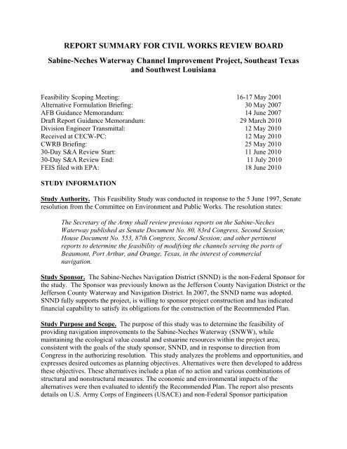
REPORT SUMMARY FOR CIVIL WORKS REVIEW BOARDSabine-Neches Waterway Channel Improvement <strong>Project</strong>, Southeast Texasand Southwest LouisianaFeasibility Scoping Meeting: 16-17 May 2001Alternative Formulation Briefing: 30 May 2007AFB Guidance Memorandum: 14 June 2007Draft Report Guidance Memorandum: 29 March 2010Division Engineer Transmittal: 12 May 2010Received at CECW-PC: 12 May 2010CWRB Briefing: 25 May 201030-Day S&A Review Start: 11 June 201030-Day S&A Review End: 11 July 2010FEIS filed with EPA: 18 June 2010STUDY INFORMATIONStudy Authority. This Feasibility Study was conducted in response to the 5 June 1997, Senateresolution from the Committee on Environment and Public Works. The resolution states:The Secretary <strong>of</strong> the <strong>Army</strong> shall review previous reports on the Sabine-NechesWaterway published as Senate Document No. 80, 83rd Congress, Second Session;House Document No. 553, 87th Congress, Second Session; and other pertinentreports to determine the feasibility <strong>of</strong> modifying the channels serving the ports <strong>of</strong>Beaumont, Port Arthur, and Orange, Texas, in the interest <strong>of</strong> commercialnavigation.Study Sponsor. The Sabine-Neches Navigation District (SNND) is the non-Federal Sponsor forthe study. The Sponsor was previously known as the Jefferson County Navigation District or theJefferson County Waterway and Navigation District. In 2007, the SNND name was adopted.SNND fully supports the project, is willing to sponsor project construction and has indicatedfinancial capability to satisfy its obligations for the construction <strong>of</strong> the Recommended Plan.Study Purpose and Scope. The purpose <strong>of</strong> this study was to determine the feasibility <strong>of</strong>providing navigation improvements to the Sabine-Neches Waterway (SNWW), whilemaintaining the ecological value coastal and estuarine resources within the project area,consistent with the goals <strong>of</strong> the study sponsor, SNND, and in response to direction fromCongress in the authorizing resolution. This study analyzes the problems and opportunities, andexpresses desired outcomes as planning objectives. Alternatives were then developed to addressthese objectives. These alternatives include a plan <strong>of</strong> no action and various combinations <strong>of</strong>structural and nonstructural measures. The economic and environmental impacts <strong>of</strong> thealternatives were then evaluated to identify the Recommended Plan. The report also presentsdetails on U.S. <strong>Army</strong> <strong>Corps</strong> <strong>of</strong> <strong>Engineers</strong> (USACE) and non-Federal Sponsor participation
Sabine-Neches WaterwayChannel Improvement <strong>Project</strong>Feasibility Report & FEISCWRB Report <strong>Summary</strong>needed to implement the plan. The report concludes with a plan that is recommended forCongressional authorization.<strong>Project</strong> Location/Congressional District. The SNWW is a federally constructed deep-draftchannel, which serves the Ports <strong>of</strong> Port Arthur, Beaumont, and Orange, Texas. A map <strong>of</strong> thearea is included in Figure 1. The existing waterway consists <strong>of</strong> a jettied entrance channel, 42 feetdeep and 500 to 800 feet wide, from the Gulf <strong>of</strong> Mexico; a channel 40 feet deep and 400 feetwide to Beaumont via the Neches River; and a channel 30 feet deep and 200 feet wide to Orangevia the Sabine River. The feasibility study investigated navigation modifications up to the Port<strong>of</strong> Beaumont to improve the efficiency and safety <strong>of</strong> navigation on the waterway. The Channelto Orange portion <strong>of</strong> the waterway is not part <strong>of</strong> this study. Congressional interests/districtsinclude Senators Cornyn and Hutchison (both TX); Senators Landrieu and Vitter (LA);Congressmen Poe (TX-2), Brady (TX-8), Edwards (TX-17), and Boustany (LA-7).Prior Reports and Existing Water <strong>Project</strong>s. Federal involvement in navigation improvementsalong the SNWW began with the River and Harbor Act (RHA) <strong>of</strong> 1885 to improve the mouth <strong>of</strong>the Sabine River with additional improvement from the RHA <strong>of</strong> 1912, which deepened thechannel to 9 feet. Major deepening efforts on the SNWW were authorized in 1912 resulting in achannel depth <strong>of</strong> 25 feet. The channel was authorized for improvement again with the RHA <strong>of</strong>1927, 1935, and 1946. Under the RHA 1962, the waterway was authorized to be deepened to itscurrent depth <strong>of</strong> 40 feet.On December 11, 1969, the Committee on Public Works House <strong>of</strong> Representatives adopted aresolution authorizing a review <strong>of</strong> the SNWW project. The resolution requested review <strong>of</strong> thereport <strong>of</strong> the Chief <strong>of</strong> <strong>Engineers</strong> on the SNWW, published as House Document No. 553, 87 thCongress, 2nd Session, and prior reports, with a view to determining whether the existing projectshould be modified in any way at this time, with particular reference to providing increaseddepths in the channel and basins. As a result, a feasibility study was initiated and a DraftFeasibility Report was completed in April 1982. The report determined that it was feasible andadvisable to deepen and widen the SNWW. The Recommended Plan proposed a channel depth<strong>of</strong> 52 feet at the Gulf <strong>of</strong> Mexico entrance channel and a channel 50 feet deep for the Sabine PassChannel, Port Arthur Canal, Sabine-Neches Canal, and the lower 12 miles <strong>of</strong> the Neches RiverChannel. The plan also included widening <strong>of</strong> the Sabine-Neches Canal, located adjacent to PortArthur, from 400 feet wide to 500 feet in width to reduce traffic congestion and delays in thisreach <strong>of</strong> the waterway, which also serves as part <strong>of</strong> the GIWW. The Recommended Plan was notimplemented because the Sponsor withdrew their support for the project.In September 1998, the USACE completed the 905(b) Reconnaissance Report for the SNWW.The reconnaissance concluded that deepening and widening <strong>of</strong> the SNWW <strong>of</strong>fers sufficientopportunity for navigation improvements with potential benefits outweighing the anticipatedproject costs.Federal Interest. The Recommended Plan addresses the problems and opportunities andsatisfies the planning objectives <strong>of</strong> increasing navigational efficiency along the SNWW whilemaintaining the coastal and estuarine resources within the project area. The National EconomicDevelopment (NED) Plan is the 49-foot channel depth which optimized the depth based on2
Sabine-Neches WaterwayChannel Improvement <strong>Project</strong>Feasibility Report & FEISCWRB Report <strong>Summary</strong>FIGURE 13
Sabine-Neches WaterwayChannel Improvement <strong>Project</strong>Feasibility Report & FEISCWRB Report <strong>Summary</strong>maximization <strong>of</strong> net economic benefits. The Recommended Plan, the 48-foot channelimprovement, is the locally preferred plan (LPP), preferred by the Sponsor, which is less inscope than the NED plan. Federal interest is clearly demonstrated by the positive benefit-to-costratio (BCR) <strong>of</strong> 1.3 for the channel improvements. The total project cost is about $1,072,000,000.All pertinent cost and benefit information can be found in Tables 3 and 4.The SNWW serves the Ports <strong>of</strong> Port Arthur, Beaumont, and Orange. Channel improvements areneeded to support the SNWW’s critically important role in the Nation’s economy. In 2007, theSNWW ranked first in the nation in crude oil imports, importing 56.2 million tons. In 2006, theSNWW (Ports <strong>of</strong> Beaumont, Port Arthur and Orange) was ranked 4th in the nation for domesticand total tonnage.The existing SNWW navigation channel system is congested. The existing 40-foot project depthwas designed to efficiently and safely accommodate much smaller vessels than are being usedtoday. The current channel was completed in the late 1960s and, at that time, crude oil tankersaveraging 40,000 deadweight tons (DWT) with loaded drafts <strong>of</strong> 36 feet were common. Vesselsover 90,000 DWT are now used routinely for crude oil imports to both Beaumont and PortArthur. With the current channel depth, there are draft restrictions on large vessels currentlyutilizing the channel. A majority <strong>of</strong> the tonnage carried on the SNWW is in deep-draft vessels,and the vast majority <strong>of</strong> the deep-draft traffic is comprised <strong>of</strong> crude oil and petrochemicalproducts. However, Liquefied Natural Gas (LNG), grain, and aggregate products, such as ironore, steel slab, limestone, sand, and gravel are also carried in draft constrained deep-draft vessels.In addition to larger vessels, the amount <strong>of</strong> vessel traffic on the SNWW has also increased. Also,three LNG terminals have been constructed or are proposed along the SNWW. LNG is expectedto play an increasingly important role in the natural gas industry and global energy markets in thenext several years and in the long-term future.STUDY OBJECTIVESProblems and Opportunities. The SNWW continues to play a significant role in the growthand economic development <strong>of</strong> the Golden Triangle area <strong>of</strong> Port Arthur, Beaumont, and Orange,Texas. As growth and economic development <strong>of</strong> the study area continues, the increasing use <strong>of</strong>the SNWW intensifies the need for more efficient movement <strong>of</strong> commodities, particularly crudepetroleum, by vessels traveling the waterway. The amount <strong>of</strong> the vessel traffic along thewaterway also increases concerns for the safety <strong>of</strong> the users, local communities and businessesall along the waterway. With the current channel dimensions, the tonnage is not being moved asefficiently due to the size restrictions <strong>of</strong> the larger tankers utilizing the channel. These tankersare either limited by the current channel depth <strong>of</strong> 40 feet or by the physical and safety limitations<strong>of</strong> the channel. The water resources problems addressed by this project are the navigational andsafety issues that have developed on the SNWW because <strong>of</strong> the growth in the area. Existingwater resource problems and needs in the study area were identified through coordination withFederal, state, and local agencies; area residents; waterway users; and the USACE and SNND.Planning Objectives. The investigation <strong>of</strong> the problems and opportunities in the study area ledto the establishment <strong>of</strong> the following planning objectives:4
Sabine-Neches WaterwayChannel Improvement <strong>Project</strong>Feasibility Report & FEISCWRB Report <strong>Summary</strong>• Improve the navigational efficiency along the SNWW waterway; and• Maintain the ecological value <strong>of</strong> coastal and estuarine resources within the project area.The optimal plan for Federal participation must be consistent with the <strong>Corps</strong>-NED perspective asset forth in the Principles and Guidelines and must also account for Other Social Effects, beacceptable from the perspective <strong>of</strong> Environmental Quality, and be in concert with the Chief <strong>of</strong><strong>Engineers</strong>’ Environmental Operating Principles. Plans developed for analysis must beformulated to be complete, effective, efficient, and acceptable, and to reasonably maximize netbenefits over the 50-year period <strong>of</strong> analysis from 2019 to 2069.Planning Constraints. Planning constraints are restrictions that limit the planning process andthe available scope <strong>of</strong> solutions to the identified problems, or that limit consideration <strong>of</strong>opportunities. Planning constraints are either institutional (laws, policies, and regulationsgoverning Federal water resource project development), physical (sites available for portimprovements), economic (limits on sponsor financing), environmental (habitat, endangeredspecies), or sociological (cultural resources, strong local opposition). The following constraintsapply to this feasibility study:• The study process and plans developed must comply with Federal and state laws and policies;• Fish and wildlife habitat affected by a project plan should be minimized as much as possibleand preserved, if possible;• Alternative plans that resolve problems in one area should not create or amplify problems inother areas; and• If a plan with lesser benefits is preferred by the sponsor due to financial constraints, guidanceallows for a categorical exemption to be granted and this lesser plan to be selected as theRecommended Plan.ALTERNATIVESPlan Formulation Rationale. The planning framework requires a systematic preparation andevaluation <strong>of</strong> alternative ways <strong>of</strong> addressing the project problems, needs, concerns, andopportunities while considering environmental factors. The criteria and planning objectivespreviously identified form the basis for plan formulation, alternative screening, and ultimatelyidentification <strong>of</strong> the Recommended Plan. Planning for Federal water resources projectsconstructed by the USACE, as well as other agencies, is based on the Principles and Guidelinesadopted by the Water Resources Council. The Economic and Environmental Principles for Waterand Related Land Resources Implementation Studies have been utilized to facilitate evaluationand display <strong>of</strong> the effects <strong>of</strong> alternative plans.An initial set <strong>of</strong> alternative plans was developed to improve navigation efficiency whilemaintaining the ecological value <strong>of</strong> coastal and estuarine resources within the project area.These plans were screened and further refined, resulting in the development <strong>of</strong> detailed plans.All plans were examined and compared considering the Federal criteria <strong>of</strong> completeness,efficiency, effectiveness, acceptability, and constructability, as well as for their potential toimpact the environment. Plans were optimized to select the Recommended Plan <strong>of</strong>improvement.5
Sabine-Neches WaterwayChannel Improvement <strong>Project</strong>Feasibility Report & FEISCWRB Report <strong>Summary</strong>Management Measures and Alternative Plans. Structural and nonstructural measures wereexamined to address the navigation problems and opportunities <strong>of</strong> the study area. The followingis a list <strong>of</strong> the alternatives considered:Future Without-<strong>Project</strong> Condition (No-Action Alternative) - The No-Action Alternative orFuture Without-<strong>Project</strong> Condition, assumes that no project would be implemented by the FederalGovernment or by local interests to improve the navigational efficiency and safety <strong>of</strong> thewaterway. This No-Action Alternative forms the basis against which all other alternative plansare measured. This alternative would retain the existing 40-foot-deep SNWW navigationchannel with its various widths along the waterway. The current dimensions would continue tolimit the efficient movement <strong>of</strong> commodities by vessels traveling the waterway. The No-ActionAlternative would continue disposal activities for maintenance material from the 40-foot projectwhile forecasting disposal facility needs for all material that would be generated by maintenancedredging <strong>of</strong> the existing 40-foot project over a 50-year period <strong>of</strong> analysis. Increases in tidalexchange, velocities and water surface elevations would be expected with a “most likely”relative sea-level rise <strong>of</strong> 1.1 feet.Nonstructural Alternatives• Alternate mode <strong>of</strong> commodity transport,• Vessel traffic service, and• Modification <strong>of</strong> existing pilot rules on the waterway.Structural Alternatives• Deepening only (43-, 45-, 48-, 50-, 53-, 55-foot depths)• Widening, only, along the entire channel (widths varying from 500 to 700 feet) from SabinePass to the Port <strong>of</strong> Beaumont• Deepening and widening (combinations <strong>of</strong> six depths and various widths for entire channellength)• Selective widening only (widening only certain reaches <strong>of</strong> the channel)• Deepening with selective widening (combination <strong>of</strong> depths and widening options)• Expansion <strong>of</strong> existing and construction <strong>of</strong> new turning basins (TB) and/or anchorage basins(AB)• Construction <strong>of</strong> barge lanes (for passing)Several screening iterations <strong>of</strong> alternatives resulted in elimination <strong>of</strong> nonstructural alternativesand widening only. The nonstructural alternatives did not address the navigational efficiency <strong>of</strong>the waterway and would not allow the vessels utilizing the channel to load more fully. Thepotential relaxation <strong>of</strong> the current transit rules by the pilots was evaluated but screened out as notimplementable because the pilots do not support this course <strong>of</strong> action. Although the widening incombination with the deepening <strong>of</strong> the channel was economically justified, the widening was notan incrementally justified feature and was eliminated from further evaluation.Final Array <strong>of</strong> Alternatives. Based on additional information from the traffic analysis, therevised BCRs, net excess benefits, and the non-Federal Sponsor’s lack <strong>of</strong> support for depthsgreater than 50 feet, the deepening alternatives were screened to a 5-foot range from 45 to 50 feet6
Sabine-Neches WaterwayChannel Improvement <strong>Project</strong>Feasibility Report & FEISCWRB Report <strong>Summary</strong>focusing on those depths with the highest net excess benefits. These depths were evaluated inone-foot increments. Selective widening and TBs/ABs were also carried forward for moredetailed analysis and formulation with the deepening alternatives. Additionally, the No-ActionAlternative was carried forward as the basis <strong>of</strong> comparison for all <strong>of</strong> the plans. Table 1 identifiesthe alternatives evaluated in the final screening phase.Table 1Alternatives for Final ScreeningAlternative Depths (feet) Sections Width (feet)DeepeningTBs/ABs (Variouscombinations)45, 46, 47, 48, 49, 5048Extension ChannelSabine Bank ChannelSabine Pass Outer BarSabine Jetty ChannelSabine Pass ChannelPort Arthur CanalTaylor BayouSabine-Neches CanalNeches River ChannelNeches River Channel700700 (tapers to 800)800 (existing)500 (existing)500 (existing)500 (existing)selective widening400 (existing)400 (existing)Comparison <strong>of</strong> Alternatives. During detailed evaluation <strong>of</strong> screened alternatives, thecomparison <strong>of</strong> the alternatives was based upon technical, economic, and environmental factors.Technical studies, used in the screening <strong>of</strong> alternatives as well as in the final selection <strong>of</strong> theplan, were conducted by the ERDC and IWR and included the Hydrodynamic/Salinity ModelingStudy(HS Model), Ship Simulation Study, Sediment Study and Velocity Analysis, Vessel EffectsStudy, Gulf Shoreline Desktop Study and Harbor Simulation Model (Widening Analysis). Costswere estimated for all <strong>of</strong> the alternatives and compared to the project benefits. Included in thecosts were dredging, levee construction, utility relocations, pipeline removals, and operationsand maintenance (O&M) costs for the 50-year period <strong>of</strong> analysis. Costs for ecosystem mitigationwere estimated using HS Model salinity projections. O&M costs for extending the entrancechannel for the deeper depth alternatives were developed to better estimate project costs <strong>of</strong> eachproposed depth. Table 2 presents the economic summary <strong>of</strong> the final screening <strong>of</strong> alternativesand includes BCRs and net excess benefits for the 45- to 50-foot plans, including turning basinsand anchorages. The 49-foot depth produced the most net excess benefits compared to the cost <strong>of</strong>the proposed project modifications and therefore, is identified as the NED Plan. The non-FederalSponsor has indicated a preference for the 48-foot project because <strong>of</strong> financial constraints.Therefore, this 48-foot project is the LPP and the Recommended Plan.7
Sabine-Neches WaterwayChannel Improvement <strong>Project</strong>Feasibility Report & FEISCWRB Report <strong>Summary</strong>Table 2SNWW Economic <strong>Summary</strong> DataCost and Benefits ($1,000s) by Channel Alternative(50-Year Period <strong>of</strong> Analysis at 4.375%)(December 2008 Vessel Costs)45 46 47 48 49 50First Cost <strong>of</strong> Construction ($) 798,920 889,906 980,891 1,071,877 1,152,079 1,232,280Total Annual Cost ($) 70,217 77,258 84,299 91,341 96,626 101,911Average Annual Benefits ($) 83,844 95,856 104,303 115,074 122,875 127,696Net Excess Benefits ($) 13,627 18,598 20,004 23,733 26,249 25,785BCR 1.2 1.2 1.2 1.3 1.3 1.3Key Assumptions. Various assumptions key to the formulation and recommendation were usedin the analysis <strong>of</strong> this analysis. Recommendations on channel improvements and depthoptimization are predicted on levels <strong>of</strong> commerce identified through investigation and forecasts<strong>of</strong> future commerce. Additional key assumptions for this study are:Future without-project Condition Louisiana Coastal Wetlands Planning, Protection and Restoration Act <strong>Project</strong>s will be inoperation at Willow Bayou, Black Bayou, and Perry Ridge for remainder <strong>of</strong> project life, The most likely rate <strong>of</strong> relative sea level rise (RSLR) is estimated to be 1.1 feet in the studyarea by year 2069 with the full potential range <strong>of</strong> RSLR estimated to be from 0.3 to 2.8 feetover period <strong>of</strong> analysis, Future freshwater inflows assumed for HS modeling are slightly higher on Neches River thanexisting inflows and about the same as existing inflows on the Sabine River, and Changes in land loss rates are driven by the interaction <strong>of</strong> salinity and submergence, resultingin a reduction in plant productivity, leading to a decrease in plant growth, plant death,followed by peat collapse and wetland loss with an assumed linear relationship betweenchange in salinity due to RSLR and change in future without project land loss rate.Future with-project Condition RSLR is the same as with the future without-project condition because deepening projectcauses only negligible increase in water surface elevation, Additional land loss would result primarily from the interaction <strong>of</strong> higher future with-projectsalinities with RSLR, Cost estimate <strong>of</strong> the Recommended Plan utilized appropriate probabilities <strong>of</strong> risk, Up to five pipeline dredges would be available for use at one time for inshore channeldredging, and mitigation and Beneficial Use (BU) marsh creation. Offshore dredgingassumes use <strong>of</strong> only one hopper dredge at a time, and Sufficient funding streams would be available to construct the Recommended Plan over theassumed construction periods and to provide long-term operation and maintenance.Recommended Plan. The Recommended Plan calls for a 48-foot-deep channel from SabinePass Channel to the Port <strong>of</strong> Beaumont on the Neches River Channel with no additional widening,8
Sabine-Neches WaterwayChannel Improvement <strong>Project</strong>Feasibility Report & FEISCWRB Report <strong>Summary</strong>widening and deepening <strong>of</strong> Taylor Bayou TBs and channels to 48 feet, and improvements toseveral TBs and ABs on the Neches River Channel. The Recommended Plan would increase theexisting channel depth by 8 feet, increasing the inland portion from 40 to 48 feet and increasingthe existing <strong>of</strong>fshore portions from 42 to 50 feet (plus overdepth and advance maintenance asneeded). Two feet <strong>of</strong> overdepth and two feet <strong>of</strong> advance maintenance are included for the entirechannel length. In high shoaling areas, additional advance maintenance is required in order tomaintain current maintenance dredging cycles along the waterway. The Recommended Planwould result in an estimated 98 million cubic yards (mcy) <strong>of</strong> new work and 650 mcy <strong>of</strong>maintenance material over the 50-period <strong>of</strong> analysis. The annual maintenance dredging quantitiesin the SNWW would increase from an average <strong>of</strong> 8.1 mcy for the current 40-foot project to 13.0mcy for the proposed 48-foot project. The total length <strong>of</strong> the SNWW with the proposed channelmodifications would be approximately 77 miles. No modifications to the existing Sabine PassJetties are required by the proposed project. The Recommended Plan also includes the least-costNeches River and Gulf Shore BU features as General Navigation Features <strong>of</strong> the DredgedMaterial Management Plan (DMMP). The Neches River BU Feature restores 2,852 acres <strong>of</strong>emergent marsh, improves 871 acres <strong>of</strong> open water habitat, and nourishes 1,234 acres <strong>of</strong> existingmarsh in three large degraded marsh areas (Rose City East, Bessie Heights East, and Old RiverCove) along the navigation channel. The Gulf Shore BU Feature periodically nourishes threemiles <strong>of</strong> shoreline in Texas and three miles <strong>of</strong> shoreline in Louisiana beside the Sabine PassChannel.All practicable means to avoid or minimize adverse environmental effects have beenincorporated into the Recommended Plan, and a compensatory mitigation plan has been includedto address all unavoidable impacts in Louisiana. All impacts in Texas and some impacts inLouisiana will be <strong>of</strong>fset by environmental benefits <strong>of</strong> the DMMP BU Features. The MitigationPlan will compensate for the Recommended Plan impacts with marsh restoration in fivedegraded Willow and Black Bayou marshes. The mitigation measures will restore 2,783 acres <strong>of</strong>emergent marsh in existing open water areas within the marsh, improve 957 acres <strong>of</strong> shallowwater habitat by creating shallower, smaller ponds and channels within the restored marsh, andnourish 4,355 acres <strong>of</strong> existing marsh located in and around the marsh restoration zone.Monitoring and contingency plans for these mitigation measures and the BU Features areincluded in the Recommended Plan.Systems/Watershed Context. The SNWW is a system <strong>of</strong> navigation channels that have beensuperimposed upon the Sabine-Neches estuary in Texas and Louisiana. The estuary includesSabine Lake, tidal portions <strong>of</strong> the Sabine and Neches rivers, and a number <strong>of</strong> tidally influencedbayous and shallow coastal lakes. The major rivers within the study area are the Sabine andNeches rivers, and smaller streams such as Taylor, Adam, Cow, and Little Cypress bayous on theTexas side. Major bayous flowing into Sabine Lake from Louisiana include Lighthouse,Johnsons, Madame Johnsons, Willow, Three, and Black bayous. The only connection with theGulf <strong>of</strong> Mexico is a long narrow pass called Sabine Pass through which all tidal interchangeoccurs. Sabine Pass is stabilized by jetties that extend 4.1 miles into the Gulf <strong>of</strong> Mexico.The feasibility study evaluated navigation and environmental problems and opportunities for theentire estuarine system, which is defined as the study area in all reports. The study areaencompasses a 2,000-square-mile area, which contains the smaller area referred to as the “project9
Sabine-Neches WaterwayChannel Improvement <strong>Project</strong>Feasibility Report & FEISCWRB Report <strong>Summary</strong>area.” The project area includes those areas that would be directly affected by construction <strong>of</strong> theproject (i.e. the dredging footprint, existing and proposed PAs, and mitigation areas). The studyarea includes the following water bodies and adjacent coastal wetlands: Sabine Lake andadjacent marshes in Texas and Louisiana, the Neches River channel up to the new Neches RiverSaltwater Barrier, the Sabine River channel to the Sabine Island Wildlife Management Area, theGIWW west to Star Bayou, the GIWW east to Gum Cove Ridge, the Gulf shoreline extending to10 miles either side <strong>of</strong> Sabine Pass, and 35 miles <strong>of</strong>fshore into the Gulf <strong>of</strong> Mexico.Environmental Operating Principles. The Recommended Plan fully supports each <strong>of</strong> the sevenUSACE Environmental Operating Principles:1. Strive to Achieve Environmental Sustainability. Construction designs <strong>of</strong> BU, restoration,and mitigation sites were developed for a 50-year period <strong>of</strong> analysis. Development and design <strong>of</strong>these areas were made to address potential changes over time (e.g., sea-level rise, shorelineerosion, etc.). The BU features and mitigation measures will contribute to the long-termenvironmental sustainability <strong>of</strong> the study area.2. Consider environmental consequences. The direct and indirect effects <strong>of</strong> the project on theenvironment were quantified using ecological modeling. Compensatory mitigation is provided inthe Recommended Plan for all unavoidable project impacts.3. Seek Balance and Synergy. Opportunities to beneficially use the large quantities <strong>of</strong> dredgedmaterial that would be generated by this project were thoroughly explored. The needs <strong>of</strong> theproject to find environmentally acceptable placement areas (PAs) were satisfied with thedevelopment <strong>of</strong> BU Features that would contribute to the long-term sustainability <strong>of</strong> interiorwetlands and the coastal zone.4. Accept Responsibility. Implementation <strong>of</strong> the Recommended Plan will ensure that the projectcomplies with all Federal and State laws and regulations most notably in the areas <strong>of</strong> economicjustification, environmental impacts, and agency and external peer review. All environmentalimpacts <strong>of</strong> the proposed project have been addressed and either <strong>of</strong>fset by beneficially usingdredged material or mitigating for impacts.5. Mitigate Impacts. <strong>Project</strong> impacts were identified and the type and location <strong>of</strong> compensatorymitigation measures are presented in the project reports. No mitigation is required in Texas sincethe benefits <strong>of</strong> the DMMP more than <strong>of</strong>fset the impacts in that state. Mitigation has beenidentified to fully compensate project impacts in Louisiana. The recommended mitigation planresults in an excess <strong>of</strong> overall environmental benefits vs. impacts.6. Understand the Environment. Some <strong>of</strong> the most knowledgeable and experiencedenvironmental pr<strong>of</strong>essionals in Texas and Louisiana participated on the SNWW InteragencyCoordination Team (ICT). Their expertise ensured that the broad spectrum <strong>of</strong> environmentalhabitats <strong>of</strong> the study area were adequately understood, impacts accurately identified, and theappropriate amount and type <strong>of</strong> mitigation was developed.10
Sabine-Neches WaterwayChannel Improvement <strong>Project</strong>Feasibility Report & FEISCWRB Report <strong>Summary</strong>7. Respect other views. Scoping meetings and a series <strong>of</strong> public workshops were held at theoutset <strong>of</strong> the study to obtain a full spectrum <strong>of</strong> public views regarding potential navigationimprovements and beneficial use/ecosystem restoration opportunities. Public and agencycomments on the draft project reports were solicited at public meetings and throughdissemination <strong>of</strong> the reports. All comments have been thoroughly reviewed and responses havebeen provided in the FEIS. Collaboration between the USACE, Sponsor, and ICT membersoccurred throughout the study process. The interactions were pr<strong>of</strong>essional and respectful, andalways entertaining the opinions and expertise <strong>of</strong> others.Independent Technical Review and Agency Technical Review: Agency Technical Review(ATR) for this study has been managed by the Deep Draft Navigation Planning Center <strong>of</strong>Expertise at the <strong>Corps</strong> South Atlantic Division, Mobile District (SAM). All concerns <strong>of</strong> the ATRhave been addressed and incorporated into the final report. The completed ATR sign-<strong>of</strong>f <strong>of</strong> thereview <strong>of</strong> the draft report was provided by SAM on 18 December 2008. The ATR <strong>of</strong> the finalreport was certified in May 2010. Additionally, the <strong>Corps</strong> Center <strong>of</strong> Expertise for CostEstimating at the Walla Walla District (NWW) was tasked with technical review <strong>of</strong> the projectcost estimates. NWW forwarded its completed Cost ATR sign-<strong>of</strong>f <strong>of</strong> the draft report on 19October 2009. No changes have been made to the cost estimate since that sign-<strong>of</strong>f.SAM has also managed an Independent External Peer Review (IEPR) <strong>of</strong> the study documents byexperts outside <strong>of</strong> USACE. The IEPR report was completed and provided to the GalvestonDistrict on 5 October 2007. The results <strong>of</strong> this review has been addressed and incorporated intothe final project documents and recommendation. The final certification <strong>of</strong> the report for IEPR isexpected to be provided prior to the Civil Works Review Board meeting.EXPECTED PROJECT PERFORMANCE<strong>Project</strong> Costs. <strong>Project</strong> first costs are shown in Table 3. <strong>Project</strong> costs were developed at October2009 price levels and include post-authorization planning and design costs, the GeneralNavigation Features (GNF) costs including mitigation costs, lands, easements, and rights-<strong>of</strong>way,relocations, and O&M. The GNF costs include costs for dredging, PA construction, aids tonavigation (e.g., channel markers and protection for MLK Bridge supports and bridge fenderreplacement). The USACE coordinated with the U.S. Coast Guard (USCG) to develop costs foraids to navigation, and with the Texas Department <strong>of</strong> Transportation to develop costs for bridgesupport protection and fender systems. Costs for compensatory fish and wildlife mitigation(including deferred construction costs for one mitigation measure) and potential cultural resourcemitigation are also included. Associated Federal and non-Federal costs are the costs <strong>of</strong> resourcesdirectly required for project construction, but for which no project expenditure is made, such asUSCG navigation aids, deep-draft utility relocations, pipeline removals, and non-Federalberthing/dock modifications.11
Sabine-Neches WaterwayChannel Improvement <strong>Project</strong>Feasibility Report & FEISCWRB Report <strong>Summary</strong>Table 3First Cost <strong>Summary</strong>Sabine-Neches Waterway(All costs in $)(October 2009 price level; 4.375% interest rate)Construction Dredging and PAsFish and Wildlife MitigationCultural Resources MitigationLandsEngineering & DesignConstruction ManagementDeep-Draft Utility RelocationsPipeline RemovalsAids to Navigation – Bridge Fender ModificationsAids to Navigation – Channel MarkersBerthing and Dock ModificationsTotal <strong>Project</strong> Cost$704,977,00077,491,0001,248,0004,361,000105,712,00062,921,0001,199,00040,428,00051,794,0001,492,00020,254,000____________$1,071,877,000Equivalent Annual Costs and Benefits. To determine whether Federal interest in the proposedimprovements is warranted, the project has been evaluated for its environmental impacts, socialeffects, and economic justification. <strong>Project</strong> benefits were developed based on October 2009price levels using a project base year <strong>of</strong> 2019. Economic justification is expressed in terms <strong>of</strong> aBenefit-Cost analysis. <strong>Project</strong> costs are discounted to present value and amortized over theproject life. They are then compared to average annual economic benefits that would beproduced by the project. To be recommended a project must have a BCR <strong>of</strong> greater than one-toone.In addition, alternative plans for different channel depths are compared to determine andrecommend the plan which has the highest annual net benefits. Net benefits are total annualbenefits minus total annual costs. The project was examined incrementally foot-by-foot todetermine the channel depth yielding the highest net benefit. The annual costs, annual benefits,and benefit cost analysis for the project are shown in Table 4.12
Sabine-Neches WaterwayChannel Improvement <strong>Project</strong>Feasibility Report & FEISCWRB Report <strong>Summary</strong>Table 4Equivalent Annual Benefits and Costs(All costs in $)(October 2009 price level; 4.375% interest rate)Investment CostsTotal <strong>Project</strong> Construction Cost $1,071,877,000Interest During Construction Costs 119,382,000Total Investment Cost $1,191,259,000Average Annual CostsInterest and Amortization <strong>of</strong> Initial Investment 59,059,000Deferred Construction (F&W Mitigation) 215,000Incremental O&M 32,067,000Total Average Annual Costs $91,341,000Average Annual Benefits 115,074,000Net Annual Benefits 23,733,000Benefits-Cost Ratio 1.3Benefits-Cost Ratio (computed at 7%) 1 0.91 Per Executive Order 12893Cost Sharing. The GNF costs for deepening between 40 and 45 feet are cost shared at 25percent non-Federal and 75 percent Federal; costs for deepening below 45 feet are cost shared at50 percent non-Federal and 50 percent Federal. Fish and wildlife mitigation is considered a GNFand is cost shared in the same manner as other GNF costs. Costs for cultural resources datarecovery would be handled in accordance with PL 93-291 (Section 7), e.g., data recovery costswould be 100 percent Federal up to 1 percent <strong>of</strong> the total amount appropriated for the project.Based upon information available at this time, data recovery costs are not expected to exceed the1 percent limitation. Non-Federal costs include non-Federal Sponsor, pipeline owner, andberthing/dock owner costs. The non-Federal Sponsor is responsible for 100 percent <strong>of</strong> Lands,Easements, and Rights-<strong>of</strong>-Way. Utility relocations required for the Recommended Plan aredefined as “deep-draft utility relocations” pursuant to PGL 44 because the SNWW ChannelImprovement <strong>Project</strong> would be authorized at a depth greater than 45 feet. In accordance withSection 101(a) (4) <strong>of</strong> Water Resources Development Act <strong>of</strong> 1986, 50 percent <strong>of</strong> deep-draft utilityrelocations would be borne by the utility owner and 50 percent would be borne by the non-Federal sponsor. Pipeline removals would be 100 percent owner cost. Owners <strong>of</strong> berth and dockfacilities that would require modification in conjunction with the Recommended Plan would beresponsible for 100 percent <strong>of</strong> those associated costs. The USCG is responsible for 100 percent<strong>of</strong> the cost for aids to navigation. Cost sharing for the project is shown in Table 5.<strong>Project</strong> Implementation. The non-Federal sponsor is the SNND and would supply allnecessary items <strong>of</strong> local cooperation, including the non-Federal shares <strong>of</strong> design and constructioncosts, berthing deepening, lands, easements, and rights-<strong>of</strong>-way, costs <strong>of</strong> mitigation and datarecovery activities associated with historic preservation, that are in excess <strong>of</strong> 1 percent <strong>of</strong> thetotal amount authorized and ensure the performance <strong>of</strong> all relocations, deep-draft utilityrelocations, and removals.13
Sabine-Neches WaterwayChannel Improvement <strong>Project</strong>Feasibility Report & FEISCWRB Report <strong>Summary</strong>Table 5Sabine-Neches Waterway - Cost Sharing(All costs in $)(October 2009 Price Level)Non-FederalCostItemFederal CostTotal CostDeep-Draft Navigation from 40 to 45 feetConstruction Contracts $ 390,306,000 (75) $130,102,000 (25) $ 520,408,000Lands - Federal $ 558,000 (75) $ 186,000 (25) $ 744,000Bridge Modifications $ 34,182,750 (75) $ 11,394,250 (25) $ 45,577,000Engineering and Design $ 62,171,250 (75) $ 20,723,750 (25) $ 82,895,000Construction Management $ 36,318,750 (75) $ 12,106,250 (25) $ 48,425,000Fish & Wildlife Facilities $ 41,409,000 (75) $ 13,803,000 (25) $ 55,212,000Cultural Resources $ 1,248,000 (100) $ - $ 1,248,000Subtotal - Deep-Draft Navigation from 40 to45 feet $ 566,193,750 $188,315,250 $ 754,509,000Deep-Draft Navigation from 45 to 48 feetConstruction Contracts $ 92,284,500 (50) $ 92,284,500 (50) $ 184,569,000Bridge Modifications $ 3,108,500 (50) $ 3,108,500 (50) $ 6,217,000Engineering and Design $ 11,408,500 (50) $ 11,408,500 (50) $ 22,817,000Construction Management $ 7,248,000 (50) $ 7,248,000 (50) $ 14,496,000Fish & Wildlife Facilities $ 11,139,500 (50) $ 11,139,500 (50) $ 22,279,000Subtotal - Deep-Draft Navigation from 45 to48 feet $ 125,189,000 $125,189,000 $ 250,378,000Lands, Easements, Relocations, andRemovalsLands - 100% Non-Federal $ - $ 3,617,000 (100) $ 3,617,000Relocation - Deep-Draft Utilities $ - $ 599,500 (50) $ 599,500Subtotal - Lands, Easements, Relocations,and Removals $ - $ 4,216,500 $ 4,216,500Other FederalNavigation Aids $ 1,492,000 (100) $ - $ 1,492,000Associated CostsRelocation - Deep-Draft Utilities $ - $ 599,500 (50) $ 599,500Removals/Relocations <strong>of</strong> Pipelines $ - $ 40,428,000 (100) $ 40,428,000Dredging Berthing Areas and Dock Moods $ - $ 20,254,000 (100) $ 20,254,000Subtotal - Associated Costs $ - $ 61,281,500 $ 61,281,500Total <strong>Project</strong> $ 692,874,750 $317,720,750 $1,010,595,500Associated Costs $ 61,281,500 $ 61,281,500Total with Associated Costs $ 692,874,750 $379,002,250 $1,071,877,00014
Sabine-Neches WaterwayChannel Improvement <strong>Project</strong>Feasibility Report & FEISCWRB Report <strong>Summary</strong>Operation and Maintenance. O&M <strong>of</strong> the completed project would be limited to periodicmaintenance dredging <strong>of</strong> the channels and other dredging features <strong>of</strong> the project. The <strong>Corps</strong>would undertake this maintenance with financial participation from SNND for 50 percent <strong>of</strong> theportion <strong>of</strong> the cost <strong>of</strong> maintaining those channels deepened beyond 45 feet. The non-FederalSponsor and other terminal owners would be responsible for the periodic maintenance <strong>of</strong> theirindividual berths. The average annual incremental O&M costs for the project is about $32million.Key Social and Environmental Factors. The primary impact <strong>of</strong> the Recommended Plan willbe an indirect impact associated with a small increase in salinity (ranging from 0.3 to 1.8 ppt)and an associated reduction in biological productivity over approximately 182,000 acres <strong>of</strong>intertidal marsh, and the potential loss <strong>of</strong> 691 acres <strong>of</strong> marsh in Louisiana as some marshconverts to open water due to salinity stress. Minor impacts to cypress-tupelo swamp orbottomland hardwood productivity are also projected, but resource agencies considered theseimpacts to be acceptable since the loss in function is negligible. Other minor and temporaryimpacts will also occur to water quality and benthic organisms and their Gulf, estuarine, andriverine water-bottom habitats resulting from dredging to construct the navigation improvements,the creation <strong>of</strong> new <strong>of</strong>fshore Ocean Dredged Material Disposal Sites (ODMDS), the Sabine Lakeborrow trench for the Willow Bayou, Louisiana mitigation areas, and marsh restoration inshallow, open-water areas; potential dredging impacts to bottom-feeding and pelagic organismssuch as sea turtles; and potential impacts to shoreline birds and their habitat from the placement<strong>of</strong> maintenance material on the Gulf shoreline.Consistent with increasing navigational efficiency in an environmentally sustainable manner, theproject will be designed, constructed and operated to avoid impacts to threatened and endangeredsea turtles, wintering piping plovers and other migratory birds. Hopper dredging duringconstruction and maintenance is likely to adversely affect but is not likely to jeopardize thecontinued existence <strong>of</strong> loggerhead, Kemp’s ridley, hawksbill, leatherback, or green sea turtles.The Gulf Shore BU Feature is not likely to adversely affect the piping plover or its CriticalHabitat and the brown pelican. The DMMP marsh restoration and Louisiana marsh mitigationareas would result in a net increase in migratory bird habitat in the project area. Constructioncontracts would include instructions to avoid impacts to migratory birds and their nests fromconstruction-related activities. All activity in Louisiana occurring within 2,000 feet <strong>of</strong> a brownpelican rookery will be restricted to the nonnesting period. In Texas, all activity occurring within1,000 feet <strong>of</strong> a rookery will be restricted to the non-nesting season.All practicable means to avoid or minimize adverse environmental effects have beenincorporated into the Recommended Plan, and a compensatory mitigation plan has been includedto address all unavoidable impacts in Louisiana. All impacts in Texas and some impacts inLouisiana will be <strong>of</strong>fset by environmental benefits <strong>of</strong> the DMMP BU Features. The MitigationPlan will compensate for the Recommended Plan impacts with marsh restoration that will restore2,783 acres <strong>of</strong> emergent marsh in existing open water areas within the marsh, improve 957 acres<strong>of</strong> shallow water habitat by creating shallower, smaller ponds and channels within the restoredmarsh, and nourish 4,355 acres <strong>of</strong> existing marsh located in and around the marsh restorationzone. Monitoring and contingency plans for these mitigation measures and the BU Features areincluded in the Recommended Plan. Periodic monitoring to determine their success will15
Sabine-Neches WaterwayChannel Improvement <strong>Project</strong>Feasibility Report & FEISCWRB Report <strong>Summary</strong>continue until the Division Commander determines that the ecological success criteria <strong>of</strong> themitigation and DMMP BU features have been met. An interagency coordination team will beconsulted annually to determine progress in the planning, construction, and post-constructionevaluation <strong>of</strong> the ecological success <strong>of</strong> these features.Stakeholder Perspectives and Differences. SNND fully supports the project, is willing tosponsor project construction and has indicated financial capability to satisfy its obligations forthe construction <strong>of</strong> the Recommended Plan. Because <strong>of</strong> financial constraints, the sponsor hasindicated a preference for the 48-foot project. Therefore, this LPP has been selected as theRecommended Plan.Public meetings were held in January 2010 in Beaumont, Texas, and Lake Charles, Louisianawith the responses to all public and agency comments presented in the Final EnvironmentalImpact (EIS). The U.S. Fish and Wildlife Service has submitted a Coordination Act Report thataffirms the impact assessment and approves the proposed BU and mitigation plans. Since theproposed Willow Bayou mitigation measures are located in the Sabine National Wildlife Refuge(NWR), and the proposed Gulf Shore BU Feature at Texas Point is located in the Texas PointNWR, the USACE is coordinating with the refuges regarding compatibility determinations forthe proposed actions. Both refuges have indicated they see no conflict with refuge purposes andexpect no issues with obtaining the required clearances. Clean Water Act § 401 water qualitycertification has been received from the states <strong>of</strong> Texas and Louisiana. A Final GeneralConformity Determination has been prepared for the proposed project. Air emissions that wouldresult from construction <strong>of</strong> the Recommended Plan conform to the State Implementation Plan forthe Beaumont-Port Arthur ozone non-attainment area.The NMFS has concurred that detrimental impacts <strong>of</strong> the Recommend Plan on Essential FishHabitat are minor and temporary, and the project would provide indirect benefits leading to anoverall net gain in marsh habitat. In order for four new Ocean Disposal Management DisposalSites to be approved for use, the Environmental Protection Agency (EPA) must publish a finalrulemaking in the Federal Register. A Final EIS for the proposed ODMDS and a Final SiteManagement and Monitoring Plan have been prepared and accepted by EPA for use in thisrulemaking at a later date. The Recommended Plan may potentially adversely impact terrestrialand marine historic properties eligible for listing on the National Register <strong>of</strong> Historic Places. AnHistoric Properties Programmatic Agreement has been executed among the Texas and LouisianaState Historical Preservation Officers, the project’s non-Federal sponsor and USACE thatrequires the completion <strong>of</strong> § 106 historic properties investigations and consultation prior toconstruction. The project has been evaluated for consistency with the Texas and Louisianacoastal management programs, and concluded that the Recommended Plan is fully consistent tothe maximum extent practicable with the enforceable policies <strong>of</strong> both state programs. The TexasCoastal Coordination Council has concurred with the USACE consistency determination. TheLouisiana Department <strong>of</strong> Natural Resources (LDNR) Office <strong>of</strong> Coastal Management (OCM)found that the SNWW project is conditionally consistent with their state program. Sinceconditional consistency as proposed by LDNR-OCM is not acceptable, LDNR-OCM has beennotified that USACE will proceed with the project.16
Sabine-Neches WaterwayChannel Improvement <strong>Project</strong>Feasibility Report & FEISCWRB Report <strong>Summary</strong>It is expected that objections to the project will be expressed by the LNDR and LouisianaDepartment <strong>of</strong> Wildlife and Fisheries (LDWF). USACE coordination with LDWF has not beenable to resolve issues related to the <strong>of</strong>fset <strong>of</strong> project impacts to Federal lands with benefits fromBU features in Texas, LDWF requirements that the Recommended Plan include additional BUfeatures, and royalty, license and further assessment requirements concerning areas in SabineLake that would be affected by the borrow trench for marsh mitigation in Louisiana. USACE hasproposed that an assessment survey be completed, following the protocol established by theLDWF, during the PED phase. The conditional consistency proposed by LDNR-OCM requiresthe submission <strong>of</strong> additional detailed information on topics that include, but are not limited to,storm surge, bar channel deepening, salinity, borrow from Sabine Lake, mitigation plans andadequacy, and pipeline relocation. USACE has conducted extensive technical coordination withLDWF and LDNR regarding these and other issues for nearly 10 years and has successfullyresolved numerous concerns, but efforts to obtain concurrence in the Federal consistencydetermination have been unsuccessful. These objections will be taken into consideration inarriving at the decision.Environmental Compliance. The project was designed and the study conducted in accord withthe requirements <strong>of</strong> the National Environmental Policy Act. An EIS was prepared for thisproject. The Draft Feasibility Report and Draft EIS were released for public and agency reviewfor 75 days on 24 December 2009, with Notice <strong>of</strong> Availability published in the Federal Registeron 18 December 2009. The DEIS public review period under the NEPA and State processesclosed on 10 March 2010. Public meetings were held in Beaumont, Texas and Lake Charles,Louisiana on 26 and 27 January 2010, respectively. Comments and concerns raised by thereviewers have been addressed and incorporated into the Final Feasibility Report and Final EIS.At the conclusion <strong>of</strong> Design Phase investigations and detailed implementation plans, the Federaland State regulatory processes would be completed and the final regulatory approvals obtainedfor the project. Any significant new information developed in the Design Phase, and changes tothe project recommendation, and any construction sequencing or changes in air qualitycompliance, would be published in additional NEPA documents to solicit public participation.State and Agency Review. (To be inserted by HQUSACE after the S&A Review ends)Certification <strong>of</strong> Peer and Legal Review. Certifications <strong>of</strong> the technical and legal adequacy <strong>of</strong>the final feasibility report have been received.Agency Technical Review final certification was received in 5 May 2010. Independent ExternalPeer Review certification has been received for the 2007 review. The final Independent ExternalPeer Review certification is expected to be received prior to the Civil Works Review Boardmeeting. Legal review certification was received 6 May 2010.The Cost Engineering DX reviewed and certified the cost estimate for the Sabine-NechesWaterway Channel Improvement <strong>Project</strong> in October 2009. Their certification was on the fullyfunded amount <strong>of</strong> $1,174,621,000, including $13,249,000 in feasibility study costs. The fullyfunded amount <strong>of</strong> $1,161,372,000 reported in the final report does not include these feasibilitystudy costs.17
Sabine-Neches WaterwayChannel Improvement <strong>Project</strong>Feasibility Report & FEISCWRB Report <strong>Summary</strong>Policy Compliance Review. (To be inserted by HQUSACE after the S&A Review ends)18