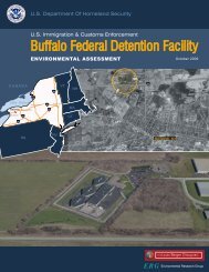
i LIMITED PHASE I ENVIRONMENTAL SITE ASSESSMENT PARK ...
i LIMITED PHASE I ENVIRONMENTAL SITE ASSESSMENT PARK ...
i LIMITED PHASE I ENVIRONMENTAL SITE ASSESSMENT PARK ...

You also want an ePaper? Increase the reach of your titles
YUMPU automatically turns print PDFs into web optimized ePapers that Google loves.
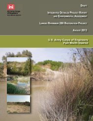
2.0 <strong>SITE</strong> DESCRIPTION2.1 Site Location and Description2.1.1 Boundaries of Property and ESA AreaThis Limited Phase I ESA was conducted on 109 properties located along the San Antonio Riverin San Antonio, Texas. Table 2.1.1-1 provides a listing of the current property ownership andreported physical location or mailing address. The assessment was divided into three areas. Thenorthern area was called the Park Reach, while the areas located progressively to the south alongthe river were called the Mission Reach Area I and the Mission Reach Area II respectively (SeeGeneral Location Map, Figure 1.1-1). In the following discussion, the Alamo, located in SanAntonio, is used as the downtown reference point.The south end of Park Reach begins where US 281 crosses the San Antonio River approximately1.5 miles northeast of downtown San Antonio and extends approximately 1.5 miles to thenortheast to where East Hildebrand Street crosses the river (See Topographic Site Location Map,Figure 1.2-1). Brackenridge Park, where the San Antonio River begins, occupies the Park Reachassessment area. The center line of the river on the north side of the Park Reach is located on theSan Antonio East, Tex, 1992 United States Geological Survey (USGS) 7.5 Minute TopographicQuadrangle at approximately Latitude 29 o 27' 55.80? North and Longitude 98 o 28' 04.67? West.The center line of the river on the south side of the Park Reach is at approximately Latitude 29 o26' 41.65? North and Longitude 98 o 28' 52.10? West. Figure 2.1.1-1, Site Vicinity Map, presentsthe locations of the two Park Reach properties that were assessed as part of this Limited Phase IESA (i.e., property Nos. 82 and 109).The north end of Mission Reach Area I is located where South Alamo Street crosses the SanAntonio River, approximately 1.25 miles southwest of downtown San Antonio. The MissionReach Area I extends approximately 2.5 miles to the south, where Mission Road crosses the river(See Topographic Site Location Map, Figure 1.2-2). The center line of the river on the north sideof Mission Reach Area I is located on the San Antonio East, Tex, 1992 USGS 7.5 MinuteTopographic Quadrangle at approximately Latitude 29 o 24' 36.52? North and Longitude 98 o 29'41.53? West. The center line of the river on the south side of Mission Reach Area I is atapproximately Latitude 29 o 22' 46.00? North and Longitude 98 o 29' 20.54? West. Figure 2.1.1-2,Site Vicinity Map, presents the locations of the 17 Mission Reach Area I properties that wereassessed as part of this Limited Phase I ESA (i.e., property Nos. 1, 5, 28-33, 36, 48, 65-67, 69-71and 86).The north end of Mission Reach Area II continues southward from Mission Reach Area I andextends approximately 5.75 miles to the southeast to approximately 0.8 miles south of where I-410 crosses the San Antonio River (See Topographic Site Location Map, Figure 1.2-3). Thecenter line of the river on the north side of Mission Reach Area II is located on the San AntonioEast, Tex, 1992 USGS 7.5 Minute Topographic Quadrangle at approximately Latitude 29 o 22'46.00? North and Longitude 98 o 29' 20.54? West. The center line of the river on the south sideof Mission Reach Area II is located on the Southton, Tex, 1992 USGS 7.5 Minute TopographicQuadrangle at approximately Latitude 29 o 18' 40.65? North and Longitude 98 o 26' 33.99? West.2618s22-1