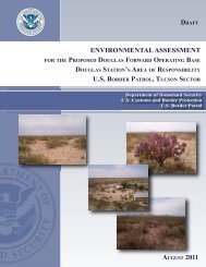
i LIMITED PHASE I ENVIRONMENTAL SITE ASSESSMENT PARK ...
i LIMITED PHASE I ENVIRONMENTAL SITE ASSESSMENT PARK ...
i LIMITED PHASE I ENVIRONMENTAL SITE ASSESSMENT PARK ...

Create successful ePaper yourself
Turn your PDF publications into a flip-book with our unique Google optimized e-Paper software.
• RCRA TSD – RCRA Transporters/Storage/Disposal Facilities• RCRA COR – RCRA Corrective Action Sites• RCRA GEN – RCRA Very Small/Large Waste Generators• Emergency Response Notification System (ERNS) – List of National Spill Reports orEmergency Response Notification System Reports and area compilation of reported releasesof oil or hazardous substances.Tables 3.1.1-1, 3.1.1-2, and 3.1.1-3 summarize the results of the Environmental Federal AgencyRecords Survey search of the surrounding areas of the Park Reach and the Mission Reach AreasI and II, respectively.3.1.2 State AgencyBanks performed a search of State Agencies environmental records of the surrounding areas ofPark Reach and Mission Reach Areas I and II under the following criteria:• SWL – Solid Waste Landfills• REG UST/AST – Registered Underground Storage Tanks/Aboveground Storage Tanks• Leaking UST – Leaking Underground Storage Tanks• Receptors – Facilities that have their own water supply• State Sites – The Texas Commission on Environmental Quality’s (TCEQ’s) State SuperfundRegistry listing as maintained by the Office of Waste Management, Remediation Division.Tables 3.1.2-1, 3.1.2-2, and 3.1.2-3 summarize the results of the Environmental State AgencyRecords Survey search of the surrounding areas of the Park Reach and the Mission Reach AreasI and II, respectively.3.1.3 Local AgencyNo environmental regulatory records for local agencies (i.e., county, city) were identifiedthrough available records search for the Park and Mission Reaches.3.2 Physical Setting Source SurveyIn accordance with requirements outlined in ASTM Standard E 1527-00, TtNUS collected andreviewed physical setting source information to assess the potential for impact and/or migrationof recognized environmental contaminants in connection with the Limited Phase I ESA. Thisphysical setting information was in addition to the information available through the currentUSGS 7.5 Minute Topographic Maps that are also provided as part of this Limited Phase I ESA.2618s33-2