environmental assessment us border patrol, tucson sector
environmental assessment us border patrol, tucson sector
environmental assessment us border patrol, tucson sector

Create successful ePaper yourself
Turn your PDF publications into a flip-book with our unique Google optimized e-Paper software.
12345678910111213141516171819202122232425262728293031323334353637383940414243444546 facilities necessary for an increased effectiveness of USBP agents in the performance oftheir duties (e.g., vehicle parking, vehicle fuel facilities, helicopter pad and fuelingfacility, horse corral, and communications equipment and tower) a more safe, effective, and efficient work environmentProposed Action: The Proposed Action would construct, operate, and maintain a new FOB inthe San Bernardino Valley, east of Douglas. The proposed FOB would be constructed to s<strong>us</strong>tainapproximately 30 agents in the field for an indefinite period of time, and would be designed withpre-fabricated, modular buildings for more efficient construction and costs. The proposed FOBwould include some or all of the following components: agent living quarters, dining facility,support/maintenance buildings, all-terrain vehicle storage, communication tower and facilities,security lighting, horse corral, administration building, remote video surveillance system(RVSS), self-contained vehicle wash station, vehicle parking, helicopter pad, fuel station, waterwell and water storage, standby/backup power generator(s), stormwater retention system,detention facilities, septic system, and first aid facility.All undeveloped areas within the boundaries of the proposed FOB would be restored with nativeplantings, landscaped, or allowed to revegetate naturally, and a perimeter fence with gates wouldbe placed around the facility for security purposes. Best management practices (BMPs) wouldbe implemented to avoid and minimize potential effects on U.S. Department of the Interior(DOI) tr<strong>us</strong>t resources.Additionally, continued maintenance, as well as potential renovations of or minor additions tothe proposed new FOB, would be expected. Such activities could include, but are not limited to,monthly supply trips necessary for fuel and water at the FOB, minor renovations and additions tobuildings such as realigning interior spaces of an existing building, adding a small storage shedto an existing building, kennels, security systems, lighting, parking areas, and stormwaterdetention basins, and installing a small antenna on an already existing antenna tower that doesnot ca<strong>us</strong>e the total height to exceed 200 feet. Other maintenance activities could include routineupgrade, repair, and maintenance of the FOB’s modular buildings, roofs, parking area, grounds,or other facilities which would not result in a change in functional <strong>us</strong>e (e.g., replacing door locksor windows, painting interior or exterior walls, resurfacing a road or parking lot, culvertmaintenance, grounds maintenance, or replacing essential FOB components such as an airconditioning unit).Alternatives Considered: Four alternatives for the proposed FOB were identified andconsidered during the planning stages of the proposed project. All four were deemed suitableand carried forward in this analysis: 1) the Proposed Action at the Alternative 1 site (PreferredAlternative); 2) the Proposed Action at the Alternative 2 site (Alternative 2); 3) the ProposedAction at the Alternative 3 site (Alternative 3); and 4) the Utilization and Modification of theAlternative 4 site, the Peterson/Lazy J Ranch (Alternative 4). The No Action Alternative hasalso been evaluated, as required by NEPA. At the Preferred Alternative, Alternative 2, andAlternative 3 sites, the proposed FOB would be constructed with modular buildings toaccommodate forward-deployed agents, as well as a helicopter landing pad, equestrian facilities,all-terrain vehicle storage, detention, and fueling facilities, in support of the National BorderPatrol Strategy to gain and maintain effective control of the <strong>border</strong>s of the United States. At theFONSI - 2
12345678910111213141516171819202122232425262728293031323334353637383940414243444546Alternative 4 site, minimal new construction and ground disturbance would take place. Existingstructures would be utilized and modified, and additional capabilities, such as a backup generatorand communications facilities, would be added as necessary.The Preferred Alternative would construct the proposed new FOB, including buildings,landscaped and parking areas, heliport, corrals, communications tower, and generator, in the SanBernardino Valley, east of Douglas, on approximately 10 acres of property. Selection of thePreferred Alternative is based on the following criteria: the site is the flattest, most symmetricalof the four sites; it is located at the edge of the San Bernardino Valley escarpment where USBPalready maintains an elevated observation post for truck-mounted observation equipment; and italso satisfies the stated purpose and need.Affected Environment and Consequences: The construction, operation, and maintenance ofthe proposed FOB would potentially result in minor impacts, including temporarily increased airpollution from soil disturbance, permanent loss of vegetation and wildlife habitat, and minorincreases in water <strong>us</strong>e and ambient noise. No previo<strong>us</strong>ly documented cultural resources siteseligible for listing on the National Register of Historic Places (NRHP) are located at thePreferred Alternative, Alternative 2, or Alternative 3 sites. However, the Alternative 4 sitecontains historic structures that are likely eligible for listing on the NRHP. All alternatives,except Alternative Site 4, would have approximately the same impacts on the humanenvironment, but at different locations. These impacts would include minor increases in the needfor utilities and associated infrastructure, temporary, minor increases in soil erosion and sedimentrunoff, and minor impacts on visual and aesthetic resources. Only two residences occur near anyof the alternative sites, and they are located on the Alternative 4 site; however, the otheralternative sites cannot be seen from these residences. Furthermore, construction, operation, andmaintenance of the proposed FOB would have no effect relative to socioeconomics,<strong>environmental</strong> j<strong>us</strong>tice, or protection of children. The Alternative 4 site currently has the utilitiesand infrastructure associated with an active ranch and would require minimal new constructionand ground disturbance; however, impacts on potential historic structures at this site wouldrequire consultation with the State Historic Preservation Officer (SHPO) and possible mitigation.The potential impacts resulting from the Preferred Alternative, in combination with impactsresulting from other development in the San Bernardino Valley, would have minimal permanentcumulative effects on air quality, noise, aesthetics, and biological resources. No major impactsfor any resources would occur regardless of the alternative chosen.BMPs: The following BMPs will be implemented to minimize impacts on the human andnatural environment:General Construction Activities:BMPs will be implemented as standard operating procedures during all construction activities,such as proper handling, storage, and/or disposal of hazardo<strong>us</strong> and/or regulated materials. Tominimize potential impacts from hazardo<strong>us</strong> and regulated materials, all fuels, waste oils, andsolvents will be collected and stored in tanks or drums within a secondary containment systemthat consists of an impervio<strong>us</strong> floor and bermed sidewalls capable of containing the volume ofthe largest container stored therein. The refueling of machinery will be completed followingFONSI - 3
12345678910111213141516171819202122232425262728293031323334353637383940414243444546accepted guidelines, and all vehicles would have drip pans during storage to contain minor spillsand drips. Any spill of a reportable quantity will be contained immediately within an earthendike, and the application of an absorbent (e.g., granular, pillow, sock) will be <strong>us</strong>ed to absorb andcontain the spill. Any reportable spill of a hazardo<strong>us</strong> or regulated substance will be reportedimmediately to on-site <strong>environmental</strong> personnel, who would notify appropriate Federal and stateagencies. In addition to a Stormwater Pollution Prevention Plan (SWPPP), a Spill Prevention,Control, and Countermeasures Plan (SPCCP) will be in place prior to the start of construction, orprior to the start of operation and maintenance of equipment, and all personnel will be briefed onthe implementation and responsibilities of this plan.All waste oil and solvents will be recycled. All non-recyclable hazardo<strong>us</strong> and regulated wasteswill be collected, characterized, labeled, stored, transported, and disposed of in accordance withall Federal, state, and local regulations, including proper waste manifesting procedures.Non-hazardo<strong>us</strong> solid waste (trash and waste construction materials) will be collected anddeposited in the on-site receptacles. Solid waste receptacles will be maintained, will becollected, and will be disposed of by a local waste disposal contractor.Soils:Suitable fencing will be installed around the perimeter of the facility to contain vehicles andpeople and prevent accidental impacts on soils on adjacent properties. Vehicular trafficassociated with the construction activities and operational support activities will remain onestablished roads to the maximum extent practicable. Areas with highly erodible soils will begiven special consideration when designing the proposed project to ensure incorporation ofvario<strong>us</strong> BMPs, such as straw bales, aggregate materials, and wetting compounds to decreaseerosion. A SWPPP will be prepared prior to construction activities, and BMPs described in theSWPPP will be implemented to reduce erosion. Furthermore, all areas not immediatelydeveloped will be planted with native plant species, landscaped, or allowed to naturallyrevegetate to minimize erosion potential.Biological Resources:Construction equipment will be cleaned prior to departing the project corridor to minimize thespread and establishment of non-native invasive plant species. Soil disturbances in temporarilyimpacted areas will be re-vegetated or landscaped. To minimize vegetation impacts, designatedtravel corridors off of the main road will be marked with easily observed removable orbiodegradable markers, and travel will be restricted to the corridor to the extent practicable.The Migratory Bird Treaty Act requires that Federal agencies coordinate with the U.S. Fish andWildlife Service (USFWS) if a construction activity would result in any harm to a migratorybird, including breeding and nesting activities. If construction or clearing activities werescheduled during the nesting season (typically February 1-September 1), preconstruction surveysfor migratory bird species would occur immediately prior to the start of any construction activityto identify active nests. If construction activities would result in the disturbance or harm of amigratory bird, then coordination with USFWS and Arizona Game and Fish Department(AZGFD) would occur, and applicable permits for relocation of nests, eggs, or chicks would beobtained prior to construction or clearing activities. In addition, where possible, buffer zoneswould be established around active nests until nestlings have fledged and abandoned the nest.FONSI - 4
123456789101112131415161718192021222324252627282930313233343536373839404142434445Another BMP that would be considered is to schedule clearing and grubbing activities outsidethe nesting season, negating the requirement for preconstruction nesting bird surveys.Shields would be installed on lights to prevent background lighting. Lights would also beinstalled such that the direction of illumination is downward toward the station facilities, andfugitive illumination beyond the site boundaries would be less than 2 lumens.Cultural Resources:There are no identified cultural resource sites that would be directly impacted by constructionactivities under the Preferred Alternative. An Unanticipated Discoveries Plan will be developedand implemented if ground disturbance activities uncover previo<strong>us</strong>ly unidentified culturalresource material. If unmarked human burials are discovered during construction, work will stopin the immediate vicinity, the remains will be protected, and the local cultural resourcesrepresentative and the Arizona SHPO will be notified as soon as possible. The location of theunmarked human burial will be documented and the provisions of the Native American GravesProtection and Repatriation Act (NAGPRA) will be implemented, including consultation withNative American tribes.Air Quality:Mitigation measures will include suitable fencing to restrict traffic within the project area inorder to reduce soil disturbance. Soil watering will be utilized to minimize airborne particulatematter created during construction activities. Bare ground will be covered with hay or straw tolessen wind erosion between facility construction and landscaping. After the construction iscompleted, all areas with vehicle traffic will be paved to reduce the potential for fugitive d<strong>us</strong>t,and landscaping will be designed to prevent or lessen wind fugitive d<strong>us</strong>t creation. Additionally,all construction equipment and vehicles will be kept in good operating condition to minimizeexha<strong>us</strong>t emissions.Water Resources:Standard construction procedures will be implemented to minimize the potential for erosion andsedimentation during construction. All work will cease during heavy rains and will not resumeuntil conditions are suitable for the movement of equipment and material. Beca<strong>us</strong>e the impactarea is greater than 1 acre, as part of the National Pollutant Discharge Elimination System(NPDES) permit process, a SWPPP and Notice of Intent will be submitted to the U.S.Environmental Protection Agency (USEPA)/Arizona Department of Environmental Quality(AZDEQ) prior to the start of construction. Sedimentation and pollution of surface waters byfuels, oils, and lubricants will be minimized through the implementation of the SWPPP. Theconstruction of the proposed FOB would incorporate the proper stormwater retention measures,including a retention pond. All fuel tanks will be double-walled to prevent leaks from enteringthe groundwater. Proper wastewater disposal will be accomplished by <strong>us</strong>ing an engineered, onsitewastewater treatment system.Noise:During the construction phase, short-term noise impacts are anticipated. All Occupational Safetyand Health Administration (OSHA) requirements will be followed. To lessen noise impacts onFONSI - 5
12345678910111213141516171819202122232425262728293031323334353637383940the local wildlife communities, construction will only occur during daylight hours, wheneverpossible. All motor vehicles will be maintained to reduce the potential for vehicle-related noise.To minimize disturbances from helicopter <strong>us</strong>e, USBP will review landing and takeoff routes todetermine what actions could be taken, such as alternating or rotating routes, and timing the <strong>us</strong>eof different routes to reduce noise effects on wildlife or residents in the San Bernardino Valley.All helicopters will be maintained and operated to reduce the potential for engine-related noise.Solid and Hazardo<strong>us</strong> Wastes:Care will be taken to avoid impacting the project area with hazardo<strong>us</strong> substances (e.g., antifreeze,fuels, oils, lubricants) <strong>us</strong>ed during construction. Although catch pans will be <strong>us</strong>ed whenrefueling, accidental spills could occur as a result of maintenance procedures to constructionequipment. However, the amount of fuel, lubricants, and oil is limited, and equipment necessaryto quickly contain any spills will be present when refueling.Transportation:Modular buildings and other equipment will be transported on appropriate roads with properflagging and safety precautions.Findings and Concl<strong>us</strong>ions: No significant adverse impacts are anticipated for any resourceanalyzed within this document. Therefore, no further analysis or documentation (i.e.,Environmental Impact Statement) is warranted. CBP, in implementing this decision, wouldemploy all practical means to minimize the potential adverse impacts on the human andbiological environment.Project Proponent: _______________________________ ______________Efren V. M. GarciaDateDirectorFacilities BranchOffice of Border PatrolApproved: ________________________________ ______________Robert F. JansonDateActing Executive DirectorFacilities Management and EngineeringU.S. C<strong>us</strong>toms and Border ProtectionFONSI - 6
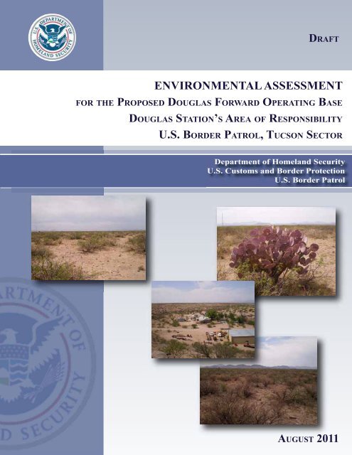
DraftENVIRONMENTAL ASSESSMENTFOR THE PROPOSED DOUGLAS FORWARD OPERATING BASEDOUGLAS STATION’S AREA OF RESPONSIBILITYU.S. BORDER PATROL, TUCSON SECTORAug<strong>us</strong>t 2011Lead Agency:Department of Homeland SecurityU.S. C<strong>us</strong>toms & Border ProtectionFacilities Management and Engineering1301 Constitution Avenue NW, Suite B-155Washington, DC 20229Point of Contact:Joseph ZidronEnvironmental PlanningBorder Patrol Program Management Office24000 Avila RoadLaguna Niguel, CA 92677
EXECUTIVE SUMMARYINTRODUCTION:This draft Environmental Assessment (EA) was prepared inaccordance with the National Environmental Policy Act (NEPA) andanalyzes the project alternatives and potential impacts on the humanand natural environment resulting from the construction, operation,and maintenance of a proposed United States (U.S.) Border Patrol(USBP) Forward Operating Base (FOB) in the San Bernardino Valley,east of Douglas in Cochise County, Arizona, at one of four alternativesites.USBP is a law enforcement entity of U.S. C<strong>us</strong>toms and BorderProtection (CBP) within the Department of Homeland Security(DHS). USBP’s priority mission is to prevent the entry of terroristsand their weapons of terrorism and to enforce the laws that protect theUnited States homeland. This is accomplished by the detection,interdiction, and apprehension of those who attempt to illegally enteror smuggle any person or contraband across the sovereign <strong>border</strong>s ofthe United States.This EA addresses the potential effects, beneficial and adverse,resulting from the proposed construction, operation, and maintenanceof the proposed FOB in USBP Douglas Station’s Area ofResponsibility (AOR) in Cochise County, Arizona. The proposedFOB would be constructed to s<strong>us</strong>tain approximately 30 agents in thefield for an indefinite period, in support of the National Border PatrolStrategy to gain and maintain effective control of the <strong>border</strong>s of theUnited States (CBP 2005). USBP Douglas Station’s AOR includes40.5 linear miles of the United States/Mexico <strong>border</strong>, over 1,450square miles of mountaino<strong>us</strong> terrain, and is divided into six <strong>border</strong><strong>patrol</strong> zones: Zones 32 through 37. Zones 35, 36, and 37, referred toas the eastern zones, are a remote operational environment and spanthe San Bernardino Valley. The remoteness of, and travel time to, theeastern zones inhibit the capability of law enforcement agents torespond to illegal activity. Agents deploying to the easternmost areasof Zone 37 typically have a response time of approximately 1 hourand 45 minutes to 2 hours from m<strong>us</strong>ter at the USBP Douglas Station.By providing a FOB near the United States/Mexico <strong>border</strong> with livingquarters and fuel facilities, agent response time to illegal cross-<strong>border</strong>activities would be greatly reduced, and agents could be moreefficiently deployed to <strong>patrol</strong> the more remote sections of USBPDouglas Station’s AOR. The overall safety and efficiency of currentand future operations within USBP Douglas Station’s AOR would beenhanced, as well as the safety of ranches and residents located in theSan Bernardino Valley.Douglas FOB EADraftAug<strong>us</strong>t 2011
ES-2DESCRIPTION OFPROPOSED ACTION:PROPOSED ACTIONAND ALTERNATIVESCONSIDERED:The Proposed Action includes the construction, operation, andmaintenance of a new FOB. The proposed FOB site would be anapproximately 10-acre tract of undeveloped land located within theSan Bernardino Valley, approximately 22 miles east of the City ofDouglas, within USBP Douglas Station’s AOR. Access to the projectsite would be from an existing county road (Geronimo Trail), whichprovides access from Douglas eastward to the San Bernardino Valleyand the Peloncillo Mountains.Four alternatives for the proposed FOB were identified and consideredduring the planning stages of the proposed project. All four weredeemed suitable and carried forward in this analysis: 1) the ProposedAction at Alternative Site 1 (Preferred Alternative); 2) the ProposedAction at Alternative Site 2 (Alternative 2); 3) the Proposed Action atAlternative Site 3 (Alternative 3); and 4) the utilization andmodification of Alternative Site 4, Peterson/Lazy J Ranch (Alternative4). The No Action Alternative has also been evaluated, as required byNEPA. At the Preferred Alternative , Alternative 2, and Alternative 3sites, the proposed FOB would be constructed with modular buildingsto accommodate forward-deployed agents, as well as a helicopterlanding pad, equestrian facilities, all-terrain vehicle storage, detention,and fueling facilities. At the Alternative 4 site, minimal newconstruction would take place. Existing structures would be utilizedand modified, and additional capabilities, such as a backup generatorand communications facilities, would be added as necessary.The Preferred Alternative would construct the proposed FOB,including buildings, landscaped and parking areas, heliport, corrals,communications tower, and generator, in the San Bernardino Valley,east of Douglas, on approximately 10 acres of property. Selection ofthe Preferred Alternative is based on the following criteria: the site itis the flattest, most symmetrical of the four sites; it is located at theedge of the San Bernardino Valley escarpment where USBP alreadymaintains an elevated observation post for truck-mounted observationequipment; and it also satisfies the stated purpose and need.AFFECTEDENVIRONMENT ANDCONSEQUENCES:The construction, operation, and maintenance of the proposed FOBwould potentially result in minor impacts, including temporarilyincreased air pollution from soil disturbance, permanent loss ofvegetation and wildlife habitat, and minor increases in water <strong>us</strong>e andambient noise. No cultural resources sites eligible for listing on theNational Register of Historic Places (NRHP) are located at thePreferred Alternative, Alternative 2, or Alternative 3 sites; however,the Alternative 4 site contains several historic structures potentiallyeligible for listing on the NRHP. All alternatives, except Alternative4, would have approximately the same impacts on the humanDouglas FOB EADraftAug<strong>us</strong>t 2011
ES-3environment, but at different locations. These impacts would includeminor increases in the need for utilities and associated infrastructure,temporary, minor increases in soil erosion and sediment runoff, andminor impacts on visual and aesthetic resources. Only two residencesoccur near any of the alternative sites, and they are located at theAlternative 4 site; however, the other alternative sites are not visiblefrom these residences. Furthermore, construction, operation, andmaintenance of the proposed FOB would have no effect relative tosocioeconomics, <strong>environmental</strong> j<strong>us</strong>tice, or protection of children. TheAlternative 4 site currently has the utilities and infrastructureassociated with an active ranch and would require minimal newconstruction and ground disturbance; however, impacts on potentialhistorical structures at this site would require consultation with theState Historic Preservation Officer (SHPO) and possible mitigation.The potential impacts resulting from the Proposed Action, incombination with impacts resulting from other development in the SanBernardino Valley, would have minimal, permanent cumulativeeffects on air quality, noise, aesthetics, and biological resources.FINDINGS ANDCONCLUSIONS:No major adverse impacts are anticipated for any resource analyzedwithin this document. Therefore, no further analysis ordocumentation (i.e., Environmental Impact Statement) is warranted.CBP, in implementing this decision, would employ all practical meansto minimize the potential adverse impacts on the human and biologicalenvironment.Douglas FOB EADraftAug<strong>us</strong>t 2011
12345678910111213141516171819202122232425262728293031323334353637383940414243TABLE OF CONTENTSEXECUTIVE SUMMARY .................................................................................................... ES-11.0 INTRODUCTION ......................................................................................................... 1-11.1 BACKGROUND ................................................................................................. 1-11.2 STUDY LOCATION ........................................................................................... 1-11.3 PURPOSE AND NEED ....................................................................................... 1-31.4 REGULATORY AUTHORITY .......................................................................... 1-31.5 PUBLIC INVOLVEMENT ................................................................................. 1-31.6 SCOPE OF THE ANALYSIS ............................................................................. 1-51.7 APPLICABLE ENVIRONMENTAL GUIDANCE, STATUTES, ANDREGULATIONS.................................................................................................. 1-61.8 REPORT ORGANIZATION ............................................................................... 1-62.0 PROPOSED ACTION AND ALTERNATIVES ........................................................ 2-12.1 PROPOSED ACTION ......................................................................................... 2-12.2 ALTERNATIVES CONSIDERED ..................................................................... 2-42.3 NO ACTION ALTERNATIVE ........................................................................... 2-52.4 PREFERRED ALTERNATIVE .......................................................................... 2-52.5 ALTERNATIVE 2 ............................................................................................... 2-52.6 ALTERNATIVE 3 ............................................................................................... 2-82.7 ALTERNATIVE 4 ............................................................................................... 2-82.8 SUMMARY ....................................................................................................... 2-113.0 AFFECTED ENVIRONMENT AND CONSEQUENCES ........................................ 3-13.1 PRELIMINARY IMPACT SCOPING ................................................................ 3-13.2 LAND USE .......................................................................................................... 3-23.2.1 Affected Environment .............................................................................. 3-23.2.1.1 Preferred Alternative ................................................................. 3-23.2.1.2 Alternative 2.............................................................................. 3-23.2.1.3 Alternative 3.............................................................................. 3-33.2.1.4 Alternative 4.............................................................................. 3-33.2.2 Environmental Consequences .................................................................. 3-33.2.2.1 No Action Alternative ............................................................... 3-33.2.2.2 Preferred Alternative ................................................................. 3-33.2.2.3 Alternative 2.............................................................................. 3-33.2.2.4 Alternative 3.............................................................................. 3-33.2.2.5 Alternative 4.............................................................................. 3-33.3 SOILS .................................................................................................................. 3-43.3.1 Affected Environment .............................................................................. 3-43.3.1.1 Preferred Alternative ................................................................. 3-43.3.1.2 Alternative 2.............................................................................. 3-43.3.1.3 Alternative 3.............................................................................. 3-43.3.1.4 Alternative 4.............................................................................. 3-43.3.2 Environmental Consequences .................................................................. 3-6Douglas FOB EADraftAug<strong>us</strong>t 2011
ii12345678910111213141516171819202122232425262728293031323334353637383940414243444546473.3.2.1 No Action Alternative ............................................................... 3-63.3.2.2 Preferred Alternative ................................................................. 3-63.3.2.3 Alternative 2.............................................................................. 3-63.3.2.4 Alternative 3.............................................................................. 3-73.3.2.5 Alternative 4.............................................................................. 3-73.4 WATER RESOURCES ....................................................................................... 3-83.4.1 Affected Environment .............................................................................. 3-83.4.1.1 Surface Water ............................................................................ 3-83.4.1.2 Hydrology and Hydraulics ........................................................ 3-83.4.1.3 Wetlands and Waters of the United States ................................ 3-83.4.1.4 Groundwater ........................................................................... 3-103.4.1.5 Floodplains .............................................................................. 3-103.4.2 Environmental Consequences ................................................................ 3-103.4.2.1 No Action Alternative ............................................................. 3-103.4.2.2 Preferred Alternative ............................................................... 3-103.4.2.3 Alternative 2............................................................................ 3-113.4.2.4 Alternative 3............................................................................ 3-113.4.2.5 Alternative 4............................................................................ 3-113.5 VEGETATIVE HABITAT ................................................................................ 3-123.5.1 Affected Environment ............................................................................ 3-123.5.1.1 Preferred Alternative ............................................................... 3-123.5.1.2 Alternative 2............................................................................ 3-123.5.1.3 Alternative 3............................................................................ 3-133.5.1.4 Alternative 4............................................................................ 3-133.5.2 Environmental Consequences ................................................................ 3-133.5.2.1 No Action Alternative ............................................................. 3-133.5.2.2 Preferred Alternative ............................................................... 3-143.5.2.3 Alternative 2............................................................................ 3-143.5.2.4 Alternative 3............................................................................ 3-143.5.2.5 Alternative 4............................................................................ 3-143.6 WILDLIFE RESOURCES ................................................................................. 3-143.6.1 Affected Environment ............................................................................ 3-143.6.1.1 Preferred Alternative ............................................................... 3-153.6.1.2 Alternative 2............................................................................ 3-153.6.1.3 Alternative 3............................................................................ 3-153.6.1.4 Alternative 4............................................................................ 3-153.6.2 Environmental Consequences ................................................................ 3-163.6.2.1 No Action Alternative ............................................................. 3-163.6.2.2 Preferred Alternative ............................................................... 3-163.6.2.3 Alternative 2............................................................................ 3-173.6.2.4 Alternative 3............................................................................ 3-173.6.2.5 Alternative 4............................................................................ 3-173.7 PROTECTED SPECIES AND CRITICAL HABITATS .................................. 3-183.7.1 Affected Environment ............................................................................ 3-183.7.1.1 Federally Listed Species ......................................................... 3-183.7.1.2 Critical Habitat ........................................................................ 3-223.7.1.3 San Bernardino NWR ............................................................. 3-22Douglas FOB EADraftAug<strong>us</strong>t 2011
iii12345678910111213141516171819202122232425262728293031323334353637383940414243444546473.7.1.4 State-Listed Species ................................................................ 3-233.7.2 Environmental Consequences ................................................................ 3-233.7.2.1 No Action Alternative ............................................................. 3-233.7.2.2 Preferred Alternative ............................................................... 3-233.7.2.3 Alternative 2............................................................................ 3-263.7.2.4 Alternative 3............................................................................ 3-263.7.2.5 Alternative 4............................................................................ 3-263.8 CULTURAL, HISTORICAL, AND ARCHAEOLOGICAL RESOURCES .... 3-273.8.1 Affected Environment ............................................................................ 3-273.8.1.1 Cultural Overview ................................................................... 3-283.8.1.2 Previo<strong>us</strong> Investigations ........................................................... 3-323.8.2 Environmental Consequences ................................................................ 3-333.8.2.1 No Action Alternative ............................................................. 3-333.8.2.2 Preferred Alternative ............................................................... 3-333.8.2.3 Alternative 2............................................................................ 3-343.8.2.4 Alternative 3............................................................................ 3-343.8.2.5 Alternative 4............................................................................ 3-343.9 AIR QUALITY .................................................................................................. 3-343.9.1 Affected Environment ............................................................................ 3-343.9.1.1 Greenho<strong>us</strong>e Gases and Climate Change ................................. 3-363.9.2 Environmental Consequences ................................................................ 3-373.9.2.1 No Action Alternative ............................................................. 3-373.9.2.2 Preferred Alternative ............................................................... 3-373.9.2.3 Alternative 2............................................................................ 3-393.9.2.4 Alternative 3............................................................................ 3-393.9.2.5 Alternative 4............................................................................ 3-393.10 NOISE ................................................................................................................ 3-393.10.1 Affected Environment ............................................................................ 3-393.10.2 Environmental Consequences ................................................................ 3-403.10.2.1 No Action Alternative ............................................................. 3-403.10.2.2 Preferred Alternative ............................................................... 3-413.10.2.3 Alternative 2............................................................................ 3-413.10.2.4 Alternative 3............................................................................ 3-413.10.2.5 Alternative 4............................................................................ 3-413.11 UTILITIES AND INFRASTRUCTURE ........................................................... 3-413.11.1 Affected Environment ............................................................................ 3-413.11.1.1 Potable Water .......................................................................... 3-413.11.1.2 Electric Power ......................................................................... 3-413.11.1.3 Wastewater .............................................................................. 3-413.11.1.4 Communications ..................................................................... 3-413.11.2 Environmental Consequences ................................................................ 3-423.11.2.1 No Action Alternative ............................................................. 3-423.11.2.2 Preferred Alternative ............................................................... 3-423.11.2.3 Alternative 2............................................................................ 3-423.11.2.4 Alternative 3............................................................................ 3-423.11.2.5 Alternative 4............................................................................ 3-423.12 TRANSPORTATION ........................................................................................ 3-43Douglas FOB EADraftAug<strong>us</strong>t 2011
iv12345678910111213141516171819202122232425262728293031323334353637383940414243444546473.12.1 Affected Environment ............................................................................ 3-433.12.2 Environmental Consequences ................................................................ 3-433.12.2.1 No Action Alternative ............................................................. 3-433.12.2.2 Preferred Alternative ............................................................... 3-433.12.2.3 Alternative 2............................................................................ 3-433.12.2.4 Alternative 3............................................................................ 3-433.12.2.5 Alternative 4............................................................................ 3-433.13 AESTHETIC AND VISUAL RESOURCES .................................................... 3-443.13.1 Affected Environment ............................................................................ 3-443.13.2 Environmental Consequences ................................................................ 3-443.13.2.1 No Action Alternative ............................................................. 3-443.13.2.2 Preferred Alternative ............................................................... 3-443.13.2.3 Alternative 2............................................................................ 3-443.13.2.4 Alternative 3............................................................................ 3-453.13.2.5 Alternative 4............................................................................ 3-453.14 HAZARDOUS MATERIALS ........................................................................... 3-453.14.1 Affected Environment ............................................................................ 3-453.14.2 Environmental Consequences ................................................................ 3-453.14.2.1 No Action Alternative ............................................................. 3-453.14.2.2 Preferred Alternative ............................................................... 3-453.14.2.3 Alternative 2............................................................................ 3-463.14.2.4 Alternative 3............................................................................ 3-463.14.2.5 Alternative 4............................................................................ 3-463.15 SOCIOECONOMICS ........................................................................................ 3-463.15.1 Affected Environment ............................................................................ 3-463.15.1.1 Population and Demographics ................................................ 3-463.15.1.2 Ho<strong>us</strong>ing ................................................................................... 3-473.15.1.3 Income and Employment ........................................................ 3-473.15.2 Environmental Consequences ................................................................ 3-493.15.2.1 No Action Alternative ............................................................. 3-493.15.2.2 Preferred Alternative ............................................................... 3-493.15.2.3 Alternative 2............................................................................ 3-493.15.2.4 Alternative 3............................................................................ 3-493.15.2.5 Alternative 4............................................................................ 3-493.16 ENVIRONMENTAL JUSTICE AND PROTECTION OF CHILDREN ......... 3-503.16.1 Affected Environment ........................................................................... 3-503.16.1.1 Executive Order 12898, Environmental J<strong>us</strong>tice ...................... 3-503.16.1.2 Executive Order 13045, Protection of Children ..................... 3-503.16.2 Environmental Consequences ................................................................ 3-503.16.2.1 No Action Alternative ............................................................. 3-503.16.2.2 Preferred Alternative ............................................................... 3-503.16.2.3 Alternative 2............................................................................ 3-503.16.2.4 Alternative 3............................................................................ 3-503.16.2.5 Alternative 4............................................................................ 3-513.17 SUSTAINABILITY AND GREENING............................................................ 3-513.17.1 Affected Environment ............................................................................ 3-513.17.2 Environmental Consequences ................................................................ 3-51Douglas FOB EADraftAug<strong>us</strong>t 2011
vi123456789101112131415161718192021222324252627282930313233343536LIST OF FIGURESFigure 1-1. Vicinity Map ............................................................................................................ 1-2Figure 2-1. Project Location Map ............................................................................................... 2-2Figure 2-2. Conceptual Site Layout ............................................................................................ 2-3Figure 2-3. Preferred Alternative Project Area Map .................................................................. 2-6Figure 2-4. Alternative 2 Project Area Map ............................................................................... 2-7Figure 2-5. Alternative 3 Project Area Map ............................................................................... 2-9Figure 2-6. Alternative 4 Project Area Map ............................................................................. 2-10Figure 3-1. Soil Map ................................................................................................................... 3-5Figure 3-2. Water Resources Map .............................................................................................. 3-9Figure 3-3. Fish Critical Habitat on San Bernardino NWR ...................................................... 3-24LIST OF TABLESTable 1-1. Project–Specific Summary of Guidance, Statutes, and Relevant RegulationsIncluding Compliance Requirements ...................................................................... 1-7Table 2-1. Comparison of Alternatives Considered ................................................................. 2-4Table 2-2. Alternatives Matrix ............................................................................................... 2-12Table 2-3. Summary Matrix of Potential Impacts .................................................................. 2-13Table 3-1. Federally Listed Species for Cochise County, Arizona ........................................ 3-19Table 3-2. Known Federally and State-Listed Species that Occur on and ImmediatelyAdjacent to the San Bernardino NWR .................................................................. 3-23Table 3-3. Prehistoric Sequence for the Douglas Area .......................................................... 3-28Table 3-4. National Ambient Air Quality Standards .............................................................. 3-35Table 3-5. Total Air Emissions (tons/year) from Construction of the Preferred Alternativevers<strong>us</strong> the de minimis Threshold Levels ............................................................... 3-38Table 3-6. Total Air Emissions (tons/year) from Propane Generators vers<strong>us</strong> the de minimisLevels .................................................................................................................... 3-39Table 3-7. Population Cens<strong>us</strong> 1990 to 2009 .......................................................................... 3-46Table 3-8. Race....................................................................................................................... 3-47Table 3-9. Ho<strong>us</strong>ing Units ....................................................................................................... 3-47Table 3-10. Per Capita Personal Income .................................................................................. 3-48Table 3-11. Total Personal Income .......................................................................................... 3-48Table 3-12. Jobs in 2009 .......................................................................................................... 3-48Table 3-13. 2009 Poverty and Median Income by Location .................................................... 3-49Douglas FOB EADraftAug<strong>us</strong>t 2011
vii12345678910111213141516LIST OF PHOTOGRAPHSPhotograph 2-1. Preferred Alternative site ................................................................................. 2-5Photograph 2-2. Alternative 2 site. ............................................................................................ 2-8Photograph 2-3. Alternative 3 site. ............................................................................................ 2-8Photograph 2-4. Buildings at the Alternative 4 site. ................................................................ 2-11Photograph 2-5. Pile of cross ties at the Alternative 4 site. ..................................................... 2-11Photograph 3-1. Vegetation within Cottonwood Draw at the Alternative 4 site ..................... 3-13Photograph 3-2. Rocky ridge on the eastern portion of the Alternative 4 site ......................... 3-13Photograph 3-3. Stick-built nest on windmill at the Alternative 4 site .................................... 3-16LIST OF APPENDICESAppendix A. CorrespondenceAppendix B. State Threatened and Endangered Species ListAppendix C. Air Quality CalculationsDouglas FOB EADraftAug<strong>us</strong>t 2011
SECTION 1.0INTRODUCTION
1-11234567891011121314151617181920212223242526272829303132333435363738394041421.0 INTRODUCTION1.1 BACKGROUNDIn 1924, Congress created the United States (U.S.) Border Patrol (USBP) to serve as the lawenforcement entity of the Immigration and Naturalization Service (INS), and it did so untilNovember 25, 2002 when Congress transferred all INS responsibilities to the newly createdDepartment of Homeland Security (DHS) with the passage of the Homeland Security Act of2002 (Public Law [PL] 107-296). USBP was officially transferred into the Office of BorderPatrol (OBP), under DHS and U.S. C<strong>us</strong>toms and Border Protection (CBP), on March 1, 2003.CBP has prepared an Environmental Assessment (EA) that will address the potential effects,beneficial and adverse, resulting from the proposed construction, operation, and maintenance ofa USBP Douglas Station Forward Operating Base (FOB) in Cochise County, Arizona. Theproposed FOB would be constructed to s<strong>us</strong>tain approximately 30 agents in the field for anindefinite period, in support of the National Border Patrol Strategy to gain and maintain effectivecontrol of the <strong>border</strong>s of the United States (CBP 2005).USBP Douglas Station is one of eight stations comprising the Tucson Sector, along with the Ajo,Casa Grande, Naco, Nogales, Sonoita, Tucson, and Wilcox Stations in Arizona. USBP DouglasStation’s Area of Responsibility (AOR) includes 40.5 linear miles of the United States/Mexico<strong>border</strong>, over 1,450 square miles of mountaino<strong>us</strong> terrain, and is divided into six <strong>border</strong> <strong>patrol</strong>zones (Figure 1-1): Zones 32 through 37. Zones 35, 36, and 37, referred to as the eastern zones,are a remote operational environment and span the San Bernardino Valley. The remoteness of,and travel time to, the eastern zones inhibit the capability of law enforcement agents to respondto illegal activity. Agents deploying to the easternmost areas of Zone 37 typically have aresponse time of approximately 1 hour and 45 minutes to 2 hours from m<strong>us</strong>ter at the USBPDouglas Station. By providing the proposed FOB near the United States/Mexico <strong>border</strong> withliving quarters and fuel facilities, agent response time to illegal cross-<strong>border</strong> activities would begreatly reduced, and agents could be more efficiently deployed to <strong>patrol</strong> the more remotesections of USBP Douglas Station’s AOR. The overall safety and efficiency of current andfuture operations within USBP Douglas Station’s AOR would be enhanced, as well as the safetyof ranches and residents located in the San Bernardino Valley.1.2 STUDY LOCATIONThe proposed FOB would be constructed in the southern portion of the San Bernardino Valleyapproximately 3 miles north of the United States/Mexico <strong>border</strong> within USBP Douglas Station’sAOR (see Figure 1-1). The San Bernardino Valley is located in extreme southeast CochiseCounty, Arizona and is bounded to the west by the Perilla, Pedragosa, and Chiricahua Mountainranges and to the east by the Peloncillo Mountains. From Douglas, the valley is accessed to thenorth by State Highway 80 and from the United States/Mexico <strong>border</strong> by Geronimo Trail.Douglas FOB EADraftAug<strong>us</strong>t 2011
1-2Arizona£¤ 181Cochise CountyCOCHISE COUNTYCoronadoNational ForestArizonaNew Mexico£¤ 191 Douglas3736£¤ 8034 35Project Location32 33MexicoProject LocationDouglas Border Patrol Zones·00 3 6 9 12Kilometers2.5 5 7.5 10MilesFigure 1-1: Vicinity MapJune 2011
1-3123456789101112131415161718192021222324252627282930313233343536373839404142434445461.3 PURPOSE AND NEEDThe purpose of the project is the forward deployment of agents and facilities, as needed, tomaintain effective control of the United States/Mexico <strong>border</strong> within remote sections of theUSBP Douglas Station’s AOR. Current increasing trends in illegal <strong>border</strong> activity require USBPagents and other resources to be more efficiently deployed to enhance the operational capabilitiesof USBP. The need for the Proposed Action is to provide the following: adequate space and facilities (e.g., administrative, living quarters, staff showers, diningfacilities and lockers) for the forward deployment of approximately 30 agents currentlyoperating out of USBP Douglas Station facilities necessary for an increased effectiveness of USBP agents in the performance oftheir duties (e.g., vehicle parking, vehicle fuel facilities, helicopter pad and fuelingfacility, horse corral, and communications equipment and tower) a more safe, effective, and efficient work environment1.4 REGULATORY AUTHORITYThe primary sources of authority granted to USBP agents are the Immigration and NationalityAct (INA) of 1959 (PL 82-414) contained in Title 8 of the U.S. Code (USC) “Aliens andNationality” and other statutes relating to the immigration and naturalization of aliens. Thesecondary sources of authority are administrative regulations implementing those statutes,judicial decisions, and administrative decisions of the Board of Immigration Appeals.Subject to constitutional limitations, USBP agents may exercise the authority granted to them inthe INA. The statutory provisions related to enforcement authority are found in 8 USC1357(a,b,c,e), 1225, 1324(b,c), 1324(a), 1324(c). Other statutory sources of authority are foundin 18 USC “Crimes and Criminal Procedure,” which has several provisions that specificallyrelate to enforcement of the immigration and nationality laws; 19 USC 1401(i) “Officer of thec<strong>us</strong>toms; c<strong>us</strong>toms officer” relating to U.S. C<strong>us</strong>toms Service cross-designation of immigrationofficers; and 21 USC 878 “Powers of enforcement personnel” relating to Drug EnforcementAgency cross-designation of immigration officers.CBP, as a component of the DHS, is authorized, pursuant to vario<strong>us</strong> provisions, including theHomeland Security Act of 2002, 6 USC §§ 101 et seq., Section 102 of the Illegal ImmigrationReform and Immigrant Responsibility Act of 1996 (IIRIRA), 8 USC § 1103, and other Actsamendatory thereof and supplementary thereto, to control and guard the boundaries and <strong>border</strong>sof the United States against illegal <strong>border</strong> crossing activities, to install <strong>border</strong> infrastructure asneeded to deter illegal crossings, and maintain operational control of the <strong>border</strong>.1.5 PUBLIC INVOLVEMENTConsultation and coordination with Federal and state agencies and other stakeholders haveoccurred during preparation of this document. Copies of correspondence are provided inAppendix A. Formal and informal coordination was conducted with the following agencies andentities:Douglas FOB EADraftAug<strong>us</strong>t 2011
1-4123456789101112131415161718192021222324252627282930313233343536373839404142434445 U.S. Fish and Wildlife Service (USFWS) Arizona Game and Fish Department (AZGFD) Arizona Department of Environmental Quality (AZDEQ) U.S. Environmental Protection Agency (USEPA) U.S. Army Corps of Engineers (USACE) Natural Resources Conservation Service (NRCS) Arizona State Historic Preservation Officer (SHPO) San Bernardino National Wildlife Refuge (NWR) Native American Tribes Bureau of Land Management (BLM) U.S. Section, International Boundary and Water Commission (USIBWC) Cochise CountyThe draft EA will be made available for public review for 30 days and the Notice of Availability(NOA) was published in the Douglas Dispatch on Aug<strong>us</strong>t 10, 2011. The draft EA will be alsoavailable electronically at http://ecso.swf.<strong>us</strong>ace.army.mil/Pages/Publicreview.cfm. In addition,the draft EA will be available for review at the Douglas Public Library, 560 Tenth Street,Douglas, Arizona 85607 from Aug<strong>us</strong>t 15, 2011 to September 14, 2011. Exhibit 1-1 is a copy ofthe NOA that was published in the Douglas Dispatch. All correspondence sent or receivedduring the preparation of this EA is included in Appendix A. CBP provided copies of the draftEA to all coordinating state and Federal agencies and Native American Tribes for review andcomment.Exhibit 1-1.NOTICE OF AVAILABILITYDRAFT ENVIRONMENTAL ASSESSMENTFOR THE PROPOSED DOUGLAS FORWARD OPERATING BASEDOUGLAS STATION’S AREA OF RESPONSIBILITYU.S. BORDER PATROL, TUCSON SECTORThe public is hereby notified of the forthcoming availability of the draft EnvironmentalAssessment (EA) and draft Finding of No Significant Impact (FONSI) for the Proposed DouglasForward Operating Base (FOB), Douglas Station’s Area of Responsibility (AOR), United States(U.S.) Border Patrol (USBP), Tucson Sector. The location for the Proposed Action is a 10-acresite within Cochise County, adjacent to Geronimo Trail, approximately 3 miles north of theU.S./Mexico <strong>border</strong> in the San Bernardino Valley near Douglas, Arizona. The draft EA will beavailable at the Douglas Public Library, 560 Tenth Street, Douglas, Arizona, beginning Monday,Aug<strong>us</strong>t 15, 2011. It will also be available for download from the U.S. Army Corps of Engineers,Fort Worth District’s Internet web page at the following URL address:http://ecso.swf.<strong>us</strong>ace.army.mil/Pages/Publicreview.cfm. Comments concerning the draft EA anddraft FONSI will be accepted for a period of 30 days, beginning on Monday, Aug<strong>us</strong>t 15, 2011,and should be sent to: Mr. Joseph Zidron, U.S. C<strong>us</strong>toms and Border Protection, LagunaFacilities Office, 24000 Avila Road, Suite 5020, Laguna Niguel, CA 92677; by facsimile at(949) 360-2985; or by email to: Joseph.Zidron@dhs.gov.Douglas FOB EADraftAug<strong>us</strong>t 2011
1-512345678910111213141516171819202122232425262728293031323334353637383940414243444546471.6 SCOPE OF THE ANALYSISThe scope of this EA includes the analysis of impacts on the human environment resulting fromthe construction, operation, and maintenance of the proposed Douglas FOB. This analysis doesnot include an <strong>assessment</strong> of USBP operations conducted in the field and away from the USBPDouglas Station or the proposed FOB. While the establishment of the proposed FOB wouldfacilitate <strong>border</strong> <strong>patrol</strong> operations within the remote eastern zones of the USBP Douglas Station’sAOR, those operations are not expected to change.Current detection methodology within the Douglas Station’s AOR includes traditional signcutting which requires both <strong>patrol</strong>ling and dragging of roads. To ensure timely detection andeffective response, <strong>patrol</strong>ling and dragging m<strong>us</strong>t take place on a regular basis within each shift.Remote sensors are strategically placed to aid detection and interdiction of illegal activity.Detection methodology also relies on information provided from the recently installed SBInettowers.Identification, classification, response, and resolution actions require that agents respond toevidence of illegal entry gained through the previo<strong>us</strong>ly mentioned tools and techniques as well asthrough direct observation. Agents, in most cases, follow sign as opposed to viewed subjects.They follow, flank, and interdict <strong>us</strong>ing agents on foot, horseback, or motor vehicles. Rotarywingedaircraft are also <strong>us</strong>ed in support of these activities. These activities are guided by theprovisions of the Cooperative National Security and Counterterrorism Efforts on Federal Landsalong the United States’ Borders Memorandum of Agreement between DHS, Department of theInterior (DOI), and U.S. Department of Agriculture (DHS 2006). CBP recognizes thatexecution of its <strong>border</strong> security mission can impact lands administered by other Federal agencies,and continues to work cooperatively with other Federal agencies to minimize any such impacts.The allocation of agents within the USBP Douglas Station’s AOR is dictated by the location ofsecurity threats along the <strong>border</strong>. The proposed Douglas FOB would provide greater efficiencyfor <strong>patrol</strong>ling the remote eastern zones of the USBP Douglas Station’s AOR. Currently, agentsassigned to those remote zones of the USBP Douglas Station’s AOR spend about 25 percent oftheir time on a daily shift commuting.The following example ill<strong>us</strong>trates how <strong>patrol</strong> activities would change within the AOR followingestablishment of the proposed FOB. Currently, if the Patrol Agent in Charge determines that thethreat level in the USBP Douglas Station’s AOR warrants an allocation of a hypothetical 100agent hours per day, then 125 hours of agent time m<strong>us</strong>t be allocated to meet that 100 hour needwith 25 percent of this time being spent on commuting. Once the proposed FOB is operational,this 25 percent of lost time would be saved, since the agents would be pre-positioned. The actualamount of time spent by agents <strong>patrol</strong>ling the USBP Douglas Station’s AOR, and the nature andlocation of their duties, would be unchanged.The number of trips taken by agents from USBP Douglas Station to the proposed FOB alongGeronimo Trail would change so that number of trips would be reduced. CBP estimates thatapproximately 12,000 trips annually along Geronimo Trail would be eliminated followingestablishment of the proposed FOB. Therefore, CBP has concluded that while the number ofagents required to address a specified <strong>border</strong> security threat level would not change, the numberDouglas FOB EADraftAug<strong>us</strong>t 2011
1-6123456789101112131415161718192021222324of trips on Geronimo Trail would be reduced, and the establishment of the proposed FOB wouldresult in no other change to field operations.1.7 APPLICABLE ENVIRONMENTAL GUIDANCE, STATUTES, ANDREGULATIONSThis EA was prepared by CBP in accordance with the National Environmental Policy Act(NEPA) of 1969 (42 USC 4321-4347) and the Council on Environmental Quality (CEQ)regulations for implementing NEPA (40 Code of Federal Regulations [CFR] 1500-1508), as wellas the DHS “Environmental Planning Directive” (Directive 023-01). Other pertinent<strong>environmental</strong> statutes, regulations, and compliance requirements that guided the preparation ofthis EA are summarized in Table 1-1. This list, however, is not intended to be an all-incl<strong>us</strong>ivelist of applicable Federal laws and regulations.1.8 REPORT ORGANIZATIONThis EA will be organized into eight major sections including this introduction. Section 2.0describes all alternatives considered for the project. Section 3.0 disc<strong>us</strong>ses the <strong>environmental</strong>resources potentially affected by the project and the <strong>environmental</strong> consequences for each of theviable alternatives. Section 4.0 disc<strong>us</strong>ses cumulative impacts, and best management practices(BMPs) are disc<strong>us</strong>sed in Section 5.0. Sections 6.0, 7.0, and 8.0 present a list of the referencescited in the document, a list of acronyms and abbreviations <strong>us</strong>ed in the document, and a list ofthe persons involved in the preparation of this document, respectively. Correspondencegenerated during the preparation of this EA can be found in Appendix A.Douglas FOB EADraftAug<strong>us</strong>t 2011
Douglas FOB EA DraftAug<strong>us</strong>t 2011Table 1-1. Project–Specific Summary of Guidance, Statutes, and Relevant Regulations Including Compliance RequirementsIssueWildernessSoilsNaturalResourcesActs Requiring Permit, Approval,or ReviewWilderness Act of 1964, 16 United StatesCode (USC) § 1131-1136, Public Law[P.L.] 88-577)Arizona Desert Wilderness Act of 1990(P.L. 101-628)National Parks and Recreation Act of1978 (P.L. 95-625)Resource Conservation and Recovery Actof 1976, 42 USC § 6901 et seq., asamendedComprehensive, EnvironmentalResponse, Compensation, and LiabilityAct of 1980, 42 USC § 9601et seq., asamendedFarmland Protection Policy Act of 1981,7 USC §4201 et seq.7 CFR 657-658 Prime and uniquefarmlandsEndangered Species Act of 1973, 16 USC§ 1531 et seq., as amendedMigratory Bird Treaty Act of 1918, 16USC § 703 et seq.National Wildlife Refuge SystemAdministration Act of 1966, 16 USC §668dd-668ee, and amendmentsNational Wildlife Refuge ImprovementAct of 1997, 16 USC § 668dd et seq.,P.L. 105-57AgencyLand administration agencyLand administration agencyNational Park Service (NPS)U.S. Environmental Protection Agency(USEPA)USEPANatural Resources Conservation Service(NRCS)USFWSUSFWSUSFWSUSFWSPermit, License, or Review/Stat<strong>us</strong>Not Applicable (N/A); no wilderness is presentwithin project areaN/A; no wilderness is present within project areaN/A; no wilderness is present within project areaProper management, and in some cases, permit forremediationDevelopment of emergency response plans,notification, and cleanupN/A; no prime or unique farmlands are present withinproject areaCompliance by lead agency and/or consultation toassess impacts and, if necessary, develop mitigationmeasuresCompliance by lead agency and/or consultation toassess impacts and, if necessary, develop mitigationmeasuresCompliance by lead agency to ensure the protectionand conservation of National wildlife resourcesCompliance by lead agency to ensure theconservation, management, and restoration of fish,wildlife, and plant resources and their habitatsOrganic Act of 1916 (USC 1 2 3 and 4) NPS N/A; no NPS property is present within project area1-7
Table 1-1, continuedDouglas FOB EA DraftAug<strong>us</strong>t 2011IssueCultural/ArchaeologicalAirWaterActs Requiring Permit, Approval,or ReviewNational Historic Preservation Act of1966 (16 USC § 470a et seq.)Archaeological Resources Protection Actof 1979 (16 USC § 470aa et seq.)Native American Graves Protection andRepatriation Act of 1990Indian Sacred Sites of 1996 (EO 13007)Consultation and Coordination withIndian Tribal Governments of 2000 (EO13175)Government-to-Government Relationswith Native American TribalGovernments of 1994 (PresidentialMemorandum)Clean Air Act, and amendments of 1990(42 USC § 7401 et seq.)Federal Water Pollution Control Act of1977 (also known as the Clean Water Act[CWA]) (33 USC § 1251 et seq.)Executive Order (EO) 11988 (FloodplainManagement), 42 Federal Register (FR)26,951 (May 24, 1997), as amendedEO 11990 (Protection of Wetlands), 42FR 26,691(May 24, 1977), as amendedCWA of 1977(33 USC § 1341 et seq.)AgencyAdvisory Council on HistoricPreservation (ACHP) through StateHistoric Preservation Officer (SHPO)Affected land-managing agencyAffected land-managing agencyAffected land-managing agency andaffected Native American tribesAffected land-managing agency andaffected Native American tribesAffected land-managing agency andaffected Native American tribesUSEPA and Arizona Department ofEnvironmental Quality (AZDEQ)USEPAWater Resources Council, FederalEmergency Management Agency(FEMA), CEQU.S. Army Corps of Engineers(USACE) and USFWSUSACE and Arizona Department ofWater ResourcesPermit, License, or Review/Stat<strong>us</strong>Section 106 Consultation is ongoing and will becompleted prior to FOB constructionPermits to survey and excavate/ removearchaeological resources on Federal lands; NativeAmerican tribes with interests in resources m<strong>us</strong>t beconsulted prior to issue of permitsCompliance by lead agencyCompliance by lead agencyCompliance by lead agencyCompliance by lead agencyCompliance with National Ambient Air QualityStandards (NAAQS) and emission limits and/orreduction measures; Conformity to de minimisthresholdsSection 402(b) National Pollutant DischargeElimination System General Permit for StormwaterDischarges for Construction Activities-StormwaterPollution Prevention Plan (SWPPP)ComplianceComplianceCompliance1-8
Table 1-1, continuedDouglas FOB EA DraftAug<strong>us</strong>t 2011IssueSocial/EconomicSound/ NoiseHealth andSafetyActs Requiring Permit, Approval,or ReviewEO 12898 (Federal Actions to AddressEnvironmental J<strong>us</strong>tice in MinorityPopulations and Low-IncomePopulations) of 1994, 59 FR 7629(February 11, 1994)Noise Control Act of 1972, 42 USC §4901 et seq., as amendedOccupational Health and Safety Act of1970, 29 USC §651 et seq.USEPAUSEPAAgencyOccupational Safety and HealthAdministrationCompliancePermit, License, or Review/Stat<strong>us</strong>Compliance with surface carrier noise emissionsCompliance with guidelines, including MaterialSafety Data Sheets1-9
SECTION 2.0PROPOSED ACTION AND ALTERNATIVES
2-11234567891011121314151617181920212223242526272829303132332.0 PROPOSED ACTION AND ALTERNATIVESThere are five alternatives carried forward for evaluation in the EA: 1) the No ActionAlternative; 2) the Proposed Action at the Alternative 1 site (Preferred Alternative); 3) theProposed Action at the Alternative 2 site (Alternative 2); 4) the Proposed Action at theAlternative 3 site (Alternative 3); and 5) the utilization and modification of the Alternative 4 site,the Peterson/Lazy J Ranch (Alternative 4). The Alternative 1 site is the preferred location, andwill be referred to as the Preferred Alternative from this point forward. The Alternative 4 site isthe Peterson/Lazy J Ranch and will be referred to as Alternative 4 from this point forward. Thefollowing sections disc<strong>us</strong>s the components necessary for the proposed FOB, the site selectionprocess, and the proposed alternatives for this project.2.1 PROPOSED ACTIONThe Proposed Action would construct, operate, and maintain a new FOB in the San BernardinoValley, northeast of Douglas, Arizona, within USBP Douglas Station’s AOR (Figure 2-1).Based upon potential site designs, it has been determined that a 10-acre project area is sufficientin size to accommodate FOB facilities supporting approximately 30 personnel (Table 2-1). Theproposed FOB would be designed with modular buildings for more efficient construction andcosts. The conceptual layout of the Preferred Alternative is shown in Figure 2-2. The proposedFOB would include some or all of the following components: Agent Living Quarters Vehicle Parking Support/Maintenance Buildings Helicopter Pad All-Terrain Vehicle Storage Fuel Stations Communication Tower and Facilities Dining Facility Security Lighting Water Well and Water Storage 8-foot Chain-Link Security Fencing Standby/Backup Power Generator(s) Horse Corral Stormwater Retention System Administration Building Detention Facilities Remote Video Surveillance System Septic System(RVSS) First Aid Facility Self-Contained Vehicle Wash StationThe helicopter pad would facilitate occasional landings and fuel stops with rare overnightstorage. A fuel facility with two aboveground storage tanks (ASTs) for vehicle and helicopterfuel would be included. Other site elements include a 100-foot-tall, self-supportingcommunications tower with a communications building or space in the administration building,and standby/backup power generator(s) as required. The agent living quarters and dining facilitywould s<strong>us</strong>tain an approximate force of 30 agents for an indefinite period. An administrationbuilding would support office space, an armory, and processing facilities for detainees andcontraband. Additionally, a new water well and a water storage tank or tanks on the site may benecessary due to low volume and/or pressure of the groundwater supply. Included in theproposed FOB layout would be parking spaces for government-owned vehicles (GOV) andDouglas FOB EADraftAug<strong>us</strong>t 2011
2-2ArizonaProject LocationDouglasAlternative 4Alternative 2Preferred AlternativeAlternative 3Geronimo TrailProject Location· 00 1 2 3Kilometers0.5 1 1.5 2MilesFigure 2-1: Project Location MapJuly 2011
Perimeter BufferX X X X X X X X X X X X X X X XCorral2-3NOT TO SCALEJuly 2011Chain-link Fence620'X X X X X X X X X X X X X X X X125'Detention125'!= != != != !=!= != != != !=Stables¬« H Stormwater!= != != != !=Fuel StationFuel StationPerimeter Buffer!= != != != !=Turn-AroundTrailerParkingX X X X X X X X X X X X X X X X620'ATVPerimeter BufferRV HookupGeneratorWalkwayWater Tanks50'50'50'50'CommunicationTowerDrivewayBldg25'GOV ParkingBldgBldg100'GOV Parking100'WastewaterSystemBldgX X X X X X X X X X X X X X X XGeronimo TrailFigure 2-2: Conceptual Site Layout
2-4123456789101112131415161718192021222324252627282930313233specialized vehicles, including those equipped with infrared cameras and thermal imagingtechnology and trailers. Up to 20 horses could be stabled at the station, and equestrian supportfacilities would include a hay barn, round pen, and turn-out corral.All undeveloped areas within the boundaries of the proposed FOB would be restored with nativeplantings, landscaped, or allowed to revegetate naturally, and a perimeter fence with gates wouldbe placed around the facility for security purposes. Additionally, continued maintenance, as wellas potential renovations of or minor additions to the proposed FOB, would be expected. Suchactivities could include, but are not limited to, monthly supply trips necessary for fuel and waterat the FOB, minor renovations and additions to buildings such as realigning interior spaces of anexisting building, adding a small storage shed to an existing building, kennels, security systems,lighting, parking areas, and stormwater detention basins, and installing a small antenna on analready existing antenna tower that does not ca<strong>us</strong>e the total height to exceed 200 feet. Othermaintenance activities could include routine upgrade, repair, and maintenance of the FOB’smodular buildings, roofs, parking area, grounds, or other facilities which would not result in achange in functional <strong>us</strong>e (e.g., replacing door locks or windows, painting interior or exteriorwalls, resurfacing a road or parking lot, culvert maintenance, grounds maintenance, or replacingessential FOB components such as an air conditioning unit).2.2 ALTERNATIVES CONSIDEREDFour alternatives for the proposed FOB were investigated, as shown in Table 2-2, and all fourhave been carried forward for analysis. A No Action Alternative has also been included in theevaluation as required by NEPA regulations. Therefore, five alternatives are carried forward foranalysis: 1) No Action Alternative; 2) Preferred Alternative; 3) Alternative 2; 4) Alternative 3;and 5) Alternative 4 (see Figure 2-1). Three of the five alternatives satisfy the purpose and need,have access to electricity, are on state-owned land, are accessed from Geronimo Trail, and arerelatively flat (Table 2-1). Alternative 4 also satisfies the purpose and need, but is currently aprivately owned, active ranch that contains several historic structures potentially eligible forlisting on the NRHP (Table 2-1). The No Action Alternative does not satisfy the project’spurpose and need.Table 2-1. Comparison of Alternatives ConsideredAlternative Owner Limiting ConditionsMeets SelectionCriteriaNo Action None Does not meet the purpose and need. NoPreferred Alternative State of ArizonaNone. Located near main access road on flatterrain with access to electricity.YesAlternative 2 State of ArizonaNone. Located near main access road on flatterrain with access to electricity.YesAlternative 3 State of ArizonaNone. Located near main access road on flatterrain with access to electricity.YesAlternative 4 Mr. Tom PetersonSeveral historic structures potentially eligiblefor listing on the NRHP on the property; atpresent, privately owned, active ranch; wouldalso involve a larger land purchase thanneeded.YesDouglas FOB EADraftAug<strong>us</strong>t 2011
2-51234567891011121314151617181920212223242526272829303132333435363738394041424344Selection of the Preferred Alternative is based on the following criteria: the site is the flattest,most symmetrical of the alternative sites, it is located at the edge of the San Bernardino Valleyescarpment where USBP already maintains an elevated observation post for truck-mountedobservation equipment, and it satisfies the stated purpose and need.2.3 NO ACTION ALTERNATIVEThe No Action Alternative would preclude the construction, operation, and maintenance of theproposed FOB. Agents would continue to deploy from the existing station for the support ofoperations within USBP Douglas Station’s AOR and would continue to travel up to 2 hours eachway to reach the eastern zones of USBP Douglas Station’s AOR. Consequently, this alternativehinders USBP’s ability to respond to high levels of illegal <strong>border</strong> activity in remote areas. Moreagents would be required to <strong>patrol</strong> the remote eastern zones of the USBP Douglas Station’s AORto account for the necessary drive time to their <strong>patrol</strong> areas. The No Action Alternative does notmeet the purpose and need for the proposed project, but will be carried forward for analysis, asrequired by NEPA and CEQ regulations. The No Action Alternative describes the existingconditions in the absence of any other alternative.2.4 PREFERRED ALTERNATIVEThe Preferred Alternative includes the construction,operation, and maintenance of the proposed FOBon the Preferred Alternative site. This site isapproximately 10 acres of state-owned land, and itis located approximately 22 miles east of Douglas(Figure 2-3). Primary access to the proposed FOBwould be from Geronimo Trail. The 10-acre parcelis relatively flat with no major topographic features(Photograph 2-1). The site is located adjacent to anexisting county road (Geronimo Trail) that is <strong>us</strong>edby local residents for daily access and by USBP for<strong>patrol</strong>s. Overhead electrical service lines existalong Geronimo Trail. The Preferred Alternativesite is located within proximity to the required<strong>patrol</strong> areas for agents operating along the United States/Mexico <strong>border</strong>.Photograph 2-1. Preferred Alternative site2.5 ALTERNATIVE 2Alternative 2 would consist of the construction, operation, and maintenance of the proposed FOBat the Alternative 2 site. This site is approximately 10 acres of state-owned land, and it is locatedapproximately 22 miles east of Douglas (Figure 2-4). The site is located adjacent to an existingcounty road (Geronimo Trail) that is <strong>us</strong>ed by local residents for daily access and USBP for <strong>patrol</strong>(see Figure 2-4). Primary access to the proposed FOB would be from Geronimo Trail.Overhead electrical service lines exist along Geronimo Trail.Douglas FOB EADraftAug<strong>us</strong>t 2011
2-6Geronimo TrailArizonaDouglasProject LocationPreferredAlternativeFigure 2-3: Preferred Alternative Project Area Map·0Site Boundary0 160 320 480 640Feet50 100 150MetersJuly 2011
2-7Alternative 2·00 160 320 480 640Feet50 100 150MetersE Lazy J Ranch RoadGeronimo TrailArizonaDouglasProject LocationFigure 2-4: Alternative 2 Project Area MapSite BoundaryJuly 2011
2-81234567891011121314151617181920212223242526272829303132333435363738394041424344The 10-acre parcel consists of relatively flat terrain,but slopes slightly toward an arroyo along itswestern boundary, particularly in the southwesternportion of the property (Photograph 2-2). Amodification of the conceptual layout shown inFigure 2-2 would be <strong>us</strong>ed in order to develop this10-acre site. The Alternative 2 site is also locatedwithin proximity to the required <strong>patrol</strong> areas foragents operating along the United States/Mexico<strong>border</strong>.2.6 ALTERNATIVE 3Photograph 2-2. Alternative 2 siteAlternative 3 would consist of the construction, operation, and maintenance of the proposed FOBon the Alternative 3 site. This site is an 18.2-acre,irregularly shaped parcel owned by the state. It islocated approximately 22 miles east of Douglas(Figure 2-5). The site is located adjacent to anexisting county road (Geronimo Trail) that is <strong>us</strong>ed bylocal residents for daily access and USBP for <strong>patrol</strong>s.Primary access to the proposed FOB would be fromGeronimo Trail. Overhead electrical service linesexist along Geronimo Trail. The 18.2-acre parcelcontains relatively flat terrain, but slopes toward anarroyo along its eastern boundary (Photograph 2-3).A modification of the conceptual layout shown inFigure 2-2 would be <strong>us</strong>ed in order to developPhotograph 2-3. Alternative 3 siteapproximately 10 acres within the 18.2-acre parcel.The Alternative 3 site is also located within close proximity to the required <strong>patrol</strong> areas foragents operating along the United States/Mexico <strong>border</strong>.2.7 ALTERNATIVE 4Alternative 4 would utilize and modify existing structures at the Alternative 4 site. Under thisalternative, minimal new construction and ground disturbance would occur. The Alternative 4site occupies approximately 140 acres of a much larger area of active ranchland owned by Mr.Tom Peterson, and it is located approximately 23 miles east of Douglas (Figure 2-6). The site isrelatively flat, but a rocky, undeveloped ridge is located on the eastern portion of the site.Cottonwood Draw forms the western boundary of the Alternative 4 site (see Figure 2-6).Primary access to the proposed FOB would be from Geronimo Trail, then west on E Lazy JRanch Road. The site is set back approximately 0.6 mile from an existing county road(Geronimo Trail) that is <strong>us</strong>ed by local residents for daily access and USBP for <strong>patrol</strong>s (see Figure2-6). Overhead electrical service lines and all utilities exist at the ranch. Several areas withinthe Alternative 4 site have been previo<strong>us</strong>ly developed or disturbed. These areas include:Douglas FOB EADraftAug<strong>us</strong>t 2011
2-9Alternative 3·00 160 320 480 640Feet50 100 150MetersE Lazy J Ranch RoadGeronimo TrailArizonaProject LocationFigure 2-5: Alternative 3 Project Area MapSite BoundaryJuly 2011
2-10Alternative 4·00 320 640 960 1,280Feet110 220 330MetersE Lazy J Ranch RoadGeronimo TrailFigure 2-6: Alternative 4 Project Area MapArizonaProject LocationDouglasSite BoundaryJuly 2011Cottonwood Draw
2-111234567891011121314151617181920212223242526272829303132333435363738 a three-bedroom brick home with two-car garage built in 1992, a large ranch ho<strong>us</strong>e built in the 1920s with pond and cottonwood trees, a smaller ho<strong>us</strong>e built in the 1920s, a bunkho<strong>us</strong>e built in the 1920s, a three-car garage with shed and attic, a tack building, a feed building, an oil shed, a silo, a Quonset hut, an 80-foot by 50-foot modern hangar with bi-fold doors and cement floor, a building that ho<strong>us</strong>es a generator, and a dirt airstrip.The property also includes corrals, livestock scales, and cattle barns (Photograph 2-4).Numero<strong>us</strong> non-hazardo<strong>us</strong> debris piles/dump sites are also scattered throughout the property(Photograph 2-5).2.8 SUMMARYPhotograph 2-4. Buildings at theAlternative 4 sitePhotograph 2-5. Pile of cross ties at theAlternative 4 siteThe No Action Alternative, Preferred Alternative, Alternative 2, Alternative 3, and Alternative 4have been carried forward for analysis. As shown in Table 2-2, all alternatives, with theexception of the No Action Alternative, fully support the purpose and need as described inSection 1.3. The potential impacts associated with each alternative are summarized in Table 2-3.Douglas FOB EADraftAug<strong>us</strong>t 2011
2-121Table 2-2. Alternatives MatrixPurpose and NeedNo ActionAlternativePreferredAlternativeAlternative 2 Alternative 3 Alternative 4Will the alternativeprovide adequatespace and facilities forthe forwarddeployment of 30agents within theUSBP DouglasStation’s AOR?Will the alternativeprovide increasedeffectiveness forUSBP agents in theperformance of theirduties?Will the alternativeprovide a more safe,effective, and efficientworking environmentfor USBP agents?No Yes Yes Yes YesNo Yes Yes Yes YesNo Yes Yes Yes YesDouglas FOB EADraftAug<strong>us</strong>t 2011
Douglas FOB EA DraftAug<strong>us</strong>t 2011AffectedEnvironmentLand UseSoilsWater ResourcesVegetative HabitatWildlife ResourcesNo ActionAlternativeNo direct impacts wouldoccur.No direct impacts wouldoccur.No direct impacts wouldoccur.No direct impacts wouldoccur.No direct impacts wouldoccur.Table 2-3. Summary Matrix of Potential ImpactsPreferredAlternativeApproximately 10 acreswould be permanentlyconverted fromundeveloped desertscrub rangeland toUSBP facilities.Direct impacts onapproximately 10 acresof soil removed frombiological production.A SWPPP would beprepared prior toconstruction and BMPsimplemented. Minordirect impacts onpotable groundwatersupplies.Loss of approximately10 acres of desert scrubvegetation.Negligible to minorimpacts on wildlifepopulations due to theloss of approximately10 acres of habitat.Alternative 2 Alternative 3 Alternative 4Approximately 10 acreswould be permanentlyconverted fromundeveloped desertscrub rangeland toUSBP facilities.Direct impacts onapproximately 10 acresof soil removed frombiological production.Impacts would besimilar to thosedescribed for thePreferred Alternative.Loss of approximately10 acres of desert scrubvegetation.Negligible to minorimpacts on wildlifepopulations due to theloss of approximately10 acres of habitat.Approximately 10 acreswould be permanentlyconverted fromundeveloped desertscrub rangeland toUSBP facilities.Direct impacts onapproximately 10 acresof soil removed frombiological production.Impacts would besimilar to thosedescribed for thePreferred Alternative.Loss of approximately10 acres of desert scrubvegetation.Negligible to minorimpacts on wildlifepopulations due to theloss of approximately10 acres of habitat.Approximately 140acres of activeranchland would bepermanently convertedto USBP facilities.Minimal newconstruction and grounddisturbance areanticipated at the site;therefore, no soilimpacts would beanticipated.Impacts would besimilar to thosedescribed for thePreferred Alternative.Minimal newconstruction and grounddisturbance areanticipated at the site;therefore, no impacts onvegetative habitat wouldbe anticipated.Minimal newconstruction and grounddisturbance areanticipated at the site;therefore, no impacts onfish and wildliferesources would beanticipated.2-13
Table 2-3, continuedDouglas FOB EA DraftAug<strong>us</strong>t 2011AffectedEnvironmentProtected Species andCritical HabitatsNo ActionAlternativeNo direct impacts wouldoccur.PreferredAlternativeConstruction, operation,and maintenance mayaffect the beautifulshiner, Yaqui catfish,and Yaqui chub, butwould not likelyadversely affect thesespecies, due to thecontrol of sedimentationand runoff and thedistance removed fromknown habitat for thesespecies. No adversemodification of CriticalHabitat would occur.There would be nodirect or indirectconstruction effect onlesser long-nosed bats.Impacts from FOBoperation may affect,but would not likelyadversely affect, thelesser long-nosed bat.Alternative 2 Alternative 3 Alternative 4Impacts would besimilar to thosedescribed for thePreferred Alternative.Impacts would besimilar to thosedescribed for thePreferred Alternative.No adverse impacts onthe beautiful shiner,Yaqui catfish, Yaquichub, or their CriticalHabitat would occurbeca<strong>us</strong>e no runoff orassociated sedimentsfrom the site enterCottonwood Draw orBlack Draw.Potentially suitablehabitat is present for theCochise pinc<strong>us</strong>hioncact<strong>us</strong>, but none wereobserved. Likewise, nodisturbance of the rockyridge would occur;therefore, no adverseeffect on the Cochisepinc<strong>us</strong>hion cact<strong>us</strong> wouldoccur.2-14
Table 2-3, continuedDouglas FOB EA DraftAug<strong>us</strong>t 2011AffectedEnvironmentCultural ResourcesAir QualityNoiseNo ActionAlternativeNo direct impacts wouldoccur.No direct impacts wouldoccur.No direct impacts wouldoccur.PreferredAlternativeNo direct impacts areexpected. Section 106Consultation will becompleted by CBP.Short-term minorimpacts on air qualitywould occur duringconstruction, andintermittent generatoremissions would occur.Minor temporaryincreases in noise wouldoccur duringconstruction. Periodicincreases in the ambientnoise levels as a resultof helipad activity.Alternative 2 Alternative 3 Alternative 4No direct impacts areexpected. Section 106Consultation will becompleted by CBP.Impacts would besimilar to thosedescribed for thePreferred Alternative.Impacts would besimilar to thosedescribed for thePreferred Alternative.No direct impacts areexpected. Section 106Consultation will becompleted by CBP.Impacts would besimilar to thosedescribed for thePreferred Alternative.Impacts would besimilar to thosedescribed for thePreferred Alternative.Adverse impacts onseveral historicstructures potentiallyeligible for listing on theNRHP would occur andwould require SHPOconsultation andpossible mitigation.Prior to anymodification of the site,a cultural resourcessurvey and anarchaeologicalinventory by aprofessionalarchaeologist andhistorical architectwould be required toverify the eligibility ofthe existing structuresand ensure there are noadditionalarchaeological sites orhistoric properties.Intermittent generatoremissions would occur.Periodic increases in theambient noise levels asa result of helipadactivity.2-15
Table 2-3, continuedDouglas FOB EA DraftAug<strong>us</strong>t 2011AffectedEnvironmentUtilities andInfrastructureTransportationAesthetics and VisualResourcesHazardo<strong>us</strong> MaterialSocioeconomicsNo ActionAlternativeNo direct impacts wouldoccur.No direct impacts wouldoccur.No direct impacts wouldoccur.No hazardo<strong>us</strong> materialsimpacts would occur.No direct impacts wouldoccur.PreferredAlternativeMinor increase indemand on utilities withupgrade of the existingelectrical service.No direct impacts wouldoccur.Minor direct impacts onaesthetic and visualresources within thevicinity of the FOB.No known hazardo<strong>us</strong>wastes are located onthe site. Potential forminor adverse impactsduring constructionwould be minimizedwith BMPs. ASTs andmaintenance facilityhave the potential togenerate hazardo<strong>us</strong>waste impacts.Beneficial impacts dueto increasedenforcement along the<strong>border</strong> and short-termexpenditures on FOBconstruction.Alternative 2 Alternative 3 Alternative 4Impacts would besimilar to thosedescribed for thePreferred Alternative.Impacts would besimilar to the PreferredAlternative.Impacts would besimilar to thosedescribed for thePreferred Alternative.Impacts would besimilar to thosedescribed for thePreferred Alternative.Impacts would besimilar to thosedescribed for thePreferred Alternative.Impacts would besimilar to thosedescribed for thePreferred Alternative.Impacts would besimilar to the PreferredAlternative.Impacts would besimilar to thosedescribed for thePreferred Alternative.Impacts would besimilar to thosedescribed for thePreferred Alternative.Impacts would besimilar to thosedescribed for thePreferred Alternative.Impacts would besimilar to the PreferredAlternative.Impacts would besimilar to the PreferredAlternative.Minimal newconstruction and grounddisturbance areanticipated at the siteand the currentstructures at the sitecannot be seen fromGeronimo Trail.Therefore, no impactswould occur.Impacts would besimilar to thosedescribed for thePreferred Alternative.Impacts would besimilar to thosedescribed for thePreferred Alternative.2-16
Table 2-3, continuedDouglas FOB EA DraftAug<strong>us</strong>t 2011AffectedEnvironmentEnvironmental J<strong>us</strong>ticeand Protection ofChildrenS<strong>us</strong>tainability andGreeningHuman Health andSafetyNo ActionAlternativeNo direct impacts wouldoccur.No direct impacts wouldoccur.No direct impacts wouldoccur.PreferredAlternativeNo direct impacts wouldoccur. Indirect benefitswould be expected asthe forward deployedforce would help toreduce illegal cross<strong>border</strong>activities.No direct impacts wouldoccur.No direct impacts wouldoccur.Alternative 2 Alternative 3 Alternative 4Impacts would besimilar to thosedescribed for thePreferred Alternative.Impacts would besimilar to thosedescribed for thePreferred Alternative.Impacts would besimilar to thosedescribed for thePreferred Alternative.Impacts would besimilar to thosedescribed for thePreferred Alternative.Impacts would besimilar to thosedescribed for thePreferred Alternative.Impacts would besimilar to thosedescribed for thePreferred Alternative.Impacts would besimilar to thosedescribed for thePreferred Alternative.Impacts would besimilar to thosedescribed for thePreferred Alternative.Impacts would besimilar to thosedescribed for thePreferred Alternative.2-17
SECTION 3.0AFFECTED ENVIRONMENT AND CONSEQUENCES
3-1123456789101112131415161718192021222324252627282930313233343536373839404142433.0 AFFECTED ENVIRONMENT AND CONSEQUENCES3.1 PRELIMINARY IMPACT SCOPINGThis section of the EA describes the natural and human environment that exists within thealternative sites and region of influence (ROI), and the potential impacts of the No Action andthe four action alternatives outlined in Section 2.0 of this document. The ROI for this project isthe San Bernardino Valley, northeast of Douglas, Arizona. Only those parameters that have thepotential to be affected by any of the alternatives are described, as per CEQ guidance (40 CFR1501.7 [3]).Impacts (consequence or effect) can be either beneficial or adverse, and can be either directlyrelated to the action or indirectly ca<strong>us</strong>ed by the action. Direct impacts are those effects that areca<strong>us</strong>ed by the action and occur at the same time and place (40 CFR 1508.8[a]). Indirect impactsare those effects that are ca<strong>us</strong>ed by the action and are later in time or further removed in distance,but that are still reasonably foreseeable (40 CFR 1508.8[b]). As disc<strong>us</strong>sed in this section, thealternatives may create temporary (lasting the duration of the project), short-term (up to 3 years),long-term (3 to 10 years following construction), or permanent effects. Whether an impact ismajor depends on the context in which the impact occurs and the intensity of the impact.Impacts can vary in degree or magnitude from a slightly noticeable change to a total change inthe environment. Major impacts are those effects that would result in substantial changes to theenvironment (40 CFR 1508.27) and should receive the greatest attention in the decision-makingprocess. Minor impacts are those that would result in minimal changes to the environment. Thefollowing disc<strong>us</strong>sions describe and, where possible, quantify the potential effects of eachalternative on the resources within or near the project corridor. All impacts described below areconsidered to be adverse unless stated otherwise.Some topics are limited in scope due to the lack of direct effect from the proposed project on theresource, or beca<strong>us</strong>e that particular resource is not located within the project area. Resourcesdismissed from further disc<strong>us</strong>sion are:Geologic ResourcesGeologic resources include physical surface and subsurface features of the earth such asgeological formations and the seismic activity of the area. The construction, operation, andmaintenance of the proposed FOB would not disturb the underlying geologic resources of thearea, since only near-surface modifications would be implemented. None of the affected sitesare located in an area subject to seismic activity, landslides, or flooding. Therefore, no impactson geologic resources would be expected.ClimateThe construction, operation, and maintenance of the proposed FOB would neither affect nor beaffected by the climate.Douglas FOB EADraftAug<strong>us</strong>t 2011
3-21234567891011121314151617181920212223242526272829303132333435363738394041424344454647Wild and Scenic RiversThe construction, operation, and maintenance of the proposed FOB would not affect any stretchof river designated as Wild and Scenic.Unique and Sensitive AreasThere is no designated Wilderness in the San Bernardino Valley, and the construction, operation,and maintenance of the proposed FOB would not affect any unique and sensitive areas beca<strong>us</strong>eno areas designated as such are located within or near the project area. However, the SanBernardino National Wildlife Refuge (NWR) is located approximately 3 miles southwest of theproject area and is disc<strong>us</strong>sed in Section 3.7.1.3 of this EA.Prime FarmlandThe construction, operation, and maintenance of the proposed FOB would not affect any PrimeFarmlands, as none of the soils found at the alternative sites are considered Prime Farmland soils(NRCS 2011). Th<strong>us</strong>, the development of any of the alternative sites would be in compliancewith the Farmland Protection Policy Act (7 CFR 4201-4209 Part 658.2) and would not requirecompletion of a Farmland Conversion Impact Rating <strong>assessment</strong>.3.2 LAND USE3.2.1 Affected EnvironmentCurrently, land <strong>us</strong>es within the project area are directly and indirectly affected by cross <strong>border</strong>violator (CBV) pedestrian and vehicle traffic, and consequent law enforcement activities.Natural desert areas experience damage to native vegetation and soil compaction. The effect ofillegal cross-<strong>border</strong> activities within the project area has a negative impact on vegetation,wildlife, recreation, and residents living in the San Bernardino Valley. Additionally,unauthorized vehicle routes and unauthorized trails, and man-ca<strong>us</strong>ed fires (CBV warming firesand signal fires) disturb or destroy native vegetation and wildlife habitat. Further, illegal cross<strong>border</strong>activities destroy fences resulting in livestock trespassing, which results in additionaldamage to natural resources.General land <strong>us</strong>e in the vicinity of the four alternative sites is predominately privately owned orleased scrub and br<strong>us</strong>h ranch land and state lands. The land in the vicinity of the alternative sitesis zoned as rural, and the primary land <strong>us</strong>e is cattle grazing (Cochise County 2011).3.2.1.1 Preferred AlternativeThe 10-acre property is currently state-owned, undeveloped, desert scrubland (see Photograph 2-1). Land <strong>us</strong>e surrounding the property consists of additional undeveloped scrub and br<strong>us</strong>h.Geronimo Trail, a county-improved dirt/gravel road abuts the eastern side of the parcel, andoverhead electrical service lines exist along Geronimo Trail. Evidence of cattle grazing ispresent on the property.3.2.1.2 Alternative 2The 10-acre parcel is state-owned land that is currently undeveloped, natural desert scrubland(see Photograph 2-2). Geronimo Trail, a county-improved dirt/gravel road abuts the eastern sideof the parcel, and overhead electrical service lines exist along Geronimo Trail. East Lazy JRanch Road forms the northern boundary of the parcel. Undeveloped desert scrubland surroundsDouglas FOB EADraftAug<strong>us</strong>t 2011
3-312345678910111213141516171819202122232425262728293031323334353637383940414243444546the site, and the Peterson/Lazy J Ranch is to the west of the approximately 10-acre site.Evidence of cattle grazing is present on the property.3.2.1.3 Alternative 3The 18.2-acre parcel is state-owned land that is currently undeveloped, natural desert scrubland(see Photograph 2-3). Geronimo Trail, a county-improved dirt/gravel road, abuts the eastern sideof the parcel, and overhead electrical service lines exist along Geronimo Trail. The Alternative 3site is located across Geronimo Trail, j<strong>us</strong>t to the north, from the Preferred Alternative Site anddirectly across Geronimo Trail from the Alternative 2 site. Undeveloped desert scrublandsurrounds the site. Evidence of cattle grazing is present on the property.3.2.1.4 Alternative 4The Alternative 4 site is approximately 140 acres of active ranchland. Primary access to theranch is from Geronimo Trail, then west on East Lazy J Ranch Road. The site is set backapproximately 0.6 mile from an existing county road (Geronimo Trail) that is <strong>us</strong>ed by localranches for daily access and USBP for <strong>patrol</strong> (see Figure 2-6). Overhead electrical service linesand other on-site utilities exist at the ranch. Most of the area within the Alternative 4 site hasbeen previo<strong>us</strong>ly developed or disturbed. The ranch is currently in operation and supportsapproximately 220 cows, 15 bulls, 20 replacement heifers, and 100 calves year-round.Undeveloped desert scrubland surrounds the ranch operations site.3.2.2 Environmental Consequences3.2.2.1 No Action AlternativeThe No Action Alternative would preclude the construction, operation, and maintenance of theproposed FOB, and land <strong>us</strong>e would remain unchanged. More agents would be required to <strong>patrol</strong>the remote eastern zones of the USBP Douglas Station’s AOR to account for the necessary drivetime to their <strong>patrol</strong> areas. Indirect impacts from CBV activities and subsequent USBPinterdiction activities would be greater under the No Action Alternative than any of the otheralternatives.3.2.2.2 Preferred AlternativeThe Preferred Alternative would convert approximately 10 acres of undeveloped, scrub andbr<strong>us</strong>h rangeland to a developed land <strong>us</strong>e. The construction, operation, and maintenance of theproposed FOB at the Preferred Alternative site would be consistent with zoning for the area andsurrounding land <strong>us</strong>e. Therefore, impacts on land <strong>us</strong>e at the Preferred Alternative site would benegligible.3.2.2.3 Alternative 2Impacts on land <strong>us</strong>e would be the same as described for the Preferred Alternative.3.2.2.4 Alternative 3Impacts on land <strong>us</strong>e would be the same as described for the Preferred Alternative.3.2.2.5 Alternative 4Alternative 4 would convert the present land <strong>us</strong>e from ranch operations to USBP facilities. Theutilization and modification of existing structures as the proposed FOB would be consistent withDouglas FOB EADraftAug<strong>us</strong>t 2011
3-41234567891011121314151617181920212223242526272829303132333435363738394041424344454647zoning for the area and surrounding land <strong>us</strong>e. Therefore, impacts on land <strong>us</strong>e from Alternative 4would be negligible.3.3 SOILS3.3.1 Affected EnvironmentCochise County is in southeast Arizona, and <strong>border</strong>s New Mexico to the east and Mexico to thesouth. Cochise County is located entirely within the Basin and Range Province and ischaracterized by gently sloping plains broken by rugged mountain ranges. The mountain rangesin southeastern Cochise County are generally aligned in a north-south direction, and define theboundaries of the San Bernardino Valley (Perilla, Pedragosa, and Chiricahua mountain ranges tothe west and the Peloncillo Mountains to the east). Soils in the San Bernardino Valley arederived from a mix of alluvium materials from surrounding mountain ranges, including basalt,cinders, bombs, and volcanic rocks.3.3.1.1 Preferred AlternativeThe Preferred Alternative site is currently unoccupied, vacant land and is entirely underlain bythe Eloma sandy loam, 1 to 10 percent slopes (Figure 3-1; NRCS 2011). This alluvial soil isderived from a mixed fan alluvium parent material and is characterized by gravelly loam,gravelly clay, and gravelly sandy clay loam. This soil is well-drained, has low to moderate wateravailability, and a low to medium runoff rate.3.3.1.2 Alternative 2The Alternative 2 site is unoccupied, vacant land underlain by approximately 6.7 acres of Elgin-Outlaw complex soils, 1 to 10 percent slopes and approximately 3.3 acres of Eloma sandy loamsoils, 1 to 10 percent slopes (Figure 3-1; NRCS 2011). The Eloma sandy loam, 1 to 10 percentslopes, was described previo<strong>us</strong>ly for the Preferred Alternative. The Elgin soil components of theElgin-Outlaw complex are primarily sandy clay loam derived from mixed fan alluvium parentmaterial. The Outlaw components are primarily sandy loam and clay, and the parent material ismixed alluvium from basalt, cinders, bombs, and volcanic rocks. This soil complex is welldrained,has slow to very slow permeability, and water availability is moderate to high and veryhigh.3.3.1.3 Alternative 3The Alternative 3 site is entirely underlain by the same Elgin-Outlaw complex, 1 to 10 percentslopes as disc<strong>us</strong>sed for the Alternative 2 site (Figure 3-1).3.3.1.4 Alternative 4The Alternative 4 site is underlain by several soil types: approximately 0.5 acre of Elgin-Outlawcomplex, 1 to 10 percent slopes, 8.9 acres of Kahn-Zapolote complex, 1 to 15 percent slopes,61.0 acres of Outlaw-Epitaph-Paramore complex, 1 to 15 percent slopes, and 69.9 acres ofRiveroad and Ubik soils, 0 to 5 percent slopes (see Figure 3-1; NRCS 2011). The Elgin-Outlawcomplex soils, 1 to 10 percent slopes, were described previo<strong>us</strong>ly for the Alternative 2 site.The Kahn-Zapolote complex, 1 to 15 percent slopes, is primarily clay loam and calcareo<strong>us</strong> clayloam derived from mixed fan alluvium. These soils are relict basin floors and alluvial fans, andapproximately 30 to 50 percent of the surface is covered with gravel The Kahn-ZapoloteDouglas FOB EADraftAug<strong>us</strong>t 2011
3-5PROJECTLOCATIONAlternative 4DouglasAlternative 2PreferredAlternativeAlternative 3ELazy J Ranch RoadCottonwood DrawGeronimo Trail Road·00 570 1,140 1,710 2,280200 400 600MetersFeetFigure 3-1: Soil MapSite BoundarySOIL TYPESELGIN-OUTLAW COMPLEX, 1 TO 10 PERCENT SLOPESELOMA SANDY LOAM, 1 TO 10 PERCENT SLOPESKAHN-ZAPOLOTE COMPLEX, 1 TO 15 PERCENT SLOPESOUTLAW-EPITAPH-PARAMORE COMPLEX, 0 TO 15 PERCENT SLOPESRIVEROAD AND UBIK SOILS, 0 TO 5 PERCENT SLOPESJuly 2011
3-61234567891011121314151617181920212223242526272829303132333435363738394041424344454647complex, 1 to 15 percent slopes, is well-drained and has moderately to very slow permeability;water availability is high to very high, and runoff rates are medium or high. Outlaw-Epitaph-Paramore complex soils, 1 to 15 percent slopes, are characteristic of volcanic flows and primarilycontain 35 percent Outlaw soils, 25 percent Epitaph soils, and 20 percent Paramore soils. TheOutlaw components of this soil were described previo<strong>us</strong>ly for the Alternative 2 site. Epitaphsoils are comprised of silty clay loam, silty clay, and strongly cemented hardpan andunweathered basalt flow at greater depths. About 30 to 40 percent of the surface is covered withcinders, basalt gravel, and cobbles. Paramore soils consist of silty clay loam, clay, andunweathered basalt flow, and 20 to 30 percent of the surface is covered with cinders, basaltgravel, and cobbles. Outlaw-Epitaph-Paramore complex soils, 1 to 15 percent slopes, originatefrom slope alluvium and residuum derived from basalt, cinders, bombs, and volcanic rocks. Thesoils are well-drained and have very slow permeability; water availability is low, and runoff ratesare medium or high. The Epitaph and Paramore soils have a slight or moderate hazard of watererosion and a moderate hazard for wind erosion.Riveroad and Ubik soils, 0 to 5 percent slopes, are often found in floodplain and alluvial fanareas. This is an undifferentiated soil unit. The soils identified in the name of the unit are notconsistently associated geographically. In general, Riveroad and Ubik soils are comprised of siltloam, silty clay loam loam, silt loam, and fine sandy loam soils which originate from mixedstream alluvium. These soils are well-drained, have moderately slow permeability, high to veryhigh water availability, and a low runoff rate. The hazard of erosion by water and wind is slightfor Riveroad soils.3.3.2 Environmental Consequences3.3.2.1 No Action AlternativeUnder the No Action alternative, there would be no modification of soils since no new structureswould be constructed. More agents would be required to <strong>patrol</strong> the remote eastern zones of theUSBP Douglas Station’s AOR to account for the necessary drive time to their <strong>patrol</strong> areas.Indirect impacts on soils from CBV activities and subsequent USBP interdiction activities wouldbe greater under the No Action Alternative than any of the other alternatives.3.3.2.2 Preferred AlternativeThe development of the Preferred Alternative site would permanently impact up to 10 acres ofEloma sandy loam, 1 to 10 percent slopes, through conversion from undeveloped vacant land todeveloped land with some impermeable surfaces. . Limitations for development of structures onthis soil type include moderate shrink-swell properties, excess rock fragments that interfere withexcavations, and a high clay content that restricts water infiltration and permeability (NRCS2003). BMPs would be implemented to prevent soil erosion off-site due to wind or rain activity,and a National Pollutant Discharge Elimination System (NPDES) permit, including a SWPPP,for development would be obtained. Eloma sandy loam, 1 to 10 percent slopes, is common inthe San Bernardino Valley, so the loss of biological productivity for 10 acres would not beconsidered a major impact3.3.2.3 Alternative 2Impacts on up to 6.7 acres of Elgin-Outlaw complex soils, 1 to 10 percent slopes and up to 3.3acres of Eloma sandy loam soils, 1 to 10 percent slopes soils would be similar to those describedfor the Preferred Alternative. Limitations for development of structures on the soil types foundDouglas FOB EADraftAug<strong>us</strong>t 2011
3-712345678910111213141516171819202122232425262728293031323334353637383940414243444546at the Alternative 2 site include high or very high shrink-swell properties, and the high content ofclay in these soils restricts water infiltration and permeability (NRCS 2003). The Outlaw soilalso has a moderately high hazard of wind erosion, and care should be taken when vegetation isremoved to prevent excessive d<strong>us</strong>t and soil loss (NRCS 2003). BMPs to prevent soil erosionwould be implemented, and a NPDES permit for development would be obtained. Beca<strong>us</strong>e theAlternative 2 site contains highly erodible soils, special consideration would be given whendesigning the proposed project to ensure incorporation of additional BMPs, such as straw bales,aggregate materials, and wetting compounds, to control erosion. A SWPPP would be preparedprior to construction activities, and BMPs described in the SWPPP would be implemented toreduce erosion. Th<strong>us</strong>, no major impacts on soils would occur as a result of this alternative.3.3.2.4 Alternative 3Impacts on up to 10 acres of Elgin-Outlaw complex soils would be similar to those described forthe Preferred Alternative. Limitations for development of structures on the soil types found atthe Alternative 3 site include high or very high shrink-swell properties, and the high content ofclay in these soils restricts water infiltration and permeability (NRCS 2003). The Outlaw soilalso has a moderately high hazard of wind erosion, and care should be taken when vegetation isremoved to prevent excessive d<strong>us</strong>t and soil loss (NRCS 2003). BMPs to prevent soil erosionwould be implemented, and a NPDES permit for development would be obtained. Beca<strong>us</strong>e theAlternative 3 site contains highly erodible soils, special consideration would be given whendesigning the proposed project to ensure incorporation of additional BMPs, such as straw bales,aggregate materials, and wetting compounds, to control erosion. A SWPPP would be preparedprior to construction activities, and BMPs described in the SWPPP would be implemented toreduce erosion. Th<strong>us</strong>, no major impacts on soils would occur as a result of this alternative.3.3.2.5 Alternative 4Minimal new construction and ground disturbance would occur under Alternative 4. Limitationsfor development of structures on the soils found at the Alternative 4 site include a high content ofgypsum, which can induce electrochemical action that corrodes concrete, and concentratedrunoff in drainage ditches, which can dissolve gypsum in the subsurface layers and ca<strong>us</strong>esettling; and soils such as these that contain a high content of gypsum are also very s<strong>us</strong>ceptible topiping, settling, and erosion (NRCS 2003). In addition, the Kahn and Zapolote soils have amoderate or severe hazard of water erosion and a moderate hazard for wind erosion. Therefore,special consideration should be given to water management, even though the frequency offlooding is rare, and care should be taken when vegetation is removed to prevent excessive d<strong>us</strong>tand soil loss. Furthermore, the very high shrink-swell potential of Epitaph and Paramore soilsshould be considered when foundations, concrete structures, and paved areas are designed andconstructed (NRCS 2003). The limited depth to bedrock or a hardpan often interferes withexcavation when utilities are installed, and the soil depth is not adequate for septic tankabsorption fields. Water movement across this soil complex may ca<strong>us</strong>e piping, and the highcontent of clay in these soils generally restricts water infiltration and permeability (NRCS 2003).The Riveroad and Ubik soils, 0 to 5 percent slopes, have few construction limitations.Structures, however, should be located above the expected level of flooding, and watermovement across this soil unit may ca<strong>us</strong>e some piping. An earthen berm has been constructed atthe Alternative 4 site that restricts potential eroded soil migration into Cottonwood Draw.Douglas FOB EADraftAug<strong>us</strong>t 2011
3-81234567891011121314151617181920212223242526272829303132333435363738394041424344454647To the extent practicable, CBP would utilize existing structures under Alternative 4, andmodifications that would be made to the structures (i.e., placement of communicationequipment) would include minimal ground-disturbing or excavation activities. Th<strong>us</strong>, no majorimpacts on soils would be expected at this site.3.4 WATER RESOURCES3.4.1 Affected Environment3.4.1.1 Surface WaterThe San Bernardino Valley lies within the Chihuahuan Desert interface with the Sonoran Desert at anelevation averaging about 3,500 feet above mean sea level (amsl), and is located between mountainranges reaching up to 8,000 feet amsl. The four alternative sites for the proposed FOB are locatedwithin the San Bernardino Valley Basin. This basin occupies approximately 387 square milesand is characterized as a valley flanked by two mountain ranges. It is located in the southeasterncorner of Cochise County and extends from the United States/Mexico <strong>border</strong> northward past theChiricahua Mountains, and is bounded to the west by the Perilla Mountains and to the east by theArizona/New Mexico state line and the Peloncillo Mountains (Arizona Department of WaterResources [AZDWR] 2009).3.4.1.2 Hydrology and HydraulicsAverage annual runoff varies within the basin from 0.2 inches per year (10.6 acre-feet per squaremile) in the middle half of the basin to 2 inches per year (106.6 acre-feet per square mile) at thenorthern boundary of the basin (AZDWR 2009). There is one perennial stream, Black Draw,located within the basin and near the four alternative sites. Surface water from the PreferredAlternative and Alternative 2 sites flows into an intermittent wash located downslope along thewestern site boundaries, then into Cottonwood Draw, which is also an intermittent stream, andultimately into Black Draw (Figure 3-2). The current owner of the Alternative 4 site hasconstructed an earthen berm approximately 10 feet high around the property to restrict surfacewater flow from entering Cottonwood Draw or Black Draw and to prevent flooding fromCottonwood Draw. All surface water at the Alternative 4 site evaporates or percolates down tothe groundwater table. Surface water flows downslope toward the eastern site boundary at theAlternative 3 site into an unnamed wash that flows into Hay Hollow Wash. Hay Hollow Washdoes not flow into Black Draw; rather, it continues southward into Mexico (Figure 3-2).3.4.1.3 Wetlands and Waters of the United StatesNo wetlands or waters of the United States are located within the Preferred Alternative,Alternative 2, or Alternative 3 sites. However, wetlands associated with aquatic habitat arelocated approximately 3 miles downstream from the alternative sites near the <strong>border</strong> withMexico on the San Bernardino NWR. As described above, there is one perennial stream, BlackDraw, near the alternative sites. An unnamed, intermittent wash is located downslope near thewestern boundaries of the Preferred Alternative and Alternative 2 sites, but outside of the projectarea. One waters of the United States, Cottonwood Draw, is within the Alternative 4 siteboundaries, and is adjacent to the Preferred Alternative and Alternative 2 sites. However, noconstruction would occur within this intermittent stream at any of the alternative sites. There isalso one man-made pond located within the Alternative 4 site boundaries. No waters in thevicinity of the alternative sites have state-approved designated <strong>us</strong>es, and none are listed on thestate CWA Section 303(d) impaired waters list.Douglas FOB EADraftAug<strong>us</strong>t 2011
3-9Alternative 4PreferredAlternativeAlternative 2Alternative 3WashHollowHayDrawCottonwoodBlack DrawPROJECTLOCATIONDouglasFigure 3-2: Water Resources Map·0Site BoundaryWaterways0 1,600 3,200 4,800 6,400Feet570 1,140 1,710MetersJuly 2011
3-1012345678910111213141516171819202122232425262728293031323334353637383940414243444546473.4.1.4 GroundwaterThe major aquifers in the San Bernardino Valley Basin in the vicinity of the alternative FOBsites consist of recent stream alluvium and volcanic rock, and flow direction is generally fromthe north to the south. Artesian wells and springs support wetlands in this basin near the <strong>border</strong>with Mexico in the San Bernardino NWR. Recharge in the San Bernardino Valley Basin isrelatively high due to greater rainfall amounts in the <strong>border</strong>ing mountains and recharge of theaquifers by mountain-front runoff. The natural recharge estimate for this basin is estimated at9,000 acre-feet per year (2.9 billion gallons per year) (AZDWR 2009). Depth to water variesfrom 612 feet below the surface in the north central portion of the basin to 30 feet below thesurface along the <strong>border</strong> with Mexico (AZDWR 2009). As of 2005, there were 164 registeredwells in the basin with a pumping capacity of less than or equal to 35 gallons per minute, and 12wells in the basin with a pumping capacity of more than 35 gallons per minute (AZDWR 2009).3.4.1.5 FloodplainsThe Preferred Alternative, Alternative 2, and Alternative 3 sites are not located within a FederalEmergency Management Agency (FEMA) Flood Hazard Zone. The Alternative 4 site is situatedwithin a FEMA Flood Hazard Zone. However, the current property owner has constructed anearthen berm approximately 10 feet high around the property, and no residences or storagestructures were flooded during the last high water event (personal communication with propertyowner, Mr. Tom Peterson).3.4.2 Environmental Consequences3.4.2.1 No Action AlternativeUnder the No Action Alternative, the conditions at the alternative sites would not change. Notemporary or permanent impacts relative to surface water, stormwater runoff, hydrology orhydraulics, wetlands or waters of the United States, groundwater hydrology, or floodplainswould occur. Indirect impacts from illegal activity would continue. More agents would berequired to <strong>patrol</strong> the remote eastern zones of the USBP Douglas Station’s AOR to account forthe necessary drive time to their <strong>patrol</strong> areas. Indirect impacts from CBV activities andsubsequent USBP interdiction activities would be greater under the No Action Alternative thanany of the other alternatives.3.4.2.2 Preferred AlternativeThe Preferred Alternative would not affect the hydrology or hydraulics of any surface waterbody. Likewise, construction of the proposed FOB would not affect any wetlands or waters ofthe United States, as these resources do not occur at the Preferred Alternative site. The PreferredAlternative site is not located within a FEMA Flood Hazard Zone. Th<strong>us</strong>, no major impacts onhydrology or hydraulics, wetlands or waters of the United States, or floodplains would occur.Implementation of the Preferred Alternative would permanently impact up to 10 acres of soil,which would be cleared of vegetation and would be s<strong>us</strong>ceptible to erosion during constructionactivities. The proposed FOB would be expected to slightly increase the amount of impervio<strong>us</strong>surfaces in the vicinity of the site. A stormwater retention basin would be included in theproposed FOB layout (see Figure 2-2) to collect rainwater and other sources of runoff into acentralized area. This water would be allowed to evaporate or percolate down to thegroundwater table. Since the construction area would be greater than 1 acre, a NPDESStormwater Discharge permit would be required prior to construction. This permit would requireDouglas FOB EADraftAug<strong>us</strong>t 2011
3-111234567891011121314151617181920212223242526272829303132333435363738394041424344454647that a SWPPP be prepared and a Notice of Intent (NOI) be filed with the AZDEQ.Implementation of specific erosion and sedimentation controls and other BMPs, such as thestrategic placement of hay bales and silt fence, would limit the amount of erosion that occurs onsiteand restrict potential impacts on surrounding properties during construction. Incorporationof post-construction stormwater controls, including the retention basin and revegetation, wouldminimize long-term impacts on surface waters and allow for groundwater recharge. Therefore,no major impacts on groundwater or surface waters would occur as a result of an increase ofimpervio<strong>us</strong> surfaces.Water quality in the San Bernardino Valley would remain unchanged under the PreferredAlternative. As mentioned previo<strong>us</strong>ly, specific erosion and sedimentation controls and otherBMPs would be in place at the proposed FOB. Likewise, all horse manure at the FOB would becollected and transported off-site for disposal or <strong>us</strong>e, and would have no impact on water quality.The Preferred Alternative would slightly increase demands on water supplies during theconstruction period. Water would be needed for a variety of construction activities including,but not limited to, drinking water supply for construction crews, d<strong>us</strong>t suppression, and concretemixing. Construction-related increases would be temporary and minimal. The water <strong>us</strong>e duringconstruction activities to control d<strong>us</strong>t would equal approximately 1 acre-foot per year. A newwater well approximately 350 feet deep would be installed to service the proposed FOB. Water<strong>us</strong>age by USBP agents and horses at the proposed FOB would result in a slight demand ongroundwater supplies in the amount of approximately 50 gallons per agent per day (about 1,500gallons per day). The natural recharge estimate for this basin is over 2 billion gallons per year(AZDWR 2009), and the long-term demand on regional groundwater supplies would remain thesame or be elevated slightly by water <strong>us</strong>e at the proposed FOB; th<strong>us</strong>, the impacts would beminor.Once the proposed FOB is operational, sanitary waste from toilets, showers, and sinks would becollected and disposed of through a deep-discharge septic system with a leach field which wouldbe constructed on-site. If water needs at the FOB exceed what the water well can produce, or ifthe well water can be <strong>us</strong>ed for sanitary purposes only, potable water would be trucked into theFOB.3.4.2.3 Alternative 2Impacts on water resources would be minor and similar to those described for the PreferredAlternative.3.4.2.4 Alternative 3Impacts on water resources would be minor and similar to those described for the PreferredAlternative.3.4.2.5 Alternative 4Minimal new construction and ground disturbance is expected under Alternative 4. CBP wouldutilize existing structures on the property, and the general conditions at the site would notchange. No temporary or permanent impacts relative to stormwater runoff would occur beca<strong>us</strong>ethe current owner of the Alternative 4 site has constructed an earthen berm approximately 10 feethigh around the property to restrict surface water flow from entering Cottonwood Draw or BlackDouglas FOB EADraftAug<strong>us</strong>t 2011
3-1212345678910111213141516171819202122232425262728293031323334353637383940414243444546Draw. All surface water at the Alternative 4 site evaporates or percolates down to thegroundwater table.The Alternative 4 site is situated within a FEMA Flood Hazard Zone. However, as previo<strong>us</strong>lymentioned, an earthen berm has been constructed around the property that isolates the developedportions of the site from the floodplain, and no residences or storage structures were floodedduring the last high water event (personal communication with property owner, Mr. TomPeterson). Therefore, no major impacts on floodplains would occur as a result of this alternative.Water <strong>us</strong>age by USBP agents and horses at the proposed FOB would result in a slight demand ongroundwater supplies as described previo<strong>us</strong>ly for the Preferred Alternative. The existing wells atthe site would be <strong>us</strong>ed for water supply. The long-term demand on regional groundwater watersupplies, however, would likely remain the same or be reduced slightly by water <strong>us</strong>e at theproposed FOB, since watering of cattle would no longer occur, and the impact would be minor.3.5 VEGETATIVE HABITAT3.5.1 Affected EnvironmentThe project area is located in the Chihuahuan Desert Biome (Brown 1994a). The lowerelevations of this region are characterized as Chihuahuan desertscrub (Chihuahuan DesertResearch Institute [CDRI] 2007). Creosote b<strong>us</strong>h (Larrea tridentata) is the dominant vegetationof desert scrubland, often covering large expanses. Stem succulents, such as sotol (Dasylirionwheeleri) and yucca (Yucca spp.), are also prominent features of the desertscrub landscape.Other common shrubs include whitethorn acacia (Acacia neovernicosa), western honey mesquite(Prosopsis glandulosa var. torreyana), four-winged saltb<strong>us</strong>h (Atriplex canescens), tarb<strong>us</strong>h(Flourensia ternua), allthorn (Koeberlinia spinosa), and ocotillo (Fouquiera splendens) (Brown1994a, CDRI 2007). R<strong>us</strong>sian thistle, or tumbleweed (Salsola sp.), is a common invasive species.3.5.1.1 Preferred AlternativeA field reconnaissance survey was performed by Gulf South Research Corporation (GSRC) atthe proposed project area on May 4, 2011. The Preferred Alternative Site consists ofapproximately 10 acres of desertscrub habitat within a much larger area of similar habitat, and isrelatively flat. There is evidence of livestock grazing activity within and adjacent to thePreferred Alternative site. Vegetation at the site is dominated by western honey mesquite,creosote b<strong>us</strong>h, tumbleweed, and four-wing saltb<strong>us</strong>h. A variety of other plant species weresparsely distributed at the Preferred Alternative site, and included purple prickly pear (Opuntiaviolacea var. santa-rita), cholla ssp. (Cylindropuntia spp.), rabbitbr<strong>us</strong>h (Chrysothamn<strong>us</strong>na<strong>us</strong>eos<strong>us</strong>), sotol, Arizona threeawn (Aristida arizonica), and tobosa grass (Pleuraphis mutica).Two Bisbee spinystar cacti (Corypantha vivipara var. bisbeeana) were also observed at thePreferred Alternative site.3.5.1.2 Alternative 2The Alternative 2 site is located j<strong>us</strong>t north of the Preferred Alternative site, and the landscapewithin the site consisted of approximately 10 acres of undeveloped Chihuahuan desertscrubdominated by western honey mesquite, tumbleweed, and four-wing saltb<strong>us</strong>h. Other plant speciesobserved at the site included Engelmann’s prickly pear (Opuntiaengelmannii), purple pricklyDouglas FOB EADraftAug<strong>us</strong>t 2011
3-13123456789101112131415161718192021222324252627282930313233343536373839404142434445pear, rabbitbr<strong>us</strong>h, Arizona threeawn, and tobosa grass. There is evidence of livestock grazingactivity within and adjacent to the Alternative 2 site.3.5.1.3 Alternative 3The 18.2-acre Alternative 3 site is located across Geronimo Trail, to the east of the Alternative 2site. The dominant vegetation observed within the undeveloped Chihuahuan desertscrubcommunity at the site consisted of western honey mesquite, creosote b<strong>us</strong>h, tumbleweed, andfour-wing saltb<strong>us</strong>h. Other plants sparsely distributed at the site included cholla, sotol, soaptreeyucca (Yucca elata), purple prickly pear, rabbitbr<strong>us</strong>h, Arizona threeawn, and tobosa grass.3.5.1.4 Alternative 4In general, the vegetation community at the Alternative 4 site was dominated by western honeymesquite, purple prickly pear, creosote b<strong>us</strong>h, four-wing saltb<strong>us</strong>h, soaptree yucca, and centuryplant (Agave parryi). Rabbitbr<strong>us</strong>h, cholla, southwestern thornapple (Datura wrightii), andtobosa grass were sparsely distributed throughout the site.Several Arizona alder (Aln<strong>us</strong> oblongifolia),cottonwood (Popul<strong>us</strong> sp.), western hackberry(Celt<strong>us</strong> reticulata), and oak (Querc<strong>us</strong> spp.) trees,which appeared to have been planted years ago,were observed near the older home and man-madepond at the site. Western honey mesquite, soaptreeyucca, rabbitbr<strong>us</strong>h, cholla, creosote b<strong>us</strong>h, horseweed(Conyza sp.), catclaw (Acacia greggii), and sacaton(Sporobol<strong>us</strong> sp.) were observed within CottonwoodDraw (Photograph 3-1) on the northwesternboundary of the site. No mature riparian specieswere present within the draw.The vegetation community of the undeveloped ridgeon the eastern portion of the site was dominated byhoney mesquite, creosote b<strong>us</strong>h, four-wing saltb<strong>us</strong>h,cholla, and purple prickly pear. A few ocotillo,century plant, soaptree yucca, ephedra (Ephedratrifurca), and lechuguilla (Agave lecheguilla) werealso observed on the ridge (Photograph 3-2).Photograph 3-1. Vegetation within CottonwoodDraw at the Alternative 4 site3.5.2 Environmental Consequences3.5.2.1 No Action AlternativeThe No Action Alternative would preclude theconstruction, operation, and maintenance of the Photograph 3-2. Rocky ridge on the eastern portionproposed FOB, and vegetation would not beof the Alternative 4 sitedisturbed or removed. Indirect impacts from illegalactivity would continue. More agents would be required to <strong>patrol</strong> the remote eastern zones of theUSBP Douglas Station’s AOR to account for the necessary drive time to their <strong>patrol</strong> areas.Douglas FOB EADraftAug<strong>us</strong>t 2011
3-141234567891011121314151617181920212223242526272829303132333435363738394041424344454647Indirect impacts from CBV activities and subsequent USBP interdiction activities would begreater under the No Action Alternative than any of the other alternatives.3.5.2.2 Preferred AlternativeThe Preferred Alternative would permanently alter approximately 10 acres of desertscrub habitatto a developed hardscape or landscaping. The plant community at the site is both locally andregionally common, and the permanent loss of approximately 10 acres of vegetation would notadversely affect the population viability of any plant species in the region. Disturbance of up to10 acres of vegetation could result in conditions suitable for the establishment of non-nativeplant species.In order to ensure that the proposed project does not actively promote the establishment ofadditional non-native and invasive species in the area, BMPs (described in Section 5.0) would beimplemented to minimize the spread and reestablishment of non-native vegetation. Vegetationremoved from the site would be disposed of properly. Upon completion of construction, alldisturbed areas would be restored with native plantings, landscaped, or allowed to revegetatenaturally. These BMPs, as well as measures protecting vegetation in general, would reducepotential impacts from non-native invasive species to a negligible amount. Therefore, impactson vegetation for the Preferred Alternative are expected to be negligible.3.5.2.3 Alternative 2The permanent loss of approximately 10 acres of vegetation at the Alternative 2 site would resultin negligible impacts similar to those described for the Preferred Alternative.3.5.2.4 Alternative 3The permanent loss of approximately 10 acres of vegetation at the Alternative 3 site would resultin negligible impacts similar to those described for the Preferred Alternative.3.5.2.5 Alternative 4Minimal new construction and ground disturbance would be needed under Alternative 4, andvegetation would not be disturbed or removed. Therefore, no impacts on vegetation wouldoccur.3.6 WILDLIFE RESOURCES3.6.1 Affected EnvironmentAs described in Section 3.5, the project area is located within the Chihuahuan Desert biome.Chihuahuan desertscrub (Brown 1994b) communities occupy the majority of the regional habitat.Mammals typically associated with Chihuahuan desertscrub include large hooved mammals,such as mule deer (Odocoile<strong>us</strong> hemion<strong>us</strong>), collared peccary (Tayassu tajacu), and pronghorn(Antilocapra americana) (Brown 1994b). Carnivore species likely to occur within the projectarea include coyote (Canis latrans), bobcat (Lynx ruf<strong>us</strong>), kit fox (Vulpes velox), grey fox(Urocyon cineroeargente<strong>us</strong>), ringtail (Bassarisc<strong>us</strong> astut<strong>us</strong>), badger (Taxidea tax<strong>us</strong>), and raccoon(Procyon lotor) (Burt and Grossenheider 1976). Rodents make up the largest order of mammalsthat occur in the area, including Mexican ground squirrel (Spermophil<strong>us</strong> mexican<strong>us</strong>), Botta’spocket gopher (Thomomys bottae), desert pocket gopher (Geomys arenari<strong>us</strong>), kangaroo rat(Dipodomys sp.), and approximately 17 species of murid rodents (mice and rats) (Findley et al.Douglas FOB EADraftAug<strong>us</strong>t 2011
3-15123456789101112131415161718192021222324252627282930313233343536373839404142434445461975). Hares and rabbits commonly seen in the project area include black-tailed jackrabbit(Lep<strong>us</strong> californic<strong>us</strong>) and desert cottontail (Sylvilag<strong>us</strong> auduboni) (Findley et al. 1975).Birds typically associated with Chihuahuan desertscrub that are expected to occur in the projectarea include red-tailed hawk (Buteo jamaicensis), Swainson’s hawk (Buteo swainsoni),American kestrel (Falco sparveri<strong>us</strong>), Gambel’s quail (Callipepla gambelii), scaled quail(Callipepla squamata), western burrowing owl (Athene cunicularia), Chihuahuan raven (Corv<strong>us</strong>cryptoleuc<strong>us</strong>), loggerhead shrike (Lani<strong>us</strong> ludovician<strong>us</strong>), greater roadrunner (Geocoxxyxcalifornian<strong>us</strong>), cact<strong>us</strong> wren (Campylorhynch<strong>us</strong> brunneicapill<strong>us</strong>), great-tailed grackle (Quiscal<strong>us</strong>mexican<strong>us</strong>), and numero<strong>us</strong> passerine species (Peterson and Zimmer 1998).A wide variety of reptiles and amphibians can be found associated with Chihuahuan desertscrub.Many common species of amphibians could be found in the project area, including spadefoottoads (Scaphiop<strong>us</strong> spp.) and the western spadefoot toad (Spea multiplicata). Common reptilesinclude many lizard species, such as whiptail lizard (Aspidoscelis spp.), side-blotched lizard (Utastansburiana), greater earless lizard (Cophosaur<strong>us</strong> texan<strong>us</strong>), round-tailed horned lizard(Phrynosoma modestum), ornate tree lizard (Urosaur<strong>us</strong> ornata), and several species of spinylizard (Scelopor<strong>us</strong> spp.). Approximately 36 species of snakes have been known to occur near orwithin the project area. These snakes include western diamondback rattlesnake (Crotal<strong>us</strong> atrox),prairie rattlesnake (Crotal<strong>us</strong> viridis), glossy snake (Arizona elegans), Sonoran gopher snake(Pituophis melanoleuc<strong>us</strong>), Trans-Pecos ratsnake (Bogertophis subocularis), western groundsnake (Sonora semiannulata), and night snake (Hypsiglena torquata). The most common turtlefound in the Chihuahuan desertscrub is the desert box turtle (Terrepene ornate luteola) (Stebbins2003).3.6.1.1 Preferred AlternativeWildlife species observed at the Preferred Alternative site during the May 4, 2011 surveyincluded common raven (Corv<strong>us</strong> corax), canyon towhee (Pipilo f<strong>us</strong>c<strong>us</strong>), red-tailed hawk, blackthroatedsparrow (Amphispiza bilineata), tiger whiptail lizard (Aspidoscelis tigris), and elegantearless lizard (Holbrookia elegans).3.6.1.2 Alternative 2Animal species noted during the Alternative 2 site visit included black-tailed jack rabbit, blackthroatedsparrow, canyon towhee, tiger whiptail lizard, and elegant earless lizard. Several badgerburrows were also observed at the Alternative 2 site.3.6.1.3 Alternative 3Wildlife observed during the Alternative 3 site biological survey included black-tailed jackrabbit, canyon towhee, common raven, tiger whiptail lizard, and elegant earless lizard.3.6.1.4 Alternative 4A biological survey of the Alternative 4 site was conducted on May 5, 2011. Several birds wereobserved during the biological survey in and adjacent to the site, and included red-tailed hawk,red-winged blackbird (Agelai<strong>us</strong> phoenice<strong>us</strong>), black-throated sparrow, mourning dove (Zenaidamacroura), white-winged dove (Zenaida asiatica), common raven, canyon towhee, Harris’shawk (Parabuteo unicinct<strong>us</strong>), Gambel’s quail, turkey vulture (Cathartes aura), cliff swallow(Petrochelidon pyrrhonota), and canyon wren (Catherpes mexican<strong>us</strong>). A stick-built, raptor nestDouglas FOB EADraftAug<strong>us</strong>t 2011
3-161234567891011121314151617181920212223242526272829303132333435363738394041424344454647was observed on a windmill (Photograph 3-3) at theAlternative 4 site; however, the nest appeared to beabandoned, and no birds were seen <strong>us</strong>ing the nestduring the survey. Mammals observed includedseveral mule deer, desert cottontail, and black-tailedjack rabbit. Tiger whiptail and elegant earlesslizards were also observed at the site.3.6.2 Environmental Consequences3.6.2.1 No Action AlternativeThe No Action Alternative would preclude theconstruction, operation, and maintenance of thePhotograph 3-3. Stick-built nest on windmill at theproposed FOB. Wildlife habitat on the alternativeAlternative 4 sitesites would not be altered. Indirect impacts fromillegal activity would continue. More agents would be required to <strong>patrol</strong> the remote easternzones of the USBP Douglas Station’s AOR to account for the necessary drive time to their <strong>patrol</strong>areas. Indirect impacts from CBV activities and subsequent USBP interdiction activities wouldbe greater under the No Action Alternative than any of the other alternatives.3.6.2.2 Preferred AlternativeThe Preferred Alternative would permanently alter approximately 10 acres of desertscrub habitatto developed hardscape and landscaped areas. The Chihuahuan desertscrub wildlife habitatpresent at the site is both locally and regionally common, and the permanent loss of 10 acres ofwildlife habitat would not adversely affect the population viability or fecundity of any wildlifespecies in the region.The Proposed Action would require artificial lighting around the perimeter of the proposed FOB.Lighting would attract or repel vario<strong>us</strong> wildlife species within the project area. The number oflights along the boundary of the proposed FOB is not presently known. However, the proposedlighting would be back-shielded and directed towards the FOB compound and away fromadjacent areas. Therefore, the artificial lighting around the FOB would minimally disruptwildlife activities adjacent to the property. Perimeter and parking lot illumination would not beexpected to exceed 4 to 5 lumens directly under the light, with light trespass beyond the site ofless than 2 lumens.The highest period of movement for most wildlife species occurs during nighttime or lowdaylight hours. Construction activities would be limited primarily to daylight hours wheneverpossible. Periodic noise from helicopter takeoff and landing from the proposed FOB would haveminimal and intermittent impacts on the surrounding wildlife communities. The implementationof the BMPs outlined in Section 5.0 would ensure that these impacts would be minimal.There is a possibility that the proposed communication tower could pose hazards to migratorybirds and even some bird mortality; however, since the tower would not <strong>us</strong>e guy wires, thepotential for adverse impacts is greatly reduced. Further, any such bird would likely be of acommon species and th<strong>us</strong>, the loss of a few individual birds from the tower operation would notadversely affect the population viability or fecundity of bird species in the region. The numberand extent of bird strikes in relation to the size of migratory bird populations and the extent ofDouglas FOB EADraftAug<strong>us</strong>t 2011
3-1712345678910111213141516171819202122232425262728293031323334353637383940414243444546the migratory flyway would be minor and would not affect s<strong>us</strong>tainability of migratory birdpopulations in the region. The communications tower and buildings could provide raptor perchand nesting sites, but BMPs, including anti-perching devices, could be <strong>us</strong>ed to discourage thisactivity. The Proposed Action would, however, have a long-term, minor adverse effect onmigratory birds.Conservation measures listed below would reduce disturbance and loss of wildlife habitats. The Migratory Bird Treaty Act (16 U.S.C. 703-712, [1918, as amended 1936, 1960,1968, 1969, 1974, 1978, 1986 and 1989]) requires that Federal agencies coordinate withthe USFWS if a construction activity would result in the take of a migratory bird. Ifconstruction or clearing activities are scheduled during nesting seasons (March 15through Aug<strong>us</strong>t 31), surveys will be performed to identify active nests. Anotherconservation measure that would be considered is to schedule all construction activitiesoutside nesting seasons, negating the requirement for nesting bird surveys. To prevent entrapment of wildlife species during construction, CBP will cover allexcavated, steep-walled holes or trenches more than 2 feet deep at the end of eachworking day with plywood or provide these holes with escape ramps of earth fill orwooden planks. Biological monitors will thoroughly inspect all holes and trenches fortrapped animals, and if animals are present, no construction can resume until the animalsare out of the pit or trench. Biological monitors will check under construction equipment for wildlife species (e.g.,desert tortoise) prior to moving equipment that has sat idle for more than 1 hour.3.6.2.3 Alternative 2The permanent loss of approximately 10 acres of wildlife habitat at the Alternative 2 site wouldresult in impacts similar to those described for the Preferred Alternative.3.6.2.4 Alternative 3The permanent loss of approximately 10 acres of wildlife habitat at the Alternative 3 site wouldresult in impacts similar to those described for the Preferred Alternative.3.6.2.5 Alternative 4Minimal new construction and ground disturbance would occur under Alternative 4, and existingwildlife habitat would not be altered. However, the Proposed Action would require artificiallighting around the perimeter of the proposed FOB, and lighting would attract or repel vario<strong>us</strong>wildlife species within the project area. Likewise, periodic noise from helicopter takeoff andlanding from the proposed FOB would have minimal and intermittent impacts on thesurrounding wildlife communities. There is a possibility that the proposed communication towercould pose hazards to migratory birds and even some bird mortality; however, since the towerwould not <strong>us</strong>e guy wires, the potential for adverse impacts is greatly reduced. The existing stickbuiltnest on the windmill at the Alternative 4 site would be removed outside of the nestingseason to eliminate potential nest <strong>us</strong>e by raptors. Therefore, impacts on wildlife from Alternative4 would be similar to those described for the Preferred Alternative.Douglas FOB EADraftAug<strong>us</strong>t 2011
3-18123456789101112131415161718192021222324252627282930313233343536373839404142434445463.7 PROTECTED SPECIES AND CRITICAL HABITATS3.7.1 Affected EnvironmentThe Endangered Species Act (ESA) of 1973 (16 USC § 1531 et seq., as amended) defines anendangered species as a species in danger of extinction throughout all or a significant portion ofits range. A threatened species is a species likely to become endangered within the foreseeablefuture throughout all or a significant portion of its range. Proposed species are those that havebeen formally submitted to Congress for official listing as threatened or endangered. Speciesmay be considered endangered or threatened when any of the five following criteria occurs: (1)current/imminent destruction, modification, or curtailment of their habitat or range; (2) over<strong>us</strong>eof the species for commercial, recreational, scientific, or educational purposes; (3) disease orpredation; (4) inadequacy of existing regulatory mechanisms; and (5) other natural or humaninducedfactors affect continued existence. In addition, the USFWS has identified species thatare candidates for listing as a result of identified threats to their continued existence. Thecandidate designation includes those species for which the USFWS has sufficient information tosupport proposals to list as endangered or threatened under the ESA. However, proposed ruleshave not yet been issued beca<strong>us</strong>e such actions are precluded at present by other listing activity.3.7.1.1 Federally Listed SpeciesThe USFWS is the Federal agency responsible for implementing the ESA for terrestrial andaquatic species. The responsibilities of the USFWS under the ESA include: 1) identification ofthreatened and endangered species; 2) identification of Critical Habitats for listed species; 3)implementation of research on, and recovery efforts for, these species; and 4) consultation withother Federal agencies concerning measures to avoid harm to listed species. There are 21Federally listed endangered (E) and threatened (T) species, one proposed E species, oneproposed T species, and six candidate (C) species known to occur in Cochise County, Arizona(USFWS 2010). A list of these species is presented in Table 3-1. Of these 29 species,potentially suitable habitat is located within or adjacent to the alternative project sites for two:the Cochise pinc<strong>us</strong>hion cact<strong>us</strong> (Coryphantha robbinsorum) and the lesser long-nosed bat(Leptonycteris curasoae yerbabuenae) (Table 3-1).Cochise Pinc<strong>us</strong>hion Cact<strong>us</strong>The Cochise pinc<strong>us</strong>hion cact<strong>us</strong> typically grows on gray, rolling, limestone hills at elevations of4,200 feet to 5,200 feet amsl and is rooted in bedrock cracks or thin soil in Chihuahuandesertscrub, often in association with small shrubs, agave, and other grama grasses (USFWS2010). No individuals or potentially suitable habitat for the Cochise pinc<strong>us</strong>hion cact<strong>us</strong> werefound within or adjacent to the Preferred Alternative, Alternative 2, or Alternative 3 siteboundaries. However, the Alternative 4 site does contain potentially suitable habitat along therocky ridge on the eastern portion of the site.Lesser Long-Nosed BatThe lesser long-nosed bat’s range extends from southern Arizona and extreme southwesternArizona, through western Mexico and south to El Salvador (USFWS 1997). The lesser longnosedbat primarily utilizes natural caves and abandoned mines for roosting, but can transientlyroost among overhanging rocks and other shelters. Use of roosting sites may vary dependingupon seasonal fluctuations in the timing of forage availability. Th<strong>us</strong>, some roosts may beDouglas FOB EADraftAug<strong>us</strong>t 2011
Douglas FOB EA DraftAug<strong>us</strong>t 2011Common NameTable 3-1. Federally Listed Species for Cochise County, ArizonaScientific NameFederalStat<strong>us</strong>*Potential to Occur Within or Immediately Adjacent to AlternativeSitesPlantsCanelo Hills ladies' tresses Spiranthes delitescens E None; inhabits finely grained, highly organic, saturated soils of cienegas.Cochise pinc<strong>us</strong>hion cact<strong>us</strong> Coryphantha robbinsorum TLow; rolling hills of gray limestone, 4,200 feet to 5,200 feet elevation insemidesert grassland habitat with small shrubs, agave, and other cacti, andgrama grass is present within and adjacent to project area.Huachuca water umbelNone; inhabits cienegas, perennial low gradient streams, wetlands, andLilaeopsis schaffnerianaE, CH other healthy riverine systems at elevations between 4,000 and 6,500 feetssp. recurvaamsl and is <strong>us</strong>ually found in water with a depth of two to six inches.Lemmon fleabane Erigeron lemmonii CNone; inhabits crevices, ledges, and boulders in canyon bottoms in pineoakwoodlands.InvertebratesSan Bernardino springsnailAmphibians and ReptilesChiricahua leopard frogNew Mexico ridge-nosedrattlesnakeSonoran tiger salamanderArizona treefrog(Huachuca/Canelo DPS)Desert tortoise, SonoranpopulationNorthern Mexican gartersnakePyrgulopsis bernardinaLithobates [Rana]chiricahuensisProposed E,Proposed CHT, CHNone; only known occurrence is in the isolated Snail Spring on SlaughterRanch, over 5.0 miles from the project area.None; inhabits streams, rivers, ponds, and stock tanks that are mostly freefrom introduced fish, crayfish (Cambaridae spp.), and bullfrogs (Ranaspp.).Crotal<strong>us</strong> willardi obscur<strong>us</strong> T None; inhabits canyon bottoms in pine-oak communities.Ambystoma mavortiumstebbinsiHyla wrightorumGopher<strong>us</strong> agassiziiThamnophis equesmegalopsECCCNone; inhabits stock tanks and impounded cienegas, rodent borrows, rottedlogs, and other moist cover sites.None; inhabits Madrean oak woodlands, savannah, pine-oak woodlands,and mixed conifer forests.None; inhabits rocky, often steep hillsides and bajadas of Mojave andSonoran desertscrub and may encroach into desert grassland, juniperwoodland, interior chaparral habits, and pine communities. Washes andvalley bottoms may be <strong>us</strong>ed in dispersal.None; inhabits canyon bottoms in pine-oak communities.BirdsMexican spotted owl Strix occidentalis lucida T, CH None; nests in canyons and dense forests with multi-layered foliage.Mountain plover Charadri<strong>us</strong> montan<strong>us</strong> Proposed TNone; inhabits semi-desert grasslands and agricultural lands with sparsevegetation interspersed with bare ground and flat topography.Northern aplomado falconFalco femoralisseptentrionalisE, EXP NE None; inhabits grassland and savannah.3-19
Table 3-1, continuedDouglas FOB EA DraftAug<strong>us</strong>t 2011Common NameSouthwestern willowflycatcherScientific NameEmpidonax traillii extim<strong>us</strong>FederalStat<strong>us</strong>*Sprague's pipit Anth<strong>us</strong> spragueii CYellow-billed cuckoo Coccyz<strong>us</strong> american<strong>us</strong> CFishesEPotential to Occur Within or Immediately Adjacent to AlternativeSitesNone; dense cottonwood/willow and tamarisk (Tamarix spp.) vegetationcommunities along perennial rivers and streams.None; inhabits native grasslands with vegetation of intermediate height andlacking woody shrubs.None; inhabits areas with dense blocks of riparian woodlands, particularlycottonwood, willow, or tamarisk galleries.Beautiful shiner Cyprinella formosa T, CHNone; inhabits small- to medium-sized streams and ponds with sand,gravel, and rock bottoms. While no habitat is present within the fouralternative sites, the species does occur approximately 3 miles southwest ofthe project area on the San Bernardino NWR.Desert pupfish Cyprinodon maculari<strong>us</strong> E None; inhabits shallow springs, small streams, and marshes.Gila chub Gila intermedia E None; inhabits pools, springs, cienegas, and streams.Gila topminnowPoeciliopsis occidentalisoccidentalisELoach minnow Tiaroga cobitis TSpikedace Meda fulgida TYaqui catfish Ictalur<strong>us</strong> pricei T, CHYaqui chub Gila purpurea E, CHYaqui topminnowPoeciliopsis occidentalissonoriensisE, CHNone; inhabits small streams, springs, cienegas, and vegetated shallows.None; inhabits small to large, perennial streams with swift shallow waterover cobble and gravel. Recurrent flooding and natural hydrograph areimportant habitat characteristics.None; inhabits medium to large, perennial streams with moderate to swiftvelocity waters over cobble and gravel. Recurrent flooding and naturalhydrograph are important habitat characteristics.None; inhabits moderate to large streams with slow current movement oversand and rock bottoms. While no habitat is present within the fouralternative sites, the species does occur approximately 3 miles southwest ofthe project area on the San Bernardino NWR.None; inhabits deep pools of small streams near undercut banks and debris,pools associated with springheads, and artificial ponds. While no habitat ispresent within the four alternative sites, the species does occurapproximately 3 miles southwest of the project area on the San BernardinoNWR.None; inhabits small- to moderate-sized streams, springs, and cienegas andis generally found in shallow areas with aquatic vegetation or debris. Whileno habitat is present within the four alternative sites, the species does occurapproximately 3 miles southwest of the project area on the San BernardinoNWR.3-20
Table 3-1, continuedDouglas FOB EA DraftAug<strong>us</strong>t 2011Common NameScientific NameFederalStat<strong>us</strong>*Potential to Occur Within or Immediately Adjacent to AlternativeSitesMammalsJaguar Panthera onca ENone; inhabits desertscrub up through subalpine conifer forests; mostcommonly found near water in warm, tropical savannas and forests and inmountaino<strong>us</strong> areas with available tree cover and water.Lesser long-nosed batLeptonycteris curasoaeLow; desertscrub habitat with agave as food plants and potential roost areasEyerbabuenaeare present within the project area; however, no columnar cacti are present.Ocelot Leopard<strong>us</strong> [Felis] pardalis E None; inhabits desertscrub habitats with dense br<strong>us</strong>h/cover in Arizona.Source: USFWS 2010; *Federal Stat<strong>us</strong>: E = endangered; T = threatened; C = candidate; EXP = experimental population; NE = non-essential, CH = criticalhabitat3-21
3-221234567891011121314151617181920212223242526272829303132333435363738394041424344454647occupied or unoccupied through parts or all of a breeding season. Female lesser long-nosed batsarrive at known maternity roosts in southwest Arizona as early as April, continuing through mid-July (USFWS 1997). These maternity colonies begin to disband by September. Both males andfemales can be found in transient or maternity roosts from September to as late as earlyNovember. Lesser long-nosed bats eat nectar and fruits of columnar cacti and nectar ofpaniculate agaves, and as such, they are considered to be an important dispersal and pollinationvector for these species. Lesser long-nosed bats are known to travel 30 miles to reach suitableconcentrations of forage.The potential for lesser long-nosed bats to be present within or near the project area is very low;however, potential day roosting sites were observed at the Alternative 4 site during the May 2011survey. The landscapes of the rocky ridge on the eastern portion of the site have the highestpotential to support lesser long-nosed bats. No individual bats or guano were seen during thebiological survey. Likewise, no columnar cacti were observed on the rocky ridge. The nearestknown lesser long-nosed bat roost site is documented approximately 3 miles southeast of theAlternative 4 site, and limited low-quality potential forage habitat containing sotol, yucca,century plant, and lechuguilla was observed at a relatively low density of approximately less thanone or two plants per acre on the rocky ridge (see Photograph 3-2). There is also very sparselydistributed, low-quality potential forage habitat at the Preferred Alternative, Alternative 2, andAlternative 3 sites; however, these sites are in close proximity to the potential day roosting sitesat the Alternative 4 site, and they are also approximately 3 miles from the nearest known roostsite.3.7.1.2 Critical HabitatThe ESA also calls for the conservation of Critical Habitat. Critical Habitat consists of the areasof land, water, and air space that an endangered species needs for survival. Critical Habitat alsoincludes such things as food and water, breeding sites, cover or shelter, and sufficient habitatarea to provide for normal population growth and behavior. One of the primary threats to manyspecies is the destruction or modification of essential habitat by uncontrolled land and waterdevelopment.Seven Federally listed species have designated Critical Habitat in Cochise County: beautifulshiner, Gila chub, Huachuca water umbel, Mexican spotted owl, southwest willow flycatcher,Yaqui catfish, and Yaqui chub. One species, the San Bernardino springsnail, has proposedCritical Habitat in Cochise County (USFWS 2011a). While these species have designatedCritical Habitat within the county, none of the alternative sites for the proposed FOB are withinany of the designated Critical Habitat units (USFWS 2011a). Approximately 3 miles southwestof the project area on the San Bernardino NWR, there is designated Critical Habitat for beautifulshiner, Yaqui catfish, and Yaqui chub (Figure 3-3).3.7.1.3 San Bernardino NWRThe San Bernardino NWR is located approximately 3 miles southwest of the project area (Figure3-3). The refuge was established on April 1, 1982, under authority of the ESA and the Fish andWildlife Act of 1956 in order to conserve plants and wildlife species, including fish, that arelisted as endangered or threatened. These species include the beautiful shiner, Yaqui catfish,Yaqui chub, Yaqui topminnow, Chiricahua leopard frog, and Huachuca water umbel (USFWS2011b). Critical Habitat is established on the refuge for the beautiful shiner, Yaqui catfish, andDouglas FOB EADraftAug<strong>us</strong>t 2011
3-231234567891011121314151617181920212223242526272829303132333435Yaqui chub and includes all aquatic habitats on the San Bernardino NWR (USFWS 2011b).Many protected fish, wildlife, invertebrate, and plant species occur on the refuge and aresupported by associated upland, wetland, and riparian habitats (Table 3-2).Table 3-2. Known Federally and State-Listed Species that Occur on and ImmediatelyAdjacent to the San Bernardino NWRSpecies Stat<strong>us</strong>* OccurrenceHuachuca Water Umbel E residentSan Bernardino Springsnail Proposed E/WC1 residentYaqui Chub E/WC1 residentBeautiful Shiner E/WC1 residentYaqui Catfish T/WC1 residentYaqui Topminnow E/WC1 residentChiricahua Leopard Frog T residentMexican Gartersnake WC1 residentYellow-billed Cuckoo WC1 nestingLesser Long-nosed Bat E migrantSource: USFWS 2011b; *Stat<strong>us</strong>: WC1 = Arizona Wildlife Species of Special Concern; E =endangered; T = threatened3.7.1.4 State-Listed SpeciesThe Arizona Natural Heritage Program (ANHP) maintains a list of species with special stat<strong>us</strong> inArizona. The ANHP list includes flora and fauna whose occurrence in Arizona is or may be injeopardy or that have known or perceived threats or population declines (AZGFD 2010). TheANHP list is provided in Appendix B. These species are not necessarily the same as thoseprotected under the ESA.The project area could be considered suitable habitat for vario<strong>us</strong> state sensitive bird, reptile,mammal, and plant species; however, no state-listed species for Cochise County were observedduring the May 2011 biological survey of the alternative sites.3.7.2 Environmental Consequences3.7.2.1 No Action AlternativeThe No Action Alternative would preclude the construction, operation, and maintenance of theproposed FOB. No wildlife habitat or potential habitat for protected or threatened or endangeredspecies would be altered. Indirect impacts from illegal activity would continue. More agentswould be required to <strong>patrol</strong> the remote eastern zones of the USBP Douglas Station’s AOR toaccount for the necessary drive time to their <strong>patrol</strong> areas. Indirect impacts from CBV activitiesand subsequent USBP interdiction activities would be greater under the No Action Alternativethan any of the other alternatives.3.7.2.2 Preferred AlternativeNo Federally or state-protected species were observed during the biological survey at thePreferred Alternative site. No lesser long-nosed bats, potential or existing roost sites wereobserved, and only sparsely distributed, low-quality potential forage habitat was observed at thePreferred Alternative site during the 2011 biological survey. Based on site surveys, CBP hasDouglas FOB EADraftAug<strong>us</strong>t 2011
Wash3-24Alternative 4PreferredAlternativeAlternative 2Alternative 3Geronimo Trail RoadHollowBlack DrawDrawCottonwoodHayPROJECTLOCATIONDouglasFigure 3-3: Fish Critical Habitat on San Bernardino NWR·0Project AreaCritical Habitat for Beautiful Shiner,Yaqui Catfish & Yaqui ChubWaterwaysSan Bernardino Wildlife Refuge0 1,500 3,000 4,500 6,000Feet520 1,040 1,560MetersJuly 2011
3-251234567891011121314151617181920212223242526272829303132333435363738394041424344454647determined that the project would result in no loss of bat foraging habitat. As a result, therewould be no direct or indirect effect on lesser long-nosed bats arising from construction of theFOB.Operational impacts on bats are limited to the footprint of the lighted area at the FOB for securitypurposes and operational noise. The 10 acres of lighting associated with the FOB would besurrounded by tho<strong>us</strong>ands of unlit acres of desertscrub rangeland in the San Bernardino Valley.In addition, security lighting at the FOB would be limited, to the greatest extent practicable, byminimizing the number of lights <strong>us</strong>ed and selectively placing and pointing lights down towardthe ground, with shields on lights to prevent light from going up into sky, or out laterally beyondthe FOB site footprint. AZGFD recently completed a study of lesser long-nosed bat movementpatterns in relation to artificial light in Tucson and Marana, Arizona (AZGFD 2009). This studyfound that while the bats preferred lower light levels for transit corridors, they frequently <strong>us</strong>edareas with substantially higher levels of artificial light than would be generated under thePreferred Alternative.Based on this analysis, CBP has determined that operational impacts of the Preferred Alternativewould be negligible on the lesser long-nosed bat. Therefore, impacts from the PreferredAlternative may affect, but would not likely adversely affect, the lesser long-nosed bat.Several of the species listed in Table 3-2 occupy habitat in the vicinity of the project site, andBlack Draw (see Figure 3-2) has permanent water and provides habitat for the listed fish species.However, none of the listed species were observed during the May 2011 biological surveys ofthe Preferred Alternative site, and none are likely to be directly impacted by the proposed FOB.The likelihood of increased erosion at the site and sedimentation from the site reaching the BlackDraw is very low. Runoff and sedimentation that eventually enter Black Draw from thePreferred Alternative site could indirectly contribute to a decrease in the overall water quality ofthe aquatic habitats downstream, particularly those set aside for the beautiful shiner, Yaquicatfish, and Yaqui chub on the San Bernardino NWR. There is relatively little precipitation inthe San Bernardino Valley, and it is currently experiencing an extreme drought (U.S. DroughtMonitor 2011). Moreover, the soils found at the Preferred Alternative site have low to mediumrunoff rate potential, and any sediment-laden runoff that escapes the site would first enter into anunnamed wash, then Cottonwood Draw, and finally Black Draw. The amount of water in thesewashes is slight and intermittent, and the water movement is slow. Any site-derived sedimentwould very likely be deposited upstream before reaching Black Draw and its associated aquatichabitats on the San Bernardino NWR.Although the slight potential for Federally protected fish to be affected by sedimentationdownstream from the Preferred Alternative site exists, several measures would be in place at theproposed FOB to limit erosion, and would include: a stormwater retention basin to collectrainwater and other sources of runoff into a centralized area where water would be allowed toevaporate or percolate down to the groundwater table; preparation of a NPDES StormwaterDischarge permit; preparation and implementation of a SWPPP and a NOI that would be filedwith the AZDEQ; implementation of specific erosion and sedimentation controls and otherBMPs, such as the strategic placement of hay bales and silt fence, that would limit the amount oferosion that occurs on-site and restrict potential impacts on surrounding properties duringDouglas FOB EADraftAug<strong>us</strong>t 2011
3-261234567891011121314151617181920212223242526272829303132333435363738394041424344454647construction; and incorporation of post-construction stormwater controls that minimize longtermimpacts on surface waters and allow for groundwater recharge.Therefore, the Preferred Alternative may affect the beautiful shiner, Yaqui catfish, and Yaquichub, but would not likely adversely affect these species due to the control of sedimentation andrunoff from the FOB site and the distance removed from known habitat for these species.Project-specific design measures have been included to ensure that potential impacts on thebeautiful shiner, Yaqui catfish, and Yaqui chub are extremely unlikely to occur and arediscountable. Likewise, no adverse modification of beautiful shiner, Yaqui catfish, or Yaquichub Critical Habitat would occur.Although several state-listed species could potentially occur at the Preferred Alternative site,none were observed during the biological survey. However, the Preferred Alternative wouldpermanently alter approximately 10 acres of desertscrub habitat to developed hardscape andlandscaped areas. The Chihuahuan desertscrub habitat present at the site for state-listed speciesis both locally and regionally common, and the permanent loss of 10 acres of habitat would notadversely affect the population viability or fecundity of any state-listed species in the region.3.7.2.3 Alternative 2No Federally or state-protected species are expected to occur at or near the Alternative 2 site forthe same reasons described for the Preferred Alternative. Therefore, impacts from thedevelopment of the proposed FOB on approximately 10 acres under Alternative 2 would besimilar to those disc<strong>us</strong>sed for the Preferred Alternative.3.7.2.4 Alternative 3No Federally or state-protected species are expected to occur at or near the Alternative 3 site forthe same reasons disc<strong>us</strong>sed for the Preferred Alternative. Runoff from the Alternative 3 sitewould not enter into Black Draw; however, the site would drain to Hay Hollow Wash (see Figure3-2), which could also potentially provide habitat for listed fish species near the <strong>border</strong>. Themeasures disc<strong>us</strong>sed under the Preferred Alternative would also be implemented underAlternative 3. Th<strong>us</strong>, impacts from the development of the proposed FOB on approximately 10acres under Alternative 3 would be similar to those disc<strong>us</strong>sed for the Preferred Alternative.3.7.2.5 Alternative 4No Federally or state-protected species were observed during the biological survey at theAlternative 4 site. While potentially suitable habitat exists at the site for Cochise pinc<strong>us</strong>hioncact<strong>us</strong> and lesser long-nosed bat, no evidence of either species was observed during the May2011 biological survey.Although potentially suitable habitat for the Cochise pinc<strong>us</strong>hion cact<strong>us</strong> is present at theAlternative 4 site, no cacti were observed; and no disturbance of the rocky ridge would occur aspart of Alternative 4. Therefore, CBP has determined that no adverse effect on the Cochisepinc<strong>us</strong>hion cact<strong>us</strong> would occur.Potential lesser long-nosed bat day roosts were observed on the undeveloped, rocky ridge on theeastern portion of the Alternative 4 site during the May 2011 surveys, but no bats or guano wereseen during the biological survey. Moreover, no disturbance of the rocky ridge would occur asDouglas FOB EADraftAug<strong>us</strong>t 2011
3-271234567891011121314151617181920212223242526272829303132333435363738394041424344454647part of Alternative 4. Th<strong>us</strong>, operational impacts on lesser long-nosed based from Alternative 4would be similar to those disc<strong>us</strong>sed for the Preferred Alternative.The current owner of the Alternative 4 site has constructed an earthen berm approximately 10feet high around the property that restricts surface water and potential eroded soil migration intoCottonwood Draw or Black Draw. All surface water at the Alternative 4 site evaporates orpercolates down to the groundwater table. Beca<strong>us</strong>e no runoff or associated sediments from theAlternative 4 site enter Cottonwood Draw or Black Draw, Alternative 4 would result in noadverse impacts on the beautiful shiner, Yaqui catfish, Yaqui chub, or their Critical Habitat.3.8 CULTURAL, HISTORICAL, AND ARCHAEOLOGICAL RESOURCES3.8.1 Affected EnvironmentThe National Historic Preservation Act (NHPA) establishes the Federal government’s policy toprovide leadership in the preservation of historic properties and to administer Federally owned orcontrolled historic properties in a spirit of stewardship. The NHPA established the AdvisoryCouncil on Historic Preservation (ACHP) to advocate full consideration of historic values inFederal decision making; review Federal programs and policies to promote effectiveness,coordination, and consistency with National preservation policies; and recommendadministrative and legislative improvements for protecting our Nation's heritage with duerecognition of other National needs and priorities. In addition, the NHPA also established theSHPO to administer the National historic preservation program on the state level and the TribalHistoric Preservation Officer (THPO) on tribal lands, where appropriate.The NHPA also establishes the NRHP. The NRHP is the Nation's official list of culturalresources worthy of preservation and protection. Properties listed in the NRHP include districts,sites, buildings, structures, and objects that are significant in United States history, architecture,archaeology, engineering, and culture. The National Park Service administers the NRHP.Section 106 of the NHPA requires a Federal agency to identify and assess the effects of itsactions on cultural resources. The Federal agency m<strong>us</strong>t consult with appropriate state and localofficials, Native American tribes, and members of the public and consider their views andconcerns about historic preservation issues when making final project decisions. The historicpreservation review process mandated by Section 106 is outlined in regulations issued by theACHP. Revised regulations, "Protection of Historic Properties” (36 CFR Part 800), becameeffective January 11, 2001.Several other important pieces of legislation include the Native American Graves Protection andRepatriation Act (NAGPRA), along with Executive Order (EO) 13007 and EO 13175.NAGPRA mandates the summarization, inventory, and repatriation of cultural items in thepossession of or control of a Federal agency to lineal descendants or to culturally affiliatedFederally recognized Native American tribes. NAGPRA also requires that certain procedures befollowed when there is an intentional excavation of or an inadvertent discovery of cultural items.EO 13007 was issued on May 24, 1996 in order to facilitate the implementation of the AmericanIndian Religio<strong>us</strong> Freedom Act of 1978. It specifically charges Federal agencies to: (1)accommodate, to the extent practical, American Indian access to and <strong>us</strong>e of sacred sites byreligio<strong>us</strong> practitioners; (2) avoid adversely affecting the physical integrity of sacred sites; and (3)Douglas FOB EADraftAug<strong>us</strong>t 2011
3-28123456789101112131415161718192021222324252627282930313233343536373839maintain the confidentiality of these sites. EO 13175 outlines the official United Statesgovernment policy on consultation and coordination with American tribal governments. Theorder emphasizes formal recognition of the American Indian Tribes’ stat<strong>us</strong> as “domesticindependent nations” that have entered into treaties with the United States guaranteeing theirright to self-government. It stipulates that this consultation would be done on a “government togovernment basis.” Cultural resources consist of prehistoric and historic districts, sites,structures, artifacts, and any other physical evidence of human activities considered important toa culture, subculture, or community for scientific, traditional, religio<strong>us</strong>, or other reasons.3.8.1.1 Cultural OverviewSoutheastern Arizona has a rich cultural heritage that extends back tho<strong>us</strong>ands of years. Ageneral chronological sequence for the Douglas area and surrounding region is outlined below(Table 3-3).Table 3-3. Prehistoric Sequence for the Douglas AreaPeriodDatesPaleoindian Tradition 9500 – 8000 B.C.Archaic 7000 B.C. – A.D. 150Pre-Classic A.D. 150 – 1150Classic A.D. 1150 – 1450Protohistoric A.D. 1450 – 1700Historic A.D. 1700 –1912StatehoodA.D. 1912 – PresentPaleoindian PeriodUncontested dated evidence of human occupation in the North American southwest begins withthe Paleoindian period, at ca. 9500 B.C. By the end of the late Pleistocene glaciations, migratingbands are believed to have crossed the Bering land bridge from Siberia and dispersed throughoutNorth America. The earliest securely dated sites are mammoth kill sites (e.g., Murray Springs,Lehner, and Naco) located nearby in the upper San Pedro drainage that have been radiocarbondated to between 11,500 and 11,000 years ago (Haynes 1987; Haynes and Haury 1975). Themain diagnostic artifacts from these sites are Clovis-style, fluted projectile points. Subsistenceduring Paleoindian times emphasized big-game hunting; however, a variety of small gameanimals and wild plants were exploited on a regular basis as well (Meltzer 1993).Archaeological evidence suggests that Paleoindian populations lived in small, highly mobilegroups that moved on a seasonal basis depending on plant and animal availability.Archaic PeriodThe Archaic period is closely linked to a climatic shift that brought about warmer and drierconditions in southern Arizona, beginning at around 9000 B.C. and resulting in essentiallymodern conditions by about 6000 B.C. (Van Devender and Spaulding 1979). The Archaicperiod has been traditionally subdivided into early, middle, and late components, based primarilyon differences in projectile point styles. In recent years, the name of the Late Archaic period hasbeen changed to the Early Agricultural period, reflecting the widespread emphasis on cornagriculture in many parts of the North American southwest after 1000 B.C. (Huckell 1995; Willsand Huckell 1994). The Early Agricultural period has been further subdivided into a San Pedrophase (1700–500 B.C.) and a Cienega phase (500 B.C.–A.D. 150), based on the presence ofDouglas FOB EADraftAug<strong>us</strong>t 2011
3-291234567891011121314151617181920212223242526272829303132333435363738394041424344454647distinctive projectile point styles during these periods (Huckell 1995). The San Pedro phase isnamed after several sites in the upper portion of the San Pedro drainage to the west.Late Archaic period subsistence was once thought to have been based on wild plant gatheringand small-game hunting, supplemented by limited agriculture in later time periods, andsettlements were believed to have been occupied seasonally or semi-permanently, depending onthe availability of wild plant and animal resources. However, current evidence indicates thatagriculture was introduced from Mexico into the North American southwest by at least 1500 to1000 B.C. (Huckell 1995). Corn, squash, beans, and possibly tobacco, appear to have beenadopted as a crop complex that spread rapidly.Pre-Classic PeriodThe current project area is located in a cultural <strong>border</strong>land between the Hohokam to thenorthwest, the Mogollon to the northeast, and the Casas Grandes sphere to the southeast. Siteswithin this region typically display a suite of traits from each of the major cultural areas.Although ceramic figurines and miniature pots were made in southern Arizona during the EarlyAgricultural period, pottery vessels large enough to be <strong>us</strong>ed for practical purposes did notbecome common until after A.D. 150 (Mabry 1998). The widespread appearance of pottery inthe San Pedro River Valley is associated with the emergence of the Hohokam and Mogolloncultural traditions. The area north of Benson is believed to have been farmed by Hohokamimmigrants from the Phoenix Basin (Doelle and Clark 2003). The area south of Benson appearsto be more closely affiliated with Mogollon groups to the east. Corn, beans, squash, and cottonwere the main crops grown by prehistoric populations in the region, and a variety of native plantswere harvested from the surrounding countryside, including agave, cact<strong>us</strong> fruit, and mesquitebeans. Jackrabbits, cottontail rabbits, and other small game animals were the primary sources ofmeat, and deer, antelope, and bighorn sheep were also hunted on occasion.Archaeologists have subdivided the Hohokam Pre-Classic period into three broad time units. Theearliest of these is the Pioneer period, which lasted from about A.D. 150 to 750. The firstpermanent farming settlements were established in the San Pedro River Valley near the end ofthe Pioneer period (Masse 1980). The Colonial period, which lasted from about A.D. 750 to950, witnessed the continued growth and development of settlements in the San Pedro RiverValley to the west. Sites increased in size and organizational complexity during the Colonialperiod. A distinctive type of Hohokam public architecture known as ballcourts probably madeits first appearance in the lower San Pedro River Valley during the early Colonial period.Ballcourts are believed by most archaeologists to have been arenas for sporting or religio<strong>us</strong>events (Haury 1976; Wilcox and Sternberg 1983). Sites with ballcourts may have also served asmarketplaces for the exchange of food and craft items (Abbott 2001). While the population ofthe San Pedro River Valley appears to have increased near the end of the Colonial period, numero<strong>us</strong>small farming settlements were established in areas that were marginal for floodplain farming butappear to have been suitable for dry farming, based on the presence of nearby fields with rock piles,check dams, and contoured terraces (Doelle and Clark 2003; Masse 1980).The Hohokam Sedentary period, which lasted from about A.D. 950 to 1150, was a time of bothcontinuity and change in the San Pedro River Valley. Many settlements that had been inexistence for hundreds of years continued to flourish until about A.D. 1000. Then, for reasonsthat are still not entirely clear, many of the smaller settlements and larger villages were eitherDouglas FOB EADraftAug<strong>us</strong>t 2011
3-301234567891011121314151617181920212223242526272829303132333435363738394041424344454647abandoned or seemingly fell into dis<strong>us</strong>e. Doelle et al. (1999) note a shift from a nucleated to adispersed settlement pattern after A.D. 1050, coinciding with the apparent collapse of theballcourt system. Near the end of the Sedentary period, settlements in easily accessible locationsalong the valley floor began to shift to more defensible locations on steep-sided hills and mesatops (Wallace and Doelle 2001), possibly in response to the arrival of immigrants from theMimbres area and Mogollon Highlands to the east (Clark et al. 2004).The Mogollon-Mimbres Horizon (A.D. 1000 to 1130/1150) is a term borrowed from the recentwork of Fish et al. (2006) in the Borderlands area to express the ambiguity of the Mimbrespresence on the Boot Heel region of New Mexico and southeast Arizona. Mimbres ceramicsfound in this area may be evidence of trade with Mimbres people or a Classic Mimbresoccupation. The date range for this horizon begins with the pitho<strong>us</strong>e to pueblo transition and theproduction of Mimbres Classic (or Style III) ceramics and ends sometime in the mid to late AD1100s. The configuration of domestic space in the Mimbres heartland produced villages withdiscrete roomblocks occupied by lineages or extended families of vario<strong>us</strong> sizes. In theheartland, subterranean, circular ceremonial structures, or kivas, went out of <strong>us</strong>e after thetransition from residential pitho<strong>us</strong>es to pueblos. They were replaced by specialized abovegroundor semisubterranean square or rectangular rooms attached to roomblocks belonging to a lineageor an extended family, or by physically separate rooms from roomblocks on the periphery ofplazas.Classic PeriodDramatic changes in architecture, pottery, and ritual practices occurred during the HohokamClassic period, which lasted from roughly A.D. 1150 to 1450. These changes include a shiftfrom pitho<strong>us</strong>e architecture to aboveground architecture, the replacement of red-on-buff potteryby red-slipped and multi-colored (polychrome) pottery, and a shift in burial practices fromcremation to inhumation. After A.D. 1275, large earthen features called platform moundsbecame the principal form of public architecture at large settlements in the lower San PedroRiver Valley. Most archaeologists believe that platform mounds served as elevated residencesfor community leaders. Most of these sites were built on top of steep-sided hills with accessoften blocked by “guard walls,” suggesting that warfare may have been an important factor insite location (Wallace and Doelle 2001).The Mogollon Animas Phase is thought to date from 1250 to 1400/1450, though the beginningand end dates are extremely provisional. There is emerging evidence that cyclical occupationsof sites may have been the norm. The primary artifacts <strong>us</strong>ed to identify Animas sites areceramics. The suite of ceramics includes local wares like Cloverdale Corrugated, plainbrownwares (probably Alma Plain), Playas Red, its textured varieties, and Ramos Polychrome;tradewares were represented by other Chihuahuan polychromes, El Paso Polychrome, andChupadero Black-on-white. Settlements were located in plains grassland floodplains near large,ephemeral drainages and their tributaries, which probably supported runoff and floodwaterfarming. Village sizes for Animas sites range from 50 to at least 350 rooms. Spatial layouts ofthe villages vary, and may consist of contiguo<strong>us</strong> rooms forming a hollow square or “U” aroundone or more plazas, or appear to be random scatters of small roomblocks, or a combination ofplanned and scattered residences. Settlements include isolated structures, small roomblocks, andfieldho<strong>us</strong>es located in different catchments to take advantage of localized variations in rainfalland altitude. Agave roasting pits are present in some settlements.Douglas FOB EADraftAug<strong>us</strong>t 2011
3-3112345678910111213141516171819202122232425262728293031323334353637383940414243444546After A.D. 1300, cultural material in much of the San Pedro River Valley is characteristic of thelate Classic Salado culture. Within the lower San Pedro River Valley this presence is indicatedby a wealth of Gila Polychrome pottery, as well as multi-roomed, masonry structures surroundedby a compound wall. Some archaeologists believe that compound walls were built to provideprotection from hostile invaders (Rice 2001; Wallace and Doelle 2001). Others suggest thatcompound walls were built to protect and hide ho<strong>us</strong>ehold possessions during economically hardtimes (Fish 1999).Protohistoric PeriodThe Protohistoric period covers the time period following the collapse of the Classic periodsystems, but preceding contact with Europeans. Reasons for the dramatic changes to indigeno<strong>us</strong>populations at the end of the Classic Period are not well understood. However, similar shifts insettlement systems and social complexity occur across the southwest during the A.D. 1400s. Inthe San Pedro River Valley, the Piman-speaking Sobaipuri resided in villages of 20 to severalhundred ho<strong>us</strong>es (Ferg<strong>us</strong>on et al. 2004). Domestic architecture was characterized by domeshaped,oval, bent-pole structures. Sobaipuri pottery, known as Whetsone plainware, wastypically unpainted and unpolished, but quite thin and hard. Distinctive Sobaipuri-styleprojectile points have also been documented. Ethnohistoric records indicate that the Sobaipuriwere often engaged in conflict with neighboring groups of Apaches, though there are someindications that this conflict escalated sharply following the arrival of the Spanish in the lateseventeenth century (Seymour 1993).The Athabascan hunter-gatherer bands, eventually called the Southern Chiricahua Apache (alsoidentified as the Gila Apache), first appeared after AD 1450 and probably prior to the arrival ofthe Spanish. Their removal from the area by the U.S. Army was completed during the 1880s.The Southern Chiricahua were highly mobile hunter-gatherers moving through differentecological zones of established territories on an annual round. Group size varied depending onthe season and project. Large-game animals exploited by the Southern Chiricahua included muleand white-tail deer, pronghorn antelope, and elk. It is assumed that smaller game animals werealso hunted, such as rabbits and rodents. Plant resources utilized included agave, acorns,mesquite beans, pinon nuts, datil yucca fruit, and prickly pear tunas. It is unclear whether theseApache adopted horticulture, but other Apachean groups did grow corn, and possibly cultivatedtobacco. In addition to hunting and gathering wild resources, the Apache supplemented theirdiets with foods obtained from Spanish and later Mexican settlements through trading or raiding.When the Spanish entered the region in 1581, they bypassed the hunter-gatherers theyencountered beca<strong>us</strong>e their lifeways made the potential for colonization, conversion, andappropriation of agricultural supplies much lower than the sedentary Pueblos. Overall, theSpanish-Mexican presence in southeast Arizona was light, reflecting the failure of militaryefforts to contain and subdue the Apache raiders.Historic PeriodFollowing decades of conflict with Apaches and other groups, the Sobaipuri abandoned the SanPedro River Valley in 1762 and moved to the Tucson area, joining other Piman-speaking groupsat San Xavier del Bac, San Aug<strong>us</strong>tín del Tucson, and other villages along the upper Santa CruzRiver. Apaches continued to <strong>us</strong>e the San Pedro River Valley until the late nineteenth century,Douglas FOB EADraftAug<strong>us</strong>t 2011
3-321234567891011121314151617181920212223242526272829303132333435363738394041424344454647when they surrendered to United States troops and were confined to reservations (Ferg<strong>us</strong>on et al.2004).A historic Euroamerican presence in the San Pedro River Valley began with the arrival of theSpanish in the late 1600s and 1700s. Intensive occupation of the region did not occur until afterthe arrival of Mexicans in 1821, and then later by Americans in the mid-nineteenth century.Renewed raiding by Apache groups in the years immediately following the Civil War led to theestablishment of military forts throughout much of the region. After decades of conflict betweenHispanics and Anglos (including the U.S. Army and the allied Pima-Maricopa Confederation)and Apache, significant changes came to the region, such as the establishment of the San CarlosReservation (Limerick 2000). Fort Huachuca was founded in 1877 in order to protect settlersand travel routes in southeastern Arizona (Steinitz et al. 2002:25), as well as to block possibleApache escape routes into Mexico.In the 1870s, mining flourished throughout southeastern Arizona. By the following decade, theCopper Queen Company at Bisbee was exploiting one of the area's largest copper deposits. In1877, silver was discovered at Tombstone, setting off a boom that drew throngs of prospectors toArizona, but lasted less than 10 years. By 1880, the Santa Fe and Southern Pacific railroads bothextended into Arizona. Ranching began to thrive with cattle and sheep h<strong>us</strong>bandry. After 1897,the U.S. Forestry Bureau issued grazing permits to protect public land from depletion.Statehood PeriodWhen President William H. Taft signed legislation making Arizona a state on February 14, 1912,most of the population of Cochise County lived in towns along the San Pedro River. With morepeople came demands for more water and other resources. Historic Anglo occupation of theregion has been dominated by agriculture, ranching, and mining. Ranching and mining, inparticular, has been important to the local economy.Immigration and tourism have contributed to economic growth in the region throughout much ofthe last century. Beginning in the late nineteenth century, the health benefits of southernArizona’s warm and arid climate were promoted, and by the early part of the twentieth century,tho<strong>us</strong>ands of people with tuberculosis had settled in the area. Dude ranching also became apopular activity for eastern tourists during this time. Federally funded public works projects keptmany people in southern Arizona employed during the Depression. In particular, the CivilianConservation Corps hired local men to build roads, bridges, parks, and trails throughout theregion, many of which are still in <strong>us</strong>e today. When the United States entered World War II in1941, the local economy shifted to support the war effort, reflected most dramatically in theexpansion of the Fort Huachuca military base. Many of the servicemen who trained at FortHuachuca settled in southern Arizona after the war to raise their families. The population ofsouthern Arizona increased sharply after World War II, nearly doubling every decade. The latestcens<strong>us</strong> figures put the total population of Cochise County at close to 120,000.3.8.1.2 Previo<strong>us</strong> InvestigationsGSRC conducted a records search and literature review of previo<strong>us</strong> investigations and previo<strong>us</strong>lyrecorded sites within a 1-mile buffer surrounding the entire project area. The currentinvestigation resulted in the identification of only one previo<strong>us</strong> project. A powerline clearancesurvey was conducted in 1990 by Cultural and Environmental Systems, Inc. (Heuett andDouglas FOB EADraftAug<strong>us</strong>t 2011
3-33123456789101112131415161718192021222324252627282930313233343536373839404142434445Maldonado 1990). No known archaeological sites are located within a 1-mile radi<strong>us</strong> of theproject area.The 1914 General Land Office (GLO) plat map for the project area (Section 32, Township 23South, Range 31 East) depicts several roads and ho<strong>us</strong>es/ranches in the general vicinity. A ho<strong>us</strong>eand fenced property labeled “J. Howard” are depicted north of the current investigation, but nohistoric properties or features are located within or immediately adjacent to the project area. Nosignificant land patents were found for land within or immediately adjacent to the project area.GSRC conducted a cultural resources pedestrian survey and an archaeological inventory of thePreferred Alternative site on July 8, 2011. No previo<strong>us</strong> or new archaeological sites or historicproperties were identified. The inventory resulted in the identification of 29 isolatedoccurrences (IOs) of cultural material. The flaked stone artifacts identified were primarilyscattered in the eastern portion of the site. It is, therefore, likely that a large lithic scatter may belocated to the east of the project area. However, the artifacts within the boundaries of thePreferred Alternative site do not meet Arizona State M<strong>us</strong>eum site requirements. The IOs are notNRHP-eligible, and no additional archaeological investigation is necessary. Additionally, thereare no documented aboveground cultural resources or historic properties, including structures,buildings, districts or objects, within a 1-mile radi<strong>us</strong> of the Preferred Alternative site. Areconnaissance survey of the Alternative 2 and Alternative 3 sites during preliminary culturalresources surveys (concurrent with the biological surveys) observed only scattered IOs, similarto the Preferred Alternative site.A cultural survey has not been conducted by a professional archaeologist and historical architectat the Alternative 4 site. However, during the initial site surveys, several historic structurespotentially eligible for listing on the NRHP were noted on the property. Th<strong>us</strong>, it is likely thataboveground cultural resources or historic properties, including structures, buildings, districts orobjects, are located within the boundaries of the Alternative 4 site.3.8.2 Environmental Consequences3.8.2.1 No Action AlternativeUnder the No Action Alternative, construction, operation, and maintenance of the proposed FOBwould not occur at any of the alternative sites. No potentially occurring cultural resources wouldbe disturbed at any of the alternative sites. Indirect impacts from illegal activity would continue.More agents would be required to <strong>patrol</strong> the remote eastern zones of the USBP Douglas Station’sAOR to account for the necessary drive time to their <strong>patrol</strong> areas. Indirect impacts from CBVactivities and subsequent USBP interdiction activities would be greater under the No ActionAlternative than any of the other alternatives.3.8.2.2 Preferred AlternativeThe Preferred Alternative would not affect cultural resources. The IOs found during the surveyare not NRHP-eligible, and there are no documented aboveground cultural resources or historicproperties, including structures, buildings, districts, or objects, within a 1-mile radi<strong>us</strong> of thePreferred Alternative site. Therefore, no adverse impacts on cultural resources would occur atthe Preferred Alternative site.Douglas FOB EADraftAug<strong>us</strong>t 2011
3-3412345678910111213141516171819202122232425262728293031323334353637383940414243443.8.2.3 Alternative 2The construction, operation, and maintenance of the proposed FOB at the Alternative 2 sitewould not affect cultural resources, since none are present at that site. No adverse impacts oncultural resources would occur as a result of Alternative2.3.8.2.4 Alternative 3The construction, operation, and maintenance of the proposed FOB at the Alternative 3 sitewould not affect cultural resources, since none are present at that site. Therefore, no adverseimpacts on cultural resources would occur as a result of Alternative 3.3.8.2.5 Alternative 4Although Alternative 4 would require only minimal new construction and ground disturbance,adverse impacts on several historical structures potentially eligible for listing on the NRHPwould occur and may require mitigation. Prior to any modification of the site, a cultural surveyand an archaeological inventory by a professional archaeologist and historical architect would berequired to verify the NRHP eligibility of the existing structures and ensure that there are noadditional archaeological sites or historic properties at the site. Under Alternative 4, the potentialhistorical structures would require consultation with the SHPO and possible mitigation.3.9 AIR QUALITY3.9.1 Affected EnvironmentThe USEPA established National Ambient Air Quality Standards (NAAQS) for specificpollutants determined to be of concern with respect to the health and welfare of the generalpublic. Ambient air quality standards are classified as either "primary" or "secondary." Themajor pollutants of concern, or criteria pollutants, are carbon monoxide (CO), lead (Pb), sulfurdioxide (SO 2 ), nitrogen dioxide (NO 2 ), ozone (O 3 ), particulate matter less than 10 microns (PM-10), and particulate matter less than 2.5 microns (PM-2.5). NAAQS represent the maximumlevels of background pollution that are considered safe, with an adequate margin of safety, toprotect the public health and welfare. The NAAQS are included in Table 3-4.Areas that do not meet these NAAQS are called non-attainment areas; areas that meet bothprimary and secondary standards are known as attainment areas. The Federal Conformity FinalRule (40 CFR Parts 51 and 93) specifies criteria or requirements for determination of conformitywith NAAQS. The Federal Conformity Rule was first promulgated in 1993 by the USEPA,following the passage of Amendments to the Clean Air Act (CAA) in 1990. The rule mandatesthat a conformity analysis m<strong>us</strong>t be performed when a Federal action generates air pollutants in aregion that has been designated a non-attainment or maintenance area for one or more NAAQS.A conformity analysis is the process <strong>us</strong>ed to determine whether a Federal action meets therequirements of the General Conformity Rule. It requires the responsible Federal agency toevaluate the nature of a proposed action and associated air pollutant emissions, and to calculateemissions resulting from the proposed action. If the emissions exceed established limits, knownas de minimis thresholds, the proponent is required to implement appropriate BMPs.Douglas FOB EADraftAug<strong>us</strong>t 2011
3-351PollutantTable 3-4. National Ambient Air Quality StandardsPrimary StandardsSecondary StandardsLevel Averaging Time Level Averaging Times2345678910111213141516171819202122232425262728CO9 ppm (10 mg/m 3 ) 8-hour (1) None35 ppm (40 mg/m 3 ) 1-hour (1)0.15 μg/m 3 (2) Rolling 3-MonthPbAverageSame as Primary1.5 μg/m 3 Quarterly Average Same as Primary53 ppb (3) AnnualNO 2 (Arithmetic Average)Same as Primary100 ppb 1-hour (4) NonePM-10 150 μg/m 3 24-hour (5) Same as Primary15.0 μg/m 3 Annual (6)PM-2.5(Arithmetic Average)Same as Primary35 μg/m 3 24-hour (7) Same as Primary0.075 ppm(2008 std)8-hour (8)Same as PrimaryO 30.08 ppm(1997 std)8-hour (9)Same as Primary0.12 ppm 1-hour (10) Same as PrimaryAnnual0.03 ppm(Arithmetic Average)SO 20.14 ppm 24-hour (1)0.5 ppm 3-hour (1)75 ppb (11) 1-hour NoneSource: USEPA 2010a at http://www.epa.gov/air/criteria.htmlUnits of measure for the standards are parts per million (ppm) by volume, parts per billion (ppb - 1 part in 1,000,000,000) byvolume, milligrams per cubic meter of air (mg/m 3 ), and micrograms per cubic meter of air (μg/m 3 ).(1) Not to be exceeded more than once per year.(2) Final rule signed October 15, 2008.(3) The official level of the annual NO 2 standard is 0.053 ppm, equal to 53 ppb, which is shown here for the purpose of clearercomparison to the 1-hour standard(4) To attain this standard, the 3-year average of the 98th percentile of the daily maximum 1-hour average at each monitor withinan area m<strong>us</strong>t not exceed 100 ppb (effective January 22, 2010).(5) Not to be exceeded more than once per year on average over 3 years.(6) To attain this standard, the 3-year average of the weighted annual mean PM2.5 concentrations from single or multiplecommunity-oriented monitors m<strong>us</strong>t not exceed 15.0 μg/m3.(7) To attain this standard, the 3-year average of the 98th percentile of 24-hour concentrations at each population-oriented monitorwithin an area m<strong>us</strong>t not exceed 35 μg/m3 (effective December 17, 2006).(8) To attain this standard, the 3-year average of the fourth-highest daily maximum 8-hour average ozone concentrations measuredat each monitor within an area over each year m<strong>us</strong>t not exceed 0.075 ppm. (effective May 27, 2008)(9)(a) To attain this standard, the 3-year average of the fourth-highest daily maximum 8-hour average ozone concentrationsmeasured at each monitor within an area over each year m<strong>us</strong>t not exceed 0.08 ppm.(b) The 1997 standard—and the implementation rules for that standard—will remain in place for implementation purposes asUSEPA undertakes rulemaking to address the transition from the 1997 ozone standard to the 2008 ozone standard.(c) USEPA is in the process of reconsidering these standards (set in March 2008).(10) (a) USEPA revoked the 1-hour ozone standard in all areas, although some areas have continuing obligations under thatstandard ("anti-backsliding").(b) The standard is attained when the expected number of days per calendar year with maximum hourly averageconcentrations above 0.12 ppm is < 1.(11) (a) Final rule signed June 2, 2010. To attain this standard, the 3-year average of the 99th percentile of the daily maximum 1-hour average at each monitor within an area m<strong>us</strong>t not exceed 75 ppb.Douglas FOB EADraftAug<strong>us</strong>t 2011
3-361234567891011121314151617181920212223242526272829303132333435363738394041424344454647The AZDEQ has adopted USEPA’s NAAQS as Arizona’s criteria pollutants. Areas that fail tomeet Federal standards for ambient air quality are considered non-attainment. AZDEQ andUSEPA have classified Cochise County as in attainment for all NAAQS (USEPA 2010a).3.9.1.1 Greenho<strong>us</strong>e Gases and Climate ChangeGlobal climate change refers to a change in the average weather on the earth. Greenho<strong>us</strong>e Gases(GHGs) are gases that trap heat in the atmosphere. They include water vapor, carbon dioxide(CO 2 ), methane (CH 4 ), nitro<strong>us</strong> oxide (N 2 O), fluorinated gases including chlorofluorocarbons(CFC) and hydrochlorofluorocarbons (HFC), and halons, as well as ground-level O 3 (CaliforniaEnergy Commission 2007). The major GHG-producing <strong>sector</strong>s in society include transportation,utilities (e.g., coal and gas power plants), ind<strong>us</strong>try/manufacturing, agriculture, and residential.End-<strong>us</strong>e <strong>sector</strong> sources of GHG emissions include transportation (40.7 percent), electricitygeneration (22.2 percent), ind<strong>us</strong>try (20.5 percent), agriculture and forestry (8.3 percent), andother (8.3 percent) (California Energy Commission 2007). The main sources of increasedconcentrations of GHG due to human activity include the comb<strong>us</strong>tion of fossil fuels anddeforestation (CO 2 ), livestock and rice farming, land <strong>us</strong>e and wetland depletions, landfillemissions (CH 4 ), refrigeration system and fire suppression system <strong>us</strong>e and manufacturing (CFC),and agricultural activities, including the <strong>us</strong>e of fertilizers (California Energy Commission 2007).Final Mandatory GHG Inventory RuleIn response to the Consolidation Appropriations Act (Ho<strong>us</strong>e Resolution [H.R.] 2764; PublicLaw 110–161), USEPA has issued the Final Mandatory Reporting of Greenho<strong>us</strong>e Gases Rule.The rule requires large sources that emit 25,000 metric tons (27,557 United States tons) or moreper year of GHG emissions to report GHG emissions in the United States, collect accurate andtimely emissions data to inform future policy decisions, and submit annual GHG reports to theUSEPA. The final rule was signed by the Administrator on September 22, 2009, published onOctober 30, 2009, and made effective December 29, 2009.Executive Order 13514EO 13514, Federal Leadership in Environmental, Energy, and Economic Performance, signedon October 5, 2009, directs Federal agencies to reduce GHG emissions and address climatechange in NEPA analysis. It expands upon the energy reduction and <strong>environmental</strong> performancerequirements of EO 13423, Strengthening Federal Environmental, Energy, and TransportationManagement. It identifies numero<strong>us</strong> energy goals in several areas, including GHG management,management of s<strong>us</strong>tainable buildings and communities, and fleet and transportationmanagement.GHG Threshold of SignificanceThe CEQ provided draft guidelines for determining meaningful GHG decision-making analysis.The CEQ GHG guidance is currently undergoing public comment at this time; however, the draftguidance states that if the proposed action would be reasonably anticipated to ca<strong>us</strong>e directemissions of 25,000 metric tons (27,557 United States tons) or more of CO 2 GHG emissions onan annual basis, agencies should consider this an indicator that a quantitative and qualitative<strong>assessment</strong> may be meaningful to decisionmakers and the public. For long-term actions thathave annual direct emissions of less than 25,000 metric tons (27,557 United States tons) of CO 2 ,CEQ encourages Federal agencies to consider whether the action’s long-term emissions shouldreceive similar analysis. CEQ does not propose this as an indicator of a threshold of majorDouglas FOB EADraftAug<strong>us</strong>t 2011
3-371234567891011121314151617181920212223242526272829303132333435363738394041effects, but rather as an indicator of a minimum level of GHG emissions that may warrant somedescription in the appropriate NEPA analysis for agency actions involving direct emissions ofGHGs (CEQ 2010).3.9.2 Environmental Consequences3.9.2.1 No Action AlternativeImplementation of the No Action Alternative would have no effect on air emissions in theCochise County airshed. Indirect impacts from illegal activity would continue. More agentswould be required to <strong>patrol</strong> the remote eastern zones of the USBP Douglas Station’s AOR toaccount for the necessary drive time to their <strong>patrol</strong> areas. Air emission impacts from CBVactivities and subsequent USBP interdiction activities would be greater under the No ActionAlternative than any of the other alternatives.3.9.2.2 Preferred AlternativeTemporary and minor increases in air emissions would occur from the <strong>us</strong>e of constructionequipment (comb<strong>us</strong>tible emissions) and the disturbance of soils (fugitive d<strong>us</strong>t) under thePreferred Alternative. The following paragraphs describe the air calculation methodologiesutilized to estimate air emissions produced by the construction of the FOB.Fugitive d<strong>us</strong>t emissions were calculated <strong>us</strong>ing the emission factor of 0.19 ton per acre per month(Midwest Research Institute 1996), which is a more current standard than the 1985 PM-10emission factor of 1.2 tons per acre-month presented in AP-42 Section 13 Miscellaneo<strong>us</strong> Sources13.2.3.3 (USEPA 2001).USEPA’s NONROAD Model (USEPA 2005a) was <strong>us</strong>ed, as recommended by USEPA’sProcedures Document for National Emission Inventory, Criteria Air Pollutants, 1985-1999(USEPA 2001), to calculate emissions from construction equipment. Comb<strong>us</strong>tible emissioncalculations were made for standard construction equipment, such as front-end loaders,backhoes, bulldozers, and cement trucks. Assumptions were made regarding the total number ofdays each piece of equipment will be <strong>us</strong>ed, and the number of hours per day each type ofequipment will be <strong>us</strong>ed.Construction workers would temporarily increase the comb<strong>us</strong>tible emissions in the airshedduring their commute to and from the project area. Emissions from delivery trucks would alsocontribute to the overall air emission budget. Emissions from delivery trucks and constructionworkers traveling to the job site were calculated <strong>us</strong>ing the USEPA MOBILE6.2 Model (USEPA2005b, 2005c, and 2005d).The total air quality emissions were calculated for the construction activities to compare to theGeneral Conformity Rule. Summaries of the total emissions for the Preferred Alternative arepresented in Table 3-5. Details of the analyses are presented in Appendix C.Douglas FOB EADraftAug<strong>us</strong>t 2011
3-38123456789101112131415161718192021222324252627282930313233343536Table 3-5. Total Air Emissions (tons/year) from Construction of the Preferred Alternativevers<strong>us</strong> the de minimis Threshold LevelsPollutantTotal(tons/year)de minimis Thresholds(tons/year) 1CO 3.91 100Volatile Organic Compounds (VOC) 0.72 100Nitro<strong>us</strong> Oxides (NOx) 4.97 100PM-10 4.99 100PM-2.5 0.88 100SO 2 0.60 100Source: 40 CFR 51.853 and GSRC model projections (Appendix C)1 Cochise County is in attainment for all NAAQS (USEPA 2010a)Several sources of air pollutants would contribute to the overall air impacts of the constructionproject. The air results in Table 3-5 included emissions from:1. Comb<strong>us</strong>tible engines of construction equipment2. Construction workers’ commute to and from work3. Supply trucks delivering materials to construction site4. Fugitive d<strong>us</strong>t from job site ground disturbancesAs can be seen from the table above, the proposed construction activities do not exceed Federalde minimis thresholds and, th<strong>us</strong>, would not require a Conformity Determination, even if CochiseCounty was designated as a non-attainment area. As there are no violations of air qualitystandards and no conflicts with the state implementation plans (SIPs), the impacts on air qualityfrom the implementation of the Preferred Alternative would be negligible. During theconstruction of the proposed FOB, proper and routine maintenance of all vehicles and otherconstruction equipment would be implemented to ensure that emissions are within the designstandards of all construction equipment. D<strong>us</strong>t suppression methods should be implemented tominimize fugitive d<strong>us</strong>t. In particular, wetting solutions would be applied to the construction areato minimize the emissions of fugitive d<strong>us</strong>t.Under the Preferred Alternative, GHG emissions in the San Bernardino Valley would likely bereduced. The number of trips taken by agents from USBP Douglas Station to the proposed FOBalong Geronimo Trail would change so that number of trips and CO 2 emissions would bereduced. CBP estimates that approximately 12,000 trips annually along Geronimo Trail wouldbe eliminated following establishment of the proposed FOB.Ongoing Air EmissionsOngoing air emissions refer to air emissions that may occur after the FOB has been constructed,such as maintenance of backup propane generators operating 4 hours per day, 24 days per year(worst case scenario). The air emissions from backup propane generators and bi-monthlymaintenance would be negligible, and are presented in Appendix C and summarized in Table3-6.Douglas FOB EADraftAug<strong>us</strong>t 2011
3-39123456789101112131415161718192021222324252627282930313233343536Table 3-6. Total Air Emissions (tons/year) from Propane Generatorsvers<strong>us</strong> the de minimis LevelsPollutantTotal(tons/year)de minimis Thresholds(tons/year) 1CO 0.27 100VOC 0.02 100NOx 0.08 100PM-10 0.00 100PM-2.5 0.00 100SO 2 0.00 100Source: 40 CFR 51.853 and GSRC model projections (Appendix C)1 Cochise County is in attainment for all NAAQS (USEPA 2010b)3.9.2.3 Alternative 2The Alternative 2 site is also located in the Cochise County airshed. The impacts on air qualitywould be similar to those described for the Preferred Alternative.3.9.2.4 Alternative 3The Alternative 3 site is also located in the Cochise County airshed. The impacts on air qualitywould be similar to those described for the Preferred Alternative.3.9.2.5 Alternative 4The Alternative 4 site is also located in the Cochise County airshed. There would be minimalnew construction and ground disturbance associated with alternative, and modifications andmaintenance at the site may require the temporary <strong>us</strong>e of construction equipment, trucks, orgenerators, which may result in temporary, minor increases in air emissions. Even so, theimpacts on air quality from Alternative 4 would be negligible.3.10 NOISE3.10.1 Affected EnvironmentNoise is generally described as unwanted sound, which can be based either on objective effects(i.e., hearing loss, damage to structures, etc.) or subjective judgments (e.g., communityannoyance). Sound is <strong>us</strong>ually represented on a logarithmic scale with a unit called the decibel(dB). Sound on the decibel scale is referred to as sound level. The threshold of human hearingis approximately 3 dB, and the threshold of discomfort or pain is around 120 dB.Noise levels occurring at night generally produce a greater annoyance than do the same levelsoccurring during the day. It is generally agreed that people perceive intr<strong>us</strong>ive noise at night asbeing 10 dBA (A-weighted decibel is a measure of noise at a given, maximum level or constantstate level) louder than the same level of intr<strong>us</strong>ive noise during the day, at least in terms of itspotential for ca<strong>us</strong>ing community annoyance. This perception is largely beca<strong>us</strong>e background<strong>environmental</strong> sound levels at night in most areas are also about 10 dBA lower than those duringthe day.Douglas FOB EADraftAug<strong>us</strong>t 2011
3-401234567891011121314151617181920212223242526272829303132333435363738394041424344Acceptable noise levels have been established by the U.S. Department of Ho<strong>us</strong>ing and UrbanDevelopment (HUD) for construction activities in residential areas (HUD 1984):Acceptable (not exceeding 65 dBA) – The noise exposure may be of some concern, butcommon building construction will make the indoor environment acceptable, and theoutdoor environment will be reasonably pleasant for recreation and play.Normally Unacceptable (above 65 but not greater than 75 dBA) – The noise exposure issignificantly more severe; barriers may be necessary between the site and prominentnoise sources to make the outdoor environment acceptable; special building constructionmay be necessary to ensure that people indoors are sufficiently protected from outdoornoise.Unacceptable (greater than 75 dBA) – The noise exposure at the site is so severe that theconstruction costs to make the indoor noise environment acceptable may be prohibitive,and the outdoor environment would still be unacceptable.As a general rule of thumb, noise generated by a stationary noise source, or “point source,” willdecrease by approximately 6 dBA over hard surfaces and 9 dBA over soft surfaces for eachdoubling of the distance. For example, if a noise source produces a noise level of 85 dBA at areference distance of 50 feet over a hard surface, then the noise level would be 79 dBA at adistance of 100 feet from the noise source, 73 dBA at a distance of 200 feet, and so on. Toestimate the attenuation of the noise over a given distance, the following relationship is utilized:Equation 1: dBA 2 = dBA 1 – 20 log (d2/d1)Where:dBA 2 = dBA at distance 2 from source (predicted)dBA 1 = dBA at distance 1 from source (measured)d 2 = Distance to location 2 from the sourced 1 = Distance to location 1 from the sourceSource: California Department of Transportation 1998All alternative sites are located in a remote rural area with no sensitive human noise receptorswithin a distance that would perceive any noise associated with the construction, operation, andmaintenance of the proposed FOB.3.10.2 Environmental Consequences3.10.2.1 No Action AlternativeImplementation of the No Action Alternative would have no impact on ambient noise quality inthe San Bernardino Valley. Indirect impacts from illegal activity would continue. More agentswould be required to <strong>patrol</strong> the remote eastern zones of the USBP Douglas Station’s AOR toaccount for the necessary drive time to their <strong>patrol</strong> areas. Indirect impacts from CBV activitiesand subsequent USBP interdiction activities would be greater under the No Action Alternativethan any of the other alternatives.Douglas FOB EADraftAug<strong>us</strong>t 2011
3-41123456789101112131415161718192021222324252627282930313233343536373839404142433.10.2.2 Preferred AlternativeThe Preferred Alternative would require the <strong>us</strong>e of common construction equipment and theintermittent <strong>us</strong>e of backup propane generators. However, there are no sensitive human noisereceptors within a distance that would perceive any noise associated with the construction of theproposed FOB. Noise generated by the construction activities would be intermittent and lastuntil the FOB has been completed, after which noise levels would return to ambient levels.Therefore, the noise impacts from construction activities would be considered short-term andminor, with no receptors affected. The infrequent helicopter operations at the FOB would resultin a minor increase in noise, but there are no sensitive human receptors located within a distancethat would perceive any noise associated with the helicopter operations at the proposed FOB.3.10.2.3 Alternative 2Under Alternative 2, impacts from noise emissions would be the same as disc<strong>us</strong>sed for thePreferred Alternative.3.10.2.4 Alternative 3Under Alternative 3, impacts from noise emissions would be the same as disc<strong>us</strong>sed for thePreferred Alternative.3.10.2.5 Alternative 4Under Alternative 4, impacts on noise emissions from operation of the FOB would be the sameas disc<strong>us</strong>sed for the Preferred Alternative. Noise generated by the construction activities wouldbe intermittent and would be less than that described for the Preferred Alternative, as minimalnew construction and ground disturbance would occur under Alternative 4.3.11 UTILITIES AND INFRASTRUCTURE3.11.1 Affected Environment3.11.1.1 Potable WaterNo potable water utilities are present at any of the alternative sites, except the Alternative 4 site,which has several wells with pumps.3.11.1.2 Electric PowerElectric power is provided by existing overhead lines along Geronimo Trail at all the alternativeFOB sites in the San Bernardino Valley. Single phase transmission lines are adjacent to thealternative sites.3.11.1.3 WastewaterThere is no wastewater treatment service available at any of the alternative sites, except at theAlternative 4 site, which has functioning septic systems installed.3.11.1.4 CommunicationsThere is hard-line communications service available near the alternative sites.Douglas FOB EADraftAug<strong>us</strong>t 2011
3-42123456789101112131415161718192021222324252627282930313233343536373839403.11.2 Environmental Consequences3.11.2.1 No Action AlternativeThe No Action Alternative would not affect the availability of utilities or require construction ofadditional facilities.3.11.2.2 Preferred AlternativeThe Preferred Alternative would result in minimal effects on the availability of utilities,including an upgrade of electrical service, and connection to existing hard-line communicationsservice.A new water well approximately 350 feet deep would be installed to service the proposed FOB,and the existing single line transmission electrical service would be upgraded to provide powerto the proposed FOB facilities. An on-site wastewater treatment and disposal system would beinstalled at the site (see Figure 2-2).During construction activities, wastewater would be collected at the FOB site and trucked offsitefor treatment and disposal. Once the proposed FOB is operational, sanitary waste fromtoilets, showers, and sinks would be collected and disposed of through a deep-discharge septicsystem with a leach field which would be constructed on-site. If water needs at the FOB exceedwhat the water well can produce, or if the well water can be <strong>us</strong>ed for sanitary purposes only,potable water would be trucked into the FOB.The proposed FOB would include a communication tower, including any necessarycommunication infrastructure, which would not be publicly accessible. This communicationtower would be built on the Preferred Alternative site and be able to provide additionalcommunication needs for USBP operations. No major impacts on utilities or infrastructurewould result from implementation of the Preferred Alternative.3.11.2.3 Alternative 2Impacts on utilities and infrastructure from Alternative 2 would be the same as described for thePreferred Alternative.3.11.2.4 Alternative 3Impacts on utilities and infrastructure from Alternative 3 would be the same as described for thePreferred Alternative.3.11.2.5 Alternative 4Utilities and infrastructure already exist at the Alternative 4 site; however, any impacts onutilities and infrastructure at the site that may occur would be the same as described for thePreferred Alternative.Douglas FOB EADraftAug<strong>us</strong>t 2011
3-4312345678910111213141516171819202122232425262728293031323334353637383940414243443.12 TRANSPORTATION3.12.1 Affected EnvironmentLateral access through the eastern zones of the USBP Douglas Station’s AOR is achieved one ofthree ways:1. Border Road2. Geronimo Trail, which roughly parallels the Border Road and ranges from approximately300 feet to 9 miles north of the United States /Mexico <strong>border</strong>3. State Highway 80, which provides access to the northern portions of the eastern zonesUSBP agents regularly travel these routes daily from m<strong>us</strong>ter at the USBP Douglas Station toreach their assigned <strong>patrol</strong> areas.3.12.2 Environmental Consequences3.12.2.1 No Action AlternativeUnder the No Action Alternative, there would be no effect on vehicle traffic at or around thealternative FOB sites. USBP agents would continue to commute from the USBP DouglasStation daily for <strong>patrol</strong>s in the area. Indirect impacts from illegal activity would continue. Moreagents would be required to <strong>patrol</strong> the remote eastern zones of the USBP Douglas Station’s AORto account for the necessary drive time to their <strong>patrol</strong> areas. Indirect impacts from CBVactivities and subsequent USBP interdiction activities would be greater under the No ActionAlternative than any of the other alternatives.3.12.2.2 Preferred AlternativeVehicle traffic at the Preferred Alternative site would be increased slightly during construction,operation, and maintenance of the FOB, but the roads are very lightly traveled. Traffic in thevicinity of the proposed FOB would result in minor impacts as agents would leave the FOB for<strong>patrol</strong>s in areas where they are already <strong>patrol</strong>ling. Overall traffic from Douglas on GeronimoTrail by USBP agents would be reduced, since agents would already be deployed at the FOB.CBP estimates that approximately 12,000 trips annually along Geronimo Trail would beeliminated following establishment of the proposed FOB.3.12.2.3 Alternative 2Alternative 2 would result in traffic impacts similar to those described for the PreferredAlternative.3.12.2.4 Alternative 3Alternative 3 would result in traffic impacts similar to those described for the PreferredAlternative.3.12.2.5 Alternative 4Alternative 4 would result in traffic impacts similar to those described for the PreferredAlternative.Douglas FOB EADraftAug<strong>us</strong>t 2011
3-441234567891011121314151617181920212223242526272829303132333435363738394041424344453.13 AESTHETIC AND VISUAL RESOURCES3.13.1 Affected EnvironmentThe San Bernardino Valley is a sparsely populated, scenic area along the <strong>border</strong> betweenArizona and Sonora, Mexico. Few roads cross the region. Some previo<strong>us</strong>ly roadless areas of thelandscape along the United States/Mexico <strong>border</strong> now contain CBP tactical infrastructure, butthe landscape looks generally like it did 100 years ago, and it is still dominated by nativevegetation. The aesthetic resources within Cochise County in the vicinity of the alternative sitesinclude the characteristic open grasslands and natural desertscrub vegetation of the ChihuahuanDesert Biome (Brown 1994b). The low diversity and simple appearance of Chihuahuan Desertvegetation held within the relatively flat valley creates a landscape that changes little inappearance from horizon to horizon. Distant mountain views exist in all cardinal directions fromeach of the alternative sites. Isolated, rural, agricultural communities contribute to the aestheticquality of the region.The Preferred Alternative, Alternative 2, and Alternative 3 sites are currently undeveloped. Allthree of these sites are adjacent to Geronimo Trail and would be readily visible to the casualtraveler in an otherwise unobstructed view of the relatively flat landscape with distant mountainviews. Portions of the Alternative 4 site have been previo<strong>us</strong>ly disturbed and developed;however, existing structures at the ranch cannot be seen from Geronimo Trail.3.13.2 Environmental Consequences3.13.2.1 No Action AlternativeUnder the No Action Alternative, the proposed FOB would not be built on any of the alternativesites. The visual resources of these sites would remain unaffected. Indirect impacts from illegalactivity would continue. More agents would be required to <strong>patrol</strong> the remote eastern zones of theUSBP Douglas Station’s AOR to account for the necessary drive time to their <strong>patrol</strong> areas.Indirect impacts from CBV activities and subsequent USBP interdiction activities would begreater under the No Action Alternative than any of the other alternatives.3.13.2.2 Preferred AlternativeThe Preferred Alternative would negatively affect the aesthetic quality of the area by placing anew development in an otherwise undeveloped area. Since the site is adjacent to Geronimo Trailand would be the only developed area readily visible to the casual traveler in an otherwiseunobstructed view of the relatively flat landscape, the construction, operation, and maintenanceof the proposed FOB at the Preferred Alternative site would detract from regional aesthetics.While the new visual intr<strong>us</strong>ion would be an adverse impact, the proposed FOB would not bevisible from the San Bernardino NWR headquarters; therefore, the impacts would be consideredminor for tourists in the area. BMPs to minimize the impacts would be implemented, andinclude actions such as painting fences, poles, and buildings so they look similar to the existinglands.3.13.2.3 Alternative 2Alternative 2 would result in aesthetic impacts similar to those described for the PreferredAlternative.Douglas FOB EADraftAug<strong>us</strong>t 2011
3-4512345678910111213141516171819202122232425262728293031323334353637383940414243444546473.13.2.4 Alternative 3Alternative 3 would result in aesthetic impacts similar to those described for the PreferredAlternative.3.13.2.5 Alternative 4The visual resources at the Alternative 4 site, including several potentially NHRP-eligiblebuildings, would be modified. Th<strong>us</strong>, these modifications would distract from the aesthetics ofthe ranch site; but the ranch is not visible to the casual traveler, and the resulting impact onaesthetics and visual resources would be minor.3.14 HAZARDOUS MATERIALS3.14.1 Affected EnvironmentHazardo<strong>us</strong> materials and substances are regulated in Arizona by a combination of mandated lawspromulgated by the USEPA and the AZDEQ. A Phase I Environmental Site Assessment wasconducted for the Preferred Alternative site in accordance with the American Society for Testingand Materials International standard E1527-05. This <strong>assessment</strong> included a search of Federaland state records for known hazardo<strong>us</strong> waste sites, potential hazardo<strong>us</strong> waste sites, and remedialactivities, including sites that are on the National Priorities List or being considered for the list.No evidence of hazardo<strong>us</strong> materials or recognized <strong>environmental</strong> conditions was detected on-siteor near the site during the field surveys conducted on May 5, 2011, or during the EnvironmentalSite Assessment.The Alternative 4 site does contain ASTs for fuel and abandoned underground storage tanks(USTs) for fuel, as well as numero<strong>us</strong> pieces of heavy equipment, <strong>us</strong>ed oil containers, aircraft,and other hazardo<strong>us</strong> materials in small containers. No immediate concerns for hazardo<strong>us</strong>materials were observed during the May 2011 site inspection.3.14.2 Environmental Consequences3.14.2.1 No Action AlternativeUnder the No Action Alternative no impacts would be expected. Indirect impacts from illegalactivity would continue. More agents would be required to <strong>patrol</strong> the remote eastern zones of theUSBP Douglas Station’s AOR to account for the necessary drive time to their <strong>patrol</strong> areas.Indirect impacts from CBV activities and subsequent USBP interdiction activities would begreater under the No Action Alternative than any of the other alternatives.3.14.2.2 Preferred AlternativeAll hazardo<strong>us</strong> and regulated wastes and substances generated by the Preferred Alternative wouldbe collected, characterized, labeled, stored, transported, and disposed of in accordance with allFederal, state, and local regulations, including proper waste manifesting procedures. All otherhazardo<strong>us</strong> and regulated materials or substances would be handled according to materials safetydata sheet instructions and would not affect water, soils, vegetation, wildlife, or the safety ofUSBP agents and staff. The fuel ASTs installed at the proposed FOB would be contained withinprotective berms to prevent the release of any tank spills, and fuel trucks would likely be <strong>us</strong>ed toresupply the ASTs at the proposed FOB. Likewise, generator fuel would also be containedwithin a secondary enclosure. Therefore, hazardo<strong>us</strong> and regulated materials and substanceswould not impact the public, groundwater, or the general environment.Douglas FOB EADraftAug<strong>us</strong>t 2011
3-46123456789101112131415161718192021222324252627282930313233343536The potential impacts of the handling and disposal of hazardo<strong>us</strong> and regulated materials andsubstances during construction would be negligible when BMPs as described in Section 5 areimplemented.3.14.2.3 Alternative 2Alternative 2 impacts relative to hazardo<strong>us</strong> materials and substances would be similar to thosedescribed for the Preferred Alternative.3.14.2.4 Alternative 3Alternative 3 impacts relative to hazardo<strong>us</strong> materials and substances would be similar to thosedescribed for the Preferred Alternative.3.14.2.5 Alternative 4Alternative 4 impacts relative to hazardo<strong>us</strong> materials and substances would be similar to thosedescribed for the Preferred Alternative.3.15 SOCIOECONOMICS3.15.1 Affected Environment3.15.1.1 Population and DemographicsThe 2009 cens<strong>us</strong> estimated the population of Cochise County to be 125,518. This is an increaseof 6.6 percent from the 2000 cens<strong>us</strong> population of 117,755 (U.S. Cens<strong>us</strong> Bureau 2009a). Thepopulation trends for 1990, 2000, and 2009 for Cochise County and the State of Arizona arerepresented in Table 3-7.Table 3-7. Population Cens<strong>us</strong> 1990 to 2009Geographic Region 1990 2000 2009Difference inpopulation from1990 – 2009(percent)Cochise County 97,624 117,755 129,518 25.4State of Arizona 3,665,228 5,130,632 6,595,778 44.4Sources: U.S. Cens<strong>us</strong> Bureau 2009a and 2009bAccording to the 2005 to 2009 U.S. Cens<strong>us</strong> Bureau American Community Survey, the racial mixof Cochise County consists predominantly of Caucasians and persons that claim some other race.Of the Caucasian population in Cochise County, 31.5 percent are Latino or Hispanic. This ishigher than the Caucasian population in the State of Arizona that is Latino or Hispanic (29.8percent). The remainder is divided among African Americans, Native Americans, Asians,Hawaiian or Pacific Islander, and people claiming to be two or more races. Cochise County hasa small portion of the population that claims two or more races, including some other race, andtwo or more races, excluding some other race, or three or more races (Table 3-8).Douglas FOB EADraftAug<strong>us</strong>t 2011
3-471Table 3-8. RaceRaceGeographic RegionTotal PopulationCaucasian(%)African American(%)Native American(%)Asian(%)Native Hawaiian orother Pacific Islander(%)Some Other Race(%)Two or more Races(%)Two or more RacesIncluding Some OtherRace (%)Two or more RacesExcluding Some OtherRace or three or moreraces (%)234567891011121314151617181920212223Cochise County 127,613* 82.8 4.2 1.1 1.8 0.3 5.7 4.1 1.3 2.7State of Arizona 6,324,865* 77.6 3.6 4.5 2.4 0.2 9.1 2.6 0.8 1.8Sources: U.S. Cens<strong>us</strong> Bureau 2009c and 2009d*Total population of state and county data are different in this table beca<strong>us</strong>e data estimates are made based on categories ofinterest.3.15.1.2 Ho<strong>us</strong>ingThe total number of ho<strong>us</strong>ing units in Cochise County was 57,068 in 2009 (Table 3-9), of which85 percent were occupied. The majority of these (59 percent) were owner-occupied (U.S.Cens<strong>us</strong> Bureau 2009e). Comparatively, the owner-occupied ho<strong>us</strong>ing for the State of Arizonawas estimated at 85 percent of the total occupied ho<strong>us</strong>es (U.S. Cens<strong>us</strong> Bureau 2009f).GeographicRegionTable 3-9. Ho<strong>us</strong>ing UnitsTotalHo<strong>us</strong>ingUnitsOwnedOccupiedStat<strong>us</strong>RentedVacantCochise County 57,068 33,923 14,489 8,656State of Arizona 2,657,551 1,535,318 712,852 409,381Source: U.S. Cens<strong>us</strong> Bureau 2009e and 2009f3.15.1.3 Income and EmploymentIn 2008, Cochise County had a per capita personal income (PCPI) of $33,259 (Table 3-10). ThisPCPI ranked 5 th in the state and was 97 percent of the state average ($34,339) and 83 percent ofthe National average ($40,166). The Cochise County 2008 PCPI reflected an increase of 5.1percent from 2007. The 2007-2008 State of Arizona change was -0.1 percent and the nationalchange was 2.0 percent. In 1998, the PCPI of Cochise County was $18,154 and ranked 7 th in thestate. The 1998 to 2008 average annual growth rate of PCPI was 6.2 percent. The averageannual growth rate for the state was 3.8 percent and 4.0 percent for the Nation (Bureau ofEconomic Analysis [BEA] 2010a).Douglas FOB EADraftAug<strong>us</strong>t 2011
3-481234567891011121314151617181920212223242526272829Geographic RegionTable 3-10. Per Capita Personal IncomePer Capita PersonalIncome (PCPI) 2008StateRankPercentStateAveragePercentNationalAverageAverage AnnualGrowth Rate1998-2008(%)Cochise County $33,259 5 97 83 6.2State of Arizona (Average) $34,339 NA 100 85 3.8Nation (Average) $40,166 NA NA 100 4.0Source: BEA 2010aNA=Not ApplicableTotal personal income (TPI) includes net earnings by place of residence; dividends, interest, andrent; and personal current transfer receipts received by the residents within Cochise County. In2008, the TPI of Cochise County was $4,271,255 (Table 3-11). This TPI ranked 8 th in the stateand accounted for 1.9 percent of the state total. In 1998, the TPI of Cochise County was$2,107,533 and ranked 8 th in the state (BEA 2010a).Geographic RegionTable 3-11. Total Personal IncomeTotal Personal Income 2008State Rank1998 2008PercentState TotalAverage AnnualGrowth Rate1995-2005(%)Cochise County $2,107,533 $4,271,255 8 1.9 7.3State of Arizona $115,841,358 $223,184,451 NA 100 6.8Source: BEA 2010a and 2010bNA=Not ApplicableThe total number of jobs in Cochise County was 63,411 for 2009 (Table 3-12). The number ofjobs has increased by 5 percent from the number of jobs in 2008 (U.S. Cens<strong>us</strong> Bureau 2010c). In2009, the largest employment classification was educational services, followed by health careand social assistance, public administration, professional, scientific, administrative, wastemanagement, retail trade, and construction (U.S. Cens<strong>us</strong> Bureau 2009g). The 2010unemployment rate in Cochise County was at 8.3 percent with an unemployment level of 5,259.In 2010, the unemployment rate of the State of Arizona was as at 9.2 with an unemploymentlevel of 292,616 and ranked 33 rd in the United States (U.S. Bureau of Labor Statistics 2010a).Table 3-12. Jobs in 2009Geographic Area Labor Force EmployedUnemploymentLevel RateCochise County 63,234 57,975 5,259 8.3State of Arizona 3,165,552 2,872,936 292,616 9.2Source: U.S. Bureau of Labor Statistics 2010a and 2010bIn 2009, 121,616 people living in Cochise County were classified, and 19,830 of these peoplelived below the poverty level. This accounts for 16.3 percent of the population in CochiseCounty (Table 3-13). This percentage is greater than the percentage of people below the povertyDouglas FOB EADraftAug<strong>us</strong>t 2011
3-49123456level for the State of Arizona and the United States (U.S Cens<strong>us</strong> Bureau 2010h). Medianho<strong>us</strong>ehold income for Cochise County is $43,304. The reported median ho<strong>us</strong>ehold income isbelow that of the State of Arizona ($50,296) and the United States ($51,425) (U.S. Cens<strong>us</strong>Bureau 2009i).Table 3-13. 2009 Poverty and Median Income by LocationLocationNumber for Whom PovertyStat<strong>us</strong> is DeterminedPercentage inPovertyMedian Income789101112131415161718192021222324252627282930313233343536373839Cochise County 121,616 16.3 $43,304State of Arizona 6,204,965 14.7 $50,296Nation 293,507,923 13.5 $51,425Source: U.S. Cens<strong>us</strong> Bureau 2010h and 2009i3.15.2 Environmental Consequences3.15.2.1 No Action AlternativeUnder the No Action Alternative, no socioeconomic impacts would be expected. Indirectimpacts from illegal activity would continue. More agents would be required to <strong>patrol</strong> theremote eastern zones of the USBP Douglas Station’s AOR to account for the necessary drivetime to their <strong>patrol</strong> areas. Indirect impacts from CBV activities and subsequent USBPinterdiction activities would be greater under the No Action Alternative than any of the otheralternatives.3.15.2.2 Preferred AlternativeThe Preferred Alternative would have no adverse effects on socioeconomic conditions in the SanBernardino Valley. By placing the FOB at the Preferred Alternative site, agent response time toillegal cross-<strong>border</strong> activities would be greatly reduced, and agents could be more efficientlydeployed to <strong>patrol</strong> the more remote sections of USBP Douglas Station’s AOR, which wouldlikely contribute to a decrease in cross-<strong>border</strong> violations. The decrease in CBV activities wouldhave a beneficial effect on the incidence of crime in USBP Douglas Station’s AOR. Thepurchase of materials and <strong>us</strong>e of local labor for the project would provide a temporary benefit forthe local economy in the San Bernardino Valley. There would be no disproportionate impacts onpeople, regardless of race or income levels.3.15.2.3 Alternative 2The socioeconomic impacts from Alternative 2 would be similar to those described for thePreferred Alternative.3.15.2.4 Alternative 3The socioeconomic impacts from Alternative 3 would be similar to those described for thePreferred Alternative.3.15.2.5 Alternative 4The socioeconomic impacts from Alternative 4 would be similar to those described for thePreferred Alternative.Douglas FOB EADraftAug<strong>us</strong>t 2011
3-5012345678910111213141516171819202122232425262728293031323334353637383940414243444546473.16 ENVIRONMENTAL JUSTICE AND PROTECTION OF CHILDREN3.16.1 Affected Environment3.16.1.1 Executive Order 12898, Environmental J<strong>us</strong>ticeThe fair treatment of all races has been assuming an increasingly prominent role in<strong>environmental</strong> legislation and implementation of <strong>environmental</strong> statutes. In February 1994,President Clinton signed EO 12898, Federal Actions to Address Environmental J<strong>us</strong>tice inMinority Populations and Low-Income Populations. This action requires all Federal agencies toidentify and address disproportionately high and adverse impacts of its programs, policies, andactivities on minority and low-income populations. Cochise County has approximately 31.5percent of their population claiming Hispanic or Latino origin. Furthermore, Cochise Countyhas a greater percentage of its population in poverty relative to both Arizona and the Nation (seeTable 3-12).3.16.1.2 Executive Order 13045, Protection of ChildrenEO 13045 requires each Federal agency “to identify and assess <strong>environmental</strong> health risks andsafety risks that may disproportionately affect children”; and “ensure that its policies, programs,activities, and standards address disproportionate risks to children that result from <strong>environmental</strong>health risks or safety risks.” This EO was prompted by the recognition that children, stillundergoing physiological growth and development, are more sensitive to adverse <strong>environmental</strong>health and safety risks than adults. In Cochise County, about 7 percent of the population is 5years old or less and approximately 27 percent is younger than 18 years (U.S. Cens<strong>us</strong> Bureau2009j). The potential for impacts on the health and safety of children would be greater whereprojects are located near residential areas.3.16.2 Environmental Consequences3.16.2.1 No Action AlternativeUnder the No Action Alternative, no disproportionately high or adverse <strong>environmental</strong> health orsafety impacts on minority or low-income populations or children would be expected. Indirectimpacts from illegal activity would continue. More agents would be required to <strong>patrol</strong> theremote eastern zones of the USBP Douglas Station’s AOR to account for the necessary drivetime to their <strong>patrol</strong> areas. Indirect impacts from CBV activities and subsequent USBPinterdiction activities would be greater under the No Action Alternative than any of the otheralternatives.3.16.2.2 Preferred AlternativeThe Preferred Alternative would not result in any disproportionately high or adverse<strong>environmental</strong> health or safety impacts on minority or low-income populations or children. Thisconcl<strong>us</strong>ion is based on the fact that the site is located on remote state lands, and there would beno displacement of persons (minority, low-income, children, or otherwise) as a result ofimplementing the Preferred Alternative.3.16.2.3 Alternative 2The impacts from Alternative 2 would be similar to those described for the Preferred Alternative.3.16.2.4 Alternative 3The impacts from Alternative 3 would be similar to those described for the Preferred Alternative.Douglas FOB EADraftAug<strong>us</strong>t 2011
3-51123456789101112131415161718192021222324252627282930313233343536373839404142434445463.16.2.5 Alternative 4Alternative 4 would not result in any disproportionately high or adverse <strong>environmental</strong> health orsafety impacts on minority or low-income populations or children. Implementation ofAlternative 4 would result in voluntary displacement of residents of two ho<strong>us</strong>eholds on theranch, but there would be no displacement of minority or low-income persons or children as aresult of implementing this alternative. Moreover, the property would be purchased from thecurrent owners at fair market value, and the residents of the ranch would move to other ranchproperty they currently own within Cochise County.3.17 SUSTAINABILITY AND GREENING3.17.1 Affected EnvironmentIn accordance with EO 13423 – Strengthening Federal Environmental, Energy, andTransportation Management (72 FR 3919), CBP would incorporate practices in an<strong>environmental</strong>ly, economically, and fiscally sound, integrated, continuo<strong>us</strong>ly improving, efficient,and s<strong>us</strong>tainable manner in support of their mission. CBP implements practices throughout theagency to: 1) improve energy efficiency and reduce greenho<strong>us</strong>e emissions, 2) implementrenewable energy projects, 3) reduce water consumption, 4) incorporate s<strong>us</strong>tainable<strong>environmental</strong> practices such as recycling and the purchase of recycled-content products, and 5)reduce the quantity of toxic and hazardo<strong>us</strong> materials <strong>us</strong>ed and disposed of by the agency.Additionally, new facility construction would comply with EO 13514 Guiding Principles forFederal Leadership in High Performance and S<strong>us</strong>tainable Buildings set forth in the FederalLeadership in High Performance and S<strong>us</strong>tainable Memorandum of Understanding. CBP wouldalso be in compliance with the Energy Act of 2005 and the Energy Independence and SecurityAct of 2007 and reduce total consumption of petroleum products and <strong>us</strong>e <strong>environmental</strong>ly soundpractices with respect to the purchase and disposition of electronic equipment.3.17.2 Environmental Consequences3.17.2.1 No Action AlternativeThe No Action Alternative would not result in any direct or indirect impacts, as no constructionactivities would take place. Opportunities to reduce greenho<strong>us</strong>e emissions, energy consumption,and water <strong>us</strong>e would not be realized under this alternative. Indirect impacts from illegal activitywould continue. More agents would be required to <strong>patrol</strong> the remote eastern zones of the USBPDouglas Station’s AOR to account for the necessary drive time to their <strong>patrol</strong> areas. Indirectimpacts from CBV activities and subsequent USBP interdiction activities would be greater underthe No Action Alternative than any of the other alternatives.3.17.2.2 Preferred AlternativeUnder the Preferred Alternative, CBP would continue to improve its <strong>environmental</strong>,transportation, and energy-related activities in support of their missions through s<strong>us</strong>tainabilityand greening practices, to the greatest extent practicable. CBP also intends to pursue the goal ofreducing petroleum-based product <strong>us</strong>e with a Fleet Management Plan facilitated through CBP’sAsset Management Division. This project would adhere to this management plan by reducingthe amount of vehicle travel needed to <strong>patrol</strong> the remote sections of the USBP Douglas Station’sAOR. Therefore, no major adverse impacts are expected to occur as a result of the PreferredAlternative.Douglas FOB EADraftAug<strong>us</strong>t 2011
3-5212345678910111213141516171819202122232425262728293031323334353637383940414243444546473.17.2.3 Alternative 2Impacts similar to those disc<strong>us</strong>sed for the Preferred Alternative would occur if Alternative 2were implemented.3.17.2.4 Alternative 3Impacts similar to those disc<strong>us</strong>sed for the Preferred Alternative would occur if Alternative 3were implemented.3.17.2.5 Alternative 4Impacts similar to those disc<strong>us</strong>sed for the Preferred Alternative would occur if Alternative 4were implemented.3.18 HUMAN HEALTH AND SAFETY3.18.1 Affected EnvironmentThree of the alternative sites are currently unoccupied, vegetated parcels, and the Alternative 4site is an active ranch which contains two residences. The immediate vicinity consists of vacantland with no substantial, nearby population. There is little potential for USBP agents, the generalpopulation, residents of Peterson/Lazy J Ranch, or private contractors to be at risk from a humanhealth and safety aspect in this setting.3.18.2 Environmental Consequences3.18.2.1 No Action AlternativeUnder the No Action Alternative, no construction would occur; therefore, there would be noimpacts, either beneficial or adverse, on human health and safety issues. The possibility oftraffic accidents resulting from the long agent commute from the USBP Douglas Station wouldremain. Indirect impacts from illegal activity would continue. More agents would be required to<strong>patrol</strong> the remote eastern zones of the USBP Douglas Station’s AOR to account for the necessarydrive time to their <strong>patrol</strong> areas. Indirect impacts from CBV activities and subsequent USBPinterdiction activities would be greater under the No Action Alternative than any of the otheralternatives.3.18.2.2 Preferred AlternativeIf implemented, this alternative has a slight potential to create human health hazards duringconstruction. All construction activities would be limited to daylight hours to the extentpracticable. Through BMPs developed for general construction practices (see Section 5.1), andbeca<strong>us</strong>e of the rural nature of the project area with only two residences located nearby, no major,long-term, adverse impacts are expected. Furthermore, strict compliance with all OccupationalSafety and Health Administration (OSHA) regulations would be achieved to minimize thepotential for accidents to occur for USBP agents, private contractors, or other individuals whomight be present near the project site. The potential for traffic accidents due to agent commuteswould be reduced.3.18.2.3 Alternative 2Alternative 2 would have impacts similar to those described for the Preferred Alternative. AllOSHA standards would be adhered to; therefore, no major or long-term impacts would beexpected.Douglas FOB EADraftAug<strong>us</strong>t 2011
3-531234567893.18.2.4 Alternative 3Alternative 3 would have impacts similar to those described for the Preferred Alternative. AllOSHA standards would be adhered to; therefore, no major or long-term impacts would beexpected.3.18.2.5 Alternative 4Alternative 4 would have impacts similar to those described for the Preferred Alternative. AllOSHA standards would be adhered to; therefore, no major or long-term impacts would beexpected.Douglas FOB EADraftAug<strong>us</strong>t 2011
SECTION 4.0CUMULATIVE IMPACTS
4-112345678910111213141516171819202122232425262728293031323334353637383940414243444.0 CUMULATIVE IMPACTSThis section of the EA addresses the potential cumulative impacts associated with theimplementation of the alternatives and other projects/programs that are planned for the region.The CEQ defines cumulative impacts as “the impact on the environment which results from theincremental impact of the action when added to other past, present, and reasonably foreseeableactions regardless of what agency (Federal or non-Federal) or person undertakes such otheractions” (40 CFR 1508.7). This section continues, “cumulative impacts can result fromindividually minor but collectively major actions taking place over a period of time.”USBP has been conducting law enforcement actions along the <strong>border</strong> since its inception in 1924,and has continuo<strong>us</strong>ly transformed its methods as new missions, modes of operations of cross<strong>border</strong>violators, agent needs and national enforcement strategies have evolved. Developmentand maintenance of training ranges, station and <strong>sector</strong> facilities, detention facilities, and roadsand fences have impacted tho<strong>us</strong>ands of acres, with synergistic and cumulative impacts on soil,wildlife habitats, water quality, and noise. Beneficial effects, too, have resulted from theconstruction and <strong>us</strong>e of these roads and fences, including, but not limited to, increasedemployment and income for <strong>border</strong> regions and its surrounding communities; protection andenhancement of sensitive resources north of the <strong>border</strong>; reduction in crime within urban areasnear the <strong>border</strong>; increased land value in areas where <strong>border</strong> security has increased; and increasedknowledge of the biological communities and pre-history of the region through numero<strong>us</strong>biological and cultural resources surveys and studies.With continued funding and implementation of CBP’s <strong>environmental</strong> conservation measures,including <strong>us</strong>e of biological and archaeological monitors, wildlife water systems, and restorationactivities, adverse impacts due to future and ongoing projects would be avoided or minimized.However, recent, ongoing, and reasonably foreseeable proposed projects will result incumulative impacts. CBP is currently planning, conducting, or has completed several projects inthe Tucson Sector region.CBP projects include: Replacement of legacy fence in the USBP Douglas Station’s AOR. Modernization of CBP tactical communication towers through the addition of receiversand antennas on existing communication towers and the construction of new towers inthe USBP Tucson Sector. Replacement of the existing <strong>border</strong> fence in the USBP Naco Station’s AOR. Renovation of the Naco Lease Property Fence and Holding Cells.In addition, projects are currently being planned by state and local entities in the Douglasmetropolitan area, but no known projects are proposed for the San Bernardino Valley.A summary of the anticipated cumulative impacts relative to the Preferred Alternative ispresented below. The disc<strong>us</strong>sion is presented for each of the resources described previo<strong>us</strong>ly.Douglas FOB EADraftAug<strong>us</strong>t 2011
4-212345678910111213141516171819202122232425262728293031323334353637383940414243444546474.1 LAND USEA major impact would occur if any action is inconsistent with adopted land <strong>us</strong>e plans or if anaction would substantially alter those resources required for, supporting, or benefiting the current<strong>us</strong>e. All three of the alternative sites are currently undeveloped sites located in rural areas. Theconstruction, operation, and maintenance of the proposed FOB would occur in an undevelopedarea, but would not initiate an increase of development in the immediate vicinity. Therefore, theconstruction of the proposed FOB would not be expected to result in a major cumulative adverseeffect.4.2 SOILSA major impact would occur if the action exacerbates or promotes long-term erosion, if the soilsare inappropriate for the proposed construction and would create a risk to life or property, or ifthere would be a substantial reduction in agricultural production or loss of Prime Farmland soils.The proposed action and other CBP actions have not reduced Prime Farmland soils oragricultural production regionally, as much of the land developed by CBP has not been <strong>us</strong>ed foragricultural production. Pre- and post-construction SWPPP measures would be implemented tocontrol soil erosion. The impact from the construction of the proposed FOB at any of thealternative sites, when combined with past and proposed projects in the region, would not beconsidered a major cumulative adverse effect.4.3 WATER RESOURCESGroundwater recharge in the San Bernardino Valley Basin is relatively high due to greaterrainfall amounts in the <strong>border</strong>ing mountains and recharge of the aquifers by mountain-frontrunoff. Withdrawals from the aquifers are below the maximum recharge capacity, and drainagepatterns of surface water sources would not be impacted by the Proposed Action or any otherproposed project in the vicinity of the alternative sites. Water quality in the San BernardinoValley would remain unchanged under the Preferred Alternative. As mentioned previo<strong>us</strong>ly,specific erosion and sedimentation controls and other BMPs would be in place at the proposedFOB. All horse manure at the FOB would be collected and transported off-site for disposal or<strong>us</strong>e, and would have no impact on water quality. Therefore, this project, in conjunction withother regionally proposed projects, would not create a major cumulative effect on waterresources in the region.4.4 VEGETATIVE HABITATOver 3 million acres of desertscrub rangeland occur in the region, even with the proposed FOBand other development projects. Therefore, this proposed project, in conjunction with otherregionally proposed projects, would not create a major cumulative effect on vegetative habitat inthe region.4.5 WILDLIFE RESOURCESOver 3 million acres of desertscrub habitat occurs in the region that provides habitat for wildlife,even with the proposed FOB and other development projects. Therefore, this proposed project,Douglas FOB EADraftAug<strong>us</strong>t 2011
4-31234567891011121314151617181920212223242526272829303132333435363738394041424344454647in conjunction with other regionally proposed projects, would not create a major cumulativeeffect on wildlife populations in the region.4.6 PROTECTED SPECIES AND CRITICAL HABITATSA major impact on protected species would occur if any action resulted in a jeopardy opinion forany endangered, threatened, or rare species. The likelihood of increased erosion at the site andsedimentation from the site reaching the Black Draw is very low. Runoff and sedimentation thateventually enters Black Draw from the Preferred Alternative site could indirectly contribute to adecrease in the overall water quality of the downstream aquatic habitats set aside for thebeautiful shiner, Yaqui catfish, and Yaqui chub on the San Bernardino NWR. Any sedimentladenrunoff that escapes the site would first enter into an unnamed wash, then CottonwoodDraw, and finally Black Draw.Although the slight potential for Federally protected fish to be affected by sedimentationdownstream from the Preferred Alternative site exists, several BMPs would be in place at theproposed FOB to limit erosion potential. Likewise, all horse manure at the FOB would becollected and transported off-site for disposal or <strong>us</strong>e, and would have no impact on water qualityor aquatic habitats downstream. Th<strong>us</strong>, when combined with other existing and proposed projectsin the region, the Preferred Alternative would not result in major cumulative impacts onprotected species or Critical Habitats. Therefore, the indirect, cumulative impact on protectedspecies and their Critical Habitats would be minor.4.7 CULTURAL RESOURCESThe Preferred Alternative would not affect cultural resources or historic properties. Therefore,this action, when combined with other existing and proposed projects in the region, would notresult in major cumulative impacts on cultural resources or historic properties.4.8 AIR QUALITYThe emissions generated during the construction of the proposed FOB would be short-term andminor, and generator emissions from FOB operation would be intermittent and rare. Therewould be no increase in vehicular traffic in the region’s airshed. Therefore, there would be nomajor or long-term adverse cumulative impacts. The number of trips taken by agents fromUSBP Douglas Station to the proposed FOB along Geronimo Trail and CO 2 emissions would bereduced once the proposed FOB is constructed. CBP estimates that approximately 12,000 tripsannually along Geronimo Trail would be eliminated following establishment of the proposedFOB, and this reduction in vehicle <strong>us</strong>e would result in a cumulative, long-term reduction in CO 2emissions and GHG emissions in the San Bernardino Valley.4.9 NOISEActions would be considered to ca<strong>us</strong>e major impacts if they permanently increase ambient noiselevels over 65 dBA. Most of the noise generated by the Preferred Alternative would occurduring construction and, th<strong>us</strong>, would not contribute to cumulative impacts on ambient noiselevels. Operation activities at the proposed FOB would not create any increase in ambient noiseDouglas FOB EADraftAug<strong>us</strong>t 2011
4-412345678910111213141516171819202122232425262728293031323334353637383940414243444546levels, except during helicopter operations or when the emergency generator is <strong>us</strong>ed; even then,the generator noise would not likely be heard by other residents in the area due to distance.Th<strong>us</strong>, the noise generated by the construction, operation, and maintenance of the proposed FOB,when considered with the other existing and proposed projects in the region, would not beconsidered a major cumulative adverse effect.The takeoff and landing of helicopters at the proposed FOB would have cumulative minorimpacts on noise emissions in the local area. The cumulative increase in noise emissions fromhelicopter <strong>us</strong>e would be a minor impact, since helicopters already <strong>patrol</strong> the area.4.10 UTILITIES AND INFRASTRUCTUREActions would be considered to ca<strong>us</strong>e major impacts if they require greater utilities orinfrastructure <strong>us</strong>e than can be provided. Only existing electric utilities and communication linesin a very remote area would be utilized by the proposed FOB, a new water well approximately350 feet deep would be installed, and an on-site wastewater treatment and disposal systemwould be also be installed. During construction activities, wastewater would be collected at theFOB site and trucked off-site for treatment and disposal. Once the proposed FOB is operational,sanitary waste from toilets, showers, and sinks would be collected and disposed of through adeep-discharge septic system with a leach field which would be constructed on-site. If waterneeds at the FOB exceed what the water well can produce, or if the well water can be <strong>us</strong>ed forsanitary purposes only, potable water would be trucked into the FOB. Therefore, there wouldnot be a major cumulative adverse effect on utilities or infrastructure.4.11 TRANSPORTATIONImpacts on traffic or roadways would be considered to ca<strong>us</strong>e major impacts if the increase ofaverage daily traffic exceeded the ability for the surface streets to offer a suitable level of servicefor the area. The roads in the vicinity of the proposed FOB are very lightly travelled, therewould be no increase in the number of agents <strong>patrol</strong>ling the area, and CBP estimates thatapproximately 12,000 trips annually along Geronimo Trail would be eliminated followingestablishment of the proposed FOB. Therefore, there would be no cumulative impacts ontransportation.4.12 AESTHETICS AND VISUAL RESOURCESActions that ca<strong>us</strong>e the permanent loss of the characteristics that make an area visually unique orsensitive would be considered to ca<strong>us</strong>e a major impact. No major impacts on visual resourceswould occur from constructing the proposed FOB, due in part to the lack of visitors in thevicinity of the Preferred Alternative site. This project, in conjunction with other projects in theregion, would result in moderate adverse cumulative impacts on the region’s visual resources.4.13 HAZARDOUS MATERIALSMajor impacts would occur if an action creates a public hazard, if the site is considered ahazardo<strong>us</strong> waste site that poses health risks, or if the action would impair the implementation ofDouglas FOB EADraftAug<strong>us</strong>t 2011
4-512345678910111213141516171819202122232425262728293031323334353637383940414243an adopted emergency response or evacuation plan. Only minor increases in the <strong>us</strong>e ofhazardo<strong>us</strong> substances would occur as a result of the construction, operation, and maintenance ofthe FOB. BMPs would be implemented to minimize the risk from hazardo<strong>us</strong> materials duringconstruction and daily operations at the proposed FOB. No health or safety risks would becreated by the Preferred Alternative. The effects of the Preferred Alternative, when combinedwith other ongoing and proposed projects in the region, would not be considered a majorcumulative effect.4.14 SOCIOECONOMICSMajor impacts on socioeconomic conditions include displacement or relocation of residences orcommercial buildings; increases in long-term demands to public services in excess of existingand projected capacities; and disproportionate impacts to minority and low income families.Construction of the proposed FOB at the Preferred Alternative site would have no adverse effectson socioeconomic conditions in the San Bernardino Valley, and there would be nodisproportionate impacts on people, regardless of race or income levels. Th<strong>us</strong>, the effects of thePreferred Alternative, when combined with other ongoing and proposed projects in the region,would not be considered a major cumulative effect.4.15 ENVIRONMENTAL JUSTICE AND PROTECTION OF CHILDRENThe Preferred Alternative site is located on remote state lands, and there would be nodisplacement of persons (minority, low-income, children, or otherwise) as a result ofimplementing the Preferred Alternative. Therefore, the effects of the Preferred Alternative on<strong>environmental</strong> j<strong>us</strong>tice and the protection of children, when combined with other ongoing andproposed projects in the region, would not be considered a major cumulative effect.4.16 SUSTAINABILITY AND GREENINGCBP would implement the Federal s<strong>us</strong>tainability and greening practices, to the greatest extentpracticable, as part of the Preferred Alternative. Cost-effective waste reduction and recycling ofre<strong>us</strong>able materials would be implemented as part of the project. Implementation of the Federals<strong>us</strong>tainability and greening practices, as well as reduced vehicle travel, would have a cumulativebeneficial effect on the environment.4.17 HUMAN HEALTH AND SAFETYMost of the CBP’s proposed projects are constructed in areas that are not residential, often inrugged and rough terrain. Typically, CBP construction activities are completed by NationalGuard Units, USBP agents, or private contractors, who are all well-trained and cognizant of allrequired safety measures. The overall decrease in vehicular traffic from Douglas to the area ofthe proposed FOB would have a beneficial cumulative effect on the health and human safety ofthe area.Douglas FOB EADraftAug<strong>us</strong>t 2011
SECTION 5.0BEST MANAGEMENT PRACTICES
5-1123456789101112131415161718192021222324252627282930313233343536373839404142434445465.0 BEST MANAGEMENT PRACTICESThis chapter describes those measures that will be implemented to reduce or eliminate potentialadverse impacts on the human and natural environment. Many of these measures have beenincorporated as standard operating procedures by CBP on past projects. BMPs will be presentedfor each resource category that would be potentially affected. It should be emphasized that theseare general BMPs; development of specific BMPs will be required for certain activitiesimplemented under the action alternatives. The proposed BMPs will be coordinated through theappropriate agencies and land managers/administrators, as required.It is Federal policy to reduce adverse impacts through the sequence of avoidance, minimization,and finally, compensation. Compensation varies and includes activities such as restoration ofhabitat in other areas, acquisition of lands, etc., and is typically coordinated with the USFWS andother appropriate Federal and state resource agencies.5.1 GENERAL CONSTRUCTION ACTIVITIESBMPs will be implemented as standard operating procedures during all construction activities,such as proper handling, storage, and/or disposal of hazardo<strong>us</strong> and/or regulated materials. Tominimize potential impacts from hazardo<strong>us</strong> and regulated materials, all fuels, waste oils, andsolvents will be collected and stored in tanks or drums within a secondary containment systemthat consists of an impervio<strong>us</strong> floor and bermed sidewalls capable of containing the volume ofthe largest container stored therein. The refueling of machinery will be completed followingaccepted guidelines, and all vehicles would have drip pans during storage to contain minor spillsand drips. Any spill of a reportable quantity will be contained immediately within an earthendike, and the application of an absorbent (e.g., granular, pillow, sock) will be <strong>us</strong>ed to absorb andcontain the spill. Any reportable spill of a hazardo<strong>us</strong> or regulated substance will be reportedimmediately to on-site <strong>environmental</strong> personnel, who would notify appropriate Federal and stateagencies. In addition to a SWPPP, a Spill Prevention, Control, and Countermeasures Plan(SPCCP) will be in place prior to the start of construction, or prior to the start of operation andmaintenance of equipment, and all personnel will be briefed on the implementation andresponsibilities of this plan.All waste oil and solvents will be recycled. All non-recyclable hazardo<strong>us</strong> and regulated wasteswill be collected, characterized, labeled, stored, transported, and disposed of in accordance withall Federal, state, and local regulations, including proper waste manifesting procedures.Non-hazardo<strong>us</strong> solid waste (trash and waste construction materials) will be collected anddeposited in the on-site receptacles. Solid waste receptacles will be maintained, waste will becollected, and will be disposed of by a local waste disposal contractor.5.2 SOILSSuitable fencing will be installed around the perimeter of the facility to contain vehicles andpeople and prevent accidental impacts on soils on adjacent properties. Vehicular trafficassociated with the construction activities and operational support activities will remain onestablished roads to the maximum extent practicable. Areas with highly erodible soils will beDouglas FOB EADraftAug<strong>us</strong>t 2011
5-2123456789101112131415161718192021222324252627282930313233343536373839404142given special consideration when designing the proposed project to ensure incorporation ofvario<strong>us</strong> BMPs, such as straw bales, aggregate materials, and wetting compounds to decreaseerosion. A SWPPP will be prepared prior to construction activities, and BMPs described in theSWPPP shall be implemented to reduce erosion. Furthermore, all areas not immediatelydeveloped will be planted with native plant species, landscaped, or allowed to naturallyrevegetate to minimize erosion potential.5.3 BIOLOGICAL RESOURCESConstruction equipment will be cleaned prior to departing the project corridor to minimize thespread and establishment of non-native invasive plant species. Soil disturbances in temporarilyimpacted areas will be re-vegetated or landscaped. To minimize vegetation impacts, designatedtravel corridors off of the main road will be marked with easily observed removable orbiodegradable markers, and travel will be restricted to the corridor to the extent practicable.The Migratory Bird Treaty Act requires that Federal agencies coordinate with the USFWS if aconstruction activity would result in any harm to a migratory bird, including breeding andnesting activities. If construction or clearing activities were scheduled during the nesting season(typically February 1-September 1), preconstruction surveys for migratory bird species wouldoccur immediately prior to the start of any construction activity to identify active nests. Ifconstruction activities would result in the disturbance or harm of a migratory bird, thencoordination with USFWS and AZGFD would occur, and applicable permits for relocation ofnests, eggs, or chicks would be obtained prior to construction or clearing activities. In addition,where possible, buffer zones would be established around active nests until nestlings havefledged and abandoned the nest. Another BMP that would be considered is to schedule clearingand grubbing activities outside the nesting season, negating the requirement for preconstructionnesting bird surveys.Shields would be installed on lights to prevent background lighting. Lights would also beinstalled such that the direction of illumination is downward toward the station facilities, andfugitive illumination beyond the site boundaries would be less than 2 lumens.5.4 CULTURAL RESOURCESThere are no identified cultural resource sites that would be directly impacted by constructionactivities under the Preferred Alternative. An Unanticipated Discoveries Plan will be developedand implemented if ground disturbance activities uncover previo<strong>us</strong>ly unidentified culturalresource material. If unmarked human burials are discovered during construction, work will stopin the immediate vicinity, the remains will be protected, and the local cultural resourcesrepresentative and the Arizona SHPO will be notified as soon as possible. The location of theunmarked human burial will be documented and the provisions of the NAGPRA will beimplemented, including consultation with Native American tribes.Douglas FOB EADraftAug<strong>us</strong>t 2011
5-312345678910111213141516171819202122232425262728293031323334353637383940414243445.5 AIR QUALITYBMPs will include suitable fencing to restrict traffic within the project area in order to reducesoil disturbance. Soil watering will be utilized to minimize airborne particulate matter createdduring construction activities. Bare ground will be covered with hay or straw to lessen winderosion between facility construction and landscaping. After the construction is completed, allareas with vehicle traffic will be paved or treated to reduce the potential for fugitive d<strong>us</strong>t, andlandscaping will be designed to prevent or lessen wind fugitive d<strong>us</strong>t creation. Additionally, allconstruction equipment and vehicles will be kept in good operating condition to minimizeexha<strong>us</strong>t emissions.5.6 WATER RESOURCESStandard construction procedures will be implemented to minimize the potential for erosion andsedimentation during construction. All ground disturbance work will cease during heavy rainsand will not resume until conditions are suitable for the movement of equipment and material.Beca<strong>us</strong>e the impact area is greater than 1 acre, as part of the NPDES permit process, a SWPPP,and NOI will be submitted to the USEPA/AZDEQ prior to the start of construction.Sedimentation and pollution of surface waters by fuels, oils, and lubricants will be minimizedthrough the implementation of the SWPPP. The construction of the proposed FOB willincorporate the proper stormwater retention measures, including a retention pond. All fuel tankswill be double-walled to prevent leaks from entering the groundwater. Proper wastewaterdisposal will be accomplished by <strong>us</strong>ing an on-site wastewater treatment system.5.7 NOISEDuring the construction phase, short-term noise impacts are anticipated. All OSHA requirementswill be followed. To lessen noise impacts on the local wildlife communities, construction willonly occur during daylight hours, whenever possible. All motor vehicles will be maintained toreduce the potential for vehicle-related noise.To minimize disturbances from helicopter <strong>us</strong>e, the USBP will review landing and takeoff routesto determine what actions could be taken, such as alternating or rotating routes, and timing the<strong>us</strong>e of different routes to reduce noise effects on wildlife or residents in the San BernardinoValley. All helicopters will be maintained and operated to reduce the potential for engine-relatednoise.5.8 SOLID AND HAZARDOUS WASTESCare will be taken to avoid impacting the project area with hazardo<strong>us</strong> substances (e.g., antifreeze,fuels, oils, lubricants) <strong>us</strong>ed during construction. Although catch pans will be <strong>us</strong>ed whenrefueling, accidental spills could occur as a result of maintenance procedures to constructionequipment. However, the amount of fuel, lubricants, and oil is limited, and equipment necessaryto quickly contain any spills will be present when refueling.Douglas FOB EADraftAug<strong>us</strong>t 2011
5-4123455.9 TRANSPORTATIONModular buildings and other equipment will be transported on appropriate roads with properflagging and safety precautions. Ingress and egress point for the FOB will ensure that a clear lineof sight along Geronimo Trail is provided.Douglas FOB EADraftAug<strong>us</strong>t 2011
SECTION 6.0REFERENCES
6-1123456789101112131415161718192021222324252627282930313233343536373839404142436.0 REFERENCESAbbott, David R. 2001. The Grewe Archaeological Research Project, Vol. 2: Material Culture,Part I: Ceramic Studies. Anthropological Papers No. 99-1. Northland Research, Flagstaffand Tempe.Arizona Department of Water Resources (AZDWR). 2009. Arizona Water Atlas Volume 3,Southeastern Arizona Planning Area. June 2009.Arizona Game and Fish Department (AZGFD). 2009. Urban Movement Patterns of LesserLong-nosed bats (Leptonycteris curasoae): Management Implications for the HabitatConservation Plan within the City of Tucson and Town of Marana.AZGFD. 2010. Arizona State Listed Species compiled and edited by the Heritage DataManagement System (HDMS), Arizona Game and Fish Department, Phoenix, AZ. 4 pp.Internet Resource:http://www.azgfd.gov/w_c/edits/documents/allspecies_bycounty_001.pdf.Brown, E.D. 1994a. Biotic Communities: Southwestern United States and NorthwesternMexico. David E. Brown, ed. University of Utah Press, Salt Lake City, Utah.Brown, D. E. 1994b. Chihuahuan Desertscrub. In: David E. Brown, ed. Biotic Communities:Southwestern United States and Northwestern Mexico. University of Utah Press, SaltLake City, Utah.Bureau of Economic Analysis (BEA). 2010a. Bearfacts, Cochise, Arizona. Available Online:http://www.bea.gov/regional/bearfacts/action.cfm. Accessed: 24 February 2011.BEA. 2010b. United States Personal Income. Available Online:http://www.bea.gov/regional/reis/drill.cfm. Accessed: 24 February 2011.Burt, W. H., and R. P. Grossenheider. 1976. A field guide to the mammals. Third edition.Houghton Mifflin Co., Boston. 289 pp.California Department of Transportation. 1998. Technical Noise Supplement by the CaliforniaDepartment of Transportation Environmental Program Environmental Engineering-Noise, Air Quality, and Hazardo<strong>us</strong> Waste Management Office. October 1998 Page 24-28.California Energy Commission. 2007. 2007 Integrated Energy Policy Report, CEC-100-2007-008-CMF.Chihuahuan Desert Research Institute. 2007. The Chihuahuan Desert, An Overview. InternetURL: http://www.cdri.org/Desert/index.html.Douglas FOB EADraftAug<strong>us</strong>t 2011
6-212345678910111213141516171819202122232425262728293031323334353637383940414243Clark, Jeffery J., Patrick D. Lyons, Henry D. Wallace, J. Brett Hill, Anna A Neuzil, and WilliamH. Doelle. 2004. Migration, Coalescence, and Demographic Decline in the Lower SanPedro Valley and Safford Basin. Paper presented at “Hohokam Trajectories in WorldPerspective.” Amerind Foundation Advanced Seminar, Dragoon, Arizona, January 27-February 1, 2004.Cochise County. 2011. Zoning Base Map. Internet URL:http://www.cochise.az.gov/uploadedFiles/Planning_and_Zoning/zoningseries.pdf.Doelle, William H. and Jeffery J. Clark. 2003. Preservation Archaeology in the San PedroValley. Archaeology Southwest 17(3).Ferg<strong>us</strong>on, T. J., Chip Colwell-Chanthaphonh, and Roger Anyon. 2004. One Valley, ManyHistories: Tohono O’odham, Hopi, Zuni, and Western Apache History in the San PedroValley. Archaeology Southwest 18(1).Findley, J.S., A.H. Harris, D.E. Wilson, and C. Jones. 1975. Mammals of Arizona. Universityof Arizona Press, Albuquerque, Arizona. xxii + 360 pp.Fish, P. R., et al. 2006. Prehistory and Early History of the Malpai Borderlands: ArchaeologicalSynthesis and Recommendations. General Technical Report RMRS-GTR-176. U.S.Department of Agriculture, Forest Service, Fort Collins, CO.Fish, Suzanne K. 1999. How Complex Were the Southwestern Great Towns’ Polities? In GreatTowns and Regional Polities in the Prehistoric American Southwest and Southeast, editedby J. E. Neitzel, pp. 45-58. Amerind Foundation New World Studies Series No. 3.University of New Mexico Press, Albuquerque.Haury, Emil W. 1976 The Hohokam, Desert Farmers and Craftsmen: Excavations at Snaketown,1964-1965. University of Arizona Press, Tucson.Haynes, C. Vance Jr. 1987. Curry Draw, Cochise County, Arizona: A Late QuaternaryStratigraphic Record of Pleistocene Extinction and Paleo-Indian Activities. InGeological Society of America Centennial Field Guide, Cordilleran Section, pp. 23-28.Geological Society of America, Tucson.Haynes, C. Vance Jr., and Emil W. Haury. 1975. Archeological Investigations at the Lehner Site,Arizona, 1974-1975. National Geographic Society Research Reports: 1973 Projects.National Geographic Society, Washington, D.C.Heuett, Mary Lou and Ronald P. Maldonado. 1990 A Cultural Resources Inventory of Portionsof the Sulpher Spring Valley and the San Bernardino Valley in Cochise County, Arizona.Cultural and Environmental Systems, Inc., Tucson.Douglas FOB EADraftAug<strong>us</strong>t 2011
6-312345678910111213141516171819202122232425262728293031323334353637383940414243444546Huckell, Bruce B. 1995. Of Marshes and Maize: Preceramic Agricultural Settlements in theCienega Valley, Southeastern Arizona. Anthropological Papers of the University ofArizona No. 59. University of Arizona Press, Tucson.Limerick, Patricia. 2000. Something in the Soil: Legacies and Reckonings in the New West.W.W. Norton and Co. New York.Mabry, Jonathan. 1998. Archaeological Investigations of Early Village Sites in the Middle SantaCruz Valley: Analyses and Synthesis. Anthropological Papers No. 19. Center for DesertArchaeology, Tucson.Masse, W. Bruce. 1980. The Hohokam of the Lower San Pedro Valley and the NorthernPapagueria: Continuity and Variability in Two Regional Populations. In Current Issues inHohokam Prehistory, edited by D. Doyel and F. Plog, pp. 205-223. Arizona StateUniversity Anthropological Research Papers No. 23. Arizona State University, Tempe.Meltzer, David. 1993. In Search of the First Americans. Smithsonian Institute Press,Washington, D.C.Midwest Research Institute. 1996. Improvement of Specific Emission Factors (BACM ProjectNo. 1) Prepared for South Coast Air Quality Management District. SCAQMD Contract95040, Diamond Bar, CA. March 1996.National Resources Conservation Service (NRCS). 2003. Soil Survey for Cochise CountyArizona, Douglas-Tombstone Part. USDA and NRCS in cooperation with In cooperationwith the Hereford, San Pedro, Willcox-San Simon, and Whitewater Draw NaturalResource Conservation Districts and the Arizona Agricultural Experiment Station.NRCS. 2011. Web Soil Survey. Cochise County, Arizona. Internet URL:http://websoilsurvey.nrcs.<strong>us</strong>da.gov/app/WebSoilSurvey.aspx .Peterson, J and Zimmer, B.R. 1998. Birds of the Trans Pecos. University of Texas Press:A<strong>us</strong>tin. 216 pp.Peterson, Tom. 2011. Personal communication between Mr. Tom Peterson, Peterson/Lazy JRanch owner, and Carey L. Perry, GSRC, during site survey conducted on 5 May 2011.Rice, Glen E. 2001. Warfare and Massing in the Salt and Gila Basins of Arizona. In DeadlyLandscapes: Case Studies in Prehistoric Southwestern Warfare, edited by G. E. Rice andS. A. LeBlanc, pp. 289-330. University of Utah Press, Salt Lake City.Seymour, Deni J. 1993. Piman Settlement Survey in the Middle Santa Cruz River Valley, SantaCruz County, Arizona. No further info available.Stebbins, R. C. 2003. Petersons Field Guides, Western Reptiles and Amphibians. HoughtonMifflin, Boston pp 533.Douglas FOB EADraftAug<strong>us</strong>t 2011
6-4123456789101112131415161718192021222324252627282930313233343536373839Steinitz, Carl, Hector Arias, and Allan Shearer. 2002. Alternative Futures for ChangingLandscapes: The Upper San Pedro River Basin in Arizona and Sonora. Island Press,Chicago.U.S. Bureau of Labor Statistics. 2010a. Unemployment Rates for States. Available Online:http://data.bls.gov/cgi-bin/surveymost. Accessed: 25 February 2011.U.S. Bureau of Labor Statistics . 2010b. Labor Statistics, County Data. Available Online:http://www.bls.gov/lau/laucntycur14.txt. Accessed: 28 February 2011.U.S. Cens<strong>us</strong> Bureau. 2009a. Population Estimates, Cens<strong>us</strong> 2000, 1990 Cens<strong>us</strong>, Cochise County.Available Online:http://factfinder.cens<strong>us</strong>.gov/servlet/SAFFPopulation?_event=Search&_name=cochise&_state=04000US04&_county=cochise&_cityTown=cochise&_zip=&_sse=on&_lang=en&pctxt=fph. Accessed: 24 February 2011.U.S. Cens<strong>us</strong> Bureau. 2009b. Population Estimates, Cens<strong>us</strong> 2000, 1990 Cens<strong>us</strong>, Arizona.Available Online:http://factfinder.cens<strong>us</strong>.gov/servlet/SAFFPopulation?_event=&geo_id=04000US04&_geoContext=01000US%7C04000US04%7C05000US04003&_street=&_county=cochise&_cityTown=cochise&_state=04000US04&_zip=&_lang=en&_sse=on&ActiveGeoDiv=&_<strong>us</strong>eEV=&pctxt=fph&pgsl=050&_submenuId=population_0&ds_name=null&_ci_nbr=null&qr_name=null®=null%3Anull&_keyword=&_ind<strong>us</strong>try=. Accessed: 24 February2011.U.S. Cens<strong>us</strong> Bureau. 2009c. Race, Cochise County. Available Online:http://factfinder.cens<strong>us</strong>.gov/servlet/DTTable?_bm=y&-geo_id=05000US04003&-ds_name=ACS_2009_5YR_G00_&-redoLog=false&-mt_name=ACS_2009_5YR_G2000_B02001. Accessed: 24 February 2011.U.S. Cens<strong>us</strong> Bureau. 2009d. Race, Arizona. Available Online:http://factfinder.cens<strong>us</strong>.gov/servlet/DTTable?_bm=y&-geo_id=04000US04&-ds_name=ACS_2009_5YR_G00_&-redoLog=false&-mt_name=ACS_2009_5YR_G2000_B02001. Accessed: 24 February 2011.U.S. Cens<strong>us</strong> Bureau. 2009e. Ho<strong>us</strong>ing Characteristics. Cochise County. Available Online:http://factfinder.cens<strong>us</strong>.gov/servlet/ADPTable?_bm=y&-geo_id=05000US04003&-qr_name=ACS_2009_5YR_G00_DP5YR4&-ds_name=ACS_2009_5YR_G00_&-_lang=en&-_sse=on. Accessed: 24 February 2011.Douglas FOB EADraftAug<strong>us</strong>t 2011
6-51234567891011121314151617181920212223242526272829303132333435363738394041424344U.S. Cens<strong>us</strong> Bureau. 2009f. Ho<strong>us</strong>ing Characteristics, Arizona. Available Online:http://factfinder.cens<strong>us</strong>.gov/servlet/ACSSAFFFacts?_event=&geo_id=04000US04&_geoContext=01000US%7C04000US04%7C05000US04003&_street=&_county=cochise&_cityTown=cochise&_state=04000US04&_zip=&_lang=en&_sse=on&ActiveGeoDiv=&_<strong>us</strong>eEV=&pctxt=fph&pgsl=050&_submenuId=factsheet_1&ds_name=ACS_2009_5YR_SAFF&_ci_nbr=null&qr_name=null®=null%3Anull&_keyword=&_ind<strong>us</strong>try=.Accessed: 24 February 2011.U.S. Cens<strong>us</strong> Bureau. 2009g. Selected Economic Characteristics, Cochise, Arizona. AvailableOnline: http://factfinder.cens<strong>us</strong>.gov/servlet/ADPTable?_bm=y&-geo_id=05000US04003&-qr_name=ACS_2009_5YR_G00_DP5YR3&-ds_name=ACS_2009_5YR_G00_&-_lang=en&-_sse=on. Accessed: 28 February 2011.U.S. Cens<strong>us</strong> Bureau. 2009h. Poverty Characteristics. Available Online:http://factfinder.cens<strong>us</strong>.gov/servlet/ACSSAFFPeople?_event=&geo_id=04000US04&_geoContext=01000US%7C04000US04%7C05000US04003&_street=&_county=cochise&_cityTown=cochise&_state=04000US04&_zip=&_lang=en&_sse=on&ActiveGeoDiv=&_<strong>us</strong>eEV=&pctxt=fph&pgsl=010&_submenuId=people_9&ds_name=null&_ci_nbr=null&qr_name=null®=null%3Anull&_keyword=&_ind<strong>us</strong>try=. Accessed: 28 February2011.U.S. Cens<strong>us</strong> Bureau. 2009i. Income Characteristics. Available Online:http://factfinder.cens<strong>us</strong>.gov/servlet/ACSSAFFPeople?_event=&geo_id=01000US&_geoContext=01000US%7C04000US04%7C05000US04003&_street=&_county=cochise&_cityTown=cochise&_state=04000US04&_zip=&_lang=en&_sse=on&ActiveGeoDiv=&_<strong>us</strong>eEV=&pctxt=fph&pgsl=040&_submenuId=people_7&ds_name=null&_ci_nbr=null&qr_name=null®=null%3Anull&_keyword=&_ind<strong>us</strong>try=. Accessed: 28 February 2011.U.S. Cens<strong>us</strong> Bureau. 2009j. Age and Sex, Cochise County. Available Online:http://factfinder.cens<strong>us</strong>.gov/servlet/STTable?_bm=y&-geo_id=05000US04003&-qr_name=ACS_2009_5YR_G00_S0101&-ds_name=ACS_2009_5YR_G00_. Accessed:28 February 2011.U.S. C<strong>us</strong>toms and Border Protection (CBP). 2005. National Border Patrol Strategy. Office of theBorder Patrol. 28 March 2005. Internet URL:www.cbp.gov/xp/cgov/<strong>border</strong>_security/<strong>border</strong>_<strong>patrol</strong>/.U.S. Drought Monitor. 2011. U.S. Drought Monitor, Arizona. Rich Tinker,NOAA/NWS/NCEP/CPC, valid May 10, 2011, 7 am EST. Released Thursday, May 12,2011. Internet URL: http://drought.unl.edu/dmU.S. Environmental Protection Agency (USEPA). 2001. Procedures Document for NationalEmission Inventory, Criteria Air Pollutants 1985-1999. USEPA-454/R-01-006. Officeof Air Quality Planning and Standards Research Triangle Park NC 27711.Douglas FOB EADraftAug<strong>us</strong>t 2011
6-612345678910111213141516171819202122232425262728293031323334353637383940414243444546USEPA. 2005a. User’s Guide for the Final NONROAD2005 Model. EPA420-R-05-013December 2005.USEPA. 2005b. Emission Facts: Average In-Use Emissions from Heavy Duty Trucks. EPA420-F-05-0yy, May 2005.USEPA. 2005c. Emission Facts: Average Annual Emissions and Fuel Consumption forGasoline-Fueled Passenger Cars and Light Trucks. EPA 420-F-05-022.USEPA. 2005d. EPA Emission Facts: Average In-Use Emission Factors for Urban B<strong>us</strong>es andSchool B<strong>us</strong>es. Office of Transportation and Air Quality EPA420-F-05-024 Aug<strong>us</strong>t 2005.USEPA. 2010a. National Ambient Air Quality Standards (NAAQS). Available online:http://www.epa.gov/air/criteria.html. Las Accessed. 4/11/2010.USEPA. 2010b. Welcome to the Green Book Nonattainment Areas for Criteria Pollutantswww.epa.gov/oar/oaqps/greenbk.U.S. Fish and Wildlife Service (USFWS). 1997. Lesser Long-Nosed Bat Recovery Plan.Albuquerque, New Mexico. 49pp.USFWS. 2010. Arizona Ecological Services Threatened and Endangered Species List forCochise County. Accessed March 11, 2011, last updated December 10, 2010. InternetURL: http://www.fws.gov/southwest/es/arizona/Documents/CountyLists/Cochise.pdf.USFWS. 2011a. USFWS Critical Habitat Portal, online mapper. Accessed March 11, 2011.Internet URL: http://criticalhabitat.fws.gov/flex/crithabMapper.jsp?USFWS. 2011b. Draft Environmental Assessment for San Bernardino National WildlifeRefuge Projects Associated with Mitigation for Department of Homeland SecurityTactical Infrastructure. Cochise County, Arizona. Prepared by USFWS SanBernardino National Wildlife Refuge, March 28, 2011.U.S. Ho<strong>us</strong>ing and Urban Development (HUD). 1984. 24 CFR Part 51 - Environmental Criteriaand Standards Sec. 51.103 Criteria and standards 44 FR 40861, July 12, 1979, asamended at 49 FR 12214, Mar. 29, 1984.Van Devender, Thomas R. and Geoffrey Spaulding. 1979. Development of Vegetation andClimate in the Southwestern United States. Science 204:701-710.Wallace, Henry D. and William H. Doelle. 2001. Classic Period Warfare in Southern Arizona.In Deadly Landscapes: Case Studies in Prehistoric Southwestern Warfare, edited by GlenE. Rice and Steven A. LeBlanc, pp. 239-287. University of Utah Press, Salt Lake City.Wilcox, David R. and Charles Sternberg. 1983. Hohokam Ballcourts and Their Interpretation.Archaeological Series 160. Arizona State M<strong>us</strong>eum, Tucson.Douglas FOB EADraftAug<strong>us</strong>t 2011
6-7123Wills, W. H. and Bruce B. Huckell. 1994. Economic Implications of Changing Land-UsePatterns in the Late Archaic. In Themes in Southwest Prehistory, edited by G. J.Gumerman, pp. 33-52. School of American Research Press, Santa Fe.Douglas FOB EADraftAug<strong>us</strong>t 2011
SECTION 7.0ACRONYMS AND ABBREVIATIONS
7-1123456789101112131415161718192021222324252627282930313233343536373839404142434445467.0 ACRONYMS AND ABBREVIATIONSμg/m 3 Micrograms per cubic meterACHP Advisory Council on Historic PreservationADT Average daily trafficamsl above mean sea levelAOR Area of responsibilityAPE Area of potential effectAST Aboveground storage tankATV All-terrain vehicleAZDEQ Arizona Department of Environmental QualityAZGFD Arizona Game and Fish DepartmentBEA Bureau of Economic AnalysisBISON Biota Information System of ArizonaBLM Bureau of Land ManagementCCandidateCAA Clean Air ActCBP U.S. C<strong>us</strong>toms and Border ProtectionCBV cross <strong>border</strong> violatorCDRI Chihuahuan Desert Research InstituteCEQ Council on Environmental QualityCFC ChlorofluorocarbonsCFR Code of Federal RegulationsCH 4 MethaneCO Carbon monoxideCO 2 Carbon dioxideCWA Clean Water ActdB DecibeldBA A-weighted decibelDOE Department of EnergyDOI Department of the InteriorDHS Department of Homeland SecurityDM Delisted but monitoredEEndangeredEA Environmental AssessmentEIS Environmental Impact StatementEO Executive OrderESA Endangered Species ActFOB Forward Operating BaseFONSI Finding of No Significant ImpactDouglas FOB EADraftAug<strong>us</strong>t 2011
7-212345678910111213141516171819202122232425262728293031323334353637383940414243444546FR Federal RegisterGHG Greenho<strong>us</strong>e gasGOV Government-owned VehiclesGSRC Gulf South Research CorporationHFC HydrochlorofluorocarbonsH.R. Ho<strong>us</strong>e ResolutionHUD U.S. Department of Ho<strong>us</strong>ing and Urban DevelopmentINA Immigration and Nationality ActINS Immigration and Naturalization ServiceIO Isolated Occurrencemg/m 3 Milligrams per cubic metermgd Million gallons per dayMOA Memorandum of AgreementMRI Midwest Research InstituteNA Non-applicableNAGPRA Native American Graves Protection and Repatriation ActNAAQS National Ambient Air Quality StandardsNEPA National Environmental Policy Act of 1969NHPA National Historic Preservation ActNM Arizona State RouteNMAAQS Arizona Ambient Air Quality StandardsNMED Arizona Environment DepartmentNMDGF Arizona Department of Game and FishNMNHP Arizona Natural Heritage ProgramNO 2 Nitrogen dioxideN 2 O Nitro<strong>us</strong> oxideNOA Notice of AvailabilityNOI Notice of IntentNOx Nitrogen oxidesNPDES National Pollutant Discharge Elimination SystemNRCS Natural Resources Conservation ServiceNRHP National Register of Historic PlacesO 3OBPOSHAOzoneOffice of Border PatrolOccupational Safety and Health AdministrationPPrimaryPb LeadPCPI Per Capita Personal IncomePL Public LawDouglas FOB EADraftAug<strong>us</strong>t 2011
7-3123456789101112131415161718192021222324252627282930313233PM-10PM-2.5POLppmRROIRVSNWRSHPOSIPSO 2SPCCPSWPPPTTHPOTPIU.S.USCUSBPUSDAUSEPAUSFWSUSGSUSTVOCWCAParticulate Matter
SECTION 8.0LIST OF PREPARERS
Douglas FOB EA DraftAug<strong>us</strong>t 20118.0 LIST OF PREPARERSThe following people were primarily responsible for preparing this EA.NAME AGENCY/ORGANIZATION DISCIPLINE/EXPERTISE EXPERIENCEJoseph Zidron U.S. C<strong>us</strong>toms and Border Protection Environmental Protection5 years of <strong>environmental</strong>protection experienceROLE INPREPARING EACBP Project ManagerCarey L. Perry Gulf South Research Corporation Ecology/Wetlands 3 years natural resources GSRC Project ManagerSteve Oivanki Gulf South Research Corporation Geology/NEPAEric Webb, Ph.D. Gulf South Research Corporation Ecology/Wetlands20 years of natural resourcesand NEPA studies17 years experience in naturalresources and NEPA studiesEA technical reviewEA technical reviewChris Ingram Gulf South Research Corporation Biology/Ecology 33 years EA/EIS studies EA technical reviewSteve Kolian Gulf South Research Corporation Environmental Science 12 years natural resourcesDave Hart Gulf South Research Corporation ArchaeologyJohn Lindemuth Gulf South Research Corporation ArchaeologySharon Newman Gulf South Research Corporation GIS/Graphics17 years professionalarchaeologist/cultural resources18 years professionalarchaeologist/cultural resources17 years GIS/graphicsexperienceEA preparation—Air andNoiseCultural resources surveysand EA preparation—Cultural ResourcesCultural Resources surveysGIS/graphics8-1
APPENDIX ACORRESPONDENCE
White Mountain Apache TribeOffice of Historic PreservationPO Box 507Fort Apache, AZ 85926Ph: (928) 338-3033 Fax: (928) 338-6055To: Joseph Zidron, U.S. C<strong>us</strong>toms and Border Protection FacilitiesDate: Aug<strong>us</strong>t 5, 2011Project: EA for the Construction and Operation of a new forward Operating Base, Douglas, AZ...........................................................................................................................................................The White Mountain Apache Tribe Historic Preservation Office appreciates receivinginformation on the proposed project, July 29, 2011 . In regards to this, please attend to thefollowing checked items below. There is no need to send additional information unless project planning or implementationresults in the discovery of sites and/or items having known or s<strong>us</strong>pected Apache Culturalaffiliation.N/A - The proposed project is located within an area of probable cultural or historicalimportance to the White Mountain Apache tribe (WMAT). As part of the effort o identifyhistorical properties that maybe affected by the project we recommend an ethno-historic studyand interviews with Apache Elders. The tribe's Cultural Heritage Resource Director Mr.Ramon Riley may be contacted at (928) 338-3033 for further information should this becomenecessary. Please refer to the attached additional notes in regards to the proposed project:We have received and reviewed information regarding U.S. C<strong>us</strong>toms and Border Protection'sproposal to construct a new Forward Operating Base in Douglas Station's AOR, and we havedetermined the proposed project will not have an effect on the White Mountain Apache tribe's(WMAT) historic properties and/or traditional cultural properties. Regardless, any/all grounddisturbing activities should be monitored if there are reasons to believe that there are humanremains and/or funerary objects are present, and if such remains and/or objects are encounteredall project activities should cease and the proper authorities and/or affiliated tribe(s) be notifiedto evaluate the situation.Thank you. We look forward to continued collaborations in the protection and preservation ofplace of cultural and historical significance.Sincerely,Mark T. AltahaWhite Mountain Apache TribeHistoric Preservation Office
FW: EA Douglas Station's Area of OperationsFrom: April Darrow To: ZIDRON, JOSEPHSent: Tue Aug 09 16:21:21 2011Subject: EA Douglas Station's Area of OperationsDearJosephZidron,TheproposedFOBsitesareinanareathatwashistorically<strong>us</strong>edbyourTribeforresourcesandatransportationroute.Thepossibilityexiststhattheremaybesomephysicalevidenceofthisinthatarea.Currentlyourrecordsdonotshowanyspecifichistorical,cultural,orreligio<strong>us</strong>sitesforanyofthealternatives.WelookforwardtoreceivingyourDraftEA.AprilDarrowCulturalCoordinatorFortSillApacheTribeRoute2Box121Apache,Oklahoma73006Phone:(580)5882298Fax:(580)5883133WritingforMichaelDarrow,Sec.106Contact1
APPENDIX BSTATE THREATENED AND ENDANGERED SPECIES LIST
COUNTYApacheApacheApacheApacheApacheApacheApacheApacheCochiseCochiseCochiseCochiseCochiseCochiseCochiseCochiseCochiseCochiseCochiseCochiseCochiseCochiseCochiseCochiseCochiseTAXON SCIENTIFIC NAME COMMON NAME ESA BLMCRITHABUSFS NESL MEXFED STATE ELCODE S RANK G RANKREPTILE Chrysemys picta bellii Western Painted Turtle PR ARAAD01011 S1SE2 G5T5REPTILE Coluber constrictor Racer A ARADB07010 S1 G5REPTILE Crotal<strong>us</strong> viridis Prairie Rattlesnake PR ARADE02120 S1 G5REPTILE Lampropeltis triangulum taylori Utah Milksnake 4 ARADB19058 S2 G5T4QREPTILE Phrynosoma hernandesi Greater Short-horned Lizard ARACF12080 S4 G5REPTILE Plestiodon multivirgat<strong>us</strong> epipleurot<strong>us</strong>Variable Skink PR ARACH01091 S3S4 G5T5REPTILE Thamnophis eques megalops Northern Mexican Gartersnake C S A WSC ARADB36061 S1 G5T5REPTILE Thamnophis rufipunctat<strong>us</strong> Narrow-headed Gartersnake SC S S WSC ARADB36110 S1 G3G4AMPHIBIAN Ambystoma tigrinum stebbinsi Sonora Tiger Salamander LE PR WSC AAAAA01145 S1 G5T1T2AMPHIBIAN Anaxyr<strong>us</strong> debilis insidior Western Green Toad PR AAABB01062 S3 G5T5AMPHIBIAN Craugastor aug<strong>us</strong>ti cactorum Western Barking Frog S S WSC AAABD04171 S2 G5T5AMPHIBIAN Hyla wrightorum (Huachuca/Canelo Arizona Treefrog (Huachuca/Canelo C,DPS AAABC02082 S1 G4T2Pop.)DPS)AMPHIBIAN Rana blairi Plains Leopard Frog S WSC AAABH01040 S1 G5AMPHIBIAN Rana chiricahuensis Chiricahua Leopard Frog LT A WSC AAABH01080 S2 G3AMPHIBIAN Rana yavapaiensis Lowland Leopard Frog SC S S PR WSC AAABH01250 S3 G4AMPHIBIAN Spea bombifrons Plains Spadefoot AAABF02010 S4 G5BIRD Accipiter gentilis Northern Goshawk SC S S 4 A WSC ABNKC12060 S3B G5BIRD Amazilia beryllina Berylline Hummingbird ABNUC29080 S1 G4BIRD Amazilia violiceps Violet-crowned Hummingbird S WSC ABNUC29150 S3 G5BIRD Ammodram<strong>us</strong> bairdii Baird's Sparrow SC S S WSC ABPBXA0010 S2N G4BIRDAmmodram<strong>us</strong> savannarum Arizona grasshopper sparrow S ABPBXA0021 S2 G5TUammoleg<strong>us</strong>BIRD Anas platyrhynchos diazi Mexican Duck ABNJB10062 S4 G5T5BIRD Anth<strong>us</strong> spragueii Sprague's Pipit C WSC ABPBM02060 S2N G4BIRD Aquila chrysaetos Golden Eagle 3 P ABNKC22010 S4 G5BIRD Ardea herodias Great Blue Heron | ABNGA04010 S5 G57
COUNTYCochiseCochiseCochiseCochiseCochiseCochiseCochiseCochiseCochiseCochiseCochiseCochiseCochiseCochiseCochiseCochiseCochiseCochiseCochiseCochiseCochiseCochiseCochiseCochiseCochiseCRITTAXON SCIENTIFIC NAME COMMON NAME ESA BLMHABUSFS NESL MEXFED STATE ELCODE S RANK G RANKBIRD Athene cunicularia hypugaea Western Burrowing Owl SC S S 4 A ABNSB10012 S3 G4T4BIRD Basileuter<strong>us</strong> rufifrons Rufo<strong>us</strong>-capped Warbler ABPBX21020 SAB G4G5BIRD Buteo albonotat<strong>us</strong> Zone-tailed Hawk S ABNKC19090 S4 G4BIRD Buteo nitid<strong>us</strong> maxima Northern Gray Hawk SC S S PR WSC ABNKC19011 S3 G5T4QBIRD Buteo swainsoni Swainson's Hawk S S ABNKC19070 S3 G5BIRD Buteogall<strong>us</strong> anthracin<strong>us</strong> Common Black-Hawk S S A WSC ABNKC15010 S3 G4G5BIRD Calothorax lucifer Lucifer Hummingbird S ABNUC44010 S2 G4G5BIRD Camptostoma imberbe Northern Beardless-Tyrannulet S ABPAE04010 S4 G5BIRD Caprimulg<strong>us</strong> ridgwayi Buff-collared Nightjar S ABNTA07060 S2S3 G5BIRD Cathar<strong>us</strong> <strong>us</strong>tulat<strong>us</strong> Swainson's Thr<strong>us</strong>h ABPBJ18100 S1 G5BIRD Chloroceryle americana Green Kingfisher ABNXD02020 S2 G5BIRD Coccothra<strong>us</strong>tes vespertin<strong>us</strong> Evening Grosbeak ABPBY09020 S3 G5BIRD Coccyz<strong>us</strong> american<strong>us</strong> Yellow-billed Cuckoo (Western C S 2WSC ABNRB02020 S3 G5U.S. DPS)BIRD Dendrocygna autumnalis Black-bellied Whistling-Duck WSC ABNJB01040 S3 G5BIRD Dumetella carolinensis Gray Catbird S WSC ABPBK01010 S1 G5BIRD Elan<strong>us</strong> leucur<strong>us</strong> White-tailed Kite ABNKC06010 S2B,S2S3N G5BIRD Empidonax fulvifrons pygmae<strong>us</strong> Northern Buff-breasted Flycatcher SC S WSC ABPAE33141 S1 G5T5BIRD Empidonax traillii extim<strong>us</strong> Southwestern Willow Flycatcher LE Y2 WSC ABPAE33043 S1 G5T1T2BIRD Euptilotis neoxen<strong>us</strong> Eared Quetzal S A ABNWA03010 SAB,S1N G3BIRD Falco peregrin<strong>us</strong> anatum American Peregrine Falcon SC S S 4 A WSC ABNKD06071 S4 G4T4BIRDHaliaeet<strong>us</strong> leucocephal<strong>us</strong> (wintering Bald Eagle - Winter Population SC S S 2 P WSC ABNKC10015 S4N G5TNRpop.)BIRD Himantop<strong>us</strong> mexican<strong>us</strong> Black-necked Stilt ABNND01010 S2 G5BIRD Icter<strong>us</strong> bullockii Bullock's Oriole ABPBXB9220 S? G5BIRD Ictinia mississippiensis Mississippi Kite S A WSC ABNKC09010 S3 G5BIRD Lampornis clemenciae Blue-throated Hummingbird ABNUC34040 S4 G58
COUNTYCochiseCochiseCochiseCochiseCochiseCochiseCochiseCochiseCochiseCochiseCochiseCochiseCochiseCochiseCochiseCochiseCochiseCochiseCochiseCochiseCochiseCochiseCochiseCochiseCochiseTAXON SCIENTIFIC NAME COMMON NAME ESA BLMCRITHABUSFS NESL MEXFED STATE ELCODE S RANK G RANKBIRD Peucaea carpalis Rufo<strong>us</strong>-winged Sparrow ABPBX91080 S3 G4BIRD Plegadis chihi White-faced Ibis SC S ABNGE02020 S?B,S2S3N G5BIRD Polioptila nigriceps Black-capped Gnatcatcher WSC ABPBJ08040 S1 G5BIRD Recurvirostra americana American Avocet ABNND02010 S2 G5BIRD Sialia sialis fulva Azure Bluebird ABPBJ15012 S3 G5TUBIRD Spin<strong>us</strong> tristis American Goldfinch A ABPBY06110 S1B,S5N G5BIRD Strix occidentalis lucida Mexican Spotted Owl LT Y3 A WSC ABNSB12012 S3S4 G3T3BIRD Tachybapt<strong>us</strong> dominic<strong>us</strong> Least Grebe ABNCA01010 SAB G5BIRD Trogon elegans Elegant Trogon WSC ABNWA02070 S3 G5BIRD Tyrann<strong>us</strong> crassirostris Thick-billed Kingbird S S WSC ABPAE52040 S2 G5BIRD Tyrann<strong>us</strong> melancholic<strong>us</strong> Tropical Kingbird WSC ABPAE52010 S3 G5FISH Agosia chrysogaster chrysogaster Gila Longfin Dace SC S S A AFCJB37151 S3S4 G4T3T4FISH Agosia chrysogaster ssp. 1 Yaqui Longfin Dace SC S S A AFCJB37152 S1 G4T1FISH Campostoma ornatum Mexican Stoneroller SC S P WSC AFCJB03030 S1 G3FISH Catostom<strong>us</strong> clarkii Desert Sucker SC S S AFCJC02040 S3S4 G3G4FISH Catostom<strong>us</strong> insignis Sonora Sucker SC S S P AFCJC02100 S3 G3FISH Cyprinella formosa Beautiful Shiner LT YA WSC AFCJB49080 S1 G2FISH Gila intermedia Gila Chub LE YP WSC AFCJB13160 S2 G2FISH Gila purpurea Yaqui Chub LE YP WSC AFCJB13140 S1 G1FISH Ictalur<strong>us</strong> pricei Yaqui Catfish LT YPR WSC AFCKA01090 S1 G2FISH Poeciliopsis occidentalis sonoriensis Yaqui Topminnow LE A WSC AFCNC05022 S1 G3T3FISH Rhinichthys oscul<strong>us</strong> Speckled Dace SC S P AFCJB37050 S3S4 G5INVERTEBRATE Agathym<strong>us</strong> aryxna Arizona Giant Skipper IILEP87080 S5 G4G5INVERTEBRATE Agathym<strong>us</strong> evansi Huachuca Giant-skipper S IILEP87110 S3 G2G3INVERTEBRATE Agathym<strong>us</strong> neumoegeni Neumogen's Giant Skipper IILEP87010 S3 G4G59
COUNTYCochiseCochiseCochiseCochiseCochiseCochiseCochiseCochiseCochiseCochiseCochiseCochiseCochiseCochiseCochiseCochiseCochiseCochiseCochiseCochiseCochiseCochiseCochiseCochiseCochiseTAXON SCIENTIFIC NAME COMMON NAME ESA BLMCRITHABUSFS NESL MEXFED STATE ELCODE S RANK G RANKINVERTEBRATE Anthocharis cethura Desert Orangetip IILEPA6010 S4 G4G5INVERTEBRATE Cicindela oregona maricopa Maricopa Tiger Beetle SC IICOL02362 S3 G5T3INVERTEBRATE Disc<strong>us</strong> shimekii Striate Disc SC IMGAS54120 S2? G5INVERTEBRATE Ellipsoptera nevadica citata Chiricahua Tiger Beetle IICOL02175 S1 G5T3INVERTEBRATE Erynnis scudderi Scudder's D<strong>us</strong>ky Wing IILEP37070 S1S2 G4G5INVERTEBRATE Eumorsea balli Ball's Monkey Grasshopper IIORT14020 S1 G2G4INVERTEBRATE Neophasia terlooii Chiricahua Pine White IILEP99020 S4 G3G4INVERTEBRATE Psephen<strong>us</strong> arizonensis Arizona Water Penny Beetle SC IICOL63010 S2? G2?INVERTEBRATE Pyrgulopsis bernardina San Bernardino Springsnail C S IMGASJ0950 S1 G1INVERTEBRATE Pyrgulopsis thompsoni Huachuca Springsnail C S S IMGASJ0230 S2 G2INVERTEBRATE Sonorella neglecta Portal Tal<strong>us</strong>snail IMGASC9440 SH G1INVERTEBRATE Sphingicampa raspa A Royal Moth IILEW0H080 S? G1G2INVERTEBRATE Stygobrom<strong>us</strong> arizonensis Arizona Cave Amphipod SC ICMAL05360 S1? G1INVERTEBRATE Sympetrum signiferum Spot-winged Meadowhawk IIODO61150 S2 G2G3MAMMAL Antrozo<strong>us</strong> pallid<strong>us</strong> Pallid Bat AMACC10010 S4 G5MAMMAL Baiomys taylori Northern Pygmy Mo<strong>us</strong>e S AMAFF05010 S3 G4G5MAMMAL Bat Colony OBATCOLONY SU GNRMAMMAL Bat Foraging Area High Netting Concentration OBATFORAG1 SU GNRMAMMAL Choeronycteris mexicana Mexican Long-tongued Bat SC S S A WSC AMACB02010 S3 G4MAMMAL Corynorhin<strong>us</strong> townsendii pallescens Pale Townsend's Big-eared Bat SC S S 4AMACC08014 S3S4 G4T4MAMMAL Didelphis virginiana californica Mexican Opossum AMAAA01011 S3 G5TNRMAMMAL Eptesic<strong>us</strong> f<strong>us</strong>c<strong>us</strong> Big Brown Bat AMACC04010 S4S5 G5MAMMAL Eumops perotis californic<strong>us</strong> Greater Western Bonneted Bat SC S S AMACD02011 S3 G5T4MAMMAL Idionycteris phyllotis Allen's Lappet-browed Bat SC S AMACC09010 S2S3 G3G4MAMMAL Lasionycteris noctivagans Silver-haired Bat PR AMACC02010 S3S4 G510
COUNTYCochiseCochiseCochiseCochiseCochiseCochiseCochiseCochiseCochiseCochiseCochiseCochiseCochiseCochiseCochiseCochiseCochiseCochiseCochiseCochiseCochiseCochiseCochiseCochiseCochiseTAXON SCIENTIFIC NAME COMMON NAME ESA BLMCRITHABUSFS NESL MEXFED STATE ELCODE S RANK G RANKMAMMAL Lasiur<strong>us</strong> blossevillii Western Red Bat S S WSC AMACC05060 S3 G5MAMMAL Lasiur<strong>us</strong> cinere<strong>us</strong> Hoary Bat NoStat<strong>us</strong>AMACC05030 S4 G5MAMMAL Lasiur<strong>us</strong> xanthin<strong>us</strong> Western Yellow Bat S S WSC AMACC05070 S2S3 G5MAMMAL Leptonycteris curasoae yerbabuenae Lesser Long-nosed Bat LE | WSC AMACB03030 S2S3 G4MAMMAL M<strong>us</strong>tela frenata Long-tailed Weasel AMAJF02030 S4 G5MAMMAL Myotis auricul<strong>us</strong> Southwestern Myotis AMACC01080 S3 G5MAMMAL Myotis californic<strong>us</strong> California Myotis AMACC01120 S4S5 G5MAMMAL Myotis ciliolabrum Western Small-footed Myotis SC AMACC01140 S3S4 G5MAMMAL Myotis occult<strong>us</strong> Arizona Myotis SC AMACC01160 S3 G3G4MAMMAL Myotis thysanodes Fringed Myotis SC AMACC01090 S3S4 G4G5MAMMAL Myotis velifer Cave Myotis SC AMACC01050 S3S4 G5MAMMAL Myotis volans Long-legged Myotis SC AMACC01110 S3S4 G5MAMMAL Neotoma mexicana Mexican Woodrat AMAFF08070 S5 G5MAMMAL Notiosorex cockrumi Cockrum's Desert Shrew S AMABA05020 S1 GNRMAMMAL Nyctinomops femorosacc<strong>us</strong> Pocketed Free-tailed Bat S AMACD04010 S3 G4MAMMAL Nyctinomops macrotis Big Free-tailed Bat SC AMACD04020 S3 G5MAMMAL Panthera onca Jaguar LE PP WSC AMAJH02010 S1 G3MAMMAL Reithrodontomys fulvescens Fulvo<strong>us</strong> Harvest Mo<strong>us</strong>e S AMAFF02050 S4 G5MAMMAL Reithrodontomys montan<strong>us</strong> Plains Harvest Mo<strong>us</strong>e S AMAFF02010 S3 G5MAMMAL Sciur<strong>us</strong> nayaritensis chiricahuae Chiricahua Fox Squirrel SC S AMAFB07051 S2 G5T2MAMMAL Sigmodon ochrognath<strong>us</strong> Yellow-nosed Cotton Rat SC S AMAFF07040 S4 G4G5MAMMAL Sorex arizonae Arizona Shrew SC S P WSC AMABA01240 S2 G3MAMMAL Tadarida brasiliensis Brazilian Free-tailed Bat AMACD01010 S3S4 G5MAMMAL Thomomys bottae Botta's Pocket Gopher AMAFC01020 S5 G5MAMMAL Thomomys bottae mearnsi Mearns' Southern Pocket Gopher SC PS AMAFC0102G S5 G5T511
COUNTYCochiseCochiseCochiseCochiseCochiseCochiseCochiseCochiseCochiseCochiseCochiseCochiseCochiseCochiseCochiseCochiseCochiseCochiseCochiseCochiseCochiseCochiseCochiseCochiseCochiseTAXON SCIENTIFIC NAME COMMON NAME ESA BLMCRITHABUSFS NESL MEXFED STATE ELCODE S RANK G RANKPLANT Adiantum pedatum American Maidenhair PPADI030B0 S5 G5PLANT Aeschynomene villosa Sensitive Joint Vetch PDFAB04070 S2? G4PLANT Ageratina lemmonii Lemmon's Thorough-wort PDASTBX0L0 S1 G3?PLANT Allium plummerae Plummer Onion SR PMLIL021V0 S3 G4PLANT Allium rhizomatum Redflower Onion SR PMLIL02320 S1 G3?QPLANT Ammocodon chenopodioides Goosefoot Moonpod PDNYC04010 S1 G5PLANT Apacheria chiricahuensis Chiricahua Rock Flower SR PDCRO01010 S2 G2PLANT Arabis tricornuta Chiricahua Rock Cress S PDBRA06200 S1? G1?PLANT Arceuthobium blumeri Blumer Dwarf Mistletoe PDVIS03040 S1? G3?PLANT Asclepias lemmonii Lemmon Milkweed S PDASC020Z0 S2 G4?PLANT Asclepias quinquedentata Tooth Hood Milkweed PDASC021L0 S2 G4PLANT Asplenium dalho<strong>us</strong>iae Dalho<strong>us</strong>e Spleenwort S PPASP020A0 S1 GNRPLANT Asplenium exiguum Sonoran Spleenwort PPASP020D0 S1 GUPLANT Aster pauciflor<strong>us</strong> Marsh Alkali Aster PDASTEL010 S1 G4PLANT Aster potosin<strong>us</strong> Lemmon's Aster PDASTE8160 S1 G2PLANT Astragal<strong>us</strong> cobrensis var. maguirei Coppermine Milk-vetch SC S SR PDFAB0F262 S1 G4T2PLANT Astragal<strong>us</strong> hypoxyl<strong>us</strong> Huachuca Milk-vetch SC S S SR PDFAB0F470 S1 G1PLANT Atriplex griffithsii Griffith Saltb<strong>us</strong>h PDCHE040S0 S2S3 G2G3PLANT Bouchea prismatica Prism Bouchea PDVER04020 S4 G4G5PLANT Carex chihuahuensis Chihuahuan Sedge S PMCYP032T0 S2S3 G3G4PLANT Carex meadii Mead Sedge PMCYP03870 S3? G4G5PLANT Carex ultra Arizona Giant Sedge S S PMCYP03E50 S2 G3?PLANT Castilleja lanata White-woolly Indian-paintbr<strong>us</strong>h PDSCR0D1L0 S4 G5PLANT Castilleja nervata Trans-pecos Indian-paintbr<strong>us</strong>h S PDSCR0D270 S1 G3QPLANT Castilleja patriotica Tricolor Indian Paintbr<strong>us</strong>h PDSCR0D2F0 S3S4 G412
COUNTYCochiseCochiseCochiseCochiseCochiseCochiseCochiseCochiseCochiseCochiseCochiseCochiseCochiseCochiseCochiseCochiseCochiseCochiseCochiseCochiseCochiseCochiseCochiseCochiseCochiseTAXON SCIENTIFIC NAME COMMON NAME ESA BLMCRITHABUSFS NESL MEXFED STATE ELCODE S RANK G RANKPLANT Centaurea rothrockii Knap Thistle PDAST1Y0P0 S3 G4PLANT Cheilanthes arizonica Arizona Lip Fern PPADI09030 S2 G4PLANT Cleome multicaulis Playa Spider Plant SC SR PDCPP03080 S1 G2G3PLANT Coryphantha robbinsorum Cochise Pinc<strong>us</strong>hion Cact<strong>us</strong> LT HS PDCAC0X0C0 S1 G1PLANT Coryphantha scheeri var. valida Slender Needle Corycact<strong>us</strong> SR PDCAC040C4 S3? G4T4PLANT Coryphantha sneedii Carpet Foxtail Cact<strong>us</strong> SR PDCAC0X0E0 S1 G2PLANT Coursetia glabella Smooth Baby-bonnets SC S PDFAB140B0 S1 G3?PLANT Croton fruticulos<strong>us</strong> Encinillas PDEUP0H0F0 S1 G5PLANT Dichondra argentea Silver Pony Foot PDCON08010 S1 G4PLANT Draba standleyi Standley Whitlow-grass SC PDBRA112G0 S2S3 G2G3PLANT Echinocere<strong>us</strong> ledingii Pinaleno Hedgehog Cact<strong>us</strong> SR PDCAC06066 S4 G4G5T4PLANT Echinocere<strong>us</strong> pseudopectinat<strong>us</strong> A HEDGEHOG CACTUS SR PDCAC060P0 S1 G4PLANTEchinomast<strong>us</strong> erectocentr<strong>us</strong> var.erectocentr<strong>us</strong>Needle-spined Pineapple Cact<strong>us</strong> SC SR PDCAC0J0E2 S3 G3T3QPLANT Epithelantha micromeris Button Cact<strong>us</strong> PR SR PDCAC07020 S1 G4PLANT Eragrostis obt<strong>us</strong>iflora Alkali Lovegrass PMPOA2K150 S3 G5PLANT Erigeron arisoli<strong>us</strong> Arid Throne Fleabane S PDAST3M510 S2 G2PLANT Erigeron arizonic<strong>us</strong> Arizona Fleabane PDAST3M0B0 S3 G3?PLANT Erigeron k<strong>us</strong>chei Chiricahua Fleabane SC S SR PDAST3M240 S1 G1PLANT Erigeron lemmonii Lemmon Fleabane C HS PDAST3M2A0 S1 G1PLANT Erigeron sceptrifer Scepterbearing Fleabane PDAST3M520 S1 GNRPLANT Erigeron scopulin<strong>us</strong> Winn Falls Fleabane PDAST3M4E0 S1 G3?PLANT Eriogonum capillare San Carlos Wild-buckwheat SC SR PDPGN08100 S4 G4PLANT Eriogonum terrenatum San Pedro River Wild Buckwheat S PDPGN08760 S1 G1PLANT Eryngium lemmonii Lemmon Button Snakeroot PDAPI0Z0J0 S3 G4PLANT Eryngium sparganophyllum Ribbonleaf Button Snakeroot PDAPI0Z0T0 S1 G213
COUNTYCochiseCochiseCochiseCochiseCochiseCochiseCochiseCochiseCochiseCochiseCochiseCochiseCochiseCochiseCochiseCochiseCochiseCochiseCochiseCochiseCochiseCochiseCochiseCochiseCochiseTAXON SCIENTIFIC NAME COMMON NAME ESA BLMCRITHABUSFS NESL MEXFED STATE ELCODE S RANK G RANKPLANT Euphorbia macrop<strong>us</strong> Woodland Spurge SC SR PDEUP0Q2U0 S2 G4PLANT Euphorbia trachysperma Roughseed Spurge PDEUP0D2E0 S4 G4PLANT Fraxin<strong>us</strong> gooddingii Goodding Ash PDOLE04080 S3 G3PLANT Gentianella wislizeni Wislizeni Gentian SC S SR PDGEN07090 S1 G2PLANT Gentianopsis macrantha Mexican Fringed Gentian PDGEN08060 S1S2 G4PLANT Graptopetalum bartramii Bartram Stonecrop SC S S SR PDCRA06010 S3 G3PLANT Gutierrezia wrightii Wright's Snakeweed PDAST4B0C0 S2S3 G4?PLANT Hedeoma costatum Chiricahua Mock Pennyroyal PDLAM0M0L0 S1 G5PLANT Hedeoma dentatum Mock-pennyroyal PDLAM0M0M0 S3 G3PLANT Heteranthera limosa Mud Plantain PMPON03030 S1 G5PLANT Heterotheca rutteri Huachuca Golden Aster SC S S PDAST4V0J0 S2 G2PLANT Heuchera glomerulata Arizona Alum Root S PDSAX0E0F0 S3 G3PLANT Hexalectris revoluta Chisos Coral-root S PMORC1C030 S1 G1G2PLANT Hexalectris spicata Crested Coralroot SR PMORC1C040 S3S4 G5PLANT Hexalectris spicata var. arizonica Arizona Crested coralroot S SR PMORC1C041 S1S2 G5T2T4PLANT Hexalectris warnockii Texas Purple Spike SC S S HS PMORC1C050 S1 G2G3PLANT Hieracium pringlei Pringle Hawkweed SC PDAST4W170 S1 G2QPLANT Hieracium r<strong>us</strong>byi R<strong>us</strong>by Hawkweed S PDAST4W1A0 S1 G2?PLANTHymenoxys ambigens var. A Daisy PDAST530T2 S2 G3?T2floribundaPLANT Hymenoxys quinquesquamata Five Scale Bitterweed PDAST530F0 S3 G3PLANT Hypoxis mexicana Yellow Star Grass PMLIL16030 S1 G5PLANT Ibervillea tenuisecta Texas Globe Berry PDCUC0F020 S1 G4PLANT Ipomoea plummerae var. cuneifolia Huachuca Morning Glory PDCON0A141 S3 G4T3PLANT Ipomoea tenuiloba Trumpet Morning-glory PDCON0A1H0 S4 G4PLANT Ipomoea thurberi Thurber's Morning-glory PDCON0A1K0 S1 G314
COUNTYCochiseCochiseCochiseCochiseCochiseCochiseCochiseCochiseCochiseCochiseCochiseCochiseCochiseCochiseCochiseCochiseCochiseCochiseCochiseCochiseCochiseCochiseCochiseCochiseCochiseTAXON SCIENTIFIC NAME COMMON NAME ESA BLMCRITHABUSFS NESL MEXFED STATE ELCODE S RANK G RANKPLANT J<strong>us</strong>ticia sonorae Palm Canyon J<strong>us</strong>ticia PDACA0E0K0 SE G4PLANT Laennecia eriophylla Woolly Fleabane PDASTDL020 S2 G3PLANT Leibnitzia lyrata Woodland Sunbonnets PDASTDM010 S4 G5PLANT Lilaeopsis schaffneriana var. recurva Huachuca Water-umbel LE YHS PDAPI19051 S2 G4T2PLANT Lilium parryi Lemmon Lily SC S SR PMLIL1A0J0 S2 G3PLANT Lithospermum viride Green Puccoon PDBOR0L0G0 S1 G4PLANT Lobelia fenestralis Leafy Lobelia SR PDCAM0E0H0 S1 G4PLANT Lupin<strong>us</strong> huachucan<strong>us</strong> Huachuca Mountain Lupine S PDFAB2B210 S2 G2PLANT Lupin<strong>us</strong> lemmonii Lemmon's Lupine S PDFAB2B2A0 S1S2Q G1G2QPLANT Machaeranthera riparia Chiricahua Mountain Tansy-aster PDAST641B0 S1 G4PLANT Malaxis corymbosa Madrean Adders Mouth SR PMORC1R020 S3S4 G4PLANT Malaxis porphyrea Purple Adder's Mouth SR PMORC1R0Q0 S2 G4PLANT Malaxis tenuis Slender Adders Mouth SR PMORC1R090 S1 G4PLANT Mammillaria viridiflora Varied Fishhook Cact<strong>us</strong> SR PDCAC0A0D0 S4 G4PLANT Mammillaria wrightii var. wilcoxii Wilcox Fishhook Cact<strong>us</strong> SR PDCAC0A0E1 S4 G4T4PLANT Mentzelia lindheimeri Lindheimer Stickleaf PDLOA030U0 S1 G4PLANT Mentzelia oligosperma Sparseseed Stickleaf PDLOA03170 S1 G4PLANT Metastelma mexicanum Wiggins Milkweed Vine SC S PDASC050P0 S1S2 G3G4PLANT Microchloa kunthii Kunth Grass PMPOA40010 S1 G5PLANT Muhlenbergia dubioides Box Canyon Muhly S PMPOA480G0 S1 G1QPLANT Nemastylis tenuis Slender Shell Flower PMIRI0B040 S1 G5PLANT Nissolia wislizeni Arizona Nissolia PDFAB2Q030 S1 G2G4PLANT Notholaena aschenborniana Aschenborn Cloak Fern PPADI0G020 S1 G4PLANT Notholaena neglecta Neglected Cloak Fern PPADI0G0F0 S1 G4PLANT Oenothera havardii Havard Primrose PDONA0C0K0 S1 G415
COUNTYCochiseCochiseCochiseCochiseCochiseCochiseCochiseCochiseCochiseCochiseCochiseCochiseCochiseCochiseCochiseCochiseCochiseCochiseCochiseCochiseCochiseCochiseCochiseCochiseCochiseTAXON SCIENTIFIC NAME COMMON NAME ESA BLMCRITHABUSFS NESL MEXFED STATE ELCODE S RANK G RANKPLANT Ophioglossum engelmannii Engelmann Adders Tongue PPOPH02040 S1 G5PLANT Pectis imberbis Beardless Chinch Weed SC S PDAST6W0A0 S1 G3PLANT Pediomelum pentaphyllum Chihuahua Scurfpea SC S PDFAB5L070 S1 G1PLANT Pediomelum sp. 1 PDFAB5L0N0 S? GNRPLANT Pellaea ternifolia Ternate Cliffbrake PPADI0H0B0 S2 G5PLANT Peniocere<strong>us</strong> greggii var. greggii Night-blooming Cere<strong>us</strong> SC PR SR PDCAC0V011 S1 G3G4T2PLANT Penstemon discolor Catalina Beardtongue S HS PDSCR1L210 S2 G2PLANT Penstemon pinifoli<strong>us</strong> Pineleaf Beardtongue PDSCR1L500 S3 G3G4PLANT Penstemon ramos<strong>us</strong> Branching Penstemon PDSCR1L7L0 S1 G3G4QPLANT Penstemon stenophyll<strong>us</strong> Narrowleaf Beardtongue PDSCR1L5V0 S3 G4?PLANT Penstemon superb<strong>us</strong> Superb Beardtongue PDSCR1L630 S2? G3?PLANT Perityle cochisensis Chiricahua Rock Daisy S SR PDAST70080 S1S2 G1G2PLANT Phyllanth<strong>us</strong> polygonoides Knotleaf Flower PDEUP130E0 S2 G5PLANT Physalis latiphysa Broad-leaf Ground-cherry S PDSOL0S0H0 S1 G1PLANT Physocarp<strong>us</strong> monogyn<strong>us</strong> Mountain Ninebark PDROS19040 S4 G4PLANT Pinaropapp<strong>us</strong> rose<strong>us</strong> Rock Lettuce PDAST78020 S2 G5PLANT Platanthera limosa Thurber's Bog Orchid SR PMORC1Y0G0 S4 G4PLANT Polemonium flavum Pinaleno Jacobs Ladder PDPLM0E0B2 S2 G5T3?PLANTPolemonium pauciflorum ssp. Hinckley's Ladder SC S PDPLM0E0G1 S1 G3G5T2QhinckleyiPLANT Polygala glochidiata Spiny Milkwort PDPGL020J0 S2 G5PLANT Psacalium decompositum Sonoran Indian-plantain PDASTDS010 S2 G4?PLANT Psilactis gentryi Mexican Bare-ray-aster S PDASTE7010 S1 G3PLANT Psorothamn<strong>us</strong> scopari<strong>us</strong> Broom Pea PDFAB3C070 S1 G4PLANT Pyrrhopapp<strong>us</strong> rothrockii False Dandelion PDAST7V050 S3 G4PLANT Ranuncul<strong>us</strong> arizonic<strong>us</strong> Arizona Buttercup PDRAN0L0B0 S3 G416
COUNTYCochiseCochiseCochiseCochiseCochiseCochiseCochiseCochiseCochiseCochiseCochiseCochiseCochiseCochiseCochiseCochiseCochiseCochiseCochiseCochiseCochiseCochiseCochiseCochiseCochiseTAXON SCIENTIFIC NAME COMMON NAME ESA BLMCRITHABUSFS NESL MEXFED STATE ELCODE S RANK G RANKPLANT Rhamn<strong>us</strong> serrata Serrate Buckbr<strong>us</strong>h PDRHA0C0D0 S1 G4G5PLANT Rumex orthoneur<strong>us</strong> Blumer's Dock SC S HS PDPGN0P0Z0 S3 G3PLANT Sagittaria montevidensis Long-lobed Arrow-head PMALI040K0 S1 G4G5PLANT Salvia amissa Aravaipa Sage SC S S PDLAM1S020 S2 G2PLANT Samol<strong>us</strong> vagans Chiricahua Mountain Brookweed S PDPRI09040 S2 G2?PLANT Schiedeella arizonica Fallen Ladies'-tresses SR PMORC67020 S4 GNRPLANT Senecio carlomasonii Seemann Groundsel PDAST8H3W0 S2S3 G4?QPLANTSenecio multidentat<strong>us</strong> var.huachucan<strong>us</strong>Huachuca Groundsel S HS PDAST8H411 S2 G2G4T2PLANT Senecio neomexican<strong>us</strong> var. toumeyi Toumey Groundsel S PDAST8H274 S2 G5T2QPLANT Senecio parryi Mountain Groundsel PDAST8H2B0 S4 G4PLANT Seymeria bipinnatisecta Sierra Madre Seymeria PDSCR1T060 S1 G4G5PLANT Sisyrinchium cernuum Nodding Blue-eyed Grass S PMIRI0D0B0 S2 G5PLANT Solanum heterodoxum Melonleaf Nightshade PDSOL0Z0X0 S4 G4G5PLANT Sophora arizonica Arizona Necklace PDFAB3N020 S3 G3PLANT Spiranthes delitescens Madrean Ladies'-tresses LE HS PMORC2B140 S1 G1PLANT Stellaria porsildii Porsild's Starwort S PDCAR0X160 S1 G1PLANT Stenorrhynchos michuacanum Michoacan Ladies'-tresses SR PMORC2B0L0 S3 G4PLANT Streptanth<strong>us</strong> carinat<strong>us</strong> Lyre-leaved Twistflower PDBRA2G0C0 S3S4 G4PLANT Talinum ang<strong>us</strong>tissimum Yellow Flame Flower PDPOR08010 S2 G4PLANT Talinum marginatum Tepic Flame Flower SC S SR PDPOR080N0 S1 G2PLANT Tephrosia thurberi Thurber Hoary Pea PDFAB3X0M0 S3 G4G5PLANT Tillandsia recurvata Ball Moss PMBRO090E0 S2 G5PLANT Tragia amblyodonta Tombstone Noseburn PDEUP1D010 S1 G4PLANT Tragia laciniata Sonoran Noseburn S PDEUP1D060 S3? G3G4PLANT Trifolium amabile Linda Clover PDFAB40030 S1S2 G417
COUNTYCochiseCochiseCochiseCochiseCochiseCochiseCochiseCochiseCochiseCochiseCochiseCochiseCochiseCochiseCochiseCochiseCochiseCochiseCochiseCochiseCochiseCochiseCochiseCochiseCochiseTAXON SCIENTIFIC NAME COMMON NAME ESA BLMCRITHABUSFS NESL MEXFED STATE ELCODE S RANK G RANKPLANT Tripsacum lanceolatum Mexican Gama Grass PMPOA68030 S2S3 G4PLANTVauquelinia californica ssp.paucifloraLimestone Arizona Rosewood SC SR PDROS1R022 S1 G4T3PLANT Viola umbraticola Shade Violet S PDVIO042E0 S2? G3G4PLANT Xanthisma texanum Sleepy Daisy PDAST9Y010 S1 G5PLANT Zigaden<strong>us</strong> virescens Green Death Camas SR PMLIL280E0 S4 G4REPTILE Aspidoscelis burti stictogramm<strong>us</strong> Giant Spotted Whiptail SC S ARACJ02011 S2 G4T4REPTILE Aspidoscelis exsanguis Chihuahuan Spotted Whiptail ARACJ02030 S2 G5REPTILE Crotal<strong>us</strong> lepid<strong>us</strong> klauberi Banded Rock Rattlesnake PR ARADE02051 S3 G5T5REPTILE Crotal<strong>us</strong> pricei Twin-spotted Rattlesnake S PR ARADE02080 S2 G5REPTILE Crotal<strong>us</strong> willardi obscur<strong>us</strong> New Mexico Ridge-nosedRattlesnakeLT PR ARADE02131 S1 G5T1T2REPTILE Crotal<strong>us</strong> willardi willardi Arizona Ridge-nosed Rattlesnake S PR WSC ARADE02132 S1S2 G5T4REPTILEGopher<strong>us</strong> agassizii (Sonoran Sonoran Desert Tortoise SC S S A WSC ARAAF01013 S4 G4T4Population)REPTILE Gyalopion canum Chihuahuan Hook-nosed Snake ARADB16010 S3 G5REPTILE Heloderma s<strong>us</strong>pectum s<strong>us</strong>pectum Reticulate Gila Monster S A ARACE01012 S4 G4T4REPTILE Heterodon kennerlyi Mexican Hog-nosed Snake PR ARADB17012 S3 G5T4REPTILE Kinosternon flavescens Yellow Mud Turtle ARAAE01020 S1 G5REPTILE Lampropeltis triangulum celaenops New Mexico Milksnake A ARADB19052 S1 G5TNRREPTILE Phrynosoma cornutum Texas Horned Lizard SC A ARACF12010 S3S4 G4G5REPTILE Phrynosoma hernandesi Greater Short-horned Lizard ARACF12080 S4 G5REPTILE Phrynosoma modestum Round-tailed Horned Lizard ARACF12050 S3 G5REPTILE Plestiodon callicephal<strong>us</strong> Mountain Skink S ARACH01030 S2 G4G5REPTILE Scelopor<strong>us</strong> slevini Slevin's Bunchgrass Lizard S ARACF14180 S2 G4REPTILE Scelopor<strong>us</strong> virgat<strong>us</strong> Striped Plateau Lizard ARACF14150 S3 G4REPTILE Senticolis triaspis intermedia Northern Green Ratsnake S ARADB44011 S3 G5T4REPTILE Sistrur<strong>us</strong> catenat<strong>us</strong> edwardsii Desert Massasauga PR WSC ARADE03012 S1 G3G4T3T4Q18
COUNTYCochiseCochiseCochiseCochiseCochiseCoconinoCoconinoCoconinoCoconinoCoconinoCoconinoCoconinoCoconinoCoconinoCoconinoCoconinoCoconinoCoconinoCoconinoCoconinoCoconinoCoconinoCoconinoCoconinoCoconinoTAXON SCIENTIFIC NAME COMMON NAME ESA BLMCRITHABUSFS NESL MEXFED STATE ELCODE S RANK G RANKREPTILE Tantilla nigriceps Plains Black-headed Snake ARADB35050 S2 G5REPTILE Tantilla wilcoxi Chihuahuan Black-headed Snake ARADB35120 S1 G4REPTILE Tantilla yaquia Yaqui Black-headed Snake S ARADB35130 S2 G4REPTILE Terrapene ornata luteola Desert Box Turtle PR ARAAD08021 S2S3 G5T4REPTILE Thamnophis eques megalops Northern Mexican Gartersnake C S A WSC ARADB36061 S1 G5T5AMPHIBIAN Anaxyr<strong>us</strong> microscaph<strong>us</strong> Arizona Toad SC S AAABB01110 S3S4 G3G4AMPHIBIAN Pseudacris triseriata Western Chor<strong>us</strong> Frog AAABC05130 S5 G5AMPHIBIAN Rana chiricahuensis Chiricahua Leopard Frog LT A WSC AAABH01080 S2 G3AMPHIBIAN Rana pipiens Northern Leopard Frog S S 2WSC AAABH01170 S2 G5AMPHIBIAN Rana yavapaiensis Lowland Leopard Frog SC S S PR WSC AAABH01250 S3 G4AMPHIBIAN Spea intermontana Great Basin Spadefoot AAABF02030 S3 G5BIRD Accipiter gentilis Northern Goshawk SC S S 4 A WSC ABNKC12060 S3B G5BIRD Anth<strong>us</strong> rubescens American Pipit ABPBM02050 S2B,S5N G5BIRD Aquila chrysaetos Golden Eagle 3 P ABNKC22010 S4 G5BIRD Asio ot<strong>us</strong> Long-eared Owl ABNSB13010 S2B,S3S4N G5BIRD Athene cunicularia hypugaea Western Burrowing Owl SC S S 4 A ABNSB10012 S3 G4T4BIRD Buteo albonotat<strong>us</strong> Zone-tailed Hawk S ABNKC19090 S4 G4BIRD Buteo regalis Ferrugino<strong>us</strong> Hawk SC S S 3WSC ABNKC19120 S2B,S4N G4BIRD Buteo swainsoni Swainson's Hawk S S ABNKC19070 S3 G5BIRD Buteogall<strong>us</strong> anthracin<strong>us</strong> Common Black-Hawk S S A WSC ABNKC15010 S3 G4G5BIRD Cathartes aura Turkey Vulture ABNKA02010 S5 G5BIRD Empidonax traillii extim<strong>us</strong> Southwestern Willow Flycatcher LE Y2 WSC ABPAE33043 S1 G5T1T2BIRD Euptilotis neoxen<strong>us</strong> Eared Quetzal S A ABNWA03010 SAB,S1N G3BIRD Falco peregrin<strong>us</strong> anatum American Peregrine Falcon SC S S 4 A WSC ABNKD06071 S4 G4T4BIRD Haliaeet<strong>us</strong> leucocephal<strong>us</strong> Bald Eagle SC S S 2 P WSC ABNKC10010 S2S3B,S4N G519
APPENDIX CAIR QUALITY CALCULATIONS
CALCULATION SHEET-COMBUSTIBLE EMISSIONS-CONSTRUCTIONAssumptions for Comb<strong>us</strong>tible EmissionsType of Construction EquipmentNum. ofTotal hphrsHP Rated Hrs/day Days/yrUnitsWater Truck 2 300 8 240 1152000Diesel Road Compactors 1 100 8 60 48000Diesel Dump Truck 1 300 8 240 576000Diesel Excavator 1 300 8 180 432000Diesel Hole Trenchers 1 175 8 180 252000Diesel Bore/Drill Rigs 1 300 8 180 432000Diesel Cement & Mortar Mixers 1 300 8 240 576000Diesel Cranes 1 175 8 240 336000Diesel Graders 1 300 8 40 96000Diesel Tractors/Loaders/Backhoes 1 100 8 180 144000Diesel Bull Dozers 1 300 8 180 432000Diesel Front End Loaders 2 300 8 180 864000Diesel Fork Lifts 2 100 8 240 384000Diesel Generator Set 2 40 8 240 153600Emission FactorsType of Construction EquipmentVOC g/hphhhrg/hp-hr g/hp-hr hrCO g/hp-NOx g/hp-PM-10 PM-2.5 SO2 g/hp-CO2 g/hp-hrWater Truck 0.440 2.070 5.490 0.410 0.400 0.740 536.000Diesel Road Compactors 0.370 1.480 4.900 0.340 0.330 0.740 536.200Diesel Dump Truck 0.440 2.070 5.490 0.410 0.400 0.740 536.000Diesel Excavator 0.340 1.300 4.600 0.320 0.310 0.740 536.300Diesel Trenchers 0.510 2.440 5.810 0.460 0.440 0.740 535.800Diesel Bore/Drill Rigs 0.600 2.290 7.150 0.500 0.490 0.730 529.700Diesel Cement & Mortar Mixers 0.610 2.320 7.280 0.480 0.470 0.730 529.700Diesel Cranes 0.440 1.300 5.720 0.340 0.330 0.730 530.200Diesel Graders 0.350 1.360 4.730 0.330 0.320 0.740 536.300Diesel Tractors/Loaders/Backhoes 1.850 8.210 7.220 1.370 1.330 0.950 691.100Diesel Bull Dozers 0.360 1.380 4.760 0.330 0.320 0.740 536.300Diesel Front End Loaders 0.380 1.550 5.000 0.350 0.340 0.740 536.200Diesel Fork Lifts 1.980 7.760 8.560 1.390 1.350 0.950 690.800Diesel Generator Set 1.210 3.760 5.970 0.730 0.710 0.810 587.300
CALCULATION SHEET-COMBUSTIBLE EMISSIONS-CONSTRUCTIONEmission factors (EF) were generated from the NONROAD2005 model for the 2006 calendar year. The VOC EFs includes exha<strong>us</strong>t and evaporative emissions. The VOC evaporativecomponents included in the NONROAD2005 model are diurnal, hotsoak, running loss, tank permeation, hose permeation, displacement, and spillage. The construction equipment agedistribution in the NONROAD2005 model is based on the population in U.S. for the 2006 calendar year.Emission CalculationsType of Construction Equipment VOC tons/yrCO NOx PM-10 PM-2.5 SO2tons/yr tons/yr tons/yr tons/yr tons/yrCO2 tons/yrWater Truck 0.559 2.628 6.970 0.520 0.508 0.939 680.454Diesel Road Paver 0.020 0.078 0.259 0.018 0.017 0.039 28.363Diesel Dump Truck 0.279 1.314 3.485 0.260 0.254 0.470 340.227Diesel Excavator 0.162 0.619 2.190 0.152 0.148 0.352 255.313Diesel Hole Cleaners\Trenchers 0.142 0.678 1.613 0.128 0.122 0.206 148.794Diesel Bore/Drill Rigs 0.286 1.090 3.404 0.238 0.233 0.348 252.171Diesel Cement & Mortar Mixers 0.387 1.473 4.621 0.305 0.298 0.463 336.228Diesel Cranes 0.163 0.481 2.118 0.126 0.122 0.270 196.318Diesel Graders 0.037 0.144 0.500 0.035 0.034 0.078 56.736Diesel Tractors/Loaders/Backhoes 0.294 1.303 1.146 0.217 0.211 0.151 109.669Diesel Bull Dozers 0.171 0.657 2.266 0.157 0.152 0.352 255.313Diesel Front End Loaders 0.362 1.476 4.761 0.333 0.324 0.705 510.531Diesel Aerial Lifts 0.838 3.284 3.622 0.588 0.571 0.402 292.324Diesel Generator Set 0.205 0.636 1.011 0.124 0.120 0.137 99.411Total Emissions 3.903 15.860 37.965 3.202 3.115 4.912 3561.853Conversion factorsGrams to tons1.102E-06
CALCULATION SHEET-TRANSPORTATION COMBUSTIBLE EMISSIONS-CONSTRUCTIONPollutantsPassenger Carsg/milePick-upTrucks, SUVsg/mileMile/dayDay/yrNumber ofcarsNumber oftrucksTotalEmissionsCars tns/yrTotal EmissionsTrucks tns/yrTotal tns/yrVOCs 1.36 1.61 60 240 20 20 0.43 0.51 0.94CO 12.4 15.7 60 240 20 20 3.94 4.98 8.92NOx 0.95 1.22 60 240 20 20 0.30 0.39 0.69PM-10 0.0052 0.0065 60 240 20 20 0.00 0.00 0.00PM 2.5 0.0049 0.006 60 240 20 20 0.00 0.00 0.00CO2 369 511 60 240 20 20 117.11 162.18 279.29Pollutants10,000-19,500lb DeliveryTruck33,000-60,000lb semi trailerrigMile/dayDay/yrNumber oftrucksNumber oftrucksTotalEmissionsCars tns/yrTotal EmissionsTrucks tns/yrTotal tns/yrVOCs 0.29 0.55 60 240 2 2 0.01 0.02 0.03CO 1.32 3.21 60 240 2 2 0.04 0.10 0.14NOx 4.97 12.6 60 240 2 2 0.16 0.40 0.56PM-10 0.12 0.33 60 240 2 2 0.00 0.01 0.01PM 2.5 0.13 0.36 60 240 2 2 0.00 0.01 0.02CO2 536 536 60 240 2 2 17.01 17.01 34.02Daily Commute New Staff Associated with Proposed ActionEmission FactorsAssumptionsResults by PollutantPollutantsConstruction Worker Personal Vehicle Commuting to Construction Site-Passenger and Light Duty TrucksEmission FactorsAssumptionsResults by PollutantHeavy Duty Trucks Delivery Supply Trucks to Construction SiteEmission Factors Assumptions Results by PollutantPassenger Carsg/milePick-upTrucks, SUVsg/mileMile/dayDay/yrNumber ofCarsNumber oftrucksTotalEmissionscars tns/yrTotal EmissionsTrucks tns/yrTotal tns/yrVOCs 1.36 1.61 40 - 0.00 -CO 12.4 15.7 40 - 0.00 -NOx 0.95 1.22 40 - 0.00 -PM-10 0.0052 0.0065 40 - 0.00 -PM 2.5 0.0049 0.006 40 - 0.00 -CO2 369 511 40 - 0.00 -Truck Emission Factor Source: MOBILE6.2 USEPA 2005 Emission Facts: Average annual emissions and fuel consumption for gasoline-fueledpassenger cars and light trucks. EPA 420-F-05-022 Aug<strong>us</strong>t 2005. Emission rates were generated <strong>us</strong>ing MOBILE.6 highway.
CALCULATION SHEET-TRANSPORTATION COMBUSTIBLE EMISSIONS-CONSTRUCTIONConversion factor:gms to tons0.000001102Carbon EquivalentsN2O or NOxMethane or VOCsConversion Factor31125Source: EPA 2010 Reference, Tables and Conversions, Inventory of U.S. Greenho<strong>us</strong>e Gas Emissions and Sinks;http://www.epa.gov/climatechange/emissions/<strong>us</strong>inventoryreport.htmlCARBON EQUIVALENTSConstructionCommuters ConversionEmissionsCO2 tons/yr Total CO2VOCs 25 23.57NOx 311 0.69Total 24.25 303.54Delivery Trucks ConversionEmissionsCO2 tons/yr Total CO2VOCs 25 0.67NOx 311 173.42Total 174.09 208.11Kirtland AFB staffand Students ConversionEmissionsCO2 tons/yr Total CO2VOCs 25 -NOx 311 -Total - -
CALCULATION SHEET-FUGITIVE DUST-CONSTRUCTIONConstruction Fugitive D<strong>us</strong>t Emission FactorsEmission Factor Units SourceGeneral Construction Activities 0.19 ton PM10/acre-month MRI 1996; EPA 2001; EPA 2006New Road Construction 0.42 ton PM10/acre-month MRI 1996; EPA 2001; EPA 2006PM2.5 EmissionsPM2.5 Multiplier 0.10 (10% of PM10 emissions EPA 2001; EPA 2006assumed to be PM2.5)Control Efficiency 0.50 (assume 50% control EPA 2001; EPA 2006efficiency for PM10 andPM2.5 emissions)Project AssumptionsConstruction Area (0.19 ton PM10/acre-month)Conversion FactorsDuration of Construction Project 12 months 0.000022957 acres per feetLength 4 miles 5280 feet per mileLength (converted) 21120 feetWidth 80 feetArea 38.79 acresStaging AreasDuration of Construction Project 12 monthsLengthmilesLength (converted)feetWidthfeetArea 12.00 acresConstruction Fugitive D<strong>us</strong>t EmissionsProject Emissions (tons/year)PM10 uncontrolled PM10 controlled PM2.5 uncontrolled PM2.5 controlledConstruction Area (0.19 ton PM10/ac 88.44 44.22 8.84 4.42Staging Areas 2.28 1.14 0.23 0.11Total 90.72 45.36 9.07 4.54References:EPA 2001. Procedures Document for National Emissions Inventory, Criteria Air Pollutants, 1985-1999. EPA-454/R-01-006. Office of Air Quality Planning and Standards,United States Environmental Protection Agency. March 2001.EPA 2006. Documentation for the Final 2002 Nonpoint Sector (Feb 06 version) National Emission Inventory for Criteria and Hazardo<strong>us</strong> Air Pollutants.Prepared for: EmissionsInventory and Analysis Group (C339-02) Air Quality Assessment Division Office of Air Quality Planning and Standards, United States Environmental Protection Agency. July2006.MRI 1996. Improvement of Specific Emission Factors (BACM Project No. 1). Midwest Research Institute (MRI). Prepared for the California South Coast Air QualityManagement District, March 29, 1996.
Construction Fugitive D<strong>us</strong>t Emission FactorsGeneral Construction Activities Emission Factor0.19 ton PM10/acre-month Source: MRI 1996; EPA 2001; EPA 2006The area-based emission factor for construction activities is based on a study completed by the Midwest Research Institute (MRI) Improvement of Specific Emission Factors (BACM Project No.1), March 29, 1996. The MRI study evaluated seven construction projects in Nevada and California (Las Vegas, Coachella Valley, South Coast Air Basin, and the San Joaquin Valley). Thestudy determined an average emission factor of 0.11 ton PM10/acre-month for sites without large-scale cut/fill operations. A worst-case emission factor of 0.42 ton PM10/acre-month wascalculated for sites with active large-scale earth moving operations. The monthly emission factors are based on 168 work-hours per month (MRI 1996). A subsequent MRI Report in 1999,Estimating Particulate Matter Emissions from Construction Operations, calculated the 0.19 ton PM10/acre-month emission factor by applying 25% of the large-scale earthmoving emission factor(0.42 ton PM10/acre-month) and 75% of the average emission factor (0.11 ton PM10/acre-month).The 0.19 ton PM10/acre-month emission factor is referenced by the EPA for non-residential construction activities in recent procedures documents for the National Emission Inventory (EPA2001; EPA 2006). The 0.19 ton PM10/acre-month emission factor represents a refinement of EPA's original AP-42 area-based total s<strong>us</strong>pended particle (TSP) emission factor in Section 13.2.3Heavy Construction Operations. In addition to the EPA, this methodology is also supported by the South Coast Air Quality Management District and the Western Regional Air Partnership(WRAP) which is funded by the EPA and is administered jointly by the Western Governor's Association and the National Tribal Environmental Council. The emission factor is assumed toencompass a variety of non-residential construction activities including building construction (commercial, ind<strong>us</strong>trial, institutional, governmental), public works, and travel on unpaved roads. TheEPA National Emission Inventory documentation assumes that the emission factors are uncontrolled and recommends a control efficiency of 50% for PM10 and PM2.5 in PM nonattainmentareas.New Road Construction Emission Factor0.42 ton PM10/acre-month Source: MRI 1996; EPA 2001; EPA 2006The emission factor for new road construction is based on the worst-case conditions emission factor from the MRI 1996 study described above (0.42 tons PM10/acre-month). It is assumed thatroad construction involves extensive earthmoving and heavy construction vehicle travel resulting in emissions that are higher than other general construction projects. The 0.42 ton PM10/acremonthemission factor for road construction is referenced in recent procedures documents for the EPA National Emission Inventory (EPA 2001; EPA 2006).PM2.5 Multiplier 0.10PM2.5 emissions are estimated by applying a particle size multiplier of 0.10 to PM10 emissions. This methodology is consistent with the procedures documents for the National EmissionInventory (EPA 2006).Control Efficiency for PM10 and PM2.5 0.50The EPA National Emission Inventory documentation recommends a control efficiency of 50% for PM10 and PM2.5 in PM nonattainment areas. Wetting controls will be applied during projectconstruction (EPA 2006).References:EPA 2001. Procedures Document for National Emissions Inventory, Criteria Air Pollutants, 1985-1999. EPA-454/R-01-006. Office of Air Quality Planning and Standards, United StatesEnvironmental Protection Agency. March 2001.EPA 2006. Documentation for the Final 2002 Nonpoint Sector (Feb 06 version) National Emission Inventory for Criteria and Hazardo<strong>us</strong> Air Pollutants. Prepared for: Emissions Inventory andAnalysis Group (C339-02) Air Quality Assessment Division Office of Air Quality Planning and Standards, United States Environmental Protection Agency. July 2006.MRI 1996. Improvement of Specific Emission Factors (BACM Project No. 1). Midwest Research Institute (MRI). Prepared for the California South Coast Air Quality Management District, March29, 1996.
CALCULATION SHEET-SUMMARY OF EMISSIONSAlternative 1 Construction Emissions for Criteria Pollutants (tons per year)Emission Source VOC CO NOx PM-10 PM-2.5 SO2 CO2 CO2 Equivalents Total CO2Comb<strong>us</strong>tible Emissions 3.90 15.86 37.97 3.20 3.12 4.91 3561.85 11904.82 15466.67Construction Site-Fugitive PM-10 NA NA NA 45.36 4.54 NA NA NA NAConstruction Workers Commuter& TruckingTotal emissions-CONSTRUCTION0.97 9.06 1.25 0.02 0.02 NA 279.29 411.84 691.134.87 24.92 39.21 48.58 7.67 4.91 3,841 12,317 16,158De minimis Threshold (1) 100 100 100 100 100 100 NA NA 27,5571. Cochise County is in moderate non-attainment for PM-10Carbon EquivalentsN2O or NOxMethane or VOCsConversion Factor31125Source: EPA 2010 Reference, Tables and Conversions, Inventory of U.S. Greenho<strong>us</strong>e Gas Emissions and Sinks;http://www.epa.gov/climatechange/emissions/<strong>us</strong>inventoryreport.html