i LIMITED PHASE I ENVIRONMENTAL SITE ASSESSMENT PARK ...
i LIMITED PHASE I ENVIRONMENTAL SITE ASSESSMENT PARK ...
i LIMITED PHASE I ENVIRONMENTAL SITE ASSESSMENT PARK ...

Create successful ePaper yourself
Turn your PDF publications into a flip-book with our unique Google optimized e-Paper software.
<strong>LIMITED</strong> <strong>PHASE</strong> I <strong>ENVIRONMENTAL</strong> <strong>SITE</strong> <strong>ASSESSMENT</strong><strong>PARK</strong> AND MISSION REACHESSAN ANTONIO RIVER GENERAL RE-EVALUATION STUDYSAN ANTONIO, TEXASTABLE OF CONTENTSSECTIONPAGELIST OF APPENDICES ............................................................................................................. iiiLIST OF TABLES .................................................................................................................... ivLIST OF FIGURES ......................................................................................................................vACRONYMS AND ABBREVIATIONS.................................................................................... viEXECUTIVE SUMMARY .................................................................................................... ES-11.0 INTRODUCTION.......................................................................................................... 1-11.1 Objectives and Scope of Work ............................................................................ 1-11.2 Approach and Report Contents............................................................................ 1-11.3 Limitations and Exceptions.................................................................................. 1-22.0 <strong>SITE</strong> DESCRIPTION.................................................................................................... 2-12.1 Site Location and Description.............................................................................. 2-12.1.1 Boundaries of Property and ESA Area .................................................... 2-12.1.2 Environmental Setting ............................................................................. 2-22.2 Current and Past Property Uses ........................................................................... 2-22.3 Regulatory Review Status.................................................................................... 2-33.0 RECORDS REVIEW RESULTS................................................................................. 3-13.1 Standard Environmental Records Survey............................................................ 3-13.1.1 Federal Agency........................................................................................ 3-13.1.2 State Agency............................................................................................ 3-23.1.3 Local Agency........................................................................................... 3-23.2 Physical Setting Source Survey ........................................................................... 3-23.2.1 Regional Geology .................................................................................... 3-33.2.2 Regional Hydrogeology........................................................................... 3-33.3 Historical Use Information Survey...................................................................... 3-33.4 Additional Records Source Survey...................................................................... 3-32618s7i
<strong>LIMITED</strong> <strong>PHASE</strong> I <strong>ENVIRONMENTAL</strong> <strong>SITE</strong> <strong>ASSESSMENT</strong><strong>PARK</strong> AND MISSION REACHESSAN ANTONIO RIVER GENERAL RE-EVALUATION STUDYSAN ANTONIO, TEXASTABLE OF CONTENTS (Continued)SECTIONPAGE4.0 <strong>ENVIRONMENTAL</strong> REVIEW AND <strong>SITE</strong>RECONNAISSANCE RESULTS..................................................................... 4-14.1 General Area Evaluation...................................................................................... 4-14.2 Environmental Review and Reconnaissance Results .......................................... 4-25.0 CONCLUSIONS AND RECOMMENDATIONS....................................................... 5-15.1 Conclusions.......................................................................................................... 5-15.2 Recommendations................................................................................................ 5-16.0 REFERENCES............................................................................................................... 6-12618s7ii
<strong>LIMITED</strong> <strong>PHASE</strong> I <strong>ENVIRONMENTAL</strong> <strong>SITE</strong> <strong>ASSESSMENT</strong><strong>PARK</strong> AND MISSION REACHESSAN ANTONIO RIVER GENERAL RE-EVALUATION STUDYSAN ANTONIO, TEXASLIST OF APPENDICESAPPENDIXABCPhotos .................................................................................................................... Volume IChain-of-Title ....................................................................................................... Volume IIEnvironmental Record Survey Report.................................................................. Volume II2618s7iii
<strong>LIMITED</strong> <strong>PHASE</strong> I <strong>ENVIRONMENTAL</strong> <strong>SITE</strong> <strong>ASSESSMENT</strong><strong>PARK</strong> AND MISSION REACHESSAN ANTONIO RIVER GENERAL RE-EVALUATION STUDYSAN ANTONIO, TEXASLIST OF TABLESTABLEES-1 Environmental Categorization of Identified Properties2.1.1-1 List of Properties3.1-1 Environmental Database Record Review Summary, Park Reach3.1-2 Environmental Database Record Review Summary, Mission Reach Area I3.1-3 Environmental Database Record Review Summary, Mission Reach Area II3.1.1-1 Environmental Federal Agency Records Survey Summary, Park Reach3.1.1-2 Environmental Federal Agency Records Survey Summary, Mission Reach Area I3.1.1-3 Environmental Federal Agency Records Survey Summary, Mission Reach Area II3.1.2-1 Environmental State Agency Records Survey Summary, Park Reach3.1.2-2 Environmental State Agency Records Survey Summary, Mission Reach Area I3.1.2-3 Environmental State Agency Records Survey Summary, Mission Reach Area II3.3-1 Historical Chain-of-Title Survey Summary4.2-1 Environmental Review and Reconnaissance Results5.1-1 Environmental Categorization of Identified Properties2618s7iv
<strong>LIMITED</strong> <strong>PHASE</strong> I <strong>ENVIRONMENTAL</strong> <strong>SITE</strong> <strong>ASSESSMENT</strong><strong>PARK</strong> AND MISSION REACHESSAN ANTONIO RIVER GENERAL RE-EVALUATION STUDYSAN ANTONIO, TEXASLIST OF FIGURESFIGURE1.1-1 General Location Map1.2-1 Topographic Site Location Map, Park Reach1.2-2 Topographic Site Location Map, Mission Reach Area I1.2-3 Topographic Site Location Map, Mission Reach Area II2.1.1-1 Site Vicinity Map, Park Reach2.1.1-2 Site Vicinity Map, Mission Reach Area I2.1.1-3 Site Vicinity Map, Mission Reach Area II3.1-1 Environmental Records Survey, Park Reach3.1-2 Environmental Records Survey, Mission Reach Area I3.1-3 Environmental Records Survey, Mission Reach Area II2618s7v
<strong>LIMITED</strong> <strong>PHASE</strong> I <strong>ENVIRONMENTAL</strong> <strong>SITE</strong> <strong>ASSESSMENT</strong><strong>PARK</strong> AND MISSION REACHESSAN ANTONIO RIVER GENERAL RE-EVALUATION STUDYSAN ANTONIO, TEXASACRONYMS AND ABBREVIATIONSAST Aboveground Storage TankASTM American Society for Testing and MaterialsC & D Construction and Demolition DebrisCERCLIS Comprehensive Environmental Response, Compensation, and LiabilityInformation System ListEPA U. S. Environmental Protection AgencyERNS U.S. EPA Emergency Response Notification SystemESA Environmental Site AssessmentFWCOE Fort Worth District, U. S. Army Corps of EngineersLUST Leaking Underground Storage TankNPL U.S. EPA National Priorities ListPWS Federal Public Water Supply SystemRCRA Resource Conservation and Recovery ActRCRA COR RCRA Corrective Action SitesRCRA GEN RCRA Very Small/Large Waste GeneratorsRCRA TSD RCRA Transporters/Storage/Disposal FacilitiesRCRIS U.S. EPA Resource Conservation and Recovery Information SystemSARA The San Antonio River AuthoritySOW Detailed Statement of Work dated May 10, 2002SWL Solid Waste LandfillTCEQ Texas Commission on Environmental QualityTtNUS Tetra Tech NUS, Inc.USGS United States Geological SurveyUSPS United States Postal ServiceUST Underground Storage Tank2618s7vi
EXECUTIVE SUMMARYThis Limited Phase I Environmental Site Assessment (ESA) evaluated two areas within the SanAntonio River General Re-evaluation Study project. The purpose of this Limited Phase I ESAwas to initially determine the potential environmental impacts on the two areas, Park Reach andMission Reach. These two project areas are located along the San Antonio River in SanAntonio, Texas. Park Reach extends from the river crossings at US 281 northeast to EastHildebrand Street. Mission Reach extends from the river crossings at South Alamo Street southto approximately 0.8 mile south of I-410. Mission Reach was divided into two sections, MissionReach Area I and Mission Reach Area II, for convenience in describing the areas.The Limited Phase I ESA was performed in accordance with specific components of AmericanSociety for Testing and Materials (ASTM) Standards (E 1527-00) selected by the Fort WorthDistrict Army Corps of Engineers with input from the San Antonio River Authority.A total of 109 individual properties in Park Reach and Mission Reach were identified by the SanAntonio River Authority for assessment. The current uses of these 109 identified propertiesrange from parks, historical areas, residential, light industrial to light commercial andundeveloped. This Phase I ESA was limited to fenceline observation of the property activitiesand/or suspected presence of environmental impacts conducted by Tetra Tech NUS, Inc.(TtNUS) personnel during a “drive-by survey” in June 2002. Site walk-overs of each individualproperty were not conducted nor were interviews of property/facility owners or the local fire,environmental health, electric and/or water departments. A review of historical land use waslimited to a title search of landownership of the 109 identified properties. A historical study ofthe land use of the project sites, including review of historical aerial photographs, was notundertaken at this time. Records review results are presented in the report by analyzing theinformation provided by Federal, State and local Agencies, regional geology and hydrogeology,and historical use information/title survey. Site reconnaissance was performed using appropriatetext, maps and figures provided by the Army Corps of Engineers and the San Antonio RiverAuthority.Based on the “drive-by” inspections and the review of the records and data described above, the109 identified properties were divided into two categories. These categories define the level(high or moderate) of probability that the properties may have the potential for existing or futureenvironmental issues. Category A consists of 68 properties that have one or more facilities ofenvironmental concern located adjacent to or within a ¼-mile radius from the property.Category A properties have the “highest” probability of having a potential environmental issue.Category B consists of 41 properties that have one or more facilities of environmental concernbeyond a ¼-mile radius from the property. Category B properties have a “moderate” probabilityof having a potential environmental issue. The properties placed in each category aresummarized in Table ES-1.In order to fully identify and assess recognized environmental conditions at each of the 109properties, the remaining components of an ASTM Phase I Environmental Site Assessmentprocess must be undertaken. Therefore, based upon the information collected and reviewedduring this Limited Phase I ESA, TtNUS recommends the following in order to fully identify2618s10ES-1
environmental concerns: Conduct a sitewalk of each of the 109 properties; interview propertyowners and/or facility operators; and obtain and review historical aerial photographs, SanbornInsurance Maps, and Municipal records in accordance with ASTM Standard E 1527-00.Completing these remaining ASTM Standard components is integral to identifying and analyzing“environmental issues” and providing more definitive conclusions and recommendationsregarding the individual properties.2618s10ES-2
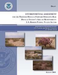
1.0 INTRODUCTION1.1 Objective and Scope of WorkThe objective of this study was to conduct a Limited Phase I Environmental Site Assessment(ESA) for two areas within the San Antonio River General Re-evaluation Study project. TheFort Worth District, U. S. Army Corps of Engineers (FWCOE) and the San Antonio RiverAuthority (SARA) identified two project areas along the San Antonio River. The purpose of thisLimited Phase I ESA was to initially determine the potential environmental impacts on the twoproject areas, the Park Reach located north of the downtown areas and the Mission Reach locatedsouth of the downtown area, through review of available documentation, site reconnaissance, andidentification of any recognized environmental conditions. See Figure 1.1-1, General LocationMap, for the approximate boundary locations of the Park Reach and Mission Reach. MissionReach has been divided into two sections, Mission Reach Area I and Mission Reach Area II, forconvenience in describing the areas.To fulfill these requirements, this Limited Phase I ESA was performed in accordance withspecific components contained in the American Society for Testing and Materials (ASTM)Standard E 1527-00, Standard Practice for Environmental Site Assessments, Phase IEnvironmental Site Assessment Process. These components were selected by the FWCOE withinput from the SARA.This Limited Phase I ESA Report has been prepared by Tetra Tech NUS, Inc. (TtNUS) for theFWCOE under Contract No. DACA63-97-D-0030, Delivery Order No. 0034. Furthermore, thisstudy was conducted in accordance with FWCOE’s Detailed Statement of Work (SOW), datedMay 10, 2002.1.2 Approach and Report ContentsA total of 109 individual properties included in the Park Reach and the two areas of the MissionReach were identified by the SARA for assessment. See Figures 1.2-1, 1.2-2 and 1.2-3,Topographic Site Location Maps, for a topographic presentation of the approximate locations ofthe Park Reach and Mission Reach Areas I and II, respectively.In accordance with the SOW, the general vicinity of the San Antonio River along the Park Reachand the Mission Reach Areas I and II was inspected by TtNUS personnel during a “drive-bysurvey” for the potential presence of environmental impacts. This Phase I ESA was limited tofenceline observation of the property activities and/or suspected presence of environmentalimpacts. Furthermore, in accordance with the SOW, site walk-overs of each individual propertywere not conducted nor were interviews of property/facility owners or the local fire,environmental health, electric and/or water departments undertaken at this time. A review ofhistorical land use was limited to a title search of landownership of the 109 individual properties.A historical study of the land use of the project sites, including review of historical aerialphotographs, was not undertaken at this time. Records review results are presented in the reportby analyzing the information provided by Federal, State and local Agencies, regional geology2618s11-1
and hydrogeology, and historical use information/title survey. Site reconnaissance wasperformed using appropriate text, maps, and figures provided by the FWCOE and the SARA.Selected photographs of sites and properties with potential environmental concerns/conditionsobserved during the “drive-by survey” are presented in Appendix A. Remaining site photoscollected during the “drive-by survey” are archived in the project files.1.3 Limitations and ExceptionsTtNUS has reviewed the information concerning the potential environmental impacts on the 109properties of Park Reach and Mission Reach Areas I and II. TtNUS also prepared this report in aprofessional manner using the degree of skill and care exercised for similar projects undersimilar conditions by reputable and competent environmental consultants. The informationcontained in this report, including its conclusions, are based on the information that was madeavailable to TtNUS during the investigation and upon the services described, which wereperformed within the limitations of the scope, schedule and budgetary requirements of theFWCOE. Because this report is largely based on information available at the time the LimitedPhase I ESA was performed, some conclusions and recommendations may change shouldadditional or contradictory information be discovered. TtNUS is not responsible should theinformation used to generate this ESA is determined to be false, inaccurate, misleading, orcontradicted by additional information.TtNUS makes no representation concerning the legal significance of its findings or the value ofthe property investigated. No third party is entitled to rely upon information or opinionscontained in this report2618s11-2
and hydrogeology, and historical use information/title survey. Site reconnaissance wasperformed using appropriate text, maps, and figures provided by the FWCOE and the SARA.Selected photographs of sites and properties with potential environmental concerns/conditionsobserved during the “drive-by survey” are presented in Appendix A. Remaining site photoscollected during the “drive-by survey” are archived in the project files.1.3 Limitations and ExceptionsTtNUS has reviewed the information concerning the potential environmental impacts on the 109properties of Park Reach and Mission Reach Areas I and II. TtNUS also prepared this report in aprofessional manner using the degree of skill and care exercised for similar projects undersimilar conditions by reputable and competent environmental consultants. The informationcontained in this report, including its conclusions, are based on the information that was madeavailable to TtNUS during the investigation and upon the services described, which wereperformed within the limitations of the scope, schedule and budgetary requirements of theFWCOE. Because this report is largely based on information available at the time the LimitedPhase I ESA was performed, some conclusions and recommendations may change shouldadditional or contradictory information be discovered. TtNUS is not responsible should theinformation used to generate this ESA is determined to be false, inaccurate, misleading, orcontradicted by additional information.TtNUS makes no representation concerning the legal significance of its findings or the value ofthe property investigated. No third party is entitled to rely upon information or opinionscontained in this report2618s11-2
2.0 <strong>SITE</strong> DESCRIPTION2.1 Site Location and Description2.1.1 Boundaries of Property and ESA AreaThis Limited Phase I ESA was conducted on 109 properties located along the San Antonio Riverin San Antonio, Texas. Table 2.1.1-1 provides a listing of the current property ownership andreported physical location or mailing address. The assessment was divided into three areas. Thenorthern area was called the Park Reach, while the areas located progressively to the south alongthe river were called the Mission Reach Area I and the Mission Reach Area II respectively (SeeGeneral Location Map, Figure 1.1-1). In the following discussion, the Alamo, located in SanAntonio, is used as the downtown reference point.The south end of Park Reach begins where US 281 crosses the San Antonio River approximately1.5 miles northeast of downtown San Antonio and extends approximately 1.5 miles to thenortheast to where East Hildebrand Street crosses the river (See Topographic Site Location Map,Figure 1.2-1). Brackenridge Park, where the San Antonio River begins, occupies the Park Reachassessment area. The center line of the river on the north side of the Park Reach is located on theSan Antonio East, Tex, 1992 United States Geological Survey (USGS) 7.5 Minute TopographicQuadrangle at approximately Latitude 29 o 27' 55.80? North and Longitude 98 o 28' 04.67? West.The center line of the river on the south side of the Park Reach is at approximately Latitude 29 o26' 41.65? North and Longitude 98 o 28' 52.10? West. Figure 2.1.1-1, Site Vicinity Map, presentsthe locations of the two Park Reach properties that were assessed as part of this Limited Phase IESA (i.e., property Nos. 82 and 109).The north end of Mission Reach Area I is located where South Alamo Street crosses the SanAntonio River, approximately 1.25 miles southwest of downtown San Antonio. The MissionReach Area I extends approximately 2.5 miles to the south, where Mission Road crosses the river(See Topographic Site Location Map, Figure 1.2-2). The center line of the river on the north sideof Mission Reach Area I is located on the San Antonio East, Tex, 1992 USGS 7.5 MinuteTopographic Quadrangle at approximately Latitude 29 o 24' 36.52? North and Longitude 98 o 29'41.53? West. The center line of the river on the south side of Mission Reach Area I is atapproximately Latitude 29 o 22' 46.00? North and Longitude 98 o 29' 20.54? West. Figure 2.1.1-2,Site Vicinity Map, presents the locations of the 17 Mission Reach Area I properties that wereassessed as part of this Limited Phase I ESA (i.e., property Nos. 1, 5, 28-33, 36, 48, 65-67, 69-71and 86).The north end of Mission Reach Area II continues southward from Mission Reach Area I andextends approximately 5.75 miles to the southeast to approximately 0.8 miles south of where I-410 crosses the San Antonio River (See Topographic Site Location Map, Figure 1.2-3). Thecenter line of the river on the north side of Mission Reach Area II is located on the San AntonioEast, Tex, 1992 USGS 7.5 Minute Topographic Quadrangle at approximately Latitude 29 o 22'46.00? North and Longitude 98 o 29' 20.54? West. The center line of the river on the south sideof Mission Reach Area II is located on the Southton, Tex, 1992 USGS 7.5 Minute TopographicQuadrangle at approximately Latitude 29 o 18' 40.65? North and Longitude 98 o 26' 33.99? West.2618s22-1
Figure 2.1.1-3, Site Vicinity Map, presents the locations of the 90 Mission Reach Area IIproperties that were assessed as part of this Limited Phase I ESA (i.e., property Nos. 2-4, 6-27,34, 35, 37-47, 49-64, 68, 72-81, 83-85, and 87-108).All site boundaries and measurements are estimates based on the referenced USGS maps. Noground survey measurements were conducted during the site reconnaissance. For purposes ofthis Limited Phase I ESA, the boundaries of the site survey include only those features directlyassociated with the 109 properties established in the FWCOE’s SOW dated May 10, 2002.Adjacent properties with recognizable environmental conditions or impacted areas are brieflyidentified and discussed in this report but are not considered part of the SOW requirements ofthis Limited Phase I ESA.2.1.2 Environmental SettingThe Limited Phase I ESA reconnaissance area lies within the Gulf Coast PhysiographicProvince. The Limited Phase I ESA follows the San Antonio River, which originates at the northside of Park Reach. The San Antonio River is spring fed when the Edwards Aquifergroundwater level is above 665 feet. The river is also spring fed by the San Pedro Creek springswhen the aquifer groundwater level is above 655 feet. Water drawdown in the Edwards Aquifer,the source of the spring water feeding the river, has led to the loss of natural spring flow whengroundwater levels fall below these levels. Additional water is supplied to the San AntonioRiver during heavy rainfall by Olmos Creek, an intermittent stream, and other creeksdownstream. Water flow in the river is now aided by pumped reuse water in Brackenridge Parkand in the downtown area.The topography is gently sloped with local grade trending towards the rivers and creeks drainingthe area. This topography is superimposed on a regional slope to the southeast towards the Gulfof Mexico. Ground elevations along the river range from approximately 675 feet above meansea level on the north side of Park Reach to approximately 490 feet above mean sea level on thesouth side of Mission Reach Area II.The bed of the San Antonio River flows through Quaternary alluvium and fluviatile terracedeposits. Park Reach lies within an outcrop of the Cretaceous Austin Limestone at the north andis underlain by the Cretaceous Navarro Group. Mission Reach Area I is underlain by theTertiary Wilcox Group. The northern extent of Mission Reach Area II is underlain by theWilcox Group and the southern extent is underlain by the Tertiary Midway Group.2.2 Current and Past Property UsesThe current use of the 109 identified properties varies from north to south. In general, propertiesappear to be used for the same purposes over the last 50 years. Additional descriptions of pastproperty uses are provided in the Chain-of-Title records presented in Volume II, Appendix B.The northern Park Reach includes portions of Brackenridge Park. Brackenridge Park includes agolf course and other park and recreational facilities such as a zoo, horse stables and miniaturetrain ride. Properties adjacent to Park Reach on the east side of the river are a combination of2618s22-2
esidential and light industrial and commercial properties such as convenience stores, gasstations, and warehouses. Properties adjacent to Park Reach on the west side of the river arepredominantly residential and cultural facilities and schools.The northern Mission Reach Area I begins in an area that is residential and light commercial onthe east side of the river and industrial on the west side. Railroad tracks and switching yards arelocated within or adjacent to the properties on the west side. As the river progresses south, pastits confluence with San Pedro Creek, the subject properties change from industrial uses to parks,golf courses and historic areas. The adjacent properties on both sides of the river follow thesame use patterns. Adjacent to Mission Reach Area I on the east side of the river, north of SanPedro Creek, is King William Historic District, which consists of residential and lightcommercial properties and, south of San Pedro Creek, recreational areas. Adjacent to MissionReach Area I on the west side of the river is industrial property, such as Newell Recycling, northof San Pedro Creek and residential and light commercial areas south of San Pedro Creek.Mission Reach Area II continues southward in areas along the river that are residential,undeveloped, light industrial, historical, or recreational on both sides of the river. There areseveral dams or weirs controlling river flow on Mission Reach Area II. The adjacent propertieson both sides of the river follow the same use patterns with some exceptions. On the east side ofthe river, between East Roosevelt Street and Mission Parkway, are numerous industrial facilitiessuch as Warren Lubricants, AGE Refining and similar properties and large tracts of undevelopedland. A railroad line runs along the east side of the river adjacent to many of the properties.Adjacent to Mission Reach Area II on the west side of the river between East Roosevelt Streetand Mission Parkway are parks, residential and light commercial properties such as auto repairfacilities and a large cemetery, Mission Burial Park.2.3 Regulatory Review StatusAs described in the previous section, the Limited Phase I ESA was conducted on 109 propertieslocated along the San Antonio River in San Antonio, Texas. The subject properties ranged fromundeveloped land to large industrial properties. These 109 properties are subject to all pertinentState and Federal environmental regulations with regard to unauthorized release of potentialcontaminants to the environment. If a release to the environment from one of these propertieswere identified, then the property would be subject to all pertinent State and Federal regulationsincluding, but not limited to, the Resource Conservation and Recovery Act (RCRA) and theClean Water Act.2618s22-3
3.0 RECORDS REVIEW RESULTS3.1 Standard Environmental Records SurveyTtNUS contracted Banks Information Solutions, Inc. (Banks) to perform an electronic databasesearch of available environmental regulatory information for the properties located in the ParkReach and the two Mission Reach Areas. The information search radius equaled or exceeded thecriteria specified in ASTM Standard E 1527-00. This regulatory records search is based onavailable information published by State and Federal environmental regulatory agencies, and isused to evaluate if the subject properties or nearby properties are listed as having a past orpresent record of actual or potential environmental impact. These regulatory listings includeonly those facilities that are known to the environmental regulatory agencies at the time ofpublication. Tables 3.1-1, 3.1-2 and 3.1-3 provide a summary listing of the address and type ofenvironmental condition residing within up to a one-mile survey radius of the Park Reach andMission Reach Areas I and II, respectively. Additionally, Figures 3.1-1, 3.1-2 and 3.1-3 providea graphical representation of the environmental records survey results with respect to the ParkReach and Mission Reach Areas I and II, respectively. Results of the environmental recordssurvey are numerically identified on the aforementioned tables and figures and are expressed inradial increments of 1/8, 1/4, 1/2 and 1-mile distances. A copy of the complete Banksenvironmental records survey report is included in Volume II, Appendix C.The following sections summarize the findings of the environmental records survey. The surveysearch criteria for Park Reach and Mission Reach were: 1) physical/mailing address; 2)coordinates (both latitude and longitude, and Universal Transverse Macerator); 3) USGS SanAntonio River East and Southton, Texas, 7.5 minute quadrangle topographic maps; and 4)environmental sites without a known address and/or coordinate location but identified within therelevant U.S. Postal Service (USPS) Zip Code.3.1.1 Federal AgencyBanks performed an electronic database search and obtained information from the United StatesEnvironmental Protection Agency’s (EPA) database surrounding the Park Reach and the MissionReach Areas I and II under the following Environmental Records Survey criteria:• National Priorities (Superfund) List (NPL) – List of sites labeled as uncontrolled orabandoned hazardous waste by EPA that have also been identified for priority remedialactions under the Superfund Program.• Comprehensive Environmental Response, Compensation, and Liability InformationSystem (CERCLIS) – Compilation of sites that EPA has investigated or is currentlyinvestigating for a release or threatened release of hazardous substances.• Resource Conservation and Recovery Act (RCRA) – Program that identifies and trackshazardous waste from the point of generation to the point of disposal. The RCRA Facilitiesdata base is a compilation by EPA of reporting facilities that generate, store, transport, treat,or dispose of hazardous waste.2618s33-1
• RCRA TSD – RCRA Transporters/Storage/Disposal Facilities• RCRA COR – RCRA Corrective Action Sites• RCRA GEN – RCRA Very Small/Large Waste Generators• Emergency Response Notification System (ERNS) – List of National Spill Reports orEmergency Response Notification System Reports and area compilation of reported releasesof oil or hazardous substances.Tables 3.1.1-1, 3.1.1-2, and 3.1.1-3 summarize the results of the Environmental Federal AgencyRecords Survey search of the surrounding areas of the Park Reach and the Mission Reach AreasI and II, respectively.3.1.2 State AgencyBanks performed a search of State Agencies environmental records of the surrounding areas ofPark Reach and Mission Reach Areas I and II under the following criteria:• SWL – Solid Waste Landfills• REG UST/AST – Registered Underground Storage Tanks/Aboveground Storage Tanks• Leaking UST – Leaking Underground Storage Tanks• Receptors – Facilities that have their own water supply• State Sites – The Texas Commission on Environmental Quality’s (TCEQ’s) State SuperfundRegistry listing as maintained by the Office of Waste Management, Remediation Division.Tables 3.1.2-1, 3.1.2-2, and 3.1.2-3 summarize the results of the Environmental State AgencyRecords Survey search of the surrounding areas of the Park Reach and the Mission Reach AreasI and II, respectively.3.1.3 Local AgencyNo environmental regulatory records for local agencies (i.e., county, city) were identifiedthrough available records search for the Park and Mission Reaches.3.2 Physical Setting Source SurveyIn accordance with requirements outlined in ASTM Standard E 1527-00, TtNUS collected andreviewed physical setting source information to assess the potential for impact and/or migrationof recognized environmental contaminants in connection with the Limited Phase I ESA. Thisphysical setting information was in addition to the information available through the currentUSGS 7.5 Minute Topographic Maps that are also provided as part of this Limited Phase I ESA.2618s33-2
This additional physical setting source information was prepared by TtNUS and includestopographic and geologic characteristics of the San Antonio River. The following sectionssummarize the findings of the physical setting information.3.2.1 Regional GeologyThe northern extent of the Limited Phase I ESA area begins at East Hildebrand Avenue inBrackenridge Park. Some areas of the park are part of a former quarry and the Austin Limestoneof Cretaceous age outcrops in Brackenridge Park. The artesian springs that feed the San AntonioRiver originate along the contact of the Austin Limestone where the Alamo Heights fault, part ofthe Balcones Fault Zone, intersects the San Antonio River. As previously noted, the source ofthe spring water is the Edwards Aquifer. Several faults cross the river within the Limited Phase IESA area but Quaternary deposits obscure the fault traces.3.2.2 Regional HydrogeologyThe public water supply in San Antonio is provided by water wells in the Edwards Aquifer. Thepredominantly carbonate rocks that compose the Edwards Aquifer are of Cretaceous age. TheEdwards Aquifer is a prolific producer and has been designated as a sole source aquifer althoughit is not the only source of water for San Antonio. The Edwards Aquifer outcrops in a rechargezone on the north side of San Antonio. In general, the groundwater gradient follows thetopographic surface of the Edwards Aquifer and flows to the east southeast. Groundwater flowdirection in the Edwards Aquifer may be impacted by surface topography, hydrology,hydrogeology, faults and water well production.3.3 Historical Use Information SurveyA review of historical land use was limited to a title search of landownership of the 109properties. A historical study of the land use of these project sites, including review of historicalaerial photographs, was not undertaken at this time. Table 3.3-1, Historical Chain-of-TitleSurvey Summary, provides a listing of historic property ownerships for each of the 109properties. A copy of the Historical Chain-of-Title Survey is included within the environmentalrecords survey report as part of Volume II, Appendix B.3.4 Additional Records Source SurveyIn accordance with the SOW, TtNUS performed a Limited Phase I ESA following the guidelinesoutlined in ASTM Standard E 1527-00. However, the following records were not collected andreviewed:• Federal USGS Well Information• Federal Public Water Supply System (PWS) Information• State Database Well Information.2618s33-3
4.0 <strong>ENVIRONMENTAL</strong> REVIEW AND <strong>SITE</strong> RECONNAISSANCE RESULTSAs detailed and reported in Section 3.0, a standard environmental records survey of availableregulatory information for the properties located in the Park Reach and two areas of the MissionReach was conducted for this assessment. This survey identified environmental conditionsreported within up to a one-mile radius of the study areas. Results of the environmental recordssurvey were numerically identified (See Appendix C) and expressed in radial increments of 1/8,1/4, 1/2 and 1-mile distances. Following receipt of the environmental records survey dataprovided by Banks, TtNUS field personnel then used this information as reference materialduring the site reconnaissance.The site reconnaissance of the 109 SARA-identified properties located in the Park Reach and thetwo areas of the Mission Reach was performed during the period of June 17 through 21, 2002.Mr. Eric Jorgeson, Certified Professional Geologist, and Mr. Mahmud Rahman, Engineer-In-Training, of TtNUS, both experienced in environmental site assessments, performed the sitereconnaissance. For purposes of this Limited Phase I ESA, the boundaries of the sitereconnaissance survey include only those noticeable environmental conditions directlyassociated with 109 properties and/or those environmental features immediately adjacent to theidentified properties.4.1 General Area EvaluationAs part of the drive-by site survey, TtNUS field personnel developed an environmentalassessment checklist form that was completed for each of the 109 properties. The checklistinformation included on the assessment form was developed in accordance with specificcomponents of “ASTM Standard E 1527-00, Standard Practice for Environmental SiteAssessments” selected by the FWCOE with input from the SARA. This drive-by site survey andsubsequent completion of the assessment checklist was limited to fenceline observation of siteactivities and/or suspected presence of environmental conditions. No walkover of the propertiesor interview of property owners was conducted during this assessment.In many cases, the properties were not readily visible from public roads. In these cases, itbecame necessary to walk available pathways along the property boundaries to observe theirenvironmental condition. In some cases, properties located across the San Antonio River wereonly visible from properties on the opposite side of the river. Right of entry to these propertieswas not obtained due to the limited scope of work.During site reconnaissance, TtNUS personnel also identified various industrial, commercial, andresidential properties and activities located immediately adjacent to the 109 properties. Over 600photographs of the 109 properties were taken. Site photographs of those properties that displaynoticeable environmental conditions are presented in Appendix A. Remaining site photographsare archived in the project files.2618s44-1
4.2 Environmental Review and Reconnaissance ResultsTtNUS field personnel drove the boundary roads of the 109 properties to photograph anddescribe recognized environmental conditions. All information obtained during the drive-by sitesurvey was recorded on the environmental assessment checklist form. If noticeableenvironmental conditions were observed on adjacent property, this information was also notedon the assessment form as being on the adjacent property.Field notes for each of the 109 properties that were documented on the assessment checklist formhave been summarized and are included on Table 4.2-1, Environmental Review andReconnaissance Results. Additionally, the environmental records results have been categorizedby radial distance from each of the 109 properties and are also included on Table 4.2-1.2618s44-2
5.0 CONCLUSIONS AND RECOMMENDATIONSAs defined in the Detailed SOW (dated May 10, 2002), TtNUS has performed a Limited Phase IESA for two areas within the San Antonio River General Re-evaluation Study project. Allfindings identified and information obtained during this study, per the requirements in the SOW,have been presented in subsequent sections to this report. To initially assist the SARA inprioritizing budget and schedule for the General Re-evaluation Study, TtNUS has categorized inthis section of the report the 109 identified properties for potential environmental issues.Additionally, TtNUS provides recommendations for completing the Limited Phase I ESA.5.1 ConclusionsOn the basis of the environmental records survey data, including the physical and environmentalsetting information, and the fenceline observations identified during the drive-by survey of theproperties, TtNUS has grouped the 109 properties into two categories. These categories definethe level (high or moderate) of probability that the properties may have the potential for existingor future environmental issues that may be related to one or more of the environmentalconditions identified in the records survey and/or site reconnaissance. These two categories forpotential environmental conditions are defined below.Category A:Category B:Properties that have one or more facilities of environmental concern (i.e., UST,LUST, RCRA, etc.) located adjacent to or within a 1/4-mile radius from theproperty. On the basis of information obtained from the environmental data basereview and the drive-by survey, TtNUS identified these properties with the“highest” probability of having a potential environmental issue.Properties that have one or more facilities of environmental concern (i.e., UST,LUST, RCRA, etc.) beyond a 1/4-mile radius from the property. On the basis ofinformation obtained from the environmental data base review and the drive-bysurvey, TtNUS identified these properties as having a “moderate” probability fora potential environmental issue.For future project budgeting and scheduling, Table 5.1-1 presents an environmentalcategorization the 109 identified properties.5.2 RecommendationsIn order to fully identify and assess recognized environmental conditions at each of the 109properties, the remaining components of an ASTM Phase I Environmental Site Assessmentprocess must be undertaken. Therefore, based upon the information collected and reviewedduring this Limited Phase I ESA, TtNUS recommends the following in order to fully identifyenvironmental concerns: Conduct a sitewalk of each of the 109 properties; interview propertyowners and/or facility operators; and obtain and review historical aerial photographs, SanbornInsurance Maps, and Municipal records in accordance with ASTM Standard E 1527-00.Completing these remaining ASTM Standards components is integral to identifying andanalyzing “environmental issues” and providing more definitive conclusions andrecommendations regarding the individual properties.2618s55-1
6.0 REFERENCESASTM Standard E 1527-00. Standard Practice for Environmental Site Assessments: Phase IEnvironmental Site: Assessment Process, Reapproval 2000.Thomas E. Ewing, Editor, Rocks, Landscapes, and Man: Urban Geology of the San Antonio Area,1996.Virgil E. Barnes, Geologic Atlas of Texas, San Antonio Sheet, The University of Texas at Austin,Bureau of Economic Geology San Antonio Sheet, 1974, Revised 1983.FWCOE, Detailed Statement of Work, Limited Phase I Environmental Site Assessment Report forthe San Antonio River General Re-evaluation Study, San Antonio, Texas, May 10, 2002.USACE, Standard Practice for Environmental Site Assessments: Phase I Environmental SiteAssessment Process, EM31527-00, 7 March 2002.2618s66-1
Table ES-1<strong>ENVIRONMENTAL</strong> CATEGORIZATION OF IDENTIFIED PROPERTIESLimited Phase I Environmental Site AssessmentSan Antonio River General Re-Evaluation Study, San Antonio, TexasCategoryABSARA Property Number1, 3, 4, 5, 10, 11, 12, 13, 14, 15, 28, 29, 30, 31, 32, 33, 34, 35, 37, 38, 39, 41, 47,48, 50, 51, 52, 53, 55, 56, 57, 58, 59, 60, 61, 62, 63, 64, 65, 66, 67, 68, 69, 70, 71,73, 74, 75, 81, 82, 83, 84, 85, 86, 87, 88, 89, 90, 91, 93, 94, 95, 96, 97, 98, 99,100, 1092, 6, 7, 8, 9, 16, 17, 18, 19, 20, 21, 22, 23, 24, 25, 26, 27, 36, 40, 42, 43, 44, 45,46, 49, 54, 72, 76, 77, 78, 79, 80, 92, 101, 102, 103, 104, 105, 106, 107, 1082618s16
2618s11Table 2.1.1-1LIST OF PROPERTIESPark And Mission ReachesLimited Phase I Environmental Site AssessmentSan Antonio River General Re-Evaluation Study, San Antonio, TexasSARA 1Property NumberAgency/Owner Address 21 TXDOT (ROW) HWY 90 & STEVES AVE./ SA. TX. 782102 TXDOT (ROW) SE LOOP 410 & VILLAMAIN / SA. TX. 782233 TXDOT (ROW) ROOSEVELT & RIVERSIDE / SA. TX. 782104 TXDOT (ROW) SE MILITARY DR. / SA. TX. 782145 ARCHDIOCESE OF SA ST. PETER CHILDRENS HM / 0 E. THEO AVE. SA. TX. 782106 ARCHDIOCESE OF SA MISSION ESPADA / 10040 ESPADA RD. SA. TX. 782237 BEXAR COUNTY ADDRESS UNKNOWN8 BEXAR COUNTY ADDRESS UNKNOWN9 ARCHDIOCESE OF SA ESPADA ACEQUIA / 10040 ESPADA RD. SA. TX. 7822310 USA / NATL. <strong>PARK</strong> SERVICE 0 ESPADA RD. SA. TX. 7822311 USA / NATL. <strong>PARK</strong> SERVICE SE MILITARY MSN SAN JUAN / 0 SAN JUAN RD. SA. TX. 7822312 USA / NATL. <strong>PARK</strong> SERVICE 9045 ESPADA RD. SA. TX. 7822313 AMELIA V. AND JOE MAYFIELD, JR. 28825 ESPADA RD. SA. TX. 7822314 USA / NATL. <strong>PARK</strong> SERVICE 31461 ESPADA RD. SA. TX. 7822315 USA / NATL. <strong>PARK</strong> SERVICE 9143 ESPADA RD. SA. TX. 7822316 USA / NATL. <strong>PARK</strong> SERVICE 9404 ESPADA RD. SA. TX. 7822317 USA / NATL. <strong>PARK</strong> SERVICE 9410 ESPADA RD. SA. TX. 7822318 USA / NATL. <strong>PARK</strong> SERVICE 9418 ESPADA RD. SA. TX. 7822319 USA / NATL. <strong>PARK</strong> SERVICE 9430 ESPADA RD. SA. TX. 7822320 USA / NATL. <strong>PARK</strong> SERVICE 9444 ESPADA RD. SA. TX. 7822321 USA / NATL. <strong>PARK</strong> SERVICE 9456 ESPADA RD. SA. TX. 7822322 USA / NATL. <strong>PARK</strong> SERVICE 9460 ESPADA RD. SA. TX. 7822323 USA / NATL. <strong>PARK</strong> SERVICE 9580 ESPADA RD. SA. TX. 7822324 USA / NATL. <strong>PARK</strong> SERVICE 9562 ESPADA RD. SA. TX. 7822325 USA / NATL. <strong>PARK</strong> SERVICE 9586 ESPADA RD. SA. TX. 7822326 USA / NATL. <strong>PARK</strong> SERVICE 9610 ESPADA RD. SA. TX. 7822327 USA / NATL. <strong>PARK</strong> SERVICE 719 ESPADA RD. SA. TX. 7822328 CITY OF SAN ANTONIO / CPS MISSION RD POWER PLANT / 303 MISSION RD. 7821029 CITY OF SAN ANTONIO ROOSEVELT <strong>PARK</strong> / 0 MISSION RD. SA. TX. 7821030 CITY OF SAN ANTONIO IH-10 E. & CROIX SA. TX. 78210 (KILLED ACCOUNT)31 CITY OF SAN ANTONIO / CPS 310 W. MITCHELL ST. SA. TX. 7821032 CITY OF SAN ANTONIO 0 E. CROCKETT ST. SA. TX. 7821033 CITY OF SAN ANTONIO / SAWS 0 AVON CT. SA. TX. 7821034 CITY OF SAN ANTONIO 0 MISSION ROAD SA. TX. 7821435 CITY OF SAN ANTONIO 0 MISSION ROAD SA. TX. 7821436 CITY OF SAN ANTONIO 0 ROOSEVELT AVE. SA. TX. 7821037 CITY OF SAN ANTONIO 0 SE. MILITARY DR. SA. TX. 7821438 CITY OF SAN ANTONIO 0 MISSION RD. SA. TX. 7821439 CITY OF SAN ANTONIO 0 S. PRESA ST. SA. TX. 7822340 CITY OF SAN ANTONIO 0 S. PRESA ST. SA. TX. 7822341 CITY OF SAN ANTONIO 0 S. PRESA SA. TX. 7822342 CITY OF SAN ANTONIO 9582 ESPADA RD. SA. TX. 7822343 CITY OF SAN ANTONIO 9760 ESPADA RD. SA. TX. 7821444 CITY OF SAN ANTONIO 9559 VILLAMAIN RD. SA. TX. 7822345 CITY OF SAN ANTONIO 9637 VILLAMAIN RD. SA. TX. 7822346 CITY OF SAN ANTONIO 9681 VILLAMAIN RD. SA. TX. 7822347 SA HOUSING AUTHORITY 0 RIVERSIDE DR. SA. TX. 7821048 LIFSHUTZ & BERLEE LBR 401 BLUE STAR ST. SA. TX. 78210 (BIG TEX)49 LIBERTY PROPERTIES 5503 S. PRESA ST. SA. TX. 78214 (HOT WELLS)50 SA RIVER AUTHORITY 999 SW MILITARY DR. TX. 7821451 SA RIVER AUTHORITY 1938 E. PYRON AVE. SA. TX. 788721052 SA RIVER AUTHORITY 2498 ROOSEVELT SA. TX. 7821053 SA RIVER AUTHORITY ADDRESS UNKNOWN54 BEXAR COUNTY 0 PRESA ST. SA. TX. 7821455 BEXAR COUNTY MISSION COUNTY <strong>PARK</strong>56 ROBERT ORR 1803 E. PYRON AVE. SA. TX. 78214
Table 2.1.1-1LIST OF PROPERTIESPark And Mission ReachesLimited Phase I Environmental Site AssessmentSan Antonio River General Re-Evaluation Study, San Antonio, TexasSARA 1Property NumberAgency/Owner Address 257 D.G. HARROUN & MARTA 1920 E. PYRON AVE. SA. TX. 7821458 ARMANDO CORTEZ 234 RIVERSIDE DRIVE SA. TX. 7821059 MAYME L. VELA 246 RIVERSIDE DRIVE SA. TX. 7821060 RICARDO MARTINEZ 250 RIVERSIDE DRIVE SA. TX. 7821061 RUTH V. THRASHER 326 RIVERSIDE DRIVE SA. TX. 7821062 HUGH D. POSEY 310 RIVERSIDE DRIVE SA. TX. 7821063 PHELPS-TOITON DBA SO.STL 731 RIVERSIDE DRIVE SA. TX. 7821464 FIDEL LOREDO 602 RIVERSIDE DRIVE SA. TX. 7821465 LSB ACQUISITIONS LTD 600 LONE STAR BLVD SA. TX. 7821066 JESUS Z. SANCHEZ & RENE 100 W. MITCHELL ST. SA. TX. 7821067 EMANUEL KUNDT 4512 SIERRA ST SA. TX. 7821068 HERMAN FORD 1905 SE MILITARY DR. SA. TX. 7821469 MARTIN LINEN SUPPLY CO. 0 MISSION ROAD SA. TX. 7821070 CITY OF SAN ANTONIO / SAWS 515 MISSION ROAD SA. TX. 7821071 CITY OF SAN ANTONIO / SAWS 1603 ROOSEVELT ROAD SA. TX. 7821072 WANDA G. FORD 6130 PADRE DRIVE SA. TX. 7821473 TIMOTHY LAPPING 1838 E. PYRON AVE. SA. TX. 7821474 MISSION CEMETERY (TIPS) 1700 SE MILITARY DR. SA. TX. 7821475 MISSION CEMETERY (TIPS) 0 S. PRESA ST. SA. TX. 7821476 ERMILIO GARZA 10850 ESPADA ROAD SA. TX. 7821477 CANDELARIA ADERETE 10890 ESPADA ROAD SA. TX. 7821478 ERMILIO GARZA 10950 ESPADA ROAD SA. TX. 7821479 JOSEPH DEGASPERI 10952 ESPADA ROAD SA. TX. 7821480 JOSEPH DEGASPERI 10954 ESPADA ROAD SA. TX. 7821481 WILSON SOUTHWELL JR. 2418 ASHLEY RD. SA. TX. 7822382 BRACKENRIDGE GOLF CRSE 2315 AVENUE B, SA. TX. 7821583 BEXAR COUNTY 268 RIVERSIDE DR. SA. TX. 7821084 SA RIVER AUTHORITY 0 ESPADA RD. SA. TX. 7822385 MARTINA M. FLORES EST. 2202 ASHLEY RD. SA. TX. 7822386 LIFSHUTZ & BERLEE LBR 354 BLUE STAR ST. SA. TX. 7821087 RIVERSIDE GOLF COURSE ADDRESS UNKNOWN88 BEXAR COUNTY 298 RIVERSIDE SA. TX. 7821089 BEXAR COUNTY ADDRESS UNKNOWN90 BEXAR COUNTY ADDRESS UNKNOWN91 CITY OF SAN ANTONIO 0 WHITE AVE. SA. TX. 7821492 STATE OF TX. SA. ST. HOSP. ADDRESS UNKNOWN93 WILLIAM M. LANCE 1818 PYRON AVE. SA. TX. 7821494 USA / NATL. <strong>PARK</strong> SERVICE 0 SE. MILITARY DR. SA. TX. 7821495 USA / NATL. <strong>PARK</strong> SERVICE 0 MISSION RD. SA. TX. 7821496 USA / NATL. <strong>PARK</strong> SERVICE 0 SE. MILITARY DR. SA. TX. 7821497 SA RIVER AUTHORITY ADDRESS UNKNOWN98 USA / NATL. <strong>PARK</strong> SERVICE 0 MISSION RD. SA. TX. 7821499 USA / NATL. <strong>PARK</strong> SERVICE 0 ASHLEY SA. TX. 78214100 USA / NATL. <strong>PARK</strong> SERVICE ADDRESS UNKNOWN101 CITY OF SAN ANTONIO ADDRESS UNKNOWN102 SA RIVER AUTHORITY 9890 ESPADA SA TX. 78214103 SA RIVER AUTHORITY 9607 VILLAMAIN SA. TX. 78214104 CITY OF SAN ANTONIO 9681 VILLAMAIN RD. SA. TX. 78223105 SA RIVER AUTHORITY 9723 VILLAMAIN SA. TX. 78223106 DUFFY BOWEN ETAL. 10120 ESPADA RD. SA TX. 78223107 USA / NATL. <strong>PARK</strong> SERVICE 10066 ESPADA RD. SA. TX. 78223108 SA RIVER AUTHORITY 10642 ESPADA RD SA. TX. 78223109 CITY OF SAN ANTONIO ADDRESS UNKNOWNNotes:1) SARA - San Antonio River Authority2618s11
Table 3.1-1<strong>ENVIRONMENTAL</strong> DATABASE RECORD REVIEW SUMMARYPark ReachLimited Phase I Environmental Site AssessmentSan Antonio River General Re-Evaluation Study, San Antonio, TexasSite ID Site Name ID Secondary ID Site Address Site Type1-MUS PEARL BREWING COMPANY TXD008115248 0601745 312 PEARL <strong>PARK</strong>WAY CERCLIS2-MUS PHIPPS PLATING COMPANY TXD008109902 0604918 305 E. GRAYSON STREET CERCLIS3-MUS PEARL CONTAINER COMPANY TXD069461747 0602208 245 NEWELL STREET CERCLIS4-MUS UGLY DUCKLING CAR SALES TXD052651023 3303 BROADWAY RCRAGN5-MUSTORRADO TOWN <strong>PARK</strong> CHRYSLER &PLYMOUTH TX0000095539 2800 BROADWAY RCRAGN6-MUSTORRADO TOWN <strong>PARK</strong> CHRYSLERPLYMOUTH TXD980878060 101 HUMPHREYS RCRAGN7-MUS DPT LABORATORIES INC TXD980627244 307 E JOSEPHINE RCRAGN8-MUS GILLESPIE FORD TXD027028893 2300 BROADWAY RCRAGN9-MUS SLATER WHITE CLEANERS TXD981606486 110 W JOSEPHINE RCRAGN10-MUS C AND C SONS COLLISION REPAIR TXD098827025 131 E. GRAYSON RCRAGN11-MUS FLASHER EQUIPMENT TXD008143075 246 JOSEPHINE ST RCRAGN12-MUS GLADWIN PAINT CO TXD027028968 2000 BROADWAY RCRAGN13-MUS PHIPPS PLATING CO TXD008109902 305 E GRAYSON RCRAGNWORTHINGTON LAUNDRY AND14-MUS CLEANERS TXD052654480 519 E JOSEPHINE RCRAGN15-MUS PHIPPS PLATING COMPANY 329088 305 EAST GRAYSON ERNS16-MUS PHIPPS PLATING TXD008109902 305 EAST GRAYSON STREET STATE401 PEARL <strong>PARK</strong>WAY/PEARL17-MUS BREWING COMPANY 0307 401 PEARL <strong>PARK</strong>WAY STATE18-MUS CONVENIENT FOOD MART 0070855 3500 BROADWAY UST19-MUS LONE STAR VOLKSWAGEN 0008611 3303 BROADWAY UST20-MUS MIKES GULF 0042887 3600 BROADWAY UST21-MUS STOP N GO 2270 0039470 3003 BROADWAY UST2618s12
Table 3.1-1<strong>ENVIRONMENTAL</strong> DATABASE RECORD REVIEW SUMMARYPark ReachLimited Phase I Environmental Site AssessmentSan Antonio River General Re-Evaluation Study, San Antonio, TexasSite ID Site Name ID Secondary ID Site Address Site Type22-MUS MCCOMBS CHRYSLER PLYMOUTH 0043044 2800 BROADWAY UST23-MUS BRACKENRIDGE GOLF COURSE 0014154 2314 AVE B UST24-MUS DIAMOND SHAMROCK 1031 0018834 2520 BROADWAY ST UST25-MUS JOHN A ALBERT CO 0055963 2425 BROADWAY UST26-MUS BORDEN INC 0021472 875 E ASHBY PL UST27-MUS DPT LABORATORIES INC 0033749 307 E JOSEPHINE UST28-MUS FOREMOST DAIRY 0049363 102 E JOSEPHINE UST29-MUS GILLESPIE FORD 0018208 2300 BROADWAY UST30-MUS GILLESPIE MOTOR CO 0018207 2300 BROADWAY UST31-MUS RICHTERS BAKERY 0020615 2201 BROADWAY UST32-MUS TEXAS BOTTLERS INC 0011868 120 W JOSEPHINE UST33-MUS FLASHER EQUIPMENT 0052269 246 W JOSEPHINE UST34-MUS FLASHER <strong>LIMITED</strong> 0023911 246 W JOSEPHINE ST UST35-MUS SCHEPPS DAIRY 0049364 102 W GRAYSON UST36-MUS STOP N GO 2140 0039670 2001 BROADWAY ST UST37-MUS TEXAS NEON ADV CO INC 0029761 245 W JOSEPHINE UST38-MUS TRAVIS WHOLESALE FLORISTS 0005152 240 W JOSEPHINE UST39-MUS CLOSED AUTO REPAIR 100274 0057831 1430 HILDEBRAND LUST40-MUS DIAMOND SHAMROCK 921 104283 0032909 819 E MULBERRY LUST41-MUS KENS TEXACO 094136 0011737 4302 BROADWAY LUST42-MUS MIKES GULF 097098 0042887 3600 BROADWAY LUST<strong>PARK</strong>S & RECREATION43-MUS MAINTENANCE FAC 093291 0014139 950 E HILDEBRAND AVE LUST2618s12
Table 3.1-1<strong>ENVIRONMENTAL</strong> DATABASE RECORD REVIEW SUMMARYPark ReachLimited Phase I Environmental Site AssessmentSan Antonio River General Re-Evaluation Study, San Antonio, TexasSite ID Site Name ID Secondary ID Site Address Site Type44-MUS45-MUSSOUTHWESTERN BELL MOTORVEHICLES 105019 0019338 4119 BROADWAY LUSTSOUTHWESTERN BELL TELEPHONECO 092866 0019338 4119 BROADWAY LUST46-MUS STOP N GO 3221 105535 0007084 3440 N ST MARYS ST LUST47-MUS MCCOMBS CHRYSLER PLYMOUTH 107817 0043044 2800 BROADWAY LUST48-MUS BRACKENRIDGE GOLF COURSE 100734 0014154 2314 AVE B LUST49-MUS DIAMOND SHAMROCK 1031 098013 0018834 2520 BROADWAY ST LUST50-MUS GILLESPIE FORD 109002 0018208 2311 BROADWAY LUST51-MUS GILLESPIE MOTOR CO 109001 0018208 2300 BROADWAY LUST52-MUS BORDEN INC DAIRY DIV 098450 0021472 875 E ASHBY PL LUST53-MUS BORDEN INC DAIRY DIV 098451 0021472 875 E ASHBY PL LUST54-MUS BORDEN INC DAIRY DIVISION 098454 0021472 875 E ASHBY PL LUST55-MUS BORDEN INC DAIRY DIVISION 098520 0021472 875 E ASHBY PL LUST56-MUS CARLOS OBRIENS 100147 0050011 3011 N ST MARYS ST LUST57-MUS DERMATOLOGICAL PROD TEXAS INC 091908 0033749 307 E JOSEPHINE ST LUST58-MUS FOREMOST DAIRY 093739 0049363 102 E JOSEPHINE LUST59-MUS RICHTERS BAKERY 108911 0020615 2201 BROADWAY LUST60-MUS ROYAL CROWN COLA CO 100605 0011868 120 W JOSEPHINE LUST61-MUS SCHEPPS DAIRY 103959 0049364 102 W GRAYSON LUST62-MUS AMIAC ELECTRIC SUPPLY 092281 0000068 2715 N ST MARYS LUST63-MUS CLAUDE MARBACH 092807 0048189 410 E GRAYSON LUST64-MUS CLOSED SERVICE STATION 104178 2334 N ST MARYS LUST65-MUS CONOCO 102644 0049407 2222 N ST MARYS LUST2618s12
Table 3.1-1<strong>ENVIRONMENTAL</strong> DATABASE RECORD REVIEW SUMMARYPark ReachLimited Phase I Environmental Site AssessmentSan Antonio River General Re-Evaluation Study, San Antonio, TexasSite ID Site Name ID Secondary ID Site Address Site Type66-MUS FDIC 093116 0048446 1919 N ST MARYS ST LUST67-MUS PEARL BREWING CO 093657 0002491 312 PEARL PKWY LUST68-MUS RILCO 2 105519 0039291 1900 N ST MARYS LUST69-MUS SARMA CLOSED CHEVRON 113042 1825 BROADWAY LUST70-MUS ACE SUPPLY CO 099086 0011442 1111 AUSTIN ST LUST71-MUS ADVANCED BODY & PAINT 105118 0063659 212 NEWELL LUST72-MUS MOORE CONSTRUCTION 094591 1131 AUSTIN ST LUST73-MUS SAN ANTONIO ISD 091962 0003073 1103 AUSTIN ST LUSTSAN ANTONIO ISD TRANSPORTATION74-MUS DEPT 113413 0003073 1103 AUSTIN ST LUST75-MUS HYDRO CARBON RECYCLERS 183480 ERNS76-MUS RAMIREZ PROPERTY 509931 UNKNOWN STREET LOCATION ERNS77-MUS RAMIREZ PROPERTY 520925 UNKNOWN STREET LOCATION ERNS78-MUS U S P C I 269641 WITHIN CITY LIMITS ERNS79-MUS UNKNOWN 103772 UNKNOWN ERNS80-MUS 115407 ERNS81-MUSPROBANDT STREET/NEWELLPROPERTIES BI00000000010 STATE82-MUS MILSERVE, INC. 65013 MARBACH OAKS SWLSHERMAN & BURLESON83-MUS SAFETY-KLEEN 40153STREETSSWL84-MUS CONRAD JOE W 0048231 UST85-MUS ALAMO CEMENT 0032047 UST86-MUS ABANDONED TEXACO 091601 IH 37 LUST2618s12
Table 3.1-2<strong>ENVIRONMENTAL</strong> DATABASE RECORD REVIEW SUMMARYMission Reach Area ILimited Phase I Environmental Site AssessmentSan Antonio River General Re-Evaluation Study, San Antonio, TexasSite ID Site Name ID Secondary ID Site Address Site Type1-MISI FONNS CHEMICAL CO. TXD987989373 604128 1612 SOUTH ST. MARY CERCLIS2-MISI AGRI-CHEM OF TEXAS TXD987989365 604127 1734 ROOSEVELT AVENUE CERCLIS3-MISI CPS MISSION ROAD PLANT TXD000815043 207 MISSION RD RCRA4-MISI CPS MISSION ROAD PLANT TXD000815043 207 MISSION RD RCRACOR5-MISI ACCO WASTE PAPER TXD988039921 400 PROBANDT RCRAGN6-MISI G AND K SERVICES TXR000018432 410 PROBANDT RCRAGN7-MISI NEWELL IND INC TXD981052848 440 LONE STAR BLVD RCRAGN8-MISI CPS MISSION ROAD PLANT TXD000815043 207 MISSION RD RCRAGN9-MISI NEWELL IND INC TXD118927300 530 STEVES AVE RCRAGN10-MISI CPS MISSION RD CONSTRUCTION CTR TXD981585201 613 MISSION RD RCRAGN11-MISI THE TORGERSON CO. TXD981518616 739 STEVES AVE. RCRAGN12-MISI LOYD ARMATURE WORKS INC TXD981914716 1953 PROBANDT RCRAGN13-MISI CITY PUBLIC SERVICE 551033BALL<strong>PARK</strong> SUBSTATION 306MISSION RDERNS14-MISIH.B. GONZALEZ CONVENTIONCENTER EXPANSION 391 200 EAST MARKET STREET STATE15-MISI IOWA STREET WAREHOUSE IOP-0213 232 AND 211 IOWA STREET STATE16-MISI MKT - SLOAN RAILYARD 609 WEST CEVALLES STREET STATE17-MISINEW CITY BLOCK (NCB)637/ALAMODOME 442SEC SOUTH CHERRY AND MLKDRIVESTATE18-MISIPROBANDT STREET/NEWELLPROPERTIESTXSSFTEMP011300 TO 800 BLOCKS OFPROBANDT STREETSTATE19-MISI VISTA VERDE LOT IP-5 172NWC TAMPICO AND SOUTHMEDINA STREETSSTATE20-MISIFORMER WINN S STORESDISTRIBUTION CENTER 987 4342 PAN AM EXPRESSWAY STATE2618s13
Table 3.1-2<strong>ENVIRONMENTAL</strong> DATABASE RECORD REVIEW SUMMARYMission Reach Area ILimited Phase I Environmental Site AssessmentSan Antonio River General Re-Evaluation Study, San Antonio, TexasSite ID Site Name ID Secondary ID Site Address Site Type21-MISI22-MISI23-MISIWINN S STORE DISTRIBUTIONCENTER - PURCHASER 151 4342 PAN AM EXPRESSWAY STATEWINN S STORE DISTRIBUTIONCENTER - TRUSTEE 282 4342 PAN AM EXPRESSWAY STATEINDUSTRIAL LUBRICANTS - QUAKERSTATE 582 434 RIVERSIDE DRIVE STATE24-MISI ACCO PAPER MILL FIBER 37536 314 PROBANDT UST25-MISI AIR GAS WELDING EQUIPMENT 42921 1735 S ALAMO ST UST26-MISI AMERICAN CAN CO 34607 500 LONE STAR BLVD UST27-MISI BIG TEX GRAIN CO INC 9609 401 BLUE STAR ST UST28-MISI BURNUP & SIMS OF TEXAS 72383 543 LONE STAR BLVD UST29-MISI BURNUP & SIMS OF TEXAS INC 207 543 LONE STAR BLVD UST30-MISI G & K TEXTILE LEASING SERVICE 64587 410 PROBANDT UST31-MISI GUSTINOS 60712 1518 S ALAMO ST UST32-MISI JOSKES SAN ANTONIO SVC CTR 26525 311 PROBANDT ST UST33-MISI KLASING OIL CO INC 9931 415 E CEVALLOS ST UST34-MISI LONE STAR BREWING CO 37275 600 LONE STAR BLVD UST35-MISI PIONEER FLOUR MILLS 2494 129 E GUENTHER UST36-MISI SOUTHWESTERN MOTOR TRANSPORT 8744 400 CLAY UST37-MISI STAR SEED & GRAIN 70472 357 BLUE STAR DR UST38-MISI SUNGLO NO 34 18343 1203 S ALAMO UST39-MISI MARTIN LINEN SUPPLY 29435 421 ROOSEVELT AVE UST40-MISI C D TIRE 67085 505 ROOSEVELT UST41-MISI GUESS TOWEL & UNIFORM 34975 541 ROOSEVELT AVE UST2618s13
Table 3.1-2<strong>ENVIRONMENTAL</strong> DATABASE RECORD REVIEW SUMMARYMission Reach Area ILimited Phase I Environmental Site AssessmentSan Antonio River General Re-Evaluation Study, San Antonio, TexasSite ID Site Name ID Secondary ID Site Address Site Type42-MISI MISSION ROAD PLANT 39157 303 MISSION RD UST43-MISI NEWELL RECYCLING CO INC 38310 501 STEVES AVE UST44-MISI PIONEER CONCRETE OF TEXAS INC 2894 500 STEVES AVE UST45-MISI L & H PACKING CO 33919 675 STEVES AVE UST46-MISI L & H PACKING CO 33921 647 STEVES AVE UST47-MISI MISSION RD CONSTR CENTER 39151 613 MISSION RD UST48-MISI MISSION ROAD SERVICE CENTER 48060 515 MISSION RD UST49-MISI L & H PACKING CO 22645 739 STEVES AVE UST50-MISI BEST MART 29989 703 MISSION RD UST51-MISI ST PETER ST JOSEPH CHLDRNS HOME 58896 919 MISSION RD UST52-MISI JOHN F LOYD 9780 1951 PROBANDT UST53-MISI MICA CORPORATION 56511 1948 PROBANT UST54-MISI NEAL ONE STOP FOOD STORE 12 30822 4018 S FLORES UST55-MISI CORTEZ SERVICE STATION 34600 422 PLEASANTON RD LUST56-MISI ACCO BFI RECYCLING CENTER 105707 37536 4000 PROBANDT LUST57-MISI ACE MART RESTAURANT SUPPLY 101246 62092 2000 S PRESA ST LUST58-MISI ALAMO TRUCK CENTER INC 94089 33918 816 PROBANDT ST LUST59-MISI AMERICAN CAN CO 99275 34607 500 LONE STAR BLVD LUST60-MISI BRADEN OIL 107062 35888 915 S FLORES LUST61-MISI CONTRERAS CHEVRON 106085 27565 716 S PRESA LUST62-MISI FDIC FORMER BRADEN OIL 108144 1502 S ALAMO ST LUST63-MISI FORMER MOBIL FILLING STATION 114652 1506 S ST MARYS ST LUST64-MISI GROFF BROS INC 94022 21879 1430 S FLORES LUST2618s13
Table 3.1-2<strong>ENVIRONMENTAL</strong> DATABASE RECORD REVIEW SUMMARYMission Reach Area ILimited Phase I Environmental Site AssessmentSan Antonio River General Re-Evaluation Study, San Antonio, TexasSite ID Site Name ID Secondary ID Site Address Site Type65-MISI GUGERT STREET 98720 39156 100 GUGERT ST LUST66-MISI GUSTINOS 101621 60712 1518 S ALAMO LUST67-MISI LAXSON PROVISION CO 99354 54226 264 W LACHAPPELLE ST LUST68-MISI LIBERTO SPECIALTIES CO 103386 61960 830 S PRESA LUST69-MISI LONE STAR BREWING CO 97063 37275 600 LONE STAR BLVD LUST70-MISI MARIOS AUTOMOTIVE SERVICE 105117 64157 1200 S PRESA LUST71-MISI MARTIN LINEN SUPPLY 96939 29435 421 ROOSEVELT AVE LUST72-MISI NEWELL RECYCLING 113359 23721 726 PROBRANDT LUST73-MISI PIK NIK FOODS PIONEER OIL 156 103099 28956 1110 S PRESA LUSTRAY RUSSELL MARINE EQUIPMENT74-MISI INC 98756 48389 403 STEVES AVE LUST75-MISI SALVATION ARMY 96303 1702 S ALAMO LUSTSOUTHWESTERN BELL SAN ANTONIO76-MISI LEHIG 102396 19329 103 GROVE LUST77-MISI UNKNOWN 0.209 ACRE TRACT 102014 W CROCKETT ST LUST78-MISI ZACHARIE TIRE SERVICE 106702 211 PROBANDT LUST79-MISI GAMARATH PROPERTY 98787 32521 910 PROBANDT LUST80-MISI MISSION ROAD PLANT 96660 39157 305 MISSION RD LUST81-MISI MISSION ROAD PLANT 97747 39157 303 MISSION RD LUST82-MISI PIONEER CONCRETE PLANT 2103 99972 2894 500 STEVES AVE LUST83-MISI COASTAL MART 0067 115333 58900 418 FLORIDA ST LUST84-MISI MANSFIELD TECHNICAL TRAINING 102948 62746 807 ROOSEVELT LUST85-MISI DENTLER FACS FACILITY 93052 31196 422 CAROLINA ST LUST86-MISI L & H PACKING 95892 33921 647 STEVES LUST2618s13
Table 3.1-2<strong>ENVIRONMENTAL</strong> DATABASE RECORD REVIEW SUMMARYMission Reach Area ILimited Phase I Environmental Site AssessmentSan Antonio River General Re-Evaluation Study, San Antonio, TexasSite ID Site Name ID Secondary ID Site Address Site Type87-MISIMISSION ROAD CONSTRUCTIONCENTER 99590 39151 613 MISSION RD LUST88-MISI RAILTON INC 96338 40624 500 CAROLINA ST LUST89-MISI VACANT WAREHOUSE 101782 62219 30 ESSEX LUST90-MISI WASTE WATER MAINTENANCE 93034 48060 515 MISSION RD LUST91-MISI YELLOW CAB COMPANY 114920 18652 1500 HOEFGEN LUST92-MISI BROWN EXPRESS INC 109342 17765 323 E MITCHELL ST LUST93-MISI GIBSON OIL CO 93180 4557 1951 PROBANT LUST94-MISI NEAL ONE STOP FOOD STORE 12 96177 30822 4018 S FLORES LUST95-MISI BETHEA LEGARE TRUST PIONEER OIL 100628 28919 2018 ROOSEVELT LUST96-MISI MONTERREY BROOM & MOP 96824 3126 S FLORES LUST97-MISI VILLAREAL SERVICE STATION 100409 18942 3103 S FLORES LUST98-MISI CORTEZ SERVICE STATION 92895 34600 422 PLEASANTON RD LUST99-MISI STOP N GO MARKETS 1009 60108493 93601 39490 603 PLEASANTON RD LUST100-MISI ARROW ENTERPRISES 103209 8206 2117 MISSION RD LUST101-MISI DECKER FOODS 103149 25041 2450 ROOSEVELT LUST102-MISI GROCERY SUPPLY INC 107417 26 2330 ROOSEVELT DR LUST103-MISI TXDOT MAINT FACILITY 114665 43228 2300 ROOSEVELT LUST104-MISI TXDOT SAN ANTONIO 93836 43228 2300 ROOSEVELT LUST105-MISI TXDOT SAN ANTONIO 101081 43228 2300 ROOSEVELT AVE LUST106-MISI HYDRO CARBON RECYCLERS 183480 ERNS107-MISI MEADOWOOD ACRES 21806 MEADOWOOD ACRES ERNS108-MISI MILEPOST 0.2 NRC-586777 ERNS2618s13
Table 3.1-2<strong>ENVIRONMENTAL</strong> DATABASE RECORD REVIEW SUMMARYMission Reach Area ILimited Phase I Environmental Site AssessmentSan Antonio River General Re-Evaluation Study, San Antonio, TexasSite ID Site Name ID Secondary ID Site Address Site Type109-MISI MILEPOST 264.3 NRC-588759 ERNS110-MISI RAMIREZ PROPERTY 509931 UNKNOWN STREET LOCATION ERNS111-MISI RAMIREZ PROPERTY 520925 UNKNOWN STREET LOCATION ERNS112-MISI U S P C I 269641 WITHIN CITY LIMITS ERNS113-MISI UNKNOWN 103772 UNKNOWN ERNS114-MISI 115407 ERNS115-MISI 270263 RT 1 212BBB ERNS116-MISIPROBANDT STREET/NEWELLPROPERTIES BI00000000010 STATE117-MISI GVRRP L.L.C. 42012WITHIN SAN ANTONIO CITYLIMITS; S.SIDE ACCESS RD O SWL118-MISI LAGO VISTA APTS., LTD. 62003INSIDE CITY LIMITS OF S.A.ADJ.TO 4300 BLK OF W. CSWL119-MISI MCCOY CORPORATION 65006MISSION TERRACE OFFICECOMPLEX, 1313 SE MILITARY H SWL120-MISI MILSERVE, INC. 65013 MARBACH OAKS SWL121-MISI CONRAD JOE W 48231 UST122-MISI SOUTHERN PACIFIC TRANSPORT CO 65718 E PEDEN ST UST123-MISI B & W SERVICE CO 25038 UST124-MISI UNIMPROVED LAND 67855 1800 RIGSBY RD UST125-MISI SAN PEDRO CREEK 97771 NOGALITOS LUST126-MISI 93828 NOGALITOS LUST127-MISI TRI STATE COMMERCIAL 103327 ESSEX LUST2618s13
Table 3.1-3<strong>ENVIRONMENTAL</strong> DATABASE RECORD REVIEW SUMMARYMission Reach Area IILimited Phase I Environmental Site AssessmentSan Antonio River General Re-Evaluation Study, San Antonio, TexasSite ID Site Name ID Secondary ID Site Address Site Type1-MISII AGRI-CHEM OF TEXAS TXD987989365 604127 1734 ROOSEVELT AVENUE CERCLIS2-MISII HOWELL HYDROCARBON TXD049754047 603771 7811 S PRESA CERCLIS3-MISII AGE REFINING & MARKETING TXD049754047 7811 S PRESA RCRA4-MISII AGE REFINING & MARKETING TXD049754047 7811 S PRESA RCRACOR5-MISII WOOD INDUSTRIES TXD027070655 11373 SOUTHTON ROAD RCRACOR6-MISII CHEMCENTRAL SAN ANTONIO TXD000761239 1107 E SOUTHCROSS BLVD RCRAGN7-MISII CRYSTAL CLEAN SOUTH TXD981916851 434-B RIVERSIDE DR RCRAGNPENNZOIL - QUAKER STATE8-MISII COMPANY TXD988066668 434-A RIVERSIDE DR RCRAGN9-MISII HERITAGE CRYSTAL CLEAN LLC TXR000036657 1350 SOUTHCROSS STE B RCRAGN10-MISII SOUTHERN STEEL CO TX0000138875 4634 S PRESA RCRAGN11-MISII CAVENDER TOYOTA INC TXD982288706 1703 SE MILITARY DR RCRAGNINDUSTRIAL LUBRICANTS - QUAKER12-MISII STATE 582 434 RIVERSIDE DRIVE STATE13-MISII SCHNECK AVIATION, INC. 859 STINSON MUNICIPAL AIRPORT STATE14-MISII POOLEY PROPERTY, TRACT 105-68 1343 9110 VILLAMAIN ROAD UST15-MISII ANDREAS STA TEX ROOFING CO 33941 2111 MISSION RD UST16-MISII CHEMCENTRAL 68538 1107 E SOUTHCROSS UST17-MISII DECKER FOOD COMPANY 25041 2450 ROOSEVELT UST18-MISII GROCERY SUPPLY CO-SAN ANTONIO 26 2330 ROOSEVELT AVE UST19-MISII MS EXPRESS 1019 7074 2734 ROOSEVELT AVE UST20-MISII PILGRIMS PRIDE DIST CNTR 55285 415 RIVERSIDE DR UST21-MISII PURINA MILLS 2480 327 RIVERSIDE DR UST2618s14
Table 3.1-3<strong>ENVIRONMENTAL</strong> DATABASE RECORD REVIEW SUMMARYMission Reach Area IILimited Phase I Environmental Site AssessmentSan Antonio River General Re-Evaluation Study, San Antonio, TexasSite ID Site Name ID Secondary ID Site Address Site Type22-MISII SPECIALTY OIL COMPANY 32972 434 RIVERSIDE DR UST23-MISII VS QUICK MART 32883 1221 E SOUTHCROSS UST24-MISII J&J WINE CO 31377 502 RIVERSIDE DR UST25-MISII RICHLO MANUFACTURING 71174 4922 S PRESA UST26-MISII SOUTHERN STEEL CO 20891 4634 S PRESA UST27-MISII STAR FOOD MART 4 30843 4674 S PRESA UST28-MISII BUTTERY CORP 39993 1703 SE MILITARY DR UST29-MISII FORMER SUPER SHOPS 71188 1715 SE MILITARY DR UST30-MISII MISSION BURIAL <strong>PARK</strong> 49447 1700 SE MILITARY DR UST31-MISII ARROW ENTERPRISES 103209 8206 2117 MISSION RD LUSTBETHEA LEGARE TRUST PIONEER32-MISII OIL 100628 28919 2018 ROOSEVELT LUST33-MISII DECKER FOODS 103149 25041 2450 ROOSEVELT LUST34-MISII FORMER PHILLIPS 66 115247 4505 S PRESA LUST35-MISII GROCERY SUPPLY INC 107417 26 2330 ROOSEVELT DR LUST36-MISII NEAL ONE STOP 41 99361 30843 4674 S PRESA LUST37-MISII PRESTON DAIRY PRODUCTS 99493 45920 4602 S PRESA LUST38-MISII RALSTON PURINA PLANT 106267 2480 327 RIVERSIDE LUST39-MISII RICHARD CONTRERAS 101178 2935 ROOSEVELT LUST40-MISII RTC PROPERTY 100659 31377 502 RIVERSIDE DR LUST41-MISII SOUTHERN STEEL CO 93360 20891 4634 S PRESA LUST42-MISII STAR FOOD MART 4 114281 30843 4674 S PRESA LUST43-MISII TXDOT MAINT FACILITY 114665 43228 2300 ROOSEVELT LUST2618s14
Table 3.1-3<strong>ENVIRONMENTAL</strong> DATABASE RECORD REVIEW SUMMARYMission Reach Area IILimited Phase I Environmental Site AssessmentSan Antonio River General Re-Evaluation Study, San Antonio, TexasSite ID Site Name ID Secondary ID Site Address Site Type44-MISII TXDOT SAN ANTONIO 93836 43228 2300 ROOSEVELT LUST45-MISII TXDOT SAN ANTONIO 101081 43228 2300 ROOSEVELT AVE LUST46-MISII WATKINS MOTOR LINES INC 108982 14976 975 E SOUTHCROSS LUST47-MISII 7 ELEVEN 22162 98482 7073 1439 E SOUTHCROSS LUST48-MISII GUNN CHRYSLER PLYMOUTH INC 93602 9968 1300 SE MILITARY DR LUST49-MISII SOUTHWAY FORD 110328 28494 1400 SE MILITARY RD LUST50-MISII SOUTHWAY FORD 100404 16153 1400 SE MILITARY DR LUST51-MISII MISSION BURIAL <strong>PARK</strong> 94026 49447 1700 SE MILITARY DR LUST52-MISII TXDOT SAN ANTONIO FACILITY 98852 43227 2126 SE MILITARY DR LUST53-MISII SAN JOSE CEMETERY 95534 14146 8235 MISSION RD LUST54-MISII STINSON FIELD AIRPORT 110378 14145 8535 MISSION RD LUST55-MISII STINSON MUNICIPAL AIRPORT 92751 14145 8514 MISSION RD LUST56-MISII GRAF AND VILLAMAIN NRC-568223 ERNS57-MISII HYDRO CARBON RECYCLERS 183480 ERNS58-MISII MEADOWOOD ACRES 21806 MEADOWOOD ACRES ERNS59-MISII MILEPOST 0.2 NRC-586777 ERNS60-MISII MILEPOST 264.3 NRC-588759 ERNS61-MISII RAMIREZ PROPERTY 509931 UNKNOWN STREET LOCATION ERNS62-MISII RAMIREZ PROPERTY 520925 UNKNOWN STREET LOCATION ERNS63-MISII U S P C I 269641 WITHIN CITY LIMITS ERNS64-MISII UNKNOWN 103772 UNKNOWN ERNS65-MISII 115407 ERNS2618s14
Table 3.1-3<strong>ENVIRONMENTAL</strong> DATABASE RECORD REVIEW SUMMARYMission Reach Area IILimited Phase I Environmental Site AssessmentSan Antonio River General Re-Evaluation Study, San Antonio, TexasSite ID Site Name ID Secondary ID Site Address Site Type66-MISIINRC-57055967-MISII GVRRP L.L.C. 42012SOUTH PRESA STREETCROSSINGWITHIN SAN ANTONIO CITYLIMITS; S.SIDE ACCESS RD O68-MISII CONRAD JOE W 48231 UST69-MISII B & W SERVICE CO 25038 UST70-MISII UNIMPROVED LAND 67855 UST71-MISII BASE EXCHANGE SERVICE STATION 102117 30590 BLDG 706 LUST72-MISII BLDG 930 DRUG TEST LAB 98237 30590 SE MILITARY DR BLDG 930 LUST73-MISII BROOKS AFB 98725 30590 BLDGS 606 & 612 LUST74-MISII BROOKS AFB 111906 30590 BLDG 1102 LUST75-MISII BROOKS AFB 108115 30590 BLDG 706 LUSTBROOKS AFB DIRECTED ENERGY76-MISII LAB 101022 30590 BLDG 1189 LUST77-MISII BROOKS AIR FORCE BASE 94023 30590 BLDG 150 LUST78-MISII BROOKS AIR FORCE BASE 98777 30590 BLDG 110 LUSTERNSSWL2618s14
Table 3.1.1-1<strong>ENVIRONMENTAL</strong> FEDERAL AGENCY RECORDS SURVEY SUMMARYPark ReachLimited Phase I Environmental Site AssessmentSan Antonio River General Re-Evaluation Study, San Antonio, TexasEnvironmental RecordsSurvey CriteriaUpdatedRadius Increment (mile)Total Radius(mile) 1/8 1/4 1/2 > 1/2USPSCode*TotalSitesNPL5/8/2002 1.00 0 0 0 0 00CERCLIS5/8/2002 0.50 0 1 2 - 0 3RCRA TSDRCRA CORRCRA GEN3/11/2002 0.50 0 0 0 - 03/11/2002 1.00 0 0 0 0 03/11/2002 0.25 4 7 - - 00011ERNS 12/31/2001 0.250 1-- 6 7TOTAL4 9 2 0 6 21*Sites identified by USPS Code are not displayed on associated figures since specific addresses and/or coordinates are not known.Table 3.1.1-2<strong>ENVIRONMENTAL</strong> FEDERAL AGENCY RECORDS SURVEY SUMMARYMission Reach Area ILimited Phase I Environmental Site AssessmentSan Antonio River General Re-Evaluation Study, San Antonio, TexasEnvironmental RecordsSurvey CriteriaUpdatedTotalRadius(mile)1/8Radius Increment (mile)1/4 1/2 > 1/2USPSCode*TotalSitesNPL3/8/2002 1.00 0 0 0 0 00CERCLIS3/8/2002 0.50 0 1 1 - 0 2RCRA TSDRCRA CORRCRA GEN3/11/2002 0.50 1 03/11/2002 1.00 1 03/11/2002 0.25 4 40 - 0 10 0 0 1- - 0 8ERNS12/31/2001 0.25 1 0- - 1011TOTAL7 5 1 0 10 23*Sites identified by USPS Code are not displayed on associated figures since specific addresses and/or coordinates are not known.2618s15
Table 3.1.1-3<strong>ENVIRONMENTAL</strong> FEDERAL AGENCY RECORDS SURVEY SUMMARYMission Reach Area IILimited Phase I Environmental Site AssessmentSan Antonio River General Re-Evaluation Study, San Antonio, TexasEnvironmental RecordsSurvey CriteriaUpdatedTotalRadius(mile)1/8Radius Increment (mile)1/4 1/2 > 1/2USPSCode*TotalSitesNPL3/8/2002 1.00 0 0 0 0 00CERCLIS3/8/2002 0.50 0 0 2 - 0 2RCRA TSDRCRA CORRCRA GENERNS3/11/20023/11/20020.501.0000003/11/2002 0.25 4 212/31/2001 0.25 0 011--1-000126- - 11 11TOTAL4 2 4 1 11 22*Sites identified by USPS Code are not displayed on associated figures since specific addresses and/or coordinates are not known.Table 3.1.2-1<strong>ENVIRONMENTAL</strong> STATE AGENCY RECORDS SURVEY SUMMARYPark ReachEnvironmental RecordsSurvey CriteriaSWLLimited Phase I Environmental Site AssessmentSan Antonio River General Re-Evaluation Study, San Antonio, TexasUpdatedTotalRadius(mile)1/8Radius Increment (mile)1/4 1/2 > 1/2USPSCode*5/6/2002 0.50 0 0 0 - 2TotalSites2REG UST5/3/20020.25 12 9 -- 223REG AST 5/3/2002 0.25 0 0 - - 00Leaking UST5/3/2002 0.50 11 421 -137Receptors 1/1/1995 0.50 0 0 0 -00STATE <strong>SITE</strong>S 3/01/2002 1.00 01 1 0 13TOTAL23 14 22 0 6 65*Sites identified by USPS Code are not displayed on associated figures since specific addresses and/or coordinates are not known.2618s15
Table 3.1.2-2<strong>ENVIRONMENTAL</strong> STATE AGENCY RECORDS SURVEY SUMMARYMission Reach Area ILimited Phase I Environmental Site AssessmentSan Antonio River General Re-Evaluation Study, San Antonio, TexasEnvironmental RecordsSurvey CriteriaUpdatedTotalRadius(mile)1/8Radius Increment (mile)1/4 1/2 > 1/2USPSCode*TotalSitesSWL5/6/2002 0.50 0 0 0 - 44REG UST5/3/20020.25 13 18 -- 435REG AST 5/3/2002 0.25 00 - - 00Leaking UST5/3/2002 0.50 12 633 -354Receptors 1/1/1995 0.50 0 0 0 -00STATE <strong>SITE</strong>S 3/01/2002 1.00 0 2 1 7 1 11TOTAL25 26 34 7 12 104*Sites identified by USPS Code are not displayed on associated figures since specific addresses and/or coordinates are not known.Table 3.1.2-3<strong>ENVIRONMENTAL</strong> STATE AGENCY RECORDS SURVEY SUMMARYMission Reach Area IILimited Phase I Environmental Site AssessmentSan Antonio River General Re-Evaluation Study, San Antonio, TexasEnvironmental RecordsSurvey CriteriaUpdatedTotalRadius(mile)1/8Radius Increment (mile)1/4 1/2 > 1/2USPSCode*TotalSitesSWL5/6/2002 0.50 0 0 0 - 11REG UST**5/3/20020.25 9 7 1- 320REG AST 5/3/2002 0.25 00 - -00Leaking UST5/3/2002 0.503517 - 833Receptors 1/1/1995 0.50 0 0 0 -00STATE <strong>SITE</strong>S 3/01/2002 1.00 10 1 1 03TOTAL13 12 19 1 12 57*Sites identified by USPS Code are not displayed on associated figures since specific addresses and/or coordinates are not known.**Database for Table 3.1.2-3 and Figure 3.1-3 provided by Banks. TtNUS identified a REG UST site listed in the database but notincluded in the Table found in Appendix C. This UST is included in Table 3.1.2-3 and shown on Figure 3.1-3 as 14M1S1.2618s15
Table 3.3-1HISTORICAL CHAIN-OF-TITLE SURVEY SUMMARYLimited Phase I Environmental Site AssessmentSan Antonio River General Re-Evaluation Study, San Antonio, TexasSARA 1 Property Number 1 2 3 4 5Agency/Owner TxDOT (ROW) TxDOT (ROW) TxDOT (ROW) TxDOT (ROW) ARCHDIOCESE OF SAPhysical Address HWY 90 & STEVES AVE/ SA. TX. 78210 SE LOOP 410 & VILLAMAIN / SA. TX. 78223 ROOSEVELT & RIVERSIDE / SA. TX. 78210 SE MILITARY DR. / SA. TX. 78214ST. PETER CHILDRENS HM / 0 E. THEO AVE. SA.TX. 78210Parcel/Account Number (ROW) (ROW) (ROW) (ROW) 00020-000-0354Date 1 11/27/1959 11/27/1959 11/27/1959 11/27/1959Document Type 1 ROW Easement ROW Easement ROW Easement ROW Easement See RemarksGrantor 1 Ernesto Olivas Ernesto Olivas Ernesto Olivas Ernesto OlivasGrantee 1 Genovena B. Barajas Genovena B. Barajas Genovena B. Barajas Genovena B. BarajasDocument Number 1 V. 4389 Pg. 402 V. 4389 Pg. 402 V. 4389 Pg. 402 V. 4389 Pg. 403Date 2Document Type 2Grantor 2Grantee 2Document Number 2Date 3Document Type 3Grantor 3Grantee 3Document Number 3Date 4Document Type 4Grantor 4Grantee 4Document Number 4Date 5Document Type 5Grantor 5Grantee 5Document Number 5Date 6Document Type 6Grantor 6Grantee 6Document Number 6Date 7Document Type 7Grantor 7Grantee 7Document Number 7Date 8Document Type 8Grantor 8Grantee 8Document Number 8CommentsTexas Department of Transportation later took over themaintenance of this road and paved it.Texas Department of Transportation later took over themaintenance of this road and paved it.Texas Department of Transportation later took over themaintenance of this road and paved it.Texas Department of Transportation later took over themaintenance of this road and paved it.A search of this account shows that the archdiocese hasowned the church and the school land prior to 1930 andprobably since the 1800's. There have, however, beenseveral buildings built and platted since that time. City ofSan Antonio utility easement.1 SARA - San Antonio River Authority2618s15
Table 3.3-1HISTORICAL CHAIN-OF-TITLE SURVEY SUMMARYSARA 1 Property NumberAgency/OwnerPhysical AddressParcel/Account NumberDate 1Document Type 1Grantor 1Grantee 1Document Number 1Date 2Document Type 2Grantor 2Grantee 2Document Number 2Date 3Document Type 3Grantor 3Grantee 3Document Number 3Date 4Document Type 4Grantor 4Grantee 4Document Number 4Date 5Document Type 5Grantor 5Grantee 5Document Number 5Date 6Document Type 6Grantor 6Grantee 6Document Number 6Date 7Document Type 7Grantor 7Limited Phase I Environmental Site AssessmentSan Antonio River General Re-Evaluation Study, San Antonio, Texas6 7 8 9 10ARCHDIOCESE OF SA BEXAR COUNTY BEXAR COUNTY ARCHDIOCESE OF SA USA / NATL. <strong>PARK</strong> SERVICEMISSION ESPADA / 10040 ESPADA RD. SA. TX. 78223 ADDRESS UNKNOWNADDRESS UNKNOWNESPADA ACEQUIA / 10040 ESPADA RD. SA. TX.782230 ESPADA RD. SA. TX. 7822304002-001-0050 07675-000-0240 07675-000-0290 11173-000-0770 11174-000-00626/9/1999 6/9/1999 2/20/1983See Remarks Deed Deed See Remarks DeedCity of San AntonioCity of San AntonioSan Antonio Conservation Society and San AntonioConservation Society FoundationBexar County, Texas Bexar County, Texas United States of AmericaV. 8001 Pg. 1052 Doc#109809 V. 8001 Pg. 1052 Doc#109809 V. 3038 Pg. 1761 Doc#72033311/1/1959 11/1/1959 5/19/1958Warranty Deed Warranty Deed Warranty DeedThurman Barrett and Harlandale Housing Corp. Thurman Barrett and Harlandale Housing Corp. Bruce and Laura EytingeCity of San Antonio City of San Antonio San Antonio Conservation Society FoundationV. 4787 Pg. 614 V. 4787 Pg. 614 V. 4145 Pg. 3547/12/1945 7/12/1945 6/3/1951Warranty Deed Warranty Deed Warranty DeedCity of San Antonio City of San Antonio James F. AshleyThurman Barrett and Harlandale Housing Corp. Thurman Barrett and Harlandale Housing Corp. Bruce and Laura EytingeV. 1293 Pg. 428 V. 1293 Pg. 428 V. 3885 Pg. 3614/9/1916 4/9/1916 4/17/1945Warranty Deed Warranty Deed Warranty DeedGeorge Breckenridge George Breckenridge Anita G. AshleyCity of San Antonio City of San Antonio James F. AshleyV. 478 Pg. 156 V. 478 Pg. 156 V. 2529 Pg. 1353/9/1940Warranty DeedAnita BustillosAnita G. AshleyV. 1343 Pg. 5788/23/1935DeedPaul N. BustillosAnita BustillosGrantee 7Document Number 7Date 8Document Type 8Grantor 8Grantee 8Document Number 8CommentsA search of this account shows that the archdiocese hasowned the church and the school land prior to 1930 andprobably since the 1800's. There have, however, beenseveral buildings built and platted since that time.A search of this account shows that the archdiocese hasowned the church and the school land prior to 1930 andprobably since the 1800's. There have, however, beenseveral buildings built and platted since that time.1 SARA - San Antonio River Authority2618s15
Table 3.3-1HISTORICAL CHAIN-OF-TITLE SURVEY SUMMARYSARA 1 Property NumberAgency/OwnerPhysical AddressParcel/Account NumberDate 1Document Type 1Grantor 1Grantee 1Document Number 1Date 2Document Type 2Grantor 2Grantee 2Document Number 2Date 3Document Type 3Grantor 3Grantee 3Document Number 3Date 4Document Type 4Grantor 4Grantee 4Document Number 4Date 5Document Type 5Grantor 5Grantee 5Document Number 5Date 6Document Type 6Grantor 6Limited Phase I Environmental Site AssessmentSan Antonio River General Re-Evaluation Study, San Antonio, Texas11 12 13 14 15USA / NATL. <strong>PARK</strong> SERVICE USA / NATL. <strong>PARK</strong> SERVICE AMELIA V. AND JOE MAYFIELD, JR. USA / NATL. <strong>PARK</strong> SERVICE USA / NATL. <strong>PARK</strong> SERVICESE MILITARY MSN SAN JUAN / 0 SAN JUAN RD. SA.9045 ESPADA RD. SA. TX. 78223TX. 7822328825 ESPADA RD. SA. TX. 78223 31461 ESPADA RD. SA. TX. 78223 9143 ESPADA RD. SA. TX. 7822311173-000-0314 11173-000-0330 11173-000-0102 11173-000-0340 11173-000-03508/21/1990 8/21/1990 5/22/1984 3/7/1984 8/19/1983Warranty Deed Warranty Deed Special Warranty Deed Warranty Deed Warranty DeedGinger H. Martin,Debra Ann Elwood Haese,Barbara L.David P. Carter and Emma Leigh Carter David P. Carter and Emma Leigh Carter Amelia V. and Joe Mayfield, Jr.Jose R. Rodriguez and Teresa R. RodriguezElwood,Bert J. Elwood,George H. GonzalesErnesto Olivas,Frank I. Olivas,Mercedes Olivas,EmilioUnited States of AmericaUnited States of AmericaUnited States of AmericaUnited States of AmericaGuerra,Eva Jiminez,Ida Valencia,Helen Ellis,Rosa Valdez,V. 4888 Pg. 1997 Doc#1965087 V. 4888 Pg. 1997 Doc#1965087 V. 3113 Pg. 183 V. 3054 Pg. 347 Doc#730568 V. 2901 Pg. 959 Doc#62779210/16/1974 10/16/1974 1/18/1959 8/12/1973 7/28/1976Warranty Deed Warranty Deed Warranty Deed Warranty Deed Warranty DeedVernon L. Schaub, et al Vernon L. Schaub, et al Mary K. Martinez, Widow Genoveva Barrera Barajas Genoveva Barrera BarajasDavid P. Carter and Emma Leigh Carter David P. Carter and Emma Leigh Carter Joe and Amelia Mayfield Ginger Hunt Martin,V. 7458 Pg. 517 et al Joe R. and Teresa R. RodriguezV. 7461 Pg. 797 V. 7461 Pg. 797 V. 4360 Pg. 82 V. 7458 Pg. 517 V. 2147 Pg. 7816/13/1952 6/13/1952 7/5/1942 8/24/1959 8/24/1959Warranty Deed Warranty Deed Warranty Deed Warranty Deed Warranty DeedEdwardo B. GutierrezEdwardo B. GutierrezErnesto and Anita Guerra (Olivas changed to Guerra perSARA request)Mary K. MartinezMary K. MartinezVernon L. Schaub, et al Vernon L. Schaub, et al Mary K. Martinez, Widow Genoveva Barrera Barajas Genoveva Barrera BarajasV. 2473 Pg. 81 V. 2473 Pg. 81 V. 1016 Pg. 431 V. 4389 Pg. 380 V. 4389 Pg. 3806/14/1933 6/14/1933 6/20/1921 7/5/1942 7/5/1942Deed Deed Warranty Deed Warranty Deed Warranty DeedJose Bustillos Chavez Jose Bustillos Chavez A. Rivas Ernesto and Anita Olivas Ernesto and Anita OlivasEdwardo B. GutierrezEdwardo B. GutierrezErnesto and Anita Guerra (Olivas changed to Guerra perSARA request)Mary K. Martinez, WidowMary K. Martinez, WidowV. 1764 Pg. 810 V. 1764 Pg. 810 V. 685 Pg. 379 V. 1016 Pg. 431 V. 1016 Pg. 4316/20/1921 6/20/1921Warranty DeedWarranty DeedA. Rivas A. RivasErnesto and Anita OlivasErnesto and Anita OlivasV. 685 Pg. 379 V. 685 Pg. 379Grantee 6Document Number 6Date 7Document Type 7Grantor 7Grantee 7Document Number 7Date 8Document Type 8Grantor 8Grantee 8Document Number 8CommentsAccount # provided shows USA to be owners but deedsidentified show Guerra, et al to be owner of record. (Olivaschanged to Guerra per SARA request)1 SARA - San Antonio River Authority2618s15
Table 3.3-1HISTORICAL CHAIN-OF-TITLE SURVEY SUMMARYSARA 1 Property NumberAgency/OwnerPhysical AddressParcel/Account NumberDate 1Document Type 1Grantor 1Grantee 1Document Number 1Date 2Document Type 2Grantor 2Grantee 2Document Number 2Date 3Document Type 3Grantor 3Grantee 3Document Number 3Date 4Document Type 4Grantor 4Grantee 4Document Number 4Date 5Document Type 5Grantor 5Grantee 5Document Number 5Date 6Document Type 6Grantor 6Limited Phase I Environmental Site AssessmentSan Antonio River General Re-Evaluation Study, San Antonio, Texas16 17 18 19 20USA / NATL. <strong>PARK</strong> SERVICE USA / NATL. <strong>PARK</strong> SERVICE USA / NATL. <strong>PARK</strong> SERVICE USA / NATL. <strong>PARK</strong> SERVICE USA / NATL. <strong>PARK</strong> SERVICE9404 ESPADA RD. SA. TX. 78223 9410 ESPADA RD. SA. TX. 78223 9418 ESPADA RD. SA. TX. 78223 9430 ESPADA RD. SA. TX. 78223 9444 ESPADA RD. SA. TX. 7822311173-000-0360 11173-000-0370 11173-000-0380 11173-000-0390 11173-000-04003/7/1984 3/7/1984 3/7/1984 6/17/1987 3/7/1984Warranty Deed Warranty Deed Warranty Deed Warranty Deed Warranty DeedGinger H. Martin,Debra Ann Elwwod Haese,Barbara L.Elwood,Bert J. Elwood,George H. GonzalesGinger H. Martin,Debra Ann Elwwod Haese,Barbara L.Elwood,Bert J. Elwood,George H. GonzalesGinger H. Martin,Debra Ann Elwwod Haese,Barbara L.Elwood,Bert J. Elwood,George H. GonzalesErnesto&Solia Gutierrez,Edward& Leonor Gutierrez,Antonio & Nieves Gutierrez, Maria&William Thornton et alUnited States of America United States of America United States of America United States of America United States of AmericaGinger Martin,Debra Elwwod Haese,Ray Elwood ,BarbaraL. Elwood,Bert J. Elwood,George H. GonzalesV. 3054 Pg. 330 Doc#730564 V. 3054 Pg. 330 Doc#730564 V. 3054 Pg. 330 Doc#730564 V. 4057 Pg. 663 Doc#1411332 V. 3054 Pg. 352 Doc#7305698/12/1973 8/12/1973 8/12/1973 10/12/1957 8/12/1973Warranty Deed Warranty Deed Warranty Deed Partition Deed Warranty DeedGenoveva Barrera Barajas Genoveva Barrera Barajas Genoveva Barrera Barajas Edwardo B. Gutierrez, et al Genoveva Barrera BarajasGinger Hunt Martin, et al Ginger Hunt Martin, et al Ginger Hunt Martin, et al Ernesto Gutierrez Ginger Hunt Martin, et alV. 7458 Pg. 517 V. 7458 Pg. 517 V. 7458 Pg. 517 V. 3503 Pg. 525 V. 7458 Pg. 5178/24/1959 8/24/1959 8/24/1959 6/14/1933 8/24/1959Warranty Deed Warranty Deed Warranty Deed Deed Warranty DeedMary K. Martinez Mary K. Martinez Mary K. Martinez Jose Bustillos Chavez Mary K. MartinezGenoveva Barrera Barajas Genoveva Barrera Barajas Genoveva Barrera Barajas Edwardo Gutierrez Genoveva Barrera BarajasV. 4389 Pg. 380 V. 4389 Pg. 380 V. 4389 Pg. 380 V. 1764 Pg. 810 V. 4389 Pg. 3807/5/1942 7/5/1942 7/5/1942 7/5/1942Warranty Deed Warranty Deed Warranty Deed Warranty DeedErnesto and Anita Olivas Ernesto and Anita Olivas Ernesto and Anita Olivas Ernesto and Anita OlivasMary K. Martinez, Widow Mary K. Martinez, Widow Mary K. Martinez, Widow Mary K. Martinez, WidowV. 1016 Pg. 431 V. 1016 Pg. 431 V. 1016 Pg. 431 V. 1016 Pg. 4316/20/1921 6/20/1921 6/20/1921 6/20/1921Warranty Deed Warranty Deed Warranty Deed Warranty DeedA. Rivas A. Rivas A. Rivas A. RivasErnesto and Anita Olivas Ernesto and Anita Olivas Ernesto and Anita Olivas Ernesto and Anita OlivasV. 685 Pg. 379 V. 685 Pg. 379 V. 685 Pg. 379 V. 685 Pg. 379Grantee 6Document Number 6Date 7Document Type 7Grantor 7Grantee 7Document Number 7Date 8Document Type 8Grantor 8Grantee 8Document Number 8Comments1 SARA - San Antonio River Authority2618s15
Table 3.3-1HISTORICAL CHAIN-OF-TITLE SURVEY SUMMARYSARA 1 Property NumberAgency/OwnerPhysical AddressParcel/Account NumberDate 1Document Type 1Grantor 1Grantee 1Document Number 1Date 2Document Type 2Grantor 2Grantee 2Document Number 2Date 3Document Type 3Grantor 3Grantee 3Document Number 3Date 4Document Type 4Grantor 4Grantee 4Document Number 4Date 5Document Type 5Grantor 5Grantee 5Document Number 5Date 6Document Type 6Grantor 6Limited Phase I Environmental Site AssessmentSan Antonio River General Re-Evaluation Study, San Antonio, Texas21 22 23 24 25USA / NATL. <strong>PARK</strong> SERVICE USA / NATL. <strong>PARK</strong> SERVICE USA / NATL. <strong>PARK</strong> SERVICE USA / NATL. <strong>PARK</strong> SERVICE USA / NATL. <strong>PARK</strong> SERVICE9456 ESPADA RD. SA. TX. 78223 9460 ESPADA RD. SA. TX. 78223 9580 ESPADA RD. SA. TX. 78223 9562 ESPADA RD. SA. TX. 78223 9586 ESPADA RD. SA. TX. 7822311173-000-0410 11173-000-0420 11173-000-0433 11173-000-0440 11173-000-10118/19/1983 7/25/1983 3/7/1984 3/7/1984 8/19/1983Warranty Deed Warranty Deed Warranty Deed Warranty Deed Warranty DeedJose R. Rodriguez and Teresa R. RodriguezErnest & Refugia Olivas and Josie & Santiago Rodriguezand Joe & Mary Olivas and Rose Ann De La Garza, et alGinger H. Martin,Debra Ann Elwwod Haese,Barbara L.Elwood,Bert J. Elwood,George H. GonzalesGinger H. Martin,Debra Ann Elwwod Haese,Barbara L.Elwood,Bert J. Elwood,George H. GonzalesHulda Graf Warner, WidowUnited States of America United States of America United States of America United States of America United States of AmericaV. 2901 Pg. 955 Doc#627791 V. 2888 Pg. 627 Doc#617893 V. 3054 Pg. 330 Doc#730564 V. 3054 Pg. 330 Doc#730564 V. 2848 Pg.17007/28/1976 10/31/1983 8/12/1973 8/12/1973 12/12/1950Warranty Deed Warranty Deed Warranty Deed Warranty Deed Partition DeedGenoveva Barrera Barajas Ernesto and Anita Olivas Genoveva Barrera Barajas Genoveva Barrera Barajas Ida Graf, WidowJose R. and Teresa R. Rodriguez Ernert H. Olivas, Jr, et al Ginger Hunt Martin, et al Ginger Hunt Martin, et al Hulda Graf WarnerV. 2147 Pg. 781 V. 6927 Pg. 296 V. 7458 Pg. 517 V. 7458 Pg. 517 V. 2979 Pg. 1168/24/1959 6/20/1921 8/24/1959 8/24/1959 9/13/1921Warranty Deed Warranty Deed Warranty Deed Warranty Deed Warranty DeedMary K. Martinez A. Rivas Mary K. Martinez Mary K. Martinez A. RivasGenoveva Barrera Barajas Ernesto and Anita Olivas Genoveva Barrera Barajas Genoveva Barrera Barajas Henry and Ida GrafV. 4389 Pg. 380 V. 685 Pg. 379 V. 4389 Pg. 380 V. 4389 Pg. 380 V. 685 Pg. 3817/5/1942 7/5/1942 7/5/1942Warranty Deed Warranty Deed Warranty DeedErnesto and Anita Olivas Ernesto and Anita Olivas Ernesto and Anita OlivasMary K. Martinez, Widow Mary K. Martinez, Widow Mary K. Martinez, WidowV. 1016 Pg. 431 V. 1016 Pg. 431 V. 1016 Pg. 4316/20/1921 6/20/1921 6/20/1921Warranty Deed Warranty Deed Warranty DeedA. Rivas A. Rivas A. RivasErnesto and Anita Olivas Ernesto and Anita Olivas Ernesto and Anita OlivasV. 685 Pg. 379 V. 685 Pg. 379 V. 685 Pg. 379Grantee 6Document Number 6Date 7Document Type 7Grantor 7Grantee 7Document Number 7Date 8Document Type 8Grantor 8Grantee 8Document Number 8Comments1 SARA - San Antonio River Authority2618s15
Table 3.3-1HISTORICAL CHAIN-OF-TITLE SURVEY SUMMARYSARA 1 Property NumberAgency/OwnerPhysical AddressParcel/Account NumberDate 1Document Type 1Grantor 1Grantee 1Document Number 1Date 2Document Type 2Grantor 2Grantee 2Document Number 2Date 3Document Type 3Grantor 3Grantee 3Document Number 3Date 4Document Type 4Grantor 4Grantee 4Document Number 4Date 5Document Type 5Grantor 5Grantee 5Document Number 5Date 6Document Type 6Grantor 6Grantee 6Document Number 6Date 7Document Type 7Grantor 7Limited Phase I Environmental Site AssessmentSan Antonio River General Re-Evaluation Study, San Antonio, Texas26 27 28 29 30USA / NATL. <strong>PARK</strong> SERVICE USA / NATL. <strong>PARK</strong> SERVICE CITY OF SAN ANTONIO / CPS CITY OF SAN ANTONIO CITY OF SAN ANTONIO9610 ESPADA RD. SA. TX. 78223 719 ESPADA RD. SA. TX. 78223MISSION RD POWER PLANT / 303 MISSION RD.IH-10 E. & CROIX SA. TX. 78210 (KILLEDROOSEVELT <strong>PARK</strong> / 0 MISSION RD. SA. TX. 7821078210ACCOUNT)11173-000-0252 11173-000-0460 00017-000-0091 00020-000-0501 00000-000-10201/9/1985 12/30/1985 9/7/1989 9/7/1989 9/7/1989Warranty Deed Warranty Deed Warranty Deed Warranty Deed Warranty DeedHenry Graf (Charles Henry Graf)Marat Enterprises, Inc. dba Lay Construction Company Marat Enterprises, Inc. dba Lay Construction Company Marat Enterprises, Inc. dba Lay Construction CompanyCarol Eytinge,David Eytinge, Laura E. & David Herrington(Earl Martin - Pres)(Earl Martin - Pres)(Earl Martin - Pres)United States of America United States of America City of San Antonio City of San Antonio City of San AntonioV. 3302 Pg. 434 Doc#889769 V. 3605 Pg. 799 Doc#1094705 V. 4649 Pg. 2041 Doc#1808290 V. 4649 Pg. 2041 Doc#1808290 V. 4649 Pg. 2041 Doc#180829012/12/1950 9/3/1977 10/9/1981 10/9/1981 10/9/1981Partition Deed Warranty Deed Warranty Deed Warranty Deed Warranty DeedIda Graf, Widow Bruce S. Eytinge Edward E. DeWees, Jr. Edward E. DeWees, Jr. Edward E. DeWees, Jr.Henry Graf Carol E. Eytinge, et al Lay Construction Co. Lay Construction Co. Lay Construction Co.V. 2979 Pg. 116 V. 2342 Pg. 841 V. 2417 Pg. 1419 V. 2417 Pg. 1419 V. 2417 Pg. 14199/13/1921 2/19/1948 12/22/1969 12/22/1969 12/22/1969Warranty Deed Warranty Deed Warranty Deed Warranty Deed Warranty DeedA. Rivas James F. Ashley K. C. and Patricia Lovell K. C. and Patricia Lovell K. C. and Patricia LovellHenry and Ida Graf Bruce S. Eytinge Edward E. DeWees, Jr. Edward E. DeWees, Jr. Edward E. DeWees, Jr.V. 685 Pg. 381 V. 3867 Pg. 484 V. 6279 Pg. 40 V. 6279 Pg. 40 V. 6279 Pg. 408/23/1945 11/13/1959 11/13/1959 11/13/1959Warranty Deed Warranty Deed Warranty Deed Warranty DeedPaul N. Bustillos Clyde L. and Sadie Price Clyde L. and Sadie Price Clyde L. and Sadie PriceAnita Bustillos K. C. and Patricia Lovell K. C. and Patricia Lovell K. C. and Patricia LovellV. 912 Pg. 716 V. 9399 Pg. 106 V. 9399 Pg. 106 V. 9399 Pg. 1064/17/1945 6/19/1941 6/19/1941 6/19/1941Warranty Deed Warranty Deed Warranty Deed Warranty DeedAnita G. Ashley Ernesto and Anita Olivas Ernesto and Anita Olivas Ernesto and Anita OlivasJames F. Ashley Clyde L. and Sadie Price Clyde L. and Sadie Price Clyde L. and Sadie PriceV. 2529 Pg. 135 V. 1014 Pg. 764 V. 1014 Pg. 764 V. 1014 Pg. 7643/14/1940 6/20/1921 6/20/1921 6/20/1921Warranty Deed Warranty Deed Warranty Deed Warranty DeedAnita Bustillos A. Rivas A. Rivas A. RivasAnita G. Ashley Ernesto and Anita Olivas Ernesto and Anita Olivas Ernesto and Anita OlivasV. 1343 Pg. 578 V. 685 Pg. 379 V. 685 Pg. 379 V. 685 Pg. 379Grantee 7Document Number 7Date 8Document Type 8Grantor 8Grantee 8Document Number 8Comments1 SARA - San Antonio River Authority2618s15
Table 3.3-1HISTORICAL CHAIN-OF-TITLE SURVEY SUMMARYSARA 1 Property NumberAgency/OwnerPhysical AddressParcel/Account NumberDate 1Document Type 1Grantor 1Grantee 1Document Number 1Date 2Document Type 2Grantor 2Grantee 2Document Number 2Date 3Document Type 3Grantor 3Grantee 3Document Number 3Date 4Document Type 4Grantor 4Grantee 4Document Number 4Date 5Document Type 5Grantor 5Grantee 5Document Number 5Date 6Document Type 6Grantor 6Grantee 6Document Number 6Date 7Document Type 7Grantor 7Limited Phase I Environmental Site AssessmentSan Antonio River General Re-Evaluation Study, San Antonio, Texas31 32 33 34 35CITY OF SAN ANTONIO / CPS CITY OF SAN ANTONIO CITY OF SAN ANTONIO / SAWS CITY OF SAN ANTONIO CITY OF SAN ANTONIO310 W. MITCHELL ST. SA. TX. 78210 0 E. CROCKETT ST. SA. TX. 78210 0 AVON CT. SA. TX. 78210 0 MISSION ROAD SA. TX. 78214 0 MISSION ROAD SA. TX. 7821400009-000-0060 06916-000-0010 06915-000-0010 07666-000-0012 08616-000-00119/7/1989 9/7/1989 9/7/1989 9/7/1989 9/7/1989Warranty Deed Warranty Deed Warranty Deed Warranty Deed Warranty DeedMarat Enterprises, Inc. dba Lay Construction Company(Earl Martin - Pres)Marat Enterprises, Inc. dba Lay Construction Company(Earl Martin - Pres)Marat Enterprises, Inc. dba Lay Construction Company(Earl Martin - Pres)Marat Enterprises, Inc. dba Lay Construction Company(Earl Martin - Pres)City of San Antonio City of San Antonio City of San Antonio City of San Antonio City of San AntonioMarat Enterprises, Inc. dba Lay Construction Company(Earl Martin - Pres)V. 4649 Pg. 2041 Doc#1808290 V. 4649 Pg. 2041 Doc#1808290 V. 4649 Pg. 2041 Doc#1808290 V. 4649 Pg. 2041 Doc#1808290 V. 4649 Pg. 2041 Doc#180829010/9/1981 10/9/1981 10/9/1981 10/9/1981 10/9/1981Warranty Deed Warranty Deed Warranty Deed Warranty Deed Warranty DeedEdward E. DeWees, Jr. Edward E. DeWees, Jr. Edward E. DeWees, Jr. Edward E. DeWees, Jr. Edward E. DeWees, Jr.Lay Construction Co. Lay Construction Co. Lay Construction Co. Lay Construction Co. Lay Construction Co.V. 2417 Pg. 1419 V. 2417 Pg. 1419 V. 2417 Pg. 1419 V. 2417 Pg. 1419 V. 2417 Pg. 141912/22/1969 12/22/1969 12/22/1969 12/22/1969 12/22/1969Warranty Deed Warranty Deed Warranty Deed Warranty Deed Warranty DeedK. C. and Patricia Lovell K. C. and Patricia Lovell K. C. and Patricia Lovell K. C. and Patricia Lovell K. C. and Patricia LovellEdward E. DeWees, Jr. Edward E. DeWees, Jr. Edward E. DeWees, Jr. Edward E. DeWees, Jr. Edward E. DeWees, Jr.V. 6279 Pg. 40 V. 6279 Pg. 40 V. 6279 Pg. 40 V. 6279 Pg. 40 V. 6279 Pg. 4011/13/1959 11/13/1959 11/13/1959 11/13/1959 11/13/1959Warranty Deed Warranty Deed Warranty Deed Warranty Deed Warranty DeedClyde L. and Sadie Price Clyde L. and Sadie Price Clyde L. and Sadie Price Clyde L. and Sadie Price Clyde L. and Sadie PriceK. C. and Patricia Lovell K. C. and Patricia Lovell K. C. and Patricia Lovell K. C. and Patricia Lovell K. C. and Patricia LovellV. 9399 Pg. 106 V. 9399 Pg. 106 V. 9399 Pg. 106 V. 9399 Pg. 106 V. 9399 Pg. 1066/19/1941 6/19/1941 6/19/1941 6/19/1941 6/19/1941Warranty Deed Warranty Deed Warranty Deed Warranty Deed Warranty DeedErnesto and Anita Olivas Ernesto and Anita Olivas Ernesto and Anita Olivas Ernesto and Anita Olivas Ernesto and Anita OlivasClyde L. and Sadie Price Clyde L. and Sadie Price Clyde L. and Sadie Price Clyde L. and Sadie Price Clyde L. and Sadie PriceV. 1014 Pg. 764 V. 1014 Pg. 764 V. 1014 Pg. 764 V. 1014 Pg. 764 V. 1014 Pg. 7646/20/1921 6/20/1921 6/20/1921 6/20/1921 6/20/1921Warranty Deed Warranty Deed Warranty Deed Warranty Deed Warranty DeedA. Rivas A. Rivas A. Rivas A. Rivas A. RivasErnesto and Anita Olivas Ernesto and Anita Olivas Ernesto and Anita Olivas Ernesto and Anita Olivas Ernesto and Anita OlivasV. 685 Pg. 379 V. 685 Pg. 379 V. 685 Pg. 379 V. 685 Pg. 379 V. 685 Pg. 379Grantee 7Document Number 7Date 8Document Type 8Grantor 8Grantee 8Document Number 8Comments1 SARA - San Antonio River Authority2618s15
Table 3.3-1HISTORICAL CHAIN-OF-TITLE SURVEY SUMMARYSARA 1 Property NumberAgency/OwnerPhysical AddressParcel/Account NumberDate 1Document Type 1Grantor 1Grantee 1Document Number 1Date 2Document Type 2Grantor 2Grantee 2Document Number 2Date 3Document Type 3Grantor 3Grantee 3Document Number 3Date 4Document Type 4Grantor 4Grantee 4Document Number 4Date 5Document Type 5Grantor 5Grantee 5Document Number 5Date 6Document Type 6Grantor 6Grantee 6Document Number 6Date 7Document Type 7Grantor 7Limited Phase I Environmental Site AssessmentSan Antonio River General Re-Evaluation Study, San Antonio, Texas36 37 38 39 40CITY OF SAN ANTONIO CITY OF SAN ANTONIO CITY OF SAN ANTONIO CITY OF SAN ANTONIO CITY OF SAN ANTONIO0 ROOSEVELT AVE. SA. TX. 78210 0 SE. MILITARY DR. SA. TX. 78214 0 SE. MILITARY DR. SA. TX. 78214 0 SE. MILITARY DR. SA. TX. 78214 0 SE. MILITARY DR. SA. TX. 7821400024-000-0022 07657-000-0072 07657-000-0072 07657-000-0072 07657-000-00729/7/1989 9/7/1989 9/7/1989 9/7/1989 9/7/1989Warranty Deed Warranty Deed Warranty Deed Warranty Deed Warranty DeedMarat Enterprises, Inc. dba Lay Construction Company(Earl Martin - Pres)Marat Enterprises, Inc. dba Lay Construction Company(Earl Martin - Pres)Marat Enterprises, Inc. dba Lay Construction Company(Earl Martin - Pres)Marat Enterprises, Inc. dba Lay Construction Company(Earl Martin - Pres)City of San Antonio City of San Antonio City of San Antonio City of San Antonio City of San AntonioMarat Enterprises, Inc. dba Lay Construction Company(Earl Martin - Pres)V. 4649 Pg. 2041 Doc#1808290 V. 4649 Pg. 2041 Doc#1808290 V. 4649 Pg. 2041 Doc#1808290 V. 4649 Pg. 2041 Doc#1808290 V. 4649 Pg. 2041 Doc#180829010/9/1981 10/9/1981 10/9/1981 10/9/1981 10/9/1981Warranty Deed Warranty Deed Warranty Deed Warranty Deed Warranty DeedEdward E. DeWees, Jr. Edward E. DeWees, Jr. Edward E. DeWees, Jr. Edward E. DeWees, Jr. Edward E. DeWees, Jr.Lay Construction Co. Lay Construction Co. Lay Construction Co. Lay Construction Co. Lay Construction Co.V. 2417 Pg. 1419 V. 2417 Pg. 1419 V. 2417 Pg. 1419 V. 2417 Pg. 1419 V. 2417 Pg. 141912/22/1969 12/22/1969 12/22/1969 12/22/1969 12/22/1969Warranty Deed Warranty Deed Warranty Deed Warranty Deed Warranty DeedK. C. and Patricia Lovell K. C. and Patricia Lovell K. C. and Patricia Lovell K. C. and Patricia Lovell K. C. and Patricia LovellEdward E. DeWees, Jr. Edward E. DeWees, Jr. Edward E. DeWees, Jr. Edward E. DeWees, Jr. Edward E. DeWees, Jr.V. 6279 Pg. 40 V. 6279 Pg. 40 V. 6279 Pg. 40 V. 6279 Pg. 40 V. 6279 Pg. 4011/13/1959 11/13/1959 11/13/1959 11/13/1959 11/13/1959Warranty Deed Warranty Deed Warranty Deed Warranty Deed Warranty DeedClyde L. and Sadie Price Clyde L. and Sadie Price Clyde L. and Sadie Price Clyde L. and Sadie Price Clyde L. and Sadie PriceK. C. and Patricia Lovell K. C. and Patricia Lovell K. C. and Patricia Lovell K. C. and Patricia Lovell K. C. and Patricia LovellV. 9399 Pg. 106 V. 9399 Pg. 106 V. 9399 Pg. 106 V. 9399 Pg. 106 V. 9399 Pg. 1066/19/1941 6/19/1941 6/19/1941 6/19/1941 6/19/1941Warranty Deed Warranty Deed Warranty Deed Warranty Deed Warranty DeedErnesto and Anita Olivas Ernesto and Anita Olivas Ernesto and Anita Olivas Ernesto and Anita Olivas Ernesto and Anita OlivasClyde L. and Sadie Price Clyde L. and Sadie Price Clyde L. and Sadie Price Clyde L. and Sadie Price Clyde L. and Sadie PriceV. 1014 Pg. 764 V. 1014 Pg. 764 V. 1014 Pg. 764 V. 1014 Pg. 764 V. 1014 Pg. 7646/20/1921 6/20/1921 6/20/1921 6/20/1921 6/20/1921Warranty Deed Warranty Deed Warranty Deed Warranty Deed Warranty DeedA. Rivas A. Rivas A. Rivas A. Rivas A. RivasErnesto and Anita Olivas Ernesto and Anita Olivas Ernesto and Anita Olivas Ernesto and Anita Olivas Ernesto and Anita OlivasV. 685 Pg. 379 V. 685 Pg. 379 V. 685 Pg. 379 V. 685 Pg. 379 V. 685 Pg. 379Grantee 7Document Number 7Date 8Document Type 8Grantor 8Grantee 8Document Number 8Comments1 SARA - San Antonio River Authority2618s15
Table 3.3-1HISTORICAL CHAIN-OF-TITLE SURVEY SUMMARYSARA 1 Property NumberAgency/OwnerPhysical AddressParcel/Account NumberDate 1Document Type 1Grantor 1Grantee 1Document Number 1Date 2Document Type 2Grantor 2Limited Phase I Environmental Site AssessmentSan Antonio River General Re-Evaluation Study, San Antonio, Texas41 42 43 44 45CITY OF SAN ANTONIO CITY OF SAN ANTONIO CITY OF SAN ANTONIO CITY OF SAN ANTONIO CITY OF SAN ANTONIO0 S. PRESA SA. TX. 78223 9582 ESPADA RD. SA. TX. 78223 9760 ESPADA RD. SA. TX. 78214 9559 VILLAMAIN RD. SA. TX. 78223 9637 VILLAMAIN RD. SA. TX. 7822310932-000-0110 11173-000-0413 11173-000-0483 10933-000-0325 10933-000-03304/6/1916 4/6/1916 4/6/1916 4/6/1916 4/6/1916Deed Deed Deed Deed DeedGeorge Breckenridge George Breckenridge George Breckenridge George Breckenridge George BreckenridgeCity of San Antonio City of San Antonio City of San Antonio City of San Antonio City of San AntonioV. 478 Pg. 156 V. 478 Pg. 156 V. 478 Pg. 156 V. 478 Pg. 156 V. 478 Pg. 156Grantee 2Document Number 2Date 3Document Type 3Grantor 3Grantee 3Document Number 3Date 4Document Type 4Grantor 4Grantee 4Document Number 4Date 5Document Type 5Grantor 5Grantee 5Document Number 5Date 6Document Type 6Grantor 6Grantee 6Document Number 6Date 7Document Type 7Grantor 7Grantee 7Document Number 7Date 8Document Type 8Grantor 8Grantee 8Document Number 8Comments1 SARA - San Antonio River Authority2618s15
Table 3.3-1HISTORICAL CHAIN-OF-TITLE SURVEY SUMMARYSARA 1 Property NumberAgency/OwnerPhysical AddressParcel/Account NumberDate 1Document Type 1Grantor 1Grantee 1Document Number 1Date 2Document Type 2Grantor 2Grantee 2Document Number 2Date 3Document Type 3Grantor 3Grantee 3Document Number 3Date 4Document Type 4Grantor 4Grantee 4Document Number 4Date 5Document Type 5Grantor 5Grantee 5Document Number 5Date 6Document Type 6Grantor 6Grantee 6Document Number 6Date 7Document Type 7Grantor 7Grantee 7Document Number 7Date 8Document Type 8Grantor 8Limited Phase I Environmental Site AssessmentSan Antonio River General Re-Evaluation Study, San Antonio, Texas46 47 48 49 50CITY OF SAN ANTONIO SA HOUSING AUTHORITY LIFSHUTZ & BERLEE LBR LIBERTY PROPERTIES SA RIVER AUTHORITY9681 VILLAMAIN RD. SA. TX. 78223 0 RIVERSIDE DR. SA. TX. 78210 401 BLUE STAR ST. SA. TX. 78210 (BIG TEX) 5503 S. PRESA ST. SA. TX. 78214 (HOT WELLS) 999 SW MILITARY DR. TX. 7821410933-000-0347 07649-000-0250 00014-000-0060 07650-000-0010 07650-000-03114/6/1916 9/28/1981 3/8/2001 3/31/1999 7/1/1992Deed Warranty Deed Special Warranty Deed Conveyance Deed Special Warranty DeedGeorge Breckenridge United States of America Galloway Family Limited Partnership Bexar County Texas Bank, N.A.City of San AntonioSan Antonio Housing AuthorityLifschutz Companies of Texas, L.P. and BurleeLumberCompanyLiberty PropertiesSan Antonio River AuthorityV. 478 Pg. 156 V. 2428 Pg. 785 V. 8770 Pg. 1705 Doc#35756 V. 7901 Pg. 442 Doc#59876 V. 5381 Pg. 1940 Doc#22801482/14/1981 5/31/1998 5/19/1970 1/11/1989Warranty Deed Warranty Deed Warranty Deed Warranty DeedJesus and Alice Mireles Mary E. Galloway Breckenridge Park Richard J. Bela and Andrew RamirezUnited States of America Galloway Family Limited Partnership Bexar County Texas BankV. 2427 Pg. 613 V. 2716 Pg. 188 V. 6509 Pg. 488 V. 4484 Pg. 15047/19/1961 4/7/1972 4/20/1917 6/11/1984Warranty Deed Warranty Deed Deed Warranty DeedJose R. Rodriguez Estate of Sam Galloway George Breckenridge Max TriplettJesus and Alice Mireles Mary E. Galloway Breckenridge Park Richard J. Bela and Andrew RamirezV. 4692 Pg. 425 V. 6759 Pg. 183 V. 501 Pg. 163 V. 3130 Pg. 13029/13/1944 3/16/1942 3/29/1972Warranty Deed Warranty Deed Warranty DeedErnesto and Anita Olivas Ernesto and Anita Olivas Triplett CompanyJose R. Rodriguez Sam Galloway Max TriplettV. 1291 Pg. 87 V. 1016 Pg. 192 V. 6773 Pg. 6716/20/1921 6/20/1921 1/15/1959Warranty Deed Warranty Deed Warranty DeedA. Rivas A. Rivas J. R. StraussErnesto and Anita Olivas Ernesto and Anita Olivas H.B. Zachary CompanyV. 685 Pg. 379 V. 685 Pg. 379 V. 4249 Pg. 61110/4/1945Warranty DeedH. B. Zachary CompanyTriplett CompanyV. 5137 Pg. 416/15/1943Warranty DeedEdwardo B. GutierrezJ. R. StraussV. 1963 Pg. 6066/14/1933DeedJose Bustillos CjavezGrantee 8Edwardo B. GutierrezDocument Number 8CommentsSan Antonio Public Service Easement; Railroad spureasement granted to SA Belt & Terminal Rail Co. Utilityoverhang and encroachment easement.Liberty obtained in tax foreclosure saleV. 1963 Pg. 6061 SARA - San Antonio River Authority2618s15
Table 3.3-1HISTORICAL CHAIN-OF-TITLE SURVEY SUMMARYSARA 1 Property NumberAgency/OwnerPhysical AddressParcel/Account NumberDate 1Document Type 1Grantor 1Grantee 1Document Number 1Date 2Document Type 2Grantor 2Grantee 2Document Number 2Date 3Document Type 3Grantor 3Grantee 3Document Number 3Date 4Document Type 4Grantor 4Grantee 4Document Number 4Date 5Document Type 5Grantor 5Grantee 5Document Number 5Date 6Document Type 6Grantor 6Limited Phase I Environmental Site AssessmentSan Antonio River General Re-Evaluation Study, San Antonio, Texas51 52 53 54 55SA RIVER AUTHORITY SA RIVER AUTHORITY SA RIVER AUTHORITY BEXAR COUNTY BEXAR COUNTY1938 E. PYRON AVE. SA. TX. 7887210 2498 ROOSEVELT SA. TX. 78210 ADDRESS UNKNOWN 0 PRESA ST. SA. TX. 78214 MISSION COUNTY <strong>PARK</strong>07650-000-0307 07665-000-0051 10932-000-0032 07650-000-1030 00000-000-10301/15/1993 1/6/1960 1/6/1960 5/19/1970 5/19/1970Special Warranty Deed Warranty Deed Warranty Deed Deed DeedSan Antonio River Authority Ben Morris & Louise L. Ben Morris & Louise L. Breckenridge Park Breckenridge ParkCharles M. Hildebrand San Antonio River Authority San Antonio River Authority Bexar County, Texas Bexar County, TexasV. 5549 Pg. 23 Doc#2377248 V. 4399 Pg. 520 V. 4399 Pg. 520 V. 6509 Pg. 488 V. 6509 Pg. 4881/6/1960 4/7/1958 4/7/1958 4/10/1917 4/10/1917Warranty Deed Warranty Deed Warranty Deed Deed DeedBen and Louise L. Morris Glenn Harrow et al Glenn Harrow et al George Breckenridge George BreckenridgeSan Antonio River Authority Ben Morris & Louise L. Ben Morris & Louise L. Breckenridge Park Breckenridge ParkV. 4399 Pg. 520 V. 4247 Pg. 682 V. 4247 Pg. 682 V. 501 Pg. 163 V. 501 Pg. 1634/7/1958 7/16/1948 7/16/1948Warranty Deed Warranty Deed Warranty DeedGlen Harroun, et al Ernesto and Anita Olivas Ernesto and Anita OlivasBen and Louise L. Morris Glenn Harrow et al Glenn Harrow et alV. 4247 Pg. 612 V. 3393 Pg. 378 V. 3393 Pg. 3787/16/1948 6/20/1921 6/20/1921Warranty Deed Warranty Deed Warranty DeedErnesto and Anita Olivas A. Rivas A. RivasGlen Harroun, et al Ernesto and Anita Olivas Ernesto and Anita OlivasV. 3393 Pg. 378 V. 685 Pg. 379 V. 685 Pg. 3796/20/1921Warranty DeedA. RivasErnesto and Anita OlivasV. 685 Pg. 379Grantee 6Document Number 6Date 7Document Type 7Grantor 7Grantee 7Document Number 7Date 8Document Type 8Grantor 8Grantee 8Document Number 8CommentsAdverse Possession.1 SARA - San Antonio River Authority2618s15
Table 3.3-1HISTORICAL CHAIN-OF-TITLE SURVEY SUMMARYSARA 1 Property NumberAgency/OwnerPhysical AddressParcel/Account NumberDate 1Document Type 1Grantor 1Grantee 1Document Number 1Date 2Document Type 2Grantor 2Grantee 2Document Number 2Date 3Document Type 3Grantor 3Grantee 3Document Number 3Date 4Document Type 4Grantor 4Grantee 4Document Number 4Date 5Document Type 5Grantor 5Grantee 5Document Number 5Date 6Document Type 6Grantor 6Limited Phase I Environmental Site AssessmentSan Antonio River General Re-Evaluation Study, San Antonio, Texas56 57 58 59 60ROBERT ORR D.G. HARROUN & MARTA ARMANDO CORTEZ MAYME L. VELA RICARDO MARTINEZ1803 E. PYRON AVE. SA. TX. 78214 1920 E. PYRON AVE. SA. TX. 78214 234 RIVERSIDE DRIVE SA. TX. 78210 246 RIVERSIDE DRIVE SA. TX. 78210 250 RIVERSIDE DRIVE SA. TX. 7821007650-000-0120 07657-000-0075 07672-021-0200 07672-021-0060 07672-021-00511/25/1993 7/16/1948 8/8/1982 11/15/1982 6/27/1997Warranty Deed Warranty Deed Warranty Deed Warranty Deed Warranty DeedJohn A. Bate,Julie E. Brown,Charles O. Davis,John L.Davis,Patricia Gathright, Michael J. O'brienErnesto and Anita Olivas Thomson's, Inc. Thomson's, Inc. Christopher R. HarzRobert Orr Glen Harroun, et al Armando A. and Ruth R. Cortez Mayme L. Vela Ricardo A. and Olga M. MartinezV. 5567 Pg. 1094 Doc#2387544 V. 3393 Pg. 378 V. 2643 Pg. 202 Doc#470478 V. 2709 Pg. 1725 V. 7127 Pg. 1066 Doc#891926/18/1972 6/20/1921 4/18/1961 6/13/1959 7/3/1958Probate Warranty Deed Warranty Deed Warranty Deed Warranty DeedCayloma Bate Estate A. Rivas E. A. Wales Antoni Garza Glenn Harrow et alJohn A. Bate et al Ernesto and Anita Olivas Thomson's, Inc. Thomson's, Inc. Christopher R. HarzV. 6773 Pg. 8414 V. 685 Pg. 379 V. 4545 Pg. 723 V. 4376 Pg. 428 V. 4247 Pg. 7236/19/1948 11/5/1943 5/18/1941 7/16/1948Warranty Deed Warranty Deed Warranty Deed Warranty DeedErnest J. Altgelt R.G. Freeman Ernesto and Anita Olivas Ernesto and Anita OlivasCayloma Bate E.A. Wales Antonio Garza Glenn Harrow et alV. 1973 Pg. 302 V. 1964 Pg. 23 V. 1013 Pg. 72 V. 3393 Pg. 3781/17/1946 7/18/1934 6/20/1921 6/20/1921Warranty Deed Warranty Deed Warranty Deed Warranty DeedAA Altgelt, Receiver Edwardo B. Gutierrez A. Rivas A. RivasErnest J. Altgelt R.G. Freeman Ernesto and Anita Olivas Ernesto and Anita OlivasV. 2184 Pg. 73 V. 2179 Pg. 513 V. 685 Pg. 379 V. 685 Pg. 37911/29/1945Recceiver's DeedLewis Maverick et alV. 2179 Pg. 268Grantee 6Document Number 6Date 7Document Type 7Grantor 7Grantee 7Document Number 7Date 8Document Type 8Grantor 8Grantee 8Document Number 8CommentsGas Pipeline easementNorth 5 feet of lot 13 dedicated for street purposes.1 SARA - San Antonio River Authority2618s15
Table 3.3-1HISTORICAL CHAIN-OF-TITLE SURVEY SUMMARYSARA 1 Property NumberAgency/OwnerPhysical AddressParcel/Account NumberDate 1Document Type 1Grantor 1Grantee 1Document Number 1Date 2Document Type 2Grantor 2Grantee 2Document Number 2Date 3Document Type 3Grantor 3Grantee 3Document Number 3Date 4Document Type 4Grantor 4Grantee 4Document Number 4Date 5Document Type 5Grantor 5Grantee 5Document Number 5Date 6Document Type 6Grantor 6Grantee 6Document Number 6Date 7Document Type 7Grantor 7Limited Phase I Environmental Site AssessmentSan Antonio River General Re-Evaluation Study, San Antonio, Texas61 62 63 64 65RUTH V. THRASHER HUGH D. POSEY PHELPS-TOITON DBA SO.STL FIDEL LOREDO LSB ACQUISITIONS LTD326 RIVERSIDE DRIVE SA. TX. 78210 310 RIVERSIDE DRIVE SA. TX. 78210 731 RIVERSIDE DRIVE SA. TX. 78214 602 RIVERSIDE DRIVE SA. TX. 78214 600 LONE STAR BLVD SA. TX. 7821007672-021-0040 07672-021-0220 07650-000-0030 7649-005-0070 00017-000-01706/5/1974 1/27/2000 6/21/1989 10/10/1969 2/13/2002Warranty Deed Warranty Deed Warranty Deed Warranty Deed Special Warranty DeedRuth V. Posey Hugh Donald Posey Southern Steel Company (Phelps, Inc.) William Scheidt LSB General Partner, L.L.C.Ruth V. Thrasher Dustin Peoples and Tony Kirkham Phelps-Toiton, Inc. Fidel Loredo LSB Acquisitions, LTD.V. 7357 Pg. 756 V. 8288 Pg. 1204 Doc#14492 V. 4593 Pg. 588 Doc#1771255 V. 6241 Pg. 494 V. 9260 Pg. 593 Doc#26286410/3/1955 8/11/1980 8/31/1960 7/24/1946 12/30/1999Warranty Deed Warranty Deed Warranty Deed Warranty Deed Warranty DeedJ.R. Straus Michael Schoenert & Carolyn B.B. Brotherman Anita Bustillos SBC Holdings, Inc.Ruth V. Posey Hugh Donald Posey Southern Steel Company William Scheidt LSB General Partner, LLCV. 3447 Pg. 754 V. 2038 Pg. 402 V. 4497 Pg. 270 V. 1753 Pg. 284 V. 8258 Pg. 10066/15/1943 10/10/1973 12/21/1959 8/23/1935 7/13/1983Warranty Deed Warranty Deed Warranty Deed Warranty Deed Warranty DeedEdwardo B. Gutierrez Victor R. Plank Eddie Melundon et al Paul N. Bustillos LSB Acquistition, LTD.J.R. Straus Michael Schoenert & Carolyn B.B. Brotherman Anita Bustillos SBC Holdings, Inc.V. 1963 Pg. 666 V. 7205 Pg. 86 V. 4496 Pg. 541 V. 912 Pg. 716 V. 3128 Pg. 166/14/1933 6/13/1956 11/16/1951 3/5/1971Deed Warranty Deed Executors Deed Warranty DeedJose Bustillos Chavez J.M. Straus Adeline Fehrman, Estate E.A. WalesEdwardo B. Gutierrez Victor R. Plank Eddie Melundon et al LSB Acquistitions, LLCV. 1764 Pg. 810 V. 3748 Pg. 95 V. 3628 Pg. 378 V. 6769 Pg. 5046/15/1943 12/1/1925 11/5/1943Warranty Deed Warranty Deed Warranty DeedEdwardo B. Guitierrez L.W. Fehrman R.G. FreemanJ.R. Straus Adeline Fehrman E.A. WalesV. 1963 Pg. 606 V. 863 Pg. 614 V. 1964 Pg. 236/14/1933 7/18/1934DeedWarranty DeedJose Bustillos ChavezEdwardo B. GutierrezEdwardo B. GutierrezR.G. FreemanV. 1963 Pg. 606 V. 2779 Pg. 513Grantee 7Document Number 7Date 8Document Type 8Grantor 8Grantee 8Document Number 8Comments1 SARA - San Antonio River Authority2618s15
Table 3.3-1HISTORICAL CHAIN-OF-TITLE SURVEY SUMMARYSARA 1 Property NumberAgency/OwnerPhysical AddressParcel/Account NumberDate 1Document Type 1Grantor 1Grantee 1Document Number 1Date 2Document Type 2Grantor 2Grantee 2Document Number 2Date 3Document Type 3Grantor 3Grantee 3Document Number 3Date 4Document Type 4Grantor 4Grantee 4Document Number 4Date 5Document Type 5Grantor 5Grantee 5Document Number 5Date 6Document Type 6Grantor 6Grantee 6Document Number 6Date 7Document Type 7Grantor 7Grantee 7Document Number 7Date 8Document Type 8Grantor 8Limited Phase I Environmental Site AssessmentSan Antonio River General Re-Evaluation Study, San Antonio, Texas66 67 68 69 70JESUS Z. SANCHEZ & RENE EMANUEL KUNDT HERMAN FORD MARTIN LINEN SUPPLY CO. CITY OF SAN ANTONIO / SAWS100 W. MITCHELL ST. SA. TX. 78210 4512 SIERRA ST SA. TX. 78210 1905 SE MILITARY DR. SA. TX. 78214 0 MISSION ROAD SA. TX. 78210 515 MISSION ROAD SA. TX. 7821000009-000-0072 00024-000-0010 07650-000-0316 00020-000-0423 00020-000-04103/1/1989 2/16/1996 3/18/1997 11/10/1976 4/6/1916Warranty Deed Warranty Deed Warranty Deed Warranty Deed DeedVirrey, A General Partnership Anna Marie Pena Tunnel Patton Caminoreal Bank, N.A. Almer D. Dawson George BreckenridgeJesus Z. Sanchez and Rene R. Sanchez Emanuel Kundt Herman B. Ford Martin Linen Supply Co. City of San AntonioV. 4513 Pg. 1744 Doc#1717584 V. 6668 Pg. 581 Doc#21529 V. 7033 Pg. 1529 Doc#35359 V. 7949 Pg. 705 V. 478 Pg. 1563/18/1969 7/22/1992 4/10/1989 4/11/1964Warranty Deed Warranty Deed Warranty Deed Warranty DeedPablo Siegal, et al Anna Patton Richard J. Bela Antoni GarzaVirrey, A General Partnership Anna Marie Pena Tunnel Patton Caminoreal Bank NA Almer D. DawsonV. 6503 Pg. 478 V. 6360 Pg. 28 V. 4485 Pg. 169 V. 5022 Pg. 4387/22/1944 6/25/1968 6/11/1984 5/18/1941Warranty Deed Warranty Deed Warranty Deed Warranty DeedR. G. Freeman Jose A. Pena Max Triplett Ernesto and Anita OlivasPablo Siegal, et al Anna Patton Richard J. Bela Antonio GarzaV. 1969 Pg. 164 V. 6428 Pg. 197 V. 3130 Pg. 1302 V. 1013 Pg. 727/18/1934 8/14/1934 3/29/1972 6/20/1921Warranty Deed Warranty Deed Warranty Deed Warranty DeedEdwardo B. Gutierrez Edwardo B. Gutierrez Triplett Company A. RivasR.G. Freeman Jose A. Pena Max Triplett Ernesto and Anita OlivasV. 2179 Pg. 513 V. 2179 Pg. 743 V. 6773 Pg. 671 V. 685 Pg. 3796/14/1933 10/4/1965DeedWarranty DeedJose Bustillos ChavezEdwardo B. GutierrezH. B. Zachary CompanyTriplett CompanyV. 1963 Pg. 606 V. 5137 Pg. 411/15/1959Warranty DeedJ. R. StraussH.B. Zachary CompanyV. 4249 Pg. 6116/15/1943Warranty DeedEdwardo B. GutierrezJ. R. StraussV. 1963 Pg. 6066/14/1933DeedJose Bustillos CjavezGrantee 8Document Number 8CommentsEdwardo B. GutierrezV. 1963 Pg. 606City of San Antonio Gas Pipeline Utility EasementDrainage, Utility and guy wire anchor easement1 SARA - San Antonio River Authority2618s15
Table 3.3-1HISTORICAL CHAIN-OF-TITLE SURVEY SUMMARYSARA 1 Property NumberAgency/OwnerPhysical AddressParcel/Account NumberDate 1Document Type 1Grantor 1Grantee 1Document Number 1Date 2Document Type 2Grantor 2Grantee 2Document Number 2Date 3Document Type 3Grantor 3Grantee 3Document Number 3Date 4Document Type 4Grantor 4Grantee 4Document Number 4Date 5Document Type 5Grantor 5Grantee 5Document Number 5Date 6Document Type 6Grantor 6Grantee 6Document Number 6Date 7Document Type 7Grantor 7Grantee 7Document Number 7Date 8Document Type 8Grantor 8Limited Phase I Environmental Site AssessmentSan Antonio River General Re-Evaluation Study, San Antonio, Texas71 72 73 74 75CITY OF SAN ANTONIO / SAWS WANDA G. FORD TIMOTHY LAPPING MISSION CEMETERY (TIPS) MISSION CEMETERY (TIPS)1603 ROOSEVELT ROAD SA. TX. 78210 6130 PADRE DRIVE SA. TX. 78214 1838 E. PYRON AVE. SA. TX. 78214 1700 SE MILITARY DR. SA. TX. 78214 0 S. PRESA ST. SA. TX. 7821400020-000-0241 07675-000-0214 07650-000-0284 11175-000-0102 10932-000-00204/6/1916 8/22/1977 12/26/2000Deed Warranty Deed Warranty DeedGeorge Breckenridge Elizabeth D. Graham Edward T. and Irene G. GonzalezCity of San Antonio Wanda G. Ford Timothy F. Lapping and Virginia R. DevineV. 478 Pg. 156 V. 8227 Pg. 805 V. 8684 Pg. 1298 Doc#200017088/15/1942 11/20/1987Warranty DeedWarranty DeedAnita BustillosElizabeth D. GrahamDonald A. and JoAnn BoeerEdward T. and Irene G. GonzalezV. 1372 Pg. 403 V. 4185 Pg. 2458/23/1935 9/3/1985Warranty DeedWarranty DeedPaul N. BustillosAnita BustillosAndrew Ramirez, et alDonald A. and JoAnn BoeerV. 912 Pg. 716 V. 3501 Pg. 15409/14/1984Warranty DeedRichard J. BelaAndrew Ramirez, et alV. 3219 Pg. 100210/18/1961Warranty DeedR. G. FallonRichard J. BelaV. 4475 Pg. 4102/8/1947Warranty DeedErnesto and Anita OlivasR. G. FallonV. 3392 Pg. 2816/20/1921Warranty DeedA. RivasErnesto and Anita OlivasV. 685 Pg. 379Grantee 8Document Number 8CommentsCity of San Antonio Gas Pipeline Utility EasementCemetery was created in the 1800's by early settlers andwas subsequently taken over by the State of Texas prior to1940.Cemetery was created in the 1800's by early settlers andwas subsequently taken over by the State of Texas prior to1940. Utility and sewer line easement.1 SARA - San Antonio River Authority2618s15
Table 3.3-1HISTORICAL CHAIN-OF-TITLE SURVEY SUMMARYSARA 1 Property NumberAgency/OwnerPhysical AddressParcel/Account NumberDate 1Document Type 1Grantor 1Grantee 1Document Number 1Date 2Document Type 2Grantor 2Grantee 2Document Number 2Date 3Document Type 3Grantor 3Grantee 3Document Number 3Date 4Document Type 4Grantor 4Grantee 4Document Number 4Date 5Document Type 5Grantor 5Grantee 5Document Number 5Date 6Document Type 6Grantor 6Limited Phase I Environmental Site AssessmentSan Antonio River General Re-Evaluation Study, San Antonio, Texas76 77 78 79 80ERMILIO GARZA CANDELARIA ADERETE ERMILIO GARZA JOSEPH DEGASPERI JOSEPH DEGASPERI10850 ESPADA ROAD SA. TX. 78214 10890 ESPADA ROAD SA. TX. 78214 10950 ESPADA ROAD SA. TX. 78214 10952 ESPADA ROAD SA. TX. 78214 10954 ESPADA ROAD SA. TX. 7821404002-001-0233 04002-001-0243 04002-001-0250 04002-001-0260 04002-001-01709/12/1963 3/1/1989 1/17/1984 8/28/2001 8/28/2001Warranty Deed Warranty Deed Special Warranty Deed Warranty Deed Warranty DeedAntonio Garza Avelino and Angelina G. Garza Ermilo Garza Estate of Joe De Gasperi Estate of Joe De GasperiErmilio and Luisa Garza Candelaria G. Alderete Luisa Garza (Decree of Divorce) Joe A. De Gasperi Joe A. De GasperiV. 5021 Pg. 518 V. 4514 Pg. 287 Doc#1717812 V. 3013 Pg. 1101 Doc#702187 V. 9031 Pg. 2306 Doc#152382 V. 9031 Pg. 2306 Doc#1523825/18/1941 3/1/1989 9/12/1963 6/11/1940 6/11/1940Warranty Deed Warranty Deed Warranty Deed Probate ProbateErnesto and Anita Olivas Avelino and Angelina G. Garza Antonio Garza David Diaz, Estate David Diaz, EstateAntonio Garza Paul Garza Ermilo and Luisa Garza Joe A. De Gasperi, Sr. Joe A. De Gasperi, Sr.V. 1013 Pg. 72 V. 4514 Pg. 284 Doc#1717811 V. 5021 Pg. 518 V. 247 Pg. 638 V. 247 Pg. 6386/20/1921 9/13/1963 5/18/1941 11/10/1921 11/10/1921Warranty Deed Warranty Deed Warranty Deed Warranty Deed Warranty DeedA. Rivas Antonio Garza Ernesto and Anita Olivas Santiago Diaz Santiago DiazErnesto and Anita Olivas Avelino and Angelina G. Garza Antonio Garza David Diaz David DiazV. 685 Pg. 379 V. 5021 Pg. 520 V. 1013 Pg. 72 V. 657 Pg. 199 V. 657 Pg. 1995/18/1941 6/20/1921 8/2/1907 8/2/1907Warranty Deed Warranty Deed Warranty Deed Warranty DeedErnesto and Anita Olivas A. Rivas Fidel Diaz Fidel DiazAntonio Garza Ernesto and Anita Olivas Santiago Diaz Santiago DiazV. 1013 Pg. 72 V. 685 Pg. 379 V. 273 Pg. 141 V. 273 Pg. 1416/20/1921Warranty DeedA. RivasErnesto and Anita OlivasV. 685 Pg. 379Grantee 6Document Number 6Date 7Document Type 7Grantor 7Grantee 7Document Number 7Date 8Document Type 8Grantor 8Grantee 8Document Number 8Comments1 SARA - San Antonio River Authority2618s15
Table 3.3-1HISTORICAL CHAIN-OF-TITLE SURVEY SUMMARYSARA 1 Property NumberAgency/OwnerPhysical AddressParcel/Account NumberDate 1Document Type 1Grantor 1Grantee 1Document Number 1Date 2Document Type 2Grantor 2Grantee 2Document Number 2Date 3Document Type 3Grantor 3Grantee 3Document Number 3Date 4Document Type 4Grantor 4Grantee 4Document Number 4Date 5Document Type 5Grantor 5Grantee 5Document Number 5Date 6Document Type 6Grantor 6Limited Phase I Environmental Site AssessmentSan Antonio River General Re-Evaluation Study, San Antonio, Texas81 82 83 84 85WILSON SOUTHWELL JR. BRACKENRIDGE GOLF CRSE BEXAR COUNTY SA RIVER AUTHORITY MARTINA M. FLORES EST.2418 ASHLEY RD. SA. TX. 78223 2315 AVENUE B, SA. TX. 78215 268 RIVERSIDE DR. SA. TX. 78210 0 ESPADA RD. SA. TX. 78223 2202 ASHLEY RD. SA. TX. 7822311173-000-0310 00002-000-0170 07672-000- 0043 11174-000-0061 11174-000-01202/3/1998 4/10/1917 5/19/1970 1/14/1979 3/17/1966Executor's Deed Deed Deed Warranty Deed Warranty DeedEstate of Mary Christine Smith George Breckenridge Breckenridge Park San Antonio Conservation Society Foundation Nathan WasserterPhyllis and Wilson P. Southwell, Jr. Breckenridge Park Bexar County, Texas San Antonio River Authority Martina M. FloresV. 7335 Pg. 873 Doc#16353 V. 501 Pg. 163 V. 6509 Pg. 488 V. 1477 Pg. 563 Doc#15387 V. 5529 Pg. 7843/27/1961 4/10/1917 5/15/1970 11/7/1962Warranty Deed Deed Deed Warranty DeedJames F. Ashley George Breckenridge San Antonio Conservation Society, Inc. Andrew DillworthCurl R. and Mary Christine Smith Breckenridge Park San Antonio Conservation Society Foundation Nathan WasserterV. 4573 Pg. 445 V. 501 Pg. 163 V. 6509 Pg. 464 V. 4823 Pg. 1054/17/1945 4/19/1960 5/18/1947Warranty Deed Warranty Deed Warranty DeedAnita G. Ashley Ernesto and Anita Olivas R.R. BeckerJames F. Ashley San Antonio Conservation Society, Inc Andrew DillworthV. 2529 Pg. 135 V. 5180 Pg. 325 V. 2580 Pg. 4173/9/1940 6/20/1921Warranty DeedWarranty DeedAnita BustillosAnita G. AshleyA. RivasErnesto and Anita OlivasV. 1343 Pg 578 V. 685 Pg. 3798/23/1935Warranty DeedPaul N. BustillosAnita BustillosV. 912 Pg. 716Grantee 6Document Number 6Date 7Document Type 7Grantor 7Grantee 7Document Number 7Date 8Document Type 8Grantor 8Grantee 8Document Number 8Comments1 SARA - San Antonio River Authority2618s15
Table 3.3-1HISTORICAL CHAIN-OF-TITLE SURVEY SUMMARYSARA 1 Property NumberAgency/OwnerPhysical AddressParcel/Account NumberDate 1Document Type 1Grantor 1Grantee 1Document Number 1Date 2Document Type 2Grantor 2Grantee 2Document Number 2Date 3Document Type 3Grantor 3Grantee 3Document Number 3Date 4Document Type 4Grantor 4Grantee 4Document Number 4Date 5Document Type 5Grantor 5Limited Phase I Environmental Site AssessmentSan Antonio River General Re-Evaluation Study, San Antonio, Texas86 87 88 89 90LIFSHUTZ & BERLEE LBR RIVERSIDE GOLF COURSE BEXAR COUNTY BEXAR COUNTY BEXAR COUNTY354 BLUE STAR ST. SA. TX. 78210 ADDRESS UNKNOWN 298 RIVERSIDE SA. TX. 78210 ADDRESS UNKNOWN ADDRESS UNKNOWN00014-000-0074 00000-000-1030 07672-000-0042 00000-000-1030 00000-000-10303/2/2001 1/23/1974 5/19/1970 5/19/1970 5/19/1970Warranty Deed Warranty Deed Warranty Deed Warranty Deed Warranty DeedGalloway Family Limited Partnership Willow Springs Golf Course Breckenridge Park Breckenridge Park Breckenridge ParkLifschutz Companies of Texas, L.P. and BurleeLumberCompanyRiverside Golf Course Bexar County, Texas Bexar County, Texas Bexar County, TexasVol. 8770 Pg. 1705 Doc #35756 V. 7269 Pg. 379 V. 6509 Pg. 488 V. 6509 Pg. 488 V. 6509 Pg. 4885/31/1998 4/19/1923 4/10/1917 4/10/1917 4/10/1917Warranty Deed Warranty Deed Deed Deed DeedMary E. Galloway City of San Antonio George Breckenridge George Breckenridge George BreckenridgeGalloway Family Limited Partnership Willow Springs Golf Course Breckenridge Park Breckenridge Park Breckenridge ParkV. 6759 Pg. 183 V. 816 Pg. 411 V. 501 Pg. 163 V. 501 Pg. 163 V. 501 Pg. 1633/16/1942Warranty DeedErnesto and Anita OlivasSam GallowayV. 1016 Pg. 1926/20/1921Warranty DeedA. RivasErnesto and Anita OlivasV. 685 Pg. 379Grantee 5Document Number 5Date 6Document Type 6Grantor 6Grantee 6Document Number 6Date 7Document Type 7Grantor 7Grantee 7Document Number 7Date 8Document Type 8Grantor 8Grantee 8Document Number 8Comments1 SARA - San Antonio River Authority2618s15
Table 3.3-1HISTORICAL CHAIN-OF-TITLE SURVEY SUMMARYSARA 1 Property NumberAgency/OwnerPhysical AddressParcel/Account NumberDate 1Document Type 1Grantor 1Grantee 1Document Number 1Date 2Document Type 2Grantor 2Grantee 2Document Number 2Date 3Document Type 3Grantor 3Grantee 3Document Number 3Date 4Document Type 4Grantor 4Grantee 4Document Number 4Date 5Document Type 5Grantor 5Limited Phase I Environmental Site AssessmentSan Antonio River General Re-Evaluation Study, San Antonio, Texas91 92 93 94 95CITY OF SAN ANTONIO STATE OF TX. SA. ST. HOSP. WILLIAM M. LANCE USA / NATL. <strong>PARK</strong> SERVICE USA / NATL. <strong>PARK</strong> SERVICE0 WHITE AVE. SA. TX. 78214 ADDRESS UNKNOWN 1818 PYRON AVE. SA. TX. 78214 0 SE. MILITARY DR. SA. TX. 78214 0 MISSION RD. SA. TX. 7821408618-000-0011 07650-000-1040 07650-000-0270 10931-000-0130 11175-000-00304/6/1916 8/7/2000 5/17/1979 5/11/1985 8/7/2000Deed Warranty Deed Warranty Deed Warranty Deed Warranty DeedGeorge Breckenridge State of Texas John W. Henry Jesus & Alice Mireles and Luis and Janie Mireles State of TexasCity of San Antonio State of Texas San Antonio State Hospital William M. and Mary Lance United States of America United States of AmericaV. 478 Pg. 156 V. 8522 Pg. 1043 Doc#134000 V. 1543 Pg. 171 V. 3105 Pg.1161 Doc#763511 V. 8522 Pg. 1043 Doc#1340004/17/1883 5/13/1958 7/19/1961 4/17/1883Deed Deed Warranty Deed DeedUnited States of America Richard A. Ortiz Jose R. Rodriguez United States of AmericaState of Texas John W. Henry Jesus and Alice Mireles State of TexasV. 63 Pg. 317 V. 4143 Pg. 217 V. 4692 Pg. 425 V. 63 Pg. 3177/19/1942 9/13/1944Warranty DeedWarranty DeedIsaac KonarRichard A. OrtizErnesto and Anita OlivasJose R. RodriguezV. 1150 Pg. 76 V. 1291 Pg. 879/13/1935 6/20/1921Warranty DeedWarranty DeedCarl BurneyIsaac KonarA. RivasErnesto and Anita OlivasV. 764 Pg. 919 V. 685 Pg. 379Grantee 5Document Number 5Date 6Document Type 6Grantor 6Grantee 6Document Number 6Date 7Document Type 7Grantor 7Grantee 7Document Number 7Date 8Document Type 8Grantor 8Grantee 8Document Number 8Comments1 SARA - San Antonio River Authority2618s15
Table 3.3-1HISTORICAL CHAIN-OF-TITLE SURVEY SUMMARYSARA 1 Property NumberAgency/OwnerPhysical AddressParcel/Account NumberDate 1Document Type 1Grantor 1Grantee 1Document Number 1Date 2Document Type 2Grantor 2Grantee 2Document Number 2Date 3Document Type 3Grantor 3Grantee 3Document Number 3Date 4Document Type 4Grantor 4Grantee 4Document Number 4Date 5Document Type 5Grantor 5Grantee 5Document Number 5Date 6Document Type 6Grantor 6Limited Phase I Environmental Site AssessmentSan Antonio River General Re-Evaluation Study, San Antonio, Texas96 97 98 99 100USA / NATL. <strong>PARK</strong> SERVICE SA RIVER AUTHORITY USA / NATL. <strong>PARK</strong> SERVICE USA / NATL. <strong>PARK</strong> SERVICE USA / NATL. <strong>PARK</strong> SERVICE0 SE. MILITARY DR. SA. TX. 78214 ADDRESS UNKNOWN 0 MISSION RD. SA. TX. 78214 0 ASHLEY SA. TX. 78214 ADDRESS UNKNOWN10932-000-0010 10932-000-0300 11175-000-0122 11175-000-0131 11173-000-03115/11/1985 2/14/1979 8/7/2000 2/11/1985 6/10/1983Warranty Deed Warranty Deed Warranty Deed Warranty Deed Warranty DeedJesus & Alice Mireles San Antonio Conservation Society Foundation State of TexasJennie Lou & Pat Huston and Gilbert & Agnes Bailey &David R. BaileyCurl R. and Mary C. SmithUnited States of America San Antonio River Authority United States of America United States of America United States of AmericaV. 3105 Pg.1161 Doc#763511 V. 1477 Pg. 563 Doc#15387 V. 8522 Pg. 1043 Doc#134000 V. 3325 Pg. 1946 Doc#905455 V. 2851 Pg. 20397/19/1961 5/15/1970 4/17/1883 4/18/1977 3/27/1961Warranty Deed Warranty Deed Deed Warranty Deed Warranty DeedJose R. Rodriguez San Antonio Conservation Society, Inc. United States of America J. H. Lamm James F. AshleyJesus and Alice Mireles San Antonio Conservation Society Foundation State of TexasJennie Lou & Pat Huston and Gilbert & Agnes Bailey &David R. BaileyCurl R. and Mary Christine SnithV. 4692 Pg. 425 V. 6509 Pg. 464 V. 63 Pg. 317 V. 2473 Pg. 1475 V. 4573 Pg. 4459/13/1944 4/19/1960 6/18/1969 4/17/1945Warranty Deed Warranty Deed Warranty Deed Warranty DeedErnesto and Anita Olivas Ernesto and Anita Olivas Minnie Ashley Beck Anita G. AshleyJose R. Rodriguez San Antonio Conservation Society, Inc. J. H. Lamm James F. AshleyV. 1291 Pg. 87 V. 5180 Pg. 325 V. 6177 Pg. 176 V. 2529 Pg. 1356/20/1921 6/20/1921 12/3/1942 3/9/1940Warranty Deed Warranty Deed Warranty Deed Warranty DeedA. Rivas A. Rivas J. A. Ashley Anita BustillosErnesto and Anita Olivas Ernesto and Anita Olivas Minnie Ashley Beck Anita G. AshleyV. 685 Pg. 379 V. 685 Pg. 379 V. 1060 Pg. 97 V. 1343 Pg 5785/19/1923 8/25/1935DeedWarranty DeedA. Rivas Paul N. BustillosJ. A. Ashley Anita BustillosV. 694 Pg. 477 V. 912 Pg. 716Grantee 6Document Number 6Date 7Document Type 7Grantor 7Grantee 7Document Number 7Date 8Document Type 8Grantor 8Grantee 8Document Number 8Comments1 SARA - San Antonio River Authority2618s15
Table 3.3-1HISTORICAL CHAIN-OF-TITLE SURVEY SUMMARYSARA 1 Property NumberAgency/OwnerPhysical AddressParcel/Account NumberDate 1Document Type 1Grantor 1Grantee 1Document Number 1Date 2Document Type 2Grantor 2Grantee 2Document Number 2Date 3Document Type 3Grantor 3Grantee 3Document Number 3Date 4Document Type 4Grantor 4Grantee 4Document Number 4Date 5Document Type 5Grantor 5Grantee 5Document Number 5Date 6Document Type 6Grantor 6Grantee 6Document Number 6Date 7Document Type 7Grantor 7Limited Phase I Environmental Site AssessmentSan Antonio River General Re-Evaluation Study, San Antonio, Texas101 102 103 104 105CITY OF SAN ANTONIO SA RIVER AUTHORITY SA RIVER AUTHORITY CITY OF SAN ANTONIO SA RIVER AUTHORITYADDRESS UNKNOWN 9890 ESPADA SA TX. 78214 9607 VILLAMAIN SA. TX. 78214 9681 VILLAMAIN RD. SA. TX. 78223 9723 VILLAMAIN SA. TX. 78223KILLED ACCOUNT 11173-000-0486 10933-000-0324 10933-000-0347 10933-000-03414/19/1916 2/14/1979 2/14/1979 4/19/1916 3/19/2001Deed Warranty Deed Warranty Deed Deed Warranty DeedGeorge Breckenridge San Antonio Conservation Society Foundation San Antonio Conservation Society Foundation George Breckenridge Kay D. & Kyle A. Hendricks and Daniel Ray AllenCity of San Antonio San Antonio River Authority San Antonio River Authority City of San Antonio San Antonio River AuthorityV. 478 Pg. 156 V. 1477 Pg. 563 Doc#15387 V. 1477 Pg. 563 Doc#15387 V. 478 Pg. 156 V. 8791 Pg. 0307 Doc#446715/15/1970 5/15/1970 10/30/1989Warranty Deed Warranty Deed Warranty DeedSan Antonio Conservation Society, Inc. San Antonio Conservation Society, Inc. Alice J. DonahoeSan Antonio Conservation Society Foundation San Antonio Conservation Society Foundation Daniel Ray Allen and Kay AllenV. 6509 Pg. 464 V. 6509 Pg. 464 V. 4691 Pg. 5954/19/1960 4/19/1960 9/10/1974Warranty Deed Warranty Deed Warranty DeedErnesto and Anita Olivas Ernesto and Anita Olivas Edna E. SandersSan Antonio Conservation Society, Inc. San Antonio Conservation Society, Inc. Alice J. DonahoeV. 5180 Pg. 325 V. 5180 Pg. 325 V. 7439 Pg. 1876/20/1921 6/20/1921 7/17/1972Warranty Deed Warranty Deed Warranty DeedA. Rivas A. Rivas San Antonio River AuthorityErnesto and Anita Olivas Ernesto and Anita Olivas Edna E. SandersV. 685 Pg. 379 V. 685 Pg. 379 V. 4691 Pg. 5953/10/1960Warranty DeedA. RivasSan Antonio River AuthorityV. 586 Pg. 21010/18/1920Warranty DeedUnited States of AmericaA. RivasV. 684 Pg. 116Grantee 7Document Number 7Date 8Document Type 8Grantor 8Grantee 8Document Number 8Comments1 SARA - San Antonio River Authority2618s15
Table 3.3-1HISTORICAL CHAIN-OF-TITLE SURVEY SUMMARYSARA 1 Property NumberAgency/OwnerPhysical AddressParcel/Account NumberDate 1Document Type 1Grantor 1Grantee 1Document Number 1Date 2Document Type 2Grantor 2Grantee 2Document Number 2Date 3Document Type 3Grantor 3Grantee 3Document Number 3Date 4Document Type 4Grantor 4Grantee 4Document Number 4Date 5Document Type 5Grantor 5Limited Phase I Environmental Site AssessmentSan Antonio River General Re-Evaluation Study, San Antonio, Texas106 107 108 109DUFFY BOWEN ETAL. USA / NATL. <strong>PARK</strong> SERVICE SA RIVER AUTHORITY CITY OF SAN ANTONIO10120 ESPADA RD. SA TX. 78223 10066 ESPADA RD. SA. TX. 78223 10642 ESPADA RD SA. TX. 78223 ADDRESS UNKNOWN04002-001-0113 11173-000-0195 04002-001-0189 00004-000-00103/16/1987 2/14/1979 2/14/1979 4/19/1916Warranty Deed Warranty Deed Warranty Deed DeedCharles Applegate,Robert Dupnick,Lillian Dupnick,DuffyBowen,Lynda Bowen,Aloys Dupnick,Eleanora DupnickSan Antonio Conservation Society Foundation San Antonio Conservation Society Foundation George BreckenridgeDuffy Bowen, et al San Antonio River Authority San Antonio River Authority City of San AntonioV. 3968 Pg. 1039 Doc#1350517 V. 1477 Pg. 563 Doc#15387 V. 1477 Pg. 563 Doc#15387 V. 478 Pg. 15610/1/1980 5/15/1970 5/15/1970Warranty Deed Warranty Deed Warranty DeedAlice Jackson, Widow San Antonio Conservation Society, Inc. San Antonio Conservation Society, Inc.Robert Dupnick, et al San Antonio Conservation Society Foundation San Antonio Conservation Society FoundationV. 3281 Pg. 1073 V. 6509 Pg. 464 V. 6509 Pg. 4644/30/1952 4/19/1960 4/19/1960Warranty Deed Warranty Deed Warranty DeedCharles E. Richter Ernesto and Anita Olivas Ernesto and Anita OlivasC. and Alice Jackson San Antonio Conservation Society, Inc. San Antonio Conservation Society, Inc.V. 3175 Pg. 436 V. 5180 Pg. 325 V. 5180 Pg. 3256/20/1921 6/20/1921Warranty DeedWarranty DeedA. Rivas A. RivasErnesto and Anita OlivasErnesto and Anita OlivasV. 685 Pg. 379 V. 685 Pg. 379Grantee 5Document Number 5Date 6Document Type 6Grantor 6Grantee 6Document Number 6Date 7Document Type 7Grantor 7Grantee 7Document Number 7Date 8Document Type 8Grantor 8Grantee 8Document Number 8Comments1 SARA - San Antonio River Authority2618s15
Table 4.2-1<strong>ENVIRONMENTAL</strong> REVIEW AND RECONNAISSANCE RESULTSLimited Phase I Environmental Site AssessmentSan Antonio River General Re-Evaluation Study, San Antonio, TexasSARA 1 PropertyEnvironmental Records Review Results 3Number Area 2 Site Reconnaissance Observations1/8 Mile 1/4 Mile 1/2 Mile 1 Mile12MIS IMIS IIMIS IMIS II9, 10, 43, 44, 45, 11, 13, 42, 49, 50,46, 47, 48, 82, 86, 65, 79, 80, 8187, 903, 4, 7, 8, 26, 28, 29, 39,40, 41, 51, 58, 59, 71, 72,74, 84, 921, 2, 5, 6, 12, 18, 24, 27, 30,31, 32, 33, 34, 36, 37, 52,53, 54, 56, 57, 62, 63, 66,67, 69, 70, 73, 76, 77, 78,89, 91, 93, 95, 96, 9714TxDOT ROW displaying C&D materials and surroundingindustrial areas. Noticed commercial buildings,restaurant/groceries/convenience and transformers.TxDot ROW displaying highway runoff, industrial, highway, andresidential waste. Noticed residence/apartments,agricultural/vegetable plot, recreational area.34567MIS I 101 23, 102 100, 103, 104, 105 2, 95MIS II17, 33 6, 7, 16, 18, 19, 20,21, 22, 35, 38, 799, 10, 15, 23, 24, 25, 26,27, 31, 34, 37, 39, 40, 41,42, 44, 45, 46, 471, 32MIS IMIS II 11, 28, 29, 30, 51 49, 50 2, 3, 4, 13, 48, 52, 5312, 50, 51, 52, 53, 54, 93, 2, 3, 4, 5, 6, 7, 8, 9, 10, 11,94, 96, 9713, 18, 26, 28, 29, 30, 39,40, 41, 42, 43, 44, 45, 46,MIS I47, 48, 49, 55, 56, 58, 59,65, 71, 72, 74, 79, 80, 81,82, 84, 86, 87, 90, 92, 95,98, 99MIS II 1, 32MIS IMIS II 14MIS I 76, 7, 9, 10, 11, 12, 16, 19,20, 21, 22, 23, 24, 25, 26,27, 28, 29, 30, 36, 37, 38,MIS II39, 40, 41, 42, 46, 47, 48,49, 51, 79TxDot ROW; reacreational area/park with dense forestry andvegetable plotSE Military Drive ROW. Car dealer and storm sewer outfall onNE side.Undeveloped property. Confluence with San Pedro Creek.Adjacent Concepcion Park, City water plant and pipe storageacross river.Commercial buildings, recreational area/park with dense forestryand vegetable plot.Residential/apartment and recreational area/park with denseforestry and vegetable plot.2618s16
Table 4.2-1<strong>ENVIRONMENTAL</strong> REVIEW AND RECONNAISSANCE RESULTSLimited Phase I Environmental Site AssessmentSan Antonio River General Re-Evaluation Study, San Antonio, TexasSARA 1 PropertyEnvironmental Records Review Results 3Number Area 2 Site Reconnaissance Observations1/8 Mile 1/4 Mile 1/2 Mile 1 Mile891011121314151617181920212223MIS IMIS IIMIS IMIS IIMIS IMIS II 14, 54, 55MIS IMIS II 14, 54, 55MIS IMIS II 54, 55 14MIS IMIS II 14 54, 55MIS IMIS II 14 54, 55MIS IMIS II 14 54, 55MIS IMIS II 14, 54, 55MIS IMIS II 14, 54, 55MIS IMIS II 14, 54, 55MIS IMIS II 14, 54, 55MIS IMIS II 14, 54, 55MIS IMIS II 14, 54, 55MIS IMIS II 14, 54, 55MIS IMIS II 14, 54, 556, 9, 10, 11, 16, 19, 23, 24,25, 26, 27, 28, 29, 30, 36,39, 40, 42, 46, 47, 48, 49,14View of public park with baseball field and San Antonio WaterSystem unit. Noticed agricultural/vegetable plot and recreationalarea/park/golf course.Recreational area/park with dense forestry and vegetable plot.Also sited San Antonio Water System unit. Note that IH. 410 islocated approximately 1,000 feet north of property.Recreational area/park with dense forestry and vegetable plot.Recreational area/park with dense forestry and vegetable plot.Recreational area/park with dense forestry and vegetable plot.Recreational area/park with dense forestry and vegetable plot.Recreational area/park with dense forestry and vegetable plot.Recreational area/park with dense forestry and vegetable plot.Recreational area/park with dense forestry and vegetable plot.Recreational area/park with dense forestry and vegetable plot.Recreational area/park with dense forestry and vegetable plot.Recreational area/park with dense forestry and vegetable plot.Recreational area/park with dense forestry and vegetable plot.Recreational area/park with dense forestry and vegetable plot.Recreational area/park with dense forestry and vegetable plot.Recreational area/park with dense forestry and vegetable plot.2618s16
Table 4.2-1<strong>ENVIRONMENTAL</strong> REVIEW AND RECONNAISSANCE RESULTSLimited Phase I Environmental Site AssessmentSan Antonio River General Re-Evaluation Study, San Antonio, TexasSARA 1 PropertyEnvironmental Records Review Results 3Number Area 2 Site Reconnaissance Observations1/8 Mile 1/4 Mile 1/2 Mile 1 Mile2425262728293031MIS IMIS II 14, 54, 55MIS IMIS II 14, 54, 55MIS IMIS II 14MIS IMIS II 14MIS IMIS I9, 13, 42, 80, 81 3, 4, 8, 10, 28, 29,34, 41, 43, 44, 45,46, 47, 48, 69, 82,86, 87, 905, 6, 7, 11, 18, 26, 30, 39,40, 49, 50, 51, 56, 57, 58,59, 65, 72, 74, 76, 79, 84,92MIS II 13, 4, 8, 34, 69 13, 28, 29, 39, 40,41, 42, 71, 80, 81MIS IIMIS IMIS IIMIS I44, 82 9, 10, 43, 45, 46, 47,48, 50, 58, 65, 74,79, 86, 87, 901, 5, 6, 7, 9, 10, 11, 18,26, 27, 30, 43, 44, 45, 46,47, 48, 49, 56, 57, 58, 59,63, 65, 72, 74, 76, 79, 82,84, 86, 87, 903, 4, 7, 8, 13, 26, 28, 29,41, 42, 49, 51, 59, 72, 80,81, 84, 929, 10, 11, 12, 43, 44, 45,46, 47, 48, 49, 50, 51, 52,53, 54, 58, 65, 74, 79, 82,86, 87, 90, 92, 93, 94, 96,971, 2, 17, 24, 25, 27, 31, 32,33, 36, 37, 38, 62, 63, 64,66, 67, 68, 70, 73, 75, 77,78, 83, 85, 88, 89, 91, 96,15, 17, 24, 25, 31, 32, 33,35, 36, 37, 38, 50, 51, 61,62, 66, 67, 68, 70, 73, 75,77, 78, 83, 85, 88, 89, 91,921, 2, 5, 6, 12, 18, 24, 27, 30,31, 32, 33, 34, 36, 37, 39,40, 52, 53, 54, 56, 57, 62,63, 67, 69, 71, 76, 78, 91,93, 94, 95, 96, 972, 3, 4, 5, 6, 7, 8, 13, 18, 24,26, 27, 28, 29, 30, 32, 34,36, 39, 40, 41, 42, 55, 56,59, 67, 69, 71, 72, 76, 78,80, 81, 84, 95, 98, 99Recreational area/park with dense forestry and vegetable plot.Recreational area/park with dense forestry and vegetable plot.Recreational area/park with dense forestry and vegetable plot.Recreational area/park with dense forestry and vegetable plot.City power plant and equipment storage yard. Numerous adjacentindustrial sites including Newell Recycling with high soil leadlevels, railroad tracks and natural gas pipeline. City power plantalso adjacent on east side of river.Recreational area/park seems to be abandoned or no longer in use;Lone Star Brewery is visible on western side of property.City pipe storage lot.View of property where extensive construction activities noted(surrounding the property). Parking lot of property is only visiblefrom site reconnaissance. Also sited are other commercialbuildings, vegetable plot, nursing/funeral home, and pipelinemarkers (water, waste/sewer) surrounding the property.MIS II2618s16
Table 4.2-1<strong>ENVIRONMENTAL</strong> REVIEW AND RECONNAISSANCE RESULTSLimited Phase I Environmental Site AssessmentSan Antonio River General Re-Evaluation Study, San Antonio, TexasSARA 1 PropertyEnvironmental Records Review Results 3Number Area 2 Site Reconnaissance Observations1/8 Mile 1/4 Mile 1/2 Mile 1 Mile32333435MIS IMIS IIMIS IMIS IIMIS IMIS IIMIS IMIS II50, 51 9, 10, 11, 12, 43, 44, 45,46, 47, 48, 49, 52, 53, 65,79, 82, 86, 87, 90, 92, 93,969, 10, 11, 12, 43, 44, 45,46, 47, 48, 49, 52, 53, 65,79, 82, 86, 87, 90, 92, 93,962, 3, 4, 5, 6, 7, 8, 13, 18, 24,26, 28, 29, 30, 32, 34, 39,40, 41, 42, 54, 55, 56, 58,59, 69, 71, 72, 74, 76, 80,81, 84, 94, 95, 97, 98, 991, 32 2, 3, 4, 5, 6, 7, 8, 13, 18, 24,26, 28, 29, 30, 32, 34, 39,40, 41, 42, 54, 55, 56, 58,59, 65, 69, 71, 72, 74, 76,80, 81, 84, 94, 95, 98, 999, 10, 11, 12, 43, 44, 45,46, 47, 48, 49, 50, 51, 52,53, 79, 82, 86, 87, 90, 92,93, 96, 97100 95, 101, 102, 103, 104,10515, 31 6, 16, 17, 18, 19, 20, 32,33, 35, 43, 44, 452, 23, 51, 921, 7, 9, 10, 12, 21, 22, 23,24, 25, 26, 27, 34, 36, 37,38, 39, 40, 41, 42, 46, 47,79101 23, 100, 102, 103, 104,1052, 956, 16, 17, 19, 33 7, 9, 12, 15, 18, 20, 21, 1, 10, 25, 26, 27, 32, 36, 42,22, 23, 24, 31, 34, 35, 37, 4738, 39, 40, 41, 43, 44, 45,46, 79Noted storage tank and construction materials on western part ofproperty. Eastern part of property is a residential neighborhood.View of the property where C&D debris and constructionmaterials are sited. Residential neighborhood resides on east sideof property. Also noted storage container (see Property 32photograph).Recreational area/park with dense forestry and vegetable plot.Recreational area/park with dense forestry and vegetable plot.2618s16
Table 4.2-1<strong>ENVIRONMENTAL</strong> REVIEW AND RECONNAISSANCE RESULTSLimited Phase I Environmental Site AssessmentSan Antonio River General Re-Evaluation Study, San Antonio, TexasSARA 1 PropertyEnvironmental Records Review Results 3Number Area 2 Site Reconnaissance Observations1/8 Mile 1/4 Mile 1/2 Mile 1 Mile36MIS IMIS II2 9, 10, 11, 12, 23, 44, 45, 46, No access to property; recreational area/park with dense forestry47, 48, 49, 50, 51, 52, 53, and vegetable plot.54, 55, 82, 86, 87, 90, 92,93, 94, 95, 98, 99, 100, 101,102, 103, 104, 1051 1, 6, 7, 12, 15, 16, 17, 18,19, 20, 21, 22, 31, 32, 33,34, 35, 38, 43, 44, 45, 46,79373839404142434445MIS IMIS II 11, 28, 29, 30, 51 48, 49, 50 2, 3, 4, 52, 53MIS IMIS II 11, 28, 29, 30, 51 48, 49, 50 2, 3, 4, 13, 52, 53MIS IMIS II 2, 3, 4 11, 28, 29, 30, 51, 52 48, 49, 50, 53, 54, 55MIS IMIS II 2, 3, 4, 14, 52, 53, 54, 55MIS IMIS II 14 2, 3, 4, 54, 55MIS IMIS II 14, 54, 55MIS IMIS II 14MIS IMIS II 14MIS IMIS II 14City park.City park with adjacent auto repair to west.Formerly occupied site, now fenced and vacant. AGE Refineryadjacent to east.Recreational area/park with dense forestry and vegetable plot.Recreational area/park with dense forestry and vegetable plot.City bridge over drainage culvert.Recreational area/park with dense forestry and vegetable plot.Residential/apartment and recreational area/park with denseforestry and vegetable plot.Residential/apartment and recreational area/park with denseforestry and vegetable plot.2618s16
Table 4.2-1<strong>ENVIRONMENTAL</strong> REVIEW AND RECONNAISSANCE RESULTSLimited Phase I Environmental Site AssessmentSan Antonio River General Re-Evaluation Study, San Antonio, TexasSARA 1 PropertyEnvironmental Records Review Results 3Number Area 2 Site Reconnaissance Observations1/8 Mile 1/4 Mile 1/2 Mile 1 Mile46MIS IMIS II14Very limited site access; railroad tracks, Southwestern Bell cableline, and water line runs parallel with property (north to south);petroleum gas line runs perpendicular through properties 45 and46. Interstate Highway 410 parallel with property and is locatedapproximately 400 feet west of property.474849505152MIS I 23 101 95, 100, 102, 103, 104, 1059, 23, 24, 40 7, 10, 12, 20, 21, 22, 6, 16, 17, 19, 33, 34, 37, 15, 18, 31, 32, 35, 43, 44,MIS II25, 26, 27, 36, 38,41, 42, 47, 793945, 46MIS IMIS II27 5, 6, 7, 18, 24, 26,28, 29, 30, 32, 37,56, 59, 77, 785, 6, 7, 18, 24, 26, 28, 29,30, 32, 37, 56, 59, 77, 791, 3, 4, 8, 17, 31, 33, 34,36, 38, 58, 62, 63, 66, 69,70, 72, 73, 74, 755, 6, 7, 18, 24, 26, 28, 29,30, 32, 37, 56, 59, 77, 80MIS I 236, 7, 9, 10, 11, 12, 16, 19,20, 21, 22, 23, 24, 25, 26,MIS II27, 28, 29, 30, 34, 36, 37,38, 39, 40, 41, 42, 47, 48,49, 50, 51, 79MIS IMIS II 11, 28, 29 30, 51 48, 49, 50 2, 3, 4, 52, 53MIS IMIS II 11, 28, 29 30, 51 48, 49, 50 2, 3, 4, 52, 53MIS I 23, 101 100, 102, 103, 104, 105 2, 956, 7, 12, 16, 17, 19, 9, 10, 15, 18, 23, 24, 25, 1, 32MIS II20, 21, 22, 33, 38, 79 26, 27, 31, 34, 35, 36, 37,39, 40, 41, 42, 43, 44, 45,46, 47View of Warren Industrial Lubricant Company southeast cornerof property. View of C&D storage warehouse located northeastof property. Noticed residential/apartments, vegetable plot, andC&D debris.Former Big Tex grain. Railroad tracks and fiber optics cable onwest side, BFI Recycling and Tire storage adjacent to west.Brackenridge High across river.Access only from across river. Large decaying building onsite.Railroad tracks adjacent to east.SARA concrete stormwater outfall. Undeveloped land.SARA concrete stormwater outfall. Undeveloped land.Recreational area/park with dense forestry and vegetable plot.2618s16
Table 4.2-1<strong>ENVIRONMENTAL</strong> REVIEW AND RECONNAISSANCE RESULTSLimited Phase I Environmental Site AssessmentSan Antonio River General Re-Evaluation Study, San Antonio, TexasSARA 1 PropertyEnvironmental Records Review Results 3Number Area 2 Site Reconnaissance Observations1/8 Mile 1/4 Mile 1/2 Mile 1 Mile53MIS IMIS II 11, 28, 29, 30, 51 2, 3, 4, 50, 53 13, 48, 49, 52, 54, 5523MIS IEspada Park. Artesian spring on north side and Historic EspadaDam on south. Mission Cemetery on adjacent property to west.River at San Juan Park.5455565758MIS IIMIS IMIS II6, 9, 10, 16, 19, 23, 24,25, 26, 27, 36, 39, 40, 426, 7, 9, 10, 11, 12, 16, 19,20, 21, 22, 23, 24, 25, 26,27, 28, 29, 30, 34, 36, 37,38, 39, 40, 41, 42, 46, 47,48, 49, 50, 51, 7923, 100, 101, 102, 103, 104,1057, 12, 15, 17, 18, 20, 21, 22,31, 33, 34, 35, 37, 38, 41,43, 44, 45, 46, 47, 79MIS IMIS II 11, 28, 29, 30, 50, 51 2, 3, 4, 48, 49, 52, 53MIS IMIS II 11, 28, 29, 30, 51 49, 50, 52 2, 3, 4, 48, 53MIS I 101 102, 103, 104, 105 23, 95, 100 2MIS II17, 33 18, 35, 43, 44, 45 6, 7, 9, 12, 15, 16, 19, 20,21, 22, 23, 24, 31, 32, 34,36, 37, 38, 40, 41, 791, 10, 25, 26, 27, 39, 42, 46,47Residential/apartment and recreational area/park with denseforestry and vegetable plot.Private residence.Access only from across river. Undeveloped.Single family residence.2618s165960MIS I 101 102, 103, 104, 105 23, 95, 100 217, 33 18, 35, 43, 44, 45 6, 7, 9, 10, 12, 15, 16, 19, 1, 25, 27, 39, 42, 47MIS II20, 21, 22, 23, 24, 26, 31,32, 34, 36, 37, 38, 40, 41,46, 79MIS I 101 102, 103, 104, 105 23, 95, 100 217, 33 18, 20, 35, 43, 44, 45 6, 7, 9, 10, 12, 15, 16, 19, 1, 25, 39, 46, 47MIS II21, 22, 23, 24, 26, 27, 31,32, 34, 36, 37, 38, 40, 41,42, 79Single family residence.Single family residence.
Table 4.2-1<strong>ENVIRONMENTAL</strong> REVIEW AND RECONNAISSANCE RESULTSLimited Phase I Environmental Site AssessmentSan Antonio River General Re-Evaluation Study, San Antonio, TexasSARA 1 PropertyEnvironmental Records Review Results 3Number Area 2 Site Reconnaissance Observations1/8 Mile 1/4 Mile 1/2 Mile 1 Mile616263MIS I 23, 101 102 103, 104, 105 2, 956, 7, 12, 16, 18, 16, 18, 19, 21, 23, 9, 10, 25, 26, 27, 36, 39, 1, 15, 31, 32MIS II19, 20, 21, 22, 35, 24, 34, 35, 37, 38, 40 41, 42, 43, 44, 45, 46, 4738, 79MIS IMIS II101 23, 102, 103, 104,10517, 20, 33 6, 7, 12, 16, 18, 20,21, 22, 35, 38, 43,44, 45, 79100 2, 959, 10, 15, 19, 23, 24, 25,26, 27, 34, 36, 37, 39, 40,41, 42, 46, 47MIS I 23 100, 101, 102, 103, 104,10525 6, 7, 9, 10, 12, 16, 19, 20, 15, 17, 18, 31, 33, 34, 35,21, 22, 23, 24, 26, 27, 36, 37, 43, 44, 45, 46MIS II38, 39, 40, 41, 42, 47, 791, 32Mobile home park, possible septic tank.View of property and adjacent stained parking lot along withindustrial and residential waste. Noticed residential andcommercial buildings, vegetable plot, distressed vegetation,storage warehouse (C&D), and abandoned Earl Campbell Foods,Inc. facility which may have once been a meat packing facility.Large undeveloped tract. Owned by Southern Steel Corp. from08/31/1960.64MIS I 23 95, 100, 101, 102, 103, 1049, 10, 23, 24, 25, 26, 6, 7, 12, 16, 19, 20, 21, 15, 17, 18, 31, 32, 33, 35,MIS II27, 36, 40, 42 22, 34, 37, 38, 39, 41, 47 43, 44, 45, 46Residential area displaying unmarked drums and C&D wastematerials. Noticed residential area with agricultural/vegetableplot, distressed vegetation, C&D debris, wastewaterdischarges/culverts, and drums/barrels 42-55 gallons.65MIS I3, 4, 8, 34, 69 12, 28, 29, 39, 40,41, 42, 71, 80, 811, 5, 6, 7, 9, 10, 11, 18,24, 26, 27, 30, 32, 37, 43,44, 45, 46, 47, 48, 49, 56,57, 58, 59, 63, 65, 70, 72,74, 76, 77, 79, 82, 84, 86,87, 902, 15, 17, 25, 31, 33, 35, 36,38, 50, 51, 61, 62, 64, 66,67, 68, 73, 75, 78, 83, 85,88, 89, 91, 92, 96Former Lone Star Brewery. Numerous adjacent industrial sitesincluding Newell Recycling with high soil lead levels and IMSwith metal working/machine shop equipment. SARA watertunnel outlet adjacent on north and monitor well.MIS II 12618s16
Table 4.2-1<strong>ENVIRONMENTAL</strong> REVIEW AND RECONNAISSANCE RESULTSLimited Phase I Environmental Site AssessmentSan Antonio River General Re-Evaluation Study, San Antonio, TexasSARA 1 PropertyEnvironmental Records Review Results 3Number Area 2 Site Reconnaissance Observations1/8 Mile 1/4 Mile 1/2 Mile 1 Mile66676869MIS IMIS IIMIS IMIS IIMIS IMIS IIMIS IMIS II3, 4, 8, 13, 39, 40,42, 71, 80, 8150, 51 9, 10, 11, 13, 42, 43, 44,45, 46, 47, 48, 49, 58, 65,74, 79, 80, 81, 82, 86, 87,90, 92, 96, 979, 28, 29, 34, 41, 43,69, 841, 5, 6, 7, 10, 11, 18, 26,27, 30, 44, 45, 46, 47, 48,49, 50, 56, 57, 58, 59, 63,65, 72, 74, 76, 79, 82, 86,87, 90, 922, 3, 4, 6, 7, 8, 12, 18, 24,26, 27, 28, 29, 30, 32, 34,36, 37, 39, 40, 41, 52, 53,54, 55, 56, 57, 59, 67, 69,71, 72, 76, 78, 84, 93, 94,95, 9812, 52, 53, 93, 100 2, 10, 11, 23, 44, 45, 46, 47, Vacant lot or City sewer lift station.48, 49, 50, 51, 54, 55, 82,86, 87, 90, 92, 94, 95, 96,97, 98, 101, 102, 103, 104,15, 31 1, 6, 7, 12, 16, 17, 18, 19,20, 21, 22, 32, 33, 34, 35,37, 39, 43, 44, 45, 46McCombs Ford. Car sales and repair, observed drums and waste11, 28, 29, 30, 51 50, 52 2, 3, 4, 48, 49, 53 oil tank, propane sales on adjacent property to east. Largeconcrete stormwater outfall on north.2, 15, 17, 24, 25, 31, 32, 33,35, 36, 37, 38, 51, 61, 62,66, 67, 68, 70, 73, 75, 77,78, 83, 85, 88, 89, 91, 96,97Property is surrounded by construction activities as well as C&Ddebris and other industrial/auto waste. Noted from distance thatwaste may contain batteries, tires, and other auto waste. Alsonoted some commercial buildings and area of vegetable plot.View of west side of property where sited Lone Star Breweryacross river. Industrial plant/facility located adjacent (south) toproperty. Also noted recreational area/park and pits or pondscontaining waste water.2618s16
Table 4.2-1<strong>ENVIRONMENTAL</strong> REVIEW AND RECONNAISSANCE RESULTSLimited Phase I Environmental Site AssessmentSan Antonio River General Re-Evaluation Study, San Antonio, TexasSARA 1 PropertyEnvironmental Records Review Results 3Number Area 2 Site Reconnaissance Observations1/8 Mile 1/4 Mile 1/2 Mile 1 Mile70MIS I10, 44, 45, 46, 47,48, 82, 86, 87, 909, 43, 50, 79 3, 4, 8, 11, 13, 40, 41, 42,49, 51, 58, 65, 72, 74, 80,81, 84, 921, 2, 5, 6, 7, 12, 18, 22, 24,26, 28, 29, 30, 32, 33, 34,36, 37, 39, 52, 53, 54, 56,57, 59, 63, 67, 69, 71, 76,77, 78, 91, 93, 94, 95, 96,97View of property with utility lines running through it (i.e. gas line,sewer main). Renovated convenience store located northeast ofproperty and IH 10 (running east/west) located 400 feet northwestof property. Noted commercial buildings and C&D debris fromroad construction in vicinity of property.1, 32MIS II717273747576MIS I48, 50, 90 9, 10, 43, 44, 45, 46,47, 51, 82, 86, 8711, 13, 42, 49, 58, 65, 72,74, 79, 90, 81, 84, 92MIS II 1, 32MIS I 23, 1011, 2, 3, 4, 5, 6, 7, 8, 12, 18,24, 26, 27, 28, 29, 30, 32,34, 36, 37, 39, 40, 41, 52,53, 54, 56, 57, 59, 63, 67,69, 71, 77, 78, 93, 94, 95,96, 976, 7, 9, 10, 11, 12, 16, 17,19, 20, 21, 22, 23, 24, 25,MIS II26, 27, 28, 29, 30, 33, 34,36, 37, 38, 39, 40, 41, 42,46, 47, 48, 49, 50, 51, 79MIS IMIS II 11, 28, 29, 30, 51 50 2, 3, 4, 13, 52, 53MIS IMIS II 11, 28, 29, 30, 51 48, 49, 50 2, 3, 4, 13, 52, 53MIS IMIS II11, 28, 29, 30, 51 48, 49, 50, 53 2, 3, 4, 13, 52, 54, 55MIS IMIS II 5City Public Service dispatch facility with USTs. Service stationadjacent to south.Residential/apartment and recreational area/park with denseforestry and vegetable plot.No access. Undeveloped.Mission Cemetery undeveloped land on north side of EspadaPark.Mission Cemetery undeveloped land on north and west sides ofEspada Park.No access to these properties. Private owners with "NoTrespassing" signs located throughout the properties.2618s16
Table 4.2-1<strong>ENVIRONMENTAL</strong> REVIEW AND RECONNAISSANCE RESULTSLimited Phase I Environmental Site AssessmentSan Antonio River General Re-Evaluation Study, San Antonio, TexasSARA 1 PropertyEnvironmental Records Review Results 3Number Area 2 Site Reconnaissance Observations1/8 Mile 1/4 Mile 1/2 Mile 1 Mile77MIS IMIS II5No access to these properties. Private owners with "NoTrespassing" signs located throughout the properties.7879MIS IMIS II 5MIS I5MIS IINo access to these properties. Private owners with "NoTrespassing" signs located throughout the properties.No access to these properties. Private owners with "NoTrespassing" signs located throughout the properties.808182 <strong>PARK</strong>MIS IMIS II 5MIS IMIS II 14 2, 3, 4, 54, 555, 6, 8, 21, 22, 23,24, 25, 26, 29, 30,31, 47, 48, 49, 50,51, 52, 53, 54, 55,592, 4, 7, 9, 10, 11, 12,13, 14, 15, 16, 27,28, 32, 33, 34, 35,36, 37, 38, 57, 58,60, 61, 631, 3, 17, 18, 19, 20, 40,42, 46, 56, 62, 64, 65, 66,67, 68, 69, 70, 71, 72, 73,74No access to these properties. Private owners with "NoTrespassing" signs located throughout the properties.Recreational area/park with dense forestry and vegetable plot.41, 43, 44, 45 Noticed potable water storage and distribution area, an active gasstation east end of property, various industrial and automotivebusinesses, and on-going construction on property. Variousrestaurants/grocery stores, transformers, and C&D debris notedduring site reconnaissance.83MIS IMIS II101 23, 102, 103, 104,10517, 33 7, 12, 18, 20, 21, 22,35, 38, 43, 44, 4595, 100 26, 9, 10, 15, 16, 19, 23,24, 26, 27, 32, 34, 36, 37,39, 40, 41, 42, 46, 471, 25Small undeveloped county park land.8485MIS IMIS II 14, 54, 55MIS IMIS II 14, 54, 55 2, 3, 4, 53Residential/apartment and recreational area/park with denseforestry and vegetable plot.Recreational area/park with dense forestry and vegetable plot.2618s16
Table 4.2-1<strong>ENVIRONMENTAL</strong> REVIEW AND RECONNAISSANCE RESULTSLimited Phase I Environmental Site AssessmentSan Antonio River General Re-Evaluation Study, San Antonio, TexasSARA 1 PropertyEnvironmental Records Review Results 3Number Area 2 Site Reconnaissance Observations1/8 Mile 1/4 Mile 1/2 Mile 1 Mile86MIS I27, 37, 77 5, 6, 7, 18, 24, 26,28, 29, 30, 32, 36,56, 59, 781, 3, 4, 8, 17, 25, 31, 33,34, 38, 62, 63, 66, 69, 70,72, 73, 74, 759, 10, 11, 13, 15, 16, 35, 39,40, 41, 42, 43, 44, 45, 46,47, 48, 49, 50, 57, 58, 60,61, 64, 65, 67, 68, 71, 76,79, 80, 81, 82, 83, 84, 85,86, 87, 88, 89, 90, 91, 92Former Big Tex grain. Railroad tracks and fiber optic cable onwest side, BFI Recycling and Tire storage adjacent to west.Brackenridge High across river.878889909192MIS IIMIS I101, 102, 103, 104, 2, 23, 95, 100 11, 12, 48, 49, 50, 51, 52, Riverside Golf Course. Sewer line on west side.10553, 54, 55, 90, 92, 93, 94,MIS II17, 18, 33, 35, 43, 1, 6, 7, 8, 12, 15, 19, 20, 9, 10, 23, 24, 25, 26, 27, 34,44, 4521, 22, 31, 32, 38 36, 37, 39, 40, 41, 42, 46,MIS I101 23, 102, 103, 104, 95, 100 2Commercial buildings, recreational area/park with dense forestry105and vegetable plot.17, 33 6, 7, 12, 16, 18, 20, 9, 10, 15, 19, 23, 24, 25, 1, 46MIS II21, 22, 35, 38, 43,44, 45, 7926, 27, 31, 32, 34, 36, 37,40, 41, 42, 47MIS I 23 101 102, 103, 104, 105 2, 95Recreational area/park with dense forestry and vegetable plot.6, 7, 12, 16, 20, 9, 10, 17, 19, 26, 27, 18, 25, 34, 35, 37, 39, 43, 1, 15, 31, 32MIS II21, 22, 23, 24, 38, 33, 36, 41, 4240, 7944, 45, 46, 47MIS IRecreational area/park with dense forestry and vegetable plot.MIS II 54, 55 2, 3, 4, 14, 52, 5323 101 2, 95, 100, 102, 103, 104, Residential/apartment and recreational area/park with denseMIS I105forestry and vegetable plot.6, 7, 9, 10, 12, 16, 17, 33, 34, 37, 41, 46, 47 1, 15, 18, 31, 32, 35, 43, 44,19, 20, 21, 22, 23,45MIS II24, 25, 26, 27, 36,38, 39, 40, 42, 79MIS ISign says US Property. Access only from across river. Wooded.2, 3, 4, 11, 25, 28, 29, 30,MIS II48, 49, 50, 51, 522618s16
Table 4.2-1<strong>ENVIRONMENTAL</strong> REVIEW AND RECONNAISSANCE RESULTSLimited Phase I Environmental Site AssessmentSan Antonio River General Re-Evaluation Study, San Antonio, TexasSARA 1 PropertyEnvironmental Records Review Results 3Number Area 2 Site Reconnaissance Observations1/8 Mile 1/4 Mile 1/2 Mile 1 Mile93949596979899100101102103104MIS IMIS II 11, 28, 29, 30, 50, 51 2, 3, 4, 48, 49, 52, 53MIS IMIS II 11, 28, 29, 30, 51 2, 3, 4, 50, 52 48, 49, 53, 54, 55MIS IMIS II 11, 28, 29, 30, 51 2, 3, 4, 50, 52 13, 48, 49, 53, 54, 55MIS IMIS II2, 3, 4, 11, 28, 29, 30, 51, 13, 48, 49, 50, 54, 5552, 53MIS IMIS II2, 3, 4 11, 14, 28, 29, 30, 51, 52,53, 54, 55MIS IMIS II54, 55 2, 3, 4, 11, 13, 14, 28, 29,30, 51, 52, 53MIS IMIS II 54, 55 2, 3, 4, 14, 52, 53MIS IMIS II 14 54, 55MIS IMIS II 14MIS IMIS II 14MIS IMIS II 14MIS IMIS II 14Private residence.Access only from across river. Undeveloped.Limited access. Undeveloped. Propane sales north across SEMilitary Drive, former car lot adjacent to east.Access only from across river. Undeveloped.Very large property area with limited site access. Noted AGERefinery located west end of property.Recreational area/park with dense forestry and vegetable plot.Recreational area/park with dense forestry and vegetable plot.Recreational area/park with dense forestry and vegetable plot.Recreational area/park with dense forestry and vegetable plot.Recreational area/park with dense forestry and vegetable plot.Recreational area/park with dense forestry and vegetable plot.Recreational area/park with dense forestry and vegetable plot.2618s16
Table 4.2-1<strong>ENVIRONMENTAL</strong> REVIEW AND RECONNAISSANCE RESULTSLimited Phase I Environmental Site AssessmentSan Antonio River General Re-Evaluation Study, San Antonio, TexasSARA 1 PropertyEnvironmental Records Review Results 3Number Area 2 Site Reconnaissance Observations1/8 Mile 1/4 Mile 1/2 Mile 1 Mile105MIS IMIS II14Very limited site access; railroad tracks, Southwestern Bell cableline, and water line runs parallel with the property (north tosouth); petroleum gas line runs perpendicular through properties45 and 46. Interstate Highway 410 parallel with property and islocated approximately 400 feet west of the property.106107108109 <strong>PARK</strong>MIS IMIS II 14MIS IMIS II 14MIS I 5, 14MIS II4, 6, 18, 19, 20,21, 22, 425, 43, 44, 45, 47 23, 24, 25, 40, 41, 46, 48,491, 2, 7, 8, 9, 10, 11, 12, 13,14, 15, 16, 17, 26, 27, 28,29, 30, 31, 32, 33, 34, 35,36, 37, 38, 50, 51, 52, 53,54, 55, 56, 57, 58, 59, 60,61, 62, 63, 64, 65, 67, 69,72, 73, 74Notes:1) SARA - San Antonio River Authority2) Area: Park Reach (<strong>PARK</strong>), Mission Reach Area I (MIS I), Mission Reach Area II (MIS II)3) Environmental Records Review Results - Records survey results are expressed numerically and are defined on Figures 3.1-1, 3.1-2,and 3.1-3 for the Park Reach and Mission Reach Areas I and II, respectively. Additionally, survey results are defined within the Banks DataBase Review in Appendix C.Recreational area/park with dense forestry and vegetable plot.Recreational area/park with dense forestry and vegetable plot.Recreational area/park with dense forestry and vegetable plot.View of beginning of property; property includes denseforest/wooded area with large area of vegetable plot. Note SanAntonio Water System unit.2618s16
Table 5.1-1<strong>ENVIRONMENTAL</strong> CATEGORIZATION OF IDENTIFIED PROPERTIESLimited Phase I Environmental Site AssessmentSan Antonio River General Re-Evaluation Study, San Antonio, TexasCategoryABSARA Property Number1, 3, 4, 5, 10, 11, 12, 13, 14, 15, 28, 29, 30, 31, 32, 33, 34, 35, 37, 38, 39, 41, 47,48, 50, 51, 52, 53, 55, 56, 57, 58, 59, 60, 61, 62, 63, 64, 65, 66, 67, 68, 69, 70, 71,73, 74, 75, 81, 82, 83, 84, 85, 86, 87, 88, 89, 90, 91, 93, 94, 95, 96, 97, 98, 99,100, 1092, 6, 7, 8, 9, 16, 17, 18, 19, 20, 21, 22, 23, 24, 25, 26, 27, 36, 40, 42, 43, 44, 45,46, 49, 54, 72, 76, 77, 78, 79, 80, 92, 101, 102, 103, 104, 105, 106, 107, 1082618s17
<strong>PARK</strong> REACHMISSION REACHAREA IMISSION REACHAREA IITETRA TECH NUS, INC.
TETRA TECH NUS, INC.
TETRA TECH NUS, INC.
TETRA TECH NUS, INC.
E.VALENTINO PL.PLACEASHBYALLEYST.<strong>PARK</strong>E.VALERO PLE.N.TRAIL ST.ST.ST.HUISACHE AVE.E. JOSEPHINE ST.A.ST.E.N.ALLING ST.APPLER ST.ST.ST.TULETAMARYSDR.ST STST. MARYSALLEYCUNNINGHAMARMY BLVBRAHAN BLVD.BE. HILDEBRAND AVE.AVE.TULETADR.ALLENSWORTHINTERSTATE 37 - U.S. 281AVE.E. WOODLAWNLINDELL PL.DEWBERRYARMOUR PLACEE. WOODLAWNALLEYLINDELLST.OSTROM DR.PLACEMAGNOLIA DR.MAGNOLIA AVE.ROADMARYSALLISON RD.ANASTACIA PL.MULBERRY AVE.BRACKENRIDGE <strong>PARK</strong>E. CRAIGTERRY COURTSCHOMAN ST.PLACERIVERMILL RACE RD.AVENUE B.BROADWAY ST.VALERO ST.RD.RIVERN. ALAMO ST.RIVER ROADAVENUEALLEYALLEYISLETAKARNES ST.AVE. BTETRA TECH NUS, INC.
E.S. ALAMO ST.PL.BLUE STAR ST.SIERRABLUEST.STARST.STARMISSIONMISSIONRD.BLVD.RD.RD.GROVEROOSEVELT AVES ST MARY'SSTEVES AVE.MISSIONMISSION RD.AVON COURTTHEOSAN ANTONIO RIVERMISSION RD.TETRA TECH NUS, INC.
MISSION RD.M DONALDCRIVERSIDE DR.RIVERSIDEDR.RIVERSIDE DR.ROOSEVELT AVE.SOUTHCRO SRD.PADRERIVERSIDEMI SIONVI LA<strong>PARK</strong>WAYROJAMI SION<strong>PARK</strong>WAYDR.SOUTHCROSSDR.RIVERSIDEBLVD.PADREDR.RIVERSIDEDR.DR.PADREE. WHITERIVERSIDEMI SION<strong>PARK</strong>WAYDR.AVE.PYRONDR.ROADSAN ANTONIO RIVERPYRONRD.ST.PYRONCAMINOWHITE AVE.S. E.MILITARYDR.ASHLEY RD.VI LAMAIN ROADVI LAMAIN ROADINTERSTATE 410COAHUILTECATETRA TECH NUS, INC.
43-MUS39-MUS IS LOCATED3932' TO THE NORTH41-MUS45-MUS44-MUSN42-MUS20-MUS19-MUS18-MUS40-MUS4-MUS46-MUS22-MUS21-MUS6-MUS56-MUS5-MUS47-MUS62-MUS64-MUS55-MUS51-MUS54-MUS50-MUS53-MUS29-MUS65-MUS8-MUS52-MUS30-MUS33-MUS 37-MUS59-MUS26-MUS34-MUS 38-MUS11-MUS9-MUS60-MUS 58-MUS 57-MUS31-MUS32-MUS 28-MUS27-MUS61-MUS7-MUS14-MUS2-MUS 36-MUS35-MUS 10-MUS12-MUS16-MUS15-MUS13-MUS 63-MUS66-MUS68-MUS1-MUS17-MUS48-MUS69-MUS23-MUS49-MUS24-MUS25-MUS67-MUS70-MUS3-MUS71-MUS72-MUS73-MUS74-MUSTETRA TECH NUS, INC.
19-MISI IS LOCATED333' TO THE NORTH16-MISI64-MISI67-MISI60-MISI IS LOCATED232' TO THE NORTH35-MISI25-MISI75-MISI31-MISI66-MISI33-MISI62-MISI36-MISI 37-MISI32-MISI78-MISI5-MISI6-MISI24-MISI56-MISI18-MISI30-MISI26-MISI7-MISI38-MISI77-MISI27-MISI59-MISI17-MISI29-MISI28-MISI61-MISI68-MISI63-MISI34-MISI69-MISI14-MISI IS LOCATED3479' TO THE NORTH70-MISI1-MISI73-MISI83-MISI57-MISI15-MISI88-MISI85-MISI89-MISI91-MISI72-MISI74-MISI58-MISI65-MISI79-MISI43-MISI44-MISI9-MISI8-MISI4-MISI3-MISI42-MISI80-MISI81-MISI13-MISI39-MISI71-MISI40-MISI41-MISI76-MISI82-MISI45-MISI46-MISI86-MISI47-MISI 10-MISI48-MISI90-MISI87-MISI84-MISI97-MISI49-MISI11-MISI96-MISI50-MISI92-MISI51-MISI12-MISI52-MISI54-MISI 93-MISI53-MISI94-MISI2-MISI95-MISI20, 21, 22-MISI ARELOCATED 1502' TO THE WEST98-MISI55-MISI103-MISI104-MISI105-MISI102-MISI99-MISI101-MISI100-MISI IS LOCATED134' TO THE SOUTH23-MI<strong>SITE</strong>TRA TECH NUS, INC.
32-MISII1-MISII IS LOCATED926' TO THE NORTH 45-MISII44-MISII43-MISII18-MISII35-MISII 34-MISII24-MISII17-MISII40-MISII33-MISII12-MISII 37-MISII22-MISII 41-MISII15-MISII 20-MISII 9-MISII47-MISII36-MISII21-MISII10-MISII31-MISII 27-MISII38-MISII26-MISII23-MISII16-MISII42-MISII6-MISII7-MISII 25-MISII19-MISII 8-MISII46-MISII39-MISII48-MISII49-MISII50-MISII28-MISII11-MISII 29-MISII30-MISII51-MISII52-MISII2-MISII3-MISII4-MISII53-MISII13-MISII55-MISII54-MISII14-MISII5-MISII IS LOCATED485' TO THE EASTTETRA TECH NUS, INC.
APPENDIX APHOTOS
PROPERTY 82DATE:06/18/02DIRECTION:WestTAKEN BY:M. RahmanDESCRIPTION:View from AvenueB of potable waterstorage anddistributionequipment onBrackenridge ParkProperty 82.<strong>PARK</strong> REACHPROPERTY RECONNAISSANCE PHOTOGRAPHS<strong>LIMITED</strong> <strong>PHASE</strong> I <strong>ENVIRONMENTAL</strong> <strong>SITE</strong> <strong>ASSESSMENT</strong>SAN ANTONIO, TEXASPROPERTY 109DATE:06/18/02DIRECTION:SouthwestTAKEN BY:M. RahmanDESCRIPTION:View of thenortheast side ofProperty 109 fromAvenue B.Property includesdenseforest/wooded areain BrackenridgePark with acommunityvegetable plot.San AntonioWaterSystem Unit1
PROPERTY 1DATE:06/18/02DIRECTION:SouthwestTAKEN BY:M. RahmanDESCRIPTION:TxDOT R.O.W. atI-10 from underSteves Avenueoverpass. Noteconstruction debrisin left foregroundand the surroundingindustrial areas.MISSION REACH AREA IPROPERTY RECONNAISSANCE PHOTOGRAPHS<strong>LIMITED</strong> <strong>PHASE</strong> I <strong>ENVIRONMENTAL</strong> <strong>SITE</strong> <strong>ASSESSMENT</strong>SAN ANTONIO, TEXASPROPERTY 5DATE:018/02DIRECTION:NorthTAKEN BY:E. JorgesonDESCRIPTION:Photo taken fromProperty 5 justnorth of SanAntonio River’sconfluence withSan Pedro Creek.Unoccupiedhouse owned bySan AntonioWater Service ison right of photo.Pipe storage lotseen across river.San Pedro CreekUnoccupied house2
PROPERTY 28DATE:06/18/02DIRECTION:NorthwestTAKEN BY:E. JorgesonDESCRIPTION:View, standing onrailroad bridge,towards Property28 from the eastside of the river.Property is a largeSan Antonio Publicservice power plantand storage yard.MISSION REACH AREA IPROPERTY RECONNAISSANCE PHOTOGRAPHS<strong>LIMITED</strong> <strong>PHASE</strong> I <strong>ENVIRONMENTAL</strong> <strong>SITE</strong> <strong>ASSESSMENT</strong>SAN ANTONIO, TEXASPROPERTY 29DATE:06/18/02DIRECTION:SouthwestTAKEN BY:M. RahmanDESCRIPTION:Roosevelt Park,Property 29, is onthe left side ofphoto taken fromLone StarBoulevard bridge.Lone StarBrewing, Property65, is on the rightside. Thislocation isapproximately100 feetdownstream ofthe SARA rivertunnel’s outletinto the river.Property 29Property 653
PROPERTY 30DATE:06/18/02DIRECTION:NortheastTAKEN BY:E. JorgesonDESCRIPTION:Pipe storage lot onProperty 30 justsouth of I-10.Building seen inbackground isacross river on SanAntonio WaterService Property70.MISSION REACH AREA IPROPERTY RECONNAISSANCE PHOTOGRAPHS<strong>LIMITED</strong> <strong>PHASE</strong> I <strong>ENVIRONMENTAL</strong> <strong>SITE</strong> <strong>ASSESSMENT</strong>SAN ANTONIO, TEXASPROPERTY 31DATE:06/18/02DIRECTION:SouthTAKEN BY:M. RahmanDESCRIPTION:City Public Serviceparking lot fromMitchell Street.Extensiveconstructionactivities notedsurrounding theproperty.4
PROPERTY 32DATE:06/18/02DIRECTION:SouthwestTAKEN BY:M. RahmanDESCRIPTION:Mission PumpStation associateddistribution systempipes andconstructionactivity. Viewfrom ParkviewDrive.MISSION REACH AREA IPROPERTY RECONNAISSANCE PHOTOGRAPHS<strong>LIMITED</strong> <strong>PHASE</strong> I <strong>ENVIRONMENTAL</strong> <strong>SITE</strong> <strong>ASSESSMENT</strong>SAN ANTONIO, TEXASPROPERTY 33DATE:06/18/02DIRECTION:NorthTAKEN BY:M. RahmanDESCRIPTION:San AntonioWater Servicestorage tankslocated north ofthe Mission PumpStation. Viewfrom ParkviewDrive.Property 33water storagetankProperty 325
PROPERTY 48& 86DATE:06/18/02DIRECTION:VariousTAKEN BY:E. JorgesonDESCRIPTION:Big Tex GrainCompany property.Railroad tracks witha parallel fiber opticline run along thewest side of theproperties. Upperleft looking southfrom Blue StarDrive. Upper rightlooking east withriver in background.Lower right lookingsouth on Blue Star.Lower left lookingnorth on Blue Star.MISSION REACH AREA IPROPERTY RECONNAISSANCE PHOTOGRAPHS<strong>LIMITED</strong> <strong>PHASE</strong> I <strong>ENVIRONMENTAL</strong> <strong>SITE</strong> <strong>ASSESSMENT</strong>SAN ANTONIO, TEXASRailroadBrackenridgeHigh SchoolPROPERTY 65DATE:06/18/02DIRECTION:EastTAKEN BY:E. JorgesonDESCRIPTION:View from LoneStar Drive offormer Lone StarBrewery complex.Facility iscurrently vacant.Newell Recyclingis adjacent toProperty to theright of where thephoto was taken.NewellRecycling6
PROPERTY 66DATE:06/18/02DIRECTION:WestTAKEN BY:M. RahmanDESCRIPTION:Wooded property.Mitchell Streetbridge. Lookingwest at propertyfrom across theriver. City PublicService buildings,Property 31, arevisible in thebackground.MISSION REACH AREA IPROPERTY RECONNAISSANCE PHOTOGRAPHS<strong>LIMITED</strong> <strong>PHASE</strong> I <strong>ENVIRONMENTAL</strong> <strong>SITE</strong> <strong>ASSESSMENT</strong>SAN ANTONIO, TEXASSan Antonio RiverProperty 31Property 66PROPERTY 67DATE:06/20/02DIRECTION:SouthTAKEN BY:M. RahmanDESCRIPTION:Vacant lot withdebris and Citysewer lift stationbehind fence onleft. View fromSierra Street.7
PROPERTY 70DATE:06/18/02DIRECTION:SouthwestTAKEN BY:M. RahmanDESCRIPTION:San Antonio WaterSystem. Monitorwell associatedwith adjacentformer servicestation is noted inphoto.MISSION REACH AREA IPROPERTY RECONNAISSANCE PHOTOGRAPHS<strong>LIMITED</strong> <strong>PHASE</strong> I <strong>ENVIRONMENTAL</strong> <strong>SITE</strong> <strong>ASSESSMENT</strong>SAN ANTONIO, TEXASMonitor WellPROPERTY 71DATE:06/20/02DIRECTION:NorthwestTAKEN BY:E. JorgesonDESCRIPTION:San AntonioWater Servicedispatch facilitywith active USTsand dispensers.Trees in centerbackground arealong the river.View of propertytaken fromMission Road.River8
PROPERTY 2DATE:06/18/02DIRECTION:NortheastTAKEN BY:M. RahmanDESCRIPTION:TxDOT R.O.W. atI-410. Photo takenfrom Property 103.MISSION REACH AREA IIPROPERTY RECONNAISSANCE PHOTOGRAPHS<strong>LIMITED</strong> <strong>PHASE</strong> I <strong>ENVIRONMENTAL</strong> <strong>SITE</strong> <strong>ASSESSMENT</strong>SAN ANTONIO, TEXASProperty 101Property 44Property 45Property 102Property 103PROPERTY 4DATE:06/19/02DIRECTION:SoutheastTAKEN BY:E. JorgesonDESCRIPTION:TxDOT R.O.W.at SE MilitaryDrive. Phototaken fromProperty 38 withProperty 68across river onleft side of bridgeand Property 95on right side ofbridge.McComb FordProperty 68Property 959
PROPERTY 8DATE:06/18/02DIRECTION:EastTAKEN BY:M. RahmanDESCRIPTION:View of a CountyPark with abaseball fieldtaken from PadreDrive. Trees inbackground arealong river.MISSION REACH AREA IIPROPERTY RECONNAISSANCE PHOTOGRAPHS<strong>LIMITED</strong> <strong>PHASE</strong> I <strong>ENVIRONMENTAL</strong> <strong>SITE</strong> <strong>ASSESSMENT</strong>SAN ANTONIO, TEXASPROPERTY 9DATE:06/19/02DIRECTION:NortheastTAKEN BY:M. RahmanDESCRIPTION:San AntonioWater System onProperty 9. Phototaken fromCaminoCoahuilteca inBrown Park.River to the rightand I-410 bridgein background tothe north.I-410 R.O.Wis Property 2Property 4510
PROPERTY 10,11, 12, 13, 14, 15,16, 17 and 18DATE:06/19/02DIRECTION:VariousTAKEN BY:M. RahmanDESCRIPTION:National ParkService EspadaPark, wooded orgrassy undevelopedlands. Espadaacequia is visible inupper left photo.Photos taken fromjogging path.MISSION REACH AREA IIPROPERTY RECONNAISSANCE PHOTOGRAPHS<strong>LIMITED</strong> <strong>PHASE</strong> I <strong>ENVIRONMENTAL</strong> <strong>SITE</strong> <strong>ASSESSMENT</strong>SAN ANTONIO, TEXASAcequiaPROPERTY 20,21, 22, 23, 24, 25,26 and 27.DATE:06/20/02DIRECTION:VariousTAKEN BY:E. JorgesonDESCRIPTION:National ParkService EspadaPark, wooded orgrassyundevelopedlands. Photostaken fromjogging path.StormDrainRiverRiver11
PROPERTY 38DATE:06/19/02DIRECTION:SoutheastTAKEN BY:E. JorgesonDESCRIPTION:Photo of Property38 taken fromproperty 37. Both37 and 38 aregrassy, lightlywooded City Parklands. Adjacentbuilding on rightside of photo is anautomobile paintand body shop.MISSION REACH AREA IIPROPERTY RECONNAISSANCE PHOTOGRAPHS<strong>LIMITED</strong> <strong>PHASE</strong> I <strong>ENVIRONMENTAL</strong> <strong>SITE</strong> <strong>ASSESSMENT</strong>SAN ANTONIO, TEXASMcComb FordProperty 68SE MilitaryDrive bridgeR.O.W. isProperty 4PROPERTY 39DATE:06/19/02DIRECTION:NorthTAKEN BY:E. JorgesonDESCRIPTION:Currentlyunoccupied Cityof San Antonioproperty. Phototaken throughfence. Electricaltransformers werevisible on sitealthough not inthis photo. AGERefinery islocated onadjacent propertyto the east.12
PROPERTY 42DATE:06/20/02DIRECTION:NorthwestTAKEN BY:E. JorgesonDESCRIPTION:City of SanAntonio joggingpath bridge overstorm drain gully.Photo was takenfrom adjacentproperty 25 on thesouth side.Property 24 is seenon the north side ofthe bridge.MISSION REACH AREA IIPROPERTY RECONNAISSANCE PHOTOGRAPHS<strong>LIMITED</strong> <strong>PHASE</strong> I <strong>ENVIRONMENTAL</strong> <strong>SITE</strong> <strong>ASSESSMENT</strong>SAN ANTONIO, TEXASPROPERTY 49DATE:06/ /02DIRECTION:SoutheastTAKEN BY:E. JorgesonDESCRIPTION:Abandonedbuildings onotherwiseundevelopedwooded andgrassy propertyaccessible onlyfrom across river.Photo taken fromProperty 54.Property 5413
PROPERTY 50and 51DATE:06/19/02DIRECTION:EastTAKEN BY:E. JorgesonDESCRIPTION:San AntonioRiver Authoritydrainage culvert isProperty 50 and51. Photo takenfrom property 37.Property 57 isadjacent to theleft and property68 is on the right.MISSION REACH AREA IIPROPERTY RECONNAISSANCE PHOTOGRAPHS<strong>LIMITED</strong> <strong>PHASE</strong> I <strong>ENVIRONMENTAL</strong> <strong>SITE</strong> <strong>ASSESSMENT</strong>SAN ANTONIO, TEXASProperty 57McComb FordProperty 68Property 37PROPERTY 53DATE:06/19/02DIRECTION:SoutheastTAKEN BY:E. JorgesonDESCRIPTION:Espada Park fromparking lot.Large cemetery islocated acrossartesian “acequia”flowing to EspadaDam, which is onthe south side ofproperty. Neitherthe cemetery, damor “acequia” arevisible in thisphoto.River14
PROPERTY 56and 92DATE:06/20/02DIRECTION:NorthTAKEN BY:E. JorgesonDESCRIPTION:Property 56, aprivate residence, islocated in theforeground andproperty 92,undeveloped landis located in thebackground on theright side of theriver. Photo takenfrom Pyron Road.MISSION REACH AREA IIPROPERTY RECONNAISSANCE PHOTOGRAPHS<strong>LIMITED</strong> <strong>PHASE</strong> I <strong>ENVIRONMENTAL</strong> <strong>SITE</strong> <strong>ASSESSMENT</strong>SAN ANTONIO, TEXASSan JuanPump StationProperty 92Property 56PROPERTY 61DATE:06/18/02DIRECTION:SouthTAKEN BY:E. JorgesonDESCRIPTION:Mobil home park.Bridge inbackground is atEast Southcross.15
MISSION REACH AREA IIPROPERTY RECONNAISSANCE PHOTOGRAPHS<strong>LIMITED</strong> <strong>PHASE</strong> I <strong>ENVIRONMENTAL</strong> <strong>SITE</strong> <strong>ASSESSMENT</strong>SAN ANTONIO, TEXASPROPERTY 62 and88DATE:06/18/02DIRECTION:SouthwestTAKEN BY:M. RahmanDESCRIPTION:View from RiversideDrive of the building,property 62, and itsadjacent stainedparking lot, property88, looking towardthe river. Note wastedumpstersProperty 62Property 88PROPERTY 64DATE:06/18/02DIRECTION:EastTAKEN BY:M. RahmanDESCRIPTION:Residential area withunmarked drums andconstruction debris.16
PROPERTY 68DATE:06/19/02DIRECTION:SoutheastTAKEN BY:E. JorgesonDESCRIPTION:Red McCombsFord sales and carrepair. Photo ofProperty 68 takenfrom property 38jogging path.Waste oil and otherdrums were notedinside onsitebuildings. BridgeR.O.W. at SEMilitary Drive isProperty 4.MISSION REACH AREA IIPROPERTY RECONNAISSANCE PHOTOGRAPHS<strong>LIMITED</strong> <strong>PHASE</strong> I <strong>ENVIRONMENTAL</strong> <strong>SITE</strong> <strong>ASSESSMENT</strong>SAN ANTONIO, TEXASProperty 38Property 4PROPERTY 74and 75DATE:06/19/02DIRECTION:WestTAKEN BY:E. JorgesonDESCRIPTION:Undevelopedproperty ownedby MissionCemetery. Phototaken from SEMilitary Drivebridge at Property95. BridgeR.O.W. isProperty 4.Property 75Property 74R.O.W.Property 4Property 9517
PROPERTY 81DATE:06/19/02DIRECTION:SouthwestTAKEN BY:M. RahmanDESCRIPTION:Ashley Road bridgefrom undeveloped,wooded property81.MISSION REACH AREA IIPROPERTY RECONNAISSANCE PHOTOGRAPHS<strong>LIMITED</strong> <strong>PHASE</strong> I <strong>ENVIRONMENTAL</strong> <strong>SITE</strong> <strong>ASSESSMENT</strong>SAN ANTONIO, TEXASPROPERTY 87DATE:06/18/02DIRECTION:SoutheastTAKEN BY:E. JorgesonDESCRIPTION:RiversideMunicipal GolfCourse Propertyis located on bothsides of the river.Photo taken fromMission Roadbridge. Stormsewer line runs onwest side of river.18
MISSION REACH AREA IIPROPERTY RECONNAISSANCE PHOTOGRAPHS<strong>LIMITED</strong> <strong>PHASE</strong> I <strong>ENVIRONMENTAL</strong> <strong>SITE</strong> <strong>ASSESSMENT</strong>SAN ANTONIO, TEXASPROPERTY 94,95 and 96DATE:06/19/02DIRECTION:SoutheastTAKEN BY:E. JorgesonDESCRIPTION:UndevelopedNational ParkService lands.Photo taken fromPadre Drive, onProperty 74, at theentrance to EspadaPark.Property 95Property 94(Hidden)Property 96PROPERTY 45,46, 101, 102, 103,104, 105 and 107DATE:06/19/02DIRECTION:SoutheastTAKEN BY:M. RahmanDESCRIPTION:CaminoCoahuiltecacrossing justsouth of I-410 atEspada Mission.These propertiesare owned by theCity of SanAntonio orSARA.Property 46Property 45Property 102Property 105 Property 107Property 104Property 103Property 10119