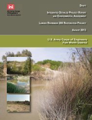
i LIMITED PHASE I ENVIRONMENTAL SITE ASSESSMENT PARK ...
i LIMITED PHASE I ENVIRONMENTAL SITE ASSESSMENT PARK ...
i LIMITED PHASE I ENVIRONMENTAL SITE ASSESSMENT PARK ...

Create successful ePaper yourself
Turn your PDF publications into a flip-book with our unique Google optimized e-Paper software.
4.0 <strong>ENVIRONMENTAL</strong> REVIEW AND <strong>SITE</strong> RECONNAISSANCE RESULTSAs detailed and reported in Section 3.0, a standard environmental records survey of availableregulatory information for the properties located in the Park Reach and two areas of the MissionReach was conducted for this assessment. This survey identified environmental conditionsreported within up to a one-mile radius of the study areas. Results of the environmental recordssurvey were numerically identified (See Appendix C) and expressed in radial increments of 1/8,1/4, 1/2 and 1-mile distances. Following receipt of the environmental records survey dataprovided by Banks, TtNUS field personnel then used this information as reference materialduring the site reconnaissance.The site reconnaissance of the 109 SARA-identified properties located in the Park Reach and thetwo areas of the Mission Reach was performed during the period of June 17 through 21, 2002.Mr. Eric Jorgeson, Certified Professional Geologist, and Mr. Mahmud Rahman, Engineer-In-Training, of TtNUS, both experienced in environmental site assessments, performed the sitereconnaissance. For purposes of this Limited Phase I ESA, the boundaries of the sitereconnaissance survey include only those noticeable environmental conditions directlyassociated with 109 properties and/or those environmental features immediately adjacent to theidentified properties.4.1 General Area EvaluationAs part of the drive-by site survey, TtNUS field personnel developed an environmentalassessment checklist form that was completed for each of the 109 properties. The checklistinformation included on the assessment form was developed in accordance with specificcomponents of “ASTM Standard E 1527-00, Standard Practice for Environmental SiteAssessments” selected by the FWCOE with input from the SARA. This drive-by site survey andsubsequent completion of the assessment checklist was limited to fenceline observation of siteactivities and/or suspected presence of environmental conditions. No walkover of the propertiesor interview of property owners was conducted during this assessment.In many cases, the properties were not readily visible from public roads. In these cases, itbecame necessary to walk available pathways along the property boundaries to observe theirenvironmental condition. In some cases, properties located across the San Antonio River wereonly visible from properties on the opposite side of the river. Right of entry to these propertieswas not obtained due to the limited scope of work.During site reconnaissance, TtNUS personnel also identified various industrial, commercial, andresidential properties and activities located immediately adjacent to the 109 properties. Over 600photographs of the 109 properties were taken. Site photographs of those properties that displaynoticeable environmental conditions are presented in Appendix A. Remaining site photographsare archived in the project files.2618s44-1