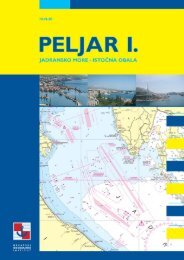
ADRIATIC SEA PILOT - Hrvatski hidrografski institut
ADRIATIC SEA PILOT - Hrvatski hidrografski institut
ADRIATIC SEA PILOT - Hrvatski hidrografski institut

Create successful ePaper yourself
Turn your PDF publications into a flip-book with our unique Google optimized e-Paper software.
PUBLISHER<strong>Hrvatski</strong> <strong>hidrografski</strong> <strong>institut</strong>, SplitMANAGING EDITORDr. Zvonko GræetiÊASSISTANT MANAGING EDITORIvica BariπiÊEDITORSBoæidar FrankoviÊMarijan FerenËakBoris HorvatDr. Josip KasumCARTOGRAPHY EDITORTea DuplanËiÊ-Leder, M. Sc.METEOROLOGY AND OCEANOGRAPHY EDITORNenad Leder, M. Sc.ASSOCIATE EDITORRadovan SolariÊ, M. Sc.TECHNICAL EDITORTonÊi JeliËiÊTRANSLATIONVesna TomiÊDESIGNJulije SkelinPRINTING RUN1000 copiesPRINTROTOOFFSET-TISKARA MEI∆, ZagrebCIP-Katalogizacija u publikacijiSveuËiliπna knjiænica u SplituUDK 656.61(497.5)(036)797.1(497.5)(036)527(262.3)(036)<strong>ADRIATIC</strong> sea pilot : a cruising guide to theAdriatic coast of Croatia / [managing editor Zvonko GræetiÊ ;translation Vesna TomiÊ]. - 1st ed. - Split : HydrographicInstitute of the Republic of Croatia, 2004 - . - 2 sv. ; 30 cmPrijevod djela: Peljar za male brodove.ISBN 953-6165-30-9 (cjelina)Vol 1: Piranski zaljev to Virsko more. - 269 str.: ilustr.u bojamaISBN 953-6165-31-7ISBN 953-6165-30-9 (cjelina)
PREFACECroatian part of the Adriatic with an archipelago of over a thousand islands, its crystal clear sea and favourable climate is a marvellouscruising area, a paradise for boaters.With their increasing interest for this coast, necessary facilities have been built - modernmarinas and small harbours - to offer stay, supply and maintenance to small craft and yachts, providing all kinds of information, onweather or cultural and sports events in the area of their interest.The first edition of this Pilot published by the Hydrographic Institute of the Republic of Croatia is complementary with its regularlyissued and updated charts and official publications. Besides providing up-to-date information relevant to the safety at sea and allthe facts on harbours and marinas, it also offers background information on cultural and historical sights, national parks and othernatural attractions on the coast and islands, and in the close interior.We hope that the information contained in this Pilot will prove to be useful to everyone cruising in this area, whose commentsand suggestions would be a valuable help in our mission to ensure safe navigation in these waters.Dr. Zvonko GræetiÊHHI Director
WEST COAST OF ISTRIAPIRANSKI ZALJEV, bayCharts: 100-15; MK-1; Plan 11Piranski Zaljev is a part of the Gulf of Trieste entered between RtMadona and Rt Savudrija (Gornja Savudrija). Its north coast isheavily populated so that the small town of Piran together withPortoroæ and marinas Bernardin and Portoroæ, and numerous hotelsettlements seem to be connected in a unity. Cultivated hills coveredwith olive and cypress trees descend steeply to the sea wheredepths along shore are small. On the low east coast of the bay therivers Lera and Dragonja flow into the sea.Maritime border between Croatia and Slovenia passes throughPiranski Zaljev.ANCHORAGE: In a Bora, E and SE winds the best anchoragefor larger vessels is situated about 500 m offshore, W of RtBernardin; good holding. During winds from III quadrantanchorage may be obtained about 800 m off the SW coast ofthe bay; good holding.LANDMARKS: Lighthouse on Rt Madona - grey octagonaltower; town of Piran, hotel settlement on Rt Bernardin andlighthouse on Rt Savudrija - stone tower (29 m) with galleryand grey cupola.WEATHER:The bay affords the best shelter from the Bora in theGulf of Trieste, especially its N part.The Scirocco is seldom violentand raises no sea, owing to the orientation of the bay.Thebay is exposed to W and NW winds which can raise seas. Innerpart of the Portoroæ boat harbour is sheltered from all winds.FOG: Normally occurs in the winter period.CURRENTS:Tidal currents are predominant, attaining rates ofup to 0.4 kn. Strong and persistent NW and W winds mayincrease the current rate to 0.8 kn.<strong>SEA</strong> LEVEL: Mean tidal amplitudes range from 0.6 to 0.9 m.Persistent gale winds may cause a rise in the sea level of about1.2 m (cyclonic Scirocco) or a fall of about 0.5 m anticyclonicBora).SHELTERS: On NE coast: harbours Piran and Portoroæ andmarinas Bernardin and Portoroæ.On SW coast: hotel settlement Kanegra situated about 3.3miles E of Savudrija lighthouse; depths along the "T" shapedpier are about 3 m.CABLES AND PIPELINES: Sewer is laid for 3450 m from apoint about 0.4 miles NW of Rt Bernardin in bearing 300º.REGULATIONS:Anchoring is prohibited in front of Piran harbour,between Rt Madona and the light on head of W molewithin 300 m of the coast, and from the line connecting RtBernardin - Rt Sv. Petar toward the head of the bay.Anchoring,fishing, all underwater activities and navigation by power-drivenvessels are prohibited in the area of nature reserve "RtMadona" within three yellow buoys on the following positions:a) 45° 31.96’ N - 013° 24.11’ Eb) 45° 31.81’ N - 013° 33.89’ Ec) 45° 31.70’ N - 013° 34.15’ EAnchoring and fishing are prohibited in 300 m radius aroundthe sewer.CAUTION: Care is necessary in avoiding marine farmsin the bay.Savudrija, lighthouse (from S)RT SAVUDRIJA is the NW extremity of the Istrian peninsula.TheNW side of the peninsula of Savudrija gently slopesdown to the rugged coast, ending in three points - GornjaSavudrija, Srednja Savudrija and Donja Savudrija. Villages arevisible on the nearby cultivated hills. On the point DonjaSavudrija stands the lighthouse Savudrija - stone tower withgallery and grey cupola, fitted with fog siren (42 s 2 M).Stara Savudrija is a boat harbour about 0.8 mile NE of thelighthouse Savudrija, between the points Gornja Savudrija andDonja Savudrija. It is sheltered by a breakwater, 177 m inlength, fitted with light on its head - white conical tower withred post and lamp. Electricity and water are available from nearthe breakwater root.The harbour provides shelter to smallercraft from the Bora and NW winds. Care is necessary in avoidinga shoal about 20 m E of the breakwater head, marked byseveral metal poles.REGULATIONS: From Rt Savudrija to the anchorage of Koperharbour, navigation is prohibited to vessels with draught over15 m within 2 miles of the coast and at a speed over 12 kn,because of small depths and heavy traffic.CAUTION: Care is necessary to avoid several shoalsextending to about 1.2 mile from the cape.64
WEST COAST OF ISTRIARevision 2001UMAG, harbour(45° 26.2’ N - 13° 31.0’ E)Charts: 100-15; MK-1; Plan 11Umag is a small medieval town situated on a peninsula about 4miles south of Rt Savudrija, with remains of town walls, towers, picturesquesquares and old houses in Venetian Gothic and earlyRenaissance styles, as well as churches from the 15th to 18th centuries.Modern part of the town extends beyond the walls andaround the bay.LANDMARKS: Hotel complex on Rt Paklena N of the harbour;high hotel building in the harbour and a factory chimneyS of the town; light on Paklena shoal - red tower with columnand gallery on base in the sea; light on breakwater head - greentower with column and gallery; light on the head of marinabreakwater - red tower with column and gallery.on S breakwater in Umag harbour) in bearing 260º in a lengthof 1.3 mile and in bearing 250º to Chioggia harbour.CAUTION: Care is necessary in avoiding the followingdangers: Paklena shoal when approaching from N, markedby a light on its W side - red tower with column andgallery on base in the sea; rocky shoal Garofulin on N sideof harbour entrance, W of marina breakwater, on its Spart marked by a pillar beacon coloured yellow aboveblack and topmark - 2 black cones points downward (Scardinal); shoal in SW part of the harbour, marked by agreen conical light buoy (lateral starboard) on its N edge.WEATHER: Exposed to NNW wind which does not raise asea in the harbour.FOG:Average occurrence is on 15 occasions a year, chiefly inthe winter period.CURRENTS: Ingoing/outgoing tidal currents are predominant,attaining rates of up to 0.3 kn. Persistent strong NW wind mayincrease the current rate to 0.6 kn.CABLES AND PIPELINES: Submarine optic cable is laid fromthe cove Muglela (about 0.4 mile in bearing 121º from the lightUmag, harbour (from S)65
WEST COAST OF ISTRIARevision 2001APPROACH:The harbour is entered between a red pillar lightbuoy with topmark - red cylinder (lateral port hand) and agreen conical buoy (lateral starboard); it is necessary to steerfor the pier only when clear of the green conical light buoy inthe harbour, or at night when the white light on the pierheadcomes into sight.ANCHORAGE: Smaller vessels and boats may anchor in thecentre of the harbour.BERTH:Alongside the pier or on E side of the quay.The pier isused by passenger and tourist ships and as a customs quay.Smaller vessels and boats may berth in the marina in N part ofthe harbour.SUPPLIES AND FACILITIES: Water hydrant at the pier root;fuel station E of the marina; post office, hospital, surgery, pharmacy,museum, gallery, library, bank, travel agencies, hotels andhotel settlements, camp, casino and sports facilities.OFFICIALS: Branch harbour office, police, customs, and permanentport of entry.COMMUNICATIONS: Road connections.WEATHER: Sheltered from all winds and sea.FOG:Average occurrence is on 15 occasions a year, chiefly inthe winter period.CURRENTS: Ingoing/outgoing tidal currents are predominant,attaining rates of up to 0.3 kn.CABLES AND PIPELINES: Submarine optic cable is laid fromthe cove Muglela (about 0.4 mile in bearing 121º from the lighton S breakwater in Umag harbour) in bearing 260º in a lengthof 1.3 mile and in bearing 250º to Chioggia harbour.CAUTION: Care is necessary in avoiding the followingdangers: Paklena shoal when approaching from N, markedby a light on its W side - red tower with column andgallery on base in the sea; rocky shoal Garofulin on N sideof harbour entrance, W of marina breakwater, on its Spart marked by a pillar beacon coloured yellow aboveblack and topmark - 2 black cones points downward (Scardinal); shoal in SW part of the harbour, marked by agreen conical light buoy (lateral starboard) on its N edge.MARINA UMAG(45° 26.3’ N - 13° 31.2’ E)Charts: 100-15; MK-1; Plan 11Situated in the north part of Umag harbour, about 300 m north ofthe light on the breakwater head.LANDMARKS: Hotel complex on Rt Paklena N of the harbour;high hotel building in the harbour and a factory chimneysouth of the town; light on Paklena shoal - red tower with columnand gallery on base in the sea; light on breakwater head -green tower with column and gallery; light on the head ofmarina breakwater - red tower with column and gallery.APPROACH:The harbour is entered between a red pillar lightbuoy with topmark - red cylinder (lateral port hand) and agreen conical buoy (lateral starboard); it is necessary to steerfor the marina only when the green conical light buoy in theharbour is reached. Near the breakwater it is shallow and thebottom is rock. It is not possible to pass between the breakwaterand Garofulin shoal.ANCHORAGE: Smaller vessels and boats may anchor in thecentre of the harbour; mud, good holding.BERTH: 518 wet berths and about 120 dry berths.Vessels aresecured stern-to; shock absorbing devices are recommended.Use of anchor is prohibited except in emergency.66
WEST COAST OF ISTRIARevision 2001Berth is determined by the marina on entering or by priornotification on phone or VHF channel 17, according to the sizeof the vessel and period of stay.PORT FACILITIES: Slipway for smaller vessels and travel lift(500 kN).REPAIRS: Minor repairs to hull and machinery.fuel station E of the marina; reception, exchange office, restaurant,toilets, showers, laundry facilities, car park, and supermarket.Open all year round.OFFICIALS: Branch harbour office, police, customs and seasonalport of entry.COMMUNICATIONS: Road connections.SUPPLIES AND FACILITIES:Water and electricity from piers;LovreËica, boat harbour (from NE)67
WEST COAST OF ISTRIASLANIK, cove(45° 22.7’ N - 13° 32.5’ E)Charts: 100-15; MK-2About 3.5 miles south of Umag.LANDMARKS: Belfry at LovreËica in N part of the cove.WEATHER: Exposed to winds from SW to NW which mayraise high waves.FOG:Average occurrence is on 15 occasions a year, chiefly inthe winter period.CURRENTS: Ingoing/outgoing tidal currents are predominant,attaining rates of up to 0.4 kn. Persistent strong NW wind mayincrease the current rate to 0.8 kn.ANCHORAGE: Suitable for anchoring of smaller vessels andboats.BERTH: To a mole at LovreËica, with depths of about 1.5 malongside.SUPPLIES AND FACILITIES:Water from hydrant and tap, electricity;grocery at LovreËica.COMMUNICATIONS: Road connections.LUKA DALJA, bay(45° 21.4’ N - 13° 33.0’ E)Charts: 100-15; MK-2About 5 miles south of Umag.The village of Dalja lies on its southcoast, and on its north coast there is a hotel settlement with all supportingfacilities.LANDMARKS: Hotel buildings overlooking the bay; widetower with flat roof in the village; light on the molehead in thevillage of ©pic - red column.WEATHER: Exposed to W and NW winds which cause moderateand rough sea in the bay.FOG:Average occurrence is on 15 occasions a year, chiefly inthe winter period.CURRENTS: Ingoing/outgoing tidal currents are predominant,attaining rates of up to 0.4 kn. Persistent strong NW wind mayincrease the current rate to 0.8 kn.CAUTION: Care is necessary to avoid the rocky shoalDalja which extends to 500 m NW of Rt Dalja; its NWedge is marked by a buoy coloured yellow with a horizontalblack band (W cardinal).ANCHORAGE: Suitable for anchoring in 7-8 m depth; the bottomis mud, good holding.BERTH: On both sides of a mole in the village of ©pic in NEpart of the bay, with depth at the head of about 2 m. On N sideof the mole from the third bollard towards the root, extendsan underwater concrete wall at the sea level, about 1 m wide.SUPPLIES AND FACILITIES: Water from hydrant at the moleroot; electricity from lampposts on the mole.COMMUNICATIONS: Road connections.NOVIGRAD, harbour(45° 19.0’ N - 13° 33.0’ E)Charts: 100-15; MK-2; Plan 11Situated on the north side of entry into Luka Mirna bay, about 7.3miles south of Umag. The old part of the town founded in lateancient times has been proclaimed a monument of culture.Amonghistorical sights worth mentioning are the remains of town wallswith towers from the 13th century and a sarcophagus in the parishchurch from 1146.LANDMARKS: Belfry in the town; remains of town walls andlight on breakwater head - white tower with gallery.WEATHER:With W and NW winds, which cause heavy seas,it is recommended to leave the harbour.FOG:Average occurrence is on 15 occasions a year, chiefly inthe winter period.CURRENTS:Tidal currents are predominant, attaining rates ofup to 0.4 kn. Persistent strong W and NW winds may increasethe current rate to 0.8 kn.CAUTION: When approaching harbour care is necessary toavoid the following dangers:- shoal Val WSW of harbour, marked by a pillar buoy colouredblack with a horizontal red band and topmark - two blackspheres one above the other (isolated danger);- shoal Meja (Veskova) W of harbour, near the breakwater root,marked by a green spar beacon with topmark - green cone pointupward (lateral starboard);- shallow area around Rt Mujela extending to 150 m off the coast;- three mooring buoys laid between the breakwater and the pier.Shoal Val is covered by the red sector of the light on breakwaterin Novigrad harbour, whereas shoal Meja is covered by the greensector of that light.©pic, mole (from SW)68