ADRIATIC SEA PILOT - Hrvatski hidrografski institut
ADRIATIC SEA PILOT - Hrvatski hidrografski institut
ADRIATIC SEA PILOT - Hrvatski hidrografski institut

You also want an ePaper? Increase the reach of your titles
YUMPU automatically turns print PDFs into web optimized ePapers that Google loves.
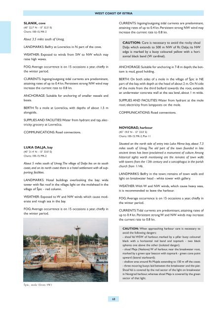
WEST COAST OF ISTRIASLANIK, cove(45° 22.7’ N - 13° 32.5’ E)Charts: 100-15; MK-2About 3.5 miles south of Umag.LANDMARKS: Belfry at LovreËica in N part of the cove.WEATHER: Exposed to winds from SW to NW which mayraise high waves.FOG:Average occurrence is on 15 occasions a year, chiefly inthe winter period.CURRENTS: Ingoing/outgoing tidal currents are predominant,attaining rates of up to 0.4 kn. Persistent strong NW wind mayincrease the current rate to 0.8 kn.ANCHORAGE: Suitable for anchoring of smaller vessels andboats.BERTH: To a mole at LovreËica, with depths of about 1.5 malongside.SUPPLIES AND FACILITIES:Water from hydrant and tap, electricity;grocery at LovreËica.COMMUNICATIONS: Road connections.LUKA DALJA, bay(45° 21.4’ N - 13° 33.0’ E)Charts: 100-15; MK-2About 5 miles south of Umag.The village of Dalja lies on its southcoast, and on its north coast there is a hotel settlement with all supportingfacilities.LANDMARKS: Hotel buildings overlooking the bay; widetower with flat roof in the village; light on the molehead in thevillage of ©pic - red column.WEATHER: Exposed to W and NW winds which cause moderateand rough sea in the bay.FOG:Average occurrence is on 15 occasions a year, chiefly inthe winter period.CURRENTS: Ingoing/outgoing tidal currents are predominant,attaining rates of up to 0.4 kn. Persistent strong NW wind mayincrease the current rate to 0.8 kn.CAUTION: Care is necessary to avoid the rocky shoalDalja which extends to 500 m NW of Rt Dalja; its NWedge is marked by a buoy coloured yellow with a horizontalblack band (W cardinal).ANCHORAGE: Suitable for anchoring in 7-8 m depth; the bottomis mud, good holding.BERTH: On both sides of a mole in the village of ©pic in NEpart of the bay, with depth at the head of about 2 m. On N sideof the mole from the third bollard towards the root, extendsan underwater concrete wall at the sea level, about 1 m wide.SUPPLIES AND FACILITIES: Water from hydrant at the moleroot; electricity from lampposts on the mole.COMMUNICATIONS: Road connections.NOVIGRAD, harbour(45° 19.0’ N - 13° 33.0’ E)Charts: 100-15; MK-2; Plan 11Situated on the north side of entry into Luka Mirna bay, about 7.3miles south of Umag. The old part of the town founded in lateancient times has been proclaimed a monument of culture.Amonghistorical sights worth mentioning are the remains of town wallswith towers from the 13th century and a sarcophagus in the parishchurch from 1146.LANDMARKS: Belfry in the town; remains of town walls andlight on breakwater head - white tower with gallery.WEATHER:With W and NW winds, which cause heavy seas,it is recommended to leave the harbour.FOG:Average occurrence is on 15 occasions a year, chiefly inthe winter period.CURRENTS:Tidal currents are predominant, attaining rates ofup to 0.4 kn. Persistent strong W and NW winds may increasethe current rate to 0.8 kn.CAUTION: When approaching harbour care is necessary toavoid the following dangers:- shoal Val WSW of harbour, marked by a pillar buoy colouredblack with a horizontal red band and topmark - two blackspheres one above the other (isolated danger);- shoal Meja (Veskova) W of harbour, near the breakwater root,marked by a green spar beacon with topmark - green cone pointupward (lateral starboard);- shallow area around Rt Mujela extending to 150 m off the coast;- three mooring buoys laid between the breakwater and the pier.Shoal Val is covered by the red sector of the light on breakwaterin Novigrad harbour, whereas shoal Meja is covered by the greensector of that light.©pic, mole (from SW)68