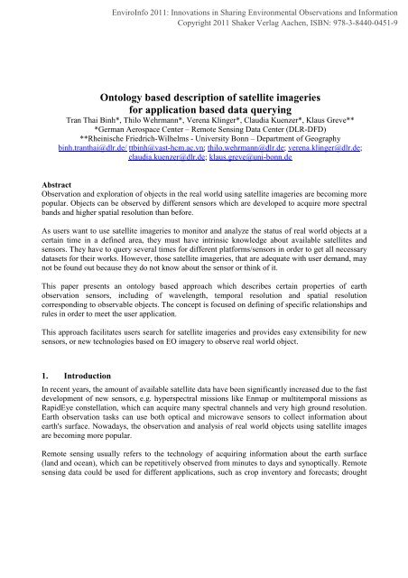
Ontology based description of satellite imageries for application ...
Ontology based description of satellite imageries for application ...
Ontology based description of satellite imageries for application ...

Create successful ePaper yourself
Turn your PDF publications into a flip-book with our unique Google optimized e-Paper software.
The problem <strong>for</strong> this situation is that the data repository must understand the matching between dataand <strong>application</strong>s (user tasks), only then it can respond to a certain query in a proper way. Thea<strong>for</strong>ementioned issues are caused by missing relationships between data domain and <strong>application</strong>domain, and lacking <strong>of</strong> <strong>description</strong>s how entities <strong>of</strong> the data domain can be linked to certain tasks <strong>of</strong>the <strong>application</strong> domain.3. Related worksIn recent years, many researchers [Barb 2008, Campedel 2009, Ruan 2006, Shao 2008, Silva 2004,Tomai 2008] devote to extend image retrieval methodologies from low-level characteristics tosemantic content and relationship. They focus on describing the content <strong>of</strong> <strong>satellite</strong> imagery and theunderlying processing chains in order to retrieve in<strong>for</strong>mation <strong>of</strong> <strong>satellite</strong> images. An adaptedontology is applied in order to describe the real world objects with human knowledge <strong>for</strong> extractingthem from <strong>satellite</strong> <strong>imageries</strong>. <strong>Ontology</strong> <strong>based</strong> approach is applied in this paper to describe <strong>satellite</strong><strong>imageries</strong> regarding to specific <strong>application</strong>s, <strong>for</strong> which <strong>satellite</strong> <strong>imageries</strong> can be <strong>of</strong> use, instead <strong>of</strong>describing in<strong>for</strong>mation inside the datasets itself.In [Kiemle 2002], they present a model describing earth observation data within a digital library. Themodel defines generic earth observation product classes and their relationships. Primary data aregrouped into product classes, which are described by common features like creation time, and spatiotemporalcoverage. The approach can facilitate user search <strong>for</strong> data and can be extended by definingnew definitions like product types, product component types and product parameters. It is difficult tomanage the system by mapping primary data to product groups if primary data belongs to more oneproduct group.A further work [Podwyszynski 2009] presents an approach, on that <strong>satellite</strong> <strong>imageries</strong> are described<strong>based</strong> on properties <strong>of</strong> sensor and the related <strong>application</strong>s. The system is divided into two domains,the <strong>application</strong> domain and data domain; the <strong>application</strong> domain describes the<strong>application</strong>/phenomenon users are working with. The data domain describes the properties <strong>of</strong><strong>satellite</strong> <strong>imageries</strong>. The two domains are related with each other through a measurement component.Users are able to search data <strong>based</strong> on <strong>application</strong>s they are interest in without any knowledge <strong>of</strong> lowlevel data characteristics. However, the system only describes properties <strong>of</strong> each image such asspatial resolution, processing level instead <strong>of</strong> describing the properties <strong>of</strong> sensors. It will be timeconsuming and errors prone <strong>for</strong> data providers especially when data is updated or reorganized and itis also difficult to extend when new sensors are built.4. MethodThe ontology-<strong>based</strong> approach is applied to describe <strong>satellite</strong> sensors and user requirement incircumstances <strong>of</strong> earth observation and the relationship between them. The concept <strong>of</strong> ontology canbe expressed as an encoding <strong>of</strong> a specific domain in order to share knowledge and understandingCopyright 2011 Shaker Verlag Aachen, ISBN: 978-3-8440-0451-9
epresented via the most common terminologies and ideas that are acceptable among differentspecific communities. In one domain, the ontology defines a set <strong>of</strong> representational terms which arecalled concepts; it also concludes constraints and rules to preserve the consistency <strong>of</strong> domain. A wellknown definition is “an ontology is a <strong>for</strong>mal explicit specification <strong>of</strong> a shared conceptualization”[Gruber 1993]WavelengthSensorhasTimeresolutionCan observeReal worldobjectsProduct <strong>of</strong>SpatialresolutionFocus onImageriesProvide toFigure 1Conceptual frame workUserThe objective <strong>of</strong> this approach is to approximate <strong>satellite</strong> data to the user requirements (which aremapped in the <strong>application</strong> domain). An ontology is built to describe sensor properties and userrequirements in a machine readable way. A reasoner can be used in order to return the appropriateresults to user queries <strong>based</strong> on the definitions in the ontology. <strong>Ontology</strong> is built <strong>based</strong> on <strong>Ontology</strong>Web Language (OWL) .The approach is depicted in figure 1.In this approach, sensors are described by properties, such as type (optical or microwave),wavelength (visible, near infrared etc.), temporal resolution (high-, middle- and low temporalresolution), and spatial resolution (high-, middle- and low spatial resolution). These <strong>description</strong>swere collected from [Satellite Imaging Corporation]. Potential <strong>application</strong>s <strong>of</strong> <strong>satellite</strong> <strong>imageries</strong>related to specific sensor properties are shown in table 1 [NASA, Navalgund 2007, Wang 2010].Each sensor type is defined as a class, in which <strong>satellite</strong> images are individuals (e.g. Landsat,Quickbird, TerraSAR-X etc.). Each image has properties related to subclasses <strong>of</strong> three attributiveclasses (WaveLength, TemporalResolution and SpatialResolution). These properties arehasWaveLength, hasTemporalResolution and hasSpatialResolution.Copyright 2011 Shaker Verlag Aachen, ISBN: 978-3-8440-0451-9
Channel/WavelengthSpatialResolution(m)TemporalResolution(day)Swath (km)ApplicationOpticalVNIR, SWIR 20 – 30 15 – 25 100 – 200 Vegetation (<strong>for</strong>estry,agriculture),coastal zone and inland waters,soil,geology, Multiple crop<strong>for</strong>ecastingVNIR, SWIR 2.5 -10< 1VNIR, MIR,TIRImaging stereopairsRadarL (~23cm)C (~3 – 7 cm)90250 – 10001000 - 4000Urban <strong>application</strong>Daily ~1000 Ocean color, Sea surfacetemperature Regional vegetationmonitoring; atmospheric, cloude(weather), parameter retrieval2.5 – 15 ~100 Elevation mapping, 3-Dmodelling3 – 100 30 - 35 Water mask, flood, cropmonitoring, <strong>for</strong>estry, surfaceland de<strong>for</strong>mationTable 1.Relationship between specific <strong>satellite</strong> imagery characteristics and <strong>application</strong>sFurthermore, Satellite images also have properties such as processing level, spatial coverage andacquisition date (Fig 2.). Data domain is organized by classes, subclasses and restrictions in order topreserve the consistency <strong>of</strong> domain, expressed as the follows.• Quickbird and Landsat belong to Optical class.• Optical and Microwave type must have spatial-, temporal resolution and wavelengthproperties.• Each observation only has exactly one spatial-, temporal resolution. EtcObjects that can be observed using <strong>satellite</strong> images are also defined by classes and subclasses (Figure3.) and they are described regarding to user requirements, <strong>for</strong> example <strong>for</strong>est belongs to land usegroup as part <strong>of</strong> the <strong>application</strong> domain. In this case, the domain was defined by two main classes i.e.Natural and man-made classes (Figure 3.). They have many subclasses regarding to possible<strong>application</strong>s and real world objects. The hierarchy <strong>of</strong> classes presents relationships between observedobject and possible <strong>application</strong>s <strong>of</strong> user interest.Copyright 2011 Shaker Verlag Aachen, ISBN: 978-3-8440-0451-9
Figure 2.Classes hierarchy <strong>of</strong> Data DomainFigure 3.Classes hierarchy <strong>of</strong> Application domainThe relationship between data domain and <strong>application</strong> domain is defined by rules. These rules definewhich objects can be observed by which datasets through properties <strong>of</strong> the observation. For example:If image type is opticalWavelength between 0.45 to 0.52 (band Blue)Can observe coastal, soil, vegetation differentiation, and deciduous/coniferousdifferentiationCopyright 2011 Shaker Verlag Aachen, ISBN: 978-3-8440-0451-9
These rules are easy to extend whenever either new <strong>application</strong>s or new available sensors aredeveloped. While this approach applied, users do not need to search a certain sensor but they only dowith their <strong>application</strong> and the reasoner will provide a list <strong>of</strong> datasets from different sensor that aresuitable <strong>for</strong> their tasks.5. Conclusion and future worksThis approach applies an ontology in order to describe <strong>satellite</strong> sensor properties and userrequirements in a machine readable way. The ontology includes the rules that define the relationshipsbetween sensor properties and user requirements. This approach facilitates users search <strong>for</strong> <strong>satellite</strong>images and is easy to extend when new sensors are made or new user requirements using <strong>satellite</strong>image to observe real world objects. Extending <strong>of</strong> terms <strong>for</strong> <strong>application</strong> domain will be done to apply<strong>for</strong> different disciplines and at present, image processing methods are not included in this approach.ReferenceBarb, A. S., et al. (2008). "<strong>Ontology</strong> Driven Content Mining <strong>for</strong> Semantic Queries in Satellite ImageDatabases."Campedel, M. (2009). "Knowledge Representation <strong>for</strong> Satellite Imagery."Chang, C., et al. (1997). "Titan: a High-Per<strong>for</strong>mance Remote-sensing Database."Datcu, M., et al. (2003). "In<strong>for</strong>mation Mining in Remote Sensing Image Archives: SystemConcepts."Gruber, T. R. (1993). "Toward Principles <strong>for</strong> the Design <strong>of</strong> Ontologies Used <strong>for</strong> KnowledgeSharing." International Journal Human-Computer Studies 43: 907-928.Kiemle, S. (2002). "From Digital Archive to Digital Library – A Middleware <strong>for</strong> Earth-ObservationData Management." Lecture Notes in Computer Science: 230-237.NASA "Remote Sensing Tutorial." http://rst.gsfc.nasa.gov/.Navalgund, R. R., et al. (2007). "Remote sensing <strong>application</strong>s: An overview." Current science Vol93(12).Podwyszynski, M. (2009). "Knowledge-<strong>based</strong> search <strong>for</strong> Earth Observation products." Master thesis<strong>of</strong> University <strong>of</strong> Passau Department <strong>of</strong> Computer Science and Mathematics.Ruan, N., et al. (2006). "Semantic-Based Image Retrieval in Remote Sensing Archive: An <strong>Ontology</strong>Approach."Satellite Imaging Corporation "Satellite Sensors." http://satimagingcorp.com/<strong>satellite</strong>-sensors.html.Shao, Z., et al. (2008). "Building Semantic <strong>Ontology</strong> Databases Based on Remote Sensing Images."Silva, M. P. d. S., et al. (2004). "Remote Sensing Image Mining Using Ontologies."Tomai, E., et al. (2008). "<strong>Ontology</strong>-Based Land Degradation Assessment from Satellite Images."Wang, J., et al. (2010). “Review <strong>of</strong> Remote Sensing Use in Forest Health”, The Open GeorgraphyJournal, 3, 28-42Copyright 2011 Shaker Verlag Aachen, ISBN: 978-3-8440-0451-9