Visualize and interpret the geometry, heterogeneity and lateral ...
Visualize and interpret the geometry, heterogeneity and lateral ...
Visualize and interpret the geometry, heterogeneity and lateral ...

Create successful ePaper yourself
Turn your PDF publications into a flip-book with our unique Google optimized e-Paper software.
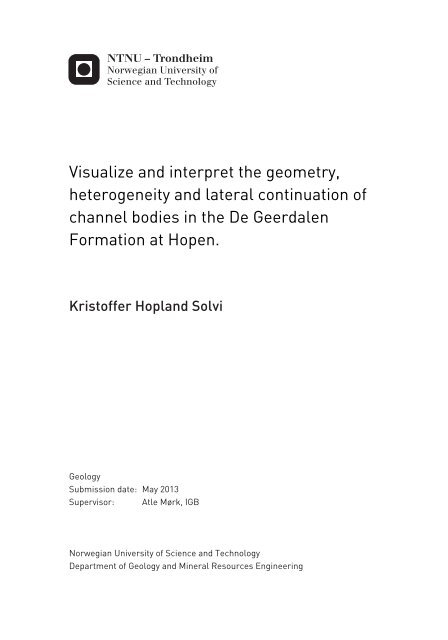
<strong>Visualize</strong> <strong>and</strong> <strong>interpret</strong> <strong>the</strong> <strong>geometry</strong>,<strong>heterogeneity</strong> <strong>and</strong> <strong>lateral</strong> continuation ofchannel bodies in <strong>the</strong> De GeerdalenFormation at Hopen.Kristoffer Hopl<strong>and</strong> SolviGeologySubmission date: May 2013Supervisor: Atle Mørk, IGBNorwegian University of Science <strong>and</strong> TechnologyDepartment of Geology <strong>and</strong> Mineral Resources Engineering
AbstractA digital 3D-model of Hopen has been created, using high-resolution photos taken along <strong>the</strong>coastline of <strong>the</strong> entire isl<strong>and</strong>. By merging <strong>the</strong>se photos toge<strong>the</strong>r in PhotoModeler software ithas been possible to produce a workable PhotoModeler-model of major parts of <strong>the</strong> isl<strong>and</strong>.Detailed sedimentological logs, provided by many different geologists, are representative ofspecific locations, mostly along <strong>the</strong> eastern side of <strong>the</strong> isl<strong>and</strong>. All <strong>the</strong> sediments at Hopen arepart of <strong>the</strong> Upper Triassic succession <strong>and</strong> include <strong>the</strong> De Geerdalen, Flatsalen <strong>and</strong> Svenskøyaformations.Large fluvial channel bodies, up to 36 m thick, are observed in <strong>the</strong> steep, near vertical cliffs of<strong>the</strong> isl<strong>and</strong>. The model makes it possible to map seismic scale channel bodies, as well assmaller channel bodies, <strong>and</strong> <strong>interpret</strong> <strong>the</strong>m with measured sedimentological logs. Based onposition of exposed s<strong>and</strong>stones, visible on both sides of <strong>the</strong> isl<strong>and</strong>, <strong>the</strong> development of <strong>the</strong>river system can be suggested.The model combined with additional photos has made it possible to recognize a potentiallynew member on <strong>the</strong> isl<strong>and</strong>, referred to as Hopen member. This member marks a possibletransgressive system tract, from fluvial dominated delta plain sediments to shallow marinedeposits. This member is about 70 meters below <strong>the</strong> well-known Slottet Bed, which marks <strong>the</strong>transition from <strong>the</strong> De Geerdalen Formation to Flatsalen Formation. The Hopen member hasalso been used to place <strong>the</strong> different channel bodies at <strong>the</strong> right stratigraphic level relative toeach o<strong>the</strong>r.The Hopen member might be deposited due to <strong>the</strong> same flooding event as <strong>the</strong> IsfjordenMember on Spitsbergen <strong>and</strong> might be correlatable with a 3 rd global sequence boundary, whichcan be correlated between deposits found in nor<strong>the</strong>rn Himalaya, Sverdrup Basin <strong>and</strong> <strong>the</strong>southwestern USA.This <strong>the</strong>sis has also made it possible to map where to expect to find Slottet Bed, which mayhelp updating <strong>the</strong> geological map of <strong>the</strong> isl<strong>and</strong>.I
SammendragEn digital 3D-modell av Hopen har blitt konstruert ved hjelp av høyoppløselige bilder tattlangs øyas kystlinje. Ved å fusjonere disse bildene sammen i programvaren PhotoModeler hardet vært mulig å konstruere en drivverdig 3D modell av store deler av øyen.Detaljerte sedimentologiske logger, hentet inn av mange forskjellige geologer, representerermange lokaliteter langs den østlige siden av øyen. Alle sedimentene funnet på Hopen er en delav Øvre Trias og består av De Geerdalen, Flatsalen og Svenskøya formasjonene.Store fluviale kanalkropper, opp mot 36 meter tykke, er observert i de bratte nesten vertikaleklippene på øyen. Modellen gjør det mulig å kartlegge disse kanalkroppene, så vel sommindre kanalkropper, og tolke de ved hjelp av sedimentologiske logger. Basert på posisjonentil de eksponerte kanalkroppene, synlig på begge sider av øyen, kan utviklingen avelvesystemet foreslås.Modellen kombinert med supplerende bilder har gjort det mulig å foreslå et nytt ledd på øyen,foreslått navn er Hopen leddet. Dette leddet markerer en mulig transgressiv systemrekke, fradelta slette sedimenter til mer grunnmarine avsetninger. Dette leddet starter ca. 70 meterunder og stopper ved Slottet laget, som markerer overgangen fra De Geerdalen formasjonentil Flatsalen formasjonen. Hopen leddet har også blitt brukt til å plassere de forskjelligekanalkroppene i riktig stratigrafisk rekkefølge, i forhold til hver<strong>and</strong>re.Hopen leddet kan ha blitt avsatt av den samme transgresjonen som Isfjorden leddet påSpitsbergen og den kan være korrelerbar med en 3ordens global sekvensgrense. Dennesekvensgrensen er mulig å korrelere mellom sedimenter funnet i nordlige deler av Himalaya,Sverdrup bassenget i Barentshavet og sedimenter funnet sørvest i USA og nå også påSvalbard.Denne oppgaven har også gjort det mulig å kartlegge Slottet laget i områder der den ikke erobservert tidligere.III
Contents1. Introduction ........................................................................................................................ 11.1 Preface ......................................................................................................................... 11.1.1 Acknowledgement ................................................................................................ 11.2 Study Area ................................................................................................................... 31.3 Regional geological setting ......................................................................................... 41.4 The Triassic succession on Svalbard ........................................................................... 71.5 Previous work at Hopen ............................................................................................ 102. Methods ............................................................................................................................ 132.1 Data collection ........................................................................................................... 132.2 PhotoModeler-model ................................................................................................. 152.3 Sources of error ......................................................................................................... 173. Lateral distribution of possible marker horizons .............................................................. 193.1 Lateral distribution of <strong>the</strong> black interval at <strong>the</strong> uppermost part of <strong>the</strong> De GeerdalenFormation (Hopen member) ................................................................................................. 19(1) Discussion .............................................................................................................. 193.2 Lateral distribution of Slottet Bed ............................................................................. 234. Channel bodies ................................................................................................................. 274.1 Channel body Group 1 ............................................................................................... 284.1.1 Channel body 1 (Nor<strong>the</strong>rn channel) ................................................................... 29(1) Discussion .............................................................................................................. 294.1.2 Channel body 2 (Binnedalen) ............................................................................. 33(1) Discussion .............................................................................................................. 374.1.3 Channel body 3 (Blåfjellet Channel complex) ................................................... 40(1) Discussion .............................................................................................................. 424.1.4 Channel Body 4 (Johan Hjortfjellet) .................................................................. 43(1) Discussion .............................................................................................................. 454.2 Channel body Group 2 ............................................................................................... 484.2.1 Channel body 5 (SW of Nørstefjellet) ................................................................ 49(1) Discussion .............................................................................................................. 514.2.2 Channel body 6 <strong>and</strong> 7 (Western side of Lyngefjellet) ....................................... 52(1) Discussion .............................................................................................................. 52IV
4.2.3 Channel body 8 (SW of Lyngefjellet) ................................................................ 54(1) Discussion .............................................................................................................. 544.2.4 Channel body 9 (Blåfjellet, Middle unit) ........................................................... 57(1) Discussion .............................................................................................................. 584.2.5 Channel body 10 (Western side of Kollerfjellet, NW of Hopen radio) ............. 64(1) Discussion .............................................................................................................. 664.2.6 Channel body 11 (NE of Hopen radio) .............................................................. 68(1) Discussion .............................................................................................................. 684.2.7 Channel body 12 (Western side of Kollerfjellet) ............................................... 70(1) Discussion .............................................................................................................. 704.2.8 Channel body 13 (Western side of Werenskioldfjellet) ..................................... 72(1) Discussion .............................................................................................................. 744.2.9 Channel body 14 <strong>and</strong> associated fault (Iversenfjellet) ....................................... 76(1) Discussion .............................................................................................................. 764.3 Channel Body Group 3 .............................................................................................. 824.3.1 Channel body 15 (NW of Braastadskaret) ......................................................... 83(1) Discussion .............................................................................................................. 844.3.2 Channel body 16 (Blåfjellet South) .................................................................... 85(1) Discussion .............................................................................................................. 854.3.3 Channel body 17 (Djupskaret) ........................................................................... 87(1) Discussion .............................................................................................................. 874.3.4 Channel body 18 (Kvasstoppen) ........................................................................ 89(1) Discussion .............................................................................................................. 915. Discussion ........................................................................................................................ 935.1 Map relevant features ................................................................................................ 935.2 Thickness variations of <strong>the</strong> De Geerdalen Formation <strong>and</strong> <strong>the</strong> equivalent SnaddFormation ............................................................................................................................. 945.3 Placing <strong>the</strong> channel bodies in <strong>the</strong> stratigraphical record ........................................... 956. Conclusions ...................................................................................................................... 996.1 Fur<strong>the</strong>r work ............................................................................................................ 100References .............................................................................................................................. 101Appendix ................................................................................................................................ 106V
1. Introduction1.1 PrefaceThis master`s <strong>the</strong>sis aim to study <strong>the</strong> distribution, <strong>heterogeneity</strong> <strong>and</strong> <strong>geometry</strong> of channelbodies of Upper Triassic age at <strong>the</strong> isl<strong>and</strong> Hopen on Svalbard (Figure 1.1). Former studies(Riis et al., 2008; Glørstad-Clark, 2010; Glørstad-Clark, 2011) show that <strong>the</strong> Upper Triassicsediments at Svalbard represent a continuation of <strong>the</strong> same depositional environment as <strong>the</strong>Upper Triassic sediments in <strong>the</strong> Barents Sea. The deposits at Hopen thus represent possiblereservoir s<strong>and</strong>stones in <strong>the</strong> Barents Sea. The <strong>the</strong>sis is part of a larger project facilitated bySintef Petroleum Research where <strong>the</strong> main aim is to reconstruct <strong>the</strong> palaeoenvironment of <strong>the</strong>Triassic succession of Nor<strong>the</strong>rn Barents Shelf <strong>and</strong> Svalbard. Several companies support <strong>the</strong>project (see Subsection 1.1.1). The data that are used in this <strong>the</strong>sis, including photo material<strong>and</strong> logs, are collected by several workers of this project team. PhD student Tore Klausen(University of Bergen) has recently submitted a manuscript focusing on <strong>the</strong> sedimentology of<strong>the</strong> seismic scaled channel bodies (channel bodies 1, 3, 4, 11 <strong>and</strong> 14) at Hopen <strong>and</strong> comparingthat with seismic collected in <strong>the</strong> south-western Barents Sea. His work overlap with <strong>the</strong>present work <strong>and</strong> will be referred to where relevant.The present study started as an engagement work for Sintef Petroleum Research by author,<strong>and</strong> included using <strong>the</strong> software PhotoModeler to prepare a model of <strong>the</strong> isl<strong>and</strong> by use ofhigh- resolution photos. The model makes <strong>the</strong> foundation for this <strong>the</strong>sis <strong>and</strong> <strong>the</strong> work with <strong>the</strong>model has been continued into this <strong>the</strong>sis, trying to develop it into a more detailed geologicalmodel. The model can help us visualize <strong>and</strong> <strong>the</strong>refore improve our underst<strong>and</strong>ing of <strong>the</strong>distribution of channel bodies at Hopen, as well as marker horizons. The high-resolutionphotos used to make this model were collected by Terje Hellem during <strong>the</strong> fieldwork onHopen in 2011.1.1.1 AcknowledgementFirst, I would like to thank my supervisor Atle Mørk for giving me <strong>the</strong> opportunity to do thisstudy, <strong>and</strong> for always being <strong>the</strong>re for me when I needed someone to discuss my challengeswith. I also want to thank him for his valuable support <strong>and</strong> for giving me <strong>the</strong> chance to take acloser look at Hopen.1
Secondly, I wish to thank my co-supervisor Terje Hellem for taking <strong>the</strong> pictures that are usedin my PhotoModeler-model, <strong>and</strong> for his valuable help with constructing <strong>the</strong> PhotoModelermodel.I also want to thank Tore Klausen for valuable discussions concerning <strong>the</strong> large channelbodies found on <strong>the</strong> isl<strong>and</strong> <strong>and</strong> all <strong>the</strong> geologists taking part on <strong>the</strong> 1995 <strong>and</strong> 2007-2012expeditions to Hopen. Without <strong>the</strong>ir expertise <strong>and</strong> detailed logging this <strong>the</strong>sis wouldn't bepossible to complete.The companies <strong>and</strong> geologist contributing to this <strong>the</strong>sis are summarized below:The following license groups <strong>and</strong> organizations have supported <strong>the</strong> project:PL609: Lundin, RWE Dea, IdemitsuPL438: Lundin, Det norske, Talisman, Spring, Petoro, RWE DeeaPL492: Lundin, Talisman, Det norske, RWE DeaPL533: Eni Norge A/S, Det norske, Lundin, RWE DeaPL611: Wintershall Norge AS (operator), Faroe Petroleum Norge AS <strong>and</strong> Petoro ASNorwegian Petroleum Directorate <strong>and</strong> Norwegian Polar InstituteSedimentological sections logged at Hopen1995: Geir Elvebakk, Roger I. Johansen, Geir Birger Larssen, Tor Nedkvitne, Arvid Nøttvedt,Atle Mørk, Anne Mari Østvedt-Gahzi.2009: Alvar Braa<strong>the</strong>n, Ingrid B. Hynne, Turid Anita Knudsen, Bjørn Anders Lundschien AtleMørk, Rita S. Rød.2011: Marianne Ask, Morten Bergan, Håvard Buran, Mike Charnock, Geir Elvebakk, AndreyFedyaevskiy, Terje Hellem, Frode Karlsen, Tore Klausen, Trond Kristensen, AudunKjemperud, Hilde Krogh, Bjørn Anders Lundschien, Gunn Mangerud, Atle Mørk, AlesRusinovich, Terje Solbakk, Marina Tugarova, Marta S. Woldengen.2012: Frode Karlsen, Gareth S. Lord, Atle Mørk, Espen Simonstad, Kristoffer Solvi.Last but not least I want to thank my family for being so supportive <strong>and</strong> underst<strong>and</strong>ing.2
1.2 Study AreaHopen is part of <strong>the</strong> Svalbard archipelago, situated on <strong>the</strong> north- western margin of <strong>the</strong>Barents Sea, covering less than 5 % of <strong>the</strong> total area of <strong>the</strong> Barents Sea (Worsley,2008)(Figure 1.2). The isl<strong>and</strong> rises out of <strong>the</strong> sea <strong>and</strong> is located on <strong>the</strong> south-eastern margin of<strong>the</strong> archipelago, bounded by <strong>the</strong> Edgeøya Basin in <strong>the</strong> west <strong>and</strong> <strong>the</strong> Olga Basin in <strong>the</strong> east(Doré, 1995). The isl<strong>and</strong> is about 37 km long <strong>and</strong> between 0.5 <strong>and</strong> 2.5 km wide, stretching ina NNE direction (Figure 1.1). The isl<strong>and</strong> has latitude <strong>and</strong> longitude coordinates of76°42'52"N, 25°29'39"E on <strong>the</strong> nor<strong>the</strong>rn <strong>and</strong> 76°26'37"N, 24°55'39"E on <strong>the</strong> sou<strong>the</strong>rn tip of<strong>the</strong> isl<strong>and</strong> (Norwegian Polar Institute (online), 2013).Figure 1.1: Geological map of Hopen. Mapped by W.K. Dallmann, Norwegian PolarInstitute, during cruise with <strong>the</strong> vessel M/S Kongsøy, organized by <strong>the</strong> NorwegianPetroleum Directorate, August 2009. Based on a previous map by Smith et al., (1975).3
1.3 Regional geological settingThe Svalbard archipelago was uplifted during tectonic activity in <strong>the</strong> Mesozoic <strong>and</strong> <strong>the</strong>Cenozoic. The varying geology at Svalbard is a consequence of <strong>the</strong> northwards drift of <strong>the</strong>plate, from 30° south to <strong>the</strong> present 81° north. The age of <strong>the</strong> rocks ranges from Precambrianto sediments deposited today (Worsley, 2008).The Precambrian –Silurian basement rocks at Svalbard consist of sediments, metasediments<strong>and</strong> igneous rocks, ranging in age from Riphean (1275 Ma) to Silurian. The entire successionconsists of 20 lithostratigraphical groups, collectively referred to as Hecla Hock (Worsley,2008) (Pre-old Red basement in Fig. 1.2).The strata deposited during post -Caledonian time can be divided into different regimesdepending on several important factors like tectonic activity, depositional climate <strong>and</strong>sediment sources (Stemmerik <strong>and</strong> Worsley, 1995, 2005; Worsley, 2008).During Early- mid Devonian <strong>the</strong> degradation of <strong>the</strong> Caledonian orogeny formed <strong>the</strong> Old reds<strong>and</strong>stone. The late Devonian to early Carboniferous Billefjorden Group consist mostly offluvial <strong>and</strong> lacustrine sediments that where deposited in a humid climate. Half–grabenssituated on <strong>the</strong> western shelf margin show a generally upward coarsening trend, fromme<strong>and</strong>ering river s<strong>and</strong>stones, into braided river streams, alluvial s<strong>and</strong>stones <strong>and</strong>conglomerates (Worsley, 2008).The Mid-Carboniferous – Lower Permian Gipsdalen Group is dominated by shallow marinecarbonates, sabkha evaporates <strong>and</strong> halite, deposited in large <strong>and</strong> deep isolated basins. Theclimate is warm <strong>and</strong> arid during this phase, with frequent changes in sea-level, due toglaciation of Gondwanal<strong>and</strong>. During high glacioeustatic sea-levels, <strong>the</strong> deposition wascharacterised by shallow-marine carbonates, while during low sea levels, sabkhas as well assub aerially karst <strong>and</strong> fossil soils were developed (Worsley, 2008).The base of <strong>the</strong> Bjarmel<strong>and</strong> Group is marked by a major flooding event <strong>and</strong> marks <strong>the</strong> end of<strong>the</strong> Gipsdalen Group with shallow warm waters, to deeper <strong>and</strong> more temperate conditionsduring deposition of Bjarmel<strong>and</strong> Group in Sakmarian <strong>and</strong> Artinskian (Worsley, 2008). Thistransgression is probably due to <strong>the</strong> final disappearance of <strong>the</strong> Gondwanian ice cap, as well asmajor plate reorganization, which formed <strong>the</strong> Urals at <strong>the</strong> east <strong>and</strong> closed <strong>the</strong> Tethys seaway(Worsley, 2008). The Bjarmel<strong>and</strong> Group is only exposed at Bjørnøya. At <strong>the</strong> rest of <strong>the</strong>4
Svalbard archipelago <strong>the</strong> Gipsdalen Group is overlain by <strong>the</strong> Tempelfjorden Group (Dallmannet al., 1999a).The middle-upper Permian Tempelfjorden Group marks a dramatic depositional change, fromcarbonate environments to deep-water spiculitic shale deposition with minor units ofs<strong>and</strong>stone <strong>and</strong> limestone (Worsley, 2008).In <strong>the</strong> Mesozoic, Svalbardwas situated on <strong>the</strong>nor<strong>the</strong>rn rim of <strong>the</strong>Pangaea supercontinent,50°-70°N of equator.Except some movementalong existing lineaments,most of <strong>the</strong> Mesozoic wasa tectonically quiet period<strong>and</strong> <strong>the</strong> Svalbardarchipelago was situatedon a depositionalplatform. Svalbardcontinued to be adepositional platformuntil late-Cretaceous,when a crustal upliftcaused <strong>the</strong> plate margin totilt southwards. (Steel<strong>and</strong> Worsley, 1984; Mørket al., 1982; Riis et al.,2008; Midtk<strong>and</strong>al, 2009).The Mesozoicstratigraphic recordconsists mainly ofrepeated delta-related <strong>and</strong> shallow shelf sediments in Triassic – Early Jurassic <strong>and</strong> again inlater part of Early Cretaceous periods.During middle Jurassic – earliest Cretaceous deepershelf sediments were deposited (Dallmann, 1999).Figure 1.2: Geological map of Svalbard from Dallmann,1999. The purple area represents <strong>the</strong> Mesozoic KappToscana Group.5
The Triassic of Svalbard consists of two lithostratigraphic groups. The dominant lithologies in<strong>the</strong> Sassendalen Group are of Early to Middle Triassic age <strong>and</strong> consist of shales <strong>and</strong> siltstoneswith minor amounts of s<strong>and</strong>stone <strong>and</strong> carbonates (Mørk et al., 1999). Mørk et al. (1982)suggested that <strong>the</strong> s<strong>and</strong>stone units exposed on <strong>the</strong> western coast of Svalbard are related tocoastal progradation from Greenl<strong>and</strong> in <strong>the</strong> west. The Sassendalen Group has coastal todeltaic sediments exposed on <strong>the</strong> western Spitsbergen, which grade into organic-rich shelfmudstones eastwards in Svalbard <strong>and</strong> southwards into <strong>the</strong> Barents Sea Shelf (Mørk et al.,1999).The Kapp Toscana Group is deposited during <strong>the</strong> Middle Triassic to Middle Jurassic in adeltaic environment. There is still some local deltas prograding from <strong>the</strong> west, affecting <strong>the</strong>western coast of Svalbard (Worsley, 2008), while Riis et al. (2008) suggests that <strong>the</strong> Uralsprovide <strong>the</strong> major part of <strong>the</strong> sediment input, leading to a delta-plain environment over muchof <strong>the</strong> nor<strong>the</strong>rn Barents Shelf (For more detailed information about <strong>the</strong> Triassic succession atSvalbard see subsection 1.4).The Adventdalen Group represents <strong>the</strong> sediments deposited on Svalbard during <strong>the</strong> latestMiddle Jurassic to Early Cretaceous. The Group contains claystones, shales <strong>and</strong> s<strong>and</strong>stonesdeposited in shelf settings (Mørk et al., 1999). During <strong>the</strong> Barremian, HelvetiafjelletFormation was deposited on Svalbard. This significant s<strong>and</strong>stone unit was deposited as aresult of <strong>the</strong> Cretaceous regional uplift, as well as deltaic progradation <strong>and</strong> relative sea levelfall. For <strong>the</strong> period of latest Jurassic to earliest Cretaceous dolerite sills <strong>and</strong> dikes intrudedolder rocks all across Svalbard (Gjelberg <strong>and</strong> Steel, 1995). These intrusions were a result of<strong>the</strong> break-up between Greenl<strong>and</strong> <strong>and</strong> Europe (Burov et al., 1977; Birkenmajer et al., 2010).The Late Cretaceous uplift exposed Svalbard <strong>and</strong> subjected <strong>the</strong> northwestern rim of <strong>the</strong>Barents Shelf to erosion, preferentially in <strong>the</strong> north because <strong>the</strong> erosion cuts deeper into <strong>the</strong>Carolinefjellet Formation strata here than in <strong>the</strong> south <strong>and</strong> northwest (Steel <strong>and</strong> Worsley,1984). This uplift of <strong>the</strong> northwestern edge of <strong>the</strong> Barents Shelf was probably part of adoming related to development of <strong>the</strong> Artic Basin to <strong>the</strong> north (Steel <strong>and</strong> Worsley, 1984).The Tertiary basins of Svalbard developed in a period of considerable tectonic activity, incontrast to <strong>the</strong> Mesozoic depositional platform (Steel <strong>and</strong> Worsley, 1984). The CentralTertiary basin is situated in <strong>the</strong> sou<strong>the</strong>rn <strong>and</strong> central parts of <strong>the</strong> isl<strong>and</strong> Spitsbergen. This basin6
forms a NNW-SSE trending synclinorium, infilled with clastic sediments (Dallmann et al.,1999b).During <strong>the</strong> glaciation cycles in <strong>the</strong> Neogene, large amounts of sediments were redeposited on<strong>the</strong> shelf edge. Repeated shelf depression <strong>and</strong> uplift took place causing erosion, <strong>and</strong> shaped<strong>the</strong> topography that we can see on Svalbard today (Worsley, 2008).1.4 The Triassic succession on SvalbardTriassic rocks crop out extensively on <strong>the</strong> Svalbard archipelago. On <strong>the</strong> eastern side of <strong>the</strong>archipelago <strong>the</strong> exposed rocks are fairly horizontal, while on western Svalbard <strong>the</strong> sedimentsare folded <strong>and</strong> thrusted as a result of <strong>the</strong> Tertiary deformation (Mørk et al., 1982; Bergh et al.,1997; Braa<strong>the</strong>n et al., 1999). As mentioned in Subsection 1.3 <strong>the</strong> Triassic of Svalbard consistsof two lithostratigraphic groups; <strong>the</strong> Sassendalen Group <strong>and</strong> <strong>the</strong> Kapp Toscana Group. OnHopen <strong>the</strong> sediments are of Late Triassic age, <strong>and</strong> belong to <strong>the</strong> Kapp Toscana Group.The Kapp Toscana Group is deposited during late Middle Triassic to Middle Jurassic time <strong>and</strong>consists of s<strong>and</strong>stones <strong>and</strong> mudstones. During <strong>the</strong> deposition of <strong>the</strong> Late Triassic StorfjordenSubgroup (Figure 1.3) deltaic <strong>and</strong> floodplain environments were established over much of <strong>the</strong>Svalbard Platform (Worsley, 2008), <strong>and</strong> in <strong>the</strong> upper part of Storfjorden Subgroup <strong>the</strong> DeGeerdalen Formation was deposited on Svalbard.The Carnian to early Norian De Geerdalen Formation is underlain by <strong>the</strong> grey shales of <strong>the</strong>Tschermakfjellet Formation <strong>and</strong> overlain by <strong>the</strong> Wilhelmøya Subgroup (Figure 1.3). Theformation is suggested to be diachronous <strong>and</strong> to have more proximal facies to <strong>the</strong> sou<strong>the</strong>ast(Lock et al., 1978; Mørk et al., 1982; Riis et al., 2008). The De Geerdalen Formation thickensto <strong>the</strong> east <strong>and</strong> sou<strong>the</strong>astwards, from 200-300 meters on central <strong>and</strong> eastern Spitsbergen(Mørk et al., 1999; Mørk <strong>and</strong> Worsley, 2006) to about 700 meters on Hopen (Riis et al. 2008).The lower boundary is defined at <strong>the</strong> base of <strong>the</strong> first pronounced s<strong>and</strong>stone bed above <strong>the</strong>Tschermakfjellet Formation (Mørk et al., 1999). The De Geerdalen Formation is <strong>the</strong> dominantformation on Hopen <strong>and</strong> consists of shales, silts <strong>and</strong> s<strong>and</strong>stones. This isl<strong>and</strong> is situated on <strong>the</strong>south-eastern border of <strong>the</strong> Svalbard archipelago, hence <strong>the</strong> outcrops on Hopen are mostlikely illustrating <strong>the</strong> most proximal part of <strong>the</strong> De Geerdalen Formation. Larger s<strong>and</strong>stonebodies, some even in seismic scale can be seen several places at Hopen (e.g. Subsection 4.1.1:Channel body 1). On some of <strong>the</strong> higher mountains, like Lyngefjellet (Figure 1.4), <strong>the</strong> De7
Geerdalen Formation is overlain by <strong>the</strong> Slottet Bed, which marks <strong>the</strong> beginning of <strong>the</strong>Flatsalen Formation. The bed is typically 1.5 m thick <strong>and</strong> consists of calcareous s<strong>and</strong>- <strong>and</strong>siltstone. It is easily recognised because of its distinct orange-brown colour (Mørk et al.,1999) <strong>and</strong> might be deposited due to a global 2order sequence boundary (Embry, 1997;Egorov <strong>and</strong> Mørk, 2000). The overlying part of <strong>the</strong> Flatsalen Formation consists of coarseningupward units with marine shales transitioning into more silty- s<strong>and</strong> towards <strong>the</strong> top (Mørk etal., 1999). Above <strong>the</strong> Flatsalen Formation <strong>the</strong> Svenskøya Formation is dominated by fluvials<strong>and</strong>stones (Mørk. et al., 1999). This formation is only visible on Lyngefjellet (Figure 1.4).Both Flatsalen <strong>and</strong> Svenskøya formations are part of <strong>the</strong> Willhelmøya Subgroup (Figure 1.3).Figure 1.3: Overview of <strong>the</strong> Triassic lithostratigraphy of Svalbard <strong>and</strong> <strong>the</strong> Barents Sea.Modified from Mørk et al., 1999.8
Figure 1.4: Part of Lyngefjellet, which is <strong>the</strong> only mountain that displays all <strong>the</strong>formations on Hopen.9
1.5 Previous work at HopenThe Swedish polar explorer <strong>and</strong> geologist Alfred Gabriel Nathorst published in 1894 <strong>the</strong> firstpaper with a geological map of Hopen. He <strong>interpret</strong>ed <strong>the</strong> deposits to be of Triassic age, but<strong>the</strong> paper did not include any explanation. As Nathorst never got <strong>the</strong> chance to go on l<strong>and</strong> onHopen, all his observations were done from offshore meaning that his <strong>interpret</strong>ations, mostlikely, are based on <strong>the</strong> cliff sections seen from <strong>the</strong> sea.Several expeditions from <strong>the</strong> beginning of 1920- 1960's tried to establish <strong>the</strong> geological age ofHopen. Publication by Iversen (1926), Werenskiold (1926) <strong>and</strong> Bodylewsky (1926) suggestedearly Cretaceous age based on <strong>the</strong>ir topographical map, geological notes <strong>and</strong> notes on fossilplants. An expedition in 1930 also suggested early Cretaceous age based on <strong>the</strong> occurrence ofloose pieces of coal.Norwegian Polar Institute collected in 1969, plants, bivalves <strong>and</strong> ammonites that wereexamined <strong>and</strong> in 1971, Flood, Nagy <strong>and</strong> Winsnes published an article suggesting a lateTriassic age <strong>and</strong> a possible correlation to <strong>the</strong> De Geerdalen Formation of Edgeøya <strong>and</strong>Barentsøya. Pčelina participated on two Russian expeditions (1966 <strong>and</strong> 1971) <strong>and</strong> publishedin 1972 a paper with a complex stratigraphic section with lithological details of <strong>the</strong> sequenceexposed in <strong>the</strong> sou<strong>the</strong>rn parts of <strong>the</strong> isl<strong>and</strong>. She divided <strong>the</strong> isl<strong>and</strong> into Carnian <strong>and</strong> Norianage, mostly grounded on lithological division, but also based on evidence from fossil plants<strong>and</strong> bivalves. She claimed that <strong>the</strong> lowest part was of Carnian age while <strong>the</strong> top was of Norianage. Without visiting <strong>the</strong> nor<strong>the</strong>rn part of <strong>the</strong> isl<strong>and</strong>, Pčelina suggested that <strong>the</strong> isl<strong>and</strong> had agentle dip towards <strong>the</strong> north <strong>and</strong> <strong>the</strong>refore would contain younger rocks, perhaps even ofJurassic age. Worsley (1973) based on his work in <strong>the</strong> nor<strong>the</strong>rn part of Hopen <strong>and</strong> suggestedlike Pčelina that <strong>the</strong> rocks in <strong>the</strong> nor<strong>the</strong>rn part was younger, but instead of explaining it with aregional gentle dip he explained it with faulting. The paper by Smith et al. (1975) states thatseveral of <strong>the</strong> faults found at Hopen do not have a dip direction to <strong>the</strong> NE <strong>and</strong> <strong>the</strong>reby <strong>the</strong>y donot believe that <strong>the</strong> sediments situated at <strong>the</strong> nor<strong>the</strong>rn part of <strong>the</strong> isl<strong>and</strong> is younger than <strong>the</strong>ones in south strictly because of faulting, but that <strong>the</strong>re might be a combination of gentle dip<strong>and</strong> to some extent faulting.During <strong>the</strong> last 40 years several expeditions has taken place, but in general little work hasbeen published.10
Because of regenerated belief in <strong>the</strong> Barents Sea as a petroleum play, Norwegian PetroleumDirectorate (NPD) <strong>and</strong> SINTEF Petroleum Research organized studies from 2007-2012 with<strong>the</strong> aim to reconstruct <strong>the</strong> palaeoenvironment of <strong>the</strong> Upper Triassic as an analogue to <strong>the</strong>Barents Sea Region. Several logs shown in this <strong>the</strong>sis were also collected on an expedition toHopen in 1995, organized by NPD <strong>and</strong> Norwegian oil companies.11
2. MethodsThe work of this <strong>the</strong>sis is mainly based on photo material, which has been used to tryestablish a geological model of <strong>the</strong> isl<strong>and</strong>. The data <strong>and</strong> software used for this purpose will bediscussed below.2.1 Data collectionPhoto collection took place at Hopen <strong>and</strong> was done by Terje Hellem during <strong>the</strong> 2011 fieldwork. Some supplementary photos were also taken in areas with low coverage during <strong>the</strong>2012 field season by Kristoffer Solvi <strong>and</strong> Atle Mørk. The photos were collected in asystematic manner by sailing with M/S Stålbas around <strong>the</strong> isl<strong>and</strong>. In some areas, mostly on<strong>the</strong> eastern side of <strong>the</strong> isl<strong>and</strong>, a rubber boat was used to get closer to shore in order to obtainmore detailed photos.Terje Hellem used a Nikon D3X camera with an 85 mm or a 300 mm lens during collection ofphotos on <strong>the</strong> field trip in 2011. The 300 mm lens was only used in areas were <strong>the</strong> boat couldnot get close enough to <strong>the</strong> shore. On <strong>the</strong> 2012 expedition a Canon EOS 60D with a 150 mmlens was used for photo collection. Most of <strong>the</strong> PhotoModeler-model has been constructed byusing <strong>the</strong> photos taken with <strong>the</strong> 85 mm lens. These photos have a high quality <strong>and</strong> make itpossible to pick <strong>the</strong> same pixel on different photos. The photos taken with an 85 mm lens arealso best calibrated in <strong>the</strong> model. Photos taken with a 300 mm lens are used from Blåfjellet<strong>and</strong> down to Johan Hjortfjellet on <strong>the</strong> western side of <strong>the</strong> isl<strong>and</strong>. Since <strong>the</strong>se photos are takenwith a higher zoom, <strong>the</strong> photos are more blurry, hence it is difficult to pick out <strong>the</strong> same spoton different photos. The photos taken on <strong>the</strong> 2012 expedition are not used in <strong>the</strong>PhotoModeler-model, but are used as a supplement in order to get a better underst<strong>and</strong>ing of<strong>the</strong> different channel bodies.During <strong>the</strong> Hopen expedition in 2011 Terje Hellem took 4700 photos covering <strong>the</strong> entireisl<strong>and</strong>. Close to 1500 of <strong>the</strong>se were taken with <strong>the</strong> 300 lens, while <strong>the</strong> rest were taken with <strong>the</strong>85 mm lens. In 2012 approximately 200 pictures were shot in areas where <strong>the</strong> photos from <strong>the</strong>2011 expedition had low coverage or low quality due to fog.The logs that are used in this <strong>the</strong>sis were collected during expeditions to Hopen in 1995 <strong>and</strong> in<strong>the</strong> time period 2007- 2012. The geologists contributing to <strong>the</strong> data collection are shown inSubsection 1.1.1. Data collected during field work have been used to get a better13
underst<strong>and</strong>ing of <strong>the</strong> geology of some of <strong>the</strong> channel bodies in De Geerdalen Formation atHopen. The sedimentological data have mainly been collected from <strong>the</strong> eastern side of <strong>the</strong>isl<strong>and</strong>, as a consequence of limited accessibility on <strong>the</strong> westerns side. The photo material <strong>and</strong>PhotoModeler-model will be used to underst<strong>and</strong> <strong>the</strong> channel bodies <strong>and</strong> will also besupplemented with logged sections where it is suitable.Klausen <strong>and</strong> Mørk (submitted) obtained palaeocurrent measurements <strong>and</strong> detailedsedimentological analysis of some of <strong>the</strong> most important channel bodies on <strong>the</strong> isl<strong>and</strong>. Thesemeasurements <strong>and</strong> <strong>interpret</strong>ations have been used in <strong>the</strong> discussions to confirm or disprove <strong>the</strong><strong>interpret</strong>ations based on geometrical indicators found on <strong>the</strong> different channel bodies as seenon <strong>the</strong> photos.To <strong>interpret</strong> <strong>the</strong> different channel bodies described in this <strong>the</strong>sis <strong>the</strong> high-resolution photoshave been used. Programs like Photoshop, Light Room <strong>and</strong> PhotoModeler combined with <strong>the</strong>use of two high-resolution widescreens <strong>and</strong> a custom-made computer made it possible tozoom in on features related to <strong>the</strong> channel bodies <strong>and</strong> be able to do detailed <strong>interpret</strong>ation of<strong>the</strong>m. The most detailed <strong>interpret</strong>ations are difficult to see on <strong>the</strong> photos presented in this<strong>the</strong>sis. This is because <strong>the</strong> <strong>the</strong>sis is printed in B5 size, about 16% smaller than A4 <strong>and</strong> because<strong>the</strong> photos presented in <strong>the</strong> <strong>the</strong>sis are PNG-files or JPEG-files, while <strong>the</strong> detailed<strong>interpret</strong>ation is done on photos saved as Tiff-files, which have a higher resolution than PNG<strong>and</strong> JPEG files.14
2.2 PhotoModeler-modelThe program PhotoModeler was used to make a PhotoModeler-model of <strong>the</strong> photos taken ofHopen. This was done by combining photos from different camera positions <strong>and</strong> differentangels (Figure 2.1). In principle this is done by laboriously orienting two photos. When <strong>the</strong>setwo photos are oriented you can add one photo at <strong>the</strong> time, connecting <strong>the</strong>m with <strong>the</strong> photosthat are already oriented.Figure 2.1: Illustration of how to combine <strong>the</strong> different photos with different angels tocreate points with correct X, Y <strong>and</strong> Z values.To get <strong>the</strong> correct position of <strong>the</strong> photos <strong>and</strong> <strong>the</strong> spatial position of each individual point, youneed to pick out <strong>the</strong> exact same spot on all <strong>the</strong> photos. When this is done to a sufficientnumber of points it is possible to process <strong>the</strong> model. If this is done correctly <strong>the</strong> new photo isoriented <strong>and</strong> <strong>the</strong> PhotoModeler-model will be updated. The X, Y <strong>and</strong> Z coordinates of each15
individual point should now be accurate compared to <strong>the</strong> o<strong>the</strong>r points. To place <strong>the</strong> model ofHopen at its true geographical position, a geographical coordinate system had to be created.This was done by giving <strong>the</strong> key points around <strong>the</strong> isl<strong>and</strong> <strong>the</strong>ir exact geographical coordinates.Some of <strong>the</strong> coordinates were collected during logging, <strong>and</strong> <strong>the</strong>se give <strong>the</strong> possibility tocorrect <strong>the</strong> height of <strong>the</strong> isl<strong>and</strong>, as well as correcting <strong>the</strong> model in <strong>the</strong> nor<strong>the</strong>rn <strong>and</strong> easterndirection. The numbers of points were not sufficient to get <strong>the</strong> true geographical position of<strong>the</strong> model, <strong>and</strong> map data <strong>and</strong> vertical plane photos from <strong>the</strong> Norwegian Polar Institute were<strong>the</strong>refore integrated into <strong>the</strong> software MapInfo Professional in order to get <strong>the</strong> resistingcoordinates. The elevation on <strong>the</strong> maps is <strong>the</strong>refore not precise, as points were picked at sealevel <strong>and</strong> <strong>the</strong>n <strong>the</strong> nor<strong>the</strong>rn <strong>and</strong> eastern coordinates were extracted <strong>and</strong> <strong>the</strong> resulting valueswere given to a point at <strong>the</strong> exact same place in <strong>the</strong> model. To even out <strong>the</strong> isl<strong>and</strong> at sea level,all <strong>the</strong> points at sea level were constrained to be coplanar.After orienting <strong>the</strong> model correctly it was possible to take out <strong>the</strong> correct thickness <strong>and</strong> lengthof <strong>the</strong> different channel bodies on <strong>the</strong> Nor<strong>the</strong>rn (Nørstefjellet <strong>and</strong> Lyngefjellet) <strong>and</strong> sou<strong>the</strong>rnpart (Johan Hjortfjellet, Kollerfjellet, Werenskioldfjellet <strong>and</strong> Iversenfjellet) of <strong>the</strong> isl<strong>and</strong>, aswell as on <strong>the</strong> eastern side of Blåfjellet. The PhotoModeler-model for Småhumpane <strong>and</strong> <strong>the</strong>western side of Blåfjellet is not correctly oriented in ei<strong>the</strong>r X, Y or Z direction. As a reasonfor this <strong>the</strong>re will be some errors regarding thickness <strong>and</strong> length of <strong>the</strong> channel bodies in thisarea. This will be fur<strong>the</strong>r discussed in <strong>the</strong> next subsection.Some of <strong>the</strong> channel bodies in this <strong>the</strong>sis are illustrated with <strong>the</strong> help of <strong>the</strong> PhotoModeler –model (e.g. Figure 4.1A <strong>and</strong> Figure 4.2A). In <strong>the</strong>se photos only <strong>the</strong> actual channel body <strong>and</strong>some key horizons are highlighted. In some cases (e.g. Figure 4.1A <strong>and</strong> Figure 4.30A) <strong>the</strong>photo illustrates <strong>the</strong> channel body on both sides of <strong>the</strong> mountain, which might be a bitconfusing. For instant <strong>the</strong> white coloured part of Channel body 14 (Figure 4.30A) is situatedon <strong>the</strong> eastern side of <strong>the</strong> isl<strong>and</strong>. At <strong>the</strong> same side as Figure 4.30B <strong>and</strong> C illustrates. While <strong>the</strong>darker part of <strong>the</strong> channel body is on <strong>the</strong> opposite side of <strong>the</strong> isl<strong>and</strong>.16
2.3 Sources of errorThere are no known examples of attempts to make a geological model of this size based onhigh – resolution photos in PhotoModeler, meaning that <strong>the</strong> work has been time- consuming<strong>and</strong> that a lot of <strong>the</strong> work has been done by <strong>the</strong> principle learning by doing. This also opensfor several sources of errors <strong>and</strong> <strong>the</strong> most important possible errors will be discussed below.The PhotoModeler-model can contain errors related to poor overlapping of <strong>the</strong> photos. Insome areas <strong>the</strong> difference in angle between <strong>the</strong> oriented photos is too high or too low. Whenthis is <strong>the</strong> case <strong>the</strong> software has some difficulties creating a correct PhotoModeler-model.Ano<strong>the</strong>r problem is pictures disturbed by fog. On <strong>the</strong> eastern side of <strong>the</strong> isl<strong>and</strong>, between JohanHjortfjellet <strong>and</strong> Hopen radio, a lot of <strong>the</strong> photos are taken when <strong>the</strong> fog is covering <strong>the</strong> upperpart of <strong>the</strong> mountain. This leads to problems with observing possible channel features in thatarea.For PhotoModeler to h<strong>and</strong>le a model of this size some of <strong>the</strong> points had to be frozen. Thatmeans that <strong>the</strong> program gave <strong>the</strong>m fixed X, Y <strong>and</strong> Z values. After finishing <strong>the</strong> model aproblem regarding <strong>the</strong> frozen points occurred. Nearly all <strong>the</strong> frozen points had inaccurate X,Y <strong>and</strong> Z values <strong>and</strong> <strong>the</strong> X, Y <strong>and</strong> Z values of <strong>the</strong> points which were not frozen, were given<strong>the</strong>ir X, Y <strong>and</strong> Z values based on <strong>the</strong>se frozen points <strong>and</strong> hence were also inaccurate. So toorient <strong>the</strong> model correctly one needed to construct a model without frozen points. Theproblem was <strong>the</strong>n that <strong>the</strong> model was depending on <strong>the</strong> frozen points, <strong>and</strong> without <strong>the</strong>se points<strong>the</strong> program crashed. A possible solution to <strong>the</strong> problem was to divide <strong>the</strong> model into a fewseparate parts <strong>and</strong> unfreeze <strong>the</strong> points in each of <strong>the</strong>m. By using this method it was possible toget rid of all <strong>the</strong> frozen point in most of <strong>the</strong> areas (Nørstefjellet, Lyngefjellet, JohanHjortfjellet, Kollerfjellet, Werenskioldfjellet, Iversenfjellet <strong>and</strong> eastern side of Blåfjellet).With help of GPS coordinates <strong>and</strong> constrains, <strong>the</strong> points got <strong>the</strong> right X, Y <strong>and</strong> Z coordinates.The two remaining areas (Småhumpane <strong>and</strong> Blåfjellet west) still have frozen points, <strong>and</strong> <strong>the</strong>reare <strong>the</strong>refore still problems regarding correct coordinates. This can be a source of error whenit comes to thickness <strong>and</strong> width measurements, as well as comparing cross-sections of <strong>the</strong>channels on both sides of <strong>the</strong> isl<strong>and</strong>.17
A different issue is that <strong>the</strong> model was made in two separate parts that in <strong>the</strong> end were mergedtoge<strong>the</strong>r. This was not successful <strong>and</strong> <strong>the</strong> model got twisted, meaning that points at sea-levelon <strong>the</strong> western side of <strong>the</strong> isl<strong>and</strong> could have a height value of -200 m, while <strong>the</strong> point at sealevelon <strong>the</strong> opposite side had a Z value of 100 m. Since this is not entirely corrected onSmåhumpane <strong>and</strong> Blåfjellet it is an important source of error.The PhotoModeler-model can contain errors related to quality of <strong>the</strong> photos, hence <strong>the</strong>re hasbeen some problems with orienting photos taken with <strong>the</strong> 300 mm lens. The 300mm lensphotos are only used on <strong>the</strong> western side of <strong>the</strong> isl<strong>and</strong>, from Blåfjellet down to JohanHjortfjellet (See Figure 1.1). As discussed above, <strong>the</strong> western side of Blåfjellet <strong>and</strong>Småhumpane still have frozen points controlling <strong>the</strong> model. This might be due to <strong>the</strong> photostaken with <strong>the</strong> 300mm lens. A frozen point is a point with fixed X, Y <strong>and</strong> Z values <strong>and</strong> is usedwhile processing <strong>the</strong> model. To orient a photo one needs to pick out at least 10 points on <strong>the</strong>photo you want to orient <strong>and</strong> connect <strong>the</strong>se with points placed at <strong>the</strong> exact same place onphotos that have already been oriented (Figure 2.1). If than <strong>the</strong>se 10 points are frozen <strong>and</strong>have inaccurate X, Y <strong>and</strong> Z values, <strong>the</strong> model is only processing due to <strong>the</strong>se values. Themodel will orient, but not correctly since all <strong>the</strong> points that <strong>the</strong> newly oriented photo is basedon are inaccurate. If we than unfreeze <strong>the</strong>se points, all <strong>the</strong> X, Y <strong>and</strong> Z values that <strong>the</strong> programthought was correct are gone, <strong>and</strong> <strong>the</strong> program will crash. This is <strong>the</strong> case for some of <strong>the</strong>photos taken with <strong>the</strong> 300mm lens, hence <strong>the</strong>se photos are part of <strong>the</strong> reason for inaccurate X,Y <strong>and</strong> Z values in this area.18
3. Lateral distribution of possible marker horizons3.1 Lateral distribution of <strong>the</strong> black interval at <strong>the</strong> uppermost part of <strong>the</strong>De Geerdalen Formation (Hopen member)To pin point <strong>the</strong> exact location of this horizon is difficult, because it is not possible to followthis layer throughout <strong>the</strong> isl<strong>and</strong>. One can however see this prominent black belt at severalplaces at <strong>the</strong> isl<strong>and</strong> (e.g. Figure 3.1, Figure 3.2). The layer is quite characteristic that possiblemeasuring errors are most likely not more than 10 meters. To find out if this assumption iscorrect, I measured <strong>the</strong> distance from <strong>the</strong> base of this black belt up to <strong>the</strong> Slottet Bed in allareas where that was possible (Figure 3.1), to see if <strong>the</strong> thicknesses are more or less <strong>the</strong> samein all <strong>the</strong> areas. The thickness of <strong>the</strong> black interval is easy to find on Iversenfjellet, as well ason <strong>the</strong> sou<strong>the</strong>rn part of Lyngefjellet, at <strong>the</strong> sou<strong>the</strong>rn <strong>and</strong> nor<strong>the</strong>rn part of <strong>the</strong> isl<strong>and</strong>respectively. The distance between Slottet Bed <strong>and</strong> base Hopen member is measured to be 66meters at Lyngefjellet South (Figure 3.1), while <strong>the</strong> distance between <strong>the</strong> same two layers atIversenfjellet is 68 meters (Figure 3.2), indicating that <strong>the</strong> black interval is <strong>the</strong> samestratigraphical interval on both of <strong>the</strong> mountains.(1) DiscussionThe measured logs are used to <strong>interpret</strong> if <strong>the</strong>re is any change in depositional environment thathas caused <strong>the</strong> transition from <strong>the</strong> lighter coloured sediments deposited below <strong>the</strong> blackmember to <strong>the</strong> black interval. The log "Lyngefjellet south" was logged during <strong>the</strong> 1995expedition <strong>and</strong> in this area <strong>the</strong> transition to <strong>the</strong> black interval is clear (Figure 3.1). This logshows a clear shift from fluvial dominated delta plain sediments below to shallow marinesediments in <strong>the</strong> black interval (Figure 3.1A). The log indicates shallow marine environmentfor <strong>the</strong> entire black interval, which in <strong>the</strong> log, as well as in <strong>the</strong> PhotoModeler-model is about70 meters thick (Figure 3.1C). This log is defined as <strong>the</strong> type section for <strong>the</strong>se black coloured,shallow marine sediments <strong>and</strong> will in this <strong>the</strong>sis be referred to as <strong>the</strong> Hopen member. A bitfur<strong>the</strong>r north, on <strong>the</strong> nor<strong>the</strong>rn side of Lyngefjellet, Binnedalen is situated. This location iseasily accessible <strong>and</strong> is <strong>the</strong>refore thoroughly logged. This log <strong>and</strong> <strong>the</strong> associated photo ofBinnedalen (Figure 3.3) is verifying <strong>the</strong> Hopen member, since one can see that <strong>the</strong>re is aswitch to more shallow marine sedimentation at about 60-70 meters below <strong>the</strong> Slottet Bed(Figure 3.3C).19
Figure 3.1: This figure illustrates <strong>the</strong> photo <strong>interpret</strong>ation <strong>and</strong> <strong>the</strong> associated log takenat Lyngefjellet south. (A) A log collected by Roger I. Johansen, Anne Mari Østvedt-Gahzi <strong>and</strong> Atle Mørk during <strong>the</strong> 1995 expedition to Hopen. (B) A photo of Lyngefjelletsouth. (C) Interpretation of <strong>the</strong> photo shown in B, with <strong>the</strong> aim of finding <strong>the</strong> thicknessof Hopen member.20
Figure 3.2: This photo <strong>and</strong> drawing illustrates <strong>the</strong> <strong>interpret</strong>ation of Iversenfjellet. (A) Aphoto Iversenfjellet, situated at <strong>the</strong> sou<strong>the</strong>rnmost tip of Hopen. (B) Interpretation of <strong>the</strong>photo shown in A.21
Figure 3.3: This figure illustrates <strong>the</strong> photo <strong>interpret</strong>ation <strong>and</strong> <strong>the</strong> associated log takenin Binnedalen. (A) A log collected during <strong>the</strong> 2011 expedition to Hopen. (B) A photo ofBinnedalen. (C) Interpretation of <strong>the</strong> photo shown in B, with <strong>the</strong> aim of finding <strong>the</strong>thickness of Hopen member.22
3.2 Lateral distribution of Slottet BedIn several areas where <strong>the</strong> Slottet Bed might be deposited towards <strong>the</strong> top of <strong>the</strong> mountain,erosion has made it difficult to spot <strong>the</strong> Bed, as well as <strong>the</strong> coarsening-upward successionscharacteristic for <strong>the</strong> rest of Flatsalen Formation. The thickness of <strong>the</strong> Hopen member can beused to locate <strong>the</strong> Slottet Bed <strong>and</strong> overlying parts of <strong>the</strong> Flatsalen Member. As explained in<strong>the</strong> subsection above, <strong>the</strong> Hopen member is no more than 70 meters thick. One can than take<strong>the</strong> distance to <strong>the</strong> top of <strong>the</strong> mountain in areas where Slottet Bed might be situated <strong>and</strong>subtract that thickness with <strong>the</strong> thickness between sea-level <strong>and</strong> <strong>the</strong> base of Hopen member. Ifthis subtraction leads to a thickness of more than 70 meters one can assume that <strong>the</strong> SlottetBed, <strong>and</strong> <strong>the</strong>reby <strong>the</strong> Flatsalen Formation is situated towards <strong>the</strong> top of <strong>the</strong> mountain. Below<strong>the</strong> different mountains where Slottet Bed might be situated, will be investigated by using thismethod. The descriptions will start by examining <strong>the</strong> nor<strong>the</strong>rn most mountain <strong>and</strong> <strong>the</strong>ncontinuing towards <strong>the</strong> sou<strong>the</strong>rn tip of <strong>the</strong> isl<strong>and</strong>.At Blåfjellet, on <strong>the</strong> western side of <strong>the</strong> mountain one can clearly see <strong>the</strong> Slottet Bed, but <strong>the</strong>precise thickness of Hopen member is unfortunately not possible to detect from <strong>the</strong>PhotoModeler-model. While on <strong>the</strong> eastern side of <strong>the</strong> mountain <strong>the</strong> PhotoModeler-model iscorrectly oriented. Towards <strong>the</strong> top of Blåfjellet East one can clearly see an orange colouredlayer resembling Slottet Bed (Figure 3.4). By using <strong>the</strong> PhotoModeler-model <strong>the</strong> distancebetween <strong>the</strong> possible Slottet Bed <strong>and</strong> <strong>the</strong> base of Hopen member is estimated to be about 67meters, indicating that this actually is Slottet Bed (Figure 3.4).23
Figure 3.4: This figure illustrates <strong>the</strong> photo <strong>and</strong> <strong>interpret</strong>ation of what might be <strong>the</strong>Slottet Bed at Blåfjellet east. (A) A photo of Blåfjellet east. (B) Interpretation of <strong>the</strong>photo shown in A.At <strong>the</strong> western side of Johan Hjortfjellet <strong>the</strong> PhotoModeler-model estimated <strong>the</strong> top of <strong>the</strong>mountain to be approximately 306 meters above sea level, while <strong>the</strong> base of Hopen member issituated about 224 meters above sea level, giving a distance of 82 meters between <strong>the</strong> base of24
Hopen member <strong>and</strong> <strong>the</strong> top of <strong>the</strong> mountain. This indicates that <strong>the</strong> Slottet Bed is situated ataround 294 meters above sea level (See Figure 3.5A <strong>and</strong> B for illustration of <strong>the</strong> differentthicknesses at Johan Hjortfjellet W). By measuring <strong>the</strong> distances at <strong>the</strong> eastern side of JohanHjortfjellet, <strong>the</strong> thickness between <strong>the</strong> base of Hopen member <strong>and</strong> <strong>the</strong> top of <strong>the</strong> mountain isapproximately 50 meters, indicating that <strong>the</strong> Slottet Bed is not present at this side of <strong>the</strong>mountain (Figure 3.5C <strong>and</strong> D).Figure 3.5: ThisFigureillustrates <strong>the</strong>photo <strong>and</strong> <strong>the</strong><strong>interpret</strong>ation ofboth <strong>the</strong> eastern<strong>and</strong> westernside of JohanHjortfjellet.(A) A phototaken at <strong>the</strong>western side ofJohanHjortfjellet.(B) An<strong>interpret</strong>ation ofPhoto A.(C) A phototaken at <strong>the</strong>eastern side ofJohanHjortfjellet.(D) An<strong>interpret</strong>ation ofPhoto C.25
Werenskioldfjellet is situated just south of Hopen radio. The model calculates this mountainto be about 314 meters high, while <strong>the</strong> base of Hopen member is situated around 236 metersabove sea level. This can indicate that <strong>the</strong> top of Werenskioldfjellet actually consists ofsediments from <strong>the</strong> Flatsalen Formation (Figure 3.6).Figure 3.6: This figure illustrates <strong>the</strong> photo <strong>and</strong> <strong>interpret</strong>ation of what might be <strong>the</strong>Slottet Bed at Werenskioldfjellet. (A) A photo of Werenskioldfjellet. (B) Interpretationof <strong>the</strong> photo shown in26
4. Channel bodiesIn this chapter observations of <strong>the</strong> <strong>geometry</strong>, <strong>heterogeneity</strong> <strong>and</strong> distribution of some of <strong>the</strong>channel bodies in <strong>the</strong> Upper Triassic succession at Hopen will be described <strong>and</strong> discussed.The only area where <strong>the</strong>re will be an <strong>interpret</strong>ation of channel bodies that do not have anoriented PhotoModeler-model to confirm <strong>the</strong> thickness <strong>and</strong> width of <strong>the</strong> channel bodies, is on<strong>the</strong> western side of Blåfjellet (channel bodies 3, 9 <strong>and</strong> 16).At Hopen different types of channel bodies can be seen. The channel bodies can bedistinguished on <strong>the</strong> basis of geometrical indications visible on photos <strong>and</strong> in <strong>the</strong>PhotoModeler-model, <strong>and</strong> <strong>the</strong>se observations are compared with logs provided from fieldwork.Some of <strong>the</strong> logs are situated at <strong>the</strong> location of <strong>the</strong> channels (e.g. Channel Body 4),while in some cases <strong>the</strong> s<strong>and</strong> bodies are only explained by comparing geometrical indicationswith <strong>lateral</strong> continuation of logged sections towards outcrops of channel bodies.18 different channel bodies will be described <strong>and</strong> discussed in this chapter. Some morethoroughly than o<strong>the</strong>rs.The channel bodies have been put into three groups based on size (thickness, width), if <strong>the</strong>channel body is logged or not, <strong>and</strong> probability for channel body (Table 4.1, 4.2 <strong>and</strong> 4.3). Eachchannel body group starts with <strong>interpret</strong>ation of <strong>the</strong> nor<strong>the</strong>rn most channels in that particularsubsection <strong>and</strong> continues towards <strong>the</strong> sou<strong>the</strong>rn tip of <strong>the</strong> isl<strong>and</strong>.27
4.1 Channel body Group 1Channel body group 1 consists of four different channel bodies with visible thicknesses of 15-36 meters <strong>and</strong> widths between 400 <strong>and</strong> 1000 meters. All of <strong>the</strong>se channels are logged <strong>and</strong><strong>the</strong>refore <strong>the</strong> channel bodies can be explained on <strong>the</strong> basis of both geometrical indicators <strong>and</strong>facies found by logging. This means that <strong>the</strong>se channel bodies have <strong>the</strong> highest degree ofcertainty, since <strong>the</strong> <strong>interpret</strong>ation is based on sedimentological logs, distance found by using<strong>the</strong> PhotoModeler-model <strong>and</strong> geometrical indicators found on photos.Table 4.1: Overview of <strong>the</strong> channel bodies described in subsection 4.1: Channel bodygroup 1.Channel body Size (thickness, width) Logged Probability forchannel body1 36 m thick, 1000 m wide. Yes High2 15 m thick, width depends on<strong>interpret</strong>ation of <strong>the</strong> channel body.3 The PhotoModeler-model is not orientedcorrectly on <strong>the</strong> western side in this area,but on <strong>the</strong> eastern side it is approximately30m thick <strong>and</strong> 415 m wide.YesYesHighHigh4 32 m thick <strong>and</strong> 950 m wide. Yes High28
4.1.1 Channel body 1 (Nor<strong>the</strong>rn channel)Channel body 1 is situated on <strong>the</strong> nor<strong>the</strong>rn most part of <strong>the</strong> isl<strong>and</strong> (Figure 4.1 <strong>and</strong> Figure 4.2).It has a maximum thickness of around 36 meters <strong>and</strong> is approximately 1 km wide in <strong>the</strong>exposure. The channel body can easily be spotted on both sides of <strong>the</strong> isl<strong>and</strong>. The channelbody is displaced by a steeply dipping normal fault, with a displacement of about 50 meterson <strong>the</strong> eastern side <strong>and</strong> only 18 meters on <strong>the</strong> western side of <strong>the</strong> isl<strong>and</strong> (Figure 4.1 <strong>and</strong> Figure4.2). The channel body is clearly cutting into <strong>the</strong> underlying sediments, with a maximumdown cutting of about 17-20 meters. By studying <strong>the</strong> pinch outs seen on this channel body onecan clearly see that <strong>the</strong>y are pinching out into fine- grained sediments (Figure 4.1D-G <strong>and</strong>Figure 4.2 D-G). By looking at <strong>the</strong> photos, <strong>the</strong> channel body appears massive <strong>and</strong> withoutany erosional scours. However, as marked on Figure 4.1C, some layers are dipping towards<strong>the</strong> south.In this area it is not easy to see <strong>the</strong> clear black interval that marks <strong>the</strong> Hopen member, but asshown in Figure 4.1 <strong>and</strong> Figure 4.2, <strong>the</strong> Hopen member is most likely situated between <strong>the</strong>dotted black line <strong>and</strong> <strong>the</strong> solid black line, which marks <strong>the</strong> beginning of <strong>the</strong> Hopen member<strong>and</strong> <strong>the</strong> Slottet Bed respectively. This indicates that Channel body 1 is depositedapproximately 60 meters below Hopen member.(1) DiscussionThe massive character of <strong>the</strong> channel body indicates deposition by a single channel, hence <strong>the</strong>channel body is single-story, where <strong>the</strong> dipping surfaces are indications of <strong>lateral</strong> accretion.This <strong>interpret</strong>ation is supported by Klausen <strong>and</strong> Mørk (submitted).The log from this section only covers <strong>the</strong> lower portion of <strong>the</strong> channel body, but it is stillvaluable for explaining some of <strong>the</strong> dominating processes responsible for creation of <strong>the</strong>channel body. The sedimentological log is indicating fine- medium grained s<strong>and</strong>stone, with ahigh s<strong>and</strong>/shale ratio. The channel body cuts into <strong>and</strong> rest on overbank fines characterized byshaly coal <strong>and</strong> carbonaceous shale, with abundant plant fragments (Klausen <strong>and</strong> Mørk,submitted).29
Figure 4.1: Photos <strong>and</strong> illustrations of <strong>the</strong> <strong>interpret</strong>ation of <strong>the</strong> nor<strong>the</strong>rn most part of <strong>the</strong>stratigraphic interval with Channel body 2, <strong>and</strong> <strong>the</strong> entire Channel body 1 on <strong>the</strong>eastern side of <strong>the</strong> isl<strong>and</strong>. (A) The PhotoModeler-model illustration of channel bodies 1<strong>and</strong> 2 on <strong>the</strong> eastern side of <strong>the</strong> isl<strong>and</strong>. (B) Photo of <strong>the</strong> eastern side of <strong>the</strong> isl<strong>and</strong>. (C)Interpretation of <strong>the</strong> photo in A. (D) A close-up photo of <strong>the</strong> area where Channel body 1is displaced by <strong>the</strong> nor<strong>the</strong>rn most fault. (E) Interpretation of <strong>the</strong> photo in C. (F) A closeupphoto of <strong>the</strong> nor<strong>the</strong>rn pinch out of Channel body 1. (G) Interpretation of <strong>the</strong> photo inE.30
Figure 4.2: Photos <strong>and</strong> illustrations of <strong>the</strong> <strong>interpret</strong>ation of <strong>the</strong> nor<strong>the</strong>rn most part of <strong>the</strong>stratigraphic interval with Channel body 2 <strong>and</strong> <strong>the</strong> entire Channel body 1 on <strong>the</strong>western side of <strong>the</strong> isl<strong>and</strong>. (A) The PhotoModeler-model illustration of channel bodies 1<strong>and</strong> 2 on <strong>the</strong> western side of <strong>the</strong> isl<strong>and</strong>. (B) Photo of <strong>the</strong> western side of <strong>the</strong> isl<strong>and</strong>. (C)Interpretation of <strong>the</strong> photo in A. (D) A close up photo of <strong>the</strong> nor<strong>the</strong>rn most pinch out ofChannel body 1. (E) Interpretation of <strong>the</strong> photo in C. (F) A close up photo of <strong>the</strong>sou<strong>the</strong>rnmost pinch out of Channel body 1. (G) Interpretation of <strong>the</strong> photo in D. (H) Aclose up photo of <strong>the</strong> sou<strong>the</strong>rnmost pinch out on Channel body 2. (I) Interpretation of<strong>the</strong> photo in H.31
The log shows that <strong>the</strong> channel body consists of large scale trough cross-stratification. Troughcross-stratified s<strong>and</strong>stone can be formed by waves in <strong>the</strong> upper shoreface or by fluvialgeneratedcurrents in a channel (MacEachern <strong>and</strong> Bann, 2008; Ainsworth et al., 2011). Due tono indication of ichnofauna <strong>and</strong> that <strong>the</strong> channel body is clearly cutting into <strong>the</strong> underlyingdeposits, it is most likely a fluvial-dominated channel.Palaeocurrent measurements are indicating a more or less NW-SE direction of <strong>the</strong> channel(Klausen <strong>and</strong> Mørk, submitted). This fits well with what can be seen on <strong>the</strong> PhotoModelermodel(Figure 4.1), meaning that <strong>the</strong> cross section is more or less perpendicular to <strong>the</strong> flowdirection. Due to this, it is possible to compare <strong>the</strong> thickness/width ratio on <strong>the</strong> channel bodywith <strong>the</strong> channel body types shown in <strong>the</strong> study by Reynolds (1999). A general assumptiondescribed in <strong>the</strong> literature is that fluvial channels often have higher thickness/length ratiosthan distributary channels (Reading <strong>and</strong> Collinson, 2006). Typical thickness/width ratios offluvial channels are about 1:100, while for distributary channels typical ratios are between1:40 <strong>and</strong> 1:70. By using <strong>the</strong> maximum thickness on this channel, <strong>the</strong> thickness/width ratio isabout 1:28 <strong>and</strong> <strong>the</strong>refore lower than what has been predicted for both fluvial <strong>and</strong> distributarychannels. What needs to be taken into consideration is that Reynolds (1999) study is usingthickness from well logs <strong>and</strong> not field observations <strong>and</strong> <strong>the</strong> <strong>the</strong>ory thus might need morecorrection before it is applied to maximum thicknesses in <strong>the</strong> field. It is also important torecognise that <strong>the</strong> cross-sections might be partly along <strong>the</strong> channel body, giving a higherwidth than if <strong>the</strong> cross-sections are perfectly perpendicular to <strong>the</strong> flow-direction. Even if it isnot fitting <strong>the</strong> predicted dimensions of a distributary channel perfectly, Reynolds (1999)study, clearly favours <strong>the</strong> <strong>interpret</strong>ation of a distributary channel before fluvial.There are also indications of this being a trunk channel. A trunk channel is <strong>the</strong> upstreamequivalent of a fluvial distributary channel (Olariu <strong>and</strong> Bhattacharya, 2006; Blum et al.,2013). Klausen <strong>and</strong> Mørk (submitted) suggested this <strong>the</strong>ory because <strong>the</strong> channel body showsindications of fluvial influence, like <strong>the</strong> lack of marine bioturbation, relatively coarse grainsizes <strong>and</strong> abundant plant fragments. This combined with its size <strong>and</strong> internal beds associatedwith a large river system <strong>and</strong> <strong>lateral</strong> accretion surfaces, indicates that <strong>the</strong> river stayed active<strong>and</strong> relatively stable over a prolonged period with somewhat restricted accommodation. Allthis toge<strong>the</strong>r can indicate that <strong>the</strong> channel body is deposited closer to <strong>the</strong> source area than <strong>the</strong><strong>interpret</strong>ed distributary channels, hence it might represent <strong>the</strong> principle routing for major partsof <strong>the</strong> De Geerdalen Formation on Hopen.32
4.1.2 Channel body 2 (Binnedalen)Channel body 2 is situated in Binnedalen <strong>and</strong> by using <strong>the</strong> PhotoModeler-model it isestimated to be found around 55 meters above sea level <strong>and</strong> around 90 meters below SlottetBed. The channel body is found at approximately <strong>the</strong> same height above sea level on <strong>the</strong>logged section (Figure 4.3) <strong>and</strong> in <strong>the</strong> model, while <strong>the</strong> Slottet Bed is about 6 meters lower in<strong>the</strong> model (144 meters) than on <strong>the</strong> logged section (150 meters). This can be explained by <strong>the</strong>model having problems with orienting correctly inside this gully <strong>and</strong> some wrong heightmeasurements while logging. Both <strong>the</strong> logged section <strong>and</strong> <strong>the</strong> PhotoModeler-model estimate<strong>the</strong> channel body to be 7 meters high. The width is difficult to estimate, because it is lackingclear pinch outs. A pinch out might be found to <strong>the</strong> left on Figure 4.3, but it is difficult to pinpoint <strong>the</strong> exact location due to scree covering parts of <strong>the</strong> channel body. It is not possible tosee a pinch out on <strong>the</strong> right side of <strong>the</strong> same figure. On <strong>the</strong> o<strong>the</strong>r side of <strong>the</strong> isl<strong>and</strong>, NW ofBinnedalen, Channel body 2 cannot be seen.Channel body 2 is situated about 20 meters below what is <strong>interpret</strong>ed to be <strong>the</strong> base of Hopenmember in this area.By following <strong>the</strong> stratigraphic unit of Channel body 2 towards <strong>the</strong> north it is possible that <strong>the</strong>s<strong>and</strong> more or less disappears (Figure 4.4 C <strong>and</strong> D). It is difficult to see if this is due to actualdisappearing of <strong>the</strong> channel body or that it is only covered by scree. The reduction of <strong>the</strong> s<strong>and</strong>continues all <strong>the</strong> way to <strong>the</strong> fault seen on Figure 4.4 A <strong>and</strong> B. The fault has a displacement ofaround 70 meters, hence <strong>the</strong> stratigraphic unit of channel body 2 is almost at <strong>the</strong> top of <strong>the</strong>mountain on <strong>the</strong> nor<strong>the</strong>rn side of <strong>the</strong> fault (Figure 4.4 A <strong>and</strong> B). When following <strong>the</strong> unit evenfur<strong>the</strong>r north it is possible to see that <strong>the</strong> s<strong>and</strong>stone part of it varies in thickness. In some areasit almost disappears (Figure 4.5B), while in o<strong>the</strong>r parts it can be up to 15 meters thick (Figure4.5D <strong>and</strong> E). This continues all <strong>the</strong> way up to <strong>the</strong> nor<strong>the</strong>rn most fault. As mentioned in <strong>the</strong>previous subsection <strong>the</strong> nor<strong>the</strong>rn most fault displace <strong>the</strong> sediments with about 50 meters on<strong>the</strong> eastern side <strong>and</strong> around 18 meters on <strong>the</strong> western side of <strong>the</strong> isl<strong>and</strong> (Figure 4.1 <strong>and</strong> Figure4.2). In this area it is possible to see <strong>the</strong> s<strong>and</strong>y interval of this stratigraphic unit on both sidesof <strong>the</strong> isl<strong>and</strong> (Figure 4.1 <strong>and</strong> Figure 4.2) <strong>and</strong> Slottet Bed is once again visible <strong>and</strong> is stillaround 90 meters from <strong>the</strong> bottom of <strong>the</strong> <strong>interpret</strong>ed stratigraphic unit.33
On <strong>the</strong> western side of <strong>the</strong> isl<strong>and</strong> one can clearly see that <strong>the</strong> s<strong>and</strong>y unit has a pinch outtowards SE (Figure 4.2 H <strong>and</strong> I), indicating a possible channel feature. The s<strong>and</strong>stonecontinues on <strong>the</strong> o<strong>the</strong>r side of <strong>the</strong> fault on both sides of <strong>the</strong> isl<strong>and</strong> <strong>and</strong> has a maximumthickness of around 15 meters (Figure 4.1 <strong>and</strong> Figure 4.2). On this part of <strong>the</strong> isl<strong>and</strong> <strong>the</strong>stratigraphic unit of Channel body 2 is approximately 30 meters above Channel body 1(Figure 4.1 <strong>and</strong> Figure 4.2). One can also see that <strong>the</strong> s<strong>and</strong> units look similar in colour.Figure 4.3: This figure illustrates Binnedalen with its associated log. (A) A illustration of<strong>the</strong> log taken of Binnedalen. (B) An overview photo of Binnedalen. The right part of thisphoto is of <strong>the</strong> same area as <strong>the</strong> left part of picture 4.4. (C) Zooming in on Channel body2, with <strong>the</strong> <strong>interpret</strong>ation of <strong>the</strong> pinch out seen to <strong>the</strong> left of <strong>the</strong> picture.34
Figure 4.4: This figure illustrates <strong>the</strong> outcrop north of Binnedalen. (A) A photo of <strong>the</strong>area. (B) Interpretation of <strong>the</strong> fault displacing <strong>the</strong> s<strong>and</strong>stone unit <strong>and</strong> Slottet Bed. (C) Aphoto zooming in on <strong>the</strong> s<strong>and</strong>stone unit south of <strong>the</strong> fault. (D) Interpretation of <strong>the</strong>s<strong>and</strong>stone unit (orange <strong>and</strong> red), south of <strong>the</strong> fault. Red is <strong>the</strong> visible s<strong>and</strong> content <strong>and</strong><strong>the</strong> orange colour marks a finer grained interval, possibly <strong>the</strong> channel body coveredwith scree.35
Figure 4.5: This figure displays <strong>the</strong> thickness variations found in <strong>the</strong> stratigraphical unitof Channel body 2. (A) An overview photo of <strong>the</strong> area between Binnedalen <strong>and</strong> <strong>the</strong>nor<strong>the</strong>rn most fault. (B) Zooming in on <strong>the</strong> actual thickness variation.(C) An <strong>interpret</strong>ation of Photo B. (D) Zooming in on <strong>the</strong> on a thick s<strong>and</strong>stone interval.(E) An <strong>interpret</strong>ation of Photo D. The blue is <strong>the</strong> underlying s<strong>and</strong> layer. Orange displays<strong>the</strong> actual s<strong>and</strong>stone unit <strong>and</strong> how it thins out in <strong>the</strong> present gully. Red is <strong>the</strong> finermaterial covering or replacing <strong>the</strong> s<strong>and</strong>stone.36
(1) DiscussionFacies occurring in <strong>the</strong> s<strong>and</strong>y interval in <strong>the</strong> logged section of Binnedalen are through crossstratified <strong>and</strong> current rippled s<strong>and</strong>stone, with indications of rip-up mud clasts. The grain sizeis fine- medium s<strong>and</strong>stone (Figure 4.3). These types of facies are often found in channels(Reading <strong>and</strong> Collinson, 2006), hence it supports <strong>the</strong> <strong>interpret</strong>ation of this being a channelbody.The underlying layer consists of silt with root <strong>and</strong> loading structures. These facies types canbe found in <strong>the</strong> interdistributary areas of a delta plain (Reading <strong>and</strong> Collinson, 2006). Theoverlying layer has a silty grain size as well, with indications of desiccation cracks, whichcorresponds to facies deposited in interdistributary areas (Bridge, 2006).The through cross stratified <strong>and</strong> current rippled s<strong>and</strong>stone contributes to <strong>the</strong> <strong>interpret</strong>ation ofthis being a channel. Since <strong>the</strong> channel body is placed between two layers that probably aredeposited on <strong>the</strong> delta plain <strong>the</strong> channel is most likely deposited <strong>the</strong>re as well, hence it is adistributary channel situated at <strong>the</strong> delta plain. The channel also lack features indicating tidalinfluence. The upper delta plains are essentially unaffected by tidal processes (Reading <strong>and</strong>Collinson, 2006), which leads to an <strong>interpret</strong>ation of this channel body being a fluvialdominated distributary channel deposited on <strong>the</strong> upper delta plain.Ano<strong>the</strong>r interesting feature is <strong>the</strong> differences in distribution of <strong>the</strong> s<strong>and</strong> body on <strong>the</strong> differentsides of <strong>the</strong> isl<strong>and</strong>. On <strong>the</strong> eastern side, <strong>the</strong> s<strong>and</strong>stone unit is found all <strong>the</strong> way fromBinnedalen to <strong>the</strong> nor<strong>the</strong>rn most part of <strong>the</strong> isl<strong>and</strong>, while on <strong>the</strong> western <strong>the</strong> s<strong>and</strong>stone bodystops much fur<strong>the</strong>r north. One explanation is that <strong>the</strong> s<strong>and</strong>stone body represents two channels;one in <strong>the</strong> north, found on both sides of <strong>the</strong> isl<strong>and</strong>, <strong>and</strong> one on <strong>the</strong> eastern side, in Binnedalen.The s<strong>and</strong>stone between <strong>the</strong>m than probably consists of crevasse splay deposits. Crevassesplays are deposited by scouring through <strong>the</strong> channel levees <strong>and</strong> lobes of fine s<strong>and</strong> aredeposited where <strong>the</strong>se debouch into <strong>the</strong> flood basin (Selley, 2000). If this is <strong>the</strong> case <strong>the</strong>direction of <strong>the</strong>se channels fits well with what is found o<strong>the</strong>r places on <strong>the</strong> isl<strong>and</strong>, going in aSE-NW direction (Klausen <strong>and</strong> Mørk, submitted) (Figure 4.1). One observation that worksagainst this <strong>interpret</strong>ation is <strong>the</strong> thickness of <strong>the</strong> crevasse splay deposits. By using <strong>the</strong>PhotoModeler-model <strong>the</strong> maximum thickness of <strong>the</strong> s<strong>and</strong>stone unit, possibly representingcrevasse splay deposits, was found to be 15 meters. Reynolds (1999) found out, by studying84 different crevasse splays that <strong>the</strong> maximum thickness was 12 meters <strong>and</strong> that <strong>the</strong> meanthickness was only 1.4 meters. This weakens <strong>the</strong> <strong>interpret</strong>ation of this being two channels37
with one associated crevasse splay deposits. On <strong>the</strong> o<strong>the</strong>r h<strong>and</strong> it can have several leveebreakthroughscreating an amalgamated s<strong>and</strong>stone unit consisting of several crevasse splays.As mentioned by Mjøs et al. (2009), a single crevasse-splay is commonly less than 2.5 meters,hence thicker crevasse splay s<strong>and</strong>stones are most likely composite. If this is <strong>the</strong> case athickness of 15 meters is perhaps not likely, but possible.Ano<strong>the</strong>r explanation is that <strong>the</strong> entire s<strong>and</strong>stone unit represents one channel body. For this tobe valid <strong>the</strong> flow-direction of <strong>the</strong> channel must be different than what is found on o<strong>the</strong>rchannels on <strong>the</strong> isl<strong>and</strong>. There are three findings that can support this explanation.1. No pinch outs are seen between Binnedalen <strong>and</strong> <strong>the</strong> nor<strong>the</strong>rn most fault (Figure 4.1,Figure 4.4 <strong>and</strong> Figure 4.5) on <strong>the</strong> eastern side of <strong>the</strong> isl<strong>and</strong>.2. The clear pinch out on <strong>the</strong> western side of <strong>the</strong> isl<strong>and</strong>, close to <strong>the</strong> nor<strong>the</strong>rn most fault(Figure 4.2 H <strong>and</strong> I).3. A thick s<strong>and</strong>stone unit is seen on <strong>the</strong> eastern side of <strong>the</strong> isl<strong>and</strong>, between <strong>the</strong> nor<strong>the</strong>rnmost fault <strong>and</strong> Binnedalen, while on <strong>the</strong> western side no s<strong>and</strong> is observed in thisstratigraphic interval.A possible explanation is a channel that goes more or less parallel to <strong>the</strong> isl<strong>and</strong> fromBinnedalen towards <strong>the</strong> nor<strong>the</strong>rn most fault. The channel is not wide enough to be seen onboth sides of <strong>the</strong> isl<strong>and</strong>. Around <strong>the</strong> nor<strong>the</strong>rn most fault <strong>the</strong> channel body is shown on bothsides. This can be explained by a decrease in isl<strong>and</strong> width towards <strong>the</strong> nor<strong>the</strong>rn tip, combinedwith <strong>the</strong> channel having a direction change, getting more perpendicular to <strong>the</strong> isl<strong>and</strong> towards<strong>the</strong> end of <strong>the</strong> isl<strong>and</strong> (Figure 4.6A). This can indicate a shift in sediment supply, from <strong>the</strong>normal SE-NW trend (Klausen <strong>and</strong> Mørk submitted) to an N-S or even NNE-SSW trend.Ano<strong>the</strong>r explanation is that this is a distributary channel with an oblique flow-direction to <strong>the</strong>overall trend.Both <strong>the</strong> <strong>interpret</strong>ation of two channels with a connected crevasse splays <strong>and</strong> <strong>the</strong><strong>interpret</strong>ation of a single channel are plausible explanations, but with <strong>the</strong> dataset collected at<strong>the</strong> isl<strong>and</strong> it is difficult to determine ei<strong>the</strong>r one of <strong>the</strong>m.38
Figure 4.6: This figure illustrates river paths that can explain <strong>the</strong> s<strong>and</strong>stone unit foundin <strong>the</strong> stratigraphical unit of Channel body 2. (A) Illustrates <strong>the</strong> <strong>interpret</strong>ation of <strong>the</strong>s<strong>and</strong>stone unit being deposited by one channel. (B) Illustrates <strong>the</strong> <strong>interpret</strong>ation of <strong>the</strong>s<strong>and</strong>stone unit being deposited by two channels <strong>and</strong> associated crevasse splay. The areasmarked with yellow are illustrating outcrops, while blue illustrates possible river-path.39
4.1.3 Channel body 3 (Blåfjellet Channel complex)Since <strong>the</strong> PhotoModeler-model is only accurate in terms of thickness <strong>and</strong> width of <strong>the</strong> channelbodies on <strong>the</strong> eastern part of <strong>the</strong> isl<strong>and</strong>, <strong>the</strong> measurements described here are only done on oneside of <strong>the</strong> isl<strong>and</strong>. On <strong>the</strong> eastern side, Channel body 3 is measured to be approximately 30meters thick <strong>and</strong> about 415 meters long. The width of this channel body can possibly belarger, because <strong>the</strong> s<strong>and</strong>stone unit seen left of what is <strong>interpret</strong>ed as Channel body 3 canactually be part of <strong>the</strong> same channel body. If this is <strong>the</strong> case, <strong>the</strong> width will be approximately810 meters. The channel body erodes into what looks like ano<strong>the</strong>r channel body towards <strong>the</strong>south.This channel complex is situated just south of Blåfjellet, more or less at sea-level. Thedistance to Hopen member is difficult to estimate on <strong>the</strong> western side of <strong>the</strong> mountain, but <strong>the</strong>channel body is located approximately 140 meters above <strong>the</strong> top of Channel body 3 on <strong>the</strong>eastern side of <strong>the</strong> isl<strong>and</strong>.By looking at <strong>the</strong> channel body on <strong>the</strong> eastern side, as well as on <strong>the</strong> western side of <strong>the</strong>isl<strong>and</strong>, it is possible to see several erosional surfaces (Figure 4.7). It will be too detailed to<strong>interpret</strong> every single one of <strong>the</strong>m, but some of <strong>the</strong> key factors will be discussed.The area marked with orange colour (Figure 4.7) is clearly cutting into <strong>the</strong> underlyingdeposits, as defined by a clear erosional base. Inside this channel body <strong>the</strong>re are severalerosional scours along <strong>the</strong> bed boundaries. It is also possible to see that <strong>the</strong> channel body hasa light grey colour, but when zooming in on <strong>the</strong> erosional contact, darker layers, possibly finergrained, appear in <strong>the</strong> underlying sequence (Figure 4.7). One can also see that <strong>the</strong> channelbody is eroding into s<strong>and</strong>stone bodies on both sides. The s<strong>and</strong>stone body towards <strong>the</strong> southshows clear indications of having an erosional base, <strong>and</strong> hence might be a channel body(Figure 4.7).40
Figure 4.7: This figure illustrates an overview of Blåfjellet channel-complex. (A) Apanorama of <strong>the</strong> channel complex seen from <strong>the</strong> western side of <strong>the</strong> isl<strong>and</strong>.(B) Interpretation of <strong>the</strong> panorama shown in A. (C) A panorama of <strong>the</strong> channels seenfrom <strong>the</strong> eastern side of <strong>the</strong> isl<strong>and</strong>. (D) Interpretation of <strong>the</strong> panorama shown in C.(E) A close up photo of <strong>the</strong> sou<strong>the</strong>rn pinch out of Channel body 3. (F) Interpretationof <strong>the</strong> photo shown in E. (G) A close up photo of <strong>the</strong> nor<strong>the</strong>rn pinch out of Channelbody 3. (H) Interpretation of <strong>the</strong> photo shown in G.41
(1) DiscussionSome of <strong>the</strong> features found in this channel body indicate a different depositional environmentthan all <strong>the</strong> o<strong>the</strong>r channel bodies that have been logged. During <strong>the</strong> following section <strong>the</strong>observations described above will be discussed, with emphasize on <strong>the</strong> differences betweenthis channel body <strong>and</strong> <strong>the</strong> rest.The most striking feature found on Channel body 3 is that it has several erosional scours. Thisindicates that <strong>the</strong> channel body is multi-story, where each of <strong>the</strong> channel body is less than 5meters thick. This means that <strong>the</strong> channel body is deposited in an environment whererelatively thin, multiple amalgamated bodies that pinch out within 10-15 meters, are plausibleto find. The logged section of Channel body 3 also indicates that this channel body has signsof tidal influence, where tidal bundles <strong>and</strong> mud drapes are <strong>the</strong> main indicators. Theseindications are strikingly different from what is found in <strong>the</strong> o<strong>the</strong>r channels of this size. Forinstant, in Channel body 1, indications of tidal influence is totally absent <strong>and</strong> <strong>the</strong> channel bodyis most likely representing one channel in a restricted area. The features of channel body 3however, are most likely indicating an estuarine channel body, where <strong>the</strong> amalgamatingchannel bodies are thought to be deposits of migrating dunes (Klausen <strong>and</strong> Mørk, submitted).The channel body to <strong>the</strong> south, eroded by Channel body 3, is also partly logged. The photosindicate that this channel body consists of amalgamated channels; hence this channel body isalso multi-story. The logged section shows that <strong>the</strong> channel body consists of fine to very finearenitic s<strong>and</strong>stone with an upward fining trend, through-cross stratification <strong>and</strong> common muddrapes. Through-cross stratification in s<strong>and</strong>stone bodies with erosional bases, indicateschannel deposition (Reading <strong>and</strong> Collinson, 2006), while mud drapes are often associatedwith tidal influenced deposition (Bhattacharya, 2006). The similarities to <strong>the</strong> facies found in adistributary channel are striking, but due to <strong>the</strong> indications of tidal influence, this channelbody is most likely a tidal influenced fluvial channel.It was not possible to log <strong>the</strong> erosional scours due to a nearly vertical outcrop, as well as rockfalls, which makes it dangerous to log in that area. The assumption of <strong>the</strong>se channel bodiesbeing multi-story is only based on what is visible on <strong>the</strong> photos.42
4.1.4 Channel Body 4 (Johan Hjortfjellet)Channel body 4 is situated on Johan Hjortfjellet <strong>and</strong> is most likely found on both sides of <strong>the</strong>mountain (Figure 4.8, Figure 4.9 <strong>and</strong> Figure 4.10). By using <strong>the</strong> PhotoModeler-model, <strong>the</strong>maximum thickness on both sides of <strong>the</strong> mountain is estimated to be approximately 32 meters<strong>and</strong> <strong>the</strong> width around 950 meters. The width is challenging to estimate since it is difficult tosee a clear pinch out towards <strong>the</strong> south on <strong>the</strong> outcrop on <strong>the</strong> eastern side of <strong>the</strong> isl<strong>and</strong> (Figure4.9C). On <strong>the</strong> western side <strong>the</strong> pinch out towards <strong>the</strong> south can be seen, while <strong>the</strong> pinch outtowards <strong>the</strong> north is more difficult to pinpoint (Figure 4.10C). Just by a quick look on <strong>the</strong>channel body, one can see that Channel body 4 appears much more fractured than <strong>the</strong> channelbodies found closer to sea-level, for instant Channel body 1. The widespread fracturing makesit difficult to see any large-scale structures <strong>and</strong> make it difficult to pinpoint <strong>the</strong> location ofpinch outs.This channel body is most likely situated 18 meters from what is <strong>interpret</strong>ed as Hopenmember (Figure 4.8).Figure 4.8:Photos <strong>and</strong>illustrations ofChannel body 4on <strong>the</strong> easternside of <strong>the</strong>isl<strong>and</strong>,nor<strong>the</strong>rn mostpart. (A) Photoof <strong>the</strong> easternside of <strong>the</strong>isl<strong>and</strong>. (B)Interpretationof <strong>the</strong> photo inA. (C) A closeupphoto of <strong>the</strong>nor<strong>the</strong>rn pinchout of Channelbody 4. (D)Interpretationof <strong>the</strong> photo inC.43
Figure 4.9: Photos <strong>and</strong> illustrations of Channel body 4 on <strong>the</strong> eastern side of<strong>the</strong> isl<strong>and</strong>, sou<strong>the</strong>rn most part (A) Photo of <strong>the</strong> eastern side of <strong>the</strong> isl<strong>and</strong>. (B)Interpretation of <strong>the</strong> photo in A. (C) A close-up photo of <strong>the</strong> sou<strong>the</strong>rn pinchout of Channel body 4. (D) Interpretation of <strong>the</strong> photo in C.44
Figure 4.10: Photos <strong>and</strong> illustrations of Channel body 4 on <strong>the</strong> western side of <strong>the</strong> isl<strong>and</strong>(A) Photo of <strong>the</strong> western side of <strong>the</strong> isl<strong>and</strong>. (B) Interpretation of <strong>the</strong> photo in A. (C) Aclose-up photo of <strong>the</strong> nor<strong>the</strong>rn pinch out of Channel body 4. (D) Interpretation of <strong>the</strong>photo in C. (E) A close-up photo of <strong>the</strong> sou<strong>the</strong>rn pinch out of Channel body 4.(F) Interpretation of <strong>the</strong> photo in E.(1) DiscussionThis is one of <strong>the</strong> few channel bodies on <strong>the</strong> isl<strong>and</strong> where <strong>the</strong> entire thickness of <strong>the</strong> channelbody has been logged (Figure 4.11). The thickness that is measured by logging isapproximately 28 meters, while <strong>the</strong> thickness in <strong>the</strong> PhotoModeler-model is 32 meters. Thedifference can be caused by a small error in <strong>the</strong> model, but most likely it is caused by <strong>the</strong>45
<strong>lateral</strong> change in channel body thickness, since <strong>the</strong> GPS suggests that <strong>the</strong> section was logged abit fur<strong>the</strong>r north, where <strong>the</strong> channel body starts to thin out (Figure 4.8B).Figure 4.11: This figure illustrates <strong>the</strong> log done at Russevika south in 1995 by GeirElvebakk, Leif Bjørnar Henriksen <strong>and</strong> Per Emil Eliassen, <strong>and</strong> two photos of key areas in<strong>the</strong> log. (A) An illustration of <strong>the</strong> log. (B) A close up photo of Channel body 4. (C) Aclose up photo of <strong>the</strong> lower part of <strong>the</strong> log, where one can clearly see marine influenceindicating shallow marine environment.46
The log shows that <strong>the</strong> channel body consists of fine to medium grained s<strong>and</strong> with throughcross-stratification forming large beds <strong>and</strong> no indication of tidal influence. Hence it resemblesChannel body 1, both in size <strong>and</strong> in dominating sedimentological structures. As mentioned byKlausen <strong>and</strong> Mørk (submitted), <strong>the</strong> difference is that <strong>the</strong>re are no signs of <strong>lateral</strong> accretionsurfaces on Channel body 4, as oppose to Channel body 1. This can be caused by this outcropbeing a lot more fractured due to its elevation <strong>and</strong> distance to <strong>the</strong> sea, or it is reflecting adifferent migration direction relative to <strong>the</strong> outcrop direction than what is found on Channelbody 1. Ei<strong>the</strong>r way this channel body is assumed to be a trunk channel by Klausen <strong>and</strong> Mørk(submitted) for <strong>the</strong> same reasons as explained in subsection 4.1.1: Channel body 1.As described above it is possible to see this channel body on both sides of <strong>the</strong> isl<strong>and</strong>. Theoutcrop on <strong>the</strong> western side of <strong>the</strong> mountain is situated NW of <strong>the</strong> logged section on <strong>the</strong>eastern side of <strong>the</strong> isl<strong>and</strong>. This fits well with <strong>the</strong> palaeocurrent measurements done by Klausen<strong>and</strong> Mørk (submitted).Ano<strong>the</strong>r interesting feature is found by looking at <strong>the</strong> <strong>lateral</strong> continuation of thisstratigraphical interval. By examining Figure 4.9 one can see that even though <strong>the</strong> channelpinches out <strong>the</strong>re is still a s<strong>and</strong>stone unit continuing towards <strong>the</strong> north, possibly representingcrevasse splays <strong>and</strong> levee complexes with a direct link to <strong>the</strong> channel body. This <strong>the</strong>ory issupported by Klausen <strong>and</strong> Mørk (submitted).The difficulties with pinpointing <strong>the</strong> location of <strong>the</strong> pinch outs can be due to crevasse splays<strong>and</strong> levee complexes with a direct link to <strong>the</strong> channel body. The reason for that is thatcrevasse splays can comprise depositional elements such as channel bars <strong>and</strong> channel-fillwhich are hard to distinguish from <strong>the</strong> main channel on <strong>the</strong> floodplain. Crevasse splays canalso be difficult to distinguish from levee deposits. (Bridge, 2006), making it difficult to stateif this s<strong>and</strong>stone interval consists of ei<strong>the</strong>r crevasse splays or levee complexes, or perhaps acombination.It is also important to recognize that <strong>the</strong> lower portion of <strong>the</strong> log (Figure 4.11A <strong>and</strong> 4.11C)indicates that this stratigraphical interval experienced marine influence, partly <strong>interpret</strong>ed on<strong>the</strong> base of abundant hummocky cross-stratification dominating <strong>the</strong> sediments. Hummockycross- stratification is typically found in connection with storm influenced deposits in ashallow marine environment (Reading <strong>and</strong> Collinson, 2006).47
4.2 Channel body Group 2Channel body group 2 consists of 10 different channel bodies. As mentioned in <strong>the</strong>introduction, some of <strong>the</strong>se channels bodies are discussed by comparing <strong>the</strong> geometricalindications with <strong>the</strong> <strong>lateral</strong> continuation of logged sections from outcrops of channel bodies.This gives an indication of what environment <strong>the</strong> channel body was deposited in. Where <strong>the</strong>reare no logged sections available, <strong>the</strong> channels are <strong>interpret</strong>ed by use of geometrical indicatorsfound on <strong>the</strong> photos <strong>and</strong> in <strong>the</strong> PhotoModeler-model only, <strong>and</strong> hence are more brieflydiscussed.Table 4.2: Overview of <strong>the</strong> channel bodies described in Chapter 4.2: channel body group2.ChannelbodySize (thickness, width) Logged Probability forchannel body5 15 m thick <strong>and</strong> 200 m wide No Medium->High6 11 m thick <strong>and</strong> 210 m wide No Medium7 6 m thick <strong>and</strong> 145 m wide No Medium8 8 m thick <strong>and</strong> 240 m wide No Medium9 The PhotoModeler-model is notoriented properly, hence it is difficult toevaluate its thickness on <strong>the</strong> westernside of <strong>the</strong> isl<strong>and</strong>, but on <strong>the</strong> easternside it is approximately 19 m thick <strong>and</strong>475 m wide.Comparedwith a lognearbyHigh10 25 m thick <strong>and</strong> 815 m wide Yes High11 15 m thick <strong>and</strong> 232 m wide No Medium12 20 m thick <strong>and</strong> 917 m wide No Medium13 22 m thick <strong>and</strong> 210 m wide Comparedwith a lognearbyMedium->High14 15 m thick, while <strong>the</strong> width cannot becalculatedComparedwith a lognearbyHigh48
4.2.1 Channel body 5 (SW of Nørstefjellet)Channel body 5 is situated a bit south of Nørstefjellet (Figure 4.12) <strong>and</strong> is only observed on<strong>the</strong> western side of <strong>the</strong> isl<strong>and</strong>. The channel body is situated around 40 meters below Hopenmember. As marked by <strong>the</strong> stippled line in Figure 4.12C. The stratigraphic unit includingChannel body 1 has its base 1.5 meter bellow <strong>the</strong> base of this channel body (Marked withyellow in Figure 4.12). By using <strong>the</strong> PhotoModeler-model, <strong>the</strong> maximum thickness wasestimated to be around 15 meters <strong>and</strong> <strong>the</strong> width to be approximately 200 meters. The SlottetBed is marked with an orange line in Figure 4.12C. It is also possible to see a faultapproximately 100 meters away from <strong>the</strong> channel body (Figure 4.12B <strong>and</strong> C).By examining <strong>the</strong> channel body it looks like <strong>the</strong> body is cutting down into <strong>the</strong> underlyinglayers for roughly 8 meters. The channel body also has a convex-upward shape with <strong>the</strong>overlying layers bending over. Ano<strong>the</strong>r interesting feature seen both in <strong>the</strong> model <strong>and</strong> on <strong>the</strong>photos, is that while <strong>the</strong> overlying mud layer is approximately 2 meters thick on both sides of<strong>the</strong> s<strong>and</strong> body, <strong>the</strong> mud layer is no more than 0.5 meters thick above <strong>the</strong> actual s<strong>and</strong>stone. It isalso possible to see that <strong>the</strong> apparent folding of <strong>the</strong> overlying layers seems to disappear fur<strong>the</strong>rup in <strong>the</strong> stratigraphy (Figure 4.12).The natural dips in <strong>the</strong> area were calculated by using <strong>the</strong> height above sea level on differentlevels in order to examine <strong>the</strong> extent of <strong>the</strong> apparent anti-form. First dips where measured on alayer located beneath <strong>the</strong> channel body, <strong>and</strong> <strong>the</strong>reby not influenced by overlying deposits.Three different height measurements were taken. Results show that <strong>the</strong> layer below <strong>the</strong>s<strong>and</strong>stone unit has a steady dip of 1.7 degrees towards <strong>the</strong> south. By using <strong>the</strong> same methodon a layer located right above <strong>the</strong> channel body, <strong>the</strong> calculations shows that this layer has adip of 0.3 degrees towards <strong>the</strong> north between measurements 1(47.5m) <strong>and</strong> 2(48.3m), while <strong>the</strong>dip is 3.2 degrees towards <strong>the</strong> south between point 2(48.3m) <strong>and</strong> 3(42.4m). To be certain that<strong>the</strong> layers fur<strong>the</strong>r up in <strong>the</strong> stratigraphy actually do not have an anti-form, <strong>the</strong> dip of a layertowards <strong>the</strong> top of <strong>the</strong> mountain were found. In this upper layer <strong>the</strong> calculations found asteady dip of about 1.5 degrees towards <strong>the</strong> south, more or less <strong>the</strong> same as <strong>the</strong> one below <strong>the</strong>s<strong>and</strong>stone, indicating a local anti-form close to <strong>the</strong> channel body.49
Figure 4.12: Anillustration of <strong>the</strong>location ofChannel body 5.(A)PhotoModelermodelof Channelbody 5. (B) Anoverview photo ofChannel body 5.(C) Interpretationof <strong>the</strong> photoshown in B. (D) Aclose up photoChannel body 5.(E) Interpretationof <strong>the</strong> photoshown in D.50
(1) DiscussionOne of <strong>the</strong> interesting features found on this channel body, is that <strong>the</strong> top of <strong>the</strong> channel has aconvex-upward shape as well as <strong>the</strong> thinning of <strong>the</strong> overlying muddy layer. This type ofstructures can be caused by differential compaction. Where <strong>the</strong>re is a <strong>lateral</strong> change insediment type, differential compaction can occur. That means that one part of a sediment pilecompacts more than <strong>the</strong> part adjacent to it (Nichols et al., 2009). Differential compaction istypically not found in areas where fluvial channel bodies are surrounded by overbankmudstones (Nichols et al., 2009). This is because <strong>the</strong> fine sediments on a floodplain dry outbetween flood events <strong>and</strong> lose most of <strong>the</strong>ir pore waters at this stage. As a consequence <strong>the</strong>effect of overburden pressure on overbank muds <strong>and</strong> channel s<strong>and</strong>s may be <strong>the</strong> same (Nicholset al., 2009). This can <strong>the</strong>refore contribute to an <strong>interpret</strong>ation of Channel body 5 being adistributary channel located close to <strong>the</strong> delta front, in an area where overbank sediments donot have time to dry out.Ano<strong>the</strong>r possible <strong>interpret</strong>ation is that <strong>the</strong> bending of <strong>the</strong> layers is caused by <strong>the</strong> fault (Figure4.12B <strong>and</strong> C). Layers tend to bend down against faults, creating a possible anti-form. Theanti-form typically weakens upwards as we move away from <strong>the</strong> fault. One observation thatquestions this <strong>interpret</strong>ation is that <strong>the</strong> layers beneath <strong>the</strong> channel body are not affected. If thisanti-form was caused by <strong>the</strong> fault, <strong>the</strong> layers underneath would most likely have been equally,or possibly even more effected than <strong>the</strong> layers above, as <strong>the</strong> layers below are located closer to<strong>the</strong> fault (Figure 4.12).51
4.2.2 Channel body 6 <strong>and</strong> 7 (Western side of Lyngefjellet)Channel body 6 shown on Figure 4.13 has a maximum thickness of 11 meters <strong>and</strong> is around210 meters wide. While Channel body 7 (Figure 4.13) is 6 meters thick <strong>and</strong> 145 meters wide.These two channels are described in <strong>the</strong> same subsection partly because <strong>the</strong>y are situated in<strong>the</strong> same area, but also because <strong>the</strong>ir <strong>geometry</strong> is similar. Channel body 6 is situated 29meters below Hopen member, while Channel body 7 is situated around 50 meters belowHopen member.Channel body 6 <strong>and</strong> 7 seem to have a higher portion of mud on <strong>the</strong> left side of <strong>the</strong> channelbodies, than on <strong>the</strong> right side (Figure 4.13). The colour also changes from light orange on <strong>the</strong>right side to more grey/black colour on <strong>the</strong> left side. It also seems to be finer material towards<strong>the</strong> top of <strong>the</strong> channel bodies (Figure 4.13). The channel bodies consist of several dippinglayers (Figure 4.13).By taking a closer look at Channel body 6, it seems like <strong>the</strong> layers at its sou<strong>the</strong>rn most partappear to pinch out towards <strong>the</strong> overlying s<strong>and</strong>stone unit (Figure 4.13).On Channel body 7 it is difficult to see any clear indications of dipping layers towards <strong>the</strong>north of <strong>the</strong> channel body, while on <strong>the</strong> sou<strong>the</strong>rn side <strong>the</strong> dipping layers are clear (Figure4.13).(1) DiscussionThe dipping layers which seem to pinch out towards <strong>the</strong> overlying s<strong>and</strong>stone unit can indicatepresence of amalgamating channel bodies, which would mean that <strong>the</strong> channel body actuallyconsists of at least two channels, where <strong>the</strong> youngest erode into <strong>the</strong> underlying channel. Thiscan contribute to an <strong>interpret</strong>ation of Channel body 6, as a channel body consisting of ayounger channel with point bars <strong>and</strong> channel infill, possibly mud-plug, while <strong>the</strong> oldestchannel only displays its point bars. This indicates a multi<strong>lateral</strong> channel body, which isdefined as <strong>lateral</strong>ly coalescent s<strong>and</strong> bodies (Potter, 1967; Gibling, 2006).Channel body 7 seems to be single-story where <strong>the</strong> dipping layers to <strong>the</strong> south are point bars<strong>and</strong> <strong>the</strong> area marked with red in Figure 4.13 is channel infill, possibly mud-plugs.52
Ano<strong>the</strong>r explanation of <strong>the</strong> apparent fine-grained material could be that <strong>the</strong> sediments arecovered by scree <strong>and</strong> <strong>the</strong>refore have nothing to do with <strong>the</strong> sediments deposited in thatstratigraphical interval.Figure 4.13: This Figure illustrate channel bodies 6 <strong>and</strong> 7 found on <strong>the</strong> western side ofLyngefjellet. (A) A photo of channel bodies 6 <strong>and</strong> 7. (B) An <strong>interpret</strong>ation of <strong>the</strong> photoshown in A.53
4.2.3 Channel body 8 (SW of Lyngefjellet)Channel body 8 (Figure 4.14) has a maximum thickness of 8 meters (based on <strong>the</strong><strong>interpret</strong>ation shown in Figure 4.14) <strong>and</strong> a width of approximately 240 meters. The channelbody has a white to orange colour. On <strong>the</strong> left side of Figure 4.14 it is possible to see that forabout 90 meters <strong>the</strong> channel body thickness is constant. Towards both of <strong>the</strong> pinch outs, <strong>the</strong>channel body consists of darker coloured sediments (Figure 4.14) <strong>and</strong> especially on <strong>the</strong> rightside of <strong>the</strong> channel body, towards <strong>the</strong> south, <strong>the</strong>se darker coloured sediments seem to consistof finer grained material than <strong>the</strong> central body (Figure 4.14).The channel body is situated only 4 meter below what is <strong>interpret</strong>ed as <strong>the</strong> Hopen member,<strong>and</strong> is also <strong>the</strong> uppermost channel body found on <strong>the</strong> isl<strong>and</strong>.(1) DiscussionThe most important feature found on Channel body 8 is <strong>the</strong> wing seen on <strong>the</strong> left side inFigure 4.15. A wing is defined as a thin marginal part of a channel body, often distinguishedfrom <strong>the</strong> central body where basal scour shows a distinct inflection point. It is usuallycomposed of levee <strong>and</strong>/or crevasse-splay deposits (Bersier, 1958; Gibling, 2006) or in somecases, <strong>the</strong> wing can represent <strong>the</strong> upper part of <strong>the</strong> actual channel body, also called <strong>the</strong>topmost story (Gibling, 2006). In <strong>the</strong> case of Channel body 8, no clear erosional scours oro<strong>the</strong>r indications of that <strong>the</strong> wing is connected, but distinct from <strong>the</strong> channel fill are found. Itis also important to have in mind (As described in Chapter2) that <strong>the</strong> <strong>interpret</strong>ations are donewith a much higher resolution, hence it might be difficult to see <strong>the</strong> <strong>interpret</strong>ations on <strong>the</strong>photos shown in this <strong>the</strong>sis. It is difficult to conclude that <strong>the</strong> wing consists of crevasse-splay<strong>and</strong>/or levee complexes. This means that <strong>the</strong> most likely <strong>interpret</strong>ation of Channel body 8 isthat <strong>the</strong> wing only is a continuation of <strong>the</strong> upper part of <strong>the</strong> channel body <strong>and</strong> <strong>the</strong>reforerepresents <strong>the</strong> topmost story. However, since <strong>the</strong>re is no logged section in this area, <strong>the</strong><strong>interpret</strong>ation is only based on <strong>the</strong> <strong>geometry</strong> seen on photos <strong>and</strong> <strong>the</strong>refore <strong>the</strong> <strong>the</strong>ory about thisbeing crevasse-splay <strong>and</strong>/or natural levees cannot be excluded.54
Figure 4.14: This figure illustrates <strong>the</strong> area where Channel body 8 is situated. (A) Aoverview photo of <strong>the</strong> outcrop where Channel body 8 is situated. (B) Interpretation ofChannel body 8, where <strong>the</strong> wing consists of natural levee <strong>and</strong>/or crevasse splay. (C)Interpretation where <strong>the</strong> wing is <strong>the</strong> topmost part of <strong>the</strong> channel body.55
Figure 4.15: This figure illustrates <strong>the</strong> wing found at Channel body 8. (A) A photo of <strong>the</strong>wing. (B) The wing consisting of natural levee <strong>and</strong>/or crevasse splay. (C) The wing is <strong>the</strong>topmost part of <strong>the</strong> channel body.56
4.2.4 Channel body 9 (Blåfjellet, Middle unit)Channel body 9, shown on Figure 4.16 <strong>and</strong> Figure 4.17 is situated on Blåfjellet. Theorientation of <strong>the</strong> constructed model is not optimal on <strong>the</strong> western side of this mountain. Thisleads to uncertain thicknesses <strong>and</strong> width measurements on that side (Table 4.2). ThePhotoModeler-model shows a maximum thickness of 13 meters <strong>and</strong> a width of around 325meters on <strong>the</strong> western side, while <strong>the</strong> measurements, on what is <strong>interpret</strong>ed as <strong>the</strong> channelbody on <strong>the</strong> eastern side, give a maximum thickness of 19 meters <strong>and</strong> width of 475 meters.The channel body consists of dipping s<strong>and</strong> layers separated by, what looks like, more mudrichlayers (Figure 4.16A <strong>and</strong> 4.17A).The channel body cross-section on <strong>the</strong> eastern side of Blåfjellet is positioned E-SE of <strong>the</strong>cross-section on <strong>the</strong> western side of <strong>the</strong> isl<strong>and</strong> (Figure 4.17). Both of <strong>the</strong> cross-sections areplaced at <strong>the</strong> same stratigraphic level <strong>and</strong> show <strong>the</strong> same characteristic dipping layers. Bycomparing photos of <strong>the</strong> two outcrops, <strong>the</strong> dip appears similar. It is also possible to see that<strong>the</strong> layers are dipping towards north for about 2/3 of <strong>the</strong> channel body's width on <strong>the</strong> westernside, while <strong>the</strong> layers dip south for about 2/3 of <strong>the</strong> channel body width on <strong>the</strong> eastern side(Figure 4.16 <strong>and</strong> 4.17)One can see that layers close to each o<strong>the</strong>r have different dips <strong>and</strong> that <strong>the</strong> lower most layersseem to wedge out, indicating erosion into <strong>the</strong> layer beneath.Ano<strong>the</strong>r interesting observation is that towards <strong>the</strong> top of <strong>the</strong> investigated channel body morewhite-orange coloured s<strong>and</strong> lenses occur (red colour in Figure 4.16 <strong>and</strong> 4.17). The s<strong>and</strong> lensesclearly pinch out towards <strong>the</strong> south on <strong>the</strong> cross-section found on <strong>the</strong> western side of <strong>the</strong>isl<strong>and</strong>, while <strong>the</strong> location of <strong>the</strong> pinch outs on <strong>the</strong> eastern side is more difficult to pin point.On <strong>the</strong> western side, <strong>the</strong> colour of <strong>the</strong>se s<strong>and</strong> lenses changes from white-orange to more greyblacktowards <strong>the</strong> north. The layers are underlain by grey- coloured, possibly very finegrainedmaterial to <strong>the</strong> south <strong>and</strong> more black coloured, most likely coarser material towards<strong>the</strong> north.57
(1) DiscussionBy comparing <strong>the</strong> pictures (Figure 4.16 <strong>and</strong> 4.17) <strong>and</strong> thickness/width measurements of <strong>the</strong>two outcrops, <strong>the</strong> cross-section on <strong>the</strong> eastern side of <strong>the</strong> isl<strong>and</strong> seems to be bigger than <strong>the</strong>one on <strong>the</strong> western side. It is also important to discuss possible explanations of why most of<strong>the</strong> layers are dipping towards <strong>the</strong> north (on <strong>the</strong> outcrop) on <strong>the</strong> western side of <strong>the</strong> isl<strong>and</strong>,while on <strong>the</strong> eastern side, 2/3 of <strong>the</strong> channel body layers have <strong>the</strong> opposite dip direction.During <strong>the</strong> next part of this subsection <strong>the</strong>se two phenomena's will be discussed.By studying <strong>the</strong> <strong>geometry</strong> of <strong>the</strong> channel body on both sides of <strong>the</strong> PhotoModeler-model, aswell as on <strong>the</strong> photos, it is possible to see that <strong>the</strong> channel body on <strong>the</strong> western side of <strong>the</strong>isl<strong>and</strong> is situated on a really steep mountain side, while on <strong>the</strong> eastern side, <strong>the</strong> channel bodyis situated on a more gently dipping hillside. This can mean that what looks like a significantthickness difference actually is nothing more than an optical illusion due to variations inhillside dip. If this is <strong>the</strong> case, <strong>the</strong> thickness/width measurements from <strong>the</strong> model areuncertain, <strong>and</strong> <strong>the</strong> thickness variation may be smaller than first suggested (12 meters on <strong>the</strong>western side <strong>and</strong> 19 meters on <strong>the</strong> eastern side) by <strong>the</strong> model. However this <strong>interpret</strong>ationcannot explain <strong>the</strong> total thickness difference, as <strong>the</strong> difference in width needs a differentexplanation.The width difference of <strong>the</strong> two outcrops can be explained by different orientations of crosssections relative to <strong>the</strong> channel bodies (Figure 4.16 <strong>and</strong> 4.17). By assuming a moderateme<strong>and</strong>ering channel, <strong>the</strong> outcrop on <strong>the</strong> western side is situated where <strong>the</strong> channel is more orless straight, while <strong>the</strong> cross-section on <strong>the</strong> eastern side is cutting through <strong>the</strong> channel pathmore oblique (Figure 4.16 <strong>and</strong> 4.17).58
Figure 4.16: Illustrates Channel body 9 on <strong>the</strong> western side of <strong>the</strong> isl<strong>and</strong>. (A) Photo of<strong>the</strong> outcrop. (B) Interpretation of <strong>the</strong> channel body as single-story. (C) Interpretation of<strong>the</strong> channel body as multi-story.59
Figure 4.17: Illustrated Channel body 9 on <strong>the</strong> eastern side of <strong>the</strong> isl<strong>and</strong>. (A) Photo of<strong>the</strong> possible channel body. (B) The <strong>interpret</strong>ation of <strong>the</strong> channel body as single story.(C) Interpretation of <strong>the</strong> channel body as multi-story.60
The outcrop orientations <strong>and</strong>/or a natural thickness /width change can explain <strong>the</strong> changes inthickness <strong>and</strong> width, but <strong>the</strong>y cannot explain why two connected layers have different dips.Different dips could however indicate presence of two channels, which could mean thatChannel body 9 is a multi<strong>lateral</strong> channel (Potter, 1967; Gibling, 2006) (Figure 4.16C <strong>and</strong>Figure 4.17C). If this is <strong>the</strong> case <strong>the</strong> two outcrops of <strong>the</strong> first channel have slightly differentorientations (Figure 3B), while <strong>the</strong> channel eroding into it (Figure 4.18A), has less sinuosity,<strong>and</strong> hence <strong>the</strong> cross-sections of <strong>the</strong> last channel body are more or less <strong>the</strong> same in bothoutcrops (Figure 4.18).The latest deposited channel is eroding into <strong>the</strong> underlying channel to <strong>the</strong> north on <strong>the</strong> westernside of <strong>the</strong> isl<strong>and</strong>, while on <strong>the</strong> eastern side, <strong>the</strong> channel is eroding into <strong>the</strong> underlying channelto <strong>the</strong> south (Figure 4.16 <strong>and</strong> 4.17). This can be explained by <strong>the</strong> difference in orientationbetween <strong>the</strong> two channels. The second one is straighter <strong>and</strong> has a more NNW-SSE trend than<strong>the</strong> underlying channel body (Figure 4.18C).Figure 4.18: This figureillustrates <strong>the</strong> river paths of<strong>the</strong> two channels found inchannel body 9. (A) Shows<strong>the</strong> river path of <strong>the</strong> upmostchannel. (B) Illustrates riverpath of <strong>the</strong> lower mostchannel before <strong>the</strong> channelshown in A eroded into it.(C) Shows how <strong>the</strong> uppermost channel eroded into <strong>the</strong>lower most channel. Thedifferent river pathsillustrated here may explainwhy <strong>the</strong> layers are dippingto <strong>the</strong> SE on <strong>the</strong> eastern side,while on <strong>the</strong> western side <strong>the</strong>layers are dipping to <strong>the</strong>NW.61
Channel body 9 is unfortunately not logged, but <strong>the</strong> log Blåfjellet E, which was logged byHopen project participants in 2011(See Chapter 1), is situated not far from <strong>the</strong> channel body,hence it might be possible to say something about <strong>the</strong> environment that <strong>the</strong> channel body wasdeposited in (Figure 4.19).Figure 4.19: This figure illustrates <strong>the</strong> distance from Channel body 9 to <strong>the</strong> log calledBlåfjellet E. (A) A plane-photo of Blåfjellet <strong>and</strong> surrounding areas (picture fromNorwegian Polar Institute). (B) A panorama of <strong>the</strong> entire distance between Channelbody 9 <strong>and</strong> <strong>the</strong> logged section. (C-D) Two photos showing where to expect finding <strong>the</strong>stratigraphic interval of Channel body 9 in <strong>the</strong> log. The horizontal blue line marks <strong>the</strong>Hopen member (See Chapter 3: Lateral distribution of possible marker horizons).62
Unfortunately <strong>the</strong> stratigraphic interval that Channel body 9 is part of is covered by scree at<strong>the</strong> location of <strong>the</strong> log (Figure 4.20), but it is still possible to say something about <strong>the</strong>overlying <strong>and</strong> underlying intervals. Towards <strong>the</strong> top of this log one can recognise hummockycross-stratification <strong>and</strong> wave ripples. Hummocky cross-stratification has been defined as aform of medium to large scale cross –stratification, deposited during storms in a shallowmarine environment (Reading <strong>and</strong> Collinson, 2006), wave ripples also indicate shallow waterenvironments (Reading <strong>and</strong> Collinson, 2006). This means that <strong>the</strong> Upper 46 meters of <strong>the</strong> logindicate a shallow marine environment (Figure 4.20) <strong>and</strong> is part of <strong>the</strong> Hopen member (Seechapter 3). The sediments below <strong>the</strong> stratigraphic unit of Channel body 9 include several coallayers, plant remains <strong>and</strong> current ripples, indicating delta plain environment (Reading <strong>and</strong>Collinson, 2006). The layers surrounding <strong>the</strong> stratigraphical unit of Channel body 9 does notshow any sedimentary structure, hence it is difficult to <strong>interpret</strong> <strong>the</strong> depositional environment.Figure 4.20: This figure displays a photo of <strong>the</strong> gully at Blåfjellet East <strong>and</strong> <strong>the</strong> associatedlog. The green line marks <strong>the</strong> hike done to collect <strong>the</strong> log. The small log seen in <strong>the</strong>bottom right corner is taken fur<strong>the</strong>r NE.63
4.2.5 Channel body 10 (Western side of Kollerfjellet, NW of Hopenradio)Channel body 10 is most likely found on both sides of <strong>the</strong> isl<strong>and</strong> (Figure 4.21 <strong>and</strong> Figure4.22). On <strong>the</strong> western side it is situated about 82 meters above sea level, where <strong>the</strong> top of <strong>the</strong>Channel body is located about 130 m below Hopen member (See Chapter 3). On <strong>the</strong> easternside of <strong>the</strong> isl<strong>and</strong> <strong>the</strong> base of <strong>the</strong> channel body is situated approximately 90 meters above sealevel, giving a slightly dip to <strong>the</strong> NW. The channel body is found to be about 25 meters thickon both sides of <strong>the</strong> isl<strong>and</strong> <strong>and</strong> has a width of approximately 815 meters on <strong>the</strong> western side.On <strong>the</strong> eastern side <strong>the</strong> width is difficult to estimate, because of lack of a clear pinch out to <strong>the</strong>SW. The channel body is displaced by a fault marked with black in Figure 4.22 on <strong>the</strong> westernside of <strong>the</strong> isl<strong>and</strong>, while on <strong>the</strong> eastern side this fault is missing. On <strong>the</strong> eastern side of <strong>the</strong>isl<strong>and</strong> some of <strong>the</strong> layers seem to be dipping towards <strong>the</strong> south (Figure 4.23), but as <strong>the</strong> unit isstrongly fractured <strong>and</strong> because <strong>the</strong> gullies are covered with scree, it is difficult to trace <strong>the</strong>layers.On <strong>the</strong> western side of <strong>the</strong> isl<strong>and</strong> <strong>the</strong>re is a lot of vegetation covering <strong>the</strong> channel body,making it difficult to investigate <strong>the</strong> internal <strong>geometry</strong> of <strong>the</strong> body (Figure 4.22).Figure 4.21: Illustration of Channel body 10 seen from <strong>the</strong> eastern side of <strong>the</strong> isl<strong>and</strong>.(A) An overview photo of <strong>the</strong> outcrop, NE of Hopen radio. (B) Interpretation of <strong>the</strong>photo shown in A. (C) A close up photo of <strong>the</strong> nor<strong>the</strong>rn pinch out. (D) Interpretation of<strong>the</strong> photo shown in C.64
Figure 4.22: An illustration of <strong>the</strong> outcrop on <strong>the</strong> western side of <strong>the</strong> isl<strong>and</strong>. Wherechannel bodies 10 <strong>and</strong> 12 are displayed. (A) A overview photo of <strong>the</strong> outcrop on <strong>the</strong>eastern side of <strong>the</strong> isl<strong>and</strong>. (B) Interpretation of <strong>the</strong> two channel bodies. (C) A close upphoto of <strong>the</strong> nor<strong>the</strong>rn pinch out of Channel body 10. (D) Interpretation of <strong>the</strong> pinch outshown in C. (E) A close up photo of <strong>the</strong> sou<strong>the</strong>rn pinch out of Channel body 10.(F) Interpretation of <strong>the</strong> pinch out shown in C.65
Figure 4.23: This figure displays <strong>the</strong> sou<strong>the</strong>rn part of Channel body 10. (A) A photo of<strong>the</strong> sou<strong>the</strong>rn part of Channel body 10. (B) An <strong>interpret</strong>ation of <strong>the</strong> photo shown in A,with <strong>the</strong> <strong>interpret</strong>ation of a possible <strong>lateral</strong> accretion surface.(1) DiscussionChannel body 10 is most likely found towards <strong>the</strong> top of <strong>the</strong> log called Hopen Radio Nord(Appendix1). On <strong>the</strong> log Channel body 10 is found from 83.5 meters to <strong>the</strong> top of <strong>the</strong> log as<strong>the</strong> mountain side was very steep. The log shows an upward fining trend, from medium- finegrained, with through cross-section at <strong>the</strong> bottom grading into current ripples towards <strong>the</strong> top.These types of facies are often found in channels (Reading <strong>and</strong> Collinson, 2006) supporting<strong>the</strong> <strong>interpret</strong>ation of this being a channel body, possibly point bar deposits (Miall, 2006). Theunderlying sediments consist of clay <strong>and</strong> silt. A bit fur<strong>the</strong>r down in <strong>the</strong> stratigraphy one cansee flaser <strong>and</strong> lenticular bedding, which may indicate tidal influence (Reading <strong>and</strong> Collinson,66
2006). Flaser bedding is characterised by isolated drapes of mud amongst <strong>the</strong> cross-laminaeof s<strong>and</strong>, while lenticular bedding is composed of isolated ripples of s<strong>and</strong> completelysurrounded by mud (Reineck <strong>and</strong> Singh, 1980; Nichols et al., 2009). Since <strong>the</strong>re is noindication of tidal influence in <strong>the</strong> logged channel body, one can suggest a relative sea levelfall before <strong>the</strong> channel body was deposited. A bit fur<strong>the</strong>r north ano<strong>the</strong>r log called Gåsskarethas been collected (Appendix1). In this log one can see that <strong>the</strong>re is evidence of hummockycross-stratification, indicating shallow marine deposition (Reading <strong>and</strong> Collinson, 2006)above <strong>and</strong> below <strong>the</strong> stratigraphical interval of this channel body. This indicates severalswitches between marine <strong>and</strong> continental environment in this part of <strong>the</strong> De GeerdalenFormation.The reason why <strong>the</strong> sou<strong>the</strong>rn pinch out is difficult to find on <strong>the</strong> eastern side of <strong>the</strong> isl<strong>and</strong>, ismost likely due to erosion. The flat area where we now find Hopen radio is one of five saddlesfound on <strong>the</strong> isl<strong>and</strong>. Each of <strong>the</strong>se corresponds to <strong>the</strong> narrow necks in <strong>the</strong> isl<strong>and</strong>s plan.Harl<strong>and</strong> (1997) suggested that <strong>the</strong>se saddles are probably <strong>the</strong> remains of valleys in a muchlarger isl<strong>and</strong>. A possible <strong>interpret</strong>ation is <strong>the</strong>refore that <strong>the</strong> sou<strong>the</strong>rn pinch out was erodedaway by <strong>the</strong> river or rivers creating <strong>the</strong> valley.The dipping layers seen on Figure 4.23 can be indication of <strong>lateral</strong> accretion surfaces. If this<strong>interpret</strong>ation is combined with <strong>the</strong> signs of this being a single-story channel <strong>and</strong> <strong>the</strong> lack ofmarine influence, one can argue that this might be a trunk channel (Olariu <strong>and</strong> Bhattacharya,2006; Blum et al., 2013). Trunk channels are also suggested for Channel body 1 <strong>and</strong> 4,described in subsection 4.1.1 <strong>and</strong> 4.1.4 respectively. To streng<strong>the</strong>n this <strong>interpret</strong>ation moredetailed logging of <strong>the</strong> channel body is necessary.67
4.2.6 Channel body 11 (NE of Hopen radio)Channel body 11 is situated right NE of <strong>the</strong> meteorological station at Hopen. By using <strong>the</strong>PhotoModeler-model <strong>the</strong> thickness of <strong>the</strong> channel body was estimated to be about 15 meters<strong>and</strong> <strong>the</strong> width to be approximately 232 meters. The width was however difficult to estimatebecause <strong>the</strong>re is no clear pinch out on <strong>the</strong> nor<strong>the</strong>rn (right) side of <strong>the</strong> channel body (Figure4.24B). On <strong>the</strong> western side of <strong>the</strong> mountain a channel body is located north, north- west ofthis channel body <strong>and</strong> can represent Channel body 11 on <strong>the</strong> o<strong>the</strong>r side of <strong>the</strong> isl<strong>and</strong>.A down- cutting between what is marked with red in Figure 4.24B <strong>and</strong> D, <strong>and</strong> <strong>the</strong> rest of <strong>the</strong>channel body (orange in Figure 4.24B <strong>and</strong> D) can be seen. The s<strong>and</strong>stone unit found above<strong>the</strong> mentioned down cutting, is measured to be about 8 meters thick <strong>and</strong> 150 meters wide.Channel body 11 is deposited in an area where Hopen member is most likely eroded away.The explanation for this <strong>interpret</strong>ation is that <strong>the</strong> base of Hopen member is located about 240meters above sea-level on <strong>the</strong> western side of this mountain, while <strong>the</strong> eastern side of <strong>the</strong>mountain displayed on Figure 4.24A is only about 200 meters high, hence <strong>the</strong> Hopen memberis most likely eroded away on <strong>the</strong> eastern side of <strong>the</strong> mountain.(1) DiscussionIt is possible to follow <strong>the</strong> channel body all <strong>the</strong> way to <strong>the</strong> gully, where it stops. One can alsosee that <strong>the</strong> layers found on <strong>the</strong> right side of <strong>the</strong> gully resemble <strong>the</strong> layers found on <strong>the</strong> leftside of <strong>the</strong> channel body (Figure 4.24A).This can mean that <strong>the</strong> missing pinch out on <strong>the</strong> rightside of <strong>the</strong> channel body, is situated in <strong>the</strong> gully to <strong>the</strong> NE, covered by scree.Ano<strong>the</strong>r important feature found in Channel body 11 is <strong>the</strong> erosional surface shown in Figure4.24. This can indicate that <strong>the</strong> channel body is multi-story, but most likely, as mentioned byKlausen <strong>and</strong> Mørk (submitted), this is just a mud-plug indicating where <strong>the</strong> channel ultimatelyhas been ab<strong>and</strong>oned.The channel body seen on <strong>the</strong> western side of <strong>the</strong> isl<strong>and</strong> is however, <strong>interpret</strong>ed as Channelbody 12, which means that Channel body 11, is only found on <strong>the</strong> eastern side of Hopen.There are at least two findings that support this <strong>interpret</strong>ation. First, <strong>the</strong> widths of <strong>the</strong> twocross-sections do not match. It is possible that <strong>the</strong> two cross-sections have a bit differentorientation, but most likely, not large enough to make up for at least 300 meters widthdifference. Fur<strong>the</strong>rmore it seems like what is <strong>interpret</strong>ed as Channel body 11, is situated68
elow <strong>the</strong> stratigraphical level of Channel body 12. Some smaller errors in <strong>the</strong>PhotoModeler-model need to be considered, however, <strong>the</strong>se are not near big enough toquestion <strong>the</strong> <strong>interpret</strong>ation of <strong>the</strong>se channel bodies. The outcrops of Channel body 11 on <strong>the</strong>western side of <strong>the</strong> isl<strong>and</strong> are most likely situated in an area covered by scree..Figure 4.24: Photos<strong>and</strong> illustrations ofChannel body 11.(A) An overviewphoto of Channelbody 11. (B) An<strong>interpret</strong>ation of <strong>the</strong>channel body foundin A. (C) Zooming inon <strong>the</strong> actualchannel body. (D)An <strong>interpret</strong>ation ofPhoto C. Orangedisplays <strong>the</strong> part of<strong>the</strong> channel bodythat is not <strong>the</strong> mudplug.69
As mentioned in subsection 4.2.5, Channel body 10 is found on both sides of <strong>the</strong> isl<strong>and</strong>. On<strong>the</strong> western side of <strong>the</strong> isl<strong>and</strong> <strong>the</strong> top of channel body 10 was calculated to be 130 meters from<strong>the</strong> base of Hopen member. The distance from top of what is <strong>interpret</strong>ed as Channel body 11to <strong>the</strong> top of Channel body 10 on <strong>the</strong> eastern side, is about 70 meters. Assuming <strong>the</strong> samedistances from top of Channel body 10 <strong>and</strong> base of Hopen member on <strong>the</strong> eastern side,Channel body 11 is situated approximately 200 meters below <strong>the</strong> Hopen member. That meansthat channel body 11 is <strong>the</strong> lowermost channel body described4.2.7 Channel body 12 (Western side of Kollerfjellet)The overview photo (Figure 4.22A <strong>and</strong> B) referred to in this subsection is displayed insubsection 4.2.5, Channel body 10, as both of <strong>the</strong>se channel bodies are situated in <strong>the</strong> samearea.Channel body 12 is situated approximately 42 meters above sea level on <strong>the</strong> western side ofKollerfjellet. On <strong>the</strong> eastern side of <strong>the</strong> mountain <strong>the</strong> channel body is not found. The top ofChannel body 12 is situated about 179 meters below Hopen member. The channel body isfound to be about 20 meters thick, but <strong>the</strong> width is difficult to estimate as <strong>the</strong> pinch out to <strong>the</strong>NE is disturbed by a displacing fault (Figure 4.22). However, assuming that <strong>the</strong> greys<strong>and</strong>stone unit sticking out at sea level (Figure 4.22) represents <strong>the</strong> same channel body, <strong>the</strong>width is estimated to be approximately 917 meters. Channel body 12 is displaced by twofaults. The fault fur<strong>the</strong>st to <strong>the</strong> south displaces <strong>the</strong> channel body with about 11 meters, while<strong>the</strong> o<strong>the</strong>r one (fur<strong>the</strong>r to <strong>the</strong> north in Figure 4.22) has a displacement of about 40 meters. Thedisplacement of <strong>the</strong> nor<strong>the</strong>rn fault assumes that <strong>the</strong> grey s<strong>and</strong>stone unit sticking out at sealevel is part of <strong>the</strong> channel body. On this channel body one can see a pinch out (Figure 4.25)towards <strong>the</strong> SW. The channel body is covered by a lot of vegetation, making it difficult to<strong>interpret</strong> <strong>the</strong> internal <strong>geometry</strong> of <strong>the</strong> channel body.(1) DiscussionAs described in subsection 4.2.6, Channel body 12 on <strong>the</strong> western side is most likely not <strong>the</strong>same as Channel body 11 on <strong>the</strong> eastern side of <strong>the</strong> isl<strong>and</strong>. Never <strong>the</strong> less this channel bodyshould have been possible to see on one of <strong>the</strong> logged section on <strong>the</strong> eastern side of <strong>the</strong>mountain (Hopen radio nord <strong>and</strong> Gåsskaret in Appendix 1) if channel bodies 10 <strong>and</strong> 12 hadmore or less <strong>the</strong> same direction. Unfortunately it is not possible to see any channel body70
indications on <strong>the</strong> logs from <strong>the</strong> stratigraphical interval of Channel body 12. This can ei<strong>the</strong>r beexplained by missing logs from this interval, or that <strong>the</strong> channel is situated where we todayfind Hopen meteorological station <strong>and</strong> is eroded away by <strong>the</strong> same mechanisms as <strong>the</strong>sou<strong>the</strong>rn pinch out of Channel body 10 (Subsection 4.2.5). The latter can be <strong>the</strong> case ifChannel body 12 has a NNV-SSE direction, which is not unlikely. If <strong>the</strong> channel body issituated between <strong>the</strong> Hopen radio log <strong>and</strong> <strong>the</strong> log taken at Gåsskaret, it should have beenpossible to see it on <strong>the</strong> photos.The distance from Hopen member indicates that <strong>the</strong> channel body is deposited as one of <strong>the</strong>oldest channel bodies on <strong>the</strong> isl<strong>and</strong>.Figure 4.25: Illustration of <strong>the</strong> sou<strong>the</strong>rn pinch out on Channel body 12. (A) A photo of<strong>the</strong> pinch out. (B) Interpretation of <strong>the</strong> photo shown in A.71
4.2.8 Channel body 13 (Western side of Werenskioldfjellet)Channel body 13 is situated on <strong>the</strong> western side of Werenskioldfjellet, south-west of Hopenradio, about 3 km SW of Channel body 12. It has a maximum height of around 22 meters <strong>and</strong>is approximately 210 meters wide. The channel is difficult to spot on <strong>the</strong> eastern side of <strong>the</strong>isl<strong>and</strong>, hence only <strong>the</strong> outcrop found on <strong>the</strong> western side of <strong>the</strong> isl<strong>and</strong> is <strong>interpret</strong>ed in this<strong>the</strong>sis. The body is clearly cutting into <strong>the</strong> underlying sediments. The pinch out illustrated onFigure 4.26D clearly shows layers that have stopped towards, what is <strong>interpret</strong>ed as <strong>the</strong>channel body. Because of scree located on <strong>the</strong> left side of <strong>the</strong> channel, it is difficult to find<strong>the</strong>se layers on <strong>the</strong> o<strong>the</strong>r side (Figure 4.26 <strong>and</strong> Figure 4.27). It is also possible to see that <strong>the</strong>channel body pinches out on <strong>the</strong> right side of Figure 4.26C, into what looks like fine- grainedsediments. It is difficult to see any big scale structures on this channel body because of heavyfracturing (Figure 4.26).The bottom of <strong>the</strong> channel body is found approximately 50 meters above sea level <strong>and</strong> <strong>the</strong> topof <strong>the</strong> channel body is found about 190 meters below Hopen member.Figure 4.26: This figure illustrates <strong>the</strong> pinch out found on Channel body 13. (A) A closeup photo of <strong>the</strong> nor<strong>the</strong>rn pinch out. (B) Interpretation of <strong>the</strong> photo shown in A. (C) Aclose up photo of <strong>the</strong> sou<strong>the</strong>rn pinch out. (D) Interpretation of <strong>the</strong> photo shown in C.72
Figure 4.27: This figure illustrates Channel body 13 with <strong>the</strong> help of <strong>the</strong>PhotoModeler-model, photo <strong>and</strong> <strong>interpret</strong>ations. (A) The PhotoModeler-modelillustrating Channel body 13. Blue lines indicate sea level <strong>and</strong> yellow lineindicate <strong>the</strong> stratigraphical level of Channel body 14. (B) A photo ofWerenskioldfjellet, where Channel body 13 is situated. (C) Interpretation of<strong>the</strong> photo shown in B.73
(1) DiscussionThe top of <strong>the</strong> channel body is located approximately 190 meters below Hopen member,hence it is deposited earlier than Channel body 14 <strong>and</strong> is found about 6 meters lower in <strong>the</strong>stratigraphy. By knowing this, it is possible to follow <strong>the</strong> stratigraphic unit of Channel body13 all <strong>the</strong> way to <strong>the</strong> Iversenfjellet log on <strong>the</strong> eastern side of <strong>the</strong> isl<strong>and</strong>. On this log (Figure4.28C) it is possible to see that <strong>the</strong> stratigraphical unit of Channel body 13 consists of finegrainedsediments with wave ripples <strong>and</strong> current lamination, both structures that are notdiagnostic for a certain depositional environment. This does not disprove <strong>the</strong> <strong>interpret</strong>ation ofChannel body 13 being deposited on <strong>the</strong> delta plain, but <strong>the</strong> limited sedimentologicalinformation available, makes it difficult to determine <strong>the</strong> exact depositional environment ofthis channel body.74
Figure 4.28: This Figure illustrates <strong>the</strong> log taken of Iversenfjellet in 2011 by TerjeSolbakk, Hilde Krogh, Frode Karlsen <strong>and</strong> Marta S. Woldengen, as well as an overviewphoto of <strong>the</strong> area where <strong>the</strong> log is collected. (A) An overview photo of <strong>the</strong> area where <strong>the</strong>logged section was collected. (B) Interpretation of <strong>the</strong> photo shown in A. (C) Illustrates<strong>the</strong> log taken at Iversenfjellet, as well as a close up photo of <strong>the</strong> area where <strong>the</strong>stratigraphical interval of channel bodies 13 <strong>and</strong> 14 is logged. Channel body 14 will bedescribed in <strong>the</strong> next subsection.75
4.2.9 Channel body 14 <strong>and</strong> associated fault (Iversenfjellet)Channel body 14 is situated on Iversenfjellet, <strong>the</strong> highest Mountain on Hopen. The channelbody is positioned on <strong>the</strong> sou<strong>the</strong>rn tip of <strong>the</strong> isl<strong>and</strong>. The thickness is about 15 meters, but <strong>the</strong>length of <strong>the</strong> body is not possible to estimate, as part of <strong>the</strong> channel body was most likelysituated south of <strong>the</strong> isl<strong>and</strong> <strong>and</strong> has been eroded away. This also means that <strong>the</strong> thickness of<strong>the</strong> channel body possibly was larger fur<strong>the</strong>r south. The channel body mainly consists ofwhite to orange coloured s<strong>and</strong>stone. It is possible to see that <strong>the</strong> channel body disappears forabout 170 meters where <strong>the</strong> s<strong>and</strong>stone unit pinch out towards <strong>the</strong> middle, as seen on Figure4.29. Towards <strong>the</strong>se two terminations <strong>the</strong>re is a more fractured unit near <strong>the</strong> top of <strong>the</strong> channelbody, possibly with a different grain size. These sediments seem to thicken towards both of<strong>the</strong> thinning units <strong>and</strong> it might be possible to follow this unit between <strong>the</strong> two pinch outs(Figure 4.29). By looking closely at <strong>the</strong> pinch out representing <strong>the</strong> termination of <strong>the</strong> channelbody on <strong>the</strong> eastern side of <strong>the</strong> isl<strong>and</strong>, it is possible to see that <strong>the</strong> compact s<strong>and</strong>stonedisappears <strong>and</strong> that <strong>the</strong> overlying, less compact, <strong>and</strong> possibly muddier unit thickens towards<strong>the</strong> channel pinch out (Figure 4.30).The channel body is displaced by a fault for about 60 meters on <strong>the</strong> western side of <strong>the</strong> isl<strong>and</strong>(Figure 4.31), while on <strong>the</strong> eastern side of <strong>the</strong> isl<strong>and</strong> <strong>the</strong> same fault displaces <strong>the</strong> sedimentswith about 30 meters (Figure 4.30). On <strong>the</strong> western side of <strong>the</strong> isl<strong>and</strong> it is difficult to follow<strong>the</strong> fault-plane upwards in <strong>the</strong> stratigraphy, <strong>and</strong> one can clearly see that <strong>the</strong> Hopen member isnot displaced by <strong>the</strong> fault (Figure 4.32). The fault seems to have a zigzag pattern where <strong>the</strong>lithology in <strong>the</strong> gullies is different from <strong>the</strong> lithology of <strong>the</strong> juxtaposed cliffs (Figure 4.32B),while towards <strong>the</strong> right of Figure 4.32C, one can see that both <strong>the</strong> gullies <strong>and</strong> <strong>the</strong> cliffs consistof <strong>the</strong> same lithology.(1) DiscussionThis is one of <strong>the</strong> most interesting channel bodies found on <strong>the</strong> isl<strong>and</strong>, mostly due to <strong>the</strong>disappearing of <strong>the</strong> channel body, displayed in Figure 4.29. A possible explanation for <strong>the</strong>disappearance of <strong>the</strong> channel body is that <strong>the</strong> respective channel has taken a turn towards <strong>the</strong>north or south. Hence, in <strong>the</strong> area where <strong>the</strong> channel body has disappeared, <strong>the</strong> channel hasei<strong>the</strong>r turned to <strong>the</strong> north <strong>and</strong> <strong>the</strong> channel body is hidden inside <strong>the</strong> mountain, or it has turnedsouthwards leading to erosion of <strong>the</strong> channel body as a consequence of <strong>the</strong> subsequent uplift.Ei<strong>the</strong>r way, <strong>the</strong> channel body is clearly me<strong>and</strong>ering, <strong>and</strong> <strong>the</strong> disappearing of <strong>the</strong> channel body76
is perhaps <strong>the</strong> best indication of a me<strong>and</strong>ering river that can be found without detailedsedimentological logs <strong>and</strong> palaeocurrent measurements.Figure 4.29: This figure illustrates <strong>the</strong> middle part of Channel body14.(A) PhotoModeler-model illustration of <strong>the</strong> middle part Channel body 14. (B) A photoillustrating <strong>the</strong> disappearance of Channel body 14. (C) Interpretation of <strong>the</strong> photoshown in B.77
Figure 4.30: Illustrating <strong>the</strong> eastern part of channel body 14. (A) The PhotoModelermodelof Channel body 14. The picture is taken from <strong>the</strong> eastern side of <strong>the</strong> isl<strong>and</strong>. Thelight coloured part of <strong>the</strong> channel body is illustrating <strong>the</strong> cross-section on <strong>the</strong> easternside of <strong>the</strong> isl<strong>and</strong>. (B) A photo of <strong>the</strong> eastern side of Channel body 14. (C) Interpretationof <strong>the</strong> photo shown in B.78
4.31: This figure illustrates <strong>the</strong> western part of Channel body 14. (A) ThePhotoModeler-model of Channel body 14. The picture is taken from <strong>the</strong> western side of<strong>the</strong> isl<strong>and</strong>. The light coloured part of <strong>the</strong> channel body is illustrating <strong>the</strong> cross-section on<strong>the</strong> western side of <strong>the</strong> isl<strong>and</strong>. (B) A photo of <strong>the</strong> western side of Channel body 14.(C) Interpretation of <strong>the</strong> photo shown in B.79
There are no sedimentological logs covering Channel body 14, due to restricted accessibilityof <strong>the</strong> channel body. Channel body 14 is located in an area with steep cliffs <strong>and</strong> abundant rockfalls. To say something about <strong>the</strong> depositional environment of <strong>the</strong> respective stratigraphicalinterval, one <strong>the</strong>refore needs to follow <strong>the</strong> stratigraphy to <strong>the</strong> nearest log. The closest log issituated SE of Iversenfjellet <strong>and</strong> is displayed in Figure 4.28C. On this log one can see that <strong>the</strong>stratigraphical interval of Channel body 14 consists of fine- grained material with waveripples <strong>and</strong> ripple lamination, similar to <strong>the</strong> sediments found in <strong>the</strong> stratigraphical interval ofChannel body 13. Fine- grained sediments with <strong>the</strong>se kinds of structures can be found in <strong>the</strong>interdistributary areas of <strong>the</strong> delta plain (Reading <strong>and</strong> Collinson, 2006), meaning that apossible <strong>interpret</strong>ation of Channel body 14 is a distributary channel. However, <strong>the</strong>re are no,observed, diagnostic sedimentary structures to streng<strong>the</strong>n this <strong>the</strong>ory. The lack of tidalinfluence in <strong>the</strong> deposits of this stratigraphical interval, as well as in <strong>the</strong> units above <strong>and</strong>below, can indicate that Channel body 14 is a fluvial dominated, distributary channel.The more fractured sediments found in <strong>and</strong> possibly between <strong>the</strong> pinch outs seen in Figure4.29, can be <strong>interpret</strong>ed as levee deposits. Levees are ridges built on ei<strong>the</strong>r side of a channel(Reading <strong>and</strong> Collinson, 2006). Regarding this as a me<strong>and</strong>ering channel where <strong>the</strong> channelbody disappears as <strong>the</strong> channel turns, <strong>the</strong> sediments displayed with red in Figure 4.29 aresuggested to be levee deposits.A possible explanation for <strong>the</strong> disappearing of <strong>the</strong> fault, as described above, is erosion. Asseen on <strong>the</strong> photos <strong>and</strong> in <strong>the</strong> pictures of <strong>the</strong> PhotoModeler-model, <strong>the</strong> fault is found at <strong>the</strong>edge of <strong>the</strong> isl<strong>and</strong>. The difference in lithology between <strong>the</strong> gullies <strong>and</strong> <strong>the</strong> cliffs (Figure4.32B) can clearly indicate that <strong>the</strong> areas, which have undergone more erosion (gullies), arepart of <strong>the</strong> rock record that has been faulted down, hence <strong>the</strong>y are on <strong>the</strong> nor<strong>the</strong>rn side of <strong>the</strong>fault plane. The cliffs represent <strong>the</strong> sediments south of <strong>the</strong> fault-plane, which are not displacedby <strong>the</strong> fault. That means that where it is possible to see <strong>the</strong> fault, <strong>the</strong> sediments south of <strong>the</strong>fault are not eroded away (Figure 4.32).If we assume that <strong>the</strong> <strong>the</strong>ory about <strong>the</strong> sou<strong>the</strong>rnmost fault disappearing towards <strong>the</strong> top of <strong>the</strong>isl<strong>and</strong>, is true, <strong>the</strong> distance from Hopen member to Channel body 14 must be measured from<strong>the</strong> displaced part of <strong>the</strong> channel body (on <strong>the</strong> left side of <strong>the</strong> fault in Figure 4.31C). Thedistance is <strong>the</strong>n 183 meters.80
Figure 4.32:Interpretation offault plain of <strong>the</strong>fault displacingChannel body14.(A) Photo <strong>and</strong><strong>interpret</strong>ation of<strong>the</strong> fault plain.(B) A close upphoto of <strong>the</strong>gullies <strong>and</strong> cliffswith differentsediments. (C) Aclose-up photoillustrating that<strong>the</strong> gullies <strong>and</strong>cliffs consist of <strong>the</strong>same sediments inthis area. (D) Aphoto of <strong>the</strong>western most partof <strong>the</strong> fault, whichshow a cleardisplacement.81
4.3 Channel Body Group 3The channel bodies described in this subsection are <strong>the</strong> smallest channel bodies <strong>interpret</strong>ed.Only one of <strong>the</strong> channel bodies is <strong>interpret</strong>ed by comparing <strong>the</strong> geometrical parameters withnearby logs. The <strong>interpret</strong>ation of <strong>the</strong> remaining channel bodies are only based on what isvisible on <strong>the</strong> photos, <strong>and</strong> in some cases also by comparing <strong>the</strong> channel bodies with similarlooking channel bodies previously described.Table 4.3: Overview of channel bodies described in Chapter 4.3: Channel body group 3.Channel body Size (thickness, width) Logged Probability forchannel body15 7 m thick <strong>and</strong> 100 m wide No Low -> Medium16 The PhotoModeler-model isnot oriented correctly in thisareaNoMedium17 5 m thick <strong>and</strong> 150 m wide Comparedwith a lognearbyMedium18 22 m thick <strong>and</strong> 210 m wide No Medium82
4.3.1 Channel body 15 (NW of Braastadskaret)Channel body 15 is only found on <strong>the</strong> western side of <strong>the</strong> isl<strong>and</strong> <strong>and</strong> is situated just before <strong>the</strong>nor<strong>the</strong>rn most neck. By using <strong>the</strong> PhotoModeler-model <strong>the</strong> thickness of <strong>the</strong> channel body isestimated to be approximately 7 meters <strong>and</strong> <strong>the</strong> width to about 100 meters, hence this is oneof <strong>the</strong> smallest channel bodies <strong>interpret</strong>ed. The channel body has most likely an erosionalsurface as shown in Figure 4.33. The channel body consists of dipping layers, which areabundant in <strong>the</strong> majority of <strong>the</strong> channel body. Only <strong>the</strong> areas marked with red in Figure 4.33C<strong>and</strong> D, show no indication of dipping layers.The channel body is deposited 25 meters below <strong>the</strong> base of Hopen member.Figure 4.33: This figure illustrates <strong>the</strong> outcrop NW of Braastadskaret. (B) Zooming in onChannel body 15. (C) An <strong>interpret</strong>ation of <strong>the</strong> channel body as multi-story. (D) An<strong>interpret</strong>ation of <strong>the</strong> channel body as singe-story.83
(1) DiscussionThe infill of <strong>the</strong> channel (Marked with red in Figure 4.33C <strong>and</strong> D), might be a mud-plug. Amud-plug consists of clay, silt <strong>and</strong> peaty organic material (Shepherd, 2009), <strong>and</strong> can indicatean infill of <strong>the</strong> channel where <strong>the</strong> channel ultimately has been ab<strong>and</strong>oned. The rest of <strong>the</strong>channel body most likely consists of point bar deposits. The part of <strong>the</strong> channel body<strong>interpret</strong>ed as point bar deposits shows indications of evenly dipping layers, which canindicate that <strong>the</strong> channel migrated <strong>lateral</strong>ly. Such structures are suggested by Gibling (2006)to represent point bar deposits. Since <strong>the</strong>re is no log taken of this channel body <strong>the</strong>re areuncertainties regarding this <strong>interpret</strong>ation <strong>and</strong> a log is necessary to get a more precisedescription of <strong>the</strong> channel body.84
4.3.2 Channel body 16 (Blåfjellet South)Channel body 16 is located, only a few hundred meters south of Channel body 3, but issituated higher up in <strong>the</strong> stratigraphy. The thickness <strong>and</strong> width of <strong>the</strong> channel body is difficultto estimate since <strong>the</strong> body is located on <strong>the</strong> western side of Blåfjellet, an area where <strong>the</strong>PhotoModeler-model is not working optimally. The channel body is mostly dark brown toblack coloured with some lighter coloured sediment in between. A dark layer found at a lowerstratigraphical level, is found on both sides of <strong>the</strong> channel body. Where <strong>the</strong> actual channelbody is situated, this darker layer is missing, most likely eroded away by <strong>the</strong> respectivechannel. It is also possible to see that parts of <strong>the</strong> channel body do not have dipping layers(Marked with red in Figure 4.34D). On <strong>the</strong> photo, <strong>the</strong> pinch outs seem to consist of finergrainedmaterial (Figure 4.34C).The Hopen member is most likely situated towards <strong>the</strong> top of <strong>the</strong> mountain, as shown inFigure 4.34B. Due to problems with <strong>the</strong> orientation of <strong>the</strong> PhotoModeler-model in this area,<strong>the</strong> distance from <strong>the</strong> Hopen member to Channel body 16 is difficult to estimate.(1) DiscussionThe depositional environment is difficult to <strong>interpret</strong> for this channel body, partly because<strong>the</strong>re is no log associated to it, but also because <strong>the</strong> channel body does not resemble any of <strong>the</strong>o<strong>the</strong>r channel bodies described. Even though it is not possible to measure <strong>the</strong> distance to <strong>the</strong>base of Hopen member, one can to a high degree of certainty say that <strong>the</strong> distance is no morethan 100 meters, based on what is seen on photos (Figure 4.34B). As will be discussed fur<strong>the</strong>rin Chapter 5, this area is dominated by fluvial deposition on <strong>the</strong> delta plain, which mightimply that this is a channel body with fluvial characteristics.One can also argue that <strong>the</strong> area marked with red in Figure 4.34D, is <strong>the</strong> infill of <strong>the</strong> channelbody, perhaps represented by a mud-plug, as described in subsection 4.3.1.Ano<strong>the</strong>r feature found on this channel body is that <strong>the</strong> pinch outs seem to consist of finergrainedmaterial. This might have nothing to do with <strong>the</strong> sediments deposited at thisstratigraphical level, but instead just caused by covering scree.85
Figure 4.34: This figure illustrates <strong>the</strong> outcrop where Channel body 16 issituated. (A) A overview photo of <strong>the</strong> outcrop situated SW of Blåfjellet.(B) Interpretation of <strong>the</strong> photo shown in A. (C) A close up photo of Channelbody 16. (D) Interpretation of <strong>the</strong> photo shown in C.86
4.3.3 Channel body 17 (Djupskaret)Channel body 17 is located only a few hundred meters south of channel body 4. It has amaximum thickness of around 5 meters <strong>and</strong> is approximately 150 meters wide. It is possibleto see a clear transition between light coloured layers dipping towards <strong>the</strong> north (Figure 4.35)<strong>and</strong> darker sediments (marked with red in Figure 4.35E), which seem to erode into <strong>the</strong> lightercoloured sediments. On <strong>the</strong> sou<strong>the</strong>rn side of <strong>the</strong> light coloured layers, one can still see dippinglayers, but with a darker colour (Figure 4.35).By extrapolating <strong>the</strong> Hopen member from Johan Hjortfjellet fur<strong>the</strong>r south, one can estimatethat Channel body 17 is situated about 135 meters below Hopen member.(1) DiscussionA log was taken through Djupskaret on <strong>the</strong> 2011 expedition to Hopen (Figure 4.35A). Thislog is taken a bit north of Channel body 17, <strong>and</strong> hence <strong>the</strong>y did not log <strong>the</strong> actual channelbody. The channel body is situated towards <strong>the</strong> top of this gully, hence <strong>the</strong> upper most part of<strong>the</strong> log will be <strong>the</strong> stratigraphical interval of Channel body 17. In this part of <strong>the</strong> log (Figure4.35) <strong>the</strong> sediments contain ripple lamination <strong>and</strong> root structures, as well as what might bepaleosols. Paleosols are defined as a floodplain marker horizon by Miall (2006), whichconfirms that it is deposited on <strong>the</strong> delta plain. This leads to <strong>the</strong> assumption that this channelbody is deposited on <strong>the</strong> delta plain <strong>and</strong> might be a fluvial dominated distributary channel.When examining <strong>the</strong> photo of this channel body, one can see that <strong>the</strong> darker colouredsediments (red in Figure 4.35E) are most likely a mud-plug filling in <strong>the</strong> channel where <strong>the</strong>channel ultimately has been ab<strong>and</strong>oned. The more light coloured part is than perhaps point bardeposits, as described in subsection 4.3.1.87
Figure 4.35: This figure illustrated Channel body 17 <strong>and</strong> <strong>the</strong> Djupsalen log collected byTore G. Klausen <strong>and</strong> Morten Bergan. (A) Illustrates <strong>the</strong> log of Djupsalen. (B) Aoverview photo of Djupsalen <strong>and</strong> Channel body 17. (C) Interpretation of <strong>the</strong> photoshown in B. (D) A close up photo of Channel body 17. (E) Interpretation of <strong>the</strong> photoshown in D.88
Figure 4.36: This figureillustrates Channel body18. (A) An overviewphoto of area whereChannel body 18 issituated.(B) Interpretation of <strong>the</strong>photo shown in A. (C) Aclose up photo ofChannel body 18 on <strong>the</strong>sou<strong>the</strong>rn side of <strong>the</strong>fault. (D) Interpretationof photo C. (E) A closeup photo of <strong>the</strong> Channelbody 18 on <strong>the</strong> nor<strong>the</strong>rnside of <strong>the</strong> fault.(F) Interpretation of <strong>the</strong>photo shown in E.90
(1) DiscussionAs shown in Table 4.3, it is only medium probability for this being an actual channel body.This is because <strong>the</strong>re is no associated log which can establish what kind of environment <strong>the</strong>stratigraphical interval of this channel body was deposited in <strong>and</strong> one cannot see any clearpinch outs ei<strong>the</strong>r, confirming that it is a channel body. The reasons for why this can be achannel body is that one can see that some layers stopping towards <strong>the</strong> channel body <strong>and</strong> onecan possibly see that <strong>the</strong> layer stopping against <strong>the</strong> channel body on <strong>the</strong> sou<strong>the</strong>rn side of <strong>the</strong>fault, being visible again towards <strong>the</strong> end of <strong>the</strong> channel body on <strong>the</strong> nor<strong>the</strong>rn side of <strong>the</strong> fault(Figure 4.36 A, C <strong>and</strong> E). Ano<strong>the</strong>r reason for <strong>interpret</strong>ing this as a channel body is its place in<strong>the</strong> stratigraphical record. 50 meters below <strong>the</strong> Hopen member are <strong>interpret</strong>ed as a delta plainenvironment on <strong>the</strong> logs collected at <strong>the</strong> isl<strong>and</strong> (See Chapter 5: Discussion). The most likelysituation for finding s<strong>and</strong>stone unit of this size on a delta plain is if it is a distributary channel.Because <strong>the</strong> interdistributary areas are less s<strong>and</strong>y, <strong>and</strong> commonly contain a series of relativelythin, stacked coarsening- <strong>and</strong> fining- upwards facies successions, which are usually less thanten meters thick (Bhattacharya, 2006) <strong>and</strong> not s<strong>and</strong>stone units up to 30 meters thick.91
5. Discussion5.1 Map relevant featuresBy combining <strong>the</strong> PhotoModeler-model with additional photo material, several featuresconsidered relevant for mapping have been found. Each of <strong>the</strong>se features have been discussedin <strong>the</strong>ir own subsection, but a more overall discussion of some of <strong>the</strong> most important findingswill be presented in <strong>the</strong> present chapter.One of <strong>the</strong> map relevant features is, what in this <strong>the</strong>sis, is referred to as Hopen member. Thismember can possibly reflect deposition above a transgressive system tract. A transgressivesystem tract is formed when <strong>the</strong> sea-level is rising rapidly (Reading <strong>and</strong> Levell, 2006). Thismight be <strong>the</strong> situation on Hopen, where <strong>the</strong> depositional environment has changed fromfluvial dominated, tidally influenced delta plain setting to shallow marine. If this is <strong>the</strong> case<strong>the</strong>re are two questions that need to be addressed. First, is this change to more marinesediments due to a local change in sea level, or is this a possible evidence for a regionaltransgression. For <strong>the</strong> last assumption to be valid one should be able to confirm this <strong>the</strong>ory byfinding a similar trend at o<strong>the</strong>r locations at Svalbard, or in <strong>the</strong> upper part of <strong>the</strong> SnaddFormation in <strong>the</strong> Barents Sea.The Isfjorden Member, first described as Isfjorden "Formation" (Pčelina, 1983) is depositedin Early Norian <strong>and</strong> is situated in <strong>the</strong> upper part of <strong>the</strong> De Geerdalen Formation. The typesection of this Member is found at Storfjellet (Knarud, 1980) (Figure 1.1), which is situatedabout 55 km from Longyearbyen, west of Storfjorden <strong>and</strong> around 250 km NW from Hopen.On this mountain <strong>the</strong> Isfjorden Member is approximately 87 meters thick. At Edgeøya <strong>the</strong>upper part of <strong>the</strong> De Geerdalen Formation is not preserved, but on Wilhelmøya a marineupper part of <strong>the</strong> De Geerdalen Formation is present (SINTEF project data). The sedimentsfound in Isfjorden Member resemble <strong>the</strong> Hopen member. The Isfjorden Member consists ofalternating shales <strong>and</strong> evenly bedded, thin to thick-bedded silt <strong>and</strong> s<strong>and</strong>stone, with wave <strong>and</strong>ripple lamination, abundant plant fragments, carbonate beds, phosphate nodules, multicolouredshale <strong>and</strong> reddened s<strong>and</strong>stone. The type section at Storfjellet (Mørk et al., 1999;Knarud, 1980), as well as <strong>the</strong> log from Dalsnuten (Mørk et al., 1982, 1999) show abundanthummocky cross-stratification. Sediments with this kind of structure are normally depositedin a shallow marine environment, between fair wea<strong>the</strong>r wave base <strong>and</strong> storm wave base(Reading <strong>and</strong> Collinson, 2006). Hummocky cross-stratification is also abundant in <strong>the</strong> logs93
taken of Hopen member (Figure 3.1 <strong>and</strong> Figure 3.3 from Chapter 3). Mørk et al. (1999)<strong>interpret</strong>ed <strong>the</strong> Isfjorden Member to be deposited in a restricted shallow marine environment,<strong>and</strong> as mentioned, a shallow marine origin is also <strong>interpret</strong>ed for <strong>the</strong> Hopen member. This canindicate that assumption number two is correct <strong>and</strong> that <strong>the</strong> transgression to shallow marinesediments seen at <strong>the</strong> base of Hopen member actually is of a regional character.There is also found, what might be a 3rd order sequence boundary of mid Carnian age in <strong>the</strong>Sverdrup Basin <strong>and</strong> in <strong>the</strong> Barents Sea (Embry, 1997; Egorov <strong>and</strong> Mørk, 2000). Embry (1997)suggests that this high order sequence boundary was generated by episodic global stressregime changes, which were driven by plate tectonic reorganizations. This sequence boundaryis possible to correlate with a sequence boundary found in <strong>the</strong> nor<strong>the</strong>rn Himalayas, as well asin <strong>the</strong> southwestern USA. If this actually is a global sequence boundary, <strong>the</strong> sequenceboundary should also be possible to find on Svalbard, which means that Hopen member canrepresent this correlation.Ano<strong>the</strong>r map relevant feature found on Hopen is <strong>the</strong> <strong>lateral</strong> extension of <strong>the</strong> well-knownSlottet Bed described in Subsection 3.2. The descriptions in this subsection show that bycombining <strong>the</strong> PhotoModeler-model <strong>and</strong> <strong>the</strong> associated photos, Slottet Bed is found in at leasttwo new areas, not previously highlighted on <strong>the</strong> geological map (Dallmann, 2009). Thismeans that <strong>the</strong> Slottet Bed is most likely more <strong>lateral</strong> extensive on <strong>the</strong> isl<strong>and</strong> than earlierdescribed.5.2 Thickness variations of <strong>the</strong> De Geerdalen Formation <strong>and</strong> <strong>the</strong>equivalent Snadd FormationThere is a clear thickness variation of <strong>the</strong> De Geerdalen Formation at Svalbard, from Hopenin <strong>the</strong> sou<strong>the</strong>ast to central Spitsbergen in <strong>the</strong> west. The isl<strong>and</strong> of Hopen only displays <strong>the</strong>upper 300 meters of <strong>the</strong> De Geerdalen Formation, but fortunately <strong>the</strong> French company Finadrilled two exploration wells in 1971 <strong>and</strong> 1972, which give more information about <strong>the</strong>thicknesses of <strong>the</strong> formations. One of <strong>the</strong>se wells is displayed in <strong>the</strong> publication by Riis et al.(2008). On this log one can see that <strong>the</strong>re are almost 700 meters between <strong>the</strong> underlyingBotneheia Formation <strong>and</strong> <strong>the</strong> Slottet Bed, which marks <strong>the</strong> top of <strong>the</strong> De GeerdalenFormation. On <strong>the</strong> o<strong>the</strong>r h<strong>and</strong>, by studying <strong>the</strong> log of Storfjellet (Mørk et al., 1999) one cansee that <strong>the</strong> thickness of <strong>the</strong> De Geerdalen Formation is less than 250 meters, <strong>and</strong> even fur<strong>the</strong>rwest, <strong>the</strong> log at Bravaisberget (Krajewski et al., 2007) displays a thickness of <strong>the</strong> De94
Geerdalen Formation of no more than 210 meters. Riis et al. (2008) also report that <strong>the</strong> DeGeerdalen Formation at Edgeøya is markedly thinner than what is seen on Hopen.To take this correlation even fur<strong>the</strong>r one can also compare <strong>the</strong>se thicknesses with <strong>the</strong>thicknesses of <strong>the</strong> equivalent Snadd Formation in <strong>the</strong> Barents Sea. Riis et al. (2008) shows acore log from Sentralbanken high <strong>and</strong> east of Kong Karls L<strong>and</strong>, where <strong>the</strong> thickness of <strong>the</strong>Snadd Formation is more than 700 meters.An explanation for this thinning of <strong>the</strong> De Geerdalen Formation towards <strong>the</strong> west might bethat <strong>the</strong> De Geerdalen Formation at Hopen <strong>and</strong> <strong>the</strong> Snadd Formation fur<strong>the</strong>r east are depositedin a basin. Riis et al. (2008) argues that thickness variations of <strong>the</strong> TschermakfjelletFormation at Edgøya <strong>and</strong> East of Kong Karls L<strong>and</strong> are 100 <strong>and</strong> 400 meters respectively. Thethickness increase implies a larger accommodation space east of Svalbard, which could berelated to a deeper shelf prior to <strong>the</strong> deltaic infilling (Riis et al. 2008). The <strong>interpret</strong>ation isalso consistent with <strong>the</strong> <strong>interpret</strong>ation of a deeper water environment of <strong>the</strong> uppermostBotneheia Formation in <strong>the</strong> core east of Kong Karls L<strong>and</strong>, than in <strong>the</strong> eastern Svalbard(Edgøya) (Riis et al., 2008).Unfortunately <strong>the</strong>re is no available description of Tschermakfjellet or Botneheia formations atHopen, which could have helped determine if <strong>the</strong> Triassic sediments in <strong>the</strong> Hopen area weredeposited in a basin or not. However, by comparing <strong>the</strong> thickness of <strong>the</strong> De Geerdalen atHopen (700 m) with <strong>the</strong> thickness of <strong>the</strong> Snadd Formation east of Kong Karls L<strong>and</strong>(approximately 750 m) one can see that <strong>the</strong>y have more or less <strong>the</strong> same thickness (Riis et al.,2008). This can indicate that <strong>the</strong> De Geerdalen at Hopen is deposited in a basin as <strong>the</strong> SnaddFormation east of Kong Karls L<strong>and</strong> <strong>and</strong> at Sentralbanken high. This also indicates that <strong>the</strong> DeGeerdalen at Hopen has more in common with <strong>the</strong> Snadd Formation in <strong>the</strong> Barents Sea than<strong>the</strong> De Geerdalen Formation at <strong>the</strong> rest of Svalbard.5.3 Placing <strong>the</strong> channel bodies in <strong>the</strong> stratigraphical record18 different channel bodies, situated in <strong>the</strong> upper part of <strong>the</strong> De Geerdalen Formation, havebeen studied with <strong>the</strong> aim of investigating <strong>the</strong> <strong>geometry</strong>, <strong>heterogeneity</strong> <strong>and</strong> distribution of <strong>the</strong>channel bodies across <strong>the</strong> isl<strong>and</strong> of Hopen. Here <strong>the</strong> rock record will be discussed fromyoungest to oldest. This means that I will start with <strong>the</strong> stratigraphical interval closest to <strong>the</strong>Slottet Bed, which is <strong>the</strong> regional marker on Hopen, <strong>and</strong> work down in <strong>the</strong> stratigraphy.95
Due to <strong>the</strong> easily recognizable Hopen member, this has been used to find <strong>the</strong> stratigraphicposition of <strong>the</strong> channel bodies described in Table 5.1.Table 5.1: The table displays <strong>the</strong> distance below <strong>the</strong> base of Hopen member to each of<strong>the</strong> described channel bodies.Channel bodyDistance below <strong>the</strong> base of Hopen member8 4 meters4 18 meters2 24 meters15 25 meters9 28 meters6 29 meters5 42 meters7 50 meters18 50 meters1 60 meters16 >100 meters10 130 meters17 135 meters3 140 meters11 179 meters14 183 meters13 190 meters12 200 metersHopen member represents 70 meters of shallow marine sediments, situated at <strong>the</strong> uppermostpart of <strong>the</strong> De Geerdalen Formation. In this interval <strong>the</strong>re is no indication of channel bodies.The uppermost channel body is Channel body 8 which is situated only 4 meters below <strong>the</strong>96
ase of Hopen member. Going fur<strong>the</strong>r down in <strong>the</strong> stratigraphy, between <strong>the</strong> base of Hopenmember <strong>and</strong> Channel body 3 (estuary channel complex) <strong>the</strong> sediments show a clearheterolithic composition, where tidal deposits are interfingering with fluvial <strong>and</strong>interdistributary bay facies. This heterolithic interval can be seen on several logs(Appendix1). This is also mentioned by Klausen <strong>and</strong> Mørk (submitted).Towards <strong>the</strong> lower part of this interval, between 100-130 meters below <strong>the</strong> base of Hopenmember, <strong>the</strong> log at Johan Hjortfjellet shows indications of shallow marine deposition. Thesemarine deposits are also possible to trace in <strong>the</strong> logs taken at Hugosøkket <strong>and</strong> Gåsskaret(Appendix1), but are not as prominent fur<strong>the</strong>r south. Never <strong>the</strong> less, it is important torecognize that <strong>the</strong>re are not found any channel bodies in this part of <strong>the</strong> stratigraphy of Hopen,which support <strong>the</strong> <strong>interpret</strong>ation of this interval being less influenced by fluvial deposition.Even fur<strong>the</strong>r down in <strong>the</strong> stratigraphy Channel body 3 is deposited. This is <strong>the</strong> only channelbody where we have clear documentation for tidal influence. The interval of this channel bodyis not found in <strong>the</strong> nor<strong>the</strong>rn part of <strong>the</strong> isl<strong>and</strong>, but fur<strong>the</strong>r south <strong>the</strong> stratigraphical interval ofChannel body 3 seems to stay tidally influenced.None of <strong>the</strong> channel bodies deposited more than 140 meters below <strong>the</strong> base of Hopen memberare logged, but by looking at <strong>the</strong>ir <strong>geometry</strong> <strong>and</strong> relation to juxtaposed sediments <strong>the</strong>y seemsto be fluvial dominated. This is supported by several logs taken at <strong>the</strong> sou<strong>the</strong>rn part of <strong>the</strong>isl<strong>and</strong>, where <strong>the</strong> lower parts of <strong>the</strong> logs, show more fluvial dominated, delta plain deposition.One can also recognize that <strong>the</strong>re are three channel bodies described as trunk channels(channel bodies 1, 4 <strong>and</strong> 10). As mentioned in Subsection 4.1.1 a trunk channel is <strong>the</strong>upstream equivalent of a fluvial distributary channel (Olariu <strong>and</strong> Bhattacharya, 2006; Blum etal., 2013) <strong>and</strong> might represent <strong>the</strong> principle routing for major parts of <strong>the</strong> sediments in <strong>the</strong>area. It is interesting that <strong>the</strong>se three channel bodies are situated at different parts of <strong>the</strong>isl<strong>and</strong>, Nørstefjellet, Johan Hjortfjellet <strong>and</strong> North of Hopen Radio respectively. Ano<strong>the</strong>rinteresting feature is that <strong>the</strong>se channel bodies are situated at totally different places in <strong>the</strong>stratigraphical record. The uppermost channel body, Channel body 4 is situated 18 metersbelow <strong>the</strong> Hopen member, Channel body 1 is situated 60 meters below Hopen member, whileChannel body 10 is situated 130 meters below Hopen member. This can indicate that <strong>the</strong>sethree channel bodies, are in fact made up by <strong>the</strong> same channel <strong>and</strong> that <strong>the</strong>y are situated atdifferent places at <strong>the</strong> isl<strong>and</strong> due to delta switching.97
To summarize one can say that <strong>the</strong> overall depositional environment at Hopen, below <strong>the</strong> baseof Hopen member, is <strong>interpret</strong>ed as a fluvial dominated, tidal influenced delta plain, which istransitional to estuarine <strong>and</strong> marine influenced paralic environment. This is supported both by<strong>the</strong> logs taken at <strong>the</strong> isl<strong>and</strong>, as well as <strong>the</strong> <strong>geometry</strong> <strong>and</strong> <strong>the</strong> relation to juxtaposed sediment of<strong>the</strong> different channel bodies described. This <strong>interpret</strong>ation is also supported by Klausen <strong>and</strong>Mørk (submitted).As shown in Table 5.1 <strong>the</strong> channel bodies on <strong>the</strong> isl<strong>and</strong> are spread over almost <strong>the</strong> entirestratigraphy of <strong>the</strong> isl<strong>and</strong>, hence it is difficult to divide <strong>the</strong> isl<strong>and</strong> into stratigraphical intervalswhere channel bodies are more frequently deposited. Some intervals however, might bepossible to recognize on <strong>the</strong> basis of what is discussed in this subsection <strong>and</strong> <strong>the</strong>se aresummarized in Table 5.2.Table 5.2: This table illustrates important stratigraphical intervals found at Hopen,based on where <strong>the</strong> different channel bodies are situated.Stratigraphical important intervalsHopen member (70 meters)Upper fluvial (0-100 meters below <strong>the</strong> baseof Hopen member)Shallow marine interval (100-130 metersbelow <strong>the</strong> base of Hopen member)Middle fluvial (130 -140 meters below <strong>the</strong>base of Hopen member)Lower tidal (140 to approximately 160meters below <strong>the</strong> base of Hopen member)Lowermost fluvial (160-200 meters below<strong>the</strong> base of Hopen member)Channel bodiesNo channel bodies detected11 channel bodiesNo channel bodies detected2 channel bodiesChannel body 3 (estuary channel complex)5 channel bodies98
6. Conclusions18 channel bodies are recognised in <strong>the</strong> De Geerdalen Formation on Hopen.Most of <strong>the</strong> channel bodies found on <strong>the</strong> isl<strong>and</strong> show a NW-SE flow direction,indicating a NW prograding delta, supporting <strong>the</strong> underst<strong>and</strong>ing of sediment inputfrom <strong>the</strong> Ural Mountains to <strong>the</strong> SE.The PhotoModeler- model has made it possible to estimate <strong>the</strong> thickness of <strong>the</strong> blackinterval found at <strong>the</strong> uppermost part of <strong>the</strong> De Geerdalen Formation, referred to as <strong>the</strong>Hopen member. The thickness is measured to approximately 70 meters, both in <strong>the</strong>PhotoModeler-model <strong>and</strong> at <strong>the</strong> logged sections.Sedimentological logs have confirmed that <strong>the</strong> Hopen member consists of shallowmarine sediments <strong>and</strong> that <strong>the</strong> base of Hopen member represents a transgressivesystem track. The only one mapped in <strong>the</strong> De Geerdalen Formation at Hopen.The Hopen member might be part of a more regional transgression, flooding <strong>the</strong> deltaplain. This is indicated by deposition of shallow marine sediments both in <strong>the</strong>uppermost part of <strong>the</strong> Snadd Formation <strong>and</strong> in <strong>the</strong> De Geerdalen Formation on CentralSpitsbergen (Isfjorden Member).The PhotoModeler-model has made it possible to find out where <strong>the</strong> Slottet Bed mayoccur. Investigations predict Slottet Bed in several areas where it has not been firmlyrecognised yet.The PhotoModeler-model, combined with photo <strong>interpret</strong>ations <strong>and</strong> sedimentologicallogs, has made it possible to place <strong>the</strong> different channel bodies at <strong>the</strong> rightstratigraphical interval relative to each o<strong>the</strong>r, based on <strong>the</strong>ir distance from <strong>the</strong> base of<strong>the</strong> Hopen member.The sediments of <strong>the</strong> De Geerdalen Formation at Hopen are divided into severaldifferent stratigraphical intervals. The segregation is based on <strong>the</strong> amount of channelbodies found in each interval, sediment structures found in <strong>the</strong> logged channel bodies,<strong>the</strong> <strong>geometry</strong> of <strong>the</strong> channel bodies, <strong>the</strong> channel bodies relation to juxtaposedsediments <strong>and</strong> environmental indicators found in associated sedimentological logswithout coverage of channel bodies. This leads to an <strong>interpret</strong>ation of <strong>the</strong> depositionalenvironment, below <strong>the</strong> base of Hopen member, as being a fluvial dominated, tidallyinfluenced delta plain, in a transitional to estuarine <strong>and</strong> marine influenced paralicenvironment (<strong>the</strong> different stratigraphical intervals are summarized in Table 5.2).99
Three possible trunk channels are found on <strong>the</strong> isl<strong>and</strong> (channel bodies 1, 4 <strong>and</strong> 10).These channel bodies are found at different stratigraphical intervals, as well as atdifferent locations at <strong>the</strong> isl<strong>and</strong>. Delta switching due to avulsion of <strong>the</strong> river canindicate that <strong>the</strong> sediments were delivered to <strong>the</strong> Hopen area by a river situated whereChannel body 10 is located. Than <strong>the</strong> delta switched its course to <strong>the</strong> north <strong>and</strong>Channel body 1 was deposited. Towards <strong>the</strong> top of <strong>the</strong> De Geerdalen Formation <strong>the</strong>delta once again switched its course, <strong>and</strong> channel body 4 was deposited. Hence, <strong>the</strong>sethree channel bodies can have been created by <strong>the</strong> same river <strong>and</strong> are situated atdifferent places at <strong>the</strong> isl<strong>and</strong> due to delta switching. The middle marine interval (Table5.2) might also suggest delta switching, where <strong>the</strong> progradation of <strong>the</strong> delta happenssouth or north of <strong>the</strong> Hopen area.6.1 Fur<strong>the</strong>r workThere is a lot of potential for developing <strong>the</strong> PhotoModeler-model fur<strong>the</strong>r. Due tocomplications, which occurred during <strong>the</strong> process of completing <strong>the</strong> model <strong>and</strong> limitedtime, <strong>the</strong> western side of Blåfjellet <strong>and</strong> Småhumpane is not properly oriented in <strong>the</strong>model <strong>and</strong> fur<strong>the</strong>r work could <strong>the</strong>refore be done in order to complete <strong>the</strong> model for <strong>the</strong>entire isl<strong>and</strong>. To complete <strong>the</strong> model one need to take supplementary photos in areaswhere <strong>the</strong> photos are taken in bad wea<strong>the</strong>r, preferentially with an 85mm lens.In addition <strong>the</strong> model could be integrated into <strong>the</strong> software Petrel. By using Petrel onecould be able to make facies models based on <strong>the</strong> sedimentological logs <strong>and</strong> <strong>the</strong>distribution of channel bodies <strong>and</strong> estimate <strong>the</strong> <strong>heterogeneity</strong> of <strong>the</strong> sediments between<strong>the</strong> measured sedimentological logs. A Petrel-model would also make it possible toestimate net/gross values.100
ReferencesAinsworth, R. B., Vakarelov, B. K., <strong>and</strong> Nanson, R. A., 2011, Dynamic spatial <strong>and</strong> temporalprediction of changes in depositional processes on clastic shorelines: towardimproved subsurface uncertainty reduction <strong>and</strong> management. AAPG Bull., 95, 267–297.Bergh, S. G., Braa<strong>the</strong>n, A. <strong>and</strong> Andresen, A. 1997, Interaction of basement-involved <strong>and</strong>thin- skinned tectonism in <strong>the</strong> Tertiary fold-thrust belt of central Spitsbergen,Svalbard: AAPG Bulletin, 81, 637-661.Bersier, A., 1958, Se´quences de´tritiques et divagations fluviales: Eclogae GeologicaeHelvetiae, v. 51, p. 854–893.Bhattacharya, J. P., 2006, Deltas, in H. W. Posamentier, <strong>and</strong> R. G. Walker, eds.,Facies models revisited, Special Publication (84), Society of Sedimentary Geology,237-292.Birkenmajer, K., Krajewski, K. P., Pécskay, Z., <strong>and</strong> Lorenc, M. W., 2010, K-Ar dating ofbasic intrusions at Bellsund, Spitsbergen, Svalbard: Polish Polar Research, 31, 3-16..Blum, M., Martin, J., Milliken, K., <strong>and</strong> Garvin, M., 2013, Paleovalley systems: Insights fromQuaternary analogs <strong>and</strong> experiments: Earth-Science Reviews, v. 116, p. 128-169Bodylewsky, W. 1926. Fossil Shells. In Iversen, T.: Hopen (Hope Isl<strong>and</strong>), Svalbard. Skr.Svalbard Ishavet 10, 34.Braa<strong>the</strong>n, A., S. G. Bergh, <strong>and</strong> H. D. Maher Jr, 1999, Application of a critical wedge tapermodel to <strong>the</strong> tertiary transpressional fold-thrust belt on Spitsbergen, Svalbard:Bulletin of <strong>the</strong> Geological Society of America, 111, 1468-1485.Bridge, J. S., 2006, Fluvial facies models: Recent developments, in H. W. Posamentier, <strong>and</strong>R. G. Walker, ( Eds., Facies models revisited, Special Publication (84), Society ofSedimentary Geology, 85-170.Burov, J. P., A. A. Krassilščikov, L. V. Firsov, <strong>and</strong> B. A. Klubov, 1977. The age ofSpitsbergen dolerites (from isotopic dating): Norsk Polarinstitutt Årbok, 1975, 101-108.Dallmann, W. K., 1999, Introduction, in W. K. Dallmann, ed., Lithostratigraphic Lexicon ofSvalbard. Review <strong>and</strong> recommendations for nomenclature use. Upper Palaeozoic toQuaternary bedrock: Tromsø, Norwegian Polar Institute, 11-21.Dallmann, W.K., Gjelberg, J.G, Harl<strong>and</strong>, W.B., Johannessen, E.P., Keilen, H.B., Lønøy,A.,Nilsson, I. <strong>and</strong> Worsley, D. 1999a: Upper Palaeozoic lithostratigraphy. In:Dallmann, W.K. (Ed.) Lithostratigraphic lexicon of Svalbard. Review <strong>and</strong>recommendations for nomenclature use. Upper Palaeozoic to Quaternary bedrock:Norsk Polarinstitutt, Tromsø. 25-126.101
Dallmann, W. K., Midbøe, P. S., Nøttvedt, A., Steel, R.J., 1999b: Tertiary Lithostratigraphy.In: Dallmann, W.K. (Ed.), Lithostratigraphic Lexicon of Svalbard. Review <strong>and</strong>recommendations for nomenclature use. Norsk Polarinstitutt, Tromsø, pp. 215-263.Dallmann, W. K., 2009, Preliminary Geological Map of Hopen: Norwegian Polar Institute.Doré, A.G., 1995. Barents Sea geology, petroleum resources <strong>and</strong> commercial potential. Arctic48, 207-221.Egorov A.Y. <strong>and</strong> Mørk A. 2000. The East Siberian <strong>and</strong> Svalbard Triassic successions <strong>and</strong><strong>the</strong>ir sequence stratigraphical relationships. Zentralblatt für Geologie undPaläontologie, Teil1, 1377–1430.Embry, A. F., 1997, Global sequence boundaries of <strong>the</strong> Triassic <strong>and</strong> <strong>the</strong>ir identification in <strong>the</strong>Western Canada sedimentary basin. Canadian Petroleum Geology Bulletin 45,4:415-433.Flood, B., Nagy, J. <strong>and</strong> Winsnes, T. S. 1971. The Triassic succession of Barentsøya, Edgeøya<strong>and</strong> Hopen (Svalbard). Meddr norsk Polarinst. 100, 20pp, 4 pls.Gibling, M. R., 2006, Width <strong>and</strong> thickness of fluvial channel bodies <strong>and</strong> valley fills in <strong>the</strong>geological record: A literature compilation <strong>and</strong> classification: Journal of SedimentaryResearch, v. 76, p. 731–770.Gjelberg, J. <strong>and</strong> Steel, R. J. 1995: Helvetiafjellet Formation (Barremian–Aptian) Spitsbergen:characteristics of a transgressive succession. In R. J. Steel, V. L. Felt, E. P.Johannessen <strong>and</strong> C. Mathieu (eds.): Sequence stratigraphy on <strong>the</strong> northwestEuropean margin. Nor. Petrol. Soc. Spec. Publ. 5, 571–593. Amsterdam: Elsevier.Glørstad-Clark, E., 2011, Depositional dynamics in an epicontinental basin: De GeerdalenFormation on Edgeøya, Svalbard, in E. Glørstad-Clark, ed., Basin analysis in <strong>the</strong>western Barents Sea area: The interplay between accomodation space <strong>and</strong>depositional systems, PhD <strong>the</strong>sis, University of Oslo, 215-262.Glørstad-Clark, E., J. I. Faleide, B. A. Lundschien, <strong>and</strong> J. P. Nystuen, 2010, Triassic seismicsequence stratigraphy <strong>and</strong> paleogeography of <strong>the</strong> western Barents Sea area:Marine <strong>and</strong> Petroleum Geology, 27, 1448-1475.Harl<strong>and</strong>, W. B., 1997. The geology of Svalbard. Geological Society of London Memoir 17,521 pp.Iversen, T. 1926. Hopen (Hope Isl<strong>and</strong>), Svalbard. Results of a reconnaissance in <strong>the</strong> summer1924. Skr. Svalbard Ishavet 10.Klausen, T. & Mørk, A., Submitted: The Late Triassic Paralic Deposits of <strong>the</strong> De GeerdalenFormation on Hopen: Outcrop Analogue to <strong>the</strong> Subsurface Snadd Formation, AAPGJournal.102
Knarud, R. 1980. En sedimentologisk og diagenetisk undersøkelse av Kapp ToscanaFormasjonens sedimenter på Svalbard. Unpublished C<strong>and</strong>. Real. Thesis, Universityof Oslo, 208 pp.Krajewski K.P., Karcz P., Wozny E. <strong>and</strong> Mørk A. 2007. Type section of <strong>the</strong> BravaisbergetFormation (Middle Triassic) at Bravaisberget, western Nathorst L<strong>and</strong>, Spitsbergen,Svalbard. Polish Polar Research 28: 79–122.Lock, B. E., C. A. G. Pickton, D. G. Smith, D. J. Batten, <strong>and</strong> W. B. Harl<strong>and</strong>, 1978, Thegeology of Edgeøya <strong>and</strong> Barentsøya, Svalbard: Norsk Polarinstitutt Skrifter, 168, 64.MacEachern, J. A., <strong>and</strong> K. L. Bann, 2008. The role of ichnology in refining shallow marinefacies models, in G. J. Hampson, R. J. Steel, P. M. Burgess, <strong>and</strong> R. W. Dalrymple,eds., Recent advances in models of shallow-marine stratigraphy: SEPM SpecialPublication 90, p. 73–116.Miall, A. D., 2006. The Geology of Fluvial Deposit. Sedimentary Facies, Basin analysis, <strong>and</strong>Petroleum Geology. (4 th corrected printing). Berlin, 582 p.Midtk<strong>and</strong>al, I., Nystuen, J. P., 2009, Depositional architecture of a low-gradient ramp shelfin an epicontinental sea: The lower Cretaceous of Svalbard: Basin Research, 21,655-675.Mjøs, R., Walderhaug, O., <strong>and</strong> Prestholm, E., 2009. Crevasse Splay S<strong>and</strong>stone Geometries in<strong>the</strong> Middle Jurassic Ravenscar Group of Yorkshire, UK, in Alluvial Sedimentation(eds M. Marzo <strong>and</strong> C. Puigdefábregas), Blackwell Publishing Ltd., Oxford, UK.Mørk, A. <strong>and</strong> Worsley, D. 2006, Triassic of Svalbard <strong>and</strong> <strong>the</strong> Barents Shelf. From: Nakrem,H. A. <strong>and</strong> Mørk, A. (Eds) 2006. Boreal Triassic. Longyearbyen, Svalbard, 16-19August 2006. NGF Abstracts <strong>and</strong> Proceedings of <strong>the</strong> Geological Society of Norway 3(2006), 149 pp.Mørk, A., W. K. Dallmann, H. Dypvik, E. P. Johannessen, G. B. Larsen, J. Nagy, A.Nøttvedt, S. Olaussen, T. M. Pčelina, <strong>and</strong> D. Worsley, 1999, Mesozoiclithostratigraphy., in W. K. Dallmann, ed., Lithostratigraphic lexicon of Svalbard.Review <strong>and</strong> recommendations for nomenclature use. Upper Palaeozoic to Quaternarybedrock: Tromsø, Norwegian Polar Institute, 127-214.Mørk, A., R. Knarud, <strong>and</strong> D. Worsley, 1982. Depositional <strong>and</strong> diagenetic environments of <strong>the</strong>Triassic <strong>and</strong> Lower Jurassic succession of Svalbard: Arctic Geology <strong>and</strong> Geophysics,8, 371-398.Nathorst, A. G. 1894. Zur Paläozoischen Flora der arktischen Zone enthaltend die aufSpitsbergen, auf der Bäreninsel und auf Novaja Semlja von der SchwedischenExpeditionen. K. Svenska VetenskAkad. H<strong>and</strong>l. 26 (4)Nichols, G., 2009. Sedimentology <strong>and</strong> Stratigraphy. 2nd ed. Wiley-Blackwell. 419 p.Norwegian Polar Institute, 2013. Maps of Svalbard (online). URL:http://toposvalbard.npolar.no/?lang=en103
Stemmerik, L., <strong>and</strong> Worsley D., 1995. Permian history of <strong>the</strong> Barents Shelf area. In P.A.Scholle et al. (eds.): Permian of nor<strong>the</strong>rn Pangaea. Vol. 2. Sedimentary basins <strong>and</strong>economic resources. Berlin: Springer, pp. 81–97.Stemmerik, L., <strong>and</strong> Worsley D., 2005. 30 years on—Arctic Upper Palaeozoic stratigraphy,depositional evolution <strong>and</strong> hydrocarbon prospectivity. Norwegian Journal ofGeology 85, pp. 151–168.Werenskiold, W. 1926. Physical Geography <strong>and</strong> Geology; Coal Deposits. In Iversen, T.:Hopen (Hope Isl<strong>and</strong>), Svalbard. Skr. Svalbard Ishavet 10.Worsley, D., 1973. The Wilhelmøya Formation – a new lithostratigraphical unit from <strong>the</strong>Mesozoic of eastern Svalbard. Årb. Norsk Polarinst. 1971, 7-13.Worsley, D., 2008. The post-Caledonian development of Svalbard <strong>and</strong> <strong>the</strong> western BarentsSea: Polar Research, 27, pp. 298-317.105
AppendixAppendix 1: The measured sections collected at Hopen.106
Figure 1: Illustrates <strong>the</strong> sedimentological logs collected at <strong>the</strong> nor<strong>the</strong>rn part of Hopen,with correlation of <strong>the</strong> Slottet Bed <strong>and</strong> Hopen member. Drawn by Atle Mørk from fieldlogs collected by <strong>the</strong> Hopen project group (Subsection 1.1).107
108
Figure 2: Illustrates <strong>the</strong> sedimentological logs collected at <strong>the</strong> sou<strong>the</strong>rn part of Hopen,with correlation of <strong>the</strong> Slottet Bed <strong>and</strong> Hopen member. Drawn by Atle Mørk from fieldlogs collected by <strong>the</strong> Hopen project group (Subsection 1.1).109
Appendix 2: Legend of <strong>the</strong> measured sections.Figure 3: The symbols used on <strong>the</strong> logs displayed in this <strong>the</strong>sis.110
Appendix 3: Description of Hopen memberHopen memberType section: The member is defined at Lyngefjellet South (Figure 3.1) at Hopen. Themember is 68 m thick at <strong>the</strong> type locality.Equivalents: The Hopen member is equivalent to <strong>the</strong> Isfjorden Member (Mørk et al., 1999),first described as Isfjorden Formation by Pčelina (1983).Definition: The Hopen member constitutes <strong>the</strong> upper part of <strong>the</strong> De Geerdalen Formation. Itconsists of alternating shales <strong>and</strong> evenly bedded thin- to thick-bedded siltstone <strong>and</strong> s<strong>and</strong>stonebeds. The lower boundary is defined by <strong>the</strong> transition from fluvial dominated, grey deposits todark shallow marine sediments (Figure 3.1).111
Appendix 4: Illustrations of <strong>the</strong> PhotoModeler-modelFigure 4: The figure illustrates <strong>the</strong> PhotoModeler-model. (A) An illustration of <strong>the</strong>PhotoModeler-model of <strong>the</strong> entire isl<strong>and</strong>. (B) Illustrates <strong>the</strong> PhotoModeler-model of <strong>the</strong>area from Johan Hjortfjellet <strong>and</strong> down to Hopen radio. (C) Illustrates <strong>the</strong>PhotoModeler-model of Blåfjellet. The model is twisted on <strong>the</strong> right side of photo C,hence <strong>the</strong> orientation is not optimal in this area.112
Figure 5: Illustration of <strong>the</strong> PhotoModeler-model of Lyngefjellet <strong>and</strong>Nørstefjellet (Nor<strong>the</strong>rn part of <strong>the</strong> isl<strong>and</strong>). Orange: Slottet Bed. Lightblue: Base of Svenskøya Formation. Dark blue: Sea-level. Green:Channel body 1.113
Figure 6: Illustration of <strong>the</strong> PhotoModeler-model of Werenskioldfjellet <strong>and</strong>Iversenfjellet (Sou<strong>the</strong>rn part of <strong>the</strong> isl<strong>and</strong>). Orange: Slottet Bed. Green:Sou<strong>the</strong>rnmost fault. Yellow: Channel body 14.114