
Create successful ePaper yourself
Turn your PDF publications into a flip-book with our unique Google optimized e-Paper software.
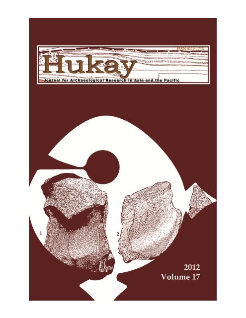
<strong>Hukay</strong> is a Tagalog term that can either be the verb “to dig” or a noun, “a hole in theground as a result of digging”. It also means “an excavation” among archaeologypractitioners in the Philippines. Published twice a year, <strong>Hukay</strong> is the refereed journalof the University of the Philippines - Archaeological Studies Program. We accept articleson the archaeology, ethnoarchaeology, palaeoenvironmental studies, and heritage of theAsia and Pacific regions.The Editors and the Reviewers are not responsible and should not be held liable for anypersonal views or opinions expressed here by the contributing authors. All questionsand/or reactions to such should be addressed to the author(s) concerned.Founding EditorVictor J. PazEditorGrace Barretto-TesoroAssociate EditorsMelodina Sy CruzFerdinand de la PazHarpy ValerioLayout DesignAnna PinedaCover DesignAnna PinedaTaj VitalesArchaeological Studies ProgramPalma Hall BasementUniversity of the Philippines, Diliman, Quezon Cityhttp://asp.upd.edu.ph/hukay© Archaeological Studies ProgramAll Rights ReservedNo copies can be made in part or in whole without prior written permission from theauthor and the publisher.ISSN 0119-173XOn the cover:Mixed tools from Gullukho, Figure 9c from Babul Roy’s article on p. 90.
<strong>Hukay</strong>Journal for Archaeological Research in Asia and the PacificVolume 172012Archaeological Studies ProgramUniversity of the Philippines2012
ContentsiForeword1 Comets, Cults, and Coins: A material-theoretic framework forthe archaeoastronomical study of the Book of RevelationRafael Dy-Liacco23 Place Names, Seascape and Cartography of Marine Rights: Casesof claims to places on the reef of Batasan in BoholEulalio R. Guieb III61 Determination of Oriental Tradeware Ceramics: A proposedsystem for identifying and documenting pottery in Philippinearchaeological sitesRhayan G. Melendres79 Microlithic Sites of Mandla (Madhya Pradesh: India) and theProblem of Schematic Generalisation in Prehistoric ArchaeologyBabul RoyBOOK REVIEWS111 Expansion of Austronesian Languages and their Speakers during the Neolithicas Inferred from Archaeological Evidence and Genetic Diversity in SoutheastAsia and Discussed in Five Journals.Review by Michelle S. Eusebio124 Pamela Faylona. 2010. The Transforming Ethical Practice in PhilippineArchaeology. Madrid, Spain: JAS Arqueologis S.L.U.Review by Al Parreno127 Judith A. Habicht-Mauche, Suzanne L. Eckert, and Deborah L. Huntley(Eds). 2006. The Social Life of Pots: Glaze Wares and Cultural Dynamics in the
Southwest, AD 1250 – 1680. Tuczon, Arizona, USA: The University ofArizona Press.Review by Rhayan G. Melendres130 Gerard Rixhon (Ed). 2010. Voices from Sulu: A Collection of Tausug OralTraditions. Quezon City, Philippines: Ateneo de Manila University Press.Review by Ma. Kathryn Ann B. Manalo133 Hwei-Feʹn Cheah. 2010. Phoenix Rising: Narratives in Nyonya Beadwork fromthe Straits Settlements. Singapore: NUS Press.Review by M. C. M. Santamaria138 Geoff Wade and Sun Laichen (Eds). 2010. Southeast Asia in the FifteenthCentury: The China Factor. Singapore: NUS Press and Hong Kong: HongKong University Press.Review by Joan Tara Reyes142 Haneda Masashi (Ed). 2009. Asian Port Cities, 1600–1800: Local and foreigncultural interactions. Singapore: NUS Press and Kyoto, Tokyo: KyotoUniversity Press.Review by Kate A. Lim
iForeword<strong>Hukay</strong> Volume 17 contains four articles and several bookreviews. The articles included in this volume are interesting for theauthors have looked at archaeology and heritage from behind differentlenses. A common theme in two of these articles is how people see theworld and the process of owning it by assigning names and meanings toland formations, bodies of water, and movements of celestial bodies.Rafael Dy-Liacco in his article Comets, Cults, and Coins: A materialtheoreticframework for the archaeoastronomical study of the Book of Revelationhas provided sufficient evidence that the human engagement with thephysical environment goes beyond what is known and what is here onearth. The attempt to understand what Dy-Liacco terms as the ‘astrallandscape’ is captured on Roman coins. The act of incorporating astralevents in everyday objects gave legitimacy to Roman authority. Thisarticle also demonstrated that the Book of Revelation can be datedthrough the synthesis of data from multiple sources. Dy-Liacco’s articleshould have a wide appeal to scholars in archaeology, theology,astrology, and astronomy because all four disciplines merge to producematerial evidence for how humans make sense of the world around themincluding the night sky.‘Owning’ parts of the landscape is best described in Eulalio R.Guieb III’s article Place names, seascape and cartography of marine rights:Cases of claims to places on the reef of Batasan in Bohol. Guieb illustrates thatintegral to understanding resources allocation, directional locations, andboundary maintenance is to recognise the locals’ perception of howspaces and places fit in their view of the landscape. What is alsointeresting about this article is that the environmental map is in fact a‘cartography of rights’ because ‘owning’ is possessing information aboutthe place and its resources. This article shows how physical geographyinfluences social dynamics. Places are tied to local histories, ascribingthem with symbolic functions and temporal dimensions. This article issignificant to archaeologists because it provides new avenues tounderstanding how people could have viewed and incorporated thephysical environment in their daily lives in the past. In addition, learningthe local geo-ecology offers people involved in heritage studies new
iiapproaches to eco-cultural management and tourism.Rhayan Melendres proposes a method in identifying foreignceramics recovered from Philippine sites in his article Determination ofOriental Tradeware Ceramics: A proposed system for identifying and documentingpottery in Philippine archaeological sites. Although a similar method has beenpractised in the Philippines, Melendres’ contribution is to define formallythe system. Babul Roy discusses microliths and the continuing tradition inMicrolithic Sites of Mandla/ (Madhya Pradesh: India) and the Problem ofSchematic Generalisation in Prehistoric Archaeology.One of the reviews included in this issue is not a book review but alook at how selected journals treat a particular topic. Michelle Eusebiolooks at the development of the discourse on Austronesian expansion inthe last 15 years.We would like to thank the Ateneo De Manila University Press,National University of Singapore Press, and JAS Arqueologis S.L.U for thecomplimentary copies of the books reviewed in this volume.We mourn the passing of Datoʹ Adi bin Haji Taha. He was formerlythe Director-General of Museums and Antiquities in Muzium Negara(National Museum), Kuala Lumpur, Malaysia. He will be missed.Grace Barretto-Tesoro<strong>Hukay</strong> Editor
Comets, Cults, and Coins:A material-theoretic framework for thearchaeoastronomical study of the Book ofRevelationRafael Dy-Liacco 1AbstractHere I outline a material-theoretic framework for an archaeoastronomicalstudy of the New Testament Book of Revelation. I begin with basic principles ofmateriality theory. I then argue that carefully observed celestial objects, as part ofthe material landscape, are on par with human-used structures. Thus, I develop adeeper notion of the “astral landscape.” Within this framework, I fit the basicAnnaliste paradigm of three levels of space-time, and propose what I call a“cognitive-heuristic approach” to the study of this cognitive-material structure.Finally, employing data from astronomical software and the iconography of Romancoins, I show that this cognitive-heuristic approach allows an understanding of theNew Testament Book of Revelation as a case of ancient prophetic sky reading.Introduction: Materiality theory and the materiality of the “sky-scape”Two concepts form the basis for this study: (1) Structures, artefacts,and other materials of human use form a material medium that extendshuman cognition; and (2) Objects in this medium may be thought of aspossessing a “social life” or “secondary agency” (Taylor 2008:314). Inregard to the first concept, Timothy Taylor, relying on Michael Rowlands(2004), points out that “Although things cannot themselves experienceremembering,…, they can embody and extend memory” (Taylor 2008:309).1Graduate student, Archaeological Studies Program, University of the Philippines,Diliman.Email: rafael.dy_liacco@up.edu.ph<strong>Hukay</strong> Volume 17, pp. 1-21
2Dy-LiaccoI make use of this point in the analysis of Roman imperial coins in relationto the Book of Revelation. The second concept comes into play when Iconsider how these coins and their usage not only materialised the Romanimperial will and cosmology, but—in a way unintended by the issuingauthorities—became material basis for expression of the Jewish and earlyChristian world views as well.But beyond extending memory, the material extension of cognitionalso plays a profound role in human activity. Referencing MauriceGodelier, Taylor points out that “objects are things without which onecannot actually be a man or a woman, a police officer or a priest…” (Taylor2008:309). In other words, the cognitive value of the material medium goesbeyond the signification of meaning, to the meaning itself. This point hasimplications when considering the significance of texts in relation to theirbeing descriptions of “reality.” In the words of Anders Andrén, “since alloral presentation is linear in both time and space, the text must alsopreserve this linearity….Artifacts, in contrast, are the world…” (Andrén1998:148ff, cited in Taylor 2008:305). In this regard, I show that the Book ofRevelation reflects its material context in ways not yet fully pointed out bystandard historical-critical Biblical studies.In light of all the preceding points, the carefully observed materiallandscape is also part of the material medium that extends humancognition. For example, consider iconic mountains and the human sense ofa “sacred.” In sky-reading traditions—whether of the Mayas or ofAustralian aboriginals—this cognitive extension includes the sky in amaterial way (see Ruggles 2005:esp. 3 in relation to Australian aboriginals).The sun, for example, usually is not thought of as an artefact, structure, ormaterial object of human use. But consider what happens when megalithsor other structures are intentionally aligned with the rising or the setting ofthe sun on certain dates. Take, in particular, the way that the Temple ofKukulkan in Chichen Itza catches the late afternoon sunlight at theequinoxes. As described by Anthony F. Aveni (2001), the monumentalpyramid is aligned in such a way that the optical effect of a slithering orfeathered serpent (a kukulkan) appears stretching down its steps. In thiscase, the fullest understanding of this Maya pyramid is inseparable notonly from an understanding of the Maya feathered serpent, but alsoinseparable from an understanding of the Maya sun – its path through thesky, its changing position on the horizon throughout the year, and its placein the Maya cosmology.This argument for including carefully observed celestial objects in
Comets, Cults, and Coins 3the material medium applies not only to the sun, moon, stars, and planets.It applies to other kinds of carefully observed celestial phenomena aswell; in particular, I argue, to comet apparitions. Including phenomena asevanescent as comet apparitions is not untoward. Taylor (2008: 302) notesan entire class of transient but nonetheless material phenomena: “Theleast durable manifestations of material culture are things like ice cubesand ice sculptures, whose existence has either to be ascertained fromexperiencing an instance of occurrence or indirectly inferred from aplastic ice cube tray or a photograph…”. Thus, given that one aspect ofthe cognitive-material medium is the carefully observed landscape, cometapparitions—at least as carefully observed celestial events—make up partof that medium too. If their observation can be inferred from other moredurable clues or imprints in the material record, then the transitory natureof the apparitions themselves does not militate against their inclusion,even if they were once-in-a-lifetime happenings.The “astral landscape” and the cognitive-heuristic approach to “totalhistory”The inclusion of the carefully observed landscape—especially the“sky-scape” of celestial objects—in the material medium that extendshuman cognition, suggests that profound ties may be elucidated betweencosmologies and the material landscapes that they inhabit. The Annalisteconcept of “total history,” with its concern for mentalités and for the threelevels of space-time that these world views inhabit, provides a basicstructure for these ties. Here I appropriate these general concepts, butprescind from in-depth engagement with Annaliste historical study itself.The Annaliste structure provides useful concepts for handling the tiesbetween world views and material landscapes (for a basic introduction tothe Annaliste paradigm and to other archaeological engagements with it,see Bintliff 1991). But here, materiality theory provides the basicunderstanding for elucidating those ties.Indeed, as articulated by Lambros Malafouris (2010:51 Fig. 1b),material engagement theory, in addition to the two principles mentioned atthe start of this article, contains a third: “… the hypothesis of enactivesignification,… explores the nature of the material sign not as arepresentational mechanism but as a semiotic conflation and co-habitationthrough matter that enacts and brings forth the world,…”. In other words,cosmologies not only reflect and inhabit (or are extended by or into) thematerial landscape, they create that landscape. This proposition makes
4Dy-Liaccosense, even when considering the celestial landscape. Thus, for example,in the world that was created at Chichen Itza, the equinoctial sun attains asignificance that is explained in full only cosmologically. There the sunand its motion were made a part of or were incorporated into the materialmedium, just as artefacts, structures, and sacred mountains areincorporated into the material medium of human traditions. The result isan “astral landscape.” Minus that material incorporation, the equinoctialMaya sun would not have quite the impression that it does upon thehuman mind.The significance of this third basic principle for the concept of“total history” is immediate. Different cultures that share the sameobjective landscape may recognise that landscape—that is, “create” it—indifferent ways. Indeed, when these cultures look at the same object in thatlandscape, not only cultural values but entire cosmologies may clash. Thisinsight in turn suggests that from the point of view of mentalité, thecategories of space-time in “total history” cannot be populated bymaterial objects defined in a categorical manner, with definitions ordescriptions applying equally across cultures. Indeed, historians havealready recognised that a multiplicity of conflicting interpretive memoriesexist intra-culturally as well. E.g., see the discussion of the issue inConfino (1997).This point is especially true when applied to the material contextof the Book of Revelation. As I shall show, the comet that inspired theproclamation of Caesar’s divinity in one tradition became, in its materialiconography, the inspiration for a heavenly but unholy beast in anothertradition. Moreover, the notion that no Jews or Christians ever engaged insky reading turns out simply not to be true. 1 Thus what has populatedeach level of space-time for each culture must be discovered by theresearcher; it cannot simply be received from that culture’s current selfview.As seen, ancient texts in themselves are not enough to uncover theancient world; one must go to the material landscape itself. Thatlandscape yields an irreplaceable understanding of the ancient “reality” ofwhich the texts are only partial reflections. Thus materiality theorysuggests not only a cognitive, but also a heuristic (or, loosely speaking,scientific) approach within the framework of “total history.” In thisapproach, no presumed “memory” of the past is off limits to critical1The study of early Jewish and Christian astrology is relatively new, yet the literatureis already quite large. For the classic article in the field, see Charlesworth (1977).
Comets, Cults, and Coins 5questioning. I call this approach the cognitive-heuristic method ofmateriality theory.This approach has further implications for one’s way of researchand interpretation. In concluding his overview of materiality theory,Taylor (2008: 315) mentions that the theory “revives old-style ancient andprehistoric art connoisseurship” that looks at “the tangible qualities ofmaterial and style in the creating of cultural life”. Here I pick up on thethemes of aesthetic and sense-oriented appreciation, as elements in thecognitive-material approach. For archaeoastronomical research, thecognitive-heuristic approach—in addition to library, “lab” (i.e. computer),and field (i.e. archaeological site) studies—calls for phenomenologicalstudies, especially of the “sky-scape.” Here I make a distinction between aphenomenological sense of the observed sky, versus the understanding ofthe astral landscape of a particular culture. The archaeoastronomer needsthe first in order to obtain a realistic sense of the second. 2For example, geophysicists have claimed that chapter 1 of the OldTestament Book of Ezekiel describes auroral lights (for the latest proposal,see Guskova et al. 2010). Clearly, study of visual experiences of the auroraas reported or recorded by observers in a wide variety of culturalcontexts, coupled with a close reading of the Biblical text in its originallanguage, will help decide if indeed the description in Ezekiel chapter 1correlates with that of an aurora. This essentially cognitive approach ishighly heuristic. Thus, also clearly, the investigator’s own observation ofthe material object in question—i.e., auroral lights—will greatly aid in hisor her investigative discrimination.In this regard, while video footage of the aurora provides oneobjective means for study of the claim, it is also common knowledge thatvideo does not capture all the subtleties of the aurora that the unaidedhuman eye can see. Videos of the aurora do yield broad correlates to the“great cloud with brightness” in Ezekiel 1: 4, to the “wheels” in Ezekiel1:15-21, to the “torches moving to and fro” in Ezekiel 1:13, and perhaps tothe various coloured lights mentioned (New Revised Standard Version).The chapter is visually rich, however, and further optical resolution maybe needed to further determine what in it corresponds to thephenomenological experience, and what may be ascribed to theological2The interested reader might wish to compare, for example, the overall quality of theproposals related to Biblical astronomy put forward in Maunder (1908), with thequality of those put forward in Malina (1995). Maunder was an astronomer byprofession and a Biblicist on the side, whereas Malina is a professional Biblicist.
6Dy-Liaccooverlay. 3 There is also the practical need for the basic experience of seeingthe aurora “out in the open.” If the geophysical explanation is correct,then for the prophet Ezekiel the great astral landscape became theequivalent of a temple. In which case, for the archaeoastronomer, seeingthe aurora out in the open versus watching a video of the aurora, is akinto the difference between visiting a temple in its actual landscape, versuswatching a walk-through of its virtual simulation, when the actual onestill stands in the field.As for implications on interpretation, although I have stressed thatthe researcher must remain aware of the multiplicity of traditions evenwithin a single culture, Taylor (2008: 315) points out that materialitytheory necessitates a grand narrative “of a sort that the postmodernproject,…, decried”. As Taylor puts it, an overall generalising view abouthow materiality works across cultures is needed because:… how the material world creates and affects human subjectsand communities of subjects, and how these work on the world,and themselves, is likely to involve regularities…. If this were (oris) not so, then there could (or can) not be any such thing as asecure archaeological inference. (Taylor 2008:315)In other words, valid insights asserted as such into particularcultures or traditions are impossible without a general sense of what onemay validly look for, because such generalities are what cultures aremade of. I believe the presumption here is a principle ofuniformitarianism, but extended to the basic neuro-chemistry and neurocognitivestructure of the human cognitive engine as it works individuallyand in society. Without a presumption of this kind, even a basic heuristicapproach to the topic is impossible.For the dissertation at the University of the Philippines that is togrow out of this study, such a grand narrative should include a study ofcross-cultural associations of the aurora with the sense of thesupernatural, as well as a study of cross-cultural associations of cometapparitions with omens of cosmic import. But for reasons of space, here Ishall not go further into such an overview. Before proceeding to ademonstration of the analysis of the Book of Revelation, however, Ishould briefly underscore the difference between text-based socio-3Biblicists disagree about the extent to which Ezekiel borrowed from Babyloniantheological iconography. For an investigation into this question that I believe alsohas implications for the geophysical hypothesis see Kingsley (1992).
Comets, Cults, and Coins 7historical approaches to the topic, and the material cognitive-heuristicapproach that I am using.In a 1982 article that I believe deserves greater consideration byBible scholars, Richard Oster calls upon these scholars and historians tofind greater use for numismatics in their study of the early Christiansocial context (Oster 1982; see also Oster 1985-1986). After issuing hischallenge, Oster begins with a point-by-point clarification ofmethodological issues. He starts with the question of the historical valueof coins. He moves on to other questions, then tackles substantive issuesin the early Christian social context. Drawing upon other historicalstudies, his article ultimately uses numismatics in order to support thehistorical assertions made or implied by ancient texts. J. Nelson Kraybill’smore recent book-length studies on the Book of Revelation also make useof ancient iconography (see Kraybill 1996, Kraybill 2010). Nonetheless, thisusage mainly helps support the study of the early Christian social context basedon the study of ancient texts, as seen in the light of modern theories of socialanalysis.Undoubtedly this kind of work helps paint the grand view ofthings. Kraybill and especially Oster’s works are valuable resources formy own investigation. However, in the material-theoretic approach,though ancient texts are also used, the materiality of the ancient landscapetakes centre stage. Moreover, I believe that the cognitive-heuristicapproach of materiality theory allows a re-presenting of the ancientlandscape in a way not otherwise available to the preceding method, andthereby invites new hypotheses for testing.The comet of 44 B.C. and the comet denariusIn 44 B.C., about two months after Julius Caesar’s murder, a cometappeared in the northern skies. Visible across the northern hemisphere,the apparition lasted only a few days, according to Chinese and Koreanrecords. It had a reddish-yellow colour (McIvor 2005:87). According toPliny the Elder, Augustus later publicly acknowledged the belief held by“the common Sort” that this apparition had signalled the ascent of hisuncle’s soul to the gods. Thus he had a star emblazoned on the head of thestatue of Julius Caesar that stood in the Forum. As for Augustus himself,he too had been deeply impressed by the apparition (Pliny, NaturalHistory: Book II, Ch. XXV). Indeed, though it was already some 20 yearsafter the celestial event, Augustus also had an imperial coin struck with
8Dy-Liaccoan icon of the comet (McIvor 2005:87). The obverse of the coin shows thehead of the emperor and his title “Caesar Augustus.” The reverse showsan eight-rayed star, with the top ray feathered, giving the impression of acomet, and across the face the proclamation: “Divine Julius.” Thecirculation of the coin proclaimed the divinity of the Caesars, and therebytheir right to be worshipped. Thus a comet, normally seen as an omen ofdoom, was transformed into a heavenly imprimatur on Roman rule. AsPliny put it: “In the whole of the World, in only one Place, namely Rome,a Comet is worshipped” (Pliny, Natural History: Book II, Ch. XXV) (Figure1).Figure 1. The comet of 44 B.C. memorialised in the imperial coinage[AN632776001 © the Trustees of the British Museum (britishmuseum.org)].The comet denarius in the Pax RomanaHow might this coin have impinged on the cognitive sensibilitiesof denizens of the empire, those who were enjoying the Pax Romana? First,there was no escaping its daily usage. Use of the Roman silver coin, ordenarius, pervaded all corners of the empire. In the western half, thecoinage of conquered states was demonetised and replaced by thedenarius standard; while in the eastern half, local silver coins wereallowed, but exchanged at discount values for the Roman coin (Hill1899:85-87). In a New Testament tale, when Jesus demands to be shown adenarius, one is immediately produced with Ceasar’s head and title on it.“Give to Caesar what is Caesar’s,” Jesus admonishes (see Matthew 22:19-21; Mark 12:15-17; Luke 20:24-25). Anywhere in the empire, to strike one’sown gold coinage was considered a declaration of rebellion, while theissuance of unauthorised silver was potentially treasonous. In short, toreject the imperial coinage was to declare one’s freedom from Rome (Hill1899:87). Indeed, when it comes to metals in the form of coins, Taylor,relying on Richard Seaford (2004), highlights the point that the intrinsicvalue of the metal is “overtaken by a more abstractly socially conferredvalue… based on quantity (thus negotiability) and the stamp and the state
Comets, Cults, and Coins 9authority behind the stamp…” (Taylor 2008:308). Thus Caesar’s coin notonly had to be handled every day, but, by the necessity of that veryreality, it became—in the realm of evénements—the daily materialreminder of the fact of Caesar’s rule and power.Moreover, the coin not only highlights that Augustus holds thatpower, but that he, as Caesar, is the personage in whom that powerresides. Its reverse side carries his illustrious uncle’s name, and therebyhighlights both Augustus’s succession and his bloodline. Thus the coinyields the sense that Augustus’s rule participates in some kind of grandpermanency. It makes this cognitive engagement in a way that only ametal object that obtains its value by virtue of its universally recogniseduse and iconography can do. The denizen who handles the coin is thusbrought into the realm of the moyenne durée. Here only the Roman Caesarsrule. The coin thus obtains a secondary agency. Taylor brings up thenotions of primary and secondary agency in the context of materialitytheory. The first kind of agency applies to people, the second to things.Citing Christopher Gosden’s study of Maori meeting houses, Taylorquotes: “a Maori meeting house is a materialization of the group’s powerand intentions to affect others” (Gosden 2004:36f, cited in Taylor2008:306). The coin, in like manner, materialises Rome’s intention to bethe only stable authority.But the rule of Caesar (in the realm of evénements) and theauthority of Rome (in the moyenne durée) attain another level of meaningaltogether in the image of the comet. On the coin, Augustus Caesar isliterally the earthly half of the “divine Julius,” the one who has ascendedto heaven as a comet, and who now has his place among the stars and theimmortals. As the poet Ovid put it, recounting the death of Julius:\…kindly Venus, although seen by none,stood in the middle of the Senate-house,and caught from the dying limbs and trunkof her own Caesar his departing soul.She did not give it time so that it coulddissolve in air, but bore it quickly up,toward all the stars of heaven; and on the way,she saw it gleam and blaze and set it free.Above the moon it mounted into heaven,leaving behind a long and fiery trail,and as a star it glittered in the sky.(Metamorphoses: XV 884-894)
10Dy-LiaccoFor Ovid, as for “the common Sort,” the comet is Caesar’sdivinised soul. On the coin it becomes Augustus’s soul as well, andfundamentally the soul of Rome. In this way the denizen’s cognitivesensibility is now brought into the realm of the gods – in short, into therealm of imperial cosmology. This is by virtue of the space-time of thecelestial longue durée. The coin, indeed, creates a world.The comet of 66 A.D. and the comet denarius in a Jewish and earlyChristian contextThough the coin was issued ca. 24 B.C., we may presume that itremained in circulation as long as its metallic lifetime allowed it. Indeed,we still possess some of these coins in museums today. How might thesecoins have impinged upon the cognitive sensibilities of a Jewish-Christianin Judea in 66 A.D.? What would have been perceived as theirblasphemous content is well known. But think further. The Jewish-Christian would still have possessed in recent memory the news of NeroCaesar’s bloody persecution of Roman Christians in 64-65 A.D. While inthe present, the threat of war between Rome and Jerusalem would haveconstituted current gossip. Judaism and Christianity had not yet partedways, and Christians still maintained headquarters in the holy city,although even here Jewish-Christians were beginning to suffer at thehands of fellow Jews as well. With persecutions and wars in the air, mightthese be the days of great tribulation that were to mark the end of theage?Early in 66 A.D., in the hours before dawn, Halley’s Cometappeared in the skies above Jerusalem. It remained visible for about threemonths. According to Josephus, it hung like a sword above the city. InJerusalem it was seen as one of many omens that had the effect of exciting“the unskillful” and “the common people,” but which the sacred scribesand the learned understood as reasons for trepidation (Josephus, TheJewish War:§6.288ff. ). At the same time, in the political sphere, Jewishresentment at Roman rule teetered on the brink of revolt, festering withimpulsive acts of rebellion. All-out war would break out in August.Think back to our Jewish-Christian in 66 A.D. Blasphemous coinin hand, wild talk running through the holy city of a humanlyunwinnable war, and a dreadful comet in the sky, these images or threatsof impending disaster had come together all at once on all cognitive levelsof space-time. Might the imperial legendry concerning Caesar’s cometalso have come to the fore, though in worried whispers? How it had
Comets, Cults, and Coins 11arisen each night of its brief apparition “bright and clear” (Pliny, NaturalHistory: Book II, Ch. XXV), perhaps even that it had blazed reddishyellow?That it was the soul of Caesar ascending to the gods, and wasnow indeed—especially in its present manifestation—the soul of Romeitself, as the imperial coinage so insistently proclaimed? Might thesecogitations have occasioned the memory of the following verses fromJewish scripture, verses often understood to be about the illustrious onewho rebelled against God, by striving to be a god himself? These verseswhich, in this context of heightened cosmological sensibilities, might havesounded both like wish and like prophecy:How you are fallen from heaven, O Day Star, son of Dawn! Howyou are cut down to the ground, you who laid the nations low!You said in your heart, “I will ascend to heaven; I will raise mythrone above the stars of God; I will sit on the mount of assemblyon the heights of Zaphon; I will ascend to the tops of the clouds, Iwill make myself like the Most High.” But you are brought downto Sheol, to the depths of the Pit.(Isaiah 14:12-15, New Revised Standard Version)If so, then how does a Jewish-Christian community under siegebattle the ruthless cosmology of an angry imperial “beast”? Raise aprophet, perhaps, a messenger of the one true God who can read thematerial signs of space-time? Chapter 12 of the Book of Revelation—thepivotal chapter of the entire end-of-the-age narrative—opens with theseverses:A great portent appeared in heaven: a woman clothed with thesun, with the moon under her feet, and on her head a crown oftwelve stars. She was pregnant and was crying out in birthpangs, in the agony of giving birth. Then another portentappeared in heaven: a great red dragon, with seven heads andten horns, and seven diadems on his heads. His tail swept downa third of the stars of heaven and threw them to the earth. Thenthe dragon stood before the woman who was about to bear achild, so that he might devour her child as soon as it was born.(Revelation 12:1-4, New Revised Standard Version)Is this woman the archetypal mater dolorosa, or Shekinah of theHebrews—the spirit of mother Israel herself—crowned with the twelvetribes, and giving birth to messiah Jesus? Is this great red dragon in thesky the comet of the divine Caesar, the mere mortal presumed to be a god,whose presumption to rule the world is now the soul of Rome itself? For
12Dy-Liaccoin the original Greek, the dragon’s colour is πυρρός (purrós) which means“red” as in fiery red; the noun πυρ (pur) meaning “fire.” Moreover, itsseven heads associate it on a primordial level with the ancient chaosmonster, the enemy and opposer of divine cosmic order (Figure 2). Is thisdragon’s attempt to devour the woman’s child at birth, the Romancrucifixion of Christ? In the succeeding verses, the dragon is frustrated,the woman flees into the wilderness (the typological domain of Israel’swandering before entry into the Promised Land), and the dragon isthrown out of heaven onto the earth. But on earth “the dragon was angrywith the woman, and went off to make war on the rest of her children,those who keep the commandments of God and hold the testimony ofJesus” (Revelation 12:17, New Revised Standard Version).Figure 2. The chaos monster depicted as a seven-headed hydra in a sealimpression [Frankfort 1955: Plate 45 No. 478]. The Mesopotamian seal dates to ca.2300 B.C., but an archaeological find in an older layer depicting a similar themeindicates that the myth itself has even earlier roots (Frankfort 1934:8). The sevenheadedbeast resembles a serpent or dragon. It is the equivalent of the primordialchaos monster found in other ancient Near Eastern mythic traditions, includingTiamat of the Babylonians and Leviathan of the Hebrews.How is this frustrated dragon going to carry out its threat of waragainst the nascent Jesus movement? At the end of Chapter 12, we aretold that the dragon goes to stand on the shores of the sea. Then at theopening of Chapter 13, the prophet writes:I saw a beast rising out of the sea, having ten horns and sevenheads; and on its horns were ten diadems, and on its heads wereblasphemous names. And the beast that I saw was like a leopard,its feet were like a bear’s, and its mouth was like a lionʹs mouth.And the dragon gave it his power and his throne and greatauthority.(Revelation 13:1-2, New Revised Standard Version)
Comets, Cults, and Coins 13This beast is the mirror image of the dragon (“ten horns and sevenheads” on the beast, compare the simple re-ordering of terms “sevenheads and ten horns” on the dragon), but it comes “rising out of the sea.”In 66 A.D. Comet Halley first appeared in the region of the constellationof Aquarius, the god whose dwelling was in the watery abyss. This partof the sky was known as “the waters” (Aratus, Phaenomena: 389). At thatpoint in time the planet Mars shone nearby. Over the next weeks thecomet moved out of “the waters,” eventually entering into the region ofthe constellation Hydra, the sea-serpent. Here, as it grew to maximumbrightness, it made a close pass to the planet Saturn. It then quickly fadedfrom view. But for the brief appearance of the planet Mercury, Mars andSaturn were the only other planets visible in the sky during the hours ofthe night when Comet Halley was visible (Figure 3).Figure 3. Path of Comet Halley in 66 A.D. This sky map was produced using theCartes du Ciel software and the 66 A.D. ephemerides for Comet Halley (Yeomansand Kiang 1981:643). The path of Comet Halley begins at left on 31 January 66A.D.At a previous critical point in Israelite history, the night sky lit upand the prophet Ezekiel experienced the astral landscape as the temple ofhis god. The tradition obtained much theological nurturance from histestimony. But now, at this critical point in Israelite history, what doesthis sea-beast rising up out of “the waters” portend? How is the Jewish-Christian prophet to read this astral matter? According to Pliny, whodrew upon a common regional sky reading tradition that traced back at
14Dy-Liaccoleast to the Babylonians, in order to properly read the meaning of a comet,one must see what the comet looks like [i.e., “resembling a longsword” (Josephus, The Jewish War:§6.289)], at what part of the sky it firstappears (i.e., “the waters”), and to what part it travels (i.e., Hydra, the seaserpent).One must also see what other celestial bodies come into itsproximity (Pliny, Natural History: Book II, Ch. XXV). Here, we see thecomet coming into the proximity of Mars (in the region of Capricornus),and Saturn (in the region of Virgo). Indeed, these planets mark thebeginning and the end of the cometary path. As to the portentous qualityof the planets, according to Pliny, the planets Jupiter and Venus arebeneficent, whereas the planets Mars and Saturn are maleficent (Pliny,Natural History: Book II, Ch. VIII; see also Ptolemy, Tetrabiblos: Book I, Ch.V). Thus, to our Jewish-Christian in 66 A.D., the comet above Jerusalemand its celestial path, read correctly, boded ill.Thus given the direction of the sky reading, peculiar parallelsbetween the celestial path of the comet and then current imperialiconography must have struck the imagination of our Jewish-Christiansky reader (for that is now what we are supposing that he was), and musthave further confirmed him in his reading. Another Roman coin, alsoissued during the reign of Augustus, showed on its obverse the helmetedhead of Mars, the god of war, and on its reverse, the shield of the war godemblazoned with what must have appeared to our sky reader as the sameblasphemous eight-rayed star (Figure 4). Indeed, in the Book ofRevelation, the portent of war marks the sea-beast’s rising: “it [the seabeast]was allowed to make war on the saints and to conquer them. It wasgiven authority over every tribe and people and language and nation, andall the inhabitants of the earth will worship it” (Revelation 13:7-8, NewRevised Standard Version).Figure 4. Mars, god of war, with an eight-rayed star on his shield [AN633007001© The Trustees of the British Museum (britishmuseum.org)]
Comets, Cults, and Coins 15This close pass to the planet Mars at the start of the comet’s pathoccurs in the region of Capricornus (the sea-goat). Augustus, who hadofficially connected Julius to the comet of 44 B.C., is known to haveidentified his own destiny with this sign of the zodiac. Another coin thathe issued shows his profile on the obverse, and on the reverse,Capricornus straddling a globe (Figure 5). What might this have meant toour sky reader, seeing the comet of 66 A.D. passing Mars in this sign ofthe zodiac? Revelation also speaks about a third beast, who rises out ofthe earth, and who induces the peoples of the earth into blasphemousworship of the sea-beast: “Then I saw another beast that rose out of theearth; it had two horns like a lamb and it spoke like a dragon. It exercisesall the authority of the first beast on its behalf, and it makes the earth andits inhabitants worship the first beast, whose mortal wound had beenhealed” (Revelation 13:11-12).Figure 5. Capricornus, Augustus’ self-identified zodiac sign, straddling the globe[AN632762001 © The Trustees of the British Museum (britishmuseum.org)]Finally, at the end of its path, as the comet of 66 A.D. slid downthe length of the constellation of Hydra, it passed in between theconstellation of Virgo, the woman, and the constellation of Crater, thecup. Here it made its closest pass to the planet Saturn. According toPtolemy, if two ill-omened planets are in the sky together, then one willcancel the effects of the other (in today’s math, much like two negativescancel each other to make a positive) (Tetrabiblos: Book II, Ch. VII). 44Ptolemy’s birth in all likelihood post dates 70 A.D., and he is said to have lived 78years (see Ashmand 1822:xx). Today his Tetrabiblos is generally recognised as a 2 ndcentury text. As pointed out by an anonymous reviewer, this means that its writingpost dates the appearance of Comet Halley in 66 A.D. by nearly a century. Thereading of the planets Venus and Jupiter as generally benefic, and of Mars andSaturn as generally malefic, appears to date back at least to the Babylonians (see themore detailed discussion in Rochberg 2010:135-142). However, as suggested by thereviewer, it is not known if in this instance this detail belongs to the more ancienttradition, or arose after 66 A.D.
16Indeed, bringing an end to the narrative that began with the sea-beast thatrose out of the sea, the author of Revelation hears an angelic voicepronouncing the divine comeuppance:“Come, I will show you the judgment of the great whore who isseated on many waters, with whom the kings of the earth havecommitted fornication, and with the wine of whose fornicationthe inhabitants of the earth have become drunk.” …I saw awoman sitting on a scarlet beast that was full of blasphemousnames, and it had seven heads and ten horns. The woman wasclothed in purple and scarlet, and adorned with gold and jewelsand pearls, holding in her hand a golden cup full of abominationsand the impurities of her fornication;….”Dy-Liacco(Revelation 17:1-4, New Revised Standard Version: italics mine)Thus the visionary sense of the celestial display ends with thepicture of a woman who is the crude anti-type to the heavenly materdolorosa seen earlier. 5 Riding the sea-beast, she luxuriates in excessivewealth. This cometary display was over by early March, 66 A.D. Laterthat year, Vespasian led the imperial armies into Judea, quelling anyopposition that he encountered, and setting Jerusalem under siege. But inthe wake of the outbreak of inter-Roman fighting, he returned to thecapital in order to assume the emperorship. Leaving his son Titus incharge of the Judean campaign, he quickly brought an end to the Romancivil war. Titus destroyed Jerusalem in 70 A.D. Apparently, the divinecomeuppance, which was promised upon the beast-riding woman, wouldhave to wait. However, lest the reader not understand the divine promise,the author of Revelation also apparently added an explanatory gloss tohis initial vision of the anti-type woman: “This calls for a mind that haswisdom: the seven heads are seven mountains on which the woman is seated;…” (Revelation 17:9, New Revised Standard Version: italics mine). Shortlyafter the end of both the Roman civil war and the Judean campaign, thenew emperor issued a coin that celebrated the re-established Romanpeace. The obverse shows the new emperor; the reverse shows thegoddess Rome languidly seated on the fabled seven hills (Figure 6).5One Mesopotamian notion of the goddess Ishtar was that of heavenly harlot (seeHarris 1991:271-272, who cites Jacobsen 1976:140; see also the more generaldiscussion of Ishtar’s association with sex and the crossing of social boundaries inHarris 1991). For the tantalising possibility that the constellation Virgo was at somepoint in time associated with Ishtar in the Ancient Near East, see Rogers (1998).
Comets, Cults, and Coins 17Figure 6. The goddess Rome seated on seven hills (antiquitiesproject 2011)ConclusionThus the first comet/dragon once dwelt in the heavens, and oncemade war against the heavenly archetypes. But now a second comet/beastrises out of the sea, and makes war against the saints, receives the power,throne, and authority of the first comet/dragon. And a third beast—a crossbetween a lamb and a dragon—causes the world to worship the secondbeast. Even so, the Roman empire rose up, and every Roman emperorafter Julius, beginning with Augustus, inherited Caesar’s power, throne,authority, and even his supposed divinity. This much, given asconclusion, is discernible from the text itself, given even the slightestsense of its context. Yet in the field of Biblical scholarship, the actual pointin time to which this seemingly obvious interpretation refers hasremained a matter of much debate.Indeed, for those who have studied it, no matter how astute one’sliterary exegesis of the text or social analysis of its context, these are limitedby our lack of sure knowledge of the original dating of the text itself. Thereason for this floating quality of the text is that its reading still managesto elude the best of grips, and to slip into a dreamscape of bewilderingimages—it is like a hallucinatory romp through imagined other worlds(Gentry 1989:10-14). Gentry (ibid.), wrestling with his confessionalconundrums, gives an exemplary collection of commentary by exegeteson the difficulty of this interpretive problem. Here I reproduce two suchcomments: “the Revelation...is by common consent one of the mostdifficult of all the books of the Bible. It is full of strange symbolism.... Theresult is that for many modem men Revelation remains a closedbook” (Morris 1969:15, cited in Gentry 1989:11); and “The key to theinterpretation disappeared with the generation to which the book was
18Dy-Liaccoaddressed..., and apart from any clue to its immediate reference, it waslittle else but a maze of inexplicable mysteries” (Swete 1906: cxix, cited inGentry 1989:14). In short, though a sense of the text is easy enough to get,the meaning of its details elude us.But I believe that in the light of a more fundamental materialtheoreticapproach, what may be the earliest original part of the textreflects the dark flip side of an equally material Pax Romana. Thus theBook lines up with a very material structure; one that includes ademonstrable and datable ancient astral landscape. I realise that I am noBiblical expert. Yet the four-way correlation between ancienticonography, ancient celestial event, ancient text, and ancient history istoo strong to put down to coincidence. Biblical scholarship has for sometime proposed two possible dates for the origination of the Book ofRevelation: ca. 70 A.D. and ca. 90 A.D. The second dating currently enjoysthe majority position, though opinion on the matter tends to swing like aslow pendulum. But I believe that the four-way correlation outlined hereshows that the major visions in the Book are originally rooted in an eyewitnessto the events going into and coming out of 66-70 A.D. In myforthcoming dissertation, I hope to show the further likelihood of an earlyJewish-Christian sky reading practice, but which was rooted in an olderJewish sky reading tradition that dated back at least to Ezekiel, and whichultimately was located in the Jerusalem temple.AcknowledgementsI wish to acknowledge Dr. Marlu Vilches, Dean of the School ofHumanities, Ateneo de Manila University, for the Dean’s grant under which theinitial research for this article became possible. I also wish to acknowledge theArchaeological Studies Program, University of the Philippines, especially Dr.Victor Paz, for the invitation to continue my research within their Program. I alsothank the two anonymous reviewers whose comments have made this article abetter one, and whose words of encouragement I deeply appreciate. Last but notleast, I wish to thank the editor of <strong>Hukay</strong> for her careful work. I am whollyresponsible for any errors in and shortcomings of this article.ReferencesAratus. 1921. “Phaenomena,” in Callimachus, Hymns and Epigrams.Lychophron. Aratus. Translated by A. W. Mair and Loeb, G. R.Classical Library Volume 129. London: William Heinemann.Andrén, A. 1998. Between artefacts and text: Historical archaeology in global
Comets, Cults, and Coins 19perspective. Translated by A. Crozier. New York: Plenum.Aveni, A. F. 2001. Skywatchers. Austin, TX: University of Texas Press.antiquitiesproject. 2011. In flickr.com Website. Accessed 28 November 2011from http://www.flickr.com/photos/antiquitiesproject/5906496802/.Ashmand, J. M. 1822. “Preface,” in Ptolemy’s Tetrabiblos, or Quadripartite:Being Four Books of the Influence of the Stars. Translated by J. M.Ashmand, pp. v-xxvii. London: Davis and Dickson.Bintliff, J. (ed.). 1991. The Annales School and Archaeology. London and NewYork: Leicester University Press.britishmuseum.org. 2011. In The British Museum Website. Accessed 28November 2011 from http://www.britishmuseum.org/.Charlesworth, J. H. 1977. Jewish Astrology in the Talmud,Pseudepigrapha, the Dead Sea Scrolls, and Early PalestinianSynagogues. Harvard Theological Review 70.3/4: 183-200.Confino, A. 1997. Collective Memory and Cultural History: Problems ofMethod. The American Historical Review 102.5: 1386-1403.Frankfort, H. 1934. Gods and Myths on Sargonid Seals. Iraq 1.1: 2-29.Frankfort, H. 1955. Stratified Cylinder Seals from the Diyala Region. OrientalInstitute Publications 72. Chicago: University of Chicago Press.Gentry, K. L. 1989. Before Jerusalem Fell: Dating the Book of Revelation. Tyler,TX: Institute for Christian Economics.Gosden, C. 2004. “Towards a theory of material engagement,” inRethinking materiality: The engagement of mind with the materialworld. Edited by E. DeMarrais et al., 33-40. Cambridge: McDonaldInstitute for Archaeological Research.Guskova, E. G., O. M. Raspopov, and V. A. Dergachev. 2010. Visualevidence of geomagnetic excursion? In St. Petersburg StateUniversity Earth’s Physics Department Website. Accessed 10 October2011 from http://geo.phys.spbu.ru/materials_of_a_conference_2010/P2010/Guskova_et_al_2010.pdf.Harris, R. 1991. Inanna-Ishtar as Paradox and a Coincidence of Opposites.History of Religions 30.3: 261-278.Hill, G. F. 1899. A Handbook of Greek and Roman Coins. London and NewYork: MacMillan.Jacobsen, T. 1976. The Treasures of Darkness: A History of MesopotamianReligion. Cambridge, MA: Harvard University Press.
20Dy-LiaccoJosephus. 2006. The Jewish War. In Josephus Database, BibleWorks forWindows CD. 7th Ed. BibleWorks, LLC.Kingsley, P. 1992. Ezekiel by the Grand Canal: Between Jewish andBabylonian Tradition. Journal of the Royal Asiatic Society ThirdSeries 2.3: 339-346.Kraybill, J. N. 1996. Imperial Cult and Commerce in John’s Apocalypse.Sheffield, UK: Sheffield Academic.Kraybill, J. N. 2010. Apocalypse and Allegiance: Worship, Politics, andDevotion in the Book of Revelation. Grand Rapids, MI: Brazos Press.Malafouris, L. 2010. Metaplasticity and the human becoming: principles ofneuroarchaeology. Journal of Anthropological Sciences 88: 49-72.Malina, B.J. 1995. On the Genre and Message of Revelation: Star Visions andSky Journeys. Peabody, MA: Hendrickson.Maunder, E. W. 1908. The Astronomy of the Bible. New York: MitchellKennerly.McIvor, Robert S. 2005. The Star on Roman Coins. Journal of the RoyalAstronomical Society of Canada 99.3: 87-91.Morris, L. 1969. The Revelation of St. John. Grand Rapids: Eerdmans.New Revised Standard Version. 2006. In BibleWorks 7 CD. Norfolk, VA:BibleWorks, LLC.Oster, R. 1982. Numismatic windows into the social world of earlyChristianity: A methodological inquiry. Journal of Biblical Literature101.2: 195-223.Oster, R. 1985-1986. “Show me a denarius”: Symbolism of Roman coinageand Christian beliefs. Restoration Quarterly 28.2: 107-115.Ovid. 1992. Metamorphoses. Edited by Brooks More. Boston: CornhillPublishing Co. In Perseus Website. Accessed 21 August 2011 fromhttp://www.perseus.tufts.edu/hopper/text?doc=Perseus%3Atext%3A1999.02.0028%3Abook%3D1%3Acard%3D1.Pliny. 1847-1848. Natural History. Translated by Philemon Holland. Editedby The Wernerian Club. George Barclay, Castle Street, LeicesterSquare.Ptolemy. 1822. “Ptolemy’s Tetrabiblos or Four Books of the Influence ofthe Stars,” in Ptolemy’s Tetrabiblos, or Quadripartite: Being Four Booksof the Influence of the Stars. Translated by J. M. Ashmand, pp. 13-211. London: Davis and Dickson.
Comets, Cults, and Coins 21Rochberg, F. 2010. In the Path of the Moon: Babylonian celestial divination andits legacy. Leiden: Koninklijke Brill NV.Rogers, J.H. 1998. Origins of the ancient constellations: I. TheMesopotamian traditions. Journal of the British AstronomicalAssociation 108.1: 9-28.Rowlands, M. 2004. “The materiality of sacred power,” in Rethinkingmateriality: The engagement of mind with the material world. Edited byE. DeMarrais C. Gosden, and C. Renfrew, 197-203. Cambridge:McDonald Institute for Archaeological Research.Ruggles, Clive L. N. 2005. Ancient astronomy: an encyclopedia of cosmologiesand myth. Santa Barbara, CA: ABC-CLIO.Seaford, R. 2004. Money and the early Greek mind. Cambridge: CambridgeUniversity Press.Swete, H. B. [1906] 1977. Commentary on Revelation. Grand Rapids: Kregel.Taylor, T. 2008. “Materiality,” in Handbook of Archaeological Theories.Edited by R. A. Bentley, H. D. G. Maschner and C. Chippindale,297-320. Lanham, MD: AltaMira Press.Yeomans, D. K. and T. Kiang. 1981. The long-term motion of cometHalley. Monthly Notices of the Royal Astronomical Society 197: 633-646.
Place Names, Seascape and Cartography ofMarine Rights: Case of claims to places on thereef of Batasan in BoholEulalio R. Guieb III 1AbstractThe essay looks into how islanders of Batasan in Bohol delineate thegeographic distinctions of their environment. Islanders identify places to definemarkers that describe their environment’s geo-ecological features, provide maritimedirections, frame physical and social boundaries, and set limits of marine activities.Such delineations indicate varying degrees of rights and claims. I also address inthis essay how codes of access and exclusion reconfigure the physical and socialenvironment of the island. A sense of ownership of what I term as ‘village-encodedlocal ecological knowledge’ predisposes villagers to claim access to these resources.Central here is how they incorporate this knowledge into issues of tenure and theallocation of use rights that, in the process, rearrange divisions among islandersand between groups of islanders and non-village individuals, organisations andinstitutions. In the end, islanders’ narrative geography frames their socio-economicpractices as they navigate the political terrain of resource rights allocation.“Who gets what environment—and why?”(Low and Gleeson 1998:2)IntroductionOne of the most interesting stories that I gathered during my1Associate Professor, Department of Broadcast Communication, College of MassCommunication, University of the Philippines, Diliman, Quezon CityEmail: eulalio.guiebiii@mail.mcgill.ca<strong>Hukay</strong> Volume 17, pp. 23-59
24Guiebexploratory visit to Batasan Island in Bohol in 2002 was the ‘discovery’, inseparate instances, of two submerged reefs near the island by hook-andlinefishers (mamasolay) from the village. One reef, called Takot Emong(Emong’s Reef) by Batasan islanders, was named after Emong Ranario(born 1908) and the other after Adring (real name: Andres Dolera; born1924). Emong, based on the oral narrative of his son Fredo and friendAdring, chanced upon a reef submerged between 15-20m under water inthe mid-1920s when his sinker tapped the reef’s coral heads during one ofhis fishing trips. My underwater reef survey in 2005 showed that the reefwas mainly rubble, indicating that it is a dead reef. Adring narrated thathe located in 1938, while searching for fishing grounds, a reef that wouldlater be called by Batasan islanders as Takot Adring (Adring’s Reef), alsoby way of tapping submerged coral heads through his line sinker. TakotAdring sits between the islands of Batasan and Ubay, but jurisdictionallybelongs to the latter. Moreover, residents describe the south promontoryof Batasan Island as a dancing beachhead because its direction changesdepending on where the monsoon winds blow its sands. These accountsopened up for me a floodgate of narratives about sites that carry thenames of some of the villagers’ ancestors or places with denotational orsymbolic ascriptions pertaining to the geographic and ecological featuresof Batasan’s seascape.What is striking about these narratives is that Batasan islandersframe the story of their village not only with reference to time-peggedmoments in their history, e.g., World War II, typhoons that struck theislands, or the reign of a village tyrant. Rather, their stories are alsoframed, in several instances, with reference to places, i.e., within namedor unnamed and claimed or contested places of the island. The spatialstrategy of storytelling, I believe, underscores the significance of places asmarkers of local history in relation to a knowledge system pertaining tothe utilisation of resources, which I term in this essay as ‘village-encodedlocal ecological knowledge’. This narrative geography is, I contend, ahistoriography that frames the socio-economic practices of islanders asthey navigate the political terrain of resource rights allocation.In this essay, I ask how Batasan islanders’ delineation of thegeographic distinctions of their environment indicates varying degrees ofmarine rights and claims. I follow Hviding’s (1996) contention thatnatural geographic and ecological markers are important distinguishingfeatures that organise the socio-cultural environment of villages, whichfeed into what more recent scholarship in political ecology describes as
Place Names, Seascape and Cartography of Marine Rights 25socio-natural arrangements (Bryant 2000; Escobar 2001) withininterdependent social-ecological systems (Folke et al. 2007). Socio-naturalarrangements pertain to processes by human society to reshape andreinterpret nature, rendering the ‘objective’ nature a social construct(Pepper 1993). Escobar (1999: 5) argues that “nature is differentlyexperienced according to one’s social position and that it is differentlyproduced by different groups or in different historical periods.” The menand women of society and their social relations give meaning and value toplace and nature.Society and nature are interdependent social-ecological systems(Folke et al. 2007). The social (human society) and the ecological (nature)are not just linked; they are, according to Folke et al. (2007),interconnected and they co-evolve across spatial and temporal scales.Several scholars have stressed the complex ties that link the naturalphysicalenvironment with the specificities of place and time, and thatlocally encoded knowledge systems about nature in specific places areneither static nor stable, one reason of which is that place, or a sense ofplace, is informed by underlying structures of power (e.g., Agnew andDuncan 1989; Agrawal 1998; Casey 1996; Escobar 2001; Geertz 1983;Harvey 1996; Johnson 1992; Massey 1995, 1997; Ostrom 1990; Prazniakand Dirlik 2001; Rosaldo 1988; Rose 1995; Scott 1998; Watts 2000).The relationship established by people with their naturalenvironment informs and is informed by their interaction with otherpeople. In this essay, I illustrate that villagers’ knowledge of place is notonly a map of the distinctive features of their marine resources, but isalso—to use Blomley’s term (1998: 570)—a code of access and exclusion.Knowledge of place reflects a geography of rights that both islanders andnon-islanders continuously reshape in the context of linked relationshipsamong households, villages and different multi-sited communities ofinterests. The quotation at the beginning of this essay—“who gets whatenvironment—and why?” (Low and Gleeson 1998: 2)—is, therefore,critical for understanding property rights regimes in the context ofvillages’ simultaneous involvement in resource extraction andconservation.Section 1 presents a short description of the island of Batasan.Section 2 examines toponyms based on geo-ecological features of theisland and its marine environment, and how a sense of ownership of theencoded knowledge about places constitutes differentiated access and userights. Section 3 discusses toponyms derived from ancestors’ names, and
26looks into how certain claims to places configure the villages’demographic and social environment, which in some ways reflect thedistribution of particular rights or claims among certain individuals.The research siteGuiebBatasan is a small, elongated sand bar, which is under thejurisdiction of the municipality of Tubigon in Bohol (Figures 1 and 2).Settlers artificially created the island by piling corals. Based on my GIScalculation, its length is roughly 900m, while its width ranges from 200-500m. The island rests on a large reef flat that measures about 260hectares. 1 The island can be reached in about 30 or 40 minutes by smallmotorised boat from the town centre of Tubigon on the mainland.Figure 1. Location of Batasan Island, Tubigon, Bohol on Danajon BankBatasan is comparatively poor in a relatively well-offmunicipality. It ranks the fourth poorest among Tubigon’s 34 villages interms of households with income under the poverty threshold (33%Batasan households) (Bohol PPDO 2004; BLDF 2008; LPRAP 2005), or amonthly income of about or less than PhP5,853 (at 2005 levels) orapproximately US$120 (NSCB 2007). The percentage of Batasan1There were no available data about the size of Batasan’s reef. The figure I presentedabove is my own estimate based on data about the island’s mangrove forest, which,reports say, measures 52 hectares and comprises 20% of the reef flat (Batasan PCRA 1998;Haribon-PS-CRMP n.d.).
Place Names, Seascape and Cartography of Marine Rights 27Figure 2. Selected named places in Batasan. Note: Ubay Island is not part of theisland village of Batasanhouseholds under the poverty threshold, however, is lower than themunicipal percentage (35%) and provincial percentage (61%) of incomedeficienthouseholds (Bohol PPDO 2004; BLDF 2008).Tubigon is one of three major political, economic and educationalcentres in the province; the other two centres are the province’s capitalcity, Tagbilaran, situated on the southern mainland, and the municipalityof Talibon on the northern part of the province. Tubigon has a port thatconnects the province to Cebu, the regional centre of Central Visayas. It isBohol’s secondary port (next to Tagbilaran City’s).Batasan is one of 40 islands that lie on or near Danajon Bank,
28Guieblocated off northwestern Bohol (Green et al. 2004) (Figure 1). 2 DanajonBank is the only double barrier reef in the Philippines, and is one of onlythree such sites in the Indo-Pacific (Pichon 1977). It reaches a length ofabout 135km (PS 2004). The outer reef is called the Caubyan Reef and theinner reef the Calituban Reef (Pichon 1977; Christie et al. 2006). The bankhas a high degree of diversity in its marine flora and fauna, which makesit one of the major fishing grounds in the Visayas (Christie et al. 2006). Itscoral reef and mangrove areas are the largest in the Central Visayasregion (Green et al. 2004). Some parts of the bank’s reefs are consideredfair in status (25% to 49.9% live coral cover) (Green et al. 2004), althoughthe overall reef condition is considered degraded (Christie et al. 2006).Many of the reefs of Danajon Bank are exposed during low tide.Like many fishing grounds in the Philippines, Danajon Bank facesa host of serious threats, e.g., extremely high fishing pressure largelythrough destructive, unsustainable and illegal fishing methods;overfishing; degraded overall reef condition; sediment accumulation;conversion of mangroves into other uses; and high population densityand poverty incidence in communities around the bank (Christie et al.2006; Green et al. 2003, 2004). About 68% of households in tenmunicipalities in northwestern Bohol that have territorial jurisdiction overportions of Danajon Bank have cash income under the poverty threshold(Bohol PPDO 2004; BLDF 2008).Four provinces have administrative jurisdiction over DanajonBank: Bohol, Cebu, Leyte and Southern Leyte (Aumentado n.d.; Christie etal. 2006). This politico-administrative delineation has implications for theimplementation and management of a territorially shared resource base.Batasan established in 1998 a 21-hectare no-take marine protectedarea (MPA), although the formal barangay and municipal ordinances and2Spanish and American historical records indicate the shores off north andnorthwestern Bohol as two geographic coasts: Danajon Bank and Northwest Bank(de Arana 1879; United States Allied Geographical Section 1944; United States Coastand Geodetic Survey 1902; United States Department of Commerce 1940; Bureau ofCoast and Geodetic Survey 1953). The study by Pichon (1977) and documents thatcame out beginning in the 2000s describe Northwest Bank as part of Danajon Bank(e.g., Aumentado n.d.; Christie et al. 2006; Green et al. 2000, 2002, 2004). Workingwithin the framework of an ecosystem-based approach in the management ofresources, the two coasts are integrated for a more holistic management of thefisheries and communities in the northwestern and northern regions of Bohol,which cover Batasan. Contemporary maps about the area, however, produced bythe government’s mapping bureau (the National Mapping and ResourceInformation Authority or NAMRIA) continue to label Danajon Bank and NorthwestBank separately, which I indicated in Figure 1.
Place Names, Seascape and Cartography of Marine Rights 29resolutions were issued in 1999 (Figure 3). 3 The MPA was facilitated bythe partnership of Project Seahorse (PS) and Haribon Foundation. PS is aninternational marine conservation organisation based in Canada and theUnited Kingdom, with an established organisation in the Central Visayasregion in the Philippines that focuses on marine environmental researchand advocacy. Haribon is one of the Philippines’ largest nongovernmentalorganisations dedicated to environmental protection,conservation of critical habitats, sustainable use of natural resources andthe preservation of the culture of indigenous Filipino culturalcommunities. On Danajon Bank, there are at least 60 MPAs (Christie et al.2006), 33 of which (all no-take) have been facilitated or supported by PS-Haribon (PSF 2006).Batasan is presently considered an initial component of theNational Integrated Protected Areas System (NIPAS) of the countryFigure 3. Directional termsindicating spatial orientation ofBatasan3These documents include the following: 1) Batasan Barangay Ordinance No. 1,series of 1999; 2) Batasan Barangay Resolution No. 1, series of 1999; 3) TubigonMunicipal Council Resolution No. 99-27, series of 1999; and 4) Tubigon Office of theMayor (1999) endorsing the barangay resolution of Batasan on the establishment ofits MPA.
30 Guieb(PAWB 2004). The NIPAS Act of 1992, or Republic Act No. 7586, providesthe criteria and processes for the selection of several categories ofprotected areas, and the island is designated for inclusion as a nationallylegislated protected area. Batasan’s inclusion into NIPAS has implicationsfor the use and management of the island’s marine environment and forthe contest among villagers over tenure within their settlements andrights to the resources of their island.Based on the household census I conducted in 2004, fishing is themain source of livelihood for practically all the 212 households in Batasan.It is difficult to estimate the number of fishers engaged in specificmethods as fishers in Batasan may simultaneously fish with various gearor target specific species, depending on and according to the lunar cycle,tidal levels, wind directions, sea currents, fish migration or movementpatterns, and market demands. Classification of fishers is also difficult toascertain as fishers in Batasan may classify themselves according to thegear used or the target species. Many fishers, nevertheless, specialise inspecific fishing methods or target species even if they simultaneously oralternately engage in other methods of fishing. Table 1 provides anestimate of the different types of fishers in Batasan based on how theyclassified themselves on the census that I conducted in 2004.The gear that Batasan fishers use are generally those that areallowed in municipal waters (within 15km from the shoreline). Types offishing based on gear include spear fishing (pana), lantern fishing (panuoor panô), net fishing (pokot, including panikbong and yabyab), line fishing(pasol, including palanggre or bottom-set longline and subid or troll line),pot or trap fishing (e.g., timing and panggal), dive fishing (manawom, withor without compressor units), and corral fishing (bunsod). Based on targetspecies, types of fishing include blue crab fishing (panlambay), fishing fortropical or aquarium fish (panimilya), and squid fishing (pangnokos).Fishers cover the entire Batasan reef for their fishing. Sites areselected based on target species, gear used, distance from the island, andother geographic and ecological factors. They also go to fishing groundsoutside their island-barangay (Figure 1), specifically those under thejurisdiction of the municipalities of Tubigon (off the villages of Ubay,Calawrinyo or Clariño, Balicog, Kanlangi, Bagongbanua, Calamosi,Tambulian, Pangapasan, Inanoran, Cabgan and Tubaon), Clarin(especially in Silo-siloan and Madietpet), Inabanga (on the shores ofCoameng and Bugatosan), and Calape (near Mantatao Island). Batasanfishers also compete with fishers from other islands and coastal villages
Place Names, Seascape and Cartography of Marine Rights31Table 1. Types of fishers in Batasan based on household censusconducted by the author in 2004. Note. Enumeration is by singleresponse of working individuals who indicated a specific type of fishingas either a full-time activity or a primary source of cash income.Types of FisherNumber ofindividualsPercentage offisher populationSpear fisher (mamanaay) 47 17.47Blue crab fisher ( manlambayay) 36 13.38Lantern fisher ( manoay) 30 11.15Net fisher ( mamokotay) 28 10.41Timing pot/trap fisher ( manimingay) 24 8.92Aquarium fish collector ( manimilyaay) 21 7.81Line fisher, incl. Those using palanggre orchain or long line (mamasolay)20 7.44Squid fisher using troll line ( manubiray) 18 6.69Fishing, general ( managatay) 14 5.20Corral fisher ( mamunsoray) 11 4.09Others: (species-specific or other gear) 20 7.43Grouper (3) ( pugapo)Compressor diver (3)White clam fisher (4) (manambayang)Shellfish diver (4) ( manawom kinhason)Panggal trap fisher (2) ( mamanggalay)Fisher targeting garfish (bawo) (2)(pamalong)Sea urchin fisher (2) (manuyom)Total 269 99.99
32 Guiebwho come to their reef. They include those coming from themunicipalities of Tubigon (the islands of Mocaboc, Ubay andPangapasan), Clarin (mainland and the island of Tangaran), and Inabanga(the islands of Coameng, Hambungan and Taoran).The wide expanse of the reef of Batasan is primarily a gleaninghaven. Gleaning (locally termed panginhas), carried out by both men andwomen and by children, is an important source of household income.Batasan’s reef is home to an estimated minimum of 364 species of seashellspecies based on identification by recognised expert gleaners and shelldivers from the island. 4 Some of the commonly gleaned shellfish speciesinclude top shellfish (amongpong and samong), strombus conchs (aninikadand saang), tritons and murex shells (gang-gang, sodlay-sodlay and honsoyhonsoy),pheasant shells and periwinkles (laway-laway), vanikoro snails(taktakon), thorny oysters (tikod-tikod), nerites (sihi), cowries and eggcowries (sigay and poki), scallops (iskalop), abalones (kapenan), rock shells(guba-guba), ark shells (litob), sea mussels (amahong), moon snails (buwanbuwan),ceriths and turrids (sanggoreyong or sanggarelyong), Venus andLucina clams (kilos and bug-atan), asphis clams (tamislat), soft-shell clams(tambayang), winged oysters (brownlip), horse conchs (posik), tree oysters(wasay-wasay), pearl oysters (tipay), and pen shells (tab). 5 Batasan gleanersalso regularly collect sea cucumber (bat or balatan 6 , or trepang or beche-demaras it is known in the market), crustaceans such as blue crab (lambay),the spaghetti-like egg mass of sea hare (dongsol, a sea slug species) calledlukòt, Caulerpa (latô), wild seaweed (gusô), and sea urchin (tuyom). Manyof these gleaned species have great value in both the international marketand the tourism industry in Cebu, either as processed products or asmaterials for the production of handcrafted products (C. Campos,personal communication, 2005; S. Pongcol, personal communication, 2005,and R. Saavedra, personal communication, 2005). Gleaned resources withlow economic value serve as food for those who cannot afford meat and4My informant fishers, S. Pongcol (2004, 2005) and R. Mejares (2005a, 2005b) and Iconsulted Abbot’s (1991) illustrated guide book to seashells, which served as ourreference to identify the families and species of shellfish that occur in Batasan.5Local names of these shellfish species are not precisely equivalent to the Englishnames. A single local name may apply to several species in the scientific literature,and conversely several local names may apply where there is only one scientificname for a species. This highlights interesting differences in classification betweenthe scientific community and local knowledge, but this variance in nomenclatureand taxonomy is beyond the scope of this study.6I use the term bat, instead of balat or balatan; all refer to sea cucumbers. Bat is theterm commonly used by Batasan islanders to refer to the various species of seacucumbers that they collect.
Place Names, Seascape and Cartography of Marine Rightsfish.33Batasan, however, is also to a significant degree a village of wagelabourers employed in jobs found outside the island. Wage labourers areworking in growth areas in the Visayas and Mindanao, although somealso work in Metro Manila and urban centres in Luzon; they work infactories, market stalls, department stores, construction and transportservices, export processing zones, and various seasonal or odd jobs (e.g.,as porters, drivers, errand persons). Batasan women who work away fromthe island are mainly employed as househelpers. Entrepreneurs aregenerally traders of various marine resources found on the island’s reefs,and trading is a significant economic activity on the island.Field observations, interviews, focused group discussions,validation workshops and resource mappings during preliminary trips tothe site (summers of 2002 and 2003) and my fieldwork from 2004 to 2005,using the same methods, provided insights on the different issues that Idiscuss in this study. 7 In 2002, six key informants from the villageidentified historically and economically significant marine spots inBatasan. In 2003 and 2004, the same informants accompanied me to theseplaces, which I marked on my GPS unit for mapping purposes. Figures 2and 3 identify named places and distinctive directional orientations ofBatasan, respectively. 8Geo-ecological markers: Mapping places and encoding local ecologicalknowledgeIn general, places in Batasan with historic or economic significancemight be named (Figure 2) by islanders themselves, yet not be the objectof strong individual claims of rights. They named many of these placesbased on their features, characteristics or utility. Names are oftenreflections of resource potential. These names indicate islanders’knowledge of their marine environment, as informed by their constantuse of these places. This ecological knowledge forms one of the bases ofthe choice of extraction sites by villagers and the location of theirrespective no-take marine protected areas or MPAs.7My appreciation of place names in Batasan has been enriched by interviews with theelderly of the island: A. Dolera (2003, 2005), F. Lariba (2005), D. Oldenaria (2002), S.Oldenaria (2005), A. Ranario (2003, 2004, 2005), S. Rebucas (2005), F. Tapayan (2002,2003, 2004), and S. Tulang (2005).8Takot Adring is not mentioned in the two maps. Eighty-year-old Adring himselfvolunteered the location of the site, but requested not to identify the site in any mapthat I will produce.
34 GuiebSayer (1995) argues that it is possible to have significant control orinfluence over a thing without necessarily owning it. In the case of namedplaces with no strong individual claims of rights, I contend that whatvillagers own is neither the place nor the resources in the place, but theinformation about the place and its resources. Names, in this sense,provide “a unique way of encoding information” (Cruikshank 1990:63). Asense of ownership of what I term as ‘village-encoded local ecologicalknowledge’ predisposes villagers to claim access to these resources.Central here is how they incorporate this knowledge into issues of tenureand the allocation of use rights that, in the process, rearrange divisionsamong islanders and between groups of islanders and non-villageindividuals, organisations and institutions. In the end, division ofencoded knowledge reconstitutes social relations among a wide range ofplayers engaged in the use and management of local resources.Derivation of place names: Identifying ecological featuresIslanders identify named places in Batasan to define markers thatdescribe their environment’s geo-ecological features, provide maritimedirections, frame physical and social boundaries, and set limits of marineand terrestrial activities. Some places in Batasan derive their names fromcertain ecological features of the sea (e.g., water current, and presence ofcorals and sand) or shoreline (shape and contour). For fishers andgleaners, knowledge about the ecological features of the marineenvironment provides them with a general sense of where to locate andcollect which species, and the appropriate fishing methods to use.Examples include a reef crest named Likiron, a curved angle orcorner that serves as a turning area (likiron) for boats. A reef patch calledTakot Tang-Tang has the appearance of pulling away from (tang-tang) themain reef. Paril sa Atbang is a sea wall that runs close to 2 kilometres inlength; the seawall is a pile of corals brought to the reef edge by strongwaves. It is called Paril sa Atbang (sea wall on the front shore) todifferentiate it from another sea wall at the back of the island (Paril saLuyó), which was formed only in the 1980s when the island was hit by astrong typhoon. A sea channel is called Masog or Masug for its strongcurrent; masog or masug is derived from makusog, the root word of whichis kusog, which means ‘strong’. Migrating fish pass through this channel,which is opportune for permanent barriers such as fish corrals. The headof a politically influential family in Batasan has secured a portion of thereef near this sea channel for his permanent fish corral. The contour of a
Place Names, Seascape and Cartography of Marine Rightsreef crest, called Mailok—shaped like an armpit (ilok)—also provides asuitable location for fish corrals. One male elderly of Batasan describedthis place as an area believed by some residents of Batasan as home tosmall sharks that guard precious pearls that thrive aplenty underwater.At the time of field research, a village council member, who is a son of theowner of the fish corral on Masog, had claimed a portion of Mailok for histwo permanent fish corrals, which he uses alternately depending on themonsoon winds. Like all fish corral owners, he pays the annual permitfees at the municipal fisheries office. Hence, he enjoys some form ofterritorial control on portions of the fishing ground, one of which is todisallow some types of fishing that tend to limit the entry of fish into hisfish corral. A fish corral is an example of a device that informs fishers ofthe owner’s jurisdiction over the territory and the presence of certainfishing restrictions near the site. I discuss in the latter part of this essay aconflict involving two families that resulted from alleged violations onfishing restrictions near this type of fishing structure.Because of the presence of good corals, Mailok is also preferred bygleaners and various types of fishers: spear fishers (mamanaay); drive-innet fishers (manikbungay); fishers using traps and pots to catch wrasses(manimingay); gill net fishers targeting big fish species (mamokotay pokotpanagko); lantern fishers collecting sea cucumbers and seahorses (manoayor manugaay); and collectors of tropical fish (manimilyaay), giant clams,and the highly valued Noble Tugonia shells (manambayang). Many namedplaces in Batasan with reef features similar to Mailok are consideredeconomically important fishing grounds by villagers from Batasan andnearby islands.Places are also named based on the extent or depth of fishinggrounds and various parts of the reef environment. Most of Batasan’sfishing grounds, such as shoals (awo or awong), crests and reef patches, arenamed using this system. Examples include Awo Dako (Big Shoal), Awosa Tunghaon Mabaw (shallow shoal at Tunghaon), Awo sa TunghaonLawom (deep shoal at Tunghaon), Kanjaru Mabaw (Shallow Kanjaru),Kanjaru Lawom (Deep Kanjaru), Kaungan Dako (Big Kaungan),Maybanak Dako (Big Maybanak), and Maybanak Gamay (SmallMaybanak).I must emphasise a few points about some of these shoals. Awo saKaungan used to be a favourite site of blast fishers from Batasan andnearby islands such as Coameng, Hambungan, Mocaboc and Bilangbilangan.‘Way tuog ang isda diri sa una (Fish never got a chance to sleep or35
36Guiebrest in this site)’ was how fishers described the place to signify theintensity of blast fishing in the site. Awo Dako was the extraction site oftropical fish by non-Batasan fishers who used cyanide in their fishing,which was a major conflict during the 1980s. Fishers from Sta. Rosa, anisland which is part of Mactan (Opon in Cebu), got rich from catchingbluefish, an expensive tropical fish, in Awo Dako. Awo Dako continues tobe a favourite spot of tropical fish collectors, double-gill-net fishers andfishers using mobile or movable fish corrals.Fishers and gleaners adapt fishing methods and gleaning toolsbased on their knowledge of the estimated size and depth of these places.In several instances, fishing devices set at sea constitute a degree ofterritorial claim. For example, small marker buoys attached with kerosenelamps and set at sea during the night suggest the presence of crab bottomgill nets, and serve as warning devices not to trespass the fishing site, atleast while the nets or crab traps are in place. Remnants of a fish corral,such as standing bamboo stakes, are indicators (timailhan) that an ownerhas not completely abandoned his fish corral site. Some submerged reefsare closely guarded secrets by spear fishers who dive in these areas tocatch and collect fish, mollusks and shell species with high commercialvalue.Directional terms: Estimating measurements, and framing islands andreefsNamed places also derive their identification from directionalterms that provide the spatial orientation of sites, e.g., ubáy or ubayon(beside), tungâ (middle), lawis (beachhead), tumóy (endpoint), atbang(front), and luyó (back) (Figure 3). These directional terms define thespatial relation of places.An island-village that lies northeast off the reef of Batasan is calledUbay (which means ‘beside’ Batasan) (Figure 2). Two reefs lying besideBatasan’s main reef flat are called Ubayon Uno and Ubayon Dos (UbayonOne and Ubayon Two). Ubayon Uno (or first reef beside the main reef) isthe site of Batasan’s no-take MPA. A reef patch beside Ubayon Uno iscalled Takot Ubayon. Because of its proximity to the marine reserve,Takot Ubayon is preferred by net fishers (mamokotay), pot fishers(mamanggalay), compressor fishers (kompresoray) and aquarium fishcollectors. Opposite Takot Ubayon is the controversial Bunsod Tiago,which stands on a crest of Batasan’s main reef (Figure 4). This reef crest isa highly contested site because of the presence of good corals, which
Place Names, Seascape and Cartography of Marine Rights 37makes it a good site for fishing. Further, this reef crest is beside a seachannel where migrating fish pass; the fish corral often traps some ofthese migrating fish species. Because it is also near the location of theMPA, islanders are of the opinion that the reef crest where Bunsod Tiagostands is an ideal site to trap fish that swim from the MPA zone.The second reef or Ubayon Dos (also called Ubayon Ubây) lies ona sea channel that separates the reefs of Batasan and the island-village ofUbay. Ubayon Ubây is preferred by aquarium fish collectors, hook-andlinefishers, drive-in net fishers, squid fishers and spear fishers. Squidfishers from nearby Hambungan Island are often sighted in this areausing illegally sized mesh nets. Two fish corrals owned by the father of avillage official stand on this site.Lawis-tumóy promontories: Demarcating boundaries, zoning entries andexitsThe term lawis generally refers to a beachhead, promontory, cape,peninsula or tip of an island (Cabonce 1983; Garcia 1990). On Batasan’sreef flat, one fishing ground that forms a series of promontories is calledLawis-Lawis, but is also often called by its proper name Kanjaru, whichused to be a popular site for blast fishing. One of the reefs of Lawis-Lawis(Lawis-LawisGamay) is said to have been claimed by a certain Pilo, aresident of Batasan who has long since passed away. Kanjaru is a sitepreferred by aquarium fish collectors, reef gleaners (manginhasay) andfishers using mobile fish corrals (mamunsoray). There also stands onKanjaru a permanent fish corral established by a former village official.The Marine Aquarium Council (MAC), an international organisation thatpromotes non-destructive collection practices, has identified Kanjaru asone of the major collection sites for Batasan aquarium fish collectors. In2004, the organisation erected three concrete posts on the site to designateit as a fishing zone for MAC-certified fishers. The fishing ground, despitebeing demarcated as collection sites of MAC-accredited fishers fromBatasan, is also open to non-MAC aquarium fish collectors and all othertypes of fishers from the island. The sea channel beside it is a favouritespot for gill net fishers targeting big species of fish.On Batasan’s island itself, residents differentiate the twopromontories on its tips (Figure 3). The first lawis promontory maintainsits lawis label, while the opposite lawis is called tumóy (end tip) todesignate it as the island’s endpoint. In this sense, the original lawis is the‘entrance’ to the island, while the tumóy serves as the backdoor of the
38 Guiebisland, which is also called Lawis Norte by residents. The youngergeneration of islanders calls the main beachhead Lawis Beach.Batasan’s lawis beachhead is what is left of the sand bar after earlyresidents piled corals one on top of another to form a more ‘stable’settlement in the 1930s. The beachhead is shaped like a pendulum. Asmentioned earlier, the beachhead changes directions depending on whereit is blown by seasonal shifts of the two dominant wind directions in thecountry, the northeast monsoon (amihan) from December to May and thesouthwest monsoon (habagat) from June to November.The beachhead-endpoint (lawis-tumóy) differentiation is tied to theproduction and exchange relations of the people with the mainland andnearby islands. Privileging one lawis as the ‘entrance’ to the island isindicative of how islanders organise the spatial orientation of the island,which is more oriented toward its exchange relations with the mainlandthan its production relations with nearby islands. The lawis beachhead ofBatasan points in the direction of the poblacion (centre) of Tubigon, whichis the municipality that administratively covers Batasan. The town centreis roughly 7–8km from the island. Batasan residents send their children tothe poblacion of Tubigon for their high school education. In this regard,the beachhead—the designated ‘entrance’ to Batasan—emphasises theisland’s relations with the economic, political and cultural centre.The tumóy endtip, on the other hand, faces the vast reef, which isthe site of almost all resource extraction activities of islanders. Beyond thereef are other islands whose residents fish or glean on several sites ofBatasan’s reef. Villagers also engage in some form of economic exchangewith residents of these islands (e.g., trading of aquarium fish and seacucumber), but not on the scale of exchange with Tubigon and other towncentres on the mainland. In this sense, the tumóy endtip is mainly theextraction or production side, the ‘backdoor’ to the island.Part of the reef on the tumóy endtip is Batasan’s 52-hectaremangrove forest (Figure 2), which is considered government-owned. Thismangrove forest was initiated in the mid-1990s by the Department ofEnvironment and Natural Resources, with residents of the islandcontracted by the government agency to reforest the area (Haribon-PS-CRMP, n.d.). Even though Batasan residents were involved in theplanting of these mangroves, they do not consider themselves as havingownership rights over these mangrove trees. Some gleaners, mainly thosewho are often cash-deprived, uprooted some of the mangrove propagules
Place Names, Seascape and Cartography of Marine Rightsthat were planted on Awo Tiyay and Awo Kalda (C. Pongcol, personalcommunication, 2005). Gleaners said that these two shoals are customarygleaning sites, and the mangroves impinged on what they believed aretheir territorial rights to these places.Mangroves, however, that are located on the shore directlyadjacent to residences of villagers are considered the property of theowner of the residence (Figure 2). Based on the property survey Iconducted in 2004, seventy households or 33% of total village households,own a total of 18,943 mangroves trees, with ownership ranging between 2and 2,000 trees (240 ± 474.30). Mangroves considered to be communallyowned are those planted by schoolchildren, particularly those lining thepremises of the school grounds.In the above examples, an area’s topography not only indicatesphysical characteristics or specific elements of the environment but mayalso frame zones of production and exchange that delineate the island’sentrance and backdoor. This spatial distinction is further highlighted byhow villagers distinguish the ‘front’ and ‘back’ of the island, which Itackle in the next sub-section.Atbang-luyó dichotomy: Geo-referencing zones of production andexchangeThe distinctive emphasis on exchange relations is manifest in theway Batasan residents use another set of spatial markers: the front-back(atbang-luyó) dichotomy (Figure 3). Atbang means front, while luyó meansrear. An invisible line divides the island in two along its entire length. Thepart of the island and reef that faces the town centre on the mainland isreferred to as the front zone of the island; the opposite side is the island’sbackshore. Which side is the front and which is the back ascribes theeconomic and social geo-referencing of islanders’ activities in the village.The front is the zone of much movement of people and resources.The front organises fishers’ exchange relations with market players, whilethe back establishes production relations among island dwellers.Conceptually defined based on conditions of exchange and extraction,villagers’ front-back dichotomy of the island establishes the marketinfluencedorientation of the island, and the socially delineated zones ofdifferent types and levels of intra-village and inter-island interaction. Inthis regard, the front-back zoning of the island and the reef is a conceptualgrid that is manifested in the way Batasan islanders use and make sense39
40 Guiebof their marine environment.The front shore of Batasan funnels the movement of people andresources. It faces the town centre of Tubigon. The front zone covers theroute used by Batasan residents to reach the mainland, where they sellmuch of their marine catch and buy all the goods they need back on theisland. Every day, island traders, fishers and other residents go to themainland for several reasons. Every day, traders take the route to themainland to sell marine products during market days (tabo) in thedifferent town centres of central Bohol (e.g., the coastal municipalities ofTubigon, Clarin, Inabanga, Calape and Buenavista; and the interior townsof Sagbayan, Carmen and Catigbian); in Tagbilaran, the provincial capital;or the regional centre in Cebu. Most use their own boats to go tomainland Bohol, but a few take any of the two passenger boats that ferrypeople daily to the town centre. These passenger boats leave the islandearly in the morning, and then come back before noon. Most fishing boatsgenerally come and go at this side of the island. In this regard, the atbangfunctions as Batasan’s gateway to the different town centres of theprovince.The front shore is likewise the zone of economic and socialactivities of the residents of Batasan. Depending on tide levels, monsoonwinds and the lunar cycle, the whole day on the front shore ischaracterised by non-stop fishing by different types of fishers alternatelyusing various fishing methods or devices. Evenings and into the weehours of the morning at the front shore are times for yet other types offishing. The front shore is also often used by fishers, both during the dayand the night, as their path of exit from and re-entry to the island for mostof their fishing or gleaning trips around and beyond the reef. Moreover,fishers anchor their boats more often on the front shore than at the backfor the practical reason that it is much easier and cheaper to access theroute to the mainland from the front shore than from the back. Moreover,fishers sleep overnight on their boats anchored on the front shore tosafeguard their boat’s engine from thieves. They pass away time by eitherlistening to the radio or conversing with other islanders who are likewisespending the night on their boats. There is, thus, the constant presence ofpeople on the front shore. The whole community itself functions as patrolguards of the MPA, which is also located on the front zone of the island,for the entire duration of the day and night, and at various natural andsocial seasons of the year.The front shore is also the preferred locale for festivities and
Place Names, Seascape and Cartography of Marine Rightsfamily gatherings. Families, their friends, relatives, and guests eat onboats, together with other islanders on their respective boats, all gatheredon the waters at the front shore. They do this on special occasions,particularly during the feast days of San Pablo and San Juan, the annualfiesta celebrations, and family gatherings like birthdays and anniversaries.During important events, marine sports like boat racing are held on thefront shore. Hence, the atbang is associated with most of the importantsocial functions of Batasan islanders.Although several types of fishing are conducted along the frontshore, fishing is much more intensive and productive at the back of theisland, the luyó. “If you are in need of money, go fish at the back,” is acommon saying on the island. The back zone is also sometimes used as arelatively permanent anchoring area, but only if anchoring for severaldays or weeks, or to take refuge during strong southwesterly windsstriking the island. Seldom is the back zone used by residents for any ofthe important social occasions or special events observed on the island,except as a route for the fluvial parade commemorating the annual feastsof San Juan and San Pablo. Residents also say that some surreptitiousactivities take place at the back zone to escape notice and disapproval bythe community. Examples of these activities, according to residents,include illegal fishing, alleged selling of illegal substances (reportedlyillegal drugs among the youth), and meeting with somebody other than amarriage partner or between two young unmarried individuals in a secretrelationship. The luyó and the northern section (tumóy) of the island’shuge reef are also the preferred extraction sites of fishers from otherislands. Some of these fishers use illegal fishing methods, which usuallygo unnoticed because of the vast expanse of the back zone.Let me now turn to a brief discussion of how the front-back zonesplayed a role in the selection of Batasan’s marine protected area.Putting conservation sites in place: The spatial logic of Batasan’s marineprotected area 9Residents and officials of Batasan approved in 1998 the419My arguments here have been enriched by several discussions with members of twopeople’s organisations that helped facilitate the establishment of the MPA in thevillage: the United Batasan Fishers’ Association or UBFA, and the Kapunan saKababaihang Alagad sa Katawhan sa Batasan (KAKBA or Association of the Women ofBatasan). Most members of both organisations were either barangay officials ofBatasan during the field work or have held political posts in the past. Many of themhave also been involved actively in church-based activities on the island.
42 Guiebestablishment of an MPA on one of the reefs under its jurisdiction.Islanders chose Ubayon Ubây as the most appropriate site, which liesopposite or ‘in front’ (atbang) of the island (Figures 2 and 3). Another reef,Takot Luyó, located at the back of the island (luyó), was a favoured site bymembers of PS-Haribon that supported the project, but was notconsidered an ideal site by the islanders. Takot Luyó has three shoals(awo) and a long seawall (paril), which is about 2km in length. The seawallwas formed by a strong typhoon that hit the area sometime in the 1980s.The seawall is a pile of corals brought to the reef edge by strong wavescaused by the typhoon. Observed during the fish and benthic coversurvey were coral collectors (manghakutay-bato) extracting dead corals.Dead corals are gathered and sold to islanders as construction materials.This is also a favourite site of hook-and-line fishers, blue crab fishers,lantern fishers collecting sea cucumbers, and gill net fishers targeting bigfish species. A fish cage owned by a major trader in Batasan is also locatedin this area. Fishers from other islands also pass through this area on theirway to the town centre of Clarin; they usually fish while in transit(panubid ug bawo, troll-line fishing targeting needlefish).Islanders, nevertheless, chose the reef at the atbang as the moreappropriate MPA site. According to residents who were proponents ofthe MPA, if the MPA were sited at the back, protecting it from poacherswould have been much more difficult given the limited resources Batasanhas at its disposal.The location of the MPA on the island’s front side providesvillagers with a natural way of patrolling the restricted zone. One goodproof was when my dive team and I used a newly painted boat for abiological survey of the MPA. In less than 20 minutes of staying on thesite, we saw a fisher from the island paddling his way towards us withthe intention of apprehending us for what he initially thought was anincident of ‘unapproved research’ in the restricted zone. He said that hecould only recognise human figures in underwater suits from where hewas on the island, but the boat that we were using was unfamiliar to him.Islanders are used to seeing researchers on the site, and they recognise,even from afar, the design and colour of the official boat that the teamuses. At that time, our boat was under maintenance and we borrowed anewly painted boat from one of the islanders. The unfamiliar boat madehim suspect that we were researchers from another group; we were theonly village-approved researchers at that time. In the afternoon, I learnedfrom the village chief that he, too, became suspicious when he could not
Place Names, Seascape and Cartography of Marine Rightsrecognise the boat from where he was watching us from his house. Headded that had we gone off elsewhere, he would have called on villageguards to run after us. Knowing that we had a scheduled survey thatmorning, he also had a hunch that we were, indeed, those on the site.Another instance was when my team and I, together with some villagers,recognised an unfamiliar boat anchored in the MPA site and humanfigures in diving suits snorkelling in the restricted zone. We rushed to thesite and saw non-villagers constructing what looked like a frame for a fishcage. They were accompanied by the son of the village chief, whoinformed us of a research project by a different group, something whichvillagers had no knowledge about. The project became a major issue onthe island that set off a series of heated dialogues between and amongresidents, village officials, municipal and provincial officials, a researchorganisation, and international donor organisations.The choice of the MPA site, I believe, suggests Batasan islanders’calculation of self-interest based on their knowledge of their marineenvironment—that is, shifting access and use rights that would leastimpact on their fishing. Ubayon Ubây, at that time, was one of the mostdegraded fishing grounds because of intense blast fishing conducted onthe reef from the 1950s until the early 1990s, and has become one of theleast preferred fishing grounds by islanders. Losing the reef and givingup their use rights on the reef for the establishment of an MPA was, thus,one of the practical considerations by the islanders. The reef on theisland’s rear, on the other hand, was considered more appropriate byNGO members as a site for the MPA because of its relatively healthierbiophysical conditions and, thus, better chances of project success. It was,however, one of the many preferred fishing grounds of islanders. Givingup this site meant losing one of their sources of household income; thus,fishers and gleaners were not willing to give up their rights to this site.Choosing the reef in front of the island was the preferred choice ofislanders because they had on the site the least interests to surrender.Villagers’ distinction of the island’s atbang-luyó illustrates how acommunity’s dynamic knowledge of the ecological conditions anddemarcations of their marine environment and the social boundaries ofresource use and exchange may provide functional options for theselection of sites of negotiated marine conservation schemes such as a notakeMPA.To summarise, the process of geo-referencing places affirms andrevises existing and envisioned practices of marine resource use and43
44 Guiebconservation. Village-encoded local ecological knowledge structuresresource use practices that frame places as ecological and social zones ofproduction, extraction and exchange, of accommodation and contestation.Encoded information provides villagers with a range of access claims anduse rights that may not necessarily indicate ownership of places as such.Toponyms and people: Mapping demography and encoding claimedplacesI now turn to places named after specific persons, and how theseplaces reflect the social geography of the islands and, to a certain extent,the negotiated territorial arrangements of villagers. In several instances,naming a place designates proper names of users of resources, which mayor may not predict forms of ownership or rights of a person to a place.First, it may simply be (1) a way of recognising a person’s occupancy, notnecessarily ownership, of a place, (2) a marker of a preferred site forfishing, gleaning or transit, or (3) a token of acknowledgement of aperson’s ‘discovery’ of a site. Second, places may be named after personsto designate ownership of a place from which emanates a degree ofterritorial control and a range of rights. Apparently, the scale ofproduction technology and the ties of a particular resource to commercialmarkets other than for subsistence influence the degree of territorial claimand character of relations of ownership. With either of the twopossibilities mentioned above, named places in Batasan include reefpatches, shoals, passageways, natural geo-ecological features, and sites offish corrals (bunsod) and fish shelters (amatong). I offer examples below toillustrate these two possibilities.Mapping demographic history: Remembering ancestors, acknowledgingoccupancyAs mentioned earlier, two submerged reefs off Batasan carry thenames of two fishers from the island who chanced upon them in the 1920sand 1930s: Takot Emong and Takot Adring. Two shoals, Awo Tiyay andAwo Kalda, were named after two of the island’s women gleaners, Tiyayand Kalda, respectively, who were often seen gleaning shells on the sites,specifically during the 1950s until the 1970s. Awo Tiyay is preferred bydouble-gill net fishers and reef gleaners, particularly those collectingNoble Tugonia white clams (tambayang). It is also frequented by Batasanresidents to extract sand and dead corals, which they use as constructionmaterials for their houses, rainwater tanks, and a fish shelter called
Place Names, Seascape and Cartography of Marine Rightsamatong.45Batong Keloy (Keloy’s Rocks) is a site claimed by a resident ofBatasan named Keloy (Tranquilino Ingente). Keloy piled up corals whichformed the base of his hut (payag) where he kept watch over his fishcorral. The hut he constructed on this pile of corals served as a restingplace (pahulayan) for fishers, particularly reef gleaners and torch or lanternfishers. Batong Keloy was also fondly called dangpanan, which means aplace sought for rest, temporary shelter or protection. Keloy has longpassed away. The pile of corals was allegedly collected by residents ofnearby Ubay Island. There are no more any indications that the site hadonce been the site of a fish corral and way station of fishers.Bakhaw ni Fausto is a site where mangroves planted by anotherBatasan resident, Fausto Pongcol, are located. This short strip ofmangroves served as a marker for Fausto to help him identify his locationin the sea. He planted these mangroves to aid him in his fishing because,at that time, he was starting to lose his eyesight.Neither the above-identified fishers and gleaners nor any memberof their families claimed the reefs, shoals or fishing grounds near thesesites. Having them named after these persons by their contemporaries didnot confer on them or any of their relatives and descendants any specialprivilege or entitlement to the use of the fishing ground or gleaning area.Fishers from Batasan and nearby coastal and island villages have access tothe sites without any need to seek their consent. In fact, Emong, Adringand their descendants willingly gave instructions to fishers on how tolocate ‘their’ reefs, providing them with landmarks that best identify thesites. Tiyay and Kalda had also accepted gleaners from the island andother villages into their namesake shoals.The shoals of Tiyay and Kalda, moreover, were favourite sites ofBatasan residents for their fish shelters called amatong, which are bestlocated in tidal areas with a sandy bottom that remain filled withseawater even at low tide. An amatong is a loosely knit structure ofmangrove branches, and corals, rocks or stones. Because not much capitalis needed to construct this type of fish shelter, almost anyone can engagein this method of fishing. Grouper fingerlings (for mariculture grow out)are the most common harvest.A female Batasan owner likens the amatong to a piggy bank (S.Mejares, personal communication, 2004). She compares the maintenanceof the unit to how a farmer maintains his rice fields to ensure a good
46 Guiebharvest. Regardless of economic standing, anyone can maintain this kindof fish shelter provided one is hardworking enough, because a personneeds to invest time and patience to make it work. Every other day, anowner has to check if the rocks are properly in place, and clear the shelterof any debris that may gather or accumulate over time. Wave action maydislodge the rocks, close the shelter, and trap the fish inside. In somecases, wave action may dislocate the rocks and ruin the shelter.Maintaining a clean amatong lures fish to stay inside it. “You will like it ifyou are industrious; you will loathe it if you are lazy” (S. Mejares,personal communication, 2004).Amatong owners in Batasan were not required to ask permissionfrom Tiyay and Kalda to construct their units on their namesake sites.Fishers, however, have gradually shifted their amatong sites nearer theirresidences (Figure 2) because of past incidents of poaching and fishingusing cyanide (koskos) or natural poison (e.g., tubli) by local residents andfishers from other islands. At present, most of these fish shelters arehidden in mangrove tidal flats, although Awo Tiyay continues to be apreferred site for some amatong owners in Batasan.All anchoring sites in Batasan remain nameless, except for twonamed after residents of Batasan (Dunggoanan ni Tayong or Tayong’sAnchoring Site and Dan Oro or Oro’s Path). Anchoring sites in Batasanare called dunggoanan, and the term provides a clue about the nature ofthese sites. Generally, the term dunggoanan connotes relative transience.The term suggests the temporary anchoring of a fishing vessel or boat,and connotes the vessel’s continuing or continuous transit. It is a pointused by people transiting in an area. A dunggoanan, in this regard,suggests a brief interval of rest (N. Javier, personal communication, 2003).The use of Batasan residents of the term dunggoanan reflects themore frequent change of anchoring points, which is dictated by thenatural ecological feature of the island. A fisher in Batasan frequentlychanges his boat’s dunggoanan as the tide changes. As the tide recedes, hehas to tow the boat farther from the shore. Every hour or so, theanchoring site changes as the tide continues to ebb. During low tide, thefarthest anchorage is on the reef crest about 150-400m from the island.The reverse is true during the flow of tide. The anchorage gets closer tothe house as the tide enters. The anchoring site during high tide iseventually right against one’s house. This anchorage, however, lasts onlya while as the tide turns in three or four hours.
Place Names, Seascape and Cartography of Marine Rights47Fish corrals: Fishing devices, devising fishing rights 10I have mentioned earlier the presence of fish corrals (bunsod) onsome sites in Batasan. Let me briefly discuss here the operation of fishcorrals before I proceed with other aspects of named places to illustratethe dynamic of marine rights among islanders with respect to the use ofsites for this particular fishing device.A fish corral is a guiding barrier constructed of bamboo and nylonnets or chicken wire, which are set by means of regularly spaced stakes orposts in tidal waters or along the natural paths of fish. Fish corrals arevariously shaped so as to direct the movements of fish into a chamber ordesired area (Dugan et al. 2003; Umali 1950). Fish corrals are named afterthe recognised owner of the device.There are two types of fish corral: the permanent trap and themobile type. A permanent fish corral, locally called bunsod pasagad orbunsod dumpil, is usually set in deeper portions of the inter-tidal zone.Because of its large size, only persons with enough capital can initiate andsustain this type of fishing. It was popular in the Philippines from the1940s until the 1980s. The decline in its popularity was mainly due toincreasing capital costs and the introduction of new methods of fishing(Eggan et al. 1956; Thomas 1999). The mobile type or bunsod ponot, on theother hand, is smaller in size and, thus, requires less capital. It isconstructed in shallow waters, stays there for two to seven days, and iseither moved to other sites or rested for a few days for cleaning andrepair. 11 Mobile fish corrals continue to be popular among some fishers inBatasan.10Unless indicated otherwise, data in this section about fish corrals were frominterviews with residents of Batasan: A. Dolera (2005), F. Lariba (2005), S. Oldenaria(2005), A. Rebucas (2005a, 2005b), S. Rebucas (2005), and S. Tulang (2005). Except forLariba and Tulang, all interviews are or have been corral fish owners, all of whomhave held or been appointed local political positions in the past.11Umali (1950) provided no clear distinction between dumpil and ponot. He describedthe bunsod-dumpil in the Visayas as generally referring to fish corrals that were semicircularin shape and consisted of two strips of split bamboo matting, while theponot was the general term used for various types of fish corrals in the Visayas andPalawan. In Ubay, however, a coastal municipality in northeast Bohol, the dumpil ofthe pre- and post-WW2 period referred to small mobile fish corrals (Umali1950),while my informants from Jandayan Island in Getafe, Bohol describe their dumpil asthe permanent type and their mobile-type fish corral they call ponot. Thesedistinctions need to be made clear so as not to create confusion with other studiesthat may interchange the use of these terminologies for the different types of fishcorral. For variations of fish corral in the Visayas during the American colonialperiod, see Aguirre (1916), Capistrano (1915), Kangleon (1916), Locsin (1915),Palencia (1915), Tingson (1916) and Torralba (1916).
48 GuiebIn Batasan, sites with permanent fish corrals are sometimes calledtan-anan. These areas cover the intertidal zone, principally the tidal flatson the shore, at times extending to the reef crest and fringes, particularlythose that are near sea channels or on sites where schools of fish areknown to pass or congregate. These sites are generally off-limits to otherfishers, but fish corral owners sometimes allow other fishers access to thesite depending on various circumstances.Mobile-type fish corrals do not provide owners of the device withterritorial control over sites where they are set. Permanent fish corrals, onthe other hand, require permits for their operation. As mentioned earlier,a fish corral owner pays an annual fee at the municipal fisheries office.The owner enjoys some form of territorial control on portions of thefishing ground near his or her fish corral. The presence of permanent fishcorrals on some portions of the coast means zoning off the site to sometypes of fishing, especially structures that may block the entry of fish intothe corral’s chambers. Although no specific measure of distance applies,the principle behind an owner’s imposed restrictions is to secure thepotential gains that could be derived from this form of fishing.For example, the mobile-type of fish corral is not allowed to be setup near the permanent corral. Set gill nets (pokot pahubas), an impoundingnet that filters the catch during the receding tide, should also be set farfrom the structure. Spear fishers are allowed near a fish corral only duringthe receding or low tides (hunas). During high tide (taob) at any time of theday or night, spear fishers, gill net fishers (mamokotay) and lantern fishersare prohibited from going near a permanent fish corral, but those usinghook-and-line (pasol), considered a passive method, may fish near thestructure. Owners also allow gleaners to gather shells and other speciesnear their fish corrals.While these restrictions are not indicated in permits issued by themunicipal government, islanders recognise these ‘rules’ imposed byowners. Not everyone, however, agrees with these prohibitions. Theyrecognise the proprietary rights extended by the municipal government tooperators on the sites of these permanent-type fish corral structures, butthey contest the assumption of ‘rights’ by owners on sites near corrals. It isalso a common practice in Batasan that apart from access and control ofthese areas, family members of fish corral owners are extendedentitlements to ‘inherit’ rights to the site.Aside from being a gauge of economic status, fish corral
Place Names, Seascape and Cartography of Marine Rightsownership is also an indicator of village-level political hierarchy. InBatasan, present owners are mostly village officials or those who haveheld some form of political authority in the past.Conflicts arising from a contestation of rights near fish corrals,nevertheless, are rare in Batasan, perhaps because islanders tend tonegotiate fishing arrangements with operators of permanent fish corrals,in spite of the latter’s assumption of ‘rights’ to these sites. In cases ofdisputes, they usually settle the issue among themselves or bring the caseto the village council in situations where conflicts seem irreconcilableamong parties involved.One controversial fish corral site in Batasan, which I havementioned earlier, lies on a reef crest opposite the MPA site (Figure 4).This site is now named Bunsod Tiago, after its owner Santiago. There is along-running conflict over this site among different families in Batasan,who are all socially regarded highly by islanders by virtue of theireconomic and political standing. The conflict dates back from shortly afterWorld War II, and continues unresolved among involved parties, in spiteof the intervention of the municipal mayor in 1989 to resolve the conflict.49Figure 4. The guardhouse of the Batasan marine protected area (right) and a fishcorral named Bunsod Tiago on a highly contested site on Batasan reef at low tide(Photo by E. R. Guieb III, 2005)Prevalent in conflicts over fish corrals is theft of fish from thecollection chambers committed by villagers and residents of othervillages. Conflicts ensuing from these incidents have, in some instances,led to violent clashes between families, with some family membersresorting to physical harm against those suspected of or caught stealingthe harvest. Owners constantly keep watch over their fish corrals,particularly when harvest time is near. They spend the night on theirboats anchored near their property to protect the catch. Not only are fish
50 Guiebcorrals vulnerable to theft; fish cages, increasingly popular amongentrepreneurs in the island, have become targets of poachers as well.Thieves strike at the moment an owner lets his guard down. Theft is doneunderwater. Thieves usually slash the submerged nets of the collectionchambers, and scoop the catch or let the fish swim to their nets. In mostcases, not all the fish are collected, in order to escape notice. During thefieldwork, three incidents of poaching on fish corrals and cages werereported in Batasan. No one was apprehended as owners failed toidentify perpetrators of these thefts. Our diving team was requested twiceby owners to inspect the corral’s or cage’s collection chambers for anydamage in the submerged nets.One alleged poaching incident in August 1990 turned violent,leading to the killing of the suspected thief and another member of hisfamily. 12 The case involved two families who are distant relatives. FamilyX found out that someone had slashed the net of the chamber of their fishcorral. They suspected a member of Family Y of being the perpetrator ofthe theft. The suspect was once apprehended for illegal fishing by a son ofthe household head of Family X, who was a fish warden deputised by themunicipal fisheries office. Family X suspected that revenge by Family Ycould have been the motive behind the theft. On their way home afterinspecting their fish corral, the fish warden, his father and two brothersran into an uncle of the suspect, who teased the four for openly carrying ashotgun. The remark infuriated one of the brothers of the fish warden.Tempers flared, and a verbal tussle ensued. Fearing for his life, thesuspect’s uncle ran away, but one of the brothers of the fish wardencaught up with him, and shot him in the chest. Meanwhile, the suspect,who had received the news about the shooting, lay in wait for the four,ready with his fish blasting device, but missed his target when theypassed by him. He ran inside his house, picked up a knife and woundedthe fish warden who had run after him. The fish warden, younger andstronger, was able to grab the knife from the suspect, and stabbed himseveral times in the stomach. It was only then that neighbours were ableto intervene in the scuffle. Two members of Family Y—the suspect and hisuncle—died a gruesome death at the hands of Family X. Those involvedin the crime served their sentence, but Family Y believes that thepunishment was not enough to repair the wrong committed by distantrelatives.12Because of the sensitive nature of the case, I am withholding the identity of myinformants and the parties involved in this incident.
Place Names, Seascape and Cartography of Marine RightsSummary: Contextualising rights in delineated environments51I have shown in this essay that the knowledge that villagers ofBatasan have about the distinctive features of their marine environmentresults from, and is likewise informed by, a history of localisedexperiences of accessing these places. Many places, named or unnamed,may not exhibit strong individual claims of rights, but village codes ofaccess and exclusion mark the use of resources found therein. Islanders’knowledge of the physical geography of their places generates a map oftheir social environment that configures zones of production, extractionand exchange upon which certain rights are exercised. At the same time,rights to claimed territories, which can likewise be named or unnamed,arise from and give birth to village-level economic and politicaldifferentiation among individuals and groups. As in many islands andcoastal villages in the Philippines, distinctions are found in theparticularities of owning or controlling parties and in the scale ofextraction or production (Jacinto and Castro 1994). The essay likewiseemphasised the particularities of place-specific and time-circumscribedparticularities of the construction of both named and unnamed places inBatasan. These particularities influence access to and control of theresource base. The environmental map of the islands, in this sense, is acartography of rights that is produced by—and also produces—thepolitical, economic and social topography of the villages.Coded referents also apply to places that have no direct economicvalue. Historically significant places and those that are named mainly onthe basis of their ecological and physical features or characteristics areoften linked, in some ways and to a certain extent, to their economicvalue. Perhaps what needs further exploration is how, when and whyislanders confer names on sites that are not exclusively bounded by theirconcomitant economic potential, but primarily or generally associatedwith, for instance, an environmental ethic other than the economic. Suchan investigation challenges us to account for the other “ontologicalfoundations of human practice in the world” (Hviding 1996: 180) situatedwithin the specificities of a place. In this way, we establish the complexinterconnection, not the dichotomy, between nature and society (Descola1996, Escobar 1999).AcknowledgmentThis essay is a section of a chapter of my Ph.D. dissertation inAnthropology titled “Community, marine rights, and sea tenure: a political
52 Guiebecology of marine conservation in two Bohol villages in centralPhilippines” (McGill University, 2009). My appreciation goes to the villageofficials and residents of Batasan for allowing me to carry out research in theirvillage. Funding for the research was provided by the International DevelopmentResearch Centre (Canada) and the John D. and Catherine T. MacArthurFoundation (USA) through Project Seahorse, an international conservation andresearch organisation based in the Fisheries Centre of the University of BritishColumbia in Vancouver (Canada). The writing of the research also receivedassistance from the McGill Graduate Studies Fellowship (2007) and the McGillArts Insights Dissertation Completion Award (2008). The writing of the currentversion of the essay was supported by a research grant from the University of thePhilippines-Diliman Office of the Chancellor through the Office of the Vice-Chancellor for Research and Development under a Ph.D. Incentive Award. Iacknowledge the insightful comments of members of my academic panel forearlier drafts of the article: Colin Scott (my supervisor), John Galaty, JérômeRousseau, Monica Mulrennan, Amanda Vincent; and our Ph.D. writing group atMcGill, namely, Karen McAllister, Allan Dawson, Genevieve Dionne, CarolineArchaumbault, Emily Frank and Scott Matter. My research assistant, LuciloMinguito, and part-time field assistants, Renante Mejares and Jay Mejares, alsocontributed invaluable information. I also wish to thank the anonymous refereeswho reviewed this version of the essay. I acknowledge Obet Devanadera for thepreparation of the maps. I also thank the Centre for Society, Technology andDevelopment at McGill for providing logistical support in completing the draftsof this article.ReferencesAbbot, R. T. 1991. Seashells of South East Asia. Singapore: Graham Brash.Agnew, J. A. and J. S. Duncan (eds.). 1989. The Power of Place: Bringingtogether geographical and sociological imaginations. Boston: UnwinHyman.Agrawal, A. 1998.Greener Pastures: Politics, Markets and Community Amonga Migrant Pastoral People. Durham, NC: Duke University Press.Aguirre, E. 1916. “How the Early People in Occidental Negros Obtainedtheir Food (Bisaya Paper No. 100),” in Ethnography of the BisayaPeoples: A Compilation of Original Sources, Volume V. Edited by H. O.Beyer. Unpublished 1918 manuscript. Manila: The NationalLibrary.Aumentado, E. B. n.d. Danajon Bank Double Barrier Reef Rehabilitation,Protection and Management for Growth Quadrangle: Proposed Initiativeto Improve Capacity and Collaboration between Coastal LGUs in the
Place Names, Seascape and Cartography of Marine RightsDanajon Bank Double Barrier Reef. Tagbilaran City, ProvincialGovernment of Bohol, Philippines.Batasan Barangay Ordinance No. 1, series of 1999. An ordinance declaringa portion of the coastal area west of Batasan as marine protectedarea otherwise as marine sanctuary.Batasan Barangay Resolution No. 1, series of 1999. A resolutionpetitioning the approval of the protected area management boardof the Tubigon Group of Islands and the Local Government ofTubigon to declare a portion of the coastal area west of BatasanIsland as marine protected area.Batasan PCRA (Participatory Coastal Resource Assessment). 1998.Unpublished manuscript. Batasan Island, Tubigon, Bohol,Philippines.BLDF (Bohol Local Development Foundation). 2008. 2004 Bohol PovertySurvey. Poverty Studies Center, BLDF, Bohol, Philippines.Accessed 01 December 2008 from http://www.povertydb.org/portal/home.phpBlomley, L. 1998. Landscapes of Property. Law and Society Review 32(3):567-612.Bohol PPDO (Provincial Planning and Development Office). 2004.Accessed 27 October 2007 from http://www.ppdo.bohol.gov.phBryant, R. L. 2000. Politicized moral geographies: Debating biodiversityconservation and ancestral domain in the Philippines. PoliticalGeography 19: 673-705.Bureau of Coast and Geodetic Survey. 1953. Philippine Coast Pilot, Part 1:Sailing Directions for the Coasts of Luzon, Mindoro and VisayanIslands. Manila: Bureau of Printing.Cabonce, R. 1983. An English-Cebuano Visayan Dictionary. MandaluyongCity: National Book Store.Capistrano, R. J. 1915. “The Fishing Industry in Cagayan (Bisaya PaperNo. 110),” in Ethnography of the Bisaya Peoples, Volume 5. Edited byH. O. Beyer. Unpublished 1918 manuscript. Manila: The NationalLibrary.Casey, E. S. 1996. How to Get from Space to Place in a Fairly Short Stretchof Time, in Senses of Place. Edited by S. Feld and K. H. Basso, pp. 53-90. Santa Fe: School of American Research Press.Christie, P., N. B. Armada, A. T. White, A. M. Gulayan and H. H. Y. de53
54 GuiebDios. 2006. Coastal Environmental and Fisheries Profile of DanajonBank, Bohol, Philippines. Cebu City: Fisheries Improved forSustainable Harvest (FISH) Project.Cruikshank, J. 1990. Getting the Words Right: Perspectives on Namingand Places in Athapaskan Oral History. Arctic Anthropology 27(1):52-65.de Arana, D. C. 1879. Derroterodel Archipiélago Filipino. Madrid: Ministeriode Marina, Direccion de Higrografía.Descola, P. 1996. Constructing natures: symbolic ecology and socialpractice, in Nature and Society: Anthropological Perspectives. Editedby P. Descola and G. Pálsson, pp. 82-102. London and New York:Routledge.Dugan, C. E., A. L. Bernarte Jr. and C. A. C. Vera Jr. 2003. Guidebook toFishing Gears in the Philippines. Quezon City: Sentro para saIkauunlad ng Katutubong Agham at Teknolohiya, Inc.Eggan, F., E. D. Hester, and N. S. Ginsburg (supervisors). 1956. AreaHandbook on the Philippines. Volume IV. Chicago: The University ofChicago.Escobar, A. 1999. After Nature: Steps to an Antiessentialist PoliticalEcology. Current Anthropology 40(1): 1-30.Escobar, A. 2001. Culture sits in places: reflections on globalism andsubaltern strategies of localization. Political Geography 20: 139-174.Folke, C., J. Colding, P. Olsson, and T. Hahn. 2007. “Interdependent Social-Ecological Systems and Adaptive Governance for EcosystemServices,” in The Sage Handbook of Environment and Society. Editedby J. Pretty, A. S. Ball, T. Benton, J. S. Guivant, D. R. Lee, D. Orr, M.J. Pfeffer, and H. Ward, pp. 536-552. London: Sage Publications.Garcia, Ben E. 1990. Visayan-English Vocabulary. Cebu City: no publishermentioned.Geertz, C. 1983. Local Knowledge: Further Essays in Interpretive Anthropology.New York: Basic Books, Inc.Green, S. J., R. P. Monreal, A. T. White, and T. G. Bayer. 2000. CoastalEnvironmental Profile of Northwestern Bohol, Philippines. Cebu City:Coastal Resource Management Project of the Department ofEnvironment and Natural Resources.Green, S. J., R. D. Alexander, A. M. Gulayan, C. C. Migriño III, J. Jarantilla-Paler, and C. A. Courtney. 2002. Bohol Island: Its Coastal
Place Names, Seascape and Cartography of Marine RightsEnvironment Profile. Tagbilaran City and Cebu City: BoholEnvironment Management Office and Coastal ResourceManagement Project of the Department of Environment andNatural Resources.Green, S. J., A. T. White, J. O. Flores, M. F. Carreon III, and A. E. Sia. 2003.Philippine Fisheries in Crisis: A Framework for Management. CebuCity: Coastal Resource Management Project of the Department ofEnvironment and Natural Resources.Green, S. J., J. O. Flores, J. Q. Dizon-Corrales, R. T. Martinez, D. R. M.Nuñal, N. B. Armada, and A. T. White. 2004. The Fisheries of CentralVisayas, Philippines: Status and Trends. Cebu City: Coastal ResourceManagement Project of the Department of Environment andNatural Resources, and the Bureau of Fisheries and AquaticResources of the Department of Agriculture.Haribon-PS-CRMP (Haribon Foundation-Project Seahorse-CoastalResource Management Project). n.d. Project Profile: Batasan IslandCommunity-based Coastal Resource Management. Unpublishedmanuscript. Cebu City, Philippines.Harvey, D. 1996. Justice, Nature and the Geography of Difference. Cambridge,MA and Oxford, UK: Blackwell Publishers.Hviding, E. 1996. “Nature, culture, magic, science: on meta-languages forcomparison in cultural ecology,” in Nature and Society:Anthropological Perspectives. Edited by P. Descola and G. Pálsson,pp. 165-184. London and New York: Routledge.Jacinto, E. R. and J. F. T. Castro. 1994. The Philippine Fishing Industry: AStructural Analysis. Lundayan Journal 5(4): 15-37.Johnson, M. 1992. Research on Traditional Environmental Knowledge: ItsDevelopment and Its Role, in Lore, Capturing TraditionalEnvironmental Knowledge. Edited by Martha Johnson, pp. 3-22.Ottawa, Ontario: Dene Cultural Institute and the InternationalDevelopment Research Institute.Kangleon, R. 1916. “Fishing in Southern Leyte (Bisaya Paper No. 104),” inEthnography of the Bisaya Peoples: A Compilation of Original Sources,Volume V. Edited by H. O. Beyer. Unpublished 1918 manuscript.Manila: The National Library.Locsin, R. P. 1915. “The Life of a Bisaya Fisherman: Its Social Aspect(Paper No. 79),” in Ethnography of the Bisaya Peoples: A Compilationof Original Sources, Volume III. Edited by H. O. Beyer. Unpublished55
56 Guieb1918 manuscript. Manila: The National Library.Low, N. and B. Gleeson. 1998. Justice, Society and Nature: An exploration ofpolitical ecology. London and New York: Routledge.LPRAP (Local Poverty Reduction Action Plan). 2005. Municipality ofTubigon, Province of Bohol, Philippines.Massey, D. 1995. The Conceptualization of Place, in A Place in the World?:Places, Cultures and Globalization. Edited by D. Massey and P. Jess,pp. 5-44. New York: Oxford University Press and The OpenUniversity.Massey, D. 1997. A Global Sense of Place, in Reading Human Geography:The Poetics and Politics of Inquiry. Edited by T. Barnes and D.Gregory, pp. 315-323. London and New York: Arnold.National Integrated Protected Areas Systems Act of 1992 (Republic ActNo. 7586): An Act Providing for the Establishment andManagement of National Integrated Protected Areas System,Defining its Scope and Coverage, and For Other Purposes.Congress of the Philippines, Fifth Regular Session, Metro Manila.NSCB (National Statistical Coordination Board, Philippines). 2007.Filipino families of five living in NCR needed PhP 8,254 monthlyincome in 2006 to stay out of poverty. Accessed 19 November 2008from http://www.nscb.gov.ph/pressreleases/2007/Jun21_PR-200706-SS1-03_Pov.aspOstrom, E. 1990. Governing the Commons: The Evolution of Institutions forCollective Action. Cambridge: Cambridge University Press.Palencia, T. 1915. “The Life of a Bisaya Fisherman (Bisaya Paper No.103),” in Ethnography of the Bisaya Peoples: A Compilation of OriginalSources, Volume V. Edited by H. O. Beyer. Unpublished 1918manuscript. Manila: The National Library.PAWB (Protected Areas Wildlife Bureau). 2004. Update on theImplementation of the NIPAS in Region 7 as of 31 December 2004.Unpublished manuscript. PAWB, Department of Environmentand Natural Resources, Diliman, Quezon City.Pichon, M. 1977. “Physiography, morphology, and ecology of the doublebarrier reef of North Bohol (Philippines),” in Proceedings of theThird International Coral Reef Symposium, pp. 261-267. Miami,Florida.Pepper, D. 1993. Eco-Socialism: From deep ecology to social justice. London
Place Names, Seascape and Cartography of Marine Rightsand New York: Routledge.Prazniak, R. and A. Dirlik (eds.). 2001. Places and Politics in an Age ofGlobalization. Lanham and Oxford: Rowman & LittlefieldPublishers, Inc.PS (Project Seahorse). 2004. 2004 Annual Report. Fisheries Centre,University of British Columbia, Vancouver.PSF (Project Seahorse Foundation). 2006. 2006 Annual Report. Cebu City,Philippines.Rosaldo, R. 1988. Ideology, Place, and People without Culture. CulturalAnthropology 3(1): 77-87.Rose, G. 1995. Place and Identity: a sense of place, in A Place in the World?:Places, Cultures and Globalization. Edited by D. Massey and P. Jess,pp. 87-118. New York: Oxford University Press and The OpenUniversity.Sayer, A. 1995. Radical Political Economy: a critique. Oxford UK andCambridge MA: Blackwell.Scott, J. C. 1998. Seeing Like a State: How Certain Schemes to Improve theHuman Condition Have Failed. New Haven and London: YaleUniversity Press.Thomas, F. C. 1999. The Commercial Fishery Sector of the Philippines: ACentennial Chronicle, 1898-1998. Quezon City: Bureau of Fisheriesand Aquatic Resources.Tingson, J. D. 1916. “The Fishing Industry of Calbayog (Bisaya Paper No.107),” in Ethnography of the Bisaya Peoples: A Compilation of OriginalSources, Volume V. Edited by H. O. Beyer. Unpublished 1918manuscript. Manila: The National Library.Torralba, D. 1916. “The Fishing Industry of Bohol (Bisaya Paper No. 97),”in Ethnography of the Bisaya Peoples: A Compilation of OriginalSources, Volume V. Edited by H. O. Beyer. Unpublished 1918manuscript. Manila: The National Library.Tubigon Municipal Council Resolution No. 99-27, series of 1999.Declaring as valid Barangay Ordinance No. 1 of Batasan Island,Tubigon, Bohol. Office of the Sangguniang Bayan, Tubigon, Bohol,19 March 1999.Tubigon Office of the Mayor. 1999. First Indorsement of Resolution No. 99-27, series of 1999 of the Sangguniang Bayan of Tubigon, Bohol. 12April 1999.57
58 GuiebUmali, A. F. 1950. Guide to the Classification of Fishing Gear in the Philippines.Research Report 17. Washington, D.C.: Fish and Wildlife Service.United States Allied Geographical Section. 1944. Terrain Study No. 100:Cebu-Bohol. Southwest Pacific Area.United States Coast and Geodetic Survey. 1902. Sailing Directions for theCoasts of Panay, Negros, Cebu, and Adjacent Islands. Manila: Bureauof Public Printing.United States Department of Commerce. 1940. United States Coast PilotPhilippine Islands, Part 1: Luzon, Mindoro, and Visayas. Washington:United States Government Printing Office.Watts, M. J. 2000. Political Ecology, in A Companion to Economic Geography.Edited by E. Sheppard and T. J. Barnes, pp. 257-274. Oxford, UKand Malden, MA: Blackwell Publishers.InterviewsCampos, Carmelita. 2005. 62 years old (y/o). Purok 3, Batasan, Tubigon,Bohol. 31 July.Dolera, Andres. 2003. 80 y/o. Batasan, Tubigon, Bohol. 07 July.Dolera, Andres. 2005. 82 y/o. Batasan, Tubigon, Bohol. 06 September.Javier, Narciso. 2003. 73 y/o. Purok 7, JandayanNorte, Getafe, Bohol. 18June.Lariba, Fortunata. 2005. 75 y/o. Batasan, Tubigon, Bohol. 08 September.Mejares, Renante. 2005a. 24 y/o. Purok 2, Batasan, Tubigon, Bohol. 13May.Mejares, Renante. 2005b. 24 y/o. Purok 2, Batasan, Tubigon, Bohol. 27 July.Mejares, Servillana. 2004. 50 y/o. Purok 2, Batasan, Tubigon, Bohol. 04October.Oldenaria, Dionisio. 2002. 60 y/o. Purok 2, Batasan, Tubigon, Bohol. July.Oldenaria, Silvestre. 2005. 86 y/o. Batasan, Tubigon, Bohol. 06 September.Pongcol, Cynthia. 2005. 37 y/o. Purok 2, Batasan, Tubigon, Bohol. 16 July.Pongcol, Sofronio. 2004. 50 y/o. Purok 2, Batasan, Tubigon, Bohol. 04October.Pongcol, Sofronio. 2005. 51 y/o. Purok 2, Batasan, Tubigon, Bohol. 08August.Ranario, Alfredo. 2003. 69 y/o. Purok 3, Batsan, Tubigon, Bohol. 29 July.Ranario, Alfredo. 2004. 70 y/o. Purok 3, Batasan, Tubigon, Bohol.November.Ranario, Alfredo. 2005. 71 y/o. Purok 3, Batasan, Tubigon, Bohol. 09September.
Place Names, Seascape and Cartography of Marine RightsRebucas, Alma. 2005a. 47 y/o. Purok 3, Batasan, Tubigon, Bohol. 20 June.Rebucas, Alma. 2005b. 47 y/o. Purok 3, Batasan, Tubigon, Bohol. 06September.Rebucas, Santiago. 2005. 85 y/o. Purok 3, Batasan, Tubigon, Bohol. 08September.Saavedra, Roberto. 2005. 53 y/o. Purok 2, Batasan, Tubigon, Bohol. 25 July.Tapayan, Felix. 2002. 62 y/o. Purok 2 Batasan, Tubigon, Bohol. July.Tapayan, Felix. 2003. 63 y/o. Purok 2, Batasan, Tubigon, Bohol. August.Tapayan, Felix. 2004. 64 y/o. Purok 2, Batasan, Tubigon, Bohol. November.Tulang, Susana. 2005. 85 y/o. Purok 3, Batasan, Tubigon, Bohol. 08September.59
Determination of Oriental Tradeware Ceramics:A proposed system for identifying anddocumenting pottery in Philippine archaeologicalsitesRhayan G. Melendres 1AbstractThere is a need to improve on the practice of analysing oriental tradeware ceramicsfound in Philippine archaeological sites. The current practices mostly depend onauthority and the process of identification is not presented. Oriental tradewareceramics, in this study, are defined as the porcelain and stoneware that originatedfrom Asia specifically from the current nation states of China, Thailand, Vietnamand Burma. The first part of the paper is a review of oriental tradeware studiesdone in the Philippines as well as their documentation. Then, this researchproposes a determination system for excavated oriental tradeware ceramicscomposed of two parts: identification and documentation. Reporting the crossreferencing of available ceramic data and stating the level of confidence of theidentification are some of the new steps added in this oriental tradeware ceramicsdetermination system. Then, the database shall be encoded into a digital form fordocumentation.IntroductionThe study of ceramics is almost as old as the study of archaeology.Prior to the late 19 th century, ceramics and other artefacts were collected byearly antiquarians as curios and exotic objects (Daniel 1981; Fagan and1Assistant Professor 2, University of the Philippines Diliman, Extension Program inPampanga; Ph.D. Student, Archaeological Studies Program, University of thePhilippines, Diliman, Quezon City, Philippines.Email: rhayan30@yahoo.com<strong>Hukay</strong> Volume 17, pp. 61-78
62MelendresDeCorse 2005; Renfrew and Bahn 2000; Thomas and Kelly 2006). Thisceramic collection culture has been present in the Philippines since theearly 20 th century (Beyer 1947; Evangelista 1960; Locsin and Locsin 1967;Mijares 1998). With the increasing interest in archaeological techniquesand the development of methodological or scientific approaches toarchaeology, studies on artefact analysis such as ceramics haveprogressed and advanced beyond antiquarianism (Gibson and Wood1990; Rice 1987; Sinopoli 1991).One of the types of ceramics that particularly interestarchaeologists in Southeast Asia is what is known as “oriental tradewareceramics”. Oriental tradeware ceramics have long been valued objects inthe interactions of cultures between China and Southeast Asia and alsobetween China and polities farther west (Wang Gungwu 1998). In theseareas, ceramics were in great demand. As an artefact of foreign origin toNanhai polities (Andaya and Andaya 1982) such as Philippines andIndonesian cultures, Legeza (1978) noticed that tradeware ceramics ofhigh-fired, resonant and glazed stonewares and porcelains originallyembodied an alien and intrusive facet in the multi-layered indigenouscultures. But these polities were remarkably receptive and acquiescent tothis intrusion and adopted the utilisation of these new materials.Some of the trading partners of the makers of oriental tradewareceramics were located in the Philippines. Because of this, the Philippinearchipelago is well known for archeological sites with cornucopia oforiental tradeware ceramics both on land and shipwrecks (Beyer 1947;Locsin and Locsin 1967; Orillaneda 2008). Due to the dearth of writtendocuments or accounts, the emergence of oriental tradeware ceramicstogether with indigenous cultural material found in early Filipino burialsites and habitation sites, as well as shipwrecks, serve as guideposts in thereconstruction of the movement, intensification, and development of earlyPhilippine polities.The analysis of oriental tradeware ceramics in the Philippines isnot standardised. Most of the time, the identification is done and acceptedwithout question because of the stature and name of the analyst or theperson who identified the ceramics. This paper proposes a system ofdetermination which allows non-specialists to learn how to analyseoriental tradeware ceramics and at the same time shows the basis of theidentification of these wares. It will also review how oriental tradewareceramics are studied and analysed in the Philippines before this proposalwas developed.
Determination of Oriental Tradeware Ceramics 63Oriental Tradeware Ceramics Studies in the PhilippinesCollection of oriental tradeware ceramics started even before thebirth of Philippine archaeology since the pioneer antiquarians in thePhilippines were foreigners who collected artefacts during theirexplorations and travels around the country (Beyer 1947; Evangelista1971; Mijares 1998). As Renfrew and Bahn (2000) have explained, most ofthe earliest archaeologists came from industrialised Western societieswhose economic and political dominance were believed to convey anautomatic right to investigate wherever they wished. In the Philippines,investigations were initially artefact-collecting expeditions. As outlined inseries of reviews, cultural materials were mostly retrieved from surfacecollections and salvage archaeology work in this early period inPhilippine archaeology (Evangelista 1971; Mijares 1998; Ronquillo 1985;Santiago 2001).In 1881, Alfred Marche (1887) traveled and explored various partsof Luzon, Catanduanes and Marinduque. Some of the ceramics he foundwere earthenware and stoneware burial jars from Boac, burial jars andurns from Islet Tres Reyes, a yellowish glazed stoneware burial jar froman undisclosed place in Marinduque, small jars and dishes from theBathala Cave, porcelain and stoneware ceramics and burial urns fromPamintaan Cave, and dragon jars from Gasan (Beyer 1947). Marchebrought back to France the artefacts he recovered from all these places hevisited. They are now housed at the Musée de l’Homme in Paris, France.Carl E. Guthe (1927) was a trained archaeologist, based at theUniversity of Michigan, who carried out explorations in the VisayanIslands. The project started in 1921 when Dean C. Worcester returned tothe United States with his private collections, mainly of porcelain pieces.The range of artefacts he collected included trade ceramics (dating fromthe 10th to the early 20 th centuries), Philippine earthenware, various ironimplements, shell, bracelets, glass, semi-precious stone beads and goldornaments. Guthe’s recoveries were from graves and burial sites; somewere surface finds and others were purchases. These artefacts as well ashis meticulously kept journals now form part of the Asian Collection atthe Museum of Anthropology at the University of Michigan at AnnArbor.Perhaps, the most prominent name among these pioneers inPhilippine archaeology is that of Henry Otley Beyer. Beyer (1947)conducted archaeological surveys, investigations and collecting tours in
64MelendresLuzon, Palawan, Mindanao and the Visayan Islands and these werereported in his seminal work “Outline Review of Philippine Archaeologyby Islands and Provinces”. Beyer’s collection was divided in severalportions; some are in the National Museum of the Philippines and at theAnthropology Museum of the University of the Philippines. A largeamount of the collection including his books, pictures, ethnographicmaterials and others were bought by the National Library of Australia in1972. A portion of the collection became part of the Roberto Villanuevacollections which are presently exhibited at the Ayala Museum (Diem2002).Early collectors of tradeware ceramics in the Philippines wereAmericans, one of whom was Evett D. Hester (Evangelista 1971). Between1930 and 1940, Hester acquired a large collection of trade ceramicsrecovered mostly from the Visayas, Palawan, and Sulu. The collectioncomprised mostly Song, Yuan, early Ming, and Thai ceramics. Roughlyhalf of the Hester collection was donated to the Chicago (now Field)Museum of Natural History and the remainder was in part donated andin part sold to the University of Michigan Museum of Anthropology. Afew pieces of exceptional artistic merit were placed on loan at the SpeedMuseum of Art at Louisville, Kentucky.A considerable amount of oriental tradeware ceramics came fromthe burial sites in the Calatagan Peninsula, Batangas Province. Theseexcavations were conducted by in 1930 by Janse (1941, 1944-1945, 1947)and Robert B. Fox (1959) in 1958 and 1960 to 1961. The material obtainedby Fox is partly in the collections of the Zobel de Ayala Family, partlywith the Lopez Memorial Museum and Library (Barretto-Tesoro 2007)and partly in the National Museum of the Philippines. A percentage ofthe ceramics of the Janse expedition were in the Peabody Museum inHarvard University (Aga-Oglu 1961).Up to the 1950s, only two persons have worked systematicallywith the oriental tradeware ceramics in the Philippines. These were Dr.Beyer and Kamer Aga-Oglu (Fox 1959). In 1941, Kamer Aga-Oglu becamethe curator of the division of Orient of the University of MichiganMuseum of Anthropology. She was a specialist in Far Eastern art history.She described for the first time a whole new range of East Asian ceramicsthat until then were unknown even among specialists. She documentedthe pre-European movement of these ceramics throughout the Pacific,West Asia and East Africa. She had a lot of publications regarding the
Determination of Oriental Tradeware Ceramics 65collection at the University of Michigan (Aga-Oglu 1946, 1948, 1949, 1950,1955, 1961). In 1974, she was succeeded as curator by Dr. Karl Hutterer.The period from the 1960s to 1970s was the heyday of ceramiccollecting in the Philippines, as numerous sites were illicitly dug up.Imelda Marcos was among Manila’s most prominent collector of thisperiod (Diem 2002). Based on the publication of Tantoco and Tantoco(1976), we know that Marcos’ collection consisted largely of beautifulexamples of Filipino made earthenware and considerable tradewareceramics from China, Thailand and Vietnam. The collection also includedsome superb examples of other oriental pottery antedating the warestraded into the Philippines such as Tang tomb figurines, Han periodpottery and Ban Chiang painted pottery. Some of these ceramics were notreally found in the Philippines and acquired by Mrs. Marcos abroad.From 1961 to 1962, Leandro and Cecilia Locsin (1967) carried outcontrolled excavations at Santa Ana in Manila but not under thesupervision of a trained archaeologist. The excavations and the artefactsspecifically the trade ceramics were published in their book entitled“Oriental Ceramics Discovered in the Philippines”. In this book, theypublished what they recovered from Santa Ana as well as the otherceramics in their collections from other sites such those that were found inPuerto Galera, Mindoro, Verde Island, Batangas as well as some heirloompieces that they purchased.In 1968, Rosa Tenazas published a report on the excavations theyconducted in Pila, Laguna from 1967 to 1968. The report discussed theexcavation activities as well as the burials and related grave goods such astradeware ceramics. All this activity in the field of oriental tradewareceramics prompted Dr. John Pope to organise what became known as theManila Trade Pottery Seminar which was held in March 1968 (Addis1969). It was the first time that experts in so many connected studies hadmet together at a conference. They came from Taiwan, Japan, Indonesia,United States, Sweden, Germany and Philippines. In 1982, a book on theArturo de Santos collections was published (Peralta 1982). The cataloguecontained impressive Philippine earthenware pottery, Chinese,Vietnamese and Thai ceramics.In the Philippines, ceramic exhibitions sometimes with acorresponding book or catalogue of that exhibition have focused oncataloguing particular products for example celadon or blue and whiteceramics. Sometimes they highlight wares from specific kiln complexes
66Melendressuch as Zhangzhou wares and also on describing the forms, decorativefeatures, stylistic influences and the technological processes by which thepieces were produced (Diem 2002). Examples of such ceramic books andcatalogues are the following: “Zhangzhou Ware Found in the Philippines:Swatow Export Ceramics from Fujian 16 th – 17 th century” (Tan 2007),“Chinese and Vietnamese Blue and White Wares Found in thePhilippines” (Gotuaco et al. 1997); “Guandong Ceramics from Butuan andOther Philippine Sites” (Brown 1989); “Chinese and Southeast AsianGreenware Found in the Philippines” (OCSP 1991); ‘Chinese andSoutheast Asian Whiteware Found in the Philippines” (OCSP 1993); and“Chinese and Annamese Ceramics Found in the Philippines andIndonesia” (Joseph 1973).The problem with these exhibitions, books and catalogues is thatthe social context in which these ceramics were used by the ancientFilipinos is mostly hard to determine. This is because most of thespecimens were from private collectors who normally buy from antiqueshops and illicit diggers or pot hunters. Also, we cannot be sure if some ofthese ceramics really came from the Philippines. According to KensonKwok (1993), over the past decades some Manila antique dealers haveacquired part of their stocks from Hong Kong and the collectorsthemselves sometimes purchase them when they travel abroad.Moreover, they normally feature complete ceramics and sometimesignore the broken pieces and small sherds which archaeologists normallyencounter in Philippine sites.In addition, Diem (2002) has argued that certain considerationstend to influence the selection of exhibits and specimen such as cost ofpublishing the illustrated catalogues, the perceived interests of thepotential viewing public and catalogue purchasers, and the availablespace in exhibition galleries. Therefore, the more visually appealing andunusual ceramics tend to be selected rather than the modest or commonlyfound pieces.Sometimes, ceramics and other artefacts from a particular site(normally in the case of shipwrecks) are also exhibited (and sometimeswith a corresponding book or catalogue). It is good to know that most ifnot all of these trade ceramics were obtained from formal archaeologicalexcavations. And when these pieces are published, the excavationmethod, analysis and other archaeological processes and artefacts arediscussed. But Diem (2002) thinks that this approach of exhibitingceramics from a particular site (i.e. from shipwrecks) tends to give a
Determination of Oriental Tradeware Ceramics 67skewed picture of the range of artefacts found in the site. This means that,once again, sometimes only the beautiful, unique and appealing arefeatured in the exhibition as well as in the book or catalogue. Examples ofsuch books and catalogues are the following: “Discovery andArchaeological Excavation of a 16 th Century Trading Vessel in thePhilippines” (Goddio 1988); “The Pearl Road: Tales of Treasure Ships inthe Philippines” (Loviny 1996); “Treasures of San Diego” (Desroche et al.1997); “Weisses Gold” (Goddio 1997); and “Lost at Sea: The Strange Routeof the Lena Shoal Junk” (Goddio et al. 2002).With the development of archaeology in the Philippines, moresites associated with oriental tradeware ceramics have been found in thecountry. Thus, the understanding of oriental tradeware ceramics hasbroadened specially in terms of describing, inferring and explaining theancient lifeways and culture of the Filipinos. Studies included the use oforiental trade ceramics in inferring political economy (Junker 2000), socialstatus and stratification (Junker 2000), trade and social complexity(Nishimura 1992), trading network and patterns (Orillaneda 2008; Tatel2002) and many more.In documenting the oriental tradeware ceramics found in thePhilippines, there are already some systems. For example, to compile thearchaeological collection of H. Otley Beyer, mainly oriental tradewareceramics, Natividad Noriega and Israel Cabanilla (n.d.) developed arecording system in which the information regarding particular ceramicswas noted. Some of the information included: the locality where theceramics were collected and the name of the collector, the price of theceramic if it was purchased and many more. Also, it is applicablegenerally for complete pieces as it included metric dimensions of theceramic and sometimes a sketch of the ceramic. This system is a goodexample of identification of ceramics by an expert or specialist becausethe provenance and dating of the ceramics were all made by H. OtleyBeyer without explanation for the basis of his identification.Another system of identification and documentation of orientaltradeware ceramics was that developed by the National Museum. Thesystem included a form which seems like an extended version of theBeyer’s collection form. Again, the system relies on expert and specialistknowledge and is more applicable for whole pieces of ceramics.In his masters thesis “Patterns of Eternal Exchange in Porta Vaga:Morphometric analysis of Excavated Tradeware Ceramics at Porta Vaga
68MelendresSite, Cavite City”, Carlos Tatel Jr. (2002) focused on elucidating patternsof external exchange in Cavite Puerto by performing morphometricanalysis of tradeware excavated at Porta Vaga in Cavite City. He is part ofthe team that excavated the site. He also identified the oriental tradewareceramics found in the site with the aid of Professor Etsuko Miyata-Rodriguez. He cross referenced some of his ceramics but not all. Only fewof the artefacts were photographed. He developed a ceramics database ofthe site using the data management module of the Statistica software. Theceramic attributes as represented by numeric codes are encoded in tabularform. The information is in numeric codes which makes it a bit hard todecipher them because legends are not clearly provided.Another former student of the University of the Philippines-Archaeological Studies Program who developed a system of identificationand documentation of tradeware ceramics was Bobby Orillaneda (2008).In his masters thesis “The Santa Cruz, Zambales Shipwreck Ceramics:Understanding Southeast Asian Ceramics Trade during the Late 15 thCentury CE”, he analysed the ceramic cargo of the Santa Cruz Shipwreckto address questions on long distance ceramic trade during the end of the15 th century. Results of his analyses prove that the Chinese resumedexporting ceramics during the Hongzhi years (1488 – 1505 C.E.) despitethe ongoing trade ban and the final destination was the Philippines. He ispart of the team that excavated the site. But it was Monique Crick, aceramic specialist, who identified and classified the oriental tradewareceramics. It was Orillaneda who cross referenced and matched some ofthe ceramics from the shipwreck to those found in Calatagan, Batangas. Alot of photographs were taken but he only showed the complete pieces.He developed a ceramics database of the site using Filemaker Prosoftware. The data are in words that is why it is easy to read theinformation. But the database is not included in the thesis. He could haveprovided a CD copy of the database so that other people can check out theceramic assemblages of Santa Cruz shipwreck.Determination of Oriental Tradeware Ceramics: The Proposed SystemFor a system to be useful for non-specialist archaeologists, itscomponents must be clearly explained, which in its sum will be the basisfor the level of confidence of any identification. The following is therequired information for the system:Artefact number/s is/are the specimen number/s of the ceramics
Determination of Oriental Tradeware Ceramics 69that are written on the artefact/s and are recorded in the ArchaeologicalSpecimen Inventory Record known as Archaeology Form No. 5 of theNational Museum. This is very important because if someone wants tovalidate your analysis, they can easily do so by simply locating theceramic piece through its artefact number/s.Condition of the ceramic refers to whether the artefact is acomplete piece or just a sherd or sherds.Ceramic type is subdivided into two: porcelain and stoneware.Porcelain is divided into blue and white and monochromes such aswhiteware while stoneware is divided into celadon, brown ware, blackware, lead glaze ware and other coloured glazed stoneware. Thistypology was adopted from Orillaneda (2008).The artefact form refers to the shape of the ceramics. For thisresearch, the classification was based on Wang Qingzheng’s (2002)categorisation and Orillaneda’s typology (2008). The artefact form wasclassified into dish, tray, bowl, cup, incense burner and lamp, jar or jarlet,urn, vase, bottle, ewer, teapot and box.Part of the ceramic is only applicable if the ceramic is broken intopieces. This is where the part of the vessel the sherd/s belong/s to isidentified. It can be the rim, body, base, handle, spout, cover, or leg.In the description, the unique characteristics of the ceramic or ofthe sherd/s such as the motif, marks, inscriptions, type of glaze, colour ofthe glaze, lines, and other designs that can be found in the ceramic orsherd/s are noted. If the ceramic is complete, some of its measurementslike diameter, height, and others are noted.Archaeological Context refers to the context in the archaeologicalsite where the oriental ceramic was unearthed. It can be burial, midden, orjust found in the general area or habitation area of the site. Also, it mustbe noted where in the site the artefact was found.Provenance refers to the origin or source of the tradeware ceramic,meaning where it was manufactured. It can be China, Thailand, Vietnamor Burma. Sometimes, even the kiln sites or province where the ceramicwas manufactured will also be determined and identified.Dating refers to the associated time or date when the ceramic wasmanufactured. It will be expressed in –century CE (current era) form suchas 13 th to 14 th century CE.
70Reference/s refers to books, catalogues, and other bibliographicsources where information on these tradeware ceramics were published.This is where the name of the author, year of publication, and pagenumber (or plate number) of the book where the oriental tradewareceramics in question were also featured were noted. Moreover, if aceramicist or ceramic researcher was the source of the dating andprovenance of the ceramic, his or her name is included as well as the yearwhen he or she identified the ceramic, sherd or sherds in question.Level of confidence of the trade ceramics identification is wherethe researcher notes how much cross referencing was done on a particularsample. It ranges from very low to very high. The confidence level canthen guide any reader as to how far an interpretation can be made basedon the ceramics analysed.In Remarks, the explanation for the level of confidence ofidentification is given. Sometimes additional information regarding theceramic is discussed such as most recent works available for datingChinese and Southeast Asian ceramics. Other similar ceramics but indifferent contexts and location are also enumerated here with thecorresponding artefact number to show that a particular piece can befound elsewhere in the site.Level of Confidence of the Trade Ceramics IdentificationMelendresAn important part of the system of identification is stating thelevel of confidence in the researcher’s identification of a piece of pottery. Itindicates how sure is the author in the correctness of his identification foreach ceramic or sherd/s. While common practice in ceramic determinationor identification relies on the skill and reputation of the specialist, thisresearch puts forward a system that can be applied by both specialist andnon-specialist. For this system, premium is placed with cross- referencingof bibliographic sources such as kiln sites reports, catalogue of exhibitionsand other books pertaining to the ceramic type. Also, ceramic specialistswere consulted specially when analysing some “problematic” ceramictypes. The level of confidence is operationalised as follows:Very High – if the kiln site was identified and there are four or morepublications regarding that ceramic. It will be specified by stating thespecific kiln (sometimes just the country) and ceramic type and form andthen VH in enclosed in brackets e.g. Longquan celadon dish with twinfish design [VH] or Chinese celadon dish with twin fish design [VH]
Determination of Oriental Tradeware Ceramics 71because the researcher found at least four sources as recorded in thedatabase.High - if there are up to three publications regarding a specific ceramictype but the specific kiln site is not yet identified. It will be specified bystating the possible country of origin and ceramic type and form and thenH enclosed in brackets e.g. Chinese celadon dish with twin fish design[H].Moderate – if the ceramic material and style was identified by a ceramicspecialist but his/her analysis is not yet widely accepted in the field andthere is still no publication about that particular ceramic. In short, if theresearcher relied on a ceramic specialist. It will be specified by stating thepossible kiln site (or country) and ceramic type and form and then thename of the ceramic specialist and the year and the words “pers. com.”,which means “personal communication” in brackets e.g. Guandongceladon dish [Diem, pers. com., 2002].Low – if only the ceramic material and style was identified e.g. celadondishVery Low – if only the ceramic type or material was identified e.g. celadonThis author believes that an acceptable identification should havemoderate to very high level of confidence. This is because it means thatthere is a basis for the identification such as bibliographic source andconsultation with a ceramic specialist and not just simply relying on thepersonal knowledge of the researcher.Documentation of the Oriental Tradeware Ceramics IdentificationAfter the identification, images must be captured of all theceramic, sherd, or sherds that were identified with their respectiveartefact number/s and scale of measurement. Then, they must be placed ina clear plastic bag with a sheet of paper containing all the informationstated above.The database of the oriental tradeware ceramics analysis shall beencoded using Microsoft Excel and Word 2003. The pictures of theceramic, sherd or sherds should be hyperlinked for each entry and can beviewed by clicking the accession number/s. Afterwards, the databaseshould be stored in a CD so that people can access the database to aidthem in their determination of oriental tradeware ceramics from othersites.
72Discussion, Summary and ProspectsMelendresCentral to the process of doing archaeology is the necessity ofunderstanding the chronological sequencing of archaeological entities andpast events. For this reason, dating in the past has been one of the mostcrucial methodological problems facing archaeologists (Michaels 1989;Renfrew and Bahn 2000; Sinopoli 1991; Thomas and Kelly 2006). Orientaltradeware ceramics can be invaluable as a reference tool for dating thesite, often providing a useful starting point for defining the historicalparameters of a place (Guy 1994). The discovery of a recognised type ofplate or jar indicates a maximum age.Glazed ceramics, being highly valued in Southeast Asian societiesfor their exotic character and sometimes presumed supernaturalattributes, may be expected to have a lengthy life before being discardedthrough wastage or being committed to a grave site. This may becharacterised as the heirloom problem (Guy 1986). The database proposedin this paper is helpful in identifying the sequence and contemporaneityof the dating of the ceramics.This means the database gives a clear picture of the entire orientalceramic assemblage. It can show which ceramics are contemporaneouswith those others found in the same cultural layer and which ones areheirlooms. It also addresses the common practice in ceramic identificationof associating pieces to certain Chinese dynasty which is too broad foruseful dating or analysis (see Beyer 1947). For example, instead of sayinga particular piece was created during the Ming Dynasty, the proposedsystem fine tunes the dating to early, mid, or late Ming since it reflects thelatest data and discovery in ceramic archaeology and art history. Thesystem will also bring to light in which context the oriental tradewareceramics were used in the past by the people who occupied the site. It willshow what trade ceramics were used as grave goods and which ones werefound in other contexts such as in middens, hearths and in the habitationareas of the site.Traditionally, oriental tradeware ceramic studies are the domainof art historians and antiquarians. There is nothing wrong with this butthe demand of archaeology goes beyond the concerns of these researchers.Therefore, the approach proposed in this study can be seen as useful for itnurtures the confluence of art history and archaeology.However, Diem (2002) noted that indigenous and trade ceramicsare too often interpreted and represented through the lens of present-day
Determination of Oriental Tradeware Ceramics 73ideas about artistic value, quality, and function. Thus, some art historiansand archaeologists make inappropriate comparisons between the types ofpottery found in pre-colonial sites in the Philippines and fine Chineseceramics that were manufactured for imperial use in official-sponsoredkilns, or else with celebrated wares made at famous ceramic centres inChina. From this, perspective, low fired earthenware and the products ofThai, Vietnamese, or “provincial” Chinese kilns are largely viewed as lowqualityand as inferior wares. This kind of prejudice affects this researchas well.This present study relies on cross referencing of availablepublished ceramic data. There is a bit of difficulty in looking for sourcesfor stoneware jarlets and broken pieces of ceramics. This is because mostof the books that are available normally use whole pieces of ceramics asillustrations. Also, published materials particularly in the Philippines tendto focus on the “beautiful,” unique items that are accumulated by antiqueceramic collectors which tend to be whole pieces (Brown 1989; Gotuaco etal. 1997; OCSP 1993, 1991; Tan 2007). There is a publication on stonewarejars in the Philippines (Valdes et al. 1992) but it focuses on the big storagejars and heirloom pieces. Among those books that deal with privatecollection of individuals most if not all the featured ceramics are completeand are from the celebrated kiln sites (Peralta 1982; Locsin and Locsin1967; Tantoco and Tantoco 1976).Few studies have been made and published on Vietnamese andBurmese ceramics that is why the researcher only has a few sources forthem. Most of the books that were published that can be found in the UP-ASP and the Oriental Ceramics Society of the Philippines (OCSP) librarydeal with Chinese and Thai ceramics. But it is also possible that thepeople who amassed these books and catalogues prefer Chinese and Thaiceramics, that is why they did not collect Vietnamese and Burmeseceramics books.As a summary, the system of determination is composed of twoparts namely: identification and documentation of oriental tradewareceramics. The identification is written in tabular form wherein in eachcolumn information regarding the ceramic is noted. The informationneeded is the following: artefact number/s, condition of the ceramic,ceramic type, artefact form, part of the ceramic, description of the ceramicor sherd/s, archaeological context of the ceramic, provenance, dating,reference/s, remarks, and the level of confidence of the analysis. Thesystem relies on the cross referencing of available ceramic data. Also, the
74Melendreslevel of confidence of the identification for each ceramic or sherd/s will bespecified. The data will then be encoded in a database in digital form.The system of documentation requires an image of all the ceramicsand sherds that will be analysed with corresponding identification(accession number) and scale. Then, the image must be hyperlinked withthe database. Afterwards, the database should be stored in a CD so that itwill be accessible to people who want to access the database to aid themin their determination of oriental tradeware ceramics from other sites.A recommendation for future researchers of oriental tradewareceramics is to apply the proposed system in identifying and documentingceramics from as many sites as possible. In the process it can be improvedon and be made more user-friendly for non-specialists. It is the hope ofthis researcher that it will help them understand better the site that theyare studying. It is recommended that the system of documentation maybe applied to other artefacts such as shells, stone tools, biological remains,and other archaeological objects.To test the system, this researcher has a forthcoming article whichwill apply this proposed method of identifying and documenting orientaltradeware ceramics to a particular assemblage from a specificarchaeological site. The tentative title is “Significance of OrientalTradeware Ceramics from Babo Balukbuk, Porac, Pampanga,Philippines.”AcknowledgementsThis article is part of my master’s thesis submitted to the ArchaeologicalStudies Program of the University of the Philippines. I am most grateful to Dr.Victor Paz (thesis adviser) for the guidance. I am also thankful to Dr. MandyMijares, Dr. Grace Barretto-Tesoro, Dr. Eusebio Dizon, Dr. William Longacre, Ms.Allison Diem, and Ms. Joy Belmonte for insightful comments and discussions. Iwould also like to thank the faculty and staff of UP Diliman Extension Programin Pampanga for their help, support and generosity. I am also grateful to my twoanonymous reviewers and Dr. Grace Baretto-Tesoro for comments on an earlierdraft of this paper. I take full responsibility, however, for its final form.ReferencesAddis, J. 1969. Chinese Porcelain Found in the Philippines. Transactionsof the Oriental Ceramic Society 37: 17-36.Aga-Oglu, K. 1946. Ying Ching Porcelain Found in the Philippines. Art
Determination of Oriental Tradeware Ceramics 75Quarterly 9: 315-326.Aga-Oglu, K. 1948. Ming Export Blue and White Jars in the University ofMichigan Collection. Art Quarterly 9:201-207.Aga-Oglu, K. 1949. The Relationships between the Ying Ching, Shu Fu,and Early Blue and White. Far Eastern Ceramic Bulletin 1:27-33.Aga-Oglu, K. 1950. Blue and White Wine Pot Excavated in thePhilippines. Far Eastern Ceramic Bulletin 2:66-71.Aga-Oglu, K. 1955. The So-called Swatow Wares: Types and Problems ofProvenance. Far Eastern Ceramic Bulletin 7:1-34.Aga-Oglu, K. 1961. Ming Porcelains from Sites in the Philippines. AsianPerspective 5(2):243-257.Andaya, B. and L. Andaya. 1982. A History of Malaysia. London:Macmillan.Barretto-Tesoro, M. G. L. 2007. Social Identities and Earthenware Functions inthe 15 th Century AD Philippines. Ph.D. Dissertation. University ofCambridge.Beyer, H. O. 1947. Outline Review of Philippine Archeology by Islandsand Province. Philippine Journal of Science 77: 205- 390.Brown, R. (ed.). 1989. Guandong Ceramics from Butuan and other PhilippineSites. Makati: Oriental Ceramic Society of the Philippines.Daniel, G. 1981. A History of Archaeology. New York: Thames and Hudson.Desroches, J. P., G. Casal, and F. Goddio. 1997. Treasures of San Diego.Paris: Association Francaise d’Action Artistique, Foundation Elfand National Museum of the Philippines.Diem, A. 2002. The Heritage Politics of Indigenous and Trade Ceramics Foundat Pre-colonial Sites in the Philippines. Honours Thesis. MurdochUniversity.Evangelista, A. 1960. Philippines. Asian Perspectives 4: 1-2.Evangelista, A. 1971. The Philippines: Archaeology in the Philippines to1950. Asian Perspectives 12: 97-104.Fagan, B. and C. DeCorse. 2005. In the Beginning: An Introduction toArchaeology, 11 th ed. New Jersey: Pearson Prentice Hall.Fox, R. 1959. The Calatagan Excavations: Two Fifteenth Century BurialSites in Batangas, Philippines. Philippine Studies 7 (3): 325-390.Gibson, A. and A. Woods. 1990. Prehistoric Pottery for the Archaeologists.
76MelendresLeicester: Leicester University Press.Goddio, F. 1997. Weisss Gold (White Gold). Gottingen: Steidl.Goddio, F. 1998. Discovery and Archaeological Excavations of a 16 th CenturyTrading Vessel in the Philippines. Switzerland: World Wide First.Goddio, F., R. Scott, P. Lam, M. Crick, and S. Pierson. 2002. Lost at Sea: TheStrange Route of the Lena Shoal Junk. London: Periplus Publishing.Gotuaco, L., R. Tan and A. I. Diem. 1997. Chinese and Vietnamese Blue andWhite Wares found in the Philippines. Makati: Bookmark.Guthe, C. 1927. The University of Michigan Philippine Expedition.American Anthropologist 29: 69-76.Guy, J. 1986. Oriental Tradeware Ceramics in Southeast Asia, 9 th to 16 thCenturies. Singapore: Oxford University Press.Guy, J. 1994. Ceramic Excavation Sites in Southeast Asia: A PreliminaryGazetteer. Adelaide: University of Adelaide.Janse, O. 1941. An Archaeological Expedition to Indo-China and thePhilippines: Preliminary Report. Harvard Journal of Asiatic Studies 6:247-267.Janse, O. 1944-1945. Notes on Chinese Influence in the Philippines in Pre-Spanish Times. Harvard Journal of Asiatic Studies 8: 34-62.Janse, O. 1947. Archaeology of the Philippine Islands. Smithsonian Reportfor 1946 3883: 345-360.Joseph, A. 1973. Chinese and Annamese Ceramics found in the Philippines andIndonesia. London: Hugh Moss Publishing.Junker, L. L. 2000. Raiding, Trading and Feasting: The Political Economy ofPhilippine Chiefdoms. Quezon City: Ateneo de Manila UniversityPress.Kwok, K. 1993. Report from Asia and Southeast Asia. Oriental Art 39(2):62.Legeza, I. L. 1978. Trade Ceramics in the Local Cultures of the South Sea(Nanhai) Islands. Paper presented at the Symposium on Trade Potteryin East and Southeast Asia. Chinese University of Hong Kong.Locsin, L. and C. Locsin. 1967. Oriental Ceramics Discovered in thePhilippines. Tokyo: C. Turtle Company.Loviny, C. 1996. The Pearl Road: Tales of Treasure Ships. Makati: By theAuthor.Marche, A. 1887. Luçon et Palaouan: six années de voyages aux Philippines.Paris: Hachette.
Determination of Oriental Tradeware Ceramics 77Michaels, G. 1989. “Dating the Past,” in An Introduction to Archaeology.Edited by L. Adkins and R. Adkins, pp. 168–169. London: ApplePress.Mijares, A. 1998. Philippine Archaeology in Retrospect. <strong>Hukay</strong> 1 (2): 5-16.Nishimura, M. 1992. Long Distance Trade and the Development of ComplexSocieties in the Prehistory of the Central Philippines: The Cebu CentralSettlement Case. Ph.D. Dissertation. University of Michigan.Noriega, N. and I. Cabanilla. n.d. H. Otley Bayer’s Collection Accession Card.Unpublished Manuscript. Quezon City: University of the Philippine-Archaeological Studies Program Library.Oriental Ceramics Society of the Philippines (OCSP). 1991. Chinese andSoutheast Asian Greenware Found in the Philippines. Makati: OrientalCeramic Society of the Philippines.Oriental Ceramics Society of the Philippines (OCSP). 1993. Chinese andSoutheast Asian Whiteware Found in the Philippines. Makati: OrientalCeramic Society of the Philippines.Orillaneda, B. 2008. The Santa Cruz Shipwreck Ceramics: UnderstandingSoutheast Asian Ceramic Trade during the Late 15 th Century CE.Masters Thesis. Archaeological Studies Program, University of thePhilippines at Diliman.Peralta, J. 1982. Kayamanan: Pottery and Ceramics from the Arturo de SantosCollection. Manila: Central Bank of the Philippines.Renfrew, C. and P. Bahn. 2000. Archaeology: Theories, Methods and Practice.London: Thames and Hudson.Rice, P. 1987. Pottery Analysis: A Sourcebook. Chicago: University ofChicago Press.Ronquillo, W. 1985. Archaeological Research in the Philippines 1951-1983.Bulletin of the Indo Pacific Prehistory Association 6: 74-88.Santiago, A. 2001. Theoretical Development in Philippine Archaeology.<strong>Hukay</strong> 3 (2): 1-25.Sinopoli, C. 1991. Approaches to Archaeological Ceramics. New York: PlenumPress.Tan, R. 2007. Zhangzhou Ware Found in the Philippines: “Swatow” ExportCeramics from Fujian 16 th – 17 th Century. Makati: Art Post Asia, Ltd.Tantoco, R. and D. Tantoco. 1976. Oriental Pottery and Porcelain from theCollection of Imelda Romualdez-Marcos. Manila: Marcos Foundation
78MelendresMuseum.Tatel, C. J. 2002. Patterns of External Exchange in Porta Vaga: MorphometricAnalysis of Excavated Tradeware Ceramics at Porta Vaga Site, CaviteCity. Masters Thesis. Archaeological Studies Program, Universityof the Philippines at Diliman.Tenazas, R.C.P. 1968. A Report on the Archaeology of the Locsin - University ofSan Carlos Excvations in Pila, Laguna. Manila: By the Author.Thomas, D. and R. Kelly. 2006. Archaeology, 4 th ed. California: ThomsonWadsworth.Valdes, C., K.N. Long, and A. Barbosa. 1992. A Thousand Years of StonewareJars in the Philippines. Makati: Jar Collectors Philippines.Wang Gungwu. 1998. The Nanhai Trade: The Early History of Chinese Tradein the South China Sea. Singapore: Times Academic Press.Wang Qingzheng. 2002. A Dictionary of Chinese Ceramics. Singapore: SunTree Publishing Limited.
Microlithic Sites of Mandla (Madhya Pradesh:India) and the Problem of SchematicGeneralisation in Prehistoric ArchaeologyBabul Roy 1AbstractMicrolithic sites that were recently discovered in Mandla can contribute toour knowledge regarding the function and continuity of stone tool technology. Thequestion of whether the Mandla example is an isolated case or is an indication ofprevalent complex cultural adaptation and regional transformation can still bedebated. The latter assumption would challenge the conventional practice ofarchaeological generalisation. In view of the differential and composite culturaladaptation, it is argued that the practice of chronology construction on typotechnologicalground could be a tricky business. In this article, a critical attentionis invited on the archaeological practice of generalisation of cultural chronologyand the reliability and limitations of typo-technological method – a method stilloverwhelmingly followed in India with large majority prehistoric archaeologicalsites found without any contextual/ stratigraphic and/or radiometric dating clues.IntroductionMesolithic culture (the cultural period of the Stone Age between thePalaeolithic and Neolithic periods marked by the appearance of microlithictools) existed in India at least 10,000 years before present (De Terra andChardin 1936; De Terra and Paterson 1939; Misra 1965, 1985, 1989, 2002,1Senior Research Officer(SS), Social Studies Division, Sewa Bhaban, R. K. Puram, Sector–1, Office of the Registrar General & Census Commissioner, New Delhi 110066, India.Email: babul_roy@hotmail.com<strong>Hukay</strong> Volume 17, pp. 79-110
802004; Rajaguru et al. 1980). Recent evidence, however, suggest that themicrolithic tradition in the Indian sub-continent could be of a muchearlier date at 35,000 years before present (Clarkson et al. 2009),continuing up to the early Iron Age time (Misra 1989) or even extend tothe historical time (Cammiade 1924; Fairservis 1971; Gordon 1936;Krishnaswami 1947, 1953; Todd 1950). In 2001-2002, over a dozen of openair prehistoric sites containing microliths were discovered in Mandla(Madhya Pradesh: India) by the author. And for the first time thecontinuity of the microlithic tradition, at least as a technology, until theearly 20 th century has been proved (Roy 2003, 2008, 2009, 2011).Typologically, Mandla microliths are of non-geometric types (exceptcrescent no other geometric type is found) and in the absence of pottery itrepresents a pre-Neolithic stage of microlithic culture. Although severalsites are found to be of microliths only, some sites contain microlithsassociated with large Palaeolithic tool types.In many places throughout the world contemporary tribes inisolated pockets were found to use stone tool technology until moderntimes (Blundell 2006; Conte and Romero 2008; Deraniyagala 1988, 1992;Seitsonen 2004; Sillitoe and Hardy 2003). And it is now well understoodthat technology or culture change was not uniform across time and space.Recent advances in anthropological archaeological research have beencritical on classic archaeological practices of broad-based generalisationsand phase-based chronology over local site-based chronology asdeterminant of social and environmental processes (e.g. Bird and Frankel1991; Dolitsky 1985; Lourandos 1993; Plog and Hantman 1990). In Indiancontext, it has been argued that it would be unscientific to draw a uniformpattern of development for the different regional clusters ofarchaeological sites. And that the Indian archaeologists often mistakenlytry to draw evolutionary trajectory from chopper-chopping culture, as if itstarted in India all over again several thousand years after the same hadhappened in Europe and also as if it had passed through the same stagesof Stone Age chronology as recorded elsewhere in the world(Bhattacharya 2004).In the absence of rapid globalisation means, the co-existence ofcultures of different levels of development, as found in contemporaryIndia and elsewhere, perhaps had been much more widespread inprehistoric time, particularly towards the later part of the period. Thisinevitably would pose challenges to the practice of generalisingevolutionary chronology. Any given local situation could be far moreRoy
Microlithic Sites of Mandla 81complex than what could be generally seen. Contemporary ethnologicalcondition in Mandla substantiates a picture of composite (i.e. a commoncultural/ethnic group using diverse technology/economic pursuitsexploring diverse ecological resources across local topographic and/orseasonal variations) as well as differential techno-economic adaptations atdifferent micro-regional contexts (i.e. either different sections/sub-groupsof a common cultural/ethnic group or completely separate groups usingcompletely separate sets of technology/economic pursuits as part of theiradaptation to the specific local ecological setting in which they are found).In this article, a critical attention has been drawn to the archaeologicalpractice of generalisation of cultural chronology and also to the reliabilityand limitation of typo-technological method.MandlaMandla (22 0 12ʹ to 23 0 22ʹ N, 79 0 57ʹ to 81 0 45ʹ E) is one of the districts(local administrative division) constituting the Central Indian State ofMadhya Pradesh. The district remained devoid of road communicationuntil early 19 th century (Rudman 1912). At present, forest comprises morethan half of the area, distributed across four forest-ranges viz. Banjar(South), Jagmondal (East), Motinala (further East of Jagmondal) andMandla (North). Tropical moist deciduous forest with two sub-types viz.eastern Sal or Sakhu (Shorea robusta) and the western mixed with Teak(Tectona grandis) divides the district into two major forest types. The riverNarmada flows down from the northeast corner, winding around theMandla town, and then flows towards Jabalpur on the North West. One ofits major tributaries, Banjar, cuts its course through the adjoining districtBalaghat on the south, and joins Narmada near the town of Mandla.The soil of lateritic sandy loam type variably mixed up with smallpebbles (kankars), locally called barrah, residual on plateaus/tablelands andon gentle hill slops of foothills is suitable for minor-millet [kodo and kutki(Paspalum scrobiculatum)] and maize cultivation. The rugged plateaus ofthe northern and eastern Mandla are mainly of this type; with sufficientrainfall, barrah is quite productive for these crops. Rice and wheat aregrown on the alluvial black cotton soil. Although found in all directions ofthe low lying pockets of the Narmada and its tributaries, the black cottonsoil constitutes the large tracts of flat land on the south and southwest ofMandla town. This southern paddy and wheat growing areas are calledhavelli. A good number of huge village settlements are found in thispocket. In early 20 th century some 200 closely clustered villages were
82found there (Rudman 1912). On the immediate north of Mandla townthere is a sizeable stretch of black soil. Another pocket of black soil ofconsiderable size is found around Narayanganj Community Developmentblock headquarters on the northwest of Mandla.Gonds who speak a Dravidian language and the Baigas who speakAustro-Asiatic Kolarian are the two aboriginal tribes inhabiting thedistrict. Now both of them have forgotten their original mother tongueand instead speak some local versions of Hindi (national language ofIndia). The Gonds, who are numerically a large tribal group in India,occupy the entire central and eastern Madhya Pradesh, parts ofMaharastra, Andhra Pradesh, Bihar, Chattrisgarh, Jharkhand and parts ofWest Bengal. They constitute nearly half of the total population of Mandlaand are widely distributed in the district. Mandla has a long history ofRajput-Gond (Hinduised Gonds) rules. The present day territory of theMandla district historically was a backward hinterland of Garha-Mandlakingdom at Garha (the present day district of Jabalpur). The capital of theGarha-Mandla kingdom was shifted from Garha (at Jabalpur) toRamnagar-Mandla (at Mandla) in 1670c during the rule of Hirde Shah(Rudman 1912). Compared to the Gonds, the Baigas always remained asmall group and techno-economically more primitive concentrated on thefringe areas of the eastern Madhya Pradesh and Chhattisgarh. At present,the Baigas constitute about five per cent of the district’s population.Until the 20 th Century, the Baigas had been solely dependent onswidden cultivation, locally called bewar, supplemented by hunting,fishing and collecting forest products. The Gonds on the other hand havetaken to ploughing quite way back in early 18 th century or even before.Nicknamed kishan, meaning “the cultivators”, the Gonds traditionallypractised a primitive form of plough cultivation called dhya. Unlike themore primitive bewar cultivation, the Gonds cut wood and shrubs fromthe nearby forest; bring them to dry on the plot and later burned them.Then they ploughed the ashes into the soil. The dhya method, arguably anintermediate between ploughing and bewar, could be an improved versionof bewar cultivation in which ploughing was introduced. In 1869, abouthalf of the Gonds practised plough cultivation, one-fourth dhya and onefourtha combination of the two (McEldowney 1980). The district ofMandla is also inhabited by several Hindu farming castes (e.g. Lodhis andKurmis), who have come from other districts of Madhya Pradesh andadjoining states. In the 17 th century, Hirde Shah invited various Hinducastes into the district to take up agricultural activity (Rudman 1912).Roy
Microlithic Sites of Mandla 83SitesDelineating the boundary of a prehistoric site may not be an easyjob particularly when archaeological remains are found to be distributedin several clusters at different proximities. Foley (1981:163) has arguedthat the “archaeological record…should be viewed not as a system ofstructured sites, but as a pattern of continuous artefact distribution anddensity.” Precise geographical location of a tool assemblage is, however,an unfailing requirement to begin with any archaeological investigation.A total of 17 sites have been discovered in Mandla (Roy 2003, 2008, 2009)(Figures 1 and 2; Table 1). In this context, the term ‘site’ has been used forthe location of archaeological remains found within a village jurisdictioneither as scattered distribution or as a single or more than one cluster. Aproblem encountered in this practice is that in some cases adjacent siteshave been recorded as separate sites, for being located in separate villageareas. For example, the microlithic sites of Babaiha and Gadhar areseparated by the Mandla-Jabolpur road that passes bisecting them.Discussion on archaeological sites without reference to functionalecology would be same as discussing bare bone without flesh. Parkington(1980:73) introduced the concept of “place” as “the set of opportunitiesFigure 1. Central Indian State of Madhya Pradesh where “Mandla” is located.
84RoyFigure 2. Prehistoric sites in Mandla (see Table 1 for prehistoric sites 1 to 13).Table 1. Mandla Prehistoric Sites (see Figure 2 for physical location of sites).1 Ramnagar [80 0 (30ʹ 48.86ʺ) E and 22 0 (36ʹ 28.46ʺ) N]2 Ghughra [80 0 (26ʹ 28.50ʺ to 43.31ʺ) E and 22 0 (34ʹ 09.62ʺ to 14.39ʺ) N]3 Manadei [80 0 (19ʹ 19.29ʺ to 54.61ʺ) E and 22 0 (39ʹ 12.02ʺ to 44.67ʺ) N]4 Gonjhi Ryt. [80 0 (21ʹ 25.62ʺ) E and 22 0 (36ʹ 45.89ʺ) N]5 Bhaisadah [80 0 (18ʹ 48.82ʺ to 53.58ʺ) E and 22 0 (40ʹ 26.81ʺ to 45.51ʺ) N]6 Babaiha (Rat) [80 0 (19ʹ 11.94ʺ to 31.50ʺ) E and 22 0 (44ʹ 13.19ʺ to 13.21ʺ) N]7 Gadhar [80 0 (19ʹ 07.44ʺ to 19ʹ 12.40ʺ) E and 22 0 (44ʹ 19.74ʺ to 20.77ʺ) N]8 Kunmha [80 0 (17ʹ 08.70ʺ) E and 22 0 (47ʹ 53.48ʺ) N]9 Chiri [80 0 (16ʹ 35.11ʺ to 44.77ʺ) E and 22 0 (48ʹ 13.29ʺ to 22.71ʺ) N]10 Partala [80 0 (17ʹ 41.54ʺ to 19ʹ 07.94ʺ) E and 22 0 (49ʹ 22.54ʺ to 49ʹ 28.50ʺ) N]11 Amdara [80 0 (19ʹ 24.19ʺ) E and 22 0 (49ʹ 37.37ʺ) N]12 Salhepani (Dobhi) [80 0 (22ʹ 54.43ʺ) E and 22 0 (48ʹ 24.02ʺ) N]13 Tarbani Dobhi [80 0 (24ʹ 18.19ʺ to 18.21ʺ) E and 22 0 (48ʹ 48.01ʹ to 51.07ʺ) N]14 Kachnari [80 0 (49ʹ 47.99ʺ) E and 22 0 (46ʹ 49ʺ) N]15 Kui Mal [80 0 (20ʹ 40.34ʺ) E and 22 0 (48ʹ 40.42ʺ) N]16 Gullu-Khoh [80 0 (36ʹ 43.66ʺ) E and 22 0 (38ʹ 22.15ʺ) N]17 Dongar Mandla [80 0 (36ʹ 35ʺ to 37ʹ) E and 22 0 (38ʹ to 38ʹ 20ʺ) N]
Microlithic Sites of Mandla 85offered by the location of an assemblage and thus the likelihood ofparticular activities taking place there” to archaeological site, in which the“site” is “a geographical locus” which may remain unchanged whereas its“place” might have been. On the basis of geographical proximity(suggesting sites to be closely interacting) and strategic ecological location(suggesting similar resource utilising pattern) we can regroup Mandlasites into a few clusters (Table 2).Table 2. Primary prehistoric sites in Mandla by ecological setting.Ecological setting Sites Distance from the riverIForested sites very closeto Narmada(i) Babaiha, Gadhar,Bhaisadah, Gonjhi Ryt.(Mandla), andManadei(i) Less than 1 km(ii) Chiri and Kumha(ii) 1 to 2 kmIISites very closeNarmada andsurrounded byexpanded flat alluvium,the most fertilecultivated lands(i) Ghugra(i) Less than 1 kmIII Sites in the interiors offorest not close toNarmada/ any tributary(i) Partala and Amdra(ii) Kui, Salhepani(Dobhi), andTarbaniDobhi(iii) Dongar-Mandla,Gullu-khoh, andKachnari(i) 5 to 10 km(ii) More than 10 km(iii) More than 20 kmGadar, Babaiha, Bhaisadah and Gonjhi Ryt. (Mandla) could betreated as one group being adjacent and also being located in the sameecology, very close to river as well as forest. Kumha, Chiri and Manadeicould be included in this group, but they are too far away to be treated asclosely interacting sites. Similarly, Kui, Tarbani Dobhi and Salhepani(Dobhi) being adjacent and located in similar forested ecology formanother group. Partala and Amdra, ecologically come close to the Dobhigroup, but they are at midpoint between Chiri and Kumha on one sideand the Dobhi group on the other. Of the remaining sites, Ghugra right atthe south bank of the Narmada, a small patch of barrah, surrounded by
86vast plain areas of black soil and being far from any forest is a unique one.Kachnari on the open barrah plateau at far end on the northeastern borderof the district and Gullu-Kho on the edge of forest are the other sites. TheRamnagar site, however, is a river shore deposition. Ecological settings ofsome of the sites or group of sites are shown in Figures 3 to 6.RoyFigure 3: Ghugra prehistoric site. Microliths found scattered in a small pocket ofred lateritic barrah land surrounded by fertile agricultural lands. The present dayforests are found on the east and northeast directions at a distance more than 2kilometres.Figure 4: Dhobi (Tarbani & Shalepani) prehistoric sites found in clusters (1 & 2)in red lateritic barrah land exposed in between thick forests.
Microlithic Sites of Mandla 87Figure 5: Prehistoric sites of Babaiha (1a & 1b) and Gadhar (2). The sites areequally accessible to both forest and river ecology.Figure 6: Prehistoric sites of Kumha (1), Chiri(2) and Partala (3a to 3f). The Chiriand Kumha sites are close to both forest and river ecology, while the Partala siteis in the interiors of forest.Open air archaeological site may not always be a primary site, butcould be a secondary one that has recently got exposed through sheetwash process. Mandla surface findings of microlithic assemblages are,however, primary activity areas, ever exposed, lay scattered on theresidual lateritic soil of barely a few inch depth overlaying solid bedrock,except in case of Salhepani (Dobhi) where microliths were partly found on
88an exposed rock bench. The vast tracts of fertile black soil as well as thedense forests of the district are virtually devoid of microlithic remains.Elsewhere in Narmada basin, microliths have been found in alluvial blackcotton soil of the Post-Pleistocene aggradations (De Terra and De Chardin1936; Krishnaswami 1947). Such stratigraphic findings from Mandla areyet to be discovered and the same could be of immense importance inestablishing the upper limit of the tradition.Microlithic remains are found in barrah land usually on the edge offorest (i.e. foot hills) than being right at the middle (i.e. up hills). Theirvirtual absence in heavily cultivated flat lands is conspicuous. In thiscontext the following possible hypothetical situations could be assumed:First, settlement of hunting-gathering community was suitable in forestedbarrah on the foot hills for both subsistence and habitation compared toopen ground. The flat alluvium virtually remained vacant until thecultivating communities colonised it at a later historical time. The secondpossibility could be that once the microliths using hunter-gatherers livedin the entire region extending from flat plains to forested barrah. Andeventually a section of them adopted cultivation and settled down onalluvium. The conservative section who continued hunting-gatheringsremained in forests and pushed further and further with successiveexpansion of the farming population either by internal reproduction or bymigration. Or a more advanced group of farmers successively forced thelocal hunter-gatherers to retire further and further into the inaccessibleforests.The first possibility, as mentioned above does not quite complywith the distribution of sites. Microlithic site in Ghugra found right in themiddle of vast flat agricultural fields clearly defies the same. The secondpossibility instead fits well with the distribution of sites. Assuming thatagricultural expansion occupied the fertile lands where subsequentcivilisations grew, any previous archaeological deposits over there hadbeen destroyed by the onslaught of successive developments. On theother hand in forests where Paleolithic and Mesolithic cultures flourishedsuccessfully, but no subsequent civilisation emerged, the archaeologicalremains survived more or less undisturbed. In Mandla, in several places,as one move from intensively cultivated area to the area only recentlybrought under cultivation and further up to less cultivated barrah, onewould come across more and more stone tools. In Partala, microliths arefound in concentrated clusters in barrah lands. The same is often found onthe edge of a cultivated area, but almost scarce right at the middle of it.Roy
Microlithic Sites of Mandla 89Some of the Mandla sites contained hundred percent microliths,usually of non-geometric type (except crescent no other geometric typehas been found), while in other sites microliths found associated withlarge tools in different proportion. The large tools found are usually of theMiddle Palaeolithic types, such as blades and flakes (Figure 7). Few of thelarge tools are in the category of Chopper-Chopping. Sites like Babaiha,Bhainsadah and Chiri contained pure microliths and yielded no largetools (Figure 8). Partala, Gullu-Kho and Manadei have yielded tools ofFigure 7. Blade/Blade-core from Manadei [Measurements: (a)12.5x6.8x4 cm (b)9.5x4.8x4.2 cm (c)13x5.8x4.2 cm]Figure 8. Microliths from Chiri (Scale in centimetres)
90RoyFigure 9a. Mixed tools from Manadei.1.Point-cum-chopper (9.4x7x4.3 cm) 2.Point(10.5x7x4.6 cm) 3.Point (10x6x3.2 cm)4.Chopper-cum-scraper (8.3x6.8x2.5 cm)5.Point/discarded core (5x4.8x3.9 cm) 6. Scraperin microliths (5x2.3x0.4 cm) 7.Scraper inmicroliths (5.7x2.3x0.7 cm)Figure 9b. Mixed tools from Partala. 1. Flake(3.5x2x0.8 cm) 2.Flake (4.8x1.2x0.8 cm)3.Flake (5.7x2.2x0.5 cm) 4.Large tool/Choppertype (10.5x9.4x2 cm) 5.Core (6.5x5x5.5 cm)Figure 9c. Mixed tools from Gullukho. 1.Cleave type (13.8x10.5x5 cm) 2.A heavyscraper (12x9.3x4 cm) 3.Flake (10x6x2.5 cm) 4.A polished and perforated stone object(6.5x2.7x1 cm) 5.Stone drill-bit (microlith) from Gullukho prehistoric site side-by-sidemodern metallic drill-bit shown for comparisonmixed types (Figures 9a-9c). In Manadei, large core tools andtypologically Middle Paleolithic flakes and blades literally outnumberedthe microlithic remains. And many of the large tools recovered fromManadei are thickly patinated leaving the working edge beyondrecognition, which denote their greater antiquity in comparison to therelatively fresh microliths found in the same site under similar exposedcondition. Many large tools, however, are found equally fresh. A broad
Microlithic Sites of Mandla 91grouping of the Mandla sites on the basis of tool assemblages is presentedin Table 3.Table 3. Mandla Prehistoric Sites by Tool AssemblagesSitesTool AssemblagesI Manadei , Partala, and Gullu-Khoh Large tools and microlithsII RamnagarIII Amdara, Babaiha (Rat), Bhaisadah,Chiri, Dongar Mandla, Gadhar,Ghughra, Gonjhi Ryt., Kachnari,Kui Mal, Kunmha, Salhepani(Dobhi),and Tarbani DobhiPredominantly large toolsPredominantly microliths, largetools almost rareFrom Archaeological to Ethnological PresentLandscape and ecology and ecological resources of any region notreally affected either by recent human activities or by any major tectonicupheaval expectedly would not much change over in just a few hundredyears. The archaeological sites in Mandla, having continued untilrecently, give us an opportunity to understand the adaptation of StoneAge culture/technology in ecological perspective. Given the fact thatMandla ecology did not change much from the time of foragers armedwith microliths roamed free, the Stone Age culture of the region and itsresource utilisation pattern could be reconstructed drawing parallels fromcontemporary situations. In prehistoric archaeological research, open airsite receives less attention over the well preserved stratified one. But, inunderstanding Stone Age culture in living ecological perspective [i.e.Perkington’s (1980) concept of “place”] such sites may have greaterpotentials, as we will see in the Mandla case.Prehistoric Cultural ContinuityIn Mandla, mixed association of “large tools and microliths” aswell as homogeneous “microliths only” have been discovered, but therewere no homogeneous large tools as yet. Microlithic assemblage oftencontains large tools of earlier phase (Mishra et al. 2002; Mohanty 1988; Ota1986 cited in Misra 2001). In fact, the assignment of Mesolithic sites to aspecific assemblage is given on the basis of microliths, which constituteonly a small percentage of the total tool types (see Perdaen et al. 2008).However, in case of open air sites in Mandla, the possibility of mixing upof large tools from earlier culture with microliths of later period cannot be
92ruled out.RoyArchaeological evidence for continuous occupation of a site over along period could be convincing in case of in situ stratigraphic deposits.But, in open air sites such evidence are either absolutely lacking or are notcredibly worthy. In the absence of stratified data, separating the twocomponents as to have been deposited at different times is not possible, aswas reported from Orissa (Mishra et al. 2002). But, in Mandla, it issignificant that the evidence is convincing about the occupancy of StoneAge men of different cultural phases and time. Some of the toolsdiscarded by earlier people were clearly reused by later groups. Freshflaking marks are evident on some of the highly patinated large tools ofthe earlier phase. In some cases, up to three, even four, successive flakingis clearly evident. There were convincing evidence for using early largetools as raw material in microliths production at a much later date (Roy2009, 2011).Continuity in Ethnological PresentPrimitive traits are still surviving among Mandla aboriginals,particularly among the Baigas. Two different types of Baiga arrows areknown, “those for ordinary uses being tipped with a plain iron head, andfeathered from the wing of the peafowl, while those intended forpoisoning and deadly work have a loose head, round which the poison iswrapped, and which remains in the wound…”(Elwin 1939: 84). The lattertype assumed to be structurally similar to a stoned-tipped arrow. VerrierElwin had mentioned Baiga use of Aconitum forex, one of the deadliest ofvegetative poisons, which could make even a simple pointed stick aneffective projectile. In India the primitive technique of fire makingcontinued among many isolated tribes (e.g. Kadar) until the early 20 thcentury (Sankara Menon 1931). The Baigas in Mandla are still using it.Elwin (1939:43) described the Baiga method of fire making by ‘strike-alights’set consisting of steel, quartz, and a lump of simul cotton as tinderas well as the more primitive methods of fire making by rubbing (i.e. byfire-saw and fire-drill). The stone type used such as chert and quartzlocally called chai-pathar, remained the same that was used in microlithicindustry. A poor Baiga even today not only find a firebox costly but alsothe old method to be convenient to light fire under all-weather condition.Gonds, the only other aboriginal tribe in the district, are moreadvanced compared to the Baigas and are more widely distributed. Theyare found throughout Central India and adjoining places (Figures 10 and
Microlithic Sites of Mandla 93Figure 10. Overseas Development Institute (UK) team for MP Livelihood OptionsProject interviewing some of the Gond and Baiga men in a Mandla village, 2001Figure 11. Baiga women11). Linguistic and cultural evidence suggest Gonds possibly enteredCentral India from south relatively recently (Russel and Hira Lal 1916).The Dravidian migration had entered India along with Neolithic farming(Cordaux et al. 2003; Gadgil et al. 1997; Watkins et al. 1999). Anyhypothesis suggesting Dravidian speaking Gonds to be the earlymicroliths producers could be ruled out, except a rare possibility that theGonds were originally not a pre-Dravidian population but only adoptedthe Dravidian language. On the other hand the Austro-Asiatic speakersconstitute the earliest substratum of peopling India (Cordaux et al. 2003;Edwin et al. 2002; Elwin 1939; Gadgil et al. 1997; Hutton 1931; Kumar andReddy 2003; Majumder 2001; Venkatachar 1931). The Baigas of thislinguistic group naturally constitute an ancient people. Due to similaritiesof the Baiga tongue with that of the Chattrishgarhia type and the hillyMandla and Maikhal range of Balaghat being the most inhospitable tract,Russel and Hira Lal (1916 cited in Elwin 1939) assumed that it would be
94rather unrealistic to think that the Baigas had settled this tract first andthen migrated to Chattrishgarh fertile plain. Nevertheless, in view of thenumerous sites of microlithic remains, the region was possibly colonisedat a much earlier date. And the Baigas being the oldest populationperhaps were the earliest occupants.Contemporary Subsistence PatternThe contemporary Mandla exhibits an interesting example of coexistenceof different levels of economic adaptations regarding thecultivation of principal crops in its diverse micro-ecological settings. Andif we go by a generalised chronology of the introduction of different cropcultivations in the district, the following broad trends are evident. Theprincipal crop traditionally grown in the region is kodo (millets). This isstill the most widely cultivated and also the principal food in tribalMandla. Some poor quality paddy species perhaps were introduced inancient times. The history of real paddy cultivation, however, is a recentone, possibly in 16 th / 17 th century (see Rudman 1912). Perhaps not quiteold as paddy, some ancient varieties of wheat were also cultivated insome pockets. Maize was possibly introduced in early British India. Oflate, in the 1960s high yielding paddy and in the 1980s high yieldingwheat varieties have been introduced.The overall cropping history as mentioned above, however, has noconformity across all villages. Maize is comparatively a recentintroduction, but yet most widely distributed. On the other hand the oldvarieties of paddy and wheat find entry much earlier, but remainedconfined only in a few suitable pockets.On the South of the Mandla city where land is flat, the villages arequite advanced with 1960s green revolution where the people producesurpluse food grains of paddy and wheat. Kodo and maize cultivationbecome a thing of the past in these villages. In villages in the north, wherethe land is rugged poor barrah type, the advanced paddy and wheatcultivations have yet to start. These northern villages are continuing withtraditional kodo cultivation along with maize, barring occasional paddygrown here and there by the stream-sides. The food grains produced inthese villages are barely enough for subsistence. As reported by the localpeople, until the 1950s when the forest was open without any regulatorymeasures, the people in forest villages were free with hunting andgathering to supplement their millet and maize based subsistence. Todayonly some minor non-timber forest products, for which there is noRoy
Microlithic Sites of Mandla 95administrative prohibition, are harnessed.There is a spectrum of different local economic adaptations andhistory of progress involving the different ethnic groups (e.g. Baigas,Gonds, Hindu castes, etc.) and villages in the district. The broad scenariois that the Baigas usually occupy the forest villages at the one end and thecaste Hindu population the fertile agricultural lands on the other. TheGonds, historically the early cultivators in the region, now occupy anintermediate position between them.Prehistoric Differential and Composite AdaptationClassic archaeological descriptions of Neolithic transition in aseries of predictable steps have recently been debated. Mesolithic foragingand Neolithic farming are no longer considered as two discrete cultures(Robb and Miracle 2007). In prehistoric past, by all probabilities, bothecological and cultural diversity might have been more diverse. Undersuch a condition differential adaptation by using different toolassemblage such as ‘only microliths’, ‘only large tools’, ‘differentcombinations of large tools and microliths’ perhaps was a reality. Therecould be either different cultural groups adapting to different ecologicalniches or a common cultural group diversifying adaptation with seasonalchange.The advent of Holocene brought drastic changes on theavailability of large animals, whose scarcity was further confounded bysudden increase in hunter-gathers population (see Misra 2001), while atthe same time the climate change resulted increase in fishes and avianspecies (see Haberle and David 2004; Patton 1993; Peters and Driesch1993; Rick and Glassow 1999). Fishing and fowling-based Mesolithiceconomy in terminal Pleistocene or at the beginning of the currentgeological epoch, Holocene, is already a well recognised fact (see Cooper1997; Martz 2003; Sahu et al. 2008).Microliths certainly were efficient and gainful for more mobileMesolithic hunter-gathers, especially in harnessing small size terrestrial,aquatic and avian species. In Mandla, microlithic sites (e.g. Babaiha,Bhaisadah) found very close to Narmada River are quite huge in size interms of the extent of land area. Compared to them, sites in the interiorsof forest [e.g. Partala, Tarbani Dobhi, Salhepani (Dobhi)] are smaller. It isinteresting to note that in Manadei, the relatively older large tools werefound close to the forest, while relatively new microliths at the other end
96of the same site were close to the river. Some sites (e.g. Gullu-Kho) haveyielded mixed type of tools that were equally new suggesting that theywere contemporary and as such suggest for a composite subsistencepattern. The strategic location of large site at close proximity to theNarmada River perhaps indicates successful dependency on waterecology. And elsewhere, microliths perhaps were employed in fowlingand in hunting of small games. Instead of two discrete economy/ culturebased on fishing and fowling, seasonal movement of microliths-usinghunter-gatherers alternately exploring river and forest based ecology alsocould be a possibility. The microliths-using Mandla folk might have hadoccupied a few large sites by the river side during certain periods of time,while in other times they scattered in several smaller units in the interiorsof forest. Economic diversity in contemporary Mandla substantiatesdiverse economic adaptation in the past (Table 4).Table 4. Composite Economic Adaptations (Prehistoric and ModernComparison)RoyEcologyTechnology/tool assemblage(prehistoric)PrehistoricEconomyModern/ContemporaryMajor riverside areasUsually MicrolithsPredominant fishing +fowling + gatheringsGrowing of rice andwheat onlyMajor riverside areas-do- Predominant fishing +wild cereal use/practiceof limited growing ofcerealsPredominant rice +occasional millet andmaizeMajor riverside areasStone Sickle,Grinding Stone,etc. + MicrolithsPredominant fishingand fowling but withsubstantial growing ofcerealsPredominant growingmillets and maize +occasional rice andwheatHilly forestedareasHilly forestedareasPredominantLarge Tools +MicrolithsPredominantMicroliths +Large ToolsPredominant hunting oflarge and small gameanimals + gatheringsPredominant fowlingand hunting of smallgame animals + occasionallarge game hunting+ gatheringsPredominant growingmillets and maize +occasional paddyGrowing millets andmaize only
Microlithic Sites of Mandla 97Neolithic AbsenceNeolithic sites have been discovered in Vindhyan plateau south ofthe Gangetic plain (Sharma et al. 1980), but conspicuously there is totalabsence of them on the other side right up to the Satpura range. NoNeolithic site, as such, is discovered from this belt, barring a few straycases of stone Celts found in isolation in Jabalpur (Le Mesurier 1861) andin Bundelkhand (Theobold 1861). The possibility for destruction ofNeolithic remains by subsequent cultural development cannot becompletely ruled out. However, so far no trace of any Neolithic evidenceis found in Mandla. And in view of the fact that traces of microliths areoccasionally found even in heavily disturbed cultivated area but nothingsuch of Neolithic, Neolithic nonexistence is fairly conclusive.There could be several possible explanations for the absence ofNeolithic development in this region. Mostly being scarce in soil quality,rugged, thickly forested and having erratic rain fall, the region perhapswas not suitable for the early Neolithic farming. But, the region wasappropriate for Mesolithic hunting-gatherings, and, therefore, the wellsettled hunter-gatherers never got impressed by crop growing.Early Neolithic cultivation indeed was not much advantageousover hunting-gatherings, at least under all ecological conditions. Specificlocal cultural (i.e. adaptation and values), environmental (i.e. forest, florafauna,soil type, hydrology) and demographic (i.e. population pressure)factors might have played roles in early Neolithic spread (see Cohen 1977cited in Dhavalikar 1988; Patterson et al. 2010; Smith 1972; Zvelebil 1986).Rigidity of hunting-gathering community adopting farming has been wellargued in terms of a number of models of hunter-gatherers: Sahlin’s‘original affluent society’, Woodburn’s ‘immediate-return economicsystem’, Bird-David’s ‘giving environment’, Marxist’s ‘foraging mode ofproduction’, and of late Barnard’s ‘foraging mode of thought’ (Barnard2007).Use of political motivation/ force to enforce hunting-gathering ormarginal farming communities into agriculture may not be altogether anabsurd idea. Verrier Elwin in his book “The Baiga” made the detaileddocumentation on the efforts and difficulties that the BritishAdministration once adopted and encountered to bring the axecultivating Baigas into more advantageous ploughing. Food productionas a way of life is not a magnet that automatically attracts huntergatherersto participate in it actively (Dhavalikar 1988). It has been argued
98that if primitive forest dwelling hunter-gatherers linked themselves withsettled agricultural people by supplying labour, or if they have developeda symbiotic relationship between them, then the hunter-gatherer economynever developed or evolved into agricultural state (Bhattacharya 2000,2004). The absence of Neolithic site in Central Indian Vindhiyan andSatpura Ranges could, therefore, be explained in terms of local ecology,social history and cultural adaptation.Problem with Chronological TrajectoryA large majority of the prehistoric archaeological sites in India areeither open air or exposed sites without any viable contextual or/andradiometric dating clues. Interpretations of open air prehistoric materialsare, therefore, heavily relied on typo-technological analysis and matchingthem with datable archaeological findings from elsewhere. Some typicalexamples are as follows:(i) Acheulian sequence discovered in Africa could not be distinguished inIndia in terms of stratigraphy. However, purely on matrix analysis theAcheulian sub-sections have been reconstructed, as if in India thistradition had evolved following the same sequence as found in Africa(Joshi and Marathe 1976, 1977, 1985; Marathe 1980).(ii) Stone Age artefacts typologically belonging to different phase rightfrom Lower Palaeolithic to Upper Palaeolithic periods have beendiscovered from Gunjung district of Andhra Pradesh (Raju 1983, 1988).Despite of their being found in the same geographical region undersimilar exposed condition and being equally new, chronology right fromLower Palaeolithic to Upper Palaeolithic Age spanning over a period ofhundred thousand years has been assigned to the deposits that have beendifferentiated purely on the basis of typology of tool assemblage.(iii) Microlithic cultural remains of Baster region has been assigned to beEarly Mesolithic on the basis of typology of tool assemblages such as nongeometricmicroliths and absence of pottery (see Cooper 1997).(iv) In Garo Hills, Meghalaya, despite that large tool specimens found inassociation of Neolithic Celts without any reference to stratigraphy,efforts have been made to separate Palaeolithic assignments purely ontypo-technological basis (see Sharma 1972, Sharma 1986 cited in Medhi1990), although some scholars criticised them to be Neolithic stonedebitage instead (Ghosh 1977 cited in Medhi 1990).Roy
Microlithic Sites of Mandla 99Historical continuation of microlithic tradition in Mandla withoutpassing through the subsequent stages of cultural development andsimilar findings from elsewhere suggest that the practice of labellingarchaeological findings simply on typo-technological ground and theattempt to fit them to any fixed trajectory could be a misleading practice.Such a practice certainly could ignore the more complex local history ofculture change. Diffusion of culture from its place of origin to the farthestplace was not same in different prehistoric ages. With the progressiveimprovements in communication down the history the diffusion processcertainly has ever become quicker. Broad temporal and spatial variationin prehistoric cultural chronology at any given point of time is fairlyevident. Quite independent to this broad trend, differential ecologicaladaptation determines more complex local cultural variation even withina narrow geographical space (Figure 12).Figure 12. Spatial & Temporal Dimensions of Cultural Evolution (Schematic)(1) Palaeolithic transformed into Neolithic, (2) Mesolithic transformed into moderncultivation, (3) Mesolithic hunting-gathering continued as modern day hunting-gathering,(4) Palaeolithic transformed into modern cultivation, (5) Palaeolithic hunting-gatheringcontinued as modern day hunting-gatheringNote: Stone Age cultures perhaps did not spread uniformly across the space, and that therate of diffusion of technology or material culture was slower at the beginning, whichturned fast to very fast as we move upward from pre-history to history and to moderntime.
100Stone Age technology/culture of different levels might havecoexisted under different ecological conditions. Plausibly there could bespecific pockets rich with large game animals for early Palaeolithichunting-gathering subsistence to continue, while elsewhere Mesolithichunting-gathering emerged more successful. There is no logicaljustification that in all places Palaeolithic would gradually transform intoMesolithic. The Mesolithic hunting-gathering emerged in response tospecific ecological change perhaps was not equally efficient in allconditions. Similarly, in some other pockets Mesolithic never evolved, butthe Palaeolithic continued as a well set economy. In such places, either thePalaeolithic gradually transformed/evolved into Neolithic or into someother later stage of development.Instead of punctuated ending of technology/tradition gradualreplacement by newer one is more a possibility. Tools and technology ofearlier stage are often found to continue in the next stage of developmentor even beyond. However, more complex adaptation of combination oftechnology/ tradition of two or more different levels could make thearchaeological practice of generalisation a further complicated business.Mere presence of a combination of Neolithic and Mesolithic tools in anyindustry may not always be a transitional phase between the Mesolithicand Neolithic. Under specific local ecological condition a combination oftechnologies could instead be a successful adaptation. It is now wellunderstood that early farming alone was insufficient to procure totalsubsistence requiring people other secondary economic pursuits (such ashunting-gatherings). Continuation of Palaeolithic/ Mesolithic huntingtechnology along with Neolithic axe cultivation for a considerable longperiod of time as successful adaptation could be possible in some localecological conditions. Therefore, ‘what is transitional’ must be establishedwith sufficient evidence in each local context. The proto-Neolithicindustry of a region, particularly if not found in well stratified context,was a short transitional phase between the Mesolithic and Neolithic or itwas just a mixed technological adaptation under its specific localenvironmental condition that survived for considerable long period oftime could always be an issue of debate in archaeological interpretation.In aboriginal India, the way of life and the economic pattern ofboth the older and younger Stone Ages had been continuing until recently(Furer-Haimendorf 1948). Even in 21 st century India, functionalcoexistence of prehistoric (e.g. bullock-cart) and modern technology (e.g.computer) is a common occurrence. Differential regional basis ofRoy
Microlithic Sites of Mandla 101evolution of microlithic cultures in India is evident. Based on geoecologicalsituation, the Indian microlithic sites have been categorised intosome distinct functional clusters; and according to Bhattacharya (2004)culture change in all these different ecological zones did not follow anysingle pattern that could be explained through the conventional scheme ofculture change. Gordon (1950) generalised Indian Mesolithicdevelopments in accordance to specific local situations and suggestedfour broad trends:(i) In areas microliths, having been the type-tool of the Mesolithic,continued with the introduction of pottery and agriculture into theNeolithic;(ii) In areas where ground and polished stone axes were absent, microlithsremained the type-tool along with bone implements and the earliest tracesof copper;(iii) In areas which were affected by the culture of early city-dwellers,microliths lose their diversity of form and were superseded by the ribbonflakeutility blade (found on all Harappa Culture sites), and finally(iv) In more remote jungle areas the true microliths continued to be useddown into early historic times.Julian Steward’s (1902-1972) multilinear evolution that suggestsseparate schemes of evolution under different broad ecological conditionsof the world has been criticised for being essentially not much differentthan the Maorganian unilineal scheme, but has opened a new tradition ofevolution thinking in ecological perspective. Since then the constructionof regional scheme of evolution under specific geo-ecological, sociopoliticaland historical conditions gained prevalence. What in the early1950’s D. H. Gordon (1950) and more recently D. K. Bhattacharya (2004)suggested for Indian Mesolithic, in a sense, is the ecological perspective ofevolution. The details of any local cultural chronology, however, could befar more complex given the complex regional ecological setting. In thecontext of Mandla, differential and composite economic adaptations arequite evident in contemporary ethnographic existence. Whereas thecomplexity of prehistoric cultural adaptation per se chronology of theregion could be assumed from the following postulations:a. Microlithic technology or tradition continued until modern time (Roy2008, 2009).b. Large tool using culture had been there before the microliths using
102culture was introduced. Heavily patinated large tools and comparativelyfresh microliths are clear proof of this.c. Successive occupation of a site is evident. However, much of the largetool cultural remains perhaps got lost as subsequent microliths usingpeople reused them beyond recognition (see Roy 2011).d. Introduction of microliths did not completely replace the tradition oflarge tools. Equally fresh large tools and microliths in some sites dosubstantiate this postulation. Large tools continued to be in use indifferent combination with microliths perhaps as an adaptation underspecific ecological condition.ConclusionIn Mandla, the microlithic tradition probably had continued fromMesolithic period to modern time without passing through intermediatestages (e.g. Neolithic) of development. The evidence of using modernmaterial like the electric porcelain in microlith manufacturing in Mandlais a rare finding documenting historical or/and contemporary uses ofStone Age technology.Continuation of archaic tradition, even technology, down tomodern time invites several questions. The important one to be asked iswhether such examples are exceptional cases having no generalimplication in our understandings of human culture change; or that suchwere widespread until recently that have got lost with the spread ofcivilisation, phenomenally rapidly towards the end, and thus havinggreater implication. The modern means of communication has renderedthe fastest ever globalisation and homogenisation processes. Culturaldiversity certainly was much greater in the past than today, at least fromthe Mesolithic/Neolithic times onward. Historical continuance ofprehistoric technology or tradition in remote geographical places hithertoreceived little attention. Assuming greater cultural diversity existence asone move backward into prehistory, such now surviving cultural forms inremote pockets apparently have much greater significance in ourunderstanding of human cultural adaptation and progress.The traditional practice of tagging archaeological site by assigningrelative date on typo-technological ground and the practice ofgeneralising cultural sequence in archaeology found to be problematic,particularly in view of the “differential progress” and the “differentialand composite cultural adaptations”. The broad regional variation inRoy
Microlithic Sites of Mandla 103prehistoric cultural chronology is well understood. Neolithic in Africa,Asia and Europe are never seen to be contemporary. However, thecomplex regional variation, particularly owing to specific local ecologicaladaptation, could render any practice of generalisation a complicatedbusiness. Social and environmental processes determining the complexityof local chronology have been recognised in recent AnthropologicalArchaeological research (see Bird and Frankel 1991; Dolitsky 1985;Lourandos 1993; Plog and Hantman 1990) and is being reiterated onceagain. Contemporary Mandla is quite suggestive that switching over fromone technology level to another was not uniform even within a narrowspatial confine.Reconstruction of phase-based cultural chronology also could be adifficult task when the archaeological remains are found only in fraction,not quite representing the whole problem. It is quite obvious that anycross section of the present day Mandla situation in regard to the historyof crop cultivation would be utterly non-representative to the largersituation of the region. The practice of archaeological chronologyconstruction (i.e. schematic generalisation) cannot ignore this problem.AcknowledgementI express my sincere thanks to the Overseas Development Institute (U.K) forgiving me the opportunity to work with the MP Livelihood Options Project team inMadhya Pradesh during 2001-2 leading to the accidental discovery of microlithicsites in Mandla. I am thankful to all the unknown referees/reviewers whosecomments have greatly improved the final presentation of this article. And lastbut not the least I acknowledge with thanks Grace Barretto-Tesoro for takingpersonal pain of going through each and every line in the manuscript, seeking allnecessary clarifications, resulting great improvement in the final presentation ofthe article. All shortcomings are, however, of my own.ReferencesBarnard, A. 2007. From Mesolithic to Neolithic modes of thought.Proceedings of the British Academy 144: 5-19. Accessed 20 January2012 from http://www.proc.britac.ac.uk/tfiles/857444A/144p019.pdfBhattacharya, D. K. 2000. History of hunger and rise of farming in SouthBihar. Man in India 80(1&2): 107-19.Bhattacharya, D. K. 2004. Prehistory in India Revisited. The EasternAnthropologist 57(1): 28-41.
104Bird, C.F.M. and D. Frankel. 1991. Problems in constructing a prehistoricregional sequence: Holocene south-east Australia. WorldArchaeology 23(2):179-192.Blundell, D. 2006. Revisiting cultural heritage in Sri Lanka: The Vedda(Vanniyaletto). Indo-Pacific Prehistory Association Bulletin 26:163–167. Accessed on 20 January 2012 from http://ejournal.anu.edu.au/index.php/bippa/article/view/21Cammiade, L. A. 1924. Pygmy Implements of the Lower Godavari. Man inIndia 4: 83-105.Clarkson, C., M. Petraglia, R. Korisettar, M. Haslam, N. Boivin, A.Crowther, P. Ditchfield, D. Fuller, P. Miracle, C. Harris, K.Connell, H. James, and J. Koshy. 2009. The oldest and longestenduring microlithic sequence in India: 35000 years of modernhuman occupation and change at the Jwalapuram Locality 9rockshelter. Antiquity 83(320): 326-348.Cohen, M.N. 1977. Food crisis in prehistory: over population and the origins ofagriculture. New Haven: Yale University Press.Conte, I. C. and F. G. Romero. 2008. Microwear Analysis of RetouchedGlass Fragments from Fortlet Miñana, Azul, Argentina, 1860–1863.International Journal of Historical Archaeology 12(3): 248-262.Cooper, Z. 1997. Prehistory of the Chitrakot Falls (Central India). Pune:Ravish Publishers.Cordaux, R., N. Saha, G.R. Bentley, R. Aunger, S.M. Sirajuddin, and M.Stoneking. 2003. Mitochondrial DNA analysis reveals diversehistories of tribal populations from India. European Journal ofHuman Genetics 11:253-264.Deraniyagala, S. U. 1988. The Prehistory of Sri Lanka: An EcologicalPerspective. Doctoral Dissertation, Anthropology Department,Harvard University (Ann Arbor University Microfilms., Int. No.8820579).Deraniyagala, S. U. 1992. The prehistory of Sri Lanka: An ecologicalperspective. Department of Archeological Survey, Government ofSri Lanka, (Part I).De Terra, H. and P. T. De Chardin. 1936. Observation on the UpperSiwalik Formation and Later Pleistocene Deposits in India. Proc.ofthe Amr. Phil.Soc. LXXXVI: 791-822. [Original reference not seen]De Terra, H. and T. T. Paterson. 1939. Studies on the Ice Age in India andRoy
Microlithic Sites of Mandla 105associated Human Cultures. Washington: Carnegie Institution ofWashington, Publication No.493.Dhavalikar, M. K. 1988. The first farmers of the Deccan. Pune: RavishPublishers.Dolitsky, A.B. 1985. A critical review of “the Mesolithic” in relation toSiberian Archaeology. Arctic 38(3): 178-187. Accessed on 20January 2012 from http://pubs.aina.ucalgary.ca/arctic/Arctic38-3-178.pdfEdwin, D., H. Vishwanathan, S. Roy, M.V.Usha Rani, and P. P. Majumder.2002 Mitochondrial DNA diversity among five tribal population ofsouthern India. Current Science 83(2): 158-62. Accessed 20 January2012 from http://www.ias.ac.in/currsci/jul252002/158.pdfElwin, V. 1939. The Baiga. New Delhi: Gyan Publishing House, 2002.Fairservis, W. A. 1971. The roots of ancient India. London: George Allen andUnwin Ltd.Foley, R. 1981. “Off-site Archaeology: An Alternative Approach for theShort-sited”, in: Pattern of the Past: Studies in Honour of David Clarke.Edited by I. Hodder, G. Isaac and N. Hammond, pp.157-83.Cambridge: Cambridge University Press.Furer-Haimendorf, C. Von. 1948. Notes on the Stone Age in India. Man inIndia XXVIII, No.4.Gadgil, M, N.V. Joshi, U.V.Shambu Pradad, S. Manoharan, and S. Patil.1997. “Peopling of India,” in: The Indian Human Heritage. Edited byD. Balasubramanian and N. Appaji Rao. Hyderabad: UniversityPress.Ghosh, A. K. 1977. What happens when cultural and biologicaladaptability of man fails? A case study with Palaeolithic period inthe Garo Hills. In: Cultural and biological adaptability of man withspecial reference to northeast India. Dibrugarh University.Gordon, D.H. 1936. The Rock Paintings of the Mahadeo Hills. Indian Artsand Letters 10(1): 35-41.Gordon, D.H. 1950. The Stone Age of the Holocene in India and Pakistan.Ancient India 6:64-90.Haberle, S. G. and B. David. 2004. Climates of change: human dimensionsof Holocene environmental change in low latitudes of the PEPIItransect. Quaternary International 118-119(2004) 165-179. Accessed20 January 2012 from http://palaeoworks.anu.edu.au/pubs/
106Haberle&David%2004.pdfHutton, J. H. 1931. Reprinted with an introduction by K. S. Singh. Censusof India 1931: With Complete Survey of Tribal Life and System. (Vol. I)New Delhi: Gian Publishing House.Joshi. R. V. and A. R. Marathe. 1976. Metrical analysis of handaxes fromChirki-on-Pravara. Western Maharashtra. Puratattva 8: 3-12.Joshi. R. V. and A. R. Marathe. 1977. Correlation analysis of handaxes andcleavers and the functional interpretation. Bulletin of the DeccanCollege Research Institute 37: 48-60.Joshi. R. V. and A. R. Marathe. 1985. “A comparative study of the metricaldata on handaxes and its cultural interpretation”, in Recentadvances in Indo-Pacific prehistory. Edited by V. N. Misra and P.Bellwood, pp. 77-79. New Delhi: Oxford and IBH.Krishnaswami, V. D. 1947. Stone Age India. Ancient India 3:11-57.Krishnaswami, V. D. 1953. Prehistoric Baster. Proceedings of the IndianScience Congress 40:5-41.Kumar, V. and B. M. Reddy. 2003. Status of Austro-Asiatic groups in thepeopling of India: An exploratory study based on the availableprehistoric, linguistic and biological evidences. Journal of Bioscience28(4):507-522. Accessed 20 January 2012 from http://www.ias.ac.in/jbiosci/jun2003/507.pdfLe Mesurier, H. P. 1861. Note on twelve stone hatchets or celts from theneighbourhood of Jabbalpur. PASB 30:81-85.Lourandos, H. 1993. Hunter-gatherer cultural dynamics: long- and shorttermtrends in Australian Prehistory. Journal of ArchaeologicalResearch 1(1): 67-88.Majumder, P. P. 2001. Ethnic populations of India as seen from anevolutionary perspective. Journal of Bioscience 26(4): 533-545.Accessed 21 January 2012 from http://www.ias.ac.in/jbiosci/nov2001/533.pdfMarathe, A. R. 1980. A method for discrimination of handaxeassemblages. Bulletin of the Deccan College Research Institute 40: 112-116.Martz, P. C. 2003. “Prehistoric settlement and subsistence on San NicolasIsland”, Proceeding of the 6 th California Islands Symposium, Ventura,California, December 1-3, 2003 Edited by David K. Garcelon andCatherin A. Schwemm Accessed 20 January 2012 from http://Roy
Microlithic Sites of Mandla 107iws.org/CISProceedings/6th_CIS_Proceedings/Martz.pdf and alsoat http://iws.org/publications_proceedings_6th.htmlMcEldowney, P. F. 1980. “Colonial Administration and SocialDevelopment in Middle India: The Central Provinces, 1861-1921”.Doctoral dissertation, Department of History, University of Virginia.Accessed 20 January 2012 from http://www.lib.virginia.edu/areastudies/SouthAsia/Ideas/CP/intro.htmlMedhi, D. K. 1990. Prehistory of Assam. Asian Perspective 29(1):37-44.Mishra, B., P. Mohanty, D. Mishra, and D. Acharya. 2002. The Mesolithicand post-mesolithic cultures of Jamgudapadar, District Kalahandi,Orissa. Man in India 82(1&2): 43-54.Misra, V. N. 1965. “Mesolithic phase in the prehistory of India,” in IndianPrehistory. Edited by V.N. Misra and M.S. Mate, pp 57-85. Pune:Deccan College Research Institute.Misra, V. N. 1985. “Microlithic industries in India,” in Recent Advances inIndo-Pacific Prehistory. Edited by V.N. Misra and P. Bellwood,pp.111-123. New Delhi: Oxford and IBH Publishing Co.Misra, V.N. 1989. Stone Age in India: An ecological perspective. Man andEnvironment 14(1):17-64.Misra, V. N. 2001. Prehistoric human colonization of India. Journal ofBioscience 26(4): 491-531. Accessed on 21 January 2012 from http://www.ias.ac.in/jbiosci/nov2001/491.pdfMisra, V. N. 2002. “Mesolithic Culture in India: Keynote,” in MesolithicIndia. Edited by V.N.Misra and J. N. Pal, pp.1-66. Allahabad:Department of Ancient History, Culture and Archaeology,University of Allahabad.Misra, V.N. 2004. Contribution of Anthropology and Archaeology toUnderstanding the Evolution of Indian Society. The EasternAnthropologist 57(1):1-27.Mohanty, P. 1988. Five seasons of exploration in Keonjhar district, Orissa.Bulletin of the Indo-Pacific Prehistory Association 8:47-53. Accessed on20 January 2012 from http://ejournal.anu.edu.au/index.php/bippa/article/view/531/520Ota, S. B. 1986. Mesolithic culture of the Phulbani district (Orissa) withspecial reference to the heavy-duty component. Bulletin of theDeccan College Research Institute 45:79-87.Parkington, J. 1980. Time and Place: Some Observations on Spatial and
108Temporal Patterning in the Late Stone Age Sequence in SouthernAfrica. The South African Archaeological Bulletin 35:73-112.Patterson, M.A., G. R. Sarson, H. C. Sarson, and A. Shukurov. 2010.Modelling the Neolithic transition in a heterogeneousenvironment. Journal of Archaeological Science XXX (2010) 1-9.Accessed on 20 January 2012 from http:/www.elsevier.com/locate/jasPatton, A. 1993. The Mesolithic of the Channel Islands: Economy andsettlement in a changing landscape. Oxford Journal of Archaeology12(1): 9-17.Perdaen, Y., P. Crombe, and J. Sergant. 2008. Lithic technology and thecultural identity of early Mesolithic group. Current Anthropology 49(2):317-327.Peters, J. and A. Von Den Driesch. 1993. “Mesolithic fishing at the junctionof the Nile and the Atbara, Central Sudan” in: Skeletons in herCupboard Edited by Anneke Clason, Sebastian Payne and Hans-Peter Uerpmann, Oxbow Monograph No.34., Oxbow Books, ParkEnd Place, Oxford OX 1 1HN.Plog, S. and J. L. Hantman. 1990. Chronology construction and the studyof prehistoric culture change. Journal of Field Archaeology, 17(4):439-456.Rajaguru, S. N., R. S. Pappu, and A. R. Marathe. 1980. The terminalPleistocene microlithic industry of Inamgaon, Maharashtra.Bulletin of the Deccan College Research Institute 39:150-159.Raju, D. R. 1983. Palaeolithic cultures and ethnography of the Gunjanavalley, Andhra Pradesh. Bulletin of the Indo-Pacific PrehistoryAssociation 4: 10-17.Raju, D. R. 1988. Stone Age hunter-gathers: an ethno-archaeology ofCuddapah region, south-east India. Pune: Ravish Publishers.Rick, T. C. and M. A. Glassow. 1999. Middle Holocene fisheries of theCentral Santa Barbara Channel, California: Investigations at CA-SBA-53. Journal of California and Great Basin Anthropology 21(2): 236-256. Accessed on 20 January 2012 from http://escholarship.org/uc/item/6c03x55n#page-1Robb, J. and P. Miracle. 2007. Beyond ‘migration’ versus ‘acculturation’:new models for the spread of agriculture. Proceedings of the BritishAcademy 144:99-115. Accessed on 20 January 2012 from http://Roy
Microlithic Sites of Mandla 109www.proc.britac.ac.uk/tfiles/857444A/144p099.pdfRoy, B. 2003. A brief communication on the “Discovery” of a series ofmicrolithic sites in the district of Mandla, Madhya Pradesh (India).SE Asian Archaeology International Newsletter, No.15. Accessed 20January 2012 from http://errwpc.umdl.umich.edu/public/2/8/6/2864607.2003.015.rtfRoy, B. 2008. Modern microlith makers in Mandla, Madhya Pradesh(India): continuity or re-invention? Antiquity Vol.82, No.318.Accessed on 20 January 2012 from http://antiquity.ac.uk/ProjGall/roy/index.htmlRoy, B. 2009. Prehistoric sites in Mandla, Madhya Pradesh (India), withevidence of using modern materials. <strong>Hukay</strong> 14:25-46.Roy, B. 2011. Use of recycled stone tools in the prehistoric culture ofMandla. Current Science 101(6): 718-719. Accessed on 25 January2012 from http://cs-test.ias.ac.in/cs/Volumes/101/06/0718.pdfRudman, F. R. R. 1912. Central Provinces District Gazetteers: Mandla District.Vol-A (Descriptive). Bombay: Times of India Press.Russell. R. V. and Hira Lal. 1916. Tribes and Castes of the Central Provinces.London (AES Reprinted: New Delhi, 1993).Sahu, B. P., M. Kumar, M. D. W. Sahi, and B. D. Chottopadhyaya. 2008.Hunter-Gathers: Archaeological Perspectives. Accessed on 20December 2011 from http://www.egyankosh.ac.in/bitstream/123456789/26148/1/Unit-3.pdf and also at http://www.egyankosh.ac.in/handle/123456789/26148Sankara Menon, T. K. 1931. Census of India. Vol.XXI, Cochin P-I-Report.Seitsonen, O. 2004. Lithics after Stone Age in East Africa: Wadh Lang’o casestudy. Masters Thesis. Archaeology, Institute of Cultural Studies,University of Helsinki, Helsinki. Accessed on 20 January 2012from http://ethesis.helsinki.fi/julkaisut/hum/kultt/pg/seitsonen/Sharma, G. R., V. N. Misra, D. Mandal, B. B. Misra, and J. N. Pal. 1980.Beginnings of Agriculture (Epipalaeolithic to Neolithic): Excavations atChopani-Mando, Mahadaha and Mahagara. Allahabad: AbinashPrakashan.Sharma, H. C. 1972. Stone Age cultures of Garo Hills. UnpublishedDoctoral dissertation, Gauhati University.Sharma, T. C. 1986. Recent advances in prehistory and archaeology ofNortheast India. JARS 28:1-28.
BOOK REVIEWS 111BOOK REVIEWSExpansion of Austronesian Languages and their Speakers during theNeolithic as Inferred from Archaeological Evidence and Genetic Diversityin Southeast Asia and Discussed in Five Journals 1Review by Michelle S. EusebioM.S., Archaeological Studies Program, University of the PhilippinesPh.D. Student, Department of Anthropology, University of FloridaAbstractThis paper is a journal review on Austronesian expansion in SoutheastAsia. Most archaeological research in the Neolithic Age sites across IslandSoutheast Asia are geared toward supporting or disproving the hypotheses on theorigins and dispersal of Austronesian-speaking people. The most mainstream isthe “Out of Taiwan” hypothesis, which is a part of the larger farming/languagedispersal hypothesis (Bellwood 2005). The geographical scope of this hypothesisexplains the geographical focus of this analysis. On the other hand, the mostpopular alternative to this hypothesis is known as the “Nusantao MaritimeTrading and Communication Networks” hypothesis (Solheim et al. 2007). Thediscourse on the Austronesian expansion in Southeast Asia during the Neolithicwas tracked down in the last 15 years, from 1996 to 2010, in American Journal ofPhysical Anthropology, American Anthropologist, Current Anthropology,Molecular Biology and Evolution, and Antiquity. The focus is on articlesdiscussing bioarchaeology, genetics, and material culture for examining how thetwo subfields of anthropology, which are bioanthropology and archaeology,covered this discourse. This analysis discusses the treatment of the topic andtrends across the five journals, across time, and across subfields and disciplines.Then, general comparisons across categories and concluding remarks follow.IntroductionThis paper is a journal analysis on Austronesian expansion inSoutheast Asia. Most archaeological researches in the Neolithic sites1Originally submitted as a journal analysis required for Proseminar II inBioanthropology and Archaeology class (Bioanthropology portion) under Dr.Connie Mulligan, Spring 2011 term, Department of Anthropology, University ofFlorida. Graduate students were required to track research on their topic of interestin biological anthropology and another subfield of anthropology in the last 15 yearsin five leading, peer-reviewed journals. The journals American Journal of PhysicalAnthropology, American Anthropologist, and Current Anthropology were required to beincluded. The student had to choose the two other journals.
112Eusebioacross Southeast Asia and Taiwan are geared toward supporting ordisproving the hypotheses on the origins and dispersal of Austronesianspeakingpeople. The most mainstream among these hypotheses is the“Out of Taiwan” hypothesis, where the main proponent is PeterBellwood. According to this hypothesis, around 5500/6000 years ago, theproto-Austronesian speaking agriculturists from China migrated toTaiwan, and ~4000 years ago, the Austronesian-speaking people migratedfrom Taiwan to Island Southeast Asia. This hypothesis is part of the largerfarming/language dispersal hypothesis (Bellwood 2005). The geographicalscope of this hypothesis explains the geographical focus of this analysis.However, there is a notion that the Austronesian-speaking people alsomoved into the Mainland Southeast Asia (Malay Peninsula and Vietnam;Blust 1984-1985, as cited in Bellwood 1996), since at least two of theAustronesian languages are spoken in that area by two ethnic groups(Bellwood et al. 2006). Taiwan is crucial as the hypothetical origin of theAustronesian-speaking people (Bellwood 2005). Although its politicalaffiliation is East Asia, Bellwood (2005) included Taiwan in the IslandSoutheast Asia. These explain why researches from Mainland SoutheastAsia and Taiwan are also included in this analysis, aside from those inIsland Southeast Asia. Not everyone agrees with the Out of Taiwanhypotheses. The most popular alternative, where the main proponent isWilhelm Solheim II, is known as the “Nusantao Maritime Trading andCommunication Networks.” According to this hypothesis, theAustronesian-speaking people are called Nusantao and their homeland isin the islands of southern Philippines and eastern Indonesia (Solheim et al.2007).In relation to the discourse on the Austronesian expansion inSoutheast Asia during the Neolithic, the analyst wanted to track how thisissue was tackled in the last 15 years, from 1996-2010, in American Journalof Physical Anthropology, American Anthropologist, Current Anthropology,Molecular Biology and Evolution, and Antiquity. For the purpose of thispaper, the author of this paper is referred to as the “analyst,” not to beconfused with “author(s)” of works referred in the discussion. The focusis on articles discussing bioarchaeology, genetics, and material culture forexamining how the two subfields of anthropology, which arebioanthropology and archaeology, covered this issue. Aside from thethree leading American anthropology journals, two other journals thatcover the two subfields were chosen. Molecular Biology and Evolutionjournal covers genetics of not only humans but also of domesticatedplants and animals. Also, Antiquity has a worldwide coverage on
BOOK REVIEWS 113archaeology (especially prehistory). The other subfield, which is linguisticanthropology, is also mentioned in the discussion as being incorporatedin interdisciplinary articles.This analysis discusses the treatment of the topic and trends acrossthe five journals, across time, and across subfields and disciplines. Then,general comparisons across categories and concluding remarks follow.MethodologyArticles pertaining to the topic were searched in WileyInterscience database for American Anthropologist and American Journal ofPhysical Anthropology, JSTOR database for Current Anthropology, OxfordJournals database for Molecular Biology and Evolution, and Antiquitywebsite. Keywords used for searching are Austronesian, Southeast Asia,Neolithic, mid-Holocene, and expansion. Taking notes in index cards wasdone for convenient sorting according to categories (journal, period, andsubfield), comparison, and looking for trends. Articles published onlinefrom 1996-2010 and gathered from the journal databases until February 8,2011 were included in this analysis.Across JournalsAmerican AnthropologistThe Austronesian expansion is minimally discussed in the pagesof American Anthropologist. Only four articles were found. It is not even afeatured topic. Austronesian as a language family is included in the socialstructural dimension of emerging synthesis with a worldwide coverage(Jones 2003). By integrating all four subfields of anthropology, Jones(2003) took demic expansion further by incorporating kinship systemsand proposed his version of culture areas. He lamented that the syntheseson expansions only include the three subfields and cultural anthropologyhas often been neglected. Coincidentally, his manuscript is the only onethat encompasses the four subfields. Instead of expansion of Austronesian-speaking farmers, Kealhofer (2002) investigated the development of agroecosystemsin Southeast Asia. She suggested that there is too much focuson Austronesian expansions coupled with the spread of agriculture. Herperspective could be a critique against archaeologists who do research inSoutheast Asia who do not come from the four-field tradition of Americananthropology. That American Anthropologist is published by the AmericanAnthropological Association could be one reason why non-US educated
114archaeologists do not publish in that journal, resulting in the fewmanuscripts being published in the 15 years reviewed. Manyarchaeologists researching in Southeast Asia were educated in Europe,and it is well-known that European archaeology has a different traditionand perspectives from those of American archaeology. Two proceedingswith chapters on Austronesian expansion (with critiques, supporting andcontradicting evidences) were published in this journal (Anderson 2008;Dolukhanov 2001). As a result, Austronesian expansion during theNeolithic as a central issue was never discussed in this journal in the spanof 15 years.Current AnthropologyEusebioIn contrast to American Anthropologist, Current Anthropology has themost number of manuscripts that tackle Austronesian expansion. Ninemanuscripts were found. The claim of the journal as a transnational one(www.jstor.org/page/journal/curranth/about.html) could be one reasonbehind this, where archaeologists working in Southeast Asia are morecomfortable in publishing with this journal. Southeast Asia as a region isnot necessarily the focus of discussion with respect to Austronesianexpansion, but it is included. This journal is an excellent venue to keepupdated with recent developments and debates about this topic. Forexample, environmental factors affected the movement of agriculture(Dewar 2003) and rice-based agriculture might have been adopted byhunter gatherers already engaged in plant management (Barton 2009).Bellwood (2009a) presented his perspective on the spread of early foodproducingpopulations. Large syntheses and research articles are oftenaccompanied by commentaries from other researchers and the authors areallowed to comment to the replies (Barton 2009; Bellwood 2009a; Dewar2003; Donohue and Denham 2010; Terrell et al. 2001). While Bellwood(2009a), for example, equated the spread of agriculture with the spread ofpeople through a worldwide synthesis, Donohue and Denham (2010)offered a supporting alternative framework and others offered alternativeperspectives (e.g., Barton 2009; Dewar 2003; Terrell et al. 2001). Bellwoodis often strongly critiqued with respect to his hypothesis; however, he isgiven the opportunity to reply. He strongly replies by saying that thecontents of the papers are misinformed, problematic, and denigrate thefarming/language dispersal hypothesis (Bellwood 2009b; Donohue andDenham 2010; Terrell et al. 2001). Two of the articles observed in thisanalysis are multidisciplinary syntheses of information from archaeology,
BOOK REVIEWS 115linguistics, and genetics (Donohue and Denham 2010; Terrell et al. 2001).Bellwood (2009a) excluded genetics, since he thought that it will notreveal a full picture of his hypothesis. Donohue and Denham (2010) alsoincorporated information from crop domestication histories. Bellwood’s(2005) book expounding on the spread of agriculture along with peopleand language, and another book on the alternative theory of Austronesianexpansion were reviewed (McCorriston 2006; Terrell 1999). Researchupdates from a multidisciplinary conference on Austronesian and otherlanguage groups were also reported (Bellwood and Sanchez-Mazas 2005).Although Austronesian expansion in the Island Southeast Asia during theNeolithic as a focus of discussion is only found in one article (Donohueand Denham 2010), this topic is highlighted in most articles found in thisjournal, especially those with accompanying comments.American Journal of Physical AnthropologyAs the official ‘’flagship’’ journal of the American Association ofPhysical Anthropologists, the American Journal of Physical Anthropologycovers related research on primate/human morphology past and present,in addition to genetics-based research that explores primate and humanhistory and variation. However, all eight articles pertaining toAustronesian expansion are based on genetics research except those byMatsumura and Hudson (2005) and Turner (2006). It was expected that asubstantial number of articles on the morphological analysis of ancienthuman remains would be found. Matsumura and Hudson (2005) useddental evidence to support the two layer immigration hypothesis, whereone of the layers pertains to the migration of the Austronesian-speakingpeople during the Neolithic. The problems most commonly mentioned bythe articles are limited information on indigenous Southeast Asians, andTaiwan and Island Southeast Asia areas are poorly studied genetically.Genetic diversity studies explore genetic relationships across populations(Parra et al. 1999), and the peopling history of a specific area (Lertrit et al.2008; Miranda et al. 2003; Sewerin et al. 2002). One of the major findingsobserved is that there are existing major differences between populationson mainland Southeast Asia and the insular islands (Parra et al. 1999). Thesurprising result on Ami people in Taiwan, a suspected ancestralpopulation, is another striking finding (Sewerin et al. 2002). The Amipeople lack genetic affinity with other Austronesian-speakingpopulations, leading to the possibility that they are not Austronesianspeakingpeople. The research by Lertrit et al. (2008) is not focused on theAustronesian expansion, per se, since the subject area is focused on a
116different language family (Austro-Asiatic) that occurs principally inMainland Southeast Asia. What is unique with their work, however, isthat it is the only study to publish aDNA purportedly derived fromancient human remains. A model of human migration and the influenceof language on genetic diversity were also presented in two global-basedstudies (Belle and Barbujani 2007; Dugoujon et al. 2004). Generally,Austronesian expansion during the Neolithic is central only to one article,which provided dental perspectives. The rest of the articles only referencethe Austronesian expansion in the discussion or a minor component in abigger picture.Molecular Biology and EvolutionEusebioMolecular Biology and Evolution covers not only human genetics butalso genetic-based work in many groups of animals and plants. Onlyseven articles on human population genetics are found in this journal thataddressed issues of the Austronesian expansion. Articles on the geneticdiversity of domesticated plants and animals that would support orcontradict theories of Austronesian expansion were expected by theanalyst, but they were not observed in this journal. It is noticeable alsothat articles that do focus on Austronesian expansion were all publishedin the last five years (2006-2010). New geographical areas wereinvestigated for their genetic diversity and history to shed insights onsettlement history (Hill et al. 2006; Karafet et al. 2010; Peng et al. 2010;Mona et al. 2009; Tabbada et al. 2010; van Oven et al. 2010), addressing theproblem of the lack of genetic data from some areas of Southeast Asia.Human migrations preceding the Neolithic Austronesian expansion wereinvestigated using genetic data collected from across the Southeast Asianregion (Soares et al. 2008). The majority of articles have results showingevidences of admixture, with dominant signatures of older migrationspresent in the overall genetic diversity reported (Hill et al. 2006; Karafet etal. 2010; Mona et al. 2009; Soares et al. 2008; Tabbada et al. 2010).Unexpectedly, two articles demonstrate that signatures of Neolithicexpansion are only a minor contribution (Karafet et al. 2010; Tabbada et al.2010). In contrast, it is also unexpected that one population showsdominant signatures of Austronesian expansion along both matrilinealand patrilineal lines (van Oven et al. 2010). Findings from mainlandpopulations seem to disprove the Austronesian expansion hypothesisfrom the Island Southeast Asia to the Mainland Southeast Asia andsupport another hypothesis of Nusantao Maritime Trading andCommunication networks (Peng et al. 2010). In summary, the fact that this
BOOK REVIEWS 117journal only published articles related to Austronesian expansion in theSoutheast Asia in the last five years means that it had filled the gaps in thegenetic data from the region. The topic is not necessarily central to thesearticles, since genetic diversity and history had also shed insights onearlier human migrations in the Southeast Asian region.AntiquitySince Antiquity has a worldwide coverage of all archaeologicalperiods, the analyst expected that the majority of articles on Austronesianexpansion might be found in this journal. However, only eight articleswere found. One possible reason is that there are a lot of otherarchaeology journals that cover both worldwide and regional issues.Austronesian expansion is only a minor component in Bellwood’s (1996)worldwide synthesis, critique, and integration of findings fromarchaeology, linguistics, and genetics. Environmental changes inSoutheast China, for example, were investigated as an alternativebackdrop for the expansion of Austronesian-speaking people intoSoutheast Asia (Jiao 2005). Findings from material remains excavatedfrom associated sites support the migration of Austronesian-speakingpeople from Southeast China and Taiwan to Southeast Asia (Chi andHung 2010; Fuller et al. 2007; Piper et al. 2009; Rolett et al. 1999), two ofwhich integrated their models with the spread of rice agriculture (Chi andHung 2010; Fuller et al. 2007). However, Fuller et al. (2007) argued that thespread of agriculture in East Asia is a longer process than what isproposed with the Austronesian expansion, but their work is stillconsistent with the proposed route from Southeast China to Taiwan andIsland Southeast Asia. In addition, investigations resulting to associatedtechnology and art that actually preceded the Neolithic expansion are alsopublished in this journal (O’Connor and Veth 2004; O’Connor et al. 2010).In summary, it is not a surprise that the Austronesian expansion in IslandSoutheast Asia is more highlighted in this journal compared to theprevious four journals. Three of the articles focused on supporting theOut of Taiwan Neolithic dispersal, while two offered alternativeperspectives.Across Time1996-2000From 1996 to 2000, the topic of Austronesian expansion during theNeolithic in Southeast Asia received minimal attention. Indeed, the
118Eusebiosubject is not even the focus in Bellwood’s (1996) synthetic paper.Although many people think that the Austronesian expansion is the focusof Bellwood’s works, this is not necessarily true. Some of his writings onlymention Austronesian as a language family along with other languagefamilies, usually in his syntheses. There are only a few articles thathighlighted Austronesian-speaking people as a distinct group of people.This analysis reflects the problem of limited information of Southeast Asiaduring this period.2001-2005Austronesian expansion as a topic showed an increase in scholarlyattention from 2001 to 2005, as demonstrated by a book review on relatedproceedings and a meeting report. Also, critiques against and alternativesto the Out of Taiwan Neolithic expansion as well as investigations onsingle populations appear in this period.2006-2010As shown by more than half of the articles published during thelast 15 years, Austronesian expansion during the Neolithic gained evenmore attention from 2005 to 2010 compared to 1996-2000. This isillustrated by book reviews for the book by Bellwood (2005) and twoproceedings. Debates on the spread of agriculture and dispersal ofAustronesian-speaking populations are heightened in this period, asillustrated in Current Anthropology. Despite the critiques, the researchpublished in Antiquity supported the Out of Taiwan Neolithic dispersalinto Southeast Asia. Findings from the abundance of human populationgenetics researches, as already demonstrated by Molecular Biology andEvolution, surely heighten the debate on this important topic.Across Anthropology Subfields and DisciplinesGenerally, bioanthropology and archaeology are almost equallyincluded across the related articles published for the last 15 years. Allbioanthropology focused articles are based on genetics researchesaddressing human population diversity and history. One of them hasintegrated linguistic anthropology. Two of them have worldwidecoverage, four of them covered wide geographic areas, and majorityfocused on single populations for sampling. No single trend was observedin archaeology focused articles, in contrast to the bioanthropology
BOOK REVIEWS 119focused articles. Four articles noticeably discussed agriculture based onarchaeobotanical and environmental data, either supporting the Out ofTaiwan Neolithic dispersal or providing alternatives on how agriculturedeveloped in East and Southeast Asia. One article on zooarchaeology thataddressed the introduction of a domesticated animal actuallyincorporated information from animal population genetics. The articlesdwelt on single and multisite research but the discussions of findingsgenerally cover the Southeast Asia region. The only synthetic articlefocusing on archaeology with worldwide coverage integrated linguisticanthropology. For the manuscripts that integrated both bioanthropologyand archaeology, four synthetic articles incorporated information fromlinguistic anthropology. One of them has actually even integrated thesubfield of cultural anthropology. Two of them have a worldwidecoverage and the other two are limited within the areas of Austronesianspeakingpeople. There are only two research articles and both dwelt onancient human remains. Linguistic anthropology is incorporated inmanuscripts with worldwide and regional coverages. Bothbioanthropology and archaeology addressed settlement history in theregion, supported the Austronesian expansion from Taiwan during theNeolithic, and provided alternative views. On one hand, bioanthropologyutilised ancient and modern human population diversity and generallymore focused on human migrations. On the other hand, archaeologyprovided evidences through material culture, archaeobotanical, andzooarchaeological remains to support and/or contradict the Neolithicexpansion from Taiwan.Summary and Concluding RemarksThe treatment of Austronesian expansion during the Neolithic wastraced and analysed in five leading journals for the span of 15 years. Itwas never discussed as a central issue in American Anthropologist. On thecontrary, the topic is highlighted in Current Anthropology, especially in thelatest article that expounded an alternative framework on Austronesiandispersal in Island Southeast Asia (Donohue and Denham 2010). Thedebates and alternative perspectives are often found in this journal. Onone hand, this topic is central only to one article found in American Journalof Physical Anthropology, where the rests of the articles treated this topic asa reference or part of a bigger picture. On the other hand, theAustronesian dispersal is highlighted along with earlier humanmigrations in Molecular Biology and Evolution. Compared to the four
120Eusebiojournals, the topic gained more attention in Antiquity and a substantialnumber of articles highlighted it.It was demonstrated before that for 15 years, the topic of thisanalysis gained gradual attention. It was minimal from 1996 to 2000, hadan increase in scholarly attention from 2001 to 2005, and gained moreattention from 2006 to 2010. The anthropology subfields ofbioanthropology and archaeology are almost equally included across theanalysed articles. All bioanthropology focused articles, except two articleson morphological analysis, are based on genetics researches addressinghuman population diversity and history. They are found in AmericanJournal of Physical Anthropology and Molecular Biology and Evolution. On thecontrary, no single trend was observed in archaeology focused articles.Most of them are found in Antiquity.This analysis reflects how Austronesian dispersal from Taiwan toSoutheast Asia is being tackled based on five journals. The researches thatencompassed bioanthropology and archaeology are dominated by thegeneticists and archaeologists, as reflected in American Journal of PhysicalAnthropology, Molecular Biology and Evolution, and Antiquity. However,this analysis does not reflect the actual amount of researches done on thistopic. More human population genetics researches could be found inAmerican Journal of Human Genetics. At the same time, papers on theanimal and plant genetics could be found in Proceedings of the NationalAcademy of Science. In addition, other articles on this topic are found inregional journals, such as Journal of Austronesian Studies and AsianPerspectives. The perspectives supporting and contradicting the NeolithicOut of Taiwan migration are somewhat balanced in Current Anthropologyand Antiquity. American Anthropologist reflected only the perspectivesfrom the American anthropology, since non-US educated researchers tendnot to publish in this journal. The analyst would like to add one strikingobservation. The main proponent (Wilhelm Solheim II) of the alternativeNusantao hypothesis did not publish any articles in AmericanAnthropologist and Current Anthropology during the period covered. As US-educated archaeologist, he used to publish in those two journals prior to1996. Any manuscript expounding his hypothesis or perspective thatlands on the pages of those two journals will surely enhance the debateson the Austronesian-speaking people during the Neolithic. Theabundance of articles from 2006 to 2010 on genetics and archaeology willsurely heighten the developments and debates on this topic in the comingyears.
BOOK REVIEWS 121ReferencesAnderson, D. D. 2008. Book Review on Uncovering Southeast Asia’s Past:Selected Papers from the 10th International Conference on theEuropean Association of Southeast Asian Archaeologists edited byE. A. Bacus, I. C. Glover, and V. C. Pigott. American Anthropologist110(1):84-85.Barton, H. 2009. The Social Landscape of Rice within VegeculturalSystems in Borneo. Current Anthropology 50(5):673-675.Belle, E. M. S. and G. Barbujani. 2007. Worldwide Analysis of MultipleMicrosatellites: Language Diversity has a Detectable Influence onDNA Diversity. American Journal of Physical Anthropology 133:1137-1146.Bellwood, P. 1996. Phylogeny vs reticulation in prehistory. Antiquity70:881-890.Bellwood, P. 2005. First Farmers: The Origins of Agricultural Hypothesis.Oxford: Blackwell.Bellwood, P. 2009a. The Dispersals of Established Food-ProducingPopulations. Current Anthropology 50(5):621-626.Bellwood, P. 2009b. Reply on Rethinking the Origins of Agriculture.Current Anthropology 50(5):707-708.Bellwood, P and A. Sanchez-Mazas. 2005. Human Migrations inContinental East Asia and Taiwan: Genetic, Linguistic, andArchaeological Evidence. Current Anthropology 46(3):480-483.Bellwood, P., J. J. Fox, and D. Tryon. 2006. The Austronesians in history:common origins and diverse transformations. In The Austronesians:historical and comparative perspectives. Edited by P. Bellwood, J. J.Fox, and D. Tryon. Canberra (ACT): ANU E-Press. p. 1–14.Blust, R. 1984-1985. Asian Perspectives 26(l): 45-68.Chi, Z. and H.-C. Hung. 2010. The emergence of agriculture in southernChina. Antiquity 84:11-25.Dewar, R. E. 2003. Rainfall Variability and Subsistence Systems inSoutheast Asia and the Western Pacific. Current Anthropology 44(3):369-387.Dogoujon, J.-M., S. Hazout, F. Loirat, B. Mourrieras, B. Crouau-Roy, andA. Sanchez-Mazas. 2004. GM Haplotype Diversity of 82Populations Over the World Suggests a Centrifugal Model ofHuman Migrations. American Journal of Physical Anthropology
122Eusebio125:175-192.Dolukhanov, P. 2001. Book Review on Archaeology and Language III:Artefacts, Languages and Texts edited by R. Blench and M.Spriggs. American Anthropologist 103(1):218-219.Donohue, M. and T. Denham. 2010. Farming and Language in IslandSoutheast Asia: Reframing Austronesian History. CurrentAnthropology 51(2):223-256.Fuller, D. Q., E. Harvey, and L. Qin. 2007. Presumed domestication?Evidence for wild rice cultivation and domestication in the fifthmillennium BC of the Lower Yangtze region. Antiquity 81:316-331.Hill, C., P. Soares, M. Mormina, V. Macaulay, W. Meehan, J. Blackburn, D.Clarke, J. Maripa Raja, P. Ismail, D. Bulbeck, S. Oppenheimer, andM. Richards. 2006. Phylogeography and Ethnogenesis ofAboriginal Southeast Asians. Molecular Biology and Evolution 23(12):2480-2491.Jiao, T. 2005. Environment and culture change in Neolithic SoutheastChina. Antiquity 80:615-621.Jones, D. 2003. Kinship and Deep History: Exploring Connectionsbetween Culture Areas, Genes and Languages. AmericanAnthropologist 105(3):501-514.Karafet, T. M., B. Hallmark, M. P. Cox, H. Sudoyo, S. Downey, J. S.Lansing, and M. F. Hammer. 2010. Major East–West DivisionUnderlies Y Chromosome Stratification across Indonesia.Molecular Biology and Evolution 27(8):1833-1844.Kealhofer, L. 2002. Changing Perceptions of Risk: The Development ofAgro-Ecosystems in Southeast Asia. American Anthropologist 104(1):178-194.Lertrit, P., S. Poolsuwan, R. Thosarat, T. Sanpachudayan, H. Boonyarit, C.Chinpaisal, and B. Suktitipat. 2008. Genetic History of SoutheastAsian Populations as Revealed by Ancient and ModernMitochondrial DNA Analysis. American Journal of PhysicalAnthropology 137:425-440.Matsumura, H. and M. J. Hudson. 2005. Dental Perspectives on thePopulation History if Southeast Asia. American Journal of PhysicalAnthropology 127:182-209.McCorriston, J. 2006. Farmers Speak Farmese (Review of First Farmers:The Origins of Agricultural Societies by P. Bellwood). Current
BOOK REVIEWS 123Anthropology 47(6):1047-1048.Miranda, J. J., C. Sugimoto, R. Paraguison, T. Takasaka, H.-Y. Zheng, andY. Yogo. 2003. Genetic Diversity of JC Virus in the Modern FilipinoPopulation: Implications for the Peopling of the Philippines.American Journal of Physical Anthropology 120:125-132.Mona, S., K. E. Grunz, S. Brauer, B. Pakendorf, L. Castri, H. Sudoyo, S.Marzuki, R. H. Barnes, J. Schmidtke, M. Stoneking, and M. Kayser.2009. Genetic Admixture History of Eastern Indonesia as Revealedby Y-Chromosome and Mitochondrial DNA Analysis. MolecularBiology and Evolution 26(8):1865-1877.O’Connor, S. and P. Veth. 2004. Early Holocene shell fish hooks from LeneHara Cave, East Timor establish complex fishing technology wasin use in Island South East Asia five thousand years beforeAustronesian settlement. Antiquity 79:249-256.O’Connor, S., K. Aplin, E. St. Pierre, and Y.-X. Feng. 2010. Faces of theancestors revealed: discovery and dating of a Pleistocene-agepetroglyph in Lene Hara Cave, East Timor. Antiquity 84:649-665.Peng, M.-S., H. H. Quang, K. P. Dang, A. V. Trieu, H.-W. Wang, Y.-G.Yao, Q.-P. Kong, and Y.-P. Zhang. 2010. Tracing the AustronesianFootprint in Mainland Southeast Asia: A Perspective fromMitochondrial DNA Molecular Biology and Evolution 27(10):2417-2430.Parra, E., M. D. Shriver, A. Soemantri, S. T. McGarvey, J. Hundrieser, N.Saha, and R. Deka. 1999. Analysis of Five Y-Specific MicrosatelliteLoci in Asian and Pacific Populations. American Journal of PhysicalAnthropology 110:1-16.Piper, P. J., H.-C. Hung, F. Z. Campos, P. Bellwood, and R. Santiago. 2009.A 4000 year-old introduction of domestic pigs into the PhilippineArchipelago: implications for understanding routes of humanmigration through Island Southeast Asia and Wallacea. Antiquity:A Quarterly Review of Archaeology 83:687-695.Rolett, B. V., W.-C. Chen, and J. M. Sinton. 1999. Taiwan, Neolithicseafaring and Austronesian origins. Antiquity 74:54-61.Sewerin, B., F. J. Cuza, M. N. Szmulewicz, D. J. Rowold, R. L. Bertrand-Garcia, and R. J. Herrera. 2002. On the Genetic Uniqueness of theAmi Aborigines of Formosa. American Journal of PhysicalAnthropology 119:240-248.
124ParrenoSoares, P., J. A. Trejaut, J.-H. Loo, C. Hill, M. Mormina, C.-L. Lee, Y.-M.Chen, G. Hudjashov, P. Forster, V. Macaulay, D. Bulbeck, S.Oppenheimer, M. Lin, and M. B. Richards. 2008. Climate Changeand Postglacial Human Dispersals in Southeast Asia. MolecularBiology and Evolution 25(6):1209-1218.Solheim II, W. G., with contributions from D. Bulbeck and A. Flavel. 2007.Archaeology and culture in Southeast Asia: Unraveling the Nusantao.Quezon City: University of the Philippines PressTabbada, K. A., J. Trejaut, J.-H. Loo, Y.-M. Chen, M. Lin, M. Mirazon-Lahr, T. Kivisild, and M. C. A. De Ungria. 2010. PhilippineMitochondrial DNA Diversity: A Populated Viaduct betweenTaiwan and Indonesia? Molecular Biology and Evolution 27(1):21-31.Terrell, J. E. 1999. Think Globally, Act Locally (Oppenheimerʹs Eden in theEast: The Drowned Continent of Southeast Asia).CurrentAnthropology 40(4):559-561.Terrell, J. E., K. M. Kelly, and P. Rainbird. 2001. Foregone Conclusion? InSearch of “Papuans” and “Austronesians” Current Anthropology 42(1):97-124.Turner II, C. G. 2006. Dental Morphology and the Population History ofthe Pacific Rim and Basin: Commentary on Hirofumi Matsumuraand Mark J. Hudson. American Journal of Physical Anthropology130:455-461.van Oven, M., J. M. Hämmerle., M. van Schoor, G. Kushnick, P.Pennekamp, I. Zega, O. Lao, L. Brown, I. Kennerknecht, and M.Kayser. 2010. Unexpected island effects at an extreme: reduced Y-chromosome and mitochondrial DNA diversity in Nias. MolecularBiology and Evolution 28(4): 1349-1361 (published online onNovember 8, 2010).The Transforming Ethical Practice in Philippine ArchaeologyPamela Faylona2010. Madrid, Spain: JAS Arqueologis S.L.U. 193 pp.Review by Al ParrenoGraduate student, Archaeological Studies Program, University of the PhilippinesGiven the growing interest for archaeology in the country, theauthor emphasised the need for ethics in the study (p2). As the book said,
BOOK REVIEWS 125the author’s aim is to “especially raise the concern to formalise a standardfor the ethics in Philippine archaeology” (back cover). It implies advocacywhose goal is to convince the readers for the need for a Code of Ethics(back cover). To do this, it raises three main points: 1. It narrates thedevelopment of Philippine Archaeology (pp. 21-34); 2. It talks about theapplication in Philippine museums (pp. 35-48); 3. It tells the publicperception of archaeologists (pp. 49-62).To argue her points, the author dug into the past of PhilippineArchaeology. She then presented a methodical narrative of thedevelopment of the discipline. Aside from the main chapter dedicated tothis, the author presented in Table 1 a meticulous research on literature onPhilippine Archaeology. It is what its title says, “The Content Analysis ofthe Historical Literature of Philippine Archaeology” (p. 159). In arguingfor the application of standards in the Philippines, the author studiedseveral museums and their processes in displaying artefacts. The authorsummarised her findings on the handling of artefacts (Table 2, p. 171). Asbasis for comparison or benchmark, the author used the Ford’sManagement of Archaeological Collection Guidelines. It both provides abasis (the Ford’s Guidelines) and in a table shows how museums areapplying them.Again in support of her main thesis, the author wanted to capturethe historical perception of Philippine archaeology. In order to capturethis impression, the author shows a narration of historical press releases.This is summarised in Table 4 which cohesively points to newspapers andperiodicals showing “Popular Philippine Archaeology Literature.” Toshow the “transformation”, the author likewise summarises the Practiceof Archaeology in the Philippines” which she divides into the IntegrationPhase, the Assimilation Phase and the Recognition Phase.The supporting arguments for ethical practices in the Philippinesare well researched. Taken away from the context of ethics, the researchon the supporting arguments alone provides very rich material onPhilippine Archaeology. Taking the pertinent parts, the chapters of thebook can be woven into other authoritative books as well. The differentchapters supporting her thesis can very well be entitled as “The History ofPhilippine Archaeology” or “Public Perception of PhilippineArchaeologists” or “The Practice of Philippine Museums.”By collating a comprehensive discussion of articles and sources onPhilippine Archaeology, she shows a good basis to argue the impression
126made by the public. Quantifying perception is a difficult task, especiallywhen the period sought to be discussed covers a good many years. Thistask, the author was able to objectively do using strong basis – publicreleases.And in the end, after going through a rich discussion on thePhilippine state of archaeology, it elaborated on the need for ethics. Tofurther support its main advocacy, the author included as Annex thedifferent Code and Standards of various countries and organisations. Asample proposal was made which narrates certain standards by whichFilipino archaeologists should look into (p. 78).But as stated, the petition for the creation of an ethical standard isnot the whole strength of the book. That is the value add, the “one morething.” Its other strength lies in the discussion of the arguments whichcollaterally tells the readers the changes in Philippine Archaeology. Forthat alone, it is worth reading, keeping and studying.In the creation of a Code of Ethics however, a comparison to otherestablished profession in the Philippines will provide good guidance. Asthe discipline develops, a look into existing Philippine professions canserve as basis. And whether we like it or not, as correctly pointed out bythe author, behaviour is limited by among others, culture, politics andeconomy (p. 76). With this, a discussion on existing legal prohibitions andstandards by law and economic limitations on the practice of archaeologywould have made the study more exhaustive. The laws of course willlargely govern our ethics. The question that will always pop up in thediscussion of ethics is: “In developing them, are we violating internationaland local law?”In the end, the author raised awareness for the need for ethics.And with the written proposal for a Code of Ethics, it opens thediscussion now for its use.The author has already laid down the need.All in all, the book correctly gives readers, as the title implies, the“Transforming Ethical Practice in Philippine Archaeology.” The strengthof the book therefore is twofold. It provides a basis for the discussion onthe need for ethics. Secondly, it likewise tells us the evolution ofPhilippine Archaeology.The book is not only an advocacy. It is a wonderful reference.Parreno
BOOK REVIEWS 127The Social Life of Pots: Glaze Wares and Cultural Dynamics in theSouthwest, AD 1250–1680Edited by Judith A. Habicht-Mauche, Suzanne L. Eckert, and Deborah L.Huntley2006. Tuczon, Arizona, USA: The University of Arizona Press. 376 pp.Review by Rhayan G. MelendresAssistant Professor 2, University of the Philippines, Diliman,Extension Program in PampangaPh.D. Student in Archaeology, Archaeological Studies Program,University of the PhilippinesThis book is a compilation of papers presented at a symposiumentitled “The Social Life of Pots: Glaze Wares and CulturalTransformation in the Late Prehistoric Southwest”. Organised by theeditors for the 2002 Meetings of the Society for American Archaeology,the symposium was held in Denver, Colorado. The authors in this bookrepresent a multitude of researchers working throughout the glazeproducingpottery areas of the Southwest, including east-central Arizona,the Zuni region, the lower Rio Puerco of the East, and the central andsouthern Rio Grande Valley.The “social lives of pots” in this book refers to the social andideological contexts of production, distribution, and consumption, as wellas the demise of glaze wares ceramics from the Southwest. Using theanthropology of technology framework, chaine operatoire, practice theory(particularly the concept of habitus), the anthropology of consumption,and the concept of communities of practice, the authors present a case forglaze ceramics as a proxy indicator for studying social processes such asthe movement of peoples; interregional and intraregional interaction; theformation of communities; and the social, religious, and politicalreorganisation of the Southwest.The research reported in this book utilised an assortment ofanalytical techniques including typological and stylistic analyses,inferential statistics, optical petrography, instrumental neutron activationanalysis (INAA), electron microprobe analysis, wavelength dispersivespectroscopy (WDS) and inductively coupled plasma mass spectroscopy(ICP-MS). With these methods and techniques, the authors aim to developbroader frameworks for examining the changing role of glaze-decoratedceramics in the social dynamics of the late pre-contact Southwest.Although many of these analytical methods are already being used in the
128MelendresPhilippines, some are rarely used in studying potteries to elucidate theancient ways of the Filipinos.The first three chapters of the book are insightful, and they set thetone for the succeeding chapters. Habicht-Mauche (Chapter 1) begins withthe social history of the southwestern glaze wares, including sources ofraw materials, the history of glaze ware pottery, and the differentarchaeological sites associated with glaze ware technology in theSouthwest. Stark (Chapter 2) then discusses the different theoreticalframeworks that can be applied in studying these materials. In the thirdchapter, Eckert (Chapter 3) gives a synthesis of the production anddistribution of glaze-painted pottery in the Pueblo Southwest. Shedescribes the different groups and subtypes of glaze ware, kinds ofdecorations, as well as associated dating. It is astonishing how she wasable to come up with an organised system of identification, classification,and dating of these types of ceramics.The introduction of glaze ware pottery has been associated withthe spread of new religious ideas and practices in the Southwest. Theseinvolved public feasts, dances, gift giving and exchange, and ritualperformances that provided the contexts wherein new social identitiesand roles were constituted, asserted, integrated, and contested andsometimes diversified. Nelson and Habicht-Mauche (Chapter 11)comparatively examines the changing patterns of Rio Grande Glaze wareproduction and exchange using pottery from four Pueblo IVarchaeological sites in the central Rio Grande region of New Mexico. Theyconcluded that glaze ware vessels circulated through social andceremonial arenas to define the emerging local and regional identities ofthe people and that the people have regional and interregional networksof economic complementarities and dependencies.The transmission and spread of glaze ware technology is alsosubsumed within the migration of people and the dynamic social climatein the newly found social landscape of the people especially of the potters.Eckert (Chapter 9) believes that this dynamic change is reflected in theceramic data in the Southwest. The data reflect the struggle of each potteron a daily basis to symbolise different aspects of ritual, social organisationand political structure of their village or community. The struggle is tonegotiate various social strategies concerning her (since potters are mostlywomen in Southwest) family, ethnic group, ritual society, and exchangenetworks within a socio-religious system. On the contrary, Schachner(Chapter 7) interpreted the demise of Zuni glaze ware production and the
BOOK REVIEWS 129shift to Matsaki buff ware as the reflection of a large scale migration ofpeople to the western section of the Zuni area. It is also an indication ofZuni community building and identity formation in the 15 th century.The glaze ingredients and formula are used to define socialrelationships and identities both within and among communities ofpottery producers and consumers. Fenn et al. (Chapter 4) argue that, in theSilver Creek area, the maintenance of diverse glaze paint recipes is astrategy for negotiating social distinctions and identities in the postmigrationperiod in the Southwest both regionally and locally. Herhanh(Chapter 10), meanwhile, believes that in central and southern Rio GrandeValley, the increasing homogeneity of glaze formulas is an evidence forthe cultural transmission of specialised knowledge within and amonggroups of potters who were mainly women. As for Huntley (Chapter 6),she interprets the shared and rapid adoption of glaze recipe, as well asproper firing conditions among Zuni potters, as a shared perception andbelief about the “correct” way to make glaze paint. Furthermore, shesurmises that this shared conception could only be done with regular andface to face communications among potters, which promoted constantinteraction among community potters.Other authors of the book examined the relationship betweentrade, exchange, and intercommunity interaction on a larger interregionalscale using the glaze wares as point of reference. Laumbach (Chapter 8)interpreted the glaze ware from Pinnacle ruins as trade wares and as anindication of sustained social ties with the people of the Western pueblo.On the other hand, Leonard (Chapter 13) analysed the distribution of RioGrande glaze-painted pottery on the southern High Plains to examinehow trade and exchange relationships were played out between thePueblo farmers and Plains bison hunters.The mode of production and scale of craft specialisation thatcharacterized glaze ware manufacturing are also discussed in the book.Capone (Chapter 12) suggests that the pattern of glaze ware technology inthe Salinas area was a trend toward expedient technology and that, at thattime, there was a region-wide concept of temper. Moreover, she alsoexamines the scale and intensity of production of glaze ware employingCostin’s framework or parameter of organisation of production.In chapter 5, Van Keuren uses design execution to infer patterns oflearning, social interactions and style miscoding among producers of Four-mile pots along the Mogollon Rim. This suggests, according to him,
130Manalochanges in the organisation of pottery manufacture in the area whichpossibly linked to the specialisation of knowledge in designing the pots,the exclusivity of ideological networks, and factionalism within largesettlements.From start to finish, the ideas are presented in an organisedmanner. The book begins with basic ideas and concepts about glaze waretechnology, its history, classification and dating, and the differenttheoretical frameworks employed by the different authors. Cordell(Chapter 14) ends the book with a recapitulation of the ideas presented inthe book, as well as a noteworthy acknowledgement of the pioneers ofglaze ware research in the Southwest, which includes Alfred VincentKidder and Anna Shepard. Cordell further points out how the work of thecurrent authors build on these pioneers’ work, emphasising thesignificance of building on past researches rather than criticising them.These researches were, after all, carried out without the benefits ofanalytic techniques and instrumentations that current researches enjoy.This book gave me a new perspective on looking at ceramics as awhole. It showed me that just like people, pots can have a social life,which starts from its inception up to its demise. There is always a social,political, religious, and ideological process that will affect its production,use, distribution, consumption as well as its cessation. The book is areminder that there is more to the typological and stylistics analysis ofpotteries in terms of inferring and elucidating ancient lifeways andcultures. That is why I highly recommend that people read this book forits fresh approach to studying potteries, especially when applied toPhilippine archaeology.Voices from Sulu: A Collection of Tausug Oral TraditionsCompiled and Edited by Gerard Rixhon2010. Quezon City, Philippines: Ateneo de Manila University Press. 436 pp.Review by Ma. Kathryn Ann B. ManaloM.A., Archaeological Studies Program, University of the PhilippinesGraduate student, Universitat Rovira i Virgili, Quaternary PrehistorySulu is an island archipelago south of the Philippines and a part ofthe Autonomous Region in Muslim Mindanao. Its capital, Jolo, is the 15 thlargest island in the country. Comprising of only 2,135.3 km 2 in terms ofland area, Sulu became one of the major and most powerful Islamic States
BOOK REVIEWS 131in Southeast Asia during the 18-19 th centuries. The province stretchesfrom Zamboanga Peninsula to Northern Borneo. Ethnographically, Sulu isthe home of the indigenous Tausug, Yakan, JamaMapun, and Badjao.Indeed, the diverse topography of the land and the ethnography of itspeoples make Sulu one of the most colourful provinces in the country.However, how do we reconstruct the past when the sources areoftentimes destroyed by conflict? How do we go about acquiring datawhen the area is ravaged by war? How do we preserve Sulu’s cultureamidst all the threats of hostility? It is this very problem that made GerardRixhon decided to document his ethnographic recordings and storiescollected almost fifty years ago and compile them in his book Voices fromSulu: a Collection of Tausug Oral Traditions.The editor and compiler of Tausug oral histories is no stranger toMindanao culture and history. Educated at Ateneo de Manila Universitywith a degree of Masters in Anthropology, Rixhon has more than thirtyyears of experience in research in Mindanao. He is also the founder of theCoordinated Investigation of Sulu Culture at Notre Dame College of Jolowhere he started recording the oral histories of the Sama and the Tausugas part of the Sulu Folk Literature Project.Essentially, the book is a compilation of Tausug oral histories. It isdivided into five parts with 23 chapters. Part 1 centres on stories ofMullung, a local and famous storyteller. The stories of Tuwan, anotherstoryteller are found in Part 2. Part 3 is a compilation of Tausug poetrywhile Part 4, another series of oral stories was collected by H. ArloNimmo, another researcher. Part 5 deals with an overview andclassification of Tausug literature.Most of oral histories deal with legends and the Tausug literaturehas its share of myths. The story In Kaawn sin Pây (The Creation of Rice) isa mix of religious tale and the importance of rice in Sulu culture. Thestory In Tau Nakauna (The First People of Sulu) is a tale of the first settlersof the land and how they populated the area, as planned by God.KatântânBungang-KahuyKakaununIban Sin Binatang Halal (The Origin ofEdible Fruits and Animals) tells us about Adam’s circumcision, thecreation of Eve, and the foods that Tausugs are allowed to eat (halal).Although these stories clearly narrate origins, we can likewise see howreligion influenced the content of the stories.The stories of heroes are also represented in the Tausug oralhistories. Hangdangaw, a hand-span-tall boy was able to go on a journey,
132Manalodefeat a giant, and marry a princess for saving the town. The tale ofManikBuwangsi is a story of love and adventure and like many other epicheroes, he returns home and marry the love of his life.The state of the society can also be seen in the stories. For examplein Pangkat sin Sultan ha Istanbul iban Di (The Relation between the Sultanof Istanbul and Our Sultan), Mullung narrates the story of the son of theSultan of Istanbul, who reached Jolo where he learned about maturity andresponsibility. Although a moral tale and not a historical one, we cannotice the high regard of the Sulu people for the Ottoman Empire whichwas once the centre of Islam. The Parang Sabil of Abdulla and Putli’ Isara inSpanish Times deals with the tragic but heroic story of the lovers Abdullaand Putli’ Isara. The story was set during the Spanish occupation of thePhilippines and told of abusive lieutenants who raped Putli’ Isara. SincePutli was dishonoured, the couple decided to commit a parangsabil, aTausug institution to defend Islam and its followers to death.Rituals and Ceremonies were also reflected in the stories. The taleof Munabi tells us that after death, the Tausug Muslim bathes the departednine times to clean the nine bodily orifices, after which the body iswrapped in white cloth. Prayers are recited and the body is lowered in ahole that runs north to south so that the body faces Mecca.Another theme of the Tausug oral histories is religion. In SittiMaryam (Lady Mary), Mullung narrates the life of Mary and the eventualbirth of Jesus from an Islamic point of view. The story of TugbukLawihan(The Disputed Treasure), tells us to submit to God’s will, and a woundedsoul can be healed by a medicine man through God’s guidance. Kissa sinHal Magtiyam (A Didactic Ballad on Marriage) reminds the Muslimfaithful to seek guidance from mosque official before getting married.There were also stories of peculiar theme. Lisuan (Lazybones) is ayoung man who hates to work and loves to sleep. Although people laughat him, one of the Sultan’s daughters was charmed by his attitude. TheSultan refused the union and exiled the couple to the jungle wherethrough an amazing series of events, Lisuan was able to build a mansionbigger than the Sultan’s.Lastly, riddles, proverbs, and poems were also compiled. Thesestories have an array of themes from nature, to objects, to family, to loveand to life.Since the stories were told in the local language Sinûg, the
BOOK REVIEWS 133translation underwent three levels: literal, grammatical and, with the helpof someone knowledgeable in Tausug culture, a contextual one. Thisensured that the subtext and other embedded meanings of the storieswere not lost in translation.These stories reflect the complicated history that the Tausugunderwent. Their literature obviously reflects a syncretic idea of culturewhere the indigenous belief is intertwined with new (or foreign) ideas.The book is a testimony to the great colourful culture of the Tausug.Clearly, Gerard Rixhon made the voices from Sulu heard through thiscompendium.Phoenix Rising: Narratives in Nyonya Beadwork from the StraitsSettlementsHwei-Feʹn Cheah2010. Singapore: NUS PressReview by M. C. M. SantamariaProfessor of Asian and Philippine Studies, Asian Center,University of the Philippines, DilimanThe book came in a brown Manila paper cover, occupied ten andone-fourth inches by eight and three-fourths inches of desk space, andweighed all in all about five pounds. Its bulkiness like all other coffeetable books, at first, challenged this reviewerʹs coffee table book-jadedmind. Mercifully, as it emerged from its textured veil, the book designand title removed some of this reviewerʹs initial doubts. A careful readingof the text results in absolute conversion. Rarely does a coffee table booksuccessfully combine the aesthetics required by the commercial aspects ofproduction with the erudite texts expected of scholarly works. This tomedoes not disappoint. It invites its reader to travel back through time, andthrough its visual narrative of a hugely ignored art form (re)creates animportant aspect of the art history of Southeast Asia. Through itsscholarly and compelling narrative text and images, it embarks in nothingless than a seduction of the mind.The author, Hwei-Fe’n Cheah, teaches Asian art and textile historyat the Australian National University. This current work results from herdoctoral dissertation on Nyonya beadwork. Nyonya is the term used torefer to women of the Peranakan Chinese communities in the straits area ofthe Malayan Peninsula and Sumatra. Peranakan connotes being “locally
134Santamariaborn,” and may refer to persons of Chinese, Arab, Indian or even Jewishancestry born in the said region. Strictly, the term for persons of Chineseorigin belonging to this group should be “Peranakan Cina.” The termPeranakan also implies a certain level of “acculturation” or adaptation toMalay ways such as the adoption of local attire, the chewing of betel nutand the like. Other alternate terms are “Baba Chinese” and “StraitsChinese.”Cheah views Nyonya beadwork as a marker of Peranakanidentity. She identifies its florescence between 1870 and 1920. This period,she points out, “coincides with the golden age of Peranakan Chinesesociety.” This review will focus on the following areas of concern:sampling of artefacts used in this book; photographs that were used tohelp move the narrative text of this work; commentaries on and narrativesabout the makers of beadwork; and techniques and methods indetermining age and provenance.The samples of beadwork artefacts contained in this book helpillustrate the influence of traditional and contemporary forces thatproduce aesthetic vibrancy resulting from tensions between continuityand change. Comprising one category of beadwork samples found in thebook are ritual implements such as kiam tuah or neck-tie shaped hangingsand other objects that were used in weddings and other rituals. Thesesamples show not only the incredibly minute design aesthetics of Nyonyabeadwork, they also underscore their central role in Peranakan customs ofconviviality. While basic shapes as well as functions remain relativelyconstant , variations of style in terms of colour and motif found in thesamples from among communities across the Strait of Malacca belie asubtle differentiation that affirm the creative powers of both the culture oforigin and local culture. Another category of beadwork is that that ofeveryday objects. In this category, beaded slippers (kasot) appear to be thebest represented among the artefacts in this book. The great variety ofbeadwork design combined with, among others, silver-work appliqué,metallic thread and bullion-knot embroidery imply a widely distributedor commonly shared aspect of luxury consumption that was sustained fora relatively lengthy period of time, which in turn indicate the political andeconomic stability enjoyed by the Peranakan communities. Yet anothercategory of artefacts found in the book is that of allied objects or whatmay even be called “objects of the trade.” These are objects that comprisebeadwork or serve to facilitate its production such as bead sample cards,embroidery frames, unfinished beadwork, and needle baskets (rombong).
BOOK REVIEWS 135By not limiting her sampling to beadwork artefacts alone, Cheah affordsthe reader a look at beadwork that goes beyond the final product. Samplecards speak of trading networks. Embroidery frames signify an alliancewith woodworkers. Unfinished beadwork pieces speak of technicalstruggles and expressive proficiency, while needle baskets embedbeadwork in the immediate and organic environment of the locale.Indeed, the non-beadwork items contained in this book speak aseloquently as the beadwork items themselves.An added bonus to this book’s already impressive sampling ofbeadwork is Cheah’s careful selection of photographic images. Period orvintage photographs perform an important function of contextualisingartefacts. In this scheme of things, Cheah’s selection truly impresses.Numerous photographs of wedding couples, matriarchs, patriarchs andwhole families striking formal poses in formal attire locate at the sametime relate beadwork artefacts to one another. The extravagant display ofbeadwork “embodied” in a Peranakan bride’s traditional costume fromthe beaded slippers (kosot) wrapping her feet, beaded brooches (kerosang)ornamenting her blouse (baju), the shoulder piece (sangkot bahu) hangingon her left shoulder, to the handkerchief (sapu tangan) in her left handcould then be appreciated as an ensemble of artefacts relating to eachother with the body as its canvas. A photograph of a wedding chamber(Figure 43, p. 92) shows a bed that is draped with all sorts of beadedpanels and ornaments including kiam tuah (neck-tie shaped hangings).Such a pictorial composition informs the viewer of the traditionallyproper location and use of beaded artefacts. Studio photographs ofNyonya women wearing western style clothes, the popular cheongsam,document changes in the use of beadwork as well as the dynamism ofPeranakan culture and its connectedness to regional and internationaltrends.Of special interest to this reviewer are the narratives of itscreators, the inheritors of the artefacts of beadwork. These narrativeaccounts, though mostly restated by the author, add a personal dimensionto the story of beadwork. Meanings and lessons may then be drawn fromactual experience, such as follows:“Chiang Yee, who grew up in Jiangsu in southern China,describes how his sister had to embroider household linens, herown clothes, shoes, and handkerchiefs as well as small itemssuch as bookmarks as gifts for wedding guests. Her needleworkwould be shown to the bridegroom’s relatives and friends theday before the wedding and Chiang described how his sister’sembroideries were carried in a slow procession to the groom’s
136home, accompanied by bursts of fireworks that encouragedonlookers to view the works. The reputation of the bride couldbe enhanced or hurt by her needlework, so much so thatChiang’s grandmother sent ‘spies’ to listen for criticism of hissister’s handiwork.” (p. 106)SantamariaIndeed, the above-mentioned stories surrounding beadwork adda very human quality of urgency, desperation, and distinction to the craft.Beadwork may now be directly linked to the pride or shame of a certainhousehold. A Nyonya’s reputation may therefore rise or fall according tothe quality of her beadwork, a craft that functions to cultivate “adomesticated daughter and a dutiful wife.” (p. 112) Domestication, in asense, appears to be a function of the bead’s minuteness. Alternately,beadwork pieces may be viewed both as source of individual expressionand a technique of social oppression.Stories from informants also reveal the “transnational” nature ofNyonya beadwork. This aspect has less to do with the crossing of actualterritorial borders, rather it relates more to the inter-ethnic productionand consumption as the following paragraph indicates:“Non-Peranakan Chinese, Malays, and Peranakan Indiansowned and used Nyonya beaded and embroidered slippers.However, Nyonya and Nyonya-style beadwork (as distinct fromMalay beadwork in geometric and floral designs) was primarilyassociated with Peranakans. Samuel Doraisingham attributes thebeaded slippers worn by Melaka Chitty women to the influenceof the Peranakan Chinese with whom they had affinal bonds.Seventy-year-old Kamachee Pillay from the Melaka Chittycommunity also recalls that her grandmother used and madebeadwork. However, Pillay suggests that this beadwork was adirect result of the influence of the Melaka Peranakancommunity since her grandmother worked in a Peranakanhousehold and patronized the same craftsmen as the Peranakans.Making use of the beadwork thus carried a further implication—it allied the used with Peranakan culture and society, perhapseven reinforcing the association between beadwork andaffluence.” (p. 106)With very little doubt, to scholars the most useful part of the bookis chapter 4 which is titled Towards a Chronology of Nyonya Beadwork. Inthis chapter, the author details the challenges presented by the task ofdating extant pieces. On the one hand, information about the provenanceand production of beadwork hardly accompanies any of the extantartefacts. Scientific dating of actual beads, on the other hand, produces avery wide margin of error to be of any use for historical studies onbeadwork. Clearly, compared to pottery, jewellery or woodwork, forinstance, a different kind of sleuthing is needed in determining dates andprovenance among Nyonya beadwork pieces. Beadwork pieces that
BOOK REVIEWS 137belong to families or those that were handed from one generation toanother may be classified as those of “of known provenance.” They arerelatively easy to date as oral histories or journal entries regarding familyevents may still be extant or be retrievable from archival sources. Thesame may be said of museum collections where deeds of donations andaccession records serve as important references for dating. A moreindirect and therefore also less reliable method of dating is throughapproximation based on the examination of newspaper or print materialsbacking that may be found in some pieces. Used as support materialplaced in between or behind pieces of cloth used for beadwork,newspaper materials often contain dates that help determine the relativeage of certain pieces. Another indirect method of dating that is shared bythe author is that of dating through a study of fashions. This methodcompares the styles of extant beadwork with those in photographicsources and extant functioning objects whose respective milieus areknown. Cheah, for instance, notes how the kasot manek slippers “changedin shape, as fashions changed.” Other elements that showed changes areseed bead types as well as techniques and materials that may bedifferentiated through time.Finally, the question where future research may proceed must beasked. This reviewer is particularly interested in how this piece ofscholarship may be linked to studies about the reality(ies) of the greatercommunity of overseas Chinese in Southeast Asia. Do the “completely”assimilated Chinese communities in Southeast Asia such as the Chinese-Thai and the Chinese Cambodians possess the same or similar beadworkartefacts as well as processes of production and social contexts in whichproduction is embedded? Indeed, the author is encouraged to breach theborders of her stated delimitation as she has done more than fine job ininterrogating her object of inquiry in this present tome. On a differenttrajectory, how are Nyonya beadwork related to those created by ChineseFilipinos or non-Chinese Filipinos. Beaded slippers knownas chinelas or sapatillas are, more often than not, part of Philippinetraditional attire. Old paintings by Philippine masters such as DamianDomingo and Simon Flores point to this fact. Households that producesuch slippers are still extant in some towns near Manila. A notableexample of such a locale is Pateros, Rizal, a place known also for theproduction of salted eggs which is another industry derived from theChinese. On a more specific point of inquiry, how is the Peranakan relatedto Parian-non? Parian are places where the Chinese live in old Philippinesettlements such as Manila, Cebu and Ilo-ilo. Are the two labels linguistic
138Reyescognates of each other? Is it therefore possible that we are missing somepoints by simply following historical or colonial lines of distinction?Perhaps by asking such questions and by outlining a more expandedSoutheast Asian “emporium” of artefact, design and corollary identities,strands of regional unity may once again emerge and be understood increating new perspectives and insights that would be truly difficult toignore, thereby making the idea of “Southeast Asia” more resonant ormeaningful.Cheahʹs bulky tome now sits in the reserve section of the AsianCenter library, part of a reading list for a course on the Arts of Asia…onloan from this reviewer until the publisher obliges the library with a copyof its own.Southeast Asia in the Fifteenth Century: The China FactorEdited by Geoff Wade and Sun Laichen2010. Singapore: NUS Press and Hong Kong: Hong Kong University PressReview by Joan Tara ReyesAssistant Professor, Behavioral Sciences Department,De La Salle University, Manila(Re?)Evaluating the China Factor: China in Fifteenth Century SoutheastAsiaIt is always a hard task to build a historical narrative around anyregion. There is a need to look for a period of convergence in eachsociety’s history. This is the period when they all shared changes orinterruptions that maybe caused by one stimulus or by chain reaction. Inthe book “Southeast Asia in the Fifteenth Century: The China Factor”, theeditors and contributors have showcased their new research about theimportance of China in the historical events of the fifteenth century.The book was successful in compiling the research of the currenttop Southeast Asian scholars. Numerous experts in history andarchaeology have contributed their views on how different societies inSoutheast Asia were before. This illustrious group was edited by bothcredible Chinese and Southeast Asian History experts: Geoff Wade andSun Laichen. Wade is currently affiliated with the Institute of SoutheastAsian Studies at the National University of Singapore and the Universityof Hong Kong. He specialises in Sino-Southeast Asian interactions. On theother hand, Sun is currently an associate professor at California State
BOOK REVIEWS 139University, Fullerton. He also specialises in Sino-Southeast Asianinteractions specifically during the early modern era (1350–1800). Botheditors have published extensively about their specialisationsindividually (pp. 411-412). Through the efforts of both authors, this 507-page book was published and have shed light on the said period.China’s Role and InfluenceThe book has four parts. The first is about the overview of thedifferent historical events caused by Chinese presence (focusing on theMing dynasty) in the region and its political influence in the changingcultural and spatial territories of the Southeast Asian mainland.Meanwhile, the second part narrates the changes in the soon to beVietnam territories when Chinese governance and scholarship were madeavailable to them for their use. The third part features Tai and Khmersocieties and their reactions to Chinese stimuli in terms of trade andtechnology. Lastly, the fourth part tackled the maritime activities of Chinaand Island Southeast Asia.Beside the spatial divisions of the editors above, we can also groupthe topics which tackle subjects like political assertion, economy,technology, and migration. The papers of Li Tana, John Whitmore,Momoki Shiro, and Ong Eng Ann Alexander centred on the territorialstrain of China’s assertion in the South. Meanwhile, the articles of SunLaichen, Volker Grabowsky, Michael Vickery, Roxanna Brown and JohnMiksic showed how intense was the economic activity between China andSoutheast Asia to the point that it changed each societies in terms ofpolitical and diplomatic policies. Adding to this, Christian Daniels andPierre-Yves Manguin expressed in their articles the development oftechnologies between the societies and the social and politicalimprovements that resulted from them. Last, Anthony Reid solely tackledthe history of the so-called “strait Chinese” or the Chinese people thatmigrated to the islands of modern day Malaysia, Indonesia and thePhilippines. Each article was adequately explained and valid evidencewere painstakingly read and presented.Triumph of DocumentsMost authors have successfully accessed the available documentsthat were available to them even if they were written in different Asianlanguages. Wade, Sun, Daniels, and Ong were all well-versed in theChinese language while Grabowsky, Li, Momoki, Vickery and Whitmore
140have used important Southeast Asian documents to give us sufficientdescriptions of the fifteenth century.History through ArtefactsArchaeological data were also utilised by some of the contributorsto reconstruct the fifteenth century world. Brown’s search for the societythat proves the ban of ceramic trade during the Ming period or alsoknown as the “Ming gap” was aided by various archaeological reports inthe region about the Chinese ceramic yields of these sites. Brown had lookat them closely to see the sites where specific Ming ceramics are absent orin very few examples which she did successfully.Success can also be said after reading Manguin’s paper. Here, hewrote about the different technologies of boat-building developed inSoutheast Asia. These boat designs have allowed the people to travel andtrade intensely during those years. He also mentioned the existence of“hybrid” ships that both carry the local and Chinese shipbuilding designs.In these ships, the best part of each design was kept to produce newboats. Shipwrecks of these boats confirmed their existence.Miksic also used underwater archaeological reports on shipwrecksto show the intensity of Southeast Asian and Chinese trade in the area. Hepractically listed each shipwreck that was discovered in the area’s watersand laid the list of its contents. Numerous sherds of Chinese pottery werefound all over the region. This solidified the presence (at leasteconomically) of China. This proved how rich was the trade during thattime.The papers of Brown, Manguin, and Miksic further prove theimportance of analysing archaeological data along with the writtendocuments. Acceptance of design influences like what Manguin haddiscovered would never be known if such specially designed ships werenot found and analysed. The same thing with the painstaking research ofBrown and Miksic on important archaeological sites in Southeast Asia.The Southeast Asia QuestionReyesThe book is indeed a triumph in terms of scholarly articles backedwith documents and archaeological data but somehow it failed to unify aregion that was supposedly united by the China factor. It was myexpectation after reading the book title that somehow, a new light will beshed in our present understanding of what is Southeast Asia and in this
BOOK REVIEWS 141case, during the fifteenth century. I was hoping that each society will beconnected through their “Chinese” experience. In my opinion, the authorsshould have shown and explained their concept of what is Southeast Asiafirst. Then, they should have explained the importance of the China factorin changing the fifteenth century world.It can be seen in the different parts of the book that the authorshave no collective view of the whole region. Instead, they have focused onthe societies that have experienced political and cultural assertions fromChina. On the other hand, societies that did not have the same experiencewere put to the end part. The topics are mostly about the basic physicalexistence of the Chinese and/or their trade products. One can formulatehow the book lacks vision about what was the region during that timeand why the China factor needs to be investigated in all societies. Is theChina factor indeed a point of historical significance for every society?For me, this book has failed to show a common view about thesubject. Each article can stand on its own. I believe that each essay shouldhave supplemented and proved a unifying theme for all ancient societiesin Southeast Asia. The more that the reader moves to each article shouldstrengthen their thesis that they sadly lacked or failed to focus on. Itwould have been a more fruitful and enlightening read if all contributionswere harmoniously working towards a new view for the region.Instead, we are now facing again age old debates that I thoughtwere over. After reading the book, it was like taking David Steinberg’sjourney again “In Search of Southeast Asia” (1986). It is asking againquestions like “Is there really a region called Southeast Asia?” whileNicholas Tarling (1966) has already shown that it does exist in terms ofsignificant historical events. Holding on to the idea that Southeast Asia isa legitimate geographical region will further strengthen the book and theimportance of Chinese influence in the said region.The China factorAll in all, the book is a good addition to Southeast Asian research.The sources that they have used and the new insights that they arguedincite healthy debates about our views about the past. Each article clearlyshowed the China factor in each society. It would be better though if theyhad a common point that they would want to discuss. This would makethe work more relevant and organised. Even so, I still recommend thisbook for Southeast Asian scholars and students.
142ReferencesSteinberg, D. J. (ed.) 1986. In Search of Southeast Asia: A Modern History.Honolulu: University of Hawaii Press.Tarling, N. 1966. A Concise History of Southeast Asia. New York: Praeger.LimAsian Port Cities, 1600–1800: Local and foreign cultural interactionsEdited by Haneda Masashi2009. Singapore: NUS Press and Kyoto: Kyoto University Press. 233 pp.Review by Kate A. LimGraduate student, Archaeological Studies Program,University of the Philippines, DilimanThis book is a product of a joint research project launched in 2005–comparative studies on the cross-cultural contacts in Asian port cities inthe seventeenth and eighteenth centuries (Masashi, p. xv)”. It precededtwo conferences in 2007 which inspired these ten articles to narrate theintensive cultural contact that happened in maritime Asia in the said timeperiod. This volume is intended to present a new methodologicalframework on comparing historical Asian port cities by gearing awayfrom the seeming dichotomy between “European versus non-European”perspectives that treat Europeans and Asians as if they are separateentities, or what he defines as a Eurocentric historical view (Masashi, p. 2).As an aim, the editor would want to establish a framework of scientificdiscussion through the method of comparison that would hopefully inciteother approaches too. Masashi highlights in his long introduction (andyou may also say disclaimer) that Europe and Asia are words used in thisbook as a geographical unit rather than a representation of similar orcontrasting (other than physical) characteristics of an area. Furthermore,he humbly recognises “that many points still need improvement(Masashi, p. xv)”.As a strategic area of study, these port cities acted as businesscentres that supported the exchange of goods, services, languages, ideas,and other observable factors of comparison. This is why the editor seesthese ports as a gateway to understanding Asian maritime worlds. ByAsian maritime worlds, he means an ambiguous sphere with the sea at itscentre that “connects two or more regions rather than dividing them(Masashi, p. 3)”. The editor limits the “discussion and analysis to portcities where at least one European East India Company established a fort
BOOK REVIEWS 143or factory (Masashi, p. 4)” during the seventeenth and eighteenthcenturies. These cited locations are parts of China and Japan (Chapters 1to 5), Indonesia (Chapter 6), Thailand (Chapter 7) and India (Chapters 8 to10). The editor chose to limit the discussion through the presence ofEuropean East India companies in the said sites because for one, theyhave well-documented cases. Comparison may also be perceived to beeasier with the said scope where a concrete system of exchange is visible,however, to claim the said title of the book can already be misleading tosome readers. Having some Asian ports and European East IndiaCompanies during the sixteenth to eighteenth centuries as commonparameters, could this be substantial enough to set a model whereby thesaid dichotomy can be challenged?Likewise, in another book review published at the Journal ofSoutheast Asian Studies, Roderich Ptak points out his uncertainty if theeditor was really able to achieve his goal in providing a framework ofstudy. Ptak explains that “although a detailed list of items to compare isprovided in the last part of the introduction, the studies that follow, are,for the most part, confined to the investigation of one single port orgeographical entity—without offering systematic comparisons betweendifferent settings. This problem is typical for maritime conferencevolumes: they address all kinds of commercial and cultural links, acrossthe sea, or from coast to coast. By contrast, direct comparisons betweentwo or more distinct sites are, almost as a rule, less frequent (p. 1)”Nevertheless, the author of this current review would still like tocommend the editor and the writers, because generally speaking morethan the technical side of setting a template of study, they were relativelyeffective in illustrating how the mentioned Asian communities wereinstrumental in shaping the maritime world (Ptak, 2010).As a preparatory read, this book will surely stimulate anyone whois interested on the subject matter to visualise how this exchange andinteractions came about in ports. In the first chapter written by Masashihimself, he compared the attitude of the state towards foreign trade asreflected with the interpreters and the children with mixed lineage inCanton and Nagasaki and also contrasted it with Bandar Abbas. Heclaims that this difference in attitude resulted in various situations ofpolitical and social considerations. In Chapter 2, Matsui Yoko alsotouched on the recognition of children with mixed lineage, the social andlegal questions of foreign men and women and their association withJapanese locals in Nagasaki during the Edo period. Yoko points out how
144the law would protect a child even with a Japanese prostitute mother (thechild would not be allowed to go with the father), where foreign criminalswould be judged—basically in their hometown and how these foreignerswere treated as short-term residents who would not fall under Japan’sjurisdiction. Liu Yong in Chapter 3 also notes how Chinese merchantscontrol with their European trade in a competitive port as Canton bystating like how the Dutch traders would adapt, respect and build theircredibility with their Chinese partners.Chapters 4 and 5 would be more interesting to art andarchaeology enthusiasts as the book moves towards inspecting materialculture in Japan and China. Other than business exchange, further socialinfluences became apparent during the mid-Edo period (eighteenthcentury) in Japan—noticeably with what Ito Shiori in Chapter 4 observedin the influences made in the Japanese paintings by the Western andChinese communities. In this section, Shiori presented twenty-threecolourful figures on the different styles of paintings. He documented thedriving factor in the artists’ selection of motifs which is primarily due toaccessibility and/or exposure to a new perspective. Its choice howeverwould also depend on his/her personal taste. As for Chapter 5, competingChinese and Japanese porcelains during the seventeenth and eighteenthcenturies were the centre of discussion. Supplementing the book withsixty-one samples, Liu Zhaohui concluded that the trade between the twocities where in Jingdezhen (Chinese) porcelains first exported to Japandeeply influenced imari (Japan’s) blue-and-white. As Chinese porcelainsdeclined during the 1650’s, Japan boosts its claim to dominate porcelainexports and thus initiated rivalry with China to please the Europeanmarket.Leonard Blusse in Chapter 6 reminisce the Old Batavia as henarrated a glance of its history that was reflected from having a largemercantile operations that gained monopoly over Asian commerce fromthe Dutch Republic. As the Dutch move and traded to the West, they alsointeracted with the Kingdom of Ayutthaya, Thailand or Siam. Movingfurther, in Chapter 7 Bhawan Ruangsilp discussed the responsibilities ofthe Dutch settlers, highlighting extraterritorial rights and jurisdictionissues. Meanwhile, Chapter 8 y Soren Mentz focused on the role and thecultural interaction between the British merchants in the Madras with theIndian population that was kept at a minimum. While in India, the diaryof Ananda Ranga Pillai, a courtier from Pondicherry was a helpfuldocument for writer Philippe Haudrere in Chapter 9 who investigated theLim
BOOK REVIEWS 145complex association amongst the French and native settlers of the tradingpost. This was made evident between the Governor and the courtier whomaintained a good relationship as long as commercial prosperity is stable.In the last chapter by Nagashima Hiromu, he reviewed the locations inSurat where European factories and facilities were stationed. He was ableto trace that they were constantly moving unlike the Dutch in Japan. Healso talked about the architecture and ownership details of thesecompanies during the time of Mughal Empire which was supplementedwith various maps and vibrant visuals.More than the technical critique of what Ptak suggests having tostruggle to be compelled with identifying common denominators; thisread demonstrates how players highlighting Asian dominance over theirtrading ports were crucial in shaping interactions between their businesspartners. As a point of reference, this trade prosperity as an overlyinginterest was obviously instrumental in this exchange of social, culturaland political traditions. As Asian nations continue to competesuccessfully in world economy (Frank 1998), the articles written providedan overview as to what factors motivate actions and decisions amongstactors.Although one cannot confine all the comparative notes on Asianmaritime worlds, as a point of improvement, an enhanced version of thebook would perhaps include an apparent representation of other Asiannations that may have been significant players during the sixteenth to theeighteenth centuries. To further assert the title of the book and givingmore weight in it, other investigations and narratives could be possiblyincluded so as to avoid displacing other substantial port events andlocations. After all, “the study of maritime Asia is strongly indigenised,rooted in the various historiography of various areas of Asia, a frequentlythe work of Asian scholars” (Wills Jr., p. 19).ReferencesFrank, A. G. 1998. ReOrient: Global Economy in the Asian Age. Los Angeles:University of California Press.Ptak, R. 2010. Book Reviews: Asia. Asian Port cities 1600–1800, Local andForeign Interactions. Journal of Southeast Asian Studies, 41(3): 551–573. Accessed 25 March 2011. From http://journals.cambridge.org/action/displayAbstract?fromPage=online& aid=7890961
Wills, J. E. Jr. 2011. China and Maritime Europe: 1500–1800, Trade, Settlement,Diplomacy and Missions. New York: Cambridge University Press.
SubmissionsPapers may be submitted throughout the year. Articles are reviewed by at leastthree specialists from a pool of international scholars. Reviewers’ comments andsuggestions are forwarded to the author(s), who should implement them in thefinal version of the paper. The main text, including captions, must not be morethan 7,000 words provided that this can stand on their own and have not beenpreviously published. Book reviews are also accepted. We also accept longerarticles. Manuscripts may be mailed or personally submitted with a soft copy to:The Editor<strong>Hukay</strong>Archaeological Studies ProgramUniversity of the PhilippinesDiliman, Quezon CityPhilippines 1101Or the articles can be sent to Grace Barretto-Tesoro at mdbarretto@up.edu.phFor orders, please contact The University of the Philippines Press atpress@up.edu.ph or http://www.uppress.com/For more information, please visit http://asp.up.edu.ph/hukay/