Wind Erosion in Western Queensland Australia
Modelling Land Susceptibility to Wind Erosion in Western ... - Ninti One
Modelling Land Susceptibility to Wind Erosion in Western ... - Ninti One
You also want an ePaper? Increase the reach of your titles
YUMPU automatically turns print PDFs into web optimized ePapers that Google loves.
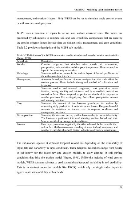
Chapter 3 – Modell<strong>in</strong>g Land Erodibility Reviewmanagement, and erosion (Hagen, 1991). WEPS can be run to simulate s<strong>in</strong>gle erosion eventsor soil loss over multiple years.WEPS uses a database of <strong>in</strong>puts to def<strong>in</strong>e land surface characteristics. The <strong>in</strong>puts areprocessed by sub-models to compute soil and land erodibility components that are used bythe erosion scheme. Inputs <strong>in</strong>clude data on climate, soils, management, and crop conditions.Table 3.2 provides a description of the WEPS sub-models.Table 3.2 Def<strong>in</strong>itions of the WEPS sub-models used to simulate soil loss due to w<strong>in</strong>d erosion (afterHagen, 1991).Sub-Model DescriptionWeatherConta<strong>in</strong>s programs that simulate w<strong>in</strong>d speeds, air temperature,precipitation, solar radiation and dew po<strong>in</strong>t temperature. These are used as<strong>in</strong>put to the rema<strong>in</strong><strong>in</strong>g sub-models.HydrologySimulates soil water content <strong>in</strong> the various layers of the soil profile and atthe soil-atmosphere <strong>in</strong>terface.Management Accounts for soil, surface and biomass manipulations that could affect theerosion process. These <strong>in</strong>clude tim<strong>in</strong>g and method of cultivation andirrigation.SoilSimulates random and oriented roughness, crust generation, coverfraction, density, stability and thickness, and loose erodible material oncrusted surfaces. These temporal properties are simulated <strong>in</strong> response toweather processes like wett<strong>in</strong>g/dry<strong>in</strong>g, freeze/thaw, precipitation amountand <strong>in</strong>tensity, and time.CropSimulates the amount of live biomass growth on the surface bycalculat<strong>in</strong>g daily production of roots, stems and leaves. The growth modelaccounts for variations <strong>in</strong> biomass cover <strong>in</strong> response to climate andmanagement decisions.Decomposition Simulates the decrease <strong>in</strong> crop residue biomass due to microbial activity.The biomass is partitioned <strong>in</strong>to dead stand<strong>in</strong>g, surface, buried, and root.May be modified by management conditions.<strong>Erosion</strong>Uses <strong>in</strong>put parameters supplied by the other sub-models that describe thesoil surface, flat biomass cover, stand<strong>in</strong>g biomass leaf and stem areas, andweather to calculate threshold friction velocities and particle entra<strong>in</strong>ment.The sub-models operate at different temporal resolutions depend<strong>in</strong>g on the availability of<strong>in</strong>put data and variability <strong>in</strong> <strong>in</strong>put conditions. These temporal resolutions range from hourlyto sub-hourly for the hydrology and erosion models, to daily changes <strong>in</strong> soil surfaceconditions that drive the erosion model (Hagen, 1991). Unlike the majority of w<strong>in</strong>d erosionmodels, WEPS conta<strong>in</strong>s schemes to predict spatial and temporal variability <strong>in</strong> soil erodibility.This is <strong>in</strong> contrast to earlier models like RWEQ which rely on s<strong>in</strong>gle value <strong>in</strong>puts toapproximate soil erodibility with<strong>in</strong> fields.75


