<strong>Acid</strong> Sulfate Soil <strong>Management</strong> <strong>Plan</strong>3.1 SITE DESCRIPTIONSection 4 of the <strong>Newcastle</strong> <strong>Coal</strong> Infrastructure Group <strong>Coal</strong> Export Terminal Environmental Assessment (EA)(NCIG, 2006) provides a detailed description of the Project site. In particular, Section 4.1.1 of the EA provides:LanduseThe Project is located on Kooragang Island, which lies near the mouth of the Hunter River, approximately 6 km north-westof the <strong>Newcastle</strong> Central Business District (CBD) (Figure 1-2). Kooragang Island is characterised by a combination ofport, marine and industrial landuses in the south, the Kooragang Nature Reserve in the north, and the Kooragang WetlandRehabilitation Project in the west.The Project is located on the southern side of Kooragang Island on the south arm of the Hunter River. As described inSection 3.2, the Project site comprises land zoned Zone 4(b) (Port and Industry), Zone 5(a) (Special Uses Zone – ArterialRoad) and an unzoned area (Hunter River) by the <strong>Newcastle</strong> LEP (Figure 1-4). The current landuse of the Project sitecomprises licensed landfill activities and vacant industrial land. RLMC currently holds EPL 6437 for the disposal of SolidWaste Class 2 at the KIWEF (Figure 2-1).…Historical landuses of the Project site include grazing, land reclamation and the long term disposal of dredge spoil andindustrial waste (Appendix D). A series of plans and aerial photographs are provided on Figures 4-1 and 4-2, whichillustrate the landuse changes from agricultural development to progressive reclamation of land and deposition of dredgespoil and landfill material to develop the current land surface in the Project site.Landforms and Local TopographyKooragang Island was originally a series of deltaic islands (including Ash Island, Dempsey Island and Moscheto Island)near the mouth of the Hunter River (Figures 4-1 and 4-2). The original islands were low-lying and were susceptible toflooding and subject to tidal influence. Kooragang Island was formed by progressive land reclamation operations whichmodified the original islands into a single island by in-filling of tidal mudflats and creeks.The topography of Kooragang Island, including the Project site, is generally flat and low lying. Elevations within theProject site vary from approximately 0.7 m to 12 m AHD (Figure 4 -3). There are a number of depressions thatintermittently fill with surface runoff. The most notable of these depressions are Big Pond, which is located in the northwestof the Project coal storage area and Deep Pond, the southern end of which would be traversed by the Projectnorthern rail spur should it be required when the Project is fully developed to 66 Mtpa (Figure 4-3).In relation to ASS, Section 4.1.1 of the EA provides:The soils of Kooragang Island generally reflect those placed there by land reclamation operations. The natural soil profileacross Kooragang Island (below fill materials) generally consists of an upper clay layer (soft silty sandy clay), a sandylayer (loose to dense sand), a lower clay layer (stiff to very stiff sandy silty clay), soft rock layers (siltstone and mudstone)and hard rock layers (sandstone) (Connell-Hatch, 2005). Due to the presence of the various fill materials and thehistorical flow paths of the Hunter River and its tributaries, the depth of each of the soil layers varies significantly over theProject site (ibid.). …<strong>Acid</strong> Sulfate <strong>Soils</strong>The Department of Land and Water Conservation (DLWC) (1997) <strong>Acid</strong> Sulfate Soil – <strong>Plan</strong>ning Mapping identifies fiveclasses of land based on the probability of the occurrence of acid sulfate soils, for planning purposes (Section 3.3.2). Themajority of the Project site is considered to be Class 2 on the Potential <strong>Acid</strong> Sulfate <strong>Soils</strong> <strong>Plan</strong>ning Map (DLWC, 1997).Areas identified as consisting of Class 2 soils require development consent for any works below the ground surface or forworks that may lower the groundwater table.…Class 1 land within the Project site is generally restricted to the Hunter River and foreshore. The south arm of the HunterRiver (including the dredge material) is generally classified as Class 1 land (DLWC, 1997). Areas identified as consistingof Class 1 soils require development consent for any works.…6
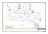
<strong>Acid</strong> Sulfate Soil <strong>Management</strong> <strong>Plan</strong>Previous assessments of the ASS character of the Project area have divided the site into four land investigationareas (e.g. Land Contamination and Groundwater Assessment [RCA, 2006]), which are used here for thedescription of existing information presented below and in the further sections of this report. The assessmentareas are shown on Figure 2, and are described below:Site A1 – including the Project coal storage area.Site A2 – south of Cormorant Road including the Project wharf facilities and shiploaders.Site D1 – the portion of the Kooragang Island Waste Emplacement (KIWEF) west of the Delta access roadthat is traversed by the Project rail infrastructure corridor.Site D2 – the portion of the KIWEF between the Delta access road and the Pacific National access road thatis traversed by the Project rail infrastructure corridor and train unloading stations.The Land Contamination and Groundwater Assessment (RCA, 2006) prepared for the EA provides the followinginformation relevant to ASS:URS (Reference 14) suggested that potential acid sulphate soils are present approximately 3 to 3.5 m below ground level[on Site A1]. It is expected that these potential acid sulphate soils would not develop into acid sulphate soils due to thepresence of natural buffering agents in the soil (Reference 5).Excavations on Site A1 would only have minimal and temporary local interference with the sub soil (Reference 2) andtherefore acid sulphate soils are unlikely to be disturbed.…There have been no acid sulphate soils previously identified at Site A2.…Excavations on Sites D1 and D2 would require very little cut into the existing soil (Reference 2), therefore minimising thelikelihood of disturbing acid sulphate soils.Testing during <strong>Stage</strong> 1 and <strong>Stage</strong> 2AA construction activities found that material excavated during railinfrastructure works was generally not acid forming. Some 60 samples of dredged and excavated material havebeen tested since April 2008 and of these only five samples were classified as ASS (Table 2). Those materialsclassified as ASS were all from samples taken from dredged material during <strong>Stage</strong> 1 construction activities. NoASS was identified in material excavated during <strong>Stage</strong> 1 or <strong>Stage</strong> 2AA of the Project. The dredged materialidentified as ASS was subsequently monitored and managed as follows:materials tested and determined to be self-buffering;materials mixed with shell grit sand and allowed to self-buffer; andmaterials remained in a non-oxidising environment.Given that the limited excavation works required for <strong>Stage</strong> <strong>2F</strong> of the Project will be in areas that have previouslybeen tested for ASS and found to be low risk (i.e. Site A1, Site A2 and Site D1), it is expected that the potentialrisk of ASS will be limited.7