BUILDING TACTICAL REVITALIZATION PLAN DOWNTOWN
Albany, NY - Capitalize Albany Corporation
Albany, NY - Capitalize Albany Corporation
- No tags were found...

Create successful ePaper yourself
Turn your PDF publications into a flip-book with our unique Google optimized e-Paper software.
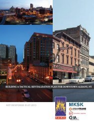
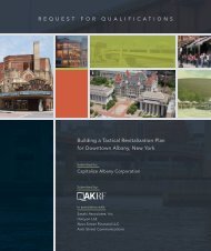
REQUEST FOR QUALIFICATIONS<br />
<strong>BUILDING</strong> A <strong>TACTICAL</strong> <strong>REVITALIZATION</strong> <strong>PLAN</strong> FOR <strong>DOWNTOWN</strong><br />
January 11, 2013<br />
Albany, NY
January 11, 2013<br />
Sarah M. Reginelli<br />
Director of Economic Development<br />
Capitalize Albany Corporation<br />
21 Lodge Street<br />
Albany, NY 12207<br />
Request<br />
for Qualifications<br />
Building a Tactical Revitalizati<br />
ion Plan for Downtown Albany, NY<br />
Dear Members of the Evaluation Committee:<br />
Thank you for your invitation to submit our qualifications.<br />
As pioneers in Smart Growth planning, and charter members of the Congress for New Urbanism, Dover, Kohl & Partners has<br />
led the way towards sustainable cities, towns, and regions for over twenty-five years. We are experienced<br />
in creating<br />
walkable, transit-oriented neighborhoods<br />
s, restoring existing urban centers and towns within coherent metropolitan regions,<br />
and reconfiguring sprawling suburbs into communities of real neighborhoods and diverse districts. We are familiar with the<br />
great opportunities and challenges in Downtown Albany, and have successfully addressed similar conditions<br />
in our past<br />
projects.<br />
We employ a proven methodology that supports genuine public participation and will produce a detailed plan for Downtown,<br />
plus a toolkitt to make it happen. Over many years we<br />
have earned a solid reputation for engaging, visually-oriented town<br />
planning on behalf of local governments, redevelopment agencies, private developers, and community groups<br />
all over the<br />
country. We call our approach “designing g in public.”<br />
I would be pleased to lead an interdisciplinary team of local and national experts whose strengthss are naturally suited to the<br />
challenges suggested by your RFQ. Our qualifications and past projects show how we adapt our techniques for each specific<br />
situation, and<br />
we look forward to evolving the approach for creating the Tactical Revitalization Plan further with you. Amy<br />
Groves, senior project director from our office, will coordinate the consultant team and serve as your point of contact for all<br />
communications regarding this project. As a Hudson Valley area native, she feels deep connections to the place and is<br />
excited at the<br />
opportunity to return to Albany and take part in the continued revitalization of Downtown.<br />
We look forward to our next conversation with you.<br />
Sincerely yours,<br />
DOVER, KOHL & PARTNERS<br />
Victor B. Dover, FAICP, CNU-A, LEED AP<br />
Principal-in-Charge<br />
vdover@doverkohl.com<br />
Amy Groves, CNU<br />
Project<br />
Director<br />
agroves@doverkohl.com<br />
1571 Sunset Drive, Coral Gables, Florida<br />
33143<br />
Telephone (305) 666-0446<br />
www.doverkohl.com
Team Profile<br />
TEAM PROFILE
T e a m P r o f i l e<br />
An interdisciplinary team is fundamental to understanding how planning issues are interrelated and often require integrated<br />
solutions. We have assembled a team for the Downtown Albany Tactical Revitalization Plan that contains local and national leaders<br />
in their respective fields who have successfully collaborated on previous similar assignments.<br />
Dover, Kohl & Partners, a nationally-recognized planning firm, with expertise gained through numerous downtown revitalization<br />
efforts, will coordinate and lead the team, focusing on town planning and community participation. With our firm, principal<br />
involvement is a given. Either Victor Dover or Joseph Kohl will personally oversee public presentations, charrette workshops,<br />
and final work products. Amy Groves, Senior Project Director and Hudson Valley area native, will serve as the daily contact to<br />
the client and manager of internal communications and quality control. Additional town planners and designers from our studio<br />
will be available to meet critical deadlines and help facilitate public events.<br />
Partners for Economic Solutions, a woman-owned economics consulting firm, will provide market research, economic feasibility<br />
analysis of plan proposals, and a detailed, workable implementation strategy. The Street Plans Collaborative will utilize<br />
their expertise with tactical urbanism to conceive short-term implementation strategies that demonstrate plan goals and build<br />
momentum. Laberge Group will act as the team's local liaison, providing local knowledge and expertise of the Downtown Albany<br />
area, as well as preliminary engineering services (as needed) to validate the feasibility of plan concepts. The following<br />
organizational chart summarizes our team's respective roles for this assignment.<br />
DOVER, KOHL & PARTNERS<br />
Town Planning & Community Participation<br />
Victor Dover<br />
Principal-in-Charge<br />
Joseph Kohl<br />
Principal<br />
Amy Groves<br />
Project Director<br />
James Dougherty<br />
Director of Design<br />
Justin Falango<br />
Town Planner<br />
Dover-Kohl<br />
Staff Planners<br />
Dover-Kohl<br />
Staff Designers<br />
PARTNERS FOR<br />
ECONOMIC SOLUTIONS<br />
Market Analysis,<br />
Economic Feasibility &<br />
Implementation Strategy<br />
Anita Morrison, Principal<br />
Abby Ferretti, Principal<br />
THE STREET <strong>PLAN</strong>S<br />
COLLABORATIVE<br />
Tactical Urbanism<br />
Implementation Strategy<br />
Mike Lydon, Principal<br />
Anthony Garcia, Principal<br />
LABERGE GROUP<br />
Local Liaison,<br />
Planning & Engineering<br />
Ronald Laberge, P.E.,<br />
Principal-in-Charge & Chief Engineer<br />
Benjamin Syden, Director of Planning<br />
Staff Planners & Engineers<br />
January 11, 2013<br />
Building a Tactical Revitalization Plan for Downtown Albany, NY<br />
1.1
Firm Profiles<br />
FIRM PROFILES
F i r m P r o f i l e s<br />
Dover, Kohl & Partners | town planning & community participation<br />
Dover, Kohl & Partners was founded in 1987. Our expertise lies in balancing the visionary<br />
‘civic art’ of planning with the practical consensus building needed to make projects<br />
succeed. We are trained in the principles of traditional town planning and architecture<br />
and have perfected techniques for gathering meaningful community input. Dover, Kohl &<br />
Partners is best known for public design charrettes, detailed master plans, and illustrative<br />
codes that emphasize complete neighborhoods as the basis for sound communities.<br />
Our plans focus on traditional neighborhood design and smart growth, emphasizing that<br />
there does not have to be a trade-off between livability and economic prosperity. Victor<br />
Dover and Joseph Kohl are charter members of the Congress for the New Urbanism and<br />
have worked for many public agencies, developers, and citizen groups to create appropriate<br />
methods of land development and regulation. Victor Dover serves on the LEED for<br />
Neighborhood Development Core Committee and the Congress for the New Urbanism<br />
Board; both Joseph and Victor are on the Board of the Form-Based Codes Institute. The<br />
firm has produced and facilitated over 120 charrettes during the last decade.<br />
We strive for the maximum public involvement in planning and stress a hands-on visual<br />
approach, using techniques that merge design studio, policy-making, and town meetings.<br />
Video imaging (pioneered by our firm) and collaborative drawing make planning more<br />
accessible and meaningful for citizens and clients. Often our projects have revealed<br />
potential in overlooked real estate and have helped to challenge outdated zoning or<br />
transportation policies.<br />
Our work has been published in Progressive Architecture, in Metropolitan Home, in<br />
numerous planning journals, and has been featured on National Public Radio, CNN's<br />
Earthwatch, and in BusinessWeek. Dover-Kohl projects have also been profiled in<br />
The New Urbanism by Peter Katz, Rural By Design by Randall Arendt, Sustainable<br />
Urbanism by Douglas Farr, Form-Based Codes by Daniel Parolek, Retrofiting Suburbia<br />
by Ellen Dunham-Jones, as well as Land Use Strategies and Public Participation Tools,<br />
both published by the Center for Livable Communities.<br />
VICTOR DOVER and JOSEPH KOHL hold Bachelor of Architecture degrees from Virginia<br />
Tech and Master of Architecture degrees from the Town & Suburb Design Program at the<br />
University of Miami. They have both been cited by Architecture magazine as being among<br />
“the country’s best urban designers and architects.”<br />
Victor Dover lectures across the nation on sustainable development and livable communities.<br />
He has personally led over 100 charrettes worldwide. Victor is a Fellow of the<br />
American Institute of Certified Planners, is LEED-AP certified, and is CNU-Accredited.<br />
Joseph Kohl is recognized nationally as an innovator in urban design and graphic communication.<br />
He oversees the firm’s urban design, working hands-on with the Town Planners<br />
to refine and constantly improve designs for walkable, sustainable urban places. Joe has<br />
taught design and media at the University of Miami, and is CNU-Accredited.<br />
Revitalizing<br />
Downtowns &<br />
Historic Places<br />
Designing New<br />
Neighborhoods &<br />
Towns<br />
Planning Cities<br />
& Regions<br />
Reinventing<br />
Corridors<br />
Retrofitting<br />
Suburbia<br />
Shaping Transit<br />
Oriented<br />
Development<br />
Form Based Codes<br />
for Municipal &<br />
Private Clients<br />
January 11, 2013<br />
Building a Tactical Revitalization Plan for Downtown Albany, NY<br />
2.1
Partners for Economic Solutions | market analysis, economic feasibility &<br />
implementation strategy<br />
Partners for Economic Solutions is a full-service urban economics consulting firm<br />
formed in 2008, dedicated to fostering sustainable economic vitality and growth in<br />
America’s neighborhoods, cities and regions. Working extensively with cities, economic<br />
development and redevelopment agencies, public/private partnerships, universities,<br />
housing authorities and non-profits, PES brings real estate and economics expertise to<br />
bear on a wide range of urban development and public policy issues.<br />
We provide timely advice, strategies and research that are:<br />
• Rigorous, objective and market-driven<br />
Partners for E<br />
• Backed by reliable data<br />
• Drawn from the best national practices<br />
• Tailored to the local situation and resources<br />
Partners for Economic Solutions is a full-s<br />
• Practical and keyed to specific implementation actions<br />
to fostering sustainable economic vitality<br />
and regions. Working extensively with ci<br />
Collaboration defines our work approach. We work closely with our clients to maintain agencies, continual dialogue public/private and provide partnerships, quick uni<br />
responses to meet the clients’ schedule needs. With teams that include some of the nation’s PES best brings planners, real designers estate and engineers,<br />
we develop holistic approaches for development and revitalization with economics guiding development and responding and public to the designs. policy<br />
economics exp<br />
issues.<br />
We believe strongly in the value of community involvement, drawing on stakeholders’ knowledge, We provide ideas and timely aspirations. advice, Public strategies and<br />
workshops help to solicit this input and test strategies through frank discussions of market opportunities and constraints.<br />
Rigorous, objective and market-dri<br />
Our services focus on five primary categories:<br />
• Market-driven analysis<br />
• Real estate advisory services<br />
• Economic development and revitalization strategies<br />
• Impact analysis<br />
<br />
<br />
<br />
<br />
Backed by reliable data<br />
Drawn from the best national prac<br />
Tailored to the local situation and<br />
Practical and keyed to specific imp<br />
• Public policy evaluations and strategies<br />
Collaboration defines our work approach.<br />
continual dialogue and provide quick resp<br />
PES is a woman-owned company based in Washington, DC. Its founding principals – Anita teams Morrison that and Abigail include Ferretti some – of have the a nation’s be<br />
combined experience of 50 years in economic and development consulting.<br />
holistic approaches for development and r<br />
responding to the designs.<br />
Anita Morrison founded Partners for Economic Solutions after more than 30 years of economic and development consulting. During<br />
her career, Anita has specialized in public/private partnerships, real estate advisory services, We redevelopment believe strongly strategies in the and value economic<br />
of commu<br />
impact analysis. From large cities to small towns, she applies her understanding of knowledge, real estate economic ideas and fundamentals aspirations. to Publi<br />
questions of development, redevelopment and smart growth. She helps decision makers and strategies the community through to understand frank discussions how of m<br />
economics and land planning interact. Her market analysis helps to frame the scale, mix and pace of development. Financial<br />
analysis evaluates project feasibility, quantifies any funding gap and required investment, and Our assesses services the potential focus on for five long-term primary categor<br />
returns. Fiscal impact analysis forms the basis for realistic and creative funding strategies and allows decision makers to evaluate<br />
the potential returns and risks associated with their investment. Anita is adept at incorporating Market-driven these economic realities analysis into<br />
workable solutions. Anita received a Master of Public Policy from the University of Michigan, and taught Real Market estate Analysis advisory for services the<br />
Master of Sustainable Real Estate Development program at Tulane University.<br />
Economic development and revital<br />
Impact analysis<br />
As a founding principal of the firm, Abigail Ferretti focuses on managing the firm’s urban practice with Public an emphasis policy on evaluations revitalizing and strat<br />
older communities. In all her work, she dedicates herself to finding the best available data that accurately portray current and potential<br />
development. She uses GIS extensively to inform the analyses of existing conditions, competitive PES is a projects woman-owned and opportunities company for based in<br />
new development. This relentless pursuit of actual data to build sound conclusions serves as Morrison a guiding principle and Abigail for all PES Ferretti projects. – have a co<br />
Abby received a Master of Business Administration from Loyola College.<br />
development consulting.<br />
2.2<br />
Dover, Kohl & Partners et al<br />
January 11, 2013
and policies that help shape the resulting spaces.<br />
Anthony is an active member of civic life in South Florida. He is the Editor of TransitMiam<br />
com, a non-profit organization that seeks to encourage public participation and discourse in Sout<br />
The Street Plans Collaborative | tactical urbanism implementation strategy<br />
Florida. Transit Miami has allowed him to refine his community development capacity, and de<br />
velop a deep understanding of multimodal solutions and transit systems. He is a founding Boar<br />
member of Bike Walk Coral Gables, and is also on the board of the Green Mobility Network an<br />
the Urban Environment League.<br />
The Street Plans Collaborative (Street Plans) is an interdisciplinary urban planning, design, and advocacy firm with offices in New<br />
York City and Miami, formed in 2009. The firm strives to improve the balance of multi-modal transportation options and create successful<br />
public spaces as a means to creating more economically competitive and sustainable 21st century towns and cities. Street<br />
Plans fulfills this mission by working at the intersection of transportation, land use, and urban design in cities and towns across the<br />
United States.<br />
Anthony possesses a Bachelor of Arts in Architecture and Urban Design from New York Univer<br />
sity. The His firm focus places a of high study value on at developing NYU research, was community writing, and best development practice communication and projects. participation Principals Mike in Lydon the and plannin<br />
Tony Garcia’s writings and work have been featured in The New York Times, Salon, Utne Reader, NPR, Next American City Magazine,<br />
process, with a concentration on the use of technology in garnering public support. He went on t<br />
The Atlantic Cities, Planning Magazine, Better Cities & Towns, and The Miami Herald, among other publications. Street Plans is also<br />
receive known his internationally Masters for in defining Architecture and advancing the from concept the of University tactical urbanism, of which Miami, was named where by Planetizen he worked and Urban as Times a researc<br />
assistant a top 2012 on a planning number trend of and urban featured at policy this year’s papers Venice Architectural related to Biennale. code writing and urban development. Hi<br />
work as a researcher at UM brought him in contact with internationally renowned architects an<br />
The firm is currently working on projects in New York City, Coral Gables, Miami Beach, Albuquerque, Detroit, St. Louis, and North<br />
urban planners and helped him develop a keen understanding of the connection between urba<br />
Carolina’s 10-County Albemarle Region.<br />
form and the policies that shape it. He is currently pursuing his architectural license, and plans t<br />
add this skill to the company suite of services.<br />
Mike Lydon is Principal of The Street Plans Collaborative. Before launching the firm in 2009, Lydon worked for Smart Growth Vermont,<br />
the Massachusetts Bicycle Coalition, and Ann Arbor’s GetDowntown Program. From 2006 - 2009 Lydon worked for Duany Plater-<br />
Zyberk and Company (DPZ), an international leader in the practice of smart growth planning, design, and research techniques. At DPZ<br />
Mike worked extensively on Miami 21, the recipient of the American Planning Association’s 2011 National Planning Excellence Award,<br />
and contributed to several other research initiatives and smart growth projects.<br />
Anthony was consistently on the prestigious Deans List at New York University prior to graduat<br />
ing with Honors for his research into the development of Modern Cuban Architecture. This led t<br />
an invitation to participate in a summer design studio at the Harvard Graduate School of Design<br />
While at the University of Miami he was one of a handful of students invited to the Rome Program<br />
an intensive six month program of study into the history of traditional urbanism and architectur<br />
Most recently he was one of a select few regional participants in the LEED-Homes pilot program<br />
where his work on a historic South Miami cottage led to a Gold rating and a Dade Heritage Trus<br />
Award for excellence in preservation.<br />
As a planner, writer, and advocate, Mike’s work has appeared in or been featured by NPR, The New York Times, CNN Headline News,<br />
Grist, Salon, Utne Reader, Next American City Magazine, Planetizen, Streetsblog, and many other publications. Mike collaborated with<br />
Andres Duany and Jeff Speck in writing The Smart Growth Manual, published by McGraw-Hill in 2009, and honored by Planetizen as<br />
one of the top ten planning books of 2010. A founding member of the New England Chapter of the Congress for the New Urbanism<br />
(CNU), a Board Member for CNU New York, and a steering committee member of the Next Generation of New Urbanists, Lydon<br />
remains active in both local and national planning, design, and smart growth advocacy issues. He also speaks regularly at trainings<br />
and conferences on the topics of smart growth, planning and social media, complete streets, tactical urbanism, and active transportation.<br />
Mike is the primary author of The Open Streets Project and Tactical Urbanism: Short-Term Action, Long-Term Change (Vol. 1 &<br />
Vol. 2). Mike received a B.A. in American Cultural Studies from Bates College and a Masters in Urban Planning from the University<br />
of Michigan.<br />
Anthony Garcia is Principal of The Street Plans Collaborative. Prior to launching the firm’s Miami office, Anthony was a Project<br />
Director for six years at the Dover Kohl & Partners affiliated architecture firm Chael Cooper & Associates. His work there gave him<br />
a strong background of urban planning that includes urban design, policy writing and code analysis. Anthony is an active member of<br />
civic life in South Florida. He is the editor of TransitMiami.com, a non-profit organization that seeks to encourage public participation<br />
and discourse in South Florida. He is a founding Board member of Bike Walk Coral Gables, and is also on the board of the Green<br />
Mobility Network and the Urban Environment League. Anthony possesses a Bachelor of Arts in Architecture and Urban Design from<br />
New York University and a Masters in Architecture from the University of Miami.<br />
January 11, 2013<br />
Building a Tactical Revitalization Plan for Downtown Albany, NY<br />
2.3
Laberge Group| local liaison, planning & engineering services<br />
Laberge Laberge Group has Group provided has provided engineering, engineering, architecture, architecture, surveying and surveying planning and services planning since services 1964. Our since diverse 1964. portfolio Our of successfully<br />
diverse Laberge completed portfolio Group projects has of successfully provided and community engineering, completed plans, coupled architecture, projects with and surveying community experienced and core plans, planning of coupled project services management with since experienced 1964. and design Our staff,<br />
provides core diverse clients of portfolio creative, project management integrated of successfully and distinctive and completed design solutions. staff, projects provides and community clients creative, plans, coupled integrated with and experienced distinctive<br />
solutions. core of project management and design staff, provides clients creative, integrated and distinctive<br />
The firm solutions. has an excellent record for performing work on time, within budget and providing recommendations that are accepted and<br />
implemented The firm by our has clients. an We excellent have over record forty years for performing of extensive experience work on working time, within private budget clients and and communities providing of all<br />
sizes.<br />
recommendations<br />
Offering<br />
The firm<br />
a full<br />
has<br />
range<br />
an that<br />
of<br />
excellent<br />
Engineering,<br />
are accepted record<br />
Architecture,<br />
and for implemented performing<br />
Surveying and<br />
work by<br />
Planning<br />
our on clients. time,<br />
services<br />
We within<br />
under<br />
have budget<br />
one<br />
over<br />
roof<br />
forty and<br />
we can<br />
providing years<br />
achieve<br />
of<br />
project<br />
extensive recommendations experience that working are accepted with private and implemented clients by our clients. We have over forty years of<br />
milestones efficiently and economically and with the reassurance it is the very best quality of services available.<br />
and extensive communities experience of all working sizes. Offering with private a full range clients of<br />
Engineering, and communities Architecture, of all sizes. Surveying Offering a and full Planning range of<br />
Laberge services Engineering, Group’s under philosophy Architecture, one is roof a simple we Surveying one: can The achieve highest and Planning project quality service for each client’s requirements. Implementation of this philosophy<br />
milestones services requires under highly efficiently competent one and roof comprehensive economically we can achieve professional and with project the services provided on a personal and individual plane. This requires<br />
that we reassurance milestones establish and efficiently it maintain is the relationships very and economically best quality and communication and of services with the with our clients. We don’t build projects, we build communities and<br />
organizations…one available. reassurance it project is the at a very time. best We do quality this by of assisting services our clients in determining and prioritizing their needs. We research<br />
available available. funding, matching priorities with the client’s individual projects. This becomes an on-going process of matching available<br />
funding Laberge with desired Group’s projects philosophy and/or needs, is building a simple the individual one: projects, updating the plan, and implementing the projects.<br />
The Laberge highest Group’s quality philosophy service for is a each simple client’s one:<br />
requirements.<br />
Laberge<br />
The<br />
Group<br />
highest Implementation<br />
is known<br />
quality<br />
for technical<br />
service of<br />
excellence,<br />
for this<br />
the<br />
each philosophy<br />
ability<br />
client’s<br />
to respond to a client’s needs, and dedication to project implementation.<br />
requires requirements. highly Implementation competent of this comprehensive philosophy<br />
The staff understands that success comes from providing concise and attentive consulting in a fast–paced environment. Laberge<br />
professional requires highly services provided competent on a comprehensive<br />
personal and<br />
Group individual professional<br />
is committed plane. to<br />
services<br />
team This building, requires provided<br />
enthusiastic that on we a establish personal<br />
service, project and<br />
management and multi–disciplinary expertise. Our intent is to<br />
provide maintain individual you with relationships the plane. best service This requires and available communication that to meet we establish your with goals our and and objectives.<br />
clients. maintain We relationships don’t build projects, and communication we build communities with our and organizations…one project at a time. We do<br />
Ronald this clients. Laberge, by assisting We P.E., don’t Vice-President our build clients projects, in and determining we Principal build communities in and Charge. prioritizing Mr. and Laberge organizations…one their has needs. designed We research and project managed available at numerous a time. funding, We projects; do as<br />
Vice President, matching this by assisting Ronald priorities directs our with clients the the full resources client’s in determining individual of the firm and projects. addressing prioritizing This the their scheduling becomes needs. an of We all on-going work research including process available field of investigations matching funding, and<br />
surveys, available matching preliminary funding priorities cost estimates, with with desired the design client’s projects analysis individual and/or design, needs, projects. detailed building This cost becomes the estimates, individual an on-going plans projects, and process specifications, updating of matching the and plan, construction<br />
services. and available implementing As an funding active the with member projects. desired of the projects firm’s Quality and/or Assurance/Quality needs, building Control the individual team he maintains projects, the updating firm’s integrity the plan, through<br />
quality<br />
and<br />
production.<br />
implementing<br />
Ronald<br />
the<br />
received<br />
projects.<br />
a Bachelor of Science (B.S.) in Civil Engineering from Union College in Schenectady, New York.<br />
This project, if awarded to us, will be accepted with the pledge that our total individual and collective<br />
knowledge, This project, experience if awarded and to us, judgment will be will accepted be put with to work the pledge for you, that the our Client. total individual Our entire and staff collective will be<br />
Benjamin<br />
available knowledge,<br />
Syden,<br />
to<br />
AICP<br />
you. experience<br />
serves<br />
No one<br />
as Director<br />
and person judgment<br />
of<br />
could<br />
Planning<br />
(or will should)<br />
& Community<br />
be put handle to<br />
Development.<br />
work all aspects for you,<br />
Mr.<br />
of the Syden<br />
Client. project,<br />
has over<br />
Our as many<br />
eighteen<br />
entire different staff<br />
(18) years<br />
will areas be<br />
of experience<br />
with of available expertise NY State to municipalities you. are required. No one in person We the areas all could will of (or comprehensive be should) actively handle involved planning, all aspects in land the use assurance of regulations, the project, of brownfield quality as many services redevelopment, different and areas the shared<br />
services, completion of downtown expertise of are revitalization, all required. projects economic We time all and will and within be community actively budget. development, involved in pro-gram the assurance development, of quality project services financing, and creation the of<br />
implementation completion mechanisms, of all projects grant on writing time and management. within budget. Mr. Syden has overseen the development of over 100 community<br />
planning projects, and has secured over $125 million in funding for client communities. Ben received a Bachelor of Arts in Political<br />
Science (B.A.) and a Master of Regional Planning (M.R.P.) from the University of Albany.<br />
2.4<br />
Dover, Kohl & Partners et al<br />
January 11, 2013
RELEVANT EXPERIENCE<br />
Relevant Experience
R e l e va n t E x p e r i e n c e<br />
Many communities across the country are rethinking development and growing<br />
in smarter ways. Dover, Kohl & Partners has helped many of them create memorable,<br />
sustainable neighborhoods, towns, and cities, in turn creating a better<br />
quality of life for their citizens. We have a strong history of experience leading<br />
multidisciplinary planning teams in downtown revitalization efforts, with successful<br />
results.<br />
Community involvement is an integral component in all of our projects. The Dover-Kohl<br />
team has perfected numerous techniques in building community consensus<br />
and helping communities establish an implementable plan. We create<br />
easy-to-understand strategies for sustainable development, specializing in plans<br />
and visualizations that focus on the physical aspects of future growth and conservation.<br />
Our process has helped communities across the country to visualize<br />
change before it occurs and has been the subject of education studies by the<br />
National Charrette Institute.<br />
For example, in Downtown Montgomery our work on the downtown plan has resulted<br />
in a revitalization of Dexter Avenue and an area known as "The Alley" that<br />
feature new bars, restaurants, businesses, residences, and hotels in both renovated<br />
historic and new buildings bringing nightlife and people back to the downtown<br />
at all times of the day. In addition, Court Square, which terminates the end of<br />
Dexter Avenue opposite the State Capital, was redesigned and constructed as a<br />
plaza with traffic circulating around the historic fountain as it once did, making<br />
Court Square the first new urban space of its kind on a major U.S. city street in<br />
over fifty years. Dover-Kohl has continued to assist the City with implementation<br />
in the years since the adoption of the plan. Our plan and code for Columbia Pike<br />
in Arlington County is transforming the once suburban corridor into a walkable,<br />
transit-oriented center; the significant steps taken in evolution from suburban<br />
strip to street-oriented urbanism in the mixed-use nodes was recently chronicled<br />
in the publication Retrofitting Suburbia by Ellen Dunham-Jones. In Downtown<br />
Kendall, our plan and code unlocked development potential, resulting in over 3200<br />
new dwelling units in mixed-use settings.<br />
In addition, Dover-Kohl has recently completed several assignments in New York<br />
State, including the Clifton Park Town Center Plan and the Schodack Town Center<br />
Plan.<br />
In this section, you will find descriptions of recent projects by Dover, Kohl & Partners<br />
and the consultant team that demonstrate our creativity in planning, design,<br />
economic analysis and implementation, and address our team's ability to create<br />
a successful revitalization plan for Downtown Albany.<br />
January 11, 2013<br />
Building a Tactical Revitalization Plan for Downtown Albany, NY<br />
3.1
“The Downtown is the heart of the City<br />
. . . everybody has a vested<br />
interest in developing Downtown.”<br />
– Mayor Bobby Bright<br />
Downtown Master Plan<br />
Montgomery, AL<br />
PROJECT DETAILS<br />
Project Area:<br />
Client:<br />
Year Adopted: 2007<br />
Website:<br />
730 acres<br />
City of Montgomery<br />
http://www.montgomeryal.gov/index.<br />
aspx?page=60<br />
For more information, visit doverkohl.com.<br />
Court Square has been reconstructed as an urban<br />
plaza. Photo Credit: Robert Fouts<br />
The warehouses on South Court Street should<br />
continue to be renovated with storefronts and<br />
housing to help create a thriving Arts District.<br />
Transect Map for Downtown Montgomery<br />
The Project<br />
During recent years, rapid growth has occurred in the area surrounding Downtown Montgomery. The<br />
City seeks to attract more of this growth into Downtown to provide a vibrant place for residents, visitors,<br />
and businesses. The Downtown Master Plan is intended to provide a road map to guide future<br />
growth and development in the heart of the city. Recently completed projects such as Riverwalk<br />
Stadium, home of the Montgomery Biscuits, and the amphitheater at Riverfront Park have positioned<br />
the Downtown for a successful revitalization. Other projects are also underway that will add to this<br />
momentum and increase Downtown's appeal for visitors and residents alike. The planning process<br />
for the Downtown Master Plan was led by Dover-Kohl and included work by UrbanAdvisors, Zimmerman/Volk<br />
Associates, Hall Planning & Engineering, and UrbanAdvantage.<br />
The Process<br />
Community involvement was an essential component in creating a vision for Downtown Montgomery.<br />
The Master Plan’s visualizations, plans, and recommendations are the result of extensive public input<br />
from over 850 Montgomery residents, business owners, and community leaders who participated in<br />
the September 2006 charrette.<br />
Plan Principles<br />
The Downtown Plan includes near- and long-term project recommendations and a detailed implementation<br />
strategy to help achieve the community's vision. The key principles guiding the Plan were to<br />
plan, preserve, restore, and reuse historic buildings and addresses; foster an improved environment<br />
for private investment and development; mix land uses, building types and housing options; expand<br />
Downtown's green and civic spaces; and to promote a better balance of transportation options and<br />
designs. One of the most important strategies was revising the land types and development regulations<br />
that limited opportunities for both redevelopment and new development. Dover-Kohl calibrated<br />
the SmartCode for Downtown as a way to provide increased certainty for implementation of the Master<br />
Plan. This form-based code, now mandatory for Downtown, will ensure that future development<br />
promotes a diversity of building, thoroughfare, and civic space types with characteristics appropriate<br />
for its location.<br />
Status<br />
The Plan was unanimously adopted by City Council in February 2007. Following the Plan’s adoption,<br />
the City Council unanimously adopted the SmartCode as the mandatory zoning code for Downtown in<br />
May 2007. Construction of the Court Square Plaza was completed in early 2007, making it the first<br />
new urban space of its kind on a major U.S. city street in over fifty years. It is now a popular case<br />
study for traffic engineers around the world seeking to rediscover the art of placemaking.<br />
3.2<br />
Dover, Kohl & Partners et al<br />
January 11, 2013
Continuing Services<br />
Montgomery Interpretive Center<br />
Dover, Kohl & Partners was retained<br />
by the City to assist in the implementation of the<br />
Downtown Plan. Initial work included assisting<br />
City staff in processing development applications<br />
as well as redesigning several landmark<br />
projects in accordance with the SmartCode.<br />
The Montgomery Interpretive Center concept<br />
respects both the local architectural precedent<br />
and scale of the surrounding neighborhood. The<br />
design also offers the square footage required<br />
for a facility which could become a national destination.<br />
The Hyatt Hotel Plan is a mixed-use, urban block<br />
concept. The parking is located mid-block, lined<br />
by the hotel, shops, and office uses. The first<br />
floor storefronts provide doors and windows<br />
that face the street, a critical feature that makes<br />
the street more attractive and safe.<br />
Tulane Court, a barrack-style public housing<br />
project, is being redeveloped into a mixed-use,<br />
mixed-income neighborhood. The Plan includes<br />
a variety of building types fronting streets and<br />
greens and an interconnected street network.<br />
Dover-Kohl created illustrations for the Housing<br />
Authority to further explain Plan concepts.<br />
Proposed Hyatt Hotel<br />
Redevelopment of Tulane Court<br />
January 11, 2013<br />
Building a Tactical Revitalization Plan for Downtown Albany, NY<br />
3.3
“Make certain that we don't dream it<br />
forever, but do it today.”<br />
– Mayor L. Douglas Wilder,<br />
Work-in-Progress Presentation<br />
Downtown Master Plan<br />
Richmond, VA<br />
PROJECT DETAILS<br />
Project Area: 2,176 acres<br />
Client:<br />
City of Richmond<br />
Venture Richmond<br />
Year Adopted: 2008<br />
Website: www.ci.richmond.va.us/<br />
forms/DowntownPlan.aspx<br />
For more information, visit doverkohl.com.<br />
Before<br />
Existing view of Hull Street in Manchester, one of<br />
Richmond’s historic industrial districts.<br />
After<br />
Photo-realistic view of Hull Street after Plan implementation,<br />
including streetscape improvements,<br />
private investment, and public transportation.<br />
Empty lots and parking lots are filled in with buildings<br />
making the downtown feel more complete.<br />
The Project<br />
Downtown Richmond is shaped by countless forces that have produced an extraordinarily historic,<br />
physically stunning city. However, much of the recent development activity has occurred in the outlying<br />
counties and suburbs, draining capital away from the heart of the city. The City of Richmond<br />
hired Dover, Kohl & Partners to create a plan to recapture development potential and channel it into<br />
the historic center, thus legitimating its title as "Virginia’s Downtown." Dover-Kohl teamed with Hall<br />
Planning and Engineering, Rhodeside & Harwell, Urban Advantage, ZHA, Inc, and Zimmerman/Volk<br />
Associates to create the Plan.<br />
The Process<br />
Over 800 citizens and stakeholders joined Dover-Kohl and a team of experts in discussing housing,<br />
transportation planning, parks, and economic development in a seven-day charrette. The resulting<br />
Master Plan reflects the range of community brainstorming and design input, which will ultimately<br />
guide growth and ensure quality development.<br />
Plan Principles<br />
The Master Plan is both a physical plan to guide appropriate development and a policy document<br />
to serve as a blueprint for action. Guiding principles include preserving the traditional city; providing<br />
greater connections to the James River; encouraging appropriate urban architecture; making a<br />
‘greener’ Downtown; and promoting the city’s historic past. Additionally, the Plan outlines numerous<br />
incremental capital improvements such as converting one-way streets to two-way travel, planting and<br />
maintaining street trees, improving pedestrian/cyclist facilities and preparing a preliminary design for<br />
a streetcar system.<br />
Status<br />
The Master Plan was unanimously approved by the City Council in October 2008. In March 2009,<br />
the Plan was awarded the Outstanding Plan Award from the American Planning Association, Virginia<br />
Chapter.<br />
3.4<br />
Dover, Kohl & Partners et al<br />
January 11, 2013
The Transect<br />
T1<br />
T3<br />
T4<br />
T5<br />
These images reflect the character of various transect zones and demonstrate the best scenarios for<br />
future development.<br />
T6<br />
As part of the planning process,<br />
Dover-Kohl outlined six "transect<br />
zones" for Downtown Richmond.<br />
This mapping, which identified the<br />
area’s human habitats in a range<br />
from the most natural to the most<br />
urban, ultimately developed into<br />
the Future Land Use Map for Downtown.<br />
Images reflect the character<br />
of each zone and provide developers<br />
and city staff with development<br />
standards that will ensure new<br />
buildings reinforce the intended<br />
character of each place.<br />
What is a transect?<br />
Each Transect Zone is defined by particular characteristics<br />
that correspond with the density and<br />
intensity of land use and urbanism. These characteristics<br />
include building placement, landscaping,<br />
and curb details, all of which influence the<br />
level of walkability and vibrancy in a particular<br />
place. The Transect is an important tool because<br />
it acknowledges the diverse characteristics of<br />
villages, towns, and cities, and encourages infill<br />
and new development to respect its context.<br />
T1: The Natural Transect Zone is characterized<br />
by a wilderness landscape that is untouched by<br />
development, and whose ecological features are<br />
preserved. The uninhabited islands in the James<br />
River are an example of a wilderness condition in<br />
Downtown Richmond. These islands remain unsettled<br />
due to periodic flooding of the river, and<br />
are preserved in their natural condition.<br />
T2: The Rural Transect Zone is characterized by<br />
an open or agricultural landscape that is sparsely<br />
settled. The estates along the James River<br />
are an example of a rural condition in Richmond.<br />
These estates feature manor homes surrounded<br />
by expansive lawns and rolling hills.<br />
T3: The Sub-Urban Transect Zone is characterized<br />
by low-density residential development on<br />
a connected street network. These neighborhoods<br />
usually consist of low-density, single family<br />
homes with landscaped setbacks.<br />
T4: The General Urban Transect Zone is characterized<br />
by medium-density, mixed-use development,<br />
distributed along medium-sized bocks.<br />
Historic Jackson Ward is an example of the general<br />
urban condition in Richmond. This district is<br />
characterized by single-family homes, sideyard<br />
houses, and rowhouses with variable setbacks<br />
and landscaping, and a limited mix of commercial<br />
and civic uses.<br />
T5 : The Urban Center Transect Zone is characterized<br />
by higher density, mixed-use development,<br />
typically arranged on a fine-grained street<br />
network with wide sidewalks, regular tree planting,<br />
and minimal setbacks. Shockoe Slip is an example<br />
of a classic urban center condition, with<br />
a dense mix of office space, apartments, and<br />
retail located in four to six-story brick buildings<br />
that front the street. Pedestrians have an active<br />
presence in these neighborhoods.<br />
T6: The Urban Core Transect Zone is the most<br />
urban condition in the Transect. This zone is<br />
high density, with an intense mix of uses and<br />
civic buildings of regional significance, distributed<br />
along urban blocks with wide sidewalks, regular<br />
street tree plantings, and buildings that front the<br />
street. City Center is an example of the urban<br />
core condition in Downtown Richmond, with tall<br />
buildings that contain a range of office, residential<br />
and retail space. Continued pedestrian-oriented<br />
development will support a vibrant street realm.<br />
January 11, 2013<br />
Building a Tactical Revitalization Plan for Downtown Albany, NY<br />
3.5
“I’m so proud to live here and to have<br />
participated in this exciting process.”<br />
– Fayetteville Resident<br />
Downtown Master Plan<br />
Fayetteville, AR<br />
PROJECT DETAILS<br />
Project Area:<br />
Client:<br />
Year Adopted: 2004<br />
Website:<br />
324 acres<br />
City of Fayetteville<br />
accessfayetteville.org/<br />
government/planning/<br />
documents/index.cfm<br />
For more information, visit doverkohl.com.<br />
Infill development along Dickson Street completes<br />
the street scene.<br />
A prominent Downtown intersection is redeveloped.<br />
Parking<br />
or service<br />
access<br />
Parking<br />
structure<br />
A “Liner”<br />
building<br />
A new zoning district was also created along with<br />
designs for residential and mixed-use infill development<br />
and "smart" parking structures. This illustration<br />
is of a “liner” building, which surrounds parking<br />
with ground- floor shopfronts and upper-level offices<br />
and residences.<br />
The Project<br />
Fayetteville has sustained a real downtown character with many things to do. However, road widenings<br />
and automobile dominance have disturbed certain streetscapes, and development regulations<br />
provided little opportunity for quality infill development. By improving development regulations, reclaiming<br />
once-walkable streets, and establishing a clear vision for Downtown, proper development<br />
activities and infrastructure improvements can enhance what is already a great urban center. Consultants<br />
from UrbanAdvisors, Hall Planning & Engineering, BensonMiles TND, and UrbanAdvantage<br />
assisted with the Plan.<br />
The Process<br />
During a seven-day charrette, Dover-Kohl conducted an open planning process to identify the ideas,<br />
needs and concerns of the community. By "designing in public", participants played a key role in creating<br />
the Downtown Master Plan. As a result, the plan crystallizes the desires of Fayetteville’s citizenry into<br />
buildable, functional visions and provides do-able instructions for government and private investors.<br />
Status<br />
Upon the unanimous adoption of the plan in 2004, the City formed the first Tax Increment Financing<br />
District (TIF) in the State of Arkansas. The availability of TIF funds has been instrumental in the redevelopment<br />
of the Mountain Inn Hotel and the transformation of College Avenue. In October 2006<br />
the Downtown Code was adopted, revising the land development regulations to ensure the type and<br />
form of development that Fayetteville residents desire.<br />
3.6<br />
Dover, Kohl & Partners et al<br />
January 11, 2013
Change Over Time<br />
College Avenue was a focal point of the<br />
Fayetteville Downtown Master Plan. A range<br />
of capital improvements were proposed, which<br />
could be implemented over time with both public<br />
and private investments. Major improvements<br />
can occur even with small changes, as shown in<br />
these photos.<br />
Top Right: Existing Conditions on College Avenue<br />
are those of a suburban arterial roadway.<br />
Buildings are set far apart in parking lots. The<br />
street is focused on automobile travel and is not<br />
pedestrian-friendly.<br />
Existing Conditions<br />
Short-Term Improvements, Right: College Avenue<br />
is narrowed to three lanes. Street trees are<br />
planted and the sidewalk is widened.<br />
Intermediate Improvements, Lower Right: New<br />
buildings are built close to the street with doors<br />
and windows facing College Avenue. On-street<br />
parking is introduced, slowing traffic and offering<br />
parking in front of businesses and shops.<br />
Short-Term Improvements<br />
Long-Term Improvements, Below: Buildings<br />
are built on both sides of the street, forming an<br />
urban relationship and transforming College Avenue<br />
into a spatially defined “urban room.” Improvements<br />
include the creation of a supermarket<br />
as a multi-story, mixed-use neighborhood<br />
grocery prototype.<br />
Intermediate Improvements<br />
January 11, 2013<br />
Building a Tactical Revitalization Plan for Downtown Albany, NY<br />
3.7
“They want to create a downtown in<br />
the heart of the sprawl, turning the<br />
worst of suburbia into the best of the<br />
New Urbanism.”<br />
– Florida Trend<br />
Downtown Kendall<br />
Transforming Miami-Dade’s “Edge City”<br />
PROJECT DETAILS<br />
Project Area:<br />
Client:<br />
324 acres<br />
Year Adopted: 1999<br />
Website:<br />
Chamber South,<br />
South Miami, FL<br />
chambersouth.com/index.<br />
php?submenu=community&<br />
src=gendocs&link=Downto<br />
wn%20Kendall&category=<br />
Community<br />
For more information, visit doverkohl.com.<br />
Town Square: The heart of the new Kendall community,<br />
overlooked by multi-story mixed-use and<br />
civic buildings.<br />
3.8<br />
Residential Square: Rowhouses and an urban<br />
apartment building create a safe edge to a neighborhood<br />
park.<br />
Shops and restaurants occupy the ground floor<br />
along the main street.<br />
Dover, Kohl & Partners et al<br />
The Project<br />
The Master Plan and Overlay Code for Downtown Kendall is the product of a June 1998 charrette dealing<br />
with a high density urban center in Miami-Dade County. The study area contains transportation<br />
corridors and intersections of four heavily traveled, regional roadways that crisscross a high intensity<br />
of retail, office, hotels, and nearby residential neighborhoods. The study area has experienced remarkably<br />
fast growth, but poor pedestrian accessibility and visual blight are prominent in Downtown<br />
Kendall, as in most such auto-oriented suburbs. The Plan, which was created in partnership with Duany<br />
Plater-Zyberk & Company, UrbanAdvantage, Hall Planning & Engineering, and Thomas Gustafson,<br />
will establish order among the physical chaos, facilitating development in a sustainable pattern and<br />
creating a lasting identity for the area.<br />
Approach<br />
The design team conducted a seven day charrette in June 1998, soliciting input from community members,<br />
business owners, elected officials, and technical experts. The resulting plan allows any number<br />
of developers to realize projects within the patchwork of individual properties, with each property<br />
contributing to a unified whole. A form-based code accompanies the Master Plan to ensure that new<br />
projects are consistent with the vision for Downtown Kendall, which is for it to become a model for<br />
transit-oriented development. At the forefront is an architecturally varied cityscape designed around<br />
the pedestrian rather than the automobile.<br />
Status<br />
The Master Plan was approved by the Miami-Dade Board of County Commissioners in 1998 and the<br />
code was adopted in December of 1999. This new ordinance replaces the existing zoning districts to<br />
form a new zoning district in the Miami-Dade County Zoning Code. The Downtown Kendall project has<br />
been featured in Florida Trend, on NBC 6 and WPBT reports, and in a special issue of Business Week,<br />
"21 Ideas for the 21st Century." Construction on several sites is complete and more than 3200 new<br />
dwelling units in mixed-use settings have been approved.<br />
January 11, 2013
Change over Time<br />
Thirty years ago Kendall Drive was a narrow<br />
country road and Dadeland Mall’s first buildings<br />
were sprouting at the rural edge of a young<br />
metropolis. Today this location is embedded in<br />
the suburban growth that followed, closer to<br />
Downtown Miami and the coastal edge than to<br />
the western or southern reaches of metropolitan<br />
development. The region’s recent commitment<br />
of re-directing growth away from rural areas and<br />
back to the transportation corridors of the earliest<br />
settlements is slowly taking form with the<br />
first building projects heeding the visionary call<br />
of Eastward, Ho! The Downtown Kendall plan is a<br />
response to this vision. Mixed-use buildings will<br />
front upon a network of interconnected streets,<br />
parking garages will be placed mid-block to replace<br />
the vast expanses of surface parking, and<br />
transit is being re-integrated into the area.<br />
“When fully built out – probably in two<br />
or three decades – downtown Kendall’s<br />
population will be double the current<br />
size of Opa-locka, county planners estimate,<br />
with most residents living within<br />
walking distance of the Metrorail line.<br />
In contrast, the US Census in 2000 reported<br />
3,800 residents in the eastern<br />
portion of Kendall, an unincorporated<br />
portion of Miami-Dade County.”<br />
Downtown Kendall, 2034 Aerial View: Interconnected streets, mixed-use development, and mid-block<br />
parking transform the auto-oriented landscape.<br />
- Frank Norton, Miami Today<br />
Dadeland Boulevard: Before<br />
Snapper Creek Canal: Before<br />
A new Snapper Creek Canal, with pedestrian<br />
bridges, wide sidewalks, shade trees and mixeduse<br />
buildings.<br />
The proposed Dadeland Boulevard will be centered around the pedestrian, with colonnades designed<br />
to protect people from the elements, building facades that face the street, and on-street parking to<br />
slow traffic.<br />
January 11, 2013<br />
Building a Tactical Revitalization Plan for Downtown Albany, NY<br />
3.9
Columbia Pike Form-Based Code<br />
Arlington, VA<br />
PROJECT DETAILS<br />
Project Area: 3.5 miles<br />
Client:<br />
Arlington County<br />
Year Adopted 2003<br />
Website: columbiapikepartnership.<br />
com<br />
For more information, visit doverkohl.com.<br />
Existing conditions at the Town Center study area.<br />
A blank white wall faces Columbia Pike, and a<br />
parking area is shown beyond.<br />
Proposed development shows the corner site<br />
redeveloped, with glazed surfaces meeting pedestrians<br />
on the street and upper floors adding office<br />
or residential space.<br />
Buildings fill in the former parking lot, and enhanced<br />
public transit helps to reduce the number of parking<br />
spaces required for infill development.<br />
Town Center Study Area<br />
The Project<br />
The Columbia Pike Special Revitalization District Master Plan and Form-Based Code introduce livable<br />
approaches to redevelopment and revitalization throughout the Columbia Pike corridor in Arlington<br />
County, Virginia. Limitations caused by existing zoning and development regulations had continually<br />
deterred development along the once vibrant corridor. While explosive development has occurred<br />
in the Washington D.C. Metro region, Columbia Pike, the "main street" of southern Arlington County,<br />
faced rapid decline and disinvestment. Development pressures in the county and region led the<br />
County to adopt a policy of Smart Growth to encourage redevelopment and revitalization of its central<br />
corridors and neighborhoods. The Columbia Pike Special Revitalization District Master Plan and Form-<br />
Based Code represent the County’s commitment to Smart Growth. The comprehensive effort sets<br />
forth a long-range vision to create a competitive and vibrant corridor and urban center.<br />
Dover, Kohl & Partners worked together with Ferrell Madden Associates, UrbanAdvantage, and VOA<br />
Associates to create the Master Plan and Form-Based Code.<br />
The Process<br />
During an extensive public charrette process, over 700 citizens, along with local stakeholders and the<br />
design team, studied four specific areas along the corridor: the Western Gateway, the Neighborhood<br />
Center, the Village Center, and the Town Center. Each area had its own unique characteristics and<br />
challenges that were addressed. At the conclusion of the charrette week, work began on developing<br />
the detailed Code and Regulating Plans that would lay out the rules for new development in these<br />
areas. The result was the creation of a livable approach to redevelopment and revitalization throughout<br />
the Columbia Pike corridor that focused on a range of acceptable building types and locations for<br />
mixed-use development.<br />
Status<br />
The Arlington County Board unanimously approved the Columbia Pike Form-Based Code in February<br />
2003. At that time, Arlington County was one of the first jurisdictions in the nation to apply a formbased<br />
code to revitalize existing older sectors, and among the largest (if not the largest) application<br />
of form-based codes in the country. The first mixed-use development projects in over 40 years, made<br />
feasible under the Form-Based Code, have been completed. The Code has unlocked development potential,<br />
and public and private reinvestment in the area is helping to transform the Pike.<br />
3.10<br />
Dover, Kohl & Partners et al<br />
January 11, 2013
MIN 10%<br />
BLDG<br />
ALONG<br />
REQUIRED<br />
BLDG LINE<br />
ROW<br />
MAX 5<br />
STORIES<br />
MIN 2<br />
STORIES<br />
GARDEN WALL REQ’D<br />
ON ANY UNBUILT RBL<br />
2 TO 3 FT REQ’D<br />
Height Specifications<br />
Siting Specifications<br />
8 FT<br />
BALCONY<br />
WIDTH<br />
SPEC.<br />
MIN<br />
5 FT MIN<br />
DEPTH<br />
BALCONY<br />
REQUIRED<br />
for Units in<br />
Upper Floors*<br />
FACADE<br />
FENESTRATION<br />
MAX 70%<br />
MIN 30%<br />
Elements Specifications<br />
ONLY<br />
NON-RETAIL<br />
RESIDENTIAL<br />
LIMITED LOBBY<br />
and OFFICES<br />
Use Specifications<br />
REAR/COMMON LOT<br />
LINES 5 TO 10 FT<br />
MIN 9 FT 4 IN<br />
CLEAR<br />
HEIGHT REQ’D<br />
36 IN<br />
MIN<br />
MIN<br />
12 FT<br />
CLEAR<br />
REQUIRED<br />
(RBL)<br />
STREET <strong>BUILDING</strong> LINE<br />
GARDEN WALL/PRIVACY WALL<br />
GARDEN WALL/PRIVACY WALL<br />
REQUIRED<br />
STREET <strong>BUILDING</strong> LINE<br />
(RBL)<br />
PRIVACY WALL REQ’D<br />
ON ANY UNBUILT<br />
Building Height<br />
Upper Story Height<br />
1. Principal building height is measured in STORIES. 1. The maximum floor-to-floor STORY HEIGHT limit<br />
for upper floors is 14 feet.<br />
2. Buildings shall be between 2 and 5 STORIES in<br />
height, except where otherwise noted here or in the 2. At least 80 percent of each upper STORY shall<br />
REGULATING <strong>PLAN</strong>.<br />
have at least 9 feet 4 inches clear (floor to ceiling)<br />
height.<br />
Parking Structure Height<br />
Mezzanines and Podiums<br />
No parking structure within the BLOCK shall exceed<br />
Mezzanines and podiums greater than 1/3 of the<br />
the EAVE height of any building (built after 2002)<br />
floor area footprint shall be counted as a full<br />
within 50 feet of the parking structure.<br />
STORY.<br />
GROUND STORY Height<br />
Other<br />
1. The GROUND STORY finished floor elevation of any Where any part of an AVENUE site is within 40 feet<br />
residential unit shall be no less than 36 inches above of a LOCAL STREET (or lesser) site or an existing<br />
the fronting sidewalk.<br />
single family use dwelling, the maximum height<br />
2. The maximum floor-to-floor STORY HEIGHT limit for for that portion is 32 feet to the EAVES or PARAPET.<br />
the GROUND FLOOR STORY is 24 feet.<br />
3. No less than 80 percent of the GROUND FLOOR<br />
STORY shall have at least 12 feet in clear height.<br />
located in an ancillary structure, enclosed in a<br />
rear-loading town-house garage, or in a below<br />
INTERIOR<br />
grade garage–on private property shall not be<br />
LOT LINE STREET Façade<br />
located within 25 feet from any RBL and shall be<br />
1. The STREET façade shall be built-to the RBL not screened from the STREET by a STREET WALL.<br />
GARAGE/ less than 10 percent of the overall RBL.<br />
2. Parking access shall be from an alley where<br />
PARKING<br />
present. Designated GARAGE ENTRIES and ALLEYS shall<br />
AREA 2. That portion of a façade that is required to be<br />
NOT<br />
be the sole means of automobile access to a site<br />
WITHIN built to the RBL shall be composed as a simple unless otherwise approved by the Zoning<br />
25 FT<br />
OF ANY plane (limited jogs less than 18 inches are<br />
Administrator with a recommendation from the<br />
GROUND considered a simple plane within this requirement)<br />
FLOOR<br />
ADMINISTRATIVE REVIEW TEAM.<br />
RBL interrupted only by porches, STOOPS, BAY WINDOWS, 3. Garage doors shall not face (be at an angle of<br />
FRONTAGE shopfronts, and BALCONIES.<br />
less than 90 degrees from the RBL or right of<br />
BUILDABLE AREA<br />
way) the RBL.<br />
4. These requirements are not applicable to onstreet<br />
parallel parking.<br />
Buildings shall occupy only the area of the LOT<br />
specified in the siting specifications of the <strong>BUILDING</strong><br />
ENVELOPE STANDARD as buildable area. The diagram ALLEYS<br />
above provides a sample building footprint. No part On sites with no ALLEY access, there shall be a 25-<br />
of any building excepting overhanging EAVES and BES foot setback from the rear LOT line.<br />
permitted BALCONIES, BAY WINDOWS, STOOPS, and<br />
CORNER LOTS<br />
shopfronts shall encroach into the STREET beyond the<br />
RBL. No part of any building (excepting<br />
Corner LOTS shall be treated as having STREET<br />
overhanging EAVES, BALCONIES, STOOPS, and small and FRONTAGE on both the front and side streets (or<br />
unroofed garden structures) shall occupy the RBLS).<br />
remaining LOT area. The minimum open contiguous<br />
Unbuilt RBL, Rear, and/or COMMON LOT LINE<br />
area shall comprise at least 30% of the total<br />
Treatment<br />
BUILDABLE AREA and can be located anywhere within<br />
Any unbuilt RBL shall have a GARDEN WALL along it,<br />
the BUILDABLE AREA of the site.<br />
between 2 feet and 3 feet in height. Any unbuilt<br />
rear or COMMON LOT LINE that is located more than<br />
Side LOT Line<br />
15 feet behind the RBL may have a PRIVACY FENCE<br />
There are no required side setbacks unless shared along it that is 7 feet in height.<br />
with an existing single family house where an 8-foot<br />
setback is required.<br />
Other<br />
The <strong>BUILDING</strong> ENVELOPE STANDARDS for LOCAL SITES may<br />
be utilized on AVENUE SITES.<br />
Garage and Parking Entrances<br />
1. Any garage and/or parking areas for vehicles<br />
(autos, trailers, boats, etc.)–except where parking is<br />
FENESTRATION<br />
BALCONIES<br />
FENESTRATION shall be between 30 percent and 70 When provided, BALCONIES are required to be a<br />
percent of all RBL building facades (when measured minimum of 5 feet deep and 8 feet wide (except<br />
as a percentage of the area of each façade and where the RBL is within 8 feet of a right of way).<br />
STORY between 3 and 9 feet above the finished<br />
floor). Blank lengths of wall along any RBL façade<br />
of more than 20 linear feet are prohibited.<br />
GROUND STORY<br />
A GROUND FLOOR may include residential uses and medical, legal, insurance, philanthropic, real<br />
have small professional office, building lobby, or estate, banking and other offices which in the<br />
building manager’s/maintenance offices (each less judgement of the Zoning Administrator with a<br />
than 1,000 square feet). [Retail uses are permitted recommendation from the ADMINISTRATIVE REVIEW<br />
on a GROUND FLOOR where the underlying zoning is TEAM are of the same general character as those<br />
zoned commercial “C” or where properties are listed above may be located on the second floor.<br />
zoned “CP-FBC”.]<br />
Upper Stories<br />
Retail uses are not permitted on upper STORIES.<br />
However business and professional offices including<br />
Tools for Implementation: The Components of the Form-Based Code<br />
The Columbia Pike Form-Based<br />
Code was designed to foster a vital Main<br />
Street for its adjacent neighborhoods. It serves<br />
as a legal document that regulates land-development,<br />
setting careful and clear controls on<br />
building form–with broad parameters on building<br />
use–as a way to shape clear public spaces<br />
(good streets, neighborhoods and parks) with a<br />
healthy mix of uses. These prescriptions and<br />
parameters are set forth in several documents<br />
and renderings, including the Illustrative Plan,<br />
Regulating Plan, and Building, Street, and Architectural<br />
Standards, which are outlined below.<br />
The Illustrative Plan is the result of the public<br />
planning process; it shows the hypothetical<br />
buildout of the corridor, locating building footprints<br />
(new and existing), open spaces, and<br />
parking areas.<br />
The Regulating Plan (below) illustrates the required<br />
building line (RBL), the line along which<br />
all new development must locate a required percentage<br />
of its front wall. The Regulating Plan also<br />
identifies the street tree alignment line and the<br />
street frontage type for each street. Rather than<br />
establish permissive minimums such as setbacks,<br />
which can result in disorderly streetscapes that<br />
disrupt pedestrian continuity, regulating plans<br />
proactively lay out where new buildings must locate,<br />
which results in a continuous wall for the<br />
newly-formed urban room.<br />
There are four street frontage types identified<br />
on the Regulating Plans (Main Street Sites, Avenue<br />
Sites, Local Sites, and Neighborhood Sites).<br />
These frontage types are codified in the Building<br />
Standards, which articulate regulations for<br />
buildings constructed within a particular frontage<br />
type, such as height, placement, allowable<br />
architectural elements, parking location, and<br />
permitted uses. The goal of the Building Standards<br />
is the creation of a healthy and vital public<br />
realm through good street space.<br />
The Architectural Standards regulate the proportion,<br />
material, and configuration of such elements<br />
as building walls, roofs and parapets,<br />
windows and doors, and signage. The intent<br />
behind these standards is to utilize a discipline<br />
of form when designing new buildings in order<br />
to foster a coherent Columbia Pike aesthetic.<br />
The Street Standards ensure the coherence of<br />
the street network, demonstrating various criteria<br />
for reconfigured streets; these include how<br />
wide the streetspace (the distance between<br />
buildings) should be, how many lanes of traffic<br />
there should be, and where street trees and onstreet<br />
parking should be located. The goal is to<br />
establish an environment that encourages and<br />
facilitates pedestrian activity.<br />
C. <strong>BUILDING</strong> ENVELOPE STANDARDS: AVENUE SITES<br />
Height Specifications<br />
Siting Specifications<br />
Elements Specifications<br />
Use Specifications<br />
January 11, 2013<br />
Building a Tactical Revitalization Plan for Downtown Albany, NY<br />
3.11
Columbia Pike Neighborhoods Plan<br />
Arlington, VA<br />
PROJECT DETAILS<br />
Project Area: Approx. 450 acres along a<br />
3.5 mile corridor<br />
Client:<br />
Arlington County<br />
Year Adopted 2012<br />
Website: columbiapikeva.us<br />
For more information, visit doverkohl.com.<br />
Existing conditions in the Central Pike area<br />
Proposed public improvements include the planned<br />
streetcar, generous planting areas for street trees,<br />
and a wide sidewalk.<br />
Residential areas along the Pike should differ in<br />
character from the mixed-use nodes; new streetoriented<br />
buildings are placed behind a small dooryard,<br />
completing the highly walkable streetscape.<br />
Central Pike area, showing transition from existing single family homes to greater density on the Pike.<br />
The Project<br />
The Columbia Pike Neighborhoods Area Plan is the final phase of the Columbia Pike Initiative, an effort<br />
begun in the late 1990s to build a safer, cleaner, more competitive and vibrant community. Dover-Kohl<br />
began working with Arlington County in 2002 on a plan focused on Columbia Pike’s commercial centers<br />
(called the Revitalization District Nodes), resulting in a Form-Based Code (FBC) that has helped to<br />
unlock development potential and encouraged new pedestrian-oriented, mixed-use development. In<br />
2010, the Dover-Kohl team began work on the Neighborhoods Plan, a second phase of planning for the<br />
residential areas surrounding the mixed-use nodes. The purpose of this Plan is to guide future public<br />
and private investment decisions to implement community goals such as enhancing the quality of<br />
life along the corridor, creating a pedestrian and bicycle-friendly community, supporting the planned<br />
streetcar investment coming to the Pike, and, importantly, sustaining a supply of housing to serve a<br />
community with a broad mix of incomes. Dover, Kohl & Partners is leading a consultant team including<br />
Ferrell Madden, Partners for Economic Solutions, UrbanAdvantage, and AECOM.<br />
The Process<br />
Public participation played a critical role in the creation of the Columbia Pike Neighborhoods Area<br />
Plan. The process was designed to be a collaborative effort, with many opportunities for feedback<br />
and interaction between the consultant team, County staff and Arlington community, so that the final<br />
policies and action items will reflect the goals and desires of the community. The first step was to<br />
conduct a preliminary economic and urban form analysis, including interviews and workshops with<br />
property owners, stakeholders and the community to gain better understanding of the economic dynamics<br />
facing development and preservation in the study area. In June 2011, a public charrette was<br />
held for the community to work in a hands-on, visual method with the consultant team to apply the<br />
knowledge gained through the preliminary analysis and to create a draft plan for the future of the<br />
greater Pike corridor.<br />
Status<br />
The Columbia Pike Neighborhoods Area Plan was adopted unanimously by the Arlington County Board<br />
on July 23, 2012. Work has begun on the accompanying Form-Based Code which will help achieve<br />
many goals of the Plan.<br />
3.12<br />
Dover, Kohl & Partners et al<br />
January 11, 2013
Visualizing a sustainable future for Columbia Pike residents<br />
Columbia Pike<br />
S. Greenbrier Street<br />
Columbia Pike<br />
S. Four Mile Run Drive<br />
Legend<br />
Neighborhoods Plan Study Area<br />
Revitalization District Node<br />
Parking Garage<br />
Existing Building<br />
Proposed Building<br />
Greens<br />
The above Illustrative Plan synthesizes community ideas and depicts a potential future physical build-out for the Neighborhoods Plan study area. The Plan<br />
identifies key opportunity parcels for potential redevelopment and conservation, and illustrates key planning concepts identified during the June 2011 charrette.<br />
The Columbia Pike Neighborhoods Plan contains<br />
illustrative plans and visualizations that depict<br />
the community’s goals applied to actual properties,<br />
streets, and public spaces. In this manner,<br />
the feasibility of achieving the established goals<br />
was analyzed, and community members could<br />
evaluate if the goals were appropriate to achieve<br />
their vision. For example, in the future, what<br />
physical form should the residential areas of the<br />
Pike have in order to emphasize transitions to<br />
and from the mixed-use centers? What increases<br />
in density make achieving the plan’s goal for retaining<br />
or replacing affordable housing feasible,<br />
and what physical form would it take? Where<br />
should small interventions be permitted on sites<br />
identified as historic? Where are new street connections<br />
needed, and what do they look like?<br />
New mixed-use buildings could be placed along Columbia Pike (across the street from the existing<br />
Revitalization District Node), framing a new pedestrian-oriented street and the view to the existing historic<br />
apartments beyond.<br />
Left, Barcroft Apartments, existing conditions, 2011<br />
January 11, 2013<br />
Building a Tactical Revitalization Plan for Downtown Albany, NY<br />
3.13
Housing Authority Asset Management Strategy<br />
Albany Housing Authority, NY<br />
PES led a multi-disciplinary team to develop an Asset Management Strategy for the Albany<br />
Housing Authority. The Albany Housing Authority requested a review of its existing<br />
housing portfolio to better understand the potential for redevelopment and gaps in product<br />
offerings. The PES consultant team assessed market and physical conditions through site<br />
inspections and meetings with property managers, residents and public officials. The team<br />
worked together to create a cohesive set of strategic actions for promoting the productive<br />
use of AHA’s existing portfolio and to set priorities among AHA properties for competitive<br />
stimulus funding under the American Recovery and Reinvestment Act (ARRA). Considered<br />
were strategies to better connect AHA properties with the surrounding neighborhoods and<br />
green investments to improve energy efficiency. The team explored management strategies<br />
and better use of performance measures. Long-term financial strategies include mixedfinance<br />
redevelopment and tapping of new revenue sources.<br />
In an earlier study, Anita Morrison evaluated potentials for redeveloping the Steamboat<br />
Square high-rise building with a HOPE VI grant. She analyzed market demand and<br />
conducted focus groups with area residents to test the potential demand for historic<br />
condominiums in South Albany.<br />
Transportation Financing Strategies<br />
Maryland-National Capital Park and Planning Commission<br />
Like many jurisdictions, Prince George’s County is facing major funding shortfalls for road<br />
construction and maintenance. Traditional gas tax funding has not kept pace with the<br />
needs. The County’s Adequate Public Facilities Ordnance requires that developers improve<br />
intersections and roads impacted by new development; however, that is not sufficient to<br />
deal with the full range of impacts on the overall transportation networks. PES conducted<br />
a literature search and prepared case studies of alternative approaches to transportation<br />
finance. Among the tools evaluated were mileage-based fees, congestion pricing,<br />
assessment districts, impact fees and value capture (e.g., tax-increment financing). Case<br />
studies of financing tools used in Portland, OR; Montgomery and Howard counties, MD;<br />
Broward County, FL; and DeKalb County, GA provided insights into the details of different<br />
funding tools and implementation approaches. PES also examined the differential impacts<br />
on County transportation maintenance costs of residential developments at varying<br />
densities.<br />
Downtown Durham Market Assessment and Development Strategy<br />
Downtown Durham, Inc.<br />
As part of a multi-disciplinary team, PES assessed market demand and development<br />
potentials in Downtown Durham, NC and helped to develop a retail strategy. The strategy<br />
built upon the growing base of quality restaurants with support for local entrepreneurs.<br />
Specific strategy elements included clustering retail uses, tapping visitors to specialty<br />
events, festivals and the arts, tenant attraction and retention, broker incentives, public<br />
realm improvements, wayfinding and branding.<br />
3.14<br />
Crescent District Form- Based Code<br />
City of Leesburg, VA<br />
2<br />
Dover, The Kohl Crescent & Partners District et aladjoins Leesburg’s historic downtown area and incorporates extensive<br />
auto-oriented retail and industrial sites. The City adopted a small area plan that called January for 11, 2013<br />
transition of the district to a pedestrian-friendly, mixed-use neighborhood with expansion<br />
and reinforcement of the street grid, rezoning and long-term redevelopment. Anita<br />
Morrison worked with LSL Planning and Ferrell Madden Associates to develop an
Allegheny Riverfront Green Boulevard Plan<br />
The Urban Redevelopment Authority of Pittsburgh and Riverlife<br />
PES recently completed working as<br />
part of a multi-disciplinary team on a<br />
plan to convert a rail right-of-way to<br />
a green, multi-modal boulevard along<br />
the Allegheny River in Pittsburgh.<br />
Funded by a Partnership for<br />
Sustainable Communities award<br />
from the federal government, the<br />
plan addressed revitalization<br />
opportunities for a 6.5-mile stretch from the Strip District adjacent to Downtown out to the<br />
62 nd Street Bridge. Included was a focused mixed-use redevelopment plan for former<br />
industrial properties between 43 rd and 48 th streets. PES tested the market for new<br />
residential and commercial development, including potentials for robotics companies<br />
associated with the National Robotics Engineering Center of Carnegie Mellon University.<br />
The goal is to connect this portion of the Lawrenceville community with the riverfront, long<br />
blocked by industrial uses. The introduction of new riverfront amenities, open space and<br />
trails for pedestrians and bikes will support renovation of existing housing and commercial<br />
facilities within the larger community. PES prepared financial models to test project<br />
feasibility and developed public/private/non-profit investment strategies to implement and<br />
fund the plan.<br />
Incentive Zoning Analysis<br />
Montgomery County Planning Department, MD<br />
PES has provided real estate advisory services to Montgomery County, MD’s Planning<br />
Department for four years. As the County moved to adopt a new Commercial-Residential<br />
zone that encouraged higher-density development at transit locations, PES prepared an<br />
extensive financial analysis to test the impact of the new zoning. The incentive zoning<br />
approach establishes a base zone of 0.5 FAR and then allows developers to qualify for<br />
density bonuses based on provision of desired amenities. The zone encourages mixed-use<br />
development near transit stations; inclusion of affordable and workforce housing, child and<br />
adult care centers, community facilities; improvement of pedestrian connections to transit<br />
and business centers; green sustainable development; provision of public open space;<br />
structured parking at reduced ratios; and quality design. PES and our subconsultants<br />
assessed the cost of meeting each criterion for bonus density. PES then used pro forma<br />
financial models to test the financial impact of the zoning provisions on prototypical<br />
developments on three different sites and compared it to development under the existing<br />
zoning code. This analysis was used to reassure developers, land owners and the County<br />
Council that the new zoning category would not reduce potential returns from development.<br />
3<br />
January 11, 2013<br />
Building a Tactical Revitalization Plan for Downtown Albany, NY<br />
3.15
State Center Transit- Oriented Development<br />
Maryland Department of Transportation<br />
Anita Morrison and Abigail Ferretti worked with the Maryland Department of<br />
Transportation on a major public/private venture to replace the existing obsolete State<br />
office complex in Midtown Baltimore. Sited in a pivotal location between light rail, subway<br />
and Amtrak stations, the 1960s development separates nine neighborhoods from key<br />
transit stations; its single-purpose use leaves the area desolate after dark and on weekends.<br />
Prior to founding PES, Abigail helped to develop the initial redevelopment concept in<br />
collaboration with stakeholders and the community. She helped to draft the developer<br />
Request for Qualifications and then evaluated the development proposals, conducting the<br />
due diligence review and working with the selection committee. The public and private<br />
development partners have designed a mixed-use, mixed-income project that leverages the<br />
State’s investment in new office space so as to enliven an important part of the city,<br />
enhance the pedestrian links between adjoining neighborhoods and transit stations and<br />
encourage transit use. Included are 1.9 million square feet of State and private office space,<br />
250,000 square feet of retail space, 1,400 mixed-income rental and for-sale housing units<br />
and support parking. We represented MDOT and the State of Maryland in analyzing,<br />
revising and negotiating the project pro forma financial plan and in briefing the Governor’s<br />
and legislative staffs.<br />
Transportation Financing Strategies<br />
Maryland-National Capital Park and Planning Commission<br />
Like many jurisdictions, Prince George’s County is facing major funding shortfalls for road<br />
construction and maintenance. Traditional gas tax funding has not kept pace with the<br />
needs. The County’s Adequate Public Facilities Ordnance requires that developers improve<br />
intersections and roads impacted by new development; however, that is not sufficient to<br />
deal with the full range of impacts on the overall transportation networks. PES conducted<br />
a literature search and prepared case studies of alternative approaches to transportation<br />
finance. Among the tools evaluated were mileage-based fees, congestion pricing,<br />
assessment districts, impact fees and value capture (e.g., tax-increment financing). Case<br />
studies of financing tools used in Portland, OR; Montgomery and Howard counties, MD;<br />
Broward County, FL; and DeKalb County, GA<br />
5<br />
provided insights into the details of different<br />
funding tools and implementation approaches. PES also examined the differential impacts<br />
on County transportation maintenance costs of residential developments at varying<br />
densities.<br />
3.16<br />
Dover,<br />
Downtown<br />
Kohl & Partners<br />
Durham<br />
et al<br />
Market Assessment and Development Strategy<br />
Downtown Durham, Inc.<br />
January 11, 2013<br />
As part of a multi-disciplinary team, PES assessed market demand and development<br />
potentials in Downtown Durham, NC and helped to develop a retail strategy. The strategy<br />
built upon the growing base of quality restaurants with support for local entrepreneurs.
Downtown Development District Zoning<br />
DC Downtown Partnership<br />
Anita Morrison provided financial analysis in<br />
support of negotiations for a new Downtown<br />
Development District in Washington, DC in the<br />
late 1980s. The Downtown Partnership brought<br />
together developers and City officials to support<br />
redevelopment and revitalization of Downtown<br />
Washington. The City was contemplating<br />
Transportation Financing Strategies adopting new zoning provisions to encourage<br />
Maryland-National Capital Park and development Planning Commission of a more diverse mix of uses.<br />
Like many jurisdictions, Prince George’s County Incentives is facing such major as bonus funding density shortfalls and Transfer for road of<br />
construction and maintenance. Traditional Development gas tax funding Rights has (TDR) not kept were pace proposed with the to<br />
needs. The County’s Adequate Public Facilities compensate Ordnance property requires owners that and developers developers improve for<br />
intersections the incremental and cost roads of impacted developing by housing, new development; retail space, however, department that is stores, not sufficient and arts to and<br />
deal cultural with uses the full as well range as of preserving impacts on historic the overall and small transportation buildings. networks. Her financial PES modeling conducted<br />
a helped literature to determine search and the prepared trade-offs case between studies by-right of alternative office development approaches to and transportation<br />
the uses desired<br />
finance. for a living Among downtown. the tools Working evaluated with were a roundtable mileage-based of public fees, and congestion private pricing, sector<br />
assessment representatives, districts, she impact helped to fees develop and value the specific capture zoning (e.g., tax-increment provisions that financing). established Case the<br />
studies TDR formula of financing and the tools scale used of in bonus Portland, densities. OR; Montgomery and Howard counties, MD;<br />
Broward County, FL; and DeKalb County, GA provided insights into the details of different<br />
funding tools and implementation approaches. PES also examined the differential impacts<br />
on County transportation maintenance costs of residential developments at varying<br />
densities.<br />
Downtown Durham Market Assessment and Development Strategy<br />
Downtown Durham, Inc.<br />
As part of a multi-disciplinary team, PES assessed market demand and development<br />
potentials in Downtown Durham, NC and helped to develop a retail strategy. The strategy<br />
built upon the growing base of quality restaurants with support for local entrepreneurs.<br />
Specific strategy elements included clustering retail uses, tapping visitors to specialty<br />
events, festivals and the arts, tenant attraction and retention, broker incentives, public<br />
realm improvements, wayfinding and branding.<br />
Crescent District Form- Based Code<br />
City of Leesburg, VA<br />
The Crescent District adjoins Leesburg’s historic downtown area and incorporates extensive<br />
auto-oriented retail and industrial sites. The City adopted a small area plan that called for<br />
transition of the district to a pedestrian-friendly, mixed-use neighborhood with expansion<br />
and reinforcement of the street grid, rezoning and long-term redevelopment. Anita<br />
Morrison worked with LSL Planning and Ferrell Madden Associates to develop an<br />
implementation strategy based on a new Form-Based Code for the Crescent District. Her<br />
role was to provide the economic and market framework for the plan, to evaluate the<br />
planning concepts from a market standpoint and to recommend implementation<br />
approaches.<br />
6<br />
January 11, 2013<br />
Building a Tactical Revitalization Plan for Downtown Albany, NY<br />
3.17<br />
8
U Street Plan<br />
District of Columbia Office of Planning<br />
Washington’s U Street has a rich history as Washington’s “Black Broadway” and a hub of<br />
African American culture, education and businesses for more than a century. Following the<br />
1968 riots, much of the commercial area declined. The<br />
opening of Metro’s Green Line with two transit stations<br />
along the corridor as well as long-term revitalization<br />
efforts associated with the District’s construction of the<br />
Reeves Municipal Center on 14th Street, N.W. have<br />
spurred renewed investment and development along U<br />
Street. Anita Morrison and Abigail Ferretti led a team<br />
of development, architecture, entertainment and retail<br />
specialists to explore development opportunities for four<br />
key development sites while working for another<br />
consulting firm. The team recommended a series of<br />
actions, strategies and improvements to generate 18-<br />
hour activity themed to celebrate the culture, history and<br />
future of African Americans linked to U Street, link<br />
attractions and activities along the corridor, revive the<br />
Howard Theatre, preserve historic sites and resources,<br />
and achieve a mix of commercial, cultural,<br />
entertainment, restaurant, retail and related service<br />
uses. Anita later reviewed developer proposals for<br />
Howard Theatre reuse.<br />
Progression Place, the centerpiece development at the Shaw/ Howard University Metro<br />
station, is currently under construction as a headquarters for the United Negro College<br />
Fund. The mixed-use project, developed by Four Points and Ellis Enterprises Development,<br />
also includes 47,000 square feet of LEED-Silver office space, 205 apartments and 20,000<br />
square feet of retail space.<br />
7<br />
3.18<br />
Dover, Kohl & Partners et al<br />
January 11, 2013
pact of the 48x48x48 process is an estimated $1<br />
million dollars.<br />
48x48x48 - Oyster Bay, NY<br />
LOCAL FOOD<br />
& COMMERCE<br />
Type: Tactical Urbanism Action Plan<br />
Size: One block<br />
Status: Complete<br />
A myriad of interrelated challenges currently face<br />
Long Island’s suburbs. From smart growth zoning<br />
obstacles, to a lack of infrastructure investment,<br />
to brain drain, the solutions require an immense<br />
amount of regional coordination. 48x48x48 is a<br />
replicable, community building process targeting<br />
opportunity areas at three time scales: hours,<br />
weeks, and months. Inspired by the inefficiency of<br />
conventional planning and implementation processes,<br />
48x48x48 emphasizes immediate action<br />
through cooperative community participation.<br />
Alongside DoTank, Street Plans worked with the<br />
Oyster Bay Main Street Association to empower<br />
local residents to restructure the way they understand<br />
the social and physical fabric of their community.<br />
AUDREY AVE<br />
WHAT IS 48x48x48?<br />
Culture change does not need<br />
to wait for millions of dollars in<br />
investment. Culture change can<br />
start now by taking action now.<br />
48x48x48 is a replicable,<br />
community building process<br />
targeting opportunity areas at<br />
three scales of time: hours,<br />
weeks, and years. Inspired by<br />
the inefficiency of conventional<br />
planning and implementation<br />
processes, 48x48x48 emphasizes<br />
immediate action through<br />
cooperative community<br />
participation.<br />
The 48x48x48 process starts with<br />
an intense 48 hour intervention at<br />
the scale of the city block. During<br />
OYSTER BAY,<br />
LONG ISLAND, NY<br />
AUDREY AVE<br />
the first 48 hours, temporary<br />
improvements are rapidly<br />
installed and open strategic<br />
planning sessions are hosted<br />
within on-site ‘laboratories.’<br />
The short term physical<br />
improvements and the broader<br />
conversations they inspire not<br />
only help the community realize<br />
what’s possible, but actually<br />
kick-start the long process of<br />
creating permanent change.<br />
Thus, in 48 hours there is a call<br />
to arms to DO. In 48 weeks,<br />
strategies for achieving shortterm<br />
benefits and long-term<br />
goals are implemented. In 48<br />
years, a vision is achieved.<br />
SCALE<br />
1 IN = 750 FT<br />
TABLES & SEATING<br />
UMBRELLAS<br />
WATER FEATURES<br />
PLAY SAND<br />
GREENSPACE<br />
SUN SAIL<br />
POP-UP CAFES<br />
POP-UP MARKETS<br />
EVENT SPACE<br />
SCALE<br />
1 IN = 120 FT<br />
TRANS-<br />
PORTATION<br />
SOCIAL<br />
& CIVIC<br />
PUBLIC<br />
SPACE<br />
48 48<br />
HOURS WEEKS<br />
48<br />
YEARS<br />
WHY DID WE DO IT?<br />
A myriad of interrelated challenges<br />
currently face Long Island’s<br />
suburbs. From zoning obstacles,<br />
to a lack of infrastructure<br />
$<br />
investment, to brain drain, the<br />
solutions require an immense<br />
amount of regional coordination.<br />
LACK OF AUTOMOBILE<br />
HOUSING CHOICE DEPENDENCY<br />
However, one of the largest<br />
opportunities to address these<br />
issues is through empowering<br />
local residents to create plans<br />
for restructuring the way they<br />
understand the social and physical<br />
fabric of their community. The<br />
48x48x48 framework is designed BRAIN DRAIN OF ECONOMIC<br />
LOCAL TALENT DOWNTURN<br />
to expose this opportunity in a<br />
way that is flexible and crossdisciplinary.<br />
In the village of Oyster Bay,<br />
we chose four specific areas<br />
of opportunity: Local Food &<br />
Commerce, Transportation, Social UNSUSTAINABLE LACK OF<br />
LIFESTYLES PUBLIC SPACE<br />
& Civic, and Public Space.<br />
Here’s the secret: when<br />
they are actually formulating a<br />
community leaders self-organize powerful framework for longterm<br />
permanent changes!<br />
for what seems to be short-term<br />
improvements with feasible goals,<br />
AUDREY AVENUE:<br />
JUNE 12 TH & 13 TH 2010<br />
Once the bustling gateway into During the 48 hour intervention,<br />
downtown Oyster Bay, Audrey held on June 12th and 13th<br />
Avenue is home to the town’s 2010, our team created two<br />
post office, town hall and a “pop-up” stores in vacant<br />
Long Island Railroad station. spaces, organized local<br />
Today, Audrey Avenue is void of workshops and classes<br />
activity—economically, physically, held by local businesses and<br />
and socially. It is littered with organizations, attracted mobile<br />
vacant store fronts, struggling food vendors and a farmers<br />
businesses, and contains virtually market, and took steps towards<br />
no public space amenities. creating permanent regional<br />
attractions, such as the Oyster<br />
In Oyster Bay, we found a group of Bay Railroad Museum.<br />
highly motivated local partners<br />
ready to take on the challenge of Our 48 hour intervention<br />
improving their public realm. The concluded with a wrap-up<br />
48x48x48 process was conceived session with community<br />
and used to create a collaborative leaders — many of whom had<br />
downtown demonstration project, never previously collaborated<br />
transforming Audrey Avenue into a — committing to action plans<br />
vibrant, active, pedestrian-oriented for the next 48 weeks to move<br />
place.<br />
towards a 48-year vision.<br />
The 48x48x48 process targeted Audrey Avenue,<br />
Oyster Bay’s civic heart, to demonstrate that<br />
meaningful change need not cost millions of dollars.<br />
During the 48-hour intervention, held on<br />
June 12th and 13th 2010, the team created two<br />
“pop-up” stores in vacant spaces, organized local<br />
workshops and classes held by local businesses<br />
and organizations, attracted mobile food vendors<br />
and a farmers’ market, and took steps towards creating<br />
permanent regional attractions, such as the<br />
Oyster Bay Railroad Museum.<br />
An immediate result of the 48x48x48 process is<br />
that the pop-up Farmers’ market - the first ever<br />
in downtown Oyster Bay - became permanent<br />
within a month. Two vacant storefronts were<br />
leased soon thereafter, and resident Billy Joel,<br />
who attended the action planning event, decided<br />
to renovate and lease the largest of vacant buildings<br />
for his antique motorcycle collection, which<br />
has become a regional attraction. According to<br />
the Main Street Association, the economic impact<br />
of the 48x48x48 process is an estimated $1<br />
million dollars.<br />
January 11, 2013<br />
Building a Tactical Revitalization Plan for Downtown Albany, NY<br />
3.19
pact of the 48x48x48 process is an estimated $1<br />
million dollars.<br />
Tactical Urbanism: Vol. 1 + 2<br />
Improving the livability of our towns and cities<br />
commonly starts at the street, block, or<br />
building scale. While larger scale efforts do<br />
have their place, incremental, small-scale efforts<br />
often serve as a stage for more substantial<br />
long-term investments. This approach allows<br />
a host of local actors to test new concepts before<br />
making substantial political and financial<br />
commitments. Sometimes sanctioned, sometimes<br />
not, “tactical urbanism” projects are defined<br />
by the following five characteristics:<br />
Tactical<br />
URBANISMBETA<br />
tac·ti·cal<br />
adj: \tak-ti-kəl\<br />
1. of or relating to small-scale actions serving a larger purpose<br />
2. adroit in planning or maneuvering to accomplish a purpose<br />
Short Term Action | | Long Term Change<br />
• A deliberate, phased approach to instigating<br />
change;<br />
• The offering of local solutions for local planning<br />
challenges;<br />
• Short-term commitment and realistic expectations;<br />
• Low-risks, with a possibly a high reward; and<br />
• The development of social capital between<br />
citizens and the building of organizational capacity<br />
between public, private, and non-profits<br />
sectors.<br />
The Tactical Urbanism publication series is<br />
researched and published by Street Plans<br />
with the help of several contributors. The latest<br />
Tactical Urbanism guide documents two<br />
dozen case studies and provides background<br />
and insight on the converging trends behind<br />
this fast growing, action-oriented city-making<br />
movement. Together, the two guides have covered<br />
widely in the media and downloaded or<br />
viewed online more than 100,000 times.<br />
Always free and available online, Volume 2 is<br />
now available in Spanish and Volume 3 will be<br />
available in early 2013.<br />
3.20<br />
Dover, Kohl & Partners et al<br />
January 11, 2013
pact of the 48x48x48 process is an estimated $1<br />
million dollars.<br />
Denver, CO<br />
Brighton Boulevard<br />
FHWA Context-Sensitive<br />
Technical Assistance Plan<br />
Type: Corridor Tactical Urbanism Plan<br />
Size: 1.35 linear miles<br />
Status: Plan complete<br />
Phase 0. Existing Conditions<br />
3) RECoMMENDATIoNS<br />
On behalf of the Federal Highway Administration,<br />
Street Plans joined Project for Public Spaces<br />
in providing technical assistance to the City of<br />
Denver in the re-design of Brighton Boulevard.<br />
3) RECoMMENDATIoNS<br />
Phase 1. Short-term: Special Event<br />
CSS Champions Brighton Boulevard: Managing Traffic while Creating Place 33<br />
Brighton Boulevard is the primary corridor between<br />
downtown Denver and Interstate 70, and<br />
is characterized by fading industrial land uses<br />
and an auto-dominated transportation infrastructure.<br />
To combat these conditions, the City<br />
of Denver re-zoned the corridor and surrounding<br />
neighborhood for more intensive, mixedused,<br />
transit-oriented development. Supporting<br />
this vision is the planned arrival of a new streetcar<br />
and a regional commuter rail line, adding<br />
multiple stations along and within close proximity<br />
to the corridor.<br />
34 CSS Champions Brighton Boulevard: Managing Traffic while Creating Place<br />
Phase 2. Medium-term: Basic Infrastructure<br />
3) RECoMMENDATIoNS<br />
With the goal of moving the city’s vision forward<br />
quickly, Street Plans and the Project for Public<br />
Spaces provided public involvement workshops,<br />
corridor planning, and urban design services. The<br />
project team also offered a short-term “tactical<br />
urbanism” implementation plan recommending<br />
the use of short-term interventions and events<br />
to activate the area, test various street design<br />
configurations, and build support for larger,<br />
long-term investments. Phase 1 demonstrates<br />
how the use of food trucks, movable planters,<br />
cafe seating, and other low-cost elements could<br />
accompany temporary eventd designed to measure<br />
possible design configurations and attract<br />
the interest of the private sector.<br />
3) RECoMMENDATIoNS<br />
Phase 3. Long-term: Vibrant Community<br />
CSS Champions Brighton Boulevard: Managing Traffic while Creating Place 35<br />
36 CSS Champions Brighton Boulevard: Managing Traffic while Creating Place<br />
January 11, 2013<br />
Building a Tactical Revitalization Plan for Downtown Albany, NY<br />
3.21
pact of the 48x48x48 process is an estimated $1<br />
million dollars.<br />
Bayfront Parkway<br />
Type: Tactical Urbanism Pop-Up Park<br />
Size: 3/4 acre<br />
Status: Complete<br />
Transforming Biscayne Boulevard’s six median<br />
parking lots into a green doorstep for downtown<br />
Miami has been planned and discussed for many<br />
years. However, until recently action had never<br />
been taken.<br />
Bayfront Parkway was a one-week “living rendering”<br />
designed and organized by Street Plans to<br />
allay fears about loss of parking and demonstrate<br />
how the underutilized parking lots could be transformed<br />
into a viable public space. Using a small<br />
grant, Street Plans convened nearly 30 downtown<br />
stakeholders to support and contribute to the 3/4<br />
acre project, which was built in less than a day.<br />
As built, the park not only provided a natural expansion<br />
of Bayfront Park, it also helped trafficcalm<br />
the 8-lane boulevard, which acts as a barrier<br />
between the park and the growing number of residents<br />
and businesses along Biscayne Boulevard.<br />
The “tactical urbanism” project brought thousands<br />
of people to the space, which was activated<br />
by planned and spontaneous activities throughout<br />
the week, including live music, yoga, food trucks,<br />
exercise equipment, and public seating. The project<br />
allayed fears about the loss of parking spaces,<br />
while also galvanizing the community in support<br />
of fast-tracking the permanent implementation of<br />
the park.<br />
Before: Six 100’ wide, parking-filled medians separate<br />
downtown Miami from Bayfront Park.<br />
After: Implemented in just a few hours, Bayfront Parkway<br />
added needed park space in downtown Miami.<br />
3.22<br />
Dover, Kohl & Partners et al<br />
January 11, 2013
TOWN CENTER STRATEGIC <strong>PLAN</strong><br />
TOWN OF BIG FLATS<br />
CHEMUNG COUNTY, NEW YORK<br />
The Laberge Group, in partnership with Synthesis LLP was<br />
commissioned by the Town to develop a Town Center Strategic Plan<br />
for the hamlet of Big Flats. The purpose of the plan was to formulate a<br />
vision for the revitalization of the Town Center in order to capitalize on<br />
the areas unique assets, such as its intimate pedestrian friendly setting,<br />
and linkages to the local and regional transportation network to<br />
encourage sustainable mixed use development.<br />
Research and field surveys provided documentation for the physical<br />
conditions of the existing transportation system, while gathering<br />
demographic statistics and market research provided the background<br />
for a socio-economic analysis of the area. A detailed look at the<br />
existing land use and zoning in the target area, as well as the physical<br />
conditions of public infrastructure, housing, community facilities and<br />
other key buildings also provided the community with a<br />
comprehensive understanding of the Town Center needs.<br />
An important aspect of the planning process was the public outreach<br />
process which included open Advisory Committee meetings,<br />
stakeholder interviews, and a public design charrette. The charrette<br />
process included a public tour of the target area to examine different<br />
aspects of the Town Center. Following the tour, participants were<br />
encouraged to discuss their observations and brainstorm about what<br />
improvements should be made to the Town Center. The results of the<br />
public process lead to the development of a Conceptual Development<br />
Plan that focused on the following:<br />
Encouraging optimal reuse and redevelopment of vacant sites and<br />
underutilized buildings in the target area;<br />
Enhancing the image by improving the public realm and<br />
establishing visually appealing gateways;<br />
Creating physical links between community facilities, parks and<br />
businesses to encourage pedestrian activity;<br />
Diversifying the retail and residential mix to appeal to visitors and<br />
residents alike and encourage a business friendly environment, and<br />
Addressing traffic issues by reconfiguring certain intersections,<br />
building new thru street connections and installing sidewalks,<br />
trails, crosswalks and curbing.<br />
Contact: Theresa Dean, Supervisor, Town of Big Flats<br />
at (607) 562-8443<br />
ENGINEERING ARCHITECTURE SURVEYING <strong>PLAN</strong>NING<br />
Albany Office<br />
4 Computer Drive West<br />
Albany, NY 12205<br />
January (518) 11, 458-7112 2013 Fax: (518) 458-1879<br />
clientservices@labergegroup.com<br />
www.labergegroup.com<br />
Utica Office<br />
5718 Cavanaugh Road<br />
Building a Tactical Revitalization Plan for Downtown Marcy, Albany, NY 13403 NY<br />
(315) 768-6220 Fax: (518) 768-2432<br />
3.23
COUNTYWIDE ECONOMIC DEVELOPMENT <strong>PLAN</strong><br />
CHEMUNG COUNTY, NEW YORK<br />
Chemung County, located in New York State’s Southern Tier, is a predominately rural<br />
county comprised of 11 towns, 5 villages, and one city, Elmira. Between 2000 and 2003,<br />
Chemung County ranked 54th in population growth of New York State’s 63 counties. Like<br />
most areas of New York State, it has seen changes in the vitality of different business sectors,<br />
increased competition both nationally and internationally, and shifts in population<br />
demographics impacting workforces.<br />
Chemung County, through the leadership of the Southern Tier Economic Group, contracted<br />
with the Laberge Group to conduct a planning process and ultimately create the Chemung<br />
County Economic Development Plan. The intent behind the development of the Economic<br />
Development Strategic Plan was focused primarily on three objectives:<br />
Creating a plan that would reflect the needs, current priorities, and resources of the<br />
County;<br />
Identifying critical changes, challenges, and threats effecting the economy of the<br />
County; and<br />
Establishing an action plan that would effectively coordinate local efforts to improve<br />
economic conditions and reduce the financial burden of the community.<br />
Economic development has been defined as “creating and retaining community wealth<br />
which results in jobs, payroll, tax revenues and a<br />
higher per capita income”. The end result of economic<br />
development efforts should be to support “themes’ became the primary focus of planning efforts:<br />
In order to achieve success with these priorities, the following<br />
and enhance the quality of life for citizens through Business Retention and Expansion<br />
these criteria. The vision and purpose of this economic<br />
development strategic plan is to position<br />
Workforce Development<br />
Downtown Revitalization<br />
Chemung County, and ultimately the Twin Tiers<br />
Business Development & Marketing<br />
Region, as a preferred location for people to live<br />
and for businesses to locate.<br />
Community Resources & Promotion<br />
To achieve this vision, the following priorities were identified which will differentiate Chemung<br />
County from other communities by:<br />
Having the lowest property tax rates in New York State, albeit the northeast and mid-<br />
Atlantic region of the United States.<br />
Developing a Workforce Development System that delivers a regional workforce with<br />
skills in demand by area businesses.<br />
Sustaining an economic development delivery system that prioritizes the retention of<br />
businesses, complements existing business sectors, and promotes and supports entrepreneurs.<br />
Establishing and promoting Chemung County as a preferred location to live by people<br />
of every age, race, ethnic background, etc.<br />
Reducing the cost of energy to residents and businesses.<br />
STEG and the leadership of Chemung County see the Chemung County Economic Development<br />
Plan as a document with focus and direction. Successful communities change and<br />
adapt over time. So too should their economic development focus, plans, and strategies.<br />
ENGINEERING ARCHITECTURE SURVEYING <strong>PLAN</strong>NING<br />
3.24<br />
Albany Office<br />
4 Computer Drive West<br />
Dover, Albany, Kohl NY 12205 & Partners et al<br />
(518) 458-7112 Fax: (518) 458-1879<br />
clientservices@labergegroup.com<br />
www.labergegroup.com<br />
Utica Office<br />
5718 Cavanaugh Road<br />
Marcy, NY 13403<br />
(315) 768-6220 Fax: January (518) 768-2432 11, 2013
<strong>DOWNTOWN</strong> STRATEGIC <strong>PLAN</strong><br />
CITY OF PORT JERVIS,<br />
ORANGE COUNTY, NEW YORK<br />
Laberge Group was retained to develop a Strategic Plan<br />
to provide the City of Port Jervis with the comprehensive<br />
revitalization “road map” and tools needed to implement<br />
development strategies and projects that will enhance the<br />
city‟s declining Central Business District.<br />
The planning process included an assessment of the needs<br />
of the city, a full economic and market analysis, in-depth<br />
community visioning and participation, and the<br />
identification of specific goals and actions for local<br />
government, businesses and citizens to work toward as a<br />
collaborative team.<br />
The strategic plan is now serving as a downtown business<br />
plan and provides the foundation for positive growth and<br />
change. This project was funded in part by the<br />
Governor‟s Office for Small Cities.<br />
This project was selected for the 2004 Outstanding<br />
Planning Award in the Comprehensive Planning Category<br />
by the Upstate New York Chapter of the American<br />
Planning Association.<br />
Contact: Kathy Hendrickson, Director Port Jervis<br />
Community Development Association (845) 858-4027<br />
ENGINEERING ARCHITECTURE SURVEYING <strong>PLAN</strong>NING<br />
Albany Office<br />
4 Computer Drive West<br />
Albany, NY 12205<br />
January (518) 11, 458-7112 2013 Fax: (518) 458-1879<br />
clientservices@labergegroup.com<br />
www.labergegroup.com<br />
Utica Office<br />
5718 Cavanaugh Road<br />
Marcy, NY 13403<br />
(315) 768-6220 Fax: (518) 768-2432<br />
Building a Tactical Revitalization Plan for Downtown Albany, NY<br />
3.25
LAKEFRONT MANAGEMENT AND<br />
DEVELOPMENT STRATEGY<br />
VILLAGE OF WATKINS GLEN<br />
SCHUYLER COUNTY, NEW YORK<br />
In 2009, the Laberge Group was commissioned by the Schuyler<br />
County Partnership for Economic Development (SCOPED) to develop<br />
the Village of Watkins Glen Lakefront Management and Development<br />
Strategy. Watkins Glen is situated at the southern tip of Seneca Lake,<br />
in the heart of the Finger Lakes region of New York State.<br />
The great waterfronts of the world share a stubborn insistence on<br />
quality design with a vision for grand public spaces that are often<br />
attached to neighborhoods that act as a intimate places to escape the<br />
crowds. Through this Strategy, Watkins Glen hopes to capture “the<br />
magic” of waterfronts and to pave the way for a new vision that builds<br />
on the Village’s history and unique character.<br />
Implementation of the Strategy will allow the Village to not only<br />
imagine itself as a place where living, working and playing are linked<br />
to the unique natural resource of Seneca Lake, but to consider the<br />
possibility that this resource can be experienced as a continuous<br />
waterfront system. From vibrant public spaces, fresh-water beaches,<br />
tree-lined, and pedestrian scaled trails, the waterfront vision will<br />
achieve a future new image that is a priceless asset, capable of<br />
generating an immeasurable return for generations to come. As a result,<br />
five focused elements with specific goals and strategies were created<br />
for the Village. These five focused elements included:<br />
Physical Improvements (Seneca Lakefront Improvements,<br />
Clute Park/Tank Beach Improvements, and Seneca Canal<br />
Improvements)<br />
Access & Connections (Regional Access, Local Access &<br />
Improvements, and Water Transportation Improvements)<br />
Signage & Streetscape (Signage, Streetscape, and Design<br />
Guidelines, Site Planning & Land Use Regulations)<br />
Economic Development (Tourism, Recreational & Cultural<br />
Activities, Economic Development Opportunities, and Land<br />
Use Recommendations)<br />
Sustainability & Environmental Quality (Reduce, Reuse &<br />
Recycle, Natural Resources, and Education & Policy)<br />
Contact: Brian Williams, Economic & Community Development<br />
Specialist at (607) 535-4341<br />
ENG INEERING A RC HITEC TURE SURV EYING <strong>PLAN</strong>NING<br />
3.26<br />
Albany Office<br />
4 Computer Drive West<br />
Dover, Albany, NY Kohl 12205 & Partners et al<br />
(518) 458-7112 Fax: (518) 458-1879<br />
clientservices@labergegroup.com<br />
www.labergegroup.com<br />
Utica Office<br />
5718 Cavanaugh Road<br />
Marcy, NY 13403<br />
(315) 768-6220 Fax: (518) January 768-2432 11, 2013
KEY PROJECT STAFF<br />
Key Project Staff
K e y P r o j e c t S ta f f<br />
We have assembled a highly-qualified, multidisciplinary team of experts to complete the Tactical Revitalization Plan for Downtown<br />
Albany. Our team members have successfully collaborated on numerous previous assignments. Specific staff members who are<br />
anticipated to be assigned to the project by each firm and their role in the project are listed below; detailed resumes are on the<br />
pages that follow.<br />
Dover, Kohl & Partners<br />
town planning & community participation<br />
Victor Dover, FAICP, LEED-AP, CNU-A, Principal-in Charge: Consultant Team Leader, Town Planning<br />
Joseph Kohl, CNU-A, Principal: Town Planning<br />
Amy Groves, CNU, Senior Project Director: Organize Consultant Team, Daily Contact to Capitalize Albany Corporation, Town Planning<br />
James Dougherty, AICP, CNU, Director of Design: Lead Illustrator<br />
Justin Falango, AICP, CNU: Town Planning & Urban Design<br />
Partners for Economic Solutions<br />
market analysis, economic feasibility & implementation strategy<br />
Anita Morrison, Principal: Lead Economic Consulting<br />
Abigail Ferretti, Principal: Economic Consulting<br />
Daniel McGowan: Analyst<br />
The Street Plans Collaborative<br />
tactical urbanism implementation strategy<br />
Mike Lydon, Principal: Town Planning, Tactical Urbanism Strategy & Implementation<br />
Anthony Garcia, Principal: Town Planning, Tactical Urbanism Strategy & Implementation<br />
Laberge Group<br />
local liaison, planning & engineering services<br />
Ronald Laberge, P.E., Vice-President, Principal-in-Charge & Chief Engineer: Engineering Consulting<br />
Benjamin Syden, AICP, Director of Planning & Community Development: Local Liaison & Town Planning<br />
Nicole Allen, AICP, Project Manager: Local Liaison & Town Planning<br />
Stephanie Siciliano, AICP, Senior Planner: Town Planning<br />
Donald Rhodes , P.E. , Senior Engineer: Engineering Consulting<br />
January 11, 2013<br />
Building a Tactical Revitalization Plan for Downtown Albany, NY<br />
4.1
Victor B. Dover, FAICP, LEED-AP, CNU-Accredited<br />
Principal<br />
Victor Dover was among the founders who established Dover, Kohl & Partners in 1987 and serves as<br />
Principal-in-charge. Along with his partner Joseph Kohl, Mr. Dover’s practice focuses on the creation<br />
and restoration of real neighborhoods as the basis for sound communities. Victor has personally led<br />
over 100 charrettes worldwide. He holds a Bachelor of Architecture degree from Virginia Tech and<br />
a Master of Architecture degree from the Suburb & Town Design Program at the University of Miami.<br />
Mr. Dover lectures widely around the United States and internationally on the topics of livable communities<br />
and sustainable development.<br />
Mr. Dover was cited by Architecture magazine as being among ‘‘the country’s best urban designers<br />
and architects.’’ Work by Dover & Kohl has been published in Southern Living, Urban Land, Metro<br />
politan Home, and featured on HGTV, National Public Radio, CNN’s Earthwatch, and in BusinessWeek<br />
magazine. Their projects are also profiled in a number of planning textbooks, including The New<br />
Urbanism by Peter Katz, Community by Design by Kenneth Hall, Sustainable Urbanism by Doug Farr,<br />
and Retrofitting Suburbia by Ellen Dunham-Jones and June Williamson.<br />
4.2<br />
Education<br />
Master of Architecture<br />
in Suburb and Town Design<br />
UNIVERSITY OF MIAMI<br />
Coral Gables, Florida<br />
Bachelor of Architecture<br />
VIRGINIA POLYTECHNIC INSTITUTE<br />
AND STATE UNIVERSITY<br />
Blacksburg, Virginia<br />
Professional Experience<br />
Principal, 1987 to present<br />
DOVER, KOHL & PARTNERS<br />
Coral Gables, Florida<br />
Exhibition Designer, 1985<br />
NATIONAL GALLERY OF ART<br />
Washington, DC<br />
Teaching<br />
Faculty, 2004 - present<br />
FORM-BASED CODES INSTITUTE<br />
Faculty, 1995, 1997, 2003<br />
MAYORS INSTITUTE ON CITY DESIGN<br />
Visiting Professor, 1988-1997<br />
UNIVERSITY OF MIAMI<br />
School of Architecture<br />
Faculty, 1986 & 1991<br />
FLORIDA GOVERNOR’S SUMMER PRO-<br />
GRAM FOR ARCHITECTURE AND DESIGN<br />
1571 Dover, Sunset Kohl Drive &•Coral Partners Gables, et Florida•33143 al<br />
305.666.0446 vdover@doverkohl.com<br />
Victor Dover is former Chair of the Congress for the New Urbanism (CNU) and was the Founding Chair<br />
of the CNU Florida Chapter, the first of its kind. He is a CNU-Accredited Professional. He was a key<br />
player in the creation of the Form-Based Codes Institute and the National Charrette Institute, both<br />
leading think tanks for sustainable urbanism and community-based planning. Victor is a Fellow of<br />
the American Institute of Certified Planners. He serves on the core committee setting sustainable<br />
urbanism certification standards for the Leadership in Energy and Environmental Design for Neighborhood<br />
Development rating system (LEED-ND). Victor has successfully completed all portions of the<br />
Architectural Registration Exam.<br />
Service<br />
Chair, Congress for the New Urbanism (CNU), 2010 to 2012<br />
Vice Chair, Congress for the New Urbanism, 2008 to 2010<br />
Founding Chair, Florida Chapter, Congress for the New Urbanism (CNU Florida), 2004-2006<br />
Charter Member, Congress for the New Urbanism (CNU), 1993 to present<br />
Emeritus Board Member and Founding Board Member, National Charrette Institute, 2001 to present<br />
Board Director and Co-Founder, Form-Based Codes Institute, 2004 to present<br />
Paul Harris Fellow, Rotary International, 1996<br />
Assistant District Governor, Rotary Club of South Miami, 1998-1999 and President, 1996-1997<br />
Co-Chair, Administrative Council, First United Methodist Church of South Miami, 1997-1999<br />
Director, Jubilee Community Development Corp. (Miami District, United Methodist Church), 1994-1996<br />
Selected Lectures<br />
Opening Plenary, CNU 17, 2009, Denver, CO<br />
Florida Trust for Historic Preservation, 2009, Palm Beach, FL<br />
APA National Conference, 2009, Minneapolis, MN, and 2004, Washington, DC<br />
AARP/NAHB Livable Communities Award Ceremony, 2008, Washington, DC<br />
National Association of Home Builders, 2008, Orlando, FL, and 2004, Las Vegas, NV<br />
Australian Council for New Urbanism (ACNU), 2008 and 2005, Brisbane, Australia<br />
Urban Land Institute (ULI), ‘‘Reality Check,’’ 2007, Charleston, South Carolina<br />
USGBC Greenbuild international conference and expo, 2006, Denver, CO<br />
American Institute of Architects, 2005, Las Vegas, NV<br />
New Partners for Smart Growth Conference, 2005, Miami Beach<br />
The Princes Foundation, 2004, London, England<br />
Hawaii Congress of Planning Officials, 2003, Maui, HI<br />
Council on European Urbanism (CEU), 2003, Brussels & Bruges, Belgium<br />
The Seaside Institute, ‘‘The Florida Tapes,’’ 1998, Seaside, Florida<br />
AIA ‘‘21st Century Outlook’’ National Conference on Green Building, 1997, Miami, Florida<br />
American Public Transit Association, Transit Oriented Development, 1997, St. Louis, Missouri<br />
January 11, 2013
Joseph A. Kohl, CNU-Accredited<br />
Principal<br />
Joseph Kohl was among the founders who established Dover, Kohl & Partners in 1987. Concerned<br />
with ever increasing urban sprawl, Joe and Victor began designing sustainable streets, towns, and<br />
regions for municipalities and private clients across the country and internationally. Together, they<br />
have developed a successful public design process, combining cutting-edge visualization techniques<br />
with community participation strategies.<br />
Joe is recognized nationally as an innovator in urban design and graphic communication. He pioneered<br />
the use of computer imaging simulations for urban design projects, winning several national<br />
awards for his work. He is known for his expertise in applying graphic techniques to development<br />
ordinances, and he has authored many of the firm’s illustrated land development regulations. Joe<br />
is responsible for daily business operations and internal management of the firm. He oversees the<br />
firm’s urban design, working hands-on with the Town Planners to refine and constantly improve designs<br />
for walkable, sustainable urban places.<br />
Education<br />
Master of Architecture<br />
in Suburb and Town Design<br />
UNIVERSITy OF MIAMI<br />
Coral Gables, Florida<br />
Bachelor of Architecture<br />
VIRGINIA POLyTECHNIC INSTITUTE<br />
AND STATE UNIVERSITy<br />
Blacksburg, Virginia<br />
Professional Experience<br />
Principal, 1987 to present<br />
DOVER, KOHL & PARTNERS<br />
Coral Gables, Florida<br />
Project Director, 1986-1987<br />
Image Transformation Laboratory<br />
UNIVERSITy OF MIAMI<br />
School of Architecture<br />
Coral Gables, Florida<br />
Intern Architect, 1985<br />
WARD/HALL ASSOCIATES<br />
Fairfax, Virginia<br />
Teaching<br />
Faculty, 2004 - present<br />
FORM-BASED CODES INSTITUTE<br />
Visiting Professor, 1986-1991<br />
UNIVERSITy OF MIAMI<br />
School of Architecture<br />
Faculty, 1986<br />
FLORIDA GOVERNOR’S SUMMER PRO-<br />
GRAM FOR ARCHITECTURE AND DESIGN<br />
Joe received his Bachelor of Architecture degree from Virginia Polytechnic Institute, where he also<br />
studied at their Washington-Alexandria Center for Architecture. He received his Master of Architecture<br />
in Suburb and Town Design from the University of Miami. Joe is a founding member of the<br />
Congress for the New Urbanism (CNU), the leading organization promoting walkable, neighborhoodbased<br />
development as an alternative to suburban sprawl, and is a CNU-Accredited Professional. Joe<br />
is also a founder and board member of the Form-Based Codes Institute, a not-for-profit think tank<br />
that focuses on quality control, education, and advancement of form-based codes as an alternative<br />
to Euclidean zoning. He serves as the Institute’s treasurer and he frequently instructs courses on<br />
the application and implementation of Form-Based Codes. Joe has also taught numerous design and<br />
media courses at the University of Miami.<br />
Service<br />
Trustee Member, Chamber South, 2008<br />
Treasurer, Form-Based Codes Institute, 2004 to present<br />
Member, Technical Review Committee, South Miami-Dade Watershed Plan, 2004-2006<br />
Design Expert/ Resource Team Member, Florida Public Officials Design Institute, 2002<br />
Charter Member, Congress for the New Urbanism, 1993 to present<br />
Board Member, Urban Environment League, 2003-2004<br />
Professional Design Advisory Board, Fairchild Tropical Garden, 1994-1996<br />
Selected Lectures<br />
‘‘Infill Development in the Urban Corridor, Miami to West Palm Beach’’<br />
First South Florida Sustainable Building Conference and Exhibition<br />
‘‘Form-based Codes’’<br />
Governor’s Annual Conference on Smart Growth, Atlantic City, New Jersey, 2005<br />
Florida APA Conference, Miami, Florida, September 1999.<br />
‘‘Retail Architecture and the Street,’’<br />
Congress for the New Urbanism, Milwaukee, Wisconsin, June 1999<br />
‘‘Making complete neighborhoods’’<br />
Jax Pride 1999, Jacksonville, Florida, March 1999<br />
Growth Management Shortcourse<br />
Florida Department of Community Affairs, Orlando FL, April 1996<br />
Public Interest Environmental Conference<br />
College of Law, University of Florida, Gainesville, Florida, March 1996<br />
1571 Sunset Drive •Coral Gables, Florida•33143<br />
January 305.666.0446 11, 2013 jkohl@doverkohl.com<br />
Building a Tactical Revitalization Plan for Downtown Albany, NY<br />
4.3
Amy Groves, CNU<br />
Project Director / Town Planner<br />
Amy joined Dover-Kohl in 2002. As a senior Project Director, she guides the work of the studio team<br />
to create visionary images and implementable plans using the principles of smart growth, sustainable<br />
planning, and traditional neighborhood design. Amy has participated in over 40 Dover-Kohl<br />
charrettes, functioning as both Project Director and Town Planner for downtown master plans, redevelopment<br />
plans and form-based codes, as well as new neighborhood and town plans. Amy’s education<br />
and professional practice in architecture and urban planning provides the perspective needed to<br />
understand complex planning challenges, and the ability to produce workable solutions at the scale<br />
of the building, neighborhood, city, and region.<br />
Amy received a Bachelor of Architecture from the University of Miami, and a Master of Urban and<br />
Environmental Planning from the University of Virginia. She is a member of the Congress for the<br />
New Urbanism (CNU), is certified by the National Charrette Institute as a charrette planner, and has<br />
participated in courses of the Form-Based Codes Institute (FBCI).<br />
4.4<br />
Education<br />
Master of Urban and Environmental Planning<br />
UNIVERSITY OF VIRGINIA<br />
Charlottesville, Virginia<br />
Bachelor of Architecture<br />
UNIVERSITY OF MIAMI<br />
Coral Gables, Florida<br />
Professional Experience<br />
Town Planner and Senior Project Director,<br />
2002 to present<br />
DOVER, KOHL & PARTNERS<br />
Coral Gables, Florida<br />
Intern Architect, 2001-2002<br />
BRUCE R. WARDELL ARCHITECT, PC<br />
Charlottesville, Virginia<br />
Project Architect, 1999-2000<br />
MC HARRY AND ASSOCIATES<br />
Coral Gables, Florida<br />
Intern Architect, 1998-1999<br />
RODRIGUEZ ARCHITECTS, INC.<br />
Coral Gables, Florida<br />
1571 Dover, Sunset Kohl Drive &•Coral Partners Gables, et Florida•33143 al<br />
305.666.0446 agroves@doverkohl.com<br />
Selected Projects<br />
THE TOWN’S BLUEPRINT FOR HISTORIC CHARLOTTE AMALIE, St. Thomas, USVI, 2011<br />
Amy served as Project Director for The Town’s Blueprint, a pilot project to demonstrate and test the<br />
application of a Form-Based Code (FBC) in the historic neighborhoods of Charlotte Amalie. The first<br />
step to creating the Code was conducting a multi-day public charrette to confirm the community’s<br />
vision for the future; this vision was then translated into new form-based regulations. The vision and<br />
code together, when adopted, can be used to guide future development in Charlotte Amalie.<br />
THE COLUMBIA PIKE NEIGHBORHOODS <strong>PLAN</strong>, Arlington County, Virginia, 2011 - 2012<br />
Amy serves as Project Director for The Columbia Pike Neighborhoods Plan, which will complete the<br />
final phase of Arlington County’s Columbia Pike Initiative. With the current national economic downturn<br />
making a slow recovery, the Columbia Pike community has been afforded a pause in growth, a<br />
time to evaluate recent changes and verify the direction in which the community wants to grow. Exciting<br />
enhancements in public infrastructure, including a new streetcar line are already underway. This<br />
plan seeks to identify those policies and initiatives that can be put in place to guide future growth and<br />
investment in the residential areas of the Pike corridor according to the community’s goals and vision.<br />
MARK CENTER MASTER <strong>PLAN</strong>, Alexandria, Virginia, 2009 - 2011<br />
Amy serves as Project Director for the Mark Center Master Plan, an example of Dover-Kohl’s work<br />
in designing sustainable infill/redevelopment strategies. In collaboration with Duany Plater-Zyberk<br />
& Company, Dover-Kohl is creating a Master Plan for the long-term redevelopment of The JBG Companies<br />
properties in the Mark Center area of Alexandria, Virginia. A public design workshop was<br />
conducted to investigate design options for the site; plans and illustrations demonstrate how the site<br />
can evolve over time to include a mixture of uses and a complete network of streets and open spaces.<br />
<strong>PLAN</strong>NED MIXED-USE INFILL DISTRICT CODE, Sarasota County, Florida, 2007<br />
Amy served as Project Director for the creation of the Planned Mixed-Use Infill District, adopted by<br />
Sarasota County in August 2007. This Form-Based Code was crafted to promote sustainable, mixeduse<br />
infill neighborhoods in the county’s aging commercial corridors.<br />
PULELEHUA MASTER <strong>PLAN</strong> AND DEVELOPMENT STANDARDS, Maui, Hawaii, 2004<br />
Amy served as Project Director for the Pulelehua Master Plan. Dover-Kohl led a public design charrette<br />
to envision the future of these new neighborhoods, originally conceived as a means to provide a mixture<br />
of affordable and market rate housing so that people who worked in West Maui could also afford to<br />
live there. The resulting Master Plan and Development Standards exhibit a mixture of uses and building<br />
typologies, compact settlement form, connected open spaces, authentic Hawaiian character, and<br />
numerous sustainabilty measures. This project was featured in Sustainable Urbanism by Douglas Farr.<br />
COLUMBIA PIKE MASTER <strong>PLAN</strong> AND FORM-BASED CODE, Arlington County, Virginia, 2002<br />
Amy served as Town Planner for the Columbia Pike Master Plan, and assisted with the production of<br />
the Regulating Plan of the Form-Based Code. This plan and code for the Pike’s mixed-use centers is<br />
part of Arlington County’s Columbia Pike Initiative, which aims to introduce livable approaches to redevelopment<br />
and revitalization throughout the Columbia Pike corridor, preserving existing community<br />
character while improving the quality of new development.<br />
January 11, 2013
James Dougherty, AICP, CNU<br />
Director of Design<br />
James Dougherty is the Director of Design at Dover, Kohl & Partners. James has dedicated his career<br />
to helping communities envision and implement a more walkable, sustainable future. James began<br />
working with Dover-Kohl in 1996 and has since participated in over 120 design and form-based coding<br />
charrettes in the United States and abroad. James works closely with the firm’s Principals, Project<br />
Directors and Urban Designers to establish the design direction of each of the office’s projects. He<br />
participates in all aspects of the office’s work, including public involvement, development of master<br />
plans, regulating plans and form-based codes. James also specializes in the creation of many of the<br />
company’s three-dimensional illustrations, using a blend of hand-drawn and computer techniques.<br />
James holds a Bachelor of Architecture degree from Hampton University and a Master of Architecture<br />
degree from the Town & Suburb Design Program at the University of Miami, where he serves<br />
as an Adjunct Professor. He is certified by the American Institute of Certified Planners and by the<br />
Congress for the New Urbanism. James is an instructor with the Form-Based Codes Institute (FBCI),<br />
and has led numerous sessions at FBCI workshops. James has successfully completed all portions of<br />
the Architectural Registration Exam.<br />
Education<br />
Master of Architecture<br />
Town and Suburb Design Program<br />
UNIVERSITY OF MIAMI<br />
Coral Gables, Florida<br />
Bachelor of Architecture<br />
HAMPTON UNIVERSITY<br />
Hampton, Virginia<br />
Professional Experience<br />
Director of Design , 1996 to present<br />
DOVER, KOHL & PARTNERS<br />
Coral Gables, Florida<br />
Intern Architect, 1995<br />
MMM DESIGN GROUP<br />
Norfolk, Virginia<br />
Assistant Construction Superindendent, 1991<br />
PROJECT MANAGEMENT & DESIGN, INC.<br />
Virginia Beach, Virginia<br />
Teaching<br />
Faculty, 2007 - present<br />
FORM-BASED CODES INSTITUTE<br />
Adjunct Professor, 2006, 2012<br />
UNIVERSITY OF MIAMI<br />
School of Architecture<br />
Coral Gables, Florida<br />
1571 Sunset Drive •Coral Gables, Florida•33143<br />
January 305.666.0446 11, 2013 jdougherty@doverkohl.com<br />
James’ graphics and visualizations illustrating sustainable urban design and form-based code principles<br />
have been published in over fifteen books. He co-curated the 2012 exhibit "The Art of the<br />
New Urbanism" featuring over 200 visualization artworks by leading practitioners of the New Urbanist<br />
movement. James was honored to receive the 2012 Congress for the New Urbanism Florida’s<br />
"Charles A. Barrett Memorial Award for Continuing Excellence in Architecture And Urban Design".<br />
Affiliations<br />
Member, American Planning Association, 2005 to present (AICP certification)<br />
Member, Congress for the New Urbanism, 2002 to present (CNU-A certification)<br />
Member, American Society of Architectural Illustrators, 2008 to present<br />
Awards of Excellence, Architecture in Perspective 24 and 25 competitions<br />
Lectures<br />
‘‘The Importance of Art and Illustration in the New Urbanism ’’ Lowe Museum, 2011, Miami, FL<br />
‘‘Brief History of American Urbanism,’’ ‘‘Brownfield and Greenfield Projects,’’ and<br />
‘‘Infill and Redevelopment Projects,’’ Form-Based Codes Institute, 2007-2012<br />
‘‘Neo-Traditional Design - Do’s and Don’ts,’’ Virginia Homebuilders Association, 2008<br />
‘‘Designing in Public - New Urbanist Charrettes,’’ Co-keynote speaker with Elizabeth Plater-Zyberk,<br />
American Institute of Architecture Students, South Quad conference, 2008, Miami, FL<br />
Publications of Illustrations and Writings<br />
Sustainable Urbanism and Beyond, Tigran Haas, 2012<br />
Sprawl Repair Manual, Galina Tachieva, 2010<br />
Retrofitting Suburbia, Ellen Dunham-Jones and June Williamson, 2009<br />
Form-Based Codes, Daniel G. Parolek, AIA, 2008<br />
Sustainable Urbanism, Douglas Farr, 2008<br />
Redesigning Cities: Principles, Practice, Implementation, Jonathan Barnett, 2008<br />
The Charrette Handbook, National Charrette Institute, 2006<br />
Getting to Smart Growth II, Smart Growth Network, 2003<br />
Urban Spaces No.3, John Dixon, 2003<br />
Mixed-Use Development Handbook, ULI, 2003<br />
New Urbanism: Comprehensive Report & Best Practices Guide, Robert Steuteville, 2003<br />
Greyfields into Goldfields, Dead Malls Become Living Neighborhoods, CNU, 2002<br />
PlaceMaking: Developing Town Centers, Main Streets & Urban Villages, C. Bohl, 2002<br />
Community by Design, Kenneth B. Hall and Gerald A. Porterfield, 2001<br />
New American Urbanism, John A. Dutton, 2000<br />
Building a Tactical Revitalization Plan for Downtown Albany, NY<br />
4.5
Justin L. Falango, AICP, CNU<br />
Town Planner<br />
Justin has been with Dover, Kohl & Partners since December 2005, and serves as both a project<br />
director and designer. He has been involved with over 30 design charrettes. His extensive<br />
work with master plans, form-based codes, and architectural design guidelines has helped many<br />
municipalities and developers ensure appropriate and sustainable new development. He has<br />
taught architectural design courses at the University of Miami School of Architecture, where he<br />
is also a frequent design critic.<br />
A Connecticut native, Justin received his Bachelor of Arts in Architecture from Lehigh University<br />
and holds two Master’s degrees from the University of Miami, one in Architecture and the other<br />
in Urban Design. He is certified by the American Institute of Certified Planners and is a member<br />
of the American Planning Association (APA), the Congress for the New Urbanism (CNU), the<br />
Institute of Classical Architecture, and has completed all exams required for licensing as an Architect<br />
in the State of Florida. Justin spent a year studying in Germany and is fluent in German.<br />
4.6<br />
Education<br />
Master of Urban Design<br />
UNIVERSITY OF MIAMI<br />
Coral Gables, Florida<br />
Master of Architecture<br />
UNIVERSITY OF MIAMI<br />
Coral Gables, Florida<br />
Bachelor of Arts in Architecture<br />
LEHIGH UNIVERSITY<br />
Bethlehem, Pennsylvania<br />
Professional Experience<br />
Town Planner, 2005 to present<br />
DOVER, KOHL & PARTNERS<br />
Coral Gables, Florida<br />
Designer, 2005<br />
DUANY PLATER-ZYBERK & CO.<br />
Miami, Florida<br />
Investment Banking, 2000-2003<br />
DEUTSCHE BANK<br />
Boston, Massachusetts<br />
Intern Architect, 1999<br />
TJD ARCHITECTS<br />
Bridgeton, New Jersey<br />
Teaching<br />
Adjunct Professor, 2007<br />
UNIVERSITY OF MIAMI<br />
School of Architecture<br />
Coral Gables, Florida<br />
1571 Dover, Sunset Kohl Drive &•Coral Partners Gables, et Florida•33143 al<br />
305.666.0446 jfalango@doverkohl.com<br />
Selected Projects<br />
COLUMBIA PIKE NEIGHBORHOODS <strong>PLAN</strong>, Arlington, Virginia, 2012<br />
Justin serves as Project Director for the Columbia Pike Neighborhoods Plan, which will complete the<br />
final phase of Arlington County’s Columbia Pike Initiative. This plan seeks to identify those policies<br />
and initiatives that can be put in place to guide future growth and investment in the residential areas<br />
of the Pike corridor according to the community’s goals and vision.<br />
DENNIS PORT <strong>REVITALIZATION</strong> <strong>PLAN</strong>, Dennis, Massachusetts, 2010<br />
The Dennis Port revitalization planning effort focused on three primary nodes within town; the historic<br />
Village Center, the hotel resort area along Chase Avenue, and the summer cottage colony along<br />
Old Wharf Road. This plan is a road map and critical resource for directing appropriate growth. Justin<br />
focused his attention on the historic village center where he created a strategy for architecturally<br />
sensitive infill development.<br />
RIO GRANDE BOULEVARD CORRIDOR <strong>PLAN</strong>, Albuquerque, New Mexico, 2010<br />
Justin led a team of designers and transportation planners to create a vision for the future of a three<br />
mile stretch of Rio Grande Boulevard running through the heart of Albuquerque’s historic North Valley.<br />
The Rio Grande Corridor Master Plan seeks to create a more multi-modal, complete corridor<br />
while protecting the unique character of the area.<br />
OLD TOWN MASTER <strong>PLAN</strong> AND CODE, Bluffton, South Carolina, 2006<br />
In order to protect the historic character of Bluffton’s original square-mile Old Town and to promote<br />
appropriate infill development, Dover-Kohl created a Master Plan and Form-Based Code in 2006.<br />
Both the plan and code were adopted unanimously by the Town. Justin’s work with the code integrated<br />
both architectural and building form regulations which reflect the traditional local building<br />
patterns. Many new buildings have been constructed since the adoption of the code which attest to<br />
the success that the regulations have had in the community.<br />
Affiliations<br />
Member, Congress for the New Urbanism (CNU), 2003 to present<br />
Member, American Planning Association (APA), 2009 to present<br />
Member, Institute of Classical Architecture, 2002 to present<br />
Member, International Network for Traditional Building, Architecture & Urbanism (INTBAU), 2006 to present<br />
NCARB, all exams completed for architecture licensing in the State of Florida<br />
Lectures<br />
Dade Heritage Trust, Historic Preservation and Sustainability Conference, April 2008, Miami, Florida<br />
AIA Florida Conference, July 2006, Boca Raton, Florida<br />
January 11, 2013
“Bringing private real<br />
estate expertise to the<br />
public sector to support<br />
successful public/ private<br />
development.”<br />
35 Years of Experience<br />
Taught Market Analysis<br />
for the Master of<br />
Sustainable Real Estate<br />
Development program at<br />
Tulane University<br />
Master of Public Policy,<br />
University of Michigan<br />
Member Affiliations:<br />
Lambda Alpha<br />
International<br />
Urban Land Institute<br />
American Planning<br />
Association<br />
Volunteer Service:<br />
ULI Advisory Panels<br />
in Little Rock, AR,<br />
Paterson, NJ,<br />
Albuquerque, NM,<br />
Salem, OR and<br />
Oklahoma City, OK<br />
Long Branch Advisory<br />
Committee<br />
Anita Morrison, Principal<br />
Anita Morrison founded Partners for Economic Solutions after<br />
more than 30 years of economic and development consulting.<br />
During her career, Anita has specialized in public/private<br />
partnerships, real estate advisory services, redevelopment<br />
strategies and economic impact analysis. From large cities to<br />
small towns, she applies her understanding of real estate<br />
economic fundamentals to questions of development,<br />
redevelopment and smart growth. She helps decision makers<br />
and the community to understand how economics and land<br />
planning interact. Her market analysis helps to frame the<br />
scale, mix and pace of development. Financial analysis<br />
evaluates project feasibility, quantifies any funding gap and<br />
required investment, and assesses the potential for long-term<br />
returns. Fiscal impact analysis forms the basis for realistic<br />
and creative funding strategies and allows decision makers to<br />
evaluate the potential returns and risks associated with their<br />
investment. Anita is adept at incorporating these economic<br />
realities into workable solutions.<br />
She has assisted and represented a number of development<br />
agencies with major public/private partnerships, including the<br />
City of Charlotte, District of Columbia Deputy Mayor for<br />
Planning and Economic Development, the Pennsylvania<br />
Avenue Development Corporation, the Atlanta Development<br />
Authority, the Maryland Department of Transportation, the<br />
Fort Monroe Federal Area Development Authority, the Norfolk<br />
Redevelopment and Housing Authority, the Orlando<br />
Community Redevelopment Agency, the Armed Forces<br />
Retirement Home - Washington and the City of Dallas. In her<br />
12 years as real estate advisor to the Pennsylvania Avenue<br />
Development Corporation, Anita quantified the potential<br />
returns from redevelopment as the basis for disposition<br />
strategies that encouraged residential, retail and arts<br />
development. She evaluated development team proposals for a<br />
variety of projects, focusing on the financial feasibility of their<br />
proposals and the resulting return to the Corporation. This<br />
highly successful endeavor remade the face of “America’s Main<br />
Street”, attracting $1.7 billion in private investment.<br />
She worked with the Maryland Department of Transportation<br />
in structuring the public/private partnership for redevelopment<br />
of Baltimore’s State Center. This major transit-oriented<br />
January 11, 2013<br />
Building a Tactical Revitalization Plan for Downtown Albany, NY<br />
9<br />
4.7
development will replace a dated and sterile single-purpose<br />
office district with a $500 million, 3.7 million square-foot<br />
mixed-use development that incorporates State and private<br />
office space; retail and entertainment facilities; market-rate,<br />
workforce and affordable housing; and extensive new public<br />
open space and streetscaping. Anita helped evaluate the<br />
project’s financial feasibility and need for public support and<br />
negotiate the agreement between the State and the<br />
development team.<br />
For Montgomery County, MD, Anita tested the financial<br />
impacts of a new Commercial-Residential zoning code designed<br />
to encourage redevelopment at White Flint and other transit<br />
station areas. She modeled the potential returns to developers<br />
and property owners, comparing the potential redevelopment<br />
under the new zoning code relative to that possible under<br />
existing zoning. As Principal of another consulting practice,<br />
Anita evaluated the fiscal impacts of a major new mixed-use<br />
development proposed for the Silver Spring Metro station. The<br />
Washington Metropolitan Area Transit Agency (WMATA) and<br />
the State of Maryland were jointly funding portions of this<br />
major public/private development and asked her to analyze the<br />
potential fiscal impacts to determine whether they warranted<br />
the investment being asked of the County. For major<br />
institutions and cultural facilities, including Johns Hopkins<br />
University, the University of Notre Dame, Northwestern<br />
University, the Shakespeare Theatre, Arena Stage and the<br />
Washington Opera, Anita has documented their fiscal and/or<br />
economic impacts.<br />
Anita has extensive experience in testing the potential for tax<br />
increment financing (TIF) of infrastructure and public<br />
amenities. In Washington, DC, she evaluated eight different<br />
neighborhood business districts and corridors in terms of their<br />
ability to attract new development and support TIF. Financing<br />
strategies were an integral part of her planning work for Rhode<br />
Island Avenue. She has prepared TIF analyses for Charleston,<br />
SC, Orlando Community Redevelopment Agency, Atlanta<br />
Development Authority, the City of Dallas, the Maryland<br />
Department of Transportation, and the Maryland Avenue<br />
project in Washington DC.<br />
4.8<br />
Dover, Kohl & Partners et al<br />
10<br />
January 11, 2013
“Working with clients to<br />
understand their unique<br />
circumstances and<br />
applying lessons learned<br />
from comparable projects<br />
to move forward.”<br />
15 Years of Experience<br />
Master of Business<br />
Administration, Loyola<br />
College<br />
Member Affiliations:<br />
Lambda Alpha<br />
International<br />
Urban Land Institute<br />
Volunteer Service:<br />
ULI Advisory Panel in<br />
Buffalo, NY for<br />
adaptive reuse of a<br />
historic hospital site<br />
ULI Advisory Panel in<br />
St. Louis County, MO<br />
for the redevelopment<br />
of Jamestown Mall<br />
ULI Advisory Panel in<br />
Baltimore, MD for<br />
Westside<br />
redevelopment<br />
JHU Odyssey Program<br />
Guest Lecturer<br />
Homeless Shelter<br />
services<br />
Abigail Ferretti, Principal<br />
As a founding principal of the firm, Abigail Ferretti focuses on<br />
managing the firm’s urban practice with an emphasis on<br />
revitalizing older communities. In all her work, she dedicates<br />
herself to finding the best available data that accurately<br />
portray current and potential development. She uses GIS<br />
extensively to inform the analyses of existing conditions,<br />
competitive projects and opportunities for new development.<br />
This relentless pursuit of actual data to build sound<br />
conclusions serves as a guiding principle for all PES projects.<br />
With 15 years of experience managing small and large<br />
redevelopment projects, Abigail is fully versed in a variety of<br />
approaches and strategies. Beginning with her work with<br />
streetscape and small business loans in Baltimore County<br />
business districts, she has extended her experience to include<br />
such commercial corridors as Washington, DC’s Georgia<br />
Avenue and Rhode Island Avenue, US Route 1 between<br />
Washington and Baltimore, and US 40 in Howard County, MD.<br />
In both urban and suburban business districts, her detailed<br />
analysis provides invaluable input to crafting realistic<br />
redevelopment plans that can succeed within the local market.<br />
Abigail prepared a detailed review of potential funding<br />
mechanisms for transportation improvements in Prince<br />
George’s County. She analyzed the tools used in Maryland and<br />
other jurisdictions to fund construction and long-term<br />
maintenance. That analysis included review of State law<br />
authorizing or constraining their use in Maryland.<br />
With the Maryland Department of Transportation, she has<br />
worked extensively in evaluating opportunities and planning<br />
for redevelopment in transit station areas, particularly<br />
commuter rail stations that offer access to downtown<br />
Washington and Baltimore. Her market analyses form the<br />
basis for station area plans and development strategies.<br />
Abigail served as the economic consultant on a multidisciplinary<br />
team, while working with another consulting firm,<br />
to develop a detailed plan for the Georgia Avenue corridor<br />
north from Howard University to Decatur Street, N.W,<br />
focusing on the catalytic Metro station redevelopment to<br />
upgrade the corridor. Her work included financial pro forma<br />
January 11, 2013<br />
Building a Tactical Revitalization Plan for Downtown Albany, NY<br />
4.9
analyses for proposed mixed-use developments along the<br />
corridor.<br />
Abigail analyzes development projects’ financial performance to<br />
determine the need for public investment and the potential<br />
return available in return for that public support. In Arlington<br />
County, VA, her financial analysis demonstrated the feasibility<br />
of developer inclusion of affordable housing in return for<br />
additional project density.<br />
She works closely with stakeholders to understand their views,<br />
interests, concerns and resources so as to forge consensus on<br />
the plan and the implementation strategies. She is<br />
particularly skilled in helping community members and other<br />
stakeholders to understand market opportunities and<br />
constraints so that the plans are market-based and realistic.<br />
Abigail excels in public speaking and working with large<br />
groups to respond to questions and educate stakeholders at<br />
large about the economic realities of the project and<br />
environment.<br />
In her previous position with Baltimore County Department of<br />
Economic Development, Abigail worked extensively with the<br />
County’s small business assistance programs. Initially her<br />
work included technical assistance for the Chief Financial<br />
Officer, working closely with the small business loan fund<br />
committee. As a Revitalization Specialist, she focused on<br />
aiding the redevelopment of commercial revitalization<br />
corridors.<br />
4.10<br />
Dover, Kohl & Partners et al<br />
January 11, 2013
Bachelor of Science in<br />
Economics,<br />
Syracuse University<br />
Volunteer Service:<br />
Coordinated and<br />
managed an inner-city<br />
Youth Soccer Program for<br />
50 children ages 6-17<br />
Coached soccer in a<br />
Salvation Army afterschool<br />
program<br />
Daniel McGowan, Analyst<br />
Daniel McGowan provides data collection and analysis for<br />
market analyses, drawing on published demographic statistics<br />
and direct interviews with developers and leasing and sales<br />
agents. For a development strategy for Largo Town Center in<br />
Prince George’s County, Daniel prepared detailed demographic<br />
analyses and profiled competitive developments. He analyzed<br />
demographic and economic trends for an analysis of affordable<br />
housing at transit stations in Langley Park, MD, Alexandria,<br />
VA and Washington, DC. He provided similar analyses for a<br />
sustainable communities plan in Augusta, GA.<br />
Daniel conducted regression analyses on property-level data to<br />
test for the impact of proximity to a park on the value of<br />
commercial properties. In support of a transportation fiscal<br />
impact model, he researched the links between vehicles miles<br />
traveled and land use development patterns, which<br />
underscored the importance of compact development near<br />
transit stations.<br />
Daniel was a Division I soccer player and coached players in<br />
summer soccer camps.<br />
14 Years of Experience<br />
January 11, 2013<br />
Building a Tactical Revitalization Plan for Downtown Albany, NY<br />
4.11
Mike Lydon, CNU-A<br />
155 Water Street, Floor 2 || Brooklyn, NY 11201<br />
mike@streetplans.org || 917.767.9850<br />
Select Professional Experience<br />
The Street Plans Collaborative, Principal || Brooklyn, NY, April 2009 - Present<br />
• Miami Beach, FL Bicycle Master Plan<br />
• Rio Grande Boulevard Corridor Plan, Albuquerque, NM<br />
• Trailnet Shift Your Commute Media Campaign, St. Louis, MO<br />
• 5401North Bikeway Plan, Raleigh, NC<br />
• Jean Lafitte, LA Town Resiliency Master Plan<br />
• Allentown, PA Bicycle and Pedestrian Improvement Plan<br />
• Miami, FL Bicycle-Friendly Community Designation Application<br />
• GrowSmart Rhode Island Bicycle and Pedestrian Circulation Trainings<br />
• Brighton Boulevard Context-Sensitive Plan and Technical Assistance, Denver, CO<br />
• The Open Streets Project<br />
• Westminster, CO 2030 Bicycle Master Plan<br />
• Plan El Paso, TX Comprehensive Plan<br />
• City of Miami, FL Health District Pedestrian and Bicycle Study<br />
• SmartCode Bicycle Module Calibration, Fitchburg, WI<br />
• Oyster Bay, NY 48x48x48 Action Plan<br />
• Bicycle City Master Plan, Gaston, SC<br />
• Downtown Vision and Corridor Master Plan, Brunswick, ME<br />
• Denis Port, MA Master Plan<br />
• Damariscotta, ME Heart and Soul Master Plan<br />
• Miami, FL 2030 Bicycle Master Plan<br />
• Miami, FL Bicycle Action Plan<br />
Duany Plater-Zyberk and Company, Urban Planner || Miami, FL, May 2006 – April 2009<br />
• Miami 21 Form-Based Code, Miami, FL<br />
• Cottonwood Mall Suburban Retrofit Master Plan, Holladay, UT<br />
• Federal City Base Redevelopment Plan, New Orleans, LA<br />
• Gulfport, MS Master Plan<br />
• Lifelong Communities Plan, Atlanta, GA<br />
Get Downtown Program, Program Assistant || Ann Arbor, MI, September 2005 –April 2006<br />
• Assisted the Program Director with developing, coordinating and maintaining a<br />
bicycle, walking, and bus transportation program for the City of Ann Arbor.<br />
Education + HONORS<br />
• Selected as one of thirty-four Next American City Urban Vanguard, 2009<br />
• University of Michigan, Masters in Urban Planning, Physical Planning and Urban Design<br />
Concentration, 2007.<br />
- Co-President of the Urban Planning Student Association (UPSA) 2006-2007.<br />
• EDAW Inc., Transit-Oriented Development Research Fellow, November 2006 – August 2007<br />
• CNU New England Volunteer of the Year Award, 2005<br />
• Bates College, B.A. American Cultural Studies, 2004<br />
4.12<br />
Dover, Kohl & Partners et al<br />
January 11, 2013
Anthony Tepedino Garcia<br />
4560 SW 68th Court Circle || Miami, FL<br />
tony@streetplans.org || 305.978.6426<br />
PROFESSIONAL EXPERIENCE<br />
The Street Plans Collaborative, Principal|| Miami, FL - April 2009 – Present<br />
• Northwest New Community Masterplan, El Paso, TX, SmartCode Application<br />
• Bayfront Parkway, Miami, FL, Tactical Urbanism Pop-up Park<br />
• El Paso, TX Plan El Paso TX Citywide Bicylcle Atlas, Handlebar Survey<br />
• Brighton Boulevard, Denver, CO, Context-Sensitive Street Design Plan & Technical Assistance<br />
• Mission Valley Infill Masterplan, El Paso, TX, SmartCode Application<br />
• Westminster, CO 2030 Bicycle Master Plan Project website<br />
• El Paso, TX Plan El Paso - Comprehensive Plan<br />
• City of Miami, FL Health District Pedestrian and Bicycle Study, Handlebar Survey<br />
• Fitchburg, WI SmartCode Bicycle Module Calibration, Handlebar Survey<br />
• El Paso, TX Plan El Paso TX Comprehensive Plan Charrette<br />
• El Paso, TX Plan El Paso: Website, Public Outreach Tool<br />
• El Paso, TX Connect El Paso: BRT/Transit Oriented Development Master Plan<br />
• El Paso, TX Connect El Paso: Website, Public Outreach Tool<br />
• Miami, FL MiMo - Biscayne Boulevard Streetscape Analysis<br />
• Cambridge, MA Somerville Transportation Management Association Study<br />
• Miami, FL Virginia Key Masterplan<br />
• Greenville, SC Stone Avenue Corridor Project Website<br />
• Miami, FL Urban Environment League Website<br />
EDUCATION + HONORS<br />
• Urban Environment League Orchid Award for Transit Commentary, 2011<br />
• University of Miami School of Architecture, Masters of Architecture, 2005<br />
• Harvard University, Graduate School of Design Summer Architecture Program, 2002<br />
• New York University, B.A. Urban Planning & Architecture, 2002.<br />
RECENT LECTURES/WRITING/AWARDS<br />
“Tactical Urbanism Panel,” Congress for the New Urbanism 20, May 12, 2012<br />
“Urban Freeways: Devastation & Opportunity,” Congress for the New Urbanism, May 11, 2012<br />
“The Greening of Biscayne Boulevard,” Op-Ed, Miami Herald, March 2, 2012<br />
“Miami’s Urban Renaissance,” Social Media Week Panel, February 2012<br />
Tactical Urbanism Volume 2, Street Plans Press, February 2012<br />
“Sustainability in Miami,” 2012 Leadership Miami Conference, February 2012<br />
“Make Streets Safer for All,” Op-Ed Section, Miami Herald, February 27, 2012<br />
“A New Vision of Open Space,” Urban Environment League Open Space Forum, January 2012<br />
“Gambling with the Future: Casino Resorts in Miami,” Urban Environment League Forum, December<br />
2011<br />
“Charter Reform Must Address Transportation,” Huffington Post, Novemver 2011<br />
Urban Environment League 2011 Orchid Award for Transit Activism, May 2011<br />
“Urban Policy and City Planning,” Miami Fellows Initiative Roundtable Discussion, January 2010.<br />
“Move Miami: The Future of Transit in Miami”, Connect Florida Panel, August 2009.<br />
“Havana: the Caribbean City - the evolution of urban codes and forms,” University of Miami, 2002<br />
January 11, 2013<br />
Building a Tactical Revitalization Plan for Downtown Albany, NY<br />
4.13
BENJAMIN H. SYDEN, AICP<br />
DIRECTOR OF <strong>PLAN</strong>NING & COMMUNITY DEVELOPMENT<br />
DIRECTOR IN CHARGE<br />
Education<br />
Master of Regional Planning (M.R.P.)<br />
University of Albany, Albany, NY, 1996<br />
Bachelor of Arts Political Science (B.A.)<br />
University of Albany, Albany, NY, 1993<br />
Professional Affiliations & Certifications<br />
American Institute of Certified Planners (AICP)<br />
American Planning Association<br />
NY State Upstate Chapter of the American Planning<br />
Director of Legislative Affairs<br />
Capital District Planners Association<br />
NY State Economic Development Council<br />
Town of Colonie Industrial Development Agency<br />
Board of Directors<br />
Town of Colonie Local Development Corporation<br />
Board of Directors<br />
Albany County Planning Board<br />
Publications<br />
One Size Does Not Fit All: Chemung County’s Hybrid<br />
Approach to Shared Highway Services, Talk of the Towns,<br />
Association of the Towns of the State of NY, January/<br />
February 2011.<br />
Parks and Recreation Plans: Balancing the Wish List,<br />
Talk of the Towns, Association of the Towns of the State of<br />
NY, January/February 2010.<br />
Accessing State Funds: Three Steps To Success,<br />
Talk of the Towns, Association of the Towns of the State of<br />
NY, September/October 2009.<br />
Shared Public Services Reduce Municipal Costs,<br />
Talk of the Towns, Association of the Towns of the State of<br />
NY, May/June 2009.<br />
Accessing State Funds: Three Steps to Success,<br />
Talk of the Towns, Association of the Towns of the State of<br />
NY, September/October 2009.<br />
Economic Development Tool Box, Using a Retail Market<br />
Analysis to Stimulate Downtown and Town Center<br />
Revitalization, Talk of the Towns, Association of the Towns<br />
of the State of NY, November/December 2006.<br />
Turning Lemons Into Lemonade, A Community Planning<br />
and Implementation Strategy,<br />
Talk of the Towns, Association of the Towns of the State of<br />
NY, September/October 2006.<br />
Linking Funding Sources to Parks & Recreation,<br />
Talk of the Towns, Association of the Towns of the State of<br />
NY, May/June 2002.<br />
State & Federal Grants for Economic Development,<br />
Capital District Business Review, July 2000.<br />
Creating GIS on a Shoe String Budget, Municipal GIS ,<br />
Sanborn Map Company, January 2000.<br />
Mr. Syden has over eighteen (18) years of experience with NY State municipalities in the<br />
areas of comprehensive planning, land use regulations, brownfield redevelopment,<br />
shared services, downtown revitalization, economic and community development, program<br />
development, project financing, creation of implementation mechanisms, grant<br />
writing and management. Mr. Syden has overseen the development of over 100 community<br />
planning projects, and has secured over $125 million in funding for client communities.<br />
KEY PROJECTS<br />
Comprehensive Planning:<br />
Town of Brunswick Comprehensive Plan. Rensselaer County, NY (Director in Charge)<br />
Town of Beekman Comprehensive Plan. Dutchess County, NY (Director in Charge)<br />
Town of Big Flats Comprehensive Plan Update. Chemung County, NY (Project Manager)<br />
Town of Coeymans Comprehensive Plan. Albany County, NY (Director in Charge)<br />
Town of Rensselaerville Comprehensive Plan. Albany County, NY (Director in Charge)<br />
Village of Port Chester Comprehensive Plan. Westchester County, NY (Director in Charge)<br />
Village of South Glens Falls, Comprehensive Plan. Saratoga County, NY (Director in Charge)<br />
Village of Manlius, Comprehensive Plan. Onondaga County, NY (Director in Charge)<br />
Village of Watkins Glen, Comprehensive Plan. Schuyler County, NY (Director in Charge)<br />
Economic, Community Development, Shared Services & Strategic Planning:<br />
Shared Highway Services Feasibility Study. Chemung County, NY - (Director in Charge &<br />
Project Manager)<br />
Tri-Agency Shared Recreation Services Study. Westchester County, NY (Director in Charge<br />
& Project Manager)<br />
Chemung County Economic Development Strategy. Chemung County, NY (Director in<br />
Charge & Project Manager)<br />
Chenango County Economic Development Strategy. Chemung County, NY (Director in<br />
Charge & Project Manager)<br />
City of Oneida Economic Development Strategic Plan. Madison County, NY (Director in<br />
Charge & Project Manager)<br />
Port Jervis Downtown Strategic Plan. Orange County, NY (Project Manager)<br />
Selected Presentations:<br />
Shared Services: Does It Make Sense or Cents, Association of Towns of the State of NY Finance<br />
School, 2011, NY Planning Federation, 2011 & Tug Hill Commission 2012<br />
The Changing Landscape of Economic Development & Community Planning, Association<br />
of Towns of the State of NY, 2012<br />
How to Keep Your Comprehensive Plan Up to Date, Association of Towns of the State of NY,<br />
2010<br />
Shared Services: Developing Politically Palatable Policies, NY Planning Federation 2009<br />
A Practical Guide to Codifying Town Centers, Association of Towns of the State of NY, 2007<br />
Developing Healthcare Clinics in Underserved Areas, Governor’s Office for Small Cities, 2006<br />
Rural Economic Development Strategic Planning 101, Association of Towns of the State of<br />
NY, 2006<br />
Downtown Parking Myths, Realities, and Solutions, NY Conference of Mayors Main Street<br />
Conference, 2006<br />
The Power of the Plan Implementing Your Blueprint For Change Association of Towns of the<br />
State of NY, 2005<br />
Creating the Funding Quilt to Revitalize Your Downtown, NY Conference of Mayors<br />
Main Street Conference, 2005<br />
Guide to Public Participation, Association of Towns of the State of NY, 2005<br />
Planning for Implementation, NY Planning Federation 2005<br />
The Anatomy of a Vibrant Downtown, NY Conference of Mayors, 2004<br />
4 Computer Drive West<br />
Albany, NY 12205<br />
(518) 458-7112 Fax: (518) 458-1879<br />
www.labergegroup.com<br />
4.14<br />
Dover, Kohl & Partners et al<br />
January 11, 2013
NICOLE T. ALLEN, AICP<br />
<strong>PLAN</strong>NING SERVICES MANAGER<br />
PROJECT MANAGER<br />
Education<br />
Master of Regional Planning (M.R.P.)<br />
University of Albany, Albany, NY, 2000<br />
Bachelor of Arts Environmental Design (B.A.)<br />
University of Buffalo, Buffalo, NY , 1998<br />
Professional Affiliations & Certifications<br />
American Institute of Certified Planners (AICP)<br />
American Planning Association<br />
NY State Upstate Chapter of the American Planning<br />
Association<br />
Capital District Planners Association<br />
Presentations<br />
Site Plan Review,<br />
NY Planning Federation, 2012<br />
Rural Economic Development Strategic Planning 101,<br />
Tug Hill Commission, 2012<br />
Sharing Municipal Services, Does it Make Sense or<br />
Cents.<br />
Association of Towns of the State of NY Finance School, 2011<br />
& NY Planning Federation, 2011.<br />
Shared Services, Balancing Politically Palatable Policies,<br />
NY Planning Federation, 2009 Conference.<br />
A Practical Guide to Codifying Town Centers,<br />
Association of Towns of the State of NY, 2007 Conference &<br />
Main Street FORUM, Liberty, NY, 2007 Conference.<br />
Publications<br />
How to Integrate the Goals of Your Regional Council<br />
into Your Comprehensive Plan,<br />
Talk of the Towns, Association of the Towns of the State of<br />
NY, January/February 2012.<br />
Parks and Recreation Plans: Balancing the Wish List,<br />
Talk of the Towns, Association of the Towns of the State of<br />
NY, January/February 2010.<br />
Accessing State Funds: Three Steps to Success,<br />
Talk of the Towns, Association of the Towns of the State of<br />
NY, September/October 2009.<br />
Economic Development Tool Box, Using a Retail Market<br />
Analysis to Stimulate Downtown and Town Center<br />
Revitalization,<br />
Talk of the Towns, Association of the Towns of the State of<br />
NY, November/December 2006.<br />
Turning Lemons Into Lemonade, A Community Planning<br />
and Implementation Strategy ,<br />
Talk of the Towns, Association of the Towns of the State of<br />
NY, September/October 2006.<br />
Ms. Allen brings over twelve (12) years of experience in developing and managing a<br />
wide range of planning projects, including brownfield redevelopment plans, comprehensive<br />
plans, corridor plans, zoning ordinances, subdivision regulations, design guidelines,<br />
visual analysis, recreational studies, and plan review for numerous communities.<br />
Results-oriented, Ms. Allen is responsible for overseeing planning projects from the<br />
initial conception to final approval. Ms. Allen has professional experience in public participation,<br />
writing, researching and management. She is an experienced author of NEPA<br />
and SEQRA documentation, including Environmental Impact Statements (EIS) and Environmental<br />
Assessment Forms (EAF), ensures planning actions conform to both SEQRA<br />
regulations, as well as good planning practices. Ms. Allen has overseen and coordinated<br />
the NEPA and SEQRA process for a wide variety of clients, including those for municipal,<br />
industrial, commercial, and residential projects. In addition, Ms. Allen has served as a<br />
Planning Board planning consultant for several communities, overseeing site plan and<br />
subdivision plan review.<br />
KEY PROJECTS<br />
Comprehensive Planning:<br />
Town of Arietta Comprehensive Plan. Hamilton County, NY (Project Manager)<br />
Town of Beekman Comprehensive Plan. Dutchess County, NY (Project Manager)<br />
Town of Coeymans Comprehensive Plan. Albany County, NY (Project Manager)<br />
Town of North Greenbush Comprehensive Plan. Rensselaer County (Project Manager)<br />
Village of Horseheads Comprehensive Plan. Chemung County, NY (Project Manager)<br />
Village of Port Chester Comprehensive Plan. Westchester County, NY (Project Manager)<br />
Brownfield & Environmental Planning:<br />
BOA Nomination Study, City of Fulton. Oswego County, NY (Project Manager)<br />
BOA Nomination Study, Town of Rotterdam. Schenectady County (Project Manager)<br />
BOA Pre-Nomination Study, Town & Village of Fort Edward. Washington County, NY<br />
(Project Manager)<br />
Hudson River PCB Economic Impact Analysis. Washington County, NY (Project Manager)<br />
Zoning & Land Use:<br />
Zoning & Land Use Update, Town of Ledyard. Ledyard, Connecticut (Project Manager)<br />
Zoning Ordinance, Town of Arietta. Hamilton, County, NY (Project Manager)<br />
Zoning Ordinance Update, Town of Beekman. Dutchess County, NY (Project Manager)<br />
Zoning Law Update, Town of Coeymans. Albany County, NY (Project Manager)<br />
Zoning Law Update, Village of Manlius, Onondaga County, NY (Project Manager)<br />
Zoning Law, Village of Stillwater. Saratoga County, NY (Project Manager)<br />
Strategic, Economic Development & Recreation Planning:<br />
Lakefront Management & Development Strategy, Village of Watkins Glen. Schuyler<br />
County, NY (Project Manager)<br />
Augusta County Economic Development Plan. Augusta County, Virginia (Public Facilitator)<br />
RecPlex Feasibility Study, Town of Beekman. Dutchess County, (Project Manager)<br />
Recreation Master Plan, Town of Beekman. Dutchess County, (Project Manager)<br />
Recreation Master Plan, Town of Clifton Park. Saratoga County, NY (Project Manager)<br />
Economic Development Strategy, Town of Coeymans. Albany County, NY<br />
(Project Manager)<br />
Community Development Strategic Plan, Town of Madrid. St. Lawrence County, NY<br />
(Project Manager)<br />
Community Strategic Plan, Village of St. Johnsville. Montgomery County, NY<br />
(Project Manager)<br />
4 Computer Drive West<br />
Albany, NY 12205<br />
(518) 458-7112 Fax: (518) 458-1879<br />
www.labergegroup.com<br />
January 11, 2013<br />
Building a Tactical Revitalization Plan for Downtown Albany, NY<br />
4.15
STEPHANIE L. SICILIANO, AICP<br />
SENIOR <strong>PLAN</strong>NER<br />
Education<br />
Master of Regional Planning (M.R.P.)<br />
University of Albany, Albany, NY, 2003<br />
Bachelor of Arts Environmental Science, Planning &<br />
Resource Management (B.A.)<br />
State University of NY at Plattsburgh, Plattsburgh, NY, 1998<br />
Professional Affiliations & Certifications<br />
American Institute of Certified Planners (AICP)<br />
American Planning Association<br />
NY State Upstate Chapter of the American Planning<br />
Association<br />
Presentations<br />
Town of Horicon Community Development Strategic<br />
Plan,<br />
Adirondack Park Association, 2009<br />
Publications<br />
One Size Does Not Fit All: Chemung County’s Hybrid<br />
Approach to Shared Highway Services”<br />
Talk of the Towns, Association of the Towns of the State of<br />
NY, January/February, 2011, co-author.<br />
Ms. Siciliano has over seven years of experience as a professional planner in both the<br />
public and private sector. Her responsibilities include developing and managing a variety<br />
of planning projects including, comprehensive plans, corridor studies, downtown<br />
strategic plans, economic revitalization plans, land use studies, and zoning ordinances.<br />
Ms. Siciliano has extensive experience in conducting public participation and visioning<br />
workshops to engage the community and build consensus. In addition, Ms. Siciliano has<br />
expertise in developing shared services studies that identify ways that communities can<br />
cooperatively provide municipal services more cost effectively and efficiently. Her background<br />
in environmental planning, geographic information systems (GIS), work in local,<br />
county and state government and excellent skills in project coordination and public<br />
outreach strategies, make her a valuable member of our planning team.<br />
KEY PROJECTS<br />
Comprehensive Planning:<br />
Town of Brunswick Comprehensive Plan. Rensselaer County, NY (Senior Planner)<br />
Town of Coeymans Comprehensive Plan. Albany County, NY (Senior Planner)<br />
Town of Rensselaerville Comprehensive Plan. Albany County, NY (Senior Planner)<br />
Town and Village of Athens Comprehensive Plan Update. Greene County, NY (Senior<br />
Planner)<br />
Village of Colonie Master Plan Update. Albany County, NY (Planner)<br />
Village of Fort Edward Comprehensive Plan. Washington County, NY (Senior Planner)<br />
Village of Granville Comprehensive Plan. Washington County, NY (Planner)<br />
Village of South Glens Falls Comprehensive Plan. Saratoga County, NY (Senior Planner)<br />
Shared Services Studies:<br />
Joint Recreation Center Feasibility Study, Towns of Trenton, Remsen, and Steuben.<br />
Oneida County, NY (Senior Planner)<br />
Shared Highway Services Feasibility Study. Chemung County, NY (Senior Planner)<br />
Shared Highway Services Feasibility Study, Town and Village of Deposit and the Town of<br />
Sanford. Delaware and Broome County, NY (Senior Planner)<br />
Shared Services Feasibility Study, Town and Village of Chester. Orange County, NY<br />
(Senior Planner)<br />
Police Consolidation Study, Town and Village of Chester. Orange County, NY (Senior Planner)<br />
Court Consolidation Study, St. Lawrence County, NY (Senior Planner)<br />
Economic Development, Main Street Revitalization & Strategic Planning:<br />
Mid-Montgomery County, Local Waterfront Revitalization Plan, Towns of Glen and Mohawk,<br />
and the Villages of Fonda and Fultonville. Montgomery County, NY<br />
(Senior Planner)<br />
Route 4 Corridor Management Plan. Washington County, NY (Senior Planner)<br />
Town of Fort Edward Local Economic Revitalization Plan. Washington County, NY<br />
(Planner)<br />
Town of Horicon Community Development Strategic Planning. Warren County, NY<br />
(Senior Planner)<br />
Town of New Lebanon Housing Study. Columbia County, NY<br />
(Senior Planner)<br />
Town of Norfolk Community Development Strategic Plan. St. Lawrence County, NY<br />
(Senior Planner)<br />
Village of Fultonville Strategic Plan. Montgomery County, NY<br />
Senior Planner<br />
Village of Greenwich Main Street Revitalization Strategic Plan. Washington County, NY<br />
(Planner)<br />
4 Computer Drive West<br />
Albany, NY 12205<br />
(518) 458-7112 Fax: (518) 458-1879<br />
www.labergegroup.com<br />
4.16<br />
Dover, Kohl & Partners et al<br />
January 11, 2013
RONALD J. LABERGE, P.E.<br />
VICE-PRESIDENT<br />
PRINCIPAL IN CHARGE & CHIEF ENGINEER<br />
Education<br />
Bachelor of Science (B.S.), Civil Engineering<br />
Union College, Schenectady, New York, 1983<br />
Hydraulic/Hydrological Engineering Specialty;<br />
Various Professional, Financial & Management Seminars.<br />
Professional Registrations & Certifications<br />
Professional Engineer (P.E.):<br />
New York<br />
Connecticut<br />
Vermont<br />
Professional Affiliations<br />
Society of Professional Engineers<br />
American Water Works Association<br />
Water Environment Federation<br />
Specialized Project Experience Summary<br />
Adirondack Park Agency Brownfield Redevelopment<br />
Building Condition Assessments<br />
Community Development Strategic Plan<br />
Comprehensive Land Use Planning<br />
Conceptual Site Development & Evaluation<br />
Corridor Studies<br />
Dam Engineering Assessments<br />
Dam Safety Emergency Action Plans<br />
Dam Safety Hazard Classification Evaluations<br />
Dam Safety Inspection & Maintenance Plans<br />
Economic Development Site Selection Feasibility Analysis<br />
Environmental Impact Assessment Review & Report<br />
Preparation<br />
Flood Damage Assessments & FEMA Reporting<br />
Highway Department Operations Plans<br />
Highway Design<br />
MS4 Compliance Programs<br />
Municipal Emergency Operation Plans<br />
On-Site Water Supply & Wastewater Disposal Design<br />
Pavement Condition Assessment & Rehabilitation Design<br />
Pavement Management System<br />
Planning & Zoning Board Technical Support<br />
Real Property Subdivisions<br />
Shared Services Feasibility Studies & Implementation<br />
Shoreline & Stream Stabilization<br />
Stormwater Pollution Prevention Plans<br />
Streetscape Design & Traffic Calming<br />
Trail, Park & Sidewalk Feasibility Studies & Design<br />
Water & Sewer Feasibility Studies & Design<br />
Watershed Planning<br />
Zoning Definition Interpretation & Code Revisions<br />
Mr. Laberge has designed and managed numerous projects, embracing ground and surface<br />
water supplies, water treatment, distribution, water storage, numerous hydraulic and<br />
hydrological studies for all water supply and distribution projects, sanitary sewer collection<br />
systems, pumping facilities and treatment. As Vice President, Mr. Laberge directs the<br />
full resources of the firm addressing the scheduling of all work including field investigations<br />
and surveys, preliminary cost estimates, design analysis and design, detailed cost<br />
estimates, plans and specifications, and construction services. As an active member of<br />
the firm’s Quality Assurance/Quality Control team he maintains the firm’s integrity<br />
through quality production.<br />
KEY PROJECTS<br />
Planning and Community Development<br />
Warren-Washington County Regional Emergency<br />
Services Training Center, Queensbury, NY<br />
Office Space Analysis & Cost Estimate for New/<br />
Renovated Town Hall, Mayfield, NY<br />
Intermunicipal Agreement to Share Wastewater<br />
Treatment Plant, T. & City of Plattsburgh, NY<br />
Washington Plaza EIS, City of Albany, NY<br />
Oakridge Estates EIS, T. Colonie, NY<br />
Document Review, Laurentain Aerospace, T. Platts<br />
burgh, NY<br />
Document Review, T-Moble Cellulaer Phone<br />
Tower, Brunswick, NY<br />
Architecture<br />
Office Space Analysis & Cost Estimate New Town<br />
Hall, Mayfield, NY<br />
Town Hall Addition, Saranac, NY<br />
Highway Department Garage & Related Facilities,<br />
T. Tuxedo, NY<br />
Village Garage & Maintenance Facility, V. Colonie, NY<br />
DPW Garage/Office Facility, Sand Lake, NY<br />
Rogers Island Museum & Interpretive Center,<br />
Fort Edward, NY<br />
Town Hall Addition, Day, NY<br />
Firehouse Addition, V. Colonie, NY<br />
DeNooyer Auto Dealerships, Colonie, NY<br />
Water Systems<br />
Water System Evaluation & Recommendation,<br />
V. Greenwich, NY<br />
Pleasant Ridge Water Tank, T. Plattsburgh, NY<br />
Cumberland Head Water District, T. Plattsburgh, NY<br />
Water System Improvements, Port Leyden, NY<br />
Water System Improvements, Poland, NY<br />
Moffitt Road Water Supply Study, T. Plattsburgh, NY<br />
Pleasant Ridge Water System Improvements,<br />
T. Plattsburgh, NY<br />
Lake Peekskill Water District Study, Putnam Valley, NY<br />
Reservoir Study, South Glens Falls, NY<br />
Water District No. 2, T. Fort Edward, NY<br />
Manion Heights Water District, German Flatts, NY<br />
Morrisonville Chlorination Facility, T. Plattsburgh, NY<br />
Groundwater Source and Treatment,<br />
Victory-Schuylerville Board of Water Management, NY<br />
Morrisonville Well Site, T. Plattsburgh, NY<br />
Cadyville Water District, T. Plattsburgh, NY<br />
Wallace Hill Water District, T. Plattsburgh, NY<br />
Woods Mills Water District, Schuyler Falls, NY<br />
Water District No. 11, North Greenbush, NY<br />
Hydraulic Modeling, East Greenbush, NY<br />
Cross Street Pump Station Rehabilitation,<br />
East Greenbush, NY<br />
Water System Modifications, Sleepy Hollow Lake,<br />
Athens, NY<br />
Water System Improvements, Rensselaer County Water<br />
& Sewer Authority, NY<br />
Water District Feasibility Study, Kingsbury, NY<br />
Water District No. 6, North Greenbush, NY<br />
Sewer Systems<br />
Pump Station Design (Tom Miller Road, Military<br />
Turn Pike & Brown Road) T. Plattsburgh, NY<br />
Pump Station Upgrade, Industrial Park,<br />
T. Plattsburgh, New York<br />
Sewer System Extension Evaluation &<br />
Recommendation, Greenwich, NY<br />
Sanitary Sewer System, Wastewater Treatment<br />
Plant, Phoenicia, NY<br />
Sewer District No. 5 Extension, T. Plattsburgh, NY<br />
Wastewater Treatment Facility, Peru, NY<br />
Wastewater Treatment Plant Feasibility Study,<br />
Schodack, NY<br />
Sanitary Sewer Evaluation and Improvements,<br />
V. Colonie, NY<br />
Sherwood Avenue Sewer Rehabilitation Program,<br />
East Greenbush, NY<br />
Transportation<br />
NYS I-87 Exit 3, Colonie, Albany County, NY<br />
NYS Route 5 Corridor, Albany County, NY<br />
Streetscape Guidelines, V. Colonie, NY<br />
NYS Route 5 Rehabilitation, Part III, Albany &<br />
Schenectady Counties, NY<br />
Reconstruction of Route 2 – Congress Street,<br />
Troy, NY<br />
Route 4 Corridor Management Plan, V. Fort Edward,<br />
V. Hudson Falls, T. Fort Edward & T. Kingsbury, NY<br />
Third Street & Third Avenue Reconstruction,<br />
Rensselaer, NY<br />
Transportation Management Study, V. Colonie, NY<br />
Elm Street Bypass, T. Colonie, NY<br />
Lincoln Ave. Pedestrian & Bicycle Access Project,<br />
V. of Colonie, NY.<br />
Lincoln Avenue Grade Separation, V. of Colonie, NY<br />
NYS Route 80, Bridge Replacements, Chenango<br />
County, Region 9, NY<br />
Recreation<br />
Troy Riverfront Greenway Trail, City of Troy, NY<br />
Bauer Environmental Park, V. Colonie, NY<br />
River Road Park, Niskayuna, NY<br />
Colonie Town Park, T. Colonie, NY<br />
Cook Park, V. Colonie, NY<br />
Waterfront Revitalization, Troy, NY<br />
Cooper’s Cave Access Trail & Pedestrian Bridge,<br />
South Glens Falls, NY<br />
4 Computer Drive West<br />
Albany, NY 12205<br />
(518) 458-7112 Fax: (518) 458-1879<br />
www.labergegroup.com<br />
January 11, 2013<br />
Building a Tactical Revitalization Plan for Downtown Albany, NY<br />
4.17
DONALD C. RHODES , P.E.<br />
SENIOR ENGINEER<br />
Education<br />
Bachelor of Science, Civil Engineering<br />
Clarkson University, Potsdam, NY, 1994<br />
Professional Registrations & Certifications<br />
Professional Engineer (P.E.):<br />
New York 2002<br />
Specialized Project Experience Summary<br />
Adirondack Park Agency Class A & B Regional Project<br />
Permits<br />
Adirondack Park Agency Enforcement Case Resolution<br />
Brownfield Redevelopment<br />
Building Condition Assessments<br />
Community Development Strategic Plan<br />
Comprehensive Land Use Planning<br />
Conceptual Site Development Plan Development &<br />
Evaluation<br />
Corridor Studies<br />
Dam Construction & Repair Design<br />
Dam Engineering Assessments<br />
Dam Safety Emergency Action Plans<br />
Dam Safety Hazard Classification Evaluations<br />
Dam Safety Inspection & Maintenance Plans<br />
Economic Development Site Selection Feasibility Analysis<br />
Environmental Impact Assessment Review & Report<br />
Preparation<br />
Flood Damage Assessments & FEMA Reporting<br />
Highway Department Operations Plans for PBS Compliance<br />
Highway Design<br />
MS4 Compliance Programs<br />
Municipal Emergency Operation Plans<br />
On-Site Water Supply & Wastewater Disposal Design<br />
Pavement Condition Assessment & Rehabilitation Design<br />
Pavement Management System<br />
Planning & Zoning Board Technical Support<br />
Real Property Subdivisions<br />
Shared Services Feasibility Studies & Implementation<br />
Shoreline & Stream Stabilization<br />
Stormwater Pollution Prevention Plans & Technical Review<br />
Streetscape Design & Traffic Calming<br />
Trail, Park & Sidewalk Feasibility Studies & Design<br />
Water & Sewer Feasibility Studies & Design<br />
Watershed Planning<br />
Zoning Definition Interpretation & Code Revisions<br />
Mr. Rhodes has over seventeen years experience with the design and management of<br />
various municipal and private development projects. His diverse professional experience<br />
has allowed him to develop specialization in nearly all facets of civil and environmental<br />
engineering. Mr. Rhodes as Senior Engineer is responsible for management of engineering<br />
and technical staff for the prompt, efficient and accurate completion of projects. Mr.<br />
Rhodes also has extensive experience working with communities to ensure that projects<br />
are completed in a timely manner by employing effective community participation.<br />
KEY PROJECTS<br />
Civil, Building, Utility & Stormwater Projects<br />
Benton Hall School Sidewalk & Courtyard Stormwater<br />
Design, Little Falls, NY<br />
Brunswick Municipal Center Expansion Site<br />
Design, Brunswick, NY<br />
Columbia Sussex Hotel Site Design, Columbia Sussex<br />
Corporation, Albany, NY<br />
Cookie Factory Parking & Access Driveway<br />
Design, Troy, NY<br />
DePaula Chevrolet-Hummer Site Design, Albany, NY<br />
Fulton Middle School Bus Loop & Parking<br />
Modification Stormwater Design, Schenectady, NY<br />
Hamilton County Fuel Delivery Station<br />
Consolidation Project, Lake Pleasant, NY<br />
Hamilton County Scenic Byway Visitor Center<br />
Feasibility Study, Lake Pleasant NY<br />
Highway Equipment Storage Building,<br />
Lake Pleasant, NY<br />
Historic Freight Yard Adaptive Reuse, Cambridge, NY<br />
Lake Pleasant Municipal Building Expansion,<br />
Lake Pleasant, NY<br />
Leishman Point Campground Feasibility Report,<br />
Waddington, NY<br />
Little Falls Middle School Bus Loop & Parking<br />
Design, Little Falls, NY<br />
Moe Road Office Park Site, Stormwater, & Utility<br />
Design, Clifton Park, NY<br />
Piseco Community Hall Parking Lot, Arietta, NY<br />
Price Chopper Distribution Center Expansion EIS<br />
Rotterdam, NY<br />
Project Liberty New England Warehouse Site<br />
Constraint Analysis, Schodack, NY<br />
Salt Storage Facility Design & Permitting Arietta, NY<br />
Saratoga Recreation Center Site Grading &<br />
Stormwater Design, Saratoga Springs, NY<br />
Sherwood Avenue Water Main Replacement,<br />
East Greenbush, NY<br />
Warren-Washington County Shared Emergency<br />
Training Center Tactical Training Site &<br />
Building Design, Queensbury, NY<br />
Yates School Site Grading & Stormwater Design,<br />
Schenectady, NY<br />
Dam, Shoreline & Stream Projects<br />
Brunswick Reservoir Dam Safety Inspection,<br />
Brunswick, NY<br />
Corinth Lower Reservoir Dam Rehabilitation,<br />
Corinth, NY<br />
Corinth Upper & Lower Dam Hazard Classification<br />
Reduction, Corinth, NY<br />
Embankment Armoring of Pine Bush Road<br />
German Flatts, NY<br />
Evergreen Lake Dam Sliplining, Arietta, NY<br />
Fultonville LWRP, Fultonville, NY<br />
Irene Flood Bucks Corner Culvert Replacement &<br />
Stream Repair, Plattsburg, NY<br />
Lake Champlain Waterfront Park, Plattsburgh, NY<br />
LaSalle Dam Removal, Altona, NY<br />
Marshall Mohawk Waterfront Development<br />
Design, Scotia, NY<br />
Peekskill Waterfront Park and Hudson River Trail,<br />
Peekskill, NY<br />
Vanderheyden Reservoir Dam Emergency Action<br />
Plan, Brunswick, NY<br />
Vanderheyden Reservoir Dam Hazard Evaluation,<br />
Brunswick, NY<br />
Vanderheyden Reservoir Dam Safety Inspection,<br />
Brunswick, NY<br />
Transportation Engineering Projects<br />
Bucks Corner Culvert, Plattsburgh, NY<br />
Congress Street Reconstruction & Streetscaping,<br />
Troy, NY (PIN 1753.39)<br />
County Route 2 Bridge Replacement, Dutchess<br />
County DPW, Poughkeepsie, NY (PIN 8753.78)<br />
County Route 41 Bridge Replacement, Dutchess<br />
County Route 58 Bridge Replacement, Dutchess<br />
County DPW, Poughkeepsie, NY (PIN 8754.02)<br />
Elm Street Bypass, Colonie, NY (PIN 1754.49)<br />
Interchange Modifications I-84 Eastbound at<br />
Route 72, Plainville, Connecticut<br />
Nash Place Road Extension, Colonie, NY<br />
NYS Rte 17 Bridge, Liberty, NY (PIN 9067.22)<br />
Old Chicago Restaurant, Colonie NY<br />
Relocation of Route 72 WB Ramps at Crooked<br />
Street to Route 372, Plainville, Connecticut<br />
Route 2 Bridge over the Poesten Kill, Brunswick, NY,<br />
(PIN 1001.28)<br />
Route 20 Resurfacing and Safety Improvements,<br />
Windsor Locks, Connecticut<br />
Sand Creek Rd/Sunset Blvd Intersection<br />
Improvements, Colonie, NY<br />
Transportation Planning Projects<br />
Deposit Highway Consolidation Study, Deposit, NY<br />
Generic EIS, East Greenbush, NY<br />
Hamilton County Scenic Byway Visitor Center,<br />
Lake Pleasant NY<br />
Northway Service Roads, Colonie, NY<br />
Route 151 Corridor Study, East Greenbush, NY<br />
Route 4 Corridor Management Plan, Fort Edward,<br />
Hudson Falls, and Kingsbury, NY<br />
Traffic Management Study, City of Utica, NY<br />
Transportation Planning and Downtown<br />
Strategic Plan, City of Port Jervis, NY<br />
4 Computer Drive West<br />
Albany, NY 12205<br />
(518) 458-7112 Fax: (518) 458-1879<br />
www.labergegroup.com<br />
4.18<br />
Dover, Kohl & Partners et al<br />
January 11, 2013
REFERENCES<br />
References
T e a m R e f e r e n c e s<br />
References for some recent projects by each of our team members can be found below, and may<br />
be contacted with any questions.<br />
Dover, Kohl & Partners<br />
town planning & community participation<br />
Downtown Master Plan<br />
Montgomery, Alabama<br />
Chad Emerson, Planning Director, City of Montgomery<br />
334.386.7536<br />
chad.emerson@montgomeryal.gov<br />
Columbia Pike Neighborhoods Area Plan<br />
Arlington County, Virginia<br />
Chris Zimmerman, Arlington County Board<br />
703.228.3130<br />
czimmerman@arlingtonva.us<br />
Plan El Paso<br />
Comprehensive Plan for El Paso, Texas<br />
Carlos Gallinar, Deputy Director, El Paso City Development Department<br />
915.541.4662<br />
GallinarRC@elpasotexas.gov<br />
Partners for Economic Solutions<br />
market analysis, economic feasibility & implementation strategy<br />
Housing Authority Asset Management Strategy<br />
Albany, New York<br />
Ms. Laura Moody, Modernization Coordinator<br />
Albany Housing Authority<br />
518.641.7532<br />
lmoody@albanyhousing.org<br />
Allegheny Riverfront Green Boulevard Plan<br />
Pittsburgh, Pennsylvania<br />
Mr. Kryn Hoyer-Winfield, Project Manager, Urban Redevelopment Authority of Pittsburgh<br />
412.255.6600<br />
KHoyer-Winfield@ura.org<br />
Incentive Zoning Analysis<br />
Montgomery County, Maryland<br />
Mr. Jacob Sesker, Member, Montgomery County Council<br />
(formerly with Maryland-National Capital Park & Planning Commission)<br />
240.777.7942<br />
jacob.sesker@montgomerycountymd.gov<br />
January 11, 2013<br />
Building a Tactical Revitalization Plan for Downtown Albany, NY<br />
5.1
The Street Plans Collaborative<br />
tactical urbanism implementation strategy<br />
Brighton Boulevard<br />
Denver, Colorado<br />
Crissy Fanganello, Director of Policy and Planning, Denver Public Works<br />
720.865.3026<br />
crissy.fanganello@denvergov.org<br />
Oyster Bay 48x48x48<br />
Oyster Bay, New York<br />
Isaac Kremer, Executive Director Discover Downtown Middlesboro<br />
(Former Director, Oyster Bay Main Street Association)<br />
606.248.6155<br />
director@discoverdowntownmiddlesboro.org<br />
Bayfront Parkway<br />
Miami, Florida<br />
Ralph Rosado, Executive Director, South Florida Economic Development Corporation<br />
786.237.2120<br />
RalphR@southfloridacdc.org<br />
Laberge Group<br />
local liaison, planning & engineering services<br />
Watkins Glen<br />
Schuyler County, New York<br />
Brian Williams, Schuyler County Partnership for Economic Development (SCOPED)<br />
607.535.4341<br />
brian@scoped.biz<br />
Town of Rotterdam<br />
Schenectady County, New York<br />
Peter Comenzo<br />
518.355.7575 ext 338<br />
pcomenzo@rotterdamny.org<br />
Village of Port Chester<br />
Westchester County, New York<br />
Dennis Pilla, Mayor<br />
914.939.5200<br />
5.2<br />
Dover, Kohl & Partners et al<br />
January 11, 2013
Approach & Deliverables<br />
APPROACH & DELIVERABLES
G e n e ra l A p p r oac h & D e l i v e ra b l e s<br />
The following is a generalized overview of the team's approach for creating a detailed, implementable revitalization plan for<br />
Downtown Albany. Our approach combines tested, proven methodologies grounded in community-based planning and detailed<br />
economic analysis, as well as the latest innovative tools and techniques for successful plan implementation. We take pride in<br />
customizing every project, and look forward to confirming and adjusting our approach and deliverables in collaboration with<br />
Capitalize Albany Corporation and its partners at the appropriate time; please consider this a draft.<br />
RESEARCH & ANALYSIS<br />
The Dover-Kohl team will begin this assignment with preliminary research and<br />
analysis to prepare for the project ahead. This will include examination of existing<br />
conditions, thorough understanding of previous studies and plans, client and stakeholder<br />
meetings and interviews, and a review of market conditions (see page 6.2)<br />
CONSENSUS THROUGH PUBLIC PARTICIPATION<br />
We recognize that changes in the built environment are controversial; we’ve found<br />
that education and a shared sense of authorship is key to creating consensus. We<br />
propose a Charrette to be the centerpiece of our public involvement strategy. Dover-Kohl<br />
Charrettes are a combination of on-location planning, design studio and<br />
old-fashioned town meetings. The Charrette focuses community input over a short<br />
period of time, through the hands-on effort of folks representing the full spectrum<br />
of community interests.<br />
A Tested Public Process<br />
We begin with visual presentations designed to create a clearer understanding and<br />
awareness of community issues. We show examples of highly livable peer communities<br />
that share common characteristics with the local area.<br />
Community members with varied interests then work side by side in groups to formulate<br />
plan goals, and then present their ideas and maps to the other groups.<br />
This workshop setting provides members of the community a special opportunity to<br />
share and better understand concerns from other perspectives. This technique is<br />
excellent for confirming, updating or refining ideas from previous planning efforts.<br />
We then use the results to evolve the vision and plan over the following days in an<br />
on-site planning studio. It’s been our experience that through these longer, more<br />
comprehensive charrettes, participants come to care more about the plan– they<br />
see their ideas as they are refined and become part of a more finalized vision. We<br />
cannot emphasize enough the educational value of this approach either. Citizens<br />
become familiar with the tools of good urban design and gain an appreciation of the<br />
importance of long-range thinking.<br />
Compelling Plans & Visualizations<br />
Successful Results<br />
The Charrette is not our only outreach mechanism. Our team also proposes to conduct<br />
community meetings and other events, both during the pre-charrette or postcharrette<br />
periods. These would include sessions with business owners, community<br />
groups, key property owners, residents, and other local stakeholders as appropriate.<br />
Our goal is to make sure that all groups participate, are heard and understood.<br />
January 11, 2013<br />
Building a Tactical Revitalization Plan for Downtown Albany, NY<br />
6.1
ECONOMIC ANALYSIS: CREATING AN IMPLEMENTABLE <strong>PLAN</strong><br />
The Albany Tactical Revitalization Plan will be based on detailed market research, and refined by the multidisciplinary<br />
team based on analysis of financial feasibility. Following are key details of our approach:<br />
Capitalize Albany Corporation and the City have recognized both the importance and the demand for downtown<br />
housing. The challenge now is to accelerate the rate of infill development and residential reuse of obsolescent office<br />
and warehouse buildings. Partners for Economic Solutions (PES) will assess current market conditions, considering<br />
demographic trends as well as the competitive framework of regional developments that compete for the same<br />
market. This survey will inventory key competitive rental complexes to determine locations, accessibility, occupancy<br />
rate, location, rent levels, unit type, unit sizes, amenities, tenant types and other relevant characteristics. For senior<br />
housing, we will survey operators to understand age and other restrictions, occupancy, waiting lists, turnover rates,<br />
rental rates or purchase prices, monthly fees and market sources. Developers and sales agents associated with competitive<br />
new for-sale housing will be contacted to determine location, type, size, pricing, absorption and amenities.<br />
Focus groups also can help to better understand desired amenities, supportable rents and prices, preferred unit<br />
layouts and other demand factors. The consultant team will identify potential sites and/or vacant or underutilized<br />
buildings in locations near public space amenities that can develop into a downtown neighborhood. Discussions<br />
with property owners and developers will identify issues constraining creation of new downtown housing. From<br />
these inputs, PES will recommend a supportable mix of housing for the near-, mid- and long-term. Included will be<br />
recommendations for tenure, structure and unit type, unit size and mix, amenities, and supportable prices and rents.<br />
Retail potentials will be explored through review of expenditure potential of residents, employees and visitors as<br />
compared with actual sales and the inventory of existing restaurants, retail and service establishments by downtown<br />
subarea. Key to understanding downtown’s potentials will be careful review of the competitive environment.<br />
PES will inventory and evaluate alternative retail destinations in the city and the region to describe the market in<br />
which downtown competes. The analysis will identify the retail niches that downtown can serve given the nature<br />
of its demand and that competition. Opportunities to build on downtown’s amenities will be identified based both<br />
on today’s market and that which could develop with residential growth. PES will recommend the type, size, scale<br />
and market orientation of supportable retail space by downtown sub-market over the near-, mid- and long-term<br />
future.<br />
The office market analysis will consider absorption and vacancy trends and explore opportunities to expand the<br />
downtown market. PES also will analyze regional trends in the number of jobs in industries typically based in<br />
office space.<br />
PES will assess hotel opportunities based on trends in occupancy and room rates, evaluation of the competitive<br />
hotel inventory and anticipated trends in downtown employment and business growth.<br />
Based upon the market analysis, stakeholder input and information from comparable projects, PES will prepare<br />
financial pro forma models to assess the financial feasibility of each key site development. These order-of-magnitude<br />
financial pro formas will detail costs, revenues, private equity/ debt and public subsidy sources. The pro<br />
formas will be created in Excel based on a stabilized project to analyze the balance between sales prices/rents,<br />
development and financing costs, and the required rate of return. The financial analysis of the proposed development<br />
alternatives will quantify the private investment justified by the potential rate of return and any gap between<br />
costs and supportable private investment.<br />
6.2<br />
Dover, Kohl & Partners et al<br />
January 11, 2013
ON-SITE VISIONING & MASTER <strong>PLAN</strong>NING<br />
During the Charrette, the Dover-Kohl team will set up a temporary design studio<br />
in Downtown Albany. Throughout the week the community goals are pursued while<br />
design options and scenarios are illustrated and explored. For a plan to be implementable,<br />
it must be based on market realities. Frequent interaction and feedback<br />
loops between the land use planning and economic experts on our team (facilitated<br />
by the Charrette setting) will be used to directly apply the lessons learned from economic<br />
analysis to the Plan, and ensure the vision depicted is economically feasible.<br />
VISUALIZING CHANGE<br />
It is difficult to communicate exactly what change will look like with words alone.<br />
Change is easier to accomplish and more acceptable when we know what to expect<br />
– and a picture truly is worth a thousand words. In our Charrette process we create<br />
many drawings, sketches, renderings, computer simulations, and "before-andafter"<br />
sequences that can help the community study the options, visualizing change<br />
before it occurs.<br />
AN INTEGRATED <strong>PLAN</strong><br />
Fully detailed, the Master Plan will describe the future development pattern within<br />
the study area. We will illustrate long-term goals for the community such as urban<br />
design for buildings, public spaces, streets, and housing options. Building upon previous<br />
planning efforts and studies, the Master Plan will break into natural phases; a<br />
"change-over-time" sequence can depict the near-term and longer-horizon improvements<br />
and selected catalyst projects can help build confidence in the plan.<br />
A DETAILED IMPLEMENTATION STRATEGY<br />
The implementation plan will identify roles and responsibilities for both public and<br />
private stakeholders, providing a detailed framework for the execution of Plan<br />
strategies. Our team will identify existing funding sources (local, state and federal)<br />
and provide national examples of alternative funding sources or structures for redevelopment.<br />
The analysis of funding alternatives will provide not only a comprehensive<br />
matrix of funding alternatives but also the scale of each funding source.<br />
Another key component of the strategy will be the identification of potential partnership<br />
configurations and entities necessary to spur catalytic redevelopment. Our<br />
analysis will explore potential entities or structures for new public-private partnerships,<br />
considering the roles that need to be played as well as the powers and<br />
resources of existing entities. The implementation strategy will recommend structures<br />
for key projects along with the responsibilities and level of financial support<br />
or commitments required. This analysis of public-private partnership structures<br />
will include a review of national best practices that leverage new funding sources<br />
and/or adapt current tools and mechanisms.<br />
STRATEGY FOR A<br />
SUCCESSFUL<br />
MASTER <strong>PLAN</strong><br />
1. Provide for community<br />
participation by hosting a<br />
Charrette.<br />
2. Scrutinize the physical environment<br />
and the economic<br />
potential for redevelopment<br />
opportunities.<br />
3. Blend needs and goals of<br />
the community with the<br />
market realities and funding<br />
sources.<br />
4. Create and refine the Plan<br />
on site. Community access<br />
to the work-in-progress<br />
helps steer the project and<br />
yields better results.<br />
5. Draw a physical design plan<br />
and devise the plan so that<br />
it works for both the short<br />
and long term.<br />
6. Encourage the media to<br />
publish and promote the<br />
effort.<br />
7. Demonstrate ways to begin<br />
positive change in the short<br />
term and sustain it in the<br />
long term.<br />
8. Produce a detailed implementation<br />
plan that identifies<br />
funding sources, and<br />
roles and responsibilities of<br />
implementing entities.<br />
January 11, 2013<br />
Building a Tactical Revitalization Plan for Downtown Albany, NY<br />
6.3
USING A <strong>TACTICAL</strong> URBANISM APPROACH: BUILD. MEASURE. LEARN.<br />
Whether activating vacant lots, temporarily re-purposing underutilized parking lots as seasonal market space,<br />
using pop-up retail strategies to fill vacant storefronts, or pilot-testing innovative complete street designs, cities<br />
and citizens across the country are creatively using tactical urbanism to unlock public and private sector investment<br />
within core city neighborhoods.<br />
While significant investment will be required to continue downtown Albany’s renaissance, building momentum<br />
in the short-term need not require millions of dollars in capital funding. With the ongoing convergence of broad<br />
economic, demographic, and technology trends, downtown Albany is now well positioned to creatively use pilot<br />
projects to inform and support long-term revitalization projects. Indeed, just as many of the tech employees<br />
Albany is looking to attract use a market-testing process called ‘versioning’ to develop low cost beta software, so<br />
too can cities and citizens use tactical urbanism to pragmatically deliver a variety of low-cost amenities desired<br />
by today’s urban dwellers.<br />
Surveying a wide variety of tactical urbanism initiatives reveals that creatively addressing the need for stakeholder<br />
involvement can expose or reinforce private sector, market-based opportunities for new and sustained neighborhood<br />
investment. In one such example, a few thousand dollars spent on a weekend project prototyping long-term<br />
improvements in a largely vacant commercial district in Memphis not only attracted 15,000 participants but also<br />
leveraged an estimated $8 million in private investment. The event’s success has inspired the Mayor’s Innovation<br />
Delivery Team – a client of Street Plans Collaborative – to adopt tactical urbanism in its Clean it. Activate it.<br />
Sustain it. revitalization strategy. Such projects are effectively "renderings in real-time" that invite a much broader<br />
spectrum of stakeholder participation and inherently allow people to establish a more visceral understanding of<br />
desired project outcomes than digital renderings or evening workshops.<br />
Using a Build-Measure-Learn feedback loop, tactical urbanism purposefully connects public-facing, interactive, and<br />
low-risk demonstration projects with long-term, market-based planning and development efforts. The Dover-Kohl<br />
team proposes to use tactical urbanism strategies to test, address, and implement the goals developed through the<br />
Tactical Revitalization Plan effort, as well as those of the newly adopted Albany 2030, Capitalize Albany Plan, and<br />
other similar efforts. And while not every project associated with the proposed Tactical Revitalization Plan will be<br />
conducive to this particular approach, developing a creative, iterative, and open tactical urbanism project delivery<br />
process will serve as an important tool capable of demonstrating project goals in the short term, and assisting the<br />
continued revitalization of downtown Albany.<br />
“Too often, cities only look to big-budget projects to revitalize a<br />
neighborhood. There are simply not enough of those projects to go<br />
around. We want to encourage small, low-risk, community-driven<br />
improvements all across our city that can add up to larger, longterm<br />
change.”<br />
– Memphis Mayor AC Wharton on his city’s tactical<br />
urbanism revitalization strategy<br />
6.4<br />
Dover, Kohl & Partners et al<br />
January 11, 2013
ANTICIPATED TIMELINE & DELIVERABLES<br />
Based on the described general team approaches and methodology, following is a timeline for completion of the Tactical Plan,<br />
with potential deliverables associated with each phase. The recommended deliverables outlined below are based on the goals<br />
stated in your RFQ and previous similar efforts; we look forward to future conversations with Capitalize Albany Corporation<br />
and the further detailing of this approach to best fit your needs.<br />
Phase 1:<br />
Research & Analysis<br />
Month 1 - 3<br />
• Project Kick-Off Meeting<br />
• Review of Base Information, Existing Conditions,<br />
Previous Studies & Plans<br />
• Site Visit: On-site Analysis & Stakeholder<br />
Interviews<br />
• Market Analysis Report<br />
Phase 2:<br />
Charrette<br />
Month 3 or Month 4<br />
• Lead Public Meetings &<br />
Workshops<br />
• On-site Planning & Design<br />
• Economic Feasibility Analysis of<br />
Plan Concepts<br />
• Stakeholder / Steering / Advisory<br />
Committee Interaction<br />
Phase 3:<br />
Plan Refinement & Implementation Strategy<br />
Month 4 -7<br />
• Refinement of Charrette Work Products, including physical Illustrative<br />
Plan and Renderings of Urban Design Concepts<br />
• Continued Economic Analysis of Plan Concepts<br />
• Steering / Advisory Committee Interaction<br />
• Implementation Strategy Report<br />
• Plan Drawings & Illustrations<br />
• Summary of Economic Findings<br />
• Detailed Implementation Plan, including Tactical Urbanism<br />
project recommendations, identification of funding sources and<br />
roles and responsibilities of implementing entities.<br />
Phase 4:<br />
Review, Presentation, Implementation<br />
Month 7- 9+<br />
• Review & Revise Implementation Strategy<br />
Report<br />
• Final Presentations to Stakeholders and<br />
Community<br />
• Tactical Urbanism Demonstration Project<br />
Implementation<br />
January 11, 2013<br />
Building a Tactical Revitalization Plan for Downtown Albany, NY<br />
6.5