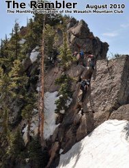
Rambler
Mar - Wasatch Mountain Club
Mar - Wasatch Mountain Club
- No tags were found...

Create successful ePaper yourself
Turn your PDF publications into a flip-book with our unique Google optimized e-Paper software.
This photograph from the early part of the twentieth century shows the Rio Grande Western track above<br />
Lambs Canyon as seen from the upper level, above the great loop. The trestle in the foreground crosses<br />
Parleys Creek, while the Lambs Canyon trestle is in the distance. The buildings, including a water tank, are<br />
at Barclay station, named after James W. Barclay, British member of Parliament who invested and promoted<br />
John W. Young’s initial railroad venture. The old narrow gauge railroad right of way, now the canyon<br />
wagon road, is seen going up the canyon on the left. (Author’s collection.)<br />
The Park City<br />
r a i l r o a d g a v e<br />
continuous service to<br />
travelers until 1946<br />
when the state wanted<br />
to rebuild the highway<br />
to four lanes. There was<br />
not enough room for<br />
highway and railroad in<br />
the lower part of the<br />
canyon, and the rail<br />
traffic had diminished<br />
to the point where the<br />
railroad company was<br />
willing to abandon the<br />
line, so the track from<br />
the cement quarry to<br />
Park City was removed.<br />
T h e P a r l e y s<br />
Canyon Rail Trail can<br />
be accessed by driving<br />
up the service road on<br />
the north side of I-80<br />
about seven-tenths of a<br />
mile beyond the Lambs<br />
Canyon interchange.<br />
Vehicular access to the trail is blocked by large boulders at the roadside. While walking across the big fill across<br />
Parleys Creek, imagine the many timbers that made up the trestle still buried underneath. At the next big fill<br />
going up the grade toward the west another trestle remains buried. This one was not as high as the fill is today.<br />
It was intended to use only a fill here, but there wasn’t sufficient material available, so a lower fill was put in<br />
place and the trestle was built on top.<br />
It was reported that this fill settled<br />
two feet before trains were run and<br />
the trestle had to be jacked up and<br />
supported by additional pieces of<br />
timber. Today the fill has a noticeable<br />
depression, leaving one to wonder if it<br />
did not continue settling, even after<br />
the railroad was abandoned.<br />
With I-80 in plain sight, this first<br />
part of the trail is rather noisy, but<br />
after the second fill, as the trail enters<br />
the great loop through a deep cut, the<br />
background noise suddenly disappears<br />
and silence reigns. Upon leaving the<br />
cut a splendid view of Mountain Dell<br />
and Parleys Canyon appears. What a<br />
wonderful ride this must have been<br />
for travelers during the period of<br />
operation of this railroad. The trail<br />
then winds back and forth over fills<br />
and through cuts until it straightens<br />
out and makes a beeline for the<br />
summit. At about two miles from the<br />
trailhead the roadbed goes through<br />
property of the Beehive-Wasatch<br />
Bowhunters club, but at that point the<br />
best and most interesting part of the<br />
trail has been passed.<br />
A Rio Grande Western work train and crew pause on the trestle across Parleys Creek to<br />
have their picture taken. The wye, where the narrow gauge trains changed direction was<br />
located on the flat area beyond the locomotive’s steam plume. Today Interstate 80 runs<br />
across the picture behind the steam plume, and the trestle is buried inside a massive fill.<br />
(Salt Lake Tribune Archives)<br />
. . . . . . . © Faint Trails by Charles L. Keller . . . . . . .<br />
25