The Rambler
Oct - Wasatch Mountain Club
Oct - Wasatch Mountain Club
- No tags were found...

You also want an ePaper? Increase the reach of your titles
YUMPU automatically turns print PDFs into web optimized ePapers that Google loves.
<strong>The</strong> <strong>Rambler</strong> October, 2011<br />
<strong>The</strong> Monthly Publication of the Wasatch Mountain Club
2<br />
Volume 90, Number 10<br />
<strong>The</strong> Wasatch Mountain Club<br />
1390 S. 1100 E. #103<br />
Salt Lake City, UT 84105-2443<br />
(801) 463-9842<br />
2011-2012 GOVERNING BOARD<br />
President: John Veranth<br />
(278-5826) veranth@xmission.com<br />
Vice-President: Will McCarvill<br />
(942-2921) lizandwill@msn.com<br />
Secretary: Susan Allen<br />
(466-3292) sallen400@gmail.com<br />
Treasurer:<br />
Co-director: Clark Richards (272-5642<br />
cgrichards@aol.com<br />
Co-director: John Butler (718-4166)<br />
john@utahman.com<br />
Membership:<br />
Co-director: Marilyn Smith<br />
(273-0369) marilynasmith@msn.com<br />
Co-director: Karen Perkins<br />
(272-2225) karenp@xmission.com<br />
Historian: Alexis Kelner<br />
(359-5387) kelner@xmission.com<br />
Biking:<br />
Co-director: Marcia Hansen<br />
(486-5724) hansen5200@msn.com<br />
Co-director: Barb Hanson<br />
(485-0132) barbhanson30@hotmail.com<br />
Boating Director: Don Urrizaga<br />
435-884-0147 don_urrizaga@yahoo.com<br />
Conservation Director: Will McCarvill<br />
(942-2921) lizandwill@msn.com<br />
Social:<br />
Co-director: Holley Richards (554-1125)<br />
cgrichards@aol.com<br />
Co-director: Cindy Crass (530-7331)<br />
cjcrass@cnmlaw.com<br />
Hiking:<br />
Co-director: Julie Kilgore<br />
(572-9838) jk@wasatch-environmental.com<br />
Co-director: Alex Rudd<br />
(971-9245) rudd94@gmail.com<br />
Information Technology: Eric Wiseman<br />
(558-3268) wmc@bumpsy.com<br />
Public Relations:<br />
Donnie Benson<br />
(466-5141) dbenson@u2m2.utah.edu<br />
Lodge: Foundation Liaison, Bob Myers<br />
(466-3292) robertmyers47@gmail.com<br />
Caretaker: Todd Nerney<br />
caretakerwmc@yahoo.com<br />
Lodge Use: Earl Cook<br />
(580-6188) ecookut@hotmail.com<br />
Mountaineering:<br />
Co-director: Al Bui (518-250-9808)<br />
albertbui@alum.swarthmore.edu<br />
Co-director: Paul Gettings (599-7311)<br />
p.gettings@utah.edu<br />
<strong>Rambler</strong> Publications:<br />
Editor: Kathy Craig (502-0465)<br />
wasatchmountainclub@gmail.com<br />
Winter Sports Director: Walt Haas<br />
(209-2545) haas@xmission.com<br />
COORDINATORS:<br />
Adopt-a-Highway: Jamie Kulju<br />
(360-606-9405) jrkulju@gmail.com<br />
Boating Equipment: Bret Mathews<br />
(831-5940) bretmaverick999@yahoo.com<br />
Canoeing: Margie Gendler<br />
(712-7890) gendler801@aol.com<br />
Canyoneering: Rick Thompson<br />
gone2moab@hotmail.com<br />
Evening Hikes: Mark Bloomenthal<br />
(842-1242) markbloomenthal@yahoo.com<br />
Mountain Biking: Cheryl Krusko<br />
(474-3759) ckrusko@gmail.com<br />
<strong>Rambler</strong> Graphics:<br />
Suzanne Nakagawa (362-8383)<br />
<strong>Rambler</strong> Mailing: Chris Venizelos<br />
(554-3697)<br />
Sing-a-Long: Fred Tripp<br />
(435-649-4507) fredgtripp@gmail.com<br />
Ski, Backcountry: Mark Borges<br />
(363-4504) mborges@xmission.com<br />
Ski, Touring: Mike Berry<br />
(583-4721) mberryxc@earthlink.net<br />
Snowshoeing: Deirdre Flynn<br />
(466-9310) deirdre.flynn@marriott.com<br />
Trails: Dave Andrenyak<br />
(582-6106) andrenyakda@aim.com<br />
TRUSTEES:<br />
Jerry Hatch 2008-2012<br />
(583-8047) pikahatch@gmail.com<br />
Steve Duncan 2009-2013<br />
(892-0443) duncste@comcast.net<br />
Dave Rumbellow 2010-2014<br />
(889-6016) djr3@xmission.com<br />
Cheryl Soshnik 2011-2015<br />
(435-649-9008) csoshnik@yahoo.com<br />
Trustee Emeritus:<br />
Dale Green (277-6417)<br />
<strong>The</strong> <strong>Rambler</strong> (USPS 053-410) is published<br />
monthly by the Wasatch Mountain Club.<br />
Subscription rates of $12.00 per year<br />
are paid for by membership dues only.<br />
Periodicals Postage Paid at SLC, Utah.<br />
CHANGE OF ADDRESS/Missing<br />
<strong>Rambler</strong>: Please call the WMC office or<br />
send your new address to the Membership<br />
Director. This publication is not<br />
forwarded by the Post Office. Allow 45<br />
days for address changes. Replacement<br />
copies are available, while they last, at the<br />
WMC office during office hours.<br />
POSTMASTER: Send address<br />
changes to: <strong>The</strong> <strong>Rambler</strong>, Membership<br />
Director, 1390 S. 1100 E, #103, Salt<br />
Lake City, UT 84105-2443.<br />
COMMERCIAL ADVERTISING:<br />
<strong>The</strong> <strong>Rambler</strong> encourages and<br />
supports your products and services<br />
through pre-paid commercial<br />
advertisements. Please send an e-mail<br />
to WasatchMountainClub@gmail.<br />
com for information or to place an ad.<br />
Prepayment is necessary for single<br />
month advertisements and invoicing<br />
and net 30 for repeat advertisements.<br />
Full Page: $95/month<br />
Half Page: $50/month<br />
Quarter Page: $30/month<br />
Business Card: $15/month<br />
<strong>The</strong> right is reserved to edit all<br />
contributions and advertisements,<br />
and to reject those that may harm the<br />
sensibilities of WMC members or<br />
defame the WMC.<br />
Copyright 2011 Wasatch Mountain Club
IN THIS ISSUE:<br />
Upcoming General Membership . . 4<br />
Upcoming Adopt-a-Highway . . . . . 4<br />
Upcoming Halloween Party . . . . . . 5<br />
Upcoming Wilderness Navig. Class 6<br />
New Members . . . . . . . . . . . . . . . 10<br />
Faint Trails in the Wasatch . . . . . 26<br />
Release from Liability Form . . . . 45<br />
Activities Listing . . . . . . . . . . . . . 47<br />
Membership Application . . . . . . . 57<br />
Non-WMC Activitiees . . . . . . . . . 59<br />
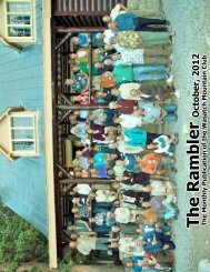
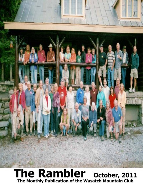
FRONT COVER:<br />
OLD TIMERS/NEWCOMERS<br />
PARTY<br />
August 27, 2011<br />
Photo by Jerry Hatch<br />
WMC Purpose<br />
(Article II of the WMC Constitution)<br />
<strong>The</strong> purpose shall be to promote the physical and spiritual well-being of its members and<br />
others by outdoor activities; to unite the energy, interests and knowledge of students, explorers<br />
and lovers of the mountains, deserts and rivers of Utah; to collect and disseminate information<br />
regarding the Rocky Mountains on behalf of science, literature and art; to explore and picture<br />
the scenic wonders of this and surrounding states; to foster awareness of scenic beauties; and<br />
to encourage preservation of our natural areas including their plant, animal and bird life.<br />
Lodge Service<br />
Days<br />
None scheduled<br />
Check online<br />
activities for updates<br />
Contact Foundation<br />
Liaison, Robert<br />
Myers, to find out<br />
more information<br />
and volunteer<br />
for a service day.<br />
(801) 466-3292 or<br />
(801) 651-9965.<br />
Lunch provided for<br />
volunteers.<br />
3
Adopt-a-Highway Cleanup - Conservation<br />
October 15, 2011 at 9:00 a.m.<br />
6200 South and Wasatch Park and Ride<br />
Please join the Conservation Group and offer a hand in tidying up Wasatch Blvd.<br />
before this season’s trash gets buried for the winter. Consider helping out if you have<br />
been enjoying the canyons this summer and fall. A special appeal to WMC roadies,<br />
come on out and help keep this stretch of road free from tire puncturing, swerve<br />
causing obstacles.<br />
Trash bags and flattering orange vests provided; please bring your own gloves (you<br />
will want them). Cleanup should take just an hour or two and is a surprisingly good<br />
time.<br />
Call Sarah at (214) 264-6295. Thanks!<br />
what<br />
General Membership<br />
Meeting<br />
where<br />
Holladay Library (2150 East<br />
Murray-Holladay Road)<br />
when<br />
Wednesday, November 16th, 7 p.m.<br />
4
WMC's Annual<br />
halloween<br />
P A R T Y<br />
AT THE LODGE!<br />
Club members and friends are invited<br />
to the WMC’s annual Halloween Party<br />
to be held in its "haunted" lodge at<br />
Brighton Ski Resort in Big Cottonwood<br />
Canyon, on Saturday evening,<br />
October 29, 2011.<br />
POTLUCK/BYOB dinner will begin at<br />
6:00 p.m. Rockin’ DJ Rob Snow’s<br />
awesome mix of dance music will<br />
commence at 7:30 p.m. and will<br />
continue as long as feet and wings<br />
are moving.<br />
Best costumes in the categories of<br />
Greenest, Scariest and Sexiest will be<br />
awarded. A $7.00 per person cover<br />
charge will be collected at the door;<br />
children are free. If you wish to stay<br />
overnight at the lodge, there is a<br />
charge of $3.00 per person; children<br />
are free.<br />
For further details and directions,<br />
e-mail or telephone the organizer,<br />
Craig Anderson: canders11238@<br />
yahoo.com or 801-487-2352.<br />
5
Wasatch Mountain Club<br />
Wilderness Navigation Class<br />
near Salt Lake City, Utah<br />
Find your way with GPS, map and compass<br />
Saturday October 8, 2011<br />
Learn to use a GPS, topographic map and compass in a<br />
practical, hands-on course. In this one-day class for<br />
hikers, backpackers, backcountry skiers and similar<br />
wilderness users you will learn by the interactive problemsolving<br />
method using realistic situations in an outdoor<br />
setting at the beautiful, historic Wasatch Mountain Club<br />
lodge at Brighton, Utah. <strong>The</strong> class will teach you how to<br />
use the GPS, map and compass individually or in any<br />
combination. You will learn what each tool can do and its<br />
limitations.<br />
In this class you will learn to:<br />
• find the coordinates of your current position with a<br />
GPS receiver<br />
• find the position on a topographic map of given<br />
UTM coordinates<br />
• use map and compass to find a good route to a<br />
GPS waypoint<br />
• read other useful information from the map<br />
What previous students said about this class:<br />
“<strong>The</strong> biggest light to come on for me is to use all three tools (map, compass & GPS) together”<br />
“<strong>The</strong> time and expense were definitely justified”<br />
“I found the class very useful, and the time very very well spent”<br />
Cost: $75 per student. Each student will receive a textbook, USGS topo map of the Brighton<br />
area and two map tools plus a full day of instruction and practice.<br />
For information see the course outline at http://bit.ly/kOwLI9<br />
Email instructor Walt Haas at haas@xmission.com or call 801-209-2545<br />
Class size is limited to 7 students. Preregistration is required.<br />
6
A n n u a l L a b o r D a y D e s e r e t P e a k H i k e<br />
C h r i s V e n i z e l o s '<br />
Making our way up the main trail<br />
(Chris V., Annette, and Tom)<br />
Final ascent to the peak<br />
(Tom, Chris V, Annette,<br />
Chris D. and Dawn)<br />
Particpants: Annette<br />
McMullin, Erin<br />
McCormack, Sandra<br />
Beherrell, Tom Mitko,<br />
Chris Dalby, Dawn<br />
Dalby, Claus Stoiber,<br />
Sheila Kluck-Stoiber,<br />
Stanley Chiang and<br />
Chris Venizelos<br />
September 5, 2011<br />
At the ridgeline with South and North<br />
Medina in the background<br />
(Tom, Annette and Erin)<br />
Photos by Stanley Chiang<br />
7
kevin earl's garfield basin backpack<br />
August 19-21, 2011<br />
Lake Y-36<br />
8<br />
On August 19, Kevin Earl led our hearty group of 5, including Steve Pritchett, Turtle Ala, Katie Slack<br />
and Carl Kunz, into the high Uintas near Duchesne. We left the Center Park trailhead above Hells<br />
Canyon in the Yellowstone River drainage and hiked a difficult 11 miles through Swasey Hole into<br />
Garfield Basin. Arriving at the cleverly named Lake Y-36 at elevation 10,820’ around 6:00 that<br />
evening, we hastily pitched tents as the skies opened up for a typical late afternoon downpour.<br />
Before the rain had stopped, Steve had already landed four 12” to 14” brook trout, which Steve and<br />
Turtle cooked for dinner and shared with the group.<br />
Turtle and Steve fry up some trout<br />
for fish tacos<br />
After a leisurely breakfast on Saturday, we<br />
set out for a day hike to Tungsten Pass. En<br />
route we passed many lakes; Steve and Kevin<br />
fished at Five Point Lake on the way. <strong>The</strong>re,<br />
the Forest Service had breached the dam,<br />
returning the lake back to its natural level and<br />
leaving a bathtub ring without vegetation.<br />
We also encountered an old cabin on a ridge<br />
along the way where we stopped for a snack<br />
and to enjoy the view. After 5+ miles we<br />
arrived at our destination, Tungsten Lake,<br />
where several fish, including a Grayling,<br />
were again caught and released back to<br />
their habitat. All day Saturday we were<br />
serenaded by a symphony of thunder claps<br />
from increasingly threatening skies. <strong>The</strong> rain<br />
- and hail - finally arrived late afternoon and<br />
continued for hours before we’d returned to<br />
camp. <strong>The</strong> high ridges turned white as the<br />
storms deposited a lot of hail on them. Fortunately, wet seasonal conditions in the mountains this<br />
year allowed us to build a much needed fire that dried our clothes and warmed our bodies. Steve<br />
wasted no time and caught four more brook trout, which Turtle made into tasty fish tacos for the<br />
group.<br />
We broke camp mid-morning Sunday and retraced the 11 miles back to Center Park trailhead. Our<br />
packs were only marginally lighter than they’d been 2 days before, and we all felt the effects of the<br />
arduous up-and-down terrain by the time we arrived back at the trailhead. But we knew that good<br />
Mexican food awaited us in Duchesne, so we wearily packed into our cars and headed out of the<br />
wilderness just as the thunder started. SUBMITTED BY KATIE SLACK
Carl enjoing a respite<br />
on Saturday's hike<br />
Photos by Katie Slack<br />
Steve released<br />
more fish than<br />
he kept<br />
Kevin working on<br />
catch-of-the-day<br />
Steve was prepared<br />
for mosquitoes<br />
Steve, Kevin, Carl and Turtle<br />
Carl worked hard to start a<br />
fire with wet kindling<br />
9
NEW MEMBERS<br />
Mikelle Despain<br />
Joseph Herring<br />
Bryan Vandenheuvel<br />
Dave Sturgeon<br />
Mark Viau<br />
Helen Corena<br />
Jean Pfoutz<br />
WELCOME<br />
Sandrelle Aguirre<br />
Matthew Driscoll<br />
Karen Christoffersen<br />
Carmen Ulibarri<br />
Barbara Cameron<br />
Marguerite Evans<br />
Kerri Taracena<br />
Judy Barnett<br />
Barton Burdette<br />
Miriam Bugden<br />
Jennifer Capson<br />
June Zhu<br />
Alisa Thompson<br />
Susan McDonald<br />
Christen Thompson<br />
Chris Gaudig<br />
William Hobby<br />
Al and Stephanie Black<br />
Sandra Chen and Steven Knight<br />
Jill Calhoun and Chris Ebert<br />
Claus Stoiber and Sheila Kluck-Stoiber<br />
Rick Merschdorf and Derinda Thatcher<br />
10
If you’re a new member . . . depending on your age and<br />
background . . . you might have a few questions:<br />
1. How do I get involved in activities?<br />
2. What kinds of activities can be organized?<br />
3. What is the average age of WMC members?<br />
4. How many people participate in the activities?<br />
5. How aggressive are the various activity groups?<br />
<strong>The</strong> answers . . . ask away! Ask someone in the club! Send an<br />
e-mail to wasatchmountainclub@gmail.com or call someone from the<br />
governing board (inside front cover). <strong>The</strong> average age is...<br />
honestly, we don’t know. Why don’t we know? 1. We haven’t yet<br />
started tracking that information. 2. It doesn’t matter. <strong>The</strong>re are<br />
older folks who can out-hike/-bike/-paddle any younger person.<br />
<strong>The</strong>re are also younger people who like to do light activities.<br />
Sometimes tons of people show up for activities; sometimes only a<br />
couple. This is the nice thing.<br />
<strong>The</strong> WMC activities allow for flexibility; if you can show up, do--if you<br />
can’t, don’t. As for how vigorous and aggressive the various activities<br />
and groups are (hikers, bikers, etc), contact the director or coordinator.<br />
Please don’t feel like you can’t organize an activity if you<br />
don’t know your way around. <strong>The</strong>re are so many people who can<br />
help you, and you can even decide on a destination at the time of<br />
meeting! You might have one or two awkward activities, but just get<br />
together with people who share the same interests as you, and you’ll<br />
be on your way to tons of fun and excitement--things you<br />
never thought were possible!<br />
11
T i m p a n o g o s H i k e<br />
A u g u s t 2 8 , 2 0 1 1<br />
B y M i c h a e l B u d i g<br />
We departed from our Sandy meeting site<br />
shortly after 7:00 a.m. and were hiking on the<br />
Timpanooke Trail an hour later. <strong>The</strong> weather<br />
was ideal and the trail was wet from overnight<br />
thundershowers, keeping the dust down. <strong>The</strong><br />
conditions were about three weeks behind the<br />
normal season due to the late winter, which<br />
meant the flowers were near peak, the trail<br />
was overgrown in places, and some snow piles<br />
obstructed the trail.<br />
Dalphne Turner and Dave<br />
Andrenyak hiking up Timp<br />
In addition to those conditions, we were<br />
delayed considerably trying to figure out<br />
how to deal with one somewhat steeply<br />
angled snowfield over a gully, with a deep undercut due to the stream running underneath. At<br />
this point, Vicky McDaniel chose to turn around and I did not try to talk her into proceeding further<br />
into anything that she was not comfortable with. After Vicky left, the rest of us proceeded to the<br />
Summit under mostly sunny and beautiful weather.<br />
Timpanogos is my favorite Wasatch hike and features everything in terms of vegetation, wildlife,<br />
scenery, plus a good physical challenge. I have been on the trail nearly every year since moving<br />
to Utah, and have probably reached the summit about 27 times, I estimate. And I like to point out<br />
Nancy Dunlap, Dianne<br />
Dedrickson, Michael Budig<br />
and Phyllis Anderson on<br />
top of Timpanogos<br />
how much better the view is<br />
now, especially of Utah Valley<br />
and Provo than it was 30 years<br />
ago when an ugly dark smoke<br />
spewed from Geneva Steel and<br />
polluted the whole valley.<br />
This was the first time on<br />
Timpanogos for Daphne<br />
Turner and the second time<br />
for Vicky McDaniel and Dianne<br />
Dedrickson. Mark Bloomenthal<br />
and Dave Andrenyak have been<br />
on Timpanogos a few times<br />
in recent years, while Phyllis<br />
Anderson has been on the trail<br />
numerous times, although not in<br />
recent years. However, this hike<br />
in August 2011 was a beautiful<br />
glorious day to share a great hike<br />
on a great trail.<br />
12
Dianne, Nancy<br />
and Phyllis on<br />
the descent<br />
Dianne, Nancy and<br />
Phyllis approaching<br />
a snowy obstacle<br />
Dianne, Nancy<br />
and Phyllis<br />
crossing snowfield<br />
over gulch<br />
Photos by Michael Budig<br />
13
ALL SIZES NOW AVAILABLE!<br />
For <strong>The</strong> Latest WMC T-Shirt<br />
$15.00<br />
You Can Sport An Eye-Catching Black Shirt With This Original Design On <strong>The</strong><br />
Back, and <strong>The</strong> Club Name On <strong>The</strong> Front.<br />
(<strong>The</strong> design was created by new club member, Susana Jacobson.)<br />
It may be a Club first that this T-shirt is being made available in a women’s cut as<br />
well as in the standard men’s T-shirt.<br />
THIS IS THE FINAL SHIRT ORDER<br />
ACT TODAY SO YOU WON’T BE LEFT OUT!<br />
Watch for the shirts to be sold at meeting locations for Club activities,<br />
or contact Phyllis Anderson at (801) 733-4806.<br />
14
Chris Biltoft, Richard Jirik<br />
and Karen Chistoffersen<br />
at the Mill D North-Dog<br />
Lake trail<br />
Photo by Dave Andrenyak<br />
Dave Andrenyak's trail maintenance<br />
August 13, 2011<br />
On August 13, 2011, Wasatch Mountain Club and Save Our Canyons volunteers worked<br />
at the Dog Lake/Desolation Lake/Mill D North areas. <strong>The</strong> work involved campsite cleanup<br />
and rehabilitation, trash removal, maintaining water bars and checking dams on the Dog<br />
Lake trail section. Earlier this summer, these areas had accommodated many backcountry<br />
campers because the other areas were wet and snowy. In addition to the work, the<br />
participants enjoyed great weather and the bountiful array of wildflowers. <strong>The</strong> work was<br />
supervised by Forest Service Wilderness Rangers Brett Jeppson and Matt Crandall. <strong>The</strong><br />
volunteers were Alex Schmidt and his friends Ashley and Jasper, Richard Jirik, Karen<br />
Christoffersen, Chris Biltoft and Dave Andrenyak.<br />
Put your passion for the outdoors to work at REI! REI, consistently named as one of<br />
“<strong>The</strong> 100 Best Companies to Work for in America”, offers competitive pay, excellent<br />
benefits, outstanding retirement and profit sharing, professional growth and development<br />
opportunities, and generous employee discounts. Come work in an environment where<br />
RESPECT, INTEGRITY, and BALANCE are just a few of our fundamental values! REI<br />
Sandy is hiring for Customer Service and Sales Specialists for the holidays. Pay starts at<br />
$9.60/hour. We are looking for part-time employees who have open availability during<br />
the daytime and weekends. Please apply online at rei.com/jobs. Only the most qualified<br />
candidates will be contacted. Deadline for applications is October 11th, 2011. REI is<br />
proud to be an Equal Opportunity Employer.<br />
15
Sing-A-Long, Hike<br />
and<br />
Potluck BBQ<br />
in Mill Creek Canyon<br />
August 20,<br />
2011<br />
Hikers just returning from<br />
Bowman Fork are: Laura and Pete<br />
Wakeman, Hal Wallace, Frank<br />
Bernard and Carolyn Williams.<br />
Karin Christofferson not pictured.<br />
Enjoying the food are L to R:<br />
Robert Turner, Bart & LaRae<br />
Bartholoma, Carolyn Williams,<br />
Kerry Kelly, Mark Romine,<br />
Margo Romine and Laura and<br />
Pete Wakeman.<br />
Results of Frank Bernard's<br />
efforts to prepare the open pit<br />
fire with wood he had collected.<br />
Music was provided by, from<br />
L to R: Bart Bartholoma, Bob<br />
Peterson, Frank Bernard and<br />
Laura Wakeman. Pete<br />
Wakeman is looking on.<br />
Photos by Fred Tripp<br />
16
At Lake Solitude. L to R: Sandra,<br />
Steven, Lydia, Judy, Tom, Rob,<br />
Stanley and Erin.<br />
8/21/11<br />
Stanley: We had a wonderful<br />
group and enjoyed the cool<br />
shade in the forest and lots<br />
of wildflowers. Participants<br />
were: Judy Barnett, Lydia<br />
Trettis, Steven Knight,<br />
Sandra Chen, Rob Klimaj,<br />
Tom Silberstorf, Erin<br />
Robinson and Stanley<br />
Chiang (Co-leader).<br />
Along the Lake Solitude trail in the<br />
aspen forest. L to R: Rob, Judy, Erin,<br />
Sandra, Steven and Tom.<br />
Photos by<br />
Stanley Chiang<br />
17
J a m i T ay l o r' s P f e i f f e r h o r n H i k e<br />
Dianne<br />
and Jami<br />
with<br />
Lower Red<br />
Pine Lake<br />
in the<br />
background<br />
Jami explaining<br />
our route up<br />
Gene, Katie, and Jami scrambling<br />
along the knife-edge ridge<br />
August 13, 2011<br />
On our way down after<br />
we all summitted and<br />
had lunch;<br />
Pfeifferhorn in the<br />
background.<br />
Top, L to R: Kelly,<br />
Glen, Stanley,<br />
Dianne and Matt<br />
18<br />
Photos by Stanley Chiang<br />
Bottom, L to R:<br />
Katie, Gene, Jami,<br />
Megan and Paul
Elliott Mott's Great Salt Lake Marina<br />
Bike Ride<br />
Anna and Jaye, L-R,<br />
on the road<br />
Anna, Jaye and<br />
Diane on the road<br />
August 21, 2011<br />
19
20<br />
August 11-20, 2011 Tahoe Rim Backpack<br />
by Michael Budig<br />
<strong>The</strong> Tahoe Rim Trail (TRT) is a 165-mile multi-use trail along the rim of mountains surrounding and<br />
shadowing over Lake Tahoe. Larry Hall and I started hiking at Kingsbury Grade, not far from the<br />
glitter and lights of the South Tahoe Casinos. Unfortunately, we managed to hike nearly a whole mile<br />
before taking our first wrong turn and adding about a mile to what would have been a 13-mile day.<br />
Otherwise, the first day was quite scenic and uneventful, except for the mature rattlesnake that I<br />
nearly stepped on.<br />
We camped that night at the Spooner Summit Picnic Area, where John Veranth met us the next<br />
morning. John and Larry then hiked with me for four days, as had been planned before they had<br />
to head home. Both were in better shape than me and John set a great comfortable and consistent<br />
pace.<br />
During the next few days, we encountered more mountain bikers than hikers, which was fine,<br />
though a bit disconcerting when we encountered one in a designated wilderness area, plus many<br />
others on an odd-numbered day in a section closed to bikers on odd-numbered days. If bikers<br />
want hikers to cooperate and yield the trail as the rules require, they need to follow the rules too.<br />
On day two, we encountered a group of three hikers who were impressed and overenthusiastic<br />
in offers to help when they heard I was planning to hike the whole trail. <strong>The</strong>y acknowledged<br />
that they probably had more food than they needed and offered to share. We said, “No thanks,<br />
we are fine.” <strong>The</strong>y persisted and wanted to know how they could help out as surely, there was<br />
something we needed and they wanted to help however they could. I finally replied, “Well, I<br />
could use a wallet with a big wad of cash.” <strong>The</strong>y laughed nervously and answered, “Oh, we don’t<br />
have that. We just came from the casinos!”<br />
<strong>The</strong> TRT offered beautiful views and a very well graded and maintained trail, much less strenuous<br />
than the John Muir Trail. Also, it is close enough to the civilization of Lake Tahoe communities<br />
to offer cell phone signals much of the time. In fact, in one phone conversation with my best<br />
friend, I was asked, “How does hiking there compared to hiking in Yellowstone?” I answered<br />
that “Phone reception is better and it has more casinos. In contrast, the Yellowstone backcountry<br />
is really wild.”<br />
Halfway through day five, we reached my vehicle and drove into Incline Village for a quick lunch.<br />
Any lingering notions of cannibalism were extinguished as our burgers quickly appeared. After<br />
lunch, Larry and John dropped me off back at the trailhead to resume the trek, while they spotted<br />
my car at the end of the trail and departed for Utah and home.<br />
After camping near Watson Lake that night, I hiked into Tahoe City the next day where I secured a<br />
hotel room and refreshed myself with a shower and some pizza before resuming the trail the next<br />
morning. I hiked about 23 miles that day, accelerating my pace to try to keep my distance from the<br />
hoards of mosquitoes. <strong>The</strong> next day the mosquitoes persisted for several miles, so I kept up my pace<br />
for another 20-mile day and reached Aloha Lake, a true gem in the Desolation Wilderness. I followed<br />
that with yet another 20-mile day, and then determined that I could conclude the hike with a 30-mile<br />
plus day on day 10. I decided to go for it! This involved about 90 minutes of hiking in the dark,<br />
which I had anticipated - and I ended up scraping up my left knee a bit. However, I reached the<br />
trailhead at about 10:30 PM and found my car about an hour later.<br />
I had successfully completed another decent trek and look forward to new challenges in the<br />
future (maybe the Colorado Trail in 2012?).
Larry Hall on Tahoe Rim Trail<br />
John Veranth, Larry Hall<br />
and Michael Budig on TRT<br />
Lake Tahoe<br />
Flowery meadow above Lake Tahoe<br />
21
Michael at Mt. Rose<br />
John and Larry at Mt. Rose<br />
road crossing<br />
Larry on<br />
the trail<br />
Lake Aloha<br />
Wilderness boundary<br />
sign<br />
Photos by Michael Budig<br />
22
Erin McCormick's Greens Basin Evening Hike<br />
Take the Spruces Campground exit<br />
and park in the lot near the trailhead.<br />
<strong>The</strong> campground has two trailheads.<br />
Take the trail on the west side to<br />
Days Fork. As you hike the trail you<br />
will see a cabin as well as a chainlink<br />
fence. Stay to the right of the<br />
fence, where the trail leads into Days<br />
Fork. <strong>The</strong> trail has a steep ledge at<br />
the beginning and you get a good<br />
workout for about 20 minutes. About<br />
half a mile into the hike, you leave the<br />
Days Fork Trail for Greens Basin. <strong>The</strong><br />
trail isn’t posted. Turn left, heading<br />
northeast. If you are the first hiker<br />
Greens Basin<br />
August 31, 2011<br />
Photos by<br />
Alex Rudd<br />
Old cabin/shelter<br />
of the day, it could be difficult finding this<br />
trail in fresh snow. After two switchbacks,<br />
you ascend around a minor ridge and the<br />
trail levels out. <strong>The</strong> trail goes around the<br />
ridge and there’s a great view looking across<br />
Big Cottonwood Canyon into Beartrap Fork.<br />
This view appears about 1.1 miles into the<br />
hike. After checking out the views, you<br />
enter Greens Basin. <strong>The</strong> basin is a hidden<br />
meadow between Days Fork and Silver<br />
Fork. Directions: Drive 8.6 miles up Big<br />
Cottonwood Canyon and take a right at the<br />
Spruces Campground.<br />
23
Stanley Chiang's<br />
Day's fork<br />
to<br />
Ridgeline<br />
hike<br />
Photos by<br />
Stanley Chiang<br />
August 14, 2011<br />
Stanley: It was just four of<br />
us -- Carol Masheter, Elizabeth<br />
Whalen (who is from NJ and is<br />
visiting Utah for a few months),<br />
Jack Earnhart and me. Jack<br />
stayed with us only about an<br />
hour and then turned around as<br />
he had other committments<br />
today. But Carol, Liz and I<br />
made it to the ridgeline high<br />
above Day's Fork, Cardiff Fork<br />
and Silver Fork.<br />
Liz and Carol at the Eclipse Mine<br />
Carol and Liz at the summit of the<br />
Reed and Benson ridge<br />
801-424-2724<br />
24
Jeannie with Silver<br />
Lake in the background<br />
T win Lakes pass from brighton<br />
R a n d y L o n g ' s<br />
Yolanda<br />
and Randy<br />
August 13, 2011<br />
Back row (L-R):<br />
Kathy Craig, Kris<br />
Drummond, Deborah<br />
Byrnes. Front row<br />
(L-R): Jeannie P.,<br />
Yolanda Carrero and<br />
Randy Long.<br />
Kris and Kathy on the<br />
trail to Twin Lakes<br />
25
FAINT TRAILS IN THE WASATCH<br />
57. Madelon Mining Company<br />
<strong>The</strong> Madelon Mining Company briefly held four patented claims on the southwest slopes above Lake<br />
Solitude in Mill F South Fork and extending over the pass toward the Twin Lakes. But its story is really one<br />
about two men: Lemuel U. Colbath and Henry Simons. In 1854 the 22 year old Colbath left his native New York<br />
and traveled west to California where he gained a practical education in mining. He gradually migrated east to<br />
Virginia City, Nevada, where he superintended several mines before continuing his travels to Utah in 1870 and<br />
became superintendent of the Vallejo mine at Alta. He also was associated with R. C. Chambers, assisting in the<br />
development and operation of the Ontario mine in Park City and became involved in Chambers’ business and<br />
personal affairs for the rest of both their lives.<br />
Henry Simons came from Philadelphia where he ran a firm called Wagon and U.S. National Coach Works.<br />
He also dabbled in other businesses, one of them being the Vulcan Oil and Mining Company, of which he was<br />
president. He and that company’s secretary were charged and convicted of personally purchasing property in<br />
West Virginia, then selling it to the company at greatly inflated prices. While the case was held up on appeal,<br />
he turned the wagon company over to his oldest son while he and his wife moved to an estate in New Jersey.<br />
Hardly had they settled there before the estate was seized by the sheriff and sold to satisfy the judgement in the<br />
case. In June of 1870 Simons and his oldest son were still listed as wheelwrights in Philadelphia, but soon<br />
thereafter he headed west with his wife and seven children. <strong>The</strong>re are suggestions that he spent time at the<br />
Wyoming coal mines, but that had to be brief because he was in Salt Lake City in the spring of 1871. It is not<br />
clear why he came to Utah, but for a short time he was the manager of Waterman’s Smelting Works at Stockton.<br />
<strong>The</strong> owner, Isaac S. Waterman, was a Philadelphia resident who had recently purchased the smelter. It is probable<br />
that Simons, while living in Philadelphia, knew Waterman and came west as Waterman’s agent. However, he<br />
established his residence in Salt Lake City, near the corner of First South and Eighth East streets, a location<br />
where he remained for the rest of his life. He also became active on the Wasatch Mountain mining scene, being<br />
a party to two claims during the 1871 year, one in City Creek Canyon, the other at Alta. It was surely at the latter<br />
place where he and Colbath became acquainted.<br />
<strong>The</strong> research into the Madelon Mining Company and its operations uncovered the answer to a long standing<br />
question: Who was “<strong>The</strong> Lady in the Ore Bucket?” During the 1872 year Colbath, as superintendent of the<br />
Vallejo mine, installed an aerial tramway between the mine and the town of Alta. At that time Henry Simons’<br />
three oldest daughters were 24, 23 and 16 years of age and certainly visited the mountain locations with their<br />
father. <strong>The</strong> story about a young woman named S____ , later identified as a Miss Simons, climbing into a tramway<br />
ore bucket and taking a ride up to the Vallejo mine, was surely about one of Henry Simons’ daughters. What is<br />
known is that Lemuel U. Colbath became well<br />
acquainted with the young women and on the fifth<br />
of October, 1873, he and the oldest daughter,<br />
Carrie, who was fifteen years his junior, were<br />
joined in wedlock in the parlor of Henry Simon’s<br />
residence. <strong>The</strong> newspaper report about the young<br />
woman riding in the ore bucket also said she had<br />
scaled on foot the highest peaks of the<br />
Cottonwoods and explored the cavernous recesses<br />
of the deepest mines. How better to be exploring<br />
mines than with the guidance and direction of her<br />
fiancé, an experienced mining man?<br />
Henry Simons’ interests soon shifted to Big<br />
Cottonwood Canyon where he was an incorporator<br />
of a mining company and may have been a partner<br />
with Robert H. Wilson, who ran a merchandising<br />
business at Silver Springs. His oldest son,<br />
Thomas, also was active in Big Cottonwood,<br />
having filed four claims before the end of the 1870<br />
decade and was deputy mining recorder during the<br />
This photograph of Lake Solitude, dating from 1904 or earlier, shows the<br />
waste rock dump from the Colbath tunnel on the slopes, right of center.<br />
(Salt Lake Mining Review)<br />
summer of 1874. In the summer of 1877 Colbath came into Big Cottonwood and gradually gained control of a<br />
number of claims at the head of Mill F South Fork. He caused considerable development work to be done,<br />
including the running of an adit, called the Colbath Tunnel, intended to tap the lodes at depth. In March of 1879<br />
26
he transferred five of the claims to his father-in-law Henry Simons, who left for New York City in an attempt<br />
to sell them or to get funds for further development. It took about two and one-half months, but by then he had<br />
found a group of men who formed the Blue Jacket Consolidated Silver Mining Company and purchased the<br />
claims for $300,000. While Simons was not a member of the new organization, its prospectus describing the<br />
claims included as exhibits three letters written by deputy mineral surveyors describing the excellent prospects<br />
for the claims, all were addressed to him. <strong>The</strong> Salt Lake Tribune printed the comment, “Bro. Simons, who has<br />
been absent from Zion several weeks, has succeeded in placing his Big Cottonwood mines.” But his success did<br />
not bring him home. He remained in the east, presumably to press the new owners to start development. While<br />
the Blue Jacket company’s officers and directors were an impressive group of New York attorneys and financiers,<br />
their intent must not have been the same as Simon’s. <strong>The</strong>y held the claims for only four months before<br />
transferring them to a newly formed Madelon<br />
Consolidated Silver Mining & Milling Company.<br />
Henry Simons was one of the principals of this<br />
company, as was Lemuel U. Colbath.<br />
Five of the Madelon company’s directors<br />
immediately formed a syndicate and took the mining<br />
properties on lease, intending to furnish the<br />
necessary capital and develop the mines to the point<br />
of profitability, when they would be returned to the<br />
parent company. <strong>The</strong> syndicate was called Simons<br />
Improvement Company, the name suggesting who<br />
was behind it. Henry Simons returned to Utah as<br />
superintendent of the mines and pushed development<br />
with great vigor. Steam drills were ordered and<br />
miners were hired to work in the Colbath tunnel even<br />
though the slopes were buried in midwinter snow.<br />
Within a few weeks he had twelve men employed,<br />
and in another month had three shifts of miners at<br />
work. His two youngest sons were employed, one of<br />
them as a shift foreman. In April it was reported<br />
Lake Solitude. <strong>The</strong> Solitude tunnel dump is on the far side of the lake,<br />
at the right side of the photo. <strong>The</strong> dump from the Colbath tunnel can be<br />
seen through the trees on the slope to the left.<br />
there was an abundance of material, including track<br />
iron and other mining supplies, at Alta destined for<br />
the Madelon workings, awaiting the opening of the<br />
trail. Later that month, perhaps to console his<br />
partners who were providing the money, Simons filed eight claims in the vicinity of the Madelon’s properties,<br />
naming them after eight of the men. None of the claims was transferred to the namesakes, nor is there any<br />
evidence that they saw any activity after the initial filing. <strong>The</strong> work on the Madelon’s claims continued<br />
throughout the summer, both in shafts on several claims and in the Colbath tunnel, with drifts to intersect the<br />
shafts, but progress was slow, said to be due to the extreme hardness of the limestone. <strong>The</strong>n news reports<br />
dwindled, probably in proportion to the development funds remaining. After January of 1881 nothing more was<br />
heard about either the Madelon Consolidated Silver Mining & Milling Company or its claims.<br />
Henry Simons seemed to follow the Madelon company into oblivion. Although he maintained his residence<br />
in Salt Lake City for his wife and family, he entered a business life in New York City. He was one of the<br />
principals in the incorporation of the short-lived Gardner & Merrill Mining Company in Little Cottonwood<br />
Mining District in 1883. Although that company included three of the financiers of the Madelon and Simons<br />
Improvement companies, it made a very faint ripple on the surface of the Wasatch mountain mining scene. Henry<br />
Simons remained in New York until his death in 1888, when his body was brought back to Utah to be buried in<br />
Mount Olivet cemetery, now surrounded by members of his family.<br />
<strong>The</strong> Colbath tunnel no longer exists, having long since been closed through the efforts of man or Nature. But<br />
its enormous waste rock dump, a monument to Henry Simon’s efforts, is in plain view of all visitors to Lake<br />
Solitude. <strong>The</strong> tunnel’s former site, at the top of the dump, is located about 500 feet southwest from the portal of<br />
the Solitude tunnel and about 250 feet higher. While there must have been a good trail to the tunnel in 1880, there<br />
is no evidence of it today. On the steep slopes above the dump traces of several of the Madelon company’s shafts<br />
and prospects can be found, also devoid of trails.<br />
. . . . . . . © Faint Trails by Charles L. Keller . . . . . . .<br />
27
Donn Seeley's North Thunder Mountain Summit Hike<br />
Stanley: We had an amazing hike up Bells Canyon and 5 of us summitted<br />
North Thunder Mountain today. Starting at the Bells Canyon Trailhead at 6:30<br />
a.m., we made it to the Bells Cleaver saddle (elevation 10,720) by around 11:30<br />
and then descended about 200 feet into Thunder Bowl. From there we began a<br />
600-foot steep scrambling ascent over boulders and a tight couloir to reach<br />
the Thunder Ridge. After a short scramble we reached the summit of North<br />
Thunder Mountain (elevation 11,150) just after 1:00. Five of us made it to the<br />
summit.<br />
Participants were Donn Seeley, Deborah Askew, Will McCarvill, Steve Glaser,<br />
Stanley Chiang and Tara Reeves.<br />
At the Upper Reservoir, which<br />
was quite low this late in the<br />
season. Note the waterline<br />
from 2 months ago on the<br />
dead trees. L-R: Tara, Donn,<br />
Steve, Deborah and Will.<br />
Stanley and Deborah crossing<br />
the meadow above the upper<br />
reservoir in Bells<br />
A small pond fed by<br />
snowmelt in Thunder Bowl<br />
L-R: Tara, Steve,<br />
Will, Deborah<br />
and Donn<br />
August 20, 2011<br />
28
Going up some unnecessary<br />
but fun Class 4 rock just<br />
below the summit<br />
ridge<br />
Tara with Thunder Bowl and<br />
Lone Peak as a backdrop<br />
Top to bottom: Will, Stanley,<br />
Deborah and Steve<br />
Along the rocky Thunder<br />
Ridge, a few minutes from<br />
our goal (pictured are Steve<br />
and Donn)<br />
At North Thunder Summit<br />
Photos by Stanley<br />
Chiang and Donn<br />
Seeley<br />
L-R: Stanley, Will, Deborah,<br />
Steve and Donn<br />
Descending the boulders<br />
into Thunder Bowl (Steve,<br />
Donn, Deborah and Will)<br />
29
RICK THOMPSON'S ZionS Narrows TRIP<br />
August 26th - 28th, 2011<br />
30<br />
This was my first trip with the Wasatch Mountain Club. My husband and I have been backpacking the last<br />
couple of years after a 20+ year hiatus for my husband. It only took my husband 26 years to convince me to<br />
try backpacking and it has become a passion. I guess better late than never!<br />
Rick Thompson organized, permitted and led this adventure. <strong>The</strong> original group of 12 dwindled to a group<br />
of 6 by Friday when we were to meet in the South Campground at Zions National Park. <strong>The</strong> group consisted<br />
of Rick Thompson, Cindy Crass, Aaron Jones, Jennifer Angell, Al Black (my husband) and myself (Stephanie<br />
Black). <strong>The</strong> plan was to leave camp by 7 a.m. on Saturday, so we were up early packing camp. It had rained<br />
a fair amount Friday night, so we ended up leaving a little later so we could double check at the Visitor’s Center<br />
for weather and river flow conditions before leaving, and to give the dirt road to the trailhead a chance to dry<br />
out some. After the 1 1/2 hour drive to the trailhead, we got started sometime after 10 a.m. It was a warm<br />
sunny day and the first few miles of trail went quickly. Once we hit water things slowed down. <strong>The</strong> water was<br />
opaque due to the red dirt that had been washed in by the rain on Friday night. Walking in the murky water<br />
was humbling and stressful for me. I was definitely hiking at a slower pace than I expected. <strong>The</strong> 12-foot<br />
waterfall before Deep Creek was beautiful and it was certainly not obvious that you can go around it easily.<br />
After the group had several stops waiting for slower members (I was one of them), lunch, water, etc., we<br />
finally made it to the first of our two campsites. We had been assigned Campsites 4 and 6. Four of us stayed<br />
at campsite 4, which was a very nice site that came with 3 “wild” turkeys. I put wild in quotations because<br />
they did not seem at all concerned about our presence. Rick and Cindy headed downriver to campsite 6 after<br />
we made a plan for Sunday. We had a good evening at site 4, which was a very nice site. After setting up<br />
camp and changing into dry clothes we had dinner. Al and I had brought a couple bottles of wine that we<br />
shared with the group, along with some dark chocolate before heading to bed.<br />
After a good night of sleep, we were all up early to pack up camp and get down to site 6 to meet the others at<br />
8 a.m. We had decided the night before to split the group up - the faster members (the guys) would go ahead<br />
at a faster pace and get the car shuttle trip started, while the slower members (the ladies) would take our<br />
time. <strong>The</strong> idea was that hopefully we would get out of the canyon close to the time the guys got back with the<br />
cars, rather than sitting around for 3 hours waiting for them. It turned out to be a brilliant plan! I don’t know<br />
about the guys, but the ladies had a great day. <strong>The</strong> water had cleared overnight making the river navigation<br />
much easier in my opinion, even though the flow was significantly higher due to the confluence of Deep Creek.<br />
We hiked in the water, out of the water, up, over and under various obstacles and did a fair amount of floating<br />
on our packs. We had a beautiful day with warm temperatures and the water was refreshing for the most<br />
part. We took lots of pictures and several breaks, filled our water bottles at Big Spring and had lunch on a nice<br />
sunny beach. It seemed to me that the canyon walls were always changing – the colors, textures, light, and<br />
vegetation - making for a very interesting day. Big Spring was one of my favorite sites on the trip. For me,<br />
day 2 was much more relaxing as I had gained some confidence. After not seeing anyone on the first day, it<br />
was amazing how many people we saw as we headed into Wall Street. Once we hit Orderville Canyon, which<br />
Cindy was able to point out, we knew we were getting close to the end. As the number of people we met<br />
hiking up canyon continued to increase, we knew we were nearing the Riverside Walk - the last mile to the<br />
park shuttle. We got to the shuttle about 5 p.m. and down to the Visitor’s Center in time to hit the bathrooms<br />
(a welcome site) and change shoes before the guys got back with the cars - perfect timing. Jennifer and Aaron<br />
headed back to SLC, while the remaining four of us had dinner in Springdale and talked about the day before<br />
heading back.<br />
For me this was a challenging experience - more so mentally than physically - but well worth it and I feel a real<br />
sense of accomplishment for having done it. I look forward to doing it again someday.<br />
Submitted by Stephanie Black
<strong>The</strong> Stalwart Girls<br />
<strong>The</strong><br />
12'<br />
Waterfalls<br />
Stef, Rick and<br />
Aaron, hiking<br />
by Braille<br />
Aaron in the Narrows<br />
Photos by Al and Stephanie Black<br />
Stef in the Narrows<br />
31
Aaron and Rick - who is<br />
having the most fun?<br />
Jen, getting in deep<br />
Water gushing out of the<br />
wall at Big Spring<br />
<strong>The</strong> view - magnificent,<br />
the hiking - tough<br />
Al and Aaron on Sunday<br />
32
elliott mott's<br />
maybird lakes<br />
hike<br />
Group at the White Pine/Red Pine Turnoff<br />
L-R: Bob, Dennis,<br />
Marcia, Rick, Diane,<br />
Phillip, Jerry, Gina,<br />
Connie and Mark<br />
Photos by Elliott Mott<br />
Group on the Maybird Bridge<br />
L-R: Rick, Marcia,<br />
Mark, Gina, Connie,<br />
Bob, Phillip, Diane,<br />
Jerry and Dennis<br />
September 4, 2011<br />
Group at Lower Maybird Lake enjoying lunch<br />
33
D o n n S e e l e y ' s s i e r r a n e v a d a c a r c a m p<br />
Carol Petrelli heading up<br />
Laurel Mountain<br />
Susan and Bob descending<br />
from Steelhead Lake<br />
in McGee Creek<br />
Don: Geographic summary as<br />
follows:<br />
Sun 8/7: Twin Lakes trailhead to<br />
Mammoth Mountain.<br />
Mon 8/8: Laurel Lakes road to<br />
Laurel Pass and Lake Genevieve.<br />
Tue 8/9: McGee Creek trailhead<br />
to Steelhead Lake.<br />
Wed 8/10: Rock Creek trailhead<br />
to Mono Pass.<br />
Thu 8/11: Rock Creek trailhead to<br />
Morgan Pass/Gem Lakes.<br />
Fri 8/12: North Lake trailhead to<br />
Piute Pass.<br />
Sat 8/13: South Lake trailhead to<br />
Bishop Pass.<br />
Sun 8/14: <strong>The</strong> Wine Barrel and<br />
the Giant Chicken.<br />
Bob Myers and<br />
Susan Allen in<br />
McGee Creek<br />
August 7-14, 2011<br />
34
Susan and Bob<br />
descending into<br />
Rock Creek<br />
from Mono<br />
Pass<br />
Susan and Bob<br />
heading down to Ruby<br />
Susan and Bob<br />
ascending to<br />
Morgan Pass in the<br />
Little Lakes Valley,<br />
with Mt. Gabb on<br />
the skyline<br />
Bob and Susan<br />
in Bishop Pass<br />
Susan and Bob below<br />
the Piute Crags,<br />
in the North Fork of<br />
Bishop Creek<br />
Susan and<br />
Bob check out<br />
columbines<br />
below Mt.<br />
Agassiz in the<br />
South Fork<br />
of Bishop<br />
Creek<br />
35
Elliott Mott's<br />
Farmington Bike Ride<br />
Leslie and Marcia<br />
inside Harmon’s<br />
Photos by Elliott Mott<br />
August 19, 2011<br />
L -R: Rob, Marcia and Deborah<br />
Elliot t Mot t's<br />
City Creek Ride<br />
Anna and Leslie<br />
Heading out of beautiful<br />
City Creek Canyon<br />
Photos by<br />
Elliott Mott<br />
August 17, 2011<br />
36
Foreground to background:<br />
Dianne, Dena, Jerry and Mark<br />
August 27, 2011<br />
Coming down from the<br />
Prince of Wales Mine<br />
Mark<br />
Bloomenthal's<br />
After the hike brunch<br />
"Bust yer buns<br />
for brunch"<br />
hike<br />
Trip organizer WOIB Butz has<br />
a long cool one after the hike<br />
Starting left around the table:<br />
Jerry, Amy, Steve, Rich, Carol,<br />
Dena, Nancy, Mark (steadying<br />
WOIB, who was getting a bit<br />
tipsy) and Pam.<br />
Photos by<br />
Julie Kilgore<br />
37
S t a n l e y C h i a n g ' s D r o m e d a r y P e a k H i k e<br />
Our ascent route involved crossing from Broads Fork into<br />
Mill B South (Lake Blanche side) and traversing south to<br />
the Couloir and then ascending to the Cottonwood Ridge.<br />
<strong>The</strong> final ascent was a somewhat exposed scramble to<br />
the summit. For the descent, we took a more direct route<br />
(less exposed, but quite scrambly and steep) -- north<br />
to the shoulder/ridgeline (where we crossed over from<br />
Broads into Mill B earlier). From there, it was an easier<br />
scramble down the V-ribs to the 3 lakes. Participants:<br />
Austin Sevigny, Rich Fitzgerald, Steve Glaser, Donn<br />
Seeley, Bob Grant, Heidi Krusback, Deborah Askew, and<br />
Gene Thibeault (plus 2 other nonmembers we met on<br />
the Broads Fork Trail about half-way up, who were also<br />
interested in summiting Dromedary).<br />
September 3, 2011<br />
Ridgeline between<br />
Broads Fork and<br />
Mill B South<br />
Austin and Heidi on the ascent<br />
route across the Broads Fork<br />
bowl, with the Twin Peaks in<br />
the background<br />
Somewhat exposed summit cone<br />
scramble (Heidi, Austin and Donn)<br />
Donn and Austin scrambling<br />
up the couloir to reach the<br />
Cottonwood Ridge from the<br />
Lake Blanche side<br />
38
Top to bottom: Stanley, Heidi,<br />
Austin<br />
At the summit, with<br />
Sunrise backdrop<br />
Heading<br />
down the<br />
V-ribs<br />
towards<br />
Lake Lillian<br />
and Lake<br />
Florence<br />
(F-B: Gene,<br />
Steve,<br />
Deborah<br />
and Rich)<br />
Fun on the<br />
summit ridge<br />
-- can you say<br />
'class 4' :-)?<br />
Photos by Stanley Chiang<br />
and Donn Seeley<br />
Colorful and striated rocks in upper<br />
Mill B South as we approach Lake<br />
Lillian<br />
Group with the Sundial<br />
in the background<br />
Our exciting descent route. In the foreground are Deborah<br />
and Gene Askew. <strong>The</strong> "specks" on the cliffs above Deborah<br />
are (top to bottom) Bob, Heidi and Stanley<br />
F to B: Bob, Heidi,<br />
Rich, Steve,<br />
Austin, Donn,<br />
Gene and Deborah<br />
Top to bottom:<br />
Deborah, Austin,<br />
Rich, Gene, Steve,<br />
Bob, Stanley and<br />
Heidi<br />
39
Ju l i e K i l g o r e<br />
H<br />
' s<br />
I K E<br />
Hogum Divide<br />
It takes some boulder hopping<br />
and a bit of scrambling to catch<br />
the ridge (Carol, Julie and Cheryl)<br />
August 21, 2011<br />
<strong>The</strong> views of Hogum Fork and<br />
Thunder Ridge are fantastic<br />
(Mark)<br />
Hogum Divide is the<br />
ridge that runs above<br />
Maybird Lakes, below<br />
the Pfiefferhorn<br />
40
<strong>The</strong>n the real fun starts as<br />
the group works through the<br />
exposed section of the ridge<br />
(Julie, Cheryl, Preston and<br />
Dianne)<br />
Julie: As the organizer, I<br />
want to send a big thank<br />
you out to the whole<br />
group. We had three<br />
seasoned ridge hikers<br />
(Dennis Gorham, Carol<br />
Masheter, and myself)<br />
who kept a solid eye on<br />
the others. <strong>The</strong> group did<br />
a fantastic job of staying<br />
together and helping each<br />
other.<br />
Photos by various members<br />
of the expedition<br />
<strong>The</strong> group<br />
worked<br />
together to<br />
help others<br />
who were<br />
not quite as<br />
comfortable<br />
with the<br />
exposed<br />
sections<br />
(Mark,<br />
Carol,<br />
Dianne<br />
and Hal)<br />
Back at the<br />
Lake, the faster<br />
boulder hoppers<br />
wait for the<br />
others so the<br />
group can<br />
re-convene<br />
(Hal, Preston,<br />
Dianne, Cheryl<br />
and Julie)<br />
41
KEITH JOHNSON'S OL TIMERS TORTOISE HIKE<br />
August 20, 2011<br />
Well, I stretched the truth more than a bit. I’m certain there is a Gold Fork Canyon somewhere in the<br />
West, but not up Big Cottonwood Canyon. <strong>The</strong> idea of a Tortoise Hike was to reach out to folks who<br />
once had been regular hikers, but even though they still love the outdoors, for various reasons they<br />
no longer hike with the Wasatch Mountain Club. <strong>The</strong> people who met me at the Big Cottonwood Park<br />
and Ride didn’t quite fit that description. All had been hiking this season, but were attracted to the<br />
ideas expressed in the hike description (<strong>Rambler</strong> August, 2011). Most felt that the pace of WMC hikes<br />
was too fast for them. One person said she could keep up for half the way but then was winded.<br />
Three hikers said they could hike for miles at a slower pace. Some wanted to be able to stop and<br />
examine nature along the way. Most of the hikers said that there was no guarantee that NTD hikes<br />
wouldn’t take off and leave them in the dust.<br />
When I met the group at the Park & Ride I had a hike in mind, but asked everyone for suggestions.<br />
Norm suggested Silver Fork, and we headed up the canyon. <strong>The</strong>re wasn’t a single parking space at<br />
the Park & Ride Lot, so we started up in separate cars. Upon exiting the Lot, the Biel’s were able to<br />
hook a ride up with Lowell. One of the crowd got separated going up the highway and didn’t arrive<br />
with the rest at Solitude’s lower lot. I asked Norm to lead the others at an even slower pace, while<br />
I tried to locate our lost person. I came back emptied handed and ran to catch my crew that had<br />
headed up Silver Fork. Finally, I caught<br />
everyone in front of the old Swiss style<br />
house. Norm wanted to take the trail, rather<br />
than the old dirt road. We did. <strong>The</strong> pictures<br />
were taken as we broke for lunch a couple<br />
of miles up the side canyon. Instead of gold<br />
nuggets, Margie and Lowell were attempting<br />
to identify the species of a flower. No, Sandra<br />
didn’t want to trade two gold nuggets for<br />
cherries, but was generous with delicious<br />
fruit!<br />
For me, the best part of the hike came as<br />
we proceeded up toward the steeper section<br />
of the trail. Just below that section, we<br />
marched through waist deep flowers that<br />
made up a wild flower meadow the size of a<br />
couple of football fields. <strong>The</strong> trail was just<br />
wide enough to hike. I suspected the trail<br />
had been created by a succession of happy<br />
wanders, and I wished the meadow could<br />
be protected. A trail could be re-routed<br />
Margie and Lowell closely examine<br />
gold nuggets they discover in meadow<br />
around the edge of the meadow and widened. It is most definitely a more picturesque and enjoyable<br />
route, than the old road which was crowded. That meadow was the most beautiful of all those I’ve<br />
walked by along my summer journeys. As some of us had scheduled other afternoon adventures,<br />
we stopped short of going up through the fir forest and on to the top. Hope all made it to their<br />
respective pleasures. Great mid-day hike everybody! Submitted by Keith Johnson<br />
42
L-R: Norm, Margie, Ken<br />
and Lowell<br />
Norm and Ken sit dreaming<br />
of the trips their gold can<br />
buy!<br />
Sandra drives hard<br />
bargain: Two cherries<br />
for one gold nugget<br />
Keith documented the<br />
entire "Gold Rush"<br />
Participants: Ken and Sandra Biel, Norm Probanz, Margie Gendler,<br />
Lowell Wallace, and Mike Gaschle. Organizer/Photographer: Keith<br />
Johnson. Destination: Little known Gold Fork Canyon.<br />
43
<strong>The</strong><br />
FREE<br />
Discover what injured cyclists<br />
wish they would have known<br />
before their accident<br />
Car insurance<br />
coverage you must have now<br />
or you’ll hate yourself later<br />
Common myths and<br />
insurance tactics<br />
Important laws that affect<br />
every cyclist<br />
Book Every<br />
Cyclist Must Read<br />
Two Ways To Get Your Free No-Obligation Book Today!<br />
1. Go to www.utahbicyclelawyers.com<br />
2. Call our 24-hour automated phone line to<br />
request your free book at 800-851-3731<br />
44
Wasatch Mountain Club (WMC)<br />
Applicant Agreement, Acknowledgment of Risk, and Release from Liability<br />
Activity: _____________________________ Organizer: _______________________________ Date: ___________<br />
VOLUNTARY PARTICIPATION: I acknowledge that my participation in all WMC activities is voluntary. No one is<br />
forcing me to participate. I agree to abide by the rules of the WMC.<br />
ASSUMPTION OF RISK: I am aware that WMC activities involve risks, and may result in injury, illness, death, and<br />
damage to or loss of property. <strong>The</strong>se dangers include but are not limited to: the hazards of traveling in remote areas<br />
without medical services or care, the forces of nature, the inherent dangers involved in participation in sports, wilderness<br />
travel, and social activities, and the negligent actions of other persons or agencies. I understand that all activities should<br />
be considered exploratory, with the possibility of unexpected conditions and route variations. <strong>The</strong> WMC is not, nor does<br />
it provide, a professional guide service. In order to partake in the enjoyment and excitement of WMC activities, I am<br />
willing to accept the risk and uncertainty involved as being an integral part of the activity. I acknowledge this risk, and<br />
assume full responsibility for any and all risks of injury, illness, death, or damage to or loss of my property.<br />
PREPARATION: I understand that it is my responsibility to evaluate the difficulties of any WMC activity I participate in,<br />
and decide whether I am prepared by having the experience, skill, knowledge, equipment, and the physical and<br />
emotional stamina to participate safely.<br />
RELEASE OF LIABILITY AND PROMISE NOT TO SUE: I agree that I, my heirs, personal or legal representatives<br />
hereby do release and hold harmless from all liability, and promise not to bring any suit or claim against the WMC, its<br />
activity organizers, directors, agents or representatives for any injury, illness, death or damage and loss of property<br />
resulting from my participation in any WMC activity even if they negligently caused the injury or damage.<br />
LEGAL FEES: Should it become necessary for the WMC, or someone on their behalf, to incur attorney fees and costs<br />
to enforce this agreement, I agree to pay the WMC reasonable costs and fees thereby expended, or for which liability is<br />
incurred.<br />
INSURANCE: I understand that the WMC strongly recommends that I maintain insurance sufficient to cover any injury,<br />
illness or property damage that I may incur while participating in WMC activities. In the event of injury, illness or death<br />
related to any WMC activity, I recognize that I, or my estate, will bear the full cost of my evacuation or recovery, and any<br />
related medical care that I may need. I acknowledge that the WMC carries no insurance whatsoever for any participants<br />
in WMC activities.<br />
My signature below indicates I have read this entire document, understand it completely, understand it affects<br />
my legal rights, and agree to be bound by its terms. I certify I am at least 18 years old.<br />
**ATTENTION** IF YOU ARE NOT A MEMBER OF THE WMC, PLEASE NOTIFY THE TRIP ORGANIZER!<br />
Member<br />
(Y/N) Signature Print Name Phone<br />
Check<br />
Out<br />
____ ____________________ ______________________ _______________ ____<br />
____ ____________________ ______________________ _______________ ____<br />
____ ____________________ ______________________ _______________ ____<br />
____ ____________________ ______________________ _______________ ____<br />
____ ____________________ ______________________ _______________ ____<br />
____ ____________________ ______________________ _______________ ____<br />
____ ____________________ ______________________ _______________ ____<br />
____ ____________________ ______________________ _______________ ____<br />
____ ____________________ ______________________ _______________ ____<br />
____ ____________________ ______________________ _______________ ____<br />
____ ____________________ ______________________ _______________ ____<br />
____ ____________________ ______________________ _______________ ____<br />
____ ____________________ ______________________ _______________ ____<br />
____ ____________________ ______________________ _______________ ____<br />
Revised10/12/2008<br />
Return this form to Wasatch Mountain Club, 1390 South 1110 East, Salt Lake City, UT 84105-2443<br />
Please mark attention to the appropriate activity director, e.g., hike, bike, boat.<br />
45
46<br />
WASATCH MOUNTAIN CLUB ACTIVITIES<br />
Only activities approved by the appropriate WMC director can be listed in <strong>The</strong> <strong>Rambler</strong>. Direct submissions to the<br />
Editor are NOT accepted. To submit your activity to the club, login to the WMC website and click on “Volunteer to<br />
Organize An Activity”. <strong>The</strong> appropriate director will approve and/or edit this event for inclusion in both the web calendar<br />
and <strong>Rambler</strong> submissions. <strong>The</strong> deadline is 6:00 p.m. on the 10th of the month.<br />
Rules and Regulations:<br />
1. Dogs & Children are not allowed on WMC activities, except when specifically stated in the activity description.<br />
2. Car pool rates: Gas plus $0.15/mile, shared by everyone in the vehicle (including driver) on 2WD roads, OR gas plus<br />
$0.25/mile on 4WD roads.<br />
Notice to Non-Members: Most WMC activities are open to prospective members except when specifically stated in<br />
the activity description.<br />
Find out about unofficial activities on our email lists. Activities formed with these lists are for members only. Lists<br />
are to be used only for the scheduling of outdoor activities. Any use of this service for any other purpose, such as<br />
advertising, SPAM, jokes, etc, will result in the loss of privilege. To subscribe: Once logging into the website, click<br />
on “Email Lists” on the left-hand side. <strong>The</strong>n follow the online instructions. (Boaters: E-mail the Boat Director—inside<br />
front cover—for more information.)<br />
Group size limits in wilderness: Some National Forest ranger districts limit the size of gropus hiking in wilderness<br />
areas. For such hikes, the hike listing will indicate the maximum number of participants (not including the organizer).<br />
Please help our organizers on hikes with group size limits by arriving promptly and being understanding if you cannot<br />
be accommodated on the hike because of a limit.<br />
Activity Difficulty Rating<br />
0.1-4.0 > Not Too Difficult (NTD) B > Boulder fields or extensive bushwhacking<br />
Lightly Strenuous<br />
E > Elevation change > 5,000 feet<br />
4.1-8.0 > Moderate (MOD) M > Round trip mileage > 15 miles<br />
Moderate to Very Strenuous<br />
R > Ridgeline hiking or extensive route finding<br />
8.1-11.0 > Most Difficult (MSD) S > Scrambling<br />
Very Strenuous, Difficult<br />
X > Exposure<br />
11.1+ > Extreme (EXT) W > Wilderness area, limit 14<br />
Very Strong, Well-Seasoned Hikers<br />
Be kind. When you<br />
carpool up local<br />
canyons, please give<br />
the driver $1.50 or<br />
$2.00 to help with<br />
gas and the wear and<br />
tear on the vehicle.<br />
Directions to Meeting Places<br />
Mill Creek Canyon Park and Ride Lot: Between 3800 S and 3900 S on Wasatch Blvd (3555 E), between the I-215<br />
freeway and Wasatch Blvd along 3900 S. It is on the northwest corner of the intersection. You can ONLY enter it<br />
from the west-bound lanes of 3900 S. To get to the Mill Creek Canyon Rd from the Park and Ride lot without making<br />
a U-turn, go west (right) on 3900 S, proceed under the freeway, then turn north (right) at the next available street,<br />
which is Birch Dr; proceed north to Upland Dr (across from Skyline High School); go east (right) under the freeway<br />
and across Wasatch Blvd to the Mill Creek Canyon Rd (3800 S).<br />
Skyline High School: 3251 E Upland Drive (3760 S). From the intersection of Wasatch Blvd and the Mill Creek Canyon<br />
Rd (3800 S), go west under the I-215 freeway, then turn north (right) into the entrance opposite Birch Dr (3330 E).<br />
Butler Elementary: 2700 E just south of 7000 S<br />
Big Cottonwood Canyon Park and Ride Lot: At the northeast corner of the Big Cottonwood Canyon Rd and Wasatch<br />
Blvd. at the mouth of Big Cottonwood Canyon.<br />
6200 Park and Ride Lot: 6450 S Wasatch Blvd. Go two lights east and south on 6200 S from the I-215 overpass and<br />
turn east (left) onto Wasatch Blvd; the lot is immediately on your left. Sometimes used as an overflow lot for access<br />
to Big Cottonwood Canyon.<br />
Ft. Union Lot #4: 200 yards west of Big Cottonwood Canyon Park & Ride, near the Porcupine Pub & Grille (which is<br />
located at 3698 Ft. Union Blvd).<br />
Little Cottonwood Canyon Park and Ride Lot: 4323 E Little Cottonwood Canyon Rd. On the north side of the intersection<br />
of Little Cottonwood Canyon Rd and Quarry Rd at the mouth of Little Cottonwood Canyon.<br />
Utah Travel Council Parking Lot: About 120 E 300 N. Go east from the intersection of State St and 300 N and turn<br />
south (right) into the first parking lot.<br />
Parleys Way K-Mart Parking Lot: 2705 Parleys Way. From Parleys Way, turn north into the parking lot; or from Foothill<br />
Drive, turn west on Stringham Ave (2295 S) and then south into the lot.
ACTIVITIES LISTING<br />
See online Calendar for updated and additional events and trips<br />
Date<br />
Oct 1<br />
Sat –<br />
Oct 20<br />
Thu<br />
Oct 1<br />
Sat<br />
Activity<br />
Hike Nepal In <strong>The</strong> Fall<br />
Meet: Registration required<br />
Organizer: Bob Norris 801 943-6039 bobnepal@comcast.net<br />
Join Bob Norris in October for the trip of a lifetime! This multi-sport adventure will introduce you to the most<br />
amazing country on the planet. From the world’s highest peaks to the jungles of the Chitwan game preserve,<br />
you will experience the cultural and geographic diversity that makes Nepal truly unique. For a detailed trip<br />
description, dvd’s of previous trips, or general questions, contact: Bob Norris Bobnepal@comcast.net 801-943-<br />
6039 Trip limit 8 persons<br />
Hike To Houndstooth – msd- – Out & Back<br />
Meet: 8:30 am at Big Cottonwood Canyon Park & Ride<br />
Organizer: Julie Kilgore 801 244-3323 jk@wasatch-environmental.com<br />
This is a short but VERY STEEP hike. <strong>The</strong> hike will somewhat follow the ridge to the base of the Houndstooth,<br />
with a short scramble through the secret sweet spot that leads to the top of the “tooth.” <strong>The</strong>re will be some<br />
bushwhacking, but this is the least miserable route to that familiar granite outcrop between Big and Little Cottonwood<br />
Canyons. Depending on conditions, this hike will be a MOD+ to MSD-<br />
Oct 1<br />
Sat<br />
Oct 1<br />
Sat<br />
Oct 2<br />
Sun<br />
Oct 2<br />
Sun<br />
Oct 4<br />
Tue<br />
Hike Killyon’s Canyon – ntd<br />
Meet: 9:00 am at Sunnyside Park - Sunnyside Avenue (800 South turns into Sunnyside Avenue) and Guardsman<br />
Way (about 1600 East)<br />
Organizer: Chris Venizelos 801-554-3697 cvenize@xmission.com<br />
Chris couldn’t make the last hike when he organized it last time, so he’s scheduling it again. Explore the area<br />
that your donations to the WMC Conservation Fund helped purchase.<br />
Hike - Organizers Choice – mod+<br />
Meet: 8:30 am at 6200 South & Wasatch Park & Ride<br />
Organizer: Shane Bode 801-647-2917 shanejaq@msn.com<br />
Shane will watch the weather and select a good MOD Plus hike for the day.<br />
Fall Hike Up Neffs Canyon – ntd – 3.0 mi Out & Back – Moderate pace<br />
Meet: 9:30 am at 3900 South Wasatch Boulevard Park and Ride<br />
Organizer: Cindy Wolfe 801-943-4808<br />
Temperatures should be cooling down by now to make this a nice fall hike to the overlook.<br />
White Pine Lake Day Hike – mod – 10.0 mi Out & Back – 2670’ ascent<br />
Meet: 9:00 am at Little Cottonwood Canyon Park & Ride<br />
Organizer: Gretchen Siegler 801-661-5635<br />
Enjoy a crisp fall day going to this beautiful lake. If it’s a late fall, there will be plenty of golden aspen to admire.<br />
If the weather looks iffy contact organizer to verify the hike.<br />
Evening Mountain Bike-park City – mod+ – Out & Back – Moderate pace<br />
Meet: Disseminated via the Bike email list<br />
Organizer: Nick Calas 435-714-2375 nickcalas84060@yahoo.com<br />
Check bike list serve email for last moment updates for meeting place and ride description. Rides last at least<br />
2.5 hours and are at a MOD+ pace. Please note time change to meet at 5:30p<br />
47
Oct 5 Road Bike: Wasatch Wednesdays Tba – mod – Moderate pace<br />
Wed Meet: Disseminated via the Bike email list<br />
Organizer: Robert Turner 801-467-1129 r46turner@gmail.com<br />
Let’s keep riding in October if the weather cooperates and there is enough interest. Feel free to supply ride<br />
ideas.<br />
Oct 6 Draper Early Evening Hike - Potato Hill Area – ntd – Moderate pace<br />
Thu Meet: 5:00 pm at Potato Hill Trailhead - go east on Traverse Ridge Road, about 1/2-mile past Mike Weir Drive.<br />
<strong>The</strong> parking area for the trailhead will be on your left.<br />
Organizer: Jack Earnhart 801-572-5946 earnhart.jack@yahoo.com<br />
Jack will start this hike from the recently constructed Potato Hill trailhead.<br />
Oct 6 Movie Night<br />
Thu Meet: 6:00 pm at Sicilia Restaurant (on the corner close to the movie theatre) at 145 E. 300 S.<br />
Organizer: Craig Anderson 801-487-2352 canders11238@yahoo.com<br />
Meet Craig for a light dinner and a movie at the Broadway Cinemas (<strong>The</strong> Film Society). We decide which movie<br />
to see while eating. See you at the movies!<br />
Oct 7 Canyoneering 201 North Wash Redux – mod<br />
Fri – Oct Meet: Registration required<br />
9 Sun<br />
Organizer: Rick Thompson gone2moab@hotmail.com<br />
<strong>The</strong> 201 indication, for those who haven’t figured it out, is a statement that this is a post North Wash trip, not<br />
for first timers. So you’ve done the basic NW and you’re ready for the next step- something a little more technical<br />
and interesting? This is it. <strong>The</strong> planned venue is the Poison Springs canyons of Slidenide and Constrychnine,<br />
some great sliding, and a couple of 150+ ft rappels. <strong>The</strong> usual NW guidelines and gear apply, leaving afternoon<br />
Friday the 7th, home Sunday the 9th. This trip is full, with a wait list.<br />
Oct 7 Backpack: Dark Canyon – mod+ – 37.0 mi Loop – 2600’ ascent – Moderate pace<br />
Fri – Oct Meet: Registration required<br />
9 Sun<br />
Organizer: Michael Berry 801-583-4721 mberryxc@earthlink.net<br />
A 3-day/ 2-night backpack loop in upper Dark Canyon. (One-night car-camping at Glen Canyon after 5-hour<br />
drive the prior evening). This loop hike in the canyons surrounding Dry Mesa- Woodenshoe, Dark, and Peavine<br />
Canyons- measures 37 miles with packs, but with side excursions may be longer. <strong>The</strong> Dark Canyon area is rich in<br />
biological, geological, archaelogical, and historical perspectives and remains in a relatively pristine state. Prior<br />
“leave no trace” backpacking experience and good fitness level a must. WMC members will be given priority to<br />
register up to September 30th (Trip minimum: 3 participants by the 1st- or trip subject to cancellation; Maximum:<br />
6 participants). Non-members may register on the 1st, if space is still available. Registration deadline is<br />
October 3rd.<br />
Oct 7 FriRoad Bike: Frontside Fridays: Tba – mod-<br />
Meet: Disseminated via the Bike email list<br />
Organizer: Robert Turner 801-467-1129 r46turner@gmail.com<br />
Looks like the backside Friday rides are done for the season. So...let’s do Wasatch Front rides if the weather<br />
cooperates and there is enough interest.<br />
48
Oct 8<br />
Sat<br />
Hike: Lookout Peak – mod<br />
Meet: 9:00 am at Parleys Way former Kmart lot - 2703 Parleys Way<br />
Organizer: Deirdre Flynn and Mohamed Abdallah 801-466-9310 deirdre.flynn@marriott.com<br />
We will meet at the former K-Mart parking lot and carpool to the top of Emigration canyon. If the K-Mart parking<br />
lot has been fenced off for construction (it is fine right now), please go down Parley’s to 2300 E and meet at<br />
the Fresh Market. If the weather is bad we may change the hike to something shorter.<br />
Oct 8<br />
Sat<br />
Oct 8<br />
Sat<br />
Oct 9<br />
Sun<br />
Oct 9<br />
Sun<br />
Oct 9<br />
Sun<br />
“quaint” Trails Hike - Mats Basin – ntd<br />
Meet: 9:00 am at Big Cottonwood Canyon Park & Ride<br />
Organizer: Martin McGregor 801-255-0090<br />
Join Martin for another interesting hike to a lesser known area. Depending on how far the group goes, he upper<br />
part of this hike is quite ovegrown.<br />
Day Hike: Wilderness Navigation Class – ntd – 2.0 mi Loop – 1000’ ascent – Slow pace<br />
Meet: Registration required<br />
Organizer: Walter* Haas 801 209-2545 haas@xmission.com<br />
Learn basic navigation skills needed by hikers, backpackers, backcountry skiers and similar wilderness users.<br />
Students will learn to use a GPS, topo map and compass. See the course outline (link below) for a detailed description.<br />
Cost $75, payable in advance to hold your place in class. Limit 7.<br />
Faint Trails Hike - Mines And Mine Trails In Grizzly Gulch – mod – Slow pace<br />
Meet: 8:30 am at Little Cottonwood Canyon Park & Ride<br />
Organizer: Charles & Allene Keller 801-467-3960<br />
Charles and Allene will organize the last Faint Trails hike of the season. This will be a leisurely hike into and<br />
around Grizzly Gulch, featuring the Alta-Brighton horse trail, Prince of Wales pipeline trail, a few obscure trails,<br />
lots of mines and more history than can be packed into one day. Although skiers will be praying for snow,<br />
Charles is hopeful it will hold off a little longer. At that elevation even a little snow will obscure what the group<br />
will want to see.<br />
Millcreek Dog Hike – ntd<br />
Meet: 9:00 am at Skyline High School - 3151 E Upland Dr (3760 S)<br />
Organizer: Tom Silberstorf 801-255-2784<br />
Tom will take a trail as high up Millcreek Canyon as the weather will allow. Dogs ok but not required. Call Tom to<br />
inquire about appropriate equipment for the conditions.<br />
Road Bike: Layton – mod – 58.0 mi<br />
Meet: 9:00 am at Utah Agricultural Building, 300 North Redwood Road (1700 West), Salt Lake City<br />
Organizer: Elliott Mott 801-969-2846 elliott887@msn.com<br />
This 58 mile ride is to Einstein’s in Layton for lunch/brunch/bagels. This ride features mostly easy flat to rolling<br />
terrain, a tiny climb thru Fruit Heights, and a swift decent off the east bench down to Layton. We’ll spin through<br />
Lagoon along the Lagoon Trail if there is interest on the return. Bring lunch money. Riders preferring a shorter<br />
ride have the option of turning around in Farmington for an out-and-back 34 mile ride. Meet Elliott (801-969-<br />
2846) at the Utah Agricultural Building at 300 North Redwood Road (1700 West) at 9:00am.<br />
Oct 11<br />
Tue<br />
Evening Mountain Bike-park City – mod+ – Out & Back – Moderate pace<br />
Meet: Disseminated via the Bike email list<br />
Organizer: Nick Calas 435-714-2375 nickcalas84060@yahoo.com<br />
Check bike list serve email for last moment updates for meeting place and ride description. Rides last at least<br />
2.5 hours and are at a MOD+ pace. Please note start time is 5:30pm<br />
49
Oct 11<br />
Tue<br />
Road Bike: Full Moon Farmington Foray – ntd – 24.0 mi Out & Back – Moderate pace<br />
Meet: 6:15 pm at Center Street Trailhead (approx 1/2 mile west of Redwood Road on Center Street), North Salt<br />
Lake<br />
Organizer: Anna Cordes 801-573-5592 cordesa@q.com<br />
Anticipate cool, crisp weather as we ride the Legacy Parkway trail from North Salt Lake to Farmington where we<br />
will stop at Harmons. Dinner or a snack, gelato, coffee, and witty conversation in the sexy lounge are all possibilities<br />
before returning under a full moon. Come prepared with front and rear bike lights, bike lock, and money<br />
for food. Note: A porta-potty is available at the Center Street trailhead or stop at the Maverick on the NW corner<br />
of Center Street and Redwood Road for personal needs before meeting up with the group.<br />
Oct 12<br />
Wed<br />
Oct 13<br />
Thu<br />
Oct 14<br />
Fri<br />
Oct 15<br />
Sat<br />
Oct 15<br />
Sat<br />
Oct 15<br />
Sat<br />
Road Bike: Wasatch Wednesdays Tba – mod – Moderate pace<br />
Meet: Disseminated via the Bike email list<br />
Organizer: Robert Turner 801-467-1129 r46turner@gmail.com<br />
Let’s keep riding in October if the weather cooperates and there is enough interest. Feel free to supply ride<br />
ideas.<br />
Final Draper Evening Hike - Cherry Canyon – ntd+ – Moderate pace<br />
Meet: 5:00 pm at Orson Smith Trailhead (2000 East, 12550 South)<br />
Organizer: Julie Kilgore 801-244-3323 jk@wasatch-environmental.com<br />
We’ll wrap up the Draper evening hikes with a good workout up a the steep Cherry Canyon trail. Dogs welcome,<br />
but leashes are required.<br />
Road Bike: Frontside Fridays: Tba – mod-<br />
Meet: Disseminated via the Bike email list<br />
Organizer: Robert Turner 801-467-1129 r46turner@gmail.com<br />
Let’s do a Wasatch Front Friday ride if the weather cooperates and there is enough interest.<br />
Slow Pace City Creek Twin Peaks Hike – ntd – 4.0 mi Out & Back – 1000’ ascent – Slow pace<br />
Meet: 10:00 am at Popperton Park, Virginia Street (1400 E) and 11th Avenue (360 N) 11th Avenue and Virginia<br />
Street<br />
Organizer: Randy Long 801-733-9367<br />
Randy will lead his last hike of the season to the City Creek Twin Peaks. He will go via the Bonneville Shoreline<br />
trail from Terrace Hills Drive.<br />
Conservation Adopt-a-hwy – 2.0 mi – 400’ ascent<br />
Meet: 9:00 am at 6200 South & Wasatch Park & Ride<br />
Organizer: Jamie Kulju 360-606-9405 jrkulju@gmail.com<br />
You are cordially invited to join the Conservation Group in tidying up Wasatch Blvd. before the summertime<br />
trash gets buried for the winter. Highway Clean-Up Day is a super fast and easy way to volunteer for our volunteer<br />
organization. It’s also surprisingly fun; weird more people don’t come out. Bagels and juice will be provided<br />
along with trash bags and UDOT issued orange vests with safety reflectors and adjustable velcro closures. Please<br />
bring gloves. Hope to see you out on the boulevard!<br />
Utah County Hike – mod<br />
Meet: 9:00 am at Call for meeting location<br />
Organizer: Andy Beard 801-216-4597<br />
Andy and Judy have been exploring some fun trails in Utah County. <strong>The</strong>y’ll pick a hike that is appropriate for the<br />
late fall conditions.<br />
50
Oct 15<br />
Sat<br />
Oct 16<br />
Sun<br />
Oct 16<br />
Sun<br />
Oct 16<br />
Sun<br />
Oct 16<br />
Sun<br />
Oct 19<br />
Wed<br />
Oct 20<br />
Thu<br />
Organizer’s Choice Day Hike – msd<br />
Meet: Registration required<br />
Organizer: Alex Rudd 801-971-9245 rudd94@gmail.com<br />
This hike will depend on snow conditions (if any) mostly, call or email for details closer to activity date.<br />
Day Hike, West Ridge Olympus North Peak. – msd – Loop – 5000’ ascent – Fast pace<br />
Meet: Registration required<br />
Organizer: Brad Yates 801-278-2423 bnyslc@earthlink.net<br />
We will climb the west ridge of the North Peak of Mount Olympus, traverse to and climb the main summit. <strong>The</strong><br />
route features exposed class 3+ scrambling, this is not a place to learn, I expect the group to move fast and<br />
together.<br />
Road Bike: Murray To Herriman Coffee Ride – ntd+ – 30.0 mi Loop – Moderate pace<br />
Meet: 8:45 am at Winchester Park (south end of parking lot) 1200 West Winchester Street (6400 South)<br />
Organizer: Anna Cordes 801-573-5592 cordesa@q.com<br />
A figure-8, 30-mile loop that has it all: light to moderate road traffic, an eclectic mix of pastoral, mountain, and<br />
lake views and suburban sprawl, the ambiance of a local coffee shop at the 12 mile mark, a quaint main street,<br />
a head wind, a tail wind, a gradual steady climb to the west, a nice steady downhill to the east, and some rolling<br />
hills and dales thrown in for extra fun. Pace will be slow to moderate depending on wind conditions. Please be<br />
ready to ride by 9AM so we can finish by noon.<br />
Hike Germania Pass To Sugarloaf – ntd+ – Out & Back<br />
Meet: 9:00 am at Little Cottonwood Canyon Park & Ride<br />
Organizer: Cal Osburn 801-944-4574<br />
If the weather holds, Cal will take the group past Cecret Lake, to Germania Pass, and possibly summit Sugarloaf.<br />
This hike will be an NTD to MOD-, depending on whether the hike includes the summit.<br />
Day Hike: Thaynes Peak – mod – 6.5 mi – 2900’ ascent<br />
Meet: 9:00 am at Skyline High School - 3151 E Upland Dr (3760 S)<br />
Organizer: Elliott Mott 801-969-2846 elliott887@msn.com<br />
This hike is a counter-clockwise loop in lower Millcreek Canyon. We’ll first hike up to the Salt Lake Overlook and<br />
then trek around to Thaynes Canyon from which we’ll switch-back-up to the summit. Bring lunch for a summit<br />
picnic. Plan on a hike of about 6.5 miles and approximately 2900 feet of climbing. Meet Elliott (801-969-2846) in<br />
the east parking lot of Skyline High at 9:00am.<br />
Road Bike: Wasatch Wednesdays Tba – mod – Moderate pace<br />
Meet: Disseminated via the Bike email list<br />
Organizer: Robert Turner 801-467-1129 r46turner@gmail.com<br />
Let’s keep riding in October if the weather cooperates and there is enough interest. Feel free to supply ride<br />
ideas.<br />
Movie Night<br />
Meet: 6:00 pm at Pier 49 Pizza (next to the movie theater). <strong>The</strong>ater and restaurant are located close to corner<br />
of Simpson Av. (2250 S) and Highland Dr. (1230 E).<br />
Organizer: Craig Anderson 801-487-2352 canders11238@yahoo.com<br />
Join Craig and others for a light meal and a movie at Sugar House Movies 10 on Thursday, September 8th, at<br />
6:00 p.m. We will select a movie while dining. Seeing a movie costs only $2.00 at this theater. See you at the<br />
movies.<br />
51
Oct 21<br />
Fri<br />
Sing-a-long And Potluck At La Rae And Bart Bartholoma’s Home<br />
Meet: 6:30 pm at 5904 S. Tolcate Woods Lane (2930 E) in Holladay - Directions are in the description above<br />
Organizer: La Rae or Bart or Fred Tripp or Frank Bernard 801-277-4093 or 435-649-4507 or cell 301 461-0161<br />
fredgtripp@gmail.com or Frankbernard55@earthlink.net<br />
La Rae and Bart Bartholoma have offered to host our October 21st Sing-A-Long. Plan to join us at 6:30 p.m. and<br />
we’ll begin the evening with a Pot Luck dinner. Please bring something to share (entree, appetizer, salad, side<br />
vegetable or a dessert) with 4 to 6 others. BYOB. Following dinner we’ll have a Sing-A-Long - think folk music,<br />
campfire songs, joke songs, etc. Acoustic instruments are welcome. To reach the Bartholoma home at 5904 S.<br />
Tolcate Woods Lane - take 5800 S (Tolcate Lane) off Holladay Blvd. (Only goes East) Turn right (South) on Tolcate<br />
Woods Lane. When the street ends with a steel fence with horse statues and an eagle statue in the air, YOU ARE<br />
THERE. Plan on a fun evening of socializing, enjoying good food and an opportunity to stretch your vocal chords<br />
(and bring any acoustic musical instrument that you’d like to play.) We’ll wrap it up by 10 PM. For questions or<br />
additional information contact La Rae or Bart at 801-277-4093 or Fred Tripp at 435-649-4507 or email at fredgtripp@gmail.com<br />
or Frank Bernard at Frankbernard55@earthlink.net.<br />
Oct 21<br />
Fri<br />
Oct 22<br />
Sat<br />
Oct 22<br />
Sat<br />
Road Bike: Frontside Fridays: Tba – mod-<br />
Meet: Disseminated via the Bike email list<br />
Organizer: Robert Turner 801-467-1129 r46turner@gmail.com<br />
Let’s do a Wasatch Front Friday ride if the weather cooperates and there is enough interest.<br />
Canyoneering Prep- Rappeling Class – ntd+<br />
Meet: 1:00 pm at Dogwood Picnic area wall, 1 mile up BCC<br />
Organizer: Rick Thompson gone2moab@hotmail.com<br />
Learn to rappel, and open the door to all kinds of new experiences and places. With proper instruction it is safe<br />
and easy- your fears are quickly banished. Whether you have never done it, or did once long ago and are not<br />
sure you remember, this is a great opportunity to learn not only how to do it, but also to be comfortable and<br />
safe on rope. Dogwood is the first picnic area in Big Cottonwood Canyon, just 1 mile up the canyon, on the right.<br />
Park on the highway to avoid a picnic area use fee, walk thru the site, up canyon, and follow a trail 50 yards past<br />
the last table to the climbing wall, and sign in on the Club sheet. A harness, helmet, leather gloves, locking carabiner<br />
and a descending device are needed, I have a few extras for folks who do not have and are unable to beg,<br />
borrow, or steal one, for a 5$ rental/equipment replacement fee, but you need to make those arrangements<br />
with me in advance, as there is a limited number available. If you are renting gear from me, you should try an<br />
be there by 12:45, so we can get you outfitted before the class. This class is held in the afternoon to allow you<br />
to attend the Black Diamond Fall Sale/Parking lot swap meet that morning (800am) to hook up with some good<br />
gear, cheap, in advance. NOTE THAT THIS ACTIVITY HAS BEEN MOVED BACK ONE WEEK, FROM THE ORIGINALLY<br />
SCHEDULED 10/15.<br />
Day Hike Notch Peak – mod<br />
Meet: 6:00 am at Flying J station at 12300 S & I15<br />
Organizer: Jerry Hatch 801-300-6439 or 801-583-8047<br />
<strong>The</strong> Carl Bauer-Wick Miller Memorial Hike to Notch Peak is the WMC’s traditional farewell to the hiking season.<br />
It’s a three hour drive to the House Range west of Delta, but the 3,000 ft. cliff and ancient bristlecone pines are<br />
always phenomenal. Be prepared for cross-country travel with route finding and a bit of scrambling (the Flying J<br />
is located east of I-15 onto Factory Outlet Drive)<br />
52
Oct 22<br />
Sat<br />
Oct 23<br />
Sun<br />
Oct 23<br />
Sun<br />
Oct 23<br />
Sun<br />
Multi Group Hike Up Ferguson Canyon: Ntd To Msd<br />
Meet: 8:30 am at 6200 South & Wasatch Park & Ride<br />
Organizer: Julie Kilgore 801-244-3323 jk@wasatch-environmental.com<br />
Meet Julie at the 6200 South Park and Ride and split into groups. An NTD group can complete the trip at the<br />
Salt Lake Overlook (about one hour up the canyon). A MOD group can go up to the meadow, and if conditions<br />
are good an MSD group can go for the Storm Mountain summit.<br />
Dry Hollow Day Hike (semi-exploratory) – mod+ – 5.9 mi Out & Back – 3380’ ascent – Moderate pace<br />
Meet: 9:00 am at 6200 South & Wasatch Park & Ride<br />
Organizer: Steve Glaser 801-272-4552 sglaserconsulting@yahoo.com<br />
This is a historic trail with some access issues, but Steve has obtained permission for this hike. It starts just<br />
above Wasatch Blvd and makes its way to an overlook above Big Cottonwood. <strong>The</strong> high point is 8500 feet, and<br />
snow conditions will determine whether we reach the overlook.<br />
Millcreek Dog Hike – ntd<br />
Meet: 9:00 am at Skyline High School - 3151 E Upland Dr (3760 S)<br />
Organizer: Tom Silberstorf 801-255-2784<br />
Tom will take a trail as high up Millcreek Canyon as the weather will allow. Dogs ok but not required. Call Tom to<br />
inquire about appropriate equipment for the conditions.<br />
Road Bike: Jordan River Narrows – mod-<br />
Meet: 9:00 am at West Jordan Park, 8110 South 2200 West, West Jordan<br />
Organizer: Elliott Mott 801-969-2846 elliott887@msn.com<br />
This ride showcases the scenic section of the Provo River Trail as it passes through the Jordan River Narrows<br />
at the point of the mountain. Meet Elliott (801-969-2846) at West Jordan Park, 8110 South 2200 West (in the<br />
parking lot located immediately north of the swimming pool on the east side of the road), at 9:00am. Riders<br />
should plan for a 40 mile ride, a tiny bit of climbing past Camp Williams and a rendezvous in Lehi for snacks<br />
before returning.<br />
Oct 26 Road Bike: Wasatch Wednesdays Tba – mod – Moderate pace<br />
Wed Meet: Disseminated via the Bike email list<br />
Organizer: Robert Turner 801-467-1129 r46turner@gmail.com<br />
Let’s keep riding in October if the weather cooperates and there is enough interest. Feel free to supply ride<br />
ideas.<br />
Oct 28 Introduction To Technical Canyoneering – mod-<br />
Fri – Oct Meet: Registration required<br />
30 Sun<br />
Organizer: Rick Thompson gone2moab@hotmail.com<br />
<strong>The</strong> North Wash is a great place to get started and learn some of the basics of canyoneering, with something<br />
for everyone in these wonderful southern utah sandstone slots. We will drive down Friday after work, and do<br />
canyons Saturday and Sunday, returning home Sunday night. If this is your first trip, you need to have taken one<br />
of the club rappeling classes as a prerequisite.(there is another on October 15) NOTE THAT THIS ACTIVITY HAS<br />
BEEN MOVED BACK ONE WEEK FROM WHEN IT WAS ORIGINALLY SCHEDULED.<br />
Oct 28<br />
Fri<br />
Road Bike - Cheryl’s Almost Birthday Ride – ntd+ – 30.0 mi Out & Back – Moderate pace<br />
Meet: 10:00 am at Basin Recreation Center (Newpark) east of the Kimball Junction exit.<br />
Carpool: 9:30 am at Petsmart parking lot (just west of REI) 33rd S. 33rd E.<br />
Organizer: Donna Fisher 435-649-0183 dlfisher@utahbroadband.com<br />
This will be an organizer’s choice ride and depending upon weather conditions, it may become a “front side”<br />
ride. An email update will be forthcoming prior to the ride date.<br />
53
Oct 29<br />
Sat<br />
Show-n-go Mod Hike: Wmc Members Only – mod<br />
Meet: 9:00 am at 6100 South & Wasatch Park & Ride<br />
Organizer: n/a n/a<br />
<strong>The</strong>re’s no telling what Mother Nature will deliver by the end of October. Club Members who would like to get<br />
together for a hike can meet at the 6100 South Park&Ride to pick a destination the fits the condition of the day<br />
and the mood of the group. One member will need to be responsible for filling and turning in the sign-up sheet/<br />
waiver form for each group. <strong>The</strong> form can be found in the <strong>Rambler</strong> or downloaded on the WMC web page.<br />
Oct 29<br />
Sat<br />
Oct 29<br />
Sat<br />
Hike Millcreek Area – ntd<br />
Meet: 9:15 am at Skyline High School - 3151 E Upland Dr (3760 S)<br />
Organizer: Doug Stark 801-277-8538<br />
Doug will pick a trail suitable for late October condition. He’ll make sure the group is back in time to get ready<br />
for the lodge Halloween Party<br />
Halloween Party At <strong>The</strong> Lodge<br />
Meet: 6:00 pm at Wasatch Mountain Club’s Lodge at Brighton Ski Resort in Big Cottonwood Canyon<br />
Carpool: 5:30 pm at Big Cottonwood Canyon Park and Ride. Try to make your own arrangements with others for<br />
car pooling.<br />
Organizer: Craig Anderson 801-487-2352 canders11238@yahoo.com<br />
Club members, friends and family are invited to the WMC’s annual Halloween Party to be held in its haunted<br />
lodge at Brighton Ski Resort in Big Cottonwood Canyon, on Saturday evening, October 29, 2011. POTLUCK/<br />
BYOB dinner will begin at 6:00 PM. Rockin’ DJ Rob Snow’s awesome mix of dance music will commence at 7:30<br />
PM and continue as long as feet are moving. Best costumes in the categories of Greenest, Scariest, Sexiest and<br />
Funniest will be awarded. A $7.00 per person cover charge will be collected at the door; children are free. If you<br />
wish to stay overnight at the lodge, there is a charge of $3.00 per person; children are free. For further details<br />
and directions, e-mail or telephone the organizer Craig Anderson: canders11238@yahoo.com or 801-487-2352<br />
Oct 30<br />
Sun<br />
Road Bike: Great Salt Lake Marina – mod – Loop<br />
Meet: 9:00 am at Weather Bureau, 2200 West North Temple, Salt Lake City<br />
Organizer: Elliott Mott 801-969-2846 elliott887@msn.com<br />
This is a 43 mile ride to the Salt Lake Marina situated on the south end of the Great Salt Lake. This loop course<br />
zips across the airport and features a variety of terrain to include rural farm lands, industrial parks, wetlands<br />
and a tour of the old mining town of Magna. Riders should plan for regrouping stops along the way, a teeny tiny<br />
climb across the north end of the Oquirrh Mountains and a rendezvous at the Great Salt Lake Marina. Meet Elliott<br />
(801-969-2846) by the Weather Bureau located on North Temple west of 2200 West, at 9:00am.<br />
Oct 30<br />
Sun<br />
Oct 30<br />
Sun<br />
Day Hike- Grandeur Peak- Via Millcreek Canyon Church Fork – mod – 3.0 mi Out & Back – 2500’ ascent<br />
Meet: 9:00 am at Skyline High School - 3151 E Upland Dr (3760 S)<br />
Organizer: David Andrenyak 801-582-6106 andrenyakda@aim.com<br />
At the end of October, the weather and conditions are difficult to predict. In many years during mid autumn,<br />
this hike is possible without too much complication. In any season, this is a beautiful hike. If conditions are bad,<br />
I will propose an alternate plan.<br />
Hike Big Cottonwood Canyon Area – ntd<br />
Meet: 9:00 am at 6200 South & Wasatch Park & Ride<br />
Organizer: Tom Mitko 801-277-7588<br />
Tom will select a nice late fall hike, weather permitting.<br />
54
Nov 13<br />
Sun<br />
Nov 18<br />
Fri<br />
Nordic Ski Tour: Upper Reaches Of <strong>The</strong> Uintas – ntd+ – Out & Back – Slow pace<br />
Meet: Registration required<br />
Organizer: Michael Berry 801-583-4721 mberryxc@earthlink.net<br />
Early season cross-country ski tour to/from the Crystal Lake Trailhead area, depending on conditions. If snow<br />
is lacking, this will be a nordic walking workout. <strong>The</strong> plan would be to explore the route into the upper North<br />
Fork of the Provo drainage from Crystal Lake today in anticipation of a mid-season ski marathon loop from the<br />
Winter Closure Parking. Dogs OK.<br />
Sing-a-long And Pot Luck At Joan Hatch’s Home<br />
Meet: 6:30 pm at Joan Hatch’s condo on third floor at 1841 Paschal Circle. Directions are included in the above<br />
description<br />
Organizer: Joan Hatch, Frederick Tripp or Frank Bernard 801-916-6603 or 435-649-4507 or 301-461-0161 joanhatch27@yahoolcom;<br />
fredgtripp@gmail.com or frankbernard55@earthlink.net<br />
Joan Hatch has offered to host our November 18th Sing-A-Long. Plan to join us at 6:30 p.m. and we’ll begin the<br />
evening with a Pot Luck dinner. Please bring something to share (entree, appetizer, salad, side vegetable or a<br />
dessert) with 4 to 6 others. BYOB. Please bring a chair (card table or camp) to ensure adequate seating. Following<br />
dinner we’ll have a Sing-A-Long - think folk music, campfire songs, joke songs, songs from Broadway musicals,<br />
etc. Acoustic instruments are welcome. Joan’s condo is on the 2nd floor above the garage (3rd floor) at<br />
1841 Paschal Circle. Directions: Start on Foothill Drive about midway between E. 1700 South and E 2100 South.<br />
Paschal Circle is on the east side of Foothill Drive just south of Laurelhurst Drive and north of S. 2600 E. Parking<br />
is limited in the Circle but is available on Foothill Drive, Laurelhurst Drive and other nearby streets. Plan on a fun<br />
evening of socializing, enjoying good food and an opportunity to stretch your vocal chords (and bring any acoustic<br />
musical instrument that you’d like to play.) We’ll wrap it up by 10 PM. For questions or additional information<br />
contact Joan Hatch at 801-916-6603 or email at joanhatch27@yahoo.com or Fred Tripp at 435-649-4507 or<br />
301-461-0161 or email at fredgtripp@gmail.com or Frank Bernard at Frankbernard55@earthlink.net<br />
Dec 4<br />
Sun<br />
Nordic Ski Tour: North Of Iron Mine Mountain (uintas) – mod+<br />
Meet: 8:15 am at Parleys Way former Kmart lot - 2703 Parleys Way<br />
Organizer: Michael Berry 801-583-4721<br />
MLH Winter Parking 14 miles east of Kamas. Tour follows Iron Mine Mountain jeep road (north slope) on early<br />
season snowpack. <strong>The</strong> terrain opens up for good views and several options in the high country above 10,000 ft.<br />
Expect extra cold temperatures and little sun. Contact trip organizer if driving from Park City area. Carpools can<br />
be arranged for seperate return times (NTD+ to MOD+). Remember MLH parking fee ($3) and be prepared to<br />
share the cost of transportation. Dogs OK. Lightweight backcountry touring gear with scales, skins, or swix (grip<br />
wax) and 10 E’s. Meet at 8:15 am for a prompt 8:30 am departure.<br />
MARKETPLACE<br />
This space is reserved for those members placing ads for used and recreational gear<br />
or for private and non-commercial and not-for-profit activities. To submit an ad,<br />
e-mail it to wasatchmountainclub@gmail.com by the 10th of each month prior to<br />
publication. Non WMC members $5.00 up to 20 words, $0.20 per additional word.<br />
REMEMBER: <strong>The</strong>re is also a “Gear Swap” area online where you can post what you are looking for,<br />
or place something that you want to sell or get rid of. It seems to be more up-to-date most of the<br />
time, due to the hard copy of the <strong>Rambler</strong> only being produced once a month.<br />
55
<strong>The</strong> Wasatch Mountain Club is a great place to meet new people interested in the outdoor<br />
activities that you enjoy. In addition to the many physical activities, the club also<br />
supports several social outings, picnics, potlucks, trip slideshows, live music, and of<br />
course, parties. Anyone can suggest a social event. <strong>The</strong> social committee would love<br />
to hear your suggestions and accept your participation. If you have a trip talk to present,<br />
just let us know. Below are examples of yearly parties - we hope to see you there.<br />
Dec 18<br />
Sun<br />
Holiday Sing-a-long And Potluck Dinner At Cindy Crass’ Home<br />
Meet: 5:30 pm at 2244 East 11620 South - Directions are in the description above.<br />
Organizer: Cindy Crass, Fred Tripp or Frank Bernard Cindy at 801-530-7331 or Fred Tripp at 435-649-450 fredgtripp@gmail.com<br />
or frankbernard55@earthlink.net<br />
DECEMBER 18 - SUNDAY: SING-A-LONG POT LUCK DINNER, definitely NTD. Come and join the holiday spirit at<br />
a potluck dinner and Christmas Carol Sing-A-Long. We’ll meet at 5:30 PM at Cynthia Crass’ home for appetizers<br />
with pot luck dinner to follow. Turkey and ham have already been offered, so please bring a nice appetizer<br />
or a dinner side dish/salad/dessert to share with four to six others. BYOB. Also, please bring a folding chair or<br />
camp chair to ensure adequate seating. For those who wish to sing Christmas carols we’ll have words and guitar<br />
chords for some popular songs. Acoustic musicians are always welcome to join in - an electric piano is also<br />
available. . DIRECTIONS: Take Wasatch Blvd south and about 12000 south it starts running east and west rather<br />
than north and south. At the bottom of the hill watch for 2220 East - turn right and go north two blocks, turn<br />
right on 11620 South and go to 2244 on the right. Coming south on 1-15 take the 10600 South exit. Go east on<br />
10600 South past 1300 East to 1700 East. Turn right (south) to a traffic light at Wasatch Blvd. Go left on Wasatch<br />
(east) to 2220 East and turn left and go north 2 blocks to 11620 South. Turn right (east) to 2244 which is the<br />
second house on the right. Coming north on I-15 take the 12300 South exit and go right (east) to the traffic light<br />
at Wasatch Blvd. Turn right to 2220 East and turn left (north) and follow directions above. Questions or would<br />
like more information call Cindy Crass at 801-530-7331 or Fred Tripp at 435-645-4507 or email Frank Bernard at<br />
frankbernard55@earthlink.net<br />
<strong>The</strong> Wasatch Mountains are a wonderful playground for climbers. We have some great<br />
ice climbing in the winter, snow climbs on local peaks in the spring and early summer<br />
and lots of rock climbing. <strong>The</strong> club hosts a weekly rock climb at local crags on Thursdays.<br />
We do a number of out of town trips each year to destinations such as the City<br />
of Rocks in Idaho, the Tetons, Indian Creek in Southern Utah, and the San Rafael Swell<br />
area. Climbs are listed in the <strong>Rambler</strong> and on this web site. We also have a climber’s<br />
email list that you can join to get additional climbing information.<br />
56
WASATCH MOUNTAIN CLUB (WMC)<br />
MEMBERSHIP APPLICATION<br />
(Do not use for renewals.)<br />
Please read carefully and completely fill out both sides of the page. Print legibly, please.<br />
I am applying for membership as: ______ Single _____ Couple<br />
Name: Applicant 1: _____________________________________ Birth date: __________________<br />
Name: Applicant 2: _____________________________________ Birth date __________________<br />
Address:<br />
___________________________________________________________________________<br />
City, State, Zip ___________________________________________________________________________<br />
Applicant 1: Main phone: ____________________________ email address: __________________________<br />
Applicant 2: Main phone: ____________________________ email address: __________________________<br />
PRIVACY INFORMATION: <strong>The</strong> WMC defaults to publish name, phone and email on website “Member’s list” area.<br />
This information is only available to active members on the web site. With your permission, we also occasionally release<br />
our address list to WMC-Board approved wilderness and/or conservation organizations for one-time mailings under the<br />
stipulation that they do not continue to use the list or provide it to other. You may opt to (1) have your address published on<br />
the “Members Only” area but not made available to other organizations, (2) have your address published on the “Members<br />
Only” area and provided to Board-approved organizations, or (3) not have your address on the WMC roster nor given to other<br />
organizations.<br />
YOU NEED TO TAKE THE FOLLOWING ACTION: Once you have been notified that your application has been accepted,<br />
log in to the WMC site and select your level of privacy from the menu under Club Preferences. If you do not have computer<br />
access or need help, please contact the Membership Director to make your preferences known.<br />
If you would like a printed copy of the membership roster, you may download a pdf file.<br />
If you are a member and do not have computer access and would like a membership roster, please contact the Membership<br />
Director and that list will be provided to you.<br />
Membership dues:<br />
$40.00 for single membership (Annual dues $35.00 plus $5.00 paper application fee)<br />
$55.00 for couple membership (Annual dues $50.00 plus $5.00 paper application fee)<br />
$25.00 for student membership (Annual dues $20.00 plus $5.00 paper application fee)<br />
Student members must be full-time student, age 30 and under.<br />
Enclosed is $____________ for application fee and first year’s dues. Check or money order only. Please make checks<br />
payable to Wasatch Mountain Club.<br />
57
WASATCH MOUNTAIN CLUB (WMC)<br />
Applicant Agreement, Acknowledgement of Risk and Release from Liability<br />
VOLUNTARY PARTICIPATION: I acknowledge that my participation in all WMC activities is voluntary. No one is forcing<br />
me to participate. I agree to abide by the rules of the WMC.<br />
ASSUMPTION OF RISK: I am aware that WMC activities involve risks, and may result in injury, illness, death, and<br />
damage to or loss of property. <strong>The</strong>se dangers include but are not limited to: the hazards of traveling in remote areas without<br />
medical services or care, the forces of nature, the inherent dangers involved in participation in sports, wilderness travel, and<br />
social activities, and the negligent actions of other persons or agencies. I understand that all activities should be considered<br />
exploratory, with the possibility of unexpected conditions and route variations. <strong>The</strong> WMC is not, nor does it provide, a<br />
professional guide service. In order to partake in the enjoyment and excitement of WMC activities, I am willing to accept the<br />
risk and uncertainty involved as being an integral part of the activity. I acknowledge this risk, and assume full responsibility<br />
for any and all risks of injury, illness, death, or damage to or loss of my property.<br />
PREPARATION: I understand that it is my responsibility to evaluate the difficulties of any WMC activity I participate in, and<br />
decide whether I am prepared by having the experience, skill, knowledge, equipment, and the physical and emotional stamina<br />
to participate safely.<br />
RELEASE OF LIABILITY AND PROMISE NOT TO SUE: I agree that I, my heirs, personal or legal representatives hereby<br />
do release and hold harmless from all liability, and promise not to bring any suit or claim against the WMC, its activity<br />
organizers, directors, agents or representatives for any injury, illness, death or damage and loss of property resulting from my<br />
participation in any WMC activity even if they negligently caused the injury or damage.<br />
LEGAL FEES: Should it become necessary for the WMC, or someone on their behalf, to incur attorney fees and costs to<br />
enforce this agreement, I agree to pay the WMC reasonable costs and fees thereby expended, or for which liability is incurred.<br />
INSURANCE: I understand that the WMC strongly recommends that I maintain insurance sufficient to cover any injury,<br />
illness or property damage that I may incur while participating in WMC activities. In the event of injury, illness or death<br />
related to any WMC activity, I recognize that I, or my estate, will bear the full cost of my evacuation or recovery, and any<br />
related medical care that I may need. I acknowledge that the WMC carries no insurance whatsoever for any participants in<br />
WMC activities.<br />
My signature below indicates I have read this entire document, understand it completely, understand it affects my legal rights,<br />
and agree to be bound by its terms. I certify I am at least 18 years old.<br />
Signature 1____________________________________ Print Name 1____________________________Date: __________<br />
Signature 2____________________________________ Print Name 2____________________________Date: __________<br />
Mail completed application to:<br />
Membership Director<br />
Wasatch Mountain Club<br />
1390 South 1100 East #103<br />
Salt Lake City, UT 84105-2443<br />
58
REI COMMUNITY CALENDAR ANNOUNCEMENTS<br />
CONTACT: Celeste Eppler, EMAIL: ceppler@rei.com, (801) 486-2100, ext. 207<br />
SANDY CITY - 10600 SOUTH & 230 WEST<br />
Climbing Basics for Women, Tuesday, October 4th, 7pm<br />
Momentum Climbing Gym introductory class on the basics of rock climbing. Gain an understanding of the<br />
different types of climbing, the necessary gear and how to get started. Registration is strongly recommended!<br />
Climbing Basics, Thursday, October 6th , 7pm<br />
Momentum Climbing Gym introductory class on the basics of rock climbing. Gain an understanding of the<br />
different types of climbing, the necessary gear and how to get started. Registration is strongly recommended!<br />
Backcountry Essentials: Staying safe in the Wasatch, Thurs October 13th, 7pm<br />
Brandon Dodge, Salt Lake County Search and Rescue Asst Team Leader, will share his experiences and help<br />
you learn what you'll need to have a successful venture. Registration is strongly recommended!<br />
Ski and Snowboard Wax & Tune Basics, Thursday, October 20th, 7pm<br />
Wax on! Learning to wax your skis or board will help you increase your fun on the slopes. This presentation<br />
will focus on the basics of waxing, including base preparation, structure, major and minor repair, and stone<br />
grinding. Our expert technician will also go into an in-depth examination of how and why waxes work.<br />
SALT LAKE - 3285 EAST & 3300 SOUTH<br />
MAP & COMPASS BASICS, Tuesday, October 4th, 7pm<br />
This class is aimed at the newcomer to map and compass. We will cover the basics such as understanding map<br />
symbols, orienting the map and compass, triangulation, declination adjustment, and reading terrain features.<br />
Participants are encouraged to bring their own compasses. No experience necessary!<br />
BIKE MAINTENANCE BASICS, Thursday, October 6th, 7pm<br />
If you ride a bike, you need this class! In this informative presentation you'll learn how to lube a chain, fix a flat<br />
tire in record time, and make other minor adjustments to your bike. No experience necessary!<br />
PHOTOGRAPHING THE ROUTE TO SEVEN NATIONAL PARKS; US 89, Tuesday, October 11th 7pm<br />
Join Ann Torrence, photographer and instructor with the U’s Life Long Learning to see photos, hear stories, and<br />
get photography tips before you start your next adventure. US 89 extends 1,600 miles from Canada to Mexico<br />
and links seven National Parks. Ann spent 3 years documenting the parks and the small towns along the way.<br />
PARADE OF RAPTORS, Thursday, October 13th, 7pm at REI Salt Lake City<br />
Volunteers from HawkWatch International will show some impressive birds of prey and talk about their natural<br />
history, personal stories, and conservation efforts in our own community. Appropriate for all ages.<br />
CLIMBING MOUNT ELBRUS IN RUSSIA, Tuesday, October 18th, 7pm<br />
Mt. Elbrus (18,510 ft), a volcano in the Russian Caucasus, is the highest peak in Europe. Elbrus attracts relative<br />
beginners to mountaineering, as well as more experienced Seven Summiters. Carol Masheter found climbing<br />
Elbrus from the relatively pristine, remote north a more traditional mountaineering experience. Climbers carry<br />
their own gear without the help of ski lifts and snow cats often used on the route from the south.<br />
COMFORT 101, Wednesday, October 19th, 7pm<br />
We’ll take you through the diverse Utah climate and show you how to properly layer to stay warm and dry. Join<br />
Shane Waterbury from the REI clothing department as he covers new fabrics, old standbys, things you may<br />
have in your closet and a new way to use them.<br />
59
WASATCH MOUNTAIN CLUB<br />
1390 SOUTH 1100 EAST<br />
SALT LAKE CITY, UT 84105<br />
PERIODICALS<br />
POSTAGE PAID<br />
SALT LAKE CITY,<br />
UTAH<br />
Gail Picha and Anne Polinsky's<br />
Evening Hike to Salt Lake Overlook, Milcreek Canyon<br />
August 30, 2011<br />
Photo by<br />
Alex Rudd<br />
L-R: Donn Seeley,<br />
Austin Sevigny and<br />
Knick Knickerbocker<br />
Visit us online at www.wasatchmountainclub.org<br />
60