Rambler
Nov - Wasatch Mountain Club
Nov - Wasatch Mountain Club
- No tags were found...

Create successful ePaper yourself
Turn your PDF publications into a flip-book with our unique Google optimized e-Paper software.
The <strong>Rambler</strong> Nov 2008<br />
The Monthly Publication of the Wasatch Mountain Club
Volume 87, Number 11<br />
The Wasatch Mountain Club<br />
1390 S. 1100 E. #103<br />
Salt Lake City, UT 84105-2443<br />
(801) 463-9842<br />
2008-2009 GOVERNING BOARD<br />
President: Heidi Schubert<br />
(792-7765) Heidi@biochem.utah.edu<br />
Vice-President: Kyle Williams<br />
(652-8110) 1959.kyle@gmail.com<br />
Secretary: Patti O’Keefe<br />
(424-9215) msok@earthlink.net<br />
Treasurer: Trisha Lee<br />
(274-7643) trisha2king@mac.com<br />
Membership:<br />
Co-director: Marilyn Smith<br />
(273-0369) marilynasmith@msn.com<br />
Co-director: Bob Grant<br />
(273-0369) cincoymaya@msn.com<br />
Biking: Leslie Masters & Bob Martin<br />
(424-2079) mountainandem@juno.com<br />
Boating: Donna Kramer<br />
(272-0418) dontkramer@yahoo.com<br />
Conservation:<br />
Co-director: John Veranth<br />
(278-5826) john.veranth@m.cc.utah.edu<br />
Co-director: Kyle Williams<br />
(652-8110) 1959.kyle@gmail.com<br />
Co-director: Will McCarvill<br />
(942-2921) lizandwill@msn.com<br />
Social Director: Gary Hermanson<br />
(775)901-3008<br />
desotochiropractic@yahoo.com<br />
Hiking:<br />
Co-director: Steve Duncan<br />
(474-0031) duncste@comcast.net<br />
Co-director:<br />
Lodge Use: Dave & Susan Rabiger<br />
(964-8190) drabiger@utah.gov<br />
srabiger@comcast.net<br />
Mountaineering:<br />
Co-director: Peter Campbell<br />
(733-0313) wmc-alpinist@hotmail.com<br />
Co-director: Clark Richards<br />
(272-5642) cgrichards@aol.com<br />
Publications/E-mail:<br />
Editor: Sonya Lloyd (448-3480)<br />
wasatchmountainclub@gmail.com<br />
Winter Sports: Walt Haas<br />
(534-1262) has@xmission.com<br />
COORDINATORS:<br />
Adopt-a-Highway: Kyle Williams<br />
(652-8110) 1959.kyle@gmail.com<br />
Boating Equipment: Bret Mathews<br />
(273-0315) bretmaverick999@yahoo.com<br />
Canoeing: Margie Gendler<br />
(712-7890) gendler801@aol.com<br />
Canyoneering: Rick Thompson<br />
gone2moab@hotmail.com<br />
Historian: Mike Treshow (582-0803)<br />
<strong>Rambler</strong> Mailing: Chris Venizelos<br />
(554-3697)<br />
Trails: Chris Biltof biltoftc@yahoo.com<br />
Ski, Backcountry: Anne Perry<br />
(860-8060) perryal15@gmail.com<br />
Ski, Touring: Mike Berry<br />
(583-4721) mberryxc@earthlink.net<br />
Snowshoeing: Richard Cherian<br />
(553-7221) richerian@gmail.com<br />
Webmaster: Hardy Sherwood<br />
hs3333@gmail.com<br />
Trustee Emeritus:<br />
Dale Green (277-6417)<br />
The <strong>Rambler</strong> (USPS 053-410) is published<br />
monthly by the Wasatch Mountain Club.<br />
Subscription rates of $12.00 per year are paid<br />
for by membership dues only. Periodicals<br />
Postage Paid at Salt Lake City, Utah.<br />
CHANGE OF ADDRESS/Missing<br />
<strong>Rambler</strong>: Please call the WMC office or<br />
send your new address to the Membership<br />
Director. This publication is not<br />
forwarded by the Post Office. Allow 45<br />
days for address changes. Replacement<br />
copies are available, while they last, at the<br />
WMC office during office hours.<br />
POSTMASTER: Send address<br />
changes to: The <strong>Rambler</strong>, Member-ship<br />
Director, 1390 S. 1100 E, #103, Salt<br />
Lake City, UT 84105-2443.<br />
COMMERCIAL ADVERTISING:<br />
The <strong>Rambler</strong> encourages and<br />
supports your products and services<br />
through pre-paid commercial<br />
advertisements. Please send an e-mail<br />
to WasatchMountainClub@gmail.<br />
com for information or to place an ad.<br />
Prepayment is necessary for single<br />
month advertisements and invoicing<br />
and net 30 for repeat advertisements.<br />
Full Page: $95/month<br />
Half Page: $50/month<br />
Quarter Page: $30/month<br />
Business Card: $15/month<br />
The right is reserved to edit all<br />
contributions and advertisements,<br />
and to reject those that may harm the<br />
sensibilities of WMC members or<br />
defame the WMC.<br />
Copyright 2008 Wasatch Mountain Club<br />
2<br />
Information: Dave Rumbellow<br />
(581-9650) djr3@xmission.com<br />
Lodge:<br />
Director: Bob Myers<br />
(485-9209) robert@icon-remodeling.com<br />
Caretaker: Todd Nerney<br />
caretakerwmc@yahoo.com<br />
TRUSTEES:<br />
Linda Kosky 2005-2009<br />
(943-1871) lindakosky@msn.com<br />
Jerry Hatch 2008-2012<br />
(583-8047) robhat@burgoyne.com<br />
Donn Seeley 2006-2010<br />
(706-0815) donn@xmission.com<br />
Cheryl Soshnik 2007-2011<br />
(435-649-9008) csoshnik@yahoo.com<br />
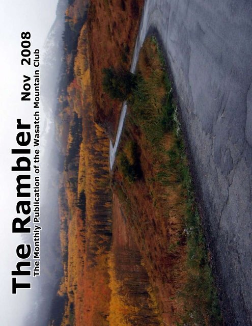
Cover Photo:<br />
Guardsman Pass<br />
Photo by Cheryl Soshnik<br />
Visit us at our website: www.wasatchmountainclub.org
In This Issue:<br />
President’s Message........................................3<br />
Trip: Southern UT Bike Tour............................4<br />
Lodge...............................................................6<br />
Board Position Descriptions............................7<br />
Organizers Party Report ................................8<br />
Lodge Work Party Report ..............................10<br />
Teasers ..............................................................11<br />
Faint Trails: Samson Mine...............................12<br />
Trip: Yellowstone Backpack..........................14<br />
Hiking Table......................................................18<br />
Winter Trips Ratings ....................................22<br />
Activities Listing...........................................26<br />
Uintas Pictures................................................34<br />
Membership Enrollment...............................37<br />
Non-WMC Activities.....................................39<br />
Do We Have As Much Sense As A Goose?<br />
By Akbar Khan, Toronto in September 2003<br />
A flock of geese flying in a formation ‘V’<br />
Much research reveals what you do not see<br />
Each bird in front by flapping its wing<br />
Creates an uplift for the goose following<br />
Flying in ‘V’ formation they change<br />
By 71% plus their flying range<br />
Common direction and a sense of<br />
community<br />
Our efforts become quick and easy<br />
Required Tax Forms on page 25.<br />
Chimney Rock in<br />
Kodachrome Basin<br />
State Park<br />
Photo by Robert<br />
Turner<br />
From the President<br />
by Heidi Schubert<br />
The geese in the back honk from behind<br />
Encouraging, gentle and kind<br />
We must encourage others as they strive<br />
To meet the daily grind of life<br />
If a goose gets sick and or wounded<br />
If for some reason it gets grounded<br />
Two geese fall out of formation<br />
They keep it company and for protection<br />
Stay with it until it flies or dies<br />
Such are the depths of their ties<br />
If a goose falls out of formation by chance<br />
It feels greater drag and resistance<br />
If we have as much sense as a goose we’ll stay<br />
In formation with those headed our way<br />
When tired the lead goose rotates to the rear<br />
Another taking its place in the air<br />
If we humans have the sense of a goose<br />
Their way of life is what we’d choose<br />
Please volunteer to lead an activity or become a board<br />
director (see page 7).<br />
If you don’t – who will?<br />
Heidi Schubert, WMC President<br />
It pays, while doing hard jobs, to take turns<br />
Thus no one is over burdened or get burns<br />
WMC Purpose<br />
(Article II of the WMC Constitution)<br />
The purpose shall be to promote the physical and spiritual well being of its members and<br />
others by outdoor activities; to unite the energy, interests, and knowledge of students, explorers,<br />
and lovers of the mountains, deserts, and rivers of Utah; to collect and disseminate information<br />
regarding the Rocky Mountains in behalf of science, literature, and art; to explore and picture the<br />
scenic wonders of this and surrounding states; and to foster awareness of<br />
our natural areas including their plant, animal, and bird life.<br />
3
Southern Utah Self-Supported Bicycle Tour - Sept. 6-13, 2008<br />
by Cheryl Soshnik<br />
With the cost of gasoline these days, and with the push to environmentally “go green”, bicycling and bicyle<br />
touring is becoming more and more popular. I guess the movement is finally catching up with me, as I have<br />
been going on self-supported bicycle tours since the early 1970’s! I have toured in the USA, Canada, France,<br />
Ireland, Italy, New Zealand, and this upcoming winter I will be spending 6 weeks biking and tramping in<br />
Tasmania!<br />
With bike touring increasing in popularity, I organized a week-long bike tour through Southern Utah this fall.<br />
I opened it to members of both the Wasatch Mountain Club and the Bonneville Cycling Club and received an<br />
overwhelming response from both veteran world tourers as well as first participants.<br />
Our circular route began and ended in Torrey, UT, near Capitol Reef NP. We biked close to 300 miles, touring<br />
through Fish Lake, Otter Creek SP, Bryce Canyon NP, Kodachrome Basin SP, Escalante Petrified Forest SP, Calf<br />
Creek Recreation Area, the Burr Trail, and finally up and over Boulder Mountain to get back to our cars in<br />
Torrey.<br />
We had a fantastic time, and I am so very proud of the WMC members who made the journey with me: Carrie<br />
Clark, Chris Winter, Tom Walsh, Barb Hanson, Mark McKenzie (newbie to touring but methinks he’s hooked),<br />
Janice Tolhurst, Robert Turner, and Zig Sondelski.<br />
If anyone is interested in bicycle touring, please let me know...we have formed a loose-knit organization called<br />
the Utah Bicycle Touring Society, made up of anyone in Utah interested in bike touring, and we can get you<br />
started. For the last two years, we have done weekend self-supported rides to Jordanelle State Park, and these<br />
are great “break-in” rides for those new to bike touring. In 2009, we hope to organize several weekend and<br />
week-long bike tours. Come join in the fun!<br />
Setting up our final camp along the Burr Trail<br />
~Photo by Robert Turner<br />
4
Southern<br />
Utah<br />
Self-<br />
Supported<br />
Bicycle<br />
Tour<br />
Sept.<br />
6th-13th<br />
Bottom Left: Chris Winter arriving at<br />
Kodachrom Basin SP after a beautiful downhill<br />
run from Bryce Canyon NP<br />
~Photo by Cheryl Soshnik<br />
Bottom Right: Mark McKenzie showing off<br />
his brand new touring bike and panniers. This<br />
was his first self-supported tour and he did a<br />
fantastic job.<br />
~Photo by Chris Winter<br />
Top: Barb Hanson & Tom Walsh filling water<br />
bottles at Johnson Valley Reservoir, almost to<br />
the end of a very difficult first day.<br />
~Photo by Cheryl Soshnik<br />
5
The WMC lodge is tucked away in a grove of<br />
evergreens at the top of Big Cottonwood Canyon.<br />
It is used for a variety of WMC social functions but<br />
can also be rented out for personal use on a full- or<br />
half-day basis. Renovation to the lodge included the<br />
installation of flushing toilets and a shower. Running<br />
water! The two dormitory-style rooms on the second<br />
floor provide sleeping accommodations for about 20<br />
people. Go to www.wasatchmountainclub.org/lodge/<br />
Lodge_pictures.htm to view pictures of the infamous<br />
lodge. The kitchen contains a stove and refrigerator,<br />
but—you guessed it—it is not stocked with food,<br />
utensils or other culinary items. All users of the<br />
lodge are expected to clean up the lodge after use.<br />
Contact Dave & Susan Rabiger at (801) 964-8190 for<br />
reservations.<br />
The Lodge needs constant tender loving care, and<br />
WMC members have come to the rescue since 1929.<br />
Come donate your carpentry skills or just help clean.<br />
Call Bob Myers at (801) 485-9209 or send an e-mail<br />
to caretakerwmc@yahoo.com to volunteer. Ask for<br />
a list of very specific items that need your attention<br />
and the hand tools and equipment needed to get the<br />
job done. You need not be a member to volunteer.<br />
(Warning: Associating with WMC members and<br />
participating in WMC activities can become addicting.<br />
Improved health, positive attitudes, and long-lasting friendships are also<br />
possible side effects.) We look forward to seeing you at the<br />
Lodge!<br />
Please give back and keep your eyes open for<br />
upcoming WMC Service Days. The most up-to-date<br />
activities are posted on the website (see inside front<br />
cover).<br />
Club members can earn up to a $50 voucher by<br />
participating in lodge service projects!<br />
Please give back and come help the lodge on the<br />
following WMC Service Days. Seeing how there is<br />
still a lot of snow in the mountains, at least one of<br />
these dates will be filled with shoveling snow off the<br />
lodge roof and its surrounding area. Other minor<br />
interior and exterior repairs may also occur. If you<br />
are physically unable to help out, feel free to bring<br />
drinks or treats up to the laborers! Thanks so much in<br />
advance for your help!<br />
The WMC Lodge<br />
Single sturdy lodge seeking multiple hard-working<br />
hands for great company. Enjoys long days filled with<br />
sunshine, sweat, and an occasional deep cleaning.<br />
If interested, contact either Lodge co-director.<br />
Lodge Service Days:<br />
Winter Snow & Maintenance Work Party Dates:<br />
Sat, Nov 1 – 9AM till 5PM – work and stay for the<br />
Halloween Party in the evening<br />
Sat, Dec 20 9AM till 1:30PM (Rental comes @ 2PM)<br />
Lunch provided for workers!<br />
Contact: Robert Myers, Lodge Director<br />
801-466-3292 (H) 801-381-0575 (C)<br />
Directions to the Lodge<br />
Drive up Big Cottonwood Canyon (7200 S) to<br />
Brighton Ski Resort. Drive to back of the BIG<br />
parking lot (near the Brighton Manor Motel).<br />
Walk up the hill directly behind the motel past<br />
the boulders, bearing left across the stream and<br />
up the trail through the trees (100 yards). Wear<br />
walking shoes and carry a flashilght for the hike<br />
down.<br />
WMC Lodge Rental Rates (Day: a 24-hour period)<br />
WMC Members<br />
October 1 - May 31: $250/day<br />
June 1 - September 30: $300/day<br />
Weddings and/or Receptions: $400/day<br />
Non WMC Members<br />
October 1 - May 31: $350/day<br />
June 1 - September 30: $400/day<br />
Weddings and/or Receptions: $550/day<br />
6
The WMC Needs you for the 2009 – 2010 WMC Board<br />
(Message from wmc president, heidi schubert)<br />
General Membership Meeting - Thursday, November 20 @<br />
It has come to that time of year where we once again approach you – the membership – with the request to<br />
join the WMC board and help run the organization. I know that many of the long term participants in the club<br />
have donated their time in many ways, including already participating on the board. I would love to recruit new<br />
faces and active members of the club into our leadership. Coming to board meetings is actually a lot of fun; we<br />
are a friendly and social group. Please see the online calendar for details of the General Membership Meeting<br />
on November 20th. This year we are in need of volunteers for the following positions:<br />
President:<br />
Requirements: Accept the role of leadership, prior<br />
board experience is helpful.<br />
Position Description: Run monthly board meetings,<br />
respond to emails, organize Organizer’s party and<br />
Awards dinner, moderate by-yearly general meetings,<br />
and in general assume responsibility of the club.<br />
Treasurer:<br />
Requirements: Some experience with financial software<br />
is helpful.<br />
Position Description: Manage monthly financial<br />
statement, accept deposits and draft checks to pay<br />
bills.<br />
Secretary:<br />
Requirements: Be able to read your own handwriting<br />
Position Description: Take and present minutes<br />
for monthly board meetings, assist president with<br />
annual board retreat and postcard mailings for the<br />
organizers party.<br />
Biking Director:<br />
Requirements: Active with the WMC-bike.<br />
Position description: Solicit and support organizers<br />
and submission of the activities to the on-line<br />
calendar, coordination of non-bike activities like trail<br />
maintenance, Arts Festival Bike Valet the pre-season<br />
planning party and post-season barbeque.<br />
Hiking Director:<br />
Requirements: Enjoy hiking with the WMC-hike<br />
Position description: This job is often split between two<br />
co-directors. Long time member, Randy Long, helps<br />
coordinates the mailings. The main responsibilities<br />
include attendance at board meetings, coordination<br />
of all levels of hikes, backpacks, car camps, trail<br />
maintenance and planning social events pertaining to<br />
the wmc-hike.<br />
Boating Director:<br />
Requirements: Enjoy boating with WMC-boat<br />
Position Description: Solicit and support the<br />
organization of boating activities including a winter<br />
permit planning party, and a spring beginner’s trip.<br />
Work with the Boating Equipment manager to collect<br />
fees for rentals.<br />
Lodge Co-director:<br />
Requirements: An interest in preserving and<br />
maintaining the historic WMC lodge.<br />
Position description: This job often split between<br />
two people (Robert Meyers is staying on to assist in<br />
the ’09-’10 year). In addition to attending board<br />
meetings (only one of two co-directors is necessary).<br />
Responsibilities also include participation in work<br />
parties, spear-heading work projects, working with the<br />
Lodge caretaker and coordinating snow removal in the<br />
winter.<br />
Conservation Co-Director<br />
Requirements: A love of the outdoors and open space<br />
preservation.<br />
Position description: Maintain awareness of local<br />
and state conservation issues, provide support to<br />
local conservation organizations and provide the<br />
membership with information about how they can<br />
participate.<br />
Thanks to the following board members who have<br />
agreed to stay on the board another year:<br />
Membership Directors Marilyn Smith and Bob Grant<br />
Lodge Director Robert Meyers<br />
Entertainment Director Gary Hermansen<br />
Climbing Co-Directors Peter Campbell and Clark<br />
Richards<br />
Winter Sports Director Walt Haas<br />
<strong>Rambler</strong> editor Sonya Lloyd.<br />
7
ORGANIZERS PARTY 2008<br />
It pays to organize trips and fill in when needed!<br />
We had a great organizers’ party at the WMC<br />
lodge that included excellent food, BYOB, gifts,<br />
and great company! The WMC wouldn’t be what it is<br />
without you volunteers!!!<br />
Gary Hermansen, WMC<br />
Social Director, put on<br />
a great Organizers’<br />
Party!<br />
~ All photos by Cheryl Soshnik<br />
8
As you can see, everyone<br />
enjoyed the food and<br />
company at the Organizers’<br />
Party at the Lodge.<br />
Photos by Donn Seeley &<br />
Cheryl Soshnik<br />
Top Left: Anne Perry & Randy Long<br />
Above: Aspens above the Lodge<br />
Below: Peter Campbell & Bret Matthews<br />
Middle Right: Steve Duncan<br />
9
Successful Lodge Work Party Despite the Weather<br />
Robert Myers<br />
This last weekend, October 11th, is fine example of what can go wrong with the weather, but great with the<br />
volunteers. As the Director for the lodge, I must schedule my work party(s) at least three to four weeks in<br />
advance and to avoid conflict with advance reservations - sometimes three to four months in advance. As<br />
typical, Friday arrived with several maybe(s) and two positives; and with the treat of bad weather, the first<br />
major winter storm of the season, they began to “drop like flies.” One long time member, who goes out in the<br />
weather, said she did not want to “go out into the snow at Brighton.” I was down to two volunteers, when<br />
Linda Kosky and her husband Don, said they would be up for the work party, despite the weather. My spirit<br />
took to a new high.<br />
Saturday morning arrived and I picked up Robert Ging at the mouth of the canyon, a new member who had<br />
been planning to make a work party in past months and finally made it. Little did I know it, but Robert would<br />
be a powerful force in the work of the day. Shortly after arriving at the lodge, Don Carlos & Linda Frady showed<br />
up and then we were graced with Todd Nerney, our lodge caretaker and Wilma Johnson who worked with<br />
us until noontime. Unbelievably, this small crew was able to get all of the wood I had cut, down the hill and<br />
into the lodge basement by noontime and then we were able to tackle some of the tasks on the interior and<br />
exterior of the building.<br />
As we head into the winter, we will be scheduling work parties in the attempt to keep up with<br />
the snow and the relieve the roof of some of the pressure nature places on it. We welcome<br />
you to join us for these parties in the coming months on the following dates:<br />
Sat, Nov 1, 9am-5pm – work and stay for the Halloween Party in the evening!<br />
Sat, Dec 20, 9am-1:30pm (Rental coming in at 2:00PM.)<br />
10
Teasers for Next Month’s Issue of “The <strong>Rambler</strong>”<br />
~ Photos by Sonya Lloyd<br />
North<br />
Wash<br />
Trip<br />
October<br />
17-19<br />
Led by<br />
Rick<br />
Thompson<br />
11
FAINT TRAILS IN THE WASATCH<br />
28. Henry F. Samson and the Samson Mine<br />
On the current (1998) USGS Dromedary Peak 7-1/2 minute quadrangle and all previous editions back<br />
to 1903, the Samson Mine is shown high on the west side of the Reed and Benson ridge. On the most recent<br />
edition of this map the entire patented claim, 200 x 1500 feet, running in a north-northwest and south-southeast<br />
direction is shown as well. Few people have seen this mine and some question whether its location is correctly<br />
shown on the map. It is, but being situated about 100 feet below the top of the ridge on very steep slopes above<br />
the near-vertical cliffs, it is neither obvious nor easy<br />
of access, and once found has very little remaining<br />
save some light colored soil from the dump that has<br />
been eroded and washed down toward and over the<br />
cliffs below. Also shown on these maps, northeast<br />
of the Samson mine and on the east side of the<br />
ridge, is an unidentified mining shaft. Actually, this<br />
was a tunnel known as the Saint Louis Tunnel,<br />
whose intent was to exploit the Samson mine at<br />
somewhat greater depth and from a point of easier<br />
access. The man behind both the mine and tunnel<br />
was Henry F. Samson, one of the very early miners<br />
in the Big Cottonwood Mining District.<br />
A native of New York State, Samson<br />
This map, from the 1955 USGS Dromedary Peak quadrangle, shows<br />
the Samson Mine near the top of the Reed and Benson ridge, between<br />
the South Fork and Days Fork. The dashed line indicates the<br />
approximate route of the trail from the Days Fork road to the St.<br />
Louis tunnel, which was used to develop the Samson Mine.<br />
traveled to California by way of the Panama<br />
Isthmus in the early 1860s. He worked his way<br />
across California and Nevada and, in the company<br />
of fellow miner S. M. Hammond, appeared in Big<br />
Cottonwood Canyon in the Spring of 1871, where<br />
the two men prospected for mining promoters<br />
Joseph W. Meeks and Richard R. Hawkins. In this capacity they recorded the Provo claim at Carbonate Pass,<br />
south of Kessler Peak, and did most of the development at that site. In fact, Samson acted as Supervisor of that<br />
mine until the venture failed. Samson then went off on his own and started working his own claim, which he<br />
named after himself: the H. F. Samson Mine. Why he picked such an inaccessible location for his claim could<br />
be questioned, but at that time the Reed and Benson mine was very much in the news for its shipment of rich ore.<br />
As a result the immediate area became a hotbed of<br />
activity. Perhaps Samson was trying to tap some of<br />
that desirable ore without having to cope with the<br />
crowd. But isolation has its penalties. As the U.S.<br />
Deputy Surveyor noted when he later surveyed the<br />
claim, “It has not facilities for constructing a road<br />
without great expense ...,” but did admit a trail<br />
connected it to Alta City. That would have been the<br />
Goodspeed trail from Central City plus Samson’s<br />
own crude trail along the ridge to his mine.<br />
To gain easier access and working conditions<br />
he went to the other side of the ridge and established<br />
a tunnel site. When he found investors in Saint Louis,<br />
he named the tunnel after that city. The initial<br />
infusion of capital allowed him to drive the tunnel<br />
toward the shaft at his claim and to build a road, or<br />
trail to the tunnel site from the Days Fork road,<br />
nearly one thousand feet below. It was later described<br />
Site of the Samson Mine on the steep west slopes of the Reed and<br />
Benson ridge. Little remains except for light colored soil that has<br />
been washed down the slopes below.<br />
12
as “a rather steep but entirely practicable trail [that]<br />
leads about one mile to the mouth of the tunnel.”<br />
This work continued for several years, but the<br />
contract with the Saint Louis investors went into<br />
default and they never received title to the<br />
properties. Meanwhile, Samson went across the<br />
divide to take charge of the Toledo and Fuller<br />
mines, while the St. Louis tunnel became idle.<br />
In 1890 new life was injected into the<br />
Samson mine and St. Louis tunnel when Samson<br />
and a group of Salt Lake businessmen formed the<br />
Stanley Mining Company to exploit the property.<br />
But a weakening market for ores and the difficulty<br />
of hauling them down from the tunnel kept this<br />
company from doing much serious mining. And so<br />
the Samson Mine and St. Louis tunnel languished<br />
with the rest of the Wasatch mountain mines<br />
through the doldrum years of the last decade of the<br />
nineteenth century. During that time and the years<br />
Hikers sitting on the pile of rails on the dump at the St. Louis tunnel.<br />
The tunnel is, in Samson’s words, “at the base of a perpendicular<br />
bluff” on the east side of the Reed and Benson Ridge above Days<br />
Fork.<br />
Remnants of Samson’s cabin on top of the Reed and Benson Ridge<br />
about five or six hundred feet south of the mine.<br />
that followed Samson worked at a number of mines in Bingham and the West Mountain Mining District in various<br />
capacities.<br />
In 1915 the dormant Stanley Mining Company was revived with a new Board of Directors and Henry F.<br />
Samson as its president. At a special meeting the board resolved to dispose of the mine properties and wind up<br />
the affairs of the company. The mine and tunnel were sold to an intermediary who soon thereafter deeded the<br />
properties to Samson. This was a time when the Cardiff Mining and Milling Company was very much in the news<br />
with spectacular strikes in its new 600 level tunnel, located almost immediately below the Samson shaft. It must<br />
have been obvious to Samson that his property would become important to the Cardiff company’s future plans<br />
and operations. And so it was. Within a year after the mine came back into his hands he sold it to the Cardiff<br />
company for the sum of $2500, thereby ending his forty-three year association with it.<br />
During the last decade of the nineteenth century Samson’s home on Fourth East Street in Salt Lake City<br />
was teeming with family life. In addition to his wife, his widowed stepdaughter and her three children were<br />
sharing the home. Then in July 1899 his wife Julia died, but the rest of the family was still there. In 1912 his<br />
grandson was killed in an accident and the other grandchildren were off into their own lives, leaving the home<br />
decidedly empty. When his stepdaughter remarried in<br />
late 1914 or 1915 and moved to Idaho, he was left<br />
alone. This was the time when he reorganized and<br />
closed the Stanley Mining Company, and then sold<br />
the Samson mine to the Cardiff company. Soon<br />
thereafter he also sold his home and moved to Idaho<br />
to live with his stepdaughter. He remained there for<br />
more than a decade before he died in February 1932<br />
at an age of 92 years. It was claimed that he was at<br />
that time the oldest man in Cassia County, Idaho.<br />
The St. Louis tunnel site still remains, with a<br />
pile of rails stacked on the dump, but little else in the<br />
way of artifacts. The trail to the tunnel could be<br />
followed ten years ago, but today can no longer be<br />
found. Nature has recovered what once was Hers.<br />
. . . . . . . Faint Trails by Charles L. Keller . . . . . .<br />
13
Yellowstone<br />
Backpack Trip<br />
Led by Mike Budig<br />
9/2008<br />
Top: Constance Modrow,<br />
Mark Bloomenthal and<br />
Richard Juric crossing<br />
the Bechler River<br />
Bottom:<br />
Lone Star Geyser<br />
~Photos by Mike Budig<br />
14
ANNUAL WMC<br />
HALLOWEEN PARTY<br />
Saturday, November 1, 2008<br />
6 pm - late (or overnight) @ THE WMC LODGE<br />
FEATURING MASTER DJ ROB SNOW & COMPANY<br />
Get ready ghosts and goblins!<br />
Awards will be given for the best costumes in the following<br />
categories: GREENEST, SCARIEST, FUNNIEST, & SEXIEST<br />
Master DJ Rob Snow and company will rock the house to its<br />
foundations for dancing the night away.<br />
Dinner will be pot luck starting at 6:00 PM. The party is BYOB.<br />
Carpooling is encouraged; meet at the Big Cottonwood Canyon<br />
Park-and-Ride at 5:30 PM to share a ride up the canyon.<br />
MUSIC WILL TAKE OFF AT 7:30 PM.<br />
$7 at the door for WMC members<br />
$9 for non-WMC members<br />
$3 additional per person if you<br />
want to stay overnight<br />
Children are free of charge and are<br />
welcome.<br />
For any questions, call<br />
Craig Anderson at (801) 487-2352.<br />
15
The Biggest thing to hit the mountains since snow!<br />
Av<br />
reviewGear, Travel, Action<br />
Weather re.......<br />
For People that : Ski, Snowboard,<br />
Back Country Ski,<br />
Snow Shoe, Hike and Climb.<br />
www.snowlist.com<br />
ESTATE PLANNING – TRUSTS & ESTATES<br />
BUSINESS PLANNING – TAX PLANNING<br />
CALLISTER NEBEKER & MCCULLOUGH<br />
A PROFESSIONAL CORPORATION<br />
CYNTHIA J. CRASS<br />
ATTORNEY AT LAW<br />
10 EAST SOUTH TEMPLE, SUITE 900 DIRECT DIAL<br />
SALT LAKE CITY, UTAH 84133 801-530-7331<br />
TELEPHONE 801-530-7300<br />
INTERNET<br />
FAX 801-364-9127<br />
cjcrass@cnmlaw.com<br />
Folk Dance<br />
Performance<br />
Columbus Center in<br />
South Salt Lake<br />
November 15th @ 7:30pm<br />
For more info, call Margaret<br />
Strickland at 801-268-4193.<br />
16
17
18<br />
Hike Rating Table<br />
(Revised 3/21/93 by Dale Green)<br />
These ratings are a mathematical calculation derived by giving 1 point for every 1,000 feet of ascent and adding<br />
0.3 points for every round trip (RT) miles. Extra points are added for off-trail miles (bushwhacking),<br />
exposure (high-angle scrambling), and elevations over 10,000 feet.<br />
Rating RT Total Max<br />
Hike Description<br />
Miles Ascent Elev<br />
Pipeline, v.Burch Hollow to Church Fork 0.7 1.90 0 6000<br />
Pipeline, v.Elbow Fork to Burch Hollow 0.9 2.19 0 6620<br />
Doughnut Falls 1.1 1.55 360 7820<br />
Pipeline, v.Church Fork to Burch Hollow 1.1 1.90 300 6000<br />
Secret Lake from Albion Basin Campground 1.2 1.67 420 9860<br />
Willow Lake 1.4 1.61 600 8500<br />
Solitude, Lake, v.Silver Fork 1.5 2.76 310 9040<br />
Pipeline, v.Church Fork to Rattlesnake Gulch 1.6 3.11 300 5990<br />
Pipeline, v.Burch Hollow to Elbow Fork 1.6 2.19 600 6620<br />
Stairs Gulch to 6700’ 1.7 1.44 900 6700<br />
Mary, Lake, from BLTH 1.8 2.06 750 9540<br />
Catherine Pass v.Albion Basin 1.9 2.11 790 10220<br />
Twin Lakes v.Silver Lake 1.9 2.42 730 9460<br />
Pipeline, v.Rattlesnake Gulch to Church Fork 1.9 3.12 550 5990<br />
Elbow Fork to Terraces TH 2.0 2.67 740 7370<br />
Mill B, NF Overlook 2.1 2.29 900 7120<br />
Pipeline, SL Valley viewpoint v.Rattlesnake Gulch 2.1 3.59 540 5980<br />
Broads Fork to bridge 2.2 2.33 960 7160<br />
Dry Lake v.Willow Lake 2.3 2.75 920 8820<br />
City Creek Twin Peaks# 2.3 2.20 1090 6291<br />
Greens Basin v.housing road 2.3 3.34 770 8330<br />
Terraces TH to Elbow Fork 2.5 2.67 1120 7370<br />
Soldier Fork to BCC divide 2.5 2.11 1290 8890<br />
Mule Hollow to mine 2.5 2.41 1200 7020<br />
Greens Basin v.Days Fork 2.5 3.13 990 8330<br />
Solitude Loop, v.Silver L, L Solitude, Twin Lakes 2.5 3.85 790 9620<br />
Wilson Fork to 8900’* 2.7 2.31 1400 8900<br />
Van Cott Peak v.Cephalopod Gulch ridge# 2.8 2.30 1350 6348<br />
Evergreen, Mt., v.Silver Lake 2.8 3.39 1120 9620<br />
Catherine, Lake, v.BLTH & old trail 2.8 3.33 1150 9940<br />
Terraces TH to summit 2.8 3.52 1120 7370<br />
Cardiff Pass from Alta 2.9 2.82 1370 10020<br />
Sunset Peak v.Albion Basin 3.0 3.29 1220 10648<br />
Bald Mountain (Uinta Mtns.)# 3.0 2.80 1180 11943<br />
Honeycomb Fork to Woodlawn Mine v.ski track 3.0 3.71 1210 9280<br />
Dog Lake v.old BWT 3.1 3.76 1240 8780<br />
Catherine, Lake, v.BLTH & Lake Mary 3.1 4.08 1150 9940<br />
Dog Lake v.LWT 3.1 3.80 1240 8780<br />
Twin Lakes Pass v.Silver Lake 3.2 4.24 1220 9993<br />
Red Butte Peak v.Georges Hollow# 3.3 3.30 1510 6472<br />
Elbow - Lambs Pass v.Elbow Fork 3.3 3.39 1500 8130<br />
Elbow Fork to Lambs Canyon 3.3 3.43 1500 8130<br />
Lambs Canyon to Elbow Fork 3.3 3.43 1510 8130<br />
Twin Lakes Pass v.Grizzly Gulch from Alta 3.3 4.07 1320 9993<br />
Salt Lake Overlook, v.B.S. shortcut, Deso Trail 3.3 4.28 1270 7020<br />
Elbow - Lambs Pass v.Lambs Canyon 3.3 3.49 1510 8130<br />
White Fir Pass v.Terraces, Bowman Fork 3.4 3.52 1530 7590<br />
Pipeline, v.Elbow Fork to SL View, dn Rattlesnake 3.4 8.77 0 6620<br />
Circle All Peak v.Butler Fork 3.4 3.46 1610 8707<br />
Snake Creek Pass v.BLTH & Majestic Trail 3.5 4.33 1350 10080<br />
Tolcat Creek Crossing (Mt Olympus trail) 3.5 4.22 1400 6240<br />
Pencil Point# 3.5<br />
Salt Lake Overlook, v.Desolation Trail 3.6 4.87 1270 7020<br />
Red Butte Pass v.Georges Hollow# 3.6 3.70 1640 6600<br />
Honeycomb Fork to Woodlawn Mine v.Silver Fork 3.6 5.20 1210 9280<br />
Bowman Fk > Elbow Fk > upper Pipeline loop 3.6 4.91 1310 7370<br />
Dog Lake v.old Mill D, NF trail 3.6 4.63 1400 8730<br />
Cardiff Mine v.Cardiff Fork 3.7 4.96 1350 8810<br />
Baldy, Mt., v.Secret Lake, Germania Pass 3.7 4.08 1630 11068<br />
Dog Lake v.new Mill D, NF trail 3.8 4.75 1460 8730<br />
Sugarloaf v.Secret Lake saddle 3.8 3.50 1610 11051<br />
Millicent, Mt., v.ski lift road & ridge 3.8 3.50 1710 10452<br />
Alexander Basin to 9000’ 3.8 3.38 1910 9000<br />
Reynolds Peak v.LWT 3.8 3.80 1820 9422<br />
Park West Overlook v.BWTH & cyn bottom trail 3.9 5.56 1330 8930<br />
Sugarloaf v.Germania Pass 3.9 3.97 1610 11051<br />
Flagstaff Mtn. v.Alta & jeep trail* 4.0 3.34 1880 1530<br />
Aire, Mt., v.Elbow Fork 4.0 3.59 2000 8621
Greens Basin Trail to trail’s end 4.0 4.53 740 9080<br />
Reynolds Peak v.old BWT 4.1 4.47 1820 9422<br />
Dog Lake v.new BWT 4.2 6.54 1240 8780<br />
Honeycomb Cliffs v.Silver Lake, Twin Lks Pass# 4.2 4.92 1750 10479<br />
Catherine Pass v.Lake Mary 4.3 4.77 1860 10220<br />
Alexander Basin trail to Terraces TH v.Bowman Fk. 4.3 5.44 1710 8600<br />
Devils Castle v.Albion Basin Camp (Exposure) 4.4 3.77 1490 10930<br />
Big Beacon (Wire Peak) from zoo parking lot# 4.5 3.70 2240 7143<br />
Silver Fork to mines 4.5 6.16 1580 9650<br />
Broads Fork to meadow 4.5 4.76 2040 8240<br />
Burch Hollow to Mill Creek - Parleys Ridge 4.6 4.64 2120 8140<br />
Perkins Peak# 4.6 4.20 2290 7490<br />
Park West Overlook v.BWTH & GWT 4.6 7.47 1330 8930<br />
Big Beacon (Wire Peak) v.Georges Hollow# 4.7 4.70 2180 7143<br />
Little Water Peak v.old BWT* 4.7 5.36 2005 9605<br />
Little Water Peak v.LWT* 4.7 5.40 2005 9605<br />
Dog Lake v.Butler Fork 4.7 6.28 1740 8780<br />
Pioneer Peak v.BLTH, Catherine Pass* 4.7 3.39 2460 10430<br />
Thayne Cyn Spring v.Deso Trail 4.9 5.78 2000 7710<br />
Sunset Peak v.BLTH & Lake Mary 4.9 5.96 1860 10648<br />
Mineral Fork to Wasatch Mine 4.9 6.06 1950 8660<br />
Millvue Peak v.Elbow Fork 4.9 4.96 2300 8926<br />
Majestic, Mt, (Clayton Pk) v.BLTH & Majestic Trail 4.9 5.89 1930 10721<br />
Hounds Tooth# 5.0 3.60 2600 7800<br />
Silver Fork to end of Days Fork trail* 5.0 6.61 1870 9940<br />
Desolation Peak (9990’) v.Beartrap Fork 5.1 4.96 2430 9990<br />
Stansbury Island Peak (no trail)# 5.1 5.00 2420 6645<br />
Reynolds Peak v.new Mill D, NF trail 5.2 6.11 2150 9422<br />
Reynolds Peak v.new BWT 5.2 7.25 1820 9422<br />
Red Pine Lake from WPTH 5.2 6.93 1930 9630<br />
Reynolds Peak Traverse, up Mill D, dn Butler Fk 5.3 6.55 2150 9422<br />
Mineral Fork to Silver Mtn. Mine 5.4 4.99 2620 9330<br />
Tuscarora-Wolverine Peaks from BLTH* 5.4 5.80 2090 10795<br />
Desolation, Lake, v.Mill D, NF 5.4 7.28 1970 9240<br />
Bowman Fork to Alexander Basin TH 5.4 5.44 2550 8600<br />
Broads Fork to trail’s end (8600’) 5.5 5.99 2400 8600<br />
Days Fork to Eclipse Mine 5.5 6.61 2260 9600<br />
Church Fork Pk Traverse, v.Burch Hol dn Church Fk 5.5 6.00 2290 8306<br />
Aire, Mt., from gate, v.road, Elbow Fork 5.6 5.85 2530 8621<br />
Maybird Lakes from WPTH 5.6 7.52 2050 9750<br />
Monte Cristo Mine v.Cardiff Fork 5.6 7.37 2100 9560<br />
Church Fork Peak v.Church Fork 5.7 5.81 2620 8306<br />
Kessler Peak v.Cardiff Fk., north trail 5.7 4.89 2940 10403<br />
Reynolds Peak v.Butler Fork 5.7 6.99 2320 9422<br />
Blanche, Lake 5.7 6.06 2600 8920<br />
Little Water Peak v.new BWT* 5.8 8.14 2005 9605<br />
Grandeur Peak v.Church Fork 5.8 6.28 2610 8299<br />
Church Fk Pk Loop, v.Brch Hol, dn Ch. Fk, pipeline 5.9 7.07 2290 8306<br />
Church Fork Pk Traverse, v.Church Fk dn Burch Hol 5.9 6.00 2620 8306<br />
Aire, Mt., v.Elbow Fk, ret. v.Burch Hol, pipeline 6.0 6.79 2560 8621<br />
Kessler Peak v.Carbonate Mine trail 6.1 5.89 2940 10403<br />
Thayne Peak v.Thayne Canyon 6.1 6.08 2890 8640<br />
Gobblers Knob v.Alexander Basin Trail* 6.1 4.44 3155 10246<br />
Grandeur Peak v.West Ridge# 6.1 4.60 3340 8299<br />
Cardiff Pass v.Cardiff Fork (Mill D, SF) 6.1 7.24 2550 10010<br />
Park City Overlook v.BWTH & cyn bottom trail 6.2 8.78 2100 9700<br />
Mill Creek - Neffs Saddle v.Thayne Canyon 6.2 6.01 3000 8750<br />
Deaf Smith Canyon fm USFS boundary to meadow 6.3 5.96 3020 8400<br />
Desolation Peak (9990’) v.Mill D>L.Deso>dn Brtrap 6.3 7.09 2720 9990<br />
Days Fork to Little Cottonwood Cyn ridge 6.5 7.88 2600 9940<br />
Thayne Canyon to Neffs Canyon TH 6.5 6.73 3000 8850<br />
Murdock Peak v.BWTH up stream-bottom trail 6.7 7.11 3000 9602<br />
Church Fk Pk Loop, v.Ch. Fk, dn Brch Hol, pipeline 6.7 7.90 2620 8306<br />
Hayden Peak (Uinta Mtns.) (Exposure)# 6.7 5.80 2120 12479<br />
Porter Fork Saddle v.Porter Fork 6.7 7.93 2790 9360<br />
Neffs Canyon to Thayne Canyon BETH 6.8 6.73 3200 8550<br />
Superior, Mt., from Alta (exposure)# 6.9 5.00 3000 11050<br />
Park City Overlook v.BWTH, GWT & old trail 6.9 10.69 2100 9700<br />
Dry Hollow (Holladay) to BCC overlook (pk. 8498)* 7.0 5.99 3380 8498<br />
Mill Creek - Neffs Saddle v.Neffs Canyon 7.1 7.46 3200 8550<br />
Aire, Mt., v.Burch Hol, ridge, dn Elbow Fk, road 7.2 7.80 3190 8621<br />
Raymond, Mt., v.Butler Fork, Deso Trail 7.2 8.08 3140 10241<br />
Raymond - Gobblers saddle v.Bowman Fk. 7.3 8.38 3100 9350<br />
Gobblers Knob v.Butler Fork, Deso Trail 7.3 8.30 3145 10246<br />
Wheeler Peak (Snake Range, Nevada)# 7.3 7.40 2960 13063<br />
Lookout Mountain v.Killyon Canyon# 7.4 8.00 2950 8952<br />
Murdock Peak v.BWTH & GWT 7.4 9.02 3000 9602<br />
Little Black Mountain v.Twin Peaks# 7.4 9.60 2830 8026<br />
White Pine Lake v.WPTH 7.5 10.21 2670 10170<br />
Aire, Mt., v.Burch Hol, ridge, dn Elbow, pipeline 7.5 8.52 3190 8621<br />
Notch Peak (House Range) v.Sawtooth Canyon# 7.5 8.40 2960 9655<br />
Emerald Lake (Mt. Timpanogos, v.Aspen Grove)# 7.6 7.50 3510 10360<br />
19
20<br />
Neffs Canyon to BCC saddle 7.6 7.47 3620 9190<br />
Monte Cristo Peak v.Alta# 7.7 5.60 3420 11132<br />
American Fork Twin Pks fm Albion Basin (Exposure)# 7.7 7.80 2590 11498<br />
Lone Peak Cirque v.Lone Rock (end of jeep road) 7.8 7.65 3440 10340<br />
Olympus, Mt., North Peak (Exposure, Climbing)# 7.8 4.80 3360 8959<br />
Thayne Peak v.Deso Trail 7.9 10.39 2930 8640<br />
Deseret Peak (Stansbury Mtns.)# 8.0 8.00 3610 11031<br />
Brighton Ridge Run fm Snake Crk Pass to Millicent# 8.1 7.50 3480 10975<br />
Big Black Mountain from Mueller Park# 8.4 9.60 3560 8958<br />
Aire, Mt., v.Burch Hollow, ridge, same return 8.4 9.08 3750 8621<br />
Desolation Trail, lower, up Porter Fk, to BETH 8.5 12.24 2840 9360<br />
Mill B, South Fork to upper mine prospect 8.5 8.30 4000 10320<br />
Olympus, Mt., South Peak, v.Tolcat Cyn 8.6 7.98 4200 9026<br />
Bells Canyon Reservoir (upper) v.lower reservoir 8.6 9.41 3810 9400<br />
Mineral Fork to Regulator Johnson Mine 8.7 10.45 3530 10240<br />
Mill Creek Ridge, Mt Aire-Grandeur, stay on ridge 8.8 10.30 3280 8621<br />
Nebo, Mt., North Peak v.Nebo Basin Trail# 8.8 9.00 3330 11928<br />
Ben Lomand v.North Ogden Cyn.# 8.9 11.00 3530 9712<br />
Storm Mountain v.Ferguson Gulch* 8.9 8.12 4280 9524<br />
Raymond, Mt., v.Hidden Falls & S. ridge* 9.0 8.77 4010 10241<br />
Raymond, Mt., v.Bowman Fork 9.1 10.00 3990 10241<br />
Gobblers Knob v.Bowman Fork 9.2 10.21 4000 10246<br />
Bells Canyon Reservoir (upper) v.LCC water tank 9.4 10.14 4160 9400<br />
Box Elder Peak from American Fork Canyon# 9.6 9.60 4340 11101<br />
Mill Creek Ridge, Mt Aire - Grandeur, on trails 9.6 10.71 4010 8621<br />
Pfeifferhorn v.Red Pine Lake# 9.6 10.00 3700 11326<br />
Sundial Peak v.Lake Blanche (Exposure)# 9.7 9.40 4000 10320<br />
Lone Peak v.Lone Rock (end of jeep road)# 10.1 9.42 4350 11253<br />
Spanish Fork Peak v.Right Fork, Maple Canyon# 10.3 11.00 4570 10192<br />
Raymond, Mt., v.Hidden Falls & N. ridge 10.4 12.55 4210 10241<br />
Lone Peak Cirque v.Jacobs Ladder (from main road)* 10.7 11.08 4620 10340<br />
Timpanogos, Mt., v.Aspen Grove# 11.1 11.40 4850 11750<br />
Dromedary Peak v.Lake Blanche (Exposure)# 11.2 9.40 4800 11107<br />
Monte Cristo Peak v.Lake Blanche# 11.2 10.20 4810 11132<br />
Lone Peak Cirque v.Draper Ridge# 11.4 11.91 4920 10340<br />
Timpanogos, Mt., v.Timpooeke# 11.5 14.00 4390 11750<br />
Twin Peaks v.Broads Fork# 11.5 10.20 5130 11330<br />
Nebo, Mt., South Peak v.Andrews Ridge# 11.6 12.00 5000 11877<br />
Lone Peak v.Jacobs Ladder (from main road)# 13.0 12.67 5530 11253<br />
The Beatout Hike (Red Pine Cyn to Bells Cyn)# 13.5 14.00 4780 11326<br />
Desolation, Lake, v.Deso Trail fm BETH, dn Mill D 13.6 17.30 5260 9240<br />
Lone Peak v.Draper Ridge# 13.7 13.51 5830 11253<br />
#Wildcat Ridge (Mt. Raymond to Mt. Olympus)# 14.9 14.00 5620 10242<br />
* Most of trail length determined by measuring wheel<br />
# Most of trail length estimated from topographic map<br />
BCC – Big Cottonwood Canyon<br />
BETH – Box Elder Trail Head (also called Desolation Trail Head)<br />
BLTH – Brighton Lakes Trail Head<br />
BWT – Big Water Trail<br />
BWTH – Big Water Trail Head<br />
Deso – Desolation<br />
GWT – Great Western Trail<br />
LCC – Little Cottonwood Canyon<br />
LWT – Little Water Trail<br />
TH – Trail Head<br />
v. – via<br />
WPTH – White Pine Trail Head<br />
Be Prepared! Always take the 10 E’s<br />
and check the local weather<br />
conditions!<br />
What are the 10 E’s?<br />
Map/Compass, Flashlight, Pocketknife,<br />
Matches/Fire-Starter, Sunscreen/Bug<br />
Spray, Sunglasses, Candle,<br />
First Aid Kit, Extra Clothes,<br />
& Food and Water<br />
<br />
<br />
<br />
<br />
<br />
<br />
<br />
<br />
<br />
<br />
<br />
<br />
!" #$ %& <br />
'()# <br />
* '+<br />
, * <br />
#$- <br />
*- * (*.<br />
# " <br />
/ <br />
& * +<br />
' " <br />
(0"<br />
<br />
"#<br />
<br />
1&1 -<br />
2345"135516 ! 07<br />
852)959)5::5*
WASATCH MOUNTAIN CLUB ACTIVITIES<br />
Only activities approved by the appropriate WMC director can be listed in The <strong>Rambler</strong>. Direct submissions to the<br />
Editor are NOT accepted. To submit your activity to the club, login to the WMC website and click on “Volunteer to<br />
Organize An Activity”. The appropriate director will approve and/or edit this event for inclusion in both the web calendar<br />
and <strong>Rambler</strong> submissions. The deadline is 6:00 p.m. on the 10th of the month.<br />
Rules and Regulations:<br />
1. Dogs & Children are not allowed on WMC activities, except when specifically stated in the activity description.<br />
2. Car pool rates: Gas plus $0.15/mile, shared by everyone in the vehicle (including driver) on 2WD roads, OR gas plus<br />
$0.25/mile on 4WD roads.<br />
Notice to Non-Members: Most WMC activities are open to prospective members except when specifically stated<br />
in the activity description.<br />
Find out about unofficial activities on our email lists. Activities formed with these lists are for members only. Lists<br />
are to be used only for the scheduling of outdoor activities. Any use of this service for any other purpose, such as<br />
advertising, SPAM, jokes, etc, will result in the loss of privilege. To subscribe: Once logging into the website, click<br />
on “Email Lists” on the left-hand side. Then follow the online instructions. (Boaters: E-mail the Boat Director—<br />
inside front cover—for more information.)<br />
Group size limits in wilderness: Some National Forest ranger districts limit the size of gropus hiking in wilderness<br />
areas. For such hikes, the hike listing will indicate the maximum number of participants (not including the organizer).<br />
Please help our organizers on hikes with group size limits by arriving promptly and being understanding if you cannot<br />
be accommodated on the hike because of a limit.<br />
Activity Difficulty Rating<br />
0.1-4.0 > Not Too Difficult (NTD) B > Boulder fields or extensive bushwhacking<br />
Lightly Strenuous<br />
E > Elevation change > 5,000 feet<br />
4.1-8.0 > Moderate (MOD) M > Round trip mileage > 15 miles<br />
Moderate to Very Strenuous<br />
R > Ridgeline hiking or extensive route finding<br />
8.1-11.0 > Most Difficult (MSD) S > Scrambling<br />
Very Strenuous, Difficult<br />
X > Exposure<br />
11.1+ > Extreme (EXT) W > Wilderness area, limit 14<br />
Very Strong, Well-Seasoned Hikers<br />
Be kind. When you carpool<br />
up local canyons, please<br />
give the driver $1.50 or<br />
$2.00 to help with gas and<br />
the wear and tear on the<br />
vehicle.<br />
Directions to Meeting Places<br />
Mill Creek Canyon Park and Ride Lot: Between 3800 S and 3900 S on Wasatch Blvd (3555 E), between the I-215<br />
freeway and Wasatch Blvd along 3900 S. It is on the northwest corner of the intersection. You can ONLY enter it<br />
from the west-bound lanes of 3900 S. To get to the Mill Creek Canyon Rd from the Park and Ride lot without making<br />
a U-turn, go west (right) on 3900 S, proceed under the freeway, then turn north (right) at the next available street,<br />
which is Birch Dr; proceed north to Upland Dr (across from Skyline High School); go east (right) under the freeway<br />
and across Wasatch Blvd to the Mill Creek Canyon Rd (3800 S).<br />
Skyline High School: 3251 E 3760 S (Upland Dr). From the intersection of Wasatch Blvd and the Mill Creek Canyon Rd<br />
(3800 S), go west under the I-215 freeway, then turn north (right) into the entrance opposite Birch Dr (3330 E).<br />
Butler Elementary: 2700 E just south of 7000 S<br />
Big Cottonwood Canyon Park and Ride Lot: At the northeast corner of the Big Cottonwood Canyon Rd and Wasatch<br />
Blvd. at the mouth of Big Cottonwood Canyon.<br />
Cottonwood Park and Ride Lot: 6450 S Wasatch Blvd. Go two lights east and south on 6200 S from the I-215 overpass<br />
and turn east (left) onto Wasatch Blvd; the lot is immediately on your left. Sometimes used as an overflow lot<br />
for access to Big Cottonwood Canyon.<br />
Ft. Union Lot #4: 200 yards west of Big Cottonwood Canyon Park & Ride, near the Porcupine Pub & Grille (which is<br />
located at 3698 Ft. Union Blvd).<br />
Little Cottonwood Canyon Park and Ride Lot: 4323 E Little Cottonwood Canyon Rd. On the north side of the intersection<br />
of Little Cottonwood Canyon Rd and Quarry Rd at the mouth of Little Cottonwood Canyon.<br />
Utah Travel Council Parking Lot: About 120 E 300 N. Go east from the intersection of State St and 300 N and turn<br />
south (right) into the first parking lot.<br />
Parleys Way K-Mart Parking Lot: 2705 Parleys Way. From Parleys Way, turn north into the parking lot; or from Foothill<br />
Drive, turn west on Stringham Ave (2295 S) and then south into the lot.<br />
21
WINTER TRIP RATINGS<br />
Here is the listing of snowshoe and ski tours and the ratings according to difficulty. All mile numbers are ROUND<br />
TRIP, from beginning to end. Unless otherwise noted, all trips are in the BACKCOUNTRY. These types of trips may<br />
be rated ‘Not too difficult’ (NTD), but more often are rated ‘Moderate’ (MOD), or ‘Most difficult’ (MSD). They more<br />
likely encounter avalanche paths, and generally cross areas with steeper terrain. Avalanche beacons and shovels<br />
are strongly recommended for these type of trips, and may be required by the trip organizer (see trip descriptions).<br />
Typical examples are Powder Park of Catherine’s Pass. A trip labeled TOUR is one which mostly follows along a<br />
groomed trail, or above an un-groomed road surface and generally has a gentler grade, and less risk of encountering<br />
avalanche paths. These types of trips are often rated NTD, but occasionally are rated MOD, or even MSD to length.<br />
Avalanche beacons are recommended on a more selected basis. Typical examples are Beaver Creek, or Norway<br />
Flats. ‘Ski mountaineering’ (SKI-MTN) is a rating for difficult trips which, in addition to snow gear and avalanche<br />
beacons, include boot climbing on exposed terrain and require self-arrest skills. The rating is determined by the most<br />
difficult technical requirement of the trip. For example, Pink Pine is short, but it is quite steep, so it is rated MSD.<br />
* Avalanche knowledge is a prerequisite for winter travel. A new rating category for AVALANCHE AWARENESS has been compiled<br />
by the Winter Sports Committee to help you assess the relative risk for each trip. Legend- A! - trip crosses major avalanche<br />
path and/or multiple avalanche paths; A - trip crosses known avalanche path; M - trip involves minimal risk of avalanches.<br />
LOCATION ROUTE RATING * MILES VERTICAL COMMENT<br />
EL and NTD RATINGS<br />
Daniels Telephone Hollow EL-NTD M 3 300 Tour<br />
Wasatch Albion Basin Road EL-NTD M 3 600 Tour<br />
Wasatch Mill Creek Road to Elbow Fork EL-NTD M 3 680 Tour<br />
Wasatch Willow Lake NTD M 3 800<br />
Wasatch Lake Mary NTD A 3 910<br />
Daniels Doe Knoll EL-NTD M 5 300 Tour<br />
Wasatch Green’s Basin from Spruces NTD M 4 1000<br />
Wasatch Lower Mineral Fork NTD A 4 1000<br />
Uintas<br />
Smith & Morehouse Canyon to Ledgefork<br />
Campground NTD M 6 400 Tour<br />
Daniels Foreman Trail NTD M 4 900 Tour<br />
Daniels Telemark Hill NTD M 5 1000 Tour<br />
Uintas Bench Creek NTD M 7 600 Tour<br />
Wasatch Catherine’s Lake NTD A 4.4 1200<br />
Wasatch Silver Fork from Lodge NTD A 5 1280 Tour<br />
Wasatch Lower White Pine Canyon NTD A 5 1400<br />
Wasatch Catherine’s Pass from Alta NTD A 5 1500<br />
Wasatch Dog Lake NTD A 6 1400<br />
Daniels R Fork Little Hobble Creek to Valle NTD M 7 1150 Tour<br />
Wasatch Days Fork to Second Meadow NTD A 6 1600<br />
Uintas North Fork of Provo River NTD M 8 600<br />
Uintas Beaver Creek Trail EL-NTD M 10 600 Tour<br />
Wasatch Snake Creek Canyon NTD+ A 7 1800 Tour<br />
Wasatch Mill Creek Road to Turn-Around NTD+ M 10 1500 Tour<br />
22
LOCATION ROUTE RATING * MILES VERTICAL COMMENT<br />
MOD RATINGS<br />
Uintas Weber Canyon Road MOD M 16 600 Tour<br />
Wasatch Butler Fork to Overlook MOD A 3 1500<br />
Wasatch Brighton to Twin Lake Pass MOD A! 4 1300<br />
Wasatch Grizzley Gulch to Twin Lakes Pass MOD A! 4 1320<br />
Wasatch Tom’s Hill MOD A 4 1600<br />
Wasatch Bill’s Hill MOD A 3.4 1800<br />
N. Wasatch Little Dell-Affleck Park-Big Mtn MOD M 11 1320 Tour<br />
Wastach Catherine’s Pass from Brighton MOD A! 5 1500<br />
Wasatch USA Bowl MOD A 4 1800<br />
Wasatch Powder Park (Near)(South) MOD A 4 1800<br />
Uintas Yellow Pine Trail MOD M 7 2400<br />
Daniels Main Canyon –Murdock Hollow MOD M 10 1400 Tour<br />
Daniels Strawberry Peak MOD A 10 1700 Tour<br />
Uintas Little S. Fork-Willow Hollow Loop MOD M 10 2000<br />
Daniels Clyde Creek- Mud Creek Loop MOD M 14 1000<br />
Stansbury Deseret Peak Bowl MOD A 9 2800<br />
Wasatch Big Water via Dog Lake MOD A 6.4 1400<br />
Wasatch Alta to Brighton via Twin Lakes P MOD A! 8 1320<br />
Uintas Smith Morehouse C. to Erickson B. MOD A 15 1200<br />
Uintas Murdock Basin MOD M 15 1400<br />
Uintas Upper Setting Road MOD M 12 2300 Tour<br />
Uintas Norway Flats Road MOD M 12 2530 Tour<br />
Uintas Red Pine Canyon to Mud Lake Flat MOD A 14 2235<br />
Wasatch Lake Desolation MOD A 8 1900<br />
Wasatch Brighton to Alta via Catherine’s P MOD A! 10<br />
Wasatch Red Pine Lake MOD A 8 2000<br />
Uintas Soapstone to N. of Iron Mine Mtn. MOD M 14 2240<br />
Uintas Shingle Creek MOD M 14 2460<br />
Wasatch Green’s Basin Peak MOD A 6 2380<br />
Wasatch Meadow’s Chutes MOD A! 6.2 2380<br />
Wasatch Reynold’s Peak MOD A 7 2100<br />
Wasatch Little Water via Dog Lake MOD A 7.4 2100<br />
Wasatch Powder Park (Middle) MOD A 7 2200<br />
Wasatch Day’s Fork to Upper Cirque MOD+ A! 8 2000<br />
Wasatch Bear Trap to Lookout MOD+ A 7 2400<br />
Wasatch Powder Park (Far)(North) MOD+ A 8 2040<br />
Wasatch Upper Red Pine Lake MOD+ A! 7 2400<br />
Wasatch Montreal Hill MOD+ A! 7 2700<br />
Heber Main Canyon (Wallsburg to Strawb) MOD+ M 15 3650<br />
Wasatch White Pine Lake MOD+ A! 9 2400<br />
Uintas Windy Ridge MOD+ A! 7.6 3200<br />
Wasatch Alta-Brighton-Alta MOD+ A! 9 2800<br />
23
LOCATION ROUTE RATING * MILES VERTICAL COMMENT<br />
MSD RATINGS<br />
Wasatch Pink Pine MSD A! 2 1000 Short & Steep<br />
Wasatch Cardiff Pass MSD A! 2 1400 Short & Steep<br />
Wasatch Flagstaff Mountain MSD A! 2.8 2000 Short & Steep<br />
Wasatch Cardiff Pass to. Big Cottonwood C. MSD A! 5 Traverse 1400 u 2800 d<br />
Wasatch Silver Fork via Brighton Twin Lakes MSD A! 6 Traverse 1460 u 2400 d<br />
Wasatch Day’s Fork to Big Cottonwood C. MSD A! 5.5 Traverse 2000 u 3200 d<br />
Wasatch Mary Ellen MSD A! 9.2 1820<br />
Wasatch Soldier Fork MSD A 9 Traverse 1600 u 2800 d<br />
Wasatch Tuscarora- Wolverine MSD A! 8 2100<br />
Wasatch Alexander Basin via Butler to Log H MSD A! 7 Traverse 2600 u 3100 d<br />
Wasatch Silver Fork Crest MSD A! 8 Traverse 2200 u 3400 d<br />
Wasatch Maybird Canyon MSD A! 6.5 Traverse 2440 u 3000 d<br />
Wasatch Porter Fork MSD A! 7 Traverse 2200 u 3400 d<br />
Wasatch Lake Blanche to Big Cottonwood C. MSD A! 8 Traverse 2600 u 4600 d<br />
Wasatch Mineral Fork from Alta MSD A! 7 Traverse 2900 u 3500 d<br />
Wasatch Gobbler’s Knob via Butler MSD A! 7 3140<br />
Wasatch Mt. Raymond via Butler Fork MSD A! 7 3140<br />
Wasatch Major Evans MSD A! 9.2 2700<br />
Wasatch Wilson Fork MSD A! 11 Traverse 2600 u 3800 d<br />
Wasatch White Pine from Alta MSD A! 10.8 2700<br />
Stansbury Victory Mountain MSD A! 10 3800<br />
Uintas Hoyt Peak via Swift’s Canyon MSD A 14 3530<br />
Uintas Hoyt Peak via Hoyt Canyon MSD A 14 3601<br />
Stansbury Deseret Peak from Guard Station MSD A! 12 4500<br />
Uintas Norway Flats to Smith Morehouse MSD+ A 18 2680<br />
Uintas Weber River to Norway Flats MSD+ A 20 2800<br />
Daniels Currant Creek Peak MSD+ A 21 2800<br />
Wasatch Triple Traverse- Alta to Toll Canyon MSD+ A! 16 Traverse 5700 u 7600 d<br />
Uintas King’s Peak (length!) MSD+ A 36 6800 Very long<br />
SKI-MTN RATINGS<br />
Wasatch Mt. Superior SKI-MTN A! 6 2700<br />
Wasatch Pfeifferhorn via White Pine Canyon SKI-MTN A! 10 3700<br />
Wasatch Superior and Monte Carlo from Alta SKI-MTN A! 10 4810<br />
Wasatch Twin Peaks via Broad’s Fork SKI-MTN A! 10 5100<br />
Wasatch Box Elder peak from Dry Fork SKI-MTN A! 12 5600<br />
Wasatch Pfeifferhorn from Dry Creek SKI-MTN A! 12 5630<br />
Wasatch Mt. Nebo from Mona SKI-MTN A! 14 6700<br />
Wasatch Bells Canyon Supertour Traverse SKI-MTN A! 14 Traverse 3500 u 5700 d<br />
Wasatch Lone Peak via Supertour Route SKI-MTN A! 16 5854<br />
Wasatch Timpanogos from Timpooneke SKI-MTN A! 22 6500<br />
24
25
ACTIVITIES LISTING<br />
See online Calendar for updated and additional events and trips.<br />
REMINDERS:<br />
A) Please make sure your membership is still active and your dues are paid prior to leading any WMC trips.<br />
B) If you carpool up a canyon or to anywhere else, please be sure to chip in for gas.<br />
C) Remember to check the online calendar for details concerning any events.<br />
Date TYPE (DIFF) Title Meetingplace<br />
Nov 1 Sat ~<br />
6:00 pm<br />
Nov 1 Sat ~<br />
1:00 pm<br />
Nov 1 Sat ~<br />
9:00 am<br />
Nov 2 Sun ~<br />
1:00 pm<br />
Nov 2 Sun ~<br />
9:00 am<br />
NTD HALLOWEEN PARTY Wasatch Mountain Club Lodge<br />
Organizer: Craig Anderson 801-487-2352<br />
Get ready ghosts and goblins for this year’s annual WMC Halloween Party at the lodge, Saturday,<br />
November 1, 2008. Master DJ Rob Snow and company will rock the house to its foundations for dancing<br />
the night away. Awards will be given for the best costumes in the following categories: Greenest,<br />
Scariest, Funniest and Sexiest costumes. Dinner will be pot luck starting at 6:00 PM. The party is BYOB.<br />
Car pooling is encouraged. Meet at the BCC park-n-ride lot at 5:30 PM to share a ride up the canyon. The<br />
music will take off at 7:30 PM. $7.00 at the door for members and $9.00 for non-members. Come one,<br />
come all, to the party event of the year. Bring your friends and family. If you want to stay overnight, it is<br />
an additional $3.00 per person. Children are free of charge and welcome.<br />
SLIDESHOW ALL Utah Snow & Avalanche Workshop The Depot, 13 North 400 West, Salt<br />
Lake City<br />
Organizer: Walter Haas 801.534.1262 haas@xmission.com<br />
$25 admission. This unique seminar, geared for professionals and recreationists alike,is hosted by the<br />
Utah Avalanche Center featuring presentations by local avalanche experts. The symposium focuses on<br />
avalanche mitigation, forecasting, snowpit evaluation, advancements in beacon technology and rescue<br />
techniques. In addition, you’ll experience a behind-the-scenes look at TGR Films avalanche safety<br />
program, presented by lead guide Jim Conway. Join us for the seminar from 1-5PM and then enjoy live<br />
music and fun from 5-9PM. For additional info visit utahavalanchecenter.org<br />
SNOWSHOE/HIKE NTD - Organizer’s Choice<br />
Big Cottonwood Cyn Park-&-Ride<br />
MOD<br />
Organizer: Gloria Watson 942-0365<br />
Hike/snowshoe, depending on conditions. Meet at the Big Cottonwood P&R parking lot, at the mouth of<br />
BCC.<br />
SNOWSHOE/HIKE NTD Millcreek Canyon Skyline High School<br />
Organizer: Cathy Mooney 486-9200<br />
Millcreek Canyon snowshoe/hike, NTD/Turtle. Late start, so you can plan to sleep in! Don’t forget to<br />
switch from Daylight Savings to Standard Time.<br />
SNOWSHOE/HIKE MOD+ Circle All Lakes Little Cottonwood Cyn Park-&-Ride<br />
Organizer: Carolyn Clark & Rick Gamble 519-9257<br />
Route: Griz to Twin L Pass to Lake Mary to Catherine Pass back to Griz parking. If it snows by then, we will<br />
modify and just do the Grizzly Gulch snowshoe. If conditions are questionable, trip may be canceled. Call<br />
trip organizer for more information.<br />
26
Date TYPE (DIFF) Title Meetingplace<br />
Nov 4 Tue ~<br />
6:00 pm<br />
EVENING HIKE NTD Election Evening Hike to Avenues<br />
Twin Peaks<br />
Organizer: Alexis Kelner 801-359-5387<br />
Alexis Kelner’s home<br />
Nov 6 Thu ~<br />
6:00 pm<br />
Nov 6 Thu ~<br />
9:15 am<br />
Nov 7 Fri ~<br />
6:00 pm<br />
Nov 8 Sat ~<br />
9:00 am<br />
Nov 8 Sat ~<br />
9:30 am<br />
Nov 9 Sun ~<br />
9:00 am<br />
This is the first of three “semi-moonlight or darkness” hikes Alexis Kelner will organize to Avenues Twin<br />
Peaks in the foothills. Each hike will be by a different route. Working flashlights and warm clothing are<br />
required. All three hikes have about 1,000’ of vertical and are about a mile to two in length. The three<br />
hikes are in increasing levels of steepness although the vertical component is the same. Tonight’s hike<br />
follows jeep roads, so light weight boots are OK, unless there is snow on the ground in which case<br />
something sturdier is advised. Meet at Alexis Kelner’s home at 1201 1st Avenue (corner of 1st Ave. and<br />
“U” Street). If it’s raining or snowing hard, call Alexis to see if the hike has been cancelled.<br />
CLIMB NTD+ Gym Climbing Night Momentum Climbing Gym<br />
Organizer: Peter Campbell 801.733.0313 wmc-alpinist@hotmail.com<br />
Come join us for our Thursday evening gym climb. This is a great way to improve your skills, gain<br />
confidence, and keep in great climbing shape. Climbers of all ability levels are welcome. Momentum is<br />
offering discounts for club members. There is an annual $15 climbing fee to cover the cost of rope and<br />
anchor gear replacement.<br />
SNOWSHOE/HIKE NTD+ THE COTTONWOODS Big Cottonwood Cyn Park-&-Ride<br />
Organizer: Norm Pobanz 266-3703<br />
Norm will organize a “Thursday Group” this year, leaving at 9:30 AM. They go to places in the<br />
Cottonwood Canyons area where hiking and snowshoeing is an adventure. Join the “over the hill” bunch<br />
and expect a pace suitable to all and a destination determined at the time of departure. To confirm the<br />
outing (ie. In case of bad weather and possible road restrictions), discuss equipment, or to suggest a<br />
destination, call Norm ahead of time.<br />
NTD MOVIE NIGHT Pier 49 Pizza (1230 E. & 2250 S. or<br />
Highland Dr. & Simpson Av.)<br />
Organizer: Craig Anderson 801-487-2352<br />
Meet Craig for dinner and a movie at Sugarhouse Movies 10<br />
HIKE MOD Hunting for Hounds Tooth Big Cottonwood Cyn Park-&-Ride<br />
Organizer: Julie Kilgore 801.572.9838 jk@wasatch-environmental.com<br />
There is no obvious or easy way to get to this granite outcrop above Top of the World Drive. Plenty of<br />
route-finding and bushwacking.<br />
SKI TOUR NTD SCOTT’S PASS Bulter Elementary<br />
Organizer: Tom Silberstorf 801.255.2784<br />
It has been a tradition to open the season with an ‘Icebreaker’ first ski tour to Scott’s Pass. This trip will<br />
go from Guardsman Road or Solitude depending on conditions. Backcountry ski equipment with sturdy<br />
boots only (no cross country track gear). Skins are recommended-wax if you dare. Beacon and shovel are<br />
not necessary.<br />
CONSERVATION HIKE EXT Adopt-a-Highway Cleanup 6400 S Wasatch Blvd Park and Ride<br />
(by the gravel pit)<br />
Organizer: Kyle Williams 801.652.8110 1959.kyle@gmail.com<br />
Let’s grab that litter one last time before the snow has it all covered. (I know,I know, what’s the point if<br />
the snow is going to cover it anyway? You know why. Search your heart and join me before your outing<br />
for the day. Bring gloves!<br />
27
Date TYPE (DIFF) Title Meetingplace<br />
Nov 9 Sun ~<br />
1:00 pm<br />
Nov 9 Sun ~<br />
9:00 am<br />
Nov 11 Tue ~<br />
6:00 pm<br />
SNOWSHOE/HIKE NTD Millcreek Canyon Skyline High School<br />
Organizer: Cathy Mooney 486-9200<br />
Millcreek Canyon snowshoe/hike, NTD/Turtle. Late start, so you can relax or go to church first.<br />
SNOWSHOE/HIKE NTD Organizer’s Choice Cottonwood Park & Ride<br />
Organizer: Tony Barron 272-8927<br />
Hike/snowshoe, depending on conditions.<br />
EVENING HIKE NTD Foothill Hike to Avenues Twin Peaks Alexis Kelner’s home<br />
Organizer: Alexis Kelner 801-359-5387<br />
Nov 13 Thu ~<br />
6:00 pm<br />
Nov 13 Thu ~<br />
9:15 am<br />
Nov 15 Sat ~<br />
9:00 am<br />
Nov 16 Sun ~<br />
8:30 am<br />
This is the second of three “semi-moonlight or darkness” hikes Alexis Kelner will organize to Avenues<br />
Twin Peaks in the foothills. Each hike will be by a different route. Working flashlights and warm clothing<br />
are required. All three hikes have about 1,000’ of vertical and are about a mile to two in length. The<br />
three hikes are in increasing levels of steepness although the vertical component is the same. Tonight’s<br />
hike follows jeep roads, so light weight boots are OK, unless there is snow on the ground in which case<br />
something sturdier is advised. Meet at Alexis Kelner’s home at 1201 1st Avenue (corner of 1st Ave. and<br />
“U” Street). If it’s raining or snowing hard, call Alexis to see if the hike has been cancelled.<br />
CLIMB NTD+ Gym Climbing Night Momentum Climbing Gym<br />
Organizer: Peter Campbell 801.733.0313 wmc-alpinist@hotmail.com<br />
Come join us for our Thursday evening gym climb. This is a great way to improve your skills, gain<br />
confidence, and keep in great climbing shape. Climbers of all ability levels are welcome. Momentum is<br />
offering discounts for club members. There is an annual $15 climbing fee to cover the cost of rope and<br />
anchor gear replacement.<br />
SNOWSHOE/HIKE NTD+ THE COTTONWOODS Big Cottonwood Cyn Park-&-Ride<br />
Organizer: Norm Pobanz 266-3703<br />
Norm will organize a “Thursday Group” this year, leaving at 9:30 AM. They go to places in the<br />
Cottonwood Canyons area where hiking and snowshoeing is an adventure. Join the “over the hill” bunch<br />
and expect a pace suitable to all and a destination determined at the time of departure. To confirm the<br />
outing (ie. In case of bad weather and possible road restrictions), discuss equipment, or to suggest a<br />
destination, call Norm ahead of time.<br />
SNOWSHOE/HIKE MOD Big Cottonwood Canyon Big Cottonwood Cyn Park-&-Ride<br />
Organizer: Andy Beard & Jude Elizondo 216-4597<br />
Organizer’s choice in BCC, depending on conditions.<br />
SKI TOUR MOD- UPPER REACHES OF THE UINTAS Parleys Way Kmart lot: 2705 Parleys<br />
Way<br />
Organizer: Michael Berry 801.583.4721<br />
In the winter, the Mirror Lake Highway is not maintained past the Soapstone turnoff, 14 miles east of<br />
Kamas. The highway is usually closed by the first of December. It is quite a treat to drive to mile marker<br />
26 or beyond and tour in the high country from Crystal Lake Trailhead. These trips are designed for<br />
lightweight backcountry gear as used on King’s Peak. Meet at the K Mart parking lot on Parley’s Way by<br />
8:30 am. Contact trip organizer for meeting plan if driving from Park City area. Carpools can be arranged<br />
to allow for separate return times (NTD+/MOD-). MLH parking fee ($3) and be prepared to share the cost<br />
of transportation. Dogs OK.<br />
28
Date TYPE (DIFF) Title Meetingplace<br />
Nov 16 Sun ~ SNOWSHOE/HIKE MOD+ Maybird Little Cottonwood Cyn Park-&-Ride<br />
9:00 am<br />
Organizer: Carolyn Clark & Rick Gamble 519-9257<br />
Snowshoe or hike, depending on conditions. The outing is subject to change of destination or<br />
cancellation if weather conditions are deemed unsafe.. Call trip organizer for more information.<br />
Nov 17 Mon ~ BOAT MOD+ Grand Canyon Boating Trip Please pre register via phone<br />
Dec 9 Tue Organizer: Chris R. 801.776.1031<br />
Nov 18 Tue ~<br />
6:00 pm<br />
Hello fellow boaters ! I have a private Grand Canyon River Permit with a launch date of 17 November<br />
2008. We plan on 23 days to South Cove. We have had many cancellations due to work or medical<br />
reasons. We have lots of space. As e-mail access is limited, it is far better to call. So if you or a friend with<br />
a boat would like to float the Grand give Chris a call at 801-776-1031 so we can discuss.<br />
EVENING HIKE NTD Foothill Hike to Avenues Twin Peaks Alexis Kelner’s home<br />
Organizer: Alexis Kelner 801-359-5387<br />
Nov 19 Wed ~<br />
7:00 pm<br />
This is the third of three “semi-moonlight or darkness” hikes Alexis Kelner will organize to Avenues Twin<br />
Peaks in the foothills. Each hike will be by a different route. Working flashlights and warm clothing are<br />
required. All three hikes have about 1,000’ of vertical and are about a mile to two in length. The three<br />
hikes are in increasing levels of steepness although the vertical component is the same. Tonight’s hike<br />
is mostly via jeep road. As the last 300 vertical feet are along a moderately steep side hill with no trail,<br />
boots are advised on this hike. Meet at Alexis Kelner’s home at 1201 1st Avenue (corner of 1st Ave. and<br />
“U” Street). If it’s raining or snowing hard, call Alexis to see if the hike has been cancelled.<br />
GENERAL MEETING ALL GENERAL MEMBERSHIP MEETING Mount Olympus Presbyterian<br />
Church @ 3280 E, 3900 S<br />
Organizer: Heidi Schubert 801.792.7765 heidi@biochem.utah.edu<br />
Nov 20 Thu ~<br />
Nov 6 Thu<br />
Nov 20 Thu ~<br />
Nov 13 Thu<br />
Join us for an update on the club. We’ll be voting to accept lifetime members, will provide a financial<br />
report, will discuss club essentials and a new idea to create a WMC Lodge non-profit to handle lodge<br />
affairs in a true 501(c)3 situation. The club is a 501(c)7 organization. All this plus cookies.<br />
CLIMB NTD+ Gym Climbing Night Momentum Climbing Gym, by REI<br />
at SouthTown Mall<br />
Organizer: Peter Campbell 801.733.0313 wmc-alpinist@hotmail.com<br />
Come join us for our Thursday evening gym climb. This is a great way to improve your skills, gain<br />
confidence, and keep in great climbing shape. Climbers of all ability levels are welcome. Momentum is<br />
offering discounts for club members. There is an annual $15 climbing fee to cover the cost of rope and<br />
anchor gear replacement.<br />
29
Date TYPE (DIFF) Title Meetingplace<br />
Nov 20 Thu ~<br />
Nov 13 Thu<br />
Nov 20 Thu ~<br />
6:00 pm<br />
Nov 20 Thu ~<br />
9:15 am<br />
Nov 21 Fri ~<br />
6:00 pm<br />
Nov 22 Sat ~<br />
9:00 am<br />
Nov 22 Sat ~<br />
9:00 am<br />
Nov 23 Sun ~<br />
1:00 pm<br />
Nov 23 Sun ~<br />
9:00 am<br />
CLIMB NTD+ Gym Climbing Night Momentum Climbing Gym, by REI<br />
at SouthTown Mall<br />
Organizer: Peter Campbell 801.733.0313 wmc-alpinist@hotmail.com<br />
Come join us for our Thursday evening gym climb. This is a great way to improve your skills, gain<br />
confidence, and keep in great climbing shape. Climbers of all ability levels are welcome. Momentum is<br />
offering discounts for club members. There is an annual $15 climbing fee to cover the cost of rope and<br />
anchor gear replacement.<br />
CLIMB NTD+ Gym Climbing Night Momentum Climbing Gym<br />
Organizer: Peter Campbell 801.733.0313 wmc-alpinist@hotmail.com<br />
Come join us for our Thursday evening gym climb. This is a great way to improve your skills, gain<br />
confidence, and keep in great climbing shape. Climbers of all ability levels are welcome. Momentum is<br />
offering discounts for club members. There is an annual $15 climbing fee to cover the cost of rope and<br />
anchor gear replacement.<br />
SNOWSHOE/HIKE NTD+ THE COTTONWOODS Big Cottonwood Cyn Park-&-Ride<br />
Organizer: Norm Pobanz 266-3703<br />
Norm will organize a “Thursday Group” this year, leaving at 9:30 AM. They go to places in the<br />
Cottonwood Canyons area where hiking and snowshoeing is an adventure. Join the “over the hill” bunch<br />
and expect a pace suitable to all and a destination determined at the time of departure. To confirm the<br />
outing (ie. In case of bad weather and possible road restrictions), discuss equipment, or to suggest a<br />
destination, call Norm ahead of time.<br />
NTD MOVIE NIGHT Sicilia Restaurant (145 E. & 300 S.)<br />
Organizer: Craig Anderson 801-487-2352<br />
Meet Craig for dinner and a movie at the Broadway Cinemas (The Film Society)<br />
SKI TOUR NTD+ SCOTT’S PASS Wasatch Boulevard (6200 South)<br />
Park ‘n Ride<br />
Organizer: Michael Berry 801.583.4721<br />
If there was not enough snow for Tom’s 1st ski tour of the season to Scott’s Pass, we will try again<br />
today(aka ‘Wasatch Overland Trail’, R.I.P. 2005)(For trip details, see listing on Saturday, November 8.<br />
Please note change in meeting place and time).<br />
SNOWSHOE/HIKE NTD - Mt Olympus<br />
Mt Olympus Trailhead<br />
MOD<br />
Organizer: Liz Cordova 486-0909<br />
Yak Trax hike partway up Olympus or alternate location if there is too much snow<br />
SNOWSHOE/HIKE NTD Cottonwood Canyons Cottonwood Park & Ride<br />
Organizer: Robert Turner 467-1129<br />
Afternoon snowshoe or hike, depending on conditions. The outing will take place somewhere in the<br />
Cottonwood Canyons.<br />
SKI MOD Organizers choice Cottonwood park and ride, 6450 S<br />
Wasatch Blvd<br />
Organizer: Bradley Yates 801.278.2423 bnyslc@earthlink.net<br />
Probably a yoyo tour depending on snow conditions. Standard backcountry gear Beacon and Shovel<br />
required.<br />
30
Date TYPE (DIFF) Title Meetingplace<br />
Nov 27 Thu ~<br />
9:15 am<br />
Nov 28 Fri ~<br />
9:00 am<br />
Nov 29 Sat ~<br />
9:00 am<br />
Nov 30 Sun ~<br />
9:15 am<br />
SNOWSHOE/HIKE NTD+ THE COTTONWOODS Big Cottonwood Cyn Park-&-Ride<br />
Organizer: Norm Pobanz 266-3703<br />
Norm will organize a “Thursday Group” this year, leaving at 9:30 AM. They go to places in the<br />
Cottonwood Canyons area where hiking and snowshoeing is an adventure. Join the “over the hill” bunch<br />
and expect a pace suitable to all and a destination determined at the time of departure. To confirm the<br />
outing (ie. In case of bad weather and possible road restrictions), discuss equipment, or to suggest a<br />
destination, call Norm ahead of time.<br />
SNOWSHOE/HIKE NTD Green’s Basin Cottonwood Park & Ride<br />
Organizer: Mark Jones 486-5354<br />
Snowshoe/hike, depending on conditions. Bring your turkey leftovers!<br />
SNOWSHOE/HIKE NTD Organizer’s Choice Mill Creek Park N’ Ride<br />
Organizer: Heidi Jo DeMartis 942-8088<br />
NTD snowshoe<br />
SKI TOUR NTD+ MILL CREEK ROAD TO TURN- Skyline Highschool<br />
AROUND<br />
Organizer: Michael Berry 801.583.4721<br />
Dec 4 Thu ~<br />
6:00 pm<br />
Dec 4 Thu ~<br />
9:15 am<br />
Dec 6 Sat ~<br />
9:30 am<br />
We will plan to meet at the Winter Gate at approximately 9:45 am if you prefer to drive to the start<br />
(limited parking). Skis of any type can be used. If the snow is scant, bring your poles for Nordic walking.<br />
Skiers/walkers can turn-around at any point (e.g. Elbow Fork- 1.5 mi.; Alexander Basin TrH- 3.0 mi.; Yurt-<br />
4.5 mi.). Check www.utahnordic.com for current ski trail conditions. Option to explore a little further on<br />
Upper Mill Creek above the Yurt for those with touring skis (trail-breaking usually required). Dogs OK.<br />
CLIMB NTD+ Gym Climbing Night Momentum Climbing Gym<br />
Organizer: Peter Campbell 801.733.0313 wmc-alpinist@hotmail.com<br />
Come join us for our Thursday evening gym climb. This is a great way to improve your skills, gain<br />
confidence, and keep in great climbing shape. Climbers of all ability levels are welcome. Momentum is<br />
offering discounts for club members. There is an annual $15 climbing fee to cover the cost of rope and<br />
anchor gear replacement.<br />
SNOWSHOE/HIKE NTD+ THE COTTONWOODS Big Cottonwood Cyn Park-&-Ride<br />
Organizer: Norm Pobanz 266-3703<br />
Norm will organize a “Thursday Group” this year, leaving at 9:30 AM. They go to places in the<br />
Cottonwood Canyons area where hiking and snowshoeing is an adventure. Join the “over the hill” bunch<br />
and expect a pace suitable to all and a destination determined at the time of departure. To confirm the<br />
outing (ie. In case of bad weather and possible road restrictions), discuss equipment, or to suggest a<br />
destination, call Norm ahead of time.<br />
SNOWSHOE/HIKE NTD Neff’s Canyon Skyline High School<br />
Organizer: Cindy Crass 530-7331<br />
Snowshoe trip in Neff’s Canyon<br />
Be Prepared! Always take the 10 E’s and check the local<br />
weather conditions! What are the 10 E’s?<br />
Map/Compass, Flashlight, Pocketknife, Matches/Fire-Starter,<br />
Sunscreen/Bug Spray, Sunglasses, Candle, First Aid Kit,<br />
Extra Clothes, & Food and Water<br />
31
Date TYPE (DIFF) Title Meetingplace<br />
Dec 7 Sun ~<br />
8:30 am<br />
SKI TOUR MOD+ NORTH OF IRON MINE MOUNTAIN<br />
(UINTAS)<br />
Organizer: Michael Berry 801.583.4721<br />
Parleys Way Kmart lot: 2705 Parleys<br />
Way<br />
Dec 11 Thu ~<br />
Dec 4 Thu<br />
Dec 11 Thu ~<br />
6:00 pm<br />
Dec 11 Thu ~<br />
7:00 pm<br />
This tour starts at the MLH Winter Parking 14 miles east of Kamas and offers the right combination of<br />
terrain features to allow for ski touring on the early season snowpack. Expect approximately 15 miles<br />
RT and 2,300 ft. elevation gain (7,700- 10,000 ft.). The terrain opens up for several options in the high<br />
country. Meet at the K Mart parking lot on Parley’s Way by 8:30 am. Expect extra cold temperatures and<br />
little sun. Contact trip organizer for meeting plan if driving from Park City area. Carpools can be arranged<br />
to allow for separate return times. Remember MLH parking fee ($3) and be prepared to share the cost of<br />
transportation. Dogs OK. You should bring lightweight backcountry touring gear with scales, skins, or swix<br />
(grip wax). NTD+/MOD+.<br />
CLIMB NTD+ Gym Climbing Night Momentum Climbing Gym, by REI<br />
at SouthTown Mall<br />
Organizer: Peter Campbell 801.733.0313 wmc-alpinist@hotmail.com<br />
Come join us for our Thursday evening gym climb. This is a great way to improve your skills, gain<br />
confidence, and keep in great climbing shape. Climbers of all ability levels are welcome. Momentum is<br />
offering discounts for club members. There is an annual $15 climbing fee to cover the cost of rope and<br />
anchor gear replacement.<br />
CLIMB NTD+ Gym Climbing Night Momentum Climbing Gym<br />
Organizer: Peter Campbell 801.733.0313 wmc-alpinist@hotmail.com<br />
Come join us for our Thursday evening gym climb. This is a great way to improve your skills, gain<br />
confidence, and keep in great climbing shape. Climbers of all ability levels are welcome. Momentum is<br />
offering discounts for club members. There is an annual $15 climbing fee to cover the cost of rope and<br />
anchor gear replacement.<br />
AVALANCHE<br />
AWARENESS<br />
ALL<br />
Avalanche Clinic: Robert Frohboese<br />
Annual<br />
South Valley Unitarian Universalist<br />
Society, 6876 So. Highland Drive<br />
Organizer: Walter Haas 801.534.1262 haas@xmission.com<br />
Dec 11 Thu ~<br />
7:00 pm<br />
This is indoor Part 1 of the annual Bob Frohboese Memorial Avalanche Clinic. Part 2 is transceiver use<br />
field practice to be held Saturday Dec. 13. The WMC avalanche clinic focuses on basic backcountry<br />
avalanche awareness and is essential for anyone going on MOD and MSD club trips and is highly<br />
recommended for everyone. Bruce Tremper of the Utah Avalanche Center will give a talk and present<br />
his famous slide show. This will take place at 6:45 PM in the social hall downstairs of the South Valley<br />
Unitarian Society church located at 6876 South Highland Drive. For more information or to volunteer to<br />
help with the clinic please contact the Winter Sports Director.<br />
ALL<br />
Avalanche Clinic: Robert Frohboese<br />
Annual<br />
South Valley Unitarian Universalist<br />
Society, 6876 So. Highland Drive<br />
Organizer: Walter Haas 801.534.1262 haas@xmission.com<br />
See description under SKI<br />
32
Date TYPE (DIFF) Title Meetingplace<br />
Dec 13 Sat ~<br />
9:00 am<br />
Dec 13 Sat ~<br />
9:00 am<br />
Dec 18 Thu ~<br />
6:00 pm<br />
Dec 21 Sun ~<br />
8:30 am<br />
AVALANCHE<br />
AWARENESS<br />
ALL<br />
Organizer: Walter Haas 801.534.1262 haas@xmission.com<br />
Avalanche Clinic Part 2 - Transceiver Bulter Elementary<br />
Practice<br />
This is Part 2 of the WMC clinic on basic backcountry avalanche awareness and is highly recommended<br />
for anyone doing WMC winter trips. See Thursday listing for the indoor session. This will be a hands-on<br />
field session to learn how to use the transceiver in a backcountry search. To have any level of skill at<br />
avalanche rescue you must practice out in the snow! After a morning of practice we traditionally break<br />
off into groups of like mind for a short outing. Meet at Butler Elementary parking lot, 2700 East just<br />
south of Fort Union Blvd. Bring your snowshoes or skis with skins, snow shovel, 10 Es and don’t forget to<br />
put fresh batteries in your transceiver. For more information or to volunteer to help with the transceiver<br />
session please contact the Winter Sports Director.<br />
SNOWSHOE ALL Avalanche Clinic Part 2 - Transceiver Bulter Elementary<br />
Practice<br />
Organizer: Walter Haas 801.534.1262 haas@xmission.com<br />
See description under SKI<br />
CLIMB NTD+ Gym Climbing Night Momentum Climbing Gym<br />
Organizer: Peter Campbell 801.733.0313 wmc-alpinist@hotmail.com<br />
Come join us for our Thursday evening gym climb. This is a great way to improve your skills, gain<br />
confidence, and keep in great climbing shape. Climbers of all ability levels are welcome. Momentum is<br />
offering discounts for club members. There is an annual $15 climbing fee to cover the cost of rope and<br />
anchor gear replacement.<br />
SKI TOUR MOD- NORTH FORK OF THE PROVO Bulter Elementary<br />
(UINTAS)<br />
Organizer: Michael Berry 801.583.4721<br />
A winter solstice outing of 12 to 15 miles RT on this classic rolling wilderness tour (1,000 ft. elevation<br />
gain) to the old yurt site and well beyond. The variety of scenery is the highlight of this trip. You should<br />
bring lightweight backcountry touring gear with scales or swix (grip wax). Meet at the K Mart parking<br />
lot on Parley’s Way by 8:30 am. Contact trip organizer no later than noon on Saturday, Dec. 20 for<br />
meeting plan if driving from Park City area. Carpools can be arranged to allow for separate return times.<br />
Remember MLH parking fee ($3) and be prepared to share the cost of transportation.<br />
Dec 28 Sun ~ SKI TOUR MOD+ ROSE CANYON (EXPLORATORY) Registration Required<br />
(OQUIRRHS)<br />
Organizer: Michael Berry 801.583.4721<br />
Salt Lake County has recently purchased the Rose Canyon Ranch, which together with Yellow Fork Park<br />
and BLM lands, amounts to over 4,000 acres of untouched mountain land at 7,000 ft. and higher. Located<br />
in the southern Oquirrh Mountains, this area is reportedly home to a large herd of elk, as well as mule<br />
deer, turkeys, fox, grouse, chukars, and cougars. You should bring lightweight backcountry touring gear<br />
with scales or skins. I will obtain topographic maps prior to the trip to assess for avalanche caution areas<br />
(NTD+/MOD+)<br />
33
U<br />
I<br />
N<br />
T<br />
A<br />
S<br />
S<br />
E<br />
P<br />
T<br />
2<br />
0<br />
-<br />
2<br />
4<br />
34
PAGE 34: Top Left: Forest Scene in Uinta Mtns<br />
Top Right: North Face of Pyramid Peak<br />
Bottom: View over Middle Timothy Lake<br />
PAGE 35: Top: Timothy & Carol Lakes Basin<br />
Bottom: Al on Pyramid Peak 13,287 ft.<br />
~All photos submitted by Alex Rudd<br />
35
Above: Lake Blanche Hike led by Liz Cordova. Mike<br />
in photo (left side) walking toward camera. What an<br />
incredible picture taken by Pam Belangdal, submitted by<br />
Hardy. If you do not have access to the internet, please<br />
find someone who does. You must see this picture in color<br />
to appreciate its outstanding beauty! It was not touched<br />
up at all!!! Remember, go to www.wasatchmountainclub.<br />
org, click at the very top on RAMBLER, then scroll down<br />
until you can click on November 2008. Wow!!!<br />
Flagstaff<br />
Peak Hike<br />
Closest to<br />
Furthest:<br />
Jennifer Mars,<br />
Cindy Crass,<br />
Rony Barron, &<br />
Chris Winter<br />
~Photo by Knick<br />
Knickerbocker<br />
36
WASATCH MOUNTAIN CLUB (WMC)<br />
Annual Membership Renewal<br />
Please fill in all applicable information and return the completed form and a check for the correct amount<br />
in the enclosed self-addressed envelope by the end of the renewal month. Please print clearly. See Privacy<br />
Information on back of this form.<br />
Member 1: Name _____________________________________ Birth date: __________________<br />
Member 2: Name _____________________________________ Birth date __________________<br />
Mailing Address: __________________________________________________________________________<br />
City, State, Zip<br />
__________________________________________________________________________<br />
Member 1: Main phone: ____________________________ email address: ___________________________<br />
Email required for any activities email lists. Please print clearly.<br />
Member 2: Main phone: ____________________________ email address: ___________________________<br />
Check one: ___ $35 Single Membership ___$12 Life Membership (for <strong>Rambler</strong> subscription)<br />
___ $50 Couple Membership<br />
___$35 Couple Membership if only one is a Life Member<br />
___ $20 Student Membership (full-time students ages 18-30 only)<br />
Donation:<br />
Enclosed is a second check for the following education fund.<br />
I understand these education funds are not tax deductible.<br />
$__________<br />
$_________<br />
$_________<br />
$_________<br />
$_________<br />
$_________<br />
Alexis Kelner Conservation Fund<br />
Robert Froehbose Winter Safety and Education Fund<br />
Bill Viavant Water Sports Education and Safety Fund<br />
Backcountry Volunteers and/or Trail Maintenance Fund<br />
Bicycle Safety and Advocacy Fund<br />
Climbing / Mountaineering Education and Safety Fund<br />
VOLUNTARY PARTICIPATION: I acknowledge that my participation in all WMC activities is voluntary. No one is forcing me to<br />
participate. I agree to abide by the rules of the WMC.<br />
ASSUMPTION OF RISK: I am aware that WMC activities involve risks, and may result in injury, illness, death, and damage to or<br />
loss of property. These dangers include but are not limited to: the hazards of traveling in remote areas without medical services or<br />
care, the forces of nature, the inherent dangers involved in participation in sports, wilderness travel, and social activities, and the<br />
negligent actions of other persons or agencies. I understand that all activities should be considered exploratory, with the possibility<br />
of unexpected conditions and route variations. The WMC is not, nor does it provide, a professional guide service. In order to<br />
partake in the enjoyment and excitement of WMC activities, I am willing to accept the risk and uncertainty involved as being an<br />
integral part of the activity. I acknowledge this risk, and assume full responsibility for any and all risks of injury, illness, death, or<br />
damage to or loss of my property.<br />
PREPARATION: I understand that it is my responsibility to evaluate the difficulties of any WMC activity I participate in, and<br />
decide whether I am prepared by having the experience, skill, knowledge, equipment, and the physical and emotional stamina to<br />
participate safely.<br />
37
RELEASE OF LIABILITY AND PROMISE NOT TO SUE: I agree that I, my heirs, personal or legal representatives hereby do<br />
release and hold harmless from all liability, and promise not to bring any suit or claim against the WMC, its activity organizers,<br />
directors, agents or representatives for any injury, illness, death or damage and loss of property resulting from my participation in<br />
any WMC activity even if they negligently caused the injury or damage.<br />
LEGAL FEES: Should it become necessary for the WMC, or someone on their behalf, to incur attorney fees and costs to enforce<br />
this agreement, I agree to pay the WMC reasonable costs and fees thereby expended, or for which liability is incurred.<br />
INSURANCE: I understand that the WMC strongly recommends that I maintain insurance sufficient to cover any injury, illness or<br />
property damage that I may incur while participating in WMC activities. In the event of injury, illness or death related to any WMC<br />
activity, I recognize that I, or my estate, will bear the full cost of my evacuation or recovery, and any related medical care that I may<br />
need. I acknowledge that the WMC carries no insurance whatsoever for any participants in WMC activities.<br />
My signature below indicates I have read this entire document, understand it completely, understand it affects my legal rights, and<br />
agree to be bound by its terms. I certify I am at least 18 years old.<br />
PRIVACY INFORMATION: The WMC defaults to publish name, phone and email on website “Member’s<br />
list” area. This information is only available to active members on the web site. With your permission,<br />
we also occasionally release our address list to WMC-Board approved wilderness and/or conservation<br />
organizations for one-time mailings under the stipulation that they do not continue to use the list or provide it<br />
to other. You may opt to (1) have your address published on the “Members Only” area but not made available<br />
to other organizations, (2) have your address published on the “Members Only” area and provided to Boardapproved<br />
organizations, or (3) not have your address on the WMC roster nor given to other organizations.<br />
YOU NEED TO TAKE THE FOLLOWING ACTION: Log in to the WMC site and select your level of<br />
privacy from the menu under Club Preferences. If you do not have computer access or need help, please<br />
contact the Membership Director to make your preferences known.<br />
If you would like a printed copy of the membership roster, you may download a pdf file.<br />
If you are a member and do not have computer access and would like a membership roster, please contact the<br />
Membership Director and that list will be provided to you.<br />
Signature 1____________________________________ Print Name 1____________________________<br />
Date: __________<br />
Signature 2____________________________________ Print Name 2____________________________<br />
Date: __________<br />
Mail completed application to:<br />
Membership Director<br />
Wasatch Mountain Club<br />
1390 South 1100 East #103<br />
Salt Lake City, UT 84105-2443<br />
38
REI COMMUNITY CALENDAR ANNOUNCEMENTS<br />
CONTACT: Eric Spreng EMAIL: espreng@rei.com<br />
PHONE: (801) 486-2100 ext. 207<br />
SANDY REI (10600 S 230 W)<br />
SKI/SNOWBOARD TUNE & WAX - Thurs, Nov 6 @ 7pm<br />
Learn how to tune your skis at home and get instruction<br />
on minor base repair, P-tex, edge sharpening and waxing.<br />
AVALANCHE AWARENESS - Thurs, Dec 4 @ 7pm<br />
A local avalanche professional will tell their story about close<br />
calls or accidents they have experienced in the backcountry<br />
and show a narrated video of avalanches, people triggering<br />
avalanches and the destructive power of avalanches.<br />
Learn how to recognize avalanche terrain & obvious signs<br />
of instability, safe travel practices, basics of avalanche<br />
rescue equipment and self-rescue procedures, and where<br />
to obtain information about current avalanche conditions.<br />
SNOWSHOEING 101 - Thurs, Dec 11 @ 7pm<br />
Join REI experts as they put on another of our famous “how<br />
to” clinics on the basics of snowshoeing.<br />
SALT LAKE CITY REI (3285 E 3300 S)<br />
PHOTOGRAPHING & TOURING THE WEST’S NAT’L PARKS<br />
IN WINTER - Tues, Dec 2 @ 7pm<br />
Joel Addams: local outdoor and travel photographer. Travel<br />
tips on how to get the best photographs in the Utah-area<br />
nat’l parks. Tips on lodging, weather, and cost-savings:<br />
valuable info for those willing to venture into the cold for<br />
spectacular views. Each destination (Bryce Canyon, Zion,<br />
Canyonlands, Arches, Yosemite, Grand Teton) will feature<br />
an approach to the winter photography of the park.<br />
Joel’s homepage can be found at www.joeladdams.com.<br />
TREKKING IN THE LAND OF THE THUNDER DRAGON -<br />
Thurs, Dec 4 @ 7pm<br />
Join us as we explore Bhutan via the 24 day, 220 mile Snowman<br />
Trek - a trek many consider the toughest in the world. We’ll<br />
visit tiny time-lost villages, meet nomadic yak herders and<br />
cross eleven high mountain passes before visiting Thimpu,<br />
the only capital in the world without a traffic light. Kevin<br />
Grange has been to Bhutan three times, done the Snowman<br />
Trek twice (including once as a guide) and has just finished a<br />
travel memoir about the trek titled, “Beneath Blossom Rain.”<br />
AVALANCHE AWARENESS - Tues, Dec 9 @ 7pm<br />
(See above description.)<br />
WINTER WILDLIFE TRACKING - Thurs, Dec 11 @ 7pm<br />
Join Bruce Thompson: naturalist, educator, author, and<br />
photographer Bruce Thompson for a magical evening to<br />
learn about wildlife in the winter, the tracks they make and<br />
how they have adapted to the cold.<br />
SNOWSHOEING 101 - Tues, Dec 16 @ 7pm<br />
Presented by Tubbs Snowshoes. Join Tubbs Snowshoe<br />
Ambassador and adventure athlete, Danelle Ballengee, for this<br />
look at snowshoeing basics. Great tips on gear and clothing,<br />
how to choose the right snowshoe, basic snowshoeing skills.<br />
(SALT LAKE CITY REI CONT.)<br />
COMMUNITY & REI SPONSORED EVENTS:<br />
UT AVALANCHE CENTER BACKCOUNTRY & X-COUNTRY SWAP<br />
Saturday, November 1st, 9am-2pm<br />
Support the Utah Avalanche Forecast Center and get great<br />
deals on gear! The best selection of backcountry and crosscountry<br />
ski and snowboard gear. $2.00 per item charge to<br />
enter anything in the swap. In addition, 20% of selling price<br />
of each item sold, benefits the UAC. Equipment may be<br />
dropped off at the REI (SLC) Oct 30-31 from 6-8pm (sorry,<br />
no Saturday drop offs). The swap starts at 9am at REI (SLC).<br />
Admission is $5. For info, call the friends of the UAC at<br />
365-5522. ALL proceeds benefit the Utah Avalanche Center.<br />
UTAH SNOW AND AVALANCHE WORKSHOP<br />
Sat, Nov 1 @ 1pm at The Depot (13 N 400 W)<br />
This unique seminar, geared for professionals and<br />
recreationists alike, is hosted by the Utah Avalanche Center<br />
featuring presentations by local avalanche experts. The<br />
symposium focuses on avalanche mitigation, forecasting,<br />
snowpit evaluation, advances in beacon technology and<br />
rescue techniques. In addition you will experience a behindthe<br />
-scenes look at TGR Films avalanche safety program,<br />
presented by lead guide Jim Conway. The Workshop is<br />
followed by live music and fun from 5 to 9 pm. Cost is $25. Visit<br />
www.utahavalanchecenter.org for additional information.<br />
CLASSES<br />
AMERICAN AVALANCHE INST. LEVEL 1 AVALANCHE COURSES<br />
Dec 5-7, 12-14, 19-21<br />
This course: basic info about weather, snowpack, and<br />
terrain factors which contribute to avalanche hazard.<br />
Students dig snow pits, identify weak and strong layers,<br />
and practice route finding. Level I Course begins with 1<br />
or 2 PM sessions, and then 2 full days with emphasis on<br />
field work. Evening sessions run from 6-9pm. Courses are<br />
half in the classroom and half in the field. Level I and Level<br />
II courses follow course guidelines as presented by the<br />
American Association of Avalanche Professionals. Tuition:<br />
$185. Registerby phone or in person through REI (SLC)<br />
Service Department at 801-486-2100. Visit http://www.<br />
avalanchecourse.com/index.shtml for more information.<br />
STAY SAFE IN THE OUTDOORS: BASIC WILDERNESS LIFE<br />
SUPPORT CLASS - Sat, Dec 6 @ 9:30am<br />
The Basic Wilderness Life Support certification is a 1-day<br />
course designed to help prevent and treat injuries and<br />
illnesses common in outdoor activities. Learn to prepare<br />
for your outing, assess injuries and scene safety, decide<br />
whether to evacuate or treat a patient, and methods<br />
of evacuation. The course includes morning lectures at<br />
REI and an afternoon outdoors (weather permitting)<br />
participating in hands on scenarios. At the end of the<br />
day you will receive your BWLS certificate. Tuition is<br />
$95. Please contact REI’s customer service department<br />
at 801-486-2100 to register or visit www.bwls.org.<br />
39
WASATCH MOUNTAIN CLUB<br />
1390 SOUTH 1100 EAST<br />
SALT LAKE CITY, UT 84105<br />
lodge work party &<br />
Halloween party<br />
sat, Nov 1st<br />
(See pages 6, 9, & 13 for details.)<br />
Fun Highway Clean-up<br />
Sat. 11/9/2008 @ 9am<br />
(See page 19.)<br />
PERIODICALS<br />
POSTAGE PAID<br />
SALT LAKE CITY,<br />
UTAH<br />
40