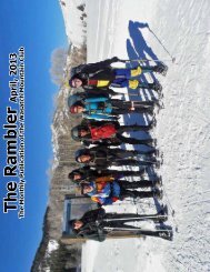
Rambler
September 2010 - Wasatch Mountain Club
September 2010 - Wasatch Mountain Club
- No tags were found...

Create successful ePaper yourself
Turn your PDF publications into a flip-book with our unique Google optimized e-Paper software.
The <strong>Rambler</strong> September 2010<br />
The Monthly Publication of the Wasatch Mountain Club
2<br />
Volume 89, Number 9<br />
The Wasatch Mountain Club<br />
1390 S. 1100 E. #103<br />
Salt Lake City, UT 84105-2443<br />
(801) 463-9842<br />
2010-2011 GOVERNING BOARD<br />
President: John Veranth<br />
(278-5826) veranth@xmission.com<br />
Secretary: Susan Allen<br />
(466-3292) sallen400@gmail.com<br />
Treasurer:<br />
Co-director: Tricia Lee (274-7643)<br />
trisha2king@mac.com<br />
Co-director: Gena Cecala (865-6569)<br />
gena@vspring.com<br />
Co-director: Clark Richards (272-5642<br />
cgrichards@aol.com<br />
Membership:<br />
Co-director: Marilyn Smith<br />
(273-0369) marilynasmith@msn.com<br />
Co-director: Bob Grant<br />
(273-0369) cincoymaya@msn.com<br />
Historian: Alexis Kelner<br />
(359-5387) kelner@xmission.com<br />
Biking:<br />
Co-director: Marcia Hansen<br />
(486-5724) hansen5200@msn.com<br />
Co-director: Barb Hanson<br />
(485-0132) barbhanson30@hotmail.com<br />
Boating: Director, Don Urrizaga<br />
435-884-0147 don_urrizaga@yahoo.com<br />
Conservation: Director: Will McCarvill<br />
(942-2921) lizandwill@msn.com<br />
Social:<br />
Co-director: Holley Richards (554-1125)<br />
cgrichards@aol.com<br />
Co-director: Cindy Crass (530-7331)<br />
cjcrass@cnmlaw.com<br />
Hiking:<br />
Co-director: Julie Kilgore<br />
(572-9838) jk@wasatch-environmental.com<br />
Co-director: Alex Rudd<br />
(971-9245) rudd94@gmail.com<br />
Information Technology: Bret Mathews<br />
(273-0315) bretmaverick999@yahoo.com<br />
Publicity Relations: Tanner Morrill<br />
(809-0170) tannermorrill@gmail.com<br />
Lodge: Director, Bob Myers<br />
(466-3292) robertmyers47@gmail.com<br />
Caretaker: Todd Nerney<br />
caretakerwmc@yahoo.com<br />
Lodge Use: Dave & Susan Rabiger<br />
(964-8190) drabiger@utah.gov<br />
(964-8190) sjrabiger@gmail.com<br />
Mountaineering:<br />
Co-director: Al Bui (518-250-9808)<br />
albertbui@alum.swarthmore.edu<br />
Co-director: Paul Gettings (599-7311)<br />
p.gettings@utah.edu<br />
<strong>Rambler</strong> Publications/E-mail:<br />
Editor: Kathy Craig (502-0465)<br />
wasatchmountainclub@gmail.com<br />
Winter Sports: Director, Walt Haas<br />
(209-2545) haas@xmission.com<br />
COORDINATORS:<br />
Adopt-a-Highway: Jamie Kulju<br />
(360-606-9405) jrkulju@gmail.com<br />
Boating Equipment: Bret Mathews<br />
(273-0315) bretmaverick999@yahoo.com<br />
Canoeing: Margie Gendler<br />
(712-7890) gendler801@aol.com<br />
Canyoneering: Rick Thompson<br />
gone2moab@hotmail.com<br />
Evening Hikes: Mark Bloomenthal<br />
(842-1242) markbloomenthal@yahoo.com<br />
Mountain Biking: Brad Yates<br />
(278-2423) bnyslc@earthlink.net<br />
<strong>Rambler</strong> Graphics:<br />
Suzanne Nakagawa (362-8383)<br />
<strong>Rambler</strong> Mailing: Chris Venizelos<br />
(554-3697)<br />
Sing-a-Long: Fred Tripp<br />
(435-649-4507) fredgtripp@gmail.com<br />
Ski, Backcountry: Mark Borges<br />
(363-4504) mborges@xmission.com<br />
Ski, Touring: Mike Berry<br />
(583-4721) mberryxc@earthlink.net<br />
Snowshoeing: Deirdre Flynn<br />
(466-9310) deirdre.flynn@marriott.com<br />
Trails: Dave Andrenyak<br />
(582-6106) andrenyakda@aim.com<br />
TRUSTEES:<br />
Jerry Hatch 2008-2012<br />
(583-8047) pikahatch@gmail.com<br />
Cheryl Soshnik 2007-2011<br />
(435-649-9008) csoshnik@yahoo.com<br />
Steve Duncan 2009-2013<br />
(474-0031) duncste@comcast.net<br />
Dave Rumbellow 2010-2014<br />
(889-6016) djr3@xmission.com<br />
Trustee Emeritus:<br />
Dale Green (277-6417)<br />
The <strong>Rambler</strong> (USPS 053-410) is published<br />
monthly by the Wasatch Mountain Club.<br />
Subscription rates of $12.00 per year<br />
are paid for by membership dues only.<br />
Periodicals Postage Paid at Salt Lake City,<br />
Utah.<br />
CHANGE OF ADDRESS/Missing<br />
<strong>Rambler</strong>: Please call the WMC office or<br />
send your new address to the Membership<br />
Director. This publication is not<br />
forwarded by the Post Office. Allow 45<br />
days for address changes. Replacement<br />
copies are available, while they last, at the<br />
WMC office during office hours.<br />
POSTMASTER: Send address<br />
changes to: The <strong>Rambler</strong>, Membership<br />
Director, 1390 S. 1100 E, #103, Salt<br />
Lake City, UT 84105-2443.<br />
COMMERCIAL ADVERTISING:<br />
The <strong>Rambler</strong> encourages and<br />
supports your products and services<br />
through pre-paid commercial<br />
advertisements. Please send an e-mail<br />
to WasatchMountainClub@gmail.<br />
com for information or to place an ad.<br />
Prepayment is necessary for single<br />
month advertisements and invoicing<br />
and net 30 for repeat advertisements.<br />
Full Page: $95/month<br />
Half Page: $50/month<br />
Quarter Page: $30/month<br />
Business Card: $15/month<br />
The right is reserved to edit all<br />
contributions and advertisements,<br />
and to reject those that may harm the<br />
sensibilities of WMC members or<br />
defame the WMC.<br />
Copyright 2010 Wasatch Mountain Club
IN THIS ISSUE:<br />
President's Message..........................4<br />
WMC Lodge........................................5<br />
Antelope Island Car Camp.................6<br />
Boating Director's Message...............7<br />
Mtn. Bike Mormon Trail/BBQ...........11<br />
New Members..................................16<br />
Faint Trails in the Wasatch..............32<br />
Activities Listing..............................47<br />
Membership Application..................61<br />
Non-WMC Activities.........................63<br />
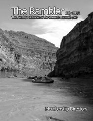
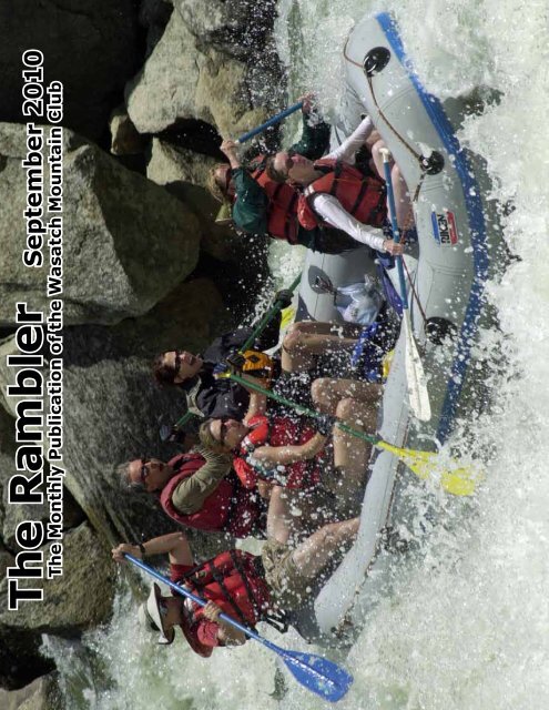
FRONT COVER:<br />
RICK THOMPSON'S<br />
PAYETTE RIVER TRIP,<br />
JULY 2-5, 2010<br />
Clockwise: Rick Thompson,<br />
Bret Mathews, Gena Cecala,<br />
Deanne James, Terri Smith<br />
and Beverly Hanson.<br />
WMC Purpose<br />
(Article II of the WMC Constitution)<br />
The purpose shall be to promote the physical and spiritual well-being of its members and others by<br />
outdoor activities; to unite the energy, interests and knowledge of students, explorers and lovers<br />
of the mountains, deserts and rivers of Utah; to collect and disseminate information regarding the<br />
Rocky Mountains on behalf of science, literature and art; to explore and picture the scenic wonders<br />
of this and surrounding states; to foster awareness of scenic beauties; and to encourage preservation<br />
of our natural areas including their plant, animal and bird life.<br />
Lodge Service Days<br />
September 10th, 11th<br />
and 24th, October 9th<br />
Check continual<br />
updates in Online<br />
Activities Listing<br />
Contact Lodge<br />
Director to schedule<br />
a service day or see if<br />
you can help out!<br />
Contact: Robert Myers,<br />
Lodge Director<br />
801-466-3292 (H)<br />
801-651-9965 (C)<br />
3
MESSAGE FROM THE PRESIDENT<br />
John Veranth<br />
This has been a busy and successful summer season for the WMC. Thanks to<br />
all the volunteers who have offered to organize trips -- keep it up. This brings<br />
me to the next topic.<br />
Awards & Organizers Party<br />
Each year in September, the club hosts a party to honor the outing organizers<br />
and other outstanding volunteers. This is a way for the membership to say<br />
a sincere “Thank You” to those who make everything in the club possible.<br />
This is a catered meal and<br />
invitees get a free dinner,<br />
while other guests pay. We use the <strong>Rambler</strong> listings<br />
and information from activity directors to make the<br />
invitation list, but every<br />
year a few volunteers are<br />
accidently left off. Most commonly, this occurs when<br />
someone substitutes for the<br />
person listed in the <strong>Rambler</strong>.<br />
So, if you think you should<br />
have been invited, but do not<br />
receive an invitation by mid-<br />
September, let me or Susan<br />
Allen know.<br />
WMC Foundation Donations<br />
We have great news regarding the process of organizing a non-profit<br />
foundation that can receive tax-deductible donations for the preservation of<br />
the lodge, and for other public-service purposes such as wilderness education<br />
and conservation. In August, we received a “Letter of Determination” from the<br />
Internal Revenue Service granting 501 (c) (3) charitable organization status.<br />
The WMC Foundation is an independent corporation with its own officers<br />
and directors (Bob Myers is the Foundation President) but the Foundation’s<br />
Statement of Purposes are closely aligned with the long-standing purpose<br />
of the WMC. The separate corporation provides a firewall separating the<br />
charitable fundraising from the social club. However, the foundation now<br />
opens up a way for WMC members to support the club’s purposes with taxdeductible<br />
donations. Whether you donate $10 to lodge upkeep or $10,000<br />
to a major capital program, you can support causes that are important to you<br />
and pay with pre-tax dollars. Further details on fund raising will follow, but I<br />
wanted to share the good news.<br />
4
The WMC Lodge<br />
The WMC lodge sets at the top of Big Cottonwood canyon, a short distance above the<br />
Brighton Ski Resort parking lot, above the Mt. Majestic Hotel. The building is tucked away in<br />
a grove of evergreens approximately 100 yards above the hotel. The building is accessible<br />
in the summer by automobile, but since the lodge is within the groomed slopes of the Mt.<br />
Majestic ski area, one must be able to travel over snow in the winter to get the lodge, which<br />
is uphill from the parking lot. It was built in 1930 by the early founding members of the club<br />
and was used as an overnight and weekend destination when travel in and out of the canyon<br />
was in a much more difficult period. In fact, the early members also built the first rope tow<br />
at Brighton for their weekend adventures, which later became the chairs lifts of the resort.<br />
The lodge is one of the only remaining original log buildings in the Brighton area and because<br />
of its history and importance, has been placed on the National Historic Register for buildings.<br />
The lodge is currently used by the charitable organizations, the general public who may<br />
want to use the facility for a special social function, and an occasional use by the club for<br />
educational and charitable events. All of the Club’s social and educational events are also<br />
open to the general public. Those wishing to use the lodge are asked to help support and<br />
fund the maintenance and upkeep of the building by paying a standard users’ fee.<br />
Through the years there have been a number of improvements in the lodge, with the most<br />
significant being the construction of an addition with modern bathrooms. The building now<br />
has a sanitary water supply, flushing toilets, showers and hydronic heating for the addition.<br />
We also have a live-in caretaker who resides in the upstairs of the addition. The main<br />
floor can handle parties up to 70-80 people comfortably. There are also outdoor porches<br />
and a barbeque area with picnic tables and additional seating during the summer. Sleeping<br />
accommodations are on the second floor of the main lodge, where there are two dormitorystyle<br />
rooms capable of sleeping up to 20 people. You can find a link to our website which will<br />
further show pictures of the building and many of the unique characteristics of the building.<br />
The link to our website is http://www.wasatchmountainclub.org/Lodge . The website offers<br />
an online reservation system which will accept any major credit card<br />
Currently the lodge is owned and managed by the Wasatch Mountain Club. The club is in<br />
the process of forming a separate charitable tax-exempt organization called the Wasatch<br />
Mountain Club Foundation. This organization will be a separate entity, with one of its<br />
purposes being owning and managing the building. The mission of the WMC Foundation is<br />
to preserve and maintain the building and allow it to be used for charitable, educational and<br />
scientific purposes, and to further its use by the general public.<br />
To learn more about the lodge, visit our website or become involved as one of our<br />
maintenance volunteers. Maintenance is a year-round requirement with roof snow removal in<br />
the winter, to painting, repairs and remodeling in the short summer months. We encourage<br />
you to call and get involved in one or many of our work parties. Our activities for your<br />
involvement are listed in the calendar of events on our website, or by calling the Lodge<br />
Director, Robert Myers.<br />
Lodge Use Information: Dave & Susan Rabiger, 801-964-8190, drabiger@utah.gov. Lodge<br />
Director: Robert Myers, 801-466-3292 or 801-591-9965(C), robertmyers47@gmail.com;<br />
Lodge Caretaker: Todd Nerney, 801-543-1711, caretakerwmc@yahoo.com<br />
5
SOMETHING<br />
FOR EVERYONE<br />
AT MULTI-<br />
ACTIVITIES<br />
WEEKEND ON<br />
ANTELOPE<br />
ISLAND<br />
Join us for a day or a<br />
weekend of multiple<br />
activities, a spaghetti<br />
dinner and car camping on<br />
Antelope Island on October<br />
1st, 2nd and 3rd. You will have<br />
an opportunity to bike, hike<br />
and paddle or to do all three<br />
in one weekend. Paddling<br />
has scheduled two groups on<br />
Saturday and one on Sunday.<br />
Hiking has also scheduled two<br />
groups on Saturday and one<br />
group on Sunday. Biking has<br />
scheduled one group on Saturday<br />
and one group on Sunday.<br />
Please refer to the Activities<br />
Calendar or the <strong>Rambler</strong> calendar<br />
for specific times, locations<br />
and level of difficulty for each<br />
individual event.<br />
A group dinner is scheduled for<br />
5 p.m. on Saturday. The dinner<br />
has been organized and will be<br />
prepared by our fabulous social<br />
directors. The dinner of veggie<br />
spaghetti (a side of meatballs),<br />
salad and dessert will have a<br />
nominal charge of $6.00 and is<br />
BYOB.<br />
A group campground has been<br />
reserved for Friday and Saturday<br />
nights, October 1st and 2nd. The<br />
campground is $3.00 per person<br />
per day and a one-time fee of<br />
$2.00 per car. Day use for the<br />
island is $9.00 per car, including<br />
up to 8 people.<br />
Please RSVP if you plan to attend<br />
the dinner and/or if you plan to<br />
camp. RSVP for dinner (number<br />
attending) and campground<br />
contact information can be found<br />
in the Activities Listing at the end<br />
of the <strong>Rambler</strong>.<br />
BIKING,<br />
HIKING,<br />
PADDLING,<br />
DINNER ,<br />
AND<br />
CAR CAMP<br />
6
Boating Director's Message<br />
Don Urrizaga<br />
The Season is winding down. It’s time for everyone to come together again for a<br />
party and celebration, to see old friends and talk about past trips and future trips.<br />
Please join us at the famous annual Pink Flamingo Boating Social. The party starts<br />
at 5:30 and dinner is at 6:30. All WMC members are invited. BYOB, a potluck to<br />
share, and a chair. For more information go to the Club’s Events Calendar and/or<br />
see the ad in this month’s <strong>Rambler</strong>.<br />
Sep 11 Easy/Fun Pink Flamingo Cindy Crass cjcrass@cnmlaw.com<br />
The Boaters Pink Flamingo Party<br />
When:<br />
Saturday, September 11, 2010 @ 5:30 p.m.<br />
Where: 2244 East 11620 South, Sandy<br />
Who:<br />
All WMC members are invited<br />
Host: Cindy Crass – (801-530-7331)<br />
What:<br />
Meat (chicken) will be provided. Party<br />
starts at 5:30 pm, dinner at 6:30 pm.<br />
Bring a potluck dinner to share. Bring<br />
your own refreshments and a chair.<br />
Wear PINK! Outrageous costumes are<br />
encouraged. The most outrageous will<br />
be awarded a prize.<br />
7
AuJULIE KILGORE'S OBELISK (HOGUM DIVIDE) HIKE<br />
Photo by<br />
Jim Kucera<br />
(Jim #2)<br />
gust 7, 2010<br />
Left to Right: Jim #1, Mark, Yvonne, Julie,<br />
Rick, Roger and Vivian (on top of The Obelisk)<br />
celebrating her '29th' birthday.<br />
The Obelisk is a smaller mountain located north of the Pfeifferhorn, in the Central Wasatch<br />
Mountains. The environment surrounding the Obelisk is some of the most astounding and<br />
scenic terrain in the entire Wasatch Range.<br />
Looking south from the summit, you have an overwhelming view of the North Ridge of the<br />
Pfeifferhorn, one of the more striking alpine routes in the Wasatch. Looking west, you can<br />
see the entire Hogum Fork with the Thunderbolt Ridge, Dresden Face, Snapdragon Couloir,<br />
Silver Couloir, and the Hypodermic Needle Couloir. Looking north, the entire<br />
Cottonwood Ridge is displayed before your eyes; and, looking east, is the rugged outline of<br />
the Maybird Palisades and White Baldy.<br />
The most common route to summit Obelisk is the Northeast Ridge. Obelisk is rarely<br />
climbed during the summer and provides ample solitude. During the winter, Obelisk is a<br />
more popular destination for backcountry skiing along the west and east faces.<br />
(from summitpost.org)<br />
8
C A S S I E B A D O S K Y ' S P O L E L I N E P A S S H I K E<br />
AUGUST 5, 2010<br />
Photo by Knick Knickerbocker<br />
9
MARKETPLACE<br />
This space is reserved for those members placing ads for used and recreational gear<br />
or for private and non-commercial and not-for-profit activities. To submit an ad,<br />
e-mail it to wasatchmountainclub@gmail.com by the 10th of each month prior to<br />
publication. Non WMC members $5.00 up to 20 words, $0.20 per additional word.<br />
* * * * * * * * * * * *<br />
SCUBA GEAR, slightly used: Regulator with gauges,<br />
$200.00; BC ladies large, excellent condition, $55.00;<br />
Oceanic full wetsuit ladies large, perfect for scuba or<br />
boating, $60.00. Call Barbara 801-466-7702.<br />
REMEMBER: There is also a “Gear Swap” area online where you can post what you are looking for,<br />
or place something that you want to sell or get rid of. It seems to be more up-to-date most of the<br />
time, due to the hard copy of the <strong>Rambler</strong> only being produced once a month.<br />
Notice To Organizers of Activities<br />
If you have not received an invitation to the Organizers’ Party<br />
by September 10, 2010, please contact the Wasatch Mountain<br />
Club Director in charge of your activity (see the <strong>Rambler</strong> for<br />
contact information for Directors).<br />
10
MOUNTAIN BIKE MORMON TRAIL<br />
AND ANNUAL BBQ<br />
Mountain Bike - Annual BBQ and Mormon Trail Ride -<br />
All levels and family and friends invited.<br />
BBQ starts around 5:00 pm at the Mormon Flats<br />
Campground immediately following the rides. Bring a<br />
change of clothes and have something warm for when<br />
the sun goes down.<br />
MSD starts at 1:00 pm where Jeremy Ranch Road turns<br />
to dirt. We’ll ride counterclockwise from there. The<br />
ride is approximately 23 miles and there is roughly<br />
3,300 feet of cumulative gain.<br />
MOD starts at 2:30 pm at the Mormon Flats<br />
Campground parking lot. The ride is up the Mormon<br />
Trail to Big Mountain Pass, or beyond. This ride is an<br />
“out and back”.<br />
NTD starts at 2:30 pm, also at Mormon Flats Campground. The ride continues west on the<br />
dirt road and stays on the dirt road until you hit pavement. If time allows, go north on the<br />
paved road a few more miles to the East Canyon Reservoir. Also an “out and back”.<br />
NTD and MOD groups will organize themselves at the trailhead.<br />
BYO food for grill, plus your plates, utensils and beverage. Please bring a dish to share if you<br />
care.<br />
Volunteers needed for firewood and gas/brick coal grills!!!<br />
Saturday, September 11, 2010<br />
Please call or e-mail BBQ and MSD Organizer: Greg Libecci, glibecci@yahoo.com, 801-699-<br />
1999.<br />
Getting there: take I-80 eastbound from Salt Lake. Take the 0Jeremy Ranch exit (141) and<br />
turn north (left) under the freeway. Turn left at the first stop sign (Rasmussen), and then take<br />
the next right (Jeremy Ranch Drive). Continue until just before the road turns sharply to the<br />
right, where you will continue straight on the dirt road (East Canyon Road). Drive another 3.9<br />
miles until you see the parking area for the Mormon Flats Campground on your left.<br />
ttp://www.utahmountainbiking.com/trails/mormon.htm (link to Mormon Trail site)<br />
11
DONN SEELEY’S BEARTOOTH (MONTANA) BACKPACK<br />
Monday 8/2: After many adventures,<br />
Leslie and I meet Don and Lucy at<br />
the trailhead at the Clarks Fork of the<br />
Yellowstone River. We drop off Don<br />
and Lucy’s car as a shuttle vehicle, and<br />
we drive over the Beartooth Highway<br />
and around to the north side of the<br />
Beartooths. It’s 1:30 PM by the time we<br />
reach the trailhead at East Rosebud Lake,<br />
but the weather is clear and we strike<br />
off up the canyon, packing in 7 miles to<br />
Rainbow Lake.<br />
August 2-7, 2010<br />
There is incredible variety in the canyon.<br />
The first few miles are inside a burn<br />
that occurred in September 1996. The<br />
stubby forest looks like a Christmas tree<br />
farm. Because of the lack of tall trees,<br />
the scale of the canyon is immediately<br />
visible. The walls are thousands of feet<br />
tall and loom over the trail. The trail<br />
is lined with raspberry bushes in full Don and Leslie at Rainbow Lake<br />
delicious production. After Elk Lake, the<br />
walls draw closer together and the trail<br />
grows steeper, almost pinching out at spectacular Rimrock Lake. We slog into camp at the upper end<br />
of Rainbow Lake and eat a late dinner beneath monumental gray crags.<br />
Tuesday 8/3: We do a day hike to Echo Lake. We pass Lovely Lake at Falls on the way up, where<br />
a roaring cascade descends from a hanging canyon, splits in two, and then pours into the lake. Echo<br />
Lake is oval and placid, beneath tall cliffs. We attempt to bushwhack up to the cirque below Granite<br />
Peak, but we run out of time as afternoon thundershowers suddenly appear. We get rained on, but<br />
the weather improves as we reach camp. At bedtime, a monster storm rolls in and dumps much rain.<br />
Wednesday 8/4: Today we move camp to Fossil Lake, 9 miles away and 2,000 feet above Rainbow<br />
Lake. The weather alternates between chilly fog and crisp sun. We have lunch below Impasse Falls,<br />
where East Rosebud Creek roars over a shelf and drops 200 feet into a lake. At broad Dewey Lake,<br />
we get tantalizing views of flat-topped Mount Dewey and its snowfields. Fossil Lake is otherworldly,<br />
with a stream of fog flowing over it from the north while the sun plays on the slopes around it. It’s a<br />
large lake but it has a very strange shape, full of zigzags and bays and islands. We put up camp on<br />
the Beartooth divide at the south end of the lake, perched at 10,000 feet.<br />
Other campers have warned us that the bugs are bad at Fossil Lake, and indeed they are very<br />
impressive. We all walk around with clouds of mosquitoes trailing behind us. Head nets become very<br />
fashionable. Every meal has a little extra protein in it -- mosquitoes search out CO2, and they find it<br />
not only in our breath but also in the exhaust from our backpacking stoves.<br />
12
Thursday 8/5: We attempt once again to get a good view of Granite Peak, the high point of the<br />
Beartooths at 12,799 feet. We take an elaborate route over saddles and hills toward the Sky Top<br />
Lakes, which are in a deep canyon running south from the peak. It’s a gorgeous sunny day, unlike<br />
yesterday. The route is above tree line and wends its way through scree, boulder fields and snow<br />
patches. Lucy is especially good at finding solid snow that allows us to make time across the rock<br />
piles.<br />
After taking lunch at the lowest Sky Top Lake, we climb a knob to the west and take in the amazing<br />
views. In addition to Granite Peak itself, we get a view of The Spires, a section of pinnacles on the<br />
west ridge of the canyon. Looking over into the next valley, we can see oval Upper Aero Lake and<br />
elaborately twisty Rough Lake. Rough Lake’s islands, peninsulas and bays are so odd-looking, it<br />
almost seems like a perverse golf course a designer put together. Big thunderstorms are casting off<br />
from the Absaroka Range to our south and cruising over to the Beartooths, but miraculously they pass<br />
to either side of us, leaving us in the sun. We scramble down to Rough Lake, wade the inlet stream,<br />
then head down a green valley to Fizzle Lake, Fossil’s sibling on the south side of the divide. Fizzle is<br />
a puzzle, with many bays and lobes, and cliffy walls; we climb up above the south side and cross the<br />
outlet to reach the trail, which we hike back to camp.<br />
At bedtime, a monster thunderstorm, the biggest yet, wallops us. Lightning strikes are fast and<br />
furious, the wind roars and rain and hail pour down. By morning, it’s all gone, but everything is<br />
soaked.<br />
Friday 8/6: Lucy is determined to bag a peak on this trip, so I plot out an elaborate route to East<br />
Rosebud Peak, which rises above Fossil Lake’s eastern shore. We get within a few hundred feet of<br />
the south edge of the summit block, but the unrelenting steepness of the scrambling stymies us. We<br />
backtrack and cross into a valley on the east side, which proves to have a much more straightforward<br />
route. The top of the valley leads to both East Rosebud Peak and Mt Dewey, so we elect to tackle the<br />
taller Mt. Dewey, the same peak that we had viewed on Wednesday.<br />
The view on Mt. Dewey is just as amazing as we’d hoped, but one element of the view is alarming<br />
-- a big thunderstorm is headed our way. We scoot down the valley as the lightning and hail pound<br />
away at us. The valley gets progressively steeper, and we slip and slide down a rock pile into a cirque<br />
on the wrong side of the peaks. Eventually the weather abates somewhat, and we find a saddle that<br />
leads back to our original route. By the time we reach camp, the clouds are barely sprinkling, and<br />
then the sun comes out - another fine day in the Rockies.<br />
Saturday 8/7: It’s time to pack out. We dry out our gear as best we can and set out down the<br />
trail to the Clarks Fork trailhead, 10 miles away and 1,900 feet below. The scenery on the south side<br />
of the Beartooths is very different -- instead of the unearthly chasms of East Rosebud Creek, we see<br />
delicate lakes and streams, and (as we descend) thick green forest. It seems wetter and greener<br />
here than on the north side of the divide. The day starts out sunny, but by lunchtime it’s clouding up.<br />
Eventually the trail leads down into flatter terrain of marshes and meadows. Bad news: the trail is<br />
used by the dude ranch at the bottom for horse rides, and the last few miles are a series of miserable<br />
mud puddles and horse poop, with brutal hordes of mosquitoes. We reach the parking lot just as the<br />
storm hits its stride. Marble sized hail smacks Don and Lucy’s car as we do the shuttle over Beartooth<br />
Pass. Rain is pouring down as we reach the trailhead at East Rosebud to pick up my vehicle.<br />
We may be wet but we’re happy -- this was a spectacular place to go backpacking, and we had great<br />
company. Trip members: Leslie Woods, Don Leaver, Lucy Leaver and Donn Seeley (your scribe).<br />
13
Leslie and Lucy at Rimrock Lake<br />
Leslie and Lucy on Mt Dewey with Granite Peak as a backdrop<br />
14
Don below the<br />
misty heights in<br />
East Rosebud<br />
Canyon<br />
Lucy checks<br />
out the scenery<br />
above Sky Top<br />
Lakes<br />
15
NEW MEMBERS<br />
WELCOME<br />
Tina Fought<br />
Regan Pecaro<br />
Kate Fowler<br />
Paul Gettings<br />
Bor Wu<br />
Laurie Stoneburner<br />
Cindy Berg<br />
Thomas Stratton<br />
Max Kline<br />
Cynthia Osmun<br />
Anna Szabados<br />
Daniel Baker<br />
Lori Porter<br />
Barbara Beck<br />
Ken Miller<br />
Sharon Steadman<br />
Pete Harmon<br />
Andrew & Marcia Walker<br />
Thomas Harker<br />
Matthew Harker<br />
Ian & Britt Bovio<br />
Marc & Marilee Coles-Ritchie<br />
Kari Sparks<br />
Dan Sparks<br />
Luis & Gladys Feliciano<br />
16
If you’re a new member . . . depending on your age and<br />
background . . . you might have a few questions:<br />
1. How do I get involved in activities?<br />
2. What kinds of activities can be organized?<br />
3. What is the average age of WMC members?<br />
4. How many people participate in the activities?<br />
5. How aggressive are the various activity groups?<br />
The answers . . . ask away! Ask someone in the club! Send an e-mail<br />
to wasatchmountainclub@gmail.com or call someone from the governing<br />
board (inside front cover). The average age is...honestly, we<br />
don’t know. Why don’t we know? 1. We haven’t yet started tracking<br />
that information. 2. It doesn’t matter. There are older folks who can<br />
out-hike/-bike/-paddle any younger person. There are also younger<br />
people who like to do light activities. Sometimes tons of people<br />
show up for activities; sometimes only a couple. This is the nice<br />
thing.<br />
The WMC activities allow for flexibility; if you can show up, do--if<br />
you can’t, don’t. As for how vigorous and aggressive the various<br />
activities and groups are (hikers, bikers, etc), contact the director<br />
or coordinator. Please don’t feel like you can’t organize an activity<br />
if you don’t know your way around. There are so many people who<br />
can help you, and you can even decide on a destination at the time<br />
of meeting! You might have one or two awkward activities, but just<br />
get together with people who share the same interests as you, and<br />
you’ll be on your way to tons of fun and excitement--things you<br />
never thought were possible!<br />
17
Walt Hass' Bullion Divide Hike<br />
August 7, 2010<br />
Walt, Stan, Jen, Sharon, Deirdre, Mohamed, Jaq and Shane<br />
The Bullion Divide is one of the classic Wasatch ridge runs. In its entirety, the Bullion<br />
Divide route tops Sugarloaf Peak, Mt Baldy, Hidden Peak, the American Fork Twin Peaks,<br />
Red Top, Red Baldy and White Baldy.<br />
It has many variations depending on how much of the ridge you want to do. Because the<br />
route is a ridge run, one does not arrive at the same trailhead that one had departed.<br />
Because of this, a car shuttle needs to be set up. The more ambitious hiker will begin at<br />
the White Pine trailhead for more elevation gain, but the route is mostly done from E-W<br />
from the Cecret Lake trailhead. (from summitpost.org)<br />
Albion Basin to White Pine ridge run across the highest peaks<br />
of Salt Lake County<br />
18
Photos by Elliott Mott<br />
Liz Cordova's August 8, 2010 hike<br />
in Albion Basin to Cecret Lake<br />
Left to right: Barb Hanson, Rick Kirkland, Catherine Groseclose,<br />
Dianna Nabor, Liz Cordova, Peggy Bjornn, Norm Pobanz, Chris Hague<br />
and Gretchen Siegler<br />
19
Phyllis Anderson to:<br />
Bill Viavant Water Sports<br />
Education & Safety Fund<br />
BY OUR MEMBERS<br />
Robert Froehbose to:<br />
Winter Safety & Education Fund<br />
Rose Novak to:<br />
Alexis Kelner Conservation Fund<br />
Left to right: Dianna Nabor,<br />
Michele Swenson, Jerry Hatch,<br />
Stanley Chiang and Erin Robinson<br />
20
801-424-2724<br />
21
TAX LAWS ARE<br />
CHANGING<br />
25% DISCOUNT BETWEEN NOW AND YEAR END<br />
FOR WMC MEMBERS<br />
22
The best way to experience the diverse landscapes of Utah is to walk through<br />
them. Utah has some very remote areas, accessible only to hearty backpackers,<br />
but routes to other beautiful scenes are merely "pleasant walks". You'll<br />
find that once you get off the beaten path on foot, or even on horseback,<br />
Utah's mountains and deserts will "open up" for you in unexpected ways.<br />
Photo by Bruce Moore<br />
Utah's "wide, open spaces" are a patchwork of scenic, recreational, and<br />
historic venues. Nearly 80 percent of the state is contained in blocks of<br />
land administered for public use by federal and state agencies. These Utah<br />
"parks" and "playgrounds" are enormous, sprawling and unforgettable.<br />
23
Cassie Richardson in Her Ducky<br />
H owa r d ’ s<br />
P l u n g e ,<br />
l a s t<br />
r a p i d<br />
o f t h e<br />
Ca ba rto n<br />
S e c t i o n,<br />
N o rt h<br />
F o r k<br />
o f t h e<br />
Pay e t t e<br />
Chuck James<br />
in His Ducky<br />
Bruce Richardson<br />
in His Ducky<br />
24
Paul Hiscock and Bree Richardson<br />
in Their Double Ducky<br />
r i c k<br />
t h o m p s o n ' s<br />
t r i p i n<br />
a u g u s t<br />
i s s u e<br />
Mike Budig and Dianne Dedrickson<br />
in Their Double Ducky<br />
Ju ly 0 4 , 2 0 1 0<br />
Robert Ging and Joe Mackert<br />
in Their Duckies<br />
NOTE: FRONT<br />
COVER PHOTO<br />
IS FROM THIS<br />
DAY OF<br />
RAFTING<br />
25
The Payette River is<br />
famous for its whitewater.<br />
Experts call the North<br />
Fork Class V run one of<br />
the most challenging<br />
river reaches in North<br />
America, if not the world.<br />
Kayaking on the lower<br />
North Fork from Smith’s<br />
Ferry to Banks is worldclass,<br />
easily viewed from<br />
state highway #55, which<br />
closely hugs its bank,<br />
primarily on the west<br />
side. The lower North<br />
Fork narrows and drops<br />
1700 feet in the 16 miles<br />
above Banks, providing<br />
nearly endless Class V<br />
rapids. The average<br />
gradient is 110 feet per<br />
mile, with a maximum gradient of 200 ft/mile. The North Fork’s<br />
flow rate is controlled through the Cascade Dam, completed in<br />
1948, providing relatively warm water from the shallow Cascade<br />
Reservoir.<br />
DID YOU KNOW<br />
?<br />
26
Photo by Brad Yates<br />
July 18, 2010<br />
T<br />
I<br />
M<br />
P<br />
A<br />
N<br />
BRAD YATES' MOUNT<br />
G<br />
O<br />
S<br />
H<br />
IKE<br />
Bard Leferve emerging<br />
from a snow tunnel in<br />
the Grunge Coulior on<br />
the North Peak of<br />
Mount Timpanogos<br />
Photo by Brad Yates<br />
Bard Leferve, Lana<br />
Christensen and<br />
Mark Borges on the<br />
North Summit<br />
Photo by<br />
Mark Borges<br />
Bard and Lana on the<br />
Northeast Ridge of the<br />
North Peak<br />
27
Details of self-bailing fl<br />
loor are visible<br />
T h e H i s t o r y<br />
o f W h i t e w a t e r<br />
R a f t i n g<br />
28<br />
Back in 1958 when Jack Currey used to build rafts made from balsa wood<br />
to float Southern Utah’s San Juan River, class IV and V whitewater was<br />
considered too risky to run recreationally. He decided that rubber army<br />
surplus rafts would much better handle the trials of whitewater as they<br />
did not get water-logged over time. However, after only a few trips it was<br />
readily apparent that the rubber rafts had their flaws as well. Because the<br />
rafts would fill with water in the bigger rapids, a continuous bailing effort<br />
was required, and on occasion the floor would tear on the jagged rocks.<br />
One such occasion on a challenging section of the San Juan, a Currey<br />
guide accidentally tore the entire rubber floor out of his raft, leaving a<br />
suspended wooden floor hanging from the boat frame. The accident<br />
enabled the raft to self-bail itself through the entire whitewater expedition,<br />
giving the passengers a dry, safe, and comfortable ride.<br />
Thus, river rafting history was made with the introduction of the first selfbailing<br />
rowing raft that has since revolutionized the river rafting industry.<br />
(From Ensinearticles.com)
FANTASTIC SOUTH KAMAS LOOP RIDE<br />
DONNA FISHER'S<br />
Photo by Elliott Mott<br />
DONNA FISHER'S<br />
Left to right: Jennie Fuller, Gene<br />
Thibeault, Kathleen Welch, Marcy Allen,<br />
Donna Fisher and Dennis Jensen<br />
AUGUST 6, 2010<br />
SMITH AND MOREHOUSE RIDE<br />
JULY 23, 2010<br />
Photo<br />
by<br />
Elliott<br />
Mott<br />
Right to left: Lori Webb, Kneel Robinson, Jim Church, Susan Parker, Marcy Allen, Debra Alcox, Kathy<br />
Campbell, Donna Fisher, Ralph Fisher, Marilyn Bickley, (the guy behind Marilyn must be Dennis Jensen), June<br />
Maratz, Barbara Alexander, Mary Settle, Sandra Beherrell, (guy in red behind Mary Settle is John Anderson),<br />
Alex Wall and Edwin Wall. Not visible in the shot are Howard Ross and Robert Turner<br />
29
DONN SEELEY'S Saw tooth Mountains, Idaho<br />
July 4th weekend<br />
Army on the March<br />
From left: Shawn Bode, Deirdre<br />
Flynn, Stan Chiang, Roger Young,<br />
Jacqueline Bode, Trisha Lee, Aaron<br />
Jones and Sandra Beherrell<br />
Aaron Jones with icy<br />
Sawtooth Lake and<br />
Mt Regan<br />
Reflections in<br />
melt pools on<br />
Sawtooth Lake<br />
Castle Peak in the<br />
White Cloud<br />
Mountains, peeking<br />
down at Sawtooth<br />
Valley<br />
30
Crossing Trail<br />
Creek<br />
Army on the March, Part 2<br />
From right: Trisha Lee, Mohamed<br />
Abdallah, Jacqueline Bode, Deirdre<br />
Flynn, Jerry Hatch, Sandra Beherrell,<br />
Gretchen Siegler, John Krank (tagging<br />
along), Shadow (also tagging along),<br />
Aaron Jones and Roger Young<br />
Goat Falls<br />
Arrowleaf balsamroot<br />
blooms in Trail Creek<br />
From left: Sandra Beherrell,<br />
Trisha Lee and Stan Chiang<br />
Slab<br />
over<br />
looming<br />
Trail Lake<br />
31
FAINt tRAILS IN thE wASAtCh<br />
44. Mountain Lake Mine and Road<br />
In the spring and early summer of 1870 William S. Brighton and Joseph B. Elder went prospecting in the<br />
upper reaches of Big Cottonwood Canyon and filed four claims together before going their separate ways. Two<br />
of the claims were given names that were destined to survive and be used by important mining operations at the<br />
head of the canyon. The first was the Great Western. While the claim<br />
was not extensively worked, the name was salvaged and used for a<br />
series of mining companies that ultimately controlled about 1700<br />
acres of mining land in Big Cottonwood and Snake Creek Canyons.<br />
Brighton and Elder’s fourth claim was called Mountain Lake,<br />
situated on the ridge between Dog Lake and Lake Catherine at the<br />
head of the canyon. For this claim Brighton included the names of his<br />
wife, Catherine, and three sons, Robert, William and Thomas.<br />
Through the years that followed the oldest son, Robert A., worked this<br />
and later adjacent claims continually with but indifferent success. He<br />
also worked in some Park City mines and convinced a few influential<br />
men there that Big Cottonwood held considerable promise. In 1892 he<br />
was instrumental in forming the Mountain Lake Mining Company.<br />
Principals in this venture included his parents, three brothers and ten<br />
men from Salt Lake City and Park City. Several of the latter were well<br />
known to everyone in Park City at that time, and their names are still<br />
well known on South Temple street in Salt Lake City. But it was<br />
Robert Brighton who stayed in the mountains to work the mine,<br />
summer and winter. On occasion he was reported to have crossed the<br />
mountain to Park City on snowshoes so he could take the train to Salt<br />
Lake City to visit his family. He concentrated his efforts in driving a<br />
tunnel penetrating the slope below the claims to develop them at<br />
depth. Known then as the Magnet tunnel since it was on the Magnet<br />
claim, it had considerable length, over 550 feet when the claim was<br />
surveyed in 1898. It continued to be used well into the twentieth<br />
century and left a very prominent dump of light gray rock.<br />
It was during these years the road that is the subject of this article<br />
was put in place. It ran due south from the Brighton community about<br />
Figure 1. This vintage 1976 topo map shows the<br />
Lake Mary trail as it exists today, and its<br />
continuation to Lake Catherine. It also shows the<br />
road going past Dog Lake to the Mountain Lake<br />
and Big Cottonwood and mines. The legends are<br />
explained in the text.<br />
two-thirds of a mile before turning toward the west to make a<br />
climbing traverse up a fairly steep slope. At the top it turned and<br />
crossed a meadow, going past Dog Lake before climbing to the tunnel<br />
site. Since the point where the road reached the meadow was quite<br />
close to the lakes Phoebe and Mary, the Brighton pleasure seekers<br />
quickly adopted it as an alternate route to the lakes and created a<br />
footpath between it and the lakes. When the ski areas came into being, about the same time the mining era ended,<br />
the lower part of the road was altered repeatedly as the<br />
slopes were graded and groomed. Alternate trails were put<br />
in place to replace the mining road and most recently, only<br />
a scant few years ago, a completely new trail was created<br />
along a new alignment. But where today’s trail leaves the<br />
ski slopes and enters the woods to climb to a higher level,<br />
it is on the old mining road. At the top of that grade there<br />
is a trail sign pointing toward Dog Lake; the trail to that<br />
destination is also on the old mining road.<br />
These trails and roads are shown in Figure 1. Label A<br />
points to the place where the road reaches the top of the<br />
slope and turns to cross the meadow toward Dog Lake. B<br />
is the location of the Mountain Lake Mining Company’s<br />
tunnel, C is the location of the dump left by the Big<br />
Cottonwood Copper & Gold Mining Company’s tunnel,<br />
and D is the remnant of the Emperor tunnel.<br />
By the time the Mountain Lake Mining Company was<br />
incorporated, Robert A. Brighton had his name on at least<br />
40 mining claims in the area. While he was working the<br />
Figure 2. Remnants of the ore bin at the Big Cottonwood<br />
Copper and Gold Mining Company’s site. The tunnel was at the<br />
top of the dump on the right side of the photograph.<br />
32
Figure 3. This 1907 map shows the road between Brighton<br />
and the Mountain Lake mine. The map was made before the<br />
road was continued up to the Emperor tunnel. The names of<br />
the two mines are reversed, an error that was carried on to<br />
the later 1939 edition of the map.<br />
company’s tunnel he also continued prospecting, alone and<br />
with various other parties. In the spring of 1899 he gained the<br />
support of Utah Senator Joseph L. Rawlins and filed a series<br />
of claims to the east of Brighton. On the basis of those claims<br />
the Great Western Gold & Copper Mining Company was<br />
incorporated in October of 1900; Rawlins was the principal<br />
stockholder with Robert Brighton in a distant second place. It<br />
didn’t take long before Jesse Knight, the mining promoter<br />
from Provo, bought a giant’s share of the company’s stock,<br />
including Brighton’s, and then Rawlins and Knight bought<br />
Brighton’s interest in the Mountain Lake Mining Company.<br />
The Mountain Lake and Great Western properties were<br />
worked independently for some time until Knight gained<br />
control of the Steamboat Tunnel in Snake Creek Canyon. That<br />
was extended to get under the Mountain Lake properties at<br />
great depth and the surface work in Big Cottonwood was<br />
phased out. However it is likely the Mountain Lake tunnel was<br />
worked by leasers in later years, at least to the mid-twentieth<br />
century.<br />
The Big Cottonwood Copper & Gold Mining Company,<br />
formed in March 1900, also made use of the Mountain Lake<br />
road. This company held two claims adjacent to the Mountain<br />
Lake company’s properties. The Leggett claim was mentioned<br />
in a recent Faint Trails article relative to the establishment of<br />
U.S. Mineral Monument No.6. The company worked this<br />
claim through a tunnel located only a short distance southeast<br />
of the Mountain Lake company’s mine. The other claim was<br />
the Relief, which overlapped the Leggett and ran over the<br />
divide into the Snake Creek drainage. In its early days it was<br />
worked through a shaft located on the divide, east of Pioneer<br />
Peak. Anyone who has done a ridge run heading east from<br />
Sunset and Pioneer Peaks will remember passing the remnants<br />
of this shaft, with its great amount of blue-green rock and a<br />
road coming up from Snake Creek canyon. The Big<br />
Cottonwood Copper company belonged to Col. Nicholas<br />
Treweek, a well known mining promoter at the turn of the<br />
twentieth century. He pushed work on the tunnel with great<br />
enthusiasm for a number of years, but as the demands of other<br />
investments claimed his time and resources, the emphasis<br />
placed on these mines diminished. After he died unexpectedly following an operation in 1914 nothing more was<br />
reported about his Big Cottonwood company.<br />
The Emperor tunnel was a venture of Henry Andrew<br />
Gebhardt, a Salt Lake City baker and mining promoter.<br />
He was a partner with Thomas Kearns in the Emperor<br />
Consolidated Mining Company in Snake Creek, then filed<br />
a number of claims on the ridge south of the Dog Lake<br />
basin where he started a tunnel on the Emperor claim.<br />
After his death in 1915 his three sons formed the<br />
Emperor Mining Company and continued driving the<br />
tunnel and drifts to a total length of about 700 feet by the<br />
1940 decade, when their operations were abandoned.<br />
Today the road to these mines still exists, part of it<br />
having been used to access the upper portions of the ski<br />
area. Little remains at the various sites, save the remnants<br />
of an ore bin and large log building at the Big<br />
Cottonwood mine, and the dumps at all three tunnels. A<br />
foundation and metallic pieces of a structure at the lowest<br />
tunnel give a mute suggestion that this mine was worked<br />
by leasers in later days.<br />
. . . . . . . Faint Trails by Charles L. Keller . . . . . . .<br />
Figure 4. View looking down the slope to the Mountain Lake<br />
mine. The mine road runs above the large stone outcrop and<br />
horizontally across the picture. Dog Lake is visible left of center.<br />
33
ALEX RUDD'S<br />
newcomers hike<br />
TO WILLOW LAKE<br />
Willow<br />
Pond<br />
with<br />
Honeycomb<br />
Cliffs in<br />
the<br />
background<br />
June 19, 2010<br />
Willow Lake<br />
Some of the group<br />
Photos by Alex Rudd<br />
Jumping the creek<br />
34
Photos by<br />
Barry Coker<br />
Left to right:<br />
Jeanine Coker,<br />
Fred Tripp,<br />
Kerry Kelly and<br />
Carol Milligan<br />
PROVO RIVER<br />
BOATING ADVENTURE<br />
By Fred Tripp<br />
Five members of the WMC boating group braved a marginal weather forecast and<br />
paddled the Provo River on Friday, June 11 th . The water was cold and the river was the<br />
lowest that we have ever experienced. We dragged on the bottom several times. The<br />
water was running faster than normal and we had a couple of real strong Category 1’s,<br />
which you don’t typically see on this section of<br />
the Provo.<br />
WHITE WATER<br />
There were no “incidents” and everything went<br />
quite smooth. However, we were all chilled<br />
(except Carol) from sitting in the water in selfbailing<br />
inflatable kayaks. So, we changed<br />
into dry, warm clothes and had our picnic<br />
lunch. The weather was nice until we were<br />
finishing lunch and it started to drizzle. With<br />
the impending weather and the chill of the first<br />
run, we decided we weren’t up for the planned<br />
second run. By the time we loaded our gear<br />
and were heading home, it was raining pretty<br />
hard so the decision to skip a second run was<br />
well validated and the rain continued the rest of<br />
the afternoon. All in all, everyone felt it was a<br />
good outing!<br />
35
A L E X R U D D ' S B E A T O U T<br />
J u n e 2 6 , 2 0 1 0<br />
Summit of Chapman Peak<br />
Left to right: Lana Christiansen, Greg<br />
Orzechowski, Carol Petrelli and Julie<br />
Kilgore<br />
Upper Bells<br />
Reservoir<br />
Group working down<br />
some boulders<br />
Upper Falls<br />
Left to right: Lana Christiansen, Julie<br />
Kilgore, Greg Orzechowski, Carol<br />
Petrelli, Bard Lefevre and Dan Smith<br />
36
Summit at No-Name Peak<br />
Climbing out of<br />
Red Pine Lake<br />
Left to right: Carol Petrelli, Lana<br />
Christiansen, Julie Kilgore, Greg<br />
Orzechowski, Bard Lefevre and<br />
Dan Smith<br />
Bard Lefevre glissading<br />
Climbers heading<br />
toward Pfeifferhorn<br />
37
The Pfeifferhorn is a majestic triangularly-shaped peak of 11,326 feet, which is<br />
located in the most isolated part of the Lone Peak Wilderness of the Wasatch<br />
mountain range. The easy access, proximity to alpine lakes, plus a short trail, make<br />
it a popular hike year-round. The easiest route involves moderately steep hiking<br />
and a short 3rd class section. Since only a few mountains in the Wasatch are higher<br />
than Pfeifferhorn, the rewards are breathtaking views of the Salt Lake Valley and<br />
surrounding mountains. The summit makes an excellent winter mountaineering<br />
adventure. Also, mountain goats can be frequently seen above Upper Red Pine<br />
Lake.<br />
P f e i f f e r h o r n<br />
The Pfeifferhorn is recorded as “Little<br />
Matterhorn” on USGS maps. The<br />
mountain is known as the Pfeifferhorn,<br />
in honor of Chuck Pfeiffer, a local<br />
climber who was the leader of the<br />
Wasatch Club.<br />
Photo by Alex Rudd<br />
The easiest and most popular route is<br />
the East Ridge via Red Pine Lake trail<br />
up Little Cottonwood Canyon. The<br />
trail is approximately 3 miles to lower<br />
Red Pine Lake and roughly 1/2 mile to<br />
the upper Red Pine Lake. From here<br />
proceed southwest up the steep talus<br />
slope to the top of the "false summit".<br />
A well-defined trail should be visible<br />
here in the absence of snow. Continue<br />
west along the ridge through a series<br />
of large boulders to a second steep<br />
slope. You can either wrap around this<br />
slope to the south and switch-back up<br />
to the summit (easier) or just continue<br />
west ‘til you reach the summit (steep).<br />
Another way to climb Pfeifferhorn is to hike in through Maybird Gulch. A small<br />
footbridge breaks off to the right from the Red Pine Lake trail and will take you<br />
into Maybird. You will pass 3 small lakes nestled under the Hogum Divide with<br />
the Pfeifferhorn rising straight ahead. Once past the uppermost lake, you will find<br />
yourself in a large boulder field (granite talus), which is difficult and slow to cross.<br />
At the other side, a steep scramble will take you to the summit base. You can make<br />
a loop trip starting at Maybird Gulch, climbing to the peak, then down by way of<br />
Upper/Lower Red Pine Lakes or vice-versa. (From summitpost.org)<br />
38
Photo by<br />
Julie Kilgore<br />
Julie, Cassie, Heidi and Will Enjoy the<br />
Seldom-Visited Rocky Mouth Peak<br />
The Rocky Mouth Trail is a great short hike to get out and cool off on a hot<br />
summer day. The Trail head is located at 11300 South Wasatch Blvd. You park<br />
in the Wasatch Trail Head Lot, then ascend a railroad tie staircase to the<br />
subdivision road. The road curves to the left and on the right, in-between 2<br />
houses, is the trail. The initial hill is quite steep, but manageable. It levels off<br />
to another incline, then follows a foot path to the left, around some snarled<br />
Cottonwood trees, past a sealed mine shaft, and another rock formation that<br />
has a small cave, but not large enough to enter. Then up another small incline<br />
and the falls will be in full view. This hike is so short you could even pack in a<br />
light camping chair, so you would have a nice place to sit and enjoy the view.<br />
39
BRUCE MOORE'S<br />
SLOW PACED<br />
LONE PEAK HIKE<br />
July 11, 2010<br />
Kerry Quinn,<br />
Cindy Crass<br />
and Dan<br />
Parker<br />
Our first break<br />
(the first<br />
meadow) after<br />
the climb up<br />
the Jacobs<br />
Ladder<br />
Dan Parker and Christophe<br />
Hoarau standing on the<br />
11,253 foot Lone Peak<br />
Photos by Bruce Moore<br />
Anne Elliott (in red) and<br />
Kathleen Bruce laugh at the 800<br />
foot drop off. Yea, that's a lake far<br />
below. Above Anne's head is<br />
Upper Bell's Reservoir<br />
Summiteers Anne Elliott,<br />
Christophe Hoarau, Cindy<br />
Crass, Kathleen Bruce and<br />
Tara Reeves. Dan Parker<br />
also sat on the summit but<br />
didn't get in the picture<br />
40
Cindy Crass with the South Summit<br />
and Box Elder Peak in the<br />
background<br />
Mount Timp in the far background<br />
Kathleen thought I should be in the photo;<br />
she takes my camera and does the job.<br />
Kerry Quinn, Cindy Crass, Barb<br />
Hanson, Dan Parker, Christophe<br />
Hoarau, Kathleen Bruce and<br />
Tara Reeves<br />
Wouldn't you know it, the weather<br />
cleared nicely as we leave the peak!<br />
On the way down<br />
Lone Peak<br />
in the backgound<br />
Christophe<br />
and Dan in<br />
foreground<br />
Bruce: The pictures don't show it, but we were rained on several times with some<br />
sleet thrown in to keep us on our toes. The summit attempt was delayed about an<br />
hour while some high static issues cleared. We waited for some clearing and got it,<br />
so we all went for it. I believe this was on the Bucket List of Cindy Crass; she was<br />
very successful. A great hike for the summiteers.<br />
41
Delightful Cabin with Huge Deck and Attached Garage<br />
7771 N. Cedar Way, Park City, UT 84098<br />
$275,000 – situated on one-half wooded acre<br />
Year round access/ x-cntry ski out the front door/ clean, clear air + ambiance of adjacent Park<br />
City / Private community of only 93 homes. A mere 20 min. to Foothill Blvd./ delightful small<br />
cabin/home - huge deck/ very private/ new carpet + new furnace/ hard to find cabins with<br />
attached garage and gas forced air furnace!!! Perfect year round living or affordable 2nd home!!<br />
Huge, over 700 sq. ft. deck!!!<br />
42
ONE OF THE WORLD'S GREATEST WHITEWATER ADVENTURES!<br />
In the late 1860s Major John Wesley Powell<br />
and his party ran the Green and Colorado<br />
rivers. It was one of world’s greatest<br />
whitewater adventures. Powell and his<br />
men used three, twenty-one-foot-long oak<br />
boats, and one, sixteen-foot pine boat<br />
down--each vessel powered by oars and<br />
turned by a stern sweep.<br />
Powell, a scientific man, collected bits and<br />
pieces of natural information along the<br />
way. At one point on the journey, he and THE START FROM GREEN RIVER STATION<br />
his assistant, named Bradley, scaled the<br />
canyon walls to take a barometer reading to determine altitude. The climbing became difficult for<br />
the one-armed Civil War veteran. He reached up to hold onto a rock above him and suddenly found<br />
himself posed delicately on a precipitous cliff, on the verge of<br />
falling off and tumbling onto the boulders below.<br />
“The moment is critical,” he wrote. “Standing on my toes, my<br />
muscles begin to tremble.” Bradley scrambled above him, but<br />
was not able to obtain a close enough position to reach Powell.<br />
He frantically scanned the rocky cliffs looking for a branch of<br />
a tree to hand to Powell clinging below him, but nothing was<br />
available.<br />
Then Bradley had an idea. Pulling off his trousers, he hung<br />
them down to Powell. Powell grabbed the trousers and was<br />
pulled to safety.<br />
The adage that small events change the course of history was proven true again. Powell might not<br />
have completed running the wild rapids of the Colorado and explored one of the last unmapped,<br />
unknown parts of the United States had it not been for Bradley’s drawers.<br />
Powell went on a second expedition on the Colorado using boats similar to those on the first, but this<br />
time he sat on a chair lashed high on the deck and scouted the coming rapids. These days, Powell<br />
probably would have to pay big money to get people to row his boats. His system wasn’t all that<br />
oarsmen-friendly. Nowadays oar boats are rowed with oarsmen looking downstream. They can see<br />
what’s coming at them. But in Powell’s boats the oarsmen rowed with their backs to the oncoming<br />
rapids and depended blindly on the major shouting out orders to them.<br />
During the years after Powell’s journeys, wooden boats were improved for whitewater use. Metal<br />
and fiberglass dories that now are used on many western rivers are a direct outgrowth of the earlier<br />
models. Rubber rafts, then, began to appear, and especially proliferated when surplus rubber rafts<br />
were available at the end of World War II.<br />
Rafts manufactured today are constructed of various types of synthetic materials. They come in<br />
a variety of sizes and shapes. Their distinguishing characteristic is that they are pliable but tough<br />
enough to absorb the shocks of banging and scraping against rocks without damage--most of the<br />
time, that is. (From The Whitewater River Book by Ron Watters.)<br />
43
A COUPLE OF OUR LIFETIME MEMBERS!<br />
Nancy Phillips (left) and Joan Proctor (right)<br />
LAKE SOLITUDE<br />
Photo by<br />
Jeanette Townsend<br />
LAKE SOLITUDE, BIG COTTONWOOD CANYON<br />
Lake Solitude is an excellent destination if you seek soothing quiet in a beautiful<br />
outdoor setting. This shallow secluded lake rests quietly among pines and willows<br />
in a stunning location. Mine tailings on the opposite side of the lake remind one<br />
of the rich mining histories in the canyon. Often, your only company at this lake<br />
will be a few ducks swimming to the small island. A peaceful hike to Lake Solitude<br />
includes endless groves of quaking aspen, vibrant wildflowers, and the fragrances<br />
that accompany each. As you pass through the groves of aspen, pause to smell<br />
the bark’s fragrance, listen to the rustling leaves, and feel the almost spiritual<br />
presence that accompanies them. The beauty and splendor are to be savored and<br />
remembered long after you have left.<br />
Via Big Cottonwood Canyon Road (7000 South Wasatch Blvd) to Brighton about<br />
14.2 miles up the canyon to the Silver Lake Visitor’s Center. Park at the Silver Lake<br />
Information Center or across the street at the Brighton Store. 3.4 total miles; 800’<br />
elevation gain.<br />
44
Wasatch Mountain Club (WMC)<br />
Applicant Agreement, Acknowledgment of Risk, and Release from Liability<br />
Activity: _____________________________ Organizer: _______________________________ Date: ___________<br />
VOLUNTARY PARTICIPATION: I acknowledge that my participation in all WMC activities is voluntary. No one is<br />
forcing me to participate. I agree to abide by the rules of the WMC.<br />
ASSUMPTION OF RISK: I am aware that WMC activities involve risks, and may result in injury, illness, death, and<br />
damage to or loss of property. These dangers include but are not limited to: the hazards of traveling in remote areas<br />
without medical services or care, the forces of nature, the inherent dangers involved in participation in sports, wilderness<br />
travel, and social activities, and the negligent actions of other persons or agencies. I understand that all activities should<br />
be considered exploratory, with the possibility of unexpected conditions and route variations. The WMC is not, nor does<br />
it provide, a professional guide service. In order to partake in the enjoyment and excitement of WMC activities, I am<br />
willing to accept the risk and uncertainty involved as being an integral part of the activity. I acknowledge this risk, and<br />
assume full responsibility for any and all risks of injury, illness, death, or damage to or loss of my property.<br />
PREPARATION: I understand that it is my responsibility to evaluate the difficulties of any WMC activity I participate in,<br />
and decide whether I am prepared by having the experience, skill, knowledge, equipment, and the physical and<br />
emotional stamina to participate safely.<br />
RELEASE OF LIABILITY AND PROMISE NOT TO SUE: I agree that I, my heirs, personal or legal representatives<br />
hereby do release and hold harmless from all liability, and promise not to bring any suit or claim against the WMC, its<br />
activity organizers, directors, agents or representatives for any injury, illness, death or damage and loss of property<br />
resulting from my participation in any WMC activity even if they negligently caused the injury or damage.<br />
LEGAL FEES: Should it become necessary for the WMC, or someone on their behalf, to incur attorney fees and costs<br />
to enforce this agreement, I agree to pay the WMC reasonable costs and fees thereby expended, or for which liability is<br />
incurred.<br />
INSURANCE: I understand that the WMC strongly recommends that I maintain insurance sufficient to cover any injury,<br />
illness or property damage that I may incur while participating in WMC activities. In the event of injury, illness or death<br />
related to any WMC activity, I recognize that I, or my estate, will bear the full cost of my evacuation or recovery, and any<br />
related medical care that I may need. I acknowledge that the WMC carries no insurance whatsoever for any participants<br />
in WMC activities.<br />
My signature below indicates I have read this entire document, understand it completely, understand it affects<br />
my legal rights, and agree to be bound by its terms. I certify I am at least 18 years old.<br />
**ATTENTION** IF YOU ARE NOT A MEMBER OF THE WMC, PLEASE NOTIFY THE TRIP ORGANIZER!<br />
Member<br />
(Y/N) Signature Print Name Phone<br />
Check<br />
Out<br />
____ ____________________ ______________________ _______________ ____<br />
____ ____________________ ______________________ _______________ ____<br />
____ ____________________ ______________________ _______________ ____<br />
____ ____________________ ______________________ _______________ ____<br />
____ ____________________ ______________________ _______________ ____<br />
____ ____________________ ______________________ _______________ ____<br />
____ ____________________ ______________________ _______________ ____<br />
____ ____________________ ______________________ _______________ ____<br />
____ ____________________ ______________________ _______________ ____<br />
____ ____________________ ______________________ _______________ ____<br />
____ ____________________ ______________________ _______________ ____<br />
____ ____________________ ______________________ _______________ ____<br />
____ ____________________ ______________________ _______________ ____<br />
____ ____________________ ______________________ _______________ ____<br />
Revised10/12/2008<br />
Return this form to Wasatch Mountain Club, 1390 South 1110 East, Salt Lake City, UT 84105-2443<br />
Please mark attention to the appropriate activity director, e.g., hike, bike, boat.<br />
45
WASATCH MOUNTAIN CLUB ACTIVITIES<br />
Only activities approved by the appropriate WMC director can be listed in The <strong>Rambler</strong>. Direct submissions to the<br />
Editor are NOT accepted. To submit your activity to the club, login to the WMC website and click on “Volunteer to<br />
Organize An Activity”. The appropriate director will approve and/or edit this event for inclusion in both the web calendar<br />
and <strong>Rambler</strong> submissions. The deadline is 6:00 p.m. on the 10th of the month.<br />
Rules and Regulations:<br />
1. Dogs & Children are not allowed on WMC activities, except when specifically stated in the activity description.<br />
2. Car pool rates: Gas plus $0.15/mile, shared by everyone in the vehicle (including driver) on 2WD roads, OR gas plus<br />
$0.25/mile on 4WD roads.<br />
Notice to Non-Members: Most WMC activities are open to prospective members except when specifically stated<br />
in the activity description.<br />
Find out about unofficial activities on our email lists. Activities formed with these lists are for members only. Lists<br />
are to be used only for the scheduling of outdoor activities. Any use of this service for any other purpose, such as<br />
advertising, SPAM, jokes, etc, will result in the loss of privilege. To subscribe: Once logging into the website, click<br />
on “Email Lists” on the left-hand side. Then follow the online instructions. (Boaters: E-mail the Boat Director—<br />
inside front cover—for more information.)<br />
Group size limits in wilderness: Some National Forest ranger districts limit the size of gropus hiking in wilderness<br />
areas. For such hikes, the hike listing will indicate the maximum number of participants (not including the organizer).<br />
Please help our organizers on hikes with group size limits by arriving promptly and being understanding if you cannot<br />
be accommodated on the hike because of a limit.<br />
Activity Difficulty Rating<br />
0.1-4.0 > Not Too Difficult (NTD) B > Boulder fields or extensive bushwhacking<br />
Lightly Strenuous<br />
E > Elevation change > 5,000 feet<br />
4.1-8.0 > Moderate (MOD) M > Round trip mileage > 15 miles<br />
Moderate to Very Strenuous<br />
R > Ridgeline hiking or extensive route finding<br />
8.1-11.0 > Most Difficult (MSD) S > Scrambling<br />
Very Strenuous, Difficult<br />
X > Exposure<br />
11.1+ > Extreme (EXT) W > Wilderness area, limit 14<br />
Very Strong, Well-Seasoned Hikers<br />
Be kind. When you carpool<br />
up local canyons, please<br />
give the driver $1.50 or<br />
$2.00 to help with gas and<br />
the wear and tear on the<br />
vehicle.<br />
Directions to Meeting Places<br />
Mill Creek Canyon Park and Ride Lot: Between 3800 S and 3900 S on Wasatch Blvd (3555 E), between the I-215<br />
freeway and Wasatch Blvd along 3900 S. It is on the northwest corner of the intersection. You can ONLY enter it<br />
from the west-bound lanes of 3900 S. To get to the Mill Creek Canyon Rd from the Park and Ride lot without making<br />
a U-turn, go west (right) on 3900 S, proceed under the freeway, then turn north (right) at the next available street,<br />
which is Birch Dr; proceed north to Upland Dr (across from Skyline High School); go east (right) under the freeway<br />
and across Wasatch Blvd to the Mill Creek Canyon Rd (3800 S).<br />
Skyline High School: 3251 E Upland Drive (3760 S). From the intersection of Wasatch Blvd and the Mill Creek Canyon<br />
Rd (3800 S), go west under the I-215 freeway, then turn north (right) into the entrance opposite Birch Dr (3330 E).<br />
Butler Elementary: 2700 E just south of 7000 S<br />
Big Cottonwood Canyon Park and Ride Lot: At the northeast corner of the Big Cottonwood Canyon Rd and Wasatch<br />
Blvd. at the mouth of Big Cottonwood Canyon.<br />
6200 Park and Ride Lot: 6450 S Wasatch Blvd. Go two lights east and south on 6200 S from the I-215 overpass and<br />
turn east (left) onto Wasatch Blvd; the lot is immediately on your left. Sometimes used as an overflow lot for access<br />
to Big Cottonwood Canyon.<br />
Ft. Union Lot #4: 200 yards west of Big Cottonwood Canyon Park & Ride, near the Porcupine Pub & Grille (which is<br />
located at 3698 Ft. Union Blvd).<br />
Little Cottonwood Canyon Park and Ride Lot: 4323 E Little Cottonwood Canyon Rd. On the north side of the intersection<br />
of Little Cottonwood Canyon Rd and Quarry Rd at the mouth of Little Cottonwood Canyon.<br />
Utah Travel Council Parking Lot: About 120 E 300 N. Go east from the intersection of State St and 300 N and turn<br />
south (right) into the first parking lot.<br />
Parleys Way K-Mart Parking Lot: 2705 Parleys Way. From Parleys Way, turn north into the parking lot; or from Foothill<br />
Drive, turn west on Stringham Ave (2295 S) and then south into the lot.<br />
46
ACTIVITIES LISTING<br />
See online Calendar for updated and additional events and trips.<br />
Date<br />
Sep 1<br />
Wed –<br />
Sep 6<br />
Mon<br />
Sep 1<br />
Wed<br />
Sep 1<br />
Wed<br />
Sep 2<br />
Thu<br />
Sep 2<br />
Thu<br />
Activity<br />
Backpack - 6 Day - Unita Th To Kings Peak – mod+ – 60.0 mi Out & Back – Moderate pace<br />
Meet: Registration required<br />
Organizer: Kevin Earl 801 568-3791 KBE44@hotmail.com<br />
This is a six-day trip where we will backpack for four days and do day hikes to peaks from our base camps on<br />
two days to bag three of the four highest peaks in Utah. We will either drive out early on the first day or drive out<br />
the night before. We will start our trip from the Unita trailhead on the south slope of the Unita’s. We will camp<br />
at the Lower Chain Lake the first night about 10 miles. Day two will be a day hike to Mount Emmons (13440’ in<br />
elevation). This is about a 6-mile hike. Mount Emmons is the fourth highest peak in Utah. Day three we will move<br />
camp to Lake Atwood about 9 to 10 miles away. Day four we will climb Kings Peak (13,528’) and South Kings<br />
peak. The two tallest peaks in Utah. This will be a long day and require some route finding and boulder hopping.<br />
Day five will be back to the chain lakes and day six will be back to the trailhead. Fishing in the high Unita lakes<br />
can be good so you may want to give it a try on our trip. This trip is during the Labor Day weekend and the start<br />
and end date is tentative and may be adjusted. Hikers should have experience at elevation, route finding and<br />
boulder hopping.<br />
Evening Hike: Organizer’s Choice, Big Cottonwood Canyon – ntd<br />
Meet: 6:00 pm at Big Cottonwood Canyon Park & Ride<br />
Organizer: Gretchen Siegler 801 661-5635<br />
There will be a prompt 6:15 pm departure.<br />
Evening Road Bike: City Creek – ntd+ – 13.0 mi Out & Back – 1300’ ascent – Moderate pace<br />
Meet: 6:00 pm at North-east side of Capitol Building towards City Creek<br />
Organizer: Elliott Mott 801-969-2846 elliott887@msn.com<br />
This short after work ride is to upper Rotary Park in beautiful City Creek Canyon. This is a spectacular autumn<br />
ride as green foliage morphs into a riot of blazing oranges, vibrant reds and magnificent yellows and is a wonderful<br />
way to unwind after work. Plan on climbing 1300 feet and a round trip spin of about 13 miles. Meet Elliott<br />
(801-969-2846) in the NE parking lot behind the Utah State capitol building at 6:00pm.<br />
Norm’s Thursday Day Hike – ntd<br />
Meet: Disseminated via the Hike email list<br />
Organizer: Norm Pobanz 801 266-3703<br />
Join Norm’s Thursday group for a nice weekday adventure. Destinations, meeting locations, and departure times<br />
will vary, so call Norm or check the website for details the week of each hike. Depending on the group and the<br />
destination, these trips typically split into an NTD group and a MOD group.<br />
Second Annual “might Get Down After Dark But Who Cares” Evening Hike – ntd<br />
Meet: 6:00 pm at Little Cottonwood Canyon Park & Ride<br />
Organizer: Mark Bloomenthal 801-842-1242 markbloomenthal@yahoo.com<br />
The Sun is setting earlier now and the Moon won’t be up till the wee hours of the morning. But, weather permitting,<br />
we’ll go high in the canyon and take our sweet time getting down. Please come prepared: Bring a working<br />
flashlight, some extra insulation, wind/rain gear, water, and some food. There will be a prompt 6:15 pm departure.<br />
47
Sep 3<br />
Fri<br />
Sep 4<br />
Sat –<br />
Sep 6<br />
Mon<br />
Sep 4<br />
Sat<br />
Sep 4<br />
Sat<br />
Sep 5<br />
Sun<br />
Sep 5<br />
Sun<br />
Sep 5<br />
Sun<br />
Sep 6<br />
Mon<br />
Road Bike City Creek Canyon – mod- – 20.0 mi Out & Back – Moderate pace<br />
Meet: 9:00 am at Popperton Park, 11th Avenue and Virginia Street, SLC<br />
Organizer: Barbara Hanson 801-485-0132 barbhanson30@hotmail.com<br />
For those of us lucky enough to not be out fighting the Labor Day traffic, the “Back Side” Ride will be on the<br />
“Front Side” this Friday, with few worries about cars. Meet at Popperton Park, 11th Avenue and Virginia Street<br />
in SLC. We’ll ride along 11th Avenue to City Creek Canyon. On the return, we can stop for coffee if anyone is<br />
interested.<br />
Boulder - Escalante Canyons Car Camp – ntd+<br />
Meet: Registration required<br />
Organizer: John & Martha Veranth 801 278-5826 veranth@xmission.com<br />
Similar format to the long-running Memorial Day weekends, but this year we are adding a fall trip. Use Veranth’s<br />
cabin as base camp; potluck dinners; plan hikes each day based on weather and interests. Expect one MOD/<br />
MSD and one NTD opportunity each day. Full logistics and driving directions will be sent by email.<br />
Day Hike, Upper Millcreek Loop – mod+ – 9.0 mi Loop – 3000’ ascent – Moderate pace<br />
Meet: 8:00 am at Skyline High School - 3151 E Upland Dr (3760 S)<br />
Organizer: Steven Duncan 801 474-0031 duncste@comcast.net<br />
Wasatch Crest trail to Desolation lake, desolation trail to Dog lake and the little water trail back to the upper parking<br />
lot. I did this hike with Tony a couple years ago but don’t have an accurate milage or elevation gain, my best<br />
guess below. Early start to ensure parking.<br />
Faint Trails Hike - Twin Lakes To Lake Mary Trail And Mountain Lake Mine Road – ntd – 5.0 mi – 1400’<br />
ascent<br />
Meet: 8:30 am at Big Cottonwood Canyon Park & Ride<br />
Organizer: Charles and Allene Keller 801-467-3960 clkeller@utahweb.com<br />
This will cover the trails and roads described in the current and previous Faint Trails articles with possible<br />
detours to other sites. The Lake Mary reservoir is almost completely empty this year. It offers some interesting<br />
exploring over the dry lake bed to see things that are usually submerged, like a deep channel that was cut in the<br />
rock between lakes Mary and Phoebe<br />
Hike The Sawmill Trail – mod+ – Out & Back – Moderate pace<br />
Meet: 9:00 am at Hidden Valley Park, 11500 South Wasatch Boulevard<br />
Organizer: Michelle Butz 801-842-9646 mbutz27@yahoo.com<br />
Michelle will take the group up the Sawmill Trail. It’s a steep one, but goes through several areas of shade before<br />
opening up to incredible views of the valley. Parts of the trail could use some trimming, so bring along a pair of<br />
clippers and the group can snip a bit here and there.<br />
Day Hike: Maybird Lakes – mod – 7.5 mi Out & Back – 2000’ ascent – Moderate pace<br />
Meet: 9:00 am at Little Cottonwood Canyon Park & Ride<br />
Organizer: Elliott Mott 801-969-2846 elliott887@msn.com<br />
This hike visits the tiny lonely lakes atop Maybird Gulch west of Red Pine. Plan on a round trip hike of about 7.5<br />
miles and a little over 2,000 feet climbing. Bring snacks for lunch by the lakes. Meet Elliott (801) 969-2846 in the<br />
Little Cottonwood canyon park & ride at the mouth of the canyon at 9:00am.<br />
Show-n-go Ntd Hike: Wmc Members Only – ntd<br />
Meet: 9:00 am at 6100 South & Wasatch Park & Ride<br />
Organizer: n/a n/a<br />
Club Members who would like to get together for a leisurely hike can meet at the 6100 South Park&Ride to pick<br />
a destination the fits the condition of the day and the mood of the group. One member will need to be responsible<br />
for filling and turning in the sign-up sheet/waiver form, which can be found in this month’s <strong>Rambler</strong> or downloaded<br />
on the WMC web page.<br />
Hike Deseret Peak – mod+ – 10.0 mi – 3600’ ascent<br />
Meet: 9:00 am at To Be Determined based on weather and road conditions. Contact Organizer the week prior to<br />
the hike<br />
Organizer: Chris Venizelos 801-554-3697 cvenize@xmission.com<br />
This is an incredible hike to an 11,031 ft peak in the Stansbury Mountains. Limit 9. Dogs welcome.<br />
48
Sep 6<br />
Mon<br />
Sep 6<br />
Mon<br />
Sep 7<br />
Tue<br />
Sep 7<br />
Tue<br />
Sep 7<br />
Tue<br />
Sep 8<br />
Wed<br />
Sep 9<br />
Thu<br />
Sep 9<br />
Thu<br />
Day Hike - Circle Butler Loop – mod – 7.0 mi Loop – 2000’ ascent<br />
Meet: 9:30 am at Big Cottonwood Canyon Park & Ride<br />
Organizer: Pete and Rebecca 801 487-4160 pmimmack@googlemail.com or rebeccawallace38@msn.com<br />
Pete and Rebecca will co-lead this hike that starts by going to Circle All Peak in BCC, then hopping on the Desolation<br />
Trail eastbound to catch the top of the Butler Fork trail and return to the cars. This is the hike that Rebecca<br />
and Pete met on 3 years ago Labor Day, so they thought it would be fun to share it with anyone who’s in town.<br />
Pace: Mellow<br />
Hike Cecret Lake To Germania Pass – ntd<br />
Meet: 8:30 am at Big Cottonwood Canyon Park & Ride<br />
Organizer: Cal Osburn 801 944-4574<br />
Cal will take the group up to Cecret Lake and up to Germania Pass. Some in the group might like to take the<br />
short by steep walk to Sugarloaf Peak.<br />
Day Hike: Late Afternoon Hike With Holly – ntd<br />
Meet: 5:30 pm at 6100 South & Wasatch Park & Ride<br />
Organizer: Holly Smith 801-272-5358<br />
Meet Holly Smith and/or other early birders for a prompt 5:30 pm departure to wherever. We hike then turn<br />
around to get down before it’s too dark. We will then drive a short distance to Hog Wollow for pizza and beer (or<br />
soft drinks) on their outside patio. (The park and ride is at 6450 S Wasatch Blvd. Meet at the south side of the<br />
parking area.)<br />
Mountain Bike Park City Tuesday Evening Ride – mod<br />
Meet: 6:00 pm at Updated Sunday or Monday via list serve and web page.<br />
Carpool: 5:30 pm at Parleys Way former Kmart lot - 2703 Parleys Way<br />
Organizer: TBA 801-278-2423 bnyslc@earthlink.net<br />
Check the bike List Serve or last moment updates on the web page for meeting place and organizer. The Tuesday<br />
evening rides are MOD to MOD+ in pace.<br />
Evening Hike: Organizer’s Choice, Little Cottonwood Canyon – ntd<br />
Meet: 6:00 pm at Little Cottonwood Canyon Park & Ride<br />
Organizer: Brett Smith 801-580-2066<br />
There will be a prompt 6:15 pm departure.<br />
Evening Hike: Organizer’s Choice, Mill Creek Canyon – ntd<br />
Meet: 6:00 pm at Skyline High School - 3151 E Upland Dr (3760 S)<br />
Organizer: Anne Polinsky 801 466-3806<br />
There will be a prompt 6:15 pm departure.<br />
Evening Dog Hike: Mill Creek Canyon – ntd<br />
Meet: 6:00 pm at Skyline High School - 3151 E Upland Dr (3760 S)<br />
Organizer: Jean Acheson 801-633-5225 jeanacheson@comcast.net<br />
Well mannered dogs along with their well mannered owners are welcome. Please bring water for yourself and<br />
your four-footed friend. Also, regardless of the leash law and day of the month, please bring a leash in case<br />
circumstances arise where it is needed. There will be a prompt 6:15 pm departure.<br />
Evening Hike: Organizer’s Choice, Big Cottonwood Canyon – ntd<br />
Meet: 6:00 pm at Big Cottonwood Canyon Park & Ride<br />
Organizer: Pam Miller 801-381-7942<br />
There will be a prompt 6:15 pm departure.<br />
49
Sep 9<br />
Thu<br />
Sep 10<br />
Fri –<br />
Sep 11<br />
Sat<br />
Sep 10<br />
Fri<br />
Sep 11<br />
Sat –<br />
Sep 19<br />
Sun<br />
Sep 11<br />
Sat –<br />
Sep 18<br />
Sat<br />
Sep 11<br />
Sat<br />
Sep 11<br />
Sat<br />
Evening Road Bike: City Creek Canyon – ntd+ – 13.0 mi Out & Back – 1300’ ascent – Moderate pace<br />
Meet: 6:00 pm at North-east side of Capitol Building towards City Creek<br />
Organizer: Elliott Mott 801-969-2846 elliott887@msn.com<br />
This short after work ride is to upper Rotary Park in beautiful City Creek Canyon. This is a spectacular autumn<br />
ride as green foliage morphs into a riot of blazing oranges, vibrant reds and magnificent yellows and is a wonderful<br />
way to unwind after work. Plan on climbing 1300 feet and a round trip spin of about 13 miles. Meet Elliott<br />
(801-969-2846) in the NE parking lot behind the Utah State capitol building at 6:00pm.<br />
Scudder Lake Car Camp In The Unitas – ntd- – 4.0 mi Out & Back – Slow pace<br />
Meet: Registration required<br />
Organizer: Randy Long 801-733-9367<br />
Camp at Beaver View campground and hike two miles along the Highline Trail to Scudder Lake with just a little<br />
elevation gain. This is a very spectacular mountain lake. This is a wilderness area so there will be a limit of 9.<br />
Road Bike - Wanship To Echo Junction – ntd+ – 32.0 mi Loop – 1000’ ascent – Moderate pace<br />
Meet: 9:30 am at Wanship Rail Trail Parking Lot<br />
Carpool: 8:30 am at Parleys Way former Kmart lot - 2703 Parleys Way<br />
Organizer: Donna Fisher 435 649-0183 dlfisher@utahbroadband.com<br />
This is an easy paced loop meeting at the Wanship Rail Trail and riding over E Hoytsville Rd to Coalville and<br />
then on to Echo Junction. We’ll return over West Hoytsville back to Wanship.<br />
Yellowstone Backpack – mod – 67.0 mi Loop – 2500’ ascent – Moderate pace<br />
Meet: Registration required<br />
Organizer: Michael Budig 801 328-4512 mbudig@blazemail.com<br />
This will be a moderate 66-mile 8 or 9 day backpack around Yellowstone Lake, to the South boundary - and then<br />
out at Heart Lake. The trip will offer beautiful secluded back country in the fall, when the elk are bugling and<br />
mosquitoes are gone. The will be an optional dayhike up Mt Sheridan with an incredible view over Yellowstone<br />
and Heart Lakes and extending over the Tetons and much of Yellowstone Park. Group will be limited to 6-8. For<br />
further information or to register, please email leader Michael Budig at mbudig@blazemail.com.<br />
Southern Utah Week - Self Supported Road Bike – mod+ – 350.0 mi Loop – Moderate pace<br />
Meet: Registration required<br />
Organizer: Cheryl Soshnik 435 649-9008 csoshnik@yahoo.com<br />
For this third year of self-supported touring, I am changing the route to SouthEastern Utah: Moab - Green River<br />
- Hanksville - Natural Bridges - Montilello - Moab. There are some gravel sections, but mostly it’s paved and<br />
remote. Totally self-contained touring ONLY: we will use panniers or trailer all of our gear. Camping will be at<br />
organized sites or in the wild. You must have had prior self-contained touring experience, and you must be an<br />
current member of either the WMC or BCC to participate. RSVP and send me a $50 non-refundable (unless a<br />
replacement is found) deposit to PO Box 4169, Park City UT 84060 to reserve your spot ASAP but before August<br />
1st.<br />
Relaxed Pace Msd Hike Superior Via Lake Blanche – msd – 10.0 mi Out & Back – 4500’ ascent – Slow<br />
pace<br />
Meet: 8:00 am at Big Cottonwood Canyon Park & Ride<br />
Organizer: Cassie Badowsky 801-278-5153<br />
Come out and enjoy this unique approach to Mount Superior. The terrain above Lake Blanche is seldom visited<br />
and wild. Expect a slow to moderate pace to fully appreciate the day.<br />
Lodge Work Party - Maintenance Project<br />
Meet: 9:00 am at WMC Lodge at Brighton (refer to website or call for directions)<br />
Organizer: Robert Myers 801-466-3292 (H) or 801-651-9965 (C) robertmyers47@gmail.com<br />
Exterior Renovation - prepare logs for synthetic chinking by subcontractor (hopefully the chinking will be completed<br />
by this time). Work party starts at 9:00AM and we will end the work party at 4:00PM; will car pool, if you<br />
call. Come up at any time, but call if you are coming, because lunch will be provided by the Club. Bring gloves<br />
and work clothes, suitable for the weather.<br />
50
Sep 11<br />
Sat<br />
Sep 11<br />
Sat<br />
Sep 11<br />
Sat<br />
Sep 11<br />
Sat<br />
Sep 11<br />
Sat<br />
Sep 11<br />
Sat<br />
Sep 12<br />
Sun<br />
Dog Hike To Mount Aire Saddle From Elbow Fork – ntd – 3.0 mi Loop – Slow pace<br />
Meet: 9:00 am at 3900 South Wasatch Boulevard Park and Ride<br />
Organizer: Tom Silberstorf 801 255-2784<br />
Bring your dogs, or just come hiking with them. The group might even catch sight of a moose on this hike, so<br />
bring your leads just case.<br />
Hike Bowman Trail To White Fir Pass – ntd – 3.0 mi Out & Back – 1240’ ascent – Slow pace<br />
Meet: 9:00 am at Skyline High School - 3151 E Upland Dr (3760 S)<br />
Organizer: Rose Novak 801-487-6034<br />
This is a great hike in the heat of the summer because it is a nice shady trail.<br />
Service Hike-mill B South Lake Blanche – mod+ – 6.0 mi – 2700’ ascent – Moderate pace<br />
Meet: 8:00 am at Big Cottonwood Canyon Park & Ride<br />
Organizer: David Andrenyak 801-582-6106 andrenyakda@aim.com<br />
We will work with the Forest Service Wilderness Rangers at the the Lake Blanche area. The work will involve<br />
campsite restoration and campsite inventory. The work will not be as rigorous compared to trail maintenance.<br />
The hike in will be MOD and beautiful. Following the hike , there will be a pizza party. Please wear sturdy boots<br />
and long pants. Please bring water, lunch, work gloves, rain gear. We will meet at the Big Cottonwood Canyon<br />
Park and Ride at 0800.<br />
Pink Flamingo Party-boating Social<br />
Meet: 5:30 pm at 2244 E 11620 South<br />
Organizer: Cindy Crass 801-530-7331 cjcrass@cnmlaw.com<br />
Come have a good time and wear pink. All WMC members invited. Party starts at 5:30..Dinner at 6:30. BYOB<br />
and a side dish. Chicken will be provided.<br />
Boating Meeting/social Pink Flamingo Party<br />
Meet: 5:30 pm at 2244 E 11620 South<br />
Organizer: Cindy Crass cjcrass@cnmlaw.com<br />
Come and have a good time and wear pink. All WMC members invited. Party starts at 5:30..Dinner at 6:30.<br />
BYOB and a side dish. Chicken will be provided.<br />
Mountain Bike, Park City Loop – mod+ – 30.0 mi Loop – 3500’ ascent – Fast pace<br />
Meet: 9:00 am at Park City Mountain Resort<br />
Organizer: Cheryl Krusko 801-474-3759 ckrusko@gmail.com<br />
Park City to the Crest, top of Millcreek Down through the Canyons with a stop at Red Pine Lodge. Plan on 30+<br />
miles bring lots of food, water and legs.<br />
Day Hike-mill D North Fork To Guardsman Pass – mod – 8.5 mi Shuttle – 4100’ ascent – Moderate pace<br />
Meet: 9:00 am at Big Cottonwood Canyon Park & Ride<br />
Organizer: Bob Cady 801 274-0250 rcady@xmission.com<br />
Third part of the progressive Deso series. We will start at the Mill D North Fork trailhead, hike to Lake Desolation,<br />
climb up to the ridge, then run the ridge to Guardsman Pass.<br />
Sep 12 Hike Eisenglass Mine – ntd<br />
Sun Meet: 9:00 am at Call for easy directions to Bill’s house off I-15, then carpool to the trailhead.<br />
Organizer: Bill Goldberg 801 209-2881 abelgian@msn.com<br />
Looking for something a little different? Join Bill for an easy paced 3-1/2 hour hike to the Eisenglass Mine in the<br />
Bountiful area.<br />
51
Sep 12<br />
Sun<br />
Sep 12<br />
Sun<br />
Sep 12<br />
Sun<br />
Sep 12<br />
Sun<br />
Sep 13<br />
Mon<br />
Sep 14<br />
Tue<br />
Social: Sing-a-long And Bbq Pot Luck At Dudley Mcilhenney’s Home<br />
Meet: 5:00 pm at 1459 E 3900 South - Directions are in the description above<br />
Organizer: Fred Tripp or Frank Bernard 435-649-4507 or cell: 301-461-0161 fredgtripp@gmail.com or frankbernard55@earthlink.net<br />
Dudley McIlhenny has offered his patio, for a BBQ and a Sing-A-Long. Plan to join us at 5:00 p.m. and we’ll have<br />
some coals going for the BBQ. Bring your own meats or sandwiches and something to share (appetizers, salads,<br />
sides or desserts) with 4 to 6 others. BYOB. Space is very limited inside so we will be outdoors on the spacious<br />
patio. Bring a jacket as it gets cooler after sunset. Following the picnic we’ll have a Sing-A-Long -think folk<br />
music, campfire songs, joke songs, etc. We usually start with “This Land is Your Land” and end up with “Happy<br />
Trails To You”. Acoustic instruments are welcome. Please bring a chair, to ensure adequate seating. Dudley’s<br />
home is located behind a small office building (Claims Management) at 1459 E 3900 S. Go north on the driveway<br />
just east of the building. It’s the first house on the left. Plan on a fun evening of socializing, enjoying good<br />
food and an opportunity to stretch your vocal chords (and bring any acoustic musical instrument that you’d like<br />
to play.) We’ll wrap it up by 10 PM. For questions or additional information contact Fred Tripp at 435-649-4507<br />
or email at fredgtripp@gmail.com or Frank Bernard at Frankbernard55@earthlink.net. Be sure to add your name<br />
to our email list to receive updates for this and future Sing-A-Longs. Just go the WMC web site: Click on Member<br />
Menu; Click on EMAIL LIST SUBSCRIBE & UNSUBSCRIBE; Log In, follow the directions to subscribe and<br />
select the “SOCIAL” category. When finished return to Member Menu and Log Off.<br />
Mountain Bike, Wheeler To Overlook – mod – 15.0 mi Loop – 1500’ ascent – Moderate pace<br />
Meet: 10:00 am at Wheeler Creek Trailhead, St road 39. From I -15 take 12th steet exit in Ogden, go east about<br />
5-6 miles. The trailhead is just before the dam<br />
Organizer: Brian Barkey 801 394-6047 brian_and_gerri@juno.com<br />
Hopefully, it will be cool enough to enjoy a ride on one of Ogden’s nicest singletrack trails. We could also head<br />
by Snowbasin on the way down for music and BBQ.<br />
Hike: Organizer’s Choice – msd<br />
Meet: Registration required<br />
Organizer: Deirdre Flynn and Mohamed Abdallah 801-466-9310 deirdre.flynn@marriott.com<br />
Join us for a challenging and fun hike suitable for the weather. Maybe Lone Peak, maybe something else. Call or<br />
email for details closer to the date or to register.<br />
Beginner/newcomers Hike - Brighton Lakes Area – ntd – Slow pace<br />
Meet: 9:00 am at Big Cottonwood Canyon Park & Ride<br />
Organizer: Julie Kilgore and Michelle Butz 801-244-3323 or 801-842-9646 jk@wasatch-environmental.com or<br />
mbutz27@yahoo.com<br />
This hike is open to anyone but is geared toward introducing new people to the Wasatch Mountain Club, or to<br />
hiking as an activity. There will be two organizers on this trip to make sure nobody gets behind, and to help with<br />
any questions or concerns. This month, we’ll select a multi-lake destination in the Brighton area.<br />
Evening Road Bike: City Creek Canyon – ntd+ – 13.0 mi Out & Back – 1300’ ascent – Moderate pace<br />
Meet: 6:00 pm at North-east side of Capitol Building towards City Creek<br />
Organizer: Elliott Mott 801-969-2846 elliott887@msn.com<br />
This short after work ride is to upper Rotary Park in beautiful City Creek Canyon. This is a spectacular autumn<br />
ride as green foliage morphs into a riot of blazing oranges, vibrant reds and magnificent yellows and is a wonderful<br />
way to unwind after work. Plan on climbing 1300 feet and a round trip spin of about 13 miles. Meet Elliott<br />
(801-969-2846) in the NE parking lot behind the Utah State capitol building at 6:00pm.<br />
Evening Hike: Organizer’s Choice, Little Cottonwood Canyon – ntd<br />
Meet: 6:00 pm at Little Cottonwood Canyon Park & Ride<br />
Organizer: Brett Smith 801-580-2066<br />
There will be a prompt 6:15 pm departure.<br />
52
Sep 14<br />
Tue<br />
Sep 14<br />
Tue<br />
Sep 15<br />
Wed<br />
Sep 16<br />
Thu<br />
Sep 17<br />
Fri<br />
Sep 18<br />
Sat<br />
Sep 18<br />
Sat –<br />
Sep 19<br />
Sun<br />
Mountain Bike Park City Tuesday Evening Ride – mod<br />
Meet: 6:00 pm at Updated Sunday or Monday via list serve and web page.<br />
Carpool: 5:30 pm at Parleys Way former Kmart lot - 2703 Parleys Way<br />
Organizer: TBA 801-278-2423 bnyslc@earthlink.net<br />
Check the bike List Serve or last moment updates on the web page for meeting place and organizer. The Tuesday<br />
evening rides are MOD to MOD+ in pace.<br />
Day Hike: Late Afternoon Hike With Holly – ntd<br />
Meet: 5:30 pm at 6100 South & Wasatch Park & Ride<br />
Organizer: Holly Smith 801-272-5358<br />
Meet Holly Smith and/or other early birders for a prompt 5:30 pm departure to wherever. We hike then turn<br />
around to get down before it’s too dark. We will then drive a short distance to Hog Wollow for pizza and beer (or<br />
soft drinks) on their outside patio. (The park and ride is at 6450 S Wasatch Blvd. Meet at the south side of the<br />
parking area.)<br />
Evening Hike: Organizer’s Choice, Big Cottonwood Canyon – ntd<br />
Meet: 6:00 pm at Big Cottonwood Canyon Park & Ride<br />
Organizer: Oleh Kernytskyy 801 918-0271<br />
Bring a working flashlight, some extra insulation, wind/rain gear, water, and some food. There will be a prompt<br />
6:15 pm departure.<br />
Evening Hike And Pot Luck – ntd<br />
Meet: 6:00 pm at Skyline High School - 3151 E Upland Dr (3760 S)<br />
Organizer: Mark Jones 801-486-5354<br />
This will be the last evening hike of the regular evening-hiking season. Join Mark for an informal pot-luck on the<br />
trail to celebrate, so bring treats. There will be a prompt 6:15 pm departure.<br />
Road Bike - Heber Valley – ntd – 28.0 mi Loop – 800’ ascent – Moderate pace<br />
Meet: 9:30 am at Homestead Resort - take the N River Rd in Midway and make a left on Homestead Rd<br />
Carpool: 8:30 am at Parleys Way former Kmart lot - 2703 Parleys Way<br />
Organizer: Donna Fisher 435 649-0183 dlfisher@utahbroadband.com<br />
This is a social ride through scenic Heber Valley. We will meet at the Homestead Resort in Midway. From there<br />
we’ll ride on Hwy 40 for a short distance to East Heber Valley looping back through Charleston on our return to<br />
Midway. We’ll regroup along the way and stop for lunch at the Homestead Resort after the ride.<br />
Park City Environs Day Hike – msd- – 10.0 mi Loop – 3000’ ascent – Moderate pace<br />
Meet: 8:00 am at Jeremy Ranch Park-n-Ride, Park City (if anyone from SLC is interested in this hike, you may<br />
want to organize a carpool from SLC to the Jeremy Ranch Park-n-Ride) E-mail if directions are needed.<br />
Organizer: Stanley Chiang 801 381-1247 nutrition_man2@yahoo.com<br />
Hike from the base of Park City Mountain Resort up to the Wasatch Crest Trail via Spiro Trail and Thaynes Canyon.<br />
Pass Shadow Lake and numerous historic mine structures along the way. Final ascent to crest will be via<br />
PineCone Ridge. We will summit three peaks in the area -- Scotts Peak, Tri-County Peak, and Jupiter Hill. See<br />
BCC, the Western Uintas, and Heber Valley from a different perspective. Good views of Clayton Peak, 10420,<br />
and Bonanza Flat. Portions of this hike are on trails that are also used by mountain bikers. If the group is tired<br />
of hiking the last 1.5 miles, there is an option to downride the free Town Lift Chair. The free Park City Transit will<br />
take us from the Jeremy Ranch park-n-ride to PCMR and back. Return to the park-n-ride should be before 6 if<br />
the shuttle is used, or sooner if we carpool.<br />
Exploratory Dry Car Camp - Mt Pennel And Hillers In The Henry Mtns – mod<br />
Meet: Registration required<br />
Organizer: Will McCarvill 801-942-2921<br />
This trip is a reschedule of the June trip that got rained out. It’s time to check these two isolated desert summits<br />
off Will’s list! Sat- Hillers. Sun Pennel or visa versa. Anticipate some route finding since Will has never been<br />
there before. High clearance vehicle required. Limit 10.<br />
53
Sep 18<br />
Sat<br />
Sep 18<br />
Sat –<br />
Sep 22<br />
Wed<br />
Sep 18<br />
Sat<br />
Sep 19<br />
Sun<br />
Sep 19<br />
Sun<br />
Sep 19<br />
Sun<br />
Sep 21<br />
Tue<br />
Slow Pace Hike Elbow Fork To The Terraces Via The Pipeline Trail – ntd – Loop – Slow pace<br />
Meet: 10:00 am at Millcreek Park and Ride<br />
Organizer: Randy Long 801-733-9367<br />
Randy will make a nice little loop by going up the pipeline trail, then coming back on the Elbow trail. Come prepared<br />
with food, water, rain gear, and Millcreek canyon access fee.<br />
Kayak/canoe Fun Paddle For Winers – class III – 50.0 mi<br />
Meet: Registration required<br />
Organizer: Stephan Fowler 801 942-6552 shiveringman@comcast.net<br />
TBD. Either the San Juan River from Mexican Hat to Clay Hills or a multiday fun paddle down the A/B section<br />
of the Green River just below the dam; will have to see what the flow is on the San Juan. The end date is a bit<br />
soft depending on destination. Note both rivers require intermediate to advanced paddling skills for those in hard<br />
sided boats and there are additional equipment requirements. Regardless of destination, let’s bring an appetite<br />
for some good wine (BYOB) and gourmet picks (BYOPs).<br />
Day Hike - Days Fork To Brighton Loop – mod+ – Loop – Moderate pace<br />
Meet: 8:00 am at 6200 So & Wasatch Park & Ride [really closer to 6400 S]<br />
Organizer: Karen Perkins 801 272-2225 karenp@xmission.com<br />
Loop, up Days Fork, over to Silver Fork, crossing finally from Alta into Brighton at Twin Lakes Pass. We’ll need to<br />
put a car there to shuttle drivers back to Days Fork.<br />
Road Bike As You Like – mod – 45.0 mi Loop – 500’ ascent – Moderate pace<br />
Meet: 9:30 am at East Canyon Resort parking area<br />
Carpool: 8:30 am at Parley’s Kmart parking<br />
Organizer: Marcia Hansen 801-486-5724 hansen5200@msn.com<br />
Let’s ride my favorite loop ride from East Canyon over to Henefer and Croydon then back through Morgan.<br />
There’s about 8 miles of highway riding on I-84. This is a varied loop of flat and short climbs. We’ll keep it social<br />
ride with re-grouping to accommodate all paces.<br />
Day Hike - Sunset Peak By Way Of Brighton Lakes Trail. – mod- – 6.0 mi Out & Back – 1860’ ascent –<br />
Moderate pace<br />
Meet: 8:30 am at Big Cottonwood Canyon Park & Ride<br />
Organizer: David Andrenyak 801-582-6106 andrenyakda@aim.com<br />
A very popular route and destination. Hopefully many aspens and other deciduous trees will be displaying the<br />
autumn colors. In addition to passing by the Brighton Lakes, there are great views of the Wasatch Crest, Alta<br />
area, and the Heber valley.<br />
Photograpy Hike: Donut Falls – ntd- – 1.0 mi Out & Back – 50’ ascent – Slow pace<br />
Meet: 7:00 am at Big Cottonwood Canyon Park & Ride<br />
Organizer: Elliott Mott 801-969-2846 elliott887@msn.com<br />
This artist safari will take advantage of early morning light and capture sunrise at Donut Falls in Big Cottonwood<br />
Canyon. Out itinerary is to shoot, image, paint, sketch and draw until 9:00am and then adjourn to Silverfork<br />
Lodge for breakfast. All artistic formats welcome (film, digital, paint brush and canvas, pencil and sketch pad,<br />
etceteras). Insect repellent recommended. Meet Elliott (801) 969-2846 at 7:00am at the Big Cottonwood Canyon<br />
park & ride to carpool/caravan.<br />
Day Hike: Late Afternoon Hike With Holly – ntd<br />
Meet: 5:30 pm at 6100 South & Wasatch Park & Ride<br />
Organizer: Holly Smith 801-272-5358<br />
Meet Holly Smith and/or other early birders for a prompt 5:30 pm departure to wherever. We hike then turn<br />
around to get down before it’s too dark. We will then drive a short distance to Hog Wollow for pizza and beer (or<br />
soft drinks) on their outside patio. (The park and ride is at 6450 S Wasatch Blvd. Meet at the south side of the<br />
parking area.)<br />
54
Sep 21<br />
Tue<br />
Sep 23<br />
Thu<br />
Sep 24<br />
Fri<br />
Sep 24<br />
Fri<br />
Sep 25<br />
Sat<br />
Sep 25<br />
Sat<br />
Sep 25<br />
Sat<br />
Sep 25<br />
Sat<br />
Mountain Bike Park City Tuesday Evening Ride – mod<br />
Meet: 6:00 pm at Updated Sunday or Monday via list serve and web page.<br />
Carpool: 5:30 pm at Parleys Way former Kmart lot - 2703 Parleys Way<br />
Organizer: TBA 801-278-2423 bnyslc@earthlink.net<br />
Check the bike List Serve or last moment updates on the web page for meeting place and organizer. The Tuesday<br />
evening rides are MOD to MOD+ in pace.<br />
Evening Road Bike: City Creek Canyon – ntd+ – 13.0 mi Out & Back – 1300’ ascent – Moderate pace<br />
Meet: 6:00 pm at North-east side of Capitol Building towards City Creek<br />
Organizer: Elliott Mott 801-969-2846 elliott887@msn.com<br />
This short after work ride is to upper Rotary Park in beautiful City Creek Canyon. This is a spectacular autumn<br />
ride as green foliage morphs into a riot of blazing oranges, vibrant reds and magnificent yellows and is a wonderful<br />
way to unwind after work. Plan on climbing 1300 feet and a round trip spin of about 13 miles. Meet Elliott<br />
(801-969-2846) in the NE parking lot behind the Utah State capitol building at 6:00pm.<br />
Lodge Work Party - Maintenance Project<br />
Meet: 9:00 am at WMC Lodge at Brighton (refer to website or call for directions)<br />
Organizer: Robert Myers 801-466-3292 (H) or 801-651-9965 (C) robertmyers47@gmail.com<br />
Renovation of Exterior Lodge Logs - stain and finish logs and prepare for synthetic chinking by subcontractor.<br />
Work party starts at 9:00AM; will car pool, if you call. Come up at any time. Lunch provided by the Club. Bring<br />
gloves and work clothes, suitable for the weather.<br />
Road Bike Snyderville Basin – mod- – 25.0 mi Loop – Moderate pace<br />
Meet: 10:00 am at Park City Basin Recration parking lot<br />
Carpool: 9:15 am at Parleys Way former Kmart lot - 2703 Parleys Way<br />
Organizer: Mary Gootjes 773-248-3392 megootjes@gmail.com<br />
Join first time WMC bike ride organizer Mary Gootjes on today’s lovely ride around the Snyderville Basin and<br />
surrounding subdivisions of the Preserve and Jeremy Ranch. She’s planning about 25 miles, and hey, let’s do<br />
lunch afterwards at Molly Blooms!<br />
Lodge Work Party - Maintenance Project<br />
Meet: 9:00 am at WMC Lodge at Brighton (refer to website or call for directions)<br />
Organizer: Robert Myers 801-466-3292 (H) or 801-651-9965 (C) robertmyers47@gmail.com<br />
Renovation of Exterior Lodge Logs - stain and finish logs and prepare for synthetic chinking by subcontractor.<br />
Work party starts at 9:00AM; will car pool, if you call. Come up at any time. Lunch provided by the Club. Bring<br />
gloves and work clothes, suitable for the weather.<br />
Upper Big Cottonwood Super Loop Ridge Run Day Hike – msd – 20.0 mi Loop – Fast pace<br />
Meet: Registration required<br />
Organizer: Brad Yates 801-278-2423 bnyslc@earthlink.net<br />
This hike will start and end at the Spruces, we will go up to Desolation Lake and catch the ridge there summiting<br />
all of the Major high points on the ridge, 9990, Silver, Scott’s Hill, 10440, Clayton, Pioneer, Sunset, Tusk, Wolverine,<br />
Honeycombs and Davenport Hill and then descend Days Fork back to the Spruces!<br />
Slow Pace Hike Beartrap Fork – mod- – 5.0 mi Out & Back – 2000’ ascent – Slow pace<br />
Meet: 9:30 am at Big Cottonwood Canyon Park & Ride<br />
Organizer: Tom Silberstorf 801 255-2784<br />
Tom is timing this hike in late September for a relaxed pace to catch the fall colors.<br />
Jordan River Cleanup, Legacy Nature Preserve Kayak/canoe<br />
Meet: 9:00 am at Center Street, North Salt Lake, near the Jordan River<br />
Organizer: Marjorie Gendler 801-712-7890 gendler801@aol.com<br />
Help to clean up the Jordan River where it runs through the Legacy Nature Preserve. This stretch of the river is<br />
usually closed to the public and this is your chance to see it. We will start at 9 am and work until noon. Coffee<br />
and bagels will be available in the morning and lunch at noon. If you have a boat you can work from the river. If<br />
not, you can help clean up from the shore or help pull invasive weeds. Registration is not required but please let<br />
us know if you are coming so we will know how to plan.<br />
55
Sep 26<br />
Sun<br />
Sep 26<br />
Sun<br />
Sep 26<br />
Sun<br />
Sep 26<br />
Sun<br />
Sep 26<br />
Sun<br />
Sep 26<br />
Sun<br />
Day Hike-mineral B South Fork Loop – mod+ – 8.0 mi Shuttle – 4900’ ascent – Moderate pace<br />
Meet: 10:00 am at Big Cottonwood Canyon Park & Ride<br />
Organizer: Bob Cady 801 274-0250 rcady@xmission.com<br />
We will start at the Mill B South Fork trailhead at the S-curve in Big Cottonwood. We will climb to Lake Blanche,<br />
take a historic trail to a hanging valley above the lake, scramble over the ridge into Mineral Fork, then descend<br />
back to the road. There will be some exposure.<br />
Day Hike To Millvue Peak Mod – mod – 6.0 mi Out & Back – 2300’ ascent – Moderate pace<br />
Meet: 9:00 am at Skyline High School - 3151 E Upland Dr (3760 S)<br />
Organizer: Knick Knickerbocker 801 891-2669 Knick.Sold@comcast.net<br />
Join Knick Knickerbocker (801-891-2669 or knick.sold@comcast.net) on this colorfull fall hike for a view from<br />
Millvue Pk. Part of this trail maybe bush whacking due to overgrown vegetation. Come prepared for an enjoyable<br />
outing - NO racing. Meet at Skyline High by 9:00 am.<br />
Road Bike: Wolf Creek – mod – 46.0 mi Out & Back – 3090’ ascent – Moderate pace<br />
Meet: 9:00 am at Kamas Park - 1 East & 1 South<br />
Organizer: Elliott Mott 801-969-2846 elliott887@msn.com<br />
This beautiful autumn ride launches in Kamas and snakes along the South Fork of the Provo River to the summit<br />
at Wolf Creek Pass. Plan on an out and back ride of 46 miles and climbing 3090 feet over 20 miles. Maximum<br />
grade is about 8%. Meet Elliott (801- 969-2846) in Kamas at 100 East and 1st South at 9:00am.<br />
Morocco Road Bike Trip Bbq Party<br />
Meet: 6:00 pm at 2801 Blue Spruce Drive (2801 E. 5275 S.), Salt Lake City<br />
Organizer: Mounia Collins 801 824-0564 edmounia@yahoo.com<br />
Come join Rod & Mounia Collins for a Morocco Road Bicycle Trip BBQ Party. Sunday, September 26th at 6:00<br />
pm. We will provide hotdogs and beef burgers. Please bring a side dish and your favorite beverage. At 7:45 p.m.<br />
we will do the bicycle trip presentation (15min) following with Q&A and price estimates. Call or email Rod or<br />
Mounia if you think you will attend. Organizer: Rod & Mounia Collins Email: rcollins50@speakeasy.net or edmounia@yahoo.com<br />
Phone: Rod (801-278-1933) or Mounia (801-824-0564)<br />
Slow Pace Hike To Collins Gulch In Alta – ntd – 5.0 mi Out & Back – 2000’ ascent – Slow pace<br />
Meet: 10:00 am at Little Cottonwood Canyon Park & Ride<br />
Organizer: Barry Quinn 801 272-7097<br />
A fall hike with Barry is always a treat. Enjoy a relaxed pace and bring a lunch and take in the fall colors on this<br />
hike to the upper terminal, finishing with great views toward Timponogas.<br />
Hike Bullion Divide Backwards Plus Or Minus A Peak Or Two – msd – 11.0 mi Shuttle – Moderate pace<br />
Meet: 7:30 am at Little Cottonwood Canyon Park & Ride<br />
Organizer: Julie Kilgore 801.244-3323 jk@wasatch-environmental.com<br />
If Snowbird builds its tram to the top of the twins, we may not be doing this hike much longer. Let’s enjoy the<br />
tallest peaks of Salt Lake County while it’s still a challenge to get there. This hike starts at Albion Basin campground,<br />
picks up the ridge to Sugarloaf, then works across the ridgeline for 6 to 8 peaks (depending on the<br />
group) before exiting at the White Pine trailhead. Come prepared for at least a 10 hour day, some scrambling,<br />
boulder hopping, and ridgeline exposure.<br />
Sep 27 Evening Road Bike: City Creek Canyon – ntd+ – 13.0 mi Out & Back – 1300’ ascent – Moderate pace<br />
Mon Meet: 6:00 pm at North-east side of Capitol Building towards City Creek<br />
Organizer: Elliott Mott 801-969-2846 elliott887@msn.com<br />
This short after work ride is to upper Rotary Park in beautiful City Creek Canyon. This is a spectacular autumn<br />
ride as green foliage morphs into a riot of blazing oranges, vibrant reds and magnificent yellows and is a wonderful<br />
way to unwind after work. Plan on climbing 1300 feet and a round trip spin of about 13 miles. Meet Elliott<br />
(801-969-2846) in the NE parking lot behind the Utah State capitol building at 6:00pm.<br />
56
Sep 28<br />
Tue<br />
Sep 30<br />
Thu<br />
Day Hike: Late Afternoon Hike With Holly – ntd<br />
Meet: 5:30 pm at 6100 South & Wasatch Park & Ride<br />
Organizer: Holly Smith 801-272-5358<br />
Meet Holly Smith and/or other early birders for a prompt 5:30 pm departure to wherever. We hike then turn<br />
around to get down before it’s too dark. We will then drive a short distance to Hog Wollow for pizza and beer (or<br />
soft drinks) on their outside patio. (The park and ride is at 6450 S Wasatch Blvd. Meet at the south side of the<br />
parking area.)<br />
Canyoneering- Rappeling Class – ntd<br />
Meet: 6:00 pm at Dogwood Picnic Area, BCC<br />
Organizer: Rick Thompson gone2moab@hotmail.com<br />
Learn to rappel, and open the door to all kinds of new experiences and places. With proper instruction it is safe<br />
and easy- your fears are quickly banished. Whether you have never done it, or did once long ago and are not<br />
sure you remember, this is a great opportunity to learn not only how to do it, but also to be comfortable and safe<br />
on rope. Dogwood is the first picnic area in Big Cottonwood Canyon, just 1 mile up the canyon, on the right. Park<br />
on the highway to avoid a picnic area use fee, walk thru the site, up canyon, and follow a trail 50 yards past the<br />
last table to the climbing wall, and sign in on the Club sheet. A harness, helmet, gloves, locking carabiner and<br />
a descending device are needed, I have a few extras for folks who do not have and are unable to beg, borrow,<br />
or steal one, for a 5$ rental/equipment replacement fee, but you need to make those arrangements with me in<br />
advance, as there is a limited number available.<br />
Oct 1<br />
Fri –<br />
Oct 3<br />
Sun<br />
Oct 1<br />
Fri<br />
Oct 2<br />
Sat –<br />
Oct 3<br />
Sun<br />
Car Camp For Multiple Activites Weekend At Antelope Island<br />
Meet: 2:00 pm at White Rock Bay group campground. Available at 2 pm or after but you must arrive before the<br />
park closes at 7:30 pm. May stay until 2 pm on Sunday.<br />
Organizer: Jerry Hatch or Randy Long 801 583-8047 or 801.733.9367<br />
Join us for a day or a weekend of multiple activities, a dinner and camping on Antelope Island. See Page 6 of the<br />
September <strong>Rambler</strong> for info of all the weekend’s activities. A group camp ground has been reserved for Friday<br />
and Saturday nights. WMC activities begin Saturday morning and continue on Sunday. See the activities listings<br />
for October 2 & 3 for details. Please RSVP if you plan to camp. The campground is $3.00 per person per day<br />
and a onetime fee of $2.00 per car. The camp ground is available at 2 pm or after but you must arrive before the<br />
park closes at 7:30 pm. You may stay until 2 pm on Sunday. Day use for the island is $ 9.00 per car including up<br />
to 8 people.<br />
Evening Road Bike: City Creek Canyon – ntd+ – 13.0 mi Out & Back – 1300’ ascent – Moderate pace<br />
Meet: 6:00 pm at North-east side of Capitol Building towards City Creek<br />
Organizer: Elliott Mott 801-969-2846 elliott887@msn.com<br />
This short after work ride is to upper Rotary Park in beautiful City Creek Canyon. This is a spectacular autumn<br />
ride as green foliage morphs into a riot of blazing oranges, vibrant reds and magnificent yellows and is a wonderful<br />
way to unwind after work. Plan on climbing 1300 feet and a round trip spin of about 13 miles. Meet Elliott<br />
(801-969-2846) in the NE parking lot behind the Utah State capitol building at 6:00pm.<br />
Multiple Activities Weekend At Antelope Island - Kayak/canoe – flat water<br />
Meet: 9:30 am at Marina at Antelope Island<br />
Organizer: Margie Gendler 801-712-7890 gendler801@aol.com<br />
Join us for a day or a weekend of multiple activities, a dinner and camping on Antelope Island on October 1, 2 &<br />
3. See Page 6 of the September <strong>Rambler</strong> for info of all the weekend’s activities.Paddling will include two groups<br />
on Saturday and one group on Sunday. Saturday’s sessions: 9:30 a.m. and 1:30 pm. In the morning we will meet<br />
at the Marina near the causeway at 9:30 to be ready on the water by 10 am. We will return at noon. There will be<br />
a second trip in the afternoon at 1:30 for those who cannot make it by 9:30 or intend to do something else in the<br />
morning. Any craft is okay, but sea kayaks and longer river kayaks move faster than short boats or inflatables,<br />
which may have trouble keeping up. Boats are not provided, but if you need to rent, you might team up with one<br />
or two others and share rental costs for the weekend. Boats can be rented from SidSports, Wasatch Touring, REI<br />
and the Outdoor Program at the U. See listings under hiking, biking, social and camping for more details about<br />
the multi-activity weekend.<br />
57
Oct 2<br />
Sat<br />
Oct 2<br />
Sat<br />
Oct 2<br />
Sat –<br />
Oct 3<br />
Sun<br />
Oct 2<br />
Sat<br />
Social - Multiple Activities Weekend At Antelope Island - Saturday Dinner<br />
Meet: 5:00 pm at Pavilion at Antelope Island if available. Otherwise, Camp Site #1 in the White Rock Bay group<br />
camp ground.<br />
Organizer: Holley Richards or Cindy Crass 801-553-1125 or 801-530-7331 cjcrass@cnmlaw.com/cgrichards@<br />
aol.com<br />
See Page 6 of the September <strong>Rambler</strong> for info of all the weekend’s activities. We will culminate Saturday’s activities<br />
with a group dinner at 5 pm. The dinner has been organized and is being prepared by our fabulous social<br />
directors. The dinner of veggie spaghetti (meatballs on the side), salad and dessert will have a nominal charge of<br />
$ 6.00 and is BYOB. We plan to hold the dinner at the Pavilion by the beach. However, it cannot be reserved so<br />
if occupied we will use group camp site #1 in the White Rock Bay group campground. We will post a sign if we<br />
move to the alternative site. Please RSVP if you plan to attend the dinner (including number attending) to either<br />
of the contact persons below.<br />
Multiple Activity Weekend At Antelope Island - Saturday Morning Hike – mod – 6.5 mi Out & Back<br />
Meet: 9:30 am at Upper Frary Parking lot. To carpool to the island for just the Saturday morning hike, meet at the<br />
2100 South Trax park-n-ride for a prompt 8:30 a.m. departure. Carpoolers will drive to the upper Frary parking to<br />
meet those already on the island.<br />
Carpool: 8:30 am at 2100 S TRAX Park & Ride<br />
Organizer: Julie Kilgore 801-244-3323 jk@wasatch-environmental.com<br />
Join us for a day or a weekend of multiple activities. Come to the island for one activity, or plan your weekend<br />
to try them all! See Page 6 of the September <strong>Rambler</strong> for info of all the weekend’s activities. For the Saturday<br />
morning hike activity, Julie Kilgore will take a group to Frary Peak, the highest point of Antelope Island. There are<br />
several good turn-around points for those interested in a shorter hike. We’ll return in time to join the other activity<br />
groups for the spaghetti dinner!<br />
Multiple Activities Weekend At Antelope Island - Road Bike And Mountain Bike – ntd+ – 25.0 mi Out &<br />
Back – 200’ ascent – Moderate pace<br />
Meet: 10:00 am at White Rock Bay Campground<br />
Organizer: Marcia Hansen or Barb Hanson 801-486-5724 or 801-485-0132 hansen5200@msn.com or barbhanson30@hotmail.com<br />
Join us for a day or a weekend of multiple activities. Come to the island for one activity, or plan your weekend to<br />
try them all! See Page 6 of the September <strong>Rambler</strong> for info of all the weekend’s activities. Biking will include both<br />
road and mountain bike rides. Road bikers who want to do a leisurely ride with a group, meet at 10:00 a.m. on<br />
Saturday at the entrance to the White Rock Bay campground. We’ll ride out to the Fielding Garr Ranch and back<br />
and then ride the island loop. If you are really ambitious, you can ride up to Buffalo Point where the restaurant<br />
used to be. Or, if you prefer, you can do a ride on your own and make it as long or short as you wish. Aside from<br />
the Buffalo Point hill, this is an NTD rated ride. Road biking riding on Sunday will be self-directed. Mountain bikers<br />
can do self-directed rides on one or more of the 35 miles of biking trails on the island. For descriptions and<br />
maps of mountain bike trails, see the link below.<br />
Multiple Activity Weekend At Antelope Island - Afternoon Hike – ntd – Out & Back – Slow pace<br />
Meet: 1:30 am at Meet at camp site #1 in the White Rock Bay group campground<br />
Organizer: Randy Long 801-733-9367<br />
As part of the Antelope Island weekend activities, a Saturday afternoon group will enjoy a stroll along the shoreline<br />
trail, returning to join the other groups for spaghetti dinner. See Page 6 of the September <strong>Rambler</strong> for info of<br />
all the weekend’s activities!! Join us for one or join us for all.<br />
58
Oct 3<br />
Sun<br />
Oct 3<br />
Sun<br />
Oct 3<br />
Sun<br />
Oct 3<br />
Sun<br />
Oct 8<br />
Fri –<br />
Oct 10<br />
Sun<br />
Oct 8<br />
Fri –<br />
Oct 10<br />
Sun<br />
Multiple Activities Weekend At Antelope Island - Kayak/canoe – flat water<br />
Meet: 10:00 am at Marina at Antelope Island<br />
Organizer: Margie Gendler 801-712-7890 gendler801@aol.com<br />
Kayaking on the Great Salt Lake from Antelope Island, a part of the multi-sport weekend. See Page 6 of the September<br />
<strong>Rambler</strong> for info of all the weekend’s activities.This will be a longer trip than Saturday’s trips. Meet at the<br />
Marina near the causeway at 10:a.m. to be on the water by 10:30. Bring your lunch, as we will stay out until mid<br />
afternoon. Any craft is okay, but sea kayaks and longer river kayaks move faster than short boats or inflatables,<br />
which may have trouble keeping up. Boats are not provided, but if you need to rent, you might team up with one<br />
or two others and share rental costs for the weekend. Boats can be rented from SidSports, Wasatch Touring, REI<br />
and the Outdoor Program at the U. See listings under hiking, biking, social and camping for more details about<br />
the weekend.<br />
Multiple Activities Weekend At Antelope Island - Road Bike And Mountain Bike<br />
Meet: 10:00 am at White Rock Campground<br />
Organizer: Marcia Hansen or Barb Hanson 801-486-5724 or 801-485-0132 hansen5200@msn.com, or barbhanson30@hotmail.com<br />
Join us for a day or a weekend of multiple activities. Come to the island for one activity, or plan your weekend<br />
to try them all! See Page 6 of the September <strong>Rambler</strong> for info of all the weekend’s activities. On Sunday, both<br />
road and mountain biking will be self-directed. For MTB trail descriptions/maps, see link below. Plan on spending<br />
a little time at the Antelope Island Visitors Center or join the WMC hikers or boaters who also have activities<br />
scheduled on the island both days.<br />
Multiple Activity Weekend At Antelope Island - Frary Peak Hike – mod – 6.5 mi Out & Back<br />
Meet: 10:00 am at Upper Frary Parking lot. To carpool to the island for just the Sunday morning hike, meet at the<br />
2100 South Trax park-n-ride for a prompt 9:00 a.m. departure. Carpoolers will drive to the upper Frary parking to<br />
meet those already on the island.<br />
Carpool: 9:00 am at 2100 S TRAX Park & Ride<br />
Organizer: Alex Rudd 801-971-9245 rudd94@gmail.com<br />
Join us for a day or a weekend of multiple activities. Come to the island for one activity, or plan your weekend to<br />
try them all! See Page 6 of the September <strong>Rambler</strong> for info of all the weekend’s activities. For the Sunday hike<br />
activity, Alex Rudd will take a group to Frary Peak.<br />
Hike: Wild Kitten – msd- – Shuttle<br />
Meet: Registration required<br />
Organizer: Deirdre Flynn and Mohamed Abdallah 801-466-9310 deirdre.flynn@marriott.com<br />
The route ascends the ridge via the Alexander Basin trail, crosses over Gobblers Knob and Mt Raymond, follows<br />
the gentler section of Wildcat Ridge to the top of Neffs Canyon, then descends to the Neffs Canyon trailhead.<br />
This is one of the best fall color hikes in the tri-canyon area. Contact Mohamed or Deirdre for more information<br />
and to register. Wilderness limit of 9. Shuttle required.<br />
Canyoneering 101-introduction To Technical Canyoneering – mod-<br />
Meet: Registration required<br />
Organizer: Rick Thompson gone2moab@hotmail.com<br />
The North Wash is a great place to get started and learn some of the basics of canyoneering, with something for<br />
everyone in these wonderful southern utah sandstone slots. We will drive down Friday after work, and do canyons<br />
Saturday and Sunday, returning home Sunday night. If this is your first trip, you need to have taken one of<br />
the club rappeling classes as a prerequisite.(there will be another on Sept 30) This trip is intended for those who<br />
have not already been to North Wash yet.<br />
Car Camp - Browns Park Dinosaur National Monument – mod<br />
Meet: Registration required<br />
Organizer: Jerry Hatch 801-300-6439 or 801-583-8047<br />
An adventure to the place the club doesn’t usually go. Jerry wants to see this country and he’d like to have club<br />
friends join the fun.<br />
59
Oct 9<br />
Sat<br />
Oct 16<br />
Sat<br />
Oct 23<br />
Sat<br />
Lodge Work Party - Maintenance Project<br />
Meet: 9:00 am at WMC Lodge at Brighton (refer to website or call for directions)<br />
Organizer: Robert Myers 801-466-3292 (H) or 801-651-9965 (C) robertmyers47@gmail.com<br />
Hopefully by now the logs are done and we are dealing with gathering firewood and getting ready for the winter.<br />
Work party starts at 9:00AM; will car pool, if you call. Come up at any time. Call if you are coming because lunch<br />
will be provided by the Club. Bring gloves and work clothes, suitable for the weather.<br />
Slow Pace City Creek Twin Peaks Hike – ntd – 4.0 mi Out & Back – 1000’ ascent – Slow pace<br />
Meet: 10:00 am at The parking area at the exit for This Is the Place State Park<br />
Organizer: Randy Long 801-733-9367<br />
Randy will lead his last hike of the season to the City Creek Twin Peaks. He will go via the Bonneville Shoreline<br />
trail from Terrace Hills Drive.<br />
Day Hike Notch Peak – mod<br />
Meet: 6:00 am at Flying J station at 12300 S & I15<br />
Organizer: Jerry Hatch 801-300-6439 or 801-583-8047<br />
The Carl Bauer-Wick Miller Memorial Hike to Notch Peak is the WMC’s traditional farewell to the hiking season.<br />
It’s a three hour drive to the House Range west of Delta, but the 3,000 ft. cliff and ancient bristlecone pines are<br />
always phenomenal. Be prepared for cross-country travel with route finding and a bit of scrambling (the Flying J<br />
is located east of I-15 onto Factory Outlet Drive)<br />
OUR<br />
BEAUTIFUL<br />
WILDFLOWERS<br />
AND THOSE<br />
THAT OCCUPY<br />
THEM<br />
60
WASATCH MOUNTAIN CLUB (WMC)<br />
MEMBERSHIP APPLICATION<br />
(Do not use for renewals.)<br />
Please read carefully and completely fill out both sides of the page. Print legibly, please.<br />
I am applying for membership as: ______ Single _____ Couple<br />
Name: Applicant 1: _____________________________________ Birth date: __________________<br />
Name: Applicant 2: _____________________________________ Birth date __________________<br />
Address:<br />
___________________________________________________________________________<br />
City, State, Zip ___________________________________________________________________________<br />
Applicant 1: Main phone: ____________________________ email address: __________________________<br />
Applicant 2: Main phone: ____________________________ email address: __________________________<br />
PRIVACY INFORMATION: The WMC defaults to publish name, phone and email on website “Member’s list” area.<br />
This information is only available to active members on the web site. With your permission, we also occasionally release<br />
our address list to WMC-Board approved wilderness and/or conservation organizations for one-time mailings under the<br />
stipulation that they do not continue to use the list or provide it to other. You may opt to (1) have your address published on<br />
the “Members Only” area but not made available to other organizations, (2) have your address published on the “Members<br />
Only” area and provided to Board-approved organizations, or (3) not have your address on the WMC roster nor given to other<br />
organizations.<br />
YOU NEED TO TAKE THE FOLLOWING ACTION: Once you have been notified that your application has been accepted,<br />
log in to the WMC site and select your level of privacy from the menu under Club Preferences. If you do not have computer<br />
access or need help, please contact the Membership Director to make your preferences known.<br />
If you would like a printed copy of the membership roster, you may download a pdf file.<br />
If you are a member and do not have computer access and would like a membership roster, please contact the Membership<br />
Director and that list will be provided to you.<br />
Membership dues:<br />
$40.00 for single membership (Annual dues $35.00 plus $5.00 paper application fee)<br />
$55.00 for couple membership (Annual dues $50.00 plus $5.00 paper application fee)<br />
$25.00 for student membership (Annual dues $20.00 plus $5.00 paper application fee)<br />
Student members must be full-time student, age 30 and under.<br />
Enclosed is $____________ for application fee and first year’s dues. Check or money order only. Please make checks<br />
payable to Wasatch Mountain Club.<br />
61
WASATCH MOUNTAIN CLUB (WMC)<br />
Applicant Agreement, Acknowledgement of Risk and Release from Liability<br />
VOLUNTARY PARTICIPATION: I acknowledge that my participation in all WMC activities is voluntary. No one is forcing<br />
me to participate. I agree to abide by the rules of the WMC.<br />
ASSUMPTION OF RISK: I am aware that WMC activities involve risks, and may result in injury, illness, death, and<br />
damage to or loss of property. These dangers include but are not limited to: the hazards of traveling in remote areas without<br />
medical services or care, the forces of nature, the inherent dangers involved in participation in sports, wilderness travel, and<br />
social activities, and the negligent actions of other persons or agencies. I understand that all activities should be considered<br />
exploratory, with the possibility of unexpected conditions and route variations. The WMC is not, nor does it provide, a<br />
professional guide service. In order to partake in the enjoyment and excitement of WMC activities, I am willing to accept the<br />
risk and uncertainty involved as being an integral part of the activity. I acknowledge this risk, and assume full responsibility<br />
for any and all risks of injury, illness, death, or damage to or loss of my property.<br />
PREPARATION: I understand that it is my responsibility to evaluate the difficulties of any WMC activity I participate in, and<br />
decide whether I am prepared by having the experience, skill, knowledge, equipment, and the physical and emotional stamina<br />
to participate safely.<br />
RELEASE OF LIABILITY AND PROMISE NOT TO SUE: I agree that I, my heirs, personal or legal representatives hereby<br />
do release and hold harmless from all liability, and promise not to bring any suit or claim against the WMC, its activity<br />
organizers, directors, agents or representatives for any injury, illness, death or damage and loss of property resulting from my<br />
participation in any WMC activity even if they negligently caused the injury or damage.<br />
LEGAL FEES: Should it become necessary for the WMC, or someone on their behalf, to incur attorney fees and costs to<br />
enforce this agreement, I agree to pay the WMC reasonable costs and fees thereby expended, or for which liability is incurred.<br />
INSURANCE: I understand that the WMC strongly recommends that I maintain insurance sufficient to cover any injury,<br />
illness or property damage that I may incur while participating in WMC activities. In the event of injury, illness or death<br />
related to any WMC activity, I recognize that I, or my estate, will bear the full cost of my evacuation or recovery, and any<br />
related medical care that I may need. I acknowledge that the WMC carries no insurance whatsoever for any participants in<br />
WMC activities.<br />
My signature below indicates I have read this entire document, understand it completely, understand it affects my legal rights,<br />
and agree to be bound by its terms. I certify I am at least 18 years old.<br />
Signature 1____________________________________ Print Name 1____________________________Date: __________<br />
Signature 2____________________________________ Print Name 2____________________________Date: __________<br />
Mail completed application to:<br />
Membership Director<br />
Wasatch Mountain Club<br />
1390 South 1100 East #103<br />
Salt Lake City, UT 84105-2443<br />
62
REI COMMUNITY CALENDAR ANNOUNCEMENTS<br />
CONTACT: Celeste Eppler, EMAIL: ceppler@rei.com, (801) 486-2100, ext. 207<br />
SANDY CITY - 10600 South & 230 West<br />
Bike Maintenance Basics, Thursday, September 9 th , 7:00 pm<br />
Informative presentation on how to lube a chain, fix a flat, and make other minor adjustments.<br />
Hiking in the Wasatch, Thursday, September 16 th , 7:00 pm<br />
Learn how to dress, footwear choices and the ten essentials everyone should have when they head out on the trail. We’ll<br />
go over local destinations and resources as well.<br />
Geocache Basics, Thursday, September 23 rd , 7:00 pm<br />
Geocaching is a high-tech treasure hunting game played throughout the world by adventure seekers equipped with GPS<br />
devices. Come learn the basics and what you need to get started.<br />
GPS Basics, Thursday, September 30 th , 7:00 pm<br />
Basic overview of features and functions of a GPS unit. Instruction includes GPS setup, capturing waypoints, working with<br />
coordinates, and waypoint navigation.<br />
CLASSES: Registration required online or in person at any REI Customer Service.<br />
Hands-on Bike Maintenance Workshop, Saturday, September 18th, 9:00am-1:00 pm<br />
Bring your bike; either mountain or road. Have basic bike maintenance knowledge or have attended one of our Basic Bike<br />
Maintenance classes. Class size is limited to 5 students. Advance registration required. Cost $95 for REI Members &<br />
$115 for non REI-members.<br />
Camping Basics, Tuesday, September 14 th , 7:00 pm<br />
SALT LAKE CITY - 3285 East & 3300 South<br />
We will cover the basics including camping gear, how to stay warm and comfortable, ideas for fun activities, and local<br />
areas for car camping.<br />
Bike Maintenance Basics for Women, Thursday, September 16 th , 7:00 pm<br />
REI shop techs and women cycling advocates, Tamara and Laura, will demonstrate basic bike maintenance techniques.<br />
Some topics they will cover are: tire pressure, how to change a flat tire, fix a broken chain and how to make minor<br />
derailleur & brake adjustments.<br />
Map & Compass Basics, Tuesday, September 21 st , 7:00 pm<br />
Learn the basics such as map symbols, orienting the map and compass, triangulation, declination adjustment, and reading<br />
terrain. Participants are encouraged to bring their own compasses.<br />
Birds that Eat Birds, Thursday, September 23 rd , 7:00 pm<br />
Jen Hajj of HawkWatch International will discuss the taxonomy and traits of forest hawks and falcons, shedding light on the<br />
bullies of the birdfeeder.<br />
Tales from a Downriver Campfire, Tuesday, September 28 th , 7:00 pm<br />
Film maker and professional storyteller Steven Law will tell his original story It Goes Downhill Fast, a crash course in<br />
rowing Lava Falls when things go bad, and show his film “Sink or Swim”.<br />
CLASSES: Registration required online or in person at any REI Customer Service.<br />
GPS 201, Thursday, September 9th, 6:00- 8:30pm at REI<br />
Mapping software and how to transfer waypoints to your GPS. Some familiarity with GPS or have attended REI’s GPS<br />
Basics. Advance registration required, $20 member, $35 non member.<br />
63
WASATCH MOUNTAIN CLUB<br />
1390 SOUTH 1100 EAST<br />
SALT LAKE CITY, UT 84105<br />
PERIODICALS<br />
POSTAGE PAID<br />
SALT LAKE CITY,<br />
UTAH<br />
THIS<br />
SAVE<br />
DATE<br />
WHAT:<br />
WHERE:<br />
WHEN:<br />
GENERAL MEMBERSHIP MEETING<br />
MT. OLYMPUS PRESBYTERIAN CHURCH<br />
3280 EAST 3900 SOUTH, SALT LAKE CITY<br />
THURSDAY, NOVEMBER 11TH, 7:30 PM<br />
Visit us online at www.wasatchmountainclub.org<br />
64