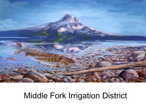
Middle Fork Irrigation District
Middle Fork Irrigation District
Middle Fork Irrigation District

Create successful ePaper yourself
Turn your PDF publications into a flip-book with our unique Google optimized e-Paper software.
<strong>Middle</strong> <strong>Fork</strong> <strong>Irrigation</strong> <strong>District</strong>
<strong>Middle</strong> <strong>Fork</strong> <strong>Irrigation</strong> <strong>District</strong> boundaries are the <strong>Middle</strong> <strong>Fork</strong> of the Hood River on the west and the East <strong>Fork</strong> of the Hood<br />
River on the east and north. On the south the watershed for the <strong>District</strong> extends onto the northern slopes of Mt. Hood and<br />
includes Eliot, Langille and Coe Glaciers. The small town of Parkdale, is located near the center of MFID irrigated lands.<br />
Locally the area is described as being in the Upper Hood River Valley.
Hydroelectric power is generated at three locations year around as an integral part of the <strong>Middle</strong> <strong>Fork</strong><br />
<strong>Irrigation</strong> <strong>District</strong> water distribution system. Within each powerhouse are water turbine generators, control<br />
panels and the required hydraulic control and station service equipment. The three powerhouses, allowing<br />
for differences in turbine configuration and site requirements, are similar in design and construction. Pelton<br />
water turbines are used in powerhouses one and three, where water is returned to the stream at<br />
atmospheric pressure. The Francis turbine in powerhouse two is a totally enclosed pipeline system, where<br />
the operating head is determined by downstream conditions. Financing for the hydroelectric project totaled<br />
7.5 million dollars.
Clear Branch Dam<br />
Laurance Lake Reservoir<br />
The dam is an earth and rock zone fill<br />
approximately 1350 feet long with a top width<br />
of 28 feet. Height of the dam is 106 feet and<br />
water depth at the spillway crest elevation is<br />
100 feet. Construction was under the<br />
authority of the Watershed Protection and<br />
Flood Prevention Act (Public Law 566).<br />
When full the spillway elevation is<br />
2978 feet msl. The surface of<br />
Laurance lake is approximately 130<br />
acres.<br />
Minimum flow regimes below Clear Branch Dam are:<br />
3 cfs for the period starting July 10 and extending through October 7 of each year.<br />
50% of calculated reservoir inflow up to 20 cfs from October 8 through July 10.<br />
These flows can be reduced at the discretion of the fishery management agencies if t would be in the<br />
interest of fisheries resources to do so in so far as such reduction does not interfere with the primary<br />
function of the reservoir.
Old Coe Diversion<br />
The Coe Branch Diversion is located<br />
approximately 0.8 miles upstream of the<br />
confluence with <strong>Middle</strong> <strong>Fork</strong> of Hood River,<br />
being within the SE ¼ NE ¼ Section 27 T 1<br />
S. R 9 E. Original construction was<br />
completed in December 1987. The Coe<br />
Creek Diversion was upgraded in the fall of<br />
2009. The dam and drop inlet grate<br />
structure was removed and replaced with a<br />
25 ft long angled concrete water entry wall,<br />
fish bypass channel and drop pools. An<br />
agency approved 50 foot FCA horizontal flat<br />
plate dual stage screen was installed. This<br />
resulted in the addition of 3 miles of<br />
upstream habitat for fish and met water<br />
quality standard objectives and restoration<br />
priorities in the Hood River Basin.<br />
New Coe Creek Diversion
Old Eliot Diversion<br />
Construction on the Eliot Branch Diversion was started September 13,<br />
1965 and was completed December 10, 1965. Due to glacial<br />
outbursts/debris torrent events the facilities have been<br />
replaced/repaired four times. The Eliot Diversion is located on Eliot<br />
Branch (Creek) approximately 1 mile upstream from the <strong>Middle</strong> <strong>Fork</strong><br />
Hood River, five miles southwest of Parkdale, OR in SW 1/4 NE 1/4<br />
Section 26, Township 1 South, Range 9 East of the Willamette<br />
Meridian.
In November 2006, a debris flow completely destroyed the Eliot diversion and<br />
the Eliot branch moved approx 1,000 feet to the East..
The Diversion facilities were rebuilt with a<br />
side channel inlet and criteria fish screen<br />
in the spring of 2007. From the diversion<br />
facilities water enters the Eliot ditch. The<br />
ditch provides conveyance of water from<br />
the point of diversion to the sediment<br />
basin. At the Sediment Basin waters from<br />
Clear Branch Dam, Coe Creek diversion<br />
and Eliot Diversion can be mixed and<br />
distributed into the system<br />
New Eliot Creek Diversion
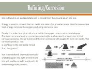
Penstock Damage
Coe Damage