
You also want an ePaper? Increase the reach of your titles
YUMPU automatically turns print PDFs into web optimized ePapers that Google loves.
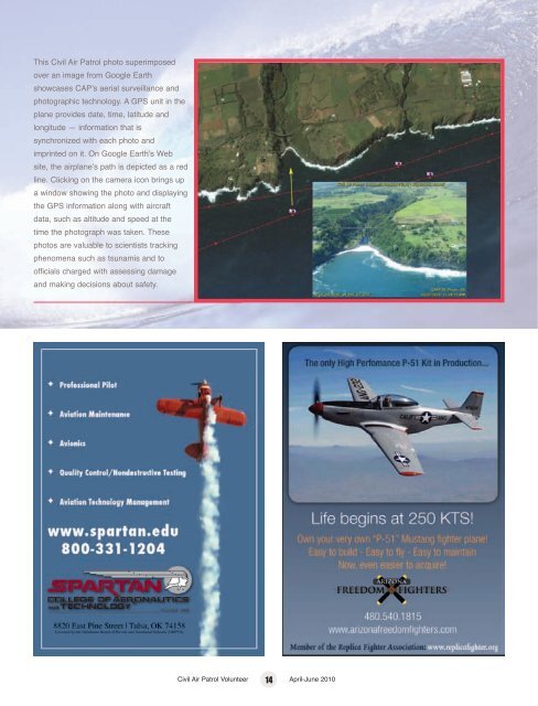
This Civil Air Patrol photo superimposed<br />
over an image from Google Earth<br />
showcases CAPʼs aerial surveillance and<br />
photographic technology. A GPS unit in the<br />
plane provides date, time, latitude and<br />
longitude — information that is<br />
synchronized with each photo and<br />
imprinted on it. On Google Earthʼs Web<br />
site, the airplaneʼs path is depicted as a red<br />
line. Clicking on the camera icon brings up<br />
a window showing the photo and displaying<br />
the GPS information along with aircraft<br />
data, such as altitude and speed at the<br />
time the photograph was taken. These<br />
photos are valuable to scientists tracking<br />
phenomena such as tsunamis and to<br />
officials charged with assessing damage<br />
and making decisions about safety.<br />
Civil Air Patrol Volunteer 14 April-June 2010