

Loddon Tracks and Trails Strategy - Loddon Shire Council
Loddon Tracks and Trails Strategy - Loddon Shire Council
Loddon Tracks and Trails Strategy - Loddon Shire Council

Create successful ePaper yourself
Turn your PDF publications into a flip-book with our unique Google optimized e-Paper software.
<strong>Loddon</strong> <strong>Tracks</strong> <strong>and</strong> <strong>Trails</strong><br />
<strong>Strategy</strong><br />
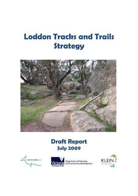
Draft Report<br />
July 2009
Disclaimer<br />
The information contained in this report is intended for the specific use of the within<br />
named party to which it is addressed ("the communityvibe client") only. All<br />
recommendations by communityvibe are based on information provided by or on behalf<br />
of the communityvibe client <strong>and</strong> communityvibe has relied on such information being<br />
correct at the time this report is prepared.<br />
communityvibe shall take no responsibility for any loss or damage caused to the<br />
communityvibe client or to any third party whether direct or consequential as a result of<br />
or in any way arising from any unauthorised use of this report or any recommendations<br />
contained within.<br />
Prepared By<br />
In cooperation with<br />
70 Bull Street<br />
BENDIGO VIC 3550<br />
Ph: 03 5444 0015<br />
E: kla@netcon.net.au<br />
Authors: Report Date:<br />
Wendy Holl<strong>and</strong> July 2009<br />
Karoline Klein<br />
Shaun Quayle<br />
communityvibe<br />
5 Allison St<br />
BENDIGO VIC 3550<br />
Ph: 0438 433 555<br />
E: wendy@communityvibe.com.au<br />
www.communityvibe.org.au
Acknowledgements<br />
communityvibe, Klein L<strong>and</strong>scape Architecture <strong>and</strong> <strong>Loddon</strong> <strong>Shire</strong> <strong>Council</strong> would like to<br />
thank the following individuals for their contributions to the <strong>Loddon</strong> <strong>Tracks</strong> <strong>and</strong> <strong>Trails</strong><br />
<strong>Strategy</strong>:<br />
NAME ORGANISATION<br />
Allan Stobaus <strong>Loddon</strong> <strong>Shire</strong> <strong>Council</strong><br />
Tim Jenkyn <strong>Loddon</strong> <strong>Shire</strong> <strong>Council</strong><br />
Tony Bellenger <strong>Loddon</strong> <strong>Shire</strong> <strong>Council</strong><br />
Robyn Vella <strong>Loddon</strong> <strong>Shire</strong> <strong>Council</strong><br />
Jesse Sherwood Department of Planning <strong>and</strong> Community<br />
Development<br />
Jenny Dyer Department of Planning <strong>and</strong> Community<br />
Paul Haw<br />
Development<br />
Nature Tourism Group, Boort<br />
Jade Logie Parks Victoria, Inglewood<br />
David Martin Parks Victoria, Inglewood<br />
Leeza Axton Parks Victoria, Echuca<br />
Sharon Thomas DSE, Bendigo<br />
Amy Groch DSE, Bendigo<br />
Graeme Oxlade DSE, Bendigo<br />
Julie Wynd DSE, Bendigo<br />
Mary Evans Inglewood DHS<br />
Daryl Fish Inglewood Planned Activity Group<br />
Rosalie Ball Inglewood Aged Care Hostel<br />
Community members who attended<br />
workshops<br />
Boort, Inglewood <strong>and</strong> Tarnagulla
Table of Contents<br />
1.0 Executive Summary ................................................................................................ 1<br />
2.0 Introduction ............................................................................................................... 5<br />
2.1 Methodology .......................................................................................................... 6<br />
2.2 Scope of the <strong>Strategy</strong> ......................................................................................... 7<br />
2.3 Definitions .............................................................................................................. 8<br />
2.4 Benefits of <strong>Tracks</strong> <strong>and</strong> <strong>Trails</strong> ........................................................................... 10<br />
2.5 National <strong>and</strong> International Trends in <strong>Tracks</strong> <strong>and</strong> <strong>Trails</strong> ............................ 11<br />
2.6 The Cost of Not Providing <strong>Tracks</strong> <strong>and</strong> <strong>Trails</strong> in a Community ................. 12<br />
3.0 Local Context .......................................................................................................... 13<br />
4.0 Our Community <strong>and</strong> Our Visitors ....................................................................... 15<br />
4.1 <strong>Loddon</strong> <strong>Shire</strong> Profile .......................................................................................... 15<br />
4.2 Future Demographic Projections .................................................................... 15<br />
4.3 Potential Local Market ....................................................................................... 16<br />
4.4 Potential Visitor Market .................................................................................... 17<br />
4.5 Total Potential Market ....................................................................................... 18<br />
4.6 Economic Benefits of <strong>Trails</strong> .............................................................................. 19<br />
5.0 Vision <strong>and</strong> Principles ............................................................................................. 21<br />
5.1 Our Vision ............................................................................................................ 21<br />
5.2 Our Principles ...................................................................................................... 21<br />
6.0 <strong>Tracks</strong> <strong>and</strong> <strong>Trails</strong> within the <strong>Loddon</strong> <strong>Shire</strong> <strong>Council</strong> ........................................ 22<br />
6.1 Current Distribution of <strong>Tracks</strong> <strong>and</strong> <strong>Trails</strong> ..................................................... 22<br />
6.2 <strong>Tracks</strong> <strong>and</strong> <strong>Trails</strong> in Surrounding Municipalities ......................................... 24<br />
6.3 Current Trail Usage <strong>and</strong> Needs ....................................................................... 27<br />
6.4 Dem<strong>and</strong> for <strong>Tracks</strong> <strong>and</strong> <strong>Trails</strong> in <strong>Loddon</strong> <strong>Shire</strong> ........................................... 29<br />
7.0 Planning <strong>and</strong> Design .............................................................................................. 31<br />
7.1 Needs of Walkers ............................................................................................... 31<br />
7.2 Needs of Cyclists ................................................................................................ 32<br />
7.3 Needs of Horse Riders ...................................................................................... 33<br />
7.4 Needs of Canoeists ............................................................................................ 34<br />
7.5 Needs of Traditionally Disadvantaged Groups ............................................ 35<br />
7.6 Potential Partners .............................................................................................. 36<br />
7.7 Classifications of <strong>Tracks</strong> <strong>and</strong> <strong>Trails</strong> ................................................................ 37<br />
7.7.1 Design of Shared <strong>Trails</strong> in <strong>Loddon</strong> <strong>Shire</strong> <strong>Council</strong> ................................ 38<br />
8.0 Design Guidelines .................................................................................................. 41<br />
8.1 Regulations <strong>and</strong> St<strong>and</strong>ards .............................................................................. 41<br />
8.2 Designing Quality, Well Used <strong>Trails</strong> ............................................................... 41<br />
8.3 Location ................................................................................................................ 42<br />
8.4 Connectivity ........................................................................................................ 42<br />
8.5 Legibility ............................................................................................................... 42<br />
8.6 Trail Surface ........................................................................................................ 43<br />
8.7 Trail Width ........................................................................................................... 43<br />
8.8 Amenities ............................................................................................................. 43<br />
8.9 Accessibility ......................................................................................................... 44<br />
8.10 Trail Maps .......................................................................................................... 44<br />
8.11 Signage .............................................................................................................. 45
8.12 Trail Heads ........................................................................................................ 47<br />
9.0 Management <strong>and</strong> Maintenance of <strong>Tracks</strong> <strong>and</strong> <strong>Trails</strong> ..................................... 48<br />
9.1 Proposed Management Structures <strong>and</strong> Requirements .............................. 48<br />
9.2 Proposed Maintenance Regime ....................................................................... 49<br />
9.3 Maintenance Budget .......................................................................................... 51<br />
9.4 Marketing ............................................................................................................. 51<br />
9.5 Gaps <strong>and</strong> Opportunities .................................................................................... 53<br />
10.0 Recommendations ............................................................................................... 55
1.0 Executive Summary<br />
<strong>Loddon</strong> <strong>Shire</strong> offers enormous potential for outdoor activities such as walking, cycling,<br />
canoeing, kayaking <strong>and</strong> horse riding. Situated in northern Victoria, the <strong>Shire</strong><br />
incorporates a range of different l<strong>and</strong>scapes ranging from rocky granitic outcrops vast<br />
stretches of forest <strong>and</strong> grassl<strong>and</strong>s, peaceful me<strong>and</strong>ering rivers <strong>and</strong> waterways through<br />
to rural farml<strong>and</strong> vistas. Historically <strong>and</strong> culturally it features areas of significant<br />
Aboriginal <strong>and</strong> importance <strong>and</strong> well preserved buildings from the Gold Rush era. A<br />
variety of rare <strong>and</strong> threatened flora <strong>and</strong> fauna also exist, adding to the attraction of<br />
natural areas within the <strong>Shire</strong>.<br />
The local community, in partnership with the <strong>Loddon</strong> <strong>Shire</strong> <strong>Council</strong> <strong>and</strong> Parks Victoria<br />
has been instrumental in developing <strong>and</strong> maintaining tracks <strong>and</strong> trails in <strong>and</strong> around<br />
local towns for the benefit of both local residents <strong>and</strong> visitors to the area. In addition,<br />
there is a good network of tracks <strong>and</strong> trails through State <strong>and</strong> national forests <strong>and</strong> parks<br />
throughout the <strong>Shire</strong>, mostly designed for walking, but with an increasing dem<strong>and</strong> from<br />
mountain bikers.<br />
The benefits of tracks <strong>and</strong> trails to a community are well documented. Socially, people<br />
have the opportunity to interact with family <strong>and</strong> friends by participating in shared<br />
activities. They also have the opportunity to develop networks with the local community<br />
by becoming involved in management <strong>and</strong> maintenance activities, events, walking<br />
programs, or simply by using trails <strong>and</strong> regularly meeting other trail users.<br />
From a health perspective there is much to be gained from participating in physical<br />
activities such as walking, cycling, canoeing, kayaking <strong>and</strong> horse riding. Regular<br />
participation in physical activities reduces the risk of developing certain illnesses <strong>and</strong><br />
diseases such as cardio-vascular disease, obesity, type two diabetes <strong>and</strong> specific<br />
cancers. It also helps to improve energy <strong>and</strong> concentration levels, confidence, selfesteem,<br />
coordination <strong>and</strong> muscle tone. As <strong>Loddon</strong> <strong>Shire</strong>’s population is ageing, the<br />
need for sport <strong>and</strong> recreation facilities that cater for all ages <strong>and</strong> all abilities will become<br />
increasingly important as a medium to maintain health.<br />
Economic benefits are also achievable through the development of tracks <strong>and</strong> trails.<br />
There is likely to be an increase in dem<strong>and</strong> for accommodation, food <strong>and</strong> supplies such<br />
as bicycles, walking shoes, saddles, canoes, etc as a result of more people taking part in<br />
activities suitable for trails. Additional employment <strong>and</strong> business opportunities may also<br />
result, e.g. tour guiding, bed <strong>and</strong> breakfasts, cafes, etc. The availability of interesting<br />
tracks <strong>and</strong> trails may also encourage visitors to stay for a longer period of time in the<br />
<strong>Shire</strong>, as has been evidenced in other locations around the state.<br />
From an environmental perspective, tracks <strong>and</strong> trails have the potential to encourage<br />
trail users to develop a greater appreciation <strong>and</strong> underst<strong>and</strong>ing of local flora, fauna,<br />
geography, history <strong>and</strong> culture through the use of interpretive initiatives. Furthermore,<br />
the activities undertaken on trails, if appropriately managed, provide minimal impact on<br />
the environment <strong>and</strong> offer a pollution free form of transport.<br />
1
Whilst trail users have indicated that they enjoy:<br />
• the natural views<br />
• proximity to water<br />
• peacefulness<br />
• tranquility<br />
• lack of traffic along tracks <strong>and</strong> trails in <strong>Loddon</strong> <strong>Shire</strong><br />
• opportunity to see flora <strong>and</strong> fauna;<br />
there are some issues that need to be addressed to improve the tracks <strong>and</strong> trails<br />
network.<br />
The audit undertaken as part of the <strong>Strategy</strong> has identified examples of tracks <strong>and</strong> trails:<br />
• established in isolation of other trails – thereby limiting opportunities for linkages,<br />
connections <strong>and</strong> short self-contained loops<br />
• that have obstacles across them such as locked gates – thereby limiting their<br />
appeal <strong>and</strong> use<br />
• with limited maintenance – thereby causing rapid deterioration of the track <strong>and</strong><br />
limited usage in the long term<br />
• that have been developed without consulting with the relevant l<strong>and</strong> or water<br />
management authority – thereby potentially causing environmental damage<br />
• that have been developed in towns without a compact surface – thereby making<br />
them inaccessible to people with mobility issues<br />
• that have either no name or a series of different names – thereby causing<br />
confusion amongst potential trail users<br />
• that lack any form of signage or maps – thereby making it very difficult for people<br />
to identify where a track starts <strong>and</strong> ends <strong>and</strong> whether or not the user is still on the<br />
correct trail<br />
• state that they are accessible for people with disabilities when in fact they are not<br />
– thereby potentially causing injury to trail users<br />
• lack any form of supporting infrastructure such as seats, rest stops, picnic areas,<br />
etc – thereby making the experience less attractive for potential trail users<br />
• that do not provide interpretive signage – thereby limiting the experience of the<br />
trail user <strong>and</strong> reducing opportunities to encourage greater appreciation of the<br />
natural <strong>and</strong> cultural environments<br />
As a result of the research undertaken in the development of this <strong>Strategy</strong>, a number of<br />
gaps <strong>and</strong> opportunities have been identified in <strong>Loddon</strong> <strong>Shire</strong>’s current tracks <strong>and</strong> trails<br />
network.<br />
Gaps that have been identified include:<br />
• Signage is currently inadequate on most trails. There needs to be a trail head<br />
sign, directional signage <strong>and</strong> trail marker signage (signage that reassures you<br />
that you are still on the right track) at a minimum on most trails (except for level 5<br />
trails, <strong>and</strong> to a lesser extent on grade 4 trails).<br />
• Consistent names of tracks need to be used on trails <strong>and</strong> on brochures. Some<br />
tracks appear to have up to three names on brochures, but none on the ground.<br />
2
Each trail should be named on brochures <strong>and</strong> on trail head signage to avoid<br />
confusion by users<br />
• Some areas designed for people with disabilities do not actually meet<br />
regulations. Where access is provided for people of all abilities, it needs to meet<br />
current DDA st<strong>and</strong>ards.<br />
• Confusion regarding the correct route occurs on some trails as the route is not<br />
clear. <strong>Trails</strong> need to be free of hazards <strong>and</strong> barriers such as locked gates, rocks<br />
or branches across paths, etc.<br />
• Maintenance levels vary from track to track. There needs to be a greater<br />
emphasis on maintaining existing tracks to ensure that the asset is well used <strong>and</strong><br />
does not deteriorate unnecessarily.<br />
• Connections <strong>and</strong> linkages between trails is limited, as are opportunities for<br />
shorter self-contained loops<br />
• Lack of trails in areas where people would expect to see or like to see trails.<br />
Opportunities that have been identified include:<br />
• To develop marketing materials so that both local residents <strong>and</strong> visitors to the<br />
area are aware of existing trails <strong>and</strong> are encouraged to use them. Promotional<br />
tools may include a link on or from <strong>Loddon</strong> <strong>Shire</strong> <strong>Council</strong>’s website with<br />
downloadable maps <strong>and</strong> information, as well as hard copy brochures <strong>and</strong> a<br />
number of other tools<br />
• To improve people’s underst<strong>and</strong>ing <strong>and</strong> appreciation of the natural<br />
environment <strong>and</strong> local history by providing interpretive information on trail head<br />
signage <strong>and</strong> on promotional material such as brochures <strong>and</strong> website.<br />
• To provide opportunities for increased physical activity participation by visitors<br />
<strong>and</strong> motorists by instigating a “Stop <strong>and</strong> Walk” campaign, whereby every<br />
recognised rest stop along highways becomes a trail head for a local walk, or at<br />
least provides directional signage <strong>and</strong> information about local walks.<br />
• To develop guided or self-guided packaged tours. These tours could<br />
incorporate options such as public transport, accommodation, dining <strong>and</strong><br />
discounts to local attractions.<br />
• To develop, facilitate or bid for walking, running, orienteering, mountain biking,<br />
cycling, canoeing or horse riding events using existing or future trails. These<br />
events could form part of a local festival or be an event in their own right, e.g.<br />
World Orienteering Competition.<br />
• To develop a local management committee to oversee the <strong>Strategy</strong>’s<br />
implementation. It is recommended that the existing <strong>Loddon</strong> <strong>Shire</strong> <strong>Council</strong><br />
Nature Tourism Committee, which includes representatives from <strong>Loddon</strong> <strong>Shire</strong>,<br />
nature based tourism groups <strong>and</strong> Parks Victoria, becomes the committee with<br />
this delegated responsibility. The role of this committee is to ensure that all<br />
relevant management bodies <strong>and</strong> organisations meet regularly to discuss issues<br />
pertaining to tracks <strong>and</strong> trails, plan for future developments, implement the<br />
recommendations contained within the <strong>Tracks</strong> <strong>and</strong> <strong>Trails</strong> <strong>Strategy</strong> <strong>and</strong> evaluate<br />
the <strong>Strategy</strong>. The committee may establish sub-committees as required to<br />
broaden its membership or to seek specialist advice. Additional groups may<br />
include relevant local management organisations such as community planning<br />
groups, Friends of Kooyoora, Department of Sustainability <strong>and</strong> Environment,<br />
VicRoads, relevant water authorities, health organisations, schools, etc.<br />
3
This <strong>Strategy</strong> therefore aims to identify existing tracks <strong>and</strong> trails within <strong>Loddon</strong> <strong>Shire</strong> <strong>and</strong><br />
provide ideas on improvements to these important community assets so that they are<br />
well utilised by locals <strong>and</strong> visitors to the area <strong>and</strong> are managed <strong>and</strong> maintained to an<br />
acceptable st<strong>and</strong>ard. It also attempts to identify new opportunities that are required in<br />
order to ensure that residents in <strong>and</strong> visitors to each of the major towns has access to a<br />
minimum level of tracks <strong>and</strong> trails infrastructure linking the town to key local attractions<br />
or services. New opportunities have also been identified for a long distance iconic<br />
trail, (Inglewood to Mt Kooyoora Trail) <strong>and</strong> the development of new canoe <strong>and</strong><br />
kayaking trails on the <strong>Loddon</strong> River <strong>and</strong> Serpentine Creek.<br />
Recommendations have also been developed to:<br />
• improve links between trails;<br />
• improve connectivity of existing trails;<br />
• improve trail design (through the development of specific guidelines);<br />
• instigate a “Stop <strong>and</strong> Walk” program (aimed at encouraging motorists to stop <strong>and</strong><br />
walk in towns);<br />
• identify potential events to encourage usage of tracks <strong>and</strong> trails;<br />
• ensure interpretation opportunities are made available,<br />
• improve marketing <strong>and</strong> promotion of tracks <strong>and</strong> trails,<br />
• improve the coordination, management <strong>and</strong> planning of trails;<br />
• provide appropriate maintenance schedules.<br />
All recommendations have been made, bearing in mind <strong>Loddon</strong> <strong>Shire</strong>’s limited<br />
resources; <strong>and</strong> will ultimately result in a much improved tracks <strong>and</strong> trails network that will<br />
appeal to many existing <strong>and</strong> potential trail users. A comprehensive implementation plan<br />
has been developed to assist with this process.<br />
4
2.0 Introduction<br />
<strong>Loddon</strong> <strong>Shire</strong> <strong>Council</strong> has commissioned a <strong>Tracks</strong> <strong>and</strong> <strong>Trails</strong> <strong>Strategy</strong> to help:<br />
• identify <strong>and</strong> review existing tracks <strong>and</strong> trails located within <strong>Loddon</strong> <strong>Shire</strong>; <strong>and</strong><br />
• identify a clear direction for the <strong>Shire</strong> from 2008-2013 in terms of tracks <strong>and</strong> trails<br />
provision, future development, management, maintenance <strong>and</strong> marketing.<br />
Specific actions associated with the project are:<br />
• review the audit of tracks <strong>and</strong> trails currently being undertaken by <strong>Council</strong> staff to<br />
identify the current condition <strong>and</strong> st<strong>and</strong>ard of existing infrastructure.<br />
• identify existing <strong>and</strong> future tracks in adjoining municipalities to ensure linkages<br />
are created, e.g. the Great Dividing Trail <strong>and</strong> the Goldfields to Murray Trail<br />
• consult widely with local communities to identify specific needs <strong>and</strong> to build their<br />
capacity to be actively involved in the project, using a variety of consultation<br />
methods<br />
• provide <strong>Loddon</strong> <strong>Shire</strong> <strong>Council</strong> with advice on issues <strong>and</strong> needs which need to be<br />
addressed in the provision of quality tracks <strong>and</strong> trails, e.g. management models,<br />
ongoing maintenance, strategic planning <strong>and</strong> community involvement<br />
• identify needs of specific population groups such as cyclists, recreational horse<br />
riders, canoeists, older people, people with disabilities, women, young people<br />
<strong>and</strong> other recreational groups in the provision of tracks <strong>and</strong> trails opportunities.<br />
• identify synergies <strong>and</strong> potential shared opportunities between recreation /leisure,<br />
tourism, economic development, health, community services <strong>and</strong> the<br />
environment to ensure that relevant resources are shared <strong>and</strong> tracks <strong>and</strong> trails<br />
development opportunities are enhanced.<br />
• interpret <strong>and</strong> identify relevant themes i.e. l<strong>and</strong>scape, heritage <strong>and</strong> culture.<br />
5
2.1 Methodology<br />
The methodology adopted for this <strong>Strategy</strong> is as follows:<br />
Task Description<br />
Literature Review A range of relevant literature was reviewed to assist with the<br />
underst<strong>and</strong>ing of previous <strong>Council</strong> <strong>and</strong> stakeholder policy directions.<br />
Development of<br />
Planning Principles<br />
<strong>and</strong> Definitions<br />
Trends Analysis <strong>and</strong><br />
Identification of Best<br />
Practice in relation to<br />
<strong>Tracks</strong> <strong>and</strong> <strong>Trails</strong><br />
Review of Visitor<br />
Information Statistics<br />
<strong>and</strong> Local Participation<br />
Statistics<br />
Review Audit <strong>and</strong><br />
Develop Maps of<br />
Existing <strong>Tracks</strong> <strong>and</strong><br />
<strong>Trails</strong><br />
Detail <strong>and</strong> map other<br />
tracks <strong>and</strong> trails in<br />
adjoining<br />
municipalities<br />
Key Stakeholder<br />
Interviews<br />
Hard Copy <strong>and</strong><br />
Electronic Surveys of<br />
potential <strong>Tracks</strong> <strong>and</strong><br />
<strong>Trails</strong> users<br />
This component of the report identified planning principles to guide<br />
future decision making about tracks <strong>and</strong> trails in the future <strong>and</strong> clearly<br />
defined what tracks <strong>and</strong> trails are.<br />
Specific trends <strong>and</strong> best practice issues relevant to tracks <strong>and</strong> trails<br />
(e.g. management options, marketing opportunities, surface types,<br />
development of loops, etc) were researched as part of the project,<br />
using resources available from organisations such as Bicycle Victoria,<br />
Rail <strong>Trails</strong>, tourism bodies, Parks <strong>and</strong> Leisure Australia, World Leisure,<br />
etc.<br />
A review of visitor information statistics was undertaken to identify<br />
visitor characteristics for <strong>Loddon</strong> <strong>Shire</strong> <strong>and</strong> the potential market for<br />
cycling / walking. ERASS statistics <strong>and</strong> local information were also<br />
analysed to identify the local market <strong>and</strong> its characteristics.<br />
A template was developed to assist <strong>Council</strong> staff to carry out an audit<br />
of all existing tracks <strong>and</strong> trails. The results of the audit were then<br />
analysed to gain an underst<strong>and</strong>ing of the current condition of trails <strong>and</strong><br />
associated issues. All tracks <strong>and</strong> trails were then physically assessed<br />
by the project team via a combination of vehicle, foot <strong>and</strong> bicycle to<br />
examine any specific issues identified through the audit in more detail.<br />
Maps were produced outlining the position of all existing <strong>and</strong> proposed<br />
tracks <strong>and</strong> trails in the municipality.<br />
Discussions were held with neighbouring municipalities to determine<br />
the location of existing <strong>and</strong> proposed tracks <strong>and</strong> trails. These tracks<br />
<strong>and</strong> trails were mapped <strong>and</strong> potential linkages identified with <strong>Loddon</strong>’s<br />
tracks <strong>and</strong> trails network.<br />
Meetings were held with key stakeholders on an individual or small<br />
group basis to discuss issues <strong>and</strong> opportunities related to the use,<br />
development, marketing <strong>and</strong> management models of <strong>Tracks</strong> <strong>and</strong><br />
<strong>Trails</strong>. A list of key stakeholders is included within the report.<br />
A short survey was distributed throughout key organisations <strong>and</strong><br />
community hubs in <strong>Loddon</strong> <strong>Shire</strong> (e.g. swimming pools, schools, etc)<br />
to determine needs of both existing <strong>and</strong> potential users of tracks <strong>and</strong><br />
trail (both residents <strong>and</strong> visitors). This survey was also available on<br />
line for people to complete<br />
Written Submissions A written submission form was made available on the <strong>Loddon</strong> <strong>Shire</strong><br />
<strong>Council</strong>’s website to allow local residents to provide feedback on their<br />
specific needs in relation to tracks <strong>and</strong> trails. Hard copy submission<br />
forms were also available at <strong>Council</strong>’s service centres for comment.<br />
Community<br />
Workshops<br />
Four community workshops were held to identify the needs of local<br />
communities in relation to tracks <strong>and</strong> trails. These workshops were<br />
6
Task Description<br />
held in Wedderburn, Boort, Pyramid Hill <strong>and</strong> Inglewood.<br />
Identification of<br />
potential funding<br />
options<br />
A review of grants, trusts <strong>and</strong> private industry was undertaken to<br />
identify potential sources of funding for tracks <strong>and</strong> trails in the future.<br />
Design Guidelines A series of design guidelines were prepared for <strong>Loddon</strong> <strong>Shire</strong> <strong>Council</strong><br />
to assist with future design <strong>and</strong> upgrades of tracks <strong>and</strong> trails, using<br />
industry st<strong>and</strong>ards, best practice ideas <strong>and</strong> considering local needs<br />
<strong>and</strong> capacities. The design guidelines incorporate surfaces, widths,<br />
associated infrastructure, signage, etc.<br />
Maintenance schedule In partnership with <strong>Council</strong>’s parks <strong>and</strong> gardens staff, a maintenance<br />
schedule was developed to ensure that tracks <strong>and</strong> trails are regularly<br />
maintained <strong>and</strong> so that a budgetary amount is set aside each year for<br />
maintenance, repairs <strong>and</strong> upgrades.<br />
Marketing <strong>Strategy</strong> An assessment of existing <strong>and</strong> potential tracks <strong>and</strong> trails was<br />
undertaken to identify specific themes, e.g. l<strong>and</strong>scape, heritage,<br />
culture, food <strong>and</strong> wine, nature, etc. This formed part of the marketing<br />
strategy. The marketing strategy also determined the most suitable<br />
format <strong>and</strong> outlets in which to promote tracks <strong>and</strong> trails throughout the<br />
municipality.<br />
Planning Workshop<br />
with <strong>Council</strong>lors <strong>and</strong><br />
<strong>Council</strong> Managers<br />
Development of Draft<br />
<strong>and</strong> Final Plans<br />
A presentation was made to <strong>Council</strong>lors <strong>and</strong> Managers to allow these<br />
elected representatives <strong>and</strong> senior staff to provide feedback on the<br />
works undertaken thus far.<br />
The Final Plan will incorporate any changes made by <strong>Council</strong> following<br />
receipt <strong>and</strong> discussion of the Draft Plan.<br />
2.2 Scope of the <strong>Strategy</strong><br />
<strong>Tracks</strong> <strong>and</strong> trail incorporated within this strategy are recognised paths or sections of<br />
water that are suitable for cycling <strong>and</strong> walking, horse riding or canoeing. These tracks or<br />
trails are located on l<strong>and</strong> owned or managed by the Crown (Department of Sustainability<br />
or Parks Victoria) or <strong>Loddon</strong> <strong>Shire</strong> <strong>Council</strong> or on waterways controlled by the Crown or<br />
water authorities. <strong>Tracks</strong> or trails that exist on private l<strong>and</strong> have not been included. For<br />
the purpose of this report, tracks <strong>and</strong> trails do not include footpaths unless the footpaths<br />
are shared paths designed for both walking <strong>and</strong> cycling. Similarly, tracks <strong>and</strong> trails do<br />
not include roads unless the roads are unmade, located within state or national parks<br />
<strong>and</strong> experience low levels of vehicle use.<br />
7
2.3 Definitions<br />
A range of different terms are used to describe tracks <strong>and</strong> trails, their various<br />
components <strong>and</strong> user groups. Each of these aspects is defined as follows:<br />
• Track <strong>and</strong> Trail – “A trail is a pedestrian path or road mainly used for walking,<br />
but often also for cycling, cross-country skiing or other activities. Some trails are<br />
off-limits to everyone other than hikers, <strong>and</strong> few trails allow motorized<br />
vehicles…In Australia, the word track can be used interchangeably with trail, <strong>and</strong><br />
can refer to anything from a dirt road to a pedestrian walkway (generally also<br />
unpaved). The term "trail" gained popularity during World War II, when many<br />
servicemen from the United States were stationed in Australia, which probably<br />
influenced its being adopted by elements of the Australian media at the time. In<br />
New Zeal<strong>and</strong>, the word track is used almost exclusively except in reference to<br />
cross-country skiing, where trail is used” 1 .<br />
• Footpath – “An area open to the public that is designated for, or has as one of its<br />
main uses, use by pedestrians, but does not include a shared use path” 2<br />
• Bicycle Path – “A path or path section intended for the exclusive use of cyclists,<br />
generally referred to …as an exclusive bicycle path” 3<br />
• Shared Use Path – “A path open to the public that is designated for, or has as<br />
one of its main uses, use by both cyclists <strong>and</strong> pedestrians, but does not include a<br />
separated footpath or a footpath adjacent to a road” 4<br />
• On road – sealed path joined to a road <strong>and</strong> predominantly used by road bikes<br />
• Off road – path constructed a short distance away from a road – may be asphalt,<br />
concrete, crushed rock, granitic s<strong>and</strong>, gravel, or unmade dirt track –<br />
predominantly used by walkers, hybrid bikes or mountain bikes<br />
• Rural road – usually unmade gravel or dirt roads which are frequently used by<br />
cyclists due to the lower traffic volumes than main roads <strong>and</strong> highways<br />
• Bush track – trail through bush l<strong>and</strong> or next to rivers, generally some distance<br />
from roads, usually an unmade dirt track, used by walkers, hybrid bikes,<br />
mountain bikes, dirt bikes, horses<br />
• Rail Trail – cycling / walking trail built along a disused railway line<br />
• Rails with <strong>Trails</strong> – trails located alongside operating railway lines<br />
• Utility service road – trails that have been established along service roads used<br />
occasionally by utilities such as water authorities to check on their assets (e.g.<br />
irrigation channels), also used by walkers, hybrid bikes <strong>and</strong> mountain bikes.<br />
1 Wikipedia - http://en.wikipedia.org/wiki/Trail<br />
2 Austroads – “Guide to Traffic Engineering Practice – Bicycles – Part 14” (1999)<br />
3 Austroads – “Guide to Traffic Engineering Practice – Bicycles – Part 14” (1999)<br />
4 Austroads – “Guide to Traffic Engineering Practice – Bicycles – Part 14” (1999)<br />
8
• Cyclist – “Rider of a bicycle or human powered vehicle” 5<br />
• Pedestrian – “A person walking, <strong>and</strong> including people in wheelchairs, on roller<br />
skates or riding on toy vehicles such as skate boards or other vehicles, other<br />
than by bicycle, powered by human effort or motor with a maximum speed of 10<br />
km/h” 6<br />
• Walker – A person who travels from one place to another on foot for exercise,<br />
pleasure or as a form of transport.<br />
• Hiking – “is a subtype of walking, generally used to mean walking in nature<br />
areas on specially designated routes or trails, as opposed to in urban<br />
environments; however, hiking can also refer to any long-distance walk” 7 .<br />
• Mountain bike – “A mountain bike or mountain bicycle (abbreviated MTB or ATB<br />
(all terrain bicycle)) is a bicycle designed for off-road cycling, including jumps,<br />
<strong>and</strong> traversing of rocks <strong>and</strong> washouts, <strong>and</strong> steep declines, either on dirt trails,<br />
logging roads, or other unpaved environments. Bicycles typically used for<br />
mountain biking need to be able to withst<strong>and</strong> off-road use <strong>and</strong> the surmounting of<br />
obstacles such as logs <strong>and</strong> rocks.” 8 .<br />
• Hybrid bike – “is a bicycle designed for general-purpose utility or commuter<br />
cycling on paved <strong>and</strong> unpaved roads, paths, <strong>and</strong> trails. Also known under such<br />
names as City bike, Cross bike, or Commuter, the hybrid takes design features<br />
from both the road bike <strong>and</strong> mountain bike, with the goal of making a bike for<br />
general commuting <strong>and</strong> transportation.” 9 .<br />
• Trail head – specific points at which trails start or end<br />
• Human Powered Vehicles – “Refers to the array of alternative forms of pedal<br />
powered <strong>and</strong> h<strong>and</strong> cranked vehicles including recumbents, t<strong>and</strong>ems, tricycles,<br />
<strong>and</strong> bicycles with trailers” 10<br />
• Separated Path – A path divided into separated sections one of which is<br />
designated for the exclusive use of cyclists <strong>and</strong> an alternate section for other<br />
path users<br />
• Sealed Shoulder – “Refers to the sealed edge of roads outside of the travelled<br />
carriageway (the shoulder) of roads where cyclists might be expected to ride. It<br />
is delineated by an edge line applied between the sealed shoulder <strong>and</strong> the<br />
travelled section of a carriageway. The treatment is almost invariably associated<br />
with unkerbed roads, as is often applicable to rural roads” 11<br />
5 Austroads – “Guide to Traffic Engineering Practice – Bicycles – Part 14” (1999)<br />
6 Austroads – “Guide to Traffic Engineering Practice – Bicycles – Part 14” (1999)<br />
7 Wikipedia - http://en.wikipedia.org/wiki/Walking<br />
8 Wikipedia - http://en.wikipedia.org/wiki/Mountain_bike<br />
9 Wikipedia - http://en.wikipedia.org/wiki/Hybrid_bike<br />
10 Austroads – “Guide to Traffic Engineering Practice – Bicycles – Part 14” (1999)<br />
11 Austroads – “Guide to Traffic Engineering Practice – Bicycles – Part 14” (1999)<br />
9
2.4 Benefits of <strong>Tracks</strong> <strong>and</strong> <strong>Trails</strong><br />
According to the Victorian <strong>Trails</strong> <strong>Strategy</strong> 12 , visitors to trails are motivated by:<br />
“appreciating natural scenic beauty, experiencing physical<br />
challenge <strong>and</strong> exercise, involvement in the natural<br />
environment, gaining an awareness of nature, <strong>and</strong> the<br />
opportunity to socialise with friends or family or pursue a<br />
special interest.”<br />
There are many benefits to be gained from using trails. These potential benefits include:<br />
Social Physical Health <strong>and</strong> Wellbeing<br />
• Opportunity to interact with<br />
• Opportunity to improve health <strong>and</strong><br />
friends <strong>and</strong> family<br />
fitness levels <strong>and</strong> thereby<br />
• Opportunity to connect townships decrease community health care<br />
to one another<br />
costs<br />
• Opportunity to develop local<br />
• Increase self esteem <strong>and</strong><br />
events to increase community<br />
confidence<br />
strengthening <strong>and</strong> connectedness • Improve cardio vascular health<br />
• Opportunity to improve<br />
• Improve coordination<br />
community connectedness<br />
• Improve muscle tone<br />
through management <strong>and</strong><br />
• Reduce weight<br />
maintenance of trails<br />
• Sense of achievement<br />
• Less risk of heart disease <strong>and</strong><br />
certain types of diseases <strong>and</strong><br />
illnesses<br />
• Higher energy levels<br />
Environmental Economic<br />
• Encourage appreciation of natural<br />
environment through<br />
interpretation or through taking<br />
part in a tour with a licensed<br />
operator<br />
• Pollution free form of transport<br />
• Minimal impact on the<br />
environment due to limited or no<br />
use of fuel as part of the overall<br />
activity (some people drive to the<br />
beginning of a trail, hence there<br />
may be some greenhouse gas<br />
emissions)<br />
• Low cost activity<br />
• Increased dem<strong>and</strong> for products<br />
from local shops selling cycling /<br />
walking / horse riding / canoeing<br />
gear<br />
• Increased local employment<br />
opportunities <strong>and</strong> income for<br />
accommodation, food, transport,<br />
entertainment, guiding companies<br />
<strong>and</strong> tourist attractions<br />
• Increased local employment<br />
during trail construction if local<br />
trades are employed<br />
• Reduced need for establishment<br />
of car parks<br />
• Less wear <strong>and</strong> tear on roads<br />
• Increases value of properties<br />
located next to trails<br />
12 Victorian <strong>Trails</strong> Coordinating Committee – “Victorian <strong>Trails</strong> <strong>Strategy</strong> 2005-2010” (2005), pg 14<br />
10
2.5 National <strong>and</strong> International Trends in <strong>Tracks</strong> <strong>and</strong> <strong>Trails</strong><br />
Research shows that:<br />
• <strong>Tracks</strong> <strong>and</strong> trails are increasingly being used by personal fitness trainers <strong>and</strong><br />
boot camps<br />
• Commuter use of tracks <strong>and</strong> trails is increasing rapidly, particularly in regional<br />
<strong>and</strong> metropolitan areas<br />
• Bicycle sales have outnumbered car sales in Australia in recent years<br />
• Significant number of older adults <strong>and</strong> families are using tracks <strong>and</strong> trails on a<br />
regular basis as a form of leisure <strong>and</strong> exercise<br />
• Local Government Authorities are recognising trails as a legitimate form of<br />
recreation, a valued service to the community <strong>and</strong> a means of increasing<br />
economic returns to the community<br />
• Greater recognition of the social <strong>and</strong> physical benefits of cycling <strong>and</strong> walking<br />
amongst government agencies <strong>and</strong> the general community<br />
• Greater focus on higher quality surfaces by organisations constructing tracks <strong>and</strong><br />
trails<br />
• Increasing number of rail trails being developed<br />
• Value of linking tracks <strong>and</strong> trails to key locations in the community is being<br />
recognised as a significant factor in increasing physical activity levels<br />
• Tourism industry <strong>and</strong> operators recognise the value of walking <strong>and</strong> cycling trails<br />
in tourist areas<br />
• Communities are creating long distance trails with key attractions <strong>and</strong><br />
accommodation options along them in order to attract <strong>and</strong> retain tourists in their<br />
area (economic benefits)<br />
• Businesses specifically catering to users of tracks <strong>and</strong> trails are being<br />
established, e.g. Rail Trail Café at Porepunkah near Bright<br />
• High dem<strong>and</strong> for off-road trails<br />
• Interpretive features along trails can significantly add to the overall experience of<br />
trail users<br />
• <strong>Trails</strong> are used not only by walkers <strong>and</strong> cyclists, but also other forms of human<br />
powered vehicles <strong>and</strong> equipment, e.g. skate boarders, roller skaters, inline<br />
skaters, people with prams, people in wheelchairs, etc<br />
• Significant increase in the number of people riding mountain bikes <strong>and</strong> seeking<br />
opportunities to ride mountain bikes off-road.<br />
11
2.6 The Cost of Not Providing <strong>Tracks</strong> <strong>and</strong> <strong>Trails</strong> in a Community<br />
Communities in which tracks <strong>and</strong> trails are not provided potentially lack:<br />
• A full range of recreational opportunities for local residents of all ages <strong>and</strong><br />
abilities (including older adults, people with disabilities <strong>and</strong> young children) to<br />
enjoy<br />
• A full range of recreational opportunities that the whole family can participate in<br />
together<br />
• Opportunities to meet <strong>and</strong> engage with other members of the community<br />
• The physical <strong>and</strong> mental health benefits that can be attributed to physical<br />
activities such as cycling, walking, horse riding or canoeing<br />
• Safe commuter options for people wishing to walk or cycle to work or school<br />
• Safe places for young children to learn to ride bicycles<br />
• Economic benefits that can be achieved by providing cycling, walking, horse<br />
riding <strong>and</strong> canoeing tourism opportunities to visitors to the area<br />
• Economic benefits <strong>and</strong> township recognition <strong>and</strong> pride that can be achieved<br />
through holding cycling, walking, horse riding <strong>and</strong> canoeing events<br />
• Opportunities to educate the community <strong>and</strong> visitors about key flora, fauna <strong>and</strong><br />
environmental issues through interpretive signage <strong>and</strong> activities<br />
12
3.0 Local Context<br />
A range of local <strong>and</strong> state level documents have been reviewed in order to underst<strong>and</strong><br />
the policy context in which tracks <strong>and</strong> trails have been or are proposed to be developed.<br />
A summary of the information sourced from community plans follows, <strong>and</strong> a detailed<br />
description of the literature review is included in the Appendix.<br />
Town Identified Community Needs<br />
Arnold (2006) • No references<br />
Boort (2003) • Develop walking tracks around both lakes<br />
• Construction of additional footpaths <strong>and</strong> upgrade of existing paths <strong>and</strong> gutters<br />
• Achievement: development <strong>and</strong> further extension of walking track around Little<br />
Lake Boort (2005 <strong>and</strong> 2006)<br />
Bridgewater<br />
(2003)<br />
Calivil (2004) • No references<br />
• Limited access to <strong>Loddon</strong> River for non-skiing purposes such as canoeing<br />
• Extend current walking track to the Mill area <strong>and</strong> erect interpretive signage to<br />
promote turbine viewing area (with support from Laucke Mill management)<br />
• Establish walking track along the west side of the <strong>Loddon</strong> to take in historical<br />
sites such as Chinese Gardens, Chinaman’s Hole <strong>and</strong> the old cemetery<br />
Dingee (2007) • Continue present walking track around the cricket oval behind Bowling Green<br />
<strong>and</strong> along the northern side of the road to form a loop <strong>and</strong> link up with already<br />
established walking track.<br />
• Develop Walking/Bike Riding trail 5km. east of town to the Tang Tang Wildlife<br />
Reserve.<br />
• Provide paving to all other residential <strong>and</strong> recreational areas<br />
• Create safe pedestrian access within the residential area with appropriate<br />
resting areas<br />
• Achievement: development of walking trail from town to Winzar Recreation<br />
Reserve<br />
Eddington • Develop recreational walks <strong>and</strong> cycle paths – accessing river banks, Red Gum<br />
Forest, old unused roads <strong>and</strong> potentially Hogan’s Bridge in the long term<br />
• Encourage small boat crafting on <strong>Loddon</strong> River (obstacles in River need<br />
removing first)<br />
• Develop walking <strong>and</strong> cycling touring maps of the village<br />
Inglewood • Develop the Inglewood Heritage Walk<br />
• Develop the Botanic Gardens – Reservoir Loop<br />
Korong Vale<br />
(2003)<br />
• Develop the Morning Star Bush Track.<br />
• No recommendations, however it was conceded that not all paths in the town<br />
are accessible for all residents<br />
Laanecoorie • Develop shared trails along the river to the Weir with BBQ facilities<br />
• Develop bike track from Dunolly, Waanyarra, Eddington, Laanecoorie <strong>and</strong><br />
Tarnagulla to include Box Ironbark forest River Red gum forests, <strong>Loddon</strong> river<br />
<strong>and</strong> Laanecoorie reservoir<br />
• Achievements: construction of a walking trail (2006)<br />
Mitiamo (2003) • Walking or cycling track is required to enable both locals <strong>and</strong> tourists to be able<br />
to walk from the town to the Terricks National Park in safety, <strong>and</strong> clear of cars<br />
<strong>and</strong> trucks<br />
Pyramid Hill<br />
(2002)<br />
• Provide access tracks (walking <strong>and</strong> cycling) to sporting facilities such as the<br />
pool <strong>and</strong> Mitchell Park<br />
13
Town Identified Community Needs<br />
• Extend the walking track to encircle the Hill <strong>and</strong> maximise the opportunities to<br />
view the natural features<br />
• Achievement: walking track from township extended to Hill <strong>and</strong> summit track<br />
upgraded (2007)<br />
Serpentine<br />
(2003)<br />
Tarnagulla<br />
(2004)<br />
• Develop a walking / bicycle path around Pon Pon Reserve, with fitness stations<br />
strategically placed around it<br />
• Achievement: walking track constructed along Pon Pon Reserve (2006)<br />
• Develop orienteering / wildflower walks <strong>and</strong> incorporate historic Waanyarra<br />
Cemetery into a walk<br />
Wedderburn • Extend existing trail from Ted’s Garden: Starting from Ted’s garden walk<br />
westward over the highway, through the RSL to Lonely Grave, continue to 52<br />
Wilson St., (Oldest weatherboard home in Wedderburn), then head North<br />
toward the Old Battery <strong>and</strong> continue to Hard Hill. The walking track could then<br />
follow the dirt road out the back of Hard Hill to Nine Mile road where the track<br />
would go East past Alan Thiele’s residence <strong>and</strong> continue to the Silos where the<br />
track would follow the Old Railway line. The line has had its tracks removed <strong>and</strong><br />
is already a basic walking track. Cross over Godfrey Street <strong>and</strong> continue along<br />
the railway line until you arrive at the St Arnaud Road. Cross road <strong>and</strong> continue<br />
to follow the railway line behind the Police Station residence, go over the old<br />
railway bridge <strong>and</strong> continue around, crossing the highway at Korong Creek. You<br />
will have arrived at the Engine Rally site. Follow the Nardoo Creek all the way to<br />
Jacka Park or back to Ted’s garden. You could then choose to walk to the<br />
Caravan Park reservoir <strong>and</strong> then walk to Tantalla St. Crossover Tantalla <strong>and</strong><br />
link up with Bernarra St, continue the track to the Grave site <strong>and</strong> view the old<br />
diggings heading North.<br />
• Put together a town walk identifying attractions <strong>and</strong> buildings of interest. Such<br />
identified areas should have plaques or information erected to inform visitors of<br />
the cultural <strong>and</strong> heritage significance of the particular attraction or building.<br />
Yarrawalla • No references<br />
Kingower<br />
(2007)<br />
Newbridge<br />
(2004)<br />
Campbell’s<br />
Forest (2008)<br />
• Replacement of railings on the bridges <strong>and</strong> culverts in town to ensure safety of<br />
cyclists <strong>and</strong> walkers<br />
• Link <strong>and</strong> beautify walking tracks south of the Newbridge Hall, along the River<br />
• Extend river walking walks along river north of bridge<br />
• Promote walking trails on signage<br />
•<br />
• No references<br />
14
4.0 Our Community <strong>and</strong> Our Visitors<br />
<strong>Tracks</strong> <strong>and</strong> trails are used not only by local visitors on a regular basis, but also by<br />
visitors to the area. This section identifies the potential market for tracks <strong>and</strong> trails in<br />
<strong>Loddon</strong> <strong>Shire</strong>, based on population <strong>and</strong> tourism projections.<br />
4.1 <strong>Loddon</strong> <strong>Shire</strong> Profile<br />
The following provides a brief snapshot of the <strong>Loddon</strong> <strong>Shire</strong> population, based on the<br />
2006 Census <strong>and</strong> as recorded on the <strong>Loddon</strong> <strong>Shire</strong> <strong>Council</strong>’s website:<br />
Item Details<br />
Current population 8,095<br />
Percentage of people born in Australia 99.0%<br />
Percentage of people who speak another language <strong>and</strong> English 1.4%<br />
either not at all, or not well<br />
Percentage of people who speak English only at home 95.5%<br />
Most common religion Anglican (22.9%)<br />
Individual weekly income – median $150-$249 per week<br />
Weekly household income – median $500-$649<br />
Percentage of people with tertiary or vocational training 32.6%<br />
qualifications<br />
Percentage of people in the labour force 53.1%<br />
Percentage of people in the labour force who are employed 94.3%%<br />
Most common industry people are employed in Agriculture, forestry<br />
& fishing (39.0%)<br />
Most common occupation Managers (38.7%)<br />
Most common method of travel to work Car as driver<br />
(47.2%)<br />
Most common type of household Couples with no<br />
child(ren) (35.4%)<br />
Percentage of homes that are owned or being purchased 84.3%<br />
Monthly housing loan repayments - median $400-$549<br />
Weekly rental repayments – median $0-$49<br />
Car ownership per household – median 2 vehicles<br />
4.2 Future Demographic Projections<br />
According to the population projections supplied by Department of Planning <strong>and</strong><br />
Community Development 13 , the current population of <strong>Loddon</strong> <strong>Shire</strong> is 8,095. The<br />
population is expected to decline slightly before increasing again, <strong>and</strong> the percentage of<br />
people over 65 years of age is anticipated to grow from 21% to 28%, while the<br />
percentage of young people under 17 years of age is expected to decline from 23% to<br />
19%.<br />
2 13 Department of Planning <strong>and</strong> Community Development website:<br />
h3ttp://www.dvc.vic.gov.au/web20/dvclgv.nsf/AllDocs/0025DABB43B4647FCA2571610025ED93?Open<br />
Do4cument<br />
15
The following graph shows the projected changes in relation to the ageing of the<br />
community over the next few years.<br />
Estimated Resident Population from Department of Planning <strong>and</strong> Community<br />
Development:<br />
Population Total 0-17 18-34 35-64 65+<br />
2006 8,095 23% 14% 42% 21%<br />
2007 8,077 23% 14% 42% 21%<br />
2016 8,172 19% 14% 39% 28%<br />
4.3 Potential Local Market<br />
Walking <strong>and</strong> cycling are the two of the most popular forms of physical activity in Victoria.<br />
Participation rates in these two activities continues to increase, whereas participation in<br />
organised sporting activities such as tennis, Australian Rules Football, netball <strong>and</strong><br />
cricket is in a current period of decline. By transposing Victorian participation rates in<br />
the various physical activities that can be undertaken on tracks <strong>and</strong> trails against <strong>Loddon</strong><br />
<strong>Shire</strong> demographics, we can estimate the potential size of the market. It must be noted<br />
however, that these figures should be used with caution, as participation rates in<br />
selected activities vary from place to place dependent upon a whole range of factors<br />
including availability of activity, level of competition offered, coaching st<strong>and</strong>ards, facility<br />
st<strong>and</strong>ards, access to facility, climate, culture / history of activities in certain areas, etc.<br />
No Activity % of Victorian<br />
Participants<br />
No. of Potential<br />
<strong>Loddon</strong> Participants<br />
(Population 8,095)<br />
1 Walking (other) 34 2,752<br />
2 Aerobics / Fitness 20.8 1,684<br />
3 Swimming 11.3 915<br />
4 Cycling 10.7 866<br />
5 Running 8.7 704<br />
6 Golf 6.8 551<br />
7 Tennis 6.4 518<br />
8 Walking (bush) 4.6 372<br />
9 Netball 3.8 308<br />
10 Football (soccer) 3.6 291<br />
11 Basketball 3.5 283<br />
12 Australian Rules Football 3.3 267<br />
13 Cricket (outdoor) 3.3 267<br />
28 Canoeing / kayaking 0.7 57<br />
29 Horse riding / equestrian<br />
activities / polocrosse<br />
0.7 57<br />
Estimated local market for tracks <strong>and</strong> trails is 4,808 people, which equates to 59% of the<br />
population (although there may be some doubling up of numbers due to people<br />
participating in more than one of these activities). No other physical activity or centre for<br />
physical activity comes close to this number, yet expenditure on infrastructure for other<br />
physical activities currently far surpasses the expenditure on tracks <strong>and</strong> trails.<br />
16
4.4 Potential Visitor Market<br />
<strong>Loddon</strong> <strong>Shire</strong> offers visitors to the area a broad range of opportunities <strong>and</strong> experiences<br />
ranging from goldfields to forests, state <strong>and</strong> national parks, lakes <strong>and</strong> rivers, goldfields,<br />
Aboriginal heritage, early European settlement, wineries, farming enterprises <strong>and</strong> public<br />
gardens. A variety of events <strong>and</strong> festivals are held in various townships throughout the<br />
municipality each year, attracting locals <strong>and</strong> visitors to the area.<br />
According to the <strong>Loddon</strong> Tourism Plan, in 2003-2004 it was estimated that the Victorian<br />
tourism industry attracted 1.3 million domestic overnight visitors <strong>and</strong> contributed $3.4<br />
billion to the regional Victorian economy (a 31% increase from $2.6 billion in 1997-1998.)<br />
The report <strong>and</strong> research undertaken by Tourism Research Australia identify that<br />
domestic overnight / international visitors to <strong>Loddon</strong>:<br />
• Stay an average of 2.8 nights<br />
• Spend an average of $145 per trip (compared with Goldfields Region statistics of<br />
$214)<br />
• Spend an average of $52 per night (compared with Goldfields Region statistics of<br />
$89)<br />
• Primarily visit friends <strong>and</strong> relatives (43%)<br />
• Rely on the internet for information purposes<br />
• Come from either Australia for domestic overnight visitors or UK, New Zeal<strong>and</strong> or<br />
Japan for international visitors<br />
<strong>Loddon</strong> <strong>Shire</strong> targets the following visitor markets (based on Roy Morgan profiles) 14 :<br />
• Traditional family life<br />
• Conventional family life<br />
• Socially aware<br />
Descriptions of each of these market sectors are included in the Appendix.<br />
Visitors most likely to participate in cycling, walking, canoeing or horse riding are nature<br />
based tourists. According to Tourism Research Australia 15 , the majority of nature<br />
visitors in Australia are domestic visitors, rather than international visitors.<br />
Twenty percent (20%) of domestic overnight visitors are classified as nature visitors by<br />
Tourism Research Australia. Ten percent (10%) of domestic day visitors are nature<br />
based visitors <strong>and</strong> 66% of international visitors fall within this category. Not all nature<br />
visitors are interested in the types of activities undertaken on tracks <strong>and</strong> trails, however<br />
Tourism Research Australia estimates that fifty-two percent (52%) of domestic overnight<br />
nature visitors take part in bushwalking / rainforest walks, whilst 37% of domestic day<br />
visitors <strong>and</strong> 39% of international visitors enjoy this type of activity. Unfortunately no<br />
figures are available for international visitors or domestic day visitors in <strong>Loddon</strong> <strong>Shire</strong>.<br />
However when domestic overnight visitor figures are extrapolated against tourism<br />
figures for <strong>Loddon</strong> <strong>Shire</strong>, we can estimate that the total visitor market for <strong>Loddon</strong> <strong>Tracks</strong><br />
14 <strong>Loddon</strong> <strong>Shire</strong> <strong>Council</strong> – “<strong>Loddon</strong> Tourism Plan: 2007-2010” (2007)<br />
15 Tourism Research Australia – “Nature Tourism in Australia – Snapshot” (2007)<br />
17
& <strong>Trails</strong> may be in excess of 4,264 people per annum, as demonstrated in the table<br />
below 16 :<br />
Market <strong>Loddon</strong> <strong>Shire</strong><br />
Estimated Number of Domestic Overnight Visitors 41,000<br />
Estimated Number of Domestic Overnight Visitors involved in 8,200<br />
nature tourism (20%)<br />
Estimated Number of Domestic Overnight Visitors involved in 4,264<br />
nature tourism (20%) who take part in bushwalking /<br />
rainforest walks (52% of 20%)<br />
NB: No figures available for Domestic Day Visitors or International Visitors<br />
This figure makes a number of assumptions:<br />
• that all nature based visitors to the area are interested in walking or cycling along<br />
<strong>Loddon</strong> <strong>Tracks</strong> <strong>and</strong> <strong>Trails</strong><br />
• that the statistics for <strong>Loddon</strong> <strong>Shire</strong> <strong>Council</strong> closely reflect national statistics<br />
• that nature based tourism visitors to the area are aware of <strong>Loddon</strong> <strong>Tracks</strong> <strong>and</strong><br />
<strong>Trails</strong><br />
• that the trails are easily accessible to all nature based tourism visitors<br />
• that nature based tourism visitors have or are able to obtain the appropriate<br />
equipment / gear to use the trails<br />
• that tourism statistics remain the same (although it is possible that tourist<br />
visitation numbers may increase if additional opportunities are made available)<br />
• that the trails are designed, constructed <strong>and</strong> managed in such a way as to be<br />
most appealing to potential riders <strong>and</strong> walkers<br />
• that nature based tourism visitors have sufficient time to use a section or several<br />
sections of the trails given that day visitors may only be in the area for a few<br />
hours.<br />
4.5 Total Potential Market<br />
The total market for tracks <strong>and</strong> trails, taking into consideration the estimated local market<br />
of 4,808 <strong>and</strong> the estimated number of current domestic overnight visitors who take part<br />
in bushwalking of 4,264 (this excludes domestic day visitors <strong>and</strong> international visitors to<br />
the region as figures are unavailable <strong>and</strong> also excludes potential growth in tourism), is in<br />
the vicinity of just over 9,000 people annually. This is of course providing that the<br />
assumptions listed above are correct. Even if this total is reduced by half, there is still<br />
potentially an annual market of 4,500 users.<br />
16 Tourism Research Australia – “Nature Tourism in Australia – Snapshot” (2007)<br />
18
4.6 Economic Benefits of <strong>Trails</strong><br />
Studies undertaken elsewhere tend to support the notion that the economic benefit of<br />
trails (particularly off-road rail trails) outweigh their costs. For example:<br />
• The Bicycle Transport Alliance of Western Australia 17 states that the 850km long<br />
Munda Biddi Trail in Western Australia, designed for mountain bikes, is expected<br />
to generate 70 full time <strong>and</strong> 70 part time jobs when it is fully developed.<br />
• The Mundaring Trail in Western Australia attracted 180,000 people in 2001 <strong>and</strong><br />
contributed over $52 million to the local economy, according to The Bicycle<br />
Transport Alliance of Western Australia 18 .<br />
• The iconic Bibbulmun Track in Western Australia attracted 35,000 walkers who<br />
contributed $6.8 million to the economy in 2001 alone 19 .<br />
• The Northern Outer Banks Study undertaken in North Carolina, USA stated that<br />
the cost of building bicycle facilities in that area was around US$6.7 million, but<br />
that the annual economic return (US$60 million) was estimated to be almost nine<br />
times greater than the initial establishment cost 20 .<br />
• Lanesboro Rail Trail in Minnesota, USA brings in an annual economic impact of<br />
more than US$5 million annually 21 .<br />
• Northern Central Rail Trail in Maryl<strong>and</strong>, USA cost $191,893 to establish in 1993.<br />
In that same year, the value of goods purchased by users because of the<br />
existence of the trail was estimated to be in excess of $3,380,000 22<br />
According to a report undertaken by Dr Sue Beeton of La Trobe University, the 8,500<br />
users of the Murray to Mountains Trail over the Easter 2006 weekend alone contributed<br />
$2,141,400 of direct expenditure to the region 23 , whilst the cost to construct the trail thus<br />
far is approximately $6 million (with further works still to occur). The equivalent of 21 full<br />
time jobs were also created during the Easter weekend. Dr Beeton’s research indicates<br />
that the average daily contribution of people using the Murray to Mountains Trail during<br />
Easter 2006 was $258.00 per person (not including multipliers), as detailed in the<br />
following table:<br />
17<br />
Bicycle Transport Alliance of Western Australia – “Cycling in the West” Newsletter (Dec 2001/<br />
Jan 2002)<br />
18<br />
Ibid<br />
19<br />
Ibid<br />
20<br />
Institute for Transportation Research <strong>and</strong> Education at North Carolina State University –<br />
“Pathways to Prosperity: The Economic Impact of Investments in Bicycle Facilities” (2003)<br />
21<br />
Sjoquist, Gary – “The Economic <strong>and</strong> Social Benefit of <strong>Trails</strong>” (2003)<br />
22<br />
Maryl<strong>and</strong> Greenways Commission – “Analysis of Economic Impacts of the Northern Central<br />
Rail Trail (1994)<br />
23<br />
Beeton, Dr Sue, La Trobe University – “Regional Communities <strong>and</strong> Cycling: the Case of the<br />
Murray to the Mountains Trail, Victoria, Australia (2006)<br />
19
Accommodation Food &<br />
Beverages<br />
Transport Cycling Other Total $<br />
Average Direct<br />
Expenditure<br />
per Day<br />
27.00 147.00 47.00 10.00 27.00 258.00<br />
Multipliers: Retail Trade – 2.00; Accommodation, Cafes & Restaurants – 1.81; <strong>and</strong> Cultural &<br />
Recreational Services – 1.77<br />
Total Economic<br />
Contribution<br />
per Person<br />
(using<br />
multipliers)<br />
48.87 266.07 94.00 20.00 54.00 482.94<br />
In addition to economic returns, savings to the health care system cannot be overlooked<br />
through increased participation in physical activity such as cycling or walking. According<br />
to VicHealth “physical inactivity is responsible for an estimated 8,000 deaths per year in<br />
Australia <strong>and</strong> costs the health system at least $400 million in direct health care costs” 24 .<br />
An American study 25 reports that for every $1 invested in shared pathways in Lincoln,<br />
Nebraska, there was a direct medical benefit of $2.94 to the community.<br />
24 VicHealth – “Physical Activity Fact Sheet” (April 2007)<br />
25 Wang, Guijing et al – “Cost Benefit Analysis of Physical Activity Using Bike / Pedestrian <strong>Trails</strong>”<br />
in Health Promotion Practice (April 2005, Vol 6, No. 2 Pgs 174-179)<br />
20
5.0 Vision <strong>and</strong> Principles<br />
5.1 Our Vision<br />
<strong>Loddon</strong> <strong>Shire</strong> contains a series of tracks <strong>and</strong> trails that link key facilities <strong>and</strong> attractions<br />
within townships <strong>and</strong> across the municipality, promoting physical, social, environmental<br />
<strong>and</strong> economic benefits for residents <strong>and</strong> visitors to the region.<br />
5.2 Our Principles<br />
<strong>Loddon</strong> <strong>Shire</strong> <strong>Council</strong> will consider the following planning principles when making<br />
decisions about upgrading existing tracks or trails or developing new tracks <strong>and</strong> trails:<br />
Principle Description<br />
Access <strong>and</strong> equity Upgrades <strong>and</strong> developments that allow for greater access to<br />
tracks <strong>and</strong> trails for people of all ages, genders, abilities <strong>and</strong><br />
socio-economic backgrounds.<br />
Sustainability<br />
Partnerships<br />
Linkages<br />
Community<br />
connectedness <strong>and</strong><br />
strengthening<br />
Diversity of<br />
Experience<br />
Community benefit<br />
Provision of a safe<br />
environment<br />
Enhancing the<br />
natural <strong>and</strong> cultural<br />
environment<br />
Initiatives, that following suitable planning <strong>and</strong> research, are<br />
considered sustainable from participation, longevity, economic,<br />
environmental, maintenance <strong>and</strong> social perspectives.<br />
Initiatives that include a range of relevant partners, so that<br />
limited resources are maximised <strong>and</strong> facilities are not<br />
duplicated.<br />
Initiatives that connect trails with key community <strong>and</strong> tourism<br />
infrastructure through a series of self-contained loops.<br />
Initiatives which encourage the community to be involved in<br />
the planning, implementation <strong>and</strong> management of tracks <strong>and</strong><br />
trails wherever possible.<br />
Initiatives that are dispersed throughout the municipality<br />
offering participants opportunities to experience diverse<br />
l<strong>and</strong>scapes, cultural aspects, flora, fauna <strong>and</strong> vistas by foot,<br />
wheelchair, cycle, horseback, canoe or kayak<br />
Initiatives that provide physical, social, economic <strong>and</strong><br />
environmental benefits to the community.<br />
Initiatives that encourage a safe environment that adheres to<br />
Australian Safety St<strong>and</strong>ards, Healthy By Design Guidelines<br />
<strong>and</strong> other relevant industry st<strong>and</strong>ards concerning safety.<br />
Initiatives that provide opportunities to improve underst<strong>and</strong>ing<br />
<strong>and</strong> greater appreciation of natural <strong>and</strong> cultural features of the<br />
<strong>Shire</strong> through education <strong>and</strong> interpretation<br />
21
6.0 <strong>Tracks</strong> <strong>and</strong> <strong>Trails</strong> within the <strong>Loddon</strong> <strong>Shire</strong> <strong>Council</strong><br />
This section of the report provides an overview of existing <strong>and</strong> proposed tracks <strong>and</strong> trails<br />
in <strong>Loddon</strong> <strong>Shire</strong> <strong>and</strong> neighbouring municipalities. It also identifies current usage levels,<br />
dem<strong>and</strong>, opportunities <strong>and</strong> gaps.<br />
6.1 Current Distribution of <strong>Tracks</strong> <strong>and</strong> <strong>Trails</strong><br />
Within <strong>Loddon</strong> <strong>Shire</strong> there are a variety of existing tracks <strong>and</strong> trails. Some of these are<br />
well formed <strong>and</strong> well utilised, whilst others are in more remote areas <strong>and</strong> are less<br />
utilised. All offer opportunities to experience the outdoors <strong>and</strong> to enjoy <strong>and</strong> appreciate<br />
the natural <strong>and</strong> cultural features along the route. Each of the trails listed below is<br />
described in more detail in the Appendix. Note that there may be a number of other<br />
informal walking / cycling trails through bush l<strong>and</strong> not included in the following list.<br />
1. Boort – Little Lake Boort Track<br />
2. Boort – Boort Lookout Track<br />
3. Boort – Lake Boort Walking Track<br />
4. Bridgewater River Track (3 sections)<br />
5. Calivil – Track around oval <strong>and</strong> in area adjacent to the Recreation Reserve<br />
6. Calivil – Pompapiel Track (through the old forest)<br />
7. Dingee – Winzar Track<br />
8. Inglewood – Reservoir Track<br />
9. Inglewood Town Heritage Trail<br />
10. Laanecoorie River Walk<br />
11. Mt Hope<br />
12. Mt Kooyoora – nine specific tracks including Melville Caves <strong>and</strong> Melville Caves<br />
Lookout <strong>Tracks</strong><br />
13. Mt Korong Road Circuit<br />
14. Mt Moliagul<br />
15. Pyramid Hill Walking Track<br />
16. Serpentine – Pon Pon Track<br />
17. Tarnagulla Township Walk<br />
18. Terrick Terrick National Park – Whipstick Hill Nature Walk<br />
19. Wedderburn – Nardoo Track<br />
20. Wedderburn – Hard Hill Track – Reservoir Track<br />
Most towns also feature footpaths.<br />
The following map shows the locations of these tracks within the shire. Maps of each of<br />
these tracks are provided in the Appendix.<br />
22
W<br />
N<br />
S<br />
BULOKE<br />
NORTHERN<br />
GRAMPIANS<br />
<strong>Shire</strong> of <strong>Loddon</strong> <strong>Tracks</strong> <strong>and</strong> <strong>Trails</strong><br />
#<br />
#<br />
#<br />
#<br />
E<br />
#<br />
#<br />
#<br />
#<br />
Logan<br />
#<br />
#<br />
#<br />
#<br />
#<br />
#<br />
#<br />
#<br />
Wedderburn<br />
#<br />
#<br />
#<br />
#<br />
#<br />
#<br />
#<br />
#<br />
#<br />
#<br />
#<br />
Boort<br />
#<br />
#<br />
#<br />
#<br />
#<br />
#<br />
#<br />
#<br />
Borung<br />
Korong Vale<br />
#<br />
#<br />
#<br />
Waanyarra<br />
#<br />
#<br />
#<br />
#<br />
#<br />
#<br />
#<br />
LODDON<br />
#<br />
#<br />
#<br />
#<br />
#<br />
GANNAWARRA<br />
Inglewood<br />
#<br />
#<br />
#<br />
Bridgewater<br />
#<br />
#<br />
Kingower<br />
#<br />
#<br />
#<br />
#<br />
Arnold<br />
Tarnagulla<br />
Durham Ox<br />
Eddington<br />
#<br />
#<br />
#<br />
#<br />
#<br />
#<br />
#<br />
Serpentine<br />
Newbridge<br />
#<br />
#<br />
#<br />
#<br />
#<br />
#<br />
#<br />
#<br />
#<br />
#<br />
Pyramid Hill<br />
Laanecoorie#<br />
# Shelbourne<br />
20 0 20 40 Kilometers<br />
#<br />
#<br />
#<br />
#<br />
#<br />
#<br />
#<br />
#<br />
#<br />
#<br />
#<br />
Mitiamo<br />
#<br />
#<br />
#<br />
#<br />
#<br />
Dingee<br />
GREATER<br />
BENDIGO<br />
CAMPASPE<br />
#<br />
<strong>Loddon</strong> <strong>Trails</strong><br />
Walking<br />
Walking/Cycling<br />
Walking Proposed<br />
Walking/Cycling Proposed<br />
Canoe Proposed<br />
Cycling Proposed<br />
Horseriding Proposed<br />
# Towns<br />
<strong>Loddon</strong> <strong>Shire</strong><br />
Neighbouring shires<br />
Waterbodies<br />
Roads<br />
Watercourses<br />
Rail<br />
L<strong>and</strong> Parcels<br />
Vegetation cover<br />
23
6.2 <strong>Tracks</strong> <strong>and</strong> <strong>Trails</strong> in Surrounding Municipalities<br />
<strong>Loddon</strong> <strong>Shire</strong> <strong>Council</strong> borders seven other municipalities. Each of these municipalities<br />
has a number of tracks <strong>and</strong> trails within its boundaries. The following table provides an<br />
overview of tracks <strong>and</strong> trails that have the potential to link to <strong>Loddon</strong> <strong>Shire</strong>:<br />
Municipality <strong>Tracks</strong> <strong>and</strong> <strong>Trails</strong> Adjoining <strong>Loddon</strong> <strong>Shire</strong><br />
Gannawarra<br />
<strong>Shire</strong><br />
• <strong>Council</strong>’s Tourism <strong>Strategy</strong> supports the development of<br />
Murray River Trail <strong>and</strong> possible extension of Tri Avian Trail<br />
(a bird watching trail that crosses three NSW municipalities<br />
– Wakool, Murray <strong>and</strong> Balranald).<br />
• Most tracks <strong>and</strong> trails are managed by DSE or Parks<br />
Victoria.<br />
• There is one walking trail at Lake Charm<br />
Campaspe <strong>Shire</strong> • As part of its Cycling <strong>and</strong> Walking <strong>Strategy</strong>, Campaspe<br />
<strong>Shire</strong> has identified a number of potential cycling <strong>and</strong><br />
walking trails to be developed in the future. One of these<br />
potential trails travels from Echuca to Mt Terrick Terrick (in<br />
the <strong>Loddon</strong> <strong>Shire</strong> <strong>Council</strong>). It would then connect to the<br />
proposed Goldfields to Murray Trail, which is currently<br />
being planned between Bendigo <strong>and</strong> Echuca. If this<br />
section is ever established, it is likely to be an on-road trail.<br />
• Other walking trails exist in Echuca, Lockington, Rochester<br />
City of Greater<br />
Bendigo<br />
Mt Alex<strong>and</strong>er<br />
<strong>Shire</strong><br />
<strong>and</strong> Elmore.<br />
• The City of Greater Bendigo Cycling <strong>Strategy</strong> identifies a<br />
number of existing a potential trails through the City,<br />
including short trails on the <strong>Loddon</strong> Valley Hwy <strong>and</strong><br />
Bendigo-Pyramid Road (as part of the Municipal Bicycle<br />
Network)<br />
• Bendigo Bushl<strong>and</strong> Trail circumnavigates Bendigo, not quite<br />
reaching Lockwood, Maiden Gully, Myers Flat or the<br />
Whipstick<br />
• Goldfields to Murray Trail travels all of the way to Echuca,<br />
with the nearest point to <strong>Loddon</strong> being Huntly township.<br />
• <strong>Loddon</strong> Valley Wine Trail, listed in the Bendigo Winery<br />
Cycling <strong>Trails</strong> brochure, identifies a 50km ride between<br />
Bendigo <strong>and</strong> Leichardt, passing five wineries.<br />
• The O’Keefe Rail Trail travels from the centre of Bendigo to<br />
Axedale, with a possible future extension to Heathcote. It<br />
does not go anywhere near <strong>Loddon</strong> <strong>Shire</strong>.<br />
• Vine to Vintage Trail is primarily marketed as a driving trail.<br />
It lists wineries between Bendigo <strong>and</strong> <strong>Loddon</strong> municipalities<br />
in Maiden Gully, Marong, Leichardt, Bridgewater <strong>and</strong><br />
Kingower.<br />
• A 6.3km walking trail exists in the Whipstick off Eaglehawk-<br />
Neilborough Rd, visiting Old Tom Mine <strong>and</strong> Shadbolt’s<br />
Picnic Area<br />
• The Great Dividing Trail links Castlemaine to Daylesford in<br />
a southerly direction (on the Dry Diggings Track); <strong>and</strong><br />
Castlemaine to Bendigo in a northerly direction (on the<br />
24
Municipality <strong>Tracks</strong> <strong>and</strong> <strong>Trails</strong> Adjoining <strong>Loddon</strong> <strong>Shire</strong><br />
Leanganook Track). Neither of these sections of the Great<br />
Dividing Trail link to <strong>Loddon</strong> <strong>Shire</strong>.<br />
• The Victorian <strong>Trails</strong> <strong>Strategy</strong> (2005-2010) identifies a<br />
possible rail trail in the future from Shelbourne (in <strong>Loddon</strong><br />
Central<br />
Goldfields <strong>Shire</strong><br />
Northern<br />
Grampians <strong>Shire</strong><br />
<strong>Shire</strong>) to Castlemaine via Maldon.<br />
• Central Goldfields <strong>Shire</strong> <strong>Council</strong> has developed a Bicycle<br />
<strong>Strategy</strong> which identifies a number of shared paths within<br />
townships as well as some longer distance on road trails<br />
between towns.<br />
• The Dunolly community has produced a map outlining<br />
seven trails between 14-47km in length that are suitable for<br />
mountain biking. These trails cross over into the <strong>Loddon</strong><br />
<strong>Shire</strong> <strong>Council</strong> at Tarnagulla. The Tarnagulla Ride is an<br />
extension of the Waanyarra or Laanecoorie ride, or in fact<br />
can be stated from Dunolly on the sealed Dunolly<br />
Tarnagulla Rd 26 . The Laanecoorie Ride commences at<br />
Dunolly, with an option of continuing on to Waanyarra to<br />
Tarnagulla. Opportunities exist to further connect the<br />
Dunolly <strong>Trails</strong> to the proposed network in <strong>Loddon</strong>, to create<br />
linear trails of significant value.<br />
• There are several walking tracks in Northern Grampians<br />
(range of different walks in the Grampians, Lake Cato in<br />
Stawell, Pleasant Creek Walk in Stawell <strong>and</strong> Deep Lead<br />
Reserve Walking Track) <strong>and</strong> shared walking / cycling trails<br />
(Halls Gap off road shared track) in Northern Grampians,<br />
but no known horse riding or canoeing trails<br />
Buloke <strong>Shire</strong> • None of the trails in Buloke connect with <strong>Loddon</strong> <strong>Shire</strong>.<br />
Most of them are town based (i.e. Donald town walk <strong>and</strong><br />
Charlton River Walk), or are fairly short loops or linear trails<br />
(i.e. Wycheproof Mountain Walk <strong>and</strong> Birchip to Tchum Lake<br />
Trail).<br />
The following map shows the locations of trail in adjoining municipalities.<br />
26 Dunolly Cycle <strong>Tracks</strong> Website: http://www.imagelink.com.au/Cycle/Tarnagulla.htm<br />
25
BULOKE<br />
NORTHERN GRAMPIANS<br />
30 0 30 60 Kilometers<br />
<strong>Trails</strong> in surrounding<br />
Municipalities<br />
GANNAWARRA<br />
LODDON<br />
GREATER BENDIGO<br />
CENTRAL GOLDFIELDS<br />
MOUNT ALEXANDER<br />
W<br />
CAMPASPE<br />
N<br />
S<br />
E<br />
<strong>Loddon</strong> <strong>Trails</strong><br />
Walking<br />
Walking/Cycling<br />
Walking Proposed<br />
Walking/Cycling Proposed<br />
Canoe Proposed<br />
Cycling Proposed<br />
Horseriding Proposed<br />
Bendigo Bushl<strong>and</strong> Trail<br />
Goldfields to Murray Trail<br />
O'Keefe Rail Trail<br />
Great Dividing Trail<br />
Echuca to Terrick Terrick trail<br />
Major Mitchell Trail<br />
Murray Trail<br />
Dunolly <strong>Trails</strong><br />
Bealiba<br />
Betley<br />
Goldsborough<br />
Laanecoorie<br />
Moliagul<br />
Tarnagulla<br />
Waanyarra<br />
Roads<br />
<strong>Loddon</strong> <strong>Shire</strong><br />
Neighbouring shires<br />
26
6.3 Current Trail Usage <strong>and</strong> Needs<br />
Surveys were available throughout the community in February <strong>and</strong> March 2009 to<br />
determine current usage patterns <strong>and</strong> potential developments <strong>and</strong> upgrades to the trail<br />
network. Only 24 surveys were completed. This number is too small to make any<br />
meaningful assessments; however, the results are recorded for information purposes.<br />
The majority of survey respondents live in Boort (30.4%), followed by Wedderburn<br />
(17.4%) <strong>and</strong> Bridgewater <strong>and</strong> Inglewood (each 13.0%) <strong>and</strong> were aged between 30-39<br />
years <strong>and</strong> 40-49 years (28.6% each). Genders were equally represented (50% each).<br />
Of those people who completed a survey:<br />
Issue Identified Needs<br />
Type of usage • The majority of people currently walk (65.2%) or don’t use<br />
trails (26.1%). Cycling (21.7%) was the next most popular<br />
activity on trails, followed by canoeing (13.0%) <strong>and</strong> horse<br />
riding (8.7%).<br />
Length of time<br />
on trail<br />
Frequency of<br />
use<br />
Maximum<br />
distances<br />
Preferred<br />
surface<br />
Best things<br />
about <strong>Loddon</strong><br />
tracks <strong>and</strong> trails<br />
Worst things<br />
about <strong>Loddon</strong><br />
tracks <strong>and</strong> trails<br />
• There is an equal number of people who spend less than one<br />
hour on a trail (38.1%) <strong>and</strong> one to three hours on a trail.<br />
• The majority of people use trails on a weekly basis (33.3%)<br />
or not at all (22.2%). An equal number of people state that<br />
they use trails daily or several times per week (16.7% each).<br />
• The maximum average distance people are willing to travel<br />
per day along tracks is:<br />
o Walking – 7km<br />
o Cycling – 20km<br />
o Horse riding – 20km<br />
o Canoeing / kayaking – 4km<br />
• The preferred type of surface for a cycling / walking trail is<br />
either a sealed track (e.g. asphalt or concrete) or a crushed,<br />
compacted gravel track (23.8% each)<br />
• The best things about tracks <strong>and</strong> trails in <strong>Loddon</strong> are the<br />
natural features, water views, wildlife, birds, peacefulness,<br />
tranquility <strong>and</strong> lack of traffic.<br />
• The worst things about tracks <strong>and</strong> trails in <strong>Loddon</strong> are lack of<br />
tracks, lack of signage, lack of maps, lack of directional<br />
signage on tracks, lack of interpretive information, lack of<br />
supporting infrastructure such as accommodation options,<br />
poor surface <strong>and</strong> lack of connectivity.<br />
Marketing • The preferred source of marketing is signage at entry points<br />
of trails (30.0%), followed by internet with downloadable<br />
maps (25.0%) <strong>and</strong> maps or brochures from visitor<br />
information centres / accommodation venues (20%)<br />
27
Issue Identified Needs<br />
Most important<br />
aspects<br />
Least important<br />
aspects<br />
Interest in using<br />
the track in the<br />
future<br />
• The most important aspects of trails are trails that are well<br />
maintained; trails located off the road; <strong>and</strong> trails that provide<br />
good scenery <strong>and</strong> a variety of scenery<br />
• The least important aspects of a trail are trails that start <strong>and</strong><br />
finish near a train stop; trails that travel through farm l<strong>and</strong>;<br />
<strong>and</strong> trails that provide opportunities to purchase<br />
merch<strong>and</strong>ise.<br />
• 77.3% or respondents said that they are interested in using<br />
tracks <strong>and</strong> trails in <strong>Loddon</strong> <strong>Shire</strong> in the future.<br />
Anecdotal evidence from local tourism officers Parks Victoria <strong>and</strong> Department of<br />
Sustainability <strong>and</strong> Victoria indicate that the dem<strong>and</strong> for shared paths, short interpretive<br />
walks <strong>and</strong> purpose built mountain bike trails continues to grow.<br />
28
6.4 Dem<strong>and</strong> for <strong>Tracks</strong> <strong>and</strong> <strong>Trails</strong> in <strong>Loddon</strong> <strong>Shire</strong><br />
Local residents <strong>and</strong> key stakeholders were invited to identify potential trails requiring<br />
development <strong>and</strong> potential upgrades to existing trails through a range of mechanisms<br />
including:<br />
• Community workshops held in Boort, Tarnagulla <strong>and</strong> Inglewood<br />
• Community surveys<br />
• Sports club surveys<br />
• Key stakeholder interviews<br />
• Written submissions available from <strong>Council</strong> offices <strong>and</strong> from the <strong>Council</strong> website<br />
In order to assess <strong>and</strong> prioritise dem<strong>and</strong> for new trails, each request has been rated<br />
against the planning principles developed for <strong>Tracks</strong> <strong>and</strong> <strong>Trails</strong> in <strong>Loddon</strong>:<br />
• Access <strong>and</strong> equity = 1 point<br />
• Sustainability = 1 point<br />
• Partnerships = 1 point<br />
• Linkages = 1 point<br />
• Community connectedness <strong>and</strong> strengthening = 1 point<br />
• Diversity of experience = 1 point<br />
• Community benefit = 1 point<br />
• Provision of a safe environment = 1 point<br />
• Enhancing the natural <strong>and</strong> cultural environment = 1 point<br />
An additional criteria has been added: the track or trail must also fit within the following<br />
hierarchy:<br />
Area<br />
Small towns / areas with a<br />
population under 100 people<br />
Medium sized towns with a<br />
population between 100-499<br />
people (Bridgewater,<br />
Dingee, Korong Vale,<br />
Newbridge, Serpentine <strong>and</strong><br />
Tarnagulla)<br />
Large towns with a<br />
population over 500 people<br />
(Boort, Inglewood, Pyramid<br />
Hill <strong>and</strong> Wedderburn)<br />
Trail Provision<br />
• May incorporate an inner urban shared path in<br />
the town, but only if need can be demonstrated.<br />
• Should incorporate a minimum of one inner<br />
urban shared path within the town that is sealed<br />
or constructed with granitic s<strong>and</strong>.<br />
• If the town has high tourism value, an outer ring<br />
network trail may also be constructed using<br />
natural materials.<br />
• Should incorporate a minimum of one inner<br />
urban shared path within the town that is sealed<br />
or constructed with granitic s<strong>and</strong>.<br />
• Should incorporate a minimum of one shared<br />
path (outer ring network) from the town to a<br />
nearby attraction, e.g. lake, reservoir, hill,<br />
recreation reserve, etc.<br />
29
Area<br />
Trail Provision<br />
State <strong>and</strong> National Parks • Should incorporate a minimum of one trail<br />
within the park suitable for walkers. Provision<br />
may be made for mountain bike riders <strong>and</strong><br />
horse riders if the management plan allows.<br />
• May incorporate a regional network from a town<br />
or from another state or national park.<br />
Creeks, Rivers <strong>and</strong> Lakes<br />
with features of interest<br />
• May incorporate one canoeing / kayaking trail.<br />
Each request was rated using a scoring system based on the nine planning principles<br />
The maximum score any request can receive is nine, as each planning principle is worth<br />
one point. If the track or trail is not consistent with the hierarchy, however, it<br />
automatically scores a zero. Community Planning documents also support the<br />
development of tracks <strong>and</strong> trails in specific locations (refer to Section 3.0).Refer to<br />
Appendix 5.0 for details of the requested new developments.<br />
Upgrades to existing trails were assessed in the following order:<br />
• Improvement to safety = 3 points<br />
• Works likely to increase usage = 2 points<br />
• Works likely to improve aesthetics / comfort = 1 point<br />
From an upgrade perspective, the priorities are to carry out improvements to:<br />
• Little Lake Boort Track<br />
• Inglewood Reservoir Track<br />
• Tarnagulla Town Walk<br />
• Bridgewater River Walk.<br />
Refer to Appendix 5.0 for details of all requested upgrades.<br />
30
7.0 Planning <strong>and</strong> Design<br />
People will make decisions whether or not to use a specific track or trail based on the<br />
person’s own specific needs, balanced against what type of opportunities <strong>and</strong> amenities<br />
the track or trail can offer them. Each person's needs will vary according to:<br />
• their fitness level<br />
• their mobility level<br />
• their age<br />
• their health<br />
• their previous experiences (either negative or positive)<br />
• time available to take part in physical activity<br />
• the weather<br />
• their access to appropriate equipment (e.g. bicycle, horse, canoe, walking shoes)<br />
• the degree to which they want to be challenged<br />
• their preference for particular types of surfaces, scenery, attractions en route <strong>and</strong><br />
gradients.<br />
It is not possible for one trail to meet the needs of all people. Hence, wherever possible,<br />
it is important to provide a range of different types of trails throughout the municipality.<br />
The following section provides a brief overview of the needs of different user groups.<br />
7.1 Needs of Walkers<br />
According to the Victorian <strong>Trails</strong> <strong>Strategy</strong> 27 the majority of people who choose to walk in<br />
metropolitan <strong>and</strong> regional parks in Victoria undertake short walks of up to one hour (84%<br />
for National Parks <strong>and</strong> 67% for Metropolitan Parks). Many people using the metropolitan<br />
parks will be local residents who live nearby. Long walks of more than 4 hours or day<br />
walks are undertaken by only 8.5% of visitors to National Parks.<br />
People who undertake walks of less than four hours generally require:<br />
• Short, accessible trails<br />
• Return / loop trails<br />
• Secure car parking at trip beginning / end<br />
• Directional signage<br />
• Access to drinking water<br />
• Safe trails that are well maintained<br />
• Information about the trail<br />
• Suitable amenities that reflect the purpose <strong>and</strong> length of the trail, e.g. seats,<br />
picnic areas, toilets, etc.<br />
People who undertake a day walk or extended day walk tend to have the following<br />
requirements, according to information supplied by Bushwalking Victoria 28 :<br />
27<br />
Victorian <strong>Trails</strong> Coordinating Committee – “Victorian <strong>Trails</strong> <strong>Strategy</strong> – 2005-2010” (2005)<br />
28<br />
David Rimmer, <strong>Tracks</strong> Development Officer of Bushwalking Victoria – personal interview<br />
(19/9/08)<br />
31
• Prefer off-road tracks – tracks next to roads are the least appealing of all options<br />
• Prefer more rugged, unformed bush tracks (not solid formed tracks used by<br />
vehicles as these can cause blisters to form on feet)<br />
• Like some variability to the track, i.e. some bends in the track, rises, etc<br />
• Like changing scenery, e.g. vistas, wildflowers, historical features, rivers, wildlife<br />
• Bushl<strong>and</strong>, rivers <strong>and</strong> wineries are of most interest, with farming l<strong>and</strong> offering the<br />
least interest<br />
• Prefer tracks that have a level of challenge <strong>and</strong> a sense of ambience associated<br />
with them, i.e. interest levels are sustained sufficiently to encourage the walker to<br />
want to see what is over the next rise or around the next bend<br />
• Like tracks with some signs along them, but not too many signs<br />
• Use a range of different tools to find out about trails, e.g. websites, maps,<br />
brochures, Park Notes, Bushwalking Victoria information, word of mouth, notice<br />
boards at trail heads, etc<br />
• Potentially would use trains as a means to get to the starting point of a trail<br />
• Want information about distances, degree of difficulty, etc<br />
• Prefer well maintained tracks<br />
• Require accommodation options every 15-17km along the route (this is the<br />
average distance covered per day for walkers who are carrying tents, bedding,<br />
food, stoves, etc – day walkers can generally cover up to 22km per day)<br />
• Preferred accommodation is generally camping, caravan parks or cabin style<br />
accommodation<br />
• Access to water is important – consider bottled water in towns or rain water tanks<br />
• Access to food outlets (shops or roadside stalls) is important<br />
• Like water tanks along the way which can potentially be filled regularly if required<br />
• Interpretive facilities are important<br />
The Victorian <strong>Trails</strong> <strong>Strategy</strong> 29 states that the popularity of long distance walks is<br />
dependent upon:<br />
• “Walk experience on offer<br />
• Walk duration (2 nights is ideal)<br />
• Walk distance (10-15km per day is ideal)<br />
• Roofed accommodation (rather than tent based)”<br />
7.2 Needs of Cyclists<br />
According to Bicycle Victoria 30 , key considerations for a successful trail are:<br />
• A trail that is at least 30km in length<br />
• Trail that can be used by local residents for recreational purposes, but also has<br />
features that attract visitors from further away<br />
• Travel near a population centre<br />
• Traffic-free experience<br />
29<br />
Victorian <strong>Trails</strong> Coordinating Committee – “Victorian <strong>Trails</strong> <strong>Strategy</strong> – 2005-2010” (2005), pg 21<br />
30<br />
Bicycle Victoria – email correspondence with Arlen Keen, Facilities Development Officer:<br />
16/9/08<br />
32
• Passes through scenic, attractive, interesting areas<br />
• Passes features that can’t be accessed by car<br />
• Has appealing stops such as wineries, museums <strong>and</strong> natural features<br />
• Access to tourism infrastructure such as accommodation<br />
• Conservation value such as significant flora or fauna<br />
• Heritage value<br />
• One that fills an unmet recreation need for the area<br />
• Local support <strong>and</strong> commitment<br />
• A cleared height of 2.5 metres to prevent cyclists hitting their heads on overhead<br />
branches<br />
• Sight lines of at least 30 metres to any road crossings<br />
Cyclists seek a range of trail opportunities, depending upon their skill levels, the type of<br />
bicycle they are riding <strong>and</strong> the type of experience they desire. Some may prefer welldeveloped<br />
sealed paths, whilst others prefer undeveloped single track routes through<br />
parks <strong>and</strong> reserves. Some prefer short relatively easy journeys, whilst others prefer<br />
longer more challenging rides.<br />
7.3 Needs of Horse Riders<br />
Horse riders may undertake short journeys of less than one hour, right through to<br />
extended trips of several days or more. In general, horse riders will need trails that:<br />
• Are well formed <strong>and</strong> soft to reduce the chance of damage to environmentally<br />
sensitive areas through grazing <strong>and</strong> trampling <strong>and</strong> to prevent the introduction /<br />
spread of noxious <strong>and</strong> exotic plants. Horse riding trails must not be sealed with<br />
asphalt or concrete as this type of surface can injure horses’ hooves.<br />
• Have limited road crossings.<br />
• Have limited water crossings to help prevent potential environmental damage.<br />
• Have limited access to steep, rocky slopes due to potential difficulties for horses<br />
<strong>and</strong> their riders to navigate <strong>and</strong> also the potential negative impact on the<br />
environment.<br />
• Are separated from walkers <strong>and</strong> cyclists to reduce potential conflict<br />
• Feature space for car parking <strong>and</strong> horse floats at entry points<br />
• Are well signposted <strong>and</strong> provide clear instructions to promote appropriate use of<br />
the trail<br />
• Provide loops of varying lengths to cater for short or longer rides<br />
• Provide designated horse camps 31 (where warranted in state or national parks of<br />
interest to horse riders), with hitching rails or holding facilities (at least 30 metres<br />
from lakes, streams, rivers, huts <strong>and</strong> camping areas). Yards should allow for 15<br />
square metres per horse<br />
• Provide access to drinking water for horses where warranted<br />
• Provide natural shade<br />
• <strong>Trails</strong> should preferably be formed from natural materials <strong>and</strong> should be<br />
approximately 2.5 metres wide for single lane sections <strong>and</strong> 3.7 metres wide to<br />
allow two people to travel side by side in other sections.<br />
31 Parks Victoria – “Horse Riding” - website: www.parks.vic.gov.au<br />
33
• A cleared height of 3.5 metres is required to ensure that riders do not knock their<br />
head on overhanging branches.<br />
• An open area that allows horses to gallop, trot or canter is also recommended, if<br />
possible 32 .<br />
7.4 Needs of Canoeists<br />
Canoeists or kayakers are interested in a range of different experiences, from short<br />
paddles, through to long distance paddles of several days duration. Some people prefer<br />
gentle water paddling, whilst others prefer white water paddling in remote locations.<br />
Canoeing trails should be clearly identified so that paddlers can choose the shortest <strong>and</strong><br />
easiest route if they wish to The preferred way of travelling may vary from point-to-point<br />
racing to gentle me<strong>and</strong>ering along the creek bank for nature observation. The<br />
preference is for trails to be at least 1.8 metres wide, with additional space to navigate<br />
bends.<br />
In general, canoeists <strong>and</strong> kayakers will require trails with:<br />
• Easy to use entry / exit points or l<strong>and</strong>ings on firm surfaces in slow moving water.<br />
Where possible, the approach should be level <strong>and</strong> feature a non-slippery surface.<br />
• A number of entry / exit points to allow for different trail lengths to be undertaken.<br />
Some longer trail stretches (up to 5km) should be included to allow for an<br />
experience of solitude <strong>and</strong> remoteness<br />
• Boardwalks in certain areas if the trail is highly utilised or if the bank of the river<br />
or lake is unsuitable for alternative l<strong>and</strong>ings.<br />
• Canoe resting areas every 250 metres on longer trails 33 .<br />
• Suitable car parking for vehicles, 22 seat passenger buses <strong>and</strong> trailers. These<br />
need to be separated from the actual launching / disembarking area.<br />
• Directional signage identifying route <strong>and</strong> distances to travel. In the long term,<br />
downloadable maps should be made available from the <strong>Loddon</strong> <strong>Shire</strong> <strong>Council</strong>’s<br />
website. This offers the advantage of keeping any information easily up to date.<br />
• Interpretive signage<br />
• Warning signage identifying any hazards such as blue green algae outbreaks – if<br />
a website was available, this information could be included if necessary.<br />
• Campsites not easily accessible by road (to allow for wilderness type camping as<br />
well as school-group or family camping)<br />
• River height markers. These should indicate low water heights (for water levels<br />
below a minimum water level) as well as safe <strong>and</strong> unsafe/dangerous paddle<br />
heights). The water height measures should be based on the Bureau of<br />
Meteorology (BOM) 34 river height measurements.<br />
32<br />
Rathke, David M, <strong>and</strong> Baughman, Melvin J, University of Minnesota – “Recreational Trail<br />
Design <strong>and</strong> Construction” (2009):<br />
http://www.extension.umn.edu/distribution/naturalresources/DD6371.html#trail3<br />
33<br />
Rathke, David M, <strong>and</strong> Baughman, Melvin J, University of Minnesota – “Recreational Trail<br />
Design <strong>and</strong> Construction” (2009):<br />
http://www.extension.umn.edu/distribution/naturalresources/DD6371.html#trail3<br />
34<br />
Bureau of Meteorology (Australian Government) – “Latest River Heights for the Victorian Rivers” :<br />
http://www.bom.gov.au/cgi‐bin/wrap_fwo.pl?IDV60154.html#<strong>Loddon</strong>_Catchment<br />
34
In order to assist paddlers to get their vessel in or out of the water, the construction of<br />
l<strong>and</strong>ings is required. The non-slip boardwalks or concrete ramp structures need to cater<br />
for varying water levels (summer low levels <strong>and</strong> winter high levels).<br />
7.5 Needs of Traditionally Disadvantaged Groups<br />
Traditionally disadvantaged groups include older adults, people with disabilities, young<br />
people, people from culturally <strong>and</strong> linguistically diverse backgrounds <strong>and</strong> women. In<br />
order for traditionally disadvantaged groups to access <strong>and</strong> use tracks <strong>and</strong> trails, the<br />
following considerations need to be made to tracks <strong>and</strong> trails:<br />
• Relatively flat gradient that is well maintained <strong>and</strong> free of trip hazards or sudden<br />
changes in gradient<br />
• Firm surface made of asphalt, concrete or granitic s<strong>and</strong> to allow ease of access<br />
for wheelchairs, walking frames, prams, gophers, tricycles<br />
• Self contained loops to allow people to choose the length of their cycle, walk,<br />
horse ride or canoe trip<br />
• Linked to desired destinations, e.g. shops, schools, recreation centres, parks, etc<br />
• Well signposted with clear lettering, plain English <strong>and</strong> luminance contrast of 30%<br />
or more (luminance refers to the amount of light reflected from one surface or<br />
component, compared to the amount of light reflected from the background or<br />
surrounding surfaces)<br />
• Signage that provide potential users with a description about length of trail,<br />
estimated time to complete section, terrain, hazards, etc<br />
• Access to suitable supporting infrastructure, e.g. car parks, parking for mini<br />
buses, toilets, rest areas, shade, etc<br />
• <strong>Tracks</strong> <strong>and</strong> trails that provide clear site lines<br />
• Lighting (if appropriate)<br />
It must be noted, however, that the provision of tracks <strong>and</strong> trails alone may not be<br />
adequate to encourage greater numbers of traditionally disadvantaged people to access<br />
trails. Other considerations include marketing of the tracks <strong>and</strong> trails so people know<br />
that they exist – potentially through the provision of maps, internet promotion <strong>and</strong><br />
signage. Some people may also lack the skills <strong>and</strong> confidence to take part in activities<br />
such as cycling, canoeing or horse riding. In this instance, it may be necessary to<br />
provide regular introductory sessions through organisations such as <strong>Loddon</strong> <strong>Shire</strong>,<br />
schools, sports shops or the private sector. Similarly, lack of access to equipment may<br />
be another impediment. Hence the value of organisations or businesses that hire out<br />
cycles or canoes, or businesses that operate cycling, walking, canoeing <strong>and</strong> horse riding<br />
tours may be important. There will also be value in the development of a formal or<br />
informal outdoor club or group within the <strong>Shire</strong> that local people can join in order to find<br />
other people with similar interests to participate with.<br />
35
7.6 Potential Partners<br />
Numerous organisations have an interest in improving existing trails or developing new<br />
ones. Potential partners include:<br />
• <strong>Loddon</strong> <strong>Shire</strong> <strong>Council</strong><br />
• Neighbouring <strong>Council</strong>s (where a trail may cross into another municipality)<br />
• Department of Sustainability <strong>and</strong> Environment (where trails are located on Crown<br />
L<strong>and</strong>)<br />
• Parks Victoria (where trails are situated in state parks)<br />
• VicRoads (where trails are located on or next to arterial roads)<br />
• Water authorities (where trails are located on waterways or on l<strong>and</strong> controlled by<br />
water authorities)<br />
• Community Planning Groups <strong>and</strong> Friends Groups (where trails are located in<br />
towns)<br />
• L<strong>and</strong>care Groups (where trails have an environmental focus)<br />
• Tourism businesses (where trails are desired or located in areas of tourist<br />
importance)<br />
• Schools (for commuter <strong>and</strong> educational purposes)<br />
• Local businesses (where trails are located next to local businesses <strong>and</strong> provide<br />
positive promotional opportunities)<br />
• Funding bodies, e.g. Department of Planning <strong>and</strong> Community Development <strong>and</strong><br />
Regional Development Victoria (to assist with funding of the tracks <strong>and</strong> trails)<br />
• Country Fire Authority<br />
• VicTrack<br />
• V/Line.<br />
36
7.7 Classifications of <strong>Tracks</strong> <strong>and</strong> <strong>Trails</strong><br />
Walkers, cyclists, canoeists <strong>and</strong> horse riders seek different types of experiences <strong>and</strong> challenges when choosing whether or not to<br />
use a specific track or trail. Whilst some people prefer short trails with sealed surfaces <strong>and</strong> a high level of supporting infrastructure,<br />
others prefer a more rugged wilderness type experience which is physically challenging <strong>and</strong> may take several days (or longer) to<br />
complete. There is a place for a broad range of tracks <strong>and</strong> trails to exist within <strong>Loddon</strong>, thereby providing a diversity of experiences<br />
for local residents <strong>and</strong> visitors to the area.<br />
Various industry accepted classifications already exist for each activity. There are currently Australian St<strong>and</strong>ards for Walking <strong>Tracks</strong>,<br />
however the Department of Sustainability <strong>and</strong> Environment is undertaking a project to develop improved national st<strong>and</strong>ards that are<br />
used consistently across all tracks <strong>and</strong> trails in Australia. International Mountain Biking Trail Classifications also exist, based on<br />
international trail marking for ski fields. The trail system used by horse riding in South Australia (<strong>and</strong> used in other parts of the<br />
country) is also based on the ski trail system. In relation to canoeing <strong>and</strong> kayaking, there is an internationally recognised<br />
classification of grades of water. The canoeing classification system involves six different levels; walking <strong>and</strong> mountain biking, five;<br />
<strong>and</strong> horse riding, three.<br />
Each of the classifications varies somewhat. Both the canoeing <strong>and</strong> mountain biking classifications for instance, only focus on the<br />
degree of difficulty of the water or the track, rather than the length of time it would take to complete the section, or the distance of the<br />
section. Horse riding classifications focus on both the degree of difficulty <strong>and</strong> the length, although its most difficult grading can be<br />
any length. The draft walking track guidelines focus on the degree of difficulty <strong>and</strong> will also provide information about the length <strong>and</strong><br />
anticipated time it would take to complete the trail.<br />
Therefore it is suggested for <strong>Loddon</strong> <strong>Shire</strong> that in relation to classifications, trail head signage, brochures, internet maps, etc all<br />
contain the following information:<br />
• Degree of difficulty – based on the recognised st<strong>and</strong>ard for each activity (refer to Appendix)<br />
• Distance of trail – measured by <strong>Loddon</strong> <strong>Shire</strong><br />
• Time it is likely to take to complete the trail – measured by timing a number of people to complete the trail <strong>and</strong> determining an<br />
average time, or using the following estimations of time (recognising that the more difficult the track or waterway, the slower<br />
people will travel):<br />
o Walking – approximately 4-5km per hour<br />
o Cycling – approximately 12-16km per hour<br />
o Horse riding – approximately 6km per hour<br />
37
o Canoeing / kayaking – approximately 4km per hour<br />
There will need to be separate signage for each activity relevant to the specific requirements for that user group.<br />
7.7.1 Design of Shared <strong>Trails</strong> in <strong>Loddon</strong> <strong>Shire</strong> <strong>Council</strong><br />
The following table, which has been designed to provide <strong>Loddon</strong> <strong>Shire</strong> with a guide to what could reasonably be expected to feature<br />
on shared cycling / walking trails of various different st<strong>and</strong>ards. It has been adapted from a combination of:<br />
• the Australian St<strong>and</strong>ard on Walking <strong>Tracks</strong> 35 ;<br />
• New Zeal<strong>and</strong> Department of Conservation’s Track Categories 36 ;<br />
• draft research undertaken by DSE towards the development of national walking track st<strong>and</strong>ards<br />
• DSE Road Management Plan 37<br />
• Rathke <strong>and</strong> Baughman’s Recreational Trail Design <strong>and</strong> Construction 38<br />
• International Mountain Bike Association Trail Difficulty Rating System 39<br />
Category Example Surface Terrain /<br />
Gradient<br />
Level 1 Path in town Well formed Flat with no<br />
or access track with steps or<br />
path in even<br />
slopes.<br />
urban park. compacted<br />
surface, e.g.<br />
asphalt,<br />
concrete or<br />
granitic s<strong>and</strong><br />
for cycling /<br />
Signage Infrastructure Management Maintenance <strong>Loddon</strong><br />
Examples<br />
Major sign at Seats along the track – <strong>Loddon</strong> <strong>Shire</strong> High levels of Dingee<br />
trail head approximately every 750<br />
maintenance Walking Trail<br />
(where metres<br />
Friends of required, e.g.<br />
appropriate)<br />
Groups weekly<br />
Nardoo<br />
Lookouts<br />
inspections of Walking Trail<br />
Arrows at<br />
Community toilets, <strong>and</strong> three –<br />
intersections Barrier rails<br />
Planning six monthly<br />
Groups inspections of<br />
Frequent Bridges across any<br />
signage,<br />
35 Australian St<strong>and</strong>ards – “Australian St<strong>and</strong>ard on Walking <strong>Tracks</strong> – AS 2156.1-2001 <strong>and</strong> AS 2156.2-2001” (2001)<br />
36 Department of Conservation (New Zeal<strong>and</strong>) – “Track Categories” website: http://www.doc.govt.nz/parks-<strong>and</strong>-recreation/plan-<strong>and</strong>prepare/safety/recreation-facilities-<strong>and</strong>-services/track-categories/<br />
37 Department of Sustainability <strong>and</strong> Environment – “Road Management Plan – Draft” (2007)<br />
38 Rathke, David M, <strong>and</strong> Baughman, Melvin J, University of Minnesota – “Recreational Trail Design <strong>and</strong> Construction” (2009):<br />
http://www.extension.umn.edu/distribution/naturalresources/DD6371.html#trail3<br />
39 Maierhofer, Chris – “A National St<strong>and</strong>ard for Mountain Bike <strong>Trails</strong>” (2007): http://www.qorf.org.au/_dbase_upl/nat%20std%20trails.pdf<br />
38
Category Example Surface<br />
walking.<br />
Terrain /<br />
Gradient<br />
Level 2 Nature<br />
circuit in an<br />
urban park<br />
Short trail<br />
within,<br />
around or<br />
between<br />
towns or<br />
attractions.<br />
Level 3 Well used<br />
track in state<br />
forest or<br />
state park<br />
for walking,<br />
cycling <strong>and</strong><br />
horse riding.<br />
Minimum<br />
1.2m wide –<br />
preferably 2m<br />
wide.<br />
Well formed<br />
track with<br />
even<br />
compacted<br />
surface, e.g.<br />
granitic s<strong>and</strong><br />
Minimum<br />
0.9m wide –<br />
preferably<br />
2m.<br />
Mostly well<br />
formed.<br />
Less than<br />
1.2m wide<br />
There may<br />
be steps or<br />
slopes<br />
Gradient<br />
usually less<br />
than 1:10<br />
Some<br />
sections<br />
may be<br />
steep, rough<br />
or muddy<br />
Gradient<br />
usually less<br />
than 1:15<br />
May have<br />
some steep<br />
sections<br />
Signage Infrastructure Management Maintenance <strong>Loddon</strong><br />
Examples<br />
interpretive waterways<br />
Walking infrastructure <strong>and</strong><br />
signage<br />
May include toilets, picnic<br />
Groups trail surface.<br />
facilities, car parking, bins<br />
<strong>and</strong> water fountains<br />
Service Clubs<br />
Major sign at<br />
trail head<br />
(where<br />
appropriate)<br />
Arrows at<br />
intersections<br />
Frequent<br />
interpretive<br />
signage<br />
Signage <strong>and</strong><br />
track markers<br />
for direction<br />
only<br />
Limited<br />
interpretive<br />
signage<br />
May connect or traverse<br />
through a park<br />
Ramps if steps are<br />
present<br />
Seats – approximately<br />
every 1km<br />
Lookouts<br />
Barrier rails<br />
Bridges across waterways<br />
May include bins <strong>and</strong><br />
water fountains<br />
May connect or traverse<br />
through a park<br />
Specific safety /<br />
environmental<br />
considerations only<br />
May be a seat at rest stop<br />
or point of interest, e.g.<br />
lookouts.<br />
<strong>Loddon</strong> <strong>Shire</strong><br />
Friends of<br />
Groups<br />
Community<br />
Planning<br />
Groups<br />
Walking<br />
Groups<br />
Service Clubs<br />
Parks Victoria<br />
Friends of<br />
Groups<br />
DSE<br />
Water<br />
Authorities<br />
High-medium<br />
levels of<br />
maintenance<br />
required, e.g.<br />
weekly<br />
inspections of<br />
toilets, <strong>and</strong> six<br />
monthly<br />
inspections of<br />
signage,<br />
infrastructure <strong>and</strong><br />
trail surface.<br />
Medium level of<br />
maintenance<br />
Little Lake<br />
Boort<br />
Melville Caves<br />
Walk<br />
39
Category Example Surface Terrain /<br />
Gradient<br />
Level 4 Less-used<br />
track in a<br />
distant area<br />
of state<br />
forest, state<br />
park or<br />
national<br />
park.<br />
Level 5 Little-used<br />
unformed<br />
track in a<br />
remote area.<br />
Track is<br />
mostly<br />
unformed <strong>and</strong><br />
may be<br />
indistinct in<br />
places<br />
Track<br />
unformed<br />
No<br />
modification<br />
of the natural<br />
environment<br />
May have<br />
some<br />
natural<br />
hazards,<br />
e.g. water<br />
crossings<br />
Track likely<br />
to have<br />
steep, rough<br />
or muddy<br />
sections<br />
Rough,<br />
muddy or<br />
very steep<br />
Signage Infrastructure Management Maintenance <strong>Loddon</strong><br />
Examples<br />
Signage<br />
limited to<br />
management<br />
purposes<br />
Specific safety /<br />
environmental<br />
considerations only<br />
May not be a bridge<br />
across waterways<br />
Not provided Not provided<br />
No bridges likely across<br />
waterways<br />
Parks Victoria<br />
DSE<br />
Water<br />
Authorities<br />
Parks Victoria<br />
DSE<br />
Water<br />
Authorities<br />
Medium-low level<br />
of maintenance<br />
Low levels of<br />
maintenance<br />
No examples<br />
in <strong>Loddon</strong><br />
<strong>Shire</strong>.<br />
40
8.0 Design Guidelines<br />
8.1 Regulations <strong>and</strong> St<strong>and</strong>ards<br />
<strong>Tracks</strong> <strong>and</strong> <strong>Trails</strong> in <strong>Loddon</strong> <strong>Shire</strong> need to be designed according to industry st<strong>and</strong>ards<br />
<strong>and</strong> regulations. Reference should be made to:<br />
• Australian St<strong>and</strong>ard – Walking <strong>Tracks</strong> Part One: Classification <strong>and</strong> Signage (AS<br />
2156.1-2001)<br />
• Australian St<strong>and</strong>ard – Walking <strong>Tracks</strong> Part Two: Infrastructure Design (AS<br />
2156.2-2001)<br />
• Australian St<strong>and</strong>ard – Signage (AS 1428.1)<br />
• Australian St<strong>and</strong>ard – Seating (AS 1428.2)<br />
• Disability Discrimination Act (1992)<br />
• Austroads Guide to Engineering Practice, Part 14: Bicycles<br />
• DSE – Road Management Plan (Draft)<br />
• DSE - Bendigo Forest Management Area Forest Management Plan<br />
• Parks Victoria – Kooyoora State Park Draft Management Plan<br />
• Other relevant industry documents <strong>and</strong> planning processes<br />
The design of tracks <strong>and</strong> trails will also vary, according to the grading of the trail. Refer<br />
to Section 7.7.1 <strong>and</strong> the Appendix for more information on the level of infrastructure <strong>and</strong><br />
design features of each graded trail.<br />
8.2 Designing Quality, Well Used <strong>Trails</strong><br />
In order to develop well utilised trails, it is important that they are well designed,<br />
maintained <strong>and</strong> managed. Well utilised trails are usually those that:<br />
• Are located in areas that people want to explore or travel through<br />
• Provide connections to key destinations or attractions<br />
• Provide a trail surface suitable to the needs of trail users <strong>and</strong> the grading of the<br />
trail<br />
• Have adequate drainage<br />
• Provide access to toilets at trail heads, as well as shade <strong>and</strong> rest stops with<br />
seating, as required<br />
• Are developed according to universal design principles<br />
• Are well signposted<br />
• Provide the level of experience desired, e.g. easy, safe <strong>and</strong> comfortable for a<br />
Level One Trail through to very challenging for a Level Five Trail<br />
• Are well promoted<br />
• Are considered to be safe<br />
• Provide options for longer or shorter distances, e.g. self-contained loops<br />
• Provide opportunities to learn about the environment through interpretive signage<br />
<strong>and</strong> promotional material such as Park Notes<br />
• Provide a high level of l<strong>and</strong>scape amenity or a convenient path between point A<br />
<strong>and</strong> point B.<br />
41
Each of these areas is described in detail below.<br />
8.3 Location<br />
The location of tracks <strong>and</strong> trails plays a major role in whether or not a track or trail is<br />
utilised. Some things to avoid in the design of tracks <strong>and</strong> trails:<br />
• located next to a busy road or highway<br />
• trail is much longer than necessary or takes unnecessary diversions<br />
• located in areas considered to be unsafe<br />
• involve multiple highway or railway crossings<br />
• commence in out of the way locations<br />
• does not have a clear beginning <strong>and</strong> end<br />
• located in areas with poor l<strong>and</strong>scape amenity<br />
8.4 Connectivity<br />
It is important that tracks <strong>and</strong> trails that are developed link to existing tracks <strong>and</strong> trails<br />
networks in the <strong>Shire</strong> <strong>and</strong> also consider linkages with tracks <strong>and</strong> trails in neighbouring<br />
municipalities. This helps to create valuable linear pathways <strong>and</strong> also opportunities for<br />
tourism <strong>and</strong> events. Self contained loops should be considered as part of the overall<br />
network. <strong>Tracks</strong> <strong>and</strong> trails also need to connect with key services <strong>and</strong> attractions within<br />
the <strong>Shire</strong> such as parks, lakes, rivers, bush, natural features, schools, shops, swimming<br />
pools, swimming holes, sporting facilities, accommodation venues <strong>and</strong> attractions in<br />
order to encourage maximum usage.<br />
8.5 Legibility<br />
Legibility of a route refers to the ease of following the intended route. Good legibility<br />
reduces the need for explicit directional signage. Good legibility is achieved by:<br />
• clear, direct track alignment along a logic desire line<br />
• continuous track surface of the same material, where possible.<br />
• clearly visible continuation of the track, e.g.. on the other side of a road or around<br />
a bend<br />
• visibility of a track marker, in a location where you would expect it<br />
• avoidance of elements that discourage users to progress: closed gates, crossing<br />
of fence lines, fallen logs protruding into the path, rocks placed across a path<br />
• avoidance of elements that signal “neglect”: old infrastructure in disrepair (like<br />
unusable seats), litter, leaning sign posts, outdated signage, old footings etc.<br />
Where legibility cannot be achieved by the path itself, directional signage is required.<br />
Examples are:<br />
• where a track leaves a concrete footpath <strong>and</strong> is continued as a gravel surface<br />
• where a track deviates from a logic route away from a key feature<br />
• where a track continues crosses a road, but does not continue directly opposite<br />
42
8.6 Trail Surface<br />
The type of surface used on a trail is highly dependent upon its grading <strong>and</strong> should refer<br />
to the relevant st<strong>and</strong>ards for trail construction. A Level One shared cycling / walking<br />
trail, for instance, is likely to have a sealed surface made of asphalt or concrete, or a<br />
compacted surface such as granitic s<strong>and</strong> (with grade two or three crushed rock as the<br />
base). It will be designed for people of all abilities, including people in wheelchairs, using<br />
motorized scooters or using walking frames. Level Three <strong>and</strong> Four trails are likely to<br />
feature 20mm class 4 crushed rock where required as the base. Conversely, a Level<br />
Five walking / cycling trail is likely to have an unformed trail that has not modified the<br />
natural environment in any way.<br />
8.7 Trail Width<br />
On Level One <strong>and</strong> Two Level shared cycling / walking paths, the preference is for a trail<br />
width of between two <strong>and</strong> three metres to allow people to travel side by side <strong>and</strong> to allow<br />
someone coming from the other direction to pass easily. Given that trails in <strong>Loddon</strong><br />
<strong>Shire</strong> are not likely to be as heavily utilised as trails in other areas, e.g. Melbourne<br />
Capital City Trail or Mountains to Murray Trail in the north-east of the state, it may be<br />
acceptable in some instances to reduce the width of some trails to allow for easier<br />
construction. As most trails will be built using a bobcat to clear the path, a width of 1.8<br />
metres will be relatively easy to achieve as that is the width of a bobcat’s tray. Wherever<br />
possible, however, the preference is for a wider trail to reduce the potential for trail<br />
conflict. <strong>Trails</strong> on Level Three, Four <strong>and</strong> Five paths may be less wide than the preferred<br />
two to three metres. Horse riding trails require a minimum of 2.5 metres for a single lane<br />
trail.<br />
8.8 Amenities<br />
A range of amenities should be provided along trails so that users are provided with a<br />
comfortable experience where possible. Access to toilets <strong>and</strong> picnic areas should be<br />
provided in each town <strong>and</strong> at each major attraction, e.g. Melville Caves, Mt Terrick<br />
Terrick, Little Lake Boort, etc. Shaded rest stops (i.e. trees) should be considered along<br />
all trails <strong>and</strong> seats provided according to the grade of the trail. Where bins are placed at<br />
picnic areas, they should be placed in discrete positions (which are still accessible to<br />
rubbish trucks), but should not dominate the l<strong>and</strong>scape at the trail entry point (as is<br />
currently the case with some trails in the <strong>Shire</strong>).<br />
A more contentious requirement is the need to access drinking water along tracks <strong>and</strong><br />
trails. However there are both practical <strong>and</strong> public liability concerns associated with this<br />
including:<br />
• contamination of water by v<strong>and</strong>als<br />
• tanks emptied by campers<br />
• tanks emptied due to lack of rain<br />
• the need to regularly inspect tanks<br />
• users expecting to be able to access water when there is none<br />
• the need to purchase water to top up tanks<br />
• shops selling bottled water in towns not open<br />
43
It is therefore recommended that drinking water is not provided along tracks <strong>and</strong> trails in<br />
<strong>Loddon</strong> <strong>Shire</strong> due to the potential for it to be contaminated or not available. Hence all<br />
marketing material will need to clearly address the need for participants to take their own<br />
water or to ensure that they purchase water from shops during business hours.<br />
8.9 Accessibility<br />
It is important to provide some trails in the municipality that are accessible to people of<br />
all abilities <strong>and</strong> designed according to universal design principles. To help ensure<br />
accessibility, the following should be considered:<br />
• Relatively flat paths with a compacted surface such as asphalt, concrete or<br />
granitic s<strong>and</strong><br />
• Any compacted granitic s<strong>and</strong> surfaces should be cement stabilised <strong>and</strong> require<br />
excellent drainage to avoid the forming of erosion corrugations. Granitic s<strong>and</strong><br />
surfaces intended for all abilities access need to be regularly maintained to repair<br />
soft spots or scouring.<br />
• Signage that is clear <strong>and</strong> easy to read with a contrast luminance of greater than<br />
30%<br />
• Directional signage at intersections<br />
• Raised tactile information with adjacent Braille signage<br />
• Disabled toilets<br />
• Bollards that are easily distinguishable from the path with a contrast luminance of<br />
greater than 30%<br />
• Picnic tables designed to allow a person in a wheelchair to sit at the table<br />
• Seats with arm rests <strong>and</strong> backs<br />
• Parking at trail heads suitable for mini buses<br />
• Disabled car park at trail head<br />
• Paths sufficiently wide (1.8-2m) to allow people in wheelchairs to pass oncoming<br />
trail users<br />
• Paths with sufficient flat run-off at the sides (to allow someone to regain control of<br />
a motorized wheelchair or scooter if need be)<br />
• Tactile ground surface indicators<br />
8.10 Trail Maps<br />
For all trails over 2km in length, hard copy maps need to be made available, either in<br />
hard copy or as a downloadable map from the internet. These maps need to include:<br />
• Map of the route with sufficient detail to enable people to find their way<br />
• Start <strong>and</strong> finish points<br />
• All junctions<br />
• Access points to the trail<br />
• Information of the trail level or st<strong>and</strong>ard <strong>and</strong> a description of that level<br />
• The length of the trail <strong>and</strong> the estimated time to complete the trail<br />
• Code of conduct if it’s a shared path<br />
• Any rules, regulations or potential hazards<br />
44
• Contact details to report incidents or issues<br />
• Emergency contact details<br />
8.11 Signage<br />
Signage is also of great importance on tracks <strong>and</strong> trail. Consideration will need to be<br />
given to the development of a signage strategy incorporating the following types of<br />
signs:<br />
• regulatory – e.g. trail bikes not allowed on the trail<br />
• warning – e.g. trail subject to flooding<br />
• behavioural – e.g. riders to keep to the left unless overtaking<br />
• informative – e.g. toilets 2km<br />
• directional – e.g. 5km to Inglewood<br />
• interpretive – e.g. sign providing information about platypus along the <strong>Loddon</strong><br />
River at Newbridge<br />
• promotional – e.g. advertising sign promoting food, beverage <strong>and</strong><br />
accommodation options in Pyramid Hill<br />
• temporary – e.g. section of trail closed due to maintenance works<br />
Any signage developed on the trail should reflect the relevant national trail st<strong>and</strong>ards<br />
(refer to Appendix) <strong>and</strong> local br<strong>and</strong>ing (i.e. <strong>Loddon</strong> <strong>Shire</strong> <strong>Council</strong> or Parks Victoria). In<br />
relation to walking trails, signage is currently being developed by the Victorian<br />
Department of Sustainability <strong>and</strong> Environment. It is believed that the st<strong>and</strong>ards will be<br />
released toward the end of 2009 or in early 2010. These st<strong>and</strong>ards are based on the<br />
existing New Zeal<strong>and</strong> st<strong>and</strong>ards <strong>and</strong> provide trail users with information about length of<br />
trail in time <strong>and</strong> kilometres <strong>and</strong> degree of difficulty. Signage also needs to meet<br />
Australian St<strong>and</strong>ards AS1428.1.<br />
To assist with emergency management procedures it is recommended that each trail is<br />
numbered <strong>and</strong> that the number of each trail is incorporated into trail head signage. This<br />
may assist emergency units to locate cyclists, walkers, horse riders or canoeists who are<br />
lost or injured.<br />
45
A hierarchy of different signs types will be required. Typically this would include the<br />
following:<br />
• Larger, clearly visible trail head signs<br />
• Smaller for directional signage (incl. distance + travel time) (e.g. finger pointers or<br />
timber b<strong>and</strong> signs).<br />
• Trail marker to reassure people that they are still on the right track (typically<br />
every 12 – 15 min travel time)<br />
A st<strong>and</strong>ard graphic layout for all signs should be developed, with the various trails<br />
potentially distinguished by colour coding.<br />
The information required should be bundled onto as few sign boards as possible to avoid<br />
visual littering. It is also recommended to remove any superseded signage, as its<br />
information content may be outdated <strong>and</strong> confusing.<br />
In time, <strong>Council</strong>s (Visitor Information Centres) may consider providing track data files for<br />
uploading to personal GPS units, or hiring GPS units to trail users with the route preloaded.<br />
8.12 Trail Heads<br />
At the start of each trail (the trail head) there needs to be a sign that incorporates the<br />
following information:<br />
• Trail name<br />
• A map of the route, including a ‘you are here’ marker<br />
• Information of the trail level or st<strong>and</strong>ard <strong>and</strong> a description of that level<br />
• The length of the trail <strong>and</strong> the estimated time to complete the trail<br />
• Key destinations<br />
• Identification of sections suitable for all abilities access<br />
• Code of conduct if it’s a shared path<br />
• Any rules, regulations or potential hazards<br />
• Contact details to report incidents or issues<br />
• Emergency contact details<br />
The nearest public road should also feature signage directing people to the start of the<br />
trail. If possible it should be place in such a way that it is clearly visible to anybody<br />
approaching or even passing in a car. This will advertise the trail to anybody passing by<br />
<strong>and</strong> will gradually raise awareness of the existing trail network.<br />
47
9.0 Management <strong>and</strong> Maintenance of <strong>Tracks</strong> <strong>and</strong> <strong>Trails</strong><br />
Management <strong>and</strong> maintenance of tracks <strong>and</strong> trails are two vitally important components,<br />
which unfortunately are often overlooked or not given sufficient thought <strong>and</strong> attention.<br />
The following sections explain why good quality management <strong>and</strong> effective maintenance<br />
is so important, <strong>and</strong> why it is necessary to market <strong>and</strong> promote trails to both locals <strong>and</strong><br />
visitors.<br />
9.1 Proposed Management Structures <strong>and</strong> Requirements<br />
According to the Victorian <strong>Trails</strong> <strong>Strategy</strong> 40 , approximately 50% of all Victorian trails<br />
(4,000km) are managed by Parks Victoria, with a further 35% (2,800km) managed by<br />
DSE <strong>and</strong> the remaining 15% (1,200km) managed by local government authorities.<br />
VicRoads coordinates the development of the Principle Bicycle Network (PBN). PBN<br />
trails are generally on-road lanes located on the arterial road network (e.g. highways <strong>and</strong><br />
main roads). However, sometimes PBN’s comprise of off road paths alongside roads<br />
<strong>and</strong> through areas of open space or sometimes even on local level roads.<br />
Municipal Bicycle Networks (MBN) are often developed by Local Government<br />
Authorities. These trails form the local trail network <strong>and</strong> can be either on or off road<br />
shared paths.<br />
In <strong>Loddon</strong> <strong>Shire</strong>, <strong>Council</strong> maintains all footpaths in town <strong>and</strong> Parks Victoria <strong>and</strong> DSE<br />
manage tracks through areas of bush l<strong>and</strong>. Shared trails such as the Little Lake Boort<br />
Trail, Nardoo Trail in Wedderburn, Inglewood Reservoir Trail, Pyramid Hill Walking<br />
Track, Dingee Walking Trail <strong>and</strong> Bridgewater River Walk are generally managed by<br />
community organisations such as community planning groups, walking groups, service<br />
clubs <strong>and</strong> ‘friends of groups’ in partnership with the relevant l<strong>and</strong> manager (i.e. <strong>Loddon</strong><br />
<strong>Shire</strong> <strong>Council</strong>, Parks Victoria or DSE).<br />
This process of shared management has considerable benefits including:<br />
• Regular passive surveillance of the trail by local residents <strong>and</strong> notification of any<br />
issues or concerns<br />
• A sense of ownership of the trail by local residents<br />
• A sense of pride in the trail by local residents<br />
• Development of community networks <strong>and</strong> community strengthedness, brought<br />
about by local people working together towards common goals<br />
• Potential to undertake developments at a faster pace than if reliant on accessing<br />
local or state government resources<br />
• Potential to undertake developments at less cost than if reliant on local or state<br />
government budgetary allocation processes, due to potential for in-kind labour<br />
<strong>and</strong> donation of local materials<br />
However, in order for shared community management to work effectively, the following<br />
issues need to be addressed:<br />
40 Victorian <strong>Trails</strong> Coordinating Committee – “Victorian <strong>Trails</strong> <strong>Strategy</strong>” (2005-2010)<br />
48
• Insurance cover must be made available for all community volunteers working on<br />
the trail (the L<strong>and</strong>care model regarding insurance should be explored in further<br />
detail)<br />
• Training for volunteers in trail design <strong>and</strong> maintenance would be of considerable<br />
value <strong>and</strong> ensure that the community is skilled <strong>and</strong> empowered to develop <strong>and</strong><br />
manage quality trails<br />
• Equipment such as boom spraying equipment, etc needs to be made available to<br />
community groups to maintain their trails to an agreed st<strong>and</strong>ard. This equipment<br />
may form part of an equipment pool, or may be shared between several towns<br />
• Grants need to be made available to community organisations to help them<br />
undertake trail development <strong>and</strong> improvement projects. Assistance with grant<br />
writing could also be of benefit if required.<br />
• Rewards for community organisations managing trails also need to be<br />
considered. Certificates of appreciation, an award luncheon <strong>and</strong> positive media<br />
coverage can all help to sustain enthusiasm <strong>and</strong> booster morale<br />
• Support from <strong>Council</strong>, Parks Victoria <strong>and</strong> DSE staff with major works that are<br />
beyond the capacity of local people to perform or fund will also be required<br />
periodically<br />
• Although local community groups could install signage, the signage needs to be<br />
provided by the managing authority to ensure consistency across the municipality<br />
<strong>and</strong> across the state <strong>and</strong> to ensure that Australian St<strong>and</strong>ards regarding signage<br />
are met<br />
• Marketing assistance needs to be provided to ensure that the trails are included<br />
in local <strong>and</strong> state publications, e.g. Park Notes, <strong>Council</strong>’s website, tourism<br />
brochures, tourism websites, etc<br />
• Overall coordination of the trail should lie with a municipal-wide committee of<br />
management such as the Nature Tourism Committee.<br />
9.2 Proposed Maintenance Regime<br />
Too often tracks <strong>and</strong> trails are built <strong>and</strong> then forgotten about. As time goes by, the<br />
surface <strong>and</strong> the surrounding vegetation or signage deteriorate or are v<strong>and</strong>alised or<br />
stolen; resulting in a less pleasant experience for users (<strong>and</strong> ultimately less use of the<br />
trail overall) <strong>and</strong> a potential risk for l<strong>and</strong> owners. It is therefore important that this asset is<br />
maintained once built to ensure that users of the trail will be able to use it in safety <strong>and</strong><br />
comfort <strong>and</strong> at the same time the risk for <strong>Loddon</strong> <strong>Shire</strong> <strong>Council</strong>, Parks Victoria <strong>and</strong><br />
Department of Sustainability <strong>and</strong> Environment will be minimised.<br />
A key factor that will help to eliminate future maintenance is to ensure that the trail is<br />
planned <strong>and</strong> constructed to the highest st<strong>and</strong>ard possible in the first place, according to<br />
its proposed level of use <strong>and</strong> grading. Also important is an effective maintenance<br />
program that has funds allocated to it each year from the relevant management authority<br />
<strong>and</strong> well trained staff or volunteers in place to implement the plan.<br />
The following draft maintenance plan should help to ensure that tracks <strong>and</strong> trails are well<br />
utilised <strong>and</strong> providing an enjoyable <strong>and</strong> safe experience for users at minimal risk to l<strong>and</strong><br />
owners.<br />
49
Initial tasks:<br />
• Conduct an inventory of the entire trail using GPS to mark the position of all<br />
signs, bridges, seats, toilets, seats, etc<br />
• Prepare hazard inspection forms or obtain relevant forms from insurer <strong>and</strong><br />
develop a process whereby hazards identified are acted upon <strong>and</strong> documented<br />
accordingly<br />
• Ensure staff or volunteers are suitably trained <strong>and</strong> that suitable equipment is<br />
available to conduct maintenance tasks<br />
• Establish procedures which allow for residents or visitors to report matters<br />
requiring maintenance, <strong>and</strong> to ensure that suitable works are undertaken as<br />
required <strong>and</strong> documented accordingly<br />
Suggested Maintenance Schedule for Various Trail Grades:<br />
This suggested maintenance schedule has been prepared using information from<br />
<strong>Loddon</strong> <strong>Shire</strong> <strong>Council</strong>’s Road Management Plan (which incorporates footpaths <strong>and</strong><br />
walking paths) <strong>and</strong> also from Department of Sustainability <strong>and</strong> Environment’s Road<br />
Management Plan.<br />
Task Level 1<br />
LSC /<br />
Clean toilets <strong>and</strong> replace toilet<br />
paper<br />
COM<br />
Weekly (if<br />
provided)<br />
Empty bins at rest stops Weekly (if<br />
provided)<br />
Check all directional <strong>and</strong><br />
warning signage <strong>and</strong> repair or<br />
replace as required<br />
Check all seats, interpretive<br />
signage <strong>and</strong> shelters <strong>and</strong><br />
repair or replace as required<br />
Check vegetation adjoining<br />
trail <strong>and</strong> cut back if necessary<br />
Check surface of trail for<br />
weeds, broken glass,<br />
branches, etc <strong>and</strong> clear as<br />
required<br />
Check surface of trail for<br />
erosion <strong>and</strong> repair or grade as<br />
required<br />
Check vegetation surrounding<br />
trail <strong>and</strong> reduce any potential<br />
fire hazards<br />
Every 6<br />
months<br />
Every 6<br />
months<br />
Every 6<br />
months<br />
Every 6<br />
months<br />
Every 6<br />
months<br />
Every 6<br />
months<br />
Check bridges <strong>and</strong> bollards Every 6<br />
months<br />
Undertake hazard<br />
Every 6<br />
identification inspection <strong>and</strong> months*<br />
prepare a report to be<br />
actioned<br />
Level 2<br />
SOL /<br />
COM<br />
Weekly (if<br />
provided)<br />
Weekly (if<br />
provided)<br />
Every 6<br />
months<br />
Every 6<br />
months<br />
Every 6<br />
months<br />
Every 6<br />
months<br />
Every 6<br />
months<br />
Every 6<br />
months<br />
Every 12<br />
months<br />
Every 12<br />
months*<br />
Level 3<br />
PV / DSE<br />
Weekly (if<br />
provided)<br />
Generally<br />
not<br />
provided<br />
Every 12<br />
months<br />
Every 12<br />
months<br />
Every 12<br />
months<br />
Every 12<br />
months<br />
Every 12<br />
months<br />
Every 12<br />
months<br />
Every 12<br />
months<br />
Every 12<br />
months<br />
Level 4<br />
PV / DSE<br />
Generally<br />
not<br />
provided<br />
Generally<br />
not<br />
provided<br />
Every 12-<br />
18<br />
months<br />
Generally<br />
not<br />
provided<br />
Every 18<br />
months<br />
Every 18<br />
months<br />
Every 18<br />
months<br />
Every 18<br />
months<br />
Every 18<br />
months<br />
Every 18<br />
months<br />
Level 5<br />
PV / DSE<br />
Generally<br />
not<br />
provided<br />
Generally<br />
not<br />
provided<br />
Generally<br />
not<br />
provided<br />
Generally<br />
not<br />
provided<br />
N/A<br />
N/A<br />
N/A<br />
N/A<br />
N/A<br />
Every 24<br />
months<br />
50
LSC = <strong>Loddon</strong> <strong>Shire</strong> <strong>Council</strong><br />
COM = Committee of Management / Friends of Group / Local Community Group /<br />
Service Club<br />
PV = Parks Victoria<br />
DSE = Department of Sustainability <strong>and</strong> Environment<br />
*Possibly an independent audit required by <strong>Council</strong>’s road inspectors<br />
9.3 Maintenance Budget<br />
Sufficient funds need to be allocated to maintenance each year by the <strong>Loddon</strong> <strong>Shire</strong><br />
<strong>Council</strong>, Parks Victoria <strong>and</strong> DSE. It is important that these management authorities<br />
maintain all of the trails within their jurisdiction to an acceptable st<strong>and</strong>ard. In order to<br />
assist the <strong>Shire</strong>, Parks Victoria <strong>and</strong> DSE to budget for maintenance of tracks <strong>and</strong> trails,<br />
the following indicative costs have been developed, based on industry st<strong>and</strong>ards:<br />
Type of Surface / Item Indicative Costing for Maintenance<br />
per Year<br />
Unsurfaced,dirt or gravel trail<br />
$2 per linear metre<br />
Granitic s<strong>and</strong> trail<br />
$3 per metre<br />
Note that some of these works may be carried out by community members as in-kind<br />
labour, using donated materials. Based on this scenario, <strong>Loddon</strong> <strong>Shire</strong> <strong>Council</strong> could<br />
reasonably expect to set aside an amount of 3% of the total value of the tracks <strong>and</strong> trails<br />
network per year for maintenance. For the purpose of this <strong>Strategy</strong>, an amount of<br />
$20,000 per annum for maintenance has been suggested.<br />
9.4 Marketing<br />
Unless people know that trails exist, it is highly unlikely that they will receive the level of<br />
use that is possible. The <strong>Loddon</strong> <strong>Shire</strong> <strong>Council</strong>’s Tourism Plan 41 identifies a number of<br />
key marketing <strong>and</strong> promotional avenues to assist with the promotion of tourism<br />
opportunities, including walking, cycling, horse riding <strong>and</strong> canoeing trails. These<br />
avenues include:<br />
• Reprint <strong>Loddon</strong> Visitor Guides<br />
• Upgrade <strong>Loddon</strong> <strong>Shire</strong> <strong>Council</strong> webpage <strong>and</strong> develop links to town websites<br />
• Develop a tourism data base that lists all opportunities<br />
• Market, promote <strong>and</strong> evaluate <strong>Loddon</strong> Discovery Tours<br />
• Continue to improve <strong>and</strong> promote <strong>Loddon</strong> Ambassador program<br />
• Establish a <strong>Shire</strong>-based tourism, community <strong>and</strong> recreation newsletter<br />
• Prepare <strong>and</strong> promote a calendar of events<br />
• Promote events through local newspapers, <strong>Council</strong>’s website <strong>and</strong> Visitor<br />
Information Centres in Wedderburn <strong>and</strong> Bendigo<br />
41 <strong>Loddon</strong> <strong>Shire</strong> <strong>Council</strong> – “<strong>Loddon</strong> Tourism Plan” (2007-2010)<br />
51
• Reprint town brochures<br />
• Investigate the development of a <strong>Loddon</strong> <strong>Shire</strong> Visitor Radio Station<br />
• Form a <strong>Loddon</strong> Nature Tourism Advisory Committee<br />
• Form a Recreation Tourism Advisory Committee<br />
• Develop a highway stop program<br />
• Develop town maps<br />
• Develop town or regional self drive Compact Disks (CDs)<br />
Research undertaken as part of this project indicates that signage is a key promotional<br />
aspect of tracks <strong>and</strong> trails. It will therefore be important to provide signage at trail heads<br />
<strong>and</strong> along major roads directing people to the beginning of the trail. Brochures<br />
containing maps that can be downloaded from the internet are also highly regarded by<br />
people planning to undertake a walk, cycle, horse ride or canoeing trip. <strong>Loddon</strong> <strong>Shire</strong>’s<br />
website should therefore be designed to accommodate this requirement. Hard copy<br />
maps, which are available at Visitor Information Centres, milk bars / cafes <strong>and</strong><br />
accommodation venues should be developed too.<br />
Any tracks <strong>and</strong> trails brochures developed should be consistent with one another <strong>and</strong><br />
feature the following type of information:<br />
• Front cover with the name of the trail; a one line description of the trail; details of<br />
partners; an attractive photo or image; <strong>and</strong> a logo.<br />
• Map of trail over two panels, incorporating a legend which identifies toilets; rest<br />
stops; trail heads; accommodation; food / beverages; bridges; road crossings;<br />
car parking; <strong>and</strong> local attractions.<br />
• Panel providing an overview of the trail (i.e. development of the trail, topography,<br />
history, flora <strong>and</strong> fauna of the area, etc) <strong>and</strong> user etiquette.<br />
• Panel providing information about bicycle / canoe / horse hire; bicycle repairs; car<br />
parking; public transport access; toilets <strong>and</strong> rest stops; access to water; weather<br />
conditions; <strong>and</strong> useful contacts.<br />
• Panel providing information about appropriate usage; length of trail (in time <strong>and</strong><br />
kilometres); distances between towns; terrain; loops; <strong>and</strong> accommodation <strong>and</strong><br />
food.<br />
Other opportunities to consider are advertisements or articles in local tourism brochures;<br />
articles in statewide tourism magazines; information on websites such as Bicycle<br />
Victoria; information in guide books such as Rail <strong>Trails</strong> of Victoria <strong>and</strong> South Australia.<br />
52
9.5 Gaps <strong>and</strong> Opportunities<br />
Based on survey results, information obtained from literature reviews <strong>and</strong> community<br />
consultations; <strong>and</strong> general observations <strong>and</strong> analysis by the project team, there are a<br />
number of gaps <strong>and</strong> opportunities in <strong>Loddon</strong> <strong>Shire</strong>’s current tracks <strong>and</strong> trails network.<br />
Gaps that have been identified include:<br />
• Signage is currently inadequate on most trails. There needs to be a trail head<br />
sign, directional signage <strong>and</strong> trail marker signage (signage that reassures you<br />
that you are still on the right track) at a minimum on most trails (except for level 5<br />
trails, <strong>and</strong> to a lesser extent on grade 4 trails).<br />
• Consistent names of tracks need to be used on trails <strong>and</strong> on brochures. Some<br />
tracks appear to have up to three names on brochures, but none on the ground.<br />
Each trail should be named on brochures <strong>and</strong> on trail head signage to avoid<br />
confusion by users<br />
• Some areas designed for people with disabilities do not actually meet<br />
regulations. Where access is provided for people of all abilities, it needs to meet<br />
current DDA st<strong>and</strong>ards.<br />
• Confusion regarding the correct route occurs on some trails as the route is not<br />
clear. <strong>Trails</strong> need to be free of hazards <strong>and</strong> barriers such as locked gates, rocks<br />
or branches across paths, etc.<br />
• Maintenance levels vary from track to track. There needs to be a greater<br />
emphasis on maintaining existing tracks to ensure that the asset is well used <strong>and</strong><br />
does not deteriorate unnecessarily.<br />
• Connections <strong>and</strong> linkages between trails is limited, as are opportunities for<br />
shorter self-contained loops<br />
• Lack of trails in areas where people would expect to see or like to see trails.<br />
Opportunities that have been identified include:<br />
• To develop marketing materials so that both local residents <strong>and</strong> visitors to the<br />
area are aware of existing trails <strong>and</strong> are encouraged to use them. Promotional<br />
tools may include a link on or from <strong>Loddon</strong> <strong>Shire</strong> <strong>Council</strong>’s website with<br />
downloadable maps <strong>and</strong> information, as well as hard copy brochures <strong>and</strong> a<br />
number of other tools<br />
• To improve people’s underst<strong>and</strong>ing <strong>and</strong> appreciation of the natural<br />
environment <strong>and</strong> local history by providing interpretive information on trail head<br />
signage <strong>and</strong> on promotional material such as brochures <strong>and</strong> website.<br />
• To provide opportunities for increased physical activity participation by visitors<br />
<strong>and</strong> motorists by instigating a “Stop <strong>and</strong> Walk” campaign, whereby every<br />
recognised rest stop along highways becomes a trail head for a local walk, or at<br />
least provides directional signage <strong>and</strong> information about local walks.<br />
• To develop guided or self-guided packaged tours. These tours could<br />
incorporate options such as public transport, accommodation, dining <strong>and</strong><br />
discounts to local attractions.<br />
• To develop, facilitate or bid for walking, running, orienteering, mountain biking,<br />
cycling, canoeing or horse riding events using existing or future trails. These<br />
53
events could form part of a local festival or be an event in their own right, e.g.<br />
World Orienteering Competition.<br />
• To develop a local management committee to oversee the <strong>Strategy</strong>’s<br />
implementation. It is recommended that the existing <strong>Loddon</strong> <strong>Shire</strong> <strong>Council</strong><br />
Nature Tourism Committee, which includes representatives from <strong>Loddon</strong> <strong>Shire</strong>,<br />
nature based tourism groups <strong>and</strong> Parks Victoria, becomes the committee with<br />
this delegated responsibility. The role of this committee is to ensure that all<br />
relevant management bodies <strong>and</strong> organisations meet regularly to discuss issues<br />
pertaining to tracks <strong>and</strong> trails, plan for future developments, implement the<br />
recommendations contained within the <strong>Tracks</strong> <strong>and</strong> <strong>Trails</strong> <strong>Strategy</strong> <strong>and</strong> evaluate<br />
the <strong>Strategy</strong>. The committee may establish sub-committees as required to<br />
broaden its membership or to seek specialist advice. Additional groups may<br />
include relevant local management organisations such as community planning<br />
groups, Friends of Kooyoora, Department of Sustainability <strong>and</strong> Environment,<br />
VicRoads, relevant water authorities, health organisations, schools, etc.<br />
54
10.0 Recommendations<br />
Based on information <strong>and</strong> ideas sourced from:<br />
• Literature review<br />
• Demographic analysis<br />
• Trends analysis<br />
• Community surveys<br />
• Community workshops<br />
• Written submissions from community members<br />
• Key stakeholder interviews<br />
• Trail audit<br />
The following recommendations have been made, recognising the limited resources available in <strong>Loddon</strong> <strong>Shire</strong> to implement projects:<br />
Please note that these figures give a very preliminary overview of potential costs <strong>and</strong> do not represent detailed cost<br />
estimations. Please refer to base figures for some cost items at the end of the chapter.<br />
Abbreviations:<br />
DPCD: Department of Planning <strong>and</strong> Community Development<br />
DSE: Department of Sustainability <strong>and</strong> Environment<br />
RDV: Regional Development Victoria<br />
CPG: Community Planning Group<br />
No. Town / Area <strong>Strategy</strong> Action Responsibility / Cost Priority<br />
/ Issue<br />
Partners<br />
<strong>Tracks</strong> <strong>and</strong> Adopt the <strong>Loddon</strong> Present <strong>Tracks</strong> <strong>and</strong> <strong>Trails</strong> <strong>Strategy</strong> to <strong>Council</strong> staff No cost High<br />
<strong>Trails</strong> <strong>Shire</strong> <strong>Tracks</strong> <strong>and</strong> <strong>Loddon</strong> <strong>Shire</strong> for adoption<br />
<strong>Strategy</strong> <strong>Trails</strong> <strong>Strategy</strong><br />
Education To educate local Develop a Toolkit based on the<br />
<strong>Council</strong> staff No cost High<br />
community groups information contained within the <strong>Tracks</strong><br />
55
No. Town / Area <strong>Strategy</strong> Action Responsibility / Cost Priority<br />
/ Issue<br />
Partners<br />
regarding tracks <strong>and</strong> <strong>Trails</strong> <strong>Strategy</strong> for local community<br />
<strong>and</strong> trails design, groups to assist with trail design,<br />
management,<br />
maintenance <strong>and</strong><br />
marketing<br />
management, maintenance <strong>and</strong> marketing<br />
Marketing To ensure that both Develop a marketing strategy<br />
<strong>Loddon</strong> <strong>Shire</strong> $10,000 High<br />
local residents <strong>and</strong> incorporating maps / brochures for all <strong>Council</strong><br />
visitors are aware major tracks <strong>and</strong> trails. Format needs to<br />
of tracks <strong>and</strong> trails be consistent <strong>and</strong> incorporate information Community<br />
in the <strong>Shire</strong> <strong>and</strong> detailed in Section 9.5.<br />
Planning<br />
are encouraged to<br />
use them.<br />
Groups<br />
Friends of<br />
Groups<br />
Marketing To ensure that both As part of the marketing strategy, develop <strong>Loddon</strong> <strong>Shire</strong> Staff time High<br />
local residents <strong>and</strong> a tracks <strong>and</strong> trails section on the <strong>Loddon</strong> <strong>Council</strong><br />
visitors are aware <strong>Shire</strong> <strong>Council</strong>’s website<br />
of tracks <strong>and</strong> trails<br />
Community<br />
in the <strong>Shire</strong> <strong>and</strong><br />
Planning<br />
are encouraged to<br />
use them.<br />
Groups<br />
Friends of<br />
Groups<br />
Marketing To ensure that both Ensure tracks <strong>and</strong> trails are included in all <strong>Loddon</strong> <strong>Shire</strong> Staff Ongoing<br />
local residents <strong>and</strong> other promotional opportunities instigated <strong>Council</strong><br />
time<br />
visitors are aware by <strong>Council</strong>, e.g. newsletters, media<br />
of tracks <strong>and</strong> trails releases, visitor guides booklets, tours,<br />
Included in<br />
in the <strong>Shire</strong> <strong>and</strong> calendars of events, etc<br />
Tourism<br />
are encouraged to<br />
use them.<br />
budget<br />
Signage To ensure that all Develop a signage strategy incorporating <strong>Loddon</strong> <strong>Shire</strong> Staff time High<br />
56
No. Town / Area<br />
/ Issue<br />
<strong>Strategy</strong> Action Responsibility /<br />
Partners<br />
tracks <strong>and</strong> trails trail head signage on each trail as well as <strong>Council</strong><br />
are easy to identify directional, interpretive, reassurance,<br />
<strong>and</strong> provide clear informative, behavioural, warning <strong>and</strong><br />
<strong>and</strong> consistent regulatory, signage as required. The<br />
information for strategy must also incorporate policies for<br />
users<br />
promotional signage by local businesses.<br />
Accessibility To ensure that<br />
opportunities exist<br />
for people of all<br />
abilities to access<br />
tracks <strong>and</strong> trails in<br />
<strong>Loddon</strong> <strong>Shire</strong><br />
Accessibility To ensure that<br />
opportunities exist<br />
for people of all<br />
abilities to access<br />
tracks <strong>and</strong> trails in<br />
<strong>Loddon</strong> <strong>Shire</strong><br />
Management To ensure that<br />
tracks <strong>and</strong> trails<br />
are well managed<br />
Undertake an access audit of township<br />
trails to identify areas which may need to<br />
be modified to provide improved access to<br />
people of all abilities. Once a trail is<br />
considered to be accessible, it needs to be<br />
marketed as a Level 1 trail.<br />
Identify section of other trails that are<br />
accessible to people of all abilities <strong>and</strong><br />
market these sections accordingly.<br />
Allocate responsibility for implementation<br />
<strong>and</strong> evaluation of the <strong>Tracks</strong> <strong>and</strong> <strong>Trails</strong><br />
<strong>Strategy</strong> to the <strong>Loddon</strong> <strong>Shire</strong> <strong>Council</strong><br />
Nature Tourism Committee.<br />
<strong>Loddon</strong> <strong>Shire</strong><br />
<strong>Council</strong><br />
Access Auditor<br />
<strong>Loddon</strong> <strong>Shire</strong><br />
<strong>Council</strong><br />
Access Auditor<br />
<strong>Loddon</strong> <strong>Shire</strong><br />
<strong>Council</strong><br />
Parks Victoria<br />
DSE<br />
Friends of<br />
Groups<br />
Cost Priority<br />
(signage<br />
costs are<br />
incorporate<br />
d into<br />
individual<br />
township<br />
recommend<br />
ations)<br />
Staff time High<br />
Staff time High<br />
Staff time High<br />
57
No. Town / Area <strong>Strategy</strong> Action Responsibility / Cost Priority<br />
/ Issue<br />
Partners<br />
Community<br />
Planning<br />
Groups<br />
Management To ensure that Designate a key contact person at <strong>Council</strong> <strong>Loddon</strong> <strong>Shire</strong> Staff time High<br />
tracks <strong>and</strong> trails responsible for the overall management of <strong>Council</strong><br />
are well managed tracks <strong>and</strong> trails on a day to day basis<br />
Maintenance To ensure that To develop a maintenance schedule that <strong>Loddon</strong> <strong>Shire</strong> $20,000 High<br />
tracks <strong>and</strong> trails<br />
are maintained to<br />
reflects Section 9.2 of this <strong>Strategy</strong>. <strong>Council</strong><br />
p.a.<br />
an appropriate<br />
level<br />
DSE<br />
Parks Victoria<br />
Maintenance To ensure that Purchase two 4WD motorbikes with <strong>Loddon</strong> <strong>Shire</strong> $20,000 HIGH<br />
Community trailers to assist with maintenance of <strong>Council</strong><br />
Planning Groups tracks <strong>and</strong> trails. One to be located in<br />
are appropriately northern part of <strong>Shire</strong> <strong>and</strong> the other in the<br />
equipped to assist<br />
with approved<br />
maintenance tasks<br />
southern part.<br />
Research Conduct research Regularly conduct surveys of trails to <strong>Loddon</strong> <strong>Shire</strong> Staff time Medium<br />
to identify value of identify number of users <strong>and</strong> to determine <strong>Council</strong><br />
tracks <strong>and</strong> trails to economic impact of trail usage in <strong>Loddon</strong><br />
the community<br />
La Trobe<br />
University<br />
Research Conduct research<br />
to identify value of<br />
tracks <strong>and</strong> trails to<br />
the community<br />
Conduct research to determine social <strong>and</strong><br />
health benefits of trails in <strong>Loddon</strong><br />
BRIT<br />
<strong>Loddon</strong> <strong>Shire</strong><br />
<strong>Council</strong><br />
La Trobe<br />
University<br />
Staff time Medium<br />
58
No. Town / Area <strong>Strategy</strong> Action Responsibility /<br />
/ Issue<br />
Partners<br />
Research Conduct research Conduct research to determine<br />
<strong>Loddon</strong> <strong>Shire</strong><br />
to identify value of environmental impact of trails in <strong>Loddon</strong> <strong>Council</strong><br />
tracks <strong>and</strong> trails to<br />
La Trobe<br />
the community<br />
University<br />
BOORT<br />
Little Lake<br />
Boort<br />
Lookout<br />
Walk<br />
Complete the upgrade of Little Lake Boort:<br />
Support Boort Development Committee’s<br />
work to develop a boardwalk in this<br />
section to improve public safety <strong>and</strong> to<br />
protect the environment<br />
Upgrade surface to gravel or granitic s<strong>and</strong><br />
<strong>and</strong> address drainage of the Lookout Trail<br />
to prevent erosion<br />
<strong>Loddon</strong> <strong>Shire</strong><br />
<strong>Council</strong><br />
Boort CPG<br />
<strong>Loddon</strong> <strong>Shire</strong><br />
<strong>Council</strong><br />
Signage Replace sign on highway<br />
Boort CPG<br />
<strong>Loddon</strong> <strong>Shire</strong><br />
<strong>Council</strong><br />
Little Lake<br />
Support work by Boort Development <strong>Loddon</strong> <strong>Shire</strong><br />
Boort<br />
Committee to develop interpretive signage<br />
around the Lake <strong>and</strong> fitness stations<br />
<strong>Council</strong><br />
Boort CPG<br />
Lookout<br />
Link the Lookout Walk to Salt Lake <strong>Loddon</strong> <strong>Shire</strong><br />
Walk<br />
<strong>Council</strong><br />
Cost Priority<br />
Staff time Medium<br />
$ 40,000<br />
$ 10,000 –<br />
$ 12,000<br />
High<br />
High<br />
$3,000 High<br />
Not costed Ongoing<br />
Not costed Medium<br />
Boort Develop an on road cycling trail to the<br />
Boort CPG<br />
<strong>Loddon</strong> <strong>Shire</strong> Not costed Medium<br />
olive plantations <strong>and</strong> Lake Marmal<br />
Vineyard<br />
<strong>Council</strong><br />
Olive plantation<br />
owners<br />
Boort Develop a bushwalking / mountain bike <strong>Loddon</strong> <strong>Shire</strong> Not costed Low<br />
59
No. Town / Area<br />
/ Issue<br />
<strong>Strategy</strong> Action Responsibility /<br />
Partners<br />
trail around Lake Lyndger <strong>Council</strong><br />
Boort Develop an on-road cycling loop around<br />
Boort: Along Wedderburn Rd to Borung;<br />
along Borung Rd to Wychitella; north to<br />
Barraport; east to Leagher; south to<br />
Y<strong>and</strong>o; <strong>and</strong> further south back to Boort<br />
BRIDGEWATER<br />
Bridgewater<br />
Canoe Trail<br />
Bridgewater<br />
tracks<br />
Bridgewater<br />
Caravan<br />
Park track<br />
Bridgewater<br />
River Track<br />
Develop a 10km long canoe trail 4km<br />
upstream from Bridgewater<br />
Improve marketing by installing signage at<br />
bridge crossing<br />
Clarify nature of Caravan Park trail <strong>and</strong><br />
install signage accordingly (trail heads,<br />
track marker <strong>and</strong> behavioural signage)<br />
Install signage accordingly (trail heads,<br />
track marker <strong>and</strong> behavioural signage)<br />
Boort CPG<br />
Parks Victoria<br />
<strong>Loddon</strong> <strong>Shire</strong><br />
<strong>Council</strong><br />
<strong>Loddon</strong> <strong>Shire</strong><br />
<strong>Council</strong><br />
Bridgewater<br />
CPG<br />
Canoeing<br />
Victoria<br />
<strong>Loddon</strong> <strong>Shire</strong><br />
<strong>Council</strong><br />
<strong>Loddon</strong> <strong>Shire</strong><br />
<strong>Council</strong><br />
Bridgewater<br />
CPG<br />
<strong>Loddon</strong> <strong>Shire</strong><br />
<strong>Council</strong><br />
Cost Priority<br />
Not costed Low<br />
$50,000 High<br />
$ 3,000<br />
$ 5,000 –<br />
$ 6,500<br />
$ 5,000 –<br />
$ 6,500<br />
High<br />
High<br />
High<br />
60
No. Town / Area<br />
/ Issue<br />
Bridgewater<br />
Flour Mill<br />
Track<br />
<strong>Strategy</strong> Action Responsibility /<br />
Partners<br />
Bridgewater<br />
CPG<br />
Upgrade the surface of the existing Flour <strong>Loddon</strong> <strong>Shire</strong><br />
Mill track to granitic s<strong>and</strong><br />
<strong>Council</strong><br />
Bridgewater<br />
CPG<br />
CALIVIL<br />
Calivil Oval Maintenance of oval track <strong>Loddon</strong> <strong>Shire</strong><br />
<strong>Council</strong><br />
Calivil Forest<br />
Walk<br />
Calivil Onroad<br />
Trail<br />
DINGEE<br />
Dingee Tang<br />
Tang Trail<br />
Dingee,<br />
Calivil,<br />
Mitiamo <strong>and</strong><br />
Upgrade of forest walk only if usage can<br />
be justified<br />
Develop an on road cycling trail linking<br />
Dingee, Calivil, Mitiamo <strong>and</strong> Yarrawalla<br />
together<br />
Develop a shared walking / cycling trail<br />
from Dingee to Tang Tang Wildlife<br />
Reserve (5km in length)<br />
Develop an on road cycling trail to link<br />
these four townships together<br />
Calivil CPG<br />
<strong>Loddon</strong> <strong>Shire</strong><br />
<strong>Council</strong><br />
Calivil CPG<br />
<strong>Loddon</strong> <strong>Shire</strong><br />
<strong>Council</strong><br />
Calivil CPG<br />
<strong>Loddon</strong> <strong>Shire</strong><br />
<strong>Council</strong><br />
Dingee CPG<br />
<strong>Loddon</strong> <strong>Shire</strong><br />
<strong>Council</strong><br />
Cost Priority<br />
Not costed Medium<br />
Not costed Ongoing<br />
Not costed Low<br />
Not costed Low<br />
Not costed Medium<br />
Not costed Low<br />
61
No. Town / Area <strong>Strategy</strong> Action Responsibility /<br />
/ Issue<br />
Partners<br />
Yarrawalla Relevant<br />
community<br />
planning groups<br />
DURHAM OX<br />
Durham Ox<br />
Canoe Trail<br />
EDDINGTON<br />
Eddington<br />
Town Walk<br />
INGLEWOOD<br />
Inglewood to<br />
Mt Kooyoora<br />
Trail<br />
Inglewood<br />
Botanic<br />
Gardens /<br />
Develop a canoeing trail on Serpentine<br />
Creek from Boot-Pyramid Hill Road, north,<br />
travelling parallel to Whytecross Road.<br />
Develop walking / cycling trails accessing<br />
river banks, Red Gum Forest, old unused<br />
roads <strong>and</strong> potentially Hogan’s Bridge<br />
Develop a shared off-road walking /<br />
cycling trail between Inglewood <strong>and</strong> Mt<br />
Kooyoora State Park, approx. 10 km<br />
Develop a trail from Inglewood to the<br />
Botanic Gardens / Reservoir<br />
<strong>Loddon</strong> <strong>Shire</strong><br />
<strong>Council</strong><br />
Canoeing<br />
Victoria<br />
DPCD<br />
<strong>Loddon</strong> <strong>Shire</strong><br />
<strong>Council</strong><br />
Eddington CPG<br />
<strong>Loddon</strong> <strong>Shire</strong><br />
<strong>Council</strong><br />
Friends of<br />
Kooyoora Park<br />
Parks Victoria<br />
<strong>Loddon</strong> <strong>Shire</strong><br />
<strong>Council</strong><br />
Cost Priority<br />
$ 31,500 -<br />
$ 46,500<br />
High<br />
Not costed Medium<br />
$ 300,000 -<br />
$ 400,000<br />
High<br />
$49,000 High<br />
62
No. Town / Area<br />
/ Issue<br />
Reservoir<br />
Trail<br />
Inglewood<br />
Reservoir<br />
Track<br />
Inglewood<br />
Heritage<br />
Trail<br />
Inglewood<br />
Morning Star<br />
Trail<br />
Inglewood<br />
Town Trail<br />
<strong>Strategy</strong> Action Responsibility /<br />
Partners<br />
Inglewood CPG<br />
Complete the Reservoir Track by installing<br />
a ramp<br />
Continue to promote <strong>and</strong> develop<br />
Inglewood Heritage Trail<br />
Develop an off road walking / mountain<br />
bike trail from Inglewood to Morning Star<br />
Develop a trail around Inglewood that is<br />
accessible to people in the hostel<br />
<strong>Loddon</strong> <strong>Shire</strong><br />
<strong>Council</strong><br />
Inglewood CPG<br />
Walking Groups<br />
Service Clubs<br />
<strong>Loddon</strong> <strong>Shire</strong><br />
<strong>Council</strong><br />
Inglewood CPG<br />
Inglewood <strong>and</strong><br />
District<br />
Historical<br />
Association<br />
<strong>Loddon</strong> <strong>Shire</strong><br />
<strong>Council</strong><br />
Inglewood CPG<br />
<strong>Loddon</strong> <strong>Shire</strong><br />
<strong>Council</strong><br />
Inglewood CPG<br />
Inglewood<br />
Health Services<br />
Cost Priority<br />
$20,000 High<br />
Not costed High<br />
Not costed Medium<br />
Not costed Medium<br />
63
No. Town / Area<br />
/ Issue<br />
Inglewood to<br />
Bridgewater<br />
Trail<br />
KORONG VALE<br />
Korong Vale<br />
Shared<br />
Paths<br />
LAANECOORIE<br />
Laanecoorie<br />
Canoe Trail<br />
Laanecoorie<br />
Riverside<br />
Walk<br />
<strong>Strategy</strong> Action Responsibility /<br />
Partners<br />
Service Clubs<br />
Develop an on road cycling trail to <strong>Loddon</strong> <strong>Shire</strong><br />
Bridgewater along Sloane’s Lane<br />
<strong>Council</strong><br />
Develop a shared walking / cycling trail in<br />
the town<br />
Develop a canoe trail from Dunolly<br />
Eddington Rd / Bendigo-Maryborugh Rd<br />
above Spillway to the dam wall.<br />
Remove discouraging obstacles like gate,<br />
fence in disrepair, old sign posts, rocks<br />
<strong>and</strong> logs.<br />
Inglewood CPG<br />
<strong>Loddon</strong> <strong>Shire</strong><br />
<strong>Council</strong><br />
Korong Vale<br />
CPG<br />
<strong>Loddon</strong> <strong>Shire</strong><br />
<strong>Council</strong><br />
Laanecoorie<br />
CPG<br />
Goulburn<br />
Murray Water<br />
<strong>Loddon</strong> <strong>Shire</strong><br />
<strong>Council</strong><br />
Laanecoorie<br />
Cost Priority<br />
Not costed Low<br />
Not costed<br />
(more<br />
information<br />
required –<br />
costs may<br />
be sourced<br />
from<br />
footpath<br />
budget).<br />
$ 32,000 -<br />
$ 45,000<br />
High<br />
High<br />
$ 1,000 High<br />
64
No. Town / Area<br />
/ Issue<br />
Laanecoorie<br />
Riverside<br />
Walk<br />
Laanecoorie<br />
Town Walk<br />
Laanecoorie<br />
Town Walk<br />
Laanecoorie<br />
Riverside<br />
Walk<br />
<strong>Strategy</strong> Action Responsibility /<br />
Partners<br />
CPG<br />
LEAGHUR STATE PARK<br />
Leaghur<br />
State Park<br />
Clearly sign-post access to trail from Main<br />
Rd <strong>and</strong> from southern picnic area<br />
Upgrade town walk by re-opening walkway<br />
over <strong>Loddon</strong> River.<br />
Construct walk back to town on western<br />
side of river approx. 1 km, if weir crossing<br />
is successful<br />
<strong>Loddon</strong> <strong>Shire</strong><br />
<strong>Council</strong><br />
Laanecoorie<br />
CPG<br />
<strong>Loddon</strong> <strong>Shire</strong><br />
<strong>Council</strong><br />
Goulburn<br />
Murray Water<br />
Laanecoorie<br />
CPG<br />
<strong>Loddon</strong> <strong>Shire</strong><br />
<strong>Council</strong><br />
Laanecoorie<br />
CPG<br />
Upgrade picnic furniture <strong>Loddon</strong> <strong>Shire</strong><br />
<strong>Council</strong><br />
Support a planned upgrade of walking<br />
tracks by Parks Victoria, i.e. Black Box<br />
<strong>Loddon</strong> <strong>Shire</strong><br />
<strong>Council</strong><br />
Cost Priority<br />
$ 4,500-<br />
$ 6,000<br />
$ 5,000 -<br />
$ 10,000<br />
High<br />
High<br />
Not costed Medium<br />
Not costed Medium<br />
Parks<br />
Victoria<br />
Medium<br />
65
No. Town / Area<br />
/ Issue<br />
<strong>Strategy</strong> Action<br />
Walking Track (between Chamberlain<br />
Responsibility /<br />
Partners<br />
Track <strong>and</strong> Main Track) to Grade D<br />
st<strong>and</strong>ard <strong>and</strong> also near Pickles Canal <strong>and</strong><br />
Lake Meran<br />
Parks Victoria<br />
MITIAMO / MT TERRICK TERRICK<br />
Mitiamo Develop a shared walking / cycling trail to<br />
Mt Terrick Terrick<br />
<strong>Loddon</strong> <strong>Shire</strong><br />
<strong>Council</strong><br />
Mitiamo CPG<br />
MT EGBERT<br />
Mt Egbert Develop a walking trail around Mt Egbert <strong>Loddon</strong> <strong>Shire</strong><br />
<strong>Council</strong><br />
PV / DSE<br />
MT HOPE<br />
Mt Hope Improve marketing <strong>Loddon</strong> <strong>Shire</strong><br />
<strong>Council</strong><br />
Mt Hope Liaise with Parks Victoria to upgrade<br />
picnic area (new seating, trees for shade)<br />
or to remove<br />
Mt Hope Determine the feasibility of developing a<br />
long distance bushwalking trail from Mt<br />
Hope to Pyramid Hill to Mt Terrick Terrick<br />
(refer map chapter 3)<br />
Parks Victoria<br />
<strong>Loddon</strong> <strong>Shire</strong><br />
<strong>Council</strong><br />
Parks Victoria<br />
<strong>Loddon</strong> <strong>Shire</strong><br />
<strong>Council</strong><br />
Parks Victoria<br />
Cost Priority<br />
budget<br />
Not costed Low<br />
Not costed Low<br />
Staff time High<br />
$6,000 High<br />
$8,000<br />
Feasibility<br />
Study<br />
Low<br />
66
No. Town / Area<br />
/ Issue<br />
<strong>Strategy</strong> Action Responsibility /<br />
Partners<br />
MT KOOYOORA<br />
Mt Kooyoora Support Park Victoria’s intention to<br />
upgrade Melville Caves Track <strong>and</strong> to<br />
improve Mt Kooyoora tracks <strong>and</strong> trails in<br />
general<br />
Mt<br />
Kooyoora/<br />
Inglewood<br />
Develop a shared walking / cycling trail<br />
between Inglewood <strong>and</strong> Mt Kooyoora<br />
State Park<br />
MT KORONG<br />
Mt Korong Further investigate need for a walking<br />
track at Mt Korong<br />
MT MOLIAGUL<br />
Mt Moliagul Improve marketing by incorporating into<br />
<strong>Loddon</strong> Visitor’s Guide <strong>and</strong> providing<br />
information on the <strong>Loddon</strong> <strong>Shire</strong>’s website<br />
Mt Moliagul Liaise with DSE in regards to potential<br />
sign-posting <strong>and</strong> extension into loop walk.<br />
<strong>Loddon</strong> <strong>Shire</strong><br />
<strong>Council</strong><br />
Parks Victoria<br />
<strong>Loddon</strong> <strong>Shire</strong><br />
<strong>Council</strong><br />
Friends of<br />
Kooyoora Park<br />
Parks Victoria<br />
<strong>Loddon</strong> <strong>Shire</strong><br />
<strong>Council</strong><br />
DSE/Parks<br />
Victoria<br />
<strong>Loddon</strong> <strong>Shire</strong><br />
<strong>Council</strong><br />
<strong>Loddon</strong> <strong>Shire</strong><br />
<strong>Council</strong><br />
DSE<br />
Cost Priority<br />
Parks<br />
Victoria<br />
budget<br />
As for<br />
Inglewood:<br />
$ 300,000 -<br />
$ 400,000<br />
DSE/Parks<br />
Victoria<br />
budget<br />
High<br />
High<br />
Low<br />
Not costed Medium<br />
DSE budget Low<br />
67
No. Town / Area<br />
/ Issue<br />
NEWBRIDGE<br />
Newbridge<br />
Town Walk<br />
Newbridge /<br />
Tarnagulla /<br />
Waanyarra<br />
Horse Riding<br />
Trail<br />
<strong>Strategy</strong> Action Responsibility /<br />
Partners<br />
Develop a town walk along both sides of<br />
the <strong>Loddon</strong> River<br />
Develop a horse riding trail between<br />
Waanyarra, Newbridge <strong>and</strong> Tarnagulla<br />
PYRAMID HILL<br />
Pyramid Hill Use consistent names for the trail <strong>and</strong> its<br />
sections in all publications<br />
Pyramid Hill<br />
Trail<br />
Pyramid Hill<br />
Trail<br />
Improve advertising signage in town<br />
centre<br />
Sign-post track all the way from the town<br />
centre as per recommended st<strong>and</strong>ard<br />
<strong>Loddon</strong> <strong>Shire</strong><br />
<strong>Council</strong><br />
Goulburn<br />
Murray Water<br />
Newbridge CPG<br />
<strong>Loddon</strong> <strong>Shire</strong><br />
<strong>Council</strong><br />
Parks Victoria<br />
Tarnagulla CPG<br />
<strong>Loddon</strong> <strong>Shire</strong><br />
<strong>Council</strong><br />
Pyramid Hill<br />
CPG<br />
<strong>Loddon</strong> <strong>Shire</strong><br />
<strong>Council</strong><br />
Pyramid Hill<br />
CPG<br />
<strong>Loddon</strong> <strong>Shire</strong><br />
<strong>Council</strong><br />
Pyramid Hill<br />
CPG<br />
Cost Priority<br />
$ 20,000 -<br />
$ 30,000<br />
<strong>and</strong><br />
$ 8,000 for<br />
signage<br />
High<br />
Not costed Medium<br />
Staff time High<br />
$ 3,000 High<br />
$ 1,200 –<br />
$ 1,500<br />
High<br />
68
No. Town / Area<br />
/ Issue<br />
Pyramid Hill<br />
Trail<br />
Pyramid Hill<br />
Trail<br />
Pyramid Hill<br />
Trail<br />
Pyramid Hill<br />
Trail<br />
Pyramid Hill<br />
Trail<br />
Pyramid Hill<br />
Trail<br />
<strong>Strategy</strong> Action Responsibility /<br />
Partners<br />
Tree planting along Leitchville-Pyramid<br />
Road section for shade, 1.5 km, 100 trees<br />
<strong>Loddon</strong> <strong>Shire</strong><br />
<strong>Council</strong><br />
Remove unused sign posts at Pyramid Hill<br />
Consider upgrading one picnic setting with<br />
an all abilities access ramp <strong>and</strong> sealed<br />
surface at Pyramid Hill<br />
Relocate direction/distance sign near the<br />
pool closer to the car park areas or pool<br />
entry for better visibility<br />
Relocate <strong>and</strong> screen litter bins in picnic<br />
area<br />
Consider upgrading shelter including of<br />
lowering the window sill height for better<br />
views<br />
Pyramid Hill<br />
CPG<br />
<strong>Loddon</strong> <strong>Shire</strong><br />
<strong>Council</strong><br />
Pyramid Hill<br />
CPG<br />
<strong>Loddon</strong> <strong>Shire</strong><br />
<strong>Council</strong><br />
Pyramid Hill<br />
CPG<br />
<strong>Loddon</strong> <strong>Shire</strong><br />
<strong>Council</strong><br />
Pyramid Hill<br />
CPG<br />
<strong>Loddon</strong> <strong>Shire</strong><br />
<strong>Council</strong><br />
Pyramid Hill<br />
CPG<br />
<strong>Loddon</strong> <strong>Shire</strong><br />
<strong>Council</strong><br />
Cost Priority<br />
$ 8,000 –<br />
$ 10,000<br />
High<br />
$ 500 High<br />
$ 3,000 High<br />
Not costed Medium<br />
Not costed Medium<br />
Not costed Low<br />
Pyramid Hill, Determine the feasibility of developing a<br />
Pyramid Hill<br />
CPG<br />
<strong>Loddon</strong> <strong>Shire</strong> Not costed Low<br />
69
No. Town / Area<br />
/ Issue<br />
Mt Hope <strong>and</strong><br />
Terrick<br />
Terrick<br />
SERPENTINE<br />
T.J. Rudkins<br />
Reserve &<br />
Pon Pon<br />
Walking<br />
Track<br />
T.J. Rudkins<br />
Reserve &<br />
Pon Pon<br />
Walking<br />
Track<br />
SHELBOURNE<br />
Shelbourne<br />
Rail Trail<br />
<strong>Strategy</strong> Action Responsibility /<br />
Partners<br />
long distance mountain bike trail from Mt<br />
Hope to Pyramid Hill to Mt Terrick Terrick<br />
<strong>Council</strong><br />
Parks Victoria<br />
Extend loop to T.J. Rudkins Reserve by<br />
installing trail head & directional signage<br />
incl. distance <strong>and</strong> walking time at T.J.<br />
Rudkins Reserve to inform motorists about<br />
Pon Pon Reserve<br />
Sign-post loop with small, low cost<br />
markers<br />
Develop a rail trail between Shelbourne<br />
<strong>and</strong> Castlemaine via Maldon<br />
Pyramid Hill<br />
CPG<br />
Mitiamo CPG<br />
<strong>Loddon</strong> <strong>Shire</strong><br />
<strong>Council</strong><br />
<strong>Loddon</strong> <strong>Shire</strong><br />
<strong>Council</strong><br />
<strong>Loddon</strong> <strong>Shire</strong><br />
<strong>Council</strong><br />
Mt Alex<strong>and</strong>er<br />
<strong>Shire</strong><br />
DPCD<br />
RDV<br />
Cost Priority<br />
$ 5,000 -<br />
$ 6,500<br />
High<br />
Not costed Medium<br />
Not costed Medium<br />
70
No. Town / Area<br />
/ Issue<br />
TARNAGULLA<br />
Tarnagulla<br />
Town Walk<br />
Tarnagulla<br />
Town Walk<br />
Tarnagulla<br />
Town Walk<br />
Tarnagulla<br />
Mine Walk<br />
Tarnagulla<br />
Mountain<br />
Bike Track<br />
Tarnagulla /<br />
Waanyarra /<br />
Newbridge<br />
Horse Riding<br />
Trail<br />
<strong>Strategy</strong> Action Responsibility /<br />
Partners<br />
Investigate extension of existing town walk<br />
into a loop walk integrating sites of the<br />
audio tour.<br />
Install signage, approx. 800 m<br />
Install signage for extended walk referring<br />
to audio tour. Include advertising signage<br />
for Dunolly/Wanyarra cycling route by<br />
larger signage in town centre.<br />
Consider upgrading of trail surfaces to all<br />
access st<strong>and</strong>ards (ideally asphalt or<br />
concrete surface) to create an all access<br />
visitor destination<br />
<strong>Loddon</strong> <strong>Shire</strong><br />
<strong>Council</strong><br />
Tarnagulla CPG<br />
<strong>Loddon</strong> <strong>Shire</strong><br />
<strong>Council</strong><br />
<strong>Loddon</strong> <strong>Shire</strong><br />
<strong>Council</strong><br />
Tarnagulla<br />
Develop a mine walk <strong>Loddon</strong> <strong>Shire</strong><br />
<strong>Council</strong><br />
Extend mountain bike track from<br />
Waanyarra Cemetery to Tarnagulla<br />
township<br />
Develop a horse riding trail between<br />
Waanyarra, Newbridge <strong>and</strong> Tarnagulla<br />
Tarnagulla CPG<br />
<strong>Loddon</strong> <strong>Shire</strong><br />
<strong>Council</strong><br />
Parks Victoria<br />
Tarnagulla CPG<br />
<strong>Loddon</strong> <strong>Shire</strong><br />
<strong>Council</strong><br />
Parks Victoria<br />
Tarnagulla CPG<br />
Cost Priority<br />
$ 28,000 -<br />
$ 33,000<br />
$ 13,000 –<br />
$ 16,500<br />
High<br />
High<br />
Not costed Medium<br />
Not costed Medium<br />
Not costed Medium<br />
Not costed Medium<br />
71
No. Town / Area<br />
/ Issue<br />
TERRICK TERRICK<br />
Terrick<br />
Terrick<br />
National<br />
Park<br />
Terrick<br />
Terrick<br />
National<br />
Park<br />
WAANYARRA<br />
Waanyarra /<br />
Newbridge /<br />
Tarnagulla<br />
Horse Riding<br />
Trail<br />
WEDDERBURN<br />
Wedderburn<br />
Nardoo<br />
Track<br />
Wedderburn<br />
Nardoo<br />
Track<br />
<strong>Strategy</strong> Action Responsibility /<br />
Partners<br />
Support Parks Victoria’s intention to make<br />
a more definitive path to the summit of<br />
Mount Terrick Terrick; <strong>and</strong> its intention to<br />
develop grassl<strong>and</strong>s tours<br />
Determine the feasibility of developing a<br />
long distance cycling trail from Mt Hope to<br />
Pyramid Hill to Mt Terrick Terrick<br />
Develop a horse riding trail between<br />
Waanyarra, Newbridge <strong>and</strong> Tarnagulla<br />
Additional tree planting at Nardoo track,<br />
especially at southern end, for improved<br />
shade<br />
Improvement of trail connection along<br />
Tantalla Street (removal of barriers for<br />
people with mobility issues)<br />
<strong>Loddon</strong> <strong>Shire</strong><br />
<strong>Council</strong><br />
Parks Victoria<br />
<strong>Loddon</strong> <strong>Shire</strong><br />
<strong>Council</strong><br />
Parks Victoria<br />
<strong>Loddon</strong> <strong>Shire</strong><br />
<strong>Council</strong><br />
Parks Victoria<br />
Tarnagulla CPG<br />
<strong>Loddon</strong> <strong>Shire</strong><br />
<strong>Council</strong><br />
Wedderburn<br />
CPG<br />
<strong>Loddon</strong> <strong>Shire</strong><br />
<strong>Council</strong><br />
Cost Priority<br />
Parks<br />
Victoria<br />
budget<br />
Medium<br />
Not costed Low<br />
Not costed Medium<br />
$ 2,000 –<br />
$ 3,000<br />
$ 5,000 -<br />
$ 8,000<br />
Wedderburn Extend track<br />
Wedderburn<br />
CPG<br />
<strong>Loddon</strong> <strong>Shire</strong> Not costed Medium<br />
High<br />
High<br />
72
No. Town / Area<br />
/ Issue<br />
Nardoo<br />
Track<br />
Wedderburn<br />
tracks<br />
Wedderburn<br />
Cross<br />
Country<br />
Track<br />
Wedderburn<br />
Town Walk<br />
<strong>Strategy</strong> Action Responsibility /<br />
Partners<br />
<strong>Council</strong><br />
Wedderburn<br />
CPG<br />
Additional signage with distance <strong>and</strong> time <strong>Loddon</strong> <strong>Shire</strong><br />
<strong>Council</strong><br />
Wedderburn<br />
CPG<br />
Upgrade old cross country track <strong>Loddon</strong> <strong>Shire</strong><br />
<strong>Council</strong><br />
Develop a town walk highlighting key<br />
historical <strong>and</strong> cultural attractions<br />
Wedderburn<br />
CPG<br />
<strong>Loddon</strong> <strong>Shire</strong><br />
<strong>Council</strong><br />
Wedderburn<br />
CPG<br />
Historical<br />
Association<br />
Cost Priority<br />
Not costed Medium<br />
Not costed Medium<br />
Not costed Medium<br />
73
Total value of high priority actions is estimated to be in the vicinity of $691,700<br />
(based on lower estimates when range of prices is provided) plus an additional<br />
$20,000 each year for maintenance of tracks <strong>and</strong> trails. Note that external grants<br />
will need to be sourced to assist with the development of some of these<br />
initiatives, as will in-kind support from community organisations. These high<br />
priority actions may be undertaken over a 5-10 year period, depending upon<br />
available resources. To provide economies of scale, it is recommended that bulk<br />
purchase of signage is undertaken where possible to reduce the cost.<br />
The indicative costings identified in this report have been based on the following<br />
figures:<br />
NB: All costs include installation costs.<br />
Large trail head sign: $ 3,000<br />
Medium sign: $ 800 - $ 1,000<br />
Finger pointer sign: $ 600 - $ 800<br />
Granitic s<strong>and</strong> path, 2.0 m wide, incl. drainage etc. per lin.m: $ 30 - $ 40<br />
Grading of path with occasional gravel improvement per lin.m $ 20<br />
Trees, varying planting size: $ 80 - $ 200<br />
Picnic setting $ 1,500 - $ 2,000<br />
Boardwalk (e.g. Permatrak) per square metre $400<br />
74