June 2016

You also want an ePaper? Increase the reach of your titles
YUMPU automatically turns print PDFs into web optimized ePapers that Google loves.
History hangout<br />
invasion, King Alfred was most concerned about<br />
the abundant crops and food supply to London<br />
– as to whether the Vikings might steal them for<br />
themselves, or burn them.<br />
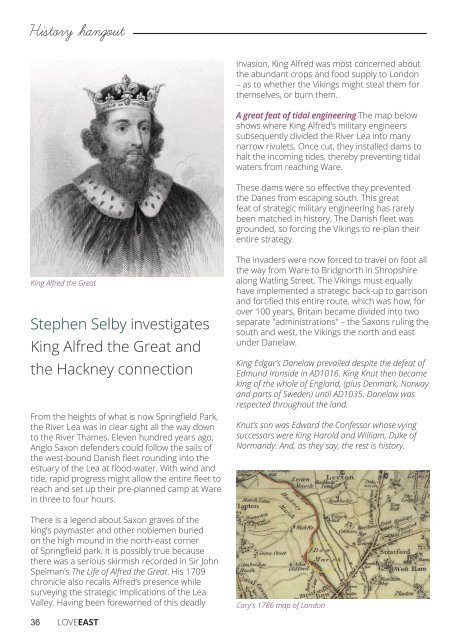
A great feat of tidal engineering The map below<br />
shows where King Alfred’s military engineers<br />
subsequently divided the River Lea into many<br />
narrow rivulets. Once cut, they installed dams to<br />
halt the incoming tides, thereby preventing tidal<br />
waters from reaching Ware.<br />
These dams were so effective they prevented<br />
the Danes from escaping south. This great<br />
feat of strategic military engineering has rarely<br />
been matched in history. The Danish fleet was<br />
grounded, so forcing the Vikings to re-plan their<br />
entire strategy.<br />
King Alfred the Great<br />
Stephen Selby investigates<br />
King Alfred the Great and<br />
the Hackney connection<br />
From the heights of what is now Springfield Park,<br />
the River Lea was in clear sight all the way down<br />
to the River Thames. Eleven hundred years ago,<br />
Anglo Saxon defenders could follow the sails of<br />
the west-bound Danish fleet rounding into the<br />
estuary of the Lea at flood-water. With wind and<br />
tide, rapid progress might allow the entire fleet to<br />
reach and set up their pre-planned camp at Ware<br />
in three to four hours.<br />
There is a legend about Saxon graves of the<br />
king’s paymaster and other noblemen buried<br />
on the high mound in the north-east corner<br />
of Springfield park. It is possibly true because<br />
there was a serious skirmish recorded in Sir John<br />
Spelman’s The Life of Alfred the Great. His 1709<br />
chronicle also recalls Alfred’s presence while<br />
surveying the strategic implications of the Lea<br />
Valley. Having been forewarned of this deadly<br />
The invaders were now forced to travel on foot all<br />
the way from Ware to Bridgnorth in Shropshire<br />
along Watling Street. The Vikings must equally<br />
have implemented a strategic back-up to garrison<br />
and fortified this entire route, which was how, for<br />
over 100 years, Britain became divided into two<br />
separate "administrations" – the Saxons ruling the<br />
south and west, the Vikings the north and east<br />
under Danelaw.<br />
King Edgar’s Danelaw prevailed despite the defeat of<br />
Edmund Ironside in AD1016. King Knut then became<br />
king of the whole of England, (plus Denmark, Norway<br />
and parts of Sweden) until AD1035. Danelaw was<br />
respected throughout the land.<br />
Knut’s son was Edward the Confessor whose vying<br />
successors were King Harold and William, Duke of<br />
Normandy. And, as they say, the rest is history.<br />
Cary's 1786 map of London<br />
36 LOVEEAST