

EVALUATING THE OUTDOOR LEARNING EXPERIENCE
2cZM4EO
2cZM4EO

Create successful ePaper yourself
Turn your PDF publications into a flip-book with our unique Google optimized e-Paper software.
AnalysING Qualitative<br />
Spatial Maps<br />
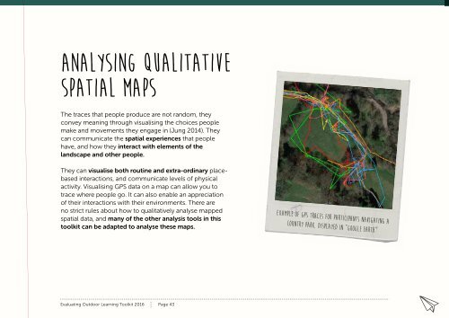
The traces that people produce are not random, they<br />
convey meaning through visualising the choices people<br />
make and movements they engage in (Jung 2014). They<br />
can communicate the spatial experiences that people<br />
have, and how they interact with elements of the<br />
landscape and other people.<br />
They can visualise both routine and extra-ordinary placebased<br />
interactions, and communicate levels of physical<br />
activity. Visualising GPS data on a map can allow you to<br />
trace where people go. It can also enable an appreciation<br />
of their interactions with their environments. There are<br />
no strict rules about how to qualitatively analyse mapped<br />
spatial data, and many of the other analysis tools in this<br />
toolkit can be adapted to analyse these maps.<br />
example of gps traces for participants navigating a<br />
country park, displayed in “google Earth”<br />
Evaluating Outdoor Learning Toolkit 2016 Page 43