
Create successful ePaper yourself
Turn your PDF publications into a flip-book with our unique Google optimized e-Paper software.
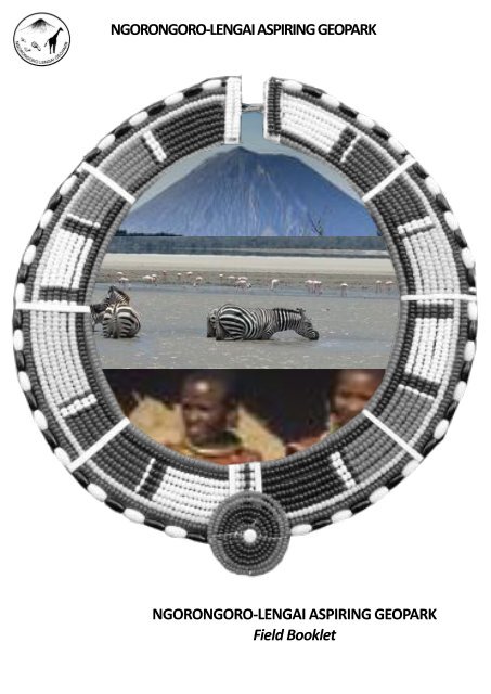
NGORONGORO-LENGAI ASPIRING GEOPARK<br />
NGORONGORO-LENGAI ASPIRING GEOPARK<br />
Field Booklet
2<br />
©endorolodge.com
Ngoro<strong>ngo</strong>ro-Lengai Aspiring Geopark<br />
The Ngoro<strong>ngo</strong>ro Lengai Geopark is located in North-West<br />
part of Tanzania. It is confined to the North by lake Natron<br />
and Kenyan border and to the North-West by Serenge<br />
Naonal Park. Its highest point is the Oldonyo Lengai (2,962<br />
m), sac<strong>red</strong> mountain for Maasai populaon which is also the<br />
unique acve volcano of calcarenite in the world. The<br />
Geopark covers an area of 11.895 sq km with a populaon of<br />
230.506 p., mainly Maasai populaon. The Geopark<br />
geological history begins 500 millions years ago with granites<br />
and gneiss which can be seen in the North (Gol mountains)<br />
and in the West around Eyasi lake. The Geopark territory lies<br />
in the eastern branch of the East Africa Ri. Riing started in<br />
the Early Miocene (20 millions years) and is sll connuing<br />
today. Geopark landscapes are connected with acve<br />
volcanism which was sll present 2,5 millions years ago and<br />
which has generated different craters: Ngoro<strong>ngo</strong>ro caldera,<br />
Olmo and Empakaai crater,...<br />
The Oldoinyo Lengai is sll acve and It last erupon was in<br />
2013.These erupng volcanoes that formed the Ngoro<strong>ngo</strong>ro<br />
lanscapes were watched by earliest prehistoric men. In the<br />
North, is the world-famous Olduvai Gorge which contains<br />
some of the oldest evidence of hominoids, preserved by the<br />
volcanic ash, 1,8 million years ago. The Ngoro<strong>ngo</strong>ro-Lengai<br />
Geopark is linking its geological heritage with its stunning<br />
natural heritage and its material and intangible heritage,<br />
involving its local populaon represenng a huge human<br />
diversity with local ethnic groups as: Masai, Iraqw, Datoga,<br />
Hadzabe,..The Geopark is offering a new discovery of this<br />
world famous territory based on a new meeng between the<br />
me of the Earth and the me of the Mankind thus to<br />
provide an integrated sustainable development to the direct<br />
benefice of its populaon. The Geopark can be visited, with<br />
local guides, through 3 "discovery routes " (North, South and<br />
Caldera route).<br />
Geopark area located inside<br />
the Conservaon area (NCC)<br />
3
Ngoro<strong>ngo</strong>ro-Lengai Aspiring Geopark<br />
NGORONGORO-LENGAI GEOPARK<br />
The Ngoro<strong>ngo</strong>ro Lengai Geopark is located in North-West<br />
part of Tanzania. It is confined to the North by lake Natron<br />
and Kenyan border and to the North-West by Serenge<br />
Naonal Park.<br />
Its highest point is the Oldonyo Lengai (2,962 m), sac<strong>red</strong><br />
mountain for Maasai populaon which is also the unique<br />
acve volcano of calcarenite in the world.<br />
The Geopark covers an area of 11.895 sq km with a<br />
populaon of 230.506 p., mainly Maasai populaon.<br />
A CRADLE OF MANKIND<br />
These erupng volcanoes that formed the Ngoro<strong>ngo</strong>ro<br />
lanscapes were watched by earliest prehistoric men. Along<br />
the Geopark North Route, is the world-famous Olduvai Gorge<br />
which contains some of the oldest evidence of hominoids,<br />
preserved by the volcanic ash, 1,8 million years ago.<br />
The Geopark West Route is also offering an unique site of<br />
Mankind history which present one of the greatest<br />
palaeoanthropological discoveries ever made.<br />
A 3.75 million year old fossilized footprints, proving that<br />
hominids walked, at this me, on their two feet.<br />
Their preservaon is once again due to the volcanic ash.<br />
These two sites are part of the most world famous UNESCO<br />
World Heritage Sites (1979).<br />
A UNIQUE GEOLOGICAL HERITAGE<br />
The Geopark geological history begins 500 millions years ago<br />
with granites and gneiss which can be seen in the North (Gol<br />
mountains) and in the West around Eyasi lake.<br />
The Geopark territory lies in the eastern branch of the East<br />
Africa Ri. Riing started in the Early Miocene (20 millions<br />
years) and is sll connuing today.<br />
Geopark landscapes are connected with acve volcanism<br />
which was sll present 2,5 millions years ago and which has<br />
generated different craters: Ngoro<strong>ngo</strong>ro caldera, Olmo and<br />
Empakaai crater,...<br />
The Oldoinyo Lengai is sll acve and It last erupon was in<br />
2013.<br />
4<br />
A "GARDEN OF EDEN"<br />
Inside the Geopark territory, the Ngoro<strong>ngo</strong>ro caldera with its<br />
stunning landscapes combined with its spectacular<br />
concentraon of wildlife is one of the greatest natural<br />
wonders of the planet.<br />
The Conservaon Area is home to a populaon of some<br />
25,000 large animals, mostly ungulates, with the highest<br />
density of mammalian p<strong>red</strong>ators in Africa including the<br />
densest populaon of lion.<br />
It also supports one of the largest animal migraons on<br />
earth, including zebras, Thomson and Grant gazelles and<br />
over 1 million wildebeest.
Ngoro<strong>ngo</strong>ro-Lengai Aspiring Geopark<br />
A HUMAN DIVERSITY<br />
Geopark populaon is mainly composed by the famous<br />
Maasai people who are pastoralists and originated from Nile<br />
area.<br />
They came here during the XVIII century. Datoga and Irawq<br />
are also present. An autochtonus indigenous ethnic group,<br />
Hadzabe tribe, is sll present in Eyasi area.<br />
With a populaon of less than 1000, they are huntersgatherers<br />
and are not closely related to any other people.<br />
Their language has clicks, and they may be related to the<br />
Pygmies.<br />
CULTURAL HERITAGE<br />
The Geopark present also various cultural heritage. The<br />
North route is offering, the oldest cultural Boma of the<br />
territory (1992) in Seneto as well as tradion wheels inside<br />
Olkarien Gorges.<br />
The Caldera and West route integrate Datoga graves which<br />
are important pilgrimage sites for Datoga Tribes.<br />
A Old construcon from german period (1899) can be seen<br />
along the caldera route.<br />
INTANGIBLE HERITAGE<br />
Due to a long and diversified human presence, the Geopark is<br />
rich in intangible heritage. Legends, tales, songs, tradional<br />
dances are strong pilars of the identy of the different tribes<br />
living in the Geopark. Sac<strong>red</strong> trees can be observed along the<br />
different Geopark routes.<br />
Tradional pracces and know-how are valorized by the<br />
Geopark as the tradional bee hives, Datoga blacksmith,<br />
Hadzabe hunng technics, etc.<br />
SUSTAINABLE DEVELOPMENT<br />
The Geopark promote sustainable development by involving<br />
local populaon and training local guides.<br />
It promote also the local products which vary from farm<br />
products, handcras to local foods and clothing. These differ<br />
also from one ethnic groups to another. The most famous<br />
product in the area includes Maasai beads commonly known<br />
as Maasai shanga.<br />
These are colorful beads made into bracelets, earrings,<br />
necklaces and rings.<br />
The Datoga clothes is another famous product in the<br />
Geopark, they are normally made of animal skin decorated by<br />
beads. Bow and arrows made by Datoga blacksmith is<br />
another iconic local product sold within and outside the<br />
territory.<br />
Other Geopark products are local honey, coffee (plantaon<br />
can be visited in the West route) and leather products.<br />
5
THE GEOPARK DISCOVERY ROADS<br />
THE GEOPARK DISCOVERY ROUTES<br />
The Ngoro<strong>ngo</strong>ro-Lengai Aspiring Geopark can be visited<br />
through 3 differents routes.<br />
The visit of each route takes a full day.<br />
All these route needs to be done with a Geopark agreed<br />
guide.<br />
Each one of these routes has its own personality and its own<br />
ambience, Visiter ces 3 routes de découverte constue une<br />
aventure unique et passionante permeant d'avoir une vision<br />
<strong>global</strong>e de la diversité du Géopark tant au niveau des<br />
paysages, de la géologie, de la biodiversité comme de la<br />
populaon locale.<br />
6
©endorolodge.com<br />
©wikimedia commons<br />
7
The North route<br />
The Geopark North Route<br />
This one day route begins from the south<br />
entrance of Ngoro<strong>ngo</strong>ro-Lengai Geopark<br />
to reach the base of the Gol mountains,<br />
close to the border of Serengeti.<br />
A unique Geopark experience in which<br />
the Earth history is intimately linked with<br />
the human history inside wonderful and<br />
unique landscapes.<br />
20<br />
18 19<br />
21<br />
Geological heritage<br />
Natural heritage<br />
Cultural heritage<br />
Museum / exhibition<br />
Olkarien gorges sites<br />
15<br />
Nasera rock<br />
16<br />
Angatakiti panorama<br />
17<br />
Cristal biotite hill<br />
18<br />
Olkarien Gorges offers a nice walk<br />
with a suspended stone bridge,<br />
traditional wheels and Ruppell’s<br />
Griffon vulture colony.<br />
19<br />
In the dry season, Olkarien Gorges<br />
are a living place where population<br />
and herds can find water.<br />
Huge granite monolith rising up 100<br />
m from the plain which is also an<br />
archeological site from stone age.<br />
An astonishing hill in the plain<br />
landscape made by granite with<br />
giant biotite cristals.<br />
Shifting sand<br />
13<br />
14<br />
Bao Site<br />
10<br />
12<br />
11<br />
Soitoo quartizte hill<br />
Leakey camp<br />
Olduvai Gorges and<br />
Museum<br />
12<br />
The Soitoo hill is like a jewel of light<br />
pink and deep green quartzite.<br />
13<br />
This remarkable dune, composed of<br />
volcanic ash from Oldonyo Lengai, is<br />
being blown slowly at the rate of<br />
about 17 meters per year.<br />
14<br />
Bao is a Swahili name for board. This<br />
is a traditional mancala board game<br />
here carved in stone on top of a hill.<br />
9<br />
Serengueti plains<br />
panorama<br />
7<br />
8<br />
Seneto cultural boma<br />
Ngoro<strong>ngo</strong>ro crater view<br />
In the Seneto cultural boma, Masai<br />
people invite to a discovery of their<br />
traditional dances and practices.<br />
8<br />
Malanja<br />
depression<br />
6<br />
Outstanding view on Magadi lake<br />
and on the dense vegetation of the<br />
West caldera Rim.<br />
7<br />
Rim Forest panorama<br />
5<br />
4<br />
Grimezk grave<br />
11<br />
Olduvai Gorges, is an outstanding<br />
site conside<strong>red</strong> as "Mankind cradle".<br />
It is also one of the most famous<br />
UNESCO World Heritage Site.<br />
3<br />
Ngoro<strong>ngo</strong>ro Crater panorama<br />
2<br />
Exhibition Center<br />
Formed when a giant volcano exploded some 3 million years<br />
ago, this huge caldera (260 Km 2 ) present an unique wildlife.<br />
3<br />
1<br />
Rift panorama<br />
8
The North route<br />
This one day route begins from the south entrance of Ngoro<strong>ngo</strong>ro-Lengai Geopark to reach the base of the Gol mountains,<br />
close to the border of Serenge.<br />
A unique Geopark experience in which the Earth history is inmately linked with the human history inside wonderful and<br />
unique landscapes.<br />
1 Ri Panorama<br />
The East African Ri System, acve connental ri, is a true<br />
geologic wonder of the world where we can see and<br />
understand the earth's tectonic forces. This ri is is some<br />
4,000 miles (6,400 km) long and averages 30–40 miles (48–<br />
64 km) wide and began developing around Miocene, 22–25<br />
million years ago.<br />
The ri is the result of a developing divergent tectonic plate<br />
boundary, in which the African Plate is in the process of<br />
spling into two tectonic plates, called the Somali Plate<br />
(South) and the Nubian Plate (North), at a rate of 6–7 mm<br />
annually.<br />
As in a ri Earth's crust stretches and thins, magma is arising<br />
easily the surface. This ri is volcanically and seismically<br />
acve, producing all the volcanoes present in the area<br />
( Mount Kilimanjaro, Mount Meru, etc..). The formaon of<br />
the Ri Valley is currently o<strong>ngo</strong>ing. Considering the current<br />
growth rate, the crack will reach the Red Sea in about 4 Ma.<br />
At this moment the Red Sea will flood the area.<br />
© www.coolgeography.co.uk<br />
The separaon between the two plate will go on and the<br />
African connent will be splied in two and the result will<br />
eventually be a huge new connent, leaving Africa without<br />
its Horn.The same mouvement of the Nubia plate toward the<br />
north and its meeng with the Euroasian plate will also<br />
probably generate the disapearing of the Mediterranean sea.<br />
©hp://mgafrica.com<br />
What Africa will look like...in about 50 million years!<br />
©wikimedia commons<br />
9
The North route<br />
Informaon Center<br />
2<br />
Located at Loduare Gate, the main entry gate to the<br />
Geopark, this informaon Center from Ngoro<strong>ngo</strong>ro<br />
Conservaon Area Authority offers a display room depicng<br />
the dramac ecology, ethnography and topography of the<br />
Ngoro<strong>ngo</strong>ro Conservaon Area. A shop is promong local<br />
products and books. Informaon on the Geopark is available<br />
through an informaon panel with Geopark map and route<br />
sites. The Geopark presence inside this informaon center<br />
will be implemented within the next monthes.<br />
3<br />
Ngoro<strong>ngo</strong>ro crater Panorama<br />
The Ngoro<strong>ngo</strong>ro crater is one of the ten natural wonders of<br />
© www.coolgeography.co.uk<br />
the world and largest volcanic crater in the world hosng rich<br />
biodiversity where man and his livestock live symbiocally<br />
with wildlife.<br />
It is the world's largest inacve, intact and unfilled volcanic<br />
caldera. It was formed when a large volcano exploded and<br />
collapsed on itself 2-3 million years ago (Plio-Pleistocene<br />
age). It is 610 m deep from its rim and its floor covers nearly<br />
260 square kilometer. The height of the original volcano<br />
before its collapse is projected to be similar to Mt<br />
Kilimanjaro and range from 4,500m to 5,800 m high. The<br />
elevaon of the crater floor varies from 1740 m to 1785 m<br />
above sea level.<br />
4 Grimezk grave<br />
These are the graves of renowed Germany zoologist and<br />
conservaonist Bernhard Klemens Maria Grzimek( died in<br />
1987) and his son Michael Grizmek (1959). Their most<br />
popular work was the book and the film ‘Serenge shall not<br />
die’ which led to the establishment of Serenge naonal<br />
park. The film "Serenge shall not die" won Academy Award<br />
for documentary feature in 1959 the same year that Michael<br />
was killed in an air crash.<br />
10<br />
©hp://mgafrica.com<br />
What Africa will look like...in about 50 million years!<br />
5<br />
Rim Forest Panorama<br />
The Rim forest is a true dream for a botanist!. Scrub heath,<br />
grasslands, high open moorland, and the remains of dense<br />
evergreen forests cover the steep slopes of the crater, while<br />
highland trees including Peacock Flower, Yellow-Wood,<br />
Kousso (Hagenia abyssinica), and Sweet Olive can also be<br />
found. This dense rim forest constute a great contrats with<br />
the crater basin which is cove<strong>red</strong> by open short grass plains<br />
with fresh and brackish water lakes, marshes, etc. The Rim<br />
Forest is also rich in fauna with baboons, leopards and offers<br />
nice birding, for example for sunbirds, turacos and birds of<br />
prey.<br />
©wikimedia commons
The North route<br />
6<br />
Malanja depression<br />
The Malanja depression is forming a shape like crater and<br />
it's possibly a result of connental riing during volcanic<br />
acvity which was trigge<strong>red</strong> by tectonic forces which caused<br />
the movement of large masses of land towards the West<br />
leaving the most of the Eastern part a depression. It also<br />
forms part of a South limb of Serenge plains.<br />
In places, the mountainous parts are dominated by volcanic<br />
tuffs and pyroclasc materials while most part of the<br />
depression is cove<strong>red</strong> by grey to darkgrey ash soil and both<br />
man and livestock live symbiocally with wildlife.<br />
7 Ngoro<strong>ngo</strong>ro crater view<br />
A different view on the Ngoro<strong>ngo</strong>ro crater toward the south<br />
© www.coolgeography.co.uk<br />
rim. There, the vegetaon is sparse with a large presence of<br />
candelabre tree (Euphorbia candelabrum).Candelabre tree is<br />
endemic to the Horn of Africa and eastern Africa along the<br />
East African Ri system.<br />
Euphorbia candelabrum is a tree with branches that are<br />
persistent from around 3 metres upwards, almost erect,<br />
rebranching to form a large, broadly rounded crown. The<br />
tree usually grows up to 12 metres tall. All parts of the plant<br />
exude an abundant latex if inju<strong>red</strong>.<br />
8<br />
Seneto cultural Boma<br />
Seneto cultural Boma is one of the oldest cultural boma in<br />
Ngoro<strong>ngo</strong>ro conservaon area. The boma started in 1992;<br />
the aim of starng this boma was to enable the local<br />
communies to parcipate in tourism by establishing centers<br />
where visitors can learn about their way of life. Seneto boma<br />
is sponso<strong>red</strong> by Ngoro<strong>ngo</strong>ro Conservaon area Authority and<br />
Ngoro<strong>ngo</strong>ro pastoralist council. The boma is under the<br />
Ngoro<strong>ngo</strong>ro ward which has three villages Oloirobi, Kayapsi<br />
and Misigyo. The three villages rotates in managing the<br />
boma, each village stay for a year then give chance for<br />
members from other villages to come. In each village groups<br />
are formed in order to parcipate in the boma. Each group is<br />
formed by sub groups of elders, Moran, women and their<br />
leaders. The elders are responsible for advising the members<br />
and solve conflicts, the women are responsible for making<br />
handcras like the popular Maasai beads cras, the Moran<br />
looks at the cale and guard the boma, the leaders manage<br />
the funds collected and metable of the families staying in<br />
the boma and other logiscs.<br />
In the bomas a tourist is able to learn how Maasai live, taste<br />
the food they eat, enter their houses, parcipate in their<br />
dances, listen to their folktales and buy their ornaments.<br />
Each car which brings the tourist pay the entrance fee which<br />
©hp://mgafrica.com<br />
is collected in the boma’s basket fund. The money collected<br />
is used What to Africa pay allowance will look like...in to the about members 50 million staying years! in the<br />
©wikimedia commons<br />
boma, buy more cale and there is a percent which goes to<br />
the village.<br />
Apart from Seneto boma there are now five more bomas<br />
situated in different wards in Ngoro<strong>ngo</strong>ro. 11
The North route<br />
9<br />
Serenge plains panorama<br />
Great view of the Serenge plain located at the NW & N of<br />
this observaon point. To the NW view is the Olbalbal<br />
swamp which accumulates water drained from Olduvai<br />
Gorge hills, Ndutu and Serenge areas by gravity scheme.<br />
The Serenge Plain forms the graben part of the Eastern limb<br />
of East Africa Ri Valley.<br />
10<br />
Olduvai gorges and Museum<br />
© www.coolgeography.co.uk<br />
Olduvai Gorge is the most famous archaeological locaon in<br />
East Africa and is from 1979 a World Heritage Site.<br />
Some 30,000 years ago, spling of the earth's surface by<br />
violent geological acvity and millennial of erosion by<br />
seasonally flowing streams incised the nearly 250 foot (90m)<br />
canyon known as Olduvai Gorge. These natural forces<br />
exposed a remarkably rich geological chronicle of human<br />
ancestry and the evoluon of the Serenge ecosystem. It<br />
was here that Mary and Louis Leakey unearthed the first<br />
well-dated arfacts and fossils of some of our earliest human<br />
ancestors aer over 30 years of painstaking work.<br />
These include the famous Zinjanthropus (Australopithecus<br />
boisei) skull, homo habills, the presumed maker of the<br />
numerous early stone tools in the 1.8 to 1.6 million year-old<br />
deposits, and homo erectus, the larger bodied, larger<br />
brained hominin that preceded the earliest modern humans<br />
(Homo sapiens).<br />
Memorial of the Zinjanthropus discovery<br />
The excavaon sites have been preserved for public viewing<br />
and work connues during the dry seasons, coordinated by<br />
the Department of Anquies. One may visit Oldupai at all<br />
mes of the year. It is necessary to have official guide to visit<br />
the excavaons. At the top of the Gorge there is a new<br />
museum developed by the Geopark, a shelte<strong>red</strong> area used<br />
for lectures and talks, toilets, shop of local product,<br />
restaurant and a community center.<br />
©hp://mgafrica.com<br />
What Africa will look like...in about 50 million years!<br />
A pedagogic path (1 hour approximavely) invit to discover,<br />
inside the gorges, the main historical locaons related with<br />
gorges history.<br />
12<br />
©wikimedia commons<br />
The new museum under construcon
The North route<br />
11<br />
Leakey Camp<br />
© www.coolgeography.co.uk<br />
© Family Leakey<br />
Family Leakey and friends inside the outdoor dining room<br />
It's a unique historical building inside the whole Geopark<br />
territory. The Leakey family has established this camp since<br />
the 1930s to carry out research in the olduvai gorges. Most<br />
of these buildings date back to the 1960s and many archives<br />
help to reconstruct the use of each. Today, newly-created<br />
parts of this camp are receiving researchers from all over the<br />
world.<br />
In the future, the Geopark plans to recover from the Leakey<br />
family a collecon of anque furniture and pieces in order to<br />
install an aracve museography of this site and to allow the<br />
visitor to live it as in mes of research of the Leakey family.<br />
Original buildings from Leaket Camp<br />
12<br />
Soitoo Quarzte hills<br />
The Soitoo Quartzite hills are constuted by 2 hills. The word<br />
Soitoo is the Maasai word meaning “Rock”. The thickness of<br />
the hill is nearly 200m and it comprises of smoky, white,<br />
brown and green beauful variees of quartzite. The rock is<br />
strongly jointed and fractu<strong>red</strong> possibly due to both shearing<br />
as indicated in places during the field work and volcanic<br />
acvies in the surrounding areas. The important of this<br />
quartzite is the age relaonship with the volcanic rocks. The<br />
quartzite shows the existence of the basement which is older<br />
(850-500Ma) than the volcanic acvity (3-2Ma) which<br />
resulted into formaon of different landscape observed in<br />
©wikimedia commons<br />
the Ngoro<strong>ngo</strong>ro area. Close to these two quartzite hills, it<br />
possible to observe a place where volcanic lavas seems to<br />
cover the outcropping quartzite hill forming a rounding<br />
shape like volcanic cone. (02°58'01.0"S, 35°21'32.0"E)<br />
13
The North route<br />
13<br />
Shiing sand<br />
The shiing sands is a unique site in all Ngoro<strong>ngo</strong>ro-Lengai<br />
Geopark. The sand is grey to dark grey in color and magnec<br />
in nature. The magnec property of this sand is possibly<br />
coming from magnete originated from basalc lavas<br />
erupted from Mt Oldoinyo Lengai between 2-3 Ma ago. The<br />
sand moves by the acon of wind from East to West showing<br />
a magic movement of about 17m annually (4.66cm daily).<br />
The movement of sand formed the amazing half moon<br />
(crescent) shaped feature. The height of the sand dune is at<br />
least 2m high . The sand observed to kill vegetaon when<br />
covers them and it always takes me the vegetaon to<br />
grown<br />
© Family<br />
up<br />
Leakey<br />
again. . It also kills insects when stood on for<br />
somemes; example of observed insects was beetles.<br />
Apart from this famous shiing sand, there is another<br />
moving sand (02°46'52.7"S, 35°36'15.7"E) in a place known<br />
as Ootuni on the way to Olkarien gorge from Serenge Plain<br />
observaon point. So, the sand is now named Ootuni shiing<br />
sands and it is quiet similar to the famous shiing sand with<br />
the only difference that this sand contains mica flakes<br />
(parcles) and fossils mainly of spring hare and snail shells.<br />
© www.coolgeography.co.uk<br />
Family Leakey and friends inside the outdoor dining room<br />
14<br />
Bao site<br />
Bao is a Swahili name for board. This is a tradional mancala<br />
board game famous in many parts of East Africa especially<br />
Tanzania, the coast of Kenya Comoros, and Malawi, as well<br />
as some areas of DR Co<strong>ngo</strong> and Burundi. Bao is played with<br />
two people one player in each side; the board has 32 holes<br />
arranged in four rows. At the beginning all the holes contain<br />
two seeds(the seeds may be small round object made of<br />
stone, wood or even plant seeds) as the game connues a<br />
person who manage to take all of his opponent seeds will<br />
become a winner.<br />
The bao site is unique since the holes are made from the<br />
stones on top of the mountain. There is no clear informaon<br />
about who made this bao but it is believed to be made a long<br />
me ago.<br />
14
The North route<br />
15<br />
Nasera rock<br />
© www.coolgeography.co.uk<br />
It is an uplied inselberg, a monolith, that is fully exposed<br />
above the plain. It is 27 km north of Olduvai and, about 350<br />
m in elevaon.<br />
This rock is a typical granitoid. Large crystals of Mica,<br />
© Family Leakey<br />
Feldspars and Quartz can be clearly observed on the rock<br />
especially on pegmate veins. The rock is seen as an igneous<br />
intrusion a “batholith like” feature containing massive<br />
pegmate veins some up to 4m thick with several small<br />
pegmate veins of nearly or less than 15cm thick . Due to<br />
erosion and other weathering processes, the rock forms<br />
shapes like manmade caves on surfaces especially to the<br />
Northern side of the rock itself. The rock is possibly an<br />
intrusive granitoid of Pan African Mozambican belt (850-500<br />
Millions years ago). It is much more older than the age of<br />
volcanism in the Ngoro<strong>ngo</strong>ro area.<br />
This site has been internaonally known for decades through<br />
its archaeological resources that have been excavated since<br />
1930s.<br />
Most of Family the findings Leakey at and Nasera friends consist inside the of outdoor stone arfacts dining room high<br />
in quartz, but low frequencies of chert and obsidian occur<br />
throughout the sequence. Also bone fragments and sherds of<br />
poery had been uncove<strong>red</strong>.<br />
The cultural materials of Nasera have absolutely dated to<br />
about 30,000 before present.<br />
The shelter has some traces of painngs nevertheless the<br />
painngs are not visible because of their poor state of<br />
preservaon.<br />
They have faded that only rock art expert can observe traces<br />
of pigment.<br />
16<br />
Angataki panorama<br />
This is actually a fault view from Nasera rock all the way to<br />
Olkarien gorge. It is a depression forming a graben part of<br />
the series of Angataki fault which trending from E-W to NE-<br />
SW and control the shapes of various ranges of hills that<br />
forming the horst parts of the main fault..<br />
17<br />
Crystal biote hill<br />
This hill located in Emugur village is constuted by granitoids<br />
offering large mineral crystals of mica,feldspars and quartz.<br />
The crystals are well developed and emerged as hills in a<br />
plain surface. The hill is connected with the highly deformed<br />
granitoid typical of granic gneisses with visible crystals of<br />
mica and several irregular veins of pegmate. In some<br />
places, mica is recrystallized within the deformed granitoid.<br />
Recrystallizaon of minerals in the rock is a common<br />
phenomenon. The enre rock unit is parally migmazed.<br />
©wikimedia commons<br />
15
The North route<br />
18<br />
Olkarien gorges<br />
The gorge is situated under the huge mountains, slicing<br />
canyon and spectacular rock that beaufies the area. It is<br />
extremely deep and narrow gorge cung through high fault<br />
Mountains.<br />
The gorge could have been formed by tectonic faults that<br />
opened the mountains forming a river through the core of<br />
the Mountains. The river course is nearly flat with very<br />
gentle slopes. The peak of these raised mountains could<br />
approach a kilometer. The gorge extends up to 8 km long.<br />
The walls of these mountains are vercal 90-100º. It’s unique<br />
gorge of its kind in the enre Ri Valley Escarpment.<br />
The gorge correspond to a fault zone which trends NW-SE.<br />
The fault zone occur<strong>red</strong> in a quartzite rock which is strongly<br />
fractu<strong>red</strong>. In places, recrystallizaon of mica can be observed<br />
especially in joints and contacts between rocks.<br />
Undifferenated basalc rocks and volcanic ash in pyroclast<br />
and clay forms are located at the main entrance of the gorge.<br />
19<br />
Masai cultural well<br />
The big part of the Ngoro<strong>ngo</strong>ro district is characterised by<br />
semi arid climate. Most rivers in this area are seasonal and<br />
hence during dry season it is hard to get water for livestock<br />
and domesc use. Some of these seasonal rivers beds are<br />
Family Leakey and friends inside the outdoor dining room<br />
cove<strong>red</strong> by sand and therefore stores water underground.<br />
As a mean of survival for the Maasai and their cale during<br />
dry season, wells are dug along these rivers’ beds.<br />
The wells are usually few cenmeters deep depending on<br />
the water table and they are big enough to allow a person to<br />
fetch water easily or somemes they are big enough for a<br />
cale to drink in them.<br />
These wells are tradional managed; people are only<br />
allowed to dig the wells during the dry season when other<br />
sources of water have dried up. The wells are usually dug by<br />
family members and somemes more than one family can<br />
share one well. The community elders meet to discuss on<br />
when to start ulizing the river beds and how. They also set<br />
rules to be followed by all members who will be ulizing<br />
these areas in order to avoid conflicts. Tradional fines are<br />
charged to people who break these rules or use the wells<br />
which does not belong to them.<br />
20<br />
Natural stone bridge<br />
In the middle of the gorges, it's possible to observe a nice<br />
natural stone bridge.<br />
IMPORTANT: The site is unsafe for walking in the gorge as it<br />
contains several hanging rocks and/or walls which might fall<br />
down anyme. Follow strictly your guide recommandaons.<br />
16
The North route<br />
21<br />
Rüppell's vulture colony<br />
© www.coolgeography.co.uk<br />
©nickgarbu.com<br />
Olkarien gorges is an important nesng site for Rüppell's<br />
vulture or Rüppell's griffon vulture (Gyps rueppelli) . Rüppell's<br />
vulture © Family is named Leakey in honor of Eduard Rüppell, a 19th-century<br />
German explorer, collector, and zoologist.[3] Rüppell's vulture<br />
is conside<strong>red</strong> to be the highest-flying bird, with confirmed<br />
evidence of a flight at an altude of 11,300 metres above sea<br />
level.<br />
These Ruppel's vulture are large vultures. Adults are 85 to<br />
103 cm long, with a wingspan of 2.26 to 2.6 metres, and a<br />
weight that ranges from 6.4 to 9 kg.<br />
Rüppell's vultures are very social, roosng, nesng, and<br />
gathering to feed in large flocks. Their range extends mainly<br />
through the Sahel region of Africa where they can be found in<br />
grasslands, mountains, and woodlands. Once conside<strong>red</strong><br />
common in these habitats, the Rüppell's vultures are<br />
experiencing steep declines, especially in the Western<br />
poron of their range. They are relavely slow birds, cruising<br />
at 35 kilometres per hour, but fly for 6–7 hours every day and<br />
will fly as far as 150 kilometres from a nest site to find food.<br />
Rüppell's vultures commonly fly at altudes as high as 6,000<br />
metres. The birds have a specialized variant of the<br />
hemoglobin alpha which allows the species to absorb oxygen<br />
efficiently.<br />
A notorious scavenger, Rüppell's griffon vultures dine<br />
exclusively on carrion. They rely on vision alone to detect<br />
prey. When the vulture spots a carcass from the air, the<br />
vulture will swoop down nearby and run with its wings<br />
spread and neck extended towards its meal. Rüppell's griffon<br />
vultures insert their heads under the skin of the carcass,<br />
somemes climbing inside the ribcage to consume it. The<br />
head and neck are devoid of most feathers, evolved to keep<br />
the mess of blood and meat to a minimum.<br />
Family Leakey and friends inside the outdoor dining room<br />
©wikimedia commons<br />
©kidszoo.org<br />
17
The Caldera route<br />
A one day route inside the Ngoro<strong>ngo</strong>ro caldera which is the jewel of Ngoro<strong>ngo</strong>ro-Lengai Geopark crown.A lile more than 2,5<br />
million years ago, Ngoro<strong>ngo</strong>ro was a volcanic mountain rivalling nearby Mount Kilimanjaro in size, as one of the highest peaks<br />
of Africa. Then its top collapsed, resulng in the giganc caldera, the largest un-flooded and unbroken caldera in the world.<br />
About 20kms across, 600 meters deep and 300 sq kms in area, the Ngoro<strong>ngo</strong>ro Crater is a breathtaking natural wonder.<br />
Oldoinyo Lengai panorama<br />
34<br />
35<br />
Empakai Lake<br />
33<br />
Olmoti waterfall<br />
Round table hill<br />
Irkepus village panorama<br />
Hippo pool<br />
Seneto spring 29<br />
30<br />
31<br />
32<br />
Family Leakey and friends inside the outdoor dining room<br />
22<br />
28 Magadi lake<br />
Mounge river<br />
Acacia rim<br />
36<br />
Datoga graves<br />
23 Datoga sac<strong>red</strong> tree<br />
24<br />
Lerai forest<br />
25<br />
26<br />
Old german house<br />
Ngoitoktok 27<br />
North rim<br />
panorama<br />
Pillarwood site<br />
38<br />
37<br />
23- Datoga Graves.This grave of a<br />
spiritual Datoga chief is a pilgrimage<br />
site for this tribe.<br />
26- Lerai Forest. Home to the Yellow<br />
Fever tree and Acacias, it's a special<br />
refuge for many different species of<br />
animals.<br />
30- Round table hill. Remain of the<br />
volcano's peak.<br />
34- Oldoinyo Lengai panorama.<br />
Unique acve volcano in the world<br />
producing natrocarbonate lava.<br />
24- Datoga Sac<strong>red</strong> tree.<br />
18<br />
28- Magadi lake.Thousands of<br />
flami<strong>ngo</strong>es lives there.<br />
31- Munge River. Its spring is in the<br />
Olmo Crater.<br />
35- Empakai Lake. A "perfect" crater<br />
lake with a permanent flami<strong>ngo</strong>s<br />
colony.
The Caldera The North route route<br />
22<br />
Seneto spring<br />
The Seneto spring is located within the Ngoro<strong>ngo</strong>ro crater<br />
and it provides fresh water which fills Lake Magadi. The<br />
source of the spring is possibly a basalc aquifer and the<br />
area is surrounded by several basalc outcrops like boulders.<br />
To the East of Seneto spring, there is Munge River which also<br />
drains its water to Lake Magadi. The river originates from<br />
Olmo crater rim located in the Eastern side of the<br />
Ngoro<strong>ngo</strong>ro crater. Water moves from the SE parts of the<br />
Ngoro<strong>ngo</strong>ro crater towards the NW part where Lake Magadi<br />
is found.<br />
23<br />
Datoga graves<br />
Datoga graves are the most important pilgrimage site for the<br />
Datoga tribe. These grave (bung’ed) belong to a spiritual<br />
leader Gitangda and his son who died over 100 years ago<br />
(between1836-1851) while defending their land from the<br />
Maasai in Ngoro<strong>ngo</strong>ro. There is also a big fig tree which is<br />
believed to grow in a place where Gitangda’s eldest son took<br />
his last gourd of milk and said his goodbye but he was never<br />
seen again and his body never found.<br />
The Datoga organize pilgrimage trips to the graves in order to<br />
pray to their chief aer every few years depending on the<br />
situaon © Family they Leakey are in. the pilgrimage rituals is usually done by<br />
women and elders who wear small strips of ram’s skin<br />
(loghamajeg) in their second finger. Milk and local brew<br />
made out of honey, meat from the ram (killed in a tradional<br />
way), tobacco and loghamajeg are carried to the site. The<br />
group drink milk and honey brew and pour some on stones<br />
found on the grave while the leader speak their prayers.<br />
Aer that tobacco and loghamajeg are le on the grave. This<br />
procedure is repeated in all three site which includes also the<br />
fig tree. In the end the soil is collected from bung’ed and the<br />
fig tree to be taken home. This site is used by Datoga who<br />
come from as far as Tabora and Shinyanga to perform their<br />
rituals once in a while.<br />
© www.coolgeography.co.uk<br />
Family Leakey and friends inside the outdoor dining room<br />
24 Datoga Sac<strong>red</strong> Tree<br />
This fig tree is situated in Lerai area. The Datoga were living<br />
in Ngoro<strong>ngo</strong>ro crater in early 19 century. In the mid of 19th<br />
century the datoga were aacked by the Maasai which led to<br />
war between the two tribes. The Datoga spiritual leader<br />
Gitangda was spea<strong>red</strong> by Maasai. His eldest son<br />
Magusachand was wounded by a Maasai spear in the leg.<br />
According to the Datoga stories he craw back to his Boma<br />
calling his wife. When his wife heard him she came with a<br />
gourd of milk searching for Magusachad. When they met he<br />
drank ©wikimedia the milk commons from the gourd and say his goodbye. He was<br />
never seen again and his body never found. In the place<br />
where he drank his last milk a large fig has grown. That fig up<br />
to date is conside<strong>red</strong> a sac<strong>red</strong> area for the datoga.<br />
19
The Caldera The North route route<br />
25<br />
Old German house<br />
The old German house was built by two German brothers<br />
named Adolph and Friedrich Siedentop who seled and farm<br />
in the Ngoro<strong>ngo</strong>ro crater unl the break of World War I. The<br />
first brother Adolph ente<strong>red</strong> the crater in 1899 as a squaer<br />
he started farming sisal, aer leasing the land from the<br />
administraon of German East Africa. The brothers regularly<br />
organized shoong pares to entertain their German friends.<br />
In 1916 the Siedentopf deports from Ngoro<strong>ngo</strong>ro leaving the<br />
house and the farm which fell into the Brish mandate in<br />
1920. The Brish established a veernary camp in Lerai and<br />
John Hamman took over the farm in lerai followed by<br />
Captain Hurst and later on Eric Howe.<br />
Recent the house is part of Lerai ranger post; the post is used<br />
by rangers who insure the security of the crater.<br />
© www.coolgeography.co.uk<br />
26 Lerai Forest<br />
The magical Lerai Forest of about 5 km2 is the more<br />
important forest inside the crater. It is home to the Yellow<br />
Fever tree (Acacia xanthophloea) aand constute a special<br />
refuge for many different species of animals: rhinos and<br />
elephants mainly. Lerai is a Maasai word referring to the tall<br />
yellow barked acacias. These beauful trees are old, gnarled<br />
by years of growing back the bark stripped off by elephants.<br />
© Family Leakey<br />
The forest is also a special bird habitat, providing food and<br />
nesng sites for hoopoes, cuckoos and weavers.<br />
Family Leakey and friends inside the outdoor dining room<br />
27<br />
Ngoitoktok<br />
As Seneto, Ngoitoktok is a perennial spring which is so<br />
abundant that a small lake has formed before spreading into<br />
the nearby Gorigor Swamp. A small rock outcrop with a<br />
single fig tree adorns the lake edge. Ngoitoktok is one of only<br />
two places where visitors are permied to get out of their<br />
vehicles. It's a great site for a bush picnic though beware of<br />
the large brown hawks that swoop down to snatch<br />
unaended food. Ngoitotok is inhabited by an important<br />
colony of hippopotamus; elephants, lions are also familair<br />
with this place.<br />
28<br />
Magadi Lake<br />
This shallow soda lake is is alkaline mainly due to deposits of<br />
volcanic ash. The depth, never more than three metres,<br />
varies during the year. During the rainy season Lake Magadi<br />
look pinkish from a distance due to the large flock of<br />
Flami<strong>ngo</strong>es.<br />
The birdlife is mainly seasonal, and is also affected by the<br />
rao of soda to fresh water in Lake Magadi. The lake's edges<br />
are favourite stalking grounds for golden jackals, lions and<br />
hyenas.<br />
©wikimedia commons<br />
20<br />
©Michael Lewin
The Caldera The North route route<br />
29<br />
Hippo pool<br />
Aer Ngoitoktok, this is a smallest hippo pool. The common<br />
hippopotamus (Hippopotamus amphibius), or hippo, is a<br />
large, mostly herbivorous mammal. The name comes from<br />
the ancient Greek for "river horse". Adults average 1,500 kg<br />
(3,310 lb) and 1,300 kg (2,870 lb) for males and females<br />
respecvely, making them the third-largest species of land<br />
mammal aer the three species of elephant and rhinoceros.<br />
Despite their physical resemblance to pigs, the closest living<br />
relaves of the Hippopotamidae are cetaceans (whales,<br />
dolphins).The earliest known hippopotamus fossils,<br />
belonging to the genus Kenyapotamus in Africa, date to<br />
around 16 million years ago.<br />
The hippopotamus is semiaquac, inhabing rivers, lakes<br />
and swamps, where territorial bulls preside © www.coolgeography.co.uk over a stretch of<br />
river and groups of five to thirty females and young. During<br />
the day, they remain cool by staying in the water or mud;<br />
reproducon and childbirth both occur in water. They<br />
emerge at dusk to graze on grasses. While hippopotamuses<br />
rest near each other in the water, grazing is a solitary acvity<br />
and hippos are not territorial on land.<br />
30<br />
Round table hill<br />
Round © Family table Leakey hill is a small hill like round table located to the<br />
northern side of Lake Magadi. The round table feature is<br />
believed to be the remained cone or peak of the Ngoro<strong>ngo</strong>ro<br />
volcanic mountain (~4500m-5800m a.s.l) aer the collapse<br />
of the mountain 2-3 million years past. Pyroclasts (Ash, lapilli<br />
& bombs) are common observaons in the area. The major<br />
volcanic pipe which caused the formaon of this round table<br />
always associated with minor or small volcanic vent which<br />
resulted into formaon of other cinder cones observed in<br />
the crater especially to the Eastern part of the crater. These<br />
cinder cones formed aer the collapse of the main pipe<br />
because by that me volcanism of the minor vents were sll<br />
acve.<br />
Family Leakey and friends inside the outdoor dining room<br />
©wikimedia commons<br />
31 Mounge river<br />
The Munge River has its spring inside the Olmo Crater, more in the North-East. It's is the main water source draining into<br />
Magadi Lake.<br />
.<br />
21
The Caldera The North route route<br />
32<br />
Irkepus village panorama<br />
Irkepus is an important village in the eastern part of the<br />
Geopark. It has schools, health centers and a Boma<br />
farmhouse, such as Seneto. The panorama that can be seen<br />
from this village is fascinang. Besides the dispersion of the<br />
habitat in the plain, it allows to have an overview of the<br />
volcanoes Olmo and Empakai.<br />
33<br />
Olmo waterfall<br />
The Olmo Crater, 3,700 meters high, lies north of<br />
Ngoro<strong>ngo</strong>ro Crater. The Olmo Crater floor has different<br />
streams which through the Munge waterfalls fill Lake Magadi<br />
in the Ngoro<strong>ngo</strong>ro Crater. The Crater's floor is inhabited by<br />
some mammals like the Bohor Reedbuck, Buffalo and Eland.<br />
Among the plants found at the Crater's slopes are Nuxia,<br />
Giant St John's Wort and Hagenia trees. Nectar feeding birds<br />
can be observed at this area, such as Golden-winged and the<br />
Eastern Double Colla<strong>red</strong> Sunbird.<br />
Olmo Crater was acve from 2,5 to 1,79 millions years and<br />
it is conside<strong>red</strong> the source for the bulk of interbedded<br />
volcanics and volcaniclasc deposits that comprise much of<br />
the upper Bed secon of nearby Olduvai Gorge, and part of<br />
the © Laetoli Family Leakey sequence, both known for their well preserved<br />
fossils and archaeological remains.<br />
Omo Crater is famous for its stunning waterfalls from<br />
Mounge river.<br />
© www.coolgeography.co.uk<br />
Family Leakey and friends inside the outdoor dining room<br />
©wikimedia commons<br />
© Tony Reumerman Amazing general view of Olmo Crater<br />
22
The Caldera The North route route<br />
But the uniqueness of Oldoinyo Lengai lies not only on its<br />
permanent acvity.<br />
© Family Leakey<br />
The lava produced at Oldoinyo Lengai is unlike any other lava<br />
on earth.<br />
Unlike most lavas, the lava at Oldoinyo Lengai has a very low<br />
silica content. The lava here is a carbonate, meaning it has<br />
more than a fiy percent carbonate content. Carbonates<br />
are quite uncommon in the geologic record, and even less<br />
common at the surface as a liquid. Its lava is rich in the rare<br />
sodium and potassium carbonates.<br />
Due to this unusual composion, the lava erupts at relavely<br />
low temperatures of approximately 510 °C (950 °F). This<br />
temperature is so low that the molten lava appears black in<br />
sunlight, rather than having the <strong>red</strong> glow common to most<br />
lavas. It is also much more fluid than silicate lavas, oen less<br />
viscous than water.<br />
34<br />
Oldoinyo Lengai Panorama<br />
Oldoinyo Lengai is clearly the jewel of the Geopark!<br />
It is unique in the world among all acve volcanoes.<br />
Oldoinyo Lengai means, "Mountain of God" in the Maasai<br />
language (and is for them them a "sac<strong>red</strong> mountain") is an<br />
acve stratovolcano 2962m high. © www.coolgeography.co.uk<br />
It is the only acve volcano in Tanzania and one of a select<br />
few that are acve in the East African Ri Valley. The<br />
volcano has erupted manymes since it first began to be<br />
observed by geologists. Major erupons have occur<strong>red</strong> in<br />
1880, 1914-15, 1926, 1940-41, 1958, 1960-66, 1983-93,<br />
1994-1998, and the mountain connues to erupt mildly to<br />
this day.<br />
.<br />
Aerial view of Oldoinyo Lengai crater<br />
Family Leakey and friends inside the outdoor dining room<br />
© cessna 206/Flickr<br />
The sodium and potassium carbonate minerals of the lavas<br />
erupted at Oldoinyo Lengai are unstable at the Earth's<br />
surface and suscepble to rapid weathering,quickly turning<br />
from black to grey in colour.<br />
The resulng volcanic landscape is different from any other<br />
in the world. The carbonate ashspread over the<br />
surrounding grasslands leads to a uniquely succulent,<br />
enriched pasture.<br />
The last Oldonyo Lengai erupon occurs in 2013 when the<br />
volcano resumed natrocarbonate lava flow which started to<br />
©wikimedia commons<br />
fill the large crater from the precedent erupon(2007). At<br />
this me, residents near the volcano reported several<br />
earthquakes.<br />
Around the world,several "fossil" carbonate volcanoes are<br />
knowned by geologist. One of them, Fen volcano, is located<br />
in Norway in the UNESCO Global Geopark Gea-Norvegica<br />
and was acve 580 millions years ago.<br />
23<br />
© Tony Reumerman Amazing general view of Olmo Crater<br />
Lava Fountains and Ash Erupons. August 2003<br />
© www.swisseduc.ch
The Caldera The North route route<br />
© www.coolgeography.co.uk<br />
© Family Leakey<br />
Gemündener Maar, UNESCO Geopark Vulkaneifel<br />
36<br />
Acacia rim site<br />
Acacia abyssinica is one of the highland acacia, commonly<br />
called umbrella thorns. It makes a fine shade and<br />
ornamental tree. It is a tree up to 16 m tall and its bark is<br />
<strong>red</strong>dish-brown on older trees. On younger trees it is pale<br />
yellowish-brown, peeling off in papery wads. Young twigs are<br />
soly hairy.<br />
The wood from this umbrella thorn is of medium weight and<br />
is not durable, however it is used in domesc construcon<br />
for © making Tony Reumerman utensils.<br />
35<br />
Empakai Lake panorama<br />
The Family Empakai Leakey and Crater friends was inside formed the outdoor as a result dining room of volcanic<br />
erupon which occur<strong>red</strong> 3 million years ago and leaves the<br />
volcanic pipe (mouth) opens forming the Empakai Crater.<br />
The open was caused by the sinking or falling of lavas in the<br />
main pipe aer erupon creang a now so called Empakai<br />
Crater which is about 300m deep from its rim. The Crater<br />
Lake is nearly 62m deep and contains salt water; salt (mainly<br />
soda ash or sodium bicarbonate) seen to precipitate (whish<br />
stuffs) at the edges of the lake itself. There are three natural<br />
springs located to the West rim of this observaon point<br />
which fills this lake with fresh water. The Crater is about six<br />
kilometer (6km) cross from one end to another.<br />
Small colony of pink flami<strong>ngo</strong>s can be observed there.<br />
© cessna 206/Flickr<br />
The scienfic name for crater lake is « maar » (which mean<br />
crater in german). Several of them, as Empakai Lake, exist<br />
inside the Global geopark Network. For exemple in UNESCO<br />
Global Geopark Vulkaneifel (Germany) and in UNESCO<br />
Global Geopark Leiqiong (China).<br />
©wikimedia commons<br />
24<br />
© www.swisseduc.ch
The Caldera The North route route<br />
37<br />
Pilarwood site<br />
Cassipourea malosana (pillarwood) is an evergreen tree<br />
approximately 6-45 m in height. It bears a conspicuously<br />
straight, pale, cylindrical trunk and a small rounded crown.<br />
The branches radiate out at right angles to the trunk. Bark<br />
smooth, pale grey with well defined ring marks. Slash so,<br />
pale orange with a darker outer edge.<br />
The wood of Cassipourea malosana is traded as<br />
pillarwood. It is suitable for construcon, flooring (especially<br />
heavy duty or industrial flooring), vehicle bodies, furniture<br />
and cabinet work, tool handles, ladders, sporng goods,<br />
agricultural implements, joinery, sleepers, poles and piles,<br />
toys and noveles, beehives, turnery, and for veneer and<br />
plywood. Its low durability, however, limits its applicability<br />
outdoors.<br />
© www.coolgeography.co.uk<br />
© Family Leakey<br />
Family Leakey and friends inside the outdoor dining room<br />
38<br />
North rim Panorama<br />
To end the Caldera route, you can have a last stop on an<br />
unusual view of the caldera. From this site, at dusk, and if<br />
you are lucky, with a splendid sunset, you will be able to<br />
admire the North rim of the caldera which was the starng<br />
point of the day and relive this unforgeable Route in this<br />
caldera unique in the world.<br />
At start of the night, this site is also a good place to meet<br />
leopards hunng.<br />
©wikimedia commons<br />
25
The South North Route route<br />
A one day route in the South of Ngoro<strong>ngo</strong>ro-Lengai Geopark unl West up to Eyasi Lake.<br />
A stunning Geopark experience of human diversity where local indigenous knowledge, tradions, story of the Earth are<br />
inmately connected. A the begining of the route, a 60 minutes "magic path", through coffee plantaon, waterfalls, rich south<br />
rim vegetaon conduct to the Elephant cave. A unique place where animal and mineral are closely linked.<br />
Elephant cave<br />
Gibb's farm<br />
Endoro waterfall<br />
40<br />
39<br />
41<br />
© www.coolgeography.co.uk<br />
Makonde carving<br />
42<br />
© Family Leakey<br />
Iraqw<br />
subterrenean<br />
house<br />
44<br />
43<br />
Karatu city<br />
Iraqw brewery<br />
Family Leakey and friends inside the outdoor dining room<br />
Ma<strong>ngo</strong>la spring<br />
38<br />
45<br />
Datoga culture<br />
50 46<br />
47<br />
Datoga blacksmith<br />
48 Hadzabe culture<br />
Onion plantation<br />
49<br />
©wikimedia commons<br />
26
The South North Route route<br />
39<br />
Endoro watefall<br />
The Endoro waterfalls is an amazing site located on the path<br />
going to Elephant cave. The water is flowing on basalc rocks<br />
and its source is probably the underground water spring<br />
originated from the Ngoro<strong>ngo</strong>ro crater rims a distance of<br />
approximately 16 km NWN of the Endoro waterfall. Water<br />
increases during the rainy season though it flows throughout<br />
the year. The waterfalls about 150m height; 50m the first<br />
height followed by horizontal runoff of about 70m then<br />
another fall of nearly 30m height.<br />
40<br />
Elephant cave<br />
Elephant cave is the end of this path inside a great forest<br />
with high biodiversity and nice view on all coffee plantaon<br />
around.<br />
Elephant cave is probably one of the more symbolic site, in<br />
the world, demonstrang the inmate link between animals<br />
and geology!<br />
The « Elephant cave » is not exactly a cave but an outcrop<br />
with several small holes.<br />
The © parent Family Leakey rock is seen to be of basalc composion mainly<br />
vesicular basalt. The rock is weathe<strong>red</strong> forming a yellowish<br />
brown color and black oxidizing layers especially in joints and<br />
fractures. The weathe<strong>red</strong> rock forming a fine grained<br />
material with porous texture. The minerals present in basalt<br />
are possibly converted to salts of Calcium, Sodium and<br />
Potassium in the weathe<strong>red</strong> rock.<br />
Elephants are coming there exclusively for these mineral<br />
which are very aracve (and necessary) for them.<br />
From centuries, elephants are used to come to come there<br />
to find the rocks which are very rich for calcium. As miners,<br />
They hit the rocks with their tusks and eat the piece sand it<br />
helps the elephants to receive enough minerals and to make<br />
their bones very strong.<br />
© www.coolgeography.co.uk<br />
Family Leakey and friends inside the outdoor dining room<br />
©endorolodge.com<br />
41 Gibbs Farm<br />
This private farm-hotel is a good exemple of Geopark<br />
partnership. The original farmhouse was built in 1929 and<br />
conserve its tradional architecture. Its a charming place<br />
involved in quality tourism, nature, cultural educaon and<br />
biological agriculture.<br />
Gibbs Farm owns also an important coffe plantaon and<br />
produce its own high quality coffee.<br />
When she was travelling from Kenya, Marie Leakey was used<br />
to stop there before reaching her invesgaon camp in<br />
©wikimedia commons<br />
Olduvai.<br />
27
The South North Route route<br />
42<br />
Makonde carving<br />
Makonde is one of ethnic group found in south east Tanzania<br />
and Northern Mozambique. They are part of bantu speaking<br />
group famous for their wood carvings, their observance of<br />
puberty rites and dances.<br />
The Makonde are among the few matrilineal sociees in<br />
Tanzania whereby children and inheritance belong to the<br />
women. The Makonde use ebony wood to carve different<br />
objects, Before their interacons with people from outside<br />
of Africa Makonde used to carve masks used for their dances<br />
and other small household items. The interacons with the<br />
outside world led to the expansion in Makonde carvings<br />
whereby they started to carve different objects and stories in<br />
exchange for money.<br />
The art of carving is passed from one© generaon www.coolgeography.co.uk to another<br />
since childhood whereby a father teaches a son. Recently<br />
Makonde carvings are not only used in Tanzanian households<br />
but they are also one of the major aracons in most of the<br />
curio shops for tourists and visitors in Tanzania.<br />
43 Iraqw subterrrenean house<br />
Iraqw change their style of housing, from round houses with<br />
high conical thatched roofs to low parally subterranean and<br />
earthen-roofed © Family Leakeytempe houses, as a defensive measure<br />
against Maasai raids during the early nineteenth century.<br />
These tempe houses were thought to have been in use<br />
during a limited period only, aer which the round-house<br />
style was adopted again.<br />
The iraqw or Irakw (also known as wambulu) are a Cushic<br />
speaking ethnic group inhabing the great lakes region of<br />
East Africa.<br />
They live in Arusha and Manyara Region of North Central<br />
Tanzania near the ri valley wall and south of Ngoro<strong>ngo</strong>ro<br />
crater. Tradionally the iraqw wore clothing made of skins<br />
with elaborate beadwork that old their histories. The iraqw<br />
are agro pastoralism.<br />
Addionally, the Iraqw's ancestors are oen c<strong>red</strong>ited with<br />
having constructed the sprawling Engaruka complex in<br />
northern Tanzania. The modern Iraqw pracce an intensive<br />
form of self-contained agriculture.<br />
Iraqw historical tradions likewise relate that their last<br />
significant migraon to their present area of inhabitaon<br />
occur<strong>red</strong> about two or three centuries ago aer conflicts<br />
with the Barbaig sub-group of the Datoga Nilotes, herders<br />
who are known to have occupied the Crater Highlands prior<br />
to the arrival of the Maasai.<br />
Family Leakey and friends inside the outdoor dining room<br />
©endorolodge.com<br />
This populaon movement is reportedly consistent with the<br />
date of the Engaruka site's deseron, which is esmated at<br />
somewhere between 1700 and 1750.<br />
©wikimedia commons<br />
28
The South North Route route<br />
44<br />
Iraqw brewery<br />
Iraqw tribe have two types of local beer which are Busa<br />
made with maize flour and finger millet flour and Mangure<br />
made with made with millet flour. The name busa was<br />
originated from kamba tribe in Kenya since 1978 through<br />
interacon of human acvies. There are many local<br />
breweries at Karatu Town located about 0.5 km from the<br />
main road to Ngoro<strong>ngo</strong>ro.<br />
© www.coolgeography.co.uk<br />
© Family Leakey<br />
Family Leakey and friends inside the outdoor dining room<br />
45<br />
Ma<strong>ngo</strong>la spring<br />
Drought is persistent in the Eyasi Basin due to uncertainty of<br />
rainfall and the nature of the climate of the region being<br />
semiarid. Unreliable rains and high temperatures had<br />
exacerbated the existence of drought condions throughout<br />
the years in the basin. Most of known springs scae<strong>red</strong><br />
along Lake Eyasi shore, Barazani and Qangdend/ Ghorofani<br />
village have dried up due to drought.<br />
Nonetheless there is one fresh water spring (Chemchem)<br />
around Qangdend/ Ghorofani village which has the flow of<br />
water and the only remaining depending water source in<br />
Mang’ola area. People ulize the waters for domesc use,<br />
agriculture and pastoralism. Madulu and Yanda (2005) noted<br />
that this spring gets water from the evergreen forests on<br />
Oldeani and the Ngoro<strong>ngo</strong>ro crater rim. The fresh water<br />
spring source at Qangdend/Ghorofani village is in crical<br />
condion and if no immediate acons taken, the risk of<br />
perishing is growing. Environmental degradaon caused by<br />
excessive clearing of trees, bushes, grazing and trampling of<br />
water sources by large herds of cale, goat, donkey and<br />
sheep is higher Underneath the tree covers is completely<br />
dry. In addion to that large amount of large trees have old<br />
dried Animals are drinking water up to the outlet of the<br />
spring and there is no restricon and control that preserve<br />
the five hectares catchment area.<br />
The increasing demands of water for large-scale irrigaon<br />
using water pumps, parcularly for onions as a cash crop,<br />
maize and rice in Barazaniand Ghorofani where the<br />
catchment originates, have <strong>red</strong>uced waters from the<br />
Ngoro<strong>ngo</strong>ro highlands aquifers. Compeng demands of<br />
water resources between sectors, especially wildlife,<br />
©endorolodge.com<br />
livestock, people and irrigaon farming have contributed to<br />
water shortages in Eyasi Basin. Therefore there is a need to<br />
establish management plans to protect and conserve this<br />
fresh water spring that not long will disappear if no further<br />
intervenon from stakeholders and government. And<br />
because people are not seled around the catchment area,<br />
this might make easier to control the rest of challenges. This<br />
may be done through awareness seminars, public meengs<br />
and by-law enforcement.The natural fresh water spring is<br />
unique because all the Eyasi Basin area is salty nonetheless<br />
the waters produced from the spring at Qangdend/<br />
Ghorofani village is 100% fresh. Another value of this fresh<br />
©wikimedia commons<br />
water spring is that it is the only remaining source of water<br />
in Mang’ola for human habitaon. Both foragers, famers,<br />
herders need water alike. Hence the need to protect and<br />
conserve it is mandate.<br />
29
The South North Route route<br />
© www.coolgeography.co.uk<br />
© Family Leakey<br />
46<br />
Datoga culture<br />
The Datoga are highland Niloc pastoralists. They moved into<br />
the southern areas of the Eyasi Basin in the last few<br />
centuries as they were displaced, first, by the plain Niloc<br />
Maasai pastoralists from the Ngoro<strong>ngo</strong>ro highlands, and<br />
later by the agriculturalist Iraqwi. The Datoga livelihood in<br />
the Eyasi Basin depends on livestock. They herd the East<br />
African short horn zebu (Bos indicus), some goats, sheep,<br />
and donkeys.<br />
Family Leakey and friends inside the outdoor dining room<br />
Nowadays, Datoga pastoralists interact more with the Hadza<br />
than any other ethnic group in the region (Field<br />
Observaon). They exchange food, meat and other<br />
commodies with the Hadza hunter-foragers. Like to the<br />
Hadza hunter-foragers, tourists and researchers also visit the<br />
Datoga pastoralists to observe their ways of life. People visit<br />
Datoga pastoral to see their sac<strong>red</strong> areas, bomas, and<br />
tradional dances and buy tradional souvenirs. Tourists also<br />
enjoy watching Datoga blacksmith manufacturing various<br />
metal objects. These dances are organized whenever there is<br />
a ceremony or tradional acvies, and to visitors .<br />
Datoga believe strongly in the power of spirits for good or<br />
bad and they have maintained adherence to animist believes<br />
and pracced parculary surroundings. They are resistant to<br />
cultural change, including believes in Crisanity. Worship is<br />
done under the holy fig trees or at Oldonyo, of the largest<br />
sub tribes of the broader ethnic group (datoga),at ancestors<br />
graves, some me they go down the crater where their<br />
ancestor grave is found.when disasters occur at the<br />
community like drought, diseases, famine.<br />
30<br />
©wikimedia commons<br />
©endorolodge.com
The South North Route route<br />
© www.coolgeography.co.uk<br />
© Family Leakey<br />
47 Family<br />
Datoga<br />
Leakey<br />
blacksmith<br />
and friends inside the outdoor dining room<br />
Datoga blacksmith is one of the clan in Datoga tribe, these<br />
are skilled in making iron cras using tradional methods to<br />
produce arrows, knives, spears and iron jewelry. Even though<br />
this clan is very important to the Datoga tribe, it is usually<br />
conside<strong>red</strong> low class since they do not have many cale<br />
compa<strong>red</strong> to other clans. The blacksmith are not allowed to<br />
get married to other clans but rather marry within the clan.<br />
There are about 1000 Datoga blacksmith compa<strong>red</strong> to the<br />
total populaon of 87,978 of Datoga.<br />
The blacksmith sell their products to other Datoga clans and<br />
also to the Hadzabe who are sll praccing ©endorolodge.com hunng and<br />
gathering as a mean of subsistence. Somemes they<br />
exchange their products for honey, goats or sheep instead of<br />
money.<br />
©wikimedia commons<br />
31
The South North Route route<br />
© www.coolgeography.co.uk<br />
48<br />
© Family Hadzabe Leakey culture<br />
The Hadza, or Hadzabe, are an indigenous ethnic group in<br />
north-central Tanzania, living around Lake Eyasi The Hadza<br />
number just under 1,000. Some 300–400 Hadza live as part-<br />
me hunter-gatherers .They are living here have for tens of<br />
thousands of years and they are the last funconing huntergatherers<br />
in Africa. Hadzabe have probably occupied their<br />
current territory for thousands of years, with relavely lile<br />
modificaon to their basic way of life unl the past hund<strong>red</strong><br />
years.<br />
The Hadza are not closely related to any other people. While<br />
tradionally conside<strong>red</strong> an East African branch of the<br />
Khoisan peoples, primarily because their language has clicks,<br />
modern genec research suggests that they may be more<br />
closely related to the Pygmies. The Hadza language appears<br />
to be an isolate, unrelated to any other.<br />
Since the 18th century, the Hadza came into increasing<br />
contact with farming and herding people entering Hadzaland<br />
and its vicinity; the interacons were oen hosle and<br />
caused populaon decline in the late 19th century. The first<br />
European contact and wrien accounts of the Hadza are<br />
from the late 19th century. Since then, there have been<br />
many aempts by successive colonial administraons, the<br />
independent Tanzanian government, and foreign<br />
missionaries to sele the Hadza, by introducing farming and<br />
Chrisanity. These have largely failed, and many Hadza sll<br />
pursue virtually the same way of life as their ancestors are<br />
described as having in early 20th-century accounts.<br />
32<br />
Family Leakey and friends inside the outdoor dining room<br />
There are four tradional areas of Hadza dry-season<br />
habitaon. During the wet season the Hadza camp outside<br />
and between these areas, and readily travel between them<br />
during the dry season as well. The Hadza have tradionally<br />
foraged outside<br />
these areas. Such foraging is done for hunng, berry<br />
collecng, and for honey. Although hunng is illegal, the<br />
Tanzanian authories recognise that the Hadza are a special<br />
case and do not enforce the regulaons with them.<br />
Hadza men usually forage individually, and during the course<br />
of day usually feed themselves while foraging, and also bring<br />
home some honey, fruit, or wild game ©endorolodge.com<br />
when available.<br />
Women forage in larger pares, and usually bring home<br />
berries, baobab fruit, and tubers, depending on availability.<br />
During the wet season, the diet is composed mostly of<br />
honey, some fruit, and occasional meat. The contribuon of<br />
meat to the diet increases in the dry season, when game<br />
becomeconcentrated around sources of water. During this<br />
me, men oen hunt inpairs, and spend enre nights lying in<br />
wait by waterholes, hoping to shootanimals that approach<br />
for a night-me drink, with bows and arrows treated<br />
withpoison. The poison is made of the branches of the shrub<br />
Adenium coetaneum.<br />
©wikimedia commons<br />
The increasing impact of tourism and encroaching<br />
pastoralists pose seriousthreats to the connuaon of their<br />
tradional way of life. In front of thissituaon, The Geoparc<br />
is trying to develop with them a respectuous partnership<br />
strengthening their identy and culture.
The South North Route route<br />
49<br />
Onion plantaon<br />
Onion culvaon are pracced at Eyasi division in Karatu<br />
district. Majority of the people living in Eyasi Basin are highly<br />
engaged in onion farming as the main source of personal<br />
and family income. Onion plantaon act as tourist aracon<br />
(agro tourism) due to the whole procedure which followed<br />
during culvaon. Onion culvaon is pracced throughout<br />
the year due to Ngoro<strong>ngo</strong>ro-Eyasi ecosyem which result to<br />
springs that provide irrigang water used for irrigaon.<br />
Seedling planng<br />
©hp://www.imgrum.org<br />
© www.coolgeography.co.uk<br />
© Family Leakey<br />
Family Leakey and friends inside the outdoor dining room<br />
Onion seeds plantaon<br />
packed onion ready to the market<br />
©endorolodge.com<br />
©wikimedia commons<br />
33
©endorolodge.com<br />
©wikimedia commons<br />
34
©endorolodge.com<br />
©wikimedia commons<br />
35
Ngoro<strong>ngo</strong>ro-Lengai Geopark is managed by the NCAA<br />
(Ngoro<strong>ngo</strong>ro Conservaon Area Authority)<br />
Ngoro<strong>ngo</strong>ro Conservaon Area Authority<br />
P.O. Box 1<br />
Ngoro<strong>ngo</strong>ro Crater, Arusha Tanzania<br />
255 763 585 154 Fax:255 27 253 7007<br />
ncaa_faru@cybernet.co.tz<br />
Web: www.<strong>ngo</strong>ro<strong>ngo</strong>rocrater.org<br />
©endorolodge.com<br />
©wikimedia commons