lavender bay parklands - North Sydney Council - NSW Government
lavender bay parklands - North Sydney Council - NSW Government
lavender bay parklands - North Sydney Council - NSW Government

Create successful ePaper yourself
Turn your PDF publications into a flip-book with our unique Google optimized e-Paper software.
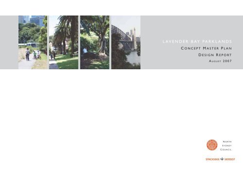
LAVENDER BAY PARKLANDS<br />
C ONCEPT M ASTER P LAN<br />
D ESIGN R EPORT<br />
A UGUST 2007<br />
N ORTH<br />
S YDNEY<br />
C OUNCIL
LAVENDER BAY PARKLANDS<br />
C ONCEPT M ASTER P LAN<br />
D ESIGN R EPORT<br />
A UGUST 2007<br />
PREPARED FOR<br />
N ORTH S YDNEY C OUNCIL<br />
BY<br />
SPACKMAN & MOSSOP<br />
level 2, 3 oxford st.<br />
paddington nsw 2021<br />
www.spackmanmossop.com.au
Contents<br />
1 - Introduction<br />
Defining the study area<br />
Project objectives<br />
Project process<br />
Available information<br />
2 - Consultation with the community and stakeholders<br />
Approach to consultation<br />
Outline of key findings<br />
3 - Site analysis and assessment<br />
Regional site context<br />
Local site context<br />
Land ownership and zoning<br />
Physical site characteristics<br />
Access and circulation<br />
4 - Use of the Parklands<br />
History of use<br />
Range of current uses<br />
5 - Site values and issues<br />
6 - Site planning principles<br />
7 - Concept Master Plan<br />
8 - Where to from Here<br />
Lavender Bay Parklands Concept Master Plan<br />
Design Report<br />
1
1<br />
Introduction<br />
Lavender Bay Parklands are a unique foreshore asset: a composite of heritage<br />
<strong>parklands</strong>, with spectacular harbour views, mature tree plantings, and access to<br />
an active foreshore area with direct harbour access.<br />
Comprising Clark Park to the east, Watt Park to the west, Quibaree Park to the<br />
south and the Lavender Bay foreshore area, the Parklands provide panoramic<br />
open space areas, as well as more introspective spaces for quiet reflection and<br />
relaxation.<br />
Defining the study area<br />
The study area is bounded by Lavender Street to the north,<br />
Harbourview Crescent to the east, Luna Park to the south-east,<br />
Waiwera Street to the west, and the waters of Lavender Bay to the south.<br />
The Lower Walker Street Steps, and the King George Street Road Reserve are<br />
also included in the study area.<br />
A portion of the Railway land, which separates Clark Park from the foreshore<br />
area, has been transformed by a local resident from a weed-infested, neglected<br />
area into an intimate and attractive Parkland. This area does not form part of<br />
the study area as it is not owned or controlled by <strong>Council</strong> - it has however,<br />
been considered as part of the broader Concept Master-Planning process for its<br />
positive contribution to the <strong>parklands</strong> visitor experience.<br />
Figure 1<br />
The study area<br />
�������<br />
�������<br />
�������<br />
������<br />
���������������������������<br />
�������<br />
��������������<br />
������<br />
�����������������������<br />
�������������<br />
��������<br />
���������������������������������������������<br />
���������<br />
��������<br />
�������������<br />
�������������<br />
��������<br />
���������������������������<br />
��������<br />
���<br />
������<br />
����<br />
������������<br />
������������<br />
�����<br />
������<br />
����������<br />
�������������<br />
���������<br />
�����������������������<br />
Lavender Bay Parklands Concept Master Plan<br />
Design Report<br />
����������<br />
������<br />
����������� ��������<br />
����<br />
������<br />
����� ������<br />
������<br />
��<br />
2
1<br />
Introduction continued<br />
Project approach and objectives<br />
The Lavender Bay Parklands are a sensitive site which are highly valued and<br />
supported by the local community. Much of the Parkland is in good order and<br />
its separate parks are visited and appreciated by residents, workers and other<br />
visitors. A sensitive approach to Concept Master-Planning is therefore required –<br />
an approach that is light in touch, is respectful to the inherent character of the<br />
site and its relationship with the Harbour, and its range of values to different<br />
user groups.<br />
The project brief does not call for a redesign of the site:<br />
subtle upgrading works are required to resolve a number of existing issues,<br />
to improve and enhance the Parklands character and improve recreation<br />
opportunity for the range of park users.<br />
The Concept Master Plan therefore takes a sensitive and low-key approach to<br />
upgrade, enhance and ‘fine tune’ the Lavender Bay Parklands.<br />
Key aims for the Concept Master Plan include:<br />
�� �������������heritage significance of the parks.<br />
�� ��������������������������������������������������������������������������<br />
and be sympathetic and consistent with the <strong>Sydney</strong> Harbour foreshore<br />
landscape as a whole.<br />
�� ���������circulation and access issues.<br />
�� ���������������awareness and appreciation of the historical significance of<br />
the sites.<br />
�� ����������needs of and be acceptable to the various stakeholder groups<br />
(as far as possible).<br />
�� ���������������various groups who use the Parklands, including people<br />
commuting, jogging, walking, picnicking, launching small craft, using the<br />
playground etc.<br />
Site specific objectives of the Concept Master Plan are as follows:<br />
�� �������������������������������������������������������������������������������<br />
apparent<br />
�� ����������������������������������������������������������������������<br />
�� ����������������������������������������������������������<br />
�� ���������������������������������������������������������������������������<br />
they are integrated with the development of the Concept Master Plan<br />
�� ���������������������������������������������������������������������������������<br />
and to allow users to appreciate some of the features of the Parklands more<br />
fully.<br />
Project process<br />
The approach to preparing the Concept Master Plan is detailed in Figure 2,<br />
opposite. Consultation strategies and findings are detailed in the following<br />
section.<br />
Concept Master Plan Reference Materials<br />
The preparation of the Concept Master Plan for the Lavender Bay Parklands<br />
relied on a number of <strong>Council</strong> documents and State planning instruments,<br />
including:<br />
�� �����������������������<br />
<strong>North</strong> <strong>Sydney</strong> <strong>Council</strong>, 2005<br />
�� �����������������������������������������������<br />
<strong>North</strong> <strong>Sydney</strong> <strong>Council</strong>, 2006<br />
�� �������������������������������������������<br />
<strong>North</strong> <strong>Sydney</strong> <strong>Council</strong>, 2006<br />
�� ��������������������������������������������������<strong>North</strong> <strong>Sydney</strong> <strong>Council</strong>,<br />
2002<br />
�� ������������������������������������<br />
Godden Mackay Pty Ltd 1993<br />
�� <strong>Sydney</strong> Regional Environmental Plan<br />
Catchment) 2004<br />
(<strong>Sydney</strong> Harbour<br />
Figure 2<br />
Project process<br />
Information review<br />
Landscape analysis and site assessment<br />
Lavender Bay Parklands Concept Master Plan<br />
Design Report<br />
Synthesis and analysis<br />
Community and Stakeholder consultation<br />
Synthesis and analysis<br />
Preparation of Design Report<br />
develop site planning principles<br />
and Concept Master-Planning recommendations<br />
Review by <strong>Council</strong><br />
Preparation of Draft Concept Master Plan<br />
Public exhibition<br />
Review submissions, Concept<br />
Master Plan finalisation<br />
Preparation of Final Concept Master Plan<br />
Project completion<br />
Adoption by <strong>Council</strong><br />
3
2<br />
Consultation with the community and stakeholders<br />
Approach to consultation<br />
Consultation with the local community, a range of user groups and relevant<br />
stakeholders and agencies is an important component of the project. The<br />
Parklands are highly valued assets and community input and support for the<br />
process and proposals is highly desirable.<br />
To ensure a thorough consultative process, the range of users and stakeholders<br />
was defined, and a targeted consultative strategy developed to accommodate<br />
each group, including on-site workshops and meetings, and contact with<br />
relevant stakeholders and agencies.<br />
The communications process informed residents and stakeholders about all<br />
aspects of the project, with a view to increasing their understanding of the issues<br />
involved in the project, thereby facilitating their more effective involvement.<br />
A Broad range of stakeholder and user groups were consulted.<br />
Consultation and communications undertaken<br />
The consultation and communications for the project included a range of<br />
measures designed to maximise the opportunities for the community and<br />
stakeholders to contribute to the project and to ensure that people were<br />
informed about the project, as it progressed. Each component of the<br />
consultation is detailed below, and key findings are presented on the following<br />
pages.<br />
Community Open Day - Saturday 3 February 2007<br />
An onsite workshop was held in Clark Park, on Saturday 3 February 2007<br />
from 10am to 2pm. The workshop was advertised in local newspapers, on<br />
<strong>Council</strong>’s website, and via a series of posters placed in the Parklands and at<br />
���������������������������������������������������������������������������<br />
local residents and users of the Parklands. A series of initial site analysis maps<br />
and graphics were presented for comment and feedback, as well as historical<br />
photographs of the area. Approximately 40 people attended the workshop over<br />
the four hours.<br />
Consultation with park users including local workers - Tuesday 20 February<br />
2007<br />
An onsite workshop was held in Quibaree Park, on Tuesday 20th February 2007<br />
from 12pm to 2pm. The workshop aimed to engage lunchtime park users in the<br />
consultation process. This included local workers who frequent the Parklands<br />
on trips to and from work, and during their lunch hour. Site analysis maps<br />
and graphics were presented for comment and feedback, as well as historical<br />
photographs of the area. Approximately 25 people attended the workshop over<br />
the two hours.<br />
Consultation with the Lavender Bay Working Group<br />
The consultant team met with the Lavender Bay Working Group on Thursday 22<br />
������������������������������������������������������������������������������<br />
and graphics were presented for comment and feedback, as well as a series<br />
of initial site planning principles which would guide the development of the<br />
Concept Master Plan.<br />
Consultation with the Lavender Bay Precinct Committee<br />
The consultant team met with the Lavender Bay Precinct Committee at 8pm<br />
on Thursday 29 March, at McMahons Point Community Centre. Site analysis,<br />
consultation findings and site planning principles were presented followed by a<br />
general discussion.<br />
Contact with stakeholders and agencies<br />
The consultant team contacted and/or met with a range of stakeholders<br />
including local community groups; local business interests; service providers; and<br />
local and state government authorities and representatives including (but not<br />
limited to) the Lavender Bay Precinct Committee, The Kirribilli Club, nominated<br />
���������������������������������������������<br />
<strong>Council</strong> website<br />
Information regarding consultation and the development of the Concept Master<br />
Plan has been provided on <strong>Council</strong>’s website throughout the project.<br />
Figure 3<br />
Community Open Day in Clark Park - Saturday 3 February 2007<br />
Lavender Bay Parklands Concept Master Plan<br />
Design Report<br />
Figure 4<br />
Consultation with lunchtime park users including local workers in Quibaree<br />
Park - Tuesday 20 February 2007<br />
4
2<br />
Consultation with the community and stakeholders<br />
Outline of key findings<br />
The key findings from the community and stakeholder consultations are<br />
presented below.<br />
Watt Park<br />
�� �������������������������������������������������������<br />
�� �����������������������������������������������������������������<br />
�� �������������������������������������������������������������������������<br />
playground equipment.<br />
�� �����������������������������������������������������������������������������<br />
don’t slip.<br />
�� �����������������������������������������������������������������������<br />
separate groups. More seating and tables.<br />
�� �����������������������������������������������������������������������������<br />
evening and weekends.<br />
�� ����������������������������������������<br />
Clark Park<br />
�� �������������������������������������������������������������������������������<br />
runoff etc) and looks unsightly<br />
�� ������������������������������������������������������������������������<br />
�� ������������������������������������������������<br />
�� ���������������������������������<br />
�� ����������������������������������������<br />
�� ���������������������������������������������<br />
Quibaree Park<br />
�� ���������������������������������������������������������������������<br />
�� ����������������������������������������������������������������������������������<br />
and visually prominent part of the site.<br />
�� �����������������������������������������������������������<br />
�� �����������������������������������������������������<br />
�� ���������������������������������������������������������������������������<br />
along the foreshore<br />
Lavender Bay foreshore<br />
�� ���������������������������������������������������������������������������<br />
foreshore development<br />
Railway land between Clark Park and the railway line<br />
�� ����������������������������������������������������������������������<br />
�� ����������������������������������������������������������<br />
General access issues<br />
�� �����������������������������������������������������������������������������<br />
current ambient levels<br />
�� ������������������������������������������������������<br />
�� ���������������������������������������������������������������������<br />
gradient, poor condition<br />
�� ��������������������������������������������������������������������������<br />
gradient, poor condition<br />
�� ������������������������������������������������������������������������������<br />
poor condition, low lighting<br />
�� ���������������������������������������������������������������������������<br />
narrow footpath.<br />
�� ������������������������������������������������������������������������������<br />
of bike ramps and rails, etc<br />
�� ����������������������������������������������������������������<br />
��������������������������������������������������<br />
These findings and issues have been taken into consideration throughout<br />
the preparation of this Design Report, the development of the site planning<br />
principles and the preparation of the Concept Master Plan.<br />
Lavender Bay Parklands Concept Master Plan<br />
Design Report<br />
5
3<br />
Site analysis and assessment<br />
Sub-regional site context<br />
���������������������������������������������������������������������<br />
<strong>Government</strong> Area (LGA), which is bounded by <strong>Sydney</strong> Harbour to the south,<br />
Mosman LGA to the east, Willoughby LGA to the north, Middle Harbour to the<br />
north east, and Lane Cove LGA to the west.<br />
�������������������������������������������������������������������������<br />
�����������������������������������������������������������������������������<br />
<strong>Sydney</strong>, St Leonards (part), Waverton and Wollstonecraft.<br />
The LGA covers a total area of approximately 10.5km2 and has a<br />
current resident and worker population of approximately 100,000 people<br />
(Australian Bureau of Statistics, 2001).<br />
�����������������������������������������������������������������������<br />
���������������������������������������������������������������������������������<br />
����������������������������������������������������������������������������<br />
high-rise apartment blocks to detached housing.<br />
��������������������������������������������������������������������������<br />
����������������������������������������������������������������������������<br />
�����������������������������������������������������������������������������<br />
reserves and foreshore parks, fronting <strong>Sydney</strong> and Middle Harbours.<br />
It is an area regularly visited by large numbers of people. It is estimated that the<br />
population more than doubles on weekdays; with over 52,000 people travelling<br />
���������������������������������������(<strong>North</strong> <strong>Sydney</strong> <strong>Council</strong>, 2005).<br />
The Lavender Bay Parklands are a very popular site for visitors seeking to<br />
experience a quiet and attractive harbour foreshore area. The Parklands and the<br />
�����������������������������������������������������������������������������<br />
<strong>Sydney</strong> when viewed from the harbour, the Harbour Bridge and the Dawes<br />
Point/Walsh Bay area on the opposite foreshore.<br />
Lavender Bay Parklands Concept Master Plan<br />
Design Report<br />
Figure 5<br />
Regional site context - <strong>North</strong> <strong>Sydney</strong><br />
6
3<br />
Site analysis and assessment<br />
Local site context<br />
The Lavender Bay Parklands are located on the southern edge of the LGA,<br />
within the suburb of Lavender Bay, a diverse area that includes dwellings, light<br />
industry, education, places of worship, recreation and public health facilities.<br />
Many of the land uses are located in a leafy setting with strong links to <strong>Sydney</strong><br />
Harbour.<br />
Lavender Bay is noted for its historical character arising from the retention<br />
of much of its original subdivision pattern and good examples of largely<br />
intact mid 19th century and early 20th century buildings. Blues Point Road<br />
in McMahons Point is a popular village centre enjoyed by local residents and<br />
visitors to the area with its outdoor cafes, galleries and small specialty shops.<br />
Also on the shores of Lavender Bay is Milsons Point, consisting of a number of<br />
multi storey residential and mixed use towers located at the base of the <strong>Sydney</strong><br />
Harbour Bridge and surrounded by landmarks such as Luna Park, Bradfield Park<br />
����������������������(<strong>North</strong> <strong>Sydney</strong> <strong>Council</strong> DCP, 2005).<br />
������������������������������������������������������������������������<br />
�������������������������������������������������������������������������������<br />
well placed in terms of public transport and are serviced by a combination of<br />
trains, buses and ferries. Lavender Bay Wharf is a small <strong>Council</strong>-owned wharf<br />
which is currently not serviced by ferries but is available for public use.<br />
����������������������������������������������������������������������������<br />
����������������������������������������������������������������������������<br />
(Bradfield Park) through a well-established pedestrian and cycle network which<br />
is well-utilised.<br />
To the west, the Parklands connect via the King George Street Road Reserve to<br />
Waiwera Street, which meets McMahon’s Point Wharf and Blues Point Reserve<br />
to the south.<br />
There are limited opportunities for users of foreshore parks and reserves within<br />
����������������������������������������������������������������������������������<br />
Bay Parklands provide an important access point to the water, through a public<br />
wharf with dinghy/kayak launching facilities, a small boat ramp, and a beach<br />
area.<br />
Figure 6<br />
Local site context<br />
�����<br />
���������������������<br />
���� ������<br />
��<br />
������<br />
��������������<br />
������<br />
�����������������������������<br />
����������������������������<br />
��������<br />
������<br />
����<br />
�������<br />
������<br />
�������<br />
������������������������������������������������������������������<br />
������<br />
�������������<br />
�������<br />
�������<br />
������<br />
�������������������������<br />
������<br />
�����<br />
�����������<br />
�������<br />
�����<br />
������<br />
����������������<br />
�����<br />
������������<br />
���������������������������������<br />
�����<br />
������������������������������������������<br />
�����������<br />
��������������������������������������������������<br />
�������<br />
������<br />
�������������<br />
�������<br />
������<br />
�������<br />
������<br />
��������<br />
��������<br />
������<br />
��������������<br />
������������<br />
��������<br />
���������������<br />
�����<br />
��������������<br />
���������<br />
������������<br />
�������������������<br />
�������������<br />
�����<br />
������<br />
������<br />
�����<br />
� ���� �����<br />
� ����<br />
��������<br />
����<br />
������������<br />
�����������������������<br />
��������<br />
���<br />
���������<br />
�����������<br />
������<br />
��������<br />
����<br />
�����<br />
� � ������������<br />
���������<br />
������<br />
���������<br />
�����<br />
����� ������<br />
������<br />
������<br />
����<br />
����������������������<br />
Lavender Bay Parklands Concept Master Plan<br />
Design Report<br />
����������<br />
������<br />
�������������<br />
��������������������������������<br />
������������<br />
�������������������<br />
�����<br />
������<br />
�������<br />
����<br />
������<br />
��������<br />
������<br />
���������������������<br />
�����<br />
�������<br />
���������<br />
����������<br />
��������������<br />
�������<br />
����������<br />
����<br />
����������<br />
�����������������������������<br />
�����<br />
���������<br />
��������<br />
���������������������������������������������<br />
��������������������������������������������<br />
�����������������������������<br />
��������������<br />
������������<br />
������<br />
��������������������������������������<br />
��������������<br />
���������������<br />
��������������������������������������������������������<br />
���������������<br />
�����<br />
�������������<br />
7
3<br />
Site analysis and assessment<br />
Land ownership and zoning<br />
<strong>North</strong> <strong>Sydney</strong> <strong>Council</strong> owns the majority of Watt Park, Clark Park and Quibaree Park while the<br />
Lavender Bay foreshore is entirely Crown Land. Day-to-day management of all the Parks is the<br />
responsibility of <strong>Council</strong>.<br />
Three small parcels of land in Clark Park are Crown land managed by <strong>Council</strong> in accordance with the<br />
Crown Lands Act 1989 and the Principles of Crown Land Management that are contained within<br />
the Act.<br />
The management of all of the areas within the Lavender Bay Parklands are detailed in <strong>Council</strong>’s<br />
geographic Plan of Management for Foreshore Parks and Reserves (2002).<br />
The Parks comprising the Lavender Bay Parklands are all Zoned ‘Public Open Space’, and will need<br />
to be managed in line with <strong>Council</strong>’s objectives for these lands, which are to:<br />
(a) allow for a range of open space areas and public facilities which meet the needs of the<br />
community for both formal and informal recreation, and<br />
(b) ensure sufficient public recreation areas are available for the benefit and use of the<br />
community, and<br />
(c) allow for the enhancement and management of recreation areas in accordance<br />
with the plans of management adopted by the <strong>Council</strong> under the Local <strong>Government</strong> Act 1993.<br />
Ownership of adjacent lands<br />
There are a number of significant interfaces between the Lavender Bay Parklands and areas<br />
adjoining.<br />
The four parks that comprise the <strong>parklands</strong> - Watt Park, Clark Park, Quibaree Park and the<br />
Lavender Bay foreshore - are divided by the Railway corridor, containing the railway lines<br />
(utilised for off-peak storage of rolling stock), the rail viaduct, maintenance sheds and adjoining<br />
embankment areas, as shown in Figure 7.<br />
Lands owned and managed by Luna Park meets the southern and eastern boundaries of the<br />
Lavender Bay foreshore area, as shown in Figure 7.<br />
Figure 7<br />
Land ownership<br />
Community<br />
Centre<br />
WAIWERA<br />
STREET<br />
MILLER ST<br />
LAVENDER<br />
KING GEORGE ST ROAD RESERVE<br />
BAYVIEW<br />
ST<br />
WATT PARK<br />
KEY OWNED MANAGED<br />
CRESCENT<br />
LAVENDER<br />
QUIBAREE PARK<br />
<strong>North</strong> <strong>Sydney</strong> <strong>Council</strong> <strong>North</strong> <strong>Sydney</strong> <strong>Council</strong><br />
Crown <strong>North</strong> <strong>Sydney</strong> <strong>Council</strong><br />
<strong>NSW</strong> <strong>Government</strong> Rail Corp<br />
Crown Luna Park Reserve Trust<br />
Private Private<br />
WALKER ST<br />
ROAD RESERVE<br />
WALKER ST<br />
Lavender Bay<br />
STREET<br />
RAIL RESERVE<br />
RAIL RESERVE<br />
Lavender<br />
CLARK PARK<br />
Bay<br />
Wharf<br />
Lavender Bay Parklands Concept Master Plan<br />
Design Report<br />
ARTHUR STR<br />
Lavender<br />
Bay<br />
Foreshore<br />
HARBOURVIEW<br />
CRESCENT<br />
LUNA<br />
PARK<br />
STREET<br />
CLIFFSTREET<br />
8
3<br />
Site analysis and assessment<br />
Physical site characteristics<br />
Topography<br />
The local topography of the Lavender Bay Parklands is typical of a harbour side<br />
location. The landform slopes across the site from the ridge top of Lavender<br />
Street to the south, and more gently to the east and west, moving around the<br />
<strong>bay</strong>.<br />
Clark Park is sited at the top of the ridge, and is formed largely from fill, which<br />
was a result of the construction of the Harbour Bridge in the 1920s. The site<br />
slopes gently to the south and south-west, where it meets the railway land and<br />
the Walker Street Road Reserve.<br />
Watt Park is framed to the north by the sandstone rock escarpment which<br />
forms a steep edge between Lavender Street and the park. Within Watt Park<br />
itself, the topography is gently undulating with the subtle level changes falling<br />
to the south and east.<br />
Quibaree Park and the Lavender Bay foreshore areas are open and relatively<br />
low-lying, fronting the harbour.<br />
Views and amenity<br />
A range of vantage points and viewing areas are available over the harbour<br />
throughout the Parklands. These viewing points are defined by topographical<br />
changes and planting arrangements within the site, and are discussed for each<br />
individual park area as part of the landscape character.<br />
���������������������������������������������������������������������������<br />
peninsulas (e.g. Blues Point along the foreshore park, Kirribilli Point, Kurraba<br />
Point). The stepped form of the existing vegetation across the Lavender Bay<br />
Parklands from the ridge top to the water contributes greatly to greening the<br />
foreshore areas. This is an important characteristic of views back into the site,<br />
particularly from Milsons Point, Luna Park, and from the southern sides of the<br />
Harbour.<br />
Edge conditions<br />
The edge conditions for each of the four areas comprising the Lavender Bay<br />
Parklands are very different, and will present different issues for the long-term<br />
management of the site.<br />
Clark Park is bounded by road edge and tall, multi-storey commercial and<br />
residential buildings to the north and east, the railway land to the south, and<br />
low-rise residential areas that adjoin Walker Street Road Reserve to the west.<br />
Watt Park is bounded by the steep sandstone escarpment to the north<br />
(which adjoins Lavender Street) and west (which adjoins Waiwera Street),<br />
low-rise residential areas to the east, and the railway viaduct (with a through<br />
connection to Quibaree Park) to the south.<br />
Quibaree Park is edged predominantly by the water’s edge to the south, railway<br />
land to the north, the foreshore walk to the east, and medium rise residential<br />
to the west.<br />
The Lavender Bay foreshore area is bounded by the railway land to<br />
the north and east, Luna Park to the south, and the Harbour edge<br />
to the west.<br />
���������<br />
���<br />
���<br />
���<br />
���<br />
���<br />
���<br />
���<br />
���<br />
���<br />
���<br />
���<br />
���<br />
���<br />
���<br />
���<br />
��<br />
��<br />
�����������<br />
��������������<br />
�������������<br />
�������<br />
Lavender Bay Parklands Concept Master Plan<br />
Design Report<br />
Figure 8<br />
Analysis of local topography with cadastre overlay<br />
��������<br />
���<br />
������������<br />
���������������<br />
�����<br />
���������<br />
�����<br />
��������������<br />
�������<br />
�<br />
��������<br />
������<br />
�����<br />
�������������<br />
9
3<br />
Site analysis and assessment<br />
Landscape character<br />
The four parks that comprise the Parklands - Watt Park, Clark Park, Quibaree<br />
Park and the Lavender Bay Foreshore - have very different landscape features<br />
and landscape character. These are summarised for each area of the Parklands,<br />
as follows.<br />
Clark Park<br />
�� �������������������������������������������������������������������������<br />
over Lavender Bay, across the harbour and to the Harbour Bridge.<br />
�� �����������������������������������������������������������������������<br />
of established trees including Brush Box (Lophostemon confertus), Canary<br />
Island Date Palm (Phoenix Canariensis) and Port Jackson Figs (Ficus<br />
rubignosa).<br />
�� ��������������������������������������������������������������������������<br />
tables and park benches.<br />
�� ���������������������������������������������������������������������������<br />
Kirribilli Ex-Serviceman’s Club as a war memorial, and is often the gathering<br />
point for groups of people involved in memorial commemorations.<br />
Watt Park<br />
�� ��������������������������������������������������������<br />
quiet reflection and relaxation. Spaces defined by significant plantings,<br />
gentle changes in levels and path systems.<br />
�� ����������������������������������������������������������������������������<br />
the railway.<br />
�� ������������������������������������������������������������������������������<br />
Camphor Laurels (Cinnamomum camphora) in the northeastern corner<br />
of the Park, a magnificent Plum Pine (Podocarpus sp.) on the lower level,<br />
and, in the southwestern corner, two Silver Birches (Betula pendula) and a<br />
Bangalow Palm (Archontophoenix cunninghamiana).<br />
�� �������������������������������������������������������������<br />
�� ��������������������������������������������������������������������������<br />
complement the heritage character of the Park.<br />
�� �������������������������������������������������������������������������<br />
gateway to the harbour: connecting Watt Park with the waterfront Quibaree<br />
Park.<br />
�� ��������������������������������������������������������������������<br />
����<br />
�<br />
������<br />
�����<br />
�����������������������<br />
��<br />
�������<br />
�����<br />
������<br />
����������������<br />
������������������������������������������<br />
�����<br />
�������<br />
�������<br />
������<br />
�������<br />
����������<br />
������<br />
�������������<br />
��������<br />
���������������������������<br />
��������<br />
���<br />
������<br />
��<br />
������<br />
�����������������������<br />
����������<br />
������<br />
��������<br />
Lavender Bay Parklands Concept Master Plan<br />
Design Report<br />
Figure 9<br />
Views afforded from the different areas of the <strong>parklands</strong><br />
����<br />
������<br />
����� ������<br />
����<br />
��������������<br />
������<br />
��������������������<br />
����������<br />
��������������<br />
10
3<br />
Site analysis and assessment<br />
Quibaree Park<br />
�� �������������������������������������������<br />
by the water edge and the railway viaduct,<br />
representing a significant land-water interface<br />
that provides access to the water from a beach<br />
area, jetty and stairs.<br />
�� �������������������������������������������������<br />
and the city.<br />
�� ������������������������������������������������� �<br />
functioning boat ramp, sea wall and rubble<br />
wall.<br />
�� ����������������������������������������������<br />
corridor of public open space known as<br />
the Lavender Bay foreshore, comprising<br />
a boardwalk, associated green space and<br />
sculpture garden areas.<br />
�� ��������������������������������������������������<br />
��������������������������������������������<br />
heritage.<br />
Lavender Bay foreshore area<br />
�� ��������������������������������������������������<br />
as an important pedestrian and cycle link<br />
between the study area through to Luna Park,<br />
the Harbour Bridge and Bradfield Park beyond.<br />
�� ��������������������������������������������<br />
bitumen path which is bounded by planted<br />
areas adjacent the railway land, including the<br />
proposed Art Barton Park.<br />
�� ���������������������������������������������<br />
harbour, to Luna Park, the Harbour Bridge and<br />
the City CBD beyond when heading south, and<br />
expansive views back over the Parklands when<br />
heading north.<br />
Walker Street Road Reserve and King George<br />
Street Reserve<br />
�� ���������������������������������������������� �<br />
to the harbour side <strong>parklands</strong>.<br />
�� ������������������������������������������ �<br />
screening of the railway viaduct and limited<br />
views to the water.<br />
�� ������������������������������������������ �<br />
inconsistent<br />
Railway land adjacent to Clark Park<br />
�� The area of state rail land between Clark<br />
Park and the railway lines/viaduct has been<br />
transformed by a local resident from a weed<br />
-infested, neglected area into an intimate and<br />
attractive garden space which is an integral<br />
part of the Lavender Bay Parklands. Known<br />
����������������������������������������<br />
contributes greatly, not only to the physical<br />
extent of useable parkland in the Lavender Bay<br />
area, but also to the unique character of the<br />
Parklands.<br />
Figure 10<br />
Watt Park<br />
Figure 12<br />
Quibaree Park<br />
Figure 11<br />
Clark Park<br />
Figure 13<br />
Lavender Bay foreshore<br />
Lavender Bay Parklands Concept Master Plan<br />
Design Report<br />
11
3<br />
Site analysis and assessment<br />
Access and circulation<br />
As part of the consultation process, park users were asked to map their access<br />
routes into and around the Parklands.<br />
This map is presented in Figure 14 and provides a good overview of the main<br />
entry points to the <strong>parklands</strong> and the pathways currently being used.<br />
Within the Parklands<br />
The internal path systems in some areas require rationalisation to improve<br />
access and reduce impacts on the amenity of some sections of the Parklands.<br />
It is important for there to be good connectivity between the parks as well as<br />
from the adjoining streets in order to facilitate access around the foreshore.<br />
Time limits on car parking in Lavender Crescent restricts some recreation<br />
activities which extend beyond the 2 hour parking time limit.<br />
������������������������������������������������������������������������<br />
often result in illegal parking which further congest access and impacts on the<br />
park.<br />
Walker Street and King George Street road reserves are key entry/access points<br />
to the Parklands and require upgrading to improve accessibility for pedestrians.<br />
Beyond the Parklands<br />
Beyond the circuits available through the Parklands, there are some important<br />
���������������������������������������������������������������������������������<br />
Road, the railway stations and ferry wharves. The Parklands form part of the<br />
���������������������������������������������������<br />
Disabled Access<br />
As Lavender Crescent provides the only disabled access to the foreshore<br />
through the Parklands, it is important to manage the potential for conflict<br />
between pedestrians, cyclists and vehicles along this route.<br />
Figure 14<br />
Analysis of access and circulation into and around the <strong>parklands</strong><br />
CES<br />
PLACE<br />
TREET<br />
STREET<br />
PARKER<br />
LLOYD REES<br />
LOOKOUT<br />
VICTORIA PLACE<br />
MIDDLE<br />
STREET<br />
POINT<br />
STREET<br />
WARUNG STREET<br />
HENRY<br />
WELLINGTON LANE<br />
KING GEORGE STREET<br />
EAST CRESCENT<br />
STREET LOOKOUT<br />
HENRY LAWSON RESERVE<br />
WAIWERA<br />
STREET<br />
EAST<br />
CRESCENT<br />
LAWSON<br />
STREET<br />
AVENUE<br />
BAYVIEW<br />
LAVENDER CRES-<br />
WATT PARK<br />
STREET<br />
McMahons Point<br />
RAIL<br />
LAVENDER<br />
Lower Bayview<br />
St Reserve<br />
McMahon's Point<br />
Wharf<br />
WALKER<br />
ROAD RESERVE<br />
QUIBAREE PARK<br />
Lavender<br />
Bay<br />
KEY<br />
STREET<br />
CLARK<br />
RESERVE<br />
PARK<br />
ARTHUR ST<br />
LAVENDER<br />
BAY<br />
FORESHORE<br />
Access along road only<br />
Disabled access<br />
HARBOURVIEW<br />
ARTHUR<br />
Informal abled access routes<br />
Formal abled access routes<br />
CRESCENT<br />
LANE<br />
Luna Park<br />
CLIFF<br />
STREET<br />
Luna Park<br />
Wharf<br />
Lavender Bay Parklands Concept Master Plan<br />
Design Report<br />
STREET<br />
STREET<br />
ALFRED<br />
GLEN<br />
NORTHCLIFF STREET<br />
MARY WOLLSTONECRAFT LANE<br />
HOPKINS PARK<br />
STREET<br />
PAUL STREET<br />
<strong>North</strong> <strong>Sydney</strong><br />
Olympic Pool<br />
McDOUGALL<br />
MILSONS POINT STATION<br />
ENNIS ROAD<br />
SOUTH<br />
BRADFIELD PARK<br />
BROUGHTON STREET<br />
BROUGHTON<br />
WILLO<br />
12
4<br />
��������������������<br />
History of use<br />
(Historical research provided by <strong>North</strong> <strong>Sydney</strong> <strong>Council</strong>)<br />
Historical information about the Aboriginal inhabitants of Lavender Bay /<br />
Gooweebahree prior to European settlement of Australia is not well documented.<br />
�����������������������������������������������������������������������������������<br />
Cammeraygal (Gammeraigal) clan, who were likely part of the larger Kur-ing-gai<br />
language group.<br />
The name Gooweebahree is thought to refer to the Aboriginal name for fresh<br />
water - a reference to the spring that flowed periodically into the Bay. The first<br />
European settlers adopted this name until it was renamed in the 1830’s after local<br />
resident George Lavender.<br />
In 1805, Robert Campbell purchased a large section of land on the waterfront<br />
����������������������������������������������������������������������������<br />
600 yards inland, comprising Milsons Point and the future sites of Luna Park,<br />
������������������������������������������������������������������������������<br />
James Milson settled on this land in 1806.<br />
George Lavender, boatswain of the convict hulk ‘Phoenix’ took up residence in the<br />
Bay in the 1920’s, marrying Susannah Blue, William (Billy) Blue’s daughter. William,<br />
whose land grant covered the Western half of the Bay, commenced the first ferry<br />
service across <strong>Sydney</strong> Harbour in the early 1930’s.<br />
A regular wharf and waterman’s service operated at Milsons Point from the<br />
late 1930’s and in 1842 it was declared a public landing place. By 1860, a<br />
regular vehicular ferry service was operating between Milsons Point and Fort<br />
�������������������������������������������������������������������������<br />
to Milsons Point three years later, following the shoreline of Lavender Bay.<br />
The Lavenders lost their land when the government revoked their title in the course<br />
of surveying subdivisions during the 1850’s. The sale led to increased urban<br />
settlement in the Lavender Bay and Milsons Point area. A number of large<br />
�������������������������������������������������������������������������������<br />
and ‘Hellespont’.<br />
Much of the land in the subdivision was reserved for the construction of the<br />
railway, the subsequent surplus was largely given over for parkland. Watt Park<br />
includes part of the land grant made to William (Billy) Blue on 24th January<br />
1817 by Governor Macquarie and land, which was part of a grant to Thomas<br />
������������������������������������������������������������������������������<br />
James Milson.<br />
From 1881 to 1975 the Lavender Bay (formerly Cavill’s) bath-house and baths<br />
operated from the now reclaimed land adjacent the rail viaduct in Quibaree<br />
Park. Richard Cavill (1884 - 1938), born in Lavender Bay, was the first person to<br />
use the ‘Australian Crawl’ in competition swimming.<br />
The Lavender Bay Railway Line includes a multiple track section of Marshalling<br />
Yards that extend westwards from Luna Park along the south eastern shore<br />
of Lavender Bay. The yards area includes remnants of the 1915 and 1924-32<br />
Milsons Point Stations, and the site of a carriage shed which formally existed<br />
where the northernmost set of tracks run today.<br />
In planning the <strong>Sydney</strong> Harbour Bridge in the 1920s, JJC Bradfield proposed a<br />
number of schemes for the future use of the resumed land adjoining the road<br />
and rail approaches to the Bridge. The schemes included a continuous series of<br />
buildings enclosing the northern foreshore of Lavender Bay in an Italianate style<br />
with arcaded walks opening onto a promenade along the foreshore. This grand<br />
and somewhat romantic proposal was never realised, although the existing<br />
railway viaduct provides a small indication of what might have been.<br />
����������������������������������������������������������������������<br />
<strong>Sydney</strong> from 1923- 1926. Whilst Clark Park commemorates the name of his<br />
������������������������������������������������������������������������<br />
Quibaree Park acknowledges the importance of the former boat building<br />
�����������������������������������������������������������������������<br />
Company’s slipway, and the former Aboriginal name for the Bay - Quiberie. The<br />
Metropolitan Aboriginal Lands <strong>Council</strong> approved the naming of this new Park in<br />
1995 with the suggested appropriate spelling as ‘Quibaree’.<br />
In 2004 <strong>Council</strong> adopted dual names for Lavender Bay, ie Lavender Bay /<br />
Gooweebahree. The latter is a phonetically correct rendering of the name<br />
Quibaree.<br />
Lavender Bay Parklands Concept Master Plan<br />
Design Report<br />
Figure 15<br />
View of Lavender Bay (includes Gentlemans Baths) c.1900-1927 (source: Mitchell Library)<br />
Figure 16<br />
Clark Park, Milsons Point, Luna Park and <strong>Sydney</strong> Harbour Bridge c.1937<br />
(source: Stanton Library)<br />
Figure x<br />
Lavender Bay foreshore<br />
Figure 17<br />
Watt Park, <strong>North</strong> <strong>Sydney</strong> c.1937 (source: Stanton Library)<br />
13
4<br />
��������������������<br />
Range of current uses<br />
There is no specific statistical information for recreation and user trends for<br />
the Lavender Bay Parklands. The range of current uses detailed below has been<br />
identified through on-site observation and consultation as part of this project.<br />
Parkland Uses<br />
�� ��������������������<br />
Quiet, individual contemplation or reading, in secluded areas of the<br />
Parklands.<br />
�� �����������������������<br />
� ���������������������������������������������������������������������<br />
�� ����������<br />
Parents and their children utilising the play equipment.<br />
�� �������<br />
Individuals and groups passing through the Parklands with brief<br />
stops to take in views and utilise facilities, often as part of a broader circuit<br />
� ������������������������������<br />
�� ��������<br />
As a means of transport to the site, or passing through where paths<br />
allow.<br />
�� ���������<br />
Individuals quickly passing through the site on the most direct routes<br />
� ��������������������������������������������������������������������� �<br />
� ���������������������������������������������������<br />
�� ��������������������������������������������������������������<br />
Individual and groups stopping at key points in the site that offer<br />
unobstructed sight lines to points of interest.<br />
�� ��������������������<br />
People employed locally who bring their lunches to the park to eat.<br />
Short stay duration usually between the hours of 12 - 2pm<br />
�� �����������������������������������<br />
Joggers utilise the boardwalk and Quibaree Park foreshore as part of a larger<br />
� ������������������������������������������������������������������������������<br />
boxercise. The stairs in Walker Street are also often used for exercise by both<br />
individuals and groups.<br />
�� �������<br />
Recreational use of private and hired vessels moored in Lavender<br />
Bay or smaller vessels including kayaks launched from the boat ramp<br />
or beach.<br />
�� ����������������������<br />
Current or previous residents and relatives having a connection to the<br />
history of the site, looking for evidence of the past. General interest by<br />
visitors reading the interpretive signs.<br />
�� ����������������������������� �<br />
Includes, but not limited to War Memorials in Clark Park.<br />
�� �������������<br />
� ��������������������������������������������������������������������������<br />
number of people to the Parklands at any one time.<br />
�� �������������<br />
Including weddings, photo shoots and birthday parties.<br />
�� ������<br />
To residences, marinas and the viaduct storage facilities.<br />
Lavender Bay Parklands Concept Master Plan<br />
Design Report<br />
Figure 18<br />
Boxercise class<br />
Figure 19<br />
Workers at lunch<br />
Figure 20<br />
Views and visual appreciation<br />
14
5<br />
Site values and issues<br />
Site values<br />
The Lavender Bay Parklands have a number of characteristics that are valued<br />
for their role or potential role in making the site unique and important.<br />
The consultation undertaken as part of this project with the community<br />
and stakeholders canvassed a range of values for the site. The analysis<br />
below identifies the main elements of the site’s values, to be retained and<br />
strengthened.<br />
Heritage values<br />
�� ��������������������������������������������������������������������������<br />
history, character and value - associations with boat building, ferry wharves,<br />
the railway line and water supply.<br />
�� ���������������������������������������������������������������������<br />
European settlement of the area, the establishment of stately homes of the<br />
district, and key families.<br />
�� �������������������������������������������������������������������������<br />
story of the construction of the Harbour Bridge, which impacted greatly on<br />
����������������������������������������������<br />
�� ��������������������������������������������������������������������������<br />
part of the larger Kuringgai Tribe, which occupied Lavender Bay prior to<br />
European settlement of Australia and well into the 19th century.<br />
�� ����������������������������������������������������������������������������<br />
����������������������������������������������������������������������<br />
the surrounding cliff top.<br />
�� ����������������������������������������������������������������������<br />
long life span and will remain a valuable open space resource for future<br />
generations.<br />
Aesthetic and scenic values<br />
�� �������������������������������������������������������������������������<br />
varying topography, the heritage planting themes, diversity of landscape<br />
settings, and range of landscape features.<br />
�� ��������������������������������������������������������������������<br />
Parklands which provide local and regional views over the Harbour and<br />
across to the Harbour Bridge and the CBD of <strong>Sydney</strong>.<br />
�� ���������������������������������������������������������������������<br />
���������������������������������������������������������������������<br />
surrounds.<br />
�� ����������������������������������������������������������������������������<br />
to the Harbour.<br />
�� �����������������������������������������������������������������������<br />
aesthetic and scenic qualities around the Parklands, providing immense<br />
value to the community<br />
Recreational values<br />
�� ����������������������������������������������������������������������������<br />
cycling, picnicking and relaxing for both local residents and non-residents<br />
(workers and visitors).<br />
�� ��������������������������������������������������������������������<br />
experience of the Harbour.<br />
�� ���������������������������������������������������������������������������<br />
access to the water’s edge, for boating purposes.<br />
�� ����������������������������������������������������������������������<br />
to walk through and explore, with a range of different recreational<br />
experiences.<br />
�� �������������������������������������������������������������������������<br />
connectivity (through park and on-street connections) for pedestrians and<br />
cyclists.<br />
Social values<br />
��� ����������������������������������������������������������������������������<br />
groups share the Parklands:<br />
– Small groups - picnics, family gatherings etc<br />
– Structured groups - personal training and group exercise<br />
��������������������������������������������������������������<br />
– Local individuals and groups working in the <strong>parklands</strong> and adjoining<br />
areas to improve the amenity and enjoyment of the area for all visitors.<br />
Lavender Bay Parklands Concept Master Plan<br />
Design Report<br />
15
5<br />
Site values and issues<br />
Site issues<br />
The following issues have been identified as part of the site analysis and will be<br />
addressed in the Concept Master Plan for the Lavender Bay Parklands.<br />
Access and circulation<br />
�� ��������������������������������������������������������������������������<br />
pedestrians preferring this route to the access road adjacent the rail viaduct.<br />
The Historic Slipway creates a narrow thoroughfare restricting pedestrian<br />
access.<br />
�� ��������������������������������������������������������������������������<br />
defined vehicular and pedestrian path.<br />
�� �����������������������������������������������������������������������������<br />
and through the Parkland, resulting in potential conflicts in the narrow<br />
carriageway.<br />
�� ��������������������������������������������������������������<br />
�� �����������������������������������������������������������������<br />
inconsistent in finishes and widths.<br />
�� ����������������������located on the Walker Street stairs and Lower Lavender<br />
Street and adjoining the northwest corner of Clark Park have no road access.<br />
Current vehicular access through Clark Park via use of the Harbourview<br />
Crescent entrance has resulted in an unsightly dirt road and soil erosion.<br />
� A desire line located along Harbourview Crescent and adjoining the southeast<br />
corner of Clark Park is well established.<br />
�� Waiwera Street entrance, pedestrian pathway and stairs to Watt Park are in<br />
poor condition and inconsistent in finishes and widths.<br />
�� �����������������������������������������������������������������������<br />
Street entrance are difficult for pedestrians to traverse.<br />
�� ���������������������������������������������������������������������������<br />
sections are rotting out; newer sections are too flimsy (members too small) at<br />
King George Street, Walker Street and Waiwera Street Entrances.<br />
�� �������������������������������������������������������������������<br />
disproportionate to its levels of use. It is a pedestrian bottle neck that restricts<br />
circulation patterns through the <strong>parklands</strong>. Two telegraph poles further<br />
exacerbate the problem.<br />
Lighting<br />
�� ��������������������������������������������������������������������������<br />
ineffective and inconsistent but pole mounted lights may impact on adjoining<br />
residents.<br />
�� ��������������������������������������������������������������������������������<br />
maintenance and is susceptible to vandalism.<br />
�� ���������������������������������������������������������������������������<br />
lighting is a concern for other residents.<br />
�� �������������������������������������������������������������������������<br />
with the Luna Park site and beyond (Bradfield Park and the Kirribilli Foreshore)<br />
is a popular and very scenic route, well used by commuters, as well as by<br />
people exercising or walking for recreation and pleasure during both day and<br />
night. The level of use of this foreshore pathways has grown substantially<br />
since the re-opening of Luna Park.<br />
�� ��������������������������������������������������������������������������<br />
foreshore to connect with the existing lighting along the foreshore of the<br />
Luna Park site will enable this route to be more accessible to night walkers.<br />
The extent of lighting along the foreshore may be required to extend to the<br />
Walker Street steps and continue through Quibaree Park and up the steps<br />
to King George Street. The potential visual impact of foreshore lighting also<br />
needs to be considered on the visual amenity of the Parklands.<br />
Lavender Bay Parklands Concept Master Plan<br />
Design Report<br />
16
5<br />
Site values and issues<br />
Views and amenity<br />
�� ��������������������������������������������������������������������<br />
�������������������������������������������������������������������������<br />
������������������������������������������������������������������������<br />
������������������������������������������������������������������������<br />
�������������������������������������������������������������������������<br />
�������������������������������������������<br />
�� ������������������������������������������������������������������������<br />
����������������������������������������������������������������������<br />
�� ��������������������������������������������������������������������<br />
�����������������������������������������������������������������������<br />
�����������������������<br />
�� �����������������������������������������������������������������<br />
��������������������������������������������������������������������<br />
������������������������������������������������������<br />
Site drainage<br />
�� ��������������������������������������������������������������<br />
����������<br />
�� ����������������������������������������������������������������<br />
�������������������������������������������������������������������<br />
��������<br />
�� ���������������������������������������������������������������������<br />
������������<br />
�� �����������������������������������������������������������������������<br />
�������������������<br />
�� ���������������������������������������������������������<br />
�� ����������������������������������������<br />
�� ���������������������������������������������<br />
�� ���������������������������������������������������������<br />
Fencing<br />
�� ��������������������������������������������������������������������<br />
������������������������������������������������������������������������������<br />
�������������������������������������������������������������������������<br />
�����������������������������������������������������������������������<br />
������������������������������������������������������������������������<br />
���������������������������������������������������������������������<br />
���������������<br />
Improvements to war memorial in Clark Park<br />
� ����������������������������������������������������������������������<br />
�������������������������������������������������������������������������<br />
��������������������������������������������������������������������������<br />
����������������������������������������������������������������������<br />
�����������������������������������������<br />
Additional open space areas adjacent to the Parklands<br />
�� �����������������������������������������������������������������������������<br />
�������������������������������������������������������������������������<br />
������������������������������������������������������������������<br />
��������������������������������������������������������������������������<br />
�������������������������������������������������������<br />
�� ��������������������������������������������������������������������������<br />
����������������������������������������������������������������������<br />
�����������������������������������������������������������������������<br />
������������������������������������������������������������������������������<br />
������������������������������������������������������������������������<br />
����������������������<br />
�� ����������������������������������������������������������������������� �<br />
� ��������������������������������������������������������������������������<br />
� �������������������������������������������������������������������������������<br />
� ��������������������������������������������������������������������������<br />
�� ������������������������������������������������������������������������<br />
����������������������������������������������������������������������<br />
��������������������<br />
Lavender Bay Parklands Concept Master Plan<br />
Design Report<br />
��� ������������������������������������������������������������������������<br />
���������������������������������������������������������������������<br />
�����������������������������������������������������������������<br />
����������������������������������������������������������������������<br />
���������������������������������������������������������������������<br />
�������������������������������������������������������������������������<br />
�����������������������������������������������������������������������<br />
����������������������������������������������������������������������<br />
��������������������������������������<br />
17