Enayam Port

You also want an ePaper? Increase the reach of your titles
YUMPU automatically turns print PDFs into web optimized ePapers that Google loves.
Tamil Research Institute<br />
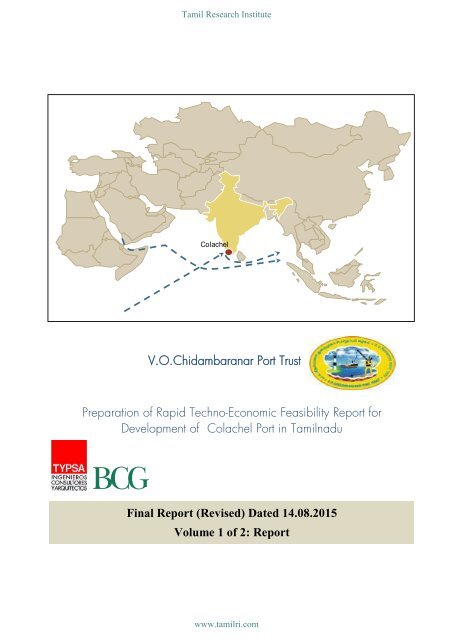
Colachel<br />
V.O.Chidambaranar <strong>Port</strong> Trust<br />
Preparation of Rapid Techno-Economic Feasibility Report for<br />
Development of Colachel <strong>Port</strong> in Tamilnadu<br />
Final Report (Revised) Dated 14.08.2015<br />
Volume 1 of 2: Report<br />
www.tamilri.com
Tamil Research Institute<br />
RAPID TECHNO-ECONOMIC FEASIBILITY REPORT FOR<br />
DEVELOPMENT OF COLACHEL PORT AT TAMILNADU<br />
FINAL REPORT<br />
Disclaimer<br />
The services and materials provided by TYPSA and The Boston Consulting Group (BCG) consortium are subject to their Standard<br />
Terms (a copy of which is available upon request) or such other agreement as may have been previously executed by the consortium<br />
of TYPSA and BCG. The firms TYPSA and BCG do not provide legal, accounting, or tax advice. The Client is responsible for<br />
obtaining independent advice concerning these matters. This advice may affect the guidance given by TYPSA and BCG. Further<br />
TYPSA and BCG has made no undertaking to update these materials after the date hereof, notwithstanding that such information may<br />
become outdated or inaccurate.<br />
Final versions of all plans, reports etc. prepared/ in the name of TYPSA & BCG consortium and provided to the<br />
V.O.Chidambaranar <strong>Port</strong> Trust will become Employer's property ("Deliverables"). TYPSA & BCG consortium retains all rights to<br />
Consultant's underlying intellectual property contained in any Deliverables which includes, but not limited to, Consultant's knowledge<br />
of business principles, and those analytical concepts, approaches, methodologies, ideas, formats etc. developed by TYPSA & BCG<br />
consortium staff in the course of Consultant's work for the V.O.Chidambaranar <strong>Port</strong> Trust, other clients, or during Consultant's own<br />
research. TYPSA & BCG consortium grants the V.O.Chidambaranar <strong>Port</strong> Trust a non-transferable, non-exclusive, license to use, copy<br />
and modify the TYPSA & BCG consortium intellectual property within Employer's organization to the extent necessary to enable the<br />
V.O.Chidambaranar <strong>Port</strong> Trust to implement the ideas and recommendations that TYPSA & BCG consortium provide. Though the<br />
deliverables are being developed for the sole use by the Client for the limited purposes described in the Agreement, the<br />
V.O.Chidambaranar <strong>Port</strong> Trust may redistribute the Deliverables only to other government bodies for the purposes of the Agreement.<br />
However, such government bodies shall be responsible for obtaining independent advice concerning these matters, which advice<br />
may affect the guidance given by the TYPSA & BCG consortium and it is unreasonable for them rely on these materials for any<br />
purpose whatsoever. To the fullest extent permitted by law the TYPSA & BCG consortium shall have no liability whatsoever to such<br />
government bodies arising out of disclosure of Deliverables. In any case in which TYPSA & BCG consortium agrees to the<br />
V.O.Chidambaranar <strong>Port</strong> Trust disclosing Deliverables to government bodies, the V.O.Chidambaranar <strong>Port</strong> Trust agrees that TYPSA &<br />
BCG consortium will not be responsible for any damages incurred or claims made by the V.O.Chidambaranar <strong>Port</strong> Trust or any<br />
government body as a result of or in connection with such disclosure, or the government body's use of, or reliance on, Consultant's<br />
work.<br />
The materials contained in this presentation are designed for the sole use by the board of directors or senior management of the<br />
Client and solely for the limited purposes described in the presentation. Further, Third Parties may not, and it is unreasonable for any<br />
Third Party to, rely on these materials for any purpose whatsoever. To the fullest extent permitted by law, TYPSA & BCG shall have no<br />
liability whatsoever to any Third Party, and any Third Party hereby waives any rights and claims it may have at any time against<br />
TYPSA & BCG with regard to the services, this report or other materials, including the accuracy or completeness thereof. Receipt and<br />
review of this document shall be deemed agreement with and consideration for the foregoing.<br />
TYPSA & BCG does not provide fairness opinions or valuations of market transactions, and these materials should not be relied on<br />
or construed as such. Further, the financial evaluations, projected market and financial information, and conclusions contained in<br />
these materials are based upon standard valuation methodologies, are not definitive forecasts, and are not guaranteed by TYPSA &<br />
BCG. TYPSA & BCG has used public and/or confidential data and assumptions provided to BCG by the Client. BCG has not<br />
independently verified the data and assumptions used in these analyses. Changes in the underlying data or operating assumptions<br />
will clearly impact the analyses and conclusions.<br />
Cost estimates included in this report are based upon site information, appropriate assumptions, wherever required, and the<br />
database of TYPSA & BCG for similar projects. Site information and assumptions are subject to many factors that are beyond the<br />
control of TYPSA & BCG. TYPSA & BCG give no warranties with respect to these estimates and disclaim any responsibility for the<br />
accuracy of these estimates.<br />
Notwithstanding anything to the contrary contained herein, the liability of either Party to the other for damages concerning<br />
performance or non-performance under this agreement, and regardless of whether the claim for such damages is based in contract,<br />
tort, strict liability, or otherwise, shall not exceed the amount of fees paid by the V.O.Chidambaranar <strong>Port</strong> Trust for the services under<br />
which liability arose. In no event shall either of the Party be liable to the other for any indirect, incidental, special, punitive or<br />
consequential damages, including without limitation damages for lost data or lost profits, even if the Party has been advised as to the<br />
possibility of such damages. This does not limit the Employer's liability to pay to the TYPSA & BCG consortium agreed upon amounts<br />
for services TYPS & BCG consortium deliver.<br />
CP1832-FR-CP-FinalReportRevised-Report-Ed1.docx<br />
www.tamilri.com
Tamil Research Institute<br />
RAPID TECHNO-ECONOMIC FEASIBILITY REPORT FOR<br />
DEVELOPMENT OF COLACHEL PORT AT TAMILNADU<br />
FINAL REPORT<br />
TABLE OF CONTENTS<br />
VOLUME 1 OF 2: REPORT<br />
1. BACKGROUND ................................................................................................................ 17<br />
1.1. GENERAL .......................................................................................................................... 17<br />
1.2. INDIA'S TRANS-SHIPMENT TRAFFIC: AN UNADDRESSED OPPORTUNITY .................................... 18<br />
2. SCOPE OF THE TEFR ......................................................................................................... 24<br />
3. REVIEW OF PREVIOUS REPORTS ........................................................................................... 25<br />
3.1. DETAILED FEASIBILITY STUDY ON COLACHEL PORT, INDIA (2000) ............................................. 25<br />
3.2. TECHNO ECONOMIC FEASIBILITY STUDY FOR COLACHEL PORT (2010) ................................... 26<br />
3.3. OUTER HARBOUR OF VOC PORT ......................................................................................... 26<br />
4. KEY IMPERATIVES FOR ENAYAM PORT .................................................................................. 28<br />
4.1. SWOT ANALYSIS OF ENAYAM PORT ................................................................................... 37<br />
5. OPTIONS FOR LOCATING THE PORT ................................................................................... 38<br />
5.1. BACKGROUND ................................................................................................................. 38<br />
5.2. PROPOSED LOCATIONS ..................................................................................................... 38<br />
5.2.1. Alternative 1: <strong>Enayam</strong> ............................................................................................. 38<br />
5.2.2. Alternative 2: Colachel ............................................................................................ 42<br />
5.2.3. Alternative 3: Manavalakurichi .................................................................................. 44<br />
5.2.4. Alternative 4: Kanyakumari ....................................................................................... 47<br />
5.2.5. Cost estimates ........................................................................................................ 49<br />
5.3. ENVIRONMENTAL AND SOCIAL CONSIDERATIONS .............................................................. 50<br />
5.3.1. Introduction ........................................................................................................... 50<br />
5.3.2. Impacts identification and description ......................................................................... 50<br />
5.3.3. Impacts evaluation .................................................................................................. 51<br />
5.3.4. Conclusions on environmental impact ......................................................................... 58<br />
5.4. SELECTION CRITERIA AND SELECTED OPTION ....................................................................... 58<br />
6. TRAFFIC AND MARKET STUDY ............................................................................................. 60<br />
6.1. APPROACH ....................................................................................................................... 60<br />
6.2. TRAFFIC PROJECTIONS........................................................................................................ 61<br />
6.2.1. Container traffic projections ...................................................................................... 61<br />
6.2.2. Bulk traffic projections .............................................................................................. 87<br />
6.2.3. Liquid traffic projections ........................................................................................... 90<br />
6.3. SUMMARY OF TRAFFIC ESTIMATES ....................................................................................... 91<br />
6.4. FEASIBILITY OF ANCILLARY INDUSTRIES ................................................................................. 91<br />
7. SITE INVESTIGATION STUDIES ............................................................................................. 99<br />
7.1. MET-OCEAN DATA ............................................................................................................. 99<br />
7.1.1. Introduction ........................................................................................................... 99<br />
7.1.2. Data Sources ......................................................................................................... 99<br />
ii<br />
www.tamilri.com
Tamil Research Institute<br />
RAPID TECHNO-ECONOMIC FEASIBILITY REPORT FOR<br />
DEVELOPMENT OF COLACHEL PORT AT TAMILNADU<br />
FINAL REPORT<br />
7.1.3. Reanalysis databases ............................................................................................ 100<br />
7.1.4. Wind climate ...................................................................................................... 101<br />
7.1.5. Sea level ............................................................................................................ 103<br />
7.1.6. Wave climate ..................................................................................................... 104<br />
7.2. BATHIMETRIC DATA ......................................................................................................... 111<br />
7.3. TOPOGRAPHIC DATA....................................................................................................... 111<br />
7.4. GEOLOGY AND GEOTECHNICS ...................................................................................... 112<br />
7.4.1. Introduction ......................................................................................................... 112<br />
7.4.2. Description of the regional geology ......................................................................... 112<br />
7.4.3. Description of the site ............................................................................................ 114<br />
7.4.4. Seismic hazard .................................................................................................... 114<br />
7.4.5. Estimated subsoil profile ........................................................................................ 115<br />
7.4.6. Geotechnical risks ................................................................................................ 116<br />
7.5. LAND AVAILABILITY ........................................................................................................... 116<br />
7.6. TRANSPORT LINKAGES ..................................................................................................... 119<br />
7.6.1. Road links ........................................................................................................... 119<br />
7.6.2. Rail links ............................................................................................................. 120<br />
8. DESIGN CRITERIA ........................................................................................................... 121<br />
8.1. TRAFFIC AND PHASING ................................................................................................... 121<br />
8.2. TECHNICAL CRITERIA ....................................................................................................... 122<br />
8.2.1. Design Vessel ...................................................................................................... 122<br />
8.2.2. Wave heights ..................................................................................................... 122<br />
8.2.3. Sea level ............................................................................................................ 126<br />
8.2.4. Operability ......................................................................................................... 127<br />
9. DETAILED PORT CONFIGURATION..................................................................................... 128<br />
9.1. GENERAL ....................................................................................................................... 128<br />
9.2. BREAKWATERS ................................................................................................................ 129<br />
9.2.1. Introduction ......................................................................................................... 129<br />
9.2.2. Rubble-Mound Breakwaters .................................................................................... 130<br />
9.2.3. Vertical breakwater .............................................................................................. 133<br />
9.3. HARBOUR SHORT WAVE AGITATION ................................................................................ 136<br />
9.3.1. Introduction ......................................................................................................... 136<br />
9.3.2. Methodology ...................................................................................................... 136<br />
9.3.3. Selection of cases ................................................................................................ 137<br />
9.3.4. Areas of study ..................................................................................................... 137<br />
9.3.5. Downtime ........................................................................................................... 137<br />
9.4. NAVIGATION REQUIREMENTS .......................................................................................... 141<br />
9.4.1. Vertical requirements ............................................................................................. 141<br />
9.4.2. Horizontal requirements ......................................................................................... 142<br />
9.4.3. Aids to navigation ................................................................................................ 144<br />
iii<br />
www.tamilri.com
Tamil Research Institute<br />
RAPID TECHNO-ECONOMIC FEASIBILITY REPORT FOR<br />
DEVELOPMENT OF COLACHEL PORT AT TAMILNADU<br />
FINAL REPORT<br />
9.5. DREDGING AND RECLAMATION ....................................................................................... 144<br />
9.5.1. Introduction ......................................................................................................... 144<br />
9.5.2. Dredging works.................................................................................................... 144<br />
9.5.3. Reclamation Works ............................................................................................... 147<br />
9.6. FACILITIES........................................................................................................................ 149<br />
9.6.1. Container terminal ................................................................................................ 149<br />
9.6.2. Multipurpose and ancillary berths and terminals .......................................................... 155<br />
9.6.3. Solid bulk terminal ................................................................................................ 155<br />
9.6.4. Buildings ............................................................................................................. 156<br />
9.7. PORT PLANNING FOR PHASES 2, 3 AND FUTURE EXTENSION .............................................. 157<br />
10. CONNECTIVITY PLANNING ............................................................................................. 160<br />
10.1. INTRODUCTION .............................................................................................................. 160<br />
10.2. RAIL CONNECTIVITY ......................................................................................................... 160<br />
10.3. ROAD CONNECTIVITY...................................................................................................... 162<br />
10.4. IMPLICATIONS ON LAND RECLAMATION ........................................................................... 164<br />
11. INITIAL ENVIRONMENTAL EXAMINATION ........................................................................... 166<br />
11.1. ALTERNATIVE ASSESSMENT ............................................................................................... 166<br />
11.2. PROJECT BENEFITS AND LAND ISSUES ................................................................................ 166<br />
11.3. ENVIRONMENTAL IMPACTS, MITIGATION MEASURES AND EMP ........................................... 167<br />
11.4. PRELIMINARY BUDGET FOR ENVIRONMENTAL AND CSR MEASURES ...................................... 167<br />
11.5. ENVIRONMENTAL AND SOCIAL FEASIBILITY ........................................................................ 168<br />
11.6. ENVIRONMENTAL MOEF CLEARENCE ................................................................................ 169<br />
12. ESTIMATION OF PROJECT CAPITAL COST ........................................................................... 170<br />
12.1. PRINCIPLES FOR COST ESTIMATION ................................................................................... 170<br />
12.2. TOTAL COST ESTIMATES ................................................................................................... 172<br />
13. FINANCIAL ASSESSMENT ................................................................................................ 182<br />
13.1. KEY ASSUMPTIONS .......................................................................................................... 182<br />
13.1.1. Timelines ............................................................................................................. 182<br />
13.1.2. Project Cost Estimates ............................................................................................ 182<br />
13.1.3. Traffic Projection ................................................................................................... 184<br />
13.1.4. Tariff structure ....................................................................................................... 186<br />
13.1.5. Operation and Maintenance costs ........................................................................... 189<br />
13.1.6. Funding structure ................................................................................................... 190<br />
13.1.7. Tax and Depreciation ............................................................................................ 190<br />
13.2. FINANCIAL RESULTS ......................................................................................................... 192<br />
13.3. SENSITIVITY ANALYSIS ...................................................................................................... 192<br />
13.4. ECONOMIC IMPACT OF THE PROJECT ............................................................................... 193<br />
13.4.1. Economic impact of the port ................................................................................... 194<br />
iv<br />
www.tamilri.com
Tamil Research Institute<br />
RAPID TECHNO-ECONOMIC FEASIBILITY REPORT FOR<br />
DEVELOPMENT OF COLACHEL PORT AT TAMILNADU<br />
FINAL REPORT<br />
13.4.2. Economic impact through businesses that would benefit from the port ............................. 194<br />
14. PROJECT STRUCTURE ....................................................................................................... 196<br />
14.1. MODELS FOR PRIVATE SECTOR PARTICIPATION ................................................................... 196<br />
14.2. KEY OBJECTIVES .............................................................................................................. 196<br />
14.3. MASTER CONCESSIONAIRE WITH A MINIMUM VOLUME COMMITMENT.............................. 198<br />
14.4. LANDLORD MODEL AND PRIVATE TERMINAL CONCESSIONS ............................................... 199<br />
14.5. FEASIBILITY OF COLACHEL AS A SATELLITE PORT TO VOCPT .................................................. 200<br />
15. IMPLEMENTATION PLAN ................................................................................................. 201<br />
15.1. INTRODUCTION ............................................................................................................. 201<br />
15.2. DESIGN AND TENDER ..................................................................................................... 201<br />
15.3. CONSTRUCTION SCHEDULE ............................................................................................ 201<br />
16. MANAGEMENT AND SUPERVISION DURING CONSTRUCTION ............................................. 205<br />
17. RISK ANALYSIS ............................................................................................................... 207<br />
17.1. LEGAL AND CONTRACTUAL RISKS ..................................................................................... 207<br />
17.2. REVENUE RISKS ............................................................................................................... 208<br />
17.3. TECHNICAL AND ENVIRONMENTAL RISKS ......................................................................... 208<br />
18. CONCLUSION .............................................................................................................. 211<br />
19. DRAWINGS .................................................................................................................. 213<br />
VOLUME 2 OF 2: ANNEXURE<br />
ANNEXURE 1: PHOTOGRAPHIC REPORT<br />
ANNEXURE 2: WAVE CLIMATE<br />
ANNEXURE 3: HARBOR SHORT WAVE AGITATION (DOWN TIMES)<br />
ANNEXURE 4: BREAKWATER DESIGN<br />
ANNEXURE 5: INITIAL ENVIRONMENTAL EXAMINATION<br />
ANNEXURE 6: TRAFFIC FLOW DATA<br />
ANNEXURE 7: FINANCIAL STATEMENTS<br />
v<br />
www.tamilri.com
Tamil Research Institute<br />
RAPID TECHNO-ECONOMIC FEASIBILITY REPORT FOR<br />
DEVELOPMENT OF COLACHEL PORT AT TAMILNADU<br />
FINAL REPORT<br />
FIGURES<br />
Figure 1: Proximity of Colachel to main shipping line ........................................................................... 17<br />
Figure 2: Key TS hubs for Indian container cargo ................................................................................ 18<br />
Figure 3: Simulation: Transport cost breakup for exports from Madurai district ........................................... 19<br />
Figure 4: Route wise Traffic volumes ................................................................................................. 19<br />
Figure 5: Major TS hub clusters in Asia ............................................................................................. 20<br />
Figure 6: Potential time and cost savings for liners by using Colachel (I) ................................................... 21<br />
Figure 7: Potential time and cost savings for liners by using Colachel (II) .................................................. 22<br />
Figure 8: Potential time and cost savings for liners by using Colachel (III) ................................................. 23<br />
Figure 9: Caption of layout for Colachel port by Construction Industry Development Board of Malaysian<br />
Government ................................................................................................................................ 25<br />
Figure 10: Location (left) and concept layout (right) for Colachel port by i-maritime Consultancy Private Ltd ..... 26<br />
Figure 11: VOCPT Layout of the outer Harbour .................................................................................. 27<br />
Figure 12: Existing & planned capacities of TS ports ........................................................................... 29<br />
Figure 13: TS traffic converted to gateway traffic through <strong>Enayam</strong> .......................................................... 30<br />
Figure 14: Indian feeder capacity available vs. requirement for Colachel ................................................ 30<br />
Figure 15: Cabotage relaxation for Colachel .................................................................................... 31<br />
Figure 16: Comparison of customs process benchmarks ....................................................................... 32<br />
Figure 17: Cuatom process flow ..................................................................................................... 33<br />
Figure 18. Road connectivity .......................................................................................................... 35<br />
Figure 19. Rail connectivity ............................................................................................................ 35<br />
Figure 20: Requisite for competitive bunker facility .............................................................................. 36<br />
Figure 21: Proposed alternative locations and layouts .......................................................................... 38<br />
Figure 22: Area of <strong>Enayam</strong> ............................................................................................................ 39<br />
Figure 23: <strong>Enayam</strong> port layout. Phase 1 ........................................................................................... 40<br />
Figure 24: Phase 2 and 3 for <strong>Enayam</strong> <strong>Port</strong> ........................................................................................ 41<br />
Figure 25: Area of Colachel........................................................................................................... 42<br />
Figure 26: Colachel port layout. Phase 1 .......................................................................................... 43<br />
Figure 27: Colachel port layout. Phase 2 and 3 ................................................................................. 43<br />
Figure 28: Area of Manavalakurichi and Muttom ............................................................................... 44<br />
Figure 29: Washed sand stock from IRE Ltd. (left) and river mouth near Manavalakurichi ............................ 45<br />
vi<br />
www.tamilri.com
Tamil Research Institute<br />
RAPID TECHNO-ECONOMIC FEASIBILITY REPORT FOR<br />
DEVELOPMENT OF COLACHEL PORT AT TAMILNADU<br />
FINAL REPORT<br />
Figure 30: Manavalakurichi port layout. Phase 1 ............................................................................... 45<br />
Figure 31: Manavalakurichi port layout. Phase 2 and 3 ...................................................................... 46<br />
Figure 32: Area of Kanyakumari and Cape Comorin .......................................................................... 47<br />
Figure 33: Kanyakumari port layout. Phase 1 .................................................................................... 48<br />
Figure 34: Kanyakumari port layout. Phases 2 and 3 .......................................................................... 48<br />
Figure 35: Results from the Sensitivity analysis .................................................................................... 57<br />
Figure 36: Commodity wise cargo split from Indian ports ..................................................................... 60<br />
Figure 37: Trade route wise split of container traffic ............................................................................ 62<br />
Figure 38: Route wise split of gateway cargo .................................................................................... 63<br />
Figure 39: Route wise split of trans-shipment cargo ............................................................................. 63<br />
Figure 40: Key trans-shipment hubs for Indian container cargo .............................................................. 64<br />
Figure 41: Correlation between GDP and container volumes ................................................................ 65<br />
Figure 42: Underlying drivers for container traffic growth ..................................................................... 65<br />
Figure 43: Containerisation trend .................................................................................................... 66<br />
Figure 44: India's export growth vs. share of Indian goods in US, EU imports .......................................... 66<br />
Figure 45: Manufacturing cost benchmark for top export economies ...................................................... 67<br />
Figure 46: Consumption growth in India ........................................................................................... 67<br />
Figure 47: Indian GDP Projections for 30 years ................................................................................. 68<br />
Figure 48: Assumptions for scenario analysis ..................................................................................... 69<br />
Figure 49: 30 year projection of Indian container cargo ..................................................................... 69<br />
Figure 50: Approach for hinterland traffic projections .......................................................................... 70<br />
Figure 51: Hinterland identification for <strong>Enayam</strong> ................................................................................ 71<br />
Figure 52: Hinterland traffic projection ............................................................................................. 71<br />
Figure 53: Split of hinterland traffic into primary and secondary hinterland .............................................. 72<br />
Figure 54: Sources of hinterland traffic ............................................................................................. 72<br />
Figure 55: Map of hinterland industries and volumes from the industries .................................................. 73<br />
Figure 56: Export trends for the key hinterland industries ...................................................................... 73<br />
Figure 57: Comparison of cost competitiveness for top 25 export economies ........................................... 74<br />
Figure 58: Competitiveness of India in textile industries ........................................................................ 75<br />
Figure 59: Description of key hinterland industries .............................................................................. 75<br />
Figure 60: Potential SEZ, industrial parks in the hinterland in T.N........................................................... 76<br />
vii<br />
www.tamilri.com
Tamil Research Institute<br />
RAPID TECHNO-ECONOMIC FEASIBILITY REPORT FOR<br />
DEVELOPMENT OF COLACHEL PORT AT TAMILNADU<br />
FINAL REPORT<br />
Figure 61: Hinterland traffic projections ............................................................................................ 77<br />
Figure 62: Description of methodology ............................................................................................. 78<br />
Figure 63: Comparison of port costs ................................................................................................ 79<br />
Figure 64: Comparison of shipping costs (1) ..................................................................................... 80<br />
Figure 65: Comparison of shipping costs (2) ..................................................................................... 80<br />
Figure 66: Comparison of shipping costs (3) ..................................................................................... 81<br />
Figure 67: Traffic on different routes for Indian trans-shipment traffic ........................................................ 82<br />
Figure 68: trans-shipment traffic projections ........................................................................................ 82<br />
Figure 69: Indian sub-continent trans-shipment traffic for <strong>Enayam</strong> ............................................................ 83<br />
Figure 70: Description of methodology ............................................................................................. 84<br />
Figure 71: Trans-shipment traffic converted to gateway traffic through <strong>Enayam</strong> (I)....................................... 84<br />
Figure 72: Trans-shipment traffic converted to gateway traffic through <strong>Enayam</strong> (II) ...................................... 85<br />
Figure 73: Trans-shipment to gateway traffic projections ....................................................................... 85<br />
Figure 74: Gateway to gateway traffic projections for <strong>Enayam</strong> ............................................................. 86<br />
Figure 75: Container traffic projections for <strong>Enayam</strong> ............................................................................. 86<br />
Figure 76 Approach for bulk traffic projections ................................................................................... 87<br />
Figure 77 Power consumption estimates and power plants in TN ........................................................... 88<br />
Figure 78 Projection of power demand supply gap in T.N. .................................................................. 88<br />
Figure 79 Evaluation of options for <strong>Enayam</strong> to cater to Udangudi .......................................................... 89<br />
Figure 80 Coal traffic projections .................................................................................................... 90<br />
Figure 81: Feasibility of refinery in proximity to <strong>Enayam</strong> port ................................................................. 90<br />
Figure 82: Traffic Projections .......................................................................................................... 91<br />
Figure 83: Allied Industries ............................................................................................................. 92<br />
Figure 84: Global overcapacity in shipbuilding .................................................................................. 92<br />
Figure 85: Main shipbuilding sub sectors .......................................................................................... 93<br />
Figure 86: Types of ship repair ....................................................................................................... 94<br />
Figure 87: Scheduled ship repair ................................................................................................... 94<br />
Figure 88: Possibility of bunkering facility in <strong>Enayam</strong> ........................................................................... 95<br />
Figure 89: Ship related services – major players and locations .............................................................. 96<br />
Figure 90: Cruise port attractiveness................................................................................................. 97<br />
Figure 91: Methodology diagram. ................................................................................................ 100<br />
viii<br />
www.tamilri.com
Tamil Research Institute<br />
RAPID TECHNO-ECONOMIC FEASIBILITY REPORT FOR<br />
DEVELOPMENT OF COLACHEL PORT AT TAMILNADU<br />
FINAL REPORT<br />
Figure 92: Location of the two points of met-ocean data .................................................................... 101<br />
Figure 93: Western location wind rose .......................................................................................... 102<br />
Figure 94: Winds in the monsoon period (left) and in the non-monsoon period (right) .............................. 102<br />
Figure 95: Eastern location wind rose ............................................................................................ 103<br />
Figure 96: Winds in the monsoon period (left) and in the non-monsoon period (right) .............................. 103<br />
Figure 97: Western location wave rose.......................................................................................... 105<br />
Figure 98: Waves in the monsoon period (left) and in the non-monsoon period (right).............................. 105<br />
Figure 99: Eastern location wave rose. .......................................................................................... 106<br />
Figure 100: Waves in the monsoon period (left) and in the non-monsoon period (right)............................ 106<br />
Figure 101: Wave mean regime in the western and eastern locations .................................................. 107<br />
Figure 102: Wave extreme regime in the western and eastern locations ............................................... 107<br />
Figure 103: General grid (red line) and detail grid (green line) ........................................................... 108<br />
Figure 104: Analyzed points in shallow water along the coast ........................................................... 108<br />
Figure 105: Series of significant wave (Hs) ..................................................................................... 109<br />
Figure 106: Series of significant wave (Hs) and peak period (Tp) ........................................................ 109<br />
Figure 107: Wave Rose ............................................................................................................. 110<br />
Figure 108: Wave heights and return periods ................................................................................. 110<br />
Figure 109: Bathymetry plan of <strong>Enayam</strong> coast ................................................................................. 111<br />
Figure 110: Topographic plan of the studied area ........................................................................... 112<br />
Figure 111: Geological map of Tamil Nadu (Source: http://www.tnmine.tn.nic.in). .............................. 113<br />
Figure 112: Rocky islets near the beach (left) and weathered rock below the laterite soils (right). ............... 114<br />
Figure 113: Seismic zone map. Source: Geological Survey of India (GSI). ........................................... 114<br />
Figure 114: Preliminary soil profile assumed for the feasibility design ................................................... 115<br />
Figure 115: <strong>Enayam</strong> <strong>Port</strong> Area Land-Use Map ................................................................................. 117<br />
Figure 116: <strong>Enayam</strong> <strong>Port</strong> Area Population Density Map .................................................................... 118<br />
Figure 117: <strong>Port</strong> Layout for Phase 1 ............................................................................................... 128<br />
Figure 118: Location of points of interest ........................................................................................ 130<br />
Figure 119: Rubble-mound section (3 m 3 accropods)......................................................................... 131<br />
Figure 120: Rubble-mound section (2 m 3 accropods)......................................................................... 132<br />
Figure 121: Rubble-mound section (cubic blocks) ............................................................................. 133<br />
Figure 122: East breakwater section .............................................................................................. 133<br />
ix<br />
www.tamilri.com
Tamil Research Institute<br />
RAPID TECHNO-ECONOMIC FEASIBILITY REPORT FOR<br />
DEVELOPMENT OF COLACHEL PORT AT TAMILNADU<br />
FINAL REPORT<br />
Figure 123: Construction works of rubble mound and vertical breakwaters in Gijon <strong>Port</strong> (Spain) ................ 134<br />
Figure 124: Pressure diagram. ...................................................................................................... 135<br />
Figure 125: No overtopping vertical breakwater section .................................................................... 135<br />
Figure 126: Vertical breakwater with an admissible overtopping ......................................................... 136<br />
Figure 127: Areas of study (Berth line) ............................................................................................ 137<br />
Figure 128: Option 1. wave height for Case 4 ............................................................................... 139<br />
Figure 129: Option 1. Wave height for case 47 ............................................................................. 140<br />
Figure 130: Channel depth factors (PIANC).................................................................................... 141<br />
Figure 131: Basin and channel width definitions (PIANC) .................................................................. 142<br />
Figure 132: Cutter Suction Dredger ............................................................................................... 145<br />
Figure 133: Trailing Hopper Suction Dredger .................................................................................. 146<br />
Figure 134: TSHD discharging by rainbow ..................................................................................... 147<br />
Figure 135: Proposed reclamation bunds ........................................................................................ 148<br />
Figure 136: Cross section of reclamation bund ................................................................................ 149<br />
Figure 137: Scheme for container terminal operations ....................................................................... 150<br />
Figure 138: STS Crane (Liebherr) .................................................................................................. 150<br />
Figure 139: Shuttle carriers working ............................................................................................... 151<br />
Figure 140: Scheme and twin A-RMGs in an automated container yard ................................................ 151<br />
Figure 141: Two different types of reach stackers (RS) ....................................................................... 152<br />
Figure 142: Rail yard with Rail Mounted Gantry cranes ..................................................................... 152<br />
Figure 143: Some examples of coal terminal equipment. Gantry crane (left) and stacker/reclaimer (right) .... 156<br />
Figure 144: Coal terminal layout on Phase 2 ................................................................................... 156<br />
Figure 145: Layout for future extension of the port ............................................................................. 159<br />
Figure 146: Alternatives 1 (green) and 2 (black) for rail connectivity .................................................... 161<br />
Figure 147: Connecting railway typical cross section ....................................................................... 161<br />
Figure 148: Connecting road typical cross section ........................................................................... 162<br />
Figure 149: Alternatives 1 (blue) and 2 (red) for road connectivity ....................................................... 163<br />
Figure 150: Economic impact of the port project .............................................................................. 195<br />
Figure 151: Models for private sector participation ........................................................................... 196<br />
Figure 152: Key objectives of government ....................................................................................... 197<br />
Figure 153: Investor considerations ................................................................................................ 197<br />
x<br />
www.tamilri.com
Tamil Research Institute<br />
RAPID TECHNO-ECONOMIC FEASIBILITY REPORT FOR<br />
DEVELOPMENT OF COLACHEL PORT AT TAMILNADU<br />
FINAL REPORT<br />
Figure 154: Master Concessionaire Model ..................................................................................... 199<br />
Figure 155: Landlord Model ........................................................................................................ 200<br />
Figure 156: Management and supervision staff chart ........................................................................ 206<br />
xi<br />
www.tamilri.com
Tamil Research Institute<br />
RAPID TECHNO-ECONOMIC FEASIBILITY REPORT FOR<br />
DEVELOPMENT OF COLACHEL PORT AT TAMILNADU<br />
FINAL REPORT<br />
TABLES<br />
Table 1: Comparison of <strong>Port</strong> charges for competing trans-shipment ports ................................................. 31<br />
Table 2: <strong>Enayam</strong> port main figures (cumulative quantities) ..................................................................... 41<br />
Table 3: Colachel port main figures (cumulative quantities) ................................................................... 44<br />
Table 4: Manavalakurichi port main figures (cumulative quantities) ......................................................... 46<br />
Table 5: Kanyakumari port main figures (cumulative quantities) .............................................................. 49<br />
Table 6: Cost estimates (in Crore Rupees) for Phase 1 of all alternatives .................................................. 49<br />
Table 7: Estimated adverse impacts on each alternative ....................................................................... 52<br />
Table 8. Estimated adverse impacts valuation per alternative - Homogeneous evaluation ............................ 53<br />
Table 9. Estimated adverse impacts valuation per alternative - Sensitivity analysis I .................................... 54<br />
Table 10. Estimated adverse impacts valuation per alternative - Sensitivity analysis II .................................. 55<br />
Table 11. Estimated adverse impacts valuation per alternative - Sensitivity analysis III ................................. 56<br />
Table 12: Total estimated adverse impacts score per alternative ............................................................ 57<br />
Table 13: Qualitative assessment of alternatives ................................................................................. 59<br />
Table 14: Sea levels ................................................................................................................... 104<br />
Table 15: Zone factor Z value. Source: IS 1893 (Part 1) : 2002. ....................................................... 115<br />
Table 16: Geotechnical risks. ....................................................................................................... 116<br />
Table 17: Traffic estimates for Base Case ....................................................................................... 121<br />
Table 18: Estimated traffic for each phase....................................................................................... 121<br />
Table 19: Vessels main figures ...................................................................................................... 122<br />
Table 20: Occurrence table (Hs(m)&Tp(s)) ....................................................................................... 123<br />
Table 21: Occurrence table (Hs(m)&DD(º)) ...................................................................................... 124<br />
Table 22: Occurrence table (Tp(s)&DD(º))........................................................................................ 125<br />
Table 23: Hs Mean Regime and Extreme Regime ............................................................................. 126<br />
Table 24: Tide levels .................................................................................................................. 126<br />
Table 25: Climate Change 2014 Synthesis Report, IPCC .................................................................. 127<br />
Table 26: Main elements and figures of the port ............................................................................... 129<br />
Table 27: Wave heights in the points of interest ............................................................................... 130<br />
Table 28: Results of downtime in each berth .................................................................................... 138<br />
Table 29: Channel depths for a 18.000 TEU container vessel. ........................................................... 141<br />
xii<br />
www.tamilri.com
Tamil Research Institute<br />
RAPID TECHNO-ECONOMIC FEASIBILITY REPORT FOR<br />
DEVELOPMENT OF COLACHEL PORT AT TAMILNADU<br />
FINAL REPORT<br />
Table 30: Channel depths. .......................................................................................................... 142<br />
Table 31: Horizontal navigational requirements by factors ................................................................. 143<br />
Table 32: Channel widths. .......................................................................................................... 143<br />
Table 33. Stopping distance and turning circle diameter ................................................................... 144<br />
Table 34. Dredging quantity and affected area ............................................................................... 145<br />
Table 35. Breakdown of land reclamation quantities......................................................................... 147<br />
Table 36: Berth capacity calculations ............................................................................................ 153<br />
Table 37: Yard capacity calculations ............................................................................................. 154<br />
Table 38: Coal berth performance assumptions. .............................................................................. 155<br />
Table 39: Main figures for Phase 1, 2 and 3 (cumulative figures) ........................................................ 158<br />
Table 40: Main figures of the rail connection. ................................................................................. 162<br />
Table 41: Main figures of the road. .............................................................................................. 163<br />
Table 42: Rough impact estimates on land acquisition. ..................................................................... 164<br />
Table 43: Summary of Phase-wise Project Cost ................................................................................ 183<br />
Table 44: Container traffic projection ............................................................................................ 184<br />
Table 45: Distribution of container traffic ........................................................................................ 185<br />
Table 46: Coal traffic projection ................................................................................................... 186<br />
Table 47: Tariff structure for Trans-shipment traffic ............................................................................. 187<br />
Table 48: Tariff structure for Gateway Container traffic ...................................................................... 188<br />
Table 49: Tariff structure for Coal traffic ......................................................................................... 189<br />
Table 50: O&M cost assumptions ................................................................................................. 190<br />
Table 51: Assumptions for Funding Structure .................................................................................... 190<br />
Table 52: Tax assumptions .......................................................................................................... 191<br />
Table 53: Depreciation rates ....................................................................................................... 191<br />
Table 54: Financial results ........................................................................................................... 192<br />
Table 55: Sensitivity of Equity IRR to Concession Period ..................................................................... 193<br />
Table 56: Sensitivity of Equity IRR to Revenue and Capex .................................................................. 193<br />
Table 57: Sensitivity of Equity IRR to Revenue and Opex .................................................................... 193<br />
Table 58: Sensitivity of Equity IRR to Trans-shipment Revenue & Gateway Revenue .................................. 193<br />
Table 59: Legal and contractual risks ............................................................................................. 208<br />
Table 60: Revenue risks .............................................................................................................. 208<br />
xiii<br />
www.tamilri.com
Tamil Research Institute<br />
RAPID TECHNO-ECONOMIC FEASIBILITY REPORT FOR<br />
DEVELOPMENT OF COLACHEL PORT AT TAMILNADU<br />
FINAL REPORT<br />
Glossary<br />
A-RMG Automated Rail Mounted Gantry crane<br />
CAGR Compound Annual Growth Rate<br />
CAPEX Capital Expenditure<br />
CFS<br />
CFSR<br />
CHA<br />
CRZ<br />
CSD<br />
CSR<br />
DCF<br />
DPR<br />
EDI<br />
EGM<br />
EHS<br />
EIA<br />
ESIA<br />
ESMP<br />
EXIM<br />
GDP<br />
GoI<br />
GOT<br />
GT<br />
HAT<br />
Climate Forecast System<br />
Climate Forecast System Reanalysis<br />
Custom House Agent<br />
Coastal Regulation Zone<br />
Cutter Suction Dredger<br />
Corporate Social Responsibility<br />
Discounted Cash Flow<br />
Detailed Project Report<br />
Electronic Data Interchange<br />
Export General Manifests<br />
Environmental, Health and Safety<br />
Environmental Impact Assessment<br />
Environmental and Social Impact Analysis<br />
Environmental and Social Management Plan<br />
Export & Import<br />
Gross Domestic Product<br />
Government of India<br />
Global Ocean Tides<br />
Great Diurnal Range<br />
Highest Astronomical Tide.<br />
HHWS Highest High Water Spring<br />
IALA<br />
IEE<br />
IGM<br />
IPA<br />
IRE<br />
IRR<br />
International Association of Marine Aids to Navigation and Lighthouse Authorities.<br />
Initial Environmental Examination<br />
Import General Manifests<br />
Indian <strong>Port</strong>s Association<br />
Indian Rare Earths Ltd.<br />
Internal Rate of Return<br />
xiv<br />
www.tamilri.com
Tamil Research Institute<br />
RAPID TECHNO-ECONOMIC FEASIBILITY REPORT FOR<br />
DEVELOPMENT OF COLACHEL PORT AT TAMILNADU<br />
FINAL REPORT<br />
JNPT<br />
LAT<br />
LLWS<br />
MAT<br />
MDA<br />
Jawaharlal Nehru <strong>Port</strong> Trust<br />
Lowest Astronomical Tide<br />
Lowest Low Water Spring<br />
Minimum Alternate Tax<br />
Maximum Dissimilarity Algorithm<br />
MHHW Mean Higher High water<br />
MHLW Mean Higher Low Water<br />
MLHW Mean Lower High Water<br />
MLLW Mean Lower Low Water<br />
MoEF<br />
MSL<br />
Ministry of Environment and Forest<br />
Mean Sea Level<br />
NCAR National Center for Atmospheric Research<br />
NCEP National Centers for Environmental Prediction<br />
NOAA National Oceanic and Atmospheric Administration<br />
O&M<br />
Operation and Maintenance<br />
PIANC Permanent Association of Navigation Congresses<br />
POL<br />
PPE<br />
PPP<br />
RBF<br />
R&D<br />
RMG<br />
RMS<br />
RS<br />
RSC<br />
SAGT<br />
SC<br />
SEZ<br />
SHG<br />
SSC<br />
STS<br />
Petroleum, oil and lubricants<br />
Personal Protective Equipment<br />
Public Private Partnership<br />
Radial Basis Function<br />
Research & Development<br />
Rail-Mounted Gantry crane<br />
Royal Mail Ship<br />
Reach Stacker<br />
Roll-over Safety Coefficient<br />
South Asia Gateway Terminals<br />
Shuttle Carrier<br />
Special Economic Zone<br />
Self Help Groups<br />
Sliding Safety Coefficient<br />
Ship-to-shore gantry crane<br />
xv<br />
www.tamilri.com
Tamil Research Institute<br />
RAPID TECHNO-ECONOMIC FEASIBILITY REPORT FOR<br />
DEVELOPMENT OF COLACHEL PORT AT TAMILNADU<br />
FINAL REPORT<br />
SWAN Simulating Waves Nearshore<br />
TAMP<br />
TAT<br />
TEFR<br />
TEU<br />
Tariff Authority for Major <strong>Port</strong>s<br />
Turn Around Times<br />
Techno-Economic Feasibility Report<br />
Twenty-foot Equivalent Unit (shipping container)<br />
TNMB Tamil Nadu Maritime Board<br />
TOS<br />
TPA<br />
TS<br />
TSHD<br />
UKC<br />
VAT<br />
VGF<br />
VISA<br />
Terminal Operating System<br />
Tonnes per annum<br />
Trans-shipment<br />
Trailing Suction Hopper Dredger<br />
Under Keel Clearance<br />
Value Added Tax<br />
Viability Gap Funding<br />
Visa International Service Association<br />
VOCPT V.O. Chidambaranar <strong>Port</strong> Trust<br />
VTMS<br />
Vessel Traffic Management System<br />
WW3 Wave Watch 3<br />
YoY<br />
Year over Year<br />
xvi<br />
www.tamilri.com
Tamil Research Institute<br />
RAPID TECHNO-ECONOMIC FEASIBILITY REPORT FOR<br />
DEVELOPMENT OF COLACHEL PORT AT TAMILNADU<br />
FINAL REPORT<br />
1. BACKGROUND<br />
1.1. GENERAL<br />
Container traffic in India has seen tremendous growth in the last decade. The traffic has grown by more than<br />
10% CAGR. The traffic is expected to continue growing at this rate as the global economy recovers and India's<br />
GDP growth rate accelerates back to 7 – 8% YoY growth. The demand for container traffic can further<br />
accelerate if the plans for debottlenecking of logistic infrastructure are implemented in time and the 'Make in<br />
India' push drives greater exports and manufacturing outsourcing to India.<br />
In order to support this accelerated cargo growth and also, to enable 'Make in India' initiatives, it will be<br />
important to plan additional capacities and drive greater port productivity.. As of now, there are only a few ports<br />
in India that have sufficient draft and match global cargo handling efficiencies.. This has resulted in a large<br />
percentage (~25%) of containers that originate from India to be trans-shipped in foreign ports such as Colombo,<br />
Singapore, Klang etc. This is leading to an economic loss for the country and an economic dependence on<br />
foreign ports. Hence, the Ministry of Shipping (Government of India) through VOC <strong>Port</strong> Trust has asked the<br />
consultant to identify a suitable site and assess feasibility of developing a new container trans-shipment port on<br />
the Southern coast of India near Colachel.<br />
Colachel is located on the south-west coast of India. It is a strategic location given its proximity to the<br />
international East-West shipping route. This route accounts for a major share of the total global container traffic<br />
flows and the mainline vessels use this route for transporting cargo between US, Europe and Asia. A significant<br />
share of India's current container cargo also moves through this route. The following figure shows proximity of<br />
Colachel to the east-west mainline shipping route.<br />
Colachel<br />
14 NM<br />
~1-2 hours<br />
Figure 1: Proximity of Colachel to main shipping line<br />
CP1832-FR-CP-FinalReportRevised-Report-Ed1.docx 17<br />
www.tamilri.com
Tamil Research Institute<br />
RAPID TECHNO-ECONOMIC FEASIBILITY REPORT FOR<br />
DEVELOPMENT OF COLACHEL PORT AT TAMILNADU<br />
FINAL REPORT<br />
Additionally, Colachel has a natural deep draft which makes it viable for servicing large sized vessels, which is<br />
an important factor in attracting shipping lines. Global vessel sizes have significantly increased in the last decade<br />
and most main liner vessels have capacities of 10,000 TEUs and above, with the largest vessel reaching a<br />
capacity of 18,000 TEUs. .<br />
This document is a Final Report that summarises the findings of the Techno-Economic Feasibility study and<br />
provides recommendations for development of the port.<br />
1.2. INDIA'S TRANS-SHIPMENT TRAFFIC: AN UNADDRESSED OPPORTUNITY<br />
Indian ports handled ~10.9 M TEUs of container cargo in 2014. Nearly 75% of this cargo was gateway (7.5<br />
Mn TEUs), while ~25% was trans-shipped (TS) en-route to destination (2.8 Mn TEUs). Currently, all of India's<br />
trans-shipped cargo gets handled in ports outside of India. Colombo, Singapore and Klang handle more than<br />
80% of this cargo, while Colombo alone handles around 1.2 Mn TEUs. Figure 1 below gives a detail port wise<br />
breakup of India's transhipment traffic.<br />
Volume of Indian cargo trans-shipped at different TS hubs<br />
Container cargo<br />
(in '000 TEUs)<br />
1,500<br />
Accounts for ~ 80% of TS cargo<br />
1,175<br />
1,000<br />
500<br />
627<br />
322<br />
565<br />
96<br />
0<br />
Total cargo<br />
handled<br />
(in Mn TEUs)<br />
Colombo<br />
4.9<br />
Singapore<br />
Klang<br />
Jebel Ali<br />
32.6 10.4 13.6<br />
Other<br />
International<br />
<strong>Port</strong>s<br />
KOLKATA<br />
HALDIA<br />
VISAKHAPATNAM<br />
CHENNAI<br />
V.O. CHIDAMBARANAR<br />
COCHIN<br />
J.N.P.T.<br />
Mundra<br />
Others<br />
Figure 2: Key TS hubs for Indian container cargo<br />
India has not been able to create an attractive trans-shipment port alternative that can match the competing<br />
international ports on location, draft and overall cost economics. This has been the key reason for losing out on<br />
this opportunity to international ports. A compelling case however exists for attempting to change this scenario,<br />
mainly because of the following reasons:<br />
1. ~Rs 1,500 Cr of potential port revenue (opportunity) loss per annum<br />
Indian port industry loses out upto Rs. 1,500 Cr of revenues each year on trans-shipment handling of cargo<br />
originating / destined for India. This translates into an estimated total loss of Rs. 3,000-4,500 Cr to economy<br />
(assuming an economic multiplier of 2 – 3x for ports). The loss is even higher if opportunity to handle cargo<br />
emerging from other countries in the region is considered.<br />
2. Inefficient logistics for a large segment of India's EXIM industry situated in South India<br />
18<br />
www.tamilri.com
Tamil Research Institute<br />
RAPID TECHNO-ECONOMIC FEASIBILITY REPORT FOR<br />
DEVELOPMENT OF COLACHEL PORT AT TAMILNADU<br />
FINAL REPORT<br />
Trans-shipment of cargo results in logistic cost inefficiencies for Indian industry (especially from South India) given<br />
the extra port handling charges incurred at the trans-shipment hubs. The cost of this additional port handling is to<br />
the tune of USD 80-100 per TEU, which would be saved if the container is imported/ exported as direct<br />
gateway cargo instead of being trans-shipped. The figure below illustrates this cost inefficiency using an example<br />
of cargo movement for a typical exporter from Madurai, T.N. using trans-shipment in Colombo and shipping to<br />
Antwerp in Europe.<br />
TS route through<br />
Colombo<br />
Cost (in<br />
USD / TEU)<br />
Gateway route through<br />
Colachel<br />
Cost (in<br />
USD / TEU)<br />
Inland Transport Madurai to Tuticorin 70-75 Madurai to Colachel 120-130<br />
<strong>Port</strong> Charges<br />
Shipping costs<br />
Tuticorin handling charge 120-130 - -<br />
Colombo handling<br />
charge<br />
75-80<br />
Colachel handling<br />
charge<br />
75-80<br />
Tuticorin to Colombo 8-10 Colachel to Antwerp 65-70<br />
Colombo to Antwerp 65-70 -<br />
Total Overall logistics cost ~350 ~250<br />
Upto 100 USD/ TEU of logistics cost can be saved for Madurai<br />
exporters by routing traffic through Indian gateway port<br />
Figure 3: Simulation: Transport cost breakup for exports from Madurai district<br />
A significant share of this cargo can be converted to Gateway by strategically locating a port near the Southern<br />
tip of India. This could also potentially help in further growth of trade due to improved cost competitiveness.<br />
3. Opportunity to become a large trans-shipment hub for trade between US, EU, Africa and Asia<br />
Container trans-shipment in Asia mainly occurs on three key routes – 1) US/ Europe to/from Far East, 2) Africa<br />
to/from Asia primarily Far East , 3) US/ Europe to/from India and Indian sub-continent.. The routes to/from<br />
Europe and America are the biggest routes as per current cargo traffic (combined ~60 Mn TEUs). Africa bound<br />
traffic although relatively smaller today (~10 Mn TEUs), it is expected to grow at a faster rate (6-7%) over the next<br />
few decades.<br />
Routes<br />
Traffic Volumes<br />
(in Mn TEUs)<br />
Expected traffic<br />
growth (in % YoY)<br />
Europe to/ from Asia 1 30 4-5%<br />
North America to/from Asia 2 28 4-5%<br />
Africa to/from Asia 10 6-7%<br />
1. Includes Europe to Asia and Europe to India, Indian Sub-Continent traffic 2. Includes . Includes US to Asia and Europe to India, Indian Sub-Continent traffi<br />
Source: BCG Analysis, IHS trade data<br />
Figure 4: Route wise Traffic volumes<br />
Currently, Asia has 3 main transhipment port clusters - Middle East Hub, South Asia Hub and S.E.Asia Hub. The<br />
following figure describes these clusters and the volume of traffic handled by each.<br />
19<br />
www.tamilri.com
Tamil Research Institute<br />
RAPID TECHNO-ECONOMIC FEASIBILITY REPORT FOR<br />
DEVELOPMENT OF COLACHEL PORT AT TAMILNADU<br />
FINAL REPORT<br />
Jebel Ali<br />
Salalah<br />
~20 MnTEU<br />
~4.5 MnTEU<br />
Colombo<br />
<strong>Port</strong> Klang, Tanjung<br />
Pelepas<br />
Singapore<br />
1 2 3<br />
1. Relay Hub for US<br />
East Coast/ Europe<br />
to Far East Traffic<br />
1. TS hub for India &<br />
India-sub continent<br />
to US East<br />
2. Relay hub for Africa<br />
to Asia traffic<br />
Coast/Europe<br />
traffic<br />
~50 MnTEU<br />
Figure 5: Major TS hub clusters in Asia<br />
1. TS hub for India & Indiasub<br />
continent to US East<br />
Coast /Europe traffic<br />
2. TS hub for US East<br />
Coast/Europe to Far East<br />
traffic<br />
While, most of the transhipment trade happens in the South East Asian and Middle East cluster, the South Asian<br />
location (including Southern tip of India) is in-fact the most efficient location for transhipment of cargo moving to<br />
Africa, EU or East Coast of America.<br />
i. Indian-subcontinent to US/ Europe traffic currently trans-shipped in Singapore cluster<br />
Currently, ~70% of cargo from Bangladesh and Myanmar gets trans-shipped in Singapore. A trans-shipment hub<br />
at the Southern tip of India can save voyage time by 5-6 days for cargo bound to Africa, EU or East coast of<br />
America, resulting in potential cost savings of 12-15%. Currently, only Colombo port is the alternative in the<br />
South Asia zone with a capacity of ~5 Mn TEU. Whereas, the South East Asian cluster already handles more<br />
than 50M TEUs. Thus, due to this significant scale difference South East Asia continues to be the main<br />
aggregation point. Emergence of new hubs such as Colachel and further growth of Indian container cargo<br />
traffic can change this scenario in the near future.<br />
Indian sub-continent to/from Europe/ West Coast US<br />
Current Route<br />
Voyage time<br />
(in days)<br />
Route with<br />
Indian TS hub<br />
Voyage time<br />
(in days)<br />
Chittagong to<br />
Singapore (feeder)<br />
5-6<br />
Chittagong to<br />
Colachel (feeder)<br />
4-5<br />
Singapore to<br />
Antwerp<br />
25-26<br />
Colachel to<br />
Antwerp<br />
20-21<br />
Total voyage time 30-31<br />
Total voyage<br />
time<br />
25-26<br />
20<br />
www.tamilri.com
Tamil Research Institute<br />
RAPID TECHNO-ECONOMIC FEASIBILITY REPORT FOR<br />
DEVELOPMENT OF COLACHEL PORT AT TAMILNADU<br />
FINAL REPORT<br />
Shipping cost savings of 12-15%<br />
Time Savings of 5-6 days<br />
From Bangladesh, Myanmar & other<br />
Indian subcontinent<br />
Indian TS Hub<br />
<strong>Port</strong> Klang<br />
To US/ Europe<br />
Current routes<br />
Potential changed routes due<br />
to Colachel<br />
Singapore<br />
Note: % of shipping cost savings calculated only on shipping voyage costs (fuel, opex etc.) and does not include port charges, inland transport charges<br />
Figure 6: Potential time and cost savings for liners by using Colachel (I)<br />
ii.<br />
US/ Europe to Far East traffic currently trans-shipped/ relayed in the Middle Eastern TS hub<br />
US/ Europe to Far East (including China) is the busiest trade route with volumes of ~30 Mn TEUs. Liners have<br />
started using the Middle Eastern cluster ports, mainly Salalah and Jebel Ali as relay hubs for this route, with one<br />
service bringing cargo from China to Salalah, while another service picks up this cargo and moves to US West<br />
Coast. TS port in South India is well placed to attract some of this relay traffic as it will account for ~1 day<br />
voyage time saving and 2-3% shipping cost savings.<br />
Europe/ West Coast US to/from Far East<br />
Current Route<br />
Voyage time<br />
(in days)<br />
Route with<br />
Indian TS hub<br />
Voyage time<br />
(in days)<br />
Antwerp to<br />
Salalah<br />
~16<br />
Antwerp to<br />
Colachel<br />
~20<br />
Salalah to<br />
Shanghai (relay)<br />
~17<br />
Colachel to<br />
Shanghai (relay)<br />
~12<br />
Total voyage<br />
time<br />
~33<br />
Total voyage<br />
time<br />
~32<br />
21<br />
www.tamilri.com
Tamil Research Institute<br />
RAPID TECHNO-ECONOMIC FEASIBILITY REPORT FOR<br />
DEVELOPMENT OF COLACHEL PORT AT TAMILNADU<br />
FINAL REPORT<br />
Shipping cost savings of 2-3%<br />
Time Savings of ~1 day<br />
From US/ Europe (relayed in ME)<br />
Jebel Ali<br />
Salalah<br />
Indian TS hub<br />
To China (Far-East)<br />
Current routes<br />
Potential changed routes due<br />
to Colachel<br />
Note: % of shipping cost savings calculated only on shipping voyage costs (fuel, opex etc.) and does not include port charges, inland transport charges<br />
Figure 7: Potential time and cost savings for liners by using Colachel (II)<br />
iii.<br />
Africa to Asia (Far East) traffic currently trans-shipped/ relayed in the Middle Eastern TS hub<br />
Africa to Asia trade is expected to grow at a 6-7% rate in the next decade. Currently, most of the traffic gets<br />
relayed in Middle Eastern port cluster with the cargo arriving from China and destined to US / EU. A TS hub<br />
such as Colachel will once again be an attractive alternative as will result in voyage time saving of3-4 days and<br />
potential cost savings of 10-12% for the liners.<br />
Africa to/ from Far East<br />
Current Route<br />
Voyage time<br />
(in days)<br />
Route with<br />
Indian TS hub<br />
Voyage time<br />
(in days)<br />
Cape Town to<br />
Salalah<br />
13-14<br />
Cape Town to<br />
Colachel<br />
14-15<br />
Salalah to<br />
Shanghai (relay)<br />
17-18<br />
Colachel to<br />
Shanghai (relay)<br />
12-13<br />
Total voyage<br />
time<br />
30-31<br />
Total voyage<br />
time<br />
27-28<br />
22<br />
www.tamilri.com
Tamil Research Institute<br />
RAPID TECHNO-ECONOMIC FEASIBILITY REPORT FOR<br />
DEVELOPMENT OF COLACHEL PORT AT TAMILNADU<br />
FINAL REPORT<br />
Shipping cost savings of 10-12%<br />
Time Savings of 3-4 days<br />
Jebel Ali<br />
Salalah<br />
Indian TS hub<br />
To China (Far-East)<br />
From Africa<br />
Current routes<br />
Potential changed routes due<br />
to Colachel<br />
Note: % of shipping cost savings calculated only on shipping voyage costs (fuel, opex etc.) and does not include port charges, inland transport charges<br />
Figure 8: Potential time and cost savings for liners by using Colachel (III)<br />
4. Mitigate risk to Indian trade due to dependence on international ports<br />
The current scenario where 25% of the country's EXIM cargo is trans-shipped at international ports is not ideal<br />
since this makes Indian industries vulnerable to increase in costs, potential inefficiencies, congestion issues etc. at<br />
these international ports. This creates long term risks for competitiveness of India's trade and thus is another<br />
important reason for promoting a TS port in India.<br />
23<br />
www.tamilri.com
Tamil Research Institute<br />
RAPID TECHNO-ECONOMIC FEASIBILITY REPORT FOR<br />
DEVELOPMENT OF COLACHEL PORT AT TAMILNADU<br />
FINAL REPORT<br />
2. SCOPE OF THE TEFR<br />
The Rapid Feasibility Study was commissioned with an aim to assess the technical and financial feasibility of the<br />
proposed port. Scope of the study was laid out by the proposal document released before bidding process for<br />
the project. The TEFR is structured to cover the following aspects of the study:<br />
• Need for the project.<br />
• Traffic surveys and demand assessment also taking into account other <strong>Port</strong>s in the vicinity.<br />
• Engineering surveys and investigations.<br />
• Identify area required for development of <strong>Port</strong>, availability of land, cost, etc.<br />
• Location and layout of the Project facility and services.<br />
• Initial Environment Examination (IEE).<br />
• Preliminary designs of project facility and services.<br />
• Structuring of project including different options for developing the project.<br />
• Schedules for modification and / or Utility Relocation Plans<br />
• Preparation of Cost Estimates<br />
• Establishing the Technical feasibility and Financial Viability of the Proposal<br />
• Review and update of previous reports on Colachel <strong>Port</strong>.<br />
• Feasibility in developing Colachel <strong>Port</strong> as a satellite port of VOCPT, considering the availability of<br />
deep draft.<br />
• Key outputs of the rapid feasibility study – traffic, port location and port layout and the resultant<br />
financials for the port.<br />
• Key success factors for the port Details out the planned connectivity to the port both in terms of road<br />
and railways.<br />
• Phases the costs based on capacity phasing and construction planning.<br />
• Projects free cash flow from the project over the years; calculates resultant IRR.<br />
24<br />
www.tamilri.com
Tamil Research Institute<br />
RAPID TECHNO-ECONOMIC FEASIBILITY REPORT FOR<br />
DEVELOPMENT OF COLACHEL PORT AT TAMILNADU<br />
FINAL REPORT<br />
3. REVIEW OF PREVIOUS REPORTS<br />
3.1. DETAILED FEASIBILITY STUDY ON COLACHEL PORT, INDIA (2000)<br />
The report was prepared by Construction Industry Development Board of Malaysian Government for Tamil Nadu<br />
Government in November-2000. The report analyses the traffic and market, and proposes a port near<br />
Manavalakurichi for container traffic only.<br />
This report gives a good approach on the container port planning. Several imputs of this feasibility study, after<br />
the due update, have been used in the current report. That is the case of the benchmarking of productivity levels<br />
for berths and cranes, key factors for the success of the port or container equipment.<br />
Analyzing the layout, the consultant presents a well organized and protected port (although it still could have<br />
some problems with waves coming from south-east), but with some other problems like:<br />
• A difficult and expensive dredging on rocky soil<br />
• A river inside the basin which would generate the need for continued maintenance dredging<br />
• Very long (around 9,000 m) and costly breakwaters<br />
• A very high need of land acquisition both for port and industrial area<br />
• Negative effects on local fishing industry and Indian Rare Earths Ltd as well<br />
Figure 9: Caption of layout for Colachel port by Construction Industry Development Board of Malaysian Government<br />
Inputs from the traffic and market study are not relevant for this study, since the market has changed over the last<br />
15 years.<br />
25<br />
www.tamilri.com
Tamil Research Institute<br />
RAPID TECHNO-ECONOMIC FEASIBILITY REPORT FOR<br />
DEVELOPMENT OF COLACHEL PORT AT TAMILNADU<br />
FINAL REPORT<br />
3.2. TECHNO ECONOMIC FEASIBILITY STUDY FOR COLACHEL PORT (2010)<br />
This report was made by M/s i-maritime Consultancy Private Ltd. for Tamil Nadu Maritime Board (Ministry for<br />
Highways and <strong>Port</strong>s) in July 2010 and analyses the viability of establishing a multi-purpose commercial port,<br />
concluding that the port would only be viable if a captive thermal power plant is set up.<br />
I-maritime proposes a port on the Manavalakurichi shoreline, which, from a technical point of view, has certain<br />
issues, for example:<br />
• It is poorly protected from the swell coming from the south.<br />
• The stocking yard of container terminals are onshore while the berths are far from them and seem too small<br />
for the expected vessels.<br />
• The solution needs a large and difficult dredging.<br />
• Since the port is located in the middle of a physiographic unit between Colachel and Manavalakurichi, it<br />
would have a big adverse impact to the beach dynamics and shape.<br />
• Again, the port needs large amount of land to be acquired for terminals, which is likely to be difficult to<br />
achieve in this district.<br />
Figure 10: Location (left) and concept layout (right) for Colachel port by i-maritime Consultancy Private Ltd<br />
Inputs have been taken on traffic and financial study from this report.<br />
3.3. OUTER HARBOUR OF VOC PORT<br />
M/s i-maritime Consultancy Private Ltd prepared a Detailed Project Report for the development of Outer Harbour<br />
at VOC <strong>Port</strong> in December, 2013, and a Supplementary Report adding some considerations and comments from<br />
VOCPT in October, 2014.<br />
On February, 2015, Indian <strong>Port</strong>s Association (IPA) submitted a Report to Review and Validate the Detailed<br />
Project Report made by i-maritime. This report undertakes a detail review and proposed a new optimized layout<br />
(see figure below) and several adjustments on the design.<br />
26<br />
www.tamilri.com
Tamil Research Institute<br />
RAPID TECHNO-ECONOMIC FEASIBILITY REPORT FOR<br />
DEVELOPMENT OF COLACHEL PORT AT TAMILNADU<br />
FINAL REPORT<br />
Figure 11: VOCPT Layout of the outer Harbour<br />
Given, the location of the Tuticorin <strong>Port</strong> and since a draft of > 18 m cannot be achieved through the Outer<br />
harbour project, the Consultants believe that the outer harbour project cannot be developed as an alternative to<br />
<strong>Enayam</strong>. The <strong>Enayam</strong> port project should be taken up irrespective of the decision on Outer harbour project to<br />
cater to the regional container trans-shipment market.<br />
27<br />
www.tamilri.com
Tamil Research Institute<br />
RAPID TECHNO-ECONOMIC FEASIBILITY REPORT FOR<br />
DEVELOPMENT OF COLACHEL PORT AT TAMILNADU<br />
FINAL REPORT<br />
4. KEY IMPERATIVES FOR ENAYAM PORT<br />
The success of <strong>Enayam</strong> port depends on its ability to convince the shipping liners to re-route their traffic from the<br />
competing ports to <strong>Enayam</strong>. Liners take a long term view and consider several factors while deciding their<br />
preferred port of call.<br />
Dipstick market test: As part of the study, the consultants have spoken with all leading shipping liners, leading<br />
Indian and International port operators and also studied in detail how other major container ports in the world<br />
have fared to understand the 'key imperatives' for <strong>Enayam</strong>. While, these key success factors have been analysed<br />
with the view of establishing a large competitive trans-shipment port, the same factors are also applicable for<br />
attracting gateway container traffic.<br />
Basis these discussions, the following imperatives have been identified for ensuring success:<br />
1. Deep draft<br />
2. Proximity to main shipping routes<br />
3. Scale of operations and sufficient capacity<br />
4. Support and assurance of gateway traffic<br />
5. Sufficient feeder capacity and cost efficient network<br />
6. Competitive overall logistic economics<br />
7. Efficient customs approval process<br />
8. Hinterland road and rail connectivity<br />
9. Cheap bunkering services<br />
1. Deep Draft<br />
The Suez route accounts for a major share of the total global container traffic flows and the mainline vessels use<br />
this route for transporting cargo between US, Europe and Asia. Nearly ~80% of India's current container transshipment<br />
cargo also moves through this route.<br />
Liners prefer minimum deviation from their routes when selecting a trans-shipment port. As described in the figure<br />
below, it is clearly evident that all ports on east and west coasts of India are located at a distance of >1 day of<br />
voyage from the shipping route, which makes these locations unattractive for trans-shipment.<br />
2. Proximity of main shipping routes<br />
Global vessel sizes have significantly increased in the last decade and most main liner vessels have capacities of<br />
10,000 TEUs and above, with the largest vessel reaching a capacity of 18,000 TEUs. Hence, availability of<br />
adequate draft has become an important factor in attracting shipping lines. The current Indian ports which are<br />
Tamil Research Institute<br />
RAPID TECHNO-ECONOMIC FEASIBILITY REPORT FOR<br />
DEVELOPMENT OF COLACHEL PORT AT TAMILNADU<br />
FINAL REPORT<br />
Shipping liners keep a long term view when deciding their preferred TS port given the costs of re-configuring<br />
existing route networks. Scale and assurance of traffic are two important factors that influence this decision. A<br />
quick scan of the successful TS ports in the region show that all of them have planned capacities of more than<br />
10 Mn TEUs. The following figure illustrates the capacity of the ports.<br />
In Mn TEUs<br />
Singapore<br />
<strong>Port</strong><br />
Klang<br />
Tanjung<br />
Pelepas<br />
Colombo<br />
Hambantota<br />
Galle<br />
Jebel<br />
Ali<br />
Salalah<br />
<strong>Port</strong><br />
Abdullah<br />
Current<br />
capacity<br />
~32 Mn ~16 Mn ~9 Mn ~5 Mn 0 0 ~15 Mn ~5 Mn ~20 Mn<br />
Planned<br />
capacity 1 50 Mn 30 Mn NA 13 Mn 20 Mn 10 Mn 19 Mn 8 Mn 25 Mn<br />
1. Planned capacity includes existing capacity<br />
Note: Planned capacity based on announcements and press release from the port authorities; can vary significantly from actual capacity expansion implemented<br />
Figure 12: Existing & planned capacities of TS ports<br />
1. T/S hubs create value by aggregating cargo from small scale routes to create large parcel sizes and<br />
balance import / export traffic for long routes, and scale enables greater optimization<br />
2. Scale also enables use of bigger feeder vessels and dedicated runs thus reducing feeder costs<br />
3. Scales brings down overhead costs and allows port to become even more competitive on pricing<br />
4. Scale helps set up an ecosystem around the port and helps develop the area. This then allows the port,<br />
liners and logistic companies to attract talent.<br />
Colachel has 10 M TEUs capacity (assuming coal berth in converted to container) due to its 4km long shoreline<br />
which provides sufficient scale for the port. This capacity can be further expanded to ~18 M TEUs (post phase III<br />
of the port) by converting the breakwater into a container handling berth.<br />
4. Assurance and support of Gateway traffic<br />
Presence of significant assured Gateway cargo is often a big factor in liners' decision to move to a new location<br />
since it brings down the volume risk. This also becomes a key differentiator as it drives higher scale of operations<br />
for the liners and allows them to combine their gateway traffic with trans –shipment traffic without need for a<br />
feeder movement.<br />
Colachel has high potential for gateway cargo given its proximity and access to hinterland comprising of T.N.<br />
(primary hinterland) and also parts of Kerala, Karnataka and A.P. (secondary hinterland). The hinterland currently<br />
generates 2.3 Mn TEUs of container cargo (2014). Out of this, 60% of cargo is currently trans-shipped through<br />
foreign ports. A large share of this traffic could be re-directed as gateway through Colachel given better logistic<br />
cost economics. Colachel is expected to convert upto 40-50% of the hinterland TS traffic to Gateway. The<br />
following figure illustrates the same.<br />
29<br />
www.tamilri.com
Tamil Research Institute<br />
RAPID TECHNO-ECONOMIC FEASIBILITY REPORT FOR<br />
DEVELOPMENT OF COLACHEL PORT AT TAMILNADU<br />
FINAL REPORT<br />
Potential to convert 40-50 % of TS traffic<br />
from South Indian ports to gateway<br />
Economic simulation: ~ 30 % cost<br />
savings for cargo from Madurai district<br />
Contour of indifference<br />
Transport cost per TEU (in USD)<br />
600<br />
-31%<br />
509<br />
Illustration<br />
Area span where<br />
gateway through<br />
Colachel is more<br />
economical than TS<br />
through Colombo or<br />
other hubs<br />
<strong>Port</strong> in hinterland<br />
Cochin<br />
Colachel<br />
TS cargo (in<br />
'000 TEUs)<br />
Tuticorin<br />
Krishnaptnam<br />
Chennai<br />
% of TS<br />
converted to<br />
direct cargo<br />
CHENNAI 810 20-40%<br />
400<br />
200<br />
0<br />
354<br />
Madurai-<br />
Tuticorin-<br />
Colombo-<br />
Europe<br />
383<br />
Madurai-<br />
Cochin-<br />
Colombo-<br />
Europe<br />
TS in<br />
Colombo<br />
Madurai-<br />
Chennai-<br />
Colombo-<br />
Europe<br />
246<br />
Madurai-<br />
Coalchel-<br />
Europe<br />
TS in<br />
Colachel<br />
V.O. CHIDAMBARANAR 433 >90%<br />
Inland cost<br />
Shipping Cost<br />
<strong>Port</strong> handling cost<br />
COCHIN 204 >90%<br />
Note: New Mangalore not considered for analysis as there is is no TS container cargo from New Mangalore<br />
Figure 13: TS traffic converted to gateway traffic through <strong>Enayam</strong><br />
Cochin has limited hinterland cargo from Kerala and requires interstate transport for access to T.N. hinterland.<br />
Long delays in interstate checkpoints (e.g. delays in Walayar can be as high as 18-24 hours) have made it<br />
infeasible for T.N. exporters/ importers to use Cochin for shipping. Colombo, has limited gateway cargo and<br />
>70% of its current traffic is TS traffic. A port at Colachel would aggregate the hinterland traffic wherever<br />
logistics costs are to its favour.<br />
5. Sufficient feeder capacity and cost efficient network<br />
As per the traffic projections for trans-shipment traffic at Colachel <strong>Port</strong>, a feeder network with capacity of<br />
~27,300 TEUs for a weekly service would be required in 2025. Currently, the capacity of Indian feeder<br />
network for a weekly service is ~5,100 TEUs, which is expected to grow to only ~8,300 TEUs by 2025.<br />
Indian feeder network will only be able to<br />
serve ~30% of Colachel's demand in 2025<br />
TEUs for weekly service<br />
30,000<br />
20,000<br />
Indian Feeder capacity<br />
Demand at Colachel <strong>Port</strong><br />
-70%<br />
10,000<br />
0<br />
5,100<br />
2015<br />
8,300<br />
2025<br />
27,300<br />
Figure 14: Indian feeder capacity available vs. requirement for Colachel<br />
30<br />
www.tamilri.com
Tamil Research Institute<br />
RAPID TECHNO-ECONOMIC FEASIBILITY REPORT FOR<br />
DEVELOPMENT OF COLACHEL PORT AT TAMILNADU<br />
FINAL REPORT<br />
Clearly, the Indian feeder network will be insufficient to serve the needs of Colachel <strong>Port</strong> and it will be difficult to<br />
expand the capacity of Indian feeder vessels aggressively to meet requirement. This will become an important<br />
roadblock in making liners to move traffic to Colachel.<br />
To overcome this constraint, relaxation of Cabotage law will be required to attract international feeder networks<br />
to Colachel. The most suitable option is to completely relax Cabotage for container vessel movement in India,<br />
potentially around the time when port is ready for operations. As shown in the below graph, Cabotage restriction<br />
on container vessel only serves to protect 0.6 Mn of coastal traffic as the trans-shipment traffic is anyways<br />
catered by the international feeder network even today. The other option is to relax Cabotage for Colachel<br />
specifically.<br />
Within container, effectively 0.6 M TEUs<br />
protected by cabotage<br />
India's Container traffic<br />
in Mn TEU<br />
10<br />
0.6<br />
2.8<br />
Coastal<br />
Transhipped<br />
Protected by<br />
cabotage<br />
Adverse<br />
effect of<br />
cabotage<br />
Recommendation: Relax cabotage<br />
only for container ships<br />
8<br />
6<br />
7.5<br />
Gateway<br />
Unaffected<br />
by of<br />
cabotage<br />
• Cabotage restriction protects only<br />
0.6M TEUs of coastal traffic<br />
• Cabotage relaxation will not have any<br />
major impact on the Indian shipping<br />
operators<br />
0<br />
Figure 15: Cabotage relaxation for Colachel<br />
6. Competitive overall logistics economics<br />
The table below compares the port charges at Vallarpadam Terminal, Cochin <strong>Port</strong> with the competing Transshipment<br />
ports in the region.<br />
Vallarpadam<br />
(Cochin)<br />
Colombo Singapore Klang<br />
Vessel Related Charges - Liner 8 9 6 6<br />
Vessel Related Charges - Feeder 5 2 2 2<br />
Cargo handling charges 149 86 122 84<br />
Service Tax (14%) 21 - - -<br />
Total 183 97 130 92<br />
Table 1: Comparison of <strong>Port</strong> charges for competing trans-shipment ports<br />
31<br />
www.tamilri.com
Tamil Research Institute<br />
RAPID TECHNO-ECONOMIC FEASIBILITY REPORT FOR<br />
DEVELOPMENT OF COLACHEL PORT AT TAMILNADU<br />
FINAL REPORT<br />
The port charges at Cochin <strong>Port</strong> are ~90% higher versus Colombo <strong>Port</strong>. In order for Colachel <strong>Port</strong> to be<br />
successful in attracting traffic, it is critical to not just match the port charges with competing ports, especially<br />
Colombo <strong>Port</strong>, but also to have charges below Colombo <strong>Port</strong> for a few years. It is important to give discount<br />
over and above the port charges of Colombo <strong>Port</strong> for the following reasons:<br />
• To make it economically viable for shipping lines to invest in capital cost of shifting existing operations<br />
(building facilities/ infrastructure for employees, office buildings etc.)<br />
• Provide economic incentive for liners to shift and incur the cost of re-configuring their routes<br />
• To negate the impact of 7-14% volume-based discounts at Colombo port for main lines<br />
• To counter the cost of additional shipping time of 1-2 days for feeder traffic to east coast of India<br />
It is recommended that a minimum discount of 15% on the port charges of Colombo <strong>Port</strong> may be given for transshipment<br />
traffic for a time period of 5 years to establish minimum scale of traffic in Colachel. Further, it is<br />
recommended that either the service tax may be waived off or the discount on port charges may be increased to<br />
offset the additional cost of service tax at Colachel <strong>Port</strong>.<br />
7. Efficient customs approval process<br />
Customs clearance process in Indian ports is perceived to be more complex and time consuming as compared to<br />
global ports; this is one of the reasons for high turnaround time and cargo lead times as in India. The following<br />
table compares the custom process and it's perception versus the competing trans-shipment ports. In terms of<br />
customer's perception of customs process India ranks a lowly 78.<br />
Performance Indicators<br />
Indian<br />
ports<br />
Klang<br />
Singapore<br />
Jebel<br />
Ali<br />
Colombo<br />
Average number of documents<br />
for Import<br />
Average number of documents<br />
for Export<br />
Average number of signatures<br />
required for Import<br />
Average number of signatures<br />
required for Import<br />
Rank as per perception of<br />
customs process<br />
Clearance Lead Time in days<br />
for Import<br />
Clearance Lead Time in days<br />
for Export<br />
10 4 3 5 7<br />
7 4 3 3 7<br />
27 5 3 3 10<br />
22 3 3 3 13<br />
78 14 1 3 72<br />
2 1 1 2 2<br />
2 1 2 2 2<br />
Source: World Bank Study - World Development Indicators 2015<br />
Figure 16: Comparison of customs process benchmarks<br />
32<br />
www.tamilri.com
Ship Operator<br />
Customs Official<br />
Customs House Agent<br />
CFS<br />
Tamil Research Institute<br />
RAPID TECHNO-ECONOMIC FEASIBILITY REPORT FOR<br />
DEVELOPMENT OF COLACHEL PORT AT TAMILNADU<br />
FINAL REPORT<br />
Owner<br />
Ship leaves Ship leaves the<br />
port of port of<br />
loading discharge<br />
IGM files in<br />
ICEGATE<br />
i<br />
Normal time = 1 day<br />
Reported delays of upto 12-14 days<br />
No<br />
Application for<br />
IGM amendment<br />
submitted<br />
Supporting proof<br />
acquired from<br />
origin point<br />
Cargo<br />
Unloaded<br />
Delivery<br />
Order<br />
issued<br />
iv<br />
Form 13 filled<br />
for gate<br />
clearance 1<br />
Cargo Moved out<br />
of port<br />
Cargo<br />
transported<br />
to CFS<br />
Cargo leaves<br />
CFS<br />
Cargo<br />
reached<br />
destination<br />
ii<br />
IGM Verified Cleared? Inward entry issued<br />
Rummaging of vessel by<br />
customs officer<br />
Yes<br />
Vessel Clearance<br />
provided<br />
Normal time = 0.5 hour<br />
Reported delays of upto 2-3 hours<br />
Form 13 cleared<br />
by customs at<br />
<strong>Port</strong> Gate<br />
Normal time =1-2<br />
hours<br />
Reported delays of<br />
upto 6 hrs<br />
Cargo selected<br />
for physical<br />
verification<br />
Customs<br />
assessment<br />
done (duty &<br />
documentation<br />
verified) 2<br />
Cargo<br />
cleared &<br />
Out of<br />
charge<br />
issued<br />
iii<br />
BOE filed<br />
online at<br />
ICEGATE<br />
Declaration<br />
form printed<br />
and signed<br />
Printed copies of supporting<br />
document submitted to<br />
Customs, CFS, <strong>Port</strong><br />
Additional forms submitted to FSSAI,<br />
Min of Agri etc. for clearance (depends<br />
on type of cargo)<br />
Normal time = 1 day<br />
Reported delays of upto 2-3 days<br />
Selected<br />
cargo<br />
weighed &<br />
scanned<br />
Selected<br />
container<br />
opened for<br />
physical<br />
verification<br />
Figure 17: Cuatom process flow<br />
Four key issues in the custom process (figure above) has been identified through discussions with customers, CFS<br />
agents, liners and port operators :<br />
i. Complex and time consuming process for rectifying errors in IGM<br />
• Complex form with >80 inputs and often (~10% as reported by users) results in clerical errors.<br />
• Amendment allowed only by ship operator through a written application. The process can take upto 12-14<br />
days and during this time the container lies stuck with port or with CFS.<br />
• Proposed solution: Amendment process can be made simpler by allowing online applications for<br />
amendment & authorizing CHAs to make smaller amendments (correction of typographical errors)<br />
ii.<br />
Significant documentation burden for BoE and opportunity for digitization<br />
• BoE requires 12-15 accompanying documents and physical copies needs to be submitted to multiple<br />
agencies e.g. FSSAI, Ministy of Agriculture etc. (estimated 120 – 150 printouts required)<br />
• Most of these forms ask for same information e.g. both packing list and invoice have data fields on<br />
consignee name, address, description of cargo (weight, dimension, quantity) etc.<br />
• Online ICEGATE system currently has limited provisions for attaching supporting documents.<br />
• Proposed solution: Simplify by combining and reducing number of forms/ fields required e.g. Singapore<br />
has even combined documents like invoice and packing lists. Also, develop ICEGATE into a single<br />
33<br />
www.tamilri.com
Tamil Research Institute<br />
RAPID TECHNO-ECONOMIC FEASIBILITY REPORT FOR<br />
DEVELOPMENT OF COLACHEL PORT AT TAMILNADU<br />
FINAL REPORT<br />
window platforms for seamless sharing of information with all stakeholders e.g. Dubai Trade and the<br />
Mirsal 2 system implemented in Jebel Ali<br />
iii.<br />
Allowing parallel loading/ unloading while vessel rummaging can save 2 – 3 hours delay<br />
• Often, 2 – 3 hours delay occurs in loading/ unloading as the process cannot be initiated until the<br />
rummaging and clearance by custom officer. In many leading ports such Customs allow the process to<br />
start in parallel, thus avoiding the time delay.<br />
• Proposed solution: Allow loading/ unloading of containers in parallel with rummaging process<br />
iv.<br />
Implementation of OCR technology versus Form 13 submission process will reduce wait times at gates<br />
• In ports where en block movement has been identified e.g. JNPT, gate movement of goods requires<br />
submission of Form 13 by CFS agent and approval by customs officer. This often leads to congestion of<br />
up to 12-18 hours at the gates.<br />
• Use of technologies like OCR can help do away with the paper form submission process, while still<br />
allowing for tracking of vehicles & containers in and out of the port.<br />
8. Hinterland road and rail connectivity (for gateway traffic)<br />
<strong>Enayam</strong> (site for Colachel port) is at a distance of 11.7 km from NH 47 that connects to both T.N. and Kerala.<br />
NH 47 further connects to NH 7 which is the main arterial route and along which most of the hinterland<br />
industries are located. Developing a road connection with NH 47 has been identified as the fastest and cost<br />
efficient way of connecting the port with the hinterland.<br />
The map below shows the existing highways and the status of their upgradation projects. NH 7 is an important<br />
corridor, which would connect the port to the hinterland industries and the Nanguneri SEZ. In order to establish<br />
connectivity with NH 7, it is vital to complete the development of the greenfield 4-lane NH-47 and the last mile<br />
connectivity to the NH-47, with the support of NHAI and State Government.<br />
34<br />
www.tamilri.com
Tamil Research Institute<br />
7<br />
RAPID TECHNO-ECONOMIC FEASIBILITY REPORT FOR<br />
DEVELOPMENT OF COLACHEL PORT AT TAMILNADU<br />
Hinterland connectivity: Feasible to establish road connectivity<br />
FINAL REPORT<br />
with Colachel by connecting to the existing highways<br />
National Highway 47<br />
1. Current status: Two Lane<br />
(problems with congestion)<br />
2. Future Plan : Four lane road<br />
planned<br />
• TN stretch: Greenfield<br />
project of 55 km<br />
(Kanyakumari to<br />
Kadayal ); tender to be<br />
released in 2-3 months<br />
• Kerala stretch: In<br />
planning stage<br />
3. Implications for Colachel:<br />
Closest highway from<br />
<strong>Enayam</strong><br />
Most feasible option for<br />
connecting to <strong>Enayam</strong>;<br />
Critical to develop both T.N. &<br />
Kerala stretch in time<br />
National Highway 7<br />
1. Current status: Four Lane<br />
(minimum congestion)<br />
2. Future Plan : Not required<br />
3. Implications for <strong>Enayam</strong>:<br />
Road connects key industrial<br />
hubs of Tirunelveli including<br />
Nanguneri SEZ)<br />
Critical to connect <strong>Enayam</strong> to<br />
NH 7 through NH 47<br />
East Coast Road<br />
1. Current status: ~60 km of 2<br />
lane, ~60 km of
Tamil Research Institute<br />
RAPID TECHNO-ECONOMIC FEASIBILITY REPORT FOR<br />
DEVELOPMENT OF COLACHEL PORT AT TAMILNADU<br />
FINAL REPORT<br />
Connectivity needs to be established before the port gets operationalized. This would require collaboration with<br />
all relevant authorities – Indian Railways, NHAI, State Govt., local administration along with the port<br />
administration.<br />
9. Cheap bunker availability<br />
Bunkering is an important cost element for liners and this can often become another factor in liners decisions to<br />
choose preferred port of call. In order to differentiate from other ports on bunkering services, it is critical to<br />
achieve high process related efficiencies (high fuel loading speeds etc.) and state of the art facilities (all weather<br />
bunkering). The industry will also need support in terms tax and duty breaks at least in the initial years. Figure<br />
below 8shares details on the infrastructure and tax / subsidy required for making bunkering a differentiator for the<br />
port.<br />
Bunkering: Possible to develop bunkering facility with<br />
supplies using imported fuel<br />
Sourcing: Most ports use >50% imported fuel<br />
Annual bunker sales in million MT<br />
42<br />
100<br />
50<br />
0<br />
500<br />
0<br />
70%<br />
30%<br />
Singapore<br />
Colombo<br />
Scale of bunkering services critical for maintaining low prices<br />
• Allows buying in large parcel sizes at lower rates<br />
• Assured demand allows flexibility on purchase decisions<br />
5<br />
56%<br />
44%<br />
Pricing: Possible to match Colombo<br />
IFO380 price in USD/mt<br />
301 316<br />
Singapore<br />
Klang<br />
405 353 407<br />
Colombo<br />
Tax component<br />
Non tax component<br />
2<br />
Kochi<br />
59<br />
Vizag<br />
Imported<br />
Locally produced<br />
Infrastructure: Will be the key differentiator<br />
Provision of bunker supply in all berths<br />
• Pipeline in all berths; reduces TAT times<br />
Provision for all-weather bunkering<br />
Adequate facilities for mid-sea bunkering<br />
Fuel loading speeds of 300-500 MT/hour<br />
Subsidy, Taxes and Custom charges can be a big<br />
lever to drive traffic<br />
Subsidies/ incentives for bunkering<br />
• Subsidies on port charges for vessels calling for bunkering<br />
• Reduction of taxes on bunker (India levies duties on<br />
bunker – currently temporarily exempted)<br />
Simplifying custom related processes<br />
• Allowing barges to be filled without custom clearance to<br />
remove the need for 2 days' notice before bunkering<br />
Note: Bunker prices as per 18th March 2015. Colombo does not produce IFO 380 bunker locally<br />
Source: BCG Analysis, Interviews with bunker suppliers, spot rates from Sea and Bunker<br />
Figure 20: Requisite for competitive bunker facility<br />
36<br />
www.tamilri.com
Tamil Research Institute<br />
RAPID TECHNO-ECONOMIC FEASIBILITY REPORT FOR<br />
DEVELOPMENT OF COLACHEL PORT AT TAMILNADU<br />
FINAL REPORT<br />
4.1. SWOT ANALYSIS OF ENAYAM PORT<br />
An overall SWOT analysis summary for this port based on the technical and commercial study is as follows:<br />
Strengths<br />
• Availability of 20 m draft<br />
• Potential for gateway traffic, in addition to transshipment<br />
traffic<br />
• Proximity to main shipping routes<br />
• Large capacity (10M TEUs) and ability to<br />
expand<br />
• Designed with the latest technological that will<br />
enable much higher productivity versus<br />
competing ports<br />
Opportunities<br />
• Potential of in gateway traffic acceleration<br />
because of 'Make in India' campaign<br />
• Growth of Africa-Asia and intra-Asia trade<br />
• Development of the Indian feeder Transport<br />
System through this port<br />
Weaknesses<br />
• Existence of established ports nearby<br />
• Need for greenfield infrastructure such as last<br />
mile hinterland connectivity<br />
• Delays in customs procedures in India<br />
• Higher taxation with respect to international<br />
ports<br />
• Insufficient feeder network and higher costs<br />
Threats<br />
• Price war with Colombo <strong>Port</strong><br />
• Emergence of new ports in the region, like<br />
Hambantota<br />
• Inability to attract liner as anchor investors<br />
37<br />
www.tamilri.com
Tamil Research Institute<br />
RAPID TECHNO-ECONOMIC FEASIBILITY REPORT FOR<br />
DEVELOPMENT OF COLACHEL PORT AT TAMILNADU<br />
FINAL REPORT<br />
5. OPTIONS FOR LOCATING THE PORT<br />
5.1. BACKGROUND<br />
Four port locations –Kanyakumari, Manavalakurichi-Muttom, Colachel and <strong>Enayam</strong>- have been identified and<br />
analyzed from a technical, economical and environmental standpoint in order to propose the best option for<br />
locating the port.<br />
Figure 21: Proposed alternative locations and layouts<br />
The following section contains:<br />
• Description of the four alternative port locations, and the key advantages and disadvantages of each<br />
location.<br />
• A general environmental description of each locations with comparative analysis<br />
• A multi-criteria analysis to objectively select the best option for the project.<br />
5.2. PROPOSED LOCATIONS<br />
5.2.1. Alternative 1: <strong>Enayam</strong><br />
<strong>Enayam</strong> is a small fishing and agricultural village located about 8 km northwest of Colachel.<br />
The population is concentrated near a small cape formed by a few emerged rocks. Two big beaches can be<br />
found there which serve as a stranding zone for fishing boats. These beaches rely on recently-built breakwaters<br />
which run perpendicular to the coast.<br />
38<br />
www.tamilri.com
Tamil Research Institute<br />
RAPID TECHNO-ECONOMIC FEASIBILITY REPORT FOR<br />
DEVELOPMENT OF COLACHEL PORT AT TAMILNADU<br />
FINAL REPORT<br />
Figure 22: Area of <strong>Enayam</strong><br />
Going to the east of the village centre, which is the area where the port is located, the population density<br />
decreases, and the land becomes mainly occupied by coconut tree plantations and other crops.<br />
In this section of the coast, the beaches are disappearing and moving backwards. Due to this, , some of the<br />
coconut tree plantations are disappearing and the government has built several rock walls to protect the housing<br />
near the shoreline in order to reduce the risks of tsunami.<br />
Regarding the geometry of the seabed, the bathymetry shows that the only irregularities corresponding to rocky<br />
outcrops are off the cape mentioned above and the remaining area affected by the port infrastructure has a mild<br />
slope (softer the greater the depth) and a sandy nature. The -20.0 m depth line is about 1,500-2,000 m from<br />
the shoreline.<br />
• <strong>Port</strong> description<br />
The port configuration is parallel to the coast, typical of Mediterranean ports such as Genoa (Italy) Barcelona<br />
(Spain) and Marseille (France). The berths are located parallel to the coast, and protected by a breakwater<br />
which is also parallel.<br />
The advantages of this distribution are well known in terms of terminal continuity, ease of port expansion and<br />
connectivity between terminals and land transport network.<br />
The disadvantages are its direct impact on the shoreline, although in this case, most of the impact has been<br />
reduced by moving the port to the east.<br />
The main breakwater is perpendicular to the prevailing south-west swell and almost parallel to the coastline at the<br />
-20.0 m depth line. The secondary breakwater, joining the coast and the main breakwater on the north-west part<br />
of the port, is designed to allow wave incidence on the beaches as much as possible -and therefore still keeping<br />
a similar coastal dynamics as the current one. The first section of this breakwater is perpendicular to the coast to<br />
gain port area without affecting significantly the dynamics.<br />
A rubble mound breakwater is designed from the coastline to the -15.0 m depth line and a vertical breakwater<br />
when the seabed is deeper in order to optimize costs. The vertical breakwater can also be used as a berth<br />
without additional works, thus increasing port capacity.<br />
39<br />
www.tamilri.com
Tamil Research Institute<br />
RAPID TECHNO-ECONOMIC FEASIBILITY REPORT FOR<br />
DEVELOPMENT OF COLACHEL PORT AT TAMILNADU<br />
FINAL REPORT<br />
The basin is designed with a width of 1000 meters. This distance is enough for the manoeuvring of vessels up to<br />
400 m, the largest expected, and even if new berths were needed on the port side of the breakwater, such as<br />
liquid bulk berths.<br />
Figure 23: <strong>Enayam</strong> port layout. Phase 1<br />
Another breakwater has been designed perpendicular to the coast on the east border of the port, both to create<br />
a barrier for the sand that can get transported to the port due to littoral drift ,and, at the same time, better protect<br />
the harbour basin.<br />
The berths and terminal distribution for Phase 1 are as follows:<br />
• Container Terminal: Located in the northern part of the basin, the one nearest to land, as it is the one with<br />
the best connection to the land transport network. Moreover, this position facilitates future expansions of<br />
the container terminal.<br />
• Solid Bulk Terminals: Although coal traffic is not expected in Phase 1, the needed space has been<br />
reserved at the back of the north-south breakwater section. Since bulk transportation is expected through<br />
conveyors and loaders, the distance to land should not be a serious obstacle to the operation in future.<br />
• Multipurpose and ancillary berths: In the most protected and shallowest part of the basin, a small 400 x<br />
200 m basin has been designed to accommodate ancillary vessels and any other ship that can be<br />
expected in the future such as cruises, police and customs launches, navy ships, bunkering, etc.<br />
For Phases 2 and 3, both the breakwater and the container berths are expanded towards the east of the coast.<br />
The closing breakwater is moved to the east too.<br />
40<br />
www.tamilri.com
Tamil Research Institute<br />
RAPID TECHNO-ECONOMIC FEASIBILITY REPORT FOR<br />
DEVELOPMENT OF COLACHEL PORT AT TAMILNADU<br />
FINAL REPORT<br />
Figure 24: Phase 2 and 3 for <strong>Enayam</strong> <strong>Port</strong><br />
The main figures of this alternative are mentioned in the following table:<br />
Item<br />
Units<br />
Phase 1<br />
(2018-2020)<br />
Phase 2<br />
(2021-2025)<br />
Phase 3<br />
(2026-2030)<br />
Rubble mound breakwater m 2,133 2,842 3,402<br />
Vertical breakwater m 2,506 4,395 5,502<br />
Reclaimed land Ha 93 249 379<br />
Berths total lengh m 1,400 3,800 5,400<br />
Dredging Cu.m 6,819,280 13,151,903 14,973,171<br />
Table 2: <strong>Enayam</strong> port main figures (cumulative quantities)<br />
41<br />
www.tamilri.com
Tamil Research Institute<br />
RAPID TECHNO-ECONOMIC FEASIBILITY REPORT FOR<br />
DEVELOPMENT OF COLACHEL PORT AT TAMILNADU<br />
FINAL REPORT<br />
5.2.2. Alternative 2: Colachel<br />
Colachel is a medium-sized town, with a population of around 25,000, located approximately 8 km southeast<br />
of <strong>Enayam</strong>. Most of the people are fishermen or farmers, with a small section of traders and manufacturers.<br />
Figure 25: Area of Colachel<br />
The village is located near the beaches created by the breakwaters along the coast, where villagers leave their<br />
fishing boats.<br />
At the eastern end of the village there is a small fishing port. For several years, this port was just a beach<br />
defended by a rubble mound breakwater, but it is currently being expanded to add a berth for unloading fish<br />
from medium size boats (around 15 m long) working in the area.<br />
A small river flows into the sea about 500 m west of the fishing port. It divides the town into two parts, with some<br />
rice plantations standing in between.<br />
Overall, the area near the village is densely populated. One has to travel 1.5 km to the east to find less<br />
populated areas.<br />
With regard to the water area, there are some rocky outcrops around the cape and even a small chapel has<br />
been built there, but the rest of the coast is sandy. The -20.0 contour line is located approximately 2,000 or<br />
2,500 m from the coast.<br />
• <strong>Port</strong> description<br />
The proposed port location is supported by the small cape on the coast and goes out toward deeper waters via<br />
a north-south oriented breakwater until reaching the -20.0 m level. Upon reaching this depth, the breakwater<br />
turns eastward to maintain the same depth until it is long enough to protect the inland waters from the southern<br />
waves.<br />
42<br />
www.tamilri.com
Tamil Research Institute<br />
RAPID TECHNO-ECONOMIC FEASIBILITY REPORT FOR<br />
DEVELOPMENT OF COLACHEL PORT AT TAMILNADU<br />
FINAL REPORT<br />
Figure 26: Colachel port layout. Phase 1<br />
In the first phase, the berths are located in the area closest to the shore to connect to land as quickly and easily<br />
as possible. This configuration also helps to ensure a simple future expansion of the port and avoid significant<br />
changes in the distribution of terminals as the traffic increases.<br />
It would also be possible to begin the construction of the berths and the terminals at the deepest part of the<br />
basin, so that there is less dredging but more filling material required.<br />
In any case, the river mouth would have to be moved slightly toward the west to stop it from interfering with the<br />
point where the port meets the coast.<br />
For the second phase of operation, corresponding to the year 2025, it would be necessary to build 1.600<br />
meters of berth to expand the container terminal.<br />
In the third phase, the main breakwater would have to be extended by about 1,500 m and another 1,200<br />
meters of berth would have to be built for containers.<br />
Figure 27: Colachel port layout. Phase 2 and 3<br />
43<br />
www.tamilri.com
Tamil Research Institute<br />
RAPID TECHNO-ECONOMIC FEASIBILITY REPORT FOR<br />
DEVELOPMENT OF COLACHEL PORT AT TAMILNADU<br />
FINAL REPORT<br />
The main figures of this alternative are captured in the following table:<br />
Item<br />
Units<br />
Phase 1<br />
(2018-2020)<br />
Phase 2<br />
(2021-2025)<br />
Phase 3<br />
(2026-2030)<br />
Rubble mound breakwater m 1,025 1,025 1,025<br />
Vertical breakwater m 3,898 5,567 6,955<br />
Reclaimed land Ha 929 203 272<br />
Berths total lengh m 1,400 3,800 5,400<br />
Dredging Cu.m 15,343,800 - -<br />
5.2.3. Alternative 3: Manavalakurichi<br />
Table 3: Colachel port main figures (cumulative quantities)<br />
The name of the alternative comes from Manavalakurichi, a small town located between Colachel and Muttom,<br />
where the proposed port meets the land.<br />
Figure 28: Area of Manavalakurichi and Muttom<br />
In addition to this population, the small towns of Kadiyapattanam and Muttom can be found on either side of the<br />
cape. There, as in the rest of the towns along this coast, most people live off fishing and agriculture.<br />
This location features two special elements. On the one hand, the facilities of the state-owned company Indian<br />
Rare Earths Limited (IRE Ltd.), where minerals are removed from the sands of the nearby beaches through<br />
mechanical processes. The facilities are located inside Manavalakurichi, surrounded by a population cluster<br />
44<br />
www.tamilri.com
Tamil Research Institute<br />
RAPID TECHNO-ECONOMIC FEASIBILITY REPORT FOR<br />
DEVELOPMENT OF COLACHEL PORT AT TAMILNADU<br />
FINAL REPORT<br />
which has grown over the past few years. They occupy around 96 acres (40 ha) of state-owned land which<br />
could be used for port activities.<br />
On the other side of the cape, next to Muttom, is a private fishing port called Jeppiaar Fishing Harbor. The port<br />
is for unloading and selling fish and was built through Public-Private Partnership (PPP).<br />
In the water area, the coast is quite irregular, and there are many rocks in the vicinity that could hamper the<br />
dredging works and complicate port access navigation.<br />
Figure 29: Washed sand stock from IRE Ltd. (left) and river mouth near Manavalakurichi<br />
• <strong>Port</strong> description<br />
As in the rest of the ports proposed, the main breakwater with northwest-southeast orientation is located at<br />
bathymetric level -20.0 to enable vessel access and minimize the need for maintenance dredging. To reach this<br />
depth, an offshore port has been proposed which links to land via a bridge about 1.200 m long. This typology<br />
is similar to what we can find in Shanghai's new container terminals.<br />
Figure 30: Manavalakurichi port layout. Phase 1<br />
45<br />
www.tamilri.com
Tamil Research Institute<br />
RAPID TECHNO-ECONOMIC FEASIBILITY REPORT FOR<br />
DEVELOPMENT OF COLACHEL PORT AT TAMILNADU<br />
FINAL REPORT<br />
A north-south oriented slope breakwater has been designed next to the bridge to protect the berths from waves<br />
coming from the west, typical of the monsoon season.<br />
In phase 1 of the port development, the bulk and container terminals are located in the deepest area, while the<br />
berths for auxiliary or smaller vessels are located along the slope breakwater with north-south orientation.<br />
Phase 2, corresponding to the year 2025, requires the extension of the main breakwater toward the south-east<br />
by around 1,600 meters, and the same length for the container berth.<br />
In Phase 3, extending the main breakwater was not considered to be an appropriate option because it would<br />
greatly affect the coastal dynamics of the beach. Therefore, the container terminal will be expanded next to the<br />
private fishing port breakwater. Even though this solution is simple and inexpensive from the maritime point of<br />
view, land accessibility would be problematic because a road link to the land side of the port would have to be<br />
built, either running through the town or surrounding the cape along the coast.<br />
Figure 31: Manavalakurichi port layout. Phase 2 and 3<br />
The main figures of this alternative are included in the following table:<br />
Item<br />
Units<br />
Phase 1<br />
(2018-2020)<br />
Phase 2<br />
(2021-2025)<br />
Phase 3<br />
(2026-2030)<br />
Rubble mound breakwater m 1,411 1,411 2,650<br />
Vertical breakwater m 3,527 5,134 5,134<br />
Reclaimed land Ha 78.1 166 226<br />
Berths total lengh m 1,400 3,800 5,400<br />
Dredging Cu.m 12,805,900 - -<br />
Table 4: Manavalakurichi port main figures (cumulative quantities)<br />
46<br />
www.tamilri.com
Tamil Research Institute<br />
RAPID TECHNO-ECONOMIC FEASIBILITY REPORT FOR<br />
DEVELOPMENT OF COLACHEL PORT AT TAMILNADU<br />
FINAL REPORT<br />
5.2.4. Alternative 4: Kanyakumari<br />
Kanyakumari is a town of about 20,000 inhabitants which is situated at Cape Comorin, the most southern point<br />
of the Indian subcontinent.<br />
Because of this geographical fact as well as the temples and beaches existing in the area, the city has become<br />
a tourist and pilgrimage destination within and outside India, which has led to urban, infrastructure and trade<br />
development in recent years.<br />
The city is connected to the rest of the state by road through NH-7 motorway and the NH-47 road to Nagercoil.<br />
By rail, it is also connected to the rest of the country.<br />
Figure 32: Area of Kanyakumari and Cape Comorin<br />
The coast is rocky in the southern part of the city, which is where the port would be located. In fact, there are<br />
both rock outcrops east -Vivekananda Rocks, where the pilgrimage temple is located- and west, where a touristic<br />
point exists due to the views of the sunset.<br />
In deeper water the bottom relief softens and is sandy.<br />
• <strong>Port</strong> description<br />
In this case the port will be just next the coastline, with an L-shaped breakwater that protects against the swell<br />
from the south and west. As in the rest of the alternatives, the breakwater reaches the -20.0 m depth line with a<br />
north-south orientation, and turns east to run parallel to the coast. In contrast, in this case the depth reached is<br />
slightly greater than 20 m, to get an easy access and maneuverability for vessels and to reduce the quantity of<br />
required dredging.<br />
47<br />
www.tamilri.com
Tamil Research Institute<br />
RAPID TECHNO-ECONOMIC FEASIBILITY REPORT FOR<br />
DEVELOPMENT OF COLACHEL PORT AT TAMILNADU<br />
FINAL REPORT<br />
Figure 33: Kanyakumari port layout. Phase 1<br />
In Phase 1, for the 2018 to 2020 period, the container berths are located parallel to the coast along the -10 m<br />
depth line, while solids bulk berths are placed attached to the eastern breakwater. The remaining berths are in a<br />
small basin between them.<br />
In Phases 2 and 3, the container berth expansion runs on the back of the south breakwater. This causes building<br />
a breakwater at the eastern end of the south breakwater to protect the new berths.<br />
Figure 34: Kanyakumari port layout. Phases 2 and 3<br />
Main figures of this alternative are included in the following table:<br />
48<br />
www.tamilri.com
Tamil Research Institute<br />
RAPID TECHNO-ECONOMIC FEASIBILITY REPORT FOR<br />
DEVELOPMENT OF COLACHEL PORT AT TAMILNADU<br />
FINAL REPORT<br />
Item<br />
Units<br />
Phase 1<br />
(2018-2020)<br />
Phase 2<br />
(2021-2025)<br />
Phase 3<br />
(2026-2030)<br />
Rubble mound breakwater m 2,760 2,760 2,975<br />
Vertical breakwater m 2,971 3,788 6,077<br />
Reclaimed land Ha 117 216 282<br />
Berths total lengh m 1,400 3,800 5,400<br />
Dredging Cu.m 7,692,000 - -<br />
Table 5: Kanyakumari port main figures (cumulative quantities)<br />
5.2.5. Cost estimates<br />
The following table shows the rough cost estimates for Phase 1 for each alternative.<br />
Item <strong>Enayam</strong> Colachel<br />
Manavala<br />
Kurichi<br />
Kanyakumari<br />
1 Preliminaries 23.63 23.63 23.63 23.63<br />
2 Breakwaters 1,124.35 1,406.33 1,608.34 1,259.21<br />
3 Berths 429.18 429.18 429.18 429.18<br />
4 Dredging and Reclamation 809.12 1,145.94 943.30 824.65<br />
5 Yards 347.29 384.64 378.76 385.83<br />
6 Equipment 1,247.40 1,247.40 1,247.40 1,247.40<br />
7 Buildings 27.44 27.44 27.44 27.44<br />
8 Networks And Utilities 131.04 131.04 131.04 131.04<br />
9 Connectivity 273.42 268.38 255.84 25.20<br />
1<br />
0<br />
1<br />
1<br />
Land Acquisition 70.69 68.29 65.34 6.30<br />
Others<br />
Engineering And Project Management<br />
(7.5%)<br />
336.27 384.92 383.27 326.99<br />
Provision For Contingencies (15%) 672.53 769.84 766.54 653.98<br />
Grand Total (Cr Rs.) 5,492.35 6,287.02 6,260.08 5,340.85<br />
Table 6: Cost estimates (in Crore Rupees) for Phase 1 of all alternatives<br />
49<br />
www.tamilri.com
Tamil Research Institute<br />
RAPID TECHNO-ECONOMIC FEASIBILITY REPORT FOR<br />
DEVELOPMENT OF COLACHEL PORT AT TAMILNADU<br />
FINAL REPORT<br />
5.3. ENVIRONMENTAL AND SOCIAL CONSIDERATIONS<br />
5.3.1. Introduction<br />
The main objective of the environmental assessment is to undertake an environmental and social analysis of the<br />
proposed alternatives giving each alternative an environmental and social dimension.<br />
The assessment of alternatives is based on an estimation of discriminating impacts; i.e. impacts which can<br />
distinguish between alternatives.<br />
Hence, common or identical impacts that do not make any difference among proposed alternatives will not be<br />
included in the analysis.<br />
The methodology used to evaluate each alternative is based on the following steps:<br />
• Identification of main Project impacts<br />
• Identification of synthetic impact magnitude indicators<br />
• Alternatives assessment<br />
• Summary of adverse impacts of each alternative<br />
After the possible design impacts are identified, the potential environmental and social effects of every design<br />
alternative has been assessed based on the estimation of synthetic impact magnitude indicators. These impact<br />
magnitude indicators have been designed to allow discrimination between the proposed alternatives.<br />
Such indicators are grouped according to the environmental/social element affected. The values obtained are<br />
included in an alternatives analysis where physical, biotic and social sub-factors will carry different weights.<br />
This process assigns an environmental and social value to every alternative considered, enabling their<br />
comparison in terms of environmental and/or social impact.<br />
Analysis of each location is developed in the Initial Environmental Examination, included as Annexure 5 of this<br />
Report. The following sections summarize the procedures and conclusions of this analysis.<br />
5.3.2. Impacts identification and description<br />
Impacts have been categorized into environmental and social. All these impacts have been evaluated using<br />
objective criteria and numerical values in order to facilitate the comparison among all proposed alternatives.<br />
Environmental impacts are:<br />
• Impacts on coastal geomorphology (sediment transport, beach dynamics) due to the new breakwaters and<br />
reclamation. Evaluation is made analyzing the quality and length of impacted shoreline.<br />
• Impacts in Marine ecosystems due to dredging, land reclamation and port operation. Evaluation is made<br />
through the amount of dredging and land reclamation needed in each alternative.<br />
• Impacts in Hydrology due to the increase of water supply and inland facilities (new road and railway).<br />
Assessment is made taking into account the length of inland new networks and distance to towns and<br />
villages.<br />
• Impacts in vegetation and terrestrial ecosystems. Evaluation is made by assigning an ecological value to<br />
each type of vegetation and calculating the possible area that will likely get altered by the new port.<br />
50<br />
www.tamilri.com
Tamil Research Institute<br />
RAPID TECHNO-ECONOMIC FEASIBILITY REPORT FOR<br />
DEVELOPMENT OF COLACHEL PORT AT TAMILNADU<br />
FINAL REPORT<br />
Social impacts can be summarized as follows:<br />
• Impacts on transport networks (roads) due to material transport during construction. Road length and<br />
villages crossed by them are the criteria to asses this impact.<br />
• Impacts on land ownership and displacement of people. The total population that could be affected by the<br />
new port has been estimated for each port location.<br />
• Impacts on fisheries due to construction works, occupation of shoreline and port activities. This impact has<br />
been evaluated by counting the boats that would be relocated by each port.<br />
• Impacts on tourism. A qualitative criteria has been used taking into account the resorts and touristic places<br />
of each location.<br />
• Impacts on coastal planning. The Coastal Zone Management Plan of Tamil Nadu has been used to<br />
evaluate the sensitive areas that could be impacted by the new ports.<br />
Further information regarding description and assessment of impacts is included in Section 4.3 of Initial<br />
Environmental Evaluation (Annexure 5 to this Report).<br />
5.3.3. Impacts evaluation<br />
Impacts evaluation study, evaluation criteria and detailed description of each ones are included Annexure 6. A<br />
brief summary is presented here.<br />
5.3.3.1. Gross impacts evaluation<br />
The following table summarizes the estimated adverse impacts on each alternative.<br />
51<br />
www.tamilri.com
Tamil Research Institute<br />
RAPID TECHNO-ECONOMIC FEASIBILITY REPORT FOR<br />
DEVELOPMENT OF COLACHEL PORT AT TAMILNADU<br />
FINAL REPORT<br />
Estimated adverse impacts on each alternative<br />
5.3.3.2. Sensitivity analysis<br />
Table 7: Estimated adverse impacts on each alternative<br />
With these values, we proceed to achieve a global impact magnitude value for each of the alternatives. That<br />
alternative scoring a lesser gross-magnitude impact value would be the better in terms of environmental and<br />
social feasibility.<br />
To obtain that final impact value for each of the alternatives, based on different weightings of the estimated<br />
impacts values, we considered three different scenarios in order to evaluate the performance of the alternatives in<br />
each of them. These are the following:<br />
• Environmental and social factors weight the same. 50%-50%<br />
• All the environmental and social sub-factors weigh the same, i.e. all the adverse impacts weight the same.<br />
• A different weight is given to factors and sub-factors, i.e. to the adverse impacts, based on an expert<br />
judgement.<br />
To carry out this sensitivity analysis, first we proceed to normalize (homogenization) the impact values, converting<br />
them into a 0-100 range, the highest value corresponding to the negative impact of greater magnitude and<br />
therefore the lower valuation of the alternative. The results of the homogeneous evaluation are showed in the<br />
following table:<br />
52<br />
www.tamilri.com
Tamil Research Institute<br />
RAPID TECHNO-ECONOMIC FEASIBILITY REPORT FOR<br />
DEVELOPMENT OF COLACHEL PORT AT TAMILNADU<br />
FINAL REPORT<br />
Estimated impact ranged to a 0-100 interval<br />
Table 8. Estimated adverse impacts valuation per alternative - Homogeneous evaluation<br />
53<br />
www.tamilri.com
Tamil Research Institute<br />
RAPID TECHNO-ECONOMIC FEASIBILITY REPORT FOR<br />
DEVELOPMENT OF COLACHEL PORT AT TAMILNADU<br />
FINAL REPORT<br />
For the sensitivity analysis I, all the factors are equally weighted (0.5) and the impact scored is calculated. The<br />
results are as follows:<br />
Sensitivity analysis 1: Environmental and social factors weigh the same. 50%-50%<br />
Table 9. Estimated adverse impacts valuation per alternative - Sensitivity analysis I<br />
54<br />
www.tamilri.com
Tamil Research Institute<br />
RAPID TECHNO-ECONOMIC FEASIBILITY REPORT FOR<br />
DEVELOPMENT OF COLACHEL PORT AT TAMILNADU<br />
FINAL REPORT<br />
For the sensitivity analysis II, all the sub-factors (11) are equally weighted (0.09). The results are as follows<br />
Sensitivity analysis 2: All the environmental and social sub-factors weigh the same<br />
Table 10. Estimated adverse impacts valuation per alternative - Sensitivity analysis II<br />
55<br />
www.tamilri.com
Tamil Research Institute<br />
RAPID TECHNO-ECONOMIC FEASIBILITY REPORT FOR<br />
DEVELOPMENT OF COLACHEL PORT AT TAMILNADU<br />
FINAL REPORT<br />
For the sensitivity analysis III, all factors and sub-factors are equally weighted by the 3 environmental expert<br />
criteria, resulting from the previous impact analysis and experience. The results are as follows:<br />
Sensitivity analysis 3: Expert judgement<br />
Table 11. Estimated adverse impacts valuation per alternative - Sensitivity analysis III<br />
The following table and figure summarize the results that express a global impact magnitude of the impact of<br />
each of the alternatives considered. Again, the higher the value obtained the bigger the magnitude of the global<br />
negative impact. The best alternative is, therefore, that one with a lower score.<br />
56<br />
www.tamilri.com
Tamil Research Institute<br />
RAPID TECHNO-ECONOMIC FEASIBILITY REPORT FOR<br />
DEVELOPMENT OF COLACHEL PORT AT TAMILNADU<br />
FINAL REPORT<br />
Estimated Impact score<br />
Analysis<br />
Alternatives<br />
1. <strong>Enayam</strong> 2. Colachel 3. Manavalakurichi 4. Kanyakumari<br />
All the factors weight<br />
the same<br />
51.0 80.9 59.0 58.2<br />
Environmental and<br />
social factors weights<br />
the same<br />
57.0 90.4 64.8 64.3<br />
Expert judgement. 59.7 93/0 67.5 63.1<br />
Average value 55.9 88.1 63.8 61.9<br />
Table 12: Total estimated adverse impacts score per alternative<br />
100.0<br />
90.0<br />
80.0<br />
70.0<br />
60.0<br />
50.0<br />
40.0<br />
30.0<br />
20.0<br />
10.0<br />
0.0<br />
All the factors<br />
weight the same<br />
Environmental and<br />
social factors<br />
weights the same<br />
Expert judgement.<br />
Figure 35: Results from the Sensitivity analysis<br />
57<br />
www.tamilri.com
Tamil Research Institute<br />
RAPID TECHNO-ECONOMIC FEASIBILITY REPORT FOR<br />
DEVELOPMENT OF COLACHEL PORT AT TAMILNADU<br />
FINAL REPORT<br />
5.3.4. Conclusions on environmental impact<br />
The best rated alternative for location, with the lowest environmental and social impact, is <strong>Enayam</strong>, while the<br />
worst rated one, with the highest impact, is Colachel. Kanyakumari and Manavalakurichi obtained similar<br />
intermediate ratings. The <strong>Enayam</strong> location has lower environmental impacts than the others with respect to<br />
dredging, cultural sites and its low impact on property due to its low population. <strong>Port</strong> expansion will not need a<br />
wide extra inland area since the land reclamation area will provide room for port facilities and industries.<br />
The Manavalakurichi location has lower environmental impacts than Kanyakumari with respect to, tourism and<br />
cultural sites. Manavalakurichi has lower environmental impacts than <strong>Enayam</strong> with respect to coastline and<br />
fishing. This is due to its special configuration whereby the port is not attached to the coastline and connects<br />
inland via a bridge that allows the transport of sediments and therefore has a lower effect on coastal processes.<br />
Its inland population density which could be affected by the expansion of the port is lower than in Colachel and<br />
Kanyakumari.<br />
The Kanyakumari location was better rated in regards to its proximity to the transport network and because the<br />
coastline is more poorly preserved. In any case, a more in-depth weighting of the touristic and cultural factor<br />
would rule out this option.<br />
The Colachel location is the worst rated due to its possible impact on the surrounding beaches, which are in a<br />
suitable state of preservation and where there is fishing. The beach located to the east of the port location would<br />
become a pocket beach, retaining its sand and quality, but would be disconnected from the natural coastal<br />
dynamics. In addition, the port is located right next to the heritage town of Colachel, with a dense population<br />
and therefore with the potential to impact on underground water resources.<br />
5.4. SELECTION CRITERIA AND SELECTED OPTION<br />
Even though the alternatives have been designed to provide a similar operational capacity, their location and<br />
environmental conditions lead to differences between them. These differences will be assessed based on the<br />
following criteria:<br />
To compare and select the best of the four proposed options, a series of criteria have been defined to assess<br />
them realistically.<br />
These criteria could be classified into the following categories:<br />
• Functionality criteria<br />
• Construction and expansion criteria<br />
• Connectivity criteria<br />
• Environmental criteria, which includes:<br />
i. Environmental impact<br />
ii.<br />
Social Impact<br />
Other criteria like construction costs and maintenance costs have been evaluated.<br />
The table below is the result of applying these criteria to each option:<br />
58<br />
www.tamilri.com
Tamil Research Institute<br />
RAPID TECHNO-ECONOMIC FEASIBILITY REPORT FOR<br />
DEVELOPMENT OF COLACHEL PORT AT TAMILNADU<br />
FINAL REPORT<br />
<strong>Enayam</strong> Colachel Manavalakurichi Kanyakumari<br />
Population Density Low Very high High Very high<br />
Accessibility &<br />
manoeuvrability<br />
Expandability<br />
Environmental & social<br />
impact<br />
Land availability<br />
Impact of tourism and<br />
housing<br />
Hinterland Connectivity<br />
Good vessel<br />
operability<br />
Easy to expand, even<br />
beyond phase 3<br />
High vessel<br />
operability<br />
High vessel<br />
operability<br />
Good vessel<br />
operability<br />
Difficult to expand Difficult to expand Easy to expand<br />
Low impact High impact Medium impact Medium impact<br />
Higher possibility of<br />
land acquisition<br />
Low impact; shoreline<br />
free of houses<br />
Longer distance to<br />
NH -7 and rail line<br />
Lower possibility of<br />
land acquisition<br />
High impact on<br />
housing<br />
Longer distance to<br />
NH -7 and rail line<br />
Lower possibility of<br />
land acquisition<br />
(possibility of<br />
acquiring ¬100 acre<br />
of IRE land)<br />
High impact on<br />
housing<br />
Longer distance to<br />
NH -7 and rail line<br />
Lower possibility of<br />
land acquisition<br />
High impact on<br />
tourism<br />
Best connectivity to<br />
NH 7 and rail line<br />
Table 13: Qualitative assessment of alternatives<br />
Besides, a numerical comparison has been made to be sure of the selection. All assessments lead to the<br />
conclusion that <strong>Enayam</strong> is the best option of the four to develop a port in this area of Tamil Nadu.<br />
59<br />
www.tamilri.com
Tamil Research Institute<br />
RAPID TECHNO-ECONOMIC FEASIBILITY REPORT FOR<br />
DEVELOPMENT OF COLACHEL PORT AT TAMILNADU<br />
FINAL REPORT<br />
6. TRAFFIC AND MARKET STUDY<br />
6.1. APPROACH<br />
A detailed traffic modelling and analysis has been conducted to arrive at the traffic estimates for the port. Based<br />
on the overall analysis of the current traffic, it has been assessed that the principal commodities that contribute to<br />
majority of the cargo volumes in the region are: POL (petroleum, oil and lubricants), Container and Coal.<br />
Hence, this traffic study has been further detailed out for these three principal commodities.<br />
% of total cargo through Indian ports<br />
100<br />
80<br />
5%<br />
4%<br />
2%<br />
1%<br />
1%<br />
1%<br />
1%<br />
1%<br />
1%<br />
7%<br />
60<br />
19%<br />
40<br />
23%<br />
100%<br />
20<br />
34%<br />
0<br />
POL<br />
Container<br />
Coal<br />
Iron ore<br />
85% of total traffic handled<br />
by the 5 ports<br />
Fertilizers<br />
Other<br />
liquid<br />
Edible Oil<br />
Other ore<br />
Iron/ steel<br />
Food<br />
grains<br />
Salt<br />
Cement<br />
Other<br />
cargo<br />
Total<br />
Source: IPA data on major ports, BCG analysis<br />
Figure 36: Commodity wise cargo split from Indian ports<br />
Further, the container traffic has been studied in detail in two categories: trans-shipment traffic and gateway<br />
separately, keeping in mind that the one of the key objectives of this port project is target and gain back share of<br />
the Indian container cargo being trans-shipped outside India.<br />
60<br />
www.tamilri.com
Tamil Research Institute<br />
RAPID TECHNO-ECONOMIC FEASIBILITY REPORT FOR<br />
DEVELOPMENT OF COLACHEL PORT AT TAMILNADU<br />
FINAL REPORT<br />
A comprehensive study has been undertaken for container traffic forecasts. The detailed methodology followed<br />
for container traffic forecast has been summarised below:<br />
Methodology used for forecasting Colachel Container Traffic<br />
Year 2025<br />
Current<br />
Year 2045<br />
Year 2035<br />
Total<br />
Containers<br />
traffic of India<br />
Cargo Growth Estimates<br />
Transshipped<br />
container<br />
cargo<br />
Trans-shipment<br />
(basis O/D<br />
economics)<br />
Converts to<br />
gateway for<br />
Colachel (basis<br />
O/D economics)<br />
% share in Primary<br />
hinterland<br />
X<br />
x<br />
x<br />
Estimate %<br />
share for<br />
Colachel<br />
% share for<br />
Colachel<br />
Estimate %<br />
share for<br />
Colachel<br />
<br />
Total<br />
Container<br />
Traffic for<br />
Colachel<br />
(T/S +<br />
Gateway)<br />
Gateway<br />
container<br />
cargo<br />
% share in<br />
Secondary<br />
hinterland<br />
x<br />
Estimate %<br />
share for<br />
Colachel<br />
% share outside<br />
hinterland<br />
Coal traffic projections have been undertaken based on the detailed analysis of the region. The key steps in the<br />
methodology for coal traffic forecast have been summarized below:<br />
1. Power demand-supply gap for Tamil Nadu estimated by mapping all announced power plant plans and<br />
projecting future power demand in the state<br />
2. Feasibility of <strong>Enayam</strong> as a location, to cater to already planned power plants<br />
3. Feasibility and timing for setting a new captive power plant for <strong>Enayam</strong> has been evaluated<br />
In order to assess the POL traffic, the methodology followed focuses on the feasibility of <strong>Enayam</strong> for catering to<br />
any planned petroleum refineries in the country.<br />
6.2. TRAFFIC PROJECTIONS<br />
6.2.1. Container traffic projections<br />
Containers are expected to be the key traffic drivers for <strong>Enayam</strong> port. <strong>Enayam</strong> has been proposed with the aim<br />
to capture traffic that today gets transported through Colombo and other trans-shipment hubs. This section<br />
projects container traffic for <strong>Enayam</strong>. First, an overall view of India's container traffic flow is built and India's<br />
container traffic is projected based on key traffic growth drivers. Then, hinterland for <strong>Enayam</strong> is identified; the<br />
existing industries in the hinterland are studied and potential industrialization is explored. Finally, <strong>Enayam</strong>'s share<br />
of both trans-shipment and gateway traffic has been estimated.<br />
61<br />
www.tamilri.com
Tamil Research Institute<br />
RAPID TECHNO-ECONOMIC FEASIBILITY REPORT FOR<br />
DEVELOPMENT OF COLACHEL PORT AT TAMILNADU<br />
FINAL REPORT<br />
6.2.1.1. India container projections<br />
Indian container flow<br />
Indian ports at present handle ~11Mn TEUs of container traffic every year and around 95% of this traffic is from<br />
EXIM trade. The following figure shows route wise volume of container traded to and from India. China and Far<br />
East countries rank 1st on volumes of container traded with India accounting for around 2.7 Mn TEUs of India<br />
based container traffic. China is followed by North America (east and west costs), Middle East, Europe and<br />
~10.3 Mn TEU of EXIM container traffic to/ from India<br />
S.E.Asia as primary origin or/and destination of India based container cargo.<br />
>70% of EXIM traffic from Far East, W. Europe, W & E Coast of America , ME and SE Asia<br />
West<br />
Coast of<br />
America<br />
1.1<br />
India<br />
East<br />
Coast of<br />
America<br />
1.0 1.2<br />
East<br />
Coast of<br />
LatAm<br />
Western<br />
Europe<br />
India<br />
0.2<br />
Northern<br />
Africa<br />
India<br />
India<br />
0.8<br />
0.1<br />
Middle<br />
East<br />
India<br />
Southern<br />
Africa<br />
Eastern<br />
Europe<br />
1.3<br />
Subcontinent<br />
0.3<br />
India China India 0.1<br />
0.3<br />
India<br />
India 1.1<br />
S.E.<br />
Asia<br />
0.1<br />
2.7<br />
India<br />
India Australia India<br />
Russia/<br />
Central<br />
Asia<br />
India<br />
xx # of TEUs in Mn (2014)<br />
xx<br />
High volume routes<br />
Note: 0.6 MN of coastal cargo not shown in the container flow graph<br />
Source:, BCG estimates, IHS international trade data<br />
Figure 37: Trade route wise split of container traffic<br />
Around 7.5 Mn TEUs of container cargo is directly shipped to Indian ports from the origin ports. Cargo to/from<br />
China is almost entirely direct Gateway cargo which today comes to JNPT, Mundra and other Indian ports.<br />
Similarly cargo to Middle East, Africa, and S.E.Asia are also direct gateway traffic.<br />
62<br />
www.tamilri.com
Tamil Research Institute<br />
RAPID TECHNO-ECONOMIC FEASIBILITY REPORT FOR<br />
DEVELOPMENT OF COLACHEL PORT AT TAMILNADU<br />
~75% of the traffic is Gateway, FINAL mainly REPORT on routes to/ from<br />
China, Middle East and some parts of Africa<br />
~7.5 Mn TEUs was<br />
transported as gateway<br />
cargo from India<br />
12,000<br />
10,000<br />
8,000<br />
10,950<br />
638<br />
2,786<br />
Coastal<br />
Transhipped<br />
West Coast<br />
of America<br />
0.1<br />
India<br />
East Coast of<br />
America<br />
Western<br />
Europe<br />
0.1<br />
0.2 0.5<br />
Middle East<br />
India<br />
India<br />
Eastern<br />
Europe<br />
India<br />
1.3<br />
India China India 0.1<br />
Russia/<br />
Central Asia<br />
2.6<br />
India<br />
6,000<br />
0.1<br />
Northern<br />
Africa<br />
0.8<br />
India Subcontinent<br />
0.3<br />
1.1<br />
India<br />
S.E. Asia<br />
India<br />
4,000<br />
7,526<br />
Gateway<br />
East Coast<br />
of LatAm<br />
India<br />
Southern<br />
Africa<br />
0.2<br />
India<br />
2,000<br />
0<br />
Total Container<br />
Traffic (2014)<br />
xx # of TEUs in Mn (2014)<br />
xx<br />
High volume routes<br />
Source: BCG estimates, IHS international trade data, Major ports data, Expert interviews<br />
Figure 38: Route wise split of gateway cargo<br />
~2.8 Mn TEUs of container cargo for India gets trans-shipped in trans-shipment hubs. Based on analysis of<br />
global container traffic, there are three primary routes that sees a high proportion of trans-shipment – India to<br />
Europe, India ~25% to East traffic Coast is of America transhipped, and India with to West majority Coast of America. of cargo The following to/ from figure W. details out<br />
route wise volume of trans-shipped cargo. All volumes mentioned are single counted.<br />
Europe and North America (East & West Coast)<br />
~ 2.8 Mn TEUs got Transshipped<br />
from India<br />
12,000<br />
10,000<br />
8,000<br />
10,950<br />
638<br />
2,786<br />
Coastal<br />
1.0<br />
West Coast of<br />
Transhipped America<br />
India<br />
East Coast of<br />
America<br />
0.8 0.6<br />
India<br />
Western<br />
Europe<br />
India<br />
6,000<br />
4,000<br />
7,526<br />
Gateway<br />
xx<br />
0.2<br />
East Coast<br />
of LatAm<br />
# of TEUs trans-shipped in Mn (2014)<br />
India Southern<br />
Africa<br />
0.1<br />
0.1<br />
India Australia India<br />
Routes with significant volumes (>0.5 Mn TEUs)<br />
shortlisted for study<br />
2,000<br />
0<br />
Total Container<br />
Traffic (2014)<br />
xx # of TEUs in Mn (2014)<br />
Key TS Route Selected based on volumes (>0.5 Mn TEU volume)<br />
• West Coast of US to India<br />
• East Coast of US to India<br />
• Western Europe to India<br />
xx<br />
High volume routes<br />
Source: BCG estimates, IHS international trade data, Major ports data, Expert interviews<br />
Figure 39: Route wise split of trans-shipment cargo<br />
63<br />
www.tamilri.com
Tamil Research Institute<br />
RAPID TECHNO-ECONOMIC FEASIBILITY REPORT FOR<br />
DEVELOPMENT OF COLACHEL PORT AT TAMILNADU<br />
FINAL REPORT<br />
India today does not have any large trans-shipment hub ports. Most of the trans-shipment of Indian cargo<br />
happens in foreign trans-shipment hubs. Colombo alone handles around 1.2 Mn TEUs of India's trans-shipment<br />
cargo, while Colombo, Singapore and Klang together account for ~80% of India's trans-shipment cargo. Other<br />
trans-shipment hubs for India include Jebel Ali, Dubai, and Salalah. Among the Indian ports, majority of transshipment<br />
happens Colombo, from Singapore East Coast ports & of Klang Tuticorin, are Chennai, the main and Kolkata. hubs, The handling following figure gives a<br />
detailed trans-shipment hub wise breakup of Indian container cargo.<br />
~80% India's trans-shipment cargo<br />
Volume of Indian cargo trans-shipped at different TS hubs<br />
Container cargo<br />
(in '000 TEUs)<br />
1,500<br />
Accounts for ~ 80% of TS cargo<br />
1,175<br />
Fragmented<br />
across multiple<br />
ports; share of<br />
each port is low<br />
1,000<br />
500<br />
627<br />
322<br />
561<br />
0<br />
Total cargo<br />
handled<br />
(in Mn TEUs)<br />
Singapore<br />
4.9<br />
Klang<br />
KOLKATA<br />
HALDIA<br />
Colombo<br />
4<br />
Dubai<br />
32.6 10.4 13.6<br />
VISAKHAPATNAM<br />
CHENNAI<br />
V.O. CHIDAMBARANAR<br />
COCHIN<br />
96<br />
Jebel Ali<br />
J.N.P.T.<br />
Mundra<br />
Other<br />
International<br />
<strong>Port</strong>s<br />
Others<br />
Note: All TS cargo is calculated once; TS hubs double count the cargo as they handle the cargo twice<br />
Source: BCG estimates, IHS international trade data, Major ports data, Expert interviews<br />
Figure 40: Key trans-shipment hubs for Indian container cargo<br />
Projections of Indian Container Cargo<br />
Container cargo volumes for any country are a direct function of imports and exports of the country which in turn<br />
is driven by manufacturing industries and consumption demand in the country. GDP is a proxy for both<br />
manufacturing industry and consumption. As seen in the next figure, GDP is highly correlated with the container<br />
traffic volumes and hence, is a reliable indicator of container traffic.<br />
64<br />
www.tamilri.com
<strong>Port</strong> Traffic -Container in ’000 TEUs<br />
Tamil Research Institute<br />
RAPID TECHNO-ECONOMIC FEASIBILITY REPORT FOR<br />
DEVELOPMENT OF COLACHEL PORT AT TAMILNADU<br />
FINAL REPORT<br />
Container growth is strongly correlated with GDP growth<br />
Container traffic seen to be closely correlated with GDP growth rate<br />
12,000<br />
R 2 =0.9<br />
10,000<br />
8,000<br />
4,000<br />
2,000<br />
0<br />
0<br />
3,000<br />
4,000<br />
5,000<br />
6,000<br />
7,000<br />
Real GDP (PPP US$ at 2005 prices)<br />
GDP growth is strong and reliable indicator for container<br />
growth projection<br />
Figure 41: Correlation between GDP and container volumes<br />
Historical trends for container traffic volume shows that container traffic outgrows GDP growth. The reason of<br />
Container growth is typically 1X- 2X times GDP growth<br />
higher container traffic growth is due to three key factors, as described in the figure below:<br />
Growth multiple high in India due to strong growth of underlying trends<br />
Indian container traffic growing 1.7- 2.3x of GDP over 5<br />
year periods<br />
Key underlying trends that drive multiple - Continued<br />
bullish container growth expected basis 3 key<br />
drivers<br />
CAGR<br />
20<br />
2.29x<br />
2.21x<br />
1.69x<br />
15<br />
10<br />
14<br />
15 14<br />
5<br />
6 7<br />
8<br />
0<br />
1995 -2000 2000 - 2005 2005 - 2010<br />
GDP growth (CAGR, 5 year %)<br />
Container growth (CAGR, 5 year %)<br />
Economic<br />
recession/labor<br />
strikes<br />
6<br />
0.8X<br />
5<br />
2010 - 2014<br />
1<br />
2<br />
Containerization<br />
Manufacturing<br />
outsourcing<br />
Room for further<br />
containerization will drive the<br />
multiple higher atleast in the<br />
next decade<br />
Growth likely to remain high<br />
and accelerate due to 'Make in<br />
India' focus and logistic<br />
debottlenecking<br />
Container traffic grows between ~1X-2X of GDP in most<br />
large and comparable countries<br />
10 yr container growth multiplier '04-'14<br />
3<br />
2.6<br />
2<br />
1.9<br />
0.9<br />
1 0.7<br />
1.4<br />
1.4<br />
2.0<br />
2.0<br />
1.0<br />
3<br />
Consumption<br />
growth<br />
Key consumer trends – Per<br />
capital income, urbanization,<br />
young workforce will drive<br />
consumption<br />
0<br />
China<br />
Indonesia<br />
Japan<br />
Russia<br />
S. Africa Brazil US<br />
Figure 42: Underlying drivers for container traffic growth<br />
1. Containerisation: The following figure illustrates that containerisation in India has still not reached global<br />
standards. This presents an opportunity for further containerisation of Indian cargo.<br />
65<br />
www.tamilri.com
Tamil Research Institute<br />
1<br />
RAPID TECHNO-ECONOMIC FEASIBILITY REPORT FOR<br />
DEVELOPMENT OF COLACHEL PORT AT TAMILNADU<br />
Indian containerization trend will continue till 2025 and will<br />
FINAL REPORT<br />
likely reach global levels of 90%<br />
Level of containerization in India<br />
has grown substantially in the past<br />
decade<br />
Infrastructure developments expected to<br />
drive containerization growth further<br />
Container<br />
penetration<br />
(in %)<br />
100<br />
80<br />
Penetration level developed countries (90%)<br />
72%<br />
~85%<br />
• Container traffic is expected to register<br />
highest future growth among all types of<br />
cargo<br />
• Major investments in ports to drive<br />
mechanization & improve productivity<br />
• Privatization of ports expected to drive<br />
mechanization and containerization<br />
• Recent investments in development of inland<br />
road/rail & waterways logistics<br />
60<br />
55%<br />
58%<br />
Containerization expected<br />
to continue to grow<br />
robustly in future and taper<br />
gradually post 2025-2030<br />
0<br />
1998 2000 2002 2004 2006 2008 2010 2012<br />
2014<br />
2015<br />
BCG analysis; CRISIL reports (1)<br />
Figure 43: Containerisation trend<br />
2. 2Manufacturing Outsourcing: The following figures illustrate India's cost competiveness as a<br />
manufacturing India has outsourcing been the hub second in comparison most with dominant major manufacturing off-shoring hubs the hub world in and Asia. It<br />
indicates Asia after that India China has significant potential for future growth, if the logistics and procedural challenges<br />
can be overcome.<br />
Exports from Asia LCCs to US and EU-15 combined<br />
CAGR % in exports<br />
2005-2014<br />
20<br />
Vietnam<br />
15<br />
Bangladesh<br />
India<br />
China<br />
10<br />
Indonesia<br />
5<br />
Phillipines<br />
Thailand<br />
Singapore<br />
Malaysia<br />
0<br />
0<br />
1<br />
2<br />
19<br />
Equivalent to US$100Bn<br />
% import share<br />
to US & EU-15 in 2014<br />
Note: Export data to US & EU-15 from 2005-14<br />
Source: US Statistics; Eurostat; BCG analysis<br />
Figure 44: India's export growth vs. share of Indian goods in US, EU imports<br />
66<br />
www.tamilri.com
Indonesia<br />
India<br />
Thailand<br />
Mexico<br />
China<br />
Taiwan<br />
Russia<br />
United States<br />
Poland<br />
South Korea<br />
Czech Republic<br />
Spain<br />
United Kingdom<br />
Austria<br />
Japan<br />
Netherlands<br />
Canada<br />
Sweden<br />
Germany<br />
Italy<br />
Belgium<br />
Brazil<br />
France<br />
Switzerland<br />
Australia<br />
Tamil Research Institute<br />
2<br />
RAPID TECHNO-ECONOMIC FEASIBILITY REPORT FOR<br />
DEVELOPMENT OF COLACHEL PORT AT TAMILNADU<br />
Indian manufacturing remains FINAL competitive REPORT and is expected to<br />
gain sizeable share of the manufacturing outsourcing trend<br />
Manufacturing cost index, 2014 (US = 100)<br />
160<br />
Comparing the top 25 Export Economies for 21 key industries<br />
140<br />
120<br />
100<br />
80<br />
0<br />
83<br />
87<br />
91<br />
91<br />
96<br />
97<br />
99<br />
100<br />
101<br />
102<br />
Labor 1 Natural Gas<br />
Electricity Other<br />
115<br />
111 111 111<br />
107<br />
109 109<br />
116<br />
121<br />
123 123<br />
124<br />
124<br />
125<br />
130<br />
Size of exports (highest to lowest)<br />
Sources: U.S. Economic Census; Bureau of Labor Statistics; U.S. Bureau of Economic Analysis; International Labor Organization; Euromonitor International; Economist Intelligence Unit; BCG analysis<br />
Note: The index covers four direct costs only. No difference is assumed in other costs, such as raw-metal inputs and machine and tool deprecation. Cost structure is calculated as a weighted average across<br />
industries<br />
1. Adjusted for productivity<br />
Figure 45: Manufacturing cost benchmark for top export economies<br />
3. Consumption: The following figure illustrates the key drivers of consumption in India. The consumption<br />
3<br />
growth in India is being driven by strong macroeconomic and demographic trends such as<br />
urbanization, Consumption nuclearization, in India age demographics growing at etc. a Thus, CAGR rapid of consumption 14% growth is expected over<br />
the 4 key next drivers several to which spur consumption will also drive growth growth of container trade.<br />
Consumption to grow 3.6X in 10 years...<br />
...driven by 4 key drivers<br />
($ billions)<br />
2010 2020<br />
Food<br />
Clothes and<br />
footwear<br />
328<br />
59<br />
2.7x<br />
3.8x<br />
895<br />
225<br />
Income<br />
growth<br />
~3 times increase in<br />
average household income<br />
from 2010 to 2020<br />
Housing and<br />
consumer durable<br />
Health<br />
186<br />
49<br />
4.0x<br />
3.8x<br />
752<br />
183<br />
Urbanisation<br />
35% population will live in<br />
urban cities in 2020 (31%<br />
in 2010)<br />
Transport and<br />
communication<br />
Education and<br />
leisure<br />
Others<br />
Total<br />
168<br />
71<br />
129<br />
991<br />
3.9x<br />
4.2x<br />
4.4x<br />
3.6x<br />
664<br />
296<br />
570<br />
3,584<br />
Nuclearisation<br />
Growing<br />
work<br />
force<br />
18Cr nuclear households<br />
growing at 4% CAGR<br />
compared to 2% growth in<br />
total population<br />
137mn more people will be<br />
added to the workforce by<br />
2020 bringing the total to<br />
752mn<br />
Source: Euromonitor, NSSO; BCG Indian Consumer Survey December 2010, N=6278, BCG analysis<br />
Figure 46: Consumption growth in India<br />
67<br />
www.tamilri.com
Tamil Research Institute<br />
RAPID TECHNO-ECONOMIC FEASIBILITY REPORT FOR<br />
DEVELOPMENT OF COLACHEL PORT AT TAMILNADU<br />
FINAL REPORT<br />
In order to project the container growth in India, projections for GDP growth and scenarios of container<br />
multipliers have been developed.<br />
Base case Indian GDP growth forecasts for the next 30 years<br />
The figure below shows projections of GDP growth in India. GDP growth is expected to pick up and continue to<br />
>6% growth in first decade, growth tapers down in the following decades<br />
be strong at an average of ~6.5% for the next 10 years.<br />
Real GDP PPP in bn US$<br />
40<br />
30<br />
4.2%<br />
20<br />
5.0%<br />
10<br />
6.5%<br />
0<br />
2015<br />
2025<br />
2030 2035<br />
2040<br />
2045<br />
Note: GDP calculations based on 2005 prices<br />
Source: EIU GDP forecast<br />
Figure 47: Indian GDP Projections for 30 years<br />
As discussed earlier, the container growth is usually higher than GDP growth specially in developing economics.<br />
In India the container growth multiplier (container growth / GDP growth) has been between 1.7 – 2.3 over the<br />
last 20 years. In order to project container traffic growth using GDP forecast estimates, three scenarios (base,<br />
conservative and aggressive) for container multiplier has been developed using the projections of three<br />
underlying drivers that influence this multiplier – consumption, outsourcing and containerization. Similarly, three<br />
scenarios for GDP growth has been developed using the understanding of key underlying trends. e.g. . In<br />
aggressive case, the GDP can accelerate by a factor 1.1X over the base case projection of 6.5% growth, if<br />
"Make in India" initiatives are successful key infrastructure projects are implemented in time and are able to spur<br />
industrial growth.<br />
The figure below describes the base, conservative and aggressive scenarios for container traffic projection<br />
developed using the scenarios of GDP growth and container multipliers.<br />
68<br />
www.tamilri.com
Tamil Research Institute<br />
RAPID TECHNO-ECONOMIC FEASIBILITY REPORT FOR<br />
DEVELOPMENT OF COLACHEL PORT AT TAMILNADU<br />
FINAL REPORT<br />
Used GDP growth & container growth multiplier to forecast traffic<br />
Scenario analysis for Indian container growth –multipliers assumed to taper off in the later years<br />
GDP growth scenario<br />
Container growth<br />
x multiplier<br />
=<br />
Container growth<br />
accelerator<br />
1.1 1 1<br />
1.7 1.4 1<br />
1.8 1.4 1<br />
Scenario 1<br />
(Aggressive)<br />
• Acceleration in GDP from timely<br />
implementation of infrastructure<br />
projects and acceleration due to<br />
'Make in India' campaign<br />
• Faster rate of containerization<br />
• Acceleration in container trade as a<br />
result of greater outsourcing share<br />
1 1 1 1.6 1.3 1.1<br />
1.6 1.3 1.1<br />
Scenario 2<br />
(Base Case)<br />
• Base case growth assuming no<br />
major internal or external shifts in<br />
economic environment and<br />
historical pace of implementation of<br />
infrastructure investment projects<br />
• Historical containerization growth,<br />
slightly lower outsourcing growth<br />
due to emergence of other low cost<br />
countries like Mexico, Indonesia<br />
etc.<br />
Scenario 3<br />
(Conservative)<br />
0.8 0.9 0.9 1.5 1.2 0.9 1.2 1.1 0.8<br />
• Lower GDP growth due to delays in<br />
infrastructure projects/ low response to<br />
'Make in India' and a weak global<br />
economy (instability in Europe / slow<br />
revival of US)<br />
• Slower growth of containerization<br />
due to logistic bottlenecks, erosion<br />
of manufacturing competitiveness<br />
and slow down in consumption<br />
2015-2025 2026-2035 2035-2045<br />
Figure 48: Assumptions for scenario analysis<br />
The scenarios have then modelled and developed into container volume forecasts. The traffic forecast over the<br />
next 30 years Indian has been container detailed out traffic in the following expected figure. to In 2030 reach India's between container 35-54 volumes are MN expected to<br />
reach 35-54 Mn TEUs in the base case<br />
TEUs by 2030<br />
30-year projections for container traffic based on 3 scenarios<br />
Conservative Case<br />
Base case<br />
Aggressive Case<br />
MN TEU 112<br />
100<br />
96<br />
100<br />
80<br />
74<br />
84<br />
76<br />
60<br />
40<br />
38<br />
33<br />
54<br />
46<br />
35<br />
63<br />
46<br />
63<br />
20<br />
12<br />
18<br />
21<br />
25<br />
0<br />
2015 2020 2025 2030 2035 2040 2045<br />
Figure 49: 30 year projection of Indian container cargo<br />
69<br />
www.tamilri.com
Tamil Research Institute<br />
RAPID TECHNO-ECONOMIC FEASIBILITY REPORT FOR<br />
DEVELOPMENT OF COLACHEL PORT AT TAMILNADU<br />
FINAL REPORT<br />
6.2.1.2. Hinterland container traffic projections<br />
The hinterland container volumes are projected through both top down and bottom up approach. For top down<br />
estimates, macro indicators like GDP and per capita income have been studied. For bottom up estimates, the<br />
hinterland has been studied in detail and both existing and potential sources of container traffic from the<br />
hinterland have been identified. The following figure lays down the approach followed for hinterland projections.<br />
Approach for hinterland cargo estimation<br />
1<br />
Top Down estimate of Hinterland Traffic<br />
Identification of<br />
hinterland<br />
1. Hinterland identified<br />
by analyzing 'time to<br />
serve' and 'cost to serve'<br />
from Colachel<br />
2. Primary &<br />
Secondary hinterland<br />
identified based on<br />
distance from nearest<br />
ports<br />
2<br />
A. Estimate of overall hinterland<br />
– Analysis of GDP, GDP proxies (income) of the<br />
hinterland states and cargo volumes of<br />
hinterland ports<br />
B. Split hinterland cargo into primary and<br />
secondary hinterland<br />
– Trafic split basis ratio of GDP proxies (income)<br />
Bottom up analysis of Hinterland traffic<br />
A. Identifying regions which drive container cargo<br />
volumes of hinterland ports<br />
– Estimating cargo volumes that originate from<br />
Colachel's hinterland<br />
B. Analysing growth of key hinterland industries<br />
– Identifying top cargo driving industries and<br />
estimating future growth of industries<br />
Hinterland<br />
traffic<br />
projections<br />
Figure 50: Approach for hinterland traffic projections<br />
The first critical step in estimating hinterland traffic is to identify define the hinterland itself. The following figure<br />
presents the approach taken to define both the primary and secondary to deciding the hinterland and further has<br />
been detailed out in the following figure.<br />
The hinterland identified for <strong>Enayam</strong> comprises of all districts of TamilNadu and Kerala, 26 districts of Karnataka<br />
and 12 districts of AP.<br />
70<br />
www.tamilri.com
Tamil Research Institute<br />
RAPID TECHNO-ECONOMIC FEASIBILITY REPORT FOR<br />
DEVELOPMENT OF COLACHEL PORT AT TAMILNADU<br />
Colachel hinterland identified FINAL by REPORT analyzing 'time to serve' and<br />
'cost to serve'<br />
Approach for determining hinterland<br />
Hinterland demarcation for Colachel port<br />
1<br />
2<br />
1 Day Distance by road - Radius of maximum<br />
possible hinterland defined as roughly ~700KM<br />
Indifference cost curves calculated to further refine<br />
the primary and secondary hinterland<br />
• Primary Hinterland: Region where Colachel port is<br />
most economical to reach hinterland versus any<br />
other ports (except Tuticorin)<br />
• Secondary Hinterland: Region where the five<br />
hinterland ports are more economical versus ports<br />
outside the hintelrand<br />
Tamil Nadu<br />
Krishnapatnam<br />
Hinterland spreads across the South Indian states<br />
Hinterland includes 5 major ports<br />
• 5 major ports: Chennai, Ennor, Tuticorin, Cochin,<br />
New Mangalore<br />
• Minor ports: Nagapattinam, Karaikal, Kattupalli etc.<br />
• All districts of TN,<br />
Kerala<br />
• 26 / 30 districts of<br />
Karanata<br />
• 12 / 23 districts of<br />
AP<br />
Figure 51: Hinterland identification for <strong>Enayam</strong><br />
For this hinterland, the top down and bottom up traffic estimates have been analysed as detailed below.<br />
Top down estimate of hinterland traffic:<br />
The approach taken for estimating of container traffic originating from the hinterland through top-down estimates<br />
is explained in figure below. Using this approach, the current hinterland traffic has been estimated as ~2.3 MN<br />
TEUs.<br />
Total Indian container<br />
traffic of ~10.9 Mn TEUs<br />
22-25% of India's cargo estimated to be from<br />
hinterland<br />
Hinterland traffic<br />
estimated ~2.3 Mn TEUs<br />
Traffic in '000 TEUs<br />
12,000<br />
10,950<br />
10,000<br />
Ratio of<br />
income<br />
Ratio of income of<br />
districts in<br />
hinterland to<br />
income in India<br />
24%<br />
=<br />
Traffic in '000 TEUs<br />
2,000<br />
2,324<br />
8,000<br />
Other ratios used for<br />
triangulation of correct ratio<br />
6,000<br />
4,000<br />
Ratio of GDP<br />
Ratio of GDPs of 4<br />
states to GDP of<br />
India<br />
25%<br />
2,000<br />
0<br />
Total Container<br />
Traffic (2014)<br />
Ratio of<br />
cargo<br />
Ratio of cargo from<br />
5 major ports in<br />
hinterland to Indian<br />
cargo<br />
22%<br />
0<br />
Total Container<br />
Traffic (2014)<br />
Figure 52: Hinterland traffic projection<br />
Primary hinterland accounts for ~12% of hinterland traffic, rest originates from secondary hinterland, as described<br />
in the analysis shared in figure below.<br />
71<br />
www.tamilri.com
Tamil Research Institute<br />
RAPID TECHNO-ECONOMIC FEASIBILITY REPORT FOR<br />
DEVELOPMENT OF COLACHEL PORT AT TAMILNADU<br />
FINAL REPORT<br />
Hinterland traffic of<br />
~2.3 Mn TEUs<br />
22-25% of India's cargo estimated to be from<br />
hinterland<br />
Primary htld accounts<br />
for ~0.27 Mn TEUs<br />
Traffic in '000 TEUs<br />
Traffic in '000 TEUs<br />
2,400<br />
2,000<br />
1,600<br />
1,200<br />
800<br />
400<br />
2,324<br />
Ratio of GDP<br />
proxy<br />
Ratio of area<br />
Ratio of income of<br />
districts in primary<br />
htld to secondary<br />
htld<br />
Ratio of area of the<br />
primary htld to<br />
secondary htld<br />
12%<br />
88%<br />
=<br />
2,400<br />
2,000<br />
1,600<br />
1,200<br />
800<br />
400<br />
2,324<br />
269<br />
2,054<br />
0<br />
Container<br />
Traffic (2014)<br />
0<br />
Container<br />
Traffic (2014)<br />
Traffic estimates verified through bottom up analysis<br />
Figure 53: Split of hinterland traffic into primary and secondary hinterland<br />
Bottom up estimate of hinterland traffic:<br />
In bottom-up analysis, the hinterland regions that drive container traffic for the existing hinterland ports have been<br />
Bottom-up estimate: Container cargo of the hinterland ports<br />
identified first. As seen from the figure below, 10 -15 districts account for 60-70% of traffic through each of the<br />
existing ports mapped in the hinterland. to the hinterland origin/ destinations<br />
Key hinterland region for Chennai port<br />
<strong>Port</strong> Origin/ Destination Import or Export<br />
% of total<br />
cargo<br />
Chennai Chennai Export 26%<br />
Chennai Krishnagiri Export 21%<br />
Chennai Nellore Export 14%<br />
Chennai Coimbatore Export 4%<br />
Chennai Medak Export 2%<br />
Chennai Khammam Export 2%<br />
Chennai Kanchipuram Export 1%<br />
Chennai Vellore Export 1%<br />
Chennai Bangalore Export 1%<br />
Chennai Chennai Import 1%<br />
Similar analysis done for Cochin; Mangalore and Ennore<br />
have negligible container traffic<br />
Key hinterland regions for VOC port<br />
<strong>Port</strong> Origin/ Destination Import or Export<br />
% of total<br />
cargo<br />
Tuticorin Tirupur Export 8%<br />
Tuticorin Coimbatore Export 6%<br />
Tuticorin Chennai Export 4%<br />
Tuticorin Tirunelveli Export 3%<br />
Tuticorin Karur Export 3%<br />
Tuticorin Bangalore Export 2%<br />
Tuticorin Madurai Export 2%<br />
Tuticorin Chennai Import 4%<br />
Tuticorin Coimbatore Import 4%<br />
Tuticorin Tirunelveli Import 4%<br />
Tuticorin Kollam Import 3%<br />
Tuticorin Madurai Import 2%<br />
Tuticorin Bangalore Import 2%<br />
Tuticorin Dindigul Import 2%<br />
Tuticorin Sivakasi Import 2%<br />
Tuticorin Virudhunagar Import 2%<br />
Key cargo driving regions fall within the hinterland areas of<br />
the ports<br />
Figure 54: Sources of hinterland traffic<br />
72<br />
www.tamilri.com
Tamil Research Institute<br />
RAPID TECHNO-ECONOMIC FEASIBILITY REPORT FOR<br />
DEVELOPMENT OF COLACHEL PORT AT TAMILNADU<br />
FINAL REPORT<br />
Further, the key industries in the hinterland such Agro Products, Textiles, Machinery, Auto, Food processing,<br />
Paper, Metals & Mining have been identified and mapped on the hinterland. Figure below shows the share of<br />
key industries in traffic and their origin in the hinterland.<br />
Paper<br />
Automobiles & Components<br />
Automobiles & Components<br />
Leather Products<br />
Paper<br />
Floriculture Engineering<br />
Ennore<br />
Paper<br />
Metals & Mining<br />
Chennai<br />
% share of the total<br />
traded commodities<br />
100<br />
60% of total container traffic<br />
from 7 priority industries<br />
Export<br />
27%<br />
Import<br />
Textiles<br />
Floriculture<br />
Poultry<br />
Spices<br />
Edible Oils<br />
Bus Body Building<br />
Leather<br />
Knitted Garments<br />
Trucks<br />
Metals & Mining<br />
Textiles<br />
Textiles<br />
Pumps<br />
Castings Fabrication<br />
Textile machine<br />
Boiler Components<br />
Motors Locks<br />
Leather<br />
Spices<br />
Cotton Spinning<br />
Paper<br />
Safety Matches<br />
Sago<br />
Textiles<br />
Food Processing<br />
Printing<br />
Edible Oils<br />
Food Processing<br />
Silk Textiles<br />
Brassware<br />
Handicrafts<br />
Graphite Based Industries<br />
Agro<br />
Food processing<br />
Machinery<br />
Auto<br />
Textiles<br />
Paper & paper based<br />
Metals & Mining<br />
Other<br />
80<br />
60<br />
40<br />
20<br />
15%<br />
12%<br />
8%<br />
7%<br />
6%<br />
6%<br />
6%<br />
4%<br />
4%<br />
3%<br />
Light Engineering<br />
Colachel<br />
Chemicals<br />
Rubber Based Products<br />
Tuticorin<br />
Cargo for container traffic will<br />
be driven by industries in T.N. -<br />
Size of industry in T.N. is ~10X<br />
that of Kerala 1<br />
0<br />
Agro Machinery Food Paper Chemicals Others<br />
products<br />
processing Metals<br />
Textiles Auto<br />
& Forestry Electronics Total<br />
mining<br />
1 Comparison on invested capital (source: Annual Survey of Industries)<br />
Source: BCG Analysis, TIDCO<br />
Figure 55: Map of hinterland industries and volumes from the industries<br />
Bottom-up estimate: Export for most of priority industries have<br />
grown by > 10%<br />
The export growth trends for the shortlisted industries have then been analyzed. India has seen consistent > 10%<br />
growth in most of the industries in the last decade.<br />
CAGR of export growth to US (2005-2014)<br />
10-yr CAGR %<br />
60<br />
52<br />
40<br />
35<br />
24<br />
20<br />
12<br />
9<br />
3<br />
13<br />
14<br />
15<br />
11<br />
10<br />
11 12<br />
10<br />
12 12<br />
8<br />
8<br />
4 5 6<br />
8<br />
4 3<br />
0<br />
-20<br />
-13<br />
Agro<br />
Textiles<br />
Machinery<br />
Auto<br />
Food processing<br />
India<br />
China<br />
Indonesia<br />
Bangladesh<br />
Vietnam<br />
Note: Export data to US from 2005-14<br />
Source: US Statistics; Eurostat; BCG analysis<br />
Figure 56: Export trends for the key hinterland industries<br />
73<br />
www.tamilri.com
Indonesia<br />
India<br />
Thailand<br />
Mexico<br />
China<br />
Taiwan<br />
South Korea<br />
Poland<br />
Russia<br />
United States<br />
Czech Republic<br />
Spain<br />
United Kingdom<br />
Japan<br />
Austria<br />
Netherlands<br />
Sweden<br />
Canada<br />
Germany<br />
Italy<br />
Brazil<br />
Switzerland<br />
Belgium<br />
France<br />
Australia<br />
Tamil Research Institute<br />
RAPID TECHNO-ECONOMIC FEASIBILITY REPORT FOR<br />
DEVELOPMENT OF COLACHEL PORT AT TAMILNADU<br />
FINAL REPORT<br />
As a case example, textile industry is analyzed further. Two figures below reveal that India is well positioned in<br />
apparel manufacturing in terms of cost competitiveness, labour availability, productivity, compliance to<br />
international standards etc.<br />
Comparing the top 25 Export Economies for Apparel manufacturing<br />
Manufacturing cost index, 2014 (US = 100)<br />
160<br />
Labor 1<br />
Electricity<br />
Natural Gas<br />
Other<br />
145<br />
140<br />
120<br />
100<br />
96<br />
97<br />
99<br />
100<br />
107<br />
108<br />
109<br />
111<br />
113<br />
115<br />
120<br />
125<br />
128<br />
130<br />
131<br />
132<br />
132<br />
134<br />
80<br />
73<br />
78<br />
83<br />
86<br />
88<br />
89<br />
0<br />
Size of exports (highest to lowest)<br />
Sources: U.S. Economic Census; Bureau of Labor Statistics; U.S. Bureau of Economic Analysis; International Labor Organization; Euromonitor International; Economist Intelligence Unit; BCG<br />
analysis<br />
Note: The index covers four direct costs only. No difference is assumed in other costs, such as raw-metal inputs and machine and tool deprecation.<br />
1. Adjusted for productivity<br />
Figure 57: Comparison of cost competitiveness for top 25 export economies<br />
74<br />
www.tamilri.com
Tamil Research Institute<br />
RAPID TECHNO-ECONOMIC FEASIBILITY REPORT FOR<br />
DEVELOPMENT OF COLACHEL PORT AT TAMILNADU<br />
Bottom-up estimate: Manufacturing FINAL REPORT competitive for priority<br />
industries (II) - Illustration: For textile India is best alternative<br />
Country<br />
Labour rate, productivity<br />
and Inflation<br />
Labour<br />
pool<br />
Raw<br />
material<br />
availability<br />
Compliance<br />
levels<br />
Country<br />
Stability<br />
Figures in<br />
brackets are<br />
the 2012 knit<br />
exports in $ bn<br />
Monthly<br />
labour<br />
wage ($)<br />
Labour<br />
productivity<br />
(%)<br />
Wage<br />
Inflation<br />
(2008-<br />
2013) (%)<br />
Economically<br />
active pop.<br />
aged 20 – 39 in<br />
'12 (in mn)<br />
Availability of raw<br />
cotton, yarn and<br />
fabric for apparel<br />
production<br />
Environment,<br />
safety and health<br />
compliance<br />
Economic and<br />
political<br />
stability<br />
China (47)<br />
330<br />
70%<br />
15%<br />
343.9<br />
Raw cotton,<br />
yarn and fabric<br />
available<br />
Vietnam (4)<br />
170<br />
55%<br />
9%<br />
20.2<br />
Yarn and fabric<br />
imported<br />
Cambodia(1)<br />
120<br />
55%<br />
28%<br />
4.5<br />
Yarn and fabric<br />
imported<br />
B'desh (9)<br />
100<br />
50%<br />
24%<br />
35.3<br />
Yarn imported<br />
India (4)<br />
140<br />
50%<br />
4%<br />
232.1<br />
Raw cotton,<br />
yarn and fabric<br />
available<br />
Source: EIU country data, Expert interviews, Press search, BCG analysis.<br />
- Very high - Very low<br />
Figure 58: Competitiveness of India in textile industries<br />
Similar analysis has been done for all the key industries. Overall, the key industries in hinterland are expected to<br />
grow by 10-12 Bottom-up % as summarized estimate: in figure Further below. Overall, deep an dive estimate done of 10 for – 12% priority growth across the key<br />
industries over the next 10 – 15 years has been arrived at through this analysis.<br />
industries in primary hinterland<br />
Industry<br />
Profile of the key<br />
hubs<br />
Past growth trends<br />
Key unlocks for<br />
further growth<br />
Projected expected<br />
growth<br />
Textile<br />
• Key hubs : Tirupur,<br />
Madurai<br />
• Tirupur accounts for<br />
~40% of textile exports<br />
of India<br />
• 15-18% CAGR for last<br />
10 years for Tirupur<br />
• Possibility of renewal<br />
of FTA with European<br />
Union and Canada<br />
• Provision for interest<br />
subvention for the<br />
knitwear garment<br />
sector<br />
• 15-20% growth<br />
expected over next<br />
5–10 years (as per<br />
Tirupur Exporters'<br />
Association)<br />
Paper based<br />
industries<br />
• Key hub: Sivakasi<br />
cluster, Key consumer<br />
of imported paper<br />
• Imports for matchbox,<br />
printing and<br />
firecrackers industry<br />
• >10% CAGR for last<br />
decade for Sivakasi<br />
matchbox industry<br />
• FDI in retail to drive<br />
packaging industry<br />
• Growth of<br />
consumption (14%<br />
CAGR)<br />
• Expected to continue<br />
growth trajectory<br />
of 10–15%<br />
Food products<br />
• Key hub: Across<br />
coastal area<br />
• Key industries- Marine<br />
products (27% of TN's<br />
food exports)<br />
• Cashew products<br />
• 18% CAGR for Indian<br />
marine exports –<br />
similar trajectory for<br />
T.N.<br />
• ~9%% CAGR for TN<br />
cashew production<br />
• Operationalization of<br />
agro parks in<br />
Nilakottai, Dindugul. by<br />
SIPCOT<br />
• Popularisation of new<br />
marine products like<br />
Vannamei shrimp<br />
• Expected to continue<br />
growth trajectory<br />
of ~10%<br />
All Key industries to grow at >10%; traffic growth estimate of<br />
10–12% appears quite feasible even in primary hinterland<br />
Sources: BCG Analysis, SIPCOT, TIDCO interviews<br />
Figure 59: Description of key hinterland industries<br />
75<br />
www.tamilri.com
Tamil Research Institute<br />
RAPID TECHNO-ECONOMIC FEASIBILITY REPORT FOR<br />
DEVELOPMENT OF COLACHEL PORT AT TAMILNADU<br />
FINAL REPORT<br />
Demand in <strong>Enayam</strong> will not only come from existing hinterland industriesand the development of the port will also<br />
spur new industries and accelerate development in earmarked SEZ and industrial zones. The following figure<br />
describes the potential of development of planned SEZ and Industrial parks. Basis, this analysis it is expected that<br />
a further 1 – 2% of additional growth is possible through the emergence of SEZ clusters and new industries. This<br />
upside has been captured in the aggressive growth scenario.<br />
Key SEZs/ industrial hubs planned in the primary hinterland of the port<br />
1. Project: Industrial Park<br />
2. Location: Gangaikondam (in Tirunelveli District)<br />
3. Land available: 800 acres<br />
4. Status: 550 acres already developed<br />
5. Target Industry: Engineering , Auto ancillary<br />
6. Potential Impact on Colachel: Colachel closest port to<br />
the Industrial Park – potential to handle all cargo for the<br />
SEZ<br />
1. Project:National Investment and<br />
Manufacturing Zone (NMIZ)<br />
2. Location: Ramanathapuram<br />
3. Land available: To be acquired/ notified<br />
4. Status: In planning stage<br />
5. Target Industry: Medical equipment<br />
manufacturing, desalination plant<br />
6. Potential Impact on Colachel: Can drive<br />
cargo if connected to Colachel through<br />
the East Coast Road<br />
1. Project: SEZ<br />
2. Location: Nanguneri (in Tirunelveli District)<br />
3. Land available: 2500 acres<br />
4. Status: Notified SEZ; limited development till date;<br />
recent interest shown by private developers to<br />
invest<br />
5. Target Industry: Multiproduct<br />
6. Potential Impact on Colachel: Best option for<br />
developing captive industries for the port<br />
Colachel <strong>Port</strong><br />
Ganagaikondan<br />
Industrial Complex<br />
Nanguneri SEZ<br />
Tuticorin SEZ<br />
Ramanathapuram NIMZ<br />
1. Project:SEZ<br />
2. Location: Tuticorin<br />
3. Land available: 300 acres<br />
4. Status: Under development; investor on board<br />
5. Target Industry: Food processing<br />
6. Potential Impact on Colachel: Limited for Colachel;<br />
to be served mostly by Tuticorin<br />
Figure 60: Potential SEZ, industrial parks in the hinterland in T.N.<br />
76<br />
www.tamilri.com
Tamil Research Institute<br />
RAPID TECHNO-ECONOMIC FEASIBILITY REPORT FOR<br />
DEVELOPMENT OF COLACHEL PORT AT TAMILNADU<br />
FINAL REPORT<br />
Finally, both top down and bottom up hinterland traffic growth estimates have been compared and there is good<br />
convergence in both these estimates. Thus, these assumptions have been taken to project hinterland traffic<br />
growth. Hinterland traffic is projected to at 7.3 -11.5 Mn TEU in 2030 (figure below).<br />
Traffic volumes for<br />
hinterland<br />
(2014 traffic)<br />
1 Top down estimates 2<br />
2.3 Mn TEUs<br />
Bottom up estimates<br />
2-2.5 Mn TEUs<br />
Growth of hinterland cargo<br />
10-11 %<br />
(to taper down over time)<br />
10-12 %<br />
Hinterland container traffic projections<br />
Mn TEUs<br />
25<br />
20<br />
23.8<br />
21.1<br />
Conservative<br />
Aggressive<br />
Base<br />
15<br />
10<br />
5<br />
11.5<br />
9.8<br />
7.3<br />
16.1<br />
0<br />
2014 2020 2025 2030 2035<br />
Figure 61: Hinterland traffic projections<br />
2040 2045<br />
6.2.1.3. <strong>Enayam</strong> container traffic projections<br />
Container traffic for <strong>Enayam</strong> is projected by estimating traffic using the following approach<br />
1. Trans-shipment cargo<br />
a. Continues to be trans-shipment cargo - Estimation of the likely share of <strong>Enayam</strong> from the existing<br />
trans-shipment traffic in the region.<br />
b. Gets converted to gateway cargo - Conversion of current trans-shipment traffic originating from<br />
hinterland into gateway traffic due to lower cost of logistics at <strong>Enayam</strong> (due to single port handling).<br />
2. Gateway cargo<br />
<strong>Enayam</strong> would also capture some of the existing gateway cargo that would get diverted from other hinterland<br />
ports due to proximity / lower cost of logistics.<br />
The following figure describes the methodology for container traffic projection for <strong>Enayam</strong>.<br />
77<br />
www.tamilri.com
Tamil Research Institute<br />
RAPID TECHNO-ECONOMIC FEASIBILITY REPORT FOR<br />
DEVELOPMENT OF COLACHEL PORT AT TAMILNADU<br />
FINAL REPORT<br />
Methodology used for forecasting Transshipment Traffic<br />
Year 2045<br />
Year 2035<br />
Year 2025<br />
Current<br />
Cargo Growth Estimates<br />
Transshipment potential<br />
% share for Colachel<br />
Total<br />
Containers<br />
traffic of India<br />
Estimation of TS<br />
traffic<br />
1. Map key container<br />
traffic routes to/<br />
from India<br />
2. Estimate % share<br />
of transshipment<br />
on each of these<br />
routes<br />
3. Identify Cargo<br />
origin/ destination<br />
ports and<br />
transshipment<br />
hubs on each<br />
route<br />
1. Calculate end to end cost<br />
economics for current<br />
transshipment cargo<br />
through hinterland ports vs.<br />
gateway through Colachel<br />
2. Identify contours of cost<br />
indifference<br />
3. Estimate cargo traffic in the<br />
region unfavorable to<br />
Colachel<br />
Converts to Gateway<br />
1. Calculate end to end cost<br />
economics for current<br />
transshipment cargo<br />
through hinterland ports vs.<br />
gateway through Colachel<br />
2. Identify contours of cost<br />
indifference<br />
3. Estimate cargo traffic in the<br />
region favorable to<br />
Colachel<br />
1. Identify routes / O/D pairs<br />
that are cost economical<br />
through Colachel<br />
2. Split traffic on favorable<br />
routes by lines – identify<br />
key liners to be attracted<br />
3. Identify key imperative<br />
assess Colachel's ability<br />
to win share<br />
4. Estimate target share of<br />
traffic by route / liner<br />
% share for Colachel<br />
% share for Colachel<br />
1. Assume a higher traffic<br />
share %age given favorable<br />
cost economics<br />
Total<br />
Colachel<br />
Traffic<br />
Figure 62: Description of methodology<br />
78<br />
www.tamilri.com
Tamil Research Institute<br />
RAPID TECHNO-ECONOMIC FEASIBILITY REPORT FOR<br />
DEVELOPMENT OF COLACHEL PORT AT TAMILNADU<br />
FINAL REPORT<br />
1. Trans-shipment cargo<br />
a. Continues to be trans-shipment cargo<br />
<strong>Enayam</strong> would need to not only match port charges of Colombo but offer ~15% discount in the first few years in<br />
order to become <strong>Port</strong> costs competitive estimates and attract traffic for from competing Colombo <strong>Port</strong>. ports: This imperative Imperative has been for assumed which<br />
estimating the traffic share for <strong>Enayam</strong>.<br />
Colachel to match Colombo for a competitive play<br />
<strong>Port</strong> Costs (in USD per TEU)<br />
200<br />
162<br />
150<br />
130<br />
128<br />
100<br />
97<br />
92<br />
50<br />
0<br />
Colombo<br />
Singapore<br />
Klang<br />
Valarpadam<br />
JNPT<br />
~Discounts on THC to attract high<br />
traffic from the liners<br />
~80% discount on port dues;<br />
THCs higher than other Indian ports<br />
Vessel Related Charges - Liner Vessel Related Charges - Feeder Cargo handling charges<br />
Colachel port design and setup should be done with the<br />
target of achieving very high cost efficiencies<br />
Source: Scale of rates,; Alphaliner data; interviews with liners, BCG estimates<br />
Figure 63: Comparison of port costs<br />
Share of <strong>Enayam</strong> in trans-shipment cargo for different routes will depend on shipping cost competitiveness for<br />
<strong>Enayam</strong> versus other trans-shipment hubs. The next set of figures compare shipping cost on key routes for<br />
<strong>Enayam</strong> and other existing or potential trans-shipment hubs. This analysis assumes parity in port charges. In the<br />
"Without Cabotage" scenario feeder cost parity is also assumed.<br />
79<br />
www.tamilri.com
Tamil Research Institute<br />
RAPID TECHNO-ECONOMIC FEASIBILITY REPORT FOR<br />
DEVELOPMENT OF COLACHEL PORT AT TAMILNADU<br />
WE to Indian route (without Cabotage): FINAL REPORT Colachel becomes<br />
competitive for Western & Southern coast ports<br />
Cabotage waived for Colachel<br />
TS Points<br />
Western Europe to Mundra Western Europe to Chennai Western Europe to Kolkata<br />
Feeder Shipping Cost<br />
Assumptions for analysis<br />
1. Assumes port costs parity with Colombo<br />
2. Assumes feeder rate parity with Colombo<br />
Liner Shipping Cost<br />
Colombo 46<br />
194<br />
240<br />
15<br />
194<br />
209<br />
40<br />
194<br />
234<br />
Singapore 93<br />
172 265<br />
53<br />
172<br />
225<br />
53<br />
172<br />
225<br />
Klang 88<br />
176 264<br />
48<br />
176<br />
223<br />
47<br />
176<br />
223<br />
Cochin 52<br />
204<br />
256<br />
31<br />
204<br />
235<br />
68<br />
204<br />
273<br />
JNPT 22<br />
231<br />
253<br />
Krishnapatnam<br />
57<br />
211<br />
Colachel 39<br />
195<br />
234<br />
268<br />
0 100 200 300<br />
Shipping Cost / TEU<br />
(in USD)<br />
Cost difference driven by 2 levers<br />
• Difference in size of the vessel in the routes<br />
• Difference in bunkering costs in TS hubs<br />
0<br />
16<br />
66<br />
211<br />
231<br />
211<br />
211<br />
195<br />
0 100 200 300<br />
Shipping Cost / TEU<br />
(in USD)<br />
Significant Cost<br />
disadvantage for Colachel<br />
296<br />
25<br />
42<br />
105<br />
211<br />
195<br />
231<br />
236<br />
237<br />
335<br />
0 100 200 300 400<br />
Cost competitive for<br />
Colachel<br />
Shipping Cost / TEU<br />
(in USD)<br />
Cost advantage for<br />
Colachel<br />
Colachel can have a competitive play for this route if Cabotage is relaxed effectively or<br />
Indian Shipping liners match cost efficiencies of International vessels<br />
Source: BCG Benchmarks on bunker consumption and vessel opex; Bunker costs for IFO 384 as of Apr 7, 2015 from "Ship & Bunker", BCG estimates<br />
US East Coast to India route (without Cabotage): Colachel<br />
becomes competitive Figure 64: for Comparison Western of shipping and Southern costs (1) coast ports<br />
Cabotage waived for Colachel<br />
Assumptions for analysis<br />
1. Assumes port costs parity with Colombo<br />
2. Assumes feeder rate parity with Colombo<br />
East Coast of America to Mundra East Coast of America to Chennai East Coast of America to Kolkata<br />
TS Points<br />
Feeder Shipping Cost Liner Shipping Cost<br />
Colombo 46<br />
222<br />
268<br />
15<br />
222<br />
237<br />
40<br />
222<br />
262<br />
Singapore 93<br />
198<br />
290<br />
53<br />
198<br />
251<br />
53<br />
198<br />
250<br />
Klang 88<br />
201<br />
289<br />
48<br />
201<br />
249<br />
47<br />
201<br />
249<br />
Cochin 52<br />
234<br />
285<br />
31<br />
234<br />
264<br />
68<br />
234<br />
302<br />
JNPT 22<br />
261<br />
284<br />
66<br />
261<br />
327<br />
105<br />
261<br />
366<br />
Krishnapatnam<br />
57<br />
239<br />
296<br />
57 239<br />
296<br />
57<br />
239<br />
296<br />
Colachel 39<br />
224<br />
263<br />
16<br />
224<br />
240<br />
42<br />
224<br />
266<br />
0 100 200 300<br />
Shipping Cost / TEU<br />
(in USD)<br />
Cost difference driven by 2 levers<br />
• Difference in size of the vessel in the routes<br />
• Difference in bunkering costs in TS hubs<br />
0 100 200 300 400<br />
Shipping Cost / TEU<br />
(in USD)<br />
Significant Cost<br />
disadvantage for Colachel<br />
0 100 200 300 400<br />
Cost competitive for<br />
Colachel<br />
Shipping Cost / TEU<br />
(in USD)<br />
Cost advantage for<br />
Colachel<br />
Colachel can have a competitive play for this route if Cabotage is relaxed effectively or<br />
Indian Shipping liners match cost efficiencies of International vessels<br />
Source: BCG Benchmarks on bunker consumption and vessel opex; Bunker costs for IFO 384 as of Apr 7, 2015 from "Ship & Bunker", BCG estimates<br />
Figure 65: Comparison of shipping costs (2)<br />
80<br />
www.tamilri.com
Tamil Research Institute<br />
RAPID TECHNO-ECONOMIC FEASIBILITY REPORT FOR<br />
DEVELOPMENT OF COLACHEL PORT AT TAMILNADU<br />
US West Coast to India route FINAL (without REPORT Cabotage): Singapore,<br />
Klang most cost effective for this route<br />
Cabotage waived for Colachel<br />
Assumptions for analysis<br />
1. Assumes port costs parity with Colombo<br />
2. Assumes feeder rate parity with Colombo<br />
West Coast of America to Mundra West Coast of America to Chennai West Coast of America to Kolkata<br />
TS Points<br />
Feeder Shipping Cost<br />
Liner Shipping Cost<br />
Colombo 46 320 366<br />
15<br />
320<br />
335<br />
40<br />
320<br />
360<br />
Singapore 93 158 251<br />
53<br />
158<br />
211<br />
53<br />
158<br />
211<br />
Klang 88 177 265<br />
48<br />
177<br />
224<br />
47<br />
177<br />
224<br />
Cochin 52 363 415<br />
31<br />
363<br />
393<br />
68<br />
363<br />
431<br />
JNPT 22<br />
435<br />
457<br />
66<br />
435<br />
500<br />
105<br />
435<br />
539<br />
Krishnapatnam<br />
57 326<br />
383<br />
57 326<br />
383<br />
57 326<br />
383<br />
Colachel 39 336 375<br />
16<br />
336<br />
352<br />
42<br />
336<br />
378<br />
0 200 400 600<br />
Shipping Cost / TEU<br />
(in USD)<br />
Cost difference driven by 2 levers<br />
• Difference in size of the vessel in the routes<br />
• Difference in bunkering costs in TS hubs<br />
0 200 400 600<br />
Shipping Cost / TEU<br />
(in USD)<br />
Significant Cost<br />
disadvantage for Colachel<br />
Limited scope for Colachel to compete against S'pore, Klang even<br />
with Cabotage waived<br />
Source: BCG Benchmarks on bunker consumption and vessel opex; Bunker costs for IFO 384 as of Apr 7, 2015 from "Ship & Bunker", BCG estimates<br />
0 200 400 600<br />
Cost competitive for<br />
Colachel<br />
Shipping Cost / TEU<br />
(in USD)<br />
Cost advantage for<br />
Colachel<br />
Figure 66: Comparison of shipping costs (3)<br />
It is evident from the above analysis that <strong>Enayam</strong>, like Colombo will be at a competitive advantage versus<br />
Singapore and Klang for traffic moving to East Coast of US and Europe from West and South Coast of India<br />
(Chennai) and will be only at a marginal disadvantage for Cargo emerging from East Coast of India. On the<br />
other hand, <strong>Enayam</strong> will be at a significant disadvantage for the traffic moving to West Coast of America versus<br />
Singapore and Klang. These findings have been incorporate while building traffic share estimates for <strong>Enayam</strong>.<br />
Further, the scale of operation impact has also been studied to determine the share potential. Currently,<br />
Singapore and Klang have significant scale which makes it attractive for liners to use as aggregation and relay<br />
hub for cargo across many routes. This is to bring down overall cost for liners, even if it increases cost on this<br />
specific route. This factor has also been incorporated while estimating target share for <strong>Enayam</strong><br />
Traffic Share Assumptions<br />
<br />
<br />
Traffic moving to East Coast of America and Europe<br />
o Share of current traffic through Colombo: ~50% can be moved to <strong>Enayam</strong> in base case<br />
o Share of current traffic through Singapore/ Klang: 25% can be moved to <strong>Enayam</strong> in base case<br />
Traffic moving to West Coast of America<br />
o Share of current traffic through Colombo: ~50% can be moved to <strong>Enayam</strong> in base case<br />
o Share of current traffic through Singapore/ Klang:
Tamil Research Institute<br />
RAPID TECHNO-ECONOMIC FEASIBILITY REPORT FOR<br />
DEVELOPMENT OF COLACHEL PORT AT TAMILNADU<br />
Indian container traffic trans-shipped FINAL REPORT through Colombo,<br />
Singapore and Klang expected to be ~7-11 Mn TEUs by 2025<br />
Indian Cargo transhipped through Colombo, Singapore, Klang<br />
in '000 TEUs<br />
2018 2020 2025 2030 2035 2040 2045<br />
Base Case<br />
Western Europe route 1,046 1,285 1,573 2,221 3,050 4,086 5,180<br />
East coast of North & Central America 1,340 1,641 1,846 2,554 3,473 4,653 5,899<br />
West coast of North & Central America 1,240 1,524 2,334 3,421 4,666 6,251 7,924<br />
Conservative Case<br />
Western Europe route 1,025 1,202 1,267 1,591 2,042 2,544 2,879<br />
East coast of North & Central America 1,313 1,536 1,485 1,824 2,313 2,873 3,225<br />
West coast of North & Central America 1,215 1,426 1,896 2,492 3,216 4,076 4,810<br />
Aggressive Case<br />
Western Europe route 1,025 1,337 1,844 2,911 4,471 6,513 8,046<br />
East coast of North & Central America 1,313 1,707 2,171 3,367 5,139 7,510 9,276<br />
West coast of North & Central America 1,215 1,586 2,693 4,334 6,480 9,263 11,454<br />
1. All estimates excluding TS cargo that is expected to<br />
be converted to gateway cargo in 2018<br />
2. All containers double counted due to TS<br />
Note: Assumptions - % of trans-shipment remains same<br />
Source:, IHS international trade data, BCG estimates<br />
Figure 67: Traffic on different routes for Indian trans-shipment traffic<br />
Traffic Projections<br />
Traffic projections: Trans-shipment traffic from India for<br />
Colachel estimated to reach 1.8- 4.4 Mn TEUs by 2030<br />
The following figure describes the projections for the trans-shipment traffic for <strong>Enayam</strong>. The traffic shares for<br />
<strong>Enayam</strong> are multiplied with the traffic estimates for each route to arrive at <strong>Enayam</strong>'s traffic.<br />
Colachel's<br />
share of TS<br />
traffic<br />
Container<br />
traffic<br />
growth<br />
Key Assumptions for traffic projections<br />
Colombo<br />
All routes<br />
S'pore,<br />
Klang<br />
Transatlantic<br />
routes<br />
S'pore,<br />
Klang<br />
Transpacific<br />
routes<br />
CAGR of<br />
container<br />
traffic (%)<br />
Assumptions<br />
Basis of<br />
assumptions<br />
10-50%<br />
rampup ~50% 50-65% • Assuming 2 of<br />
the leading liners<br />
shift to Colachel<br />
5-25% ~25% 25-40%<br />
1-5% ~5% 5-20%<br />
10-12% 6-8% 4-6%<br />
2015-2025 2026-2035 2035-2045<br />
• Low traffic in the<br />
initial years –<br />
shifting of routes<br />
to happen over a<br />
period of time<br />
• Higher GDP<br />
growth rate 6-<br />
7% in first 5<br />
years, tapers<br />
down to 4%<br />
Container traffic (in 'Mn TEUs)<br />
5<br />
4<br />
3<br />
2<br />
Traffic projections for India based TS<br />
1 0.7<br />
0.5<br />
0.4<br />
0<br />
2020<br />
Base Case<br />
Conservative Case<br />
Aggressive Case<br />
1.6<br />
0.7<br />
1.1<br />
2022<br />
2.9<br />
2.2<br />
1.4<br />
2025<br />
3.4<br />
2.5<br />
1.5<br />
2027<br />
4.4<br />
3.0<br />
1.8<br />
2030<br />
1. Traffic estimated only includes TS traffic for India<br />
2. Traffic excludes TS traffic from Chennai, VOC &<br />
Cochin that would get converted to Gateway<br />
traffic of Colachel (analysis in later pages)<br />
Figure 68: trans-shipment traffic projections<br />
Beyond India's traffic, <strong>Enayam</strong> would also gain share of Indian subcontinent traffic getting trans-shipped through<br />
Colombo. The following figure shows traffic projections for Indian subcontinent trans-shipment traffic that can be<br />
captured by <strong>Enayam</strong>.<br />
82<br />
www.tamilri.com
Tamil Research Institute<br />
RAPID TECHNO-ECONOMIC FEASIBILITY REPORT FOR<br />
DEVELOPMENT OF COLACHEL PORT AT TAMILNADU<br />
Traffic projections: Colachel FINAL can REPORT handle ~0.8 Mn TEUs of<br />
Trans-shipment traffic for Indian subcontinent countries<br />
Colombo currently handles ~1.2 Mn TEUs of<br />
non-India based container TS traffic<br />
Key assumptions<br />
Traffic projection for<br />
Indian Sub-continent TS<br />
Colachel's market<br />
share for Indian<br />
Subcontinent<br />
Traffic<br />
Container traffic (in Mn TEUs)<br />
0.8<br />
0.8<br />
0.7<br />
~25%<br />
0.6<br />
0.6<br />
Gwadar<br />
Karachi<br />
To M.E & other<br />
locations<br />
Male<br />
0.2<br />
0.2 0.5<br />
0.1<br />
xx # of TEUs in Mn (2014)<br />
0.1<br />
Colombo<br />
Also includes 0.1 Mn<br />
of Restow traffic<br />
Chittagong<br />
Yangon<br />
Growth for<br />
Indian<br />
Subcontinent TS<br />
traffic<br />
5-7%<br />
0.4<br />
0.3<br />
0.2<br />
0.1<br />
0.0<br />
2020 2022 2025<br />
2027 2030<br />
Source: BCG Analysis<br />
Figure 69: Indian sub-continent trans-shipment traffic for <strong>Enayam</strong><br />
The next step is to estimate the gateway traffic for <strong>Enayam</strong>. This is a combination of existing trans-shipment traffic<br />
at other Indian port, becoming gateway traffic for <strong>Enayam</strong> and gateway traffic captured from the hinterland. The<br />
estimations for gateway traffic at <strong>Enayam</strong> is discussed in the next sections.<br />
Coastal traffic<br />
Coastal container traffic for Colachel would be driven primarily by the feeder network carrying the trans-shipped<br />
EXIM cargo to other Indian ports. It will be ~1.5 Mn TEUs in 2030 (already included in the figure 84). Domestic<br />
coastal cargo expected to be handled in Colachel is negligible (at present, only ~0.6 Mn TEUs for domestic<br />
coastal cargo is handled across Indian ports).<br />
83<br />
www.tamilri.com
Tamil Research Institute<br />
RAPID TECHNO-ECONOMIC FEASIBILITY REPORT FOR<br />
DEVELOPMENT OF COLACHEL PORT AT TAMILNADU<br />
FINAL REPORT<br />
Year 2045<br />
Year 2035<br />
Year 2025<br />
Current<br />
Cargo Growth Estimates<br />
Transshipment potential<br />
% share for Colachel<br />
Total<br />
Containers<br />
traffic of India<br />
Estimation of TS<br />
traffic<br />
1. Map key container<br />
traffic routes to/<br />
from India<br />
2. Estimate % share<br />
of transshipment<br />
on each of these<br />
routes<br />
3. Identify Cargo<br />
origin/ destination<br />
ports and<br />
transshipment<br />
hubs on each<br />
route<br />
1. Calculate end to end cost<br />
economics for current<br />
transshipment cargo<br />
through hinterland ports vs.<br />
gateway through Colachel<br />
2. Identify contours of cost<br />
indifference<br />
3. Estimate cargo traffic in the<br />
region unfavorable to<br />
Colachel<br />
Converts to Gateway<br />
1. Calculate end to end cost<br />
economics for current<br />
transshipment cargo<br />
through hinterland ports vs.<br />
gateway through Colachel<br />
2. Identify contours of cost<br />
indifference<br />
3. Estimate cargo traffic in the<br />
region favorable to<br />
Colachel<br />
1. Identify routes / O/D pairs<br />
that are cost economical<br />
through Colachel<br />
2. Split traffic on favorable<br />
routes by lines – identify<br />
key liners to be attracted<br />
3. Identify key imperative<br />
assess Colachel's ability<br />
to win share<br />
4. Estimate target share of<br />
traffic by route / liner<br />
% share for Colachel<br />
% share for Colachel<br />
1. Assume a higher traffic<br />
share %age given favorable<br />
cost economics<br />
Total<br />
Colachel<br />
Traffic<br />
Figure 70: Description of methodology<br />
2. Trans-shipment cargo<br />
b. Trans-shipment cargo getting converted to gateway cargo<br />
Direct shipment of containers through <strong>Enayam</strong> instead of trans-shipment through Colombo will have a cost<br />
advantage for most exporters/ importers in the hinterland. The cost- benefit analysis is explained in figure below.<br />
Potential to convert 40-50 % of TS traffic<br />
from South Indian ports to gateway<br />
Economic simulation: ~ 30 % cost<br />
savings for cargo from Madurai district<br />
Contour of indifference<br />
Transport cost per TEU (in USD)<br />
600<br />
-31%<br />
509<br />
Illustration<br />
Krishnaptnam<br />
400<br />
354<br />
383<br />
Area span where<br />
gateway through<br />
Colachel is more<br />
economical than TS<br />
through Colombo or<br />
other hubs<br />
<strong>Port</strong> in hinterland<br />
Cochin<br />
Colachel<br />
TS cargo (in<br />
'000 TEUs)<br />
Tuticorin<br />
Chennai<br />
% of TS<br />
converted to<br />
direct cargo<br />
CHENNAI 810 20-40%<br />
200<br />
0<br />
Madurai-<br />
Tuticorin-<br />
Colombo-<br />
Europe<br />
Madurai-<br />
Cochin-<br />
Colombo-<br />
Europe<br />
TS in<br />
Colombo<br />
Madurai-<br />
Chennai-<br />
Colombo-<br />
Europe<br />
246<br />
Madurai-<br />
Coalchel-<br />
Europe<br />
TS in<br />
Colachel<br />
V.O. CHIDAMBARANAR 433 >90%<br />
Inland cost<br />
Shipping Cost<br />
<strong>Port</strong> handling cost<br />
COCHIN 204 >90%<br />
Note: New Mangalore not considered for analysis as there is is no TS container cargo from New Mangalore<br />
Figure 71: Trans-shipment traffic converted to gateway traffic through <strong>Enayam</strong> (I)<br />
84<br />
www.tamilri.com
Tamil Research Institute<br />
RAPID TECHNO-ECONOMIC FEASIBILITY REPORT FOR<br />
DEVELOPMENT OF COLACHEL PORT AT TAMILNADU<br />
FINAL REPORT<br />
>50% traffic for each of the 3 major ports<br />
driven by 5-10 hinterland regions<br />
Cost for inland transport calculated for<br />
gateway to Colachel<br />
Hinterland of<br />
Chennai port<br />
Hinterland of<br />
Tuticorin<br />
port<br />
Hinterland from<br />
Cochin port<br />
• Key hinterland regions: Chennai,<br />
Krishnagiri, Nellore, Coimbatore,<br />
Medak, Kanchipuram, Vellore,<br />
Khammam, Bangalore<br />
• Accounts for ~70% of Chennai port's<br />
cargo<br />
• Key hinterland regions: Bangalore,<br />
Chennai, Coimbatore, Madurai,<br />
Tirunelveli, Tirupur., Dindigul, Karur,<br />
Sivakasi, Kollam<br />
• Accounts for ~60% of VOCPT's cargo<br />
• Key hinterland regions: Alleppey,<br />
Coimbatore, Kovalam, Kottayam<br />
• Accounts for ~60% of Cochin's cargo<br />
(approximate estimate, to be confirmed<br />
through data from Cochin port)<br />
Container rail services limited to selected<br />
regions<br />
• CONCOR and private players have<br />
connected to selected regions – Chennai,<br />
Coimbatore, Madurai, Tirupur, Kanchipuram<br />
Assumed Colachel will be connected to key<br />
roadways and rail network<br />
• For road network: Connectivity to NH 7, NH<br />
47, SH 179 and SH 91 considered<br />
• For rail network: Connectivity to Eraniel<br />
Basis logistics economics estimated hinterland<br />
cargo that will shift from TS to gateway<br />
• For Chennai port cargo : ~35% of all TS traffic<br />
can be converted into Gateway through Colachel<br />
• For Cochin & VOC cargo: ~90% of TS traffic<br />
can be converted into Gateway through Colachel<br />
Figure 72: Trans-shipment traffic converted to gateway traffic through <strong>Enayam</strong> (II)<br />
A detail district wise estimation has been done to identify the regions in the hinterland that will have a cost<br />
advantage to ship from <strong>Enayam</strong>. Basis this analysis, it is expected that~90% of exporters/ importers currently<br />
using Tuticorin or Cochin port for trans-shipment through Colombo are expected to shift to <strong>Enayam</strong> and ~35% of<br />
transporters Colachel using Chennai has potential port are likely to convert to shift as well. 1.8-2.8 This has Mnbeen TEUs then of used Trans-<br />
to estimate the traffic for<br />
<strong>Enayam</strong> as explained in figure below.<br />
shipment traffic through Colombo to gateway by 2030<br />
Estimated hinterland port TS traffic<br />
through Colombo<br />
Estimated TS converted<br />
to gateway<br />
Projection of TS to<br />
gateway cargo<br />
Container traffic in '000 TEUs<br />
4,000<br />
3,000<br />
2,000<br />
1,000<br />
0<br />
1,541<br />
2020<br />
TS traffic through Colombo from<br />
hinterland ports<br />
TS through<br />
Colombo<br />
1,875<br />
2022<br />
2,454<br />
2025<br />
2,815<br />
2027<br />
Base Case<br />
3,424<br />
2030<br />
Chennai<br />
Tuticorin<br />
Cochin<br />
High TS to gateway conversion<br />
share for VOC & Cochin<br />
• Based on feasibility of shipping<br />
cargo direct through Colachel<br />
X<br />
X<br />
X<br />
~35%<br />
~90%<br />
~90%<br />
• Colachel will take 3-4 years to<br />
reach potential traffic shares<br />
Gateway traffic (in Mn TEU)<br />
3.0<br />
2.5<br />
2.0<br />
1.5<br />
1.0<br />
Projections of TS to gateway<br />
container traffic at Colachel port<br />
0.9<br />
0.8<br />
0.7<br />
1.5<br />
1.3<br />
1.1<br />
Base<br />
Conservative<br />
Aggressive<br />
2.0<br />
1.7<br />
1.3<br />
2.3<br />
2.0<br />
1.5<br />
2.8<br />
2.4<br />
1.8<br />
0.0<br />
2020 2025 2030<br />
Figure 73: Trans-shipment to gateway traffic projections<br />
85<br />
www.tamilri.com
Tamil Research Institute<br />
RAPID TECHNO-ECONOMIC FEASIBILITY REPORT FOR<br />
DEVELOPMENT OF COLACHEL PORT AT TAMILNADU<br />
FINAL REPORT<br />
3. Gateway cargo<br />
<strong>Enayam</strong> is Traffic also expected projections: to capture the Colachel existing gateway has cargo potential from hinterland, to capture for which 0.3-0.6 <strong>Enayam</strong> will now be<br />
the closest/ most cost efficient shipping point (figure below)<br />
Mn TEUs gateway traffic through hinterland projects by 2030<br />
Estimated hinterland gateway<br />
traffic<br />
Estimated Colachel's<br />
potential share<br />
Projection of gateway to<br />
gateway cargo<br />
Hinterland gateway traffic<br />
Base Case<br />
Container traffic in '000 TEUs<br />
4,000<br />
3,974<br />
461<br />
3,000<br />
2,848<br />
330<br />
3,267<br />
379<br />
2,176<br />
2,000 1,789<br />
252<br />
207<br />
3,513<br />
2,889<br />
2,518<br />
1,000<br />
1,924<br />
1,582<br />
0<br />
2020 2022 2025 2027 2030<br />
Primary Hinterland<br />
Secondary Hinterland<br />
High traffic share in the primary<br />
hinterland<br />
• Based on feasibility of shipping<br />
cargo through Colachel<br />
X<br />
X<br />
60-70% of<br />
primary<br />
hinterland<br />
Colachel cheapest option due to<br />
large size vessels<br />
~5% of<br />
secondary<br />
hinterland<br />
Fragmented cargo without access to<br />
a ship through other port would<br />
come to Colachel<br />
Gateway traffic (in MnTEU)<br />
0.6<br />
0.5<br />
0.4<br />
0.3<br />
0.2<br />
0.2<br />
0.2<br />
Projections of gateway to<br />
gateway container traffic<br />
0.3<br />
0.2<br />
0.2<br />
Conservative<br />
Base<br />
Aggressive<br />
0.4<br />
0.3<br />
0.2<br />
0.5<br />
0.4<br />
0.3<br />
0.6<br />
0.5<br />
0.3<br />
0.0<br />
2020 2025 2030<br />
Figure 74: Gateway to gateway traffic projections for <strong>Enayam</strong><br />
Overall traffic estimates for container cargo after combining the trans-shipment traffic projection and gateway<br />
traffic projection Overall is estimated traffic to estimates reach 5.9 Mn TEUs for container by 2030. The cargo figure below – estimated summarises the to container traffic<br />
projections for <strong>Enayam</strong>.<br />
reach 5.9 Mn TEUs by 2030<br />
Container traffic in Mn TEUs<br />
8<br />
Base Case<br />
Trans-shipment cargo<br />
Gateway cargo<br />
6.7<br />
6<br />
5.6<br />
4.9<br />
3.9<br />
4<br />
3.0<br />
2.8<br />
3.2<br />
2<br />
0<br />
1.7<br />
0.7<br />
1.0<br />
2020<br />
1.4<br />
1.6<br />
2022<br />
2.1<br />
2.4<br />
2025 2027<br />
2030<br />
2.9<br />
Figure 75: Container traffic projections for <strong>Enayam</strong><br />
86<br />
www.tamilri.com
% of total dry bulk cargo through 5 ports<br />
100<br />
80<br />
60<br />
40<br />
20<br />
0<br />
80%<br />
Coal<br />
Iron Ores<br />
Source: IPA data on major ports, BCG analysis<br />
Other Ores<br />
Fertilizers (Dry)<br />
Food grains<br />
Iron/ Steel<br />
Salt and Sugar<br />
Cement<br />
100%<br />
Total<br />
% of Coal off-take (in MMT) from CIL FY14<br />
100<br />
80<br />
60<br />
40<br />
20<br />
0<br />
76%<br />
Power<br />
Captive Power<br />
7%<br />
Steel<br />
2%<br />
Cement<br />
1%<br />
Fertilizer<br />
1%<br />
Draft—for discussion only<br />
Sponge<br />
2%<br />
Co liery<br />
0%<br />
10%<br />
Others<br />
100%<br />
Total<br />
Copyright © 2015 by The Boston Consulting Group, Inc. A l rights reserved.<br />
Tamil Research Institute<br />
RAPID TECHNO-ECONOMIC FEASIBILITY REPORT FOR<br />
DEVELOPMENT OF COLACHEL PORT AT TAMILNADU<br />
FINAL REPORT<br />
6.2.2. Bulk traffic projections<br />
Based on the detailed assessment of the bulk traffic, it clearly appears that share of coal is by far the highest<br />
amongst all bulk cargo in the hinterland. The coal traffic itself is driven by demand from thermal power plants. To<br />
project coal traffic in <strong>Enayam</strong>, two types of sources have been studied. The demand for new captive power<br />
plants and the demand for already planned power plants in the region. Further, projection has been made for<br />
new captive plants, beyond the planned period, by projecting the power demand supply gap in T.N. Finally,<br />
feasibility of <strong>Enayam</strong> to serve the planned power projects has been studied in detail.<br />
The approach for bulk traffic estimation is described in the following figure.<br />
Key driver of bulk traffic<br />
Power consumption<br />
estimation<br />
Demand-Supply Gap<br />
Traffic Projection<br />
• Coal traffic drives majority of<br />
the traffic in the region<br />
• Estimate the portion of coal<br />
traffic in total and the drivers<br />
for coal traffic<br />
• Project the power demand<br />
using historical trends and<br />
global benchmarks<br />
• Assess the pattern followed<br />
by other countries,<br />
particularly China<br />
• Estimate the demand-supply<br />
gap in the coming years<br />
based on the planned supply<br />
of power plants in the next 5<br />
years<br />
• Forecast Colachel traffic by<br />
assessing the share of<br />
traffic it can take from<br />
planned power plants and<br />
captive power plant at<br />
Colachel<br />
Coal from power plants drives the break bulk traffic at the<br />
shortlisted ports<br />
Coal accounts for ~80 % of dry<br />
bulk cargo<br />
~83 % of coal off-take is used for thermal<br />
power plants & captive plants<br />
Coal traffic will be driven by demand for thermal<br />
power plants<br />
Figure 76 Approach for bulk traffic projections<br />
1. Captive Power Plants<br />
Even after accounting for the proposed power plants in Tamil Nadu, it is estimated that demand will surpass<br />
supply post FY 22 (figure 64). Hence, there is a potential to develop a new power plant in <strong>Enayam</strong> to meet the<br />
gap in the subsequent years. (figure below).<br />
87<br />
www.tamilri.com
FY14<br />
FY15<br />
FY16<br />
FY17<br />
FY15<br />
FY18<br />
FY19<br />
FY20<br />
FY16<br />
FY21<br />
FY22<br />
FY23<br />
FY17<br />
FY24<br />
FY25<br />
FY30<br />
FY18<br />
FY35<br />
FY45<br />
FY19<br />
FY20<br />
FY21<br />
FY22<br />
FY23<br />
FY24<br />
FY25<br />
Tamil Research Institute<br />
RAPID TECHNO-ECONOMIC FEASIBILITY REPORT FOR<br />
DEVELOPMENT OF COLACHEL PORT AT TAMILNADU<br />
FINAL REPORT<br />
Per capita power consumption forecast<br />
in TN<br />
Existing and planned coal-based power<br />
plants in TN<br />
KWh<br />
15,000<br />
10,000<br />
OPG TPS<br />
Ennore SEZ TPS (2018)<br />
Vallur TPS<br />
Mettur TPS<br />
Ennore TPS<br />
North Chennai TPS<br />
Ennore TPS Expansion (2017)<br />
North Chennai TPS Stage III (2020)<br />
Cheyyur UMPP (2020)<br />
5,000<br />
Uppur TPS (2020)<br />
0<br />
Coastal Energen TPS<br />
Colachel<br />
IBPGL & IBTPL TPS<br />
Tuticorin TPS<br />
NTPL TPS<br />
Udangudi TPS I (2019)<br />
Udangudi TPS II (2021)<br />
Udangudi TPS III (2023)<br />
Existing TPS<br />
Planned TPS<br />
Primary Hinterland<br />
Scenario 1 – Growth as per India's GDP +2%<br />
Scenario 2 – Growth as per India's GDP<br />
Year<br />
Year FY17 FY18 FY19 FY20 FY21 FY22 FY23<br />
Additional<br />
Supply in TN<br />
(MW)<br />
660 1,320 1,320 4,000 1,320 - 1,320<br />
The future gap in demand and supply will provide opportunity<br />
Source: BCG analysis, Tamil Nadu Electricity Board<br />
to set up a new Figure 77 captive Power consumption power estimates plant and in Colachel power plants in by TN 2022<br />
Power Demand – Supply Gap in TN<br />
MW<br />
Demand Scenario 1<br />
Demand Scenario 2<br />
Supply<br />
15,000<br />
10,000<br />
5,000<br />
0<br />
Gap 728 1150 1296 1186 1118 -127 -139 473 525 1201 1913<br />
Deficit 14% 21% 22% 18% 16% -2% -2% 5% 6% 12% 18%<br />
Capture coal traffic of new planned power plants<br />
Captive power plant at<br />
Colachel<br />
Source: BCG analysis<br />
Figure 78 Projection of power demand supply gap in T.N.<br />
Given the demand-supply gap projections, , it has been proposed that a unit of 660 MW each will be<br />
constructed starting from 2019, 2024 and 2028, each taking 3 years to construct (as per discussions with<br />
experts and TNEB officials) and operationalize in 2022, 2027 and 2031. Assuming an approximate<br />
requirement of 5000 tonne of coal per MW, each unit will require ~3 million tonne of coal in 2022, 2027 and<br />
2031 onwards, totalling to ~9 million tonnes of coal requirement.<br />
88<br />
www.tamilri.com
Tamil Research Institute<br />
RAPID TECHNO-ECONOMIC FEASIBILITY REPORT FOR<br />
DEVELOPMENT OF COLACHEL PORT AT TAMILNADU<br />
FINAL REPORT<br />
The exact details of land availability and ownership structure of this captive power plant can only be assessed in<br />
future. Keeping this in mind, a polyvalent berth has been planned, so that the same berth has the flexibility to be<br />
used for container traffic in case coal traffic does not materialise from captive power plant. Also, the berth has<br />
been designed for a capacity of 6 million tonne considering only the traffic expected till 2030 and can be<br />
expanded later depending on actual traffic till that point.<br />
2. Existing planned power plants<br />
Among the currently planned power plants, <strong>Enayam</strong> can potentially serve the Udangudi power plants. This is<br />
subject to Udangudi not getting serviced by the Tuticorin port due to capacity constraints and the captive jetty<br />
project in Udangudi Colachel not an getting alternative implemented. for Hence, Udangudi this is accounted if captive in only the coal aggressive jetty traffic or in scenario for<br />
<strong>Enayam</strong>.<br />
outer harbour for Tuticorin does not materialize<br />
Traffic and capacity plan for Tuticorin<br />
Udangudi TPS potential<br />
opportunity for Colachel<br />
Coal Traffic<br />
(MTPA)<br />
FY1<br />
4<br />
FY15 FY16 FY17 FY18 FY19 FY20 FY21 FY22 FY23<br />
VOC Capacity 24 24 24 24 24 24 24 24 24 24<br />
VOC Outer harbor<br />
capacity 1 20 20 20 20<br />
Total demand 6.8 13.8 13.8 13.8 13.8 20.4 28.4 35 35 41.6<br />
Tirunelveli<br />
Tuticorin<br />
Existing Traffic 6.8 13.8 13.8 13.8 13.8 13.8 13.8 13.8 13.8 13.8<br />
Uppur TPS 8 8 8 8<br />
Udangudi TPS I 6.6 6.6 6.6 6.6 6.6<br />
Udangudi TPS II 6.6 6.6 6.6<br />
Udangudi TPS III 6.6<br />
More economical for Udangudi to source coal from VOC or through<br />
captive coal jetty; however both projects require high initial investments<br />
1. Outer harbor expected to add 20 MTPA capacity in 2019-30 and further 10 MTPA capacity post FY 30<br />
Source: BCG analysis, IPA team Report on VoPT Outer Harbour Development<br />
Colachel<br />
Eraniel<br />
Kanyukumari<br />
Power plant development plan (total coal demand 18 -20MT):<br />
• Phase 1: 2 x 660 MW by 2019<br />
• Phase 2: 2 x 660 MW by 2021<br />
• Phase 3: 2 x 660 MW by 2023<br />
Potential options for servicing the power plant<br />
Udangudi<br />
Rail Line to be constructed<br />
Existing Single Rail line<br />
Existing Double Rail line<br />
• Option 1: Captive Jetty with a capex of Rs. 2000 Cr<br />
• Option 2: From Tutiorin through rail; distance of ¬ 100 kms<br />
• Option 3: From Colachel through rail; distance of ¬120 kms<br />
Figure 79 Evaluation of options for <strong>Enayam</strong> to cater to Udangudi<br />
The following figure describes the three scenarios for coal traffic projection and gives projection of Coal traffic<br />
for the port in each scenario.<br />
89<br />
www.tamilri.com
Tamil Research Institute<br />
RAPID TECHNO-ECONOMIC FEASIBILITY REPORT FOR<br />
DEVELOPMENT OF COLACHEL PORT AT TAMILNADU<br />
Traffic projections: Colachel FINAL has REPORT potential for 6-26 Mn Tonnes<br />
of coal traffic by 2030<br />
Key Assumptions for traffic projections<br />
Traffic projections<br />
Aggressive<br />
Scenario<br />
Base Scenario<br />
Conservative<br />
Scenario<br />
• No expansion at Tuticorin due to<br />
better IRR at Colachel.<br />
• Colachel port gets coal traffic<br />
from the new captive power<br />
plant as well as coal traffic from<br />
Udangudi power plant<br />
• Tuticorin expands coal handling<br />
capacity or coal jetty for<br />
Udangudi is constructed<br />
• Colachel port gets coal traffic<br />
only from the new captive power<br />
plant<br />
• Tuticorin expands coal handling<br />
capacity due to better IRR<br />
projection<br />
• Colachel port is unable to attract<br />
investor for the new captive<br />
power plant.<br />
Coal traffic (in 'Mn Tonnes)<br />
30<br />
20<br />
10<br />
0<br />
6.6<br />
13.2<br />
0.0<br />
0.0<br />
0.0<br />
2020<br />
2021<br />
Base Case<br />
14.3<br />
1.1<br />
0.0<br />
Conservative Case<br />
Aggressive Case<br />
22.0<br />
2.2<br />
0.0<br />
23.1<br />
3.3<br />
23.1<br />
3.3<br />
0.0<br />
26.4<br />
6.6<br />
0.0<br />
2022 2023 2024 2025 2030<br />
Figure 80 Coal traffic projections<br />
6.2.3. Liquid traffic projections<br />
Oil refineries are commonly located at regions with close access to ports. However, as seen in the following<br />
figure, the existing refineries and the planned ones are not in proximity to <strong>Enayam</strong> port location. As per the<br />
petroleum ministry and oil companies, there is limited possibility of deviating from the planned refinery rollout.<br />
Hence, the Limited study does scope not account for for Colachel any POL traffic to for get the access port. However, to refinery possibility for of POL traffic can be reevaluated<br />
at a later date.<br />
handling petroleum in the short term<br />
All existing refineries linked to existing major ports; No<br />
greenfield refinery planned in the captive hinterland of Colachel<br />
HPCL Bhatinda<br />
180<br />
IOC Panipat<br />
300<br />
BRPL B’gaon<br />
IOC Digboi<br />
HPCL, Barmer<br />
IOC Mathura<br />
160<br />
47<br />
13<br />
IOC Guwahati<br />
180<br />
20<br />
60 IOC Barauni<br />
NRL, N’garh<br />
120<br />
RIL J’nagar<br />
120<br />
60<br />
Essar Vadinar<br />
IOC Koyali<br />
100<br />
IOC Haldia<br />
360<br />
660<br />
400<br />
275 80<br />
BPCL Bina<br />
160 20<br />
540<br />
300<br />
IOC Paradip<br />
HPCL Mumbai BPCL Mumbai<br />
240<br />
HPCL Vizag<br />
30<br />
130 40<br />
160 135<br />
180<br />
HPCL, Ratnagiri<br />
ONGC T’pakia Existing Refineries<br />
MRPL, M’lore<br />
2<br />
Greenfield Refineries<br />
300 60<br />
190<br />
CPCL Chennai<br />
xx Current capacity (KBPD)<br />
BPCL Kochi<br />
300<br />
Nagarjuna Oil xx Future Brownfield addition<br />
190 120<br />
Cuddalore<br />
(KBPD)<br />
20<br />
xx Future Greenfield addition<br />
(KBPD)<br />
CPCL N’tinam<br />
• Creating a refinery near Colachel port<br />
has multiple advantages:<br />
– Greater draft will allow larger<br />
vessels and reduce logistics cost<br />
– Bunkering cost will come down<br />
significantly<br />
– Transshipment traffic and<br />
bunkering facility will complement<br />
each other<br />
– Colachel can be made into a POL<br />
trading hub, creating oil reserves<br />
and future energy security<br />
The possibility to develop a refinery<br />
is limited at present; at a future date<br />
the option can be re-evaluated<br />
based on any change in refinery<br />
rollout plans<br />
Source: Ministry of Petroleum, BCG analysis<br />
Figure 81: Feasibility of refinery in proximity to <strong>Enayam</strong> port<br />
90<br />
www.tamilri.com
Tamil Research Institute<br />
RAPID TECHNO-ECONOMIC FEASIBILITY REPORT FOR<br />
DEVELOPMENT OF COLACHEL PORT AT TAMILNADU<br />
FINAL REPORT<br />
6.3. SUMMARY OF TRAFFIC ESTIMATES<br />
The following figure summarises the traffic estimates for the <strong>Enayam</strong> port. As per the base case, the port will see<br />
container traffic of 6.8 Mn TEU (2.9 Mn of Gateway traffic and 3.9 Mn of trans-shipment traffic) and coal traffic<br />
of 6.6 MMTPA in 2030. The port layout and phasing of capacity for the port is planned as per the traffic<br />
estimates.<br />
Container Cargo<br />
Base Case<br />
units 2020 2025 2030 2035 2040<br />
Gateway in Mn TEU 1.0 2.1 2.9 3.9 5.0<br />
Trans-shipment in Mn TEU 0.7 2.8 3.9 5.2 8.0<br />
Total 1.7 4.9 6.7 9.1 12.9<br />
Aggressive Case<br />
units 2020 2025 2030 2035 2040<br />
Gateway in Mn TEU 1.1 2.4 3.4 4.7 5.8<br />
Trans-shipment in Mn TEU 0.9 3.5 5.2 8.8 13.1<br />
Total 2.0 5.9 8.6 13.5 18.9<br />
Conservative case<br />
units 2020 2025 2030 2035 2040<br />
Gateway in Mn TEU 0.9 1.6 2.1 2.8 3.7<br />
Trans-shipment in Mn TEU 0.5 2.0 2.6 3.3 4.2<br />
Total 1.4 3.5 4.7 6.1 7.8<br />
Bulk Cargo (Coal)<br />
units 2020 2025 2030 2035 2040<br />
Base Case in Mn MT - 3.3 6.6 9.9 9.9<br />
Aggressive Case in Mn MT 6.6 23.1 26.4 29.7 29.7<br />
Conservative Case in Mn MT - - - - -<br />
6.4. FEASIBILITY OF ANCILLARY INDUSTRIES<br />
Figure 82: Traffic Projections<br />
Creation of a major hub port also creates the opportunity to develop allied industries around the port. This would<br />
lead in creation of more jobs and will provide a major boost to the local economy. The possible industries<br />
include ancillary industries to support shipping activities, shipping related services and other industries that can<br />
develop in proximity to the port area. The following figure lists down the possible allied industries.<br />
91<br />
www.tamilri.com
Tamil Research Institute<br />
RAPID TECHNO-ECONOMIC FEASIBILITY REPORT FOR<br />
DEVELOPMENT OF COLACHEL PORT AT TAMILNADU<br />
FINAL REPORT<br />
Shipping ancillary<br />
industries<br />
Shipping related<br />
services<br />
Other port based<br />
enterprises<br />
1<br />
4<br />
8<br />
Ship Building<br />
Ship financing<br />
Power plant<br />
2<br />
Ship Repair<br />
5<br />
Marine<br />
insurance<br />
9<br />
Tourism<br />
(Cruise<br />
shipping)<br />
3<br />
Bunkering<br />
6<br />
Ship brokering<br />
10<br />
Maritime<br />
Education<br />
7<br />
Ship<br />
chartering<br />
11<br />
Maritime R&D<br />
Figure 83: Allied Industries<br />
This section analyses feasibility of each of the industries in context of the <strong>Enayam</strong> port.<br />
1. Shipbuilding<br />
Globally, the shipbuilding industry is struggling with overcapacity leading to closures and bankruptcies of ship<br />
building companies.<br />
Consistent excess of capacity over completions<br />
Shipbuilding capacity and completions in million CGT<br />
60<br />
Completions<br />
Capacity<br />
40<br />
20<br />
41<br />
46 50<br />
44<br />
52<br />
56 51<br />
45<br />
50 50 48<br />
42 42 45<br />
39<br />
34<br />
0<br />
2008 2009 2010 2011 2012 2013 2014<br />
2015<br />
Number of active shipyards fell at 12% CAGR between 2009-13<br />
Number of active shipyards<br />
1,500<br />
-12%<br />
1,000<br />
500<br />
1,168 1,098 1,020<br />
918<br />
696<br />
0<br />
2009<br />
2010<br />
2011<br />
2012<br />
Source: Media reports; Summer 2011, POSRI Chindia Quarterly<br />
Figure 84: Global overcapacity in shipbuilding<br />
2013<br />
92<br />
www.tamilri.com
Tamil Research Institute<br />
RAPID TECHNO-ECONOMIC FEASIBILITY REPORT FOR<br />
DEVELOPMENT OF COLACHEL PORT AT TAMILNADU<br />
FINAL REPORT<br />
Many shipyards have been closing amid the demand glut.<br />
• STX Finland closed the world's leading ferry builder<br />
• 1/3rd of China's yards may close by 2018 – according to trade association for China's shipbuilding<br />
industry<br />
• Chinese shipbuilder Ronsheng laid off 80% of workforce in 2 years<br />
• Number of active shipyards fell from 1168 in 2009 to 696<br />
The situation is expected to continue as majority of current fleet would not get replaced in the next 5-10 years.<br />
Hence, the effects of surplus tonnage are long-term.<br />
Amongst the four main shipbuilding sub sectors, only defence looks feasible for <strong>Enayam</strong>.<br />
4 Main Shibuilding Sectors<br />
Key Challenges and Opportunities<br />
Commer<br />
-cial<br />
• Liquid, dry bulk,<br />
container vessels<br />
• Dominated by China<br />
and Korea<br />
• Difficult to compete with China's heavy govt. subsidy and Korea's<br />
technical sophistication<br />
• Low labour productivity in India – 55 man days/ton versus Japan's 25<br />
man hours /ton offsets cheap labour<br />
• High material cost because of dependency from steel imports<br />
Defence<br />
• Warships, aircraft<br />
carriers, submarines for<br />
the Indian Navy<br />
• Indigenous shipbuilding - 60% of Navy's acquisition budget<br />
• Low productivity – 1.33 and 0.48 ships per year for MDL & CSL<br />
respectively against international standard of 5.7 and build time 4<br />
times international standard<br />
• Indian navy's demand > capacity of public shipyards<br />
• Make in India push to spur demand for Indian-made defence vessels<br />
• Opportunity for new players with estimated 95 vessels due for<br />
acquisition by Navy by 2027<br />
Inland<br />
and<br />
coastal<br />
vessels<br />
Service<br />
• Transport of goods<br />
through navigable<br />
waterways and along<br />
coast<br />
• Dredging vessels, offshore<br />
supply/supportessels<br />
• Yard must be located close to a river bank<br />
• Lack of automation – inability to deliver large orders<br />
• Inland water transport only 1% of transport market<br />
• Coastal shipping – 7% domestic cargo<br />
• Dutch monopoly on dredging vessels<br />
• Offshore vessels dominated by Singapore, Norway, China<br />
• Oversupply of offshore vessels => low new-build order volume<br />
Source: Discussion with expert; media reports, report by working group, industry reports<br />
Only feasible option<br />
Figure 85: Main shipbuilding sub sectors<br />
2. Ship repair<br />
Ship repair can be broadly classified into two types – scheduled and unscheduled.<br />
93<br />
www.tamilri.com
Tamil Research Institute<br />
RAPID TECHNO-ECONOMIC FEASIBILITY REPORT FOR<br />
DEVELOPMENT OF COLACHEL PORT AT TAMILNADU<br />
FINAL REPORT<br />
Scheduled ship repairs<br />
• Pre-planned, scheduled maintenance<br />
activities for vessels<br />
• Schedule ship repair required -<br />
– to ensure seaworthiness<br />
– to keep ship in optimum operating<br />
condition to maximize earning<br />
capacity<br />
– to pass class inspections by<br />
classification societies<br />
Unscheduled ship repairs<br />
• Includes minor repairs, which are<br />
defined as those limited to the vessel’s<br />
superstructure, deck and hull above the<br />
waterline<br />
• Minor repairs do not need dry dock<br />
• Examples: replacement of seals on<br />
hatch covers, minor engine repairs,<br />
repairs to lifting equipment or rigging etc<br />
• Dry docking facility needed<br />
• Indian vessels go to hubs in Dubai,<br />
Singapore, China currently<br />
Figure 86: Types of ship repair<br />
Scheduled repair facility is not critical to attract traffic and will be difficult to establish due to investment and land<br />
requirements<br />
Key characteristics<br />
• Ship operators try to minimize<br />
time spent on scheduled<br />
repairs– not more than 9<br />
days in two years<br />
• Periodic activity, so operators<br />
plan and choose port as<br />
required<br />
• Ships aim to complete all<br />
scheduled maintenance<br />
activity at one location<br />
Implications<br />
• Not critical to<br />
attract traffic<br />
• Full spectrum of<br />
services need to<br />
be offered in<br />
integrated<br />
facility<br />
Requirements<br />
• Land requirement > 1000 acres –<br />
– waterfront acreage for dry<br />
docking and berthing large ships<br />
– lifting installations<br />
– machine shop<br />
– training centre<br />
– electrical shop<br />
– carpenter shop<br />
– trade shop<br />
• 20,000-25,000 tradesmen required<br />
with supporting social infrastructure<br />
Comparison with Colombo<br />
• Ship repair traffic only ~5% of vessel traffic -Most vessels port do not call because of availability<br />
of scheduled repair facilities<br />
– Colombo Dockyard serves ~200 vessels annually while over 3870 vessels handled overall<br />
Source: Discussion with expert, OECD<br />
Figure 87: Scheduled ship repair<br />
However, minor ship repair services can be offered by <strong>Enayam</strong> port. Minor ship repairs would also help the port<br />
to be competitive. Minor ship repairing services includes:<br />
• Inspection and degasification of tanks<br />
• Certification<br />
• Cleaning<br />
94<br />
www.tamilri.com
Tamil Research Institute<br />
RAPID TECHNO-ECONOMIC FEASIBILITY REPORT FOR<br />
DEVELOPMENT OF COLACHEL PORT AT TAMILNADU<br />
FINAL REPORT<br />
• De-rusting of pipes<br />
• Spare parts<br />
• Replacement of seals on hatch covers<br />
• Minor engine repairs<br />
The requirements to set up a facility for minor ship repairs are:<br />
• Inventory of spare parts and components<br />
• Ship repair berth<br />
• Simplified custom bonding process to save on time and cost<br />
3. Bunkering<br />
Bunkering services can be an additional source of income as well as an added service to attract liner vessels. As<br />
discussed in POL traffic section, Bunkering is not possible in <strong>Enayam</strong> through a hinterland bunker supply.<br />
However, <strong>Enayam</strong> can still provide bunkering services through traded fuel.<br />
Sourcing: Most ports use >50% imported fuel<br />
Annual bunker sales in million MT<br />
42<br />
100<br />
50<br />
0<br />
500<br />
0<br />
70%<br />
30%<br />
Singapore<br />
Colombo<br />
Scale of bunkering services critical for maintaining low prices<br />
• Allows buying in large parcel sizes at lower rates<br />
• Assured demand allows flexibility on purchase decisions<br />
5<br />
56%<br />
44%<br />
Pricing: Possible to match Colombo<br />
IFO380 price in USD/mt<br />
301 316<br />
Singapore<br />
Klang<br />
405 353 407<br />
Colombo<br />
Tax component<br />
Non tax component<br />
2<br />
Kochi<br />
59<br />
Vizag<br />
Imported<br />
Locally produced<br />
Infrastructure: Will be the key differentiator<br />
Provision of bunker supply in all berths<br />
• Pipeline in all berths; reduces TAT times<br />
Provision for all-weather bunkering<br />
Adequate facilities for mid-sea bunkering<br />
Fuel loading speeds of 300-500 MT/hour<br />
Subsidy, Taxes and Custom charges can be a big<br />
lever to drive traffic<br />
Subsidies/ incentives for bunkering<br />
• Subsidies on port charges for vessels calling for bunkering<br />
• Reduction of taxes on bunker (India levies duties on<br />
bunker – currently temporarily exempted)<br />
Simplifying custom related processes<br />
• Allowing barges to be filled without custom clearance to<br />
remove the need for 2 days' notice before bunkering<br />
Note: Bunker prices as per 18th March 2015. Colombo does not produce IFO 380 bunker locally<br />
Source: BCG Analysis, Interviews with bunker suppliers, spot rates from Sea and Bunker<br />
Figure 88: Possibility of bunkering facility in <strong>Enayam</strong><br />
To create a differentiation through bunkering services, it is critical to achieve high process related efficiencies<br />
(high fuel loading speeds etc.) and state of the art facilities (all weather bunkering etc.). The industry will also<br />
need support in terms of tax and duty breaks at least in the initial years.<br />
95<br />
www.tamilri.com
Tamil Research Institute<br />
RAPID TECHNO-ECONOMIC FEASIBILITY REPORT FOR<br />
DEVELOPMENT OF COLACHEL PORT AT TAMILNADU<br />
FINAL REPORT<br />
4. - 7. Ship related services<br />
Four key ship related services were shortlisted for study – ship financing, marine insurance, ship broking and ship<br />
chartering. All the services are dominated by global players in form of major banks, insurers, shipbrokers.<br />
Moreover, these services are usually run out of major financial hubs and large metropolitan cities. Hence,<br />
feasibility of developing these service industries near Colachel is limited.<br />
4 5 Marine 6 7<br />
Ship Finance Insurance Shipbroking<br />
Ship Chartering<br />
Banks<br />
Life and general<br />
insurance<br />
companies<br />
Shipbroking<br />
agencies<br />
Ship owners<br />
Industry<br />
Players<br />
ECAs<br />
Independent<br />
charterers/brokers<br />
Hubs for<br />
shipping<br />
services<br />
• Major financial hubs like London,<br />
Beijng are preferred locations; NOT<br />
necessary to be located not near<br />
ports<br />
• Cities with large ports (e.g.<br />
Singapore, Hong Kong, Mumbai are<br />
preferred locations)<br />
• Not common to have industry in<br />
remote locations<br />
Figure 89: Ship related services – major players and locations<br />
8. Power plant<br />
Power plant would be feasible based on power supply demand gap in Tamil Nadu in FY 22. The section on<br />
bulk cargo discusses possibility of power plant in details.<br />
9. Cruise shipping<br />
All cruise shipping centres in India and globally are either home ports or ports-of-call. <strong>Enayam</strong>/ Colachel has<br />
been evaluated for both home port and port-of-call. <strong>Enayam</strong> lacks both cruise destinations and major cities in the<br />
vicinity of the port, making it difficult for <strong>Enayam</strong> to attract cruise shipping industry.<br />
96<br />
www.tamilri.com
Tamil Research Institute<br />
RAPID TECHNO-ECONOMIC FEASIBILITY REPORT FOR<br />
DEVELOPMENT OF COLACHEL PORT AT TAMILNADU<br />
FINAL REPORT<br />
Homeport Attractiveness<br />
Parameter<br />
Access to major markets<br />
Colachel<br />
attractive?<br />
No<br />
Reason<br />
Distance from major cities: nearest metro >700 km<br />
Nearest airport 65 km away<br />
Lodging No Mostly 2 and 3 star hotels – not attractive to cruise passengers<br />
Crew travel cost No Cost high because of distance from major hubs<br />
Overall attractiveness<br />
No<br />
<strong>Port</strong>-of-call Attractiveness<br />
Parameter<br />
Range of tourist<br />
attractions<br />
No<br />
Colachel<br />
attractive?<br />
10. Maritime education and R&D centre<br />
Reason<br />
Main tourist sports are Thomaiyar Kovil church and<br />
Padmanabhapurampalace<br />
Adventure/activities No No major hotspots in and around Colachel<br />
Depth of port Yes 20 m deep draft available<br />
Overall attractiveness<br />
No<br />
Source: Discussion with cruise operators, European Journal of Tourism, Hospitality and Recreation, Tourismos : An International Multidisciplinary Journal of Tourism<br />
Figure 90: Cruise port attractiveness<br />
Indians form the second largest pool of sea farers in the world accounting for 10-15% of global pool of<br />
shipping crew (~15% for global officer pool and ~10% of global rating pool). Marine education<br />
infrastructure is critical for sustaining and expanding the Indian sea farer base. India today has more<br />
than 120 marine education institutes which are recognized by DG Shipping (~70 % of the institutes are<br />
part of engineering colleges). Although the no. of seats in India for marine education is adequate, the<br />
quality of education has always been under scrutiny. The DG Shipping had imposed a ban on opening<br />
of new maritime institutes and expansion of existing ones in 2012 to control quality of the institutes. The<br />
biggest impediment of ensuring quality has been shortage of training berths on ships for the students.<br />
Institutes that can provide adequate exposure to the students by providing training berths would be in<br />
great demand among the aspiring sea farers.<br />
<strong>Enayam</strong> provides an opportunity to set up a best in class maritime education institute. South India is<br />
perceived as a major hub of talent for marine crew. There is a strong demand for marine education in<br />
the region. The institute can help cater to this demand. It will have an edge over other institutes due to<br />
the access it will get to the shipping liners who would operate in the <strong>Enayam</strong> port. This would allow the<br />
institute to provide adequate training berths to its students. The institute can also help develop Indian<br />
talent for other forms of shipping businesses like ship broking and maritime law, and can foster<br />
entrepreneurship in shipping services among others.<br />
Innovation and R&D centres have been the backbone of maritime clusters across the world including the<br />
likes of Singapore and Norway. Norway had started the Norwegian Maritime Knowledge Hub- a<br />
collaboration among Norwegian University of Science and Technology, Norwegian Shipowners<br />
97<br />
www.tamilri.com
Tamil Research Institute<br />
RAPID TECHNO-ECONOMIC FEASIBILITY REPORT FOR<br />
DEVELOPMENT OF COLACHEL PORT AT TAMILNADU<br />
FINAL REPORT<br />
Association and Norwegian government to gain competitive edge on shipping technology. <strong>Enayam</strong> is<br />
suited to become a site for a similar maritime knowledge hub through a research & development centre.<br />
The R&D and education hubs can prove to be a stepping stone for development of services hub in the<br />
region.<br />
98<br />
www.tamilri.com
Tamil Research Institute<br />
RAPID TECHNO-ECONOMIC FEASIBILITY REPORT FOR<br />
DEVELOPMENT OF COLACHEL PORT AT TAMILNADU<br />
FINAL REPORT<br />
7. SITE INVESTIGATION STUDIES<br />
7.1. MET-OCEAN DATA<br />
7.1.1. Introduction<br />
The aim of this section is to define the wave climate in coastal areas at certain locations near the area of study.<br />
To design the port structures, the offshore wave climate and its propagation to shallow water areas must be<br />
characterized.<br />
The most important objectives are:<br />
• Characterization of the offshore wave climate by analyzing the reanalysis databases from 1950 – '14<br />
• A maximum dissimilarity selection algorithm (MDA) is applied in order to obtain a representative subset of<br />
sea states in deep water areas. The reduced number of selected cases spans the marine climate<br />
variability, guaranteeing that all possible sea states are represented and capturing even the extreme<br />
events.<br />
• These sea states are propagated using a wave propagated model (SWAN) to shallow water areas.<br />
• The time series of the propagated sea state parameters at a particular location are reconstructed using a<br />
non-linear interpolation technique based on radial basis functions (RBFs).<br />
• Characterization of wave climate in shallow water at a particular location.<br />
7.1.2. Data Sources<br />
Wind, wave and tide data is obtained through third generation hindcasting models named Climate Forecast<br />
System Reanalysis (CFSR), for winds, and WaveWacth 3 (WW3) for waves. The following sections give further<br />
information on each:<br />
• Winds<br />
The Climate Forecast System (CFS) is a model representing the global interaction between the Earth's oceans,<br />
land, and atmosphere developed by the US National Centers for Environmental Prediction (NCEP). It is a global<br />
third generation reanalysis product. The CFSR is a high resolution, coupled atmosphere-ocean-land surface-sea<br />
ice system designed to provide the best estimate of the state of these coupled domains over the period from<br />
1979 to 2010 (Saha et al., 2010).<br />
The Climate Forecast System Reanalysis (CFSR) is an effort to generate a uniform, continuous, and best-estimate<br />
record of the state of the ocean-atmosphere for use in climate monitoring and diagnostics. CFSR stands out by its<br />
high resolution and advances in data assimilation techniques. Here, the near-surface winds from CFSR are freely<br />
provided.<br />
• Waves:<br />
The wave generation is obtained by using the WW3 model and the NCEP/NCAR global wind and ice cover<br />
databases. In order to check the performance of the wave generation model and the quality of the forcing fields,<br />
99<br />
www.tamilri.com
Tamil Research Institute<br />
RAPID TECHNO-ECONOMIC FEASIBILITY REPORT FOR<br />
DEVELOPMENT OF COLACHEL PORT AT TAMILNADU<br />
FINAL REPORT<br />
a preliminary validation is done using satellite altimetry data. Next stage consists of the calibration of the<br />
numerical results using satellite altimetry data.<br />
Figure 91: Methodology diagram.<br />
Wavewatch IIII (WWIII, Tolman, 2002) is a third generation wave model developed at NOAA-NCEP. WWIII<br />
solves the spectral action density balance equation for wave number direction spectra.<br />
More than 60 years of historical wind-generated offshore waves were performed for the last half century. The<br />
wave hindcast outcomes provide hourly time series of significant wave height, mean wave period, peak<br />
frequency and mean wave direction for all the grid points of the computed grid.<br />
• Tides<br />
GOT dataset provide hourly time series of astronomical tide for a selected period. It is generated using the<br />
harmonic constants derived from the TPXO7.0 global tides model developed by Oregon State University<br />
(http://volkov.oce.orst.edu/tides/global.html).<br />
The database includes eight primary constants (M2, S2, N2, K2, K1, O1, P1, Q1), two long period<br />
constituents (Mf, Mm), and 3 non-linear (M4, MS4, MN4) harmonic constituents, provided in a global grid of<br />
1440 x 721 points, at 1/4 degree resolution full global grid. This information is used to reconstruct hourly time<br />
series of tide in any location worldwide using the tool t_tide (Pawlowicz et al., 2002).<br />
7.1.3. Reanalysis databases<br />
This information has been extracted from two points with hourly temporal resolution:<br />
Southwest India [Lon=76.50ºE, Lat=8.00ºN]<br />
Southeast India [Lon=78.00ºE, Lat=8.00ºN]<br />
100<br />
www.tamilri.com
Tamil Research Institute<br />
RAPID TECHNO-ECONOMIC FEASIBILITY REPORT FOR<br />
DEVELOPMENT OF COLACHEL PORT AT TAMILNADU<br />
FINAL REPORT<br />
Figure 92: Location of the two points of met-ocean data<br />
The met-ocean information consists of hourly time series of the following parameters of the sea state, wind speed<br />
and wind direction and sea level variability due to tide:<br />
• Hs: Significant wave height (meters)<br />
• Tm: Mean wave period (seconds)<br />
• Fp: Peak frequency (Hz). Calculated from the one-dimensional frequency spectrum<br />
using parabolic fit around the discrete peak<br />
• θ Hs : Mean wave direction (degree., meteorological convention)<br />
• W: wind speed at 10 meters above the sea surface (m/s)<br />
• Wdir: Wind direction at 10 meters above the sea surface (degree., meteorological<br />
convention)<br />
• Tide: tidal level (m) without meteorological effects/storm surge<br />
7.1.4. Wind climate<br />
Two offshore databases are available - one is on the western side and the other on the eastern side of the area<br />
of study. Each one has been explained below:<br />
7.1.4.1. Western location<br />
On the western side all wind directions are represented by the wind rose. This figure represents the wind speed,<br />
the wind direction and the frequency of occurrence from 1979 to 2010.<br />
In conclusion the predominant directions in these 31 years are west and northwest.<br />
101<br />
www.tamilri.com
Tamil Research Institute<br />
RAPID TECHNO-ECONOMIC FEASIBILITY REPORT FOR<br />
DEVELOPMENT OF COLACHEL PORT AT TAMILNADU<br />
FINAL REPORT<br />
Figure 93: Western location wind rose<br />
A study of winds has been done during the monsoon period, from June to September, and no monsoon period.<br />
The predominant wind direction during the monsoon period in the western location is west to north-west. On the<br />
other hand during the non-monsoon periods, the predominant wind direction is from north-east during the morning<br />
and west during the evening. The maximum wind speed observed was of the order of 18m/s from westerly<br />
direction.<br />
7.1.4.2. Eastern location<br />
Figure 94: Winds in the monsoon period (left) and in the non-monsoon period (right)<br />
A similar study has been done on the other data location; East point differs between monsoon period and no<br />
monsoon period. The figure below represents the global wind information from 1979 to 2010.<br />
102<br />
www.tamilri.com
Tamil Research Institute<br />
RAPID TECHNO-ECONOMIC FEASIBILITY REPORT FOR<br />
DEVELOPMENT OF COLACHEL PORT AT TAMILNADU<br />
FINAL REPORT<br />
Figure 95: Eastern location wind rose<br />
The predominant wind direction during the monsoon period in the eastern location, from June to September, is<br />
west to south-west. On the other hand during the non-monsoon periods, the predominant wind direction is from<br />
north-east during the morning and west during the evening.<br />
7.1.5. Sea level<br />
Figure 96: Winds in the monsoon period (left) and in the non-monsoon period (right)<br />
The information available of sea level provides hourly time series of astronomical tide data for a selected period<br />
(from 1950 to 2014).<br />
Tide information is measured with respect to the Mean Sea Level (MSL). This data have been transformed taking<br />
the lowest astronomical tide as the zero value of the tide information, the transfotmation is shown in the below<br />
figures. The table below shows the sea levels:<br />
103<br />
www.tamilri.com
Tamil Research Institute<br />
RAPID TECHNO-ECONOMIC FEASIBILITY REPORT FOR<br />
DEVELOPMENT OF COLACHEL PORT AT TAMILNADU<br />
FINAL REPORT<br />
Sea level Description Value<br />
HAT:<br />
Highest Astronomical Tide.<br />
The elevation of the highest predicted astronomical tide expected to uccur at least once a<br />
year<br />
1.05 m<br />
HHWS Highest High Water Spring 1.04m<br />
MHHW<br />
MLHW<br />
MHLW<br />
MLLW<br />
Mean Higher High water.<br />
The mean of the higher of the two daily high waters over a long period of time.<br />
When only one high water occurs on a day, this is taken as a higher high water .<br />
Mean Lower High Water.<br />
The mean of the lower of two daily high waters over a long period of time. When only<br />
one high water occurs on a day, no value is printed in the MLHW column, indicating that<br />
the tide is diurnal .<br />
Mean Higher Low Water.<br />
The mean of the higher of the two daily low waters over a long period of time.<br />
When only one low water occurs on a day, no value is printed in the MHLW column,<br />
indicating that the tide is diurnal.<br />
Mean Lower Low Water.<br />
The mean of the lower of the daily low waters over a long period of time. When only one<br />
low water occurs a day, this is taken as the lower low water<br />
0.83m<br />
0.67m<br />
0.41m<br />
0.25m<br />
LLWS Lowest Low Water Spring 0.02m<br />
LAT<br />
GT<br />
Lowest Astronomical Tide.<br />
All heights have been taken above the lowest astronomical tide<br />
Great Diurnal Range<br />
The difference in height between mean higher high water (MHHW) and mean lower low<br />
water (MLLW).<br />
Table 14: Sea levels<br />
0.00m<br />
0.58m<br />
7.1.6. Wave climate<br />
7.1.6.1. Deep water wave climate<br />
A brief description is represented by wave roses in each location. In summary, the dominant waves come from<br />
the south-south western direction.<br />
These figures represent the wave height, wave direction and the frequency of occurrence from 1950 to 2014.<br />
• Western location wave rose<br />
The predominant wave direction is from south to south-southwest, but the highest ones come from the<br />
south west to the west.<br />
104<br />
www.tamilri.com
Tamil Research Institute<br />
RAPID TECHNO-ECONOMIC FEASIBILITY REPORT FOR<br />
DEVELOPMENT OF COLACHEL PORT AT TAMILNADU<br />
FINAL REPORT<br />
Figure 97: Western location wave rose.<br />
During the monsoon period, the predominant directions are western-south western and south western.<br />
The biggest waves come from the west, with a height of 4-5 meters. And during the non-monsoon<br />
periods, the predominant wave directions are south and south-southwest. This can be seen in the<br />
below figure<br />
• Eastern location Wave Rose<br />
Figure 98: Waves in the monsoon period (left) and in the non-monsoon period (right)<br />
The same study has been done in the other location point. The below figure represent the height wave,<br />
wave direction and frequency of occurrence in eastern location from 1950 to 2014.<br />
105<br />
www.tamilri.com
Tamil Research Institute<br />
RAPID TECHNO-ECONOMIC FEASIBILITY REPORT FOR<br />
DEVELOPMENT OF COLACHEL PORT AT TAMILNADU<br />
FINAL REPORT<br />
Figure 99: Eastern location wave rose.<br />
The information is approximately the same as in the western location, the predominant direction being<br />
from south to south-southwest all year round. The predominant direction is southwest during the<br />
monsoon period and south and south-southwest during the non-monsoon periods.<br />
• Mean and extreme regime<br />
Figure 100: Waves in the monsoon period (left) and in the non-monsoon period (right)<br />
The Mean regime of time series is the set of sea states that have more probability of occurrence. The<br />
following figures show the long-term distribution of significant wave height (Hs) in mean regime<br />
probability in each location:<br />
106<br />
www.tamilri.com
Tamil Research Institute<br />
RAPID TECHNO-ECONOMIC FEASIBILITY REPORT FOR<br />
DEVELOPMENT OF COLACHEL PORT AT TAMILNADU<br />
FINAL REPORT<br />
Figure 101: Wave mean regime in the western and eastern locations<br />
The security and operability of port structures are conditioned by wave action in a storm situation.<br />
With the aim of reduce the risk that port structures can suffer because of wave action, is important to<br />
know an estimation of the frequency which a storm with a higher wave height could be presented<br />
The extreme regime is a statistic model that describes the probability that a storm can appear with a<br />
certain wave height. This is showed in the figure below:<br />
Figure 102: Wave extreme regime in the western and eastern locations<br />
107<br />
www.tamilri.com
Tamil Research Institute<br />
RAPID TECHNO-ECONOMIC FEASIBILITY REPORT FOR<br />
DEVELOPMENT OF COLACHEL PORT AT TAMILNADU<br />
FINAL REPORT<br />
7.1.6.2. Wave transformation from deep waters to shallow waters<br />
As a first step, a selection process is used to extract a subset of wave situations which represent the available<br />
ocean conditions from the reanalysis database.<br />
These sea states are propagated using to shallow water areas in different points of interest in which one-time<br />
series of wave parameters will be reconstructed.<br />
The propagation model used for it (SWAN) consists in a numerical approximation of waves from deep water to<br />
shallow water near the coast in order to evaluate the variability of the wave climate.<br />
The bathymetry of the area of study and the orientation of the coast with respect to the incident waves<br />
are both decisive for the most relevant phenomenon that affects the wave in each particular case.<br />
Figure 103: General grid (red line) and detail grid (green line)<br />
A number of points of interest are located near the coast (P1, P2... P21).<br />
Figure 104: Analyzed points in shallow water along the coast<br />
The reconstruction of the time series of wave parameters at near shore is carried out using an interpolation<br />
technique based on radial basis functions (RBFs). The time series are transferred from deep water to the points of<br />
interest at shallow water by means of the RBFs functions calculated for each propagated parameter.<br />
The RBF technique has proven to be a powerful technique to reconstruct time series of sea state parameters for<br />
each sea state at deep water.<br />
7.1.6.3. Shallow water wave climate<br />
When the reconstruction of the time series of wave parameters at the near shore points are carried out, the<br />
characterization of wave climate in shallow points can be done.<br />
108<br />
www.tamilri.com
Tamil Research Institute<br />
RAPID TECHNO-ECONOMIC FEASIBILITY REPORT FOR<br />
DEVELOPMENT OF COLACHEL PORT AT TAMILNADU<br />
FINAL REPORT<br />
One point near shore has been taken in this section in order to explain the characterization in shallow water,<br />
because the behaviour of the 17 points near shore is very similar.<br />
The below pictures represent the height wave series in a period of time, as can be seen in the enclosed figure,<br />
there are few height wave over 4.5 meters.<br />
Figure 105: Series of significant wave (Hs)<br />
Figure 106: Series of significant wave (Hs) and peak period (Tp)<br />
Wave roses<br />
Wave roses represent wave height, direction wave and frequency of occurrence, all of them are very similar in<br />
all points, and the main direction to everyone is from the southwest.<br />
109<br />
www.tamilri.com
Tamil Research Institute<br />
RAPID TECHNO-ECONOMIC FEASIBILITY REPORT FOR<br />
DEVELOPMENT OF COLACHEL PORT AT TAMILNADU<br />
FINAL REPORT<br />
Figure 107: Wave Rose<br />
Extreme regime<br />
The Extreme regime is represented in this figure for one of the propagated points. For 200 years of return period<br />
a wave height of 5 meters is obtain, as is shown in the below picture:<br />
Figure 108: Wave heights and return periods<br />
In conclusion, knowing the predominant wave direction, the wave height for 200 years of return period and the<br />
peak direction associated to this wave height is necessary for designing the port structures (rubble-mound<br />
breakwater and vertical breakwater).<br />
110<br />
www.tamilri.com
Tamil Research Institute<br />
RAPID TECHNO-ECONOMIC FEASIBILITY REPORT FOR<br />
DEVELOPMENT OF COLACHEL PORT AT TAMILNADU<br />
FINAL REPORT<br />
To sum up, the dominant waves come from the south-south western direction, and for 200 years of return period,<br />
a wave height of 5 meter with a peak period of 11,5 seconds have been taken for the preliminary design of<br />
port structures.<br />
More detailed information of this study is enclosed in Annexure 3: Metocean analysis - Wave propagation.<br />
7.2. BATHIMETRIC DATA<br />
In order to have good bathymetric information of all the possible locations, a series of nautical charts -both in<br />
paper and electronic (ENC) - have been purchased through MaxSea TimeZero software.<br />
Specifically, the following charts have been used:<br />
• 2048-Kolachel Anchorage (1:30,000)<br />
• 222-Quilion to Colachel (1:150,000)<br />
• 223-Colachel to Manappad (1:150,000)<br />
• 7365-Cape Comorin to Pamban (1:300,000)<br />
• 7362-Cochin to Cape Comorin (1:300,000)<br />
A complete bathymetric map has been developed combining all the charts, leading to a chart like the following<br />
(see drawing-01 for more detailed info).<br />
7.3. TOPOGRAPHIC DATA<br />
Figure 109: Bathymetry plan of <strong>Enayam</strong> coast<br />
Topographic information has been extracted from various sources like Google Earth through PlexEarth,<br />
specialized software which have been purchased by the Consultant for this purpose. This information has been<br />
111<br />
www.tamilri.com
Tamil Research Institute<br />
RAPID TECHNO-ECONOMIC FEASIBILITY REPORT FOR<br />
DEVELOPMENT OF COLACHEL PORT AT TAMILNADU<br />
FINAL REPORT<br />
completed using the available land charts of the region. The following figure shows the result of the processing of<br />
information:<br />
7.4. GEOLOGY AND GEOTECHNICS<br />
7.4.1. Introduction<br />
Figure 110: Topographic plan of the studied area<br />
The aim of this section is to describe the geological conditions of the port location and evaluate the geological,<br />
geotechnical and seismic risks that may affect the development of the correspondent project.<br />
The report is based on the available geological data and the existing geotechnical reports in the vicinity of<br />
Colachel, and specifically:<br />
• Hydro-geological Studies along the Coastal Area of Kanyakumari to Colachel after Tsunami, South Tamil<br />
Nadu. S.Bhagavathi, P.Thamarai and L. Elango. 2010.<br />
• Groundwater Quality assessment And Regional Flow Modelling of Kanayakumari Colachel Coastal<br />
Aquifer, Tamilnadu, India. S.Bhagavathi Perumal. 2008.<br />
• “Geophysical Survey for Vizhinjam Deep Water International Transshipment Terminal Kerala Off-Shore,<br />
West Coast of India (Fugro, July 2011).<br />
• Geotechnical Data included in the “Detailed Project Report. Development of Vizhinjam <strong>Port</strong>” (AECOM,<br />
May 2013).<br />
7.4.2. Description of the regional geology<br />
All the proposed locations are placed in the Tamil Nadu region, affected by intense metamorphism.<br />
Geologically, Tamil Nadu is divided into three zones: the northern region, the southern region and the central<br />
region. Colachel <strong>Port</strong> is located in the southern region.<br />
112<br />
www.tamilri.com
Tamil Research Institute<br />
RAPID TECHNO-ECONOMIC FEASIBILITY REPORT FOR<br />
DEVELOPMENT OF COLACHEL PORT AT TAMILNADU<br />
FINAL REPORT<br />
Figure 111: Geological map of Tamil Nadu (Source: http://www.tnmine.tn.nic.in).<br />
According to the information provided by the Department of Geology and Mining of the local government, the<br />
southern region is characterized by the following geologic events and rocks:<br />
• They can be found south of the Palghat-Cauvery tectonic zone.<br />
• In the western area of this zone, charnockites form the massifs of the Western Ghats, and gneisses are<br />
predominant along the eastern part.<br />
• This region differs from the northern and central regions for the predominance of meta-sedimentary rocks<br />
such as quartzites, sillimanite quartzites, calc-granulites, garnet and cordierite bearing meta-pelites.<br />
• This zone is totally devoid of dolerite dykes and banded magnetite quartzites.<br />
• In the northern part of this region, calc-silicates and crystalline limestone occur as thick sequences with a<br />
few tens of metres of thickness.<br />
• Extensive limestone deposits are found from Palayam to Kiranur, Rajapalayam-Alangulam belt east of the<br />
Varshanad hills and Talaiyuthu, near Tirunelveli.<br />
• At the southern end of the Indian peninsula and to the south of the Achankoil shear zone, the terrain<br />
consists of garnet-biotite-graphite gneisses, garnetiferous charnockite, khondalites (garnet-sillimanite-biotitegraphite)<br />
and cordierite gneiss.<br />
The basement of the Kanyakumari District coastal belt, where the port area is located, consists of charnockite,<br />
granite gneiss, leptinite gneiss, peninsular gneiss, laterite and warkalai sandstone. There are several indications<br />
of numerous episodes of deformation, which caused repeated folds, faults, joints and fracture systems. The<br />
basement rocks are overlain by red soil, lateritic soil, llayey soil, river alluvium and coastal alluvium, black, red<br />
and red sandy soil of thickness ranging from 1 m to 1.5 m in most places.<br />
113<br />
www.tamilri.com
Tamil Research Institute<br />
RAPID TECHNO-ECONOMIC FEASIBILITY REPORT FOR<br />
DEVELOPMENT OF COLACHEL PORT AT TAMILNADU<br />
FINAL REPORT<br />
7.4.3. Description of the site<br />
This site is located to the northwest of the coastal belt. The basement consists of garnetiferous biotite gneiss. The<br />
general trend of the strike in this area is N-NW to S-SE.<br />
Some rocky islets are observed around 500 meters away from the coastline. Besides, weathered rock has been<br />
identified close to the surface below laterite and beach sands.<br />
These signs seem to indicate that the rock basement is relatively close to the surface and onshore soil thickness is<br />
small, although 3.5 kilometres to the northwest, the Tambraparna River flows towards the Indic Ocean, and the<br />
long-shore drift transports sands to the <strong>Enayam</strong> location.<br />
7.4.4. Seismic hazard<br />
Figure 112: Rocky islets near the beach (left) and weathered rock below the laterite soils (right).<br />
The proposed project falls under Seismic Zone III, according to the classification proposed at IS 1893 (Part I):<br />
Criteria for earthquake resistant design of structures. The zone factor Z which corresponds to Zone III is 0.16.<br />
Figure 113: Seismic zone map. Source: Geological Survey of India (GSI).<br />
114<br />
www.tamilri.com
Tamil Research Institute<br />
RAPID TECHNO-ECONOMIC FEASIBILITY REPORT FOR<br />
DEVELOPMENT OF COLACHEL PORT AT TAMILNADU<br />
FINAL REPORT<br />
7.4.5. Estimated subsoil profile<br />
Table 15: Zone factor Z value. Source: IS 1893 (Part 1) : 2002.<br />
In order to develop an initial design for dredging works and foundations, a preliminary soil profile has been<br />
estimated based on the site visits and the geological and geotechnical data given in 7.4.1.<br />
The subsoil profile has been assumed as follows:<br />
• Loose to medium dense sand from seabed to 5 m below seabed<br />
• Medium to dense sand from 5 m to 15 m below seabed<br />
• Moderately strong rock from 15 m below sea bed<br />
Figure 114: Preliminary soil profile assumed for the feasibility design<br />
It is important to clarify that this soil profile is only a preliminary estimation, and must be reviewed by a proper<br />
geophysical and geotechnical study. Particularly, the field investigation shall include, at least, information from<br />
side scan sonar, sub-bottom profiler, boreholes, soil samples and laboratory tests.<br />
It is also important to note that the bedrock surface is expected to be uneven, since the weathering of gneiss<br />
tends to create irregular profiles depending on the orientation and characteristics of the discontinuities. Among<br />
115<br />
www.tamilri.com
Tamil Research Institute<br />
RAPID TECHNO-ECONOMIC FEASIBILITY REPORT FOR<br />
DEVELOPMENT OF COLACHEL PORT AT TAMILNADU<br />
FINAL REPORT<br />
others, this fact can influence the geotechnical design of pile foundations (the total pile length will vary with the<br />
specific location of the rock).<br />
Thus, the proposed profile must be assumed just as a first approach of the average geotechnical conditions at<br />
the site, to be confirmed in further phases of the project.<br />
7.4.6. Geotechnical risks<br />
From a geotechnical point of view, the main risks to be considered in further stages of the project can be<br />
summarized as follows:<br />
• Presence of rock or hard materials in the area to be dredged, which would involve an important impact on<br />
the cost and performance of the dredging works.<br />
• Presence of soft or very loose materials in the locations of breakwaters, berths, or earthfills, which may<br />
require special foundations or ground treatments to guarantee the structural requirements.<br />
• Steeply sloping seafloors and accompanying down-slope soil movements can cause additional lateral pile<br />
forces in the down-slope direction. Also, steep sloping makes the area more vulnerable to instability<br />
induced by the seismic activity of wave forces.<br />
• Scouring of near-surface soils can occur and can be accentuated in the vicinity of piles. The extent of the<br />
scouring depends on the velocity of seafloor currents, the type of soil and the size and configuration of pile<br />
groups.<br />
• Earthquake-related hazards should be assessed in seismically active areas. Earthquake motions may cause<br />
partial loss of strength or complete liquefaction in loose granular soil zones, essentially removing soil<br />
support developed in these zones.<br />
• Gneisses are more susceptible to weathering compared to massive charnockites. Erosion in gneiss areas is<br />
higher than in charnockite areas, therefore rivers in gneiss areas are prone to transporting more sediments<br />
than those in charnockite areas.<br />
The table below shows a general assessment of the geotechnical risks described above. More detailed analyses<br />
should be developed in further stages of the project, based on the results of the geotechnical field investigation<br />
(boreholes, trial pits, geophysical profiles, etc.).<br />
% rock near surface<br />
Thick deposits of<br />
sediments<br />
Steeply sloping<br />
seafloor<br />
Type of rock (weather<br />
susceptibility)<br />
Grade Low Low Low Moderate<br />
7.5. LAND AVAILABILITY<br />
Table 16: Geotechnical risks.<br />
As the port is to be developed entirely on reclaimed land, no land acquisition is envisaged for the port<br />
development. However, the project shadow area can impact fishermen dwellings.<br />
Coastal land from Colachel to <strong>Enayam</strong> would change to a port area. As a result of the Project development, this<br />
part of the sea coast and beaches would be permanently lost during the construction and operation of the<br />
Project.<br />
116<br />
www.tamilri.com
Tamil Research Institute<br />
RAPID TECHNO-ECONOMIC FEASIBILITY REPORT FOR<br />
DEVELOPMENT OF COLACHEL PORT AT TAMILNADU<br />
FINAL REPORT<br />
However the port being an international facility with multitude of infrastructure planned, the port could also<br />
require backup areas in the immediate vicinity. Following images show the current land-use and population<br />
within the 2.5x3.00 Km square area close to port location.<br />
• Affected land and properties<br />
To carry out a description of the land use in areas near <strong>Enayam</strong> a rectangular area of 2 x 3 km<br />
surface was determined as the "scope area". Polygons with similar characteristics were grouped and<br />
classified. The scale of work to determine the polygons was 1: 2,500.<br />
After the completion of this work, the land uses in the <strong>Enayam</strong> "scoping area" are:<br />
Figure 115: <strong>Enayam</strong> <strong>Port</strong> Area Land-Use Map<br />
117<br />
www.tamilri.com
Tamil Research Institute<br />
RAPID TECHNO-ECONOMIC FEASIBILITY REPORT FOR<br />
DEVELOPMENT OF COLACHEL PORT AT TAMILNADU<br />
FINAL REPORT<br />
• Population Affected<br />
The following image shows in-land population density close to the port area:<br />
• Estimated land rates<br />
Figure 116: <strong>Enayam</strong> <strong>Port</strong> Area Population Density Map<br />
Land surface data and reference rates for the identified use, obtained from local real estate companies, field<br />
works and surveys (polls) and internet specialized websites, are the following.<br />
118<br />
www.tamilri.com
Tamil Research Institute<br />
RAPID TECHNO-ECONOMIC FEASIBILITY REPORT FOR<br />
DEVELOPMENT OF COLACHEL PORT AT TAMILNADU<br />
FINAL REPORT<br />
7.6. TRANSPORT LINKAGES<br />
7.6.1. Road links<br />
Use<br />
Lacs/acre<br />
Beach and Shoreline -<br />
Sand Dune Vegetation 0.20<br />
Dense Coconut Tree plantation 30<br />
Dense Coconut - Fruit Trees 20<br />
Sparse Coconut - Fruit Trees sparsely populated 10<br />
Arable Crops 5<br />
Sparse Fruit Trees 10<br />
Altered, bare soil, disseminated trees 1<br />
Pond -<br />
Urban area 1 8<br />
Urban area 2 3<br />
The closest main road to the port is the National Highway NH47, which connects Nagercoil and<br />
Thiruvananthapuram. It is about 10 km from the coastline as the crow flies. At present, it has two lanes (one in<br />
each direction) and it runs through numerous built-up areas, which means that traffic congestion is quite normal. A<br />
tender to build a new four-lane highway that will run parallel to this road is expected in the short term.<br />
The National Highway NH7 is the road that connects by road the west coast of Tamil Nadu State –where the<br />
port is located- to the rest of the State of Tamil Nadu. The traffic on this four-lane highway runs smoothly.<br />
A new road is also due to be built along the eastern coast of Tamil Nadu, which may well improve connectivity<br />
with the production centres in the hinterland.<br />
119<br />
www.tamilri.com
Tamil Research Institute<br />
RAPID TECHNO-ECONOMIC FEASIBILITY REPORT FOR<br />
DEVELOPMENT OF COLACHEL PORT AT TAMILNADU<br />
FINAL REPORT<br />
As far as the zone closest to the port is concerned, in the stretch of land between this area and the NH47 there<br />
are many minor roads that connect the various towns that are found there. There are also numerous access roads<br />
to plantations and housings.<br />
7.6.2. Rail links<br />
The closest railway line is the one that connects Kanyakumari in the south to the State of Kerala in the north. This<br />
single broad gauge track runs approximately 9.5 km from the place in which the port is envisaged. This is the<br />
line the port will have to connect to, if cargo is to be brought in by rail.<br />
There is also a single track that runs from Nagercoil towards the rest of the State of Tamil Nadu, which would<br />
facilitate the connection to the port's area of influence. It is expected that a second track will be added in the<br />
near future.<br />
120<br />
www.tamilri.com
Tamil Research Institute<br />
RAPID TECHNO-ECONOMIC FEASIBILITY REPORT FOR<br />
DEVELOPMENT OF COLACHEL PORT AT TAMILNADU<br />
FINAL REPORT<br />
8. DESIGN CRITERIA<br />
8.1. TRAFFIC AND PHASING<br />
The Traffic and Market Study summarized in earlier provides an estimate of Colachel's trans-shipment and<br />
gateway traffic under multiple scenarios. It also explains in detail the factors that may substantially impact the<br />
traffic movements. Besides, the report provides traffic estimation for bulk (coal) traffic.<br />
The conclusions drawn in the aforementioned study for the Base Case, which is the selected one to design the<br />
port facility, is shown in the table below:<br />
Table 17: Traffic estimates for Base Case<br />
Three phases have been defined to size the berths and operational area of the port, which lead to:<br />
• Phase 1: From 2018 (beginning of operations) to 2020. The facilities will be defined to cater the<br />
forecasted traffic for 2020.<br />
• Phase 2: From 2021 to 2025. The facilities will be defined to cater the forecasted traffic for 2025.<br />
• Phase 3: From 2026 to 2030: The facilities will be defined to cater the forecasted traffic for 2030..<br />
Although a forecast for traffic has been made for years 2030 to 2045, planning a facility for such a long period<br />
is very risky. Many of the factors which have been used on the traffic study and nowadays are considered valid<br />
may change in the future. In any case, the port facility will be designed to be easily expandable beyond the<br />
2030 traffic forecast.<br />
According to this phasing, the expected traffic volume for each phase is presented below.<br />
Units Phase 1 (2020) Phase 2 (2025) Phase 3 (2030)<br />
Bulk traffic (coal)<br />
Container traffic (total)<br />
M. Ton 0.00 3.30 6.60<br />
M. TEU 1.70 4.90 6.80<br />
Table 18: Estimated traffic for each phase<br />
Although no estimations have been made for other traffic, some general cargo, liquid bulk or solid bulk are<br />
expected to be attracted by the new port.<br />
121<br />
www.tamilri.com
Tamil Research Institute<br />
RAPID TECHNO-ECONOMIC FEASIBILITY REPORT FOR<br />
DEVELOPMENT OF COLACHEL PORT AT TAMILNADU<br />
FINAL REPORT<br />
8.2. TECHNICAL CRITERIA<br />
8.2.1. Design Vessel<br />
In order to design the berths, basin size and draft, two large vessels have been taken:<br />
Vessel Type<br />
Tonnage<br />
(DWT)<br />
Displacement<br />
(t)<br />
Length<br />
(m)<br />
Beam<br />
(m)<br />
Draft<br />
(m)<br />
VLCS<br />
(Container ship)<br />
Capesize<br />
(Bulk Carrier)<br />
Capesize<br />
(Bulk Carrier) (1)<br />
18,000 TEU 260,000 400 59 16<br />
120,000 145,000 270 43 16<br />
150,000 177,000 294 45.9 17.5<br />
Table 19: Vessels main figures<br />
(1) The 150.000 DWT Capesize bulk carrier will also be partially considered for the Phase 1 dredging<br />
because, although it is not expected in the near future, it could be expected to call the port in next phases of<br />
the port.<br />
8.2.2. Wave heights<br />
The wave height for planning will be:<br />
• Mean regime Significant Wave Height (Hs): That is the set of sea states that have more probability of<br />
occurrence, and it is described by the highest third of the waves (H 1/3 ). For the project site, Hs is<br />
considered 2.0 m. More details from design criteria can be extracted from occurrence tables, for example<br />
predominant wave direction, peak period associated with different wave heights and their probability of<br />
occurrences, etc. All this information is shown in the below tables.<br />
122<br />
www.tamilri.com
Tamil Research Institute<br />
RAPID TECHNO-ECONOMIC FEASIBILITY REPORT FOR DEVELOPMENT OF COLACHEL PORT AT<br />
TAMILNADU<br />
FINAL REPORT<br />
Tp (s)<br />
Hs (m)<br />
0.00 - 0.50 0.50 -1.00 1.00 - 1.50 1.50 - 2.00 2.00 - 2.50 2.50 - 3.00 3.00 - 3.50 3.50 - 4.00 4.00 - 4.50 4.50 - 5.00 Total<br />
2.00 - 3.90 0.21 0.12 0.02 0.01 0.35<br />
3.90 - 5.80 0.89 0.77 1.52 0.18 0.00 0.00 3.35<br />
5.80 - 7.70 0.16 0.60 0.95 1.55 0.21 0.02 3.50<br />
7.70 - 9.60 0.63 8.43 6.01 6.19 1.94 0.14 0.01 23.35<br />
9.60 - 11.50 0.70 7.51 7.41 7.32 6.03 1.06 0.03 30.05<br />
11.50 - 13.40 0.53 7.63 7.05 2.53 1.53 0.30 0.02 19.58<br />
13.40 - 15.30 0.17 4.62 5.33 2.77 1.76 0.51 0.14 0.02 15.33<br />
15.30 - 17.20 0.01 0.89 1.13 0.92 0.68 0.21 0.08 0.07 0.01 3.99<br />
17.20 -19.10 0.11 0.10 0.14 0.09 0.03 0.01 0.02 0.49<br />
19.10 - 21.00 0.01 0.01 0.00 0.00 0.00 0.03<br />
Total 3.29 30.68 29.52 21.60 12.23 2.28 0.29 0.11 0.01 0.00 100<br />
Table 20: Occurrence table (Hs(m)&Tp(s))<br />
CP1832-FR-CP-FinalReportRevised-Report-Ed1.docx 123<br />
www.tamilri.com
Tamil Research Institute<br />
RAPID TECHNO-ECONOMIC FEASIBILITY REPORT FOR DEVELOPMENT OF COLACHEL PORT AT TAMILNADU<br />
FINAL REPORT<br />
Hs (m)<br />
total<br />
0.00 - 0.50 0.50 -1.00 1.00 - 1.50 1.50 - 2.00 2.00 - 2.50 2.50 - 3.00 3.00 - 3.50 3.50 - 4.00 4.00 - 4.50 4.50 - 5.00 280506.00<br />
0.00 - 35.80 0.00<br />
35.80 - 71.60 0.02 0.02<br />
71.60 - 107.40 0.20 0.20<br />
107.40 - 143.20 0.98 0.42 0.03 0.02 1.44<br />
DD (º)<br />
143.20 - 179.00 0.33 4.39 2.98 0.32 0.02 8.02<br />
179.00 - 214.80 1.55 22.30 18.48 6.22 1.93 0.44 0.07 0.02 51.02<br />
214.80 - 250.60 0.18 3.31 7.63 13.32 6.85 1.30 0.22 0.09 0.01 32.89<br />
250.60 - 286.40 0.03 0.25 0.41 1.72 3.44 0.54 0.01 6.39<br />
286.40 - 322.20 0.01 0.00 0.01<br />
322.20 - 358.00 0.00<br />
total 280506.00 3.29 30.68 29.52 21.60 12.23 2.28 0.29 0.11 0.01 0.00 100.00<br />
Table 21: Occurrence table (Hs(m)&DD(º))<br />
CP1832-FR-CP-FinalReportRevised-Report-Ed1.docx 124<br />
www.tamilri.com
Tamil Research Institute<br />
RAPID TECHNO-ECONOMIC FEASIBILITY REPORT FOR DEVELOPMENT OF COLACHEL PORT AT TAMILNADU<br />
FINAL REPORT<br />
Tp (s)<br />
total<br />
2.00 - 3.90 3.90 - 5.80 5.80 - 7.70 7.70 - 9.60 9.60 - 11.50 11.50 - 13.40 13.40 - 15.30 15.30 - 17.20 17.20 -19.10 19.10 - 21.00 280506.00<br />
0.00 - 35.80 0.00<br />
35.80 - 71.60 0.01 0.02<br />
71.60 - 107.40 0.03 0.17 0.20<br />
107.40 - 143.20 0.25 1.07 0.02 0.10 1.44<br />
DD (º)<br />
143.20 - 179.00 0.01 0.10 0.22 4.46 2.25 0.65 0.28 0.05 8.02<br />
179.00 - 214.80 0.01 0.09 0.33 9.22 15.02 13.76 10.12 2.22 0.23 0.02 51.02<br />
214.80 - 250.60 0.04 1.51 2.33 7.41 9.71 5.02 4.91 1.72 0.26 0.01 32.89<br />
250.60 - 286.40 0.01 0.39 0.59 2.16 3.07 0.16 0.02 6.39<br />
286.40 - 322.20 0.01 0.01 0.01<br />
322.20 - 358.00 0.00<br />
total 280506.00 0.35 3.35 3.50 23.35 30.05 19.58 15.33 3.99 0.49 0.03 100.00<br />
Table 22: Occurrence table (Tp(s)&DD(º))<br />
CP1832-FR-CP-FinalReportRevised-Report-Ed1.docx 125<br />
www.tamilri.com
Tamil Research Institute<br />
RAPID TECHNO-ECONOMIC FEASIBILITY REPORT FOR<br />
DEVELOPMENT OF COLACHEL PORT AT TAMILNADU<br />
FINAL REPORT<br />
• Extreme regime: For preliminary design of main defence structures, mainly breakwaters, a Return Period (Tr) of<br />
200 years has been taken. That is the wave height that occurs, as a mean value, only once each 200 years.<br />
The table summarizes the values for the shallow water control points near the breakwater:<br />
Mean regime<br />
Hs (m)<br />
Extreme regime(200 years)<br />
Hs (m)<br />
<strong>Enayam</strong> breakwater 2.0 5.0<br />
Table 23: Hs Mean Regime and Extreme Regime<br />
8.2.3. Sea level<br />
The tide levels are shown in the table below:<br />
Sea level Description Value<br />
HAT:<br />
LAT<br />
Highest Astronomical Tide.<br />
The elevation of the highest predicted astronomical tide expected to uccur at<br />
least once a year<br />
Lowest Astronomical Tide.<br />
All heights have been taken above the lowest astronomical tide<br />
Table 24: Tide levels<br />
1.05 m<br />
0.00m<br />
These tidal levels have been obtained from the Databases of astronomical tide, and others heights have been add<br />
over the Highest Astronomical Tide as:<br />
• Meteorological tide :<br />
From the Journal of Coastal Research non-tidal sea level has been obtained. This Professional Paper based<br />
on the sea level data measured at three locations along the nearshore waters of Karnataka, west cost of<br />
India. In conclusion Correlation between alongshore component of wind and non-tidal sea level was 0.54<br />
m at Malpe and 0.48 at Honnavar. A 0.54 m storm surge has been considered.<br />
• Expected Sea Level Rise:<br />
For waterfront structures over the port design life the sea level rise for 50 years is 0.38m according to IPCC<br />
(Intergovernmental Panel on Climate Change , Climate Change 2014 Synthesis Report), the table below<br />
shows the projected change in global mean sea level rise for the mid-and late 21st century:<br />
CP1832-FR-CP-FinalReportRevised-Report-Ed1.docx 126<br />
www.tamilri.com
Tamil Research Institute<br />
RAPID TECHNO-ECONOMIC FEASIBILITY REPORT FOR<br />
DEVELOPMENT OF COLACHEL PORT AT TAMILNADU<br />
FINAL REPORT<br />
Table 25: Climate Change 2014 Synthesis Report, IPCC<br />
The design water level for the breakwater design is=HAT+ Storm Surge (meteorological tide) + Expected sea level<br />
Rise = 1.05+0.54+0.38=+1.97m<br />
8.2.4. Operability<br />
In order to limit the downtime on the berth caused by environmental factors, and more specifically, by waves, the<br />
defence structures must be capable to limit the wave height at berth.<br />
The following maximum wave heights have been considered for container berths:<br />
• Hs= 0.3 m for waves coming transverse to the vessel.<br />
• Hs= 0.5 m for waves coming longitudinal to the vessel.<br />
CP1832-FR-CP-FinalReportRevised-Report-Ed1.docx 127<br />
www.tamilri.com
Tamil Research Institute<br />
RAPID TECHNO-ECONOMIC FEASIBILITY REPORT FOR<br />
DEVELOPMENT OF COLACHEL PORT AT TAMILNADU<br />
FINAL REPORT<br />
9. DETAILED PORT CONFIGURATION<br />
9.1. GENERAL<br />
The design of the port's facilities is the direct consequence of the traffic that it is expected to be able to attract in the<br />
future. In this sense, container cargo is obviously the primary activity, followed by, in a second phase and as a<br />
secondary activity, coal cargo. The fact that the port may attract small amounts of other types of general merchandise<br />
has been also taken into account.<br />
Breakwaters have been defined to protect the facilities from the wave action following the criteria described in earlier<br />
sections. Besides, it is important to mention that, due to the fast growth expected for container traffic, berths will be<br />
expanded two or three years after finalizing the construction of Phase 1. Therefore, it has been decided not to<br />
prolong the south breakwater beyond the berth line in order to make Phase 2 expansions easier, faster and cheaper.<br />
Instead of that, the length of the main breakwater has been designed with the appropriate length to avoid downtimes<br />
for berth operations.<br />
Then, the proposed layout is the result of bringing together the environmental and physical conditions of the site with<br />
traffic expected by 2020.<br />
Figure 117: <strong>Port</strong> Layout for Phase 1<br />
CP1832-FR-CP-FinalReportRevised-Report-Ed1.docx 128<br />
www.tamilri.com
Tamil Research Institute<br />
RAPID TECHNO-ECONOMIC FEASIBILITY REPORT FOR<br />
DEVELOPMENT OF COLACHEL PORT AT TAMILNADU<br />
FINAL REPORT<br />
This layout is composed by the following main elements and figures:<br />
Description Units Phase 1 (2018-2020)<br />
Berths (total) m 1,400<br />
Container (2 berths) m 800<br />
General Cargo (1 berth) m 400<br />
Ancillary vessels (1 berth) m 200<br />
Terminals/Yards Ha 93<br />
Container Ha 41<br />
General services and multipurpose area Ha 19<br />
Industrial area Ha 33<br />
Breakwaters m 4,630<br />
Rubble mound m 2,140<br />
Vertical m 2,490<br />
Dredging and reclamation Cu.m 10,123,273<br />
Table 26: Main elements and figures of the port<br />
The following chapters explain the criteria followed for planning of Phase 1 of the port's installations and its main<br />
characteristics. Also, the drawings included in Annexure 1 give more information about layout and details of the port.<br />
9.2. BREAKWATERS<br />
9.2.1. Introduction<br />
Formulations to define the geometry of breakwaters have been obtained from the following codes, guidelines and<br />
manuals, among others:<br />
• The Rock Manual (CIRIA)<br />
• SPM ( Shore Protection Manual, US)<br />
• ROM (Recommendations for Maritime Works, Spain)<br />
• PIANC Guidelines<br />
CP1832-FR-CP-FinalReportRevised-Report-Ed1.docx 129<br />
www.tamilri.com
Tamil Research Institute<br />
RAPID TECHNO-ECONOMIC FEASIBILITY REPORT FOR<br />
DEVELOPMENT OF COLACHEL PORT AT TAMILNADU<br />
FINAL REPORT<br />
The wave transformation from deep water to shallow water has been done for several points of interest near the<br />
breakwaters.<br />
Figure 118: Location of points of interest<br />
The result of this propagation is obtaining a wave height which has been taken as the first step for the preliminary<br />
design. So mean regime and extreme regime have been estimated in each point. All values are shown in the next<br />
table:<br />
Shallow water<br />
Points<br />
Mean Regime<br />
Hs (m)<br />
Extreme Regime (200<br />
years) Hs (m)<br />
9.2.2. Rubble-Mound Breakwaters<br />
P1 1,78 4.00<br />
P2 2,08 5.00<br />
P3 2,00 4.80<br />
P4 2,02 4.50<br />
P5 2,02 5.00<br />
P6 2,06 4.80<br />
P7 1,99 4.90<br />
Table 27: Wave heights in the points of interest<br />
This kind of breakwater is used in shallow waters, from the coast to a maximum depth of 15 m. Accropods for<br />
deeper sections and cubic blocks for nearshore sections, up to -6.0 m, have been considered for the armour units.<br />
Hudson formula has been used for calculating the weight of armour unit:<br />
Where:<br />
=Mass density of Armour units<br />
CP1832-FR-CP-FinalReportRevised-Report-Ed1.docx 130<br />
www.tamilri.com
Tamil Research Institute<br />
RAPID TECHNO-ECONOMIC FEASIBILITY REPORT FOR<br />
DEVELOPMENT OF COLACHEL PORT AT TAMILNADU<br />
FINAL REPORT<br />
H=Design Wave Height<br />
K D =Stability Coefficient<br />
=<br />
=Mass density of Water<br />
cot α=Armour Slope (H/V)<br />
For randomly placed concrete armour units, Hudson formula has been rewritten by CIRIA as presented in the next<br />
equation:<br />
Using the significant wave height, Hs(m) and the nominal diameter of the unit, Dn (m).<br />
The value KD of the Stability Coefficient is KD=15 for accropods in the trunk of the breakwater portion and KD=6 for<br />
cubic blocks. Van der Meer formulas have been also considered for the design of the armour layer.<br />
The main rubble-mound breakwater design is divided in three parts depending on the wave height. The east<br />
breakwater, which closes the container terminal, natural rock armour has been defined. Next paragraphs show each<br />
section main characteristics:<br />
• First Section:<br />
It is the deepest part of the rubble-mound breakwater (around the depth of -15 m to -11m ). The wave<br />
height has been taken from the point of interest P3 and P2, with Hs= 5 m. Accropods of 3 m 3 have been<br />
used for this section<br />
Figure 119: Rubble-mound section (3 m 3 accropods)<br />
• Second section:<br />
CP1832-FR-CP-FinalReportRevised-Report-Ed1.docx 131<br />
www.tamilri.com
Tamil Research Institute<br />
RAPID TECHNO-ECONOMIC FEASIBILITY REPORT FOR<br />
DEVELOPMENT OF COLACHEL PORT AT TAMILNADU<br />
FINAL REPORT<br />
It runs between the depth from -11m to -6m, the wave height has been obtained from point of interest<br />
number 1 (P1) ,Hs=4 m . Accropods as armour units have been used, and the necessary volume has been<br />
2 m 3 .<br />
• Third section:<br />
Figure 120: Rubble-mound section (2 m 3 accropods)<br />
It runs between the -6 m contour line to the coastal line. Wave height has been obtained with an analytic<br />
method using different formulation for breaking wave:<br />
The breaking wave depth is calculated with the Lineal Theory and Goda formulas:<br />
H b 1.5<br />
<br />
<br />
<br />
<br />
hb<br />
4<br />
=0.17 1 exp (1+15 tan 3 )<br />
<br />
L<br />
0 L0<br />
<br />
The result is a wave height of 5 m, which breaks at the depth of -5.9 m<br />
Once the wave height has broken, formulas from Dally et al (1985) have been used to calculate the wave<br />
height in different points near the coastal line:<br />
r<br />
2<br />
1/2<br />
H <br />
<br />
<br />
h <br />
h <br />
=<br />
<br />
<br />
<br />
(1+ ) <br />
<br />
<br />
H b<br />
<br />
<br />
hb<br />
<br />
hb<br />
<br />
<br />
2<br />
K<br />
2<br />
h K<br />
=<br />
s <br />
<br />
; r = <br />
5 K H <br />
b tan <br />
tan <br />
2 tan <br />
1<br />
2<br />
The wave height is 3.3 m at the depth of -5 m. This has been taken for the rubble-mound breakwater<br />
design in the part near the coastal line using cubic blocks as armour units.<br />
CP1832-FR-CP-FinalReportRevised-Report-Ed1.docx 132<br />
www.tamilri.com
Tamil Research Institute<br />
RAPID TECHNO-ECONOMIC FEASIBILITY REPORT FOR<br />
DEVELOPMENT OF COLACHEL PORT AT TAMILNADU<br />
FINAL REPORT<br />
• East breakwater:<br />
Figure 121: Rubble-mound section (cubic blocks)<br />
This structure closes the port on the east side of the container terminals. Calculations have been made<br />
following the same methodology as for the Third section of main breakwater. Given that this is a temporary<br />
breakwater until the works for next phase of the port begins, there is not a crown wall, but a rock protection<br />
on top of it. The typical cross section can be seen in the following figure.<br />
9.2.3. Vertical breakwater<br />
Figure 122: East breakwater section<br />
Vertical breakwaters have several advantages over rubble mound ones:<br />
• Less quantity of material needed per meter of breakwater.<br />
• The sheltered side of the breakwater can be used as a berth.<br />
• Less time for construction due to the onshore manufacturing and the fast installation on site.<br />
• Less environmental impact due to its lesser quantity of material and transportation.<br />
This solution is widely used around the world. Many cases can be found in Japan (Mutsu-Ogarawa, Oga,<br />
Hoshiro...), Korea (Ulsan, Busan, Pohan...), Taiwan (Suao, Taipei...) or Qatar (Ras Laffan) in Asia; Italy (Genoa,<br />
Napoli...), Spain (Gijon, Algeciras, Valencia...), Greece (Piraeus) or France (Marseille) and Monaco in Europe, and<br />
Brazil (<strong>Port</strong>o de Açu) in South America.<br />
CP1832-FR-CP-FinalReportRevised-Report-Ed1.docx 133<br />
www.tamilri.com
Tamil Research Institute<br />
RAPID TECHNO-ECONOMIC FEASIBILITY REPORT FOR<br />
DEVELOPMENT OF COLACHEL PORT AT TAMILNADU<br />
FINAL REPORT<br />
Even for heavy sea conditions a vertical breakwater with floating concrete caissons can be used. For example, large<br />
caissons (52 x 32 x 34 m) have been designed and constructed in Gijon <strong>Port</strong> (Spain) for expected waves of 9.50 m<br />
of significant height and 19 seconds of peak period.<br />
The following image shows the construction works of Gijon <strong>Port</strong> expansion, undertaken between 2005 and 2010.<br />
Figure 123: Construction works of rubble mound and vertical breakwaters in Gijon <strong>Port</strong> (Spain)<br />
This kind of breakwaters is calculated considering the wave forces, in compliance with all safety coefficients that are<br />
explained in several international codes (Spanish ROM 0.5-05 code has been used for preliminary design).<br />
Different heights of crest have been considered depending on the possibility of overtopping. No overtopping is<br />
allowed for vertical sections which in Phase 2 and phase 3 will be filled in the port side. However, a small<br />
overtopping is allowed for the rest of vertical sections which will have only water in the port side.<br />
9.2.3.1. Wave Pressure Formulas<br />
The pressures which hit the vertical breakwater due to the dynamic wave action are obtained using Takahashi and<br />
Goda formulas. These pressures are shown in the pressures diagram below. These are the forces -together with the<br />
uplift pressures and the own weight of the structure- which determine the geometry of the vertical breakwater. The<br />
geometry of vertical breakwaters has to meet the safety coefficients as sliding safety coefficient (SSC) and roll-over<br />
safety coefficient (RSC).<br />
CP1832-FR-CP-FinalReportRevised-Report-Ed1.docx 134<br />
www.tamilri.com
Tamil Research Institute<br />
RAPID TECHNO-ECONOMIC FEASIBILITY REPORT FOR<br />
DEVELOPMENT OF COLACHEL PORT AT TAMILNADU<br />
FINAL REPORT<br />
9.2.3.2. Vertical Breakwater Section<br />
Figure 124: Pressure diagram.<br />
The following figures show the vertical breakwater preliminary design:<br />
Figure 125: No overtopping vertical breakwater section<br />
CP1832-FR-CP-FinalReportRevised-Report-Ed1.docx 135<br />
www.tamilri.com
Tamil Research Institute<br />
RAPID TECHNO-ECONOMIC FEASIBILITY REPORT FOR<br />
DEVELOPMENT OF COLACHEL PORT AT TAMILNADU<br />
FINAL REPORT<br />
Figure 126: Vertical breakwater with an admissible overtopping<br />
Further information of this study is enclosed in Annexure 5: Breakwaters Preliminary Design.<br />
9.3. HARBOUR SHORT WAVE AGITATION<br />
9.3.1. Introduction<br />
The aim of the short wave agitation study, also called wave tranquility study, is to check that the proposed berths are<br />
well protected by the designed breakwaters. In order to check it, the downtime for the two berths is calculated<br />
through a numerical model which evaluates the tranquility for the proposed port.<br />
The wave height inside the port must be limited to allow container vessels to not interrupt the operation of<br />
loading/unloading. Different international codes have been considered as IS 4651-V: Code of Practice for Planning<br />
and Design of <strong>Port</strong>s and Harbors, PIANC guidelines and ROM 3.1-99 (Spanish Recommendations for Maritime<br />
Work). Using the most strict criterion (ROM) the maximum operational wave height considered for container vessels is<br />
0.5 m for waves forming an angle of +/- 45º over the fore and aft centerline of the vessel which is the case in this<br />
port.<br />
9.3.2. Methodology<br />
The methodology used is as follows:<br />
• The Near shore wave climate has been analyzed in order to select the cases that have been propagated into<br />
the inner port with the agitation model.<br />
• Six meshes have been defined for propagation. Depending on the peak period each case has been<br />
propagated in the appropriate mesh.<br />
• Two areas have been selected for the proposed berths, and it has been also estimated the mean wave height<br />
in each area for each considered case.<br />
• The downtime has been estimated for the proposed berths.<br />
CP1832-FR-CP-FinalReportRevised-Report-Ed1.docx 136<br />
www.tamilri.com
Tamil Research Institute<br />
RAPID TECHNO-ECONOMIC FEASIBILITY REPORT FOR<br />
DEVELOPMENT OF COLACHEL PORT AT TAMILNADU<br />
FINAL REPORT<br />
9.3.3. Selection of cases<br />
The range of wave direction goes from South South-East (SSE) to the West (W), but the highest probability of<br />
occurrence is South South-West. The following criteria have been used to select the studied cases:<br />
• Peak periods over 15s, because they are more energetic.<br />
• The rest of cases below Tp=15s which have a probability of occurrence that can be relevant in the agitation<br />
study.<br />
9.3.4. Areas of study<br />
Two areas of study have been selected for the proposed berths depending on the mooring distribution for the vessels.<br />
The size of the areas has been defined taking into account the design vessel size. The next figure shows these areas:<br />
9.3.5. Downtime<br />
Figure 127: Areas of study (Berth line)<br />
Once the wave height has been calculated in each area for the cases under consideration, the next step is to<br />
estimate the downtime for the two proposed berths.<br />
The table below shows the results of downtimes in days and hours for both options. These results show the<br />
inoperability of the different berths.<br />
CP1832-FR-CP-FinalReportRevised-Report-Ed1.docx 137<br />
www.tamilri.com
Tamil Research Institute<br />
RAPID TECHNO-ECONOMIC FEASIBILITY REPORT FOR<br />
DEVELOPMENT OF COLACHEL PORT AT TAMILNADU<br />
FINAL REPORT<br />
Description Berth 1 Berth 2<br />
Probability of occurrence (%) 0.49% 0.38%<br />
Downtime (days) 1.57 1.40<br />
Downtime (hours) 38 34<br />
Table 28: Results of downtime in each berth<br />
In conclusion, both berths have a very low downtime according to the recommendations for limit height by PIANC<br />
and ROM.<br />
The following images give an insight of the wave agitation results for some relevant cases among all, which best<br />
shows the wave agitation inside the basin.<br />
CP1832-FR-CP-FinalReportRevised-Report-Ed1.docx 138<br />
www.tamilri.com
Tamil Research Institute<br />
RAPID TECHNO-ECONOMIC FEASIBILITY REPORT FOR<br />
DEVELOPMENT OF COLACHEL PORT AT TAMILNADU<br />
FINAL REPORT<br />
Hs Tp Direction<br />
2.00 14 SSE 157.5<br />
Figure 128: Option 1. wave height for Case 4<br />
CP1832-FR-CP-FinalReportRevised-Report-Ed1.docx 139<br />
www.tamilri.com
Tamil Research Institute<br />
RAPID TECHNO-ECONOMIC FEASIBILITY REPORT FOR<br />
DEVELOPMENT OF COLACHEL PORT AT TAMILNADU<br />
FINAL REPORT<br />
Hs Tp Direction<br />
1 18 SSE 157.5<br />
Figure 129: Option 1. Wave height for case 47<br />
CP1832-FR-CP-FinalReportRevised-Report-Ed1.docx 140<br />
www.tamilri.com
Tamil Research Institute<br />
RAPID TECHNO-ECONOMIC FEASIBILITY REPORT FOR<br />
DEVELOPMENT OF COLACHEL PORT AT TAMILNADU<br />
FINAL REPORT<br />
Further information of this study is enclosed in Annexure 3: Harbour short wave agitation.<br />
9.4. NAVIGATION REQUIREMENTS<br />
9.4.1. Vertical requirements<br />
Both the outer channel and the inner channel (protected by breakwaters) must be designed to maintain a sufficient<br />
Under Keel Clearance (UKC) for the wind, waves and currents conditions for which a vessel can be moored and<br />
served on the berths. For this, ship related factors as ship squat, dynamic heel and wave response allowance, are the<br />
most important in vertical channel design.<br />
Figure 130: Channel depth factors (PIANC)<br />
For concept design, the PIANC Report 121: Harbour Approach Channels Design Guidelines (2014) has been<br />
followed. In this document a ship related factor Fs which includes all of these ship effects is applied. This<br />
approximation depends on ship speed, intensity of wave effects on the design ship with its maximum draft T and type<br />
of channel.<br />
For the design vessel (Maersk EEE type container vessel), with a 16 m draft (T) and 59 m wide (B), the results for inner<br />
and outer channel are as follows:<br />
Factor Inner Channel (m) Outer Channel (m)<br />
Ship Related factor (Fs) 17.92 20.80<br />
Bottom tipe factor 0.40 0.50<br />
Bilge keek factor (Sk) 0.70 0.70<br />
TOTAL 19.02 22.00<br />
Table 29: Channel depths for a 18.000 TEU container vessel.<br />
CP1832-FR-CP-FinalReportRevised-Report-Ed1.docx 141<br />
www.tamilri.com
Tamil Research Institute<br />
RAPID TECHNO-ECONOMIC FEASIBILITY REPORT FOR<br />
DEVELOPMENT OF COLACHEL PORT AT TAMILNADU<br />
FINAL REPORT<br />
The following components have been considered for calculations:<br />
• Vessel speed: Moderate, 5-10 knots,<br />
• Wave conditions: Heavy swell (Hs=2 m)<br />
• Channel bottom type: Sandy<br />
Although the needed depth for Phase 1 is 19.02 m inside the port (or less when more accurate studies and models<br />
are made), the need for reclamation material and the possibility of calls of larger ships in the future years such as<br />
larger container vessels or Capsize bulk carriers, lead to define a deeper dredging for approach channel (22.00 m)<br />
and basin (20.00 m).<br />
Basin depth (under CD)<br />
Outer Channel depth (under CD)<br />
20.00 m 22.00 m<br />
9.4.2. Horizontal requirements<br />
Table 30: Channel depths.<br />
In order to make a preliminary design of horizontal dimensions of water areas including orientation and alignment of<br />
the approach channel, the manoeuvring areas within breakwaters, turning circle, PIANC Report 121: Harbour<br />
Approach Channels Design Guidelines (2014) is applied. These dimensions are of great importance: first because<br />
they constitute a major part of the overall investment and second because they are difficult to modify once the port has<br />
been built.<br />
Figure 131: Basin and channel width definitions (PIANC)<br />
The overall bottom width (W) of a straight channel is given by:<br />
W WBM Wi WBR WBG<br />
Where W BM is the basic width, Wi is the additional width due to environmental actions, and W BR and W BG are the<br />
additional width due to side banks on each side of the channel.<br />
CP1832-FR-CP-FinalReportRevised-Report-Ed1.docx 142<br />
www.tamilri.com
Tamil Research Institute<br />
RAPID TECHNO-ECONOMIC FEASIBILITY REPORT FOR<br />
DEVELOPMENT OF COLACHEL PORT AT TAMILNADU<br />
FINAL REPORT<br />
For the case of Colachel-<strong>Enayam</strong>, those widths are shown in the table below:<br />
Factor Outer Channel (m) Basin (m)<br />
Basic Width (W BM) 88.50 88.50<br />
Vessel speed 0.00 0.00<br />
Cross wind 23.60 23.60<br />
Cross current 41.30 35.40<br />
Environmental (and other) Width<br />
(Wi)<br />
Long. Current 5.90 5.90<br />
Wave height 29.50 0.00<br />
Aids to navigation 11.80 11.80<br />
Bottom surface 5.90 5.90<br />
Depht of waterway 5.90 11.80<br />
Cargo hazards 0.00 0.00<br />
Bank Clearance W BR 59.00 59.00<br />
Bank Clearance W BG 5.90 5.90<br />
Additional width in bends<br />
Drift angle 12.00 12.00<br />
Response time 23.60 23.60<br />
TOTAL 312.90 283.40<br />
Table 31: Horizontal navigational requirements by factors<br />
The entire basin will work as a turning circle, so there will be no inner approach channel properly.<br />
Taking the former numbers as a minimum, and given the need of sand for reclamation, the preliminary dimensions for<br />
the channel are as follows:<br />
Straight Outer Channel<br />
Bend Outer Channel<br />
400.00 m >450.00 m<br />
Table 32: Channel widths.<br />
Regarding stopping distance and turning circle, PIANC states that stopping distance is 3·L oa –1·L oa for tugs to go near<br />
the vessel and 2 L oa for the actual stopping distance-, given the vessel enter the inner channel (or the basin) with an<br />
initial speed of 4 Knots.<br />
The turning circle is the area where vessels are often assisted by tugs to their berths and may be turned beforehand.<br />
For a preliminary design, the nominal diameter for this circle is 2·L oa , which in this case is 2 x 400 m. Then:<br />
CP1832-FR-CP-FinalReportRevised-Report-Ed1.docx 143<br />
www.tamilri.com
Tamil Research Institute<br />
RAPID TECHNO-ECONOMIC FEASIBILITY REPORT FOR<br />
DEVELOPMENT OF COLACHEL PORT AT TAMILNADU<br />
FINAL REPORT<br />
Stopping distance (m)<br />
Turning circle diameter (m)<br />
1,200.00 m 800.00 m<br />
Table 33. Stopping distance and turning circle diameter<br />
This conceptual design for vertical and horizontal navigation requirements should be optimised or assessed in greater<br />
detail by using ship manoeuvring simulation in the next steps of the design process. These simulations can also be<br />
used to assess the requirements for manoeuvring in difficult situations, such as the usual south-west monsoon<br />
conditions, with heavy cross winds, heavy swell or a combination of both.<br />
9.4.3. Aids to navigation<br />
For this first approach to determine the navigational marks and aids, IALA (The International Association of Marine<br />
Aids to Navigation and Lighthouse Authorities) recommendations have been considered to design it. Also, opinions<br />
from navigational and <strong>Port</strong> Authority experts have been collected.<br />
The following navigational marks have been defined:<br />
• Starboard and port marks to be used in the entrance to the port.<br />
• Special buoys set near south breakwater and south west breakwater to signal the area is not planned for<br />
dredging in Phase 1.<br />
• Leading lights to indicate the navigation course.<br />
• Cardinal marks to indicate depth limitation in approach channel.<br />
Further information on navigational marks is included in Drawing-05.<br />
Vessel Traffic Management System (VTMS) is also expected to be necessary for a proper operation of the port. This<br />
system should include at least a Radar, an Automated Identification System (AIS) base station, a VHF radio system,<br />
and a control station to integrate all components of the system.<br />
9.5. DREDGING AND RECLAMATION<br />
9.5.1. Introduction<br />
In order to select suitable dredging equipment, it is necessary to take into account considerations about soil, dredging<br />
depth, environmental conditions, logistic factors, etc. This proposed methodology and equipment is prepared based<br />
on the information available at this stage but the final approach has to be developed by the contractors who are<br />
experienced and innovative in the field of marine dredging operation.<br />
9.5.2. Dredging works<br />
The total quantity of material to be dredged has been obtained by comparing the current bathymetry to the final<br />
geometry of the sea bottom as shown in Drawing-05: Dredging Plan:<br />
CP1832-FR-CP-FinalReportRevised-Report-Ed1.docx 144<br />
www.tamilri.com
Tamil Research Institute<br />
RAPID TECHNO-ECONOMIC FEASIBILITY REPORT FOR<br />
DEVELOPMENT OF COLACHEL PORT AT TAMILNADU<br />
FINAL REPORT<br />
AREA (m 2 )<br />
DREDGING<br />
QUANTITY (Cu.m)<br />
2,739,862 6,819,280<br />
Table 34. Dredging quantity and affected area<br />
According to geological information available at this moment, the material to be dredged consists of loose to medium<br />
dense sand. All sand will be placed in the reclamation area. Considering dredging depth, environmental conditions<br />
and the amount of material to be dredged, the work method considers a Cutter Suction Dredger (CSD) in sheltered<br />
waters (inside port) and a Trailing Suction Hopper Dredger (TSHD) to carry out dredging of vertical breakwater trench<br />
(if needed) and approach channel. This combination of two equipments gives the dredging works enough flexibility to<br />
be finished in a short period of time, which is a requirement to commission the port before 2018 is finished.<br />
Cutter Suction Dredger (CSD)<br />
CSD is a stationary or self-propelled vessel that uses a rotating cutter head to loosen the material in the bed (‘cutting’),<br />
which is extracted by a suction inlet located beneath the cutter head. CSD discharges the dredged material directly to<br />
shore via a floating pipeline or into a barge with a special loading system.<br />
Main features of this kind of dredgers are listed below:<br />
Figure 132: Cutter Suction Dredger<br />
• Dredging depth up to 30 m<br />
• Draught around 3 m, suitable to dredge an emerged terrain opening a channel.<br />
• Suitable for dredging inner harbour (basin) and filling reclamation area.<br />
• Wave height < 1m<br />
CP1832-FR-CP-FinalReportRevised-Report-Ed1.docx 145<br />
www.tamilri.com
Tamil Research Institute<br />
RAPID TECHNO-ECONOMIC FEASIBILITY REPORT FOR<br />
DEVELOPMENT OF COLACHEL PORT AT TAMILNADU<br />
FINAL REPORT<br />
• Discharging pipelines can be floating or submerged.<br />
• Versatility related to dredging material: clay, loose materials and soft rock.<br />
• Large number and variety of CSD are presented in the market.<br />
• Dredging ratio in the range of 500-100,000 m 3 /day<br />
A medium-size CSD which can reach an average ratio of 20,000 m 3 /day is suggested for this works, as it can fulfil<br />
the time requirements explained above.<br />
Trailing Suction Hopper Dredger (TSHD)<br />
TSHD is a self-propelled vessel that can dredge using suction tubes equipped with a drag head that is trailed over the<br />
ground. This vessel stores the dredging material inside the hopper.<br />
Main features of this kind of dredgers are listed below:<br />
Figure 133: Trailing Hopper Suction Dredger<br />
• Dredging depth up to 100 m.<br />
• Minimum draught around 5 m.<br />
• Wave height < 3 m.<br />
• Sailing speed around 2 knots while dredging, and up to 12 knots during transport.<br />
• Hopper capacity in the range of 1,500 (small ones) and 38,000 m 3 (large ones).<br />
• Discharging can be carried out by opening the hopper bottom doors, pumping the material by means of a<br />
pipeline, or throwing dredged material though a cannon (rainbow)<br />
CP1832-FR-CP-FinalReportRevised-Report-Ed1.docx 146<br />
www.tamilri.com
Tamil Research Institute<br />
RAPID TECHNO-ECONOMIC FEASIBILITY REPORT FOR<br />
DEVELOPMENT OF COLACHEL PORT AT TAMILNADU<br />
FINAL REPORT<br />
Figure 134: TSHD discharging by rainbow<br />
Operation time required to discharge through the pipeline or cannon is about 1 hour. However, few minutes are<br />
required to discharge by means of opening the bottom. They are really efficient to dredge loose material and they<br />
have positioning and sailing advanced systems to guarantee the depth accuracy.<br />
A small-size TSHD (2,000 m 3 of hopper capacity) is suggested to dredge both at the first stage of the works<br />
9.5.3. Reclamation Works<br />
Around 10.1 million cubic meters will be required for reclamation in Phase 1, broken down as shown in the<br />
following table:<br />
ZONE<br />
AREA<br />
(Ha)<br />
QUANTITY (up to +2.00m)<br />
(Cu.m)<br />
Container terminal 41.1 6,021,505<br />
General services and multipurpose area 19.1 2,618,344<br />
Entry/exit gate 3.5 220,337<br />
Administration area 3.2 209,178<br />
Future industrial area 30.8 2,562,986<br />
Reclamation bunds - -1,509,077<br />
TOTAL 97.7 10,123,273<br />
Table 35. Breakdown of land reclamation quantities.<br />
By contrast, a total dredging of around 6.8 million cubic meters will be required on Phase 1, so the rest of required<br />
material for reclamation (around 3.3 million cubic meters) must be obtained from other sources. It can be transported<br />
from quarries near Colachel, but the easiest and cheapest way to obtain that material is using the same dredging<br />
equipment and by dredging the basin of future Phases 2 and 3. This way dredging costs on Phase 2 and 3 is<br />
reduced.<br />
CP1832-FR-CP-FinalReportRevised-Report-Ed1.docx 147<br />
www.tamilri.com
Tamil Research Institute<br />
RAPID TECHNO-ECONOMIC FEASIBILITY REPORT FOR<br />
DEVELOPMENT OF COLACHEL PORT AT TAMILNADU<br />
FINAL REPORT<br />
The reclamation area will be filled up to +2.00 LAT. Then, a suitable capping layer and pavement will be used on<br />
top of the fill level around 2.00 m thick. Land-based equipment will be used to spread and level the delivered<br />
materials.<br />
Bunds<br />
In order to retain the dredging material in the reclamation area, bunds will be constructed around each of the<br />
reclamation areas prior to start filling.<br />
RECLAMATION BUNDS<br />
Figure 135: Proposed reclamation bunds<br />
The proposed work sequence is the following:<br />
• Rubble mound will start from the landside and will provide a permanent limit for the reclamation area at the<br />
west end.<br />
• TSHD will be used to dredge the trench if necessary, in order to start construction of the vertical breakwater<br />
which will help to CSD to work in adverse weather conditions within the basin.<br />
• Permanent reclamation bunds are to be constructed as shown in the figure, parallel to the berth alignment (west<br />
to east) and perpendicular to the shoreline at the east end.<br />
• Dredging will be carried out at the basin and turning circle area, and material will be pumped to reclamation<br />
area.<br />
CP1832-FR-CP-FinalReportRevised-Report-Ed1.docx 148<br />
www.tamilri.com
Tamil Research Institute<br />
RAPID TECHNO-ECONOMIC FEASIBILITY REPORT FOR<br />
DEVELOPMENT OF COLACHEL PORT AT TAMILNADU<br />
FINAL REPORT<br />
Figure 136: Cross section of reclamation bund<br />
9.6. FACILITIES<br />
9.6.1. Container terminal<br />
A container terminal is an intermodal facility at which cargo is transferred from sea to land (both road and rail) and<br />
vice versa. It must be able to transfer cargo between the two quickly, efficiently and safely. It comprises three subsystems:<br />
• Dock: This is where merchandise is loaded onto or unloaded from the ship. It comprises the infrastructure of the<br />
dock itself and the equipment used to load and unload the containers.<br />
• Container storage area: Every container has to pass through a storage facility before entering or leaving the<br />
port. There are various types and systems of storage depending on the layout of the containers, the equipment<br />
used or the degree of automation or the available spaces, among other aspects.<br />
• Land entry and exit point: this comprises gates for trucks (which feature control and distribution elements) and for<br />
trains (with an area dedicated to train composition).<br />
9.6.1.1. Handling system<br />
In the case of this port, a semi-automated terminal is proposed, in which the container yard is laid out with stacks<br />
running perpendicular to the dock. This system allows for high storage capacity per square meter and high<br />
productivity, as it enables the movements of the dock to be independent of those of the yard itself.<br />
CP1832-FR-CP-FinalReportRevised-Report-Ed1.docx 149<br />
www.tamilri.com
Tamil Research Institute<br />
RAPID TECHNO-ECONOMIC FEASIBILITY REPORT FOR<br />
DEVELOPMENT OF COLACHEL PORT AT TAMILNADU<br />
FINAL REPORT<br />
The main features of this kind of terminal are:<br />
Figure 137: Scheme for container terminal operations<br />
• Berth-yard transfer: Handling of containers between the quay cranes and the yard cranes is made by shuttle<br />
carriers (SC). The Ship-to-Shore cranes (STS) leave the container on the pavement and a shuttle carrier takes it<br />
to the water-side transfer area of the yard, or vice versa. Super Post Panamax cranes, with a minimum outreach<br />
of 65 m, must be used to attend 18,000 TEU vessels.<br />
Figure 138: STS Crane (Liebherr)<br />
The SC is a small straddle carrier whose only purpose is to transport containers from quay to yard and vice<br />
versa. Its main advantage is that it allows a complete separation of transport operations and<br />
loading/unloading of quay cranes and yard (decoupling). Thus, the STS cranes can unload containers directly<br />
on the floor independently of the presence of the SC, which can take or leave them independently of the<br />
cranes.<br />
CP1832-FR-CP-FinalReportRevised-Report-Ed1.docx 150<br />
www.tamilri.com
Tamil Research Institute<br />
RAPID TECHNO-ECONOMIC FEASIBILITY REPORT FOR<br />
DEVELOPMENT OF COLACHEL PORT AT TAMILNADU<br />
FINAL REPORT<br />
Figure 139: Shuttle carriers working<br />
• Container yard. An Automated Rail-Mounted Gantry container crane (A-RMG) takes the container from the<br />
water-side transfer area and stocks it in the yard. Whenever is needed, the crane takes it and leave it on the<br />
land-side transfer area, where a truck is waiting to be loaded.<br />
This can occur to the other direction- a truck leaves the container and the ARMG stocks it in the yard and<br />
whenever is needed the crane leaves the container o the sea-side of the yard to be loaded into a ship. Usually,<br />
every block is covered by two ARMG, one for the sea side and the other for the land side.<br />
Figure 140: Scheme and twin A-RMGs in an automated container yard<br />
Apart from the automated yard, there are other stacking areas for empty containers or rail yard. Other<br />
equipment such as Reach Stackers (RS) or<br />
CP1832-FR-CP-FinalReportRevised-Report-Ed1.docx 151<br />
www.tamilri.com
Tamil Research Institute<br />
RAPID TECHNO-ECONOMIC FEASIBILITY REPORT FOR<br />
DEVELOPMENT OF COLACHEL PORT AT TAMILNADU<br />
FINAL REPORT<br />
Figure 141: Two different types of reach stackers (RS)<br />
The connectivity from the yard to outside the container terminal can be done by two ways, by road or by<br />
railway. If the container enters or leaves the terminal by road, a normal truck is used.<br />
On the other side, if the mode of transport is a train, a internal vehicle must transfer the container from the<br />
stacking yard to the rail yard. This can be made by reach stackers or internal vehicles like tractors. Loading the<br />
train car is usually made by Rail Mounted Gantry cranes (RMG), although it can be made by RS too.<br />
Figure 142: Rail yard with Rail Mounted Gantry cranes<br />
A total of 9 STS cranes, 44 A-RMG cranes, 16 SC, 2 RMG cranes for the rail yard, 2 RS and 4 tractors have<br />
been estimated to be needed for terminal operations.<br />
CP1832-FR-CP-FinalReportRevised-Report-Ed1.docx 152<br />
www.tamilri.com
Tamil Research Institute<br />
RAPID TECHNO-ECONOMIC FEASIBILITY REPORT FOR<br />
DEVELOPMENT OF COLACHEL PORT AT TAMILNADU<br />
FINAL REPORT<br />
9.6.1.2. Berths<br />
Berths must be sized to cater the estimated handlings over it. With this aim, some parameters must be also estimated<br />
and calculated:<br />
• Mean Vessel Size: Size of the mean vessel obtained from the studies carried out analyzing similar ports near<br />
Colachel.<br />
• Container moves per vessel. Market data and container terminal studies give the usual percentage of moves<br />
over the total capacity of the vessel is between 30 and 50%. It is expected that this percentage will be<br />
growing from 2018 to 2030. For capacity calculations, 1750 movements per vessel call are used.<br />
• Cranes per vessel. 9 cranes are planned for two berths. This means each berth will have 4.5 cranes.<br />
• Handlings per crane. Usually this variable goes from 25 to 35. Since this port must be competitive to others like<br />
Colombo, 30 moves have been estimated for capacity calculation. This productivity could grow over time as<br />
crane operators improve their skills.<br />
• Peak berth utilization: 70% is used for berth capacity calculations. While 60 % is a usual factor for normal<br />
operation, a terminal is able to afford up to 70% with some congestion. This congestion will only occur when<br />
the terminal is reaching its maximum capacity and will be expanded soon.<br />
• Operational Time: Three shifts of eight hours each with one hour break can be expected. 21 hours a day, 7<br />
days a week, 52 weeks a year is use for capacity analysis.<br />
• Unproductive Time at Berth: A mean value of 3 hours per vessel call is assumed.<br />
• Peak/mean week occupation ratio: Peak week demand of the terminal is usually 10% higher than the average,<br />
so 1.1 is the ratio used for calculations.<br />
These parameters lead to a total capacity of 2,016 TEUs per meter of berth and per year. This is in line with the<br />
latest recommendations for designing container terminals in India. The terminal total capacity is close to 1.7 M TEUs<br />
forecasted in the traffic study.<br />
The following table summarizes the capacity calculations:<br />
Description Unit Value<br />
Berth capacity<br />
Handling/TEU ratio 1.5<br />
Mean vessel size TEU 6,540<br />
Container handlings per vessel (35%) No 1,750<br />
Container handlings per crane No 30<br />
Unproductive time at berth per vessel hr 3<br />
Mean number of cranes per vessel No 4.5<br />
Crane work hours per day hr/day 21<br />
Peak berth utilization % 70<br />
Peak/mean season occupation ratio 1.1<br />
Total capacity per berth TEU/yr 803,295<br />
Number of berths 2<br />
Terminal capacity TEU/yr 1,604,208<br />
Capacity per linear meter of berth TEU/m/yr 2,005<br />
Table 36: Berth capacity calculations<br />
CP1832-FR-CP-FinalReportRevised-Report-Ed1.docx 153<br />
www.tamilri.com
Tamil Research Institute<br />
RAPID TECHNO-ECONOMIC FEASIBILITY REPORT FOR<br />
DEVELOPMENT OF COLACHEL PORT AT TAMILNADU<br />
FINAL REPORT<br />
9.6.1.3. Container yard<br />
The capacity of a container yard is governed by the following parameters:<br />
• Mean Dwell Time: Time a container stays inside in the yard. 4.5 days for loaded containers (a mean value of<br />
3 for trans-shipped and 6 for gateway) and 8 days for empty ones is used for calculations. These numbers are<br />
usual in other container terminals around the world.<br />
• Slots: This is the total number of twenty - foot ground slots of the container yard. The planned terminal is<br />
composed by:<br />
• 5,112 loaded container slots<br />
• 432 reefer container slots<br />
• 600 empty container slots<br />
• Mean Storage Height: In an automated yard this height can be around 75 % of the maximum storage height -5<br />
for normal containers, 4 for reefers and 7 for empty containers. 70 % is used taking into account some other<br />
factors like peaks and re-organization activities.<br />
The total capacity of the container yard is almost 1.8 M TEU. Given the variability of the dwell time, this allowance<br />
from the 1.7 M TEU traffic forecasts seems appropriate.<br />
The following table summarizes the capacity calculations:<br />
Description Unit Value<br />
Yard Capacity for loaded containers<br />
Slots (9 lines, 30 rows blocks) No 5,544<br />
Mean dwell time days 4.5<br />
Maximum storage height No 5.00<br />
Mean storage height (70%) No 3.5<br />
Total Capacity for loaded containers No/yr 1,573,880<br />
Yard Capacity for empty containers<br />
Slots (20 feet) No 600<br />
Dwell time days 8<br />
Maximum storage height No 7<br />
Mean storage height No 4<br />
Total Capacity for loaded containers No/yr 109,500<br />
Total slots No 9,316<br />
Mean dwell time (loaded+empty) days 4.9<br />
Mean storage height (loaded+empty) No 3.6<br />
Total Yard Capacity No/yr 1,790,143<br />
Table 37: Yard capacity calculations<br />
CP1832-FR-CP-FinalReportRevised-Report-Ed1.docx 154<br />
www.tamilri.com
Tamil Research Institute<br />
RAPID TECHNO-ECONOMIC FEASIBILITY REPORT FOR<br />
DEVELOPMENT OF COLACHEL PORT AT TAMILNADU<br />
FINAL REPORT<br />
9.6.1.4. Gates<br />
Gates are the exit and entry point for all truck traffic. It is expected that 75-80% of total gateway traffic will be by<br />
truck -and the other 20-25% will be by train. These shares lead to around 0.53 million trucks for 2020.<br />
Based on other projects developed by TYPSA-BCG, an initial estimation of 9 reversible lines -plus 2 more lines for<br />
other traffic as maintenance, staff, rejected trucks, etc.- has been made. Further calculations in next stages of the<br />
design for capacity assessment should be performed to better assess the capacity of the gates. These calculations<br />
should take into account parameters like working hours, type of gates and pre-gates, and peak factors.<br />
9.6.1.5. Rail yard<br />
The rail yard will handle all containers entering or exiting by train. As explained above, around 20-25% of gateway<br />
traffic will be by train. These shares lead to around 0.17 million containers for 2020.<br />
An initial estimation of 4 spurs -plus other 2 lanes for manoeuvres and connection to next phases of the port- and three<br />
RMG cranes have been provided.<br />
In order to assess accurately the capacity of the yard, the necessary calculations in next stages of the design should<br />
be performed, taking into account parameters like working hours, crane performance or dwell time, and peak factors.<br />
9.6.2. Multipurpose and ancillary berths and terminals<br />
Although there is no forecast for general cargo, a 400 m general cargo and multipurpose berth is included in the port<br />
layout. This berth will allow the container terminal to be very specialized and avoid interruptions in operations.<br />
Cruisers are also able to berth in this terminal.<br />
Besides, a 200 m berth for ancillary vessels such as tugs, pilots and mooring launches is included in the facilities.<br />
9.6.3. Solid bulk terminal<br />
Coal traffic is expected to begin in 2022. A solid bulk terminal is included in Phase 2 development to cater this<br />
cargo.<br />
This terminal consists of a 400 m long and 20 m deep berth. To assess the berth capacity, the following table shows<br />
the parameters and values taken into consideration:<br />
Description Units Value<br />
Quay crane productivity T/hr 2,000<br />
Annual working days Days/yr 365<br />
Daily working hours (3 shifts) h/day 21<br />
Berth capacity (occupation) % 75<br />
Yard Capacity for loaded containers T/yr 11,497,500<br />
Table 38: Coal berth performance assumptions.<br />
This calculation means the berth could cater all coal traffic with only one crane, although having only one might<br />
cause difficulties to serve ships in case of malfunction.<br />
The stockyard is equipped with conveyors and stackers/reclaimers, standard equipment for this kind of terminals.<br />
CP1832-FR-CP-FinalReportRevised-Report-Ed1.docx 155<br />
www.tamilri.com
Tamil Research Institute<br />
RAPID TECHNO-ECONOMIC FEASIBILITY REPORT FOR<br />
DEVELOPMENT OF COLACHEL PORT AT TAMILNADU<br />
FINAL REPORT<br />
Figure 143: Some examples of coal terminal equipment. Gantry crane (left) and stacker/reclaimer (right)<br />
The following figure shows the layout of the terminal on Phase 2, whit a total area of 9 Ha, while in Phase 3 the<br />
terminal will be duplicated to 18 Ha to be able to cater the expected coal traffic.<br />
9.6.4. Buildings<br />
Figure 144: Coal terminal layout on Phase 2<br />
Some administration and control buildings will be required for the new port. The following list includes the most<br />
important ones –which have been foot printed on the drawings:<br />
• <strong>Port</strong> administration building<br />
CP1832-FR-CP-FinalReportRevised-Report-Ed1.docx 156<br />
www.tamilri.com
Tamil Research Institute<br />
RAPID TECHNO-ECONOMIC FEASIBILITY REPORT FOR<br />
DEVELOPMENT OF COLACHEL PORT AT TAMILNADU<br />
FINAL REPORT<br />
• Police station<br />
• Fire station<br />
• Customs<br />
The container terminal includes:<br />
• Maintenance workshop<br />
• Marine operations building<br />
• Administration building<br />
• Entry/Exit gates<br />
Some other buildings might be added in future stages of the design process.<br />
9.7. PORT PLANNING FOR PHASES 2, 3 AND FUTURE EXTENSION<br />
When traffic is near Phase 1 capacity, Phase 2 expansion must be developed to service the new traffic.<br />
Phase 2, planned from 2021 to 2025, consists of a 2,000 m extension of the container berth and another 92 Ha<br />
for container terminals, and a new 400 m berth and 9 Ha for a new coal terminal on the west side of the port.<br />
Container terminal capacity in this phase is around 5.6 million TEUs per year and more than 10 M tonnes of solid<br />
bulk (coal).<br />
Phase 3, planned from 2026 to 2030 consist on extending the container terminal by 1,200 m of berth and 95 Ha<br />
of yard. This will mean 4,000 m of total berth line which gives a total capacity of 8 million TEUs per year. Regarding<br />
solid bulk terminal, it will be duplicated to a total berth of 800 m and a total stockyard of 18 Ha.<br />
Both the Phase 2 and Phase 3 coal berths have been planned to be built with the possibility to be converted into a<br />
container berth in case of the container traffic raises beyond expected rates and coal traffic below expected.<br />
The following table shows the main figures and characteristics for the three analyzed phases of the port (cumulative<br />
figures):<br />
Description<br />
Units<br />
Phase 1<br />
(2018-2020)<br />
Phase 2<br />
(2021-2025)<br />
Phase 3<br />
(2026-2030)<br />
Container Terminal Capacity TEU 1,606,590 5,623,064 8,032,949<br />
Bulk Capacity (coal) M. Ton 0.00 3.30 6.60<br />
Berths (total) m 1,400 3,800 5,400<br />
Container m 800 2,800 4,000<br />
Multipurpose m 400 400 400<br />
CP1832-FR-CP-FinalReportRevised-Report-Ed1.docx 157<br />
www.tamilri.com
Tamil Research Institute<br />
RAPID TECHNO-ECONOMIC FEASIBILITY REPORT FOR<br />
DEVELOPMENT OF COLACHEL PORT AT TAMILNADU<br />
FINAL REPORT<br />
Ancillary vessels m 200 200 200<br />
Solid bulk m 0 400 800<br />
Terminals/Yards/Areas Ha 93 249 379<br />
Container Ha 41 133 228<br />
General services & multi- purpose Ha 19 19 19<br />
Solid bulk terminal Ha 0 9 20<br />
Industrial area Ha 33 88 112<br />
Breakwaters m 4,639 7,237 8,904<br />
Rubble mound m 2,133 2,842 3,402<br />
Vertical m 2,506 4,395 5,502<br />
Dredging and reclamation<br />
Dredging Cu.m 6,819,280 13,151,903 14,973,161<br />
Reclamation Cu.m 3,303,993 12,866,152 19,261,679<br />
Table 39: Main figures for Phase 1, 2 and 3 (cumulative figures)<br />
A future extension beyond Phase 3 is possible in order to increase the port capacity to 16 million TEU. This extension<br />
can be made converting the vertical breakwater into a berth line and a new landfill area shall be developed<br />
seawards.<br />
CP1832-FR-CP-FinalReportRevised-Report-Ed1.docx 158<br />
www.tamilri.com
Tamil Research Institute<br />
RAPID TECHNO-ECONOMIC FEASIBILITY REPORT FOR<br />
DEVELOPMENT OF COLACHEL PORT AT TAMILNADU<br />
FINAL REPORT<br />
Figure 145: Layout for future extension of the port<br />
Further information regarding Phase 2, 3 and future extension (Phase 4) are included in Drawing-02, Sheets 1 to 4.<br />
CP1832-FR-CP-FinalReportRevised-Report-Ed1.docx 159<br />
www.tamilri.com
Tamil Research Institute<br />
RAPID TECHNO-ECONOMIC FEASIBILITY REPORT FOR<br />
DEVELOPMENT OF COLACHEL PORT AT TAMILNADU<br />
FINAL REPORT<br />
10. CONNECTIVITY PLANNING<br />
10.1. INTRODUCTION<br />
As stated in chapter on Key imperatives, transport linkages with the port hinterland are a key factor for the success of<br />
the project. One million TEUs are expected to travel from or to the port hinterland, and suitable connections by road<br />
and rail must be developed to facilitate this traffic.<br />
Next sections show a first approach of these linkages to assess their feasibility, preliminary calculation of costs, land<br />
requirements and to allow an initial environmental and social impact evaluation. Further studies should be developed<br />
to optimize this preliminary design in order to reduce the impact on housing and properties. These studies are<br />
explained in section 15 of this report.<br />
10.2. RAIL CONNECTIVITY<br />
A 20 or 25% of the gateway traffic is expected to travel by train. That means around 0.25 Million TEU or 3.85<br />
million tonnes in 2020.<br />
A single lane broad gauge track runs parallel to the west coast of India. Several alternative layouts of a new railway<br />
which connects to the existing one have been analyzed to know which is better in terms of environmental impact,<br />
length, slopes, and earthworks.<br />
All alternatives have been chosen according to the following criteria:<br />
• Avoid densely populated areas.<br />
• Limit the maximum slope to 0.12 %.<br />
• Limit the minimum radius to 500 m, apart from connections on the existing railway and the port.<br />
The most suitable two of them are shown in the figure 146.<br />
CP1832-FR-CP-FinalReportRevised-Report-Ed1.docx 160<br />
www.tamilri.com
Tamil Research Institute<br />
RAPID TECHNO-ECONOMIC FEASIBILITY REPORT FOR<br />
DEVELOPMENT OF COLACHEL PORT AT TAMILNADU<br />
FINAL REPORT<br />
EXISTING SINGLE<br />
TRACK RAILWAY<br />
ALTERNATIVE 1<br />
ALTERNATIVE 2<br />
Figure 146: Alternatives 1 (green) and 2 (black) for rail connectivity<br />
A double broad gauge track has been considered for linking the port and the main track. The typical cross section is:<br />
Figure 147: Connecting railway typical cross section<br />
CP1832-FR-CP-FinalReportRevised-Report-Ed1.docx 161<br />
www.tamilri.com
Tamil Research Institute<br />
RAPID TECHNO-ECONOMIC FEASIBILITY REPORT FOR<br />
DEVELOPMENT OF COLACHEL PORT AT TAMILNADU<br />
FINAL REPORT<br />
The shortest and less costly option in terms of earthworks is alternative 1 (green). Its main figures are shown in the<br />
following table:<br />
Description Unit Value<br />
Minimum radius m 500<br />
Maximum longitudinal slope % 1.20<br />
Length m 9,985<br />
Cutting volume (at a 3H/2V slope) Cum 756,500<br />
Filling volume (at a 2H/1V slope) Cum 348,000<br />
Table 40: Main figures of the rail connection.<br />
A plan view and a longitudinal profile are included in the set of drawings.<br />
10.3. ROAD CONNECTIVITY<br />
A 75-80 % of the gateway traffic is expected to travel by road. That means around 0.80 Million TEU and around<br />
0.53 million trucks –in addition to the cars- travelling to and from the port can be expected in 2020.<br />
In the same way as the rail linkage, several alternative layouts of the four lane connecting road have been analyzed.<br />
The applied criteria for these layouts are as follows:<br />
• Avoid densely populated areas.<br />
• Use (as far as possible) the existing roads.<br />
• Limit the maximum slope to 4 %.<br />
• Limit the minimum radius to 300 m.<br />
The most suitable two of them are shown in the figure.<br />
Figure 148: Connecting road typical cross section<br />
CP1832-FR-CP-FinalReportRevised-Report-Ed1.docx 162<br />
www.tamilri.com
Tamil Research Institute<br />
RAPID TECHNO-ECONOMIC FEASIBILITY REPORT FOR<br />
DEVELOPMENT OF COLACHEL PORT AT TAMILNADU<br />
FINAL REPORT<br />
ALTERNATIVE -2<br />
NH-47<br />
ALTERNATIVE -1<br />
Figure 149: Alternatives 1 (blue) and 2 (red) for road connectivity<br />
The shortest and less costly option in terms of earthworks is alternative 1 (red). The main figures are shown in the<br />
following table:<br />
Description Unit Value<br />
Minimum radius m 300<br />
Maximum longitudinal slope % 4.00<br />
Length m 11,806<br />
Cutting volume (at a 3H/2V slope) Cum 1,135,000<br />
Filling volume (at a 2H/1V slope) Cum 831,000<br />
Table 41: Main figures of the road.<br />
Also, a plan view and a longitudinal profile are included in the set of drawings.<br />
NHAI is currently undertaking a project to expand NH 47. The project is under NHDP-Phase-III and includes four<br />
laning of NH 47 from Villukuri to Kanyakumari and four laning of NH 47B from Nagercoil to Kavalkinaru. Currently<br />
land acquisition for the project is ongoing. The stretch of NH 47 & NH 47 B from Villukuri to Nagercoil to<br />
CP1832-FR-CP-FinalReportRevised-Report-Ed1.docx 163<br />
www.tamilri.com
Tamil Research Institute<br />
RAPID TECHNO-ECONOMIC FEASIBILITY REPORT FOR<br />
DEVELOPMENT OF COLACHEL PORT AT TAMILNADU<br />
FINAL REPORT<br />
Kavalkinaru is expected to be the principal evacuation route for the Colachel port. This stretch would connect NH 47<br />
to NH 7 which then would further connect to the key hinterland areas of the port. This stretch is expected to handle<br />
approximately ~1 Mn trailers annually (import, export and empty trailers) by 2025 for the Colachel port. To ensure<br />
that the road has the capacity to handle the trailer volumes generated by the container traffic in the Colachel port<br />
without congestion, the planned road from Villukuri to Nagercoil to Kavalkinaru can be developed as a six lane road<br />
under the current road expansion project. This project can further cover the extension of the six lane road till the<br />
location of the <strong>Enayam</strong> port. Requisite land acquisition can be commenced along with the current land acquisition for<br />
the broadening of NH 47.<br />
10.4. IMPLICATIONS ON LAND RECLAMATION<br />
These linkages run almost perpendicular to the shore, within the Vilavancode Taluk of Kanyakumari District and, as is<br />
shown in the annexed drawing, they cross several villages of that taluk.<br />
Specifically, the following villages will be affected:<br />
• Karungal (TP) Midalam<br />
• Keezhkulam<br />
• Paloor<br />
• Kylliyoor<br />
• Nattalam<br />
The table shows the initial rough estimates of the impacts of land acquisition for the railway and road links at each of<br />
the affected villages, as shown in Drawing No 7, sheet 2 of 2. The areas have been calculated assuming a 60 m<br />
wide corridor for road and a 40 m wide corridor for railway, as stated in previous sections.<br />
VILLAGES<br />
ROAD LINKAGE<br />
RAILWAY LINKAGE<br />
Length (m) Area (Sq.m) Length (m) Area (Sq.m)<br />
Karungal (TP) Midalam 390 23,400 - -<br />
Keezhkulam 2,765 165,900 3,813 152,500<br />
Paloor 3,084 185,000 3,136 125,400<br />
Kylliyoor 1,711 102,700 795 31,800<br />
Nattalam 3,843 230,600 2,242 89,700<br />
TOTAL 11,793 707,600 9,986 399,400<br />
Table 42: Rough impact estimates on land acquisition.<br />
The boundaries used to calculate affected distances and areas of each village have been taken from the Coastal<br />
Zone Management Plan (CZMP) of Tamil Nadu, developed by Department of Environment of the Government of<br />
Tamil Nadu. In turn, the CZMP has used the Cadastral Map of scale 1:5000, and other complementary sources.<br />
CP1832-FR-CP-FinalReportRevised-Report-Ed1.docx 164<br />
www.tamilri.com
Tamil Research Institute<br />
RAPID TECHNO-ECONOMIC FEASIBILITY REPORT FOR<br />
DEVELOPMENT OF COLACHEL PORT AT TAMILNADU<br />
FINAL REPORT<br />
As stated before, the layout and, in turn, the affected villages, lengths and areas can be modified in latter phases of<br />
the project, when the design will be optimized.<br />
CP1832-FR-CP-FinalReportRevised-Report-Ed1.docx 165<br />
www.tamilri.com
Tamil Research Institute<br />
RAPID TECHNO-ECONOMIC FEASIBILITY REPORT FOR<br />
DEVELOPMENT OF COLACHEL PORT AT TAMILNADU<br />
FINAL REPORT<br />
11. INITIAL ENVIRONMENTAL EXAMINATION<br />
The Initial Environmental Examination (IEE) Report (included as Annexure 5) deals with the Environmental issues related<br />
to the Project in order to assess the likely impact. The IEE has been conducted within the short time available. The<br />
study mainly depends on secondary data on physiological condition of the area. Some field verifications have been<br />
undertaken by the study team for updating the secondary data when it was necessary.<br />
IEE has been carried out as part of this TEFR, in order to determine whether the Project will be environmentally<br />
feasible. The general objectives of IEE study have covered the following:<br />
• To provide information about the general environmental settings of the project area as baseline data.<br />
• To provide information on potential impacts of the project and the characteristic of the impacts, magnitude,<br />
distribution and their duration.<br />
• To provide information on potential mitigation measures to minimize the impact including mitigation costs.<br />
• To provide basic information for formulating management and monitoring plan.<br />
The indicative outline of the IEE report is as follows:<br />
• A. Introduction.<br />
• B. Description of the Project.<br />
• C. Description of the Environment.<br />
• D. Screening of Potential Environmental Impacts and Mitigation Measures.<br />
• E. Institutional Requirements and Environmental Management Plan.<br />
• F Conclusions.<br />
The development of proposed Colachel <strong>Port</strong> at Tamil Nadu offers an efficient and cost effective supply chain/value<br />
proposition to the local importers and exporters. This could trigger a new set of opportunities as induced<br />
developments.<br />
11.1. ALTERNATIVE ASSESSMENT<br />
Initially, 4 alternatives were considered for the location of the port infrastructure. After a multicriteria analysis where<br />
the environmental and social factors played a key role together with the rest of the project components <strong>Enayam</strong>, was<br />
considered as the best rated alternative location, with the lowest impact, while the worst rated one, with the highest<br />
impact, was Colachel. Kanyakumari and Manavalakurichi obtained similar intermediate ratings.<br />
The <strong>Enayam</strong> location has lower environmental impacts than the others with respect to dredging, cultural sites and its<br />
low impact on property due to its low population. <strong>Port</strong> expansion will not need a wide extra inland area since the<br />
land reclamation area will provide room for port facilities and industries.<br />
11.2. PROJECT BENEFITS AND LAND ISSUES<br />
Dedicated roadway and railway connectivity proposed for the Colachel-<strong>Enayam</strong> port would provide access to the<br />
major existing road and railway network which offers an efficient and cost effective supply chain/value proposition to<br />
the local importers and exporters in the State of Tamil Nadu. Employment opportunities to the local people would rise<br />
for skilled, semi-skilled and unskilled work force during the construction and operation phases<br />
CP1832-FR-CP-FinalReportRevised-Report-Ed1.docx 166<br />
www.tamilri.com
Tamil Research Institute<br />
RAPID TECHNO-ECONOMIC FEASIBILITY REPORT FOR<br />
DEVELOPMENT OF COLACHEL PORT AT TAMILNADU<br />
FINAL REPORT<br />
This will accomplish one of the main objectives of the proposed port project, bringing significant benefits to local<br />
people and to the region as a whole and positive impact on the socioeconomic conditions of the project region and<br />
the whole Tamil Nadu State.<br />
However, the activities during the construction phase might have some other potential impacts on the socio-economic<br />
environment which includes dredging, reclamation, transportation of quarrying materials, construction of terminals and<br />
breakwater as well as establishment of labour camps. During the operation phase, the operation of terminals, marine<br />
traffic, road & rail traffic and establishment of labour/employee colony might have potential impact on the socioeconomic<br />
environment of that region. However, as the port is planned to be developed entirely on the reclaimed<br />
land, no land acquisition is envisaged for the port development.<br />
However, a total number of 427 properties would be directly affected by the implementation of the railway line and<br />
road connections. Apart from that, being an international harbour, the port would require additional basic<br />
infrastructure facilities, administrative buildings cruise and navy operations facilities, warehouses, residential areas,<br />
truck parking areas. Hence, backup areas in the immediate vicinity will be required in the future for developing other<br />
further facilities.<br />
11.3. ENVIRONMENTAL IMPACTS, MITIGATION MEASURES AND EMP<br />
As for the impact onto the current environmental conditions, the port activities and their impacts on the environmental<br />
and social attributes during the development and operation phase have been discussed in detail.<br />
It was concluded that most of the negative effects that may take place with the implementation of the project could be<br />
mitigated with the adoption of appropriate mitigation measures, both in construction and operational phase and the<br />
effective implementation of the proposed environmental management and monitoring programmes.<br />
11.4. PRELIMINARY BUDGET FOR ENVIRONMENTAL AND CSR MEASURES<br />
A preliminary environmental budget plan to address all environmental management requirements has been prepared.<br />
Some of the key areas identified are the following:<br />
• Environmental (terrestrial and marine) monitoring in both construction and operation phase: monitoring of<br />
Shoreline changes in Colachel-<strong>Enayam</strong> coast in both construction and operation phase<br />
• Water & wastewater management; Solid waste management<br />
• Groundwater development at Project Area:; Focused water supply augmentation study in the 5 km study area;<br />
Storm water management and rainwater harvesting is also planned<br />
• Employment for solid waste management using Women Self Help Groups (SHG)<br />
• Fishermen who lost livelihood opportunities will be given preference in providing employment, scavenger boat<br />
operations. STP operators for the streams will be from those groups who lost livelihood opportunities<br />
• Rainwater harvesting, desiltation using silt traps, solid waste removal using waste trap, flow tank for spill over,<br />
collection tank, sump from where the water will be pumped to the various locations and also for the excess<br />
water to be drained to the sea by a naturally controlled mechanism.<br />
• Sanitation facility at new fishing harbour for the entire fishing village of <strong>Enayam</strong>. Bathing rooms.<br />
The budgetary preliminary estimate for Environmental Management for proposed port, road and railway alignment<br />
during construction phase is Rs 292 Million (29 Crores) and the annual budgetary estimate during operational phase<br />
is Rs 20 Million<br />
CP1832-FR-CP-FinalReportRevised-Report-Ed1.docx 167<br />
www.tamilri.com
Tamil Research Institute<br />
RAPID TECHNO-ECONOMIC FEASIBILITY REPORT FOR<br />
DEVELOPMENT OF COLACHEL PORT AT TAMILNADU<br />
FINAL REPORT<br />
As for the social compensation and measures, the future <strong>Port</strong> Authority is encouraged to initiate many CSR activities for<br />
improving the way of living of people of Colachel-<strong>Enayam</strong> and other nearby villages in 2.0 km radii area in sectors<br />
like fisheries, agriculture, tourism, common infrastructure facilities, educational & medical facilities, sanitation &<br />
wastewater treatment, solid waste management, etc. CSR activities are also planned to achieve environmental<br />
standards:<br />
A preliminary budget is included for the social measures proposed, excluding land acquisition cost, for port<br />
construction (reclamation) and implementation of the access road and railway corridors. The budgetary preliminary<br />
estimate for CSR measures for proposed port, road and railway alignment is Rs 950 Million (95 Crores).<br />
Cost of CSR activities that include:<br />
• Water Supply Scheme for <strong>Enayam</strong> fishing Village<br />
• Rehabilitation of livelihood loses. Creation of a skill development centre in <strong>Enayam</strong><br />
• Implementation of a new fishing harbour in <strong>Enayam</strong> (equipped with cold store, sanitation and loading and<br />
unloading and distribution facilities and integration with new fishing harbour (rehabilitation of the existing<br />
fishing harbour) in Colachel<br />
• General CSR activities, as compensation measures, in sectors like fisheries, agriculture, tourism, common<br />
infrastructure facilities, educational & medical facilities, sanitation & wastewater treatment, etc (provision of<br />
funds for social enhancing measures)<br />
11.5. ENVIRONMENTAL AND SOCIAL FEASIBILITY<br />
Also to ensure the social feasibility of the project and to ensure the quality of the population livelihood in the project<br />
area, this preliminary Environmental Examination states that important studies and plans should be finished and<br />
approved before the project was operational. Final ESIA Report should address these important issues, and the<br />
conclusions of these studies and plans should be translated into conditions into the final Project Design. It is then<br />
recommended that a set of Studies and Plans should be carried out before project implementation<br />
• Risk Analysis<br />
Addressing proposed project actions related risks associated with explosion, fire, or release of hazardous materials in<br />
the event of accident or a natural disaster with the construction and operation of the proposed port in terms of<br />
identifying the hazards and suggesting the suitable mitigation measures.<br />
• Disaster Management Plan<br />
A framework for Disaster Management Plan should be prepared to minimise damages in the event of a disaster. An<br />
On-Site Emergency Preparedness Plan and Off-Site Emergency Preparedness Plan must be broadly prepared to deal<br />
with emergencies and prevent disasters including an institutional framework with clear assignment of roles and<br />
responsibilities was broadly prepared with which location of Emergency Control Centre and Assembly Points to be<br />
identified.<br />
• Spill Contingency Plan<br />
CP1832-FR-CP-FinalReportRevised-Report-Ed1.docx 168<br />
www.tamilri.com
Tamil Research Institute<br />
RAPID TECHNO-ECONOMIC FEASIBILITY REPORT FOR<br />
DEVELOPMENT OF COLACHEL PORT AT TAMILNADU<br />
FINAL REPORT<br />
An oil spill contingency plan for shall be prepared and approved by the Indian Coastguard. It would describe about<br />
the different organisation/ teams required and their responsibilities. It also covered training, inspection and drill<br />
schedule and equipment, etc. required effect function of contingency plan.<br />
11.6. ENVIRONMENTAL MOEF CLEARENCE<br />
Finally, the proposed <strong>Port</strong> Project is a Category A Project as the proposed cargo handling capacity is ≥ 5 million<br />
tonnes per annum (TPA). Hence, Environmental Clearance from the Ministry of Environment and Forest (MoEF),<br />
Government of India will be required as given in rule 2(II) of Annex I of the “EIA Notification” of The Environment<br />
(Protection) Act, 1986.<br />
In further project development stages, a full comprehensive Environmental Social Impact Assessment Study should be<br />
carried out as per the MoEF’s EIA Guidance Manual for <strong>Port</strong>s and Harbour along with the International Finance<br />
Corporation’s (IFC) Performance Standards 2006, Environmental, Health and Safety (EHS) Guidelines for <strong>Port</strong>s,<br />
Harbour and Terminals, and EHS Guidelines for Construction Materials Extraction for obtaining the Clearance from<br />
MoEF.<br />
CP1832-FR-CP-FinalReportRevised-Report-Ed1.docx 169<br />
www.tamilri.com
Tamil Research Institute<br />
RAPID TECHNO-ECONOMIC FEASIBILITY REPORT FOR<br />
DEVELOPMENT OF COLACHEL PORT AT TAMILNADU<br />
FINAL REPORT<br />
12. ESTIMATION OF PROJECT CAPITAL COST<br />
12.1. PRINCIPLES FOR COST ESTIMATION<br />
This cost estimates are calculated in order to have an input on the CAPEX of the project and to be able to calculate its<br />
financial feasibility.<br />
The following assumptions have been used:<br />
• All costs are presented Rupees.<br />
• Mobilization and demobilization costs are included in respective entities.<br />
• Land costs have been obtained by requesting information from authorities and private companies. A deeper<br />
analysis must be developed to confirm these costs.<br />
• Engineering and project management is added as 7.5 % of the project costs.<br />
• Besides, 15% of the project costs have been included for contingencies.<br />
Costs and rates are based on similar projects developed by TYPSA and BCG, and marine projects of south India,<br />
like Colachel fishing harbour, currently in progress. Some of the rates are “macro-rates”, which means a rough<br />
estimate of a major unity.<br />
Cost estimates have been broken down in the following sections:<br />
Preliminaries<br />
This section includes all the preliminary studies and surveys (e.g. bathymetric or topographic surveys previous to the<br />
beginning of the construction), and some other works required before the main works begin. One important<br />
preliminary work is the temporary berthing facility which will allow the construction of the breakwater by maritime<br />
means.<br />
Breakwaters<br />
As explained earlier, both rubble mound and vertical breakwaters have been proposed following a cost saving<br />
criteria. The following considerations have been assumed for rubble mound breakwaters:<br />
• Rock layers porosity: 0.370<br />
• Concrete cubes layer porosity: 0.470<br />
• Accropods layers porosity: 0.491<br />
Regarding vertical breakwaters, the following assumptions have been taken for caisson construction and installation:<br />
• 20% of total volume of caisson is reinforced concrete and 80% is sand fill.<br />
• Reinforcement steel rate is 100 kg/m 3 of concrete.<br />
Berths<br />
The cost estimates have been made considering the basic design of an open pile berthing structure, assuming a 9 m<br />
x 9 m grid and mean length of 35 m for piles, with stone pitching as slope protection underneath the berth. Also, a<br />
mean thickness of 1.0 m for reinforced concrete superstructure has been considered, with a reinforcement steel rate of<br />
120 kg/m 3 .<br />
CP1832-FR-CP-FinalReportRevised-Report-Ed1.docx 170<br />
www.tamilri.com
Tamil Research Institute<br />
RAPID TECHNO-ECONOMIC FEASIBILITY REPORT FOR<br />
DEVELOPMENT OF COLACHEL PORT AT TAMILNADU<br />
FINAL REPORT<br />
Berth equipment such fenders, bollards, ladders or mooring rings have been considered. Both fenders and bollards<br />
have been assumed to be located every15 m.<br />
STS rails (A150) and fixtures (pads, clips, plates, bolts, etc) have been considered along the container berth as well.<br />
Dredging and reclamation<br />
This section includes the dredging costs to obtain the required drafts for the basin, the berth pocket and the approach<br />
channel. It also includes the costs for land reclamation, which is assumed to be done through dredging from<br />
surrounding areas of Phase 2 and 3 of the port. Finally, the ground improvement of reclaimed areas has been<br />
included too.<br />
Reclamation for port related industrial areas has been included but no ground improvement or pavement has been<br />
considered. Instead of it, ground improvement costs are only estimated over the yard areas of the port.<br />
A breakdown of quantities on dredging and reclamation is included in clause 9.5.<br />
Rates for dredging include equipment mobilization, demobilization and service tax (14.42%).<br />
Yards<br />
Pavement design has been estimated in different areas. Three zones have been studied:<br />
• Container yard-Stacking area:<br />
80 mm thickness concrete block paving + 30 mm laying course material + 470 mm cement bound granular<br />
mixture C8/10 + 450 mm aggregate sub-base + 900 mm capping layer<br />
• Container yard-Operation area:<br />
80 mm thickness concrete block paving + 30 mm laying course material + 560 mm cement bound granular<br />
mixture C8/10 + 450 mm aggregate sub-base + 900 mm capping layer<br />
• Multipurpose area:<br />
240 mm concrete C32/40+ 150 mm aggregate sub-base + 900 mm capping layer<br />
The design has been performed in accordance to “The Structural Design of Heavy Duty Pavements for <strong>Port</strong>s and Other<br />
Industries” (NTERPAVE -4th Edition: 2007), based on British Standards and broadly used for this kind of ports.<br />
ARMG concrete beams, rails (MRS 87A) and fixtures have been considered in container yard too.<br />
Equipment<br />
The quantities included in this section are the required so that the terminal is working at full capacity in 2020.<br />
Buildings<br />
A rough estimate of buildings has been made in this section. Four entities are included, depending on the type of<br />
building.<br />
• Administrative and operation buildings: <strong>Port</strong> administrative building, private operator administrative building,<br />
port and yard operations buildings.<br />
• Maintenance buildings: Cranes maintenance and others repair buildings,<br />
• Utility Buildings: Fire station, electrical sub stations, fuel station, reefer shop and other utility buildings.<br />
• Miscellaneous buildings: Canteen, quay workers restrooms, security booths, and others.<br />
CP1832-FR-CP-FinalReportRevised-Report-Ed1.docx 171<br />
www.tamilri.com
Tamil Research Institute<br />
RAPID TECHNO-ECONOMIC FEASIBILITY REPORT FOR<br />
DEVELOPMENT OF COLACHEL PORT AT TAMILNADU<br />
FINAL REPORT<br />
A rate per square meter has been assigned to each type of building, as can be seen in the cost estimates table.<br />
Networks and utilities<br />
Networks include not only roads and railways inside the port area, but gates and parking areas. The main utilities,<br />
such us power and water supply, water drainage and sewage, or communications are included too.<br />
Regarding Aids to Navigation and VTMS, cost estimates have been calculated following clause 9.4.<br />
Connectivity<br />
Infrastructures to link the port to the main transport networks are included here. Macro-rates per each kilometre are<br />
used to estimate the cost for them. These rates take into account the land relief and the expected amount of structures<br />
(bridges, viaducts or tunnels). The total lengths for road and railway links are obtained from the drawings.<br />
Land acquisition<br />
Taking into account their typical cross sections, a corridor of 60 m for the new 4-lane road and 40 m for the new 2-<br />
track railway is assumed to estimate land acquisition costs. The mean value of land cost has been calculated based<br />
on the specific rates given in section 7.5.<br />
A specific feasibility study for connectivity should be made to assess accurately these costs.<br />
12.2. TOTAL COST ESTIMATES<br />
As a result of multiplying the obtained rates by the estimated quantities of each entity, the partial, section and total<br />
amount is obtained.<br />
The following table shows the total cost estimates.<br />
CP1832-FR-CP-FinalReportRevised-Report-Ed1.docx 172<br />
www.tamilri.com
Tamil Research Institute<br />
RAPID TECHNO-ECONOMIC FEASIBILITY REPORT FOR DEVELOPMENT OF COLACHEL PORT AT TAMILNADU<br />
FINAL REPORT<br />
PHASE 1 PHASE 2 PHASE 3<br />
ITEM UNIT RATE (Rs)<br />
AMOUNT<br />
AMOUNT<br />
AMOUNT<br />
QUANTITY<br />
QUANTITY<br />
QUANTITY<br />
(Rs.Cr.) (Rs.Cr.) (Rs.Cr.)<br />
1 PRELIMINARIES<br />
1.1 Surveys and studies L.S. 25,200,000.00 1 2.52 0.25 0.63 0.25 0.63<br />
1.2 Site Clearance, site offices, fencing L.S. 22,050,000.00 1 2.21 1 2.2 1 2.21<br />
1.3 Temporary berthing facilities L.S. 189,000,000.00 1 18.9 0 0 0 0<br />
Total 23.63 2.84 2.84<br />
2 BREAKWATERS<br />
2.1 Rubble mound breakwater<br />
2.1.1 Core material (50-100 kg) Cu.m 1,890.00 704,839.10 133.21 134,967.32 25.51 134,967.32 25.51<br />
2.1.2 Rock (1-50 kg) Cu.m 1,890.00 16,922.31 3.2 3,933.97 0.74 3,933.97 0.74<br />
2.1.3 Rock (0.2-0.5 t) Cu.m 2,835.00 22,785.08 6.46<br />
2.1.4 Rock (0.5-1 t) Cu.m 3,465.00 49,932.29 17.3 0 0 0 0<br />
2.1.5 Rock (3-4 t) Cu.m 5,040.00 24,924.16 12.56 24,924.16 12.56 24,924.16 12.56<br />
2.1.8 Concrete cubes (5 t) Cu.m 8,820.00 3,865.17 3.41 0 0 0 0<br />
2.1.9 Accropods (2 m 3 ) Cu.m 10,710.00 3,751.84 4.02 0 0 0 0<br />
2.1.10 Accropods (3 m 3 ) Cu.m 11,340.00 33,123.28 37.56 0 0 0 0<br />
2.1.11 Superstructure (Crown wall) Cu.m 12,600.00 40,232.64 50.69 0 0 0 0<br />
CP1832-FR-CP-FinalReportRevised-Report-Ed1.docx 173<br />
www.tamilri.com
Tamil Research Institute<br />
RAPID TECHNO-ECONOMIC FEASIBILITY REPORT FOR DEVELOPMENT OF COLACHEL PORT AT TAMILNADU<br />
FINAL REPORT<br />
PHASE 1 PHASE 2 PHASE 3<br />
ITEM UNIT RATE (Rs)<br />
AMOUNT<br />
AMOUNT<br />
AMOUNT<br />
QUANTITY<br />
QUANTITY<br />
QUANTITY<br />
(Rs.Cr.) (Rs.Cr.) (Rs.Cr.)<br />
2.2 Vertical Breakwater<br />
2.2.1 Bedding layer (50-150 kg) Cu.m 1,890.00 269,185.01 50.88 274,386.44 51.86 191,237.21 36.14<br />
2.2.2 Rock protection (1-2 t) Cu.m 3,465.00 72,115.94 24.99 71,731.07 24.85 49,993.90 17.32<br />
2.2.4 Guard blocks (36 t) Cu.m 11,970.00 15,036.00 18 0.63 0 0.44 0<br />
2.2.5 Caissons<br />
2.2.5.1 Structure (reinforced concrete) Cu.m 23,940.00 240,643.52 576.1 160,942.02 385.3 112,170.64 268.54<br />
2.2.5.2 Sinking on site L.S. 220,500,000.00 1 22.05 0.63 13.98 0.44 9.74<br />
2.2.5.3 Sand fill Cu.m 630 962,574.08 60.64 643,768.09 40.56 448,682.55 28.27<br />
2.2.6 Superstructure (Crown wall) Cu.m 12,600.00 81,967.50 103.28 41,316.08 52.06 28,795.78 36.28<br />
Total 1,124.35 611.46 439.15<br />
3 BERTHS<br />
3.1 Container berth (35 m wide)<br />
3.1.1 Concrete Piles (1500 mm) m 113,400.00 16,520.00 187.34 41,300.00 468.34 24,780.00 281.01<br />
3.1.2 Superstructure Sq.m 26,775.00 29,750.00 79.66 74,375.00 199.14 44,625.00 119.48<br />
3.1.3 Berth equipment<br />
3.1.3.1 Fenders Un 2,835,000.00 57 16.16 143 40.54 86 24.38<br />
CP1832-FR-CP-FinalReportRevised-Report-Ed1.docx 174<br />
www.tamilri.com
Tamil Research Institute<br />
RAPID TECHNO-ECONOMIC FEASIBILITY REPORT FOR DEVELOPMENT OF COLACHEL PORT AT TAMILNADU<br />
FINAL REPORT<br />
PHASE 1 PHASE 2 PHASE 3<br />
ITEM UNIT RATE (Rs)<br />
AMOUNT<br />
AMOUNT<br />
AMOUNT<br />
QUANTITY<br />
QUANTITY<br />
QUANTITY<br />
(Rs.Cr.) (Rs.Cr.) (Rs.Cr.)<br />
3.1.3.2 Bollards and misc. L.S. 18,900,000.00 1 1.89 2.5 4.73 1.5 2.84<br />
3.1.3.3 STS Rails and fixtures m 63,000.00 1,600.00 10.08 4,000.00 25.2 2,400.00 15.12<br />
3.1.4 Slope protection under berth<br />
3.1.4.1 Filter (1-50 kg) Cu.m 1,890.00 14,029.08 2.65 35,072.70 6.63 21,043.62 3.98<br />
3.1.4.2 Armourstone (0.5-1 t) Cu.m 3,465.00 43,591.63 15.1 108,979.08 37.76 65,387.45 22.66<br />
3.2 Multipurpose berth (20 m wide)<br />
3.2.1 Concrete Piles (1200 mm) m 94,500.00 4,655.00 43.99 0 0 0 0<br />
3.2.2 Superstructure Sq.m 26,775.00 8,000.00 21.42 0 0 0 0<br />
3.2.3 Berth equipment 0<br />
3.2.3.1 Fenders Un 2,520,000.00 27 6.8 0 0 0 0<br />
3.2.3.2 Bollards and misc. L.S. 6,300,000.00 1 0.63 0 0 0 0<br />
3.2.4 Slope protection under berth<br />
3.2.4.1 Filter (1-50 kg) Cu.m 1,890.00 5,078.22 0.96 0 0 0 0<br />
3.2.4.2 Armourstone (0.5-1 t) Cu.m 3,465.00 15,779.21 5.47 0 0 0 0<br />
CP1832-FR-CP-FinalReportRevised-Report-Ed1.docx 175<br />
www.tamilri.com
Tamil Research Institute<br />
RAPID TECHNO-ECONOMIC FEASIBILITY REPORT FOR DEVELOPMENT OF COLACHEL PORT AT TAMILNADU<br />
FINAL REPORT<br />
PHASE 1 PHASE 2 PHASE 3<br />
ITEM UNIT RATE (Rs)<br />
AMOUNT<br />
AMOUNT<br />
AMOUNT<br />
QUANTITY<br />
QUANTITY<br />
QUANTITY<br />
(Rs.Cr.) (Rs.Cr.) (Rs.Cr.)<br />
3.3 Ancillary berth (20 m wide) 0 0<br />
3.3.1 Concrete Piles (1200 mm) m 94,500.00 2,345.00 22.16 0 0 0 0<br />
3.3.2 Superstructure Sq.m 26,775.00 4,000.00 10.71 0 0 0 0<br />
3.3.3 Berth equipment 0<br />
3.3.3.1 Fenders Un 315,000.00 20 0.63 0 0 0 0<br />
3.3.3.2 Bollards and misc. L.S. 3,150,000.00 1 0.32 0 0 0 0<br />
3.3.4 Slope protection under berth<br />
3.3.4.1 Filter (1-50 kg) Cu.m 1,890.00 2,539.11 0.48 0 0 0 0<br />
3.3.4.2 Armourstone (0.5-1 t) Cu.m 3,465.00 7,889.61 2.73 0 0 0 0<br />
3.4 Solid bulk berth (35 m wide)<br />
3.4.1 Concrete Piles m 94,500.00 0 0 16,520.00 156.11 20,650.00 195.14<br />
3.4.2 Superestructure Sq.m 50,400.00 0 0 29,750.00 149.94 37,187.50 187.43<br />
3.4.3 Berth equipment<br />
3.4.3.1 Fenders Un 2,835,000.00 0 0 57 16.16 71 20.13<br />
3.4.3.2 Bollards and misc. L.S. 9,450,000.00 0 0 1 0.95 1.25 1.18<br />
CP1832-FR-CP-FinalReportRevised-Report-Ed1.docx 176<br />
www.tamilri.com
Tamil Research Institute<br />
RAPID TECHNO-ECONOMIC FEASIBILITY REPORT FOR DEVELOPMENT OF COLACHEL PORT AT TAMILNADU<br />
FINAL REPORT<br />
PHASE 1 PHASE 2 PHASE 3<br />
ITEM UNIT RATE (Rs)<br />
AMOUNT<br />
AMOUNT<br />
AMOUNT<br />
QUANTITY<br />
QUANTITY<br />
QUANTITY<br />
(Rs.Cr.) (Rs.Cr.) (Rs.Cr.)<br />
3.4.4 Slope protection under berth<br />
3.4.4.1 Filter (1-50 kg) Cu.m 1,890.00 0 0 14,029.08 2.65 17,536.35 3.31<br />
3.4.4.2 Armourstone (0.5-1 t) Cu.m 3,465.00 0 0 43,591.63 15.1 54,489.54 18.88<br />
Total 429.18 1,123.25 895.53<br />
4 DREDGING AND RECLAMATION<br />
4.1 Reclamation bunds<br />
4.1.1 Core material (50-100 kg) Cu.m 1,890.00 1,384,731.15 261.71 1,736,340.00 328.17 1,041,804.00 196.9<br />
4.1.2 Filter (1-50 kg) Cu.m 1,890.00 29,013.05 5.48 36,380.00 6.88 21,828.00 4.13<br />
4.1.3 Armourstone (1-2 t) Cu.m 3,780.00 95,333.15 36.04 119,540.00 45.19 71,724.00 27.11<br />
4.2 Dredging of sand and pumping into reclaim. area Cu.m 491.4 6,819,280.00 335.1 6,332,623.00 311.19 1,821,258.00 89.5<br />
4.3 Dredging of sandbank and pumping into reclaim. area Cu.m 491.4 3,303,992.65 162.36 9,562,159.00 469.88 6,395,527.00 314.28<br />
4.4 Ground improvement Sq.m 126 668,766.00 8.43 954,109.00 12.02 530,395.00 6.68<br />
Total 809.12 1,173.32 638.59<br />
5 YARDS<br />
5.1 Container Yard-Stacking & Operation area<br />
5.1.1 Concrete block paving + laying course material Sq.m 882 410,769.00 36.23 922,426.00 81.36 530,395.00 46.78<br />
CP1832-FR-CP-FinalReportRevised-Report-Ed1.docx 177<br />
www.tamilri.com
Tamil Research Institute<br />
RAPID TECHNO-ECONOMIC FEASIBILITY REPORT FOR DEVELOPMENT OF COLACHEL PORT AT TAMILNADU<br />
FINAL REPORT<br />
PHASE 1 PHASE 2 PHASE 3<br />
ITEM UNIT RATE (Rs)<br />
AMOUNT<br />
AMOUNT<br />
AMOUNT<br />
QUANTITY<br />
QUANTITY<br />
QUANTITY<br />
(Rs.Cr.) (Rs.Cr.) (Rs.Cr.)<br />
5.1.2 Cement Bound Granular Mixture C 8/10 Cu.m 5,166.00 213,599.88 110.35 479,661.52 247.79 275,805.40 142.48<br />
5.1.3 Aggregate sub-base Cu.m 1,575.00 184,846.05 29.11 415,091.70 65.38 238,677.75 37.59<br />
5.1.4 Capping layer Cu.m 945 369,692.10 34.94 830,183.40 78.45 477,355.50 45.11<br />
5.1.5 ARMG Rail and fixtures m 44,100.00 11,748.00 51.81 26,381.00 116.34 15,169.00 66.9<br />
5.1.6 ARMG beams (Reinf. Concr.) Cu.m 23,940.00 6,408.00 15.34 14,390.00 34.45 8,274.00 19.81<br />
5.2 Multi-purpose Area 257,997.00 31,683.00 0<br />
5.2.1 Concrete C 32/40 Cu.m 7,875.00 61,919.28 48.76 7,603.92 5.99 0 0<br />
5.2.2 Aggregate sub-base Cu.m 1,575.00 28,650.00 4.51 4,752.45 0.75 0 0<br />
5.2.3 Capping layer Cu.m 945 171,900.00 16.24 28,514.70 2.69 0 0<br />
Total 347.29 633.2 358.67<br />
6 EQUIPMENT<br />
6.1 Container Terminal<br />
6.1.1 STS Cranes (Quay) Un 630,000,000.00 9 567 22 1,386.00 14 882<br />
6.1.2 A-RMG Cranes (Yard) Un 126,000,000.00 44 554.4 110 1,386.00 66 831.6<br />
6.1.3 RMG Cranes (Rail yard) Un 157,500,000.00 2 31.5 4 63 2 31.5<br />
CP1832-FR-CP-FinalReportRevised-Report-Ed1.docx 178<br />
www.tamilri.com
Tamil Research Institute<br />
RAPID TECHNO-ECONOMIC FEASIBILITY REPORT FOR DEVELOPMENT OF COLACHEL PORT AT TAMILNADU<br />
FINAL REPORT<br />
PHASE 1 PHASE 2 PHASE 3<br />
ITEM UNIT RATE (Rs)<br />
AMOUNT<br />
AMOUNT<br />
AMOUNT<br />
QUANTITY<br />
QUANTITY<br />
QUANTITY<br />
(Rs.Cr.) (Rs.Cr.) (Rs.Cr.)<br />
6.1.4 Shuttle Carriers Un 53,550,000.00 16 85.68 40 214.2 24 128.52<br />
6.1.5 Reach Stackers Un 31,500,000.00 2 6.3 5 15.75 3 9.45<br />
6.1.6 Terminal tractors Un 6,300,000.00 4 2.52 10 6.3 6 3.78<br />
6.2 Coal Yard<br />
6.2.1 Gantry Cranes (Quay) Un 630,000,000.00 0 0 2 126 2 126<br />
6.2.2 Stackers, reclaimers, conveyors L.S. 126,000,000.00 0 0 1 12.6 1 12.6<br />
Total 1,247.40 3,209.85 2,025.45<br />
7 BUILDINGS<br />
7.1 Admin. and Operation Buildings Sq.m 35,280.00 2,600.00 9.17 1,300.00 4.59 650 2.29<br />
7.2 Maintenance Buildings Sq.m 28,980.00 4,500.00 13.04 4,500.00 13.04 2,250.00 6.52<br />
7.3 Utility Buildings Sq.m 34,650.00 1,000.00 3.47 0 0 0 0<br />
7.4 Miscellaneous Buildings Sq.m 22,050.00 800 1.76 0 0 0 0<br />
Total 27.44 17.63 8.81<br />
CP1832-FR-CP-FinalReportRevised-Report-Ed1.docx 179<br />
www.tamilri.com
Tamil Research Institute<br />
RAPID TECHNO-ECONOMIC FEASIBILITY REPORT FOR DEVELOPMENT OF COLACHEL PORT AT TAMILNADU<br />
FINAL REPORT<br />
PHASE 1 PHASE 2 PHASE 3<br />
ITEM UNIT RATE (Rs)<br />
AMOUNT<br />
AMOUNT<br />
AMOUNT<br />
QUANTITY<br />
QUANTITY<br />
QUANTITY<br />
(Rs.Cr.) (Rs.Cr.) (Rs.Cr.)<br />
8 NETWORKS AND UTILITIES<br />
8.1 Gates L.S. 63,000,000.00 1 6.3 1 6.3 0 0<br />
8.2 Internal railway L.S. 226,800,000.00 1 22.68 1 22.68 0.5 11.34<br />
8.3 Electric supply and lighting L.S. 630,000,000.00 1 63 0.1 6.3 0.1 6.3<br />
8.4 Water supply and fire fighting L.S. 100,800,000.00 1 10.08 0.5 5.04 0.5 5.04<br />
8.5 Water sewage and drainage L.S. 189,000,000.00 1 18.9 0.5 9.45 0.5 9.45<br />
8.6 Communications and IT L.S. 63,000,000.00 1 6.3 0.5 3.15 0.5 3.15<br />
8.7 Aids to navigation L.S. 22,050,000.00 1 2.21<br />
8.8 VTMS L.S. 15,750,000.00 1 1.58 0 0 0 0<br />
Total 131.04 52.92 35.28<br />
9 CONNECTIVITY<br />
9.1 Road connectivty km 126,000,000.00 11.8 148.68 0 0 0 0<br />
9.2 Railway connectivty km 126,000,000.00 9.9 124.74 0 0 0 0<br />
Total 273.42 0 0<br />
CP1832-FR-CP-FinalReportRevised-Report-Ed1.docx 180<br />
www.tamilri.com
Tamil Research Institute<br />
RAPID TECHNO-ECONOMIC FEASIBILITY REPORT FOR DEVELOPMENT OF COLACHEL PORT AT TAMILNADU<br />
FINAL REPORT<br />
PHASE 1 PHASE 2 PHASE 3<br />
ITEM UNIT RATE (Rs)<br />
AMOUNT<br />
AMOUNT<br />
AMOUNT<br />
QUANTITY<br />
QUANTITY<br />
QUANTITY<br />
(Rs.Cr.) (Rs.Cr.) (Rs.Cr.)<br />
11 LAND AQUISITION<br />
11.1 Road (60 m wide corridor) Ha 6,300,000.00 70.2 44.23 0 0 0 0<br />
11.2 Rail (40 m wide corridor) Ha 6,300,000.00 42 26.46 0 0 0 0<br />
Total 70.69 0 0<br />
TOTAL 4,483.55 6,824.47 4,404.32<br />
OTHERS<br />
Engineering and PMC % 7.50% 336.27 511.84 330.32<br />
Provision for contingencies % 15% 672.53 1,023.67 660.65<br />
GRAND TOTAL 5,492.35 8,359.98 5,395.29<br />
CP1832-FR-CP-FinalReportRevised-Report-Ed1.docx 181<br />
www.tamilri.com
Tamil Research Institute<br />
RAPID TECHNO-ECONOMIC FEASIBILITY REPORT FOR DEVELOPMENT<br />
OF COLACHEL PORT AT TAMILNADU<br />
FINAL REPORT<br />
13. FINANCIAL ASSESSMENT<br />
13.1. Key Assumptions<br />
The key assumptions used in the financial model to evaluate the financial viability of the project have been highlighted<br />
below.<br />
13.1.1. Timelines<br />
The financial model has been built for three options for the concession period: 20 years, 25 years and 30 years. The<br />
construction period for each phase has been assumed to be 3 years.<br />
13.1.2. Project Cost Estimates<br />
The project cost estimates for each of the three phases is presented in the table below. The project cost estimates<br />
comprise of the base capital costs, cost escalation due to the above phasing and other preliminary expenses<br />
including interest during construction and syndication fee. These cost estimates and capacity of each phase have<br />
been updated after the submission of 'Report on Alternative Development Concepts and Location of the <strong>Port</strong>' and<br />
details of the revised cost estimate will be provided in the final report. The escalation in capital cost has been taken<br />
as 4.7% per annum based on the CAGR of Construction Cost Indices (2007-2015) for infrastructure projects<br />
(published by Construction Industry Development Council, Government of India).<br />
182<br />
www.tamilri.com
Tamil Research Institute<br />
RAPID TECHNO-ECONOMIC FEASIBILITY REPORT FOR DEVELOPMENT<br />
OF COLACHEL PORT AT TAMILNADU<br />
FINAL REPORT<br />
(all figures in INR crores)<br />
Component Phase 1 Phase 2 Phase 3<br />
Preliminaries 23.6 2.8 2.8<br />
Breakwaters 1,124.4 611.5 439.2<br />
Berth 429.2 1,123.3 895.5<br />
Dredging and Reclamation 809.1 1,173.3 638.6<br />
Yards 347.3 633.2 358.7<br />
Equipments 1,247.4 3,209.9 2,025.5<br />
Buildings 27.4 17.6 8.8<br />
Network and Utilities 131.0 52.9 35.3<br />
Connectivity 273.4 0.0 0.0<br />
Land Acquisition 70.7 0.0 0.0<br />
<strong>Port</strong> Crafts 0.0 0.0 0.0<br />
Total Civil Cost 4,483.6 6,824.5 4,404.3<br />
Engineering and project management 336.3 511.8 330.3<br />
Provision for contingencies 672.5 1,023.7 660.6<br />
Escalation 347.5 2,237.3 3,173.1<br />
Total Construction Cost 5,839.8 10,597.3 8,568.4<br />
Interest During Construction 689.3 877.7 823.3<br />
Syndication Fees 46.0 61.9 66.2<br />
Total Project Cost for Phase 6,575.2 11,536.9 9,457.9<br />
Table 43: Summary of Phase-wise Project Cost<br />
183<br />
www.tamilri.com
Tamil Research Institute<br />
RAPID TECHNO-ECONOMIC FEASIBILITY REPORT FOR DEVELOPMENT<br />
OF COLACHEL PORT AT TAMILNADU<br />
FINAL REPORT<br />
13.1.3. Traffic Projection<br />
The traffic projections included in the Traffic and Market Study Report has used in the financial analysis and has been<br />
further detailed out in the table below.<br />
Hazardous & Reefer containers have been assumed to be 5%, while Loaded and Empty containers have been<br />
assumed in the ratio of 85%:15% based on the existing traffic at Chennai and Tuticorin <strong>Port</strong>. TEU per container ratio<br />
has been assumed to be 1.5 for estimating the number of 20' and 40' containers.<br />
(all figures in million TEUs)<br />
Year Total Container Traffic<br />
Trans-shipment<br />
Gateway<br />
Regular Containers Hazardous & Reefers Loaded Empty Hazardous & Reefers<br />
2018 1.00 0.36 0.02 0.50 0.09 0.03<br />
2019 1.32 0.49 0.03 0.65 0.11 0.04<br />
2020 1.69 0.64 0.03 0.82 0.15 0.05<br />
2021 2.22 0.91 0.05 1.02 0.18 0.06<br />
2022 3.00 1.35 0.07 1.28 0.23 0.08<br />
2023 3.72 1.88 0.10 1.40 0.25 0.09<br />
2024 4.29 2.27 0.12 1.53 0.27 0.09<br />
2025 4.91 2.70 0.14 1.67 0.29 0.10<br />
2026 5.24 2.87 0.15 1.79 0.32 0.11<br />
2027 5.58 3.05 0.16 1.92 0.34 0.12<br />
2028 5.94 3.24 0.17 2.05 0.36 0.13<br />
2029 6.33 3.44 0.18 2.19 0.39 0.14<br />
2031 6.74 3.66 0.19 2.33 0.41 0.14<br />
2032 7.08 3.84 0.20 2.45 0.43 0.15<br />
2033 7.08 3.84 0.20 2.45 0.43 0.15<br />
2034 7.08 3.84 0.20 2.45 0.43 0.15<br />
2035 7.08 3.84 0.20 2.45 0.43 0.15<br />
2036 7.08 3.84 0.20 2.45 0.43 0.15<br />
2037 7.08 3.84 0.20 2.45 0.43 0.15<br />
2038 7.08 3.84 0.20 2.45 0.43 0.15<br />
2039 7.08 3.84 0.20 2.45 0.43 0.15<br />
2040 7.08 3.84 0.20 2.45 0.43 0.15<br />
2041 7.08 3.84 0.20 2.45 0.43 0.15<br />
2042 7.08 3.84 0.20 2.45 0.43 0.15<br />
2043 7.08 3.84 0.20 2.45 0.43 0.15<br />
2044 7.08 3.84 0.20 2.45 0.43 0.15<br />
Table 44: Container traffic projection<br />
184<br />
www.tamilri.com
Tamil Research Institute<br />
RAPID TECHNO-ECONOMIC FEASIBILITY REPORT FOR DEVELOPMENT OF<br />
COLACHEL PORT AT TAMILNADU<br />
FINAL REPORT<br />
(all figures in million containers)<br />
Trans-shipment<br />
Gateway<br />
Year Total Container Traffic Regular Containers Hazardous & Reefers Loaded Empty Hazardous & Reefers Container<br />
20' 40' 20' 40' 20' 40' 20' 40' 20' 40'<br />
vessels<br />
2018 0.66 0.12 0.12 0.01 0.01 0.17 0.17 0.03 0.03 0.01 0.01 144<br />
2019 0.88 0.16 0.16 0.01 0.01 0.22 0.22 0.04 0.04 0.01 0.01 189<br />
2020 1.13 0.21 0.21 0.01 0.01 0.27 0.27 0.05 0.05 0.02 0.02 241<br />
2021 1.48 0.30 0.30 0.02 0.02 0.34 0.34 0.06 0.06 0.02 0.02 320<br />
2022 2.00 0.45 0.45 0.02 0.02 0.43 0.43 0.08 0.08 0.03 0.03 437<br />
2023 2.48 0.63 0.63 0.03 0.03 0.47 0.47 0.08 0.08 0.03 0.03 551<br />
2024 2.86 0.76 0.76 0.04 0.04 0.51 0.51 0.09 0.09 0.03 0.03 637<br />
2025 3.27 0.90 0.90 0.05 0.05 0.56 0.56 0.10 0.10 0.03 0.03 731<br />
2026 3.49 0.96 0.96 0.05 0.05 0.60 0.60 0.11 0.11 0.04 0.04 774<br />
2027 3.72 1.02 1.02 0.05 0.05 0.64 0.64 0.11 0.11 0.04 0.04 818<br />
2028 3.96 1.08 1.08 0.06 0.06 0.68 0.68 0.12 0.12 0.04 0.04 865<br />
2029 4.22 1.15 1.15 0.06 0.06 0.73 0.73 0.13 0.13 0.05 0.05 913<br />
2030 4.49 1.22 1.22 0.06 0.06 0.78 0.78 0.14 0.14 0.05 0.05 965<br />
2031 4.72 1.28 1.28 0.07 0.07 0.82 0.82 0.14 0.14 0.05 0.05 1,007<br />
2032 4.72 1.28 1.28 0.07 0.07 0.82 0.82 0.14 0.14 0.05 0.05 1,000<br />
2033 4.72 1.28 1.28 0.07 0.07 0.82 0.82 0.14 0.14 0.05 0.05 993<br />
2034 4.72 1.28 1.28 0.07 0.07 0.82 0.82 0.14 0.14 0.05 0.05 985<br />
2035 4.72 1.28 1.28 0.07 0.07 0.82 0.82 0.14 0.14 0.05 0.05 979<br />
2036 4.72 1.28 1.28 0.07 0.07 0.82 0.82 0.14 0.14 0.05 0.05 972<br />
2037 4.72 1.28 1.28 0.07 0.07 0.82 0.82 0.14 0.14 0.05 0.05 966<br />
2038 4.72 1.28 1.28 0.07 0.07 0.82 0.82 0.14 0.14 0.05 0.05 959<br />
2039 4.72 1.28 1.28 0.07 0.07 0.82 0.82 0.14 0.14 0.05 0.05 953<br />
2040 4.72 1.28 1.28 0.07 0.07 0.82 0.82 0.14 0.14 0.05 0.05 946<br />
2041 4.72 1.28 1.28 0.07 0.07 0.82 0.82 0.14 0.14 0.05 0.05 940<br />
2042 4.72 1.28 1.28 0.07 0.07 0.82 0.82 0.14 0.14 0.05 0.05 933<br />
2043 4.72 1.28 1.28 0.07 0.07 0.82 0.82 0.14 0.14 0.05 0.05 927<br />
2044 4.72 1.28 1.28 0.07 0.07 0.82 0.82 0.14 0.14 0.05 0.05 921<br />
Table 45: Distribution of container traffic<br />
185<br />
www.tamilri.com
Tamil Research Institute<br />
RAPID TECHNO-ECONOMIC FEASIBILITY REPORT FOR<br />
DEVELOPMENT OF COLACHEL PORT AT TAMILNADU<br />
FINAL REPORT<br />
Based on the existing coal traffic at Tuticorin <strong>Port</strong> and discussions with Power sector experts, it is expected that<br />
30% of coal would be imported and 70% indigenous. The indigenous coal is expected to be transported in<br />
Handymax and Panamax vessels, while the imported coal is expected to be transported in Panamax and<br />
Capesize vessels, considering the vessel trends and draft at Paradip, Haldia and Vizag ports for indigenous and<br />
Indonesian ports for imported coal.<br />
Year<br />
Coal traffic<br />
Vessels<br />
(mn Tonne) Handymax Panamax Capesize<br />
2018 0.0 0 0 0<br />
2019 0.0 0 0 0<br />
2020 0.0 0 0 0<br />
2021 0.0 0 0 0<br />
2022 1.1 3 7 3<br />
2023 2.2 7 14 5<br />
2024 3.3 10 21 8<br />
2025 3.3 10 21 8<br />
2026 3.3 8 19 9<br />
2027 4.4 11 25 12<br />
2028 5.5 13 32 15<br />
2029 6.6 16 38 18<br />
2030 6.6 16 38 18<br />
2031 6.6 16 38 18<br />
2032 6.6 16 38 18<br />
2033 6.6 16 38 18<br />
2034 6.6 16 38 18<br />
2035 6.6 16 38 18<br />
2036 6.6 12 35 22<br />
2037 6.6 12 35 22<br />
2038 6.6 12 35 22<br />
2039 6.6 12 35 22<br />
2040 6.6 12 35 22<br />
2041 6.6 12 35 22<br />
2042 6.6 12 35 22<br />
2043 6.6 12 35 22<br />
2044 6.6 12 35 22<br />
13.1.4. Tariff structure<br />
Table 46: Coal traffic projection<br />
During the traffic study, it has been established that for Colachel port to be competitive with Colombo <strong>Port</strong>, the<br />
charges for Trans-shipment traffic need to matched. Hence, for this analysis, the charges for Trans-shipment traffic<br />
have been assumed as per the Scale of Rates of Colombo <strong>Port</strong>. In addition, we have assumed a discount of<br />
15% on the above tariff for the first 5 years.<br />
For Gateway Container and Coal traffic, the charges for Chennai, Tuticorin and Cochin port were compared.<br />
For gateway traffic, the port can fix higher charges as seen in globally for ports with a mix of trans-shipment and<br />
186<br />
www.tamilri.com
Tamil Research Institute<br />
RAPID TECHNO-ECONOMIC FEASIBILITY REPORT FOR<br />
DEVELOPMENT OF COLACHEL PORT AT TAMILNADU<br />
FINAL REPORT<br />
gateway traffic. Hence, the charges in the financial model have been assumed as per Cochin <strong>Port</strong>'s scale of<br />
rates, since they were higher than Chennai and Tuticorin <strong>Port</strong>. Despite the higher rates, <strong>Enayam</strong> will be able to<br />
attract traffic compared to Tutcorin, because there will be overall logistic cost saving over Tuticorin due to higher<br />
productivity and since the exporters and importers will save on one set of port charges by coming directly to<br />
<strong>Enayam</strong>.<br />
The detailed tariff structure is provided in the tables below.<br />
Vessel related charges (Trans-shipment)<br />
<strong>Port</strong> Dues<br />
Light dues 2.0 INR per GRT<br />
Entering dues 2.7 INR per GRT<br />
Pilotage<br />
Pilotage dues 2.7 INR per GRT<br />
Pilot fee (up to 30,000 DWT) 1,440 INR per move<br />
Pilot fee (above 30,000 DWT) 1,920 INR per move<br />
Tug services charge 9,660 INR per tug<br />
Moves per call for pilotage 50<br />
Tug per call 10<br />
Berth Hire/ Dockage<br />
Berth Hire charges 0.13 INR per GRT per hour<br />
Average Berth Occupancy time 25 hours<br />
Cargo related charges (Trans-shipment)<br />
Terminal Handling Costs<br />
20' container 2,220 INR per container<br />
40' container 3,450 INR per container<br />
Storage charges<br />
First 21 days 0 INR per day<br />
Thereafter 312.0 INR per day<br />
Table 47: Tariff structure for Trans-shipment traffic<br />
In order to attract traffic in the first few years, we have assumed a discount of 15% on the above tariff for the first<br />
5 years.<br />
Vessel related charges (Gateway)<br />
Coastal<br />
Foreign<br />
<strong>Port</strong> Dues 9.6 21.5 INR per GRT<br />
Pilotage Fees<br />
Upto 30000 GRT 20.9 46.7 INR per GRT<br />
30000 - 60000 GRT 16.7 37.4 INR per GRT<br />
Above 60000 GRT 14.6 32.7 INR per GRT<br />
Berth Hire Charges 0.17 0.33 INR per GRT per hour<br />
Average Berth Occupancy time 25 hours<br />
Cargo related charges (Gateway)<br />
187<br />
www.tamilri.com
Tamil Research Institute<br />
RAPID TECHNO-ECONOMIC FEASIBILITY REPORT FOR<br />
DEVELOPMENT OF COLACHEL PORT AT TAMILNADU<br />
FINAL REPORT<br />
Container Handling and Transportation charges (all inclusive)<br />
Coastal<br />
Foreign<br />
Loaded<br />
20' 3,221 5,058 INR per container<br />
40' 4,831 8,078 INR per container<br />
Empty<br />
20' 2,260 4,182 INR per container<br />
40' 3,390 6,274 INR per container<br />
Hazardous<br />
20' 4,025 6,730 INR per container<br />
40' 6,040 10,110 INR per container<br />
Reefer - Electricity Supply and Monitoring charges<br />
20' 312 413 INR per container<br />
40' 526 692 INR per container<br />
Wharfage charges<br />
Coastal<br />
Foreign<br />
Loaded<br />
20' 507 846 INR per container<br />
40' 761 1,269 INR per container<br />
Empty<br />
20' 107 178 INR per container<br />
40' 160 266 INR per container<br />
Storage charges (Gateway)<br />
Coastal<br />
Foreign<br />
Loaded (20')<br />
First 7 days 0 0 INR per container per day<br />
8th to 15th day 279 385 INR per container per day<br />
16th to 30th day 558 769 INR per container per day<br />
Thereafter 1,117 1,537 INR per container per day<br />
Loaded (40')<br />
First 7 days 0 0 INR per container per day<br />
8th to 15th day 559 769 INR per container per day<br />
16th to 30th day 1,117 1,538 INR per container per day<br />
Thereafter 2,234 3,074 INR per container per day<br />
Empty (20')<br />
First 3 days 0 0 INR per container per day<br />
4th to 10th day 279 385 INR per container per day<br />
11th to 35th day 558 769 INR per container per day<br />
Thereafter 1,117 1,537 INR per container per day<br />
Empty (40')<br />
First 3 days 0 0 INR per container per day<br />
4th to 10th day 559 769 INR per container per day<br />
11th to 35th day 1,117 1,538 INR per container per day<br />
Thereafter 2,234 3,074 INR per container per day<br />
Table 48: Tariff structure for Gateway Container traffic<br />
188<br />
www.tamilri.com
Tamil Research Institute<br />
RAPID TECHNO-ECONOMIC FEASIBILITY REPORT FOR<br />
DEVELOPMENT OF COLACHEL PORT AT TAMILNADU<br />
FINAL REPORT<br />
Cargo related charges (Coal)<br />
Wharfage charges 56 INR per Tonne<br />
Vessel related charges (Coal)<br />
Coastal<br />
Foreign<br />
<strong>Port</strong> Dues 7.7 17.2 INR per GRT<br />
Pilotage Fees<br />
Upto 30000 GRT 21.5 48.2 INR per GRT<br />
30000 - 60000 GRT 17.2 38.6 INR per GRT<br />
Above 60000 GRT 15.1 33.7 INR per GRT<br />
Berth Hire Charges 0.15 0.29 INR per GRT per hour<br />
Average Berth Occupancy time 55 hours<br />
Table 49: Tariff structure for Coal traffic<br />
The escalation rate for tariff has been taken as per the Wholesale Price Index (WPI). The CAGR for WPI from<br />
2004 to 2014 is 6.6%. The escalation rate has been tapered down over the concession period, from 6% in first<br />
15 years to 5.5% in the last 15 years.<br />
13.1.5. Operation and Maintenance costs<br />
For the purpose of estimation, O&M cost has been bifurcated into following six broad components:<br />
• Power charges<br />
• Fuel charges<br />
• Repair & maintenance<br />
o<br />
o<br />
Civil<br />
Equipment<br />
• Insurance expenses<br />
• Labour cost, Salary and Administrative Cost<br />
The assumptions for the first five components have been assumed as per the prescribed guidelines of 'Tariff<br />
Authority for Major <strong>Port</strong>s (TAMP)', while for the last component, the value has been assumed as per the global<br />
BCG benchmarks of existing container-based ports.<br />
They key assumptions for these components are provided in the table below.<br />
Power for Container<br />
Fuel (Diesel) for Container<br />
Power for Coal traffic<br />
Cost of Power<br />
8.00 kwh/TEU<br />
4.00 ltrs/TEU<br />
1.40 kwh/Tonne<br />
6.35 INR/ kwh<br />
189<br />
www.tamilri.com
Tamil Research Institute<br />
RAPID TECHNO-ECONOMIC FEASIBILITY REPORT FOR<br />
DEVELOPMENT OF COLACHEL PORT AT TAMILNADU<br />
FINAL REPORT<br />
Cost of Diesel<br />
Repair & Maintenance - Civil<br />
Repair & Maintenance - Equipment<br />
Insurance<br />
Labour, salary and Administrative Cost<br />
52.76 INR/ ltr<br />
1.0% of civil assets<br />
2.0% of equipments<br />
1.0% of gross fixed assets<br />
40.0% of total O&M Cost<br />
Table 50: O&M cost assumptions<br />
The escalation rate for O&M costs has been taken as per the Wholesale Price Index (WPI). The CAGR for WPI<br />
from 2004 to 2014 is 6.6%. The escalation rate has been tapered down over the concession period, from 6%<br />
in first 15 years to 5.5% in the last 15 years.<br />
13.1.6. Funding structure<br />
The funding structure has been assumed as per industry benchmarks for port projects that developed through<br />
private sector participation. A debt-equity ratio of 70:30 has been assumed. Other details of the funding<br />
structure are provided in the table below.<br />
Debt: Equity 70:30<br />
Interest Rate 12.5%<br />
Moratorium<br />
3 years<br />
Repayment Period<br />
12 years<br />
Syndication Fee 1.0%<br />
Cost of Equity 16 - 18%<br />
WACC 10.6%<br />
Table 51: Assumptions for Funding Structure<br />
The interest rate and debt terms have been used as per the terms of commercial lending by Indian banks for<br />
large infrastructure projects. In case, government is able to procure funding from multilateral and bilateral<br />
agencies such as ADB, World Bank, JICA etc., the interest rates could be around 1 - 3% and the payback<br />
period could be up to 30 years. The VGF required in that case, maintaining an equity IRR of 16-18%, will be to<br />
the tune of 10-15%. The financial model has been made flexible to adjust the debt-equity ratio and cost of<br />
capital.<br />
13.1.7. Tax and Depreciation<br />
The assumptions for taxation structure are as follows:<br />
Corporate Tax rate 33.99%<br />
Minium Alternate Tax (MAT) rate 20.96%<br />
Carry forward of losses<br />
8 years<br />
190<br />
www.tamilri.com
Tamil Research Institute<br />
RAPID TECHNO-ECONOMIC FEASIBILITY REPORT FOR<br />
DEVELOPMENT OF COLACHEL PORT AT TAMILNADU<br />
FINAL REPORT<br />
Carry forward of MAT<br />
10 years<br />
Table 52: Tax assumptions<br />
The depreciation for P&L statement has been calculated as per straight line method and the depreciation rates<br />
have been taken as per the latest Companies Act. For taxation purposed, the depreciation has also been<br />
calculated as per the written down value method and the depreciation rates for this method has been taken as<br />
per the Income Tax Act. The depreciation rates are as follows:<br />
The key assumptions are summarised below.<br />
Companies Act (SLM)<br />
Building (Phase 1) 3.70%<br />
Building (Phase 2) 4.17%<br />
Building (Phase 3) 5.26%<br />
Plant & Machinery 12.5%<br />
Pre-operating expenses (amoritisation) 10.0%<br />
IT Act (WDV)<br />
Building 10.0%<br />
Equipments 15.0%<br />
Pre-operating expenses (amoritisation) 20.0%<br />
Table 53: Depreciation rates<br />
Timelines<br />
Concession Period<br />
30 years<br />
Start Year 2015<br />
Operation Start Year 2018<br />
Concession End Year 2044<br />
Phase 1 2018-20<br />
Phase 2 2021-25<br />
Phase 3 2026-30<br />
Tariff structure<br />
Trans-shipment Traffic<br />
As per Colombo <strong>Port</strong>'s Scale of Rates<br />
Gateway Traffic<br />
Funding structure<br />
Debt 70.00%<br />
Interest Rate 12.50%<br />
Moratorium<br />
3 years<br />
Repayment Period<br />
12 years<br />
Syndication Fee 1.00%<br />
Cost of Equity 16 -18%<br />
WACC 10.60%<br />
(15% discount provided for the first 5 years)<br />
As per Cochin <strong>Port</strong>'s Scale of Rates<br />
191<br />
www.tamilri.com
Tamil Research Institute<br />
RAPID TECHNO-ECONOMIC FEASIBILITY REPORT FOR<br />
DEVELOPMENT OF COLACHEL PORT AT TAMILNADU<br />
FINAL REPORT<br />
13.2. FINANCIAL RESULTS<br />
This section presents the summary of results of the financial analysis after running the financial model using<br />
projected traffic figures and industry benchmarks for port projects. The financial analysis identifies and estimates<br />
various revenue streams, project costs, phasing or implementation schedule, cash flows and the financial viability<br />
of the project. The financial analysis of the <strong>Enayam</strong> <strong>Port</strong> is based on set of assumptions and inputs based on the<br />
industry benchmarks and from analysis & experience in the <strong>Port</strong> sector in India and globally. A detailed financial<br />
model has been developed for a Concession period of 30 years; the financial viability of the project has been<br />
assessed on the Discounted Cash Flow (DCF) and Internal Rate of Returns (IRR) method.<br />
The key results of the discounted cash flow analysis based on the above mentioned assumptions are as follows:<br />
NPV<br />
INR 380 Crores<br />
Project IRR 10.8%<br />
Equity IRR 11.0%<br />
Phase 1 Project IRR 9.2%<br />
Phase 1 Equity IRR 8.6% 1 1<br />
Table 54: Financial results<br />
As can be seen in the results above, the project IRR is above WACC of 10.6%, but the equity IRR is lower than<br />
the cost of equity of 16-18%. In order to make the project financially viable, viability gap funding (VGF) will be<br />
required. It has been estimated that a VGF of 20-30% is required to achieve the target equity IRR of 16-18%.<br />
Further, it can be seen that the difference between the project IRR and equity IRR value is low. This is because the<br />
value of project IRR is very close to WACC. Despite the low difference in IRR values, it is advisable to take debt<br />
because of the large amount of capital expenditure required across the three phases and the difference between<br />
cost of debt and equity will be much large in terms of actual value, which the IRR value does not indicate.<br />
On a standalone basis Phase 1 Project IRR (9.2%) is lower than overall IRR as benefits of the initial investments in<br />
breakwater, connectivity, reclamation etc. are not completely realized within Phase 1 only. Hence, it is advised<br />
that financial returns from the entire project are considered instead of returns from only Phase 1 in isolation.<br />
The detailed P&L statement and cash flows (capital expenditure, interest payment and debt repayment), used in<br />
arriving at the above results, have been provided in the Annexures.<br />
13.3. SENSITIVITY ANALYSIS<br />
1 EIRR is lower than Project IRR for Phase 1 as the Project IRR itself is lower than the Cost of Debt.<br />
192<br />
www.tamilri.com
Tamil Research Institute<br />
RAPID TECHNO-ECONOMIC FEASIBILITY REPORT FOR<br />
DEVELOPMENT OF COLACHEL PORT AT TAMILNADU<br />
FINAL REPORT<br />
Concession Period, Revenue, O&M cost and capital costs are key parameters that affect the Equity IRR value.<br />
Further, it is important to understand the sensitivity of revenues from Trans-shipment and Gateway container traffic.<br />
The tables below highlight the impact of increase and decrease in these parameters by 5% and 10% and their<br />
combination.<br />
Concession Period<br />
30 years 25 years 20 years<br />
11.0% 9.8% 3.2%<br />
Table 55: Sensitivity of Equity IRR to Concession Period<br />
Revenue – Capex<br />
(10.0%) (5.0%) 0.0% 5.0% 10.0%<br />
(10.0%) 10.0% 11.3% 12.6% 13.8% 15.0%<br />
(5.0%) 9.3% 10.5% 11.8% 12.9% 14.1%<br />
0.0% 8.6% 9.8% 11.0% 12.1% 13.3%<br />
5.0% 7.9% 9.2% 10.3% 11.4% 12.5%<br />
10.0% 7.4% 8.5% 9.7% 10.7% 11.8%<br />
Table 56: Sensitivity of Equity IRR to Revenue and Capex<br />
Revenue - Opex<br />
(10.0%) (5.0%) 0.0% 5.0% 10.0%<br />
(10.0%) 9.6% 10.8% 10.9% 13.1% 14.2%<br />
(5.0%) 9.1% 10.3% 10.5% 12.6% 13.7%<br />
0.0% 8.6% 9.8% 10.0% 12.1% 13.3%<br />
5.0% 8.1% 9.3% 9.5% 11.7% 12.8%<br />
10.0% 7.6% 8.8% 9.1% 11.2% 12.4%<br />
Table 57: Sensitivity of Equity IRR to Revenue and Opex<br />
Trans-shipment Revenue - Gateway Revenue<br />
(10.0%) (5.0%) 0.0% 5.0% 10.0%<br />
(10.0%) 8.6% 8.9% 8.2% 9.5% 9.8%<br />
(5.0%) 9.5% 9.8% 9.1% 10.4% 10.7%<br />
0.0% 10.4% 10.7% 10.0% 11.3% 11.6%<br />
5.0% 11.3% 11.6% 10.9% 12.1% 12.4%<br />
10.0% 12.2% 12.4% 11.7% 13.0% 13.2%<br />
Table 58: Sensitivity of Equity IRR to Trans-shipment Revenue & Gateway Revenue<br />
13.4. ECONOMIC IMPACT OF THE PROJECT<br />
Development of a new port can be a potential boost for the economy of the country. The port itself is a profitable<br />
entity which gives back to the economy in terms of tax payments, employment generation and re-investments in<br />
infrastructure. It also provides cost competitiveness to the local businesses that use the port for imports and<br />
193<br />
www.tamilri.com
Tamil Research Institute<br />
RAPID TECHNO-ECONOMIC FEASIBILITY REPORT FOR<br />
DEVELOPMENT OF COLACHEL PORT AT TAMILNADU<br />
FINAL REPORT<br />
exports; these businesses further add back to the economy in form of taxes, employment and investments.<br />
Colachel is a large scale port project; it is expected to drive economic growth in the country especially in the<br />
hinterland area. The following section discusses the nature of economic impact of Colachel and quantifies it.<br />
13.4.1. Economic impact of the port<br />
Colachel port will capture a substantial share of India's trans-shipment cargo which today gets trans-shipped in<br />
the foreign ports. It will also capture traffic from other countries in the region specially traffic from the Indian subcontinent<br />
countries. The cargo handling revenue generated by the port in 2030 is ~Rs 4,500 crore (it excludes<br />
revenue from traffic shifted from other Indian ports to Colachel); this is accounted as the direct economic impact<br />
of the port.<br />
Additionally, the port operations will benefit the ancillary port based businesses including inland transportation<br />
businesses in the region. The port will also employ a large pool of employees for port operations. Impact on<br />
economy due to growth of ancillary industries and increased spending by port employees is accounted for in<br />
indirect impact of the port. This is estimated through an economic multiplier of 2.1. The economic multiplier is<br />
calculated based on economic impact studies for different port projects (E.g. Economic Impacts study of ports of<br />
Hamburg and Le Havre, <strong>Port</strong> of Auckland, South Carolina State <strong>Port</strong> etc.) and corrections made for the Indian<br />
context through BCG-TYPSA benchmarks. The indirect economic impact of the port is estimated to be ~ Rs 4900<br />
crore in 2030.<br />
13.4.2. Economic impact through businesses that would benefit from the port<br />
The Colachel port will shift hinterland cargo which is currently getting trans-shipped in Colombo to direct<br />
gateway cargo through Colachel. This is primarily due to elimination of one leg of cargo handling in Colombo.<br />
This will reduce the logistics cost of the importers and exporters in the hinterland area (the chapter on traffic study<br />
discusses this in details). The logistics cost reduction accounts for Rs ~ 1,400 cr of savings for the related<br />
businesses in 2030. This will make them more competitive in the export markets and hence help grow their<br />
businesses further. It is estimated that the related industries will receive a profit boost of ~ Rs 1,500 cr (inclusive<br />
of wages, assuming a cost elasticity of trade of 0.8) in 2030. This further will have an indirect impact on the<br />
economy of ~ Rs 2,600 cr in 2030 (assuming an economic multiplier of 2.9 based on economic impact studies<br />
in India including Quantifying the Income and Employment Multipliers for Mumbai Region by National Council<br />
of Applied Economic Research)<br />
The total economic impact of the project is estimated at ~Rs 13,500 cr in 2030. The following figure<br />
summarises the economic impact for the Colachel port project. Please note, this is an estimate arrived at on the<br />
basis of secondary studies; a further social-economic impact assessment study can be done for refining the<br />
economic impact estimates.<br />
194<br />
www.tamilri.com
Tamil Research Institute<br />
RAPID TECHNO-ECONOMIC FEASIBILITY REPORT FOR<br />
DEVELOPMENT OF COLACHEL PORT AT TAMILNADU<br />
FINAL REPORT<br />
(in Rs cr)<br />
15,000<br />
2.9X<br />
10,000<br />
2.1X<br />
1,407<br />
2,673<br />
4,080<br />
4,931<br />
13,495<br />
5,000<br />
9,414<br />
0<br />
4,483<br />
Direct port impact<br />
Impact of financials of the<br />
port<br />
• Includes positive cash<br />
flow through port<br />
operations<br />
• Includes wages provided<br />
for port operation<br />
Indirect &induced<br />
port impact<br />
Total port impact<br />
Multiplier effect of the port<br />
activities<br />
• Impact of spend by the<br />
port workers<br />
• Impact of profit and<br />
wages of the suppliers/<br />
contractors of the port<br />
Direct related impact<br />
Boost to export/ import<br />
oriented hinterland<br />
industries<br />
• Higher profitability<br />
due to logistic cost<br />
savings<br />
• Revenue growth due<br />
to improved<br />
competitiveness<br />
Indirect &induced<br />
related impact<br />
Total related impact<br />
Multiplier effect of the<br />
boost hinterland<br />
industries<br />
• Impact of spend by<br />
the workers in the<br />
industries<br />
• Impact of profit and<br />
wages<br />
suppliers/ancillaries<br />
Total Economic<br />
Impact<br />
Source: BCG Analysis, Economic impact study of European ports – Hamburg and Le Havre, Economic Impact study of industries in Mah arashtra<br />
Figure 150: Economic impact of the port project<br />
195<br />
www.tamilri.com
Ownership<br />
Operations<br />
Risks<br />
Tamil Research Institute<br />
RAPID TECHNO-ECONOMIC FEASIBILITY REPORT FOR<br />
DEVELOPMENT OF COLACHEL PORT AT TAMILNADU<br />
FINAL REPORT<br />
14. PROJECT STRUCTURE<br />
14.1. MODELS FOR PRIVATE SECTOR PARTICIPATION<br />
In order to implement the project, various models for private sector participation have been considered. There<br />
are broadly four models, based on ownership, responsibility for operations and risk allocation. These models<br />
have been summarized below in order of increasing private sector participation in the port.<br />
Public<br />
Hybrid Models<br />
Private<br />
<strong>Port</strong> entity / infrastructure/<br />
Master planning<br />
Public service<br />
Management<br />
Contract Model<br />
Landlord model<br />
(Concessionaire)<br />
Private - Master<br />
Concessionaire<br />
Public Authority Public Authority Public Authority Private player<br />
Equipments Public Authority Public Authority Private player Private player<br />
Ware-house infrastructure Public Authority Public Authority Public or Private Private player<br />
Connectivity infrastructure Public Authority Public Authority Public Authority Public or Private<br />
Channel and access<br />
(dredging, navigation)<br />
Public Authority Public Authority Public Authority Private player<br />
Terminal operations Public Authority Private player Private Player Private player<br />
Warehouse mgmt. Public Authority Public or Private Public or Private Private player<br />
Capital Risk Public Authority Public Authority Shared Private player<br />
Volume Risk Public Authority Public Authority Public or Private Private player<br />
Pricing Risk Public Authority Public Authority Public or Private Private player<br />
Dominant model<br />
pre 80s<br />
Few examples<br />
in 80's and 90's<br />
Popular model<br />
in recent years<br />
Selectively used<br />
Figure 151: Models for private sector participation<br />
In recent times, landlord model has been the most popular model. Authorities have also used Master<br />
Concessionaire model in cases where the role of a strong port operator is important in achieving success either<br />
to build traffic or achieve high levels of productivity.<br />
The next section talks about the key objectives that have been considered in order to arrive at suitable project<br />
structure models for <strong>Enayam</strong>.<br />
14.2. KEY OBJECTIVES<br />
While selecting a suitable model, it is important to balance the objectives of the government and mitigate the<br />
risks of private players. The figure below discusses the common priority objectives of the government and how<br />
these are fulfilled in each of the PPP model.<br />
196<br />
www.tamilri.com
Tamil Research Institute<br />
RAPID TECHNO-ECONOMIC FEASIBILITY REPORT FOR<br />
DEVELOPMENT OF COLACHEL PORT AT TAMILNADU<br />
FINAL REPORT<br />
Likely to be the most important<br />
objectives in our context<br />
Key objectives<br />
Public<br />
service<br />
Mgmt.<br />
Contract<br />
Landlord<br />
model<br />
Master<br />
Concessionaire<br />
1<br />
2<br />
3<br />
4<br />
Traffic volume guarantee<br />
Minimize capital expenditure<br />
Achieve greater capital and<br />
operation efficiencies<br />
Avoid super normal profits<br />
for the private players<br />
Traffic volume risk with the government<br />
Requires significant public<br />
capital outflow<br />
Drives lower<br />
efficiencies<br />
5<br />
6<br />
Ensure security,<br />
environment, social &<br />
economic multiplier<br />
Retain optionality for future<br />
Limited<br />
control of<br />
Authority<br />
Objective achieved partially<br />
Objective achieved<br />
Figure 152: Key objectives of government<br />
Given, securing volume is a critical success factor for <strong>Enayam</strong>, Master Concessionaire model will be an<br />
attractive option as the project structure. Though, as described in the figure below, Green field projects typically<br />
have very high risks associated with them and thus often find it difficult to attract private players.<br />
Investor considerations<br />
Investors evaluate assets basis<br />
the risk / return profile and the<br />
total capital outflow required<br />
Higher the capital outflow, greater<br />
is the sensitivity to risks<br />
Risks evaluated on many<br />
dimensions<br />
• Volume risks<br />
• Price Risks<br />
• Land acquisition risks<br />
• Risks of delayed connectivity/<br />
Infra development<br />
Green field projects carry significant risks<br />
Green field Mature Asset<br />
Volume risk High Low<br />
Pricing Risk High Low<br />
Land Acquisition risk High Low<br />
Logistic project risks High Low<br />
Regulatory risks High Medium<br />
Figure 153: Investor considerations<br />
In order to attract private investors, it is important to mitigate the capital and volume risk associated with this<br />
greenfield project. The land lord model alleviates the capital risk, land acquisition and risks of delayed<br />
connectivity, since the port infrastructure and connectivity is developed by the authority and the terminal operators<br />
197<br />
www.tamilri.com
Tamil Research Institute<br />
RAPID TECHNO-ECONOMIC FEASIBILITY REPORT FOR<br />
DEVELOPMENT OF COLACHEL PORT AT TAMILNADU<br />
FINAL REPORT<br />
invest only in the terminal infrastructure including equipment. Thus, this could be the alternate option in case the<br />
authorities are unable to attract interest from private players upfront. The two options have been further detailed<br />
out in the following sections.<br />
14.3. MASTER CONCESSIONAIRE WITH A MINIMUM VOLUME COMMITMENT<br />
The public authority should aim to get a master concessionaire upfront with a minimum volume guarantee. This<br />
will also help achieve capital deployment and execution efficiency as well as efficiencies in port operations (yard<br />
management, evacuation etc.).<br />
• Target liners or port operators that can partner with liners and thus offer volume commitment<br />
• Prescribe the minimum volume guarantee conditions in the RFP<br />
• VGF can be made as the bidding parameter with an upper ceiling prescribed<br />
• The concession period for master concessionaire could be fixed as 30 years, with an option to extend the<br />
concession up to 90 years in two extensions of 30 years each<br />
Given this is a Greenfield project with high perceived risks, the public authority will have to give firm assurance<br />
/ commitment on the following, in order to attract target partners<br />
• Firm assurance on feeder network availability (potentially through Cabotage law relaxation)<br />
• Timely completion of connectivity projects with some financial compensation in case of delays<br />
• Financial incentives in order to bring equity IRR to 16% -18% (potentially as VGF)<br />
• Assurance on potential tax/ duty exemptions, required for setting competitive tariffs<br />
198<br />
www.tamilri.com
Tamil Research Institute<br />
RAPID TECHNO-ECONOMIC FEASIBILITY REPORT FOR<br />
DEVELOPMENT OF COLACHEL PORT AT TAMILNADU<br />
FINAL REPORT<br />
<strong>Port</strong><br />
Development<br />
Central & State<br />
Government<br />
Funds for port<br />
development grant<br />
Capital grant<br />
as required<br />
<strong>Port</strong> Authority<br />
Revenue<br />
share<br />
Master<br />
Concessionaire<br />
Develop &<br />
Operate<br />
<strong>Port</strong><br />
Master<br />
Concessionaire<br />
<strong>Port</strong><br />
Operation<br />
Lease berth and<br />
other infrastructure<br />
Revenue<br />
share &<br />
Traffic<br />
guarantee<br />
Develop &<br />
Operate<br />
Terminal Operators<br />
Terminals<br />
Handling charges<br />
Figure 154: Master Concessionaire Model<br />
It is advisable that the authority engages with a few operators and main liners to understand their risk appetite<br />
and willingness to invest at the development stage. In case, the interest is not high despite the above mentioned<br />
assurances, the government can consider Landlord model as described below.<br />
14.4. LANDLORD MODEL AND PRIVATE TERMINAL CONCESSIONS<br />
In case it appears difficult to attract target investors with volume commitment upfront, the government may have to<br />
develop the port themselves to reduce the perception of risk. The authorities should engage with liners and try to<br />
get MoU / firm assurances of investment in the terminal if and when the port is developed.<br />
Further, to achieve capital and execution efficiencies, an EPC and maintenance contract for development should<br />
be considered. The authority should also offer a first right of refusal on terminal 1 concession to the bidder for<br />
EPC contract. This may help attract consortiums with participation of leading port operator / shipping liner<br />
companies. This will then ensure that the expert inputs from the port operators / liners are available and<br />
incorporated in the development phase. Also, the authorities will be able to get the operators / liners involved<br />
upfront in the project.<br />
199<br />
www.tamilri.com
Tamil Research Institute<br />
RAPID TECHNO-ECONOMIC FEASIBILITY REPORT FOR<br />
DEVELOPMENT OF COLACHEL PORT AT TAMILNADU<br />
FINAL REPORT<br />
<strong>Port</strong><br />
Development<br />
Central &<br />
State<br />
Government<br />
<strong>Port</strong> Authority<br />
Funds for port<br />
development<br />
EPC + Maintenance<br />
contract<br />
• Potential savings due to better leverage spread and 20% of cost<br />
and time overruns (savings worth Rs. 300-1500 Cr.) through<br />
efficiency of private developer<br />
• EPC + maint. contract could be awarded on Annuity payment basis<br />
• Developer could be given first right to port operations<br />
Private Developer<br />
Develop &<br />
Maintain<br />
<strong>Port</strong> (Breakwater,<br />
dredging, yard etc.)<br />
<strong>Port</strong><br />
Operation<br />
<strong>Port</strong> Authority<br />
Revenue<br />
share<br />
Lease port<br />
infrastructure<br />
Master<br />
Concessionaire<br />
Revenue<br />
share<br />
Develop &<br />
Operate<br />
Only for phase 1<br />
terminals with option to<br />
attract other liner<br />
investors later<br />
Terminal Operators<br />
Terminals<br />
Cargo handling<br />
charges<br />
Figure 155: Landlord Model<br />
14.5. FEASIBILITY OF COLACHEL AS A SATELLITE PORT TO VOCPT<br />
Colachel <strong>Port</strong> can either be, developed and implemented by VOCPT as a satellite port, or by a new authority as<br />
an independent port. It is advisable to implement Colachel <strong>Port</strong> project as an independent port under a new<br />
public authority, in order to mitigate risk of conflict of interest and achieve global productivity levels as a<br />
greenfield port. If VOCPT considers it suitable they may invest equity in the new port authority, along with<br />
Ministry and State Government.<br />
200<br />
www.tamilri.com
Tamil Research Institute<br />
RAPID TECHNO-ECONOMIC FEASIBILITY REPORT FOR<br />
DEVELOPMENT OF COLACHEL PORT AT TAMILNADU<br />
FINAL REPORT<br />
15. IMPLEMENTATION PLAN<br />
15.1. INTRODUCTION<br />
It is well known that the Authorities intend to carry out works proposed in this document in such a way that the<br />
terminal should be fully operational by 2018. Besides, the beginning of operations with only one berth should<br />
occur before August 2018 as an intermediate milestone.<br />
The estimated budget for carrying out these works is approximately 5,500 crores. This is an important amount of<br />
money entailing a large volume of work that has to be carried out within a very tight time scale.<br />
Thus, companies selected to build the terminal and to carry out the breakwater works must understand and<br />
assume that this is a major challenge, and must be capable to accomplish it. These works require detailed<br />
planning, considerable technical competence, major human resources and high-performance machinery so that<br />
different work units can be deployed almost simultaneously, thereby reducing any possible overlapping.<br />
15.2. DESIGN AND TENDER<br />
Before the beginning of works takes place, the design documents have to be prepared, the environmental impact<br />
process has to be approved by the competent authority and the tender for the concession of the terminal has to<br />
be drawn up.<br />
Within the design process to be done, the following surveys and studies should be included:<br />
• Field surveys: A bathymetric and geophysical survey, including side scan sonar and a sub-bottom profiler<br />
should be made on an area large enough to include all expected phases and approach channel. It should<br />
be completed by a geotechnical survey including boreholes, laboratory tests and soil sampling. Besides, a<br />
detailed topographic survey should be carried out at the port area and at the related connectivity<br />
corridors.<br />
• Models and studies: Numerical models should be developed on ship manoeuvring, sediment<br />
transportation and wave tranquillity (updating and upgrading the study included in this report). Also, scale<br />
models could be done to assess and optimize the design.<br />
• Engineering works: This should include an optimization on breakwaters design and basic design on berth<br />
structures, pavements, foundations, buildings, networks and utilities. Regarding connectivity, a deeper<br />
study on the proposed railway and road linkages should be done, including optimization of alignments,<br />
traffic study, and design of drainage, structures, pavements, signalling, etc.<br />
• Environmental and social impact assessment: A Comprehensive EsIA Report and a Land Acquisition Report<br />
should be developed in order to identify the impacts on private and public properties of the project.<br />
A 6 month period for both the design and tender process is expected, although some overlap can be expected<br />
too.<br />
15.3. CONSTRUCTION SCHEDULE<br />
The construction works will begin by setting up the site installations, determining where the offices should be<br />
placed and where machinery and materials should be stored (e.g. concrete breakwater armour units, rip-rap,<br />
201<br />
www.tamilri.com
Tamil Research Institute<br />
RAPID TECHNO-ECONOMIC FEASIBILITY REPORT FOR<br />
DEVELOPMENT OF COLACHEL PORT AT TAMILNADU<br />
FINAL REPORT<br />
reinforcing bars etc.). This zone should make it possible for the different work units to carry out their work<br />
reducing distance for transportation and increasing machinery performance. The timeline presented here implies<br />
dividing the building work into four parts:<br />
• Maritime works (26 months): Breakwaters, rubble mound and berths.<br />
The first task is the breakwater works (18 months): this begins by building the main rubble mound<br />
breakwater that runs for the first 1,300 m and is then vertical for another 2,500 m. During this period,<br />
the rubble mound breakwater to protect the landfill at the south-eastern part of the terminal will also be<br />
carried out.<br />
Both the main breakwater and the east breakwater will be carried out in advance using land-based<br />
and maritime means. The vertical breakwater comprises reinforced concrete caissons that will be built<br />
by maritime means (a floating shipyard for caissons) in a zone that has a sufficient draught or in a<br />
prepared land area. Then, they will be floated to where they are to be put in place. Before they are<br />
anchored, the area will be prepared by creating the rip-rap and the gravel bedding layers. Once they<br />
have been submerged, the cells are filled with granular material and the crowning slab is put in place.<br />
The breakwater work ends with the creation of the protective breakwater crown wall.<br />
The dredging work begins by digging the trench for the bedding layer of the vertical breakwater. As<br />
soon as the mound breakwater has been built and provides sufficient protection, work should begin on<br />
the inner basin (multi-purpose and ancillary berths) up to level 15.00 and subsequently the outer basin<br />
up to level 20.00. The material that is dredged up should be pumped into the zone where the future<br />
terminal is to be situated, so that it can be used as landfill.<br />
The dredging work can be affected by the monsoon season which falls between the months of May to<br />
September. During this period, the south west swell implies higher waves, which in turn means a<br />
reduction in the performance of the dredging equipment. It is estimated that the dredging works should<br />
take around 17 months.<br />
In much the same way, the piers (container, multi-purpose and ancillary berths) shall begin to be built<br />
as the breakwater progresses. There is a 16-month deadline. This work shall be carried out using<br />
maritime means (pontoons or jack-up barges), and land-based means once the rubble mound bunds<br />
have been created. The piles will be put in place first, then the sloping rip-rap protection and finally<br />
the reinforced concrete superstructure (beams and slabs).<br />
• Land works (16 months): Yards, networks, utilities and buildings.<br />
Work on the terminal will be carried out during this phase, beginning with the work to consolidate the<br />
landfill and the creation of the walkway on which paving blocks will be laid. These tasks will take 12<br />
months.<br />
Thereafter, work will be carried out on the terminal access facilities (gates), on the internal railway (8<br />
months) and also on the installations that serve the terminal and the docks (electricity, lighting and<br />
water supply, fire fighting elements, bunkering, sewage and communications).<br />
It is estimated that it will take 10 months to construct the buildings (port management buildings and<br />
operation and maintenance buildings). They will be built in parallel to the aforementioned tasks.<br />
202<br />
www.tamilri.com
Tamil Research Institute<br />
RAPID TECHNO-ECONOMIC FEASIBILITY REPORT FOR<br />
DEVELOPMENT OF COLACHEL PORT AT TAMILNADU<br />
FINAL REPORT<br />
• Equipment (7 months): STS Cranes (quay), A-RMG Cranes (yard), RMG Cranes (rail yard) and others.<br />
The operating equipment for the berthing line and for the yard will be purchased and installed<br />
gradually, as the berthing line and the container yard becomes operational. As stated above, the first<br />
container berth should be operational on August 2018. This means around half the container handling<br />
equipment must be operational by this date.<br />
• Connectivity (25 months): Road and railway construction works<br />
The road and railway providing access to the terminal will constructed continuously throughout the 25<br />
months that it takes to carry out the works. They should be operational on August 2018 to allow<br />
gateway traffic entering and leaving the port easily.<br />
The schedule included in next page shows the times and relations of each task and subtasks explained above.<br />
Although the design of Phase 2 and 3 follows the forecasted traffic the construction of facilities for these Phases<br />
should be carried out when the existing ones are near congestion so that the productivity and profitability of the<br />
port can be optimized.<br />
203<br />
www.tamilri.com
Tamil Research Institute<br />
RAPID TECHNO-ECONOMIC FEASIBILITY REPORT FOR DEVELOPMENT OF COLACHEL PORT AT<br />
TAMILNADU<br />
FINAL REPORT<br />
204<br />
www.tamilri.com
Tamil Research Institute<br />
RAPID TECHNO-ECONOMIC FEASIBILITY REPORT FOR<br />
DEVELOPMENT OF COLACHEL PORT AT TAMILNADU<br />
FINAL REPORT<br />
16. MANAGEMENT AND SUPERVISION DURING CONSTRUCTION<br />
As mentioned above, the execution of the works described in this report in such a short time requires a great<br />
effort on planning and monitoring of works, as well as great technical expertise not only by the contractor, but<br />
also by the project management and supervision consultancy.<br />
The proposed team to carry out Project Management is divided as follows:<br />
• Project Manager: This position will coordinate the construction works and will deal not only with the<br />
contractor and supervision, but also with the Authorities involved in the project (Ministries, TNMB,<br />
Collectorate, Municipalities...).<br />
• Project Management Staff: A group of specialists will be supporting the Project Manager on his duties.<br />
Contracts, planning, costs and quality control specialists will be required, as well as a document controller<br />
and other support and administration staff.<br />
Regarding Supervision of works, the proposed team is divided in three sections for each of the suggested<br />
construction contracts; Marine works, land works and rail & road works. The three teams will be leaded by<br />
resident engineers, who will share a group of technical senior advisors on each main engineering field: The<br />
• Marine works: In addition to the resident engineer, four assistant engineers (dredging, reclamation,<br />
breakwaters and quay works) will be included. Some other technical staff (QA/QC and HSE<br />
superintendents, land and marine surveyors and site inspectors) and other support staff will form part of the<br />
team.<br />
• Land works: This team follows the same structure. Again, four assistant engineers will be needed<br />
(pavements, utilities, buildings and networks), supported by technical and administration staff.<br />
• Connectivity works (Rail and Road). Earthworks, pavements, structures, tracks and networks & utilities<br />
assistant engineers will form part of this team.<br />
• Technical senior advisors: A group of high degree of expertise engineers and specialists will be helping<br />
the supervision teams on any technical decision or issue. This team will guarantee all decisions are made<br />
with the required level of analysis.<br />
Figure 156 shows the organization of the Management and Supervision team:<br />
205<br />
www.tamilri.com
Tamil Research Institute<br />
RAPID TECHNO-ECONOMIC FEASIBILITY REPORT FOR DEVELOPMENT OF COLACHEL PORT AT<br />
TAMILNADU<br />
FINAL REPORT<br />
Figure 156: Management and supervision staff chart<br />
206<br />
www.tamilri.com
Tamil Research Institute<br />
RAPID TECHNO-ECONOMIC FEASIBILITY REPORT FOR<br />
DEVELOPMENT OF COLACHEL PORT AT TAMILNADU<br />
FINAL REPORT<br />
17. RISK ANALYSIS<br />
17.1. LEGAL AND CONTRACTUAL RISKS<br />
Types of risk<br />
Risk description and mitigation<br />
Risk of disputes<br />
With private sector participation in project development and operation, conflicts<br />
may arise between private players and government. The concession agreement<br />
should be balanced and a robust dispute resolution mechanism should be<br />
incorporated<br />
Change in law<br />
An unexpected change in current legal / regulatory / policy regime in port sector<br />
can have a material adverse impact on the project. Any policy formulation should<br />
keep this in mind and the contractual arrangement should suitably address this<br />
possibility.<br />
Delays in project development<br />
• The Project contracts should provide for significant penalties for such delay<br />
• Public authority may assist the developer in obtaining consents and<br />
clearances from governmental agencies.<br />
Funding risk<br />
• The port development is dependent of availability of funds. It is vital that the<br />
project and contractual arrangement be structured to make the project<br />
attractive to banks and equity investors.<br />
• Depending on the project development option, funding risk has to be borne<br />
by the private player.<br />
• Concession Agreement should address the issues related to Concessionaire’s<br />
default in this case.<br />
Project completion risk<br />
• Strict project monitoring by the Authority/Independent Consultant is required.<br />
• EPC contracts for mandatory works may be structured as a fixed-price and<br />
fixed-schedule contract, with stiff liquidated damages for non-compliance.<br />
Performance guarantees may also be stipulated.<br />
• Insurance package involving Contractors All Risk, Third Party Liability, and<br />
Advance Loss of Profit may be taken during the construction period<br />
Delay in land acquisition<br />
As this is a green field project, land acquisition would be required for connectivity<br />
and other surrounding industries. Public authority being the owner should take<br />
responsibility for acquiring land for project development.<br />
Interest rate risk<br />
These are factors affecting the availability and cost of funds. To mitigate this risk,<br />
hedging instruments or fixed rate loans to be used.<br />
CP1832-FR-CP-FinalReportRevised-Report-Ed1.docx 207<br />
www.tamilri.com
Tamil Research Institute<br />
RAPID TECHNO-ECONOMIC FEASIBILITY REPORT FOR<br />
DEVELOPMENT OF COLACHEL PORT AT TAMILNADU<br />
FINAL REPORT<br />
Inflation risk<br />
The possibility that the actual inflation rate will exceed the projected inflation rate.<br />
This risk is to be borne by the infrastructure developer, whether government or<br />
private player.<br />
Table 59: Legal and contractual risks<br />
17.2. REVENUE RISKS<br />
Types of risk<br />
Risk description and mitigation<br />
Risk of traffic volumes<br />
Traffic volumes projected for the port (which forms the basis of capacity planning of<br />
the port) is subjective to <strong>Enayam</strong> port being competitive to major trans-shipment hubs<br />
on key metrics like productivity, availability of feeder network etc. It is necessary<br />
that all the key imperatives as mentioned in the Key Success Factor chapter are<br />
implemented on ground<br />
Risk of cost pressure on tariffs<br />
Tariff structure of <strong>Enayam</strong> would need to be competitive with major trans-shipment<br />
hubs. Any escalation of costs due to increase in labour rates etc. can make it<br />
difficult to maintain competitive tariffs. Strong cost control mechanisms including<br />
efficient manning, procurement etc. should be put in place from the onset.<br />
Risk of price war<br />
Competing trans-shipment hubs in the region may .respond in price war once they<br />
start losing traffic to <strong>Enayam</strong>. <strong>Enayam</strong> should focus on getting into long term<br />
contracts with shipping operators and try to attract investments from them .<br />
Risk of new competitor taking share<br />
of traffic<br />
New competing port in the region may take away part of Colachel's share. For<br />
Indian competitors, GoI must measure impact on Colachel's traffic before<br />
commissioning new container hub in the region.<br />
Table 60: Revenue risks<br />
17.3. TECHNICAL AND ENVIRONMENTAL RISKS<br />
Types of risk<br />
Risk description and mitigation<br />
Risk of flood<br />
Tamil Nadu is a high rainfall region that experiences localised flooding due<br />
to heavy rainfall especially during the SW monsoon, resulting damage to<br />
life and property. The Colachel district comes in high risk zone. Since a<br />
number villages in the district are flood affected areas. The project can be<br />
affected by flash floods, which occurs on the coast when high intensity<br />
rainfalls in a localised area happens over a short period of time, in<br />
208<br />
www.tamilri.com
Tamil Research Institute<br />
RAPID TECHNO-ECONOMIC FEASIBILITY REPORT FOR<br />
DEVELOPMENT OF COLACHEL PORT AT TAMILNADU<br />
FINAL REPORT<br />
combination with high and spring tide. Most of the flooding problem in the<br />
area is due to poor or choked drainage conditions. Some measures to<br />
avoid this risk are conducting a flood route analysis, installation of water<br />
pumping stations, Installation of warning systems (alarm, audio-visual public<br />
address system, etc.) and coordination with State and district level disaster<br />
management authorities.<br />
Risk of cyclone or wind storm<br />
Tamil Nadu is also vulnerable to cyclones and experiences high winds due<br />
to the westward movement of the cyclonic storms crossing the State coast. A<br />
great part of the State falls in high wind speed areas and the Colachel<br />
district falls under medium level risk zone. Measures to reduce risk are<br />
designing port facilities such as buildings, transmission systems, storage,<br />
etc. Taking this risk into account. Coordination with State and district level<br />
disaster management authorities will be useful too.<br />
Coastal Hazards<br />
Coastal Hazards such as erosion, storm surge, tidal waves, swell waves,<br />
etc.; have the potential to harm the people, property and the environment.<br />
Erosion control structures in critical areas, shoreline protection walls and<br />
coordination with other authorities are measures to be taken.<br />
Tsunami<br />
The Tsunami was one of the most devastating disasters in modern history. In<br />
2004, Indian Ocean Tsunami struck the 11 countries and killing more than<br />
225,000 people. In Colachel the tsunami waves hit the District, which<br />
resulting in the death of a large number of persons and damaged houses.<br />
Safety measures in accordance with mathematical study of Tsunami waves<br />
height, tsunami warning systems and coordination are measures to reduce<br />
this risk.<br />
Ship mishaps and vessel accidents<br />
During towing and berthing of the ships, owing to natural calamity or<br />
piloting errors, there can be remote possibility of mishap of one to one ship<br />
collusion or ship hitting against the wharf or ship getting grounded. During<br />
such events, the ship may sink or break. Direct control and management of<br />
the movement, position, timing and manner in which a vessel may enter<br />
and leave the port waters, maintenance of safe and navigable channels<br />
and coordination of vessel movements are the best measures to reduce this<br />
risk.<br />
Oil Spillage<br />
The risk of accidental spillage of oil from ship and cargo handling pose a<br />
threat to marine and land based resources. This requires careful and<br />
209<br />
www.tamilri.com
Tamil Research Institute<br />
RAPID TECHNO-ECONOMIC FEASIBILITY REPORT FOR<br />
DEVELOPMENT OF COLACHEL PORT AT TAMILNADU<br />
FINAL REPORT<br />
advance planning to ensure that the impact of the oil spill on environment is<br />
minimised or contained. Proactive measures such as display of zero<br />
tolerance information boards for all kinds of pollution in all important areas<br />
of Operation is expected to lead to extra care with regards to pollution.<br />
Fire/explosion<br />
There is risk of fire or explosion due to the electrical fault, handling,<br />
transportation and use of petrochemical and flammable products.<br />
Recommendations that may be implemented are installation of Audio-Visual<br />
public address system to alert the personnel working in the terminal, smoke<br />
or fire detectors will be placed at critical locations in the terminal, fire alarm<br />
systems, periodic inspection and maintenance and adequate measures in<br />
the safety system design, Personal Protective Equipment (PPE) such as masks,<br />
respirators etc. may be provided to the workers.<br />
Hazardous Material handling<br />
Hazardous materials have adverse effect on public health and safety as<br />
well as environment due to the release or leakage of hazardous materials.<br />
Hazardous materials that may be stored, transported and handled within<br />
the <strong>Port</strong> area are classified by the following: (Hazardous Waste<br />
Management handling rules 1998 (amended)<br />
210<br />
www.tamilri.com
Tamil Research Institute<br />
RAPID TECHNO-ECONOMIC FEASIBILITY REPORT FOR<br />
DEVELOPMENT OF COLACHEL PORT AT TAMILNADU<br />
FINAL REPORT<br />
18. CONCLUSION<br />
This rapid techno-economic feasibility report discusses five key aspects of the port: 1) technical feasibility, 2)<br />
traffic potential, 3) financial viability, 4) key imperatives for the success of the port and 5) the way forward.<br />
Technical feasibility<br />
After studying and comparing four locations, <strong>Enayam</strong> has been chosen as the most suitable location. Further,<br />
detailed port layout, design and cost estimation for Phase 1 of the port has been undertaken to assess the<br />
technical feasibility of the port. From the technical point of view, the port is highly feasible due to the site<br />
conditions and the proposed design. These characteristics are listed below:<br />
a) Site conditions:<br />
• Enough natural depth. This helps the port to have high draft ad to be designed without long approach<br />
channels.<br />
• Proximity to main shipping routes.<br />
• Low population on the vicinity of the port. This allows the port to be well connected to main transport<br />
networks, and industries to be settled near the port.<br />
• Enough available shoreline to expand the port easily.<br />
• Geotechnical conditions are expected to be favourable, being the soil easy to dredge and with enough<br />
bearing capacity for foundations.<br />
b) Design conditions<br />
• Terminals have been designed with a high productivity in a semi-automated operation mode. Productivity<br />
can reach 2,000 TEU per meter and per year.<br />
• Permeability between port and land is very high.<br />
• The port layout gives very low downtime for container berths (less than 2 days per year).<br />
• Taking advantage of available shoreline, an expandable port has been designed, with an approx.<br />
construction cost of Rs. 19,300 Crores for 3 phases. Eastward expansions can quadruplicate the<br />
container handling capacity, reaching 8 million TEUs per year if all shoreline is used.<br />
• Further, this capacity can be expanded to 16 million TEUs by expanding the port seawards and taking<br />
advantage of the vertical breakwater to use it as a berth line.<br />
Traffic Potential<br />
A comprehensive traffic and market study was conducted to determine the traffic potential of the port. It has been<br />
estimated that the port has a potential of 6.8 Mn TEUs container traffic (2.9 Mn TEUs gateway and 3.9 Mn<br />
TEUs trans-shipment) and 6.6 Mn Tonnes of Coal traffic in 2030.<br />
Financial Viability<br />
211<br />
www.tamilri.com
Tamil Research Institute<br />
RAPID TECHNO-ECONOMIC FEASIBILITY REPORT FOR<br />
DEVELOPMENT OF COLACHEL PORT AT TAMILNADU<br />
FINAL REPORT<br />
The financial viability of the project has been assessed by developing a discounted cash flow model using the<br />
capital cost inputs from technical study, revenue stream from traffic and operating cost based on port<br />
benchmarks. The tariff structure has been evolved to make the port competitive with Colombo <strong>Port</strong>. With a<br />
project IRR of 10.8% and equity IRR 11%, it has been estimated that the project would require capital support<br />
from the government in the form of 20-30% viability gap funding to make the project financial feasible at a target<br />
equity IRR of 16-18%.<br />
Key Imperatives for the success of the port<br />
Discussions with all leading shipping liners, leading Indian and International port operators have been conducted<br />
and other major container ports in the world have been studied to understand the 'key imperatives' for <strong>Enayam</strong>.<br />
While, these key success factors have been analysed with the view of establishing a large competitive transshipment<br />
port, the same factors are also applicable for attracting gateway container traffic.<br />
Basis these discussions, the following imperatives have been identified for ensuring success:<br />
1. Deep draft<br />
2. Proximity to main shipping routes<br />
3. Scale of capacity and sufficient gateway traffic<br />
4. Sufficient feeder capacity and cost efficient network<br />
5. Competitive port related logistics cost<br />
6. Efficient customs approval process<br />
7. Hinterland road and rail connectivity<br />
8. Cheap bunkering services<br />
The location and design of <strong>Enayam</strong> already meet the requirement of deep draft, proximity to main shipping<br />
routes, sufficient scale of capacity and potential of gateway traffic. Government needs to take steps towards<br />
meeting the other key imperatives for the success of the project.<br />
Way forward<br />
In order to decide the way forward on project structure and investment plan, it is important to keep the key<br />
imperatives in mind. One of the key imperatives for project success will be to get the right partner on board.<br />
Securing a large liner as an anchor investor will be crucial in getting volumes and achieving critical scale of<br />
operations. Also, given the need to achieve high productivity, the port should be operated by an experienced<br />
and best in class port operator. At the same time, one of the other big objectives for Government will be to<br />
optimize financials and minimize capital cost for the project.<br />
It is advisable that the authority engages with a few operators and main liner to understand their risk appetite<br />
and willingness to invest at the development stage. If they are willing, the master concessionaire model can be<br />
considered. In case, the interest is not high due to perception of high execution risks, the government can<br />
consider the landlord model.<br />
212<br />
www.tamilri.com
Tamil Research Institute<br />
RAPID TECHNO-ECONOMIC FEASIBILITY REPORT FOR<br />
DEVELOPMENT OF COLACHEL PORT AT TAMILNADU<br />
FINAL REPORT<br />
19. DRAWINGS<br />
213<br />
www.tamilri.com
Tamil Research Institute<br />
www.tamilri.com
Tamil Research Institute<br />
www.tamilri.com
Tamil Research Institute<br />
www.tamilri.com
Tamil Research Institute<br />
www.tamilri.com
Tamil Research Institute<br />
www.tamilri.com
Tamil Research Institute<br />
www.tamilri.com
Tamil Research Institute<br />
www.tamilri.com
Tamil Research Institute<br />
www.tamilri.com
Tamil Research Institute<br />
www.tamilri.com
Tamil Research Institute<br />
www.tamilri.com
Tamil Research Institute<br />
www.tamilri.com
Tamil Research Institute<br />
www.tamilri.com
Tamil Research Institute<br />
www.tamilri.com
Tamil Research Institute<br />
www.tamilri.com
Tamil Research Institute<br />
www.tamilri.com
Tamil Research Institute<br />
www.tamilri.com
Tamil Research Institute<br />
www.tamilri.com
Tamil Research Institute<br />
www.tamilri.com
Tamil Research Institute<br />
www.tamilri.com
Tamil Research Institute<br />
Colachel<br />
V.O.Chidambaranar <strong>Port</strong> Trust<br />
Preparation of Rapid Techno-Economic Feasibility Report for<br />
Development of Colachel <strong>Port</strong> in Tamilnadu<br />
Final Report (Revised) Dated 14.08.2015<br />
Volume 2 of 2: Annexures<br />
www.tamilri.com
Tamil Research Institute<br />
www.tamilri.com
Tamil Research Institute<br />
RAPID TECHNO-ECONOMIC FEASIBILITY REPORT FOR<br />
DEVELOPMENT OF COLACHEL PORT AT TAMILNADU<br />
FINAL REPORT<br />
GENERAL INDEX<br />
VOLUME 1 OF 2: REPORT<br />
VOLUME 2 OF 2: ANNEXURES<br />
www.tamilri.com
Tamil Research Institute<br />
RAPID TECHNO-ECONOMIC FEASIBILITY REPORT FOR<br />
DEVELOPMENT OF COLACHEL PORT AT TAMILNADU<br />
FINAL REPORT<br />
TABLE OF CONTENTS<br />
VOLUME 1 OF 2: REPORT<br />
1. BACKGROUND .................................................................................................................... 17<br />
2. SCOPE OF THE TEFR ............................................................................................................. 24<br />
3. REVIEW OF PREVIOUS REPORTS .............................................................................................. 25<br />
4. KEY IMPERATIVES FOR ENAYAM PORT ..................................................................................... 28<br />
5. OPTIONS FOR LOCATING THE PORT ...................................................................................... 38<br />
6. TRAFFIC AND MARKET STUDY ................................................................................................. 60<br />
7. SITE INVESTIGATION STUDIES ................................................................................................ 99<br />
8. DESIGN CRITERIA ................................................................................................................ 121<br />
9. DETAILED PORT CONFIGURATION ........................................................................................ 128<br />
10. CONNECTIVITY PLANNING ................................................................................................. 160<br />
11. INITIAL ENVIRONMENTAL EXAMINATION .............................................................................. 166<br />
12. ESTIMATION OF PROJECT CAPITAL COST .............................................................................. 170<br />
13. FINANCIAL ASSESSMENT .................................................................................................... 182<br />
14. PROJECT STRUCTURE ........................................................................................................... 196<br />
15. IMPLEMENTATION PLAN ...................................................................................................... 201<br />
16. MANAGEMENT AND SUPERVISION DURING CONSTRUCTION ............................................... 205<br />
17. RISK ANALYSIS ................................................................................................................... 207<br />
18. CONCLUSION ................................................................................................................... 211<br />
19. DRAWINGS ....................................................................................................................... 213<br />
VOLUME 2 OF 2: ANNEXURES<br />
ANNEXURE 1: PHOTOGRAPHIC REPORT<br />
ANNEXURE 2: WAVE CLIMATE<br />
ANNEXURE 3: HARBOR SHORT WAVE AGITATION (DOWN TIMES)<br />
ANNEXURE 4: BREAKWATER DESIGN<br />
ANNEXURE 5: INITIAL ENVIRONMENTAL EXAMINATION<br />
ANNEXURE 6: TRAFFIC FLOW DATA<br />
ANNEXURE 7: FINANCIAL STATEMENTS<br />
www.tamilri.com
Tamil Research Institute<br />
ANNEXURE 1:<br />
PHOTOGRAPHIC REPORT<br />
www.tamilri.com
Tamil Research Institute<br />
www.tamilri.com
Tamil Research Institute<br />
RAPID TECHNO-ECONOMIC FEASIBILITY REPORT FOR<br />
DEVELOPMENT OF COLACHEL PORT AT TAMILNADU<br />
FINAL REPORT<br />
• TABLE OF CONTENTS<br />
1. KANYAKUMARI .................................................................................................................... 2<br />
2. MANAVALAKURICHI ............................................................................................................. 3<br />
3. COLACHEL .......................................................................................................................... 5<br />
4. ENAYAM ............................................................................................................................ 7<br />
5. OTHER SITES ALONG THE STUDY AREA ................................................................................... 9<br />
CP1832-FR-AX-01-CP-Photographic-report-ed1.docx AX01 - 1<br />
www.tamilri.com
Tamil Research Institute<br />
RAPID TECHNO-ECONOMIC FEASIBILITY REPORT FOR<br />
DEVELOPMENT OF COLACHEL PORT AT TAMILNADU<br />
FINAL REPORT<br />
1. KANYAKUMARI<br />
Kannyakumari: Sunset point<br />
Kovakulam coast line general view.<br />
Thiruvalluvar Statue and Kanyakumari temple.<br />
Kanyakumari fish landing site<br />
Kanyakumari fish market<br />
CP1832-FR-AX-01-CP-Photographic-report-ed1.docx AX01 - 2<br />
www.tamilri.com
Tamil Research Institute<br />
RAPID TECHNO-ECONOMICC FEASIBILITY<br />
REPORT FOR<br />
DEVELOPMENT<br />
OF COLACHEL PORT AT TAMILNADU<br />
FINAL REPORT<br />
2. MANAVALAKURICHI<br />
Kadiapattinam. landing site. Manavalakurichi <strong>Port</strong><br />
location<br />
Kadiapatinam village<br />
Valliyar estuary formed by the<br />
river Valloiyar<br />
nearManavalakurichi.<br />
Manavalakurichi beach<br />
Kadiapattinam seafront. Manavalakurichii off-<br />
shore <strong>Port</strong>. Location of the connection bridge<br />
View of the<br />
Manavalakurichi off-shore <strong>Port</strong><br />
location<br />
CP1832-FR-AX-01-CP-Photographic-report-ed1.docx<br />
www.tamilri.com<br />
AX01 - 3
Tamil Research Institute<br />
RAPID TECHNO-ECONOMIC FEASIBILITY REPORT FOR<br />
DEVELOPMENT OF<br />
COLACHEL PORT AT TAMILNADU<br />
FINAL REPORT<br />
Sand stockpiled by Indian Rare Earth limited<br />
Government plot landmark at the right bank of the<br />
Valliyar estuary.<br />
Entrance gate<br />
of Indian Rare Earth limited<br />
Housing colony,<br />
CP1832-FR-AX-01-CP-Photographic-report-ed1.docx<br />
www.tamilri.com<br />
AX01 - 4
Tamil Research Institute<br />
RAPID TECHNO-ECONOMIC FEASIBILITY REPORT FOR<br />
DEVELOPMENT OF COLACHEL PORT AT TAMILNADU<br />
FINAL REPORT<br />
3. COLACHEL<br />
Colachel Town<br />
A view of Colachel Fishing harbour taken from<br />
the nearby pier.<br />
View of the eastern beach section<br />
At the back in the picture the proposed location<br />
of Colachel <strong>Port</strong><br />
Small sand beaches, pocket beaches, at Colachel, western to the proposed <strong>Port</strong> location<br />
CP1832-FR-AX-01-CP-Photographic-report-ed1.docx AX01 - 5<br />
www.tamilri.com
Tamil Research Institute<br />
RAPID TECHNO-ECONOMIC FEASIBILITY REPORT FOR<br />
DEVELOPMENT OF COLACHEL PORT AT TAMILNADU<br />
FINAL REPORT<br />
Colachel fishing harbour upgrading works<br />
Colachel Fishing harbour. Fish landing<br />
Mechanized boats in the fishing harbour<br />
Colachel harbour fish market<br />
Tuna fish catch.<br />
Prawns catch<br />
CP1832-FR-AX-01-CP-Photographic-report-ed1.docx AX01 - 6<br />
www.tamilri.com
Tamil Research Institute<br />
RAPID TECHNO-ECONOMIC FEASIBILITY REPORT FOR<br />
DEVELOPMENT OF COLACHEL PORT AT TAMILNADU<br />
FINAL REPORT<br />
4. ENAYAM<br />
<strong>Enayam</strong> town, west to the stone groyne<br />
<strong>Enayam</strong> town east to the stone groyne<br />
<strong>Enayam</strong> town, RMS wall<br />
<strong>Enayam</strong> beach. Shoreline erosion phenomena<br />
Shipyard near the coast<br />
Coastline of the proposed <strong>Enayam</strong> <strong>Port</strong> Location<br />
CP1832-FR-AX-01-CP-Photographic-report-ed1.docx AX01 - 7<br />
www.tamilri.com
Tamil Research Institute<br />
RAPID TECHNO-ECONOMIC FEASIBILITY REPORT FOR<br />
DEVELOPMENT OF COLACHEL PORT AT TAMILNADU<br />
FINAL REPORT<br />
Coconut tree plantation inland. <strong>Port</strong> inland area<br />
Water pond. <strong>Port</strong> inland area<br />
CP1832-FR-AX-01-CP-Photographic-report-ed1.docx AX01 - 8<br />
www.tamilri.com
Tamil Research Institute<br />
RAPID TECHNO-ECONOMICC FEASIBILITY<br />
REPORT FOR<br />
DEVELOPMENT<br />
OF COLACHEL PORT AT TAMILNADU<br />
FINAL REPORT<br />
5. OTHER SITES ALONG THE STUDY AREA<br />
Muttom fishing harbour<br />
Paddy<br />
landscape.<br />
Manavalakurichi-Nagercoil<br />
road<br />
Fishermen at Midalam beach<br />
Sand dune along the coastline road (Manakudi to<br />
Periyakadu)<br />
Coastline road eroded by the sea<br />
CP1832-FR-AX-01-CP-Photographic-report-ed1.docx<br />
www.tamilri.com<br />
AX01 - 9
Tamil Research Institute<br />
RAPID TECHNO-ECONOMIC FEASIBILITY REPORT FOR<br />
DEVELOPMENT OF<br />
COLACHEL PORT AT TAMILNADU<br />
FINAL REPORT<br />
Chinamuttomm fishing harbour<br />
Casuarina plantations on sand dunes. Manakudi<br />
Manakudi town<br />
Tourism developments. Manakudi to Annainagar<br />
road<br />
Water tank at Mandaikadu<br />
Traditional catamarans<br />
CP1832-FR-AX-01-CP-Photographic-report-ed1.docx<br />
www.tamilri.com<br />
AX01 - 10
Tamil Research Institute<br />
ANNEXURE 2:<br />
WAVE CLIMATE<br />
www.tamilri.com
Tamil Research Institute<br />
www.tamilri.com
Tamil Research Institute<br />
RAPID TECHNO-ECONOMIC FEASIBILITY REPORT FOR<br />
DEVELOPMENT OF COLACHEL PORT AT TAMILNADU<br />
FINAL REPORT<br />
• TABLE OF CONTENTS<br />
1. INTRODUCTION ...................................................................................................................................... 2<br />
2. DATA SOURCES ...................................................................................................................................... 2<br />
2.1. THE OFFSHORE WIND DATA (CFSR):............................................................................................................................. 2<br />
2.2. THE GOW (GLOBAL OCEAN WAVES) DATABASE. .................................................................................................... 2<br />
2.3. THE CORRECTION PROCEDURE OF THE GOW GRID-POINT. .............................................................................. 3<br />
2.4. THE GOT (GLOBAL OCEAN TIDES) DATABASE. .......................................................................................................... 3<br />
3. REANALYSIS DATABASES ...................................................................................................................... 3<br />
3.1. THE OFFSHORE WIND DATA ............................................................................................................................................ 5<br />
3.2. THE GLOBAL OCEAN WAVES DATABASE..................................................................................................................... 7<br />
3.3. GLOBAL OCEAN TIDES DATABASE. .............................................................................................................................. 10<br />
4. TRANSFORMATION WAVE FROM DEEP WATER TO SHALLOW WATER ....................................... 11<br />
5. CHARACTERIZATION OF WAVE CLIMATE IN SHALLOW WATER ................................................... 13<br />
5.1. WAVE SERIE AND PERIOD SERIE ................................................................................................................................... 14<br />
5.2. WAVE ROSES ......................................................................................................................................................................... 15<br />
5.3. EXTREME REGIME ................................................................................................................................................................ 15<br />
5.4. OCURRENCE TABLE (OFFSHORE DATABASE ).......................................................................................................... 16<br />
CP1832-FR-AX-02-CP-WaveClimate-Ed1.docx AX02 - 1<br />
www.tamilri.com
Tamil Research Institute<br />
RAPID TECHNO-ECONOMIC FEASIBILITY REPORT FOR<br />
DEVELOPMENT OF COLACHEL PORT AT TAMILNADU<br />
FINAL REPORT<br />
1. INTRODUCTION<br />
The goal of this work is define the wave climate in coastal areas at some particular locations near the area<br />
of study.<br />
The characterization of wave climate offshore and the propagation to shallow water areas are necessary<br />
for the design of port structures (breakwaters, sills, etc.).<br />
The most important objectives are seen below:<br />
• Characterization of wave climate offshore is realized analyzing the reanalysis databases from 1950<br />
to 2014<br />
• A maximum dissimilarity selection algorithm (MDA) is applied in order to obtain a representative<br />
subset of sea states in deep water areas, guaranteeing that all possible sea states are represented<br />
and capturing even the extreme events.<br />
• These sea states are propagated using a wave propagated model (SWAN) to shallow water areas.<br />
• The time series of the propagated sea state parameters at a particular location are reconstructed<br />
using a non-linear interpolation technique based on radial basis functions (RBFs).<br />
• Characterization of wave climate in shallow water at a particular location.<br />
2. DATA SOURCES<br />
2.1. THE OFFSHORE WIND DATA (CFSR):<br />
The Climate Forecast System (CFS) is a model representing the global interaction between the Earth's<br />
oceans, land, and atmosphere developed by the US National Centers for Environmental Prediction (NCEP).<br />
It is a global third generation reanalysis product. The CFSR is a high resolution, coupled atmosphereocean-land<br />
surface-sea ice system designed to provide the best estimate of the state of these coupled<br />
domains over the period from 1979 to 2010 (Saha et al., 2010). CFS uses the latest scientific approaches<br />
for assimilating observations from many data sources: surface observations, upper air balloon<br />
observations, aircraft observations, and satellite observations. The Climate Forecast System Reanalysis<br />
(CFSR) is an effort to generate a uniform, continuous, and best-estimate record of the state of the oceanatmosphere<br />
for use in climate monitoring and diagnostics. CFSR stands out by its high resolution and<br />
advances in data assimilation techniques. Here, the near-surface winds from CFSR is freely provided.<br />
Please, refer to the source of this dataset for details of the quality and validation processes.<br />
2.2. THE GOW (GLOBAL OCEAN WAVES) DATABASE.<br />
Wavewatch IIII (WWIII, Tolman, 2002) is a third generation wave model developed at NOAA-NCEP. WWIII<br />
solves the spectral action density balance equation for wave number direction spectra. The implicit<br />
assumption of this equation is that properties of the medium (water depth and current) as well as the<br />
wave field itself vary in time and space scales that are much larger than the variation scales of a single<br />
wave. The model can generally be applied to large spatial scales and outside the surf zone.<br />
Parameterizations of physical processes include wave growth and decay due to the actions of wind,<br />
nonlinear resonant interactions, dissipation (`whitecapping') and bottom friction. Wave interactions with<br />
currents were not considered in this hindcast.<br />
The wind fields used to force waves come from the global re-analysis NCEP/NCAR RI (Kalnay et al., 1996).<br />
The bathymetry used in the wave reanalysis originates from the General Bathymetric Chart of the Oceans<br />
CP1832-FR-AX-02-CP-WaveClimate-Ed1.docx AX02 - 2<br />
www.tamilri.com
Tamil Research Institute<br />
RAPID TECHNO-ECONOMIC FEASIBILITY REPORT FOR<br />
DEVELOPMENT OF COLACHEL PORT AT TAMILNADU<br />
FINAL REPORT<br />
(GEBCO, http://www.gebco.net). The bathymetric portion was generated by combining quality-controlled<br />
ship depth soundings, with predicted depths between the sounding points guided by satellite-derived<br />
gravity data [Smith and Sandwell, 1997].<br />
More than 60 years of historical wind-generated offshore waves were performed for the last half century.<br />
The wave hindcast outcomes provide hourly time series of significant wave height, mean wave period,<br />
peak frequency and mean wave direction for all the grid points of the computed grid. More details can be<br />
found in Reguero et al. 2012.<br />
2.3. THE CORRECTION PROCEDURE OF THE GOW GRID-POINT.<br />
In order to reduce possible discrepancies of numerical results with respect to the instrumental data, a<br />
correction procedure using satellite info has been applied to the GOW significant wave height. The<br />
discrepancies could be due to flaws in the wind fields, insufficient model resolution, unresolved island<br />
blocking, imperfect bathymetries, etc.<br />
The applied calibration technique is a parametric method based on a nonlinear regression problem.<br />
Briefly, the correction parameters vary smoothly along the possible directions by means of cubic splines,<br />
allowing different corrections depending on the direction. Corrections are made on empirical quantile<br />
information on a Gumbel probability paper scale giving more relevance on the calibration procedure to<br />
the maximum data, which is more important from the design point of view. A detailed description of the<br />
methodology can be found in Minguez et al., 2011.<br />
2.4. THE GOT (GLOBAL OCEAN TIDES) DATABASE.<br />
GOT dataset provide hourly time series of astronomical tide for a selected period. It is generated using<br />
the harmonic constants derived from the TPXO7.0 global tides model developed by Oregon State<br />
University (http://volkov.oce.orst.edu/tides/global.html).<br />
TPXO7.0 is a current version of a global model of ocean tides, which best-fits, in a least squares sense, the<br />
Laplace Tidal Equations and along track averaged data from TOPEX/Poseidon and Jason (on<br />
TOPEX/POSEIDON tracks, since 2002). The methods used to compute the model are described by Egbert<br />
et al. (1994) and further detail is provided by Egbert and Erofeeva (2002). The database includes eight<br />
primary constants (M2, S2, N2, K2, K1, O1, P1, Q1), two long period constituents (Mf, Mm), and 3 nonlinear<br />
(M4, MS4, MN4) harmonic constituents, provided in a global grid of 1440 x 721 points, at 1/4<br />
degree resolution full global grid. This information is used to reconstruct hourly time series of tide in any<br />
location worldwide using the tool t_tide (Pawlowicz et al., 2002).<br />
3. REANALYSIS DATABASES<br />
This information has been extracted from two locations points with hourly temporal resolution:<br />
• Southwest India [Lon=76.50ºE, Lat=8.00ºN]<br />
• Southeast India [Lon=78.00ºE, Lat=8.00ºN]<br />
The databases contain met-ocean information with hourly time series of several parameters of the sea<br />
state, wind speed and wind direction and sea level variability due to tide:<br />
CP1832-FR-AX-02-CP-WaveClimate-Ed1.docx AX02 - 3<br />
www.tamilri.com
Tamil Research Institute<br />
RAPID TECHNO-ECONOMIC FEASIBILITY REPORT FOR<br />
DEVELOPMENT OF COLACHEL PORT AT TAMILNADU<br />
FINAL REPORT<br />
• Hs: Significant wave height (metres). Calibrated directionally using satellite data.<br />
• Tm: Mean wave period (seconds).<br />
• Fp: Peak frequency (Hz). Calculated from the one-dimensional frequency spectrum using parabolic<br />
fit around the discrete Peak.<br />
• θHs: Mean wave direction (degr., meteorological convention).<br />
• W: wind speed at 10 metres above the sea surface (m/s)<br />
• Wdir: Wind direction at 10 metres above the sea surface (degr., meteorological convention).<br />
• Tide: tidal level (m) without meteorological effects /storm surge.<br />
The locations are showed in figure 1.<br />
Figure 1. Locations points of reanalysis databases<br />
CP1832-FR-AX-02-CP-WaveClimate-Ed1.docx AX02 - 4<br />
www.tamilri.com
Tamil Research Institute<br />
RAPID TECHNO-ECONOMIC FEASIBILITY REPORT FOR<br />
DEVELOPMENT OF COLACHEL PORT AT TAMILNADU<br />
FINAL REPORT<br />
3.1. THE OFFSHORE WIND DATA<br />
Two databases offshore are available. The predominant wind directions are West and Northwest in the<br />
Western Location, that are represented by Wind roses<br />
Western location<br />
Winds Rose<br />
Winds in Monsoon Period<br />
Winds in No Monsoon Period (June to September)<br />
W(m/s)<br />
The predominant wind direction during monsoon period in the western location, from June to September,<br />
is West to North-west .During non-monsoon periods, the predominant wind directions are from Northeast<br />
during the morning and West during the evening. The maximum wind speed observed was 18m/s<br />
from West direction.<br />
CP1832-FR-AX-02-CP-WaveClimate-Ed1.docx AX02 - 5<br />
www.tamilri.com
Tamil Research Institute<br />
RAPID TECHNO-ECONOMIC FEASIBILITY REPORT FOR<br />
DEVELOPMENT OF COLACHEL PORT AT TAMILNADU<br />
FINAL REPORT<br />
Eastern location<br />
Winds Rose<br />
W(m/s)<br />
Winds in Monsoon Period<br />
Winds in No Monsoon Period (June to September)<br />
The predominant wind direction during monsoon period in the eastern location, from June to September,<br />
is West to South-West. During non-monsoon periods, the predominant wind directions are from Northeast<br />
during the morning and West during the evening.<br />
CP1832-FR-AX-02-CP-WaveClimate-Ed1.docx AX02 - 6<br />
www.tamilri.com
Tamil Research Institute<br />
RAPID TECHNO-ECONOMIC FEASIBILITY REPORT FOR<br />
DEVELOPMENT OF COLACHEL PORT AT TAMILNADU<br />
FINAL REPORT<br />
3.2. THE GLOBAL OCEAN WAVES DATABASE.<br />
A brief description is represented by wave roses in each location and in conclusion the dominant waves<br />
comes from South-southwest.<br />
Western location Wave Rose<br />
Wave Rose Year Round<br />
Wave Rose in Monsoon Period<br />
Wave Rose in No Monsoon Period<br />
The predominant wave direction is from South to South-Southwest, but the biggest height ones comes<br />
from the South-west to the West<br />
During Monsoon period the predominant directions are Western-south-western and Southwest. The<br />
biggest waves come from the West with a height of 4-5 meters. And during non-monsoon periods, the<br />
predominant wave direction are South and South-Southwest.<br />
CP1832-FR-AX-02-CP-WaveClimate-Ed1.docx AX02 - 7<br />
www.tamilri.com
Tamil Research Institute<br />
RAPID TECHNO-ECONOMIC FEASIBILITY REPORT FOR<br />
DEVELOPMENT OF COLACHEL PORT AT TAMILNADU<br />
FINAL REPORT<br />
Eastern location Wave Rose<br />
Wave Rose Year Round<br />
Wave Rose in Monsoon Period<br />
Wave Rose in No Monsoon Period<br />
The information is approximately the same as the western location, with predominant direction from<br />
South to South-Southwest in the year round, and the predominant directions are Southwest during<br />
Monsoon period and South and South-Southwest during non-monsoon periods.<br />
CP1832-FR-AX-02-CP-WaveClimate-Ed1.docx AX02 - 8<br />
www.tamilri.com
Tamil Research Institute<br />
RAPID TECHNO-ECONOMIC FEASIBILITY REPORT FOR<br />
DEVELOPMENT OF COLACHEL PORT AT TAMILNADU<br />
FINAL REPORT<br />
MEAN REGIME AND EXTREME REGIME<br />
The follow Figures show the long-term distribution for significant wave height (Hs) in mean regime and<br />
extreme regime in each location<br />
Figure 2. Significant wave height (Hs) in mean Regime<br />
Figure 3. Significant wave height (Hs) in Extreme Regime<br />
CP1832-FR-AX-02-CP-WaveClimate-Ed1.docx AX02 - 9<br />
www.tamilri.com
Tamil Research Institute<br />
RAPID TECHNO-ECONOMIC FEASIBILITY REPORT FOR<br />
DEVELOPMENT OF COLACHEL PORT AT TAMILNADU<br />
FINAL REPORT<br />
3.3. GLOBAL OCEAN TIDES DATABASE.<br />
GOT dataset provides hourly time series of astronomical tide for a selected period.<br />
Tide information is measured respect the Mean Sea Level, the information has been transformed taken<br />
the lowest astronomical tide (LAT) as the zero of the tide information.<br />
Tide with reference to the Mean Sea Level<br />
Tide with reference to the Lowest Astronomical Tide<br />
CP1832-FR-AX-02-CP-WaveClimate-Ed1.docx AX02 - 10<br />
www.tamilri.com
Tamil Research Institute<br />
RAPID TECHNO-ECONOMIC FEASIBILITY REPORT FOR<br />
DEVELOPMENT OF COLACHEL PORT AT TAMILNADU<br />
FINAL REPORT<br />
The tidal levels are shown in the table below:<br />
HAT: Highest Astronomical Tide.<br />
The elevation of the highest predicted astronomical tide expected to occur. at 1.05<br />
least once a year<br />
HHWS Highest High Water Spring 1.04<br />
MHHW<br />
Mean Higher High water.<br />
The mean of the higher of the two daily high waters over a long period of 0.83<br />
time. When only one high water occurs on a day, this is taken as a higher high<br />
water .<br />
MLHW<br />
Mean Lower High Water.<br />
The mean of the lower of two daily high waters over a long period of time. 0.67<br />
When only one high water occurs on a day, no value is printed in the MLHW<br />
column, indicating that the tide is diurnal .<br />
MHLW<br />
Mean Higher Low Water.<br />
The mean of the higher of the two daily low waters over a long period of 0.41<br />
time. When only one low water occurs on a day, no value is printed in the<br />
MHLW column, indicating that the tide is diurnal .<br />
MLLW<br />
Mean Lower Low Water.<br />
The mean of the lower of the daily low waters over a long period of time.<br />
When only one low water occurs a day, this is taken as the lower low water<br />
0.25<br />
LLWS Lowest Low Water Spring 0.02<br />
LAT<br />
Lowest Astronomical Tide.<br />
All heights have been taken above the lowest astronomical tide 0.00<br />
GT<br />
Great Diurnal Range<br />
The difference in height between mean higher high water (MHHW) and mean<br />
lower low water (MLLW).<br />
0.58<br />
4. TRANSFORMATION WAVE FROM DEEP WATER TO SHALLOW WATER<br />
Sea states are propagated using a wave propagation model (GUIH-SWAN) from deep water to shallow<br />
water areas in different points of interest.<br />
Firstly a maximum dissimilarity selection algorithm (MDA) has been applied in order to obtain a<br />
representative subset of sea states in deep water areas. The MDA has been selected 200 multivariate sea<br />
states uniformly distributed over data, covering the edges and sampling the variability of deep water<br />
climate.<br />
Secondly this subset has been propagated to shallow water. The propagation model, GUI_SWAN, consists<br />
in a numerical approximation of waves from deep water to shallow water near the coast in order to<br />
evaluate the variability of the wave climate. It is a GUI which facilitates pre-processing and postprocessing<br />
of the information needed to implement the SWAN model (Booij et al. 1999) (Simulating<br />
Waves Nearshore, Cicle III version 40.91).<br />
SWAN is a third-generation wave model, developed at Delft University of Technology that computes<br />
random, short-crested wind-generated waves in coastal regions and inland waters. This model can be<br />
CP1832-FR-AX-02-CP-WaveClimate-Ed1.docx AX02 - 11<br />
www.tamilri.com
Tamil Research Institute<br />
RAPID TECHNO-ECONOMIC FEASIBILITY REPORT FOR<br />
DEVELOPMENT OF COLACHEL PORT AT TAMILNADU<br />
FINAL REPORT<br />
used in any geographical scale for all processes related to the generation of gravity waves by surface<br />
wind.<br />
Finally the reconstruction of time series of wave parameters near shore has been carried out by an<br />
interpolation technique based on radial basis functions (RBFs). The RBF technique has proves to be a<br />
powerful technique to reconstruct time series of sea state parameters being each sea state at deep water<br />
.<br />
Figure 4. Bathymetry and grids(General grid and Detail grid)<br />
A number of points of interest are located near the coast (P1,P2....P21).<br />
Figure 5. Points of interest<br />
CP1832-FR-AX-02-CP-WaveClimate-Ed1.docx AX02 - 12<br />
www.tamilri.com
Tamil Research Institute<br />
RAPID TECHNO-ECONOMIC FEASIBILITY REPORT FOR<br />
DEVELOPMENT OF COLACHEL PORT AT TAMILNADU<br />
FINAL REPORT<br />
5. CHARACTERIZATION OF WAVE CLIMATE IN SHALLOW WATER<br />
Wave climate in shallow water has been characterized in mean regime and extreme regime<br />
The result of this propagation is obtain a wave height which has been taken as the first step for the<br />
preliminary design. So mean regime and extreme regime have been estimated in each point. All values<br />
are shown in the next table:<br />
Shallow water Points Mean Regime Extreme Regime<br />
(200 years)<br />
P1 1,78 4.00<br />
P2 2,08 5.00<br />
P3 2,00 4.80<br />
P4 2,02 4.50<br />
P5 2,02 5.00<br />
P6 2,06 4.80<br />
P7 1,99 4.90<br />
CP1832-FR-AX-02-CP-WaveClimate-Ed1.docx AX02 - 13<br />
www.tamilri.com
Tamil Research Institute<br />
RAPID TECHNO-ECONOMIC FEASIBILITY REPORT FOR<br />
DEVELOPMENT OF COLACHEL PORT AT TAMILNADU<br />
FINAL REPORT<br />
The characterization of wave climate is:<br />
5.1. WAVE SERIE AND PERIOD SERIE<br />
CP1832-FR-AX-02-CP-WaveClimate-Ed1.docx AX02 - 14<br />
www.tamilri.com
Tamil Research Institute<br />
RAPID TECHNO-ECONOMIC FEASIBILITY REPORT FOR<br />
DEVELOPMENT OF COLACHEL PORT AT TAMILNADU<br />
FINAL REPORT<br />
5.2. WAVE ROSES<br />
Wave roses in all points are very similar, and all of them have the principal direction from the Southwest.<br />
5.3. EXTREME REGIME<br />
The Extreme Regime is represented in this figure for one of the point that have been propagated. The<br />
value which has been chosen as extreme value is the central estimation of the graph for the return period<br />
of 200 years.<br />
CP1832-FR-AX-02-CP-WaveClimate-Ed1.docx AX02 - 15<br />
www.tamilri.com
Tamil Research Institute<br />
RAPID TECHNO-ECONOMIC FEASIBILITY REPORT FOR DEVELOPMENT OF COLACHEL PORT AT<br />
TAMILNADU<br />
FINAL REPORT<br />
5.4. OCURRENCE TABLE (OFFSHORE DATABASE )<br />
lower Tp upper Tp class Tp 1 class Tp 2 class Tp 3 class Tp 4 class Tp 5 class Tp 6 class Tp 7 class Tp 8 class Tp 9 class Tp 10 total<br />
lower Hs 0 0.5 1 1.5 2 2.5 3 3.5 4 4.5 565364<br />
upper Hs 0.5 1 1.5 2 2.5 3 3.5 4 4.5 5<br />
class Hs 1 2 3.9 0.0000 0.0548 0.1576 0.0481 0.0103 0.0018 0.0002 0.0000 0.0000 0 0.2727<br />
class Hs 2 3.9 5.8 0.0042 0.3658 1.5714 1.2093 0.1955 0.0071 0.0000 0.0000 0.0000 0 3.3533<br />
class Hs 3 5.8 7.7 0.1100 0.6341 0.5313 1.1290 1.0949 0.2623 0.0449 0.0053 0.0032 0 3.8151<br />
class Hs 4 7.7 9.6 0.3237 6.4069 6.8434 5.4698 3.7251 1.1925 0.2779 0.0663 0.0209 0.0007 24.3271<br />
class Hs 5 9.6 11.5 0.6164 7.1305 6.8358 5.0016 5.5029 3.3030 1.0469 0.2361 0.0423 0.0019 29.7175<br />
class Hs 6 11.5 13.4 0.4682 7.9558 6.2461 2.9616 1.4780 0.6458 0.1664 0.0460 0.0025 0.0011 19.9715<br />
class Hs 7 13.4 15.3 0.1664 4.4140 4.7241 2.7276 1.5664 0.6748 0.1687 0.0149 0.0009 0.0012 14.4591<br />
class Hs 8 15.3 17.2 0.0317 0.8644 1.0942 0.7374 0.4882 0.2512 0.1015 0.0149 0.0007 0 3.5841<br />
class Hs 9 17.2 19.1 0.0067 0.1100 0.1304 0.1056 0.0621 0.0370 0.0200 0.0028 0.0000 0 0.4746<br />
class Hs 10 19.1 21 0.0018 0.0073 0.0092 0.0023 0.0019 0.0027 0.0000 0.0000 0.0000 0 0.0251<br />
total 565364 1.72916066 27.9435617 28.1434 19.3923882 14.1251342 6.37804872 1.82662051 0.38630185 0.0703975 0.00495259 100<br />
The peak period associated to the wave height in extreme regime is 11.5 s<br />
CP1832-FR-AX-02-CP-WaveClimate-Ed1.docx AX02 - 16<br />
www.tamilri.com
Tamil Research Institute<br />
ANNEXURE 3<br />
Harbor short wave agitation ( Down Times )<br />
www.tamilri.com
Tamil Research Institute<br />
www.tamilri.com
Tamil Research Institute<br />
RAPID TECHNO-ECONOMIC FEASIBILITY REPORT FOR<br />
DEVELOPMENT OF COLACHEL PORT AT TAMILNADU<br />
FINAL REPORT<br />
TABLE OF CONTENTS<br />
1. INTRODUCTION ...................................................................................................................................... 2<br />
2. METHODOLOGY ..................................................................................................................................... 2<br />
3. NUMERICAL MODELS ............................................................................................................................ 2<br />
4. SELECTED CASES OF STUDY .................................................................................................................. 3<br />
5. MESH ....................................................................................................................................................... 6<br />
6. AREAS OF STUDY .................................................................................................................................... 9<br />
7. DOWNTIME ........................................................................................................................................... 10<br />
8. RESULTS FOR THE FIRST BREAKWATER LENGTH STUDY ................................................................ 13<br />
8.1. TABLE ........................................................................................................................................................................................ 13<br />
8.2. FIGURES ................................................................................................................................................................................... 15<br />
CP1832-FR-AX-03-CP-Harbor_Short_Wave_Agitation-Ed1.docx AX03 - 1 1<br />
www.tamilri.com
Tamil Research Institute<br />
RAPID TECHNO-ECONOMIC FEASIBILITY REPORT FOR<br />
DEVELOPMENT OF COLACHEL PORT AT TAMILNADU<br />
FINAL REPORT<br />
1. Introduction<br />
The aim of this annexure is to check that the berths are well protected by the designed breakwaters. In<br />
order to check it, the downtime for the two proposed berths is calculated through a numerical model<br />
which evaluates the tranquillity for the proposed port.<br />
The wave height inside the port which makes possible that the container vessels do not interrupt the<br />
operation of loading/unloading must be limited. Different international codes have been considered as IS<br />
4651-V: Code of Practice for Planning and Design of <strong>Port</strong>s and Harbors, PIANC guidelines and ROM 3.1-<br />
99 (Spanish Recommendations for Maritime Work). The maximum operational wave height considered for<br />
container vessels is 0.5m (forming an angle of +/- 45º over the fore and aft centerline of the vessel).<br />
Due to the continuous raise of container traffic, the berth is expected to be expanded two or three years<br />
after finalizing the construction of Phase 1. Therefore, it has been decided not to prolong the south<br />
breakwater, beyond the berth line in order to make phase 2 and phase 3 expansions easier. Instead of<br />
that, the length of the main breakwater must be designed with the appropriate length to avoid down<br />
times.<br />
The most important inputs parameters for the study of short wave agitation were:<br />
• Bathymetry and dredging.<br />
• Near shore wave data has been extracted from the offshore wave data using SWAN modeling<br />
as described in Annexure 3.<br />
• <strong>Port</strong> layouts, geometry of the port and the length of breakwater.<br />
• Types of breakwaters, in order to know the reflection coefficient.<br />
• Limit of wave heights for estimation of the downtime (non operation days).<br />
2. METHODOLOGY<br />
The methodology used is as follows:<br />
• The Near shore wave climate has been analyzed in order to select the cases that have been<br />
propagated into the inner port with the agitation model.<br />
• Different meshes have been defined for the propagation. Depending on the peak period and<br />
and wave direction .<br />
• It has been selected two areas for the proposed berths, and it has been also estimated the<br />
mean wave height in each area for each considered case.<br />
• The downtime has been estimated for the proposed berths<br />
3. NUMERICAL MODELS<br />
The numerical model used has been SMC-MANOLO, it is an Advanced Model Application to Nonlinear<br />
Harbor Oscillations<br />
Inside SMC-MANOLO Numerical Model, it has been required the use of another Wave Spectral Model<br />
(MSP). This model resolves the elliptic mild slope equation through the finite elements method. It is able<br />
to include the effect of shoaling, refraction, energy dissipation (bottom friction and wave breaking),<br />
diffraction, wave and resolve the water movement surface taking the boundary reflections.<br />
CP1832-FR-AX-03-CP-Harbor_Short_Wave_Agitation-Ed1.docx AX03 - 2<br />
www.tamilri.com
Tamil Research Institute<br />
RAPID TECHNO-ECONOMIC FEASIBILITY REPORT FOR<br />
DEVELOPMENT OF COLACHEL PORT AT TAMILNADU<br />
FINAL REPORT<br />
4. SELECTED CASES OF STUDY<br />
Near shore wave data has been extracted from the offshore wave data using SWAN modeling. Wave<br />
climate near the port has been analyzed in order to select the cases that have been propagated into the<br />
inner port with the agitation model.<br />
The wave rose in the point of interest near the port , shows the predominant waves directions.<br />
Figure 1. Wave Rose (Nearshore wave data)<br />
The range of wave direction goes from South South-East (SSE) to the West, but the biggest probability of<br />
occurrence is South South-West.<br />
The same information is shown in the wave rose in the occurrence table between wave height and<br />
direction.<br />
DD<br />
Probability<br />
0-0.4 0.4-0.8 0.8-1.2 1.2-1.6<br />
Hs<br />
1.6-2 2-2.4 2.4-2.8 2.8-3.2 3.2-3.6 3.6-4<br />
of<br />
occurrence<br />
2 36.4 0.005 0.000 0.000 0.000 0.000 0.000 0.000 0.000 0.000 0.000 0.005<br />
36.4 70.8 0.012 0.000 0.000 0.000 0.000 0.000 0.000 0.000 0.000 0.000 0.012<br />
70.8 105.2 0.193 0.006 0.000 0.000 0.000 0.000 0.000 0.000 0.000 0.000 0.198<br />
105.2 139.6 0.364 0.991 0.098 0.011 0.011 0.000 0.000 0.000 0.000 0.000 1.476<br />
139.6 174 0.012 1.581 3.312 1.301 0.187 0.004 0.000 0.000 0.000 0.000 6.397<br />
174 208.4 0.182 11.756 18.204 9.805 2.998 1.019 0.262 0.041 0.000 0.000 44.266<br />
208.4 242.8 0.094 3.715 6.133 8.097 8.258 5.668 2.109 0.456 0.146 0.072 34.748<br />
242.8 277.2 0.009 0.168 0.394 0.945 3.254 5.435 2.251 0.308 0.016 0.000 12.781<br />
277.2 311.6 0.000 0.012 0.086 0.015 0.000 0.000 0.000 0.000 0.000 0.000 0.113<br />
311.6 346 0.002 0.002 0.000 0.000 0.000 0.000 0.000 0.000 0.000 0.000 0.004<br />
Probability of<br />
occurrence(Hs) 0.873 18.233 28.227 20.174 14.708 12.125 4.622 0.804 0.162 0.072<br />
The probability of occurrence in the table of directions and wave heights (Hs-DD) is concentrated in the<br />
directions between 140 º and 277º, that correspond with SSE and West. The rest of directions have a small<br />
probability of occurrence so they have not been taken in this study.<br />
Table 1. Occurrence table ( Hs-Direction)<br />
CP1832-FR-AX-03-CP-Harbor_Short_Wave_Agitation-Ed1.docx AX03 - 3 3<br />
www.tamilri.com
Tamil Research Institute<br />
RAPID TECHNO-ECONOMIC FEASIBILITY REPORT FOR<br />
DEVELOPMENT OF COLACHEL PORT AT TAMILNADU<br />
FINAL REPORT<br />
The occurrence table for each direction gives the probability of occurrence depending on the peak<br />
period and wave height. This information has been taken for select the cases of study.<br />
Selection Cases has been followed the next Criteria:<br />
• Cases with high peak periods and wave height.<br />
• Cases which have a probability of occurrence that can be relevant in the agitation study<br />
The tables below show the probability of occurrence for each direction and red cells are the selected<br />
cases<br />
South South-East<br />
(SSE)<br />
H S<br />
T P<br />
0_1 1_3 3_5 5_7 7_9 9_11 11_13 13_15 15_17 17_19 19_21<br />
>7.25 0 0 0 0 0 0 0 0 0 0 0<br />
6.25-7.25 0 0 0 0 0 0 0 0 0 0 0<br />
5.25-6.25 0 0 0 0 0 0 0 0 0 0 0<br />
4.25-5.25 0 0 0 0 0 0 0 0 0 0 0<br />
3.25-4.25 0 0 0 0 0 0 0 0 0 0 0<br />
2.25-3.25 0 0 0 0 0 0 0 0 0 0 0<br />
1.25-2.25 0 0 0.0135 0 0.0702 0.2624 0.0963 0.0267 0.0036 0 0<br />
0.25 -1.25 0 0 0.0128 0.0103 1.1108 1.0798 0.4257 0.1212 0.0324 0.0014 0<br />
0.00-0.25 0 0 0 0 0 0 0 0 0 0 0<br />
Table 2. Directional Occurrence table (South South-East)<br />
H S<br />
South<br />
(S)<br />
T P<br />
0_1 1_3 3_5 5_7 7_9 9_11 11_13 13_15 15_17 17_19 19_21<br />
>7.25 0 0 0 0 0 0 0 0 0 0 0<br />
6.25-7.25 0 0 0 0 0 0 0 0 0 0 0<br />
5.25-6.25 0 0 0 0 0 0 0 0 0 0 0<br />
4.25-5.25 0 0 0 0 0 0 0 0 0 0 0<br />
3.25-4.25 0 0 0 0 0 0 0 0 0 0 0<br />
2.25-3.25 0 0 0 0 0 0.0727 0.0706 0.0114 0 0.0004 0<br />
1.25-2.25 0 0 0 0 0.3408 2.5433 1.0160 0.4167 0.1162 0.0029 0<br />
0.25 -1.25 0 0 0.0014 0.0164 5.1810 6.9514 3.3835 0.5725 0.2428 0.0036 0<br />
0.00-0.25 0 0 0 0 0 0 0 0 0 0 0<br />
Table 3. Directional Occurrence table (South)<br />
South South-<br />
T P<br />
CP1832-FR-AX-03-CP-Harbor_Short_Wave_Agitation-Ed1.docx AX03 - 4 4<br />
www.tamilri.com
Tamil Research Institute<br />
RAPID TECHNO-ECONOMIC FEASIBILITY REPORT FOR<br />
DEVELOPMENT OF COLACHEL PORT AT TAMILNADU<br />
FINAL REPORT<br />
West (SSW) 0_1 1_3 3_5 5_7 7_9 9_11 11_13 13_15 15_17 17_19 19_21<br />
H S<br />
>7.25 0 0 0 0 0 0 0 0 0 0 0<br />
6.25-7.25 0 0 0 0 0 0 0 0 0 0 0<br />
5.25-6.25 0 0 0 0 0 0 0 0 0 0 0<br />
4.25-5.25 0 0 0 0 0 0 0 0 0 0 0<br />
3.25-4.25 0 0 0 0 0 0 0 0.0061 0.0100 0.0014 0<br />
2.25-3.25 0 0 0 0.0018 0.0018 0.2809 0.2930 0.1825 0.1016 0.0093 0<br />
1.25-2.25 0 0 0.0096 0.0474 0.4560 3.0563 2.9518 3.1001 1.2702 0.0913 0.0018<br />
0.25 -1.25 0 0 0.0406 0.0635 0.8923 3.1575 9.6408 6.4287 1.6666 0.1273 0.0143<br />
0.00-0.25 0 0 0 0 0 0 0 0 0 0 0<br />
H S<br />
South-West<br />
(SW)<br />
T P<br />
0_1 1_3 3_5 5_7 7_9 9_11 11_13 13_15 15_17 17_19 19_21<br />
>7.25 0 0 0 0 0 0 0 0 0 0 0<br />
6.25-7.25 0 0 0 0 0 0 0 0 0 0 0<br />
5.25-6.25 0 0 0 0 0 0 0 0 0 0 0<br />
4.25-5.25 0 0 0 0 0 0 0 0 0 0 0<br />
3.25-4.25 0 0 0 0 0.0014 0 0 0.0467 0.0827 0.0175 0<br />
2.25-3.25 0 0 0 0.0292 0.0873 0.6392 0.6257 0.8852 0.5686 0.0556 0.0039<br />
1.25-2.25 0 0 0.0638 1.2909 1.5579 4.0341 2.3575 1.7429 0.8998 0.1233 0.0004<br />
Table 4. Directional Occurrence table (South South-West)<br />
0.25 -1.25 0 0 0.3875 0.1989 0.4232 0.7793 2.3711 1.2203 0.5355 0.0460 0.0046<br />
0.00-0.25 0 0 0 0 0 0 0 0 0 0 0<br />
Table 5. Directional Occurrence table (South-West)<br />
West South-West:<br />
(WSW)<br />
H S<br />
T P<br />
0_1 1_3 3_5 5_7 7_9 9_11 11_13 13_15 15_17 17_19 19_21<br />
>7.25 0 0 0 0 0 0 0 0 0 0 0<br />
6.25-7.25 0 0 0 0 0 0 0 0 0 0 0<br />
5.25-6.25 0 0 0 0 0 0 0 0 0 0 0<br />
4.25-5.25 0 0 0 0 0 0 0 0 0 0 0<br />
3.25-4.25 0 0 0 0 0.0018 0.0014 0.0025 0.0029 0.0225 0 0<br />
2.25-3.25 0 0 0 0.0075 0.2043 1.8723 0.8296 0.3212 0.0902 0.0053 0<br />
1.25-2.25 0 0 0 0.9208 2.3204 5.8370 1.1807 0.5836 0.1540 0.0046 0<br />
0.25 -1.25 0 0 0.2153 0.2905 0.1155 0.0478 0.1686 0.0642 0.0139 0 0<br />
0.00-0.25 0 0 0 0 0 0 0 0 0 0 0<br />
Table 6. Directional Occurrence table (West South-West)<br />
CP1832-FR-AX-03-CP-Harbor_Short_Wave_Agitation-Ed1.docx AX03 - 5 5<br />
www.tamilri.com
Tamil Research Institute<br />
RAPID TECHNO-ECONOMIC FEASIBILITY REPORT FOR<br />
DEVELOPMENT OF COLACHEL PORT AT TAMILNADU<br />
FINAL REPORT<br />
H S<br />
West<br />
(W)<br />
T P<br />
0_1 1_3 3_5 5_7 7_9 9_11 11_13 13_15 15_17 17_19 19_21<br />
>7.25 0 0 0 0 0 0 0 0 0 0 0<br />
6.25-7.25 0 0 0 0 0 0 0 0 0 0 0<br />
5.25-6.25 0 0 0 0 0 0 0 0 0 0 0<br />
4.25-5.25 0 0 0 0 0 0 0 0 0 0 0<br />
3.25-4.25 0 0 0 0 0 0.0082 0 0 0 0 0<br />
2.25-3.25 0 0 0 0.0032 0.2738 1.4360 0.0998 0 0 0 0<br />
1.25-2.25 0 0 0 0.2150 0.2898 0.7929 0.0592 0 0 0 0<br />
0.25 -1.25 0 0 0.0567 0.1665 0.0356 0 0.0061 0.0053 0.0004 0 0<br />
0.00-0.25 0 0 0 0 0 0 0 0 0 0 0<br />
Table 7. Directional Occurrence table (West)<br />
5. Mesh<br />
For obtain reliable results, this program require the use of different meshes depending on the peak period<br />
and wave direction. So it has been defined six meshes in order to propagate each case in the appropriate<br />
mesh.<br />
Mesh 1:<br />
This mesh has been selected for cases with peak period between 11s and 14s and directions from South<br />
to Southeast. The lowest peak period that can be simulated in this mesh is 11s so the mesh has 94.022<br />
nodes and more than 186.500 elements.<br />
Mesh 2 :<br />
This mesh has been selected for cases with peak period between 8s and 10s and directions from South to<br />
Southeast. The lowest peak period that can be simulated in this mesh is 8s so the mesh has 73.672 nodes<br />
and more than 145.960 elements.<br />
Mesh 3 :<br />
This mesh has been selected for cases with peak period between over 15s and directions from South to<br />
Southeast. The lowest peak period that can be simulated in this mesh is 15s so the mesh has 88.252<br />
nodes and more than 174.900 elements.<br />
Mesh 4 :<br />
This mesh has been selected for cases with peak period over 15s and directions from South-Southwest to<br />
West. The lowest peak period that can be simulated in this mesh is 15s so the mesh has 99.640 nodes and<br />
more than 197.379 elements.<br />
Mesh 5 :<br />
This mesh has been selected for cases with peak period between 11s and 14s and directions from South-<br />
Southwest to West. The lowest peak period that can be simulated in this mesh is 11s so the mesh has<br />
87.748 nodes and more than 173.801 elements.<br />
CP1832-FR-AX-03-CP-Harbor_Short_Wave_Agitation-Ed1.docx AX03 - 6 6<br />
www.tamilri.com
Tamil Research Institute<br />
RAPID TECHNO-ECONOMIC FEASIBILITY REPORT FOR<br />
DEVELOPMENT OF COLACHEL PORT AT TAMILNADU<br />
FINAL REPORT<br />
Mesh 6 :<br />
This mesh has been selected for cases with peak period between 8s and 10s and directions from South-<br />
Southwest to West. The lowest peak period that can be simulated in this mesh is 9s so the mesh has<br />
100.033nodes and more than 198.247elements.<br />
Figure 2. Mesh 1 (11s>TpDDTpDD15s)&(SSE>DD15s)&( SSW >DD
Tamil Research Institute<br />
RAPID TECHNO-ECONOMIC FEASIBILITY REPORT FOR<br />
DEVELOPMENT OF COLACHEL PORT AT TAMILNADU<br />
FINAL REPORT<br />
Figure 7. Mesh 5 (11s>TpDDTpDD
Tamil Research Institute<br />
RAPID TECHNO-ECONOMIC FEASIBILITY REPORT FOR<br />
DEVELOPMENT OF COLACHEL PORT AT TAMILNADU<br />
FINAL REPORT<br />
6. AREAS OF STUDY<br />
Two areas of study have been selected for the proposed berths depending on the mooring distribution<br />
for vessels. The size of the areas has been defined depending on measures of the design vessel. It has<br />
been calculated the mean wave height in each area for each selected case<br />
The next figure shows the areas of study:<br />
Figure 3. Areas of study (Berth line)<br />
CP1832-FR-AX-03-CP-Harbor_Short_Wave_Agitation-Ed1.docx AX03 - 9 9<br />
www.tamilri.com
Tamil Research Institute<br />
RAPID TECHNO-ECONOMIC FEASIBILITY REPORT FOR<br />
DEVELOPMENT OF COLACHEL PORT AT TAMILNADU<br />
FINAL REPORT<br />
7. DOWNTIMES<br />
Once the wave height has been calculated in each area for the cases under consideration, the next step is<br />
to estimate the downtime for the proposed berths.<br />
The limiting operational wave height considered for container vessels is 0.5m (forming an angle of +/- 45º<br />
over the fore and aft centerline of the vessel) and 0.3 m in case of the wave hits crosswise, forming +/- 45<br />
º with the transverse centre line of the vessel). These guidelines determine the maximum time period<br />
permissible for not closing the berths, which turns out to be 200 hours per year.<br />
The next figures show that the wave direction hits the areas forming an angle of +/- 45º over the fore and<br />
aft centerline of the vessel, for this reason, the limiting operational wave height considered was Hs=0.5 m.<br />
SSE:<br />
Figure 4. Water surface direction inside the port when the wave direction comes from SSE<br />
S:<br />
CP1832-FR-AX-03-CP-Harbor_Short_Wave_Agitation-Ed1.docx AX03 - 10 10<br />
www.tamilri.com
Tamil Research Institute<br />
RAPID TECHNO-ECONOMIC FEASIBILITY REPORT FOR<br />
DEVELOPMENT OF COLACHEL PORT AT TAMILNADU<br />
FINAL REPORT<br />
Figure 5. Water surface direction inside the port when the wave direction come from S<br />
SW<br />
Figure 6.Water surface direction inside the port when the wave direction comes from SW<br />
CP1832-FR-AX-03-CP-Harbor_Short_Wave_Agitation-Ed1.docx AX03 - 11 11<br />
www.tamilri.com
Tamil Research Institute<br />
RAPID TECHNO-ECONOMIC FEASIBILITY REPORT FOR<br />
DEVELOPMENT OF COLACHEL PORT AT TAMILNADU<br />
FINAL REPORT<br />
WSW<br />
Figure 7. Water surface direction inside the port when the wave direction comeS from WSW<br />
CP1832-FR-AX-03-CP-Harbor_Short_Wave_Agitation-Ed1.docx AX03 - 12 12<br />
www.tamilri.com
Tamil Research Institute<br />
RAPID TECHNO-ECONOMIC FEASIBILITY REPORT FOR<br />
DEVELOPMENT OF COLACHEL PORT AT TAMILNADU<br />
FINAL REPORT<br />
8. Results for the first Breakwater length study<br />
8.1. TABLE<br />
The table below shows the selected cases and the results of the Down Time:<br />
HS TP DIRECTION<br />
PROBABILITY<br />
OF<br />
OCCURRENCE<br />
(%)<br />
H S_INSIDE<br />
Probability<br />
H S _ INSIDE >0.5<br />
H S_INSIDE<br />
ZONE 1 ZONE 2<br />
Probability<br />
H S _ INSIDE >0.5<br />
0.66 16.67 SSE 154.6 0.0324 0.599 0.0324 0.310<br />
1.44 15.63 SSE 164.9 0.0036 0.5079 0.0036 0.2850<br />
2.05 15.63 S 169.4 0.1162 0.401 0.266<br />
2.21 18.52 S 170.5 0.0029 0.6394 0.0029 0.4521<br />
0.95 17.86 S 175.9 0.0036 0.201 0.078<br />
0.91 15.15 S 178.6 0.2428 0.1097 0.1090<br />
2.23 15.87 SSW 193.1 1.2702 0.317 0.358<br />
2.76 18.18 SSW 207.3 0.0093 0.4241 0.2718<br />
3.32 17.86 SSW 210.6 0.0014 0.499 0.0014 0.415<br />
3.56 15.87 SSW 212.2 0.0100 0.4665 0.4188<br />
2.58 15.39 SSW 212.8 0.1016 0.267 0.276<br />
3.92 16.39 SW 223.8 0.0827 0.2171 0.2050<br />
2.85 19.61 SW 228.1 0.0039 0.533 0.0039 0.384<br />
1 8 SSE 157.5 1.1108 0.3390 0.2638<br />
2 10 SSE 157.5 0.2624 0.688 0.2624 0.565 0.26238298<br />
1 12 SSE 157.5 0.4257 0.4420 0.2929<br />
2 12 SSE 157.5 0.0963 0.691 0.0963 0.567 0.09625463<br />
1 14 SSE 157.5 0.1212 0.4768 0.3033<br />
2 14 SSE 157.5 0.0267 0.958 0.0267 0.616 0.0267374<br />
1 18 SSE 157.5 0.0014 0.5232 0.0014 0.3320<br />
2 10 S 180 2.5433 0.207 0.236<br />
2 12 S 180 1.0160 0.2463 0.2010<br />
2 14 S 180 0.4167 0.361 0.293<br />
3 12 WSW 247.5 0.8296 0.1243 0.1230<br />
3 18 WSW 247.5 0.0053 0.134 0.091<br />
4 16 WSW 247.5 0.0225 0.1634 0.1624<br />
1 10 SSE 157.5 1.0798 0.414 0.274<br />
1 10 S 182 6.9514 0.1012 0.1315<br />
CP1832-FR-AX-03-CP-Harbor_Short_Wave_Agitation-Ed1.docx AX03 - 13 13<br />
www.tamilri.com
Tamil Research Institute<br />
RAPID TECHNO-ECONOMIC FEASIBILITY REPORT FOR<br />
DEVELOPMENT OF COLACHEL PORT AT TAMILNADU<br />
FINAL REPORT<br />
HS TP DIRECTION<br />
PROBABILITY<br />
OF<br />
OCCURRENCE<br />
(%)<br />
H S_INSIDE<br />
Probability<br />
H S _ INSIDE >0.5<br />
H S_INSIDE<br />
ZONE 1 ZONE 2<br />
Probability<br />
H S _ INSIDE<br />
>0.5<br />
1 12 S 180 3.3835 0.112 0.142<br />
1 14 S 175 0.5725 0.2338 0.1714<br />
1 16 SSW 193.1 1.6666 0.115 0.128<br />
1 14 SSW 207.3 6.4287 0.1881 0.1415<br />
1 12 SSW 210.6 9.6408 0.060 0.089<br />
1 10 SSW 212.2 3.1575 0.0589 0.0636<br />
2 10 SSW 212.8 3.0563 0.127 0.122<br />
2 12 SSW 202 2.9518 0.1258 0.1206<br />
2 14 SSW 200 3.1001 0.223 0.210<br />
2 10 SW 223.8 4.0341 0.1560 0.1374<br />
2 12 SW 228.1 2.3575 0.126 0.121<br />
2 14 SW 225 1.7429 0.2166 0.2121<br />
2 16 SW 220 0.8998 0.329 0.314<br />
1 12 SW 225 2.3711 0.0771 0.0543<br />
1 14 SW 230 1.2203 0.121 0.112<br />
2 12 WSW 250 1.1807 0.0402 0.0343<br />
3 10 WSW 246 1.8723 0.049 0.043<br />
2 10 W 270 0.7929 0.028 0.021<br />
3 10 W 270 1.4360 0.0419 0.0390<br />
total% 0.4310 total% 0.3854<br />
Down Times<br />
days 1.5731 days 1.4066<br />
hours 37.756 hours 33.758<br />
In conclusion, the berth number 1 and number 2, have a number of hours of Down Time below 200<br />
h/year, which is the limit that recommend the different Normative which have been considered. so there<br />
will be no problem with the operability of the berths.<br />
CP1832-FR-AX-03-CP-Harbor_Short_Wave_Agitation-Ed1.docx AX03 - 14 14<br />
www.tamilri.com
Tamil Research Institute<br />
RAPID TECHNO-ECONOMIC FEASIBILITY REPORT FOR<br />
DEVELOPMENT OF COLACHEL PORT AT TAMILNADU<br />
FINAL REPORT<br />
8.2. FIGURES<br />
The most relevant figures ( wave height and water surface) have been selected for each direction, this are<br />
the figures in which we have wave height higher than 0.5 m:<br />
Hs Tp Direction<br />
0.66 16.67 SSE 154.58<br />
Figure 8. Maps of wave height and water surface<br />
CP1832-FR-AX-03-CP-Harbor_Short_Wave_Agitation-Ed1.docx AX03 - 15 15<br />
www.tamilri.com
Tamil Research Institute<br />
RAPID TECHNO-ECONOMIC FEASIBILITY REPORT FOR<br />
DEVELOPMENT OF COLACHEL PORT AT TAMILNADU<br />
FINAL REPORT<br />
Hs Tp Direction<br />
1.44 15.63 SSE 164.9<br />
Figure 9. Maps of wave height and water surface<br />
CP1832-FR-AX-03-CP-Harbor_Short_Wave_Agitation-Ed1.docx AX03 - 16 16<br />
www.tamilri.com
Tamil Research Institute<br />
RAPID TECHNO-ECONOMIC FEASIBILITY REPORT FOR<br />
DEVELOPMENT OF COLACHEL PORT AT TAMILNADU<br />
FINAL REPORT<br />
Hs Tp Direction<br />
2 14 S 180<br />
Figure 10. Maps of wave height and water surface<br />
CP1832-FR-AX-03-CP-Harbor_Short_Wave_Agitation-Ed1.docx AX03 - 17 17<br />
www.tamilri.com
Tamil Research Institute<br />
RAPID TECHNO-ECONOMIC FEASIBILITY REPORT FOR<br />
DEVELOPMENT OF COLACHEL PORT AT TAMILNADU<br />
FINAL REPORT<br />
Hs Tp Direction<br />
3.32 17.86 SSW 210.6<br />
Figure 11. Maps of wave height and water surface<br />
CP1832-FR-AX-03-CP-Harbor_Short_Wave_Agitation-Ed1.docx AX03 - 18 18<br />
www.tamilri.com
Tamil Research Institute<br />
RAPID TECHNO-ECONOMIC FEASIBILITY REPORT FOR<br />
DEVELOPMENT OF COLACHEL PORT AT TAMILNADU<br />
FINAL REPORT<br />
Hs Tp Direction<br />
2.85 19.61 SW 228.1<br />
Figure 12. Maps of wave height and water surface<br />
CP1832-FR-AX-03-CP-Harbor_Short_Wave_Agitation-Ed1.docx AX03 - 19 19<br />
www.tamilri.com
Tamil Research Institute<br />
RAPID TECHNO-ECONOMIC FEASIBILITY REPORT FOR<br />
DEVELOPMENT OF COLACHEL PORT AT TAMILNADU<br />
FINAL REPORT<br />
Hs Tp Direction<br />
2 10 SSE 157.5<br />
Figure 13. Maps of wave height and water surface<br />
CP1832-FR-AX-03-CP-Harbor_Short_Wave_Agitation-Ed1.docx AX03 - 20 20<br />
www.tamilri.com
Tamil Research Institute<br />
RAPID TECHNO-ECONOMIC FEASIBILITY REPORT FOR<br />
DEVELOPMENT OF COLACHEL PORT AT TAMILNADU<br />
FINAL REPORT<br />
Hs Tp Direction<br />
2 12 SSE 157.5<br />
Figure 14. Maps of wave height and water surface<br />
CP1832-FR-AX-03-CP-Harbor_Short_Wave_Agitation-Ed1.docx AX03 - 21 21<br />
www.tamilri.com
Tamil Research Institute<br />
RAPID TECHNO-ECONOMIC FEASIBILITY REPORT FOR<br />
DEVELOPMENT OF COLACHEL PORT AT TAMILNADU<br />
FINAL REPORT<br />
Hs Tp Direction<br />
2.00 14 SSE 157.5<br />
Figure 15. Maps of wave height and water surface<br />
CP1832-FR-AX-03-CP-Harbor_Short_Wave_Agitation-Ed1.docx AX03 - 22 22<br />
www.tamilri.com
Tamil Research Institute<br />
RAPID TECHNO-ECONOMIC FEASIBILITY REPORT FOR<br />
DEVELOPMENT OF COLACHEL PORT AT TAMILNADU<br />
FINAL REPORT<br />
Hs Tp Direction<br />
1 18 SSE 157.5<br />
Figure 16. Maps of wave height and water surface<br />
CP1832-FR-AX-03-CP-Harbor_Short_Wave_Agitation-Ed1.docx AX03 - 23 23<br />
www.tamilri.com
Tamil Research Institute<br />
www.tamilri.com
Tamil Research Institute<br />
ANNEXURE 4<br />
BREAKWATER DESIGN<br />
www.tamilri.com
Tamil Research Institute<br />
www.tamilri.com
Tamil Research Institute<br />
RAPID TECHNO-ECONOMIC FEASIBILITY REPORT FOR<br />
DEVELOPMENT OF COLACHEL PORT AT TAMILNADU<br />
FINAL REPORT<br />
• TABLE OF CONTENTS<br />
1. INTRODUCTION ...................................................................................................................................... 2<br />
2. DATA FOR BREAKWATERS DESIGN ..................................................................................................... 2<br />
2.1. TIDAL LEVELS: .......................................................................................................................................................................... 2<br />
2.2. DESIGN WAVE HEIGHT ........................................................................................................................................................ 4<br />
3. RUBBLE-MOUND BREAKWATER .......................................................................................................... 5<br />
3.1. ARMOR LAYER ........................................................................................................................................................................ 5<br />
3.2. UNDER LAYER ....................................................................................................................................................................... 10<br />
3.3. CORE ......................................................................................................................................................................................... 11<br />
3.4. WINDWARD TOE PROTECTION ..................................................................................................................................... 11<br />
4. VERTICAL BREAKWATER ..................................................................................................................... 12<br />
4.1. WAVE PRESSURE FORMULAS ......................................................................................................................................... 12<br />
4.1.1. TAKAHASHI FORMULAS ................................................................................................................................. 12<br />
4.1.2. GODA FORMULAS ............................................................................................................................................. 13<br />
4.2. SAFETY COEFFICIENTS ....................................................................................................................................................... 13<br />
4.3. RUBBLE MOUND FOUNDATION ................................................................................................................................... 14<br />
4.4. TOE PROTECTION: ............................................................................................................................................................... 14<br />
4.5. VERTICAL BREAKWATER SECTION ................................................................................................................................ 15<br />
CP1832-FR-AX-04-CP-Breakwater-Design.Ed1.docx AX04 - 1<br />
www.tamilri.com
Tamil Research Institute<br />
RAPID TECHNO-ECONOMIC FEASIBILITY REPORT FOR<br />
DEVELOPMENT OF COLACHEL PORT AT TAMILNADU<br />
FINAL REPORT<br />
1. INTRODUCTION<br />
The aim of this work is the design of the port structures (rubble-mound breakwater and vertical<br />
breakwater).<br />
For the breakwater design have been considered 200 years of return period with 5.0 meters of wave<br />
height and a 11,5 seconds wave period.<br />
The most important formulations have been obtained from:<br />
• CIRIA ROCK MANUAL<br />
• SPM ( Shore Protection Manual)<br />
• ROM<br />
• PIANC<br />
• CLI (Concrete Layer Innovations)<br />
• Others<br />
2. DATA FOR BREAKWATERS DESIGN<br />
2.1. TIDAL LEVELS:<br />
The tides in the region are mixed tides.<br />
The tidal levels are shown in the table below:<br />
Highest Astronomical Tide.<br />
HAT: The elevation of the highest predicted astronomical tide expected to uccur. at least 1.05<br />
once a year<br />
HHWS Highest High Water Spring 1.04<br />
MHHW<br />
Mean Higher High water.<br />
The mean of the higher of the two daily high waters over a long period of time. 0.83<br />
When only one high water occurs on a day, this is taken as a higher high water .<br />
MLHW<br />
Mean Lower High Water.<br />
The mean of the lower of two daily high waters over a long period of time. When only 0.67<br />
one high water occurs on a day, no value is printed in the MLHW column, indicating<br />
that the tide is diurnal .<br />
MHLW<br />
Mean Higher Low Water.<br />
The mean of the higher of the two daily low waters over a long period of time. 0.41<br />
When only one low water occurs on a day, no value is printed in the MHLW column,<br />
indicating that the tide is diurnal .<br />
MLLW<br />
Mean Lower Low Water.<br />
The mean of the lower of the daily low waters over a long period of time. When only<br />
one low water occurs a day, this is taken as the lower low water<br />
0.25<br />
LLWS Lowest Low Water Spring 0.02<br />
Lowest Astronomical Tide.<br />
LAT All heights have been taken above the lowest astronomical tide 0.00<br />
GT<br />
Great Diurnal Range<br />
The difference in height between mean higher high water (MHHW) and mean lower<br />
low water (MLLW).<br />
0.58<br />
CP1832-FR-AX-04-CP-Breakwater-Design.Ed1.docx AX04 - 2<br />
www.tamilri.com
Tamil Research Institute<br />
RAPID TECHNO-ECONOMIC FEASIBILITY REPORT FOR<br />
DEVELOPMENT OF COLACHEL PORT AT TAMILNADU<br />
FINAL REPORT<br />
Table 1. Tidal levels<br />
This tidal levels have been obtained from the Databases of astronomical tide, and others heights have<br />
been add over the Highest Astronomical Tide as:<br />
• Meteorological tide :<br />
From the Journal of Coastal Research non-tidal sea level has been obtained. This Professional Paper based<br />
on the sea level data measured at three locations along the nearshore waters of Karnataka, west cost of<br />
India. In conclusion Correlation between alongshore component of wind and non-tidal sea level was 0.54<br />
m at Malpe and 0.48 at Honnavar. The area of study is in the Southwest of India so approximately around<br />
0.50m-0.54 m from storm surge have been considered.<br />
• Expected Sea Level Rise:<br />
Continued emission of greenhouse gases further warming and long-lasting changes in all components of<br />
the climate system, increasing the likelihood of severe, pervasive and irreversible impacts for people and<br />
ecosystems.<br />
Surface temperature is projected to rise over the 21st century under all assessed emission scenarios. The<br />
Ocean will continue to warm and acidify, and global mean sea level to rise. For waterfront structures over<br />
the port design life the sea level rise for 50 years is 0.38m according to IPCC (Intergovernmental Panel on<br />
Climate Change , Climate Change 2014 Synthesis Report), the table below shows the projected change in<br />
global mean sea level rise for the mid and late 21st century:<br />
Table 2. Climate Change 2014 Synthesis Report, IPCC<br />
The design water level for the breakwater design is=HAT+ Storm Surge (meteorological tide) +<br />
Expected sea level Rise = 1.05+0.54+0.38=1.97m<br />
CP1832-FR-AX-04-CP-Breakwater-Design.Ed1.docx AX04 - 3<br />
www.tamilri.com
Tamil Research Institute<br />
RAPID TECHNO-ECONOMIC FEASIBILITY REPORT FOR<br />
DEVELOPMENT OF COLACHEL PORT AT TAMILNADU<br />
FINAL REPORT<br />
2.2. DESIGN WAVE HEIGHT<br />
For the breakwater design, the design conditions of 1 in 200 years have been considered. The<br />
transformation wave from deep water to shallow water have been propagated to several points of interest<br />
around breakwaters areas.<br />
Figure 1. Situation map (Points of interest)<br />
The result of this propagation is obtain a wave height which has been taken as the first step for the<br />
preliminary design. So mean regime and extreme regime have been estimated in each point. All values<br />
are shown in the next table:<br />
Shallow water<br />
Points<br />
Mean Regime<br />
Extreme Regime<br />
(200 years)<br />
P1 1,78 4.00<br />
P2 2,08 5.00<br />
P3 2,00 4.80<br />
P4 2,02 4.50<br />
P5 2,02 5.00<br />
P6 2,06 4.80<br />
P7 1,99 4.90<br />
CP1832-FR-AX-04-CP-Breakwater-Design.Ed1.docx AX04 - 4<br />
www.tamilri.com
Tamil Research Institute<br />
RAPID TECHNO-ECONOMIC FEASIBILITY REPORT FOR<br />
DEVELOPMENT OF COLACHEL PORT AT TAMILNADU<br />
FINAL REPORT<br />
3. RUBBLE-MOUND BREAKWATER<br />
3.1. ARMOR LAYER<br />
It has been considered accropodes for the armour units and near de coastal line in shallow water cubic<br />
blocks have been considered for the armour units.(around the depth of -5m).<br />
Hudson formula have been used for calculating the weight of armour unit:<br />
Where:<br />
=Mass density of Armour units<br />
H=Design Wave Height<br />
K D =Stability Coefficient<br />
=<br />
=Mass density of Water<br />
cot α=Armour Slope (H/V)<br />
Hudson formula for randomly placed concrete armour units has been rewritten as presented in the next<br />
equation, it has been taken from CIRIA<br />
Using the significant wave height, Hs(m) and the nominal diameter of the unit, Dn (m).<br />
The values of the Stability Coefficient for Accropodes is K D =15 in the Trunk of the breakwater portion<br />
and for cubic blocks is K D =6<br />
Van der Meer formulas have been also considered for the design of the armour layer , these formulas are<br />
especial for accropodes: (CIRIA)<br />
For the Rubble-mound breakwater design it has been taken three parts depending on the wave height:<br />
• First Section :It is the deepest part of the rubble-mound breakwater ( around the depth of -15 m<br />
to -11m ),the wave height has been taken from the point of interest (P3 and P2), Hs= 5 m<br />
CP1832-FR-AX-04-CP-Breakwater-Design.Ed1.docx AX04 - 5<br />
www.tamilri.com
Tamil Research Institute<br />
RAPID TECHNO-ECONOMIC FEASIBILITY REPORT FOR<br />
DEVELOPMENT OF COLACHEL PORT AT TAMILNADU<br />
FINAL REPORT<br />
Figure 2. Situation map (Points of interest )<br />
Accropodes as armour units have been used, the necessary volume of the armour units has been 3 m3.<br />
Figure 3. Rubble-mound section (Accropodes 3 m3)<br />
• Second section, it goes between the depth from -11m to -6m, the information has been obtained<br />
from point of interest number 1 (P2) ,Hs=4 m .<br />
Figure 4. Situation map (Points of interest)<br />
Accropods as armour units have been used, the necessary volume of the armour units have been 2 m3.<br />
CP1832-FR-AX-04-CP-Breakwater-Design.Ed1.docx AX04 - 6<br />
www.tamilri.com
Tamil Research Institute<br />
RAPID TECHNO-ECONOMIC FEASIBILITY REPORT FOR<br />
DEVELOPMENT OF COLACHEL PORT AT TAMILNADU<br />
FINAL REPORT<br />
Figure 5. Rubble-mound section (Accropodes 2 m3)<br />
• The Third Section, It goes between the depth of-6 meters to coastal line, this wave height has<br />
been obtained with an analytic method using different formulation:<br />
The breaking wave depth is calculated with: The formulas of Lineal Theory and Goda criteria:<br />
H b 1.5<br />
<br />
<br />
<br />
<br />
hb<br />
4<br />
=0.17 1 exp (1+15 tan 3 )<br />
<br />
L<br />
0 L0<br />
<br />
The result is that a wave height of 5m breaks at the depth of -5.9 m<br />
h T Lo L1 C k n Cg Cgo Ks tanβ Hlineal Hb,goda<br />
12.50 11.5 206.48 119.239 10.37 0.05 0.88 9.13 8.98 0.99 5.00 9.04<br />
13.00 11.5 206.48 121.269 10.55 0.05 0.88 9.23 8.98 0.99 0.01 4.97 9.39<br />
13.00 11.5 206.48 121.269 10.55 0.05 0.88 9.23 8.98 1.00 0.00 5.00 9.07<br />
12.00 11.5 206.48 117.148 10.19 0.05 0.88 9.01 8.98 1.01 0.01 5.06 8.58<br />
11.00 11.5 206.48 112.771 9.81 0.06 0.89 8.76 8.98 1.01 0.01 5.07 8.08<br />
10.00 11.5 206.48 108.104 9.40 0.06 0.90 8.49 8.98 1.02 0.01 5.08 7.51<br />
9.00 11.5 206.48 103.107 8.97 0.06 0.91 8.18 8.98 1.02 0.02 5.09 7.02<br />
8.00 11.5 206.48 97.731 8.50 0.06 0.92 7.83 8.98 1.02 0.03 5.11 6.48<br />
7.00 11.5 206.48 91.904 7.99 0.07 0.93 7.44 8.98 1.03 0.03 5.13 5.87<br />
6.50 11.5 206.4832 88.795 7.72 0.07 0.94 7.23 8.98 1.01 0.03 5.07 5.48<br />
6.30 11.5 206.4832 87.511 7.61 0.07 0.94 7.14 8.98 1.01 0.03 5.03 5.33<br />
6.20 11.5 206.4832 86.859 7.55 0.07 0.94 7.09 8.98 1.00 0.03 5.02 5.25<br />
6.10 11.5 206.4832 86.201 7.50 0.07 0.94 7.04 8.98 1.00 0.03 5.02 5.17<br />
6.05 11.5 206.4832 85.870 7.47 0.07 0.94 7.02 8.98 1.00 0.03 5.01 5.13<br />
6.00 11.5 206.4832 85.537 7.44 0.07 0.94 7.00 8.98 1.00 0.03 5.01 5.09<br />
5.95 11.5 206.4832 85.202 7.41 0.07 0.94 6.97 8.98 1.00 0.03 5.01 5.05<br />
5.9 11.5 206.48 84.865 7.38 0.07 0.94 6.95 8.98 1.00 0.03 5.01 5.01<br />
CP1832-FR-AX-04-CP-Breakwater-Design.Ed1.docx AX04 - 7<br />
www.tamilri.com
Tamil Research Institute<br />
RAPID TECHNO-ECONOMIC FEASIBILITY REPORT FOR<br />
DEVELOPMENT OF COLACHEL PORT AT TAMILNADU<br />
FINAL REPORT<br />
Once the wave height has broken, formulas from Dally et al (1985) have been used to calculate<br />
the wave height in different points near the coastal line:<br />
r<br />
2<br />
1/2<br />
H <br />
<br />
<br />
h h <br />
=<br />
<br />
<br />
<br />
(1+ ) <br />
<br />
<br />
H b<br />
<br />
<br />
hb<br />
hb<br />
<br />
<br />
2<br />
K<br />
2<br />
h K<br />
=<br />
s <br />
<br />
; r = <br />
5 K H <br />
b tan <br />
tan <br />
2 tan <br />
1<br />
2<br />
Slope K s<br />
1 / 80 0.100 0.350<br />
1 / 65 0.115 0.355<br />
1 / 30 0.275 0.475<br />
At the depth of -5 m the wave height is 3.3 m, this has been taken for the rubble-mound breakwater<br />
design in the part near the coastal line using cubic blocks as armour units.<br />
h L tan β K ϒS r α h hb Hb H<br />
5.9 23.379 0.0300 0.275 0.475 8.67 -0.43 5.9 5.9 5.01 5.0086<br />
5.8 22.225 0.0300 0.275 0.475 8.67 -0.43 5.8 5.9 5.015 4.7757<br />
5.75 21.622 0.0300 0.275 0.475 8.67 -0.43 5.75 5.9 5.015 4.6619<br />
5.7 21.000 0.0300 0.275 0.475 8.67 -0.43 5.7 5.9 5.015 4.5519<br />
5.65 20.358 0.0300 0.275 0.475 8.67 -0.43 5.65 5.9 5.015 4.4453<br />
5.6 19.694 0.0300 0.275 0.475 8.67 -0.43 5.6 5.9 5.015 4.3423<br />
5.55 19.004 0.0300 0.275 0.475 8.67 -0.43 5.55 5.9 5.015 4.2427<br />
5.5 18.287 0.0300 0.275 0.475 8.67 -0.43 5.5 5.9 5.015 4.1463<br />
5.45 17.538 0.0300 0.275 0.475 8.67 -0.43 5.45 5.9 5.015 4.0531<br />
5.4 16.754 0.0300 0.275 0.475 8.67 -0.43 5.4 5.9 5.015 3.9631<br />
5.35 15.930 0.0300 0.275 0.475 8.67 -0.43 5.35 5.9 5.015 3.8760<br />
5.3 15.058 0.0300 0.275 0.475 8.67 -0.43 5.3 5.9 5.015 3.7918<br />
5.25 14.130 0.0300 0.275 0.475 8.67 -0.43 5.25 5.9 5.015 3.7105<br />
5.2 13.135 0.0300 0.275 0.475 8.67 -0.43 5.2 5.9 5.015 3.6318<br />
5.15 12.054 0.0300 0.275 0.475 8.67 -0.43 5.15 5.9 5.015 3.5559<br />
5.1 10.864 0.0300 0.275 0.475 8.67 -0.43 5.1 5.9 5.015 3.4824<br />
5.05 9.523 0.0300 0.275 0.475 8.67 -0.43 5.05 5.9 5.015 3.4114<br />
5 7.955 0.0300 0.275 0.475 8.67 -0.43 5 5.9 5.015 3.3427<br />
CP1832-FR-AX-04-CP-Breakwater-Design.Ed1.docx AX04 - 8<br />
www.tamilri.com
Tamil Research Institute<br />
RAPID TECHNO-ECONOMIC FEASIBILITY REPORT FOR<br />
DEVELOPMENT OF COLACHEL PORT AT TAMILNADU<br />
FINAL REPORT<br />
Figure 6. Rubble-mound section (Cubic Blocks)<br />
A way of checking about the Volume of the Accropodes which have been calculated , CLI has a graph,<br />
which shows the relationship between the Significant wave Height as a function of the armour unit<br />
volume. The sea bed slope that has been considered is 1%.<br />
Specific data as the armour Layer Thickness has been obtained from CLI:<br />
The armour layer thickness is a theoretical value obtained by multiplying D n by the thickness coefficient<br />
(K t ). The following K t values are applicable for the different CLI concrete units for accropodes.<br />
Kt=1.29<br />
CP1832-FR-AX-04-CP-Breakwater-Design.Ed1.docx AX04 - 9<br />
www.tamilri.com
Tamil Research Institute<br />
RAPID TECHNO-ECONOMIC FEASIBILITY REPORT FOR<br />
DEVELOPMENT OF COLACHEL PORT AT TAMILNADU<br />
FINAL REPORT<br />
Some dimensions or the design have been considered from CLI<br />
And others dimensions have been obtained from Iribarren Formula as the height of crest:<br />
The armour Units height crest is 1.50*Hd. and the Crown height crest is 0.75*Hd<br />
3.2. UNDER LAYER<br />
For this layer a scale of weight have been taken between W(Armor Layer)/10 and W(Armor Layer)/20.<br />
And the width have been calculated with the value of D50, considering two layers.<br />
CP1832-FR-AX-04-CP-Breakwater-Design.Ed1.docx AX04 - 10<br />
www.tamilri.com
Tamil Research Institute<br />
RAPID TECHNO-ECONOMIC FEASIBILITY REPORT FOR<br />
DEVELOPMENT OF COLACHEL PORT AT TAMILNADU<br />
FINAL REPORT<br />
3.3. CORE<br />
The Weight of the Core have to be between 50 kg to 100 kg, and also considering the scale between<br />
W(Under Layer)/10 and W(Under Layer)/20.<br />
3.4. WINDWARD TOE PROTECTION<br />
Toe protection to sloping rock armour layer (front face of rockfill structures) (CIRIA).<br />
Sometimes a stability relationship between Hs/(ΔDn50) and ht/Hs is assumed, indicating that a<br />
lower value of ht/Hs (higher toe) should give more damage.<br />
Stability of toe protection<br />
h t / h s<br />
H S / AD n50<br />
0.5 3.3<br />
0.6 4.5<br />
0.7 5.4<br />
0.8 6.5<br />
For the width of the toe protection 3-4 D n50 have been considered<br />
CP1832-FR-AX-04-CP-Breakwater-Design.Ed1.docx AX04 - 11<br />
www.tamilri.com
Tamil Research Institute<br />
RAPID TECHNO-ECONOMIC FEASIBILITY REPORT FOR<br />
DEVELOPMENT OF COLACHEL PORT AT TAMILNADU<br />
FINAL REPORT<br />
4. VERTICAL BREAKWATER<br />
The design of the vertical breakwater have been calculated considering the strengths of wave, in<br />
compliance with all safety coefficients that are explained in the ROM 0.5-05 code.<br />
Different heights of crest have been considered depending on the possibility of the overtopping. The<br />
vertical sections which in Phase 2 and phase 3 will have container layer in the port side, any overtopped<br />
could be possible.<br />
However the rest of the vertical sections which will have water in the side port , a small overtopped could<br />
be allow.<br />
4.1. WAVE PRESSURE FORMULAS<br />
The pressures which hit the vertical breakwater due to the dynamic wave action has been obtained using<br />
Takahashi formulas and Goda formulas. These pressures are shown in the pressures diagram below.<br />
These are the forces together with the uplift pressures and the own weight of the structure which<br />
determine the geometry of the vertical breakwater. For the final result the geometry of the vertical<br />
breakwater has to satisfy with safety coefficients as sliding safety coefficient (S.S.C.) and roll-over safety<br />
coefficient (R.S.C.)<br />
4.1.1. TAKAHASHI FORMULAS<br />
Ab<br />
h d <br />
11<br />
0.93<br />
0.12 0.36<br />
0.6<br />
L h <br />
Ab<br />
h d <br />
<br />
22<br />
0.36<br />
0.12 0.93<br />
0.6<br />
L h <br />
2011<br />
11<br />
0<br />
1<br />
<br />
<br />
1511<br />
11<br />
0<br />
4.9<br />
22<br />
<br />
22<br />
0<br />
<br />
2<br />
<br />
<br />
3.0<br />
<br />
22<br />
<br />
22<br />
0<br />
<br />
<br />
I<br />
I1<br />
I0<br />
<br />
<br />
cosh<br />
2<br />
<br />
si 2<br />
0<br />
cosh<br />
<br />
1<br />
I1<br />
<br />
<br />
<br />
1<br />
si 2<br />
0<br />
cosh 1 cosh 2 <br />
<br />
<br />
<br />
HD<br />
<br />
si HD<br />
2 ht<br />
<br />
I0<br />
d<br />
<br />
2.0<br />
si Hd<br />
2 h <br />
t <br />
<br />
<br />
2Goda I I<br />
I0I1<br />
*<br />
2 max ,<br />
Takahashi pressure:<br />
*<br />
0.75<br />
P 0.50<br />
1<br />
1<br />
cos<br />
<br />
1<br />
H<br />
D<br />
* 2<br />
1<br />
cos<br />
<br />
2 cos <br />
<br />
<br />
1<br />
1<br />
2<br />
<br />
H<br />
w<br />
D<br />
P1<br />
P2<br />
<br />
2h<br />
<br />
cosh<br />
<br />
L <br />
P P<br />
3<br />
P 0.50<br />
1<br />
cos<br />
u<br />
1<br />
1<br />
3 1<br />
2<br />
<br />
3<br />
<br />
<br />
H<br />
3 1 3 w D<br />
CP1832-FR-AX-04-CP-Breakwater-Design.Ed1.docx AX04 - 12<br />
www.tamilri.com
Tamil Research Institute<br />
RAPID TECHNO-ECONOMIC FEASIBILITY REPORT FOR<br />
DEVELOPMENT OF COLACHEL PORT AT TAMILNADU<br />
FINAL REPORT<br />
4.1.2. GODA FORMULAS<br />
4h<br />
<br />
1 <br />
1<br />
0.6 L <br />
2 4h<br />
<br />
senh <br />
<br />
<br />
L <br />
<br />
2<br />
2<br />
<br />
h <br />
b<br />
d H<br />
mín<br />
<br />
<br />
3hb<br />
d<br />
2<br />
D 2<br />
2<br />
d <br />
, <br />
H <br />
d<br />
<br />
<br />
h´<br />
1 <br />
3<br />
1<br />
1<br />
<br />
h 2h<br />
<br />
coh <br />
<br />
<br />
L <br />
<br />
* 0.751 cos H<br />
D<br />
cos( ) cos ( )<br />
1 2<br />
<br />
D<br />
P 0.50 1<br />
2<br />
<br />
H w<br />
1<br />
<br />
hc<br />
<br />
P4<br />
P1<br />
1<br />
si;<br />
*<br />
hc<br />
* <br />
P4<br />
0 si,<br />
*<br />
hc<br />
<br />
h * c min *;hc<br />
<br />
P1<br />
P2<br />
<br />
2h<br />
<br />
cosh<br />
<br />
L <br />
P<br />
3<br />
3P1<br />
4.2. SAFETY COEFFICIENTS<br />
THE METHODOLOGY OF THE ROM 0.5-05 have been followed in order to calculate the sliding safety<br />
coefficient (S.S.C.) and roll-over safety coefficient (R.S.C.)<br />
SSC C<br />
RSC<br />
C<br />
sd<br />
sv<br />
V<br />
<br />
H<br />
M<br />
E<br />
<br />
M<br />
V<br />
CP1832-FR-AX-04-CP-Breakwater-Design.Ed1.docx AX04 - 13<br />
www.tamilri.com
Tamil Research Institute<br />
RAPID TECHNO-ECONOMIC FEASIBILITY REPORT FOR<br />
DEVELOPMENT OF COLACHEL PORT AT TAMILNADU<br />
FINAL REPORT<br />
4.3. RUBBLE MOUND FOUNDATION<br />
Toe protection to caisson or vertical wall breakwaters<br />
The presence of vertical structures leads to an amplification of near-bed water particle velocities, due to<br />
wave reflection. Design of a rubble protection in front of such a structure therefore requires lower toe<br />
stability numbers Ns = Hs/(ΔDn50) than needed for a sloping rubble face.<br />
4.4. TOE PROTECTION:<br />
N<br />
s<br />
H<br />
<br />
D<br />
s<br />
n50<br />
<br />
<br />
<br />
<br />
h<br />
h<br />
b<br />
0.19<br />
5.8<br />
0.6 Nod<br />
s<br />
<br />
<br />
<br />
<br />
<br />
1<br />
w <br />
h b =depth of the top of the toe protection<br />
h s = depth of the bottom of the toe protection<br />
The values of the damage number, Nod, to be used are as follows:<br />
N od<br />
<br />
0.5<br />
<br />
2<br />
<br />
<br />
5<br />
<br />
almost no damage<br />
acceptable damage<br />
failure<br />
3<br />
Hs<br />
<br />
W <br />
<br />
N<br />
<br />
s <br />
CP1832-FR-AX-04-CP-Breakwater-Design.Ed1.docx AX04 - 14<br />
www.tamilri.com
Tamil Research Institute<br />
RAPID TECHNO-ECONOMIC FEASIBILITY REPORT FOR<br />
DEVELOPMENT OF COLACHEL PORT AT TAMILNADU<br />
FINAL REPORT<br />
4.5. VERTICAL BREAKWATER SECTION<br />
Figure 7. No overtopped Vertical section<br />
CP1832-FR-AX-04-CP-Breakwater-Design.Ed1.docx AX04 - 15<br />
www.tamilri.com
Tamil Research Institute<br />
RAPID TECHNO-ECONOMIC FEASIBILITY REPORT FOR<br />
DEVELOPMENT OF COLACHEL PORT AT TAMILNADU<br />
FINAL REPORT<br />
Figure 8. Vertical section with an admissible overtopped<br />
CP1832-FR-AX-04-CP-Breakwater-Design.Ed1.docx AX04 - 16<br />
www.tamilri.com
Tamil Research Institute<br />
RAPID TECHNO-ECONOMIC FEASIBILITY REPORT FOR<br />
DEVELOPMENT OF COLACHEL PORT AT TAMILNADU<br />
FINAL REPORT<br />
ANNEXURE 5:<br />
INITIAL ENVIRONMENTAL EXAMINATION<br />
www.tamilri.com
Tamil Research Institute<br />
www.tamilri.com
Tamil Research Institute<br />
RAPID TECHNO-ECONOMIC FEASIBILITY REPORT FOR<br />
DEVELOPMENT OF COLACHEL PORT AT TAMILNADU<br />
FINAL REPORT<br />
• TABLE OF CONTENTS<br />
1. INTRODUCTION .............................................................................................................. 10<br />
1.1. PROPOSED PORT DEVELOPMENT ......................................................................................... 10<br />
1.2. APLICABLE LEGAL AND POLICY FRAMEWORK ........................................................................ 11<br />
1.2.1. Laws and regulations .............................................................................................. 11<br />
1.2.1.1. Policy initiatives for conserving marine environment .................................................... 11<br />
1.2.1.2. Coastal Regulation Zone Notification, 1991 (CRZ) .................................................... 11<br />
1.2.1.3. Other Laws and Regulations related to coastal activities .............................................. 12<br />
1.2.1.4. Coastal Zone Management Authority ...................................................................... 12<br />
1.3. INITIAL ENVIRONMENTAL EXAMINATION ............................................................................. 12<br />
2. DESCRIPTION OF THE PROJECT........................................................................................... 13<br />
2.1. IDENTIFICATION OF ALTERNATIVE PORT LOCATIONS............................................................. 13<br />
2.1.1. Option 1 – <strong>Enayam</strong> ................................................................................................ 13<br />
2.1.2. Option 2 – Colachel .............................................................................................. 14<br />
2.1.3. Option 3 – Muttom ................................................................................................ 15<br />
2.1.4. Option 4 – Kanyakumari ......................................................................................... 15<br />
2.2. PROJECT GENERAL CRITERIA ................................................................................................ 17<br />
2.2.1. Traffic and phasing ................................................................................................ 17<br />
2.3. MAIN FEATURES OF PROPOSED SOLUTIONS ........................................................................ 17<br />
2.3.1. Breakwaters .......................................................................................................... 19<br />
2.4. FACILITIES ......................................................................................................................... 21<br />
2.4.1. Container terminal .................................................................................................. 21<br />
2.4.1.1. Berths ............................................................................................................... 21<br />
2.4.2. Solid bulk terminal .................................................................................................. 21<br />
2.4.3. Buildings .............................................................................................................. 22<br />
2.5. CONNECTIVITY PLANNING ............................................................................................... 23<br />
2.5.1. Rail connectivity ..................................................................................................... 23<br />
2.5.2. Road connectivity ................................................................................................... 24<br />
3. DESCRIPTION OF THE ENVIRONMENT ................................................................................ 25<br />
3.1. INTRODUCTION TO THE STUDY AREA ................................................................................. 25<br />
3.2. LAND ENVIRONMENT ....................................................................................................... 25<br />
3.2.1. Climate and Atmosphere ......................................................................................... 25<br />
3.2.1.1. Wind and Cyclone ............................................................................................. 27<br />
3.2.1.2. Noise ............................................................................................................... 28<br />
3.2.2. Physiography ........................................................................................................ 29<br />
3.2.2.1. Topography ....................................................................................................... 29<br />
3.2.2.2. Geoporphology and Geology ............................................................................... 30<br />
3.2.2.3. Seismicity and Earthquake ..................................................................................... 31<br />
3.2.2.4. Soils ................................................................................................................. 31<br />
CP1832-FR-AX-05-CP-Initial Environmental Examination-Ed4.docx AX05 - 1<br />
www.tamilri.com
Tamil Research Institute<br />
RAPID TECHNO-ECONOMIC FEASIBILITY REPORT FOR<br />
DEVELOPMENT OF COLACHEL PORT AT TAMILNADU<br />
FINAL REPORT<br />
3.2.2.5. Coastal Geomorphology ....................................................................................... 32<br />
3.2.3. Water .................................................................................................................. 32<br />
3.2.3.1. Surface Water .................................................................................................... 32<br />
3.2.3.2. Estuaries............................................................................................................. 34<br />
3.2.3.3. Flood ................................................................................................................ 34<br />
3.2.3.4. Coastal Erosion in Kanyakumari District .................................................................. 35<br />
3.2.3.5. Ground Water .................................................................................................... 36<br />
3.2.3.6. Seawater intrusion ................................................................................................ 38<br />
3.3. BIOLOGICAL ENVIRONMENT .............................................................................................. 39<br />
3.3.1. Flora and Vegetation ............................................................................................... 39<br />
3.3.1.1. Effects of the tsunami ............................................................................................ 41<br />
3.3.1.2. Ecological importance of wetlands in the study area ................................................... 42<br />
3.3.1.3. Mangroves ......................................................................................................... 42<br />
3.3.2. Status of Faunal Diversity .......................................................................................... 42<br />
3.3.2.1. Terrestrial fauna ................................................................................................... 42<br />
3.3.2.2. Sea turtle ............................................................................................................ 42<br />
3.3.3. Eco Sensitive Areas ................................................................................................. 45<br />
3.3.3.1. Suchindram Therur and Vembanoor wetlands ............................................................ 45<br />
3.3.3.2. Other ecological sensitive areas ............................................................................. 47<br />
3.3.4. Marine Ecology ..................................................................................................... 48<br />
3.3.4.1. Oceanographic Characteristics .............................................................................. 48<br />
3.3.4.2. Fishing Grounds .................................................................................................. 50<br />
3.3.4.2.1 Wadge Bank ................................................................................................ 50<br />
3.3.4.2.2 Quilon Ground. ............................................................................................. 50<br />
3.3.4.3. Estuarine Ecosystems............................................................................................. 51<br />
3.3.5. Marine biocenosis .................................................................................................. 51<br />
3.4. SOCIECONOMIC AND OCCUPATIONAL HEALTH ENVIRONMENT .......................................... 53<br />
3.4.1. Scope and Methodology ......................................................................................... 53<br />
3.4.2. Secondary Information and Data Collection ................................................................. 53<br />
3.4.3. Primary Data Collection ........................................................................................... 53<br />
3.4.3.1. Baseline Survey ................................................................................................... 54<br />
3.4.4. Brief Socioeconomic profile of the Kanyakumari District .................................................. 54<br />
3.4.4.1. Population .......................................................................................................... 56<br />
3.4.4.2. Natural resources and productive sectors .................................................................. 58<br />
3.4.4.2.1 Agriculture and Irrigation .................................................................................. 59<br />
3.4.4.2.2 Fishing ......................................................................................................... 61<br />
3.4.4.2.3 Industry......................................................................................................... 62<br />
3.4.4.3. Roads and transport network .................................................................................. 66<br />
3.4.4.4. Infrastructures ...................................................................................................... 67<br />
CP1832-FR-AX-05-CP-Initial Environmental Examination-Ed4.docx AX05 - 2<br />
www.tamilri.com
Tamil Research Institute<br />
RAPID TECHNO-ECONOMIC FEASIBILITY REPORT FOR<br />
DEVELOPMENT OF COLACHEL PORT AT TAMILNADU<br />
FINAL REPORT<br />
3.5. SOCIECONOMIC PROFILE OF THE STUDY AREA. COLACHEL-ENAYAM .................................... 70<br />
3.5.1. Colachel Municipality ............................................................................................. 70<br />
3.5.2. Demography an Social stratification ........................................................................... 72<br />
3.5.3. Economic development ........................................................................................... 73<br />
3.5.4. Occupation Pattern ................................................................................................. 74<br />
3.5.4.1. Tourism ............................................................................................................. 74<br />
3.5.4.2. Fishing .............................................................................................................. 74<br />
3.5.5. Land Use .............................................................................................................. 85<br />
3.5.5.1. Existing land-use pattern ........................................................................................ 85<br />
3.5.5.2. Proposed land use: .............................................................................................. 85<br />
3.5.6. Solid waste and wastewater management ................................................................. 86<br />
4. ANALYSIS OF ALTERNATIVES .............................................................................................. 88<br />
4.1. METHODOLOGY ............................................................................................................... 88<br />
4.2. NEGATIVE IMPACTS IDENTIFICATION .................................................................................. 88<br />
4.2.1. Impacts at the construction phase .............................................................................. 89<br />
4.2.2. Impacts during the operation phase ........................................................................... 90<br />
4.3. IMPACT DESCRIPTION ........................................................................................................ 92<br />
4.3.1. Coastal geomorphology .......................................................................................... 92<br />
4.3.2. Marine ecosystems ................................................................................................. 96<br />
4.3.3. Hydrology ............................................................................................................ 97<br />
4.3.4. Vegetation, terrestrial ecosystems ............................................................................... 99<br />
4.3.5. Socio-economic ................................................................................................... 102<br />
4.3.5.1. Impacts on the transport network ........................................................................... 102<br />
4.3.5.2. Impacts on land ownership and population displacement .......................................... 103<br />
4.3.5.3. Fishing activities ................................................................................................ 104<br />
4.3.5.4. Tourism ........................................................................................................... 107<br />
4.3.5.5. Coastal and maritime planning ............................................................................ 108<br />
4.4. IMPACTS EVALUATION ..................................................................................................... 110<br />
4.4.1. Gross impacts evaluation ....................................................................................... 110<br />
4.5. CONCLUSIONS .............................................................................................................. 114<br />
5. SCREENING OF POTENTIAL IMPACTS AND MITIGATION MEASURES ...................................... 115<br />
5.1. LAND ENVIRONMENT ..................................................................................................... 115<br />
5.1.1. Air quality ........................................................................................................... 115<br />
5.1.1.1. Transportation and Cargo Material ....................................................................... 115<br />
5.1.1.2. Quarrying ........................................................................................................ 115<br />
5.1.1.3. - Dust Generation .............................................................................................. 116<br />
5.1.1. Noise Pollution .................................................................................................... 117<br />
5.1.1. <strong>Port</strong> operation ...................................................................................................... 118<br />
5.1.1.1. Ship Emissions .................................................................................................. 119<br />
5.1.2. Mitigation Measures ............................................................................................. 119<br />
5.1.2.1. Balance .......................................................................................................... 122<br />
CP1832-FR-AX-05-CP-Initial Environmental Examination-Ed4.docx AX05 - 3<br />
www.tamilri.com
Tamil Research Institute<br />
RAPID TECHNO-ECONOMIC FEASIBILITY REPORT FOR<br />
DEVELOPMENT OF COLACHEL PORT AT TAMILNADU<br />
FINAL REPORT<br />
5.1.2.2. Mitigation measures for Noise Pollution ................................................................. 123<br />
5.1.2.3. Balance ........................................................................................................... 125<br />
5.1.3. Land resources. Coastline/Shoreline ........................................................................ 126<br />
5.1.3.1. Changes in Coastline/Shoreline ........................................................................... 126<br />
5.1.3.2. Discharges from Ships on Land ............................................................................. 126<br />
5.1.3.3. Mitigation Measures ........................................................................................... 126<br />
5.1.3.4. Balance ........................................................................................................... 128<br />
5.2. WATER ENVIRONMENT .................................................................................................... 129<br />
5.2.1. Capital dredging and disposal ................................................................................ 129<br />
5.2.1. Impact on Ecology due to Reclamation ..................................................................... 129<br />
5.2.2. Impacts During operation ....................................................................................... 130<br />
5.2.3. Mitigation Measures ............................................................................................. 131<br />
5.2.3.1. Mitigation Measures during Reclamation. ............................................................... 131<br />
As for Road & Rail Connectivity ............................................................................................ 133<br />
5.2.3.2. Marine water quality .......................................................................................... 133<br />
5.2.3.3. Balance ........................................................................................................... 134<br />
5.3. SOLID WASTE MANAGEMENT .......................................................................................... 135<br />
5.3.1. Potential impact due to contruction ........................................................................... 135<br />
5.3.1.1. Hazardous Materials Management ....................................................................... 136<br />
5.3.1.2. Quarrying ........................................................................................................ 136<br />
5.3.1.3. Dredging and Reclamation .................................................................................. 136<br />
5.3.1.4. Impacts due to Road/Rail Corridor Development ...................................................... 136<br />
5.3.1.5. Mitigation Measures ........................................................................................... 136<br />
5.3.2. Solid waste-impact due to port operation ................................................................... 137<br />
5.3.2.1. Solid Waste due to Road/Rail Corridor Development ............................................... 137<br />
5.3.2.2. Mitigation Measures ........................................................................................... 137<br />
5.3.2.3. Balance ........................................................................................................... 138<br />
5.4. SOCIO-ECONOMIC IMPACTS ........................................................................................... 139<br />
5.4.1. Impacts on the population ...................................................................................... 139<br />
5.4.1.1. Employment and income levels ............................................................................. 139<br />
5.4.1.2. Influx of Immigrants ............................................................................................. 140<br />
5.4.1.3. Balance ........................................................................................................... 141<br />
5.4.2. Impacts on Livelihood ............................................................................................ 141<br />
5.4.2.1. Loss of access to the beaches ............................................................................... 141<br />
5.4.2.2. Loss of fishing ground in the marine area for breakwater, approach channel and<br />
exclusion zone: ................................................................................................. 141<br />
5.4.2.3. Obstructed access to the existing fishing harbour ...................................................... 142<br />
5.4.2.4. Reduction in catch/yield: .................................................................................... 142<br />
5.4.2.5. Permanent loss of fishing ground ........................................................................... 143<br />
5.4.2.6. Access to the existing fishing harbour ..................................................................... 143<br />
CP1832-FR-AX-05-CP-Initial Environmental Examination-Ed4.docx AX05 - 4<br />
www.tamilri.com
Tamil Research Institute<br />
RAPID TECHNO-ECONOMIC FEASIBILITY REPORT FOR<br />
DEVELOPMENT OF COLACHEL PORT AT TAMILNADU<br />
FINAL REPORT<br />
5.4.2.7. Increased mussel collection .................................................................................. 143<br />
5.4.2.8. Increased risk of accidents .................................................................................. 143<br />
5.4.2.9. Mitigation Measures .......................................................................................... 143<br />
5.4.2.10. Balance .......................................................................................................... 144<br />
5.4.3. Impact on Toruism Tourism infrastructures ................................................................... 145<br />
5.4.4. Impacts on Land Use............................................................................................. 145<br />
5.4.4.1. Emergence of New Settlements ............................................................................ 145<br />
5.4.4.2. Rise in Land Prices ............................................................................................. 146<br />
5.4.4.3. Loss of land during construction and operation Phases .............................................. 146<br />
5.4.4.4. Extent of impact due to Road and rail connectivity .................................................... 149<br />
5.4.4.5. Mitigation Measures .......................................................................................... 154<br />
5.4.4.6. Balance .......................................................................................................... 156<br />
6. ENVIRONMENTAL MANAGEMENT PLAN EMP&CSR ............................................................ 157<br />
6.1. INTITUTIONAL REQUIREMENTS .......................................................................................... 157<br />
6.1.1. Environmental Management Cell (EMC) ................................................................... 158<br />
6.1.2. Contractors EMP .................................................................................................. 159<br />
6.1.3. The Environmental Management Team ..................................................................... 160<br />
6.1.4. Corporate Social Responsibility (CSR) ...................................................................... 160<br />
6.1.5. Institutional Setup of EMP and CSR Cell .................................................................... 161<br />
6.1.6. Administrative and Technical Setup for Environmental Management ............................... 161<br />
6.2. COMPONENTS OF EMP AND CSR. MANAGEMENT ACTION PLANS .................................... 161<br />
6.2.1. <strong>Port</strong> Construction and Operation EMP matrix ............................................................. 162<br />
6.2.2. Road and railway corridors. EMP matrix ................................................................... 171<br />
6.3. MONITORING AND REPORTING ....................................................................................... 175<br />
6.3.1. Monitoring Plan for Construction ............................................................................. 175<br />
6.3.2. Monitoring Plan for Operational phase ..................................................................... 176<br />
6.3.3. Reporting............................................................................................................ 176<br />
6.4. BUDGETARY STIMATES FOR ENVIRONMENTAL MANAGEMENT ............................................ 176<br />
6.4.1. Environmental budget ............................................................................................ 177<br />
6.4.2. Budgetary estimates for CSR ................................................................................... 179<br />
7. CONCLUSIONS AND RECOMENDATIONS ........................................................................ 180<br />
CP1832-FR-AX-05-CP-Initial Environmental Examination-Ed4.docx AX05 - 5<br />
www.tamilri.com
Tamil Research Institute<br />
RAPID TECHNO-ECONOMIC FEASIBILITY REPORT FOR<br />
DEVELOPMENT OF COLACHEL PORT AT TAMILNADU<br />
FINAL REPORT<br />
• LIST OF FIGURES<br />
Figure 1. Rubble mound breakwater near Colachel. ............................................................................ 10<br />
Figure 2. Colachel fishing harbour under construction (left) and wharf of the Muttom private fishing harbour<br />
(right). ........................................................................................................................................ 11<br />
Figure 3. Initial proposed <strong>Port</strong> locations ............................................................................................ 13<br />
Figure 4.Option 1 Plan view. ......................................................................................................... 14<br />
Figure 5.Option 2 Plan view .......................................................................................................... 15<br />
Figure 6.Option 3 Plan view .......................................................................................................... 15<br />
Figure 7.Option 4 Plan view .......................................................................................................... 16<br />
Figure 8. <strong>Port</strong> Layout ..................................................................................................................... 18<br />
Figure 9 Rubble mound breakwater .................................................................................................. 20<br />
Figure 10: Vertical breakwater ........................................................................................................ 20<br />
Figure 11. Scheme for container terminal operations ........................................................................... 21<br />
Figure 12. Coal terminal layout ....................................................................................................... 22<br />
Figure 13. Alternatives 1 (green) and 2 (black) for rail connectivity ......................................................... 23<br />
Figure 14. Alternatives 1 (blue) and 2 (red) for road connectivity ........................................................... 24<br />
Figure 15. Wind and cyclone hazard map of Tamil Nadu and Kerala. Source: BMTPC, 2012. ................. 28<br />
Figure 16. Seismic and Earthquake Zones and Regional Faults in Tamil Nadu and Kerala. ......................... 31<br />
Figure 17. Tamil Nadu rivers. Source: Mapsofindia.com ..................................................................... 33<br />
Figure 18. Kanyacumari rivers. Source: Mapsofindia.com .................................................................... 34<br />
Figure 19. Flood Hazard Map of Tamil Nadu and Kerala. Source: BMTPC, 2012. ................................ 35<br />
Figure 20. Breakwaters in projectc area. Source: compiled by author. ................................................... 35<br />
Figure 21.: Hidrogeology Kanyakumari district. Source: Central Ground Water Board. ............................. 37<br />
Figure 22. Depth to Water Level pre monsoon Kanyakumari district. Source: Central Ground Water Board. .. 38<br />
Figure 23. Most representative vegetation species in the coastal fringe ................................................... 40<br />
Figure 24. Most representative vegetation species in the inner coastal fringe ............................................ 41<br />
Figure 25. Nesting sites of marine turtles and fishing villages of Kanyakumari district. Source: Lal Mohan<br />
1998 ........................................................................................................................................ 44<br />
Figure 26. Suitable sea turtle nesting beaches .................................................................................... 45<br />
Figure 27. Rajakkamangalam beach. Sea turtle nesting on the beach. Sea turtle conservation campaign.<br />
2014. Pictures courtesy of Conservation of Nature Trust, Nagercoil, Lal Mohan. ...................................... 45<br />
Figure 28. Important Bird Area (IBA), IN279; Suchindram Therur, Vembanoor wetlands ............................. 46<br />
Figure 29. Population of Suchindram Therur, and Vembanoor wetlands, trigger species ............................. 47<br />
Figure 30. Eco Sensitive Areas: 1. Thengapattinam estuary; 2. Pambar estuary- Colachel; 3. Valliyar<br />
estuary - Manavalakurichi; 4. Pantri estuary - Rajakkamangalam; 5. Manakudy estuary ; 6. Valkulam ........... 48<br />
Figure 31. Primary productivity along the southwest coast of India. ......................................................... 49<br />
Figure 32. Wadge Bank. Source: Sivalingam 1957 ........................................................................... 51<br />
Figure 33. Commom fish species .................................................................................................... 53<br />
Figure 34. Kanyakumari Distric ....................................................................................................... 55<br />
Figure 35: Kodayar Basin Command Map ....................................................................................... 60<br />
Figure 36: Kanyakumary District highways ........................................................................................ 67<br />
Figure 37: Colachel-<strong>Enayam</strong>. Harbour Project Area ............................................................................ 71<br />
Figure 38:Traditional and modern fishing methods .............................................................................. 76<br />
Figure 39: Fishing sector infrastructures ............................................................................................. 78<br />
Figure 40: Fish landing sites and fishing harbours along the study coast .................................................. 83<br />
Figure 41: Fishermen at Midalam .................................................................................................... 84<br />
Figure 42: Kodimunai village .......................................................................................................... 84<br />
Figure 43. Coastal Geomorphology ................................................................................................ 93<br />
CP1832-FR-AX-05-CP-Initial Environmental Examination-Ed4.docx AX05 - 6<br />
www.tamilri.com
Tamil Research Institute<br />
RAPID TECHNO-ECONOMIC FEASIBILITY REPORT FOR<br />
DEVELOPMENT OF COLACHEL PORT AT TAMILNADU<br />
FINAL REPORT<br />
• LIST OF FIGURES<br />
Figure 44. Colachel fishing harbour upgrading works and fish landing................................................... 95<br />
Figure 45. Kadiapattinam seafront. Manavalakurichi off-shore <strong>Port</strong>. Location of the connection bridge.<br />
Manavalakurichi beach ................................................................................................................ 95<br />
Figure 46. Sand stockpiled by Indian Rare Earth limited. Manavalakurichi .............................................. 95<br />
Figure 47. <strong>Enayam</strong> town, west to the stone groyne and east to the stone groyne ...................................... 96<br />
Figure 48. <strong>Enayam</strong> town, RMS wall and beach erosion ...................................................................... 96<br />
Figure 49. Sand dune along the coastline road and coastline road eroded by the sea (Manakudi to<br />
Periyakadu) ................................................................................................................................ 96<br />
Figure 50. Road connections to main road (NH 47) ........................................................................... 98<br />
Figure 51. Coconut tree plantation and water pond ........................................................................... 99<br />
Figure 52. Vegetation and terrestrial ecosystems .............................................................................. 100<br />
Figure 53. Valliyar estuary formed by the river Valloiyar nearManavalakurichi. Paddy landscape.<br />
Manavalakurichi-Nagercoil road .................................................................................................. 102<br />
Figure 54. Casuarina plantations on sand dunes. Manakudi. Shipyard near the coast. <strong>Enayam</strong> ................ 102<br />
Figure 55. Population density ....................................................................................................... 103<br />
Figure 56. Mechanized boats in the Colachel fishing harbor and fishermen at Midalam beach ............... 104<br />
Figure 57. Tuna fish catch. Colachel. Prawns catch. Colachel ............................................................ 105<br />
Figure 58.Kanyakumari fish landing site. Kanyakumari fish market ...................................................... 105<br />
Figure 59. Impacts on Fish landing sites and harbours ....................................................................... 107<br />
Figure 60.Kannyakumari: Sunset point ........................................................................................... 108<br />
Figure 61.Colachel Town. Thiruvalluvar Statue and Kanyakumari temple. ............................................. 108<br />
Figure 62: Coastal zone management Plan of Tamil Nadu ................................................................ 109<br />
Figure 63. Results from the Sensitive analysis. .................................................................................. 114<br />
Figure 64: <strong>Enayam</strong> <strong>Port</strong> Area fish landing sites ................................................................................ 142<br />
Figure 65: <strong>Enayam</strong> <strong>Port</strong> Phase III Map ........................................................................................... 147<br />
Figure 66: <strong>Enayam</strong> <strong>Port</strong> Area Land-Use Map ................................................................................... 148<br />
Figure 67: <strong>Enayam</strong> <strong>Port</strong> Area Population Density Map ...................................................................... 149<br />
Figure 68: Rail (green line) and road (red line) connectivity. Villages affected ........................................ 150<br />
Figure 69: Houses in the vicinity of the proposed railway line premises ................................................ 150<br />
Figure 70: Houses affected within the railway line premises ............................................................... 151<br />
Figure 71: Houses in the vicinity of the proposed road alignment premises ............................................ 152<br />
Figure 72: Houses affected within the road line premises ................................................................... 153<br />
Figure 73: Organizational Setup for Environmental Management Cell .................................................. 159<br />
CP1832-FR-AX-05-CP-Initial Environmental Examination-Ed4.docx AX05 - 7<br />
www.tamilri.com
Tamil Research Institute<br />
RAPID TECHNO-ECONOMIC FEASIBILITY REPORT FOR<br />
DEVELOPMENT OF COLACHEL PORT AT TAMILNADU<br />
FINAL REPORT<br />
GLOSSARY<br />
AAR Average Annual Rainfall<br />
ASI Archaeological Survey of India<br />
BG Broad Guage<br />
BMT British Maritime Technology<br />
BoQ Bill of Quantities<br />
BOT Build Operate Transfer<br />
BW Breakwater<br />
CAGR ompound Annual Growth Rate<br />
CESS Centre for Earth Science Studies<br />
CD Cross Drainage<br />
CEO Chief Executive Officer<br />
CFE Consent For Establishment<br />
CFO Consent For Operation<br />
CGWB Central Groundwater Board<br />
CMFRI Central Marine Fisheries Research Institute<br />
CO Carbon monoxide<br />
COO Chief Operating Officer<br />
CPCB Central Pollution Control Board<br />
CRZ Coastal Regulation Zone<br />
CSR Corporate Social Responsibility<br />
CTE Consent to Establish<br />
CZMA Coastal Zone Management Authority<br />
Db Decibels<br />
DLPC District Land Purchase Committee<br />
DMP Disaster Management Plan<br />
DO Dissolved Oxygen<br />
DPR Detailed Project Report<br />
DWT Dead Weight Tonnage<br />
EA Environmental Assessment<br />
EAC Environmental Appraisal Committee<br />
EC Environmental Clearance<br />
ECHS Empty Container Handlers<br />
EIA Environmental Impact Assessment<br />
EMC Environmental Management Cell<br />
EMP Environmental Management Plan<br />
ESIA Environmental and Social Impact Assessment<br />
ESMF Environmental and Social Mitigation Framework<br />
ESMP Environmental and Social Management Plan<br />
ESRO European Seaports Organisation<br />
FL Flood Level<br />
Fy Financial Year<br />
G.O. Government Order<br />
GIS Geographical Information System<br />
GSI Geological Survey of India<br />
GL Ground Level<br />
GoI Government of India<br />
GoTN Government of Tamil Nadu<br />
Ha Hectares<br />
HC Hydrocarbons<br />
HED Harbour Engineering Department<br />
HTL High Tide line<br />
HMV Heavy Motor Vehicles<br />
ID Identification<br />
CP1832-FR-AX-05-CP-Initial Environmental Examination-Ed4.docx AX05 - 8<br />
www.tamilri.com
Tamil Research Institute<br />
RAPID TECHNO-ECONOMIC FEASIBILITY REPORT FOR<br />
DEVELOPMENT OF COLACHEL PORT AT TAMILNADU<br />
FINAL REPORT<br />
IEC International Electro technical System<br />
IFC International Finance Corporation<br />
IMD Indian Meteorological Department<br />
INCOIS Indian National Centre for Oceanographic Information Services<br />
IR Indian Railways<br />
IS Indian Standards<br />
ISO International Organisation for Standardisation<br />
ISSC International Ship Security Certification<br />
ITV Internal Transfer Vehicle<br />
IUCN International Union for Conservation of Nature<br />
IVI Important Value Indices<br />
KLD Kilo litres per Day<br />
Km Kilometre<br />
Kmph Kilometre per hour<br />
KV Kilovolt<br />
LA Land Acquisition<br />
LBH Land Borehole<br />
LC Level Crossing<br />
LHS Left Hand Side<br />
LHPP Local Hiring and Purchase Plan<br />
LTL Low Tide Line<br />
m Metre<br />
MoEF Ministry of Environment & Forests<br />
MSL Mean Sea Level<br />
NAAQ National Ambient Air Quality<br />
NABET National Accreditation Board for Education and Training<br />
NANQ National Ambient Noise Quality<br />
NCSCM National Centre for Sustainable Coastal Management<br />
NE Northeast<br />
NGO Non Government Organization<br />
NW Northwest<br />
O & M Operation and Maintenance<br />
PA Particle Analysis<br />
PAF <strong>Port</strong> Annex Facility<br />
PAHs Project Affected Houses<br />
PAPs Project Affected Persons<br />
PDPs Project Displaced Persons<br />
PFSO <strong>Port</strong> Facility Security Officer<br />
PIA Project Influenced Area<br />
RA Risk Assessment<br />
R & R Resettlement and Rehabilitation<br />
Rs Indian Rupee<br />
SBI Cap State Bank of India Capital<br />
SCR Shoreline Changes Rate<br />
SE Southeast<br />
SIA Social Impact Assessment<br />
SMU Social Management Unit<br />
SPCB State Pollution Control Board<br />
STD‟s Sexually Transmitted Diseases<br />
STP Sewage Treatment Plant<br />
T Tonne<br />
TNCZMA Tamil Nadu State Coastal Zone Management Authority<br />
TNPCB Tamil Nadu State Pollution Control Board<br />
TNWA Tamil Nadu Water Authority<br />
ToR Terms of Reference<br />
CP1832-FR-AX-05-CP-Initial Environmental Examination-Ed4.docx AX05 - 9<br />
www.tamilri.com
Tamil Research Institute<br />
RAPID TECHNO-ECONOMIC FEASIBILITY REPORT FOR<br />
DEVELOPMENT OF COLACHEL PORT AT TAMILNADU<br />
FINAL REPORT<br />
UK<br />
WHO<br />
WBG<br />
United Kingdom<br />
World Health Organization<br />
World Bank Group<br />
CP1832-FR-AX-05-CP-Initial Environmental Examination-Ed4.docx AX05 - 10<br />
www.tamilri.com
Tamil Research Institute<br />
RAPID TECHNO-ECONOMIC FEASIBILITY REPORT FOR<br />
DEVELOPMENT OF COLACHEL PORT AT TAMILNADU<br />
FINAL REPORT<br />
1. INTRODUCTION<br />
1.1. PROPOSED PORT DEVELOPMENT<br />
The Colachel <strong>Port</strong> Project has been an important objective to Tamil Nadu and Indian Government for over 20<br />
years. Two of the main reports written about this are the following:<br />
• Detailed Feasibility Study on Colachel <strong>Port</strong>, India (November 2000) by Construction Industry Development<br />
Board of Malaysian Government for Tamil Nadu Government. The report analyses the traffic and market,<br />
and proposes a port near Manavalakurichi for container traffic only.<br />
The consultant presents a well protected port, but with some other problems like a difficult and expensive<br />
dredging on rocky soil, a river inside the basin which would generate the need for continued maintenance<br />
dredging, and very long and costly breakwaters.<br />
• Techno Economic Feasibility Study for Colachel <strong>Port</strong> (July 2010) by i-maritime Consultancy Private Ltd. for<br />
Tamil Nadu Maritime Board (Ministry for Highways and <strong>Port</strong>). The report analyses the viability of<br />
establishing a muti-purpose commercial port, concluding that the port would only be viable if a captive<br />
thermal power plant is set up.<br />
I-maritime proposes a port on the Manavalakurichi shoreline which, from a technical point of view, has<br />
certain issues without easy solution (poorly protected from the southern swell, container terminals onshore<br />
and small berths, large and difficult dredging and big impact to the beach dynamics and shape).<br />
Although the name of the project refers to Colachel as the site of the port, this study covers all the west coast of<br />
Tamil Nadu state, along the Arabian Sea, from Cape Comorin –Kanyakumari– to the border between the states<br />
of Tamil Nadu and Kerala.<br />
This coast is composed of long beaches separated from each other by small headlands, where fishing villages<br />
such as Colachel, Muttom or <strong>Enayam</strong> are located.<br />
To enable fishing activities, quite a number of rubble mound breakwater structures have been constructed taking<br />
advantage of the emerging rocks on the coast, creating a well protected beach and avoiding the littoral drift and<br />
scouring erosion of huge wave action during the southwest monsoon period (May-September).<br />
Figure 1. Rubble mound breakwater near Colachel.<br />
Besides, during the last years, two fishing ports have been developed. The first one in Colachel itself –which is<br />
being upgraded at the present time–and the other in Muttom – a private fishing harbour.<br />
CP1832-FR-AX-05-CP-Initial Environmental Examination-Ed4.docx AX05 - 10<br />
www.tamilri.com
Tamil Research Institute<br />
RAPID TECHNO-ECONOMIC FEASIBILITY REPORT FOR<br />
DEVELOPMENT OF COLACHEL PORT AT TAMILNADU<br />
FINAL REPORT<br />
Figure 2. Colachel fishing harbour under construction (left) and wharf of the Muttom private fishing harbour (right).<br />
The proposed project , objet of the present Initial Environmental Examination (IEE) is the Techno-Economic<br />
Feasibility Report for development of a <strong>Port</strong> near Colachel.<br />
1.2. APLICABLE LEGAL AND POLICY FRAMEWORK<br />
1.2.1. Laws and regulations<br />
1.2.1.1. Policy initiatives for conserving marine environment<br />
Haphazard anthropogenic activity along the coastal stretches during 1980’s compelled the Government of India<br />
to issue instructions to all the coastal states about the eventual effects of inappropriate sea front development. The<br />
famous order stressed the environmental value of sandy beaches, by suggesting that coasts be kept clear from all<br />
human interference up to 500 m from the high water line.<br />
This directive marked the beginning of an endeavor towards protecting the health of Indian coasts.<br />
1.2.1.2. Coastal Regulation Zone Notification, 1991 (CRZ)<br />
In 1991, the Coastal Regulation Zone Notification (CRZ) under Environmental Protection Act 1986 was issued<br />
by the Ministry of Environment and Forests to protect the 500 meter zone from the high tide line and along rivers<br />
and creeks upto the area of tidal action. The Coastal Regulation Zone in Tamil Nadu is categorized under three<br />
categories as below:<br />
• Category I (CRZ I): Areas that are ecologically sensitive and important such as National Parks,<br />
Sanctuaries, Reserved Forests, Mangroves, Estuaries, Corals, areas close to breeding grounds of fish and<br />
other marine life, areas of outstanding natural beauty.<br />
• Category II (CRZ II): The areas that have already been developed up to or close to the shoreline. For this<br />
purpose, developed area is referred to as the area within the municipal limits which is already substantially<br />
built up and which has been provided with drainage and approach road and other infrastructure facilities,<br />
such as water supply and sewerage mains.<br />
• Category III (CRZ III): Areas that are relatively undisturbed and those which do not belong to Categories I<br />
and II. This will include coastal zone in the rural areas (developed and undeveloped) and areas within<br />
municipal limits where substantial development has not taken place.<br />
CP1832-FR-AX-05-CP-Initial Environmental Examination-Ed4.docx AX05 - 11<br />
www.tamilri.com
Tamil Research Institute<br />
RAPID TECHNO-ECONOMIC FEASIBILITY REPORT FOR<br />
DEVELOPMENT OF COLACHEL PORT AT TAMILNADU<br />
FINAL REPORT<br />
1.2.1.3. Other Laws and Regulations related to coastal activities<br />
Apart from the Coastal Regulation Zone notification, 1991 there are many legislations / acts and rules related to<br />
coastal activities. The following are the important ones:<br />
Indian Fisheries Act, 1897; Indian <strong>Port</strong>s Act, 1902; Merchant Shipping Act, 1974, Wildlife (Protection) Act<br />
1972; Water (Prevention and Control of Pollution) Act, 1974, Air (Prevention and Control of Pollution) Act,<br />
1981; Indian Coast Guards Act, 1974; and Maritime Zones of India (Regulation of Fishing by Foreign Vessels)<br />
Act, 1981; Environment (Protection) Act 1986; The Petroleum Act, 1934; National Environment Tribunal Act,<br />
1995; Hazardous Wastes (Management and Handling) Rules, 1989.<br />
In addition to this, India has signed and ratified several international conventions relating to oceans and related<br />
activities. Some of these are related to marine environment and applicable to coastal area also. The important<br />
ones are: MARPOL 1973/1978; London Dumping Convention, 1972; Convention on Civil Liability for Oil<br />
Pollution Damages (CLC 1969) and its Protocol, 1976; Fund, 1971 and its Protocol, 1979; CITES, Convention<br />
on Biodiversity, 1992.<br />
1.2.1.4. Coastal Zone Management Authority<br />
The Government of India, MoEF has constituted an authority namely, the Tamil Nadu Coastal Zone<br />
Management Authority, to enforce the Coastal Regulation Zone notification. The Chairman of the Authority is the<br />
Secretary to Government, MoEF and the Director, Department of Environment is the Member Secretary.<br />
1.3. INITIAL ENVIRONMENTAL EXAMINATION<br />
The present study deals with the Environmental issues related to the Project in order to assess the likely impact.<br />
IEE has been conducted within the short time available. The study mainly depends on secondary data on<br />
physiological condition of the area. Some field verifications have been undertaken by the study team for<br />
updating the secondary data when it was necessary.<br />
IEE was carried out as part of this TEFR. Thus it can assure that the Project will be environmentally feasible. The<br />
general objectives of IEE study had cover the following:<br />
• To provide information about the general environmental settings of the project area as baseline data.<br />
• To provide information on potential impacts of the project and the characteristic of the impacts,<br />
magnitude, distribution and their duration.<br />
• To provide information on potential mitigation measures to minimize the impact including mitigation costs.<br />
• To provide basic information for formulating management and monitoring plan.<br />
The indicative outline of the present IEE report is as follows:<br />
• A. Introduction.<br />
• B. Description of the Project.<br />
• C. Description of the Environment.<br />
• D. Screening of Potential Environmental Impacts and Mitigation Measures.<br />
• E. Institutional Requirements and Environmental Management Plan.<br />
• F Conclusions.<br />
CP1832-FR-AX-05-CP-Initial Environmental Examination-Ed4.docx AX05 - 12<br />
www.tamilri.com
Tamil Research Institute<br />
RAPID TECHNO-ECONOMIC FEASIBILITY REPORT FOR<br />
DEVELOPMENT OF COLACHEL PORT AT TAMILNADU<br />
FINAL REPORT<br />
2. DESCRIPTION OF THE PROJECT<br />
The advantageous geographical position, in terms of natural deep draft and close proximity to the international<br />
East-West shipping routeof Colachel(located in Kannyakumari District, Tamilnadu), leads tothe Union Government<br />
of India, through the V.O. Chidambaranar <strong>Port</strong> Trust (VOCPT), to study the Techno-Economic Feasibility Study to<br />
develop a Major <strong>Port</strong> at Colachel, to promote the regional development of this region.<br />
The port location will be able to tap the potential mainly for development of a deep water international container<br />
transhipment port that will be able to handle the largest container vessels navigating the East-West shipping<br />
route. Besides, it will allow the possibility of exploitation of other potentials like shipyards, coal handling,<br />
cruises...<br />
2.1. IDENTIFICATION OF ALTERNATIVE PORT LOCATIONS<br />
Four possible locations were selected along the coast, Erayam, Colachel, Muttom and Kanyakumari .<br />
OPTION 1- ERAYAM<br />
OPTION 2- COLACHEL<br />
OPTION 3- MUTTOM<br />
OPTION 4- KANYAKUMARI<br />
Figure 3. Initial proposed <strong>Port</strong> locations<br />
A depth of 18-20 m basin has been pursued, enough for the largest container ships, and is dimensioned for a<br />
quay length of approximately 2000 m. This value is for reference only and will be adjusted once the traffic study<br />
has been made.<br />
For the selection of the Proposed sites there have been analyzed the characteristics of coast: the physiographic<br />
units that compose it, the proximity to the coast of deep waters, proximity of river mouths, natural protection<br />
against the predominant wave or degree of urbanization of the area, using coastal landforms (capes or rock<br />
reefs), and avoiding locations in beach areas.<br />
It has been searched a depth of 18-20 m for breakwaters, enough for the largest container ships, and is has<br />
been preliminary established a berth length of approximately 2000 m.(reference value).<br />
2.1.1. Option 1 – <strong>Enayam</strong><br />
Taking advantage of <strong>Enayam</strong> reefs near the cape, a breakwater perpendicular to the coast is designed to reach<br />
the -20.00 m isobaths, which is very close to the coastline in this area. Then the breakwater turns to the East and<br />
CP1832-FR-AX-05-CP-Initial Environmental Examination-Ed4.docx AX05 - 13<br />
www.tamilri.com
Tamil Research Institute<br />
RAPID TECHNO-ECONOMIC FEASIBILITY REPORT FOR<br />
DEVELOPMENT OF COLACHEL PORT AT TAMILNADU<br />
FINAL REPORT<br />
is completed in parallel to the coast forming a rectangular basin with enough space for ships manoeuvre. Berths<br />
and terminals are created in the coastal area (with little human occupation) and the perpendicular to the coast<br />
breakwater.<br />
This configuration allows expansion of the port in successive phases by the simultaneous extension of the<br />
breakwater berths, and terminals attached to the coast. Besides, this allows easy access of industrial areas to<br />
exploit the existence of the port. On the other side, the closeness to the beach makes necessary to build another<br />
containment structure to prevent siltation of berths in a medium-long term.<br />
2.1.2. Option 2 – Colachel<br />
Figure 4.Option 1 Plan view.<br />
Off the cape in Colachel, a terminal perpendicular to the coast of approximately 2000 m is designed to reach<br />
the -20.00 m isobaths. A perpendicular to the coast berth, sheltered by a breakwater against the storms of the<br />
south and southwest, and a grounding barrier are designed. With the aim not to occupy the coastline, in this<br />
much more populated than the alternatives case. A small deviation of the river mouth would be needed to allow<br />
a width of 500 m to the operation area.<br />
CP1832-FR-AX-05-CP-Initial Environmental Examination-Ed4.docx AX05 - 14<br />
www.tamilri.com
Tamil Research Institute<br />
RAPID TECHNO-ECONOMIC FEASIBILITY REPORT FOR<br />
DEVELOPMENT OF COLACHEL PORT AT TAMILNADU<br />
FINAL REPORT<br />
2.1.3. Option 3 – Muttom<br />
Figure 5.Option 2 Plan view<br />
Taking advantage of Muttom reefs, an offshore port reaching the -20.00 m isobaths. The port is connected to<br />
land though a bridge. This way, it is possible to minimize dredging, making phased developments and affect<br />
virtually no littoral drift, not causing barrier effects. Transport between port and land is penalized for import-export<br />
goods, but not for transhipment traffic.<br />
Figure 6.Option 3 Plan view<br />
2.1.4. Option 4 – Kanyakumari<br />
Two solutions could be possible in this area:<br />
First one is placed between the two small capes of the south coast of Kanyakumari. It reaches the -20 m isobath<br />
though a breakwater perpendicular to the coast. This structure shelters the port against the waves coming from<br />
the west. Then, the main breakwater goes parallel to the coast. So do the berths, which are close to the land.<br />
CP1832-FR-AX-05-CP-Initial Environmental Examination-Ed4.docx AX05 - 15<br />
www.tamilri.com
Tamil Research Institute<br />
RAPID TECHNO-ECONOMIC FEASIBILITY REPORT FOR<br />
DEVELOPMENT OF COLACHEL PORT AT TAMILNADU<br />
FINAL REPORT<br />
Between those structures, a basin of 1km wide will be created.<br />
environmental a touristic value, the monument islands are respected.<br />
Although the affected area has a high<br />
Another possible solution is located in the East waters of Kanyakumary, which are a well naturally-sheltered area,<br />
and the shore area isn’t occupied by beaches or population. On the other side, the existing drafts around 5-10<br />
m and the flat profile of the seabed causes a first dredging as well as maintenance dredging to reach the drafts<br />
of major container ships.<br />
Figure 7.Option 4 Plan view<br />
CP1832-FR-AX-05-CP-Initial Environmental Examination-Ed4.docx AX05 - 16<br />
www.tamilri.com
Tamil Research Institute<br />
RAPID TECHNO-ECONOMIC FEASIBILITY REPORT FOR<br />
DEVELOPMENT OF COLACHEL PORT AT TAMILNADU<br />
FINAL REPORT<br />
2.2. PROJECT GENERAL CRITERIA<br />
2.2.1. Traffic and phasing<br />
The Traffic and Market Study summarized on Section 4 provides an estimate of Colachel's trans-shipment and<br />
gateway traffic under multiple scenarios. It also explains in detail the factors that may substantially impact the<br />
traffic movements. Besides, the report provides traffic estimation for bulk (coal) traffic.<br />
The conclusions drawn in the aforementioned study for the Base Case, which is the selected one to design the<br />
port facility, is shown in the table below:<br />
Table 1. Traffic estimates for Base Case.<br />
Three phases have been defined to size the berths and operational area of the port, which lead to:<br />
• Phase 1: Traffic forecast for 2020.<br />
• Phase 2: Traffic forecast for 2025.<br />
• Phase 3: Traffic forecast for 2030.<br />
Although a forecast for traffic has been made for years 2030 to 2045, planning a facility for such a long period<br />
is very risky. Many of the factors which have been used on the traffic study and nowadays are considered valid<br />
may change in the future. In any case, the port facility will be designed to be easily expandable beyond the<br />
2030 traffic forecast.<br />
According to this phasing, the expected traffic volume for each phase is presented below.<br />
Units Phase 1 (2020) Phase 2 (2025) Phase 3 (2030)<br />
Bulk traffic (coal) M. Ton 0.00 3.30 6.60<br />
Container traffic (total) M. TEU 1.70 4.90 6.80<br />
Table 2. Estimated traffic for each phase.<br />
Although no estimations have been made for other traffic, some general cargo, liquid bulk or solid bulk is<br />
expected to be attracted by the new port.<br />
2.3. MAIN FEATURES OF PROPOSED SOLUTIONS<br />
The design of the port's facilities is the direct consequence of the traffic that it is expected to be able to attract in<br />
the future. In this sense, container cargo is obviously the primary activity, followed by, in a second phase and as<br />
a secondary activity, coal cargo. Furthermore, the fact that the port may attract small amounts of other types of<br />
general merchandise has been taken into account.<br />
CP1832-FR-AX-05-CP-Initial Environmental Examination-Ed4.docx AX05 - 17<br />
www.tamilri.com
Tamil Research Institute<br />
RAPID TECHNO-ECONOMIC FEASIBILITY REPORT FOR<br />
DEVELOPMENT OF COLACHEL PORT AT TAMILNADU<br />
FINAL REPORT<br />
The proposed layout is the result of bringing together the environmental and physical conditions of the site with<br />
traffic expected by 2020.<br />
Figure 8. <strong>Port</strong> Layout<br />
This layout is composed by the following main elements and figures:<br />
Description Units Phase 1 (2020)<br />
Berths (total) m 1,400<br />
Container (2 berths) m 800<br />
General Cargo (1 berth) m 400<br />
Ancillary vessels (1 berth) m 200<br />
Terminals/Yards Ha 93<br />
Container Ha 41<br />
General services and multipurpose area Ha 19<br />
CP1832-FR-AX-05-CP-Initial Environmental Examination-Ed4.docx AX05 - 18<br />
www.tamilri.com
Tamil Research Institute<br />
RAPID TECHNO-ECONOMIC FEASIBILITY REPORT FOR<br />
DEVELOPMENT OF COLACHEL PORT AT TAMILNADU<br />
FINAL REPORT<br />
Industrial area Ha 33<br />
Breakwaters m 4,630<br />
Rubble mound m 2,140<br />
Vertical m 2,490<br />
Dredging and reclamation Cu.m 10,123,273<br />
Table 3. Main elements and figures of the port<br />
In the following chapters the criteria followed in the planning of Phase 1 of the port's installations and its<br />
principal characteristics is explained. There is also an advance of the principal characteristics of Phases 2 and<br />
3, which covers up to 2030.<br />
2.3.1. Breakwaters<br />
a) General<br />
• The main breakwater should be located around the -20.0 m depth line, so that the vessel channel does not<br />
require much initial or maintenance dredging.<br />
• The main breakwater should be perpendicular to the main waves. This means a NW-SE orientation.<br />
• To gain the expected depth, a breakwater approximately perpendicular to the coast should be<br />
constructed. This breakwater should have a N-S orientation, to allow wave incidence on the shore and,<br />
thus, allow the littoral drift and cleanness of the beaches.<br />
• Between the 0 and -15.0 m depth line, a rubble mound-type breakwater, armoured with accropode or<br />
cubipod concrete units is the most economic type, while for deeper waters, a vertical breakwater made by<br />
concrete caissons is the cheapest solution.<br />
b) Cross sections<br />
For the breakwater design, a 200-year return period has been considered. This means 5.0 meters of wave<br />
height and a 11.5-second wave period.<br />
As mentioned above, both rubble mound and vertical breakwaters have been preliminarily calculated. The<br />
results can be seen on the next figures.<br />
CP1832-FR-AX-05-CP-Initial Environmental Examination-Ed4.docx AX05 - 19<br />
www.tamilri.com
Tamil Research Institute<br />
RAPID TECHNO-ECONOMIC FEASIBILITY REPORT FOR<br />
DEVELOPMENT OF COLACHEL PORT AT TAMILNADU<br />
FINAL REPORT<br />
• Rubble mound breakwater<br />
Figure 9 Rubble mound breakwater<br />
The armour layer on the seaside consists of 12-ton accropods, a 1-2 ton rock underlayer and a core of 50-150<br />
kg of quarry run. On the port side, the armour layer consists of rocks of 1-2 tons.<br />
• Vertical breakwater<br />
The vertical breakwater is made of floating concrete caissons filled with sand. For the toe protection, the same 1-<br />
2 ton rocks will be used, while the caissons will be 23 meters wide and 24 meters tall.<br />
Figure 10: Vertical breakwater<br />
CP1832-FR-AX-05-CP-Initial Environmental Examination-Ed4.docx AX05 - 20<br />
www.tamilri.com
Tamil Research Institute<br />
RAPID TECHNO-ECONOMIC FEASIBILITY REPORT FOR<br />
DEVELOPMENT OF COLACHEL PORT AT TAMILNADU<br />
FINAL REPORT<br />
2.4. FACILITIES<br />
2.4.1. Container terminal<br />
Figure 11. Scheme for container terminal operations<br />
Its main features are:<br />
• Berth-yard transfer: Handling of containers between the quay cranes and the yard cranes is made by<br />
shuttle carriers. The STS cranes leave the container on the pavement and a shuttle carrier takes it to the<br />
water-side transfer area of the yard, or vice versa.<br />
• Container yard. An automated rail mounted gantry container crane (A-RMG) takes the container and stocks<br />
it in the yard. Whenever is needed, the crane takes it and leave it on the other side of the land-side<br />
transfer area, where a truck is waiting to be loaded. This can occur to the other direction- a truck leaves<br />
the container and the ARMG stocks it in the yard and whenever is needed the crane leaves the container<br />
o the sea side of the yard to be loaded into a ship.<br />
Usually every block is covered by two ARMG, one for the sea-side and the other for the land side.<br />
• The connectivity from the yard to outside the port is as usual in every container terminal.<br />
2.4.1.1. Berths<br />
Berths must be sized to cater the estimated handlings over it. Other berths and terminals<br />
Although there is no forecast for general cargo, a 400 m general cargo and multipurpose berth is included in<br />
the port layout. This berth will allow the container terminal to be very specialized and avoid interruptions in<br />
operations.<br />
Besides, a 200 m berth for ancillary vessels such as tugs, pilots and mooring launches is included in the<br />
facilities.<br />
2.4.2. Solid bulk terminal<br />
Coal traffic is expected to begin in 2022. A solid bulk terminal is included in Phase 2 development to cater this<br />
cargo.<br />
CP1832-FR-AX-05-CP-Initial Environmental Examination-Ed4.docx AX05 - 21<br />
www.tamilri.com
Tamil Research Institute<br />
RAPID TECHNO-ECONOMIC FEASIBILITY REPORT FOR<br />
DEVELOPMENT OF COLACHEL PORT AT TAMILNADU<br />
FINAL REPORT<br />
This terminal consists of a 400 m long and 20 m deep berth. To assess the berth capacity, the following table<br />
shows the parameters and values taken into consideration:<br />
Description Units Value<br />
Quay crane productivity T/hr 2,000<br />
Annual working days Days/yr 365<br />
Dayly working hours (3 shifts) h/day 21<br />
Berth capacity (ocupation) % 75<br />
Yard Capacity for loaded containers T/yr 11,497,500<br />
Table 4. Coal berth performance assumptions.<br />
This calculation means the berth could cater all coal traffic with only one crane, although having only one might<br />
cause difficulties to serve ships in case of malfunction.<br />
The stockyard is equipped with conveyors and stackers/reclaimers, standard equipment for this kind of terminals.<br />
The following figure shows the layout of the terminal:<br />
2.4.3. Buildings<br />
Figure 12. Coal terminal layout<br />
Some administration and control buildings will be required for the new port. The following list includes the most<br />
important ones –which have been foot printed on the drawings:<br />
• <strong>Port</strong> administration building<br />
• Police station<br />
• Fire station<br />
• Customs<br />
CP1832-FR-AX-05-CP-Initial Environmental Examination-Ed4.docx AX05 - 22<br />
www.tamilri.com
Tamil Research Institute<br />
RAPID TECHNO-ECONOMIC FEASIBILITY REPORT FOR<br />
DEVELOPMENT OF COLACHEL PORT AT TAMILNADU<br />
FINAL REPORT<br />
The container terminal includes:<br />
• Maintenance workshop<br />
• Marine operations building<br />
• Administration building<br />
• Entry/Exit gates<br />
Some other buildings might be added in future stages of the design process.<br />
2.5. CONNECTIVITY PLANNING<br />
2.5.1. Rail connectivity<br />
A single lane broad gauge track runs parallel to the west coast of India. Several alternative layouts of a new<br />
railway which connects to the existing one have been analyzed to know which is better in terms of environmental<br />
impact, length, slopes, and earthworks.<br />
All of them have been chosen according to the following criteria:<br />
• Avoid densely populated areas.<br />
• Limit the maximum slope to 0.12 %.<br />
• Limit the minimum radius to 500 m, apart from connections on the existing railway and the port.<br />
The most suitable two of them are shown in the figure.<br />
EXISTING SINGLE<br />
TRACK RAILWAY<br />
ALTERNATIVE 1<br />
ALTERNATIVE 2<br />
Figure 13. Alternatives 1 (green) and 2 (black) for rail connectivity<br />
The shortest and less costly option in terms of earthworks is alternative 1 (green). Specifically, a double broad<br />
gauge track has been considered.<br />
CP1832-FR-AX-05-CP-Initial Environmental Examination-Ed4.docx AX05 - 23<br />
www.tamilri.com
Tamil Research Institute<br />
RAPID TECHNO-ECONOMIC FEASIBILITY REPORT FOR<br />
DEVELOPMENT OF COLACHEL PORT AT TAMILNADU<br />
FINAL REPORT<br />
2.5.2. Road connectivity<br />
In the same way as the rail linkage, several alternative layouts of the four lane connecting road have been<br />
analyzed. The applied criteria for these layouts are as follows:<br />
• Avoid densely populated areas.<br />
• Use (as far as possible) the existing roads.<br />
• Limit the maximum slope to 4 %.<br />
• Limit the minimum radius to 300 m.<br />
The most suitable two of them are shown in the figure.<br />
ALTERNATIVE -1<br />
NH-47<br />
ALTERNATIVE -1<br />
Figure 14. Alternatives 1 (blue) and 2 (red) for road connectivity<br />
CP1832-FR-AX-05-CP-Initial Environmental Examination-Ed4.docx AX05 - 24<br />
www.tamilri.com
Tamil Research Institute<br />
RAPID TECHNO-ECONOMIC FEASIBILITY REPORT FOR<br />
DEVELOPMENT OF COLACHEL PORT AT TAMILNADU<br />
FINAL REPORT<br />
3. DESCRIPTION OF THE ENVIRONMENT<br />
3.1. INTRODUCTION TO THE STUDY AREA<br />
Kanyakumari is the smallest district situated in the Southwest of Tamil Nadu, South India with a land spread of<br />
1,684 sq. km. It has almost all ecosystems – forests, wetlands, freshwater resources, marine etc. The coastal<br />
ecosystem of this District comprises 68 km in length and is studded with 44 coastal fishing villages.<br />
Since this district is situated at the extreme south of the Indian subcontinent, the coastline is formed nearly by the<br />
three seas, namely the Arabian Sea, the Indian Ocean and the Bay of Bengal. But the main part of the coast<br />
faces the Arabian Sea.<br />
The coastal landscape of Kanyakumari District is mainly composed of beach ridges of rocky, sandy, clay in salt<br />
pan region and swampy nature in the estuarine regions. The 68 km long coast has a heavy concentration of<br />
fisher folk, almost one village per 1.5 km.<br />
Coastline is exposed to relatively higher waves than the rest of the Indian coast due to its direct exposure to the<br />
Indian ocean. The oceanography of this region is controlled by three different seasons a) southwest monsoon<br />
(June to September), b) northeast monsoon (October to December), c) fair-weather period (February to May). The<br />
tidal range along the west coast of India increases from 6.5 m to 7.6 m towards south.<br />
3.2. LAND ENVIRONMENT<br />
3.2.1. Climate and Atmosphere<br />
The climate of the state Tamil Nadu is tropical monsoon type. In the plains, the temperature during winter seldom<br />
goes below 18°C while in peak summer it rises to 43°C. Tamil Nadu receives rains from both the northeast and<br />
southwest monsoons. Maximum rainfall and occasional cyclones occur during the northeast monsoon. The<br />
Western districts receive the maximum rainfall while South districts receive low rainfall.<br />
Unlike other districts, Tamil Nadu has a rainfall both during the South West and the North East monsoons. The<br />
South West monsoon period starts from the month of June and ends in September, While the North East<br />
monsoon period starts from October and ends in the middle of December. The average rainfall is as shown:<br />
CP1832-FR-AX-05-CP-Initial Environmental Examination-Ed4.docx AX05 - 25<br />
www.tamilri.com
Tamil Research Institute<br />
RAPID TECHNO-ECONOMIC FEASIBILITY REPORT FOR<br />
DEVELOPMENT OF COLACHEL PORT AT TAMILNADU<br />
FINAL REPORT<br />
Year<br />
South West<br />
Monsoon<br />
North East<br />
Monsoon<br />
Winter<br />
season<br />
Hot weather<br />
season<br />
Total<br />
% Deviation<br />
(+ or – or =) from Normal<br />
1993 5935,0 927,8 17,0 205,5 1743,5 +19,68<br />
1994 492,8 1039,9 77,1 276,7 1886,4 +29,49<br />
1995 595,7 630,3 41,2 509,6 1776,8 +21,97<br />
1996 592,8 608,0 19,5 213,5 1343,8 -7,76<br />
1997 593,0 646,5 10,6 269,2 1519,3 +4,29<br />
1998 760,0 653,4 2,8 240,4 1656,9 +13,74<br />
1999 667,8 1069,3 52,7 458,6 2248,4 +54,34<br />
2000 590,4 602,0 204,1 138,8 1535,3 +5,39<br />
2001 894,6 360,3 73,9 419,2 1748,5 +20,02<br />
2002 650,9 484,8 28,2 341,6 1505,5 +3,34<br />
2003 232,0 750,6 9,5 188,5 982,7 -32,54<br />
2004 623,6 348,95 10,5 480,7 1463,8 +0,48<br />
2005 729,0 667,7 32,8 461,5 1791,3 +22,96<br />
2006 644,4 620,7 21,5 368,1 1654,7 +13,58<br />
2007 732,8 550,56 14,42 260,7 1558,48 +6,97<br />
2008 556,56 627,44 64,98 425,72 1674,70 +14,95<br />
2009 438,29 528,15 0,69 333,82 1300,95 -10,69<br />
2010 492,10 1105,22 57,23 451,04 2105,58 +44,53<br />
2011 322,42 584,64 76,41 221,73 1186,63 -18,53<br />
Normal data South West Monsoon 559,1, Normal data North East Monsoon 526,0, Normal data Winter season 50,2, Normal data<br />
Hot weather season 321,5 and Normal data Total 1.456,8.<br />
Table 5. Time series data of rainfall by seasons from 1993 to 2011. Source: Asst. Director of Statistics.<br />
The climate in Kanyakumari undergoes very slight variations .From April to June, Kanyakumari faces a very hot<br />
temperature that can reach up to maximum 35°C, whereas from November to February Kanyakumari remains<br />
coolest and the temperature overs around 21°C.<br />
The average maximum temperature during May is 35,93 ºC. The average minimum temperature recorded is<br />
23,85 ºC during January. The annual mean minimum and maximum temperatures are 23,78 and 33,95 ºC<br />
respectively. On the other hand, sometimes due to the Northeast Monsoon gentle rainfall takes place between<br />
the month of October and December.<br />
Kanyakumari Weather is assumed to be tropical. The summer season is soothing with sufficient warmth, whereas<br />
winter is never too cold. It is said that the humidity and temperature of this place remain comparatively high all<br />
through the year. Rainfall is quite common at any period of the year.<br />
The Monsoon Season is relatively more precipitation than at any other seasons.<br />
The general climate of Kanyakumari is pleasant. Both the south-west and north-east monsoon winds, the proximity<br />
of the sea and the dwindling heights of Western ghats greatly influence the climate. In Kanniyakumari rainfall is<br />
distributed over four seasons:<br />
(a) south-west monsoon (June-Sept) 37 % and 33,7 rainy days<br />
(b) northeast monsoon (Oct- Dec) 37,9% and 26,5 rainy days,<br />
(c) winter (JanFeb) 2,7% and 2.7 rainy days and<br />
(d) the hot weather summer seasons 21,7 % and 16,8 rainy days.<br />
CP1832-FR-AX-05-CP-Initial Environmental Examination-Ed4.docx AX05 - 26<br />
www.tamilri.com
Tamil Research Institute<br />
RAPID TECHNO-ECONOMIC FEASIBILITY REPORT FOR<br />
DEVELOPMENT OF COLACHEL PORT AT TAMILNADU<br />
FINAL REPORT<br />
In the hill region the rainfall is uniformly distributed in both monsoons and maximum rainfall occurs during<br />
October and November. The annual rainfall varies between 600 mm and 1800 mm. On the whole this district<br />
gets an average annual rainfall of 1.369.5 mm with 79.7 rainy days.<br />
* Max Temp- Maximum average temperature<br />
* Min Temp- Minimum average temperature<br />
Month<br />
Max Min<br />
Temp Temp<br />
January 30,8 23,4<br />
February 31,6 23,8<br />
March 32,1 25,0<br />
April 32,7 26,1<br />
May 32,5 26,2<br />
June 30,5 24,5<br />
July 30,3 24,0<br />
August 30,4 23,9<br />
September 30,6 24,3<br />
October 30,5 24,3<br />
November 30,2 24,0<br />
December 30,2 23,7<br />
Table 6.: Temperatures in Kanyakumari district. Source: IMD, Pune.<br />
The highest humidity is generally record in May with the value of 95 percent whereas the minimum of 5 percent<br />
is record during February. The maximum wind speed of 17,74 km/hr is recorded during August and the<br />
minimum wind speed of 5,53 km/hr is record during December. Wind velocity is low from October to<br />
December. The Sun Shine Hours is March-April forms the average bright sunshine hours. The maximum of 12,74<br />
hrs/day has been recorded during April and the minimum of 5,74 hrs/day is recorded during November. The<br />
temperature data indicate higher and lower temperatures prevailed during monsoon period.<br />
3.2.1.1. Wind and Cyclone<br />
During summer, the wind was blowing predominantly from the NE direction. It reached a maximum speed of<br />
about 3 to 6 m/s. The average wind speed for this season was 0,6 m/s. In summer, almost 61,75% of the<br />
wind was calm less than 2 m/s.<br />
The Monsoon season has two predominant wind directions, SW and NE, which depicts the two different<br />
seasons of monsoon (south-west monsoon and north-east monsoon). The average wind speed of this season was<br />
recorded at 0,5 m/s and 60,36% of the total wind in that region was calm.<br />
Higher wind speeds were recorded in the range of 2 to 3,5 m/s. In the winter season, the wind was blowing<br />
from NE direction predominately. The wind speed was in the range of 3,5 to 6 m/s. The average wind speed<br />
was recorded at 0,6 m/s.<br />
The coastal area of Tamil Nadu comes under the moderate damage risk zone as per the cyclone hazard map<br />
prepared by the Building Materials and Technology Promotion Council (BMTPC). The cyclone hazard map is<br />
given in next figure<br />
CP1832-FR-AX-05-CP-Initial Environmental Examination-Ed4.docx AX05 - 27<br />
www.tamilri.com
Tamil Research Institute<br />
RAPID TECHNO-ECONOMIC FEASIBILITY REPORT FOR<br />
DEVELOPMENT OF COLACHEL PORT AT TAMILNADU<br />
FINAL REPORT<br />
()<br />
Figure 15. Wind and cyclone hazard map of Tamil Nadu and Kerala. Source: BMTPC, 2012.<br />
Only three major cyclones have been reported since 1977 in and near the coast of study area, they are listed in<br />
next table.<br />
Date<br />
November<br />
8-12, 1977<br />
November<br />
19-24, 1978<br />
November<br />
15-23, 1977<br />
Details<br />
Crossed Tamil Nadu (TN) coast within 10 km to south of Nagapattinam early morning of<br />
November 12, 1977. Weakened into a cyclonic storm by that evening over interior parts of<br />
TN & emerged into Laccadives off North Kerala coast on the morning of 13th as a deep<br />
depression. Maximum wind recorded was about 120 kmph (65 kt) on 12th morning at<br />
Thanjavur, Tiruchirapalli and Podukottai. 560 people died and one million people were<br />
homeless. 23,000 Cattles perished. Total damage to private and public property was<br />
estimated to be 1550 million<br />
Crossed between Kilakkarai, Rochemary and Ramanatharam District of TN State on 24th<br />
evening as a severe storm emerged into the Arabian Sea off Kerala coast as a deep depression<br />
on 25th morning.<br />
Batticola of Sri Lanka reported maximum wind speed northerly 145 kmph. In India, 5,000 huts<br />
were damaged and total damage was estimated to be around ` 50 Million.<br />
Crossed near Honavar, Karnataka and had high impact on Kerala coast. Tidal waves were<br />
reported to have damaged 620 fishing vessels.<br />
Table 7.: Cyclonic History (Source: IMD, 2012: http://www.imd.gov.in/section/nhac/static/cyclone-history-as.htm)<br />
3.2.1.2. Noise<br />
CP1832-FR-AX-05-CP-Initial Environmental Examination-Ed4.docx AX05 - 28<br />
www.tamilri.com
Tamil Research Institute<br />
RAPID TECHNO-ECONOMIC FEASIBILITY REPORT FOR<br />
DEVELOPMENT OF COLACHEL PORT AT TAMILNADU<br />
FINAL REPORT<br />
To establish the ambient noise in the study area, monitoring of ambient noise level will be carried out at<br />
representative locations in the study area using a sound level meter over a period of twenty-four hours, with<br />
uniform interval of one hour, in each season.<br />
The sampling locations varied in nature from silence zone to residential areas.<br />
Ambient noise level or sound pressure levels (SPL) will be measured by a <strong>Port</strong>able sound level meter. A-weighted<br />
equivalent continuous sound pressure level (Leq) value will be computed from the values of A-weighted SPL.<br />
Noise Measurements will be carried out as standards as given by the Central Pollution Control Board (CPCB). At<br />
each location, noise monitoring will be conducted continuously over a period of 24 Hours to obtain Leq values<br />
at uniform time intervals of one hour.<br />
3.2.2. Physiography<br />
Three major units are recognised in Tamil Nadu from west to east. The western part comprises the Western<br />
Ghats roughly trending N-S and marked by a continuous range of Hills, extending from Nagercoil in the south<br />
upto Nilgiri -Bilgirirangan Hills in the north and further northwards through Karnataka. The elevation of these Hills<br />
ranges between 1.275 m and 2.637 m, where Doddabetta is the highest peak in the Nilgiri Hills. The east-west<br />
trending Palghat Gap is a prominent physiographic break in the Western Ghats. The beaches are plain and are<br />
devoid of sand dunes.<br />
The shadow areas of the pocket beaches are intermingled with coconut trees and buildings. Inward from the<br />
shoreline, agricultural land and coconut plantations are present in between human settlements with a semi<br />
urbanised or rural set up. The region is densely populated predominantly by fishermen communities.<br />
The south of Tamil Nadu is named Cape Comorin is the southernmost Indian the subcontinent point. It is a rocky<br />
promontory located at the end of the mountain range of the Western Ghats, which administratively belongs to<br />
the state of Tamil Nadu. Two seas edge of the Indian Ocean, Arabian sea and the Bay of Bengal, and the<br />
ocean itself, are there. Cape separates two important coastal regions of India: east, the Coromandel coast and<br />
the west coast of Malabar.<br />
3.2.2.1. Topography<br />
The eastern and south part of Tamil Nadu is marked by a coastal plain with associated landforms like vast tidal<br />
flats, continuous beach ridges, estuaries and lagoons and a narrow but fairly continuous beach.<br />
The coastline of Tamil Nadu comprises a number of cusps, spits and wave cut platforms and several palaeoshorelines.<br />
Some of the palaeo-shorelines extend inland suggesting periods of transgression and regression. The<br />
ongoing geodynamic process is generally progradation along the coast, which is modified at several places by<br />
erosion and deposition by aeolian and fluvial agents. The eastern areas of the central part of the state are<br />
marked by the depositional regime of many Rivers manifested by typical fluvial features like levees, channel bars<br />
and palaeochannels, back swamps and vast flood plains.<br />
The Kanyakumari district encompasses the most southern forest tracts of the Western Ghats. The tract has its<br />
significance in possessing peculiar types of micro-habitats due to its geographical location, physical structure and<br />
varying altitudes. It has a peculiar constitution of the eastern, western as well as southern slopes of the Western<br />
Ghats into its territory.<br />
The terrain is undulated with steep valleys and ridges rising above 1000 MSL at many places. It has an overall<br />
altitudinal range of about 50 MSL to 1650 MSL at Mahendragiri peak. The nature of vegetation formations<br />
together with climate and physical features of the landscape contributes to the habitat pattern of a region. It is<br />
CP1832-FR-AX-05-CP-Initial Environmental Examination-Ed4.docx AX05 - 29<br />
www.tamilri.com
Tamil Research Institute<br />
RAPID TECHNO-ECONOMIC FEASIBILITY REPORT FOR<br />
DEVELOPMENT OF COLACHEL PORT AT TAMILNADU<br />
FINAL REPORT<br />
particularly rich with its large number of microhabitats due to its exposure to wide range of climatic conditions<br />
and its southern most geographic position in the subcontinent.<br />
3.2.2.2. Geoporphology and Geology<br />
The Southern Granulite Terrain (SGT) of India, covering the states of Tamil Nadu and Kerala and the marginal<br />
zones of Southern Karnataka, was earlier considered to be the southern extension of the Granite-Greenstone<br />
terrain of Dharwar Craton exposed at a deeper tectonic level. This concept was based on the observation that<br />
the grade of metamorphism gradually increases from north to south. Geochronological and isotopic studies have<br />
brought to light that the southern part of the SGT lying south of Palghat – Cauvery Lineament (PCL) has a<br />
geological history distinctly different from the Dharwar Craton. These studies have shown that the terrain lying<br />
north of PCL shows crustal growth during the period from 3400 to 2500 Ma. In contrast, crustal growth in the<br />
terrain south of PCL is considered to have taken place predominantly during Post-Archaean times, as constrained<br />
by Nd model ages (Harris et al., 1994). T<br />
his terrain might have witnessed several cycles of metamorphism, the most pervasive being the 550Ma Pan-<br />
African granulite facies event as constrained by isotopic systematics (Unnikrishnan Warrier et al., 1995b;<br />
Jayananda et al., 1995, Bartlett et al., 1995, Ghosh et al., 1998).<br />
In view of the contrasting geological history recorded by the terrains north and south of PCL, the SGT has been<br />
divided into the northern Archaean Craton (Dharwar Craton) and the southern Proterozoic (Pandian) Mobile Belt<br />
(GSI, 1994) with the PCL marking theboundary between them.<br />
Crystalline rocks of Archaean to late Proterozoic age occupy over 80% of the area of the state, while the rest is<br />
covered by Phanerozoic sedimentary rocks mainly along the coastal belt and in a few inland River valleys. The<br />
hard rock terrain comprises predominantly of Charnockite and Khondalite groups and their migmatitic<br />
derivatives, supracrustal sequences of Sathyamangalam and Kolar groups and Peninsular Gneissic Complex<br />
(Bhavani Group), intruded by ultramafic-mafic complexes, basic dykes, granites and syenites.<br />
The sedimentary rocks of the coastal belt include fluviatile, fluvio-marine and marine sequences, such as<br />
Gondwana Supergroup (Carboniferous to Permian and Upper Jurassic to Lower Cretaceous), marine sediments<br />
of Cauvery basin (Lower Cretaceous to Paleogene), Cuddalore / Panambarai Formation (Mio-Pliocene) and<br />
sediments of Quaternary and Recent age.<br />
In Kanyakumari District, heavy mineral concentrations in beach sand occur as detached patches along the east<br />
coast between Colachel and Kanyakumari over a distance of about 75km. A total of 45,75,605 tonnes of<br />
heavy mineral concentrates have been estimates by the Atomic Minerals Division on the beach between<br />
Thingattanam and Illinjam, Midalam and Colachel, Colachel – Manavalakurichi, Vajakkalurollankodu,<br />
Chinnavillai-Manavalakurichchi, Periakattuthurai-Manakkudi and from Manakkudi to Kovakulam in Kanyakumari<br />
District. The sands between<br />
A total of 1.68 million tonnes of shell limestone occurs near Kovalam, Kanyakumari, Lipuram, Vattakottai and<br />
Kanagappapuram in Agastheeswaram Taluk of Kanyakumari District. About 81,300 tonnes of shell limestone<br />
occur north of Rameswaram.<br />
Moreover, in Kanyakumari District, irregular pockets of phlogopite were traced near the contact of charnockite<br />
and leptynite close to Tiruvidamkode and Eraniel. They are not of economic importance.<br />
Geomorphology Kanyakumari district is bordered by Western Ghats (Ridge and valley complex) in the West.<br />
Western Ghats form an elevation of 200 m amsl from these foothills in the west. The areas gently slope to<br />
southeast towards the Gulf of Mannar attaining an elevation of 25 to 30 m amsl. The eastern and central tracts<br />
are quite barren, but there are a few isolated knife edged hillocks. The coastal tracts are occupied by the marshy<br />
swamps and number of sand dunes (Teri sands). The prominent geomorphic units identified in the district through<br />
CP1832-FR-AX-05-CP-Initial Environmental Examination-Ed4.docx AX05 - 30<br />
www.tamilri.com
Tamil Research Institute<br />
RAPID TECHNO-ECONOMIC FEASIBILITY REPORT FOR<br />
DEVELOPMENT OF COLACHEL PORT AT TAMILNADU<br />
FINAL REPORT<br />
interpretation of Satellite imagery are 1) Structural Hills 2) Bazada 3) Valley Fill, 4) Flood Plain 5) Pediment, 6)<br />
Shallow Buried Pediments, 7) Deep Buried Pediments, and 8) Coastal Plain.<br />
The geology of this district is comprises of the following rocks/sediments:<br />
<br />
<br />
<br />
<br />
<br />
Precambrian Crystalline: Precambrian crystalline rocks, which consist of khondalites, gneisses and<br />
incipient charnockites, have significant composition in this region.<br />
Basic Intrusives: Basic intrusives like gabbro and dolerite are present in the Precambrian crystalline rocks.<br />
Neogene Sedimentary Rocks: Neogene sedimentary rocks are present in the coastal region. It<br />
comprises of carbonaceous clays with lignified tissues/coal seams, china clay and friable sandstone.<br />
Laterites: Laterites are of the recently formed litho units, which are formed above the Precambrian<br />
crystallines and Tertiary sedimentaries.<br />
Quaternary Sediments: Quaternary sediments like sand bars, sandy hats, alluvial sands and lacustrine<br />
deposits. These sediments are found in patches and are separated by laterites.<br />
3.2.2.3. Seismicity and Earthquake<br />
The seismo-tectonic faults and earthquake zonation is shown in next figure. From the map it is evident that no<br />
major/regional seismically active faults, thrusts or trenches are present in the project area. The proposed project<br />
area is located in Zone III - the moderate damage risk zone.<br />
3.2.2.4. Soils<br />
Figure 16. Seismic and Earthquake Zones and Regional Faults in Tamil Nadu and Kerala.<br />
To assess the soil quality of the project area, the physico-chemical and fertility characteristics of the soils within<br />
the study area were examined by specific studies in the Kanyakumari area. Soil texture of the area varied from<br />
sandy clay loamy to loamy. Soil pH was observed to be neutral to slightly alkaline. Electrical conductivity varied<br />
from 100 to 250 μS/cm. Organic matter content in the soil samples, which indicates the soil fertility, was<br />
observed to be very variable, high in some places and in other sites it was observed to be comparatively low,<br />
indicate the poor fertility of the soil in these areas.<br />
CP1832-FR-AX-05-CP-Initial Environmental Examination-Ed4.docx AX05 - 31<br />
www.tamilri.com
Tamil Research Institute<br />
RAPID TECHNO-ECONOMIC FEASIBILITY REPORT FOR<br />
DEVELOPMENT OF COLACHEL PORT AT TAMILNADU<br />
FINAL REPORT<br />
The concentration range of Nitrogen was similar in all the sampling locations, from 30 to 70 mg/kg and<br />
concentration of Phosphorous was in the range of 1 to 20 mg/kg. The soil pH is between 4.5 to 8.0. The<br />
minerals in soil - nitrogen: low to medium, phosphorus: medium, potassium: high<br />
The soils of Kanyakumari district can be classified into i) Red Soil, ii) Red lateritic soil, (iii) Brown soil and iv)<br />
Coastal sand. The soils are mostly in-situ in nature, lateritic, earthy and pale reddish in colour. They are derived<br />
from laterisation of gneisses. The soils derived from gneisses are mostly brownish. The thickness of soils in the<br />
mounts is almost negligible whereas in the valleys it is around 2 m. The lateritic type of soil occurs in Thiruvattar,<br />
Munchirai, Kurunthancode, Rajakkamangalam, Killiyur, Thuckalay and Melpuram blocks. The mixed type of Red<br />
and alluvial soils, occur in Agastheeswaram and Thovala blocks. The coastal sand occurs in the western side of<br />
the district. The coastal alluvium sand is of high fertility.<br />
3.2.2.5. Coastal Geomorphology<br />
The project site typically has cliffs fronted by narrow sandy beaches. The stretch in the vicinity of <strong>Enayam</strong> and<br />
fishing harbour has headlands with pocket beaches. The beachs develop during the non monsoon period and<br />
erodes with the onset of monsoon.<br />
Seawalls are constructed at most of the stretches as the erosion is severely affecting the fishermen who are living<br />
very close to the coast. Breakwaters are constructed at the coastal inlet to provide adequate training works to the<br />
entrance channel. The studies have indicated that this part of the coast is experiencing high wave energy with<br />
southerly long-shore drift during the monsoon and northerly for the remaining periods. Net erosion is noticed<br />
towards north along the coast. This indicates the net littoral drift direction is towards north.<br />
3.2.3. Water<br />
3.2.3.1. Surface Water<br />
The state, because of its location along the Bay of Bengal as well as the Indian Ocean on the coastal region of<br />
the Eastern Ghats, has got many rivers flowing within its geographical boundary so as to get drained in those<br />
huge water bodies. The network of rivers in this state of south India is formed of many famous rivers and their<br />
tributaries and distributaries. Flowing eastwards, all or most of these rivers are completely rain fed and originates<br />
from the Western Ghats in India.<br />
CP1832-FR-AX-05-CP-Initial Environmental Examination-Ed4.docx AX05 - 32<br />
www.tamilri.com
Tamil Research Institute<br />
RAPID TECHNO-ECONOMIC FEASIBILITY REPORT FOR<br />
DEVELOPMENT OF COLACHEL PORT AT TAMILNADU<br />
FINAL REPORT<br />
Figure 17. Tamil Nadu rivers. Source: Mapsofindia.com<br />
The major river in Kanyakumari district is Thamirabarani River locally known asKuzhithuraiar. The origin of<br />
Thamirabarani River is in the Western Ghats and the river confluences with Arabian sea near Thengapattanam,<br />
about 56 km west of Kanyakumari town. This river has two major tributaries with the Pechiparai Dam and<br />
Perunchani Dam respectively built across them, Kodayar and Paralayar.<br />
Kodayar River rises in a southerly direction flowing for a length of 10 km from its origin, leading to natural<br />
drainage. There are many tributaries for the Kodayar River of which Chittar River I and Chittar II, with their dams,<br />
are the major ones. Later, it flows in a southwesterly direction and south of Kuzhithurai and joins the Arabian Sea<br />
near Thengapatnam, which is at a distance of 56 km west of Cape Comorin. The river flows through rugged<br />
terrain through a succession of falls and cascades. One such fall lies south of Tiruparappu.<br />
The Pazhayar River originated at an altitude of 1.300 m amsl in the Mahendragiri hills and the river water taken<br />
away through channels for irrigation. The river is benefited by both SW-NE monsoons. It completes its 20 km<br />
journey after joining the Arabian Sea. Its creek can be seen near Manakudy, 12 km south of Nagarcoil. The<br />
river Valliyar originated at an altitude of 950 m MSL at the Vallimalai Hills and has a very limited irrigation<br />
system. The length of the river is nearly 29 km, and period of flow of water in this river is for 6 months. Near<br />
Manavalakurichi the river joins in the Arabian Sea.<br />
CP1832-FR-AX-05-CP-Initial Environmental Examination-Ed4.docx AX05 - 33<br />
www.tamilri.com
Tamil Research Institute<br />
RAPID TECHNO-ECONOMIC FEASIBILITY REPORT FOR<br />
DEVELOPMENT OF COLACHEL PORT AT TAMILNADU<br />
FINAL REPORT<br />
Figure 18. Kanyacumari rivers. Source: Mapsofindia.com<br />
3.2.3.2. Estuaries<br />
There are three important riverine ecosystems, which confluence with Arabian Sea, in Tamil Nadu:<br />
Thengapattinam estuary, formed by river Tampirabarani in between Thengapattinam and Eraiummanthurai (in<br />
North-East), Valliyar estuary formed by the river Valloiyar near Kadiapattinam (in Sout-West) and Manakudy<br />
estuary formed by the confluence of river Pazhayar in Manakudy, in Kanyakumari in the study area.<br />
Apart from these are three minor estuaries in Kanyakumari. They are Enanyumanthurai estuary near<br />
Thengapattanam, Pambar estuary near Colachel and Pantri estuary near Rajakkamangalam.<br />
These are formed by the drainage canal excess waste during monsoon and the water drained from the<br />
irrigational fields mixing with sea.<br />
3.2.3.3. Flood<br />
The flood hazard map of India is given in next figure. As per the map, the Tamu Ladi is flood prone and has a<br />
probable maximum surge height of 3.0 m. Flood in Kanyakumari are highly localised due to undulating terrain<br />
features except sandy plan coastal areas. Land ward side of the project area is highly undulating with hills and<br />
valleys. Generally, the low lying areas get flooded during the south west monsoon season. The worst flooding<br />
ever reported from 1905 to 2005 due to rainstorms was in July 1994, in which 209 human lives were lost and<br />
crop worth 1445 million was damaged (De et al 2005).<br />
CP1832-FR-AX-05-CP-Initial Environmental Examination-Ed4.docx AX05 - 34<br />
www.tamilri.com
Tamil Research Institute<br />
RAPID TECHNO-ECONOMIC FEASIBILITY REPORT FOR<br />
DEVELOPMENT OF COLACHEL PORT AT TAMILNADU<br />
FINAL REPORT<br />
Figure 19. Flood Hazard Map of Tamil Nadu and Kerala. Source: BMTPC, 2012.<br />
3.2.3.4. Coastal Erosion in Kanyakumari District<br />
Coastal length of Kanyakumari district along Arabian Sea is 59 km and along Bay of Bengal is 11 km.<br />
Breakwaters like walls & groynes are sea erosion control measures for maintaining seashores.<br />
RMS walls are almost constructed in entire length of sea shore of Kanyakumari district which is comparatively &<br />
densely populated district in Tamilnadu and has valuable lands with roads along shoreline. Walls are rubble<br />
mound flexible breakwater structures tends to settle down continuously due to scouring erosion. Moreover the<br />
stability of interlocking of heavy armour stones have been broken by knocking/impact of huge wave action<br />
during southwest monsoon period (May-September). Non-proper and timely Non–maintenance of RMS Walls<br />
during the past years leads to heavy damages/failures.<br />
Groynes are to prevent heavy erosion indirectly by depositing the beach sand carried by littoral drift parallel to<br />
the seashores (long shore sediment transport.<br />
Figure 20. Breakwaters in projectc area. Source: compiled by author.<br />
CP1832-FR-AX-05-CP-Initial Environmental Examination-Ed4.docx AX05 - 35<br />
www.tamilri.com
Tamil Research Institute<br />
RAPID TECHNO-ECONOMIC FEASIBILITY REPORT FOR<br />
DEVELOPMENT OF COLACHEL PORT AT TAMILNADU<br />
FINAL REPORT<br />
3.2.3.5. Ground Water<br />
The Tamil Nadu district is underlain by both porous and fissured formations (Plate-II). The important aquifer<br />
systems are constituted by i) unconsolidated & semiconsolidated formations and (ii) weathered, fissured and<br />
fractured crystalline rocks.<br />
CP1832-FR-AX-05-CP-Initial Environmental Examination-Ed4.docx AX05 - 36<br />
www.tamilri.com
Tamil Research Institute<br />
RAPID TECHNO-ECONOMIC FEASIBILITY REPORT FOR<br />
DEVELOPMENT OF COLACHEL PORT AT TAMILNADU<br />
FINAL REPORT<br />
Figure 21.: Hidrogeology Kanyakumari district. Source: Central Ground Water Board.<br />
In the areas underlain by crystalline rocks, occurrence of ground water is essentially limited to zone of<br />
weathering and fracturing. Generally the hard rock aquifers are heterogeneous in nature, which is indicated by<br />
the variations in lithology, structure and texture. Ground water occurs under phreatic condition in the weathered<br />
mantle and semi-confined to confined conditions in the fracture and fissured zones of these rocks. Thickness of<br />
weathered material varied widely from less than a meter to more than 20 m. The depths to water levels in these<br />
formations vary from 8 to 18 m bgl. The depth of dug wells tapping crystallines ranging from 10 to 20 m bgl.<br />
The unconsolidated formations in the East coast are exposed as patches over a stretch of about 10 km. The<br />
thickness of the formation is about 10 to 30 meters and the depth of the formation increases towards the sea.<br />
The depth to water level ranges from 8 to 18 m bgl. The Alluvium with intervening crystalline outcrops are<br />
noticed as patches west of Kanyakumari. The ground water occurs under water table to semi-confined<br />
conditions. The depth to water level ranges from 6 to 10 m bgl and the discharge ranges from 10 to 20<br />
m 3 /day. The sand dunes occurring between Vayakkallur, bordering Tamirabarani River, and Marthandamthuri<br />
for about 10 km stretch, is well protected by the Parvathi-Puttanar canal from Sea Water intrusion. In the sand<br />
dunes ground water occurs under phreatic condition. The depth to water level ranges from 4 to 8 m bgl and the<br />
discharge ranges from 30 to 80 m 3 /day.<br />
The yield of large diameter wells, tapping the weathered mantle of crystalline rocks ranges from 150-200<br />
m 3 /day and are able to sustain pumping for 2 to 4 hours per day. The yield of large diameter wells tested in<br />
crystalline rocks ranges from 150 to 200 m 3 /day for drawdown of 1 to 3 m. The yield characteristics of wells<br />
vary considerably depending on the topographic set-up, litho logy and nature of weathering.<br />
The transmissivity of weathered formations computed from pumping test data using empirical methods ranges<br />
from 12 to 22 m 2 /day. The specific capacity in the fissured formation ranges from 2.89 to 153.74 lpm/m/dd.<br />
In the porous formation the specific capacity values vary from 6.31 to 28.7 lpm/m/dd. The yield of bore wells<br />
drilled down to a depth of 36 to 200 m bgl, by various state agencies mainly for domestic purposes. The<br />
discharge ranged from 2.05 to 33.13 lps.<br />
The aquifer and well parameters of the wells show wide variation, both in crystalline and sedimentary formations.<br />
The depth to water level in the district varied between 5.27 and 16.70 m bgl during pre-monsoon (Plate-III) and<br />
varied between 2.47 and 11.32 m bgl during post monsoon (Plate-IV). The seasonal fluctuation shows a rise in<br />
water level, which ranges from 3.71 to 7.06 m bgl. The piezometric head varied between 2.66 to 20.06 m<br />
bgl during pre monsoon (May 2006) and 1.19 to 14.57 m bgl during post monsoon (January 2007). It is<br />
evident that the groundwater table is recharged during monsoon<br />
CP1832-FR-AX-05-CP-Initial Environmental Examination-Ed4.docx AX05 - 37<br />
www.tamilri.com
Tamil Research Institute<br />
RAPID TECHNO-ECONOMIC FEASIBILITY REPORT FOR<br />
DEVELOPMENT OF COLACHEL PORT AT TAMILNADU<br />
FINAL REPORT<br />
The groundwater level of the project areas is recorded 5.0 m bgl in premonsoon and 2 – 5 m bgl in postmonsoon<br />
period. However, the groundwater in project area would being over exploited. This is due to high<br />
population density and indiscriminate extraction of groundwater for domestic and agricultural purpose through<br />
bore wells and dug wells.<br />
Figure 22. Depth to Water Level pre monsoon Kanyakumari district. Source: Central Ground Water Board.<br />
3.2.3.6. Seawater intrusion<br />
In the urban and agricultural areas bordering the seas, the coastal aquifers prove to be an important source of<br />
groundwater resource. It is seen that seawater is the most common pollutant of freshwater in coastal aquifers.<br />
Coastal aquifers that have their end boundaries in contact with sea or other saltwater bodies often get intruded<br />
by saltwater, as a result of overexploitation, and due to the various other activities of human beings. The major<br />
problems in the groundwater sector of coastal areas are over development leading to the ever-increasing fresh<br />
CP1832-FR-AX-05-CP-Initial Environmental Examination-Ed4.docx AX05 - 38<br />
www.tamilri.com
Tamil Research Institute<br />
RAPID TECHNO-ECONOMIC FEASIBILITY REPORT FOR<br />
DEVELOPMENT OF COLACHEL PORT AT TAMILNADU<br />
FINAL REPORT<br />
water demands, declining water table leading to reduction in sustainability of tubewells and salinity ingress in<br />
coastal aquifers. Large scale extraction of groundwater is done for irrigation purposes as well as for drinking.<br />
The groundwater in the coastal basin extracted for the requirement of industrial complex including the port trust<br />
and city requirements. This has lead to lowering of the water table in many areas. In some big cities, over<br />
tapping of ground water for drinking water has lead to seawater intrusion and further extraction has been<br />
banned.<br />
3.3. BIOLOGICAL ENVIRONMENT<br />
3.3.1. Flora and Vegetation<br />
The coastal strip and the inland related ecosystems represent both a dynamic natural environment and an<br />
important context in which a diverse range of human activities, as well as geomorphologic and biological<br />
processes, interact. Thus, overexploitations, over inhabitation, overgrazing and socioeconomic issues have<br />
disturbed the natural vegetation, faunal community and ecological process. The disturbance caused to the natural<br />
vegetation has threatened the existence of various rare species of flora and fauna due to habitat destruction.<br />
Particularly for the study area, currently much of the natural vegetation is being converted into agricultural land.<br />
Sand dune vegetation comprises vital components of coastal sand dune habitats owing to their bioengineering<br />
role in sediment accumulation, sand binding and land building processes. Therefore, the original vegetation can<br />
only be found in a small part of the coastal strip. The inland area has been transformed into cropland throughout<br />
the centuries. The most abundant plant species along this narrow coastal strip within the study area are:<br />
<br />
<br />
<br />
<br />
<br />
<br />
<br />
Borassus flabellifer, Palmyra Palm<br />
Prosopies juliflora, invasive plant, small tree or bush (South America).<br />
halopyrum mucronatum<br />
Casuarina equisetifolia<br />
Ipomea sp.<br />
Pandanus sp.<br />
Brachiaria ramosa<br />
Casuarina plntation on the shoreline<br />
Halopyrum mucronatum, a common sand<br />
dune plant<br />
CP1832-FR-AX-05-CP-Initial Environmental Examination-Ed4.docx AX05 - 39<br />
www.tamilri.com
Tamil Research Institute<br />
RAPID TECHNO-ECONOMIC FEASIBILITY REPORT FOR<br />
DEVELOPMENT OF COLACHEL PORT AT TAMILNADU<br />
FINAL REPORT<br />
<strong>Enayam</strong> coast general view<br />
<strong>Enayam</strong> shoreline<br />
Palmyra palm (Borassus flabellifer). <strong>Enayam</strong> coast<br />
Pandanus sp. Shoreline of <strong>Enayam</strong> coast<br />
Figure 23. Most representative vegetation species in the coastal fringe<br />
The coastal inland area is very flat and slightly tilted away from the coast. This, together with the sandy soil<br />
present, has helped drastically transform the area into cropland. Coconut plantations are most widespread,<br />
followed by coconut crops mixed with other fruit trees, such as cashew nut, jackfruit, mango, banana and aonla,<br />
and vegetables like tomato, brinjal, bhendi and tapioca.<br />
Any soil that can be flooded and drained has been used as rice field. There are also a few small vegetable crop<br />
fields, housing and land devoted to other uses amongst the dominating coconut tree plantations.<br />
Because rice needs water to grow, next to these and the vegetable fields one can always find man-made ponds<br />
and small lakes which feature a wide habitat diversity. This rural system, though greatly transformed, has much<br />
value as a whole.<br />
Human presence is made evident by the large number of foreign species to be found, such as Catharanthus<br />
roseus (Vinca, invasive plant from Madagascar) and Mimosa pudica (America).<br />
CP1832-FR-AX-05-CP-Initial Environmental Examination-Ed4.docx AX05 - 40<br />
www.tamilri.com
Tamil Research Institute<br />
RAPID TECHNO-ECONOMIC FEASIBILITY REPORT FOR<br />
DEVELOPMENT OF COLACHEL PORT AT TAMILNADU<br />
FINAL REPORT<br />
Coconut tree plantation and other frui<br />
trees<br />
Water pond<br />
Rice field<br />
Coconut tree plantation<br />
Tapioca tamaño<br />
Prosopis juliflora. A common small<br />
tree of Kanyakumari coast<br />
Figure 24. Most representative vegetation species in the inner coastal fringe<br />
3.3.1.1. Effects of the tsunami<br />
A. Mascarenhas & S. Jayakumar (2008) carried out an endeavour to feel the pulse of a coast devastated by a<br />
the tsunami. Results of field investigations along Tamil Nadu seaside revealed that the tsunami of December<br />
2004 demolished dwellings within strips ranging from 6 to 132 m (average width, 41 m) from the dune, and<br />
flooded up to 862 m (average, 247 m) from the shore. The event damaged sand dunes, ripped dune<br />
vegetation, created new water bodies and shattered high value assets. Comparatively, casuarina forests<br />
performed remarkably. Uprooting of trees was exclusively restricted to a frontal strip ranging from 5 to 25 m<br />
(average width, 14 m) nearest to the shore where the maximum wave run-up was 6.5 m above sea level.<br />
Sand dunes in general, and casuarina forests in particular, posses an innate capacity to dissipate powerful<br />
waves. This inference is supported by: (a) negligible over wash along belts characterized by high dune<br />
complexes, (b) intact villages shielded by dense forests as well as sand dunes, and (c) maximum destruction of<br />
CP1832-FR-AX-05-CP-Initial Environmental Examination-Ed4.docx AX05 - 41<br />
www.tamilri.com
Tamil Research Institute<br />
RAPID TECHNO-ECONOMIC FEASIBILITY REPORT FOR<br />
DEVELOPMENT OF COLACHEL PORT AT TAMILNADU<br />
FINAL REPORT<br />
open beach front influenced by intense human activity. In this context, the Coastal Regulation Zone (CRZ)<br />
Notification of 1991 offers sufficient scientific validity to be endorsed.<br />
3.3.1.2. Ecological importance of wetlands in the study area<br />
Kanyakumari supports rich repertoire of wetlands, small and big, lentic and lotic, natural and manmade. These<br />
areas are occupied by aquatic and shore vegetation that establish strong association between aquatic and<br />
terrestrial ecosystems, and play a significant role in the primary production, nutrient cycling, and serve as bio<br />
indicators for eutrophication processes.<br />
The common habitats of hydrophytes and marshy vegetation are in the ponds, tanks, rivers, dams, canal banks,<br />
ditches, low-lying water-logged areas, rice fields are ideal habitats for many aquatic, semi aquatic wetland and<br />
marsh plants . Seasonal puddles and ditches are scattered throughout the district, more commonly along the<br />
interior of the villages. They get filled up with water during the monsoon season and dry in a short period, while<br />
in others, water may persist for a considerably long time. In the forest, the hill swamps and streams support a<br />
different type of aquatic vegetation. In plains, the low-lying paddy fields form important habitat for hydrophytes of<br />
different groups.<br />
In Kanyakumari district, almost all the water resources are occupied with various types of macrophytes viz. free<br />
floating, floating, submerged, rotted shoreline etc, which are an integral part of the ecosystem and act as biofilters.<br />
• Rare, endemic and threatened taxa<br />
Based on Sukumaran et al. (2011), five rare, endemic and threatened species were collected during the present<br />
study. Two species namely Alocasia macrorrhizos and Kyllinga squamulata are the new distributional record for<br />
the flora of Tamil Nadu. The rare and endemic plants (Commelina hasskarlii, Cyrtococcum longipes, Indotristicha<br />
ramosissima and Eriochrysis rangacharii) have also been collected from the wetlands of the study area. The<br />
present collection clearly indicates that wetlands are conservation pockets of some rare and endemic plants.<br />
3.3.1.3. Mangroves<br />
Mangroves are of great ecological and economic significance and are among the most productive ecosystems.<br />
Because their high rate of production of organic matter, the mangrove are able to sustain a diverse community of<br />
organisms, ranging from bacteria to fishes, birds and mammals. Tamil Nadu has two major mangrove forests.<br />
In the study area small patches of mangrove exists at Manakudi and Pantry (Rajakkamangalam) Estuary and<br />
Marshy land and as a results of a Mangrove Afforestation Program carried out by the Forestry Department.<br />
3.3.2. Status of Faunal Diversity<br />
3.3.2.1. Terrestrial fauna<br />
The inland fauna has been greatly transformed by human activity, particularly due to the elimination of natural<br />
forest areas and scrubland, the high population density and the dominating cropland.Only low-density groups of<br />
small mammals and reptiles can live in these conditions.<br />
Bird species are the most important and valuable group. Their presence is due to the bodies of water, lakes,<br />
canals, rivers and ponds in the area. The following sections on eco-sensitive areas describe the fauna in greater<br />
detail.<br />
3.3.2.2. Sea turtle<br />
The Indian Ocean offers a good environment as a habitat for turtles. Thus, the turtle can be regarded as the<br />
emblematic animal of the region. The feeding sites of turtles are coral reefs, lagoons and sea grass (a sort of<br />
CP1832-FR-AX-05-CP-Initial Environmental Examination-Ed4.docx AX05 - 42<br />
www.tamilri.com
Tamil Research Institute<br />
RAPID TECHNO-ECONOMIC FEASIBILITY REPORT FOR<br />
DEVELOPMENT OF COLACHEL PORT AT TAMILNADU<br />
FINAL REPORT<br />
marine prairie). The nesting period starts from October and last up to December end. The turtle start coming to<br />
the coast 20.00 hours continue until about 5.00 hours and maximum animal visit the beach during midnight.<br />
Rarely during the day time also the turtles visit the beach for nesting. They make nests much above the highest<br />
high tide level and scrap out sand to make the egg pit. They dig up to 50 cm depth for egg pit. Nesting<br />
behaviour in Kanyakumari is described by Mohan (1986).<br />
Turtle fishing was practised in this region for ages and chelonians were exported to Sri Lanka and other countries<br />
until a couple of decades ago. Prior to 1972, there was legal live turtle trade between India and Sri Lanka.<br />
Today there are seven species of marine turtles in the world. Although Kar and Bhaskar (1982) had reported the<br />
nesting of four species of sea turtles in Tamil Nadu (Chelonia mydas - green turtle; Eretmochelys imbricata -<br />
hawksbill; Lepidochelys olivacea - olive ridley; Caretta caretta - Loggerhead turtle) latest records indicate the<br />
nesting of only olive ridleys along the Tamil Nadu coast (Bhupathy and Saravanan 2006).<br />
Nowadays sea turtle populations in this area have been reported to have declined due to their overexploitation<br />
for trade and from accidental drowning in fishing gear such as gillnets and trawlers Anti sea erosion measures<br />
affects the nesting beaches of marine turtles<br />
Three most important nesting locations of olive ridleys were identified by Bhupathy and Saravanan (2006) in the<br />
GOI-UNDP 2000-2001 survey along the Tamil Nadu coast. This nesting sites are: Chennai, Mamallapuram -<br />
Pondicherry and Nagapattinam.<br />
For Kanuakumari district based on different authors, mainly on Mohan (1998), in the 80´s decade it was<br />
estimated that on an average of about 4,000 turtles landed every year in the 73 km stretch of Kanyakumari<br />
coast. In 90´s there was a sudden drop in the annual landing and was estimated to be 1,000 turtles/year. For<br />
this author the sudden drop of turtles visiting this coast is due to the construction of sea wall and depletion of<br />
population.<br />
CP1832-FR-AX-05-CP-Initial Environmental Examination-Ed4.docx AX05 - 43<br />
www.tamilri.com
Tamil Research Institute<br />
RAPID TECHNO-ECONOMIC FEASIBILITY REPORT FOR<br />
DEVELOPMENT OF COLACHEL PORT AT TAMILNADU<br />
FINAL REPORT<br />
Following figures shows the situation for 1998 of nesting sites of marine turtles and fishing villages of<br />
Kanyakumari district.<br />
Figure 25. Nesting sites of marine turtles and fishing villages of Kanyakumari district. Source: Lal Mohan 1998<br />
Natural calamities like the Tsunami of 2004, and cyclones have taken their toll on several areas of the Tamil<br />
Nadu coast, which is still evident in coastal areas of central Tamil Nadu. Global warming or climate change<br />
may also account for this, as fishermen have witnessed an increase in water level which has reduced nesting<br />
areas in the southern coast. Sand mining in the southern coastal districts has also reduced nesting beaches.<br />
Casuarina plantations, which reduce beach space for nesting, are quite prominent along the Kanyakumari coast<br />
(WWF-India 2013)<br />
Turtles choose sandy beach sections and avoid rocky areas. They prefer beaches with a sandy backshore which<br />
can be easily accessed; that is with no steps or barriers or dense tree or shrub vegetation which may make it<br />
difficult to dig a nest. For instance, the beach section between. Muttom and Manavalakurichi would not be<br />
suitable, nor would receding beaches with sharp escarpments, beaches with casuarina plantations or without a<br />
sandy transition area, with coconut tree plantations or cropland. Based on GROYNE‐ FIELD concept, a series of<br />
groynes have been constructed and proposed along the Kanyakumari coast for reducing severe attacks of sea<br />
wind‐ tides due to rough weather into the lands and preventing heavy erosion.<br />
These coastal protection structures affect the district beaches’ natural ability to harbour marine turtle nests. For this<br />
reason, the rock walls in many beaches in Kanyakumari have made them unsuitable for turtle nesting. los. There<br />
are, however, some acceptable beach sections. These are located south and north of Manakudy and near<br />
CP1832-FR-AX-05-CP-Initial Environmental Examination-Ed4.docx AX05 - 44<br />
www.tamilri.com
Tamil Research Institute<br />
RAPID TECHNO-ECONOMIC FEASIBILITY REPORT FOR<br />
DEVELOPMENT OF COLACHEL PORT AT TAMILNADU<br />
FINAL REPORT<br />
Rajakkamangalam (15 to 20 olive turtle nests in 2014) and further north between Thengapattinam and<br />
Eramanthurai.<br />
These locations can be seen in the following image.<br />
Figure 26. Suitable sea turtle nesting beaches<br />
Figure 27. Rajakkamangalam beach. Sea turtle nesting on the beach. Sea turtle conservation campaign. 2014. Pictures<br />
courtesy of Conservation of Nature Trust, Nagercoil, Lal Mohan.<br />
3.3.3. Eco Sensitive Areas<br />
3.3.3.1. Suchindram Therur and Vembanoor wetlands<br />
The Suchindram Theroor Birds Sanctuary and Important Bird Area (IBA IN279) is a protected area comprising<br />
the Suchindram Kulam wetlands.<br />
Suchindram is noted for the wide variety of migratory water birds that winter there, including: near threatened<br />
painted stork and spot-billed pelicans. Also seen here are cattle egrets, great cormorants, darters, purple<br />
CP1832-FR-AX-05-CP-Initial Environmental Examination-Ed4.docx AX05 - 45<br />
www.tamilri.com
Tamil Research Institute<br />
RAPID TECHNO-ECONOMIC FEASIBILITY REPORT FOR<br />
DEVELOPMENT OF COLACHEL PORT AT TAMILNADU<br />
FINAL REPORT<br />
swamphen, and bronze-winged jacanas. Resident raptors include pied kingfisher, brahminy kite and marsh<br />
harrier. Other water birds are dabchick, grey heron, garganey, purple heron, cinnamon bittern, open bill stork,<br />
cotton pygmy goose, whiskered tern and little tern, black-winged stilt, greenshank, little ringed plover and the<br />
common sandpiper. This important area corresponds to the Manakudy estuary formed by the confluence of river<br />
Pazhayar in between East and West Manakudy villages<br />
The history of these natural tanks is age old, but it is known that kings contributed a great deal to the irrigation<br />
facilities. Copper plate inscriptions from the 9th century mention Pasumkulam; Venchikulam; Nedumarthukulam;<br />
Perumkulam; Elemchikulam and Konadunkulam. The Pandyan king Veeranarayana was known to have had some<br />
of the tanks constructed. Veeranarayana Mangalam is named after King Veeranarayana; who built the Therrakal<br />
canal to take water from River Pazhayar to the tanks Thathiarkulam; Puthukiramamkulam and Theroorkulam. The<br />
famous Suchindram tank was built about 1000 years ago. It is fed from the Kumari Dam constructed across<br />
Pazhayar (also called Palayar) below Sabari Darn. The Sabari and Kumari Dams may be more than 1000 years<br />
old. The River Pazhayar collects the entire drainage of the valley and irrigates a substantial part of Nanchilwadu.<br />
The main Pazhayar strearn passes through Bhuthapandi-kottar; Thazhakudi and Suchindram tanks and enters the<br />
Manakudi estuary. These tanks were located towards Tiruneveli district.<br />
• Key Biodiversity<br />
• Avifauna<br />
About 250 species of birds have been recorded in the district of which 53 species are migratory; twelve are<br />
endemic and four species threatened (Balachandran 1998). Birds such as Spotbilled Pelican Pelecanus<br />
philippensis, Darter Anhinga melanogaster, Northern Pintail Anas acuta, Common Teal Anas crecca, Spo tbill<br />
Duck Anas platyrhynchos, Garganey Anas querquedula and Common Coot Fulica atra congregate in these<br />
tanks, sometimes in thousands. has counted huge flocks of Garganey, just before their return migration in March.<br />
One flock consisted of nearly 30.000 individuals.<br />
• Other key fauna<br />
Figure 28. Important Bird Area (IBA), IN279; Suchindram Therur, Vembanoor wetlands<br />
As these wetlands are surrounded by human habitations and agricultural fields, there are no wild large mammal.<br />
Various species of commercial fish are found. Tilapia has been introduced that has destroyed small native fish.<br />
CP1832-FR-AX-05-CP-Initial Environmental Examination-Ed4.docx AX05 - 46<br />
www.tamilri.com
Tamil Research Institute<br />
RAPID TECHNO-ECONOMIC FEASIBILITY REPORT FOR<br />
DEVELOPMENT OF COLACHEL PORT AT TAMILNADU<br />
FINAL REPORT<br />
Figure 29. Population of Suchindram Therur, and Vembanoor wetlands, trigger species<br />
3.3.3.2. Other ecological sensitive areas<br />
All of them are estuaries and coastal lakes linked to rivers. Estuaries are important buffer zones as it is a<br />
transition zone between freshwater environments and are subject to marine influences such as tides, waves and<br />
influx of saline water, fresh water and sediment. This inflow of both marine and fresh water brings lots of nutrients<br />
in both water and sediment makes them most productive habitats in the world. They are also important for their<br />
bird fauna. An important part of the bird community in the Kanyakumari district lives around these coastal bodies<br />
of water..<br />
Thengapattinam estuary, also a CRZ-I site.<br />
Valliyar estuary near Kadiapattinam.<br />
Manakudy estuary in between East and West Manakudy villages, also a IBA site<br />
Two minor estuaries also: they are<br />
o Pambar estuary near Colachel<br />
o Pantri estuary near Rajakkamangalam.<br />
Pantry (Rajakkamangalam) Estuary and Marshy land contains a Coastal ecosystem, sand dunes and Sea turtle<br />
breeding site near Azhathangarai beach. Rajakkamangalam estuary and Azhathangarai marshy land is<br />
considered as one of the breeding and feeding ground for many birds like Painted stork, cormorant, spot billed<br />
pelicans, purple swaphen, dabchick, garganey, purple heron, open bill stork ,black winged stilt etc<br />
CP1832-FR-AX-05-CP-Initial Environmental Examination-Ed4.docx AX05 - 47<br />
www.tamilri.com
Tamil Research Institute<br />
RAPID TECHNO-ECONOMIC FEASIBILITY REPORT FOR<br />
DEVELOPMENT OF COLACHEL PORT AT TAMILNADU<br />
FINAL REPORT<br />
Figure 30. Eco Sensitive Areas: 1. Thengapattinam estuary; 2. Pambar estuary- Colachel; 3. Valliyar estuary -<br />
Manavalakurichi; 4. Pantri estuary - Rajakkamangalam; 5. Manakudy estuary ; 6. Valkulam<br />
3.3.4. Marine Ecology<br />
Coastal ecosystems have key inbuilt features or functions. The ecosystems involving in primary and secondary<br />
production, sustain the flora and fauna, store sediments and organic carbon, essential to the maintenance of<br />
food chains. The coastal ecosystems provide foods (fish, oil, gas, minerals) and services (natural defence against<br />
storms and tidal waves, recreation and transportation). The coastal ecosystems provide habitat to genetically,<br />
ecologically and economically valuable biological organisms. Out of 71 phyla encompassing all forms of life,<br />
43 phyla are in the oceans.<br />
A significant element of these resources consists of clupeoid fishes with short food chains. We have the well<br />
known examples of the Peruvian anchoveta and the California sardine on the west coast of the Americas and the<br />
Pilchard on the south west coast of Africa.<br />
Kanyakumary district (Tamil Nadu) and Kerala State, situated on the south- west coast of the Indian subcontinent<br />
is also known for its fish wealth dominated by the oil sardine. The basic factor favouring the high productivity in<br />
all these areas is the phenomenon of upwelling and the production cycle triggered by this.<br />
The shelf is relatively narrow, the distance from the shore to the shelf edge ranging from about 30-50 miles,<br />
being narrow in the south (Kanyakumari South) and broad in the north (Kerala State). In the south of the Indian<br />
south west shoreline the sea bottom is hard and quickly sloping and muddy or sandy with gentle sloping<br />
seawards.<br />
3.3.4.1. Oceanographic Characteristics<br />
During the monsoon, the southerly current spreads over the entire continental shelf. Isolines of water temperature,<br />
salinity, dissolved oxygen (DO), and density rise to the surface due to upwelling and occupy the area between<br />
the southerly current and the coast. Consequently, dense and cool water with low DO occupies the surface near<br />
the coast. During the post-monsoon period (October-January), there is a strong current with northerly flow. On the<br />
seaward side of the flow, there is a southerly flow, but only in the southern region of the southwest coast. During<br />
this period, the low salinity equatorial waters are advected northwards, causing sinking of high salinity Arabian<br />
CP1832-FR-AX-05-CP-Initial Environmental Examination-Ed4.docx AX05 - 48<br />
www.tamilri.com
Tamil Research Institute<br />
RAPID TECHNO-ECONOMIC FEASIBILITY REPORT FOR<br />
DEVELOPMENT OF COLACHEL PORT AT TAMILNADU<br />
FINAL REPORT<br />
water below the equatorial waters between 10º and 12º N latitude. During the pre-monsoon period (February-<br />
May), the northerly current disappears and the southerly flow is restricted to a narrow belt.<br />
During the monsoon, the thermocline reaches the surface and the average sea surface temperature is around 24º<br />
C. During the post-monsoon period, the thermocline descends from the surface (October-November), and<br />
reaches deep waters (December-February). During the pre-monsoon, the thermocline remains deep, and the<br />
average surface water temperature increases to about 30º C.<br />
During the monsoon, the mean sea surface salinity is relatively low (32.5 ppt) due to river runoff and the salinity<br />
maximum (35 ppt) occurs at 30 - 50 m depth. During the post-monsoon, the sea surface salinity is 33 ppt in the<br />
southernmost sector of the southwest coast off Cape Comorin and increases northwards up to Karwar (about 35<br />
ppt). During the pre-monsoon period, as the temperature is high, the salinity also remains high in the entire shelf<br />
with mean surface salinity of 36 ppt. Oxygen-deficient water starts penetrating the shelf by May, and covers the<br />
entire bottom by June-July. By August, the oxycline becomes shallow and reaches the surface where it remains till<br />
September-October. It has been observed that the oxycline remains for a longer duration in the northern sector of<br />
southwest Indian coast than in the southern. However, the DO level is higher in the northern sector as the intensity<br />
of upwelling is low. During November-April, the shelf water is well aerated and the mean DO is 4.5 to 5.0 ml·L-<br />
1.<br />
Due to upwelling during the southwest monsoon, the southwest coast is characterized by a high level of nutrients<br />
such as phosphate, nitrate and silicate in the surface waters. The nitrate content in the surface waters is very high<br />
(3 to 4 μM) compared to < 1μM during the other months, which results in high productivity of 660 mg C·m-<br />
2·day-1 compared to 200 mg C·m-2·day-1 during the other months. The plankton biomass is significantly higher<br />
(0.9 to 1.2 ml·m-3) compared to < 0.5 ml·m-3 during the other months. The rate of primary production in the<br />
neritic waters, for instance, is as high as 1 g C m-2·day-1 during upwelling compared to only 0.1 g C·m-2·day-<br />
1 during the other seasons. The phytoplankton production along the south-west coast shows a strong north-south<br />
gradation, (Fig. below). The pictures cover 3-months periods starting from December 1997 through November<br />
1998. The scale ranges from 0 (gray) to 150 (white) g C·m-2·month-1.Source: Trophic Model of the Coastal<br />
Fisheries Ecosystem of the Southwest Coast of India E. Vivekanandan, M. Srinath, V.N. Pillai, S. Immanuel and<br />
K.N. Kurup Central Marine Fisheries Research Institute (CMFRI),The Indian Council of Agricultural Research<br />
(ICAR).<br />
Figure 31. Primary productivity along the southwest coast of India.<br />
The production increases from 0.1 g C·m-2 ·day-1 off Goa to > 1 g C·m-2·day-1 off Cochin. In general, the<br />
southwest coast is rich in phytoplankton and zooplankton biomass compared to the other Indian coastal waters.<br />
CP1832-FR-AX-05-CP-Initial Environmental Examination-Ed4.docx AX05 - 49<br />
www.tamilri.com
Tamil Research Institute<br />
RAPID TECHNO-ECONOMIC FEASIBILITY REPORT FOR<br />
DEVELOPMENT OF COLACHEL PORT AT TAMILNADU<br />
FINAL REPORT<br />
The seas of south-west India, particularly south of Kerala end Kanyakumari (Tamuilnadu) has the unique feature<br />
of receiving discharge from a number of small and medium rivers and harbouring an even large number of<br />
estuaries and backwaters. This coupled with the monsoons and other natural process make this coast the home<br />
for an unlimited number of fin fishes and shell fishes.<br />
3.3.4.2. Fishing Grounds<br />
The major fishing grounds of south-west India coast are Wadge Bank Quilon Bank and Chettuva Bank.<br />
3.3.4.2.1 Wadge Bank<br />
Wadge bank is a fertile fishing found where rich marine biological diversity occurs. Wadge bank may also be<br />
defined as a place of marine environment. Where rich availability of fish food organisms is available. The water<br />
depth of this region is low. The physical features of the water like under water current, tides and waves will have<br />
less impact on the fishes and animals of this region. Fishes select this region for feeding and breeding purposes.<br />
Throughout the maritime countries of the world there are about twenty such wadge banks. Of these one is<br />
situated near Kanyakumari on the coastline of Kanyakumari District on the eastward as well as on the westward<br />
region for about 30 Km. Here representatives of fish species of the three seas are occurring.<br />
The continental shelf at the southern tip of India extends about 50 miles from Cape Camorin sloping gently from<br />
a depth of 10 fathoms close to shore to 50 fathoms, after which it plunges to abysmal depths. The portion<br />
between E. longitude 77º and 78º10’ is popularly known as “Wadge Bank”, an area of approximately 3,000<br />
square miles. The eastern half of the Bank is flatter and shallower (average depth about 22 fm) than the western<br />
(average depth about 36 fm) and its edge drops off more suddenly to extreme depths.<br />
Coarse yellow sand overlaying flat rocks, is common out to the 30-fathom contour. Beyond this to the edge of<br />
the continental shelf, the bottom is made up of firm, clear sand with stretches of flat rock. There are some muddy<br />
areas but these are of relatively small extent. These are not charted but their positions are known now to the<br />
fishing skipper and avoided.<br />
The ground then was rougher with many sea fans (Gorgonids) and sponges which interfered with trawling and<br />
handling of catches, but these have been slowly removed and do not seem to have recovered their growth. They<br />
are more prevalent in the deeper parts of the bank that are not regularly fished. It has further been reported that<br />
stones, coral lumps can break the nets<br />
The peak of the season for this ground is from July to October. The trawl catches then consist of sea bream. Rock<br />
cod, red snapper, blue spotted snapper, sharks, paraw(kingfish), cat fish yeela, orawa pathupara and other<br />
varieties. From October through June the catches consist of sea bream, rock cod, red snapper, blue spotted<br />
snapper and skates.<br />
3.3.4.2.2 Quilon Ground.<br />
Located between Cochin and Cape Comorin. The bottom conditions on this ground are favourably good with<br />
the exception of a few places west and south west of Quilon. This is a typical all year fishing ground except<br />
during the south west monsoon from May to September. The catches consist mainly of mixed fish, but shrimp are<br />
found off Quilon in December, January, March and April. Shrimp are also found at the north east part of the<br />
ground. It seems that there is migration from the southern part to the northern during these months.<br />
CP1832-FR-AX-05-CP-Initial Environmental Examination-Ed4.docx AX05 - 50<br />
www.tamilri.com
Tamil Research Institute<br />
RAPID TECHNO-ECONOMIC FEASIBILITY REPORT FOR<br />
DEVELOPMENT OF COLACHEL PORT AT TAMILNADU<br />
FINAL REPORT<br />
Figure 32. Wadge Bank. Source: Sivalingam 1957<br />
3.3.4.3. Estuarine Ecosystems<br />
As is mentioned in other chapter, another major feature of the coastal zones is the presence of a large<br />
number of backwaters and canals. These are estuaries and lagoons which are mostly interconnected by<br />
natural or man-made canals.<br />
There are three important riverine ecosystems, which confluence with Arabian Sea in Kanniyakumari<br />
Thengapattinam estuary, formed by the confluence of river Tampirabarani in between Thengapattinam and<br />
Eraiummanthurai.<br />
Valliyar estuary formed by the river Valloiyar near Kadiapattinam.<br />
Manakudy estuary formed by the confluence of river Pazhayar in between East and West Manakudy<br />
villages.<br />
Apart from these are two minor estuaries also: they are<br />
Pambar estuary near Colachel and<br />
Pantri estuary near Rajakkamangalam.<br />
These are formed by the drainage canal excess waste during monsoon and the water drained from the<br />
irrigational fields mixing with sea.<br />
3.3.5. Marine biocenosis<br />
The following information was obtained from: Trophic Model of the Coastal Fisheries Ecosystem of the Southwest<br />
Coast of India. E. Vivekanandan, M. Srinath, V.N. Pillai, S. Immanuel and K.N. Kurup. Central Marine<br />
Fisheries Research Institute (CMFRI). 2003.<br />
• Primary Production<br />
CP1832-FR-AX-05-CP-Initial Environmental Examination-Ed4.docx AX05 - 51<br />
www.tamilri.com
Tamil Research Institute<br />
RAPID TECHNO-ECONOMIC FEASIBILITY REPORT FOR<br />
DEVELOPMENT OF COLACHEL PORT AT TAMILNADU<br />
FINAL REPORT<br />
Phytoplankton primary production has been estimated along the southwest coast by several researchers. The<br />
average production in the neritic waters is estimated to be 0.5 g C·m-2·day-1 (Pant 1992). A conversion factor<br />
of 0.06 g C = 1 g wet weight (Walsh 1981) was employed for transformation. Average total primary<br />
production for the ecosystem was estimated as 3042 t·km2·year-1.<br />
Large Predators<br />
The large predators include sharks, seerfishes, tuna and billfishes. The dominant species of shark along the SW<br />
coast are the large-sized Carcharhinus spp. and Rhizoprionodon acutus and the smaller Scoliodon laticaudus.<br />
• Medium Predators<br />
The medium predators include the lizardfish Saurida tumbil, major perches such as snappers (Lutjanus spp.), pigface<br />
breams (Lethrinus spp.), ribbon fishes (Trichiurus spp., Lepturacanthus savala), barracudas (Sphyraena spp.)<br />
and cephalopods (Sepia pharaonis, Sepia elliptica, Sepiella inermis, etc.<br />
Large Zoobenthic Feeders<br />
The large zoobenthic feeders include skates, rays, eels, groupers (Epinephelus spp.) and Indian halibut (Psettodes<br />
erumei). Though this group is a major predator on demersal feeders such as threadfin breams and croakers,<br />
available information suggests that plankton feeders such as the Indian mackerel, which descend to the bottom<br />
and contribute to the trawl catches, constitute the major part of the diet.<br />
• Demersal Feeders<br />
The demersal fish groups such as the threadfin breams, croakers, silverbellies and pomfrets constitute this group.<br />
The demersal feeders consume large quantities of plankton feeders (0.75), mesopelagic feeders (0.15) and<br />
detritivores (0.05).<br />
• Mesopelagic Feeders:ñ<br />
This ecological group includes the carangids such as Caranx spp., Alepes spp., Selar spp., Chorinemus,<br />
the horse mackerel Megalaspis cordyla, the wolf herring Chirocentrus spp, half beaks and full beaks. They<br />
feed mainly on the plankton feeders (0.80), zooplankton (0.14) and detritivores (0.05)<br />
• Molluscan Feeders<br />
The crabs <strong>Port</strong>unus spp. and Charybdis spp. and the spiny lobsters Panulirus spp. feed primarily (0.75) on<br />
bivalves such as the mussels and clams<br />
• Plankton Feeders<br />
The plankton feeders are mostly small pelagics such as the clupeids Sardinella spp., Stolephorus spp. and<br />
Thryssa spp.; the scads Decapterus spp. and the Indian mackerel Rastrelliger kanagurta contribute the maximum<br />
biomass to the southwest ecosystem. The information on the diet composition of the small pelagics has been<br />
reviewed by (Devaraj et al. 1997). The lesser sardines Sardinella fimbriata and Stolephorus devisi feed primarily<br />
on phyto-plankton whereas S. gibbosa and S. bataviensis (S. waitei in FishBase 2000) feed mainly on<br />
zooplankton.<br />
Ontogenetic changes in the feeding habits are also observed in several species. The oil sardine S. longiceps, for<br />
instance, feeds on diatoms and microalgae when it is a postlarva, on zooplankton when it is a juvenile, and<br />
once again on diatoms after becoming adult. The mackerel R. kanagurta feeds on zooplankton when it is a<br />
juvenile, and on phytoplankton after becoming adult. Thus it is difficult to categorize such species as exclusive<br />
phytoplankton feeders or zooplankton feeders. Nevertheless, it is considered that phytoplankton and zooplankton<br />
constitute a major share (0.94) in the diet of this ecological group, and the juveniles of the plankton feeders<br />
themselves contribute the rest.<br />
• Detritivores<br />
The penaeid and non-penaeid prawns and the mullids are categorized as the detritus feeders. The detritivores<br />
feed almost exclusively on detritus (1.0). They are preyed upon by several ecological groups. Moreover, the<br />
penaeid prawns are a target group for the commercial fisheries.<br />
CP1832-FR-AX-05-CP-Initial Environmental Examination-Ed4.docx AX05 - 52<br />
www.tamilri.com
Tamil Research Institute<br />
RAPID TECHNO-ECONOMIC FEASIBILITY REPORT FOR<br />
DEVELOPMENT OF COLACHEL PORT AT TAMILNADU<br />
FINAL REPORT<br />
• Zooplankton<br />
This group includes mostly copepods and fish larvae. The zooplankton biomass was estimated as 10 t·km-2.<br />
Oil sardine. Sardonella longiceps Indian mackerel Rastrelliger kanagurta Thryssa sp.<br />
Group of Snappers, croackers and<br />
breams<br />
Ribbon fish (Lepturacanthus savala)<br />
and Thryssa sp.<br />
Figure 33. Commom fish species<br />
Shark and guitar fish .<br />
Rhincobatus djeddensis<br />
3.4. SOCIECONOMIC AND OCCUPATIONAL HEALTH ENVIRONMENT<br />
3.4.1. Scope and Methodology<br />
To assess the existing socio-economic condition of the study area, information was collected both from secondary<br />
sources and primary data collection through field surveys, Focus Group, Discussions and Consultations (FGD)<br />
with key stakeholders<br />
3.4.2. Secondary Information and Data Collection<br />
Secondary socio-economic sources included various published documents like the Economic Review (2011) of<br />
Tamil Nadu State Planning Board, CCC Bussines Plan for Colachel , Marine Fisheries Census Data Tamil Nadu<br />
(2010)CMFRI, the official websites of Kanyakumary District and so forth.<br />
3.4.3. Primary Data Collection<br />
The primary data collection and consultations were carried out with the objectives of:<br />
• Assessing the socio-economic situation of the local people<br />
• Creating public awareness about the project<br />
• Assessing the views of local people about the project<br />
• Understanding the needs of the community for possible incorporation into community development plans.<br />
The approach and methodology adopted for primary data collection is described below:<br />
• First, a detailed desk review of reports and secondary data related to the socio-economic context of the<br />
project was undertaken.<br />
CP1832-FR-AX-05-CP-Initial Environmental Examination-Ed4.docx AX05 - 53<br />
www.tamilri.com
Tamil Research Institute<br />
RAPID TECHNO-ECONOMIC FEASIBILITY REPORT FOR<br />
DEVELOPMENT OF COLACHEL PORT AT TAMILNADU<br />
FINAL REPORT<br />
• Reconnaissance visits to the project site were made and screening of potential social impacts in the study<br />
area was carried out. During these visits, public consultations were conducted to gather feedback from the<br />
local people on the proposed development and its perceived socio-economic impacts.<br />
• Various meetings and consultations with relevant Government departments were conducted.<br />
• Stakeholder identifying and consultation<br />
• Sample size was finalised by using population data of the area from the 2001 census and also by visiting<br />
all the Panchayats, collecting relevant information related to census of the villages which may be affected<br />
by the proposed project.<br />
3.4.3.1. Baseline Survey<br />
Baseline survey on sample basis was conducted from March 17 – April, 2 2015 to collect study area specific<br />
information and to understand the baseline socio-economic conditions. The following socioeconomic issues were<br />
covered as part of the baseline survey:<br />
• Demographic characteristics:<br />
• Social characteristics:<br />
• Economic profile:<br />
• Service infrastructure, ,<br />
• Other Infrastructural facilities, including the fishing harbour and local small scale industries<br />
• Cultural heritage and practices: Includes archaeological monuments and cultural/ traditional<br />
• practices.<br />
3.4.4. Brief Socioeconomic profile of the Kanyakumari District<br />
Kanyakumari is the southernmost district of Tamil Nadu. The district lies between 77 15' and 77 36' of the<br />
eastern longitudes and 8 03'and 8 35' of the northern Latitudes. The District is bound by Tirunelveli District on the<br />
North and the east. The South Eastern boundary is the Gulf of Mannar. On the South and the South West, the<br />
boundaries are the Indian Ocean and the Arabian Sea. On the West and North West it is bound by Kerala.<br />
With an area of 1672 sq.km. it occupies 1.29% of the total extent of Tamil Nadu.<br />
The area comprising the present Kanniakumari district was a part of the erstwhile Travancore state. In 1835,<br />
when the state was divided in to Northern and Southern divisions , this area formed part of Southern division<br />
and was placed in the charge of Dewan Peishkar, Kottayam. In July 1949, when the United States of<br />
Travancore and Cochin was inaugurated, the present Kanniyakumari area continued to be a part of Trivandrum<br />
district of Kerala State.<br />
CP1832-FR-AX-05-CP-Initial Environmental Examination-Ed4.docx AX05 - 54<br />
www.tamilri.com
Tamil Research Institute<br />
RAPID TECHNO-ECONOMIC FEASIBILITY REPORT FOR<br />
DEVELOPMENT OF COLACHEL PORT AT TAMILNADU<br />
FINAL REPORT<br />
Figure 34. Kanyakumari Distric<br />
CP1832-FR-AX-05-CP-Initial Environmental Examination-Ed4.docx AX05 - 55<br />
www.tamilri.com
Tamil Research Institute<br />
RAPID TECHNO-ECONOMIC FEASIBILITY REPORT FOR<br />
DEVELOPMENT OF COLACHEL PORT AT TAMILNADU<br />
FINAL REPORT<br />
Kanyakumari<br />
District<br />
Taluks Blocks Municipalities Town panchayats<br />
Agastheeswar<br />
am<br />
Kallkkulam<br />
Thovalai<br />
Vilavancode<br />
Agastheeswara<br />
m<br />
Killiyoor<br />
Kurunthancode<br />
Melpuram<br />
Munchirai<br />
Rajakkamangal<br />
am<br />
Thiruvattar<br />
Thovalai<br />
Thuckalay<br />
Colachel<br />
Kuzhithurai<br />
Nagercoil<br />
Padmanabhapur<br />
am<br />
Alur<br />
Anjugramam<br />
Aralvaimozhi<br />
Arumanai<br />
Asaripallam<br />
Attoor<br />
Azhagappapuram<br />
Azhagiapandiapur<br />
am<br />
Boothapandi<br />
Edaikodu<br />
Eraniel<br />
Ezhudesam<br />
Ganapathipuram<br />
Kadayal<br />
Kaliyakkavilai<br />
Kallukuttam<br />
Kanyakumari<br />
Kappiyarai<br />
Karungal<br />
Keezhkulam<br />
Killiyur<br />
Kodimunai<br />
Kollancode<br />
Kothanalloor<br />
Kottaram<br />
Kulasekaram<br />
Kumarapuram<br />
Manavalakurichi<br />
Mandaikadu<br />
Marthandam<br />
Marungoor<br />
Mulagumudu<br />
Myladi<br />
Nallur<br />
Neiyyur<br />
Pacode<br />
Palapallam<br />
Pazhugal<br />
Ponmanai<br />
Puthalam<br />
Pudukadai<br />
Reethapuram<br />
South<br />
Thamaraikulam<br />
Suchindram<br />
Thalakudi<br />
Thengampudur<br />
Theroor<br />
Thingalnagar<br />
Thiruparappu<br />
Thiruvattar<br />
Thiruvithamcode<br />
Unnamalaikadai<br />
Valvaithankoshta<br />
m<br />
Vellimalai<br />
Verkilambi<br />
Vilavoor<br />
Villukuri<br />
Table 8.: Administrative organisation of Kanyakumari District<br />
3.4.4.1. Population<br />
The States Reorganisation Commission also recommended this. Accordingly, the States Reorganisation Act,<br />
1956 was passed and the Kanyakumari District was formed on 1st November 1956 , with the four Taluks, Viz.,<br />
Agasteeswarem, Thovalai, Kalkulam and Vilavancode and merged with Tamil Nadu. Thiru. R .Thirumalai I.A.S<br />
assumed charge as the first Collector of Kanniakumari District on 01.11.1956. The population of Kanyakumary<br />
CP1832-FR-AX-05-CP-Initial Environmental Examination-Ed4.docx AX05 - 56<br />
www.tamilri.com
Tamil Research Institute<br />
RAPID TECHNO-ECONOMIC FEASIBILITY REPORT FOR<br />
DEVELOPMENT OF COLACHEL PORT AT TAMILNADU<br />
FINAL REPORT<br />
(Agasteeswarem, Thovalai, Kalkulam and Vilavancode Taluks) which formed the southern divisions of the former<br />
Trivandrum District, were predominantly Tamil speaking. They agitated for the merger of this area with Madras<br />
State. Tamil and Malayalam are the main languages of this district. Hindus and Christians form a sizeable<br />
percentage of the population of the district and there are a number of Muslims dominated belts in the district. The<br />
caste system in the Society has weakened to a great extent especially after independence because of growth of<br />
education and improvements in transport and communication. Some of the communities in the district are<br />
Nadars, Nanjil Nadu Vellalars, Paravas, Mukthavas, Vilakki Thalanayar, Kammalar or Asari, Nairs,<br />
Chackarevars, Kerala Mudalis etc.<br />
As of the census of India 2001, Kanniyakumari had a population of 19,739 comprising 9,884 males and<br />
9,855 females, making the sex ratio (number of females per thousand males) of the town to 997. A total of<br />
2,403 people were under six years of age and the child sex ratio (number of females per thousand males under<br />
six years of age) stood at 1,024. The town had an average literacy of 88.62%, higher than the national<br />
average of 59.5%. A total of 269 comprising 1.55% of the population belonged to Scheduled Castes (SC) and<br />
169 comprising 0.97% of the population belonged to Scheduled tribes (ST). There were are total of 4,236<br />
households in the town.<br />
Table 9: Kanyakumary area and Population. Source: Census of India<br />
Out of the total Kanyakumari population for 2011 census, 82.33 percent lives in urban regions of district. In<br />
total 1,539,802 people lives in urban areas of which males are 761,407 and females are 778,395. Sex<br />
Ratio in urban region of Kanyakumari district is 1022 as per 2011 census data. Similarly child sex ratio in<br />
Kanyakumari district was 966 in 2011 census. Child population (0-6) in urban region was 148,570 of which<br />
males and females were 75,573 and 72,997. This child population figure of Kanyakumari district is 9.93 % of<br />
total urban population. Average literacy rate in Kanyakumari district as per census 2011 is 91.96 % of which<br />
CP1832-FR-AX-05-CP-Initial Environmental Examination-Ed4.docx AX05 - 57<br />
www.tamilri.com
Tamil Research Institute<br />
RAPID TECHNO-ECONOMIC FEASIBILITY REPORT FOR<br />
DEVELOPMENT OF COLACHEL PORT AT TAMILNADU<br />
FINAL REPORT<br />
males and females are 93.92 % and 90.06 % literates respectively. In actual number 1,279,358 people are<br />
literate in urban region of which males and females are 644,109 and 635,249 respectively.<br />
As per 2011 census, 17.67 % population of Kanyakumari districts lives in rural areas of villages. The total<br />
Kanyakumari district population living in rural areas is 330,572 of which males and females are 164,938 and<br />
165,634 respectively. In rural areas of Kanyakumari district, sex ratio is 1004 females per 1000 males. If child<br />
sex ratio data of Kanyakumari district is considered, figure is 957 girls per 1000 boys. Child population in the<br />
age 0-6 is 33,780 in rural areas of which males were 17,262 and females were 16,518. The child<br />
population comprises 10.47 % of total rural population of Kanyakumari district. Literacy rate in rural areas of<br />
Kanyakumari district is 90.76 % as per census data 2011.<br />
Gender wise, male and female literacy stood at 92.39 and 89.16 percent respectively. In total, 269,380<br />
people were literate of which males and females were 136,432 and 132,948 respectively.<br />
3.4.4.2. Natural resources and productive sectors<br />
Basically Kanyakumari district is an agrarian economy. The demand for land for purpose other than agriculture is<br />
continuously increasing. Land in the district has acquired new dimensions with economic development. The hectic<br />
infrastructural developments like road, railways, transport, educational institutions and industries have increased<br />
the residential requirement. Changing life-style of the people is competing with agricultural usage of land.<br />
Kanyakumari Forest Division forms the southern part of Agasthiamalai region and is located between the Neyyar<br />
Wildlife Sanctuary of Kerala and the KalakkadMundanthurai Tiger Reserve of Tamil Nadu. It encompasses the<br />
southern most forest tracts of the Western Ghats. The tract has its significance in possessing peculiar types of<br />
micro-habitats due to its geographical location, physical structure and varying altitudes. At Varaiattumudi, the<br />
Western Ghats ridges turn almost towards east until it reaches the Mahendragiri peak and again continues<br />
towards south in scattered hillocks until it reaches ground level at Nilapparai near Vattakottai. Moreover, the<br />
Kanyakumari Forest Division has a peculiar constitution of the eastern, western as well as southern slopes of the<br />
Western Ghats into its territory.<br />
The general climate of sanctuary is pleasant. Both the south-west and north-east monsoon winds, the proximity of<br />
the sea and the dwindling heights of Western ghats greatly influence the climate. In Kanniyakumari rainfall is<br />
distributed over four seasons, (a) south-west monsoon (June-Sept) 37 % and 33.7 rainy days (b)<br />
northeastmonsoon (Oct- Dec) 37.9% and 26.5 rainy days, (c) winter (JanFeb) 2.7% and 2.7 rainy days and (d)<br />
the hot weather summer seasons 21.7 % and 16.8 rainy days.<br />
In the hill region the rainfall is uniformly distributed in both monsoons and maximum rainfall occurs during<br />
October and November. On the whole this district gets an average annual rainfall of 1369.5 mm with 79.7<br />
rainy days.<br />
The District has a favourable agro-climatic condition, which is suitable for growing a number of crops. The<br />
proximity of equator, its topography and other climate factors favour the growth of various crops.The paddy<br />
varieties grown in the second crop season in Thovalai and Agasteeswaram taluks are grown during the first crop<br />
season in Kalkulam and Vilavancode taluks.<br />
This shows that there is distinct variation in the climatic conditions prevailing within the district. Unlike other district<br />
in Tamil Nadu, it has a rainfall both during the South West and the North East monsoons.<br />
The South West monsoon period starts from the month of June and ends in September, While the North East<br />
monsoon period starts from October and ends in the middle of December.<br />
CP1832-FR-AX-05-CP-Initial Environmental Examination-Ed4.docx AX05 - 58<br />
www.tamilri.com
Tamil Research Institute<br />
RAPID TECHNO-ECONOMIC FEASIBILITY REPORT FOR<br />
DEVELOPMENT OF COLACHEL PORT AT TAMILNADU<br />
FINAL REPORT<br />
Table 10: Land Utilisation in Kanyakumary<br />
3.4.4.2.1 Agriculture and Irrigation<br />
Agriculture and irrigation systems in Kanyakumari depends on the geomorphology and rainfall availability. Based<br />
on the agro-climatic and topographic conditions district can be classified into three regions :<br />
• The Uplands : Comprising of hills and hill bases suitable for Growing crops like Rubber, Cloves, Nutmeg,<br />
Pepper, Pineapple etc<br />
• The Middle : Comprising of plains and valleys fit for growing crops like Paddy, Tapioca, Banana,<br />
Coconut etc.<br />
• The Lowlands :Comprising the coastal belt ideal for growing Coconut, Cashew etc.<br />
The major river in the district is Thamirabarani locally known as Kuzhithuraiar. This river has two major tributaries,<br />
Kodayar and Paralayar, with the Pechiparai Dam and Perunchani Dam, respectively, built across them. There are<br />
many tributaries for the Kodayar River of which Chittar I and Chittar II, with their dams, are the major ones. The<br />
origin of Tambaraparani River is in the Western Ghats and the river confluences with Laccadive Sea near<br />
Thengapattanam, about 56 kilometres (35 mi) west of Kanyakumari town. The water of the Pechiparai is taken<br />
along the left bank canal to Puthen dam across the Paraliyar. Puthen dam is the main head works of the entire<br />
system when water of the Pechiparai and Perunchani meet. At the head works, these waters are flown into<br />
Pandiankal and Padmanabhapuram Puthanar. The Pandiyankal after running for about 2.5 Km. forks into two<br />
at Chellanthurithy. One of the left side called the Thovalai Channel and the other on the right side called the<br />
Regulator kal.<br />
CP1832-FR-AX-05-CP-Initial Environmental Examination-Ed4.docx AX05 - 59<br />
www.tamilri.com
Tamil Research Institute<br />
RAPID TECHNO-ECONOMIC FEASIBILITY REPORT FOR<br />
DEVELOPMENT OF COLACHEL PORT AT TAMILNADU<br />
FINAL REPORT<br />
Figure 35: Kodayar Basin Command Map<br />
The Padmanabhapuram Puthanar irrigates vast tracks land in Kalkulam Taluk. Thovalai channel extends upto<br />
Tirunelveli District by the name of Radhapuram channel. The Regulator Kal after running for about 1.6 Km<br />
bifurcate into two at Surulacode, one on the right called the Anandanar Channel and other on the left<br />
Pazhayar. The pazhayar carries the entire drainage of the Valley. The main irrigation channel under Pazhayar<br />
is the Nanjil Nadu Puthanar taking off at the Chattuputhoor Anicut.<br />
Besides then there are 10 other anicuts across thee course of the Pazhayar before it drains into the sea.The<br />
water of Chittar I and II are flown into the left bank canal of the Kodayar at the 5th Km and draw off at the<br />
10.15 Km by the Pattanamkal channel. This channel irrigates vast areas lying between Tambraparni and<br />
Padmanabhapuram Channel in Kalkulam. Besides there is an anicut across the Paraliyar called Aruvikarai anicut<br />
irrigating about 266 Ha. of paddy land. There is a similar anicuts across Kodayar at Thirparappu irrigating<br />
about 258 Ha.<br />
CP1832-FR-AX-05-CP-Initial Environmental Examination-Ed4.docx AX05 - 60<br />
www.tamilri.com
Tamil Research Institute<br />
RAPID TECHNO-ECONOMIC FEASIBILITY REPORT FOR<br />
DEVELOPMENT OF COLACHEL PORT AT TAMILNADU<br />
FINAL REPORT<br />
Table 11: Land Irrigation by crops and water-source<br />
Agriculture sector in the district is passing through a difficult time. In the mean time, crop shifting poses another<br />
dimension to the existing problem. Though rubber is extensively cultivated in the district, paddy, coconut banana<br />
and tapioca are other major crops of the district. Since rubber is an important raw material for a number of<br />
industries, the growth of rubber plantation boosts the industrial sector. In a globalized era, there is a high<br />
potential for developing of rubber–based industries. In the prevailing market situation, international rubber price<br />
takes over the domestic price, which is conducive to export. The ever increasing demand for natural rubber<br />
paves way for crop shifting in the district.<br />
3.4.4.2.2 Fishing<br />
Kanyakumari District is having the coastal length of 68 kilometers covering 8 kilometers from Arokya Puram to<br />
Kanyakumari in the East coast and 60 kilometers from kovalam to Neerodi in the west coast. The District is<br />
comprising of 44 marine fishermen village with the population of 1.5 lakhs. Among this population 45000<br />
Fishermen are engaged in Fishing profession. There are 41 Fishermen Co-operative societies, a fisherwomen Cooperative<br />
societies and 10 Inland fishermen Co-operative societies functioning in this District. Kanyakumari<br />
District consist of 45 landing centres. The catches are being marketed locally and through merchants.<br />
At Chinamuttam a fishing harbour is functioning with landing and berthing facilities for merchandize boats and<br />
country crafts. In Kanyakumari District there are 935 catamarans, 86 Vallams and 156 Mechanized boatsregistered<br />
in east coasts and 5462 catamarans 2509 vallam and 1172 mechanize boats registered in west<br />
CP1832-FR-AX-05-CP-Initial Environmental Examination-Ed4.docx AX05 - 61<br />
www.tamilri.com
Tamil Research Institute<br />
RAPID TECHNO-ECONOMIC FEASIBILITY REPORT FOR<br />
DEVELOPMENT OF COLACHEL PORT AT TAMILNADU<br />
FINAL REPORT<br />
coast. In this District two major fishing seasons are prevailing for east and west coasts separately. The season is<br />
as follows:<br />
• East coast from June to September<br />
• West Coast from June to October<br />
Major fishers landed in the district are prawns, cuttle fishes, squid,white bait, Robbon fish, seer fish and Rocle<br />
perches in the east coast (Chinnamuttam) and west coast (Colachel). Fish have formed an important item of<br />
human diet from the time man appeared on earth and are primarily caught for the purpose. Fish diet provides<br />
proteins, fact and vitamins A&D. A large amount of phosphorous and other elements are also preset in it. They<br />
have a good taste and are easily digestible. A very large number of fresh water and marine fish are therefore<br />
regularly caught by hundreds and thousands of fishermen, all over the world and consumed as food.<br />
Several million tonner of fish are cap turned every year by various methods such as spears, baited hobbies, traps<br />
and net. Fish are eaten in various ways either cooked or even raw, but they deteriorate rapidly after being<br />
caught and must be consumed soon or preserved for later use large scale industries have therefore developed in<br />
various countries for catching, preserving and exporting the fish to different parts of the world.<br />
3.4.4.2.3 Industry<br />
The economy of this District is also agriculture based. However, endowed with a lovely coast line, rich mineral<br />
resources like ilmenite, rutile, etc., a second line of economy is seen.<br />
As is extended of an area with a sea coast, marine fishing has also its own contribution to make towards the<br />
district’s economy. Another popular and enterprising industry is the turning out of fibre from coconut husks. The<br />
rubber plantation which covers an extensive area at present, came up only during the beginning of this century.<br />
Handloom industry flourished especially at Vadesery, Kottar and Palliyady even though raw cotton is not locally<br />
available. Perhaps the conducive climate for handloom industry and the talent of a section of the people<br />
combined, contribute to the flourishing of the industry.<br />
A. Large/medium scale units : 06<br />
B. Small Scale Units (regd.)<br />
No. of Units : 13,149<br />
• Investment in P & M : 19,879 lakhs<br />
• Employment : 19,738<br />
Industrial Clusters<br />
No. of<br />
units<br />
Concentration<br />
(Blocks)<br />
Cashew nut processing 200 All Blocks<br />
Common Salt 10 Agastheeswaram<br />
Coir products 250<br />
Nagercoil,<br />
Agastheeswaram,<br />
Vilavancode<br />
Rubber based industries 50 Nagercoil,Thuckallay<br />
Table 12:: Kanyakumary main industries<br />
CP1832-FR-AX-05-CP-Initial Environmental Examination-Ed4.docx AX05 - 62<br />
www.tamilri.com
Tamil Research Institute<br />
RAPID TECHNO-ECONOMIC FEASIBILITY REPORT FOR<br />
DEVELOPMENT OF COLACHEL PORT AT TAMILNADU<br />
FINAL REPORT<br />
• Rubber industries<br />
India is emerging as a major manufacturer of rubber-based products. All the big automobile industries are having<br />
their manufacturing units in India. Thus the demand for NR is well seared and is continuously increasing at a rate<br />
of three to four percent per year which is in line with the improved living standards. Rubber in the form of sheet or<br />
latex concentrate is the raw material for producing more than 50000 different articles. The number is still<br />
increasing steadily since new applications are being discovered from it. So there is much scope for rubber<br />
plantations in the years to come.<br />
Kanyakumari district counts with geographical features more suitable for rubber cultivation. It has the required<br />
soil, climate and topographic factors suitable for the cultivation of rubber trees. It is a fact that standard quality of<br />
rubber is available in Vilavancode and Kalkulam taluks of the district. Natural rubber is an important raw material<br />
for a number of industries.<br />
Although the district accounts for nearly 98 percentage of latex production in the State of Tamil Nadu, there is<br />
nonproliferation of industries manufacturing rubber products. It seems to be against the principle of localization of<br />
industries. In the selected area of study, the rubber growers are encountering problems on cultivation, finance<br />
and marketing. Problems such as labour shortage, climate changes and diseases are rubber cultivation problems.<br />
Whereas, more formalities, fluctuations in rate of interest, inadequate finance and frequency of repayment are<br />
identified as the financial problems. It has been identified that price fluctuation, visual grading and lack of<br />
storage facility are the major marketing problems.<br />
When identifying and overcoming the factors impeding the growth of rubber based industries in the district which<br />
has the potential for abundant supply of raw latex., size of holdings influences the production and productivity of<br />
natural rubber. In the sample area size of holdings is becoming smaller year by year due to partition, disposal<br />
and conversion of agricultural land into residential, business and institution centres.<br />
The following table shows the holding size of the sample respondents.<br />
Table 13:: Kanyakumary Rubber cultivation. Holding size<br />
It is clear from the above table that 52 percentage of the respondents are having less than one acre (100 cents)<br />
holdings. Only a meager two percentage of the sample have a sizable area of two to nine acres of land for<br />
rubber cultivation.<br />
CP1832-FR-AX-05-CP-Initial Environmental Examination-Ed4.docx AX05 - 63<br />
www.tamilri.com
Tamil Research Institute<br />
RAPID TECHNO-ECONOMIC FEASIBILITY REPORT FOR<br />
DEVELOPMENT OF COLACHEL PORT AT TAMILNADU<br />
FINAL REPORT<br />
In Kanyakumari district, only 35 RPS (Rubber Producers Societies ) are functioning and nearly 25 RPS have been<br />
forced to close down due to rigid formalities. Some relaxation is needed to reap the fruits of organizational<br />
structure in rubber plantation which is dominated by small holdings.<br />
These weaknesses can be either removed or reduced to some extent by active participation of Rubber Board<br />
officials through the networking of Rubber Producers Societies and with the willing co-operation of the growers<br />
However infrastructure development is the positive factor for the development of rubber plantation in the district.<br />
The measures for infrastructure development relating to rubber plantations are irrigation, road, railways, ports,<br />
airports and electricity. Irrigation is the artificial application of water to soil for the purpose of crop production.<br />
The district is irrigated by dams, canals, tanks and wells. Power is indispensable to make any industrial sector<br />
powerful. The setting up of new industries would provide faster economic growth in Kanyakumari district.<br />
The already underdeveloped industrial sector in the district would get a boost by setting up new rubber based<br />
industrial units. It would remove the regional imbalance in industrial development to some extent. More industries<br />
could provide more revenue to the district. By developing the rubber based industrial sector, remunerative and<br />
secured market for NR could be assured. Export oriented industries would provide foreign exchange earnings to<br />
the country. By import substitution, drainage of foreign exchange could be prevented. The progress of rubberbased<br />
industries would ultimately lead to extensive rubber cultivation and increase in productivity of NR.<br />
• Cashewnut industry<br />
Cashewnut processing is predominantly an export oriented seasonal industry. The industry came into prominence<br />
only during the fifties and the number of cashewnut factories has since then been on the increase. The National<br />
Nut Company at Palugal, the Vijayalakshmi Cashewnut Industries and the Raju Vilas Roasting Plant both located<br />
at Palavilai are the main units in the district, while the rest are only small units, Put together,<br />
thereare196cashewunits. Women are mainly employed in shelling the roasted nuts and peeling the machine<br />
dried kernels.<br />
• Handicrafts<br />
Indian handicrafts known for its proud tradition are appreciated for their aesthetic and as well as their utilitarian<br />
values as a result they prove to be the most valued export commodities^ in our country and as well as abroad.<br />
The main crafts in the district are wood carving, stone carving, metal works, lace and embroidery, temple<br />
jewellery, kora grass mat, laminated wood, musical instruments and fibre craft.<br />
Fibre craft is one of the popular handicrafts of the District. Availability of raw material (i.e.) banana sheath in<br />
plenty and deft hands to turn out lovely articles go hand in hand to create a ready market everywhere in the<br />
State especially at the tourist centre of Kanniyakumari. Because of its corisiderable potential to generate<br />
employment among women, the Centre and the State Governments have come up with schemes to popularise<br />
this craft, which are wide, ranging such as bags, tea coasters, table mats, door mats, fancy dolls, flower pots<br />
and flower pot hangers. Even the fibre dusts do not go a waste but they are dyed and used for painting.<br />
Kanniyakumari district accounts for the largest manufacture of fibre articles in the country. Puviyur. Nagercoil,<br />
Tiruvarambu, Chungankadai, Manalikarai. Aramboly, Kollel. Pacodu. Idaikodu. Arumanai and Kattathurai are<br />
some of the important centres. The Fine Fibre Workers Cooperative Cottage Industrial Society which has<br />
membership of 300 women has been set up with the assistance of the Tamil Nadu Khadi and Village Industries<br />
Board. The members are imparted intensive training for three months in fibre craft.<br />
• Wood Carving<br />
This is very popular in the district which is evident from the fact that even today one can see the workmanship in<br />
the temple doors and the furniture in the Padmanabhapuram palace and the like. However, lack of<br />
CP1832-FR-AX-05-CP-Initial Environmental Examination-Ed4.docx AX05 - 64<br />
www.tamilri.com
Tamil Research Institute<br />
RAPID TECHNO-ECONOMIC FEASIBILITY REPORT FOR<br />
DEVELOPMENT OF COLACHEL PORT AT TAMILNADU<br />
FINAL REPORT<br />
encouragement and the increase in the cost of manufacture have led to the wane of this traditional craft and<br />
hence the industry is ebbing now.<br />
The Tamil Nadu Handicrafts Development Corporation Limited in order to encourage and promote the industries,<br />
have set up a Poompuhar Temple Car Training Centre at Nagercoil to impart training in wood crafts such as in<br />
wood carvings, building temple cars and carved wooden doors. To market the finished products, a showroom<br />
with Sales centre in Kanniykumari has been set up by the Poompuhar. This product commands good demand at<br />
Kanniyakumari.<br />
• Stone Carving<br />
This is a traditional craft which flourished under the Pandyian kings known for their lavishness in constructing<br />
temples with rich intricately designed carvings on the stones used as pillars, ceilings, etc. In the temple at<br />
Suchindrum which excels in such exquisite carvings is a standing monument of beauty at which, one marvel,<br />
when he visits this temple. This traditional art has found its way into the 20th century also; for example the<br />
Vivekananda Rock Memorial was constructed meticulously with blue and red granite. The red granite used for<br />
the shikharams of the mandapam is very unique and imposing which has won the appreciation of one and all<br />
the world over. These two constructions thus reveal the traditional standards and the perfection in architecture or<br />
to say it is a harmonious blend of traditional art and architecture and thus the splendour which evokes interest to<br />
any visitor to these places. These arts still have roots in Mylaudy, Thirupathisaram and Aralvoimozhi.<br />
• Bell Metal Industry<br />
It is popular especially in the manufacture of brass vessels, lamps (kuthuvilakku) and temple bells. The brass<br />
vessels are largely ornamental with the images of Gods, flowers and sacred animals etched or carved on them.<br />
Kottar in Nagercoil has also long been associated with the manufacture of domestic vessels made of vellode or<br />
bell metal. The decline in market for this finished products has caused a set back to this industry. So, Poompuhar<br />
takes care of marketing these articles and as a result the industry now heaves a sigh of relief.<br />
• Temple and costume Jewellery<br />
This is similar to costume jewellery excepting that real gold leaf beaten to extreme thinness is used for covering<br />
the surface of the ornament. So, the ornaments made in this style are costlier. The ornaments made in the temple<br />
jewellery style are made to specifications to suit the temple deities. Costume jewellery: These are also similar to<br />
the temple jewellery except that the metal used is neither gold nor silver and hence cheap. These are used by the<br />
stage artistes. The craft is practised by a section of goldsmith belonging to the Viswakarma community at<br />
Nagercoil and Vadaseri.<br />
• Kora Grass Mat<br />
This is one of the most popular crafts of this district. This is a cottage industry which employs a large number of<br />
womenfolk and children. The korai grass is not available locally but procured from Karur in Tiruchirappalli district<br />
and Vellore in North Arcot district. However, the korai grass available in Vellore is not equal in quality as that of<br />
in Karur. The popular korai grass varieties used here are koolamattam and marmattam. Mat weaving centres are<br />
at Thuckalay, MadhavaJayam, Soorangudi, Thittumilai, Ethampoly, Irnepuram, Killiyoor, Athicode, Thiruvancode,<br />
Kanniyakumari and Kottar.<br />
Reed and Bamboo Article: The area situated right below the Western Ghats has a reserve of lush forest where<br />
reed and bamboo are found grown in abundance side by side with rubber, cardamom and other growings on<br />
the hill. Like mat weaving, JhisJ^pufely a home craft where all the members of the household are involved. This<br />
craft is practised by tribal people mostly inhabiting in places below the mountain slopes. Though a wide range<br />
of articles are being made in this district, the most popular variety is the conical baskets which is commercially<br />
used for packing fruits, flowers, betel leaves, etc. for transportation to other places. Modern units located at<br />
CP1832-FR-AX-05-CP-Initial Environmental Examination-Ed4.docx AX05 - 65<br />
www.tamilri.com
Tamil Research Institute<br />
RAPID TECHNO-ECONOMIC FEASIBILITY REPORT FOR<br />
DEVELOPMENT OF COLACHEL PORT AT TAMILNADU<br />
FINAL REPORT<br />
Kanniyakumari are now manufacturing dinner mats and wall hangings, etc. Reeds are used for weaving mats.<br />
Impressive paintings are produced in the mats.<br />
• Palm Leaf and Screwplne articles<br />
This is also one of the (In this district Mostly, adivasis and backward communrtm Irving along the slopes of<br />
western ghats have taken up to this avocation suchbaskets and mat weaving out of palm leaf and screwpine<br />
vrfiteh we used In packing betel leaves, fruits, flowers, etc, for transportation, fhej»e baskets are in big demand<br />
locally. Fancy bags are manufactured. These industries are amply found in Edaicode, Thlruvlthancode, Palugal,<br />
Azhagiamandapam Mettukadai and Thuctaiay<br />
3.4.4.3. Roads and transport network<br />
The network of roadways of a country is as essential as the arterial system to the human body. The roads in a<br />
big way facilitate advancement in the economy of a country and they simultaneously facilitate communication. In<br />
the matter of surface transport, they are almost equal to the railways which connect other parts of the country<br />
through its large railway network system. These two transports are not parallel but inter-dependent.<br />
The Chennai-Kanyakumari Highway joins the Kanyakumari- Trivandrum road near Aralvoimozhi which passes<br />
through Nagercoil touching other important places and terminates at Trivandrum in Kerala State covering a<br />
distance of 62.4 km. from Aralvoimozhi to Kerala border. The views on either side of this road can never fail to<br />
attract the travelers.<br />
Tracing the history of a regular system of road communication in the Kanyakumari area it dates back to 1860<br />
and the credit goes to Sir Madhava Rao, the then Dewan of Travancore-Cochin State. The work part of it was<br />
executed by the Engineering Department which was set up during his period. However, these roads were<br />
primarily intended for the movement of troops, but in the days to come it accommodated civilian traffic also.<br />
During the rule of Rama Varma (1758-98 A.D.) a good road was laid between Kanyakumari-Kodungalaur<br />
(Crangalur).<br />
Roads play a vital part in economic development, opening up remote areas, stimulating the growth of agriculture<br />
as well as industry, besides facilitating communication. As an essential element of the transport infrastructure,<br />
they contribute, along with the railways, the nation’s lifeline.<br />
The road network in Kanyakumari district consists of National highways, State highways, District roads and rural<br />
roads. The trunk road from Madras to Nagercoil joins the Kanyakumari – Trivandrum road near Aralvoimozhi<br />
and passes through important places over a distance of 62.4 Km. and finally enters Kerala State. The road from<br />
Kanyakumari to Trivandrum is one of the busiest roads in the country.<br />
The erstwhile State of Travancore-Cochin adopted a policy of nationalization of transport and as a result the<br />
Transport Department was formed in the state in 1938. Routes between Trivandrum and Kanyakumari (Via)<br />
Nagercoil and Colachel were the first to be taken up for nationalization.<br />
After the reorganization of States in 1956, the bus transport service in Kanyakumari district was taken over by<br />
the State Transport Department of the then Madras State. The important private bus operators in the district during<br />
1960’s were Messrs. Pioneer Motors (P) Limited, P.T.S. Motor Service and Sri Ganapathy Motor Service at<br />
Nagercoil and Messrs. R.K.V. Motors and Timbers (P) Limited and P.C. Motor Service at Marthandam.<br />
CP1832-FR-AX-05-CP-Initial Environmental Examination-Ed4.docx AX05 - 66<br />
www.tamilri.com
Tamil Research Institute<br />
RAPID TECHNO-ECONOMIC FEASIBILITY REPORT FOR<br />
DEVELOPMENT OF COLACHEL PORT AT TAMILNADU<br />
FINAL REPORT<br />
3.4.4.4. Infrastructures<br />
• Electricity<br />
Figure 36: Kanyakumary District highways<br />
Tamil Nadu Electricity Board has remained the energy provider and distributor all these years. Tamil Nadu<br />
Electricity Board was restructured as per G.O.114 dated 08.10.2008 by establishing a holding company with<br />
the name "TNEB Ltd" and two subsidiary companies namely "Tamil Nadu Transmission Corporation<br />
Ltd.,"(TANTRANSCO) and "Tamil Nadu Generation and Distribution Corporation Ltd.," (TANGEDCO) as per the<br />
mandatory requirements of the Electricity Act 2003. Accordingly TNEB Ltd., was formed on 01.11.2010.<br />
Table 14:: Kanyakumary Power Stations Source: Tamil Nadu Electricity Board, Kodayar.<br />
CP1832-FR-AX-05-CP-Initial Environmental Examination-Ed4.docx AX05 - 67<br />
www.tamilri.com
Tamil Research Institute<br />
RAPID TECHNO-ECONOMIC FEASIBILITY REPORT FOR<br />
DEVELOPMENT OF COLACHEL PORT AT TAMILNADU<br />
FINAL REPORT<br />
There are three Operation and Maintenance (O & M) Divisions in the District, each headed by an Executive<br />
Engineer with headquarters at Nagercoil, Thuckalay and Kuzhithurai. These Executive Engineers are responsible<br />
for the proper maintenance of power supply to the consumers in their respective areas. One construction-cumcommercial<br />
division headed by an Executive Engineer is also functioning, which looks after the construction<br />
works for extension of supply to new consumers in the district.<br />
Table 15:: Power consomption sectorwise Source: Kanyakumari Electricity Distribution circle,<br />
• Water supply and sanitation<br />
Combined Water Supply Schemes (CWSS) are being implemented where more than one local body either<br />
urban or rural with a common source of water supply is involved with financial assistance under the Minimum<br />
Needs Program , National Rural Drinking Water Program and with funding from financial institutions like<br />
TUFIDCO, TNUIFSL, NABARD and Asian Development Bank.<br />
At present, water being supplied to the beneficiaries of Town Panchayats and Village Panchayat of this CWSS<br />
through Bore wells, open wells and infiltration wells in River Pazhayar. The sources are mainly recharged by<br />
irrigation channels during the flow period of nine months only. This is not sufficient throughout the year. Keeping<br />
in view the severity of the problem for providing adequate safe drinking water perennial river Kothayar River is<br />
proposed as source. It is proposed to draw the total net requirement of raw water from Kothayar River on the<br />
upstream side of Thirparappu falls at Kaliyal.<br />
It is proposed to tap the Raw water from River Kuzhithuraiyar near Chengilagam through 8 m dia meter intake<br />
well. The water from the intake well will be pumped to the proposed 1 lakh litre Sump by 3 set of submersible<br />
pumpset through 250 mm CI LA class pipes. The water from the sump will be pumped to the Treatment site at<br />
Athencode by 3 sets of Centrifugal pumpset through 600 mm BWSC Pipe. After the full scale treatment the<br />
water will be pumped to the various beneficiaries through existing system of pumping mains of 22420 m by<br />
interlinking. It is also proposed to replace the existing pipe line for a length of 5415 m, for the 79 habitations in<br />
Melpuram Union,and it is proposed to lay 80383 m of pumping main and branch pumping main.<br />
The raw water will be abstracted through off take well from the river and will be pumped for about 23.28 KM<br />
through 700m MS and 500 mm and 450mm DI Pipes to the proposed treatment unit of Capacity 19.15 MLD<br />
at Arumanallur. From the Treatment Unit, the clear water will be conveyed to the proposed 39 Nos of sumps in<br />
the Town Panchayats and Village Panchayats through 500mm to 200 mm DI Pipes and 160 mm to 50 mm PVC<br />
Pipes for a distance about 162.16 KM.<br />
From the sumps water will be pumped to the existing 287 numbers of existing service reservoirs and 4 nos of<br />
proposed service reservoirs in the Town Panchayats and Village Panchayats for a length of 271 KM and water<br />
CP1832-FR-AX-05-CP-Initial Environmental Examination-Ed4.docx AX05 - 68<br />
www.tamilri.com
Tamil Research Institute<br />
RAPID TECHNO-ECONOMIC FEASIBILITY REPORT FOR<br />
DEVELOPMENT OF COLACHEL PORT AT TAMILNADU<br />
FINAL REPORT<br />
will be distributed to the existing distribution system. The project area extends in Kanyakumari District<br />
covering 3 unions and 9 Town panchayats and 246 rural habitations in 30 village panchayats as<br />
detailed below.<br />
• Health<br />
Table 16:: CSSW Project Scheme in Knayakumary District. Population and Requirements.<br />
Government Kanyakumari Medical College has been functioning since 20-03-2007 at Asaripallam.<br />
Government Ayurveda Medical College is also functioning in Kottar by the State Government. At Kanyakumari<br />
district health care delivery system to the rural has been provided by 9 Block Primary Health Centers, 27<br />
additional Primary Health Centers, 6 Urban Primary Health Center and 267 Health Sub Centers. Through these<br />
health centers curative and preventive services are being extended to the rural community.<br />
However , the Siddhars (practitioners of herbal medicines) system of treatment ( has been preserved carefully by<br />
the people of Kanyakumari. The District has contributed much in the field of Medicine. The district is endowed by<br />
nature with several hills and mountains with rich herbs of medicinal value and minerals.The growth of allopathic<br />
system of medicine in Kanyakumari district is also an interesting one. The early Protestant Christian Missionaries<br />
were considered pioneer in the field of allopathic medicine of the district . By establishing a hospital at<br />
Nagercoil, the London Mission Society (LMS) known as Church of South India (CSI) has laid the foundation for<br />
the modern allopathic system of practice in the district as early as 1838. The district owes much of its present<br />
position and importance, to the efforts of the Missionaries in the field of medicine.The allopathic system,<br />
introduced by the British was adopted as a State system of relief in due course.<br />
Another native system i.e.,Chintamani, which formed part of ayurvedic science was also prevalent in the<br />
district. This system describes the means of ascertaining diseases by the examination of the pulse. Since this<br />
system needed more care in the preparation of the mineral drugs, the number of patients was very limited.<br />
Table 17:. Kanyakumary Public health and medical services<br />
CP1832-FR-AX-05-CP-Initial Environmental Examination-Ed4.docx AX05 - 69<br />
www.tamilri.com
Tamil Research Institute<br />
RAPID TECHNO-ECONOMIC FEASIBILITY REPORT FOR<br />
DEVELOPMENT OF COLACHEL PORT AT TAMILNADU<br />
FINAL REPORT<br />
• Education<br />
• Primary and Secondary Education<br />
The District Provides free and quality education to children. The district core planning team functions under the<br />
chairmanship of the District Collector. The team comprises District Programme Co-ordinator, Chief Educational<br />
Officer, DEO (Secondary), DEEO, Asst. Programme Officer, Statistical Officer, Principal, DIET, Representatives<br />
from Health, Public & Social Welfare Dept and DRDA. It is well recogonized that eight years of education are<br />
insufficient to equip a child for the world of work as also to be component adult and citizen.<br />
Sarva Shiksha Abhiyan (SSA) or “Anaivarukkum Kalvi Thittam” is a flagship programme for achievement of<br />
Universalization of Elementary Education (UEE) in a time bound manner, as mandated by 86th amendment to the<br />
Constitution of India making free and compulsory Education to the Children of 6-14 years age group, a<br />
fundamental Right. Sarva Shiksha Abhiyan is an attempt to improve capabilities of all children through provision<br />
of community owned quality education in a mission mode.<br />
Rashtriya Madhyamik Shiksha Abhiyan (RMSA) is a centrally sponsored scheme to achieve the universalization of<br />
Secondary Education. Its visions is to make Secondary Education of good quality accessible and affordable to<br />
all school age children in the age group of 14-18 years.<br />
• Higher Education<br />
Colleges of higher education are found throughout the district, mainly art, science and engineering colleges.<br />
The Scott Christian College, founded by William Tobias Ringeltaube in Nagercoil, is more than 100 years old.<br />
The state runs the Kanyakumari Government Medical College at Asaripallam, a Government Engineering<br />
College and a Government Polytechnic at Konam, near Nagercoil. Many private Engineering Colleges<br />
including a private university were started-functioning in the recent past.<br />
No fewer than 30 engineering colleges are functioning in the district which are currently affiliated to the Anna<br />
University; arts and science colleges are affiliated to Manonmaniam Sundaranar University, Tirunelveli. The<br />
Manonmaniam Sundaranar University runs a research unit — Centre for Marine Sciences and Technology — at<br />
Rajakamangalam, Kanyakumari District. Noorul Islam University is the only private university functioning at<br />
Thuckalay<br />
Education changed the cultural,economic,social,scenario of the district and dramatically differentiate it from other<br />
districts. Kanyakumari district people occupy top level state & central Government postings and earned good<br />
reputations among colleagues.<br />
3.5. SOCIECONOMIC PROFILE OF THE STUDY AREA. COLACHEL-ENAYAM<br />
3.5.1. Colachel Municipality<br />
Colachel is a Municipality of Kallkkulam taluk, which is is a taluk of Kanyakumari district of the Indian<br />
state of Tamil Nadu. The headquarters of the taluk is the town of Kallkkulam.Up to 1957, Kallkkulam Taluk<br />
formed part of the Travancore Kingdom and subsequently the Travancore-Cochin State. It was when the States<br />
were divided on linguistic basis thatKallkkulam, Thovalai, Vilavancode, and Agastheeswaram Taluks of the<br />
erstwhile Thiruvananthapuram District of the then Travancore-Cochin State were included in the then Madras<br />
State (later renamed as Tamil Nadu) as Kanyakumari District.<br />
CP1832-FR-AX-05-CP-Initial Environmental Examination-Ed4.docx AX05 - 70<br />
www.tamilri.com
Tamil Research Institute<br />
RAPID TECHNO-ECONOMIC FEASIBILITY REPORT FOR<br />
DEVELOPMENT OF COLACHEL PORT AT TAMILNADU<br />
FINAL REPORT<br />
<strong>Enayam</strong> Puthenthurai<br />
Figure 37: Colachel-<strong>Enayam</strong>. Harbour Project Area<br />
Colachel Municipality consists of five functional departments. Each department consists of Head who reports to<br />
the Municipal Commissioner and functions as per the responsibilities prescribed in the Act and as delegated by<br />
the Commissioner.<br />
The Commissioner is at the apex of this structure and is responsible for all activities carried out by the ULB. The<br />
Commissioner is responsible for preparation and certification of all periodical records, returns and furnishes all<br />
information as may from time to time be required by the Municipal Council or the Standing committees. He is<br />
also responsible for preparation of accounts. At each general meeting, the Commissioner along with some other<br />
key officials, discuss various issues with the elected representatives. The functions of various<br />
officials/departments, under the Administrative wing, are elucidated hereunder:<br />
• General Administration Department: The department is headed by the Commissioner and assisted by<br />
Manager, Head Clerk, Public relation officer, Superintendent and other officers. This department is<br />
responsible for establishment, other essential matters relating to office, officers, staff and their welfare like<br />
preparation of staff pay bills, maintenance of registers for advances, GPF, pension, PF’s etc.<br />
• Engineering Department: The Municipal Engineer heads the engineering department, and is assisted by<br />
Assistant Engineer, Junior Engineer and other staff. With regards to fieldwork, Scheme works are<br />
delegated to one Junior Engineer who also looks after regular works, related to Public Works, Drains,<br />
CP1832-FR-AX-05-CP-Initial Environmental Examination-Ed4.docx AX05 - 71<br />
www.tamilri.com
Tamil Research Institute<br />
RAPID TECHNO-ECONOMIC FEASIBILITY REPORT FOR<br />
DEVELOPMENT OF COLACHEL PORT AT TAMILNADU<br />
FINAL REPORT<br />
Street Lighting. The Assistant Engineer looks after the water supply and is assisted by electrician, operators<br />
and other staff. The Department is responsible for ensuring the quality and quantity of water supply to the<br />
municipality. A major function of the Municipality is formulation and execution of Works- like construction<br />
and maintenance of roads, buildings and other infrastructure systems.<br />
• Revenue and Accounts Department: The department is headed by Revenue Inspector and assisted by junior<br />
assistant. The Accounts Section is responsible for supervising all financial transactions related to the ULB,<br />
advising the Revenue Officers on all internal financial matters, updating financial receipts and expenditure<br />
details in accordance with the utilization of funds, reporting deviations in expenditure of funds in any of the<br />
allocated schemes, assisting preparation of the ULB budget, maintenance of accounts regarding stamp<br />
duty, SFC Grants, MP Grants, maintenance of petty cash book and general cash book and attending to<br />
audit requirements and other such accounts-related duties. Revenue Officer, heading the Revenue Section,<br />
is responsible for collecting taxes such as, trade tax, house tax, advertisement tax, and entertainment tax;<br />
development charges; transfer of properties collection of duty; issuing notices for recovery of tax; and<br />
monitoring revenue collections of the ULB.<br />
• Public Health Department: The department is headed by Sanitary Officer, and is responsible for ULB<br />
services such as Solid waste management, public health related works like malaria control, family<br />
planning, mother and child health care, birth and death registration etc, and other government assisted<br />
programs related to health and poverty reduction and awareness programs. The Sanitary Officer assisted<br />
by the Sanitary Inspectors and Sanitary Supervisors, is responsible for services of Solid waste management<br />
and Malaria Control activities. Sanitary Supervisors are in-charge of works execution at the field level,<br />
which includes monitoring and supervising the work of sanitary workers in the wards under their charge<br />
and attending to specific local complaints. Besides, this department is responsible for the enforcement of<br />
the Public Health Act.<br />
The Public Health Department is vested with the responsibility of ensuring safe sanitation and cleanliness of<br />
the town. The department is also responsible for the maintenance of Municipal Dispensaries, Burial<br />
Grounds and slaughterhouses. One of the most crucial services of the municipality is maintenance of<br />
sanitation and cleanliness in the town. This involves mainly conservancy works involving sweeping of<br />
roads, garbage collection and disposal, cleaning of drains, and disinfecting of drains.<br />
• Town Planning Department: A town-planning inspector heads this department, assisted by building<br />
inspectors, surveyors and junior assistants and other staff. The major function of this department is issue of<br />
building license, preparation and implementation of development plans and eviction of encroachments,<br />
urban planning and building regulation. The Town Planning Department’s main function is to implement the<br />
master plan proposals, ensure orderly growth in the town and avoid unauthorized constructions and to<br />
formulate projects.<br />
3.5.2. Demography an Social stratification<br />
According to the 2011 census, the Taluk of Kallkkulam had a population of 603,918 with 303,913 males and<br />
300,005 females. There were 987 women for every 1000 men. The Taluk had a literacy rate of 84.77. Child<br />
population in the age group below 6 was 24,542 Males and 23,696 Females.<br />
Colachel population of the town was 23,787 persons. The ward wise population details of the town is given in<br />
the following table. The town consists of 24 wards. Males constitute 51% of the population and females are<br />
about 49%. In Colachel, 11% of town’s population is under 6 years of age.<br />
From the population projection performed is observed that ‘Arithmetic Increase Method’ is the optimal projections<br />
for the purposes of planning for urban infrastructure projects in both cases. Thus, it is recommended to select the<br />
CP1832-FR-AX-05-CP-Initial Environmental Examination-Ed4.docx AX05 - 72<br />
www.tamilri.com
Tamil Research Institute<br />
RAPID TECHNO-ECONOMIC FEASIBILITY REPORT FOR<br />
DEVELOPMENT OF COLACHEL PORT AT TAMILNADU<br />
FINAL REPORT<br />
projected value of ‘Arithmetic Increase Method considering 1991 census as the design population for the<br />
respective project design stages and vision period. The recommended projected population is given in the<br />
following table<br />
Table 18: Colachel approved population<br />
<strong>Enayam</strong> is a small location in Vialavancode Taluk. According to the 2011 census, the taluk of Vilavancode had<br />
a population of 587,924 with 290,860 males and 297,064 females. There were 1021 women for every<br />
1000 men. Vialavancode has a literacy rate of 82.43. Child population in the age group below 6 was<br />
27,715 Males and 26,478 Females.<br />
<strong>Enayam</strong> Puthenthurai is a Village in Killiyoor Taluk in Kanniyakumari District of Tamil Nadu State, India. It is<br />
located 32 KM towards west from District head quarters Nagercoil. 6 KM from Killiyoor. 741 KM from State<br />
capital Chennai. <strong>Enayam</strong> Puthenthurai is surrounded by Munchira Taluk towards North , Melpuram Taluk<br />
towards North , Parassala Taluk towards North , Thackalai Taluk towards East. This Place is in the border of the<br />
Kanniyakumari District and Thiruvananthapuram District. Thiruvananthapuram District Parassala is North towards<br />
this place . It is near to the Kerala State Border.<br />
Kulitthurai Rail Way Station , Palliyadi Rail Way Station are the very nearby railway stations to <strong>Enayam</strong><br />
Puthenthurai. How ever Trivandrum Cntl Rail Way Station is major railway station 43 KM near to <strong>Enayam</strong><br />
Puthenthurai<br />
3.5.3. Economic development<br />
Colachel having been located on the coastal side, the foothills have loamy soil and with good vegetation cover.<br />
The existing geographical conditions of the town support fishing to a greater extent for marketing in the town.<br />
Fishing is the primary occupation of the people in the town. Paddy, Banana and Coconut are the major crops<br />
cultivated in this region. Banana is the chief crop cultivated in this region and so Colachel Municipality is the<br />
marketing centre for the whole sale and retail trade of the banana cultivated in the surrounding areas. The town<br />
is the nodal centre for the fishing related activities happening around the town.<br />
According to the fishery department, there were 300 mechanized fishing boats available in Colachel town, the<br />
cost of each boat ranging from Rs. 3 lakhs up to Rs. 50 lakhs. The major catch is during the three month period<br />
between September and November. The recent tsunami hit the shores of Colachel on Dec 26, 2004 and<br />
caused heavy damages to lives and the properties.<br />
The Tsunami disaster has resulted in loss of hundreds of innocent lives (515 lost their lives). The Government of<br />
Tamil Nadu also plans to construct a fishing harbor with the assistance of Tsunami Fund from the World Bank.<br />
Other than fishing, the town also has 4 numbers of small industries, 2 ice plants and 2 rice mills.<br />
CP1832-FR-AX-05-CP-Initial Environmental Examination-Ed4.docx AX05 - 73<br />
www.tamilri.com
Tamil Research Institute<br />
RAPID TECHNO-ECONOMIC FEASIBILITY REPORT FOR<br />
DEVELOPMENT OF COLACHEL PORT AT TAMILNADU<br />
FINAL REPORT<br />
3.5.4. Occupation Pattern<br />
As per 2001 census the total workers in the town is 7,458. Work-force constitutes 31% of the town’s total<br />
Population. Of them male workers are 6,546 and female workers are 912. Of the total workforce in the town,<br />
the maximum percentage is in the tertiary sector activities, which constitutes 95.08% of total workers and the<br />
minimum is the Secondary sector, accounting for 1.58% of total workers.<br />
Table 19::. Colachel occupation patterns<br />
The primary sector is only 1.58%. As for as Colachel town is concerned, fishing and related trade is the major<br />
economic activity as per 2001 census, which has brought the fishing and related activity in the other workers<br />
category viz tertiary sector. Employment generating opportunities are lesser in this town, since the town does not<br />
have any major industrial establishments.<br />
3.5.4.1. Tourism<br />
As far as the tourist attraction is concerned, Colachel is located within the administrative jurisdiction of<br />
Kanyakumari District.<br />
Colachel is a second grade Municipal town situated on the west coast of Kanyakumari District. It is an ancient<br />
port town, Vasco-Da-gama called it ‘Colachi’. Before the State re-organization in1956, it was part of the<br />
Travancore State. It was a Dutch colony which came under Travancore. After the defeat of the Dutch by King<br />
Marthandavarma in 1751, a victory pillar had been erected near the beach in commemoration of the victory.<br />
The Western Ghats ending into green hills perennial rivers, lotus filled tanks, dense forests with wild elephants,<br />
extensive paddy fields, rich palm grooves, wavy coconut gardens and a carved coastal line of nearly 70 km.<br />
length are the unique natural features of the Land's Endpromontory of India Traveling in such a small, old and<br />
beautiful district is not only a feast to the eyes but to the mind also.<br />
3.5.4.2. Fishing<br />
Historically, fishing has been a major source of livelihood for some coastal and inland fishing communities. The<br />
Fisheries sector in the area plays a crucial role in the overall economic development of the State. The rich fish<br />
biodiversity of the project area offers good scope for fisheries development. The Fisheries sector, which started<br />
only as a subsistence livelihood activity during the early plan period is now emerging as a vital sector,<br />
contributing to employment generation, food security and foreign exchange earnings significantly. The fishing<br />
grounds along this part of the southwest coast are quite extensive and very productive. The sea bottom is<br />
generally muddy and sandy.. The 50 m depth contour is at a distance of about 25 km from the coast in our<br />
sector. The width of the continental shelf from the shore varies from about 65 km off Kerala to about 25 Km in<br />
the south.<br />
The annual average fish landings along the southwest coast was 630 000 t during 1970 - 97 (see Pillai et al.<br />
this vol.), or 37% of total Indian landings. The southwest coast ecosystem is characterized by the abundance of<br />
oil sardine, Indian mackerel and penaeid prawns, which together contribute 45% of the landings. In addition to<br />
CP1832-FR-AX-05-CP-Initial Environmental Examination-Ed4.docx AX05 - 74<br />
www.tamilri.com
Tamil Research Institute<br />
RAPID TECHNO-ECONOMIC FEASIBILITY REPORT FOR<br />
DEVELOPMENT OF COLACHEL PORT AT TAMILNADU<br />
FINAL REPORT<br />
these groups, whitebaits, lizardfishes, threadfin breams, carangids, flatfishes and stomatopods also contribute a<br />
high percentage to the landings.<br />
A variety of craft and gear combinations are being used by the commercial fishing sector along the southwest<br />
coast. Among the mechanized vessels, trawlers are the most common, followed by gillnetters. Of the various<br />
traditional crafts, catamarans are prevalent only in the southern sector, while dugout canoes and plank-built boats<br />
are prevalent along the entire coast.<br />
However during the last few years more and more traditional crafts are being fitted with outboard engines, the<br />
technological developments in craft and gear are becoming counterproductive. There is evidence that several fish<br />
stocks along the southwest coast are overexploited, and declining.<br />
The Colachel-<strong>Enayam</strong> sector fishermen mostly depend on the pelagic fishes that live at the certain depth<br />
according to the ocean floor classification. A variety of craft and gear combinations are being used by the<br />
commercial fishing sector along the Colachel coast . Among the mechanized vessels, trawlers are the most<br />
common, followed by gillnetters. Of the various traditional crafts, catamarans are prevalent only in the southern<br />
sector, while dugout canoes and plank-built boats are prevalent along the entire coast.<br />
However during the last few years more and more traditional crafts are being fitted with outboard engines.<br />
Annual average fish catches along the southwest coast increased from 0.19 million t in 1950 to 0.80 million t in<br />
1997 (Devaraj et al. 1997). The increase was largely due to research and development efforts by different<br />
organizations. Motorization of indigenous craft started in the early 1980s, and became instantly popular.<br />
Consequently, most of the indigenous craft have been fitted with outboard motor and fishing with non-motorized<br />
craft has become rare.<br />
However, the technological developments in craft and gear are becoming counterproductive. There is evidence<br />
that several fish stocks along the southwest coast are overexploited, and declining (De-varaj et al. 1997).<br />
Hence, implementation of appropriate management measures is imperative.<br />
• Traditional and modern fishing methods<br />
In Colachel-<strong>Enayam</strong> seacoast sector , conflicts are rampant recently. It cannot be denied that technologies like<br />
mechanisation of fishing crafts and introduction of purse seining and bottom trawling are powerful but greatly<br />
destructive. These modern technologies scoop up whole shoals of fish right from young ones to gravid. Hence<br />
renewability of sea with new recruit has been lost and at the same time scooping unwanted organisms also has<br />
broken important links of this food chain of marine ecosystem.<br />
Traditional fishermen used catamaran and eco-friendly nets, which capture fish of specific size. The have<br />
understood the breeding season of fishes (described as Thethu) There are four Thethus or seasons according to<br />
the availability of fish shoal, water current, wind direction and the colour of the seawater. According to these<br />
only, fishermen go to the sea. This has given the margin to fishes to breed and to grow. By this naturally new<br />
recruits and renewability in the marine environment is possible. This approach never depleted fish biomass in the<br />
marine environment. Because of this, time and again, traditional communities are insisting on the total banning of<br />
trawl net (bottom trawlers) and insist on the regulation of fishing during breeding season.<br />
It cannot be denied that technologies like mechanisation of fishing crafts and introduction of purse seining and<br />
bottom trawling are powerful but greatly destructive.<br />
CP1832-FR-AX-05-CP-Initial Environmental Examination-Ed4.docx AX05 - 75<br />
www.tamilri.com
Tamil Research Institute<br />
RAPID TECHNO-ECONOMIC FEASIBILITY REPORT FOR<br />
DEVELOPMENT OF COLACHEL PORT AT TAMILNADU<br />
FINAL REPORT<br />
Along the Kanyakumari coast, traditional and modern fishing mix, although there has been a notable increase in<br />
the number of motorised and mechanised boats. Thus, in the ports of Chinamuttom and Muttom, most boats are<br />
mechanised –200 in Chinamuttom. Colachel <strong>Port</strong>, which is currently being expanded, harbours around 25<br />
mechanised boats.<br />
Throughout the coast from Kanyakumari to Eramanthurai, around 34 fishing villages can be found. Most of them<br />
have no ports, so boats are beached. Such landing sites have been identified in the field study. The following<br />
illustration shows the fishing landing sites and harbours found along the coast line.<br />
Chinamuttom fishing harbour,<br />
more than 200 vessels berthed<br />
Muttom fishing harbour.<br />
Colachel fishing harbour (2015),<br />
Catamarans and mechanized boats<br />
Traditional catamarans at<br />
Annainagar<br />
Fishing sector<br />
Motorized fishing boats at <strong>Enayam</strong><br />
Figure 38:Traditional and modern fishing methods<br />
Shipyard at <strong>Enayam</strong><br />
Although Kanyakumari’s coastline is only a small part of the total area dedicated to fishing in Tamil Nadi, it is<br />
practised profusely along the whole coastline.<br />
The current trend is based on the upgrading of boats, which now feature outboard engines and have greater<br />
capacity and size. The number of motorised boats has also grown.The state-managed <strong>Port</strong> of Chinamuttom, the<br />
privately-managed <strong>Port</strong> of Muttom, and the expansion and upgrade of the <strong>Port</strong> of Colachel, all point to greater<br />
activity, more employment, modernisation and more catches. Mechanised boats (over 200 in Chinamuttom and<br />
more than 25 in Colachel following the expansion) increase the number of catches and enable catching bigger<br />
fish such as tuna.. Traditional catamarans only allow for a single fishing trip per day, because they cannot move<br />
CP1832-FR-AX-05-CP-Initial Environmental Examination-Ed4.docx AX05 - 76<br />
www.tamilri.com
Tamil Research Institute<br />
RAPID TECHNO-ECONOMIC FEASIBILITY REPORT FOR<br />
DEVELOPMENT OF COLACHEL PORT AT TAMILNADU<br />
FINAL REPORT<br />
more than 20 nautical miles away from the coast, while mechanised boats can fish for 4 or 5 days in the<br />
Wadge bank and near Sri Lanka.<br />
CP1832-FR-AX-05-CP-Initial Environmental Examination-Ed4.docx AX05 - 77<br />
www.tamilri.com
Tamil Research Institute<br />
RAPID TECHNO-ECONOMIC FEASIBILITY REPORT FOR<br />
DEVELOPMENT OF COLACHEL PORT AT TAMILNADU<br />
FINAL REPORT<br />
Catamarans at Colachel Catamarans at Manavalakurichy Catamarans at Manakudy<br />
Colachel harbour fish market<br />
Kanyakumari Fish market<br />
More than 200 tuna fish caught<br />
during 4 days fishing. Colachel port<br />
Shrimps. Colachel Harbour<br />
Sardines and other cupleids.<br />
Muttom harbour<br />
Figure 39: Fishing sector infrastructures<br />
Blood snapper (Lutjanus sanguineus).<br />
Kanyakumari<br />
The fishing sector is essential in coastal towns, as it is the main source of income. However, there is still a need<br />
for investment in land facilities to help preserve catches through a cold chain, warehouses, workshops and a fish<br />
market.<br />
The following table shows the fish landing figures for Tamil Nadu in 2013.<br />
CP1832-FR-AX-05-CP-Initial Environmental Examination-Ed4.docx AX05 - 78<br />
www.tamilri.com
Tamil Research Institute<br />
RAPID TECHNO-ECONOMIC FEASIBILITY REPORT FOR<br />
DEVELOPMENT OF COLACHEL PORT AT TAMILNADU<br />
FINAL REPORT<br />
Marine fish landing by species in Tamil Nadu. 2013<br />
Fish Specie<br />
Fish landing (in tonnes)<br />
Sardinella Indian Oil Sardine 50181<br />
Leiognathus (Silver Bellies) 34285<br />
Decapods (a) Penaeid Prawn 32309<br />
Marine Crust Crab 29087<br />
Lates Sp. Lutjanus (Perches) 27844<br />
Other Clupeids 24962<br />
Other Marine Fishes 23913<br />
Chirocentrus spp. 18242<br />
Elasmobranchs (Shark, Rays, Skates) 17830<br />
Engraulidae (Anchovies) 17633<br />
Upeneus spp. (Goat Fish) 15275<br />
Caranax spp.. (Kala Bangada) 14654<br />
Sciaenidae (Croackers) 13663<br />
King Mackerel (Indo-Pacific) 12502<br />
Seer Fish Scomberomorus spp. 11690<br />
Cephalopods (a) Squid & Cuttle Fish 10616<br />
(b) Non-Penaeid Prawn 8636<br />
Trichiuridae (Hair Tails) 8571<br />
Scombridae (Tuna Like Fishes) 7264<br />
Sea Catfishes 4468<br />
Exocoetus (Flying Fish) 4210<br />
Sphyraena spp. (Barracudas) 3417<br />
Mugilidae (Mullets) 2750<br />
Hemirhamphus spp. (Half Beaks) 2621<br />
Bregmaceros 2234<br />
Stromatidae (Butter Fish) 2234<br />
Polynemidae (Indian Salmon) 2019<br />
Lizard Fishes 1202<br />
Trachinotus spp.. 1031<br />
Crustacea (Marine crustaceans) 687<br />
Lactarius (Parava) 202<br />
Table 20:Marine Fish Landings. Tamil Nadu 2013<br />
All the coastal fishing sites have been identified, from Chinamuttom harbour to Thengapattanam approximately<br />
55 Km of coast, by field surveys and aerial photography.<br />
Each fishing sites has been categorised based on its conditions to boat landing as follows:<br />
CP1832-FR-AX-05-CP-Initial Environmental Examination-Ed4.docx AX05 - 79<br />
www.tamilri.com
Tamil Research Institute<br />
RAPID TECHNO-ECONOMIC FEASIBILITY REPORT FOR<br />
DEVELOPMENT OF COLACHEL PORT AT TAMILNADU<br />
FINAL REPORT<br />
Type of fish landing site<br />
Category<br />
Open fish landing site 1<br />
Fish landing site protected by groyne(s) 2<br />
Small fishing harbour 3<br />
Fishing harbour for mechanized boats 4<br />
Table 21 Marine Fish Landings Sites. Tamil Nadu 2013<br />
The following table shows the results for the entire affected coast.<br />
id Location<br />
Category<br />
No. Of<br />
Catamarans<br />
and other<br />
boats<br />
No. Of<br />
Mechanized<br />
vessels<br />
1 Vattakkottai 3 63 4<br />
2 Chinamuttom 4 89 265<br />
3 Kanyakumari 2 8 0<br />
4 Kanyakumari 2 26 0<br />
5 Kanyakumari 3 49 1<br />
6 Kanyakumari 3 56 0<br />
7 Kanyakumari 3 17 0<br />
8 Kanyakumari 3 27 3<br />
9 Kovalam 2 93 0<br />
10 Manakkudy 3 196 0<br />
11 Manakkudy 2 4 0<br />
12 Manakkudy 1 27 0<br />
13 Annainager 1 16 0<br />
14 Pallam 1 85 0<br />
15 Puthenthurai 1 5 0<br />
16 Kesavan 1 7 0<br />
17 Kesavan 1 58 0<br />
18 Pozhikarai 1 6 0<br />
19 Periyakadu 2 53 0<br />
20 Rajakamangalam Thurai 1 39 0<br />
21 Rajakamangalam Thurai 1 58 0<br />
22 Murungavilai 2 5 0<br />
23 St'Antony's 1 25 0<br />
24 Pillaithoppu 2 39 0<br />
25 Muttom 3 37 0<br />
26 Muttom 4 0 45<br />
27 Muttom 3 220 0<br />
CP1832-FR-AX-05-CP-Initial Environmental Examination-Ed4.docx AX05 - 80<br />
www.tamilri.com
Tamil Research Institute<br />
RAPID TECHNO-ECONOMIC FEASIBILITY REPORT FOR<br />
DEVELOPMENT OF COLACHEL PORT AT TAMILNADU<br />
FINAL REPORT<br />
id Location<br />
Category<br />
No. Of<br />
Catamarans<br />
and other<br />
boats<br />
No. Of<br />
Mechanized<br />
vessels<br />
28 Kadiyapattanam 1 40 0<br />
29 Kadiyapattanam 1 85 0<br />
30 Chinnavilai 1 20 0<br />
31 Chinnavilai 1 7 0<br />
32 Chinnavilai 1 25 0<br />
33 Mandaikadu 1 54 0<br />
34 Kottilpadu 1 16 0<br />
35 COLACHEL 3 243 25<br />
36 COLACHEL 2 32 0<br />
37 ST. Barthalomew 2 29 0<br />
38 ST. Barthalomew 2 22 0<br />
39 Kurumpanai 3 3 0<br />
40 Kurumpanai 2 98 0<br />
41 Kurumpanai 2 6 0<br />
42 Miladam 1 5 0<br />
43 Miladam 1 28 0<br />
44 Melmidalam 1 32 0<br />
45 Keezhkulam 1 41 0<br />
46 Keezhkulam 1 5 0<br />
47 ENAYAM 2 162 0<br />
48 ENAYAM 2 292 0<br />
49 Thengapattanam 2 56 0<br />
50 Thengapattanam 3 262 0<br />
Total 2871 343<br />
Table 22 Fish Landings Sites Category . Tamil Nadu<br />
The total number of catamarans and small fishing boats is 2871, the total number of mechanized vessels 343.<br />
These numbers may be underestimated, since some of the vessels were out fishing when the counting was done<br />
in the workshops. A 5 to 10 % increase on these numbers should be estimated; which means around 3000<br />
catamarans and other boats and about 370 mechanized vessels.<br />
The following illustration shows the location of each identified point.<br />
CP1832-FR-AX-05-CP-Initial Environmental Examination-Ed4.docx AX05 - 81<br />
www.tamilri.com
Tamil Research Institute<br />
RAPID TECHNO-ECONOMIC FEASIBILITY REPORT FOR<br />
DEVELOPMENT OF COLACHEL PORT AT TAMILNADU<br />
FINAL REPORT<br />
CP1832-FR-AX-05-CP-Initial Environmental Examination-Ed4.docx AX05 - 82<br />
www.tamilri.com
Tamil Research Institute<br />
RAPID TECHNO-ECONOMIC FEASIBILITY REPORT FOR<br />
DEVELOPMENT OF COLACHEL PORT AT TAMILNADU<br />
FINAL REPORT<br />
Figure 40: Fish landing sites and fishing harbours along the study coast<br />
• Close fishing seasons<br />
In India, the maritime state governments are responsible for formulation and implementation of fisheries<br />
management measures. At present, the maritime states in the southwest coast observe closed fishing season for<br />
the mechanized vessels for a period of 45 to 60 days during the southwest monsoon (June-September). Also,<br />
mechanized vessels are banned from fishing within 5 km from the shore. However, the effectiveness of these<br />
restrictive management measures on the sustainability of the resources has not been demonstrated.<br />
CP1832-FR-AX-05-CP-Initial Environmental Examination-Ed4.docx AX05 - 83<br />
www.tamilri.com
Tamil Research Institute<br />
RAPID TECHNO-ECONOMIC FEASIBILITY REPORT FOR<br />
DEVELOPMENT OF COLACHEL PORT AT TAMILNADU<br />
FINAL REPORT<br />
These management measures, on the other hand, have resulted in inter and intra sectoral conflicts. Management<br />
measures, which are effective for sustainability of resources and are acceptable to all stakeholders need to be<br />
developed.<br />
In Kanyakumari district mechanized vessel are banned from June 15th to July 31th, there are no closing fishing<br />
period for traditional catamarans.<br />
Figure 41: Fishermen at Midalam<br />
Figure 42: Kodimunai village<br />
Despite of the enormous increase in the fisheries population the prosperity, welfare and development of the fisher<br />
folk in the area as measured by the government authorities are seemed to be a major obstacle or a matter of<br />
ever concern. The majority live under poverty and financial instability and therefore, they are at the lowest level<br />
of their profile in terms.<br />
The rise in global temperature and unpredictable storms including tsunamis which could eventually affects the<br />
ocean ecosystems, fishing community, and consequently the raising ocean levels rising. These effects in turn has<br />
the impact on changing the Potential fishing zones which directly affects the fishermen communities by forcing<br />
them to face several challenges during their regular catch. It appears that there is scope for increasing the catch<br />
of large zoobenthic feeders, mesopelagic feeders such as the carangids, and plankton feeders such as sardines,<br />
shads, whitebaits, Thryssa spp. and other clupeids and scads.<br />
Any new coastal activity of great socio-economic impact such as the new port should take this social and<br />
economic reality into account, provide support if possible and avoid conflict.<br />
• Fishing harbour<br />
Economy of the area is evolved based on the fishing and agricultural products like coconut, banana, etc. the<br />
employment generation from agriculture in this town is limited and agro based industries can be developed in<br />
this town. Establishment of fishing harbor either in Colachel and/or <strong>Enayam</strong> towns will ensure employment to<br />
people. Because of the area is affected by tsunami, extra care need to be taken to improve the economic base<br />
of this.<br />
The fishing activity is not happening in an organized manner at present. Fishing harbour needs to be established<br />
with the facilities like Auction hall, Loading area, Parking area, Gear shed, Work shop, Net Mending Shed, Rest<br />
shed, Generator facility, Public toilets, Canteen, Over head tank, Administrative block, Radio communication<br />
centre and Fuel filling station.<br />
CP1832-FR-AX-05-CP-Initial Environmental Examination-Ed4.docx AX05 - 84<br />
www.tamilri.com
Tamil Research Institute<br />
RAPID TECHNO-ECONOMIC FEASIBILITY REPORT FOR<br />
DEVELOPMENT OF COLACHEL PORT AT TAMILNADU<br />
FINAL REPORT<br />
3.5.5. Land Use<br />
The has constituted a Local Planning Area (LPA) for Colachel, extending over an area of 2512.58 hectares<br />
under the Town and Country Planning Act, 1971 under section 11(3) by Government of Tamil Nadu in their<br />
G.O. Ms. No. 651 RD & LA Dept. dated 08.04.1975. This LPA area exclusively consists of Colachel<br />
Municipality alone. A First Master Plan for Colachel was prepared by the Directorate of Town and Country<br />
Planning (DTCP. Given the trends in development and spatial growth, a Master Plan for Colachel town, for<br />
2010, was prepared by DTCP and submitted to for approval during the year 2005<br />
3.5.5.1. Existing land-use pattern<br />
The total area of the town is 5.18 sq.km. Faster pace of developments are happening in the 54% of the total<br />
land available for development as the remaining 46% of the land is under non-urban use, which is another<br />
important aspect of this town. The land under non-urban use includes agricultural lands both wet and dry, and<br />
Water bodies. This tends to indicate that the growth is restricted within the 54% of the available land, thus<br />
increasing the density in the already developed areas.<br />
Table 23 Colachel existing land-use pattern<br />
3.5.5.2. Proposed land use:<br />
Due to physical and topographical feature of the land within the municipal limits such as Arabian Sea shore,<br />
water courses, channels, tanks and the low level wet lands, the possibility of proposing these lands for future<br />
urban development in the Master plan is less. However, in the Master plan, additional areas have been<br />
proposed in and around the existing built-up areas of the town to a certain extent taking into account the<br />
anticipated increase in population.<br />
CP1832-FR-AX-05-CP-Initial Environmental Examination-Ed4.docx AX05 - 85<br />
www.tamilri.com
Tamil Research Institute<br />
RAPID TECHNO-ECONOMIC FEASIBILITY REPORT FOR<br />
DEVELOPMENT OF COLACHEL PORT AT TAMILNADU<br />
FINAL REPORT<br />
Table 24 :. Proposed land-use pattern<br />
• Residential use: Additional area proposed in the master plan is about 50 hectares (58%) and the<br />
additional population anticipated can be accommodated in the area.<br />
• Commercial use: The town serves the shopping needs of the town and its hinterlands. Additional<br />
commercial areas have been proposed and marked in the land use map.<br />
• Industrial use: Scope for industrial development in this town is limited due to the nonavailability of vacant<br />
land or Urban developable land within LPA. Unemployment problem of local people and outward<br />
migration of the people can be controlled to some extent by establishing additional industries utilizing the<br />
raw materials such as coconut fibers and fish.<br />
• Preservation of protected areas: The proposed Master Plan envisaged the protection of double and triple<br />
crop wet lands from building activities and coastal stretches up to a distance of 500m from HTL to restrict<br />
building activities.<br />
Development Potentials: Growth potential of the town is more pronounced at the regional level, for the town is<br />
the nodal centre for nearby towns and villages. The location of the town on the State highways makes it easily<br />
accessible and supports the town’s economic potential i.e. fishing trade. The well established connectivity of the<br />
town with surrounding areas also enables faster growth.<br />
Constraints: The Development of the town is constrained by four main factors. They are:<br />
• Location of the Arabian Sea in the southern fringe, the Pampoori vaikal channel running through the outskirts in<br />
west part and a tank in the north side of the administrative jurisdiction of the town are the limiting factors for the<br />
expansion of the town in the northern, western and southern directions.<br />
• Lack of scope of major industries also restricts the scope of development.<br />
• The town falls under CRZ II and development regulations are applicable for these areas.<br />
• Limited Availability of land for development within the town limit necessitates increased density.<br />
3.5.6. Solid waste and wastewater management<br />
Colachel Town generates 5 MT of waste daily on an average. The waste generated comprises of waste from<br />
Households, Markets, Commercial Establishments, Hotels and Industries. The waste generated is found to be<br />
higher in the core area of the town, where there is concentration of basic services such as Bus stand, Daily<br />
Market and Hospitals. The town is also an ‘urban centre’ for the nearby villages, which invites the commercial<br />
establishments which generate the waste.<br />
Of the total 5 MT of waste generated, ULB collects 4 MT daily. Door to door daily collection of the waste is yet<br />
to be implemented in the town. At present waste collected from the town are dumped in low lying areas and<br />
along the coastal side of the town near AVM channel. ULB is planned to purchase 10 acres of land at Salt Pari<br />
area to set up solid waste treatment and disposal facility.<br />
CP1832-FR-AX-05-CP-Initial Environmental Examination-Ed4.docx AX05 - 86<br />
www.tamilri.com
Tamil Research Institute<br />
RAPID TECHNO-ECONOMIC FEASIBILITY REPORT FOR<br />
DEVELOPMENT OF COLACHEL PORT AT TAMILNADU<br />
FINAL REPORT<br />
Table 25 :. Solid Waste Management. Colachel 2008<br />
CP1832-FR-AX-05-CP-Initial Environmental Examination-Ed4.docx AX05 - 87<br />
www.tamilri.com
Tamil Research Institute<br />
RAPID TECHNO-ECONOMIC FEASIBILITY REPORT FOR<br />
DEVELOPMENT OF COLACHEL PORT AT TAMILNADU<br />
FINAL REPORT<br />
4. ANALYSIS OF ALTERNATIVES<br />
One of the main objectives of this Initial Environmental Examination assessment is to undertake an environmental<br />
and social analysis of the different alternatives proposed giving each alternative an environmental and social<br />
dimension. The alternatives assessment is based on an estimation of discriminating impacts; i.e. impacts which<br />
can distinguish between alternatives.<br />
Hence, common or identical impacts that do not refer to different locations from the ones in the proposed<br />
alternatives will not be included in the analysis.<br />
4.1. METHODOLOGY<br />
Based on the following steps:<br />
• Identification of main Project impacts allowing discrimination between the proposed alternatives.<br />
• Identification of synthetic impact magnitude indicators.<br />
• Alternatives assessment.<br />
• Summary of adverse impacts of each alternative.<br />
Once the possible design impacts have been identified, the potential environmental and social effects of every<br />
design alternative will be assessed based on the estimation of synthetic impact magnitude indicators, designed to<br />
allow discrimination between the different alternatives proposed.<br />
Such indicators will be grouped according to the environmental/social element affected. The values obtained<br />
will be included in an alternatives analysis where physical, biotic and social sub-factors will carry different<br />
weights.<br />
This process would assign an environmental and social value to every alternative considered, enabling their<br />
comparison in terms of environmental and/or social impact.<br />
4.2. NEGATIVE IMPACTS IDENTIFICATION<br />
The objective is to:<br />
• Identify potential impact<br />
• Identifying impacts that can discriminate between the different port locations.<br />
CP1832-FR-AX-05-CP-Initial Environmental Examination-Ed4.docx AX05 - 88<br />
www.tamilri.com
Tamil Research Institute<br />
RAPID TECHNO-ECONOMIC FEASIBILITY REPORT FOR<br />
DEVELOPMENT OF COLACHEL PORT AT TAMILNADU<br />
FINAL REPORT<br />
4.2.1. Impacts at the construction phase<br />
Design component<br />
Environmental/social<br />
components likely to be<br />
impacted<br />
Brief description of impact<br />
Impact to be<br />
considered for the<br />
selection of<br />
Alternatives<br />
Construction phase<br />
1<br />
Breakwater and<br />
land reclamation<br />
area<br />
Shoreline changes<br />
Changes in erosion and accretion patterns along<br />
the coast.<br />
Changes in sediment transport along the coast.<br />
X<br />
X<br />
2 Dredging<br />
Marine water quality<br />
Increase in turbidity. Change in marine water<br />
quality due to aqueous discharges (oily waste,<br />
sanitary waste) from dredgers, barges and<br />
workboats.<br />
X<br />
Marine ecology<br />
Removal of benthic communities. Decrease in DO<br />
levels. Decrease in species diversity and density<br />
in areas adjoining dredging site.<br />
X<br />
3<br />
Construction<br />
process. Machinery<br />
and vehicle activity,<br />
storage of materials.<br />
Air quality<br />
Noise<br />
Construction vehicle exhaust emissions and<br />
activity. Fugitive dust and suspended dust during<br />
construction.<br />
Noise from vehicles, construction machinery and<br />
dredger.<br />
4<br />
New road access,<br />
transport of materials<br />
Natural drainage<br />
pattern<br />
Vegetation and rural<br />
area<br />
Disturbance to natural drainage pattern due to<br />
road widening.<br />
Loss of vegetation and agricultural areas due to<br />
new roads and widening of existing roads.<br />
X<br />
X<br />
Existing infrastructure Strain on existing infrastructure. X<br />
5 Water supply Water resources Water shortage/pollution.<br />
6 Waste management<br />
Disposal of solid waste<br />
and handling of<br />
hazardous waste.<br />
Impacts on water and soil quality.<br />
7<br />
Inland port facilities.<br />
Land acquisition.<br />
Land property<br />
Loss of agricultural land. Loss of natural<br />
vegetation, Property loss.<br />
X<br />
8 <strong>Port</strong><br />
Fishermen and fishing<br />
villages<br />
Impact on fishing due to construction works. Loss<br />
of fish landing sites. Decrease in fishing. Loss of<br />
livelihood.<br />
X<br />
9<br />
Effect on existing<br />
fishing harbour<br />
Movement of fishing<br />
boats<br />
Restriction on free movement of fishing boats<br />
to/from fishing harbour. Tranquillity in fishing<br />
harbour.<br />
X<br />
Table 26 Impacts at Construction Phase<br />
CP1832-FR-AX-05-CP-Initial Environmental Examination-Ed4.docx AX05 - 89<br />
www.tamilri.com
Tamil Research Institute<br />
RAPID TECHNO-ECONOMIC FEASIBILITY REPORT FOR<br />
DEVELOPMENT OF COLACHEL PORT AT TAMILNADU<br />
FINAL REPORT<br />
4.2.2. Impacts during the operation phase<br />
Design component<br />
Environmental/social<br />
components likely to be<br />
impacted<br />
Brief description of impact<br />
Impact to be<br />
considered for<br />
the selection of<br />
Alternatives<br />
Operation phase<br />
1<br />
2<br />
Cargo handling and<br />
inland cargo<br />
movement and<br />
storage areas<br />
Aqueous discharges<br />
in harbour basin<br />
3 Cargo and oil spills<br />
4<br />
Maintenance<br />
dredging<br />
Air quality and noise<br />
Due to equipment handling and vehicular<br />
movement..<br />
Traffic increase Impact on traffic and traffic networks. X<br />
Marine water quality and<br />
ecology<br />
Marine water quality and<br />
ecology<br />
Marine water quality<br />
Marine ecology<br />
5 Water supply Water resources<br />
6<br />
7<br />
8<br />
Wastewater<br />
discharge<br />
Solid waste<br />
management<br />
Handling of<br />
hazardous waste<br />
Water quality<br />
Groundwater and soil<br />
quality<br />
Marine water quality,<br />
marine ecology<br />
9 <strong>Port</strong> activity Fishermen’s livelihood<br />
Change in marine water quality/ecology due to<br />
discharged ship waste(spillage), sewage, bilge<br />
water, solid waste, etc.<br />
Change in marine water quality.<br />
Increase in turbidity<br />
Due to decrease in DO levels which affect marine<br />
ecology and disturbance to benthic communities.<br />
Impact on existing water resources, especially<br />
ground water, shortage.<br />
Impact due to discharge of runoff from container<br />
storage and sewage from port and port colony<br />
premises.<br />
Impact due to disposal of solid waste on ground<br />
without treatment.<br />
Impact due to accidents with hazardous waste and<br />
material.<br />
Impact on fishing due to vessel movement and<br />
restriction on free movement of fishing boats.<br />
X<br />
X<br />
Table 27 Impacts during Operational Phase<br />
The impacts marked with an X in both tables are closely linked to the location and configuration of each port.<br />
The following table links each identified impact to the related environmental and social factor and sub-factors.<br />
CP1832-FR-AX-05-CP-Initial Environmental Examination-Ed4.docx AX05 - 90<br />
www.tamilri.com
Tamil Research Institute<br />
RAPID TECHNO-ECONOMIC FEASIBILITY REPORT FOR DEVELOPMENT OF<br />
COLACHEL PORT AT TAMILNADU<br />
FINAL REPORT<br />
No<br />
Factor<br />
Environmental / social component<br />
Sub-factor<br />
Design component<br />
Brief description of impact<br />
1<br />
Coastal<br />
geomorphology<br />
Sediment transport, beach dynamics<br />
Breakwater and land<br />
reclamation area<br />
Changes in erosion and accretion patterns along the coast.<br />
2 Marine ecosystems<br />
Marine water quality<br />
Dredging<br />
Increase in turbidity. Change in marine water quality due to aqueous discharges<br />
(oily waste, sanitary waste) from dredgers, barges and workboats.<br />
Marine ecology<br />
Removal of benthic communities. Decrease in DO levels. Decrease in species<br />
diversity and density in areas adjoining dredging site.<br />
3 Hydrology<br />
4<br />
Vegetation /<br />
terrestrial ecosystems<br />
Water resources Water Supply Impact on existing water resources, especially ground water, shortage.<br />
Drainage network<br />
Vegetation in agricultural land<br />
Vegetation/land cover<br />
Road network<br />
New road access,<br />
transport of materials<br />
New road access,<br />
transport of materials<br />
Inland port facilities. Land<br />
acquisition<br />
New road access,<br />
material transport<br />
Disturbance to natural drainage pattern due to road widening.<br />
Loss of vegetation and agricultural areas due to new roads and widening of<br />
existing roads.<br />
Loss of agricultural land. Loss of natural vegetation.<br />
Strain on existing infrastructure.<br />
Land ownership Local community Property loss, displacement of people.<br />
5<br />
Fishermen and fishing<br />
villages<br />
<strong>Port</strong> location and<br />
configuration<br />
Impact on fishing due to construction works. Loss of fish landing sites. Decrease<br />
of fisheries activities .Loss of livelihood<br />
Socioeconomic<br />
Fisheries<br />
Tourism<br />
Movement of fishing<br />
boats<br />
Fishermen’s livelihood<br />
Effect on existing fishing<br />
harbour<br />
<strong>Port</strong> activity<br />
<strong>Port</strong> location<br />
Restriction on free movement of fishing boats to/ from fishing harbour.<br />
Tranquillity in fishing harbour.<br />
Impact on fishing due to vessel movement and restriction on free movement of<br />
fishing boats.<br />
Impact on tourism. Depreciation of tourism areas impacts on cultural heritage<br />
and landscape.<br />
Coastal planning <strong>Port</strong> location Impact on Coastal Zone Management Plan<br />
Table 28 Impacts Description<br />
CP1832-FR-AX-05-CP-Initial Environmental Examination-Ed4.docx AX05 - 91<br />
www.tamilri.com
Tamil Research Institute<br />
RAPID TECHNO-ECONOMIC FEASIBILITY REPORT FOR<br />
DEVELOPMENT OF COLACHEL PORT AT TAMILNADU<br />
FINAL REPORT<br />
4.3. IMPACT DESCRIPTION<br />
4.3.1. Coastal geomorphology<br />
Dredging and reclamation works for the construction of breakwaters may intercept and change littoral processes;<br />
particularly sediment transport. The location of a port may cause changes in current patterns and littoral drifts due<br />
to the alteration of wave refraction, diffraction and reflection. The change of littoral drift may lead to erosion or<br />
accretion in shore zones.<br />
Permanent coastline changes due to a new erosion or accretion imbalance may be expected due to the<br />
establishment of the port.<br />
A different choice in the port site and configuration may minimize or maximize those impacts on the shoreline.<br />
Site selection and port design should aim to minimize the impact from changes in current patterns and other<br />
coastal hydrology elements. Therefore, the specific port location and configuration is the main data used to<br />
assess this impact.<br />
• <strong>Port</strong> location<br />
The level of the impact on the waterfront for each alternative depends on the natural preservation of the affected<br />
coastline.<br />
The coastline running from Kanyakumari to 2 Km west of <strong>Enayam</strong> has been studied. Each section of the coast<br />
has been categorized based on its state of preservation as per the following parameters:<br />
Shoreline description<br />
Assigned value<br />
per category<br />
RV River estuary 7<br />
SD Sandy beach with sand dune vegetation 6<br />
SC Sandy beach and coconut tree plantation 5<br />
BU Beach in built-up landscape 4<br />
RMS RMS walls, high tide line in contact with RMS wall 3<br />
HTL No backshore, high-tide line next to built-up or degraded areas 2<br />
DB Degraded beach 1<br />
Table 29 Shoreline description sites and categorisation<br />
To estimate the impact, a buffer impact of 2 km east and west of the port location has been considered.<br />
The value is expressed as:<br />
• Impact on coastal geomorphology= Total area of type of shoreline affected (in hectares) X value assigned<br />
to the shoreline (on a scale of 1 to 7)<br />
The impact will be higher for alternatives that affect well preserved coastlines with. Thus, the higher the value of<br />
the indicator, the worse the proposed alternative would be.<br />
• <strong>Port</strong> configuration<br />
Alternative 2 Manavalakurichi includes a bridge connecting the coast (inland port) to the port itself. This bridge<br />
can ameliorate the impact on sediment transport and shoreline dynamics. Thus, the final impact for alternative 2<br />
has been considered to be the third part of its previous calculated value.<br />
CP1832-FR-AX-05-CP-Initial Environmental Examination-Ed4.docx AX05 - 92 92<br />
www.tamilri.com
Tamil Research Institute<br />
RAPID TECHNO-ECONOMIC FEASIBILITY REPORT FOR<br />
DEVELOPMENT OF COLACHEL PORT AT TAMILNADU<br />
FINAL REPORT<br />
Figure 43. Coastal Geomorphology<br />
CP1832-FR-AX-05-CP-Initial Environmental Examination-Ed4.docx AX05 - 93 93<br />
www.tamilri.com
Tamil Research Institute<br />
RAPID TECHNO-ECONOMIC FEASIBILITY REPORT FOR<br />
DEVELOPMENT OF COLACHEL PORT AT TAMILNADU<br />
FINAL REPORT<br />
Following tables shows the estimation done.<br />
Alternative Area (hectare) Shoreline type Assigned value Impact score TOTAL<br />
<strong>Enayam</strong><br />
1<br />
Colachel<br />
2<br />
3 Manavalakurichi<br />
Kanyakumari<br />
4<br />
0.43 DB 1 0.4<br />
2.17 RMS 3 6.5<br />
6.65 BU 4 26.6<br />
4.72 SC 5 23.6<br />
3.61 SD 6 21.7<br />
Total 78.8<br />
7.06 DB 1 7.1<br />
3.58 RMS 3 10.7<br />
8.11 BU 4 32.4<br />
6.42 SC 5 32.1<br />
0.35 RE 7 2.5<br />
Total 84.8<br />
10.00 HTL 2 20.0<br />
1.36 RMS 3 4.1<br />
1.8 BU 4 7.2<br />
1.63 SC 5 8.2<br />
4.77 SD 6 28.6<br />
0.42 RE 7 2.9<br />
Total 71.0<br />
1/2 of the total 35.5<br />
8.85 DB 1 8.9<br />
6.38 HTL 2 12.8<br />
2.99 RMS 3 9.0<br />
3.66 BU 4 14.6<br />
0.48 SD 6 2.9<br />
Total 48.1<br />
Table 30 Impacts on Coastal Morphology. Impact magnitude estimation per alternative<br />
CP1832-FR-AX-05-CP-Initial Environmental Examination-Ed4.docx AX05 - 94 94<br />
www.tamilri.com
Tamil Research Institute<br />
RAPID TECHNO-ECONOMIC FEASIBILITY REPORT FOR<br />
DEVELOPMENT OF COLACHEL PORT AT TAMILNADU<br />
FINAL REPORT<br />
Figure 44. Colachel fishing harbour upgrading works and fish landing<br />
Figure 45. Kadiapattinam seafront. Manavalakurichi off-shore <strong>Port</strong>. Location of the connection bridge. Manavalakurichi<br />
beach<br />
Figure 46. Sand stockpiled by Indian Rare Earth limited. Manavalakurichi<br />
CP1832-FR-AX-05-CP-Initial Environmental Examination-Ed4.docx AX05 - 95 95<br />
www.tamilri.com
Tamil Research Institute<br />
RAPID TECHNO-ECONOMIC FEASIBILITY REPORT FOR<br />
DEVELOPMENT OF COLACHEL PORT AT TAMILNADU<br />
FINAL REPORT<br />
Figure 47. <strong>Enayam</strong> town, west to the stone groyne and east to the stone groyne<br />
Figure 48. <strong>Enayam</strong> town, RMS wall and beach erosion<br />
Figure 49. Sand dune along the coastline road and coastline road eroded by the sea (Manakudi to Periyakadu)<br />
4.3.2. Marine ecosystems<br />
The location of a port affects aquatic fauna and flora through direct impact on sea-bottom habitats due to land<br />
reclamation, breakwaters and changes in water quality and sea-bottom contamination inside the port area and<br />
surroundings.<br />
• Land reclamation from the sea destroys bottom habitat and displaces fishery resources.<br />
CP1832-FR-AX-05-CP-Initial Environmental Examination-Ed4.docx AX05 - 96 96<br />
www.tamilri.com
Tamil Research Institute<br />
RAPID TECHNO-ECONOMIC FEASIBILITY REPORT FOR<br />
DEVELOPMENT OF COLACHEL PORT AT TAMILNADU<br />
FINAL REPORT<br />
• Dredging removes bottom biota and dumping of dredged material covers bottom habitat, both of which<br />
may reduce fishery resources.<br />
• Deterioration of water quality usually gives rise to changes in aquatic biota: a decrease in the number of<br />
species and its abundance.<br />
• Piles, concrete surfaces, rubble mounds and other similar structures in water could form new habitats,<br />
which may introduce undesirable species.<br />
• If toxic substances and other contaminants are re-suspended through dredging or dumping, they may lead<br />
to contamination of fishery and shellfishery resources.<br />
Judging from the secondary sources of information consulted and from direct interviews with fishermen and local<br />
fisheries departments, there is no special differentiation in marine ecosystems for the coastal fringe; thus,<br />
ecological components are similar along the coastline studied. Due to currents, sandy substrate and depth,<br />
fisheries and marine biota are pelagic and therefore the tidal and shore marine biota are not different between<br />
port locations.<br />
Therefore, the total volume of material dredged is the best indicators to use to estimate the impact on the marine<br />
ecosystem.<br />
Alternative<br />
Dredging (m3)<br />
1 <strong>Enayam</strong> 6,230,070<br />
2 Colachel 15,343,819<br />
3 Manavalakurichi 12,805,893<br />
4 Kanyakumari 7,692,053<br />
Table 31 Dredging volume per alternative<br />
4.3.3. Hydrology<br />
Two impacts are likely to occur on terrestrial hydrology:<br />
• Impact on fresh water resources due to water supply during port construction and operation.<br />
• Impact on drainage network due to inland port facilities and new access roads and road widening.<br />
Fresh water sources<br />
Main water source along the coast for the local community is the ground. Major bore wells are fitted with<br />
submersible pumps and water is pumped through main pumps to urban areas. In rural areas, water is also<br />
pumped from the ground and stored in tanks. Water for irrigation comes from lakes, ponds and open tanks.<br />
Currently, fresh water resources are a main concern along the coast.<br />
In the municipality of Colachel, for example, the present water supply needs are partly fulfilled through localized<br />
sources like bore wells, which cannot satisfy even the current demand. Hence, in the long term, the sustainable<br />
water supply source needs to be increased.<br />
One of the main concerns in coastal aquifers is the intrusion of saltwater into freshwater caused by excessive<br />
abstraction of groundwater.<br />
It is preferable to build the proposed port at a location far from urban or densely populated areas to avoid<br />
disturbance to fresh water extraction and local overexploitation. Thus, the distance from towns and villages and<br />
the surrounding population density is a good indicator of that impact.<br />
CP1832-FR-AX-05-CP-Initial Environmental Examination-Ed4.docx AX05 - 97 97<br />
www.tamilri.com
Tamil Research Institute<br />
RAPID TECHNO-ECONOMIC FEASIBILITY REPORT FOR<br />
DEVELOPMENT OF COLACHEL PORT AT TAMILNADU<br />
FINAL REPORT<br />
Alternative<br />
Surrounded population<br />
density<br />
Distance to towns /villages<br />
Impact score (range from 1<br />
to 100)<br />
1 <strong>Enayam</strong> Low 0,5 Km 50<br />
2 Colachel Very High 0 Km 100<br />
3 Manavalakurichi High 0 Km 70<br />
4 Kanyakumari Very High 0 Km 100<br />
Table 32 Coastal Aquifers. Distance from town. Impact value categorized.<br />
Drainage network<br />
Regarding the river network, the length of the access roads and the dimension of the inland port are the best<br />
indicators to estimate the impact. provided all the alternatives have the same inland expansion, the length of the<br />
access roads is:<br />
Alternatives<br />
Lenght (Km)<br />
Alternative 4.1 3,57<br />
Alternative 4.2 6,45<br />
Alternative 3.1 15,02<br />
Alternative 3.2 14,05<br />
Alternative 2 11,68<br />
Alternative 1 13,51<br />
Table 33 Length of access roads per alternative.<br />
Figure 50. Road connections to main road (NH 47)<br />
CP1832-FR-AX-05-CP-Initial Environmental Examination-Ed4.docx AX05 - 98 98<br />
www.tamilri.com
Tamil Research Institute<br />
RAPID TECHNO-ECONOMIC FEASIBILITY REPORT FOR<br />
DEVELOPMENT OF COLACHEL PORT AT TAMILNADU<br />
FINAL REPORT<br />
4.3.4. Vegetation, terrestrial ecosystems<br />
A huge terrestrial area will be transformed by port facilities, industries and future expansions. Terrestrial fauna<br />
and flora may be altered by the location of a port. Terrestrial ecosystems along the coast are mainly represented<br />
by coconut tree plantations, banana plantations, paddy and fruit trees and small horticulture farms,; however,<br />
semi-natural ecosystems such as Casuarina plantations and sand dune vegetation are also present. A category of<br />
ecological value has been assigned to each identified unit of natural vegetation, terrestrial ecosystem and crop<br />
as shown in the next table:<br />
Figure 51. Coconut tree plantation and water pond<br />
Vegetation, cropland units<br />
Assigned value<br />
RV River 100<br />
WL Wetland, lakes 100<br />
BS Beach and shoreline 95<br />
SD Sand dune vegetation 95<br />
DC Dense coconut tree area 90<br />
DCSP Dense coconut tree area - sparsely populated 85<br />
DCFT Dense coconut and fruit tree area 80<br />
DCFTSP Dense coconut and fruit tree area - sparsely populated 75<br />
DCFTDP Dense coconut and fruit tree area - densely populated 70<br />
SCDP Sparse coconut tree area - densely populated 65<br />
SCFTSP Sparse coconut and fruit tree area- sparsely populated 60<br />
SCFTDP Sparse coconut and fruit tree area - densely populated 55<br />
SFT Sparse fruit tree area 50<br />
HC Horticulture and other seasonal crops 45<br />
AT Altered, bare soil, disseminated trees 40<br />
AS Altered, bare soil 35<br />
PO Pond 30<br />
UA Urban area 25<br />
Table 34 Categorized vegetation / cropland units.<br />
CP1832-FR-AX-05-CP-Initial Environmental Examination-Ed4.docx AX05 - 99 99<br />
www.tamilri.com
Tamil Research Institute<br />
RAPID TECHNO-ECONOMIC FEASIBILITY REPORT FOR<br />
DEVELOPMENT OF COLACHEL PORT AT TAMILNADU<br />
FINAL REPORT<br />
• An inland rectangular 2.5 x 2.5 km next to each of the 4 proposed port locations area was selected to<br />
obtain the above data on vegetation and crops from which to estimate the impact.<br />
• Impact on vegetation, terrestrial ecosystems = total area (m2) x vegetation unit(i) value+ ... + total area<br />
(m2) x vegetation unit(j) value;<br />
•<br />
The impact will be higher for those alternatives that affect vegetation and crops of higher ecological importance.<br />
Thus, the higher the value of the indicator, the worse the considered alternative would be.<br />
The following images show vegetation and crop units for the 2.5 x 2.5 km2 area for each port location.<br />
Figure 52. Vegetation and terrestrial ecosystems<br />
CP1832-FR-AX-05-CP-Initial Environmental Examination-Ed4.docx AX05 - 100 100<br />
www.tamilri.com
Tamil Research Institute<br />
RAPID TECHNO-ECONOMIC FEASIBILITY REPORT FOR<br />
DEVELOPMENT OF COLACHEL PORT AT TAMILNADU<br />
FINAL REPORT<br />
Following table shows the estimated impact.<br />
Alternative<br />
Vegetation /cropland<br />
unit<br />
Area<br />
(hectare)<br />
Assigned value<br />
Impact score TOTAL<br />
BS 17.2 95 1376.6<br />
HC 9.2 45 414<br />
DC 41.8 90 3763.8<br />
UA 33.3 25 831.3<br />
1 ENAYAM<br />
DT 23 40 920<br />
DCFT 97.6 80 7809.6<br />
SFT 35.8 50 1791<br />
PO 0.7 30 20.7<br />
DCFTSP 395.1 75 29628.8<br />
46808.35<br />
BS 19.4 95 1843<br />
RV 1.3 100 130<br />
UA 82.8 25 2070<br />
DC 59.9 90 5391<br />
WL 19.2 100 1920<br />
DCFTDP 62.7 70 4389<br />
2 COLACHEL<br />
DCFTSP 263.4 75 19755<br />
SCDP 32.2 65 2093<br />
DCSP 31.8 85 2703<br />
PO 0.4 30 12<br />
SCFTDP 80.9 55 4449.5<br />
DT 2 40 80<br />
44835.5<br />
BS 155.2 95 14744<br />
HC 1.3 45 58.5<br />
UA 58.2 25 1455<br />
DC 45.1 90 4059<br />
DCFTSP 217 75 16275<br />
3 MANAVALAKURICHI<br />
PO 0.8 30 24<br />
WL 2.4 100 240<br />
RV 4 100 400<br />
SCFTDP 117.2 60 7032<br />
DT 58.2 40 2328<br />
46615.5<br />
CP1832-FR-AX-05-CP-Initial Environmental Examination-Ed4.docx AX05 - 101 101<br />
www.tamilri.com
Tamil Research Institute<br />
RAPID TECHNO-ECONOMIC FEASIBILITY REPORT FOR<br />
DEVELOPMENT OF COLACHEL PORT AT TAMILNADU<br />
FINAL REPORT<br />
Alternative<br />
Vegetation /cropland<br />
unit<br />
Area<br />
(hectare)<br />
Assigned value<br />
Impact score TOTAL<br />
BS 34.4 95 3268<br />
UA 270 25 6750<br />
DCFTSP 69.4 75 5205<br />
4 KANYAKUMARI<br />
DT 84.2 40 3368<br />
SCFTDP 195.5 55 10752.5<br />
PO 0.5 30 15<br />
29358.5<br />
Table 35 Estimated impact onto vegetation per alterntives.<br />
Figure 53. Valliyar estuary formed by the river Valloiyar nearManavalakurichi. Paddy landscape. Manavalakurichi-Nagercoil<br />
road<br />
Figure 54. Casuarina plantations on sand dunes. Manakudi. Shipyard near the coast. <strong>Enayam</strong><br />
4.3.5. Socio-economic<br />
4.3.5.1. Impacts on the transport network<br />
Transporting huge quantities of construction material for the breakwaters, berths, operation, administrative and<br />
welfare buildings, for land filling/development, storage and stacking yards and others, during the construction<br />
phase, as well as transporting cargoes to/from the port during the port operation phase may result in excessive<br />
use of existing public infrastructure like roads, railways and inland waterways, resulting in congestion and early<br />
CP1832-FR-AX-05-CP-Initial Environmental Examination-Ed4.docx AX05 - 102 102<br />
www.tamilri.com
Tamil Research Institute<br />
RAPID TECHNO-ECONOMIC FEASIBILITY REPORT FOR<br />
DEVELOPMENT OF COLACHEL PORT AT TAMILNADU<br />
FINAL REPORT<br />
ageing, to name a few effects. Currently, the road network supports a high volume of traffic, with some sections<br />
that need repairs and improvements. In particular, the crossing at Nagercoil has frequent traffic jams and delays.<br />
The road length impacted and the number of villages and towns crossed are good indicators of this impact.<br />
Alternative<br />
Access road length to major<br />
road<br />
Number of villages crossed Assigned Impact score<br />
(range from 1 to 100)<br />
1 <strong>Enayam</strong> 13,51 4 50<br />
2 Colachel 11,68 5 60<br />
3 Manavalakurichi 14,05 6 75<br />
4 Kanyakumari 3,57 1 20<br />
Table 36 Estimated impact on transport network per alternative .<br />
4.3.5.2. Impacts on land ownership and population displacement<br />
The port will need an extra inland area; although it has not yet been clearly defined, we can assume its area will<br />
stand between 1.5 and 2 km2. The future expansion of inland port-related activities such as industries may<br />
create the need for extra areas which may impact on the population and on private property. Relocation of the<br />
local community may cause conflicts with local people.<br />
The impact on private land or property as a result of land acquisition is linked to population density. The impact<br />
can be minimized by selecting areas with low population or by including state-owned land. In order to estimate<br />
the impact, the population density has been estimated for a selected 2.5 x 2.5 km2 square inland area next to<br />
the proposed port for each of the 4 locations. Population density has been estimated through aerial photography<br />
and fieldwork surveys. The following maps show inland population density within the 2.5 x 2.5 km2 area for<br />
each port location.<br />
Figure 55. Population density<br />
Following table shows the estimation done:<br />
CP1832-FR-AX-05-CP-Initial Environmental Examination-Ed4.docx AX05 - 103 103<br />
www.tamilri.com
Tamil Research Institute<br />
RAPID TECHNO-ECONOMIC FEASIBILITY REPORT FOR<br />
DEVELOPMENT OF COLACHEL PORT AT TAMILNADU<br />
FINAL REPORT<br />
Alternative<br />
Area (Km2)<br />
No. of<br />
Households<br />
Households/<br />
Km2<br />
1. <strong>Enayam</strong> Rural 6.2 384<br />
Urban 0.33 1746<br />
326<br />
Total 6.54 2130<br />
2. Colachel Rural area 5.79 719<br />
Urban area 0.77 5427<br />
827<br />
3. Manavala<br />
kurichi<br />
Total 6.56 6146<br />
Rural area 6.01 372<br />
Urban area 0.58 2.36<br />
Total 6.59 2908<br />
441<br />
4. Kanyakumari Rural area 3.84 322<br />
Urban area 2.7 3942<br />
652<br />
Total 6.54 4264<br />
Table 37 Estimated impact on households per alternative<br />
4.3.5.3. Fishing activities<br />
The port can impact directly on the fishing activity depleting fish landing areas, fishing ports, fishing jetties, etc.<br />
The proposed port can have an impact on navigation for fishing activities since fishing boats may have to divert<br />
or lengthen their route to the fishing banks because of the port. Also, altered currents or reflected waves may<br />
endanger small ship manoeuvring near structures.<br />
The creation of a port may cause changes in beach erosion with the deterioration of coast landing sections. The<br />
loss of sections of the coast used by local community for fish and boat landing may cause a direct impact on<br />
family incomes and livelihood.<br />
Impacts can be summarized as: Effect on the existing fishing harbour and land fishing sections, deterioration of<br />
fishing activities.<br />
Figure 56. Mechanized boats in the Colachel fishing harbor and fishermen at Midalam beach<br />
CP1832-FR-AX-05-CP-Initial Environmental Examination-Ed4.docx AX05 - 104 104<br />
www.tamilri.com
Tamil Research Institute<br />
RAPID TECHNO-ECONOMIC FEASIBILITY REPORT FOR<br />
DEVELOPMENT OF COLACHEL PORT AT TAMILNADU<br />
FINAL REPORT<br />
Figure 57. Tuna fish catch. Colachel. Prawns catch. Colachel<br />
Figure 58.Kanyakumari fish landing site. Kanyakumari fish market<br />
To assess those impacts, all the coastal fishing sites have been identified through secondary sources of<br />
information (statistics, Tamil Nadu fishing sector reports), field surveys and aerial photography.<br />
Fishing sites have been categorised as:<br />
The estimated impact is based on the following characteristics:<br />
I. Direct and indirect impact on coastal fishing sites within a 2 km buffer area, and<br />
II. a previous valuation of each fishing site based on its configuration and facilities for fishing activities.<br />
The number of catamarans, boats and mechanized boats for each site affected has been estimated by aerial<br />
photography. The indicator is expressed as:<br />
• Impact on fishery<br />
Impact value= Type of fish landing site affected x (No of catamarans and No of mechanized boats<br />
affected+ 10 x No of mechanized boats affected) x nature of impact<br />
Nature of impact Assigned value<br />
Direct impact 5<br />
Indirect impact 1<br />
Type of fish landing site<br />
Assigned value<br />
CP1832-FR-AX-05-CP-Initial Environmental Examination-Ed4.docx AX05 - 105 105<br />
www.tamilri.com
Tamil Research Institute<br />
RAPID TECHNO-ECONOMIC FEASIBILITY REPORT FOR<br />
DEVELOPMENT OF COLACHEL PORT AT TAMILNADU<br />
FINAL REPORT<br />
Open fish landing site 1<br />
Fish landing site protected by groyne(s) 2<br />
Small fishing harbour 3<br />
Fishing harbour for mechanized boats 4<br />
The following table shows an estimate of impacts for each alternative.<br />
id<br />
Alternatives<br />
Type of fish<br />
landing site<br />
affected<br />
No. Of<br />
catamarans<br />
and no<br />
mechanized<br />
boats<br />
No. Of<br />
mechanized<br />
boats<br />
Nature of<br />
Impact<br />
Impact<br />
value<br />
Impact<br />
score<br />
44<br />
1 32 0 1 32<br />
45 1 41 0 5 205<br />
46 <strong>Enayam</strong> 1 5 0 5 25<br />
1170<br />
47 2 162 0 1 324<br />
48 2 292 0 1 584<br />
34<br />
1 16 0 1 16<br />
35 3 243 13 1 1119<br />
36 Colachel 2 32 0 5 320<br />
1557<br />
37 2 29 0 1 58<br />
38 2 22 0 1 44<br />
27<br />
3 220 0 1 660<br />
28 1 40 0 1 40<br />
Manavalakurichi<br />
29 1 85 0 5 425<br />
1145<br />
30 1 20 0 1 20<br />
3<br />
2 8 0 1 16<br />
4 2 26 0 1 52<br />
5 3 49 3 1 237<br />
6 Kanyakumari 3 56 0 1 168<br />
881<br />
7 3 17 0 1 51<br />
8 3 27 3 1 171<br />
9 2 93 0 1 186<br />
Table 38 Estimated impact on fishing activities per alternative.<br />
Following image shows identified impacts on Fish landing sites and harbours:<br />
CP1832-FR-AX-05-CP-Initial Environmental Examination-Ed4.docx AX05 - 106 106<br />
www.tamilri.com
Tamil Research Institute<br />
RAPID TECHNO-ECONOMIC FEASIBILITY REPORT FOR<br />
DEVELOPMENT OF COLACHEL PORT AT TAMILNADU<br />
FINAL REPORT<br />
Figure 59. Impacts on Fish landing sites and harbours<br />
4.3.5.4. Tourism<br />
The visual quality of a project area is affected by the creation of a port, port facilities, lighting, and other optical<br />
disturbances. The landscape may be changed into an artificial industrial scene. Some port facilities may give an<br />
unpleasant impression to people.<br />
One major feature and tourist attraction lies on the west coast of Tamil Nadu: Kanyakumari town, one of nine<br />
major tourist attraction areas in Tamil Nadu, notable for its pilgrimage and tourism. A total of 1.6 million tourists<br />
(96.7 % domestic visitors) visited Kanyakumari in 2010.<br />
Specific studies show that tourism development in Kanyakumari may bring millions of tourists, generating much<br />
income and boosting the local economy and improving local society.<br />
The most important places are: Thiruvalluvar Statue, Vivekananda Rock Memorial, Kamarajar Manimandapam,<br />
Mahatama Gandhi Memorial and Bay Watch.<br />
Another major cultural site is Colachel town, declared a heritage town (G.O. Ms. No. 191 MA&WS<br />
department dated 18.07.1994).<br />
Tourism developments along the coastline are also present in Muttom and between Manakudi and Pallam.<br />
A qualitative approach has been used to assess the impact on tourism and tourism development.<br />
CP1832-FR-AX-05-CP-Initial Environmental Examination-Ed4.docx AX05 - 107 107<br />
www.tamilri.com
Tamil Research Institute<br />
RAPID TECHNO-ECONOMIC FEASIBILITY REPORT FOR<br />
DEVELOPMENT OF COLACHEL PORT AT TAMILNADU<br />
FINAL REPORT<br />
Taking into account the above paragraphs, the following table gives estimation of the impact on the 4 port<br />
locations proposed.<br />
Alternative Qualitative Impact score (range 1<br />
to 100)<br />
1 <strong>Enayam</strong> 10<br />
2 Colachel 70<br />
3 Manavalakurichi 40<br />
4 Kanyakumari 100<br />
Table 39 Estimated impact on tourism activities per alternative.<br />
Figure 60.Kannyakumari: Sunset point<br />
Figure 61.Colachel Town. Thiruvalluvar Statue and Kanyakumari temple.<br />
4.3.5.5. Coastal and maritime planning<br />
According to the 2011 CRZ Notification, the land area falling between the hazard line and 500 meters from<br />
HTL on the landward side, for the seafront, and between the hazard line and 100-meter line for tidally<br />
influenced water bodies was also declared a Coastal Regulation Zone (CRZ). The notification set restrictions on<br />
the setting up and expansion of industries, operations or processes and the like in the CRZ. For the purposes of<br />
conserving and protecting the coastal areas and maritime waters, the CRZ area is classified as CRZ-I, CRZ-II,<br />
CRZ-III and CRZ-IV.<br />
CRZ-I,– A. The areas that are ecologically sensitive and the geomorphological features which play a role in the maintaining the integrity of<br />
CP1832-FR-AX-05-CP-Initial Environmental Examination-Ed4.docx AX05 - 108 108<br />
www.tamilri.com
Tamil Research Institute<br />
RAPID TECHNO-ECONOMIC FEASIBILITY REPORT FOR<br />
DEVELOPMENT OF COLACHEL PORT AT TAMILNADU<br />
FINAL REPORT<br />
the coast,<br />
(a) Mangroves, in case mangrove area is more than 1000 sq mts, a buffer of 50meters along the mangroves shall be provided;<br />
(b) Corals and coral reefs and associated biodiversity;<br />
(c) Sand Dunes;<br />
(d) Mudflats which are biologically active;<br />
(e) National parks, marine parks, sanctuaries, reserve forests, wildlife habitats and other protected areas under the provisions of<br />
Wild Life (Protection) Act, 1972 (53 of 1972), the Forest (Conservation) Act, 1980 (69 of 1980) or Environment (Protection) Act,<br />
1986 (29 of 1986); including Biosphere Reserves;<br />
(f) Salt Marshes;<br />
(g) Turtle nesting grounds;<br />
(h) Horse shoe crabs habitats;<br />
(i) Sea grass beds;<br />
(j) Nesting grounds of birds;<br />
(k) Areas or structures of archaeological importance and heritage sites.<br />
CRZ-I- B. The area between Low Tide Line and High Tide Line;<br />
Identifying the impacts on CRZ-I – A areas due to port location can be useful to the alternatives assessment. A<br />
draft version map of the Coastal Zone Management Plan of Tamil Nadu (CZMPTN) Kanyakumari district was<br />
provided by the Assistant Engineer of the Tamilnadu Pollution Control Board (Nagercoil). Although a draft version<br />
map, it gives detailed information of CRZ areas along the studied coast section.<br />
The following CZMPTN maps show the CRZ-I-A sensitive areas:<br />
• Areas of archaeological importance and heritage sites in Kanyakumari town.<br />
• Colachel River estuary.<br />
Figure 62: Coastal zone management Plan of Tamil Nadu<br />
Thus, an impact score can be assigned to each alternative for predicted impacts on CRZ sensitive areas:<br />
CP1832-FR-AX-05-CP-Initial Environmental Examination-Ed4.docx AX05 - 109 109<br />
www.tamilri.com
Tamil Research Institute<br />
RAPID TECHNO-ECONOMIC FEASIBILITY REPORT FOR<br />
DEVELOPMENT OF COLACHEL PORT AT TAMILNADU<br />
FINAL REPORT<br />
Table 40 Estimated impact on Coastal Management (CRZ sensitive areas) per alternative.<br />
4.4. IMPACTS EVALUATION<br />
Alternative Qualitative impact score (range 1<br />
to 100)<br />
4 <strong>Enayam</strong> 0<br />
3 Colachel 70<br />
2 Manavalakurichi 0<br />
1 Kanyakumari 100<br />
4.4.1. Gross impacts evaluation<br />
The following table summarizes the estimated adverse impacts on each alternative.<br />
Estimated adverse impacts on each alternative.<br />
Table 41 Estimated adverse impacts valuation per alternative.<br />
The evaluation process for analyzing the environmental and social impact of the proposed alternatives and<br />
reaching a single impact score is the following:<br />
• Homogeneous evaluation. Convert the estimated impact data to a 0-100 range.<br />
CP1832-FR-AX-05-CP-Initial Environmental Examination-Ed4.docx AX05 - 110 110<br />
www.tamilri.com
Tamil Research Institute<br />
RAPID TECHNO-ECONOMIC FEASIBILITY REPORT FOR<br />
DEVELOPMENT OF COLACHEL PORT AT TAMILNADU<br />
FINAL REPORT<br />
Estimated impact ranged to a 0-100 interval<br />
Table 42 Estimated adverse impacts valuation per alternative. Homogeneous evaluation<br />
• Carry out a sensitive analysis based on different weightings of the estimated impacts:<br />
I. Environmental and social factors weigh the same. 50%-50%<br />
II. All the environmental and social sub-factors weigh the same, i.e. all the adverse impacts weigh the<br />
same.<br />
III. A different weight is given to factors and sub-factors, i.e. to the adverse impacts, based on an<br />
expert judgement.<br />
The following tables shows the results:<br />
CP1832-FR-AX-05-CP-Initial Environmental Examination-Ed4.docx AX05 - 111 111<br />
www.tamilri.com
Tamil Research Institute<br />
RAPID TECHNO-ECONOMIC FEASIBILITY REPORT FOR<br />
DEVELOPMENT OF COLACHEL PORT AT TAMILNADU<br />
FINAL REPORT<br />
Sensitive analysis 1: Environmental and social factors weigh the same.<br />
50%-50%<br />
Table 43 Estimated adverse impacts valuation per alternative. Sensitive analysis I<br />
Sensitive analysis 2: All the environmental and social sub-factors weigh<br />
the same<br />
Table 44 Estimated adverse impacts valuation per alternative. Sensitive analysis II<br />
CP1832-FR-AX-05-CP-Initial Environmental Examination-Ed4.docx AX05 - 112 112<br />
www.tamilri.com
Tamil Research Institute<br />
RAPID TECHNO-ECONOMIC FEASIBILITY REPORT FOR<br />
DEVELOPMENT OF COLACHEL PORT AT TAMILNADU<br />
FINAL REPORT<br />
Sensitive analysis 3: Expert judgement<br />
Table 45 Estimated adverse impacts valuation per alternative. Sensitive analysis III<br />
The following table and chart summarize the results:<br />
Estimated Impact score<br />
Analysis<br />
Alternatives<br />
1 <strong>Enayam</strong> 2 Colachel 3 Manavalakurichi 4 Kanyakumari<br />
All the factors weight the same 51,0 80,9 59,0 58,2<br />
Environmental and social<br />
factors weights the same<br />
57,0 90,4 64,8 64,3<br />
Expert judgement. 59,7 93,0 67,5 63,1<br />
Average value 55,9 88,1 63,8 61,9<br />
Table 46 Total estimated adverse impacts score per alternative<br />
CP1832-FR-AX-05-CP-Initial Environmental Examination-Ed4.docx AX05 - 113 113<br />
www.tamilri.com
Tamil Research Institute<br />
RAPID TECHNO-ECONOMIC FEASIBILITY REPORT FOR<br />
DEVELOPMENT OF COLACHEL PORT AT TAMILNADU<br />
FINAL REPORT<br />
100.0<br />
90.0<br />
80.0<br />
70.0<br />
60.0<br />
50.0<br />
40.0<br />
30.0<br />
20.0<br />
10.0<br />
0.0<br />
All the factors<br />
weight the same<br />
Environmental and<br />
social factors<br />
weights the same<br />
Expert judgement.<br />
Figure 63. Results from the Sensitive analysis.<br />
4.5. CONCLUSIONS<br />
The best rated alternative location, with the lowest impact, is <strong>Enayam</strong>, while the worst rated one, with the highest<br />
impact, is Colachel. Kanyakumari and Manavalakurichi obtained similar intermediate ratings. The <strong>Enayam</strong><br />
location has lower environmental impacts than the others with respect to dredging, cultural sites and its low<br />
impact on property due to its low population. <strong>Port</strong> expansion will not need a wide extra inland area since the<br />
land reclamation area will provide room for port facilities and industries.<br />
The Manavalakurichi location has lower environmental impacts than Kanyakumari with respect to, tourism and<br />
cultural sites and lower environmental impacts. Manavalakurichi has lower environmental impacts than <strong>Enayam</strong><br />
with respect to coastline and fishing. This is due to its special configuration whereby the port is not attached to<br />
the coastline and connects inland via a bridge that allows the transport of sediments and therefore has a lower<br />
effect on coastal processes. Its inland population density which could be affected by the expansion of the port is<br />
lower than in Colachel and Kanyakumari.<br />
The Kanyakumari location was better rated in regards to its proximity to the transport network and because the<br />
coastline is more poorly preserved. In any case, a more in-depth weighting of the touristic and cultural factor<br />
would rule out this option.<br />
The Colachel location is the worst rated due to its possible impact on the surrounding beaches, which are in an<br />
suitable state of preservation and where there is fishing. The beach located to the east of the port location would<br />
become a pocket beach, retaining its sand and quality, but would be disconnected from the natural coastal<br />
dynamics. In addition, the port is located right next to the heritage town of Colachel, with a dense population<br />
and therefore with the potential to impact on underground water resources<br />
CP1832-FR-AX-05-CP-Initial Environmental Examination-Ed4.docx AX05 - 114 114<br />
www.tamilri.com
Tamil Research Institute<br />
RAPID TECHNO-ECONOMIC FEASIBILITY REPORT FOR<br />
DEVELOPMENT OF COLACHEL PORT AT TAMILNADU<br />
FINAL REPORT<br />
5. SCREENING OF POTENTIAL IMPACTS AND MITIGATION MEASURES<br />
From the previous analysis of main the environmental characteristics of the territory and once the best alternative<br />
has been chosen, the present chapter will analyze its main component to address the main environmental<br />
impacts expected with the implementation and operation of the <strong>Enayam</strong> option and the recommended mitigation<br />
measures.<br />
Thus, the screening of the potential impact analysis will follow the main components of the environment , land,<br />
water and socioeconomic environments, and the effects of the proposed port solution onto them.<br />
5.1. LAND ENVIRONMENT<br />
5.1.1. Air quality<br />
5.1.1.1. Transportation and Cargo Material<br />
Some of the project activities (site clearance, dredging and reclamation, construction of breakwaters,<br />
construction of port infrastructure, traffic during construction and use of heavy machinery construction of road and<br />
rail) will generate air pollutants like NO 2 , SO 2 , HC, CO, PM, VOCs, etc. This has the potential to cause<br />
temporary impacts on the air quality.<br />
According previous studies, the baseline concentrations of Particulate Matter, SO 2 , NO 2 and CO are within the<br />
limits of NAAQS stipulated by MoEF/CPCB. With the present background concentrations of air quality<br />
parameters, it is expected that there will only be a mild build-up of air pollutants. Further, because of the<br />
prevailing strong winds along the coastal region and the resulting dispersion the impact on air quality from<br />
pollutants would be reduced. Towards land ward side all is green with complete coverage of coconut and other<br />
trees (green barrier) will also nullify any air pollution impacts. In addition, adoption of suitable mitigation<br />
measures will ensure that these impacts are rendered insignificant.<br />
The following activities may cause air pollution during construction phase:<br />
• Material sourcing at Quarry<br />
• Material and equipment transport<br />
• Stone crushing operations in the crushers;<br />
• Handling and storage of construction material;<br />
• Concrete batching plants;<br />
• Asphalt mix plants due to mixing of aggregates with bitumen; and<br />
• Construction and allied activities.<br />
5.1.1.2. Quarrying<br />
Will be necessary quarrying blasting, drilling, digging, road transport, use of heavy machinery for hauling and<br />
loading, storage and handling of fuels, etc. This will generate dust and other air pollutants like NO 2 , SO 2 , HC,<br />
CO, PM. This will affect the ambient air quality.<br />
The choice the quarry site will avoiding nuisance for the public is required. Prior to commencing the works the<br />
contractor should establish the environmental baseline conditions in the specific area around the selected quarry.<br />
CP1832-FR-AX-05-CP-Initial Environmental Examination-Ed4.docx AX05 - 115 115<br />
www.tamilri.com
Tamil Research Institute<br />
RAPID TECHNO-ECONOMIC FEASIBILITY REPORT FOR<br />
DEVELOPMENT OF COLACHEL PORT AT TAMILNADU<br />
FINAL REPORT<br />
Monitoring from the beginning of the production should indicate whether standards are exceeded and early<br />
action is required.<br />
The proximity of the human settlements should be taken in consideration regarding air (among others) impacts.<br />
Particulate Matter (PM), including breathable suspended particulate matter (RSPM) is generated during all<br />
phases of exploitation and processing from fugitive sources. The main sources of PM emissions include crushing–<br />
grinding, drilling, blasting, and transport. Impacts from PM emissions are related to its size, its main components,<br />
as well as to rock impurities and trace components.<br />
During the quarrying activities it is expected that PM will be generated constantly and hence potentially impact<br />
the local air quality. Climatologic circumstances such as wind will determine the dispersion patterns. Rock<br />
impurities and components need to be checked and monitored by the contractor.<br />
Furthermore, the ambient air quality is affected by the combustion by-products that are emitted by vehicles and<br />
other combustion sources installed in the quarrying sites. Toxic and nontoxic gases are normal by-products<br />
generated by blasting activities, regardless of the explosive materials used.<br />
5.1.1.3. - Dust Generation<br />
Construction stage impacts will be of short term but have adverse impacts on the construction workers as well as<br />
the settlements adjacent to the road and rail alignment, especially those in the down wind direction.<br />
Generation of dust is the most likely impact during this stage due to:<br />
• Site clearance and use of heavy vehicles and machinery, etc.<br />
• Procurement and transport of raw materials and quarries to construction sites<br />
• Dust/ air pollution is likely to be generated due to the various construction activities including: stone<br />
crushing operations in the crushers; handling and storage of aggregates in the asphalt plants; concrete<br />
batching plants; asphalt mix plants due to mixing of aggregates with bitumen; and construction and allied<br />
activities<br />
Generation of dust is generally a critical issue in road /rail projects and is likely to have adverse impact on<br />
health of workers in quarries, borrow areas and stone crushing units. All these could be located away from the<br />
alignment. This is a direct adverse impact, which will last almost throughout the construction period.<br />
The Environmental Action Plan should lay emphasis on enforcement of measures such as provision of pollution<br />
masks, regular sprinkling of water to suppress dust along haul roads at quarries, crushers and borrow areas to<br />
mitigate this impact.<br />
Generation of exhaust gases is likely during the preconstruction stage during movement of heavy machinery, oil<br />
tankers, etc. This impact is envisaged to be insignificant during the preconstruction stage. High levels of SO 2 ,<br />
HCs are likely from hot mix plant operations.<br />
Volatile toxic gases are released through the heating process during bitumen production. Although the impact is<br />
much localized, it can spread downwind depending on the wind speeds. The Environment Management Action<br />
Plan (EMAP) needs to ensure adequate measures especially for health and safety of workers such as providing<br />
them with pollution masks during working hours. Also, the contractor will be ensured that hot mix plants,<br />
stockyards, etc. are away from residential areas and residential quarters of all workers. Contractors also should<br />
CP1832-FR-AX-05-CP-Initial Environmental Examination-Ed4.docx AX05 - 116 116<br />
www.tamilri.com
Tamil Research Institute<br />
RAPID TECHNO-ECONOMIC FEASIBILITY REPORT FOR<br />
DEVELOPMENT OF COLACHEL PORT AT TAMILNADU<br />
FINAL REPORT<br />
be asked to provide regularly certificate for their vehicle mounted equipments and machinery as per prevalent. If<br />
adequate measures are taken, then impacts from generated gases can be negligible.<br />
5.1.1. Noise Pollution<br />
Construction noise will result from operation of equipment including the dredger and associated tugs, piling<br />
equipment, tracked excavators, Lorries, dump trucks, and other earth-moving equipment, cranes, and generators<br />
/ lighting equipment. Noise nuisance during construction depends on the exact place of the receptor and of the<br />
source and the duration of the activity. In touristic areas it is considered high, especially as the ambient noise<br />
level for the settlements is high.<br />
Noise pollution may result from the quarrying activities. The main noise sources are associated with drilling,<br />
breaking, crushing and handling, screening and transport. The blasting of rocks during quarrying will generate<br />
additional noise, besides the regular quarrying machinery.<br />
The most significant vibration emission will be associated with blasting activities. Minor vibrations will be<br />
associated with use of rock hammers.<br />
Contractor to make an contractors EMP for all major aspects of pollution including for noise. Prior to commencing<br />
the works, the Contractor should establish the baseline conditions for noise in the specific area around the<br />
selected quarry.<br />
Monitoring right from the beginning of the production should indicate whether standards are exceeded and early<br />
action is required.<br />
The noise and vibration generated by piling in water if not controlled and monitored properly, can be transmitted<br />
considerable distances through the water and therefore have the potential to impact on marine mammals. Such<br />
noise pollution may cause nuisances to the population. Seawater is an efficient medium for sound propagation,<br />
particularly low frequency sound and therefore marine life over a wide area could be potentially affected.<br />
Underwater noise during the port construction will result from the equipment that are used for underwater<br />
activities, such as dredging, reclamation or the construction of the walls, piling and ship movements.<br />
Atmospheric conditions that may affect noise levels include humidity, wind direction, and wind speed.<br />
Also dredging is likely to occur 24 hours a day, seven days per week. While dredging activities will generate<br />
noise from a variety of sources, the primary sources of equipment noise would include the cutter suction dredger<br />
itself, with its associated pumps and generators and the tugboats used to position the dredger. Other equipment<br />
such as the crew boats and survey boats would not contribute substantially to the noise associated with the<br />
dredging activities. Additionally, noise will be generated by onshore plant used to spread the dredged materials<br />
and to assemble and periodically relocate pipelines. Generally speaking, a weighted noise intensity from<br />
working engines at the noise source shall not exceed a continuous level above approximately 120 dB(A).<br />
Seawater is an efficient medium for sound propagation, particularly low frequency sound and therefore marine<br />
life over a wide area could be potentially affected. Underwater noise during the port construction will result from<br />
the equipment that are used for underwater activities, such as dredging, reclamation or the construction of the<br />
bund wall, piling and ship movements. The noise and vibrations generated by the underwater activities can<br />
potentially be transmitted to considerable distances through the water and hence cause negative impacts on the<br />
marine mammals. Conditions that determine the transmission of noise emissions and vibrations are current pattern<br />
and strength and the hydrological/geomorphologic circumstances. The day to day terminal activities such as<br />
vessel loading / unloading, container handling, etc. will cause additional underwater noise emissions. These are<br />
however not expected to be significant.<br />
CP1832-FR-AX-05-CP-Initial Environmental Examination-Ed4.docx AX05 - 117 117<br />
www.tamilri.com
Tamil Research Institute<br />
RAPID TECHNO-ECONOMIC FEASIBILITY REPORT FOR<br />
DEVELOPMENT OF COLACHEL PORT AT TAMILNADU<br />
FINAL REPORT<br />
As for railway and access roads construction, traffic both along the rail and road will be primarily due to port<br />
development and in first phase, one or two container trains run per day. Nevertheless there will be some level of<br />
Noise quality impacts along the project corridor in construction. Construction stage impacts will be of short term<br />
but have adverse impacts on the construction workers as well as the settlements adjacent to the road and rail<br />
alignment, especially those in the down wind direction.<br />
Noise created during construction activities may force birds to temporarily migrate to others places. During the<br />
construction stage, crusher, sets and mixture machine and diversion of traffic will lead to rise in noise level,<br />
ultimately results in increase in the ambient noise quality. However, the impacts during construction are short-term<br />
in nature and will cease on completion of the construction.<br />
Impacts during operations mainly will result from the port terminal activities such as vessel loading/unloading,<br />
container handling and access road/rail traffic that will result from container traffic arriving and departing<br />
through the port business day. Seawater is an efficient medium for sound propagation, particularly low frequency<br />
sound and therefore marine life over a wide area could be potentially affected. The day to day terminal activities<br />
such as vessel loading / unloading, container handling etc. will cause additional underwater noise emissions.<br />
These are however not expected to be significant.<br />
Road and rail noise depends on factors such as traffic intensity, the type and condition of the vehicles/trains<br />
plying on the road/railway line, acceleration/deceleration/gear changes by the vehicles depending on the<br />
level of congestion and smoothness of road surface. The baseline noise levels monitored at various locations<br />
along the candidate road indicate the baseline levels is exceeding the permissible limits for residential and rural<br />
areas and exceeds in some commercial areas. This is mainly because of the high density of road network and<br />
the traffic plying on them and towards sea the coastal wave actions also add up to the noise levels. Even the<br />
night, noise levels recorded at the various locations are close to or higher than the noise levels allowed during<br />
daytime.<br />
This impact will be confined to receptors close to the road and rail. Both the construction and operation stage<br />
impacts can be effectively mitigated if the impacts have been assessed with reasonable accuracy in the design<br />
stage itself. During operation stage rise in noise level may arise due to increase in traffic. However, during this<br />
period noise pollution will be negligible, nevertheless a proper Environmental Management Plan (EMP) will be<br />
formulated for noise pollution.<br />
5.1.1. <strong>Port</strong> operation<br />
Operation of the port (container terminal, multi-purpose cargo, and cruise) does not include bulk or uncovered<br />
materials exported from or imported to the terminal or stored on site. The sources of air pollutants from port<br />
operations include combustion emissions from ships propulsion and auxiliary engines and boilers, mainly<br />
consisting of sulphur dioxide (SO 2 ), nitrogen oxides (NO X ), greenhouse gases (e.g. carbon dioxide [CO 2 ] and<br />
carbon monoxide [CO]), fine particulate matter [PM], and volatile organic compounds [VOC]), followed by<br />
combustion source emissions from vehicles, port equipment and land-based engines and boilers contributing<br />
similar pollutants. Volatile organic compounds (VOC) may also be emitted fuel storage and transfer.<br />
However increased traffic on the access road has the potential to cause an impact on the air quality experienced<br />
by the residents along the access road; specifically an increase in pollutants such as oxides of nitrogen and<br />
particulates. Concentrations of primary pollutants generated by road traffic decrease exponentially with<br />
increasing distance from the road.<br />
CP1832-FR-AX-05-CP-Initial Environmental Examination-Ed4.docx AX05 - 118 118<br />
www.tamilri.com
Tamil Research Institute<br />
RAPID TECHNO-ECONOMIC FEASIBILITY REPORT FOR<br />
DEVELOPMENT OF COLACHEL PORT AT TAMILNADU<br />
FINAL REPORT<br />
5.1.1.1. Ship Emissions<br />
During the operational phase, there will be an increase in the movement of traffic and hence, emissions from the<br />
moving vehicles will also increase. The exhaust set at the port, the tugs, launches, diesel operated small boats,<br />
dredgers etc will enhance a pollution load during operational phase. With the increase in the number of ships<br />
and boats, their operation and movement of cargo to and fro will also increase. These activities will increase the<br />
pollution load in the atmosphere.<br />
The Annex VI of MARPOL Convention deals with the “Regulations for the Prevention of Air Pollution from Ships”. It<br />
sets limits on NOx and SOx emissions from ship exhausts, and prohibits deliberate emissions of ozone depleting<br />
substances. It also prohibits the incineration on board ships of certain products, such as contaminated packaging<br />
materials and polychlorinated biphenyls (PCBs). The vessels are required to comply with the regulations and<br />
should have the Prevention Certificate. <strong>Enayam</strong> port will take all appropriate measures to comply exhaust<br />
emission from vessels in accordance with MARPOL regulations and Emission standard norms so as to reduce<br />
pollution load in the air environment.<br />
5.1.2. Mitigation Measures<br />
The following measures could mitigate the anticipated negative impacts on the ambient air quality:<br />
• Transportation vehicles to be properly and timely maintained and serviced regularly to control the emission<br />
of air pollutants in order to maintain the emissions of NO X and SO X within the limits established by<br />
international regulations;<br />
• All static and mobile diesel-powered plant / generator sets should be used only during power cuts.<br />
Generators, machineries and vehicles are to be serviced and maintained regularly to avoid generation of<br />
dust and other air pollutants;<br />
• Use of good quality fuel and lubricants will be promoted. Moreover, low sulphur content diesel shall be<br />
used as fuel for generator sets to control emission of SO 2 and regular verification of PUC certificates of all<br />
the vehicles entering into the port area. Vehicles older shall be equipped with leak detection systems.<br />
• Include vegetation screens alongside the port access roads and apply of speed restrictions in order to the<br />
dispersion of pollutants from roads<br />
• Water sprinkling will be carried out to suppress fugitive dust during earthworks and along unpaved<br />
sections of access roads.<br />
• Environmental awareness program/training will be organised to the personnel involved in developmental<br />
works.<br />
• Adequately sized construction yard will be provided at the site for storage of construction materials,<br />
equipment tools, earthmoving equipment, etc. In addition, temporary field offices and worker amenities<br />
will be provided at site. Appropriate spill control measures and labeling / handling procedures will be<br />
maintained.<br />
• To reduce the impact on air quality, quarry material is planned to transport from respective quarries from<br />
nearby harbours to <strong>Enayam</strong>. This material transportation through sea will reduce dust as well gaseous<br />
emissions drastically.<br />
Management of air quality at quarry site is important at all stages of the quarry cycle. The following measures<br />
are proposed:<br />
• Blasting for quarrying shall only be carried out during calm wind conditions;<br />
• A good blasting practice shall be adopted;<br />
• Automated sprinkler system to be installed at quarry site to minimize the dust emissions;<br />
CP1832-FR-AX-05-CP-Initial Environmental Examination-Ed4.docx AX05 - 119 119<br />
www.tamilri.com
Tamil Research Institute<br />
RAPID TECHNO-ECONOMIC FEASIBILITY REPORT FOR<br />
DEVELOPMENT OF COLACHEL PORT AT TAMILNADU<br />
FINAL REPORT<br />
• Quarry and construction materials shall be covered with sheets/enclosed during transportation and storage<br />
to avoid dust generation;<br />
• Dust suppression techniques (e.g. wetting down, use of all-weather surfaces, use of agglomeration<br />
additives) for roads and work areas, optimisation of traffic patterns, and reduction of travel speeds;<br />
• Exposed soils and other erodible materials should be re-vegetated or covered;<br />
• New areas should be cleared and opened-up only when absolutely necessary;<br />
• Loading, transfer, and discharge of materials should take place with a minimum height of fall, and be<br />
shielded against the wind, and consider use of dust suppression spray systems;<br />
• Hardened roads should be laid in the area to avoid dust generation due to vehicular movement;<br />
• Solid wood barriers or wind screen fabric should be used around the perimeter of construction site to<br />
avoid impact on neighbouring communities due to dust generated from construction activities;<br />
• Dust suppression techniques (e.g. wetting down, use of agglomeration additives) for roads and work areas<br />
should be applied;<br />
• Good maintenance of vehicles and equipment according to a periodical repair/revision programme;<br />
• Use of good quality fuel and lubricants;<br />
• Daily cleaning of access ways in the neighbourhood of work sites (removal of earth and sand) to prevent<br />
dust;<br />
• Collection and temporary storage of sanitary and cleaning wastes, as well as garbage, in containers;<br />
• Only Vehicles having Government license and PUC certificate for transportation of construction and quarry<br />
materials should be used;<br />
• Energy conservation measures can enhance efficient energy consumption patterns and consequently<br />
affect the GHG emissions impacts in a positive manner.<br />
If adequate measures such as sprinkling of water on haul roads around sites where clearance activities are on,<br />
covering material trucks especially those carrying sand and borrow materials etc, then the impacts can be<br />
reduced to a great extent. The main source of dust generation is due to site clearance activities, removal of trees<br />
and loading/unloading of construction material.<br />
To mitigate the dust generation, following suitable mitigation measures shall be applied:<br />
• Sprinkling of water shall be carried out.<br />
• Asphalt plants, crushers will be sited at least 1.0 km in the down wind direction of human settlement and<br />
other sensitive receptors along the project corridor.<br />
• During and after compaction of the sub grade/sub base water will be sprayed at regular interval in order<br />
to avoid dust generation.<br />
• Vehicles carrying fine and coarse aggregate should be covered with tarpaulin in order to avoid the spills<br />
on the existing road.<br />
Exhaust gas emissions are anticipated from construction plants, vehicles, etc. So in order to mitigate the exhaust<br />
gases, all the vehicles should be warranted with certificate proper maintenance of the vehicles shall be followed.<br />
Operation of the port itself is not anticipated to result in any significant air quality impacts. The following<br />
measures could mitigate the anticipated negative impacts on the ambient air quality:<br />
CP1832-FR-AX-05-CP-Initial Environmental Examination-Ed4.docx AX05 - 120 120<br />
www.tamilri.com
Tamil Research Institute<br />
RAPID TECHNO-ECONOMIC FEASIBILITY REPORT FOR<br />
DEVELOPMENT OF COLACHEL PORT AT TAMILNADU<br />
FINAL REPORT<br />
• Use electrical supply from the port main to the ship for all purposes for the entire period of stay in the port.<br />
This reduces pollution and also to reduce the diesel generated power consumption from the ship. Similarly<br />
most of the Cranes in the port will also use electric power.<br />
• Transportation vehicles to be properly and timely maintained and serviced regularly to control the emission<br />
of air pollutants in order to maintain the emissions of PM, CO, NOx and SOx within the limits established<br />
by international regulations.<br />
• All static and mobile diesel-powered plant / generator sets to be used only during power cut.<br />
• Use of good quality fuel and lubricants to be promoted. Moreover, low sulphur content diesel to be used<br />
as fuel for generator sets to control emission of SO 2 .<br />
• Generators, machineries and vehicles are to be serviced and maintained regularly to avoid generation of<br />
dust and other air pollutants.<br />
• Regular verification of .certificates of all the vehicles entering into the port area.<br />
• Prohibition of use of old vehicles for construction and operational phase and use of electric cars inside the<br />
port area for all transport requirements.<br />
• Developing air quality management procedures for ship operators, such as navigation of port access areas<br />
at partial power, achieving full power only after leaving the port area, limiting the practice of blowing soot<br />
from tubes or flues on steam boilers.<br />
• Vegetation screens alongside the port access roads will be included and apply of speed restrictions in<br />
order to the dispersion of pollutants from roads.<br />
• If the annual nitrogen dioxide concentrations exceed internationally accepted standards for protection of<br />
human health port operator have to consider resettlement of the residents living adjacent to the port access<br />
road.<br />
• Although entire land area of port side is a green belt wherever possible thick greenbelt in port and its<br />
associated facilities will be provided.<br />
CP1832-FR-AX-05-CP-Initial Environmental Examination-Ed4.docx AX05 - 121 121<br />
www.tamilri.com
Tamil Research Institute<br />
RAPID TECHNO-ECONOMIC FEASIBILITY REPORT FOR<br />
DEVELOPMENT OF COLACHEL PORT AT TAMILNADU<br />
FINAL REPORT<br />
5.1.2.1. Balance<br />
Anticipated<br />
Impact<br />
Construction<br />
Mitigation Measures<br />
Operation<br />
Use electrical supply from the port main to the ship for<br />
all purposes for the entire period of stay in the port.<br />
Generate air<br />
pollutants like<br />
NO2, SO2,<br />
HC, CO, PM,<br />
VOCs,<br />
Transportation vehicles to be properly and timely<br />
maintained and serviced regularly to control the<br />
emission of air pollutants.<br />
Static and mobile diesel-powered plant / generator<br />
sets should be used only during power cuts.<br />
Generators, machineries and vehicles are to be<br />
serviced and maintained regularly.<br />
Use of good quality fuel and lubricants will be<br />
promoted.<br />
Vegetation screens alongside the port access roads.<br />
Water sprinkling will be carried out to suppress fugitive<br />
dust during earthworks<br />
Environmental awareness program/training<br />
Adequately sized construction yard at the site for<br />
storage of construction materials<br />
Quarry material is planned to transport from respective<br />
quarries from nearby harbours to <strong>Enayam</strong>.<br />
Transportation vehicles to be properly and timely.<br />
Maintained and serviced regularly to control the<br />
emission of air pollutants.<br />
All static and mobile diesel-powered plant / generator<br />
sets to be used only during power cut.<br />
Use of good quality fuel and lubricants to be promoted.<br />
Generators, machineries and vehicles are to be<br />
serviced and maintained regularly.<br />
Regular verification of certificates of all the vehicles<br />
entering into the port area.<br />
Prohibition of use of old vehicles and use of electric cars<br />
inside the port area for all transport requirements.<br />
Air quality management procedures for ship operators.<br />
Vegetation screens alongside the port access roads.<br />
Consider resettlement of the residents living adjacent to<br />
the port access road.<br />
Ambient air quality monitoring will be carried out<br />
regularly.<br />
CP1832-FR-AX-05-CP-Initial Environmental Examination-Ed4.docx AX05 - 122 122<br />
www.tamilri.com
Tamil Research Institute<br />
RAPID TECHNO-ECONOMIC FEASIBILITY REPORT FOR<br />
DEVELOPMENT OF COLACHEL PORT AT TAMILNADU<br />
FINAL REPORT<br />
Anticipated<br />
Impact<br />
Construction<br />
Blasting for quarrying shall be carried out during calm<br />
wind conditions.<br />
Good blasting practices.<br />
Mitigation Measures<br />
Operation<br />
Automated sprinkler system to be installed at quarry site.<br />
Quarry and construction materials shall be covered with<br />
sheets/enclosed during transportation and storage.<br />
Dust suppression techniques for roads and work areas,<br />
optimisation of traffic patterns, and reduction of travel<br />
speeds.<br />
Generation<br />
Particulate<br />
Matter, including<br />
breathable<br />
suspended<br />
particulate matter<br />
(dust generation)<br />
Vegetated or covered exposed soils and other erodible<br />
materials.<br />
New areas should be cleared and opened-up only<br />
when absolutely necessary.<br />
Loading, transfer, and discharge of materials should<br />
take place with a minimum height of fall, and be<br />
shielded against the wind, and consider use of dust<br />
suppression spray systems.<br />
Hardened roads should be laid in the area.<br />
Vegetation screens alongside the port access roads.<br />
Greenbelt of adequate width should l be developed in<br />
all possible areas including Cargo storage areas and<br />
long the boundary of expansion project area.<br />
Solid wood barriers or wind screen fabric should be<br />
used around the perimeter of construction site.<br />
Dust suppression techniques (e.g. wetting down, use of<br />
agglomeration additives) for roads and work areas<br />
should be applied.<br />
Only Vehicles having Government license and<br />
certificate for transportation of construction and quarry<br />
materials should be used.<br />
Table 47 <strong>Enayam</strong> Alternative. Predicted Project Impacts on Air Qualities and Mitigation Measures<br />
5.1.2.2. Mitigation measures for Noise Pollution<br />
The following measures could mitigate the negative impacts caused by noise emissions:<br />
• Noise mitigation measures shall be in place prior to the commencement of any construction work.<br />
• All contractors and subcontractors involved in the port construction phase should comply with the relevant<br />
international noise standards.<br />
• Activities that take place near residential or sensitive receptors to be careful planned (restricted to daytime,<br />
taking into account weather conditions, etc.).<br />
• Residents in the vicinity to be notified about construction schedules and activities;<br />
• All plant and equipment to be fitted with silencers, mufflers, acoustic linings, or shields, as necessary.<br />
• If necessary, measures to be taken to reduce noise emissions from the site shall include provision of screens<br />
or bunds to absorb noise and deflect it away from receptors.;<br />
CP1832-FR-AX-05-CP-Initial Environmental Examination-Ed4.docx AX05 - 123 123<br />
www.tamilri.com
Tamil Research Institute<br />
RAPID TECHNO-ECONOMIC FEASIBILITY REPORT FOR<br />
DEVELOPMENT OF COLACHEL PORT AT TAMILNADU<br />
FINAL REPORT<br />
• Before commencing any piling operations, the contractors shall be required to submit calculations to<br />
demonstrate that the appropriate standards will not be exceeded.<br />
• Timing and programming outside sensitive seasons especially concerning underwater noise.<br />
• Apply a change management process to modify operations, if necessary to address noise issues.<br />
• Vehicles and generator sets to be serviced regularly and maintained properly to avoid any unwanted<br />
generation of noise or vibration from them.<br />
• Employees working in noisy environment should be made to wear ear muffs/ear plugs to avoid any<br />
adverse impact of noise on them.<br />
• Employees exposed to hand vibration while handling/operating of heavy machineries should compulsorily<br />
wear anti vibration gloves made up of visco elastic material.<br />
• Shock absorbing techniques should be used to minimise the impact of vibration from heavy machineries.<br />
Heavy machineries and generators to be operated during day time only.<br />
• A noise monitoring programme during construction should be implemented<br />
• Preferably battery operated very low noise generating vehicles will be used in the port premises during<br />
operational stage<br />
• Optimising dredging activity and duration.<br />
The noise generated from construction activities of road and rail corridors is temporary and cease upon<br />
completion of construction phase.<br />
• Contractor should adhere to good machineries and must take all precautions to control noise pollution.<br />
• The Diesel Generator sets should be erected with good enclosures for controlling noise.<br />
• A regular noise monitoring programme should be defined and implemented for the port.<br />
Considering the very low traffic growth scenario noise barriers are not required in any of the locations along the<br />
Road as well as the rail corridor. However in case after several years if this is found necessary then following are<br />
the mitigation measures suggested:<br />
• Requirement of noise barrier wall, minimum height of 2.5 m can be constructed on either side of the rail<br />
corridor where ever found necessary. During the design of elevated structures, wind load need to be<br />
considered for computing the height of noise barrier wall.<br />
• Proper maintenance of the rail track and rail wagon, by frequent lubrication to avoid frictional noise.<br />
• Allowing the rail to travel with an optimum speed.<br />
• Noise barrier for the road where the settlements/cluster of houses (or Silence zones) will be present.<br />
• No solid noise barriers are found necessary due to very low traffic expecting for the first years. During this<br />
period of low traffic, only strip plantations (also called Green noise barrier) will be planted. In a green<br />
noise barrier the individual leaves will act as noise attenuators. The smaller the size of the leaves, the<br />
better the attenuation. Similarly, the more the number of these small leaves, the better the noise attenuation.<br />
CP1832-FR-AX-05-CP-Initial Environmental Examination-Ed4.docx AX05 - 124 124<br />
www.tamilri.com
Tamil Research Institute<br />
RAPID TECHNO-ECONOMIC FEASIBILITY REPORT FOR<br />
DEVELOPMENT OF COLACHEL PORT AT TAMILNADU<br />
FINAL REPORT<br />
5.1.2.3. Balance<br />
Anticipated<br />
Impact<br />
Mitigation Measures<br />
Construction<br />
All contractors and subcontractors should comply with<br />
the relevant international noise standards.<br />
Activities near residential or sensitive receptors to be<br />
careful planned (restricted to daytime, taking into<br />
account weather conditions, etc.).<br />
Operation<br />
Noise<br />
To be notified about construction schedules and<br />
activities.<br />
Plant and equipment to be fitted with silencers, mufflers,<br />
acoustic linings or shields.<br />
Screens or bunds to absorb noise.<br />
Programming outside sensitive seasons especially<br />
concerning underwater noise.<br />
Apply a change management process to modify<br />
operations, if necessary to address noise issues.<br />
Vehicles and generator sets to be serviced regularly<br />
and maintained properly.<br />
Employees working in noisy environment should be<br />
made to wear ear muffs/ear plugs to avoid any<br />
adverse impact of noise on them.<br />
Employees exposed to hand vibration while<br />
handling/operating of heavy machineries should<br />
compulsorily wear anti vibration gloves made up of<br />
visco elastic material.<br />
Heavy machineries and generators to be operated<br />
during day time only.<br />
Blasting for quarrying shall only be carried out during<br />
calm wind conditions (November to May).<br />
A good blasting practice with specific blasting plans<br />
shall be adopted. In quarrying site shall be carried out<br />
during day time only. Laborers working near the<br />
blasting area shall be provided with ear muffs.<br />
Optimising dredging activity and duration<br />
Battery operated very low noise generating vehicles will<br />
be used in the port premises during operational stage.<br />
Residents along the access road might be offered<br />
relocation or compensation.<br />
Acoustic fencing might be installed along the edge of<br />
the access road should the traffic-generated noise levels<br />
be significant.<br />
Vehicles and generator sets to be serviced regularly and<br />
maintained properly.<br />
Employees working in noisy environment should be<br />
made to wear ear muffs/ear plugs to avoid any<br />
adverse impact of noise on them.<br />
Regular noise monitoring programme should be defined<br />
and implemented.<br />
Noise barrier wall, can be constructed on either side of<br />
the rail corridor where ever found necessary.<br />
Proper maintenance of the rail track and rail wagon, by<br />
frequent lubrication to avoid frictional noise. The rail to<br />
travel with an optimum speed.<br />
Noise barrier for the road where the settlements/cluster<br />
of houses (or Silence zones) will be present.<br />
Strip plantations (Green noise barrier) will be planted.<br />
A noise monitoring programme should be implemented.<br />
Table 48 <strong>Enayam</strong> Alternative Predicted Project Impacts on Noise Pollution and Mitigation Measures<br />
CP1832-FR-AX-05-CP-Initial Environmental Examination-Ed4.docx AX05 - 125 125<br />
www.tamilri.com
Tamil Research Institute<br />
RAPID TECHNO-ECONOMIC FEASIBILITY REPORT FOR<br />
DEVELOPMENT OF COLACHEL PORT AT TAMILNADU<br />
FINAL REPORT<br />
5.1.3. Land resources. Coastline/Shoreline<br />
During construction phase, changes in land use and land cover may arise, and topography will be changed.<br />
Due to construction activity and Soil compaction, consolidation may cause in loss of vegetation and tree cover,<br />
soil pollution and even flooding also.<br />
Significant amount of construction material will be required, particularly quarry stone for the construction of<br />
breakwater, bunds, buildings, etc. This will be obtained generally by excavating from the quarry sites. It is<br />
imperative that these sites be treated/closed/isolated, once the excavation of construction material is completed.<br />
The ideal measure for treatment is the refilling of these sites to its original level and their re-vegetation.<br />
The viable option for rock quarrying and transportation which is socially acceptable, environmentally sound and<br />
technically feasible is transportation of rocks to the site through barges. The potential quarry areas have been<br />
located near Colachel area.<br />
5.1.3.1. Changes in Coastline/Shoreline<br />
Coastal structure similar to a groin or a breakwater when introduced into the sea interrupts wave induced littoral<br />
sediment transport in the direction of flow. The obstruction of sediment transport leads to sediment built-up up-drift<br />
and erosion down-drift due to deficit in sediment supply due to the obstruction. The coastal geomorphology of<br />
the <strong>Enayam</strong> coastal area consists of the small beaches, rocky coasts, headlands, bays and low cliffs. Habitats<br />
and establishments in the close proximity to the shoreline are noticed in the areas adjacent to the proposed port.<br />
The Assessment of shoreline change will be based on the data acquired by means of Indian Remote Sensing<br />
Satellite (IRS) and Landsat Thematic Mapper (TM)/Enhanced Thematic Mapper (ETM). It will be made by<br />
comparing historical maps and charts provided based on accurate surveys. Remote Sensing and GIS techniques<br />
could be effectively used for the assessment of shoreline changes. Other approaches (Satellite imageries, Google<br />
images, one dimensional and two dimensional numerical models and Survey of India maps) will be used to study<br />
the shoreline changes along the coast.<br />
During operation phase, soil pollution may happen if solid and liquid waste not managed properly. Flooding<br />
may happen if drains are not properly maintained.<br />
5.1.3.2. Discharges from Ships on Land<br />
No discharge of wastewater/waste from the ships calling at <strong>Enayam</strong> port will be permitted into the port area.<br />
Facilities for discharge of waste oil will be provided at the port. The ships will have their own sewage<br />
reception/treatment facilities on board and hence no discharge of sewage will be done at the port. In addition,<br />
the ships are expected to discharge sewage in deep seas as per defined procedures for International ship<br />
movements.<br />
This will ensure the ships have their own storage capacities in their on board sewage receptions to handle<br />
wastes generated during the period/days the ship is at the port. Each ship shall have on board a ballast water<br />
record book which may be an electronic recording system. <strong>Port</strong> officers may inspect the ballast water record<br />
book.<br />
5.1.3.3. Mitigation Measures<br />
CP1832-FR-AX-05-CP-Initial Environmental Examination-Ed4.docx AX05 - 126 126<br />
www.tamilri.com
Tamil Research Institute<br />
RAPID TECHNO-ECONOMIC FEASIBILITY REPORT FOR<br />
DEVELOPMENT OF COLACHEL PORT AT TAMILNADU<br />
FINAL REPORT<br />
The following measures will be implemented to minimize adverse impacts on environment during quarrying:<br />
• Quarrying will be done from approved/legitimate quarries to minimize impacts. Quarry operations will be<br />
restricted to daytime to reduce the impacts from increased noise and will be minimized to reach the<br />
threshold levels stipulated at the nearest habitations.<br />
• It will be ensured that quarry sites and borrow pits be of a regular shape and if possible, of equal size. If<br />
possible, their location would be at least 1.5 km away from the nearest habitation.<br />
• Runoff water collected in the lowest pits will be drained in to the nearest water body by a drainage<br />
system.<br />
• Only rocky outcrops will be quarried and quarrying below the general ground level, surrounding the rock<br />
will be avoided.<br />
• Some localized road improvement measures will need to be undertaken near the quarries and near the<br />
project site to enable moving of the large quantity of stones by road using trucks.<br />
• Quarry management plan will be prepared and approved with the help of super vision consultants in<br />
place before excavation started.<br />
• The roads which will be used for rock material transport will be widened and strengthened.<br />
• To mitigate impacts from transportation of construction material, existing roads will be strengthened<br />
wherever necessary.<br />
• Temporary approach roads may be developed with prior permission from competent authority.<br />
• Trucks with construction material susceptible for fugitive suspension will be covered with tarpaulin covers.<br />
• Transportation management will be adopted for movement of dumpers transporting quarry stones and<br />
construction materials and traffic will be regulated.<br />
• Vehicles deployed will conform to emission norms (air/noise) and have valid Pollution Under Control<br />
certificates<br />
• Dumpers and trucks will comply with standards for exhaust emissions and noise levels.<br />
• Worker camps will be adequately equipped with necessary facilities such as water supply, power supply,<br />
wastewater collection, solid waste collection and sanitation, fuel supply, etc.<br />
• Domestic wastes generated from worker camps will be collected properly treated and disposed after<br />
complying with the norms stipulated by statutory authorities.<br />
• No bore-wells will be driven to meet the water requirements to avoid impacts on groundwater resources.<br />
• All these will be part of the Quarry Management Plan to be prepared and approved with the help of the<br />
supervision of consultants.<br />
Judicial planning of port facility will be carried out. Reclamation bunds and setting ponds shall be constructed,<br />
the dredged material will be pumped into the reclamation area enclosed by reclamation bunds wherein the<br />
solids will be allowed to settle and the return water will be directed into sea through appropriate return<br />
channel/pipelines. The dredge fill will be covered by gravel before hard standing. After completion of the<br />
reclamation and hard standing, necessary development shall be carried out.<br />
• In order to prevent the seepage of return sea water into the groundwater, suitable impervious liners will be<br />
provided all along the return water channel if required. Also minimum required retention time of return<br />
water in the reclamation area as well as in the return channel will be ensured.<br />
• In order to study variations in groundwater quality of nearby villages due to reclamation, regular water<br />
quality monitoring will be carried out.<br />
CP1832-FR-AX-05-CP-Initial Environmental Examination-Ed4.docx AX05 - 127 127<br />
www.tamilri.com
Tamil Research Institute<br />
RAPID TECHNO-ECONOMIC FEASIBILITY REPORT FOR<br />
DEVELOPMENT OF COLACHEL PORT AT TAMILNADU<br />
FINAL REPORT<br />
• Continuous monitoring of shoreline with the help of high resolution satellite imageries.<br />
• Fixing of shoreline just prior to construction phase by latest satellite imagery and then ground truthing on a<br />
regular basis with close monitoring and ground markings.<br />
• Efforts will be made to aggressively monitor the highly eroding areas. Dredging of the area to be accreted<br />
shall be carried out regularly and the material shall be used for maintaining the eroding coastal stretch, if<br />
observed. The excess/unusable material shall be disposed at the identified offshore disposal location.<br />
• An intensive monitoring oriented Shoreline Impact management Plan will be in place prior to construction<br />
and operational phases. This activity will be entrusted to a competent.<br />
5.1.3.4. Balance<br />
Anticipated<br />
Impact<br />
Mitigation Measures<br />
Construction<br />
The land use of the backup areas may not be<br />
changed.<br />
The facilities and other building will be constructed<br />
as per the existing landscape without any major<br />
cutting and filling.<br />
Operation<br />
The planning will to minimize major landscape<br />
changes.<br />
Changes Land Use<br />
Land reclamation and change in land use pattern<br />
will be limited to the proposed port limits and will be<br />
carried out in such a way that to ensure the proper<br />
drainage.<br />
Seepage of return sea water into the groundwater,<br />
suitable impervious liners will be provided all along<br />
the return water channel.<br />
The entire strip road will be transformed to port<br />
owned transportation land. This will be generally<br />
available for the public use.<br />
Runoff water collected in the lowest pits will be<br />
drained in to the nearest water body by a drainage<br />
system.<br />
Changes<br />
Coastline/Shoreline<br />
No bore-wells will be driven to meet the water<br />
requirements to avoid impacts on groundwater<br />
resources.<br />
Fixing of shoreline just prior to construction phase by<br />
latest satellite imagery.<br />
Reuse the material of dredging in the port.<br />
Continuous monitoring of shoreline with the help of<br />
high resolution satellite imageries.<br />
Monitoring the highly eroding areas.<br />
The excess/unusable material shall be disposed at<br />
the identified offshore disposal location.<br />
An intensive monitoring oriented Shoreline Impact<br />
management Plan will be made.<br />
Table 49 <strong>Enayam</strong> Alternative .Predicted Project Impacts on Land Environment and Mitigation Measures<br />
CP1832-FR-AX-05-CP-Initial Environmental Examination-Ed4.docx AX05 - 128 128<br />
www.tamilri.com
Tamil Research Institute<br />
RAPID TECHNO-ECONOMIC FEASIBILITY REPORT FOR<br />
DEVELOPMENT OF COLACHEL PORT AT TAMILNADU<br />
FINAL REPORT<br />
5.2. WATER ENVIRONMENT<br />
5.2.1. Capital dredging and disposal<br />
Dredging removes bottom biota and dumping of dredged material covers bottom habitat.<br />
Marine water quality will be impacted due to dredging and disposal and also during construction of<br />
breakwaters and cargo berths during construction phase. Direct impact of these activities on marine water quality<br />
would be an increased turbidity due to suspended sediment and will be predominant during dredging.<br />
However the seabeds off the coast of Kanyakumari that may be affected, are mainly made of sandy or rocky<br />
without areas of special ecological importance, there are no corals or sea grass patches, moreover strong<br />
currents and tides mobilize significantly sediments and sands . This makes no major impacts occur by altering the<br />
bed or by increasing water turbidity .<br />
Turbidity due to dredging operation varies with depth and lateral distance from the dredger location. During<br />
dredging, transport of sediment depends on velocity and fine material concentration. Very fine cohesive material<br />
will remain in suspension for a long time and is independent of hydrodynamic conditions. Due to above factors,<br />
there will be an increase in turbidity due to suspended sediment in water column. Thus, it can be inferred that<br />
dredging can cause a short-term and localized impact on marine water quality.<br />
Impacts related to the ocean disposal of dredged material are confined mainly to temporary water column<br />
impacts and longer term benthic impacts. The disposal of fine dredged materials at sea will cause turbidity in the<br />
water column and settlement of the material over deep-water benthic communities. This is not likely to be<br />
significant at great depth since the sediments are fine grained and will therefore become quickly and widely<br />
dispersed and there is less to be impacted at greater depth. The potential severity of the impact would be<br />
dependent on the location of the disposal site relative to valuable shallow water ecosystems (e.g. coral reefs, sea<br />
grass fields).<br />
5.2.1. Impact on Ecology due to Reclamation<br />
The proposed <strong>Port</strong> is to be developed mainly on reclaimed land. Apart from turbidity, the marine water quality<br />
could be affected due to aqueous discharge (oily wastes, sanitary wastes, etc.) from the dredgers, barges and<br />
workboats involved in the activities.<br />
Control de maquinaria y equipos u plan de emergencia en fugas de sustancias contaminantes al mar.<br />
The construction of marine structures such as breakwaters will change the current patterns and results in tranquil<br />
conditions suitable for the operation of the port.<br />
In case, the untreated wastewater from the domestic/industrial activities in the vicinity of the port flows into the<br />
harbour, it can result in stagnation of water. This condition may deteriorate harbour water quality through<br />
increase of phytoplankton and a decrease of dissolved oxygen, resulting from eutrophication of water, caused<br />
by effluents containing nutrient salts (chemical compounds including N and P). Anaerobic water leads to the<br />
generation of hydrogen sulphide (H2S).<br />
Also during the construction there will be a large increase in water demand. This demand will be determined by<br />
the needs in the proceedings of execution of works and the increase of people in the harbor.A preliminary<br />
assessment indicates that daily demand for potable water will be around 0.1 MLD in the construction phase.<br />
Most important prevailing issue of the <strong>Enayam</strong> Urban Area is scarcity of water not only for drinking but also for<br />
meeting other domestic (bathing, washing, etc.) requirements. The urban areas are frequently over exploited.<br />
CP1832-FR-AX-05-CP-Initial Environmental Examination-Ed4.docx AX05 - 129 129<br />
www.tamilri.com
Tamil Research Institute<br />
RAPID TECHNO-ECONOMIC FEASIBILITY REPORT FOR<br />
DEVELOPMENT OF COLACHEL PORT AT TAMILNADU<br />
FINAL REPORT<br />
One of the main reasons for this is the hard rock terrain wherein there is less water availability (both surface and<br />
groundwater). A special study will be carry out to understand the hydrology. This provides a very general idea<br />
about the water availability in the region and could collate lot of data already available for this region.<br />
Due to several intrusive rocks and other hard rock and recent rock formations the geology and hydrogeological<br />
aspects need to be studied very closely to ascertain the water resources especially groundwater.<br />
Water requirement will be minimum for proposed road construction, the entire length of the road is less as<br />
possible. The peak water requirement for construction phase for roads could be a maximum of 10 m 3 /day.<br />
There are a number of activities associated with construction of the proposed project, which could have impacts<br />
on surface water:<br />
• Contamination of surface water sources if wastes and wastewater from labour camp not managed<br />
properly.<br />
• Pollution of surface water caused by improper handling and disposal of other types of construction site<br />
wastewater.<br />
• Blockage of the small natural streams by the reclamation or otherwise by solid structures may lead to<br />
ponding in the area behind the port. The design should therefore cater for a free flow of the discharge<br />
water, even in the wet season.<br />
• Surface water regimens may be altered because of potential changes to the drainage pattern. Water<br />
pollution may result from wastewater produced by the quarry activities and by the accidental spillage of<br />
fuel, lubricants and other chemicals used in the quarry process.<br />
• Poor control of run-off from site activities leading to siltation and eventual blocking of drains caused by<br />
excessive sand and silt in the storm water run-off.<br />
Also a number of activities associated with construction of the proposed project could have an impact on<br />
groundwater:<br />
• Spillage or infiltration of oils, fuels and hydraulic fluids from plant maintenance areas into the soil.<br />
• Blockage of natural drains in the port area will lead to higher groundwater tables and a permanently<br />
changed drainage pattern.<br />
• New drainage structures due to the quarry activities might affect groundwater levels and quality.<br />
• Where blasting is used in quarry, there is a potential for infiltration of nitrate and ammonia residues, in<br />
groundwater. This should be managed through appropriate blasting design and procedures, including<br />
ensuring the correct burning of explosives.<br />
5.2.2. Impacts During operation<br />
The proposed port is container and multipurpose port, there will be no dusty cargo, dry bulk cargo such as coal,<br />
iron ore or hazardous cargo, etc. will be handled at port. Hence, direct impact on water with cargo handling<br />
will be insignificant.<br />
Marine water may get polluted as a result of releases of contaminants, if any into the marine system including.<br />
If the natural streams in the port area will be kept and discharge continues in the port, port water quality will be<br />
adversely affected on a permanent basis, even more than at present since the discharge water will be contained<br />
by the breakwater.<br />
CP1832-FR-AX-05-CP-Initial Environmental Examination-Ed4.docx AX05 - 130 130<br />
www.tamilri.com
Tamil Research Institute<br />
RAPID TECHNO-ECONOMIC FEASIBILITY REPORT FOR<br />
DEVELOPMENT OF COLACHEL PORT AT TAMILNADU<br />
FINAL REPORT<br />
The leakage/ spill of oil in port and its surrounded area will be impact water quality.<br />
The operational port with its entire infrastructure is going to build further pressure on the already depleted water<br />
resources due to the tourists and other port staff and traders dependency.<br />
Roads. The ponds and rivers could be impacted by solid waste disposal from the travellers. Travellers/tourists<br />
people have the habit of throwing waste material carelessly to water bodies. This is more important because the<br />
road users could be not only from various part of the country but also from all over the world<br />
Rail. The only major planned cargo transport is containers. Other than the bunkering of fuel for the port<br />
requirements no major hazardous cargo or liquid terminal is planned for this port. Therefore no spillages are<br />
expected from either the incoming or outgoing container traffic.<br />
5.2.3. Mitigation Measures<br />
5.2.3.1. Mitigation Measures during Reclamation.<br />
• While reclaiming the area, bunds will be provided with a suitable overflow facilities so that only clear<br />
water will be returned to the sea. Ecology in the vicinity of the <strong>Port</strong> is not anticipated to be disturbed<br />
during reclamation.<br />
• Return seawater quality from the reclaimed area shall be monitored during reclamation phase.<br />
Groundwater quality of nearby villages (<strong>Enayam</strong>) needs to be monitored during construction phase.<br />
• An adequate drainage system will be provided at the site with separate collection streams to segregate the<br />
storm run-off from roads, open areas, material storage areas, vehicle wash water and other wastewater<br />
streams.<br />
• No construction during rainy days or extreme climatic conditions. Suitable measures will also be taken to<br />
prevent the washing away of construction materials into the drainage system.<br />
• Contaminated storm water will be collected and conveyed to sedimentation tank for removing grit.<br />
• The port Water Management Plan should be developed in order to secure the project sustainable water<br />
balance and in the project region in the construction phase, including as main water source the<br />
Thamirapani river and other artificial water sources in use as of today.<br />
• A surface water monitoring program shall be implemented during the construction phase. Effective water<br />
conservation measure should be followed:<br />
• Implementation of rain water harvesting/ storm water management in the projection region.<br />
• Regular monitoring of surface water for quality and quantity water needs should be limited through<br />
recirculation and reuse, implementing closed-circuit systems from sedimentation ponds to the quarrying<br />
process.<br />
• Storm water should be separated from process and sanitary wastewater streams in order to reduce the<br />
volume of wastewater to be treated prior to discharge.<br />
• Providing water & wastewater treatment facilities at construction camp.<br />
• A ground water monitoring program shall be implemented during the construction phase. .A study should<br />
be initiated to investigate the change in hydro-geological conditions, the available aquifers and safe yield<br />
levels. The phreatic aquifer should not be affected when aquifers are exploited.<br />
• There can be rainwater harvesting and large borehole diameter where existing women bathing or washing<br />
purely for boosting domestic requirements<br />
CP1832-FR-AX-05-CP-Initial Environmental Examination-Ed4.docx AX05 - 131 131<br />
www.tamilri.com
Tamil Research Institute<br />
RAPID TECHNO-ECONOMIC FEASIBILITY REPORT FOR<br />
DEVELOPMENT OF COLACHEL PORT AT TAMILNADU<br />
FINAL REPORT<br />
Acute water scarcity is an important issue for the local people, the project need to address the issue to the extent<br />
possible by including it in Corporate Social Responsibility<br />
Working with several satellite imageries the Lineament map would be prepare over exploited area. Lineaments<br />
are subsurface fracture zones which are usually good aquifers due to the several kilometres of linear connection<br />
to fractures in hard rock area. Most of these lineaments are identified as potential groundwater zones.<br />
Apart from siltation of water bodies and natural streams with sediments, during construction phase water pollution<br />
could be there. Part of the water resources will have to be filled to accommodate the planned road alignment. Is<br />
necessary to found the best to avoid impacts to the water resources or the settlements.<br />
The water requirement for construction of the proposed rail alignment (including for the structures) if abstracted<br />
from local resources during dry season could lead to drying up of the local drinking water sources of the area.<br />
One of the most important impacts along the road stretch is the impact to water bodies. The construction<br />
activities including excavations could lead to subsurface disturbance to the aquifer geometry and could lead to<br />
seepage or drying up of ponds:<br />
• Water ponds can be bridged with suitable structures at ground level to avoid plugging of springs and<br />
connectivity to the phreatic aquifer (e.g. use of a gabion structure may be evaluated).<br />
• A hydrological study of the area surrounding the ponds should be conducted to know more about the<br />
aquifer conditions in the area.<br />
• Compensation to the reconstruction of the pond with an equal area of pond by digging or excavating on<br />
the side of the proposed road alignment or increase the embankment height in all directions.<br />
• Most important mitigation measure is avoidance of impacts by changing the alignment or planned activity.<br />
• Consultation meeting will be held with all stakeholders that include institutions and local public.<br />
• Streams in port area which are connecting sea will be treated in upstream side of the stream.<br />
• Treated water will be discharged into sea water after meeting marine discharge standards prescribed by<br />
MoEF.<br />
• <strong>Port</strong> operators should prepare a Spill prevention, control, and counter measure plan consistent with the<br />
IMO Manual on Oil Pollution Section II – Contingency Planning.<br />
• All ship related waste with a potential to cause pollution to the marine environment should be disposed of<br />
according to the guidelines stipulated by the MARPOL Convention.<br />
• <strong>Port</strong> authorities will apply appropriate procedures, in agreement with National and international<br />
regulations, for the handling and storage of hazardous cargoes and waste generated by handling and<br />
storage of this type of cargoes.<br />
• Ships used for the project should be registered and will comply with all international maritime conventions.<br />
• Good operational practices will be doing such as good positioning and protection of fuel stores, use of<br />
drip trays, proper maintenance of plant and equipment.<br />
• Careful storage and usage of fuels, oils and chemicals. Consider whether fuel storage is needed on-site,<br />
how much is to be stored and how. All companies, included sub-contractors will have adequate fuel<br />
storage facilities.<br />
• Fuel and oil stores must be located away from the site drainage system and the shoreline. If this is not<br />
possible, will ensure adequate measures are identified to prevent or contain any spillage.<br />
CP1832-FR-AX-05-CP-Initial Environmental Examination-Ed4.docx AX05 - 132 132<br />
www.tamilri.com
Tamil Research Institute<br />
RAPID TECHNO-ECONOMIC FEASIBILITY REPORT FOR<br />
DEVELOPMENT OF COLACHEL PORT AT TAMILNADU<br />
FINAL REPORT<br />
• Oil and chemical-handling facilities will be located with consideration of natural drainage systems and<br />
environmentally-sensitive areas<br />
• Hazardous materials storage and handling facilities will be constructed away from active traffic and will<br />
protect storage areas from vehicle accidents<br />
• Fuel dispensing equipment will be equipped with breakway. Those connections that provide emergency<br />
shutdown of flow should the fuelling connection be broken by movement.<br />
• All ancillary equipment (e.g., valves, hoses) should be contained securely within the lock when not in use.<br />
Will ensure that tanks are correctly marked or labeled as to their contents and capacities<br />
• Keep a store of spill response equipment at the fuel facility and bowsers.<br />
• Standard operating procedures that reduce or eliminate the chance of a spill, even in the case of<br />
equipment failure.<br />
• Routine maintenance and testing schedules should be determined for all aspects of port operation<br />
particular attention paid to product storage and handling and fuel transfer systems.<br />
• General awareness of all workers should be increased through training and safety meetings with focus of<br />
Environmental Management systems and practices with “Zero Waste Tolerance” planned with an<br />
objective to achieve as much as we can.<br />
• <strong>Port</strong> operator should be required to develop system for holding and collecting storm water runoff and<br />
surface runoff produced by site activities and its treatment before discharge.<br />
• Waste water should be treated up to the standards for discharge (Prevention and Control of Pollution).<br />
As for Road & Rail Connectivity<br />
• In order to avoid the littering of waste material into the water bodies; it is recommended to put out of sight<br />
the exposure of the water bodies from the road user by constructing a protective wall along the sides of<br />
the bridges / culverts. In addition to the proposed function, the protective side wall will also serve as noise<br />
barrier.<br />
• Walls and slabs is proposed to prevent seepage at ponds. This will arrest any possibility of drying up of<br />
the water in the pond.<br />
5.2.3.2. Marine water quality<br />
• The wastewater and sewage generated during construction at site and at labour camp will be<br />
collected in holding tank and periodically transferred to nearby Sewage Treatment Plant (STP). In<br />
case of non availability of nearby STP, septic tank with soak pits is recommended during<br />
construction phase.<br />
• Surface run-off from the construction site should be discharged via sand/silt removal facilities such<br />
as sand or silt traps and sediment basins. Channels, earth bunds, or sandbag barriers should be<br />
provided on site to direct storm water to such silt removal facilities.<br />
• Waste water management plan will be incorporated in the contractors EMP. Special provision will<br />
be made to select Contractor with proven track record in implementation of EMP. Payment<br />
provision shall be linked to the successful planning and implementation of EMP including good<br />
Contractor and labour camp will all EMP facilities.<br />
• Breakwaters shall be constructed in a way to maintain good tranquil conditions.<br />
Often used to limit the impact of turbidity. In some cases where relatively quiescent current conditions (0.2 ft/sec<br />
or less) are present, turbidity levels in the water column outside the curtain can be 80 to 90 percent lower than<br />
CP1832-FR-AX-05-CP-Initial Environmental Examination-Ed4.docx AX05 - 133 133<br />
www.tamilri.com
Tamil Research Institute<br />
RAPID TECHNO-ECONOMIC FEASIBILITY REPORT FOR<br />
DEVELOPMENT OF COLACHEL PORT AT TAMILNADU<br />
FINAL REPORT<br />
the levels inside or upstream of the curtain. While there may be a turbid layer flowing under the curtain, the<br />
amount of suspended material in the upper part of the water column, as a whole, is substantially reduced.<br />
However, the effectiveness of turbidity barriers can be significantly ·reduced in high energy regimes<br />
characterised by currents and turbulence.<br />
With respect to overall effectiveness and deployment considerations a current velocity of approximately 1.5<br />
ft/sec appears to be a practical limiting condition for turbidity curtain use.<br />
To determine if guidelines have been exceeded during dredging, ideally, for long-term exposures, initially,<br />
measurements should be taken every six daytime hours during initial operations (no more than 10 days), less<br />
frequent monitoring may commence once the likely levels of turbidity during operations have been established<br />
and found to be within the guidelines. Measurements can then be taken on a gradually less frequent period<br />
though never to be less than once daily during operations.<br />
A possible proposed disposal site location is in deep water where prevailing currents will not bring the settling<br />
material back inshore. The above is not to suggest that the deepwater benthos does not contain valuable<br />
biological resources but these are, presumably, not as vulnerable to diffused sedimentation as would be shallow<br />
water coastal ecosystems.<br />
The Colachel (<strong>Enayam</strong> alternative) <strong>Port</strong> administration have to prepare a Dredge & reclamation Management<br />
Plan to avoid and control anticipated impacts.<br />
5.2.3.3. Balance<br />
Anticipated<br />
Impact<br />
Contamination /<br />
pollution of surface<br />
water sources<br />
Construction<br />
Implementation of rain water harvesting/ storm water<br />
management.<br />
Recirculation and reuse, implementing closed-circuit<br />
systems.<br />
Water & wastewater treatment facilities at construction<br />
camp.<br />
Storm water should be separated from process and<br />
sanitary wastewater streams.<br />
Mitigation Measures<br />
Operation<br />
Streams in port area which are connecting sea will be<br />
treated in upstream side of the stream.<br />
Appropriate procedures, in agreement with National<br />
and international regulations, for the handling and<br />
storage of hazardous cargoes and waste generated<br />
by handling and storage of this type of cargoes.<br />
Put out of sight the exposure of the water bodies from<br />
the road user by constructing a protective wall along<br />
the sides of the bridges / culverts.<br />
Alteration surface<br />
water regimens .<br />
Water ponds and rivers can be bridged with suitable<br />
structures at ground level<br />
Reconstruction of the pond with an equal area of pond<br />
by digging or excavating on the side of the proposed<br />
road alignment or increase the embankment height in<br />
all directions.<br />
Avoidance of impacts by changing the alignment or<br />
planned activity<br />
Walls and slabs is proposed to prevent seepage at<br />
ponds. This will arrest any possibility of drying up of<br />
the water in the pond.<br />
CP1832-FR-AX-05-CP-Initial Environmental Examination-Ed4.docx AX05 - 134 134<br />
www.tamilri.com
Tamil Research Institute<br />
RAPID TECHNO-ECONOMIC FEASIBILITY REPORT FOR<br />
DEVELOPMENT OF COLACHEL PORT AT TAMILNADU<br />
FINAL REPORT<br />
Anticipated<br />
Impact<br />
Siltation and<br />
eventual blocking<br />
of drains caused<br />
by excessive sand<br />
and silt in the storm<br />
water run-off.<br />
Construction<br />
Sedimentation ponds to the quarrying process.<br />
Surface run-off from the construction site should be<br />
discharged via sand/silt removal facilities such as<br />
sand or silt traps and sediment basins.<br />
Mitigation Measures<br />
Operation<br />
Contamination /<br />
pollution or<br />
modification of<br />
ground water<br />
sources<br />
Study to investigate the change in hydro-geological<br />
conditions, the available aquifers and safe yield levels.<br />
The phreatic aquifer should not be affected when<br />
aquifers are exploited.<br />
There can be rainwater harvesting and large borehole<br />
diameter where existing people bathing or washing<br />
purely.<br />
Waste water should be treated up to the standards for<br />
discharge (Prevention and Control of Pollution).<br />
Implementation a water quality monitoring programme.<br />
<strong>Port</strong> operator should be required to develop system for<br />
holding and collecting storm water runoff and surface<br />
runoff produced by site activities and its treatment<br />
before discharge<br />
Treated water will be discharged into sea water after<br />
meeting marine discharge standards prescribed by<br />
MoEF<br />
Changes marine<br />
water qualities<br />
The wastewater and sewage generated at site and at<br />
labour camp will be collected in holding tank and<br />
periodically transferred to nearby Sewage Treatment<br />
Plant . In case of non availability of nearby STP, septic<br />
tank with soak pits is recommended during<br />
construction phase.<br />
Waste water management plan will be incorporated<br />
in the EMP.<br />
Breakwaters shall be constructed in a way to maintain<br />
good tranquil conditions.<br />
<strong>Port</strong> operators should prepare a Spill prevention,<br />
control, and counter measure plan consistent with the<br />
IMO Manual on Oil Pollution Section II – Contingency<br />
Planning.<br />
All ship related waste with a potential to cause<br />
pollution to the marine environment should be disposed<br />
of according to the guidelines stipulated by the<br />
MARPOL Convention.<br />
Ships used for the project should be registered and will<br />
comply with all international maritime conventions.<br />
Oil and chemical-handling facilities will be located<br />
with consideration of natural drainage systems and<br />
environmentally-sensitive areas.<br />
Fuel dispensing equipment will be equipped with<br />
breakway. Those connections that provide emergency<br />
shutdown of flow should the fuelling connection be<br />
broken by movement.<br />
Table 50 <strong>Enayam</strong> Alternative Predicted Project Impacts on Water Environment and Mitigation Measures<br />
5.3. SOLID WASTE MANAGEMENT<br />
5.3.1. Potential impact due to contruction<br />
Construction will potentially generate the following wastes: green wastes from vegetation clearance, excess<br />
construction materials, including offcuts and packaging; hazardous wastes; oils, fuels and other chemicals<br />
generated by onsite maintenance and repair of construction equipment and machinery.<br />
Excavation materials; food wastes from construction personnel; site office wastes; and human waste; poor<br />
construction procedures that generate excessive wastes increase construction costs and results in disposal of<br />
CP1832-FR-AX-05-CP-Initial Environmental Examination-Ed4.docx AX05 - 135 135<br />
www.tamilri.com
Tamil Research Institute<br />
RAPID TECHNO-ECONOMIC FEASIBILITY REPORT FOR<br />
DEVELOPMENT OF COLACHEL PORT AT TAMILNADU<br />
FINAL REPORT<br />
otherwise valuable resources. In the study area no sanitary landfill is foreseen. Therefore, there is a moderate risk<br />
to the soil quality, surface and groundwater and marine environment.<br />
5.3.1.1. Hazardous Materials Management<br />
Hazardous wastes (oil, chemicals, lubricants, paints, compressed gases, and varnishes, etc.) generated during<br />
the construction phase should be dealt with separately from non-hazardous waste.<br />
5.3.1.2. Quarrying<br />
Among others, solid waste will result from the clearing of trees and bush, from rock waste and removed topsoil.<br />
Other waste might originate from the destruction of structures, or from garbage dumped along the road and from<br />
household wastes from the construction workers. Rock impurities and trace components might cause hazardous<br />
wastes and should be managed appropriately.<br />
5.3.1.3. Dredging and Reclamation<br />
Most of the dredge spoil will be used for the reclamation, some spoil generated needs to be disposed-off, and<br />
sediment contamination could happen.<br />
5.3.1.4. Impacts due to Road/Rail Corridor Development<br />
The issue of solid waste like water scarcity is a prevailing environmental issue of the <strong>Enayam</strong>-Colachel area.<br />
Solid waste from the road and rail corridors during construction will be mainly domestic scraps and<br />
wastes from the construction camps and construction spoils from construction sites.<br />
5.3.1.5. Mitigation Measures<br />
The port Waste Management Plan for construction and operation phase should be developed definingadequate<br />
measures for waste collection, segregation, reuse and disposal.<br />
The sewage/solid waste/hazardous wastes to be treated and disposed or sold to authorised recyclers as per<br />
the MoEF guidelines.<br />
• <strong>Port</strong> operator should prepare a Waste Management Plan defining adequate measures for Waste<br />
collection, segregation, reuse and disposal during construction.<br />
• Proper sanitation bins to be installed in the port area for collection of sewage/solid waste/construction<br />
wastes on site.<br />
• Solid waste generated during the construction process to be separated and recycled where possible /<br />
appropriate.<br />
• Burning of waste on site should not be permitted. All waste, which cannot be recycled on site, should be<br />
collected and taken off site for recycling/reuse or disposal to an official/municipal waste disposal site<br />
after consultation with local authorities.<br />
• A „scavenging boat‟ should be available at all times for collection of windblown rubbish within the harbor<br />
basin itself.<br />
• All rubbish, waste materials and debris shall be systematically cleared from working areas as they<br />
accumulate; all such materials should be cleared at the end of each working day.<br />
• If removal of waste materials at the end of the working day is not possible, the materials should be<br />
covered with tarpaulin or similar.<br />
• Waste materials not removed directly from the site shall be temporarily stored at designated points and<br />
covered, pending removal from the site.<br />
CP1832-FR-AX-05-CP-Initial Environmental Examination-Ed4.docx AX05 - 136 136<br />
www.tamilri.com
Tamil Research Institute<br />
RAPID TECHNO-ECONOMIC FEASIBILITY REPORT FOR<br />
DEVELOPMENT OF COLACHEL PORT AT TAMILNADU<br />
FINAL REPORT<br />
• All working areas and site roads to be kept clear of mud, water, silt and other materials at all times. If<br />
earth, mud, or other debris is deposited on roads, it shall be immediately removed.<br />
• Small amount of construction debris will be disposed of in suitable pre-identified dumping areas in tune<br />
with the local condition to avoid land degradation and water logging due to indiscriminate dumping.<br />
• Dumping areas shall be covered with topsoil and subsequently plantation shall be done over them<br />
• Regular inspection of haul roads, construction site shall be carried out to ensure regular and timely removal<br />
of construction debris to the dumping site.<br />
• Hazardous waste should only be handled by legitimate enterprises and following good international<br />
practices and applicable local and international regulations (Bazel and Rotterdam Convention)<br />
5.3.2. Solid waste-impact due to port operation<br />
The amount of solid waste produced by the operational activities in the proposed port may be quite substantial.<br />
Wastes originating at the port may include inert solid waste from cargo packaging and from administrative<br />
offices, as well as hazardous or potentially hazardous waste associated with vehicle and equipment<br />
maintenance operations (e.g. used lubricating oils and engine degreasing solvents). Wastes originating from<br />
ships may include oily sludge, inert materials such as food packaging, and food waste. Among others,<br />
substantial amounts of solid waste will result from the terminals‟ daily and periodic activities, including the<br />
cleaning of storage tanks.<br />
The quantity of municipal solid waste generated from canteen and administrative areas is estimated at about 1<br />
MT /Day, of which 60% will be bio-degradable and 40% non-biodegradable. These wastes will generate<br />
odour and health impacts and ground and surface water contamination, if not managed properly.<br />
5.3.2.1. Solid Waste due to Road/Rail Corridor Development<br />
The solid waste mainly comes from the road users. They might throw all the unwanted materials present with them<br />
like plastic bags, water bottles and some other materials, etc., while passing through the road. Such materials<br />
get accumulated on the road or may lie along roadside which can obstruct the easy movement of vehicles<br />
sometimes.<br />
No solid waste is expected / generated along the proposed rail alignment as this is specifically dedicated<br />
corridor for port container cargo only. No passenger traffic is expected along the alignment.<br />
5.3.2.2. Mitigation Measures<br />
The port Waste Management Plan should be developed defining adequate measures for SW collection,<br />
segregation, reuse and disposal. <strong>Port</strong> operation activities solid waste shall be adequately collected and<br />
managed by Contractor (as one option) in accordance with the relevant Indian laws, IFC PSs and IFC EHS<br />
guidelines for Waste Management Facilities.<br />
In accordance with the requirements of MARPOL 73 /78 and its annexes IV and V, appropriate facilities shall<br />
be provided for the reception of all wastes arising from ships. These should include facilities for the following<br />
basic categories of ship-generated wastes:<br />
• Oily waste (usually oil mixed with larger quantities of seawater, also fuel residues and sludge).<br />
• Garbage (originating from crew and passengers, maintenance of the ship, cargo and fishing activities).<br />
CP1832-FR-AX-05-CP-Initial Environmental Examination-Ed4.docx AX05 - 137 137<br />
www.tamilri.com
Tamil Research Institute<br />
RAPID TECHNO-ECONOMIC FEASIBILITY REPORT FOR<br />
DEVELOPMENT OF COLACHEL PORT AT TAMILNADU<br />
FINAL REPORT<br />
Dustbins shall be provided along roadside so that the road users can use them for disposal of waste materials if<br />
any. Signboards can be installed at desired locations along the roadside propagating people about the<br />
environment to keep neat and clean.<br />
5.3.2.3. Balance<br />
Activity Anticipated Impact Mitigation Measures<br />
Construction<br />
activities,<br />
workers camp<br />
and operation<br />
of terminals<br />
Increase in solid waste generation and increased<br />
pressure on existing disposal sites<br />
Reduced availability of drinking water on account<br />
of increased pressure on existing drinking water<br />
supply scheme<br />
A separate workers camp shall be established by the<br />
project developer, in which basic facilities like drinking<br />
water, sanitation facilities and sewage/solid waste<br />
management for the workers/employees of the port shall<br />
be provided. Cooking fuel will also need to be provided<br />
for by the contractor to the workers in the camp to avoid<br />
destruction of local green cover. Project shall have its own<br />
STP for treating wastewater generated in labour camps<br />
and other processes.<br />
Primary health care and basic first aid shall be provided at<br />
construction site / labour camps. Key requirements are: (i)<br />
availability of adequate number of properly stocked first<br />
aid kits (wrapped sterile adhesive dressings, individually<br />
wrapped eye pads, individually wrapped sterile wound<br />
dressings of various sizes, triangular bandages, safety pins<br />
and sterile gloves); and (ii) first aid training of staff and<br />
workers.<br />
Table 51 <strong>Enayam</strong> Alternative Waste Management. Anticipated Impact and Mitigation Measures<br />
CP1832-FR-AX-05-CP-Initial Environmental Examination-Ed4.docx AX05 - 138 138<br />
www.tamilri.com
Tamil Research Institute<br />
RAPID TECHNO-ECONOMIC FEASIBILITY REPORT FOR<br />
DEVELOPMENT OF COLACHEL PORT AT TAMILNADU<br />
FINAL REPORT<br />
5.4. SOCIO-ECONOMIC IMPACTS<br />
It is expected that the construction and operation of the Colachel <strong>Port</strong> and associated installations, will have<br />
both positive and negative socio-economic impacts on the neighbouring communities and the region as a whole.<br />
Nevertheless, from a social point of view the expected positive impacts, i.e. benefits, will by far exceed the<br />
expected negative ones.<br />
The following chapter summarizes the key socio-economic and socio-cultural issues relating to the project<br />
The activities will take place during the construction phase of the proposed project are the following<br />
• Transportation of quarry materials. The impact will be caused by quarrying and<br />
• Transportation of quarry materials.<br />
• Dredging and Reclamation.<br />
• Construction of the breakwater and terminals.<br />
• Road & rail construction.<br />
• Establishment of labour camps<br />
Activities will take place during the operations phase of the proposed project are the followint<br />
• Operation of terminals and the <strong>Port</strong> itself.<br />
• Changes in marine traffic.<br />
• Maintenance dredging.<br />
• Changes in traffic due to <strong>Port</strong> operations (loading/uploading of cargo, etc.).<br />
5.4.1. Impacts on the population<br />
5.4.1.1. Employment and income levels<br />
The proposed Colachel-<strong>Enayam</strong> <strong>Port</strong> Project promised many far reaching indirect benefits for the local<br />
communities, including: employment opportunities. During the construction phase the dam and the associated<br />
infrastructure is likely to phenomenally increase job opportunities – particularly to the many idle youth in the area.<br />
Especially for the first time, many unskilled people in the area, will have a rare opportunity (offered on a large<br />
scale), to be engaged in wage employment right in the village. Regarding raise on incomes rates, wages<br />
earned by the local workers from the construction activity will circulate in the local economy – this resulting in<br />
greater investments in productive endeavors and hence, contributing significantly to the growth of the local<br />
economy. Taking into account that, the project t may take up to 30 months to complete, the construction activity<br />
and the linkages it will create, will give rise to increased demand for the supply of the locally produced goods<br />
and services.<br />
During the construction phase of the <strong>Port</strong> and the associated infrastructures, the project is likely to phenomenally<br />
increase job opportunities. In the operational phase, due to the envisaged emergence of vibrant centers of<br />
commerce around the Project sites, it is expected that in the long term, availability of job opportunities for the<br />
local people, will be sustained in the various sectors of the local economy.<br />
Higher impact on local employment will come from a higher unskilled labor demand, although they can become<br />
skilled laborers during their large experience over the construction period, . fishermen might have a chance to<br />
CP1832-FR-AX-05-CP-Initial Environmental Examination-Ed4.docx AX05 - 139 139<br />
www.tamilri.com
Tamil Research Institute<br />
RAPID TECHNO-ECONOMIC FEASIBILITY REPORT FOR<br />
DEVELOPMENT OF COLACHEL PORT AT TAMILNADU<br />
FINAL REPORT<br />
acquire new skills, and increase commercial activity during the construction and operation of the <strong>Port</strong> In the way<br />
that a higher technical complexity will demand a higher proportion of skilled labor, this factor plays a negative<br />
role for local employment.<br />
Project construction will create employment opportunity and leads to increases in income of the surrounding<br />
community. Workers in these camps create demand and therefore market for food and other services. These<br />
camps also require sanitation, which in most cases involve pit latrines. If care is not taken, there is danger of<br />
seepage and contamination of ground water resources and water courses, where the latrines are sited near<br />
these. The roof catchment of the camp buildings can also cause further soil erosion.<br />
The construction activity – during the construction phase, will ensure that the many local people employed, are<br />
paid wages – this greatly enhancing direct income earning capacities for the communities, who would have<br />
otherwise relied only on low income-earning fishing and agriculture. Wages earned by the local people working<br />
in the construction activities will circulate in the local economy – this resulting in greater investments in productive<br />
endeavours and hence, contributing significantly to the growth of the local economy.<br />
Indirectly therefore, the Project will contribute greatly to the rise in the income levels of the local communities –<br />
and hence to poverty reduction. During the operational stage, the envisaged development of the port itself and<br />
other business enterprises that will be established as direct linkages to the new <strong>Port</strong> projects, will be a sustained<br />
source of income to the local communities. In a more longer term, this will result in the improved living conditions<br />
and prosperity of the local people, the reduction of the current high levels of poverty and in general, to the<br />
significant development of the region.<br />
5.4.1.2. Influx of Immigrants<br />
During the construction phase of the Project: it is expected that there will be a large influx of immigrants into the<br />
area, e.g. Project staff; those seeking skilled and unskilled jobs; itinerant traders; and a motley of those providing<br />
various kinds of services..This will of course at once swell the population of the Project activity sites – probably<br />
making the immigrants temporarily to outnumber the local inhabitants.<br />
However Workers camps might also have adverse impacts in terms of labour influx in the area, which might<br />
further increase the pressure on the existing resources/infrastructure. At the same time, the positive impacts of the<br />
Project are expected to create more employment opportunities where fishermen might have a chance to acquire<br />
new skills, and increase commercial activity during the construction and operation of the <strong>Port</strong>.<br />
Despite once in the operation phase, most of the immigrants will leave and the population will stabilize. a<br />
sizeable number is expected to remain – to be engaged in the vibrant economic activities created by the Project<br />
linkages. And this is likely to alter the demographic patterns of the local communities in the long run. In the long<br />
term, i.e. during the operation phase of the project, this may create a sense of resentment by the locals against<br />
the immigrants, thus jeopardizing the social cohesion among the area communities.<br />
CP1832-FR-AX-05-CP-Initial Environmental Examination-Ed4.docx AX05 - 140 140<br />
www.tamilri.com
Tamil Research Institute<br />
RAPID TECHNO-ECONOMIC FEASIBILITY REPORT FOR<br />
DEVELOPMENT OF COLACHEL PORT AT TAMILNADU<br />
FINAL REPORT<br />
5.4.1.3. Balance<br />
Anticipated<br />
Impact<br />
Increased<br />
opportunities for<br />
direct and<br />
indirect<br />
employment<br />
Mitigation Measures<br />
Construction<br />
Operation<br />
During operations, more skilled and technical manpower<br />
Project developer has proposed to recruit 50%* of<br />
will be required and therefore, the project developer shall<br />
its workforce during construction, based on<br />
endeavour to recruit as much of its work force locally as<br />
availability and skills, locally.<br />
possibly, if skills exist.<br />
Project developer shall require all its contractors and<br />
subcontractors to hire workforce locally. This<br />
NA<br />
requirement shall be included in the contractual<br />
agreements.<br />
Local Hiring and Purchase Plan (LHPP) should be updated<br />
Project developer shall prepare a Local Hiring and<br />
prior to commencement of port operations and it should<br />
Purchase Plan (LHPP). Plan shall include procedures<br />
include measures for increasing local employment in<br />
& practices to maximise opportunities for hiring local<br />
operational phase as well.<br />
workers, allowing access to jobs for the local<br />
Implement skill development locally to improve<br />
population in an organised & fair manner.<br />
employability of local population.<br />
Table 52 <strong>Enayam</strong> Alternative Predicted Project Impacts on Employment Opportunities and Mitigation Measures<br />
5.4.2. Impacts on Livelihood<br />
During the construction phase, the following negative impacts are likely to happen<br />
5.4.2.1. Loss of access to the beaches<br />
Fishermen using the seashore which falls in the shadow area of Phase I will have to restrict access to the pocket<br />
beaches, as this part of the sea coast and beaches will be permanently lost due to reclamation and will be<br />
inaccessible for fishermen. Loss of these beaches during reclamation works will affect many fishermen who are<br />
engaged in shore seine, mussel and lobster collection. Movement of fishing vessels along this coastal stretch will<br />
also be hampered. Fishermen using these beaches shall have to either depend on the nearby fishing harbour or<br />
have to move to other beaches.<br />
5.4.2.2. Loss of fishing ground in the marine area for breakwater, approach channel and exclusion<br />
zone:<br />
Loss of fishing grounds occur for fisher folks using the area between the existing shoreline and up to the<br />
breakwater and the exclusion and impacted fishing grounds in the approach channel. Social survey established<br />
that a large number of fishermen from the villages were actively involved in fishing in the project stretch including<br />
mussel, lobster and shore seine fishing.<br />
Breakwater will be at a distance of roughly 1500 m from the shoreline and its length is around 4 km. Therefore,<br />
marine fishing ground of area of about 600 Ha will be lost during phase I on account of breakwater alone. In<br />
addition to the 600 Ha area fishing ground lost to the breakwater, fishing grounds in the approach may be<br />
affected (due to fishing exclusion zone) although not physically separated from the rest of the sea.<br />
The fishing ground present in the project stretch enclosed by the breakwater, where at present, fish catching<br />
activities for lobster, mussel collection and shore seine will be stopped. Fishing population, at<br />
present dependent on this patch of sea will lose their fishing ground and have to shift to some other part of coast<br />
and fishing ground in the sea beyond the port area. This might not be feasible for some people and will result in<br />
the loss of their livelihood. In addition to the active port area, the fishing activity will be hampered in the wide<br />
stretch of approach channel approx. 1.5 km away from the coast line. Because of this approach channel the „to<br />
CP1832-FR-AX-05-CP-Initial Environmental Examination-Ed4.docx AX05 - 141 141<br />
www.tamilri.com
Tamil Research Institute<br />
RAPID TECHNO-ECONOMIC FEASIBILITY REPORT FOR<br />
DEVELOPMENT OF COLACHEL PORT AT TAMILNADU<br />
FINAL REPORT<br />
and fro‟ movement of boats from the shore adjacent to the approach channel will be occasionally hampered<br />
during the movement of ships.<br />
5.4.2.3. Obstructed access to the existing fishing harbour<br />
During monsoon season, the fishermen from the northern and southern (about 10-15 Km) side of the Coalachel<br />
fishing harbour venture into the sea from the fishing harbour, since they cannot embark into the sea directly from<br />
their beaches due the rough sea. At the onset on monsoon, they bring their boats (through sea or by road<br />
through trucks) and dock the same in the Colachel fishing harbour, for a period of 2-3 months (monsoon) and will<br />
take back to their respective places after the monsoon. Due to the tranquil nature of the fishing harbour, fishermen<br />
could venture into the sea (and later land their fish), even if the sea is rough (in monsoon).<br />
So as to reach the Çolachel harbour for docking their boats, prior to monsoon (and to take it back after<br />
monsoon), the fishermen on the southern side of the proposed port currently traverse through the proposed<br />
reclamation/dredging & port area. In future they might have to circumvent this area during construction and<br />
operation, by an additional distance of more than 3 km, (once while taking their boats to Colachel -<strong>Enayam</strong><br />
and then once while taking back). This will have additional expenses on fuel, but will be limited to two trips per<br />
year per boat.<br />
Figure 64: <strong>Enayam</strong> <strong>Port</strong> Area fish landing sites<br />
5.4.2.4. Reduction in catch/yield:<br />
During disposal of dredged material, turbidity might increase in the nearby marine area leading to decrease in<br />
fish catch, which in turn will reduce the income of the fishermen living along the coast in these regions. This is a<br />
short term impact. Expected quantity is very less and disposal will be in marine disposal borrow area. Loss of<br />
fishing ground in the active <strong>Port</strong> area including approach channel area will reduce the income of many<br />
fishermen, who at present operate in this part of sea.<br />
As for the potential impacts during operation, the following have been identified<br />
CP1832-FR-AX-05-CP-Initial Environmental Examination-Ed4.docx AX05 - 142 142<br />
www.tamilri.com
Tamil Research Institute<br />
RAPID TECHNO-ECONOMIC FEASIBILITY REPORT FOR<br />
DEVELOPMENT OF COLACHEL PORT AT TAMILNADU<br />
FINAL REPORT<br />
5.4.2.5. Permanent loss of fishing ground<br />
Operation of terminals will reduce the effective fishing zone between Colachel and <strong>Enayam</strong>, created by the BW<br />
area and will have adverse impact on the total fish catch from that region. This will have significant adverse<br />
impact on the income generation of local fishermen active in this stretch. Fishing activity at the active port area<br />
will be permanently lost.<br />
Fishing ground present in the project stretch enclosed by the BW where at present fishing activity like lobster,<br />
mussel collection, shore seine and fishing in open sea take place will be stopped. Fishing population, at present<br />
dependent on this patch of sea will lose their fishing ground and have to shift to some other part of coast &<br />
fishing ground in the sea beyond the port area. This might not be feasible for some people and will result in the<br />
loss of their livelihood. In addition to the active port area, the fishing activity will be hampered in the stretch of<br />
approach channel approx. 1.5 km away from the coast line. Because of this approach channel the „to and fro‟<br />
movement of boats from the shore adjacent to the approach channel will be occasionally hampered during the<br />
movement of ships, which is estimated to be a maximum movement of three ships per day<br />
5.4.2.6. Access to the existing fishing harbour<br />
Fishermen residing in the villages located at the southern-east side of the proposed breakwater will be affected<br />
as their route to Colachel -<strong>Enayam</strong> fishing harbour passes through the proposed port area. To approach the<br />
harbour they will need to take a longer route encircling the port area at least 1500 m away from the present<br />
coastline, at present their route is through a distance of 300-500 m from the coastline.<br />
But this is needed only twice in a year-once during their journey to Colachel harbour before monsoon and later<br />
back after the monsoon.<br />
Only those families, which use the beach in the project area will experience some loss of income as dredging<br />
activities for approach channel will affect the availability of fish and affect the shoreseine fishing in this part of<br />
sea in near shore waters. Number of such fishermen is expected to be small and this is a temporary activity till<br />
the completion of dredging.<br />
5.4.2.7. Increased mussel collection<br />
At the construction stage as well as initial stage of operation, the port will have negative impact on the mussel<br />
production there by impacting the livelihood of the fishing population engaged in mussel collection. But after<br />
about 3 years from port operation it is expected that the breakwater surface will act as substratum for the growth<br />
of mussels where (on the outer side) they can be picked. The lost mussel fisheries will be re-established (roughly<br />
after 7 years from commencement of port construction) and provide livelihood for many.<br />
5.4.2.8. Increased risk of accidents<br />
Although movement of a maximum of three ships are only anticipated in phase I of the project, the crossing of<br />
fishing boats at this time has got the risk of accidents, if the marine traffic lanes are not clearly marked.<br />
5.4.2.9. Mitigation Measures<br />
• Additional fish landing space to ease the congestion at the existing fishing harbour during monsoon and to<br />
promote fish landings in harbour (fish landing in beaches are considered unhygienic as per EU standards,<br />
which in turn has an impact on export oriented fisheries)<br />
• Improve the living conditions of those economically displaced by the Project;<br />
• Aim to maintain or restore catch per unit of effort or catch per unit of cost;<br />
• Design and implement, in a timely manner, culturally sensitive and economically sustainable<br />
CP1832-FR-AX-05-CP-Initial Environmental Examination-Ed4.docx AX05 - 143 143<br />
www.tamilri.com
Tamil Research Institute<br />
RAPID TECHNO-ECONOMIC FEASIBILITY REPORT FOR<br />
DEVELOPMENT OF COLACHEL PORT AT TAMILNADU<br />
FINAL REPORT<br />
• income restoration measures;<br />
• Provide measures and support for livelihood diversification;<br />
• Identify and provide special assistance to people who are especially vulnerable to economic displacement<br />
impacts;<br />
• Conduct consultation processes that achieve free, prior, and informed participation; and Monitor and<br />
evaluate to ensure that livelihood restoration measures are meeting the needs of affected people and to<br />
identify the need for, and implement corrective measures.<br />
• The operational phase of the port will include terminal operations and maintenance dredging. The likely<br />
impacts of these activities are more or less similar to the impact of construction phase on fishery based<br />
livelihoods, which includes the following:<br />
• Permanent loss of beaches and fishing ground<br />
• Loss of income<br />
• An increased risk of accidents.<br />
5.4.2.10. Balance<br />
Anticipated<br />
Impact<br />
Elgible PAPs<br />
(Fishermen)<br />
Mitigation Measures<br />
Construction<br />
Operation<br />
Transitional cash compensation<br />
equivalent to actual income lost till<br />
the new fishing harbour is ready or<br />
access to alternate beaches is<br />
provided. Preference shall be given to<br />
the affected fishermen households for<br />
jobs/employment subject to vacancy<br />
and suitability based on eligibility<br />
Provision of boats, fishing gear and<br />
other equipment to fishermen families<br />
Loss of beaches<br />
Fishing households (including<br />
boat and gear owners, crew<br />
members, labour) using the<br />
lost beaches for shore seine,<br />
boat launching and catch<br />
landing.<br />
A fishing harbour with landing<br />
terminals, road network, fish<br />
processing as well as auction area,<br />
ice plant, transportation facilities,<br />
drainage and solid waste<br />
management facilities) should be<br />
constructed with reserved rights to<br />
mooring/ berthing the boats for these<br />
fisher folk.<br />
Improved transport facilities to the new<br />
fishing harbour will be developed.<br />
Training programs as in the construction<br />
period shall be organised<br />
Loss of fishing<br />
grounds in the<br />
marine area for<br />
BW, approach<br />
channel and<br />
exclusion zone<br />
Fishing households (including<br />
boat and gear owners, crew<br />
members, labor) who lost<br />
access to the impacted fishing<br />
grounds.<br />
Training programs will be organised<br />
in fisheries science/ management,<br />
supply boat construction, materials,<br />
and power equipment, tools and parts<br />
for equipment maintenance and<br />
repair, gear for improving fishing<br />
techniques, and training in Best<br />
Management Practices (BMPs).<br />
One-off cash compensation<br />
A fishing harbour with all the<br />
infrastructural facilities as in the<br />
construction period shall be provided<br />
CP1832-FR-AX-05-CP-Initial Environmental Examination-Ed4.docx AX05 - 144 144<br />
www.tamilri.com
Tamil Research Institute<br />
RAPID TECHNO-ECONOMIC FEASIBILITY REPORT FOR<br />
DEVELOPMENT OF COLACHEL PORT AT TAMILNADU<br />
FINAL REPORT<br />
Anticipated<br />
Impact<br />
Loss of income<br />
Damage and<br />
loss of gear,<br />
equipment and<br />
boats<br />
Elgible PAPs<br />
(Fishermen)<br />
Fishermen (including boat and<br />
gear owners, crew members,<br />
labor) using beaches in the<br />
project footprint area for shore<br />
seine, boat launching and<br />
catch landing and Fishermen<br />
fishing in the area affected by<br />
the project.<br />
Fishing households<br />
experiencing damage of their<br />
property because of Project<br />
activities.<br />
Mitigation Measures<br />
Construction<br />
Operation<br />
Cash compensation for transitional<br />
loss of income till the new fishing<br />
harbour is ready or access to<br />
alternate beaches is provided.<br />
Compensation at replacement cost for<br />
loss of equipment, gear and boats<br />
and reimbursement of cost of<br />
repairing damaged gear, equipment<br />
and boats.<br />
Preferences shall be given to eligible<br />
candidates in matters of job/employment<br />
and appropriate training programs shall<br />
be organized for the fishermen folk as in<br />
the construction phase.<br />
All facilities as mentioned in the<br />
construction phase shall be provided<br />
Table 53 <strong>Enayam</strong> Alternative Predicted Project Impacts on fishing activities and Mitigation Measures<br />
5.4.3. Impact on Toruism Tourism infrastructures<br />
Potential adverse impact is also anticipated on tourism which is dependent on beach resorts.<br />
Along the coastal stretch of the project site. tourism represent another economic<br />
activity in the area. These potential impacts are anticipated during the construction and operation<br />
phases. The rest of the tour are also not much affected as they can continue to do the business<br />
and it is independent of the beaches.<br />
The visual quality of a project area is affected by the creation of a port, port facilities, lighting, and other optical<br />
disturbances. The landscape may be changed into an artificial scene of industrialization. Some port facilities<br />
may give an unpleasant impression to people. One major feature and tourist attraction lies on the Tamil Nadu<br />
west coast: Kanyakumari town, one of nine major centres of tourist attraction in Tamil Nadu, notable for<br />
pilgrimage and tourism. A total of 1.6 million tourists (96.7 % domestic visitors) visited Kanyakumari in 2010. It<br />
is known based on specific studies, that Kanyakumari tourist development may prove good destination for<br />
millions of tourist and generate lot of income and boost the local economy and their socio-economic<br />
development including improving their life style.<br />
The most important places are mainly: Thiruvalluvar Statue, Vivekananda Rock Memorial, Kamarajar<br />
Manimandapam, Mahatama Gandhi Memorial and Bay Watch.<br />
Another major cultural site is Colachel town, declared as a „heritage town‟ (G.O. Ms. No. 191 MA&WS<br />
department dated 18.07.1994). Tourism developments in the coast line are also present in Muttom and along<br />
the coast between Manakudi and Pallam.<br />
5.4.4. Impacts on Land Use<br />
5.4.4.1. Emergence of New Settlements<br />
During the construction phase of the Project, there is likely to arise 3 new types of settlements around the project<br />
sites, viz:<br />
(a) Labor camps – to cater for the influx of immigrants attracted to the area by prospects of job<br />
opportunities. These are likely to be demobilized upon the Project completion.<br />
CP1832-FR-AX-05-CP-Initial Environmental Examination-Ed4.docx AX05 - 145 145<br />
www.tamilri.com
Tamil Research Institute<br />
RAPID TECHNO-ECONOMIC FEASIBILITY REPORT FOR<br />
DEVELOPMENT OF COLACHEL PORT AT TAMILNADU<br />
FINAL REPORT<br />
(b) Growth of the neighboring trading centers – as the new centers of the enhanced commercial and<br />
services activities linked to the Project operations. This growth trend is expected to sustain beyond the<br />
operation phase of the Project.<br />
(c) Establishment of homes by some of the immigrants, who may decide to settle permanently in the area.<br />
5.4.4.2. Rise in Land Prices<br />
One of the most immediate impacts of a development project – with its attendant linkages to vibrant economic<br />
activities, is steep rise in land prices – as potential investors compete for suitable space to site their investments in<br />
the new land of opportunity. This has the effect of forcing out the locals farther into the interior – whilst the new<br />
settlements prosper.<br />
5.4.4.3. Loss of land during construction and operation Phases<br />
As the port is to be developed entirely on the reclaimed land no land acquisition is envisaged for the port<br />
development. (see next image)<br />
However, as it can be easily appreciated in the map, the project shadow area can isolated fishermen dwellings.<br />
Unlike fishing village the families are not fully in to fishing occupation. Mostly these people are dependent on the<br />
Colachel-<strong>Enayam</strong> fishing harbour.<br />
Coastal land-use from Colachel to <strong>Enayam</strong> will change to a <strong>Port</strong> area. As a result of the Project development,<br />
this part of the sea coast and beaches will be permanently lost during the construction<br />
and operation of the Project<br />
In addition for developing other facilities like road/rail connectivity, warehouse, residential areas, truck terminal<br />
etc require land in the vicinity. Future expansion of inland <strong>Port</strong> related activities such industries can may need<br />
extra areas which may impact on population and private properties. Relocation of the local community may<br />
cause conflicts with local people. .<br />
Land owners (including resorts owners in that area) and land users will be affected by the loss of land and their<br />
livelihood might, if these are dependent on land, e.g agricultural activities. Reclamation, ancillary facilities,<br />
connectivity infrastructures (roads, etc) may affect land owners Land owners and land users.<br />
CP1832-FR-AX-05-CP-Initial Environmental Examination-Ed4.docx AX05 - 146 146<br />
www.tamilri.com
Tamil Research Institute<br />
RAPID TECHNO-ECONOMIC FEASIBILITY REPORT FOR DEVELOPMENT OF<br />
COLACHEL PORT AT TAMILNADU<br />
FINAL REPORT<br />
Figure 65: <strong>Enayam</strong> <strong>Port</strong> Phase III Map<br />
CP1832-FR-AX-05-CP-Initial Environmental Examination-Ed4.docx AX05 - 147<br />
www.tamilri.com
Tamil Research Institute<br />
RAPID TECHNO-ECONOMIC FEASIBILITY REPORT FOR<br />
DEVELOPMENT OF COLACHEL PORT AT TAMILNADU<br />
FINAL REPORT<br />
However the port being an international facility with multitude of infrastructure planned including defense<br />
requirements the port also require backup areas in the immediate vicinity It is estimated that the <strong>Port</strong> will need an<br />
inland extra area; although that area is not yet clearly defined we can assume a interval between 1.5 and 2<br />
Km2. Following image shows the current land-use within the 2.5x2.5 Km square area for each port location.<br />
Figure 66: <strong>Enayam</strong> <strong>Port</strong> Area Land-Use Map<br />
Despite further additional reclamation of land will be required for the marine facilities of port, as container yard<br />
and rail/road further connectivity& other yard infrastructure. (<strong>Port</strong> operators, truck terminal; warehouse etc.), in<br />
this phase of the project development only direct affection due to the implementation of the connectivity<br />
infrastructures will be considered for the evaluation of land/properties affection.<br />
This land for the land side infrastructure (ancillary sites) would cater to the needs of following phases of Project<br />
development.<br />
Following image shows in-land population density within the 2.5x2.5 Km square area for each port location.<br />
CP1832-FR-AX-05-CP-Initial Environmental Examination-Ed4.docx AX05 - 148 148<br />
www.tamilri.com
Tamil Research Institute<br />
RAPID TECHNO-ECONOMIC FEASIBILITY REPORT FOR<br />
DEVELOPMENT OF COLACHEL PORT AT TAMILNADU<br />
FINAL REPORT<br />
Figure 67: <strong>Enayam</strong> <strong>Port</strong> Area Population Density Map<br />
Following table shows the estimation done.<br />
Location Land Use Area (Km2) No. of Households Households/Km2<br />
ENAYAM<br />
Rural 6,2 384<br />
Urban 0,33 1.746<br />
Total 6,54 2.130<br />
326<br />
Table 54 <strong>Enayam</strong> Land use: Households/Km2<br />
5.4.4.4. Extent of impact due to Road and rail connectivity<br />
• Railway line<br />
To determine the magnitude of the possible impact on the houses produced by the railway line linking Kallu Thotti<br />
- Marthandam Rd -<strong>Enayam</strong> <strong>Port</strong> we have proceeded as follows:<br />
By means of photo-interpretation (Google Maps Physical) and with the help of GIS program we have identified<br />
and digitized the houses and buildings in the area. Digitization was performed at a scale 1: 2,500 identifying<br />
every single building detectable at that scale. Then a shape file of points, corresponding to the identified houses<br />
was created in the vicinity of the railway premises.<br />
CP1832-FR-AX-05-CP-Initial Environmental Examination-Ed4.docx AX05 - 149 149<br />
www.tamilri.com
Tamil Research Institute<br />
RAPID TECHNO-ECONOMIC FEASIBILITY REPORT FOR<br />
DEVELOPMENT OF COLACHEL PORT AT TAMILNADU<br />
FINAL REPORT<br />
Figure 68: Rail (green line) and road (red line) connectivity. Villages affected<br />
Figure 69: Houses in the vicinity of the proposed railway line premises<br />
Once the buildings had been located, the shp file was intersected with the railroad trace (axis).For this, a buffer<br />
condition of 50 meters on each side of the axis of the rail was considered<br />
CP1832-FR-AX-05-CP-Initial Environmental Examination-Ed4.docx AX05 - 150 150<br />
www.tamilri.com
Tamil Research Institute<br />
RAPID TECHNO-ECONOMIC FEASIBILITY REPORT FOR<br />
DEVELOPMENT OF COLACHEL PORT AT TAMILNADU<br />
FINAL REPORT<br />
Figure 70: Houses affected within the railway line premises<br />
The results of are the following<br />
RAILWAY<br />
Nº OF AFFECTED PROPERTIES<br />
Alignment 4<br />
Earth movement 81<br />
Buffer 50 meters 159<br />
Total 244<br />
Considering a buffer of 100 m (affection band) a total number of 244 properties would be affected for the<br />
railway line implementation.<br />
• Road<br />
Using the same methodology, all the properties in the vicinity of the road alignment were identified and located<br />
into a shp file. The shape file was intersected with the 10 m road alignment, considering in this case a band of<br />
affection (buffer) of 50 m<br />
CP1832-FR-AX-05-CP-Initial Environmental Examination-Ed4.docx AX05 - 151 151<br />
www.tamilri.com
Tamil Research Institute<br />
RAPID TECHNO-ECONOMIC FEASIBILITY REPORT FOR<br />
DEVELOPMENT OF COLACHEL PORT AT TAMILNADU<br />
FINAL REPORT<br />
Figure 71: Houses in the vicinity of the proposed road alignment premises<br />
The results of are the following<br />
CP1832-FR-AX-05-CP-Initial Environmental Examination-Ed4.docx AX05 - 152 152<br />
www.tamilri.com
Tamil Research Institute<br />
RAPID TECHNO-ECONOMIC FEASIBILITY REPORT FOR<br />
DEVELOPMENT OF COLACHEL PORT AT TAMILNADU<br />
FINAL REPORT<br />
Figure 72: Houses affected within the road line premises<br />
ROAD<br />
Nº OF AFFECTED PROPERTIES<br />
Road 27<br />
Buffer 25 meters 156<br />
Total 183<br />
Considering a buffer of 50 m (affection band) a total number of 183 properties would be affected for the<br />
connection road implementation.<br />
Under these premises, a total number of 427 properties would be directly affected by the implementation of the<br />
railway line and road connections.<br />
CP1832-FR-AX-05-CP-Initial Environmental Examination-Ed4.docx AX05 - 153 153<br />
www.tamilri.com
Tamil Research Institute<br />
RAPID TECHNO-ECONOMIC FEASIBILITY REPORT FOR<br />
DEVELOPMENT OF COLACHEL PORT AT TAMILNADU<br />
FINAL REPORT<br />
5.4.4.5. Mitigation Measures<br />
Impact on private lands or properties as a result of land acquisition is related with population density. Impact can<br />
be minimized through the selection of low inhabited areas or through the inclusion of public terrains. As a part<br />
of compensation/mitigation work for the project a full Resettlement Action Plan must be prepared including an<br />
entitlement matrix for PAP as per policy for the proposed project.<br />
Before the implementation of the project it must be assured that the local communities are satisfied with that<br />
framework and steps to been taken for proper compensation of the PAPs.<br />
As a first step for the RAP a Breakup of Land Details must be provided, where the following should be clearly<br />
stated:<br />
• The ownership of the properties<br />
• A classification of the ownership of properties<br />
• Type of buildings and housing infrastructure affected<br />
• Extent of Land Lost by the PAFs, including Cumulative Loss of PAFs from Several Properties<br />
• Religious and common property affected area<br />
Following a preliminary entitlement matrix as for is included. With the development of the project design, this<br />
matrix must be completed and full detailed.<br />
Impact<br />
Category<br />
Type of Loss<br />
Unit considered<br />
for entitlement<br />
Entitlement<br />
Title holder Private<br />
Property<br />
Title holder of<br />
Private Property<br />
Title holder of Private<br />
Property<br />
Titleholder<br />
Trust/Cooperative/<br />
NGO, etc<br />
Loss of land Project<br />
Loss of residential<br />
building<br />
Loss of commercial<br />
building<br />
Loss of Cultural<br />
property<br />
/Common<br />
property<br />
Entitlement matrix-PAP's of Road/Rail connectivity<br />
Affected/ Displaced<br />
Family (PAFs/PDFs<br />
Project<br />
Displaced<br />
Family (PDF)<br />
Project Displaced<br />
Persons (PDP)<br />
PDP<br />
<br />
<br />
<br />
<br />
<br />
<br />
<br />
<br />
<br />
<br />
<br />
<br />
<br />
Land value through negotiated direct purchase<br />
Value of structures (other than residence) in the land as<br />
fixed<br />
Income restoration as per RAP,(if applicable as per the<br />
LA Act and R&R policy)<br />
Land value through negotiated direct purchase<br />
Replacement value of the displaced structure as per<br />
enhanced PWD schedule of rates<br />
of land (resettlement site) free of cost to the owners who<br />
surrender land with building, in nearby areas<br />
Hardship allowances which includes livelihood<br />
allowance (one time) and rent for 6 months, as fixed by<br />
DLPC<br />
Land value through negotiated direct purchase<br />
Replacement value of the displaced structure as per<br />
enhanced PWD schedule of rates<br />
Hardship allowances which includes livelihood<br />
allowance (one time) and rent for 6 months, as fixed by<br />
DLPC<br />
Land value through negotiated direct purchase<br />
Replacement value of the displaced structure as per<br />
enhanced PWD schedule of rates<br />
Provision of land as compensation, if decided as a<br />
replacement condition as per LA Act and R&R Policy<br />
CP1832-FR-AX-05-CP-Initial Environmental Examination-Ed4.docx AX05 - 154 154<br />
www.tamilri.com
Tamil Research Institute<br />
RAPID TECHNO-ECONOMIC FEASIBILITY REPORT FOR<br />
DEVELOPMENT OF COLACHEL PORT AT TAMILNADU<br />
FINAL REPORT<br />
Impact<br />
Category<br />
Type of Loss<br />
Unit considered<br />
for entitlement<br />
Entitlement<br />
Value of the land acquired through negotiated direct<br />
purchase<br />
Property/ residence/ Loss of portion of<br />
Compensation for the portion of the structure impacted<br />
building, etc. partially land/Property PAP<br />
as per valuation<br />
affected<br />
(partially affected)<br />
Support to construct compound wall, etc. to protect the<br />
remaining land<br />
Enhancement supports to reconstruct and recreate the<br />
lost/impacted portion<br />
Provision of approach roads, etc.<br />
Partially impacted Private/Public<br />
Replacement/reconstruction at project cost in case of<br />
common property ownership<br />
Community<br />
religious/cultural properties<br />
resource<br />
In case of religious properties, expenses of rituals etc will<br />
be met by the project, as discussed and agreed with<br />
community committees<br />
Loss of land/<br />
No compensation amount for land<br />
Residence<br />
Replacement value of the displaced structure as per<br />
Non titleholder without<br />
Encroacher<br />
enhanced PWD schedule of rates<br />
pattas/documents<br />
Hardship allowances which includes livelihood<br />
allowance (once) and rent for as long as fixed by DLPC<br />
Hardship allowances which includes livelihood<br />
allowance (one time) and rent for 6 months, as fixed by<br />
Non titleholder Loss of livelihood Squatter<br />
DLPC<br />
Income restoration programs as per RAP<br />
Skill training if required<br />
Non titleholder<br />
Livelihood allowance to employees with more than 3<br />
Loss of<br />
Employees of<br />
years of service in the same organization, subject to a<br />
Livelihood<br />
displaced<br />
maximum of 2 number of persons<br />
shops<br />
Skill training if required<br />
Hardship allowances which includes Livelihood<br />
Non title holders Loss of livelihood PAP<br />
allowance (one time) and rent for 6 months, as fixed by<br />
DLPC<br />
Income restoration programs as per RAP<br />
Skill training if required<br />
Entitlement Matrix - PAPs of Fishermen Community<br />
A new fishing facility with all required infrastructure shall<br />
Fishermen in general Inconvenience<br />
be constructed towards the southern side breakwater of<br />
existing fishing harbour with reserved rights to<br />
mooring/berthing the boats for these fisher folks and to<br />
Project affected<br />
fulfil the requirement, identity cards to be issued to these<br />
communities<br />
fisher folks to facilitate the exclusive right reserved for<br />
them.<br />
Skill training if required shall be provided at Skill<br />
development centre<br />
One time livelihood compensation per family (family to<br />
be registered after cross verification) OR one outboard<br />
Mussel & Lobster<br />
collectors and related<br />
fisher folk<br />
Permanent livelihood<br />
loss<br />
PAF<br />
<br />
<br />
engine boat & net for five families together<br />
Skill development training to those interested in other<br />
jobs<br />
Weightage for jobs arising in the port and associated<br />
institutions based on qualifications & skill.<br />
CP1832-FR-AX-05-CP-Initial Environmental Examination-Ed4.docx AX05 - 155 155<br />
www.tamilri.com
Tamil Research Institute<br />
RAPID TECHNO-ECONOMIC FEASIBILITY REPORT FOR<br />
DEVELOPMENT OF COLACHEL PORT AT TAMILNADU<br />
FINAL REPORT<br />
Impact<br />
Category<br />
Type of Loss<br />
Unit considered<br />
for entitlement<br />
Entitlement<br />
Shore seine fishing (6<br />
months duration) at<br />
<strong>Enayam</strong>-Memidalm-<br />
Midalam<br />
(a) Fishermen as<br />
owners<br />
b) Active fishermen<br />
(c) Labourers<br />
Fishermen from<br />
surrounding<br />
Villages depending on<br />
<strong>Enayam</strong>-Colachel<br />
fishing harbour for 3<br />
months duration<br />
during monsoon<br />
season<br />
For women in the<br />
fishing communities<br />
within 2 km radii<br />
Permanent livelihood<br />
loss<br />
Temporary livelihood<br />
loss at construction<br />
phase<br />
Temporary livelihood<br />
loss at construction<br />
phase<br />
PAP<br />
PAP<br />
Project Affected<br />
Person/Persons in<br />
group<br />
<br />
<br />
<br />
<br />
<br />
<br />
<br />
One time livelihood compensation per family (family to<br />
be registered after cross verification) OR one outboard<br />
engine boat & net for five families together<br />
Skill development training to those interested in other<br />
jobs<br />
Weightage for jobs arising in the port and associated<br />
institutions based on qualifications & skill.<br />
Inconvenience allowance for 25 days in a month shall<br />
be provided for 3 months in a year for a period of three<br />
years of construction period.<br />
Skill training if required<br />
Provision of revolving fund to be organized and<br />
managed with thrift-credit operations, linkage banking,<br />
skill development training.<br />
Income generation opportunities to provide additional<br />
income to families<br />
Table 55 Impact on livelihood. Preliminary Entitlement Matrix.<br />
5.4.4.6. Balance<br />
Anticipated<br />
Impact<br />
Extent and nature of the<br />
impact<br />
Project<br />
Affected<br />
People<br />
Project<br />
Activity<br />
Mitigation<br />
Measures<br />
Coastal land-use from Colachel to <strong>Enayam</strong><br />
will change to Phase-I to III <strong>Port</strong> area<br />
Loss of Land<br />
As a result of the Project development, 4 Km<br />
of the sea coast and beaches will be<br />
permanently lost during the construction and<br />
operation of the Project.<br />
Land owners and land users will be affected<br />
by the loss of land and their livelihood might,<br />
if these are dependent on land, e.g.<br />
agricultural activities<br />
Land owners and<br />
land users<br />
Reclamation,<br />
Road and rail<br />
connectivity<br />
Compensation Full<br />
Resettlement Action Plan<br />
(RAP) at Project Design<br />
Phase.<br />
Table 56 <strong>Enayam</strong> Alternative. Predicted Project Impacts on Livelihood and Mitigation Measures<br />
CP1832-FR-AX-05-CP-Initial Environmental Examination-Ed4.docx AX05 - 156 156<br />
www.tamilri.com
Tamil Research Institute<br />
RAPID TECHNO-ECONOMIC FEASIBILITY REPORT FOR<br />
DEVELOPMENT OF COLACHEL PORT AT TAMILNADU<br />
FINAL REPORT<br />
6. ENVIRONMENTAL MANAGEMENT PLAN EMP&CSR<br />
An Environmental Management Plan (EMP) can be defined as “an environmental management tool used to<br />
ensure that undue or reasonably avoidable adverse impacts of the construction, operation and decommissioning<br />
of a project are prevented; and that the positive benefits of the projects are enhanced”. EMPs are therefore<br />
important tools for ensuring that the management actions arising from Environmental Impact Assessment (EIA)<br />
processes are clearly defined and translated into an Environmental Management Plan (EMP) for the design,<br />
construction, operation and/or decommissioning phases of a project.<br />
The Environmental Management Plan (EMP) has been prepared for all the components of the port (road/rail,<br />
ancillary sites) to address the potential environmental impacts. In this project both EMP measures and CSR<br />
measures are more or less identical and hence an appropriate institutional mechanism suggested.<br />
The main objectives of Environmental Management are to:<br />
• Accept the importance of the location and establish a clear environmental management vision for the<br />
region.<br />
• Identify key environmental issues envisaged to be encountered during construction and operation phases of<br />
the project.<br />
• Determine the CSR (Corporate Social Responsibility)<br />
• Provide guidelines for appropriate mitigation measures.<br />
• Establish systems and procedures for implementing mitigation measures.<br />
• Ensure the mitigation measures are being implemented effectively.<br />
• Monitor the effectiveness of mitigation measures.<br />
• Take necessary prompt action when unforeseen impacts occur.<br />
And finally the green stamp by Head of EMP/CSR cell must be made mandatory for execution of all activities<br />
(civil/mechanical/electrical/administrative, etc.) with a clear logically correct EMP/Sustainability note.<br />
6.1. INTITUTIONAL REQUIREMENTS<br />
The effective implementation and close supervision of the environmental management to mitigate the<br />
environmental impacts, which are likely to arise due to the construction and operational phases of the<br />
project could be achieved through a suitable institutional mechanism.<br />
A proper institutional mechanism to understand and implement appropriate environmental management measures<br />
during various stages of the project is a pre requisite and has a strong bearing for the overall success of the<br />
project management. Implementation of the Environmental Management measures will become easy once a<br />
good project management team is in place<br />
The <strong>Port</strong> Authority can adopt Environment, Health & Safety Management System (EHS MS) based on<br />
recognized international standards for environmental and safety management systems (ISO 14001 – 2008;<br />
OHSAS 18001- 2007, 2008, Social Accountability (SA) 8000 and International Maritime Organisation<br />
(IMO)). The objective is to establish a system to assess, monitor and manage environmental performances, which<br />
can be used to promote continual environmental improvement and prevention of pollution. The typical procedure<br />
that can be adopted in formulating the EMS is presented below:<br />
• Identify and list out environmental aspects due to the operation of the proposed project<br />
CP1832-FR-AX-05-CP-Initial Environmental Examination-Ed4.docx AX05 - 157 157<br />
www.tamilri.com
Tamil Research Institute<br />
RAPID TECHNO-ECONOMIC FEASIBILITY REPORT FOR<br />
DEVELOPMENT OF COLACHEL PORT AT TAMILNADU<br />
FINAL REPORT<br />
• Determine the key operations that have significant environmental impacts<br />
• Identify and track environmental legislations, policies, codes and other relevant requirements<br />
• Establish objectives and targets (Environmental Management Plan)<br />
• Formulate an Environmental Management System<br />
• For successful implementation of the formulated Environmental Management System, <strong>Port</strong> Authority shall<br />
ensure that the essential resources (with defined roles and responsibilities) are made available to<br />
implement, maintain and improve the Environmental Management System.<br />
6.1.1. Environmental Management Cell (EMC)<br />
Apart from having an Environmental Management Plan, it is so also necessary to have a permanent<br />
organizational set up charged with the task of ensuring its effective implementation of mitigation measures and to<br />
conduct environmental monitoring. PORT AUTHORITY shall have a well-structured Environmental Monitoring Cell<br />
(EMC), staffed with qualified manpower and a well-equipped laboratory. The EMC is responsible for overall<br />
environmental activities of the port and implementation of the Environmental Management Plan (EMP). The<br />
EMC‟ s responsibility for implementing the EMP also requires regular interaction with the environment regulatory<br />
authorities such as TNSPCB, MoEF and the Indian Coast Guard.<br />
The major duties and responsibilities of Environment Management Cell are:<br />
• To implement the environmental management plan<br />
• Risk identification and control of environmental problems<br />
• Evaluating the efficacy of the EIA, mitigation measures, as stipulated in the EMP.<br />
• Coordination with MoEF and other central/state pollution control boards for prevention and control of<br />
pollution.<br />
• To assure regulatory compliance with all relevant rules and regulations<br />
• To ensure regular operation and maintenance of pollution control devices<br />
• To minimize environmental impacts of operations by strict adherence to the EMP<br />
• To initiate environmental monitoring as per approved schedule<br />
• Review and interpretation of monitoring as per approved schedule<br />
• Review and interpretation of monitoring results and corrective measures in case of monitored results are<br />
above the specified limit<br />
• Maintain documentation of good environmental practices and applicable environmental laws as ready<br />
reference<br />
• Maintain environmental related records<br />
• Coordination with regulatory agencies, external consultant, monitoring laboratories<br />
• Maintain log of public complaints regarding environmental issues and the action taken<br />
Over a period of time a system to understand and absorb the new revisions and changes in the environmental<br />
requirements and practices are to be established. This can only be achieved by regular training and genuine<br />
capacity building initiatives. All this require a sound positive attitude of top level management towards<br />
environmental management.<br />
CP1832-FR-AX-05-CP-Initial Environmental Examination-Ed4.docx AX05 - 158 158<br />
www.tamilri.com
Tamil Research Institute<br />
RAPID TECHNO-ECONOMIC FEASIBILITY REPORT FOR<br />
DEVELOPMENT OF COLACHEL PORT AT TAMILNADU<br />
FINAL REPORT<br />
Figure 73: Organizational Setup for Environmental Management Cell<br />
6.1.2. Contractors EMP<br />
Contractor is to prepare an implementable contractors EMP to address all construction related environmental<br />
impacts. This has to be approved by <strong>Port</strong> Authority prior to implementation. Environmental monitoring consultant<br />
appointed by <strong>Port</strong> Authority for the implementation of EMP will ensure the finalization of an implementable<br />
contactors EMP during construction phase.<br />
The same environmental consultant will supervise the implementation of the EMP as well. The major activities<br />
under the EMP are:<br />
• Labour camp with water, power, sanitation and medical, etc.<br />
• Community grievance management<br />
• Waste Management<br />
• Plan Local Employment Plan<br />
• Dredge and Reclamation<br />
• Area Management<br />
• Water Management<br />
• Quarry and transport management Plan<br />
• Air Quality and Dust Management Plan<br />
• Personal Protective Equipment<br />
• Natural Resource Management Plan<br />
• Health, Safety & Hygiene Measures<br />
• Transport Management Plan<br />
CP1832-FR-AX-05-CP-Initial Environmental Examination-Ed4.docx AX05 - 159 159<br />
www.tamilri.com
Tamil Research Institute<br />
RAPID TECHNO-ECONOMIC FEASIBILITY REPORT FOR<br />
DEVELOPMENT OF COLACHEL PORT AT TAMILNADU<br />
FINAL REPORT<br />
6.1.3. The Environmental Management Team<br />
In order to achieve all set goals, a highly committed project management team will be required during<br />
Construction Phase. The success of implementation of various EMP measures largely depends on the commitment<br />
of project management team with a clear vision. The dedicated environmental management team will drive the<br />
action with:<br />
• Adequate space and room<br />
• Capital cost and recurring budget<br />
• Adequate trained staff, vehicles on demand and IT support facilities<br />
• Clear lead role to main stream environment<br />
• Contractor EMP for construction phase<br />
• Operational EMP for Colachel-<strong>Enayam</strong> port<br />
This unit will be the starting point of recommendation to the management with regards to CSR and EMP activities<br />
The environmental management team should have extensive, detailed local knowledge of shoreline habitats and<br />
species likely to be affected by clean-up operations. All clean up operations shall be based on the zero left over<br />
concept for termination of cleanup operation with the all available latest technologies. The team should be able<br />
to provide advice on human health, ecological and amenity interests. Working in close co-operation with the<br />
technical team, this team should fulfil several basic functions, including provision of advice on:<br />
• Risk and vulnerability of environmental features due to oil pollution.<br />
• Possible/probable impacts of the oil.<br />
• Priority for protection of sensitive sites.<br />
• Effect of clean-up methods on the local environment.<br />
• Potential and real effects on human health.<br />
• Help to implement the chosen strategies.<br />
• Monitoring and ensuring that priorities of clean-up techniques adequately reflect environmental concerns.<br />
• Coordinating all environmental monitoring and sampling programmes.<br />
• Providing liaison links with other interested environmental organisations.<br />
6.1.4. Corporate Social Responsibility (CSR)<br />
At this phase of the project development (Rapid Feasibility Report) and after the analysis done in previous<br />
chapters of the project area socioeconomic tissue and before the main conclusions obtained, as a part of the<br />
further Corporate Social Responsibility (CSR) of the final Detailed Design some actions are proposed to<br />
compensate the impact of the construction and operation of the new port.<br />
Planned activities to be included (but not limited to) in the final CSR should be the following:<br />
• A water supply scheme for the <strong>Enayam</strong> fishing village.<br />
• Creation of a new fishing harbour in <strong>Enayam</strong> like existing fishing harbour in Colachel The implementation<br />
of a new further fish landing centre in <strong>Enayam</strong> , including a cold store, must be considered in the Final<br />
Project Design. And a realistic budget should be estimated.<br />
• Skill development centre for new marine port<br />
• Preparation of a “port city” area development plan to be integrated with <strong>Enayam</strong> and Colachel city<br />
development plan<br />
CP1832-FR-AX-05-CP-Initial Environmental Examination-Ed4.docx AX05 - 160 160<br />
www.tamilri.com
Tamil Research Institute<br />
RAPID TECHNO-ECONOMIC FEASIBILITY REPORT FOR<br />
DEVELOPMENT OF COLACHEL PORT AT TAMILNADU<br />
FINAL REPORT<br />
6.1.5. Institutional Setup of EMP and CSR Cell<br />
The EMP cell needs to be a decision making unit of the entire management mechanism. Therefore is important<br />
either to have full-fledged EMP cell with all staff or to have a lean unit with hired consultants fulltime on call.<br />
• Head of EMP and CSR cell also need to be at least on a third level of hierarchy:<br />
• Chief Executive Officer (CEO)<br />
• Chief Operating officer (COO) and <strong>Port</strong> Security Officer (PSO)<br />
• HODs of all sections<br />
• Within EMP cell both CSR section and EMP section. The CSR section need to have professional preferably<br />
an expert from the Social angle and the EMP cell must have a professional preferably a strong<br />
environmental management professional.<br />
• There must be decentralised environmental managers that will have independent or composite charges of<br />
the decentralised units.<br />
6.1.6. Administrative and Technical Setup for Environmental Management<br />
A highly qualified and experienced people in the field of Environmental Management of port shall be considered<br />
for the position of Senior Manager for Environmental Management along with adequate supporting staff. The<br />
responsibilities of the Environmental Management Team shall be as follows:<br />
• Identify environmental aspects, normal, abnormal and emergency conditions<br />
• Ensure implementation of standard operating procedures as updated from time to time<br />
• Evaluate any non-conformity to the environmental standards, as stipulated by different regulatory agencies<br />
• Ensure and implement necessary corrective actions<br />
• Establish procedures for reporting, document and record control<br />
• Establish and implement procedures for incident and near miss reporting, investigation and root cause<br />
analysis and prescribe corrective action<br />
6.2. COMPONENTS OF EMP AND CSR. MANAGEMENT ACTION PLANS<br />
The environmental impact mitigation and avoidance measures for each likely impact on the prevailing<br />
environment have been discussed in detail at the respective sections. The following Management Action Plans<br />
(MAP) encompasses both EMP and CSR plans to address all issues comprehensively.<br />
A Full detailed Environmental Management Plan and CSR should be established in the following Project<br />
Development Phases (Final Design and final ESIA Report ) Thus, according to that final design the Final EMP<br />
and CSR will clearly establish the mitigation measures to be taken, the time schedule for their implementation and<br />
the roles and responsibilities for impact mitigation and compensation<br />
From the conclusions of this Initial Environmental Examination, this section presents a preliminary Environmental<br />
Management Plan in matrix format.<br />
In the following matrix the Agency ultimately responsible for monitoring compliance has been identified. For some<br />
management objectives it is possible that more than one monitoring agency is applicable, and in these cases<br />
careful and regular communication between the agencies is recommended.<br />
CP1832-FR-AX-05-CP-Initial Environmental Examination-Ed4.docx AX05 - 161 161<br />
www.tamilri.com
Tamil Research Institute<br />
RAPID TECHNO-ECONOMIC FEASIBILITY REPORT FOR<br />
DEVELOPMENT OF COLACHEL PORT AT TAMILNADU<br />
FINAL REPORT<br />
6.2.1. <strong>Port</strong> Construction and Operation EMP matrix<br />
The following table resumes the likely impacts expected due to <strong>Port</strong> construction and operation and the mitigation<br />
measures proposed, as detailed in previous chapters, the table also include the institutional responsibilities for<br />
their implementation.<br />
CP1832-FR-AX-05-CP-Initial Environmental Examination-Ed4.docx AX05 - 162 162<br />
www.tamilri.com
Tamil Research Institute<br />
RAPID TECHNO-ECONOMIC FEASIBILITY REPORT FOR DEVELOPMENT OF<br />
COLACHEL PORT AT TAMILNADU<br />
FINAL REPORT<br />
Nº Activity<br />
1 Capital dredging<br />
2<br />
Material transport<br />
and construction<br />
activities<br />
Relevant<br />
Environmental<br />
Components to be<br />
affected<br />
Change in marine<br />
water quality<br />
Marine Ecology<br />
Air Quality<br />
<br />
<br />
<br />
<br />
<br />
<br />
<br />
<br />
<br />
<br />
<br />
Likely Impacts<br />
CONSTUCTION PHASE<br />
Increase in turbidity<br />
<br />
Change in marine water quality due to<br />
aqueous discharges (oily waste, sanitary<br />
<br />
wastes) from dredgers, barges and<br />
workboats<br />
<br />
Decrease in DO levels<br />
<br />
Increase in noise levels<br />
Removal of benthic communities<br />
Increase in species diversity and density in<br />
areas adjoining dredging site<br />
<br />
Smothering or blanketing of sub-tidal<br />
communities<br />
<br />
Exhaust emissions from vehicles<br />
Windblown dust during material<br />
movement<br />
Fugitive dust during material unloading<br />
Dust suspension during site preparation,<br />
construction<br />
<br />
<br />
<br />
<br />
<br />
Proposed Mitigation Measures<br />
Check turbidity levels with baseline levels as<br />
reference during entire monitoring program<br />
Preparation of Dredge/reclamation<br />
Management plan<br />
Discharge of waste into sea will be prohibited<br />
Oil Spill control measures will be adopted<br />
Ensure that slop tanks will be provided to<br />
barges/ workboats for collection of liquid/<br />
solid waste<br />
Marine environmental monitoring as per<br />
environmental monitoring program<br />
Most of the Breakwater stones will be<br />
transported from the quarries to the nearest<br />
harbour. From there it will be transported<br />
through project site. This is will avoid<br />
substantiate flow of Heavy Vehicles during<br />
construction phase thereby minimizing impact<br />
on Air and Noise Quality in the project<br />
region.<br />
To reduce impacts from exhausts, emission<br />
control norms will be enforced / adhered.<br />
All the vehicles and construction machinery will<br />
be periodically checked to ensure compliance<br />
to the emission standards<br />
Construction equipment and transport vehicles<br />
will be periodically washed to remove<br />
accumulated dirt Providing adequately sized<br />
construction yard for storage of construction<br />
materials, equipment tools, earthmoving<br />
equipment, etc<br />
Provide enclosures on all sides of construction<br />
site<br />
Movement of material will be mostly during<br />
Responsible Agency for<br />
Implementation<br />
Construction<br />
Contractor/<strong>Port</strong> Authority/<br />
Construction<br />
Contractor/ <strong>Port</strong> Authority<br />
/<br />
CP1832-FR-AX-05-CP-Initial Environmental Examination-Ed4.docx AX05 - 163<br />
www.tamilri.com
Tamil Research Institute<br />
RAPID TECHNO-ECONOMIC FEASIBILITY REPORT FOR DEVELOPMENT OF<br />
COLACHEL PORT AT TAMILNADU<br />
FINAL REPORT<br />
2<br />
Nº Activity<br />
Material transport<br />
and construction<br />
activities<br />
Relevant<br />
Environmental<br />
Components to be<br />
affected<br />
Noise<br />
Likely Impacts<br />
Noise from following activities:<br />
Vehicles transporting construction material<br />
Diesel run engines of construction<br />
machinery and dredgers<br />
Pile driving activities during construction of<br />
cargo berths<br />
<br />
<br />
<br />
<br />
<br />
<br />
<br />
<br />
<br />
<br />
Proposed Mitigation Measures<br />
non-peak hours.<br />
On-site vehicle speeds will be controlled to<br />
reduce excessive dust suspension in air and<br />
dispersion by traffic<br />
Water sprinkling will be carried out to<br />
suppress fugitive dust<br />
Environmental awareness program will be for<br />
vehicles engaged in transportation<br />
Noise levels will be maintained below<br />
threshold levels stipulated by Central/Tamil<br />
Nadu State Pollution Control Board<br />
(CPCB)/TNSPCB<br />
Procurement of machinery / construction<br />
equipment will be done in accordance with<br />
specifications conforming to source noise<br />
levels less than 75 dB (A)<br />
Well-maintained construction equipment,<br />
which meets the regulatory standards for<br />
source noise levels, will be used<br />
Noise attenuation will be practised for noisy<br />
equipment by employing suitable techniques<br />
such as acoustic controls, insulation and<br />
vibration dampers<br />
High noise generating activities such as piling<br />
and drilling will be scheduled at daytime<br />
(6.00 am to 10 pm) to minimise noise impacts<br />
Personnel exposed to noise levels beyond<br />
threshold limits will be provided with protective<br />
gear like earplugs, muffs, etc.<br />
Ambient noise levels will be monitored at<br />
regular intervals<br />
Responsible Agency for<br />
Implementation<br />
Construction<br />
Contractor/ <strong>Port</strong> Authority<br />
/<br />
CP1832-FR-AX-05-CP-Initial Environmental Examination-Ed4.docx AX05 - 164<br />
www.tamilri.com
Tamil Research Institute<br />
RAPID TECHNO-ECONOMIC FEASIBILITY REPORT FOR DEVELOPMENT OF<br />
COLACHEL PORT AT TAMILNADU<br />
FINAL REPORT<br />
2<br />
3<br />
Nº Activity<br />
Material transport<br />
and construction<br />
activities<br />
Land Reclamation<br />
Relevant<br />
Environmental<br />
Components to be<br />
affected<br />
Disturbance to<br />
Natural Drainage<br />
pattern<br />
Vegetation and Strain<br />
on Existing<br />
infrastructure<br />
Existing Traffic Traffic Addition<br />
Existing Water<br />
Resources like<br />
Groundwater and<br />
surface water<br />
<br />
<br />
<br />
Likely Impacts<br />
Impact to natural flow of runoff due to<br />
blockage and change of drainage course<br />
Loss of vegetation and strain on existing<br />
infrastructure<br />
The area along the coast is partly intertidal<br />
land, rocky cliff<br />
Proposed Mitigation Measures<br />
<strong>Port</strong> development is mostly on reclamation<br />
Rain water/surface water harvesting pond<br />
included in design<br />
Existing drainage near port boundary (backup<br />
area) will be integrated with port storm water<br />
drainage & management plan<br />
Existing drains Streams that are passing in<br />
ware house area will not be closed/ diverted.<br />
These streams will be desilted and enhanced<br />
to improve their carrying capacities<br />
<strong>Port</strong> development is planned mostly on<br />
reclaimed land;<br />
Land use at backup area, PAF Zone and<br />
warehouse area will be mostly coconut<br />
plantation and low mixed plantation<br />
Adequate green belt will be developed in port<br />
and its associated (road & rail connectivity).<br />
Temporary workers camp with self sufficient<br />
infrastructure facilities.<br />
Road bypass under construction around 2.0<br />
km m from the proposed <strong>Port</strong> site and the<br />
transportation of construction materials will be<br />
carried out during non- peak hours.<br />
Regularization of truck movement<br />
A dedicated rail network of approximately 15<br />
km is proposed from port to next railway<br />
station<br />
<br />
<br />
Land to be reclaimed will be separated from<br />
adjoining land by creating containment bund.<br />
Return sea water will be sent back to sea<br />
through appropriate channels.<br />
Responsible Agency for<br />
Implementation<br />
Construction<br />
Contractor/ <strong>Port</strong> Authority<br />
/<br />
<strong>Port</strong> Authority<br />
/Construction Contractor<br />
4<br />
Solid Waste<br />
Management<br />
Soil Quality<br />
<br />
<br />
Impacts due to disposal of solid waste on<br />
ground<br />
without treatment<br />
<br />
<br />
Construction waste will be used within port site<br />
for filling of low lying areas.<br />
Other recyclable wastes will be sold.<br />
<strong>Port</strong> Authority<br />
/Construction Contractor<br />
CP1832-FR-AX-05-CP-Initial Environmental Examination-Ed4.docx AX05 - 165<br />
www.tamilri.com
Tamil Research Institute<br />
RAPID TECHNO-ECONOMIC FEASIBILITY REPORT FOR DEVELOPMENT OF<br />
COLACHEL PORT AT TAMILNADU<br />
FINAL REPORT<br />
5<br />
Nº Activity<br />
Handling of<br />
hazardous wastes<br />
6 Water Resources<br />
Relevant<br />
Environmental<br />
Components to be<br />
affected<br />
Human safety and<br />
property loss<br />
Water<br />
Scarcity/Pollution<br />
<br />
<br />
Likely Impacts<br />
Fire accidents due to hazardous material<br />
handling<br />
Impacts to surface water bodies<br />
<br />
<br />
<br />
<br />
<br />
<br />
<br />
<br />
<br />
<br />
<br />
<br />
<br />
Proposed Mitigation Measures<br />
General refuse generated on-site will be<br />
collected in waste skips and separated from<br />
construction waste.<br />
Burning of refuse at construction sites will be<br />
prohibited.<br />
All control measure will be taken to avoid the<br />
contamination of groundwater during<br />
construction phase<br />
Adequate safety measures standards will be<br />
adopted<br />
Construction site will be secured by fencing<br />
with controlled/limited entry points.<br />
Hazardous materials such as lubricants, paints,<br />
compressed gases, and varnishes etc., will be<br />
stored as per the prescribed/approved safety<br />
norms.<br />
Construction site will be secured by fencing<br />
with controlled/ limited entry points<br />
Medical facilities including first aid will be<br />
available for attending to injured workers.<br />
Positive isolation procedures will be adhered<br />
Hazardous wastes will be disposed through<br />
approved TNSPCB/CPCB vendors.<br />
Avoid/minimise the loss during conveyance<br />
Optimized utilization of the water<br />
Care will be taken to prevent the runoff from<br />
the construction site to the nearby natural<br />
streams, if any<br />
Responsible Agency for<br />
Implementation<br />
<strong>Port</strong> Authority /<br />
Contractor/<br />
<strong>Port</strong> Authority /<br />
CP1832-FR-AX-05-CP-Initial Environmental Examination-Ed4.docx AX05 - 166<br />
www.tamilri.com
Tamil Research Institute<br />
RAPID TECHNO-ECONOMIC FEASIBILITY REPORT FOR DEVELOPMENT OF<br />
COLACHEL PORT AT TAMILNADU<br />
FINAL REPORT<br />
Nº Activity<br />
Relevant<br />
Environmental<br />
Components to be<br />
affected<br />
Likely Impacts<br />
Proposed Mitigation Measures<br />
Responsible Agency for<br />
Implementation<br />
7 Fishing<br />
Fishermen and fishing<br />
villages<br />
<br />
Impact on fishing due to construction<br />
works<br />
<br />
<br />
Signboards will be placed at the construction<br />
activities in order to make fishermen aware of<br />
the ongoing construction activities<br />
Necessary marker buoys will be installed<br />
Interactions will be initiated with the fishing<br />
community before commencement of<br />
construction works<br />
<strong>Port</strong> Authority /<br />
Contractor/<br />
8 Breakwater Change in shoreline Erosion and accretion along the coast<br />
<br />
<br />
Shoreline monitoring shall be carried<br />
Suitable Shoreline protection measures will be<br />
implemented based on observations<br />
<strong>Port</strong> Authority /<br />
9<br />
Effect on existing<br />
fishing harbour<br />
Movement of fishing<br />
boats<br />
<br />
<br />
<br />
Restriction on free movement of fishing<br />
boats to/ from fishing harbour<br />
Tranquillity in fishing harbour<br />
Loss of livelihood<br />
<br />
<br />
<br />
Traffic of Marine vessel/ fishing boats will be<br />
planned without affecting each other<br />
Adoption of fishing harbour to manage A new<br />
fishing harbour in <strong>Enayam</strong> should be<br />
provided under CSR initiatives<br />
Loss of livelihood will be either take care of in<br />
the new port premises or adequately<br />
compensated mostly in the form of employment<br />
<strong>Port</strong> Authority /<br />
10<br />
Shoreline changes<br />
Erosion/accretion<br />
<br />
<br />
Loosing of beach area<br />
Impact on houses/ structures along the<br />
coast<br />
<br />
Final Shoreline Impact Management Plan must<br />
be prepared in consultation with agencies like<br />
CESS/INCOIS, NGO and local bodies and<br />
will be implemented.<br />
<strong>Port</strong> Authority /<br />
CP1832-FR-AX-05-CP-Initial Environmental Examination-Ed4.docx AX05 - 167<br />
www.tamilri.com
Tamil Research Institute<br />
RAPID TECHNO-ECONOMIC FEASIBILITY REPORT FOR DEVELOPMENT OF<br />
COLACHEL PORT AT TAMILNADU<br />
FINAL REPORT<br />
Nº Activity<br />
Relevant<br />
Environmental<br />
Components to be<br />
affected<br />
Likely Impacts<br />
Proposed Mitigation Measures<br />
Responsible Agency for<br />
Implementation<br />
OPERATIONAL PHASE<br />
1<br />
2<br />
3<br />
Cargo handling<br />
and Inland Cargo<br />
movement and<br />
storage areas<br />
Aqueous discharges<br />
in harbour basin<br />
Cargo and Oil<br />
spills<br />
Air Quality<br />
Noise<br />
<br />
<br />
Emissions from DG sets (during Power<br />
failure), RTGCs vehicular emissions<br />
Due to equipment handling and vehicular<br />
movement<br />
Traffic Addition Cargo movement from/to port<br />
Marine water quality<br />
and ecology<br />
<br />
Change in marine water quality/ecology<br />
due to discharge ship wastes (spillage),<br />
sewage, bilge water, solid waste etc.<br />
Marine water quality<br />
and ecology Change in marine water quality<br />
<br />
<br />
<br />
<br />
Use of Multi Purpose Cranes with provision of<br />
electric RTGs in future.<br />
Regularization of truck movement<br />
Periodic cleaning of cargo spills.<br />
Use of tarpaulin covers and speed regulations<br />
for vehicles engaged in transportation<br />
Acoustic Barriers and Enclosures<br />
Personal Protecting Equipment (PPE)<br />
Counselling and traffic regulation<br />
Dedicated road network<br />
Regularization of truck movement<br />
dedicated rail network of from port to railway<br />
station<br />
Ships are prohibited from discharging<br />
wastewater, bilge, oil wastes, etc. into the<br />
near-shore as well as harbour waters.<br />
Ships would also comply with the MARPOL<br />
convention.<br />
Oil spill contingency plan to be prepared and<br />
implemented.<br />
Provision of waste reception facility<br />
In case of any cargo spillage during transfer<br />
from/to ships, it will be attempted to recover<br />
the spills.<br />
Oil spill control equipment such as booms /<br />
barriers will be provided for containment and<br />
skimmers will be provided for recovery.<br />
Response time for shutting down the fuelling,<br />
containment and recovery will be quicker.<br />
<strong>Port</strong> Authority to provide<br />
regulations to vessel<br />
operators /<br />
<strong>Port</strong> Authority to provide<br />
regulations to vessel<br />
operators/<br />
<strong>Port</strong> Authority to provide<br />
regulations to vessel<br />
operators<br />
4 Maintenance Marine water quality Increase in turbidity As per design, bathymetry, oceanographic Dredging<br />
CP1832-FR-AX-05-CP-Initial Environmental Examination-Ed4.docx AX05 - 168<br />
www.tamilri.com
Tamil Research Institute<br />
RAPID TECHNO-ECONOMIC FEASIBILITY REPORT FOR DEVELOPMENT OF<br />
COLACHEL PORT AT TAMILNADU<br />
FINAL REPORT<br />
Nº Activity<br />
Relevant<br />
Environmental<br />
Components to be<br />
affected<br />
Likely Impacts<br />
Proposed Mitigation Measures<br />
Responsible Agency for<br />
Implementation<br />
dredging<br />
Marine Ecology<br />
<br />
OPERATIONAL PHASE<br />
Due to decrease in DO levels which effect<br />
marine ecology and disturbance to<br />
benthic communities.<br />
5 Water Supply Water resources Impact on existing water resources<br />
6<br />
7<br />
Wastewater<br />
Discharge<br />
Solid Waste<br />
Management<br />
Water Quality<br />
Groundwater and Soil<br />
quality<br />
<br />
<br />
Impact due to discharge of runoff from<br />
container storage and sewage from port<br />
and port colony premises<br />
Impact due to disposal of solid waste on<br />
ground without treatment<br />
8 Fishing activity Fishermen livelihood Impact on fishing due to vessel movement<br />
<br />
<br />
<br />
<br />
<br />
<br />
<br />
<br />
<br />
<br />
<br />
conditions and modelling results quantity of<br />
dredge negligible. Maintenance dredged<br />
material will be dumped at the identified<br />
offshore disposal area for capital dredged<br />
material.<br />
Additional Environmental Monitoring<br />
Programme comprising of monitoring of<br />
marine water quality, marine sediment quality<br />
and marine ecology will be initiated one<br />
week prior to commencement of dredging and<br />
will be carried out during the dredging period.<br />
Water treatment plant, storage and distribution<br />
network developed<br />
Separate Collection and treatment for oil and<br />
grease for runoff from workshop area, truck<br />
parking etc<br />
Sewage treatment plant to be constructed<br />
within port area and port colony area<br />
An integrated solid waste management plan is<br />
proposed for port and associated facilities<br />
Composted bio-degradable waste will be<br />
used as manure in greenbelt.<br />
Other recyclable wastes will be sold.<br />
Educating the fishermen about the orientation<br />
of approach channel and movement of ships<br />
Regular Interactions will be initiated with the<br />
fishing community<br />
Conflicts if any with fishing community will be<br />
amicably resolved in all cases<br />
A fishing harbour with all the required<br />
infrastructural facilities (i.e.,landing terminals,<br />
road network, fish processing as well as<br />
auction area, ice plant, transportation<br />
Contractor/<strong>Port</strong> Authority/<br />
<strong>Port</strong> Authority/Operator<br />
<strong>Port</strong> Authority/Operator/<br />
<strong>Port</strong> Authority/Operator/<br />
<strong>Port</strong> Authority /<br />
CP1832-FR-AX-05-CP-Initial Environmental Examination-Ed4.docx AX05 - 169<br />
www.tamilri.com
Tamil Research Institute<br />
RAPID TECHNO-ECONOMIC FEASIBILITY REPORT FOR DEVELOPMENT OF<br />
COLACHEL PORT AT TAMILNADU<br />
FINAL REPORT<br />
Nº Activity<br />
Relevant<br />
Environmental<br />
Components to be<br />
affected<br />
Likely Impacts<br />
Proposed Mitigation Measures<br />
Responsible Agency for<br />
Implementation<br />
9 Breakwaters Shoreline<br />
10<br />
Operation of <strong>Port</strong> Marine Environment Natural Hazards .<br />
<br />
<br />
OPERATIONAL PHASE<br />
Changes in shoreline adjacent to <strong>Port</strong>.<br />
Erosion/accretion<br />
Loosing of beach area Impact on houses/<br />
structures along the coast<br />
<br />
<br />
<br />
<br />
<br />
facilities, drainage and solid waste<br />
management facilities) should be constructed.<br />
Fishermen using the beaches for mussel (brown<br />
mussel) collection and for shore seine in the<br />
project footprint area will be compensated<br />
with either alternate employment or to be<br />
suitably integrated to the new fishing harbour<br />
/port activities<br />
Mathematical model to study and predict the<br />
shoreline changes due to the presence of<br />
breakwaters should be carried out<br />
Shoreline monitoring should be carried. Final<br />
Shoreline Impact Management plan must be<br />
prepared in consultation with agencies like<br />
CESS/INCOIS, NGO and local bodies and<br />
will implemented.<br />
Suitable Shoreline protection measures will be<br />
implemented based on the observations<br />
Disaster Management Plan (DMP) should be<br />
prepared; Manager (EHS) will act as the<br />
overall in-charge of the control of educative,<br />
protective and rehabilitation activities to ensure<br />
least damage to life and property.<br />
<strong>Port</strong> Authority /<br />
<strong>Port</strong> Authority /<br />
Table 57 EMP <strong>Port</strong> Construction and Operation Potential Impacts and Mitigation Measures of Various Project Activities.<br />
CP1832-FR-AX-05-CP-Initial Environmental Examination-Ed4.docx AX05 - 170<br />
www.tamilri.com
Tamil Research Institute<br />
RAPID TECHNO-ECONOMIC FEASIBILITY REPORT FOR<br />
DEVELOPMENT OF COLACHEL PORT AT TAMILNADU<br />
FINAL REPORT<br />
6.2.2. Road and railway corridors. EMP matrix<br />
The following matrix resumes the likely impacts expected due to the implementation of the access road and<br />
railway corridors, both for construction and operational phases. as well as the mitigation measures proposed, (as<br />
detailed in previous chapters) including the time frame for their implementation..<br />
Finally the institutional responsibilities for their implementation are also fully detailed.<br />
CP1832-FR-AX-05-CP-Initial Environmental Examination-Ed4.docx AX05 - 171 171<br />
www.tamilri.com
Tamil Research Institute<br />
RAPID TECHNO-ECONOMIC FEASIBILITY REPORT FOR DEVELOPMENT OF<br />
COLACHEL PORT AT TAMILNADU<br />
FINAL REPORT<br />
Nº Likely Impacts Proposed Mitigation Measures Time frame<br />
Implementing<br />
Organization<br />
Responsible Agency<br />
for Implementation<br />
1 Dust<br />
2 Air Pollution<br />
3 Noise<br />
4<br />
5<br />
Loss of low lying land and<br />
ponds<br />
Flood Impacts and Cross<br />
Drainage Structures<br />
<br />
<br />
<br />
<br />
<br />
<br />
<br />
<br />
<br />
<br />
<br />
CONSTUCTION PHASE<br />
During the construction phase water spraying is needed to aid<br />
compaction of the material. After the compaction, water spraying<br />
should be carried out at regular intervals to prevent dust.<br />
Vehicles delivering materials should be covered to reduce spills and<br />
dust blowing off the load.<br />
Vehicles and machinery are to be maintained so that emissions<br />
conform to National and State standards.<br />
All vehicles and machineries should obtain Pollution Under Control<br />
Certificates (PUC).<br />
Construction of noise barriers of an average length of 100m and<br />
eight feet height where ever necessary.<br />
Proper maintenance of the rail track and rail wagon, by frequent<br />
lubrication to avoid frictional noise.<br />
Regular monitoring shall be carried out as per the Environmental<br />
Monitoring Plan.<br />
Impacted ponds can be enhanced by constructing bridged structures<br />
like Gabions to avoid plugging of springs.<br />
Any pond hit During Construction phase will be compensated t<br />
and an equivalent area lost may compensate the loss of effective<br />
pond area.<br />
Filling of low lying areas like paddy fields shall be done<br />
Formation level should be raised according to the design and the<br />
cross drainage structures suitably planned for the flood events.<br />
During the<br />
Construction phase<br />
Beginning with and<br />
continuing throughout<br />
construction phase<br />
Beginning and<br />
throughout<br />
construction phase<br />
During the<br />
Construction phase<br />
During construction<br />
phase<br />
PORT AUTHORITY<br />
/Consultants<br />
PORT AUTHORITY<br />
/ Consultants<br />
PORT AUTHORITY<br />
/Consultants<br />
PORT AUTHORITY<br />
/Consultants<br />
PORT AUTHORITY<br />
/ Consultants<br />
6 Alteration of drainage<br />
7<br />
Contamination from<br />
Wastes<br />
<br />
<br />
<br />
In sections along watercourses, earth and stone will be properly<br />
disposed of so as not to block rivers and streams, thereby<br />
preventing any adverse impact on water quality.<br />
All necessary measures shall be taken to prevent earthworks and<br />
stone works from impeding cross drainage at streams and 7canals<br />
or existing irrigation and drainage systems in c8onformity to the<br />
Contractors visual integration and management plan and EMP.<br />
All justifiable measures will be taken to prevent the wastewater<br />
produced during construction from entering directly into rivers and<br />
irrigation systems<br />
During construction<br />
Phase<br />
Throughout construction<br />
phase<br />
PORT AUTHORITY<br />
/ Consultants<br />
PORT AUTHORITY<br />
/ Consultants<br />
CP1832-FR-AX-05-CP-Initial Environmental Examination-Ed4.docx AX05 - 172<br />
www.tamilri.com
Tamil Research Institute<br />
RAPID TECHNO-ECONOMIC FEASIBILITY REPORT FOR DEVELOPMENT OF<br />
COLACHEL PORT AT TAMILNADU<br />
FINAL REPORT<br />
Nº Likely Impacts Proposed Mitigation Measures Time frame<br />
Implementing<br />
Organization<br />
Responsible Agency<br />
for Implementation<br />
8 Borrow pits<br />
<br />
Borrow pits are to be identified, opened and closed after<br />
consultations and proper documentation<br />
Throughout construction<br />
phase<br />
PORT AUTHORITY<br />
/ Consultants<br />
9<br />
Quarrying and Material<br />
sources<br />
<br />
Quarrying will be carried out at approved and licensed<br />
quarriesonly.<br />
Throughout construction<br />
phase<br />
PORT AUTHORITY<br />
/ Consultants<br />
10<br />
Soil Erosion and Soil<br />
Conservation<br />
11 Loss of agricultural topsoil<br />
12<br />
Compaction of soil and<br />
damage to vegetation<br />
13 Loss of trees<br />
<br />
<br />
<br />
<br />
<br />
<br />
<br />
<br />
<br />
<br />
On slopes and other suitable places along the two proposed<br />
corridors, trees and grass should be planted.<br />
On sections with filling and deep cutting their slopes should be<br />
covered by sod, or planted with grass, etc.<br />
If existing irrigation and drainage system, ponds are damaged, they<br />
will be suitably repaired.<br />
Retaining walls and gabions shall be suitably provided<br />
Arable land should not be used for topsoil borrowing.<br />
Topsoil will be kept and reused after excavation is over.<br />
Any surplus to be used on productive agricultural land.<br />
Construction vehicles should operate within the Corridor of Impact<br />
avoiding damage to soil and vegetation.<br />
Landscaping shall be done at major junctions.<br />
Areas of trees cleared will be replaced according to Compensatory<br />
Afforestation Policy under the Forest Conservation Act - 1980.<br />
During construction and<br />
upon completion of<br />
construction activities at<br />
these sites.<br />
During construction<br />
phase<br />
During construction<br />
After completion of<br />
construction activities<br />
/ Forest Department<br />
PORT AUTHORITY<br />
/ Consultants<br />
PORT AUTHORITY<br />
/ Consultants<br />
PORT AUTHORITY<br />
/ Consultants<br />
PORT AUTHORITY<br />
/ Consultants<br />
14 Vegetation clearance<br />
<br />
Tree clearing within the ROW should be avoided beyond that<br />
which is is directly required for construction activities and / or to<br />
reduce accidents. Especially in plantation and house garden areas<br />
both along road and rail alignment.<br />
During cleaning<br />
operations<br />
PORT AUTHORITY<br />
/ Consultants<br />
15 Fauna<br />
16 Health and Safety<br />
17 Water streams pollution<br />
<br />
<br />
<br />
<br />
Construction workers should protect natural resources and animals.<br />
Hunting of birds and other local animals is prohibited.<br />
All contractors‟ staff and workers must wear high visibility purpose<br />
made overalls or trousers/a waist coat at all times<br />
All operators working with any materials above head height (even in<br />
trenches) must wear hard hats all at times on the worksite.<br />
Construction material / waste should be disposed of properly so as<br />
not to block or pollute streams or ponds with special attention to<br />
During construction<br />
phase<br />
During construction<br />
phase<br />
During construction<br />
phase<br />
PORT AUTHORITY<br />
/ Consultants<br />
PORT AUTHORITY<br />
/ Consultants<br />
PORT AUTHORITY<br />
/ Consultants<br />
CP1832-FR-AX-05-CP-Initial Environmental Examination-Ed4.docx AX05 - 173<br />
www.tamilri.com
Tamil Research Institute<br />
RAPID TECHNO-ECONOMIC FEASIBILITY REPORT FOR DEVELOPMENT OF<br />
COLACHEL PORT AT TAMILNADU<br />
FINAL REPORT<br />
Nº Likely Impacts Proposed Mitigation Measures Time frame<br />
Implementing<br />
Organization<br />
Responsible Agency<br />
for Implementation<br />
18 Cultural Remains<br />
1 Noise<br />
<br />
<br />
<br />
<br />
confining concrete work.<br />
Construction should be stopped until authorized Department assess<br />
the remains to preserve Archaeological relics and cultural structures<br />
like temples, mosques and churches.<br />
Archaeologists will supervise the excavation to avoid any damage<br />
in the relics<br />
OPERATTIONAL PHASE<br />
Use of sound barriers or other measures should be considered.<br />
Public will be informed about the regulations on noise of vehicles.<br />
Throughout construction<br />
phase<br />
After completion of<br />
construction.<br />
PORT AUTHORITY<br />
/ Consultants/<br />
Archaeology<br />
Department<br />
PORT AUTHORITY<br />
/ Consultants<br />
2<br />
3<br />
4<br />
5<br />
6<br />
Contamination from spills<br />
due to traffic movement.<br />
Maintenance of Storm<br />
Water Drainage System<br />
Erosion of Altered Road<br />
embankments<br />
Solid waste disposal.<br />
Loss of drinking water<br />
source (open/Bore wells)<br />
<br />
<br />
<br />
<br />
<br />
<br />
<br />
<br />
Proposed road and rail corridors are dedicated to <strong>Port</strong> traffic.<br />
Moreover, the type of cargo is container cargo only along the<br />
alignments.<br />
In case of any contamination then the measures described in the<br />
PORT EIA will be triggered<br />
Drainage systems will be maintained to accommodate storm water<br />
flow.<br />
Stabilisation of raised Paddy field areas by rip rap, gabions,<br />
retaining walls, etc.<br />
Water bodies, Ponds or canals need to be covered by side walls or<br />
screens.<br />
Signboards shall be installed propagating that not to pollute<br />
environment and to keep neat and clean<br />
Bore wells shall be suitably replaced. Compensation shall be paid<br />
for the impacted open/bore wells<br />
If the water supply disrupted alternative arrangements shall be made<br />
until the supply reinstated.<br />
After completion of<br />
construction.<br />
Especially at the<br />
beginning and end of<br />
monsoon<br />
Immediately after<br />
construction<br />
During Operation phase<br />
During Construction and<br />
Operation phase<br />
PORT AUTHORITY<br />
PORT AUTHORITY<br />
/ Consultants<br />
PORT AUTHORITY<br />
/ Consultants<br />
PORT AUTHORITY<br />
/ Consultants<br />
PORT AUTHORITY<br />
/ Consultants<br />
Table 58 EMP Road and Railway corridors Potential Impacts and Mitigation Measures.<br />
CP1832-FR-AX-05-CP-Initial Environmental Examination-Ed4.docx AX05 - 174<br />
www.tamilri.com
Tamil Research Institute<br />
RAPID TECHNO-ECONOMIC FEASIBILITY REPORT FOR<br />
DEVELOPMENT OF COLACHEL PORT AT TAMILNADU<br />
FINAL REPORT<br />
6.3. MONITORING AND REPORTING<br />
Environmental and social performance monitoring of EMP and CSR activities should be undertaken to ensure that<br />
mitigation measures are implemented and results achieved during construction and operational phases.<br />
Performance monitoring is relevant during the execution of works by external contractors, particularly<br />
during the construction stage, but also for major maintenance works and decommissioning during the<br />
post-construction phases.<br />
Additional remedial measures may be undertaken if mitigation measures are inadequate or the impacts have<br />
been underestimated in the EIA report, in particular where the Project would be in breach of permits, National<br />
standards and IFC requirements and guidelines. Monitoring requirements have been divided into two main<br />
groups:<br />
• Performance monitoring of the professional working practice of the Contractor and the implementation of<br />
mitigation measures by the work contractor(s);<br />
• Direct monitoring of the effectiveness of mitigation measures during the operational phase of the<br />
different Project components.<br />
6.3.1. Monitoring Plan for Construction<br />
From a monitoring point of view, the important parameters are water, air, noise, soil, sediment, plankton,<br />
benthos and occupational health. A detailed monitoring Plan should be established in the in the following<br />
Project Development Phases (Final Design and final ESIA Report ) according to the final design parameters and<br />
the conclusions of the Final ESIA Report.<br />
The sampling and analysis proposed in the monitoring plan shall be carried out by the construction Contractor<br />
under the supervision of <strong>Port</strong> Authority.<br />
The monitoring of water bodies inclusive of coastal sea water, inland surface water, groundwater, sewage,<br />
effluent and storm water etc will be a very important focal point of monitoring mechanism to ensure that there is<br />
positive improvement in quality of all these streams. Further the solid waste management (otherwise entering the<br />
sea through two streams) need to be made zero through waste management plans.<br />
Monitoring and analysis shall be carried out following methods suggested guidelines of GOI-MoEF in particular.<br />
Only laboratories approved by MoEF or National Accreditation Board for Testing and Calibration Laboratories<br />
(NABL), Government of India shall be appointed for implementation of this monitoring plan.<br />
Apart from the proposed monitoring framework, greenhouse gas emissions, carbon foot print etc. shall be<br />
monitored to judge the environmental strengths and weaknesses annually on the basis of Environmental Code of<br />
Practice (2003) delineated by the European Sea <strong>Port</strong>s Organisation (ESPO).<br />
Monitoring of sourcing of material (Quarry material from Quarry and Borrow material from borrow areas)<br />
although this could be away from the PIA of 10 km radii for all regulatory clearances and approvals, this also<br />
being project induced impacts need to be monitored to avoid any potential impacts to the local communities.<br />
Monitoring details for quarrying are not included in the aforementioned frame, it is given separately, which shall<br />
be implemented and supervised by quarry operator. The following<br />
parameters shall be monitored during quarrying.<br />
CP1832-FR-AX-05-CP-Initial Environmental Examination-Ed4.docx AX05 - 175 175<br />
www.tamilri.com
Tamil Research Institute<br />
RAPID TECHNO-ECONOMIC FEASIBILITY REPORT FOR<br />
DEVELOPMENT OF COLACHEL PORT AT TAMILNADU<br />
FINAL REPORT<br />
o Noise (except blasting) shall be monitored continuously in compliance with the Ambient Air Quality Standards<br />
and in Respect of Noise, The Noise Pollution (Regulation and Control) Rules, 2000.<br />
o Record of occupational accidents, diseases, and dangerous occurrences, etc. shall be kept.<br />
6.3.2. Monitoring Plan for Operational phase<br />
During the operational phase, <strong>Port</strong> Authority shall be responsible for monitoring project activities even when<br />
activities are out-sourced to third parties (Supervision consultants).<br />
The <strong>Port</strong> Authority should develop a separate operational EMP for the operation of the different components of<br />
the Project (port, transport via railway and road, storage, etc.). The implementation of the EMP should be the<br />
responsibility of the EMC within the project complex, which reports on a regular basis (e.g. monthly) to the<br />
management. The main tasks of this Environmental Management and CSR management Cell (EMC & CSR Cell)<br />
are in the field of:<br />
• Monitor environmental quality. This monitoring is related to various aspects, such as air quality, water<br />
quality (supply and waste water), marine water quality and noise. Environmental conditions are to meet<br />
National standards and IFC guidelines. Prior to project operations, <strong>Port</strong> Authority should formulate a plan<br />
for monitoring ambient quality parameters, in consultation with the relevant authorities.<br />
• Implement the Health and Safety Management Plan, which is directed at the well-being (health and safety)<br />
of the employees, Labourers and the population in the Project‟ s vicinity, directly affected by the project.<br />
6.3.3. Reporting<br />
As a part of environmental monitoring programmed, compliance reports shall be submitted to TNSPCB and<br />
Regional Office of MoEF., this would be at least the following:<br />
• Every six months: Compliance reports in respect of the stipulated prior environmental clearance terms and<br />
conditions on June 01, and December 01, of every calendar year.<br />
• Environmental statement for the financial year ending March 31, to TNSPCB<br />
• Format for maintaining records of hazardous waste if any in Form 3 as per Hazardous Waste<br />
(Management, Handling and Transboundary movement) Rules, 2008.<br />
• Format for maintaining hazardous waste imported and exported in Form 10 as per Hazardous Waste<br />
(Management, Handling and Transboundary movement) Rules, 2008.<br />
• Safety data sheet for hazardous chemicals shall be maintained as per schedule 9 of MSIHC rules, 1989<br />
(amended 2000).<br />
• Format for maintaining notification of major accident in schedule 6 as per MISHC rules, 1989 (amended<br />
2000).<br />
• Water Cess returns in Form 1 as per Rule 4 (1) of Water (Prevention & Control of Pollution) Cess Rules<br />
1978<br />
6.4. BUDGETARY STIMATES FOR ENVIRONMENTAL MANAGEMENT<br />
Again, considering the level of definition of the Project and the mitigation measures proposed a preliminary<br />
budget for port construction (reclamation) and implementation of the access road and railway corridors is<br />
included for the environmental measures proposed. The scope of this preliminary provision of funds budget<br />
excludes backup areas and the rest land side infrastructure (ancillary sites), since those cannot be estimated at<br />
this preliminary stage of the Project-EIA definition. It does not include planting and Landscaping measures.<br />
CP1832-FR-AX-05-CP-Initial Environmental Examination-Ed4.docx AX05 - 176 176<br />
www.tamilri.com
Tamil Research Institute<br />
RAPID TECHNO-ECONOMIC FEASIBILITY REPORT FOR<br />
DEVELOPMENT OF COLACHEL PORT AT TAMILNADU<br />
FINAL REPORT<br />
The following is a preliminary environmental budget plan to address all environmental management<br />
requirements., the budgetary provision required to achieve this will be naturally high. Some of the key areas<br />
identified are the following:<br />
• Environmental (terrestrial and marine) monitoring in both construction and operation phase Monitoring of<br />
Shoreline changes in Colachel-<strong>Enayam</strong> coast in both construction and operation phase<br />
• Water & wastewater management. Solid waste management.,<br />
• Groundwater development at Project Area. Focused water supply augmentation study in the 5 km study<br />
area. Storm water management and Rainwater harvesting is also planned<br />
• Employment for solid waste management using Women Self Help Groups (SHG)-<br />
• Fishermen who lost livelihood opportunities will be given preference in providing employment, scavenger<br />
boat operations. STP operators for the streams will be from those groups who lost Livelihood opportunities<br />
• Rainwater harvesting, desiltation using silt traps, solid waste removal using waste trap, flow tank for spill<br />
over, collection tank, sump from where the water will be pumped to the various locations and also for the<br />
excess water to be drained to the sea by a naturally controlled mechanism.<br />
• Sanitation facility at new fishing harbour for the entire fishing village <strong>Enayam</strong>. Bathing rooms.<br />
6.4.1. Environmental budget<br />
The budgetary preliminary estimate for Environmental Management for proposed port, road and railway<br />
alignment during construction phase is Rs 292Million (29 Crores) and the annual budgetary estimate during<br />
operational phase is Rs 20 Million<br />
The breakup of annual environmental management cost of port and other land ward infrastructure such as road<br />
and rail alignment are given separately<br />
CP1832-FR-AX-05-CP-Initial Environmental Examination-Ed4.docx AX05 - 177 177<br />
www.tamilri.com
Tamil Research Institute<br />
RAPID TECHNO-ECONOMIC FEASIBILITY REPORT FOR<br />
DEVELOPMENT OF COLACHEL PORT AT TAMILNADU<br />
FINAL REPORT<br />
Table 59: Budget for Environmental Measures and Monitoring during Construction Phase.<br />
Table 60: Budget for Environmental Measures and Monitoring during Operational Phase.<br />
CP1832-FR-AX-05-CP-Initial Environmental Examination-Ed4.docx AX05 - 178 178<br />
www.tamilri.com
Tamil Research Institute<br />
RAPID TECHNO-ECONOMIC FEASIBILITY REPORT FOR<br />
DEVELOPMENT OF COLACHEL PORT AT TAMILNADU<br />
FINAL REPORT<br />
6.4.2. Budgetary estimates for CSR<br />
CSR activities are also planned to achieve environmental standards:<br />
A preliminary budget is included for the social measures proposed, excluding land acquisition cost, for port<br />
construction (reclamation) and implementation of the access road and railway corridors. The budgetary<br />
preliminary estimate for CSR measures for proposed port, road and railway alignment is Rs 950 Million (95<br />
Crores).<br />
Cost of CSR activities that include<br />
• Water Supply Scheme for <strong>Enayam</strong> fishing Village<br />
• Rehabilitation of livelihood loses. Creation of a skill development centre in <strong>Enayam</strong><br />
• Implementation of a new fishing harbour in <strong>Enayam</strong> (equipped with cold store, sanitation and loading<br />
and unloading and distribution facilities and integration with new fishing harbour (rehabilitation of the<br />
existing fishing harbour) in Colachel<br />
• General CSR activities, as compensation measures, in sectors like fisheries, agriculture, tourism, common<br />
infrastructure facilities, educational & medical facilities, sanitation & wastewater treatment, etc (provision of<br />
funds for social enhancing measures)<br />
Activity<br />
Water supply scheme for<br />
fishing village<br />
New fish landing centre at<br />
<strong>Enayam</strong><br />
Costs Heads -CSR<br />
Properly designed and<br />
estimated<br />
Properly designed and<br />
estimated<br />
Cost<br />
(Rs Crores)<br />
5<br />
15<br />
Balance Budget for CSR<br />
Activities in the project area.<br />
General Measures 75<br />
Total 95<br />
Table 61: Budget CSR.<br />
CP1832-FR-AX-05-CP-Initial Environmental Examination-Ed4.docx AX05 - 179 179<br />
www.tamilri.com
Tamil Research Institute<br />
RAPID TECHNO-ECONOMIC FEASIBILITY REPORT FOR<br />
DEVELOPMENT OF COLACHEL PORT AT TAMILNADU<br />
FINAL REPORT<br />
7. CONCLUSIONS AND RECOMENDATIONS<br />
The development of proposed Colachel <strong>Port</strong> at Tamil Nadu offers an efficient and cost effective supply<br />
chain/value proposition to the local importers and exporters. This could trigger a new set of opportunities as<br />
induced developments.<br />
Initially, 4 alternatives were considered for the location of the port infrastructure. After a multicriteria analysis<br />
where the environmental and social factors played a key role together with the rest of the project components<br />
<strong>Enayam</strong>, was considered as the best rated alternative location, with the lowest impact, while the worst rated<br />
one, with the highest impact, is Colachel. Kanyakumari and Manavalakurichi obtained similar intermediate<br />
ratings.<br />
The <strong>Enayam</strong> location has lower environmental impacts than the others with respect to dredging, cultural sites and<br />
its low impact on property due to its low population. <strong>Port</strong> expansion will not need a wide extra inland area since<br />
the land reclamation area will provide room for port facilities and industries.<br />
Dedicated roadway and railway connectivity proposed for the Colachel-<strong>Enayam</strong> port would provide access to<br />
the major existing road and railway network which offers an efficient and cost effective supply chain/value<br />
proposition to the local importers and exporters in the State of Tamil Nadu. Employment opportunities to the local<br />
people would rise for skilled, semi-skilled and unskilled work force during the construction and operation phases<br />
All this will accomplish one of the main aims of the proposed port project; which is to bring significant socioeconomic<br />
benefits to the local people and also to the region as a whole, bringing significant benefits to local<br />
people and to the region as a whole and positive impact on the socioeconomic conditions of the project region<br />
and the whole Tamil Nadu State.<br />
However the activities during the construction phase might have some other potential impacts on the socioeconomic<br />
environment which includes dredging, reclamation, transportation of quarrying materials, construction<br />
of terminals and breakwater as well as establishment of labour camps. During the operation phase, the operation<br />
of terminals, marine traffic, road & rail traffic and establishment of labour/employee colony might have potential<br />
impact on the socio-economic environment of that region. However, as the port is planned to be developed<br />
entirely on the reclaimed land, no land acquisition is envisaged for the port development.<br />
However, a total number of 427 properties would be directly affected by the implementation of the railway line<br />
and road connections. Apart from that, being an international harbour, the port would require additional basic<br />
infrastructure facilities, administrative buildings cruise and navy operations facilities, , warehouse, residential<br />
areas, truck parking areas . Hence, backup areas in the immediate vicinity will be required in the future for<br />
developing other further facilities.<br />
As for the impact onto the current environmental conditions the port activities and their impacts on the<br />
environmental and social attributes during the development and operation phase have been discussed in detail.<br />
It was concluded that most of the negative effects that may take place with the implementation of the project<br />
could be mitigated with the adoption of appropriate mitigation measures, both in construction and operational<br />
phase and the effective implementation of the proposed environmental management and monitoring<br />
programmes.<br />
A preliminary environmental budget plan to address all environmental management requirements has been<br />
estimated, the budgetary provision required to achieve. Some of the key areas identified are the following:<br />
CP1832-FR-AX-05-CP-Initial Environmental Examination-Ed4.docx AX05 - 180 180<br />
www.tamilri.com
Tamil Research Institute<br />
RAPID TECHNO-ECONOMIC FEASIBILITY REPORT FOR<br />
DEVELOPMENT OF COLACHEL PORT AT TAMILNADU<br />
FINAL REPORT<br />
• Environmental (terrestrial and marine) monitoring in both construction and operation phase Monitoring of<br />
Shoreline changes in Colachel-<strong>Enayam</strong> coast in both construction and operation phase<br />
• Water & wastewater management. Solid waste management.,<br />
• Groundwater development at Project Area. Focused water supply augmentation study in the 5 km study<br />
area. Storm water management and Rainwater harvesting is also planned<br />
• Employment for solid waste management using Women Self Help Groups (SHG)-<br />
• Fishermen who lost livelihood opportunities will be given preference in providing employment, scavenger<br />
boat operations. STP operators for the streams will be from those groups who lost Livelihood opportunities<br />
• Rainwater harvesting, desiltation using silt traps, solid waste removal using waste trap, flow tank for spill<br />
over, collection tank, sump from where the water will be pumped to the various locations and also for the<br />
excess water to be drained to the sea by a naturally controlled mechanism.<br />
• Sanitation facility at new fishing harbour for the entire fishing village <strong>Enayam</strong>. Bathing rooms.<br />
The budgetary preliminary estimate for Environmental Management for proposed port, road and railway<br />
alignment during construction phase is Rs 292 Million (29 Crores) and the annual budgetary estimate during<br />
operational phase is Rs 20 Million<br />
As for the social compensation and measures, the future <strong>Port</strong> Authority is encouraged to initiate many CSR<br />
activities for improving the way of living of people of Colachel-<strong>Enayam</strong> and other nearby villages in 2.0 km radii<br />
area in sectors like fisheries, agriculture, tourism, common infrastructure facilities, educational & medical facilities,<br />
sanitation & wastewater treatment, solid waste management, etc.CSR activities are also planned to achieve<br />
environmental standards:<br />
A preliminary budget is included for the social measures proposed, excluding land acquisition cost, for port<br />
construction (reclamation) and implementation of the access road and railway corridors. The budgetary<br />
preliminary estimate for CSR measures for proposed port, road and railway alignment is Rs 950 Million (95<br />
Crores).<br />
Cost of CSR activities that include<br />
• Water Supply Scheme for <strong>Enayam</strong> fishing Village<br />
• Rehabilitation of livelihood loses. Creation of a skill development centre in <strong>Enayam</strong><br />
• Implementation of a new fishing harbour in <strong>Enayam</strong> (equipped with cold store, sanitation and loading<br />
and unloading and distribution facilities and integration with new fishing harbour (rehabilitation of the<br />
existing fishing harbour) in Colachel<br />
• General CSR activities, as compensation measures, in sectors like fisheries, agriculture, tourism, common<br />
infrastructure facilities, educational & medical facilities, sanitation & wastewater treatment, etc (provision of<br />
funds for social enhancing measures)<br />
Also to ensure the social feasibility of the project and to ensure the quality of the livelihood of the population in<br />
the project area, this preliminary Environmental Examination states that important studies and plans should be<br />
finished and approved before the project was operational. Final ESIA Report should address these important<br />
issues, and the conclusions of these studies and plans should be translated into conditions into the final Project<br />
Design.<br />
It is then recommended that a set of Studies and Plans should be carried out before project implementation<br />
CP1832-FR-AX-05-CP-Initial Environmental Examination-Ed4.docx AX05 - 181 181<br />
www.tamilri.com
Tamil Research Institute<br />
RAPID TECHNO-ECONOMIC FEASIBILITY REPORT FOR<br />
DEVELOPMENT OF COLACHEL PORT AT TAMILNADU<br />
FINAL REPORT<br />
• Risk Analysis<br />
Addressing proposed project actions related risks associated with explosion, fire, or release of hazardous<br />
materials in the event of accident or a natural disaster with the construction and operation of the proposed port in<br />
terms of identifying the hazards and suggesting the suitable mitigation measures.<br />
• Disaster Management Plan<br />
A framework for Disaster Management Plan should be prepared to minimise damages in the event of a disaster.<br />
An On-Site Emergency Preparedness Plan and Off-Site Emergency Preparedness Plan must be broadly prepared<br />
to deal with emergencies and prevent disasters including an institutional framework with clear assignment of roles<br />
and responsibilities was broadly prepared with which location of Emergency Control Centre and Assembly<br />
Points to be identified.<br />
• Spill Contingency Plan<br />
An oil spill contingency plan for shall be prepared and approved by the Indian Coastguard. It would describe<br />
about the different organisation/ teams required and their responsibilities. It also covered training, inspection and<br />
drill schedule and equipment, etc. required effect function of contingency plan.<br />
Finally, the proposed <strong>Port</strong> Project is a Category A Project as the proposed cargo handling capacity is ≥ 5<br />
million tonnes per annum (TPA). Hence, Environmental Clearance from the Ministry of Environment and Forest<br />
(MoEF), Government of India will be required as given in rule 2(II) of Annex I of the “EIA Notification” of The<br />
Environment (Protection) Act, 1986.<br />
In further project development phases, a full comprehensive Environmental Social Impact Assessment Study should<br />
be carried out as per the MoEF’s EIA Guidance Manual for <strong>Port</strong>s and Harbour along with the International<br />
Finance Corporation’s (IFC) Performance Standards 2006, Environmental, Health and Safety (EHS) Guidelines<br />
for <strong>Port</strong>s, Harbour and Terminals, and EHS Guidelines for Construction Materials Extraction for obtaining the<br />
Clearance from MoEF.<br />
CP1832-FR-AX-05-CP-Initial Environmental Examination-Ed4.docx AX05 - 182 182<br />
www.tamilri.com
Tamil Research Institute<br />
RAPID TECHNO-ECONOMIC FEASIBILITY REPORT FOR<br />
DEVELOPMENT OF COLACHEL PORT AT TAMILNADU<br />
FINAL REPORT<br />
Direct<br />
Destination<br />
Distribution of Indian container traffic - Traffic in Mn TEU<br />
<strong>Port</strong> Trans-shipment Indian<br />
Singapore<br />
Klang Dubai Colombo Jebel Other Total Coastal<br />
Ali Interna-<br />
tional<br />
<strong>Port</strong>s<br />
Grand<br />
Total<br />
Kolkata 215 76 - 108 - 11 410 39 - 449<br />
Haldia 29 24 - 59 - 1 113 - - 113<br />
Parad i p 3 0 - 0 - 4 8 1 - 9<br />
Visakhapatnam 40 14 - 30 4 141 229 27 6 262<br />
Chennai 188 135 3 278 - 206 810 40 618 1,468<br />
V.O.<br />
Chidambaranar<br />
- - - 391 27 - 418 58 33 509<br />
Cochin 10 4 - 142 30 18 204 114 29 347<br />
New Mangalore - - - - - - - 50 - 50<br />
Mormugao - - - - - - - 19 - 19<br />
Mumbai - - - - - - - 8 32 40<br />
J.N.P.T. 3 1 - 3 9 32 47 59 4,055 4,161<br />
KANDLA - - - - 0 1 1 29 - 30<br />
Mundra 100 50 1 150 14 105 420 123 2,100 2,643<br />
Other Minor<br />
<strong>Port</strong>s<br />
39 18 0 13 12 43 126 71 653 850<br />
Total 627 322 4 1,175 96 561 2,786 638 7,526 10,950<br />
CP1832-FR-AX-06-CP-Traffic Flow Data-Ed1.docx AX06 - 1<br />
www.tamilri.com
Tamil Research Institute<br />
RAPID TECHNO-ECONOMIC FEASIBILITY REPORT FOR<br />
DEVELOPMENT OF COLACHEL PORT AT TAMILNADU<br />
FINAL REPORT<br />
PROFIT & LOSS STATEMENT<br />
All financials in the scenario without VGF<br />
Financial year 2015 2016 2017 2018 2019 2020 2021 2022 2023 2024 2025 2026 2027 2028 2029 2030<br />
Revenue 0.0 0.0 0.0 650.7 899.1 1,149.1 1,630.9 2,237.2 2,837.9 3,383.5 3,995.9 4,523.9 5,140.0 5,831.3 6,604.8 7,450.9<br />
Operating Expenses 0.0 0.0 0.0 309.2 437.9 675.3 825.0 1,013.2 1,171.3 1,390.1 1,877.5 2,017.2 2,171.8 2,339.2 2,521.1 2,715.5<br />
EBITDA 0.0 0.0 0.0 341.4 461.2 473.8 805.8 1,224.0 1,666.7 1,993.3 2,118.3 2,506.7 2,968.2 3,492.0 4,083.7 4,735.4<br />
Depreciation 0.0 0.0 0.0 478.3 478.3 478.3 1,483.7 1,483.7 1,483.7 1,483.7 1,483.7 2,336.9 2,336.9 2,336.9 2,336.9 1,651.4<br />
EBIT 0.0 0.0 0.0 (136.9) (17.1) (4.6) (677.8) (259.6) 183.0 509.7 634.7 169.8 631.3 1,155.1 1,746.8 3,084.0<br />
Total Interest 0.0 0.0 0.0 551.4 503.4 455.5 1,196.6 1,183.4 1,112.1 979.9 847.7 1,508.6 1,307.4 1,106.3 905.1 727.9<br />
PBT 0.0 0.0 0.0 (688.2) (520.5) (460.0) (1,874.5) (1,443.0) (929.2) (470.3) (213.1) (1,338) (676.2) 48.9 841.7 2,356.1<br />
Tax payable 0.0 0.0 0.0 0.0 0.0 0.0 0.0 0.0 0.0 0.0 0.0 0.0 0.0 320.6 660.8 1,002.3<br />
PAT 0.0 0.0 0.0 (688.2) (520.5) (460.0) (1,874.5) (1,443.0) (929.2) (470.3) (213.1) (1,338) (676.2) (271.8) 180.9 1,353.8<br />
Financial year 2031 2032 2033 2034 2035 2036 2037 2038 2039 2040 2041 2042 2043 2044<br />
Revenue 8,356.6 9,363.9 10,359.8 10,928.6 11,529.8 12,163.2 12,831.2 13,535.7 14,279.1 15,063.1 15,889.6 16,762.0 17,683.3 18,654.4<br />
Operating Expenses 2,912.6 3,125.4 3,355.6 3,604.4 3,873.7 4,186.6 4,528.2 4,901.6 5,308.9 5,747.3 6,226.6 6,748.7 7,318.5 7,941.5<br />
EBITDA 5,444.0 6,238.4 7,004.2 7,324.2 7,656.1 7,976.6 8,303.0 8,634.2 8,970.2 9,315.8 9,663.0 10,013.4 10,364.8 10,712.9<br />
1,192.6 503.4 503.4 503.4 503.4 503.4 503.4 503.4 503.4 503.4 503.4 503.4 503.4 503.4<br />
Depreciation 4,251.4 5,735.1 6,500.8 6,820.8 7,152.7 7,473.2 7,799.7 8,130.8 8,466.9 8,812.4 9,159.6 9,510.0 9,861.4 10,209.5<br />
EBIT 574.7 421.4 310.3 241.4 172.4 103.5 34.5 0.0 0.0 0.0 0.0 0.0 0.0 0.0<br />
3,676.8 5,313.6 6,190.5 6,579.4 6,980.3 7,369.8 7,765.2 8,130.8 8,466.9 8,812.4 9,159.6 9,510.0 9,861.4 10,209.5<br />
Total Interest 1,345.8 1,710.9 2,045.4 2,208.8 2,371.6 2,526.8 2,680.7 2,821.8 2,950.5 3,080.4 3,209.2 3,337.6 3,465.1 3,590.5<br />
PBT 2,330.9 3,602.8 4,145.0 4,370.6 4,608.6 4,843.0 5,084.5 5,309.0 5,516.4 5,732.1 5,950.5 6,172.4 6,396.3 6,619.0<br />
8,356.6 9,363.9 10,359.8 10,928.6 11,529.8 12,163.2 12,831.2 13,535.7 14,279.1 15,063.1 15,889.6 16,762.0 17,683.3 18,654.4<br />
Tax payable 2,912.6 3,125.4 3,355.6 3,604.4 3,873.7 4,186.6 4,528.2 4,901.6 5,308.9 5,747.3 6,226.6 6,748.7 7,318.5 7,941.5<br />
PAT 5,444.0 6,238.4 7,004.2 7,324.2 7,656.1 7,976.6 8,303.0 8,634.2 8,970.2 9,315.8 9,663.0 10,013.4 10,364.8 10,712.9<br />
CASH FLOW STATEMENT<br />
Financial year 2015 2016 2017 2018 2019 2020 2021 2022 2023 2024 2025 2026 2027 2028 2029 2030<br />
EBITDA 0 0 0 341 461 474 806 1,224 1,667 1,993 2,118 2,507 2,968 3,492 4,084 4,735<br />
Less: Tax 0 0 0 0 0 0 0 0 0 0 0 0 0 321 661 1,002<br />
Less: Capital Expenditure 1,177 2,237 3,162 1,329 2,955 4,552 1,327 1,393 1,100 2,480 5,878 0 0 0 0 0<br />
Free cash flow to project (1,177) (2,237) (3,162) (987) (2,494) (4,078) (521) (169) 567 (486) (3,760) 2,507 2,968 3,171 3,423 3,733<br />
Financial year 2031 2032 2033 2034 2035 2036 2037 2038 2039 2040 2041 2042 2043 2044<br />
EBITDA 5,444 6,238 7,004 7,324 7,656 7,977 8,303 8,634 8,970 9,316 9,663 10,013 10,365 10,713<br />
Less: Tax 1,346 1,711 2,045 2,209 2,372 2,527 2,681 2,822 2,950 3,080 3,209 3,338 3,465 3,590<br />
Less: Capital Expenditure 0 0 0 0 0 0 0 0 0 0 0 0 0 0<br />
Free cash flow to project 4,098 4,528 4,959 5,115 5,284 5,450 5,622 5,812 6,020 6,235 6,454 6,676 6,900 7,122<br />
CP1832-FR-AX-07-CP-Financial Statements-Ed2.docx AX07 - 1<br />
www.tamilri.com
Tamil Research Institute<br />
RAPID TECHNO-ECONOMIC FEASIBILITY REPORT FOR<br />
DEVELOPMENT OF COLACHEL PORT AT TAMILNADU<br />
FINAL REPORT<br />
Financial year 2015 2016 2017 2018 2019 2020 2021 2022 2023 2024 2025 2026 2027 2028 2029 2030<br />
Free cash flow to project (1,177) (2,237) (3,162) (987) (2,494) (4,078) (521) (169) 567 (486) (3,760) 2,507 2,968 3,171 3,423 3,733<br />
Add: Debt 824 1,566 2,213 930 2,069 3,186 929 975 770 1,736 4,115 0 0 0 0 0<br />
Less: Interest 0 0 0 551 503 455 1,197 1,183 1,112 980 848 1,509 1,307 1,106 905 728<br />
Less: Repayment of Debt 0 0 0 384 384 384 1,058 1,058 1,058 1,058 1,058 1,609 1,609 1,609 1,609 1,226<br />
Add: VGF 0 0 0 0 0 0 0 0 0 0 0 0 0 0 0 0<br />
Free cash flow to equity (353) (671) (948) (992) (1,312) (1,731) (1,846) (1,435) (833) (788) (1,550) (611) 51 456 908 1,779<br />
Financial year 2031 2032 2033 2034 2035 2036 2037 2038 2039 2040 2041 2042 2043 2044<br />
Free cash flow to<br />
project<br />
4,098.2 4,527.6 4,958.7 5,115.4 5,284.4 5,449.8 5,622.3 5,812.4 6,019.8 6,235.4 6,453.8 6,675.8 6,899.7 7,122.4<br />
Add: Debt 0.0 0.0 0.0 0.0 0.0 0.0 0.0 0.0 0.0 0.0 0.0 0.0 0.0 0.0<br />
Less: Interest 574.7 421.4 310.3 241.4 172.4 103.5 34.5 0.0 0.0 0.0 0.0 0.0 0.0 0.0<br />
Less:<br />
Repayment of<br />
Debt<br />
1,225.8 1,225.8 551.7 551.7 551.7 551.7 551.7 0.0 0.0 0.0 0.0 0.0 0.0 0.0<br />
Add: VGF 0.0 0.0 0.0 0.0 0.0 0.0 0.0 0.0 0.0 0.0 0.0 0.0 0.0 0.0<br />
Free cash flow<br />
to equity<br />
2,297.8 2,880.3 4,096.7 4,322.3 4,560.3 4,794.6 5,036.1 5,812.4 6,019.8 6,235.4 6,453.8 6,675.8 6,899.7 7,122.4<br />
CP1832-FR-AX-07-CP-Financial Statements-Ed2.docx AX07 - 2<br />
www.tamilri.com