
You also want an ePaper? Increase the reach of your titles
YUMPU automatically turns print PDFs into web optimized ePapers that Google loves.
Sailing Guide<br />
UNDERSTANDING SEA STATE FOR BETTER PASSAGE PLANNING<br />
By Chris Beeson<br />
Consider wind and waves when planning and, as Norman Kean<br />
explains, you will be able to predict and avoid rough waters<br />
Understanding sea state for better passage planning<br />
The basic driver of sea state is of course the wind. The stronger the wind, the<br />
greater the distance over which it blows unimpeded (termed the ‘fetch’), and the<br />
longer it blows for, the bigger the waves – up to a limit, for the wind strength.<br />
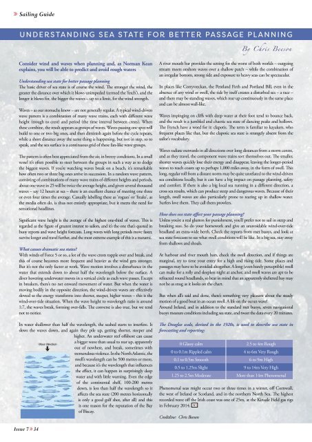
Waves – as our stomachs know – are not generally regular. A typical wind-driven<br />
wave pattern is a combination of many wave trains, each with different wave<br />
height (trough to crest) and period (the time interval between crests). When<br />
these combine, the result appears as groups of waves. Waves passing one spot will<br />
build to one or two big ones, and then diminish again before the cycle repeats,<br />
while a short distance away the same thing is happening, but not in step, so to<br />
speak, and the sea surface is a continuous grid of these fan-like wave groups.<br />
The pattern is often best appreciated from the air, in breezy conditions. In a small<br />
vessel it’s often possible to steer between the groups in such a way as to dodge<br />
the biggest waves. If you’re watching waves break on a beach, it’s remarkable<br />
how often two or three big ones arrive in succession. In a random wave pattern,<br />
consisting of combinations of many wave trains of different heights and periods,<br />
about one wave in 25 will be twice the average height, and given several thousand<br />
waves – say 12 hours at sea – there is an excellent chance of meeting one three<br />
or even four times the average. Casually labelling these as ‘rogues’ or ‘freaks’, as<br />
the media often do, is thus not entirely appropriate, but it meets the need for<br />
sensational headlines.<br />
Significant wave height is the average of the highest one-third of waves. This is<br />
regarded as the figure of greatest interest to sailors, and it’s the one that’s quoted in<br />
buoy reports and wave height forecasts. Long waves with long periods move faster,<br />
survive longer and travel further, and the most extreme example of this is a tsunami.<br />
What causes dramatic sea states?<br />
With winds of Force 5 or so, a lot of the wave crests topple over and break, and<br />
this of course becomes more frequent and heavier as the wind gets stronger.<br />
But it’s not the only factor at work. Wave motion involves a disturbance in the<br />
water that extends down to about half the wavelength below the surface. A<br />
diver hovering underwater moves in a vertical circle as each wave passes. Except<br />
in breakers, there’s no net onward movement of water. But when the water is<br />
moving bodily in the opposite direction, the wind-driven waves are effectively<br />
slowed so the energy transforms into shorter, steeper, higher waves – this is the<br />
wind-over-tide situation. When the wave height to wavelength ratio is around<br />
1:7, the waves break, forming over-falls. The converse is also true, but we tend<br />
not to notice.<br />
In water shallower than half the wavelength, the seabed starts to interfere. It<br />
slows the waves down, and again they pile up, getting shorter, steeper and<br />
higher. An underwater reef offshore can cause<br />
a bigger wave than usual to rear up, apparently<br />
out of nowhere, and break, sometimes with<br />
tremendous violence. In the North Atlantic, the<br />
swell’s wavelength can be 500 metres or more,<br />
and because it’s the wavelength that influences<br />
the effect, it can happen in surprisingly deep<br />
water and with little warning. Even the edge<br />
of the continental shelf, 100-200 metres<br />
down, is less than half the wavelength so it<br />
affects the sea state (200 metres horizontally<br />
is only a good golf shot, after all) and this<br />
is one reason for the reputation of the Bay<br />
of Biscay.<br />
A river mouth bar provides the setting for the worst of both worlds – outgoing<br />
stream meets onshore waves over a shallow patch – while the combination of<br />
an irregular bottom, strong tide and exposure to heavy seas can be spectacular.<br />
In places like Corryvreckan, the Pentland Firth and Portland Bill, even in the<br />
absence of any wind or swell, the tide by itself creates a disturbed sea – a race –<br />
and there may be standing waves, which rear up continuously in the same place<br />
and can be almost wall-like.<br />
Waves impinging on cliffs with deep water at their foot tend to bounce back,<br />
and the result is a jumbled and chaotic sea state of dancing peaks and hollows.<br />
The French have a word for it: clapotis. The term is familiar to kayakers, who<br />
frequent places like that, but the clapotic sea state is strangely absent from the<br />
sailor’s vocabulary.<br />
Waves radiate outwards in all directions over long distances from a storm centre,<br />
and as they travel, the component wave trains sort themselves out. The smaller,<br />
shorter waves quickly lose their energy and disappear, leaving the longer-period<br />
waves to reach coasts up to perhaps 1,000 miles away, in the form of swell. This<br />
long, regular roll from a distant storm may be quite unrelated to the wind-driven<br />
sea conditions locally, but it can have a big impact on passage planning, safety<br />
and comfort. If there is also a big local sea running in a different direction, a<br />
cross sea results, which can produce steep and dangerous waves. Because of their<br />
length, swell waves are also particularly prone to rearing up in shallow water.<br />
Surfers love them. They call them prowlers.<br />
How does sea state affect your passage planning?<br />
Unless you’re a real glutton for punishment, you’ll prefer not to sail in steep and<br />
breaking seas. So do your homework and give an unavoidable wind-over-tide<br />
headland an extra-wide berth. Check the reports from met buoys, and look at<br />
sea state forecasts to see what swell conditions will be like. In a big sea, stay away<br />
from shallows and shoals.<br />
At harbour and river mouth bars, check the swell direction, and if things are<br />
marginal, try to time your entry for a high and rising tide. Some places and<br />
passages may have to be avoided altogether. A long (even barely perceptible) swell<br />
can make for a rolly and sleepless night at anchor, and swell waves are apt to be<br />
refracted round headlands, so bear in mind that an apparently sheltered bay may<br />
not be as snug as it looks on the chart.<br />
C<br />
But when all’s said and done, there’s something very pleasant about the steady<br />
motion of a good boat in an ocean swell. A life on the ocean wave!<br />
M<br />
Around Ireland, and in addition to the standard met buoys, seven navigational<br />
Y<br />
buoys measure conditions including sea state, and tweet the data every 20 minutes.<br />
The Douglas scale, devised in the 1920s, is used to describe sea state in<br />
MY<br />
forecasting and reporting:<br />
0 Glassy calm<br />
0 to 0.1m Rippled calm<br />
0.1 to 0.5m Smooth<br />
0.5 to 1.25m Slight<br />
1.25 to 2.5m Moderate<br />
Phenomenal seas might occur two or three times in a winter, off Cornwall,<br />
the west of Ireland or Scotland, and in the northern North Sea. The highest<br />
recorded wave off the Irish coast was one of 25m, at the Kinsale Field gas rigs<br />
in February 2014. MS<br />
Creditline: Chris Beeson<br />
2.5 to 4m Rough<br />
4 to 6m Very Rough<br />
6 to 9m High<br />
9 to 14m Very High<br />
More than 14m Phenomenal<br />
CM<br />
CY<br />
CMY<br />
K<br />
Issue 7 >> 34