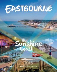
Eastbourne 2017

You also want an ePaper? Increase the reach of your titles
YUMPU automatically turns print PDFs into web optimized ePapers that Google loves.
West Langney Level<br />
48<br />
J K L M N Schools<br />
Playing Fields<br />
O P Q R<br />
Sovereign<br />
Harbour<br />
Retail Park<br />
11<br />
e<br />
NCN 21<br />
Britland<br />
Industrial<br />
Estate<br />
Hammond<br />
Industrial<br />
Estate<br />
Hawthorn Road<br />
Industrial<br />
Estate<br />
Admiral<br />
Retail Park<br />
Compton<br />
Industrial<br />
Estate<br />
Superstores<br />
St Anthony’s Hill<br />
School<br />
Kings<br />
Park<br />
West<br />
Harbour<br />
Piazza<br />
The<br />
SOVEREIGN HARBOUR<br />
44<br />
45<br />
Inner<br />
Harbour<br />
Yacht<br />
Club<br />
Marina<br />
Outer<br />
Harbour<br />
North<br />
Harbour<br />
Sovereign<br />
Harbour<br />
Martello<br />
Tower<br />
Pevensey Bay<br />
10<br />
9<br />
Playing<br />
Fields<br />
Martello<br />
Tower<br />
8<br />
The Oval<br />
<strong>Eastbourne</strong><br />
United FC<br />
Princes<br />
Park<br />
Playing<br />
Fields<br />
Sovereign<br />
Centre<br />
Langney<br />
Point<br />
7<br />
<strong>Eastbourne</strong><br />
Sailing Club<br />
Lifeboat Station<br />
<strong>Eastbourne</strong><br />
Rowing Club<br />
6<br />
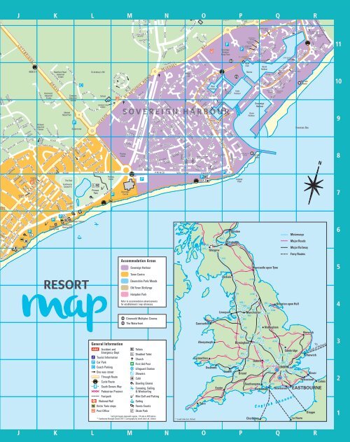
map<br />
RESORT<br />
Accommodation Areas<br />
Sovereign Harbour<br />
Town Centre<br />
Devonshire Park/ Meads<br />
Old Town /Ocklynge<br />
Hampden Park<br />
Refer to accommodation advertisements<br />
for establishments’ map references<br />
44 Cineworld Multiplex Cinema<br />
45 The Waterfront<br />
5<br />
4<br />
General Information<br />
Accident and<br />
Toilets<br />
Emergency Dept<br />
Disabled Toilet<br />
Tourist Information<br />
Church<br />
Car Park<br />
First Aid Post<br />
Coach Parking<br />
Lifeguard Station<br />
One way street<br />
Showers<br />
Through Route<br />
Café<br />
Cycle Route<br />
Bowling Greens<br />
South Downs Way<br />
Canoeing, Sailing<br />
Pedestrian Precinct<br />
& Windsurfing<br />
Footpath<br />
Mini Golf and Putting<br />
National Rail<br />
Sailing<br />
Dotto Train stops<br />
Tennis Courts<br />
Post Office<br />
Skate Park<br />
Each grid square represents approx. 1/4 mile or 400 metres<br />
© <strong>Eastbourne</strong> Borough Council <strong>2017</strong>. Cartography by Lovell John Ltd., Oxford © Lovell John Ltd., Oxford<br />
3<br />
2<br />
1<br />
J K L M N O P Q R