

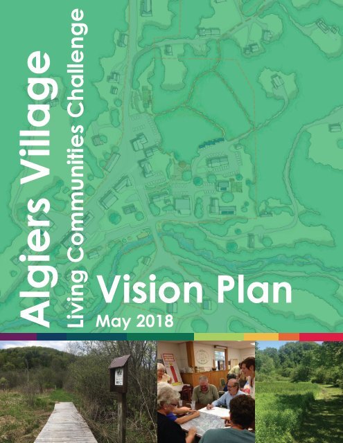
Algiers Village Living Communities Challenge Vision Plan

Create successful ePaper yourself
Turn your PDF publications into a flip-book with our unique Google optimized e-Paper software.
<strong>Algiers</strong> <strong>Village</strong><br />
<strong>Living</strong> <strong>Communities</strong> <strong>Challenge</strong><br />
<strong>Vision</strong> <strong>Plan</strong><br />
May 2018
EXECUTIVE SUMMARY<br />
In 2016, four Guilford nonprofit organizations (Friends of <strong>Algiers</strong> <strong>Village</strong>, Inc.<br />
(FOAVI), Guilford Preservation, Inc. (GPI), Community Collaborative for Guilford<br />
(CC4G), and Guilford Community Church (GCC)), collectively submitted a Letter<br />
of Intent to the Windham Regional Commission and BuildingGreen to receive<br />
technical assistance to explore the <strong>Living</strong> <strong>Communities</strong> <strong>Challenge</strong> for <strong>Algiers</strong><br />
<strong>Village</strong>. The <strong>Living</strong> <strong>Communities</strong> <strong>Challenge</strong> is a program developed by the<br />
International <strong>Living</strong> Future Institute, and used by communities globally to set a<br />
high standard for community development and planning that embodied social<br />
equity, environmental health, and is resource independent.<br />
The group first identified a set of common goals for their respective<br />
organizations on behalf of <strong>Algiers</strong> <strong>Village</strong>. These goals set the tone for this<br />
<strong>Vision</strong> <strong>Plan</strong>, or an aspirational document that proposes only one pathway for<br />
development in <strong>Algiers</strong>. Those goals were: promote community-controlled and<br />
desirable development in <strong>Algiers</strong> <strong>Village</strong> while preserving its rural character;<br />
support community well-being and vitality; work towards social and economic<br />
equity; all while stewarding environmental health and promoting natural<br />
ecosystem functioning. This <strong>Vision</strong> <strong>Plan</strong> is considered a remedy to the silos<br />
that commonly exist in community development projects or efforts. It is the<br />
documented dialogue between different groups in Guilford, and through these<br />
common goals, memorializes the commitment to continued collaboration in<br />
<strong>Algiers</strong>.<br />
What is proposed as part of this <strong>Vision</strong> <strong>Plan</strong> is placed within the criteria of the<br />
<strong>Living</strong> <strong>Communities</strong> <strong>Challenge</strong> “Petals” and “Imperatives”, or a set of design<br />
and planning criteria. In the proposed concept drawings, <strong>Algiers</strong> becomes a<br />
vibrant community center where underutilized spaces are adapted to become<br />
beneficial in-fill development, such as a small business incubator or senior<br />
housing for Guilford residents. Also in the proposed concept drawings, <strong>Algiers</strong><br />
<strong>Village</strong> gains adequate pedestrian safety measures, such as added crosswalks,<br />
lengthened sidewalks, and a pedestrian cut-through parklet. This is in<br />
addition to community spaces: three added parks (including a playground),<br />
a community pavilion, shared walking trails, farmer’s market, community<br />
gardens, and a new community center building. In sum, these provide for<br />
more social equity and access to resources in the <strong>Village</strong>.<br />
After a series of specific analyses, this <strong>Vision</strong> <strong>Plan</strong> proposes that the four<br />
nonprofits may pursue <strong>Living</strong> <strong>Communities</strong> <strong>Challenge</strong> Registration and<br />
potentially Certification. This project identified that the pieces are in place<br />
(both in existing resources and by examining potential community assets), to<br />
meet the Imperatives. From here, the four Guilford nonprofits may choose<br />
to use these proposed concepts for formal Certification, or as an aspirational<br />
guidance document.<br />
ACKNOWLEDGMENTS<br />
This project was funded in part by the Windham Regional Commission’s EPA<br />
Brownfields Assessment Program; and the State of Vermont’s Clean Energy<br />
Development Fund.<br />
This report was created by the Windham Regional Commission and<br />
BuildingGreen on behalf of Friends of <strong>Algiers</strong> <strong>Village</strong>, Inc., Guilford<br />
Preservation, Inc., Community Collaborative for Guilford, and Guilford<br />
Community Church.<br />
<strong>Vision</strong> <strong>Plan</strong> | Prologue 3
TABLE OF CONTENTS<br />
Prologue. . . . . . . . . . . . . . . . . . . 1<br />
Introduction. . . . . . . . . . . . . . . . . 2<br />
What is the <strong>Living</strong> Community <strong>Challenge</strong>?. . 2<br />
<strong>Algiers</strong> <strong>Village</strong> Community Organizations . . 3<br />
Community Context. . . . . . . . . . . . . 6<br />
<strong>Algiers</strong> <strong>Village</strong> History. . . . . . . . . . . . . 6<br />
Guilford Town <strong>Plan</strong>. . . . . . . . . . . . . . 7<br />
<strong>Algiers</strong> <strong>Village</strong> LCC Boundary . . . . . . . . . 8<br />
Community Meetings & Public Participation. 10<br />
<strong>Vision</strong> <strong>Plan</strong> Process. . . . . . . . . . . . . 11<br />
<strong>Vision</strong> <strong>Plan</strong> Goals. . . . . . . . . . . . . . . 11<br />
<strong>Algiers</strong> Analysis - SWOT. . . . . . . . . . . . 14<br />
Existing Conditions <strong>Plan</strong>s. . . . . . . . . . . 16<br />
Functional “Bubble” Analysis. . . . . . . . . 20<br />
<strong>Vision</strong> <strong>Plan</strong> Concept Drawings. . . . . . . 22<br />
Concept Proposals. . . . . . . . . . . . . . 24<br />
LCC Petals & Imperatives. . . . . . . . . . 28<br />
Place. . . . . . . . . . . . . . . . . . . . . 30<br />
Water. . . . . . . . . . . . . . . . . . . . . 38<br />
Energy. . . . . . . . . . . . . . . . . . . . . 40<br />
Health & Happiness. . . . . . . . . . . . . . 44<br />
Materials. . . . . . . . . . . . . . . . . . . 50<br />
Equity. . . . . . . . . . . . . . . . . . . . . 52<br />
Beauty. . . . . . . . . . . . . . . . . . . . . 56<br />
Moving Forward. . . . . . . . . . . . . . . 58<br />
Collaborative Community Development. . . 58<br />
Pathways Forward. . . . . . . . . . . . . . 58<br />
Current Initiatives and Future Projects. . . . 59
PROLOGUE<br />
How to Use This Document<br />
This document is called a <strong>Vision</strong> <strong>Plan</strong>, and was developed as an organizational planning initiative for four Guilford nonprofit<br />
organizations: Friends of <strong>Algiers</strong> <strong>Village</strong>, Inc. (FOAVI), Guilford Preservation, Inc. (GPI), Community Collaborative for<br />
Guilford (CC4G) and Guilford Community Church (GCC).<br />
It is framed to be within the lens of the <strong>Living</strong> <strong>Communities</strong> <strong>Challenge</strong>, a program developed by the International <strong>Living</strong><br />
Future Institute. The <strong>Living</strong> <strong>Communities</strong> <strong>Challenge</strong> provides criteria for community planning and development that, when<br />
accomplished, leads towards a community that is environmentally sustainable, energy and water independent, provides<br />
equal access to resources and opportunities, and intentionally rooted in the natural ecosystem.<br />
The aforementioned Guilford nonprofits decided to explore future <strong>Living</strong> <strong>Communities</strong> <strong>Challenge</strong> certification because<br />
they embody similar principles around environmental health, social equity, and sound community planning. Their project<br />
goals (described below), provided the context and framework for exploring planning options in <strong>Algiers</strong> <strong>Village</strong>.<br />
Project Goals & <strong>Plan</strong>ning Process<br />
These nonprofits are united in the following overlapping goals for community development in both <strong>Algiers</strong> <strong>Village</strong> and the<br />
Town of Guilford, Vermont (see page 11 for further discussion):<br />
• Promote community-controlled and desirable development in <strong>Algiers</strong> <strong>Village</strong> while preserving its rural<br />
character,<br />
• Support community well-being and vitality,<br />
• Work towards social and economic equity, all while<br />
• Stewarding environmental health and promoting natural ecosystem functioning.<br />
With these goals in mind, the groups moved forward, with technical support from the Windham Regional Commission<br />
and BuildingGreen, in creating a cohesive <strong>Vision</strong> <strong>Plan</strong> that addresses the <strong>Living</strong> <strong>Communities</strong> <strong>Challenge</strong> criteria in <strong>Algiers</strong><br />
<strong>Village</strong>.<br />
What does it mean for the broader community?<br />
This <strong>Vision</strong> <strong>Plan</strong> provides only one pathway through which the non-profits may actualize these goals while working in<br />
collaboration with each other. As you read through this document, think about it as a set of possibilities, a suite of options,<br />
or community aspirations for the future of <strong>Algiers</strong> <strong>Village</strong>.<br />
This document does not recommend regulatory or zoning solutions.<br />
There are no associated development commitments or regulations in this <strong>Vision</strong> <strong>Plan</strong>. Instead, you may think about<br />
this document as merely being a launch-pad to explore new ideas of the possibilities in <strong>Algiers</strong>, and to continue<br />
discussions about what this beloved community center could be.<br />
On behalf of the larger community, the four nonprofits offer this <strong>Vision</strong> <strong>Plan</strong> as a new framework for<br />
understanding the existing realities within <strong>Algiers</strong>, the unique needs of the community, and a set of solutions that<br />
lead toward a vibrant and healthy community.<br />
This document does not provide a pathway towards, nor does it recommend implementation or construction.<br />
Much more work would be needed to begin any installation or construction of ideas proposed in this <strong>Plan</strong>. This<br />
document is the very first step in a long process of community visioning and planning, which may in time lead to<br />
entirely different solutions than are outlined in this document. Again, this <strong>Vision</strong> <strong>Plan</strong> serves to inform and inspire<br />
conversations around what <strong>Algiers</strong> <strong>Village</strong> could be.<br />
<strong>Vision</strong> <strong>Plan</strong> | Prologue 1
INTRODUCTION<br />
As a project of the Ecovation Hub—the local economic development initiative centered around growing jobs in the green<br />
economy—the Windham Regional Commission and BuildingGreen Inc. partnered to explore certifying a <strong>Living</strong> Community<br />
<strong>Challenge</strong> project in the Windham Region. The partners sought towns, communities, and nonprofits interested in pursuing<br />
certification to the <strong>Living</strong> Community <strong>Challenge</strong> (LCC) standard through a competitive Call for Letters of Interest in the<br />
winter of 2017.<br />
Through this recruitment process, the Friends of <strong>Algiers</strong> <strong>Village</strong> and three of its like-minded community partner<br />
organizations submitted an application, and the project was selected to receive technical assistance from BuildingGreen<br />
and Windham Regional Commission to develop a “<strong>Vision</strong> <strong>Plan</strong>.” This <strong>Vision</strong> <strong>Plan</strong> is the first step in assessing the feasibility<br />
of developing a LCC master plan for <strong>Algiers</strong> <strong>Village</strong> in Guilford, Vermont.<br />
What is the <strong>Living</strong> Community <strong>Challenge</strong>?<br />
The <strong>Living</strong> Community <strong>Challenge</strong> (LCC) is a voluntary certification program that was recently developed by the<br />
International <strong>Living</strong> Future Institute (ILFI). An extension of the <strong>Living</strong> Building <strong>Challenge</strong> certification system, LCC is widely<br />
regarded as the most advanced measure of sustainability at a community scale. The framework aspires for a “symbiotic<br />
relationship between people and all aspects of the built environment” by laying out a set of goals for town planning<br />
commissions, designers, and contractors to fulfill on any building project that falls within the boundaries of a selfdesignated<br />
“community.”<br />
<strong>Communities</strong> can be defined as a single block, a park, a campus, or an entire neighborhood or village. Essentially, LCC is<br />
a framework for developing a sustainable community master plan and overlaying social and environmental performance<br />
metrics. More information about this certification program can be found at: http://living-future.org/lcc.<br />
One of the main intersections in <strong>Algiers</strong> <strong>Village</strong> in Guilford, Vermont.
At this point, several communities have registered for LCC and a few others have acted as “pilot” projects, but none have<br />
yet achieved full certification. No project in the country has yet achieved full certification. Being the first would position<br />
<strong>Algiers</strong> as a national leader in sustainability, land stewardship, and responsible resource management.<br />
Community residents will benefit from:<br />
• Reduced utility costs<br />
• Improved infrastructure<br />
• Vibrant community life<br />
Submitting a <strong>Vision</strong> <strong>Plan</strong> to ILFI does not guarantee grant funding from any source for design or implementation.<br />
However, the <strong>Challenge</strong> has spurred funder interest in the past, and demonstrates that a community is committed to a<br />
robust planning process.<br />
<strong>Algiers</strong> <strong>Village</strong> Community Organizations<br />
<strong>Algiers</strong> <strong>Village</strong> is a village of the Town of Guilford, Vermont<br />
and is a dynamic community with a number of nonprofit<br />
organizations and dedicated individuals working toward similar<br />
goals of controlled development, community well-being, social<br />
and economic equity, and environmental stewardship.<br />
Below: the Guilford Country Store is one of the most<br />
recognizable places in <strong>Algiers</strong> <strong>Village</strong>, and stands as a<br />
testament to the community’s revitalization efforts.<br />
The following four civic-minded nonprofit organizations have<br />
complementary and at times overlapping goals (see page<br />
11 for more detail). Having realized this, they collectively<br />
submitted a Letter of Interest for technical assistance for the<br />
LCC <strong>Vision</strong> <strong>Plan</strong>.<br />
The depth of nonprofit organizational capacity represented<br />
in the organizations cited below demonstrates a profound<br />
commitment to principles embodied in the LCC, and a large<br />
capacity and readiness to pursue the <strong>Challenge</strong>. Specifically,<br />
they are at a particular coincidence and intersection of<br />
mutual goals that stand to benefit from the technical support;<br />
they understand that the LCC requires a very committed,<br />
integrated, and collaborative community to meet the very<br />
aggressive requirements of the <strong>Living</strong> Community <strong>Challenge</strong>.<br />
The Friends of <strong>Algiers</strong> <strong>Village</strong>, Inc. (FOAVI)<br />
The purpose of FOAVI is to support the preservation,<br />
conservation and enjoyment of the natural and human<br />
resources of the <strong>Village</strong> of <strong>Algiers</strong>. Its mission is to enable the<br />
residents of the <strong>Village</strong> to live in harmony with the natural<br />
environment and with their fellow citizens by buying, selling<br />
and holding land and properties, including housing, and by<br />
educational means.<br />
The primary focus of FOAVI since 2009 has been the purchase,<br />
preservation and renovation of the historic Broad Brook<br />
House. Funded through local donations (30-40%) and various<br />
state and federal grants (60-70%), FOAVI has completed the<br />
Guilford Country Store and Café fit-out and renovations of<br />
two residential units, upgraded the electrical, mechanical and<br />
fire safety systems (including a full building sprinkler), and has
fitted out a space for Top Tier Bakery, a wholesale business founded by a Guilford resident.<br />
Most recently (in the fall 2017) the Friends renovated the remaining second floor space office which is currently being<br />
leased to CC4G. The Broad Brook House is now 100% leased,<br />
containing one retail and one wholesale business, 2 apartments The “gateway to <strong>Algiers</strong>” is a open hay field, conserved in<br />
and an office space for a local non-profit partner. <strong>Plan</strong>s for the perpetuity through the efforts of GPI.<br />
exterior include master site planning for parking and landscaping.<br />
FOAVI has a vision of utilizing their 2-acre field, adjacent to the<br />
Broad Brook House, for a Farmer’s Market and/or community<br />
garden.<br />
Guilford Preservation, Inc. (GPI)<br />
The purpose of Guilford Preservation, Inc. (GPI) is to support the<br />
preservation, conservation, and enjoyment of the natural and<br />
human resources of the town of Guilford, Vermont. In 2002, a<br />
22-acre piece of land at the entrance to Guilford on Route 5 went<br />
up for sale and was in danger of being commercially developed<br />
as a factory site, a used car business, or other commercial/<br />
industrial use. A group of concerned citizens formed GPI and<br />
with the Vermont Land Trust as an active partner, raised funds<br />
from individual community donors and won grants from the<br />
Preservation Trust of Vermont and the Freeman Foundation in<br />
order to purchase the parcel, so that the land would be conserved<br />
and never be commercially developed. It remains to this day<br />
as a buffer from the expanding Canal St/Exit 1 commercial/industrial district of neighboring Brattleboro, and has been<br />
informally dubbed the “gateway to <strong>Algiers</strong>.”<br />
The acreage is held under an easement with the Vermont Land Trust with a 5.5 acre exception for future development<br />
of senior housing or other public-use facility. The land has been used for cattle grazing over the years and as a winter<br />
recreational site for cross-country skiing and snowmobiling.<br />
An additional goal of GPI is to install a community-accessible picnic area and develop a nature trail that would follow<br />
the natural contours and enhance the uses of the property. This trail has the potential to connect to, integrate with, and<br />
provide safe and easy access to the neighboring properties owned by FOAVI, the Guilford Community Church, the future<br />
CC4G facility, and other <strong>Village</strong> entities.<br />
Community Collaborative for Guilford (CC4G)<br />
CC4G is a recently formed organization whose mission is to support the creation of a community center and to nurture<br />
programs that help meet the needs of families and children in Guilford. Its goal is to create an Early Learning and Family<br />
Resource Center that would house a) high quality early care and education programs for children from birth to 8 years<br />
old, and b) space for collaborators and social services support, connecting folks in need to resources and community<br />
Image courtesy the<br />
Community Collaborative<br />
for Guilford.
volunteers. CC4G has been awarded $180,000 to date through a VCDP planning grant and the Promise Community<br />
Initiative and is focusing on community collaboration, planning and implementation of agreed-upon strategies to<br />
strengthen families and support young children, and to increase kindergarten readiness.<br />
Their current programs include: Parent & Baby Groups (focusing on development and attachment); a Parent Support<br />
Group; Open Gym program for infants through preschoolers at Guilford Center School (GCS) in collaboration with the<br />
Recreation Commission; monthly parent/community workshops at GCS which include child care and a light dinner; home<br />
visits and support to new parents; support of the new GCS Pre-K classroom via purchased outdoor playground equipment<br />
(also used by community).<br />
CC4G is in the process of completing a feasibility study for this project. CC4G was chosen to participate in Cohort 2 of the<br />
Promise Community Initiative that focuses on community collaboration, planning and implementation of agreed-upon<br />
strategies to strengthen families and support young children to increase kindergarten readiness. This Initiative awards up<br />
to $150,000 to carry out the community plan.<br />
Guilford Community Church (GCC)<br />
The idea for the CC4G was born within the Guilford Community Church and affirmed by residents during the Vermont<br />
Council for Rural Development exercises in 2014. GCC recently celebrated its 250th anniversary. The Church supports the<br />
Guilford community in a multitude of dimensions and is a hub of activity. The Church provides space for Senior Lunch<br />
twice each month, six exercise classes per week, three different AA meetings, space for the community meetings and<br />
events, and serves as an emergency shelter for the Town of Guilford. The Church also hosts the Brattleboro Area Interfaith<br />
Youth Group, which brings teens of varying faiths and backgrounds together. The Youth Group has attended local Peace<br />
Camps, walked in the Climate March in NYC, debated important issues such as racism and inequality, made meals for the<br />
local Overflow shelter, and worked together on service trips in Kenya, South Dakota, and Katrina Relief work in Mississippi.<br />
Amidst the busyness of everyday activity, the Guilford Church also provides a sacred place of worship and spiritual<br />
renewal, a gathering place for all families in times of deep sorrow and great joy, and has a strong belief in serving the<br />
community. “No matter where you are on life’s journey, you are welcome here.”<br />
The Guilford Community Church.
COMMUNITY CONTEXT<br />
<strong>Algiers</strong> <strong>Village</strong> History<br />
<strong>Algiers</strong> <strong>Village</strong> is an unincorporated <strong>Village</strong> in the Town of<br />
Guilford. The Town of Guilford was chartered on April 2, 1754;<br />
first settled in 1761, and then re-chartered in 1764. <strong>Algiers</strong><br />
<strong>Village</strong> was first known as East Guilford.<br />
The original buildings built were the Tracy House in 1789,<br />
the Broad Brook Grange in 1791, the Broad Brook House in<br />
1816, and the Christ Church in 1817. The village was named<br />
by Brattleboro residents who played a group of people from<br />
East Guilford in cribbage every Wednesday. They named them<br />
Algerian Pirates and the name stayed.<br />
At one time, <strong>Algiers</strong> <strong>Village</strong> was a hub of bustling activity. However, like many village centers throughout Vermont and<br />
beyond, the growth of the automobile industry and cheap oil undermined the vitality of <strong>Algiers</strong> <strong>Village</strong>. For several<br />
decades, local residents watched as the village fell into decline.<br />
This downward trend was reversed when community members<br />
collaborated to form a grassroots movement that renewed the<br />
life of the village. The movement began in 2004 when a group<br />
of concerned residents, named Friends of <strong>Algiers</strong> <strong>Village</strong>,<br />
Inc. (FOAVI), formed to preserve the <strong>Village</strong> and steer future<br />
development. In 2005, they purchased three properties in the<br />
village, including the Tontine Building, the grist mill building,<br />
and the former Cocoplum Warehouse.<br />
Below: The <strong>Algiers</strong> Triangle Master <strong>Plan</strong>, funded through the<br />
Vermont Community Development Program.<br />
FOAVI’s first step, in collaboration with the Windham and<br />
Windsor Housing Trust (WWHT), was to develop the <strong>Algiers</strong><br />
Triangle <strong>Village</strong> Master <strong>Plan</strong> through funding from the Vermont<br />
Community Development Program. The vision for the village<br />
center, developed with participation from the community,<br />
integrated commercial and residential uses with emphasis<br />
on pedestrian-friendly amenities, including walkways and<br />
green space. The plan called for the renovation of two<br />
historic buildings, and the renovation or reconstruction of a<br />
third structure. The remaining abandoned warehouses were<br />
slated to be removed and replaced with three new residential<br />
buildings. In total, the vision for the village center included 25<br />
housing units, 8,800 square feet of commercial space, fortyeight<br />
parking spaces, and a bus stop.<br />
The historic Tontine Building, housing one business unit and<br />
four apartments, was sold to WWHT in 2008 and renovated<br />
soon thereafter. Ensuring the preservation of an important<br />
hub of commerce and community interaction, FOAVI in 2010<br />
purchased the Guilford Country Store and rehabilitated the<br />
Above: The Tontine Building, a registered historic building.
Below: A section of <strong>Algiers</strong> <strong>Village</strong> before the revitalization<br />
work begun in 2004.<br />
building with the help of funds secured by Senator Patrick Leahy.<br />
Beginning in 2006 and completed in 2011, the Windham Regional<br />
Commission’s US EPA Brownfields Assessment Grant provided<br />
funding for Phase I, II and an Analysis of Brownfields Cleanup<br />
Alternatives/Corrective Action <strong>Plan</strong> for the “Warehouse Site.”<br />
In 2012, cleanup funding came from a $200,000 pass-through<br />
US EPA Brownfields Revolving Loan Fund Cleanup Grant, subgranted<br />
by the Vermont Agency of Commerce and Community<br />
Development to the Friends of <strong>Algiers</strong> <strong>Village</strong>.<br />
The lack of municipal water also served as a critical barrier to<br />
future development. This hurdle was overcome in 2013 with a 0.6<br />
mile extension of the main municipal waterline from Brattleboro.<br />
2013 marked the completion of two of the buildings (Warehouse<br />
Site) proposed in the Master <strong>Plan</strong>, consisting of seventeen<br />
residential units of affordable housing.<br />
Guilford Town <strong>Plan</strong><br />
Guilford has an active <strong>Plan</strong>ning Commission and adopted the<br />
most recent Town <strong>Plan</strong> on June 22, 2015. The Town <strong>Plan</strong> provides<br />
guidance to the various town boards, officers, and citizens that<br />
reflects the community’s interest in and wishes for Guilford’s<br />
character, development, environment, quality of life, economy,<br />
resources, and more. Guilford strives to be a welcoming town –<br />
one where people can say “my life is better in Guilford!”<br />
The five-year plan goals and policies for 2015 – 2020 are<br />
guidelines to make this vision a reality. The Town <strong>Plan</strong><br />
represents research on Guilford’s present condition and is a<br />
guide for accomplishing community aspirations and intentions<br />
through public investments, land use regulations and other<br />
implementation programs. The <strong>Plan</strong> serves, but is not limited to,<br />
the following uses:<br />
• A long-term guide: The Town <strong>Plan</strong> is a long-term guide by<br />
which to measure and evaluate public and private proposals that<br />
affect the future physical, social, and economic environment of<br />
the community.<br />
Above: The renovated housing buildings developed by the • A basis for community programs and decision-making:<br />
WWHT.<br />
The <strong>Plan</strong> is a guide to help achieve community goals. Information<br />
in the plan is used for developing the recommendations contained<br />
in a capital budget, for establishing community development programs, and for providing direction and content of<br />
other public and private local initiatives such as farmland protection, recreation development, and housing.<br />
• A basis for municipal regulatory actions: Absent zoning regulations, the <strong>Plan</strong> serves as Guilford’s guidelines for<br />
issues important to its residents including, but not limited to, land use, conservation, natural resources, housing,<br />
flood resiliency, hazard mitigation, etc. The Town does not issue development or building permits and there is no<br />
zoning. There is only a floodplain ordinance to regulate development in Special Flood Hazard Areas. This lack of
estriction has some benefits to existing residents, but could pose an issue if non-desirable development were<br />
inclined to locate in Guilford.<br />
• A source of information: The <strong>Plan</strong> is a valuable source of information for local boards, commissions, citizens,<br />
businesses, and other governmental organizations, such as neighboring towns, state agencies and regional<br />
planning commissions.<br />
• A source for planning studies: This plan does not address every issue in complete detail. Therefore, further studies<br />
to develop policies or strategies to meet a specific need are recommended, e.g., Conservation Commission<br />
inventories.<br />
• A standard for review at the state and regional levels: Act 250 and other state regulatory processes identify the<br />
Town <strong>Plan</strong> as a standard for review of application.<br />
The Town encourages modest development around the <strong>Village</strong> of <strong>Algiers</strong> and along Route 5 in the eastern portion of<br />
the town, near I-91 while seeking to preserve its rural nature. Most of the rest of the Town is deemed conservation,<br />
agricultural, or residential. Future development in the Town of Guilford is to be guided by the proposed land use area<br />
designations. <strong>Algiers</strong> <strong>Village</strong> is considered a Historic <strong>Village</strong> Area, the purpose of which is to preserve and protect the<br />
historic character of (relatively) densely settled, primarily residential, areas while making provision for cultural and<br />
municipal uses and accommodating some relatively small-scale commercial activity. The <strong>Living</strong> Community <strong>Challenge</strong> is<br />
supported by numerous policies and goals of the Guilford Town <strong>Plan</strong>.<br />
<strong>Algiers</strong> <strong>Village</strong> LCC Boundary<br />
For purposes of evaluating the viability of LCC for <strong>Algiers</strong> <strong>Village</strong>, a planning boundary was chosen to better fit within<br />
the criteria of the LCC imperatives and the existing site analysis. The boundary of the <strong>Algiers</strong> <strong>Village</strong> LCC <strong>Vision</strong> <strong>Plan</strong><br />
incorporates the critical properties of the four participating nonprofit groups. The current proposed LCC planning<br />
Boundary is shown on the plan opposite this page.<br />
This LCC <strong>Vision</strong> <strong>Plan</strong> Boundary has not been formalized and could be increased or decreased based on the partners<br />
and community desire in the future. The Boundary would be finalized as part of LCC Registration, if the partners were to<br />
decide to pursue that route (see page 58). Therefore, this <strong>Vision</strong> <strong>Plan</strong> allows for flexibility in the LCC Boundary over this<br />
initial planning phase.<br />
Additionally, there are no regulatory or development requirements for property-owners that are included within this<br />
LCC Boundary. A select few private parcels are included in this Boundary because it may make geographic sense to include<br />
them in planning. However, it is important to note that their participation is completely voluntary, and this Boundary does<br />
not commit any entity to action.
<strong>Algiers</strong> <strong>Village</strong>,<br />
Guilford, Vermont<br />
<strong>Living</strong> <strong>Communities</strong> <strong>Challenge</strong><br />
<strong>Vision</strong> <strong>Plan</strong> Boundary<br />
Route 5: North to<br />
Brattleboro, I-91 Exit 1.<br />
Proposed <strong>Living</strong> <strong>Communities</strong><br />
<strong>Challenge</strong> planning Boundary<br />
Guilford Preservation Inc. property<br />
Guilford Community Church<br />
property<br />
Friends of <strong>Algiers</strong> <strong>Village</strong> property<br />
Property owned by Guilford Community<br />
Church.<br />
Guilford Country Store, started by Friends<br />
of <strong>Algiers</strong> <strong>Village</strong>.<br />
Currently, Community Collaborative for<br />
Guilford’s office space is in the second<br />
floor of this building (the Broad Brook<br />
House).<br />
Guilford Community Church.<br />
Two buildings are Windham & Windsor<br />
housing units. One building is the Tontine<br />
Building, a registered historic place.<br />
The Guilford Volunteer Fire Department.<br />
Guilford Center Rd<br />
to Guilford Center.<br />
Route 5: South to<br />
Massachusetts.<br />
The “Bee Barn,”<br />
apartment housing.<br />
Christ Church, one<br />
of the three registered<br />
historic buildings in <strong>Algiers</strong><br />
<strong>Village</strong>.
Community Meetings & Public Participation<br />
To ensure community engagement in this project, a complete public participation process was emphasized from the beginning<br />
of this <strong>Vision</strong> <strong>Plan</strong> project. One inherent strength of this project from its inception was the participation and input<br />
from four community-based nonprofit organizations in <strong>Algiers</strong> <strong>Village</strong>, which have already proved to be productive organizations<br />
that prioritize the needs of the community. With the FOAVI, CC4G, GCC, and GPI being the face of this community<br />
development and planning work, the LCC <strong>Vision</strong> <strong>Plan</strong>ning process effectively engaged with the public.<br />
On August 16, 2017, the four nonprofits hosted a community<br />
charrette (images to the left), with the support from the<br />
Windham Regional Commission and BuildingGreen, at the<br />
Guilford Community Church. Attending community members<br />
were encouraged to share their knowledge of <strong>Algiers</strong> <strong>Village</strong>,<br />
and help us identify landscape or infrastructure elements<br />
that would have value in the community. The intent of this<br />
meeting was to introduce the LCC <strong>Vision</strong> <strong>Plan</strong> project, glean<br />
on-the-ground knowledge of the current conditions of the<br />
village, and then gather the community’s ideas of what they<br />
would like to see as solutions.<br />
Through a brief presentation and two sets of group mapping<br />
exercises, over 30 participants first identified areas that they<br />
“loved,” or “hated” about <strong>Algiers</strong> <strong>Village</strong>. They then were<br />
encouraged to draw out or identify on the map solutions that<br />
they would like to see on the ground.<br />
Common responses included increased pedestrian safety<br />
measures, improved public spaces, slower traffic, more<br />
businesses that fit within the character of <strong>Algiers</strong>, and a<br />
statement that “these things would be nice but not if it<br />
means development (in terms of buildings or roads).”<br />
This community input and feedback is important to the<br />
<strong>Vision</strong> <strong>Plan</strong> process, and is included in this LCC <strong>Vision</strong> <strong>Plan</strong><br />
for <strong>Algiers</strong> <strong>Village</strong> (the collection of maps and data from that<br />
meeting are exemplified below).<br />
A secondary follow-up meeting is planned for spring/summer<br />
of 2018 (following the creation of this document), where the<br />
nonprofits may present some of the findings and solutions of<br />
this <strong>Vision</strong> <strong>Plan</strong>, and solicit community feedback.
VISION PLAN PROCESS<br />
<strong>Vision</strong> <strong>Plan</strong> Goals<br />
As mentioned before, the four participating nonprofit organizations leading this LCC <strong>Vision</strong> <strong>Plan</strong> project are united in their<br />
overlapping goals for community development in both <strong>Algiers</strong> <strong>Village</strong> and the Town of Guilford, Vermont. Because these<br />
goals were so clearly articulated and defined, the <strong>Vision</strong> <strong>Plan</strong> consulting team quickly adopted them as the guidelines for<br />
the <strong>Vision</strong> <strong>Plan</strong> design process.<br />
The following diagram shows the four participating nonprofits, and the four goals that comprise the aspirational<br />
framework of the LCC <strong>Vision</strong> <strong>Plan</strong>. A discussion of each of these goals is below.<br />
VISION PLAN GOALS:<br />
Friends<br />
of <strong>Algiers</strong><br />
<strong>Village</strong>, Inc.<br />
Goals of<br />
the LCC<br />
<strong>Vision</strong> <strong>Plan</strong><br />
Community<br />
Collaborative<br />
for Guilford<br />
1. Controlled and desirable<br />
development<br />
2. Community well-being and<br />
vitality<br />
3. Social and economic equity<br />
4. Environmental stewardship<br />
Guilford<br />
Community<br />
Church<br />
Controlled and Desirable Development<br />
Guilford<br />
Preservation,<br />
Inc.<br />
“<br />
The overarching aspiration of the LCC<br />
<strong>Vision</strong> <strong>Plan</strong> project is to<br />
empower the local community to<br />
steward desirable development<br />
in such a way that is non-regulatory and in<br />
compliance with the Guilford Town <strong>Plan</strong>.<br />
”<br />
The Town of Guilford does not have any zoning regulations and bylaws; a long-standing strategic planning intent of<br />
the residents of the Town. While this means that businesses and residents in Guilford are allowed discretion in their<br />
development, and are free from regulations (with the notable exception of state-wide Act 250 development review and<br />
permitting), this also means that Guilford may be vulnerable to undesirable development patterns.<br />
In response to this reality, many residents and community groups (including the four nonprofits involved in this project)<br />
have taken a proactive approach to guiding development in their community. Guilford Preservation, Inc. is an obvious<br />
example of how a group of citizens banded together to purchase a key 22-acre agricultural property along Route 5 and at<br />
the entrance of <strong>Algiers</strong> <strong>Village</strong>. The acquisition and eventual conservation easement placed on this parcel has ensured<br />
that this “gateway” into <strong>Algiers</strong> <strong>Village</strong> retains its rural character in perpetuity. This is especially relevant since just less<br />
than 2 miles north on Route 5 is the commercial center of the “Exit 1” area in Brattleboro, off Interstate 91. Areas in such
close proximity may be vulnerable to sprawling development, but non-regulatory protections from community groups like<br />
Guilford Preservation, Inc. have instead promoted a more desirable development pattern.<br />
As the <strong>Vision</strong> <strong>Plan</strong> process continues, the four nonprofits will maintain this ethos in their work. The overarching aspiration<br />
of the LCC <strong>Vision</strong> <strong>Plan</strong> project is to empower the local community to steward desirable development in such a way that is<br />
non-regulatory and in compliance with the Guilford Town <strong>Plan</strong> policies (see page 7).<br />
Community Well-being and Vitality<br />
The four nonprofits are also eager to promote a healthy<br />
and sustainable community center in <strong>Algiers</strong> <strong>Village</strong>. A<br />
historic and State-designated <strong>Village</strong> Center, <strong>Algiers</strong> is the<br />
current economic center in the Town of Guilford. As a<br />
group, the nonprofits have already accomplished a great<br />
deal in promoting village economic vitality in <strong>Algiers</strong>, and<br />
the Friends of <strong>Algiers</strong> <strong>Village</strong>, Inc. has certainly taken a<br />
lead.<br />
As discussed in previous sections of this <strong>Vision</strong> <strong>Plan</strong><br />
report, this group has raised funds, acquired, and<br />
renovated several properties in <strong>Algiers</strong> <strong>Village</strong>, establishing<br />
a foundation for additional beneficial economic<br />
development. Staying true to the character of Vermont’s<br />
small and historic <strong>Village</strong>s, the Guilford Country Store was<br />
established in the historic Broad Brook House, turning<br />
a liability and eye-sore into a community asset that is<br />
popular with residents and tourists. This celebrated<br />
success gives good momentum to continued economic<br />
development work embodied in this <strong>Vision</strong> <strong>Plan</strong> and<br />
informed by the community.<br />
Social and Economic Equity<br />
Conversations around community and economic<br />
development are a large part of this <strong>Vision</strong> <strong>Plan</strong>, but they<br />
are also placed within the realities of potential economic<br />
inequality in our state. It is an important goal of the four<br />
nonprofits to provide services to under-served families in<br />
the Town of Guilford. Community Collaborative for Guilford<br />
has been a leader in this work, as they strive to provide<br />
accessible child care and advocate for the Guilford Food<br />
Pantry.<br />
This group had been started by the Guilford Community<br />
Church, which emphasizes providing youth and community<br />
services to all. With the undercurrent of community<br />
service and social equity embedded within these two<br />
organizations, the LCC <strong>Vision</strong> <strong>Plan</strong> will move forward by<br />
providing spaces that are accessible, both physically and<br />
economically, to all community members, and will actively<br />
work to provide resources to the under-served.
Environmental Stewardship<br />
Finally, all of this community development and <strong>Vision</strong> <strong>Plan</strong> work is<br />
dedicated to supporting the natural environment, and protecting the<br />
natural resources that exist in and around <strong>Algiers</strong> <strong>Village</strong>. The <strong>Village</strong><br />
itself has an abundant wetland system, is adjacent to habitat and<br />
forest blocks, and is bisected by the Broad Brook, a regional tributary<br />
to the Connecticut River.<br />
In response to these important ecological features, the leading<br />
nonprofits seek not only to preserve and protect these resources, but<br />
actively promote community engagement with them so as to develop<br />
a shared ownership of these areas. If the community is encouraged<br />
to experience and enjoy these places that contribute to the scenic<br />
and healthy quality of our landscape, then more people will become<br />
allies in their protection and advocacy. The LCC <strong>Vision</strong> <strong>Plan</strong> could be<br />
a powerful way to encourage appropriate development in impacted<br />
areas, while preserving and highlighting the healthy ecosystem<br />
functioning of the undeveloped spaces.<br />
“<br />
If the community is encouraged<br />
to experience and enjoy these<br />
places that contribute to the scenic<br />
and healthy quality of our landscape,<br />
then more people will<br />
become allies in their<br />
protection and advocacy.<br />
”<br />
Clockwise from top left: Community member Kali Quinn’s notes and impressions from the Augst 16, 2018 community meeting; the new<br />
Route 5 bridge over the Broad Brook in May; <strong>Algiers</strong> <strong>Village</strong> stakeholders discussing wetlands; and a walking trail from GCC.
<strong>Algiers</strong> Analysis- Strengths, Weaknesses, Opportunities, and Threats<br />
In the spring/summer of 2017, members of the four nonprofits gathered to begin to identify both physical and cultural<br />
features of <strong>Algiers</strong> <strong>Village</strong> that would affect the <strong>Vision</strong> <strong>Plan</strong>. The goal of this discussion was to identify the community<br />
assets that should be leveraged, the hopes and wishes of the community, any potential opportunities that may exist,<br />
and problems that should be addressed. To facilitate this conversation, the team used a SWOT (strengths, weaknesses,<br />
opportunities, and threats) analysis to organize the internal and external factors that impact the <strong>Village</strong>. The chart on this<br />
page is a summary of that discussion.<br />
Once all of these features were identified and articulated, the next step was to develop a set of strategies that could be<br />
included in the <strong>Vision</strong> <strong>Plan</strong> that roots the design concepts into the realities of both the landscape and the community<br />
needs. These strategies (see opposite page) are developed by simply seeing how the four different SWOT categories listed<br />
below can interact with each other.<br />
STRENGTHS<br />
• Community “hub” – crossroads with a variety of<br />
services<br />
• Strong community engagement & social capital<br />
• Proximity to Brattleboro<br />
• Water/Sewer lines<br />
• Fire Dept & First Responders<br />
• Community ownership of properties<br />
• State visibility/respect/recognition<br />
• Public/affordable housing<br />
• Community store/gathering place<br />
• Many social services & emergency shelter<br />
WEAKNESSES<br />
• No zoning<br />
• Unclear village boundaries<br />
• Traffic speed, pedestrian safety concerns<br />
• No fast internet<br />
• Limited of parking<br />
• Wetlands – (Limits development ability)<br />
• Not many parcels available for purchase<br />
• Elderly population, demographic imbalance<br />
• Limited opportunities<br />
• Lack of money (municipal and private)<br />
• Lack of diverse tax base<br />
• Proximity to Brattleboro<br />
OPPORTUNITIES<br />
• Trail/path connections (wetlands)<br />
• Access to local farms and farmers<br />
• <strong>Village</strong> hot spot (Internet)<br />
• Co-working space<br />
• Expand public transit<br />
• State/regional community development role<br />
model<br />
• Grant funding in state (housing, ecological, etc)<br />
• Desire to age in place, and appeal of multiple<br />
generations<br />
• Providing services to families working in local<br />
industry<br />
• Collaborative partnerships for strengthening<br />
families<br />
THREATS<br />
• Wetland and floodplain regulations<br />
• People leaving<br />
• Limited property turn over (harder to diversify)<br />
• No regulations to protect land uses<br />
• National political climate<br />
• Limited funds/competing for funding<br />
• Limited cell service<br />
• Low density population and limited connectivity<br />
• Climate change/climate chaos
The matrix below shows the different strategies for informed community development and planning in <strong>Algiers</strong> <strong>Village</strong>.<br />
These strategies are embodied in the proposed <strong>Vision</strong> <strong>Plan</strong> and were used to begin the process of envisioning the<br />
aspirational qualities of <strong>Algiers</strong>.<br />
1. STRENGTH - OPPORTUNITY STRATEGIES<br />
Which of the <strong>Village</strong>’s strengths can be used to maximize<br />
and leverage the opportunities you identified?<br />
• Maintain community crossroads with expanded trail<br />
and path connections between services.<br />
• Exercise social capital to advance community develop<br />
and become a regional model for sustainability.<br />
• Use proximity to Brattleboro to provide and expand<br />
more public transit opportunities.<br />
• Use the community-owned properties to provide for<br />
age-in-place and social services.<br />
• Use social capital and local skill-sets to leverage grant<br />
opportunities.<br />
• Take advantage of water & sewer lines to develop<br />
social services and housing opportunities.<br />
2. WEAKNESS - OPPORTUNITY STRATEGIES<br />
How can you minimize the weaknesses by taking<br />
advantage of opportunities?<br />
• Leverage collaborative partnerships to minimize the<br />
impacts of a lack of money.<br />
• Use potential co-working spaces and business<br />
incubators to provide more opportunities in the<br />
<strong>Village</strong>.<br />
• Provide fast-speed internet to provide more<br />
opportunities and keep more people working in the<br />
<strong>Village</strong>.<br />
• Expand public transit to serve the elderly population.<br />
• Attract families into <strong>Village</strong> by becoming a regional<br />
role model to diversify the tax base.<br />
• Use trail connections and new pathways to improve<br />
pedestrian safety.<br />
3. STRENGTH - THREAT STRATEGIES 4. WEAKNESS - THREAT STRATEGIES<br />
How can the strengths minimize the threats?<br />
• Maintain social and commercial services to buffer<br />
against people leaving.<br />
• Exercise social capital to encourage other property<br />
owners to buy into these community efforts (thereby<br />
reducing impacts of low turnover rate).<br />
• Become a stronger community “hub” to increase<br />
connectivity within social groups.<br />
• Use strong community engagement to become<br />
resilient to adverse climate change impacts.<br />
• Promote community ownership of property to<br />
protect land uses.<br />
• Leverage state visibility to increase population<br />
density.<br />
How can you minimize the weaknesses to avoid impacts<br />
from potential threats?<br />
• Provide more economic opportunities to prevent<br />
people from leaving the <strong>Village</strong>.<br />
• Pursue the acquisition of property and collaborate<br />
with local landowners to have more local control over<br />
development.<br />
• Allow wetlands to thrive and operate with their full<br />
ecosystem services to mitigate the impacts of climate<br />
change locally.<br />
• Provide high-speed internet to access a broader<br />
range of economic opportunities.<br />
• Diversify tax base and leverage funding opportunities<br />
to lead towards a more independent community less<br />
reliant on national politics and funding.<br />
• Leverage state visibility to pursue grant funding.
Existing Conditions <strong>Plan</strong>s<br />
The following plans show the existing conditions of <strong>Algiers</strong> <strong>Village</strong>, featuring the buildings, major landscape features and<br />
properties owned or managed by the four participating nonprofit organizations.<br />
<strong>Algiers</strong> <strong>Village</strong><br />
<strong>Algiers</strong> <strong>Village</strong>, Guilford, Vermont<br />
ng Community <strong>Challenge</strong><br />
<strong>Village</strong> <strong>Vision</strong>ing Existing Conditions:<br />
NONPROFIT LOCATIONS &<br />
FT Site<br />
PROPERTY<br />
<strong>Plan</strong>s &<br />
BOUNDARIES<br />
Inventory:<br />
ESS & CIRCULATION<br />
State Highway<br />
Class 3 Town Highway<br />
Class 2 Town Highway<br />
Private Drive<br />
Pedestrian / Sidewalk (???)<br />
Parcel Boundary<br />
<strong>Algiers</strong> <strong>Village</strong> Boundary<br />
Partners’ Project Locations<br />
Property owned by Guilford<br />
Preservation, OBSERVATIONS: Inc, and is<br />
predominantly open field and<br />
wetland. • The State Highway (Rt.5) is a do<br />
feature and determines the ove<br />
• The center of <strong>Algiers</strong> <strong>Village</strong> is a<br />
Property of owned two locally-prominent by Guilford roads<br />
OBSERVATIONS:<br />
Community Center Church, Road). and is<br />
also • mostly Other wetland. circulation There pathways are bran<br />
• The State Highway (Rt.5) is a dominant currently circulation linear some pattern, trails that and connect are not conn<br />
feature and determines the overall pattern. the adjacent parcels.<br />
• Despite <strong>Algiers</strong> <strong>Village</strong> being rel<br />
• The center of <strong>Algiers</strong> <strong>Village</strong> is at the intersection parcels aren’t formally inter-con<br />
of two locally-prominent roads (Rt.5 and Guilford<br />
access points.<br />
Center Road).<br />
• Pedestrian pathways are along r<br />
• Other circulation pathways branch off Guilford of Rt.5 Country in a Store, started by<br />
intersect Rt.5.<br />
linear pattern, and are not connected Friends to each of other. <strong>Algiers</strong> <strong>Village</strong>.<br />
• Despite <strong>Algiers</strong> <strong>Village</strong> being relatively compact,<br />
• There aren’t any formal connec<br />
parcels aren’t formally inter-connected by alternate to significant natural features.<br />
access points.<br />
• Pedestrian pathways are along roadways, Two buildings and are Windham<br />
intersect Rt.5.<br />
& Windsor housing units. One<br />
• There aren’t any formal connections building or access is points the Tontine Building, a<br />
to significant natural features. registered historic place.<br />
Partridge Rd<br />
Broad Brook Rd<br />
Guilford Center Rd<br />
Route 5
<strong>Algiers</strong> <strong>Village</strong>, Guilford, Vermont<br />
<strong>Village</strong> Existing Conditions:<br />
LCC BOUNDARY & VILLAGE<br />
PLAN<br />
Proposed <strong>Living</strong> <strong>Communities</strong><br />
<strong>Challenge</strong> planning boundary<br />
Route 5<br />
Property owned by<br />
Guilford Preservation,<br />
Inc, and is predominantly<br />
open field and wetland.<br />
Partridge Rd<br />
Guilford Country Store,<br />
started by Friends of<br />
<strong>Algiers</strong> <strong>Village</strong>.<br />
Guilford Community<br />
Church.<br />
Guilford Center Rd<br />
Broad Brook Rd<br />
Existing concrete pad<br />
that is being held for<br />
potential construction for<br />
Community Collaborative<br />
for Guilford (CC4G).<br />
The “Bee Barn,” existing<br />
housing and apartments.<br />
The Guilford Volunteer<br />
Fire Department.<br />
Route 5<br />
Christ Church, one of the<br />
three registered historic<br />
buildings in <strong>Algiers</strong> <strong>Village</strong>.
<strong>Algiers</strong> <strong>Village</strong>, Guilford, Vermont<br />
<strong>Village</strong> Existing Conditions:<br />
EXISTING SOILS & WETLANDS<br />
Property owned by Guilford<br />
Preservation, Inc, and is<br />
predominantly open space<br />
wetlands and hay field.<br />
Existing agricultural use -<br />
Grazing pasture<br />
Statewide Prime agricultural<br />
soil<br />
Approx. wetlands<br />
Property owned by Guilford<br />
Community Church, and also<br />
includes substantial wetland.<br />
Guilford Country Store,<br />
Friends of <strong>Algiers</strong> <strong>Village</strong>, Inc.<br />
CC4G’s office space is in<br />
second floor of this building.
<strong>Algiers</strong> <strong>Village</strong>, Guilford, Vermont<br />
ROUTE 5: NORTH<br />
TO BRATTLEBORO<br />
<strong>Village</strong> Existing Conditions:<br />
CIRCULATION, TRAFFIC, & BUILDING<br />
USE<br />
Problematic intersection / pedestrian<br />
safety concern<br />
Existing pedestrian walkway<br />
Existing bus route<br />
Public/Institutional Building<br />
Commercial Building<br />
Residential Building<br />
Mixed Use Building
Functional “Bubble” Analysis<br />
With these analyses and goals in mind, the next step was for the LCC <strong>Vision</strong> <strong>Plan</strong> design team, with the planning assistance<br />
from the Windham Regional Commission and BuildingGreen, to develop quick sketches of how they may envision <strong>Algiers</strong><br />
<strong>Village</strong>.<br />
The team worked on “bubble” diagrams, analyzing space functions and purposes independent of any spatial or landscape<br />
constraints. This allowed the community groups to think more creatively about the intent of this project, and envision a<br />
fresh take of this beloved village center.<br />
LEasE/rEnt<br />
to farMEr,<br />
proDUCtivE<br />
The team looked at three proposed bubble diagrams, each representing one of the projects goals (Economic Vitality,<br />
agriCULtUraL<br />
Community Service, and Ecological Health). While “desirable development” is also a project goal, it was understood that<br />
WEtLanDs<br />
this was a common theme throughout, and would be represented or embodied within the schematic alternatives.<br />
Those three alternatives are shown in this spread, and led to important and productive discussions among the community<br />
hoUsing<br />
groups about their role in the <strong>Village</strong>, and the interaction between these mutually-beneficial functions.<br />
Ultimately, the arrangement skiLL-sharE/ of these<br />
sChooL<br />
community functions resulted in the<br />
<strong>Vision</strong> Concept Drawings (see pages<br />
22-25) for <strong>Algiers</strong> <strong>Village</strong>.<br />
farMErs<br />
MarkEt<br />
Once the conceptual ideas behind<br />
WEtLanDs<br />
community functioning in <strong>Algiers</strong> was<br />
better understood, spatial constraints<br />
and landscape realities were<br />
incorporated to develop a more refined<br />
CoUntry storE<br />
With offiCE/<br />
inCUBator spaCE<br />
(but still very CoMM.<br />
ChUrCh &<br />
conceptual) design<br />
garDEn<br />
sErviCEs<br />
drawing.<br />
CC4g &<br />
sErviCEs<br />
<strong>Algiers</strong> <strong>Village</strong><br />
<strong>Living</strong> Community <strong>Challenge</strong><br />
<strong>Vision</strong>ing<br />
Conceptual <strong>Plan</strong>ning:<br />
CONCEPT ALTERNATIVES<br />
LEasE/rEnt<br />
to farMEr,<br />
proDUCtivE<br />
agriCULtUraL<br />
WEtLanDs<br />
hoUsing<br />
ing<br />
hoUsing<br />
hoUsing<br />
CoMMUnity<br />
spaCE/park<br />
ExpanDED<br />
BUsinEss<br />
inCUBator<br />
spaCE<br />
rEsiDEntiaL<br />
farMErs<br />
MarkEt<br />
skiLL-sharE/<br />
sChooL<br />
CoUntry storE<br />
With offiCE/<br />
inCUBator spaCE<br />
WEtLanDs<br />
ECONOMIC VITALITY<br />
• Expanded economic opportunity for residents<br />
• Centralized businesses<br />
• Diversity of activities/opportunities is promoted<br />
• ...<br />
CoMM.<br />
garDEn<br />
ChUrCh &<br />
sErviCEs<br />
CC4g &<br />
sErviCEs<br />
• May be difficult to organize/recruit business owners to start these efforts<br />
• Unknown viability of these programs<br />
• Unknown support from community<br />
• Buildings and parcels not owned by LCC partners<br />
• Wetlands aren’t necessarily taken full advantage of<br />
• Disconnect between the two areas<br />
• ...<br />
Co-Working<br />
spaCE<br />
hoUsing<br />
hoUsing<br />
CoMMUnity<br />
spaCE/park<br />
ExpanDED<br />
BUsinEss<br />
inCUBator<br />
spaCE<br />
rEsiDEntiaL<br />
ECONOMIC VITALITY<br />
• Expanded economic opportunity for residents<br />
• Centralized businesses<br />
• Diversity of activities/opportunities is promoted<br />
• ...
<strong>Algiers</strong> <strong>Village</strong><br />
<strong>Living</strong> Community <strong>Challenge</strong><br />
<strong>Vision</strong>ing<br />
Conceptual <strong>Plan</strong>ning:<br />
CONCEPT ALTERNATIVES<br />
<strong>Living</strong> Community <strong>Challenge</strong><br />
<strong>Vision</strong>ing<br />
Conceptual <strong>Plan</strong>ning:<br />
CONCEPT ALTERNATIVES<br />
pv array<br />
COMMUNITY SERVICES<br />
MEaDoW<br />
• Community rEstoration<br />
services are decentralized away from the gCC/CC4g locations<br />
• gathering spaces and other passive services can be throughout the design<br />
• ...<br />
MEaDoW<br />
rEstoration<br />
WEtLanDs<br />
• Unknown need from community of the extra proposed spaces<br />
•<br />
•<br />
Disconnect between the two areas<br />
...<br />
ConnECtED<br />
WEtLanDs<br />
systEM<br />
MEaDoW<br />
rEstoration<br />
ELDErLy<br />
hoUsing<br />
MEaDoW<br />
rEstoration<br />
CoMMUnity<br />
garDEn<br />
farMErs<br />
MarkEt<br />
WEtLanDs<br />
CoUntry<br />
storE<br />
CoUntry<br />
storE<br />
CoMM.<br />
garDEn<br />
ChUrCh &<br />
sErviCEs<br />
CoMMUnity<br />
spaCE<br />
hoUsing<br />
hoUsing<br />
rEsiDEntiaL<br />
ChUrCh &<br />
sErviCEs<br />
CC4g &<br />
sErviCEs<br />
rEsiDEntiaL-<br />
(fUtUrE ELDEr<br />
hoUsing?)<br />
hoUsing<br />
hoUsing<br />
CC4g &<br />
sErviCEs<br />
<strong>Algiers</strong> <strong>Village</strong><br />
<strong>Living</strong> Community <strong>Challenge</strong><br />
<strong>Vision</strong>ing<br />
Conceptual <strong>Plan</strong>ning:<br />
CONCEPT ALTERNATIVES<br />
CoMMUnity<br />
spaCE/park<br />
COMMUNITY SERVICES<br />
• Community MEaDoW services are decentralized away from the gCC/CC4g locations<br />
• gathering rEstoration<br />
spaces and other passive services can be throughout the design<br />
• ...<br />
• Unknown need from community of the extra proposed spaces<br />
• Disconnect between the two areas<br />
• ...<br />
ConnECtED<br />
WEtLanDs<br />
systEM<br />
ECOLOGICAL HEALTH<br />
• Expanded ecological connectivity within wetland systems<br />
• overall provides the most habitat and beneficial ecosystem services<br />
• Most flood hazard mitigation<br />
• Wetlands provide a continguous thread between the spaces<br />
• ...<br />
• provides relatively few services for community<br />
• provides relatively few economic opportunties<br />
• ...<br />
MEaDoW<br />
rEstoration<br />
MEaDoW<br />
rEstoration<br />
CoUntry<br />
storE<br />
CoMM.<br />
garDEn<br />
ChUrCh &<br />
sErviCEs<br />
hoUsing<br />
hoUsing<br />
CC4g &<br />
sErviCEs
VISION CONCEPT DRAWINGS<br />
The following spreads explain the features of this proposed LCC <strong>Vision</strong> <strong>Plan</strong> for <strong>Algiers</strong> <strong>Village</strong>. These concepts drawings<br />
propose only one single aspirational vision for the four nonprofits, which unites their community development efforts<br />
while protecting the area’s environmental resources.<br />
In these <strong>Vision</strong> concept drawings, <strong>Algiers</strong> becomes a vibrant<br />
community center where underutilized spaces currently<br />
within <strong>Algiers</strong> <strong>Village</strong> are adapted to become beneficial<br />
in-fill development, such as a small business incubator or<br />
senior housing for Guilford residents. This way, <strong>Algiers</strong> <strong>Village</strong><br />
maintains a pattern of development that preserves its open<br />
spaces and reduces low-density sprawl.<br />
The <strong>Village</strong> now has adequate pedestrian safety measures,<br />
such as added cross-walks, lengthened sidewalks, and a<br />
pedestrian cut-through parklet.<br />
The <strong>Village</strong> also gains community spaces: three added parks<br />
(including a playground), a community pavilion, shared<br />
walking trails, farmer’s market, community gardens, and a<br />
new community center building. In sum, these provide for<br />
more social equity and access to resources in the <strong>Village</strong>.<br />
Walking paths through a forested wetland<br />
and restored meadow provide recreational<br />
opportunities to the public, and educational<br />
resources to the nearby early education<br />
center. All the while, this important habitat<br />
is maintained for the local wildlife and plant<br />
species.<br />
Finally, the surrounding landscape is preserved,<br />
celebrated, and made accessible so as to be<br />
better enjoyed and protected by all. A wetland<br />
boardwalk connects community spaces in the<br />
<strong>Village</strong>, giving people an opportunity to walk<br />
more easily and avoid dependence on cars.
VISION CONCEPT DRAWINGS<br />
MEADOW & WETLAND<br />
INTERPRETIVE TRAILS<br />
These new trails systems<br />
can link with the existing<br />
snowmobile trails, and provide<br />
a recreational and educational<br />
opportunity for the community.<br />
A new parking area off Route 5<br />
provides easy access.<br />
CHILD CARE CENTER / SCHOOL<br />
(OR SENIOR HOUSING)<br />
A child care center or earlyeducation<br />
school is located in<br />
this area off Partridge Rd, on<br />
the developable portion of<br />
GPI’s land. This way, children<br />
have access to important and<br />
abundant natural areas and<br />
play spaces, while being in a<br />
residential setting.<br />
ECONOMIC DEVELOPMENT IN-<br />
FILL IN VILLAGE CENTER<br />
These two identified buildings<br />
(the “Tudor” building,<br />
formerly “Doggy DayCare,”<br />
and the second floor of the<br />
Broad Brook House) are repurposed<br />
to provide space for<br />
economic development that is<br />
appropriate to the <strong>Village</strong> (such<br />
as co-working space, a small<br />
business incubator, etc).<br />
MIXED-USE DEVELOPMENT AT<br />
BEE-BARN<br />
This building (the Bee Barn)<br />
is used in the long-term for<br />
mixed use development, as<br />
opportunities arise in the<br />
<strong>Village</strong> or as part of this<br />
community development. This<br />
can be primarily residential<br />
space, but with available office<br />
space if needed.
FARMER’S MARKET & COMMUNITY PLOTS<br />
These semi-permanent structures can last year-round, but be<br />
occupied weekly throughout the growing season as Guilford’s<br />
Farmer’s Market.<br />
Small community garden growing plots can help attract people<br />
to browse this area when the market is open.<br />
PARKING LOTS SOLAR<br />
INSTALLATION<br />
Pole-mounted solar panels<br />
can be installed in this southfacing<br />
area of the Guilford<br />
Community Church’s parking<br />
lot, where cars may be able<br />
to park underneath them, as<br />
a car-port.<br />
COMMUNITY PAVILION /<br />
GATHERING SPACE<br />
Located in the center of the<br />
<strong>Village</strong>, an open-air pavilion<br />
can be a gathering space<br />
for individuals or for formal<br />
community events (such<br />
as performances, tours,<br />
community clean-ups, etc).<br />
An adjacent play ground<br />
makes this an asset for the<br />
nearby community services,<br />
and helps families keep their<br />
children engaged during<br />
community events.<br />
P<br />
P<br />
P<br />
PEDESTRIAN WALKWAY &<br />
POCKET PARK<br />
One way to access these<br />
community services is via<br />
this proposed pedestrian<br />
path and pocket park in the<br />
Church’s existing right-of-way<br />
that connects their parcel to<br />
Route 5. This provides more<br />
public space while improving<br />
pedestrian safety.<br />
P<br />
BROAD BROOK PARK<br />
A new pocket park is<br />
created here that may<br />
have a viewing platform<br />
over Broad Brook.<br />
SENIOR / COMMUNITY CENTER & FOOD SHELF<br />
This concrete pad is used to house a community center<br />
(especially for seniors) and the Guilford Food Pantry.<br />
Small garden plots behind the modest building (limited<br />
to the footprint of the existing concrete pad) can help<br />
provide supplementary produce during the growing<br />
season, as seniors or other community members can<br />
contribute through this programming opportunity.<br />
ELDER HOUSING IN-FILL<br />
Here, this existing<br />
residential property is<br />
acquired in the long-term<br />
to provide elder housing.<br />
An addition is constructed<br />
off the existing structure to<br />
provide more units.
VISION CONCEPT DRAWINGS<br />
The following spread explains how these concepts will impact the character of <strong>Algiers</strong> <strong>Village</strong>, and potentially address any<br />
concerns about undue development being proposed. The <strong>Living</strong> Community <strong>Challenge</strong> prioritizes development in areas<br />
that are already impacted, or that capitalizes on exiting building footprints. This way, natural areas are conserved,<br />
along with their valuable ecosystem functions (such as providing wildlife habitat, flood mitigation, etc). Not only this, but<br />
the rural character of <strong>Algiers</strong> is preserved.<br />
Another consideration is the historic nature of <strong>Algiers</strong> <strong>Village</strong> as a population center in southern Vermont. While<br />
the surrounding landscape of <strong>Algiers</strong> is generally rural, the <strong>Village</strong> itself is relatively dense in terms of the number of<br />
residential, commercial, and civic buildings are present now and were in the past. One way to preserve open space in our<br />
communities is to continue to promote development density where these footprints exist, as opposed to low-density<br />
development in rural residential districts which lead to environmental impacts and ecological fragmentation.<br />
The nonprofits in <strong>Algiers</strong> <strong>Village</strong> have embodied this planning principle, and have proposed new community spaces and<br />
functions within existing buildings in the <strong>Village</strong>. This doesn’t necessarily mean that these properties will be taken or<br />
acquired for community use, rather it demonstrates a theoretical commitment to sound and ecological development<br />
patterns.<br />
<strong>Algiers</strong> <strong>Village</strong>, Guilford, Vermont<br />
<strong>Village</strong> Concept Drawing<br />
DEVELOPMENT/PROPOSALS<br />
WITHIN EXISTING BUILDING<br />
FOOTPRINTS<br />
ECONOMIC DEVELOPMENT IN-<br />
FILL IN VILLAGE CENTER<br />
These two identified buildings<br />
(the “Tudor” building,<br />
formerly “Doggy DayCare,”<br />
and the second floor of the<br />
Broad Brook House) are repurposed<br />
to provide space for<br />
economic development that is<br />
appropriate to the <strong>Village</strong> (such<br />
as co-working space, a small<br />
business incubator, etc).<br />
ELDER HOUSING IN-FILL<br />
Here, this existing residential<br />
property is acquired in the longterm<br />
to provide elder housing.<br />
An addition is constructed off<br />
the existing structure to provide<br />
more units.<br />
MIXED-USE DEVELOPMENT AT<br />
BEE-BARN<br />
This building (the Bee Barn)<br />
is used in the long-term for<br />
mixed use development, as<br />
opportunities arise in the<br />
<strong>Village</strong> or as part of this<br />
community development. This<br />
can be primarily residential<br />
space, but with available office<br />
space if needed.
<strong>Algiers</strong> <strong>Village</strong>, Guilford, Vermont<br />
<strong>Village</strong> Concept Drawing<br />
NEW CONSTRUCTION<br />
OR DEVELOPMENT<br />
MEADOW & WETLAND<br />
INTERPRETIVE TRAILS<br />
CHILD CARE CENTER / SCHOOL<br />
(OR SENIOR HOUSING)<br />
A child care center or earlyeducation<br />
school is located in<br />
this area off Partridge Rd, on<br />
the developable portion of<br />
GPI’s land. This way, children<br />
have access to important and<br />
abundant natural areas and<br />
play spaces, while being in a<br />
residential setting.<br />
FARMER’S MARKET &<br />
COMMUNITY PLOTS<br />
PARKING LOTS SOLAR<br />
INSTALLATION<br />
Pole-mounted solar panels<br />
can be installed in this southfacing<br />
area of the Guilford<br />
Community Church’s parking<br />
lot, where cars may be able to<br />
park underneath them, as a<br />
car-port.<br />
COMMUNITY PAVILION /<br />
GATHERING SPACE<br />
PEDESTRIAN WALKWAY &<br />
POCKET PARK<br />
BROAD BROOK PARK<br />
A new pocket park is created<br />
here that may have a viewing<br />
platform over Broad Brook.
LCC PETALS / IMPERATIVES<br />
The following sections are a review of how <strong>Algiers</strong> <strong>Village</strong> might meet each of the <strong>Living</strong> Community <strong>Challenge</strong> “ Petals”<br />
and “Imperatives.”<br />
This report does not contain the level of detail that might be expected from a Masterplan. Instead, this <strong>Vision</strong> <strong>Plan</strong> lays<br />
out an aspirational goal of what <strong>Algiers</strong> <strong>Village</strong> could be if multiple entities work together to achieve a common goal.<br />
Although there is much work needed to parse out individual responsibilities, the four nonprofits that initiated this project<br />
have aligned around the common vision expressed herein.<br />
Every project must define the community’s site boundary and select a category based on the density of the area. <strong>Algiers</strong><br />
<strong>Village</strong> falls into the LCC’s category of <strong>Village</strong> or Campus Zone. 1 The <strong>Living</strong> Community <strong>Challenge</strong> is organized into seven<br />
performance areas (Petals). Each performance area has a number of more detailed requirements (Imperatives). Each<br />
Imperative will be analyzed to see if <strong>Algiers</strong> <strong>Village</strong> can meet the <strong>Living</strong> Community <strong>Challenge</strong> requirements. The following<br />
LCC Petal descriptions are from the International <strong>Living</strong> Future Institute’s website.<br />
LIVING COMMUNITY CHALLENGE<br />
PERFORMANCE AREAS & IMPERATIVES SUMMARY<br />
Refer to the following pages for a full discussion of how the <strong>Algiers</strong> <strong>Village</strong> <strong>Vision</strong> <strong>Plan</strong> may address each of these<br />
Performance Areas (or, LCC “Petals”) and Imperatives.<br />
PLACE<br />
Restoring a healthy interrelationship with nature.<br />
The intent of the Place Petal is to clearly articulate in a Community where it is acceptable for people to build and how<br />
to protect and restore a place once it has been developed, and to encourage the creation of <strong>Communities</strong> that are<br />
once again based on the pedestrian rather than the automobile. In turn, these <strong>Communities</strong> should be supported by<br />
local and regional agriculture, since no truly sustainable Community can rely on globally sourced food production.<br />
WATER<br />
Creating developments that operate within the water balance of a given place and climate.<br />
The intent of the Water Petal is to realign how people use water and to redefine “waste” in the built environment,<br />
so that water is respected as a precious resource. Scarcity of potable water is quickly becoming a serious issue as<br />
many countries around the world face severe shortages and compromised water quality. Even regions that have<br />
avoided the majority of these problems to date due to a historical presence of abundant fresh water are at risk: the<br />
impacts of climate change, highly unsustainable water use patterns, and the continued draw-down of major aquifers<br />
portend significant problems ahead. A water-independent community is a stronger, more resilient community, and the<br />
<strong>Challenge</strong> calls for <strong>Communities</strong> that honor the realities of each project’s bioregion.<br />
1 LCC refers to the category as a <strong>Living</strong> Transect, and bases this on the community’s current zoning and/or density. <strong>Algiers</strong> <strong>Village</strong> does not<br />
have zoning, but based on the Floor Area Ratio of the existing density within the proposed boundary, the <strong>Village</strong> falls into LCC Transect L3: <strong>Village</strong> or<br />
Campus Zone (FAR of 0.1 – 0.49). Floor area ratio (FAR) is the measurement of a building’s floor area in relation to the size of the lot/parcel that the<br />
building is located on. Typically, FAR is calculated by dividing the gross floor area of a building(s) by the total buildable area of the piece of land upon<br />
which it is built.
ENERGY<br />
Relying only on current solar income.<br />
The intent of the Energy Petal is to signal a new age of planning, wherein a proposed Community relies solely on<br />
renewable forms of energy and operates year-round in a pollution-free manner. In addition, it aims to prioritize<br />
reductions and optimization before technological solutions are applied to eliminate wasteful spending—of energy,<br />
resources, and dollars. The majority of energy generated today is from highly unsustainable sources, including coal,<br />
gas, oil and nuclear power. Large-scale hydro, while inherently cleaner, results in widespread damage to ecosystems.<br />
Burning wood, trash or pellets releases particulates and carbon dioxide (CO2) into the atmosphere and often strains<br />
local supplies of sustainably harvested biomass. The effects of these energy sources on regional and planetary health<br />
are becoming increasingly evident through climate change, the most worrisome major global trend attributed to<br />
human activity.<br />
HEALTH & HAPPINESS<br />
Creating environments that optimize physical and psychological health and wellbeing.<br />
The intent of the Health and Happiness Petal is to focus on the major conditions that must be present to create<br />
robust, healthy <strong>Communities</strong> filled with happy, productive people, rather than to address all of the potential ways<br />
that our neighborhoods and cities can compromise the human experience. Most development that occurs overlooks<br />
the requirements necessary to create a healthy and positive backdrop for our lives and instead focuses on parking<br />
counts, vehicular traffic and maximum instant property value. This Petal provides the framework for positive planning<br />
decisions at the street, block, district and community scales.<br />
MATERIALS<br />
Endorsing products that are safe for all species through time.<br />
The intent of the Materials Petal is to create a successful materials economy that is nontoxic, transparent and socially<br />
equitable. Throughout their life cycle, supplies and materials are responsible for many adverse environmental issues,<br />
including illness, squandered embodied energy, pollution, and resource depletion. The Imperatives in this section<br />
aim to remove the worst known offending materials and practices from <strong>Living</strong> <strong>Communities</strong>. When impacts can be<br />
reduced but not eliminated, there is an obligation not only to offset the damaging consequences associated with the<br />
construction process, but also to strive for corrections in the industry. At the present time it is impossible to gauge the<br />
true environmental impact and toxicity of the built environment due to a lack of product-level information.<br />
EQUITY<br />
Supporting a just and equitable world.<br />
The intent of the Equity Petal is to correlate the impacts of design and development to their ability to foster a true<br />
sense of Community, whether that Community is composed of half a city block or an entire borough. A society that<br />
embraces all sectors of humanity and allows the dignity of equal access is a civilization in the best position to make<br />
decisions that protect and restore the natural environment. Until all <strong>Communities</strong> aspire to such greatness, our<br />
societies will always be less than they can be.<br />
BEAUTY<br />
Celebrating plans that purpose transformative change.<br />
The intent of the Beauty Petal is to recognize the need for beauty as a precursor to caring enough to preserve,<br />
conserve and serve the greater good. As a society we are often surrounded by ugly and inhumane physical<br />
environments. If we do not care for our homes, streets, offices and neighborhoods, then why should we extend care<br />
outward to our farms, forests and fields? When we accept billboards, parking lots, freeways and strip malls as being<br />
aesthetically acceptable, in the same breath we accept clear-cuts, factory farms and strip mines.
PLACE PETAL<br />
The intent of the Place Petal is to clearly articulate in a Community where it is acceptable for people to build and how<br />
to protect and restore a place once it has been developed, and to encourage the creation of <strong>Communities</strong> that are<br />
once again based on the pedestrian rather than the automobile. In turn, these <strong>Communities</strong> should be supported by<br />
local and regional agriculture, since no truly sustainable Community can rely on globally sourced food production.<br />
Imperatives<br />
01. LIMITS TO GROWTH<br />
02. URBAN AGRICULTURE 2<br />
03. HABITAT EXCHANGE<br />
04. HUMAN-POWERED LIVING<br />
1. LIMITS TO GROWTH<br />
LCC CRITERIA:<br />
Projects in developed countries may only be built on greyfields or brownfields, previously<br />
developed sites that are not classified as on or adjacent to any of the following sensitive ecological<br />
habitats:<br />
· WETLANDS: maintain at least 15 meters, and up to 70 meters of separation<br />
· PRIMARY DUNES: maintain at least 40 meters of separation<br />
· OLD-GROWTH FOREST: maintain at least 60 meters of separation<br />
· VIRGIN PRAIRIE: maintain at least 30 meters of separation<br />
· PRIME FARMLAND: within the 100-year flood plain<br />
The Community must document site conditions prior to the start of work and identify the<br />
project’s “reference habitat(s).” On-site landscape must be designed so that as it matures and<br />
evolves it increasingly emulates the functionality of indigenous ecosystems with regard to density,<br />
biodiversity, plant succession, water use, and nutrient needs. It shall also provide wildlife and<br />
avian habitat appropriate to the Community’s transect through the use of native and naturalized<br />
plants and topsoil. No petrochemical fertilizers or pesticides can be used for the operation and<br />
maintenance of the on-site landscape.<br />
ANALYSIS<br />
The proposed new construction projects (as part of the <strong>Vision</strong> <strong>Plan</strong> Concepts, see page 27) are mostly within the historic<br />
village center. The <strong>Village</strong> has no old-growth forest, however, it is adjacent to prime farmland. Those proposed projects<br />
will either use an underutilized building or previously developed, cleared, or impacted sites.<br />
To date, previous redevelopment in <strong>Algiers</strong> <strong>Village</strong> has had “brownfields” studies completed. Brownfields are land and<br />
buildings whose expansion, redevelopment, or reuse may be complicated by the presence or potential presence of a<br />
hazardous substance, pollutant, or contaminant. Due to <strong>Algiers</strong> <strong>Village</strong> industrial past, Phase I and/or II Environmental<br />
Site Assessments (ESAs) were completed on the following sites (see chart and <strong>Village</strong> plan below). Assessment of a<br />
brownfield site is usually done in two phases. The Phase I Assessment examines the environmental conditions of a<br />
property prior to its acquisition (“All Appropriate Inquiry”) by documenting areas of concern given historical uses of<br />
the property, visual inspection, and documented evidence. If potential areas of contamination are identified, a Phase II<br />
Assessment focusing on environmental testing will be conducted. This can include testing the property’s soil, water, and/<br />
or air. Assessments are conducted by environmental professionals with oversight by the State of Vermont.<br />
2 LCC refers to this imperative as “Urban Agriculture.” The nonprofit organizations preferred, since <strong>Algiers</strong> <strong>Village</strong> is within a rural landscape,<br />
to use the term “Community Agriculture.”
soil<br />
Approx. wetlands<br />
<strong>Algiers</strong> <strong>Village</strong> <strong>Vision</strong> <strong>Plan</strong><br />
1. Limits to Growth<br />
FEMA floodplain (1% annual<br />
chance, without elevations)<br />
B<br />
Brownfields<br />
Hazardous waste generator<br />
Statewide Prime agricultural<br />
soil<br />
Approx. wetlands<br />
FEMA floodplain (1% annual<br />
chance, without elevations)<br />
Richmond<br />
Auto Repair<br />
Guilford Country Store<br />
(Broad Brook House):<br />
• Phase I ESA complete<br />
• No findings<br />
Windham & Windsor Housing:<br />
• Phase I Environmental<br />
Site Assessment (ESA)<br />
complete<br />
B<br />
B<br />
B<br />
Guilford Community Church<br />
(old building foundation):<br />
• Phase I ESA complete<br />
• No findings<br />
B<br />
Windham & Windsor Housing:<br />
• Phase I & II ESA complete<br />
• Brownfield clean-up<br />
completed<br />
0 100 200 300 Feet<br />
N<br />
SITE<br />
Tontine Building<br />
(Windham & Windsor Housing Trust)<br />
Broad Brook House<br />
(Guilford Country Store)<br />
Warehouse Building<br />
(Windham & Windsor Housing Trust)<br />
24 Church Drive<br />
(Guilford Community Church)<br />
B<br />
B<br />
ENVIRONMENTAL SITE<br />
ASSESSMENT (ESAS)<br />
Phase I -2007<br />
B<br />
Phase I -2009<br />
Phase I -2007, 2012<br />
Phase II – 2008<br />
Clean up <strong>Plan</strong>ning- 2012<br />
Phase I - 2017<br />
B<br />
FINDINGS<br />
None<br />
None<br />
Previously: Two generations of<br />
gasoline USTs (Underground Storage<br />
Tanks) were removed; two gasoline<br />
USTs (3,000 gallon and 2,000<br />
gallon) were removed in 1992; and,<br />
a 3,000-gallon gasoline UST was<br />
removed in 2008. Contamination was<br />
found during the UST removals.<br />
0 100 200 300 Feet<br />
N<br />
PCB, Petroleum/Petroleum Products<br />
and Arsenic in the soil. All cleaned up<br />
in 2012 as part of redevelopment.<br />
None
Other sites (non-Brownfields):<br />
• Richmond Auto Repair<br />
Is a conditionally exempt small quantity generator of hazardous waste. Waste types noted include ignitable waste,<br />
benzene, tetrachloroethylene, trichloroethylene, and petroleum wastes. No enforcement actions or violations have<br />
been found.<br />
• The Guilford Sewer Line at Route 5 and Mill Road<br />
Is an inactive (Sites Management Activity Complete—SMAC) hazardous site (DEC Site #2006-3505). Contamination<br />
was found during sewer line work along Route 5 and Mill Road. Petroleum-contaminated soil was excavated,<br />
stockpiled and treated prior to its disposal. Methyl t-butyl Ether (MtBE) was found in several water supplies in the<br />
vicinity. No source of the contamination was identified.<br />
In the proposed <strong>Vision</strong> <strong>Plan</strong>, the farmer’s market, solar panel installation and elder housing extension may technically be<br />
greenfield development (as considered by LCC), but those projects are adjacent to sites developed before 2007, which<br />
compose at least 75% of the project area. Vermont’s distinctive sense of place is tied to its primary land use planning<br />
goal: to plan development so as to maintain the historic settlement pattern of compact village and urban centers<br />
separated by rural countryside (24 V.S.A. § 4302). This goal is reflected in the Guilford Town <strong>Plan</strong> and Windham Regional<br />
Commission Regional <strong>Plan</strong>. Redevelopment in the <strong>Village</strong> meets this goal and is good land use planning.<br />
The new proposed Broad Brook Park, which includes a proposed viewing platform, does fall within the 100-year<br />
floodplain, but this site is part of historic development that was built prior to 1945. The child care center is further<br />
removed from the village center and located on prime farmland. This project has a purpose of interpreting the<br />
surrounding natural environment for school children and the site’s ecological systems will not be disturbed. It would<br />
need to maintain 15 meters of separation from the wetlands.<br />
Site conditions will need to be documented prior to the start of implementing the master plan. “Reference habitats”<br />
have been identified using the Vermont’s Agency of Natural Resources’ natural communities or otherwise identified<br />
habitat layers. The community will need to design on-site landscaping that emulates the functionality of indigenous<br />
ecosystems. No petrochemical fertilizers or pesticides can be used for the operation and maintenance of these<br />
landscape.<br />
MEETING THE IMPERATIVE<br />
Based on the analysis above the project can meet this imperative. There may need to be some discussion with the<br />
ILFI regarding their definition of greenfields within the historic village center. Vermont <strong>Plan</strong>ning Goals supports and<br />
encourages in-fill within village centers.<br />
<strong>Village</strong> Concept Drawing<br />
DEVELOPMENT/PROPOSALS<br />
WITHIN EXISTING BUILDING<br />
FOOTPRINTS<br />
(shown previously on pg. 26)<br />
Continued economic development<br />
in-fill in the Broad Brook House and<br />
the “Tudor Building.”<br />
Elder housing units as in-fill.<br />
Mixed use development at the Bee-<br />
Barn building.
2. COMMUNITY AGRICULTURE<br />
LCC CRITERIA:<br />
The Community must integrate opportunities for agriculture appropriate to the scale and density<br />
of the Community using the Floor Area Ratio (FAR) as a basis for calculation. The urban agriculture<br />
area can be aggregated in a central area or dispersed throughout the Community.<br />
ANALYSIS<br />
Based on the village density 3 30% of the village needs to be devoted to agriculture. While the scope of proposed buildout<br />
is not yet determined, additional density would decrease the amount of area that would need to be dedicated to<br />
agriculture.<br />
Currently, the Friends of <strong>Algiers</strong> <strong>Village</strong> are considering planting fruit trees around the Guilford Country Store. A<br />
significant part of GPI’s land is used as grazing pasture; its borders already contain apple trees and more fruit trees could<br />
be planted. This constitutes approximately 25% of the community area (<strong>Algiers</strong> <strong>Village</strong> LCC Boundary). The remaining 5%<br />
to 25% would need to be determined.<br />
In the proposed concept plans<br />
for <strong>Algiers</strong>, there are two areas<br />
that will actively be used to grow<br />
market food. These are in the<br />
small open field north of the<br />
Guilford Country Store, where a<br />
farmer’s market can be hosted<br />
alongside small community<br />
growing plots or a community<br />
orchard, and to the east of the<br />
proposed community/senior<br />
center, where small plots can be<br />
tended by community members or<br />
seniors as a kitchen garden.<br />
<strong>Algiers</strong> <strong>Village</strong> <strong>Vision</strong> <strong>Plan</strong><br />
2. Urban Agriculture<br />
<strong>Algiers</strong> <strong>Village</strong> <strong>Vision</strong> <strong>Plan</strong><br />
2. Urban Agriculture<br />
Existing agricultural use -<br />
Grazing pasture<br />
Existing agricultural use -<br />
Grazing pasture<br />
Statewide Prime agricultural<br />
soil<br />
Statewide Prime agricultural<br />
Approx. wetlands<br />
soil<br />
Approx. wetlands<br />
MEETING THE IMPERATIVE<br />
Based on the analysis above the<br />
project can meet this agriculture<br />
imperative. Approximately 5% of<br />
additional food production needs to<br />
occur in <strong>Algiers</strong> <strong>Village</strong>. Proposed<br />
are small community garden plots<br />
near the general store and proposed<br />
3 Without the GPI Property, Christ<br />
Church, and 382 Calvin Coolidge, the FAR is<br />
0.16, in which case 30% of the community<br />
needs to be devoted to agriculture.<br />
With the GPI property the floor area ratio<br />
drops to 0.05, largely because the GPI and<br />
Guilford Country Store land make up much of<br />
the community’s undeveloped land. Including<br />
GPI’s property in the project boundary as<br />
proposed would mean that 50% of the<br />
community’s area needs to be used for food<br />
production.<br />
0 100 200 300 Feet<br />
N
In the small open field north of the Guilford Country<br />
Store, where a farmer’s market can be hosted<br />
alongside small community growing plots or a<br />
community orchard.<br />
To the east of the proposed community/senior center,<br />
where small plots can be tended by community members<br />
or seniors as a kitchen garden.<br />
community center. ILFI will consider on a case-by-case basis for agriculture within 100 miles of the Community with<br />
strong preference for Community Supported Agriculture and local areas adjacent to Community boundary. The<br />
remaining 5% of needed agriculture could easily be met in Guilford outside of the <strong>Algiers</strong> <strong>Village</strong> LCC boundary.<br />
3. HABITAT EXCHANGE<br />
LCC CRITERIA:<br />
For each hectare of development, an equal amount of land away from the Community must be set<br />
aside in perpetuity through the <strong>Living</strong> Future Habitat Exchange Program or an approved Land Trust<br />
organization.<br />
ANALYSIS<br />
It is anticipated that the proposed projects would result in at the most 5 acres (approximately 2 hectares) of<br />
development. Vermont Land Trust and Vermont River Conservancy are both land trust organizations in the State that<br />
<strong>Algiers</strong> <strong>Village</strong> may partner with to fulfill this requirement.<br />
MEETING THE IMPERATIVE<br />
It appears that the Community will be able to meet this imperative by partnering with a land trust organization is active<br />
in the area.
4. HUMAN-POWERED LIVING<br />
LCC CRITERIA:<br />
The Community should contribute toward the creation of walkable, pedestrian-oriented communities<br />
and provide public transit linkages to surrounding neighborhoods. It shall be predominantly designed<br />
for humans and human-powered mobility, rather than for cars.<br />
Public bike storage shall be conveniently distributed throughout the Community, enough for 15% of the<br />
Community occupants.<br />
A network of safe, secure, and pleasant walkways and bikeways, adequate to enable human-powered<br />
transportation and mass transit as the primary means of mobility, shall be provided throughout the<br />
Community. The Community must provide a mobility plan, which addresses and demonstrates at a<br />
minimum the following:<br />
• Public bike storage shall be conveniently distributed throughout the Community, enough for 15% of<br />
the Community occupants<br />
• A walkway network comprised of enhanced pedestrian routes<br />
• At least one electric vehicle charging station<br />
• A bicycle network that provides separation from vehicles<br />
• Advocacy in the community to facilitate the uptake of human-powered transportation<br />
• Enhanced pedestrian routes, including weather protection on street frontages<br />
• At least one public transit route within the community<br />
• Maximum percentage of any single occupancy type within catchment area is 70%<br />
ANALYSIS<br />
<strong>Algiers</strong> <strong>Village</strong> has a network of walking trails, a sidewalk in front of the affordable housing buildings and a public<br />
transit route. The speed and amount of traffic through the <strong>Village</strong> has resulted in areas of the <strong>Village</strong> feeling unsafe for<br />
pedestrians. To that end, additional pedestrian walkways, crosswalks and foot trails are proposed in the concept plans<br />
(see below).<br />
Cyclists currently travel along the road shoulders, and the Guilford Country Store in <strong>Algiers</strong> <strong>Village</strong> happens to be a<br />
frequent stop for cyclists, since Route 5 is a popular and scenic cycling route. While it would be difficult to provide a<br />
bicycle network that is separate from the vehicles given the current and historic width of the road right-of-way, there<br />
may be opportunities to provide better share-the-road signage or narrow the travel lane to increase the width of the<br />
shoulder, and to reduce the speed at which vehicles travel through the <strong>Village</strong>.<br />
<strong>Algiers</strong> <strong>Village</strong> does not currently have bike storage or an electric vehicle charging station. This type of infrastructure<br />
is being proposed at the Guilford Country Store, where it is most likely to be accessed by the majority of visitors to<br />
<strong>Algiers</strong> <strong>Village</strong>. Human-powered living is a perceived challenge for rural areas with the current infrastructure, where<br />
single-occupancy use has become the social norm. It may be difficult for the community to meet the maximum<br />
percentage of any single occupancy type within catchment area, which is 70%.<br />
MEETING THE IMPERATIVE<br />
A mobility plan will need to be developed to address this imperative. A discussion with ILFI about the difficulty in<br />
meeting some of the required items may be necessary for a rural village, which by default has longer transit routes<br />
than in urban areas, and therefore lends itself to increased car use. For example, reduction of single occupancy<br />
vehicles may need to be a stretch goal in the mobility plan.
<strong>Algiers</strong> <strong>Village</strong> <strong>Vision</strong> <strong>Plan</strong><br />
<strong>Algiers</strong> <strong>Village</strong> <strong>Vision</strong> <strong>Plan</strong><br />
4. Human-Powered <strong>Living</strong><br />
4. Human-Powered <strong>Living</strong><br />
ROUTE 5: NORTH<br />
ROUTE<br />
TO<br />
5:<br />
BRATTLEBORO<br />
NORTH<br />
TO BRATTLEBORO<br />
Potential bike storage<br />
Potential bike storage<br />
EV EVPotential Potential<br />
EV charging<br />
EV charging<br />
station<br />
station<br />
Problematic Problematic intersection intersection / /<br />
pedestrian pedestrian safety safety concern concern<br />
Existing Existing pedestrian pedestrian walkway walkway<br />
Existing Existing bus bus transit transit route route<br />
Public/Institutional Building Building<br />
Commercial Building Building<br />
Residential Residential Building Building<br />
Mixed<br />
Mixed<br />
Use<br />
Use<br />
Building<br />
Building<br />
EV<br />
EV<br />
Guilford Center Rd<br />
Route 5<br />
0 100 200 300 Feet<br />
N<br />
0 100 200 300 Feet<br />
N
In the proposed concept plans for <strong>Algiers</strong>, an EV<br />
charging station would be best placed in the parking<br />
area of the Guilford Country Store, if it were to be<br />
placed within <strong>Algiers</strong> <strong>Village</strong>.<br />
However, it is important to note that there is a Tesla<br />
charging station less than 2 miles north of <strong>Algiers</strong> in<br />
the Exit 1 commercial center (see page 55).<br />
Pedestrian safety is emphasized with a new traffic<br />
pattern and new <strong>Village</strong> infrastructure, such as:<br />
• new cross walks and sidewalks<br />
• a pedestrian park in the existing<br />
Guilford Community Church right-ofway,<br />
• walking paths that are not along the<br />
road right-of-way.<br />
Bike racks would be<br />
available at highly<br />
used community<br />
areas, such as the<br />
Guilford Country<br />
Store, the proposed<br />
community center,<br />
and the community<br />
pavilion and play<br />
ground.<br />
Route 5<br />
EV<br />
Guilford Center Rd
WATER<br />
The intent of the Water Petal is to realign how people use water and to redefine “waste” in the built environment,<br />
so that water is respected as a precious resource. Scarcity of potable water is quickly becoming a serious issue as<br />
many countries around the world face severe shortages and compromised water quality. Even regions that have<br />
avoided the majority of these problems to date due to a historical presence of abundant fresh water are at risk: the<br />
impacts of climate change, highly unsustainable water use patterns, and the continued draw-down of major aquifers<br />
portend significant problems ahead. A water-independent community is a stronger, more resilient community, and the<br />
<strong>Challenge</strong> calls for <strong>Communities</strong> that honor the realities of each project’s bioregion.<br />
Imperatives<br />
05. NET POSITIVE WATER<br />
5. NET POSITIVE WATER<br />
LCC CRITERIA:<br />
Community water use and release must work in harmony with the natural water flows of the<br />
<strong>Algiers</strong> <strong>Village</strong> <strong>Vision</strong> <strong>Plan</strong><br />
Community and its surroundings. 100% of the Community’s water needs must be supplied by captured<br />
5. Net-Positive Water<br />
precipitation or other natural closed loop water systems, and/or by recycling used Community water,<br />
and must be purified as needed without the use of chemicals.<br />
Existing sewer line<br />
All stormwater and water discharge, including grey and black water, must be treated and managed at<br />
Rooftop rain catchment<br />
the Community scale either through reuse, potentiala closed loop system, or infiltration.<br />
ANALYSIS<br />
Vermont is a water-rich state and<br />
<strong>Algiers</strong> <strong>Village</strong> is likewise imbued with<br />
water resources. Windham County<br />
experiences an annual average of<br />
40.33 inches of precipitation a year,<br />
according to the NOAA National<br />
Climatic Data Center. However,<br />
there are times of scarcity. The National<br />
Weather Service reported that 2016<br />
was the ninth driest year on record in<br />
Vermont, and the worst since 2001.<br />
Furthermore, Vermont struggles with<br />
water quality, and protecting streams<br />
rivers and lakes is a high priority.<br />
<strong>Algiers</strong> <strong>Village</strong> <strong>Vision</strong> <strong>Plan</strong><br />
5. Net-Positive Water<br />
Existing sewer line<br />
Rooftop rain catchment<br />
potential<br />
On the flip side of scarcity is flooding.<br />
Spring-time flooding commonly occurs as<br />
the result of snow-melt and concurrent<br />
moderate rainfall, generally from mid-<br />
March through mid-May. Large weather<br />
events occur as well. During Tropical<br />
Storm Irene in 2011, the Windham<br />
Region saw 113 major town bridges and<br />
culverts damaged, over 40 major stream<br />
0 100 200 300 Feet<br />
N
crossings closed on town roads, and roughly one hundred miles of town roads damaged .<br />
MEETING THE IMPERATIVE<br />
In order to both preserve this precious resource and mitigate increased instances of flooding, a neighborhood-based<br />
water management plan will need to be developed. In this strategy, a neighborhood-scaled treatment system could be<br />
paired with rainwater collection and stormwater run-off systems.<br />
To gauge whether such a closed loop system could meet the consumption needs of the existing community, the<br />
following feasibility analysis was conducted. This analysis found that <strong>Algiers</strong> <strong>Village</strong> could become a net-positive<br />
community using only rooftop rainwater collection if extensive water consumption retrofits were implemented.<br />
NET POSITIVE WATER FEASIBILITY STUDY<br />
3,000,000<br />
Gallons of water<br />
2,250,000<br />
1,500,000<br />
750,000<br />
Baseline Water<br />
Consumption<br />
Optimized<br />
Water Use<br />
(70% efficiency<br />
gain)<br />
Rooftop<br />
Rainwater<br />
Collection<br />
Potential<br />
Baseline Water Consumption: Estimated water consumption calculated using average water consumption for single<br />
family homes and average consumption per square foot by building type for commercial uses .<br />
Optimized Water Use: Reduced consumption representing a 70% gain in water efficiency. Such levels could be achieved<br />
by limiting potable water usage to potable applications, tightening building codes for new construction, and upgrading<br />
equipment on existing buildings.<br />
Rooftop Rainwater Collection Potential: The volume of water that is harvestable on an average year from existing<br />
rooftops in the community .<br />
Analysis: Net-positive water utilizing only rooftop rainwater harvest systems is feasible with extensive water retrofits.
ENERGY<br />
The intent of the Energy Petal is to signal a new age of planning, wherein a proposed Community relies solely on<br />
renewable forms of energy and operates year-round in a pollution-free manner. In addition, it aims to prioritize<br />
reductions and optimization before technological solutions are applied to eliminate wasteful spending—of energy,<br />
resources, and dollars. The majority of energy generated today is from highly unsustainable sources, including coal,<br />
gas, oil and nuclear power. Large-scale hydro, while inherently cleaner, results in widespread damage to ecosystems.<br />
Burning wood, trash or pellets releases particulates and carbon dioxide (CO2) into the atmosphere and often strains<br />
local supplies of sustainably harvested biomass. The effects of these energy sources on regional and planetary health<br />
are becoming increasingly evident through climate change, the most worrisome major global trend attributed to<br />
human activity.<br />
Imperatives<br />
06. NET POSITIVE ENERGY<br />
5. NET POSITIVE ENERGY<br />
LCC CRITERIA:<br />
105% of the Community’s energy needs must be supplied by Community-generated renewable<br />
energy on a net annual basis, including all energy for water and waste conveyance. Use of<br />
combustion-based energy supply is not allowed. A Community must provide local energy storage for<br />
resiliency.<br />
<strong>Algiers</strong> <strong>Village</strong> <strong>Vision</strong> <strong>Plan</strong><br />
6. Energy<br />
<strong>Algiers</strong> <strong>Village</strong> PV Existing <strong>Vision</strong> photo-voltaic <strong>Plan</strong> systems<br />
6. Energy<br />
Existing 3-phase transmission<br />
lines<br />
VT Act 174 Modeled Solar Resource:<br />
PV Existing photo-voltaic systems<br />
Optimal modeled solar<br />
radiation<br />
Existing 3-phase transmission<br />
Medium modeled solar<br />
linesradiation<br />
Moderate modeled solar<br />
VT Act 174 Modeled radiation Solar Resource:<br />
Optimal modeled solar<br />
radiation<br />
Medium modeled solar<br />
radiation<br />
Moderate modeled solar<br />
radiation<br />
Windham & Windsor Housing:<br />
• 9.8 kW PV array<br />
Guilford Fire Department:<br />
• 10kW PV array<br />
PV<br />
PV<br />
0 100 200 300 Feet<br />
N
ANALYSIS<br />
Currently, over 75% of energy consumed in VT is from fossil fuels, used primarily for heating and transportation.<br />
Because none of these fuels are sourced within the state, the money spent on these fuels contributes little to the<br />
local economy.<br />
Vermont as a state has expressed the goal of meeting 90% of its energy needs with renewable sources of energy by<br />
2050. <strong>Algiers</strong> <strong>Village</strong> could serve as a shining example of how a whole community can achieve that goal and more, by<br />
becoming a net-positive energy community. Certainly part of this future will be a more distributed grid powered by<br />
renewable energy sources.<br />
The following feasibility analysis assesses the potential for <strong>Algiers</strong> to be completely powered by solar photovoltaics<br />
(and with the necessary energy efficiency measures).<br />
NET POSITIVE ENERGY FEASIBILITY STUDY<br />
2,000<br />
MWh of solar energy<br />
1,500<br />
1,000<br />
500<br />
Baseline<br />
Energy Use<br />
Optimized<br />
Energy<br />
Use (75%<br />
efficiency<br />
gain)<br />
Solar<br />
Rooftop<br />
Harvest<br />
Potential<br />
Existing<br />
Array<br />
Potential<br />
Baseline Energy Use: Estimated electrical and thermal energy consumption for <strong>Algiers</strong> (18 buildings closest to<br />
town center) based on averages by building type. The data was calculated using town-specific energy data that the<br />
Windham Regional Commission compiled for Guilford as a part of Act 174 <strong>Plan</strong>ning .<br />
Optimized Energy Use: Reduced consumption representing a 75% reduction in energy use, which is a level commonly<br />
seen on <strong>Living</strong> Building <strong>Challenge</strong> Buildings. This level of efficiency could be gained by requiring new construction to<br />
meet strict EUI standards and performing deep energy retrofits on the existing building stock.<br />
Solar Rooftop Harvest Potential: The amount of energy that can be harvested by installing current PV technology on<br />
all available roof area with appropriate orientation as identified using NREL’s PV Watt Calculator.<br />
Existing Array Potential: The assumed production potential of existing PV arrays in <strong>Algiers</strong> as identified by the<br />
Renewable Energy Atlas of Vermont.<br />
Analysis: This analysis shows that net-positive energy utilizing only rooftop solar installations is feasible with extensive<br />
deep energy retrofits.<br />
POTENTIAL FOR MODERN WOOD HEAT<br />
The <strong>Algiers</strong> <strong>Village</strong> team recognizes that the <strong>Living</strong> Community <strong>Challenge</strong> does not currently allow for combustionbased<br />
energy supplies. However, <strong>Algiers</strong> would like to work with the International <strong>Living</strong> Future Institute to explore
whether an exception might be made for modern wood heat, sourced specifically from the Northeast.<br />
An independent, third-party study was recently commissioned by the Northern Forest Center to study the greenhouse<br />
gas impacts of buildings heated with modern wood pellet stoves. The researchers took into account the forest make-up<br />
of the Northeast and the pellet manufacturing and sourcing practices of its pellet mills. The study found that switching<br />
from heating with natural gas or oil to wood pellets reduced greenhouse gas emissions by more than 50% on day one.<br />
After 50 years, greenhouse gas emissions from pellets drop to 62% less than oil, 67% less than natural gas, and 56%<br />
less than propane. Though not asserted by the authors, compared to the embodied energy used to make solar panels,<br />
modern wood heat may even have a more favorable life cycle carbon impact.<br />
Vermont has found that modern wood heat is particularly well suited to this region’s context and needs. Wood<br />
pellet boilers work well in retrofits, and most of Vermont is struggling with how to upgrade its existing building stock.<br />
Vermont has an overabundance of low grade wood supply that is currently going to waste and preventing the healthy<br />
management of our forests. And finally, like much of the Northeast, Vermont is searching for new markets to support<br />
a struggling wood products industry. <strong>Algiers</strong> would be able to achieve net positive energy much more quickly by<br />
combining modern wood heat with solar than attempting to use solar alone and would have more grant money at its<br />
disposal.<br />
We believe that combined, these factors make modern wood heat a very sustainable option that achieves the intent<br />
behind the Energy Petal. While we will not attempt to make the full argument here, <strong>Algiers</strong> hopes an exception might be<br />
made for modern wood heat to be utilized in this project.<br />
MEETING THE IMPERATIVE<br />
This analysis shows that net-positive energy utilizing only rooftop solar installations is feasible with extensive deep<br />
energy retrofits. Opportunity to use modern wood heat would assist the community in meeting this imperative, but<br />
more discussion needs to be have with ILFI on this issue.<br />
In the proposed concept plans for <strong>Algiers</strong>, a<br />
solar photovoltaic system is installed in the<br />
northern border of the Guilford Community<br />
Church, in the form of elevated panels that<br />
also double as covered carports (these can<br />
also be used as EV charging stations.<br />
Additionally, any new buildings with enough<br />
structural integrity and good solar aspect<br />
would host photovoltaic panels that would<br />
feed into the grid.<br />
This includes the new Senior/Community<br />
Center, and the building that is used for<br />
elder housing development.
BROAD BROOK HOUSE: A Case Study<br />
The previously referenced feasibility analysis was aggregated across the entire community.<br />
Zooming in to a case-study version of this analysis on the Broad Brook House demonstrates how these same<br />
metrics look on a building scale.<br />
Actual consumption and utility data<br />
provided by Gary Swindler of FOAVI.<br />
Note that this dataset from the 2016<br />
calendar year includes a tenant switchout<br />
during which time there was a drop<br />
off in electricity usage.<br />
ANALYSIS<br />
Net-positive energy would require the<br />
store to reduce energy use by more<br />
than 75%, which is likely not feasible for<br />
a food producer.<br />
160,000<br />
120,000<br />
80,000<br />
40,000<br />
BROAD BROOK HOUSE:<br />
Actual Consumption vs. Renewable Potential<br />
However, the store does have a large<br />
roof area which could collect more<br />
rainwater than the store would use<br />
after potential efficiency upgrades (such<br />
as low-flow toilets).<br />
Additionally, this building-scale<br />
case study provides a useful way to<br />
demonstrate the inherent benefit to<br />
the community-scale nature of the <strong>Living</strong><br />
ENERGY (kWh)<br />
Actual<br />
Current<br />
Use<br />
Renewable<br />
PV<br />
Generation<br />
Potential<br />
WATER (gallons)<br />
Actual<br />
Current<br />
Use<br />
Renewable<br />
Rain<br />
Collection<br />
Potential<br />
<strong>Communities</strong> <strong>Challenge</strong>. The Broad Brook House cannot create enough of its own renewable energy to meet<br />
the Net Positive Energy Imperative, due to the business activities and production that demand that much<br />
energy. However, those resources can potentially be accessed from elsewhere in <strong>Algiers</strong> <strong>Village</strong>.<br />
It would be (in some cases) prohibitively challenging for one building to be both net positive energy and water,<br />
but with the combined and shared resources from a neighborhood, buildings can “trade” their resources<br />
so that the entire community can benefit from mutual systems. As proposed in the <strong>Vision</strong> <strong>Plan</strong>, PV arrays<br />
that shade the parking area on the Guilford Community Church’s property would likely be enough energy<br />
generation that would offset the energy use of the Broad Brook House, therefore neutralizing their high<br />
demand and making the imperative possible.
HEALTH & HAPPINESS<br />
The intent of the Health and Happiness Petal is to focus on the major conditions that must be present to create<br />
robust, healthy <strong>Communities</strong> filled with happy, productive people, rather than to address all of the potential ways<br />
that our neighborhoods and cities can compromise the human experience. Most development that occurs overlooks<br />
the requirements necessary to create a healthy and positive backdrop for our lives and instead focuses on parking<br />
counts, vehicular traffic and maximum instant property value. This Petal provides the framework for positive planning<br />
decisions at the street, block, district and community scales.<br />
Imperatives<br />
07. CIVILIZED ENVIRONMENT<br />
08. HEALTHY NEIGHBORHOOD DESIGN<br />
09. BIOPHILIC ENVIRONMENT<br />
10. RESILIENT COMMUNITY CONNECTIONS<br />
7. CIVILIZED ENVIRONMENT<br />
LCC CRITERIA:<br />
The Community must promote frequent social connections between people and plan for the ongoing<br />
connectivity that creates a Civilized Environment for all by having adequate staff positions (either<br />
volunteer or paid) to oversee the ongoing inclusion of the following Community initiatives:<br />
• Local food program<br />
• Car and bike sharing program<br />
• Transit information center<br />
• Community tool sharing<br />
• Community book library<br />
• Children, teen, adult and senior art and recreation programs<br />
• Community “Hub” for information sharing and community meetings<br />
The Community must honor its heritage through actively protecting buildings considered to have<br />
historical significance by the local or regional historic preservation society. The Community must<br />
inventory local heritage sites or facilities and maintain a current preservation plan.<br />
ANALYSIS<br />
<strong>Algiers</strong> <strong>Village</strong> already hosts a number of community services and connections, including a food shelf, a bus stop, art and<br />
recreation programs, and a community “hub” at the Guilford Country Store. These services will be enhanced with the<br />
proposed community pavilion/gathering space and the community center and food shelf. The non-profit organizations<br />
are interested in exploring establishing community tool sharing and book library. A car and bike sharing program may be<br />
difficult to establish in a rural community, but there may be other ways to meet the intent of this imperative.<br />
The Tontine building, Broad Brook House, and Christ Church are on the National Register of Historic Places. Other<br />
buildings in the community may be eligible for state or national register nomination. A preservation plan will need to be<br />
developed.<br />
Vermont as a state has expressed the goal of meeting 90% of its energy needs with renewable sources of energy by<br />
2050. <strong>Algiers</strong> <strong>Village</strong> could serve as a shining example of how a whole community can achieve that goal and more, by<br />
becoming a net-positive energy community. Certainly part of this future will be a more distributed grid powered by<br />
renewable energy sources. The following feasibility analysis assesses the potential for <strong>Algiers</strong> to be completely powered<br />
by solar photovoltaics (and with the necessary energy efficiency measures).
MEETING THE IMPERATIVE<br />
The analysis shows that this imperative can be mostly met via existing and proposed services. The following items will<br />
need additional work to meet this imperative:<br />
• exploring establishing community tool sharing and book library,<br />
• car and bike sharing program or alternative program, and<br />
• a preservation plan.<br />
In the proposed concept plans for<br />
<strong>Algiers</strong>, there is a strong emphasis on<br />
providing community services that<br />
are relevant to the residents of not<br />
only <strong>Algiers</strong> <strong>Village</strong> but of the Town of<br />
Guilford and neighboring Brattleboro<br />
to the north.<br />
Below are the suite of new proposed<br />
buildings and/or public spaces that<br />
contribute to a healthy and happy<br />
public space.<br />
Adjacent to the wetland and forest<br />
system off Partridge Road on the<br />
GPI property is a proposed early<br />
education school and/or child day care<br />
center. This new building fits within the<br />
acceptable footprint of the delineated<br />
wetlands, and accesses nearby trails.<br />
(There has also been some discussion<br />
of the original intent of this propoerty<br />
for much-needed senior housing in<br />
the <strong>Village</strong>. This should still remain an<br />
option for development, if not enough<br />
units are found within the <strong>Village</strong><br />
center.)<br />
Community pavilion, which can be<br />
accessed by any of the nearby<br />
services via a short footpath or on<br />
the sidewalk.<br />
Community / Senior center,<br />
supported by CC4G. This would<br />
host community events and provide<br />
resources to the community.<br />
New park, as a pedestrian cutthrough<br />
to the community services<br />
from Route 5, and overall pleasant<br />
public space.
<strong>Algiers</strong> <strong>Village</strong> <strong>Vision</strong> <strong>Plan</strong><br />
7. <strong>Algiers</strong> Civilized <strong>Village</strong> Environment<br />
<strong>Vision</strong> <strong>Plan</strong><br />
7. Civilized Environment<br />
National Register of Historic<br />
Places National Register of Historic<br />
Places<br />
<strong>Algiers</strong> <strong>Village</strong> Center (State<br />
designated) <strong>Algiers</strong> <strong>Village</strong> Center (State<br />
designated)<br />
Tontine Building (currently Windham &<br />
Windsor Housing).<br />
Broad Brook House (currently Guilford<br />
Country Store).<br />
Christ Church. Photo: www.vtliving.com<br />
0 100 200 300 Feet<br />
N<br />
0 100 200 300 Feet<br />
N
8. HEALTHY NEIGHBORHOOD DESIGN<br />
LCC CRITERIA:<br />
The Community must incorporate design features and strategies to promote and optimize the health<br />
and well-being of its residents. The Community must provide:<br />
• Access for residents and occupants to either dedicated walking trails, sidewalks or pedestrian<br />
paths directly accessible from every building.<br />
• Passive recreation in the form of parks, plazas, squares and bike trails no further than ½ mile<br />
from any point in the Community.<br />
• Active recreation such as pools, tennis or ball courts, fitness centers, soccer/football/rugby fields<br />
or skateboard parks within ½ mile from any point in the Community, scaled appropriately to the<br />
density and population of the development.<br />
• A health and wellness education plan applicable to every resident that is kept current on a<br />
Community website.<br />
ANALYSIS<br />
<strong>Algiers</strong> <strong>Village</strong> currently has a pedestrian walkway that loops<br />
from the Route 5 intersection, down Guilford Center Road,<br />
left onto Grist Mill Road, back to Route 5. There is also a<br />
mowed path from Guilford Country Store around to Guilford<br />
Community Church. <strong>Algiers</strong> <strong>Village</strong> intends to use these walking<br />
paths as the backbone of an expanded network of pathways in<br />
the proposed <strong>Vision</strong> <strong>Plan</strong>. Ultimately, there will be a dedicated<br />
walking trail or sidewalk directly accessible from every building<br />
in <strong>Algiers</strong> <strong>Village</strong>.<br />
Recreational activities will also be accessible. Proposed<br />
development includes a bioswell park by Broad Brook,<br />
a pedestrian walkway and pocket park on the Guilford<br />
Community Church right-of-way, and a wetland interpretive<br />
trails in the Northern fields to the east of Route 5 (accessed by<br />
a new parking turn-out off of Route 5). These will ensure that<br />
there are passive recreation opportunities no further than ½<br />
mile from any point in the community.<br />
Active recreation opportunities will be served by the walking<br />
paths, community garden plots by the Guilford Farmers<br />
Market, and a playground beside the community pavilion.<br />
These will can also be accessed within 1⁄2 mile from any point<br />
in the Community.<br />
There is interest within the nonprofits in development of a<br />
community health and wellness education plan effort. One of<br />
the nonprofits would need to spearhead this plan, which could<br />
be an online tool for Town of Guilford.<br />
MEETING THE IMPERATIVE<br />
The analysis shows that this imperative can be mostly met<br />
via existing and proposed services. A community health and<br />
wellness education plan will need to be developed.
9. BIOPHILIC ENVIRONMENT<br />
LCC CRITERIA:<br />
The Community must be designed to include elements that nurture the innate human/nature<br />
connection. The Community must engage in a minimum of one all-day exploration of the Biophilic<br />
design potential for the project. The exploration must result in a Biophilic framework and plan for the<br />
Community that outlines the following:<br />
• How the Community will be transformed by deliberately incorporating nature through<br />
Environmental Features, Light and Space, and Natural Shapes and Forms.<br />
• How the Community will be transformed by deliberately incorporating nature’s patterns through<br />
Natural Patterns and Processes and Evolved Human-Nature Relationships.<br />
• How the Community will be uniquely connected to the place, climate and culture through Place-<br />
Based Relationships.<br />
• The provision of sufficient and frequent human-nature interactions, throughout the Community<br />
to connect the majority of occupants with nature directly.<br />
The Biophilic plan must contain methods for tracking Biophilia at each phase. The plan should include<br />
historical, cultural, ecological, and climatic studies that thoroughly examine the site and context for<br />
the Community.<br />
ANALYSIS<br />
<strong>Algiers</strong> is rich in natural beauty and access to nature. In fact, preserving the beauty of the village makes new<br />
development of any kind controversial, and the community is sensitive to these concerns.<br />
The community looks forward to exploring how <strong>Algiers</strong> can better nurture the human bond with nature through<br />
biophilic design. In particular, the local wetlands, existing walking trails, and the Broad Brook offer many opportunities to<br />
better connect residents with natural systems.<br />
MEETING THE IMPERATIVE<br />
The Community will need to hold at a minimum a one all-day exploration on Biophilic design potential for the project.<br />
10. RESILIENCE AND COMMUNITY CONNECTIONS<br />
LCC CRITERIA:<br />
The Community must incorporate design features, strategies and community-based programs to<br />
ensure resilience through infrastructure, community resources and social interactions in order to<br />
weather disruptions or disasters of any type. The Community must:<br />
• Create, actively maintain on a yearly basis, and disseminate to all residents and tenants a disaster<br />
response plan that identifies emergency contacts and shelter locations and provides specific<br />
guidance for various types of disruption.<br />
• Assign, train and keep current two “block captains” or building captains for every 500 residents.<br />
Captains should be highly versed in disaster response, first aid and general safety procedures.<br />
The positions may be voluntary.<br />
• Maintain an emergency contact program tailored to the Community’s scale, such as a roster for<br />
all residents in both hard-copy and electronic forms for smaller communities.<br />
• Have an active neighborhood watch and community program that has a mandate to look out for<br />
resident well-being and safety.<br />
• Ensure that all sensitive infrastructures, such as lift stations, sub-stations, sewage treatment,<br />
community centers, schools and the like, are out of the flood plain.
ANALYSIS<br />
Simply by the nature of where <strong>Algiers</strong> <strong>Village</strong> is located, it is vulnerable to certain disasters. For example, Broad Brook<br />
sometimes experiences flooding <strong>Algiers</strong> events. <strong>Village</strong> <strong>Vision</strong> Vermont’s <strong>Plan</strong> cold climate is susceptible to large snow and ice storms that can<br />
cause power outages. And finally, 10. Resilient Vermont Community Yankee, a retired Connections nuclear power plant that is currently in the process of<br />
being decommissioned, is five miles from the <strong>Village</strong> center.<br />
Fortunately, Southern Vermont EM Community emergency<br />
already has very robust emergency planning resources. Guilford maintains an<br />
resource<br />
Emergency Operations Center (EOC) that co-locates with the Guilford Volunteer Fire Department at 108 Guilford<br />
Center Road (see plan below). The EOC maintains an Emergency Operations <strong>Plan</strong> that dictates actions to be taken<br />
in an emergency. This fulfills the <strong>Living</strong> Community <strong>Challenge</strong> requirement that there be a disaster response plan,<br />
updated yearly, and disseminated to all residents and tenants.<br />
Furthermore, Guilford Community Church serves as a Red Cross Shelter in times of emergencies. The designated Red<br />
Cross leaders can act a “block captains” for the purposes of the <strong>Living</strong> Community <strong>Challenge</strong>. These people are highly<br />
versed in disaster response, first aid, and general safety procedures.<br />
There is no sensitive infrastructure currently in the floodplain, nor is any proposed to be developed. The Town of<br />
Guilford has an elected Floodplain Administrator, and an active Flood Hazard Review Board.<br />
Additionally, in addition to an ever-vigilant road crew, Guilford also has an updated emergency volunteer roster, a<br />
state-approved Local Hazard Mitigation <strong>Plan</strong> (LHMP) and a Local Emergency Operation <strong>Plan</strong> (LEOP).<br />
MEETING THE IMPERATIVE<br />
This Imperative can easily be met by the aforementioned existing programs, and possibly by developing a<br />
neighborhood watch program and emergency roster (if needed, in the event that the existing programs do not<br />
suffice).<br />
<strong>Algiers</strong> <strong>Village</strong> <strong>Vision</strong> <strong>Plan</strong><br />
10. Resilient Community Connections<br />
EM<br />
Community emergency<br />
resource<br />
EM<br />
Guilford Volunteer Fire Department:<br />
Town-designated Emergency Operations<br />
Center. Photo: http://www.gvfd90.org<br />
EM<br />
Guilford Community Church: Certified Red<br />
Cross Shelter.<br />
0 100
MATERIALS<br />
The intent of the Materials Petal is to create a successful materials economy that is nontoxic, transparent and socially<br />
equitable. Throughout their life cycle, supplies and materials are responsible for many adverse environmental issues,<br />
including illness, squandered embodied energy, pollution, and resource depletion. The Imperatives in this section<br />
aim to remove the worst known offending materials and practices from <strong>Living</strong> <strong>Communities</strong>. When impacts can be<br />
reduced but not eliminated, there is an obligation not only to offset the damaging consequences associated with the<br />
construction process, but also to strive for corrections in the industry. At the present time it is impossible to gauge the<br />
true environmental impact and toxicity of the built environment due to a lack of product-level information.<br />
Imperatives<br />
11. LIVING MATERIALS PLAN<br />
12. EMBODIED CARBON SUPPORT<br />
13. NET POSITIVE WASTE<br />
11. LIVING MATERIALS PLAN<br />
LCC CRITERIA:<br />
Community facilities, common infrastructure, and landscapes that the community controls must<br />
meet Red List compliance, Responsible Industry (Forest Stewardship Council certification for wood<br />
products), and <strong>Living</strong> Community Sourcing (sourcing of products and materials from within certain<br />
mileage radii).<br />
MEETING THE IMPERATIVE<br />
Further exploration of this imperative will occur as the proposed projects are finalized. A plan to meet this imperative<br />
will need to be created as part of the LCC master planning effort.<br />
12. EMBODIED CARBON SUPPORT<br />
LCC CRITERIA:<br />
The Community must account for the total embodied carbon (tCO 2e) impact from the construction<br />
of all Community infrastructure (built or projected) and Community-owned facilities (built or<br />
projected) through a one-time carbon offset within the project boundary.<br />
ANALYSIS<br />
This LCC imperative requires that a community purchase carbon offsets to account for the carbon impact of all new<br />
community infrastructure and community-owned facilities. No carbon offset is required for the reuse of existing<br />
buildings, and offsets are reduced by 50% if an existing building is renovated.<br />
MEETING THE IMPERATIVE<br />
Further exploration of this imperative will occur as the proposed projects are realized.
13. NET POSITIVE WASTE<br />
LCC CRITERIA:<br />
The Community must strive to reduce or eliminate the production of waste during design,<br />
construction, operation, and end of life in order to conserve natural resources and to find ways to<br />
integrate waste back into either an industrial loop or natural nutrient loop. The Community must<br />
create a Material Conservation Management <strong>Plan</strong> that sets the guidelines for all buildings, landscape,<br />
and infrastructure to minimize waste in design, construction, operation and end of life phases. During<br />
construction, the community must divert wasted material at certain levels.<br />
There must be dedicated infrastructure for the collection of recyclables and compostable food scraps<br />
throughout the Community. Food composting must be compulsory in the Community, and compost<br />
must be reused within the Community as a nutrient source. The Community must feature at least ten<br />
salvaged materials or reuse at least one existing structure.<br />
ANALYSIS<br />
As shown in the concept plans, <strong>Algiers</strong> <strong>Village</strong> intends to use many of its existing structures. For new construction<br />
and infrastructure the design and construction team will need to assist the community in developing a Material<br />
Conservation Management <strong>Plan</strong>. During construction, the project will be required to divert waste material as required<br />
by LCC.<br />
In terms of commercial and household waste diversion, there is already infrastructure for collecting recyclables and<br />
organic compost. Guilford residents either pay a trash hauling service to bring their recycling and compost to the<br />
Windham Solid Waste Management District (WSWMD) Facility in Brattleboro, or they bring it themselves. The State of<br />
Vermont is making composting food compulsory for residents by 2020, and trash haulers must begin accepting organic<br />
waste by July 2018. The WSWMD currently sells compost back and the community could purchase compost from the<br />
District to use in their own landscaping and community gardens.<br />
MEETING THE IMPERATIVE<br />
A Material Conservation Management <strong>Plan</strong> will be developed as the proposed projects are finalized. The community<br />
has infrastructure in place for the collection or recyclables and compostable food scraps through the WSWMD and can<br />
purchase compost from the District to use in their own landscaping and community gardens.
EQUITY<br />
The intent of the Equity Petal is to correlate the impacts of design and development to their ability to foster a true<br />
sense of Community, whether that Community is composed of half a city block or an entire borough. A society that<br />
embraces all sectors of humanity and allows the dignity of equal access is a civilization in the best position to make<br />
decisions that protect and restore the natural environment. Until all <strong>Communities</strong> aspire to such greatness, our<br />
societies will always be less than they can be.<br />
Imperatives<br />
14. HUMAN SCALE AND HUMANE PLACES<br />
15. UNIVERSAL ACCESS TO NATURE AND SPACE<br />
16. UNIVERSAL ACCESS TO COMMUNITY SERVICES<br />
17. EQUITABLE INVESTMENT<br />
18. JUST ORGANIZATIONS<br />
14. HUMAN SCALE AND HUMANE PLACES<br />
LCC CRITERIA:<br />
The project must be designed to create human-scaled rather than automobile-scaled places,<br />
so that the experience brings out the best in humanity and promotes culture and interaction.<br />
In context of the character of each Transect, there are specific maximum (and sometimes<br />
minimum) requirements that contribute to livable places<br />
ANALYSIS<br />
The LCC has a variety of requirements designed to ensure that vehicle infrastructure does not dominate the landscape.<br />
• Maximum dimensions for surface parking lots is 20 m x 30 m before separation is required on all sides. There are<br />
currently no parking lots in <strong>Algiers</strong> approaching this scale, and none are planned or anticipated.<br />
• Surface parking can constitute a maximum of 20% of the project area. This does not appear to be an issue with the<br />
existing and proposed projects.<br />
• LCC prohibits billboards and limits “large signs” greater than four square meters to one for the entire project.<br />
Billboards are prohibited in the community already. Billboards were banned by the State of Vermont in the 1960s<br />
and signs of this scale are illegal.<br />
• The standard places limits on building sizes—a maximum of 425 m 2 for single-family homes and a maximum of<br />
3,750 m2 for other structures with a single use, tenant, or owner. It is not anticipated that there will be any issues<br />
with meeting this requirement.<br />
MEETING THE IMPERATIVE<br />
This imperative can be met as part of the master planning process.<br />
15. UNIVERSAL ACCESS TO NATURE AND SPACE<br />
LCC CRITERIA:<br />
All primary transportation, roads and non-building infrastructure must be equally accessible to<br />
all members of the public, regardless of background, age and socioeconomic class—including<br />
the homeless—with reasonable steps taken to ensure that all people can benefit from the<br />
Community. The public realm must be provided for and enhanced through design measures<br />
and features such as street furniture, public art, gardens and benches that are accessible to all
members of society.<br />
Access for those with physical disabilities must be safeguarded through designs meeting the<br />
Americans with Disabilities Act (ADA) and Architectural Barriers Act (ABA) Accessibility Guidelines.<br />
The Community shall provide access to, and will not diminish the quality of, fresh air, sunlight and<br />
natural waterways for any member of society. The Community must also appropriately address any<br />
noise audible to the public.<br />
<strong>Algiers</strong> <strong>Algiers</strong> <strong>Village</strong> <strong>Village</strong> <strong>Vision</strong> <strong>Vision</strong> <strong>Plan</strong> <strong>Plan</strong><br />
15. 15. Universal Access to to Nature & Place & Place<br />
Approx. wetlands<br />
Access Access point point to to trail/water<br />
Existing foot foot trail trail (and (and<br />
snowmobile trail) trail)<br />
ANALYSIS<br />
The four nonprofit partners are working to<br />
make infrastructure equally accessible to<br />
all members of the public. Given that the<br />
project includes both child care and elder<br />
care projects, accessibility for different<br />
populations is a high priority.<br />
Designs will be both ADA and ABA<br />
compliant. Air quality, sunlight, and access<br />
to natural waterways will be preserved.<br />
In fact, the Brood Brook Park will restore<br />
public access to Broad Brook, encouraging<br />
<strong>Algiers</strong> residents to come into contact with<br />
and value this natural resource that has<br />
long been hidden from view. Access to<br />
sunlight should not be a problem because<br />
infrastructure in the village center does not<br />
exceed three stories.<br />
MEETING THE IMPERATIVE<br />
This imperative can be met as part of the<br />
master planning process.<br />
O<br />
O<br />
K<br />
K<br />
B<br />
B<br />
R<br />
O O<br />
R<br />
A<br />
A<br />
D D<br />
O<br />
R B<br />
R B<br />
O<br />
0 0 100 100 200 200 300 300 Feet Feet<br />
N N
16. UNIVERSAL ACCESS TO COMMUNITY SERVICES<br />
LCC CRITERIA:<br />
The Community must incorporate access to basic community services and amenities that<br />
support the health, dignity, and rights of all people. All residents must have access to the<br />
following within ½ mile directly or ¼ mile to a public transportation line that provides direct<br />
(without transferring) access within 2 miles.<br />
• PLACES TO SHOP a grocery store or farmers market that has fresh produce and meat, a<br />
mixed-use commercial zone<br />
• PLACES TO CONGREGATE a community center or youth center/senior center<br />
• PLACES TO WORK an office building, light industrial or hospital/clinic<br />
• PLACES TO LEARN a daycare, school or higher education institution.<br />
The Community must have a one public transportation line that runs between 7am and 7pm<br />
(at a minimum).<br />
ANALYSIS<br />
<strong>Algiers</strong> <strong>Village</strong>, despite its small size, is rich in community services and has access via public transit to a larger<br />
commercial zone in Brattleboro (see plan on opposite page). The Guilford Store serves the community as a place to<br />
shop. A Price Chopper supermarket is less than two miles away via public transit with no transfers required.<br />
The Guilford Community Church offers gathering space for religious and other assemblies. Proposed are community<br />
pavilion/gathering space and the community center and food shelf which will offer additional places for the community<br />
to utilize.<br />
There are relatively few places to work in the <strong>Village</strong>, but residents have access to many workplaces in nearby<br />
Brattleboro via public transportation. Additional employment opportunities may become available in the <strong>Village</strong> when<br />
the proposed business in-fill properties are developed.<br />
Brattleboro Union High School and Middle School are less than two miles away via public transit and school bus. A<br />
day care center is proposed to be built in the <strong>Village</strong>. The Brattleboro Blue Line, operated by Connecticut River Transit,<br />
serves the <strong>Village</strong> at a bus stop at the Guilford Store.<br />
MEETING THE IMPERATIVE<br />
This imperative has been met with existing community services to the north of <strong>Algiers</strong>. It will be further enhanced when<br />
the proposed facilities are developed.<br />
17. EQUITABLE INVESTMENT<br />
LCC CRITERIA:<br />
This LCC imperative requires that for every dollar of project cost, the lead organization must set<br />
aside and donate half a cent to a charity.<br />
MEETING THE IMPERATIVE<br />
The lead entity will be a nonprofit and <strong>Algiers</strong> <strong>Village</strong> will be exempt from this requirement.<br />
18. JUST ORGANIZATIONS<br />
LCC CRITERIA:<br />
For all construction projects undertaken by the community, at least two major stakeholders on<br />
the project team must have a JUST transparency label. The community will advocate for JUST<br />
labels as required for all prospective employers in the village.
MEETING THE IMPERATIVE<br />
The community will need to commit to meeting this requirement.<br />
<strong>Algiers</strong> <strong>Village</strong> <strong>Vision</strong> <strong>Plan</strong><br />
16. Universal Access to Community<br />
Services<br />
2-mile radius fr o m <strong>Algiers</strong> <strong>Village</strong><br />
Shopping plaza &<br />
center:<br />
Grocery, pharmacies,<br />
restaurants, services<br />
Downtown<br />
Brattleboro<br />
Brattleboro<br />
Memorial<br />
Hospital, medical<br />
services<br />
Elder Housing<br />
CT River Transit,<br />
Brattleboro Blue<br />
Line<br />
Commonwealth<br />
Dairy, Delta<br />
Campus<br />
<strong>Algiers</strong><br />
<strong>Village</strong><br />
Route 5<br />
t e<br />
I n<br />
r s t a t e 9 1<br />
Brattleboro<br />
High School<br />
Exit 1 Industrial<br />
Park<br />
0100 200 300 400 500 600 700 800 900 1,000 1,100 1,200 1,300 1,400 1,500 1,600 1,700 1,800 1,900 2,000 2,100 2,200 2,300 2,400 2,500 2,600 2,700 2,800 2,900 3,000 3,100 3,200 Feet<br />
map by Windham Regional Commission, Brattleboro, VT
BEAUTY<br />
The intent of the Beauty Petal is to recognize the need for beauty as a precursor to caring enough to preserve, conserve<br />
and serve the greater good. As a society we are often surrounded by ugly and inhumane physical environments.<br />
If we do not care for our homes, streets, offices and neighborhoods, then why should we extend care outward to our<br />
farms, forests and fields? When we accept billboards, parking lots, freeways and strip malls as being aesthetically<br />
acceptable, in the same breath we accept clear-cuts, factory farms and strip mines.<br />
Imperatives<br />
19. BEAUTY AND SPIRIT<br />
20. INSPIRATION AND EDUCATION<br />
19. BEAUTY AND SPIRIT<br />
LCC CRITERIA:<br />
The Community must contain a meaningful integration of public art and design features on every<br />
block, street, and plaza, intended solely for human delight and the celebration of culture, spirit, and<br />
place appropriate to its function.<br />
Public art must be located with a frequency and scale to have impact in the Community. At a<br />
minimum, public art must meet the following guidelines:<br />
• A major installation for every 500 residents<br />
• A minor installation for every 100 residents<br />
MEETING THE IMPERATIVE<br />
This imperative will result in one major and two minor art installations. The community will need to incorporate this<br />
imperative when developing the master plan.<br />
20. INSPIRATION AND EDUCATION<br />
LCC CRITERIA:<br />
Educational materials about the design and operation of the Community must be provided to share<br />
the intent of and motivate others within the Community to make change. Projects must provide:<br />
• An annual open day for the public will be a great way for the community to share and celebrate<br />
its accomplishments.<br />
• An educational website will be created by community stakeholders.<br />
• A simple brochure describing the design and environmental features of the Community, as well<br />
as ways for occupants to optimize project function, will be created by community stakeholders.<br />
• Operations and maintenance manuals for all Community infrastructure will be developed when<br />
these features are developed.<br />
• Interpretive signage that teaches visitors and occupants about the Community and its<br />
environmental goals and features will be part of the infrastructure planning.<br />
• A <strong>Living</strong> Community Case Study will be provided for posting on the Institute website.<br />
MEETING THE IMPERATIVE<br />
This imperative can be met as part of implementing the master plan for <strong>Algiers</strong> <strong>Village</strong> <strong>Living</strong> Community <strong>Challenge</strong>.
MOVING FORWARD<br />
Collaborative Community Development<br />
This <strong>Vision</strong> <strong>Plan</strong> is a collaborative planning initiative created for and by the four Guilford nonprofit organizations.<br />
The Friends of <strong>Algiers</strong> <strong>Village</strong>, Inc. (FOAVI), Guilford Preservation, Inc. (GPI), Community Collaborative for Guilford (CC4G)<br />
and Guilford Community Church (GCC) decided to explore future <strong>Living</strong> <strong>Communities</strong> <strong>Challenge</strong> certification because it<br />
embodies shared principles around environmental health, social equity, and sound community planning. The <strong>Vision</strong> <strong>Plan</strong><br />
incorporates feedback from the summer 2017 community gathering.<br />
This <strong>Vision</strong> <strong>Plan</strong> should be used as a remedy to the silos that commonly exist in community development projects<br />
or efforts. It is the documented dialogue between different groups in Guilford, and memorializes the commitment<br />
to continued collaboration in <strong>Algiers</strong>. Whether this <strong>Plan</strong> move towards implementation or not, the process has been<br />
important to the four participating nonprofits in continuing the conversation about the needs and solutions for their<br />
shared <strong>Village</strong>.<br />
The four nonprofits may decide to pursue implementation of the LCC <strong>Vision</strong> <strong>Plan</strong> as it pertains to their organizations and<br />
their assets or not. Either way, this <strong>Plan</strong> is offered as a framework for understanding the site realities and social needs<br />
“<br />
of <strong>Algiers</strong> <strong>Village</strong>, and how they may work collaboratively<br />
to address them. Even if they are high-functioning<br />
organizations, one group alone cannot do everything<br />
and address all the needs of a community. Rather, one<br />
organization would need to understand the role that their<br />
team would play as part of a greater whole. If they establish<br />
their offered skill-sets and continue to operate as a united<br />
front, the four nonprofits have the potential to respond to<br />
most, if not all, of the community development needs of the<br />
<strong>Village</strong>.<br />
Pathways Forward<br />
This <strong>Vision</strong> <strong>Plan</strong> should be used as a<br />
remedy to the silos that commonly exist<br />
in community development projects or efforts.<br />
It is the documented dialogue between different<br />
groups, and<br />
memorializes the commitment to<br />
continued collaboration in <strong>Algiers</strong>.<br />
Even if the four nonprofits do decide to pursue adoption or implementation of the <strong>Living</strong> <strong>Communities</strong> <strong>Challenge</strong>, these<br />
ideas or concepts are only one pathway through which these goals could be realized or achieved. Below is a simple<br />
flowchart demonstrating how the groups may decide to use this document.<br />
Use as<br />
Guidance /<br />
Inspiration<br />
”<br />
LCC <strong>Vision</strong><br />
<strong>Plan</strong> Design<br />
Concepts<br />
Pursue<br />
Adoption/<br />
Implementation<br />
LCC<br />
Registration<br />
LCC<br />
Certification<br />
Abandon<br />
Project
To reiterate, there are three general directions that can be taken by the community leaders in this project. They may<br />
choose to:<br />
1. Abandon the collaborative work in <strong>Algiers</strong> altogether. Of course, the nonprofits would likely continue to operate<br />
under the work programs of their respective organizations, but not within the LCC framework and not with the<br />
specific collaborative intentions of this <strong>Vision</strong> <strong>Plan</strong>.<br />
2. Pursue adoption of the proposed concepts while using this document as aspirational guidance. While the ideas<br />
in this <strong>Vision</strong> <strong>Plan</strong> are appreciated, there is no strict adherence to the LCC Imperatives or to the <strong>Vision</strong> <strong>Plan</strong><br />
proposals. Community development is therefore allowed to be organic and responsive to the future conditions of<br />
the <strong>Village</strong>, but inspired by LCC objectives.<br />
3. Pursue adoption or implementation of the proposed concepts, but with the intention of near-term LCC<br />
Registration and eventually working towards LCC Certification. This would require rigorous adherence to the<br />
Imperatives and other LCC criteria, and would greatly increase the public awareness of this work. With this<br />
increased public awareness may come increased external funding, and other activities which could result in an<br />
improved economy and reduced taxes for residents.<br />
Again, it is worth reiterating that there are no associated development commitments that come as a result of this <strong>Vision</strong><br />
<strong>Plan</strong>. This document serves as a launch-pad to explore new ideas and possibilities in <strong>Algiers</strong>, and to continue discussions<br />
about what this beloved community center could be. On behalf of the larger community, the four nonprofits offer this<br />
<strong>Vision</strong> <strong>Plan</strong> as a framework for understanding the existing realities within <strong>Algiers</strong>, the unique needs of the community, and<br />
a set of potential solutions.<br />
Much more work would be needed to begin any installation or construction of ideas proposed in this <strong>Plan</strong>. This<br />
document is the very first step in a potentially long process of community visioning and planning, which may in time lead<br />
to entirely different solutions than are outlined in this document.<br />
Current Initiatives and Future Projects<br />
The four nonprofits are already pursuing or actively managing their own projects that may meet the LCC Imperatives,<br />
or other criteria that would move them towards LCC Certification. These mission-driven projects were adopted by the<br />
organizations due to their commitment to their shared goals in the community (see page 11), rather than to any future<br />
desire to pursue LCC Certification.<br />
If the community partners were to pursue LCC Certification, these projects would provide a platform through which<br />
the organizations would continue to adopt changes that would meet the LCC Imperatives. If they do not pursue LCC<br />
Certification, then these projects would be an example of how the nonprofits can use this document and the LCC<br />
Imperatives as guidance or inspiration as they move forward with unconstrained mission-driven work that is appropriate<br />
for <strong>Algiers</strong> <strong>Village</strong>.<br />
Friends of <strong>Algiers</strong> <strong>Village</strong>, Inc.:<br />
FOAVI will focus next on ensuring that the public space outside the building is functional, safely accessible, and “green.”<br />
Consideration is being given to the LCC Imperatives even in the preliminary design phase of this forthcoming project.<br />
Having fully completed the interior renovations and fit out of the Broad Brook House, the Friends of <strong>Algiers</strong> is actively<br />
pursuing the remediation and improvements to the Friends of <strong>Algiers</strong> <strong>Village</strong> property. FOAVI has contracted the services<br />
of a landscape planner to develop a site plan that includes: renovations, paving and parking area demarcation for public<br />
and business staff usage; regrading of existing surfaces to improve storm water runoff; redesign of property access from<br />
Route 5 to include green buffer “islands”; designation of a bike lane along the entirety of the FOAVI /Route 5 boundary<br />
which could also serve as a safe zone for pedestrians; pervious pavers; integration of the regrading and storm water<br />
runoff to better protect and preserve existing wetlands; establishment of green spaces at the Store front (for customers<br />
and tenants of the Broad Brook House) and dedicated trail access to the north field and other existing and planned trails
throughout the <strong>Village</strong>.<br />
While there are several areas of the current plans that<br />
intrinsically support many of the Petals of the LCC (namely:<br />
Beauty, Universal Access to Nature and Space, Health &<br />
Happiness, and Place), the most challenging LCC metric to meet<br />
in this current effort is to meet the Materials Petal.<br />
Many standard non-biologic landscaping products are comprised<br />
of non-recyclable materials, some of which may involve great<br />
amounts of embodied energy, petroleum by-products, and<br />
have potentially negative impacts on the environment in both<br />
their manufacture and installation. In this regard, during the<br />
design and bidding stages of this master planning process,<br />
FOAVI will be focusing on evaluating the availability and costs<br />
of alternative paving strategies that could meet the Imperative<br />
criteria of the Materials Petal. The group sees this as one of<br />
the greater challenges in implementing a comprehensive site<br />
redevelopment strategy that can fully comply with the LCC<br />
Imperatives.<br />
Finally, the FOAVI Board is considering the following goals for its<br />
future work:<br />
• Placement of a Little Free Library accessible to all 24/7,<br />
• Pedestrian, bicycle accommodation and traffic safety,<br />
• Energy self-sufficiency,<br />
• Land conservation,<br />
• Collaboration with other community and regional<br />
agencies for affordable senior housing, and<br />
• Creation of opportunities for residents to participate in<br />
light industry and/or boutique retail.<br />
Community Collaborative for Guilford:<br />
CC4G is taking a strong lead on meeting the Health and<br />
Happiness Petal (especially through the Civilized Environment<br />
Imperative), and the Equity Petal through working towards<br />
universal access to community services and resources.<br />
As previously mentioned, one goal of CC4G that would meet these LCC Imperatives is to create an Early Learning and<br />
Family Resource Center. This would provide high quality early care and education programs for children from birth to 8<br />
years old, and a space for collaborators and social services support to connect folks in need to resources and community<br />
volunteers. CC4G has been awarded $180,000 to date through a VCDP planning grant and the Promise Community<br />
Initiative and is focusing on community collaboration, planning and implementation of agreed-upon strategies to<br />
strengthen families and support young children, and to increase kindergarten readiness.<br />
Their current programs include: Parent & Baby Groups (focusing on development and attachment); a Parent Support<br />
Group; Open Gym program for infants through preschoolers at Guilford Center School (GCS) in collaboration with the<br />
Recreation Commission; monthly parent/community workshops at GCS which include child care and a light dinner; home<br />
visits and support to new parents; support of the new GCS Pre-K classroom via purchased outdoor playground equipment.<br />
Looking forward, CC4G is in the process of completing a feasibility study for this project. CC4G was chosen to participate in<br />
Cohort 2 of the Promise Community Initiative that focuses on community collaboration, planning and implementation of<br />
agreed-upon strategies to strengthen families and support young children to increase kindergarten readiness.
At the time of this publication, CC4G has been utilizing office space in the second floor of the Broad Brook House as a<br />
home for their operations. However, there have been discussions within the organization of finding more permanent space<br />
within <strong>Algiers</strong> <strong>Village</strong> to support these community initiatives and services.<br />
Guilford Preservation, Inc.:<br />
By having the foresight 15 years ago to save the meadow at the entrance to <strong>Algiers</strong> village on Route 5, GPI has already<br />
added immeasurably to the Beauty Petal by preserving open space, and the group will continue to do so. Deer and small<br />
wild animals roam freely on the GPI acreage. Some perimeter land adjacent to the meadow will be developed as a ‘walkin’<br />
community picnic area. Snowmobilers have for many years already enjoyed crossing the land and the bridge they built<br />
across the stream. A wetland education trail is also possible as well as trails through the remaining woods and meadows<br />
on the property. Given GPI’s recent experience in invasive plant control, we could hold workshops on some “do’s and<br />
don’ts” in that area. For the Health and Happiness Petal, developing a ‘Fitness Course’ has also been considered.<br />
GPI has have hosted small cattle herds in summer months on the land in the past, and intend to continue that in the<br />
future. This could also give rise to animal husbandry education activities. GPI plans to develop a relationship with<br />
Windham County Soil Conservation District and is interested in a demonstration project in stream bank restoration.<br />
Contributing to the Place Petal, apple trees were once in abundance in certain areas of the land and some good producing<br />
trees remain. An orchard project would be of great value and a variety of fruit and nut trees would do well on the land,<br />
contributing to food production in <strong>Algiers</strong> <strong>Village</strong> and help address the community agriculture LCC Imperative, as part of<br />
the Place Petal.<br />
Guilford Community Church:<br />
The Guilford Community Church has had a long tradition of<br />
honoring its home as a place of peace and beauty in Guilford.<br />
It made early contacts with Wangari Maathai of the Green<br />
Belt Movement in Kenya, who visited the Church on several<br />
occasions and planted a tree on the front lawn. In her memory<br />
and to continue its dedication to revere the environment,<br />
the Congregation has committed itself to decrease its carbon<br />
footprint.<br />
The Church has plans to eliminate the need for a dumpster and<br />
currently recycles all of its segregated waste. With the purchase<br />
of some additional land next door, it is planning on setting up<br />
a playground and possibly providing small plots for community<br />
gardening. The congregation has among its ranks a few master<br />
gardeners who will add much to this project.<br />
The Church also dedicates itself to providing a full range of<br />
services to the community by offering meeting space for<br />
Alcoholics Anonymous, several groups several times per week. It<br />
provides space for elderly lunch programs, provides outlets for<br />
youth to visit socially relevant places such as a Sioux reservation<br />
in South Dakota, an orphanage/school in Kenya and to Black<br />
Lives Matters and Women’s Marches in Washington, DC. The<br />
Church has been designated by the Town as an emergency<br />
shelter and has its own backup generator. The Church will<br />
continue to provide a needed service to the community at times<br />
of transition and offers care and support to grieving families who<br />
have lost loved ones in the community.
This <strong>Vision</strong> <strong>Plan</strong> was created with technical support from the Windham Regional Commission and BuildingGreen, and<br />
with the necessary the participation of: Friends of <strong>Algiers</strong> <strong>Village</strong>, Inc., Community Collaborative for Guilford, Guilford<br />
Preservation, Inc., and the Guilford Community Church.<br />
Based on their shared goals, this document explores the feasibility of pursuing <strong>Living</strong> <strong>Communities</strong> <strong>Challenge</strong><br />
Certification in <strong>Algiers</strong> <strong>Village</strong>, and offers a concept plan for the community that promotes inter-organizational<br />
collaboration.<br />
On behalf of the larger community, the four nonprofits offer this <strong>Vision</strong> <strong>Plan</strong> as a new framework for understanding the<br />
existing realities within <strong>Algiers</strong>, the unique needs of the community, and a set of solutions that lead toward a vibrant<br />
and healthy community.