Multichannel seismic survey sonobuoy refraction survey and ...
Multichannel seismic survey sonobuoy refraction survey and ...
Multichannel seismic survey sonobuoy refraction survey and ...

Create successful ePaper yourself
Turn your PDF publications into a flip-book with our unique Google optimized e-Paper software.
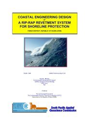
INTRODUCTION<br />
This <strong>survey</strong> was undertaken as part of the Joint Programme 01 Marine Geoscientific<br />
Research <strong>and</strong> Mineral Resources Studies of the South Pacific Region sponsored by Australia,<br />
New Zeal<strong>and</strong> <strong>and</strong> the United States of America with the cooperation of CCOP/ SOPAC. The<br />
USGS research vessel SAMUEL P.LEE was used for this <strong>survey</strong>.<br />
Prior to this <strong>survey</strong>, fourteen E-W <strong>and</strong> one N-S single-channel <strong>seismic</strong> reflection<br />
profiles were acquired by CCOP /SOPAC in 1979 totaling 2140km. Also, the southern part<br />
of the Tonga Platform was traversed by EVA III, GEORSTOM <strong>and</strong> AUSTRADEC scientific<br />
expeditions in 1977 <strong>and</strong> 1978 organized by ORSTOM <strong>and</strong> had acquired 12 single-channel<br />
<strong>seismic</strong> <strong>and</strong> magnetic profiles. Based on these data <strong>and</strong> the existing oil company data<br />
available at the Ministry of L<strong>and</strong>s, Survey <strong>and</strong> Natural Resources, Nuku'alofa, Tonga, an<br />
"Assessment of the Petroleum Potential of the southern <strong>and</strong> northern parts of the Tonga<br />
Platform'' was prepared by CCOP/ SOPAC. This <strong>survey</strong> is the outcome of the<br />
recommendations made in that report.<br />
CRUISE OBJECTIVES<br />
The objective 01 this <strong>survey</strong> was, to gather multi-channel <strong>seismic</strong>, single channel<br />
<strong>seismic</strong>, gravity, magnetic, <strong>and</strong> <strong>sonobuoy</strong> <strong>seismic</strong>: <strong>refraction</strong> data <strong>and</strong> to dredge for rock<br />
samples over the southern part of the Tonga Platform south of Tongatapu <strong>and</strong> 'Eua up to<br />
approximately Longitude 23° 3D', It is envisaged that the analysis of these data will provide a<br />
better elucidation of the sub sea-bed geology (sedimentary rocks thicknesses <strong>and</strong> structures)<br />
<strong>and</strong> tectonics than the existing single-channel <strong>seismic</strong> data in order to assess the petroleum<br />
potential of this portion of the southern part of the Tonga Platform.<br />
It was also decided to gather single-channel <strong>seismic</strong>, magnetic <strong>and</strong> gravity data from<br />
Pago Pago, American Samoa enroute to Nuku'alofa, Tonga <strong>and</strong> from around 'Eua (at the end<br />
of multi-channel work <strong>and</strong> dredging) enroute to Suva, Fiji, in order to provide additional data<br />
to the studies of sub sea-bed geology <strong>and</strong> tectonics of the northern part of the Tonga Platform<br />
<strong>and</strong> Lau basin <strong>and</strong> ridge respectively.