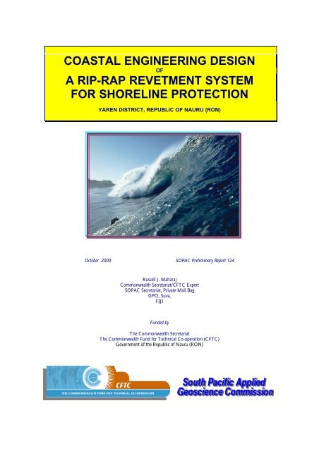
Coastal engineering design of a rip-rap revetment ... - Up To - SOPAC
Coastal engineering design of a rip-rap revetment ... - Up To - SOPAC
Coastal engineering design of a rip-rap revetment ... - Up To - SOPAC

You also want an ePaper? Increase the reach of your titles
YUMPU automatically turns print PDFs into web optimized ePapers that Google loves.
COASTAL ENGINEERING DESIGN<br />
OF<br />
A RIP-RAP REVETMENT SYSTEM<br />
FOR SHORELINE PROTECTION<br />
YAREN DISTRICT, REPUBLIC OF NAURU (RON)<br />
October 2000 <strong>SOPAC</strong> Preliminary Report 124<br />
Russell J. Maharaj<br />
Commonwealth Secretariat/CFTC Expert<br />
<strong>SOPAC</strong> Secretariat, Private Mail Bag<br />
GPO, Suva,<br />
FIJI<br />
Funded by<br />
The Commonwealth Secretariat<br />
The Commonwealth Fund for Technical Co-operation (CFTC)<br />
Government <strong>of</strong> the Republic <strong>of</strong> Nauru (RON)
<strong>Coastal</strong> Engineering Design, Yaren District, Republic <strong>of</strong> Nauru<br />
TABLE OF CONTENTS<br />
<strong>SOPAC</strong> Preliminary Report 124, October 2000: Russell J. Maharaj<br />
Page Number<br />
ABSTRACT 3<br />
LIST OF FIGURES 4<br />
LIST OF TABLES 4<br />
1.0 INTRODUCTION 5<br />
1.1 Background 5<br />
1.2 Need and Rationale 5<br />
2.0 METHODOLOGY 5<br />
3.0 RESULTS 6<br />
3.1 The Problem Site 6<br />
Development Characteristics 6<br />
The Beach and Shorefront 6<br />
Macrobenthic Biota 7<br />
Waves and Littoral Hydraulics 7<br />
Wave Diffraction and Erosion 7<br />
Further Details <strong>of</strong> the Problem Area 7<br />
3.2 Recommended Design 8<br />
ACKNOWLEDGEMENTS 9<br />
BIBLIOGRAPHY AND REFERENCES 9<br />
FIGURES 12<br />
TABLES 46<br />
APPENDIX I: Task Pr<strong>of</strong>ile 48<br />
2
3<br />
<strong>Coastal</strong> Engineering Design, Yaren District, Republic <strong>of</strong> Nauru<br />
COASTAL ENGINEERING DESIGN<br />
YAREN DISTRICT, REPUBLIC OF NAURU (RON)<br />
ABSTRACT<br />
This report presents preliminary results and <strong>design</strong> guidelines for a coastal protection system, for a section <strong>of</strong> an eroding<br />
coastline, in Yaren District, Republic <strong>of</strong> Nauru. These guidelines were drafted and prepared following a request from the<br />
<strong>of</strong>fice <strong>of</strong> the President, Republic <strong>of</strong> Nauru (RON), to <strong>SOPAC</strong>, to assess an appropriate protection system for a chronically<br />
eroding coast in Yaren District. Yaren District is located in the southwest part <strong>of</strong> Nauru and is the site <strong>of</strong> the capital <strong>of</strong><br />
Nauru. The problem coastline is a segment <strong>of</strong> shorefront, just west and southwest <strong>of</strong> the airport runway and east <strong>of</strong> the<br />
Government buildings and Parliamentary complex. The residents in the District have also noticed significant erosion <strong>of</strong><br />
the coastal areas, including loss <strong>of</strong> beach sand and loss <strong>of</strong> land over the past months. At the request <strong>of</strong> RON and with<br />
financial support <strong>of</strong> the RON, the author made a site visit and evaluated the erosion problem. The visit was conducted<br />
between 5 th – 7 th September 2000.<br />
Following the visit and after briefing with <strong>of</strong>ficials <strong>of</strong> RON, including the Office <strong>of</strong> the President, <strong>SOPAC</strong> indicated that<br />
it would provide an appropriate coastal protection system and <strong>design</strong> elements for the eroding coastline. These guidelines,<br />
including dimensions and quantities, were sent to RON within five days <strong>of</strong> the site visit, and are the subject <strong>of</strong> this report.<br />
The author also indicated that a full analysis, in the contex <strong>of</strong> the causes <strong>of</strong> erosion and shorefront development, for the<br />
said coastline would be prepared in <strong>SOPAC</strong> Technical Report 317, to be delivered to RON later this year. In addition, the<br />
<strong>SOPAC</strong> Technical Report will contain recommendations for appropriate shorefront development, in particular guidelines<br />
for preparing EA and EIA for the coastal development. Key <strong>engineering</strong> and environmental issues will also be discussed<br />
and highlighted in the text as well as guidelines for preparation <strong>of</strong> a full EIA.<br />
At this time, only a synopsis <strong>of</strong> a coastal protection <strong>design</strong> is presented. Additional and further details with be presented<br />
and discussed in <strong>SOPAC</strong> Technical Report 317. Design information has been produced after Numerical Analysis with<br />
<strong>Coastal</strong> Engineering S<strong>of</strong>tware CRESS and ACES. A multi-layered, free-draining <strong>rip</strong>-<strong>rap</strong> <strong>revetment</strong> is proposed for<br />
remediation <strong>of</strong> the erosion problem at the site (Table 1). This structure will also protect the problem area from future<br />
erosion by wave attack under similar hydraulic conditions discussed in Section 3.0. The <strong>rip</strong>-<strong>rap</strong> <strong>revetment</strong> should have the<br />
following <strong>design</strong> elements: two outer layers with a width <strong>of</strong> 10 m; this is the primary armor <strong>of</strong> the <strong>revetment</strong>; the<br />
<strong>revetment</strong> should be winged, that is, the ends <strong>of</strong> the <strong>revetment</strong> should not be open to wave attack, but should be built<br />
into the adjacent land or “closed”; the <strong>revetment</strong> should utilize natural dolomitic limestone rock from RON; it should<br />
consist <strong>of</strong> a granular filter layer or secondary armor layer, made up <strong>of</strong> 0.20-0.35 m diameter rocks; this underlies the<br />
primary armor; the <strong>revetment</strong> should have a 1:1.5 seaward slope; a geotextile filter fabric is also recommended for use in<br />
this structure; this fabric is a free draining artificial media; the geotextile fabric should have perforations with dimensions<br />
less that the diameter <strong>of</strong> the smallest boulders to which it is juxtaposed; two separate layers <strong>of</strong> the geotextile filter fabric<br />
should be used; one layer will underlie the primary armor <strong>of</strong> the <strong>revetment</strong> and overlie the granular filter media; the<br />
second liner should overlie the natural soil/land and underlie the secondary armor; the rock <strong>revetment</strong> should use 0.89 m<br />
nominal size dolomitised limestone boulders obtained locally (from RON).<br />
Boulders for the outer layers <strong>of</strong> the <strong>revetment</strong> should have the following dimensions: D 50 <strong>of</strong> 1.04 m; D N <strong>of</strong> 0.89 m;<br />
W 50 /℘• <strong>of</strong> 1,745 kg; and Nauru’s dolomite limestone with densities at 2500 kg/m 3 . The above dimensions are suitable<br />
for hydraulic conditions associated with 3 m high (HS) plunging breakers, associated with wave periods <strong>of</strong> 6 sec (T),<br />
approaching the shore (∝) at 015 0 . Please note that we cannot <strong>design</strong> for nor do these dimensions cater for extreme<br />
oceanog<strong>rap</strong>hic or weather events, like storms and cyclones, as that is beyond the scope <strong>of</strong> “normal <strong>engineering</strong>.” Please<br />
ensure that a qualified engineer supervises all <strong>of</strong> this work to ensure Quality Assurance and Quality Control (QA & QC).<br />
KEYWORDS: Yaren District, Republic <strong>of</strong> Nauru, RON, <strong>rip</strong>-<strong>rap</strong>, <strong>revetment</strong> <strong>design</strong>, coastal protection, and erosion assessment.<br />
<strong>SOPAC</strong> Preliminary Report 124, October 2000: Russell J. Maharaj
<strong>Coastal</strong> Engineering Design, Yaren District, Republic <strong>of</strong> Nauru<br />
LIST OF FIGURES<br />
<strong>SOPAC</strong> Preliminary Report 124, October 2000: Russell J. Maharaj<br />
Page Number<br />
Figure 1. Location map <strong>of</strong> the south Pacific showing the location <strong>of</strong> Nauru. 13<br />
Figure 2. Location map <strong>of</strong> Nauru and the project area. 14<br />
Figure 3. Location <strong>of</strong> Yaren District, the eroding coast. 15<br />
Figure 4. Erosion characteristics <strong>of</strong> the problematic coastline. 16<br />
Figure 5. Erosion characteristics <strong>of</strong> the problematic coastline. 17<br />
Figure 6. Characteristics <strong>of</strong> the eroding beach (looking west). 18<br />
Figure 7. Elevated, Holocene backreef area covered with green algae. 19<br />
Figure 8. Carbonate gravel deposited along the lower beach. 20<br />
Figure 9. Filamentous green algae covering the backreef area. 21<br />
Figure 10. Filamentous green algae on underlying limestone bedrock. 22<br />
Figure 11. Mollusc fauna on limestone substrate on the lower beach. 23<br />
Figure 12. A plunger breaker wave sequence photog<strong>rap</strong>hed at the site. 24<br />
Figure 13. Location <strong>of</strong> the airport fill site. 25<br />
Figure 14. Details <strong>of</strong> the fill protection using <strong>rip</strong>-<strong>rap</strong> <strong>revetment</strong>. 26<br />
Figure 15. Details <strong>of</strong> the limestone <strong>rip</strong>-<strong>rap</strong> <strong>revetment</strong> along the airport fill site. 27<br />
Figure 16. Part <strong>of</strong> an old masonry retaining wall at the erosion site. 28<br />
Figure 17. Limestone boulders from failed coastal protection structures. 29<br />
Figure 18. Basal scouring <strong>of</strong> the retaining wall in Figure 17. 30<br />
Figure 19. Details <strong>of</strong> the scoured western section <strong>of</strong> the scoured retaining wall. 31<br />
Figure 20. Large cavities at the base <strong>of</strong> the scoured retaining wall. 32<br />
Figure 21. Removal <strong>of</strong> boulder aggregate at the base <strong>of</strong> the retaining wall . 33<br />
Figure 22. Scouring and removal <strong>of</strong> wall aggregate due to wave action and abrasion. 34<br />
Figure 23. Erosion scarp at the western end <strong>of</strong> the airport <strong>rip</strong>-<strong>rap</strong> <strong>revetment</strong>. 35<br />
Figure 24. Details <strong>of</strong> the erosion scarp in Figure 23. 36<br />
Figure 25. Characteristics <strong>of</strong> the scoured area at the erosion scarp in Figures 23 and 24. 37<br />
Figure 26. Gravity concrete retaining wall at the outer perimeter <strong>of</strong> the airport fill site. 38<br />
Figure 27. Dislodged limestone <strong>rip</strong>-<strong>rap</strong> from the base <strong>of</strong> the gravity wall. 39<br />
Figure 28. View looking east <strong>of</strong> the coastline at the airport fill site. 40<br />
Figure 29. View looking east <strong>of</strong> the beach at the airport fill site. 41<br />
Figure 30. View showing the <strong>rip</strong>-<strong>rap</strong> <strong>revetment</strong> protecting the airport. 42<br />
Figure 31. Details <strong>of</strong> Figure 30, showing the sandy beach and limestone pinnacle. 43<br />
Figure 32. Randomly placed limestone boulders for protection <strong>of</strong> residential property. 44<br />
LIST OF TABLES<br />
Page Number<br />
Table. 1. Preliminary <strong>rip</strong>-<strong>rap</strong> <strong>design</strong> information. 46<br />
4
5<br />
1.1 Background<br />
1.0 INTRODUCTION<br />
This report presents preliminary results and<br />
<strong>design</strong> guidelines for a coastal-protection system,<br />
for a segment <strong>of</strong> an eroding coastline, in Yaren<br />
District, Republic <strong>of</strong> Nauru (Figures 1-3).<br />
These guidelines were drafted and prepared<br />
following a request from the <strong>of</strong>fice <strong>of</strong> the<br />
President, Republic <strong>of</strong> Nauru (RON), to <strong>SOPAC</strong><br />
Secretariat. The request was to assess the current<br />
problem and recommend an appropriate coastalprotection<br />
system/s for the chronically eroding<br />
coast in Yaren District (Figure 3).<br />
Yaren District is located in the south-southwest<br />
part <strong>of</strong> Nauru and is the site <strong>of</strong> the capital <strong>of</strong><br />
Nauru (Figure 2).<br />
The problem coastline is a segment <strong>of</strong> shorefront<br />
just west and southwest <strong>of</strong> the airport runway and<br />
east <strong>of</strong> the Government buildings and<br />
Parliamentary complex (Figure 3).<br />
At the request <strong>of</strong> and with financial support from<br />
the RON, the author made a site visit and<br />
evaluated the erosion problem.<br />
The visit was conducted between 5 th - 7 th<br />
September 2000. Following the visit, and after<br />
briefing with <strong>of</strong>ficials <strong>of</strong> RON, including the<br />
Office <strong>of</strong> the President, <strong>SOPAC</strong> indicated that it<br />
would provide an appropriate coastal-protection<br />
system and <strong>design</strong> elements for the eroding<br />
coastline. These guidelines, including dimensions<br />
and quantities were sent to RON within five (5)<br />
days <strong>of</strong> the site visit, and are the subject <strong>of</strong> this<br />
report.<br />
The author also indicated that a full analysis, in<br />
the context <strong>of</strong> the causes <strong>of</strong> erosion and shorefront<br />
development, would be prepared as <strong>SOPAC</strong><br />
Technical Report 317, to be delivered to RON<br />
later this year.<br />
In addition, <strong>SOPAC</strong> Technical Report 317 will<br />
contain recommendations for appropriate<br />
shorefront development, in particular guidelines<br />
for preparing EA and EIA for the coastal<br />
development. Key <strong>engineering</strong> and environmental<br />
issues will also be discussed and highlighted in the<br />
text as well as guidelines given for preparation <strong>of</strong> a<br />
full EIA.<br />
<strong>Coastal</strong> Engineering Design, Yaren District, Republic <strong>of</strong> Nauru<br />
<strong>SOPAC</strong> Preliminary Report 124, October 2000: Russell J. Maharaj<br />
This work was executed and funded under<br />
<strong>SOPAC</strong>’S PROJECT AND TASK - NR 2000.007,<br />
Republic <strong>of</strong> Nauru (RON - Appendix I).<br />
1.2 Needs and Rationale<br />
The residents in the Yaren District have noticed<br />
significant erosion <strong>of</strong> the coastal areas, including<br />
loss <strong>of</strong> beach sand and loss <strong>of</strong> land, over the past<br />
months (Figures 4 and 5). This has resulted in the<br />
threat to residential property (Figures 4-6) and<br />
civil infrastructure, including houses, a nearby<br />
school and adjacent coastal roadway, along the<br />
pe<strong>rip</strong>hery <strong>of</strong> the airst<strong>rip</strong>.<br />
Since RON is a small island, with limited land<br />
area, the loss <strong>of</strong> any land or coastal property is<br />
significant. In addition, developing economies<br />
like RON can be seriously affected by damage to,<br />
or loss <strong>of</strong>, civil infrastructure and residential<br />
facilities from natural hazards, like coastal erosion.<br />
Therefore, addressing these types <strong>of</strong> coastal<br />
problems are <strong>of</strong> paramount importance to<br />
Nauru’s coastal communities and for the<br />
livelihood and well-being <strong>of</strong> residents and the<br />
nation as a whole. In the context <strong>of</strong> natural<br />
resource management, coastal erosion is also an<br />
important process that needs to be addressed, if<br />
future generations are to derive benefits from<br />
coastal resources like beaches and associated reefs.<br />
2.0 METHODOLOGY<br />
Information was collected during a site visit to the<br />
eroding coast. This included wave and littoral<br />
information, beach sediment characteristics,<br />
erosion characteristics, and damage to any critical<br />
facilities and infrastructure.<br />
Beach sediments were described according to<br />
American Society for Testing Materials (ASTM,<br />
1999) guidelines, which is in accordance with the<br />
Unified Soil Engineering Classification System.<br />
Rock classification and desc<strong>rip</strong>tions are based on<br />
ASTM (1999) guidelines and are based on<br />
International Society for Rock Mechanics (ISRM,<br />
1981) standards and Smith and Collins (1993).<br />
Beach slopes were measure with a Brunton<br />
compass and erosion scarps were measured with<br />
surveying equipment.<br />
Positions in the field were determined with a<br />
Garmin hand-held GPS unit.
Information on waves was also obtained from<br />
vertical, colour, 1992 aerial photog<strong>rap</strong>hs.<br />
Limestone rock strength was measured in-situ<br />
with an ELE Schmidt L-Type Hammer, while<br />
concrete strength was measured with an ELE<br />
Concrete Testing Hammer. Rip-<strong>rap</strong>/armourstone<br />
desc<strong>rip</strong>tion and <strong>revetment</strong> evaluation are based on<br />
criteria <strong>of</strong> CIRIA (1991) and Pilarczyk (1996),<br />
Latham (1998), Geological Society <strong>of</strong> London<br />
(GSL, 1999).<br />
Design information has been produced after<br />
Numerical Analysis with International Institute<br />
for Hydraulic Engineering, Delft University <strong>of</strong><br />
Technology (IHE-Delft, 1999), <strong>Coastal</strong> and River<br />
Engineering Support System (CRESS) and the U.<br />
S. Army Corps <strong>of</strong> Engineers, Automatic <strong>Coastal</strong><br />
Engineering System (ACES).<br />
Computations <strong>of</strong> <strong>rip</strong>-<strong>rap</strong> dimensions,<br />
armourstone stability and wave run-up are based<br />
on numerical equations <strong>of</strong> van der Meer (1987<br />
and 1998) and are modifications and<br />
improvements <strong>of</strong> the typical Hudson (1958)<br />
formula. Computations are therefore for random<br />
wave attack, more typical in the natural<br />
environments.<br />
3.1 The Problem Site<br />
3.0 RESULTS<br />
The site has the following characteristics:<br />
Development Characteristics<br />
�� the coastline is a heavily developed st<strong>rip</strong> <strong>of</strong><br />
land, with many residential and<br />
infrastructure facilities; and<br />
�� housing, seawalls, an adjacent airst<strong>rip</strong> for<br />
the national airport, a school, the<br />
telecommunications facility and several<br />
Government buildings front the adjacent<br />
and immediate shoreline.<br />
The Beach and Shorefront<br />
�� a medium to fine, carbonate sand beach,<br />
�� the beach is about 6 m wide with a 12-15°<br />
slope towards the sea (Figure 6);<br />
�� sands are clean, with less than 5% fines;<br />
<strong>Coastal</strong> Engineering Design, Yaren District, Republic <strong>of</strong> Nauru<br />
<strong>SOPAC</strong> Preliminary Report 124, October 2000: Russell J. Maharaj<br />
�� all sand grains are reef detritus, with more<br />
than 75% coral detritus;<br />
�� Molluscs, foraminifera tests, and<br />
echinoderm tests compose most <strong>of</strong> the<br />
remaining 25% <strong>of</strong> the sand fragments;<br />
�� the upper beach has a thicker sand<br />
accumulation, about 0.75 m, which is<br />
usually thicker during the early half <strong>of</strong> the<br />
year;<br />
�� small coconut palms and coastal shrubs<br />
line the coastal areas (Figures 4 and 5);<br />
�� shorefront vegetation is largely small<br />
shrubs currently being affected by erosion<br />
(Figure 4);<br />
�� residential properties front the upper<br />
beach and the shoreline (Figure 6);<br />
�� the erosion scarp at the problem coastline<br />
is between 0.80 m and 1.75 m high<br />
(Figures 4 and 5);<br />
�� the scarp is vertical, with some<br />
overhanging sections where coconut palm<br />
roots still bind shallow and surface soils<br />
(Figure 4);<br />
�� the eroded scarp has exposed retaining wall<br />
and foundation support for several houses;<br />
�� in addition, older coastal protection is<br />
evident here at the study sites, from the<br />
litter <strong>of</strong> limestone boulders and masonry<br />
wall rubble, along the upper beach (Figure<br />
4);<br />
�� the lower beach extends for about 200m to<br />
the reef crest;<br />
�� the backreef area is a typical Holocene,<br />
elevated, almost featureless platform, with<br />
few pocket or depressions (Figure 7);<br />
�� the backreef is strewn with angular<br />
limestone boulder fragments (eroded from<br />
adjacent coastlines and in-situ) and also<br />
derived from failed coastal protection<br />
structures (Figure 7);<br />
�� all <strong>of</strong> these boulders are typical cavernous,<br />
dolomitised limestone;<br />
�� the interface <strong>of</strong> the lower beach and<br />
backreef area is a depositional site for<br />
medium to coarse gravel (Figure 8);<br />
�� these gravels are generally rounded to subrounded<br />
and are 100% carbonate grains;<br />
�� gravels in this areas are well sorted and free<br />
<strong>of</strong> fines;<br />
�� about 90% <strong>of</strong> all gravel fragments are <strong>of</strong><br />
coral debris, with less than 10%<br />
comprising invertebrate skeletal material<br />
(Molluscan fragments); and<br />
�� all gravel fragments have a high aspect<br />
ratio (Figure 8).<br />
6
7<br />
Some Macrobenthic Biota<br />
�� the lower beach and backreef areas are<br />
50% covered with green filamentous algae<br />
(Figures 9 and 10);<br />
�� these indicate polluted and/or eutrophic<br />
(nutrient-enriched) waters; and<br />
�� macrobenthic species are common on the<br />
beach and backreef and include green<br />
algae, red algae, sea cucumbers; sea urchins<br />
and molluscs (Figure 11) attached to rock<br />
substrate.<br />
Waves and Littoral Hydraulics<br />
�� waves are typically plunging, with<br />
sometimes surging breakers;<br />
�� wave heights measured at the site on this<br />
visit and previous visits, 1998-2000,<br />
average 2.5 m, but can be 3 m high;<br />
�� significant wave heights, based on<br />
observations, discussions with the Harbor<br />
Master and the Fisheries Department is<br />
3.0 m;<br />
�� a typical example <strong>of</strong> a plunging breaker<br />
wave sequence, and photog<strong>rap</strong>hed at the<br />
site, is illustrated in Figure 12 (starting top<br />
left and following the arrows);<br />
�� as with typical plunging breakers, waves<br />
come crashing on the beach and run-up<br />
with significant speed, causing significant<br />
removal <strong>of</strong> loose/cohesionless beach<br />
sediments;<br />
�� with a narrow and almost flat, backreef at<br />
the site, and in the vicinity <strong>of</strong> the problem<br />
area, any disturbance <strong>of</strong> beach sediments<br />
and their removal, can lead to cross-shore<br />
sediment transport and removal from the<br />
backreef, across the reef crest, and into the<br />
deep water environment;<br />
�� most waves approach the shore at the<br />
study area almost perpendicular to the<br />
shoreline (at 015° from a line <strong>of</strong><br />
intersection <strong>of</strong> the shoreline and<br />
approaching waves);<br />
�� longshore transport is largely to the west,<br />
from easterly approaching waves;<br />
�� with perpendicular-approaching waves, no<br />
longshore drift is generated;<br />
�� when westerly winds affect the area,<br />
longshore drift is to the east;<br />
�� winds are generally from the east; and<br />
�� Easterly winds generate easterly<br />
approaching waves.<br />
<strong>Coastal</strong> Engineering Design, Yaren District, Republic <strong>of</strong> Nauru<br />
Wave Diffraction and Shoreline Erosion<br />
<strong>SOPAC</strong> Preliminary Report 124, October 2000: Russell J. Maharaj<br />
�� waves approaching the problem area<br />
diffract around the airport extension<br />
reclamation and fill site, shown in Figure<br />
3;<br />
�� diffraction is to both the east and the west<br />
(pink arrows; Figure 3);<br />
�� diffracted waves cause longshore currents<br />
(L; Figure 3) to be generated in opposite<br />
directions, from the seaward-most part <strong>of</strong><br />
the reclamation and fill site (S; Figure 3);<br />
�� both longshore currents are more<br />
significant at high tides, especially extreme<br />
high water spring tides, when there is a<br />
more pr<strong>of</strong>ound wave effect and the water<br />
depth (effective submergence) is greater in<br />
the area;<br />
�� both longshore currents cause erosion<br />
points to develop, from point S (Figure 3)<br />
along the coastline;<br />
�� these cause loss <strong>of</strong> fine, loose and<br />
cohesionless carbonate sands and gravel<br />
from beaches to east and west <strong>of</strong> the<br />
airport extension site, S (Figure 3);<br />
�� longshore currents generated by these<br />
diffracting waves cause significant removal<br />
<strong>of</strong> beach sediment along the coast, at the<br />
problem site (areas in red; Figure 3); and<br />
�� the above mentioned phenomena leads to<br />
coastal erosion and create the type <strong>of</strong><br />
problem observed today (Figures 13-32).<br />
Further Details <strong>of</strong> the Problems Area<br />
�� Figures 13 and 14 show the airport<br />
reclamation and fill site;<br />
�� note the <strong>rip</strong>-<strong>rap</strong> <strong>revetment</strong> protecting the<br />
reclaimed site (Figure 15);<br />
�� the <strong>rip</strong>-<strong>rap</strong> is made <strong>of</strong> dolomitic limestone<br />
from Nauru;<br />
�� note also the green brown algae covering<br />
boulders in Figure 15;<br />
�� Figure 16 shows part <strong>of</strong> an old, almost<br />
vertical (85°), 1.65 m high and 0.75 m<br />
wide (at the top) masonry retaining wall at<br />
the problem site. Note strewn 0.30 m<br />
diameter, limestone boulders from<br />
damaged wall sections (also Figure 17);<br />
�� sand and fine gravel are deposited between<br />
boulders;<br />
�� Figure 18 shows basal scouring and<br />
undermining <strong>of</strong> the retaining wall shown<br />
in Figure 16;
�� Figures 19-22 show large cavities in<br />
various sections <strong>of</strong> the masonry wall,<br />
produced by wave-induced erosion and<br />
scouring;<br />
�� eroded cavities like those above cause<br />
dislodgment <strong>of</strong> boulder aggregate from<br />
within the structure leading to loss <strong>of</strong><br />
internal support;<br />
�� since masonry walls do not possess tensile<br />
strength, the wall eventually cracks due to<br />
loss <strong>of</strong> support and integrity and fails;<br />
�� Figure 23 shows erosion and scouring at<br />
the western corner <strong>of</strong> the <strong>rip</strong>-<strong>rap</strong><br />
<strong>revetment</strong> system, at the airport fill site;<br />
�� the above is cause by flanking or the<br />
absence <strong>of</strong> protection at the end <strong>of</strong> the <strong>rip</strong><strong>rap</strong><br />
<strong>revetment</strong> system and is the product <strong>of</strong><br />
longshore currents;<br />
�� the height <strong>of</strong> the scarp is about 0.75 m and<br />
exposes coarse, angular limestone fill<br />
material (Figures 24 and 25), with<br />
undercut sections (Figure 25);<br />
�� the entire fill site is contained by a slightly<br />
curved (at the top) concrete gravity wall<br />
(Figure 26), about 6 m above mean sea<br />
level;<br />
�� the top <strong>of</strong> the wall is about 2.5 m wide;<br />
�� toe protection is provided at the base <strong>of</strong><br />
the wall, in the form <strong>of</strong> 0.75-1.25 m<br />
diameter limestone <strong>rip</strong>-<strong>rap</strong> (Figures and 26<br />
27);<br />
�� toe <strong>rip</strong>-<strong>rap</strong> may occasionally be dislodged<br />
by large waves and during extreme events<br />
(Figure 27) and therefore not entirely<br />
stable;<br />
�� Figures 28-30 show some features <strong>of</strong> the<br />
eastern part <strong>of</strong> the coastal <strong>rip</strong>-<strong>rap</strong><br />
<strong>revetment</strong> at the airport fill site;<br />
�� from Figure 29 one can assess the extent <strong>of</strong><br />
the reclamation and fill project, into the<br />
marine area, is about 175 m at its southern<br />
most point/seaward extremity;<br />
�� the beach on the eastern side <strong>of</strong> the fill site<br />
is gentle (5°) and is <strong>of</strong> fine to medium<br />
carbonate sands (Figure 31) with some<br />
small, in-situ karst limestone pinnacles in<br />
the surf zone;<br />
�� the residents on the eastern side <strong>of</strong> the<br />
airport fill site have also protected their<br />
property with limestone <strong>rip</strong> <strong>rap</strong> (Figure<br />
32), indicating erosion problems there as<br />
well.<br />
<strong>Coastal</strong> Engineering Design, Yaren District, Republic <strong>of</strong> Nauru<br />
3.2 Recommended Design<br />
<strong>SOPAC</strong> Preliminary Report 124, October 2000: Russell J. Maharaj<br />
At this time, only a synopsis <strong>of</strong> a coastal<br />
protection <strong>design</strong> is presented. Additional and<br />
further details with be presented and discussed in<br />
<strong>SOPAC</strong> Technical Report 317.<br />
Design information has been produced after<br />
Numerical Analysis with <strong>Coastal</strong> Engineering<br />
S<strong>of</strong>tware CRESS and ACES.<br />
A multi-layered, free-draining <strong>rip</strong>-<strong>rap</strong> <strong>revetment</strong> is<br />
proposed for remediation <strong>of</strong> the erosion problem<br />
at the site (Table 1). This structure will also<br />
protect the problem area from future erosion by<br />
wave attack under similar hydraulic conditions<br />
discussed in Section 3.0.<br />
The <strong>rip</strong>-<strong>rap</strong> <strong>revetment</strong> should have the following<br />
<strong>design</strong> elements:<br />
�� two outer layers with a width <strong>of</strong> 10 m;<br />
this is the primary armor <strong>of</strong> the<br />
<strong>revetment</strong>;<br />
�� the <strong>revetment</strong> should be winged, that is,<br />
the ends <strong>of</strong> the <strong>revetment</strong> should not be<br />
open to wave attack, but should be built<br />
into the adjacent land or “closed”;<br />
�� the <strong>revetment</strong> should utilize natural<br />
dolomitic limestone rock from RON;<br />
�� it should consist <strong>of</strong> a granular filter layer<br />
or secondary armor layer, made up <strong>of</strong><br />
0.20-0.35 m diameter rocks; this underlies<br />
the primary armor;<br />
�� the <strong>revetment</strong> should have a 1:1.5 seaward<br />
slope;<br />
�� a geotextile filter fabric is also<br />
recommended for use in this structure;<br />
this fabric is a free draining artificial<br />
media;<br />
�� the geotextile fabric should have<br />
perforations with dimensions less that the<br />
diameter <strong>of</strong> the smallest boulders to which<br />
it is juxtaposed;<br />
�� two separate layers <strong>of</strong> the geotextile filter<br />
fabric should be used;<br />
�� one layer will underlie the primary armor<br />
<strong>of</strong> the <strong>revetment</strong> and overlie the granular<br />
filter media;<br />
�� the second liner should overlie the natural<br />
soil/land and underlie the secondary<br />
armor;<br />
�� the rock <strong>revetment</strong> should use 0.89 m<br />
nominal size dolomitised limestone<br />
boulders obtained locally (from RON).<br />
8
9<br />
Boulders for the outer layers <strong>of</strong> the <strong>revetment</strong><br />
should have the following dimensions,<br />
�� D 50 <strong>of</strong> 1.04m,<br />
�� D N <strong>of</strong> 0.89 m;<br />
�� W 50/℘ <strong>of</strong> 1,745 kg; and<br />
�� Nauru’s dolomite limestone with densities<br />
at 2500 kg/m 3 .<br />
The above dimensions are suitable for hydraulic<br />
conditions associated with 3 m high (HS)<br />
plunging breakers, associated with wave periods <strong>of</strong><br />
6 sec (T), approaching the shore (∝) at 015°.<br />
Please note that we cannot <strong>design</strong> for nor do these<br />
dimensions cater for extreme oceanog<strong>rap</strong>hic or<br />
weather events, like storms and cyclones, as that is<br />
beyond the scope <strong>of</strong> “normal <strong>engineering</strong>.”<br />
Please ensure that a qualified engineer supervises<br />
all <strong>of</strong> this work to ensure Quality Assurance and<br />
Quality Control (QA & QC).<br />
ACKNOWLEDGEMENTS<br />
This project was supported by the Commonwealth<br />
Secretariat (COMSEC), under The Commonwealth Fund<br />
for Technical Co-operation (CFTC). The Commonwealth<br />
Secretariat/CFTC funded the author.<br />
Logistic and other financial support, from RON and<br />
South Pacific Applied Geoscience Commission<br />
(<strong>SOPAC</strong>) Secretariat, prior to commencement <strong>of</strong> the<br />
survey and for the preparation <strong>of</strong> this technical report,<br />
is gratefully acknowledged.<br />
The Department <strong>of</strong> Industry and Economic<br />
Development, RON provided logistic support during<br />
the survey.<br />
The survey was conducted with the assistance <strong>of</strong><br />
personnel from the Department <strong>of</strong> Industry and<br />
Economic Development. Mr. Tyrone Deiye (Project<br />
Officer) and Mr. Andrew Kaierua (Atmospheric<br />
Radiation Measurement Project Administrator)<br />
provided in-country support during the course <strong>of</strong> the<br />
site investigation.<br />
The co-ordination <strong>of</strong> activities before and during the<br />
conduct <strong>of</strong> this survey by Mr. Tyrone Deiye,<br />
Department <strong>of</strong> Industry and Economic Development is<br />
gratefully acknowledged.<br />
Discussions were held with Office <strong>of</strong> the President,<br />
RON; the Secretary for Industry and Economic<br />
Development; <strong>of</strong>ficials from the Fisheries Department,<br />
representatives from the Nauru Phosphate Company<br />
<strong>Coastal</strong> Engineering Design, Yaren District, Republic <strong>of</strong> Nauru<br />
<strong>SOPAC</strong> Preliminary Report 124, October 2000: Russell J. Maharaj<br />
(NPC); and representatives from the village<br />
communities. These discussions and meetings with<br />
various representatives are gratefully acknowledged.<br />
This work was executed and funded under <strong>SOPAC</strong>’S<br />
PROJECT AND TASK – NR 2000.007, Republic <strong>of</strong><br />
Nauru.<br />
BIBLIOGRAPHY & REFERENCES<br />
ASTM, 1999. Annual Book <strong>of</strong> ASTM Standards. Soil,<br />
Rock, Building Stones and Geotextiles. ASTM,<br />
Philadelphia.<br />
Bowders, J. J., Scranton, H. B. and Brodreick, G. P.<br />
1998. Geosynthetic in Foundation Reinforcement and<br />
Erosion Control Systems. ACSE Geotechnical Special<br />
Publication No. 766. ASCE Press, Virginia.<br />
CIRIA, 1991. Manual <strong>of</strong> the Use <strong>of</strong> Rock in <strong>Coastal</strong> and<br />
Shoreline Engineering. CIRIA Special Publication 83 &<br />
CUR Report 154. A. A. Balkema, Rotterdam.<br />
CIRIA, 1996. Beach Management Manual. CIRIA<br />
Special Publication 153. CIRIA, London.<br />
Geological Society <strong>of</strong> London (GSL), 1999. Stone:<br />
Building Stone, Rock, Fill and Armourstone in<br />
Construction. Geological Society <strong>of</strong> London<br />
Engineering Geology Special Publication, 16.<br />
Hamnett, M. P. 1992. Natural Disater Mitigation in<br />
Pacific Island Countries. South Pacific Disaster<br />
Reduction Programme Report RAS/92/360,<br />
UNDP/UNDHA.<br />
Herbich, J. B. 1991. Handbook <strong>of</strong> <strong>Coastal</strong> and Ocean<br />
Engineering. Volumes 1 & 2. Gulf Publishing, New<br />
York.<br />
Hudson, R. N. 1958. Design <strong>of</strong> quarry stone cover<br />
layers for rubble mound breakwaters. U. S. Corps <strong>of</strong><br />
Engineers, Waterways Experiments Station Research<br />
Report 2-2.<br />
Ignold, T. S. 1994. Geotextiles and Geomembranes<br />
Manual. Elsevier Advanced Technology, Oxford.<br />
IHE-Delft, 1999. CRESS: <strong>Coastal</strong> and River Engineering<br />
Support System, Version 7.00. IHE, Delft.<br />
ISRM, 1981. Rock Characterization Testing and<br />
Monitoring. Pergamon, Oxford.<br />
Latham, J.P. (ed.) 1998. Advances in Aggregate and<br />
Armourstone Evaluation. Geological Society, London,<br />
Engineering Geology Special Publication, 13.<br />
Maharaj, R. J. 1998. Assessment <strong>of</strong> <strong>Coastal</strong> Erosion<br />
Problems in the Outer Atoll Islands <strong>of</strong> Pohnpei, Chuuk<br />
and Yap States, Federated States <strong>of</strong> Micronesia. <strong>SOPAC</strong><br />
Technical Report 268.
Maharaj, R. J. 1999a. <strong>Coastal</strong> erosion in Pacific Small<br />
Island Developing States (SIDS) – the need for an<br />
approach to integrated coastal management (ICM).<br />
CoGeoenvironment News, IUGS Commission on the<br />
Environment, June 1999, 15- 19.<br />
Maharaj, R. J. 1999b. <strong>Coastal</strong> Erosion and Shoreline<br />
Protection: Needs for an Approach to Sustainable<br />
Development and Integrated <strong>Coastal</strong> Zone<br />
Management (ICZM) in Pacific Small Island<br />
Developing States (SIDS). Proc. 42 nd Annual Mtg. Assoc.<br />
Eng. Geol., Salt Lake City, Utah, USA, September 26-<br />
29, 1999: 77-78.<br />
Maharaj, R. J. 1999c. <strong>Coastal</strong> Erosion and<br />
Management in the Federated States <strong>of</strong> Micronesia<br />
(FSM). <strong>SOPAC</strong> Miscellaneous Report 347. <strong>SOPAC</strong><br />
Technical Secretariat, Fiji.<br />
Maharaj, R. J. 1999d. Risk assessment in coastal<br />
<strong>engineering</strong> and management in Pacific SIDS. In: K.<br />
Crook and P. Rodda (eds). <strong>SOPAC</strong> 28 th STAR Annual<br />
Meeting, Abstract Volume. <strong>SOPAC</strong> Miscellaneous<br />
Report 355.<br />
Maharaj, R. J. 1999e. Assessment <strong>of</strong> onshore aggregate<br />
resources, Pohnpei, Federated States <strong>of</strong> Micronesia<br />
(FSM). <strong>SOPAC</strong> Preliminary Report 111.<br />
Maharaj, R. J. 1999f. Engineering geological assessment<br />
<strong>of</strong> onshore aggregate resources, Pohnpei, Federated<br />
States <strong>of</strong> Micronesia (FSM). <strong>SOPAC</strong> Technical Report<br />
301.<br />
Maharaj, R. J. 1999g. Report <strong>of</strong> Presentation <strong>of</strong> a<br />
United Nations Framework Convention on Climate<br />
Change (UNFCCC) Technical Paper on <strong>Coastal</strong><br />
Adaptation Technologies (FCCC/TP/1999/1). <strong>SOPAC</strong><br />
Miscellaneous Report 332.<br />
Maharaj, R. J. 1999h. Report <strong>of</strong> a United Nations<br />
Framework Convention on Climate Change<br />
(UNFCCC) Experts Meeting on <strong>Coastal</strong> Adaptation<br />
Technologies. <strong>SOPAC</strong> Miscellaneous Report 322.<br />
Maharaj, R. J. 1999i. Coral reef mining and coastal<br />
risks in Pacific Small Island Developing States (SIDS).<br />
Paper accepted for the 31 st International Geological<br />
Congress (31-IGC), Rio de Janeiro, Brazil, 6 th – 17 th<br />
August 2000.<br />
Maharaj, R. J. 1999j. Appraisal and management <strong>of</strong><br />
risk in coastal <strong>engineering</strong> and management. Lecture<br />
delivered for the Integrated <strong>Coastal</strong> Management Course,<br />
MS-302, Marine Studies Programme, University <strong>of</strong> the<br />
South Pacific, Laucala Bay, Fiji, 30 th August, 1999. 53<br />
MB.<br />
Maharaj, R. J. 1999k. <strong>Coastal</strong> adaptation technologies:<br />
response to sea level changes. <strong>SOPAC</strong> Training Report<br />
79.<br />
Maharaj, R. J. 2000a. <strong>Coastal</strong> adaptation technologies:<br />
Pacific Island countries needs and concerns. Paper<br />
presented at the Pacific Islands Conference on Climate<br />
<strong>Coastal</strong> Engineering Design, Yaren District, Republic <strong>of</strong> Nauru<br />
<strong>SOPAC</strong> Preliminary Report 124, October 2000: Russell J. Maharaj<br />
10<br />
Change, Climate Variability and Sea-Level Rise.<br />
Rarotonga, Cook Islands, 3 rd - 7 th April 2000.<br />
Maharaj, R. J. 2000b. Assessment <strong>of</strong> Pacific Island<br />
Countries (PICs) in relation to climate change and sealevel<br />
rise. <strong>SOPAC</strong> Miscellaneous Report 371.<br />
Maharaj, R. J. 2000c. Monitoring and control <strong>of</strong><br />
dredging in Pacific Small Island Developing States<br />
(SIDS): environmental and <strong>engineering</strong> implications.<br />
Paper submitted for the 16 th World Congress on<br />
Dredging, Kuala Lumpur, April 2001, 14pp.<br />
Maharaj, R. J. 2000d. Coral reef mining in Pacific atoll<br />
environment. Paper accepted for the ICRI Regional<br />
Symposium on Coral Reefs in the Pacific: Status and<br />
Monitoring; Resources and Management, 22-24 May<br />
2000. Noumea, New Caledonia.<br />
Maharaj, R. J. 2000e. Impact <strong>of</strong> dredging on reefs in<br />
Micronesia. Paper accepted for the ICRI Regional<br />
Symposium on Coral Reefs in the Pacific: Status and<br />
Monitoring; Resources and Management, 22-24 May<br />
2000. Noumea, New Caledonia.<br />
Okal, E. 1991. Aspects <strong>of</strong> Pacific Seismicity. Pure and<br />
Applied Geophysics, 135, No.2.<br />
Peake, S., Maharaj, R. J. and Verhagen, H. J. 1999.<br />
UNFCCC Technical Paper on <strong>Coastal</strong> Adaptation<br />
Technologies - FCCC/TP/1999/1. Paper presented at a<br />
Special Session <strong>of</strong> the 10 th Meeting, Subsidiary Body on<br />
Science and Technology (SBSTA), Bonn, Germany, 9 th<br />
June, 1999.<br />
Pilsarczyk, K. W. 1996. Offshore Breakwaters and Shore<br />
Evolution Control. A. A. Balkema, Rotterdam.<br />
Smith, M. R. and Collins, L. 1993. Aggregates.<br />
Geological Society, London, Engineering Geology<br />
Special Publication, 9.<br />
Speight, J. G. 1996. Environmental Technology<br />
Handbook. Taylor and Francis, New York.<br />
Soulsby, R. 1998. Dynamics <strong>of</strong> Marine Sands. Thomas<br />
Telford, London.<br />
Thorne, C. R., Abt, S. R., Barends, F. B. J., Maynord,<br />
S. T. and Pilarczyk, K. Y. 1995. River, <strong>Coastal</strong> and<br />
Shoreline Protection. Erosion Control Using Rip<strong>rap</strong> and<br />
Armourstone. John Wiley, New York.<br />
U. S. Navy, 1996. Global Tropical/Extratropical Cyclone<br />
Climatic Atlas. CD-ROM, Version 2.0, September 1996.<br />
U. S. Fleet Numerical Meteorology and Oceanog<strong>rap</strong>hy<br />
Detachment, National Climatic Data Centre, NOAA<br />
& U. S. Naval Meteorology and Oceanog<strong>rap</strong>hy<br />
Command.<br />
U. S. Army Corps Of Engineers, 1985. Pohnpei<br />
<strong>Coastal</strong> Resource Atlas. U. S. Army Corps <strong>of</strong> Engineers,<br />
Pacific Ocean Division. Mapworks, Honolulu, Hawaii.
11<br />
U. S. Army Engineer Division, Pacific Ocean, 1986.<br />
Pohnpei <strong>Coastal</strong> Resource Inventory. U. S. Army<br />
Engineer Division, Pacific Ocean Division.<br />
UNEP, 1997. The Environmental Management <strong>of</strong><br />
Industrial Estates. UNEP IE Technical Report No. 39.<br />
UNEP, France.<br />
USEPA, 1990. Subsurface Contamination Reference<br />
Guide. Report No. EPA/540/2-90/011. USEPA,<br />
Washington, D.C.<br />
Van der Meer, J. W. 1987. Stability <strong>of</strong> breakwater<br />
armour layers. <strong>Coastal</strong> Engineering, 11, 219-239.<br />
Van der Meer, J. W. 1998. A code for dike height<br />
<strong>design</strong> and examination. Proc. ICE Conf. Coastlines,<br />
Structures and Breakwaters. Thomas Telford, London.<br />
Van Loon, H. 1984. Climates <strong>of</strong> the Oceans, Volume<br />
15. Elsevier, Amsterdam.<br />
<strong>Coastal</strong> Engineering Design, Yaren District, Republic <strong>of</strong> Nauru<br />
<strong>SOPAC</strong> Preliminary Report 124, October 2000: Russell J. Maharaj
LIST OF FIGURES
13<br />
<strong>Coastal</strong> Engineering Design, Yaren District, Republic <strong>of</strong> Nauru<br />
Figure 1. Location map <strong>of</strong> the south Pacific showing the location <strong>of</strong> Nauru.<br />
<strong>SOPAC</strong> Preliminary Report 124, October 2000: Russell J. Maharaj
Project Area<br />
<strong>Coastal</strong> Engineering Design, Yaren District, Republic <strong>of</strong> Nauru<br />
Figure 2. Location map <strong>of</strong> Nauru and the project area.<br />
<strong>SOPAC</strong> Preliminary Report 124, October 2000: Russell J. Maharaj<br />
14
15<br />
L<br />
<strong>Coastal</strong> Engineering Design, Yaren District, Republic <strong>of</strong> Nauru<br />
Figure 3. Location <strong>of</strong> Yaren District, the eroding coast (red), the reef areas and adjacent reclaimed and filled new section/extension <strong>of</strong> the airst<strong>rip</strong>.L-longshore current; S-seaward part <strong>of</strong> fill site.<br />
<strong>SOPAC</strong> Preliminary Report 124, October 2000: Russell J. Maharaj<br />
S<br />
L
<strong>Coastal</strong> Engineering Design, Yaren District, Republic <strong>of</strong> Nauru<br />
Figure 4. Erosion characteristics <strong>of</strong> the problematic coastline.<br />
<strong>SOPAC</strong> Preliminary Report 124, October 2000: Russell J. Maharaj<br />
16
17<br />
<strong>Coastal</strong> Engineering Design, Yaren District, Republic <strong>of</strong> Nauru<br />
Runway Extension<br />
Figure 5. Erosion characteristics <strong>of</strong> the problematic coastline.<br />
<strong>SOPAC</strong> Preliminary Report 124, October 2000: Russell J. Maharaj
<strong>Coastal</strong> Engineering Design, Yaren District, Republic <strong>of</strong> Nauru<br />
Figure 6. Characteristics <strong>of</strong> the eroding beach (looking west).<br />
<strong>SOPAC</strong> Preliminary Report 124, October 2000: Russell J. Maharaj<br />
18
19<br />
<strong>Coastal</strong> Engineering Design, Yaren District, Republic <strong>of</strong> Nauru<br />
Figure 7. Elevated, Holocene backreef area covered with green algae.<br />
<strong>SOPAC</strong> Preliminary Report 124, October 2000: Russell J. Maharaj
<strong>Coastal</strong> Engineering Design, Yaren District, Republic <strong>of</strong> Nauru<br />
Figure 8. Carbonate gravel deposited along the lower beach. Note pen for scale.<br />
<strong>SOPAC</strong> Preliminary Report 124, October 2000: Russell J. Maharaj<br />
20
21<br />
<strong>Coastal</strong> Engineering Design, Yaren District, Republic <strong>of</strong> Nauru<br />
Figure 9. Filamentous green algae covering the backreef area.<br />
<strong>SOPAC</strong> Preliminary Report 124, October 2000: Russell J. Maharaj
<strong>Coastal</strong> Engineering Design, Yaren District, Republic <strong>of</strong> Nauru<br />
Figure 10. Filamentous green algae on underlying limestone bedrock.<br />
<strong>SOPAC</strong> Preliminary Report 124, October 2000: Russell J. Maharaj<br />
22
23<br />
<strong>Coastal</strong> Engineering Design, Yaren District, Republic <strong>of</strong> Nauru<br />
Figure 11. Molluscan fauna on limestone substrate on the lower beach.<br />
<strong>SOPAC</strong> Preliminary Report 124, October 2000: Russell J. Maharaj
<strong>Coastal</strong> Engineering Design, Yaren District, Republic <strong>of</strong> Nauru<br />
Figure 12. A plunger breaker wave sequence photog<strong>rap</strong>hed at the site.<br />
<strong>SOPAC</strong> Preliminary Report 124, October 2000: Russell J. Maharaj<br />
24
25<br />
<strong>Coastal</strong> Engineering Design, Yaren District, Republic <strong>of</strong> Nauru<br />
Figure 13. Location <strong>of</strong> the airport fill site.<br />
<strong>SOPAC</strong> Preliminary Report 124, October 2000: Russell J. Maharaj
<strong>Coastal</strong> Engineering Design, Yaren District, Republic <strong>of</strong> Nauru<br />
Figure 14. Details <strong>of</strong> the fill protection using <strong>rip</strong>-<strong>rap</strong> <strong>revetment</strong>.<br />
<strong>SOPAC</strong> Preliminary Report 124, October 2000: Russell J. Maharaj<br />
26
27<br />
<strong>Coastal</strong> Engineering Design, Yaren District, Republic <strong>of</strong> Nauru<br />
Figure 15. Details <strong>of</strong> the limestone <strong>rip</strong>-<strong>rap</strong> <strong>revetment</strong> along the airport fill site.<br />
<strong>SOPAC</strong> Preliminary Report 124, October 2000: Russell J. Maharaj
<strong>Coastal</strong> Engineering Design, Yaren District, Republic <strong>of</strong> Nauru<br />
Figure 16. Part <strong>of</strong> an old masonry retaining wall at the erosion site.<br />
<strong>SOPAC</strong> Preliminary Report 124, October 2000: Russell J. Maharaj<br />
28
29<br />
<strong>Coastal</strong> Engineering Design, Yaren District, Republic <strong>of</strong> Nauru<br />
Figure 17. Limestone boulders from failed coastal protection structures.<br />
<strong>SOPAC</strong> Preliminary Report 124, October 2000: Russell J. Maharaj
<strong>Coastal</strong> Engineering Design, Yaren District, Republic <strong>of</strong> Nauru<br />
Figure 18. Basal scouring <strong>of</strong> the retaining wall in Figure 16.<br />
<strong>SOPAC</strong> Preliminary Report 124, October 2000: Russell J. Maharaj<br />
30
31<br />
<strong>Coastal</strong> Engineering Design, Yaren District, Republic <strong>of</strong> Nauru<br />
Figure 19. Details <strong>of</strong> the scoured western section <strong>of</strong> the scoured retaining wall.<br />
<strong>SOPAC</strong> Preliminary Report 124, October 2000: Russell J. Maharaj
<strong>Coastal</strong> Engineering Design, Yaren District, Republic <strong>of</strong> Nauru<br />
Figure 20. Large cavities at the base <strong>of</strong> the scoured retaining wall.<br />
<strong>SOPAC</strong> Preliminary Report 124, October 2000: Russell J. Maharaj<br />
32
33<br />
<strong>Coastal</strong> Engineering Design, Yaren District, Republic <strong>of</strong> Nauru<br />
Figure 21. Removal <strong>of</strong> boulder aggregate at the base <strong>of</strong> the retaining wall on the eastern side <strong>of</strong> the structure.<br />
<strong>SOPAC</strong> Preliminary Report 124, October 2000: Russell J. Maharaj
<strong>Coastal</strong> Engineering Design, Yaren District, Republic <strong>of</strong> Nauru<br />
Figure 22. Scouring and removal <strong>of</strong> wall aggregate due to wave action and abrasion.<br />
<strong>SOPAC</strong> Preliminary Report 124, October 2000: Russell J. Maharaj<br />
34
35<br />
<strong>Coastal</strong> Engineering Design, Yaren District, Republic <strong>of</strong> Nauru<br />
Figure 23. Erosion scarp at the western end <strong>of</strong> the airport <strong>rip</strong>-<strong>rap</strong> <strong>revetment</strong>.<br />
<strong>SOPAC</strong> Preliminary Report 124, October 2000: Russell J. Maharaj
<strong>Coastal</strong> Engineering Design, Yaren District, Republic <strong>of</strong> Nauru<br />
Figure 24. Details <strong>of</strong> the erosion scarp in Figure 23. Note dislodged gravel and small boulders.<br />
<strong>SOPAC</strong> Preliminary Report 124, October 2000: Russell J. Maharaj<br />
36
37<br />
<strong>Coastal</strong> Engineering Design, Yaren District, Republic <strong>of</strong> Nauru<br />
Figure 25. Characteristics <strong>of</strong> the scoured area at the erosion scarp in Figures 23 and 24. Note the exposed aggregate fill.<br />
<strong>SOPAC</strong> Preliminary Report 124, October 2000: Russell J. Maharaj
<strong>Coastal</strong> Engineering Design, Yaren District, Republic <strong>of</strong> Nauru<br />
Figure 26. Gravity concrete retaining wall at the outer perimeter <strong>of</strong> the airport fill site. Looking east.<br />
<strong>SOPAC</strong> Preliminary Report 124, October 2000: Russell J. Maharaj<br />
38
39<br />
<strong>Coastal</strong> Engineering Design, Yaren District, Republic <strong>of</strong> Nauru<br />
Figure 27. Dislodged limestone <strong>rip</strong>-<strong>rap</strong> boulder removed from the base <strong>of</strong> the gravity wall (Figure 26).<br />
<strong>SOPAC</strong> Preliminary Report 124, October 2000: Russell J. Maharaj
<strong>Coastal</strong> Engineering Design, Yaren District, Republic <strong>of</strong> Nauru<br />
Figure 28. View looking east <strong>of</strong> the coastline at the airport fill site. Note <strong>rip</strong>-<strong>rap</strong> in foreground.<br />
<strong>SOPAC</strong> Preliminary Report 124, October 2000: Russell J. Maharaj<br />
40
41<br />
<strong>Coastal</strong> Engineering Design, Yaren District, Republic <strong>of</strong> Nauru<br />
Figure 29. View looking east <strong>of</strong> the beach at the airport fill site. Note the change in orientation <strong>of</strong> the natural and built coastline.<br />
<strong>SOPAC</strong> Preliminary Report 124, October 2000: Russell J. Maharaj
<strong>Coastal</strong> Engineering Design, Yaren District, Republic <strong>of</strong> Nauru<br />
Figure 30. View looking north-northeast showing the <strong>rip</strong>-<strong>rap</strong> <strong>revetment</strong> protecting the airport and coastal roadway. Note limestone pinnacles in the surf zone (to the right).<br />
<strong>SOPAC</strong> Preliminary Report 124, October 2000: Russell J. Maharaj<br />
42
43<br />
<strong>Coastal</strong> Engineering Design, Yaren District, Republic <strong>of</strong> Nauru<br />
Figure 31. Details <strong>of</strong> Figure 30, showing the gentle, carbonate sandy beach and limestone pinnacle.<br />
<strong>SOPAC</strong> Preliminary Report 124, October 2000: Russell J. Maharaj
<strong>Coastal</strong> Engineering Design, Yaren District, Republic <strong>of</strong> Nauru<br />
Figure 32. View looking northeast, showing randomly placed limestone boulders for protection <strong>of</strong> residential property along the natural coastline to the<br />
East <strong>of</strong> the airport fill site. Note the gentle sandy beach and natural limestone pinnacle in the water.<br />
<strong>SOPAC</strong> Preliminary Report 124, October 2000: Russell J. Maharaj<br />
44
45<br />
<strong>Coastal</strong> Engineering Design, Yaren District, Republic <strong>of</strong> Nauru<br />
LIST OF TABLES<br />
<strong>SOPAC</strong> Preliminary Report 124, October 2000: Russell J. Maharaj
<strong>Coastal</strong> Engineering Design, Yaren District, Republic <strong>of</strong> Nauru<br />
Table. 1. Preliminary <strong>rip</strong>-<strong>rap</strong> <strong>design</strong> guidelines.<br />
RIP-RAP REVETMENT FOR YAREN COASTLINE, REPUBLIC OF NAURU<br />
For:<br />
1. Significant wave height, Hs, Plunging Breakers 3.0 m<br />
2. Significant wave period, Ts 6 seconds<br />
3. Angle <strong>of</strong> incidence <strong>of</strong> wave approaching the shoreline 015 degrees<br />
4. Density <strong>of</strong> seawater 1025 kg/cubic metre<br />
5. Density <strong>of</strong> cavernous re-crystallised limestone, from Nauru 2500 kg/cubic metre<br />
Use and Prescribe:<br />
1. Diameter <strong>of</strong> stones required, D50 1.04 m<br />
2. Nominal diameter <strong>of</strong> stones, Dn50 0.89 m<br />
3. Required weight <strong>of</strong> stones, W50 1745 kg<br />
1. These stones form the outer layer/primary armour and the toe <strong>of</strong> the <strong>rip</strong> <strong>rap</strong> <strong>revetment</strong>.<br />
2. Use two (2) layers <strong>of</strong> these larger boulders/rocks, each placed separately to ensure proper packing and interlocking.<br />
3. Each <strong>of</strong> the outer layer (with large rocks) should have a thickness <strong>of</strong> 2 x Diameter <strong>of</strong> the rock required (1.04 m): approximately 2 m X 2 layers.<br />
4. Underlying the primary armour, there should be smaller rocks, grading to smaller boulders and finally into the edge <strong>of</strong> the land.<br />
5. These smaller rocks should be between 0.50-0.70 m in diameter, above a layer <strong>of</strong> boulders 0.20-0.35 m in diameter.<br />
6. Therefore, we envisage four (4) main aggregate layers.<br />
7. A double outer layer with 1.04-m boulders, over a layer with 0.5-0.7-m boulders, over an inner layer <strong>of</strong> 0.2-0.35-m boulders.<br />
8. The interface <strong>of</strong> the primary armour and the underlying 0.5-0.7-m boulders should be a geotextile filter fabric.<br />
9. A similar geotextile fabric layer should be placed between the 0.50-0.70-m boulders and the underlying 0.20-0.35-m boulders.<br />
10. The rock layering and geotextile fabric will minimise scouring due to wave run-up, between the boulders and within layers.<br />
<strong>SOPAC</strong> Preliminary Report 124, October 2000: Russell J. Maharaj<br />
46
47<br />
<strong>Coastal</strong> Engineering Design, Yaren District, Republic <strong>of</strong> Nauru<br />
Table 1. Cont’d.<br />
And Use:<br />
1. A 1:1.5 seaward slope for the <strong>revetment</strong> That is: 0.20-0.35 m rocks<br />
2. A granular filter layer, with 50-100-kg size rocks At least 0.60 m for 50-kg rocks and 0.80 m for 100-kg rocks<br />
3. The filter layer thickness should be 2 x Diameter <strong>of</strong> filter layer rock size 4 m wide<br />
4. The top <strong>of</strong> the <strong>rip</strong>-<strong>rap</strong> <strong>revetment</strong>, the crest, should be about 5-6 m + the crest width<br />
5. The <strong>rip</strong>-<strong>rap</strong> <strong>revetment</strong> should be the same width as the present airport protection<br />
Length <strong>of</strong> the Coastline for Protection:<br />
1. Build the <strong>revetment</strong> from where the present airport <strong>rip</strong>-<strong>rap</strong> stops, and take it West to just before the Primary school.<br />
2. The end <strong>of</strong> the <strong>rip</strong>-<strong>rap</strong> <strong>revetment</strong> should be winged, that is, curved towards the land at the Westward end.<br />
3. Protect only the problematic area, not the whole coastline.<br />
Notes:<br />
1. Do not remove ANY BEACH SAND IN THE PROCESS.<br />
<strong>SOPAC</strong> Preliminary Report 124, October 2000: Russell J. Maharaj
<strong>Coastal</strong> Engineering Design, Yaren District, Republic <strong>of</strong> Nauru<br />
APPENDIX I<br />
COASTAL ENGINEERING DESIGN FOR A SHORELINE PROTECTION SYSTEM, REPUBLIC OF NAURU (RON)<br />
Task: NR 2000.007 <strong>SOPAC</strong> Unit: <strong>Coastal</strong> Unit Proposed: September 2000 Started: September 2000<br />
Objectives: Advise RON on the scope <strong>of</strong> works necessary for <strong>design</strong> <strong>of</strong> a coastal protection system, for protecting an eroding coastline, Yaren District, Nauru.<br />
Proposed Output: A <strong>SOPAC</strong> Preliminary and Technical reports detailing the necessary scope <strong>of</strong> work and technical guidelines.<br />
Background: .Following a request from the <strong>of</strong>fice <strong>of</strong> the President, Republic <strong>of</strong> Nauru (RON), <strong>SOPAC</strong> was requested to assess an appropriate protection system for a chronically eroding<br />
coast in Yaren District. Yaren District is located in the southwest part <strong>of</strong> Nauru and is the site <strong>of</strong> the capital <strong>of</strong> Nauru. The problem coastline is a segment <strong>of</strong> shorefront, just<br />
west and southwest <strong>of</strong> the airport runway and east <strong>of</strong> the Government buildings and Parliamentary complex. The residents in the District have also noticed significant<br />
erosion <strong>of</strong> the coastal areas, including loss <strong>of</strong> beach sand and loss <strong>of</strong> land over the past months. At the request <strong>of</strong> RON and with financial support <strong>of</strong> the RON, the author<br />
made a site visit and evaluated the erosion problem. The visit was conducted between 5th – 7th September 2000. Following the visit and after briefing with <strong>of</strong>ficials <strong>of</strong><br />
RON, including the Office <strong>of</strong> the President, <strong>SOPAC</strong> indicated that it would provide an appropriate coastal protection system and <strong>design</strong> elements for the eroding coastline.<br />
These guidelines, including dimensions and quantities, were sent to RON within five days <strong>of</strong> the site visit, and are the subject <strong>of</strong> this report. The author also indicated that<br />
a full analysis, in the contex <strong>of</strong> the causes <strong>of</strong> erosion and shorefront development, for the said coastline would be prepared in <strong>SOPAC</strong> Technical Report 317, to be delivered<br />
to RON later this year. In addition, the <strong>SOPAC</strong> Technical Report will contain recommendations for appropriate shorefront development, in particular guidelines for<br />
preparing EA and EIA for the coastal development. Key <strong>engineering</strong> and environmental issues will also be discussed and highlighted in the text as well as guidelines for<br />
preparation <strong>of</strong> a full EIA.<br />
Equipment Desktop PC computing resources, digital camera, field GPS, Sokkia filed survey equipment; CRESS and ACES hydraulic <strong>engineering</strong> s<strong>of</strong>tware.<br />
Work Plan: 1. Evaluate the problem coast.<br />
2. Conduct site visits and evaluate the erosion site.<br />
3. Evaluate environmental concerns.<br />
4. Identify possible environmental impacts.<br />
5. Advise on a scope <strong>of</strong> works for remediation <strong>of</strong> the coastal problem and a coastal protection system.<br />
6. Comment on any preliminary environmental assessment already done by RON.<br />
7. Identify any monitoring exercises needed before, during and after construction <strong>of</strong> the coastal protection system.<br />
Clients: Government <strong>of</strong> the Republic <strong>of</strong> Nauru (RON).<br />
<strong>SOPAC</strong> Preliminary Report 124, October 2000: Russell J. Maharaj<br />
48
49<br />
<strong>SOPAC</strong> Personnel:Russell J. Maharaj<br />
Other Personnel: RON, Island Development Industries (IDI) personnel.<br />
Report: <strong>SOPAC</strong> Technical and PreliminaryReports.<br />
<strong>Coastal</strong> Engineering Design, Yaren District, Republic <strong>of</strong> Nauru<br />
<strong>SOPAC</strong> Preliminary Report 124, October 2000: Russell J. Maharaj