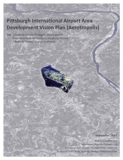
Pittsburgh International Airport Area Development Vision Plan ...
Pittsburgh International Airport Area Development Vision Plan ...
Pittsburgh International Airport Area Development Vision Plan ...

Create successful ePaper yourself
Turn your PDF publications into a flip-book with our unique Google optimized e-Paper software.
<strong>Pittsburgh</strong> <strong>International</strong> <strong>Airport</strong> <strong>Area</strong><br />
<strong>Development</strong> <strong>Vision</strong> <strong>Plan</strong> (Aerotropolis)<br />
for<br />
Allegheny County Economic <strong>Development</strong><br />
Redevelopment Authority of Allegheny County<br />
Allegheny County <strong>Airport</strong> Authority<br />
September 2011<br />
MGB & Associates, LLC<br />
Aerotropolis Business Concepts, LLC<br />
Remaking Cities Institute, Carnegie Mellon University<br />
Master of Urban Design Students, Carnegie Mellon University
Acknowledgements<br />
County of Allegheny<br />
Dan Onorato, County Executive<br />
Dennis Davin, Director, Allegheny County Economic <strong>Development</strong> (ACED)<br />
Maurice Strul, Assistant Director, ACED<br />
Allegheny County <strong>Airport</strong> Authority<br />
Glenn Mahone, Chairman<br />
Bradley D. Penrod, Executive Director/CEO<br />
Wm. Randell Forister, Senior Director of <strong>Development</strong><br />
Richard C. Belotti, Director, <strong>Plan</strong>ning & Environmental Affairs<br />
Eric H. Buncher, Manager <strong>Plan</strong>ning Services<br />
Allegheny Conference on Community <strong>Development</strong><br />
Dennis Yablonsky, Chief Executive Officer<br />
Dewitt M. Peart, Executive Vice President, Public Affairs<br />
Ken Zapinski, Senior Vice President, Energy & Infrastructure<br />
Tri-County <strong>Area</strong> Partnership (TCAP)<br />
Allegheny County<br />
Beaver County<br />
Washington County<br />
Southwestern Pennsylvania Commission (SPC)<br />
Lew Villotti, <strong>Plan</strong>ning & <strong>Development</strong> Director<br />
Sara Walfoort, Transportation Manager<br />
Table of Contents<br />
Acknowledgments<br />
Table of Contents<br />
1. Research Team<br />
2. Executive Summary<br />
3. Background<br />
4. <strong>Plan</strong>ning Process<br />
5. Aerotropolis Concept & Study Goals<br />
6. Data and Analysis<br />
7. Stakeholder Meetings<br />
8. Conceptual <strong>Development</strong> Program<br />
9. <strong>Development</strong> Principles<br />
10. <strong>Development</strong> Models and Selected Sites<br />
a. Airfield Related Model<br />
b. Infill & Redevelopment Model<br />
c. New Town Model<br />
d. Expansion & Connection Model<br />
11. <strong>Vision</strong>ing Charrette<br />
Appendix 68 - 75<br />
Benchmark Aerotropolis Projects<br />
Carnegie Mellon University Master of Urban Design Student Projects<br />
Aerotropolis Business Concepts Report (separate document)<br />
2 <strong>Pittsburgh</strong> <strong>International</strong> <strong>Airport</strong> <strong>Area</strong> <strong>Development</strong> <strong>Vision</strong> <strong>Plan</strong> (Aerotropolis) September 2011 September 2011 <strong>Pittsburgh</strong> <strong>International</strong> <strong>Airport</strong> <strong>Area</strong> <strong>Development</strong> <strong>Vision</strong> <strong>Plan</strong> (Aerotropolis) 3<br />
10<br />
3<br />
2<br />
5<br />
11<br />
6 - 9<br />
14 - 23<br />
24 - 29<br />
31<br />
34 - 67<br />
30<br />
12, 13<br />
32, 33
1. Research Team<br />
MGB & Associates, LLC<br />
MGB & Associates is a full-service consulting firm focusing on real estate and economic development.<br />
Mulugetta Birru, Ph.D., is President and CEO of MGB.<br />
› Mulu Birru, Research Team Leader<br />
Aerotropolis Business Concepts, LLC<br />
Aerotropolis Business Concepts is an economics and market consulting firm led by John D. Kasarda, Professor,<br />
University of North Carolina (UNC), and Director of the Kenan Institute Center for Air Commerce.<br />
› John D. Kasarda, Principal Investigator<br />
› Stephen J. Appold, Research Assistant Professor, UNC<br />
Remaking Cities Institute, Carnegie Mellon University<br />
The Remaking Cities Institute (RCI) was formed within the School of Architecture to provide a better link between<br />
academic work and ongoing community initiatives undertaken by firms, government agencies and community<br />
groups. Donald K. Carter, Adjunct Professor of Urban Design, is the Director of the RCI.<br />
› Donald K. Carter, Principal Investigator<br />
› Stefani Danes, Research Associate, Project Manager<br />
› Jonathan Kline, Research Associate<br />
› Steven Quick, Research Associate<br />
› Karen Branick, Research Associate<br />
› Elise Gatti , Research Associate<br />
Master of Urban Design Students, Carnegie Mellon University<br />
Students in the Master of Urban Design program in the School of Architecture participated in the research and<br />
concept development under the direction of Adjunct Professor Jonathan Kline.<br />
› Ozge Diler<br />
› Saurabh Goenka<br />
› Rambha Seth<br />
› Mingming Wu<br />
4 <strong>Pittsburgh</strong> <strong>International</strong> <strong>Airport</strong> <strong>Area</strong> <strong>Development</strong> <strong>Vision</strong> <strong>Plan</strong> (Aerotropolis) September 2011 September 2011 <strong>Pittsburgh</strong> <strong>International</strong> <strong>Airport</strong> <strong>Area</strong> <strong>Development</strong> <strong>Vision</strong> <strong>Plan</strong> (Aerotropolis) 5
2. Executive Summary<br />
<strong>Pittsburgh</strong> <strong>International</strong> <strong>Airport</strong> <strong>Area</strong> <strong>Development</strong> <strong>Vision</strong> <strong>Plan</strong> (Aerotropolis)<br />
Background<br />
The object of this study is to provide proof-of-concept research for the development of a <strong>Pittsburgh</strong> Aerotropolis,<br />
focused on the <strong>Pittsburgh</strong> <strong>International</strong> <strong>Airport</strong>, including developable properties within thirty minutes<br />
driving time of the airport.<br />
An ‘”aerotropolis” is a planned and coordinated multi-modal freight and transportation complex that provides<br />
efficient, cost-effective, sustainable, and intermodal connectivity to a defined region of economic significance<br />
centered around a major airport. Speed and agility are its hallmarks. The ideal aerotropolis has close access to<br />
the four fundamental R’s of transportation: runways, roads, rail, and river.<br />
<strong>Pittsburgh</strong> is uniquely suited for the development of an aerotropolis in the eastern United States because the<br />
airport has excess landing capacity and is not landlocked. The goal of the <strong>Pittsburgh</strong> aerotropolis is to attract<br />
new development and jobs to the airport area from outside the region rather than to relocate existing development<br />
and jobs from within the region.<br />
MGB & Associates (MGB) was engaged by the Department of Economic <strong>Development</strong> (DED) of the County of<br />
Allegheny with participation of the Redevelopment Authority of Allegheny County and the Allegheny County<br />
<strong>Airport</strong> Authority. MGB brought on Aerotropolis Business Concepts and the Remaking Cities Institute as subconsultants<br />
to provide market and urban design expertise.<br />
<strong>Plan</strong>ning Process<br />
The <strong>Pittsburgh</strong> Aerotropolis project has two phases:<br />
Phase I: Moving the <strong>Pittsburgh</strong> Aerotropolis Concept Forward (January - August 2011)<br />
In Phase I the research team collected physical planning data, benchmarked aerotropolis projects around<br />
the world, met with public and private stakeholders, prepared a conceptual development program, devised<br />
sustainable development principles, and conducted a <strong>Vision</strong>ing Charrette at Robert Morris University in June<br />
2011. This report is a record of the Phase I research and the <strong>Vision</strong>ing Charrette.<br />
Phase II: Implementation<br />
A decision to enter into this phase has not been made and is contingent upon the completion and recommendations<br />
of Phase I and additional funding. If implemented, Phase II will include a detailed market study, an<br />
urban design master plan, and a governance plan.<br />
Conceptual <strong>Development</strong> Program<br />
The research team did not conduct a market study to determine quantities of development but did prepare a<br />
conceptual development program to indicate the types of uses that would be attracted to the <strong>Pittsburgh</strong> Aerotropolis.<br />
The conceptual program was based on typical uses at other aerotropolis projects and on the existing<br />
market strengths of the <strong>Pittsburgh</strong> region. The uses include:<br />
› Flex and distribution<br />
› Bonded warehouses<br />
› Freight forwarders<br />
› Free trade zone assembly and shipping<br />
› Just-in-time electronics repairs<br />
› Just-in-time manufacturing<br />
› Technology companies<br />
information technology<br />
robotics<br />
bio-medical<br />
energy<br />
› Satellite university campuses<br />
› Hospitals and trauma centers<br />
› Aerotropolis support services and uses<br />
hotels<br />
entertainment<br />
conference centers<br />
retail and food<br />
mixed income housing<br />
› Headquarters<br />
<strong>International</strong><br />
National<br />
Regional<br />
› E-Fulfillment centers<br />
› Destination entertainment<br />
› R & D parks<br />
› Corporate campuses<br />
The above uses assume airport dependency. <strong>Development</strong> that is not airport-related should be directed elsewhere<br />
in the region and not to the aerotropolis project area.<br />
<strong>Development</strong> Principles<br />
After reviewing the physical data, input from the stakeholder meetings, and the conceptual development<br />
program, the research team prepared the below list of development principles for the <strong>Pittsburgh</strong> Aerotropolis.<br />
The underlying strategy mandates a regional approach to sustainable development that crosses municipal and<br />
county boundaries and capitalizes on existing assets and infrastructure. The overall goal is to create a sustainable<br />
airport-related development strategy using the most recent environmental technologies and to establish<br />
an international aerotropolis identity.<br />
› Develop a multi-jurisdictional strategy<br />
› <strong>Plan</strong> primarily for airport-related uses<br />
› Develop airport compatible uses<br />
› Concentrate development<br />
› Preserve natural areas<br />
› Develop sustainably<br />
› Provide connectivity<br />
› Encourage mixed-use development<br />
› Encourage infill development<br />
› Make places, not sprawl<br />
6 <strong>Pittsburgh</strong> <strong>International</strong> <strong>Airport</strong> <strong>Area</strong> <strong>Development</strong> <strong>Vision</strong> <strong>Plan</strong> (Aerotropolis) September 2011 September 2011 <strong>Pittsburgh</strong> <strong>International</strong> <strong>Airport</strong> <strong>Area</strong> <strong>Development</strong> <strong>Vision</strong> <strong>Plan</strong> (Aerotropolis) 7
Four <strong>Development</strong> Models and Sites<br />
Four prototype development models were selected by the aerotropolis research team to illustrate and test the<br />
aerotropolis concept for the <strong>Pittsburgh</strong> region: airfield related development; infill and redevelopment; new<br />
town development; and expansion and connection of existing development. Each prototype development<br />
model was then tested at a specific site at the <strong>Vision</strong>ing Charrette.<br />
Each <strong>Development</strong> Model included development components, precedents, concept plans, and a listing of opportunities<br />
and challenges. The models are illustrative only and represent prototype examples of aerotropolis<br />
development strategies. The sites are identified on the map opposite.<br />
1. Airfield Related Model<br />
The Allegheny County <strong>Airport</strong> Authority (ACAA) controls 8,800 acres of land, of which 2000 acres are within<br />
the secure perimeter of the airfield. Of the remaining acreage, approximately 3,800 acres are slated for future<br />
commercial development. In 2011 the ACAA commissioned IDC Architects to prepare the <strong>Airport</strong> Property <strong>Development</strong><br />
Master <strong>Plan</strong> for the developable property. This was a logical site to test the Airfield Related <strong>Development</strong><br />
prototype.<br />
2. Infill & Redevelopment Model<br />
A central tenet of sustainable development is to reuse existing infrastructure and to densify and infill existing<br />
development. Opportunities for such development occur all along the I-376 (Parkway West) corridor from<br />
Downtown <strong>Pittsburgh</strong> to Beaver County. The site selected for further study in the <strong>Vision</strong>ing Charrette was the<br />
University Boulevard area of Moon Township. <strong>Area</strong> of development around University Boulevard ranges from<br />
1,200 acres to 3,000 acres.<br />
3. New Town Model<br />
Thousands of acres of privately owned vacant land exist to the south and west of the airport in Allegheny and<br />
Washington County and to the north in Beaver County. One possibility for aerotropolis development would<br />
be a new town close to the airport on undeveloped land. The site chosen to test the New Town <strong>Development</strong><br />
prototype is at the intersection of Pennsylvania Turnpike 576 (Findlay Connector) and U.S. Route 22. The site<br />
straddles the Allegheny/Washington county border and includes both undeveloped land and remediated surface<br />
mined land. The selected site for the New Town Model is between 600 and 1000 acres.<br />
4. Expansion & Connection Model<br />
The final development prototype examines expansion of existing airport-related commercial development and<br />
connection to rail and river cargo facilities. Two locations were chosen to test this prototype in the <strong>Vision</strong>ing<br />
Charrette, both in Beaver County: the Hopewell Business Park along I-376; and the Aliquippa Industrial Park adjacent<br />
to the Ohio River and the CSX railroad. The Hopewell Business Park location is approximately 500 acres,<br />
and the Aliquippa Industrial Park is approximately 800 acres.<br />
8 <strong>Pittsburgh</strong> <strong>International</strong> <strong>Airport</strong> <strong>Area</strong> <strong>Development</strong> <strong>Vision</strong> <strong>Plan</strong> (Aerotropolis) September 2011 September 2011 <strong>Pittsburgh</strong> <strong>International</strong> <strong>Airport</strong> <strong>Area</strong> <strong>Development</strong> <strong>Vision</strong> <strong>Plan</strong> (Aerotropolis) 9<br />
1<br />
3<br />
4<br />
2<br />
4
3. Background<br />
Mulugetta Birru, president and CEO of MGB & Associates (MGB), received a consulting contract with the<br />
Department of Economic <strong>Development</strong> (DED) of the County of Allegheny with participation of the Redevelopment<br />
Authority of Allegheny County and the Allegheny County <strong>Airport</strong> Authority. MGB brought on Aerotropolis<br />
Business Concepts and the Remaking Cities Institute as sub-consultants to provide market and urban design<br />
expertise. The object of the research study is to develop a master plan concept for the development of an<br />
“aerotropolis,” focused on the <strong>Pittsburgh</strong> <strong>International</strong> <strong>Airport</strong>, including developable properties within a ten<br />
to twenty mile radius of the airport.<br />
According to John Kasarda of Aerotropolis Business Concepts, the aerotropolis concept has been successful in<br />
Amsterdam, Beijing, Indianapolis, Milwaukee, and Denver. Some U.S. airports, such as Washington Dulles (Reston)<br />
and Dallas Fort Worth (Las Colinas), have aspects of the concept but not in a master planned way. Detroit<br />
is pursuing an aerotropolis plan.<br />
<strong>Pittsburgh</strong> is uniquely suited for the development of an <strong>Airport</strong> City in the eastern United States because the<br />
airport has excess landing capacity and is not landlocked. <strong>Development</strong> of a <strong>Pittsburgh</strong> Aerotropolis will require<br />
multiple partners, including adjacent municipalities, counties, private land owners, public agencies, and manufacturing<br />
and distribution companies reliant on air cargo logistics and free trade zones.<br />
4. <strong>Plan</strong>ning Process<br />
Phase I: Moving the <strong>Pittsburgh</strong> Aerotropolis Concept Forward<br />
The <strong>Pittsburgh</strong> Aerotropolis project will proceed in two phases:<br />
1. Phase I: Moving the <strong>Pittsburgh</strong> Aerotropolis Concept Forward<br />
2. Phase II: Implementation<br />
The key tasks in Phase I were:<br />
› Collecting and analyzing physical planning data<br />
› arranging focus group meetings with key public and private stakeholders<br />
› benchmarking best practices in international aerotropolis development<br />
› determining the potential aerotropolis market for the <strong>Pittsburgh</strong> region<br />
› conducting a <strong>Vision</strong>ing Charrette to test the aerotropolis concept<br />
› preparing the research report<br />
Phase I included three steps:<br />
› Data and Analysis (January to May 2011)<br />
› <strong>Vision</strong>ing Charrette (June 2011)<br />
› Research Report (July to August 2011)<br />
This research report documents the results of Phase I.<br />
Phase II: Implementation<br />
<strong>Vision</strong>ing Charrette<br />
A decision to enter into this phase has not been made and is contingent upon the completion and recommendations<br />
of Phase I and funding. If implemented, Phase II will include a detailed market study, an urban design<br />
master plan, and a governance plan. Phase II may include, among other things, master plans for selected and<br />
specific areas, detailed market studies, detailed marketing studies to determine highest and best uses for specific<br />
end uses, and development and operational incentives.<br />
10<br />
<strong>Pittsburgh</strong> <strong>International</strong> <strong>Airport</strong> <strong>Area</strong> <strong>Development</strong> <strong>Vision</strong> <strong>Plan</strong> (Aerotropolis) September 2011 September 2011 <strong>Pittsburgh</strong> <strong>International</strong> <strong>Airport</strong> <strong>Area</strong> <strong>Development</strong> <strong>Vision</strong> <strong>Plan</strong> (Aerotropolis) 11
5. Aerotropolis Concept & Study Goals<br />
Definition and Summary<br />
As defined by John Kasarda an aerotropolis “ is a planned and coordinated multi-modal freight and transportation<br />
complex that provides efficient, cost-effective, sustainable, and intermodal connectivity to a defined<br />
region of economic significance centered around a major airport.”<br />
Speed and agility are its hallmarks. The ideal aerotropolis has close access to the four fundamental R’s of transportation:<br />
runways, roads, rail, and river.<br />
The sketch and the diagram below depict the aerotropolis concept.<br />
Air Cargo Statistics<br />
Aerotropolis Business Concepts projects that between 2010 and 2029 world-wide commercial air passenger<br />
traffic will increase from 4.6 billion annually to 11 billion. In the same period world-wide air cargo traffic will<br />
more than triple. Over 30% of the value of world trade already goes by air, versus under 2% by weight. High<br />
value, low weight, cargo such as electronics, computer parts, pharmaceuticals, fashion, and flowers make up<br />
this market. Air logistics and the new economy are thus inextricably interwoven.<br />
Benchmark <strong>Airport</strong>s<br />
The Appendix to this report includes development plans for Aerotropolis projects in Amsterdam, Hong Kong,<br />
Dallas/Fort Worth, Dubai, and Detroit.<br />
Study Goals<br />
The objective in implementing an aerotropolis concept for <strong>Pittsburgh</strong> is to attract new development and jobs<br />
to the airport area from outside the region rather than to relocate existing development and jobs from within<br />
the region. However, it is equally important to target the valuable vacant land adjacent to the airport for uses<br />
that are airport-related or airport-dependent rather to uses that could exist anywhere in the region. The overall<br />
goal is to create a sustainable airport-related development strategy using the most recent environmental<br />
technologies and to establish an international aerotropolis identity.<br />
R unway<br />
The Four “R’s” of an aerotropolis<br />
R oad<br />
R iver<br />
R ailroad<br />
Aerotropolis Concept Diagram<br />
12 <strong>Pittsburgh</strong> <strong>International</strong> <strong>Airport</strong> <strong>Area</strong> <strong>Development</strong> <strong>Vision</strong> <strong>Plan</strong> (Aerotropolis) September 2011 September 2011 <strong>Pittsburgh</strong> <strong>International</strong> <strong>Airport</strong> <strong>Area</strong> <strong>Development</strong> <strong>Vision</strong> <strong>Plan</strong> (Aerotropolis) 13
6. Data & Analysis<br />
The project area of an aerotropolis is typically defined as a thirty-minute driving distance from the airport. The<br />
map at the right shows the thirty minute catchment area around the <strong>Pittsburgh</strong> <strong>International</strong> <strong>Airport</strong> for the<br />
counties of Allegheny, Beaver, and Washington, as defined by the Southwestern Pennsylvania Commission.<br />
The maps on the following pages represent the physical planning data base collected for the project. Included<br />
is the regional highway network, regional railroad network, the 2040 <strong>Plan</strong> of the Southwestern Pennsylvania<br />
Commission, and comprehensive plans for the three counties. Also included is the 2011 Master <strong>Development</strong><br />
<strong>Plan</strong> for the developable areas on the property of the <strong>Pittsburgh</strong> <strong>International</strong> <strong>Airport</strong>. The Appendix includes<br />
aerotropolis development plans for airports in Amsterdam, Hong Kong, Dallas/Fort Worth, Dubai, and Detroit.<br />
In addition, local municipal master plans and zoning ordinances (not illustrated this report) in the three county<br />
catchment area were reviewed for their permitted uses and development regulations. Meetings with municipal<br />
officials were held to further clarify the opportunities and constraints for airport-related development.<br />
As a result, the research team was able to identify areas that are available for new or infill development that<br />
have strategically located sites with good highway access, utility infrastructure, and compatible zoning. Excluded<br />
from the aerotropolis initiative areas are sites with steep topography, poor highway access, and little or<br />
no utility infrastructure. Conservation areas (protected woodlands, wetlands, and parks) and undermined areas<br />
were also excluded.<br />
Based on the analysis of the collected data and meetings with municipal, county, and regional officials, the<br />
research team identified four sites in the thirty-minute catchment area to test the aerotropolis development<br />
concept. Concept designs for the four sites are shown in chapter ten.<br />
0 2 miles 6 miles 14 miles<br />
<strong>Pittsburgh</strong> <strong>International</strong><br />
<strong>Airport</strong> Region<br />
County Boundaries<br />
30 Minute Drive<br />
Time From <strong>Airport</strong><br />
14 <strong>Pittsburgh</strong> <strong>International</strong> <strong>Airport</strong> <strong>Area</strong> <strong>Development</strong> <strong>Vision</strong> <strong>Plan</strong> (Aerotropolis) September 2011 September 2011 <strong>Pittsburgh</strong> <strong>International</strong> <strong>Airport</strong> <strong>Area</strong> <strong>Development</strong> <strong>Vision</strong> <strong>Plan</strong> (Aerotropolis) 15<br />
Highways
<strong>Pittsburgh</strong> <strong>International</strong> <strong>Airport</strong> <strong>Area</strong> <strong>Development</strong> <strong>Vision</strong> <strong>Plan</strong> (Aerotropolis) September 2011<br />
Railroads<br />
County Boundaries<br />
Urbanized <strong>Area</strong><br />
City of <strong>Pittsburgh</strong><br />
<strong>Pittsburgh</strong> <strong>International</strong> <strong>Airport</strong><br />
Region<br />
0 2 miles 6 miles 14 miles<br />
Regional Railroad Lines<br />
16 17<br />
376: Penn Lincoln Pkwy<br />
76: Pennsylvania Turnpike<br />
79: Raymond P Schafer Hwy<br />
Interstates<br />
22: Penn Lincoln Pkwy, U.S. 30<br />
Federal Highway<br />
Local Roads<br />
Highways & Interstates<br />
County Boundaries<br />
Urbanized <strong>Area</strong><br />
City & Towns<br />
<strong>Pittsburgh</strong> <strong>International</strong> <strong>Airport</strong><br />
Region<br />
0 2 miles 6 miles 14 miles<br />
Regional Highways
<strong>Pittsburgh</strong> <strong>International</strong> <strong>Airport</strong> <strong>Area</strong> <strong>Development</strong> <strong>Vision</strong> <strong>Plan</strong> (Aerotropolis) September 2011<br />
Road Corridors<br />
Proposed Trails<br />
Completed Trails<br />
Infill <strong>Development</strong><br />
Conservation <strong>Area</strong>s<br />
Proposed Greenways<br />
Networks<br />
Intermodal Freight<br />
Interchange<br />
Proposed Transit Projects<br />
Bridge<br />
Hub / Garage<br />
Proposed Highway Improvements<br />
Proposed New Highways<br />
Transportation Projects<br />
Transit Oriented <strong>Development</strong><br />
Rural<br />
Village<br />
Community Downtown<br />
Urban Neighborhood<br />
Corridor<br />
Core<br />
<strong>Airport</strong><br />
Places<br />
0<br />
1 3 7 miles<br />
Allegheny County Comprehensive <strong>Plan</strong><br />
The Southwestern Pennsylvania Commission (SPC) is the<br />
federally-mandated Metropolitan <strong>Plan</strong>ning Organization<br />
(MPO) charged with regional transportation policymaking<br />
and planning for the ten county region surrounding<br />
the City of <strong>Pittsburgh</strong>. Congress created MPO’s in<br />
order to ensure that existing and future expenditures<br />
of governmental funds for transportation projects and<br />
programs are based on a continuing, cooperative, and<br />
comprehensive planning process. Federal funding for<br />
transportation projects and programs is channeled<br />
through this planning process. The Southwestern Pennsylvania<br />
2040 Transportation and <strong>Development</strong> <strong>Plan</strong>,<br />
or 2040 <strong>Plan</strong>, is an update of the 2035 Transportation<br />
and <strong>Development</strong> <strong>Plan</strong>. The 2035 <strong>Plan</strong> was developed<br />
through a community engagement process called Project<br />
Region. Project Region was led by the Southwestern<br />
Pennsylvania Commission, and was conducted in partnership<br />
with a wide range of other public, private, and nonprofit<br />
organizations This planning process was used as<br />
the backbone and basis for the 2040 Update.<br />
18 19<br />
Unsuitable for <strong>Development</strong><br />
Suitable for <strong>Development</strong><br />
Southwestern Pennsylvania Commission 2040 <strong>Plan</strong>
<strong>Pittsburgh</strong> <strong>International</strong> <strong>Airport</strong> <strong>Area</strong> <strong>Development</strong> <strong>Vision</strong> <strong>Plan</strong> (Aerotropolis) September 2011<br />
Village <strong>Development</strong><br />
Transition <strong>Area</strong><br />
Rural Resource <strong>Area</strong><br />
Southern Beltway Corridor<br />
PA 50 Corridor<br />
Mon Valley Corridor<br />
I-79 / US 19 Corridor<br />
I-70 Corridor<br />
City of Washington / County<br />
<strong>Airport</strong><br />
US 22 / PA 18 Corridor<br />
0 1 mile 3 miles 7 miles<br />
Washington County Comprehensive <strong>Plan</strong><br />
Parks or Recreation Land<br />
Undeveloped Land<br />
Water<br />
Other<br />
Lake-Resevoir<br />
River<br />
Interstate<br />
US Highway<br />
State Route<br />
20 21<br />
Commercial & Services<br />
Industrial<br />
Institutional<br />
Residential<br />
Agriculture<br />
Existing Land Uses<br />
Mixed Use <strong>Development</strong><br />
Residential <strong>Development</strong><br />
Res. Rehab/Infill <strong>Development</strong><br />
Commercial <strong>Development</strong><br />
Comm. Rehab/Infill <strong>Development</strong><br />
Industrial <strong>Development</strong><br />
Indst. Rehab/Infill <strong>Development</strong><br />
Rural Resource <strong>Area</strong><br />
New Parks/Open Space<br />
Target Economic <strong>Development</strong><br />
Transportation Improvement Site<br />
Transportation Improvement Route<br />
Future Land Uses<br />
County Boundary<br />
Municipality<br />
0<br />
1 mile 3 miles 7 miles<br />
Beaver County Comprehensive <strong>Plan</strong>
<strong>Pittsburgh</strong> <strong>International</strong> <strong>Airport</strong> <strong>Area</strong> <strong>Development</strong> <strong>Vision</strong> <strong>Plan</strong> (Aerotropolis) September 2011<br />
The 2011 development plan is an updated version of an analysis conducted in 2003<br />
to determine the site capacity of the ACAA’s land. In 2004, a Site Prioritization Analysis<br />
was completed to outline priority development nodes to direct growth over the<br />
course of the following five years. Based upon the process undertaken in 2003 and<br />
2004, the 2011 master plan engaged numerous stakeholders in the decision making<br />
process. Regional, county, and municipal leaders voiced their opinions regarding the<br />
development of property adjacent to the airport. As a result, the plan focuses on a<br />
variety of issues including airfield planning, economic development, and business<br />
development.<br />
In 2011, the Allegheny County <strong>Airport</strong> Authority (ACAA) updated the <strong>Development</strong><br />
Master <strong>Plan</strong> for the <strong>Pittsburgh</strong> <strong>International</strong> <strong>Airport</strong>. The development plan aims to<br />
direct the growth of the property surrounding the airport operated by the ACAA.<br />
Existing <strong>Airport</strong><br />
Paved <strong>Area</strong><br />
Existing Road<br />
Technology/<br />
Flex/R & D<br />
Mixed-Use<br />
(Office/Comm/Retail)<br />
Structured Parking<br />
Proposed Community<br />
Facilities Node<br />
Hydrology/<br />
Potential Wet <strong>Area</strong>s<br />
Potential Trail Network<br />
Light Industrial/Warehouse<br />
Distribution<br />
Hospitality<br />
Existing Building<br />
Existing Community<br />
Facilities Node<br />
Township Boundary<br />
Potential Rail Alignment<br />
<strong>Airport</strong> Reserve/<strong>Airport</strong><br />
Related<br />
Office<br />
Commercial/Retail<br />
Stormwater Management<br />
ACAA Property<br />
Boundary<br />
Potential Rail Extension<br />
Primary Land Uses Supporting Land Uses Other<br />
22 23<br />
0 1 ft 3 ft 7 ft<br />
<strong>Pittsburgh</strong> <strong>International</strong> <strong>Airport</strong> 2011 Master <strong>Development</strong> <strong>Plan</strong>
7. Stakeholder Meetings<br />
Between February and May 2011, the RCI team interviewed stakeholders from local government, the business<br />
community, real estate and development interests, non-profit organizations, and airport operations. The team<br />
also met twice with the Tri-County <strong>Airport</strong> Partnership (TCAP) and took part in reviewing the Allegheny County<br />
<strong>Airport</strong> Authority’s most recent master plan.<br />
Perspectives, Townships<br />
Townships in the airport area are all interested in participating in airport-related development, but they have<br />
different interests: Moon and Robinson are looking for new commercial (including industrial, business, office,<br />
research, and retail) development to bring new jobs; North Fayette, which has seen considerable commercial<br />
development in recent years, wants to attract a larger resident population; Findlay, the least developed to date,<br />
is looking for growth in both commercial and residential development. Moon Township, which is updating<br />
its comprehensive plan, is looking to create a distinctive town center and also hopes to see development of a<br />
research/development park near the airport. Robert Morris University is an important community asset and<br />
partner. Robinson Township considers itself nearly “built out”, though a few industrial sites remain. The large<br />
commercial sites that have been developed along the airport corridor offer additional opportunities for infill<br />
development, particularly on the acreage currently used for parking if alternatives can be provided. All of the<br />
townships have difficulty acquiring funding for infrastructure, and development plans have been impeded by<br />
shortfalls in state and federal budgets.<br />
North Fayette Township<br />
<strong>Area</strong>: 16,000 acres<br />
Population: 13,000<br />
› Have attracted a considerable amount of commercial development<br />
› Priority going forward is more residential around Pointe and other existing business uses<br />
› Sees itself as a “bedroom community” and expects to grow to 21,000 by 2030<br />
› New commercial only in areas already designated and prepared for development<br />
Moon Township<br />
<strong>Area</strong>: 15,000 acres<br />
Population:22,500<br />
› Includes northern part of airport and old airport access<br />
› High residential growth of last twenty years is slowing; most land is developed<br />
› Seeking a balance of uses<br />
› Priority is light industrial, research and development, office uses<br />
› <strong>Plan</strong>ning goals: town center, better front doors, and improved University Boulevard<br />
Robinson Township<br />
<strong>Area</strong>: 12,000 acres<br />
Population: 14,500<br />
› Township has stable low-density suburban population; most land is developed<br />
› Priority is commercial or industrial development that will create new jobs<br />
› Want to hold current population steady<br />
› See opportunity for infill development on existing commercial sites, to minimize new infrastructure<br />
Findlay Township<br />
<strong>Area</strong>: 32,000 acres<br />
Population: 5,000<br />
› <strong>Airport</strong> occupies one-quarter of township area<br />
› See population increasing to 15,000<br />
› Priority is attracting new businesses and jobs<br />
› Capacity for 20 million square feet of new commercial/industrial space<br />
› Recently focusing more on protecting environmental quality<br />
Perspectives, Counties<br />
Beaver County<br />
Beaver County has seen airport-related residential development, primarily in Hopewell Township. They are<br />
looking for new industrial/office development in their business parks, such as Hopewell Business Park and the<br />
Aliquippa LTV Site. Beaver County has a number of development sites, including Aliquippa, along the Ohio<br />
River, but they are less likely to see airport-related development because they are distant or disconnected from<br />
the airport. Beaver County’s plans call for denser development in its riverfront communities and at highway<br />
intersections. The townships near the airport are primarily agricultural and are not looking to become more<br />
urbanized. County representatives indicated an interest in participating with Allegheny and Washington Counties<br />
in pursuing a regional approach to airport-related development, especially on the I-376 corridor.<br />
Washington County<br />
The high-priority development sites for Washington County are the SouthPointe and StarPointe business parks.<br />
They feel they have been successful in attracting development there and are concerned that the improvement<br />
of sites near the airport will limit the demand for their sites. Most of the northwestern area of the county--the<br />
area within a thirty-minute drive of the airport--is agricultural or recreational. The county planning documents<br />
call for policies that will improve the quality of existing communities and reduce sprawl. They emphasize consolidated<br />
development and management of natural resources to assure continued quality of life in the county.<br />
Allegheny County<br />
Allegheny County has taken an increasingly active role in promoting and facilitating airport-area development.<br />
The recently completed comprehensive county plan, “Allegheny Places”, envisions the airport area as the largest<br />
development opportunity in the county. The County’s Economic <strong>Development</strong> department and the <strong>Airport</strong><br />
Authority have engaged in public-private partnerships that currently have approximately 2,000 acres under<br />
development, including Clinton Commerce Park and Imperial Park. The extension of the Cherrington Parkway<br />
is a strategy for opening additional acreage for development. Allegheny County’s plan puts a high priority on<br />
infill and redevelopment in existing urban areas, on developing a better system of public transit, and on preservation<br />
of natural land.<br />
24 <strong>Pittsburgh</strong> <strong>International</strong> <strong>Airport</strong> <strong>Area</strong> <strong>Development</strong> <strong>Vision</strong> <strong>Plan</strong> (Aerotropolis) September 2011 September 2011 <strong>Pittsburgh</strong> <strong>International</strong> <strong>Airport</strong> <strong>Area</strong> <strong>Development</strong> <strong>Vision</strong> <strong>Plan</strong> (Aerotropolis) 25
Real Estate Interests<br />
Southwest Pennsylvania has not yet attracted developers to build the kind of mixed-use, higher-density development<br />
that is now seen in other parts of the country. Major landholders and real estate developers see<br />
the airport area primarily as an opportunity for conventional suburban highway-related uses: warehousing<br />
and distribution, business and light industrial uses, chain hotels, and other such low-density development.<br />
The area is well-served by both the airport and highways. The biggest issue is the cost of preparing large flat<br />
“pads” for development. Much of the undisturbed land is steeply sloped and much of the land that has been<br />
mined is still contaminated. Large areas of Findlay Township have been used as landfills. The Imperial Land<br />
Company, however, has large holdings of already remediated land that they are improving for business park<br />
development. They look to local government to provide access to funding for infrastructure, which is essential<br />
to their development plans. Public agencies that engage in development are seen as competitive, especially<br />
when they obtain infrastructure funding from the same sources as the private sector.<br />
Businesses<br />
Businesses that have located in the airport area have been attracted by both the availability of affordable land<br />
and the accessibility of the location by air and road. Dick’s Sporting Goods corporate campus is an example of<br />
the kind of enterprise that the <strong>Airport</strong> Authority and Allegheny County would like to see occupying the perimeter<br />
of the airport. Other businesses, primarily shippers such as UPS and FedEx, occupy the warehouse space<br />
along the north runway.<br />
<strong>Pittsburgh</strong> <strong>International</strong> <strong>Airport</strong><br />
The development of excess airport property is one goal of the <strong>Airport</strong> Authority, and they see the master plan<br />
as a useful tool to maximizing the development potential of the land. They are strictly interested in commercial<br />
development and have ruled out residential development on airport property. Their past and current<br />
efforts to promote air cargo and attract freight forwarders have not been as successful as planned. The forwarders<br />
are well-established in the major air cargo hubs, particularly New York, Miami, and Chicago, and unless<br />
circumstances change, are likely to remain there despite increasing delays due to increased air and land traffic.<br />
The benchmarking study by Aerotropolis Concepts cites the high cost of <strong>Pittsburgh</strong>’s airport as a deterrent to<br />
attracting new users, which is largely a legacy of the financing structure used to construct the new airport. On<br />
the other hand, local airport services, including security, customs, and immigration, pride themselves on their<br />
record of efficiency and responsiveness.<br />
Non-Profit Organizations<br />
Civic, professional, and public interest organizations, such as the <strong>Pittsburgh</strong> <strong>Airport</strong> <strong>Area</strong> Chamber of Commerce,<br />
are interested in development around the airport that contributes to the overall quality of life in the region.<br />
They are committed to a regional perspective on development and support inter-jurisdictional as well as<br />
public-private partnerships. These organizations work very closely with state, county, and local governments,<br />
as well as educating the public and marketing the region nationally and internationally. The <strong>Airport</strong> Corridor<br />
Transportation Association (ACTA), for example, works with SPC and localities to promote transit, pedestrianfriendly<br />
streets, and transit-oriented development.<br />
Common Themes<br />
Among the comments made by stakeholders over the course of many meetings, several themes emerged that<br />
suggest commonly held views:<br />
› The area around airport is seen as underdeveloped, and it is assumed that the best and most likely uses<br />
are suburban highway-related uses. Those that are air-related should be on or near the airport property.<br />
› The cost of new infrastructure is seen as a major obstacle to development.<br />
› All the landholding entities, both private and public, are committed to maximizing the value of their own<br />
property, in terms of both real estate and jobs. There is a sense of competition not only among private developers<br />
but among public agencies and jurisdictions. There is a willingness to meet together but a cautiousness<br />
about pursuing joint projects or adopting joint development policies.<br />
› There is concern over the obstacles to airport-related growth, since the airport has lost flights and passengers<br />
over the last few years and the international air cargo system seems resistant to the idea of a <strong>Pittsburgh</strong><br />
hub. However, it is commonly acknowledged that <strong>Pittsburgh</strong> <strong>International</strong> <strong>Airport</strong> offers great operational<br />
capacity, low-cost land, and excellent highway access.<br />
26 <strong>Pittsburgh</strong> <strong>International</strong> <strong>Airport</strong> <strong>Area</strong> <strong>Development</strong> <strong>Vision</strong> <strong>Plan</strong> (Aerotropolis) September 2011 September 2011 <strong>Pittsburgh</strong> <strong>International</strong> <strong>Airport</strong> <strong>Area</strong> <strong>Development</strong> <strong>Vision</strong> <strong>Plan</strong> (Aerotropolis) 27
<strong>Airport</strong> <strong>Area</strong> Public and Private Stakeholders<br />
Jennifer L. Antonoff, TSI Cargo, US Department of Homeland Security<br />
Joseph H. Aversa, Customs Officer, U.S. Department of Homeland Security<br />
Brian S. Bernarding, Import Traffic Manager, Dick’s Sporting Goods<br />
Gerald Bunda, President, Imperial Land Corporation<br />
Jason Bunda, Imperial Land Corporation<br />
Chris Caruso, Assistant Manager/<strong>Plan</strong>ning Zoning Administrator, Findlay Township<br />
Ryan Chismark, Allegheny County Department of <strong>Development</strong><br />
Dennis Davin, Director, Allegheny County Economic <strong>Development</strong><br />
Thomas M. Deasy, TSI Cargo, US Department of Homeland Security<br />
Fred Dupin, Inspections and Regulatory Enforcement, US Department of Homeland Security<br />
Randy Forister, <strong>Development</strong> Director, Allegheny County <strong>Airport</strong> Authority<br />
Bob Grimm, Township Manager, North Fayette Township<br />
Sally Haas, President, <strong>Pittsburgh</strong> <strong>Area</strong> <strong>Airport</strong> Chamber of Commerce<br />
Lynn Heckman, Allegheny County Economic <strong>Development</strong><br />
Jeffrey Heithauser, <strong>Development</strong> Manager, Washington County <strong>Plan</strong>ning Commission<br />
Gary Klingman, Findlay Township Manager<br />
Frank Mancini, Jr., Executive Director, Redevelopment Authority of Beaver County<br />
Lynn Manion, Executive Director, <strong>Airport</strong> Corridor Transportation Association<br />
Adam McGurk, Former Assistant Township Manager/<strong>Plan</strong>ning Director, Moon Township<br />
Bob Miller, Director of Facilities, AFCO Aviation Facilities Company, Inc<br />
Jim Palmer, President, Beaver County Corporation for Economic <strong>Development</strong><br />
Dewitt Peart, President, <strong>Pittsburgh</strong> Regional Alliance, Allegheny Conference on Community <strong>Development</strong><br />
Bradley D. Penrod, Chief Executive Officer, Allegheny County <strong>Airport</strong> Authority<br />
Cece Poister, Director of Cargo Facilities, <strong>Pittsburgh</strong> <strong>International</strong> <strong>Airport</strong><br />
JoAnn Pollock, General Manager, Worldwide Flight Services<br />
Dan Reitz, Executive Director, Washington County Council on Economic <strong>Development</strong><br />
Jennifer Rennard, Import Traffic Analyst, Dick’s Sporting Goods<br />
Maurice Strul, Allegheny County Department of <strong>Development</strong><br />
Brian D. Sukitch, Air Gateway Manager, UPS<br />
Jason Theakston, Land Use <strong>Plan</strong>ner, Washington County <strong>Plan</strong>ning Commission<br />
David Totten, Southwestern Pennsylvania Commission<br />
Rick Urbano, Robinson <strong>Plan</strong>ning Department Director<br />
Robert Wagner, Senior Manager, FedEx Air Ground Freight Services<br />
Sara Walfoort, Transportation <strong>Plan</strong>ning Manager, Southwestern Pennsylvania Commission<br />
Ken Zipinski, Allegheny Conference<br />
<strong>Airport</strong> <strong>Area</strong> Land Owners and Developers<br />
Beynon & Company<br />
Brandywine Real Estate<br />
Buncher Company<br />
CB Richard Ellis<br />
Chapman Properties<br />
Dick’s Sporting Goods<br />
DiCicco <strong>Development</strong><br />
Elmhurst Group<br />
FWG Real Estate<br />
Grubb & Ellis<br />
Horizon Properties<br />
Imperial Land Corporation<br />
Massaro Properties<br />
Oxford <strong>Development</strong> Company<br />
NAIOP <strong>Pittsburgh</strong> Chapter<br />
Soffer Organization<br />
TarquinCoRE<br />
28 <strong>Pittsburgh</strong> <strong>International</strong> <strong>Airport</strong> <strong>Area</strong> <strong>Development</strong> <strong>Vision</strong> <strong>Plan</strong> (Aerotropolis) September 2011 September 2011 <strong>Pittsburgh</strong> <strong>International</strong> <strong>Airport</strong> <strong>Area</strong> <strong>Development</strong> <strong>Vision</strong> <strong>Plan</strong> (Aerotropolis) 29
8. Conceptual <strong>Development</strong> Program<br />
The research team did not conduct a market study to determine quantities of development but did prepare a<br />
conceptual development program to indicate the types of uses that would be attracted to the <strong>Pittsburgh</strong> Aerotropolis.<br />
The conceptual program was based on typical uses at other aerotropolis projects and on the existing<br />
market strengths of the <strong>Pittsburgh</strong> region. The uses include:<br />
› Flex and distribution<br />
› Bonded warehouses<br />
› Freight forwarders<br />
› Free trade zone assembly and shipping<br />
› Just-in-time electronics repairs<br />
› Just-in-time manufacturing<br />
› Technology companies<br />
information technology<br />
robotics<br />
bio-medical<br />
energy<br />
› Satellite university campuses<br />
› Hospitals and trauma centers<br />
› Aerotropolis support services and uses<br />
hotels<br />
entertainment<br />
conference centers<br />
retail and food<br />
mixed income housing<br />
› Headquarters<br />
<strong>International</strong><br />
National<br />
Regional<br />
› E-Fulfillment centers<br />
› Destination entertainment<br />
› R & D parks<br />
› Corporate campuses<br />
The above uses assume an airport dependency. <strong>Development</strong> that is not airport related should be directed<br />
elsewhere in the region and not to the aerotropolis project area.<br />
9. <strong>Development</strong> Principles<br />
After reviewing the physical data, the stakeholder meetings, and the conceptual development program, the research<br />
team prepared the below list of development principles for the <strong>Pittsburgh</strong> Aerotropolis. The underlying<br />
strategy mandates a regional approach to sustainable development that crosses municipal and county boundaries<br />
and capitalizes on existing assets and infrastructure.<br />
› Develop a multi-jurisdictional strategy<br />
› <strong>Plan</strong> primarily for airport related uses<br />
› Develop airport compatible uses<br />
› Concentrate development<br />
› Preserve natural areas<br />
› Develop sustainably<br />
› Provide connectivity<br />
› Encourage mixed-use development<br />
› Encourage infill development<br />
› Make places, not sprawl.<br />
These development principles were presented and reaffirmed at the visioning charrette in June 2011.<br />
<strong>Vision</strong>ing Charrette<br />
30 <strong>Pittsburgh</strong> <strong>International</strong> <strong>Airport</strong> <strong>Area</strong> <strong>Development</strong> <strong>Vision</strong> <strong>Plan</strong> (Aerotropolis) September 2011 September 2011 <strong>Pittsburgh</strong> <strong>International</strong> <strong>Airport</strong> <strong>Area</strong> <strong>Development</strong> <strong>Vision</strong> <strong>Plan</strong> (Aerotropolis) 31
10. <strong>Development</strong> Models & Selected Sites<br />
Four prototype development models (and related sites) were selected to illustrate and test the aerotropolis<br />
concept for the <strong>Pittsburgh</strong> region: airfield related development; infill and redevelopment; new town development;<br />
and expansion and connection of existing development. The models are describe below and are shown<br />
on the map opposite.<br />
1. Airfield Related Model<br />
The Allegheny County <strong>Airport</strong> Authority (ACAA) controls 8,800 acres of land, of which 2000 acres are within<br />
the secure perimeter of the airfield. Of the remaining acreage, approximately 3,800 acres are slated for future<br />
commercial development. In 2011 the ACAA commissioned IDC Architects to prepare the <strong>Airport</strong> Property<br />
<strong>Development</strong> Master <strong>Plan</strong> for the developable property. This was a logical site to test Airfield Related <strong>Development</strong><br />
prototype.<br />
2. Infill and Redevelopment Model<br />
A central tenet of sustainable development is to reuse existing infrastructure and to densify and infill existing<br />
development. Opportunities for such development occur all along the I-376 (Parkway West) corridor from<br />
Downtown <strong>Pittsburgh</strong> to Beaver County. The site selected for further study in the <strong>Vision</strong>ing Charrette was the<br />
University Boulevard area of Moon Township. <strong>Area</strong> of development around University Boulevard ranges from<br />
1,200 acres to 3,000 acres.<br />
3. New Town <strong>Development</strong> Model<br />
Thousands of acres of privately owned vacant land exist to the south and west of the airport in Allegheny and<br />
Washington County and to the north in Beaver County. One possibility for aerotropolis development would<br />
be a new town close to the airport on undeveloped land. The site chosen to test the New Town <strong>Development</strong><br />
prototype is at the intersection of Pennsylvania Turnpike 576 (Findlay Connector) and U.S. Route 22. The site<br />
straddles the Allegheny/Washington county border and includes both open/undeveloped land and remediated<br />
surface mined land. The selected site for the New Town Model is between 600 and 1000 acres.<br />
4. Expansion and Connection Model<br />
The final development prototype examines expansion of existing airport-related commercial development and<br />
connection to rail and river cargo facilities. Two locations were chosen to test this prototype in the <strong>Vision</strong>ing<br />
Charrette, both in Beaver County: the Hopewell Business Park along I-376; and the Aliquippa Industrial Park adjacent<br />
to the Ohio River and the CSX railroad. The Hopewell Business Park location is approximately 500 acres,<br />
and the Aliquippa Industrial Park is approximately 800 acres.<br />
32 <strong>Pittsburgh</strong> <strong>International</strong> <strong>Airport</strong> <strong>Area</strong> <strong>Development</strong> <strong>Vision</strong> <strong>Plan</strong> (Aerotropolis) September 2011 September 2011 <strong>Pittsburgh</strong> <strong>International</strong> <strong>Airport</strong> <strong>Area</strong> <strong>Development</strong> <strong>Vision</strong> <strong>Plan</strong> (Aerotropolis) 33<br />
1<br />
3<br />
4<br />
2<br />
4
11. <strong>Vision</strong>ing Charrette<br />
The <strong>Vision</strong>ing Charrette was held at Robert Morris University Monday and Tuesday, 13-14 June 2011. Participants<br />
included the research team of MGB & Associates, Aerotropolis Business Concepts, and the Remaking<br />
Cities Institute. Master of Urban Design students from the School of Architecture of Carnegie Mellon University<br />
assisted the research team.<br />
Public stakeholders, including the Allegheny County <strong>Airport</strong> Authority and elected and appointed officials from<br />
the three counties (Allegheny, Beaver, and Washington) and local municipalities, attended and assisted in the<br />
working sessions. Private stakeholders included landowners, developers, real estate brokers, and the Allegheny<br />
Conference on Community <strong>Development</strong>.<br />
The charrette began on Monday morning with a slide show presentation of the results of Step 1 (Data and<br />
Analysis) by Mulu Birru of MGB Associates, John Kasarda and Steve Appold of Aerotropolis Business Concepts,<br />
and Donald Carter of the Remaking Cities Institute. The aerotropolis research team and the graduate students<br />
then went to work testing the four development prototypes Monday afternoon and evening and all day Tuesday.<br />
A lunch meeting with county and municipal officials was held on Tuesday to review progress of the work<br />
and to receive feedback. A final slide show presentation of the four development models and sites was made<br />
to officials and stakeholders late Tuesday afternoon.<br />
On the following pages the four development models and related sites that were developed and presented<br />
at the charrette are documented, including existing conditions, project precedents, development program, concept<br />
plans, and opportunities and challenges.<br />
Airfield Related Model Infill & Redevelopment Model<br />
New Town Model Expansion & Connection Model<br />
34 <strong>Pittsburgh</strong> <strong>International</strong> <strong>Airport</strong> <strong>Area</strong> <strong>Development</strong> <strong>Vision</strong> <strong>Plan</strong> (Aerotropolis) September 2011 September 2011 <strong>Pittsburgh</strong> <strong>International</strong> <strong>Airport</strong> <strong>Area</strong> <strong>Development</strong> <strong>Vision</strong> <strong>Plan</strong> (Aerotropolis) 35
11.a. Airfield Related Model<br />
<strong>Pittsburgh</strong> <strong>International</strong> <strong>Airport</strong><br />
The conceptual plans for the Airfield Related Model in this section are variations and enhancements to the 2011<br />
Allegheny County <strong>Airport</strong> Authority <strong>Development</strong> Master <strong>Plan</strong> as described on pages 22 and 23 of this report.<br />
Existing Conditions<br />
The <strong>Pittsburgh</strong> <strong>International</strong> <strong>Airport</strong> (PIT) is served by a midfield terminal with parallel east-west runways to the<br />
north and south of the terminal. The passenger terminal and parking sit to the west. The airport is surrounded<br />
by a loop of highways with limited access Interstate 376 to the south and north. Significant airfield related<br />
development opportunities exist on the northern, western and southern sides of the airport. To the north and<br />
south there are opportunities for cargo related development along the north and south runways with truck<br />
access connecting directly to the Interstate System. Investment in the North Field site has already begun with<br />
the construction of Dick’s Sporting Goods corporate headquarters and the completion of grading and infrastructure<br />
for new cargo / logistics / manufacturing buildings. Similar opportunities exist along the southern runway,<br />
but will require significant regrading and the construction of a new access road, as well as the completion of<br />
the planned Enlow Road I-376 interchange. West of the terminal there exist opportunities for continued office,<br />
hospitality and limited retail development with direct terminal and highway access. Today this zone is devoted to<br />
surface parking lots partially served by an enclosed moving walkway. Since the opening of the terminal in 1992,<br />
one major terminal related development has occurred with the construction of a Hyatt Regency Hotel connected<br />
directly to the moving walkway.<br />
Geographic Setting<br />
<strong>Pittsburgh</strong> <strong>International</strong> <strong>Airport</strong> sits on one of the largest flat plateaus in Allegheny County, surrounded by a<br />
complex and steep topography of hills and creek valleys. Land to the north and west of the airport is roughly at<br />
the same elevation as the airfield, while land to the south descends rapidly into the Montour Run Watershed.<br />
The underlying geography makes development at the North Field and West Field sites relatively easy, while the<br />
proposed South Field site and future runway will require significant grading.<br />
<strong>Airport</strong> Parking Lots<br />
& West Field Site:<br />
Mixed Use<br />
North Field Site:<br />
Cargo/ Logistics /<br />
Manufacturing<br />
South Field Site:<br />
Cargo/ Logistics /<br />
Manufacturing<br />
<strong>Development</strong> Components<br />
Airfield Related development opportunities fall into two categories:<br />
On the North and South Field Sites opportunities exist for new cargo, logistics and high value manufacturing<br />
buildings with direct airfield and highway access. On both sites there is enough space for multiple new buildings<br />
with both truck and runway access. Both sites also can accommodate multiple flex buildings with primarily<br />
truck access.<br />
On the existing <strong>Airport</strong> Parking Lots and adjacent West field Site there is an opportunity for mixed use development<br />
with direct terminal access including significant new office space, additional hotel space, meeting<br />
and conference space, limited retail and restaurant uses. New development would be supported by a mix of<br />
structured and surface parking.<br />
Precedents<br />
New Mixed-Use <strong>Development</strong><br />
› Gate Village, Dubai <strong>International</strong> Finance<br />
Centre (Hopkins Architects)<br />
A development of primarily office uses<br />
on a multistory podium of structured<br />
parking. At the pedestrian podium level<br />
Gate Village contains limited retail uses<br />
such as restaurants, cafes and galleries<br />
along with office lobbies.<br />
New <strong>Airport</strong> Terminal <strong>Development</strong><br />
› Schiphol <strong>Airport</strong>, Amsterdam (KCAP - <strong>Plan</strong>ner)<br />
New mixed use development adjacent<br />
to the existing Schiphol including offices,<br />
retail, hotels and structured parking.<br />
The Schiphol aerotropolis creates a<br />
walkable environment that is connected<br />
to the airport terminal, a regional and<br />
national rail station and parking and<br />
highway networks.<br />
36 <strong>Pittsburgh</strong> <strong>International</strong> <strong>Airport</strong> <strong>Area</strong> <strong>Development</strong> <strong>Vision</strong> <strong>Plan</strong> (Aerotropolis) September 2011 September 2011 <strong>Pittsburgh</strong> <strong>International</strong> <strong>Airport</strong> <strong>Area</strong> <strong>Development</strong> <strong>Vision</strong> <strong>Plan</strong> (Aerotropolis) 37<br />
Gate Village<br />
Schiphol <strong>Plan</strong><br />
Schiphol <strong>Airport</strong>
<strong>Pittsburgh</strong> <strong>International</strong> <strong>Airport</strong> <strong>Area</strong> <strong>Development</strong> <strong>Vision</strong> <strong>Plan</strong> (Aerotropolis) September 2011<br />
Developing a cargo center on the South Field Site will require limited regrading<br />
and the construction of new utility and road infrastructure. In the short term<br />
grading can be limited to the building and parking pads, a limited new taxi way<br />
and the access roads. In the long term the grade of the entire South Field area<br />
would be leveled to that of the existing air field to accommodate a new runway.<br />
In the ultimate configuration shown at right the access loop road would tunnel<br />
under the new runway and taxi ways.<br />
<strong>Airport</strong> Related Model<br />
Today the North Field Site is already well established with significant regrading,<br />
utilities and road infrastructure already in place for the construction of new<br />
cargo / logistics / manufacturing buildings. This study recommends a similar<br />
strategy be taken on the South Field site in the zone between the existing airfield<br />
and the proposed new southern runway (4). The area between the runways<br />
would be divided into two zones. Along a new taxi way adjacent to the runway<br />
would be a new South Field Cargo Center (1) with 5 new cargo buildings with<br />
both truck and plane access, and 9 flex buildings with truck access only. The<br />
remainder of this area would be reserved for a future airfield maintenance zone<br />
(3). To serve the South Field site a new loop access road would need to be constructed<br />
connecting the existing McClaren Road interchange with the proposed<br />
Enlow Road interchange (5).<br />
North Field and South Field Sites<br />
Context Map<br />
Light Rail Line<br />
4<br />
Future new runway<br />
7<br />
<strong>Airport</strong> Parking Lots Site<br />
Green Space<br />
Surface Parking<br />
3<br />
Future airfield maintenance zone<br />
Office/Flex<br />
Structured Parking<br />
6<br />
2<br />
South Field cargo / manufacturing<br />
/ logistics buildings with truck<br />
access to 376<br />
North Field cargo / manufacturing<br />
/ logistics center with truck access<br />
to business 376<br />
Mixed Use<br />
Cargo/Manufacturing/Logistics<br />
1<br />
South Field cargo center with<br />
direct airfield access on a new<br />
taxiway<br />
5<br />
New truck cargo access road<br />
between Mc Claren Road<br />
interchange and new Enlow Road<br />
interchange<br />
8<br />
West Field Site<br />
0 1,250 ft 5,000 ft 10,000 ft<br />
38 39<br />
5<br />
4<br />
3<br />
5<br />
2<br />
South Field Site<br />
1<br />
<strong>Airport</strong> Parking Lots<br />
& West Field Site<br />
7<br />
8<br />
1<br />
North Field Site<br />
6<br />
Airfield Related <strong>Development</strong>
<strong>Pittsburgh</strong> <strong>International</strong> <strong>Airport</strong> <strong>Area</strong> <strong>Development</strong> <strong>Vision</strong> <strong>Plan</strong> (Aerotropolis) September 2011<br />
This study recommends that the West Field development sites be served by a new road network that connects to both the Moon Clinton I-376 interchange and the existing<br />
airport access loop. This is particularly important for any new mixed use that where users would be a mix travelers and local residents. At minimum the mixed use development<br />
(3) should have its parking access connected to the airport access roads allowing travelers to arrive either via the people mover or rental car without “leaving” the<br />
airport.<br />
As agreed by the ACAA during the charrette, a zone at the western edge of the runway offers opportunities for limited cargo / logistics / manufacturing uses or dedicated<br />
corporate hangar space with airfield access (6).<br />
The second zone further west is envisioned as a campus environment of primarily office uses, for one or more users. Buildings are organized around a central street and<br />
green space, with surface parking organized around the periphery.<br />
On the West Field site new development is organized into three zones. Adjacent to the existing parking lots on the west side of the airport access roads there is an opportunity<br />
to create a campus of mixed use buildings at the terminus of the people mover. This study recommends this area be organized as a grouping of buildings sitting on top<br />
of a multi story structured parking podium (3). This strategy would allow for the creation of a pedestrian oriented podium level with direct terminal access via the people<br />
mover. Uses could include office space, additional hotels, meeting and conference space and limited supporting retail and restaurants. This zone could be the first phase of<br />
terminal development and could be be built without disrupting the existing parking lots, which are crucial to maintaining parking revenues to support the operations of the<br />
airport.<br />
On the <strong>Airport</strong> Parking Lots this study recommends continuing the pattern of development established by the Hyatt and building new mixed use buildings along both sides<br />
of the people mover spine (2). Uses could include office space, additional hotels, meeting and conference space and limited supporting retail and restaurants. The adjacent<br />
surface parking lots would be converted to structured parking as needed to support new development and to replace lost airport parking (1). It is also recommended that<br />
the location of the future light rail transit station be optimized to serve both the airport and the future terminal related development. Ideally the station would be located<br />
above or below the people mover between the existing structured parking garage and the Hyatt Regency (7).<br />
To date limited development has occurred adjacent to the airport terminal with the construction of the Hyatt Regency Hotel. Currently this zone is a large basin of surface<br />
parking lots served by a one way loop access road and a linear pedestrian people mover connected directly to the terminal.<br />
<strong>Airport</strong> Parking Lots & West Field Site<br />
Light Rail Line<br />
Green Space<br />
Surface Parking<br />
3<br />
Develop a mix of uses on top<br />
of a structured parking podium<br />
connected to the terminal by an<br />
extended people mover<br />
6<br />
Create new cargo / logistics or<br />
corporate hangar buildings with<br />
airfield access<br />
Office/Flex<br />
Structured Parking<br />
Mixed Use<br />
Cargo/Manufacturing/Logistics<br />
5<br />
2<br />
Develop new mixed use<br />
buildings along an extended<br />
people mover spine<br />
Connect West Field sites to the<br />
existing terminal road loop with<br />
a new road network<br />
0 420 ft 840 ft 1,680 ft<br />
1<br />
Build structured parking on<br />
existing airport surface lots<br />
4<br />
Create a campus on the West<br />
Field hill top for new corporate<br />
office uses<br />
7<br />
Locate future Light Rail Transit<br />
station at the interface between<br />
the terminal, people mover,<br />
mixed use development and<br />
existing structured parking<br />
40 41<br />
7<br />
3<br />
2<br />
1<br />
4<br />
5<br />
6<br />
Airfield Related <strong>Development</strong>
11.b. Infill & Redevelopment Model<br />
University Boulevard, Moon Township<br />
Existing Conditions<br />
The original airport was a major factor in the growth of Moon Township, and, although the airport moved its<br />
main passenger terminal and entrance away from its former location, Moon has continued to grow as aiportrelated<br />
supportive development.<br />
The township’s original farming and hunting economy transformed into an industrial economy in the 19th<br />
century and into a business economy in the mid 20th century. With the opening of the Greater <strong>Pittsburgh</strong><br />
<strong>Airport</strong> in 1952 Moon experienced its greatest growth. Although economic growth became challenged in the<br />
mid-1990’s with the opening of the <strong>Pittsburgh</strong> <strong>International</strong> <strong>Airport</strong>, the area has continued to grow its office,<br />
industrial, and commercial development. Recent growth has also included residential development as employees<br />
desire to live closer to where they work.<br />
Moon Township today covers 24 square miles and has a population of over 23,000. Moon Township is the<br />
oldest township in Allegheny County. Its original 143 square miles was subdivided over the years into Fayette,<br />
Findlay, and Crescent Townships and the Borough of Coraopolis. Moon’s location north of the airport retains<br />
its airport connection to Sewickley, the Ohio River valley, and <strong>Pittsburgh</strong> northern communities.<br />
Geographic Setting<br />
Moon’s topography contains the higher and flatter <strong>Pittsburgh</strong> plateau at the airport at its eastern area and the<br />
valley ravines at its western and northern potions where the topography drops to the Ohio River. University<br />
Boulevard is the primary connector from the plateau to the river. Most of the valley areas have steep slopes<br />
and are heavily wooded, creating a beautiful and sometimes inaccessible landscape. Slopes define ridges and<br />
the edges of settled areas from University Boulevard west.<br />
University Boulevard<br />
Moon’s main street is University Boulevard, which connects the former airport entrance at Business I-376<br />
(Business Route 60) at its southern end to the Ohio River and Sewickley to the north. It has a two-mile long<br />
commercial strip beginning at I-376 before transforming into a green and steep valley connector as it nears the<br />
river. The southern section near the airport developed as hospitality uses originally serving the former airport,<br />
including motels, hotels, and restaurants. At University Boulevard’s center are big box stores and strip retail<br />
malls, Moon’s “town center,” and the entrance to Robert Morris University which sits atop the plateau disconnected<br />
from the commercial activity. The strip’s northern section consists primarily of auto-oriented uses,<br />
such as car dealerships and auto supply stores.<br />
Business Environment<br />
University Blvd. Business Corridor<br />
Robert Morris University<br />
Moon has been a business oriented community<br />
since its beginning. Today, its commercial activities<br />
are primarily along University Boulevard. Office<br />
activities are concentrated east of University<br />
Boulevard close to Business I-376 and the airport.<br />
Moon’s larger residential areas are located to<br />
the east of University Boulevard and less dense<br />
residential pockets are interspersed throughout<br />
the landscape to the west where there are flat<br />
building sites.<br />
The direct impact of airport development has<br />
been along Business I-376. The Moon Transportation<br />
Authority was formed in the late 1980’s<br />
to make transportation improvements along this<br />
corridor to promote development. The Thorn Run<br />
Transportation Improvement District (TID) was set<br />
up as a partnership to use assessments on development<br />
east of University Boulevard to help fund<br />
improvements. These assessments have paid for<br />
the engineering and pre-construction work for<br />
the Thorn Run intersection and are in the process<br />
of collecting more funds for its construction.<br />
The district has been successfully built out with<br />
office buildings and hotels. Recently, a TID was<br />
attempted west of University Boulevard but failed<br />
due to homeowner opposition. The proposal was<br />
then restructured as an assessment district with<br />
“impact fee” type charges placed on new development<br />
to support infrastructure improvements.<br />
The area was subsequently rezoned for Research/<br />
Technology and Mixed Use. Because of the lack of<br />
recent airport and economic growth little development<br />
has occurred. The Rubenstein Group is a<br />
major landholder.<br />
42 <strong>Pittsburgh</strong> <strong>International</strong> <strong>Airport</strong> <strong>Area</strong> <strong>Development</strong> <strong>Vision</strong> <strong>Plan</strong> (Aerotropolis) September 2011 September 2011 <strong>Pittsburgh</strong> <strong>International</strong> <strong>Airport</strong> <strong>Area</strong> <strong>Development</strong> <strong>Vision</strong> <strong>Plan</strong> (Aerotropolis) 43
<strong>Pittsburgh</strong> <strong>International</strong> <strong>Airport</strong> <strong>Area</strong> <strong>Development</strong> <strong>Vision</strong> <strong>Plan</strong> (Aerotropolis) September 2011<br />
The proposed concept plan for Moon Township as an Infill and Redevelopment<br />
Model seeks to reinforce and strengthen the existing land use patterns with<br />
an airport-related agenda. It is generally consistent with Moon’s Comprehensive<br />
<strong>Plan</strong>. <strong>Airport</strong>-related businesses, including logistics type operations, are<br />
encouraged along Business I-376 across from the airport’s current cargo and<br />
logistics operations. Robert Morris University is proposed to become more<br />
business-oriented and open to logistics and logistics-support research and<br />
development activities on its campus and along University Boulevard, replacing<br />
the present auto-oriented uses. University Boulevard is repositioned with<br />
a new Town Center at the intersection of the University Boulevard and Beaver<br />
Grade Road/Broadhead Road. It is also reinforced south to I-376 as a designated<br />
hospitality zone to support logistics, office, research & development,<br />
and other commercial activities. To increase diversity and sustain its business<br />
base, Moon Township is encouraged to support an airport-related and mixed<br />
use economic base as its next level business growth. A green agenda, including<br />
stormwater management and open space, would overlay all development to<br />
encourage sustainable best practices and a healthy environment.<br />
Concept <strong>Plan</strong>s & <strong>Development</strong> Components<br />
Context Map<br />
Light Rail Line<br />
Cargo/Logistics/Flex<br />
R & D Campus<br />
Housing, Low Density<br />
4<br />
Integrate airport-related & business-oriented<br />
applied research<br />
& development with the Robert<br />
Morris University campus<br />
8<br />
Extend !-376 corridor business<br />
development west of University<br />
Blvd. as airport-related businesses<br />
Office/Flex<br />
Housing, Medium Density<br />
Mixed Use<br />
Green space<br />
3<br />
Convert auto-oriented commercial<br />
to university-related office<br />
and research<br />
7<br />
Develop University Blvd. at 1-376<br />
intersection as a transit-oriented<br />
location<br />
2<br />
Develop Brandywine site as<br />
“Center for Logistics Excellence”<br />
6<br />
Create a Town Center as a mixed<br />
use and walkable destination<br />
0 1,250 ft 5,000 ft 10,000 ft<br />
1<br />
Extend green landscape into<br />
business areas<br />
5<br />
Link campus to town center<br />
9<br />
Connect I-376 corridor business<br />
development to airport logistics<br />
44 45<br />
7<br />
9<br />
8<br />
6<br />
2<br />
5<br />
1<br />
4<br />
3<br />
1<br />
University Boulevard, Infill & <strong>Development</strong> Model
<strong>Development</strong> Components & Program<br />
Logistics Center of Excellence<br />
The Rubenstein’s Brandywine property, just off Business I-376 and directly accessible to the airport’s current<br />
cargo and logistics operations, is proposed as a “Logistics Center of Excellence” and linked with Robert Morris<br />
University. Amenities to be provided include:<br />
› Classrooms and Training<br />
› Distant Learning<br />
› Continuing Education<br />
› Office and Research<br />
› Conference Center<br />
› Hotel/Hospitality<br />
Robert Morris University<br />
The University is proposed as a “Logistics Research & <strong>Development</strong> Campus.” The Massey Center for Business<br />
Innovation and <strong>Development</strong> could assist in transforming the campus into a teaching and applied research<br />
center in partnership with business corporations. In this scenario, the Massey Center would work hand-inhand<br />
with the business community and the Logistics Center of Excellence to lead and foster North American<br />
Aerotropolis design and support for the global community.<br />
› Logistics Research & <strong>Development</strong> Campus<br />
› On-campus Applied Research & <strong>Development</strong> Facilities<br />
› Classroom Teaching<br />
› Business Training<br />
› Logistics Degrees<br />
Business I-376 Corridor<br />
Taking the lead from the success of the Thorn Run Transportation Improvement District, the western frontages<br />
along I-376 would become an extension of the airport’s cargo and logistics operations with a direct connection<br />
below I-376 to the airport property.<br />
› Cargo/Logistics/Flex<br />
› Research & <strong>Development</strong><br />
› Office <strong>Development</strong><br />
› Office Services<br />
› Light Manufacturing<br />
University Boulevard<br />
University Boulevard is envisioned as a mixed-use and multi-modal corridor with a walkable Town Center at<br />
the crossroad of Beaver Grade Road/Broadhead Road. University-related office/research & development uses<br />
would replace the auto-oriented uses across from the campus. Hospitality uses would continue to serve the<br />
expanded business community and Moon’s residential communities from south of the Town Center to I-376.<br />
The intersection at I-376 is envisioned as an inter-modal transit and park-and-ride center with rapid transit to<br />
downtown <strong>Pittsburgh</strong> and the airport.<br />
› Multi-Modal Corridor<br />
› Town Center<br />
› Office and Office Support<br />
› Research & <strong>Development</strong><br />
› Hospitality Uses<br />
› Transit Center<br />
Town Center<br />
A compact and walkable Town Center is proposed as the heart of Moon Township. Located at the intersection<br />
of University Boulevard and beaver Grade Road/Broadhead Road, the Town Center would become a destination<br />
for area residents and Moon’s business and university community. It should contain a mixture of shopping,<br />
restaurants, nighttime activities, municipal facilities, a post office, business services, university outreach<br />
services, and residential uses in a pedestrian environment with festive public space. Robert Morris University<br />
should connect directly to the Town Center with a transit/car access road and a pedestrian walkway.<br />
› Shops<br />
› Restaurants<br />
› Municipal Facilities<br />
› Off-Campus University Services<br />
› Office Space<br />
› Residential Apartments<br />
› Public Open Space for Community Events<br />
46 <strong>Pittsburgh</strong> <strong>International</strong> <strong>Airport</strong> <strong>Area</strong> <strong>Development</strong> <strong>Vision</strong> <strong>Plan</strong> (Aerotropolis) September 2011 September 2011 <strong>Pittsburgh</strong> <strong>International</strong> <strong>Airport</strong> <strong>Area</strong> <strong>Development</strong> <strong>Vision</strong> <strong>Plan</strong> (Aerotropolis) 47<br />
Examples<br />
Logistics Center of Excellence and Robert Morris University attract national and international experts<br />
New Town Center links airport, university, and community
Opportunities & Challenges<br />
An infill and redevelopment model is an appropriate typology for an existing context, usually one with established<br />
land uses, different types of development, and a variety of building types. Often this model utilizes<br />
existing assets as opportunities to encourage different development priorities and/or create a vision that sets<br />
a new direction. Moon Township’s location, infrastructure of land uses, and its university-centric commercial<br />
area provide strong assets that support the Aerotropolis concept. Its challenges center on a new identity and<br />
development scenario that can overcome the loss it incurred when the airport entrance moved to the other<br />
side of the airport.<br />
Opportunities<br />
› Adjacency to <strong>Airport</strong><br />
The only access to the airport’s present logistics center is from a I-376 in Moon, about 1.5 miles west of University<br />
Boulevard. This direct access to the airport and University Boulevard’s nearby corridor of airport-support<br />
uses provides the direct connectivity needed to support a logistics and business-oriented Aerotropolis. New<br />
office buildings confirm that airport adjacency is one of the stronger assets of University Boulevard.<br />
› Utilizes Existing Infrastructure and Existing Community Investment<br />
While University Boulevard’s terminus at the airport property formerly served as the gateway and hospitality<br />
center for the airport, Moon Township’s encouragement of other forms of airport-related economic development<br />
since then has proven to be beneficial. Investment in commercial development, primarily office and<br />
office service uses, continues to be strong and has begun to spur reinvestment in some of the hospitality uses,<br />
such as hotels and restaurants, along University Boulevard. Moon’s business environment and Robert Morris<br />
University’s strong relationship with the region’s business community are significant assets for creating an infill<br />
and redevelopment Aerotropolis strategy.<br />
› Responds to Community Priority with a New Town Center<br />
University Boulevard and Moon’s community identity would be strengthened by a well-defined center for the<br />
Township within the strip commercial corridor of University Boulevard. The logical location for a town center<br />
is at the intersection of University Boulevard and Beaver Grade Road / Broadhead Road, the main north-south<br />
and east-west intersection at the center of Moon Township. A strong town center creates identity of place and<br />
a hierarchy to the uses and activities that support and surround it. A town center is where business and people<br />
congregate and is the public hub of an Aerotropolis.<br />
› Creates a Green Setting<br />
Moon Township’s geography of valleys and ridges, with its wooded slopes and woodlands, provides a natural<br />
green setting for Moon’s urbanized development. The setting is dramatic and beautiful. Preserving this quality<br />
within all new development will continue this legacy with the natural environment and help increase value,<br />
quality, and livability for both business and residential uses.<br />
› Develops Land for <strong>Airport</strong>-Related Uses<br />
The I-376 corridor developed for logistics, office, and research and development uses will thematically link<br />
Moon Township and University Boulevard to the airport. Creating a new town center and encouraging hospitality<br />
uses south of the town center and university-related office and other support development north of the<br />
town center will position University Boulevard as the center of the Aerotropolis concept. As these uses and<br />
development begin to mature, residential and mixed-use growth will increase and densify University Boulevard<br />
as an inter-modal and mixed-use center of the Aerotropolis community.<br />
Moon Township golf course<br />
48 <strong>Pittsburgh</strong> <strong>International</strong> <strong>Airport</strong> <strong>Area</strong> <strong>Development</strong> <strong>Vision</strong> <strong>Plan</strong> (Aerotropolis) September 2011 September 2011 <strong>Pittsburgh</strong> <strong>International</strong> <strong>Airport</strong> <strong>Area</strong> <strong>Development</strong> <strong>Vision</strong> <strong>Plan</strong> (Aerotropolis) 49<br />
Challenges<br />
› University Boulevard in Transition<br />
With the opening of the airport’s new passenger and airplane terminals, University Boulevard as a location for<br />
airport-related hospitality and passenger service uses lost its identity. New office development along Beaver<br />
Grade Road and the growth of Robert Morris University has helped sustain its primacy as the area’s commercial<br />
corridor, yet University Boulevard remains a strip commercial corridor with little identity. Vacant properties,<br />
big box development, and an auto-oriented environment are not conducive to a sense of place nor a<br />
commitment to a sense of community.<br />
› Town Center Needs Better Definition<br />
The town hall and retail center of University Boulevard is non-descript and auto-oriented. Shopping is at strip<br />
mall and big box locations, which are fronted with large parking lots. The design of the environment is not conducive<br />
to walking or strolling, essential elements of an active town center. The uses are now the destination,<br />
not the place. Creating a pedestrian-oriented and dense town center will be necessary to define Moon Township’s<br />
commercial, business, and public core and change University Boulevard to a destination location instead<br />
of a linear strip with little sense of place.<br />
› Little University Integration with the Community<br />
Robert Morris University, although almost at the center of the Moon Township community and near the center<br />
of University Boulevard’s retail activity, is not linked by symbiotic uses or spatial layout to University Boulevard,<br />
except for its entrance drive. University buildings are located on the higher plateau away from the retail activity<br />
of University Boulevard. Street access onto the University is limited and the property’s steep hillside facing<br />
University Boulevard is a deterrent to business and pedestrian access between the two.<br />
› Identity is still Weak<br />
University Boulevard has not yet recovered from the relocation of the airport’s passenger and airplane terminals<br />
over 15 years ago. While it remains a retail and commercial corridor, it is littered with vacant properties<br />
and parking lots, and has no sidewalks. Its auto-oriented nature values automobiles and parking over a sense<br />
of a traditional community. Its density is low and sense of under utilization apparent, giving the perceptual<br />
sense that it is outdated with little sense of place as the center of the Moon community.<br />
Robert Morris University
11.c. New Town Model<br />
Beech Hollow<br />
Over the next fifty years, as businesses and workers from elsewhere are attracted to the benefits of a region<br />
with excellent air service, airport-related development will impact not only the airport and surrounding townships,<br />
but the region as a whole. The New Town Model proposes to guide the increased demand for space into<br />
one or more planned mixed-use developments. The New Town is a public-private undertaking that creates a<br />
distinct new place with a well-defined identity. It differs from the other models because it is, by definition, a<br />
stand-alone development that concentrates, enhances, and multiplies the impact of new airport-related investment.<br />
In its transformative development potential, the New Town Model is the most ambitious of the four models.<br />
It offers the opportunity to realize the greatest overall synergy but requires a strong commitment by regional<br />
leadership. Its success depends not only on attracting investment to the new town site, but more generally on<br />
establishing it as a priority site for the region.<br />
The New Town is the opposite of sprawl. Our research showed that an increase in sprawl is one of the common<br />
negative impacts to airport-related development. It is typically due to ineffective land use controls and<br />
the lack of a regional planning framework. Sprawl not only dissipates the potential positive impact of development,<br />
but it increases costs to both businesses and taxpayers in building and maintaining infrastructure; it exacerbates<br />
inefficient patterns of transportation and pollution caused by fossil fuels; it reduces the availability of<br />
land for more productive purposes; and it lacks the identity of place that creates visibility and therefore greater<br />
marketability for the aerotropolis.<br />
Features of the New Town Model include:<br />
› It is within thirty minutes of the airport, but not directly in flight paths.<br />
› It is located on land that is not within a developed community.<br />
› It is well situated within the regional transportation system. If it is not served by current public transit,<br />
then it has the potential for future service.<br />
› It is planned as a multi-use development at the density of older small towns in the region.<br />
› It does not occupy prime agricultural or recreational land.<br />
› It is anchored by airport-related development, though not uses that need immediate proximity to the<br />
airfield.<br />
› It is intended to attract new businesses and in-migrating workers, not relocate or compete directly with<br />
already-established local industries.<br />
› Its economic sustainability is supported by a growing diversity of enterprises and employment opportunities.<br />
It is not restricted to serving an upper-income market in jobs or housing.<br />
Location<br />
The Beech Hollow site is at the intersection of a new limited-access highway with a major state road. The Findlay<br />
Connector, which provides a direct link to the airport, is intended to become part of the future Southern<br />
Beltway around <strong>Pittsburgh</strong>. Route 22 is an important link between <strong>Pittsburgh</strong> and Washington County to the<br />
west.<br />
The site includes land in both Allegheny and Washington Counties.. It consists of 600-1000 acres around the<br />
highway intersection, most of which is coal-mining brownfields.<br />
Access to <strong>Airport</strong><br />
The site is fifteen-twenty minutes from the airport via a new express highway, the “Findlay Connector”, which<br />
connects directly to the airport entrance as well as the loop road around the airport.<br />
Existing Conditions<br />
The area west of <strong>Pittsburgh</strong> is largely agricultural and wooded land. It is one of the least populated areas in the<br />
<strong>Pittsburgh</strong> metropolitan region. There are small rural settlements that have not grown much in the last fifty<br />
years, though the western part of Findlay Township in Allegheny County has seen subdivision of farmland into<br />
suburban tracts. Most of the area is in the ownership of mining companies that have extracted the profitable<br />
coal. Today, some of the land must be remediated before it can be developed; some is used for large landfills.<br />
Other land has been remediated and is being subdivided and sold for low-density highway-oriented industrial/<br />
warehousing development.<br />
The entire region of southwest Pennsylvania is part of the plateau/ravine topography of the western Alleghenies.<br />
Landform is typically irregular with steep slopes along streams and rivers that have cut their way into the<br />
plateau. Buildable area is typically anywhere from 50% to 75% of properties.<br />
Economy<br />
Historically, the region, and this area in particular, has produced wealth largely through the extraction of fossil<br />
fuels, which today takes the form of drilling the Marcellus shale beds for natural gas.<br />
Governance<br />
› Townships and counties: increased inter-jurisdictional cooperation would be critical to the New Town<br />
Model, even if the site did not straddle a boundary<br />
› Local land use controls<br />
› County plans, county water management<br />
50 <strong>Pittsburgh</strong> <strong>International</strong> <strong>Airport</strong> <strong>Area</strong> <strong>Development</strong> <strong>Vision</strong> <strong>Plan</strong> (Aerotropolis) September 2011 September 2011 <strong>Pittsburgh</strong> <strong>International</strong> <strong>Airport</strong> <strong>Area</strong> <strong>Development</strong> <strong>Vision</strong> <strong>Plan</strong> (Aerotropolis) 51
<strong>Pittsburgh</strong> <strong>International</strong> <strong>Airport</strong> <strong>Area</strong> <strong>Development</strong> <strong>Vision</strong> <strong>Plan</strong> (Aerotropolis) September 2011<br />
Alternative I<br />
Concept <strong>Plan</strong>s & <strong>Development</strong> Components<br />
Context Map<br />
R & D Campus<br />
Cargo/Logistics/Flex<br />
6 Create a new campus at town<br />
center with corporate offices and<br />
research park<br />
9 Maintain natural wooded<br />
landscape with trails<br />
Office/Flex<br />
Housing, Low Density<br />
3 Create a green town center<br />
Mixed Use<br />
Green space<br />
2 Develop new sites for businesses<br />
in energy industry or<br />
related support industries<br />
5 Provide parking at perimeter and<br />
create a pedestrian-friendly center<br />
8 Link town center to large parks<br />
with greenways between<br />
residential blocks<br />
1 Interstate highway access<br />
4 Create a town center with a mix<br />
of uses: office, hotel, restaurant,<br />
apartments, retail, etc.<br />
7 Develop new housing (single<br />
family and townhouses)<br />
0 1,250 ft 5,000 ft 10,000 ft<br />
52 53<br />
7<br />
6<br />
4<br />
8<br />
3<br />
5<br />
9<br />
1<br />
2<br />
Beech Hollow, New Town Model Alternative 1
<strong>Pittsburgh</strong> <strong>International</strong> <strong>Airport</strong> <strong>Area</strong> <strong>Development</strong> <strong>Vision</strong> <strong>Plan</strong> (Aerotropolis) September 2011<br />
Alternative II<br />
Concept <strong>Plan</strong>s & <strong>Development</strong> Components<br />
Context Map<br />
R & D Campus<br />
Cargo/Logistics/Flex<br />
2 Develop new sites for businesses<br />
in energy industry or related support<br />
industries<br />
3 Introduce a park/greenway that<br />
links the new town to regional<br />
trail system<br />
6 Create a new campus at town<br />
center with corporate offices and<br />
research park<br />
Office/Flex<br />
Housing, Low Density<br />
8 Maintain natural wooded<br />
landscape with trails<br />
Mixed Use<br />
Green space<br />
1 Interstate highway access<br />
4 Create a town center with a mix<br />
of uses: office, hotel, restaurant,<br />
apartments, retail, etc.<br />
5 Provide parking at perimeter and<br />
create a pedestrian-friendly center<br />
7 Develop new housing<br />
(single family and townhouses),<br />
continue trails<br />
through residential area<br />
0 1,250 ft 5,000 ft 10,000 ft<br />
54 55<br />
6<br />
7<br />
4<br />
8<br />
5<br />
3<br />
1<br />
2<br />
Beech Hollow, New Town Model Alternative 2
Precedents<br />
American New Towns<br />
› Riverside, Illinois<br />
› Reston, Virginia<br />
› Columbia, Maryland<br />
› Radburn, New Jersey<br />
New Urbanist New Towns<br />
› Kentlands, Maryland<br />
› Old York Village, New Jersey<br />
› Celebration, Florida<br />
Kentlands, Maryland<br />
Columbia, Maryland<br />
<strong>Development</strong> Components & Program<br />
Primary Anchor: Energy <strong>Development</strong> Center<br />
› Energy production company offices (natural gas and oil, co-generation,<br />
› geothermal, solar, wind)<br />
› Energy efficiency systems<br />
› Energy systems equipment manufacturing (specialized equipment, parts,<br />
› controls)<br />
› Energy-related fabrication<br />
› Brownfield and mining remediation specialists<br />
› Professional services offices (attorneys, surveyors, engineers,finance/accounting, marketing, public<br />
relations, data management/communications<br />
Other Related Components<br />
› <strong>International</strong> Center for Geo-Energy Research and <strong>Development</strong> (extraction, distribution, and reclamation<br />
technologies)<br />
› Research labs<br />
› Classrooms and distance learning facilities<br />
› Conference center<br />
› Administrative offices<br />
Town Center<br />
› Offices<br />
› Restaurants/club<br />
› Coffee shops, diner<br />
› Local services (groceries, drug store, cleaning/laundry)<br />
› Farmers market<br />
› Bike and camping shop<br />
56 <strong>Pittsburgh</strong> <strong>International</strong> <strong>Airport</strong> <strong>Area</strong> <strong>Development</strong> <strong>Vision</strong> <strong>Plan</strong> (Aerotropolis) September 2011 September 2011 <strong>Pittsburgh</strong> <strong>International</strong> <strong>Airport</strong> <strong>Area</strong> <strong>Development</strong> <strong>Vision</strong> <strong>Plan</strong> (Aerotropolis) 57<br />
Housing<br />
› Single-family houses and townhouses<br />
› Low-rise rental apartment buildings<br />
› Greenways, bike trails, park, town square<br />
Celebration, Florida
Opportunities & Challenges<br />
Opportunities<br />
› Creates an international magnet to draw passengers to the airport<br />
One of the important synergies this model offers is the development of a large-scale development anchored<br />
around the Energy Center that is global in its scope and influence, attracting technical experts, leaders, and<br />
workers from all parts of the world. Not only would the airport serve the new development, but the new town<br />
would increase the demand for flights and other airport services.<br />
› Offers easy access to the airport<br />
The Findlay Connector offers fast and direct access to the airport. It offers capacity beyond its utilization in the<br />
foreseeable future, and if the Southern Beltway is built, it will be a key stop between the airport, major regional<br />
destinations, and the interstate highway system.<br />
› Redevelops brownfield sites<br />
One of the benefits of the Beech Hollow site is that it is not only ideally located in terms of future airport-related<br />
development, but it transforms an environmental liability into a major regional asset. Because the brownfield<br />
has already been regraded and filled, it offers a large and relatively flat buildable area, which is hard to<br />
find in the region.<br />
› Limits infrastructure costs for new development by concentrating it<br />
The new town achieves high-value development opportunities at a much lower infrastructure cost than the<br />
alternative of single-use suburban development. <strong>Plan</strong>ned sites for multi-use development provide a mutually<br />
supportive context--eg, workplaces within walking distance of dining/entertainment and housing.<br />
› Enhances open space system<br />
The New Town Model focuses development on land that has been compromised by prior use, leaving prime<br />
land available for amenities, which are assets not only to the new town but to the existing communities in the<br />
region.<br />
› Offers high quality of life: small community in natural setting<br />
Aside from the economic benefits of bringing greater airport-related development to the region, the New<br />
Town Model creates a “new town” environment that has been shown to be one of the most successful models<br />
of growth in the last several decades.<br />
› Provides a distinctive sense of place<br />
More than any of the other three models, the New Town Model creates an identifiable place that demonstrates<br />
the positive impact of the airport as a regional amenity and can become a major asset in promoting the<br />
region.<br />
58 <strong>Pittsburgh</strong> <strong>International</strong> <strong>Airport</strong> <strong>Area</strong> <strong>Development</strong> <strong>Vision</strong> <strong>Plan</strong> (Aerotropolis) September 2011 September 2011 <strong>Pittsburgh</strong> <strong>International</strong> <strong>Airport</strong> <strong>Area</strong> <strong>Development</strong> <strong>Vision</strong> <strong>Plan</strong> (Aerotropolis) 59<br />
Challenges<br />
› Land assembly and remediation<br />
A planned new town development requires the acquisition of 600 to 1000 acres. Fortunately, the Beech Hollow<br />
property is in large landholdings that will facilitate assembly. However, the financial and political effort to<br />
obtain site control of such a large area requires dedication and time.<br />
› Timing and phasing<br />
New town development is larger in scale than property--by-property development, which means that it brings<br />
greater risks, financial and otherwise. The phasing strategy must create marketable sites that are “complete”<br />
in themselves but initially not burdened by excessive costs of infrastructure or amenities. Successful timing<br />
involves strategies to “land” major anchor uses at the critical points in the process.<br />
› Cooperative agreements between townships and counties<br />
As mentioned earlier, this model requires a greater level of inter-jurisdictional cooperation and planning than<br />
has been achieved to date. As explained in the ULI’s airport development study, this will have many benefits<br />
beyond the new town itself.<br />
› Design guidelines needed for good quality development and public spaces<br />
Successful new communities need to establish an attractive physical identity and a coherence that can be created<br />
only with agreements concerning the form and location of buildings, streets, and common spaces. Since<br />
planning will need to go beyond the level of land use plans that have been the norm in the region, there will be<br />
an even greater emphasis on cooperation at the local, county, and regional levels.
11.d. Expansion and Connection Model<br />
Hopewell Business Park & Aliquippa Site<br />
Developers of business parks and distribution/warehouse complexes prefer to locate their facilities along major<br />
highways, at freeway interchanges, and near airports. Typically such parks and complexes are in single use developments<br />
with large surface parking lots. Numerous examples exist in the thirty-minute drive time catchment<br />
area of the <strong>Pittsburgh</strong> Aerotropolis, dotting the landscape in a random pattern. Although business parks and<br />
distribution centers produce tax revenues and jobs for the region, they also contribute to sprawl and increased<br />
vehicle miles traveled (VMT’s). This disconnected development pattern and the lack of nearby housing, retail,<br />
and open space amenities are indicative of the lack of community identity in the airport environs.<br />
In addition, road connections between airports and transportation hubs, such as river barge facilities and railroad<br />
freight marshalling yards, are not often factored into airport-related business location decisions.<br />
The Expansion and Connection <strong>Development</strong> Model takes on both the single use nature of business parks and<br />
distribution centers and the lack of connection to river and rail. The object of the development prototype exercise<br />
was twofold:<br />
› to expand an existing office park while adding mixed use<br />
› to simplify the connection of the airport to rail and river hubs<br />
Location<br />
The business park selected was the Hopewell Business Park in Beaver County just north of the Allegheny<br />
County line at the I-376 Hopewell interchange. The connection to the river and rail hubs was explored from<br />
I-376 Aliquippa Interchange to the Aliquippa Industrial Park along the Ohio River.<br />
Hopewell Business Park<br />
Existing Conditions<br />
The Hopewell Business Park is currently on the east side of I-376. The park includes only offices and distribution<br />
warehouses. An additional site of vacant land was identified across the Hopewell interchange that could<br />
be connected to the existing business park. The vacant site is wooded and has topographic challenges. In addition,<br />
road and utility infrastructure will need to be extended to the property. However, its location close to<br />
the airport cargo area and at an Interstate highway interchange, makes the prospect of expanded development<br />
viable.<br />
The connection from the airport to the Aliquippa Industrial Park poses difficulties. The existing path from the<br />
I-376 interchange is along a local two-lane road that drops down in elevation through the City of Aliquippa.<br />
Alternate connections are even more difficult because of topography and distance. In order for this connection<br />
to work, the existing roadway through Aliquippa will have to be upgraded while preserving the existing residential<br />
and commercial buildings.<br />
Aliquippa (former LTV) Site<br />
60 <strong>Pittsburgh</strong> <strong>International</strong> <strong>Airport</strong> <strong>Area</strong> <strong>Development</strong> <strong>Vision</strong> <strong>Plan</strong> (Aerotropolis) September 2011 September 2011 <strong>Pittsburgh</strong> <strong>International</strong> <strong>Airport</strong> <strong>Area</strong> <strong>Development</strong> <strong>Vision</strong> <strong>Plan</strong> (Aerotropolis) 61
<strong>Pittsburgh</strong> <strong>International</strong> <strong>Airport</strong> <strong>Area</strong> <strong>Development</strong> <strong>Vision</strong> <strong>Plan</strong> (Aerotropolis) September 2011<br />
Expanded Hopewell Business Park<br />
› warehousing and distribution<br />
› multi-modal shipping services<br />
› freight forwarders<br />
› flex buildings<br />
› offices<br />
› business services<br />
› retail<br />
› restaurants<br />
› hotel<br />
Context Map<br />
4 New service road<br />
R & D Campus<br />
3 New office/flex development<br />
7 New service road<br />
Office/Flex<br />
Cargo/Logistics/Flex<br />
2 New retail and hotel village center<br />
6 Preserve woodlands and steep slope<br />
Mixed Use<br />
Green space<br />
1 New office/flex development<br />
5 Existing Hopewell Business Park<br />
0 1,250 ft 5,000 ft 10,000 ft<br />
62 63<br />
7<br />
1<br />
2<br />
6<br />
3<br />
4<br />
5<br />
Hopewell Business Park, Expansion & Connection <strong>Development</strong> Model
<strong>Pittsburgh</strong> <strong>International</strong> <strong>Airport</strong> <strong>Area</strong> <strong>Development</strong> <strong>Vision</strong> <strong>Plan</strong> (Aerotropolis) September 2011<br />
Aliquippa Business Park<br />
› rail loading and shipping<br />
› barge loading and shipping<br />
› heavy industrial<br />
› light industrial<br />
› materials processing<br />
› offices<br />
› institutional<br />
Context Map<br />
4<br />
Existing USG sheetrock plant<br />
Institutional Bike Trail<br />
3 Existing residential<br />
R & D Campus<br />
Housing, Low Density<br />
7 Upgraded street with bike path<br />
1 Route 51 and adjacent<br />
CSX railroad<br />
2 County Jail<br />
New riverfront trail<br />
Office/Flex<br />
Cargo/Logistics/Flex<br />
6<br />
5<br />
New riverfront park<br />
Mixed Use<br />
Green space<br />
0 1,250 ft 5,000 ft 10,000 ft<br />
64 65<br />
7<br />
1<br />
3<br />
4<br />
2<br />
5<br />
6<br />
Aliquippa Site, Expansion & Connection <strong>Development</strong> Model
Opportunities and Challenges<br />
Opportunities<br />
Hopewell Business Park<br />
› I-376 links to airport and Pennsylvania Turnpike<br />
› undeveloped land is available<br />
› lack of nearby competition and other developable sites<br />
› builds on successful first phase<br />
› develops land for airport-related uses<br />
Aliquippa Industrial Park<br />
› redevelopment of brownfield (LTV steel plant)<br />
› available land zoned for industrial and commercial<br />
› lack of nearby competition<br />
› new barge loading facility<br />
› on CSX Railroad mainline<br />
Challenges<br />
Hopewell Business Park<br />
› distance from urbanized areas<br />
› density must be increased to offset infrastructure costs<br />
› distinctive identity needed<br />
› further expansion is limited<br />
Aliquippa Industrial Park<br />
› access from I-376 needs to be improved<br />
› not on a major highway<br />
› heavy industrial uses are not airport-related<br />
› environmental quality is not good<br />
Appendices<br />
Benchmark <strong>Airport</strong>s<br />
› Amsterdam <strong>Airport</strong> Schiphol<br />
› Dallas/Fort Worth <strong>International</strong> <strong>Airport</strong><br />
› Detroit Metropolitan Wayne County <strong>Airport</strong><br />
› Dubai World Central<br />
› Hong Kong <strong>International</strong> <strong>Airport</strong><br />
CMU Master of Urban Design Projects<br />
› Ozge Diler<br />
› Saurabh Goenka<br />
› Rambha Seth<br />
› Mingming Wu<br />
66 <strong>Pittsburgh</strong> <strong>International</strong> <strong>Airport</strong> <strong>Area</strong> <strong>Development</strong> <strong>Vision</strong> <strong>Plan</strong> (Aerotropolis) September 2011 September 2011 <strong>Pittsburgh</strong> <strong>International</strong> <strong>Airport</strong> <strong>Area</strong> <strong>Development</strong> <strong>Vision</strong> <strong>Plan</strong> (Aerotropolis) 67
Benchmark <strong>Airport</strong>s<br />
› Amsterdam <strong>Airport</strong> Schiphol<br />
Amsterdam <strong>Airport</strong> Schiphol is the main international airport of the Netherlands, located about 20 minutes<br />
south of Amsterdam. With both a high volume of passengers and cargo, Schiphol is considered an <strong>Airport</strong> City<br />
due to its strategic development both within airport property and in areas adjacent to the airport. The airport<br />
itself is a shopping destination for travelers and non-travelers, and also offers other amenities for passengers<br />
such as a small museum and library. The airport infrastructure includes a comprehensive transportation<br />
network for buses, trams, taxis, and trains in addition to the runways and terminal infrastructure. In the areas<br />
surrounding the airport, consumer services geared towards travelers, such as hotels, restaurants, and conference<br />
spaces have been developed to strategically attract passengers traveling through the <strong>Airport</strong> City. The<br />
broader aerotropolis of Schiphol also includes industrial parks and logistics and distribution centers to manage<br />
the cargo that travels through the airport.<br />
Schiphol <strong>Airport</strong><br />
› Dallas/Fort Worth <strong>International</strong> <strong>Airport</strong><br />
As the largest airport in the state of Texas, the Dallas/Forth Worth <strong>Airport</strong> is the fourth busiest airport in the<br />
United States for aircraft movement and is considered a pioneer in the creation and development of the <strong>Airport</strong><br />
City. <strong>Development</strong>s within and around the airport include the <strong>International</strong> commerce Park, numerous<br />
warehouses and distribution centres, golf courses, and two high quality hotels that cater to travelers. Aviationrelated<br />
developments and airport infrastructure investment has also propelled the airport’s success. Future<br />
development plans include establishing new opportunities for entertainment, hospitality, retail, and restaurants<br />
to better serve passengers. Mixed-use developments and improved transportation infrastructure such<br />
as rail lines and light rail lines are also part of future development plans to encourage the continued growth of<br />
both passenger and freight business.<br />
Dallas/Forth Worth <strong>Airport</strong><br />
› Detroit Metropolitan Wayne County <strong>Airport</strong><br />
The Detroit Metro <strong>Airport</strong> is an international airport located in the Detroit suburb of Romulus, Michigan. At<br />
present, the Detroit <strong>Airport</strong> is working to develop itself into an aerotropolis to capture more global logistics<br />
traffic, improve transportation infrastructure, and to encourage technological development. The scale of the<br />
redevelopment area is relatively large and involves multiple municipalities, two airports, two counties, and<br />
numerous stakeholders. The developing aerotropolis hopes to spur much-needed economic growth through<br />
the addition of new business locations, air logistics, industrial complexes, and passenger services.<br />
68 <strong>Pittsburgh</strong> <strong>International</strong> <strong>Airport</strong> <strong>Area</strong> <strong>Development</strong> <strong>Vision</strong> <strong>Plan</strong> (Aerotropolis) September 2011 September 2011 <strong>Pittsburgh</strong> <strong>International</strong> <strong>Airport</strong> <strong>Area</strong> <strong>Development</strong> <strong>Vision</strong> <strong>Plan</strong> (Aerotropolis) 69
Detroit <strong>Airport</strong> conceptual images<br />
› Dubai World Central<br />
An ongoing development, the Dubai World Central airport city is located 25 miles south of downtown Dubai.<br />
The development plan incorporates a large multi-modal air logistics hub, and the airport city will feature office<br />
towers, hotels, a megamall, golf course, and housing for employees of the airport. Each component of the<br />
airport; commercial, airport, and residential zones; will be connected by an internal light rail system.<br />
Dubai World Central conceptual image<br />
› Hong Kong <strong>International</strong> <strong>Airport</strong><br />
The Hong Kong <strong>International</strong> <strong>Airport</strong>, built on the Chek Lap Kok island via land reclamation, experiences an enormous<br />
volume of both passenger and cargo movement. The airport continues to pursue development to define<br />
the area as an airport city. Present development plans include the establishment of three commercial districts<br />
adjacent to the airport operating area for entertainment, exhibition, office, retail, and logistics. New housing is<br />
also an integral part of the plan to provide residences for airport workers and families. Transportation infrastructure<br />
is being developed to better connect the airport to both Hong Kong and the Chinese Mainland, and plans<br />
for a nearby Hong Kong Disneyland would allow for the <strong>Airport</strong> Express Train to create a direct link between the<br />
Disneyland and the terminal area.<br />
Dubai World Central<br />
Hong Kong <strong>Airport</strong><br />
70 <strong>Pittsburgh</strong> <strong>International</strong> <strong>Airport</strong> <strong>Area</strong> <strong>Development</strong> <strong>Vision</strong> <strong>Plan</strong> (Aerotropolis) September 2011 September 2011 <strong>Pittsburgh</strong> <strong>International</strong> <strong>Airport</strong> <strong>Area</strong> <strong>Development</strong> <strong>Vision</strong> <strong>Plan</strong> (Aerotropolis) 71
CMU Master of Urban Design Student Projects<br />
› Ozge Diler<br />
› Saurabh Goenka<br />
Phase I Phase II Phase III<br />
72 <strong>Pittsburgh</strong> <strong>International</strong> <strong>Airport</strong> <strong>Area</strong> <strong>Development</strong> <strong>Vision</strong> <strong>Plan</strong> (Aerotropolis) September 2011 September 2011 <strong>Pittsburgh</strong> <strong>International</strong> <strong>Airport</strong> <strong>Area</strong> <strong>Development</strong> <strong>Vision</strong> <strong>Plan</strong> (Aerotropolis) 73
› Rambha Seth<br />
› Mingming Wu<br />
74 <strong>Pittsburgh</strong> <strong>International</strong> <strong>Airport</strong> <strong>Area</strong> <strong>Development</strong> <strong>Vision</strong> <strong>Plan</strong> (Aerotropolis) September 2011 September 2011 <strong>Pittsburgh</strong> <strong>International</strong> <strong>Airport</strong> <strong>Area</strong> <strong>Development</strong> <strong>Vision</strong> <strong>Plan</strong> (Aerotropolis) 75

![Pittsburgh Neighborhoods [.pdf] - Carnegie Mellon University](https://img.yumpu.com/22011290/1/190x115/pittsburgh-neighborhoods-pdf-carnegie-mellon-university.jpg?quality=85)
![Curriculum Vitae [.pdf] - Carnegie Mellon University](https://img.yumpu.com/20737100/1/190x245/curriculum-vitae-pdf-carnegie-mellon-university.jpg?quality=85)


![May 2012 [.pdf] - Carnegie Mellon University](https://img.yumpu.com/12198417/1/190x253/may-2012-pdf-carnegie-mellon-university.jpg?quality=85)