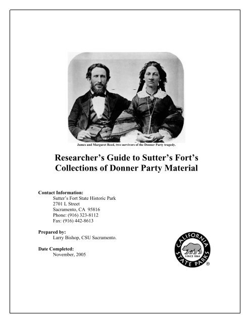
Researcher's Guide to Sutter's Fort's Collections of Donner Party ...
Researcher's Guide to Sutter's Fort's Collections of Donner Party ...
Researcher's Guide to Sutter's Fort's Collections of Donner Party ...

Create successful ePaper yourself
Turn your PDF publications into a flip-book with our unique Google optimized e-Paper software.
James and Margaret Reed, two survivors <strong>of</strong> the <strong>Donner</strong> <strong>Party</strong> tragedy.<br />
Researcher’s <strong>Guide</strong> <strong>to</strong> Sutter’s Fort’s<br />
<strong>Collections</strong> <strong>of</strong> <strong>Donner</strong> <strong>Party</strong> Material<br />
Contact Information:<br />
Sutter’s Fort State His<strong>to</strong>ric Park<br />
2701 L Street<br />
Sacramen<strong>to</strong>, CA 95816<br />
Phone: (916) 323-8112<br />
Fax: (916) 442-8613<br />
Prepared by:<br />
Larry Bishop, CSU Sacramen<strong>to</strong>.<br />
Date Completed:<br />
November, 2005
Preface<br />
In the winter <strong>of</strong> 2004- 2005 work began on processing the collection <strong>of</strong><br />
documents and artifacts donated <strong>to</strong> Sutter’s Fort by the estate <strong>of</strong> Martha Jayne Lewis,<br />
daughter <strong>of</strong> Martha J. (Patty) Reed Lewis, one <strong>of</strong> the survivors <strong>of</strong> the <strong>Donner</strong> <strong>Party</strong>’s<br />
tragic crossing <strong>of</strong> the Sierras in the winter <strong>of</strong> 1846-1847. The purpose <strong>of</strong> the project was<br />
<strong>to</strong> apply standard archival practices in the processing <strong>of</strong> the documentary items in this<br />
collection and <strong>to</strong> create a finding aid <strong>to</strong> aid researchers and <strong>Donner</strong> scholars in the use <strong>of</strong><br />
the material. Further, the finding aid was <strong>to</strong> be published on the World Wide Web<br />
through the Online Archive <strong>of</strong> California, a project <strong>of</strong> the California Digital Library at the<br />
University <strong>of</strong> California, Berkeley.<br />
Since the arrival <strong>of</strong> the Lewis collection at the Fort in 1946, the material had been<br />
in use for museum displays and as a resource for scholars and authors detailing the<br />
experiences <strong>of</strong> the <strong>Donner</strong> <strong>Party</strong>, but the material had never been properly s<strong>to</strong>red,<br />
arranged or described. This project, managed by Michael Tucker, Cura<strong>to</strong>r <strong>of</strong> the His<strong>to</strong>ric<br />
Sites Office and Steve Beck, the Fort’s first Archivist, at last addressed these needs.<br />
Graduate students from the Public His<strong>to</strong>ry Program at California State University,<br />
Sacramen<strong>to</strong>, Michelle Atkinson and Larry Bishop, assisted by Megan Landreth and Kirk<br />
Nelson completed the project in the fall <strong>of</strong> 2005.<br />
During the course <strong>of</strong> the project other unprocessed documentary material was<br />
arranged, re-housed and described, and a thorough search <strong>of</strong> the Fort’s archives yielded a<br />
significant amount <strong>of</strong> “orphaned” material related <strong>to</strong> the <strong>Donner</strong> s<strong>to</strong>ry. Further, it became<br />
clear that the artifact collections pertaining <strong>to</strong> the <strong>Donner</strong> <strong>Party</strong> should also be cataloged<br />
and made available <strong>to</strong> the public. This became the task <strong>of</strong> Judy Russo, the registrar at the<br />
His<strong>to</strong>ric Sites Office in West Sacramen<strong>to</strong>. As <strong>of</strong> this writing Judy’s diligent work on this<br />
project is almost complete, and a public catalog <strong>of</strong> Sutter’s Fort’s <strong>Donner</strong> <strong>Party</strong> artifacts<br />
will then be published as a companion <strong>to</strong> this guide <strong>of</strong> documentary material.
Introduction<br />
On April 15, 1846 the families <strong>of</strong> James Fraser Reed and George and Jacob<br />
<strong>Donner</strong>, comprising 31 people in 9 wagons, left Springfield, Illinois for California. On<br />
May 19 the party joined a larger wagon train captained by William Russell about 100<br />
miles west <strong>of</strong> Independence, Missouri. Other families and individuals joined the wagon<br />
train as the party traveled westward and by the time the party departed Fort Bridger in<br />
southwestern Wyoming the <strong>to</strong>tal number <strong>of</strong> people had grown <strong>to</strong> 74 and the <strong>to</strong>tal number<br />
<strong>of</strong> wagons <strong>to</strong> 20. By early August, as the party entered Utah, 87 people and 23 wagons<br />
were bound for California.<br />
Following inaccurate advice they received en route, the ill-fated party, now<br />
captained by George <strong>Donner</strong>, opted <strong>to</strong> take an untried cut-<strong>of</strong>f <strong>to</strong> the west. This “shortcut”<br />
put them weeks behind schedule, and by the time they had crossed Nevada and began<br />
their ascent <strong>of</strong> the Sierra Nevada it was <strong>to</strong>o late in the fall season. Heavy snowfall<br />
stranded them in the mountains and for five months the group was trapped on the eastern<br />
side <strong>of</strong> the Sierra. Of the 87 men, women and children in the <strong>Donner</strong> <strong>Party</strong>, only 46<br />
survived.<br />
Today, more than 150 years later, the sad tale <strong>of</strong> the party’s entrapment by heavy<br />
snow, starvation, illness, and death, and the valiant efforts <strong>of</strong> those who rescued those<br />
hearty enough <strong>to</strong> survive the winter nightmare <strong>of</strong> 1846 still capture our imagination. The<br />
horrendous conditions ultimately drove some <strong>to</strong> engage in cannibalism in order <strong>to</strong><br />
survive, and unfortunately this is the singular element <strong>of</strong> the s<strong>to</strong>ry that comes <strong>to</strong> mind<br />
when we hear the name “<strong>Donner</strong> <strong>Party</strong>.” Behind this gruesome reality which has long<br />
over-shadowed the rest <strong>of</strong> the s<strong>to</strong>ry, lies a heartening tale <strong>of</strong> fear, determination, selfsacrifice<br />
and courage in the face <strong>of</strong> relentless and cruel fate.<br />
The emigrants’ destination was Sutter’s Fort in Sacramen<strong>to</strong>, California. Now a<br />
State His<strong>to</strong>ric Park the Fort is proud <strong>to</strong> hold one <strong>of</strong> the largest collections <strong>of</strong> <strong>Donner</strong><br />
<strong>Party</strong>-related material in the world. In 2004 a project began <strong>to</strong> make the documentary<br />
material in this collection available <strong>to</strong> researchers, scholars and students. This guide is the<br />
result <strong>of</strong> that project.
The material described in this guide comes from four main sources: the archives’<br />
general research files; the cura<strong>to</strong>r’s scrapbooks; the Martha J. (Patty) Reed Lewis<br />
Collection; and the Charles E. Davis Overland Trail Project Collection. As work<br />
continues on processing the many items in the archives at Sutter’s Fort, other sources <strong>of</strong><br />
<strong>Donner</strong>-related material will likely be cataloged and included in subsequent versions <strong>of</strong><br />
this guide.<br />
For many years Sutter’s Fort has maintained a collection<br />
<strong>of</strong> his<strong>to</strong>ric material in its General Files. <strong>Donner</strong>-related materials<br />
in these files include biographical information on members <strong>of</strong> the<br />
ill-fated party and the various rescue parties and their<br />
descendants, the trails they followed, and the places designated<br />
<strong>to</strong> memorialize the events. Also in these files may be found<br />
pho<strong>to</strong>graphs <strong>of</strong> people and landmarks, news clippings, artwork<br />
Harry C. Peterson, Cura<strong>to</strong>r at and correspondence.<br />
<strong>Sutter's</strong> Fort, 1927-1941<br />
Sutter’s Fort’s first two cura<strong>to</strong>rs, Harry C. Peterson and<br />
Carroll Hall assembled scrapbooks <strong>of</strong> news clippings pertaining <strong>to</strong> local his<strong>to</strong>ry. Many<br />
clippings in these scrapbooks refer <strong>to</strong> the <strong>Donner</strong> <strong>Party</strong> tragedy and the many efforts <strong>to</strong><br />
reconstruct its details and commemorate the event, as well as biographical information on<br />
some <strong>of</strong> the victims, survivors, members <strong>of</strong> the rescue parties, and their descendants, and<br />
the acquisition <strong>of</strong> <strong>Donner</strong>-related material by the Fort’s museum. The clippings span the<br />
range c.1900 <strong>to</strong> c.1960. The following table references the page numbers in each<br />
scrapbook which contain material that might be <strong>of</strong> interest <strong>to</strong> <strong>Donner</strong> researchers.<br />
In 1946 the estate <strong>of</strong> Martha Jayne Lewis, a<br />
survivor <strong>of</strong> the tragedy, donated her collection <strong>of</strong><br />
memorabilia, manuscripts, and archival material <strong>to</strong><br />
Sutter’s Fort. The great majority <strong>of</strong> her collection<br />
concerns the affairs <strong>of</strong> her father, James Frazier Reed,<br />
one <strong>of</strong> the dominant characters in the <strong>Donner</strong> <strong>Party</strong><br />
s<strong>to</strong>ry. The collection described in the finding aid<br />
Martha (Patty) Reed Lewis and Frank<br />
Lewis c.1860<br />
included in this guide is an artificial collection comprised <strong>of</strong> documentary material that
may actually be from multiple sources. Since its donation <strong>to</strong> the Fort in 1946 items have<br />
been separated, re-housed, and possibly lost, but every effort has been made <strong>to</strong><br />
reassemble the collection as much as possible. The material herein was gathered from<br />
s<strong>to</strong>rage at Sutter’s Fort in the early 1990s by student interns, given an initial arrangement<br />
by volunteer archivist H. Alan Sims and registrar Marylou Lentz, and transferred first <strong>to</strong><br />
the California State Parks Archives in Sacramen<strong>to</strong> and then <strong>to</strong> the His<strong>to</strong>ric Sites Sec<strong>to</strong>r<br />
Office in West Sacramen<strong>to</strong> for final processing. Although the original integrity <strong>of</strong> the<br />
collection can not be guaranteed, the value <strong>of</strong> the material and its pertinence <strong>to</strong> the<br />
<strong>Donner</strong> his<strong>to</strong>ry are unquestionable.<br />
The Charles E. Davis Overland Trail Project Collection<br />
documents the efforts in 1927 <strong>to</strong> re-trace the <strong>Donner</strong> route from<br />
Independence, Missouri <strong>to</strong> Sacramen<strong>to</strong>, California by Charles<br />
Davis, an amateur his<strong>to</strong>rian and explorer. He recorded his<br />
expedition in a journal and through regular correspondence<br />
with Harry C. Peterson, the cura<strong>to</strong>r at the Fort. This collection’s<br />
pho<strong>to</strong>graphs, which number more than a thousand, may be <strong>of</strong><br />
particular interest <strong>to</strong> researchers interested in the Interstate<br />
Highway system and the development <strong>of</strong> modern roadways in<br />
the western states. Davis’ pho<strong>to</strong>s show much <strong>of</strong> the western<br />
Charles E. Davis at <strong>Sutter's</strong> Fort, trails as they appeared before the highways and the resulting<br />
c.1927<br />
communities covered them over. A complete index <strong>to</strong> these<br />
pho<strong>to</strong>s is in Appendix A <strong>of</strong> this guide.<br />
As <strong>of</strong> this writing, the archives at Sutter’s Fort is still in its infancy, but under the<br />
able direction <strong>of</strong> its archivist Steve Beck, and with the assistance <strong>of</strong> dedicated graduate<br />
student interns and volunteers it will become one <strong>of</strong> California’s most valuable resources<br />
for the study <strong>of</strong> early California. This guide and the material it describes are only the first<br />
steps in providing research functionality <strong>to</strong> the treasure trove <strong>of</strong> material faithfully<br />
gathered by the Fort’s personnel over more than a century.<br />
Larry Bishop<br />
November 15, 2005
Table <strong>of</strong> Contents<br />
<strong>Donner</strong> material in the General Files <strong>of</strong> the Archives at <strong>Sutter's</strong> Fort 1<br />
<strong>Donner</strong> Material in Cura<strong>to</strong>rs’ Scrapbooks 3<br />
<strong>Guide</strong> <strong>to</strong> the Martha J. (Patty) Reed Lewis Collection 4<br />
<strong>Guide</strong> <strong>to</strong> the Charles E. Davis Overland Trail Project Collection 27<br />
Appendix A: Index <strong>to</strong> the Davis Collection pho<strong>to</strong>s 34
<strong>Donner</strong> material in the General Files <strong>of</strong> the<br />
Archives at <strong>Sutter's</strong> Fort<br />
Folder Label Object Type Cabinet/Drawer/Old CatalogNo<br />
"1996 National Portrait Gallery - loan <strong>of</strong> doll <strong>to</strong>" info file D3/2<br />
"<strong>Donner</strong> <strong>Party</strong> - Artifact inven<strong>to</strong>ry" info file D3/2<br />
"<strong>Donner</strong> <strong>Party</strong> - Newspaper articles" info file D3/2<br />
"<strong>Donner</strong> <strong>Party</strong> - Patty Reed's Doll" info file D3/2<br />
"<strong>Donner</strong> <strong>Party</strong> - Reed Family 1 <strong>of</strong> 2" info file D3/2<br />
"<strong>Donner</strong> <strong>Party</strong> - Reed Family 2 <strong>of</strong> 2" info file D3/2<br />
"<strong>Donner</strong> <strong>Party</strong> - requests from public and media" info file D3/2<br />
"<strong>Donner</strong> <strong>Party</strong> 2 <strong>of</strong> 2" info file D3/2<br />
"<strong>Donner</strong> <strong>Party</strong> -Breen cabin site" info file D3/2<br />
"<strong>Donner</strong> <strong>Party</strong>, 1 <strong>of</strong> 2" info file D3/2<br />
"<strong>Donner</strong> State His<strong>to</strong>ric Park" info file D3/2<br />
"<strong>Donner</strong> Trail" info file D3/2<br />
"Johnson's Ranch" info file D3/3<br />
"Reed File" info file D3/2<br />
Breen, family group pho<strong>to</strong> G7/2/5090<br />
Breen, family group pho<strong>to</strong> G7/2/2806<br />
Breen, John <strong>to</strong> Bancr<strong>of</strong>t H.H. document Bios/2/<br />
Breen, Margaret pho<strong>to</strong> G7/2/L298<br />
Breen, Margaret pho<strong>to</strong> G7/2/2805<br />
Breen, Margaret pho<strong>to</strong> G7/2/4994(5?)<br />
Breen, Patrick pho<strong>to</strong> G7/2/2804<br />
Breen, Patrick pho<strong>to</strong> G7/2/L297<br />
Covillaud, Mary (Murphy) pho<strong>to</strong> G7/3/3440<br />
<strong>Donner</strong> - Trail Marking <strong>Party</strong> - 1940" pho<strong>to</strong> D1/3/<br />
<strong>Donner</strong> Doll - Postcard pho<strong>to</strong> D1/2/<br />
<strong>Donner</strong> Lake pho<strong>to</strong> D1/2/<br />
<strong>Donner</strong> Lake - Trip - Edwin Johnson Wagon pho<strong>to</strong> D1/2/<br />
1
<strong>Donner</strong> Memorial pho<strong>to</strong> D1/2/<br />
<strong>Donner</strong> <strong>Party</strong> - camps, escape, relief artwork D1/2/<br />
<strong>Donner</strong> <strong>Party</strong> - Patty Reed's Doll pho<strong>to</strong> D1/2/<br />
<strong>Donner</strong> <strong>Party</strong> - S<strong>to</strong>ne at Alcove Springs, Ks"<br />
c1929<br />
pho<strong>to</strong> D1/2/<br />
<strong>Donner</strong> <strong>Party</strong> Members -pho<strong>to</strong>copies pho<strong>to</strong> D1/2/<br />
<strong>Donner</strong> <strong>Party</strong> -Scenes along Route c 1949,<br />
pho<strong>to</strong>copies<br />
pho<strong>to</strong> D1/2/<br />
<strong>Donner</strong>, George pho<strong>to</strong> G3/3<br />
<strong>Donner</strong>, George Jr. pho<strong>to</strong> G7/4/2075<br />
<strong>Donner</strong>, George Jr. pho<strong>to</strong> G7/4/2075<br />
Eddy, Eleanor pho<strong>to</strong> G7/4/6503<br />
Eddy, William pho<strong>to</strong> G7/4/6502<br />
Eddy, William and Eleanor pho<strong>to</strong> G7/4/6052<br />
Fort Bridger - Wy pho<strong>to</strong> D1/3/<br />
Foster, Mr. and Mrs. Neil pho<strong>to</strong> G6/1/1442<br />
Graves, Mary Clark pho<strong>to</strong> G7/3/6748<br />
Graves, William pho<strong>to</strong> G6/1/6747<br />
Graves, William C. pho<strong>to</strong> G7/3/6747<br />
Keyes, Sarah pho<strong>to</strong> G6/4/6536<br />
Murphy Cabin Site pho<strong>to</strong> D1/2/<br />
Murphy, George W. pho<strong>to</strong> G5/2/5990<br />
Murphy, Harriet pho<strong>to</strong> G5/2/3442<br />
Murphy, Mary pho<strong>to</strong> G5/2/3440<br />
Murphy, William G. pho<strong>to</strong> G5/2/3443<br />
Pike, Naomi pho<strong>to</strong> G5/3<br />
Rhodes, Daniel pho<strong>to</strong> G2/2, G5/5<br />
Rhodes, Daniel pho<strong>to</strong> G5/5<br />
Starkes, John S. pho<strong>to</strong> G4/1/1435<br />
2
<strong>Donner</strong> Material in the Cura<strong>to</strong>rs’ Scrapbooks<br />
Sutter’s Fort’s first two cura<strong>to</strong>rs, Harry C. Peterson and Carroll Hall assembled<br />
scrapbooks <strong>of</strong> news clippings pertaining <strong>to</strong> local his<strong>to</strong>ry. Many clippings in these<br />
scrapbooks refer <strong>to</strong> the <strong>Donner</strong> <strong>Party</strong> tragedy and the many efforts <strong>to</strong> reconstruct its<br />
details and commemorate the event, as well as biographical information on some <strong>of</strong> the<br />
victims, survivors, members <strong>of</strong> the rescue parties, and their descendants, and the<br />
acquisition <strong>of</strong> <strong>Donner</strong>-related material by the Fort’s museum. The clippings span the<br />
range c.1900 <strong>to</strong> c.1960. The following table references the page numbers in each<br />
scrapbook which contain material that might be <strong>of</strong> interest <strong>to</strong> <strong>Donner</strong> researchers.<br />
ScrapBook No. Catalog No. Relevant Page Numbers<br />
1 308-2176-2 77<br />
SF1 308-2176-1 84,88,89,97,124,126<br />
2 308-2176-4 9,54<br />
SF2 308-2176-3 4,9-12,29,32,59,68,73,74<br />
3 308-2176-5 65,108<br />
SF3 308-2176-21 2<br />
4 308-2176-6 28-9,127,130<br />
5 308-2176-7 83,88,89,97<br />
6 308-2176-8 17,27,108,115,128<br />
7 308-2176-9 76,77,82<br />
8 308-2176-10 19-21,24-5,91,96<br />
9 308-2176-11 4,42,86,89,110<br />
10 308-2176-12 26-7,80-81<br />
11 308-2176-13 none<br />
12 308-2176-14 17,24,25,42,51,58,59,88,89,103,111<br />
13 308-2176-15 105,122<br />
14 308-2176-16 90,106,107,111,112,113,114,116,120,121<br />
15 308-2176-17 9,16,18,30,32,37,38,39,51,72,89,90,108,109,114<br />
16 308-2176-18 none<br />
17 308-2176-19 6,7,9-11,13-14,34-5,53-4,58,68,71,95,108-9<br />
18 308-2176-20 24<br />
3
<strong>Guide</strong> <strong>to</strong> the Martha J. (Patty) Reed Lewis Collection<br />
Contact Information:<br />
Sutter’s Fort State His<strong>to</strong>ric Park<br />
2701 L Street<br />
Sacramen<strong>to</strong>, CA 95816<br />
Phone: (916) 323-8112<br />
Fax: (916) 442-8613<br />
Sutter’s Fort State His<strong>to</strong>ric Park<br />
Sacramen<strong>to</strong>, California<br />
Processed by:<br />
Michele Atkinson and Larry Bishop, CSU Sacramen<strong>to</strong>.<br />
Date Completed:<br />
2005<br />
Encoded by:<br />
Larry Bishop<br />
14
Title<br />
Dates<br />
Descriptive Summary<br />
<strong>Guide</strong> <strong>to</strong> the Martha J. (Patty) Reed Lewis Collection<br />
1826-1951 (bulk 1846-1926)<br />
Collection number<br />
Consult reposi<strong>to</strong>ry<br />
Collec<strong>to</strong>r<br />
Sutter’s Fort State His<strong>to</strong>rical Park<br />
Extent<br />
4 cubic feet in 9 museum boxes and 8 bound volumes<br />
Reposi<strong>to</strong>ry<br />
This collection resides at Sutter’s Fort State His<strong>to</strong>rical Park, Sacramen<strong>to</strong>, California.<br />
Abstract<br />
On April 15, 1846 the families <strong>of</strong> James Fraser Reed and George and Jacob <strong>Donner</strong>,<br />
comprising 31 people in 9 wagons, left Springfield, Illinois for California. On May 19 the party<br />
joined a larger wagon train captained by William Russell about 100 miles west <strong>of</strong> Independence,<br />
Missouri. Other families and individuals joined the wagon train as the party traveled westward<br />
and by the time the party departed Fort Bridger in southwestern Wyoming the <strong>to</strong>tal number <strong>of</strong><br />
people had grown <strong>to</strong> 74 and the <strong>to</strong>tal number <strong>of</strong> wagons <strong>to</strong> 20. By early August, as the party<br />
entered Utah, 87 people and 23 wagons were bound for California.<br />
Following inaccurate advice they received en route, the ill-fated party, now captained by<br />
George <strong>Donner</strong>, opted <strong>to</strong> take an untried cut-<strong>of</strong>f <strong>to</strong> the west. This “shortcut” put them weeks<br />
behind schedule, and by the time they had crossed Nevada and began their ascent <strong>of</strong> the Sierra<br />
Nevada it was <strong>to</strong>o late in the fall season. Heavy snowfall stranded them in the mountains and<br />
for five months the group was trapped on the eastern side <strong>of</strong> the Sierra. Of the 87 men, women<br />
and children in the <strong>Donner</strong> <strong>Party</strong>, only 46 survived.<br />
In 1946 the estate <strong>of</strong> Martha Jayne Lewis, a survivor <strong>of</strong> the tragedy, donated her<br />
collection <strong>of</strong> memorabilia, manuscripts, and archival material <strong>to</strong> Sutter’s Fort. The great majority<br />
<strong>of</strong> her collection concerns the affairs <strong>of</strong> her father, James Frazier Reed, who she clearly<br />
admired and respected immensely. Many <strong>of</strong> her original writings are either lauda<strong>to</strong>ry accolades<br />
<strong>to</strong> her father or energetic defenses <strong>of</strong> his character.<br />
The collection described in this guide is an artificial collection comprised <strong>of</strong> documentary<br />
material that may be from multiple sources. The material was gathered from s<strong>to</strong>rage at Sutter’s<br />
Fort in the early 1990s by student interns, given an initial arrangement by volunteer archivist H.<br />
Alan Sims and registrar Marylou Lentz, and transferred first <strong>to</strong> the California State Parks<br />
Archives in Sacramen<strong>to</strong> and then <strong>to</strong> the His<strong>to</strong>ric Sites Sec<strong>to</strong>r Office in West Sacramen<strong>to</strong> for final<br />
2<br />
5
processing. It is hoped that this guide will provide research functionality <strong>to</strong> this his<strong>to</strong>ric collection<br />
that documents the struggles <strong>of</strong> the <strong>Donner</strong> <strong>Party</strong>, the efforts <strong>to</strong> rescue them, and the cultural<br />
and his<strong>to</strong>ric impact their tragic tale has had on western lore. This archival finding guide is one<br />
element in the <strong>Guide</strong> <strong>to</strong> the Sutter’s Fort Collection <strong>of</strong> <strong>Donner</strong> <strong>Party</strong> Material.<br />
Access<br />
This collection is open for research.<br />
Administrative Information<br />
Publication Rights<br />
Property rights reside with California State Parks. Literary rights are retained by the<br />
crea<strong>to</strong>rs <strong>of</strong> the records and their heirs. For permission <strong>to</strong> reproduce or <strong>to</strong> publish, please<br />
contact California State Parks.<br />
Preferred Citation<br />
[item] the Martha J. (Patty) Reed Lewis Material, Sutter’s Fort State His<strong>to</strong>ric Park,<br />
California State Parks, Sacramen<strong>to</strong>, California.<br />
Related <strong>Collections</strong><br />
The collection described in this finding aid represents those materials that are archival in<br />
nature and specifically assembled <strong>to</strong> create this collection. Artifacts and pho<strong>to</strong>graphs<br />
that could also be identified as belonging <strong>to</strong> the Martha J. (Patty) Reed Lewis Collection<br />
are not included in this guide. For information on the artifactual and pho<strong>to</strong>graphic<br />
materials related specifically <strong>to</strong> this collection contact California State Parks, or consult<br />
The <strong>Guide</strong> <strong>to</strong> the Sutter’s Fort Collection <strong>of</strong> <strong>Donner</strong> <strong>Party</strong> Material. A number <strong>of</strong> related<br />
collections, both at the Fort and at other reposi<strong>to</strong>ries contain additional material which<br />
could be <strong>of</strong> value <strong>to</strong> researchers <strong>of</strong> the <strong>Donner</strong> <strong>Party</strong> s<strong>to</strong>ry.<br />
The Charles E. Davis Overland Trail Project Collection, also at the archives in Sutter’s<br />
Fort, documents the efforts in 1927 <strong>to</strong> re-trace the <strong>Donner</strong> route from Independence<br />
Missouri <strong>to</strong> California by Charles Davis, an amateur his<strong>to</strong>rian and explorer. He recorded<br />
his expedition in a journal and through regular correspondence with Harry C. Peterson,<br />
the cura<strong>to</strong>r at the Fort. This collection’s pho<strong>to</strong>graphs, which number more than a<br />
thousand, may be <strong>of</strong> particular interest <strong>to</strong> researchers interested in the Interstate<br />
Highway system and the development <strong>of</strong> modern roadways in the western states. Davis’<br />
pho<strong>to</strong>s show much <strong>of</strong> the western trails as they appeared before the highways and the<br />
resulting communities covered them over. The finding guide for this collection is another<br />
element in The <strong>Guide</strong> <strong>to</strong> the Sutter’s Fort Collection <strong>of</strong> <strong>Donner</strong> <strong>Party</strong> Material.<br />
A great deal <strong>of</strong> other material in the archives at Sutter’s Fort contains information<br />
regarding the <strong>Donner</strong> <strong>Party</strong>. The Marriage Register <strong>of</strong> Justice John Sinclair contains the<br />
names <strong>of</strong> several <strong>Donner</strong> survivors who where married at the Fort in the year 1847. John<br />
Bidwell’sLledger <strong>of</strong> November – December 1846 contains the names <strong>of</strong> several<br />
members <strong>of</strong> the relief parties that bravely climbed in<strong>to</strong> the Sierras <strong>to</strong> rescue the stranded<br />
emigrants.<br />
3<br />
6
For many years the archives at Sutter’s Fort has maintained a collection <strong>of</strong> his<strong>to</strong>ric<br />
material in its General Files. <strong>Donner</strong>-related material in these files include biographical<br />
information on members <strong>of</strong> the ill-fated party and the various rescue parties and their<br />
descendants, the trails they followed, and the places designated <strong>to</strong> memorialize the<br />
events. Also in these files are pho<strong>to</strong>graphs <strong>of</strong> people and landmarks, news clippings,<br />
artwork and correspondence. Consult The <strong>Guide</strong> <strong>to</strong> the Sutter’s Fort Collection <strong>of</strong><br />
<strong>Donner</strong> <strong>Party</strong> Material for a listing <strong>of</strong> these files and their locations.<br />
Carroll D. Hall, the cura<strong>to</strong>r at the Fort from 1944 <strong>to</strong> 1964, <strong>to</strong>ok a special interest in one <strong>of</strong><br />
the items included in the Lewis Collection, the Miller-Reed diary <strong>of</strong> April <strong>to</strong> Oc<strong>to</strong>ber,<br />
1846. The diary, originally assumed <strong>to</strong> be that <strong>of</strong> Hiram O. Miller, contained variations in<br />
handwriting that puzzled Hall <strong>to</strong> such an extent that he enlisted the aid <strong>of</strong> a handwriting<br />
analyst <strong>of</strong> the State Department <strong>of</strong> Justice. The analyst confirmed what Hall had<br />
assumed; most <strong>of</strong> the diary was in fact written by James Frazier Reed. Hall then<br />
transcribed the entire diary, alonf with other documents from the collection, added his<br />
own analysis and commentary and published the work as <strong>Donner</strong> Miscellany: 41 Diaries<br />
and Documents Edited by Carroll D. Hall through the Book Club Of California in 1947.<br />
Only 350 copies were printed, but the Fort’s archives has a pho<strong>to</strong>copy <strong>of</strong> the entire<br />
volume for use by researchers. A copy <strong>of</strong> the original publication is available at the<br />
California State Library in Sacramen<strong>to</strong>, California.<br />
Also at the California State Library is The James Frazier Reed Collection 1843-1851,<br />
containing selected correspondence and business papers transferred from the Fort’s<br />
Reed-Lewis collection <strong>to</strong> the State Library in 1967. Consult the Library’s catalog for<br />
information on and access <strong>to</strong> this manuscript collection.<br />
The Martha J. (Patty) Reed Lewis Collection herein contains a 1910 reprint <strong>of</strong> Patrick<br />
Breen’s diary <strong>of</strong> November 20, 1846 - March 1, 1847. The Bancr<strong>of</strong>t Library at the<br />
University <strong>of</strong> California, Berkeley, has the original Breen Diary and has published<br />
digitized images <strong>of</strong> the entire work on the Online Archive <strong>of</strong> California available at<br />
http://sunsite.berkeley.edu/cgi-bin/ebind2html/2/breen?cap.<br />
The Bancr<strong>of</strong>t Library also houses the C.F. McGlashan Papers 1847-1931, which include<br />
correspondence and research materials he used for his book, The His<strong>to</strong>ry <strong>of</strong> the <strong>Donner</strong><br />
<strong>Party</strong> first published in 1879. McGlashan was a friend <strong>of</strong> Patty Lewis and besides this<br />
book he wrote many articles on the subject, and was instrumental in the creation <strong>of</strong> the<br />
<strong>Donner</strong> Memorial near Truckee, California.<br />
The Hunting<strong>to</strong>n Library in San Marino, California holds the Eliza Poor <strong>Donner</strong> Hough<strong>to</strong>n<br />
Papers, 1820-1978, the majority <strong>of</strong> which deals with the <strong>Donner</strong> <strong>Party</strong>. Eliza and nine<br />
other <strong>Donner</strong> <strong>Party</strong> surviving members are represented in this collection, both in<br />
correspondence and pho<strong>to</strong>graphs. Contact the Hunting<strong>to</strong>n Library at (626) 405-2191 or<br />
online at http://catalog.hunting<strong>to</strong>n.org/screens/libinfo_02.html.<br />
Lastly, scrapbooks created by Fort cura<strong>to</strong>rs Peterson and Hall contain many news<br />
clippings relating <strong>to</strong> the <strong>Donner</strong> <strong>Party</strong>, efforts <strong>to</strong> re-construct the tragedy and<br />
memorialize it, the discovery <strong>of</strong> artifacts and their acquisition by the Fort, and<br />
biographies and obituaries <strong>of</strong> <strong>Donner</strong> survivors and rescuers and their descendants.<br />
These clippings from various newspapers and magazines span the period from c.1900<br />
<strong>to</strong> the 1960s. A listing <strong>of</strong> the specific pages in each <strong>of</strong> the 21 scrapbooks that have<br />
<strong>Donner</strong>-related clippings is available in The <strong>Guide</strong> <strong>to</strong> the Sutter’s Fort Collection <strong>of</strong><br />
<strong>Donner</strong> <strong>Party</strong> Material.<br />
4<br />
7
Acquisition Information<br />
In 1946 the estate <strong>of</strong> Martha Jayne Lewis, daughter <strong>of</strong> Martha J. (Patty) Reed Lewis<br />
donated her mother’s collection <strong>of</strong> memorabilia, manuscripts, and archival material <strong>to</strong><br />
Sutter’s Fort. Unfortunately, in the ensuing years other <strong>Donner</strong>-related donations may<br />
have been subsequently intermixed with no concerted effort <strong>to</strong> maintain the provenance<br />
<strong>of</strong> the Lewis collection and some items donated by the Lewis estate have been<br />
transferred <strong>to</strong> or scattered among other park units and state agencies. In 1947 Carroll D.<br />
Hall, cura<strong>to</strong>r <strong>of</strong> Sutter’s Fort, noted that other donors may have included Stanley<br />
Hough<strong>to</strong>n, grandson <strong>of</strong> George <strong>Donner</strong>, Virginia Eddy, granddaughter <strong>of</strong> <strong>Donner</strong> <strong>Party</strong><br />
survivor W.H. Eddy, and Emelie Williamson, grand-niece <strong>of</strong> William Graves, another<br />
survivor. The collection, as it exists <strong>to</strong>day, has been artificially assembled <strong>to</strong> best reflect<br />
what is believed <strong>to</strong> have been material collected by Patty Reed Lewis before her death<br />
in 1923 and donated <strong>to</strong> Sutter’s Fort following the death <strong>of</strong> her daughter in 1946.<br />
Processing His<strong>to</strong>ry<br />
This collection was processed by Michele Atkinson and Larry Bishop, with assistance<br />
from Megan Landreth and Kirk Nelson, June 2005. The finding aid was written by and<br />
encoded by Larry Bishop.<br />
5<br />
8
His<strong>to</strong>ry and Biography<br />
James Frazier Reed was born in County Annagh, Ireland November 14, 1800. He was <strong>of</strong><br />
Polish descent; the last name originally being Reedowsky or Reednoskia and subsequently<br />
anglicized. While still a small child he traveled with his Scotch-born mother <strong>to</strong> the United States<br />
after his father’s death, where they settled in Philadelphia. At the age <strong>of</strong> eight or nine he went <strong>to</strong><br />
live with his maternal uncle in Virginia. By age twenty he had moved <strong>to</strong> Illinois, and found work<br />
as a miner. By 1831 he had established himself as a furniture maker in Springfield, Illinois. In<br />
1832 he joined the Illinois Militia with Jacob Earby’s Mounted Volunteers <strong>to</strong> fight in the Black<br />
Hawk War. Black Hawk was a Sauk Indian chief who led 300 <strong>to</strong> 500 warriors and 500 <strong>to</strong> 700<br />
women and children in<strong>to</strong> northern Illinois <strong>to</strong> reclaim land he believed had been illegally<br />
appropriated by the U.S. Government. Black Hawk and his people were pursued, massacred,<br />
and driven from Illinois by the combined force <strong>of</strong> the Illinois Militia and U.S. Army troops. Reed<br />
and Abraham Lincoln served <strong>to</strong>gether in Earby’s Volunteers.<br />
After his service in the war Reed returned <strong>to</strong> Springfield <strong>to</strong> engage in mercantile pursuits<br />
and farming. In 1834 he married Margaret W. Keyes Backens<strong>to</strong>e, a widow with a daughter from<br />
her previous marriage, Virginia Backens<strong>to</strong>e. The couple eventually had six children <strong>to</strong>gether,<br />
one dying in infancy. The other five were Martha (also known as Patty) born in 1938, James Jr.,<br />
born in 1841, Thomas, born in 1843, Charles, born in 1848, and Willianoski, born in 1850. In<br />
1845 he was appointed <strong>to</strong> be Illinois’ agent for U.S. pensions, though he served in this capacity<br />
for less than a year.<br />
By the time Reed connected his new family <strong>to</strong> those <strong>of</strong> George and Jacob <strong>Donner</strong> for the<br />
trip <strong>to</strong> California on April 14, 1846, he had amassed considerable wealth as the owner <strong>of</strong> several<br />
businesses including a general s<strong>to</strong>re, a starch fac<strong>to</strong>ry, a sawmill, and a cabinet making<br />
company that employed a large number <strong>of</strong> men. Reed may have spent a full year preparing for<br />
the journey. He built a larger than usual wagon for the comfort <strong>of</strong> his family and especially for<br />
the convenience <strong>of</strong> his ailing mother-in-law, Sarah Keyes, 70. In addition <strong>to</strong> this wagon, Reed<br />
loaded two others with supplies and provisions. Along with the oxen teams for the wagons they<br />
<strong>to</strong>ok extra cattle and horses and Reed hired three teamsters and two servants <strong>to</strong> help. The<br />
Reed family wagon train was generally described by others in the party as the most affluent.<br />
On May 19 the <strong>Donner</strong>s and Reeds joined a much larger wagon train captained by<br />
William H. Russell. In mid-June Russell resigned as captain and another member <strong>of</strong> his original<br />
train, William Boggs, assumed the position. About the middle <strong>of</strong> July, while camping at the Little<br />
Sandy River in present-day Wyoming a group <strong>of</strong> the emigrants decided <strong>to</strong> take a promising, but<br />
as yet untried shortcut known as the Hastings Cut-Off. George <strong>Donner</strong> became the captain <strong>of</strong><br />
this new group, which included the Reeds and several other families that had joined them en<br />
route, and which became what is now generally known as the <strong>Donner</strong> <strong>Party</strong>. The Boggs<br />
company elected <strong>to</strong> take a more cus<strong>to</strong>mary route northward. The Hastings Cut-<strong>of</strong>f proved<br />
difficult and demanding and the <strong>Donner</strong> party lost not only precious time but cattle, oxen and<br />
wagons while crossing through Utah. By the time they had passed the Great Salt Desert Reed<br />
had lost almost all <strong>of</strong> his cattle and was forced <strong>to</strong> abandon two <strong>of</strong> his three wagons.<br />
In early September, recognizing the implications <strong>of</strong> their costly delays, the party sent<br />
Charles Stan<strong>to</strong>n and William McCutchen ahead <strong>to</strong> Sutter’s Fort <strong>to</strong> fetch supplies. In late<br />
September the bedraggled train reached the end <strong>of</strong> the Hastings route and rejoined the<br />
California Trail at what is <strong>to</strong>day the city <strong>of</strong> Elko, Nevada. Then they began traveling along the<br />
Humboldt River. It was there on Oc<strong>to</strong>ber 5 that Reed became involved in a dispute with John<br />
Snyder, a teamster for another family. Details <strong>of</strong> this dispute vary greatly from one witness’<br />
account <strong>to</strong> another but in the scuffle Reed stabbed and killed Snyder, whether in self-defense or<br />
6<br />
9
out <strong>of</strong> malice is still debated, but his actions resulted in his departure from the party. Reed<br />
traveled ahead <strong>to</strong> Sutter’s Fort <strong>to</strong> bring back supplies.<br />
On Oc<strong>to</strong>ber 28 Reed reached the Fort and found McCutchen still there, recovering from<br />
an illness. Stan<strong>to</strong>n had since made his return <strong>to</strong> the mountains with supplies, having reached<br />
the emigrants, now stranded by heavy snow on the east side <strong>of</strong> the summit with little or no food<br />
left, about a week earlier. In November Reed and McCutchen made an attempt <strong>to</strong> return <strong>to</strong> their<br />
families but were driven back by heavy snow. They returned <strong>to</strong> Sutter’s Fort where Sutter<br />
advised them <strong>to</strong> go <strong>to</strong> Yerba Buena, modern-day San Francisco, <strong>to</strong> make his needs known <strong>to</strong><br />
the U.S. naval <strong>of</strong>ficer in command, J.B. Hull. He reached San Jose, and as an able-bodied<br />
American, he joined a group <strong>of</strong> volunteers <strong>to</strong> clear the way from there <strong>to</strong> Yerba Buena. On<br />
January 2, 1847, he was involved in a small skirmish known as the Battle <strong>of</strong> Santa Clara, the<br />
only campaign in the Northern District <strong>of</strong> California between the Californios and the United<br />
States forces during the Mexican-American war. When he reached Yerba Buena he was able <strong>to</strong><br />
secure $1300 in donations from residents and sailors at the port. In all Reed spent a few weeks<br />
in the area, where he eventually secured land for himself and his family around San Jose.<br />
The supplies purchased in Yerba Buena were sent by schooner <strong>to</strong> the mouth <strong>of</strong> the<br />
Feather River, where Reed spent the next two weeks securing men and horses <strong>to</strong> aid him in an<br />
expedition <strong>to</strong> rescue the stranded emigrants in the mountains. On the way up the western slope<br />
Reed was met by an earlier relief party coming down the slope with women and children. He<br />
was reunited with his wife, his stepdaughter Virginia, and James Jr. His daughter Martha and<br />
son Thomas were unable <strong>to</strong> make the trip and still remained, in terrible physical condition, at<br />
one <strong>of</strong> the campsites above. On March 1 Reed arrived <strong>to</strong> rescue his two remaining family<br />
members and lead them and fifteen others back <strong>to</strong> safety. Within a week this group was trapped<br />
by a severe s<strong>to</strong>rm and Reed and his friend Hiram Miller carried Martha and Tommy while the<br />
rest stayed at what has become known as “Starved Camp.” This group was rescued four days<br />
later by the next relief party heading for the summit. This party brought several more <strong>of</strong> the<br />
starving exhausted emigrants out <strong>of</strong> the mountains. A fourth relief party reached the summit<br />
camps in mid April but only one man was left alive. He was safely returned <strong>to</strong> Sutter’s Fort on<br />
April 29, the last survivor brought out <strong>to</strong> safety.<br />
Reed settled his family in San Jose, and although he was virtually penniless when he<br />
arrived, he eventually established himself as a community leader, a wealthy landholder and a<br />
successful businessman. He also served as Sheriff in the Sonoma District and Chief <strong>of</strong> the<br />
police force in the city <strong>of</strong> San Jose. In the mid 1850s squatters occupied much <strong>of</strong> Reed’s land in<br />
San Jose and he moved his family <strong>to</strong> the Santa Cruz area until his rightful claim <strong>to</strong> the property<br />
was declared legal in 1860. The following year his wife Margaret passed away. He tried<br />
unsuccessfully <strong>to</strong> establish quartz mining companies in Idaho and Nevada in the early <strong>to</strong> mid<br />
1860s, even returning <strong>to</strong> the East Coast <strong>to</strong> secure inves<strong>to</strong>rs during this time, but gave up and<br />
returned <strong>to</strong> San Jose where he spent the rest <strong>of</strong> his life surrounded by family and friends. Reed<br />
died on his Farm in San Jose on July 24, 1874 <strong>of</strong> complications resulting from a head injury that<br />
occurred when he was <strong>to</strong>ssed from the back <strong>of</strong> one <strong>of</strong> his favorite mules. He left a substantial<br />
amount <strong>of</strong> wealth <strong>to</strong> his children and grandchildren.<br />
Martha Jayne (Patty) Reed Lewis was born February 26, 1838 in Springfield, Illinois; the<br />
oldest child born <strong>to</strong> James Frazier Reed and Margaret Wilson Reed. She was only eight years<br />
old when her family joined those <strong>of</strong> George and Jacob <strong>Donner</strong>’s on the ill-fated trip <strong>to</strong> California.<br />
She was sometimes called “Mattie” but throughout her life was most commonly called “Patty.”<br />
In early November, 1846 with her mother, older sister and two younger brothers, Patty<br />
was trapped in the snow at the east end <strong>of</strong> Truckee (now <strong>Donner</strong>) Lake after her father had<br />
departed the company for Sutter’s Fort. When the first relief party arrived in the third week <strong>of</strong><br />
February she and her youngest brother Thomas were <strong>to</strong>o weak from starvation <strong>to</strong> travel. Her<br />
mother left with her sister Virginia and her other brother James Jr, reluctantly leaving the two<br />
7<br />
10
weaker children at the lake in the care <strong>of</strong> the Graves family. As they separated Patty calmly and<br />
bravely <strong>to</strong>ld her mother "Well, Ma, if you never see me again, do the best you can." In a little<br />
more than a week her father arrived with the second party <strong>of</strong> rescuers and she and Thomas<br />
along with fifteen others were then led back away from the dilapidated, abandoned cabins that<br />
had been their desperate homes during the frigid winter. Along the way this group was again<br />
trapped in blinding snow. James Reed with help from his friend Hiram Miller carried Patty and<br />
Thomas <strong>to</strong> safety while the rest, unable <strong>to</strong> proceed, made a makeshift camp. More than half <strong>of</strong><br />
the emigrants at this camp perished before another relief party arrived.<br />
Patty Reed married Frank Lewis in Santa Cruz, California on Christmas day in1856 at<br />
the age <strong>of</strong> eighteen. The couple had eight children <strong>to</strong>gether; Kate, Margaret, Frank Reed,<br />
Martha Jane, James Frazier, Carrie E., Susan Augusta, and one other child who died as a baby.<br />
They settled in San Jose and Patty remained there until Frank’s death in 1876. Her youngest<br />
child was only three years old at the time and Patty began supporting herself as a proprie<strong>to</strong>r <strong>of</strong><br />
boarding houses and hotels in Santa Cruz and Capi<strong>to</strong>la. Throughout her life Patty was involved<br />
with the <strong>Donner</strong> <strong>Party</strong> s<strong>to</strong>ry; she preserved her father’s letters and family artifacts, advised<br />
authors and scholars <strong>of</strong> her time who were chronicling the tragedy, corresponded with other<br />
survivors, and along with Eliza <strong>Donner</strong> was a star at the opening <strong>of</strong> the <strong>Donner</strong> Memorial in<br />
1918. Having survived the grueling passage across the western plains and that horrific winter <strong>of</strong><br />
1846 as a mere girl she symbolized the indomitable spirit <strong>of</strong> those remarkable pioneer women<br />
who helped settle California. Patty Reed Lewis died July 4, 1923 in Santa Cruz, leaving her<br />
collection <strong>of</strong> <strong>Donner</strong> <strong>Party</strong> material <strong>to</strong> her daughter Margaret with instructions that it be donated<br />
<strong>to</strong> Sutter’s Fort on the centennial <strong>of</strong> the tragedy. Margaret did not live <strong>to</strong> carry out the request,<br />
but her son faithfully donated the material <strong>to</strong> the Fort in 1946.<br />
Chronology<br />
April 14 The families <strong>of</strong> James F. Reed and George and Jacob <strong>Donner</strong>, 31 people in nine<br />
wagons, leave Springfield, Illinois.<br />
May 19 The party joins a large wagon train captained by Col. William H. Russell.<br />
June 18 William Russell resigns as captain <strong>of</strong> the wagon train, which is now led by<br />
William M. Boggs.<br />
June 27 The Boggs <strong>Party</strong> arrives at Fort Laramie, Wyoming and meet James Clyman, an<br />
acquaintance <strong>of</strong> Reed’s. They discuss a new route, the Hastings Cu<strong>to</strong>ff.<br />
July 19 The Boggs <strong>Party</strong> and several others camp at the Little Sandy River in presentday<br />
Wyoming. A group <strong>of</strong> emigrants decides <strong>to</strong> take Hastings Cu<strong>to</strong>ff. They elect<br />
George <strong>Donner</strong> as their captain. The other emigrants take the established<br />
northerly route by way <strong>of</strong> Fort Hall.<br />
July 28 The <strong>Donner</strong> <strong>Party</strong> reaches Fort Bridger. Jim Bridger assures the <strong>Donner</strong> <strong>Party</strong><br />
that the Hastings Cu<strong>to</strong>ff is a good route.<br />
July 31 They leave Fort Bridger. The group now numbers 74 people in twenty wagons.<br />
Aug. 28 The emigrants begin the dry drive across the Great Salt Lake Desert.<br />
11<br />
8
Sept. 4-9 After a <strong>to</strong>rturous crossing <strong>of</strong> the desert, Reed has lost almost all <strong>of</strong> his cattle and<br />
he abandons two <strong>of</strong> his wagons. George <strong>Donner</strong> and Louis Keseberg abandon<br />
one wagon each. Food is getting low and the party sends Charles Stan<strong>to</strong>n and<br />
William McCutchen ahead <strong>to</strong> Sutter’s Fort <strong>to</strong> bring back supplies.<br />
Sept. 26 The party reaches the junction with the California Trail about 7 miles west <strong>of</strong><br />
modern Elko, Nevada. They travel along Humboldt River for the next two weeks.<br />
Oct. 5 Reed kills John Snyder, a teamster for one <strong>of</strong> the other families, in a dispute and<br />
is banished from the train; he goes ahead <strong>to</strong> Sutter’s Fort <strong>to</strong> bring back supplies.<br />
Oct.15-30 The party reaches the Truckee River. After a rest at Truckee Meadows (presentday<br />
Reno), they begin their ascent <strong>of</strong> the Sierras. Charles Stan<strong>to</strong>n returns from<br />
Sutter’s Fort with seven mules packed with supplies and two Indian vaqueros<br />
who worked for Sutter. Snow begins <strong>to</strong> fall. The <strong>Donner</strong>s are held up in the Alder<br />
Creek Valley by a broken axle. The other emigrants go on ahead <strong>to</strong> Truckee<br />
Lake. Reed meets McCutchen at Sutter’s Fort and the two men begin<br />
preparations <strong>to</strong> go back for their families.<br />
Oct.30-Nov.4 The larger group <strong>of</strong> emigrants reach Truckee (now <strong>Donner</strong>) Lake. Snow thwarts<br />
their efforts and they retreat <strong>to</strong> the eastern end <strong>of</strong> the lake, where there is an<br />
existing cabin. They quickly build two more makeshift cabins. Fifty-nine people<br />
huddle in the three cabins.<br />
Nov. 5-Dec.5 Reed and McCutchen attempt <strong>to</strong> reach their stranded companions but are forced<br />
back by the snow.<br />
Dec. 16 Charles Stan<strong>to</strong>n and Williamm Eddy set out with fifteen men, women, and<br />
children <strong>to</strong> cross the mountains on snowshoes. They are weak from hunger and<br />
have few provisions. The group is later called the “Forlorn Hope.”<br />
Dec. 21 Jacob <strong>Donner</strong>, and three others die at the Alder Creek camp.<br />
Dec. 25-29 A blizzard catches the Forlorn Hope in the open. Four <strong>of</strong> their number die, and<br />
with nothing left <strong>to</strong> eat the survivors tearfully resort <strong>to</strong> cannibalism.<br />
1847<br />
Jan. 18-20 Seven survivors <strong>of</strong> the Forlorn Hope reach safety at Johnson's Ranch in<br />
Wheatland, California.<br />
Feb.18 The first relief party, led by R.P. Tucker and Aquila Glover, reaches the lake.<br />
Eleven emigrants have died, and the others are in bad shape physically and<br />
emotionally. They evacuate those strong enough <strong>to</strong> travel, including Reed’s wife<br />
Margaret and two <strong>of</strong> their four children.<br />
Mar.1 The second relief party led by James Reed arrives at the lake camp. The<br />
rescuers find evidence <strong>of</strong> cannibalism.<br />
Mar. 3 Reed leaves the camps with 17 emigrants including his children Patty and<br />
Tommy Reed.<br />
12<br />
9
Mar.5-7 A blizzard traps Reed’s party in Summit Valley. Reed and his friend Hiram Miller<br />
carry Patty and Tommy Reed, but the rest <strong>of</strong> the refugees are <strong>to</strong>o weak <strong>to</strong> travel<br />
and stay at what is later called "Starved Camp."<br />
Mar.12 The third relief party, led by William Eddy and William Foster, reach Starved<br />
Camp. Mrs. Graves and her son Franklin have died. They and Isaac <strong>Donner</strong><br />
have been cannibalized. One <strong>of</strong> the rescuers, John Stark, stays <strong>to</strong> help the<br />
Breens and others out <strong>of</strong> the mountains while the others continue up <strong>to</strong> the<br />
camps.<br />
Mar. 13 Eddy and Foster’s party arrive at the lake camp. They find their sons are dead.<br />
Mar. 14 At the Alder Creek camp, George <strong>Donner</strong> has died from infection an injury he<br />
suffered months before. The Third Relief departs with Frances, Georgia, and<br />
Eliza <strong>Donner</strong> and Simon Murphy. Elizabeth and Lewis <strong>Donner</strong> have died. Samuel<br />
<strong>Donner</strong>, Levinah Murphy, and Louis Keseberg are <strong>to</strong>o weak <strong>to</strong> travel<br />
April 17 William Fallon and the Fourth Relief party reach the camps, finding only Louis<br />
Keseberg alive among the mutilated remains <strong>of</strong> his former companions.<br />
April 29 The last member <strong>of</strong> the <strong>Donner</strong> <strong>Party</strong>, Louis Keseberg, arrives at <strong>Sutter's</strong> Fort.<br />
Source: New Light on the <strong>Donner</strong> <strong>Party</strong>, by Kristin Johnson, copyright 2005,<br />
http://www.utahcrossroads.org/<strong>Donner</strong><strong>Party</strong>/<br />
10 13
Collection Scope and Content Summary<br />
The largest portion <strong>of</strong> the material in this collection was collected by Martha J. “Patty”<br />
Reed Lewis (1838-1923), a survivor <strong>of</strong> the <strong>Donner</strong> <strong>Party</strong> tragedy, and was donated <strong>to</strong> Sutter’s<br />
Fort by her daughter’s estate in 1946. Most <strong>of</strong> the material collected by Reed-Lewis concerns<br />
the business affairs and personal experiences <strong>of</strong> her father, James Frazier Reed (1800-1874)<br />
and the events <strong>of</strong> the <strong>Donner</strong> <strong>Party</strong> tragedy. The Patty Reed Lewis Material, as described in this<br />
guide, contains material related <strong>to</strong> her, her family, and the other members <strong>of</strong> the <strong>Donner</strong> <strong>Party</strong>,<br />
but may not have been contained within the material originally donated <strong>to</strong> the Fort by her<br />
daughter’s estate. Other pieces from her collection have likely been scattered or lost. This<br />
collection contains additional accruals <strong>of</strong> Reed or <strong>Donner</strong>-related material collected by Sutter’s<br />
Fort staff over a period <strong>of</strong> about fifty years for which clear provenance has not been established.<br />
This material in this collection spans the period from 1826 <strong>to</strong> 1951. Types <strong>of</strong> material in<br />
this collection include correspondence; business records such as ledgers, receipts, invoices,<br />
s<strong>to</strong>ck certificates, requests for goods or services, agreements and promissory notes; legal<br />
documents such as petitions, deeds, titles, depositions, and summons; certificates,<br />
announcements and minutes pertaining <strong>to</strong> James Reed’s membership in the Masonic Order;<br />
and correspondence, ledgers and lists relating <strong>to</strong> his role as the agent for U.S. Pensions for the<br />
State <strong>of</strong> Illinois prior <strong>to</strong> his departure for California. Also included in this collection are<br />
recollections, notes, journals, scrapbooks, printed material, ephemera, artwork, publications,<br />
pho<strong>to</strong>graphs, tintypes, ambrotypes, daguerreotypes, news clippings, maps, and drawings.<br />
The material in this collection has been arranged in<strong>to</strong> the following series:<br />
Series 1. Correspondence<br />
Series 2. Legal Documents<br />
Series 3. Financial Documents<br />
Series 4. Masonic Documents<br />
Series 5. Pension Agent’s Documents<br />
Series 6. Recollections, Notes, Journals and Scrapbooks<br />
Series 7. Ephemera and News Clippings<br />
Series 8. Books and Booklets<br />
Series 9. Pho<strong>to</strong>graphic Material<br />
Series 10. Separated Items<br />
11 14
Indexing Terms<br />
The following terms have been used <strong>to</strong> index the description <strong>of</strong> this collection<br />
Personal Names<br />
Breen, Patrick<br />
Breen, Margaret<br />
<strong>Donner</strong>, Eliza Poor<br />
<strong>Donner</strong>, George<br />
<strong>Donner</strong>, Jacob<br />
Eddy, William H.<br />
Hull. K.B.<br />
Kern, E. M.<br />
Keseburg, Lewis<br />
Lewis, Martha J.<br />
McCutchen, William<br />
McGlashan, C.F.<br />
Miller, Hiram<br />
Reed, James Frazier<br />
Reed, Margaret<br />
Reed, Martha J.<br />
Reed, Patty<br />
Reed, Virginia,<br />
Stan<strong>to</strong>n, Charles<br />
S<strong>to</strong>c<strong>to</strong>n, R.F.<br />
Sutter, John Augustus<br />
Subjects<br />
California--His<strong>to</strong>ry--1846-1850.<br />
California--Pioneers<br />
<strong>Donner</strong> <strong>Party</strong><br />
His<strong>to</strong>ric sites--California<br />
Collection Contents<br />
Series 1. Correspondence, 1831-1951 and undated. 2 boxes, 137 folders.<br />
The bulk <strong>of</strong> this series is comprised <strong>of</strong> correspondence <strong>to</strong> and from Martha J. Reed Lewis and <strong>of</strong><br />
correspondence <strong>to</strong> and from her father James Frazier Reed that was collected by her. The<br />
remainder <strong>of</strong> the series is third-party correspondence also collected by her. Material in this<br />
series covers the range 1831 <strong>to</strong> 1951 but the bulk <strong>of</strong> the letters date from 1846 <strong>to</strong> 1923. Material<br />
dated after Martha’s death in 1923 primarily concerns Sutter’s Fort’s involvement with the<br />
<strong>Donner</strong> material. This series includes a number <strong>of</strong> handwritten transcriptions <strong>of</strong> original letters<br />
done by Edwin Sherman, an employee <strong>of</strong> Sutter’s Fort, that were made at the request <strong>of</strong> Carroll<br />
Hall, the cura<strong>to</strong>r <strong>of</strong> Sutter’s Fort from 1944 <strong>to</strong> 1964. Significant correspondents represented in<br />
this series include fellow survivors Patrick Breen and Jacob <strong>Donner</strong>, R.F. S<strong>to</strong>ck<strong>to</strong>n, Mariano<br />
Vallejo, Thomas O. Larkin, E.M. Kern, J.B. Hull, and John A. Sutter.<br />
12 15
This series is divided in<strong>to</strong> four groups: incoming correspondence <strong>to</strong> Martha Reed Lewis,<br />
outgoing correspondence from Martha Reed Lewis, incoming correspondence <strong>to</strong> James Frazier<br />
Reed, outgoing correspondence from James Frazier Reed., and collected correspondence<br />
between third parties. Groups are arranged alphabetically by name <strong>of</strong> correspondent and then<br />
chronologically.<br />
Description<br />
Box : Folder<br />
Incoming correspondence <strong>to</strong> Martha Reed Lewis, April 18, 1879 <strong>to</strong><br />
April 5, 1921.<br />
8-3-308 : 1-9<br />
Chapman, C.W., May 3, 1918 and April 5, 1921. 8-3-308 : 1-2<br />
McGlashan, C.F., Apr. 18, 1879 <strong>to</strong> Feb. 12, 1912. 8-3-308 : 3-5<br />
Sherman, Edwin A., Jan. 11, 1910 and Apr. 19, 1913. 8-3-308 : 6-7<br />
Thomas, H.J., Dec. 6, 1918.<br />
Women's Board, Panama Pacific International Exposition, Oct. 14,<br />
8-3-308 : 8<br />
1915.<br />
8-3-308 : 9<br />
Outgoing correspondence from Martha Reed Lewis, Feb 2, 1909 <strong>to</strong><br />
Jun 26, 1923<br />
8-3-308 : 10-20<br />
Col<strong>to</strong>n, John B., May 3, 1915. 8-3-308 : 10<br />
Chapman, Dr., Mr. and Mrs., Mar. 5, 1912 <strong>to</strong> Mar. 4, 1922. 8-3-308 : 11-13<br />
His<strong>to</strong>ric Landmark Committee NSGW, June 26, 1923. 8-3-308 : 14<br />
Hough<strong>to</strong>n, Eliza <strong>Donner</strong>, Mar. 6, 1912. 8-3-308 : 15<br />
Lee, Harriet L., 1912. 8-3-308 : 16<br />
McGlashan, Mr., undated. 8-3-308 : 17<br />
Teggert, Frederick, Mar. 19, 1912. 8-3-308 : 18<br />
“Sorrowing friend,” Feb. 2, 1909 8-3-308 : 19<br />
“Our dearest friends,” Apr. 12, 1912 8-3-308 : 20<br />
Incoming correspondence <strong>to</strong> James Frazier Reed, Mar. 14, 1841 <strong>to</strong><br />
Sept. 20, 1857<br />
8-3-308 : 21-78<br />
Bannister, Edward, Aug 23, 1851. 8-3-308 : 21<br />
Beard, E.S., May 4, 1853 8-3-308 : 22<br />
Boggs, Liburn W., Jun, Jul, 1847 (handwritten copies). 8-3-308 : 23<br />
Branham, P.A., Feb 28, 1853 and Mar 9, 1853 8-3-308 : 24<br />
Buchanan, K.C., undated. (handwritten copy) 8-3-308 : 25<br />
Buchanan, John C., Apr. 17, 1848 8-3-308 : 26<br />
Francis, A.G., undated. 8-3-308 : 27<br />
“Haights and Geary,” Nov. 1, 1855 8-3-308 : 28<br />
13 16
Hart, Wm., Aug. 13, 1851. 8-3-308 : 29<br />
Hesley(?), N., Apr. 5, 1850. 8-3-308 : 30<br />
Hoppe, J.D., Apr. 21, 1847 <strong>to</strong> Sept. 10, 1849. 8-3-308 : 31-35<br />
Howard, W.H., Mar. 18, 1856. Oversized item moved <strong>to</strong> Map Drawer<br />
15-16, Cabinet E-4.<br />
8-3-308 : 36<br />
Hull, J.B., Feb. 6, 1847. 8-3-308 : 37<br />
Hunting<strong>to</strong>n, G.S., Dec 30, 1848 (handwritten copy). 8-3-308 : 38<br />
Hunting, G.S., Dec 30, 1848. 8-3-308 : 39<br />
Keyes, J.W., undated. Oversized item moved <strong>to</strong> Map Drawer 15-16,<br />
Cabinet E-4.<br />
8-3-308 : 40<br />
Keyes, J. W., Mar. 24, 1848 and Dec. 22, 1848. 8-3-308 : 41-42<br />
Keyes, K.C., Mar. 31, 1847 and Aug. 28, 1847. 8-3-308 : 43-44<br />
Maxey, James M., Nov. 10, 1845 and Mar. 9, 1846. 8-3-308 : 45-47<br />
McCutchen, William, Jan. 25, 1847 <strong>to</strong> Sept. 1848. 8-3-308 : 48-51<br />
McRoberts, Sam, Mar. 14, 1841 8-3-308 : 52<br />
Meeks, James, Sept. 10, 1848. 8-3-308 : 53<br />
Miller, Hiram O., Jan. 23, 1851. 8-3-308 : 54<br />
Peckman, R.F., May 20, 1850. 8-3-308 : 55<br />
Pico, An<strong>to</strong>nio, Oct. 23, 1849. 8-3-308 : 56<br />
Pres<strong>to</strong>n, King and Co., Feb. 18, 1851. 8-3-308 : 57<br />
Reed, “Mother” Martha, Oct. 22, 1838. 8-3-308 : 58<br />
Reed, Patty, Nov. 11, 1854. 8-3-308 : 59<br />
Ruckel, J.L., Mar. 18, 1848. 8-3-308 : 60<br />
Sinclair, John, Jun 23, 1847 <strong>to</strong> Apr. 5, 1848. 8-3-308 : 61-64<br />
Skinner, Mark, Feb. 13, 1845. 8-3-308 : 65<br />
Sutter, John, Apr. 7, 1847. 8-3-308 : 66<br />
S<strong>to</strong>well, L., Oct. 5, 1850. 8-3-308 : 67<br />
Waldo, G. B., Apr. 19, 1846. 8-3-308 : 68<br />
Waldo, G. B., Apr. 19, 1846 (handwritten copy). 8-3-308 : 69<br />
Weber, Charles, Jan. 25, 1847. 8-3-308 : 70<br />
Weber, Charles, Jan. 26, 1847 (handwritten copy). 8-3-308 : 71<br />
Winchester, J., Apr. 1, 1851 <strong>to</strong> Aug. 8, 1851 (includes one handwritten<br />
copy).<br />
8-3-308 : 72-75<br />
Woodworth, J. E., June 11, 1847. 8-3-308 : 76<br />
Zwister, James, Sept. 20, 1857. 8-3-308 : 77<br />
Unknown, July 25, 1850. 8-3-308 : 78<br />
14 17
Outgoing correspondence from James Frazier Reed, June 10,<br />
1845 <strong>to</strong> Aug. 27, 1864 and undated.<br />
8-4-308 : 79-95<br />
Conness, John, Jan. 24, 1866. 8-4-308 : 79<br />
Dye, Mr., June 30, 1847. 8-4-308 : 80<br />
Dye, Mr., June 30, 1847 (handwritten copy). 8-4-308 : 81<br />
House Committee on Public Buildings, Jan 16, 1850 (copies) 8-4-308 : 82-83<br />
Keyes, James W., Aug. 27, 1864. 8-4-308 : 84<br />
Lippincott, Crosby and Delaquin, January 26, 1850. 8-4-308 : 85<br />
Reed, Margaret, Sept. 20, 1849 <strong>to</strong> July 6, 1859. 8-4-308 : 86-88<br />
Shields, Hon. James, June 10, 1845. 8-4-308 : 89<br />
Shields, General, Jan. 12, 1852. 8-4-308 : 90<br />
“To whom it may concern,” Jan. 20, 1847 . 8-4-308 : 91<br />
“To whom it may concern,” Jan. 20, 1847 (handwritten copy). 8-4-308 : 92<br />
Vallejo, M. G., Jan. 12, 1848. 8-4-308 : 93<br />
Incomplete letter possibly in handwriting <strong>of</strong> James Reed, 1847. 8-4-308 : 94<br />
Scrap <strong>of</strong> paper with the words "J.F. Reed's letter <strong>to</strong> Capt. Sutter after<br />
the battle was over Jan. 2, 1847."<br />
8-4-308 : 95<br />
Collected Correspondence, Nov. 1, 1831 <strong>to</strong> Sept. 8, 1951 and<br />
undated.<br />
8-4-308 : 96-137<br />
Barret, Edward <strong>to</strong> Carroll D. Hall, Feb. 4, 1947. 8-4-308 :96<br />
Breen, Patrick <strong>to</strong> "Mr. Marshall," Feb. 9, 1848. 8-4-308 :97<br />
Breese, Sidney <strong>to</strong> “My Dear” (James Reed?), Feb. 20, 1846. 8-4-308 :98<br />
California Dept <strong>of</strong> Justice Division <strong>of</strong> Criminal Identification <strong>to</strong> Carroll D.<br />
Hall, Feb. 13, 1947.<br />
8-4-308 :99<br />
Datsere(?), John B. <strong>to</strong> “Mr. Reed”, Mar. 25, 1840. 8-4-308 :100<br />
<strong>Donner</strong>, Jacob <strong>to</strong> Charles Berger, Nov 11, 1846 (copy). 8-4-308 :101<br />
<strong>Donner</strong>, Jacob <strong>to</strong> Milt Elliot, 1846. 8-4-308 :102<br />
Douglas, J.A. and Robert Smith <strong>to</strong> Hon. Wm. L. Marcy, June 10, 1845<br />
(copies).<br />
8-4-308 :103<br />
Graves, Florence <strong>to</strong> Carroll D. Hall, Sept. 8, 1951. 8-4-308 :104<br />
Hook, S.E., <strong>to</strong> ?, Mar 6, 1853. 8-4-308 :105<br />
Kern, E.M, <strong>to</strong> Greenwood, undated. 8-4-308 :106<br />
Kern, E.M, <strong>to</strong> Keyser undated. 8-4-308 :107<br />
Keyes, C. A. <strong>to</strong> <strong>to</strong> Robert Keyes, June 28, 1849 and Dec. 9, 1849., 8-4-308 :108-109<br />
Larkin, Thomas <strong>to</strong> Mr. Wisman, July 6, 1847 (handwritten copy). 8-4-308 :110<br />
Matthews, T. V., <strong>to</strong> C. D. Hall, Aug. 23, 1945. 8-4-308 :111<br />
Morgan, Dale L., <strong>to</strong> Carroll D. Hall, June 3, 1949 <strong>to</strong> May 3, 1951. 8-4-308 :112-115<br />
15 18
Nelson, Mary L. <strong>to</strong> Loyd C. Backen<strong>to</strong>, Nov. 1, 1831. Oversized item<br />
moved <strong>to</strong> Map Drawer 15-16, Cabinet E-4.<br />
8-4-308 :116<br />
Paden, Irene <strong>to</strong> Carroll D. Hall, Oct. 4, 1947 and July 16, 1947. 8-4-308 :117-118<br />
Patterson, Wm. F., <strong>to</strong> Wm. M. Patterson, Aug. 20, 1863. 8-4-308 :119<br />
Pickett, Chas. E. <strong>to</strong> Judge Ried, July 26, 1851 (handwritten copy). 8-4-308 :120<br />
Reed, James F. II <strong>to</strong> Postmaster <strong>of</strong> Santa Cruz, Mar. 18, 1901. 8-4-308 :121<br />
Reed, Virginia <strong>to</strong> “her cousins in Springfield,” May 16, 1847 (copy) plus<br />
commentary by unknown analyst.<br />
8-4-308 :122<br />
Ryker, H. C. <strong>to</strong> Carroll D. Hall, Nov. 19, 1948 <strong>to</strong> Feb. 24, 1950. 8-4-308 :123-128<br />
Stan<strong>to</strong>n, Almena <strong>to</strong> Charles Statn<strong>to</strong>n, Oct. 1845. Oversized item<br />
moved <strong>to</strong> Map Drawer 15-16, Cabinet E-4.<br />
8-4-308 :129<br />
Stan<strong>to</strong>n, C.T., <strong>to</strong> Messrs <strong>Donner</strong>, Dec. 9, 1846. 8-4-308 :130<br />
Stewart, George R. <strong>to</strong> Carroll D. Hall, Aug. 24, 1949. 8-4-308 :131<br />
Various citizens <strong>to</strong> R.F. S<strong>to</strong>ck<strong>to</strong>n, Jan. 1847. 8-4-308 :132<br />
Waldo, G.B. <strong>to</strong> Giles Waldo, Apr. 19, 1846. 8-4-308 :133<br />
Woodworth, J. C. <strong>to</strong> “Fallon,” Nov. 1, 1847. 8-4-308 :134<br />
Unknown <strong>to</strong> Eliza <strong>Donner</strong> Hough<strong>to</strong>n, 1912. 8-4-308 :135<br />
Unknown <strong>to</strong> “Edi<strong>to</strong>r,” undated. 8-4-308 :136<br />
Unknown, a poem, undated. 8-4-308 :137<br />
Series 2. Legal Documents, 1839-1874 and undated. 2 boxes, 84 folders.<br />
This series contains agreements, deeds, estate inven<strong>to</strong>ries, indentures, petitions, and<br />
miscellaneous other legal or public documents such as depositions, powers <strong>of</strong> at<strong>to</strong>rney,<br />
marriage certificates, appointments, city council minutes, summons, and letters <strong>of</strong> administration<br />
or guardianship. This series also includes the Last Will and Testament <strong>of</strong> James Frazier Reed,<br />
including his handwritten draft. Most <strong>of</strong> the material in this series pertains <strong>to</strong> the activities <strong>of</strong><br />
Reed during and after the <strong>Donner</strong> tragedy or with the disposition <strong>of</strong> the estates <strong>of</strong> those lost <strong>to</strong><br />
the tragedy. Others represented in this series include Milt Elliot, R.F. S<strong>to</strong>ck<strong>to</strong>n, George and<br />
Jacob <strong>Donner</strong>, Margaret Reed, Patty Reed Lewis, R.C. Keyes, and Charles Weber. Deeds and<br />
titles are generally concerned with Reed properties in or around San Jose California. Petitions<br />
may concern requests for public lands or appeals <strong>to</strong> local magistrates for actions or<br />
compensation. This series includes a small number <strong>of</strong> undated handwritten transcriptions <strong>of</strong><br />
original documents done by Edwin Sherman c.1900, and pho<strong>to</strong>copies arranged by the date <strong>of</strong><br />
the originals.<br />
Description<br />
Box : Folder<br />
Agreements, various, Oct 11, 1843 <strong>to</strong> Sep 18, 1851. 8-5-308 : 1-6<br />
Deeds and titles, Aug 1, 1847 <strong>to</strong> Mar 24, 1866 and undated. 8-5-308 : 7-19<br />
Estate inven<strong>to</strong>ries and dispositions, Aug 26, 1846 <strong>to</strong> Jan 5, 1858 and<br />
undated.<br />
8-5-308 : 20-36<br />
16 19
Indentures, Jan 19, 1848 <strong>to</strong> 1865 and undated. 8-6-308 : 1-12<br />
Petitions, May 18, 1839 <strong>to</strong> Feb 15, 1849 and undated. 8-6-308 : 13-27<br />
Miscellaneous legal documents, Apr 15, 1846 <strong>to</strong> Aug 21, 1874 and<br />
undated.<br />
8-6-308 : 27-48<br />
Series 3. Financial Documents, 1840-1875 and undated. 2 boxes, 82 folders.<br />
This series contains pho<strong>to</strong>copies, ledgers, receipts, invoices, s<strong>to</strong>ck certificates and various<br />
business papers including promissory notes, bills <strong>of</strong> sale, a prospectus, freight bills, and payroll<br />
requests. The ledgers describe real estate transactions and the sales and purchases <strong>of</strong><br />
household goods and lives<strong>to</strong>ck. The bulk <strong>of</strong> the receipts describe the acquisition <strong>of</strong> provisions<br />
and supplies for the effort <strong>to</strong> rescue the emigrants trapped in the mountains during February,<br />
1847, but also in this group are collected items not related <strong>to</strong> the <strong>Donner</strong> <strong>Party</strong> such as invoices<br />
requesting compensation <strong>to</strong> some <strong>of</strong> the police <strong>of</strong>ficers who assisted Reed in his role as Sheriff<br />
<strong>of</strong> the Pueblo San Jose in 1850. The s<strong>to</strong>ck certificates are primarily for the Miller Gold and Silver<br />
Mining Company, the Black Prince Gold and Silver Mining Company, and the Reed Gold and<br />
Silver Mining Company, ultimately unsuccessful businesses James F. Reed shared with<br />
Thomas K. Reed, Hiram O. Miller, and Jacob K. Miller. This series includes a small number <strong>of</strong><br />
undated handwritten transcriptions <strong>of</strong> original documents done by Edwin Sherman c.1900.<br />
Description<br />
Box : Folder<br />
Ledgers, Sep 1849 <strong>to</strong> Feb 27, 1852 and undated. 8-7-308 : 1-5<br />
Receipts and Invoices, Oct 29, 1846 <strong>to</strong> Jun 1851 and undated. 8-7-308 : 6-41<br />
S<strong>to</strong>ck Certificates, Jan 18, 1864 <strong>to</strong> Mar 24, 1864 and undated. 8-8-308 : 1-15<br />
Various business papers, Mar 25, 1840 <strong>to</strong> Jun 21, 1875 and undated. 8-8-308 : 16-41<br />
Series 4. Masonic Documents, 1840-1939 and undated. 1 box, 14 folders.<br />
This small series contains certificates, correspondence, announcements, notes, and<br />
proclamations, regarding James Frazier Reed’s membership in the Springfield, IL Masonic<br />
Lodge #4 and spans the period 1840-1939. This series includes handwritten transcriptions <strong>of</strong><br />
original documents done by Edwin Sherman, c.1900.<br />
This series is arranged chronologically.<br />
Description<br />
Box : Folder<br />
By-Laws <strong>of</strong> Springfield, IL Masonic Lodge #4, 1840. 8-9-308 : 1<br />
Meeting announcements, May 3, 1845 <strong>to</strong> Mar. 14, 1846. 8-9-308 : 2-5<br />
Masonic certificate establishing James F. Reed as a loyal and regular<br />
member <strong>of</strong> the Springfield Masonic Lodge, Apr. 10, 1846.<br />
8-9-308 : 6<br />
Masonic certificate stating that James F. Reed was "duly raised <strong>to</strong><br />
the sublime degree <strong>of</strong> Master Mason," Apr. 15, 1846.<br />
8-9-308 : 7<br />
Notice, H.G. Melone, High Priest <strong>of</strong> Masonic Order, <strong>to</strong> James Reed,<br />
July 15, 1856.<br />
8-9-308 : 8<br />
17 20
Membership log for James F. Reed in the Masonic Veterans<br />
Association, c. 1910.<br />
W.C. Arbuckle <strong>to</strong> Martha Jane Lewis regarding James Reed's<br />
Masonic regalia, Sept. 12, 1934.<br />
Mark A. Sawrie <strong>to</strong> Martha Jane Lewis regarding James Reed's<br />
Masonic regalia, Oct. 14, 1939.<br />
Handwritten copies <strong>of</strong> Masonic documents by E.A. Sherman,<br />
undated.<br />
Typed extract <strong>of</strong> the 59th Annual Convocation <strong>of</strong> the Island Chapter<br />
<strong>of</strong> Royal Arch Masons in re James Reed, undated.<br />
Note, author unknown, referring <strong>to</strong> James F. Reed as the first master<br />
mason <strong>to</strong> carry his credentials <strong>to</strong> California, undated.<br />
8-9-308 : 9<br />
8-9-308 : 10<br />
8-9-308 : 11<br />
8-9-308 : 12<br />
8-9-308 : 13<br />
8-9-308 : 14<br />
Series 5. Pension Agent’s Documents, c.1830-1846 and undated. 1 box, 19 folders.<br />
This small series contains correspondence, reports, and ledgers concerning James Frazier<br />
Reed’s appointment and duties as the agent for U.S. Pensions for the State <strong>of</strong> Illinois during the<br />
brief period from his appointment <strong>to</strong> the position in December 1845 <strong>to</strong> his resignation in the<br />
spring <strong>of</strong> 1846. Correspondents in this series include J. L. Edwards, Illinois Commissioner <strong>of</strong><br />
Pensions, U.S. Sena<strong>to</strong>r Sidney Breese, Secretary <strong>of</strong> War, W. L. Marcy, and Robert Smith, U.S.<br />
Representative from Illinois.<br />
This series is arranged chronologically.<br />
Description<br />
Box : Folder<br />
Blank semi-annual report for United States Pension Agency, c. 1830. 8-10-308 : 1<br />
Correspondence, Dec 18, 1844 <strong>to</strong> Feb 27, 1845 8-10-308 : 2-5<br />
Estimate <strong>of</strong> funds needed, Sep 1845. 8-10-308 : 6<br />
Correspondence, Jul 30, 1845 <strong>to</strong> Apr 15, 1846. 8-10-308 : 7-17<br />
Ledgers, Mar 31, 1846 and Apr 15, 1846. 8-10-308 : 18-19<br />
Series 6. Recollections, notes, journals and scrapbooks. 1846-1946 and undated. 1 box,<br />
46 folders.<br />
This series contains recollections, diaries, and notebooks about the <strong>Donner</strong> <strong>Party</strong> tragedy and<br />
the rescue efforts. The bulk <strong>of</strong> this series is comprised <strong>of</strong> undated pages with unknown authors<br />
or transcribers. Known authors include original <strong>Donner</strong> <strong>Party</strong> members and rescuers Martha J.<br />
Lewis, James F. Reed, Eliza <strong>Donner</strong> Hough<strong>to</strong>n, William McCutchen, and M.D. Ritchie. The<br />
diary <strong>of</strong> Hiram O. Miller was completed by James Reed after Miller departed the party in early<br />
July, 1846. Reed recorded the party’s travels until Oc<strong>to</strong>ber 4, when he also departed the party.<br />
Also in this series are brief biographies <strong>of</strong> Reed, lists <strong>of</strong> <strong>Donner</strong> <strong>Party</strong> members and survivors,<br />
journals and scrapbooks and handwritten and notes and jottings regarding the efforts <strong>to</strong> rescue<br />
the <strong>Party</strong> and the supplies and provisions needed.<br />
Dated items are arranged chronologically. Undated items are arranged alphabetically by<br />
material type and have been placed at the end <strong>of</strong> this series.<br />
18 21
Description<br />
Box : Folder<br />
Diary <strong>of</strong> Hiram O. Miller and James Reed, Apr 26 <strong>to</strong> Oct 4, 1846.<br />
Pho<strong>to</strong>copies. Original item moved <strong>to</strong> Box 8-17-308.<br />
8-11-308 : 1<br />
“Letter <strong>of</strong> Mrs. George <strong>Donner</strong>,” from the Springfield, Illinois Journal,<br />
Jul 23, 1846, typescript <strong>of</strong>, source unknown.<br />
8-11-308 : 2<br />
Original note by Wm. Foster on small scrap <strong>of</strong> paper, Nov 1, 1846 8-11-308 : 3<br />
“Copy <strong>of</strong> a Journal Kept By a Suffering Immigrant on the California<br />
Mountains from Oc<strong>to</strong>ber 31, 1846 <strong>to</strong> March, 1847,” by Geo.<br />
McKinstry, typescript, undated.<br />
Original note by Jacob <strong>Donner</strong> on small scrap <strong>of</strong> paper, Nov 20,<br />
1846.<br />
Notes kept by M.D. Ritchie on the expedition <strong>to</strong> rescue the <strong>Donner</strong><br />
<strong>Party</strong>, Feb 5, 1847<br />
James Reed’s journal <strong>of</strong> the rescue expedition <strong>of</strong> Feb-Mar 1847,<br />
original manuscript, 1847, with handwritten copy, undated.<br />
“List <strong>of</strong> the names <strong>of</strong> emigrants which were brought over the<br />
mountains in distress and are transferred <strong>to</strong> Capt. Sutter [<strong>to</strong> attend <strong>to</strong><br />
them],” signed by J. F. Reed, 1847.<br />
“Recollections <strong>of</strong> Mary Warren Breckenridge,” by Mary Murphy,<br />
typescript, 1859.<br />
Statements by James Reed and Wm. McCutchen,” written in<br />
response <strong>to</strong> an article published in the Pacific Rural Press, Jan 21,<br />
1871, typescripts.<br />
Handwritten transcription <strong>of</strong> account <strong>of</strong> “Starved Camp” by James<br />
Reed, source unknown, undated. 2 copies.<br />
Account <strong>of</strong> a mining expedition in 1862, draft manuscript, author<br />
unknown, c.1890s.<br />
Poem about the Pacific Ocean, Nov 7, 1899, source unknown, author<br />
unknown<br />
Notebook <strong>of</strong> Patty Reed Lewis, 1909. Oversized item. Moved <strong>to</strong> Box<br />
8-136-308.<br />
Manuscript, “The Expedition <strong>to</strong> the <strong>Donner</strong> <strong>Party</strong> and its Tragic Fate,<br />
[by] Eliza Poor <strong>Donner</strong> Hough<strong>to</strong>n,” draft manuscript, source<br />
unknown, Nov, 1911.<br />
Notebook <strong>of</strong> Patty Reed Lewis, 1912. Oversized item. Moved <strong>to</strong> Box<br />
8-136-308.<br />
8-11-308 : 4<br />
8-11-308 : 5<br />
8-11-308 : 6<br />
8-11-308 : 7<br />
8-11-308 : 8<br />
8-11-308 : 9<br />
8-11-308 : 10<br />
8-11-308 : 11<br />
8-11-308 : 12<br />
8-11-308 : 13<br />
8-11-308 : 14<br />
8-11-308 : 15<br />
8-11-308 : 16<br />
Recollections <strong>of</strong> Patty Reed, original manuscript, Feb 1, 1915. 8-11-308 : 17<br />
Recollections <strong>of</strong> Patty Reed, original manuscript, draft(?) Feb 1,<br />
1915.<br />
Note, “Reed-<strong>Donner</strong> <strong>Party</strong> Relics loaned <strong>to</strong> S. J. Fiesta,” source<br />
unknown, Apr 26, 1927.<br />
Transcription <strong>of</strong> excerpt from notebook <strong>of</strong> Patty Reed Lewis, Jan,<br />
1946<br />
Manuscript, biographical material on James Reed and Patty Reed<br />
8-11-308 : 18<br />
8-11-308 : 19<br />
8-11-308 : 20<br />
8-11-308 : 21<br />
19 22
Lewis, sources unknown, undated.<br />
Manuscript, “From the Recollections <strong>of</strong> Little Patty Reed,” addressed<br />
<strong>to</strong> the Native Sons <strong>of</strong> the Golden West, , undated.<br />
Manuscript, “Inven<strong>to</strong>ry <strong>of</strong> provisions and supplies…for the rescue <strong>of</strong><br />
the people in the California Mountains...<strong>to</strong> J. F. Reed,” undated.<br />
8-11-308 : 22<br />
8-11-308 : 23<br />
Manuscript, “List <strong>of</strong> Police,” source unknown, undated. 8-11-308 : 24<br />
Manuscript, account <strong>of</strong> the <strong>Donner</strong> <strong>Party</strong> as related by Patty Reed<br />
Lewis, source unknown, undated.<br />
Manuscript, biography <strong>of</strong> <strong>Donner</strong> <strong>Party</strong> members, by Geo. McKinstry,<br />
manuscript, undated.<br />
Manuscript, copy <strong>of</strong> James Reed’s account <strong>of</strong> <strong>Donner</strong> <strong>Party</strong>, source<br />
unknown, undated. Copy 1 <strong>of</strong> 2.<br />
Manuscript, copy <strong>of</strong> James Reed’s account <strong>of</strong> <strong>Donner</strong> <strong>Party</strong>, source<br />
unknown, undated. Copy 2 <strong>of</strong> 2.<br />
Manuscript, copy <strong>of</strong> Wm. McCutchen’s account <strong>of</strong> rescue expedition,<br />
undated.<br />
Manuscript, list <strong>of</strong> members <strong>of</strong> <strong>Donner</strong> <strong>Party</strong> who died, source<br />
unknown, undated.<br />
Manuscript, notes and criticisms regarding an unnamed account <strong>of</strong><br />
the <strong>Donner</strong> tragedy, author unknown, undated.<br />
Manuscript, partial accounts <strong>of</strong> <strong>Donner</strong> <strong>Party</strong> tragedy, source<br />
unknown, undated. 1 <strong>of</strong> 2.<br />
Manuscript, partial accounts <strong>of</strong> <strong>Donner</strong> <strong>Party</strong> tragedy, source<br />
unknown, undated. 2 <strong>of</strong> 2.<br />
8-11-308 : 25<br />
8-11-308 : 26<br />
8-11-308 : 27<br />
8-11-308 : 28<br />
8-11-308 : 29<br />
8-11-308 : 30<br />
8-11-308 : 31<br />
8-11-308 : 32<br />
8-11-308 : 33<br />
Manuscript, recollections <strong>of</strong> Patty Reed, undated. 8-11-308 : 34<br />
Manuscript, transcribed copy <strong>of</strong> statements by Patty Reed Lewis<br />
concerning the dispute between James Reed and John Snyder,<br />
source unknown, undated.<br />
Scrapbook <strong>of</strong> clippings collected by Patty Reed, undated. Includes<br />
original manuscript <strong>of</strong> “Dolly’s Little His<strong>to</strong>ry.” Oversized item moved<br />
<strong>to</strong> Box 8-17-308.<br />
Scrapbook <strong>of</strong> clippings source unknown, undated. Oversized item<br />
moved <strong>to</strong> Box 8-17-308.<br />
Scrapbook <strong>of</strong> clippings, “The Tragedy <strong>of</strong> <strong>Donner</strong> Lake, by Evelyn<br />
Wells,” undated. Oversized item moved <strong>to</strong> Box 8-17-308.<br />
Typescript “In the Beginning,” describing early California his<strong>to</strong>ry<br />
through the Gold Rush with description <strong>of</strong> the Reed family’s travels,<br />
source unknown, undated.<br />
8-11-308 : 35<br />
8-11-308 : 36<br />
8-11-308 : 37<br />
8-11-308 : 38<br />
8-11-308 : 39<br />
Typescript, “Dolly’s Little His<strong>to</strong>ry, by Martha Jane Lewis” undated. 8-11-308 : 40<br />
Typescript, James Reed’s account <strong>of</strong> <strong>Donner</strong> <strong>Party</strong>, source unknown,<br />
undated.<br />
8-11-308 : 41<br />
Various notes and jottings 8-11-308 : 42-46<br />
20 23
Series 7. Ephemera and News Clippings, 1841-1905 and undated. 1 box, 42 folders.<br />
This series contains miscellaneous printed items including invitations, certificates, programs,<br />
greeting cards, flyers, business and calling cards, souvenir ribbons, and news clippings<br />
collected by Martha J. Lewis.<br />
This series is arranged chronologically.<br />
Description<br />
Box : Folder<br />
Ephemera, Mar 19, 1841 <strong>to</strong> Jan 25, 1908 and undated. 8-12-308 : 1-35<br />
News clippings, Oct 24, 1846 <strong>to</strong> Aug 21, 1857. 8-13-308 : 1-42<br />
Series 8. Books and Booklets, 1829-1919 and undated. 1 box, 18 folders.<br />
This series contains books and booklets published between 1829 and 1919. The books are in<br />
very poor condition and have been relocated for preservation purposes.<br />
This series is arranged alphabetically by title with books preceding booklets.<br />
Description<br />
Book, Bible presented <strong>to</strong> Patty Reed in 1853 by a friend. Rare Book<br />
Room, Kyburz Annex, Sutter’s Fort.<br />
Book, Coms<strong>to</strong>ck’s Philosophy, 1854. Moved <strong>to</strong> Rare Book Room,<br />
Kyburz Annex, Sutter’s Fort..<br />
Book, Elements <strong>of</strong> Drawing, 1849. S<strong>to</strong>red at the State Museum<br />
Resource Center.<br />
Book, English Grammar in Familiar Lectures, by Samuel Kirkham,<br />
1845. S<strong>to</strong>red at the State Museum Resource Center.<br />
Book, English Language Grammar, 1853. Moved <strong>to</strong> Rare Book<br />
Room, Kyburz Annex, Sutter’s Fort.<br />
Book, Flock <strong>of</strong> Sheep, The undated. S<strong>to</strong>red at the State Museum<br />
Resource Center.<br />
Book, Gradual Lessons in Grammar, by David Tower, 1848. Moved<br />
<strong>to</strong> Rare Book Room, Kyburz Annex, Sutter’s Fort.<br />
Book, Key <strong>to</strong> Smith’s Practical and Mental Arithmetic, by Roswell<br />
Smith, 1847. Moved <strong>to</strong> Rare Book Room, Kyburz Annex, Sutter’s<br />
Fort.<br />
Book, Oregon and California in 1848, Vol. 1, by J. Thorn<strong>to</strong>n, 1849.<br />
Moved <strong>to</strong> Rare Book Room, Kyburz Annex, Sutter’s Fort.<br />
Book, Speller and Definer, The ; Classbook No. 2,” by E. Hazen,<br />
1829. Moved <strong>to</strong> Rare Book Room, Kyburz Annex, Sutter’s Fort.<br />
Book, Two Dolls, The, 1837. S<strong>to</strong>red at the State Museum Resource<br />
Center.<br />
Box : Folder<br />
8-14-308 : 1<br />
8-14-308 : 2<br />
8-14-308 : 3<br />
8-14-308 : 4<br />
8-14-308 : 5<br />
8-14-308 : 6<br />
8-14-308 : 7<br />
8-14-308 : 8<br />
8-14-308 : 9<br />
8-14-308 : 10<br />
8-14-308 : 11<br />
21 24
Booklet, American Home Dictionary, undated. 8-14-308 : 12<br />
Booklet, Constitution and By-Laws <strong>of</strong> the Western Association <strong>of</strong><br />
California Pioneers, 1890.<br />
8-14-308 : 13<br />
Booklet, Constitution <strong>of</strong> the State <strong>of</strong> California, printed at the <strong>of</strong>fice <strong>of</strong><br />
the Alta California, 1849.<br />
8-14-308 : 14<br />
Booklet, Diary <strong>of</strong> Patrick Breen <strong>of</strong> the <strong>Donner</strong> <strong>Party</strong>, Frederick<br />
Teggert, ed. 1910.<br />
8-14-308 : 15<br />
Booklet, Grand Excursion <strong>to</strong> California <strong>of</strong> the Society <strong>of</strong> Pioneers <strong>of</strong><br />
New England, 1890.<br />
8-14-308 : 16<br />
Booklet, Progression <strong>of</strong> Slavery in the United States, The, by George<br />
Wes<strong>to</strong>n, 1860.<br />
8-14-308 : 17<br />
Magazine, Grizzly Bear Magazine, with inscription, Dec 1919.<br />
8-14-308 : 18<br />
Series 9. Pho<strong>to</strong>graphic Material. c.1879, 1949 and undated.<br />
This series is primarily comprised <strong>of</strong> undated pho<strong>to</strong>graphic prints, tintypes, and daguerreotypes<br />
<strong>of</strong> Reed, Breen, and <strong>Donner</strong> family members. Also in this series are pho<strong>to</strong>graphs <strong>of</strong> <strong>Donner</strong><br />
artifacts and documents, and pho<strong>to</strong>graphs <strong>of</strong> selected locations along the <strong>Donner</strong> <strong>Party</strong> route<br />
through Utah and Nevada that are dated June, 1949.<br />
This series is arranged alphabetically by subject.<br />
Description<br />
Box : Folder<br />
Devil’s Gate, Utah, pho<strong>to</strong>graphic print, undated. 8-15-308 : 1<br />
Eddy, Eleanor, pho<strong>to</strong>graphic print <strong>of</strong> drawing, undated. 8-15-308 : 2<br />
Eddy, William, pho<strong>to</strong>graphic print <strong>of</strong> drawing, undated. 8-15-308 : 3<br />
Foundation <strong>of</strong> s<strong>to</strong>ne house, pho<strong>to</strong>graphic print, Jun 1949. 8-15-308 : 4<br />
Gravelly Ford on the Humbolt, pho<strong>to</strong>graphic print, Jun, 1949. 8-15-308 : 5<br />
Graves at Gravelly Ford, pho<strong>to</strong>graphic print, Jun, 1949. 8-15-308 : 6<br />
Hough<strong>to</strong>n, Eliza <strong>Donner</strong>, and Wilder, Francis <strong>Donner</strong>, with three<br />
unidentified people, pho<strong>to</strong>graphic print plus copy, undated.<br />
8-15-308 : 7<br />
Humbolt River, panoramic composite pho<strong>to</strong>graphic print, Oct 1949.<br />
James Reed’s map from Sutter’s Fort <strong>to</strong> stranded emigrants,<br />
8-15-308 : 8<br />
pho<strong>to</strong>graphic print <strong>of</strong>, 1847. Original item is located in Map Drawer<br />
1314, Cabinet E-4.<br />
8-15-308 : 9<br />
Keyes, James W. and Lydia, tintype, copy only, undated. Original<br />
item moved <strong>to</strong> Box 8-266-308.<br />
8-15-308 : 10<br />
Keyes, Sarah, framed pho<strong>to</strong>graph, copies only, undated. Original<br />
item moved <strong>to</strong> Box 17-1-308.<br />
8-15-308 : 11<br />
Lewis, Frank and Patty Reed, tintype plus copy, undated. 8-15-308 : 12<br />
Lewis, Patty Reed with Eliza <strong>Donner</strong> Hough<strong>to</strong>n, Francis <strong>Donner</strong><br />
Wilder, and Governor Stephens at the Pioneer Monument at <strong>Donner</strong><br />
8-15-308 : 13<br />
22 25
Lake, pho<strong>to</strong>graphic print plus copies, c.1920.<br />
Lewis, Patty Reed with Eliza <strong>Donner</strong> Hough<strong>to</strong>n, Francis <strong>Donner</strong><br />
Wilder, and Governor Stephens at the Pioneer Monument at <strong>Donner</strong><br />
Lake, pho<strong>to</strong>graphic print plus copies, c.1920.<br />
8-15-308 : 14<br />
Lewis, Patty Reed with three unidentified males at the Pioneer<br />
Monument at <strong>Donner</strong> Lake, pho<strong>to</strong>graphic print plus copy, c.1920.<br />
8-15-308 : 15<br />
Lewis, Patty Reed, and others, pho<strong>to</strong>graphic print with annotations<br />
and some identifications on back, undated.<br />
8-15-308 : 16<br />
McGlashan, C.F., pho<strong>to</strong>graphic print, c.1879.<br />
Muster roll <strong>of</strong> Abraham Lincoln’s Company in Black Hawk War <strong>of</strong><br />
8-15-308 : 17<br />
1832, pho<strong>to</strong>graphic print <strong>of</strong> document showing J.F. Reed’s name,<br />
undated.<br />
8-15-308 : 18<br />
Patty Reed’s doll and mittens, pho<strong>to</strong>graphic print <strong>of</strong> on cardboard,<br />
undated.<br />
8-15-308 : 19<br />
Patty Reed’s doll, pho<strong>to</strong>graphic prints <strong>of</strong> (2), undated. 8-15-308 : 20<br />
Reed family outside adobe home in San Jose, Ca., daguerreotype,<br />
copies only, undated. Original item moved <strong>to</strong> Box 1-10-308.<br />
8-15-308 : 21<br />
Reed, James F. and Margaret, pho<strong>to</strong>graphic print mounted on<br />
cardboard plus copies, undated.<br />
8-15-308 : 22<br />
Reed, James F., pho<strong>to</strong>graphic print mounted on cardboard, undated.<br />
Copies only. Original item moved <strong>to</strong> Box 8-266-308.<br />
8-15-308 : 23<br />
Reed, Margaret, ambrotype, undated. Copies only. Original item<br />
moved <strong>to</strong> Box 8-266-308.<br />
8-15-308 : 24<br />
Reed, Patty, tintype, undated. Copies only. Original item moved <strong>to</strong><br />
Box 8-266-308.<br />
8-15-308 : 25<br />
Treaty Hill, Nevada, pho<strong>to</strong>graphic print, Jun 1949. 8-15-308 : 26<br />
Series 10 . Separated Items, 5 boxes.<br />
This series consists <strong>of</strong> oversize or fragile material that was removed from the collection<br />
and filed separately in appropriate boxes. Separated material is located in boxes 1-10-<br />
308, 8-17-308, 8-136-308, 8-266-308 and 17-1-308.<br />
23 26
<strong>Guide</strong> <strong>to</strong> The Charles E. Davis Overland Trail Project<br />
Collection<br />
Contact Information:<br />
Sutter’s Fort State His<strong>to</strong>ric Park<br />
2701 L Street<br />
Sacramen<strong>to</strong>, CA 95816<br />
Phone: (916) 323-8112<br />
Fax: (916) 442-8613<br />
Processed by:<br />
Larry Bishop, CSU Sacramen<strong>to</strong>.<br />
Date Completed:<br />
2005<br />
Encoded by:<br />
Larry Bishop<br />
Sutter’s Fort State His<strong>to</strong>ric Park<br />
Sacramen<strong>to</strong>, California<br />
27
Descriptive Summary<br />
Title<br />
Dates<br />
<strong>Guide</strong> <strong>to</strong> the Charles E. Davis Overland Trail Project Collection<br />
1925-1928<br />
Collection number<br />
Consult reposi<strong>to</strong>ry<br />
Collec<strong>to</strong>r<br />
Sutter’s Fort State His<strong>to</strong>rical Park<br />
Extent<br />
3.4 cubic feet in 17 boxes<br />
Reposi<strong>to</strong>ry<br />
This collection resides at Sutter’s Fort State His<strong>to</strong>rical Park, Sacramen<strong>to</strong>, California.<br />
Abstract<br />
This collection contains the records <strong>of</strong> Charles E. Davis ( d.1933 ), an amateur explorer,<br />
naturalist and his<strong>to</strong>rian who retraced the <strong>Donner</strong> <strong>Party</strong>’s route in the years 1927 and 1928.<br />
Davis <strong>to</strong>ok more than one thousand pho<strong>to</strong>graphs during the project, kept a journal <strong>of</strong> the project,<br />
and corresponded with Harry Peterson, the cura<strong>to</strong>r <strong>of</strong> Sutter’s Fort throughout. The Charles E.<br />
Davis material was donated <strong>to</strong> the Fort by him at the project’s conclusion. Peterson also<br />
documented Davis’ trip by collecting and assembling scrapbooks, notes, maps, clippings, and<br />
correspondence, which are also included in this collection.<br />
28
Access<br />
This collection is open for research.<br />
Administrative Information<br />
Publication Rights<br />
Property rights reside with California State Parks. Literary rights are retained by the<br />
crea<strong>to</strong>rs <strong>of</strong> the records and their heirs. For permission <strong>to</strong> reproduce or <strong>to</strong> publish, please<br />
contact California State Parks.<br />
Preferred Citation<br />
[item] the Charles E. Davis Overland Trail Project Collection, Sutter’s Fort State His<strong>to</strong>ric Park,<br />
California State Parks, Sacramen<strong>to</strong>, California.<br />
Related materials<br />
The collection described in this finding aid represents those materials that are archival in<br />
nature and specifically assembled <strong>to</strong> create this collection. Researchers may wish <strong>to</strong><br />
consult The <strong>Guide</strong> <strong>to</strong> the Sutter’s Fort Collection <strong>of</strong> <strong>Donner</strong> <strong>Party</strong> Material at Sutter’s<br />
Fort State His<strong>to</strong>ric Park for other documents and artifacts related <strong>to</strong> the <strong>Donner</strong> <strong>Party</strong>.<br />
Acquisition Information<br />
This bulk <strong>of</strong> this collection was donated <strong>to</strong> Sutter’s Fort by Charles E. Davis in 1927.<br />
Additional material supplementing the donation was assembled in 1927-28 by Harry C.<br />
Peterson at Sutter’s Fort<br />
Processing His<strong>to</strong>ry<br />
This collection was processed by Larry Bishop, June 2005. The finding aid was written<br />
by and encoded by Larry Bishop.<br />
29
Biographical Notes<br />
Charles E. Davis was born in<strong>to</strong> a wealthy Massachusetts family, but as a young man signed on<br />
as an ordinary seaman with an Atlantic fishing fleet. By the time he was eighteen, he had won<br />
the rating <strong>of</strong> captain, a title he kept until his death in 1933. In 1898 he joined the Alaska gold<br />
stampede and traveled <strong>to</strong> the Klondike, though he apparently was no great success as a miner.<br />
Afterwards he spent time as an amateur naturalist and explorer, collecting specimens and<br />
guiding explorations throughout the world. He had fished from Alaska <strong>to</strong> the Caribbean,<br />
explored unknown regions <strong>of</strong> Siberia, traveled up the Amazon, collected 3000 specimens <strong>of</strong> sea<br />
life, captured elephant seals, and spent several years exploring the desert trails <strong>of</strong> America’s<br />
Southwest. At the time <strong>of</strong> the Overland Trail project, Davis was retired and living on Mullet<br />
Island on the Sal<strong>to</strong>n Sea about ten miles northwest <strong>of</strong> Calipatria, California. Sutter’s Fort<br />
Cura<strong>to</strong>r Harry Peterson described him as a “peculiarly shy individual…adverse <strong>to</strong> contact with<br />
the public [and] more at home in the wilderness.” Davis spent his own money and time<br />
recreating the <strong>Donner</strong> <strong>Party</strong>’s route from Independence Missouri <strong>to</strong> Sacramen<strong>to</strong>, California<br />
believing that Sutter’s Fort, and the people who traveled there on the overland trails represented<br />
the indomitable spirit <strong>of</strong> the pioneer better than anything else in the world.<br />
Harry C. Peterson (1876-1941) was the first cura<strong>to</strong>r at Sutter’s Fort, serving in that capacity<br />
from 1926 until his death. In 1899, at the age <strong>of</strong> twenty-three, he was named Cura<strong>to</strong>r <strong>of</strong> the<br />
Stanford University Art Museum and worked there until 1917, the year he was drafted in<strong>to</strong> the<br />
wireless service <strong>of</strong> the U.S. Army, where he served until 1918. After this he worked as a fire<br />
lookout for Southern Pacific Railroad. In 1920 he was hired as head <strong>of</strong> Field Research for the<br />
California State Library where he worked until 1925, when California Governor Richardson<br />
signed legislation <strong>to</strong> fund the reorganization and preservation <strong>of</strong> the collections at Sutter’s Fort.<br />
In 1926 Peterson was named cura<strong>to</strong>r <strong>of</strong> the Fort. He envisioned the Fort as a living museum<br />
that would attract visi<strong>to</strong>rs from around the world. Sutter’s Fort, under Peterson’s guidance and<br />
vision formed the rudimentary beginnings <strong>of</strong> the not yet created California State Parks system.<br />
Collection Scope and Content Summary<br />
This collection contains material collected by Charles E. Davis and Harry Peterson between<br />
1925 and 1928. More than one thousand pho<strong>to</strong>graphs that Davis <strong>to</strong>ok during the project are<br />
included in this collection, plus his journal <strong>of</strong> the project, annotated maps, notes, jottings and<br />
correspondence with Peterson. Peterson also documented Davis’ trip by collecting and<br />
assembling scrapbooks, notes, maps, clippings, and correspondence, which are included in this<br />
collection. Also in this collection is a small amount <strong>of</strong> biographical material about Davis’ life as a<br />
sea captain, fisherman, explorer and naturalist, and pho<strong>to</strong>graphs <strong>of</strong> his home and property on<br />
Mullet Island in the Sal<strong>to</strong>n Sea in Southern California, and also plans, proposals, and clippings<br />
regarding a wagon train reenactment planned for the following year (1929).<br />
This collection has been arranged in<strong>to</strong> the following series:<br />
Series 1. Correspondence<br />
Series 2. Charles Davis’ Journals, Maps, and various items<br />
Series 3. Harry Peterson’s Notes, Clippings and Scrapbooks<br />
Series 4. Charles E. Davis Biographical Material<br />
Series 5. Pho<strong>to</strong>graphs<br />
Series 6. Separated Items<br />
30
Collection Contents<br />
Series 1. Correspondence, July 1927 <strong>to</strong> Oc<strong>to</strong>ber 1928. 1 box, 8 folders.<br />
This series contains original and pho<strong>to</strong>copied letters, telegrams, postcards and notes created<br />
during the period from June 1927 <strong>to</strong> Oc<strong>to</strong>ber 1928. The majority <strong>of</strong> the correspondence was<br />
written between Charles Davis and Harry Peterson as Davis traveled the Reed-<strong>Donner</strong> route.<br />
Much <strong>of</strong> the outgoing correspondence from Peterson consists <strong>of</strong> letters <strong>of</strong> introduction on behalf<br />
<strong>of</strong> Davis addressed <strong>to</strong> his<strong>to</strong>rians, cura<strong>to</strong>rs, and publishers.<br />
This sub series is arranged chronologically.<br />
Description<br />
Box : Folder<br />
Charles Davis <strong>to</strong> Harry Peterson, 14 letters, Jun 23, 1927 <strong>to</strong> Dec 8,<br />
1927 and undated.<br />
8-16-308 : 1<br />
Charles Davis <strong>to</strong> Harry Peterson, 14 letters, Mar 10, 1928 <strong>to</strong> Oct 9,<br />
1928.<br />
8-16-308 : 2<br />
Charles Davis <strong>to</strong> Harry Peterson, 5 letters, undated. 8-16-308 : 3<br />
Harry Peterson <strong>to</strong> Charles Davis, 11 letters, Jun 20, 1927 <strong>to</strong> Jul 9,<br />
1928 and undated.<br />
8-16-308 : 4<br />
Incoming <strong>to</strong> Charles Davis, 7 letters, Oct 22, 1927 <strong>to</strong> Sep 11, 1928. 8-16-308 : 5<br />
Incoming <strong>to</strong> Harry Peterson, 23 letters, Jun 24, 1927 <strong>to</strong> Jun 27, 1928. 8-16-308 : 6<br />
Outgoing from Charles Davis, 6 letter, Nov 23, 1927 <strong>to</strong> May 1, 1928. 8-16-308 : 7<br />
Outgoing from Harry Peterson, 28 letters, Jun 19, 1927 <strong>to</strong> Apr 30,<br />
1928.<br />
8-16-308 : 8<br />
Series 2. Charles Davis’ Journals, Maps, and various items, c.1927-1928. 1 box, 6 folders.<br />
This sub series contains maps annotated, used or drawn by Davis during his trip, bound<br />
typescripts <strong>of</strong> his journal <strong>of</strong> the trip, and a book.<br />
Description<br />
Book, Charles Davis’ annotated copy <strong>of</strong> His<strong>to</strong>ry <strong>of</strong> the <strong>Donner</strong> <strong>Party</strong><br />
by C.F. McGlashan, 1922.<br />
Bound typescript, Compilation from Notes <strong>of</strong> Capt. Chas E. Davis on<br />
His Trip Through Nevada…Re-Locating the old Reed-<strong>Donner</strong> Trail,<br />
Aug 21 <strong>to</strong> Oct 20 1927, Nov 1927. Copy 1 <strong>of</strong> 2.<br />
Bound typescript, Compilation from Notes <strong>of</strong> Capt. Chas E. Davis on<br />
His Trip Through Nevada…Re-Locating the old Reed-<strong>Donner</strong> Trail,<br />
Aug 21 <strong>to</strong> Oct 20 1927, Nov 1927. Copy 2 <strong>of</strong> 2.<br />
Map, hand-drawn and annotated “Reed-<strong>Donner</strong> Route 1846,”<br />
showing route in May and June 1846 along Kansas and Blue Rivers.<br />
Undated.<br />
Map, pho<strong>to</strong> static copies from “Journal <strong>of</strong> Mr. Edward Kern, 1845,”<br />
undated. Oversized item moved <strong>to</strong> Box 17-35-308.<br />
8-18-308 : 1<br />
8-18-308 : 2<br />
8-18-308 : 3<br />
8-18-308 : 4<br />
8-18-308 : 5<br />
Box : Folder<br />
31
Map, annotated, Utah State Highway Association, c 1927. Oversized<br />
item moved <strong>to</strong> Box 17-35-308.<br />
8-18-308 : 6<br />
Series 3. Harry Peterson’s Notes, Clippings and Scrapbooks, 1925-1928. 1 box 20 folders.<br />
This sub series contains the notes, jottings and correspondence that Harry Peterson collected<br />
during Davis’ explorations in<strong>to</strong> the Reed-<strong>Donner</strong> trail. Most <strong>of</strong> the material is undated and<br />
arranged in no specific order. This sub series also contains 15 oversized scrapbooks that<br />
Peterson assembled <strong>to</strong> document Davis’ trip. They contain notes, maps, ephemera,<br />
correspondence and miscellaneous items. The scrapbooks themselves have been moved <strong>to</strong><br />
box 32-7-308 due <strong>to</strong> their size, but scans and digital pho<strong>to</strong>graphs <strong>of</strong> their contents are contained<br />
in this series. Also in this group is a diary in Peterson’s handwriting titled “Last Trip” detailing a<br />
trip from Sacramen<strong>to</strong> <strong>to</strong> Kansas City and back from May 1 <strong>to</strong> September 19, 1928.<br />
Description<br />
Project Notes, undated. 8-19-308 : 1-2<br />
Proposals and notes regarding Wagon Train reenactment, undated. 8-19-308 : 3<br />
Diary, “Last Trip,” May-Sep 1928. 8-19-308 : 4<br />
News clippings about the Reed-<strong>Donner</strong> project, May 3, 1925 <strong>to</strong> Aug<br />
14, 1928.<br />
8-19-308 : 5<br />
Scrapbooks numbered 1 <strong>to</strong> 15, 1927. 8-19-308 : 6-20<br />
Box : Folder<br />
Series 4. Charles E. Davis Biographical Material, 1915 <strong>to</strong> 1927 and undated. 1 box, 4<br />
folders.<br />
This sub series contains notes, clippings, business cards, personal remembrances, and pho<strong>to</strong>s<br />
regarding the life <strong>of</strong> Charles E. Davis. Most <strong>of</strong> the items in this group describe Davis’ life before<br />
the Reed-<strong>Donner</strong> project and provide information on his activities as a fisherman, explorer, and<br />
naturalist and on his home on Mullet Island in the Sal<strong>to</strong>n Sea. A hand-drawn map <strong>of</strong> the area is<br />
also in this group. Pho<strong>to</strong>s in this sub series show Davis’ Mullet Island home, local wildlife there,<br />
and an oversized pho<strong>to</strong>graph <strong>of</strong> Davis with Harry Peterson taken at Sutter’s Fort in the 1920s.<br />
Description<br />
Biographical notes, clippings, and ephemera, 1915 <strong>to</strong> 1927 and undated.<br />
Hand-drawn map <strong>of</strong> the Sal<strong>to</strong>n Sea, undated. Oversized item moved <strong>to</strong><br />
17-35-308.<br />
Pho<strong>to</strong>graphs <strong>of</strong> Davis, Mullet Island and wildlife, 16 prints, undated.<br />
Pho<strong>to</strong> <strong>of</strong> Davis with Harry Peterson at Sutter’s Fort, c.1927. Oversized<br />
item moved <strong>to</strong> 17-35-308.<br />
Box : Folder<br />
8-104-308 : 1-2<br />
8-104-308 : 3<br />
8-104-308 : 4<br />
8-104-308 : 5<br />
32
Series 5. Pho<strong>to</strong>graphs, c.1927.<br />
This sub series contains the 1,087 pho<strong>to</strong>graphic prints from Davis’ Reed-<strong>Donner</strong> Project. The<br />
pho<strong>to</strong>graphs show much <strong>of</strong> the Western desert before the Interstate Highway system and urban<br />
and suburban growth had destroyed many landmarks. Each print is individually numbered and<br />
described in Davis’ own words on individual index cards corresponding <strong>to</strong> each picture. The<br />
index cards are in Box 5-11-308, along with a typed index, and the numbered pho<strong>to</strong>graphic<br />
prints are in Boxes 4-1-308 through 4-11-308.<br />
Series 6. Separated Items<br />
This series contains oversized items separated from this collection and placed in Boxes 17-5-<br />
308 and 32-7-308.<br />
33
Appendix A<br />
Index <strong>to</strong> the Davis Collection pho<strong>to</strong>graphs<br />
34
The Charles E. Davis Overland Trail<br />
Project Pho<strong>to</strong>graphs<br />
This collection <strong>of</strong> pho<strong>to</strong>graphs documents Charles E. Davis’ efforts in 1927 trace<br />
the <strong>Donner</strong> <strong>Party</strong>’s route from Independence, Missouri <strong>to</strong> Sacramen<strong>to</strong>, California. Davis,<br />
an amateur his<strong>to</strong>rian in his later years, was born in<strong>to</strong> a wealthy Massachusetts family, but<br />
as a young man signed on as an ordinary seaman with an Atlantic fishing fleet. By the<br />
time he was eighteen, he had won the rating <strong>of</strong> captain, a title he kept until his death in<br />
1933. In 1898 he joined the Alaska gold stampede and traveled <strong>to</strong> the Klondike, though<br />
he apparently was no great success as a miner. Afterwards he spent time as an naturalist<br />
and explorer, collecting specimens and guiding explorations throughout the world. He<br />
had fished from Alaska <strong>to</strong> the Caribbean, explored unknown regions <strong>of</strong> Siberia, traveled<br />
up the Amazon, collected 3000 specimens <strong>of</strong> sea life, captured elephant seals, and spent<br />
several years exploring the desert trails <strong>of</strong> America’s Southwest. At the time <strong>of</strong> the<br />
Overland Trail project, Davis was retired and living on Mullet Island on the Sal<strong>to</strong>n Sea<br />
about ten miles northwest <strong>of</strong> Calipatria, California. Sutter’s Fort Cura<strong>to</strong>r Harry Peterson<br />
described him as a “peculiarly shy individual…adverse <strong>to</strong> contact with the public [and]<br />
more at home in the wilderness.”<br />
Davis spent his own money and time recreating the <strong>Donner</strong> <strong>Party</strong>’s route from<br />
Independence Missouri <strong>to</strong> Sacramen<strong>to</strong>, California believing that Sutter’s Fort and the<br />
people who traveled there on the overland trails represented the indomitable spirit <strong>of</strong><br />
pioneer better than anything else in the world. He recorded his expedition in a journal<br />
through regular correspondence with Harry C. Peterson, the cura<strong>to</strong>r at the Fort. This<br />
collection’s pho<strong>to</strong>graphs, which number more than a thousand, may be <strong>of</strong> particular<br />
interest <strong>to</strong> researchers interested in the Interstate Highway system and the development<br />
modern roadways in the western states. Davis’ pho<strong>to</strong>s show much <strong>of</strong> the western trails<br />
they appeared before the highways and the resulting communities covered them over.<br />
The index on the following pages contains Davis’ descriptions <strong>of</strong> each <strong>of</strong> the 1087 pho<strong>to</strong>s<br />
in this collection, transcribed from the index cards on which he recorded them.<br />
35
The Charles E. Davis Overland Trail Project Pho<strong>to</strong>graphs<br />
Index Card 1 What gave me the inspiration <strong>to</strong> see justice<br />
done, by back trailing this wonderful James Reed and other heroes<br />
<strong>of</strong> party.<br />
Index Card 2 <strong>Donner</strong> Monument, <strong>Donner</strong> Lake California<br />
Index Card 3 Southerly side <strong>of</strong> <strong>Donner</strong> Monument<br />
Index Card 4 Near <strong>Donner</strong> Monument, from wood.<br />
Index Card 5 Gen. McGlashon pointing out Cold Stream Trail.<br />
Index Card 6 and my<br />
Index Card 7 Van Vordon Lake, Frozen over, Summit Valley<br />
Index Card 8 Van Vordon Lake, Summit Valley.<br />
Index Card 9 Part <strong>of</strong> one small lake, <strong>of</strong> north side from <strong>Donner</strong> Lake, Summit.<br />
Index Card 10 A lake in Summit Valley<br />
Index Card 11 Between Graves cabin and Alder Creek, over hills, where many<br />
walked, through heavy snow, and high winds <strong>to</strong>o, and fro. cabins.<br />
Index Card 12 Very old stump found along old trails, over Serrias.<br />
Index Card 13 One <strong>of</strong> the possible camping places on there way down <strong>to</strong> Bear<br />
Valley, near Yuba River.<br />
Index Card 14 This vicinity could have been where party lost there fire as it fell<br />
in<strong>to</strong> running water below, on there way <strong>to</strong> Bear Valley.<br />
Index Card 15 South Fork <strong>of</strong> the beautiful Yuba River, where starving party<br />
crossed, on way down <strong>to</strong> Bear Valley.<br />
Index Card 16 Between Alder Creek, and <strong>Donner</strong> Lake<br />
Index Card 17 Old trees found along the trail, crude out marks, clearly visible,<br />
near Alder Creek.<br />
Index Card 18 A part <strong>of</strong> an old Emer [sic] emigrants. Trail<br />
Index Card 19 Part <strong>of</strong> the route where Mers <strong>Donner</strong> could have trampled on her<br />
weary way between Alder Creek – <strong>Donner</strong> Lake.<br />
Index Card 20 J.H. McGlashon pointing out way up Cold Stream Trail.<br />
Index Card 21 Showing the old Emer. Trail <strong>to</strong>day, winding it way up Cold<br />
Stream.<br />
Index Card 22 my o/c<br />
Index Card 23 A chopping block, where party cut up there cattle, located near<br />
where wagons laid, near <strong>Donner</strong> Creek, <strong>Donner</strong> Monument.<br />
Index Card 24 The old trail between Alder Creek and <strong>Donner</strong> Lake.<br />
Included <strong>to</strong> neg. – print – which reads, “Two virgin trees – on high<br />
hill above <strong>Donner</strong> Lake – between Cold Stream – May 1927 –<br />
HCP<br />
Index Card 25 Ind. <strong>of</strong> old camp, on <strong>to</strong>p <strong>of</strong> hill, between Alder Creek and Graves<br />
Cabin.<br />
Index Card 26 An old trail, between Alder Creek and <strong>Donner</strong> Lake.<br />
Index Card 27 Emer. Trail leading from Graves Cabin <strong>to</strong> Alder Creek.<br />
36
The Charles E. Davis Overland Trail Project Pho<strong>to</strong>graphs<br />
Index Card 28 Our arrival in Trucke, over the Yuba Pass was a cold, hear trip.<br />
(First car in this year)<br />
Index Card 29 Near <strong>to</strong>p <strong>of</strong> Pass, on way <strong>to</strong> Sierra City, cold, wet, unpleasant trip,<br />
as we came from Yuma, there temperature was over 100. First car<br />
<strong>to</strong> Trucke, by way <strong>of</strong> L. Tahoe others passes were closed.<br />
Index Card 30 Showing rout between Graves Cabin and <strong>Donner</strong> Monument.<br />
Index Card 31 Route taken by party between Graves Cabin and site <strong>of</strong> <strong>Donner</strong><br />
Monument.<br />
Index Card 32 An old Emer. Trail that passes down over hill, from Alder Creek <strong>to</strong><br />
<strong>Donner</strong> Lake.<br />
Index Card 33 Old stumps, near routes, taken by party up and back, <strong>Donner</strong> Lake<br />
<strong>to</strong> Bear Valley.<br />
Index Card 34 Cribing[sic] cribbing on marshy ground where Emer. Wagons<br />
were passed over, climbing over the Sierras. Cold Stream Trail.<br />
Index Card 35 Misshapen old trees found along the old Emer. Trails, passing over<br />
the Sierras.<br />
Index Card 36 Resting Place, Many Emer. <strong>Party</strong>s [sic] parties stayed on this edge<br />
<strong>of</strong> small meadow ahead. Well marked trees can be seen, made by<br />
passing Emer. And lumbermen. Cold Stream Trail.<br />
Index Card 37 On the way up Cold Stream Trail.<br />
Index Card 38 Pretty timbered spots on way up <strong>to</strong> Summit from <strong>Donner</strong> Lake.<br />
Where partys rested.<br />
Index Card 39 The hill on way <strong>to</strong> Kelsey, where John Marchel built his tunnel.<br />
Index Card 40 Where Cold Stream leads out over meadow on way over the<br />
Serrias.<br />
Index Card 41 The Cold Stream Trail, was blocked with snow (while here and<br />
there a mark could be seen.)<br />
Index Card 42 Near <strong>to</strong>p <strong>of</strong> Summit Cold Stream Trail (marry old trees still<br />
standing.)<br />
Index Card 43 On way up <strong>to</strong> Summit, Ridge near Cold Stream Emer. Trail.<br />
Index Card 44 The dividing ridge, showing the South eastern side, so impassable<br />
<strong>to</strong> Emer. Bound for Calif. With there heavy wagons.<br />
Index Card 45 An old trail followed up this high ridge, <strong>to</strong> the Summit, <strong>to</strong> the left<br />
<strong>of</strong> Cold Stream Trail.<br />
Index Card 46 An old trail, at the left <strong>of</strong> Cold Stream Trail. These rocks show<br />
marks where chains were put around these spurs <strong>to</strong> help haul<br />
wagons up and over ridge. (Today sheepman use this route).<br />
Index Card 47 The tip <strong>of</strong> Serria Ridge that stands in the way <strong>of</strong> Emer. That came<br />
<strong>to</strong> Calif. With covered wagons. (here and there hauling up wagons<br />
by block and tackle.)<br />
Index Card 48 A likely way partys came and went from <strong>Donner</strong> Lake <strong>to</strong> the<br />
Summit.<br />
Index Card 49 In the vicinity where Reed-<strong>Donner</strong> <strong>Party</strong> camped. Near Summit<br />
Lakes.<br />
Index Card 50 A tree growing in left, in ledge <strong>of</strong> rock. On the ridge leading down<br />
from Van Vordon Lake, where some <strong>of</strong> relief partys may camp up<br />
from Bear Valley. (these high ridges are free <strong>of</strong> snow.)<br />
37
The Charles E. Davis Overland Trail Project Pho<strong>to</strong>graphs<br />
Index Card 51 Remains <strong>of</strong> old parts <strong>of</strong> trees rotting away, supposed <strong>to</strong> have been<br />
cut by <strong>Party</strong>, near where, Murphys Cabin s<strong>to</strong>od.<br />
Index Card 52 The place where possiabley [sic] possibly the Wagons <strong>of</strong> the party<br />
s<strong>to</strong>od on way <strong>to</strong> Cold Stream Trail. (Possiable [sic] possible<br />
evidence were picked up about here)<br />
Index Card 53 Where relif partys came and went over the summit, up from<br />
<strong>Donner</strong> Lake.<br />
Index Card 54 The likely route, taken by party, and relief partys between Summit<br />
and Bear Valley.<br />
Index Card 55 Possible routs taken by partys up from <strong>Donner</strong> Lake.<br />
Index Card 56 Very old pieces <strong>of</strong> trees, are found, near old Emer. Trails, possibly<br />
cut by Emer. Of long ago.<br />
Index Card 57 A part <strong>of</strong> <strong>Donner</strong> Lake from high up on hill <strong>to</strong> the right <strong>of</strong> Cold<br />
Stream Trail.<br />
Index Card 58 <strong>Donner</strong> Lake (cloudy)<br />
Index Card 59 A few <strong>of</strong> what we called Goast [sic] ghost Stumps <strong>of</strong> a past, this<br />
group formed at one <strong>of</strong> the supposed camping places <strong>of</strong> <strong>Donner</strong><br />
<strong>Party</strong> or relief partys on way between Bear Valley and <strong>Donner</strong><br />
Lake.<br />
Index Card 60 P my ok print<br />
Index Card 61 A beautiful popy colored bush flower, on ridge below Van Vordon<br />
Lake, where partys could have gone <strong>to</strong> and fro. (as snow was ass<br />
[sic] as deep here)<br />
Index Card 62 Markings, where many passed up and down, from, <strong>Donner</strong> Lake <strong>to</strong><br />
Summit.<br />
Index Card 63 The <strong>to</strong>p <strong>of</strong> the Summit Ridge, <strong>to</strong> left <strong>of</strong> the Cold Stream Trail.<br />
Index Card 64 Lake Vanordon, Summit Valley A meadow when partys passed<br />
through.<br />
Index Card 65 A well marked on Glazed old tree found near Soda Spa. Sta. below<br />
Summit Valley.<br />
Included <strong>to</strong> neg. which reads where many marks were found on old<br />
trees <strong>of</strong> Cold Steam HCP<br />
Index Card 66 The high ridge <strong>of</strong> the Serrias. (<strong>to</strong> left <strong>of</strong> Cold Stream.)<br />
Index Card 67 The <strong>to</strong>p <strong>of</strong> the Serrias. (looking Southwest from ridge abouve [sic]<br />
above <strong>Donner</strong> Lake.)<br />
Index Card 68 <strong>Donner</strong> Lake from left, on high ridge.<br />
Index Card 69 The <strong>to</strong>p <strong>of</strong> the Serria from abouve <strong>Donner</strong> Lake.<br />
Index Card 70 Showing the heavy snow, we encounted at this season <strong>of</strong> the year,<br />
this side <strong>of</strong> high ridge in the Serrias <strong>to</strong> left <strong>of</strong> <strong>Donner</strong> Lake. (On<br />
our first trip in.)<br />
Index Card 71 Showing how impossibility <strong>of</strong> crossing Serria Barrier at most<br />
places, as sheer clifs [sic] cliffs rise up, in the most unexpected<br />
places, in snow s<strong>to</strong>rm like this experanced [sic] experienced in<br />
trying <strong>to</strong> hurry out there wagons and finely abandoning them,<br />
(turning back).<br />
Index Card 72 Looking back <strong>to</strong>ward Trucke, from high ridge <strong>of</strong> the Serrias where<br />
partys came up, and crossed at this spot. (Left <strong>of</strong> Cold Stream<br />
Trail).<br />
38
The Charles E. Davis Overland Trail Project Pho<strong>to</strong>graphs<br />
Index Card 73 Many trees still show markers. This clear one has names cut in by<br />
partys passing up this Cold Stream Trail many years ago.<br />
Index Card 74 Many old Goast like trees, were incounted [sic] encountered? on<br />
our trip over these old Emer. Trails <strong>of</strong> long ago. Near <strong>Donner</strong><br />
Lake.<br />
Index Card 75 A view taken on high Serria Peak abouve <strong>Donner</strong> Lake, where<br />
partys came and went, the lake seen, was only a meadow. Summit<br />
Valley.<br />
Index Card 76 Passing over an old Emer. Trail that our brave Pioneers passed<br />
over, with heavy covered wagons. (And they built an Empire)<br />
Between Alder Creek, and Summit.<br />
Index Card 77 Efects <strong>of</strong> warm winds, and sunshine, the Coast side is bare <strong>of</strong><br />
snow. (The <strong>to</strong>p ridge <strong>of</strong> the Serrias up from <strong>Donner</strong> Lake.)<br />
Index Card 78 “Cruil but Beautyfull” Lines <strong>of</strong> trees mark where unknown partys<br />
<strong>of</strong> brave Pioneers passed up and over this great Serrias Bearrer.<br />
Taken from abouve <strong>Donner</strong> Lake.<br />
Index Card 79 Early Emer. Had <strong>to</strong> overcome many high ridge barriers on there<br />
traverse <strong>to</strong> Calif.<br />
The dividing ridge <strong>of</strong> the beautyfull Serrias Spring, abouve,<br />
<strong>Donner</strong> Lake.<br />
Index Card 80 An living example <strong>of</strong> pluck [sic] luck? And indurance, <strong>of</strong> a tree on<br />
the very <strong>to</strong>p most ridge <strong>of</strong> the Serria, “Old Pioneer” The view, was<br />
worth the fight” On ridge abouve <strong>Donner</strong> Lake.<br />
Index Card 81 These two trees, thought the fight was worth strugling for, A <strong>to</strong>p<br />
ridge <strong>of</strong> the “beautyfull Serrias” up from <strong>Donner</strong> Lake.<br />
Index Card 82 This old Emer. Trail passes up Cold Stream from lower end <strong>of</strong><br />
<strong>Donner</strong> Lake.<br />
Index Card 83 A flat, just under overhanging rdige <strong>to</strong>p, Upper part <strong>of</strong> Cold<br />
Stream Trail.<br />
Index Card 84 “The heroic struggle <strong>of</strong> a tree” that has not give up. The beautiful<br />
view from the <strong>to</strong>p <strong>of</strong> this Serria Ridge was well worth it. Ridge<br />
abouve donner Lake.<br />
Index Card 85 Blocked by the Serria Ridge, at left <strong>of</strong> Cold Stream Trail.<br />
Index Card 86 On the spot where evidence <strong>of</strong> many anamals [sic] animals, and<br />
wagons were hauled over years ago, by unknown partys. Abouve<br />
<strong>Donner</strong> Lake <strong>to</strong> left <strong>of</strong> Cold Stream Trail.<br />
Index Card 87 A possiable route over Serria Ridge, where unknown partys had<br />
pased over, years ago. The edge <strong>of</strong> higher barrier can be seen, Pass<br />
<strong>to</strong> left <strong>of</strong> Cold Stream Trail.<br />
Index Card 88 A possible route up over the Serrian Ridge, <strong>to</strong> the left <strong>of</strong> Cold<br />
Stream Trail, looking back <strong>to</strong>ward Trucke River.<br />
Index Card 89 How the winds evaporate Snow at this season <strong>of</strong> the year in<br />
exposed places, going back in<strong>to</strong> the air, instead <strong>of</strong> soaking in<strong>to</strong><br />
ground means something in forest conservation, Summit Valler sid<br />
[sic] side <strong>of</strong> Serria Ridge.<br />
Index Card 90 An old tree, at side <strong>of</strong> Cold Stream Trail. Plain mark (Oct. 20 <strong>of</strong><br />
1866) – and much older markings weathered out two thirds <strong>of</strong> way<br />
<strong>to</strong> summit.<br />
Index Card 91 Twisted tree, possiably caused by partys lowering and hauling<br />
wagons over high Serria Ridge, here, allso the high rock is marked<br />
the same way. A pass over the ridge.<br />
39
The Charles E. Davis Overland Trail Project Pho<strong>to</strong>graphs<br />
Index Card 92 Upper part <strong>of</strong> Cold Stream Trail. Looking back <strong>to</strong> lakes. Top <strong>of</strong> the<br />
Serria Ridge.<br />
Index Card 93 A possiable pass, up from flat below over the Serria Ridge, <strong>to</strong> left<br />
<strong>of</strong> Cold Stream Trail.<br />
Not the well makred high rock <strong>to</strong> the right, where no dout chains<br />
were used <strong>to</strong> haul up wagons.<br />
Index Card 94 Where the old Emer. Trail leads up <strong>to</strong> the dividing Ridge. Halfway<br />
up, Cold Stream Trail.<br />
Index Card 95 Where Emer. Passed over in the old days. Near the <strong>to</strong>p <strong>of</strong> Cold<br />
Stream Trail.<br />
Index Card 96 Emmigrant Ridge, Where Wagons were lowered down in<strong>to</strong> Bear<br />
Valley, from Carpenter Flat. (Lake Spoulden <strong>to</strong> the extream right)<br />
(cut can be seen where RR passes through).<br />
Index Card 97 The kind <strong>of</strong> Country these poor people were wlaking starving over.<br />
Down from Summit, above <strong>Donner</strong> Lake.<br />
Index Card 98 Bear Valey, where relief partys were incampled. And were Mary<br />
Graves and other starving and dieing Emer. Finally reached.<br />
Index Card 99 An old pack trail leading from <strong>Donner</strong> Lake <strong>to</strong> Serria Summit.<br />
Relief partys and Reed-<strong>Donner</strong> party undoutly used this trail.<br />
Index Card 100 Up North from <strong>Donner</strong> Lake. And attempts <strong>to</strong> go out were made,<br />
heavy snow at the time, failed.<br />
Index Card 101 South Fork <strong>of</strong> Yuba River, A likely place, that partys made camp<br />
on, there way <strong>to</strong> Bear Valley.<br />
Index Card 102 South Fork <strong>of</strong> the Yuba River, The most liely spot partys camped<br />
on there wear way down from <strong>Donner</strong> Lake.<br />
Index Card 103 Old packsadle route, leading up from <strong>Donner</strong> Lake <strong>to</strong> Summit.<br />
Where undouterly partys passed.<br />
Index Card 104 This view is what bewildered those, starving, dieing, Emer. On<br />
there arrival <strong>to</strong> <strong>to</strong>p <strong>of</strong> Summit Ridge.<br />
Below here some died, near this pretty little Lake they campled.<br />
Taken just over Ridge from <strong>Donner</strong> Lake.<br />
Index Card 105 Very <strong>to</strong>p, <strong>of</strong> Summit, abouve a pack saddle<br />
route.<br />
<strong>Party</strong>s undouterably s<strong>to</strong>ped here, woundered (“which way will we<br />
go”?)<br />
Index Card 106 Old stump, along where partys passed by on there way <strong>to</strong> Bear<br />
Valley.<br />
These trees had been fired in deep snow, many years ago, chared<br />
embers are 4 in under ground, undouterly a campl place.<br />
Index Card 107 Our “Covered Wagon.” on present improved Highway, over where<br />
partys passed over on way up and down between <strong>Donner</strong> Lake and<br />
Bear Valley.<br />
Index Card 108 Pointing out a possible route <strong>to</strong> the right, that would lead <strong>to</strong> Bear<br />
Valley, by way <strong>of</strong> present Lake Spoulden.<br />
On the <strong>to</strong>p <strong>of</strong> Summit abouve <strong>Donner</strong> Lake.<br />
Index Card 109 The kind <strong>of</strong> rocks these poor starving people sliped, and fell over,<br />
on way <strong>to</strong> Bear Valley. That time, ice and snow covered Slipery<br />
Rocks.<br />
Index Card 110 One <strong>of</strong> those pretty lakes, that these starving people camped near.<br />
A Small art lake, <strong>to</strong>p <strong>of</strong> Summit abouve <strong>Donner</strong> Lake.<br />
40
The Charles E. Davis Overland Trail Project Pho<strong>to</strong>graphs<br />
Index Card 111 The kind <strong>of</strong> country, these poor, starving, Emer. Passed over, then<br />
covered with ice, and snow. Between <strong>Donner</strong> Lake and Bear<br />
Valley.<br />
Index Card 112 A spot on <strong>to</strong>p, abouve those pretty lakes, where party climbed up<br />
<strong>to</strong>, from there shelters at <strong>Donner</strong> Lake. Looking in vain, for relief.<br />
Top <strong>of</strong> Summit, abouve <strong>Donner</strong> Lake.<br />
Index Card 113 Where evidence <strong>of</strong>, some old camping place, where partys passed<br />
on there way from <strong>Donner</strong> lake <strong>to</strong> Bear Valley.<br />
Index Card 114 One <strong>of</strong> these small art, lakes are supposed <strong>to</strong> cover the remains <strong>of</strong><br />
some <strong>of</strong> that Reed-<strong>Donner</strong> <strong>Party</strong>.<br />
Small Art Lake on summit abouve <strong>Donner</strong> Lake.<br />
Index Card 115 this spot, has evidence <strong>of</strong> a camp, along that period, some partys<br />
were free, on way up and down between Bear Valley and <strong>Donner</strong><br />
Lake. A likley spot – Bear Valley <strong>to</strong> <strong>Donner</strong> Lake.<br />
Index Card 116 The route taken by party between Bear Valley and <strong>Donner</strong> Lake.<br />
Index Card 117 One <strong>of</strong> the many cmaping places where slight evidence we found,<br />
between, Bear Valley and <strong>Donner</strong> Lake.<br />
Index Card 118 Evidence, <strong>of</strong> an old camp, where partys undouterly s<strong>to</strong>ped on way<br />
<strong>to</strong> Bear Valley from <strong>Donner</strong> Lake.<br />
Index Card 119 Evidence, <strong>of</strong> an old camp <strong>of</strong> years ago, one <strong>of</strong> there many camping<br />
places up and down between Bear Vally and <strong>Donner</strong> Lake. (deep<br />
snow here at that time)<br />
Index Card 120 Top <strong>of</strong> summit, abouve <strong>Donner</strong> Lake. These rocks were slipery<br />
when covered by ice, and snow where starving Emer. Pased.<br />
Foot, trail up over Summit abouve <strong>Donner</strong> Lake.<br />
Index Card 121 One <strong>of</strong> the small Lakes, found abouve <strong>Donner</strong> Lake, where partys<br />
camped, died,<br />
Lake on Summit, abouve <strong>Donner</strong> Lake.<br />
Index Card 122 Top <strong>of</strong> Emer. Ridge at Emer. Gap. (Some partys may have taken<br />
this Route) Bear Valley, Lake Spaulden.<br />
Index Card 123 A view, from Emer. Gap, where some partys could have com in <strong>to</strong><br />
Bear Valley, (Lake Spaulden) from <strong>Donner</strong> L.<br />
Where relief partys, went up out <strong>of</strong> Bear Valley <strong>to</strong> bring in Emer.<br />
From <strong>Donner</strong> Lake.<br />
Index Card 124 Where relief party “waited,? And where those poor starving,<br />
stragulars, dieing, finely came in, Bear Valley Relief Camp.<br />
Index Card 125 Top <strong>of</strong> ridge, abouve cold Stream where Pack Trail came over<br />
Ridge <strong>to</strong> Summit Valley.<br />
Index Card 126 The shore <strong>of</strong> <strong>Donner</strong> Lake.<br />
Included <strong>to</strong> neg. – old HCP<br />
Index Card 127 Where parties crossed with covered wagons an down in<strong>to</strong> Summit<br />
Valley – up from the left <strong>of</strong> Cold Stream – May 1927<br />
Index Card 128 The first bare spot on the S.W. side <strong>of</strong> the Serria Summit. Abouve<br />
Summit Valley.<br />
Index Card 129 And the <strong>to</strong>p <strong>of</strong> the Beautyfull Serria Summit abouve <strong>Donner</strong> Lake,<br />
where Emer. passed over, coming up Cold Stream.<br />
Index Card 130 Old stumps that are found at edge <strong>of</strong> <strong>Donner</strong> Lake, may have<br />
helped those brave people in there time.<br />
Index Card 131 On heavy snow, pointing at Serria Summit ahead on the Cold<br />
Stream trail.<br />
41
The Charles E. Davis Overland Trail Project Pho<strong>to</strong>graphs<br />
Index Card 132 Camping on site <strong>of</strong> the old Emer. trail, abouve <strong>Donner</strong> Lake.<br />
(Clyde)<br />
Index Card 133 Camping on old Emer. trail abouve <strong>Donner</strong> Lake, <strong>Donner</strong> Lake. (<br />
Capt. Davis)<br />
Index Card 134 Our “Covered Wagon” camping below Alder Meadow.<br />
Index Card 135 Decayed parts <strong>of</strong> an old Emer. Wagon, found at and newar, trail<br />
out <strong>of</strong> Alder Creek Meadow.<br />
Index Card 136 A cold day was experanced at <strong>Donner</strong> Lake. <strong>Party</strong>s crossed over<br />
this frozen Lake in relief <strong>of</strong> Emer.<br />
Index Card 137 Ox, or cow bones found near Alder Creek.<br />
Index Card 138 A close up <strong>of</strong> parts <strong>of</strong> old Emer, wagons found where Reed-<br />
<strong>Donner</strong> party passed and in vicinity <strong>of</strong> where George <strong>Donner</strong><br />
pcihed his tent and died, Alder Creek Meadow.<br />
Index Card 139 Very old Goast Trees that indoutingly were cut by men in Snow.<br />
Near where George <strong>Donner</strong> had his campl. Aulder Creek<br />
Meadows.<br />
Index Card 140 An old Goast tree, undoutablity cut <strong>of</strong>f by Pioneers <strong>of</strong> long ago.<br />
Another part <strong>of</strong> itself, has taken its place, <strong>to</strong> beauterfey the place,<br />
where those brace people, starved <strong>to</strong> death. Near Cabins near<br />
<strong>Donner</strong> Lake.<br />
Index Card 141 Some evidence <strong>of</strong> possiable Reed-<strong>Donner</strong> wagons were left, pieces<br />
<strong>of</strong> wagon, ox shoes, hand made, and bit <strong>of</strong> iron and decayed ox<br />
yokes. Near Alder Creek Meadow.<br />
Index Card 142 The spot, undourly where Geo. <strong>Donner</strong> died, a few <strong>of</strong> decayed<br />
saplings can be seen, <strong>to</strong> the right where a lean <strong>to</strong> against bank,<br />
covered with hides was construced, Alder Creek Meadow.<br />
Index Card 143 We would come up with bleached bones <strong>of</strong> many Horses, Cows,<br />
and Oxen on these old trails in out <strong>of</strong> way places.<br />
Ox Bones<br />
Found near, Cold Stream Trail.<br />
Index Card 144 Old ox, Cows, and Youkes.<br />
On Exib. At <strong>Donner</strong> Monument. Mrs.<br />
Walbrook tells my they were found near here.<br />
Index Card 145 Wooden axel, and Hub. On Exib near <strong>Donner</strong> Monument. Owner,<br />
claims these were found near hear.<br />
Index Card 146 <strong>Donner</strong> Lake Shore, Showing Goast Stumps where party passed on<br />
there way pver the snow and ice, starving, dieing.<br />
Index Card 147 One <strong>of</strong> our many Camp, Up from Alder Creek Meadow.<br />
Index Card 148 Old emmigrant wagon axele and hubs are in the building near<br />
<strong>Donner</strong> Monument. May ’27 Owned by Mrs. Walbrook.<br />
Index Card 149 The tip, <strong>to</strong>p ridge, <strong>of</strong> the Serrias Bearrier. Where many unknown<br />
partys <strong>of</strong> Emer. passed “over the <strong>to</strong>p”<br />
Index Card 150 A place where Wagons passed over Serria Barriar <strong>to</strong> left <strong>of</strong> Cold<br />
Stream Trail. (<strong>to</strong> go down in<strong>to</strong> Summit Valley)<br />
Index Card 151 Spot, passing up <strong>to</strong> Summit Ridge used by Pack Trains, <strong>to</strong> the left<br />
<strong>of</strong> Cold Stream, a good pass over in<strong>to</strong> Summit Valley.<br />
42
The Charles E. Davis Overland Trail Project Pho<strong>to</strong>graphs<br />
Index Card 152 A likely camping spot, or place <strong>of</strong> rest, where partys camp up over<br />
Summit Ridge, before going down <strong>to</strong> Summit Valley, abouve Cold<br />
Stream.<br />
Index Card 153 A beautyfull small lake found on <strong>to</strong>p <strong>of</strong> Summit abouve <strong>Donner</strong><br />
Lake, where partys camped, died.<br />
A Little Lake, abouve <strong>Donner</strong> Lake<br />
Index Card 154 This kind <strong>of</strong> country partys passed over, starving, dieing,<br />
strugeling over, ice and snow, lost most <strong>of</strong> the time. Hopeless<br />
(while there is life theres hope) Down from Summit Lakes abouve<br />
<strong>Donner</strong> Lake.<br />
Index Card 155 Froze over Lake in Summit Valley.<br />
Index Card 156 Showing the part <strong>of</strong> <strong>Donner</strong> Lake, where many partys came <strong>to</strong> and<br />
fro, between cabins and route taken over Serrias by starving, dieing<br />
Emer. (<strong>Donner</strong> Lake Shore)<br />
Index Card 157 Kind <strong>of</strong> Country these poor starving, dieing Emer. tryed <strong>to</strong> walk<br />
over, failed, some are there yet,<br />
General view <strong>of</strong> average country experanced by Reed-<strong>Donner</strong><br />
<strong>Party</strong> from <strong>Donner</strong> Lake <strong>to</strong> Bear Valley.<br />
Index Card 158 A place where partys passed up and fown <strong>to</strong> <strong>Donner</strong> Lake.<br />
Index Card 159 Upper part <strong>of</strong> Summit Valley abouve <strong>Donner</strong> Lake (Where partys<br />
passed over)<br />
Index Card 160 Where partys crossed over this lake when frozen on over the<br />
Summit ridge, <strong>Donner</strong> Lake Shore (lower end)<br />
Index Card 161 Along the north shore <strong>of</strong> <strong>Donner</strong> Lake where partys came from<br />
Cabins. North Shore <strong>of</strong> <strong>Donner</strong> Lake.<br />
Index Card 162 Capt. Davis<br />
Pointing out route taken by partys passing over this Lake then<br />
frozen over. East Shore <strong>of</strong> <strong>Donner</strong> Lake.<br />
Index Card 163 One <strong>of</strong> these preety Lakes covers members <strong>of</strong> the Reed-<strong>Donner</strong><br />
<strong>Party</strong>, Camping here starved, Died<br />
A Summit Lake, abouve <strong>Donner</strong> Lake.<br />
Index Card 164 An old pack trail, undouterly used by partys up, and down,<br />
between, Summit and <strong>Donner</strong> Lake.<br />
Between <strong>Donner</strong> Lake and Summit.<br />
Index Card 165 This kind <strong>of</strong> country, Emer. starving, barefooted, diring,<br />
hopelessly, strugled, leaving many along the way, as momuments<br />
<strong>of</strong> indurance.<br />
“ In the High Serrias”<br />
Index Card 166 This was the only dangerous anermal we encountered. (3 mounths<br />
old pup) “A Grizly Bear that attacked us”?<br />
Index Card 167 A small lack, abouve Van Vorden Lake in Summit Valley. Where<br />
partys came and went.<br />
Index Card 168 On way from <strong>Donner</strong> Lake over the Summit <strong>to</strong> Van Vordon Lake,<br />
where partys passed up and Down. ( A Lake in the Serrias)<br />
Index Card 169 The pass that comes down from Summit abouve <strong>Donner</strong> Lake.<br />
And where Cold Stream Trail leads in<strong>to</strong> Summit Valley. Summit<br />
Valley.<br />
Index Card 170 A small lake on <strong>to</strong>p <strong>of</strong> summit abouve <strong>Donner</strong> Lake. A Summit<br />
Lake. This vicinity partys camped, starving, dieing.<br />
43
The Charles E. Davis Overland Trail Project Pho<strong>to</strong>graphs<br />
Index Card 171 Shores <strong>of</strong> Van Vorden Lake, At time Emer. passed over this valley,<br />
same was a meadow.<br />
Shore <strong>of</strong> Van Vorden Lake.<br />
Index Card 172 Capt. Davis<br />
An unkown monument we found on ridge leading down from<br />
lower end <strong>of</strong> Summit Valley. 5 miles below, undouterly was a<br />
marker put there, by relief partys coming up from Bear Vallley. (<br />
This natural ridge would be only place free <strong>of</strong> snow for many miles<br />
that pack mules could be driven.)<br />
Index Card 173 This beautyfull little lake is on the Summit abouve <strong>Donner</strong> Lake,<br />
and is near where Emer. and some died here.<br />
Small Art Lake abouve <strong>Donner</strong> Lake.<br />
Index Card 174 On the high ridge, below Summit Valley, that runs down many<br />
miles. Where relief partys undouterly brought up their pack<br />
anemells on this ridge, would be no snow.<br />
(Route on Ridge)<br />
Index Card 175 Where Emer. wagons came in<strong>to</strong> Summit Valey over dividing ridge<br />
<strong>of</strong> Serrias. Up from Cold Stream <strong>to</strong> left <strong>of</strong> <strong>Donner</strong> Lake.<br />
Index Card 176 Near Soda Spring Sta. At time partys passed this was a meadow.<br />
Index Card 177 The kind <strong>of</strong> Country found on the Great Serria Summit abouve<br />
<strong>Donner</strong> Lake. This is a view behld by starving, dieing, Emer.<br />
Index Card 178 Place where pack anemells came down <strong>to</strong> <strong>Donner</strong> Lake.<br />
Index Card 179 Standing on the <strong>to</strong>p <strong>of</strong> Summit abouve <strong>Donner</strong> Lake.<br />
Those poor, Emer. called these slippery rockes, they then were<br />
covered by snow and ice. “A Hopless Outlook.”<br />
Index Card 180 Pretty art, lake on Summit abouve <strong>Donner</strong> Lake.<br />
On the trail where party <strong>of</strong> starving, dieing, Emer. passed down<br />
in<strong>to</strong> Summit Valley.<br />
Index Card 181 A small art lake at Summit abouve <strong>Donner</strong> Lake where it is<br />
through the members <strong>of</strong> the party camped here, some died here.<br />
Possiably (Starvation Camp)<br />
Index Card 182 A small art lake at Summit abouve <strong>Donner</strong> Lake.<br />
Index Card 183 On path going <strong>to</strong> Murphys Rock from Monument.<br />
Index Card 184 Where Prosser Creek comes down <strong>to</strong> Alder Creek. Upper part <strong>of</strong><br />
Meadow. Holart Mills smoking, taken from high hill between<br />
<strong>Donner</strong> Lake and Alder Creek.<br />
Index Card 185 Between Alder Cr. And <strong>Donner</strong> Lake.<br />
Index Card 186 Route over the hills from Alder Creek <strong>to</strong> <strong>Donner</strong> Lake.<br />
Index Card 187 Between Alder Creek and Graves Cabin over the hills.<br />
Index Card 188 Site <strong>of</strong> an old lumber camp on trail back <strong>of</strong> Trucke, up from Alder<br />
Creek.<br />
Index Card 189P Neg. ok<br />
Index Card 190 Near spot many are burred. Spot <strong>of</strong> side <strong>of</strong> rock <strong>to</strong> left where<br />
Murphy family had a shelter the fireplace. (Old stump <strong>to</strong>day bear<br />
there markings laying about decaying).<br />
Index Card 191 Where Murphys died.<br />
May 1927.<br />
Index Card 192 Trail <strong>of</strong> <strong>Donner</strong> Tragedy.<br />
44
The Charles E. Davis Overland Trail Project Pho<strong>to</strong>graphs<br />
May, 1927.<br />
Index Card 193 Stumps left by <strong>Donner</strong> party, overlooking Murphy’s cabin north<br />
and where wagons were left.<br />
May, 1927.<br />
Index Card 194 Murphys Rock.<br />
Where tablet marks the site <strong>of</strong> Shleter where party starved died.<br />
Index Card 195 Dead stump between Murphy’s cabin and Reed’s and Keseberg’s<br />
cabin site.<br />
May 1927.<br />
Index Card 196 Alder Creek Meadow near camp site <strong>of</strong> Capt. Geo. <strong>Donner</strong>.<br />
May 1927.<br />
Index Card 197 Old emmigrant trails – <strong>Donner</strong> Lake Country.<br />
Index Card 198 West side <strong>of</strong> <strong>Donner</strong> Lake.<br />
May 1927<br />
Index Card 199 Ghost tree stumps <strong>of</strong> <strong>Donner</strong> tragedy.<br />
Index Card 200 Alder Creek Meadow near Prosser Creek. Close <strong>to</strong> vicintiy where<br />
Geo <strong>Donner</strong> camped and died, <strong>of</strong>f here.<br />
Index Card 201 The north side <strong>of</strong> <strong>Donner</strong> Lake. “Our Covered Wagons.”<br />
Index Card 202 To extream right is Alder Creek Meadow. Holart Mills where<br />
smoke is seen. Taken on high hill between Alder Cr. and <strong>Donner</strong><br />
Lake.<br />
Index Card 203 Near site where Geo <strong>Donner</strong> died.<br />
Alder Creek Meadow.<br />
Index Card 204 On way up Cold Stream. Old Emer. Trail.<br />
Index Card 205 Over hills between Alder Creek and <strong>Donner</strong> Lake.<br />
Index Card 206 On way between Alder Creek Meadow and <strong>Donner</strong> Lake. Emer.<br />
Trail.<br />
Index Card 207 Between Alder Creek and <strong>Donner</strong> Lake.<br />
Index Card 208 This route was undouterly taken by that Heroc little Lady, Mrs.<br />
Tamson <strong>Donner</strong> between Alder Creek and Graves Cabin, ‘Alone:<br />
Hopeless” in snow.<br />
Index Card 209 Where cross fyer, burnt down abouve Graves Cabin site. The old<br />
stump can be seen proped up.<br />
Index Card 210 Negative & print says – “<strong>Donner</strong> Lake” HCP<br />
HCP crossed out the following description: An old tree on the old<br />
trail, may have been injured by passing Emer. marking some.<br />
Index Card 211 Aulder Creek Meadow<br />
Under bank ahead in where Geo <strong>Donner</strong> party erected shelter,<br />
there died.<br />
Index Card 212 Ahead can be dimsley seen Alder Creek Meadow and <strong>to</strong> left Holart<br />
Mills. Taken from high hill between Meadow and <strong>Donner</strong> Lake.<br />
Index Card 213 Abouve <strong>Donner</strong> Lake left shore<br />
Index Card 214 Part <strong>of</strong> Prosser Creek Meadow.<br />
Holart Mills where smoke shows.<br />
Index Card 215 An outline <strong>of</strong> skyline <strong>of</strong> Serrias Barrier abouve <strong>Donner</strong> Lake.<br />
Index Card 216 Where Reed-<strong>Donner</strong> party ame around with wagons from abouve<br />
Reno <strong>to</strong> Trucke, view back <strong>of</strong> Trucke.<br />
45
The Charles E. Davis Overland Trail Project Pho<strong>to</strong>graphs<br />
Index Card 217 In the vicinity where Geo <strong>Donner</strong>, and some <strong>of</strong> party died.<br />
Alder Creek Meadow<br />
Index Card 218 An old Lumber Mill <strong>of</strong> the 50’s back <strong>of</strong> trucke, Alder Creek.<br />
Index Card 219 This route was undouterly taken by partys, between Alder Creek<br />
and Graves Cabin.<br />
Index Card 220 Old marked stumps on Cold Stream Trail.<br />
Index Card 221 Lumber Camp abouve Alder Creek Meadow and Prosser Creek.<br />
“Restrooms,” are all that is standing <strong>to</strong>day.<br />
Index Card 222 An old camp site in Alder Creek Meadow.<br />
Index Card 223 Bronze tablet, on bridge at highway, on way down <strong>to</strong> <strong>Donner</strong> Lake,<br />
covering where party walked up, starving, dieing.<br />
Index Card 224 Where Emer. trail passes over dividing ridge <strong>of</strong> the Serrias. Top <strong>of</strong><br />
Cold Stream Trail.<br />
Index Card 225 Scene from high, Hogback Ridge, just under the Serria Barrier <strong>to</strong><br />
the left <strong>of</strong> Cold Stream. Where unknown pack anamals have come<br />
up <strong>to</strong> pass over the Barrier. The way up from Trucke River on<br />
Hogback.<br />
Index Card 226 Capt. Davis, pointing down <strong>to</strong> <strong>Donner</strong> Lake, from Serria Barrier<br />
Summit near Cold Stream Trail.<br />
Index Card 227 Deformed growing tees, along old trails <strong>of</strong> long ago.<br />
On ridge leading up <strong>to</strong> <strong>to</strong>p near Cold Stream.<br />
Index Card 228 Up from Horse Shoe Bend on way up Cold Stream.<br />
Index Card 229 The remaining stump <strong>of</strong> an old tree that had been fired in deep<br />
snow. Possiably by Emer. party other broken old trees here<br />
indicate camping spot.<br />
Stump near Soda Spr. Sta.<br />
Index Card 230 On the way down, after coming up Cold Stream Trail. Coming in<strong>to</strong><br />
Summit Valley.<br />
Index Card 231 An old ‘Goast Tree’<br />
Hear and there clost <strong>to</strong> Emer. trails <strong>of</strong> long ago, on meets up with<br />
umistakable evidence that partys have passed there. “Near <strong>Donner</strong><br />
Lake.”<br />
Index Card 232 Blank Index Card<br />
Index Card 233 Chrehad <strong>to</strong> neg, which says – “<strong>Donner</strong> from Summit <strong>to</strong> Van<br />
Vorden Lake” Left <strong>of</strong> Summit – June 22-27” HCP<br />
Index Card 234 Site <strong>of</strong> an old Lumber Camp, under Snow Hog Back Cold Stream.<br />
Near here was where found parts <strong>of</strong> an old Wagon. Undouterly<br />
Emer. left it here and turned back as route was impossible ahead.<br />
Index Card 235 On a hill between Alder Creek and Graves Cabin.<br />
Where some partys passed over.<br />
Index Card 236 Showing holes in snow, caused by warm winds.<br />
Evapiration was greater here than, what melted down <strong>to</strong> ground<br />
maing water.<br />
Out water sheds are looseing much water owning <strong>to</strong> this fast<br />
(Summit on the east side).<br />
Index Card 237 Where Cold Stream Trail comes up from trucke below.<br />
On the Snow Hog Back under the Serria Barrier.<br />
46
The Charles E. Davis Overland Trail Project Pho<strong>to</strong>graphs<br />
Index Card 238 A lonesome little lake we found on our way up on a Hog Back<br />
Ridge <strong>to</strong> the left <strong>of</strong> Cold Stream, “The Serria Barrier”<br />
Index Card 239 A pretty little lake just above Van Vorden Lake.<br />
Little Summit Lake on the West side <strong>of</strong> ridge coming up from<br />
<strong>Donner</strong> Lake.<br />
Index Card 240 Taken from high Hog Back Ridge. In distance, can be outlined by<br />
the tree growth, an old pack trail up over <strong>to</strong> the left <strong>of</strong> the Serria<br />
Barrier. “Serria Bearrier.”<br />
Index Card 241 Bones <strong>of</strong> an old horse we found on <strong>to</strong>p <strong>of</strong> Summit Ridge abouve<br />
<strong>Donner</strong> Lake.<br />
Capt. Davis investigating.<br />
Index Card 242 From the <strong>to</strong>p <strong>of</strong> Hog Back Ridge, going up <strong>to</strong> the right <strong>of</strong> Cold<br />
Stream, over, <strong>Donner</strong> Lake.<br />
Dry Hog Back Ridge.<br />
Index Card 243 Passing up <strong>to</strong> Summit by way <strong>of</strong> Cold Stream Trail.<br />
Index Card 244 Up old Cold Stream Trail pointing over the <strong>to</strong>p where Emer. drove<br />
there covered wagons <strong>to</strong> Calif. Cold Stream Trail.<br />
Index Card 245 This baby, lake, we came on<strong>to</strong> on the dry Hog Back Ridge leading<br />
up <strong>to</strong> the Ridge, <strong>to</strong> left <strong>of</strong> Cold Stream up from horse show bend,<br />
“Baby Lake”<br />
Index Card 246 A beautyfull tiny lake we came on, on the Dry Hog Back Ridge,<br />
half way up <strong>to</strong> Summit ‘Baby Lake.’ An old pack trail led up here.<br />
Index Card 247 This old wagon had decayed so badly just fell apart and was nearly<br />
buryed, under the Serria Barier <strong>to</strong> right <strong>of</strong> Snow Hog Back. “An<br />
Old Wagon.”<br />
Index Card 248 A little tiny lake we came our half way up Dry Hog Back Ridge<br />
‘Baby Lake’<br />
A trapper trail leads up here and passes over the Ridge.<br />
Index Card 249 At the foot <strong>of</strong> this Barrier we found an old wagon, undouterly,<br />
party came up ere by mystake in blinding snows<strong>to</strong>rm, taking the<br />
rong side <strong>of</strong> ridge.<br />
The impassable Barrier <strong>of</strong> the High Serrias.<br />
(From snow hog back ridge.)<br />
Index Card 250 A line <strong>of</strong> trees in distance clearly outlines, a route taken over the<br />
Serria Barrier <strong>to</strong> the left <strong>of</strong> Cold Stream where marked rocks and<br />
trees were found.<br />
Taken from high Snow Hog Back<br />
Index Card 251 Looking back <strong>to</strong>ward Trucke from the high brow <strong>of</strong> the eastern end<br />
<strong>of</strong> Snow Hog Back.<br />
To the left <strong>of</strong> Cold Stream.<br />
Index Card 252 This old wagon lays under the great impassable Barrier. Whoever<br />
left some here was lost no dout in a blinding snow. Found just<br />
under side <strong>of</strong> Snow Hog Back <strong>to</strong> the left <strong>of</strong> Cold Stream Emer.<br />
Trail. (Old Wagon Parts)<br />
Index Card 253 Parts <strong>of</strong> an old wagon found under the Great Serria Barrier. To the<br />
left <strong>of</strong> Cold Stream Emer. Trail.<br />
Index Card 254 Art lake on <strong>to</strong>p <strong>of</strong> ridge up from <strong>Donner</strong> Lake. Where Emer. partys<br />
passed over on way down <strong>to</strong> Summit Valley.<br />
Index Card 255 S<strong>to</strong>ckmen drive sheep up and over in<strong>to</strong> pretty meadows in early<br />
summer, over many old Pack Trails <strong>of</strong> long ago.<br />
47
The Charles E. Davis Overland Trail Project Pho<strong>to</strong>graphs<br />
On way up <strong>to</strong> Ridge <strong>of</strong> Serria up from Van Vorden Lake.<br />
Index Card 256 On the same route travelled by partys on there way <strong>to</strong> and from<br />
<strong>Donner</strong> Lake <strong>to</strong> Bear Valley.<br />
Index Card 257 The place in Bear Valley where headquaters were made for relief<br />
partys.<br />
This pho<strong>to</strong> taken at ridge on Emer. Gap.<br />
Index Card 258 This Carpenter Flat is where Emergrant Wagons camped and got<br />
ready <strong>to</strong> lower there wagons down over this ridge in<strong>to</strong> Bear Valley<br />
“Carpenter Flat”<br />
Index Card 259 Looking down the impossiable Blue Canon American Rivier, why<br />
Emer. had <strong>to</strong> go down over the ridge <strong>to</strong> right <strong>to</strong> Bear Valley.<br />
Town <strong>of</strong> Emirgrant Gap “ Blue Canon”<br />
Index Card 260 The impossiable Barrier. Near here we found an old wagon.<br />
The Great Serria Bearrier.<br />
Index Card 261 Emer. Gap Ridge<br />
Where Emer. lowered there wagons down <strong>to</strong> Bear Valley from<br />
Carpenter Flat.<br />
Index Card 262 The way some <strong>of</strong> relief partys went up where Lake Spaulding now<br />
is, out <strong>of</strong> Bear Valley.<br />
Taken on Emergrant Gap.<br />
Index Card 263 Bear Valley from Emergrant Gap<br />
Index Card 264 The place in Bear Valley where relief partys camped and where<br />
those starved, dieing Emer. came in.<br />
Taken from below the Emer. Gap Ridge<br />
Index Card 265 This spot is where Emer. lowered there wagons down <strong>to</strong> Bear<br />
Vally from Carpenter Flat. “Emer. Gap Ridge.”<br />
Index Card 266 Upper Bear Valley where relief party waited. Finely a few<br />
starving, dieing members <strong>of</strong> the brave lot <strong>of</strong> Pioneers draged<br />
themselves in. What was left <strong>of</strong> Reed-<strong>Donner</strong> <strong>Party</strong>.<br />
“Bear Valley”<br />
Index Card 267 On the North side <strong>of</strong> <strong>Donner</strong> Lake.<br />
Index Card 268 That risge at Emer. Gap near where wagons were lowered down <strong>to</strong><br />
Bear Valley. (Emer. Gap Ridge)<br />
Index Card 269 Capt. Davis pointing out the route taken by Emer. <strong>of</strong> years ago up<br />
Cold Stream Trail in distance.<br />
On <strong>to</strong>p <strong>of</strong> Snow Hog Back Ridge<br />
Index Card 270 A very old decayed wagon we came up with in a most inaccesiable<br />
place. Under the Great Bearrier <strong>of</strong> the Serria. “An Old Wagon”<br />
Index Card 271 Showing an old Emer. and Stage road along the ridge <strong>to</strong> left<br />
coming out <strong>of</strong> Carpenter Flat, <strong>to</strong> where Emer. used block and<br />
tackle fastened <strong>to</strong> trees and lowered wagons <strong>to</strong> Bear Valley.<br />
Ridge and Carpenter Flat<br />
Index Card 272 This old Emer. trail still in use <strong>to</strong>day near Trucke. (Old Emer.<br />
Trail)<br />
Index Card 273 The <strong>to</strong>wn <strong>of</strong> Emer. Gap. Showing ridge, that wagons were lowered<br />
down in<strong>to</strong> Bear Valley.<br />
Index Card 274 On the way up, Cold Stream Trail, where many Emer passed over<br />
in old days.<br />
Index Card 275 Bear Valley from Emer. Gap.<br />
48
The Charles E. Davis Overland Trail Project Pho<strong>to</strong>graphs<br />
Index Card 276 View from Emer. Ridge<br />
Index Card 277 Top <strong>of</strong> Ridge at Emer. Gap abouve Bear Valley.<br />
Index Card 278 School house at Emer. Gap and its flock.<br />
Index Card 279 Wagons <strong>of</strong> Emer. were lowered from the Emer. Gap Ridge <strong>to</strong> Bear<br />
Valley.<br />
Index Card 280 From Emer. Gap Ridge<br />
Index Card 281 Aong the ridge at Emer. Gap where wagons came up from<br />
Carpenter Flat.<br />
Index Card 282 A close up <strong>of</strong> parts <strong>of</strong> old wagon, decayed, (we left it piled up like<br />
this) Well up under Serria Barrier <strong>to</strong> left <strong>of</strong> Cold Stream.<br />
Index Card 283 Old wagon parts, ox yokes, bones <strong>of</strong> anamals, Found under Serrias<br />
Barrier, left <strong>of</strong> Cold Stream.<br />
Taken on our 2 nd Trip.<br />
Index Card 284 An old trunk parts found in vicinity <strong>of</strong> old Wagon left <strong>of</strong> Cold<br />
Stream.<br />
Index Card 285 Old yokes, found where an old wagon lay <strong>to</strong> left <strong>of</strong> Cold Stream.<br />
Index Card 286 On the trail <strong>of</strong> the <strong>Donner</strong> party.<br />
Index Card 287 One <strong>of</strong> the scenes on the trail <strong>of</strong> the <strong>Donner</strong> party.<br />
May 1927.<br />
Index Card 288 One <strong>of</strong> many camping places <strong>of</strong> immigrants.<br />
Index Card 289 On the trail <strong>of</strong> the <strong>Donner</strong> party.<br />
Index Card 290 Old wagon and parts.<br />
Index Card 291 Old wagon parts.<br />
Index Card 292 Where <strong>Donner</strong> party left their Teams.<br />
Index Card 293 How Nature does with marked trees.<br />
May, 1927.<br />
Index Card 294 Where wagons came over summit, <strong>to</strong> the left <strong>of</strong> cold streams.<br />
Index Card 295 Cold Stream Trail on the Trail <strong>of</strong> the <strong>Donner</strong> <strong>Party</strong>.<br />
Index Card 296 On the trail <strong>of</strong> the <strong>Donner</strong> party.<br />
Index Card 297 Age hiding the markings on old Emigrant Trails.<br />
Index Card 298 Old marked tree on old Emigrant Trail.<br />
Index Card 299 Old wagon parts and ox bones on old Emigrant Trail <strong>to</strong> Sutter’s<br />
Fort.<br />
Index Card 300 Three, old ox yokes, found near an old lumber campl, near where<br />
the parts <strong>of</strong> an old wagon was found, <strong>to</strong> left <strong>of</strong> Cold Stream.<br />
Index Card 301 The Hogback ridge, Lake Spauling on left <strong>of</strong> Emigrant Gap.<br />
May, 1927.<br />
Index Card 302 The covered wagons <strong>of</strong> <strong>to</strong>day.<br />
May, 1927.<br />
Index Card 303 Emer. Gap. Ridge, Where wagons were lowered down <strong>to</strong><br />
Carpenter Flat.<br />
49
The Charles E. Davis Overland Trail Project Pho<strong>to</strong>graphs<br />
Index Card 304 An impassable cond. is encounted going down by the Am. River.<br />
Reason Emer. partys had <strong>to</strong> go by way <strong>of</strong> Bear Valley.<br />
Index Card 305 Emer. Gap Ridge, This is the Ridge where Emer. lowered there<br />
Wagons down in<strong>to</strong> Bear Valley, from Carpenter Flat <strong>to</strong> right, back<br />
on ridge where R.R. bends <strong>to</strong> right. Foreground is where road is<br />
built.<br />
Index Card 306 (Was crossed out on card) The old back stage road passing up from<br />
<strong>Donner</strong> Lake.<br />
Spot where wagons were lowered down from Emer. Gap Ridge,<br />
in<strong>to</strong> Bear Valley, upper part <strong>to</strong> first bend <strong>of</strong> highway.<br />
Index Card 307 The kind <strong>of</strong> country, and trees, party passed through on way up<br />
from Camps below <strong>Donner</strong> Lake. Our ‘Covered Wagons’<br />
Index Card 308 How a bridge is made over a runing stream <strong>of</strong> water, in the old<br />
days<br />
Index Card 309 The kind <strong>of</strong> trees the <strong>Donner</strong> party, found in this Beautiful Country<br />
on there arrival, <strong>to</strong> go over dividing ridge, on way up abouve<br />
<strong>Donner</strong> Lake.<br />
Index Card 310P neg. ok<br />
Index Card 311 Virgin trees, at our camp abouve <strong>Donner</strong> Lake on old back stage<br />
road.<br />
Index Card 312 One <strong>of</strong> our best camps abouve <strong>Donner</strong> Lake under Summit,<br />
Capt. Davis standing near stream.<br />
Index Card 313 This virgin tree country, is how there whole route was, when Emer.<br />
camped and starved.<br />
Where many passed on there way up from Cabins below <strong>Donner</strong><br />
Lake, <strong>to</strong> start up over Ridge.<br />
Index Card 314 On an old pack trail passing up from <strong>Donner</strong> Lake Camp over<br />
Summit <strong>to</strong> Summit Valley<br />
Index Card 315 The impassable barrier <strong>of</strong> the Serria Ridge abouve, left <strong>of</strong> <strong>Donner</strong><br />
Lake.<br />
Index Card 316 One <strong>of</strong> the plesentest camp we had, amoung virgin trees, near the<br />
old Stage road, abouve <strong>Donner</strong> Lake.<br />
Our covered wagon. “washinga weeks dishes.”<br />
Index Card 317 Where partys passed over on way from <strong>Donner</strong> Camp <strong>to</strong>, and over<br />
Summit Ridge.<br />
Index Card 318 On old Pack Trail abouve <strong>Donner</strong> Lake.<br />
Index Card 319 On partys way up <strong>to</strong> Summit, from <strong>Donner</strong> Lake.<br />
Index Card 320 “Beautyfull,” <strong>Donner</strong> Peak on way over Summit from <strong>Donner</strong><br />
Lake.<br />
Index Card 321 An old Pack Trail over Summit abouve <strong>Donner</strong> Lake.<br />
Index Card 322 Our interesting camp in Virgin trees, below Summit abouve<br />
<strong>Donner</strong> Lake.<br />
Index Card 323 Old Stump.<br />
Index Card 324 Possiable Pack route leading up and over Summit Ridge from<br />
<strong>Donner</strong> Lake, <strong>to</strong> left highways.<br />
Index Card 325 On an old Pack Trail passing up <strong>to</strong> Summit from <strong>Donner</strong> Lake.<br />
50
The Charles E. Davis Overland Trail Project Pho<strong>to</strong>graphs<br />
Index Card 326 Top <strong>of</strong> Summit abouve <strong>Donner</strong> Lake, (where partys walked up)<br />
Index Card 327 The South Fork <strong>of</strong> the Beautiful Yuba River, Where partys passed<br />
down and up <strong>to</strong> <strong>Donner</strong> Lake.<br />
Index Card 328 One <strong>of</strong> the many probeled [sic] probable sites, where partys<br />
camped on there way up and down <strong>to</strong> <strong>Donner</strong> Lake.<br />
The Covered Wagon <strong>of</strong> <strong>to</strong>day, and friends we met.<br />
Index Card 329 A few <strong>of</strong> the ‘Goast Trees,’<br />
This spot on the bank <strong>of</strong> the Yuba River, was undouterly [sic], a<br />
larger camping place. Chared ground and very old choped and<br />
hacked, broken wood, also the sheltered condition in pass.<br />
Index Card 330 “That beautyfull Yuba River” near where partys camped on the<br />
way, up and down <strong>to</strong> <strong>Donner</strong> Lake.<br />
Index Card 331 A likely camping place on there way dwon from <strong>to</strong>p <strong>of</strong> Summit, <strong>to</strong><br />
summit valley below.<br />
We found slight indercations [sic] indications.<br />
Index Card 332 The northern shore <strong>of</strong> Lake Van Vorden, Summit Valley.<br />
Index Card 333 An old Emer. near trail <strong>of</strong>f the Playcerville Route<br />
Index Card 334 Some <strong>of</strong> the mountains we explored in the Serrias, South side <strong>of</strong><br />
Summit Valley.<br />
Index Card 335 Summit Valley. From north ? slope, Lake Van Vorden.<br />
Index Card 336 Exploreing, Cold Stream Trail.<br />
Index Card 337 There were no dry place, up here for us Desert “Rats,”<br />
We got under trees, fine while it snowed, “but” the snow melted,<br />
with no places <strong>to</strong> go. ‘dampeness war in our bones,’<br />
Index Card 338 These well marked trees are oppoiste, Murphys Rock, The hacking<br />
on them, undoutly done by some <strong>of</strong> Reed <strong>Donner</strong> <strong>Party</strong>.<br />
These have been there and well known during Civil War Days.<br />
Index Card 339 Old tree stumps, met up with on our way down, along the route,<br />
that partys went <strong>to</strong> Bear Valley from <strong>Donner</strong> Lake.<br />
Index Card 340 The pass where partys came up from <strong>Donner</strong> Lake, over in<strong>to</strong><br />
Summit Valley west <strong>of</strong> Van Vorden Lake.<br />
Index Card 341 “A feeling <strong>of</strong> spring was in the air,”<br />
Cold Stream Trail.<br />
Index Card 342 A place where platform had been laid over deep snows, where a<br />
fire had been built there on.<br />
This could have been Starvation or Death Camp (Spot is below<br />
Summit Valley 1/5 distance down <strong>to</strong> Bear Valley)<br />
Index Card 343 Van Vorden Lake, Summit Valley<br />
(Was frozen over, on our first visit)<br />
Index Card 344 Showing Snow Hog Back.<br />
Horseshoe bend where the old Emer. Cold Stream Trail passes up<br />
<strong>to</strong> right in foreground.<br />
(To the right <strong>of</strong> this Hog Back well in we found an old wagon.)<br />
Index Card 345 <strong>Donner</strong> Lake, Pack trail over Summit Ridge.<br />
Index Card 346 Pointing out a possiable route taken by partys down <strong>to</strong> Bear<br />
Valley.<br />
Index Card 347 North edge <strong>of</strong> Summit Valley<br />
Paruting [sic] <strong>to</strong> route taken down by Soda Sprs.<br />
51
The Charles E. Davis Overland Trail Project Pho<strong>to</strong>graphs<br />
“A Spring Snow S<strong>to</strong>rm”<br />
Index Card 348 Van Vorden Lake<br />
Summit Valley<br />
in<br />
(Spring Snow S<strong>to</strong>rm)<br />
Index Card 349 The high hill at lower end <strong>of</strong> Van Vorden Lake where a pack trail<br />
follows the long ridge West many miles, and would be less snow.<br />
Evidence <strong>of</strong> partys having passed over this rought, many years ago.<br />
Index Card 350 The high ridge below Van Vorden Lake.<br />
Where a pack trail leade.<br />
Index Card 351 Along an old Pack trail in Summit Valley.<br />
This tree was undoubterly fired when deep snow covered ground.<br />
Index Card 352 Along the north side <strong>of</strong> Van Vorden Lake, Summit Valley.<br />
Below here partys passed.<br />
Index Card 353 Here we found evidence <strong>of</strong> an old, old camping place where stump<br />
stands.<br />
This place could have been extreamly used by partys coming and<br />
going <strong>to</strong> <strong>Donner</strong> Lake abouve Tamerock Flat.<br />
Index Card 354 Below here, partys passed through Summit Valley, Van Vorden<br />
Lake,<br />
(A meadow in those days)<br />
Index Card 355 The Yuba River, near where we found signs <strong>of</strong> an old Camp.<br />
Index Card 356 Along the northerly, upper shores <strong>of</strong> Van Vorden Lake where<br />
some partys possiably passed over.<br />
Index Card 357 A scienes [sic] scene looking across <strong>to</strong> the South E. across Summit<br />
Valley.<br />
(At the extream left trails come in over dividing ridge).<br />
Index Card 358P neg ok<br />
Index Card 359 Pack trail over summit abouve <strong>Donner</strong> Lake.<br />
Index Card 360 A this time <strong>of</strong> year ice made over night<br />
One a meadow on way up Cold Stream Trail.<br />
Index Card 361 One <strong>of</strong> the many routes up <strong>to</strong> Summit abouve <strong>Donner</strong> Lake.<br />
Index Card 362 On the old pack trail, leading up <strong>to</strong> Summit abouve <strong>Donner</strong> Lake.<br />
Index Card 363 That Heroic Reed-<strong>Donner</strong> party called these rocks “slipary” (I<br />
should have thought they were impossible, <strong>to</strong> partys with full<br />
s<strong>to</strong>macs [sic] s<strong>to</strong>machs) when covered with ice and snow.<br />
Index Card 364 Those poor people, sliped all over these rocks on there way <strong>to</strong><br />
Summit.<br />
That wonderfull girl (Mary Graves) “said they were slipery when<br />
covered with ice and snow.<br />
Index Card 365 Beautyfull now, but when those starving, dieing, Emer. passed<br />
over on foot, they were covered with ice and snow.<br />
The Summit abouve <strong>Donner</strong> Lake.<br />
Index Card 366 A resting place, undouterly used by partys passing up from <strong>Donner</strong><br />
Lake <strong>to</strong> Summit Ridge.<br />
Index Card 367 An old Pack Trail, no dout used by partys coming and going, <strong>to</strong><br />
and fro. Between Summit Valley and <strong>Donner</strong> Camps.<br />
52
The Charles E. Davis Overland Trail Project Pho<strong>to</strong>graphs<br />
Index Card 368 The kind country they felll over on Summit abouve <strong>Donner</strong> Lake.<br />
Index Card 369 Capt. Davis, resting in an old time au<strong>to</strong> found under an<br />
overhanging cliff abouve <strong>Donner</strong> Lake.<br />
(The end <strong>of</strong> a perfect Day)<br />
Index Card 370 A pack route, <strong>to</strong> Summit no doubt used by partys coming and<br />
going <strong>to</strong> <strong>Donner</strong> Lake.<br />
Index Card 371 The old au<strong>to</strong>. Capt. Davis resting<br />
(The end <strong>of</strong> a perfect day for some party, unknown.)<br />
Index Card 372P neg ok<br />
Index Card 373 An old Pack Route up from <strong>Donner</strong> Lake (no dout partys went up<br />
and down here.)<br />
Index Card 374 Resting palce on Summit abouve <strong>Donner</strong> Lake.<br />
Index Card 375 Crossed out on card: Between Alder Creek and <strong>Donner</strong> Lake.<br />
A Canun [sic] canyon <strong>to</strong> right <strong>of</strong> <strong>Donner</strong> Lake.<br />
Index Card 376 The Reed-<strong>Donner</strong> <strong>Party</strong> found these rocks slipery? When covered<br />
with ice, and snow.<br />
Index Card 377 When Emer. party passed over these rocks. Little Virgerina Reed<br />
and that other Heroine Miss Mary Graves said they found them<br />
Slipery?<br />
Index Card 378 Where some more going up by Emer. party were said <strong>to</strong> be<br />
(“slipery rocks were encounted on our passage up <strong>to</strong> Summit,”)<br />
Then covered with ice and snow.<br />
Index Card 379 Mute, evidence that someone must have got hurt. This old au<strong>to</strong><br />
lays near present new highway under over hanging cliff.<br />
Checked <strong>to</strong> neg - which read “An way up from Summit <strong>to</strong> <strong>Donner</strong><br />
Lake – May 1927 HCP<br />
Index Card 380 Some <strong>of</strong> the country passed over by Reed – <strong>Donner</strong> <strong>Party</strong> abouve<br />
<strong>Donner</strong> Lake.<br />
Index Card 381 Where old stage road went up over abouve <strong>Donner</strong> Lake.<br />
And Emer. partys no dout passed over.<br />
Index Card 382 When these rocks were covered with ice and slush the walking was<br />
considered by members <strong>of</strong> Emer. <strong>to</strong> be “slipery”?<br />
Index Card 383 A snow shed, on old route up Pack Trail, in<strong>to</strong> and out <strong>of</strong> <strong>Donner</strong><br />
Lake.<br />
Index Card 384 On the trail <strong>of</strong> the <strong>Donner</strong> <strong>Party</strong>.<br />
May 1927.<br />
Index Card 385 The way up from <strong>Donner</strong> Lake that the party <strong>to</strong>ok.<br />
Index Card 386 Where parties came and went above <strong>Donner</strong> Lake.<br />
May 19227.<br />
Index Card 387 Above <strong>Donner</strong> Lake. The way laden oxen went up.<br />
May, 1927.<br />
Index Card 388 Where relief parties came in with supplies <strong>to</strong> Lake.<br />
May, 1927.<br />
Index Card 389 This is an old Bus, we found at Newport Beach,<br />
This Buss, was driven about San Francisco in early days. The<br />
owner stands <strong>to</strong> left.<br />
Index Card 390 Off this sign on Highway between Reno and Trucke in Alder<br />
Creek Meadow where Geo <strong>Donner</strong> and few <strong>of</strong> party <strong>of</strong> Emer. died.<br />
53
The Charles E. Davis Overland Trail Project Pho<strong>to</strong>graphs<br />
Index Card 391P no data 1/5/28<br />
(Good place for marker)? Near Prosaer House.<br />
Index Card 392 Mrs. Gen McGlusken<br />
Pointing out where Emer. went up Cold Stream.<br />
Index Card 393 One <strong>of</strong> our many pretty camping places on the Reed-<strong>Donner</strong><br />
expedition.<br />
1927.<br />
Index Card 394 Old government marker, Reno and Truckee.<br />
May, 1927.<br />
Index Card 395 Between Alder Creek Meadow and <strong>Donner</strong> Lake. (Coming over<br />
hills)<br />
Index Card 396P no data 1/5/28<br />
Index Card 397 A very old shelter from snow s<strong>to</strong>rms. Found between Alder Creek<br />
and Graves cabin.<br />
May 1927.<br />
Index Card 398 Where many <strong>of</strong> the <strong>Donner</strong> party and relief parties went up from<br />
<strong>Donner</strong> Lake Camp.<br />
Index Card 399 An old stump, left by passnig immigrants.<br />
May, 1927.<br />
Index Card 400 A Beautyfull sciene [sic] scene<br />
Capenter Flat where Emer. and Trappers camped before lowering<br />
wagons over Emer. Gap Ridge in<strong>to</strong> Bear Valley.<br />
Index Card 401 Gavala<strong>to</strong> Pass, Where we picked up in cave an old Indian Club.<br />
Where Ind. attacked Gen. Freemont.<br />
Index Card 402 no neg<br />
Index Card 403 Gen. McGlashen pointing me out the trail used by Emer. <strong>to</strong> go over<br />
Serria Summit Ridge with wagons.<br />
Standing on north side <strong>of</strong> <strong>Donner</strong> Creek pointing up Cold Stream.<br />
Index Card 404 This old Gov. com. marker is where many Emer. camped on way<br />
between Trucke and Reno Ven<br />
Index Card 405 The old Emer. trail between Reno and Trucke.<br />
Index Card 406 Looking back <strong>to</strong>wards where Reed-<strong>Donner</strong> <strong>Party</strong> shelters were put<br />
up on a ridge that starts a Emer. trail up Cold Stream <strong>to</strong> right.<br />
Index Card 407 On present highway opp. Alder Creek and Proser Creek Meado,<br />
where Geo <strong>Donner</strong> and some <strong>of</strong> Emer. party camped and died.<br />
Between Trucke and Reno Ven<br />
Index Card 408 The Emer. Gap Ridge, Where Emer. and Trappers lowered wagons<br />
over in<strong>to</strong> Bear Valley.<br />
Index Card 409 Crossed out on card: one <strong>of</strong> the impassable canun leading up on the<br />
right side <strong>of</strong> <strong>Donner</strong> Lake. Where party failed <strong>to</strong> make and turned<br />
back in snow.<br />
Check <strong>to</strong> neg which reads “Alder Creek Meadow ahead - where<br />
Geo <strong>Donner</strong> died on way <strong>to</strong> Calif in 1846-7 – upper part <strong>of</strong><br />
meadow ones can be seen in distance” HCP<br />
Index Card 410 no neg<br />
Index Card 411 We found an old wagon tire on Cold Stream Trail on our way up.<br />
Behind Clyde is a stump that some early time travellers cut.<br />
54
The Charles E. Davis Overland Trail Project Pho<strong>to</strong>graphs<br />
Index Card 412 Many marking on trees here – Cold Stream Trail.<br />
May 1927.<br />
Index Card 413 On the trail <strong>of</strong> the <strong>Donner</strong> party.<br />
May 1927.<br />
Index Card 414 On the trail <strong>of</strong> the <strong>Donner</strong> party.<br />
May, 1927.<br />
Index Card 415 Snow sheds <strong>of</strong> the Centeral Pacific Railroad.<br />
May 1927.<br />
Index Card 416 On the way up Cold Stream.<br />
May 1927<br />
Index Card 417 Our camp.<br />
May 1927.<br />
Index Card 418 On the trail <strong>of</strong> the <strong>Donner</strong> party.<br />
May, 1927.<br />
Index Card 419 One <strong>of</strong> the many small meadows found on these old trails.<br />
Index Card 420 On way down <strong>to</strong> Bear Valley.<br />
May 1927.<br />
Index Card 421 Bones at Soda Springs Station.<br />
May, 1927<br />
Index Card 422 The way the relief parties came and went above <strong>Donner</strong> Lake.<br />
May 1927.<br />
Index Card 423 On the trail <strong>of</strong> the <strong>Donner</strong> party.<br />
May 1927.<br />
Index Card 424 Murphys Rock, where many died from starvation.<br />
May 1927.<br />
Index Card 425 An old marked tree.<br />
May 1927.<br />
Index Card 426 A hole dug in ground by passing coyotes, where someone was<br />
buried. On way <strong>to</strong> <strong>to</strong>p <strong>of</strong> summit.<br />
May 1927.<br />
Index Card 427 Old bones dur out by wild coyotes from graves.<br />
May, 1927.<br />
Index Card 428 Where relief parties came up and down <strong>to</strong> starving people.<br />
May 1927.<br />
Index Card 429 On the Trail <strong>of</strong> the <strong>Donner</strong> party.<br />
May 1927.<br />
Index Card 430 An old timer.<br />
May 1927.<br />
Index Card 431 On the trail <strong>of</strong> the <strong>Donner</strong> <strong>Party</strong>.<br />
May, 1927.<br />
Index Card 432 Where relief parties came and went above <strong>Donner</strong> Lake.<br />
May 1927.<br />
Index Card 433 What heavy snows did <strong>to</strong> buildings up here last winter.<br />
Index Card 434 Bones found on Emigrant Trail.<br />
May 1927.<br />
Index Card 435 Old ax. On the trail <strong>of</strong> the <strong>Donner</strong> <strong>Party</strong>.<br />
55
The Charles E. Davis Overland Trail Project Pho<strong>to</strong>graphs<br />
May, 1927.<br />
Index Card 436 Well marked trees.<br />
May 1927.<br />
Index Card 437 Our camp on the trail <strong>of</strong> the <strong>Donner</strong> party.<br />
May, 1927.<br />
Index Card 438 The old Pack Trail can be easely traces <strong>to</strong>day where undouterly<br />
partys used on there way <strong>to</strong> and from between <strong>Donner</strong> Lake and<br />
Summit Valley.<br />
Index Card 439 Pointing out where a trail leads up and over Serrias.<br />
Abouve Cold Stream on Dry Hog Back Ridge.<br />
Index Card 440 Where Cold Stream Trail passed up over the dividing ridge.<br />
Index Card 441 “Snow Hog Back.” (abouve Cold Stream<br />
Index Card 442 On <strong>to</strong>p <strong>of</strong> Hog Back Ridge. (<strong>to</strong> the right below wagon was found)<br />
Index Card 443 Old trees on high hill abouve <strong>Donner</strong> Lake.<br />
Index Card 444 Where Reed-<strong>Donner</strong> pasted up <strong>to</strong> <strong>Donner</strong> Lake Camp from below<br />
Trucke.<br />
Index Card 445 Old Pack anamals [sic] animals bones found near Summit coming<br />
in<strong>to</strong> Summit Valley.<br />
Index Card 446 Gen. McGlachen stadning at edge <strong>of</strong> <strong>Donner</strong> Creek pointing out<br />
the old Cold Stream Trail.<br />
That Reed-<strong>Donner</strong> party came <strong>to</strong> pass over impossiable ??? <strong>to</strong><br />
heavy, snow so, camped on ridge below.<br />
Index Card 447 Gen. McGlachen home abouve <strong>to</strong>wn <strong>of</strong> Trucke.<br />
The buildings below are his Offices.<br />
Index Card 448 This old tree stands <strong>to</strong>day near the <strong>Donner</strong> Monument. And plainly<br />
shows the feable marks <strong>of</strong> axe in the hand os some member <strong>of</strong> the<br />
starving dieing Reed-<strong>Donner</strong> <strong>Party</strong>.<br />
Mr. Graves personily found the axe used at the foot <strong>of</strong> this tree<br />
many years after (Marked Tree)<br />
Index Card 449 On the Snow Hog Back Pointing out the Cold Stream Trail over <strong>to</strong><br />
extream right where Trail passes over Serria Summit. (Snow Hog<br />
Back Ridge)<br />
56
The Charles E. Davis Overland Trail Project Pho<strong>to</strong>graphs<br />
Index Card 450 On the way up from Cold Stream.<br />
Index Card 451 On the <strong>to</strong>p <strong>of</strong> Ridge abouve Cold Stream Where an old Pack Train<br />
passed up and over.<br />
Index Card 452 The site <strong>of</strong> Murphys Cabin. Old stump still standing that partys cut<br />
wood from.<br />
Index Card 453 This tree s<strong>to</strong>od much higher up <strong>to</strong> a few years ago. This his<strong>to</strong>rical<br />
old timere still stand at edge <strong>of</strong> Highway up from Graves Cabin<br />
Tablet. It had been cut in deep snow. (Graves Cabin Tree Stump)<br />
Index Card 454 Undouterly an old cmaping place used by partys coming down<br />
from <strong>Donner</strong> Lake Cabins. Near Tasmerack Flat on there way <strong>to</strong><br />
Bear Valley. (Goast Tree at camping place.)<br />
Index Card 455 Spot on <strong>Donner</strong> Creek west from Graves Cabin where parties had a<br />
big fire burning in the deep snow.<br />
Stump still standing on way up <strong>to</strong> <strong>Donner</strong> Monument from Graves<br />
Cabin.<br />
Index Card 456 On the high hills, Between Trucke and Alder Creek Where some <strong>of</strong><br />
partys passed over.<br />
Index Card 457 Looking down from high ridge Barier <strong>to</strong> where a wagon was<br />
abandoned another high ridge is still abouve here. (Still people<br />
kick about cond. <strong>of</strong> there mordern Highways?)<br />
Index Card 458 Passing up abouve Cold Stream pointing out way up. The snow in<br />
open place was Evaporating in<strong>to</strong> the air. OLD HCP<br />
Index Card 459 The large wooden cross, Burnt down by (Civilized Hoodlems) <strong>of</strong><br />
<strong>to</strong>day. Marking Burel palce <strong>of</strong> Emer. who died at Graves Cabin<br />
just below this rise.<br />
Index Card 460 A few stumps are all that remain snear where this His<strong>to</strong>ric party<br />
had there shelters. With that wonderfull Monument <strong>of</strong> Insperation.<br />
<strong>Donner</strong> Monument.<br />
Index Card 461 On the high Hog Back Ridge <strong>to</strong> the left <strong>of</strong> Cold Stream pointing<br />
out two way that unknown partys passed over dividing ridge. Dry<br />
Hog Back Ridge.<br />
Index Card 462 Only at certain palces could wagons pass over. Why? Part <strong>of</strong> the<br />
dividing ridge <strong>of</strong> the Serrias.<br />
Index Card 463 Near Cold Stream Trail pointing up <strong>to</strong> Summit. Near old trails we<br />
found stumps that had been burnt <strong>of</strong>f in deep snow.<br />
Index Card 464 Some <strong>of</strong> the country passed over abouve Alder Creek and where<br />
evidence <strong>of</strong> an old map was found.<br />
Index Card 465 The beautyfull Serrias are impossiable <strong>to</strong> pass over with deep<br />
snow. Yet those wounderfull heroic starving, dieing, hopless Reed-<br />
<strong>Donner</strong> <strong>Party</strong> got over?<br />
Index Card 466 A beautyfull sciene about <strong>Donner</strong> Lake in Spring. Where the<br />
Impossiable attempts were mad [sic] made <strong>to</strong> take over wagons in<br />
heavy snow.<br />
57
The Charles E. Davis Overland Trail Project Pho<strong>to</strong>graphs<br />
Index Card 467 Nature, taking care <strong>of</strong> the future, New Trees, replacing old, near<br />
<strong>Donner</strong> Lake abouve Cold Stream.<br />
Index Card 468 Taken from high hill abouve Sonner Lake, showing the beautyfull<br />
diveding ridge <strong>of</strong> the summit. Impassable for wagons with heavy<br />
snow. (Spring)<br />
Index Card 469 On <strong>to</strong>p <strong>of</strong> high hill <strong>to</strong> left <strong>of</strong> <strong>Donner</strong> Lake. This place was the<br />
sciene <strong>of</strong> an old camp in deep snow. (Spring)<br />
Index Card 470 Passing up Cold Stream Trail.<br />
Index Card 471 In the high Serrias abouve <strong>Donner</strong> Lake.<br />
Index Card 472 Passing over Serria Summit in<strong>to</strong> Summit Valley. Part <strong>of</strong> Horse<br />
Show Bend.<br />
Index Card 473 On an old Emer. trail Between <strong>Donner</strong> Lake and Alder Creek.<br />
Index Card 474 Where the old Emer. Trail led up Cold Stream. (Spring)<br />
Index Card 475 A taberlet marks where Graves Cabin s<strong>to</strong>od and some <strong>of</strong> family lay<br />
buried, near <strong>Donner</strong> Creek.<br />
Index Card 476 The country where partys came up and fown in deep snow on foot<br />
getting lost, <strong>Donner</strong> Lake and Bear Valley. A tree that was burned<br />
<strong>of</strong> [sic] <strong>of</strong>f in deep snow.<br />
Index Card 477 Van Vorden Lake, Summit Valley.<br />
Index Card 478 Gen. McGlashen pointing out Cold Stream Trail.<br />
Index Card 479 Where old Emer. trail led Passing up Cold Stream. “Spring”<br />
Index Card 480 Van Vorden Lake, in early in Spring thawing ice. Horu warm<br />
spring winds affect ice on this pretty lake.<br />
Index Card 481 Warm winds <strong>of</strong> Spring at Van Vorden Lake, Summit Valley.<br />
Index Card 482 The road taken by partys around high hills between Alder Creek<br />
and <strong>Donner</strong> Lake. (back <strong>of</strong> Trucke)<br />
Index Card 483 Capt. Davis pointing out an old pack trail passing over <strong>to</strong> <strong>Donner</strong><br />
Lake in high hills abouve Alder Creek.<br />
Index Card 484 A Mt. known as red mt opp Cisco. This Mt should be named after<br />
that Heroic Stan<strong>to</strong>n who gave his life near here and saved many <strong>of</strong><br />
the Reed-<strong>Donner</strong> P. Stan<strong>to</strong>n Mountin.)<br />
Index Card 485 Where Gaves Cabin s<strong>to</strong>od near <strong>Donner</strong> Creek. (Standing opp.<br />
Spot)<br />
Index Card 486 How we found the trail passing up Cold Stream, “Spring”<br />
Index Card 487 The trail up from Alder Creek Meadow passing over <strong>to</strong> <strong>Donner</strong><br />
Lake.<br />
Index Card 488 Between Graves Cabin and <strong>Donner</strong> Monument. <strong>Donner</strong> Creek (old<br />
stumps that party cut still standing)<br />
Index Card 489 Some <strong>of</strong> country passed over in vicinity <strong>of</strong> <strong>Donner</strong> Lake, “Spring”<br />
Index Card 490 Lake Van Vorden, Summit Valley, Frozen over in the Spring.<br />
58
The Charles E. Davis Overland Trail Project Pho<strong>to</strong>graphs<br />
Index Card 491 Showing how snow bridges are formed from water melting tunnel<br />
below. Steping, falling through these on a larger scale, was some<br />
<strong>of</strong> the experances [sic] experiences <strong>of</strong> those starving, dieing<br />
helpless women and children <strong>of</strong> Reed-<strong>Donner</strong> <strong>Party</strong>.<br />
Index Card 492 In the vicinity <strong>of</strong> <strong>Donner</strong> Lake.<br />
Index Card 493 One <strong>of</strong> the many possiable camping places <strong>of</strong> partys in vicinty <strong>of</strong><br />
<strong>Donner</strong> Lake.<br />
Index Card 494 An old camping place in evidence along partys trail between Alder<br />
Creek and <strong>Donner</strong> Lake.<br />
Index Card 495 Cross, The site <strong>of</strong> Graves Cabin, <strong>Donner</strong> Creek, Cross on ground,<br />
the Mounment can be seen in distance <strong>to</strong> left.<br />
Index Card 496 Goast Stump, at an old camping place <strong>of</strong> partys coming up and<br />
down, Between Bear Valley and <strong>Donner</strong> Cabins.<br />
Index Card 497 On the old Emer. trails near Cold Stream, “Spring”<br />
Index Card 498 Between Alder Creek Meadows and <strong>Donner</strong> Lake.<br />
Index Card 499 Train Sheds, abouve Van Vorden Lake, Summit Vally. “Spring”<br />
Index Card 500 The kind <strong>of</strong> Country over hills between Alder Creek and <strong>Donner</strong><br />
Lake. Where that heroic little lady Mrs. Geo. <strong>Donner</strong> travelled<br />
through deep snow alone, disheartened, starving, cold, dieing,<br />
hopeless, without hope. (“but doing her duty <strong>to</strong> the last”)<br />
Index Card 501 A very likely place, that some <strong>of</strong> partys camped abouve Alder<br />
Creek.<br />
Index Card 502 Top <strong>of</strong> highes hill between <strong>Donner</strong> Lake and Alder Creek.<br />
Index Card 503 A possiable camping place <strong>of</strong> partys, passing over these hills<br />
between Alder Creek and <strong>Donner</strong> Lake.<br />
Index Card 504 On an old pack trail, passing down below Summit Valley.<br />
Country partys passed through when this ground was covered with<br />
deep snow.<br />
Index Card 505 The old Emer. trail passing up, below <strong>Donner</strong> Lake, from Trucke<br />
River.<br />
Index Card 506 One <strong>of</strong> the many places, where those poor Emer. could have lost<br />
there lives.<br />
(Fire would fall through snow in<strong>to</strong> a stream <strong>of</strong> running water<br />
leaving, women and children hopeless, alone, McGlashen)<br />
Index Card 507 Well marked old trees, that witnessed that terriable tradgerty [sic]<br />
tradgey <strong>of</strong> Murphys Shelter.<br />
Tablit can be seen on large rock where shleter was constructed.<br />
These trees bear marks <strong>to</strong>day.<br />
Index Card 508 This, red mountain opp. Cisca, is the possiable place that relief<br />
party found the remains <strong>of</strong> that wounderful, hero Stan<strong>to</strong>n.<br />
Should be given the name Mt. Stan<strong>to</strong>n.<br />
Index Card 509 Part <strong>of</strong> the Summit, abouve Summit Valley.<br />
Index Card 510 Red Mt. opp. Cisca, near where Stan<strong>to</strong>n remains are <strong>to</strong>day<br />
undouterly.<br />
This Mt. should be named after that wounderfull man, Mt. Stan<strong>to</strong>n.<br />
Index Card 511 Red Mt.<br />
59
The Charles E. Davis Overland Trail Project Pho<strong>to</strong>graphs<br />
Near where relief party started <strong>to</strong> go up <strong>to</strong> try and locate best route<br />
<strong>to</strong> see <strong>Donner</strong> Lake. Finding remains <strong>of</strong> Stan<strong>to</strong>n.<br />
This Mt. should be named Mr. Stan<strong>to</strong>n.<br />
Index Card 512 A possiable spot where partys camped on wau up and down from<br />
<strong>Donner</strong> Lake <strong>to</strong> Bear Valley.<br />
On highway up from Tamerack Flat<br />
Index Card 513 On Playserville Route.<br />
Monument where bandits help up Stage from Vigermer City.<br />
Index Card 514 Monumnet and the tree that bandits hid behind and help up stage.<br />
(Placervill Route)<br />
Index Card 515 The old Emer. trail and stage road still seen. (Placerville Route)<br />
Index Card 516 A Beautyfull scine,<br />
Bridal Veal Falls, Placerville Route<br />
“Spring”<br />
Index Card 517 Part <strong>of</strong> an old Emer. trail, up from Alder Creek.<br />
Index Card 518 An old safe, at side <strong>of</strong> the Strawberry House, (Placerville Route)<br />
Index Card 519 Pho<strong>to</strong> <strong>of</strong> the air, abouve <strong>Donner</strong> Lake?<br />
Index Card 520 This kind <strong>of</strong> country, then covered by ice and snow.<br />
Those starving Emer. experanced on the way down <strong>to</strong> Bear Valley.<br />
(any wounder they fell down?<br />
Index Card 521 (Emer. Gap Tree)<br />
The only remaining tree, used at the time Emer. lowered covered<br />
wagons down steep prescpine, in<strong>to</strong> Bear Valley over Emer. Gap<br />
Ridge, from Carpenter Flat. A block <strong>of</strong> wood weighing 150 lb. and<br />
iron chain as strap around this tree was kept here, markings are still<br />
visable. Rocks have been blasted against this tree as well, in R.R.<br />
construction? But chain marks are here.<br />
Index Card 522 (Lovers Leep) Strawberry Grade, Playcerville Route.<br />
Index Card 523 Monument erected where bandits help up Stage. Playcerville<br />
Route.<br />
Index Card 524 Old tree at ridge <strong>of</strong> Emer. Gap. Capt. Davis pointing out marks<br />
where chains were fastened <strong>to</strong> a wooden block <strong>of</strong> 150 lb <strong>to</strong> lower<br />
Emer. wagons in<strong>to</strong> Bear Valley from Carpenter Flat on there way<br />
<strong>to</strong> Sutters Fort by way <strong>of</strong> Bear River.<br />
Index Card 525 One <strong>of</strong> the many camping places <strong>of</strong> partys going and coming<br />
between <strong>Donner</strong> Lake and Bear Valley.<br />
Index Card 526 Coming down <strong>to</strong> Lake Tahoe, over Playcerville Route, a view<br />
below from Summit.<br />
Index Card 527 I think this sciene is between Reno and Trucke, back up Trucke.<br />
Index Card 528 Sign, remaing marking <strong>of</strong> Emer. trail <strong>of</strong> 49. (Placerville Route)<br />
Index Card 529 Birds eye view <strong>of</strong> Lake Tahoe from Summit, Playcerville Route.<br />
Index Card 530 On the right side, going west <strong>of</strong> Summit Valley abouve Van<br />
Vorden Lake. ( an old camping place) “Spring”<br />
Index Card 531 Along the summit abouve <strong>Donner</strong> Lake.<br />
Index Card 532 Slipery rocks near <strong>to</strong>p <strong>of</strong> Summit abouve <strong>Donner</strong> Lake.<br />
Index Card 533 Snow shide in the High Serrias abouve <strong>Donner</strong> Lake.<br />
60
The Charles E. Davis Overland Trail Project Pho<strong>to</strong>graphs<br />
Index Card 534 Tablet <strong>of</strong> Monument where hold <strong>of</strong> stage <strong>to</strong>ok place. Playcerville<br />
Route.<br />
Index Card 535 Slanting, slippery rocks found abouve Big Bend on the trail <strong>of</strong><br />
partys, passing, up, and down, from Summit <strong>to</strong> Bear Valley. New<br />
Hampshire Rocks.<br />
Index Card 536 New Hampshire Rocks abouve Big Bend.<br />
When covered with ice and snow no wounder they were slipery for<br />
partys <strong>to</strong> walk over.<br />
Index Card 537 A chiley day, near where the shelteres <strong>of</strong> Reeds and others lived,<br />
starved and many died, Near the spot where that brave Heroic little<br />
Lady Mrs. Geo. <strong>Donner</strong> died.<br />
<strong>Donner</strong> Monutment.<br />
Index Card 538 That old house <strong>of</strong> a Goast <strong>to</strong>wn <strong>of</strong> ’49. Sweetland.<br />
Index Card 539 Site <strong>of</strong> Graves cabin, Emigrant Trail.<br />
May, 1927.<br />
Index Card 540 (The rosebush still blooms)<br />
A little happy house <strong>of</strong> the ’49 ‘ days, GostTown <strong>of</strong> Sweetland,<br />
Calif. Yuba Route.<br />
Index Card 541 A Mass home, built in 1852, Old people died, Everything about<br />
here remains as when they lived.<br />
Sweetland Gost<strong>to</strong>wn <strong>of</strong> ‘49’ days.<br />
May 1927<br />
Index Card 542 The oldest couple now living at Downeville Calif. On our first trip<br />
up by way <strong>of</strong> Yuba Pass.<br />
Index Card 543 Old Massachusetts home at Sweetland, Calif.<br />
Index Card 544 Tamerack Flat on the Yuba where forest rangers picked up old<br />
pepper box pis<strong>to</strong>l belonging <strong>to</strong> <strong>Donner</strong> <strong>Party</strong>.<br />
May, 1927.<br />
Index Card 545 Up Cold Stream.<br />
Index Card 546 Old bones at <strong>to</strong>p <strong>of</strong> Summit Trail near tree, left <strong>of</strong> Cold Stream<br />
Trail <strong>to</strong> summit, at <strong>to</strong>p <strong>of</strong> Pack Trail.<br />
June 19, 1927.<br />
Index Card 547 A like in Summit Valley.<br />
Index Card 548 On way where <strong>Donner</strong> party travelled <strong>to</strong> summit.<br />
June 14, 1927.<br />
Index Card 549 Route <strong>of</strong> <strong>Donner</strong> party at <strong>to</strong>p <strong>of</strong> summit where some perished and<br />
relif came up.<br />
June 20, 1927.<br />
Index Card 550 <strong>Donner</strong> Lake from trail <strong>to</strong> Summit.<br />
June 20, ’27.<br />
Index Card 551 This splendid old Couple we met up with at little old ‘49’ <strong>to</strong>wn <strong>of</strong><br />
Downeville, Calif. on the Yuba Route, (our first trip in).<br />
Index Card 552 The old Trail up Cold Stream.<br />
May 1927.<br />
Index Card 553 blank index card/no picture<br />
Index Card 554 Capt. Davis pointing out the way the immigrant wagons came<br />
down <strong>to</strong> Summit Valley in the old days.<br />
May 1927.<br />
61
The Charles E. Davis Overland Trail Project Pho<strong>to</strong>graphs<br />
Index Card 555 A very likely camping place abouve an old Pack Trail on <strong>to</strong>p <strong>of</strong><br />
Summit Ridge abouve <strong>Donner</strong> Lake.<br />
(Some very old marked stumps)<br />
Index Card 556P no data 1/5/28<br />
Index Card 557 Bones on the Trail <strong>of</strong> the <strong>Donner</strong> Tragedy.<br />
Index Card 558 Old bones.<br />
Index Card 559 On the trial <strong>of</strong> the <strong>Donner</strong> Tragedy.<br />
May 1927.<br />
Index Card 560 Flooded ground.<br />
Index Card 561 Old bones found at <strong>to</strong>p <strong>of</strong> old Pioneer Trail <strong>to</strong> let <strong>of</strong> Cold Stream<br />
Trail on <strong>to</strong>p <strong>of</strong> Summit near tree.<br />
June 1927.<br />
Index Card 562 Up <strong>to</strong> Summit from <strong>Donner</strong> Lake.<br />
May 1927.<br />
Index Card 563 On <strong>to</strong>p <strong>of</strong> Summit above <strong>Donner</strong> Lake.<br />
Index Card 564 On way <strong>to</strong> Summit from <strong>Donner</strong> Lake where relief came.<br />
June 20, 1927.<br />
Index Card 565 Up Cold Stream.<br />
Index Card 566 On <strong>to</strong>p <strong>of</strong> Summit Ridge near <strong>Donner</strong> Peak.<br />
June 18, 1927.<br />
Index Card 567 One <strong>of</strong> small lakes at <strong>to</strong>p <strong>of</strong> summit.<br />
May 1927.<br />
Index Card 568 Showing where old Emigrant Trail went over summit, at left <strong>of</strong><br />
Cold Stream Trail.<br />
May, 1927.<br />
Index Card 569 The Barrier <strong>of</strong> the Sierras. “Between the Plains and the Western<br />
Ocean.”<br />
May 1927.<br />
Index Card 570P neg ok<br />
Index Card 571 The Summit Barrier <strong>of</strong> the Sierras.<br />
Index Card 572 We found old anemanl bones at <strong>to</strong>p <strong>of</strong> Summit Ridge <strong>to</strong> left <strong>of</strong><br />
Cold Stream on an old Pack Trail.<br />
Index Card 573 Where party passed <strong>to</strong> Summit from <strong>Donner</strong> Lake.<br />
Index Card 574 A very Beautyfull Lake at the Summit on ridge, abouve <strong>Donner</strong><br />
Lake that Emer. party experanced.<br />
“Beautyfull but Cruel” says Mary Graves Reed – <strong>Donner</strong> <strong>Party</strong>.<br />
Index Card 575 Up from <strong>Donner</strong> Lake where party crossed.<br />
Index Card 576 On the trail <strong>of</strong> the <strong>Donner</strong> Tragedy.<br />
On way up from <strong>Donner</strong> Lake.<br />
Index Card 577 Near Gammit Bridge <strong>to</strong> <strong>Donner</strong> Lake.<br />
Index Card 578 <strong>Donner</strong> Lake.<br />
Index Card 579 North shore <strong>of</strong> <strong>Donner</strong> Lake.<br />
Index Card 580 <strong>Donner</strong> Lake.<br />
62
The Charles E. Davis Overland Trail Project Pho<strong>to</strong>graphs<br />
May, 1927.<br />
Index Card 581 <strong>Donner</strong> Lake.<br />
May, 1927.<br />
Index Card 582 <strong>Donner</strong> Lake and path <strong>of</strong> <strong>Donner</strong> party <strong>to</strong> Summit.<br />
May, 1927.<br />
Index Card 583 Graves <strong>of</strong> George <strong>Donner</strong>’s party at Alder Creek Meadows.<br />
Index Card 584 Stumps, as they are <strong>to</strong>day that were cut by the <strong>Donner</strong> party near<br />
the cabins <strong>of</strong> the Reeds – Keseberg & Murphys at <strong>Donner</strong> Creek<br />
Meadow.<br />
Index Card 585-599 all are blank index cards<br />
Index Card 600 Gravely Ford, Nev. An the Homboldt River.<br />
Index Card 601 Gravley Ford, Nev. The horses are crossing over the Ford that the<br />
emigrants & the R-D party crossed over in 1846.<br />
Index Card 602 Near an the Gravely Ford, an Homboldt River, Nev.(The cut in the<br />
river bank in the center is the old emigrant road.<br />
Index Card 603P neg ok<br />
Index Card 604 The rising ground, where we found the two graves <strong>of</strong> emigrants<br />
buried in 1845-1846.<br />
The first grave the one uncovered was <strong>of</strong> some emigrant who came<br />
with the party that passed thruo there in 1844, most likely the<br />
Stevens - Murphy party - <strong>of</strong> which, the California section, Walker<br />
and Barthson comanded. ? Schullenberger was with this party and<br />
? the cabin near <strong>Donner</strong> Lake in 1844 and wintered there.<br />
Index Card 605 Grave <strong>of</strong> John Snyder, <strong>Donner</strong> party. Immigrant graves at Gravelly<br />
Ford on the Homboldt.<br />
Index Card 606 In beautiful Eacho Canyon, Utah were Reed – <strong>Donner</strong> <strong>Party</strong> came<br />
through, Fremont and Mormons and early 49ers.<br />
Index Card 607 Down the Weber River, Wasatch Mountains.<br />
Fremont 1825/1845? Hastings 1846.<br />
Index Card 608 A very bad place when Hastings put wagons over a precipice here,<br />
where wagons had <strong>to</strong> be lowered by immigrants in 1846, near<br />
Devils Gate. The cause why Hastings advised the <strong>Donner</strong> <strong>Party</strong> <strong>to</strong><br />
find another route <strong>to</strong> the South by way <strong>of</strong> East Canyon.<br />
The ledge has since been blown out <strong>to</strong> make way for Highway and<br />
Railroad.<br />
Index Card 609 On way up East Canyon where Reed <strong>Donner</strong> party went.<br />
Index Card 610 The Emer. Trail marker at FL. Bridger Wyh.<br />
Where Emer. parted both sides <strong>of</strong> Salt Lake Route.<br />
Index Card 611 Salt Canyon, up from East Canyon where<br />
Mr. Reed and Mr. Pike had such a hard time on horseback hunting<br />
a way over Wasatch Mountains.<br />
Index Card 612 Pulpit Rock, so named by Brigham Young on way <strong>to</strong> Salt Lake<br />
Valley.<br />
Index Card 613 On the place where Hastings left note, advising <strong>Donner</strong> party <strong>to</strong> go<br />
by way <strong>of</strong> East Canyon farther south from here. I am pointing <strong>to</strong><br />
Weber pass and route Reed – <strong>Donner</strong> party <strong>to</strong>ok.<br />
Index Card 614 Route taken through East Canyon by Reed – <strong>Donner</strong> party.<br />
Index Card 615 Near <strong>to</strong>wn <strong>of</strong> Hennifer, Utah, where <strong>Donner</strong> party found message<br />
informing party <strong>to</strong> go down another route farther south which they<br />
did. From here their first troubles began.<br />
63
The Charles E. Davis Overland Trail Project Pho<strong>to</strong>graphs<br />
Index Card 616 The route up East Canyon where Reed-<strong>Donner</strong> party had such a<br />
hard time hacking their way through.<br />
Index Card 617 Down the beautiful Weber River where Hastings party had such a<br />
hard trip and advised Reed and <strong>Donner</strong> not <strong>to</strong> attempt passing<br />
down there, bu <strong>to</strong> take a more southerly route through East Canyon<br />
up over Little Mountain which they did.<br />
Index Card 618 Everybody and everything passes down this Weber Canyon <strong>to</strong>day,<br />
the most beautiful route in the southwest.<br />
Index Card 619 East Canyon, Utah. Route <strong>of</strong> <strong>Donner</strong> <strong>Party</strong> over Wasatch<br />
Mountains.<br />
Index Card 620 Devils Gate this place is now called; but who knows what those<br />
hardy pioneers called the place. This place had a steep precipice<br />
where Hastings had <strong>to</strong> lower their wagons over <strong>to</strong> get out <strong>of</strong> Weber<br />
canyon, therefore advising <strong>Donner</strong> party <strong>to</strong> go south by East<br />
Canyon.<br />
Index Card 621 Devils gate, Weber Canyon, route <strong>of</strong> Hastings party. “Vast<br />
perpendicular pillars <strong>of</strong> rock approached so closely that the river<br />
had barely space <strong>to</strong> flow between.”<br />
Before improvements were by R.R. and highways this Weber river<br />
went over a precipice where wagons had <strong>to</strong> be lowered, but each<br />
year changes were taking place that was why Hastings advised the<br />
<strong>Donner</strong>-Reed party not <strong>to</strong> attempt following him.<br />
Index Card 622 Blank index card/no picture<br />
Index Card 623 Where Reed_<strong>Donner</strong> led <strong>to</strong> get up and over the Wasatch<br />
Mountains in 1846.<br />
Index Card 624 These conditions were about the same, when the <strong>Donner</strong> <strong>Party</strong> cut<br />
their way through brush and virgin trees, passing up <strong>to</strong> Little<br />
Mountain <strong>of</strong> the Weber Canyon. Trees then cut still remain.<br />
Index Card 625 On the way up the beautiful Wasatch mountains, where trail led.<br />
Index Card 626 The kind <strong>of</strong> places where <strong>Donner</strong> party had <strong>to</strong> take wagons in and<br />
up over the beautiful Wasatch Mountains in 1846.<br />
Index Card 627 Pulpit Rock.<br />
Index Card 628 Weber Pass: Fremont, 1845, Hastings 1846. Wasatch Mountains.<br />
Index Card 629 Pulpit Rock, passed by all immigrants passing through Eacho<br />
Canyon, Utah.<br />
Index Card 630 East Canyon, branch from Weber River, that <strong>Donner</strong> party had<br />
taken <strong>to</strong> Salt Lake Valley.<br />
Index Card 631 Meadows near <strong>to</strong>wn <strong>of</strong> Hennifer, where party found letter from<br />
Hastings, Weber Canyon above. Route <strong>of</strong> the <strong>Donner</strong> <strong>Party</strong>. Car is<br />
heading where party went south.<br />
Index Card 632 The route the Reed-<strong>Donner</strong> party went up East Canyon.<br />
Index Card 633 The trail up the East Canyon, Utah. Wasatch Mountains, Utah.<br />
Index Card 634 Pointing out the way, by East Canyon that Reed-<strong>Donner</strong> party <strong>to</strong>ok<br />
and was so long delayed. This is spot where note was found<br />
advising party not <strong>to</strong> follow down Weber River by Hastings.<br />
Index Card 635 Wasatch Mountains, near <strong>to</strong>wn <strong>of</strong> Morgan, Utah. Weber Canyon.<br />
Index Card 636 Mormon Trail over Little Mountain.<br />
64
The Charles E. Davis Overland Trail Project Pho<strong>to</strong>graphs<br />
Index Card 637 From Hardscraple (<strong>of</strong>) Ridge, looking down Canyon <strong>to</strong>wards Salt<br />
Lake where trappers and Indians passed over the Wasatch<br />
Mountains in early days.<br />
Index Card 638 East Canyon, route <strong>of</strong> the <strong>Donner</strong> party, looking back half way up.<br />
Index Card 639 Morgan’s Reservoir. Route <strong>of</strong> the <strong>Donner</strong> party. On their way <strong>to</strong><br />
Little Mountain at that time heavily timbered. 1846.<br />
Index Card 640 Place below <strong>to</strong>wn <strong>of</strong> Hennifer, Utah where Reed_<strong>Donner</strong> party<br />
camped on way <strong>to</strong> new route over Little Mountains, <strong>to</strong>day a<br />
reservoir damed <strong>to</strong> hold water.<br />
Index Card 641 The East Canyon that <strong>Donner</strong> party cut their way many miles<br />
through and where Brigham Young followed them, settling Salt<br />
Lake City.<br />
Index Card 642 A very difficult passage up this East Canyon, help up the <strong>Donner</strong><br />
party many days, cutting their way through until most <strong>of</strong> their grub<br />
was eaten up, <strong>to</strong> get over the beautiful Wasatch Mountains.<br />
Index Card 643 The way up Lost Canyon on their way up East Canyon, Utah.<br />
Index Card 644 On way up East Canyon, where <strong>Donner</strong> party cut their way, over<br />
the Wasatch Range.<br />
Index Card 645 A condition prevailed in these virgin canyons in immigrant days<br />
that <strong>to</strong>ok men that were born for the purpose, cutting their way for<br />
heavy, loaded wagons.<br />
Index Card 646 The kind <strong>of</strong> hills these imigrants put their heavy, ox driven covered<br />
wagons over, in the good old days, when men were men. Utah,<br />
Wasatch Mountains.<br />
Index Card 647 On the way up Little Mountain, Utah, where <strong>Donner</strong> party cut their<br />
way over the Wasatch Mountains.<br />
Index Card 648 Quaking aspens in Wasatch Mountains.<br />
Index Card 649 Down Weber Canyon, Utah.<br />
Index Card 650 On highway on old Emigrant Trail that mormons came <strong>to</strong> Salt<br />
Lake. Between Fort Bridger Wyoming and Salt Lake, Utah.<br />
Index Card 651 Small pretty valleys in East Canyon where <strong>Donner</strong> party camped<br />
on way through Wasatch Mountains.<br />
Index Card 652 The last meadow camp <strong>of</strong> the Reed-<strong>Donner</strong> party before entering<br />
Canyon leading up <strong>to</strong> Little Mountain that they had <strong>to</strong> get over, <strong>to</strong><br />
start down <strong>to</strong> Salt Lake Valley.<br />
Index Card 653 Blank index card/ no picture<br />
Index Card 654P neg ok<br />
Index Card 655 First crossing over Weber River. The spot where Hastings left note<br />
in forked stick, advising party not <strong>to</strong> follow, but <strong>to</strong> go from here<br />
south <strong>to</strong> East Canyon which they did, hewing out a trail that<br />
afterwards was used by the Mormons <strong>to</strong> settle Salt Lake City.<br />
Index Card 656 Very steep ground had delayed them on passing up and over the<br />
Wasatch Range.<br />
Index Card 657P neg ok<br />
Index Card 658 Where <strong>Donner</strong> party passed over the Wasatch Mountains in 1846.<br />
Index Card 659 Way up East Canyon, where the <strong>Donner</strong> party cut their way over<br />
the Wasatch Range, and where Brigham Young followed the next<br />
season.<br />
65
The Charles E. Davis Overland Trail Project Pho<strong>to</strong>graphs<br />
Index Card 660 A very beautiful country they encountered on their route up and<br />
over the Wasatch Range in<strong>to</strong> Salt Lake Valley, Utah.<br />
Index Card 661 Many difficulties were encountered by the Reed-<strong>Donner</strong> party <strong>to</strong><br />
pass up and over the Wasatch Mountains in Utsh in<strong>to</strong> Salt Lake<br />
Valley.<br />
Index Card 662 The kind <strong>of</strong> country up East <strong>of</strong> Canyon, where Reed-<strong>Donner</strong> party<br />
was delayed 24 days.<br />
Index Card 663 This beautiful canyon, they had hard work cutting their way up <strong>to</strong><br />
<strong>to</strong>p <strong>of</strong> high hills <strong>to</strong> get wagons o over Wasatch mountains.<br />
Index Card 664 On their route up East Canyon that led over a high mountain <strong>to</strong> get<br />
in<strong>to</strong> Salt Lake Valley.<br />
Index Card 665 Part <strong>of</strong> old Fort Bridger.<br />
Index Card 666 Was rough going down Weber River.<br />
Index Card 667 This spot in Weber Canyon goes by the name <strong>of</strong> Devils Gate. A<br />
sheet <strong>of</strong> water was going over a precipice when Hastings <strong>to</strong>ok over<br />
62 covered wagons; but advised the <strong>Donner</strong> party not <strong>to</strong> follow<br />
them.<br />
Highway and R.R. Goes through now.<br />
Index Card 668 Pretty meadows on the Weber River, Utah. Where immigrants<br />
parties camped.<br />
Index Card 669 Weber Canyon, Utah.<br />
The Devils Slide, when the Hastings <strong>Party</strong> passed.<br />
Index Card 670 blank index card/ no picture<br />
Index Card 671 An old emigrant trail crossing Desert Valley, Nev. Capt. Davis<br />
pointing out direction <strong>of</strong> trail.<br />
Index Card 672 Mr. Lee <strong>of</strong> Lee Center on Vic<strong>to</strong>ry Highway, Big Bend <strong>of</strong><br />
Humboldt River. Limerick Pass comes down opposite this place.<br />
Mr. Lee is holding saddle he picked up years ago along bones <strong>of</strong> a<br />
dead man nead Limerick Pass, supposed <strong>to</strong> have been killed by<br />
Indians.<br />
Index Card 673 Old Dad Lee, Of Lee’s Center, Nev. above Winnemucca, near<br />
Humboldt River.<br />
Index Card 674 Lee’s Center Nev.<br />
This is Dad Lee, who founded the Pony Express saddle in<br />
Limerick (?) Pass, above his place, on the Homboldt River, above<br />
Winnemucca, Nev.<br />
Index Card 675 Lee’s Center, Nev.<br />
This is Dad Lee, <strong>of</strong> Lee’s Center Nevada. (see notes)<br />
Index Card 676 Lee’s Center, Nev. on the Homboldt River, above Winnemucca,<br />
Nev.<br />
“Dad” Lee owns this peace. He was active in building this first<br />
telegraph line from the Atlantic <strong>to</strong> the Pacific. Some time ago he<br />
picked up a saddle near a dead pnot that had been ridden by a pony<br />
express rider. This was on Limerie(?) Mt.<br />
Index Card 677 All that is left <strong>of</strong> a Nevada home – steader’s home on the old trail<br />
in nevada. It is made ? railroad ties & recap lumber.<br />
Small print.<br />
Index Card 678 French Ford – Winnemucca<br />
At <strong>to</strong>wn <strong>of</strong> Winnemucca, Nev.<br />
When the emigrant, forded. This place was then known as French<br />
Ford, on the Homboldt River.<br />
66
The Charles E. Davis Overland Trail Project Pho<strong>to</strong>graphs<br />
Index Card 679 Homboldt River, near Gravelly Ford old markings still visible<br />
<strong>to</strong>day where the emigrant wagons paned down the south bank <strong>of</strong><br />
the Homboldt River, near Gavelly Ford.<br />
Index Card 680 Above Beowawee, Nev.<br />
“This cute little old grave yard on a rise, on the south side <strong>of</strong> the<br />
Humboldt River, abouve Beowawee, Nev. The cross <strong>of</strong> Lucuida<br />
Duncan can be readily seen. Many early emigrants are buried here<br />
– probably serveral – cares – but are unknown people <strong>to</strong>day” C.D.<br />
Index Card 681 Above the Humboldt River looking back <strong>to</strong> the old Emigrant trail<br />
that is still in use, on the South bank.<br />
Emigrant graves – unknown – where the Lucuida Duncan cross is.<br />
Index Card 682 Immigrant graves on the Humboldt Rive.<br />
Index Card 683 A railroad passing in<strong>to</strong> Palisade Canyon where the emigrants came<br />
down inot the Humboldt River that passes thro here.<br />
Index Card 684 After coming across Palisade Canyo, this is the spot the wagons<br />
forded, the first ford on the Humboldt River, <strong>to</strong> south side abouve<br />
Gravelly Ford.<br />
Index Card 685 A place where immigrants forded the Humboldt River on coming<br />
out by way <strong>of</strong> the Palisades in ’49.<br />
Index Card 686 Just below Palisade Canyon where the emigrants forded after<br />
climbing those hills.<br />
Index Card 687 Site <strong>of</strong> old Ft. Ruby. This is the old parade ground where the cross<br />
is. (in Capt. Davis’ print) The owner <strong>of</strong> this place now (1927) is<br />
Mrs. Toganimi – Overland Stage Route.<br />
Index Card 688 (Capt. Davis present)<br />
These unkown graves are Emer. bound down the Humboldt River,<br />
below the Gravely Ford, on the South side.<br />
The large cross in rear is ok<br />
Lucuida Duncan<br />
17 year old Emer. Trail<br />
Index Card 689 Emigrant Spring near Emigrant Pass, Nevada.<br />
Index Card 690 Mr. John Bieler <strong>of</strong> Carlin, Nevada.<br />
Index Card 691 Old freight wagon still is are near Cailin, Nevada. The ? was using<br />
the wagon had <strong>to</strong> haul a ? ?<br />
Index Card 692 Lower End <strong>of</strong> Emigrant Pass, Nev. Emmigrants used <strong>to</strong> have <strong>to</strong><br />
pull their covered wagons over this hill in the old days.<br />
Index Card 693 Emmigrant Pass – Nev.<br />
On emmigrant trail – where the wagons were hauled down over<br />
this mountain.<br />
This scene <strong>to</strong>day shows here the RR cuts thro with two tunnels and<br />
an impound Highway is the forground with modern bridges.<br />
Index Card 694 An old stage omnibus that was brought around Cape Horn, in good<br />
running order <strong>to</strong>day. Owner Mr. Pewitt <strong>of</strong> Carlin, Nevada.<br />
Index Card 695 A scene in Weber Canyon, Utah.<br />
Index Card 696 Air mail statioin, Elko Nev. It was here that Capt. Daivs arranged<br />
for the cooperation <strong>of</strong> the flyers <strong>of</strong> the air mail <strong>to</strong> watch out for<br />
distress signals from him in case <strong>of</strong> trouble or disaster – a prearanged<br />
code was agreed upon, and every day the air men watched<br />
out for him, & <strong>of</strong>ten swooped down low <strong>to</strong> wave at him.<br />
67
The Charles E. Davis Overland Trail Project Pho<strong>to</strong>graphs<br />
Index Card 697 A well preserved old timer living alongside old immigrant trail at<br />
Carlin, Nevada.<br />
Mr. J. Beiler.<br />
Index Card 698 Humboldt River, down from Palisade Mts, above Gravelly Ford.<br />
Index Card 699 Showing the c<strong>of</strong>fin, made from parts <strong>of</strong> an emigrant wagon, that<br />
contains the remains <strong>of</strong> an emigrant that was buried these in 1846 –<br />
It is located near the bank <strong>of</strong> the Humboldt, about 1 mile from<br />
Gravelly Ford, Nev. out from the <strong>to</strong>wn <strong>of</strong> Beowawee.<br />
This is one <strong>of</strong> the two graves that Mr. Fulkerson knew years ago.<br />
This is the grave next <strong>to</strong> Snyders grave – This is the grave that the<br />
relics came from.<br />
Snyders grave lays 20 ft <strong>to</strong> the right. This one. Yoke iron with pin<br />
was found under a rock one this grave.<br />
Index Card 700 Mr. and Mrs. Fulkerson, Beowawe, Nevada.<br />
Index Card 701 Mr. and Mrs. Fulkerson in front <strong>of</strong> their house at Beowawe, Nev.<br />
This couple is the last <strong>of</strong> the old fashioned people here – they made<br />
the West – have reached old age <strong>to</strong>gether & have retired from<br />
active life. C.D.<br />
Index Card 702 Discovery <strong>of</strong> two graves (one is that <strong>of</strong> Suyder) at Gravelly Ford<br />
Nev. on the Humboldt River.<br />
Capt. Davis on left, Mr. Fulkerson on the right. It was Mr.<br />
Fulkerson who aided Capt. Davis in accuratily locating the graves.<br />
Aug – 1927.<br />
Index Card 703 Mr. Fulkerson pointing out the way the emigrants went down the<br />
Humboldt River.<br />
Index Card 704 Mr. Fulkerson standing near graves, pointing out where both trails<br />
led.<br />
Index Card 705 Mr. Fulkerson <strong>of</strong> Beowawe pointing out graves <strong>of</strong> two immigrant<br />
near Gravelly Ford near the Humboldt River.<br />
Index Card 706 Mr. Fulkerson pointing out the lost grave,<br />
That we considered from a his<strong>to</strong>rical fact holds the remains <strong>of</strong> John<br />
Snyder, a very popular member <strong>of</strong> <strong>Donner</strong> <strong>Party</strong>.<br />
Index Card 707 A grave we opened <strong>of</strong> an immigrant that was buried at Gravelly<br />
Ford on the Humboldt, 20 feet from another. A yoke iron was<br />
under a head s<strong>to</strong>ne. One <strong>of</strong> there people is John Snyder, who was<br />
killed by James Reed <strong>of</strong> the Reed-<strong>Donner</strong> party, just above where<br />
he is buried. We went over the ground carefully and plainly<br />
marked is what made the row, just over the ridge leading down <strong>to</strong><br />
Gravelly Ford.<br />
Index Card 708 Gravelly Ford on the Humboldt River.<br />
Index Card 709 Sheep fording the Humboldt River at Gravely Ford, where Reed-<br />
<strong>Donner</strong> party passed over <strong>to</strong> south side.<br />
Index Card 710 Old whiskey barrel used by immigrants <strong>to</strong> carry water. Found on<br />
immigrant trail near Gravely Ford on the Humboldt.<br />
Index Card 711 Gravelly Ford, on the Humboldt River. Looking back on trail <strong>of</strong><br />
where traedy occurred.<br />
Index Card 712 Emigrant Gap, in the Palisade Mountains, Nevada at the head<br />
waters <strong>of</strong> the Humboldt River, where Reed-<strong>Donner</strong> came through<br />
<strong>to</strong> Gravelly Ford.<br />
68
The Charles E. Davis Overland Trail Project Pho<strong>to</strong>graphs<br />
Index Card 713 Where Snyder was killed, last hard pull over sand hill <strong>to</strong> Gravelly<br />
Ford, <strong>to</strong>p <strong>of</strong> hill. I am standing where Reed s<strong>to</strong>od, at <strong>to</strong>p <strong>of</strong> hill<br />
looking back on trail they came down over from Emigrant Gap. On<br />
other side <strong>of</strong> this hill was where tragedy <strong>to</strong>ok place.<br />
Index Card 714 I am standing in Humboldt River, at Gravelly Ford, at same time <strong>of</strong><br />
year <strong>Donner</strong> <strong>Party</strong> crossed over in Oc<strong>to</strong>ber 1846.<br />
Index Card 715 On the Emigrant Trail near Humboldt River, Nevada, place that<br />
caused argument and ledt <strong>to</strong> John Snyder’s death. This is where<br />
wagons had <strong>to</strong> make the last hard pull before getting in<strong>to</strong> Gravelly<br />
Ford. Reed s<strong>to</strong>od, undoubtedly where I am standing when Snyder<br />
turned out <strong>of</strong> rut <strong>to</strong> left.<br />
Index Card 716 Emigrant Trail down the Humboldt River near Winnemecca,<br />
Nevada.<br />
Index Card 717 A way the immigrants came in<strong>to</strong> the Humboldt River by way <strong>of</strong><br />
the Palisades, Nevada.<br />
Index Card 718 Great Salt Lake Desert from State Highway line Nevada and Utah.<br />
Index Card 719 Lucinda Duncan’s grave.<br />
Index Card 720 Graves <strong>of</strong> immigrants who died near Beowawe, Neava, near<br />
Humboldt River.<br />
Index Card 721 The grave <strong>of</strong> a very popular girl buried on a bank <strong>of</strong> the Humboldt<br />
River near <strong>to</strong>wn <strong>of</strong> Beowawe, Neavda. Lucinda Duncan.<br />
Index Card 722 The grave <strong>of</strong> an 16 year old Emer. girl near Beowawe Nev. ‘Ther<br />
Virgins Grave’<br />
Index Card 723 A hill that led <strong>to</strong> the ’49 trail.<br />
Humboldt River above Crow Ford, below Palisade Canyon.<br />
Index Card 724 The grave and cross <strong>of</strong> Lucinda Duncan was known many years<br />
ago as “The Birgin Grave” Below Gravelly Ford, near twon <strong>of</strong><br />
Beowawe Nev. A 16 year old Emigrant Girl.<br />
Index Card 725 Where teams passed over <strong>to</strong> where Snyder was buried.<br />
Index Card 726 Blank Index Card/ No Picture<br />
Index Card 727 No Picture/ canceled<br />
Index Card 728 One <strong>of</strong> our many camping places, Big Bend <strong>of</strong> the Humboldt<br />
Rivier, Emile Coty writing a letter.<br />
Index Card 729 Blank Index Card/ No Picture.<br />
Index Card 730 Truckee River where <strong>Donner</strong> party crossed so many times <strong>to</strong><br />
navigate up <strong>to</strong> <strong>Donner</strong> Lake <strong>to</strong> die. Along this river two men<br />
disappeared from this party.<br />
Index Card 731 A pet Pelican at <strong>Donner</strong> Lake.<br />
Index Card 732 On the spot <strong>of</strong> Trading Posts near Gravelly Ford, that was run by a<br />
French trader who traded oxen with immigrants and pine nuts with<br />
Indians. He obtained somehow oxen and cows and horses that at<br />
one sale brought him $65,000 in Sacramen<strong>to</strong> Valley. He was<br />
supposed <strong>to</strong> have killed many immigrants.<br />
Index Card 733 The Frenchman’s Trading Post below Palisades on the Humboldt<br />
River, Nevada.<br />
Index Card 734 Old Trader sta. at Gravelly Ford, where a Frenchman traded fine<br />
mules and oxen, long before ’49, long before 1846.<br />
69
The Charles E. Davis Overland Trail Project Pho<strong>to</strong>graphs<br />
Index Card 735 Top <strong>of</strong> hill where Snyder was killed. Mr. Mulkerson pointing out<br />
where parties <strong>of</strong> immigrants split. Some went down North bank.<br />
Some went down the south bank, crossing at Gravelly Ford. That<br />
point ahead is why, trail right <strong>of</strong> it. Pointing out the nothern route.<br />
Index Card 736 Old Emigrant road, leading down <strong>to</strong> Gravely Ford.<br />
Mr. Fulkerson pointing out ford.<br />
Where we picked up a few wagon parts on our way down.<br />
Index Card 737 Mr. Fulkerson at old trading post on Humboldt River below<br />
Palisades, Nevada.<br />
Index Card 738 Mr. Fulkerson pointing and standing on the <strong>Donner</strong> party trail,<br />
leading dwon <strong>to</strong> Gravelly Ford. This sand hill is where the<br />
argument was made, resulting in Mr. James Reed killing John<br />
Snyder.<br />
Heavy ruts here don’t show.<br />
Sandy Hill, a pull up, then little <strong>to</strong> the left, then all down grade.<br />
Index Card 739 Mr. Fulkerson resting on old s<strong>to</strong>ne wall <strong>of</strong> an old trading station<br />
near Gravelly Ford. Not the nests on and in chimney. This place<br />
was run by a renegade Frenchman. On the trail <strong>of</strong> the <strong>Donner</strong><br />
party.<br />
Index Card 740 Discovering John Snyder’s grave near Gravelly Ford on the<br />
Humboldt River.<br />
Index Card 741 Mr. Fulkerson pointing out the way the <strong>Donner</strong> party passed down<br />
the Humboldt River. South <strong>of</strong> Gravelly Ford.<br />
Index Card 742 Pointing <strong>to</strong> Devil’s Gate in the Weber Canyon, Hastings <strong>Party</strong>.<br />
“They had reached a place where vast perpendicular pillars <strong>of</strong> rock<br />
approached so closely on either side that the river had barely space<br />
<strong>to</strong> flow between.”<br />
Index Card 743 The beautiful Weber River that was nearly impossible in 1846<br />
when Hastings brought 65 emmigrant wagons thro <strong>to</strong> the floor <strong>of</strong><br />
Slat Lake Valley.<br />
Index Card 744 James Reed’s emigrant wagon headed for Sutter Fort – Found<br />
Silver Zone, Utah, in the Great Salt Lake desert.<br />
The ? had whiltered this wagon <strong>to</strong> take the oxen <strong>to</strong><br />
water, when two oxen stampeded, crazed with thirst. James Reed<br />
& his family walked over 25 miles, nearly dieing <strong>to</strong> the nearest<br />
water at Pilent Peak Mt. Nev. 1846.<br />
Index Card 745 All the remains <strong>of</strong> a disaster that befell the D-R party in Sept.<br />
1846. All that Capt. Davis found was the ?, oxen and part <strong>of</strong> wagon<br />
<strong>of</strong>f Floating Island, Nev.<br />
Portions <strong>of</strong> what appeared like ? Houses were ??<br />
Pieces <strong>of</strong> Reed’s wagon scattered around. All had been covered<br />
with sand – as long as any obstacle reamined the sand would drift<br />
over it and gradually wear it down.<br />
(Sketching on back on the index card.)<br />
Index Card 746 Out on the Great Salt Lak Desert, <strong>of</strong>f Granite Mt., Utah –<br />
Not identified as any particular animal – covered with encrusted<br />
sand and salt. This was dug up afterwards, but nothing <strong>of</strong> his<strong>to</strong>rical<br />
nature was found.<br />
Index Card 747 Off Silver Zone, Nev.<br />
The saddle is in back at the right. It was where the car stand that<br />
the wagons <strong>of</strong> the R & D party passed. This is as far east an the<br />
?.S.L. ? that Capt. Davis could get his car. The ground is sandy al<br />
bare <strong>of</strong> ? but ? more and more ? & slippery as you ? in<strong>to</strong> the desert<br />
– until no suote with choain & rope can the wheel, can go voer it.<br />
70
The Charles E. Davis Overland Trail Project Pho<strong>to</strong>graphs<br />
The vehicle sink in<strong>to</strong> the s<strong>of</strong>t, slushy, salty, slime. Cote and one <strong>of</strong><br />
the ? in this picture. Ford got 3 miles an beyond this place.<br />
Index Card 748 Remains <strong>of</strong> buffalo gun found with James Reed wagon an in the<br />
Great Salt Lake Desert.<br />
Gun was stcuk down, s<strong>to</strong>ch was stuck down first. The <strong>to</strong>p was<br />
several inches under the surface, and was located with a sounding<br />
rod. Apparently it was here that one <strong>of</strong> the Reed <strong>Party</strong> shoved this<br />
old gun, withit broken s<strong>to</strong>ch down in<strong>to</strong> the murk <strong>to</strong> ? that the road<br />
was impassable. The part in the back ground has the end burnt out.<br />
It had been counted with wagon at some time. It may have been<br />
used <strong>to</strong> suffat a courering. This ? is at Sutter’s Fort.<br />
Index Card 749 Where <strong>of</strong> the James Reed wagon that he abandoned while crossing<br />
the Great Salt Lake Desert, after his oxen had stampeded. It has<br />
laid ther for 82 years, exposed <strong>to</strong> the elements, but preserve by the<br />
salt. –<br />
Site is <strong>of</strong>f Silver Zone, Great Salt Lake Desert.<br />
Index Card 750 Old Mormon Immigrant road in Weber Canyon, Utah. Down from<br />
Little Mountain.<br />
Index Card 751 Disturbed soil condition on old Emigrant Trail that comes down<br />
from Little Mountain <strong>to</strong>day.<br />
Index Card 752 The Emigrant Trail over Little Mountain in<strong>to</strong> Salt Lake Valley.<br />
Index Card 753 Little Mountain, Utah, where immigrant wagons came over the<br />
<strong>to</strong>p.<br />
Index Card 754 Coming down Little. Mt. on the old Emer. Trail where the Reed-<br />
<strong>Donner</strong> first laid out in Fall <strong>of</strong> 1846.<br />
The Mormons headed by Brigam Young came over and settled Salt<br />
Lake Valley the following year1 1847.<br />
Showig the erosien <strong>to</strong>day, “A Monument”<br />
Index Card 755 Where immigrant loaded wagons were pulled “over the <strong>to</strong>p” in<br />
1846.<br />
Index Card 756 Near <strong>to</strong>p <strong>of</strong> Little Mountain, Utah, where trail leads down <strong>to</strong> floor<br />
<strong>of</strong> Salt Lake Valley.<br />
Index Card 757 Remaining tree stumps on the Trail <strong>of</strong> the Reed_<strong>Donner</strong> party over<br />
Little Mountain, Utah.<br />
Index Card 758 Old stump cut by immigrants in 1846 on Little Mountain, Utah.<br />
Index Card 759 A fine pho<strong>to</strong> showing how oxen wore away the <strong>to</strong>p soil on the <strong>to</strong>p<br />
<strong>of</strong> Little Mountain on the trail <strong>of</strong> the <strong>Donner</strong> party and trail <strong>of</strong> the<br />
Mormon party <strong>to</strong> Salt Lake Valley over the Wasatch Mountains.<br />
Index Card 760 Wasatch Mountains, Utah.<br />
The place where immigrants had a hard time getting wagons down.<br />
Index Card 761 Deed marked Emigrant Trail over Little Mountain, Utah.<br />
Index Card 762 Coming down over Emigrant Trail <strong>to</strong> Salt Lake Valley over Little<br />
Mountains that Reed-<strong>Donner</strong> party made in 1846.<br />
Oc<strong>to</strong>ber 1927.<br />
Index Card 763 East Canyon, Utah. Trail <strong>of</strong> the Reed-<strong>Donner</strong> party.<br />
Index Card 764 On the trial <strong>of</strong> the Reed-<strong>Donner</strong> party, Wasatch Mountains, Utah.<br />
Index Card 765 Sheep on old Emigrant Trail where Reed <strong>Donner</strong> <strong>Party</strong> came down<br />
<strong>to</strong> Salt Lake Valley.<br />
Index Card 766 Trail <strong>of</strong> Reed-<strong>Donner</strong> party down from Little Mountains, Utah.<br />
71
The Charles E. Davis Overland Trail Project Pho<strong>to</strong>graphs<br />
Index Card 767 Down <strong>to</strong> Salt Lake Valley on the old Immigrant Trail.<br />
Oc<strong>to</strong>ber.<br />
Index Card 768 Wasatch Mountains, Utah.<br />
On way up East Canyon from Weber River.<br />
Index Card 769P neg ok<br />
Index Card 770 Little Mountain, Wasatch Mountains, Utah.<br />
It <strong>to</strong>ok men <strong>to</strong> pull these teams up over the mountains <strong>to</strong> Salt Lake<br />
Valley in 1846.<br />
Index Card 771 The <strong>to</strong>p <strong>of</strong> Little Mountain where Reed-<strong>Donner</strong> party came over in<br />
1846.<br />
Index Card 772 Route leading down over Little Mountain in<strong>to</strong> Canyon below.<br />
Wasatch Mountain, Utah.<br />
Index Card 773 Little Mt. showing valley below, on there way up <strong>to</strong> <strong>to</strong>p.<br />
The valley they left shows where Emer. cmae down from the left<br />
from over Big. Mt.<br />
Index Card 774 On the way up <strong>to</strong> <strong>to</strong>p <strong>of</strong> Little Mountain from Mt. Dell, Utah.<br />
Index Card 775 Wasatch Mountains, Utah, down from <strong>to</strong>p <strong>of</strong> Little Mountain<br />
where Reed-<strong>Donner</strong> party came <strong>to</strong> Salt Lake Valley.<br />
Index Card 776 Distant canyon where Reed-<strong>Donner</strong> party had <strong>to</strong> pass down<br />
canyon.<br />
Index Card 777 Route the Reed-<strong>Donner</strong> party passed down from Little Mountain <strong>to</strong><br />
Salt Lake Valley.<br />
Index Card 778 The route over Little Mountain.<br />
Index Card 779 Big Mountain, near where Reed-<strong>Donner</strong> party passed over <strong>to</strong> Salt<br />
Lake Valley in 46 & 47. Wasatch Mountains.<br />
Index Card 780 Up Weber Canyon, Wasatch Mountains, Utah. Immigrant Trail,<br />
Fremont 1845, Hastings 1846.<br />
Index Card 781 The Immigrant Trail up Little Mountain where Reed <strong>Donner</strong> party<br />
came in<strong>to</strong> Salt Lake Valley.<br />
Index Card 782 On the way up East Canyon, Wasatch Mountains, Utah.<br />
Index Card 783 On the Reed-<strong>Donner</strong> trail, Wasatch Mountains, Utah.<br />
Index Card 784 Down Weber Canyon where immigrants went through. Hastings<br />
<strong>Party</strong>, 1846, Fremont 1845. Wasatch Mountains, Utah.<br />
Index Card 785 This is the Emer. Trail coming down <strong>to</strong> Salt Lake City, that was<br />
blazed by those Brave Heroic, people on the Reed – <strong>Donner</strong> <strong>Party</strong><br />
<strong>of</strong> 1846. Followed the next year 1847 by Brigam Young, and his<br />
brave Pioneer followering, settling S.L. Valley.<br />
Index Card 786 Wasatch Moutains, Utah.<br />
The wagons <strong>of</strong> the Reed_<strong>Donner</strong> party were taken over this steep<br />
mountain in<strong>to</strong> Salt Lake Valley.<br />
Index Card 787 Nice, smooth going for Immigrant wagons over <strong>to</strong>p <strong>of</strong> Little<br />
Mountain, 1846.<br />
Index Card 788 Over Little Mountain.<br />
Index Card 789 On the way down the old Emigrant Trail over Little Mountain,<br />
Utah.<br />
Index Card 790 Little Mountain, Utah. Nice pretty going over old Emigrant Trail.<br />
72
The Charles E. Davis Overland Trail Project Pho<strong>to</strong>graphs<br />
Index Card 791 Emigrant Trail leading up <strong>to</strong> Little Mountain, East Canyon, Utah.<br />
Index Card 792 Down from Little Mountain <strong>to</strong> Sale Lake Valley.<br />
Index Card 793 Mr. Tugnini who owns many olf immigrant wagon on the site <strong>of</strong><br />
old Fort Ruby – Nev.<br />
Overland Stage Route. 1927.<br />
Index Card 794 Boyd Station, Nev.<br />
This is the old Pony Express Station on the Overland Stage Trail.<br />
Near Black Rock between Willows Springs and Black Rock.<br />
Index Card 795 Near Gravelly For, an the Humboldt River, near where lies buried<br />
John Snyder, who was killed by Reed in a quarrel there during the<br />
passage <strong>of</strong> the R – D party in ’46.<br />
Index Card 796 Mrs. Torginini and her son who owns old site <strong>of</strong> Fort Ruby and are<br />
much interested in preserving old wagons they own <strong>of</strong> the past.<br />
Overland Stage route.<br />
Index Card 797 Mr. Scott and his men, owners <strong>of</strong> Fort Hallock, Nevada. The two<br />
men on the side <strong>of</strong> Mr. Scott were born there, soldiers sons.<br />
Index Card 798 A pony where it fell in days <strong>of</strong> Pony Express. Rider killed by<br />
Indian.<br />
Index Card 799 Showing the immigrant road passing in<strong>to</strong> landslide at Willow<br />
Creek Canyon, Nevada where unknown travellers perished some<br />
50 years ago.<br />
Index Card 800 This girl was born at Fort Shelburne and has a telegraph instrument<br />
that was picked up at Stage Station there. Mrs. Cooley, Ruby<br />
Valley, Nevada.<br />
Index Card 801 Fine old man, Mr. Yates <strong>of</strong> Lake Point, Utah, showing us where<br />
that member <strong>of</strong> the ill fated <strong>Donner</strong>-Reed lay buried (Luke<br />
Maloran.), the first Mason buried in Utah.<br />
Index Card 802 Immigrant boy that was buried between Elko and Carlin on present<br />
site <strong>of</strong> Nevada State Industrial School, near main Emigrant Trail.<br />
Index Card 803 Overland Express Station at Fish Springs Mountains on Edge <strong>of</strong><br />
Great Salt Lake Desert, Utah.<br />
Index Card 804 An old Overland Stage Station at Fish Spring Mountains on the<br />
edge <strong>of</strong> Great Salt Lake Desert.<br />
Index Card 805 These three men, the oldest representation <strong>of</strong> Wendoner, Utah,<br />
assisted Capt. Davis in his work on the G.S.L. Desert<br />
1 Mumsey<br />
2. Mumsey 3 Brothers ?<br />
Rt. 3. Gene Mumsey<br />
Index Card 806 Happy Jack Rice on Overland Stage Trail at Tippets Ranch,<br />
Nevada.<br />
Index Card 807 Tragedy Mountain. Willow Creek Canyon, near Wells, Nevada.<br />
Index Card 808 no negative<br />
Index Card 809 Cherry Creek P.O. Nevada.<br />
These men helped us in the search for his<strong>to</strong>rical date. Overland<br />
Trail.<br />
Index Card 810 Remains <strong>of</strong> wild horse through Nevada.<br />
Index Card 811 Granite Mt. Spring – This is a wonderful spring that the R – D<br />
party missed On their way over the Great Salt Lake Desert.<br />
Fremont also missed this spring, and by missing it, lost many <strong>of</strong> his<br />
horses & mules, & just escaped disaster for his entire party.<br />
73
The Charles E. Davis Overland Trail Project Pho<strong>to</strong>graphs<br />
Index Card 812P neg ok<br />
Index Card 813 ? <strong>to</strong> neg.<br />
Mr & Mrs. Yates <strong>of</strong> Lake Point – Utah –<br />
They showed Capt. Davis where Luke Hollious grave was –<br />
Index Card 814 A pair <strong>of</strong> fine old time Mormons, Mr. Stromburg and Mr. Hudson,<br />
<strong>of</strong> Grantsville, Utah. They gave us much help on records.<br />
Index Card 815 The present <strong>to</strong>wn <strong>of</strong> Granitevill or was formerly known as<br />
“Twenty Wells” in emigrant days. This is the edge <strong>of</strong> Grantville.<br />
The wells are all thro the <strong>to</strong>wn. Cody is standing at the well<br />
emigrant s<strong>to</strong>pping place.<br />
Index Card 816 That fine old Mormon, Mr. Yaterm who when a child knew where<br />
two immigrant graves were and that persons were buried in 1846<br />
before they themselves arrived with Brigham Young.<br />
Index Card 817 Granite Mt. Spring Utah on the Beckworth trail – about hald way<br />
across the Great Salt Lake Desert.<br />
This is where Bridger and Vasquez meant the R-D party should go,<br />
bu they missed it – Had they found it, it would have saved them<br />
un<strong>to</strong>ld suffering .. where the car is, is where the trading station was<br />
located years ago – the water was brought down in wooden pipes.<br />
This flat was a favorite emmigrant cmapingplace. Many<br />
emmigrants passed over <strong>to</strong> this spot from Fish Springs. This is the<br />
cove ? points <strong>of</strong> Grantie Mt. It does not look as tho there could be<br />
any posiability <strong>of</strong> water there as nothing grows here & that is what<br />
fouled the R-D party. In early days many emmigrants used this<br />
short cut <strong>to</strong> Sald Hill. The ? cut <strong>of</strong>f now comes here.<br />
Index Card 818 Great Salt Lake Desert – Nest <strong>of</strong> birds found on the desert 20 mile<br />
from the Dugway Mts. They (eagles, etc.) build was out here so<br />
that their young may have protection from coyotes and other<br />
animals.<br />
Index Card 819 On Great Salt Lake Desert – These are the natural graves <strong>of</strong> two <strong>of</strong><br />
the Reed oxen, found 40 miles south <strong>of</strong> where the Reed Wagons<br />
were abandoned in the desert, they having stumbled from there,<br />
seeking water <strong>to</strong> the south, this was a yoke <strong>of</strong> oxen, still held<br />
<strong>to</strong>gether by yoke until they perished out in the hot desert. All <strong>to</strong>ld,<br />
Capt. Daivs found seven <strong>of</strong> these oxen, but only in this case were<br />
two found ? <strong>to</strong>gether.<br />
After their death, the mouister from their decaying carcasses<br />
collected the salt & sand, layer after layer, until it had covered<br />
them with a solid ? some 3 ft deep – In time this was eroded by<br />
wind and rain some six inches or more. The have over formed in<br />
good stah <strong>of</strong> presentation. Two broken up and damp a ? no bones<br />
were brough in. The yoke and iron ? were masses <strong>of</strong> damp dust and<br />
rust. Desert sage bush had grown over these graves.<br />
Index Card 820 Near Dugway Mt. not far from Black Rock – This is an old<br />
Overland Stage Station.<br />
Index Card 821 The grave <strong>of</strong> an immigrant boy that has had the best <strong>of</strong> care for<br />
many years, on thee site <strong>of</strong> Nevada Industrial School near Elko.<br />
Index Card 822 Willow Creek Canyon – showing parts <strong>of</strong> wagons still in the<br />
debris.<br />
Index Card 823P neg ok<br />
Index Card 824 Near Cherry Creek, looking <strong>to</strong>wards Eagan Canyon.<br />
Index Card 825 Near Hastings Pass, Utah.<br />
This is the palce where the R –D party <strong>to</strong>ok on their last water, just<br />
before starting <strong>to</strong> cross the 80 miles <strong>of</strong> barren desert.<br />
74
The Charles E. Davis Overland Trail Project Pho<strong>to</strong>graphs<br />
Fremont also watered at this Spring just before crossing the desert<br />
in 1844 – when Capt. Davis was there a dead cow was floating in<br />
the spring – ( shown in lower right – corner <strong>of</strong> pho<strong>to</strong>)<br />
Index Card 826 These are the ranchers that aided Capt. Davis in his search for the<br />
Reed wagons <strong>of</strong>f Silver Zone, Nev – Utah – on the Great Salt Lake<br />
Desert.<br />
Index Card 827 This fireplace is kept just as when Pony Express was in operation<br />
by Mrs. Georgette at 8 mile ranch, Nevada. Overland Stage route.<br />
Index Card 828 Capt. Davis at the grave <strong>of</strong> John Snyder, near Gravelly Ford on the<br />
Humboldt River, Nev. Snyder was killed by Reed <strong>of</strong> the R-D party<br />
in a quarel in 1846 near this spot.<br />
Index Card 829 A ? found on the Great Salt Lake Desert, <strong>of</strong>f Granite Mt coay.<br />
Index Card 829* Black Rock Springs – Utah.<br />
The grave <strong>of</strong> an Immigrant boy that was killed here while the<br />
wagon train was resting –<br />
Mr. Yates located the place from memory as he first saw it when a<br />
small boy and it was vividly impressed on his mind.<br />
Index Card 830 Grave <strong>of</strong> Luke Holaras – a member <strong>of</strong> the R-D-party who was<br />
buried here at Lake Pointe in 1846. It was identified by Mr. Yates,<br />
who first saw it as a young boy – this ground was ? up some 40<br />
years ago.<br />
(Mr. Yates stands on the left, Capt. Davis is kneeling on the right).<br />
Index Card 831 Near Calleo ( ) Nevada. Six mile Ranch This is Mr. Tripp – a<br />
mormon ranchie who gave much data. 1927.<br />
Index Card 832 George Morehouse, at his ranch near Callou ( ) Nev. on the<br />
Overland trail – He is a Mormon ranchie, who gave valuable data<br />
on the old trail. 1927.<br />
Index Card 833 Old immigrant wagon that was left at old Fort Ruby when the U.S.<br />
soldiers came. It is still in use, and the only one in the world Today<br />
(?) It is the property <strong>of</strong> Mr. Tognini – Overland Trail – Nevada.<br />
1927.<br />
Index Card 834 Site <strong>of</strong> the Overland Stage Station in Ruby Valley, near Fort Ruby,<br />
Nev.<br />
Index Card 835 This Lady is the proprie<strong>to</strong>r <strong>of</strong> a s<strong>to</strong>re <strong>of</strong> a s<strong>to</strong>re in an old Pny<br />
Express Station at Willow Springs, Nev. Overland Stage Trail.<br />
(see notes for name)<br />
Index Card 836 All that remains <strong>of</strong> ? famouse stage at old Fort Ruby, Nev.<br />
Mrs. Tognini and son, owners <strong>of</strong> property are in pho<strong>to</strong>.<br />
Was an old overland stage, a mud wagon – now used as chicke<br />
roost at Ft. Fuby.<br />
Index Card 837 Mrs. Bensouis Ranch in Rbuy Valley, near Ruby Lake –<br />
Capt. Davis is standing on an old immigrant wagon, which is still<br />
in fair condition <strong>to</strong>day. Overland Stage Trail 1927.<br />
Index Card 838 Ft. Halleck – This is all that remains <strong>of</strong> the orginal Fot Halleck.<br />
Mr. Scoot, who owns the property, had promised Capt. Davis <strong>to</strong><br />
preserve this old ruin from further destruction – Overland Stage<br />
Trail – Nevada.<br />
Index Card 839 Old Fort Halleck, Nev. A portion <strong>of</strong> the wall <strong>of</strong> the old Fort that<br />
Mr. Scott, the owner <strong>of</strong> the property, has promised Capt. Davis that<br />
he will preserve as a landmark. It is near Harrison (?) pass, in the<br />
Ruby Mts., Nev.<br />
Index Card 840 Mrs. Bensouis Ranch – in Ruby Valley where many old immigrant<br />
wagons were left many years ago. Overland Stage Trail.<br />
75
The Charles E. Davis Overland Trail Project Pho<strong>to</strong>graphs<br />
Index Card 841 Solduro, Nev. Mr. and Mrs. Lymus, who are in charge <strong>of</strong> the<br />
works at Soldura, Nev. They assisted in packing the large box <strong>of</strong><br />
relics sent here <strong>to</strong> the Fort – (The Reed wagon, etc.) (This box<br />
weighed over half a <strong>to</strong>n.)<br />
Index Card 842 Willow Creek Canyon – Nev.<br />
? out human, horse & dog & cat horses by Capt. Davis and Cote in<br />
1927.<br />
Index Card 843 Old Fort Shellbourne, Nev.<br />
Showing wall <strong>of</strong> old Fort. Overland Stage Trail.<br />
Index Card 844 Hastings Well, Butte Valley, Nev.<br />
“ We had hard time getting wate enough <strong>to</strong> explore the next range<br />
and had <strong>to</strong> come back here twice” Capt. D.<br />
60 ft deep – Capt. D had <strong>to</strong> come way back from the distant point<br />
on the ?. Wind was blowing in ? – and very cold weather. (Capt.<br />
Does not think it belonged <strong>to</strong> the old Hustings.) Well has never<br />
abandoned Distant mountains on Equa range <strong>of</strong> mts.<br />
Index Card 845 Old Fort Halleck<br />
All that remains <strong>of</strong> a building <strong>of</strong> the old fort.<br />
Index Card 846 Old Fort Schellbourne, Nev. Remains <strong>of</strong> a building there.<br />
Index Card 847 Where Capt. Davis piched up an old emigrant iron pot, near<br />
Palisade, near Humboldt river, Nev.<br />
Index Card 848 Eight mile ranch –<br />
Mr. georgetta, who owns the property, formuly an Overland &<br />
Pony Express station, is holding the old tea kettle in front <strong>of</strong> the<br />
original fireplace, which he has kept just as he found it and will<br />
preserve it as a landmark.<br />
Index Card 849 Willow Springs Canyon – where a train <strong>of</strong> immigrants was wiped<br />
out by a landslide some 50 years ago. Between Wells and Elko,<br />
Nev.<br />
Index Card 850 Mr. Waymen – fine old timer <strong>of</strong> Wendover, Utah who came ther<br />
by bull team.<br />
Index Card 851 A fort at Burut station<br />
Wher camp tenders put up gallant fight against the ? Equa Town.<br />
See notes.<br />
This shows the port holes – this fort was built in addition <strong>to</strong> the<br />
pony express station.<br />
Index Card 852 East Canyon, Utah.<br />
Showing conditions that prevailed there when the R-D party had <strong>to</strong><br />
cut their way thro up over and down <strong>to</strong> Salt Lake Valley, Utah –<br />
Cote in pho<strong>to</strong>.<br />
Index Card 853 An old couple has this spot as their home – they had cats & about<br />
14 sheep – and two old ponies. They said that maybe they moved<br />
go <strong>to</strong> Colorado room, but Capt. Davis says they will probably live<br />
here on this spot till they die. No names would be given, nor would<br />
they pose for pho<strong>to</strong>s. Had nothing – seemed resigned <strong>to</strong> fate, but<br />
happy. Came from Wells.<br />
Index Card 854 Willow Creek Canyon, Nevada – This is the lady, who had the<br />
strange dream about the landslide near Willow Canyon, where a<br />
party <strong>of</strong> immigrants was wiped out by a rock-slide.<br />
Index Card 855 Gravelly Ford – on Humboldt River, Nev.<br />
Index Card 856 (?) Rock Station, Nev. This is the little Fort where a terrific fight<br />
occurred when the camp tenders were attacked by the Indians.<br />
76
The Charles E. Davis Overland Trail Project Pho<strong>to</strong>graphs<br />
They put up a hard fight, but were all finally killed and were<br />
burried later in a spot close by this building.<br />
Overland Stage Route – right below ? Canoyon – It was here that<br />
the Indians ? Equa attacked – (see notes)<br />
Index Card 857 Ibinpack, Nev.<br />
Pho<strong>to</strong> <strong>of</strong> Mr. McCudry, who lives 14 miles west <strong>of</strong> Ibinpack, Nev.<br />
Fine old american that helped make the west and ? gave valuable<br />
data.<br />
Index Card 858 Near Ft. Halleck – Old Pony Express Station – Overland Trail,<br />
Nev.<br />
Index Card 859 On the old immigrant trail in Nevada.<br />
Part <strong>of</strong> Ft. Halleck, showing old foundations. There is part <strong>of</strong> a<br />
wall standing among the trees. A Mr. Scott lives in a putty home in<br />
among the trees. It overlooks a very beautiful valley.<br />
Index Card 860. Near Ft. Halleck, Nev.<br />
Old s<strong>to</strong>rehouse not far from the Fort.<br />
Index Card 861 Eagan Ranch – Nev.<br />
Passing over the Eagan Ranch on the old immigrant trail – it is<br />
many miles from the present day roads.<br />
Index Card 862 Nevada. Crossing on the long valley <strong>of</strong> Nevada on the old<br />
Immigrant Trail – near Hasting’s Well, Butte Valley – Nev.<br />
Index Card 863 Fish Mts. Utah. A salty spring near Fish Mts, Utah, on the edge <strong>of</strong><br />
the Great Salt Lake Desert, near the Nevada line. Located on map<br />
– This water is steaming hot. It was way out from here that Tripp<br />
found the two oxen years ago. Capt Davis is pointing out the<br />
direction <strong>of</strong> the find with his left hand. The distant mountain on the<br />
right is Granite Mt.<br />
Index Card 864 Some old relics recovered from Death Valley. Showing part <strong>of</strong> the<br />
wagons brought in from Lost Wagons.<br />
Index Card 865 One <strong>of</strong> those extinct volcanoes that are encountered near Death<br />
Valley, Nevada.<br />
Index Card 866 The place were those immigrants drank water then sickened and<br />
died, drinking this water from hold in ground. Death Valley.<br />
Index Card 867 Leaving the Funeral Mountains about <strong>to</strong> cross over floor <strong>of</strong> Death<br />
Valley.<br />
Index Card 868 This wagon was found at a place known as “Lost Wagons” far over<br />
on the north side <strong>of</strong> Death Valley, near Funeral Range.<br />
Index Card 869 On our way from Los Vegas, Nevada <strong>to</strong> Death Valley.<br />
Index Card 870 Old Bones found near tree on Summit near Emigrant trail at <strong>to</strong>p <strong>of</strong><br />
left <strong>of</strong> Cold Stream Trail.<br />
Index Card 870 Death Valley greets one, “Come again, we’ll get you yet.”<br />
Index Card 871 An old stage at Grapevine, Canyon, Death Valley, California. Mr.<br />
Johnson knew palace. Death Valley Scotty.<br />
Index Card 872 Where the <strong>Donner</strong> <strong>Party</strong> passed down <strong>to</strong> Salt Lake Valley an the<br />
old emigrant trail in Utah.<br />
Index Card 873 Death Valley<br />
Coming down <strong>to</strong> Death Valley thro the Funeral Mts. To Grapevine<br />
Canyon.<br />
Index Card 874 A volcano near Funeral Range above Death Valley.<br />
77
The Charles E. Davis Overland Trail Project Pho<strong>to</strong>graphs<br />
Index Card 875 One <strong>of</strong> the several extinct volcanoes rising up on the way down<br />
from St. George.<br />
Index Card 876 An old wagon brought <strong>to</strong> Bungalow City from “Lost Wagons”<br />
Death Valley, Calif.<br />
Index Card 877 Mr. Huntsman <strong>of</strong> Enterprise, Utah, showing me where the waters<br />
start in his State <strong>to</strong> run <strong>of</strong>f both ways <strong>to</strong> the Virgin River <strong>of</strong> the<br />
Colorado R. <strong>to</strong> and thru S.L. Valley in<strong>to</strong> Utah Lak, thence in<strong>to</strong> Salt<br />
Lake.<br />
Index Card 878 Part <strong>of</strong> old freight wagon bound between Los Vegas and Death<br />
Valley.<br />
Index Card 879 Mr. Huntsman showing me the way Mr. John D. Lee was executed<br />
by U.S. troops after Lee built his c<strong>of</strong>fin, kneeling over same, was<br />
shot and buried alongside <strong>of</strong> those poor immigrant 120 souls.<br />
Index Card 880 Egan Pass, Nev. This is Cherry Cuck City. Small <strong>to</strong>wns lie<br />
scattered on these barren spots in the most unexpexted places.<br />
Lohite pine Co Nev.<br />
Index Card 881 Old wagon found at “Lost Wagons” Death Valley.<br />
Index Card 882 Mr. and Mrs. Huntsman, founders <strong>of</strong> the pretty <strong>to</strong>wn <strong>of</strong> Enterprise,<br />
Utah. These fine Mormon people helped us <strong>to</strong> the truth <strong>of</strong> that<br />
horror at Mountain Meadows just below this <strong>to</strong>wn. Mr. Huntsman<br />
was present when Lee was executed.<br />
Index Card 883 Captain Davis sinking pipe down where wagons lie buried <strong>of</strong> those<br />
unfortunate immigrants who attempted <strong>to</strong> cross over the floor <strong>of</strong><br />
this terrible waste. Wagons are some 11 ft. below surface. A<br />
waterhole near here caused many deaths. Death Valley.<br />
Index Card 884 These kind <strong>of</strong> barrens are experienced on way <strong>to</strong> Grapevine<br />
Canyon, <strong>to</strong> pass down in<strong>to</strong> Death Valley.<br />
Index Card 885 Beauty in Hell Hole, Death Valley.<br />
Index Card 886 On the desert abouve Death Valley on way <strong>to</strong> Grapevine Canyon.<br />
Index Card 887 Death Valley –<br />
“Waiting for the next unexpecting visi<strong>to</strong>r with a<br />
Index Card 887P* neg ok.<br />
Index Card 888 All were gathered up and buried in one grave, by shocked and<br />
saddened Mormons. They feared for their pitiful homes <strong>of</strong> their<br />
people, who as a whole, were humand beings and not butchers.<br />
And so happened their church had no part in the slaughter <strong>of</strong> these<br />
people.<br />
Index Card 889 The spot where 120 people lie buried, Meadow were killing <strong>to</strong>ok<br />
place above St. George. Mr Hunstman and Capt. Davis.<br />
Index Card 890 An old freight wagon, lying alongside <strong>of</strong> road, a ghost <strong>of</strong> the old<br />
mining boom.<br />
Index Card 891 A weird waste <strong>of</strong> flat land and desert mountains from east <strong>to</strong> west<br />
that immigrants encountered on their weary way <strong>to</strong> California. In<br />
many places, there was scant feed and no water.<br />
Index Card 892 Two very valuable relics picked up in Death Valley and are now in<br />
possession <strong>of</strong> owner <strong>of</strong> Bungalow City. Lost by immigrants.<br />
Index Card 893 Part <strong>of</strong> the “Hell Hole” Death Valley, where immigrant party<br />
passed on.<br />
Index Card 894 An abandoned steam trac<strong>to</strong>r left when Ryolite blew up and was<br />
used <strong>to</strong> haul ore wagons over Panamint Mountains.<br />
78
The Charles E. Davis Overland Trail Project Pho<strong>to</strong>graphs<br />
Index Card 895 On the hard surface <strong>of</strong> the upper desert, on way <strong>to</strong> Grapevine<br />
Canyon <strong>to</strong> go on down <strong>to</strong> Death Valley.<br />
Index Card 896 Old Fort Cameron, Utah.<br />
Index Card 897 An old fort on outskirts <strong>of</strong> Los Vegas, Nevada, Fort Stewart.<br />
Should be a City Park, two buildings still standing.<br />
Index Card 898 Mr. Huntsman, showing us the way immigrants passed down this<br />
meadow where they were attacked and all killed but infants.<br />
Index Card 899 Extinct volcanoes, back <strong>of</strong> Funeral Mountains, Nevada.<br />
79
The Charles E. Davis Overland Trail Project Pho<strong>to</strong>graphs<br />
Index Card 900 A splendid exhibit <strong>of</strong> an extinct volcano on way <strong>to</strong> Death Valley.<br />
Index Card 901 The place where unknown immigrants are buried. Death Valley.<br />
Index Card 902 Coming through the Funeral Range in<strong>to</strong> Death Valley.<br />
Index Card 903 Old emigrant trail that lead out – over the desert mountain ranges<br />
from Long Valley, Nev. from East <strong>to</strong> West. White Pine<br />
Community.<br />
Index Card 904 On our passage, out <strong>of</strong> Funeral mountains in<strong>to</strong> Death Valley.<br />
Index Card 905 Pretty trees were planted by soldiers <strong>of</strong> old Fort Cameron, Utah.<br />
Index Card 906 Old Fort Cameron, Utah. This place should be taken over at once<br />
by the State and preserved. Property can be bought for $20,000, 14<br />
buildings and that beautiful schoolhouse seen on end <strong>of</strong> pho<strong>to</strong>,<br />
splendid grounds.<br />
Index Card 907 Old Fort Cameron, Utah.<br />
“Old trails <strong>of</strong> the West.”<br />
Index Card 908 The only soldiers that are at old his<strong>to</strong>ric Fort Cameron, Utah, <strong>to</strong>day<br />
are cattle.<br />
Index Card 909 An old Mormon Fot, erected <strong>to</strong> defend themselves from hostile<br />
Indian attacks. Cove Fort.<br />
Index Card 910 Cove Fort, built for the protection <strong>of</strong> Mormon settlers against<br />
Indians.<br />
Index Card 911 Old Mormon Fort.<br />
Index Card 912 Buildings in old Fort Cameron, Utah. Should be preserved as a<br />
mermorial.<br />
Index Card 913 Officers buildings at old Fort Cameron, Utah.<br />
Index Card 914 Old Cove Fort, built by the Mormon settlers for defense agaisnt<br />
Indians.<br />
Index Card 915 This fine monument was erected by the Mormons <strong>of</strong> Utah in honor<br />
<strong>of</strong> those brave pioneers who came here and made their homes and<br />
ranches. Also all others aside from the Mormon faith ax a united<br />
movement on their part; but sad <strong>to</strong> relate the old hatred springs up<br />
unexpected among many people <strong>of</strong> <strong>to</strong>day. Erected on the old Fort<br />
Cove grounds <strong>of</strong> Ft. Cameron in front <strong>of</strong> the pretty schoolhouse.<br />
Index Card 916 Old trails <strong>of</strong> the West.<br />
Index Card 917 Cover Fort, inside <strong>of</strong> this old Mormon Fort.<br />
Index Card 918 This tablet lies deserted by all under the stars and sky, sunshine<br />
and dark, set out in good, simple faith by a brave people in the eyes<br />
<strong>of</strong> God. “Lest we forget Humanity” and always striving for the<br />
better life, at all times forgetting that all the while the God they are<br />
seeking is within ourselves, conscious <strong>of</strong> right and wrong.<br />
Principle and honesty is their aim.<br />
Index Card 919 A line <strong>of</strong> <strong>of</strong>fiver’s buildings on the grounds <strong>of</strong> old Fort Cameron,<br />
Utah.<br />
Index Card 920 Old Fort Steward, Nev. lying within the confines <strong>of</strong> the city <strong>of</strong> Las<br />
Vegas, Nev.<br />
Index Card 920P* neg ok<br />
Index Card 921 A water hole in Death Valley where immigrants drank and were<br />
made sick. Many died near here. Check up on 920<br />
80
The Charles E. Davis Overland Trail Project Pho<strong>to</strong>graphs<br />
Index Card 921P* neg ok<br />
Index Card 922 The upper desert abouve Death Valley, above the Funeral Range,<br />
pointing out way <strong>to</strong> Grapevine Canyon.<br />
Index Card 923 Death Valley<br />
On our way down thro the Funeral Range, <strong>to</strong> Grapevine Canyon,<br />
Death Valley.<br />
Index Card 924 Many <strong>of</strong> these barren spots are encountered, on way on n<strong>of</strong>th side<br />
going <strong>to</strong> Death Valley.<br />
Index Card 925 An old immigrant trail <strong>to</strong>day over the desert mountains.<br />
Index Card 926 A weird spot in Death Valley where immigrants died.<br />
Index Card 927 Place in Death Valley where lost wagons <strong>of</strong> those immigrants are<br />
supposed <strong>to</strong> be buried.<br />
Index Card 928 These two gentlemen helped <strong>to</strong> arrange some plan that a<br />
monument should be erected in memory <strong>of</strong> those immigrants that<br />
were killed here, that the people <strong>of</strong> Utah can meet here with the<br />
people <strong>of</strong> California and settle a terrible stain on younger<br />
generations forever, in Utah. Mr. Lytle and Mr. Huntsman, owners<br />
<strong>of</strong> meadows.<br />
Index Card 929 Mr. Huntsman <strong>of</strong> Enterprise, Utah, showing how, as immigrants<br />
passed down through Meadow, on a given signal, white men and<br />
Indians jumped up and killed 120 people only sparing 17 infants<br />
whom they brought up in kindness.<br />
Index Card 930 It would have been possible for those immigrants <strong>to</strong> have held out<br />
days if not weeks in this position. Lee did not want <strong>to</strong> delay and<br />
have his people killed in a long fight, so he worked a dastardly<br />
plan under a flag <strong>of</strong> truce, that won (?) Riflemen kept firing on<br />
immigrant camp from high places.<br />
Index Card 931 The way the poor, defenceless immigrants passed unsuspected <strong>to</strong><br />
their deaths.<br />
Index Card 932 We are on the immigrant trail, improvised fort where these people<br />
s<strong>to</strong>od ready <strong>to</strong> defend themselves; but were fooled by John D. Lee<br />
coming up from where the Indians and a few white men, lay ready<br />
<strong>to</strong> attack them, some 400-500 strong. Lee came in under a flag <strong>of</strong><br />
truce and they lay down their arms.<br />
Index Card 933 An accident that happened just out <strong>of</strong> Las Vegas, Nevada. This car<br />
driven at high speed with young men, on a hunting trip, evidently<br />
asleep or drinking turned over twice, killing driver bu others<br />
escaped, also many ducks. On a fine, wide improved highway.<br />
Index Card 934 On our way from Los Vegas <strong>to</strong> Death Valley.<br />
Index Card 935 A volcano found between St. George, Utah and Los Vegas,<br />
Nevada.<br />
Index Card 936 A part <strong>of</strong> Death Valley, where immigrant party passed.<br />
Index Card 937 Passing down <strong>to</strong> Grapevine Canyon <strong>to</strong> Death Valley.<br />
Index Card 938 East Canyon where Reed-<strong>Donner</strong> party passed up <strong>to</strong> Little<br />
Mountain, spot where Hastings left note in stick.<br />
Index Card 939 Mountain Meadow – site <strong>of</strong> Mormon Massacre-<br />
Fight was on the flat, on the hill just above is wher the Indians &<br />
Mormons shot at the emmigrants before the Final Massacre.<br />
Index Card 940 We encountered some cattle being driven over <strong>to</strong> the Funeral<br />
Range above Death Valley. (“Guess they are going <strong>to</strong> pasture them<br />
on losse rocks?”)<br />
81
The Charles E. Davis Overland Trail Project Pho<strong>to</strong>graphs<br />
Index Card 941 Old Emigrant Trail on way <strong>to</strong> Mohave, Calif.<br />
Index Card 942 These hills surrounding these immigrants were covered with<br />
Indians some four <strong>to</strong> five hundred and their white leaders. Mr.<br />
John D. Lee showed how impossible the odds against them were.<br />
On his demand, they lay down their arms, surrendering under a<br />
flag <strong>of</strong> truce, then bare handed were slaughtered.<br />
Index Card 943 Blank Index Card/ No picture.<br />
Index Card 944 The way down Grapevine Canyon <strong>to</strong> Death Valley.<br />
(“Death Valley Scotty.”)<br />
Index Card 945 Exploring floor <strong>of</strong> Death Valley where immigrants passed and near<br />
where many perished.<br />
Index Card 946 Near S<strong>to</strong>vepipe Wells.<br />
The beautiful wife <strong>of</strong> “Skidoo George” <strong>of</strong> Death Valley. Going <strong>to</strong><br />
the Pines on high mountains <strong>to</strong> gather pine nuts, an old cus<strong>to</strong>m.<br />
Index Card 947 “Skidoo George” and his beautiful wife, on their way out <strong>of</strong> Death<br />
Valley.<br />
Index Card 948 Pushing iron pipe through ground <strong>to</strong> locate whereabouts <strong>of</strong><br />
immigrant wagons buried some 6 <strong>to</strong> 11 feet in depth. Death Valley.<br />
Index Card 949 Where I picked up an old iron pot and where immirgrants perished,<br />
near posion water hole in Death Valley.<br />
Index Card 950 This spot is only marked by a loose bunch <strong>of</strong> rocks, in memory <strong>of</strong><br />
120 pioneers that were killed here, on their way <strong>to</strong> California.<br />
Mountain Meadows, Utah.<br />
Index Card 951 What rains are doing <strong>to</strong> the only remaining s<strong>to</strong>ne pile where<br />
immigrants lie buried. Mountain Meadows near Cedar City, Utah.<br />
Index Card 952 Mr. Huntsman, showing how those immigrants bodies lay scattered<br />
over one mile square here. When citizens <strong>of</strong> Cedar City came up<br />
three days after collecting them and burying them all in one large<br />
grave. Mountain Meadows, Utah.<br />
Index Card 953 Mountain Meadow, Utah.<br />
Mr. Lytle standing on site <strong>of</strong> where California Pioneers fought,<br />
before surrendering <strong>to</strong> John D. Lee.<br />
Index Card 954 Near Death Valley, California. Pointing <strong>to</strong> where Jay Hawker,<br />
immigrant passed through.<br />
Index Card 955 Mr Huntsman <strong>of</strong> Enterprise, showing the great erosion <strong>of</strong> soil, that<br />
has taken place by heavy rains changing the present landscape how<br />
in the last 60 years. The hill in front was this Fort. Only a very<br />
shallow creek flowed along here then, lined on one side by trees<br />
and brush, here the Indians concealed themselves, jumping out and<br />
killing passing unarmed immigrants as they passed unsuspecting.<br />
Index Card 956 A scene that hose immigrants experienced when sick and dying in<br />
Death Valley.<br />
Index Card 957 Old Mormon, (Cove Fort) built <strong>to</strong> protect themselves against<br />
Indian attacks (inside)<br />
Index Card 958 Beautiful, sad and neglected grounds <strong>of</strong> proud old Fort Cameron,<br />
Utah.<br />
Index Card 959 A street at Ft. Cameron, Utah.<br />
Index Card 960 A street and view <strong>of</strong> buildings <strong>of</strong> Old Fort Cameron, Utah. This<br />
place should be preserved as a memorial by the State <strong>of</strong> Nevada<br />
82
The Charles E. Davis Overland Trail Project Pho<strong>to</strong>graphs<br />
with the cooperative land mark organization <strong>of</strong> sister states and<br />
Federal government at once.<br />
Index Card 961 One <strong>of</strong> these springs where immigrants <strong>of</strong> long ago drank and died<br />
<strong>of</strong> dysentery.<br />
Death Valley.<br />
Index Card 962 Passing out <strong>of</strong> Death Valley.<br />
Index Card 963 This beautiful school house abandoned, principally owing <strong>to</strong> that<br />
terrible tragedy at Mountain Meadow, Utah.<br />
Index Card 964 McCurdy Tonight<br />
They have lived in the West all their lives. Capt Davis says “They<br />
are two grand old men, they make the West, & have lived in<br />
Nevada all their ? lives.”<br />
(see notes about me and brother swimming river in Civil War- He<br />
is one with whiskers.)<br />
Index Card 965 A promiment make recoginized by the early immigrant & explores<br />
as marking the last water place on pass out on the barren desert <strong>of</strong><br />
80 miles <strong>to</strong> Pilot Peak Mt. Near Hastings Pass, out from ? Springs<br />
– Sept. 1927.<br />
Index Card 966 Three cowpinchers who helped Capt. Davis in determining the<br />
where abouts <strong>of</strong> the R-D party wagons <strong>of</strong>f the Silver Zone district.<br />
Silver Zone is from the name <strong>of</strong> a Silver mine on the Nevad side <strong>of</strong><br />
the line, and now applies <strong>to</strong> the section extending <strong>to</strong> the Western<br />
edge and portions <strong>of</strong> th Great Salt Lake Desert. Ranchers (these<br />
men) are from Pilot Peak Springs. 3 <strong>of</strong> thou who helped on the<br />
desert search –<br />
(Check up on notes<br />
3 brothers,<br />
4 ?)<br />
Capt Davis does not remember which camp is ? on McCurdy?<br />
In the rear is Pilot Peak – The man at the left is pointing <strong>to</strong>wards<br />
Hastings Pass, Parts <strong>of</strong> <strong>Donner</strong> wagons were found near here. This<br />
is right on the edge <strong>of</strong> their ranch.<br />
Index Card 967 Silver Island district. Looking out (east) beyond Silver Island <strong>to</strong><br />
where the Reed-<strong>Donner</strong> <strong>Party</strong> had their trouble. They passed over<br />
80 miles <strong>of</strong> desert waste <strong>to</strong> this point, which is where the Reed<br />
family walked <strong>to</strong> after having <strong>to</strong> abandon their wagons in the<br />
desert. (Sept. 1927)<br />
Index Card 968 Emigrant Gap – in the Palisades above the Humboldt River, where<br />
many emigrants passed.<br />
Index Card 969 One <strong>of</strong> the first homes <strong>to</strong> be built by the Mormon settles in the<br />
vicinity <strong>of</strong> “Twenty Wells” – which is now called Grantsville,<br />
Utah.<br />
Index Card 970 Willow Creek Canyon – Nev<br />
Looking down valley from where the Immigrants were killed by<br />
land slide.<br />
Index Card 971 Willow Creek Canyong tragedy, near Wells, Nev.<br />
Index Card 972 S<strong>to</strong>ne Fort where men were buried<br />
The s<strong>to</strong>nes mark the spot<br />
Below “Bloud Canyon” above Gold Hill out from Ibapale –<br />
between Ibapole and Willow Springs – Utah – This is the Rock<br />
Station.<br />
It is called Burnt Station.<br />
Index Card 973 Home <strong>of</strong> Mr. McCurdy, near Ibapale, Nev. on old Overland Trail.<br />
Capt. Davis standing on right.<br />
Index Card 974 On Vic<strong>to</strong>ry Highway.<br />
83
The Charles E. Davis Overland Trail Project Pho<strong>to</strong>graphs<br />
The man is pointing south, where, some 12 miles distant, some<br />
fresh water can be had on at mountain spring called Reddings<br />
Spring.<br />
Some immigrant trains passed that way from out <strong>of</strong> Skull Valley in<br />
the early days – 1846<br />
This is the Service Station near Cedar Mts. It was put here that the<br />
R-D party came <strong>to</strong> after giving on the distance <strong>to</strong> the springs near<br />
Josepa, just before crossing over the desert <strong>to</strong> Pilot Peak.<br />
Index Card 975 Willow Creek Canyon Tradedy.<br />
Remains <strong>of</strong> human, dog, cat, and horse bones discovered by Capt.<br />
Davis on his visit there.<br />
Seven miles above Well, Nev. Sept. 1927<br />
Index Card 976 Showing how this man (see notees) hauls free water <strong>to</strong> a spot on<br />
the Vic<strong>to</strong>ry Highway near where the R-D party crossed <strong>to</strong>, and<br />
down and out <strong>to</strong> the Desert in 1846 – in route <strong>to</strong> Pilot Peak Mt.<br />
Hauled water from?<br />
Index Card 977 Trap for catching wild horses in the center <strong>of</strong> Long Valley, Nev.<br />
Aug – 1927<br />
Index Card 978 Capt. Davis pointing out Immigrant trail near Dugway Mt.<br />
Overland Stage Route – Sept 1927<br />
Index Card 979 Fish Springs, Nev.<br />
This is the old Immigrant camp ground on the old Beckwourth and<br />
Overland Stage Trails.<br />
Index Card 980 The lady who dreamed <strong>of</strong> the Willow Creek Canyon tragedy. Sept<br />
’27 (see notes)<br />
Index Card 981 Shore <strong>of</strong> Great Salt Lake near where emigrants parties came on the<br />
south side <strong>of</strong> the lake in 1846.<br />
Index Card 981* Shore <strong>of</strong> the Great Salt Lake near where emigrants party came on<br />
south side in 1846.<br />
Index Card 982 In the Silver Zone region <strong>of</strong> Nevada & Utah. The man is pointing<br />
the direction <strong>of</strong> the D R party wagon train trail.<br />
Index Card 983 Wells, Nevada, from the West Sept. 1927<br />
Index Card 984 Near Dugway Mts. Utah. Remains <strong>of</strong> horse are Overland Stage<br />
route – Sept 1927.<br />
Index Card 985 Looking East on Vic<strong>to</strong>ry Highway <strong>to</strong>wards Hastings Pass.<br />
The Reed <strong>Donner</strong> party came over this on their way across <strong>to</strong> Pilot<br />
Peak. This view is taken looking east <strong>to</strong>wards Low Utah. Just<br />
around the bend a few miles is Delle, Utah.<br />
Index Card 986 An unknown mark on the desert. The bones <strong>of</strong> a Pony Express<br />
pony, possibly killed by Indians.<br />
Index Card 987 Spot where wagons <strong>of</strong> <strong>Donner</strong> <strong>Party</strong> passed around South <strong>of</strong> Great<br />
Salt Lake – in 1846 – it is in the vicinity <strong>of</strong> Twenty Wells,<br />
Grantsville – Utah.<br />
Index Card 988 Over the many waste stretched, encountered their days, caused by<br />
over s<strong>to</strong>cking in the past, many such palces now exist in Nev.,<br />
Utah, and Wyoming.<br />
During the immigrant days, there spots were covered with grass<br />
and here vast herds <strong>of</strong> buffalo ranged.<br />
Index Card 989 Willow Creek, Nev.<br />
Showing how landslide trapped the train <strong>of</strong> passing immigrants<br />
about 1876. It is about 7 miles north <strong>of</strong> Wells, Nev.<br />
Index Card 990 Fort Halleck, Nev.<br />
84
The Charles E. Davis Overland Trail Project Pho<strong>to</strong>graphs<br />
Standing wall, leaving port holes <strong>of</strong> old Fort Halleck. Overland<br />
Stage Trail.<br />
Index Card 991 Going out <strong>of</strong> Long Valley<br />
Looking back over desert valley as they worked their way out <strong>of</strong><br />
Long Valley, up in<strong>to</strong> the mountains.<br />
Index Card 992 Near Six Mile Station. Nev. Sept – 1927<br />
Remains <strong>of</strong> steer that died during expidemic on Humboldt.<br />
Index Card 993 On the South side <strong>of</strong> Great Salt Lake, in vicinty <strong>of</strong> Lake Point,<br />
Utah.<br />
The present Vic<strong>to</strong>ry Highway parrells the R.R. It is the same<br />
ground that Fremont went on in 1845 ( ) and the Reed – <strong>Donner</strong><br />
party in 1846.<br />
Index Card 994 Marks left by oxen <strong>of</strong> <strong>Donner</strong>-Reed party in alkali on desert.<br />
Index Card 995 Passing over Antelope Valley Mts. Nevada.<br />
Index Card 996 Willow Springs –<br />
An old immigrant grave near Mr. Tripp’s Rnach at Willow<br />
Springs.<br />
Cote in pho<strong>to</strong>.<br />
Index Card 997 Old emigrant trail up out <strong>of</strong> Long Valley – Nevada.<br />
Index Card 998 This is the place, where the Reed – <strong>Donner</strong> prarty buried Luke<br />
Haloran, and what is known as Lake Point. Mr. Yates remembers<br />
as a boy that there were two immigrant graves here on this spot, 20<br />
feet from where their wagons passed.<br />
Index Card 999 Where State high way crosses the old Emigrant Trail, Fremont<br />
Trail and on <strong>to</strong>wards Pilot Peak across Great Salt Lake Desert.<br />
Index Card 1000 Site <strong>of</strong> Willow Creek Canyon tragedey Willow Creek Canyon,<br />
Nev.<br />
Index Card 1001 Willow Creek Canyon – site <strong>of</strong> tragedy –Aug 1927.<br />
Index Card 1002 Passing down between Dugway Mt. and Grainte Mt. “where we<br />
had no roads – an out way <strong>to</strong> explore the Great Salt Lake Desert.”<br />
Index Card 1003 Mt. Egan Pass, up from Cherry Creek, Nev.<br />
Index Card 1004 Fish Spring – <strong>of</strong>f Fish Spring Mt., Utah on the Brekwourth –<br />
Overland Trails Sept. 1927.<br />
Index Card 1005 Thro Nevada on the old emigrant trail.<br />
Index Card 1006 I am pointing <strong>to</strong> where we found immigrant wagons out from<br />
Silver Island. On present improved Vic<strong>to</strong>ry Highway, Silver Island<br />
can be seen.<br />
Index Card 1007 These four men are from the Pilot Peak ranch and helped Capt.<br />
Davis in the search on the Great desert for the Reed wagons.<br />
1. Mc Kinnon (left.<br />
2.<br />
3.<br />
4. Mc Kinnon<br />
Index Card 1008 Where the <strong>Donner</strong> <strong>Party</strong> passed from the Wasatch Mts. Around the<br />
southern edge <strong>of</strong> Great Salt Lake. Fremon also <strong>to</strong>ok this trail – the<br />
highway and the RR follow it <strong>to</strong>day.<br />
Index Card 1009 Somewhere on the sage covered desert – Utah or Nevada?<br />
Index Card 1010 Camped on the edge <strong>of</strong> the Great Salt Lake desert, under Granite<br />
Mt.<br />
85
The Charles E. Davis Overland Trail Project Pho<strong>to</strong>graphs<br />
Index Card 1011 Willow Creek Canyon, near Wells, Nevada. Site <strong>of</strong> tragedy.<br />
Index Card 1012 Josepa Springs, Utah<br />
This is where many <strong>of</strong> the emigrant bound for California s<strong>to</strong>ped <strong>to</strong><br />
graze their cattle, <strong>to</strong> get water, repair and grease their wagons, load<br />
on water and grass before starting across the Great Salt Lake<br />
Desert, by way <strong>of</strong> the Hastings Trail.<br />
Index Card 1013 The pass between the Dugway and Granite Mts – where many<br />
emigrants passed thro <strong>to</strong> Fish Mt. Springs on the old Beckwourth<br />
Trail.<br />
Index Card 1014 On the old Beckwourth Route by way <strong>of</strong> Granite Mt. <strong>to</strong> Fish<br />
Springs Mt, there on went <strong>to</strong> Gold Hill. A good hard sand trail<br />
leads across Great Salt Lake Desert by way <strong>of</strong> Granite mountain.<br />
Index Card 1015 The sourthern edge <strong>of</strong> the Great Salt Lake.<br />
Index Card 1016 The present – Vic<strong>to</strong>ry Highway parallels the old emigrant trail the<br />
R – D <strong>Party</strong> – and from Lake Point on way <strong>to</strong> Salt Lake City<br />
Showing foundation <strong>of</strong> old stage station.<br />
Index Card 1017 Butte Valley, Nevada.<br />
“Hud we missed this spot with its well, some 60 ft deep in the<br />
center <strong>of</strong> Butte Valley, we probably would have lost our lives on<br />
this trip. It was dug by the s<strong>to</strong>ckmen <strong>of</strong> Nevada” Capt Davis.<br />
Index Card 1018 Lake Point, Utah, where R-D party buried Luke Holloran, and then<br />
passed on over Western, Utah.<br />
Index Card 1019 Between Black Ranch and Grainte Mt in Utah – near where<br />
Dugway and Granite Mts come <strong>to</strong>gether. This is one <strong>of</strong> the many<br />
desert valleys, such as lit between the mountain ranges in Utah,<br />
that are now the home <strong>of</strong> wild horses.<br />
Index Card 1020 On old emigrant wagon that was found in a field, where the old<br />
emigrant trail ran in 46-49 – near Grantisville, Utah. For many<br />
years it was used by sheepmen until it became useless. Capt. Davis<br />
is pointing in the direction <strong>of</strong> the old trail.<br />
Index Card 1021 On the grave <strong>of</strong> John Snyder at Lake Point. This old man Yates<br />
who located the grave <strong>of</strong> Snyder for Capt. Davis, <strong>to</strong> whom (Yates)<br />
the s<strong>to</strong>ry was <strong>to</strong>ld him which at the graver as a small boy. He broke<br />
down and wept on recalling the ? <strong>of</strong> young Snyder in 1846.<br />
Index Card 1022 Willow Creek Canyon tragedy site.<br />
Index Card 1023 Xrelic – scale weight<br />
Homestead shack – Sept 1927<br />
Edge <strong>of</strong> Salt Lake – where Reed-<strong>Donner</strong> party camped for 7days<br />
before starting across the desert. The McCullough boys live here –<br />
they used the sclaes <strong>to</strong> weigh ox meat with. All that is left <strong>of</strong> these<br />
scales are now at Sutter’s Fort – including the eights. These scales<br />
were diserded by Reed – It was here that Reed repaired the<br />
wagons. Pieces <strong>of</strong> iron, woodite were left here by Reed, but most<br />
<strong>of</strong> the iron was used by McCulloughs for repair work in later years.<br />
For years McCullough picked up piecies <strong>of</strong> iron in this field –<br />
causing much pr<strong>of</strong>anity on his part.<br />
Index Card 1024 Where emigrants passed up East Canyon <strong>to</strong> Little Mountain in<br />
order <strong>to</strong> reach Salt Lake Valley.<br />
Index Card 1025 Salt Lake City – Saltair, Utah, this is Henry J. Taugher.<br />
Index Card 1026 Lake Point, showing rocky hill where <strong>Donner</strong> <strong>Party</strong> passed on their<br />
way <strong>to</strong> California. Utah.<br />
Index Card 1027 On the old emigrant trail thro Wyoming, between Evans<strong>to</strong>n and<br />
state line <strong>of</strong> Utah, just before coming <strong>to</strong> Echo Canyon.<br />
86
The Charles E. Davis Overland Trail Project Pho<strong>to</strong>graphs<br />
Index Card 1028 Willow Creek Canyon rock slide 7 mi above Wells, Neavad site <strong>of</strong><br />
tragedy.<br />
Index Card 1029 Passing around, out <strong>of</strong> Butte Valley, Nevada, on the way up <strong>to</strong> Mt.<br />
Egan – This is the old emigrant trail out <strong>of</strong> Butte Valley Nev.<br />
Index Card 1030 Willo Creek Canyon – 7 miles out from the <strong>to</strong>wn <strong>of</strong> Wells,<br />
Nevada, where the tragedy occurred.<br />
Index Card 1031 Overlooking Long Valley, Nev. from the <strong>to</strong>p <strong>of</strong> the range.<br />
Index Card 1032 Black Rock Springs (Lake Point, Utah) when emigrant used <strong>to</strong><br />
feed and rest their tired s<strong>to</strong>ck, <strong>of</strong>ten passing thro the Wasatch Mts.<br />
Index Card 1033 Willow Creek – This is the road the ill fated emigrants passed over<br />
<strong>to</strong> Willow Creek Canyon where a land slife <strong>of</strong> rock crushed out<br />
their lives (see notes)<br />
Index Card 1034 Road <strong>to</strong> Schellbourne Pass, where emigrant and overland stage and<br />
Pony Express routes ran near Cherry Creek.<br />
Index Card 1035 Some <strong>of</strong> the beautiful rocks near Castle Rock in Echo Canyon,<br />
Utah.<br />
Index Card 1035* Mr. and Mrs. Lee Walker <strong>of</strong> Long Valley, Nevada.<br />
Index Card 1036 On one <strong>of</strong> the old emigrant trails going over mountains out <strong>of</strong> Long<br />
Valley – Sept. 1927. Nevada.<br />
Index Card 1037 Where old emigrant trail passed out <strong>of</strong> Mt. Eqan – Nevada.<br />
Index Card 1038 This is the pasture that the R-D party passed over after burying<br />
Luke Holloranat Lake Point, which is seen in the distance – Utah<br />
Luke Holloran<br />
Index Card 1039 Passing around the westerly side <strong>of</strong> Granite Mt, which is on the<br />
right.<br />
Index Card 1040 Granite Mt. Spring on the Beckwourth Trail. Showing old traders<br />
cabin. C. Davis is standing on edgoe <strong>of</strong> spring ? – Water comes<br />
from spring back in<strong>to</strong> the canyong <strong>to</strong> the right – The captian is<br />
standing on site <strong>of</strong> old emigrant camping place.<br />
Index Card 1041 Where emigrants and freight wagons passed over Mt. Egan in the<br />
early days – “the trails <strong>of</strong> yesterday.” Nevada. White Price ? Out <strong>of</strong><br />
Cherry Creek.<br />
Index Card 1042 Old emigrant trail up from Eqan Pass, <strong>of</strong>f back from Cherry Creek<br />
– Nev.<br />
Index Card 1043 A scene at waterhole in Long Valley, where we met Mr. Lee<br />
Walker and Shirley Nixon, moving picture stars, hunting wild cats,<br />
mountain lions and coyotese for pleasure.<br />
Index Card 1044 Capt. Char. E. Davis<br />
In walking trains, out on the Great Salt Lake Desert. Utah <strong>of</strong>f<br />
Granit Mt.<br />
Index Card 1045 This young ox was fd by Capt. Davis <strong>of</strong>f Granite Mt. in Utah,<br />
some 50 miles from where wagons lay. The marks still show in the<br />
desert where the ox came from and becoming completely<br />
exhausted began circling round and round, finally falling in this<br />
spot. This is probably the crazed steer that frightened the Reed’s<br />
children out on the desert the night they cowered in terror after<br />
their animals had stampeded.<br />
Index Card 1046 Private 6039008, Ft. McDowell Calif. Hiawaia Div.<br />
Emile Cote, who was the undounted assistant <strong>of</strong> Capt. Davis in his<br />
research <strong>of</strong> valuable data in behalf <strong>of</strong> the Original, Brave, Pioneers,<br />
87
The Charles E. Davis Overland Trail Project Pho<strong>to</strong>graphs<br />
the Reed – <strong>Donner</strong> <strong>Party</strong> <strong>of</strong> 1846-47-1927 He voluntered his whole<br />
? at this task.<br />
Index Card 1047 Passing out <strong>to</strong> the North from Dugway pass, over the Great Salt<br />
Lake Desert – “We were looking for the run-away oxen <strong>of</strong> the<br />
Reed family, as this is the direction they <strong>to</strong>ok.” C.D.<br />
Index Card 1048 Between Granite Mt. and Fish Mt. Hunting for the stray oxen <strong>of</strong><br />
the Reed family on the Great Salt Lake Desert.<br />
Showing how the goo sticks <strong>to</strong> the feet – worse then adobe, in heat<br />
is gets as a ball under your feet and very slippery. This was the<br />
kind <strong>of</strong> ground the R-D party had <strong>to</strong> go over.<br />
Index Card 1049 This pho<strong>to</strong>shows the scattered parts <strong>of</strong> emmigrant wagons that the<br />
men <strong>of</strong> Salt Lake City tried <strong>to</strong> bring in <strong>to</strong> the celebration there in<br />
. The wagon fell apart as they went along, so they gave up the<br />
attempt – and left it on the desert. A reward <strong>of</strong> $100 was <strong>of</strong>fered <strong>to</strong><br />
any one bringing in a wagon from there but it couldn’t temp them<br />
after their experience on their own trip.<br />
Index Card 1050 Floating Island in the Silver Zone district <strong>of</strong> the Great S.L. Desert.<br />
This was the point the R-D party were making for in 1846.<br />
It was some 14 miles out from here that the wagons, horses and<br />
oxen were found.<br />
Index Card 1051 Great Salt Lake Desert, <strong>of</strong>f Granite Mt.<br />
All the remains <strong>of</strong> a yoke <strong>of</strong> oxen that were dug up on the desert by<br />
Capt. Davis. (when these oxen died in 1846, the mositure attached<br />
the salt out <strong>of</strong> the air, the bodies became moist and collected the<br />
dust, sand, slat and as the mositure from the decaying animals<br />
oozed up thro this layer <strong>of</strong> sand and slat, it gathere more and more<br />
debri, until in time the oxen were covered with a caked covering <strong>of</strong><br />
from ten <strong>to</strong> 30 inches, see other pho<strong>to</strong>s illustrating this.<br />
Index Card 1052 A fine old pair <strong>of</strong> freight wheels in best <strong>of</strong> condition at Torgnini’s<br />
Ranch in Ruby Valley, Overland stage route.<br />
Index Card 1053 Humboldt River, Nev.<br />
Parts <strong>of</strong> an emigrant oxen found on the trail near Humboldt River,<br />
Nev.<br />
Index Card 1054 Card has Cancelled Written Across it.<br />
Great Salt Lake Desert – James Reed’s saddle ? laying where it fell<br />
near Reed’s blacksmith wagon.<br />
From here it is over 21 <strong>to</strong> 40 miles <strong>to</strong> the nearest water at Pilot<br />
Peak which point he and his wife and children walked in. The<br />
home made shoes were still on and parts <strong>of</strong> the harness and saddle<br />
Index Card 1054* Between Granite Mt. and Fish Springs about 3 miles back <strong>of</strong> where<br />
Cote is standing in 1048 – ( ? and hide are from this horse the ho<strong>of</strong><br />
with shoe is also at Fort.) Leather from saddle was all rotted – only<br />
part <strong>of</strong> horses hide had lasted – Also brass spots from ornaments <strong>of</strong><br />
saddle were found in sand. It was a saddle horse. The eagles had<br />
<strong>to</strong>rn everything <strong>to</strong> pieces.<br />
Index Card 1055 Great Slat Lake Desert. Looking <strong>to</strong>wards Pilot Peak <strong>to</strong> the N.W.<br />
from the place where the Reed wagons were found, some 8 miles<br />
out from Silver Island.<br />
Also where Fremont crossed in 1844-5 and where he lost some <strong>of</strong><br />
his horses and mules, and almost perished himself.<br />
Index Card 1056 Old well found on Overland Trail in Ruby Valley, Nevada.<br />
Index Card 1057 1057 Card located in McClashan book folder box #8-103-308<br />
Index Card 1058 Hand made yokes found near the Eight Mile Ranch, Nevada. These<br />
yokes were brought in <strong>of</strong>f the desert by the Shoshaw Indians.<br />
Index Card 1058* 1058 Card located in McClashan book folder box # 8-103-308<br />
88
The Charles E. Davis Overland Trail Project Pho<strong>to</strong>graphs<br />
Index Card 1059 1059 Card located in McClashan book folder box # 8-103-308<br />
Index Card 1060 Handmade axle found in the Wasatch Mountains on route taken by<br />
<strong>Donner</strong> party.<br />
On way up Little Mountain, 4 miles from East Canyon.<br />
Index Card 1061 A horse found on old Mormon trail in East Canyon.<br />
Index Card 1062 This is the oldest Mormon in Utah living <strong>to</strong>day, a Mr. Spence <strong>of</strong><br />
Tooele Valley, the old Emegrant Trail passes close <strong>to</strong> his home. He<br />
cam in with Brigham Young in 1847.<br />
Index Card 1063 Hennifer, Utah. These people showed me where a person was<br />
buried by a passig immigrant train enroute <strong>to</strong> California in 1847.<br />
Index Card 1064 On <strong>of</strong> the men who cam here with Brigham Young and farmed this<br />
pretty Valley. Stuch here a lifetime. Brought up a splendid family<br />
and is a good example <strong>of</strong> the “men who won the West.”<br />
Index Card 1065 This lade is showing us two pis<strong>to</strong>ls that were carried by her<br />
husband (now dead) when John-son’s army was about <strong>to</strong> attack<br />
these Mormon settlers.<br />
Index Card 1066 Remaining old buildings <strong>of</strong> His<strong>to</strong>ric old Ford Bridger, Wyoming.<br />
Index Card 1067 One <strong>of</strong> the old buildings <strong>of</strong> Fort Bridger, Wyoming. (Owner Mr.<br />
Carter.)<br />
Index Card 1068 Some <strong>of</strong> building <strong>of</strong> F.C. Bridger and some <strong>of</strong> hand hewn beams<br />
that came out <strong>of</strong> old Jim Bridger’s trading post.<br />
Mr. Carter showing Capt. Davis.<br />
Index Card 1069 An old fireplace in Old Fort Bridger.<br />
Index Card 1070 A waterhole, one <strong>of</strong> many, hidden so that only an experienced<br />
person would find them. Panamint Mountains, near Death Vallery.<br />
Index Card 1071 Mr. Cas<strong>to</strong>, at Fort Bridger, Wyoming, pointing out Grounds where<br />
flagstaff s<strong>to</strong>od.<br />
Index Card 1072 Old Fort Bridger, Wyoming.<br />
Index Card 1073 Entrance <strong>to</strong> camp grounds <strong>of</strong> old his<strong>to</strong>ric Fort Bridger, Wyoming.<br />
Index Card 1074 This unique momunment erected in honor <strong>of</strong> the Mormon pioneers,<br />
who settled in this pretty valley on the fotthils <strong>of</strong> the Wasatch<br />
Mountains about Salt Lake City. “This is the Place” says Brigham<br />
Young on his arrival here, the place where his beloved people were<br />
hunting for homes and religious independence <strong>of</strong> any other<br />
religion, not seceding from the U.S.<br />
Index Card 1075 A part <strong>of</strong> East Canyon, on the trail <strong>of</strong> Reed-<strong>Donner</strong> route.<br />
Index Card 1076 Commissary buildings, Fort Bridger, Wyoming.<br />
Index Card 1077 East Canyon, route <strong>of</strong> the <strong>Donner</strong> party. On way up Little<br />
Mountains.<br />
Index Card 1078 Old trees show where wheels <strong>of</strong> Immigrant wagons left this<br />
makrings on way over the Wasatch mountains, Utah.<br />
Index Card 1079 A splendid landmark where immigrants split, some going by the<br />
Fort Hall, Ogden Route, someing by Weber River Route, <strong>to</strong> the<br />
south <strong>of</strong> Salt Lake. At Old Fort Bridger.<br />
Index Card 1080 At old his<strong>to</strong>ric Fort Bridger where buildings are gradually falling<br />
in<strong>to</strong> decay, and should be taken over and preserved.<br />
89
The Charles E. Davis Overland Trail Project Pho<strong>to</strong>graphs<br />
Index Card 1081 Relics cemented in gate post at entrance <strong>of</strong> Old Fort Bridger,<br />
Wyoming.<br />
Index Card 1082 Where old Jim Bridger had his trading post in 1846, the grounds <strong>of</strong><br />
Fort Bridger, Wyoming.<br />
Index Card 1083 Route <strong>of</strong> Reed-<strong>Donner</strong> party up and over <strong>to</strong> Little Mountain.<br />
Index Card 1084 A meadow in Eacho Canyon, Wyoming down from Fort Bridger<br />
<strong>to</strong>ward Weber River.<br />
Index Card 1085 Eacho Canyon, upper Weber River, Utah, colored sands<strong>to</strong>ne <strong>of</strong><br />
great beauty along side <strong>of</strong> the old Emigrant Trail.<br />
Index Card 1086 The beautiful Weber River at the first crossing where Reed-<strong>Donner</strong><br />
party went south up East Canyon over the mountains <strong>to</strong> Salt Lake<br />
Valley.<br />
Index Card 1087 On the route <strong>of</strong> the Reed – <strong>Donner</strong> Trail near State line <strong>of</strong><br />
Wyoming and Utah.<br />
* Duplicate Number<br />
90