CU1911

You also want an ePaper? Increase the reach of your titles
YUMPU automatically turns print PDFs into web optimized ePapers that Google loves.
SOFTWARE focus<br />
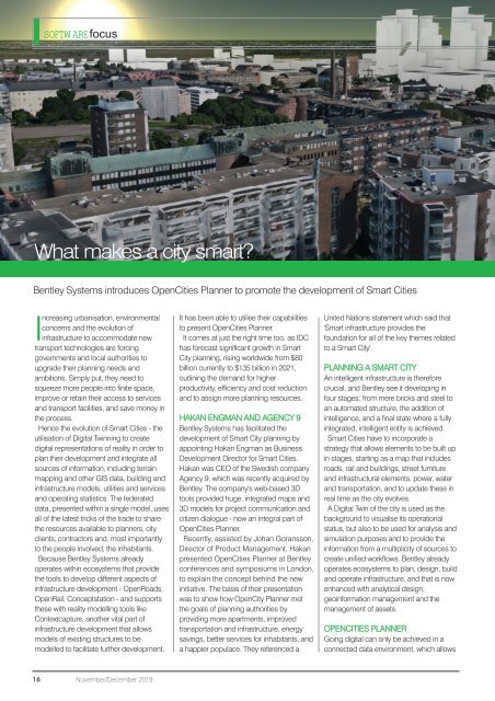
What makes a city smart?<br />
Bentley Systems introduces OpenCities Planner to promote the development of Smart Cities<br />
Increasing urbanisation, environmental<br />
concerns and the evolution of<br />
infrastructure to accommodate new<br />
transport technologies are forcing<br />
governments and local authorities to<br />
upgrade their planning needs and<br />
ambitions. Simply put, they need to<br />
squeeze more people into finite space,<br />
improve or retain their access to services<br />
and transport facilities, and save money in<br />
the process.<br />
Hence the evolution of Smart Cities - the<br />
utilisation of Digital Twinning to create<br />
digital representations of reality in order to<br />
plan their development and integrate all<br />
sources of information, including terrain<br />
mapping and other GIS data, building and<br />
infrastructure models, utilities and services<br />
and operating statistics. The federated<br />
data, presented within a single model, uses<br />
all of the latest tricks of the trade to share<br />
the resources available to planners, city<br />
clients, contractors and, most importantly<br />
to the people involved, the inhabitants.<br />
Because Bentley Systems already<br />
operates within ecosystems that provide<br />
the tools to develop different aspects of<br />
infrastructure development - OpenRoads,<br />
OpenRail, Conceptstation - and supports<br />
these with reality modelling tools like<br />
Contextcapture, another vital part of<br />
infrastructure development that allows<br />
models of existing structures to be<br />
modelled to facilitate further development,<br />
It has been able to utilise their capabilities<br />
to present OpenCities Planner.<br />
It comes at just the right time too, as IDC<br />
has forecast significant growth in Smart<br />
City planning, rising worldwide from $80<br />
billion currently to $135 billion in 2021,<br />
outlining the demand for higher<br />
productivity, efficiency and cost reduction<br />
and to assign more planning resources.<br />
HAKAN ENGMAN AND AGENCY 9<br />
Bentley Systems has facilitated the<br />
development of Smart City planning by<br />
appointing Hakan Engman as Business<br />
Development Director for Smart Cities.<br />
Hakan was CEO of the Swedish company<br />
Agency 9, which was recently acquired by<br />
Bentley. The company's web-based 3D<br />
tools provided huge, integrated maps and<br />
3D models for project communication and<br />
citizen dialogue - now an integral part of<br />
OpenCities Planner.<br />
Recently, assisted by Johan Goransson,<br />
Director of Product Management, Hakan<br />
presented OpenCities Planner at Bentley<br />
conferences and symposiums in London,<br />
to explain the concept behind the new<br />
initiative. The basis of their presentation<br />
was to show how OpenCity Planner met<br />
the goals of planning authorities by<br />
providing more apartments, improved<br />
transportation and infrastructure, energy<br />
savings, better services for inhabitants, and<br />
a happier populace. They referenced a<br />
United Nations statement which said that<br />
'Smart infrastructure provides the<br />
foundation for all of the key themes related<br />
to a Smart City'.<br />
PLANNING A SMART CITY<br />
An intelligent infrastructure is therefore<br />
crucial, and Bentley see it developing in<br />
four stages: from mere bricks and steel to<br />
an automated structure, the addition of<br />
intelligence, and a final state where a fully<br />
integrated, intelligent entity is achieved.<br />
Smart Cities have to incorporate a<br />
strategy that allows elements to be built up<br />
in stages, starting as a map that includes<br />
roads, rail and buildings, street furniture<br />
and infrastructural elements, power, water<br />
and transportation, and to update these in<br />
real time as the city evolves.<br />
A Digital Twin of the city is used as the<br />
background to visualise its operational<br />
status, but also to be used for analysis and<br />
simulation purposes and to provide the<br />
information from a multiplicity of sources to<br />
create unified workflows. Bentley already<br />
operates ecosystems to plan, design, build<br />
and operate infrastructure, and that is now<br />
enhanced with analytical design,<br />
geoinformation management and the<br />
management of assets.<br />
OPENCITIES PLANNER<br />
Going digital can only be achieved in a<br />
connected data environment, which allows<br />
16<br />
November/December 2019