CU1911

You also want an ePaper? Increase the reach of your titles
YUMPU automatically turns print PDFs into web optimized ePapers that Google loves.
INDUSTRY news<br />
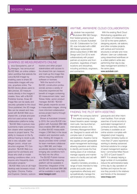
SHARING 3D MEASUREMENTS ONLINE<br />
Leica Geosystems, part of<br />
Hexagon, has announced<br />
BLK3D Web, an online collaboration<br />
workflow that extends the<br />
Leica BLK3D Imager by<br />
enabling users to share 3D<br />
measurable images with anyone,<br />
anywhere online. The<br />
BLK3D device allows users to<br />
take precise, 3D measurements<br />
directly in the images it<br />
creates. Now, with a BLK3D<br />
Publisher license, those 3D<br />
image files can be easily and<br />
securely uploaded to the cloud.<br />
Once published, the 3D image<br />
files can be viewed and measured<br />
with BLK3D Web via a<br />
shared link, a simple and powerful<br />
tool used across major<br />
collaboration platforms today.<br />
"BLK3D Web in-picture measurements<br />
make communication<br />
clearer when explaining<br />
issues to project teams. The<br />
ability to measure on the fly<br />
without having to revisit a jobsite<br />
is very valuable," said<br />
Megan Levick, virtual construction<br />
engineer, PC Construction.<br />
"BLK3D Web is a<br />
great tool for architects and<br />
those who draft or model<br />
existing conditions often, or to<br />
anyone who frequently does<br />
renovation projects."<br />
BLK3D Web runs on all major<br />
desktop web browsers including<br />
Safari, Chrome, Firefox<br />
and Explorer. Owners, subcontractors<br />
and other project<br />
stakeholders with access to<br />
the shared link can measure<br />
and mark-up the image files<br />
without requiring additional<br />
software or licenses.<br />
"With the launch of the<br />
BLK3D, construction professionals<br />
across a variety of<br />
industries experienced the<br />
benefit of images containing<br />
3D measurement data," said<br />
Tobias Heller, senior product<br />
manager, BLK3D. "BLK3D<br />
Web greatly expands access<br />
to measurable images, driving<br />
more informed collaboration<br />
across project teams through<br />
a simple URL."<br />
Shown at Autodesk University<br />
2019, the Leica BLK3D integration<br />
with Autodesk BIM 360<br />
Docs enables BIM 360 users<br />
to utilise BLK3D measurable<br />
images (.CMI files) in the issue<br />
creation and resolution workflow.<br />
Adding 3D images to<br />
issues provides richer context<br />
for team members collaborating<br />
in BIM 360, and helps<br />
accelerate decision making by<br />
bringing site conditions from<br />
the field into the office.<br />
The BLK3D Publish license<br />
and BLK3D Web measuring<br />
platform will be available in<br />
Decembe. Integration of the<br />
BLK3D with Autodesk BIM 360<br />
will be available in early 2020.<br />
www.hexagon.com<br />
ANYTIME, ANYWHERE CLOUD COLLABORATION<br />
Autodesk has expanded<br />
Autodesk BIM 360 Design,<br />
their fastest-growing cloud<br />
solution, to include Autodesk<br />
Civil 3D. Collaboration for Civil<br />
3D, now included with a BIM<br />
360 Design subscription,<br />
allows subscribers of BIM 360<br />
Design and Civil 3D to work<br />
collaboratively with project<br />
partners at anytime and from<br />
anywhere, regardless of team<br />
locations and disciplines,<br />
including architects, engineers,<br />
and contractors.<br />
FINDING THE PLOT WITH ASSETINO<br />
T-MAPY, the company behind<br />
the award winning cloud<br />
based Assetino asset management<br />
suite, has launched an<br />
international version of its<br />
Cemetery Management Module.<br />
Designed to assist with the<br />
complex task of cemetery<br />
administration, Assetino Cemetery<br />
applies proven geospatial<br />
asset management technology<br />
allowing operators and visitors<br />
to identify and locate the final<br />
resting place of an individual,<br />
manage capacity and maintenance<br />
of a facility and aid with<br />
ancestry studies.<br />
Assetino Cemetery provides a<br />
range of tools intended to help<br />
private and public sector<br />
organisations effectively and<br />
sympathetically manage the<br />
administration of cemeteries,<br />
With the existing Revit Cloud<br />
Worksharing capabilities and<br />
the addition of Collaboration for<br />
Civil 3D to the same platform,<br />
designing airports, rail stations,<br />
and other complex projects<br />
with vertical and horizontal<br />
structures is simpler and more<br />
efficient. User can collaborate<br />
using streamlined workflows on<br />
a unified platform while also<br />
performing their day-to-day<br />
data management activities in<br />
the same place.<br />
www.autodesk.com<br />
graveyards and other internment<br />
facilities. From simple<br />
searches of burial records to<br />
automated management of<br />
contracts and fees, Assetino<br />
Cemetery is available as an<br />
online solution complete with<br />
integrated smart mapping.<br />
"Assetino Cemetery builds on<br />
more than 27 years' experience<br />
working to develop advanced<br />
technical solutions for a range<br />
of asset management applications,"<br />
commented Milan Novotny,<br />
CEO of Czech based T-<br />
MAPY. "It is already helping a<br />
large number of municipalities<br />
reduce the administrative tasks<br />
of the day to day operation of<br />
facilities and improve the service<br />
they provide to the relatives<br />
and friends of the deceased."<br />
www.tmapy.com<br />
6<br />
November/December 2019