CU Jan-Feb 2020

Create successful ePaper yourself
Turn your PDF publications into a flip-book with our unique Google optimized e-Paper software.
SOFTWARE focus<br />
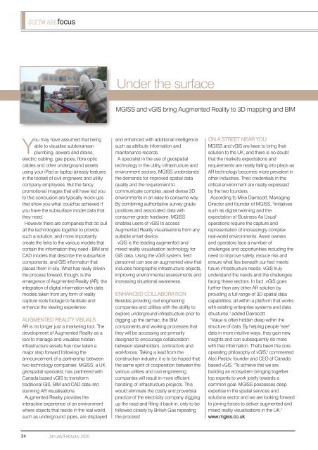
Under the surface<br />
MGISS and vGIS bring Augmented Reality to 3D mapping and BIM<br />
You may have assumed that being<br />
able to visualise subterranean<br />
plumbing, sewers and drains,<br />
electric cabling, gas pipes, fibre optic<br />
cables and other underground assets<br />
using your iPad or laptop already features<br />
in the toolset of civil engineers and utility<br />
company employees. But the fancy<br />
promotional images that will have led you<br />
to this conclusion are typically mock-ups<br />
that show you what could be achieved if<br />
you have the subsurface model data that<br />
they need.<br />
However there are companies that do pull<br />
all the technologies together to provide<br />
such a solution, and more importantly<br />
create the links to the various models that<br />
contain the information they need - BIM and<br />
CAD models that describe the subsurface<br />
components, and GIS information that<br />
places them in situ. What has really driven<br />
the process forward, though, is the<br />
emergence of Augmented Reality (AR), the<br />
integration of digital information with data<br />
models taken from any form of reality<br />
capture tools footage to facilitate and<br />
enhance the viewing experience.<br />
AUGMENTED REALITY VISUALS<br />
AR is no longer just a marketing tool. The<br />
development of Augmented Reality as a<br />
tool to manage and visualise hidden<br />
infrastructure assets has now taken a<br />
major step forward following the<br />
announcement of a partnership between<br />
two technology companies. MGISS, a UK<br />
geospatial specialist, has partnered with<br />
Canada based vGIS to transform<br />
traditional GIS, BIM and CAD data into<br />
stunning AR visualisations.<br />
Augmented Reality provides the<br />
interactive experience of an environment<br />
where objects that reside in the real world,<br />
such as underground pipes, are displayed<br />
and enhanced with additional intelligence<br />
such as attribute information and<br />
maintenance records.<br />
A specialist in the use of geospatial<br />
technology in the utility, infrastructure and<br />
environment sectors, MGISS understands<br />
the demands for improved spatial data<br />
quality and the requirement to<br />
communicate complex, asset dense 3D<br />
environments in an easy to consume way.<br />
By combining authoritative survey grade<br />
positions and associated data with<br />
consumer grade hardware, MGISS<br />
enables users of vGIS to access<br />
Augmented Reality visualisations from any<br />
suitable smart device.<br />
vGIS is the leading augmented and<br />
mixed reality visualisation technology for<br />
GIS data. Using the vGIS system, field<br />
personnel can see an augmented view that<br />
includes holographic infrastructure objects,<br />
improving environmental assessments and<br />
increasing situational awareness.<br />
ENHANCED COLLABORATION<br />
Besides providing civil engineering<br />
companies and utilities with the ability to<br />
explore underground infrastructure prior to<br />
digging up the tarmac, the BIM<br />
components and working processes that<br />
they will be accessing are primarily<br />
designed to encourage collaboration<br />
between stakeholders, contractors and<br />
workforces. Taking a lead from the<br />
construction industry, it is to be hoped that<br />
the same spirit of cooperation between the<br />
various utilities and civil engineering<br />
companies will result in more efficient<br />
handling of infrastructure projects. This<br />
would eliminate the costly and proverbial<br />
practice of the electricity company digging<br />
up the road and filling it back in, only to be<br />
followed closely by British Gas repeating<br />
the process!<br />
ON A STREET NEAR YOU<br />
MGISS and vGIS are keen to bring their<br />
solution to the UK, and there is no doubt<br />
that the market's expectations and<br />
requirements are neatly falling into place as<br />
AR technology becomes more prevalent in<br />
other industries. Their credentials in this<br />
critical environment are neatly expressed<br />
by the two founders.<br />
According to Mike Darracott, Managing<br />
Director and founder of MGISS, "Initiatives<br />
such as digital twinning and the<br />
expectation of 'Business As Usual'<br />
operations require the capture and<br />
representation of increasingly complex<br />
real-world environments. Asset owners<br />
and operators face a number of<br />
challenges and opportunities including the<br />
need to improve safety, reduce risk and<br />
ensure what lies beneath our feet meets<br />
future infrastructure needs. vGIS truly<br />
understand the needs and the challenges<br />
facing these sectors. In fact, vGIS goes<br />
further than any other AR solution by<br />
providing a full range of 3D spatial data<br />
capabilities; all within a platform that works<br />
with existing enterprise systems and data<br />
structures," added Darracott.<br />
"Value is often hidden deep within the<br />
structure of data. By helping people "see"<br />
data in more intuitive ways, they gain new<br />
insights and can subsequently do more<br />
with that information. That's been the core<br />
operating philosophy of vGIS," commented<br />
Alec Pestov, founder and CEO of Canada<br />
based vGIS. "To achieve this we are<br />
building an ecosystem bringing together<br />
top experts to work jointly towards a<br />
common goal. MGISS possesses deep<br />
expertise in the spatial services and<br />
solutions sector and we are looking forward<br />
to joining forces to deliver augmented and<br />
mixed reality visualisations in the UK."<br />
www.mgiss.co.uk<br />
34<br />
<strong>Jan</strong>uary/<strong>Feb</strong>ruary <strong>2020</strong>