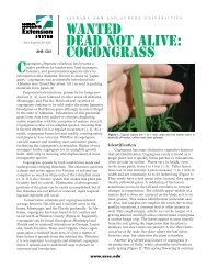
Chapter 11--Rosgen Geomorphic Channel Design
Chapter 11--Rosgen Geomorphic Channel Design
Chapter 11--Rosgen Geomorphic Channel Design

You also want an ePaper? Increase the reach of your titles
YUMPU automatically turns print PDFs into web optimized ePapers that Google loves.
<strong>Chapter</strong> <strong>11</strong><br />
Base-level change—A key part of channel stability<br />
analysis. Degree of channel incision (lowering of local<br />
base level) is determined by the ratio of the lowest<br />
bank height divided by maximum bankfull depth,<br />
called the bank height ratio. A stream may not be<br />
entrenched (vertically constrained), but may be partially<br />
incised, leading to entrenchment. A grade-control<br />
structure requirement is often associated with partially<br />
incised channels (<strong>Rosgen</strong> 1997a).<br />
Direct disturbance and riparian vegetation—The direct<br />
disturbance of stream channels must be offset by<br />
correcting dimension, pattern, profile, and often channel<br />
materials. Levees adjacent to both banks should<br />
be set back allowing room for a flood plain. Riparian<br />
vegetation change is not only a major cause of instability<br />
and loss of function, but is a key solution in restoration<br />
and natural channel design. Riparian vegetation<br />
reestablishment should contain the correct overstory<br />
and understory species to be compatible for a self-sustaining,<br />
long-term solution.<br />
Biological assessments—Biological assessments that<br />
describe fish species, food chains, diversity with broad<br />
categories of ecoregions, and stream types (habitat<br />
units) are currently collected with the assessment level<br />
for identifying biological potential. Limiting factor<br />
analysis provides information that identifies specific<br />
problems that may be corrected by changed management<br />
and/or restoration.<br />
It is readily apparent that this procedure involves extensive<br />
field observations and an extensive data base<br />
followed by a thorough and detailed analysis. All of<br />
this must be completed prior to restoration planning,<br />
as it forms much of the foundation for what follows.<br />
It is important to understand the various causes of instability<br />
responsible for loss of physical and biological<br />
function and corresponding loss of value. Recommendations<br />
that follow are critically linked to land uses,<br />
disturbance regime, and other problem sources. The<br />
flowchart (fig. <strong>11</strong>–10) depicts the assessment criteria<br />
of channel stability.<br />
<strong>Rosgen</strong> <strong>Geomorphic</strong> <strong>Channel</strong> <strong>Design</strong><br />
<strong>11</strong>–26 (210–VI–NEH, August 2007)<br />
Part 654<br />
National Engineering Handbook<br />
(d) Phase IV—Passive recommendations<br />
for restoration<br />
A first priority in restoration is to seek a natural recovery<br />
solution based on changes in the variables causing<br />
the instability and/or loss of physical and biological<br />
function. Changes in land use management can influence<br />
riparian vegetation composition, density and<br />
vigor, flow modifications (diversions, storage, and<br />
reservoir release schedule modifications based on the<br />
operational hydrology), flood control measures, road<br />
closures/stabilization, hillslope erosional processes,<br />
and other process influences of river stability. Often, a<br />
change in management strategies can be very effective<br />
in securing stability and function. This often has to be<br />
determined based on the recovery potential of various<br />
stream types and the short- and long-term goals associated<br />
with the stated objectives (including costs). The<br />
alternative of self-stabilization is always a key consideration<br />
in any stability assessment. The time-trend<br />
aerial photography from phase III may help to provide<br />
insight into stream recovery potential following disturbance.<br />
Successional stages of channel adjustment (fig. <strong>11</strong>–15)<br />
can also assist at looking at natural recovery potential.<br />
It is very important to ensure that objectives are met<br />
through effectiveness monitoring required to provide<br />
the documentation on the nature, magnitude, rate, and<br />
consequences of natural recovery. If natural recovery<br />
potential is poor and/or does not meet specific objectives,<br />
phase V would be appropriate (<strong>Rosgen</strong> geomorphic<br />
channel design methodology).<br />
(e) Phase V—The stream restoration<br />
and natural channel design using the<br />
<strong>Rosgen</strong> geomorphic channel design<br />
methodology<br />
Phase V involves combining the results of the previous<br />
phases. A good design can only follow a good assessment.<br />
It is preferred not to patch symptoms, but rather<br />
provide solutions to restoration that will offset the<br />
cause of the problem and allow for the river to be selfmaintaining.<br />
The practitioner must be very familiar<br />
with the processes involved in hydrology, hydraulics,<br />
sedimentology, geomorphology, soil science, aquatic<br />
habitat, and riparian vegetation. Due to the inherent<br />
complexity, it is usually necessary to obtain technical