Proposal for Auroville City Center. Anupama Kundoo architects. 2007
This proposal for Auroville City Center, was produced in 2007 by Anupama Kundoo and her team under the supervision of Roger Anger. It is based upon the Chief Architect's city plan for Auroville as envisioned by Mirra Alfassa, aka the Mother, with which Auroville was founded on 28 February 1968 in Tamil Nadu, India. This document was produced in order to initiate the development of the City Center with a population of 5000 inhabitants and take the first urban step towards realising Auroville. It serves as the basis to invite technical inputs and strategies for mobility, energy, water and other infrastructure in the direction of Auroville's defined vision and aims. The next phase would integrate technical inputs and propose the detail development plans. Documents referred to: Auroville Masterplan. Project proposal by Roger Anger, 1968 Auroville Universal Township Masterplan: Perspective 2025, Jointly prepared by Auroville Foundation and Town and Country Planning Organisation, Government of India, Ministry of Urban Development and Poverty Alleviation, 2001(approved by HRD Ministry on 12.04.2001) Guidelines for Integrated Urban and Rural Lanscaping in Auroville, Helge Jung, May 2001 Auroville Mobility Concept, Planungsbüro Billinger, August 2001 Auroville Universal Township Masterplan 2004: Directions for Growth Project proposal part of “Auroville Innovative Urban Management” project No. IND-015 of the AsiaUrbs project of the European Commission, 2003 Prefeasibility study on Water Supply, Storm Water Management for the City of Auroville. Study by Harald Kraft, Feb 2003 C.I.R.H.U. Auroville’s Future, 2003 Auroville City Center Proposal by Anupama Kundoo, February 2004 Auroville City Center Proposal by Auroville’s Future, 2005 Auroville Mobility, Auroville’s Future, February 2005 Administrative Area, Auroville. Project proposal by Anupama Kundoo, 01.02.2006 Auroville Townhall. Project proposal by Anupama Kundoo, 15.02.2007 sources
This proposal for Auroville City Center, was produced in 2007 by Anupama Kundoo and her team under the supervision of Roger Anger. It is based upon the Chief Architect's city plan for Auroville as envisioned by Mirra Alfassa, aka the Mother, with which Auroville was founded on 28 February 1968 in Tamil Nadu, India. This document was produced in order to initiate the development of the City Center with a population of 5000 inhabitants and take the first urban step towards realising Auroville. It serves as the basis to invite technical inputs and strategies for mobility, energy, water and other infrastructure in the direction of Auroville's defined vision and aims. The next phase would integrate technical inputs and propose the detail development plans.
Documents referred to:
Auroville Masterplan. Project proposal by Roger Anger, 1968
Auroville Universal Township Masterplan: Perspective 2025, Jointly prepared by Auroville Foundation and Town and Country Planning Organisation, Government of India, Ministry of Urban Development and Poverty Alleviation, 2001(approved by HRD Ministry on 12.04.2001)
Guidelines for Integrated Urban and Rural Lanscaping in Auroville, Helge Jung, May 2001
Auroville Mobility Concept, Planungsbüro Billinger, August 2001
Auroville Universal Township Masterplan 2004: Directions for Growth
Project proposal part of “Auroville Innovative Urban Management” project No. IND-015 of the AsiaUrbs project of the European Commission, 2003
Prefeasibility study on Water Supply, Storm Water Management for the City of Auroville. Study by Harald Kraft, Feb 2003
C.I.R.H.U. Auroville’s Future, 2003
Auroville City Center Proposal by Anupama Kundoo, February 2004
Auroville City Center Proposal by Auroville’s Future, 2005
Auroville Mobility, Auroville’s Future, February 2005
Administrative Area, Auroville. Project proposal by Anupama Kundoo, 01.02.2006
Auroville Townhall. Project proposal by Anupama Kundoo, 15.02.2007
sources

Create successful ePaper yourself
Turn your PDF publications into a flip-book with our unique Google optimized e-Paper software.
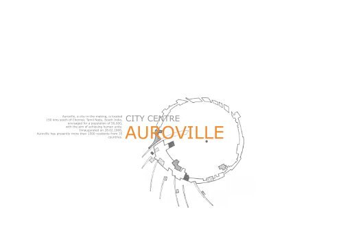
<strong>Auroville</strong>, a city-in-the-making, is located<br />
150 kms south of Chennai, Tamil Nadu, South India,<br />
envisaged <strong>for</strong> a population of 50,000,<br />
with the aim of achieving human unity.<br />
Innaugurated on 28.02.1968,<br />
<strong>Auroville</strong> has presently more than 1500 residents from 35<br />
countries.<br />
CITY CENTRE<br />
AUROVILLE
contents<br />
01 introduction p. 03<br />
02 components of the city centre p. 11<br />
03 access and mobility p. 15<br />
04 distibution of volumes, population and services p. 23<br />
05 parks and gardens p. 29<br />
06 matrimandir area p. 35<br />
07 lake p. 39<br />
08 green network p. 43<br />
09 crown buildings p. 47<br />
10 administrative belt p. 57<br />
11 habitat belt p. 71<br />
12 CIRHU p. 81<br />
13 vocational training area p. 85<br />
14 offices of the industrial zone p. 93<br />
15 international zone p. 101<br />
16 residential zone p. 105<br />
17 cultural zone p. 113<br />
18 references p. 121
01 introduction
extent and location<br />
<strong>Auroville</strong>, a city-in-the-making, is located 150 kms<br />
south of Chennai, Tamil Nadu, South India, envisaged<br />
<strong>for</strong> a population of 50,000, with the aim of achieving<br />
human unity.<br />
Innaugurated on 28.02.1968, <strong>Auroville</strong> has presently<br />
more than 1500 residents from 35 countries.<br />
The <strong>City</strong> Centre of <strong>Auroville</strong> covers a surface of 384<br />
acres with a radius of 690 meters around <strong>Auroville</strong>’s<br />
centre.<br />
Chennai<br />
<strong>Auroville</strong><br />
Pondicherry<br />
AUROVILLE CITY CENTRE_PROPOSAL <strong>2007</strong>
ackground<br />
Due to the scattered land situation & stewardship in<br />
the early years of <strong>Auroville</strong>; the development had<br />
grown very haphazard.<br />
Further, the cost of infrastructure in proportion to the<br />
cost of structures is far too high if this trend continues.<br />
Today, however, most of the land is purchased in the<br />
city centre area and it is very feasible to concentrate<br />
the development around Matrimandir, which is now<br />
nearing completion.<br />
lands owned by <strong>Auroville</strong><br />
(Masterplan 2001)<br />
<br />
AUROVILLE CITY CENTRE_PROPOSAL <strong>2007</strong>
aims<br />
The city centre development aims:<br />
To manifest urban tissue, density and architectural<br />
quality<br />
To learn urban management in accordance to The <strong>Auroville</strong><br />
Charter<br />
To target a financially sustainable development<br />
To propose a coherent and understandable project<br />
To lay common and permanent infrastructure<br />
To provide immediately large areas <strong>for</strong> parks and gardens<br />
To implement the first phase of traffic pollution free<br />
area within the town<br />
To simplify access to services and public facilities<br />
To provide access to international, residential, cultural<br />
and industrial activities at walking distances<br />
AUROVILLE CITY CENTRE_PROPOSAL <strong>2007</strong>
the potential<br />
Being still quite a virgin area, the <strong>City</strong> Centre offers<br />
the possibility to develop according to the highest<br />
aims and objectives of <strong>Auroville</strong>.<br />
The small scale of the project provides the testing<br />
ground <strong>for</strong> innovative infrastructural systems and<br />
buildings and <strong>for</strong> learning how to manage the finances<br />
in a collective way. 10 10 of the total population of<br />
<strong>Auroville</strong> i.e.5000 inhabitants will be provided residential<br />
accommodation in the city centre area.<br />
A concentrated development of <strong>Auroville</strong>’s <strong>City</strong> Centre<br />
is not only urgent <strong>for</strong> <strong>Auroville</strong>’s collective focus,<br />
but also a very feasible, practical and economically<br />
advantageous option.<br />
The actual physical realisation of this ‘<strong>City</strong> Centre’ will<br />
be a model example to experiment at a small scale,<br />
the future developments <strong>for</strong> the whole of <strong>Auroville</strong>.<br />
<br />
AUROVILLE CITY CENTRE_PROPOSAL <strong>2007</strong>
context of the 4 zones<br />
The city centre of <strong>Auroville</strong> is located in the context<br />
of <strong>Auroville</strong>‘s masterplan consisting of four principle<br />
zones namely; International, Residential, Cultural &<br />
Industrial; which radiate from the centre in a spiraling<br />
movement accomodating a total population of 50,000<br />
inhabitants.<br />
INDUSTRIAL ZONE<br />
A circular ring road called `the crown´goes along a diameter<br />
of 1.25 kilometers and is the main spine of this<br />
city, seen as a lively ´street´which will accomodate all<br />
the principle services distributed according to the zone<br />
that it cuts through.<br />
INTERNATIONAL ZONE<br />
CULTURAL ZONE<br />
Within the crown each of the above mentioned zones<br />
fuse together, overlap and interpenetrate each other.<br />
The <strong>City</strong> Centre is the area within this Crown Road,<br />
where the essence of each zone is located but without<br />
segregation from the other as a unified whole, and<br />
from which outside of the crown the zone proper can<br />
radiate.<br />
RESIDENTIAL ZONE<br />
AUROVILLE CITY CENTRE_PROPOSAL <strong>2007</strong>
02 components of the city centre
components<br />
Matrimandir area<br />
Lake<br />
Green Network<br />
Crown Development<br />
Administrative Belt<br />
Habitat Belt<br />
CIRHU<br />
Vocational Training Centre<br />
Industrial Zone<br />
International Zone<br />
Residential Zone<br />
Cultural Zone<br />
12<br />
AUROVILLE CITY CENTRE_PROPOSAL <strong>2007</strong>
city centre map<br />
The following are the components of the <strong>City</strong> Centre:<br />
1. Matrimandir Area<br />
2. Lake<br />
3. Green Network<br />
4. Crown Development<br />
5. Administrative Belt<br />
6. Habitat Belt<br />
7. CIRHU<br />
(<strong>Center</strong> <strong>for</strong> International Research<br />
in Human Unity)<br />
8. Vocational Training Centre<br />
9. Offices of the Industrial Zone<br />
10. International Zone<br />
11. Residential Zone<br />
12. Cultural Zone<br />
INDUSTRIAL ZONE<br />
CULTURAL ZONE<br />
INTERNATIONAL ZONE<br />
RESIDENTIAL ZONE<br />
AUROVILLE CITY CENTRE_PROPOSAL <strong>2007</strong> 13
03 access and mobility
oad network hierarchy<br />
Preference <strong>for</strong> non-polluting movements<br />
The proposed layout of <strong>Auroville</strong> is ideal to develop a<br />
motor-free city. From the Outer Ring Road Matrimandir<br />
Area can be reached within 12 minutes walking time<br />
(or 4 minutes by cycle). The longest possible distance,<br />
i.e., to cross the <strong>City</strong> Area diagonally requires 36<br />
minutes. In a motor-free city, preference is given to<br />
pedestrians, cyclists and to non-polluting movement<br />
resulting in a peaceful mix of all traffic participants<br />
on street spaces that are non-exclusive and common<br />
<strong>for</strong> all. An environment free of noise and other traffichazards<br />
befits a “peace area”. Children and the elderly<br />
can move freely.<br />
There<strong>for</strong>e <strong>for</strong> the city area of <strong>Auroville</strong> it is recommended<br />
to create a zone where pedestrians take priority.<br />
Cyclists will be allowed where they do not disturb.<br />
Cars and motorbikes will be permitted only when necessary<br />
<strong>for</strong> emergencies, or <strong>for</strong> delivery and removal.<br />
Only those with walking problems will be allowed to<br />
use motorised vehicles in the pedestrian zone. Access<br />
<strong>for</strong> vehicles <strong>for</strong> delivery and removal can be restricted<br />
to certain times of the day. All motor-vehicles will have<br />
to adjust their speed to the pedestrians. Public transport<br />
buses are permitted to use the streets and pathways<br />
of the city area. 15 km/h is appropriate as the<br />
maximum speed. This results in an average speed of<br />
10 km/h <strong>for</strong> a bus-line, including the time <strong>for</strong> stops.<br />
road<br />
service road<br />
pedestrian<br />
train <strong>for</strong> children<br />
underground road<br />
recreational pathway<br />
<strong>for</strong>est pathway<br />
16<br />
AUROVILLE CITY CENTRE_PROPOSAL <strong>2007</strong>
distances<br />
The centre of <strong>Auroville</strong> is <strong>for</strong>med by Matrimandir, Amphitheatre<br />
and Banyan Tree. In the Master Plan, according<br />
to the Galaxy concept, green network (containing<br />
pedestrian lanes and cycle paths) radiates out<br />
from the centre.<br />
Within 5 minutes walking distance of Matrimandir Area<br />
lies the Crown Road, which encircles the inner city area.<br />
The Crown Road is conceived as a circle with a radius<br />
of about 700 m. Within approximately 7 minutes walking<br />
distance of the Crown Road, the Outer Ring Road<br />
is located with a radius of about 1.25 km.<br />
The boundary of the township is also defined in the<br />
<strong>for</strong>m of a circle. With a radius of 2.5 km, it encloses an<br />
area of about 20 sq.km. (2000 ha.)<br />
Billinger sketch (Mobility Report 2005)<br />
AUROVILLE CITY CENTRE_PROPOSAL <strong>2007</strong> 17
vehicular circulation<br />
The crown road is a circular street which surrounds the<br />
city centre and which is fed by radial streets, <strong>for</strong>ming<br />
a connection to the outer ring road. Vehicular acces<br />
stops here and is permitted via service roads only <strong>for</strong><br />
specific timings.<br />
An underground road connects the crown road with<br />
the administrative belt and several parking facilities in<br />
the habitat belt.<br />
crown road<br />
service and delivery road<br />
18<br />
AUROVILLE CITY CENTRE_PROPOSAL <strong>2007</strong>
vehicular circulation<br />
underground access and parking<br />
train <strong>for</strong> children<br />
AUROVILLE CITY CENTRE_PROPOSAL <strong>2007</strong> 19
pedestrian criculation<br />
Inside the crown road, pedestrian movement has an<br />
absolute priority. partially shaded walkways, promenades<br />
and bridges connect the buildings, while pathways<br />
with different types of pavings give access to<br />
the gardens and the green network, useable <strong>for</strong> byciclists,<br />
skaters and hikers.<br />
pedestrian streets<br />
recreational pathways<br />
20<br />
AUROVILLE CITY CENTRE_PROPOSAL <strong>2007</strong>
atmosphere<br />
pathways of the green network<br />
AUROVILLE CITY CENTRE_PROPOSAL <strong>2007</strong> 21
04 distribution of volumes, population and services
uilding heights<br />
Most of the buildings follow a height restriction of<br />
ground +1 or ground +2 levels. Only important buildings<br />
like the Matrimandir, the CIRHU or the townhall<br />
gain more height, in addition to that the so called<br />
„lines of <strong>for</strong>ce“ are also allowed to grow higher. The<br />
ones that touch the vocational training centre in the<br />
north have their highest point towards the city centre,<br />
whereas the ones in the residential zone grow higher<br />
towards the crown road.<br />
G +11<br />
G +10<br />
G +8<br />
G +7<br />
G +6<br />
G +5<br />
G +4<br />
G +3<br />
G +2<br />
G +1<br />
24<br />
AUROVILLE CITY CENTRE_PROPOSAL <strong>2007</strong>
distribution of population<br />
5.4<br />
5.3<br />
5.2<br />
5.1<br />
The city centre will accommodate residential units <strong>for</strong><br />
a population of 5,000 inhabitants, and while the residential<br />
zone does enter the city center, the population<br />
will be distributed throughout the area as follows:<br />
4<br />
1. residential zone: 1,250<br />
2. habitat belt: 1,500<br />
2<br />
3. crown: 1,900<br />
4.vocational training centre: 100<br />
3<br />
5. offices of the industrial zone<br />
5.1 Block 1: 60<br />
5.2 Block 2: 30<br />
5.3 Block 3: 35<br />
5.4 Block 4: 25<br />
total: 150<br />
7<br />
6.2<br />
6. cultural zone<br />
6.1 Kindergarten: 20<br />
6.2 Faculties: 30<br />
total: 50<br />
7. international zone: 50<br />
1<br />
6.1<br />
3<br />
AUROVILLE CITY CENTRE_PROPOSAL <strong>2007</strong> 25
distribution of service buildings<br />
Social infrastructure will be distributed appropriately<br />
according to the Table provided in Page 66 of the Perspective<br />
Plan 2025 to serve the needs of 5000 residents<br />
of the <strong>City</strong> Centre.<br />
Over and above there will be a higher proportion of<br />
services in the crown area as the crown is the main<br />
service area <strong>for</strong> the rest of the city.<br />
other<br />
service<br />
26<br />
AUROVILLE CITY CENTRE_PROPOSAL <strong>2007</strong>
distribution of service buildings<br />
Tab le 18: S o c i a l I n f r ast r u ct u r e r e q u i r e m e n t f o r a P o p u l at i o n o f 15 , 000<br />
( N o . o f fac i l i t i es at va r i o u s l eve l s)<br />
I n f r ast r u ct u r e<br />
Total<br />
a rea<br />
( ha.)<br />
C o m m u n i t y<br />
L eve l<br />
Sect o r<br />
L eve l<br />
N e i g h b o u r h o o d<br />
L eve l<br />
D i st r i ct<br />
/<br />
C i ty<br />
L eve l<br />
P o p u l at i o n Se r ve d 250 1 ,000 5 ,000 15 ,000<br />
H ea l t h 8<br />
E mergen c y 1<br />
C lini c 1<br />
Pol y c l ini c 1<br />
Hospital 1<br />
Alternati v e health<br />
1 1 1<br />
F a c ilities<br />
E d u cat i o n 80<br />
C rè c he & Kindergarten 1<br />
S chool (age 6-10) 1<br />
S chool (age 11-19) 1<br />
U ni v e r s it y 1<br />
R ec r eat i o n<br />
C o m m unit y p ar k s &<br />
pla y g round s<br />
1<br />
Se ctor par k s &<br />
1<br />
pla y g round s<br />
N eighbourhood par k s<br />
1<br />
&<br />
pla y g round s<br />
C it y l e v e l pla y g round 1<br />
C o m m e r c i a l 30<br />
Shopping 5 s hop s 10 shop s 25 s hop s store<br />
Gue sthouses 2 8<br />
T ouri st c entre 3<br />
C u l t u r e 10<br />
E x h ibition s pa c e 1<br />
C ine m a 1( mini- c ine m a) 1<br />
Auditorium 1<br />
U t i l i ty & Se r v i ces 25<br />
M aintenance c entres 1 1<br />
Z onal offices 1<br />
C it y l e v e l offices &<br />
1<br />
T o w n ad m ini stration<br />
Burial & c re m ation s ite 1<br />
Water di stribution 1<br />
Waste w ater treatment 1<br />
Solid w a ste re c y c l ing 1 1<br />
Se rvice n o d es 32<br />
T raffic & v i l lage<br />
interface facilities<br />
source: Master Plan Perspective 2025, p. 66<br />
8<br />
AUROVILLE CITY CENTRE_PROPOSAL <strong>2007</strong> 27
05 parks and gardens
distribution of parks<br />
The principle parks and gardens throughout Autoville<br />
will be connceted to from a green network through<br />
which an alternative and nonpolluting mobility will be<br />
provided to the city.<br />
This means that starting from the rnatrimandir gardens,<br />
the four principal parks and the green network<br />
and all other green city areas as well as the green belt<br />
are to be seen as one living green body.<br />
Mahakali Park<br />
The city area will be structured by four major parks<br />
which spread out from the centre to the green belt<br />
separating the 4 zones of the city. They will act as<br />
green lungs <strong>for</strong> the city, improving the climate with the<br />
air circulation, providing recreation <strong>for</strong> the residents<br />
and connecting the city centre to the green belt by<br />
means of pedestrian and cycle paths.<br />
Mahasaraswati Park<br />
In different areas of the park there will be smaller<br />
gardens with special site themes to create a diversity<br />
of spaces within the park, yet all being harmoniously<br />
connected. There will be recreational facilities<br />
like playgrounds, resting places, jogging paths, picnic<br />
sites, and educational facilities <strong>for</strong> nature awareness,<br />
green houses and arboretums.<br />
Since 55 of the city will be open spaces or permeable<br />
surface, in order to prevent it from becoming residual<br />
space or concrete deserts as in other towns and<br />
cities, it has been planned to accommodate greenery<br />
of an organized nature.<br />
Maheswari Park<br />
Mahalakshmi Park<br />
30<br />
AUROVILLE CITY CENTRE_PROPOSAL <strong>2007</strong>
distribution of gardens<br />
The distribution of gardens in the <strong>City</strong> Centre follows<br />
a radiating logic and has three major components:<br />
the core (Matrimandir gardens), a ring in the middle<br />
(Cultural zone A and the gardens between the administrative<br />
and the habitat belt), and a further ring of<br />
gardens which is directly connected to the buildings of<br />
the crown road.<br />
AUROVILLE CITY CENTRE_PROPOSAL <strong>2007</strong> 31
components<br />
4<br />
core middle ring outer ring<br />
32<br />
AUROVILLE CITY CENTRE_PROPOSAL <strong>2007</strong>
circulation<br />
jogging track<br />
Some of the gardens are intertwined with different systems<br />
of circulation, e.g. the recreational pathway in<br />
the the gardens of the cultural zone A, which connects<br />
the buildings of the Kindergarten in a playful way, or<br />
the jogging track between the administrative- and the<br />
habitat belt.<br />
recreational pathway<br />
AUROVILLE CITY CENTRE_PROPOSAL <strong>2007</strong> 33
06 matrimandir area
matrimandir area<br />
The Matrimandir Area is at the heart of the city and<br />
contains the following elements:<br />
1. The Matrimandir: place <strong>for</strong> concentration.<br />
2. The Banyan Tree: the geographical centre of <strong>Auroville</strong><br />
and the only tree standing in the area at <strong>Auroville</strong>’s<br />
inception, symbolizing unity.<br />
3. The Urn and Amphitheatre: This was the site of<br />
the inauguration of <strong>Auroville</strong> on 28th February 1968<br />
where a lotus bud shaped urn still stands containing<br />
the soil of 121 nations and 23 Indian states, brought<br />
by youth and combined ceremoniously in a demonstration<br />
of the unity aspired by <strong>Auroville</strong>. The amphitheatre<br />
serves as a very special gathering place <strong>for</strong><br />
Aurovilians.<br />
2. Banyan Tree<br />
4. The Matrimandir gardens<br />
1. Matrimandir<br />
3. Urn and Amphitheatre<br />
4. Matrimandir gardens<br />
36<br />
AUROVILLE CITY CENTRE_PROPOSAL <strong>2007</strong>
matrimandir gardens<br />
6<br />
7<br />
5<br />
8<br />
4<br />
9<br />
3<br />
10<br />
2<br />
11<br />
1<br />
12<br />
Surrounding the Matrimandir, and amidst the lake,<br />
an oval is planned containing twelve distinct gardens.<br />
Beginning from the western pillar of Matrimandir and<br />
moving counter-clockwise they will develop the following<br />
themes:<br />
1. Existence<br />
2. Consciousness<br />
3. Bliss<br />
4. Light<br />
5. Life<br />
6. Power<br />
7. Wealth<br />
8. Utility<br />
9. Progress<br />
10. Youth<br />
11. Harmony<br />
12. Perfection<br />
In their choice of plants, these gardens will represent<br />
some qualities related to the overall theme through<br />
the meanings the Mother gave to certain flowers. So<br />
the entire planting will enhance the special garden<br />
theme.<br />
More than in the outer parks and green corridors, there<br />
will be experimentation with a diversity of colours,<br />
textures and shapes within a very small area, the average<br />
area of the gardens being about 500 to 1300<br />
sq.metres. Separated by radial paths between them,<br />
and closed up, they continue the twelve circle sectors<br />
and the radial lines of the Matrimandir itself. Together<br />
with the Banyan tree, the Amphitheatre and a rose<br />
garden they <strong>for</strong>m the central Peace area with its surrounding<br />
lake.<br />
There should be an atmosphere of tranquility and<br />
contemplation in this area, which cannot be disturbed<br />
by any busy traffic. In other words they will be a<br />
unique feature of the townscape, radiating their energy<br />
throughout the city area surroundings.<br />
AUROVILLE CITY CENTRE_PROPOSAL <strong>2007</strong> 37
07 lake
the lake<br />
The lake surrounding the oval of the Matrimandir Gardens<br />
will serve a dual purpose: first, to help create an<br />
atmosphere of calm and serenity at the heart of the<br />
city, and second, to act as a significant groundwater<br />
recharge area, by acting as a reservoir <strong>for</strong> rainwater<br />
and allowing if to percolate into the underlying aquifer.<br />
40<br />
AUROVILLE CITY CENTRE_PROPOSAL <strong>2007</strong>
concept of rain water harvesting<br />
Harvested rain water from the city will be used to fill<br />
the central lake having a surface area of 181,000 m²,<br />
a maximum depth of 10 m, and a slope of the embankment<br />
of 1 : 3, the average depth would be 7,60<br />
m, and the storage volume would be 1,376,000 m³.<br />
sketch <strong>for</strong>m Ingenieur Büro Kraft, Berlin<br />
AUROVILLE CITY CENTRE_PROPOSAL <strong>2007</strong> 41
08 green network
green network<br />
The interconnection of various parks in the city area<br />
will make it possible to provide green routes <strong>for</strong> mobility<br />
within <strong>Auroville</strong> <strong>for</strong> those using bicycles or walking,<br />
the distances between zones being very small.<br />
44<br />
AUROVILLE CITY CENTRE_PROPOSAL <strong>2007</strong>
green network<br />
The parks in the city centre are connected to other<br />
green areas, altogether constituting the green network.<br />
Between the crown road and the outer ring road there<br />
is an already existing structure of green spaces, which<br />
will be absorbed; outside of the outer ring road the<br />
green network enlarges into a ring of almost continuosly<br />
green space.<br />
AUROVILLE CITY CENTRE_PROPOSAL <strong>2007</strong> 45
09 crown buildings
crown buildings<br />
The crown is the main service ring of <strong>Auroville</strong>, where<br />
the principle service facilities if each zone are situated.<br />
The ring, cutting through the 4 zones, also links and<br />
provides continuity between the zones. Thus it will be<br />
the main hub, the spine, the very heart of <strong>Auroville</strong>’s<br />
city life.<br />
study model Roger Anger<br />
48<br />
AUROVILLE CITY CENTRE_PROPOSAL <strong>2007</strong>
circulation<br />
Along the crown road there will also be the main traffic<br />
of the city. On the external face of the buildings will<br />
be located the main vehicular traffic while on the inner<br />
face of the buildings will be the gardens of the crown<br />
buildings facing the Matrimandir.<br />
Between these two faces a pedestrian street will contain<br />
the street life, expanding and contracting in width<br />
to accommodate other necessary and significant outdoor<br />
public space. Walkways and bridges will further<br />
link neighbouring buildings to create a unified pedestrian<br />
circulation also vertically and horizontally on the<br />
upper levels.<br />
Through the buildings and between them, at places it<br />
will be possible to cut through the building mass and<br />
to enter the gardens and the other sub zones of the<br />
city center <strong>for</strong> pedestrians. At few points the radial<br />
roads will penetrate the crown buildings to serve the<br />
required built areas. Another kind of penetration will<br />
be the 4 principal parks that will continue into the city<br />
center also containing pedestrian and bicycle traffic.<br />
AUROVILLE CITY CENTRE_PROPOSAL <strong>2007</strong> 49
distribution of built spaces<br />
2<br />
1<br />
Service buildings:<br />
The crown is primarily <strong>for</strong> service buildings and facilities<br />
according to the zone that it serves. These are<br />
listed below.<br />
Residential spaces:<br />
In addition the crown will absorb a residential population<br />
of 1900 inhabitants distributed throughout the<br />
ring uni<strong>for</strong>mly.<br />
The crown in the International Zone (1)<br />
As the service area <strong>for</strong> the International Zone, there<br />
will be the crown restaurants, hotels guest-houses, exhibition<br />
halls, meeting rooms, infomation center, world<br />
news center, post-office, bank, restaurants and various<br />
facilities selectively open to visitors and participants in<br />
the various activities organized in <strong>Auroville</strong> (seminars,<br />
conferences, sports events, cultural festivals etc.)<br />
One main element in the crown will be a projected<br />
International Centre/Unity Pavilion which will provide<br />
specific facilities such as guest rooms, office space,<br />
restaurants to the various pavilions so as to foster<br />
contacts between guests from many countries and<br />
common spaces <strong>for</strong> co-ordination.<br />
The crown in the Industrial Zone (2)<br />
The main activities in this part of the Industrial Zone<br />
will include vocational training-centers, administrative<br />
buildings of the city, workshops, studios, social centers,<br />
health and emergency centers, security- centre,.<br />
post-office, telecommunication centre, bank etc.<br />
50<br />
AUROVILLE CITY CENTRE_PROPOSAL <strong>2007</strong>
distribution of built spaces<br />
The crown in the Residential Zone (3)<br />
In the residential zone the principal function of the<br />
crown will be to provide <strong>for</strong> the daily needs of the<br />
residents in terms of restaurants, collective kitchens,<br />
food distribution centers, community dining, various<br />
shops and services, coffee - shops, cinemas, theatres,<br />
exhibition spaces, book stores,recreation centers,<br />
art-galleries, nature-cure centers, post-offices<br />
etc.<br />
The crown in the Cultural Zone (4)<br />
The main elements here will consist of art studios, audio-visual<br />
studios, cinemas, theatres, exhibition spaces,<br />
laboratories, institutes of research, museum, hall<br />
of culture, auditorium, gymnasiums, swimming pools,<br />
student residences, health centres, libraries, youth<br />
hostels, Sri Aurobindo International institute of Educational<br />
Research, Centre of Research on Indian Culture<br />
etc.<br />
4<br />
3<br />
AUROVILLE CITY CENTRE_PROPOSAL <strong>2007</strong> 51
oad sections<br />
drawings from „<strong>Auroville</strong> Mobility“ 2005<br />
52<br />
AUROVILLE CITY CENTRE_PROPOSAL <strong>2007</strong>
concept of pedestrian streets<br />
The buildings of the crown are alle linked through a<br />
pedestrian pathway. The schematic examples below<br />
show some possible interactions between the buildings<br />
and the pathway.<br />
AUROVILLE CITY CENTRE_PROPOSAL <strong>2007</strong> 53
design guidelines<br />
The following design guidelines and architectural features<br />
are recommended <strong>for</strong> this area:<br />
1. Massing<br />
The crown buildings will be readable as unified mass<br />
that is permeable and transparent at places. Green<br />
areas such as the principal parks and other corridors<br />
of the green network should not cut or delink the continuity<br />
of the crown pedestrian path. They could be<br />
made to pass in some creative and imaginative ways<br />
2. Heights<br />
The crown buildings will have 1 to 2 levels above the<br />
ground floor. The ground floor of the building to be 3.5<br />
m and the total building height not to exceed 10m. The<br />
ground floor may also be only connected with bridges<br />
at 3.5m.<br />
5. Distribution of spaces<br />
Most of the infrastructure and services is to be located<br />
towards the crown road and to be avoided from the<br />
inner side of the crown to protect the adjacent green<br />
areas.<br />
No parking or such services may be located on the<br />
inner side.<br />
Some parking (underground) could be integrated within<br />
the crown building but without disturbing the pedestrian<br />
path. Temporarily some parking can be organised<br />
across the road<br />
6. Other architectural requirements<br />
Building materials should be selected with a view to<br />
project a consistent language to the crown building<br />
<strong>Proposal</strong> should include <strong>for</strong> a minimum 0.1 hectareacre<br />
area of development.<br />
3. Building Edges and Setbacks<br />
Buildings will extend to touch the plot line on the edge<br />
facing the vehicular road. Although recesses and setbacks<br />
may be also provided at places.In order to be<br />
able to maintain the curvature of the crown, the uninterrupted<br />
running length of the building to be restricted<br />
to a maximum of 20m if the face is a straight<br />
edge, or alternatively the building face may be designed<br />
in accordance with the curvature of the crown<br />
building plot.<br />
4. Horizontal and Vertical connections of the pede<br />
strian street<br />
The ground floor should have space <strong>for</strong> continuous circulation<br />
in the <strong>for</strong>m of colonnades, porticos etc. <strong>for</strong> the<br />
pedestrians. The inner street thus created, will be completely<br />
continuous and mostly covered running parallel<br />
to the crown road and sandwiched between the buildings,<br />
will be free of motorised transport. The width of<br />
the path can be varying (from 2m to 10m even) with<br />
levels and steps but with barrier-free access<br />
Every building is to be visually and physically connected<br />
to the next buildings so as to create a harmonious<br />
continuity and impart an urban language to the<br />
whole crown. Provision <strong>for</strong> suitable connection of further<br />
crown buildings adjacent to a building proposed,<br />
must be an integral part of the proposal<br />
54<br />
AUROVILLE CITY CENTRE_PROPOSAL <strong>2007</strong>
area calculations<br />
total plot: 146,451 sqm<br />
International Zone<br />
Total Plot Area<br />
23,562 sqm<br />
Cultural Zone<br />
Total Plot Area<br />
25,410 sqm<br />
Primary area (60 of plot area)<br />
(20m wide outer circle)<br />
14,137 sqm<br />
Primary area (60 of plot area)<br />
(20m wide outer circle)<br />
15,246 sqm<br />
Secondary area (40 of plot area)<br />
(15m wide inner cricle)<br />
9,424 sqm<br />
Secondary area (40 of plot area)<br />
(15m wide inner cricle)<br />
10,164 sqm<br />
Ground Coverage Primary area<br />
(60 of primary plot area)<br />
Ground Coverage Secondary area<br />
(20 of secondary plot area)<br />
8,482 sqm<br />
1,885 sqm<br />
Ground Coverage Primary area 9,148 sqm<br />
(60 of primary plot area)<br />
Ground Coverage Secondary area 2,033 sqm<br />
(20 of secondary plot area)<br />
Maximum Total Building footprint<br />
10,367 sqm<br />
Maximum Total Building footprint<br />
11,181 sqm<br />
Useable area per floor<br />
(65 of footprint)<br />
Total useable area<br />
(over an average of 2.5 floors)<br />
Residential Zone<br />
Total Plot Area<br />
Primary area (60 of plot area)<br />
(20m wide outer circle)<br />
Secondary area (40 of plot area)<br />
(15m wide inner cricle)<br />
Ground Coverage Primary area<br />
(60 of primary plot area)<br />
6,739 sqm<br />
16,846 sqm<br />
58,538 sqm<br />
35,122 sqm<br />
23,415 sqm<br />
21,073sqm<br />
Ground Coverage Secondary area 4,683 sqm<br />
(20 of secondary plot area)<br />
Maximum Total Building footprint<br />
25,756 sqm<br />
Useable area per floor (65% of footprint) 16,741 sqm<br />
Total useable area (2.5 floors)<br />
41,853 sqm<br />
Useable area per floor (65% of footprint) 7,267 sqm<br />
Total useable area<br />
(over an average of 2.5 floors)<br />
Industrial Zone<br />
Total Plot Area<br />
Primary area (60 of plot area)<br />
(20m wide outer circle)<br />
Secondary area (40 of plot area)<br />
(15m wide inner cricle)<br />
Ground Coverage Primary area<br />
(60 of primary plot area)<br />
18,169 sqm<br />
38,941 sqm<br />
23,365 sqm<br />
15,576 sqm<br />
14,019 sqm<br />
Ground Coverage Secondary area 3,115 sqm<br />
(20 of secondary plot area)<br />
Maximum Total Building footprint<br />
17,134 sqm<br />
Useable area per floor (65% of footprint) 11,137 sqm<br />
Total useable area (2.5 floors)<br />
27,842 sqm<br />
AUROVILLE CITY CENTRE_PROPOSAL <strong>2007</strong> 55
10 administrative belt
administrative belt<br />
The administrative belt has been assigned 7 hectares,<br />
1.4 of the city area and is to accommodate<br />
all the city administrative offices, their supporting<br />
facilities(Administrative Area)and housing <strong>for</strong> 1500<br />
persons(Habitat).<br />
The Administrative Area curves around the Matrimandir<br />
so that all the main functions of collective organization<br />
are directly in contact with <strong>Auroville</strong>’s centre,<br />
and its influence. The curved belt has public buildings<br />
partly inter-connected to each other, along the inner<br />
side facing Matrimandir.<br />
The administrative buildings will be visually connected<br />
as a comprehensive whole. The ground floor façade<br />
will provide a continuous covered walk-way/ promenade<br />
<strong>for</strong> public circulation, with the Matrimandir on one<br />
side and the reception/exhibition areas of each main<br />
building on the other side.<br />
58<br />
AUROVILLE CITY CENTRE_PROPOSAL <strong>2007</strong>
circulation<br />
underground parking<br />
delivery road during specific timings<br />
An underground vehicular access will penetrate into<br />
the city-center area from the crown road leading to<br />
the common basement parking <strong>for</strong> the administrative<br />
belt located under the main townhall building.<br />
A service road <strong>for</strong> deliveries is located in the outer layer<br />
of the administrative belt adjacent to the park, it<br />
will allow vehicular movement during certain times of<br />
the day. At other times it will be used by bicycles and<br />
pedestrian movement.<br />
The administrative buildings will be internally served<br />
through a lively street with buildings on either side<br />
and spilling on to public open spaces.<br />
Along the front facade is a raised walkway connecting<br />
the buildings which is protected under roofoverhangs<br />
of various buildings. This walkway would<br />
connect various exhibition spaces open to the public<br />
located in each building.<br />
The buildings will be also connected on the upper level<br />
through bridges along the front facade.<br />
Finally a lake promenade will allow pedestrian movement<br />
at the lake edge through landscaped gardens<br />
and artworks.<br />
internal street connecting buildings and public spaces<br />
shaded and raised walkway<br />
lake promenade<br />
AUROVILLE CITY CENTRE_PROPOSAL <strong>2007</strong> 59
distribution of spaces<br />
There will be distinct prominent buildings <strong>for</strong> the main<br />
functions of administration and efficient organization<br />
of <strong>Auroville</strong>, and there will be intermediate buildings<br />
accommodating the supporting facilities that are<br />
common to the administration zone as a whole, such<br />
as cafeteria, exhibition spaces, photocopying, binding<br />
and telecommunication facilities.<br />
20<br />
60<br />
AUROVILLE CITY CENTRE_PROPOSAL <strong>2007</strong>
distribution of spaces<br />
main buildings common buildings service buildings<br />
CUR an example of a main building,<br />
the multimedia-center an example of a common building<br />
the various buildings of the administrative zone are a compact<br />
mass interspersed with courtyards<br />
the main townhall is higher than the<br />
other buildings<br />
AUROVILLE CITY CENTRE_PROPOSAL <strong>2007</strong> 61
area statements<br />
8<br />
2<br />
1<br />
12<br />
4<br />
10<br />
9<br />
5<br />
11<br />
3<br />
1 main townhall 8.565 sqm<br />
2 municipal services 522 sqm<br />
3 economy 364 sqm<br />
4 planning/construction 683 sqm<br />
5 education 706 sqm<br />
6 unity/mediation 364 sqm<br />
7 matrimandir office 321 sqm<br />
8 scientific research 341 sqm<br />
9 village relations/bioregion 432 sqm<br />
10 internal/external relations 413 sqm<br />
11 art & culture 783 sqm<br />
12 auroville foundation office 167 sqm<br />
6<br />
7<br />
7<br />
62<br />
AUROVILLE CITY CENTRE_PROPOSAL <strong>2007</strong>
space calculations<br />
administration area<br />
total plot area<br />
max. groundcoverage<br />
total building footprint<br />
footprint main buildings<br />
footprint common &<br />
service buildings<br />
25,766 sqm<br />
50<br />
12,883 sqm<br />
7,700 sqm (60 of total)<br />
5,183 sqm (40 of total)<br />
main buildings<br />
height townhall ground +3 or +4<br />
height others ground +2<br />
useable area per floor<br />
total useable area over<br />
3 levels<br />
additional area <strong>for</strong> the<br />
townhall due to height<br />
total useable area <strong>for</strong><br />
main buildings<br />
5,005 sqm (65% of footprint)<br />
15,015 sqm<br />
5000 sqm<br />
20,015 sqm<br />
common buildings<br />
height ground + 1<br />
useable area per floor<br />
total useable area over<br />
2 levels<br />
3,369 sqm (65% of footprint)<br />
6,738 sqm<br />
AUROVILLE CITY CENTRE_PROPOSAL <strong>2007</strong> 63
sections<br />
townhall:<br />
ground floor +4<br />
administrative area:<br />
ground floor +1/+2<br />
64<br />
AUROVILLE CITY CENTRE_PROPOSAL <strong>2007</strong>
design guidelines<br />
The following urban design guidelines and architectural<br />
features common to all buildings in this area are<br />
recommended:<br />
1 - massing<br />
The buildings of the administrative area should be readable<br />
as a compact mass rather than single standing<br />
buildings. For this it is recommended to have a ground<br />
coverage of 50. The unbuilt spaces should <strong>for</strong>m positive<br />
outdoor public spaces instead of being mere left<br />
over spaces. They would appear to be punctures in<br />
this compact mass.<br />
the administrative buildings have a direct contact<br />
to the matrimandir<br />
service buildings such as cafeteria<br />
2 - heights<br />
Main buildings will be ground + 2 floors and standout<br />
as important with the exception of the main townhall<br />
building which could go up by two more floors. Common<br />
buildings could be ground + 1 with an occasional<br />
second floor. Service buildings could be groundfloor<br />
only or ground + 1.<br />
3 - building edges and setbacks<br />
Along the side facing the Matrimandir the buildings<br />
must touch the plot edge whereas on the side facing<br />
the park the buildings maybe setback if necessary.<br />
walkways on the upper level between buildings<br />
positive unbuilt public spaces puncture the compact<br />
mass of administrative buildings<br />
4 - bridges/walkways<br />
The buildings would be preferably interconnected<br />
as much as possible through various bridges and<br />
walkways on the upper level, while simultaneously<br />
providing shade to walkways on the ground floor. This<br />
is particulary important along the front facade connecting<br />
main buildings.<br />
AUROVILLE CITY CENTRE_PROPOSAL <strong>2007</strong> 65
views / vistas<br />
66<br />
AUROVILLE CITY CENTRE_PROPOSAL <strong>2007</strong>
views / vistas<br />
The access ways into the Matrimandir are extended visually<br />
through the administrative belt to elongate the<br />
visual openings into the landscape. These ways provide<br />
transparency to the park and further beyond into<br />
the habitat belt. The residents from the habitat belt<br />
can easily access these vistas through the triangular<br />
common facility spaces.<br />
AUROVILLE CITY CENTRE_PROPOSAL <strong>2007</strong> 67
concept of open spaces<br />
Between buildings are well framed open spaces that<br />
contain outdoor activity and public life.<br />
Wherever possible, walkway bridges will be provided,<br />
even on upper floors, <strong>for</strong> easy circulation and further<br />
enhancement of the visual continuity of the whole.<br />
The innermost row of buildings is proposed to be a<br />
series of closely connected buildings <strong>for</strong> visual continuity,<br />
not higher than ground plus two stores with<br />
the exception of the main town hall. The main administrative<br />
buildings could be built up to the maximum<br />
height ,whereas the supporting ancillary functions<br />
common to the whole could be ground plus one, lower<br />
and less important structures that could be interspersed<br />
between the main buildings.<br />
68<br />
AUROVILLE CITY CENTRE_PROPOSAL <strong>2007</strong>
concept of green spaces<br />
The administrative belt has along it´s entire length a<br />
contact to the urban landscape. On the inner side is<br />
the lake and the Matrimandir gardens.<br />
On the outer side is a park.<br />
AUROVILLE CITY CENTRE_PROPOSAL <strong>2007</strong> 69
11 habitat belt
habitat belt<br />
Administrative zone is to accommodate housing <strong>for</strong><br />
1500 persons(Habitat)<br />
to prevent deserted areas of the city at night.<br />
Between the two belts of ground plus two and occasionally<br />
three floor high buildings, there is a wide and<br />
continuous relief space of green. This space will also<br />
accommodate the necessary common infrastructural<br />
support <strong>for</strong> both sides, the Administartive Area and<br />
the Habitat, such as waste water treatment plants<br />
etc. but in such a way that the spirit remains to be<br />
like a public park or garden.<br />
72<br />
AUROVILLE CITY CENTRE_PROPOSAL <strong>2007</strong>
components<br />
housing areas<br />
service buildings<br />
An underground vehicular access will penetrate into<br />
the city-center area from the crown road leading to<br />
common basement parking points <strong>for</strong> the habitat belt<br />
located under each of the areas assigned <strong>for</strong> common<br />
facilities of the habitat buildings .<br />
The habitat buildings will be internally served through<br />
a lively street with buildings on either side and spilling<br />
on to public open spaces.<br />
Smaller gardens will occur between buildings of an intimate<br />
scale while the two parks on either side of the<br />
habitat belts will take care of green spaces common to<br />
the entire residential area.<br />
There will be 4 sectors of housing areas which will be<br />
ground + 2 and occationally 3.<br />
In between these sectors are triangular spaces that accomodate<br />
the common facility buildings <strong>for</strong> the above<br />
sectors. For example parking , provisions, laundries,<br />
and cafeteria.<br />
green and open spaces extend from the street on<br />
either side between buildings as public spaces<br />
points of underground parkings<br />
internal street providing access to houses<br />
AUROVILLE CITY CENTRE_PROPOSAL <strong>2007</strong> 73
area statements<br />
D<br />
C<br />
B<br />
A<br />
74<br />
AUROVILLE CITY CENTRE_PROPOSAL <strong>2007</strong>
space calculations<br />
A<br />
B<br />
C<br />
D<br />
plotarea<br />
5,342.46 sqm<br />
10,409.44 sqm<br />
13,294.00 sqm<br />
14,890.10 sqm<br />
groundcoverage 50<br />
2,671.23 sqm<br />
5,204.70 sqm<br />
6,647.00 sqm<br />
7,445.05 sqm<br />
usable area 65% per floor<br />
1,736.30 sqm<br />
3,383.10 sqm<br />
4,310.60 sqm<br />
4,839.30 sqm<br />
usable area over 3.5 floors<br />
6,077.00 sqm<br />
11,841.00 sqm<br />
15,122.00 sqm<br />
16,938.00 sqm<br />
common facilities within cluster<br />
8 sqm/person<br />
1,519.00 sqm<br />
2,960.00 sqm<br />
3,781.00 sqm<br />
4,235.00 sqm<br />
available residencial usable area<br />
4,558.00 sqm<br />
8,881.00 sqm<br />
11,341.00 sqm<br />
12,703.00 sqm<br />
couples: 60 sqm/apartment,<br />
40 of area<br />
1,519 sqm (26 apartments)<br />
2,960 sqm (50 apartments)<br />
3,780 sqm (63 apartments)<br />
4,234 sqm (70 apartments)<br />
singles: 30 sqm/apartment,<br />
40 of area<br />
1,519 sqm (51 apartments)<br />
2,960 sqm (100 apartments)<br />
3,780 sqm (126 apartments)<br />
4,234 sqm (140 apartments)<br />
families: 90 sqm/apartment,<br />
20 of area<br />
1,823 sqm (20 apartments)<br />
3,552 sqm (40 apartments)<br />
4,536 sqm (51 apartments)<br />
5,081 sqm (57 apartments)<br />
number of residents<br />
183<br />
360<br />
456<br />
508<br />
TOTAL NUMBER OF RESIDENTS<br />
1,507 PEOPLE<br />
37<br />
AUROVILLE CITY CENTRE_PROPOSAL <strong>2007</strong> 75
design guidelines<br />
habitat belt:<br />
ground floor +1/+2<br />
76<br />
AUROVILLE CITY CENTRE_PROPOSAL <strong>2007</strong>
design guidelines<br />
The following urban design guidelines and architectural<br />
features common to all buildings in this area are<br />
recommended:<br />
1 - massing<br />
The buildings of the habitat area should be readable as<br />
a coherent and unified mass rather than single standing<br />
buil dings. For this it is recommended to<br />
have a ground coverage of 50. The unbuilt spaces<br />
should <strong>for</strong>m positive outdoor public spaces instead of<br />
being mere left over spaces.<br />
2 - heights<br />
Habitat buildings will be ground + 2 floors or 3 floors<br />
uni<strong>for</strong>mly distributed. Basement spaces may be provided<br />
<strong>for</strong> services if found necessary. Common facility<br />
buildings could be groundfloor only or ground + 1.<br />
3 - building edges and setbacks<br />
Along both edges of the length of the plot, buildings<br />
must touch the plot edge, whereas on the side facing<br />
the inner street the buildings maybe setback from the<br />
street if desired.<br />
AUROVILLE CITY CENTRE_PROPOSAL <strong>2007</strong> 77
views / vistas<br />
The access ways into the Matrimandir are extended visually<br />
through the administrative belt to elongate the<br />
visual openings into the landscape.<br />
These ways provide transparency to the park and further<br />
beyond into the habitat belt. The residents from<br />
the habitat belt can easily access these vistas through<br />
the triangular common facility spaces.<br />
78<br />
AUROVILLE CITY CENTRE_PROPOSAL <strong>2007</strong>
concept of green and open spaces<br />
The habitat belt has along it´s entire length a contact<br />
to the urban landscape on both sides. On the inner<br />
side is the park of the administrative area and on the<br />
outer side is a park framed by the vocational training<br />
buildings and the habitat.<br />
Between buildings are well framed open spaces that<br />
contain outdoor activity and public life.<br />
green spaces<br />
open spaces<br />
AUROVILLE CITY CENTRE_PROPOSAL <strong>2007</strong> 79
12 cirhu
C.I.R.H.U<br />
At one end of the Administrative Area is located the<br />
Centre <strong>for</strong> International Research in Human Unity<br />
(CIRHU) complex, which itself is seen as the concentration<br />
of research done within <strong>Auroville</strong> (Cultural<br />
Zone), and relevant research done in the rest of the<br />
world (International Zone). Thus CIRHU, envisaged<br />
as the interface between <strong>Auroville</strong> and the world, is<br />
located at the convergence of the two above-mentioned<br />
zones.<br />
Legend:<br />
A1<br />
A2<br />
B<br />
C<br />
D<br />
82<br />
section ‘analysis and action’<br />
section ‘research and experimantation’<br />
<strong>Auroville</strong> international zone<br />
<strong>Auroville</strong> cultural zone<br />
international centres<br />
AUROVILLE CITY CENTRE_PROPOSAL <strong>2007</strong>
concept<br />
CIRHU presents itself as a centre of work of exchange<br />
and of permanent meetings. All the participants of<br />
the concerned countries and of the NGO’s will meet<br />
regularly an the occasion of different symposia or<br />
conferences and the annual plenary meetings.<br />
Program of the buildings:<br />
- conference room to seat 2500 persons<br />
- 2 multi-purpose conference rooms of 300 seats<br />
each<br />
- exhibition space<br />
- library and a centre of documentation<br />
- workshop room <strong>for</strong> the section “analysis and ac<br />
tion”<br />
- 4 rooms <strong>for</strong> the section “research and experimenta<br />
tion” with spaces reserved <strong>for</strong> the study centers<br />
and their laboratories.<br />
- coordinating space<br />
- cafeteria<br />
- hotel <strong>for</strong> 100 persons.<br />
- “press” centre<br />
- administrative quarter<br />
- technical services and parking<br />
19<br />
4<br />
6 7<br />
5<br />
8<br />
9<br />
12<br />
14<br />
14<br />
10<br />
15<br />
18<br />
11<br />
9 12<br />
16<br />
1. Arrival 10. Restaurant<br />
2. In<strong>for</strong>mation 11. Auditorium service<br />
3. Entrance 12. Lounge<br />
4. Panoramic promenade 13. Exhibition<br />
5. Hotel 14. Cafe<br />
6. Hall 15. Main cascade<br />
7. Lift 16. Small cascade<br />
8. Auditorium Entrance/cafe 17. Fountain<br />
9. Auditorium 2000 people 18. Panoramic Terrace<br />
1 Arrival<br />
2 In<strong>for</strong>mation<br />
3 Entrance<br />
10 Restaurant<br />
11 Auditorium service<br />
12 Lounge<br />
AUROVILLE CITY CENTRE_PROPOSAL <strong>2007</strong> 83
13 vocational training area
vocational training area<br />
The vocational training area is planned to be an holistic<br />
school cum industry where students and teachers<br />
would live and work together in an uplifting environ<br />
as in the earlier days of education in India.<br />
Assigned 6,7 hectares having research institutions<br />
including laboratories , it will not be a dead zone in<br />
the evenings as in the case of some cities where such<br />
zones are strictly unipurpose. The residences and<br />
other services and activities will give life to this part<br />
even after its actual active hours.<br />
86<br />
AUROVILLE CITY CENTRE_PROPOSAL <strong>2007</strong>
circulation<br />
underground parking<br />
delivery road during specific timings<br />
An underground vehicular access penetrates into the<br />
city centre from the crown road leading to a common<br />
basement parking <strong>for</strong> the vocational training area.<br />
3 radial service roads enters below the high rise buildings<br />
of the industrial zone of which one will continue<br />
onwards further into the city centre’s administrative<br />
area.<br />
The buildings of the vocational training area are internally<br />
served through a lively pedestrian ‘street’ with<br />
buildings on each side, and occasionally spilling on to<br />
open public spaces.<br />
In addition shaded and occasionally raised walkways<br />
and ramps provide vertical connection to the ‘streets’<br />
on the upper levels.<br />
The vocational training area is well linked to the city’s<br />
green network so that all buildings are also provided<br />
direct access to pedestrian and bicyclists who prefer to<br />
use these routes.<br />
internal street connecting buildings and public spaces<br />
shaded and raised walkway<br />
connection to the cities green network<br />
AUROVILLE CITY CENTRE_PROPOSAL <strong>2007</strong> 87
distribution of spaces<br />
1. Service buildings- There are distinct spaces ear<br />
marked <strong>for</strong> service buildings which will contain storage<br />
rooms, parking <strong>for</strong> bicycles, gardening and building<br />
maintenance tools, etc will be well located close<br />
to the streets.<br />
2. Large scale uses- Buildings <strong>for</strong> large scale spaces<br />
such as large workshops, auditoriums, lecture halls,<br />
cafeteria, recreational areas etc, are distributed along<br />
the internal ‘street’ that passes through the vocational<br />
training belt. They are connected well to large scale<br />
courtyards and the green areas.<br />
3. Small scale uses- Such buildings, will accommodate<br />
the quieter spaces needed <strong>for</strong> creative work such as<br />
libraries, design studios and individual research areas.<br />
On one side they will have contact to the street but on<br />
the other side they will overlook the large park.<br />
Residential spaces: Hostel accommodation will be provided<br />
<strong>for</strong> 80 students studying here as well 20 staff<br />
members will be integrated in the upper floors of the<br />
large scale buildings.<br />
1<br />
3 2<br />
88<br />
AUROVILLE CITY CENTRE_PROPOSAL <strong>2007</strong>
space calculations<br />
vocational training centre<br />
total plot area 67,082 sqm<br />
max. groundcoverage 45<br />
total building footprint 30,186 sqm<br />
service buildings<br />
footprint<br />
6,037 sqm<br />
(20 of total building footprint)<br />
useable area per floor 4,925 sqm<br />
(65 of footprint)<br />
pedestrian spaces<br />
green open spaces<br />
20,125 sqm<br />
(30 of plot area)<br />
16,770 sqm<br />
(25 of plot area)<br />
total useable area over 11,775 sqm<br />
an average of 3 floors<br />
large scale uses<br />
service buildings<br />
footprint<br />
10,565 sqm<br />
(35 of total building footprint)<br />
useable area per floor 6,867 sqm<br />
(65 of footprint)<br />
total useable area over 20,601 sqm<br />
an average of 3 floors<br />
small scale uses<br />
footprint<br />
13,583 sqm<br />
(45 of total building footprint)<br />
useable area per floor 8,829 sqm<br />
(65 of footprint)<br />
large scale use / common work spaces<br />
small scale use / individual work spaces<br />
AUROVILLE CITY CENTRE_PROPOSAL <strong>2007</strong> 89
design guidelines<br />
The following urban design guidelines and architectural<br />
features common to all buildings in this area are<br />
recommended:<br />
1 - massing<br />
The buildings of the vocational training area should be<br />
readable as a compact mass rather than single-standing<br />
buildings. For this it is recommended to have a<br />
ground coverage of 45. The unbuilt spaces should<br />
<strong>for</strong>m positive outdoor public spaces instead of being<br />
mere leftover spaces. They would rather appear to be<br />
punctures in this compact mass.<br />
2 - heights<br />
The buildings will have an average height of ground +2<br />
floors. This means that there will be a varying height<br />
from ground + 1 to ground + 3. The western part<br />
towards the CIRHU will tend to be low rise and low<br />
impact (here is less connection to the road) and areas<br />
on the east towards the high rise office buildings will<br />
tend to be higher.<br />
3 - building edges and setbacks<br />
The buildings will touch the plot limits approximately<br />
50 of the plot boundary facing edges. The rest of the<br />
building edges maybe setback to <strong>for</strong>m positive outdoor<br />
pedestrian or green spaces as the case may be.<br />
4 - bridges/walkways<br />
The buildings maybe interconnected in places through<br />
ramps, bridges and walkways linking them to the interior<br />
pedestrian streets. Walkways may sometimes be<br />
shaded as necessary or possible <strong>for</strong> encourage interbuilding<br />
circulation.<br />
section through vocational training centre<br />
(office block of industrial zone in the background)<br />
90<br />
AUROVILLE CITY CENTRE_PROPOSAL <strong>2007</strong>
concept of green and open spaces<br />
On the south side the area will be facing the park<br />
through its entire length.<br />
On the north side, the buildings would face the gardens<br />
enclosed on their other sides by the crown buildings<br />
and the offices of the industrial zone.<br />
Between the gardens and the park there will be a combination<br />
of paved outdoor spaces and gardens <strong>for</strong> serving<br />
the recreational needs of the vocational training<br />
area.<br />
green spaces<br />
open spaces<br />
AUROVILLE CITY CENTRE_PROPOSAL <strong>2007</strong> 91
14 offices of the industrial zone
“the lines of <strong>for</strong>ce“ office blocks<br />
The office buildings in the industrial zones are located<br />
in 4 oblong structures, originally named „The Lines Of<br />
Force“ in the Masterplan from 1968. These structures<br />
combine the outer zone with the city centre by bridging<br />
the crown road and partially penetrating the vocational<br />
training centre.<br />
In the following description the single structures are<br />
referred to as no. 1-4. All design statements concentrate<br />
on the part of the buildings which lie within the<br />
borders of the city centre.<br />
3<br />
2<br />
1<br />
4<br />
94<br />
AUROVILLE CITY CENTRE_PROPOSAL <strong>2007</strong>
circulation<br />
service roads on ground level<br />
pedestrian space on ground level<br />
Circulation: 3 radial service roads enter below the high<br />
rise office buildings of the industrial zone of which one<br />
will continue onwards further into the city centre’s administrative<br />
area. These roads will connect to collective<br />
parking areas and service areas that need access<br />
to a road.<br />
Internal pedestrian streets alongside the service roads<br />
will connect the public space of the office area to the<br />
public space of the vocational training area. Along these<br />
streets cafes, exhibition spaces and other recreational<br />
spaces will be provided to take care of the social<br />
needs of the users of both areas together. These will<br />
also be well linked to the green spaces enclosed within<br />
the office blocks, the crown and the vocational training<br />
buildings.<br />
In addition upper level connections will be provided<br />
from various levels of the office buildings to the roof<br />
terraces of the vocational training buildings through<br />
walkways and bridges in such a way that these terraces<br />
are also sometimes directly accessible from the<br />
street with in the vocational block.<br />
The office blocks are well linked to the city’s green<br />
network on the southern side so that all buildings are<br />
also provided direct access to pedestrian and bicyclists<br />
who prefer to use these routes.<br />
public facilities on ground level<br />
roof terraces linked to office buildings 1-3<br />
AUROVILLE CITY CENTRE_PROPOSAL <strong>2007</strong> 95
distribution of built spaces<br />
level -1<br />
Basements will accommodate storage rooms, parking,<br />
gardening and building maintenance rooms, etc.<br />
Residential accommodation<br />
Each office block will provide some residential units to<br />
accommodate 150 residents as follows:<br />
level ground<br />
Public spaces which provide services <strong>for</strong> the area as a<br />
whole and not only to the office block. For example:<br />
cafes, auditoriums, exhibition spaces, shops, restaurants<br />
etc.<br />
Block 1: 60 people<br />
Block 2: 30 people<br />
Block 3: 35 people<br />
Block 4: 25 people<br />
4<br />
3<br />
2<br />
1<br />
level +1<br />
Common facilities and Reception Areas on the first<br />
floor: Office buildings will house their own large scale<br />
spaces such as auditoriums, lecture halls, seminar<br />
rooms, cafeteria, and recreational areas etc, on the<br />
first floor. They may spill on to terraces at the roof of<br />
the vocational buildings.<br />
level +2<br />
Offices spaces and floor level facilities: will be housed<br />
second floor onwards<br />
level -1 level ground level +1 level +2<br />
96<br />
AUROVILLE CITY CENTRE_PROPOSAL <strong>2007</strong>
design guidelines<br />
The following design guidelines and architectural features<br />
are recommended <strong>for</strong> this area:<br />
1. Massing:<br />
The office buildings of the industrial zone within the<br />
city center will be readable as vertical blocks that are<br />
higher towards the city center and reduce progressively<br />
towards the crown continuing even further reducing<br />
as they radiate out into the industrial zone proper to<br />
progressively diminish and scatter into ground floor<br />
large scale spaces <strong>for</strong> manufacturing. These will tower<br />
over the much lower vocational training block and intersect<br />
through the crown building facilities. A ground<br />
coverage percentage of 75 is considered to permit<br />
the necessary light and ventilation in the upper levels.<br />
Hanging gardens, and terraces must intersperse the<br />
blocks providing due relief while maintaining the urban<br />
<strong>for</strong>m.<br />
2. Heights:<br />
The 4 blocks contained within the city center area will<br />
have an average heights of 8,6,7, and 5 levels respectively<br />
spread over the entire ‘Line of Force’ blocks envisaged<br />
in the Industrial Area. At the highest points it is<br />
presently projected to have 12,11,9, and respectively<br />
8 <strong>for</strong> the 4 office blocks. As the city develops and better<br />
data is available of the required space <strong>for</strong> offices,<br />
the building heights must be reviewed and adjusted.<br />
3. Building Edges and Setbacks:<br />
Buildings will extend to touch the plot line mostly except<br />
<strong>for</strong> the relief provided by ventilation courtyards<br />
as per the architectural concept.<br />
sketches from Roger Anger<br />
AUROVILLE CITY CENTRE_PROPOSAL <strong>2007</strong> 97
total plot area: 21,739 sqm total plot area: 21,739 sqm<br />
plot area city centre: 6,716 sqm plot area city centre: 6,716 sqm<br />
plot area industrial zone:15,023 plot sqm area industrial zone:15,023 sqm<br />
(inc. crown road) (inc. crown road)<br />
total plot area: 18.971 sqm total plot area: 18.971 sqm<br />
plot area city centre: 4.511 sqm plot area city centre: 4.511 sqm<br />
plot area industrial zone:14.460 plot sqm area industrial zone:14.460 sqm<br />
(inc. crown road) (inc. crown road)<br />
space calculations<br />
ground floor<br />
ground floor<br />
top view<br />
top view<br />
1,121 sqm<br />
2,415 sqm<br />
3,893 sqm<br />
5,565 sqm<br />
6,716 sqm<br />
section<br />
647 sqm<br />
1,590 sqm<br />
2,836 sqm<br />
4,511 sqm<br />
section<br />
total plot area<br />
21,739 sqm<br />
plot area city centre: 6,716 sqm<br />
plot area industrial zone: 15,023 sqm<br />
(inc. crown road)<br />
total plot area<br />
18,971 sqm<br />
plot area city centre: 4,511 sqm<br />
plot area industrial zone: 14,460 sqm<br />
(inc. crown road)<br />
Office Block 1<br />
average 8 levels, 12 levels at the highest point<br />
1.121 sqm<br />
2.415 sqm<br />
3.893 sqm<br />
1.121 sqm<br />
5.565 sqm<br />
2.415 sqm<br />
6.716 sqm (x8)<br />
total plot area city centre<br />
service roads (18 of plot area)<br />
pedestrian spaces (52 of plot area)<br />
public service spaces (30 of plot area)<br />
maximum ground coverage<br />
total building footprint<br />
3.893 sqm<br />
5.565 sqm<br />
6.716 sqm (x8)<br />
built up areas<br />
useable area ground floor (65% of 2,015)<br />
useable area per floor (65% of footprint)<br />
useable area over 7 upper floors of full foot print<br />
useable area on 8th floor (65% of 75% of 5,565 sqm)<br />
useable area on 9th floor (65% of 75% of 3,893 sqm)<br />
useable area on 10th floor (65% of 75% of 2,415 sqm)<br />
useable area on 11th floor (65% of 75% of 1,121 sqm)<br />
6,716 sqm<br />
1,208 sqm<br />
3,492 sqm<br />
2,015 sqm<br />
75<br />
5,037 sqm<br />
1,309 sqm<br />
4,925 sqm<br />
34,475 sqm<br />
2,711 sqm<br />
1,897 sqm<br />
1,177 sqm<br />
546 sqm<br />
647 sqm<br />
1.590 sqm<br />
Office Block 2<br />
average 7 levels, 11 levels at the highest point<br />
647 sqm<br />
1.590 sqm<br />
2.836 sqm 2.836 sqm<br />
1.238 sqm<br />
4.511 sqm (x8) 4.511 sqm (x8)<br />
2.782<br />
total plot area city centre<br />
4,511 sqm<br />
service roads (20 of plot area)<br />
971 sqm<br />
pedestrian spaces (50 of plot area)<br />
2,255 sqm<br />
public service spaces (30 of plot area)<br />
1,353 sqm<br />
maximum ground coverage<br />
75<br />
total building footprint<br />
3,383 sqm<br />
built up areas<br />
useable area ground floor (65% of 1,353)<br />
879 sqm<br />
useable area per floor (65% of footprint)<br />
2,199 sqm<br />
useable area over 7 upper floors of full foot print<br />
15,393 sqm<br />
useable area on 8th floor (65% of 75% of 2,836 sqm) 1,382 sqm<br />
useable area on 9th floor (65% of 75% of 1,590 sqm) 775 sqm<br />
useable area on 10th floor (65% of 75% of 647 sqm) 315 sqm<br />
total useable area<br />
42,115 sqm<br />
total useable area<br />
18,744 sqm<br />
98<br />
AUROVILLE CITY CENTRE_PROPOSAL <strong>2007</strong>
(inc. crown road)<br />
(inc. crown road)<br />
plot area city centre: plot 1.400 area sqm city centre: 1.400 sqm<br />
plot area industrial zone:8.199 plot area industrial sqm zone:8.199 sqm<br />
(inc. crown road) (inc. crown road)<br />
space calculations<br />
ground floor<br />
ground floor<br />
top view<br />
top view<br />
1,238 sqm<br />
2,782 sqm<br />
4,714 sqm<br />
5,948 sqm<br />
section<br />
911 sqm<br />
1,400 sqm<br />
section<br />
total plot area<br />
plot area city centre:<br />
plot area industrial zone:<br />
(inc. crown road)<br />
23,143 sqm<br />
5,948 sqm<br />
17,194 sqm<br />
total plot area<br />
9,599 sqm<br />
plot area city centre: 1,400 sqm<br />
plot area industrial zone: 8,199 sqm<br />
(inc. crown road)<br />
1.238 sqm<br />
Office Block 3<br />
1.238 sqm<br />
2.782 sqm<br />
2.782 sqm<br />
4.714sqm<br />
4.714sqm<br />
5.948 sqm (x6)<br />
5.948 sqm (x6)<br />
average 6 levels, 9 levels at the highest point<br />
total plot area<br />
service roads (18 of plot area)<br />
pedestrian spaces (52 of plot area)<br />
public service spaces (30 of plot area)<br />
maximum ground coverage<br />
total building footprint<br />
5,948sqm<br />
1,070 sqm<br />
3,092 sqm<br />
1,784 sqm<br />
75<br />
4,461 sqm<br />
911 sqm<br />
1.400 sqm (x7)<br />
911 sqm<br />
1.400 sqm (x7)<br />
Office Block 4<br />
average 5 levels, 8 levels at the highest point<br />
total plot area city centre<br />
pedestrian spaces (50 of plot area)<br />
public service spaces (50 of plot area)<br />
1,400sqm<br />
700 sqm<br />
700 sqm<br />
built up areas<br />
useable area ground floor (65% of 1,784)<br />
useable area per floor (65% of footprint)<br />
useable area over 5 upper floors of full foot print<br />
useable area on 7th floor (65% of 75% of 4,714 sqm)<br />
useable area on 8th floor (65% of 75% of 2,782 sqm)<br />
useable area on 9th floor (65% of 75% of 1,238 sqm)<br />
1,160 sqm<br />
2,899 sqm<br />
14,498 sqm<br />
2,298 sqm<br />
1,356 sqm<br />
603 sqm<br />
maximum ground coverage<br />
total building footprint<br />
built up areas<br />
useable area ground floor (65% of 700)<br />
useable area per floor (65% of footprint)<br />
useable area over 6 upper floors of full foot print<br />
useable area on 7th floor (65% of 75% of 911 sqm)<br />
75<br />
1,050 sqm<br />
455 sqm<br />
682 sqm<br />
4,095 sqm<br />
444 sqm<br />
total useable area<br />
19,915 sqm<br />
total useable area<br />
4,994 sqm<br />
AUROVILLE CITY CENTRE_PROPOSAL <strong>2007</strong> 99
15 international zone
international zone<br />
102<br />
AUROVILLE CITY CENTRE_PROPOSAL <strong>2007</strong>
circulation and pavilion areas<br />
Circulation: a radial service road enters the international<br />
zone from the west and connects the crown road<br />
with the CIRHU. During a specific timing it is open <strong>for</strong><br />
delivery vehicles, the other time it can be used as a<br />
pedestrian entrance to the CIRHU.<br />
A pedestrian spine connects all the buildings in the<br />
international zone.<br />
The international zone inside the crown is divided into<br />
an american (1) and an australian sector (2).<br />
service road pedestrian spine pavilions<br />
2<br />
1<br />
AUROVILLE CITY CENTRE_PROPOSAL <strong>2007</strong> 103
16 residential zone
esidential area<br />
This area will be a site of material and social research<br />
in sustainable and collective living. Building and infrastructure<br />
technologies aimed at cutting down energy<br />
consumption, both in the production of the building<br />
materials and of the building themselves, as well as<br />
wastewater recycling and rainwater catchment will<br />
be devised and tested.<br />
A population of 1250 residents is envisaged in the<br />
residential zone falling within the city centre area although<br />
residents will also be accommodated in other<br />
areas of the city centre in keeping with the mixed use<br />
concept of the city.<br />
The complete population will be clustered in 2 ‘Line<br />
of Force’ blocks that penetrate the city centre after<br />
crossing the crown. The residential blocks that are<br />
high towards the outer ring road, progressively reduce<br />
to meet the ground as they approach the Matrimandir<br />
Area. As such the terraces of these blocks<br />
overlook the Matrimandir and the surrounding lake,<br />
and in the innermost area, they are only ground floor<br />
high.<br />
The development policies will include:<br />
-Limiting living space per person to a maximum of 30<br />
sqm<br />
-A range of densities and parameters <strong>for</strong> architectural<br />
language and layout <strong>for</strong> site planning<br />
-The total built space to be not more than 45 of the<br />
total area leaving 55% <strong>for</strong> green spaces viz: parks,<br />
gardens<br />
-Use of eco-friendly practices in water and waste management<br />
recycling and re-use of resources<br />
-Design of local access roads primarily <strong>for</strong> pedestrian<br />
and cycle<br />
-Landscape around the built spaces to be inaccordance<br />
with the green parameters specially designated<br />
<strong>for</strong> the area<br />
106<br />
AUROVILLE CITY CENTRE_PROPOSAL <strong>2007</strong>
circulation<br />
A radial service road enters below the Block 1 and<br />
ends in a service area where parking and other facilities<br />
are located.<br />
Internally the units are served through a lively pedestrian<br />
‘street’ with buildings on each side, and occasionally<br />
spilling on to open public spaces.<br />
In addition shaded and occasionally raised walkways<br />
and ramps provide horizontal and vertical connection<br />
to the facilities of adjacent blocks and the ‘streets’ on<br />
the upper levels.<br />
The residential area is well linked to the city’s green<br />
network on all three sides except the side that is interrupted<br />
by the crown, so that all buildings are also<br />
provided direct access to pedestrian and bicyclists who<br />
prefer to use these routes.<br />
service road pedestrian space connection to green space<br />
AUROVILLE CITY CENTRE_PROPOSAL <strong>2007</strong> 107
distribution of built spaces<br />
2<br />
1<br />
legend<br />
common facilities<br />
residential units<br />
108<br />
AUROVILLE CITY CENTRE_PROPOSAL <strong>2007</strong>
space calculations<br />
Block 1<br />
total plot area<br />
service road(10 of plot area)<br />
pedestrian spaces (20 of plot area)<br />
green open spaces (20 of plot area)<br />
maximum ground coverage<br />
total building footprint<br />
built up areas<br />
common facilities<br />
footprint (20 of total building footprint)<br />
useable area per floor (65% of footprint)<br />
total useable area over an average of 3 floors<br />
residential units<br />
footprint (80 of total building footprint)<br />
useable area per floor (65% of footprint)<br />
total useable area over an average of 3 floors<br />
number of residents considering 30 sqm per<br />
person <strong>for</strong> singles and couples and<br />
22.5 <strong>for</strong> families of 4<br />
26,585 sqm<br />
2,658 sqm<br />
5,317 sqm<br />
5,317 sqm<br />
60 <br />
15,951 sqm<br />
3,190 sqm<br />
2,073 sqm<br />
6,220 sqm<br />
12,760 sqm<br />
8,294 sqm<br />
24,882 sqm<br />
995 persons<br />
Block 2<br />
total plot area<br />
pedestrian spaces (30 of plot area)<br />
green open spaces (20 of plot area)<br />
maximum ground coverage<br />
total building footprint<br />
built up areas<br />
common facilities<br />
footprint (20 of total building footprint)<br />
useable area per floor (65% of footprint)<br />
total useable area over an average of 3 floors<br />
residential units<br />
footprint (80 of total building footprint)<br />
useable area per floor (65% of footprint)<br />
total useable area over an average of 3 floors<br />
number of residents considering 30 sqm per<br />
person <strong>for</strong> singles and couples and<br />
22.5 <strong>for</strong> families of 4<br />
9,082 sqm<br />
2,725 sqm<br />
1,817 sqm<br />
50 <br />
4,541 sqm<br />
908 sqm<br />
590 sqm<br />
1,770 sqm<br />
3,632 sqm<br />
2,361 sqm<br />
7,082 sqm<br />
283 persons<br />
AUROVILLE CITY CENTRE_PROPOSAL <strong>2007</strong> 109
model study<br />
110<br />
AUROVILLE CITY CENTRE_PROPOSAL <strong>2007</strong>
design guidelines<br />
The following urban design guidelines and architectural<br />
features common to all buildings in this area are<br />
recommended:<br />
1 - massing<br />
The residential buildings of the residential zone within<br />
the city center will be readable as unified blocks that<br />
are low towards the city center and increase progressively<br />
towards the crown continuing even further as<br />
they radiate out into the residential zone proper.<br />
2 - heights<br />
The 2 blocks contained within the city center area will<br />
have an average heights of 2 and 3 levels respectively.<br />
Toward the crown they will reach maximum heights of<br />
3 and 4 levels respectively.<br />
3 - building edges and setbacks<br />
Buildings will extend to touch the plot line mostly except<br />
<strong>for</strong> the relief provided by ventilation courtyards<br />
as per the architectural concept.<br />
AUROVILLE CITY CENTRE_PROPOSAL <strong>2007</strong> 111
17 cultural zone
cultural zone<br />
The Cultural Area in the <strong>City</strong> Centre is planned <strong>for</strong> 93<br />
hectares, situated to the east Matrimandir Area and<br />
bounded north and south by Mahakali and Mahalakshmi<br />
parks.<br />
114<br />
AUROVILLE CITY CENTRE_PROPOSAL <strong>2007</strong>
circulation<br />
access roads<br />
toy train<br />
One short access road penetrates into the city centre<br />
from the crown road leading to a pavilion and waiting<br />
area <strong>for</strong> 300 children aged 4 to 7 years going to the<br />
15 kindergartens situated here. This is where they will<br />
be brought and thereafter there will be no vehicular<br />
traffic inside the kindergarten campus. Three other<br />
access roads enter the area of the faculties and stop<br />
at parking areas that restrict vehicular traffic in the<br />
campus, even if the vehicles are non polluting. A fifth<br />
short access road enters the schools in the B zone of<br />
the cultural zone within the crown.<br />
A toy train will bring the 300 children to the different<br />
kindergartens on the campus and will be a special<br />
slow moving, safe and fun transport exclusively <strong>for</strong> the<br />
children. Staff will use bicycles or park vehicles in the<br />
closest part of the crown area parking and enter directly<br />
through the green network. In the case of emergencies<br />
slow electric vehicles will be permitted along<br />
the pedestrian ways.<br />
A recreational pathway winds around the theme gardens<br />
of the kindergarten and meet with the lake promenade.<br />
Each of the distinct gardens will be thus linked<br />
and shared by all children.<br />
Pedestrian streets will closely interconnect the faculty<br />
buildings and the school buildings through the collective<br />
urban public spaces and gardens.<br />
The buildings of the cultural area are well linked to<br />
the city’s green network so that all buildings are also<br />
provided direct access to pedestrian and bicyclists who<br />
prefer to use these routes.<br />
recreational pathway<br />
pedestrian streets<br />
AUROVILLE CITY CENTRE_PROPOSAL <strong>2007</strong> 115
distribution of built spaces<br />
The subzones of the cultural zone in the context of the<br />
educational concept <strong>for</strong>eseen<br />
The cultural zone will focus on educational development<br />
of <strong>Auroville</strong>’s residents which will be distributed<br />
in the city according to the following concept.<br />
Creches: 2 to 4 years<br />
Creches will be distributed throughout the city adjacent<br />
to the residences and accommodate 20 children<br />
each. 1 creche will be provided per 1000 residents and<br />
40 creches will accordingly be spread in the residential<br />
zone.<br />
The habitat belt in the administrative area will have a<br />
crèche <strong>for</strong> 30 children.<br />
Kindergartens: 4 to 7 years<br />
30 of the kindergartens, with 35 children capacity<br />
each will be located in area A of the cultural zone falling<br />
within the city, and 70 spread over the residential<br />
zone. Thus there will be 15 kindergartens of 35<br />
children capacity within the city center area.<br />
E<br />
B<br />
C<br />
D<br />
Schools: 7 to 15 years<br />
All the schools will be located in area B of the cultural<br />
zone. A small part of B lies within the city center and<br />
the younger children will be accommodated<br />
F3<br />
F4<br />
Faculties: 15 or 17 to 25 years<br />
Faculties of further study and research will be grouped<br />
according to the following:<br />
1. Psychic<br />
2. Mental<br />
3. Vital<br />
4. Physical<br />
F1<br />
F2<br />
While they will each have their focus, they will be convey<br />
an integrated campus <strong>for</strong> higher education.<br />
Residences: Staff quarters will be accommodated and<br />
distributed through out the cultural zone. Zone A <strong>for</strong><br />
kindergartens will house 20 people and the faculties<br />
will provide accommodation <strong>for</strong> 30 persons.<br />
A<br />
Subzones of Education in the <strong>City</strong> <strong>Center</strong><br />
A: Kinder gartens<br />
B: Schools<br />
F: Faculties<br />
(F1- Psychic, F2 Mental, F3 Vital, F4 Physical)<br />
E: Vocational training<br />
116<br />
AUROVILLE CITY CENTRE_PROPOSAL <strong>2007</strong>
space calculations<br />
The cultural zone lying with in the city center occupies 93 hectares<br />
and is situated to the east and south of the Matrimandir amidst the<br />
Mahakali and Mahalakshmi parks.<br />
Total Plot Area<br />
Sub Zone A<br />
plot area<br />
maximum ground coverage<br />
total buildings footprint<br />
useable area per floor (65% of footprint)<br />
total useable area over an average of 2 floors<br />
Sub Zone Faculty 1<br />
plot area<br />
maximum ground coverage<br />
total buildings footprint<br />
useable area per floor (65% of footprint)<br />
total useable area over an average of 2 floors<br />
Sub Zone Faculty 2<br />
plot area<br />
maximum ground coverage<br />
total buildings footprint<br />
useable area per floor (65% of footprint)<br />
total useable area over an average of 2 floors<br />
Sub Zone Faculty 3<br />
plot area<br />
maximum ground coverage<br />
total buildings footprint<br />
useable area per floor (65% of footprint)<br />
total useable area over an average of 3 floors<br />
Sub Zone B<br />
plot area<br />
maximum ground coverage<br />
total buildings footprint<br />
useable area per floor (65% of footprint)<br />
total useable area over an average of 2 floors<br />
242,000 sqm<br />
125,000 sqm<br />
20<br />
25,000 sqm<br />
16,250 sqm<br />
32,500 sqm<br />
27,000 sqm<br />
20<br />
5,400 sqm<br />
3,510 sqm<br />
7,200 sqm<br />
44,000 sqm<br />
20<br />
8,800 sqm<br />
5,720 sqm<br />
11,440 sqm<br />
20,000 sqm<br />
10<br />
2,000 sqm<br />
1,300 sqm<br />
3,900 sqm<br />
26,000 sqm<br />
20<br />
5,200 sqm<br />
3,380 sqm<br />
6,760 sqm<br />
AUROVILLE CITY CENTRE_PROPOSAL <strong>2007</strong> 117
concept of open and green spaces<br />
Kindergarten in Sub Zone A:<br />
The kindergartens will be spread out generously along<br />
the lake edge. They will be contained within the parks<br />
of the city and the city’s green network will there<strong>for</strong>e<br />
directly reach each building from all sides.<br />
Each kindergarten will be situated with a theme garden<br />
so that children can recognise the identity of each<br />
building and its distinct garden. These gardens are a<br />
very important component of this zone, in order to<br />
hold together the widespread buildings in a unified<br />
campus. The scale of the garden will keep always the<br />
scale of the child in mind and there will be street furniture<br />
and trees to their scale throughout.<br />
The themes explored will be rich in stimulating sensory<br />
perceptions while being simultaneously educational.<br />
The themes will be <strong>for</strong> example: Garden of Smell,<br />
focussing on fragrances of distinct plants, Garden of<br />
Touch: focussing on textures of plants and pavings,<br />
Garden of Food with edible plants, Garden of Medicinal<br />
Plants, Garden of Water and Water plants, Garden of<br />
Sounds with installations and different fountains etc.<br />
F2<br />
F3<br />
Faculties in Sub Zone F:<br />
The faculties will be surrounded by the green network<br />
on all three sides with the crown on the east side. The<br />
children will be able there<strong>for</strong>e to access all buildings<br />
safely through the green network either on foot or bicycles.<br />
Structured gardens between buildings will hold<br />
together the campus.<br />
F1<br />
A<br />
118<br />
AUROVILLE CITY CENTRE_PROPOSAL <strong>2007</strong>
design guidelines<br />
The following design guidelines and architectural features<br />
are recommended <strong>for</strong> this area:<br />
1. Massing: The buildings of the cultural area are<br />
stand alone buildings situated in structured gardens<br />
so that they appear to have the feeling of very low<br />
density, particularly the buildings of the kinder garten.<br />
The structured gardens maintain the unity and connection<br />
to other buildings on the campus.<br />
2. Heights: Buildings will have an average height<br />
of Ground +1 floors. This means that there will be a<br />
varying height from ground only to ground + 1om the<br />
kindergarten area to ground + 2 in the area of faculties<br />
and schools towards the crown.<br />
AUROVILLE CITY CENTRE_PROPOSAL <strong>2007</strong> 119
eferences and project team
18 references
sources<br />
<strong>Auroville</strong> Masterplan<br />
Project proposal by Roger Anger, 1968<br />
<strong>Auroville</strong> Universal Township Masterplan: Perspective<br />
2025<br />
Jointly prepared by <strong>Auroville</strong> Foundation and Town and<br />
Country Planning Organisation, Government of India,<br />
Ministry of Urban Development and Poverty Alleviation,<br />
2001(approved by HRD Ministry on 12.04.2001)<br />
Guidelines <strong>for</strong> Integrated Urban and Rural Lanscaping<br />
in <strong>Auroville</strong><br />
Helge Jung, May 2001<br />
<strong>Auroville</strong> Mobility Concept<br />
Planungsbüro Billinger, August 2001<br />
<strong>Auroville</strong> Universal Township Masterplan 2004: Directions<br />
<strong>for</strong> Growth<br />
Project proposal part of “<strong>Auroville</strong> Innovative Urban<br />
Management” project No. IND-015 of the Asia Urbs<br />
project of the European Commission, 2003<br />
Prefeasibility study on Water Supply, Storm Water Management<br />
<strong>for</strong> the <strong>City</strong> of <strong>Auroville</strong><br />
Study by Harald Kraft, Feb 2003<br />
C.I.R.H.U.<br />
<strong>Auroville</strong>’s Future, 2003<br />
<strong>Auroville</strong> <strong>City</strong> <strong>Center</strong><br />
<strong>Proposal</strong> by <strong>Anupama</strong> <strong>Kundoo</strong>, February 2004<br />
<strong>Auroville</strong> <strong>City</strong> <strong>Center</strong><br />
<strong>Proposal</strong> by <strong>Auroville</strong>’s Future, 2005<br />
<strong>Auroville</strong> Mobility<br />
<strong>Auroville</strong>’s Future, February 2005<br />
Administrative Area, <strong>Auroville</strong><br />
Project proposal by <strong>Anupama</strong> <strong>Kundoo</strong>, 01.02.2006<br />
<strong>Auroville</strong> Townhall<br />
Project proposal by <strong>Anupama</strong> <strong>Kundoo</strong>, 15.02.<strong>2007</strong><br />
122<br />
AUROVILLE CITY CENTRE_PROPOSAL <strong>2007</strong>
project team<br />
Project <strong>Proposal</strong> by: <strong>Anupama</strong> <strong>Kundoo</strong>, Architect<br />
Petite Ferme, <strong>Auroville</strong> 605101, India<br />
Hufeland Str. 33, 10407 Berlin, Germany<br />
Project Team:<br />
Anne Pind<br />
Isabel Martinez Abascal<br />
Josephine Hansen<br />
Martin Schliefer<br />
Submitted on: 25.08.07<br />
AUROVILLE CITY CENTRE_PROPOSAL <strong>2007</strong> 123