EXPLORE AUBURN BUSINESS, RELOCATION AND VISITORS GUIDE 2023-24
EXPLORE AUBURN BUSINESS, RELOCATION AND VISITORS GUIDE 2023-24
EXPLORE AUBURN BUSINESS, RELOCATION AND VISITORS GUIDE 2023-24

You also want an ePaper? Increase the reach of your titles
YUMPU automatically turns print PDFs into web optimized ePapers that Google loves.
Outdoor Adventures Abound<br />
By Rob Haswell<br />
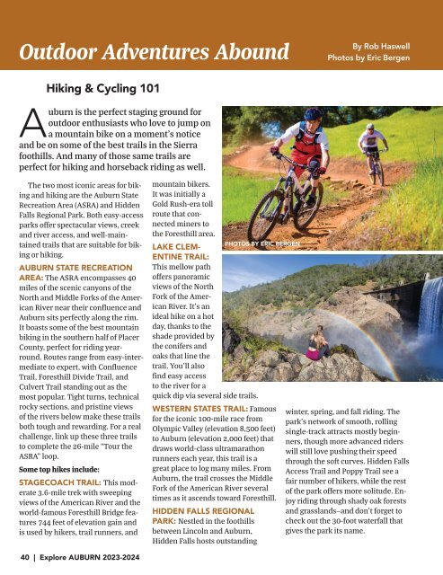
Photos by Eric Bergen<br />
Hiking & Cycling 101<br />
Auburn is the perfect staging ground for<br />
outdoor enthusiasts who love to jump on<br />
a mountain bike on a moment’s notice<br />
and be on some of the best trails in the Sierra<br />
foothills. And many of those same trails are<br />
perfect for hiking and horseback riding as well.<br />
The two most iconic areas for biking<br />
and hiking are the Auburn State<br />
Recreation Area (ASRA) and Hidden<br />
Falls Regional Park. Both easy-access<br />
parks offer spectacular views, creek<br />
and river access, and well-maintained<br />
trails that are suitable for biking<br />
or hiking.<br />
<strong>AUBURN</strong> STATE RECREATION<br />
AREA: The ASRA encompasses 40<br />
miles of the scenic canyons of the<br />
North and Middle Forks of the American<br />
River near their confluence and<br />
Auburn sits perfectly along the rim.<br />
It boasts some of the best mountain<br />
biking in the southern half of Placer<br />
County, perfect for riding yearround.<br />
Routes range from easy-intermediate<br />
to expert, with Confluence<br />
Trail, Foresthill Divide Trail, and<br />
Culvert Trail standing out as the<br />
most popular. Tight turns, technical<br />
rocky sections, and pristine views<br />
of the rivers below make these trails<br />
both tough and rewarding. For a real<br />
challenge, link up these three trails<br />
to complete the 26-mile “Tour the<br />
ASRA” loop.<br />
Some top hikes include:<br />
STAGECOACH TRAIL: This moderate<br />
3.6-mile trek with sweeping<br />
views of the American River and the<br />
world-famous Foresthill Bridge features<br />
744 feet of elevation gain and<br />
is used by hikers, trail runners, and<br />
mountain bikers.<br />
It was initially a<br />
Gold Rush-era toll<br />
route that connected<br />
miners to<br />
the Foresthill area.<br />
LAKE CLEM-<br />
ENTINE TRAIL:<br />
This mellow path<br />
offers panoramic<br />
views of the North<br />
Fork of the American<br />
River. It’s an<br />
ideal hike on a hot<br />
day, thanks to the<br />
shade provided by<br />
the conifers and<br />
oaks that line the<br />
trail. You’ll also<br />
find easy access<br />
to the river for a<br />
quick dip via several side trails.<br />
WESTERN STATES TRAIL: Famous<br />
for the iconic 100-mile race from<br />
Olympic Valley (elevation 8,500 feet)<br />
to Auburn (elevation 2,000 feet) that<br />
draws world-class ultramarathon<br />
runners each year, this trail is a<br />
great place to log many miles. From<br />
Auburn, the trail crosses the Middle<br />
Fork of the American River several<br />
times as it ascends toward Foresthill.<br />
HIDDEN FALLS REGIONAL<br />
PARK: Nestled in the foothills<br />
between Lincoln and Auburn,<br />
Hidden Falls hosts outstanding<br />
PHOTOS BY ERIC BERGEN<br />
winter, spring, and fall riding. The<br />
park’s network of smooth, rolling<br />
single-track attracts mostly beginners,<br />
though more advanced riders<br />
will still love pushing their speed<br />
through the soft curves. Hidden Falls<br />
Access Trail and Poppy Trail see a<br />
fair number of hikers, while the rest<br />
of the park offers more solitude. Enjoy<br />
riding through shady oak forests<br />
and grasslands—and don’t forget to<br />
check out the 30-foot waterfall that<br />
gives the park its name.<br />
40 | Explore <strong>AUBURN</strong> <strong>2023</strong>-20<strong>24</strong>