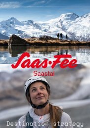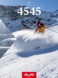
Destinationsmagazin 4545 Winter 23/24 EN

Create successful ePaper yourself
Turn your PDF publications into a flip-book with our unique Google optimized e-Paper software.
<strong>Winter</strong> hiking<br />
Snowshoe trails<br />
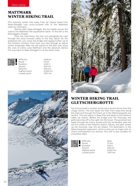
MATTMARK<br />
WINTER HIKING TRAIL<br />
This leisurely winter hike away from ski slopes leads from<br />
Saas-Almagell over snow-covered hills to the Mattmark<br />
reservoir and back.<br />
Shortly after Saas-Almagell, the tour leads across the<br />
road to the Mattmark AG equalisation basin. To the left is the<br />
Zermeiggern Chapel.<br />
From the road block, the trail runs alongside the road<br />
through the snow-covered valley to the "Eiju Sand". On the<br />
prepared trail, you cross the bridge and zigzag further up to<br />
the northern moraine. From here, you hike through an alpine<br />
winter landscape. After the last ascent to the dam wall, enjoy<br />
the view of wintry Lake Mattmark and the absolute silence.<br />
The way back to Saas-Almagell is via the same route.<br />
Difficulty<br />
Route<br />
Duration<br />
Ascent<br />
Descent<br />
Highest point<br />
Lowest point<br />
medium<br />
14 km<br />
4:00 h<br />
534 hm<br />
534 hm<br />
2,205 hm<br />
1,671 hm<br />
S<strong>EN</strong>GG-TRAIL<br />
Glimpses of the Saas villages in a fairytale winter landscape.<br />
From the Wildi district of Saas-Fee, the snowshoe trail<br />
leads through the idyllic forest via the Bärufalla to the Sengg<br />
and back to the Wildi.<br />
At the end of the village, the path branches off to the<br />
left of the cleared path and follows this slightly uphill to Bärufalla.<br />
Here, the view opens up to the mountain panorama of the<br />
Fletschhorn, Lagginhorn and Weissmies as well as towards<br />
Saas-Almagell and Saas-Grund.<br />
In the Bärufalla bend, the trail leads to the left into the<br />
snow-covered larch forest. In the middle of the wintry forest, a<br />
clearing opens up, the "Unner Senggbodu". The path zigzags<br />
through the woods to Sengg.<br />
At the Weiler Sengg, there is a view down to<br />
Saas-Grund, Saas-Almagell and the Saas mountains.<br />
Continue in a southerly direction back to Saas-Fee. From the<br />
Waldhotel Fletschhorn, the route leads back to the starting<br />
point via the prepared trail.<br />
Difficulty<br />
Route<br />
Duration<br />
Ascent<br />
Descent<br />
Highest point<br />
Lowest point<br />
medium<br />
4.3 km<br />
1:45 h<br />
119 hm<br />
119 hm<br />
1,905 hm<br />
1,796 hm<br />
WINTER HIKING TRAIL<br />
GLETSCHERGROTTE<br />
You find yourself in another world just a stone's throw from the<br />
village centre. The trail leads the hiker from Saas-Fee along<br />
the piste and through the forest up to the Gletschergrotte restaurant.<br />
The trail starts in Saas-Fee and leads to the Felskinn<br />
cable car station. Before the bridge over the Feevispa, the<br />
path branches off to the right into the forest. The groomed trail<br />
leads through the wintry woods and hilly landscape, past the<br />
old mill wheel of the Felskinn station. Slowly, the path climbs<br />
up the mountain near the ski slopes. The destination is the<br />
Gletschergrotte restaurant, which invites you to linger with its<br />
charm and beautiful sun terrace. This trail is also suitable for<br />
snowshoe hikes.<br />
Difficulty<br />
Route<br />
Duration<br />
Ascent<br />
Highest point<br />
Lowest point<br />
easy<br />
2.1 km<br />
1:00 h<br />
209 hm<br />
2,000 hm<br />
1,787 hm<br />
HEIMISCHGARTE-TRAIL<br />
This snowshoe trail shows the Saas Valley from a different<br />
perspective.<br />
The Heimischgarte Trail passes through the Alpweiler<br />
and the breathtaking landscape above Saas-Balen and ends<br />
in Saas-Grund.<br />
The trail leads past old, rustic buildings and alps and<br />
through the "Löübinobodme" natural forest reserve. Several<br />
vantage points with breathtaking views of the Saas Valley, its<br />
mountains and villages await you.<br />
The trail starts in the smallest village in the Saas Valley,<br />
Saas-Balen. First, the trail follows the forest road up the<br />
valley past the waterfall and then leads on the old alpine path<br />
through the snow-covered larch forest to Heimischgarte. It is<br />
worth taking a break at the chapel. The view sweeps from the<br />
villages on the valley floor up to the Mattmark dam and the<br />
white mountain peaks. From here, you follow the path through<br />
the different Alps. The destination of the route is Saas-Grund.<br />
Difficulty<br />
Route<br />
Duration<br />
Ascent<br />
Descent<br />
Highest point<br />
Lowest point<br />
medium<br />
9.2 km<br />
4:00 h<br />
602 hm<br />
520 hm<br />
2,090 hm<br />
1,487 hm<br />
22 <strong>23</strong>