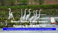
NJ Pine Barrens Maritime-Culture-Landscape 1 1 2024
Pine Barrens forests, striking waterways, narrow lakes, bogs, ghost towns, furnaces and more. NJ Pinelands National Reserve landscape tells the tale of a time when glaciers covered this land, when ship-building towns ruled, when Ben Franklin spoke of preserving the one million acres of the Pine Barrens, when pirates sailed and where NJ sets the standard of heritage. This 500 page presentation of the Pinelands National Reserve maritime cultural landscapes, shows a great expanse of time. It includes six major Pinelands National Reserve watersheds: Rancocas Creek, Toms River, Mullica River, Great Egg Harbor River, Maurice River, Cohansey River. Explore, discover, enjoy a peek into the Pinelands National Reserve fascinating maritime landscapes, more often forgotten than remembered. A step back in time, a step forward to the future.
Pine Barrens forests, striking waterways, narrow lakes, bogs, ghost towns, furnaces and more.
NJ Pinelands National Reserve landscape tells the tale of a time when glaciers covered this land, when ship-building towns ruled, when Ben Franklin spoke of preserving the one million acres of the Pine Barrens, when pirates sailed and where NJ sets the standard of heritage. This 500 page presentation of the Pinelands National Reserve maritime cultural landscapes, shows a great expanse of time. It includes six major Pinelands National Reserve watersheds: Rancocas Creek, Toms River, Mullica River, Great Egg Harbor River, Maurice River, Cohansey River. Explore, discover, enjoy a peek into the Pinelands National Reserve fascinating maritime landscapes, more often forgotten than remembered. A step back in time, a step forward to the future.

Create successful ePaper yourself
Turn your PDF publications into a flip-book with our unique Google optimized e-Paper software.
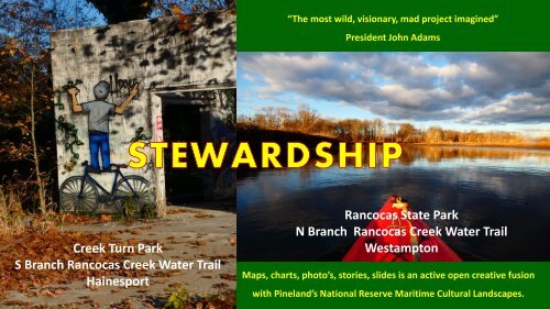
“The most wild, visionary, mad project imagined”<br />
President John Adams<br />
Creek Turn Park<br />
S Branch Rancocas Creek Water Trail<br />
Hainesport<br />
Rancocas State Park<br />
N Branch Rancocas Creek Water Trail<br />
Westampton<br />
Maps, charts, photo’s, stories, slides is an active open creative fusion<br />
with <strong>Pine</strong>land’s National Reserve <strong>Maritime</strong> Cultural <strong>Landscape</strong>s. 1
Rancocas Creek Watershed<br />
<strong>Pine</strong>lands<br />
National<br />
Reserve<br />
<strong>Pine</strong>lands National Reserve<br />
142 Nautical miles on tidewater from<br />
the mouth of the Delaware Bay<br />
Twin Capes<br />
Rancocas Pathways 2
Preface: Conventional Wisdom<br />
Holistic Themes of America’s <strong>Pine</strong>lands Reserve <strong>Maritime</strong> Cultural <strong>Landscape</strong>s<br />
New Jersey’s <strong>Pine</strong> <strong>Barrens</strong> estuary and watershed ecosystems - wetlands, forests, pine<br />
barrens, stream corridors, grasslands, and shrubland - are not only habitat for abundant<br />
fish and wildlife, they also provide vital benefits to human communities. <strong>Pine</strong>lands<br />
National Reserve maritime cultural landscapes spectrum of public value and public access<br />
allows multi-use outdoor recreation and education that creates a sense of place that is<br />
unique to <strong>Pine</strong>lands National Reserve.<br />
Mid-Tide Rancocas Creek Melpine Landing Rancocas State Park North Branch<br />
137 miles from the Delaware Bay Twins Capes and the Atlantic Ocean<br />
3
Enhance, Expand, Experience <strong>NJ</strong> Coastal Heritage Trail<br />
Delaware River Ports<br />
and Port District<br />
Since 1776<br />
Maurice<br />
River Sand<br />
Mines Since<br />
1840’s<br />
Maurice River<br />
East Point Light<br />
2023<br />
Megan Marie Tugboat and Sand Barge<br />
Inbound Maurice River Sand Mine to<br />
Delaware River Port<br />
4
America’s<br />
<strong>Pine</strong>lands National Reserve<br />
The first step to understanding the maritime<br />
cultural landscapes of the <strong>Pine</strong>lands<br />
National Reserve is to consider how<br />
<strong>Pine</strong>lands watersheds relate to the<br />
surrounding regional area.<br />
<strong>Pine</strong>lands National Reserve (PNR)<br />
encompasses over one-million acres of<br />
farms, forests and wetlands. PNR is<br />
classified as a United States Biosphere<br />
Reserve. In 1978 PNR was established as the<br />
United States first National Reserve.<br />
Delaware River<br />
Delaware River Ports<br />
Delaware River<br />
Mount<br />
Holly<br />
<strong>Pine</strong>lands<br />
National<br />
Reserve<br />
Atlantic<br />
Ocean<br />
Atlantic<br />
Ocean<br />
PNR waters drains West into the Delaware<br />
River tidal estuary via the tidal segment of<br />
the Rancocas Creek and West Jersey tidal<br />
waterways. PNR other waters drain East into<br />
the Atlantic Ocean. PNR southern waters<br />
drain into the Delaware Bay.<br />
Port of<br />
Atlantic<br />
Ocean<br />
5
New Jersey’s <strong>Maritime</strong> Cultural <strong>Landscape</strong>s of America’s <strong>Pine</strong>lands National Reserve<br />
<strong>Maritime</strong> Cultural <strong>Landscape</strong>s of <strong>NJ</strong>’s <strong>Pine</strong>lands National Reserve<br />
Rancocas Creek<br />
Tom’s River<br />
Mullica River<br />
Mid-Flood Tide.<br />
N Branch Rancocas Creek Water Trail. 24 water miles to<br />
Delaware River Ports and 147 miles from the Delaware River<br />
Estuary Twin Capes – <strong>NJ</strong>’s Cape May and DE’s Cape Henlopen<br />
Great Egg<br />
Harbor River<br />
Maurice River<br />
Cohansey River<br />
Mount Holly National Historic District. 1941 Flood<br />
Control Channel - Down Stream. Head of Navigation<br />
Fusion with <strong>Pine</strong> <strong>Barrens</strong> cool fresh waters<br />
Heritage, <strong>Culture</strong> and Natural History, A Self-Guided Free Flip Book of 511 Slides and Video Attachments
Lies here the hull of<br />
an old ship<br />
Strip’t of her tackle<br />
and ornament for<br />
worms but the<br />
work itself will not<br />
be lost.<br />
1818<br />
sailors epitaph<br />
Low Tide - Rancocas Creek Barges and Wharf<br />
Rancocas Pathways 7
Rancocas Creek<br />
Melpine<br />
Rancocas Creek 2023<br />
Joins Delaware River<br />
Rancocas Creek 1890’s<br />
Canby Collection<br />
Ref: Library Company of Philadelphia<br />
Rancocas Pathways See Appendix pages 502-506<br />
8
Q u a r t z i te / S i l i c e o u s<br />
Q u a r t z / C h a l c e d o ny ?<br />
Rancocas Creek<br />
“Glow” Rocks<br />
Tr i b o l u m i n e s c e n c e<br />
vs<br />
P h o s p h o r o u s<br />
“G l o w Ro c k s ” B e n e f i t s<br />
I n d i g e n o u s H e r i ta g e
Tr i b o l u m i n e s c e n c e<br />
B e n e f i t s to I n d i g e n o u s H e r i ta g e<br />
It is unknown what the role of quartzite is the<br />
heritage of the indigenous people of the Rancocas<br />
Creek.<br />
Uncompahgre Ute Indigenous Quartz rattlers<br />
The Uncompahgre Ute indigenous people from Central<br />
Colorado are one of the first documented groups of people<br />
in the world credited with the application of<br />
triboluminescence involving the use of quartz crystals to<br />
generate light. The Ute constructed unique ceremonial<br />
rattles made from buffalo rawhide which they filled with<br />
clear quartz crystals collected from the mountains of<br />
Colorado and Utah. When the rattles were shaken at night<br />
during ceremonies, the friction and mechanical stress of the<br />
quartz crystals impacting together produced flashes of light<br />
visible through the translucent buffalo hide.<br />
An Uncompahgre Ute Buffalo rawhide<br />
ceremonial rattle filled with quartz<br />
crystals. Flashes of light are visible<br />
when the quartz crystals are<br />
subjected to mechanical stress in<br />
darkness.<br />
Rancocas Pathways 10
Mosaic - Warm Ambiance - Reflections<br />
<strong>NJ</strong>’s <strong>Pine</strong> Lands National Reserve Western Outflow<br />
High Tide - N Branch - Rancocas Creek Water Trail - Timbuctoo Heritage Area Way Point<br />
Rancocas Pathways 11
Tanker Location<br />
Burlington City Delaware River<br />
Mt. Holly National Historic District<br />
Mount Holly National Historic District<br />
High Tide N Branch Rancocas<br />
Port<br />
Port<br />
Camden<br />
Mt. Holly<br />
Early American<br />
River Ports<br />
Delaware Bay Capes To Mt. Holly<br />
Head of Tide - N Branch -146 miles<br />
Burlington County Parks Old Court House<br />
Mount Holly 1796<br />
Melpine Navigation Eddy N Branch<br />
Low Tide 6 miles Out Mount Holly<br />
River Tugboat Escort 12
S<br />
A d v o c a c y C r e a te s E n e r g y<br />
Rancocas Pathways 13
Nautical<br />
Sunset<br />
Rancocas State Park - Rancocas Creek Water Trail<br />
Passing Leeds Wharf - Established Circa 1751<br />
Rancocas Pathways 14
<strong>Pine</strong>lands National Reserve<br />
<strong>Maritime</strong> Cultural <strong>Landscape</strong>, Naturally<br />
Iron, Timber, Ship Building,<br />
Naval Stores, Agriculture<br />
a Robust Coasting Trade<br />
Rancocas Creek - Toms River - Mullica River - Great Egg Harbor River<br />
- Maurice<br />
Rancocas<br />
River - Cohansey<br />
Pathways<br />
River -
The purpose of the <strong>Pine</strong>lands National Reserve <strong>Maritime</strong> Cultural <strong>Landscape</strong> Atlas is to enhance public<br />
awareness promoting the heritage of New Jersey’s expansive, vibrant and historical maritime cultural<br />
landscapes (MCLs): past, present and future. This atlas uses thematic slides to highlight the <strong>Pine</strong>lands<br />
National Reserve six (6) major tidewater <strong>Maritime</strong> Cultural <strong>Landscape</strong>s.<br />
Rancocas Creek, Toms River, Mullica River, Great Egg Harbor River, Maurice River and the Cohansey River.<br />
An objective is to cultivate a sustainable grassroot collaborative approach to improve multi-use public access that promotes the natural landscapes and<br />
unique heritage of the <strong>Pine</strong> <strong>Barrens</strong> Rancocas Creek Watershed using the best available sciences, engaging community interest and common good .<br />
Main Stem Rancocas Creek High Tide Centerton<br />
Steve Nagiewicz Stockton University Sonar Survey<br />
Delanco, Main Stem<br />
Rancocas Joins Delaware River<br />
Photo: Katie Fitzpatrick (see Delanco Diuck<br />
Decoy Carvers<br />
High Tide<br />
1941 Mount Holly Flood Channel<br />
Iron Works Hill<br />
N Branch Rancocas Creek<br />
16
Three Themes of the Holistic Narrative <strong>Pine</strong>lands National Reserve<br />
<strong>Maritime</strong> Cultural <strong>Landscape</strong>s<br />
a. Relationship of People to the tides, oceans<br />
b. How societies are shaped by tides, oceans.<br />
c. Humans experiences with waterways form the maritime system,<br />
from inland (hinterland) waters to the tides and oceans.<br />
High Tide. N Branch Rancocas Creek, Pier at the Canning Factory. Mount Holly. Hugh Campbell Artist<br />
142 miles from the Delaware Capes<br />
Rancocas Pathways 17
Themes of the <strong>Pine</strong>lands National Reserve <strong>Maritime</strong> Cultural <strong>Landscape</strong>s<br />
Introduction/Preface/Stewardship 1<br />
Glow Rocks of the Rancocas Creek 8<br />
Timbuctoo 10<br />
Mount Holly <strong>Maritime</strong> Connection 11<br />
Rancocas State Park Nautical Sunset 13<br />
<strong>NJ</strong> <strong>Pine</strong>lands <strong>Maritime</strong> Cultural <strong>Landscape</strong>s 14<br />
Purpose of the Atlas 15<br />
Three Main Themes 16<br />
Content Slides by Themes 17<br />
Citizen Engagement 22<br />
Acknowledgements 24<br />
What is a <strong>Maritime</strong> Cultural <strong>Landscape</strong> 25<br />
<strong>NJ</strong> <strong>Pine</strong> <strong>Barrens</strong> Rivers – 1698 27<br />
<strong>NJ</strong> <strong>Pine</strong> <strong>Barrens</strong> National Reserve Tidal Waters 28<br />
General Layout of the MCL Atlas 29<br />
Azimuth of <strong>NJ</strong> <strong>Pine</strong> <strong>Barrens</strong> MCL 31<br />
Head of Tide N Branch Mount Holly – 1789 32<br />
Hainesport and Herring Hall 37<br />
Stakeholder Event Creek Turn Park 38<br />
Centerton Sand Barge 40<br />
Timbuctoo 41<br />
Pattern of <strong>Pine</strong> <strong>Barrens</strong> Settlement 42<br />
Market Access and Waterways 43<br />
East Coast USA Coastwise Trade 44<br />
<strong>NJ</strong> <strong>Pine</strong> <strong>Barrens</strong> Water Commerce 45<br />
Delaware River 49<br />
Maurice River 50<br />
Interpretation Stockton University Survey 51<br />
Westampton and Rancocas Creek 52<br />
Mount Holly US Navy Brazil Station 53<br />
Rancocas Creek Markets – 1884 54<br />
Texas Phosphorus Works 57<br />
Lower <strong>Pine</strong> <strong>Barrens</strong> Ports – 1797 58<br />
Schooner Weymouth 60<br />
Upper <strong>Pine</strong> <strong>Barrens</strong> Ports – 1797 61<br />
Batsto and <strong>Maritime</strong> Archology 62<br />
PB Historic American Merchant Marine Survey 64<br />
Timbuctoo Creek Side Road Access 69 - 70<br />
Overview of <strong>NJ</strong>PB <strong>Maritime</strong> Cultural <strong>Landscape</strong>s 71 - 72<br />
Refreshing Escape from Today’s Urban Bustle, High Tide - Forks of the Rancocas Creek<br />
Rancocas Pathways 18
Forged Ring<br />
Forged Fluke<br />
Rancocas Pathways 19
Theme One: <strong>Maritime</strong> Cultural Connections 73 - 118<br />
<strong>Pine</strong>lands National Reserve 74<br />
<strong>NJ</strong> <strong>Pine</strong>lands Patterns of Settlement 79<br />
<strong>Maritime</strong> Ecosystems & <strong>Culture</strong> 81<br />
West Jersey MCL and James Forten 84<br />
<strong>NJ</strong> Coastal Heritage Trail 85<br />
<strong>Pine</strong>lands Privateers 87<br />
<strong>Pine</strong>lands Admiralty Courts 91<br />
Benedict Arnold and <strong>NJ</strong> <strong>Pine</strong> <strong>Barrens</strong> 92<br />
<strong>Pine</strong> Lands National Reserve <strong>Landscape</strong>s 96<br />
Glaciers Role in the <strong>Pine</strong> <strong>Barrens</strong> 97<br />
<strong>NJ</strong> Physiologic Provinces 99<br />
<strong>Pine</strong> <strong>Barrens</strong> Vegetation 100<br />
Cedar Tree Economies 101<br />
Ben Franklin <strong>Pine</strong> <strong>Barrens</strong> Forestry 103<br />
Human Impacts 104<br />
Pre 1776 <strong>Pine</strong> <strong>Barrens</strong> Ports 105<br />
<strong>Pine</strong> <strong>Barrens</strong> Ship Building 106<br />
1863 Description <strong>NJ</strong> <strong>Pine</strong> <strong>Barrens</strong> 108<br />
The Forks of the Rancocas 110<br />
1876 Tidewater Timber/Lumber Landings 111<br />
<strong>Pine</strong>lands National Reserve Navigable Waters Outflows 112<br />
<strong>Pine</strong> <strong>Barrens</strong> Oystering 113<br />
Ship Building 115<br />
Rancocas Creek Kedge Anchor 116<br />
<strong>Pine</strong> <strong>Barrens</strong> Tuckerton Seaport 118<br />
Rancocas Pathways 20<br />
Intimate Connection to Heritage, and Nature - Hainesport Creek Turn Park - S Branch Rancocas Creek Water Trail
Citizen science is widely recognized as being<br />
critical to research and public engagement in<br />
preserving heritage. (Dickinson, 2012).<br />
I like to think about the responsibility of our<br />
society and how to co-exist with nature,<br />
using art”, “For me, art is a mirror<br />
reflecting our social outlook” Lai Sut Weng<br />
Identification and documentation by the<br />
kayaking community highlights the important<br />
contributions such recreational (kayaking)<br />
communities, groups and associations can offer<br />
to help identify and preserve <strong>NJ</strong>'s cultural<br />
“Spirit and determination are reveled in words and deeds”<br />
Wolf Eyes Sunrise<br />
Rancocas Creek Water Trail<br />
President Ronald Reagan<br />
Hainesport<br />
heritage. (Gall/Veit 2022)<br />
As quoted by the Editors in the introduction of Lucifer Came a Calling, a Field<br />
Reconnaissance of New Jersey's Rancocas Creek Phosphorus Works.<br />
Reference: Bulletin of the Archeological Society of New Jersey, No 77, 2022. G<br />
Michael Gall, Editor Associate Editor Richard Veit,<br />
21
Theme Two: <strong>Pine</strong> <strong>Barrens</strong> Communities 119 - 430<br />
<strong>Pine</strong>lands National Reserve (PLNR) Trifinium 120<br />
PLNR Port Districts 121<br />
West Jersey Tidewater Rivers and Creeks 124<br />
Rancocas Creek Watershed 125<br />
Native American Trails 129<br />
Argillite Knife and other artifacts 130<br />
Native American Canoe 133<br />
European Interlopers 135<br />
1639 Dutch Navigation Chart Delaware Bay/River 136<br />
1639 Chart Detail of Anchorages 137<br />
Burlington Island 138<br />
Dutch Ships on the Delaware River 139<br />
Fort Dix and Joint Base Sentinel <strong>Landscape</strong> 140<br />
Early American <strong>Pine</strong> <strong>Barrens</strong> Ports 141<br />
Rancocas Creek Beaver Trade 142<br />
<strong>Pine</strong> <strong>Barrens</strong> Philadelphia Trading Area 143<br />
Early 1800’s Sailing Shallop 145<br />
Army Engineers Navigation Improvements 146<br />
Rancocas Creek Steam Boats 147<br />
Main Stem Turning Basins 151<br />
Timbuctoo, North Branch <strong>Landscape</strong>s 153<br />
Underground Railroad 155<br />
Mullica River<br />
Celestial Navigation 175<br />
Rancocas Creek Heritage Corridor 181<br />
Rancocas Creek National Historic Districts 182<br />
North Branch Rancocas Creek 186<br />
Whitesbog/Centennial Recreation/Smithville 188<br />
Mount Holly National Historic District 191<br />
Leave No Trace 206<br />
<strong>NJ</strong> State Natural Area, North Branch 237<br />
The Forks of the Rancocas 246<br />
Hainesport, South Branch – Sand Mines/Creek Turn 252<br />
Lumberton, South Branch 288<br />
Rancocas Main Stem Texas Phosphorus Works 305<br />
Rancocas Creek Main Stem Navigation 332<br />
Toms River 348<br />
Mullica River 357<br />
Great Egg Harbor River 379<br />
Townbank and Whaling 398<br />
Maurice River 404<br />
Tug Boat Operations 410<br />
Cohansey River 443<br />
Naturally Surprises and Delights All Who Visit<br />
Rancocas Pathways 22
Acknowledgements and Conventional Wisdom<br />
It takes many drops to make a water drop.<br />
Its our pleasure to acknowledge a multi-faceted collaborative debt to many<br />
others. Chicken may he RIP,<br />
to the ole men and gracious ladies alike, a cast of<br />
1001 professional educators, expert historians, naturally naturalists, willing<br />
buccaneers, alacritous swashbucklers and a fine tip of the hat to citizens.<br />
It is our hope by illuminating the MCL’s of <strong>NJ</strong>’s <strong>Pine</strong>lands National Reserve that<br />
this pathway enhances public awareness and promotes public access of the <strong>Pine</strong><br />
<strong>Barrens</strong> National Reserve hidden past. The keystone of preservation that what is<br />
past, is now present so as to preserve is for our future.<br />
As credit is given it is credit given to all whose generosity w time, wisdom and<br />
knowledge focused on a common goal that our heritage, its stories, its myth,<br />
fables and its mystery’s is enjoyed and contributes to all.<br />
Rancocas Pathways 23
Theme Three: Tidewater Hinterlands - National Water Trail 458 - 511<br />
<strong>Pine</strong>lands Hinterlands 459<br />
Ship Building 461<br />
Glass Works 474<br />
Agriculture 479<br />
Railroads 481<br />
Cuban Filibusters 482<br />
Forges / Charcoal 484<br />
Activity for Kids / Lesson Plans 491<br />
Methodology / Research 492<br />
Suggested Readings 493<br />
What’s Needed Next? 494<br />
Appendix: National Water Trail 495<br />
A Healthy Community, a Garden to Grow 496<br />
National Water Trails Foundation of a Healthy Community 498<br />
George Washington Rancocas Creek 499<br />
Melpine Landing Visitor Use Statistics 502<br />
Historic French Maps <strong>NJ</strong> <strong>Pine</strong> <strong>Barrens</strong> 506<br />
Rancocas Creek Water Trail Injury Control Haddon Matrix 505<br />
Plant List Collected in Ships Ballast (1867) 510<br />
Timbuctoo Sunset Rancocas Creek<br />
Rancocas Pathways 24<br />
Naturally Charms of the Past - Excitement of the Present - Exploring its Future
1944 B-17 Flight Over Mount Holly<br />
After completion of the Rancocas Creek Flood Bypass Channel<br />
A Special Thank-You to Local Rancocas Creek Watershed Historical Society’s whose<br />
generosity in opening their archives allows the accurate narrative of the Rancocas<br />
Creek <strong>Maritime</strong> Cultural <strong>Landscape</strong> to be told.<br />
Mount Holly Township/Lumberton/Westampton/Rancocas/Hainesport/Mt.<br />
Laurel/Moorestown/Delran /Delanco/Riverside/Pemberton Township/Medford/Burlington<br />
County and Monmouth County Historical Society’s/Mount Holly Library/Willingboro<br />
Library/Pemberton Library/Burlington County Library<br />
Rancocas Pathways 25
S tewardship - Education - I n s p i ration<br />
What is a <strong>Maritime</strong><br />
Cultural <strong>Landscape</strong>?<br />
High Tide. N Branch Rancocas<br />
Creek Water Trail. Mount Holly<br />
Flood Channel. Bufflehead Duck -<br />
Passing 1890’s Power House<br />
High Tide. N Branch Rancocas<br />
Creek Water Trail. Westampton.<br />
Rancocas State Park<br />
“ Teal” Duck<br />
Westerdhal (1998) defines<br />
maritime cultural landscape as:<br />
“the archaeological concept<br />
combining sea and land as the<br />
maritime cultural landscape. It<br />
means that the starting point for<br />
the subject of maritime<br />
archaeology is maritime culture”.<br />
26
<strong>Maritime</strong> Cultural <strong>Landscape</strong>s Connect Multi-Dimensional Relationships<br />
MCL’s encompass public access, science, technology, industry, economics, trade, politics, art, literature, social, social<br />
issues, religion, military, international, cartography/mapping, colonial affairs, institutional, organizational,<br />
community, migration, inter-cultural relations, natural/ecological/environmental resources, archeology, sports, and<br />
recreation.<br />
<strong>Maritime</strong> Elements Contributes to Our Shared Understanding of Our Heritage<br />
Economics fundamental connection to local/regional/national/global business heritage; navigation to science<br />
and technology; students and purveyors of art and to literature; history of exploration and cultural<br />
interactions via multi-use recreation; these connections and others opens doors to our shared heritage.<br />
(United States Naval War College Historical Monographs)<br />
Rancocas Pathways 27
“An Historical and Geographical Account of the Province of Pensilvania and West New Jersey<br />
America” Published London 1698 by Gabriel Thomas, a resident of Fifteen Years<br />
Here there are several navigable rivers besides the famous Delaware, being deep enough for<br />
vessels to come in. First, Prince Morise’s (Maurice) River, where the Swedes used to kill the<br />
geese in great numbers, for their feathers, only leaving their carcasses behind them;<br />
Cohansey River, by which they send great store of (<strong>NJ</strong> <strong>Pine</strong> <strong>Barrens</strong>) cedar to Philadelphia<br />
City. Great Egg Harbor River (up which a ship of two to three hundred tuns may sail), which<br />
runs by the back part of the country into the Main Sea runs. Little Egg Harbour Creek<br />
(Mullica River)., which they take their name from the great abundance of eggs, which<br />
swans, geese, ducks and other wild fowls off those rivers lay thereabouts. Timber River,<br />
alias Gloucester River, which hath as its name from the great quantity of curious timber,<br />
which they send in great floats to Philadelphia a city in Pensilvania, as oaks, pines, chestnuts,<br />
ash, and cedars; this river runs down by Gloucester town which is the shire town.<br />
Northampton River, (Rancocas Creek) which with several others, at a convenient distance<br />
upon the sea (the shores whereof are generally deep and bold)of less note which runs down<br />
to the great Delaware River.<br />
(presentation note – transcribed in original spelling and grammar)<br />
Cohansey<br />
River<br />
Delaware<br />
Bay<br />
Timber<br />
River<br />
Maurice<br />
River<br />
Rancocas<br />
Great<br />
Egg<br />
Harbor<br />
River<br />
Little<br />
Egg<br />
Harbor<br />
River<br />
Rancocas Pathways 28
<strong>Pine</strong>lands National Reserve Tidewaters<br />
<strong>Pine</strong>lands National Reserve watersheds drain into New Jersey's tidewaters.<br />
Rancocas Creek drains west from the <strong>Pine</strong> <strong>Barrens</strong> into the Delaware Rivers tidal estuary. Toms River flows<br />
east across Barnegat Bay Watershed into the Atlantic Ocean. Mullica River runs east into <strong>NJ</strong>’s Great Bay<br />
then into the Atlantic Ocean. Great Egg Harbor River streams into Great Egg Harbor then east into the<br />
Atlantic Ocean. Maurice and the Cohansey Rivers course into the Delaware Bay.<br />
Rancocas Creek’s 360 square mile watershed, 60 year long clarion call, a bell-weather of grass root<br />
advocacy that questions, confronts and challenges conventional wisdom that for the greater good<br />
New Jersey’s Rancocas Creek should be designated a National Water Trail.<br />
N Branch Rancocas Creek Low Tide Timbuctoo<br />
Mark Thomas, Founder Rancocas Conservancy Pathways Rancocas Creek Ambassador<br />
29
General Layout of the <strong>NJ</strong> <strong>Pine</strong>lands National Reserve <strong>Maritime</strong> Cultural <strong>Landscape</strong>s (MCLs) Atlas<br />
This atlas introduces readers to the common maritime landscapes<br />
of <strong>NJ</strong>’s <strong>Pine</strong>lands National Reserve 6 major rivers. It’s suggested<br />
to view these locations though the lens of a clock. This narrative<br />
is “digitally tailored” for readers to explore history and heritage.<br />
Three themes show how people lived, interacted and<br />
commercialized <strong>NJ</strong>’s <strong>Pine</strong>lands National Reserve’s maritime<br />
landscapes. Pages 2 – 45 tells this story.<br />
Timber<br />
The remaining 474 slides is a easy to follow practical guide.<br />
Digital content is presented with stories, maps, charts, photos,<br />
reports, published articles and archival material. This fusion<br />
illustrates community connections to <strong>Pine</strong>lands National Reserve<br />
MCL’s.<br />
Town<br />
Bank<br />
Rancocas Pathways 30
North Branch Rancocas Creek - Monroe Street Park<br />
Mount Holly National Historic District - High Tide<br />
Toms River<br />
High Tide<br />
Mullica River<br />
High Tide<br />
Enhanced Public Awareness - Promoting Regional Identity - Naturally, Our Heritage<br />
Great Egg Harbor River<br />
High Tide<br />
Maurice River<br />
High Tide<br />
Cohansey River<br />
High Tide
Azimuth of the <strong>Pine</strong>lands National Reserve <strong>Maritime</strong> Cultural <strong>Landscape</strong><br />
Rancocas Creek is the Only Watershed Listed Twice<br />
Compliments of JC<br />
Ref: <strong>NJ</strong> <strong>Pine</strong>lands National Reserve Comprehensive Management Plan<br />
Rancocas<br />
Pathways<br />
<strong>Pine</strong>lands National Reserve stretches across portions of seven<br />
counties in southern New Jersey, covering about 22% of the<br />
state. <strong>Pine</strong>lands National Reserve comprises both public and<br />
private lands. Public lands include parks, forests, wildlife<br />
refuges, and military bases. Private lands include 56 communities<br />
that range in size from small from villages to large<br />
towns. Nearly 500,000 permanent residents live in the<br />
<strong>Pine</strong>lands National Reserve.<br />
32
Mount Holly National Historic District<br />
Outdoor Wall Murals<br />
Mount Holly, County Seat of Burlington<br />
County. One of ten different National<br />
Historic Districts in the 360 square mile<br />
Rancocas Creek Watershed<br />
Rancocas Creek Water Trail<br />
High Tide – 147 Miles from the Atlantic Ocean<br />
Mount Holly North Branch 1941 Tidewater Channel<br />
33
Stewardship - Education - Inspiration
Value of Navigable Waterways and <strong>Maritime</strong> Cultural <strong>Landscape</strong><br />
In 1682, an acre was understood as a strip of land sized at forty perches (660 ft, or 1 furlong) long and<br />
four perches (66 ft) wide; this was commonly understood as an approximation of the amount of land a<br />
yoke of oxen could plough in one day (a furlong being "a furrow long").<br />
Rancocas Pathways 35
1870’s South Jersey’s <strong>Pine</strong> <strong>Barrens</strong> <strong>Maritime</strong> Cultural <strong>Landscape</strong>1916 Rancocas Creek<br />
><br />
Trenton<br />
Toms<br />
River<br />
<strong>NJ</strong> <strong>Pine</strong><br />
<strong>Barrens</strong><br />
<strong>NJ</strong> <strong>Pine</strong><br />
<strong>Barrens</strong><br />
Mount<br />
Holly<br />
Rancocas Creek<br />
Rancocas Creek<br />
Lumberton<br />
Delaware<br />
River<br />
<strong>NJ</strong> <strong>Pine</strong><br />
<strong>Barrens</strong><br />
Tuckerton<br />
<strong>NJ</strong> <strong>Pine</strong><br />
<strong>Barrens</strong><br />
Port of<br />
Camden<br />
Charcoal<br />
Landing<br />
Batsto<br />
Great<br />
Bay<br />
Mullica<br />
River<br />
Hammonton<br />
<strong>NJ</strong> <strong>Pine</strong><br />
<strong>Barrens</strong><br />
<strong>NJ</strong> <strong>Pine</strong><br />
<strong>Barrens</strong><br />
Weymouth<br />
Great Egg<br />
Harbor River<br />
<strong>NJ</strong> <strong>Pine</strong><br />
<strong>Barrens</strong><br />
Port<br />
Elizabeth<br />
<strong>NJ</strong> <strong>Pine</strong><br />
<strong>Barrens</strong><br />
Bridgeton<br />
Maurice<br />
River<br />
Port<br />
Norris<br />
Cohansey<br />
River<br />
Cape<br />
May<br />
Townbank<br />
Delaware<br />
Bay<br />
Rancocas Creek Dredge<br />
1916<br />
Port of<br />
Philadelphi<br />
a<br />
Delaware<br />
River<br />
Port of<br />
Salem<br />
Rancocas Pathways 36
A survey of the<br />
roads of the<br />
United States of<br />
America<br />
Note<br />
Extent of Tide<br />
Christopher Colles<br />
1789
Hainesport, S Branch Rancocas<br />
Long Bridge<br />
Herring Hall<br />
Herring Haul
Rancocas Pathways 39
Atlantic Ocean, Delaware Bay, Delaware<br />
River Estuary, Rancocas Creek<br />
April 2023 >>>
Rancocas Creek Water Trail Mile 20<br />
Centreton Mid 1800’s Sand Barge Wrecks<br />
Mid 1800’s Sand Barge Wrecks Sand Barge Wrecks 2023<br />
Rancocas Pathways 41
The point is not who gets there first, but how to draw upon the expertise,<br />
knowledge, thoughts and contributions each participant makes .<br />
(ref: A Planned Approach to a Healthy Community - Coalition Building - 2021)<br />
Photo credit #ks337pohoto<br />
Timbuctoo High Tide<br />
North Branch - Rancocas Creek Water Trail
<strong>Pine</strong>lands National Reserve,<br />
America’s First National Reserve<br />
<strong>NJ</strong> <strong>Pine</strong>lands National Reserve Pattern of Settlement<br />
Three Phases of Human Settlement in the<br />
<strong>Pine</strong>lands National Reserve:<br />
1. Before 1840’s - Coastal, tidewater and non-tidewater<br />
orientated settlement. Fishing, Whaling, Lumbering, Hunting and<br />
Gathering<br />
2. After 1840’s - Railroads influence settlement.<br />
3. After mid 1900’s - Highways and suburbanization.<br />
Rancocas<br />
<strong>NJ</strong> <strong>Pine</strong> <strong>Barrens</strong><br />
Pathways<br />
The first two phases of <strong>NJ</strong>PBNR settlement evolved directly from<br />
historic land use tied to harvest of available natural resources.<br />
Reference <strong>NJ</strong>PB Master Use Management Plan<br />
43
From <strong>Pine</strong>lands National Reserve Natural Resources to <strong>Maritime</strong> Tidal Landings to Markets<br />
<strong>NJ</strong> <strong>Pine</strong> <strong>Barrens</strong> geography influences the movement of people, freight, and information and these relationships to pine barrens tidal rivers and<br />
creeks to markets. <strong>Maritime</strong> cultural landscapes focus on the origin, destination, extent, nature, and purpose of mobility to reach markets.<br />
Historic<br />
Social<br />
At times both overland and water routes<br />
Political<br />
Economic<br />
Environmental<br />
Local community other markets via<br />
waterway<br />
Market access via Tidal Rivers and Creeks<br />
Market access via Coastwise and Ocean routes<br />
Rancocas Pathways 44
Rancocas Creek<br />
East Coast <strong>Maritime</strong> Ports and Coast Wise Navigation Chart<br />
Cape Sable to Cape Hatteras<br />
Port of Portland<br />
Port of Halifax<br />
Cape Sable<br />
<strong>NJ</strong> <strong>Pine</strong> <strong>Barrens</strong><br />
Port of Boston<br />
Cape Cod<br />
Port of NY and <strong>NJ</strong><br />
Port of Baltimore<br />
Delaware River Ports<br />
Philadelphia/Camden<br />
New Jersey Coast<br />
Long Island<br />
Atlantic Ocean<br />
Port of Norfolk<br />
Cape Henry<br />
Twin Capes<br />
Henlopen and Cape May<br />
Cape Hatteras<br />
Pilots Direct Vessels Clearing from and arriving at Ports<br />
America’s Navigation Act August 7, 1789 Sect 4.<br />
“All pilots in the bays, inlets, rivers, harbors and ports of the<br />
United States shall continue to be regulated in conformity with<br />
the existing laws of States<br />
April 17 th 1846 State of <strong>NJ</strong> Pilotage Law<br />
Rancocas Pathways 45
<strong>Pine</strong>lands National Reserve<br />
Waterways<br />
Marked Heads of Tide and Limits of<br />
Tidewater Navigation<br />
Trenton <strong>NJ</strong> – Trenton Falls<br />
137 Miles from Delaware Bay Capes<br />
Mount Holly<br />
Delaware River Harbor Ports<br />
Martha<br />
Batsto<br />
Port<br />
Norris<br />
Somers Point<br />
Black Line Approximate Boundary<br />
of the<br />
<strong>NJ</strong> <strong>Pine</strong> <strong>Barrens</strong><br />
Rancocas Pathways 46<br />
Town Bank >>>
<strong>Pine</strong> <strong>Barrens</strong> <strong>Maritime</strong> Ports and Coast Wise Trade Routes<br />
Delaware River Ports<br />
Philadelphia/Camden<br />
Mount Holly<br />
Port of New York<br />
New England Ports<br />
Toms River<br />
Lumberton<br />
<strong>NJ</strong> <strong>Pine</strong> <strong>Barrens</strong><br />
Bridgeton<br />
<strong>NJ</strong> <strong>Pine</strong> <strong>Barrens</strong><br />
Batsto<br />
Millville<br />
Mays Landing<br />
Port Norris<br />
Port Elizabeth<br />
Somers Pt<br />
Rancocas<br />
Pathways<br />
47
Key - Highlighted waters <strong>Pine</strong> <strong>Barrens</strong> Tidal Rivers<br />
Key - Highlighted waters <strong>Pine</strong> <strong>Barrens</strong> Tidal Rivers<br />
Rancocas Pathways 48
Sphagnum Moss<br />
Oysters (pine or cedar) Baskets<br />
Jersey genesis; the story of the Mullica River Beck, Charlton, 1945.
Forgotten Towns of South<br />
Jersey Beck, Charlton,<br />
1945<br />
Captain Ogden Grady (pre world War 1)<br />
Vessels 200 hundred tons to 1,000 tons from Dennis Creek to Delaware Bay<br />
Kedged Down Creek to Delaware Bay<br />
.
Key - Highlighted waters <strong>Pine</strong> <strong>Barrens</strong> Tidal Rivers<br />
Rancocas Pathways 51
Port of Philadelphia<br />
Delaware River<br />
Harbor<br />
Trenton<br />
Delaware<br />
River<br />
Passing Rancocas Creek<br />
Mount Holly<br />
N Branch Rancocas Creek<br />
Rancocas Creek<br />
Lumberton<br />
S Branch Rancocas Creek<br />
Rancocas Creek<br />
<strong>NJ</strong> <strong>Pine</strong> <strong>Barrens</strong><br />
National Reserve<br />
Toms River<br />
Philadelphia Shipyards<br />
Philadelphia<br />
Camden<br />
Rancocas Creek<br />
Rancocas Creek<br />
Port of<br />
Wilmington<br />
Battleship <strong>NJ</strong> Museum<br />
Balzano Terminal<br />
Port of Camden<br />
<strong>NJ</strong> <strong>Pine</strong> <strong>Barrens</strong><br />
National Reserve<br />
C & D<br />
Canal<br />
Delaware<br />
River<br />
Port of Salem<br />
Cohansey<br />
River<br />
Maurice<br />
River<br />
Port Norris<br />
New York Shipyard<br />
Port of Camden<br />
<strong>NJ</strong> <strong>Pine</strong> <strong>Barrens</strong><br />
National Reserve<br />
Hammonton<br />
Batsto<br />
Wading River<br />
Charcoal Landing<br />
As Published Mullica by Pilots River Association of the Bay and River Delaware<br />
National Harbor Refugee<br />
Delaware Bay Shipping<br />
Delaware<br />
Bay<br />
Cape<br />
May<br />
Delaware Bay - Delaware River - Delaware River Harbor<br />
Rancocas Creek - Mount Holly - <strong>NJ</strong> <strong>Pine</strong>lands National Reserve
1876<br />
Maurice River Shipyards<br />
Ref: Cumberland County Atlas 1876<br />
53
Interpretation<br />
• Photograph<br />
• Archival Research<br />
• Student Site mapping<br />
• Sonar imaging of creek<br />
• Final Report<br />
• Timeframe: April - July
Almost 400 years of<br />
<strong>Maritime</strong> Trade & History<br />
Rancocas Creek North Branch Documented Creekside<br />
Tidewater Landings<br />
ref: 1876 Atlas Map<br />
Rancocas Creek North Branch<br />
Head of Tide<br />
ref: 1876 Atlas Map<br />
Rancocas Pathways 55
FYI: Mahlon Dickerson was also Iron Mine Owner, a <strong>NJ</strong> Senator<br />
and a <strong>NJ</strong> Governor<br />
US Navy Brazilian Station<br />
1826 - 1905<br />
Rancocas Pathways 56
1884 Commercial Statistics Barge Movements Rancocas Creek<br />
to/from Port of Camden Philadelphia Harbor Delaware River<br />
J.J. Allen and Sons (Texas Works)<br />
12,000 tons fertilizer barged per year (2 - 4 barge movements weekly)<br />
Phosphorus<br />
J.W. Paxson & Company<br />
777 sand barges (100-300 tons each) year<br />
Removed/mined 100,000 tons of sand per year<br />
J. W. Heuling (Centerton) Recvd 3,000,000 feet of lumber, 500,000 shingles,<br />
2,000 tons of coal and 500,000 plaster lathes<br />
Mount Holly<br />
3 saw mills/lumber yards, 1 grist mill, 2 foundry's,<br />
1 canning factory, 5 shoe factory's, 4 carriage builders, 1<br />
match (phosphorus) factory, 3 agriculture warehouses<br />
Note Channel Lights 2022<br />
Rancocas Pathways 57
Texas Phosphorus Works Centerton Main Stem Rancocas<br />
Creek. Here bone black from Port of Camden was barged into<br />
the site on a tethered tugboat. Sulfuric acid barges allowed<br />
this slurry to be manufactured into phosphorus. Over 800<br />
tons per month of phosphorous was barged from the<br />
Rancocas Creek to Port of Philadelphia 1872 - 1890’s<br />
Rancocas Creek<br />
400 plus years of<br />
<strong>Maritime</strong> Trade & History
New Jersey 1797 - Lower <strong>Pine</strong> <strong>Barrens</strong><br />
Note: Location of Cedar Forest along Great Egg Harbor River<br />
Batsto<br />
Mays Landing<br />
Port Elizabeth<br />
Somers Point<br />
<strong>NJ</strong> <strong>Pine</strong> <strong>Barrens</strong><br />
Port Norris<br />
Dennis Creek<br />
Rancocas Pathways 59
Mount Holly<br />
SE Branch<br />
S Branch<br />
<strong>Pine</strong> <strong>Barrens</strong><br />
National Reserve<br />
<strong>Pine</strong> <strong>Barrens</strong><br />
National Reserve<br />
Chesapeake Bay <strong>Maritime</strong> Museum<br />
100 ton tug boat, Great Egg Harbor Inlet<br />
Delaware, a tugboat built in Bethel, De., is a rare example of a typical early 20th century Delaware Bay tidewater tugboat.<br />
Built in 1912 by William H. Smith, it may be one two survivors. Large sailing vessels carrying cargoes of lumber, sand, wheat,<br />
fertilizer, and coal, were common on <strong>Pine</strong> Barren’s tidewaters until the 1930’s. <strong>NJ</strong>’s <strong>Pine</strong> Barren’s National Reserve tidewater<br />
rivers are narrow, shallow, meandering rivers with post-stamp landings. Tugs like Delaware met larger coastwise vessels and<br />
towed them nimbly into up and out of <strong>Pine</strong> Barren rivers landings and ports. Today tugs escort barges.<br />
60
Absegami yesteryear / By Jack E. Boucher, 1963 Somers Point Historical Society<br />
61
Mount Holly<br />
<strong>NJ</strong> <strong>Pine</strong> <strong>Barrens</strong><br />
Lumberton<br />
<strong>NJ</strong> <strong>Pine</strong> <strong>Barrens</strong><br />
Toms<br />
River<br />
<strong>NJ</strong> <strong>Pine</strong> <strong>Barrens</strong><br />
New Jersey 1797<br />
Batsto<br />
Upper <strong>Pine</strong> <strong>Barrens</strong><br />
Note: Roads between<br />
Mullica (Mullicus) River and<br />
Rancocas (Ancocus) Creek<br />
Rancocas Pathways 62
Charles Read is credited with<br />
building the Batsto Iron Works<br />
along the Batsto River in 1766.<br />
Rancocas Pathways 63
<strong>NJ</strong> Department of Conservation and Economic Development confirmed the presence of sunken craft<br />
near Burlington County’s Hermann City, a <strong>NJ</strong> shipbuilding center in the early 1800’s. Howard I. Chapelle<br />
director of transportation of The Smithsonian Institution and advisor to the State of <strong>NJ</strong> said “coastal<br />
sailing vessels carried iron and glass products from Batsto Village to regional markets in the Mid-<br />
Atlantic and along the Eastern Seaboard”.<br />
Salvatore A. Bontempo Commissioner said of the work “Marine Archeology is still in its early stages,<br />
Our main objective is pursuing further research into maritime connections w New Jersey’s early days”.<br />
Reference: NYTimes Newspaper 12 July 1959<br />
Mullica River – Hermann City<br />
64
Rancocas Pathways 65
Batsto Citizens Gazette of 1987, R. Craig Koedel “Mullica River Ships In The Age Of<br />
Sail.” p1 of 2<br />
Among the early industries along the Mullica River was shipbuilding. The building of ships was significant, especially along<br />
Nacote Creek. Shipyards also dotted the riverbanks at Batsto and Pleasant Mills, at Green Bank and Lower Bank. They stood<br />
along the tributary Bass and Wading Rivers, and on the shores of Great Bay at Leeds Point and Smithville. Other sites were<br />
at Weekstown, Clarks Landing, Great Swamp, New Gretna, and Little Egg Harbor.<br />
The earliest vessel built in the area was a 54-ton sloop, the Harriot, raised in 1794 at Galloway. A second vessel was the 175-<br />
ton ship Ohio, built in 1799. The Van Sant shipyard at the Forks of the Little Egg Harbor dates to 1760, when John Van Sant<br />
purchased a tract from Richard Wescoat. Around 1791,Van Sant left the Forks and opened a yard along the Bass River at<br />
New Gretna. A Bass River sloop, the 52 -ton Friendship appears in a list of registered vessels in 1800.<br />
According to the registry for the Port of New York, a 61-ton schooner, the Batsto was constructed at the iron village in 1804.<br />
This is the first vessel of Pleasant Mills/Batsto origin that can be officially documented. Pleasant Mills was a building site in<br />
1833 with the 63-ton schooner Elizabeth. Ship production at Batsto and Pleasant Mills gained momentum in the 1830s, a<br />
decade in which five vessels, ranging in size from 63 to 134 tons, were built. The community reached its stride as a minor<br />
shipbuilding center during the 1840s, with a total output of eight vessels.<br />
Rancocas Pathways 66
Batsto Citizens Gazette of 1987, R. Craig Koedel “Mullica River Ships In The Age Of Sail.” p2 of 2<br />
“The 1836 schooner Atsion raised at “Batsto Furnace,” was presumably for Jesse or Samuel Richards. The Atsion,<br />
embarking from the Mullica River, carried cargo to and from New York City and the Hudson Valley. The 134-ton schooner<br />
Emeline Peterseon and the smaller schooners Phoebe and Margaret were built at Pleasant Mills. Jesse Richards financed<br />
the building of the Stranger in the amount $3,000. This 90-ton schooner was launched at Batsto in 1840. Schooner<br />
Freylinghuysen was built and launched at Batsto, followed in 1846 by the John Wurtz. Mary was built in 1839 at Lower<br />
Bank. The vessels were engaged primarily in carrying iron products, glass, and lumber to New York and Philadelphia,<br />
bringing back supplies for the village on their return voyages. The demise of the bog iron industry and the coming of the<br />
railroad seem to have marked the end of shipbuilding.<br />
Nacote Creek was emerging as something of a major center, where 18 registered vessels totaling 1700 tons were built in the<br />
1830s. The Martin Van Buren (1830), the Pearl (1834), and the Rebecca of Nacote Creek, traded in and out of Batsto. The<br />
average size of these three schooners was 78 tons. Earlier, in 1825, Nicholas Van Sant had erected a shipyard in Port<br />
Republic, thereby establishing the Van Sants as the leading shipbuilding family. By far the average tonnage of vessels<br />
attributed to Nacote Creek was greater than that for Port Republic. Bass River had a total production of 17 vessels between<br />
1800 and 1880, eight of which exceeded 100 tons.<br />
The shipbuilding industry in a region encompassing the Mullica River, its tributaries, Great Bay and Little Egg Harbor Bay<br />
accounted for the construction of approximately 170 vessels between 1790 and 1890. Their total capacity exceeded 18,326<br />
tons, or an average 120 tons per vessel. These figures translate into a century of toil, occasional economic distress, and<br />
profits for a multitude of our South Jersey forefathers and their families.<br />
Rancocas Pathways 67
Howard I. Chapelle Biography<br />
Chapelle was born on February 1, 1901. In 1936 he became the survey director as<br />
the New England Works Progress Administration’s Historic American Merchant<br />
Marine Survey (HAMMS). Here he documented the design and technical evolution of<br />
vessel types by making measured drawings of existing vessels, ship models, and<br />
builders' half models; by making a photographic record of significant vessels; and by<br />
compiling written data of America’s maritime commercial and sailing vessels. In<br />
Nautical Quarterly #40 Winter 1987 p 110<br />
Author Peter Spectre<br />
1957 he became Curator of the Division of Transportation at the National Museum of<br />
History and Technology, The Smithsonian Institution and then transitioned to the role<br />
of senior historian. Retiring in 1971 he was uniquely honored as the historian<br />
emeritus. His book American Small Sailing Craft (1951) is considered a classic<br />
among boat builders to this day. Howard I. Chapelle was author to numerous articles<br />
and books on America’s maritime vessels and heritage<br />
Rancocas Pathways 68
Historic American Merchant Marine Survey<br />
Reference: Howard I. Chapelle American Small Sailing Craft (1951)<br />
Tuckerton<br />
Great Egg Harbor<br />
The Historic American Merchant Marine Survey was a program under the Works Progress Administration. The survey is held at<br />
the Smithsonian Institution's Museum of American History, Transportation Division. In 1931 <strong>NJ</strong> Coastal Vessels included in the<br />
Survey were constructed w <strong>NJ</strong> <strong>Pine</strong> Barren’s Timber. By 1951 there were no records of an active <strong>NJ</strong> Sailing Garvey. Chapelle<br />
considered the <strong>NJ</strong> Sailing Garvey an “extinct” vessel.<br />
Rancocas Pathways 69
Jersey Devil vs Rancocas Creek Pirate Ghosts<br />
Rancocas Pathways 70
Silence, Preserve Thee Resting Souls<br />
Creek Access Wood Road - Timbuctoo - February 2021<br />
71
<strong>NJ</strong> <strong>Pine</strong>lands National Reserve Rivers and<br />
Creeks included in this Presentation<br />
<strong>NJ</strong>’s Physiologic Area<br />
Inner Coastal Plain<br />
Rancocas Creek<br />
Toms River<br />
Timber Creek<br />
<strong>NJ</strong>’s Physiologic Area<br />
Great Egg<br />
Harbor River<br />
Batsto<br />
Mullica River<br />
Tuckerton<br />
Outer Coastal Plain<br />
Cohansey River<br />
Maurice River<br />
Port Elizabeth<br />
Somers Point<br />
Port<br />
Norris<br />
This flip-book enhances public awareness that promotes public access that protects the diverse culture, history, heritage and<br />
natural history of New Jersey’s <strong>Pine</strong> <strong>Barrens</strong>, the <strong>Pine</strong>lands National Reserve, the Mid-Atlantic and the United States.<br />
Rancocas Pathways 72
Detailed Descriptions <strong>NJ</strong> <strong>Pine</strong>lands National Reserve <strong>Maritime</strong> Cultural <strong>Landscape</strong>s<br />
p. 41 - p. 450<br />
Part One p. 41 to p. 86<br />
Part one highlights how the <strong>Pine</strong>lands maritime cultural landscapes (MCL’s) are complex, dynamic, and evolving<br />
relationships of people, the tides and the sea. Part one explains, beyond shipwrecks, the roles of class, race, culture,<br />
and industry in the <strong>Pine</strong>land’s National Reserve MCL’s.<br />
Part Two p. 87 to p. 404<br />
Part two shows how people have shaped the maritime environment and, in turn, how the maritime environment<br />
shapes a holistic and multi-layered human society.<br />
Part Three p. 405 to p. 450<br />
Part three explores the diversity of human experiences, behaviors, and interactions with the pine barrens tidal<br />
waterways that form New Jersey’s and associated maritime systems, from far inland waters to across the global ocean.<br />
<strong>Pine</strong> Barren Timber Floated on Rancocas Creek to Mount Holly Mill for Lumber<br />
Rancocas Pathways 73
<strong>Maritime</strong> cultural landscapes<br />
(MCL’s) help us understand the<br />
complex, dynamic, and evolving<br />
relationships of people and the<br />
sea. Beyond shipwrecks, MCL’s<br />
investigate the roles of class, race,<br />
culture, and industry.
What Are the <strong>NJ</strong> <strong>Pine</strong> <strong>Barrens</strong> ?<br />
<strong>NJ</strong> <strong>Pine</strong> <strong>Barrens</strong><br />
National Reserve<br />
America’s First<br />
National Reserve<br />
Rancocas Pathways 75
1921 - 5 th Grade School New Jersey History Test<br />
We need physical remainders of our past. Water trails provide a refreshing collaborative awareness of intimacy of<br />
community, history and heritage. A water trail provides a bridge to our past, present and future that is impossible to<br />
achieve with the written and spoken word. Water trails allow a sense of ownership in enhanced multi-use public access.<br />
Rancocas<br />
Pathways<br />
76
New Jersey <strong>Pine</strong>lands National<br />
Reserve General Area<br />
Mount Holly<br />
Pemberton<br />
Batsto<br />
Port<br />
Elizabeth<br />
Port<br />
Norris<br />
Somers Point<br />
Rancocas Pathways 77
Mount Holly - Head of Tide<br />
14 miles to Delaware River<br />
Harbor Ports of Philadelphia and<br />
Camden<br />
Great Bay<br />
<strong>NJ</strong> <strong>Pine</strong> <strong>Barrens</strong><br />
American<br />
Privateers<br />
Captured British<br />
Vsls in this area<br />
Egg<br />
Harbor<br />
Town Bank >>><br />
Rancocas Pathways 78
Mount<br />
Holly<br />
Toms<br />
River<br />
<strong>NJ</strong> <strong>Pine</strong> <strong>Barrens</strong><br />
Mount<br />
Holly<br />
Batsto<br />
Port<br />
Norris<br />
Port<br />
Norris<br />
Port<br />
Elizabeth<br />
Port Norris<br />
<strong>NJ</strong> <strong>Pine</strong>lands National Reserve<br />
Port<br />
Elizabeth<br />
Rancocas Pathways 79
<strong>NJ</strong> <strong>Pine</strong>lands coastal, tidewater and non-tidewater river orientated settlement<br />
Phase One: Coastal, tidewater and non-tidewater river orientated settlement.<br />
Native Americans used natural resources in a sustainable manner and fashion.<br />
Early European settlers and American Colonists used natural resources for settlement and market growth.<br />
These communities exploited, overharvested and destroyed natural resources.<br />
Major rivers and waterways provide ship-building sites and transportation access to larger markets.<br />
Smaller waterways provided communities w inexpensive hydropower and tidal power for mills and<br />
local/regional economies.<br />
Interior communities (like - Mount Holly, Batsto ) served as a transportation link and market node<br />
between inland resources, industries, coastal markets, coastwise trades and seaports.<br />
New Jersey <strong>Pine</strong> <strong>Barrens</strong> natural resources over exploited so by mid and late 19 th century. New Jersey <strong>Pine</strong><br />
<strong>Barrens</strong> industries and communities collapsed.<br />
S Branch Lumberton<br />
Rancocas Pathways 80
Approximate Location<br />
<strong>NJ</strong> <strong>Pine</strong>lands Settlements
Origins of <strong>NJ</strong> <strong>Pine</strong>lands National Reserve<br />
<strong>Maritime</strong> Cultural <strong>Landscape</strong>s<br />
America's shipbuilding and maritime began at the mouths of rivers and bays.<br />
<strong>Maritime</strong> cultures are concentrated on broad large tidewater rivers with deep channels<br />
and unobstructed access to open ocean and coastal waters.<br />
In the era of the wooden ship New Jersey’s tidewater communities had all the prerequisites<br />
for success.<br />
Passing Rancocas Creeks Leed’s Wharf (1712)<br />
Rancocas Pathways 82
Rancocas Creek Sand Barge<br />
New Jersey<br />
<strong>Pine</strong>lands <strong>Maritime</strong><br />
Cultural <strong>Landscape</strong><br />
and Heritage<br />
AJ Merwald Maurice River<br />
Ship Ribs – Westampton - Rancocas Creek<br />
Rancocas Pathways 83
1782 Map of General Area of South Jersey’s <strong>Maritime</strong> Cultural <strong>Landscape</strong><br />
Cohansey<br />
River<br />
Maurice<br />
River<br />
Great Egg<br />
Harbor River<br />
Mullica<br />
River<br />
Rancocas Creek<br />
Batsto<br />
Toms<br />
River<br />
Twin Capes<br />
Cape Henlopen Cape May<br />
Somers Point<br />
Atlantic Ocean – New Jersey Coast – New York Harbor – Delaware Bay – Delaware River Ports – Tidal Waters<br />
Rancocas Pathways 84
West Jersey and <strong>NJ</strong> <strong>Pine</strong>lands National Reserve<br />
<strong>Maritime</strong> Occupations 1664-1703<br />
Farmers<br />
Bargemen<br />
Boatmen<br />
Ship Chandlers<br />
Coopers<br />
Ferrymen<br />
Lightermen<br />
Mariners and Seamen<br />
Ropers<br />
Shipbuilders<br />
Shipwrights<br />
Ship Carpenters<br />
Watermen<br />
Whalemen and Whalers<br />
Reference: 1664-1703 West Jersey Documents <strong>NJ</strong> State Archives as Published<br />
James Forten - Notable Delaware River,<br />
Philadelphia Sail Loft Owner. By Nature<br />
of the Delaware River maritime trade he<br />
knew of the <strong>Pine</strong> <strong>Barrens</strong> Western<br />
Outflow – Rancocas and Other West<br />
Jersey Delaware River tidewaters<br />
1798 - James Forten purchased a sail making<br />
business in Philadelphia. Became one of the<br />
wealthiest businessmen in Philadelphia.<br />
Abolitionist.<br />
Rancocas Pathways 85
Interpretive themes include <strong>Maritime</strong> History,<br />
Wildlife Migration, Coastal Habitats, Historic<br />
Settlements, and Relaxation and Inspiration<br />
Rancocas Pathways 86
Tidal bench marks of <strong>Pine</strong> <strong>Barrens</strong> Outflows<br />
Reference: 1928 Tidal Benchmarks State of New Jersey<br />
Rancocas Pathways 87
New Jersey <strong>Pine</strong>lands National Reserve<br />
Admiralty Courts<br />
See slides 56 - 63<br />
<strong>Pine</strong>lands Privateers<br />
Effective against the British invader. <strong>Pine</strong> Barren privateers<br />
sailed vessels designed for operating in tidewaters, shoals<br />
and flats. Manned by local people familiar with both local<br />
waters and terrain <strong>NJ</strong> <strong>Pine</strong>lands privateers generated<br />
and sustained a threat against the British.<br />
(Rear Admiral, ret, E. Eller Director of Naval History, Naval History Division)<br />
American revolutionary flag with stripes other than red and white is that of an unidentified American<br />
privateer, which "sported a black and yellow striped ensign. While at Martinique in 1776 the brig<br />
Reprisal flew a similar flag of yellow and white."<br />
Rancocas Pathways 88
Colonial Admiralty Courts and New Jersey’s Wartime Privateering: A Swarm of Hornets<br />
Audacity was the privateers stock-in-trade P 1 of 2<br />
• American privateering activity during the American Revolution encouraged patriotic private citizens to<br />
harass British shipping and capture them as “prizes” while risking their lives and resources for financial<br />
gain.<br />
• <strong>Maritime</strong> prize money is distinct from salvage money: prize involves the capture of enemy ships, with the<br />
ship being sold for the sole gain of the captors. Salvage involves recovery of ships lost in a shipwreck or<br />
a stranding, with the proceeds split between the salvors and the owners<br />
• Admiralty Courts fell to State Courts from American Independence before the adoption of the<br />
Constitution. Admiralty Courts were concerned w prize jurisdiction and public authorization and<br />
regulation of the seizure of ships and cargo (e.g., wartime privateering).<br />
Rancocas Pathways 89
Colonial Admiralty Courts and New Jersey’s Wartime Privateering: Prize Money<br />
Audacity was the privateers stock-in-trade p 2 of 2<br />
After the colonists formally seceded from Britain the United States was forced to rely heavily on privateering to supplement<br />
its emerging navy. Problems are inherent in letting loose pirates - unregulated men upon the sea to attack every merchant<br />
ship they could catch. Congress adopted Great Britain’s system of using letters of marque - official commissions issued by<br />
the government allowing private persons to attack enemy ships and keep the proceeds as prize money.<br />
Privateers were required to take the captured ship into the nearest port and file a case for payment (prize money) in the<br />
state court of admiralty, seeking condemnation of the ship as prize. American citizens would file a claim as the original<br />
owners of the ship or cargo. The case of prize then would become a case of recapture, and the privateer would receive a<br />
certain portion of its value rather than the entire amount, with the rest going to the original owner.<br />
Rancocas Pathways 90
Letter of Marque<br />
Reference: C. Kieth<br />
Wilbur<br />
Rancocas Pathways 91
Privateers<br />
As Listed in the<br />
Register of the<br />
United States<br />
Treasury<br />
Rancocas Pathways 92
October 22, 1778<br />
New Jersey Admiralty Scandal – Benedict Arnold the Fix Is In !<br />
Tuckerton Privateer Xantippe Captured British Flagged Charming<br />
Nancy<br />
<strong>NJ</strong> Admiralty Court Judged Ruled Against Xantippe<br />
12 Wagon loads of Goods: Munitions/Swivel Guns/Schooner Sails<br />
Naval Stores/Sundry Items Hauled and Unloaded at<br />
Stephen Collins, Philadelphia. Sold in Philadelphia<br />
Half of Proceeds went to America’s General Benedict Arnold<br />
Arnold provided Charming Nancy w passage unmolested by Continental Forces<br />
"Money is this man's God, and to get<br />
enough of it he would sacrifice his<br />
country."<br />
Rancocas<br />
Pathways
Revolutionary War Admiralty Courts Allentown/Toms River: Captured Ship Stores Transported Across <strong>Pine</strong>lands.<br />
Privateer Vsls Constructed of <strong>Pine</strong> <strong>Barrens</strong> Timber<br />
Sloop Hazard Cargo Beef and Pork<br />
Allentown<br />
Mt. Holly<br />
Toms River<br />
<strong>Pine</strong>lands<br />
National<br />
Reserve
Revolutionary War Admiralty Courts Mount Holly/Toms River/Great Egg Harbor:<br />
Captured Ship Stores Transported Across <strong>Pine</strong> <strong>Barrens</strong>. From Mount Holly Court of Admiralty Captured Cargo<br />
Sailed down Rancocas Creek to Delaware River Port Philadelphia<br />
Reference George Washington Papers 1778.<br />
10 June Maj. Gen Philemon Dickinson of the New Jersey militia<br />
reported to Gen Washington “Two valuable prizes were suck<br />
into Toms River, two days ago, by a small New England<br />
Privateer, part of Cargoes consists of one hundred & fifty<br />
hogsheads of Rum – this small Privateer within five weeks past ,<br />
has taken Prizes to the amount of One hundred & fifty<br />
thousand pounds”.<br />
14 June Brig Gen William Maxwell reported to Washington that<br />
a “Prize Schoor & two sloops had been captured and brought<br />
into Little Egg harbor, the first has 160 puncheons of Rum on<br />
board, the two latter loaded w fruit and Turtle
North Branch Rancocas Creek Mount Holly Head of Navigation<br />
Court of Admiralty (October 10, 1812)<br />
Rancocas Pathways 96
New Jersey<br />
<strong>Pine</strong>lands National Reserve <strong>Landscape</strong>s<br />
Rancocas Pathways 97
<strong>NJ</strong> <strong>Pine</strong> <strong>Barrens</strong><br />
<strong>Pine</strong>lands National Reserve<br />
Ecosystems, Topography,<br />
and Flora and Fauna<br />
Influences on<br />
<strong>Maritime</strong> Affairs<br />
Geologic Time Frames<br />
Reference: USACE<br />
Rancocas Pathways 98
A Sense of Place - <strong>Pine</strong> <strong>Barrens</strong> Glaciation<br />
Reference: Blaser. 1932 Biological Study of a Bog in the Wading River region<br />
Reference: <strong>Pine</strong> <strong>Barrens</strong> Peneplain - Harshberger 1916<br />
Rancocas Pathways 99
The Land - <strong>Pine</strong> <strong>Barrens</strong><br />
5<br />
4<br />
3<br />
<strong>NJ</strong>’s Physiologic<br />
(Distinct Natural Land Forms)<br />
Provinces<br />
1<br />
1<br />
3<br />
2<br />
1<br />
2<br />
1<br />
Red Approximate<br />
Border<br />
<strong>Pine</strong>lands National<br />
Reserve<br />
1. Outer Coastal Plain<br />
2. Inner Coastal Plain<br />
3. Piedmont<br />
4. Highlands<br />
5. Valley and Ridge<br />
Rancocas<br />
Pathways<br />
100
<strong>Pine</strong>lands<br />
<strong>Pine</strong>lands “Core” Area<br />
<strong>Pine</strong>lands Oak/<strong>Pine</strong> Fringe<br />
Note: Old Rail Line<br />
Rancocas Pathways 101
Scale of <strong>Pine</strong>lands National Reserve Oak Forests Directly Impacted Ship and Barge Designs<br />
VEGETATION OF THE PINE BARRENS by Jack McCormick (ref Burlington County Library System)<br />
Water, fire, and man have shaped the modern vegetation of the <strong>Pine</strong> <strong>Barrens</strong>. At least until the early 1900's, most forests<br />
in the <strong>Pine</strong> <strong>Barrens</strong> were clear-cut every 25 to 50 years for firewood, charcoal production, poles and lumber. Most of the<br />
forests were burned repeatedly, at intervals of 10 years or less to 30 years or more. These frequent fires apparently<br />
screened out many plants which grow along the margins, being predominant in surrounding regions.<br />
Pitch pine, blackjack oak, and southern white-cedar are most characteristic of the twenty or more trees forming the<br />
forests. Pitch pine grows on sites ranging from the driest to the wettest. Oak-pitch forests (600 to 900 trees per acre)<br />
generally are less dense than pine-oak forests (1,100 to 1,200 trees per acre). The oak-pine forest canopy ranges from 35<br />
to 50 feet high but in stands left unburned for 1 century or more, the trees may be 75 to 100 feet tall.<br />
Ideal for ship constructed for coastal trade, oystering, barges, shallops….<br />
Rancocas Pathways 102
Fernwood Springs – <strong>Pine</strong> <strong>Barrens</strong> Western Fringe – Last Remaining Atlantic White Cedar Forest in <strong>NJ</strong> Inner Coastal Plain<br />
Rancocas Pathways 103
Cedar Tree’s for Timber and Ship Building<br />
1765 Board of East Jersey Proprietors appointed rangers to reduce the impacts and preserve the<br />
land/timber<br />
Reference: Richard Forman, <strong>Pine</strong> <strong>Barrens</strong> <strong>Landscape</strong>s, 1979<br />
Rancocas Pathways 104
Human Impacts on the <strong>Pine</strong> <strong>Barrens</strong> and PLNR Reference: Richard Forman, <strong>Pine</strong> <strong>Barrens</strong> <strong>Landscape</strong>s, 1979<br />
Count Niemcewicz* In 1799 traveled from Philadelphia to Batsto. Recorded a century plus or<br />
more of human’s exploitation of the <strong>Pine</strong> <strong>Barrens</strong>. His comments appreciate a devastation of<br />
the forested woodlands of the <strong>NJ</strong> <strong>Pine</strong> <strong>Barrens</strong>.<br />
Atlantic white cedar (Chamaecyparis thyoides) was extensively logged. Lumber was exported<br />
to NYC, Philadelphia and the West Indies directly from major landings on <strong>Pine</strong> Barren rivers<br />
(see Nelson).<br />
In 1749, Peter Kalm a student of Linnaeus and Samuel Smith in 1765 record the cedars were<br />
worked out.<br />
By 1823 hundreds of men worked the cedar swamps around Little Egg Harbor. By the end of<br />
the 19 th century cedar and <strong>Pine</strong> <strong>Barrens</strong> lumbering ended.<br />
* Polish poet, playwright and statesman. sailed on the ship Adriana from Bristol, in England, in the company of the Portuguese<br />
abbot and botanist, José Correia da Serra who served as the chaplain on ship for Niemcewicz and w Tadeusz Kościuszko (American<br />
Revoultionary General). Arrived in Philadelphia on August 18, 1797. During his stay, he visited South Jersey and New York State. In<br />
1798, elected a member of the American Philosophical Society. He chronicled his travels in his published work the Vine and Fig<br />
Tree: Travels through America in 1797-1799, with account of life in New Jersey<br />
Rancocas Pathways 105
Tuckerton<br />
1698<br />
Town Bank<br />
1632<br />
Atlantic Loggerhead Sea Turtle<br />
Courtesy Dennis Smith<br />
Dina Dee Dive Charter Boat<br />
<strong>NJ</strong> Shipwreck “Molasses”<br />
In the early 1920’s this barge transported molasses from the Caribbean to a New<br />
York distillery to make rum. Much like was done in the 1700’s. Molasses is a<br />
thick syrup by-product from the processing of the sugarcane or sugar beet into<br />
sugar. Today an exemplary coastal <strong>NJ</strong> artificial reef.
Tuckerton/Tuckerton Sea Port/Ship Yard<br />
Reference: A history of American manufactures from 1608 to 1860<br />
Rancocas Pathways 107
<strong>NJ</strong> <strong>Pine</strong>lands National Reserve Colonial Shipyards<br />
Deceptively small - room for two or three vessels<br />
Privateering boom in shipyards causes<br />
unseasoned timber to be used in ship<br />
building<br />
Sawyers, carpenters, dubbers,<br />
planking gangs, painters, rope<br />
and sail specialists<br />
Bulk merhancidse like butter, rum, salt<br />
tobacco, turtles used to purchase vessels<br />
for investors/privateers<br />
Found situated along tidewater segments of <strong>Pine</strong> <strong>Barrens</strong> waters<br />
Reference: C. Kieth<br />
Wilbur<br />
Rancocas Pathways 108
1863 Description of the <strong>Pine</strong> <strong>Barrens</strong><br />
Tract of land embraces several of the main sources of the<br />
Rancocas Creek which empties into the Delaware River<br />
below Burlington. The principle <strong>Pine</strong> Barren streams by<br />
which it is watered are Pole Bridge, Cranberry, North,<br />
Middle and South Branches and the McDonalds Branch.<br />
The first the most easterly source of the Rancocas and<br />
interlocks with streams flowing into Egg Harbor Bay.<br />
Forks of the<br />
Rancocas<br />
Creek<br />
The company has designed three villages at Woodmansie,<br />
Mount Relief and Brown’s Mills, in close proximity to<br />
Hanover Furnace.<br />
Browns Mills…<br />
Rancocas Creek…<br />
Egg Harbor Bay…<br />
Rancocas Pathways 109
Harpers’ Weekly<br />
1877<br />
<strong>NJ</strong> Tidewater River<br />
Landing Pier<br />
Rancocas Pathways 110
Western Outflow <strong>NJ</strong> <strong>Pine</strong>lands National Reserve Tidewater Confluence<br />
“Forks of the Rancocas” - N Branch joins S Branch<br />
Western Viewshed <strong>NJ</strong>’s Rancocas State Park<br />
7 (seven) miles West to the Delaware River Federal Navigation Channel - Visible Top of Photo<br />
Rancocas Pathways 111
Rancocas Pathways<br />
Reference: Richard Forman, <strong>Pine</strong> <strong>Barrens</strong> <strong>Landscape</strong>s, 1979<br />
112
New Jersey <strong>Pine</strong>lands National Reserve Main Navigable Tidewater Outflows<br />
1915 Coast Pilot<br />
Rancocas<br />
Toms River<br />
Mullica/Wading<br />
Cohansey<br />
Maurice<br />
Great Egg<br />
1915 Coast Pilot<br />
Rancocas Pathways 113
<strong>Pine</strong> <strong>Barrens</strong> Oystering Delaware Bay<br />
Note: size of wooden float barge (Mid-size timber from Southern Regions of <strong>NJ</strong> <strong>Pine</strong> Barren )<br />
Report of <strong>NJ</strong> Bureau of Shell Fisheries. 1904-1905<br />
Rancocas Pathways 114
Fernwood Springs, Last remaining Atlantic White Cedar Forest <strong>NJ</strong>’s Inner Coastal Plain <strong>NJ</strong> <strong>Pine</strong> Barren’s Western Fringe<br />
Rancocas Pathways 115
<strong>NJ</strong> <strong>Pine</strong>lands National Reserve <strong>Maritime</strong> Cultural <strong>Landscape</strong> Ship Anchors<br />
Reference. C. Keith Wilbur. American Privateers
<strong>NJ</strong> <strong>Pine</strong>lands National Reserve <strong>Maritime</strong> Cultural <strong>Landscape</strong> Forest Ecology<br />
Thanks 2 Mike T.<br />
In 1932 there were no reports<br />
of any active original <strong>NJ</strong><br />
Sailing garvey’s.<br />
Reference:<br />
Howard I. Chapelle<br />
HAMMS Survey<br />
Rancocas Pathways 118
Rancocas Pathways 119
MCL’s are how people have shaped<br />
the environment and, in turn, how<br />
the environment has shaped<br />
human society. MCL’s are holistic<br />
and multi-layered<br />
High Tide - Cohansey Creek Wharf - 1946<br />
Rancocas Pathways 120
<strong>NJ</strong> <strong>Pine</strong>lands National Reserve Trifinium* <strong>Landscape</strong><br />
Atlantic<br />
County<br />
Port<br />
Elizabeth<br />
Cumberland<br />
County<br />
Tuckahoe<br />
Yank Marine Yard<br />
Port Norris<br />
Dorchester<br />
Dorchester Shipyard<br />
Yank Marine Yard<br />
Leesburg<br />
Del Bay Shipbuilding Company<br />
Cape May<br />
County<br />
Dennis Creek<br />
* a place where three boundaries meet.<br />
<strong>Maritime</strong> way points/Ports<br />
Rancocas Pathways 121
Northern Margin<br />
Greenwich<br />
Bridgeton<br />
Mays Landing<br />
Schooner Landing<br />
Millville<br />
Port Elizabeth<br />
Port Norris<br />
Maurice River Cove<br />
Leesburg<br />
Bridgeton Port District - 1785<br />
Approximate Location<br />
New Jersey’s<br />
<strong>Pine</strong> <strong>Barrens</strong> Port’s/Landings<br />
Rancocas Pathways 122
Navigable Waterways of the South Jersey Port District<br />
The seven <strong>NJ</strong> counties which comprise the <strong>NJ</strong> State designated (1926) South Jersey Port District are those<br />
bordering the Delaware River and Delaware Bay.<br />
1. Rancocas Creek*<br />
2. Big Timber Creek<br />
3. Woodbury Creek<br />
4. Manuta Creek<br />
5. Racoon Creek<br />
6. Oldmans Creek<br />
7. Salem River<br />
1<br />
8. Alloway Creek<br />
9. Cohansey River*<br />
10. Maurice River*<br />
11. Dennis Creek*<br />
Goshen Creek<br />
<strong>NJ</strong> Intracoastal Waterway<br />
9<br />
* Headwaters Originate<br />
in or directly abut the<br />
<strong>NJ</strong> <strong>Pine</strong> <strong>Barrens</strong><br />
10<br />
11<br />
* Headwaters Originate<br />
in or directly abut the <strong>NJ</strong><br />
<strong>Pine</strong> <strong>Barrens</strong><br />
Rancocas Pathways 123
Port Districts and Ports of Delivery 1798<br />
Rancocas Pathways 124
British Military Headquarters Map<br />
West Jersey East Bank Delaware River, 1778<br />
Compare w German and American Military Maps of the period. You will find<br />
differences. This map is outstanding in that is shows the East Bank of the<br />
Delaware River and this association w the British Navy. (ref U of Mich Library)
Rancocas Creek<br />
West Jersey Delaware River Watershed<br />
Head of Tides<br />
Rancocas Pathways 126
Rancocas Creek <strong>Pine</strong>lands National Reserve Western<br />
Outflow<br />
360 Square Mile Watershed<br />
Mill Creek<br />
Lumberton<br />
Head of Tide<br />
Mount Holly N Branch<br />
Lumberton S Branch
Law of Primitive Growth<br />
Reference: Purdy Moorestown 1886<br />
Rancocas Pathways 128
What Stands Out ? 400 Years <strong>Maritime</strong> Heritage<br />
Rancocas Creek Watershed<br />
12,000-<br />
15,00<br />
End of last<br />
ice age<br />
10,000<br />
Years<br />
Man<br />
Arrives<br />
1671 Sussex<br />
County<br />
Lundy’s<br />
Willingboro<br />
Whaling<br />
Ship Building<br />
1682<br />
Moorestown<br />
Burlington<br />
County Prison<br />
1819<br />
Lumberton<br />
Mosasaurs<br />
Sand<br />
Mines<br />
Texas<br />
Typhoid<br />
Prohibition<br />
Development<br />
James Forten<br />
Water<br />
Trail<br />
170-200<br />
million<br />
years<br />
Atlantic<br />
Plain<br />
forms<br />
Early 1600’s –<br />
Creek mapped by<br />
the Dutch/Swedes<br />
Sending Area<br />
Philadelphia<br />
Market<br />
Global<br />
Markets<br />
Revolutionary<br />
War<br />
Moorestown/ Battle<br />
of Mt.<br />
Holly/Admiralty<br />
Court/S. Girard<br />
James<br />
Forten<br />
Brick<br />
Works<br />
Timbuctoo -<br />
Underground<br />
Railroad<br />
Industrialization<br />
Recreation<br />
President<br />
Roosevelt<br />
Rancocas<br />
State<br />
Park<br />
Exploring Historic Pathways, Discovering New Understandings<br />
Rancocas Pathways 129
Native Americans Trails Across the <strong>Pine</strong>lands National Reserve: Delaware River to Atlantic Ocean<br />
The Lenape practiced tree girdling and slash-andburn<br />
techniques to clear land to raise corn,<br />
squash, beans, rice, sunflowers, cranberries,<br />
blueberries, and tobacco; many of these were<br />
domesticated by the Indians and later adopted<br />
by the Europeans.<br />
Agrarian Settlement<br />
Moved on Local <strong>Pine</strong> Barren Waters in<br />
Canoes<br />
The Indians not only provided the first<br />
Europeans with proof of fertile soil, but their<br />
trails provided travel routes. As white<br />
settlements increased, however, the Indians<br />
were perceived as a growing obstacle.<br />
Dorthey Cross<br />
<strong>NJ</strong> State<br />
Archeologist<br />
1930’s<br />
Rancocas Pathways 130
Courtesy RF. Early Rancocas Creek Watershed<br />
Argillite Knife. Argillite easily worked into tools and<br />
weapons. ca 6,000 – 8,000 years oldC<br />
Courtesy Mr. Ray W. Early American Rancocas Creek Archaic Cutting<br />
Tool. Notched biface tool or weapon. Most likely a variety of<br />
cryptocrystalline chert or chalcedony. In the tidal regime for a long<br />
time. ca 6,000 – 8,000 years old<br />
Rancocas Pathways 131
Making a clay pot<br />
Native American Footpaths and Trails<br />
Reference Abansnagmi 132
Stone Quarry Landing - Rancocas State Park<br />
South Branch - Hainesport<br />
Courtesy Lumberton<br />
Historical Society
Highly Probable Type of Canoes used in the <strong>NJ</strong> <strong>Pine</strong> <strong>Barrens</strong> and associated waters.<br />
Rancocas Pathways 134
135
Who Was here First? European Interlopers<br />
“Truffle Hunting with an Iron Hog: 1614 The First Dutch Voyage up the Delaware River” Jaap<br />
Early 1500’s Portuguese Navigation Chart East Coast USA and Canada<br />
Rancocas Pathways 136
1639 Dutch Navigation Chart<br />
Delaware River<br />
anchorages<br />
Rancocas Creek<br />
Maurice River<br />
Rancocas Pathways 137
1639 Dutch Navigation Chart<br />
Delaware River Anchorages<br />
anchorage<br />
Rancocas Pathways 138
Burlington Island , Delaware River Federal Navigation Channel Mile 102.5<br />
Burl Native Capt James Lawrence<br />
Sunset from Burlington Island lake<br />
Indigenous Lenape called the island Matennecunk. Initial settlement by the Dutch, 1624<br />
Moran Tugs Delaware River Federal<br />
Navigation Channel - Burlington<br />
Rancocas Pathways 139
Rancocas Pathways 140
Tidal <strong>Maritime</strong><br />
Industrial<br />
<strong>Pine</strong>lands Western Outflow<br />
Rancocas Creek <strong>Landscape</strong><br />
Tidal Agriculture Industrial<br />
Non Tidal Agriculture<br />
Raw Material<br />
Timber<br />
Forges and Furnaces<br />
Glass<br />
Sand<br />
Raw Material<br />
Timber<br />
Forges and Furnaces<br />
Glass<br />
Sand<br />
Raw Material<br />
Timber<br />
Forges and Furnaces<br />
Glass<br />
Sand<br />
Fort Dix, or the Joint Base connection traverses the Rancocas Creek<br />
water supply, from the Mt, Holly Flood Control Channel, war games,<br />
training, the Mt. Holly Soldier rest & relaxation home and as year round<br />
multi-use recreational resource for those on the Joint Base. Its time to<br />
forge a Conservation Partnership w the Joint Base.<br />
141
Approximate Location 1700’s<br />
Mid-Atlantic Port’s/Landings<br />
Note: List Is Not Comprehensive<br />
Mount Holly, Head of Tide<br />
N Branch Rancocas Creek<br />
Admiralty Courts<br />
Point for Captured Goods to<br />
be shipped or sailed to<br />
Delaware River Ports<br />
Rancocas Pathways 142
Rancocas Drainage Beaver Trade<br />
эко-связи<br />
1665 A.D.<br />
Price of a Brooklyn (NYC) Ferry Shallop<br />
550 Dutch Guilders ($220.00)<br />
Long Bridge Burlington County Park<br />
N. Branch Landing<br />
1/3 in Beaver Furs (Winter Beaver Pelts)<br />
1/3 Merchantable Wampum<br />
(120 beads = 1 guilder)<br />
1/3 in Goods, and Free Passage.<br />
Reference: Perry, John.,<br />
American Ferryboats, 1957<br />
Rancocas Creek Beaver<br />
Photo credit #ks337pohoto
<strong>Pine</strong> <strong>Barrens</strong><br />
Waterways are “roads” that Allow<br />
Commerce to larger markets<br />
Rancocas Pathways 144
Approximate Location<br />
Rancocas Creek<br />
Mt. Holly - Head of Tide and Navigation<br />
N Branch Rancocas Creek<br />
Admiralty prizes and goods sailed to<br />
Delaware River Ports<br />
Lumberton<br />
S Branch Rancocas<br />
1700’s Navigation Tax<br />
Up from Jersey shore did come<br />
captured British goods and naval<br />
stores and munitions<br />
Rancocas Pathways 145
Rancoas Creek<br />
March 21, 1817<br />
Sailing Shallop “Good Intent”<br />
One Deck-One Mast<br />
Length: 52 feet – 8 inches<br />
Width: 18 feet 6 inches<br />
Dept: 4 feet<br />
Weight: 30 tons<br />
Reference: Decou<br />
1823 Steam Navigation begins on the Rancocas<br />
Mt. Holly and Rancocas Steamboat Company<br />
(1824)<br />
Rancocas Creek Steamer Barclay<br />
Navigation on the Rancocas<br />
First Ferry Across the Rancocas Creek: Bridgeboro in 1748<br />
Chaise, Chair or sleigh, if drawn by 1 horse ... Toll of 9 pence (DeCou)<br />
120 feet long. 24 feet wide.<br />
Mostly Produce-Lumber-Charcoal to the Philadelphia Port Market
Rancocas Creek Navigation Channel in 1909 *<br />
1/4/<strong>2024</strong> 4 Rancocas Creek National Water Trail Nomination 147
Bridgeboro Bridge -<br />
Rancocas Creek<br />
Rancocas Pathways 148
Annie Van Sciver Rancocas Creek<br />
Reference: Delanco Hx Society
After Rancocas Creek Operations - Norfolk 1910<br />
Rancocas Pathways 150
North Branch Rancocas Creek Water Trail<br />
December 1968<br />
Rancocas Pathways 151
<strong>NJ</strong> <strong>Pine</strong>lands National Reserve <strong>Maritime</strong> Turning Basins<br />
SJ Waters, the N Branch Rancocas<br />
Creek, Narrow, Meandering Tidal<br />
Waters flow into and out of Mount<br />
Holly<br />
Shallops, Steamers, Tugs Barges,<br />
Other commercial vsls called on Mt.<br />
Holly as a Port of call. This lead to<br />
congestion on the Rancocas Creek<br />
navigation channel and resulting<br />
Loss of Profits<br />
Rancocas Creek N Branch has the<br />
remains of a maritime turning basin.<br />
Turning Basins, are like a modern day<br />
traffic rest stop. <strong>Maritime</strong> turning<br />
basins are found in and near the head<br />
of tide on <strong>NJ</strong>’s <strong>Pine</strong>lands National<br />
Reserve Waters.<br />
As an example as above is the Turning Basin Huston Ship Channel, Texas. Wide enough to turn vsls around<br />
Rancocas Pathways 152
Timbuctoo<br />
138 Miles from Delaware Capes<br />
1898<br />
Rancocas Creek<br />
<strong>Maritime</strong> Turning<br />
Basin<br />
Reference: US Army Engineers Report to<br />
Congress 1898 Navigation Improvements<br />
to the Rancocas Creek Navigation.<br />
Delaware River Navigation Channel 14 miles<br />
Mount Holly Head of Navigation .5 miles<br />
Rancocas Pathways 153
<strong>Maritime</strong> Turning Basin<br />
<strong>Maritime</strong> Turning Basin<br />
Rancocas Pathways 154
Timbuctoo Heritage Area Way Point<br />
N Branch Rancocas Creek Water Trail<br />
Timbuctoo<br />
Timbuctoo<br />
Rancocas Pathways 155
Moses Grandy Landing Maurice River (1843)<br />
Underground Railroad<br />
Baylis was a Delaware Bay schooner captain who assisted<br />
fugitive slaves by removing them from the Virginia coastline<br />
to freedom for a fee. Baylis and the Keziah, his schooner,<br />
were active until his capture in 1858. Baylis was charged<br />
with five counts of kidnapping. At his trial, the prosecution<br />
maintained that the Black passengers were runaway slaves<br />
that paid between $34 to $50 for Baylis to transport them<br />
to New Jersey, a free state.<br />
Although the Underground Railroad is best remembered<br />
as a series of overland routes, the stealthy network also<br />
operated at sea. One of the most important seaborne<br />
route of the Underground Railroad ran from the South,<br />
past Cape Henlopen, up the Delaware Bay and into New<br />
Jersey’s Delaware Bay and River Ports<br />
Rancocas<br />
Pathways<br />
156
Benjamin Lundy , the moist<br />
unwearied of pedestrians in the holy<br />
crusade against slavery<br />
Ref: 1789-1839<br />
Ant-Slavery Editor<br />
Son of Joseph Lundy<br />
Rancocas Pathways 157
<strong>Pine</strong> <strong>Barrens</strong> Towns New Jersey<br />
Maurice River<br />
Cohansey River<br />
Newfield<br />
Salem River<br />
Rancocas Creek<br />
Toms River<br />
Mullica River<br />
Great Egg Harbor<br />
James Still – Dr. of the <strong>Pine</strong>s<br />
Rancocas Pathways 158
In boats marked by a yellow light hung below a blue light<br />
William Still<br />
During his 14 year service providing aid and<br />
comfort as a “station master” to Southern<br />
slaves on a journey to freedom William Still<br />
recorded hundreds of interviews.<br />
One narrative “Crossing the Delaware Bay in<br />
a Skiff” tells of 4 escaping slaves over the<br />
Delaware Bay. Crossing took more then 15<br />
hours. They had no knowledge of Delaware<br />
Bay and were bewildered and in a state of<br />
despair when discovered by an Delaware Bay<br />
Oyster Boat. Oyster Boat Captain took them<br />
on board and ferried them to the Port of<br />
Philadelphia<br />
William Still Underground Rail Road Narratives<br />
crossing the Delaware Bay and Coastwise<br />
- Captain F. and the Mayor of Norfolk TWENTY-<br />
ONE PASSENGERS SECRETED IN A BOAT.<br />
NOVEMBER, 1855<br />
- Crossing the Bay in a Batteau - Delaware to<br />
Cape May<br />
- Arrival of Five from the Eastern Shore of<br />
Maryland SEPTEMBER 28, 1856.<br />
- Captain F. Arrives with Fourteen “Prime<br />
Articles” on Board WILMINGTON, 3d mo.,<br />
23d, 1856.<br />
- Arrival from Fifteen from Norfolk, Virginia PER<br />
SCHOONER—TWICE SEARCHED—LANDED AT<br />
LEAGUE ISLAND<br />
Harriet Tubman<br />
Tubman came from the Eastern<br />
Shore of Maryland, very close to<br />
the western side of Delaware Bay.<br />
Her knowledge of New Jersey may<br />
have come from historic ties<br />
between blacks of the Eastern<br />
Shore and the Delaware Bayshore.<br />
She escorted groups of slaves<br />
from the Eastern Shore of<br />
Maryland to Philadelphia and as<br />
far north as St. Catharines,<br />
Canada (now Ontario).<br />
It is believed that Tubman’s<br />
spent the summers between 1849<br />
and 1852 in Cape May, and<br />
winters in St. Catharines.<br />
Rancocas Pathways 159
Documented Underground<br />
Railroad Sites in Delaware,<br />
the Delmarva Peninsula,<br />
Maryland and South Jersey<br />
Batsto<br />
Somers Point<br />
Rancocas Pathways 160
Underground Railroad Stops<br />
in the <strong>NJ</strong> <strong>Pine</strong>lands National Reserve<br />
Timbuctoo<br />
Approximate Border <strong>NJ</strong> <strong>Pine</strong>lands<br />
James Sill State of <strong>NJ</strong> Historic Site<br />
Approximate Border <strong>NJ</strong> <strong>Pine</strong>lands<br />
Batsto<br />
Approximate Border <strong>NJ</strong> <strong>Pine</strong>lands<br />
Cohansey River<br />
Maurice River<br />
Rancocas Pathways 161
Chapter Four<br />
The Archaeology of Race and Class at Timbuctoo: A Black Community in New Jersey<br />
By Christopher P. Barton and Guy Weston, University of Florida Press, 2022<br />
Rancocas Pathways 162
Timbuctoo is an unincorporated community in Westampton Township, Burlington County, New Jersey. Located along<br />
the tidal reaches of the North Branch Rancocas Creek Timbuctoo was settled by formerly enslaved and free Black people,<br />
beginning in 1826. At its peak in the mid-nineteenth century, Timbuctoo had more than 125 residents, a general store, a<br />
school, the AME Zion Church, and a cemetery of African American Civil War soldier's. Some current residents are<br />
descendants of early settlers.<br />
High Tide. Grubbs Run Outlet. Timbuctoo<br />
Rancocas Pathways 163
Timbuctoo Heritage Area<br />
Rancocas Creek Water<br />
Trail Way-Point<br />
164
Timbuctoo<br />
Civil War Cemetery<br />
Brickworks<br />
Timbuctoo Heritage Area<br />
Rancocas Creek Water Trail Way-Point<br />
Bricks, etc...<br />
Outflow<br />
Grubbs Run<br />
1894<br />
<strong>Maritime</strong> Turning Basin<br />
N Branch Rancocas Creek<br />
Water Trail<br />
Mount Holly National<br />
Historic District<br />
Natural<br />
Area<br />
Head of Navigation<br />
N Branch<br />
Rancocas Creek<br />
Water Trail<br />
Way-Point<br />
N Branch Rancocas<br />
Creek Water Trail<br />
County Seat Heritage of<br />
America’s Admiralty Law<br />
Water Trail Launch/Landing<br />
N Branch Rancocas<br />
Creek Water Trail<br />
Launch/Landing<br />
Oxbow<br />
Channel<br />
Amenities<br />
Local Refreshments<br />
Rancocas Pathways 165
Timbuctoo Creekfront<br />
Tidal<br />
Inflow<br />
25 Feet<br />
Above Sea Level<br />
King David's Island?<br />
Bricks<br />
Civil War Cemetery 500 Feet<br />
Bricks<br />
Grubb’s Run<br />
Natural Area<br />
Tidal Marsh<br />
Woodland<br />
1932 Works Progress<br />
Administration Rancocas<br />
Creek Navigation Chart<br />
shows a jetty at this point
Timbuctoo - Jetty<br />
Civil War Soldiers<br />
Cemetery<br />
1931 Works Progress Admiration Rancocas<br />
Creek Navigation Chart<br />
Rancocas Pathways 167
King David's Is<br />
Wooden<br />
Structure at Low<br />
Tide Grubbs Run<br />
Outlet Natural Area<br />
Timbuctoo Creekfront<br />
Grubbs Run Outlet<br />
A<br />
A<br />
other<br />
Grubbs Run
Low Tide<br />
Rancocas Creek Outflow in Background<br />
Rancocas Creek<br />
Bricks<br />
Possible Landing<br />
High Tide<br />
Timbuctoo Inlet<br />
Grubbs Run<br />
Outlet<br />
Bricks<br />
Bricks<br />
Timbuctoo <strong>Pine</strong> Swamp<br />
Timbuctoo Grubb’s Run Brickworks<br />
“Punt Boat” Channel to Rancocas Creek Outflow<br />
Turquoise colored water is marl<br />
Rancocas Pathways 169
A. Ice Shows Extent of High Tide<br />
A. Bricks Possible Landing<br />
A. Bricks & Wooden Structure<br />
Old Pier<br />
Unconfirmed Dated to 1843<br />
Timbuctoo Creek Front<br />
Timbuctoo bricks were handmade, from soft<br />
mud mixture. Salmon bricks, pink in color<br />
(Barton/Weston)<br />
Overlapping Planks w Cut Nails<br />
Old Pier<br />
Unconfirmed Dated to 1843 (?)<br />
Phosphorus Retort?<br />
Submerged at High Tide<br />
Rancocas Pathways 170
Timbuctoo<br />
Wooden<br />
Structure<br />
Tidal<br />
Channel<br />
Bricks<br />
Bricks<br />
Bricks<br />
Bricks<br />
Bricks<br />
Grubbs Run Outlet<br />
N Branch Rancocas Creek<br />
Rancocas Creek Water Trail Heritage Area Way Point Creek Access<br />
Lady Slippers at Timbuctoo Landing<br />
Rancocas Pathways 171
172
Timbuctoo North Branch Back Marsh Channel<br />
Rancocas<br />
Pathways<br />
173
Timbutoo Heritage Area<br />
Rancocas Creek Water Trail Way-Point<br />
Tuning Basin<br />
Tide Mill<br />
Mount Holly<br />
Head of Navigation<br />
Proposed<br />
Lumberton<br />
Rancocas Pathways 174
Glossy Ibis<br />
Centerton<br />
N Branch Channel<br />
Multi-Use<br />
Photo credits #ks337pohoto<br />
Timbuctoo...Fragility<br />
Did You Hear An Owl Call Your Name?<br />
Red Fox<br />
Rancocas Pathways<br />
Wood Duck<br />
175
Polaris used as<br />
night time<br />
navigation star<br />
on Rancocas<br />
Creek navigation<br />
Timbuctoo<br />
is located under<br />
the North Star*<br />
* A Guide Star of<br />
the Underground<br />
Rail Road<br />
Polaris or the North<br />
Star is the last star in<br />
the constellation<br />
Ursa Minor. Polaris is<br />
the star at the tip of<br />
the handle of the<br />
“Little Dipper”.<br />
Polaris is considered<br />
a navigational star.<br />
Polaris was used by<br />
sailing shallops, tugs,<br />
barges, yaliwackers,<br />
steam-boats and the<br />
like as they navigated<br />
Rancocas Creek tidal<br />
waters on night tides<br />
and currents.
Year Round Resident<br />
American Bald Eagle<br />
Migratory Egrets<br />
Heritage<br />
Stewardship<br />
Timbuctoo Rancocas Creek Water Trail<br />
American<br />
Bittern<br />
Migratory Yellow Leg Sandpipers<br />
Photo credit #ks337pohoto<br />
Rancocas Pathways 177
Underground Railroad Quilt Code Jacob Ladder Quilts -<br />
fifteen quilt blocks may<br />
have played a<br />
significant role in<br />
communication<br />
between the slaves and<br />
how it helped them on<br />
their way to freedom<br />
The book has directions to make a<br />
miniature Underground Railroad<br />
quilt.<br />
Rancocas Pathways 178
Leave Nothing But a Ripple Behind<br />
Reflections<br />
Indigo Bunting<br />
New Jersey State Bird<br />
American Goldfinch<br />
Pileated Woodpecker<br />
Timbuctoo Rancocas Creek Water Trail<br />
Photo credit #ks337pohoto<br />
High Tide<br />
Heading into Mount 179 Holly
Bricks Bricks Bricks<br />
Grub’s Run<br />
Outflow<br />
Rancocas Creek Water Trail Heritage Area Way Point<br />
High Tide Access From Rancocas Creek Main Channel<br />
Rancocas Pathways 180
ef: frank leslies weekly newspaper 9-1-1866<br />
Near Timbuctoo<br />
NEW JERSEY MARL PITS.<br />
THE advantages of marl as a fertilizer have been greatly overlooked in this<br />
country until within a very recent period. With our immense territory of<br />
rich soil in the new States, we had little care to improve lands worn out<br />
with long cultivation, and so neglected the means of maintaining the<br />
fertility of our farms, although they were often quite available. Of late<br />
years it has been found more advantageous to make lands adjacent to<br />
market as productive as possible, and immense sums have been expended<br />
for the various appliances which subserve that end. Among these, marl<br />
occupies a prominent place. It is found in almost inexhaustible quantities<br />
in many Parts of the country, and can be profitably applied to almost any<br />
soil. The lower portions of New Jersey contain immense quantities of marl,<br />
and our illustration shows the manner of digging and sending it from the<br />
pits. It is easily cut out, and is thrown directly into the cars, which stand on<br />
convenient tracks, by which it is taken wherever it is needed. By its use<br />
lands that were quite barren have been made to produce liberally,<br />
rewarding amply the labor and money expended upon them.<br />
4 Rancocas Creek National Water Trail Nomination
Rancocas Creek Heritage Corridor<br />
National Hx Districts<br />
1. Burlington<br />
2. Mooretown<br />
3. Rancocas<br />
4. Mount Holly<br />
5. Smithville<br />
6. Pemberton/Browns Mills<br />
7. Lumberton<br />
8. Vincentown<br />
9. Medford<br />
10. Whitesbog<br />
Sites Eligible for<br />
National Hx<br />
Districts<br />
1. Riverside<br />
2. Delanco<br />
3. Willingboro<br />
4. Centerton<br />
5. Texas<br />
6. Mt. Holly Tide Gates<br />
Wier<br />
7. Creek Turn Pottery<br />
8. Medford Lakes<br />
9. New Lisbon<br />
10. Cranberry Farm Bogs<br />
11. <strong>NJ</strong> PLNR Mill Towns<br />
Rancocas Pathways 182
Registered National Historic Districts and Sites<br />
Atison<br />
Batsto<br />
Rancocas Pathways 183
Coastal Privateers<br />
Mount Holly and Other Admiralty Courts<br />
Rancocas Pathways 184
Female Wood Duck - Old Mill - Mount Holly - N Branch - Rancocas Creek Water Trail<br />
Rancocas Pathways 185
Mount Holly and Other Admiralty Courts<br />
Rancocas Pathways 186
North Branch Rancocas Creek<br />
Headwaters to the Delaware River Tides<br />
1870’s - 1890’s steam boat landing - North Branch Rancocas Creek Foot Bridge - Mount Holly National Historic District<br />
Rancocas Pathways 187
Florence<br />
Roads from <strong>NJ</strong> <strong>Pine</strong> <strong>Barrens</strong> Rancocas Creek and<br />
Delaware River Ports n Navigable Waters<br />
1846<br />
South Branch Rancocas Creek<br />
North Branch Rancocas Creek<br />
Atsion Furnace<br />
Hanover Furnace<br />
Maryann Furnace<br />
Mt. Misery Furnace<br />
Hanover Furnace, also known as<br />
Hanover Iron-Works, was begun<br />
in 1791. The location capitalized<br />
on several important natural<br />
features: a quick-running stream,<br />
the North Branch of the<br />
Rancocas Creek; an excellent<br />
supply of timber; and an<br />
abundance of bog iron. It was a<br />
few miles east of Browns Mills<br />
and just west of Hartshorne’s Mill.<br />
4 and 12 lb. Cannon Balls found<br />
on site are documented forged<br />
from bog iron for US Navy during<br />
the War of 1812<br />
Reference: Boyer/US Army Cultural Resource Inventory<br />
Rancocas Pathways 188
Whites Bog State and National Historic Village<br />
North Branch Rancocas Creek<br />
16 Miles East of Delaware River Tides at Mount Holly<br />
Rancocas Pathways 189
Centennial Recreation on the Rancocas<br />
Rancocas Creek Photos around 1910 Browns Mills to Smithville<br />
New Lisbon<br />
Downstream<br />
New Lisbon<br />
Camping<br />
Pemberton<br />
<strong>Pine</strong> <strong>Barrens</strong> Canoe Shuttle<br />
Old Mill<br />
Old Mill ?<br />
Reference: Library Company of Philadelphia
Historic Smithville: Industrialization of the Rancocas<br />
National Historic Industrial Village<br />
North Branch Rancocas Creek<br />
1/4/<strong>2024</strong> 4 Rancocas Creek National Water Trail Nomination 191
Head of tide North Branch Rancocas Creek Water Trail<br />
147 Miles from the Delaware Capes<br />
Head of tide but not the limit of navigable waters.<br />
Mount Holly<br />
Rancocas<br />
Pathways<br />
192
Grass-Roots Civic Engagement<br />
BMP: Community Engagement<br />
Formal vs Informal<br />
Awareness<br />
Interests<br />
Willingboro<br />
05 August 1922<br />
Reference: Kodak<br />
Community<br />
Diversity<br />
Mount Holly<br />
Ownership<br />
Exploring Historic Pathways, Discovering New Understandings
Mount Holly National Historic District<br />
North Branch Rancocas Creek Head of Tide - Oxbow and Flood Channel<br />
><br />
><br />
><br />
Tide Powered Flood<br />
Gates<br />
Mt. Holly Weir<br />
One of the last tide<br />
water wiers in the<br />
United States<br />
Rancocas Pathways 194
350000<br />
June - 1909<br />
Partial Value of Exports and Imports From Mt. Holly (Freight via Rancocas Creek *<br />
300000<br />
250000<br />
200000<br />
150000<br />
100000<br />
50000<br />
0<br />
* Freight via Boat - Rail – Truck: .12 cents per 100 pounds vs Freight Via Boat: .09 cents per hundred pounds<br />
Reference: WS Rendell-Chairman of Rancocas Mt. Holly Committee Pathways on Rancocas Creek Improvements<br />
195<br />
Sec of War Rancocas Creek Report , New Jersey 1910
Mount Holly Head of Tide<br />
Centerton Phosphorous Works<br />
Rancocas Pathways 196
Rancocas Creek N Branch Oxbow Channel<br />
1890’s Sanborn Insurance Maps<br />
Steamship<br />
Landing
Rancocas Creek N Branch<br />
Oxbow Channel<br />
1890’s Sanborn Insurance Maps<br />
Exploring Historic Pathways, Discovering New Understandings
N Branch is Joined By Mount Holly Mill Race<br />
Rancocas Creek Water Trail<br />
Rancocas Pathways 199
1884<br />
1890’s<br />
2021<br />
Vessel<br />
Tie Off<br />
Ring<br />
Rancocas Creek N Branch Oxbow Channel<br />
Presented by Rancocas Pathways, Westampton 200<br />
1890’s Sanborn Insurance Maps
Leave No Trace - Mount Holly Iron Works Park...<br />
...Where the Tide joins <strong>Pine</strong> <strong>Barrens</strong> Fresh Water<br />
Public Camping By Permission Only Mount Holly Township 201
Rancocas Creek Canoeing<br />
Mount Holly<br />
Circa - 1902<br />
Photo Used By Permission of Mt. Holly Owner
Exploring Historic Pathways, Discovering New Understandings
Meet Me in Mount Holly<br />
N Branch Rancocas Creek Water Trail<br />
204
Mount Holly Head of Tide<br />
Rancocas Pathways 205
Hacks<br />
Canoe<br />
Retreat<br />
weir<br />
Hacks Canoe Retreat<br />
1890 - 1976
Nautical Sunset<br />
N Branch Rancocas State Park Water Trail Mile 18<br />
Leave No Trace<br />
Ref: Little Rivers of New Jersey Crawley<br />
Leave Nothing But Ripple’s Behind
Market Access<br />
Mount Holly Water Powered Mill Town<br />
Head of Tide/Navigation
Iron Works Hill – N Branch Rancocas Creek Water Trail<br />
Mount Holly - Revolutionary War Battle - December 22/23, 1776<br />
Rancocas Pathways 209
Rancocas Pathways 210
Historic Court House and Prison<br />
National Historic District<br />
1841 Ink Shop Now Robin’s Nest Restaurant<br />
Rancocas Pathways 211
Mount Holly Artist Henry Inman (1831-1834)<br />
Leading American portraitist of his time.<br />
Inman contributed illustrations to gift books. He lived on<br />
a farm that he purchased across the river from<br />
Philadelphia, in Mt. Holly, New Jersey.<br />
Chief Justice John Marshall<br />
Yoholo-Micco<br />
Clara Barton<br />
Sequoyah<br />
These years were busy for Inman. His major project was<br />
copying over 100 paintings of Native Americans (the<br />
originals were mainly by Charles Bird King) for lithographic<br />
reproduction. These today are found placed in the<br />
US Capital Building.<br />
Payta-Kootha<br />
Rancocas Pathways 212
Burlington County Lyceum and Widow’s Walk.<br />
Here back in the day of sail and steamer folks kept an<br />
eye on Rancocas Creek vessel traffic.<br />
Downtown Creekside Access<br />
High Street Brew Pub, Pizza, Eateries,<br />
Entertainment<br />
Rancocas Pathways 213
Stephen Girard was born in Bordeaux, France on<br />
May 20, 1750, into a wealthy family in the<br />
shipping business. Stephen himself first set out to<br />
sea at age 14, and he continued in the shipping<br />
business, which took him to New York in 1774.<br />
Respect<br />
Private<br />
Property<br />
His shipping business was negatively affected by<br />
the British blockade during the Revolutionary<br />
War. He moved to Philadelphia in 1776 where he<br />
married Mary Lum. When Philadelphia was<br />
occupied by the British troops in 1777, Stephen<br />
and Mary moved to this house in Mount Holly,<br />
where they also operated a retail store.<br />
During his time here, the native Frenchman<br />
became increasingly interested in the cause of<br />
the American Revolution going on around him. In<br />
Philadelphia, on October 27, 1778, Girard signed<br />
an oath of allegiance and became an American<br />
Citizen.<br />
In 1779, he moved back to Philadelphia,<br />
concentrating again on his shipping business.<br />
After the Revolutionary War, Girard's shipping<br />
business grew dramatically, along with his<br />
wealth.<br />
Decades later, he became a major financier to the<br />
United States government for the War of 1812.<br />
Upon his death on December 26, 1831, he left a<br />
majority of his fortune to charitable institutions<br />
Rancocas Pathways 214
Mount Holly new Jersey<br />
A National Historic Distrct<br />
Congressman Andy Kim<br />
Art by Luke<br />
Rancocas Pathways 215
High Tide<br />
Low Tide<br />
1000<br />
11-9-2017<br />
1600<br />
11-8-2017<br />
N Branch - Incoming Tide<br />
Original N Branch Channel<br />
Rancocas Creek Cleaved by Mt. Holly 1941 Flood Bypass Channel<br />
www.rcnwt.com
Mt. Holly’s Flood Control Bypass Channel 1941- 1944<br />
October 2, 1940 at 11:45 AM<br />
Mr. Mark Reynolds, Chair of Mt. Holly, <strong>NJ</strong> Flood<br />
Committee accompanied by <strong>NJ</strong> Senators and<br />
Representatives meet with President Franklin Roosevelt<br />
and others to capture and control floods that commonly<br />
ripped through the Rancocas Valley community of Mt.<br />
Holly.<br />
The result the Mt. Holly Flood Control Bypass Channel<br />
Reference: Pare Lorentz Center, FDR Library<br />
1938 Mt. Holly Flood Photos Courtesy of Larry Tigar,<br />
Mt. Holly Historical Society<br />
Note: Mount Holly Flood Channel Maintenance Schedules “Omitted” from Final Federal Contract.<br />
Maintenance Schedules Sent to Mt. Holly in 1947 in a letter of US Army Apologizing for “Omission”. See National Archives Files Flood Mt. Holly Flood Channel<br />
1/4/<strong>2024</strong> 4 Rancocas Creek National Water Trail Nomination 217
1942
Mount Holly<br />
N Branch Rancocas Creek<br />
Head of Tide<br />
147 Miles Inland of the<br />
Delaware Capes: May and<br />
Henlopen. Beyond safe<br />
harbor open ocean and<br />
coastal trade winds<br />
Published 1941<br />
Rancocas Pathways 219
MCL Mt. Holly National Archives<br />
Flood Channel - 1941<br />
Red Dot - 2023 Flood Channel<br />
Rancocas Pathways 220
Mount Holly North Branch Rancocas Creek<br />
1942 Flood Channel<br />
2023 Flood Channel<br />
Rancocas Pathways 221
Mount Holly North Branch Rancocas Creek<br />
1942 Flood Channel<br />
2023 Flood Channel<br />
2023 Flood Channel<br />
Rancocas Pathways 222
Rancocas Pathways 223
Rancocas Pathways 224
Highly Proable<br />
Tidal Flash<br />
Boards are the<br />
last remaining<br />
tidal flashboards<br />
in USA<br />
Rancocas Pathways 225
CONTENT<br />
N Branch 1941 Flood Control Weir Tidal Flash Boards<br />
N Branch Rancocas Creek, Mt. Holly, <strong>NJ</strong><br />
Low Tide
Mt. Holly Tidal<br />
Tidal Flash Boards Weir<br />
High Tide<br />
N Branch<br />
1941 Flood<br />
Control Weir<br />
N Branch<br />
Rancocas<br />
Creek, Mt.<br />
Holly, <strong>NJ</strong><br />
High Tide<br />
Rancocas<br />
Pathways<br />
Tides Riding Over Top of Weir and Flash Boards<br />
227
Mill Race<br />
Rancocas Creek Oxbow Lights<br />
Mount Holly<br />
National Historic<br />
District<br />
1796 Court House<br />
Downtown Marsh Hawk<br />
1843 Foundry<br />
Rancocas Creek Mill Race<br />
Lights<br />
Rancocas Pathways 228
General George Washington was already aware of privateers. (ref - National Archives)<br />
On April 6th 1778, John Chaloner, an assistant commissary of purchases at Valley Forge, wrote New Jersey<br />
governor William Livingston,<br />
“I have the Honor of informing you that it is the order of His Excellency the Commander in Chief to the purchasing<br />
Commissary of the Middle Department to purchase the Cargo of the prize lately arrived into Egg harbour consisting<br />
of Butter Beef Pork &c&c to have the same immediately removed to a place of safety & brought on for the use of<br />
the Army with all possible expedition & as the effecting of this with that dispatch the nature of the case requires<br />
may interfere with the Laws of the state of N. Jersey in two Instances . . . His Excellency has desired me to solicit<br />
your aid to Justify Jos. Hugg Esqr. Colo. Blaines Assistant for purchasing the Cargo before Condemnation as also<br />
to advice with you the respecting the Continuance of the Waggons in the service for the Necessary duty”<br />
(Ephraim Blaine Papers, DLC: Peter Force Collection). The Forks of Little Egg Harbor was a shipbuilding and<br />
privateering settlement on the Mullica (Little Egg Harbor) River above Chestnut Neck. The prize was probably the<br />
brig Carolina Packet, which had been captured by the sloop Scorpion commanded by John Brooks. That brig’s<br />
captain, William McCollam, was sent to George Washington’s headquarters in early April<br />
Reference: N.J. Council of Safety Minutes, 221–23; see also New-York Gazette and the Weekly<br />
Mercury, 27 April.<br />
Rancocas Pathways 229
2023 N Branch Rancocas Mill Dam >>><br />
2023 Mt. Holly Township Summer Recreation<br />
Water Safety Initiative<br />
Head of Tide Creek Dredging 1972<br />
Rancocas Pathways 230
Henry Inman 1832<br />
231
1942<br />
Tidal Weir and Flood Channel under Construction<br />
Reference: National Archives<br />
Rancocas Pathways 232
1942<br />
Tidal Weir under Construction<br />
Photo Used w Kind Permission<br />
of<br />
Byer Family<br />
Mt. Holly<br />
Rancocas Pathways 233
Mt. Holly<br />
1946 Post<br />
Tide-Water<br />
Construction<br />
N Branch<br />
Rancocas Pathways 234
1941 Flood Channel - Mount Holly - Heading Up Stream<br />
Rancocas Pathways 235
Michigan State Building From Philadelphia Centennial Exhibition of 1876 Barged into Mt. Holly<br />
Rancocas Pathways 236
Kayaking West - Leaving Mount Holly<br />
N Branch Rancocas Creek Water Trail<br />
Rancocas Pathways 237
Historic Land Owners Rancocas Creek<br />
Courtesy Tidewaters North Branch<br />
Mount Holly
Remains of 1700’s Tidal Tide Mill<br />
Timbuctoo, Westampton Township<br />
.
N Branch Historic Timbuctoo Heritage Area Water Trail Way Point<br />
1/4/<strong>2024</strong> 4 Rancocas Creek National Water Trail Nomination 240
Timbuctoo Heritage Area Way Point<br />
N Branch Rancocas Creek Water Trail<br />
Rancocas Pathways 241
Timbuctoo<br />
1875 Robert Stokes Riparian and Navigation Chart Rancocas Creek<br />
Rancocas Pathways 242
North Branch Remains of Hainesport Sand Mine<br />
Rancocas Pathways 243
State of New Jersey Rancocas State Natural Area<br />
Tidal ands Forested Wetlands N. Branch Rancocas Creek Water Trail<br />
Rancocas Pathways 244
Rancocas Creek Migratory Pathway Monarch Butterfly<br />
Tidewater Beggar tick Marsh and Natural Area<br />
Monarchs Migration<br />
#ks337photo<br />
A Possible Leg of<br />
Monarch<br />
Migration Route ?<br />
70 miles<br />
Cape<br />
Rancocas Pathways May 245
North Branch Melpine Landing<br />
Rare and endangered plants of the intertidal zones Rancocas Creek’s <strong>Maritime</strong> Cultural <strong>Landscape</strong><br />
Melpine Landing has one of the last remains of a Rancocas Creek tidewater farm that lined the Rancocas Creek going back to date 1600’s. These creek front landings allowed sail and steam<br />
vessel to load/discharge cargo, crops, sundry items. It is estimated by the late 1800’s there were over 43 different creek front tidewater landings.<br />
North Branch Rancocas Creek Water Trail Mile 19 246
1875 Charles Stokes Rancocas Creek<br />
Riparian Chart<br />
Melpine<br />
Landing<br />
Westampton<br />
Leed’s<br />
Wharf<br />
Hainesport<br />
Mount<br />
Laurel<br />
Hainesport<br />
Public Launch<br />
Rancocas Pathways 247
Rancocas State Park Western Border - Eastern Viewshed<br />
This viewshed has not changed since Native Americans traversed these tidal waters<br />
North Branch<br />
South Branch<br />
August 07, 2023<br />
Confluence or the Forks of the Rancocas Creek
Rancocas State Park Western Border - Eastern Viewshed<br />
This viewshed has not changed since Native Americans traversed these tidal waters<br />
North Branch<br />
South Branch<br />
December 31, 2022<br />
Confluence or the Forks of the Rancocas Creek
HAINESPORT SAND MINE<br />
Piers/Landings (Dates id Known Starting Date)<br />
Texas ><br />
1876<br />
The Forks<br />
of the<br />
Rancocas<br />
1941 Aerial Photo<br />
Confluence<br />
Hainesport<br />
Westampton<br />
South Branch<br />
Hainesport<br />
North Branch<br />
Rancocas<br />
Pathways<br />
250
North Branch<br />
The Forks of<br />
the Rancocas<br />
South Branch<br />
Rancocas Creek<br />
Head of Tide and Navigation<br />
Rancocas Creek Water Trail<br />
Landings and Way Points<br />
Rancocas Pathways 251
From the Forks of the Rancocas Heading Up South the Branch South Branch High Tide Rancocas Creek Water Trail into Hainesport<br />
New Jersey’s Rancocas State Park<br />
Rancocas Pathways 252
Artwork by Hainesport resident Frank Vellucci<br />
Rancocas Pathways 253
March 1909 >>><br />
South Branch<br />
Rancocas Creek<br />
Hainesport<br />
to<br />
Lumberton<br />
Rancocas Pathways 254
1924<br />
Rancocas Pathways 255
Stewardship<br />
Creek Turn Park Community Engagement<br />
Nov 09, 2023<br />
Rancocas Pathways 256
Stewardship<br />
South Branch Hainesport<br />
Rancocas Pathways 257
March<br />
1909<br />
Rancocas Pathways 258
Tonnage<br />
Tonnage<br />
Arrival Tons<br />
South Branch Rancocas Creek<br />
South Branch Rancocas Creek<br />
Vessel Type & Number of Voyages per Year<br />
80000<br />
70000<br />
60000<br />
50000<br />
40000<br />
30000<br />
Canal Boats<br />
Barges<br />
Sailing Vessels<br />
Steamers<br />
0 500 1000 1500 2000 2500 3000 3500 4000<br />
1897 1896 1894 1893<br />
20000<br />
10000<br />
0<br />
1893 1894 1896 1897 1902 1908<br />
Axis Title<br />
Chemicals Coal Pig Iron Lime Lumber Manure General<br />
Creek Barge carry<br />
300-400 tons of cargo<br />
US Reports to Congress 1888-1910<br />
350000<br />
300000<br />
250000<br />
200000<br />
150000<br />
100000<br />
50000<br />
0<br />
Departure Tonnage<br />
South Branch Rancocas Creek<br />
1893 1894 1896 1897 1902 1908<br />
Axis Title<br />
Rancocas Pathways 259<br />
Molding<br />
Sand<br />
Sand<br />
Gravel<br />
Produce<br />
Canned<br />
Goods<br />
General Fish Clay Bricks
VALUE IN DOLLARS<br />
VALUE IN DOLLARS<br />
450000<br />
Arrival Value in Dollars<br />
South Branch Rancocas Creek<br />
$400,000 in 1898 is<br />
$14,833,205 dollars in 2023<br />
400000<br />
350000<br />
300000<br />
700000<br />
Departure Value in Dollars<br />
South Branch Rancocas Creek<br />
250000<br />
200000<br />
150000<br />
100000<br />
600000<br />
500000<br />
400000<br />
$600,000 in 1898 is<br />
$22,249,807 dollars in 2023<br />
50000<br />
300000<br />
0<br />
1896 1897 1898 1908<br />
200000<br />
Chemicals Coal Pig Iron Lime Lumber Manure General<br />
100000<br />
South Branch Rancocas Creek<br />
Vessel Type & Number of Voyages per Year<br />
0<br />
Molding<br />
Sand<br />
Sand<br />
Gravel<br />
Produce<br />
Canned<br />
Goods<br />
General Clay Bricks Fish<br />
Canal Boats<br />
1896 1897 1898 1902<br />
Barges<br />
Sailing Vessels<br />
Steamers<br />
US Reports to Congress 1888-1910<br />
0 500 1000 1500 2000 2500 3000 3500 4000<br />
1897 1896 1894 1893<br />
Rancocas Pathways 260
Creek Turn Sand Mine<br />
South Branch<br />
Rancocas Pathways 261
Defrain Sand Mines are found along<br />
Rancocas Creek Mile 24.3. Remains of the<br />
1890’s barges, tugs and scows surface at a<br />
low tide.<br />
Sand was the extractive maritime<br />
commerce of the Rancocas Creek.<br />
Mount Holly, N Branch; Hainesport,<br />
Lumberton South Branch;<br />
Defrain, Mt. Laurel, Willingboro,<br />
Moorestown, Delran, Riverside on the<br />
Main Stem<br />
Sand barged to Delaware River Port of<br />
Philadelphia/Camden piers and landings.<br />
Rancocas Creek Sand Mine Industry<br />
Rancocas Creek Tethered Barge Reference: Tracy Muller Photo<br />
Rancocas Pathways 262
H a i n e s p o r t<br />
Rancocas<br />
Pathways<br />
263
<strong>NJ</strong> <strong>Pine</strong>lands National<br />
Reserve (<strong>NJ</strong>PLNR)<br />
Rancocas Creek<br />
Toms River<br />
Sand and Molding<br />
Sand Mines<br />
Maurice River<br />
Note Locations Sit<br />
Along <strong>NJ</strong>PLNR<br />
Waterways<br />
Rancocas Pathways X – Sand and Molding Sand Mines 1922<br />
264
Rock products. v.16 no.2 May 22 1915.<br />
Sand Mines<br />
Exploring Historic Pathways, Discovering New Understandings<br />
Rancocas Pathways
Hainesport Mining and Transportation Company Tug “Maurice”<br />
Rancocas Pathways 266
Multi-Use - It Takes Many Drops to Make a Water Trail<br />
Multi - Use<br />
South Branch Passing Lumberton Sand Mine<br />
Rancocas Pathways 267
Rancocas Creek Dredges<br />
Rancocas Pathways 268
Commerce & Sand Markets<br />
Barges 300-350 Tons<br />
Pettinos Brothers<br />
Exploring Historic Pathways, Discovering New Understandings
J. B. Van Sciver, Sr. born in Hainesport, May<br />
14, 1861, with his brother George,<br />
developed the Hainesport Mining &<br />
Transportation Company, and the De Frain<br />
Sand Company.<br />
VanSciver Sand Mine and Barge Ops<br />
These companies eventually consolidated<br />
into the Van Sciver Corporation. Mr. Van<br />
Sciver was also director of the Knickerbocker<br />
Lime Company.<br />
By the 1920’s these businesses were the<br />
premier manufacturers and distributors of<br />
building materials in the southern New<br />
Jersey/eastern Pennsylvania area.<br />
During World War I, Van Sciver Corporation<br />
supplied sand, gravel and concrete to build<br />
the Emergency Fleet Corporation’s shipyard<br />
on Hog Island in the Delaware River. The<br />
Van Sciver Corporation was sold to the<br />
Warner Company in 1929.<br />
Philadelphia - Pier 67<br />
Reference: Hagley Library<br />
Rancocas<br />
Pathways<br />
270
R.S.P.<br />
Rancocas<br />
River<br />
Westampton<br />
R.S.P.<br />
North Branch<br />
R.S.P.<br />
Hainesport<br />
Texas<br />
Rancocas State Park<br />
R.S.P.<br />
Centerton<br />
South Branch<br />
R.S.P.<br />
Mt. Laurel<br />
R.S.P.<br />
R.S.P.<br />
Hainesport<br />
Rancocas Pathways 271
Rancocas Pathways 272
Stone Quarry Landing<br />
Hainesport<br />
273
Stone Quarry Landing<br />
Mt. Laurel/Hainesport1874<br />
Rancocas Creek Tidal Landings - 1898 US Army Engineers<br />
Cooks Landing - Engles Landing - Stone Quarry Landing- Haines Bank - Foundry Landing - “The Sluice” - Turning Basin - Sand -<br />
Hickney Shoal – Other (see Paul Schoop’s Rancocas Creek Landing List)<br />
4 Rancocas Creek National Water Trail Nomination
Hainesport at 56 Ton<br />
Typical of Rancocas Creek Tide Water Steamers<br />
Wide Beam-Shallow Draft<br />
Exploring Historic Pathways, Discovering New Understandings
1886 A Red Lions Excursion<br />
2009<br />
Hainesport<br />
Low Tide<br />
Hainesport<br />
Low Tide<br />
2009<br />
1880<br />
Rancocas<br />
Pathways<br />
276
1875 Riparian Chart<br />
Hainesport<br />
House of Barclay Haines<br />
Rancocas Pathways 277
Barclay Haines/Hainesport<br />
Reference: 1919 Memorial to Dr. Conrad Perry<br />
Rancocas Pathways 278
Hainesport South Branch Rancocas<br />
House of Barclay Haines<br />
Burlington County Lyceum of Science and Natural History
Boat Hook Rancocas Creek Tug Minerva<br />
Circa around 1910<br />
Compliments of Burlington County Lyceum<br />
Rancocas Pathways 280
Hainesport Landing<br />
Ray Stork Collection<br />
Presented by Rancocas Pathways, Westampton 281
Mount Holly<br />
Creek Turn Pottery<br />
Hainesport Twnship<br />
Public Access Point<br />
Rancocas Pathways 282
George Pettino’s Lumberton Sand<br />
Pettino’s active in US Navy Contracts 1907<br />
(ref: US Navy Contract Bulletin, 1907)<br />
Rancocas Pathways 283
Ship bones South Branch - Hainesport<br />
Creek Turn Pottery Water Trail Way Point<br />
Rancocas Pathways 284
Creek Turn Park<br />
South Branch Hainesport<br />
Rancocas Pathways 285
Rancocas Pathways 286
287
Original Author<br />
Ore<br />
Wood<br />
Transport<br />
Thomas Olive - Northampton - Haberdasher<br />
(1677)
Lumberton 1876<br />
Charcoal Mill - Steel Mill - Flour Mill - Other<br />
Atison Wharves<br />
Modern Creek Bypass Channel
Lumberton South Branch Rancocas Creek<br />
Modern Creek Channel<br />
Atison Wharves<br />
Rancocas<br />
Pathways<br />
290
Old Sand Mine - South Branch<br />
Rancocas Pathways 291
Exploring Historic Pathways, Discovering New Understandings
After Rancocas Creek Service<br />
Steamship Annie L. VanSciver to Maine, US<br />
Navy and Civilian Ops<br />
Rancocas Pathways 293
Rancocas Creek Tidewater<br />
JW Paxton Lumberton Molding Sand Naval<br />
Contracts<br />
Reference: 1901 US Navy Contract Bulletin<br />
Some men listed as working JW Paxson were Josiah K. Bougher,<br />
Howard Evans, and Howard M. Bougher.<br />
Bougher, Rancocas Creek, is today’s Centerton/Mt. Laurel. In the<br />
late 1880’s-early 1900’s a Captain Bougher was a well respected<br />
Delaware River mariner and tugboat Captain for Tug Shaw.<br />
Rancocas<br />
Pathways<br />
294
Snapping Turtle Old Sand Mine Site<br />
South Branch<br />
Rancocas Pathways 295
Collection: The Pennsylvania Gazette<br />
Publication: The Pennsylvania Gazette<br />
Date: February 5, 1756<br />
Title: To be SOLD, By the subscriber, living in MooreTown, in the<br />
To be SOLD, By the subscriber, living in MooreTown, in the county of Burlington, in West<br />
Jersey, A COMMODIOUS new brick house, two story high, with three rooms on a floor, a<br />
good kitchen, stable and other conveniences; the whole well finished, with a large yard, and a<br />
good wharff at the end thereof, where flats or other vessels of burthen may load or unload there<br />
cargoes, situate in the most populous Part of Bridge town, common called Mount Holly , in the<br />
county aforesaid, very convenient for a merchant or shop keeper, and has been used in that way<br />
ever since it was built. Also about three acres of good clover meadow, near said premises,<br />
belonging to the estate of Benjamin Bispham deceased. The title is indisputable. For terms,<br />
enquire of of JOSHUA BISPHAM, Executors.<br />
Rancocas Pathways 296
Atsion and Batsto Forges<br />
Rancocas Pathways 297
South Branch Lumberton<br />
Rancocas Pathways 298
Port of<br />
Philadelphia<br />
Delaware<br />
River<br />
Lumberton<br />
Atsion Wharfs<br />
# 4 and # 5<br />
Atsion - Lumberton - Rancocas Creek<br />
<strong>NJ</strong> <strong>Pine</strong>lands National Reserve Naval Stores<br />
Sailed to Delaware River Ports & Markets<br />
Courtesy<br />
Lumberton<br />
Historical<br />
Society<br />
Atsion Furnace<br />
1766<br />
<strong>NJ</strong> Pioneer Navigation Act<br />
Exploring Historic Pathways, Discovering New Understandings
Reference: C. Kieth Wilbur<br />
Rancocas Pathways 300
Tip of the Hat 2 Weldon Storey<br />
Lumberton Creekside Resident and Historian<br />
Original Enlistee 10 th Mountain Division (1941)<br />
Atsion Wharf<br />
S Branch<br />
Lumberton
South Branch Lumberton<br />
Rancocas Pathways 302
140 sqm<br />
30 foot fall<br />
590 Horsepower<br />
(calculation ref: <strong>NJ</strong> Dept of Conservation)
Extractive Resources <strong>NJ</strong> <strong>Pine</strong>lands National Reserve<br />
Vincentown <strong>Pine</strong> <strong>Barrens</strong> Marl and Molding Sands<br />
Exploring Historic Pathways, Discovering New Understandings<br />
Vincentown
Lumberton to the Delaware River<br />
Federal Navigation Channel<br />
Delaware<br />
River<br />
Delanco<br />
Mt. Laurel<br />
Lumberton<br />
Geological Survey of <strong>NJ</strong><br />
1878<br />
Rancocas Pathways 305
1875 Charles Stokes Rancocas Creek<br />
Riparian Chart<br />
Westampton<br />
TEXAS<br />
Leed’s<br />
Wharf<br />
Hainesport<br />
Mount<br />
Laurel<br />
Hainesport<br />
Rancocas Pathways 306
Lucifer Came A Calling - Texas - Phosphorus Works – Phossy Jaw<br />
1875<br />
Produced 1,700 lbs. of Phosphorus weekly<br />
26 Tons Per Year<br />
Barged down Rancocas Creek to Philadelphia<br />
Phossy jaw, a common medical disease among phosphorus workers<br />
Phosphorus Plume 2022<br />
Old Pier<br />
Texas site
Bruce Inspecting Intact Phosphorus Retort<br />
Texas Site Main Stem Rancocas Creek<br />
Rancocas Pathways 308
Rancocas Creek Centreton Area Wrecks<br />
Rancocas Pathways 309
Detailed Rancocas Creek Centreton Area Wrecks<br />
1941<br />
Rancocas Pathways 310
Rancocas Creek Water Trail<br />
South Bank Rancocas Creek
Rancocas Creek Centreton Area Wrecks - 2023<br />
Rancocas Pathways 312
March<br />
1909<br />
Exploring Historic Pathways, Discovering New Understandings
Mount Laurel<br />
Creek Barge<br />
Centerton<br />
Exploring Historic Pathways,<br />
Discovering New Understandings<br />
Schooner Rudder Dated to mid 1840’s
Rancocas River J.W. Paxson Details<br />
Rancocas Pathways 315
Rancocas Creek <strong>Maritime</strong> Accidents 1914-1915<br />
Rancocas Pathways 316
Golden Age of Steam
James Stokes, Centeron Sand Mine<br />
Reference: P. Uhland Collection....Thanks and Obliged<br />
Exploring Historic Pathways, Discovering New Understandings
Moorestown’s <strong>Maritime</strong><br />
Moorestown- Remains of Sand Barrel<br />
Moorestown<br />
Moorestown<br />
Main Stem<br />
Exploring Historic Pathways, Discovering New Understandings
Borton Landing<br />
1760’s coinage. Moorestown Creek Front. Used w Permission<br />
Moorestown’s Borton Landing<br />
Exploring Historic Pathways, Discovering New Understandings
Willingboro 1842<br />
Note Landings on Rancocas Creek Tide Waters<br />
Willingboro<br />
Rancocas Pathways 321
Mill<br />
Creek<br />
Rt 130<br />
Bridge<br />
Sites of Interest<br />
Adams Steamboat Wharf<br />
Buzby’s Landing<br />
1870’s<br />
Willingboro Rancocas<br />
Creek Heritage Areas<br />
Irish Wharf<br />
Centerton<br />
Bridge<br />
Exploring Historic Pathways, Discovering New Understandings
Tug and Barge Graveyard - Willingboro Lakes County Park - Burlington County Greenway<br />
Burlington County Greenway<br />
Water Trail Mile 24.3
1890’s<br />
Proposed Development<br />
Rancocas Creek Mill Creek<br />
Willingboro<br />
Rancocas River – Below the<br />
confluence or the forks of the<br />
Rancocas where the North and<br />
South Branch Join, technically<br />
becomes Rancocas River. Its<br />
known locally as the Rancocas.<br />
Note: Proposed Landing<br />
Rancocas Pathways 324
Works Progress Administration<br />
Landings<br />
Hudson Island<br />
Ferry<br />
Pettinos Sand Mine<br />
Exploring Historic Pathways, Discovering New Understandings
Rancocas Pathways 326
1876 Shad Fishing Rancocas Creek<br />
1866-71<br />
U.S., PA & <strong>NJ</strong> Fish & Game Commissions organized in Part to<br />
Langhorn Thorn, Warden of Burlington County reports<br />
on the Rancocas Creek at Delanco, Riverside and<br />
Bridgeboro there are 37 shad fishing nets in place,<br />
average length 140 fathoms (840 feet), 8 feet in depth,<br />
Catch 1,800 shad sold $35.00 per one hundred<br />
regulate shad fishing. PA took responsibility for the<br />
Susquehanna River believing it to be a better shad fishery. <strong>NJ</strong><br />
took responsibility for the Delaware River in Part because<br />
most of the successful shad spawning grounds were on the<br />
east side (more unspoiled tributaries, less deforestation and<br />
lower water temperatures). Complaints arise against<br />
Kensington and Fishtown fishermen who ignore the<br />
regulating authorities in <strong>NJ</strong> by rowing away. These fisherman<br />
believe they have ancestral fishing rights along the Delaware<br />
River.<br />
Rancocas Pathways 327
Industrialization<br />
Exploring Historic Pathways, Discovering New Understandings
Rancocas River<br />
Aids to Navigation and Dredging<br />
Rancocas Pathways 329
Rancocas Creek<br />
Navigation Laws<br />
<strong>NJ</strong> Legistlature<br />
Rancocas Pathways 330
Aid to Navigation<br />
Presented by Rancocas Pathways, Westampton 331
Rancocas River Dredge 1912<br />
Rancocas Pathways 332
Back in the day when<br />
a Rancocas Creek<br />
steam boats/tugs run<br />
ashore on the creek<br />
bank leaving behind<br />
todays relics<br />
Vessel Graveyard - Rancocas Creek<br />
Rancocas Pathways 335
Rancocas Pathways 336
<strong>Maritime</strong> Commerce<br />
Reference: 1849<br />
Reference: 1916<br />
1902<br />
Reference: 1889<br />
1/4/<strong>2024</strong> 4 Rancocas Creek National Water Trail Nomination 337
Delanco Slides 295 - 301<br />
Top Notch Brochure – Anchor’s Delanco’s Fusion w Rancocas Creek<br />
<strong>Maritime</strong> Cultural <strong>Landscape</strong><br />
Credited to Delanco Historic Commission<br />
Rancocas Pathways 338
Rancocas Pathways 339
Rancocas Pathways 340
Rancocas Pathways 341
Rancocas Creek Joins Delaware River<br />
1898 Steamer Fare<br />
Regularly scheduled trip was $0.25 one-way or $0.40 for a round-trip to Bristol<br />
or $0.50 to Trenton<br />
Jonathan Cone of the Upper Delaware River Transportation Company’s<br />
operated on the Delaware River for passenger trips. In 1857, introduced<br />
the iron-hulled JOHN A. WARNER.<br />
TWILIGHT built by the Harlan & Hollingsworth yard in 1868<br />
Samoset (American Ferry Steamship, 1897)<br />
Columbia-1898-Delanco Landing<br />
Centerton Bridge<br />
From PW Schopp Collection<br />
Model of Annie VanSciver, Rancocas Creek Streamer (1907)<br />
Museum of the Albemarle, 2009 - Virginia Pilot<br />
Three Musketeers – 1930<br />
Pennsylvania Side of Delaware River<br />
1/4/<strong>2024</strong> 4 Rancocas Creek National Water Trail Nomination 342
Reference: Shipman Mansion Red Dragon Canoe Club, Riverside, <strong>NJ</strong>
1897<br />
Rancocas Creek Tidewater Fishery<br />
(Rancocas overfished then stocked w shad)<br />
Fish Hawk's main deck was filled with hatching equipment to allow her to serve<br />
as a floating hatchery for American Shad, stripped bass, mackerel, and<br />
herring. A pump supplying 10,000 US gallons (38,000 L) of water per hour and<br />
two 500-US-gallon (1,900 L) distribution tanks fed the equipment. Fertilized<br />
fish eggs were placed in 36 hatching cones, each capable of hatching 200,000<br />
American shad eggs, and feed valves regulated the current through the cones<br />
to keep the eggs gently in motion so they would not mat or settle to the<br />
bottom. Fish Hawk also had 18 hatching cylinders – each capable of holding<br />
250,000 eggs – with wire gauze bottoms; the cylinders were suspended from<br />
beams hanging over the sides of the ship and Partially submerged, with nine<br />
on each side. Cam machinery caused the cylinders to rise gently and drop<br />
more rapidly for about eight inches (20 cm), which made the eggs circulate<br />
freely without settling on the bottom.<br />
Pilot on Board<br />
Reference: NOAA Historical Center<br />
US Fish Hatchery Vessel “Fish Hawk” stocked Rancocas Creek w 800,000 Shad Fry<br />
1897<br />
Rancocas Pathways 344
Tracy Mueller Collection Main Stem Rancocas Creek Delanco<br />
Rope Works in Center Background, Ship Yard on Background Right<br />
Rancocas Pathways 345
Rancocas Creek<br />
Joins<br />
Delaware River<br />
Rancocas River is formed when<br />
the N Branch and S Branch join<br />
at the forks of the Rancocas.<br />
Rancocas Pathways 346
Approximate 30 miles East Whites Bog Historical<br />
Village, N Branch Rancocas Creek, <strong>NJ</strong>PBLR:<br />
15 miles East Head of Tide and Navigation: N Branch<br />
Mt. Holly, S Branch Lumberton<br />
Philadelphia<br />
Camden Harbor<br />
Pier H<br />
Piers for Bulk<br />
Liquids<br />
Scrap Metal<br />
Piers<br />
Over Delanco Viewshed<br />
Tip of Hat Photo Sam<br />
Dredge Harbor<br />
Marinas<br />
Amico Island<br />
Burlington County Parks<br />
Riverside<br />
Hawk Island<br />
Delanco Township<br />
Rancocas Creek and the Delaware River<br />
Federal Navigation Channel <strong>Maritime</strong> Crossroads<br />
Rancocas Pathways 347
<strong>Maritime</strong> Crossroads<br />
Delaware River Water Trail<br />
RCNWT<br />
Insert<br />
Main Stem<br />
N Branch<br />
N Branch Channel<br />
Mt. Holly<br />
Main Stem-Rancocas<br />
Hainesport Boat Launch<br />
Mt. Holly Oxbow – Mill Race<br />
S Branch<br />
Burlington County Park<br />
Lumberton<br />
1/4/<strong>2024</strong> 4 Rancocas Creek National Water Trail Nomination 348
Toms River<br />
Rancocas Pathways 349
Toms River, a Piratical Set of Banditti*<br />
*as headlined in Rivington’s Royal Gazette, March 1782<br />
Toms River headwaters originate in the<br />
<strong>NJ</strong> <strong>Pine</strong>lands National Reserve.<br />
Toms River served as an important port<br />
and a stopover for whaleboats,<br />
schooners, and sloops. Toms River saw<br />
mill cedar and oak timbers used for local<br />
ship-building<br />
Rancocas Pathways 351
Logging<br />
Ocean<br />
County<br />
New Jersey<br />
East of Camp Dix<br />
Reference: ocean county library<br />
system<br />
Rancocas Pathways 352
Much of the headwaters of the Toms River is in the <strong>NJ</strong><br />
<strong>Pine</strong>lands National Reserve. Habitats of the <strong>Pine</strong><br />
<strong>Barrens</strong> found in the Toms River sub-watershed include<br />
cranberry bogs, Atlantic white cedar swamps, and pineoak<br />
forests. Further southeast in the Toms River subwatershed<br />
toward the Barnegat Bay, one finds<br />
remnants of maritime forests, as well as freshwater<br />
wetlands and coastal salt marsh.<br />
Rancocas Pathways 353
Cassville<br />
Alligator<br />
Lakewood<br />
In the <strong>Pine</strong>s<br />
Collier’s<br />
Mill<br />
Brick<br />
Yards<br />
Manchester<br />
White Oak<br />
Bottom<br />
Whiting<br />
Giberson’s<br />
Mill<br />
Dover<br />
Forge<br />
Double<br />
Trouble<br />
Rancocas Pathways 354
Huddy Park - High Tide<br />
Toms River<br />
On March 24, 1782, Captain Joushua<br />
Huddy led local militiamen in a fight<br />
to defend Toms River from an attack<br />
led by British soldiers and their<br />
Loyalist allies. Huddy was captured<br />
and executed without trial. His<br />
unlawful hanging became an<br />
international incident that stalled<br />
the signing of the Treaty of Paris,<br />
which formally ended the American<br />
Revolution and created the world’s<br />
newest independent and democratic<br />
nation<br />
Rancocas Pathways 355
Toms River<br />
Court of Admiralty<br />
Revolutionary War<br />
Privateers<br />
Rancocas Pathways 356
Wanderer<br />
Owner Pierre Lorillard.<br />
Rancocas Stables<br />
Rancocas Pathways 357
Mullica, Batsto, Wading Rivers<br />
Flow into New Jersey’s Great Bay and thus into the Atlantic Ocean and Coastal Shipping Lanes<br />
Atlantic Ocean<br />
Tuckerton<br />
Great<br />
Bay<br />
Mullica<br />
River<br />
Bass River<br />
State Forest<br />
Port<br />
Republic<br />
Wading<br />
River<br />
<strong>NJ</strong> <strong>Pine</strong>lands<br />
National Reserve<br />
Charcoal<br />
Landing<br />
Mullica<br />
River<br />
<strong>NJ</strong>’s Great Bay Looking West<br />
<strong>NJ</strong> <strong>Pine</strong>lands<br />
National Reserve<br />
Sweet Water<br />
Landing<br />
Batsto<br />
313
Batsto<br />
Charcoal Landing<br />
Hermann City<br />
Mullica River<br />
Mullica River<br />
Great Bay
Batsto Lake Non-Tidal Landing<br />
361
Batsto<br />
Mullica River <strong>Maritime</strong> Cultural <strong>Landscape</strong><br />
• The grounding of the British ships October 7, 1778<br />
• Daybreak Commander Colins faced with the decision to follow the original plan and continue up the Little Egg Harbor River and<br />
destroy "The Forks" and the iron works at Batsto or to abort the mission, since the element of surprise had been lost. Local loyalists<br />
came aboard the British flagship, Zebra, and told Collins that Procter's Artillery was on the way. Colins decided to withdraw.<br />
• At noon, the British assembled to withdraw. They had taken and destroyed the prized vessels. Burned all the storehouses and wiped out<br />
the village. Only one British soldier was wounded.<br />
• The British - It was not as easy to leave as they might have hoped. Two of the British ships were aground. Col Ferguson decided to take<br />
his soldiers and raid the north shore and the salt works. They destroyed 2 landings, 3 salt works and 10 buildings owned by patriots.<br />
• October 8, 1778<br />
• The 2 grounded ships were refloated and got underway. H.M.S. Greenwich again became grounded. The H.M.S. Dependance was left<br />
with her for protection and the rest of the ships rejoined the Zebra in the bay. Commander Colins planned to search Barnegat and<br />
Cranbury Inlets on the way back to New York, but the weather continued to worsen and the ships were unable to cross the sand bar.<br />
• October 9 - 18, 1778<br />
• The British capture and unwary American Brigantine with a load of lumber. While they are waiting for better weather they transfer the<br />
lumber to their ships. It took 10 days to transfer all the cargo. During that time a few other American vessels were captured. Still the<br />
British Fleet was unable to put to sea.<br />
• October 12, 1778<br />
• A Hessian Lieutenant named Juliat had deserted the British on September 12 and joined The Pulaski Legion. He was assigned to the<br />
First Troop of Dragoons under Baron Bose. Baron Bose regarded Juliat with contempt for having deserted his post, even if it was with<br />
the enemy. Perhaps to get back at Baron Bose or perhaps he was always loyal to the British. Juliat took several men on a fishing Party.<br />
They did not return and were thought drowned. They had actually rowed the twenty miles and were given permission to board the<br />
H.M.S. Nautilus. The story continues with intrigue. (ref: The Nest of Rebel Pirates, Franklin Kemp)<br />
Rancocas Pathways 362
Jersey Coast 1770’s<br />
Mullica River<br />
Batsto River<br />
Great Egg Harbor River<br />
Maurice River<br />
Right Upper Center- Ancocas (Rancocas<br />
Creek)<br />
Rancocas Pathways 363
Rancocas Pathways 364
Rancocas Pathways 365
Rancocas Pathways 367
I believe that an advisory board from the community and State should be formed so as to<br />
assure no animosity and support good relations. Jackson Jenks - 1959
Revolutionary War Vessels<br />
Chestnut Neck<br />
New Jersey
Revolutionary War<br />
Captured Goods<br />
Transported to the<br />
Port of Philadelphia<br />
Approximate Border <strong>NJ</strong> <strong>Pine</strong>lands National Reserve<br />
Captured British Goods<br />
Barrels of Sugar<br />
Bags of Coffee<br />
Boxes of Tea<br />
Wines<br />
Puncheons of Rum<br />
Naval Stores<br />
Munitions<br />
Captured British Naval Stores<br />
Three Pounder Cannon<br />
Eight Pounder Cannon<br />
Swivel Cannon<br />
Powder and Ball<br />
Tackle<br />
Furniture<br />
(May 1780 Sloop Swallow)<br />
“Nest of Rebel Pirates”<br />
Approximate Border <strong>NJ</strong> <strong>Pine</strong>lands National Reserve<br />
Rancocas Pathways<br />
Documented locations w public<br />
venue sales and admiralty courts
Rancocas Pathways 374
Atlantic County, the Great Bay MCL (ref Atlantic County) p2 of 2 pages<br />
British Navy "The Egg Harbor Expedition."<br />
General Clinton and Admiral Gambier decide to organize an expedition to wipe out the privateering center at<br />
Little Egg Harbor and destroy the Iron Works at Batsto.<br />
A storm and heavy seas caused the New York City British fleet 4 1/2 days to reach Little Egg Harbor Bay.<br />
Major General Benedict Arnold received notice of the impending attack and ordered Col. Procter's<br />
Pennsylvania regiment of artillery to the Little Egg Harbor area. Sevenel prveteer ships were able to put to<br />
sea, before the British arrived. Other vessels were sent up to the Mullica River to "The Forks."<br />
British fleet reached Little Egg Harbor around noon. At favorable tide a few of the more light weight ships<br />
enter the bay to prevent escaping ships. Armed vessels were stripped and loaded with troops. Local loyalists<br />
join expedition onboard the Zebra and inform of the militia at Chestnut Neck.<br />
Rancocas Pathways 375
Atlantic County, the Great Bay MCL (ref Atlantic County) p1 of 2 pages<br />
Chestnut Neck and the Little Egg Harbor River<br />
American Revolution. Major center for Conintenteal privateers who were regularly capturing British Merchant<br />
Ships and relieving them of their cargos. The ships were landed in Chestnut Neck and their cargos were<br />
transported, first to warehouses at Chestnut Neck or further up the river to a larger community called "the<br />
Forks" . Cptured made there way by wagon to Philadelphia.<br />
The Privateers<br />
American government issued letters (called Letters of Marquee) appointing specific ships, owners & captains<br />
to takeover British Merchant ships and confiscate the cargos. The cargos were then sold and the proceeds<br />
divided up by the Government's Court of Admiralty in Mount Holly on the tidal sgemnt oif the Rancocas<br />
Creek.<br />
At the Forks . Bastso Village, a larger settlement further up the river), and at Mays Landing (on the Great Egg<br />
Harbor River). Large warehouses were built to hold the cargos, while they awaited sales and shipment.<br />
The Iron Works<br />
The iron works at Batsto on the Little Egg Harbor River was started in 1766. Cannon balls and other military<br />
equipment was produced there and used by the Continental Army. The importance of the iron works can be<br />
seen in the fact that the workmen were given an exemption from military service.<br />
The Salt Works - On the north side of the Bay were numerous salt works. Salt was a highly prized commodity<br />
at a time when vast quantities of food needed to be preserved for use by armies and aboard ships.<br />
According to Mr. Kemps research almost 30 ships and their cargos were sold at "The Forks" and Chestnut Neck<br />
in August of 1778. In September at least another 6 ships were sold at Chestnut Neck and "The Forks,"<br />
including The Venus of London.<br />
Rancocas Pathways 376
Evolution of MCL’s Commercial Heritage<br />
17th century, Swedish and Dutch who developed whaling and fishing settlements mainly along the Delaware<br />
River.<br />
The English claimed the area as of 1606 under their London Company,<br />
First shipbuilding operations began in the <strong>Pine</strong> <strong>Barrens</strong> in 1688, utilizing the cedar, oak, and pitch pine trees, as<br />
well as local tar and turpentine.<br />
Sawmills and gristmills opened around 1700, leading to the first European settlements in the <strong>Pine</strong>lands.<br />
Colonial era, the <strong>Pine</strong> <strong>Barrens</strong> was the location of various industries. In 1740, charcoal operations began in the<br />
<strong>Pine</strong> <strong>Barrens</strong>, and the first iron furnance opened in 1765.<br />
Bog Iron was mined from bogs, streams, and waterways, and was worked in about 35<br />
furnaces including Batstso, Atsion, Hampton Furnace in Shomong, [ Hanover Furnace in Pembderton<br />
Iron from these early furnaces was instrumental in supplying the American military with weapons and camp<br />
tools during the American Revolution the War of 1812, and the Second Barbry War<br />
Commodore Stopehen Decatur Jr sailed to Algiers armed with 24 pound cannons that had been cast at<br />
Hanover in 1814.<br />
Rancocas Pathways 377
Batsto Store Book 1830’s (Partial listings)<br />
Vessels<br />
• F Consul<br />
• Batsto<br />
• Gen Giles<br />
• Argo<br />
• H Clay<br />
• Stranger<br />
• Mary<br />
• Frelinghuysen<br />
• Martin Van Buren<br />
• Alert<br />
• Pearl<br />
• Tranquil<br />
Trade Routes Sailings<br />
Sail Batsto Dock New York<br />
Philadelphia<br />
Rancocas/Mount Holly<br />
Albany<br />
Portland<br />
1830 Batsto Arrival<br />
Schooner Confidence<br />
Bill of Lading<br />
Flannels, prints, Irish linens,<br />
shirting, brown soap, candles,<br />
bed-cords, jugs, bowls, flour,<br />
shears, knives, fork, table<br />
china, glassware<br />
Exports<br />
Lumbering<br />
Bricks<br />
Bog Iron<br />
Agriculture<br />
Cannon Balls<br />
Other<br />
Rancocas<br />
Pathways
Batsto Store Book 1830’s (Imports - Pig Iron)<br />
Coastal Trade<br />
60 Tons Pig Iron from Morris County @ $5 per ton<br />
50 Tons Pig Iron from Staten Island @ $3 per ton<br />
Schuylkill Ore<br />
Kincory Ore (Roebling?)<br />
Overland<br />
128 tons Pig Iron from Rancocas/Mt. Holly (June 1840)<br />
271 Tons Pig Iron from Rancocas/ Mt. Holly (October 1841)<br />
Rancocas<br />
Pathways
Great Egg Harbor River and Bay<br />
<strong>NJ</strong> <strong>Pine</strong>lands<br />
National Reserve<br />
Weymouth<br />
Furnace<br />
<strong>NJ</strong> <strong>Pine</strong>lands<br />
National Reserve<br />
Great Egg Harbor<br />
River<br />
Atlantic City<br />
State of <strong>NJ</strong> Tuckahoe<br />
Fish and Game Lands<br />
Somers Point<br />
Tuckahoe<br />
Tuckahoe River<br />
Great Egg Harbor<br />
Bay<br />
Atlantic Ocean<br />
Rancocas Pathways 380
Great<br />
Egg<br />
Harbor<br />
River<br />
5<br />
4<br />
1 Egg Harbor Inlet<br />
2<br />
3 1<br />
2 Somers Point<br />
3<br />
Tuckahoe<br />
4<br />
Mays Landing<br />
Weymouth Furnace<br />
Rancocas Pathways<br />
5<br />
381
Great<br />
Egg<br />
Harbor<br />
Reference: Absmanagmai<br />
River<br />
Tidewater<br />
Ferry<br />
Rancocas Pathways 383
Egg Harbor Melon Seed 1883<br />
<strong>NJ</strong> <strong>Pine</strong> <strong>Barrens</strong> Cedar<br />
Rancocas Pathways 384
Historic American Merchant Marine Survey<br />
Works Progress Administration (1932) a national survey of watercraft, in order to document the design and technical evolution of vessel types significant in America's commercial maritime history.<br />
Rancocas Pathways 385
.<br />
Historic American Merchant<br />
Marine Survey<br />
Works Progress Administration (1932) a national<br />
survey of watercraft, in order to document the<br />
design and technical evolution of vessel types<br />
significant in America's commercial maritime<br />
history<br />
There is known to be 6-8 sheets of New Jersey Coastal and Tide-Water Vessels in the HAMMS Survey<br />
Rancocas Pathways 386
Great Egg Harbor River and Landings<br />
Super Imposed on a 1925 Chart<br />
Somers<br />
Point<br />
Tuckahoe<br />
Rancocas Pathways 387
South Tuckahoe<br />
South Tuckahoe was established in the early nineteenth century, in response to the development of the lumbering<br />
and shipbuilding activities at that time. Throughout most of the nineteenth century, Tuckahoe was a bustling<br />
shipbuilding village and farming community. The appointment of a postmaster in 1828 established Tuckahoe as a<br />
service village. Tuckahoe also served as a shipping center for nearby industries including glassmaking (established in<br />
1814 and located in what is now known as Marshallville just west of Tuckahoe), and bog iron production at the Etna<br />
Furnace (established in 1816 and located in what is now called Head-of-the-River, 4 miles west of Tuckahoe and a<br />
cranberry business (operated between 1864 and the 1950s on two hundred acres outside of Tuckahoe). In the early<br />
nineteenth century, the Tuckahoe area had a thriving economic community largely due to the important<br />
contributions of the shipbuilding business, especially in the supply of coastal schooners, for the county's efforts in<br />
the War of 1812.<br />
Rancocas Pathways 388
Tuckahoe<br />
Tuckahoe in 1834, published in The Gazetteer of the State of <strong>NJ</strong>, described the village<br />
as follows: "on both sides of the Tuckahoe river, over which there is a bridge, 10<br />
miles above the sea, 46 miles S.E. from Woodbury and by post route 192 from<br />
Washington; contains some 20 dwellings, 3 taverns, several stores. It is a place of<br />
considerable trade in wood, lumber and shipbuilding. The land immediately on the<br />
river is good, but a short distance from it, is swampy and low."<br />
Rancocas<br />
Pathways<br />
During Civil War, Tuckahoe continued to grow as its shipbuilding business continued<br />
to flourish. The shipbuilding business reached its peak in production by the 1870s.<br />
The Jonas Steelman shipyard in Tuckahoe was one of three shipyards that produced<br />
the largest ships in the county. In 1877, when a group of local residents purchased a<br />
steamboat to provide passage between Tuckahoe and Somers Point. This boat, called<br />
the Reuben Potter, was used as an alternative method of transportation to the stage<br />
for getting to Atlantic City, an easy connection from Somers Point, as well as for local<br />
outings, such as for Sunday School.<br />
389
Great Egg Harbor River and Landings<br />
Weymouth Furnace<br />
Mays Landing<br />
Somers Point<br />
Black Line marks <strong>NJ</strong>PLNR Border<br />
Rancocas Pathways 390
Mays Landing History<br />
Mays Landing was the center of shipbuilding in Atlantic County.<br />
George May, the founder of Mays Landing, was a blacksmith and<br />
shipbuilder. In the mid-18th century, he had opened a store<br />
supplying vessels putting into Great Egg Harbor.<br />
Other Mays Landing shipwrights were Samuel Gaskill, James and<br />
John Clark and Nicholas Lane.<br />
It was then that Mays Landing reached the height of its shipbuilding.<br />
From 1830 to 1880, more than two hundred vessels were built<br />
along the Great Egg Harbor River with lumber from native forests<br />
and iron from Weymouth foundries. Half of them were produced at<br />
Mays Landing.<br />
But as time passed, wood shipbuilding began to disappear due to<br />
the lack of suitable timber. Iron was then substituted for hull<br />
construction. By 1890, there were only twelve shipyards in South<br />
Jersey employing about five hundred men, where once a great<br />
industry had flourished along its riverbanks.<br />
The schooner "License" was built for Capt. John Pennington and<br />
carried sugar up the Great Egg Harbor River where it was then<br />
stored near Babcock’s Creek at the foot of a hill. This favored<br />
storage spot later became known as "Sugar Hill".<br />
Rancocas Pathways 391
Shipbuilding in Atlantic County/ A Bit of Mays Landing History<br />
Origins America's shipbuilding began at the mouths of rivers and bays. New Jersey's shore communities had all the pre-requisites for successful shipbuilding:<br />
Coastal commerce was close-at-hand varied forest lands provided good timber; ready supply of skilled labor; local furnaces forged nails; fittings and implements<br />
Colonial Sailing Vessels<br />
Whale boats were being built by the early eighteenth century. Then fishing boats were produced. Sloop-rigged craft with two, three or four masts became popular. Gradually,<br />
construction shifted from the sloop to the small schooner fitted for lumber and charcoal trade. American ships were now known for their modeling and durability.<br />
The size of vessels was gradually increased from three hundred to eight hundred tons, costing from $3,000 to $7,000. Ships left Mays Landing filled with charcoal and cordwood<br />
for calls in New York, Philadelphia, Virginia, the West Indies and South America.<br />
The Ship Builders<br />
South Jersey shipyards were plentiful and busy. A good portion of Atlantic County residents depended upon shipbuilding for their livelihood. By the first half of the 19th Century,<br />
there were shipyards in Absecon, Bargaintown, Port Republic and Mays Landing. Shipyards were also in Bakersville (known today as Northfield), and Leedsville (now known as<br />
Linwood). Absecon Creek was a major center with its small stream and deep channel. Over twenty-three ships were built at Absecon Creek and registered at Great Egg Harbor<br />
between 1858 and 1879. Seven of them were 3-masted schooners over 100 feet long.<br />
George Wheaton, also a shipbuilder, turned out two dozen schooners at his yard where the mouth of Babcock’s Creek empties into the Great Egg Harbor River. Israel Smith’s<br />
shipyard in English Creek produced schooners and smaller craft. Shipyards dotted the landscape at Green Bank, Port Republic and Batsto. Sloops and schooners were turned<br />
out at shipyards in Somers Point.<br />
In the Census of 1840, Atlantic County shipyards produced more than all the coastal counties in New Jersey. The value of ships and vessels produced in Atlantic County that year<br />
was $104,000 as compared to Cape May County ($39,000), Cumberland County ($44.000), and Burlington County ($15,000).<br />
Mays Landing became the center of shipbuilding in Atlantic County. George May, the founder of Mays Landing, was a blacksmith and shipbuilder. In the mid-18th century, he had<br />
opened a store supplying vessels putting into Great Egg Harbor. Other Mays Landing shipwrights were Samuel Gaskill, James and John Clark and Nicholas Lane.<br />
It was then that Mays Landing reached the height of its shipbuilding. From 1830 to 1880, more than two hundred vessels were built along the Great Egg Harbor River with lumber<br />
from native forests and iron from Weymouth foundries. Half of them were produced at Mays Landing.<br />
Shipbuilding began to disappear due to the lack of suitable timber. Iron was then substituted for hull construction. By 1890, there were only twelve shipyards in South Jersey<br />
employing about five hundred men, where once a great industry had flourished along its riverbanks. The era of the great sailing ships in American commerce had passed. The<br />
schooner "License" was built for Capt. John Pennington and carried sugar up the Great Egg Harbor River where it was then stored near Babcock’s Creek at the foot of a hill. This<br />
favored storage spot later became known as "Sugar Hill".<br />
Rancocas Pathways 392
Mays Landing and Privateers<br />
George May, after whom the village of May's Landing was named, built a shipyard and trading post near<br />
Babcock Creek in 1756. During the Revolutionary War, militia privateer, Captain Samuel Snell, captured 19<br />
British ships off the river’s inlet, selling their cargo and ships at the docks at May's Landing. The early 1800’s<br />
saw Mays Landing become a thriving waterfront town with George Wheaton building over 100 sailing vessels<br />
with lumber harvested from area pine forests. In the 1850’s Senator William Moore owned a fleet of more<br />
than 50 sailing vessels engaging in commerce along the entire eastern seaboard sailing commodities of sugar,<br />
molasses and rum, arrived from the Far East by sailing ships then sailed to Philadelphia.<br />
In nearby Weymouth, cannons and cannonballs for the War of 1812 were produced on the site of Atlantic<br />
County Park at Weymouth Furnace, until it was destroyed by fire. By the twentieth century, shipbuilding began<br />
to disappear with the decline in suitable resources. Iron was then substituted for ship hull construction.<br />
Rancocas Pathways 393
Whaleboat Privateer’s – When captured by British easily replaced due to proximity<br />
of <strong>NJ</strong> <strong>Pine</strong> <strong>Barrens</strong> Timber<br />
Reference: C. Kieth Wilbur<br />
Rancocas Pathways 394
Great Egg Harbor River<br />
National Wild and Scenic River<br />
129 miles of the Great Egg Harbor River and its tributaries designated into the National Wild and Scenic Rivers<br />
System. The Great Egg, as it is known locally, drains 304 square miles of pristine wetlands in the heart of New<br />
Jersey's <strong>Pine</strong>lands Reserve (the famous "<strong>Pine</strong> <strong>Barrens</strong>") on its way to the Atlantic Ocean. The river's proximity<br />
to millions of people, together with it being the largest canoeing river in the <strong>Pine</strong> <strong>Barrens</strong>, makes the Great Egg<br />
an important recreation destination.<br />
The watershed has been occupied since pre-historic times, lived upon traditionally by the Lenape Indians<br />
before European occupation in the early 1700s. The lands contained all the necessary materials for<br />
shipbuilding, and in the Revolutionary War its "bog iron" made cannon balls, while its hidden coves sheltered<br />
privateers. Blast furnaces, sawmills, glass factories, and brick and tile works followed until the Industrial<br />
Revolution drew its people away. Today, the development of the area's prime agricultural land has contributed<br />
greatly to the cultural diversity of the area.<br />
395
Great Egg Harbor National Wild and Scenic River<br />
Weymouth<br />
Mays Landing<br />
Maurice River<br />
National Wild and<br />
Scenic River<br />
Tuckahoe<br />
Somers Point<br />
Town<br />
Bank<br />
Rancocas Pathways 396
Rancocas Pathways 397
Weymouth Truths vs. Fables<br />
Weymouth Day Book<br />
Five (5) Miles from Weymouth Furnace to the head of navigation of Great<br />
Egg Harbor River. Founded 1800-1802<br />
Furnace makes 900 tons of casing per year; Forge four fires,<br />
two hammers, walls of bricks from ship ballast from England<br />
and down from Burlington.<br />
Cannon forged at Weymouth moved on bags on water-proof floats down to<br />
Mays Landing.<br />
Eight large wagon loads of charcoal to keep forges fired.<br />
1846 log tramway to move products to shipping center at Lake Lenape<br />
sailed to Philadelphia and New York City markets. Casted pipes used in<br />
Philadelphia’s Fairmount Water Works.<br />
Six day work week so pole boys from Weymouth barges<br />
could attend church services<br />
Ref: Boyer/Boucher/Charlton Beck<br />
Rancocas Pathways 398
Townbank<br />
Townbank - Whaling<br />
Rancocas Pathways 399
Townbank - Cape May County<br />
When the first white settlers came to southern New Jersey they found themselves much<br />
hampered in their explorations of the interior by the Great Swamp which prevented their<br />
building roads across the land, and they had to use boats to travel. It is not certain how or<br />
when they discovered the sunken forest, but it probably was very early in the State’s<br />
history.<br />
For many years there has been at Dennisville a sawmill that cuts the logs into planks and<br />
shingles. Captain Ogden Gandy, at 90 years old, rans the sawmill. He remembers the days<br />
when ships of 200 to 1,000 tons were built along Dennis Creek.<br />
At that time most of the men in this neighborhood were seafarers. Between voyages,<br />
young Gandy used to mine the cedar logs and help to cut them into boards and shingles.<br />
The cedar wood is used in boatbuilding, although it is not tough enough for the hulls of<br />
large ships. It is used for the center boards of boats and for parts of motor boats, and<br />
other small craft.<br />
Townbank >>><br />
The men who go out into the swamps to mine the submerged cedar are called<br />
“swampers.” Armed with “progues,” which are iron rods about 12 feet long pointed at<br />
one end with a ring or loop at the other, the swampers poke around in the deep muck<br />
until they strike a sound log. With his progue the swamper finds out just how the log lies,<br />
then he and his helpers shovel off the muck until the log is in view.<br />
Reference: Dennis Township Museum<br />
Rancocas Pathways 400
Townbank-Whaling<br />
• Historic Townbank (aka New England Town, Portsmouth Town, and Falmouth) was the first settlement in New Jersey founded by Long Island and New<br />
England whalers around the year 1632, they settled on the sandy bluffs along the Delaware Bay shore. Among these settlers were Joseph Whilden &<br />
his wife Hannah Gorham, grandchild of John Howland, of the Mayflower Pilgrim. This location is now called Townbank, <strong>NJ</strong>.<br />
• Legend has it that, in the 17th century, it also was one of the most successful whaling communities in the New World. In March 1633, Dutch fur trader,<br />
David DeYries, wrote in his journal, “Our people have caught seven whales, we could have done more if we had good harpoons, for they had struck<br />
seventeen fish and only saved seven.” Fifty years later, in a letter to the Commissioners of the Free Society of Traders, William Penn wrote, “Mighty<br />
whales roll upon the coast, near the mouth of the Bay of Delaware; eleven caught and worked into oil one season. We justly hope a considerable profit<br />
by whalers, they being so numerous and the shore so suitable.” Two years later, in 1685, the Burlington Court record noted that a Cape May Native<br />
American sold a whale to settlers.<br />
• The English court physician, Dr. Daniel Coxe, left written accounts about his establishment of a whaling enterprise in Townbank in the mid- 1600s. “I<br />
have at the Expense of above three thousand pounds settled a Towne and established a fishing for Whales which are very numerous about Cape May<br />
both within the Bay and without all along the sea coast which I am assured if well managed will bring in above 4000E per Annum all charges<br />
Defrayed.”. Whale oil was refined to produce a crude oil used for light and lubrication, while whale baleen was used for corset stays, carriage springs,<br />
umbrella ribs, buggy whips, shoelaces, hat brims, collar stays and skirt hoops.<br />
• Whaling continued through most of the 18th century, with whalers rowing up and down the coast from mid-winter to early spring. However, by the<br />
start of the American Revolution in 1776, few whales were found in the region. In the following decades, whaling interests moved to other trades such<br />
as all types of fishing & land farming, building, import of retail goods, & tourist industry to name a few.<br />
Rancocas Pathways 401
Lewis Cresse, two months of the Delaware Bay reported in the l750s<br />
“We never saw a whale nor the spout of a whale that we knew of in all the time<br />
Rancocas Pathways 402
1884<br />
Representation on how whales once landed were harvested for whale oil, blubber/meat, bones and other<br />
products. Much like was Rancocas done Pathways at Townbank, Cape May.<br />
403
Dennis Creek<br />
Mining <strong>Pine</strong> <strong>Barrens</strong> Buried Cedar Trees for use as<br />
timber/ship building and shingles<br />
1855<br />
Rancocas Pathways 404
Maurice River<br />
Maurice River Sand Bucket Dredge Around 1902<br />
Rancocas Pathways 405
Port Elizabeth - Maurice River - Southwestern Border <strong>NJ</strong> <strong>Pine</strong>lands National Reserve<br />
Early American - 1720 - Port of Entry<br />
Rancocas Pathways 407
Maurice River<br />
Indian Name Wahatquenack<br />
Principle River flowing into the Delaware Bay<br />
1623 named the Mauritius River by Dutch<br />
1705- Daniel England’s saw mill at Buckshutem<br />
Bulk transportation of ore and iron<br />
manufactured carried on channel of<br />
Menantico Creek up to Schooner<br />
Landing, a place of considerable<br />
business, and then by ordinary road<br />
1789 Act of Congress established districts for the collection of duties imposed on imported<br />
goods : District of Bridgeton Towns of Bridgeton, Salem and Port Elizabeth as Ports of Delivery.<br />
All vessels required a trade license. Owners required to reside in the port district.<br />
1800 Leesburg, a place for building coastal vessels (ship building). Mattox Landing, individuals<br />
engaged in coasting, bay and river trade<br />
Natural Oyster beds at the Maurice River Cove.<br />
Rancocas Pathways 408
Burlington (Delaware River) to Lower Part of Cumberland County in 1691 (Delaware Bay)<br />
Rancocas Pathways 409
Burlington<br />
Philadelphia<br />
Somers Point<br />
Dorchester<br />
Maurice River<br />
Delaware Bay<br />
Rancocas Pathways 410
1771<br />
Maurice River Commerce<br />
1933<br />
1952<br />
Rancocas<br />
Pathways<br />
411
Port Elizabeth<br />
A port of delivery is a harbor<br />
where ships unload their cargo<br />
at the end of a Particular<br />
voyage. It is also known as the<br />
port of discharge. For example,<br />
if a ship is carrying goods from<br />
China to the United States, the<br />
port of delivery would be the<br />
harbor in the U.S. where the ship<br />
unloads its cargo.<br />
Mount Holly and Burlington were Official<br />
Early American Ports during this period<br />
Rancocas Pathways 412
Navigation Chart<br />
Delaware Bay, Maurice River Cove, Maurice River, Cohansey River<br />
<strong>NJ</strong><br />
<strong>Pine</strong>lands<br />
“in the early morning the first lines of<br />
timber teams from the <strong>NJ</strong> pine barrens on<br />
their way to Port Elizabeth’s wharf would<br />
measure half a mile in length” (mid 1800’s)<br />
East Point Lighthouse<br />
Port<br />
Norris<br />
Port<br />
Elizabeth<br />
National<br />
Reserve<br />
Extensive hoop-pole business, products<br />
shipped to Southern States and West Indies<br />
(1865-1885)<br />
Rancocas<br />
Pathways<br />
414
Port Elizabeth Sand Mining - Since 1841<br />
<strong>NJ</strong> <strong>Pine</strong>lands National Reserve, <strong>NJ</strong> <strong>Pine</strong> <strong>Barrens</strong> Molding Sand<br />
<strong>Pine</strong> <strong>Barrens</strong> Commodity<br />
Sand Mining<br />
Delivery<br />
Market<br />
North River<br />
Port of Albany<br />
2023 Port Norris, Maurice River<br />
Photo AC Press 2022<br />
Rancocas Pathways 415
Getting Commerce, Sand to Market Via Tug Boat and Barge<br />
NYC 1946<br />
<strong>Pine</strong> <strong>Barrens</strong><br />
Sand Mine<br />
That Was Then, This is Now<br />
Meaghan Marie<br />
AIS 2023<br />
Rancocas Pathways 416
The Warner Company's origins traced to 1794, when brothers<br />
John Warner (1773-1825) and William Warner (1774-1845)<br />
operated a sailing packet service on the Delaware River<br />
between Wilmington, Delaware and Philadelphia, Pennsylvania.<br />
Charles Warner Company was among Wilmington's leading<br />
dealers in coal, cement, lime, plaster, and building sand. Sand<br />
and gravel operation also on the Delaware River above<br />
Philadelphia. Warner Company produced lime, sand, and<br />
gravel, as well as products derived from those raw materials,<br />
such as hydrated lime for agricultural, chemical, construction,<br />
and domestic use, plaster, masonry, cement, and concrete.<br />
Products shipped from Warner's production plants to riverfront<br />
distribution yards in Wilmington, Chester, Philadelphia, and<br />
Morrisville via the company's fleet of tugs and barges.<br />
Rancocas Pathways 417
Tug Boat Company Assigns Contract to Barge 2,000 Metric Tons of <strong>Pine</strong><br />
<strong>Barrens</strong> Sand from Maurice River to North River, Port of Albany<br />
Meaghan<br />
Marie<br />
Coast Wise<br />
Sand Trade<br />
Sailing Maurice River<br />
Sand Barge<br />
28 August 2023<br />
Rancocas Pathways 418
Batsto<br />
Boundary <strong>NJ</strong> <strong>Pine</strong>lands<br />
Tuckerton<br />
Weymouth Furnace<br />
North River<br />
(Hudson River)<br />
<strong>NJ</strong><br />
<strong>Pine</strong><br />
<strong>Barrens</strong><br />
Mays Landing<br />
Cohansey<br />
Maurice<br />
River<br />
NY Harbor<br />
Boundary <strong>NJ</strong> <strong>Pine</strong>lands<br />
Port Norris<br />
Bivalve<br />
Port Elizabeth<br />
Port Elizabeth<br />
Leesburg<br />
Tuckahoe<br />
Port Elizabeth<br />
Port Norris<br />
Maurice River National<br />
Wild and Scenic River<br />
Rancocas Pathways 419
Crew and Crew Rotations<br />
Standing Watch Operational Notes<br />
Tugboat Dispatch Sheet Delaware River, Bay<br />
For Demonstration Purposes Only<br />
WD<br />
JT<br />
1300 1456<br />
Crowley<br />
Tug boat Sheet<br />
1515 1630<br />
Cargo Delay<br />
1845 1930<br />
1835 1900<br />
1915<br />
Purple Hays<br />
Moran<br />
Hays<br />
0045F SCM 278 Stream WHIBCO 2<br />
1. Megahn<br />
1 SK<br />
Marie<br />
WHIBCO<br />
Slater Pier N River<br />
24 hour Tugboat Dispatch Sheet Delaware River, Bay<br />
For Demonstration Purposes Only<br />
Rancocas Pathways 420
Platform For Your <strong>Maritime</strong> Operations connecting maintenance, compliance,<br />
personnel, and operations all in one innovative system.<br />
Dispatch, Billing, Jobs Dashboard, Integrated, Collaborative<br />
48 hours Coastwise Trade Maurice R - N River<br />
Bridgeton Port of Entry<br />
Delaware Bay<br />
Port Elizabeth 1 Maurice River<br />
Coastwise Barge Assist<br />
SCM 278 Jim Nasium National Sand Barge Active AIS<br />
Proprietary<br />
Delaware Bay Barge and Towing<br />
PROFORMA AS EXAMPLE ONLY<br />
Tugboats<br />
Other tug movements, proprietary information blocked<br />
SCM 278 Sand Barge National SB9152023 00:45 Port Elizabeth Slater Wharf Albany Coastwise Barge Assist<br />
Other tug movements, proprietary information blocked<br />
421
Port Norris sand barge moves up onto Delaware River Port for Offloading Philadelphia Harbor<br />
Port Norris down on Maurice River<br />
Rancocas<br />
Pathways<br />
7-24-2023<br />
422
Port of Philadelphia<br />
Harbor<br />
<strong>Pine</strong>lands<br />
CR Warner<br />
Schuykill River<br />
CR Warner<br />
Schuykill River<br />
Tug and<br />
Barge<br />
Route<br />
90.3 NM<br />
Port Elizabeth<br />
to Port of<br />
Philadelphia<br />
harbor<br />
<strong>Pine</strong>lands<br />
National<br />
Reserve<br />
Port Elizabeth<br />
Maurice River<br />
Sand Mines<br />
<strong>Pine</strong>lands<br />
National<br />
Reserve<br />
<strong>Pine</strong>lands<br />
Tug and<br />
Barge<br />
Route<br />
Delaware Bay<br />
Rancocas Pathways 423
1880’s<br />
Tidewater marshes feeding grounds for rail<br />
and reed birds.<br />
West Jersey Game Protective Society<br />
200 members came into Port Elizabeth via<br />
4-5 steam and sailing yachts<br />
100,000 to 125,000* rail birds killed per<br />
season<br />
375 rail birds killed in two tides by a single<br />
gunner (1882)<br />
Ref: F.W. Bowden<br />
1881 <strong>NJ</strong> Enacted laws to stop wanton<br />
slaughter of rail birds<br />
Tidal marshes of the Maurice River<br />
and its tributaries include the largest<br />
tidal, freshwater emergent marshes<br />
in New Jersey. Ref: <strong>NJ</strong>DEP 2008<br />
* Bowden notes possible exaggeration on number of birds killed there are<br />
documented records of 10,000 birds killed at one time by a single gunner.<br />
Rancocas Pathways 424
Rancocas Pathways 425
Hay Sloop in the Jersey Tidewater Marsh<br />
Maurice River<br />
Reference: Vacation cruising in Chesapeake and Delaware bays. J. T. Rothrock.<br />
1880<br />
South Jersey Tradition<br />
Salt Hay Rope<br />
Other uses of salt marsh hay: stable<br />
bedding, fodder, packing for shipping of <strong>Pine</strong><br />
<strong>Barrens</strong> glassware and pottery, insulation in<br />
<strong>Pine</strong> barrens ice houses<br />
Salt Hay Rope<br />
Port Norris<br />
Reference: <strong>NJ</strong> Coastal Heritage Trail<br />
Salt Hay<br />
Great Egg Harbor River<br />
Rancocas Pathways 426
In 1921 according to the Soil Survey<br />
of the Millville Area, between<br />
10,000 and 12,000 acres of salt hay<br />
were cut each year along the<br />
Maurice River. The better grades of<br />
hay, which were usually cut before<br />
the first frost, brought between $5 to<br />
$6 a ton locally and $8 to $10 a ton<br />
at more distant markets.<br />
Rancocas Pathways 427
New Jersey <strong>Pine</strong>lands Salt Hay<br />
Jersey genesis; the story of the Mullica River Beck, Charlton, 1945.
<strong>Pine</strong>lands<br />
National Reserve<br />
Maurice<br />
River<br />
Port Norris Hay<br />
Rope Plant<br />
<strong>Pine</strong>lands<br />
National Reserve<br />
Delaware Bay<br />
Rancocas Pathways 429
Maurice River National Wild and Scenic River<br />
In 1993, the Maurice River and several tributaries including Menantico and Muskee Creeks and the Manumuskin River were<br />
added to the National Wild and Scenic River System.<br />
The Maurice (pronounced "morris") River corridor is an unusually pristine Atlantic Coastal river with national and<br />
internationally important resources. As part of the Atlantic Flyway, its clean waters and related habitats are vitally important<br />
to the migration of shorebirds, songbirds, waterfowl, raptors, rails, and fish. Other important resources include a rare and<br />
endangered joint vetch, short nose sturgeon, striped bass, and a pre-historic settlement site. Historically, the Maurice is<br />
home to a rich fishing, boating, and oystering heritage.<br />
The Maurice River flows through what was once an oyster harvesting town; you can still see buildings and activities related<br />
to this industry. The river supports New Jersey's largest stand of wild rice and 53% of the animal species that New Jersey has<br />
recognized as endangered, excluding marine mammals. The Maurice River is a critical link between the <strong>Pine</strong>lands National<br />
Reserve and the Delaware Estuary both nationally and internationally important.<br />
The Maurice River corridor serves as the western boundary of the <strong>Pine</strong>lands.<br />
Rancocas Pathways 430
Schooner<br />
Landing<br />
<strong>NJ</strong>PLNR<br />
Maurice River<br />
Ports, Shipyards,<br />
Landings<br />
<strong>NJ</strong>PLNR<br />
Port Norris<br />
Bivalve<br />
Leesburg<br />
<strong>NJ</strong>PLNR<br />
Maurice River Cove<br />
Delaware Bay<br />
Rancocas Pathways 431
Ram VII (IMO: 8765838)<br />
Off-Shore Supply Vessel “Jack-Up”<br />
Leesburg, Maurice River<br />
08/29/2023<br />
Rancocas Pathways 432
Photos from the web site of the Maurice Township Heritage Association<br />
Stowman Shipyard was established in 1890 by<br />
Charles Stowman.<br />
End Use <strong>NJ</strong>PLNR Timber<br />
<strong>Maritime</strong>, Essence of Community<br />
Delaware Bay<br />
Shipbuilding Co. Inc.<br />
was formed in 1920<br />
by Dr. Malcolm Sharp,<br />
a medical doctor who<br />
was the son of a<br />
seafaring man.<br />
Rancocas Pathways 433
Port Norris<br />
Reference: Dennis Township Museum<br />
Circa 1908<br />
Reference: Dennis Township<br />
Museum<br />
Rancocas Pathways 434
<strong>NJ</strong>’s Oyster Fleet Early 1900’s<br />
Maurice River Cove<br />
Total Vsls Total Tons Value<br />
Schooners 107 2,586 182,000<br />
Sloops 105 1,057 40,000<br />
Camden<br />
Total Vsls Total Tons Value<br />
Schooners 21 575 42,000<br />
Sloops 3<br />
Delaware Bay/Baltimore<br />
Total Vsls Total Tons Value<br />
Schooners 48 1.286 92,000<br />
Sloops 7<br />
Total Fleet<br />
7,000 Tons Carrying Capacity<br />
Sept-Februray<br />
Schooners 100 200,000 2,000 each<br />
Schooners 100 150,000 1,500 each<br />
Schooners 50 37,500 750 each<br />
Sloops 25 37,500 1,500 each<br />
Sloops 100 100,000 1,000 each<br />
Sloops 51 2,091 400 each<br />
totals 426 527091<br />
<strong>NJ</strong> Oysters Commission <strong>NJ</strong> Labor and and Industry October 1887<br />
month total Total Value<br />
Schooners 700 4200 420,000<br />
600 3,600 360,000<br />
Rancocas Pathways 435
Report of the Bureau of Shell Fisheries. 1904-1905.<br />
Timber from Southern Region <strong>Pine</strong> Barren<br />
Rancocas<br />
Pathways<br />
436
Oyster Harvesting Tools and the Oyster Fleet<br />
Rancocas Pathways 437
Report of the Bureau of Shell Fisheries. 1904-1905.<br />
Timber for vessel construction from southern region <strong>Pine</strong> <strong>Barrens</strong><br />
Rancocas Pathways 438
<strong>NJ</strong>PLNR MCL Resource<br />
www.bayshorecenter.org<br />
<strong>NJ</strong>PLNR MCL Resource<br />
Bayshore Center<br />
The Bayshore Center at Bivalve (BCB), a working waterfront museum, is dedicated to advancing the understanding of the human impact on the<br />
environment. The organization owns and operates the historic Schooner AJ Meerwald, a sailing classroom and vehicle to enjoy the area’s waterways. The<br />
museum, located in the historic shipping sheds in Bivalve, <strong>NJ</strong>, is the AJ Meerwald’s home port. The AJ Meerwald docks in various ports in and around New<br />
Jersey. The Schooner AJ Meerwald, built in 1928, serves over 4,000 passengers annually, sailing from selected ports in <strong>NJ</strong> as well as visiting other ports in<br />
Pennsylvania, Maryland, and New York. Educational programs focus on marine science and history (e.g. plankton, water quality, etc.). The AJ Meerwald<br />
also provides private charters and public sails.<br />
New Jersey <strong>Pine</strong> <strong>Barrens</strong> MCL Resource<br />
439
Port Norris 2 nd Phase of Commercial Growth Oystering<br />
The second phase of the maritime development of the region was dependent on railroad transportation and later on<br />
ice-making technology. Where oysters were originally shipped in the shell because they could survive out of water for<br />
some time, the construction of railroads and later the invention of icemaking machinery made it possible to ship<br />
shucked and canned oysters a considerable distance.<br />
Port Norris established a water-to-train link in the marine industrial park located directly on the Maurice River. When<br />
this district became large enough to warrant its own Post Office, it was named "Bivalve" to celebrate its tasty products.<br />
By 1876, the D.J. Stewart Illustrated Atlas of Cumberland County, New Jersey reported that practically the entire<br />
community was involved either directly or indirectly in oystering: Port Norris is located on the west side of the Maurice<br />
River, twenty-two miles from Bridgeton. Port Norris is literally a landing place and depot for oysters, and nearly all of its<br />
inhabitants are engaged in the oyster trade.<br />
1875 average of ten car-loads of oysters shipped from Port Norris weekly. Building boom in Port Norris began with the<br />
arrival of the railroad. The railroad was to have terminated in Port Norris, but it was quickly decided to save the<br />
additional handling by connecting the railroad directly to the waterfront.<br />
This spur had already been constructed by 1876 when it appeared on the Stewart Atlas plate for Port Norris. With the<br />
advent of low cost ice-machinery after 1890, refrigerated, shucked oysters became the standard of the oystering<br />
industry<br />
Reference: Maurice River <strong>NJ</strong> Coastal Trail<br />
Rancocas Pathways 440
Maurice River Ship Maintenance Structures<br />
Ship Maintenance Structures: A second group of buildings relating to the maritime theme of the Maurice River Cove are<br />
those devoted to the construction and maintenance of the vessels which plied the waters, including ship yards, sail lofts,<br />
and ship chandleries. Several of the businesses, including the sail lofts, to be located back from the water but within the<br />
port area. Buildings that survive date from 'the late 19th and early twentieth centuries.<br />
With the notable exception of the late 19th century Newcomb Chandlery in Bivalve, whose low, wood-shake gambrel roof<br />
recalls the Colonial Revival, the maritime structures are functionally expressive, with rooms and heights determined by the<br />
requirement of use, whether in the docks and adjacent packing houses or the tall sail lofts, they all exhibit a high degree of<br />
integrity related to their lack of use as two generations of oyster parasites have reduced the maritime economy.<br />
Significance: The shipyards, sail lofts, and ships chandleries were the facilities that supported the local Maurice River<br />
maritime trades and continued the oldest activities of the port, including shipbuilding and coastal shipping. By the 1870s,<br />
as the port shifted to an almost total dependence on oystering, the yards served the specialized requirements of that<br />
industry.<br />
Reference: Maurice River <strong>NJ</strong> Coastal Trail<br />
Rancocas Pathways 441
Port Norris Regional Maurice River Lower Delaware Bay Boats<br />
The third group of structures that are Part of the Port Norris region maritime heritage are the vessels, many of which<br />
remain in the active oyster and fishing fleet, though some travel up and down the coast. Historic boats are listed by<br />
Margaret Mints in Man, the Sea and Industry (1992). The later regional boats are characterized by a distinctive spoon bow<br />
shape, and share common characteristics of hull breadth and stern shape. Most are well documented, so that it would be<br />
possible to add an inventory of known vessels. Further, these are also represented by the archaeological remains of hulls<br />
that are scattered around the area in various ditches and banks where they were hauled and ultimately abandoned.<br />
Significance: The lower Delaware Bay developed its own maritime boats that were as distinctive as the log-canoes of the<br />
Chesapeake, or the deep hulled schooners of the Penobscot River in Maine. They tended to be broad and flat in hull shape<br />
to handle the coastal waters, but were large enough to handle the weather and size of the Bay. Because of scarcity and<br />
continuing losses, determining criteria for significance reflect known Maurice River origins and use within the oyster and<br />
coastal trading industry. A few vessels date from the first period of the Maurice River maritime activity before 1876, while<br />
the majority of survivors date from the later era when the oyster industry was at its peak in the early 20th century. These<br />
are primarily covered by Criterion C as a significant example of a distinctive ship building type.<br />
Reference: Maurice River <strong>NJ</strong> Coastal Trail<br />
Rancocas Pathways 442
<strong>NJ</strong> <strong>Pine</strong>lands National Reserve MCL’s Outliers<br />
Bridgeton on the Cohansey River and Town Bank on the Lower Cape May Peninsula are integral<br />
parts of the <strong>Pine</strong> <strong>Barrens</strong> MCL.<br />
Cohansey River maritime heritage and landscape traces back to the founding days of <strong>NJ</strong>; Town Bank<br />
(aka New England Town, Portsmouth Town, or Falmouth*) was the first whaling<br />
settlement in New Jersey founded by Long Island and New England whalers around the<br />
year 1630. Whaling was the fulcrum of commerce for this early American village.<br />
These two locations evolved, exploited, harvested and traded <strong>NJ</strong>PB natural resources.<br />
* October 1, 1630, ten Dutch patroons were involved in establishing a whaling venture in Delaware Bay<br />
Rancocas Pathways 443
Cohansey River<br />
Rancocas Pathways 444
Cohansey River<br />
Bridgeton<br />
Sailing out of Greenwich<br />
NOAA Tide Recorder<br />
Delaware Bay Federal Navigation Channel<br />
Bridgeton commercial tomato pier - 1921<br />
Off Cohansey River – Ship John Shoal Light<br />
Rancocas Pathways 446
Bridgeton, Cohansey River<br />
The first recorded European settlement in what is now Bridgeton was made by 1686 when<br />
Richard Hancock established a sawmill here. Settlers established a pioneer iron-works in<br />
1814.<br />
Bridgeton straddles the tidal Cohansey River and is located near the center of the Delaware<br />
Bay lowlands. Bridgeton was a early American Port District<br />
Rancocas Pathways 447
1852<br />
10 January 1851<br />
1853<br />
Rancocas Pathways 448
Bridgeton <strong>NJ</strong> 1886<br />
Rancocas Pathways 449
Cohansey River Landings<br />
1876<br />
Rancocas Pathways 450
Greenwhich, Cohansey River<br />
1876<br />
Rancocas Pathways 451
Rancocas Pathways 452
Greenwich Tea Party<br />
Took place on December 22, 1774, in Greenwich, a small community<br />
in Cumberland County, New Jersey, on the Cohansey River. Of the six tea<br />
parties during this time, it was the last and the least well-known due to the<br />
small size of Greenwich.<br />
Many colonists viewed boycotting tea as a way to show loyalty to the<br />
American cause. The Greyhound was a ship transporting tea that was<br />
piloted by Captain J. Allen. Captain Allen decided to change the ship’s<br />
course from Philadelphia to Greenwich to avoid possible conflict with<br />
colonists in Philadelphia over the ship’s cargo. Once the ship arrived in<br />
Greenwich, the tea was stored in Dan Bowen’s cellar, who sympathized<br />
with the British. They decided on a verdict and, possibly dressed as Native<br />
Americans, they broke into the cellar, took the tea, and set it on fire.<br />
Rancocas Pathways 453
John Dubois <strong>Maritime</strong> Museum 949 Ye Great St, Greenwich, <strong>NJ</strong> 08323<br />
Rancocas Pathways 454
Reference: <strong>NJ</strong>PB Comprehensive Management Plan<br />
Rancocas Pathways 455
Maurice River<br />
Ports,<br />
Shipyards,<br />
Landings<br />
Schooner<br />
Landing<br />
<strong>NJ</strong>PLNR<br />
<strong>NJ</strong>PLNR<br />
Port Norris<br />
Bivalve<br />
Leesburg<br />
<strong>NJ</strong>PLNR<br />
Maurice River Cove<br />
Delaware Bay<br />
Rancocas Pathways 456
Reference: Dennis Creek Ship Yards<br />
Dennis Township Museum<br />
Rancocas Pathways 457
Forgotten Towns of South<br />
Jersey Beck, Charlton,<br />
1945<br />
Captain Ogden Grady (pre world War 1)<br />
Vessels 200 hundred tons to 1,000 tons from Dennis Creek to Delaware Bay<br />
Kedged Down Creek to Delaware Bay<br />
.
Rancocas Creek Mount Holly Gateway to the<br />
<strong>Pine</strong>lands National Reserve.<br />
MCL’s allows us to explore the<br />
diversity of human experiences,<br />
behaviors, and interactions with<br />
the waterways that form the<br />
maritime system, from far inland<br />
to across the global ocean. (ref:<br />
Westerdhal)<br />
Note Tide Mark on Pillars<br />
Rancocas Pathways 459
What is a Hinterland ?<br />
<strong>NJ</strong> <strong>Pine</strong>lands<br />
National Reserve<br />
Hinterland<br />
<strong>NJ</strong> <strong>Pine</strong>lands National<br />
Reserve<br />
Hinterland<br />
The land or region lying<br />
behind a ocean coast, coastal<br />
waters and or a river bank.<br />
Rancocas Pathways 460
Rancocas Pathways 461
<strong>NJ</strong> <strong>Pine</strong>lands National Reserve Ship Building<br />
<strong>NJ</strong>PB maritime industry prior to the<br />
Revolutionary War flourished. <strong>NJ</strong>PB provided<br />
raw material for ship building: timber, cedar,<br />
oak, pine , maple, hickory, walnut, wild cherry.<br />
<strong>NJ</strong>PN yield tar from tree sap to caulk hulls, pine<br />
resins produced turpentine for hull preservation<br />
and iron products for ship hardware and naval<br />
stores. By 1800 <strong>NJ</strong>PB supplied 10% of all vessels<br />
needed for commerce in the Delaware River<br />
Port of Philadelphia/Camden.<br />
Reference: <strong>Pine</strong>lands Comprehensive Management Plan<br />
1878 Jersey Shore Coastal Creek Vessels Reference: Harper’s Weekly<br />
462
Shipbuilding in Atlantic County<br />
Colonial Sailing Vessels<br />
Whale boats were being built by the early eighteenth century. Then fishing boats were produced. Sloop-rigged craft<br />
with two, three or four masts became popular. Gradually, construction shifted from the sloop to the small schooner<br />
fitted for lumber and charcoal trade. American ships were now known for their modeling and durability.<br />
The size of vessels was gradually increased from three hundred to eight hundred tons, costing from $3,000 to<br />
$7,000. Ships left Mays Landing filled with charcoal and cordwood for calls in New York, Philadelphia, Virginia, the<br />
West Indies and South America.<br />
South Jersey shipyards were plentiful and busy. A good portion of Atlantic County residents depended upon<br />
shipbuilding for their livelihood. By the first half of the 19th Century, there were shipyards in Absecon, Bargaintown,<br />
Port Republic and Mays Landing. Shipyards were also in Bakersville (known today as Northfield), and Leedsville<br />
(now known as Linwood).<br />
Absecon Creek was a major center with its small stream and deep channel. Over twenty-three ships were built at<br />
Absecon Creek and registered at Great Egg Harbor between 1858 and 1879. Seven of them were 3-masted<br />
schooners over 100 feet long.<br />
George Wheaton, also a shipbuilder, turned out two dozen schooners at his yard where the mouth of Babcock’s<br />
Creek empties into the Great Egg Harbor River. Israel Smith’s shipyard in English Creek produced schooners and<br />
smaller craft. Shipyards dotted the landscape at Green Bank, Port Republic and Batsto. Sloops and schooners were<br />
turned out at shipyards in Somers Point. In the Census of 1840, Atlantic County shipyards produced more than all<br />
the coastal counties in New Jersey. The value of ships and vessels produced in Atlantic County that year was<br />
$104,000 as compared to Cape May County ($39,000), Cumberland County ($44.000), and Burlington County<br />
($15,000).<br />
Rancocas Pathways 463
Lumbering<br />
Cedar Trees<br />
Soft, Durable, Straight Grain for ship building. Vessel<br />
yards, top masts, hulls, bowsprits, sails; Shingles; For<br />
Cooperage – vats, tanks, churns, piggins, firkins, tubs<br />
Church Organ Pipes<br />
Mount Holly N Branch Rancocas Creek Saw Mill<br />
Logs floated down from <strong>Pine</strong> <strong>Barrens</strong><br />
Ben Franklin Poor Richards Almanac 1793<br />
Rancocas<br />
Pathways<br />
Tip of hat to Heidi for Use<br />
464
<strong>Pine</strong> <strong>Barrens</strong><br />
1889<br />
<strong>NJ</strong>PLNR<br />
Reference: Dennis Township Museum<br />
Atlantic white cedar lumber for<br />
shingles, flooring, furniture,<br />
buckets, barrels, shipbuilding,<br />
docks, and more.<br />
Rancocas Pathways 465
<strong>NJ</strong> <strong>Pine</strong>lands National Reserve<br />
<strong>Maritime</strong> Cultural <strong>Landscape</strong><br />
Forest Ecology<br />
Natural Resources<br />
<strong>Maritime</strong> Cultural <strong>Landscape</strong>, <strong>NJ</strong>’s Coastal Hinterland <strong>NJ</strong> <strong>Pine</strong> <strong>Barrens</strong><br />
Reference: Richard Forman, <strong>Pine</strong> <strong>Barrens</strong> <strong>Landscape</strong>s, 1979<br />
1799: Collector of Customs records – 20 sailing vessels regularly docked at<br />
Somer's Point. Vsls made 16 trips per year to Philadelphia and NYC. Cargo<br />
timber from Egg Harbor hinterland, the <strong>NJ</strong> <strong>Pine</strong> <strong>Barrens</strong>. Each voyage per<br />
year moved 35 thousand board feet per voyage or 11,200,000 board feet<br />
per year. Fuel Wood by 1833 steamboats w “their hug maws” fed an<br />
insatiable appetitive w thousands of shallop loads of <strong>Pine</strong> <strong>Barrens</strong> wood .<br />
Between 1815-1945 one hundred vessels of 20-100 tons sailed from the<br />
Mullica River carrying cordwood. 50 other vessels operated from<br />
Barnegat Bay. Heavy cutting is recorded in the 1840 census around the<br />
Great Egg Harbor River and Mullica River<br />
Fernwood Springs<br />
<strong>NJ</strong> <strong>Pine</strong> <strong>Barrens</strong> Western Fringe<br />
Rancocas Pathways 467
Atlantic White Cedar<br />
Tree up to 80 feet high. In the pine barrens<br />
tree height is down to around 50 feet. Tree<br />
bark is reddish, greenish bark, fissured into flat<br />
connected ridges. Inner bark maybe torn into<br />
down long, strong strips. Favors wet areas,<br />
produces a light, soft, strong, close grained, ;<br />
light, brown to reddish, fragrant wood.<br />
Produces a resinous sapwood.<br />
Used for boatbuilding, shingles, interior finish,<br />
fence posts, railway ties, cabinets, woodware,<br />
interior ship<br />
Building. Inner bark used to make baskets.<br />
Indian Annie, of Tabernacle, cedar baskets are<br />
works of art.<br />
Rancocas Pathways 468
• On 12 Sep 41 the chief of the Bureau of Ships sent a long letter to the<br />
Chief of Naval Operations on the "need of rescue tugs to tow in disabled<br />
vessels." He stated that it was imperative in time of war to salvage, as far<br />
as possible, every ship which had been placed in peril of sinking by<br />
reason of damage incurred through enemy action or resulting from<br />
marine casualties.<br />
• On 19 Jan 42 CNO directed the construction of ATR 1-40 as Part of the<br />
U.S. Navy's Maximum War Effort (1799 Vessel) Program, and on 5 Aug 42<br />
VCNO directed the construction of ATR 50-89 using tonnage still available<br />
in this program.<br />
ATR 14 vessel Class Notes<br />
Built and Launched Cohansey and Maurice<br />
River Shipyards<br />
Presumably to minimize the impact of the rescue tug program on other<br />
Navy ship procurement, the Navy decided to have the vessels built of<br />
wood and equipped with relatively simple triple expansion steam<br />
machinery. The hulls could then be built by small shipbuilders not<br />
involved in the main Navy shipbuilding effort while the engines could<br />
similarly be built by small local machine shops.<br />
• The 80 wood ATR's took an average of 9.4 months between keel laying<br />
and launch and 13.6 months between keel laying and commissioning<br />
while the first 79 steel 143' equivalents (omitting ATA 219-238) took an<br />
average of 1.9 months from keel laying and launch and 5.2 months from<br />
keel laying to commissioning. The ATR-1 program included seven ships<br />
that were ordered in 1942 and not completed until 1945, including one<br />
that was commissioned only one day before Japan's surrender.<br />
On 16 Apr 43 the Under Secretary of the Navy directed the construction<br />
of the next batch of ATRs . On 13 May 43 BuShips formally<br />
recommended that ATR 101-140, be changed from wood to steel<br />
construction, and CNO approved this recommendation on 3 Jun 43.<br />
These were built to the 143-foot BAT/ATR design and are listed here as<br />
the ATA-174 class.<br />
Reference: USN Heritage Program<br />
Rancocas Pathways 469
<strong>NJ</strong> <strong>Pine</strong> <strong>Barrens</strong> Atlantic White Cedar Forest<br />
Rancocas Pathways 470
Port Norris and Maurice River Ship Building<br />
In addition to the support of the maritime trades, the forests in the <strong>NJ</strong> <strong>Pine</strong> <strong>Barrens</strong> provided good sources of the<br />
principal woods of American ship-building, including oak and cedar.<br />
Shipyards in Port Norris and on the Maurice River, Dorchester, Mauricetown and Leesburg.<br />
availability of water-powered saw mills and the availability of wood, and protected, relatively deep water in the<br />
rivers.<br />
These shipyards produced vessels that were suited to the combination of small river ports and broad reaches of the<br />
Delaware Bay and River including the <strong>Pine</strong> <strong>Barrens</strong> Tidewater Rivers and Creeks.<br />
In the 18th century, shallops were built at Port Norris; by the 19th century the handier schooner had replaced the<br />
shallop and continued to be built into the early 20th century. Locally-made schooners had a characteristic "spoon"<br />
bow and relatively shallow draft to meet the conditions of the bay. Many of these wooden fishing vessels, most<br />
originally fore-and-aft (schooner) rigged, but since motorized, survive as Part of the Atlantic fishing fleet.<br />
Clyde A. Phillips, built in 1928 as the A.J. Meerwald in Dorchester, New Jersey restored at Bivalve to its original<br />
appearance as a two-masted schooner. (ref National Historic District Maurice River)<br />
Rancocas Pathways 471
<strong>NJ</strong> <strong>Pine</strong> <strong>Barrens</strong> <strong>Maritime</strong> Cultural <strong>Landscape</strong> Forest Ecology<br />
Rancocas Creek Watershed<br />
Reference. C. Keith Wilbur. American Privateers<br />
Mixed Maples Tree/Oak Tree/Atlantic White Cedar Forest Canopy
<strong>NJ</strong> <strong>Pine</strong>lands National Reserve <strong>Maritime</strong> Cultural <strong>Landscape</strong> Forest Ecology – Ship Building<br />
Reference. C. Keith Wilbur. American Privateers<br />
<strong>NJ</strong> <strong>Pine</strong>lands National Reserve Timber and Natural Resources Used for Ship-Building
<strong>NJ</strong> <strong>Pine</strong>lands National Reserve <strong>Maritime</strong> Cultural <strong>Landscape</strong> Forest Ecology – Rancocas Creek Watershed<br />
“A Large Amount of <strong>Pine</strong> <strong>Barrens</strong> Cordwood was used during the early era of steam navigation Gordan 1834”<br />
Pitch <strong>Pine</strong> height to 50-60 feet. Trunk is rugged, rough broken into fissures, that expose plate like<br />
scales. Bark is red or deep brown. Timber good for firewood, excellent for charcoal, and can be<br />
sawed into timber for rough construction at vessels in shipyards. Considered by some as a<br />
beautiful tree.<br />
Pitch / Ponderosa <strong>Pine</strong><br />
Timber Used for Shallop Masts - Small Boats - Fire Wood - Forest Products and Naval Stores
<strong>NJ</strong> <strong>Pine</strong>lands National Reserves Glass Works<br />
Prominent glass factories were based in Port Elizabeth, Bridgeton, and Millville<br />
where there was access to sand, woods, and waterways.<br />
Glass factories are know to have existed in the <strong>Pine</strong><br />
<strong>Barrens</strong>, among them were Crowleytown, Bulltown,<br />
Hermann City, Green Bank and Batsto. All were in<br />
operation in the mid 1800s taking advantage of the<br />
Mullica River for the transportation of their glass and<br />
the large amount of wood available for fuel. Most<br />
collectors of early bottles and glass have heard of the<br />
Crowleytown Glass Works which has been credited<br />
with producing the first Mason jar patented in 1856<br />
Sapphire Sugar Bowl<br />
1840 – South Jersey Glass<br />
Metro Museum of Art<br />
By the nineteenth century, glass manufactories had<br />
been established in <strong>Pine</strong>lands manufacturing towns<br />
like Atco, Barnegat, Clementon, Egg Harbor, Estellville,<br />
and Green Bank<br />
Rancocas Pathways 475
<strong>Pine</strong>lands National Reserve Glass Works - Sagacity of Barge Operations<br />
Central Issue is how to get products to market. By Tidewater<br />
Early America <strong>Pine</strong> Barren roads impassable - Glass works located near or on tidal streams - Ease of market access<br />
Reference: sic. Geography of <strong>NJ</strong> Antiques, 1941<br />
Number of glass works in and or near <strong>NJ</strong> <strong>Pine</strong> <strong>Barrens</strong> (1869)<br />
Wisterberg Glass, Packed in Salt Hay<br />
10 in Millville, 4 in Glassboro, Winslow, Clayton, Salem,<br />
Bridgeton, Temperanceville, Batsto, Crowleytown<br />
(Crowley Landing, Mullica River), Estelleville. Port Elizabeth.<br />
Reference: VanRensselaer 1945<br />
for Barge Transport Rancocas Pathways<br />
476
1817<br />
Hammonton’s<br />
Coffin’s Glass Factory<br />
Availability of cheap timber,<br />
sand, water power and bog iron<br />
Coffin’s glass wares and<br />
products packed in salt hay,<br />
transported to end use markets<br />
via the Mullica River and East<br />
Coast USA Coasting Trade<br />
P. Lorillard Cohansey Amber Glass Snuff Jar 1871 >>><br />
(See Lorillard <strong>Pine</strong> <strong>Barrens</strong> Stock Farm/Rancocas Phosphorous Match Works<br />
Cuban Filibusters, Ship building)<br />
Rancocas Pathways 477
In the day of sail and Steamer fastest way to markets in NYC,<br />
Philadelphia, Baltimore via tidewater. Baltimore via C & D Canal<br />
Hammonton to Tide Water Landing<br />
8 miles<br />
Overland <strong>Pine</strong> <strong>Barrens</strong> 1820’s<br />
sand roads to Philadelphia or NYC<br />
were horrible to transport freight.<br />
Mullica River - Tide Water Landing to Great<br />
Bay & America’s Coasting Trade<br />
20 miles approximate<br />
Rancocas Pathways 478
Tide-Water Fringe<br />
Evesham<br />
Approximate Location<br />
A Few Early <strong>NJ</strong> Port of Calls and Landings<br />
Red Line path to the sea by water<br />
Atsion<br />
Batsto<br />
Head of Tide<br />
Tuckerton<br />
Hammonton<br />
Rancocas Pathways 479
Photos Reference: Henry Ford<br />
Foundation<br />
<strong>Pine</strong>lands National Reserve Agriculture MCL<br />
Salem River<br />
One example - Port of Salem, New Jersey – Sailboats and Barges Constructed w <strong>NJ</strong> <strong>Pine</strong> Barren Timber<br />
Local agriculture produce, cranberry, blueberry, poultry, grain, rye, wheats...etc...all its presumed moved to<br />
market via <strong>Pine</strong> Barren land’s and waters. To what extent is area of future research.<br />
Rancocas Pathways 480
1870s-1880s. Scenes at the H. K. and F. B. Thurber Cannery in<br />
Moorestown, <strong>NJ</strong><br />
Irrigation of strawberries at Granville Leeds Farm in Rancocas,<br />
W. B. Pennington of Delanco examines Whip<br />
<strong>NJ</strong>. Note Creek in background<br />
Marcross sweet corn<br />
Reference: <strong>NJ</strong> State Museum Online Archives<br />
1/4/<strong>2024</strong> 4 Rancocas Creek National Water Trail Nomination 481
<strong>NJ</strong> <strong>Pine</strong>lands National Reserve Rail Roads<br />
Tuckahoe<br />
Somers<br />
Point<br />
New Jersey Southern Railroad (<strong>NJ</strong>S) began<br />
life as the Raritan and Delaware Bay<br />
Railroad Company (R&DB), in March 1854.<br />
The R&DB was chartered to construct a<br />
railroad from the Raritan Bay to Cape Island<br />
(Cape May), near the outlet of the<br />
Delaware Bay. It was to form Part of a rail<br />
and water route from the New York City<br />
area to the Norfolk, Virginia.<br />
Rancocas Pathways 482
Five Whistles - Cuban Filibusters<br />
The steamer “Atlantic City” took the Cuban patriots out to the The tug lead the Spanish spies on a merry chase around the<br />
famous “Bermuda”, which at 6 o’clock sharp gave five shrill Delaware Bay, and then under the cover of the fog slipped back<br />
whistles announcing she was awaiting them just off the Great up the Delaware reached Khaigns Point, Camden. Here the<br />
Egg Harbor Bar. The party consisted of General Garcia and 62 special train from the Reading line swiftly borne Cuban Patriots<br />
compatriots who joined him in some mysterious way.<br />
Rancocas Pathways 483<br />
to Tuckahoe.
<strong>NJ</strong> <strong>Pine</strong>lands National Reserve Free Cuba Filibusters<br />
1870’s/1890’s/Pre Spanish American War<br />
Cuban Freedom Fighters in Philadelphia would take a ferry across the<br />
Delaware to catch a rail road to the Jersey Shore. In doing they<br />
dodged Spanish spies and American maritime enforcement on the<br />
Delaware. It is illegal in the United States to promote foreign wars. W<br />
Cuba is was individuals fighting Spanish Cuban Overlords. Once on the<br />
railroad filibusters headed out across the <strong>Pine</strong> <strong>Barrens</strong> by rail, w locked<br />
boxcars and “banana strippers” (machetes) strapped to their backs.<br />
Down to Tuckerton and Tuckahoe. Welcomed by locals w the<br />
prevalent “throw Spain of Cuba” attitudes. Loaded into sailing<br />
Cuban Filibusters in Cuba<br />
schooners for transfer and loading off-shore of costal <strong>NJ</strong> into larger<br />
vessels. Head South and invade and Free Cuba. Filibusters.<br />
Rancocas Pathways 484
Bog Iron - Forges and Furnaces<br />
Early in the 19th century, a booming iron industry began. The New Jersey <strong>Pine</strong> <strong>Barrens</strong> were rich with "bog<br />
iron," natural deposits of iron-rich material. Clam and oyster shells from the shoreline were harvested to provide<br />
lime required for smelting, and the vast forestlands provided the fuel. However, the production of bog iron<br />
ended by the 1860s, because higher grade iron and coal deposits discovered in Pennsylvania and elsewhere were<br />
much more efficient to exploit. (ref: usgs)<br />
Hanover, Mount Holly, Vincentown, Weymouth, Eatna, Medford, Weymouth, Others<br />
Rancocas Pathways 485
Early Forges and Furnaces of South<br />
Jersey<br />
Ref: Boyer. Early Forge and<br />
Furnaces of New Jersey. 1931<br />
Rancocas Pathways 486
Ore Boats and Canals<br />
Reference: Boyer<br />
Rancocas Pathways 487
PLNR Charcoal Was Wagoned to Texas<br />
Pitch pines were used to make charcoal. Trees would be cut and piled into teepee shaped structures and<br />
then covered by a combination of soil, sod and plant material that acted as an oven. A fire would be set<br />
under the covering and the intake of air would be regulated to prevent the fire from consuming the wood<br />
completely. Colliers would manage the fire for days until the result was charcoal, a product that was about<br />
1/10th the volume of firewood and capable of reaching temperatures of nearly 3500 degrees Fahrenheit.<br />
Before the widespread availability of cheap anthracite coal from Pennsylvania and elsewhere, charcoal was<br />
the major source of industrial energy, especially for the smelting of bog iron for a variety of uses including<br />
the making of cannons and cannon balls. <strong>Pine</strong> <strong>Barrens</strong> charcoal was also used during the American<br />
Revolution to heat homes in Loyalist occupied New York. Well into the 19th century, <strong>NJ</strong> <strong>Pine</strong>lands National<br />
Reserve charcoal was shipped to the Caribbean to be used to produce salt from ocean water<br />
Rancocas Pathways 488
Charcoal<br />
Charcoal from old growth, 2 nd and 3 rd growth pine<br />
barrens forests. Repeating cutting of immature<br />
woodlands.<br />
Located near water transportation<br />
Exported for cooking fuel to New York and<br />
Philadelphia<br />
Used by the wagon load at the Rancocas Creek<br />
Texas plant site.<br />
1850’s 50 schooner’s made regular runs from<br />
Mullica River to NCY.<br />
1870’s Captain J.R. Crowley stood on Green Bank<br />
Bridge, counted 57 masts on the Mullica River<br />
loaded w charcoal, timber and glass for New York<br />
US Mint, Philadelphia used <strong>NJ</strong>PLNR charcoal<br />
Rancocas Pathways 489
Charcoal Landings - Mays Landing - Wading River<br />
1922 Rancocas Pathways 1932<br />
490
Rancocas Creek North Branch<br />
26 Miles from Hanover Furnace to the Tidal Delaware River Navigation Channel<br />
Hanover Furnace<br />
Delanco<br />
Rancocas Pathways 491
Activity for Kids &<br />
<strong>Maritime</strong> Related Lessons Plans<br />
https://www.nps.gov/subjects/teachingwithhistoricplaces/index.htm<br />
Individuals of all ages enrich their understanding of<br />
American history and heritage through the narratives of<br />
New Jersey’s <strong>Pine</strong>lands National Reserve <strong>Maritime</strong> Cultural<br />
<strong>Landscape</strong>s.<br />
These maritime related lesson plans as put together by the<br />
National Park Service <strong>Maritime</strong> Heritage Program easily<br />
adapt to the Rancocas Creek and other <strong>Pine</strong> barrens MCL.<br />
The Power of Place uses historic properties to enliven<br />
history, social studies, geography, civics, and other subjects.<br />
These resources bring history and heritage alive.<br />
In Our<br />
Community,<br />
Power of Place<br />
492
S Branch Rancocas<br />
Used w Permission<br />
Methodology - References and Sources<br />
References, sources and credit are provided as shown in this material. When possible if an outside source issued that is<br />
acknowledged. A few organizations request that credit be stated if material from their data bases are used. Have strived<br />
to mee this goal. If you find a specific reference or source not listed or listed inappropriately please contact via text 609-<br />
456-9344.<br />
Sources, excellent illustrations and references were curated from internet databases like Hathi Trust, the Library of<br />
Congress, the National Archives, the State of <strong>NJ</strong> online archives, and the <strong>NJ</strong> State Library. These and other resources were<br />
used in a complimentary manner w online newspaper databases. Of these the NY Times online archives and<br />
Newspaper.com were often consulted. Internet archives online library was also used both as a primary and secondary<br />
resource. One area plumbed are local library's, historical society’s, Division of Tourism resources. An avenue that<br />
provided a lot of initial material to search for further specific information was reviewing the period advertisements of<br />
different waters. The material for the <strong>Pine</strong> <strong>Barrens</strong> MCL is commonly available. What the atlas does is present the <strong>Pine</strong><br />
<strong>Barrens</strong> MCL’s in one place and location. Central to that theme are reviewing the designation of <strong>Pine</strong> <strong>Barrens</strong><br />
communities as a National Historic Site/Town.<br />
Numerous e-mails were exchanged w both subject matter experts and local historians to gain better insight into a<br />
reference or theme. As a matter of scholarship a very small number of historians specifically refused to allow any of<br />
“their material” to be used in the Atlas. Such requests are appreciated and “their material” has not been included.<br />
Though it is interesting to note such claims petered away when one finds “their material” readily available from an<br />
archives, newspaper article or internet database.<br />
The host of separate resources and far flung items gathered over the last few years forge this atlas connection to citizens<br />
and communities alike. A valuable resource for material are Facebook, Twitter and other social media platforms.<br />
Delaware River Shipping, <strong>NJ</strong> <strong>Pine</strong> <strong>Barrens</strong>, South Jersey History and local community sites always enhanced background,<br />
provided leads to investigate and engaged in robust public discussions.<br />
Anatomy of research: Lucky <strong>Pine</strong> barrens MCL nomenclature is unique. Thus it becomes easy enough to search single words. All prefaced with a key term: maritime, privateers, Chapelle,<br />
Rancocas, Cohansey, Mullica, Great Egg, Port Norris, Tuckahoe, etc.… when entered into a online search engines. One can dial even more by entering a key word followed by the word<br />
maritime. Ie: Rancocas maritime; Mullica maritime, etc.… Collaborative grass-root research methodology is enhanced when a subject mater expert, local historian or community<br />
stakeholder engages into such conversations. One then spends time researching discussed topics which is facilitated by the prior conducted research. A number of sites were enhanced<br />
when local residents highlighted local stories. So called amateur historians more often then not directed research down pathways of mutual beneficial alliances.<br />
Knitting together historical threads opened pathways for research and knowledge that is now openly shared for the greater good.<br />
493
Suggested Books...Suggesting books is a mine-field, these are valid desktop keepers. There are other on desk top<br />
books, that are the most excellent books written and published by local authors, written by residents of<br />
communities who know and feel local heritage. And there is nothing wrong w immersing one's self in a book.<br />
David Cecelski “A Historians Coast, Adventures into the Tidewater Past”. 2002.<br />
George DeCou “The Historic Rancocas, Sketches of Towns and Pioneer Settles in Rancocas Valley” 1949.<br />
Howard Boyd<br />
“Field Guide to the <strong>NJ</strong> <strong>Pine</strong> <strong>Barrens</strong>”<br />
Erastus Benedict “The American Admiralty”, Jurisdiction and Practices w Practical Forms and Direction 1850.<br />
Arthur Jensen “The <strong>Maritime</strong> Commerce of Colonial Philadelphia”. 1963.<br />
Capt. Stephen Nagiewicz “The Hidden History of <strong>Maritime</strong> New Jersey 2016.<br />
William Baker “ Sloops and Shallops” 1966.<br />
C.A. Weslager “Dutch Explorers, Traders, Settlers in the Delaware Valley 1609-1664 1961.<br />
Roland, etal. “The Way of the Ship, America’s <strong>Maritime</strong> History Revisoned 1600-2000.<br />
Crawley “Little Rivers of New Jersey” Third Printing, 1993.<br />
Fowlers “Hand Book of Natural History” 1968.<br />
Wilbur Siebert “The Underground Railroad, From Freedom Slavery to Freedom, a Comprehensive History 2006.<br />
Cle Lesger “ The Rise of Amersterdam Market and Information Exchange 1550-1630. 2006.<br />
Howard .Chapelle<br />
“American Small Sailing Craft“ (and other excellent works)<br />
Dorthey Cross<br />
<strong>NJ</strong> Archeology Native Americans - Works Progress Administration<br />
Some of these books adapt well to all ages.<br />
Likewise the Atlas. Lots of activities abound to<br />
engage different ages in <strong>Pine</strong>lands National<br />
Reserve maritime cultural landscapes.<br />
The best resources are local historical clubs and associations. Local maritime museums abound along the <strong>Pine</strong><br />
<strong>Barrens</strong> fringe tidal landings and communities. This atlas is an invitation to explore, to wander off the beaten path,<br />
to escape the maelstrom of today, to step back and enjoy <strong>NJ</strong> <strong>Pine</strong>lands National Reserve maritime cultural<br />
landscapes. But beware of New Jersey history Rancocas and Pathways heritage political charlatans and de Jersey Devil. 494
What is needed next?<br />
Cooperation, collaboration and positive interactions between agencies,<br />
institutes, organizations, local initiatives and individuals around the<br />
nomination of the Rancocas Creek as a National Water Trail<br />
Melpine Landing<br />
Rancocas Creek Water Trail<br />
Knowledge of the <strong>NJ</strong> <strong>Pine</strong>lands<br />
National Reserve maritime<br />
ecosystems have developed<br />
substantially over the last 8<br />
years. These grass root<br />
advancements are of key<br />
importance in a sustainable<br />
future that protects, preserves<br />
and restores these landscapes.<br />
Much work remains. The focal<br />
point for the coming years is<br />
mitigating pressures and impacts<br />
and designing the structure of<br />
the Rancocas Creek as a National<br />
Water Trail.<br />
495
Appendix<br />
Pages 492 - 508<br />
National Water Trail, Catalyst for a Healthy Community<br />
Patron Use Statistics Melpine Landing 2016-2022<br />
General George Washington Papers Ancocas (Rancocas) Creek<br />
Early American French New Jersey Maps<br />
Rancocas<br />
Pathways<br />
496
“Water trails enhance public<br />
access and promote<br />
awareness of healthy<br />
lifestyles as a fundamental<br />
cornerstone of a healthy<br />
community”<br />
A Sense of Place<br />
Sec of Interior Secretary<br />
Salazar<br />
A Garden to Grow<br />
497
Planned Approach to Community Health (PATCH)<br />
In 1985, the Center for Disease Control along with State health departments, local health departments and community groups developed PATCH, a widely<br />
recognized, effective model for planning, conducting and evaluating community health programs, as part of a healthy community.<br />
• The Planned Approach to Community Health (PATCH) is a model for grass-root planning, conducting, and evaluating<br />
community health promotion and disease prevention programs. The benefits of using PATCH include:<br />
• Community involvement: PATCH encourages community members to participate in the planning and<br />
implementation of health promotion programs, which can help increase the effectiveness of these programs.<br />
• Tailored interventions: PATCH emphasizes the importance of tailoring community based health promotion<br />
interventions to the specific needs and characteristics of the community.<br />
• Evidence-based strategies: PATCH promotes the use of evidence-based strategies for enhanced public access, health<br />
promotion and disease prevention, which have been shown to be effective in improving health outcomes.<br />
• Collaboration: PATCH encourages collaboration among individuals, community organizations, health care providers,<br />
and other stakeholders to improve the coordination and delivery of health promotion programs.<br />
• Evaluation: PATCH emphasizes the importance of evaluating community programs to determine their effectiveness<br />
and identify areas for improvement.<br />
Rancocas Pathways 498
National Water Trails, Fusion for a Healthy Community<br />
The National Water Trails System is a network of waterways that increase public access to water-based outdoor recreation, encourage community<br />
involvement in clean waterways and conservation and promote tourism to these places. The rivers and other waterway trails designated National<br />
Water Trails become the newest addition to the class of national recreational trails under the National Trails System Act of 1968.<br />
Chattahoochee River in Georgia is the first National Water Trail. Sec of Interior Kenneth Salazar said. “Is a wonderful example of what we can do<br />
with our rivers when a community embraces them, and looks to them for all of the benefits that brings to conservation, as well as the economics of<br />
the local community and the health of the community.” Water Trails increase access to water-based outdoor recreation, encourage community<br />
stewardship of local waterways, and promote tourism that fuels local economies across America. National Water Trails spotlight communitydriven<br />
conservation and stewardship.<br />
“Rivers, lakes, and other waterways are the lifeblood of our communities, connecting us to our environment, our culture, our economy, and our<br />
way of life,” Salazar. National Water Trail designation brings signage, technical assistance and resources is provided to build on and promote the<br />
development of quality water trails. Water trails become catalysts for restoring the health of local waterways throughout the community. National<br />
Water Trails may be designated by the Secretary of the Interior and the Secretary of Agriculture.<br />
Rancocas Pathways 499
George Washington Papers<br />
10 th December 1776<br />
Rancocas Pathways 500
Reference: Naval documents of the<br />
American Revolution / editor, William<br />
Bell Clark ; with a foreword by<br />
President President Ronald Reagan<br />
and an introd. by Ernest McNeill Eller.<br />
v.9<br />
Rancocas Pathways 501
February 1778<br />
British vessels and<br />
cargo sold under<br />
Admiralty<br />
Ancocas<br />
(Rancocas)<br />
Creek<br />
Anchorage<br />
Rancocas Pathways 502
2016 Patron Use Statistics Melpine Landing Rancocas State Park<br />
503
2017 Patron Use Statistics Citizens Engagement Melpine Landing Rancocas State Park<br />
1000<br />
900<br />
800<br />
700<br />
600<br />
500<br />
400<br />
300<br />
200<br />
100<br />
0<br />
Month of June Social Media Statistics<br />
Web Site and Outreach Program Participants 2016-2022<br />
Note: Field Trips mean Field Trips Inquiries<br />
2016 2017 2018 2019 2020 2021 2022<br />
Web Site blog Field trips Outreach Mt. Holly Activity Visitors Per Day Web Site<br />
Month of June Social Media Statistics<br />
Twitter/Facebook 2016-2022<br />
10000<br />
9000<br />
8000<br />
7000<br />
6000<br />
5000<br />
4000<br />
3000<br />
2000<br />
1000<br />
0<br />
2016 2017 2018 2019 2020 2021 2022<br />
504<br />
Twitter<br />
June 2018 Patron Use Statistics Melpine Landing Rancocas State Park<br />
Rancocas Pathways 505
Rancocas Pathways 506
Rancocas Pathways 508
Rancocas Creek<br />
Cohansey River<br />
Maurice River<br />
Mullica River<br />
Great Egg Harbor River<br />
Rancocas Pathways 509
Insert from “A complete plan and map of part of the province of Pennsylvania East and West Jersey shewing the transactions of the royal army<br />
under the command of their excellencies Sr. Wm. Howe and Sr. Hy. Clinton. of the most Honorable Order of the Bath in marching from Elk<br />
River 1777 to the embarkation at Navesink 1778”. British Army Headquarters<br />
Delaware River<br />
Mount Holly<br />
Ancocas<br />
Creek<br />
Ancocas<br />
Creek<br />
Ancocas<br />
Creek<br />
510
List of Plants Collected on Ship’s Ballast Port of Philadelphia -1867<br />
Rancocas Pathways 511
<strong>NJ</strong> <strong>Pine</strong>lands National Reserve <strong>Maritime</strong> Cultural <strong>Landscape</strong><br />
Mount Holly - Head of Tide - North Branch Rancocas Creek Water Trail - Where the tide meets the <strong>Pine</strong>s<br />
Thank-You<br />
New Jersey has a rich, vibrant, diverse heritage. A pleasant today, the possibility of an exciting<br />
tomorrow. These are the elements that please anyone who sets out to understand the State lodged<br />
between New York City and Philadelphia. Unfortunately, too many of New Jersey’s own elected<br />
officials and bureaucrats fail to open their eyes, ears and heart to that which is close at hand. New<br />
Jersey Rancocas Creek Water Trail is that transformative threshold, after 60 years,<br />
a catalyst of, for and by the people for OUR greater good.