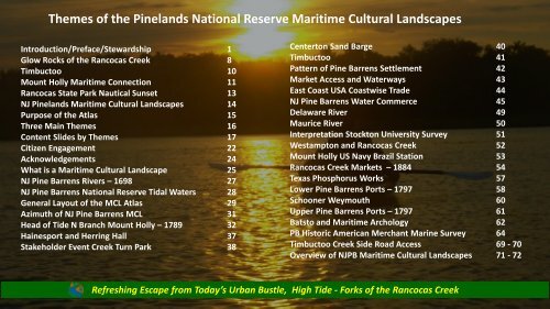
- Page 1 and 2: “The most wild, visionary, mad pr
- Page 3 and 4: Preface: Conventional Wisdom Holist
- Page 5 and 6: America’s Pinelands National Rese
- Page 7 and 8: Lies here the hull of an old ship S
- Page 9 and 10: Q u a r t z i te / S i l i c e o u
- Page 11 and 12: Mosaic - Warm Ambiance - Reflection
- Page 13 and 14: S A d v o c a c y C r e a te s E n
- Page 15 and 16: Pinelands National Reserve Maritime
- Page 17: Three Themes of the Holistic Narrat
- Page 21 and 22: Citizen science is widely recognize
- Page 23 and 24: Acknowledgements and Conventional W
- Page 25 and 26: 1944 B-17 Flight Over Mount Holly A
- Page 27 and 28: Maritime Cultural Landscapes Connec
- Page 29 and 30: Pinelands National Reserve Tidewate
- Page 31 and 32: North Branch Rancocas Creek - Monro
- Page 33 and 34: Mount Holly National Historic Distr
- Page 35 and 36: Value of Navigable Waterways and Ma
- Page 37 and 38: A survey of the roads of the United
- Page 39 and 40: Rancocas Pathways 39
- Page 41 and 42: Rancocas Creek Water Trail Mile 20
- Page 43 and 44: Pinelands National Reserve, America
- Page 45 and 46: Rancocas Creek East Coast Maritime
- Page 47 and 48: Pine Barrens Maritime Ports and Coa
- Page 49 and 50: Sphagnum Moss Oysters (pine or ceda
- Page 51 and 52: Key - Highlighted waters Pine Barre
- Page 53 and 54: 1876 Maurice River Shipyards Ref: C
- Page 55 and 56: Almost 400 years of Maritime Trade
- Page 57 and 58: 1884 Commercial Statistics Barge Mo
- Page 59 and 60: New Jersey 1797 - Lower Pine Barren
- Page 61 and 62: Absegami yesteryear / By Jack E. Bo
- Page 63 and 64: Charles Read is credited with build
- Page 65 and 66: Rancocas Pathways 65
- Page 67 and 68: Batsto Citizens Gazette of 1987, R.
- Page 69 and 70:
Historic American Merchant Marine S
- Page 71 and 72:
Silence, Preserve Thee Resting Soul
- Page 73 and 74:
Detailed Descriptions NJ Pinelands
- Page 75 and 76:
What Are the NJ Pine Barrens ? NJ P
- Page 77 and 78:
New Jersey Pinelands National Reser
- Page 79 and 80:
Mount Holly Toms River NJ Pine Barr
- Page 81 and 82:
Approximate Location NJ Pinelands S
- Page 83 and 84:
Rancocas Creek Sand Barge New Jerse
- Page 85 and 86:
West Jersey and NJ Pinelands Nation
- Page 87 and 88:
Tidal bench marks of Pine Barrens O
- Page 89 and 90:
Colonial Admiralty Courts and New J
- Page 91 and 92:
Letter of Marque Reference: C. Kiet
- Page 93 and 94:
October 22, 1778 New Jersey Admiral
- Page 95 and 96:
Revolutionary War Admiralty Courts
- Page 97 and 98:
New Jersey Pinelands National Reser
- Page 99 and 100:
A Sense of Place - Pine Barrens Gla
- Page 101 and 102:
Pinelands Pinelands “Core” Area
- Page 103 and 104:
Fernwood Springs - Pine Barrens Wes
- Page 105 and 106:
Human Impacts on the Pine Barrens a
- Page 107 and 108:
Tuckerton/Tuckerton Sea Port/Ship Y
- Page 109 and 110:
1863 Description of the Pine Barren
- Page 111 and 112:
Western Outflow NJ Pinelands Nation
- Page 113 and 114:
New Jersey Pinelands National Reser
- Page 115 and 116:
Fernwood Springs, Last remaining At
- Page 117 and 118:
NJ Pinelands National Reserve Marit
- Page 119 and 120:
Rancocas Pathways 119
- Page 121 and 122:
NJ Pinelands National Reserve Trifi
- Page 123 and 124:
Navigable Waterways of the South Je
- Page 125 and 126:
British Military Headquarters Map W
- Page 127 and 128:
Rancocas Creek Pinelands National R
- Page 129 and 130:
What Stands Out ? 400 Years Maritim
- Page 131 and 132:
Courtesy RF. Early Rancocas Creek W
- Page 133 and 134:
Stone Quarry Landing - Rancocas Sta
- Page 135 and 136:
135
- Page 137 and 138:
1639 Dutch Navigation Chart Delawar
- Page 139 and 140:
Burlington Island , Delaware River
- Page 141 and 142:
Tidal Maritime Industrial Pinelands
- Page 143 and 144:
Rancocas Drainage Beaver Trade эк
- Page 145 and 146:
Approximate Location Rancocas Creek
- Page 147 and 148:
Rancocas Creek Navigation Channel i
- Page 149 and 150:
Annie Van Sciver Rancocas Creek Ref
- Page 151 and 152:
North Branch Rancocas Creek Water T
- Page 153 and 154:
Timbuctoo 138 Miles from Delaware C
- Page 155 and 156:
Timbuctoo Heritage Area Way Point N
- Page 157 and 158:
Benjamin Lundy , the moist unwearie
- Page 159 and 160:
In boats marked by a yellow light h
- Page 161 and 162:
Underground Railroad Stops in the N
- Page 163 and 164:
Timbuctoo is an unincorporated comm
- Page 165 and 166:
Timbuctoo Civil War Cemetery Brickw
- Page 167 and 168:
Timbuctoo - Jetty Civil War Soldier
- Page 169 and 170:
Low Tide Rancocas Creek Outflow in
- Page 171 and 172:
Timbuctoo Wooden Structure Tidal Ch
- Page 173 and 174:
Timbuctoo North Branch Back Marsh C
- Page 175 and 176:
Glossy Ibis Centerton N Branch Chan
- Page 177 and 178:
Year Round Resident American Bald E
- Page 179 and 180:
Leave Nothing But a Ripple Behind R
- Page 181 and 182:
ef: frank leslies weekly newspaper
- Page 183 and 184:
Registered National Historic Distri
- Page 185 and 186:
Female Wood Duck - Old Mill - Mount
- Page 187 and 188:
North Branch Rancocas Creek Headwat
- Page 189 and 190:
Whites Bog State and National Histo
- Page 191 and 192:
Historic Smithville: Industrializat
- Page 193 and 194:
Grass-Roots Civic Engagement BMP: C
- Page 195 and 196:
350000 June - 1909 Partial Value of
- Page 197 and 198:
Rancocas Creek N Branch Oxbow Chann
- Page 199 and 200:
N Branch is Joined By Mount Holly M
- Page 201 and 202:
Leave No Trace - Mount Holly Iron W
- Page 203 and 204:
Exploring Historic Pathways, Discov
- Page 205 and 206:
Mount Holly Head of Tide Rancocas P
- Page 207 and 208:
Nautical Sunset N Branch Rancocas S
- Page 209 and 210:
Iron Works Hill - N Branch Rancocas
- Page 211 and 212:
Historic Court House and Prison Nat
- Page 213 and 214:
Burlington County Lyceum and Widow
- Page 215 and 216:
Mount Holly new Jersey A National H
- Page 217 and 218:
Mt. Holly’s Flood Control Bypass
- Page 219 and 220:
Mount Holly N Branch Rancocas Creek
- Page 221 and 222:
Mount Holly North Branch Rancocas C
- Page 223 and 224:
Rancocas Pathways 223
- Page 225 and 226:
Highly Proable Tidal Flash Boards a
- Page 227 and 228:
Mt. Holly Tidal Tidal Flash Boards
- Page 229 and 230:
General George Washington was alrea
- Page 231 and 232:
Henry Inman 1832 231
- Page 233 and 234:
1942 Tidal Weir under Construction
- Page 235 and 236:
1941 Flood Channel - Mount Holly -
- Page 237 and 238:
Kayaking West - Leaving Mount Holly
- Page 239 and 240:
Remains of 1700’s Tidal Tide Mill
- Page 241 and 242:
Timbuctoo Heritage Area Way Point N
- Page 243 and 244:
North Branch Remains of Hainesport
- Page 245 and 246:
Rancocas Creek Migratory Pathway Mo
- Page 247 and 248:
1875 Charles Stokes Rancocas Creek
- Page 249 and 250:
Rancocas State Park Western Border
- Page 251 and 252:
North Branch The Forks of the Ranco
- Page 253 and 254:
Artwork by Hainesport resident Fran
- Page 255 and 256:
1924 Rancocas Pathways 255
- Page 257 and 258:
Stewardship South Branch Hainesport
- Page 259 and 260:
Tonnage Tonnage Arrival Tons South
- Page 261 and 262:
Creek Turn Sand Mine South Branch R
- Page 263 and 264:
H a i n e s p o r t Rancocas Pathwa
- Page 265 and 266:
Rock products. v.16 no.2 May 22 191
- Page 267 and 268:
Multi-Use - It Takes Many Drops to
- Page 269 and 270:
Commerce & Sand Markets Barges 300-
- Page 271 and 272:
R.S.P. Rancocas River Westampton R.
- Page 273 and 274:
Stone Quarry Landing Hainesport 273
- Page 275 and 276:
Hainesport at 56 Ton Typical of Ran
- Page 277 and 278:
1875 Riparian Chart Hainesport Hous
- Page 279 and 280:
Hainesport South Branch Rancocas Ho
- Page 281 and 282:
Hainesport Landing Ray Stork Collec
- Page 283 and 284:
George Pettino’s Lumberton Sand P
- Page 285 and 286:
Creek Turn Park South Branch Haines
- Page 287 and 288:
287
- Page 289 and 290:
Lumberton 1876 Charcoal Mill - Stee
- Page 291 and 292:
Old Sand Mine - South Branch Rancoc
- Page 293 and 294:
After Rancocas Creek Service Steams
- Page 295 and 296:
Snapping Turtle Old Sand Mine Site
- Page 297 and 298:
Atsion and Batsto Forges Rancocas P
- Page 299 and 300:
Port of Philadelphia Delaware River
- Page 301 and 302:
Tip of the Hat 2 Weldon Storey Lumb
- Page 303 and 304:
140 sqm 30 foot fall 590 Horsepower
- Page 305 and 306:
Lumberton to the Delaware River Fed
- Page 307 and 308:
Lucifer Came A Calling - Texas - Ph
- Page 309 and 310:
Rancocas Creek Centreton Area Wreck
- Page 311 and 312:
Rancocas Creek Water Trail South Ba
- Page 313 and 314:
March 1909 Exploring Historic Pathw
- Page 315 and 316:
Rancocas River J.W. Paxson Details
- Page 317 and 318:
Golden Age of Steam
- Page 319 and 320:
Moorestown’s Maritime Moorestown-
- Page 321 and 322:
Willingboro 1842 Note Landings on R
- Page 323 and 324:
Tug and Barge Graveyard - Willingbo
- Page 325 and 326:
Works Progress Administration Landi
- Page 327 and 328:
1876 Shad Fishing Rancocas Creek 18
- Page 329 and 330:
Rancocas River Aids to Navigation a
- Page 331 and 332:
Aid to Navigation Presented by Ranc
- Page 335 and 336:
Back in the day when a Rancocas Cre
- Page 337 and 338:
Maritime Commerce Reference: 1849 R
- Page 339 and 340:
Rancocas Pathways 339
- Page 341 and 342:
Rancocas Pathways 341
- Page 343 and 344:
Reference: Shipman Mansion Red Drag
- Page 345 and 346:
Tracy Mueller Collection Main Stem
- Page 347 and 348:
Approximate 30 miles East Whites Bo
- Page 349:
Toms River Rancocas Pathways 349
- Page 352 and 353:
Logging Ocean County New Jersey Eas
- Page 354 and 355:
Cassville Alligator Lakewood In the
- Page 356 and 357:
Toms River Court of Admiralty Revol
- Page 358:
Mullica, Batsto, Wading Rivers Flow
- Page 361 and 362:
Batsto Lake Non-Tidal Landing 361
- Page 363 and 364:
Jersey Coast 1770’s Mullica River
- Page 365:
Rancocas Pathways 365
- Page 368:
I believe that an advisory board fr
- Page 373 and 374:
Revolutionary War Captured Goods Tr
- Page 375 and 376:
Atlantic County, the Great Bay MCL
- Page 377 and 378:
Evolution of MCL’s Commercial Her
- Page 379 and 380:
Batsto Store Book 1830’s (Imports
- Page 381:
Great Egg Harbor River 5 4 1 Egg Ha
- Page 384 and 385:
Egg Harbor Melon Seed 1883 NJ Pine
- Page 386 and 387:
. Historic American Merchant Marine
- Page 388 and 389:
South Tuckahoe South Tuckahoe was e
- Page 390 and 391:
Great Egg Harbor River and Landings
- Page 392 and 393:
Shipbuilding in Atlantic County/ A
- Page 394 and 395:
Whaleboat Privateer’s - When capt
- Page 396 and 397:
Great Egg Harbor National Wild and
- Page 398 and 399:
Weymouth Truths vs. Fables Weymouth
- Page 400 and 401:
Townbank - Cape May County When the
- Page 402 and 403:
Lewis Cresse, two months of the Del
- Page 404 and 405:
Dennis Creek Mining Pine Barrens Bu
- Page 407 and 408:
Port Elizabeth - Maurice River - So
- Page 409 and 410:
Burlington (Delaware River) to Lowe
- Page 411 and 412:
1771 Maurice River Commerce 1933 19
- Page 413 and 414:
Navigation Chart Delaware Bay, Maur
- Page 415 and 416:
Port Elizabeth Sand Mining - Since
- Page 417 and 418:
The Warner Company's origins traced
- Page 419 and 420:
Batsto Boundary NJ Pinelands Tucker
- Page 421 and 422:
Platform For Your Maritime Operatio
- Page 423 and 424:
Port of Philadelphia Harbor Pinelan
- Page 425 and 426:
Rancocas Pathways 425
- Page 427 and 428:
In 1921 according to the Soil Surve
- Page 429 and 430:
Pinelands National Reserve Maurice
- Page 431 and 432:
Schooner Landing NJPLNR Maurice Riv
- Page 433 and 434:
Photos from the web site of the Mau
- Page 435 and 436:
NJ’s Oyster Fleet Early 1900’s
- Page 437 and 438:
Oyster Harvesting Tools and the Oys
- Page 439 and 440:
NJPLNR MCL Resource www.bayshorecen
- Page 441 and 442:
Maurice River Ship Maintenance Stru
- Page 443 and 444:
NJ Pinelands National Reserve MCL
- Page 446 and 447:
Cohansey River Bridgeton Sailing ou
- Page 448 and 449:
1852 10 January 1851 1853 Rancocas
- Page 450 and 451:
Cohansey River Landings 1876 Rancoc
- Page 452 and 453:
Rancocas Pathways 452
- Page 454 and 455:
John Dubois Maritime Museum 949 Ye
- Page 456 and 457:
Maurice River Ports, Shipyards, Lan
- Page 458 and 459:
Forgotten Towns of South Jersey Bec
- Page 460 and 461:
What is a Hinterland ? NJ Pinelands
- Page 462 and 463:
NJ Pinelands National Reserve Ship
- Page 464 and 465:
Lumbering Cedar Trees Soft, Durable
- Page 466 and 467:
NJ Pinelands National Reserve Marit
- Page 468 and 469:
Atlantic White Cedar Tree up to 80
- Page 470 and 471:
NJ Pine Barrens Atlantic White Ceda
- Page 472 and 473:
NJ Pine Barrens Maritime Cultural L
- Page 474 and 475:
NJ Pinelands National Reserve Marit
- Page 476 and 477:
Pinelands National Reserve Glass Wo
- Page 478 and 479:
In the day of sail and Steamer fast
- Page 480 and 481:
Photos Reference: Henry Ford Founda
- Page 482 and 483:
NJ Pinelands National Reserve Rail
- Page 484 and 485:
NJ Pinelands National Reserve Free
- Page 486 and 487:
Early Forges and Furnaces of South
- Page 488 and 489:
PLNR Charcoal Was Wagoned to Texas
- Page 490 and 491:
Charcoal Landings - Mays Landing -
- Page 492 and 493:
Activity for Kids & Maritime Relate
- Page 494 and 495:
Suggested Books...Suggesting books
- Page 496 and 497:
Appendix Pages 492 - 508 National W
- Page 498 and 499:
Planned Approach to Community Healt
- Page 500 and 501:
George Washington Papers 10 th Dece
- Page 502 and 503:
February 1778 British vessels and c
- Page 504 and 505:
2017 Patron Use Statistics Citizens
- Page 506:
Rancocas Pathways 506
- Page 509 and 510:
Rancocas Creek Cohansey River Mauri
- Page 511 and 512:
List of Plants Collected on Ship’


