Britannia Contaminated Sites Investigation Stage I Preliminary Site ...
Britannia Contaminated Sites Investigation Stage I Preliminary Site ...
Britannia Contaminated Sites Investigation Stage I Preliminary Site ...
You also want an ePaper? Increase the reach of your titles
YUMPU automatically turns print PDFs into web optimized ePapers that Google loves.
on it, and a 2-storey shack were all that remained (Price, Schwab, Hutt 1995). A prominent band<br />
of blue-green coloured staining running down the stream bed of a seepage emerging from the<br />
portal was identified as copper-rich and slightly acidic(Price, Schwab, Hutt 1995).<br />
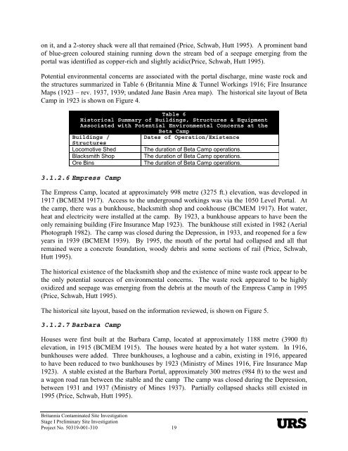
Potential environmental concerns are associated with the portal discharge, mine waste rock and<br />
the structures summarized in Table 6 (<strong>Britannia</strong> Mine & Tunnel Workings 1916; Fire Insurance<br />
Maps (1923 – rev. 1937, 1939; undated Jane Basin Area map). The historical site layout of Beta<br />
Camp in 1923 is shown on Figure 4.<br />
Table 6<br />
Historical Summary of Buildings, Structures & Equipment<br />
Associated with Potential Environmental Concerns at the<br />
Beta Camp<br />
Buildings /<br />
Dates of Operation/Existence<br />
Structures<br />
Locomotive Shed The duration of Beta Camp operations.<br />
Blacksmith Shop The duration of Beta Camp operations.<br />
Ore Bins The duration of Beta Camp operations.<br />
3.1.2.6 Empress Camp<br />
The Empress Camp, located at approximately 998 metre (3275 ft.) elevation, was developed in<br />
1917 (BCMEM 1917). Access to the underground workings was via the 1050 Level Portal. At<br />
the camp, there was a bunkhouse, blacksmith shop and cookhouse (BCMEM 1917). Hot water,<br />
heat and electricity were installed at the camp. By 1923, a bunkhouse appears to have been the<br />
only remaining building (Fire Insurance Map 1923). The bunkhouse still existed in 1982 (Aerial<br />
Photograph 1982). The camp was closed during the Depression, in 1933, and reopened for a few<br />
years in 1939 (BCMEM 1939). By 1995, the mouth of the portal had collapsed and all that<br />
remained were a concrete foundation, woody debris and some sections of rail (Price, Schwab,<br />
Hutt 1995).<br />
The historical existence of the blacksmith shop and the existence of mine waste rock appear to be<br />
the only potential sources of environmental concerns. The waste rock appeared to be highly<br />
oxidized and seepage was emerging from the debris at the mouth of the Empress Camp in 1995<br />
(Price, Schwab, Hutt 1995).<br />
The historical site layout, based on the information reviewed, is shown on Figure 5.<br />
3.1.2.7 Barbara Camp<br />
Houses were first built at the Barbara Camp, located at approximately 1188 metre (3900 ft)<br />
elevation, in 1915 (BCMEM 1915). The houses were heated by a hot water system. In 1916,<br />
bunkhouses were added. Three bunkhouses, a loghouse and a cabin, existing in 1916, appeared<br />
to have been reduced to two bunkhouses by 1923 (Ministry of Mines 1916, Fire Insurance Map<br />
1923). A stable existed at the Barbara Portal, approximately 300 metres (984 ft) to the west and<br />
a wagon road ran between the stable and the camp The camp was closed during the Depression,<br />
between 1931 and 1937 (Ministry of Mines 1937). Partially collapsed shacks still existed in<br />
1995 (Price, Schwab, Hutt 1995).<br />
<strong>Britannia</strong> <strong>Contaminated</strong> <strong>Site</strong> <strong>Investigation</strong><br />
<strong>Stage</strong> I <strong>Preliminary</strong> <strong>Site</strong> <strong>Investigation</strong><br />
Project No. 50319-001-310 19


