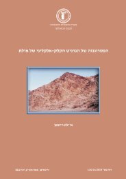
The Geology of the Elat Sheet Explanatory Notes
The Geology of the Elat Sheet Explanatory Notes
The Geology of the Elat Sheet Explanatory Notes
Create successful ePaper yourself
Turn your PDF publications into a flip-book with our unique Google optimized e-Paper software.
1. Introduction<br />
Three major processes controlled <strong>the</strong> geological and geomorphological evolution <strong>of</strong> <strong>the</strong><br />
<strong>Elat</strong> area: 1) <strong>The</strong> creation <strong>of</strong> <strong>the</strong> Arabian-Nubian Shield during <strong>the</strong> Neoproterozoic as part<br />
<strong>of</strong> <strong>the</strong> East African Orogen and <strong>the</strong> enclosure <strong>of</strong> <strong>the</strong> Mozambique Ocean between <strong>the</strong> east<br />
and west Gondwana plates; 2) Accumulation <strong>of</strong> <strong>the</strong> Cambrian to Eocene sedimentary<br />
sequence on <strong>the</strong> Arabian Plate at <strong>the</strong> sou<strong>the</strong>ast margins <strong>of</strong> <strong>the</strong> paleo-Tethys and Tethys<br />
Sea; 3) <strong>The</strong> Miocene to Recent evolution <strong>of</strong> <strong>the</strong> Dead Sea Transform, a sinistral fault,<br />
which is <strong>the</strong> plate boundary between <strong>the</strong> Arabian Plate to <strong>the</strong> east and <strong>the</strong> African Plate to<br />
<strong>the</strong> west.<br />
<strong>The</strong> stratigraphy and structure <strong>of</strong> <strong>the</strong> well-exposed rocks in <strong>the</strong> extreme arid desert<br />
climate <strong>of</strong> <strong>the</strong> <strong>Elat</strong> area document <strong>the</strong> evolution <strong>of</strong> <strong>the</strong>se three processes and thus make<br />
<strong>the</strong> geology <strong>of</strong> <strong>the</strong> <strong>Elat</strong> <strong>Sheet</strong> so unique.<br />
<strong>The</strong>refore <strong>the</strong> extensive research done in <strong>the</strong> <strong>Elat</strong> area has turned this region into a field<br />
laboratory for geoscience students. <strong>The</strong> <strong>Elat</strong> <strong>Sheet</strong> geological map was prepared as part <strong>of</strong><br />
<strong>the</strong> 1: 50,000 scale geological mapping project <strong>of</strong> <strong>the</strong> Geological Survey <strong>of</strong> Israel and is<br />
based on previous maps updated by field work during <strong>the</strong> present study. This most recent<br />
effort <strong>of</strong> very detailed mapping was carried out on a 1:10,000 average scale using GIS<br />
and orthophoto as <strong>the</strong> base map.<br />
2. Geomorphology<br />
<strong>The</strong> eastern part <strong>of</strong> <strong>the</strong> <strong>Elat</strong> <strong>Sheet</strong> comprises <strong>the</strong> up-to 1,000 meters deep structural basins<br />
<strong>of</strong> <strong>the</strong> sou<strong>the</strong>rn Arava (Frieslander, 2000) and <strong>the</strong> Gulf <strong>of</strong> Aqaba/<strong>Elat</strong> with a water depth<br />
<strong>of</strong> up to 1,500 m (Sade et al., 2008). <strong>The</strong> geomorphological expression <strong>of</strong> <strong>the</strong>se<br />
depressions on land are <strong>the</strong> Avrona playa, <strong>Elat</strong> sabkha and <strong>the</strong> alluvial fans <strong>of</strong> <strong>the</strong> rivers<br />
draining eastward. <strong>The</strong> ephemeral rivers (wadis) draining into <strong>the</strong> sou<strong>the</strong>rn Arava and <strong>the</strong><br />
gulf are from south to north are: Taba and it's tributary Gishron, Shelomo, Gar<strong>of</strong>,<br />
Shahmon, Netafim, Roded with its tributary Yael, Shehoret, Amram, Zefunot, Avrona<br />
with its tributary Nizoz, and Raham with it's tributaries Shelalgon, Shani and Uzia. Most<br />
<strong>of</strong> <strong>the</strong>se rivers are incising at <strong>the</strong>ir upper parts, <strong>the</strong> sedimentary rocks <strong>of</strong> <strong>the</strong> Shelomo<br />
Graben on <strong>the</strong> west <strong>the</strong> metamorphic-magmatic rocks <strong>of</strong> <strong>the</strong> Roded and <strong>Elat</strong> blocks to <strong>the</strong><br />
sou<strong>the</strong>ast and Amram Block at <strong>the</strong> north. <strong>The</strong> topographic elevation in <strong>the</strong> east ranges<br />
from sea level to +40 m in <strong>the</strong> Avrona playa. <strong>The</strong> elevation in <strong>the</strong> west ranges from 700<br />
m at Mt. Shelomo to more than 800 m at Mt. Hizkyhu and Mt. Neshef. This sharp<br />
difference in east-west relief which spans less than 15 km is <strong>the</strong> major reason for <strong>the</strong><br />
canyon morphology <strong>of</strong> <strong>the</strong>se ephemeral rivers. Changes <strong>of</strong> stream direction as at Mt.<br />
Amram (Beyth and Mushkin, 2010), <strong>of</strong> <strong>the</strong> Shehoret and Roded rivers (Weissbrod and<br />
Sneh, 1990) and <strong>the</strong> "capture" <strong>of</strong> <strong>the</strong> Gishron by <strong>the</strong> Yehoshafat River (Eyal, 1967) were<br />
controlled by <strong>the</strong> young Pliocene, Pleistocene and Holocene tectonic activity <strong>of</strong> <strong>the</strong> Dead<br />
Sea Transform and its margins. Garfunkel (1970) presented a detailed study <strong>of</strong> <strong>the</strong> young<br />
stages <strong>of</strong> <strong>the</strong> evolution <strong>of</strong> <strong>the</strong> rift margins in <strong>the</strong> sou<strong>the</strong>rn Arava (Figs. 1&2).<br />
1


